

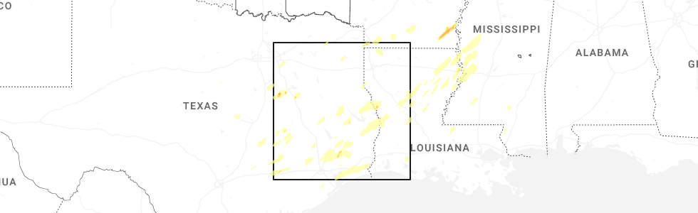
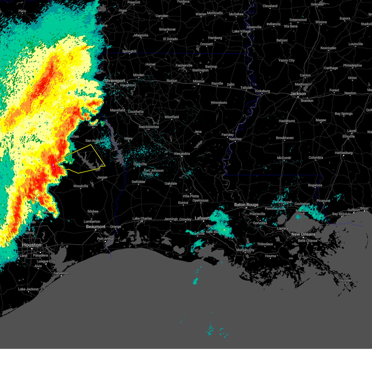
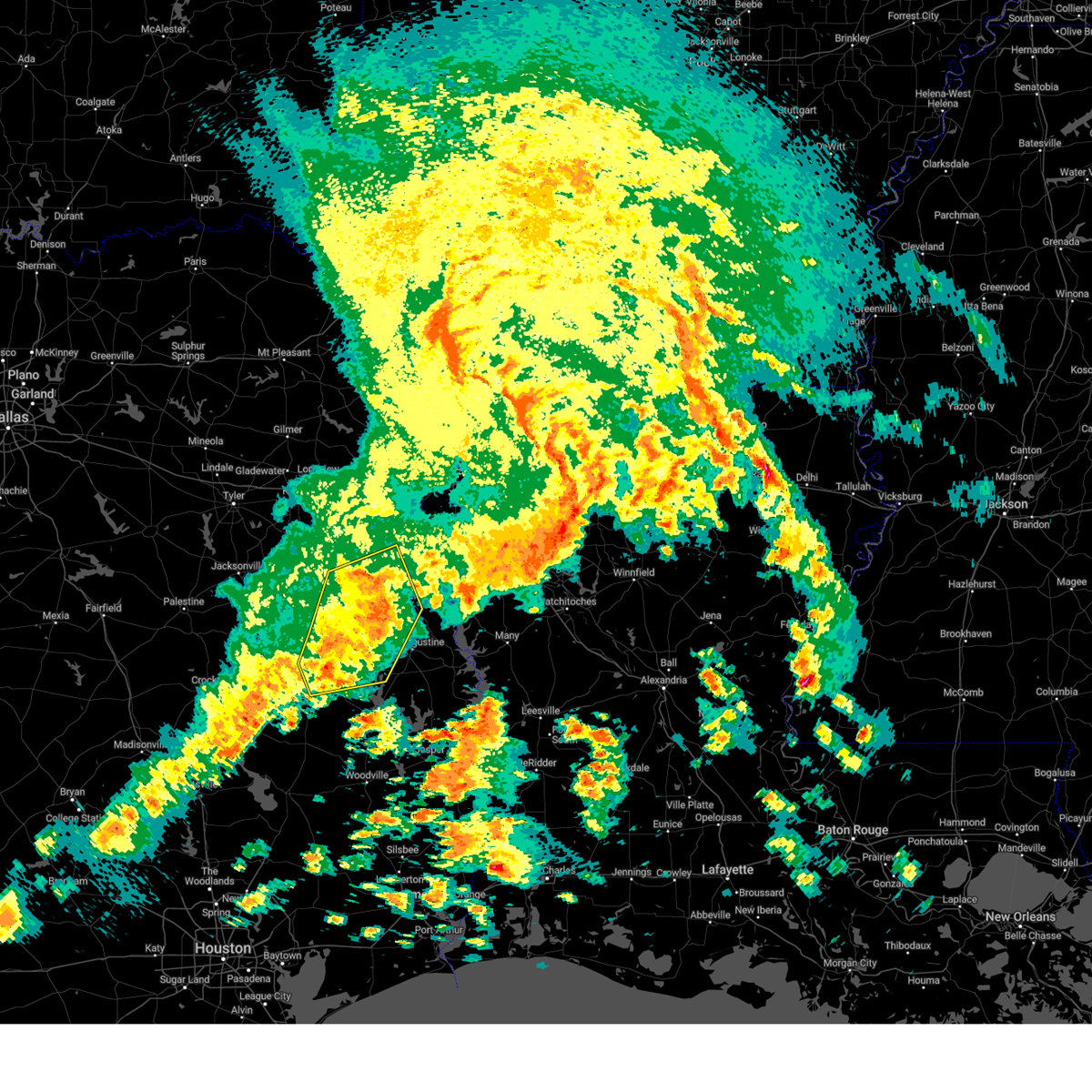
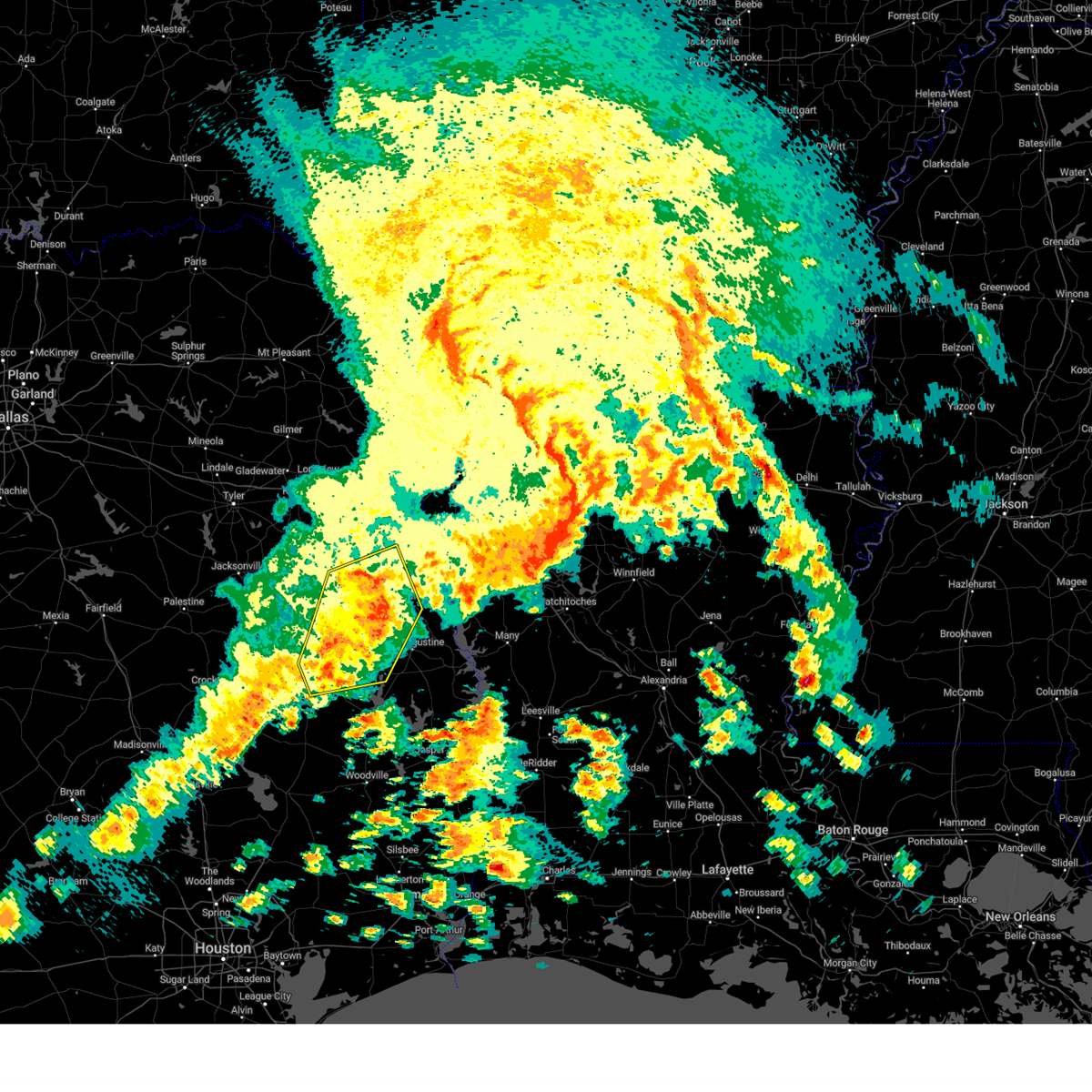
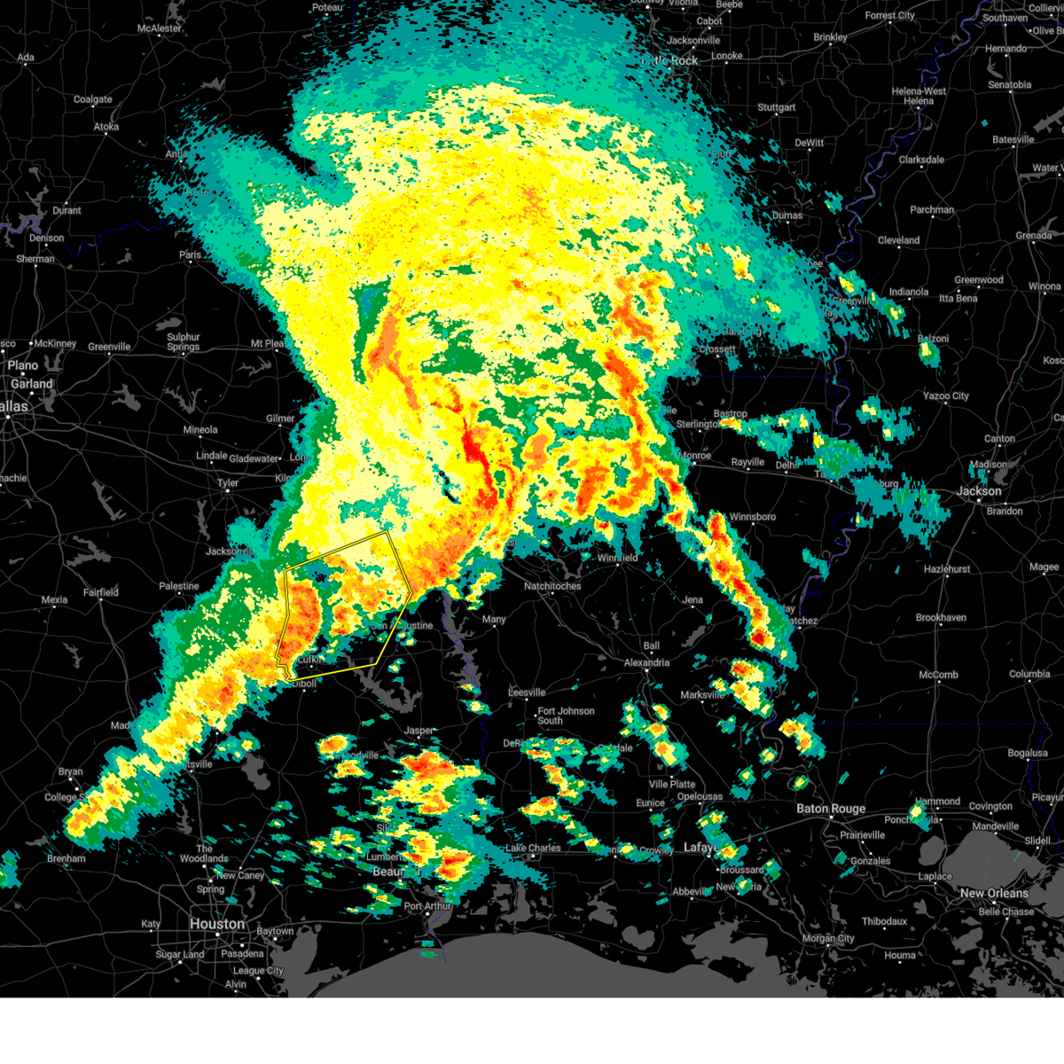
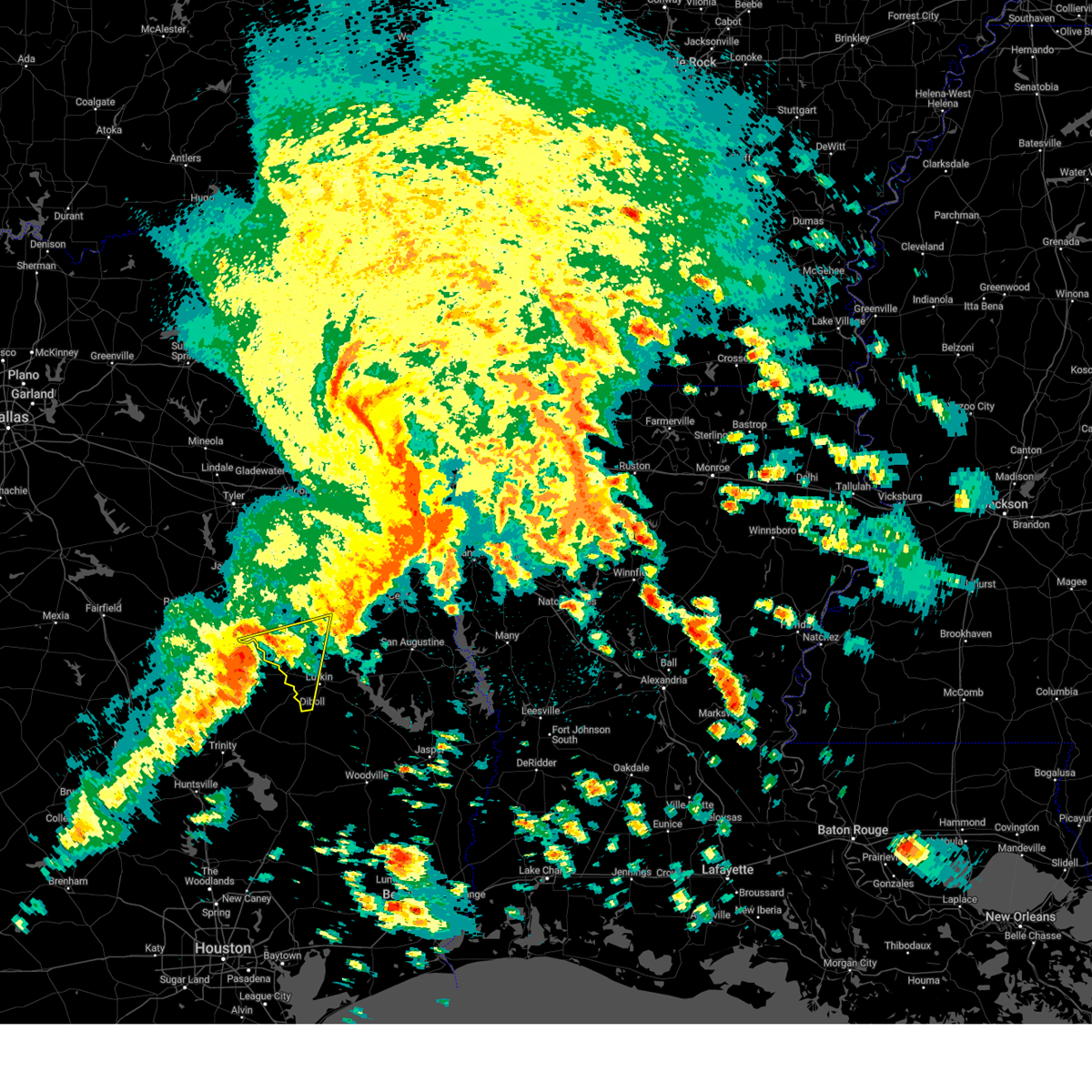
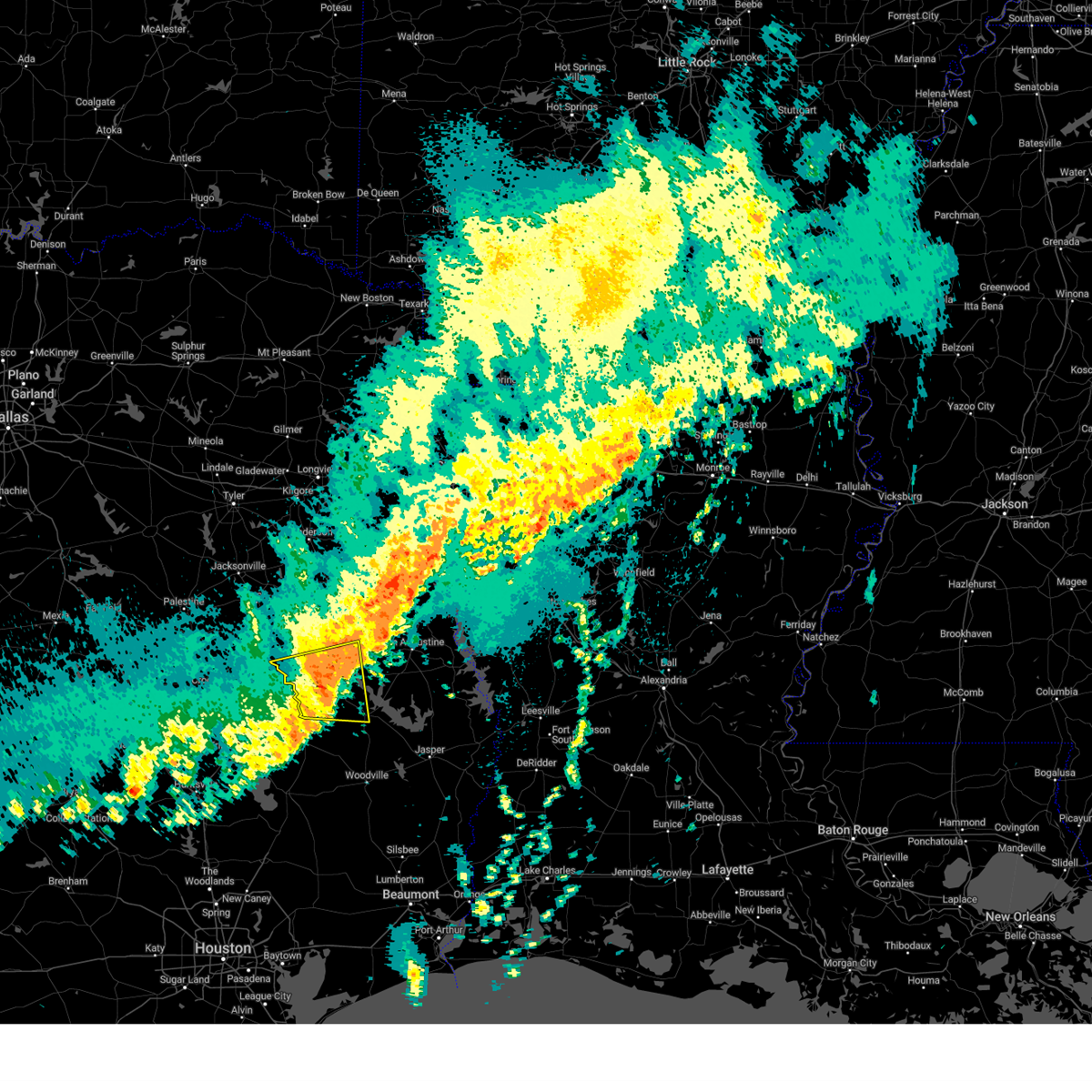
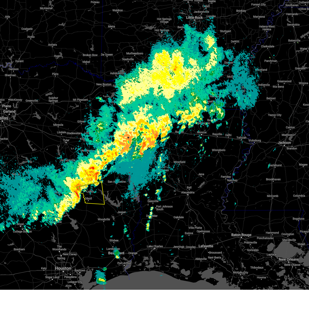
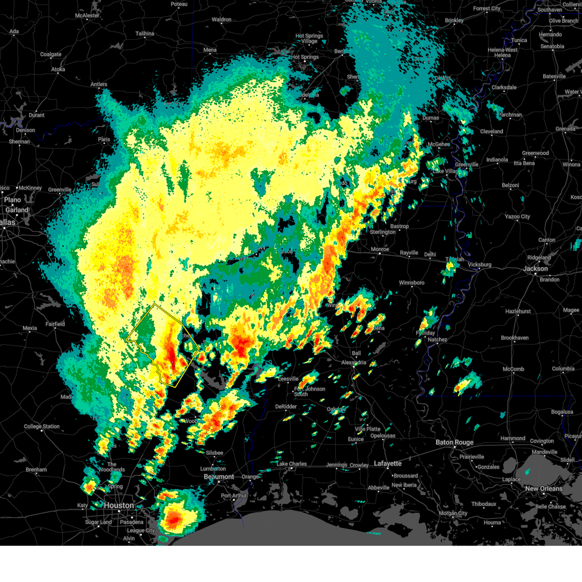
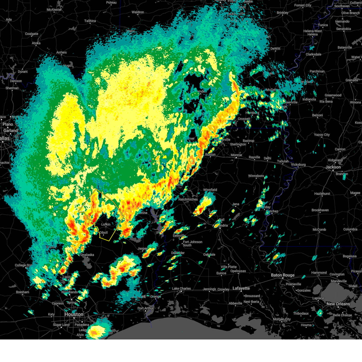
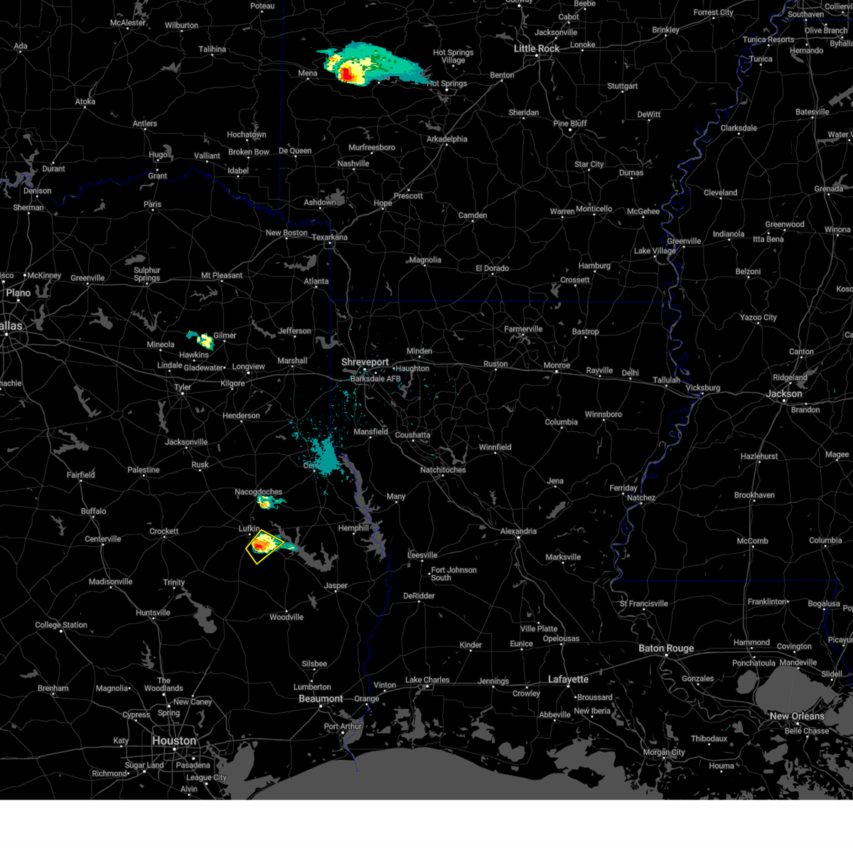
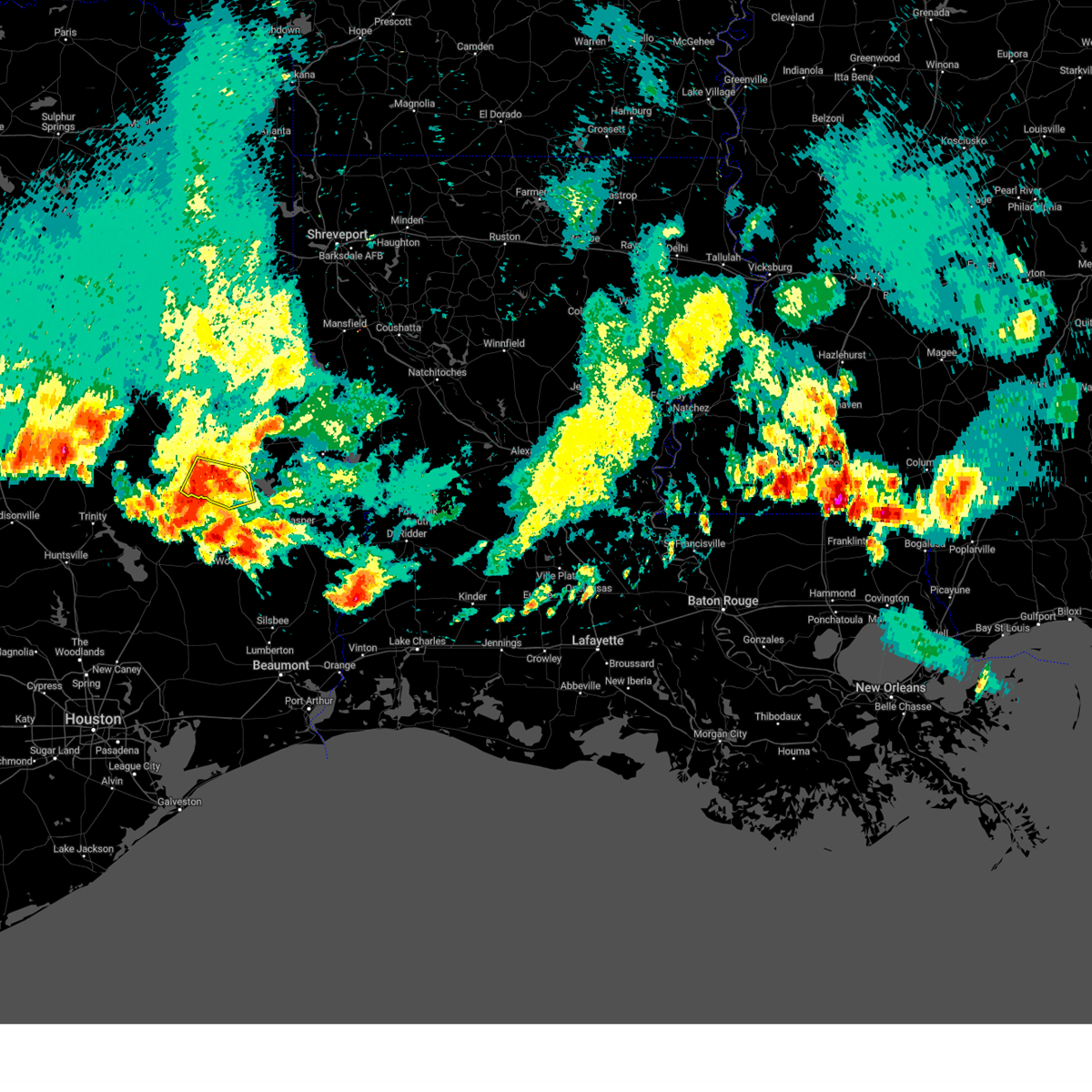
Hail Map for Lufkin, TX
The Lufkin, TX area has had 15 reports of on-the-ground hail by trained spotters, and has been under severe weather warnings 15 times during the past 12 months. Doppler radar has detected hail at or near Lufkin, TX on 75 occasions, including 4 occasions during the past year.
| Name: | Lufkin, TX |
| Where Located: | 0.8 miles S of Lufkin, TX |
| Map: | Google Map for Lufkin, TX |
| Population: | 35067 |
| Housing Units: | 14183 |
| More Info: | Search Google for Lufkin, TX |
2
The Top Recent Hail Date for Lufkin, TX is Saturday, December 28, 2024 (10th out of 75)
Hail and Wind Damage Spotted near Lufkin, TX
| Date / Time | Report Details |
|---|---|
| 6/12/2025 5:41 AM CDT | At 541 am cdt, a severe thunderstorm was located 7 miles northwest of corrigan, or 9 miles southwest of diboll, moving north at 35 mph (radar indicated). Hazards include quarter size hail. Damage to vehicles is expected. Locations impacted include, lufkin, diboll, and burke. |
| 6/12/2025 5:36 AM CDT | Svrshv the national weather service in shreveport has issued a * severe thunderstorm warning for, southwestern angelina county in eastern texas, * until 600 am cdt. * at 535 am cdt, a severe thunderstorm was located near corrigan, or 10 miles southwest of diboll, moving north at 35 mph (radar indicated). Hazards include quarter size hail. damage to vehicles is expected |
| 5/27/2025 12:05 AM CDT |
 Svrshv the national weather service in shreveport has issued a * severe thunderstorm warning for, southeastern nacogdoches county in eastern texas, angelina county in eastern texas, southern san augustine county in eastern texas, southwestern sabine county in eastern texas, * until 1245 am cdt. * at 1205 am cdt, a severe thunderstorm was located near diboll, moving east at 50 mph (radar indicated). Hazards include 60 mph wind gusts and quarter size hail. Hail damage to vehicles is expected. Expect wind damage to roofs, siding, and trees. Svrshv the national weather service in shreveport has issued a * severe thunderstorm warning for, southeastern nacogdoches county in eastern texas, angelina county in eastern texas, southern san augustine county in eastern texas, southwestern sabine county in eastern texas, * until 1245 am cdt. * at 1205 am cdt, a severe thunderstorm was located near diboll, moving east at 50 mph (radar indicated). Hazards include 60 mph wind gusts and quarter size hail. Hail damage to vehicles is expected. Expect wind damage to roofs, siding, and trees.
|
| 5/6/2025 4:20 PM CDT |
 At 420 pm cdt, severe thunderstorms were located along a line extending from 6 miles south of pinehill to near garrison to near woden, moving northeast at 65 mph (radar indicated). Hazards include 60 mph wind gusts and quarter size hail. Hail damage to vehicles is expected. expect wind damage to roofs, siding, and trees. Locations impacted include, lufkin, melrose, jericho, stockman, central, nacogdoches, chireno, redland, dotson, martinsville, neuville, appleby, center, denning, james, tenaha, hudson, woden, clawson, and lawsonville. At 420 pm cdt, severe thunderstorms were located along a line extending from 6 miles south of pinehill to near garrison to near woden, moving northeast at 65 mph (radar indicated). Hazards include 60 mph wind gusts and quarter size hail. Hail damage to vehicles is expected. expect wind damage to roofs, siding, and trees. Locations impacted include, lufkin, melrose, jericho, stockman, central, nacogdoches, chireno, redland, dotson, martinsville, neuville, appleby, center, denning, james, tenaha, hudson, woden, clawson, and lawsonville.
|
| 5/6/2025 4:20 PM CDT |
 the severe thunderstorm warning has been cancelled and is no longer in effect the severe thunderstorm warning has been cancelled and is no longer in effect
|
| 5/6/2025 4:02 PM CDT |
 Svrshv the national weather service in shreveport has issued a * severe thunderstorm warning for, southwestern panola county in northeastern texas, southeastern rusk county in northeastern texas, nacogdoches county in eastern texas, western shelby county in eastern texas, northwestern angelina county in eastern texas, northwestern san augustine county in eastern texas, southeastern cherokee county in northeastern texas, * until 445 pm cdt. * at 401 pm cdt, severe thunderstorms were located along a line extending from 8 miles northeast of sacul to near nacogdoches to hudson, moving northeast at 65 mph (radar indicated). Hazards include 60 mph wind gusts and quarter size hail. Hail damage to vehicles is expected. Expect wind damage to roofs, siding, and trees. Svrshv the national weather service in shreveport has issued a * severe thunderstorm warning for, southwestern panola county in northeastern texas, southeastern rusk county in northeastern texas, nacogdoches county in eastern texas, western shelby county in eastern texas, northwestern angelina county in eastern texas, northwestern san augustine county in eastern texas, southeastern cherokee county in northeastern texas, * until 445 pm cdt. * at 401 pm cdt, severe thunderstorms were located along a line extending from 8 miles northeast of sacul to near nacogdoches to hudson, moving northeast at 65 mph (radar indicated). Hazards include 60 mph wind gusts and quarter size hail. Hail damage to vehicles is expected. Expect wind damage to roofs, siding, and trees.
|
| 5/6/2025 4:02 PM CDT |
 the severe thunderstorm warning has been cancelled and is no longer in effect the severe thunderstorm warning has been cancelled and is no longer in effect
|
| 5/6/2025 3:21 PM CDT |
 Svrshv the national weather service in shreveport has issued a * severe thunderstorm warning for, northwestern nacogdoches county in eastern texas, northwestern angelina county in eastern texas, southeastern cherokee county in northeastern texas, * until 415 pm cdt. * at 321 pm cdt, severe thunderstorms were located along a line extending from 10 miles west of morrill to near lovelady, moving east at 40 mph (radar indicated). Hazards include 70 mph wind gusts and quarter size hail. Hail damage to vehicles is expected. expect considerable tree damage. Wind damage is also likely to mobile homes, roofs, and outbuildings. Svrshv the national weather service in shreveport has issued a * severe thunderstorm warning for, northwestern nacogdoches county in eastern texas, northwestern angelina county in eastern texas, southeastern cherokee county in northeastern texas, * until 415 pm cdt. * at 321 pm cdt, severe thunderstorms were located along a line extending from 10 miles west of morrill to near lovelady, moving east at 40 mph (radar indicated). Hazards include 70 mph wind gusts and quarter size hail. Hail damage to vehicles is expected. expect considerable tree damage. Wind damage is also likely to mobile homes, roofs, and outbuildings.
|
| 4/30/2025 11:38 PM CDT |
 The storm which prompted the warning has weakened below severe limits, and no longer poses an immediate threat to life or property. therefore, the warning will be allowed to expire. however, heavy rain is still possible with this thunderstorm. a severe thunderstorm watch remains in effect until 1200 am cdt for a portion of northeast texas. The storm which prompted the warning has weakened below severe limits, and no longer poses an immediate threat to life or property. therefore, the warning will be allowed to expire. however, heavy rain is still possible with this thunderstorm. a severe thunderstorm watch remains in effect until 1200 am cdt for a portion of northeast texas.
|
| 4/30/2025 11:11 PM CDT |
 Svrshv the national weather service in shreveport has issued a * severe thunderstorm warning for, angelina county in eastern texas, central nacogdoches county in eastern texas, southeastern cherokee county in northeastern texas, * until 1145 pm cdt. * at 1111 pm cdt, a severe thunderstorm was located 9 miles west of hudson, or 13 miles northwest of diboll, moving east at 45 mph (radar indicated). Hazards include 60 mph wind gusts and quarter size hail. Hail damage to vehicles is expected. Expect wind damage to roofs, siding, and trees. Svrshv the national weather service in shreveport has issued a * severe thunderstorm warning for, angelina county in eastern texas, central nacogdoches county in eastern texas, southeastern cherokee county in northeastern texas, * until 1145 pm cdt. * at 1111 pm cdt, a severe thunderstorm was located 9 miles west of hudson, or 13 miles northwest of diboll, moving east at 45 mph (radar indicated). Hazards include 60 mph wind gusts and quarter size hail. Hail damage to vehicles is expected. Expect wind damage to roofs, siding, and trees.
|
| 4/5/2025 2:35 PM CDT | Svrshv the national weather service in shreveport has issued a * severe thunderstorm warning for, nacogdoches county in eastern texas, southwestern shelby county in eastern texas, western angelina county in eastern texas, northwestern san augustine county in eastern texas, * until 315 pm cdt. * at 235 pm cdt, a severe thunderstorm was located over hudson, or near lufkin, moving northeast at 50 mph (radar indicated). Hazards include 60 mph wind gusts and quarter size hail. Hail damage to vehicles is expected. Expect wind damage to roofs, siding, and trees. |
| 3/4/2025 9:18 AM CST | Report from mping: roof blown of in angelina county TX, 1 miles SE of Lufkin, TX |
| 3/4/2025 8:45 AM CST |
 Svrshv the national weather service in shreveport has issued a * severe thunderstorm warning for, southwestern caddo parish in northwestern louisiana, western de soto parish in northwestern louisiana, angelina county in eastern texas, nacogdoches county in eastern texas, northwestern san augustine county in eastern texas, shelby county in eastern texas, southeastern cherokee county in northeastern texas, southern panola county in northeastern texas, southeastern rusk county in northeastern texas, * until 945 am cst. * at 845 am cst, severe thunderstorms were located along a line from 7 miles east of new salem to 5 miles southwest of wells, or along a line from 16 miles south of henderson to 18 miles northwest of lufkin, moving east at 40 mph (radar indicated). Hazards include 60 mph wind gusts and small hail. expect damage to roofs, siding, and trees Svrshv the national weather service in shreveport has issued a * severe thunderstorm warning for, southwestern caddo parish in northwestern louisiana, western de soto parish in northwestern louisiana, angelina county in eastern texas, nacogdoches county in eastern texas, northwestern san augustine county in eastern texas, shelby county in eastern texas, southeastern cherokee county in northeastern texas, southern panola county in northeastern texas, southeastern rusk county in northeastern texas, * until 945 am cst. * at 845 am cst, severe thunderstorms were located along a line from 7 miles east of new salem to 5 miles southwest of wells, or along a line from 16 miles south of henderson to 18 miles northwest of lufkin, moving east at 40 mph (radar indicated). Hazards include 60 mph wind gusts and small hail. expect damage to roofs, siding, and trees
|
| 12/28/2024 2:25 PM CST |
 The storm which prompted the warning has weakened below severe limits, and no longer poses an immediate threat to life or property. therefore, the warning will be allowed to expire. however, small hail is still possible with this thunderstorm. to report severe weather, contact your nearest law enforcement agency. they will send your report to the national weather service office. The storm which prompted the warning has weakened below severe limits, and no longer poses an immediate threat to life or property. therefore, the warning will be allowed to expire. however, small hail is still possible with this thunderstorm. to report severe weather, contact your nearest law enforcement agency. they will send your report to the national weather service office.
|
| 12/28/2024 1:40 PM CST |
 Svrshv the national weather service in shreveport has issued a * severe thunderstorm warning for, western angelina county in eastern texas, nacogdoches county in eastern texas, southeastern cherokee county in northeastern texas, southwestern rusk county in northeastern texas, * until 230 pm cst. * at 140 pm cst, a severe thunderstorm was located 6 miles southwest of wells, or 18 miles west of lufkin, moving northeast at 40 mph (radar indicated). Hazards include 60 mph wind gusts and quarter size hail. Hail damage to vehicles is expected. Expect wind damage to roofs, siding, and trees. Svrshv the national weather service in shreveport has issued a * severe thunderstorm warning for, western angelina county in eastern texas, nacogdoches county in eastern texas, southeastern cherokee county in northeastern texas, southwestern rusk county in northeastern texas, * until 230 pm cst. * at 140 pm cst, a severe thunderstorm was located 6 miles southwest of wells, or 18 miles west of lufkin, moving northeast at 40 mph (radar indicated). Hazards include 60 mph wind gusts and quarter size hail. Hail damage to vehicles is expected. Expect wind damage to roofs, siding, and trees.
|
| 7/7/2024 2:54 PM CDT | Trees down in the 900 block of old highway 5 in angelina county TX, 5.4 miles S of Lufkin, TX |
| 7/7/2024 2:53 PM CDT | Trees down in the 4600 block of highway 69 north just northwest of lufki in angelina county TX, 5.9 miles SE of Lufkin, TX |
| 7/7/2024 2:48 PM CDT | Trees down on bethlehem road in hudso in angelina county TX, 6.2 miles ESE of Lufkin, TX |
| 7/7/2024 2:30 PM CDT | Two trees were downed onto power lines near the intersection of fm 58 and southern driv in angelina county TX, 6.4 miles N of Lufkin, TX |
| 7/7/2024 2:26 PM CDT |
 Svrshv the national weather service in shreveport has issued a * severe thunderstorm warning for, west central nacogdoches county in eastern texas, angelina county in eastern texas, southeastern cherokee county in northeastern texas, * until 330 pm cdt. * at 226 pm cdt, severe thunderstorms were located along a line extending from 11 miles south of etoile to 6 miles southwest of huntington to near diboll, moving northwest at 35 mph (radar indicated. power lines have been downed in colmsneil in northern tyler county from these storms). Hazards include 60 mph wind gusts. expect damage to roofs, siding, and trees Svrshv the national weather service in shreveport has issued a * severe thunderstorm warning for, west central nacogdoches county in eastern texas, angelina county in eastern texas, southeastern cherokee county in northeastern texas, * until 330 pm cdt. * at 226 pm cdt, severe thunderstorms were located along a line extending from 11 miles south of etoile to 6 miles southwest of huntington to near diboll, moving northwest at 35 mph (radar indicated. power lines have been downed in colmsneil in northern tyler county from these storms). Hazards include 60 mph wind gusts. expect damage to roofs, siding, and trees
|
| 6/26/2024 2:53 PM CDT | Several reports of trees down in and around lufkin. time estimated by rada in angelina county TX, 1.1 miles NE of Lufkin, TX |
| 6/26/2024 2:50 PM CDT |
 Svrshv the national weather service in shreveport has issued a * severe thunderstorm warning for, south central sabine parish in northwestern louisiana, southeastern nacogdoches county in eastern texas, angelina county in eastern texas, southern san augustine county in eastern texas, southern sabine county in eastern texas, * until 330 pm cdt. * at 250 pm cdt, severe thunderstorms were located along a line extending from 8 miles north of toledo bend dam to 12 miles west of pineland to near hudson, moving southeast at 55 mph (radar indicated). Hazards include 60 mph wind gusts. expect damage to roofs, siding, and trees Svrshv the national weather service in shreveport has issued a * severe thunderstorm warning for, south central sabine parish in northwestern louisiana, southeastern nacogdoches county in eastern texas, angelina county in eastern texas, southern san augustine county in eastern texas, southern sabine county in eastern texas, * until 330 pm cdt. * at 250 pm cdt, severe thunderstorms were located along a line extending from 8 miles north of toledo bend dam to 12 miles west of pineland to near hudson, moving southeast at 55 mph (radar indicated). Hazards include 60 mph wind gusts. expect damage to roofs, siding, and trees
|
| 6/26/2024 2:12 PM CDT |
 Svrshv the national weather service in shreveport has issued a * severe thunderstorm warning for, central nacogdoches county in eastern texas, angelina county in eastern texas, central san augustine county in eastern texas, southern cherokee county in northeastern texas, * until 315 pm cdt. * at 211 pm cdt, severe thunderstorms were located along a line extending from near frankston to near douglass to 6 miles northwest of neuville, moving south at 40 mph (radar indicated). Hazards include 60 mph wind gusts. expect damage to roofs, siding, and trees Svrshv the national weather service in shreveport has issued a * severe thunderstorm warning for, central nacogdoches county in eastern texas, angelina county in eastern texas, central san augustine county in eastern texas, southern cherokee county in northeastern texas, * until 315 pm cdt. * at 211 pm cdt, severe thunderstorms were located along a line extending from near frankston to near douglass to 6 miles northwest of neuville, moving south at 40 mph (radar indicated). Hazards include 60 mph wind gusts. expect damage to roofs, siding, and trees
|
| 5/30/2024 6:49 PM CDT |
 Svrshv the national weather service in shreveport has issued a * severe thunderstorm warning for, western sabine parish in northwestern louisiana, eastern nacogdoches county in eastern texas, southern shelby county in eastern texas, angelina county in eastern texas, san augustine county in eastern texas, sabine county in eastern texas, * until 730 pm cdt. * at 649 pm cdt, severe thunderstorms were located along a line extending from near garrison to near woden to 7 miles southeast of apple springs, moving east at 65 mph (radar indicated). Hazards include 70 mph wind gusts. Expect considerable tree damage. Damage is likely to mobile homes, roofs, and outbuildings. Svrshv the national weather service in shreveport has issued a * severe thunderstorm warning for, western sabine parish in northwestern louisiana, eastern nacogdoches county in eastern texas, southern shelby county in eastern texas, angelina county in eastern texas, san augustine county in eastern texas, sabine county in eastern texas, * until 730 pm cdt. * at 649 pm cdt, severe thunderstorms were located along a line extending from near garrison to near woden to 7 miles southeast of apple springs, moving east at 65 mph (radar indicated). Hazards include 70 mph wind gusts. Expect considerable tree damage. Damage is likely to mobile homes, roofs, and outbuildings.
|
| 5/28/2024 12:45 PM CDT | Several trees down in the town of lufkin as well as diboll and etoil in angelina county TX, 1.5 miles SSE of Lufkin, TX |
| 5/28/2024 12:43 PM CDT | Large tree fell on a public pathway at ellen trout zoo... which caused closure of the zoo for remainder of the da in angelina county TX, 2.8 miles SSE of Lufkin, TX |
| 5/28/2024 12:42 PM CDT |
 Svrshv the national weather service in shreveport has issued a * severe thunderstorm warning for, central nacogdoches county in eastern texas, angelina county in eastern texas, southern san augustine county in eastern texas, southeastern cherokee county in northeastern texas, * until 130 pm cdt. * at 1242 pm cdt, a severe thunderstorm was located near lufkin, moving southeast at 35 mph (radar indicated). Hazards include 60 mph wind gusts and penny size hail. expect damage to roofs, siding, and trees Svrshv the national weather service in shreveport has issued a * severe thunderstorm warning for, central nacogdoches county in eastern texas, angelina county in eastern texas, southern san augustine county in eastern texas, southeastern cherokee county in northeastern texas, * until 130 pm cdt. * at 1242 pm cdt, a severe thunderstorm was located near lufkin, moving southeast at 35 mph (radar indicated). Hazards include 60 mph wind gusts and penny size hail. expect damage to roofs, siding, and trees
|
| 5/28/2024 10:28 AM CDT |
 At 1027 am cdt, severe thunderstorms were located along a line extending from near timpson to melrose to woden to 7 miles northeast of lufkin, moving southeast at 30 mph (radar indicated). Hazards include 60 mph wind gusts and quarter size hail. Hail damage to vehicles is expected. expect wind damage to roofs, siding, and trees. Locations impacted include, lufkin, nacogdoches, center, hudson, huntington, tenaha, timpson, garrison, melrose, martinsville, neuville, woden, macune, etoile, zavalla, appleby, chireno, broaddus, jericho, and stockman. At 1027 am cdt, severe thunderstorms were located along a line extending from near timpson to melrose to woden to 7 miles northeast of lufkin, moving southeast at 30 mph (radar indicated). Hazards include 60 mph wind gusts and quarter size hail. Hail damage to vehicles is expected. expect wind damage to roofs, siding, and trees. Locations impacted include, lufkin, nacogdoches, center, hudson, huntington, tenaha, timpson, garrison, melrose, martinsville, neuville, woden, macune, etoile, zavalla, appleby, chireno, broaddus, jericho, and stockman.
|
| 5/28/2024 9:58 AM CDT |
 Svrshv the national weather service in shreveport has issued a * severe thunderstorm warning for, southwestern panola county in northeastern texas, southeastern rusk county in northeastern texas, nacogdoches county in eastern texas, western shelby county in eastern texas, central angelina county in eastern texas, western san augustine county in eastern texas, * until 1045 am cdt. * at 958 am cdt, severe thunderstorms were located along a line extending from 6 miles east of minden to near nacogdoches to near hudson, moving southeast at 35 mph (radar indicated). Hazards include 60 mph wind gusts and quarter size hail. Hail damage to vehicles is expected. Expect wind damage to roofs, siding, and trees. Svrshv the national weather service in shreveport has issued a * severe thunderstorm warning for, southwestern panola county in northeastern texas, southeastern rusk county in northeastern texas, nacogdoches county in eastern texas, western shelby county in eastern texas, central angelina county in eastern texas, western san augustine county in eastern texas, * until 1045 am cdt. * at 958 am cdt, severe thunderstorms were located along a line extending from 6 miles east of minden to near nacogdoches to near hudson, moving southeast at 35 mph (radar indicated). Hazards include 60 mph wind gusts and quarter size hail. Hail damage to vehicles is expected. Expect wind damage to roofs, siding, and trees.
|
| 5/12/2024 10:33 AM CDT |
 Svrshv the national weather service in shreveport has issued a * severe thunderstorm warning for, southern nacogdoches county in eastern texas, northwestern angelina county in eastern texas, west central san augustine county in eastern texas, southeastern cherokee county in northeastern texas, * until 1115 am cdt. * at 1033 am cdt, a severe thunderstorm was located 7 miles east of kennard, or 9 miles northwest of apple springs, moving east at 50 mph (radar indicated). Hazards include half dollar size hail. damage to vehicles is expected Svrshv the national weather service in shreveport has issued a * severe thunderstorm warning for, southern nacogdoches county in eastern texas, northwestern angelina county in eastern texas, west central san augustine county in eastern texas, southeastern cherokee county in northeastern texas, * until 1115 am cdt. * at 1033 am cdt, a severe thunderstorm was located 7 miles east of kennard, or 9 miles northwest of apple springs, moving east at 50 mph (radar indicated). Hazards include half dollar size hail. damage to vehicles is expected
|
| 5/9/2024 9:13 PM CDT |
 the severe thunderstorm warning has been cancelled and is no longer in effect the severe thunderstorm warning has been cancelled and is no longer in effect
|
| 5/9/2024 8:55 PM CDT | Quarter sized hail reported 3.6 miles NNE of Lufkin, TX |
| 5/9/2024 8:44 PM CDT |
 Svrshv the national weather service in shreveport has issued a * severe thunderstorm warning for, northwestern angelina county in eastern texas, * until 930 pm cdt. * at 844 pm cdt, a severe thunderstorm was located over diboll, moving northeast at 10 mph (radar indicated). Hazards include 60 mph wind gusts and half dollar size hail. Hail damage to vehicles is expected. Expect wind damage to roofs, siding, and trees. Svrshv the national weather service in shreveport has issued a * severe thunderstorm warning for, northwestern angelina county in eastern texas, * until 930 pm cdt. * at 844 pm cdt, a severe thunderstorm was located over diboll, moving northeast at 10 mph (radar indicated). Hazards include 60 mph wind gusts and half dollar size hail. Hail damage to vehicles is expected. Expect wind damage to roofs, siding, and trees.
|
| 5/9/2024 7:55 PM CDT |
 Svrshv the national weather service in shreveport has issued a * severe thunderstorm warning for, southwestern angelina county in eastern texas, * until 845 pm cdt. * at 755 pm cdt, a severe thunderstorm was located near corrigan, or 10 miles south of diboll, moving east at 20 mph (radar indicated). Hazards include golf ball size hail and 60 mph wind gusts. People and animals outdoors will be injured. expect hail damage to roofs, siding, windows, and vehicles. Expect wind damage to roofs, siding, and trees. Svrshv the national weather service in shreveport has issued a * severe thunderstorm warning for, southwestern angelina county in eastern texas, * until 845 pm cdt. * at 755 pm cdt, a severe thunderstorm was located near corrigan, or 10 miles south of diboll, moving east at 20 mph (radar indicated). Hazards include golf ball size hail and 60 mph wind gusts. People and animals outdoors will be injured. expect hail damage to roofs, siding, windows, and vehicles. Expect wind damage to roofs, siding, and trees.
|
| 5/5/2024 7:15 AM CDT | Large oak tree split and uprooted... blocking roadway on willow driv in angelina county TX, 0.8 miles NNE of Lufkin, TX |
| 5/5/2024 12:24 AM CDT |
 Svrshv the national weather service in shreveport has issued a * severe thunderstorm warning for, western angelina county in eastern texas, * until 115 am cdt. * at 1224 am cdt, severe thunderstorms were located along a line extending from 10 miles east of kennard to near apple springs to near diboll, moving northeast at 30 mph (radar indicated). Hazards include 60 mph wind gusts and quarter size hail. Hail damage to vehicles is expected. Expect wind damage to roofs, siding, and trees. Svrshv the national weather service in shreveport has issued a * severe thunderstorm warning for, western angelina county in eastern texas, * until 115 am cdt. * at 1224 am cdt, severe thunderstorms were located along a line extending from 10 miles east of kennard to near apple springs to near diboll, moving northeast at 30 mph (radar indicated). Hazards include 60 mph wind gusts and quarter size hail. Hail damage to vehicles is expected. Expect wind damage to roofs, siding, and trees.
|
| 4/28/2024 10:31 PM CDT |
 Svrshv the national weather service in shreveport has issued a * severe thunderstorm warning for, southeastern nacogdoches county in eastern texas, angelina county in eastern texas, san augustine county in eastern texas, western sabine county in eastern texas, * until 1115 pm cdt. * at 1030 pm cdt, a severe thunderstorm was located near huntington, or 13 miles southeast of lufkin, moving northeast at 25 mph (radar indicated). Hazards include 70 mph wind gusts and half dollar size hail. Hail damage to vehicles is expected. expect considerable tree damage. Wind damage is also likely to mobile homes, roofs, and outbuildings. Svrshv the national weather service in shreveport has issued a * severe thunderstorm warning for, southeastern nacogdoches county in eastern texas, angelina county in eastern texas, san augustine county in eastern texas, western sabine county in eastern texas, * until 1115 pm cdt. * at 1030 pm cdt, a severe thunderstorm was located near huntington, or 13 miles southeast of lufkin, moving northeast at 25 mph (radar indicated). Hazards include 70 mph wind gusts and half dollar size hail. Hail damage to vehicles is expected. expect considerable tree damage. Wind damage is also likely to mobile homes, roofs, and outbuildings.
|
| 4/28/2024 9:31 PM CDT |
 Svrshv the national weather service in shreveport has issued a * severe thunderstorm warning for, southern nacogdoches county in eastern texas, angelina county in eastern texas, southwestern san augustine county in eastern texas, * until 1030 pm cdt. * at 930 pm cdt, a severe thunderstorm was located near apple springs, moving northeast at 40 mph (radar indicated). Hazards include 60 mph wind gusts and quarter size hail. Hail damage to vehicles is expected. Expect wind damage to roofs, siding, and trees. Svrshv the national weather service in shreveport has issued a * severe thunderstorm warning for, southern nacogdoches county in eastern texas, angelina county in eastern texas, southwestern san augustine county in eastern texas, * until 1030 pm cdt. * at 930 pm cdt, a severe thunderstorm was located near apple springs, moving northeast at 40 mph (radar indicated). Hazards include 60 mph wind gusts and quarter size hail. Hail damage to vehicles is expected. Expect wind damage to roofs, siding, and trees.
|
| 4/10/2024 12:16 AM CDT |
 the severe thunderstorm warning has been cancelled and is no longer in effect the severe thunderstorm warning has been cancelled and is no longer in effect
|
| 4/9/2024 11:41 PM CDT |
 Svrshv the national weather service in shreveport has issued a * severe thunderstorm warning for, western angelina county in eastern texas, * until 1245 am cdt. * at 1140 pm cdt, a severe thunderstorm was located near corrigan, or 8 miles south of diboll, moving northeast at 25 mph (radar indicated). Hazards include quarter size hail. damage to vehicles is expected Svrshv the national weather service in shreveport has issued a * severe thunderstorm warning for, western angelina county in eastern texas, * until 1245 am cdt. * at 1140 pm cdt, a severe thunderstorm was located near corrigan, or 8 miles south of diboll, moving northeast at 25 mph (radar indicated). Hazards include quarter size hail. damage to vehicles is expected
|
| 3/6/2024 5:18 PM CST |
 At 518 pm cst, a severe thunderstorm was located near huntington, or 8 miles southeast of lufkin, moving southeast at 15 mph (radar indicated). Hazards include quarter size hail. Damage to vehicles is expected. Locations impacted include, lufkin, huntington, and homer. At 518 pm cst, a severe thunderstorm was located near huntington, or 8 miles southeast of lufkin, moving southeast at 15 mph (radar indicated). Hazards include quarter size hail. Damage to vehicles is expected. Locations impacted include, lufkin, huntington, and homer.
|
| 3/6/2024 4:51 PM CST |
 Svrshv the national weather service in shreveport has issued a * severe thunderstorm warning for, central angelina county in eastern texas, * until 530 pm cst. * at 450 pm cst, a severe thunderstorm was located over lufkin, moving southeast at 15 mph (radar indicated). Hazards include quarter size hail. damage to vehicles is expected Svrshv the national weather service in shreveport has issued a * severe thunderstorm warning for, central angelina county in eastern texas, * until 530 pm cst. * at 450 pm cst, a severe thunderstorm was located over lufkin, moving southeast at 15 mph (radar indicated). Hazards include quarter size hail. damage to vehicles is expected
|
| 9/25/2023 1:08 AM CDT |
 At 107 am cdt, severe thunderstorms were located along a line extending from 7 miles southeast of logansport to near hemphill to 8 miles southeast of diboll, moving southeast at 50 mph (radar indicated). Hazards include 70 mph wind gusts and quarter size hail. Hail damage to vehicles is expected. expect considerable tree damage. wind damage is also likely to mobile homes, roofs, and outbuildings. locations impacted include, lufkin, milam, many, huntington, zwolle, logansport, hemphill, pineland, joaquin, converse, patroon, rosevine, shelbyville, oak grove, burke, pleasant hill, zavalla, florien, huxley, and noble. thunderstorm damage threat, considerable hail threat, radar indicated max hail size, 1. 00 in wind threat, radar indicated max wind gust, 70 mph. At 107 am cdt, severe thunderstorms were located along a line extending from 7 miles southeast of logansport to near hemphill to 8 miles southeast of diboll, moving southeast at 50 mph (radar indicated). Hazards include 70 mph wind gusts and quarter size hail. Hail damage to vehicles is expected. expect considerable tree damage. wind damage is also likely to mobile homes, roofs, and outbuildings. locations impacted include, lufkin, milam, many, huntington, zwolle, logansport, hemphill, pineland, joaquin, converse, patroon, rosevine, shelbyville, oak grove, burke, pleasant hill, zavalla, florien, huxley, and noble. thunderstorm damage threat, considerable hail threat, radar indicated max hail size, 1. 00 in wind threat, radar indicated max wind gust, 70 mph.
|
| 9/25/2023 12:34 AM CDT |
 At 1233 am cdt, severe thunderstorms were located along a line extending from carthage to 6 miles west of neuville to near pollok, moving east at 40 mph (radar indicated). Hazards include 60 mph wind gusts and quarter size hail. Hail damage to vehicles is expected. expect wind damage to roofs, siding, and trees. locations impacted include, lufkin, center, diboll, hudson, huntington, san augustine, tenaha, timpson, martinsville, bland lake, neuville, woden, etoile, burke, chireno, gary city, jericho, stockman, redland, and denning. hail threat, radar indicated max hail size, 1. 00 in wind threat, radar indicated max wind gust, 60 mph. At 1233 am cdt, severe thunderstorms were located along a line extending from carthage to 6 miles west of neuville to near pollok, moving east at 40 mph (radar indicated). Hazards include 60 mph wind gusts and quarter size hail. Hail damage to vehicles is expected. expect wind damage to roofs, siding, and trees. locations impacted include, lufkin, center, diboll, hudson, huntington, san augustine, tenaha, timpson, martinsville, bland lake, neuville, woden, etoile, burke, chireno, gary city, jericho, stockman, redland, and denning. hail threat, radar indicated max hail size, 1. 00 in wind threat, radar indicated max wind gust, 60 mph.
|
| 9/25/2023 12:33 AM CDT |
 At 1232 am cdt, severe thunderstorms were located along a line extending from 6 miles south of carthage to 9 miles west of bland lake to 7 miles northwest of apple springs, moving southeast at 50 mph (radar indicated). Hazards include 70 mph wind gusts and quarter size hail. Hail damage to vehicles is expected. expect considerable tree damage. Wind damage is also likely to mobile homes, roofs, and outbuildings. At 1232 am cdt, severe thunderstorms were located along a line extending from 6 miles south of carthage to 9 miles west of bland lake to 7 miles northwest of apple springs, moving southeast at 50 mph (radar indicated). Hazards include 70 mph wind gusts and quarter size hail. Hail damage to vehicles is expected. expect considerable tree damage. Wind damage is also likely to mobile homes, roofs, and outbuildings.
|
| 9/24/2023 11:58 PM CDT |
 At 1156 pm cdt, severe thunderstorms were located along a line extending from 6 miles northwest of pinehill to 7 miles north of nacogdoches to near kennard, moving east at 40 mph (radar indicated). Hazards include 60 mph wind gusts and quarter size hail. Hail damage to vehicles is expected. Expect wind damage to roofs, siding, and trees. At 1156 pm cdt, severe thunderstorms were located along a line extending from 6 miles northwest of pinehill to 7 miles north of nacogdoches to near kennard, moving east at 40 mph (radar indicated). Hazards include 60 mph wind gusts and quarter size hail. Hail damage to vehicles is expected. Expect wind damage to roofs, siding, and trees.
|
| 6/16/2023 5:59 AM CDT |
 At 559 am cdt, a severe thunderstorm was located just east of pollok, or 10 miles north of lufkin, moving southeast at 40 mph. this is a destructive storm for northern angelina and southern nacogdoches counties (radar indicated). Hazards include baseball size hail and 60 mph wind gusts. People and animals outdoors will be severely injured. Expect shattered windows, extensive damage to roofs, siding, and vehicles. At 559 am cdt, a severe thunderstorm was located just east of pollok, or 10 miles north of lufkin, moving southeast at 40 mph. this is a destructive storm for northern angelina and southern nacogdoches counties (radar indicated). Hazards include baseball size hail and 60 mph wind gusts. People and animals outdoors will be severely injured. Expect shattered windows, extensive damage to roofs, siding, and vehicles.
|
| 6/16/2023 5:32 AM CDT |
 At 532 am cdt, a severe thunderstorm was located near alto, or 13 miles southeast of rusk, moving southeast at 45 mph. this is a destructive storm for areas near and east of alto (radar indicated). Hazards include three inch hail and 60 mph wind gusts. People and animals outdoors will be severely injured. expect shattered windows, extensive damage to roofs, siding, and vehicles. locations impacted include, lufkin, nacogdoches, hudson, alto, wells, morrill, woden, pollok, forest, douglass, clawson, central, redland, lilbert and linwood. thunderstorm damage threat, destructive hail threat, observed max hail size, 3. 00 in wind threat, radar indicated max wind gust, 60 mph. At 532 am cdt, a severe thunderstorm was located near alto, or 13 miles southeast of rusk, moving southeast at 45 mph. this is a destructive storm for areas near and east of alto (radar indicated). Hazards include three inch hail and 60 mph wind gusts. People and animals outdoors will be severely injured. expect shattered windows, extensive damage to roofs, siding, and vehicles. locations impacted include, lufkin, nacogdoches, hudson, alto, wells, morrill, woden, pollok, forest, douglass, clawson, central, redland, lilbert and linwood. thunderstorm damage threat, destructive hail threat, observed max hail size, 3. 00 in wind threat, radar indicated max wind gust, 60 mph.
|
| 6/16/2023 5:25 AM CDT |
 At 524 am cdt, a severe thunderstorm was located near alto, or 10 miles southeast of rusk, moving southeast at 45 mph (radar indicated. hen egg size hail fell near jacksonville with this storm). Hazards include two inch hail and 60 mph wind gusts. People and animals outdoors will be injured. expect hail damage to roofs, siding, windows, and vehicles. expect wind damage to roofs, siding, and trees. locations impacted include, lufkin, nacogdoches, rusk, hudson, alto, wells, morrill, woden, pollok, sacul, forest, douglass, maydelle, trawick, cushing, clawson, central, redland, lilbert and linwood. thunderstorm damage threat, considerable hail threat, observed max hail size, 2. 00 in wind threat, radar indicated max wind gust, 60 mph. At 524 am cdt, a severe thunderstorm was located near alto, or 10 miles southeast of rusk, moving southeast at 45 mph (radar indicated. hen egg size hail fell near jacksonville with this storm). Hazards include two inch hail and 60 mph wind gusts. People and animals outdoors will be injured. expect hail damage to roofs, siding, windows, and vehicles. expect wind damage to roofs, siding, and trees. locations impacted include, lufkin, nacogdoches, rusk, hudson, alto, wells, morrill, woden, pollok, sacul, forest, douglass, maydelle, trawick, cushing, clawson, central, redland, lilbert and linwood. thunderstorm damage threat, considerable hail threat, observed max hail size, 2. 00 in wind threat, radar indicated max wind gust, 60 mph.
|
| 6/16/2023 5:02 AM CDT |
 At 502 am cdt, a severe thunderstorm was located near galatin, or 10 miles northwest of rusk, moving southeast at 45 mph (radar indicated). Hazards include golf ball size hail and 60 mph wind gusts. People and animals outdoors will be injured. expect hail damage to roofs, siding, windows, and vehicles. Expect wind damage to roofs, siding, and trees. At 502 am cdt, a severe thunderstorm was located near galatin, or 10 miles northwest of rusk, moving southeast at 45 mph (radar indicated). Hazards include golf ball size hail and 60 mph wind gusts. People and animals outdoors will be injured. expect hail damage to roofs, siding, windows, and vehicles. Expect wind damage to roofs, siding, and trees.
|
| 6/10/2023 7:00 PM CDT |
 At 659 pm cdt, severe thunderstorms were located along a line extending from near lufkin to corrigan, moving east at 10 mph (radar indicated). Hazards include 60 mph wind gusts and quarter size hail. Hail damage to vehicles is expected. expect wind damage to roofs, siding, and trees. locations impacted include, huntington, zavalla, shawnee, homer and dolan. hail threat, radar indicated max hail size, 1. 00 in wind threat, radar indicated max wind gust, 60 mph. At 659 pm cdt, severe thunderstorms were located along a line extending from near lufkin to corrigan, moving east at 10 mph (radar indicated). Hazards include 60 mph wind gusts and quarter size hail. Hail damage to vehicles is expected. expect wind damage to roofs, siding, and trees. locations impacted include, huntington, zavalla, shawnee, homer and dolan. hail threat, radar indicated max hail size, 1. 00 in wind threat, radar indicated max wind gust, 60 mph.
|
| 6/10/2023 6:47 PM CDT |
 At 646 pm cdt, severe thunderstorms were located along a line extending from near lufkin to corrigan, moving southeast at 10 mph (radar indicated). Hazards include 60 mph wind gusts and quarter size hail. Hail damage to vehicles is expected. Expect wind damage to roofs, siding, and trees. At 646 pm cdt, severe thunderstorms were located along a line extending from near lufkin to corrigan, moving southeast at 10 mph (radar indicated). Hazards include 60 mph wind gusts and quarter size hail. Hail damage to vehicles is expected. Expect wind damage to roofs, siding, and trees.
|
| 6/10/2023 6:06 PM CDT |
 At 605 pm cdt, a severe thunderstorm was located 5 miles north of zavalla, or 15 miles north of rockland, moving southeast at 15 mph (radar indicated). Hazards include 60 mph wind gusts and half dollar size hail. Hail damage to vehicles is expected. expect wind damage to roofs, siding, and trees. locations impacted include, lufkin, huntington, melrose, etoile, woden, zavalla, chireno, broaddus, shawnee and homer. hail threat, radar indicated max hail size, 1. 25 in wind threat, radar indicated max wind gust, 60 mph. At 605 pm cdt, a severe thunderstorm was located 5 miles north of zavalla, or 15 miles north of rockland, moving southeast at 15 mph (radar indicated). Hazards include 60 mph wind gusts and half dollar size hail. Hail damage to vehicles is expected. expect wind damage to roofs, siding, and trees. locations impacted include, lufkin, huntington, melrose, etoile, woden, zavalla, chireno, broaddus, shawnee and homer. hail threat, radar indicated max hail size, 1. 25 in wind threat, radar indicated max wind gust, 60 mph.
|
| 6/10/2023 6:04 PM CDT |
 At 603 pm cdt, a severe thunderstorm was located 7 miles southeast of douglass, or 10 miles west of nacogdoches, moving southeast at 10 mph (radar indicated). Hazards include 60 mph wind gusts and quarter size hail. Hail damage to vehicles is expected. expect wind damage to roofs, siding, and trees. locations impacted include, lufkin, nacogdoches, alto, morrill, pollok, douglass, redland and linwood. hail threat, radar indicated max hail size, 1. 00 in wind threat, radar indicated max wind gust, 60 mph. At 603 pm cdt, a severe thunderstorm was located 7 miles southeast of douglass, or 10 miles west of nacogdoches, moving southeast at 10 mph (radar indicated). Hazards include 60 mph wind gusts and quarter size hail. Hail damage to vehicles is expected. expect wind damage to roofs, siding, and trees. locations impacted include, lufkin, nacogdoches, alto, morrill, pollok, douglass, redland and linwood. hail threat, radar indicated max hail size, 1. 00 in wind threat, radar indicated max wind gust, 60 mph.
|
| 6/10/2023 5:47 PM CDT |
 At 546 pm cdt, a severe thunderstorm was located just to the east of huntington, or 15 miles east of lufkin, moving southeast at 25 mph (radar indicated). Hazards include 60 mph wind gusts and half dollar size hail. Hail damage to vehicles is expected. expect wind damage to roofs, siding, and trees. locations impacted include, lufkin, huntington, melrose, etoile, woden, zavalla, chireno, broaddus, shawnee and homer. hail threat, radar indicated max hail size, 1. 25 in wind threat, radar indicated max wind gust, 60 mph. At 546 pm cdt, a severe thunderstorm was located just to the east of huntington, or 15 miles east of lufkin, moving southeast at 25 mph (radar indicated). Hazards include 60 mph wind gusts and half dollar size hail. Hail damage to vehicles is expected. expect wind damage to roofs, siding, and trees. locations impacted include, lufkin, huntington, melrose, etoile, woden, zavalla, chireno, broaddus, shawnee and homer. hail threat, radar indicated max hail size, 1. 25 in wind threat, radar indicated max wind gust, 60 mph.
|
| 6/10/2023 5:43 PM CDT |
 At 543 pm cdt, a severe thunderstorm was located near douglass, or 7 miles west of nacogdoches, moving east at 15 mph (radar indicated). Hazards include 60 mph wind gusts and quarter size hail. Hail damage to vehicles is expected. expect wind damage to roofs, siding, and trees. locations impacted include, lufkin, nacogdoches, alto, morrill, pollok, douglass, redland, lilbert and linwood. hail threat, radar indicated max hail size, 1. 00 in wind threat, radar indicated max wind gust, 60 mph. At 543 pm cdt, a severe thunderstorm was located near douglass, or 7 miles west of nacogdoches, moving east at 15 mph (radar indicated). Hazards include 60 mph wind gusts and quarter size hail. Hail damage to vehicles is expected. expect wind damage to roofs, siding, and trees. locations impacted include, lufkin, nacogdoches, alto, morrill, pollok, douglass, redland, lilbert and linwood. hail threat, radar indicated max hail size, 1. 00 in wind threat, radar indicated max wind gust, 60 mph.
|
| 6/10/2023 5:30 PM CDT |
 At 529 pm cdt, a severe thunderstorm was located near woden, or 10 miles northeast of lufkin, moving southeast at 15 mph (radar indicated). Hazards include 60 mph wind gusts and quarter size hail. Hail damage to vehicles is expected. Expect wind damage to roofs, siding, and trees. At 529 pm cdt, a severe thunderstorm was located near woden, or 10 miles northeast of lufkin, moving southeast at 15 mph (radar indicated). Hazards include 60 mph wind gusts and quarter size hail. Hail damage to vehicles is expected. Expect wind damage to roofs, siding, and trees.
|
| 6/10/2023 5:22 PM CDT |
 At 522 pm cdt, a severe thunderstorm was located near douglass, or 15 miles west of nacogdoches, moving east at 10 mph (radar indicated). Hazards include 60 mph wind gusts and half dollar size hail. Hail damage to vehicles is expected. expect wind damage to roofs, siding, and trees. locations impacted include, lufkin, nacogdoches, alto, morrill, pollok, douglass, redland, lilbert and linwood. hail threat, radar indicated max hail size, 1. 25 in wind threat, radar indicated max wind gust, 60 mph. At 522 pm cdt, a severe thunderstorm was located near douglass, or 15 miles west of nacogdoches, moving east at 10 mph (radar indicated). Hazards include 60 mph wind gusts and half dollar size hail. Hail damage to vehicles is expected. expect wind damage to roofs, siding, and trees. locations impacted include, lufkin, nacogdoches, alto, morrill, pollok, douglass, redland, lilbert and linwood. hail threat, radar indicated max hail size, 1. 25 in wind threat, radar indicated max wind gust, 60 mph.
|
| 6/10/2023 5:15 PM CDT |
 At 515 pm cdt, a severe thunderstorm was located near douglass, or 16 miles west of nacogdoches, moving east at 15 mph (radar indicated). Hazards include 60 mph wind gusts and quarter size hail. Hail damage to vehicles is expected. Expect wind damage to roofs, siding, and trees. At 515 pm cdt, a severe thunderstorm was located near douglass, or 16 miles west of nacogdoches, moving east at 15 mph (radar indicated). Hazards include 60 mph wind gusts and quarter size hail. Hail damage to vehicles is expected. Expect wind damage to roofs, siding, and trees.
|
| 4/26/2023 11:12 PM CDT |
 At 1111 pm cdt, severe thunderstorms were located along a line extending from 6 miles southwest of woden to 6 miles south of huntington to 7 miles north of chester, moving east at 30 mph (radar indicated). Hazards include 60 mph wind gusts and half dollar size hail. Hail damage to vehicles is expected. Expect wind damage to roofs, siding, and trees. At 1111 pm cdt, severe thunderstorms were located along a line extending from 6 miles southwest of woden to 6 miles south of huntington to 7 miles north of chester, moving east at 30 mph (radar indicated). Hazards include 60 mph wind gusts and half dollar size hail. Hail damage to vehicles is expected. Expect wind damage to roofs, siding, and trees.
|
| 4/26/2023 10:25 PM CDT | At 1023 pm cdt, severe thunderstorms were located along a line extending from near morrill to near forest to near hudson to near apple springs, moving northeast at 45 mph. these are destructive storms for angelina and cherokee counties (radar indicated). Hazards include baseball size hail and 60 mph wind gusts. People and animals outdoors will be severely injured. Expect shattered windows, extensive damage to roofs, siding, and vehicles. |
| 3/2/2023 11:29 PM CST |
 At 1127 pm cst, severe thunderstorms were located along a line extending from near tenaha to 7 miles south of huntington, moving east at 45 mph (radar indicated). Hazards include 60 mph wind gusts and penny size hail. Expect damage to roofs, siding, and trees. locations impacted include, lufkin, nacogdoches, center, diboll, hudson, huntington, san augustine, tenaha, timpson, garrison, joaquin, melrose, patroon, martinsville, bland lake, neuville, woden, macune, etoile and shelbyville. hail threat, radar indicated max hail size, 0. 75 in wind threat, radar indicated max wind gust, 60 mph. At 1127 pm cst, severe thunderstorms were located along a line extending from near tenaha to 7 miles south of huntington, moving east at 45 mph (radar indicated). Hazards include 60 mph wind gusts and penny size hail. Expect damage to roofs, siding, and trees. locations impacted include, lufkin, nacogdoches, center, diboll, hudson, huntington, san augustine, tenaha, timpson, garrison, joaquin, melrose, patroon, martinsville, bland lake, neuville, woden, macune, etoile and shelbyville. hail threat, radar indicated max hail size, 0. 75 in wind threat, radar indicated max wind gust, 60 mph.
|
| 3/2/2023 10:52 PM CST |
 At 1051 pm cst, severe thunderstorms were located along a line extending from 7 miles south of minden to 6 miles southwest of apple springs, moving east at 45 mph (radar indicated). Hazards include 60 mph wind gusts and penny size hail. expect damage to roofs, siding, and trees At 1051 pm cst, severe thunderstorms were located along a line extending from 7 miles south of minden to 6 miles southwest of apple springs, moving east at 45 mph (radar indicated). Hazards include 60 mph wind gusts and penny size hail. expect damage to roofs, siding, and trees
|
| 3/2/2023 9:54 PM CST |
 At 953 pm cst, a severe thunderstorm was located near grapeland, or 9 miles northwest of crockett, moving east at 55 mph (radar indicated). Hazards include 60 mph wind gusts and quarter size hail. Hail damage to vehicles is expected. Expect wind damage to roofs, siding, and trees. At 953 pm cst, a severe thunderstorm was located near grapeland, or 9 miles northwest of crockett, moving east at 55 mph (radar indicated). Hazards include 60 mph wind gusts and quarter size hail. Hail damage to vehicles is expected. Expect wind damage to roofs, siding, and trees.
|
| 12/13/2022 3:49 PM CST |
 At 349 pm cst, a severe thunderstorm capable of producing a tornado was located near huntington, or 7 miles southeast of lufkin, moving northeast at 50 mph (radar indicated rotation). Hazards include tornado. Flying debris will be dangerous to those caught without shelter. mobile homes will be damaged or destroyed. damage to roofs, windows, and vehicles will occur. tree damage is likely. this dangerous storm will be near, etoile around 410 pm cst. Other locations impacted by this tornadic thunderstorm include homer, chireno and denning. At 349 pm cst, a severe thunderstorm capable of producing a tornado was located near huntington, or 7 miles southeast of lufkin, moving northeast at 50 mph (radar indicated rotation). Hazards include tornado. Flying debris will be dangerous to those caught without shelter. mobile homes will be damaged or destroyed. damage to roofs, windows, and vehicles will occur. tree damage is likely. this dangerous storm will be near, etoile around 410 pm cst. Other locations impacted by this tornadic thunderstorm include homer, chireno and denning.
|
| 12/13/2022 3:17 PM CST |
 At 317 pm cst, a severe thunderstorm was located over diboll, moving northeast at 40 mph (radar indicated). Hazards include 60 mph wind gusts and quarter size hail. Hail damage to vehicles is expected. Expect wind damage to roofs, siding, and trees. At 317 pm cst, a severe thunderstorm was located over diboll, moving northeast at 40 mph (radar indicated). Hazards include 60 mph wind gusts and quarter size hail. Hail damage to vehicles is expected. Expect wind damage to roofs, siding, and trees.
|
| 10/25/2022 12:59 AM CDT |
 At 1258 am cdt, severe thunderstorms were located along a line extending from near tenaha to 6 miles southwest of woden, moving east at 45 mph (radar indicated). Hazards include 60 mph wind gusts and penny size hail. expect damage to roofs, siding, and trees At 1258 am cdt, severe thunderstorms were located along a line extending from near tenaha to 6 miles southwest of woden, moving east at 45 mph (radar indicated). Hazards include 60 mph wind gusts and penny size hail. expect damage to roofs, siding, and trees
|
| 10/25/2022 12:49 AM CDT |
 At 1248 am cdt, severe thunderstorms were located along a line extending from timpson to near lufkin, moving east at 50 mph (radar indicated). Hazards include 60 mph wind gusts and penny size hail. Expect damage to roofs, siding, and trees. locations impacted include, lufkin, nacogdoches, hudson, tenaha, timpson, garrison, melrose, woden, martinsville, appleby, stockman, clawson, central and redland. hail threat, radar indicated max hail size, 0. 75 in wind threat, radar indicated max wind gust, 60 mph. At 1248 am cdt, severe thunderstorms were located along a line extending from timpson to near lufkin, moving east at 50 mph (radar indicated). Hazards include 60 mph wind gusts and penny size hail. Expect damage to roofs, siding, and trees. locations impacted include, lufkin, nacogdoches, hudson, tenaha, timpson, garrison, melrose, woden, martinsville, appleby, stockman, clawson, central and redland. hail threat, radar indicated max hail size, 0. 75 in wind threat, radar indicated max wind gust, 60 mph.
|
| 10/25/2022 12:26 AM CDT |
 At 1225 am cdt, severe thunderstorms were located along a line extending from 7 miles northeast of trawick to 8 miles south of wells, moving east at 50 mph (radar indicated). Hazards include 60 mph wind gusts and penny size hail. expect damage to roofs, siding, and trees At 1225 am cdt, severe thunderstorms were located along a line extending from 7 miles northeast of trawick to 8 miles south of wells, moving east at 50 mph (radar indicated). Hazards include 60 mph wind gusts and penny size hail. expect damage to roofs, siding, and trees
|
| 4/12/2022 11:58 PM CDT |
 At 1157 pm cdt, severe thunderstorms were located along a line extending from near natchitoches to 8 miles west of nacogdoches, moving east at 25 mph (radar indicated). Hazards include 60 mph wind gusts and nickel size hail. expect damage to roofs, siding, and trees At 1157 pm cdt, severe thunderstorms were located along a line extending from near natchitoches to 8 miles west of nacogdoches, moving east at 25 mph (radar indicated). Hazards include 60 mph wind gusts and nickel size hail. expect damage to roofs, siding, and trees
|
| 4/12/2022 8:48 PM CDT |
 At 848 pm cdt, severe thunderstorms were located along a line extending from 8 miles east of kilgore to 11 miles northwest of kennard, moving east at 50 mph (radar indicated). Hazards include 70 mph wind gusts and penny size hail. Expect considerable tree damage. Damage is likely to mobile homes, roofs, and outbuildings. At 848 pm cdt, severe thunderstorms were located along a line extending from 8 miles east of kilgore to 11 miles northwest of kennard, moving east at 50 mph (radar indicated). Hazards include 70 mph wind gusts and penny size hail. Expect considerable tree damage. Damage is likely to mobile homes, roofs, and outbuildings.
|
| 3/14/2022 9:14 PM CDT |
 At 913 pm cdt, a severe thunderstorm capable of producing a tornado was located over huntington, or 10 miles east of lufkin, moving east at 25 mph. if you live in the etoile community, take cover immediately! (radar indicated rotation. golfball size hail has been reported with this storm just west of diboll with this storm). Hazards include tornado and golf ball size hail. Flying debris will be dangerous to those caught without shelter. mobile homes will be damaged or destroyed. damage to roofs, windows, and vehicles will occur. tree damage is likely. this dangerous storm will be near, etoile around 935 pm cdt. Other locations impacted by this tornadic thunderstorm include homer, chireno and broaddus. At 913 pm cdt, a severe thunderstorm capable of producing a tornado was located over huntington, or 10 miles east of lufkin, moving east at 25 mph. if you live in the etoile community, take cover immediately! (radar indicated rotation. golfball size hail has been reported with this storm just west of diboll with this storm). Hazards include tornado and golf ball size hail. Flying debris will be dangerous to those caught without shelter. mobile homes will be damaged or destroyed. damage to roofs, windows, and vehicles will occur. tree damage is likely. this dangerous storm will be near, etoile around 935 pm cdt. Other locations impacted by this tornadic thunderstorm include homer, chireno and broaddus.
|
| 3/14/2022 8:58 PM CDT |
 At 857 pm cdt, a severe thunderstorm capable of producing a tornado was located 4 miles northeast of the angelina county airport, moving northeast at 25 mph. the strongest rotation with this storm will affect areas between lufkin and huntington in the next 15 minutes (radar indicated rotation. at 840 pm, golfball size hail was reported 4 miles west of diboll with this storm). Hazards include tornado and golf ball size hail. Flying debris will be dangerous to those caught without shelter. mobile homes will be damaged or destroyed. damage to roofs, windows, and vehicles will occur. tree damage is likely. this dangerous storm will be near, lufkin around 905 pm cdt. huntington around 915 pm cdt. Other locations impacted by this tornadic thunderstorm include shawnee, homer and burke. At 857 pm cdt, a severe thunderstorm capable of producing a tornado was located 4 miles northeast of the angelina county airport, moving northeast at 25 mph. the strongest rotation with this storm will affect areas between lufkin and huntington in the next 15 minutes (radar indicated rotation. at 840 pm, golfball size hail was reported 4 miles west of diboll with this storm). Hazards include tornado and golf ball size hail. Flying debris will be dangerous to those caught without shelter. mobile homes will be damaged or destroyed. damage to roofs, windows, and vehicles will occur. tree damage is likely. this dangerous storm will be near, lufkin around 905 pm cdt. huntington around 915 pm cdt. Other locations impacted by this tornadic thunderstorm include shawnee, homer and burke.
|
| 3/14/2022 8:51 PM CDT | Golf Ball sized hail reported 0.9 miles NNW of Lufkin, TX |
| 3/14/2022 8:50 PM CDT | Quarter sized hail reported 1.1 miles NE of Lufkin, TX |
| 3/14/2022 8:29 PM CDT |
 At 829 pm cdt, a severe thunderstorm capable of producing a tornado was located near apple springs, moving northeast at 25 mph (radar indicated rotation). Hazards include tornado and golf ball size hail. Flying debris will be dangerous to those caught without shelter. mobile homes will be damaged or destroyed. damage to roofs, windows, and vehicles will occur. tree damage is likely. this dangerous storm will be near, diboll and hudson around 850 pm cdt. lufkin around 905 pm cdt. huntington around 915 pm cdt. Other locations impacted by this tornadic thunderstorm include shawnee, burke and homer. At 829 pm cdt, a severe thunderstorm capable of producing a tornado was located near apple springs, moving northeast at 25 mph (radar indicated rotation). Hazards include tornado and golf ball size hail. Flying debris will be dangerous to those caught without shelter. mobile homes will be damaged or destroyed. damage to roofs, windows, and vehicles will occur. tree damage is likely. this dangerous storm will be near, diboll and hudson around 850 pm cdt. lufkin around 905 pm cdt. huntington around 915 pm cdt. Other locations impacted by this tornadic thunderstorm include shawnee, burke and homer.
|
| 3/14/2022 8:18 PM CDT |
 At 817 pm cdt, a severe thunderstorm was located near apple springs, moving northeast at 30 mph (radar indicated). Hazards include golf ball size hail and 60 mph wind gusts. People and animals outdoors will be injured. expect hail damage to roofs, siding, windows, and vehicles. Expect wind damage to roofs, siding, and trees. At 817 pm cdt, a severe thunderstorm was located near apple springs, moving northeast at 30 mph (radar indicated). Hazards include golf ball size hail and 60 mph wind gusts. People and animals outdoors will be injured. expect hail damage to roofs, siding, windows, and vehicles. Expect wind damage to roofs, siding, and trees.
|
| 10/27/2021 9:41 AM CDT | Lufkin pd reports several bulletin boards down... trees... power lines down in the downtown area about a block from the police statio in angelina county TX, 1 miles SE of Lufkin, TX |
| 5/20/2021 3:28 PM CDT | Public reports limbs down... and damage to a porch attached to a hom in angelina county TX, 3.1 miles WSW of Lufkin, TX |
| 5/9/2021 7:10 PM CDT | Downed trees reported on fm 2497... fm 328... fm 1669... sh 103 west... fm 1475... fm 706 at crawford creek and fm 2109. crews are responding to downed trees in several in angelina county TX, 1 miles SE of Lufkin, TX |
| 5/9/2021 5:58 PM CDT |
 At 558 pm cdt, severe thunderstorms were located along a line extending from diboll to 10 miles southeast of etoile to 6 miles northwest of milam, moving southeast at 20 mph (radar indicated). Hazards include 60 mph wind gusts and quarter size hail. Hail damage to vehicles is expected. expect wind damage to roofs, siding, and trees. Locations impacted include, lufkin, diboll, milam, hudson, huntington, san augustine, hemphill, pineland, bland lake, rosevine, macune, etoile, burke, zavalla, chireno, broaddus, central, bronson, redland and mcelroy. At 558 pm cdt, severe thunderstorms were located along a line extending from diboll to 10 miles southeast of etoile to 6 miles northwest of milam, moving southeast at 20 mph (radar indicated). Hazards include 60 mph wind gusts and quarter size hail. Hail damage to vehicles is expected. expect wind damage to roofs, siding, and trees. Locations impacted include, lufkin, diboll, milam, hudson, huntington, san augustine, hemphill, pineland, bland lake, rosevine, macune, etoile, burke, zavalla, chireno, broaddus, central, bronson, redland and mcelroy.
|
| 5/9/2021 5:28 PM CDT |
 At 528 pm cdt, severe thunderstorms were located along a line extending from near apple springs to 6 miles southeast of etoile to san augustine, moving southeast at 25 mph (radar indicated). Hazards include 60 mph wind gusts and quarter size hail. Hail damage to vehicles is expected. Expect wind damage to roofs, siding, and trees. At 528 pm cdt, severe thunderstorms were located along a line extending from near apple springs to 6 miles southeast of etoile to san augustine, moving southeast at 25 mph (radar indicated). Hazards include 60 mph wind gusts and quarter size hail. Hail damage to vehicles is expected. Expect wind damage to roofs, siding, and trees.
|
| 4/9/2021 8:08 PM CDT |
 At 808 pm cdt, a severe thunderstorm was located near lufkin, moving northeast at 30 mph (radar indicated). Hazards include 60 mph wind gusts and quarter size hail. Hail damage to vehicles is expected. Expect wind damage to roofs, siding, and trees. At 808 pm cdt, a severe thunderstorm was located near lufkin, moving northeast at 30 mph (radar indicated). Hazards include 60 mph wind gusts and quarter size hail. Hail damage to vehicles is expected. Expect wind damage to roofs, siding, and trees.
|
| 4/9/2021 7:55 PM CDT | Large tree snapped off ten feet above the ground... top of the tree landed on home located at willow oak drive in lufkin. no injuries reporte in angelina county TX, 0.8 miles NNE of Lufkin, TX |
| 3/17/2021 8:27 AM CDT |
 The national weather service in shreveport has issued a * severe thunderstorm warning for. southeastern rusk county in northeastern texas. nacogdoches county in eastern texas. northwestern shelby county in eastern texas. Northwestern angelina county in eastern texas. The national weather service in shreveport has issued a * severe thunderstorm warning for. southeastern rusk county in northeastern texas. nacogdoches county in eastern texas. northwestern shelby county in eastern texas. Northwestern angelina county in eastern texas.
|
| 4/29/2020 3:27 AM CDT |
 The severe thunderstorm warning for southeastern nacogdoches, angelina, southern san augustine and sabine counties will expire at 330 am cdt, the storms which prompted the warning have moved out of the area. therefore, the warning will be allowed to expire. however heavy rain is still possible with these thunderstorms. a severe thunderstorm watch remains in effect until 600 am cdt for northwestern louisiana, and eastern texas. The severe thunderstorm warning for southeastern nacogdoches, angelina, southern san augustine and sabine counties will expire at 330 am cdt, the storms which prompted the warning have moved out of the area. therefore, the warning will be allowed to expire. however heavy rain is still possible with these thunderstorms. a severe thunderstorm watch remains in effect until 600 am cdt for northwestern louisiana, and eastern texas.
|
| 4/29/2020 3:12 AM CDT |
 At 312 am cdt, severe thunderstorms were located along a line extending from 9 miles southeast of diboll to 10 miles southeast of huntington to near ebenezer to near burr ferry to 10 miles southwest of new llano, moving southeast at 40 mph (radar indicated). Hazards include 60 mph wind gusts and penny size hail. Expect damage to roofs, siding, and trees. Locations impacted include, lufkin, diboll, milam, hudson, huntington, hemphill, pineland, rosevine, macune, etoile, burke, zavalla, broaddus, fairmount, shawnee, bronson, mcelroy, yellowpine, columbus and homer. At 312 am cdt, severe thunderstorms were located along a line extending from 9 miles southeast of diboll to 10 miles southeast of huntington to near ebenezer to near burr ferry to 10 miles southwest of new llano, moving southeast at 40 mph (radar indicated). Hazards include 60 mph wind gusts and penny size hail. Expect damage to roofs, siding, and trees. Locations impacted include, lufkin, diboll, milam, hudson, huntington, hemphill, pineland, rosevine, macune, etoile, burke, zavalla, broaddus, fairmount, shawnee, bronson, mcelroy, yellowpine, columbus and homer.
|
| 4/29/2020 2:41 AM CDT |
 At 239 am cdt, severe thunderstorms were located along a line extending from near apple springs to 9 miles southwest of nacogdoches to near macune to 8 miles southeast of milam, moving southeast at 55 mph (radar indicated. these storms have downed numerous trees and power lines throughout much of east texas). Hazards include 60 mph wind gusts and quarter size hail. Hail damage to vehicles is expected. Expect wind damage to roofs, siding, and trees. At 239 am cdt, severe thunderstorms were located along a line extending from near apple springs to 9 miles southwest of nacogdoches to near macune to 8 miles southeast of milam, moving southeast at 55 mph (radar indicated. these storms have downed numerous trees and power lines throughout much of east texas). Hazards include 60 mph wind gusts and quarter size hail. Hail damage to vehicles is expected. Expect wind damage to roofs, siding, and trees.
|
| 4/29/2020 2:37 AM CDT |
 At 237 am cdt, severe thunderstorms were located along a line extending from near apple springs to 6 miles northeast of pollok to woden, moving southeast at 45 mph (radar indicated). Hazards include 60 mph wind gusts and quarter size hail. Hail damage to vehicles is expected. expect wind damage to roofs, siding, and trees. Locations impacted include, lufkin, nacogdoches, diboll, hudson, huntington, alto, wells, morrill, pollok, forest, douglass, trawick, burke, shawnee, clawson, central, redland, linwood, lilbert and looneyville. At 237 am cdt, severe thunderstorms were located along a line extending from near apple springs to 6 miles northeast of pollok to woden, moving southeast at 45 mph (radar indicated). Hazards include 60 mph wind gusts and quarter size hail. Hail damage to vehicles is expected. expect wind damage to roofs, siding, and trees. Locations impacted include, lufkin, nacogdoches, diboll, hudson, huntington, alto, wells, morrill, pollok, forest, douglass, trawick, burke, shawnee, clawson, central, redland, linwood, lilbert and looneyville.
|
| 4/29/2020 2:14 AM CDT |
 At 214 am cdt, severe thunderstorms were located along a line extending from 7 miles north of kennard to near sacul to 6 miles north of nacogdoches, moving southeast at 45 mph (radar indicated. trees have been downed across southern rusk county near mount enterprise with these storms). Hazards include 60 mph wind gusts and quarter size hail. Hail damage to vehicles is expected. Expect wind damage to roofs, siding, and trees. At 214 am cdt, severe thunderstorms were located along a line extending from 7 miles north of kennard to near sacul to 6 miles north of nacogdoches, moving southeast at 45 mph (radar indicated. trees have been downed across southern rusk county near mount enterprise with these storms). Hazards include 60 mph wind gusts and quarter size hail. Hail damage to vehicles is expected. Expect wind damage to roofs, siding, and trees.
|
| 4/19/2020 2:49 PM CDT |
 At 249 pm cdt, a severe thunderstorm was located near apple springs, moving east at 45 mph (radar indicated). Hazards include 70 mph wind gusts and half dollar size hail. Hail damage to vehicles is expected. expect considerable tree damage. Wind damage is also likely to mobile homes, roofs, and outbuildings. At 249 pm cdt, a severe thunderstorm was located near apple springs, moving east at 45 mph (radar indicated). Hazards include 70 mph wind gusts and half dollar size hail. Hail damage to vehicles is expected. expect considerable tree damage. Wind damage is also likely to mobile homes, roofs, and outbuildings.
|
| 10/3/2019 5:40 PM CDT |
 At 539 pm cdt, severe thunderstorms were located along a line extending from near sacul to near nacogdoches, moving southwest at 25 mph (radar indicated). Hazards include 60 mph wind gusts and penny size hail. expect damage to roofs, siding, and trees At 539 pm cdt, severe thunderstorms were located along a line extending from near sacul to near nacogdoches, moving southwest at 25 mph (radar indicated). Hazards include 60 mph wind gusts and penny size hail. expect damage to roofs, siding, and trees
|
| 5/19/2019 12:43 AM CDT |
 At 1243 am cdt, severe thunderstorms were located along a line extending from near patroon to near etoile to 6 miles north of apple springs, moving southeast at 25 mph (radar indicated). Hazards include 60 mph wind gusts and quarter size hail. Hail damage to vehicles is expected. Expect wind damage to roofs, siding, and trees. At 1243 am cdt, severe thunderstorms were located along a line extending from near patroon to near etoile to 6 miles north of apple springs, moving southeast at 25 mph (radar indicated). Hazards include 60 mph wind gusts and quarter size hail. Hail damage to vehicles is expected. Expect wind damage to roofs, siding, and trees.
|
| 5/8/2019 3:40 PM CDT | Numerous downed trees in crown colony subdivisio in angelina county TX, 0.8 miles NNE of Lufkin, TX |
| 5/8/2019 3:15 PM CDT | Trees and trampolines blown in an apparent circular pattern as indicated by trained observe in angelina county TX, 8.1 miles ENE of Lufkin, TX |
| 5/2/2019 5:24 AM CDT |
 At 523 am cdt, severe thunderstorms were located along a line extending from 6 miles east of trawick to near melrose to near huntington to 9 miles southeast of diboll to near seven oaks, moving east at 35 mph (radar indicated). Hazards include 60 mph wind gusts and penny size hail. expect damage to roofs, siding, and trees At 523 am cdt, severe thunderstorms were located along a line extending from 6 miles east of trawick to near melrose to near huntington to 9 miles southeast of diboll to near seven oaks, moving east at 35 mph (radar indicated). Hazards include 60 mph wind gusts and penny size hail. expect damage to roofs, siding, and trees
|
| 5/2/2019 5:15 AM CDT |
 At 515 am cdt, severe thunderstorms were located along a line extending from near trawick to near nacogdoches to 7 miles northeast of lufkin to near diboll to near corrigan, moving east at 35 mph (radar indicated). Hazards include 60 mph wind gusts and penny size hail. Expect damage to roofs, siding, and trees. Locations impacted include, lufkin, nacogdoches, diboll, hudson, huntington, garrison, melrose, woden, etoile, martinsville, trawick, burke, zavalla, appleby, chireno, shawnee, clawson, central, redland and looneyville. At 515 am cdt, severe thunderstorms were located along a line extending from near trawick to near nacogdoches to 7 miles northeast of lufkin to near diboll to near corrigan, moving east at 35 mph (radar indicated). Hazards include 60 mph wind gusts and penny size hail. Expect damage to roofs, siding, and trees. Locations impacted include, lufkin, nacogdoches, diboll, hudson, huntington, garrison, melrose, woden, etoile, martinsville, trawick, burke, zavalla, appleby, chireno, shawnee, clawson, central, redland and looneyville.
|
| 5/2/2019 4:54 AM CDT |
 The national weather service in shreveport has issued a * severe thunderstorm warning for. nacogdoches county in eastern texas. angelina county in eastern texas. southeastern cherokee county in northeastern texas. Until 530 am cdt. The national weather service in shreveport has issued a * severe thunderstorm warning for. nacogdoches county in eastern texas. angelina county in eastern texas. southeastern cherokee county in northeastern texas. Until 530 am cdt.
|
| 5/2/2019 4:38 AM CDT |
 At 438 am cdt, severe thunderstorms were located along a line extending from near sacul to near wells to 7 miles northwest of apple springs, moving east at 30 mph (radar indicated). Hazards include 60 mph wind gusts and penny size hail. Expect damage to roofs, siding, and trees. Locations impacted include, lufkin, nacogdoches, rusk, hudson, alto, wells, morrill, melrose, woden, pollok, sacul, forest, douglass, trawick, cushing, appleby, clawson, central, redland and linwood. At 438 am cdt, severe thunderstorms were located along a line extending from near sacul to near wells to 7 miles northwest of apple springs, moving east at 30 mph (radar indicated). Hazards include 60 mph wind gusts and penny size hail. Expect damage to roofs, siding, and trees. Locations impacted include, lufkin, nacogdoches, rusk, hudson, alto, wells, morrill, melrose, woden, pollok, sacul, forest, douglass, trawick, cushing, appleby, clawson, central, redland and linwood.
|
| 5/2/2019 4:22 AM CDT |
 At 422 am cdt, severe thunderstorms were located along a line extending from 6 miles southeast of rusk to near forest to near kennard, moving east at 35 mph (radar indicated). Hazards include 60 mph wind gusts and penny size hail. expect damage to roofs, siding, and trees At 422 am cdt, severe thunderstorms were located along a line extending from 6 miles southeast of rusk to near forest to near kennard, moving east at 35 mph (radar indicated). Hazards include 60 mph wind gusts and penny size hail. expect damage to roofs, siding, and trees
|
| 4/18/2019 3:25 AM CDT |
 At 325 am cdt, severe thunderstorms were located along a line extending from near wells to near groveton, moving east at 40 mph (radar indicated). Hazards include 60 mph wind gusts and penny size hail. expect damage to roofs, siding, and trees At 325 am cdt, severe thunderstorms were located along a line extending from near wells to near groveton, moving east at 40 mph (radar indicated). Hazards include 60 mph wind gusts and penny size hail. expect damage to roofs, siding, and trees
|
| 4/13/2019 2:27 PM CDT |
 At 226 pm cdt, severe thunderstorms were located along a line extending from near trawick to 8 miles southeast of diboll, moving east at 55 mph (radar indicated). Hazards include 70 mph wind gusts and quarter size hail. Hail damage to vehicles is expected. expect considerable tree damage. wind damage is also likely to mobile homes, roofs, and outbuildings. Locations impacted include, lufkin, nacogdoches, diboll, hudson, huntington, garrison, melrose, woden, etoile, martinsville, trawick, burke, zavalla, appleby, chireno, broaddus, shawnee, clawson, redland and homer. At 226 pm cdt, severe thunderstorms were located along a line extending from near trawick to 8 miles southeast of diboll, moving east at 55 mph (radar indicated). Hazards include 70 mph wind gusts and quarter size hail. Hail damage to vehicles is expected. expect considerable tree damage. wind damage is also likely to mobile homes, roofs, and outbuildings. Locations impacted include, lufkin, nacogdoches, diboll, hudson, huntington, garrison, melrose, woden, etoile, martinsville, trawick, burke, zavalla, appleby, chireno, broaddus, shawnee, clawson, redland and homer.
|
| 4/13/2019 2:15 PM CDT | Forest service employee reports thunderstorm wind damage on the south side of lufkin. a tree was snapped off at top and it damaged a roof. other limbs down in the are in angelina county TX, 0.8 miles E of Lufkin, TX |
| 4/13/2019 2:01 PM CDT |
 At 201 pm cdt, severe thunderstorms were located along a line extending from alto to diboll, moving northeast at 60 mph (radar indicated). Hazards include 60 mph wind gusts and quarter size hail. Hail damage to vehicles is expected. Expect wind damage to roofs, siding, and trees. At 201 pm cdt, severe thunderstorms were located along a line extending from alto to diboll, moving northeast at 60 mph (radar indicated). Hazards include 60 mph wind gusts and quarter size hail. Hail damage to vehicles is expected. Expect wind damage to roofs, siding, and trees.
|
| 4/7/2019 4:20 PM CDT | Power lines are reported down across fm 1818 in angelina county southeast of lukfi in angelina county TX, 5.7 miles NNW of Lufkin, TX |
| 4/7/2019 4:18 PM CDT | Powerlines across roadway cr 116& cr 11 in angelina county TX, 6.5 miles SSW of Lufkin, TX |
| 4/7/2019 4:00 PM CDT | Power lines down across fm181 in angelina county TX, 12.1 miles NNW of Lufkin, TX |
| 4/7/2019 2:45 PM CDT |
 At 245 pm cdt, severe thunderstorms were located along a line extending from 7 miles southeast of kennard to near jamestown, moving north at 45 mph (radar indicated). Hazards include 60 mph wind gusts and quarter size hail. Hail damage to vehicles is expected. Expect wind damage to roofs, siding, and trees. At 245 pm cdt, severe thunderstorms were located along a line extending from 7 miles southeast of kennard to near jamestown, moving north at 45 mph (radar indicated). Hazards include 60 mph wind gusts and quarter size hail. Hail damage to vehicles is expected. Expect wind damage to roofs, siding, and trees.
|
| 8/12/2018 3:16 PM CDT |
 At 316 pm cdt, a severe thunderstorm was located near douglass, or 12 miles west of nacogdoches, moving northeast at 50 mph (radar indicated). Hazards include 60 mph wind gusts. expect damage to roofs, siding, and trees At 316 pm cdt, a severe thunderstorm was located near douglass, or 12 miles west of nacogdoches, moving northeast at 50 mph (radar indicated). Hazards include 60 mph wind gusts. expect damage to roofs, siding, and trees
|
| 8/12/2018 2:50 PM CDT | Trees down near hudson along highway 9 in angelina county TX, 4.9 miles E of Lufkin, TX |
| 6/4/2018 9:07 PM CDT |
 At 906 pm cdt, a severe thunderstorm was located 7 miles north of lufkin, moving east at 15 mph (radar indicated). Hazards include 60 mph wind gusts and quarter size hail. Hail damage to vehicles is expected. expect wind damage to roofs, siding, and trees. Locations impacted include, lufkin and redland. At 906 pm cdt, a severe thunderstorm was located 7 miles north of lufkin, moving east at 15 mph (radar indicated). Hazards include 60 mph wind gusts and quarter size hail. Hail damage to vehicles is expected. expect wind damage to roofs, siding, and trees. Locations impacted include, lufkin and redland.
|
| 6/4/2018 8:49 PM CDT |
 At 816 pm cdt, a severe thunderstorm was located near wells, or 19 miles west of nacogdoches, moving east at 10 mph (radar indicated). Hazards include 60 mph wind gusts and quarter size hail. Hail damage to vehicles is expected. Expect wind damage to roofs, siding, and trees. At 816 pm cdt, a severe thunderstorm was located near wells, or 19 miles west of nacogdoches, moving east at 10 mph (radar indicated). Hazards include 60 mph wind gusts and quarter size hail. Hail damage to vehicles is expected. Expect wind damage to roofs, siding, and trees.
|
| 6/4/2018 8:17 PM CDT |
 At 816 pm cdt, a severe thunderstorm was located near wells, or 19 miles west of nacogdoches, moving east at 10 mph (radar indicated). Hazards include 60 mph wind gusts and quarter size hail. Hail damage to vehicles is expected. Expect wind damage to roofs, siding, and trees. At 816 pm cdt, a severe thunderstorm was located near wells, or 19 miles west of nacogdoches, moving east at 10 mph (radar indicated). Hazards include 60 mph wind gusts and quarter size hail. Hail damage to vehicles is expected. Expect wind damage to roofs, siding, and trees.
|
| 4/6/2018 11:53 PM CDT |
 At 1153 pm cdt, severe thunderstorms were located along a line extending from near diboll to 10 miles north of ebenezer to 9 miles east of hemphill to 12 miles northwest of hornbeck to just southwest of many, moving southeast at 25 mph (radar indicated). Hazards include 60 mph wind gusts and quarter size hail. Hail damage to vehicles is expected. Expect wind damage to roofs, siding, and trees. At 1153 pm cdt, severe thunderstorms were located along a line extending from near diboll to 10 miles north of ebenezer to 9 miles east of hemphill to 12 miles northwest of hornbeck to just southwest of many, moving southeast at 25 mph (radar indicated). Hazards include 60 mph wind gusts and quarter size hail. Hail damage to vehicles is expected. Expect wind damage to roofs, siding, and trees.
|
| 4/6/2018 11:45 PM CDT |
 A severe thunderstorm warning remains in effect until midnight cdt for southeastern nacogdoches. angelina. southern san augustine and sabine counties. At 1146 pm cdt, severe thunderstorms were located along a line extending from near diboll to 10 miles west of pineland to 7 miles southeast of milam, moving south southeast at 25 mph. A severe thunderstorm warning remains in effect until midnight cdt for southeastern nacogdoches. angelina. southern san augustine and sabine counties. At 1146 pm cdt, severe thunderstorms were located along a line extending from near diboll to 10 miles west of pineland to 7 miles southeast of milam, moving south southeast at 25 mph.
|
| 4/6/2018 11:00 PM CDT |
 At 1059 pm cdt, severe thunderstorms were located along a line extending from near etoile to macune to 7 miles south of patroon, moving southeast at 15 mph. other strong to severe thunderstorms were indicated along a line from appleby to alto, moving south at 20 mph (radar indicated). Hazards include 60 mph wind gusts and quarter size hail. Hail damage to vehicles is expected. Expect wind damage to roofs, siding, and trees. At 1059 pm cdt, severe thunderstorms were located along a line extending from near etoile to macune to 7 miles south of patroon, moving southeast at 15 mph. other strong to severe thunderstorms were indicated along a line from appleby to alto, moving south at 20 mph (radar indicated). Hazards include 60 mph wind gusts and quarter size hail. Hail damage to vehicles is expected. Expect wind damage to roofs, siding, and trees.
|
| 8/26/2017 4:30 PM CDT | Public reports trees down and debris in the moffitt community via ktre facebook pag in angelina county TX, 7 miles SW of Lufkin, TX |
| 8/26/2017 4:20 PM CDT |
 At 420 pm cdt, a severe thunderstorm capable of producing a tornado was located near huntington, or 8 miles east of lufkin, moving northwest at 20 mph (radar indicated rotation). Hazards include tornado. Flying debris will be dangerous to those caught without shelter. mobile homes will be damaged or destroyed. damage to roofs, windows, and vehicles will occur. tree damage is likely. This tornadic thunderstorm will remain over mainly rural areas of central nacogdoches and north central angelina counties, including the following locations: redland. At 420 pm cdt, a severe thunderstorm capable of producing a tornado was located near huntington, or 8 miles east of lufkin, moving northwest at 20 mph (radar indicated rotation). Hazards include tornado. Flying debris will be dangerous to those caught without shelter. mobile homes will be damaged or destroyed. damage to roofs, windows, and vehicles will occur. tree damage is likely. This tornadic thunderstorm will remain over mainly rural areas of central nacogdoches and north central angelina counties, including the following locations: redland.
|
| 8/26/2017 4:02 PM CDT |
 At 402 pm cdt, a severe thunderstorm capable of producing a tornado was located over huntington, or 11 miles east of lufkin, moving northwest at 25 mph (radar indicated rotation). Hazards include tornado. Flying debris will be dangerous to those caught without shelter. mobile homes will be damaged or destroyed. damage to roofs, windows, and vehicles will occur. tree damage is likely. this dangerous storm will be near, lufkin around 430 pm cdt. Other locations impacted by this tornadic thunderstorm include redland. At 402 pm cdt, a severe thunderstorm capable of producing a tornado was located over huntington, or 11 miles east of lufkin, moving northwest at 25 mph (radar indicated rotation). Hazards include tornado. Flying debris will be dangerous to those caught without shelter. mobile homes will be damaged or destroyed. damage to roofs, windows, and vehicles will occur. tree damage is likely. this dangerous storm will be near, lufkin around 430 pm cdt. Other locations impacted by this tornadic thunderstorm include redland.
|
| 7/8/2017 5:32 PM CDT |
 At 532 pm cdt, a severe thunderstorm was located near nacogdoches, moving southeast at 15 mph (radar indicated). Hazards include 60 mph wind gusts and quarter size hail. Hail damage to vehicles is expected. Expect wind damage to roofs, siding, and trees. At 532 pm cdt, a severe thunderstorm was located near nacogdoches, moving southeast at 15 mph (radar indicated). Hazards include 60 mph wind gusts and quarter size hail. Hail damage to vehicles is expected. Expect wind damage to roofs, siding, and trees.
|
| 5/28/2017 7:44 PM CDT | Trees snapped and uprooted. several trees down just north of the cit in angelina county TX, 3.2 miles SE of Lufkin, TX |
| 5/20/2017 7:54 PM CDT |
 At 754 pm cdt, a severe thunderstorm was located near apple springs, moving northeast at 15 mph (radar indicated). Hazards include golf ball size hail and 60 mph wind gusts. People and animals outdoors will be injured. expect hail damage to roofs, siding, windows, and vehicles. Expect wind damage to roofs, siding, and trees. At 754 pm cdt, a severe thunderstorm was located near apple springs, moving northeast at 15 mph (radar indicated). Hazards include golf ball size hail and 60 mph wind gusts. People and animals outdoors will be injured. expect hail damage to roofs, siding, windows, and vehicles. Expect wind damage to roofs, siding, and trees.
|
| 5/20/2017 7:50 PM CDT |
 At 750 pm cdt, a severe thunderstorm was located over northeast lufkin, moving northeast at 15 mph. another severe thunderstorm was located about 10 miles east of kennard over northern trinity county, moving east northeast at 10 to 15 mph. this storm may affect western angelina county within the next 10 minutes (radar indicated). Hazards include 60 mph wind gusts and quarter size hail. Hail damage to vehicles is expected. expect wind damage to roofs, siding, and trees. Locations impacted include, lufkin, diboll, hudson, burke, redland, clawson, homer and central. At 750 pm cdt, a severe thunderstorm was located over northeast lufkin, moving northeast at 15 mph. another severe thunderstorm was located about 10 miles east of kennard over northern trinity county, moving east northeast at 10 to 15 mph. this storm may affect western angelina county within the next 10 minutes (radar indicated). Hazards include 60 mph wind gusts and quarter size hail. Hail damage to vehicles is expected. expect wind damage to roofs, siding, and trees. Locations impacted include, lufkin, diboll, hudson, burke, redland, clawson, homer and central.
|
| 5/20/2017 7:43 PM CDT | Quarter sized hail reported 2 miles S of Lufkin, TX, quarter size reported intersection hwy 59 and hwy 69 in lufkin. |
| 5/20/2017 7:24 PM CDT | Ping Pong Ball sized hail reported 1.5 miles NNW of Lufkin, TX, quarters to ping pong sized hail reported at crown colony subdivision in south lufkin near angelina college. |
| 5/20/2017 7:23 PM CDT | Golf Ball sized hail reported 1 miles SE of Lufkin, TX, near angelina college. |
| 5/20/2017 7:21 PM CDT |
 At 707 pm cdt, a severe thunderstorm was located near diboll, or just west of burke, moving north at 15 mph (radar indicated). Hazards include 60 mph wind gusts and quarter size hail. Hail damage to vehicles is expected. Expect wind damage to roofs, siding, and trees. At 707 pm cdt, a severe thunderstorm was located near diboll, or just west of burke, moving north at 15 mph (radar indicated). Hazards include 60 mph wind gusts and quarter size hail. Hail damage to vehicles is expected. Expect wind damage to roofs, siding, and trees.
|
| 5/20/2017 7:07 PM CDT |
 At 707 pm cdt, a severe thunderstorm was located near diboll, or just west of burke, moving north at 15 mph (radar indicated). Hazards include 60 mph wind gusts and quarter size hail. Hail damage to vehicles is expected. Expect wind damage to roofs, siding, and trees. At 707 pm cdt, a severe thunderstorm was located near diboll, or just west of burke, moving north at 15 mph (radar indicated). Hazards include 60 mph wind gusts and quarter size hail. Hail damage to vehicles is expected. Expect wind damage to roofs, siding, and trees.
|
| 5/11/2017 8:35 PM CDT |
 At 835 pm cdt, severe thunderstorms were located along a line extending from garrison to 6 miles northwest of martinsville to 7 miles northeast of pollok to 8 miles northwest of apple springs, moving northeast at 60 mph (radar indicated). Hazards include 60 mph wind gusts and penny size hail. Expect damage to roofs, siding, and trees. Locations impacted include, lufkin, nacogdoches, hudson, garrison, melrose, woden, pollok, trawick, appleby, oak ridge, clawson, central, redland, looneyville and homer. At 835 pm cdt, severe thunderstorms were located along a line extending from garrison to 6 miles northwest of martinsville to 7 miles northeast of pollok to 8 miles northwest of apple springs, moving northeast at 60 mph (radar indicated). Hazards include 60 mph wind gusts and penny size hail. Expect damage to roofs, siding, and trees. Locations impacted include, lufkin, nacogdoches, hudson, garrison, melrose, woden, pollok, trawick, appleby, oak ridge, clawson, central, redland, looneyville and homer.
|
| 5/11/2017 7:40 PM CDT |
 At 740 pm cdt, severe thunderstorms were located along a line extending from near rusk to 9 miles north of kennard to near crockett, moving east at 45 mph (radar indicated). Hazards include 60 mph wind gusts and penny size hail. expect damage to roofs, siding, and trees At 740 pm cdt, severe thunderstorms were located along a line extending from near rusk to 9 miles north of kennard to near crockett, moving east at 45 mph (radar indicated). Hazards include 60 mph wind gusts and penny size hail. expect damage to roofs, siding, and trees
|
| 5/3/2017 5:58 PM CDT |
 At 556 pm cdt, severe thunderstorms were located along a line extending from near neuville to near etoile, moving east at 60 mph (radar indicated). Hazards include 60 mph wind gusts and quarter size hail. Hail damage to vehicles is expected. Expect wind damage to roofs, siding, and trees. At 556 pm cdt, severe thunderstorms were located along a line extending from near neuville to near etoile, moving east at 60 mph (radar indicated). Hazards include 60 mph wind gusts and quarter size hail. Hail damage to vehicles is expected. Expect wind damage to roofs, siding, and trees.
|
| 5/3/2017 5:51 PM CDT |
 At 550 pm cdt, a severe thunderstorm was located 7 miles north of etoile, or 17 miles southeast of nacogdoches, moving east at 35 mph (radar indicated). Hazards include 60 mph wind gusts and half dollar size hail. Hail damage to vehicles is expected. expect wind damage to roofs, siding, and trees. Locations impacted include, lufkin, nacogdoches, hudson, huntington, san augustine, melrose, woden, macune, etoile, martinsville, bland lake, chireno, broaddus, oak ridge, denning, calgary, clawson, central, redland and homer. At 550 pm cdt, a severe thunderstorm was located 7 miles north of etoile, or 17 miles southeast of nacogdoches, moving east at 35 mph (radar indicated). Hazards include 60 mph wind gusts and half dollar size hail. Hail damage to vehicles is expected. expect wind damage to roofs, siding, and trees. Locations impacted include, lufkin, nacogdoches, hudson, huntington, san augustine, melrose, woden, macune, etoile, martinsville, bland lake, chireno, broaddus, oak ridge, denning, calgary, clawson, central, redland and homer.
|
| 5/3/2017 5:49 PM CDT |
 At 549 pm cdt, a severe thunderstorm was located near diboll, moving east at 30 mph (radar indicated). Hazards include 60 mph wind gusts and quarter size hail. Hail damage to vehicles is expected. Expect wind damage to roofs, siding, and trees. At 549 pm cdt, a severe thunderstorm was located near diboll, moving east at 30 mph (radar indicated). Hazards include 60 mph wind gusts and quarter size hail. Hail damage to vehicles is expected. Expect wind damage to roofs, siding, and trees.
|
| 5/3/2017 5:43 PM CDT | Quarter sized hail reported 2.7 miles S of Lufkin, TX |
| 5/3/2017 5:37 PM CDT | Trees down across mcadams road... including a tree on a house and power lin in angelina county TX, 5.6 miles WNW of Lufkin, TX |
| 5/3/2017 5:35 PM CDT | A picture of a tree down across spring meadow drive was submitted to the ktre-tv facebook pag in angelina county TX, 2.7 miles NW of Lufkin, TX |
| 5/3/2017 5:34 PM CDT | Tree down across torry pines drive in the crown colony subdivisio in angelina county TX, 4.2 miles N of Lufkin, TX |
| 5/3/2017 5:32 PM CDT | Numerous trees down in the englewood subdivisio in angelina county TX, 0.4 miles WNW of Lufkin, TX |
| 5/3/2017 5:30 PM CDT | Trees down on power lines in the 1700 block of lee avenu in angelina county TX, 0.4 miles WNW of Lufkin, TX |
| 5/3/2017 5:04 PM CDT |
 At 504 pm cdt, a severe thunderstorm was located over pollok, or 14 miles northwest of lufkin, moving east at 35 mph (radar indicated). Hazards include 60 mph wind gusts and half dollar size hail. Hail damage to vehicles is expected. Expect wind damage to roofs, siding, and trees. At 504 pm cdt, a severe thunderstorm was located over pollok, or 14 miles northwest of lufkin, moving east at 35 mph (radar indicated). Hazards include 60 mph wind gusts and half dollar size hail. Hail damage to vehicles is expected. Expect wind damage to roofs, siding, and trees.
|
| 5/3/2017 2:19 PM CDT |
 At 218 pm cdt, a severe thunderstorm was located over lufkin, moving east at 40 mph (radar indicated). Hazards include 60 mph wind gusts and quarter size hail. Hail damage to vehicles is expected. expect wind damage to roofs, siding, and trees. locations impacted include, lufkin, nacogdoches, diboll, hudson, huntington, woden, etoile, burke, zavalla, chireno, broaddus, oak ridge, shawnee, redland, homer and dolan. A tornado watch remains in effect until 500 pm cdt for eastern texas. At 218 pm cdt, a severe thunderstorm was located over lufkin, moving east at 40 mph (radar indicated). Hazards include 60 mph wind gusts and quarter size hail. Hail damage to vehicles is expected. expect wind damage to roofs, siding, and trees. locations impacted include, lufkin, nacogdoches, diboll, hudson, huntington, woden, etoile, burke, zavalla, chireno, broaddus, oak ridge, shawnee, redland, homer and dolan. A tornado watch remains in effect until 500 pm cdt for eastern texas.
|
| 5/3/2017 2:07 PM CDT |
 At 207 pm cdt, a severe thunderstorm was located 7 miles east of diboll, moving northeast at 30 mph (radar indicated). Hazards include 60 mph wind gusts and quarter size hail. Hail damage to vehicles is expected. expect wind damage to roofs, siding, and trees. locations impacted include, lufkin, nacogdoches, diboll, hudson, huntington, woden, etoile, burke, zavalla, chireno, broaddus, oak ridge, shawnee, redland, homer and dolan. A tornado watch remains in effect until 500 pm cdt for eastern texas. At 207 pm cdt, a severe thunderstorm was located 7 miles east of diboll, moving northeast at 30 mph (radar indicated). Hazards include 60 mph wind gusts and quarter size hail. Hail damage to vehicles is expected. expect wind damage to roofs, siding, and trees. locations impacted include, lufkin, nacogdoches, diboll, hudson, huntington, woden, etoile, burke, zavalla, chireno, broaddus, oak ridge, shawnee, redland, homer and dolan. A tornado watch remains in effect until 500 pm cdt for eastern texas.
|
| 5/3/2017 1:48 PM CDT |
 At 147 pm cdt, a severe thunderstorm was located near diboll, moving northeast at 30 mph (radar indicated). Hazards include 60 mph wind gusts and quarter size hail. Hail damage to vehicles is expected. Expect wind damage to roofs, siding, and trees. At 147 pm cdt, a severe thunderstorm was located near diboll, moving northeast at 30 mph (radar indicated). Hazards include 60 mph wind gusts and quarter size hail. Hail damage to vehicles is expected. Expect wind damage to roofs, siding, and trees.
|
| 4/26/2017 4:50 PM CDT | Golf Ball sized hail reported 12.1 miles NNW of Lufkin, TX, public reports hail at the intersection of fm road 58 and fm road 1818 in the beulah community. |
| 4/26/2017 4:45 PM CDT | Golf Ball sized hail reported 7.5 miles NNW of Lufkin, TX, public reports hail in the bald hill community via ktre facebook page. |
| 4/26/2017 4:34 PM CDT | Golf Ball sized hail reported 1 miles SE of Lufkin, TX, public reports golfball size hail via ktre-tv facebook page. |
| 4/26/2017 4:33 PM CDT |
 At 433 pm cdt, a severe thunderstorm was located near diboll, moving east at 50 mph (radar indicated). Hazards include 60 mph wind gusts and quarter size hail. Hail damage to vehicles is expected. Expect wind damage to roofs, siding, and trees. At 433 pm cdt, a severe thunderstorm was located near diboll, moving east at 50 mph (radar indicated). Hazards include 60 mph wind gusts and quarter size hail. Hail damage to vehicles is expected. Expect wind damage to roofs, siding, and trees.
|
| 4/26/2017 3:46 PM CDT |
 At 345 pm cdt, a severe thunderstorm was located 7 miles northeast of kennard, or 17 miles northwest of apple springs, moving east at 40 mph (radar indicated). Hazards include half dollar size hail. damage to vehicles is expected At 345 pm cdt, a severe thunderstorm was located 7 miles northeast of kennard, or 17 miles northwest of apple springs, moving east at 40 mph (radar indicated). Hazards include half dollar size hail. damage to vehicles is expected
|
| 4/2/2017 10:13 AM CDT | At 1012 am cdt, a severe thunderstorm was located 9 miles north of lufkin, moving north at 35 mph (radar indicated). Hazards include 60 mph wind gusts and quarter size hail. Hail damage to vehicles is expected. Expect wind damage to roofs, siding, and trees. |
| 4/2/2017 9:22 AM CDT | At 921 am cdt, a severe thunderstorm was located near apple springs, moving north at 35 mph (radar indicated). Hazards include 60 mph wind gusts and quarter size hail. Hail damage to vehicles is expected. Expect wind damage to roofs, siding, and trees. |
| 3/24/2017 8:55 PM CDT |
 At 854 pm cdt, a severe thunderstorm was located near diboll, moving northeast at 65 mph (radar indicated). Hazards include 60 mph wind gusts and nickel size hail. expect damage to roofs, siding, and trees At 854 pm cdt, a severe thunderstorm was located near diboll, moving northeast at 65 mph (radar indicated). Hazards include 60 mph wind gusts and nickel size hail. expect damage to roofs, siding, and trees
|
| 1/2/2017 6:08 AM CST |
 At 607 am cst, severe thunderstorms were located along a line extending from 7 miles east of kennard to near corrigan, moving northeast at 60 mph (radar indicated). Hazards include 60 mph wind gusts and quarter size hail. Hail damage to vehicles is expected. Expect wind damage to roofs, siding, and trees. At 607 am cst, severe thunderstorms were located along a line extending from 7 miles east of kennard to near corrigan, moving northeast at 60 mph (radar indicated). Hazards include 60 mph wind gusts and quarter size hail. Hail damage to vehicles is expected. Expect wind damage to roofs, siding, and trees.
|
| 6/18/2016 4:03 PM CDT |
 At 402 pm cdt, severe thunderstorms were located along a line extending from near nacogdoches to 8 miles north of lufkin to 7 miles south of huntington to rockland, moving southwest at 35 mph (radar indicated). Hazards include 60 mph wind gusts. Expect damage to roofs. siding. and trees. Locations impacted include, lufkin, nacogdoches, diboll, hudson, huntington, wells, pollok, woden, etoile, melrose, burke, zavalla, appleby, oak ridge, central, dolan, homer, clawson, shawnee and redland. At 402 pm cdt, severe thunderstorms were located along a line extending from near nacogdoches to 8 miles north of lufkin to 7 miles south of huntington to rockland, moving southwest at 35 mph (radar indicated). Hazards include 60 mph wind gusts. Expect damage to roofs. siding. and trees. Locations impacted include, lufkin, nacogdoches, diboll, hudson, huntington, wells, pollok, woden, etoile, melrose, burke, zavalla, appleby, oak ridge, central, dolan, homer, clawson, shawnee and redland.
|
| 6/18/2016 3:47 PM CDT |
 At 346 pm cdt, severe thunderstorms were located along a line extending from near nacogdoches to 6 miles south of woden to 7 miles southeast of huntington to near ebenezer, moving southwest at 25 mph (radar indicated). Hazards include 60 mph wind gusts. Expect damage to roofs. siding. and trees. Locations impacted include, lufkin, nacogdoches, diboll, hudson, huntington, wells, pollok, woden, martinsville, etoile, melrose, burke, zavalla, appleby, chireno, broaddus, oak ridge, central, dolan and homer. At 346 pm cdt, severe thunderstorms were located along a line extending from near nacogdoches to 6 miles south of woden to 7 miles southeast of huntington to near ebenezer, moving southwest at 25 mph (radar indicated). Hazards include 60 mph wind gusts. Expect damage to roofs. siding. and trees. Locations impacted include, lufkin, nacogdoches, diboll, hudson, huntington, wells, pollok, woden, martinsville, etoile, melrose, burke, zavalla, appleby, chireno, broaddus, oak ridge, central, dolan and homer.
|
| 6/18/2016 3:13 PM CDT |
 At 312 pm cdt, severe thunderstorms were located along a line extending from 7 miles southeast of garrison to 9 miles southeast of melrose to 8 miles south of macune, moving southwest at 35 mph (radar indicated). Hazards include 60 mph wind gusts. Expect damage to roofs. siding. And trees. At 312 pm cdt, severe thunderstorms were located along a line extending from 7 miles southeast of garrison to 9 miles southeast of melrose to 8 miles south of macune, moving southwest at 35 mph (radar indicated). Hazards include 60 mph wind gusts. Expect damage to roofs. siding. And trees.
|
| 5/14/2016 4:36 PM CDT |
 At 435 pm cdt, a severe thunderstorm was located 11 miles south of huntington, or 12 miles northwest of rockland, moving north at 10 mph (radar indicated). Hazards include 60 mph wind gusts and quarter size hail. Hail damage to vehicles is expected. Expect wind damage to roofs, siding, and trees. At 435 pm cdt, a severe thunderstorm was located 11 miles south of huntington, or 12 miles northwest of rockland, moving north at 10 mph (radar indicated). Hazards include 60 mph wind gusts and quarter size hail. Hail damage to vehicles is expected. Expect wind damage to roofs, siding, and trees.
|
| 4/27/2016 4:32 AM CDT |
 At 431 am cdt, a severe thunderstorm was located near martinsville, or 13 miles northeast of nacogdoches, moving east at 60 mph (radar indicated). Hazards include 60 mph wind gusts and quarter size hail. Hail damage to vehicles is expected. Expect wind damage to roofs, siding, and trees. At 431 am cdt, a severe thunderstorm was located near martinsville, or 13 miles northeast of nacogdoches, moving east at 60 mph (radar indicated). Hazards include 60 mph wind gusts and quarter size hail. Hail damage to vehicles is expected. Expect wind damage to roofs, siding, and trees.
|
| 4/27/2016 3:53 AM CDT |
 At 351 am cdt, a line of severe thunderstorms was located near forest, or 18 miles south of rusk, moving east at 60 mph (radar indicated). Hazards include 60 mph wind gusts and quarter size hail. Hail damage to vehicles is expected. Expect wind damage to roofs, siding, and trees. At 351 am cdt, a line of severe thunderstorms was located near forest, or 18 miles south of rusk, moving east at 60 mph (radar indicated). Hazards include 60 mph wind gusts and quarter size hail. Hail damage to vehicles is expected. Expect wind damage to roofs, siding, and trees.
|
| 4/21/2016 9:50 AM CDT | A large tree down across fredonia avenu in angelina county TX, 6.8 miles S of Lufkin, TX |
| 4/21/2016 9:38 AM CDT | A large tree down across mcgaughey road in the hudson are in angelina county TX, 6.1 miles E of Lufkin, TX |
| 4/21/2016 9:24 AM CDT |
 At 923 am cdt, a severe thunderstorm was located near hudson, or 7 miles west of lufkin, moving northeast at 35 mph. this storm will likely affect the lufkin area after 945 am (radar indicated). Hazards include 60 mph wind gusts and quarter size hail. Hail damage to vehicles is expected. Expect wind damage to roofs, siding, and trees. At 923 am cdt, a severe thunderstorm was located near hudson, or 7 miles west of lufkin, moving northeast at 35 mph. this storm will likely affect the lufkin area after 945 am (radar indicated). Hazards include 60 mph wind gusts and quarter size hail. Hail damage to vehicles is expected. Expect wind damage to roofs, siding, and trees.
|
| 1/8/2016 5:53 PM CST |
 At 553 pm cst, a severe thunderstorm was located 7 miles north of lufkin, moving northeast at 50 mph (radar indicated). Hazards include quarter size hail. damage to vehicles is expected At 553 pm cst, a severe thunderstorm was located 7 miles north of lufkin, moving northeast at 50 mph (radar indicated). Hazards include quarter size hail. damage to vehicles is expected
|
| 8/22/2015 4:31 PM CDT | Power line down at the intersection of kurth drive and lakeview street in lufki in angelina county TX, 2.1 miles SSE of Lufkin, TX |
| 8/22/2015 4:25 PM CDT |
 At 425 pm cdt, a severe thunderstorm was located between lufkin and burke, or 5 miles northwest of diboll, moving east northeast at 15 mph (radar indicated). Hazards include 60 mph wind gusts. Expect damage to roofs. Siding and trees. At 425 pm cdt, a severe thunderstorm was located between lufkin and burke, or 5 miles northwest of diboll, moving east northeast at 15 mph (radar indicated). Hazards include 60 mph wind gusts. Expect damage to roofs. Siding and trees.
|
| 6/17/2015 10:00 AM CDT | Va clinic in lufkin without power - appointsments cancelled for the da in angelina county TX, 0.8 miles E of Lufkin, TX |
| 5/25/2015 8:30 PM CDT | At 830 pm cdt, severe thunderstorms were located along a line extending from near etoile to 10 miles southeast of huntington to 7 miles west of rockland to near alabama-coushatta reservation, moving east at 50 mph (radar indicated). Hazards include 60 mph wind gusts and quarter size hail. Hail damage to vehicles is expected. Expect wind damage to roofs, siding and trees. |
| 5/25/2015 7:52 PM CDT | At 751 pm cdt, severe thunderstorms were located along a line extending from near hosston to near belcher to 7 miles east of deberry to center to near huntington, moving east at 65 mph (radar indicated). Hazards include 70 mph wind gusts and quarter size hail. Hail damage to vehicles is expected. expect considerable tree damage. wind damage is also likely to mobile homes, roofs and outbuildings. locations impacted include, shreveport, bossier city, lufkin, marshall, carthage, center, mansfield, milam, vivian, haughton, greenwood, blanchard, waskom, huntington, san augustine, benton, stonewall, zwolle, logansport and hemphill. a tornado watch remains in effect until 1000 pm cdt for northeastern texas. A tornado watch also remains in effect until 200 am cdt for northwestern louisiana and eastern texas. |
| 5/25/2015 7:52 PM CDT | At 751 pm cdt, severe thunderstorms were located along a line extending from near hosston to near belcher to 7 miles east of deberry to center to near huntington, moving east at 65 mph (radar indicated). Hazards include 70 mph wind gusts and quarter size hail. Hail damage to vehicles is expected. expect considerable tree damage. wind damage is also likely to mobile homes, roofs and outbuildings. locations impacted include, shreveport, bossier city, lufkin, marshall, carthage, center, mansfield, milam, vivian, haughton, greenwood, blanchard, waskom, huntington, san augustine, benton, stonewall, zwolle, logansport and hemphill. a tornado watch remains in effect until 1000 pm cdt for northeastern texas. A tornado watch also remains in effect until 200 am cdt for northwestern louisiana and eastern texas. |
| 5/25/2015 7:27 PM CDT | At 726 pm cdt, severe thunderstorms were located along a line extending from berea to near woodlawn to 8 miles northeast of beckville to near garrison to diboll, moving east at 65 mph (radar indicated). Hazards include 70 mph wind gusts and quarter size hail. Hail damage to vehicles is expected. expect considerable tree damage. Wind damage is also likely to mobile homes, roofs and outbuildings. |
| 5/25/2015 7:27 PM CDT | At 726 pm cdt, severe thunderstorms were located along a line extending from berea to near woodlawn to 8 miles northeast of beckville to near garrison to diboll, moving east at 65 mph (radar indicated). Hazards include 70 mph wind gusts and quarter size hail. Hail damage to vehicles is expected. expect considerable tree damage. Wind damage is also likely to mobile homes, roofs and outbuildings. |
| 5/19/2015 5:30 PM CDT | Tree down on porter road in angelina county TX, 2.5 miles E of Lufkin, TX |
| 5/19/2015 5:08 PM CDT | At 507 pm cdt, a severe thunderstorm was located near diboll, moving northeast at 30 mph (radar indicated). Hazards include 60 mph wind gusts and quarter size hail. Hail damage to vehicles is expected. Expect wind damage to roofs, siding and trees. |
| 5/11/2015 4:48 AM CDT | At 448 am cdt, a severe thunderstorm was located over apple springs, moving northeast at 25 mph. another strong thunderstorm was indicated 10 miles south of nacogdoches, also moving northeast at 25 mph (radar indicated). Hazards include 60 mph wind gusts and quarter size hail. Hail damage to vehicles is expected. expect wind damage to roofs, siding and trees. this severe storm will be near, hudson around 510 am cdt. lufkin around 515 am cdt. other locations impacted by this severe thunderstorm include central, homer, clawson, oak ridge and redland. Possible. |
| 5/11/2015 4:19 AM CDT | At 419 am cdt, a severe thunderstorm was located over hudson, or just southwest of lufkin, moving northeast at 25 mph (radar indicated). Hazards include 60 mph wind gusts. Expect damage to roofs. siding and trees. this severe thunderstorm will be near, lufkin around 430 am cdt. woden around 505 am cdt. melrose around 515 am cdt. other locations impacted by this severe thunderstorm include central, homer, clawson, oak ridge and redland. Possible. |
| 4/27/2015 5:34 AM CDT | At 533 am cdt, severe thunderstorms were located along a line extending from 6 miles south of woden to near huntington to 12 miles northwest of rockland to 6 miles northwest of colmesneil, moving east at 35 mph (radar indicated). Hazards include 60 mph wind gusts and quarter size hail. Hail damage to vehicles is expected. expect wind damage to roofs, siding and trees. locations impacted include, lufkin, hudson, huntington, etoile, burke, zavalla, broaddus, dolan, homer and shawnee. a tornado watch remains in effect until 900 am cdt for eastern texas. 1. 00in. |
| 4/27/2015 5:18 AM CDT | At 517 am cdt, severe thunderstorms were located along a line extending from near sacul to 6 miles east of douglass to near nacogdoches to 7 miles southwest of woden to 6 miles northeast of lufkin, moving east at 50 mph (radar indicated). Hazards include 60 mph wind gusts and quarter size hail. Hail damage to vehicles is expected. Expect wind damage to roofs, siding and trees. |
| 4/27/2015 5:02 AM CDT | At 501 am cdt, severe thunderstorms were located along a line extending from near hudson to near lufkin to near corrigan, moving east at 35 mph (radar indicated). Hazards include 60 mph wind gusts and quarter size hail. Hail damage to vehicles is expected. Expect wind damage to roofs, siding and trees. |
| 4/27/2015 4:53 AM CDT | At 452 am cdt, severe thunderstorms were located along a line extending from near alto to near wells to near hudson, moving east at 40 mph (radar indicated). Hazards include 60 mph wind gusts and quarter size hail. Hail damage to vehicles is expected. expect wind damage to roofs, siding and trees. locations impacted include, lufkin, nacogdoches, hudson, huntington, alto, wells, pollok, woden, forest, douglass, morrill, appleby, oak ridge, central, linwood, clawson and redland. a tornado watch remains in effect until 900 am cdt for northeastern texas. 1. 00in. |
| 4/27/2015 4:32 AM CDT | At 432 am cdt, severe thunderstorms were located along a line extending from near alto to near forest to 7 miles northeast of kennard, moving east at 40 mph (radar indicated). Hazards include 60 mph wind gusts and quarter size hail. Hail damage to vehicles is expected. Expect wind damage to roofs, siding and trees. |
| 12/27/2014 11:56 AM CST | Large tree limbs down greater than 2 inches in herty tx in angelina county TX, 1.6 miles W of Lufkin, TX |
| 12/27/2014 11:56 AM CST | Large tree limbs down greater than 2 inches in herty tx in angelina county TX, 1.6 miles W of Lufkin, TX |
| 10/2/2014 10:45 PM CDT | Power out around city in angelina county TX, 0.8 miles E of Lufkin, TX |
| 7/3/2014 6:48 PM CDT | Quarter sized hail reported 0.8 miles E of Lufkin, TX, public reported quarter size hail on north timberland drive near the intersection of kurth drive via ktre facebook page. |
| 4/6/2014 7:16 AM CDT | Golf Ball sized hail reported 4.9 miles E of Lufkin, TX |
| 3/28/2014 7:00 PM CDT | Widespread trees down throughout the county in angelina county TX, 0.8 miles E of Lufkin, TX |
| 3/16/2014 1:07 AM CDT | Quarter sized hail reported 2.7 miles S of Lufkin, TX, quarter size hail falling on north side of lufkin |
| 2/20/2014 2:45 PM CST | Lufkin pd reported large tree top blown on hwy 69 in the southern part of town just outside loo in angelina county TX, 0.8 miles E of Lufkin, TX |
| 12/21/2013 1:28 PM CST | Broken windshields at state police office. downed trees as well and throughout tow in angelina county TX, 0.8 miles E of Lufkin, TX |
| 1/29/2013 9:30 PM CST | Some downed trees reported in the lufkin are in angelina county TX, 0.8 miles E of Lufkin, TX |
| 12/25/2012 10:12 AM CST | Trees down on oakwood road in lufkin in angelina county TX, 0.8 miles E of Lufkin, TX |
| 12/25/2012 10:00 AM CST | Roof blown off of a mobile home on highway 103 east in lufkin. large limbs downed as wel in angelina county TX, 0.8 miles E of Lufkin, TX |
| 12/20/2012 1:10 AM CST | Trees down acros the county in angelina county TX, 0.8 miles E of Lufkin, TX |
| 8/31/2012 6:40 PM CDT | Trees and powerlines down in parts of the county east of lufkin in angelina county TX, 4.6 miles W of Lufkin, TX |
| 7/21/2012 9:07 PM CDT | Trees and power lines reported down across the entire count in angelina county TX, 0.8 miles E of Lufkin, TX |
| 7/21/2012 8:47 PM CDT | Tree down in lufki in angelina county TX, 0.8 miles E of Lufkin, TX |
| 4/20/2012 12:03 PM CDT | Golf Ball sized hail reported 0.8 miles E of Lufkin, TX |
| 4/20/2012 12:01 PM CDT | Half Dollar sized hail reported 0.8 miles E of Lufkin, TX |
| 1/1/0001 12:00 AM | Trees down in angelina count in angelina county TX, 0.8 miles E of Lufkin, TX |
| 1/1/0001 12:00 AM | Wooden guard shack at food plant blown over and moved about 50 fee in angelina county TX, 0.8 miles E of Lufkin, TX |
| 1/1/0001 12:00 AM | Numerous trees down throughout the county including 94 west...103 west...fm 1819 and chopin roa in angelina county TX, 0.8 miles E of Lufkin, TX |
| 1/1/0001 12:00 AM | A one half mile wide damage path in association with the rear flank downdraft of the lufkin tornado resulted in several trees uprooted or snapped blocking portions of b in angelina county TX, 0.8 miles E of Lufkin, TX |
Hail Maps for Lufkin, TX
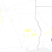
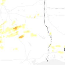
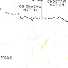
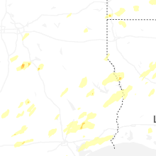


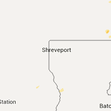


Connect with Interactive Hail Maps