

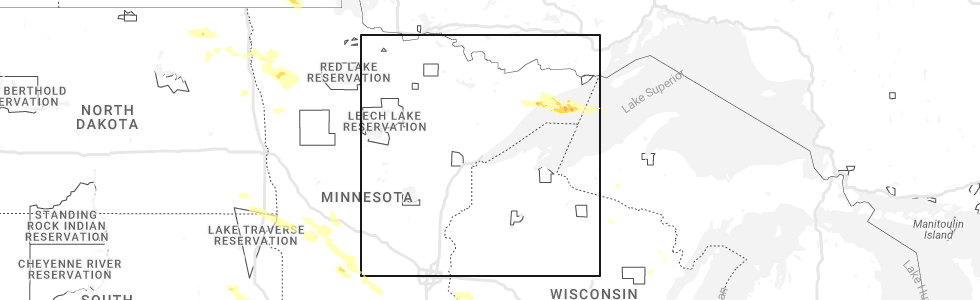
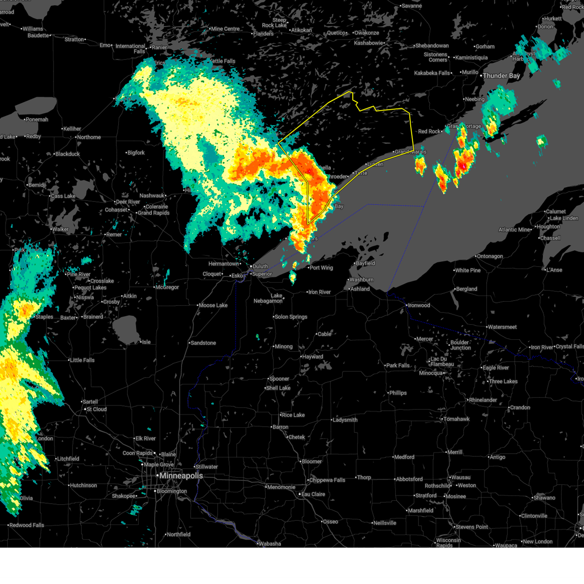
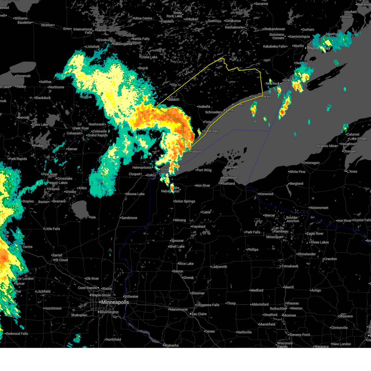
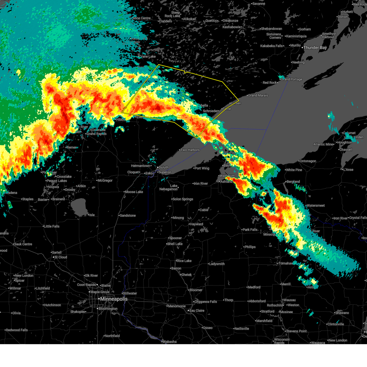
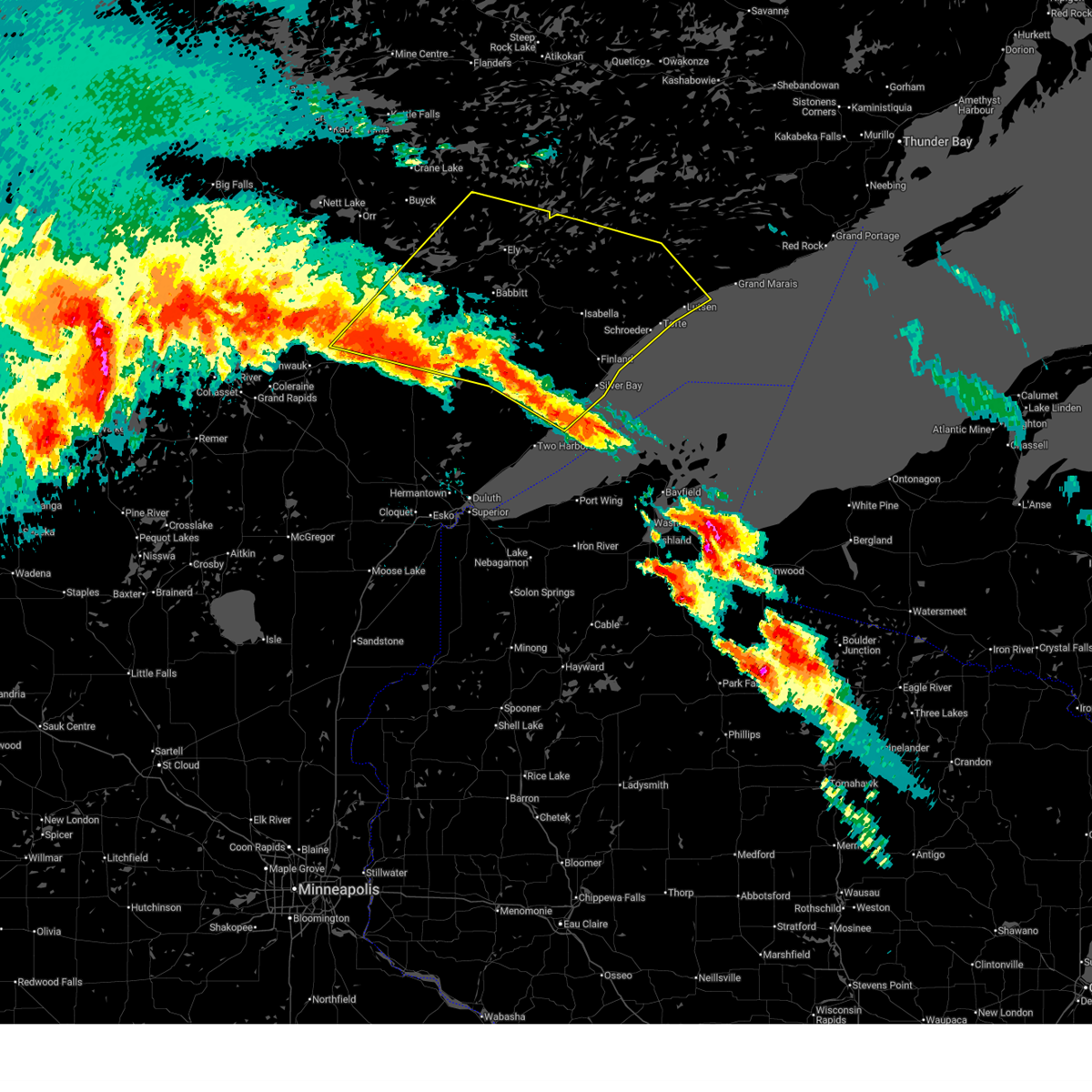
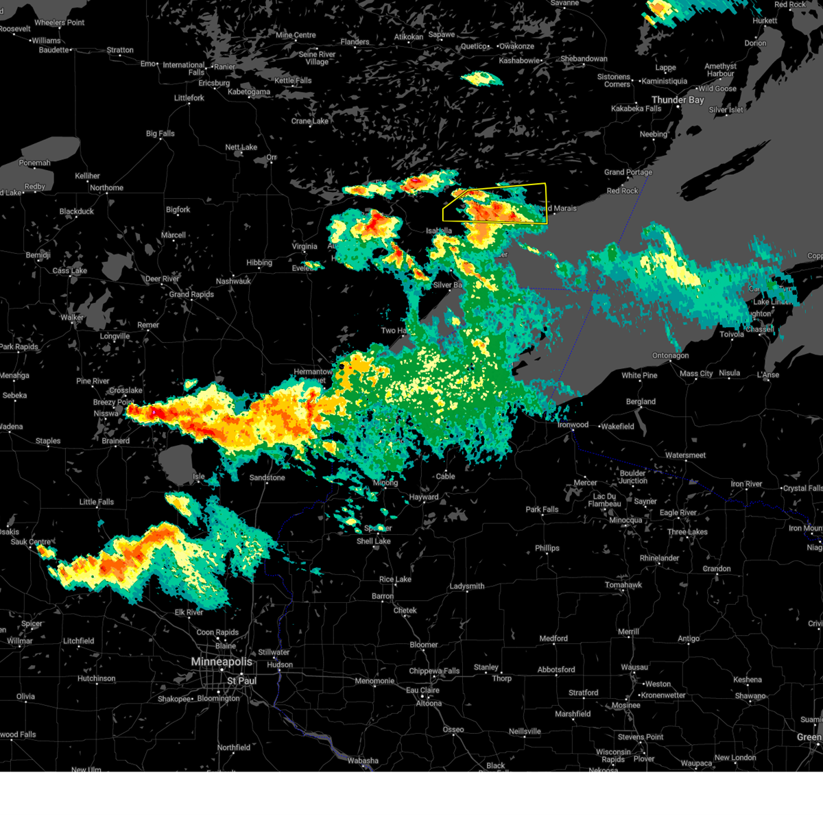
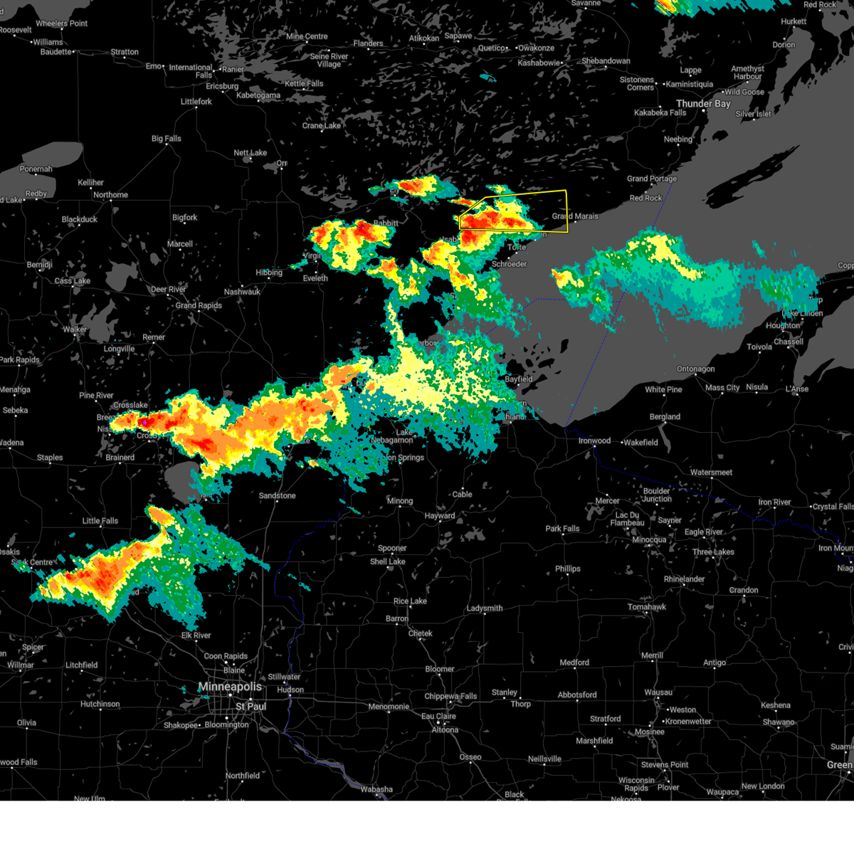
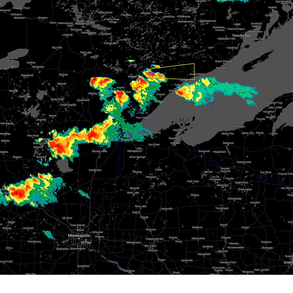
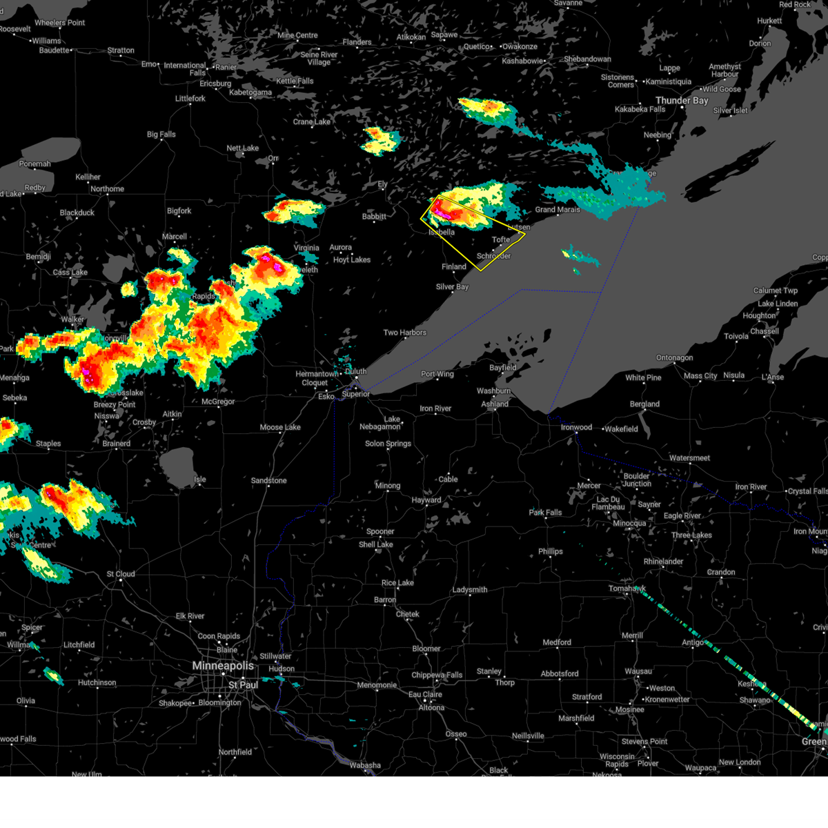
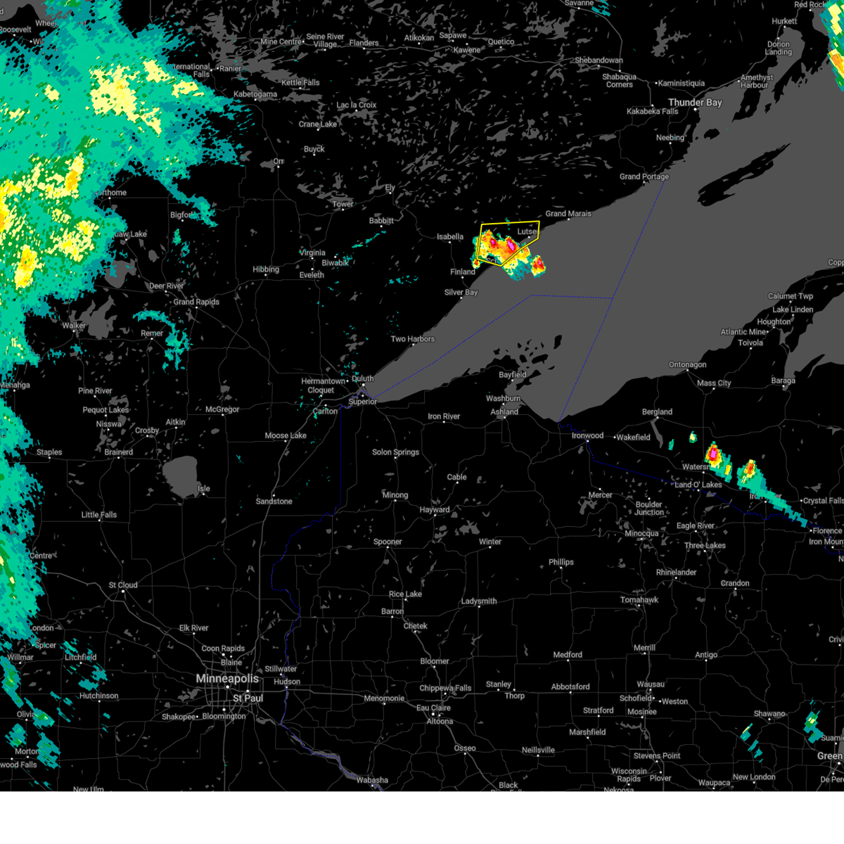
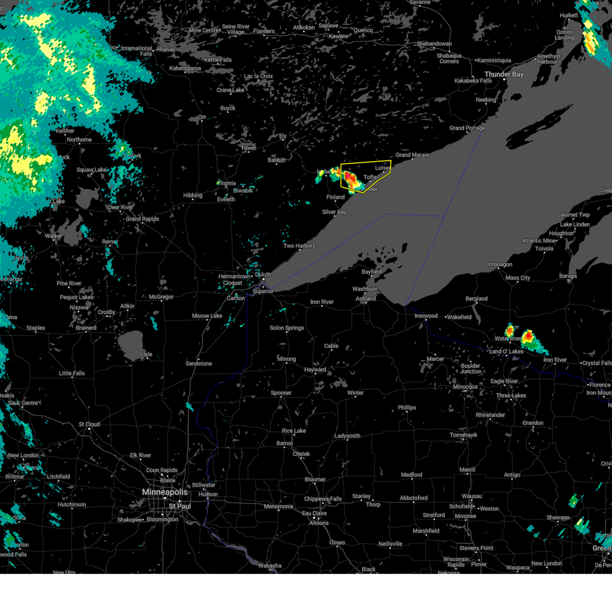
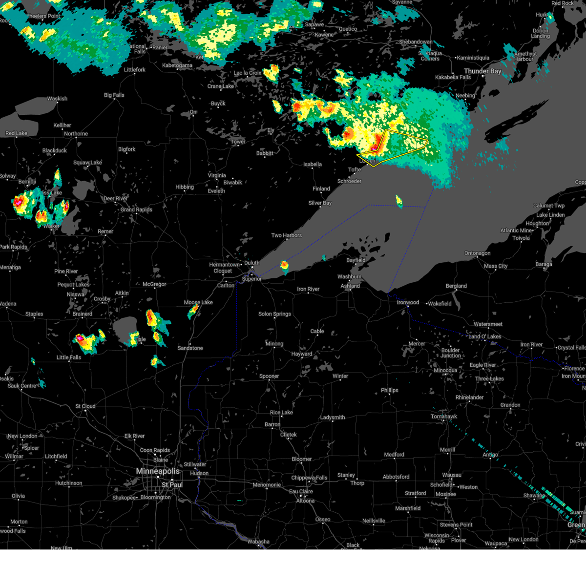
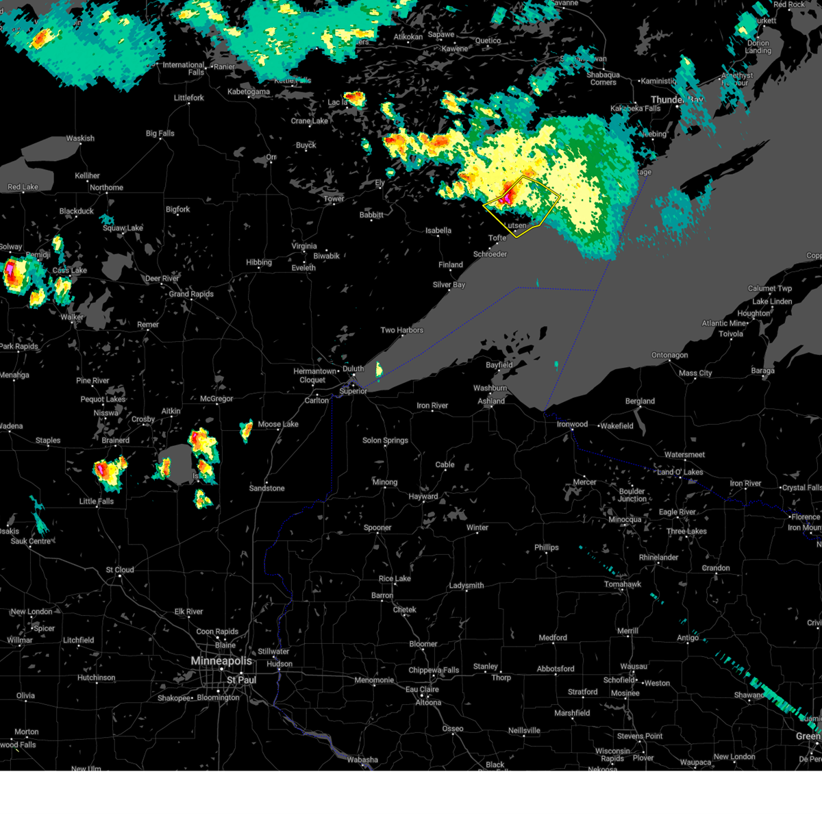
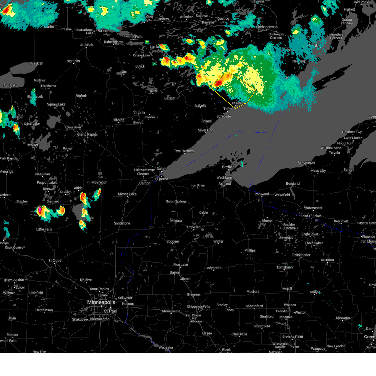
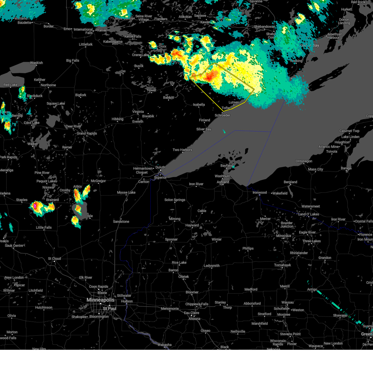
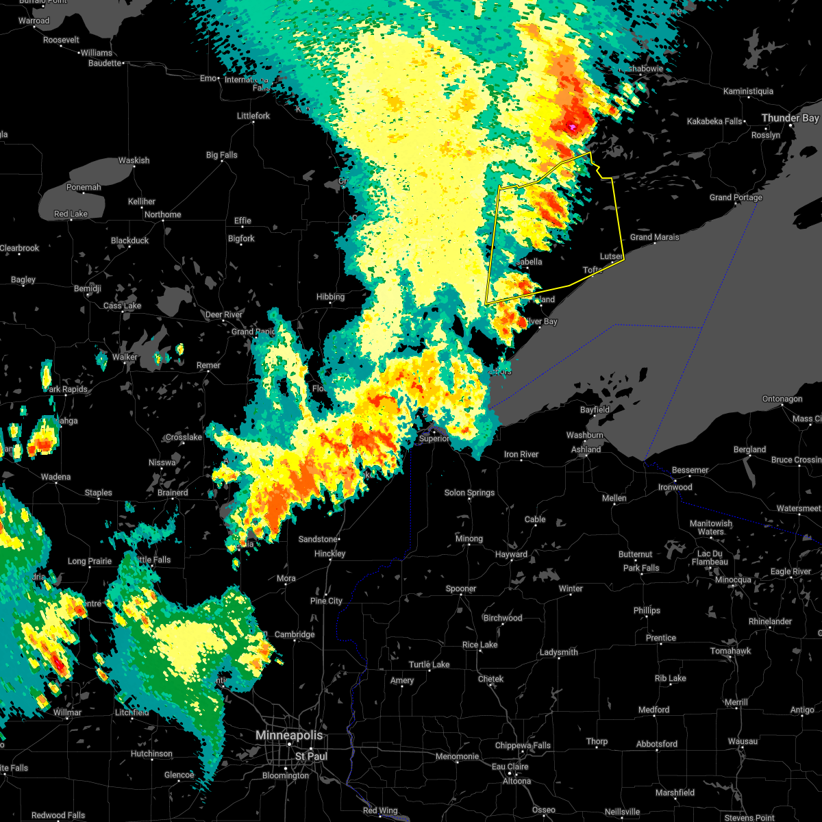
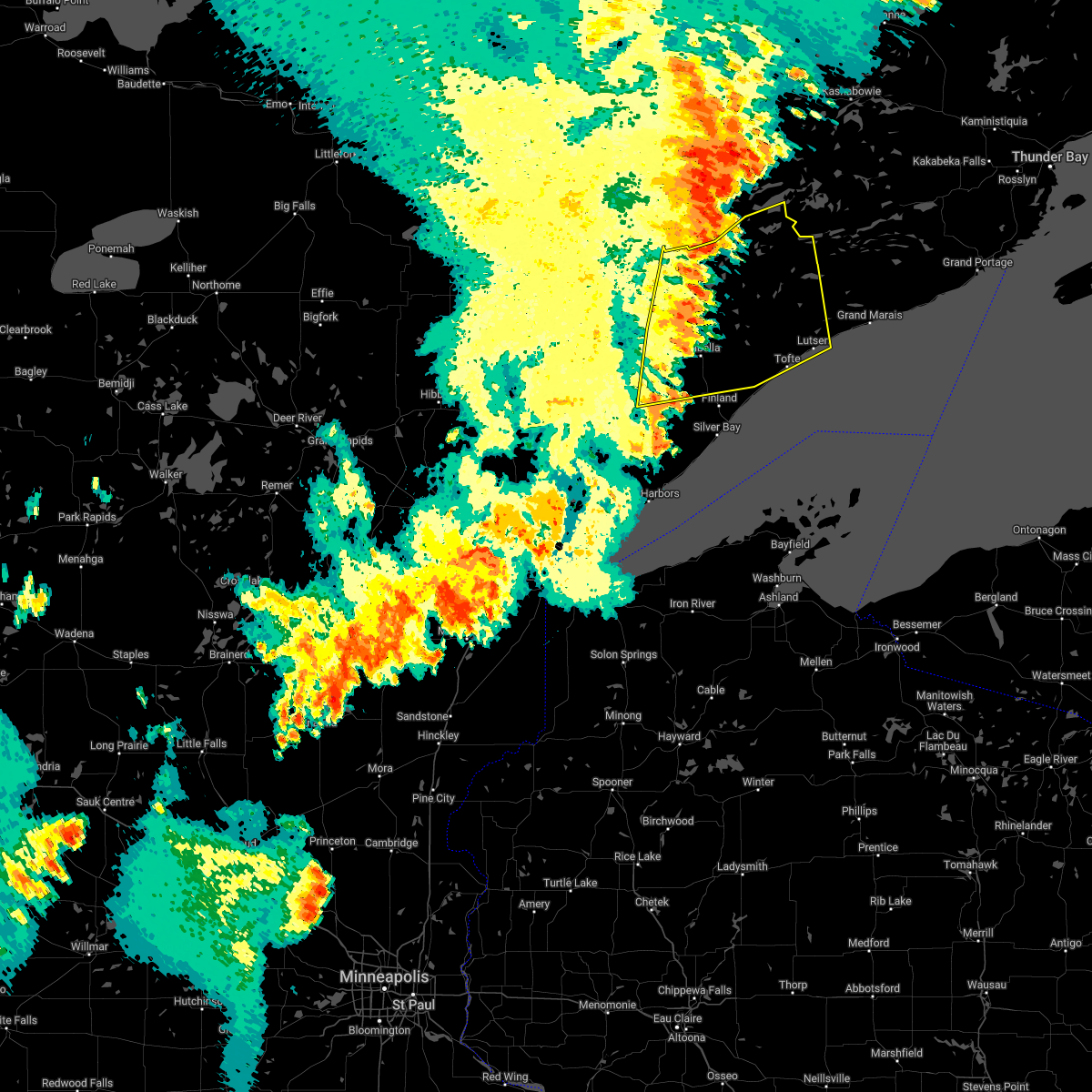
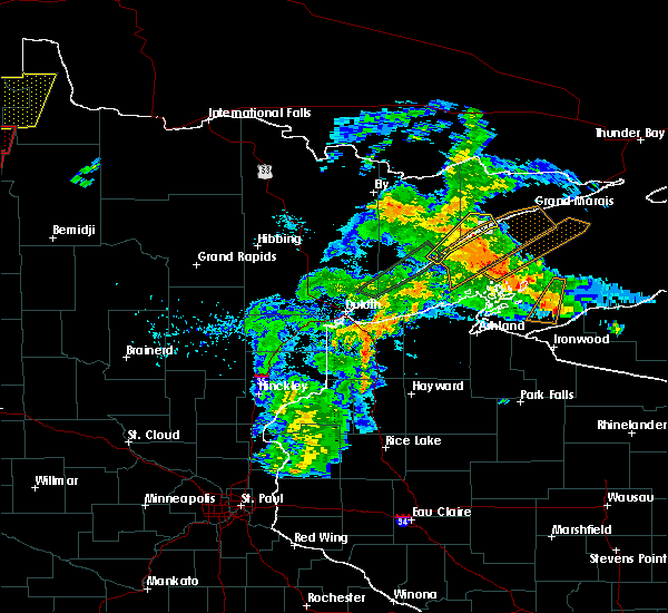
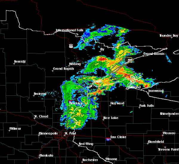
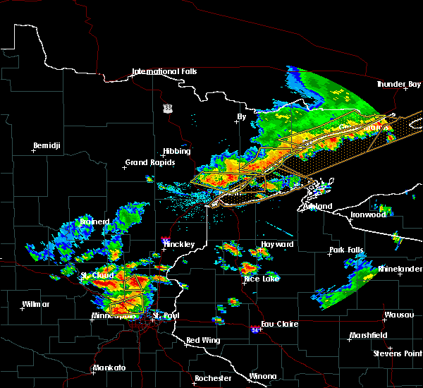
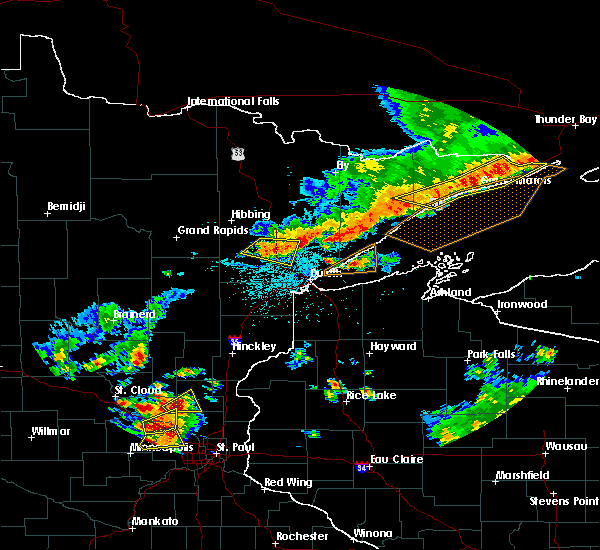
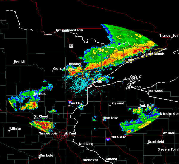
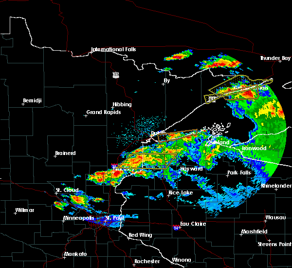
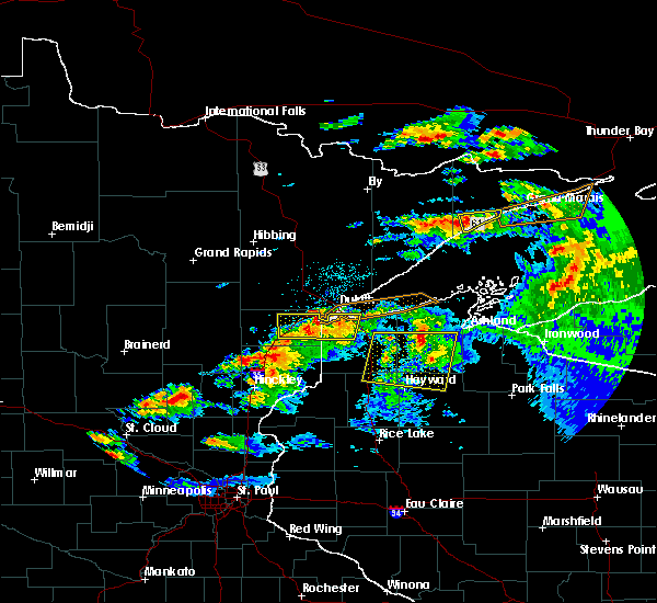
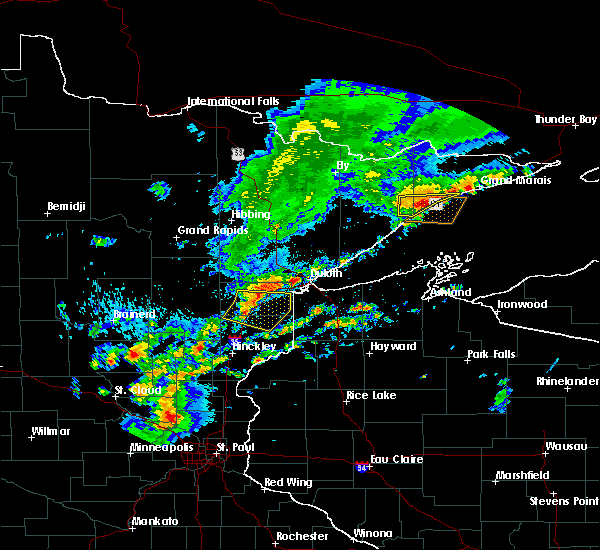
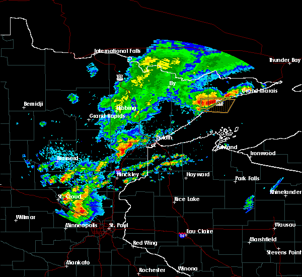
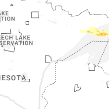
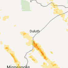
Hail Map for Lutsen, MN
The Lutsen, MN area has had 1 report of on-the-ground hail by trained spotters, and has been under severe weather warnings 9 times during the past 12 months. Doppler radar has detected hail at or near Lutsen, MN on 12 occasions.
| Name: | Lutsen, MN |
| Where Located: | 90.7 miles NE of Duluth, MN |
| Map: | Google Map for Lutsen, MN |
| Population: | 190 |
| Housing Units: | 400 |
| More Info: | Search Google for Lutsen, MN |
5
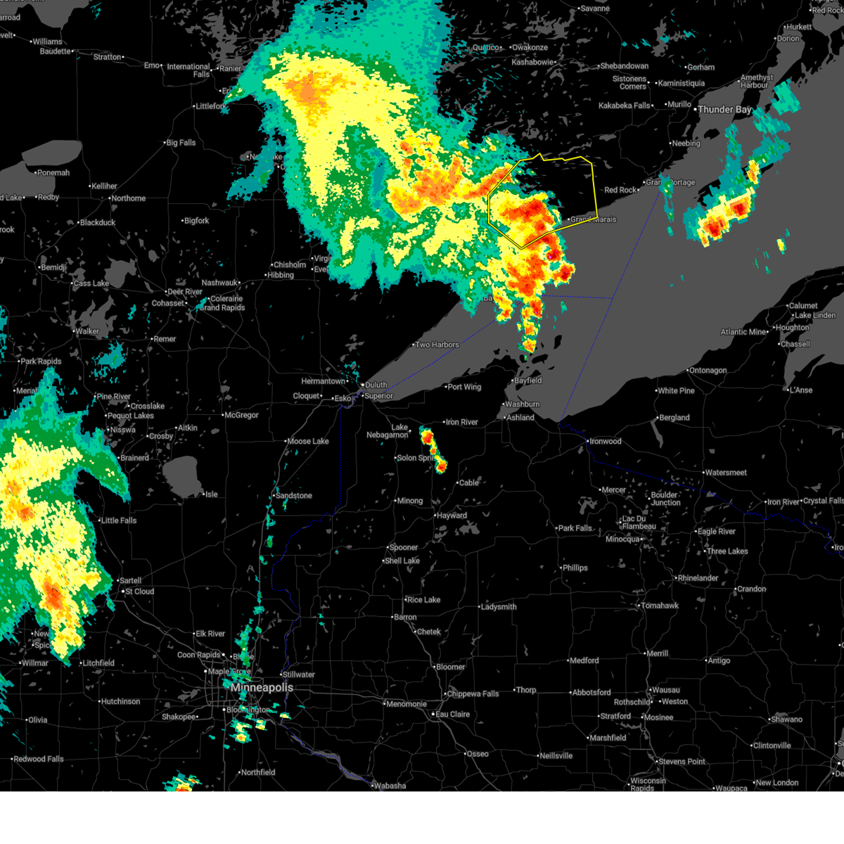
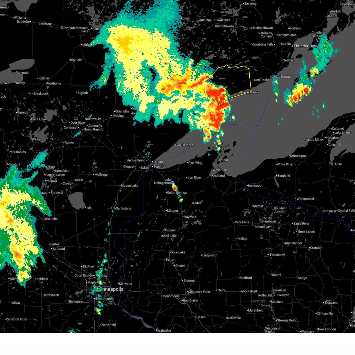
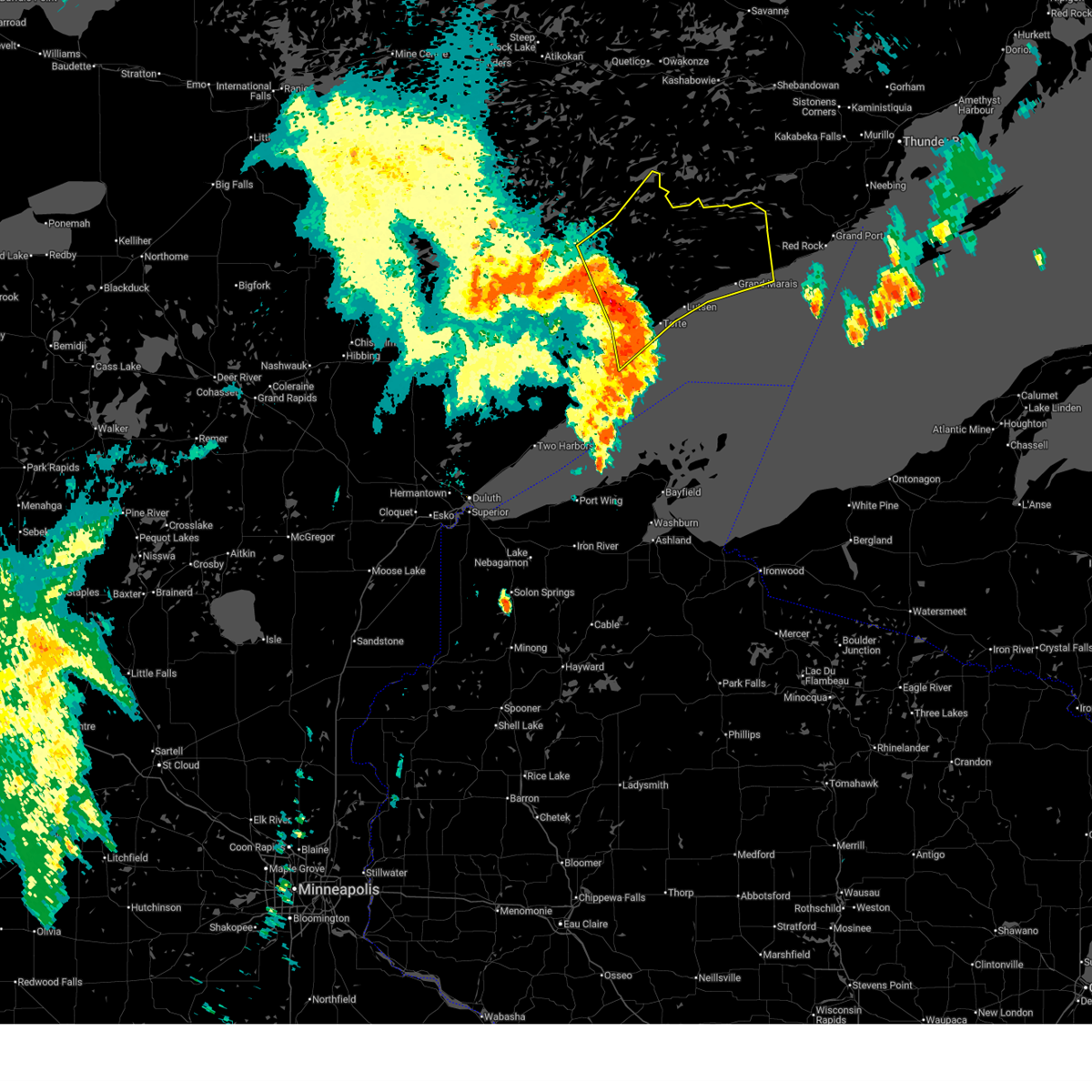
The Top Recent Hail Date for Lutsen, MN is Tuesday, July 25, 2023 (2nd out of 12)
Hail and Wind Damage Spotted near Lutsen, MN
| Date / Time | Report Details |
|---|---|
| 6/23/2025 5:21 AM CDT |
 The storms which prompted the warning have weakened below severe limits, and no longer pose an immediate threat to life or property. therefore, the warning will be allowed to expire. however, gusty winds to 50 mph and torrential rainfall are still possible with these thunderstorms. The storms which prompted the warning have weakened below severe limits, and no longer pose an immediate threat to life or property. therefore, the warning will be allowed to expire. however, gusty winds to 50 mph and torrential rainfall are still possible with these thunderstorms.
|
| 6/23/2025 5:12 AM CDT |
 the severe thunderstorm warning has been cancelled and is no longer in effect the severe thunderstorm warning has been cancelled and is no longer in effect
|
| 6/23/2025 5:12 AM CDT |
 At 511 am cdt, severe thunderstorms were located along a line extending from boundary waters canoe area wilderness to near eagle mountain to 10 miles south of cascade river state park, moving northeast at 65 mph (radar indicated). Hazards include 60 mph wind gusts and penny size hail. Expect damage to roofs, siding, and trees. Locations impacted include, grand marais, gunflint lake, lutsen, eagle mountain, cascade river state park, pine lake, bearskin lake, burnt lake, wine lake, phoebe lake, north lake, watab lake, white pine lake, alton lake, brule lake, cherokee lake, cascade lake, poplar lake, daniels lake, and winchell lake. At 511 am cdt, severe thunderstorms were located along a line extending from boundary waters canoe area wilderness to near eagle mountain to 10 miles south of cascade river state park, moving northeast at 65 mph (radar indicated). Hazards include 60 mph wind gusts and penny size hail. Expect damage to roofs, siding, and trees. Locations impacted include, grand marais, gunflint lake, lutsen, eagle mountain, cascade river state park, pine lake, bearskin lake, burnt lake, wine lake, phoebe lake, north lake, watab lake, white pine lake, alton lake, brule lake, cherokee lake, cascade lake, poplar lake, daniels lake, and winchell lake.
|
| 6/23/2025 4:59 AM CDT |
 At 458 am cdt, severe thunderstorms were located along a line extending from boundary waters canoe area wilderness to 10 miles northwest of lutsen to 11 miles southeast of temperance river state park, moving northeast at 70 mph (radar indicated). Hazards include 60 mph wind gusts and penny size hail. Expect damage to roofs, siding, and trees. Locations impacted include, grand marais, gunflint lake, clear lake, lutsen, tofte, eagle mountain, little marais, taconite harbor, saganaga lake, george manitou state park, cascade river state park, temperance river state park, sea gull lake, sugar loaf cove, forest center, little saganaga lake, alpine lake, boundary waters canoe area wilderness north of the gunflint trail, southeastern boundary waters canoe area wilderness, and pine lake. At 458 am cdt, severe thunderstorms were located along a line extending from boundary waters canoe area wilderness to 10 miles northwest of lutsen to 11 miles southeast of temperance river state park, moving northeast at 70 mph (radar indicated). Hazards include 60 mph wind gusts and penny size hail. Expect damage to roofs, siding, and trees. Locations impacted include, grand marais, gunflint lake, clear lake, lutsen, tofte, eagle mountain, little marais, taconite harbor, saganaga lake, george manitou state park, cascade river state park, temperance river state park, sea gull lake, sugar loaf cove, forest center, little saganaga lake, alpine lake, boundary waters canoe area wilderness north of the gunflint trail, southeastern boundary waters canoe area wilderness, and pine lake.
|
| 6/23/2025 4:47 AM CDT |
 the severe thunderstorm warning has been cancelled and is no longer in effect the severe thunderstorm warning has been cancelled and is no longer in effect
|
| 6/23/2025 4:47 AM CDT |
 At 446 am cdt, severe thunderstorms were located along a line extending from boundary waters canoe area wilderness to near clear lake to 9 miles southeast of little marais, moving northeast at 60 mph (radar indicated). Hazards include 60 mph wind gusts and penny size hail. Expect damage to roofs, siding, and trees. Locations impacted include, tofte, southeastern boundary waters canoe area wilderness, temperance river state park, taconite harbor, forest center, sugar loaf cove, lutsen, cascade river state park, eagle mountain, grand marais and gunflint lake. At 446 am cdt, severe thunderstorms were located along a line extending from boundary waters canoe area wilderness to near clear lake to 9 miles southeast of little marais, moving northeast at 60 mph (radar indicated). Hazards include 60 mph wind gusts and penny size hail. Expect damage to roofs, siding, and trees. Locations impacted include, tofte, southeastern boundary waters canoe area wilderness, temperance river state park, taconite harbor, forest center, sugar loaf cove, lutsen, cascade river state park, eagle mountain, grand marais and gunflint lake.
|
| 6/23/2025 4:27 AM CDT |
 Svrdlh the national weather service in duluth mn has issued a * severe thunderstorm warning for, cook county in northeastern minnesota, east central st. louis county in northeastern minnesota, lake county in northeastern minnesota, * until 530 am cdt. * at 427 am cdt, severe thunderstorms were located along a line extending from birch lake to near isabella to near split rock lighthouse, moving northeast at 70 mph (radar indicated). Hazards include 60 mph wind gusts and penny size hail. Expect damage to roofs, siding, and trees. severe thunderstorms will be near, silver bay, beaver bay, dumbbell lake, illgen city, isabella, birch lake, finland, tettegouche state park, and southeastern boundary waters canoe area wilderness around 430 am cdt. clear lake, little marais, and george manitou state park around 435 am cdt. temperance river state park, forest center, and sugar loaf cove around 440 am cdt. tofte, taconite harbor, and snowbank lake around 445 am cdt. Other locations in the path of these severe thunderstorms include lutsen, eagle mountain, little saganaga lake, cascade river state park, gunflint lake, sea gull lake, alpine lake, grand marais and saganaga lake. Svrdlh the national weather service in duluth mn has issued a * severe thunderstorm warning for, cook county in northeastern minnesota, east central st. louis county in northeastern minnesota, lake county in northeastern minnesota, * until 530 am cdt. * at 427 am cdt, severe thunderstorms were located along a line extending from birch lake to near isabella to near split rock lighthouse, moving northeast at 70 mph (radar indicated). Hazards include 60 mph wind gusts and penny size hail. Expect damage to roofs, siding, and trees. severe thunderstorms will be near, silver bay, beaver bay, dumbbell lake, illgen city, isabella, birch lake, finland, tettegouche state park, and southeastern boundary waters canoe area wilderness around 430 am cdt. clear lake, little marais, and george manitou state park around 435 am cdt. temperance river state park, forest center, and sugar loaf cove around 440 am cdt. tofte, taconite harbor, and snowbank lake around 445 am cdt. Other locations in the path of these severe thunderstorms include lutsen, eagle mountain, little saganaga lake, cascade river state park, gunflint lake, sea gull lake, alpine lake, grand marais and saganaga lake.
|
| 6/21/2025 1:22 AM CDT |
 At 122 am cdt, severe thunderstorms were located along a line extending from near biwabik to near whyte to 11 miles northwest of devils island, moving east at 45 mph (radar indicated). Hazards include 60 mph wind gusts and quarter size hail. Hail damage to vehicles is expected. expect wind damage to roofs, siding, and trees. Locations impacted include, hoyt lakes, babbitt, biwabik, embarrass, whyte, little marais, illgen city, finland, tettegouche state park, george manitou state park, sugar loaf cove, taconite harbor, isabella, birch lake, temperance river state park, dumbbell lake, clear lake, tofte, lutsen, southern boundary waters canoe area wilderness, forest center and cascade river state park. At 122 am cdt, severe thunderstorms were located along a line extending from near biwabik to near whyte to 11 miles northwest of devils island, moving east at 45 mph (radar indicated). Hazards include 60 mph wind gusts and quarter size hail. Hail damage to vehicles is expected. expect wind damage to roofs, siding, and trees. Locations impacted include, hoyt lakes, babbitt, biwabik, embarrass, whyte, little marais, illgen city, finland, tettegouche state park, george manitou state park, sugar loaf cove, taconite harbor, isabella, birch lake, temperance river state park, dumbbell lake, clear lake, tofte, lutsen, southern boundary waters canoe area wilderness, forest center and cascade river state park.
|
| 6/21/2025 12:56 AM CDT |
 Svrdlh the national weather service in duluth mn has issued a * severe thunderstorm warning for, southwestern cook county in northeastern minnesota, central st. louis county in northeastern minnesota, lake county in northeastern minnesota, * until 200 am cdt. * at 1255 am cdt, severe thunderstorms were located along a line extending from near buhl to near brimson to 7 miles southeast of gooseberry falls state park, moving east at 45 mph (radar indicated). Hazards include 60 mph wind gusts and half dollar size hail. Hail damage to vehicles is expected. expect wind damage to roofs, siding, and trees. severe thunderstorms will be near, virginia, eveleth, mountain iron, gilbert, buhl, fairbanks, whiteface reservoir, split rock lighthouse, gooseberry falls state park, and split rock lighthouse state park around 100 am cdt. hoyt lakes, biwabik, and beaver bay around 105 am cdt. silver bay and aurora around 110 am cdt. whyte and tettegouche state park around 115 am cdt. Other locations in the path of these severe thunderstorms include babbitt, illgen city, finland, embarrass, little marais and george manitou state park. Svrdlh the national weather service in duluth mn has issued a * severe thunderstorm warning for, southwestern cook county in northeastern minnesota, central st. louis county in northeastern minnesota, lake county in northeastern minnesota, * until 200 am cdt. * at 1255 am cdt, severe thunderstorms were located along a line extending from near buhl to near brimson to 7 miles southeast of gooseberry falls state park, moving east at 45 mph (radar indicated). Hazards include 60 mph wind gusts and half dollar size hail. Hail damage to vehicles is expected. expect wind damage to roofs, siding, and trees. severe thunderstorms will be near, virginia, eveleth, mountain iron, gilbert, buhl, fairbanks, whiteface reservoir, split rock lighthouse, gooseberry falls state park, and split rock lighthouse state park around 100 am cdt. hoyt lakes, biwabik, and beaver bay around 105 am cdt. silver bay and aurora around 110 am cdt. whyte and tettegouche state park around 115 am cdt. Other locations in the path of these severe thunderstorms include babbitt, illgen city, finland, embarrass, little marais and george manitou state park.
|
| 5/15/2025 7:20 PM CDT | Facebook video of a lot of tree damage in tofte park. several large trees uprooted or snappe in cook county MN, 10.5 miles NE of Lutsen, MN |
| 6/12/2024 7:37 PM CDT |
 The storm which prompted the warning has weakened below severe limits, and no longer poses an immediate threat to life or property. therefore, the warning will be allowed to expire. small hail is still possible with this thunderstorm. a severe thunderstorm watch remains in effect until 1000 pm cdt for northeastern minnesota. The storm which prompted the warning has weakened below severe limits, and no longer poses an immediate threat to life or property. therefore, the warning will be allowed to expire. small hail is still possible with this thunderstorm. a severe thunderstorm watch remains in effect until 1000 pm cdt for northeastern minnesota.
|
| 6/12/2024 7:22 PM CDT |
 At 722 pm cdt, a severe thunderstorm was located 13 miles northwest of lutsen, or 21 miles southwest of gunflint lake, moving east at 50 mph (radar indicated). Hazards include 60 mph wind gusts and half dollar size hail. Hail damage to vehicles is expected. expect wind damage to roofs, siding, and trees. This severe thunderstorm will remain over mainly rural areas of west central cook and east central lake counties, including the following locations, cascade lake, burnt lake, perent lake, phoebe lake, kawishiwi lake, white pine lake, silver island lake, devil track lake, tail lake, and crescent lake. At 722 pm cdt, a severe thunderstorm was located 13 miles northwest of lutsen, or 21 miles southwest of gunflint lake, moving east at 50 mph (radar indicated). Hazards include 60 mph wind gusts and half dollar size hail. Hail damage to vehicles is expected. expect wind damage to roofs, siding, and trees. This severe thunderstorm will remain over mainly rural areas of west central cook and east central lake counties, including the following locations, cascade lake, burnt lake, perent lake, phoebe lake, kawishiwi lake, white pine lake, silver island lake, devil track lake, tail lake, and crescent lake.
|
| 6/12/2024 6:56 PM CDT |
 Svrdlh the national weather service in duluth mn has issued a * severe thunderstorm warning for, west central cook county in northeastern minnesota, east central lake county in northeastern minnesota, * until 745 pm cdt. * at 656 pm cdt, a severe thunderstorm was located over southern boundary waters canoe area wilderness, or 24 miles east of ely, moving east at 50 mph (radar indicated). Hazards include ping pong ball size hail and 60 mph wind gusts. People and animals outdoors will be injured. expect hail damage to roofs, siding, windows, and vehicles. expect wind damage to roofs, siding, and trees. This severe thunderstorm will be near, southeastern boundary waters canoe area wilderness and forest center around 700 pm cdt. Svrdlh the national weather service in duluth mn has issued a * severe thunderstorm warning for, west central cook county in northeastern minnesota, east central lake county in northeastern minnesota, * until 745 pm cdt. * at 656 pm cdt, a severe thunderstorm was located over southern boundary waters canoe area wilderness, or 24 miles east of ely, moving east at 50 mph (radar indicated). Hazards include ping pong ball size hail and 60 mph wind gusts. People and animals outdoors will be injured. expect hail damage to roofs, siding, windows, and vehicles. expect wind damage to roofs, siding, and trees. This severe thunderstorm will be near, southeastern boundary waters canoe area wilderness and forest center around 700 pm cdt.
|
| 6/12/2024 5:55 PM CDT |
 Svrdlh the national weather service in duluth mn has issued a * severe thunderstorm warning for, southwestern cook county in northeastern minnesota, east central lake county in northeastern minnesota, * until 630 pm cdt. * at 554 pm cdt, a severe thunderstorm was located near dumbbell lake, or 31 miles southeast of ely, moving southeast at 40 mph (radar indicated). Hazards include ping pong ball size hail and 60 mph wind gusts. People and animals outdoors will be injured. expect hail damage to roofs, siding, windows, and vehicles. expect wind damage to roofs, siding, and trees. this severe thunderstorm will be near, clear lake around 600 pm cdt. Other locations in the path of this severe thunderstorm include temperance river state park, tofte and taconite harbor. Svrdlh the national weather service in duluth mn has issued a * severe thunderstorm warning for, southwestern cook county in northeastern minnesota, east central lake county in northeastern minnesota, * until 630 pm cdt. * at 554 pm cdt, a severe thunderstorm was located near dumbbell lake, or 31 miles southeast of ely, moving southeast at 40 mph (radar indicated). Hazards include ping pong ball size hail and 60 mph wind gusts. People and animals outdoors will be injured. expect hail damage to roofs, siding, windows, and vehicles. expect wind damage to roofs, siding, and trees. this severe thunderstorm will be near, clear lake around 600 pm cdt. Other locations in the path of this severe thunderstorm include temperance river state park, tofte and taconite harbor.
|
| 10/5/2023 1:11 PM CDT | Algoma niagara. steady 40kts gusting 55kt in lsz162 county MN, 20.3 miles NNW of Lutsen, MN |
| 7/25/2023 8:51 PM CDT |
 At 851 pm cdt, a severe thunderstorm was located near tofte, or 25 miles southwest of grand marais, moving east at 25 mph (radar indicated). Hazards include 60 mph wind gusts and half dollar size hail. Hail damage to vehicles is expected. expect wind damage to roofs, siding, and trees. locations impacted include, lutsen, tofte, taconite harbor, wilson lake, temperance river state park, caribou lake, and cascade river state park. hail threat, radar indicated max hail size, 1. 25 in wind threat, radar indicated max wind gust, 60 mph. At 851 pm cdt, a severe thunderstorm was located near tofte, or 25 miles southwest of grand marais, moving east at 25 mph (radar indicated). Hazards include 60 mph wind gusts and half dollar size hail. Hail damage to vehicles is expected. expect wind damage to roofs, siding, and trees. locations impacted include, lutsen, tofte, taconite harbor, wilson lake, temperance river state park, caribou lake, and cascade river state park. hail threat, radar indicated max hail size, 1. 25 in wind threat, radar indicated max wind gust, 60 mph.
|
| 7/25/2023 8:34 PM CDT |
 At 834 pm cdt, a severe thunderstorm was located over clear lake, or 34 miles west of grand marais, moving east at 20 mph (radar indicated). Hazards include 60 mph wind gusts and quarter size hail. Hail damage to vehicles is expected. Expect wind damage to roofs, siding, and trees. At 834 pm cdt, a severe thunderstorm was located over clear lake, or 34 miles west of grand marais, moving east at 20 mph (radar indicated). Hazards include 60 mph wind gusts and quarter size hail. Hail damage to vehicles is expected. Expect wind damage to roofs, siding, and trees.
|
| 7/9/2023 8:30 PM CDT |
 At 830 pm cdt, severe thunderstorms were located along a line extending from 7 miles southeast of eagle mountain, to 6 miles west of grand marais, to near lutsen, moving southeast at 40 mph (radar indicated). Hazards include 60 mph wind gusts and penny size hail. Expect damage to roofs, siding, and trees. severe thunderstorms will be near, grand marais around 840 pm cdt. other locations impacted by these severe thunderstorms include judge c. r. Magney state park, caribou lake, two island lake, judge magney state park, devil track lake and cascade river state park. At 830 pm cdt, severe thunderstorms were located along a line extending from 7 miles southeast of eagle mountain, to 6 miles west of grand marais, to near lutsen, moving southeast at 40 mph (radar indicated). Hazards include 60 mph wind gusts and penny size hail. Expect damage to roofs, siding, and trees. severe thunderstorms will be near, grand marais around 840 pm cdt. other locations impacted by these severe thunderstorms include judge c. r. Magney state park, caribou lake, two island lake, judge magney state park, devil track lake and cascade river state park.
|
| 7/9/2023 8:13 PM CDT |
 At 813 pm cdt, severe thunderstorms were located along a line extending from boundary waters canoe area wilderness, to 9 miles southwest of eagle mountain, to 11 miles northwest of lutsen, moving southeast at 50 mph (radar indicated). Hazards include 60 mph wind gusts and penny size hail. Expect damage to roofs, siding, and trees. these severe storms will be near, eagle mountain around 820 pm cdt. lutsen around 830 pm cdt. Other locations impacted by these severe thunderstorms include white pine lake, devil track lake, cascade lake, tail lake, crescent lake, caribou lake, two island lake, cascade river state park and brule lake. At 813 pm cdt, severe thunderstorms were located along a line extending from boundary waters canoe area wilderness, to 9 miles southwest of eagle mountain, to 11 miles northwest of lutsen, moving southeast at 50 mph (radar indicated). Hazards include 60 mph wind gusts and penny size hail. Expect damage to roofs, siding, and trees. these severe storms will be near, eagle mountain around 820 pm cdt. lutsen around 830 pm cdt. Other locations impacted by these severe thunderstorms include white pine lake, devil track lake, cascade lake, tail lake, crescent lake, caribou lake, two island lake, cascade river state park and brule lake.
|
| 7/9/2023 7:59 PM CDT |
 At 759 pm cdt, severe thunderstorms were located along a line extending from the boundary waters canoe area wilderness in northwest cook county, to 9 miles south of little saganaga lake, to 12 miles northeast of forest center, moving southeast at 40 mph (radar indicated). Hazards include 60 mph wind gusts and penny size hail. Expect damage to roofs, siding, and trees. these severe storms will be near, eagle mountain around 820 pm cdt. lutsen around 840 pm cdt. other locations impacted by these severe thunderstorms include brule lake, cherokee lake, cascade lake, phoebe lake, white pine lake, devil track lake, tail lake, crescent lake, sawbill lake and caribou lake. hail threat, radar indicated max hail size, 0. 75 in wind threat, radar indicated max wind gust, 60 mph. At 759 pm cdt, severe thunderstorms were located along a line extending from the boundary waters canoe area wilderness in northwest cook county, to 9 miles south of little saganaga lake, to 12 miles northeast of forest center, moving southeast at 40 mph (radar indicated). Hazards include 60 mph wind gusts and penny size hail. Expect damage to roofs, siding, and trees. these severe storms will be near, eagle mountain around 820 pm cdt. lutsen around 840 pm cdt. other locations impacted by these severe thunderstorms include brule lake, cherokee lake, cascade lake, phoebe lake, white pine lake, devil track lake, tail lake, crescent lake, sawbill lake and caribou lake. hail threat, radar indicated max hail size, 0. 75 in wind threat, radar indicated max wind gust, 60 mph.
|
| 7/9/2023 7:46 PM CDT |
 At 745 pm cdt, severe thunderstorms were located along a line extending from the boundary waters canoe area wilderness in northeastern lake county, to 8 miles southwest of little saganaga lake, to 6 miles southeast of snowbank lake, moving southeast at 45 mph (radar indicated). Hazards include 60 mph wind gusts and penny size hail. Expect damage to roofs, siding, and trees. severe thunderstorms will be near, little saganaga lake around 750 pm cdt. eagle mountain around 820 pm cdt. lutsen and tofte around 830 pm cdt. other locations impacted by these severe thunderstorms include hudson lake, brule lake, kekekabic lake, cherokee lake, thomas lake, alice lake, cascade lake, perent lake, knife lake and phoebe lake. hail threat, radar indicated max hail size, 0. 75 in wind threat, radar indicated max wind gust, 60 mph. At 745 pm cdt, severe thunderstorms were located along a line extending from the boundary waters canoe area wilderness in northeastern lake county, to 8 miles southwest of little saganaga lake, to 6 miles southeast of snowbank lake, moving southeast at 45 mph (radar indicated). Hazards include 60 mph wind gusts and penny size hail. Expect damage to roofs, siding, and trees. severe thunderstorms will be near, little saganaga lake around 750 pm cdt. eagle mountain around 820 pm cdt. lutsen and tofte around 830 pm cdt. other locations impacted by these severe thunderstorms include hudson lake, brule lake, kekekabic lake, cherokee lake, thomas lake, alice lake, cascade lake, perent lake, knife lake and phoebe lake. hail threat, radar indicated max hail size, 0. 75 in wind threat, radar indicated max wind gust, 60 mph.
|
| 6/20/2022 11:40 PM CDT |
 At 1139 pm cdt, severe thunderstorms were located along a line extending from boundary waters canoe area wilderness, to 7 miles north of clear lake, to near illgen city, moving east at 45 mph (radar indicated). Hazards include 60 mph wind gusts and penny size hail. Expect damage to roofs, siding, and trees. locations impacted include, gunflint lake, clear lake, lutsen, saganaga lake, dumbbell lake, sea gull lake, snowbank lake, southeastern boundary waters canoe area wilderness, whyte, forest center, little saganaga lake, alpine lake, isabella, basswood lake, ensign lake, bald eagle lake, ojibway lake, phoebe lake, kawishiwi lake, and isabella lake. hail threat, radar indicated max hail size, 0. 75 in wind threat, radar indicated max wind gust, 60 mph. At 1139 pm cdt, severe thunderstorms were located along a line extending from boundary waters canoe area wilderness, to 7 miles north of clear lake, to near illgen city, moving east at 45 mph (radar indicated). Hazards include 60 mph wind gusts and penny size hail. Expect damage to roofs, siding, and trees. locations impacted include, gunflint lake, clear lake, lutsen, saganaga lake, dumbbell lake, sea gull lake, snowbank lake, southeastern boundary waters canoe area wilderness, whyte, forest center, little saganaga lake, alpine lake, isabella, basswood lake, ensign lake, bald eagle lake, ojibway lake, phoebe lake, kawishiwi lake, and isabella lake. hail threat, radar indicated max hail size, 0. 75 in wind threat, radar indicated max wind gust, 60 mph.
|
| 6/20/2022 11:28 PM CDT |
 At 1127 pm cdt, severe thunderstorms were located along a line extending from near boundary waters canoe area wilderness near trout lake, to near forest center, to silver bay, moving east at 45 mph (radar indicated). Hazards include 60 mph wind gusts and penny size hail. Expect damage to roofs, siding, and trees. locations impacted include, clear lake, alpine lake, little saganaga lake, saganaga lake, sea gull lake, gunflint lake and lutsen. hail threat, radar indicated max hail size, 0. 75 in wind threat, radar indicated max wind gust, 60 mph. At 1127 pm cdt, severe thunderstorms were located along a line extending from near boundary waters canoe area wilderness near trout lake, to near forest center, to silver bay, moving east at 45 mph (radar indicated). Hazards include 60 mph wind gusts and penny size hail. Expect damage to roofs, siding, and trees. locations impacted include, clear lake, alpine lake, little saganaga lake, saganaga lake, sea gull lake, gunflint lake and lutsen. hail threat, radar indicated max hail size, 0. 75 in wind threat, radar indicated max wind gust, 60 mph.
|
| 6/20/2022 11:09 PM CDT |
 At 1109 pm cdt, severe thunderstorms were located along a line extending from near basswood lake, to 12 miles northwest of isabella, to 8 miles northeast of thomas lake near brimson, moving east at 45 mph (radar indicated). Hazards include 60 mph wind gusts and penny size hail. Expect damage to roofs, siding, and trees. severe thunderstorms will be near, forest center and snowbank lake around 1125 pm cdt. other locations in the path of these severe thunderstorms include finland, clear lake, alpine lake, little saganaga lake, saganaga lake, sea gull lake and gunflint lake. hail threat, radar indicated max hail size, 0. 75 in wind threat, radar indicated max wind gust, 60 mph. At 1109 pm cdt, severe thunderstorms were located along a line extending from near basswood lake, to 12 miles northwest of isabella, to 8 miles northeast of thomas lake near brimson, moving east at 45 mph (radar indicated). Hazards include 60 mph wind gusts and penny size hail. Expect damage to roofs, siding, and trees. severe thunderstorms will be near, forest center and snowbank lake around 1125 pm cdt. other locations in the path of these severe thunderstorms include finland, clear lake, alpine lake, little saganaga lake, saganaga lake, sea gull lake and gunflint lake. hail threat, radar indicated max hail size, 0. 75 in wind threat, radar indicated max wind gust, 60 mph.
|
| 7/23/2021 7:50 PM CDT |
 At 748 pm cdt, severe thunderstorms were located along a line extending from boundary waters canoe area wilderness near sawbill lake, to near clear lake, to near whyte, moving southeast at 35 mph (radar indicated). Hazards include 60 mph wind gusts and penny size hail. Expect damage to roofs, siding, and trees. Locations impacted include, taconite harbor, tofte, silver bay, illgen city, little marais and grand marais. At 748 pm cdt, severe thunderstorms were located along a line extending from boundary waters canoe area wilderness near sawbill lake, to near clear lake, to near whyte, moving southeast at 35 mph (radar indicated). Hazards include 60 mph wind gusts and penny size hail. Expect damage to roofs, siding, and trees. Locations impacted include, taconite harbor, tofte, silver bay, illgen city, little marais and grand marais.
|
| 7/23/2021 7:30 PM CDT |
 At 729 pm cdt, severe thunderstorms were located along a line extending from boundary waters canoe area wilderness near snowbank lake, to 6 miles southwest of forest center, to 9 miles southeast of birch lake, moving east at 50 mph (radar indicated). Hazards include 70 mph wind gusts and penny size hail. Expect considerable tree damage. damage is likely to mobile homes, roofs, and outbuildings. severe thunderstorms will be near, forest center around 735 pm cdt. Other locations in the path of these severe thunderstorms include clear lake, isabella, dumbbell lake, lutsen, taconite harbor, tofte and grand marais. At 729 pm cdt, severe thunderstorms were located along a line extending from boundary waters canoe area wilderness near snowbank lake, to 6 miles southwest of forest center, to 9 miles southeast of birch lake, moving east at 50 mph (radar indicated). Hazards include 70 mph wind gusts and penny size hail. Expect considerable tree damage. damage is likely to mobile homes, roofs, and outbuildings. severe thunderstorms will be near, forest center around 735 pm cdt. Other locations in the path of these severe thunderstorms include clear lake, isabella, dumbbell lake, lutsen, taconite harbor, tofte and grand marais.
|
| 8/9/2020 3:07 PM CDT |
 The severe thunderstorm warning for southwestern cook and east central lake counties will expire at 315 pm cdt, the storms which prompted the warning have weakened below severe limits, and no longer pose an immediate threat to life or property. therefore, the warning will be allowed to expire. however gusty winds are still possible with these thunderstorms. The severe thunderstorm warning for southwestern cook and east central lake counties will expire at 315 pm cdt, the storms which prompted the warning have weakened below severe limits, and no longer pose an immediate threat to life or property. therefore, the warning will be allowed to expire. however gusty winds are still possible with these thunderstorms.
|
| 8/9/2020 2:46 PM CDT |
 At 246 pm cdt, severe thunderstorms were located along a line extending from near silver bay, to near beaver bay, moving northeast at 45 mph (radar indicated). Hazards include 60 mph wind gusts. Expect damage to roofs, siding, and trees. Locations impacted include, silver bay, lutsen, tofte, illgen city, little marais, taconite harbor, tettegouche state park, george manitou state park, and temperance river state park. At 246 pm cdt, severe thunderstorms were located along a line extending from near silver bay, to near beaver bay, moving northeast at 45 mph (radar indicated). Hazards include 60 mph wind gusts. Expect damage to roofs, siding, and trees. Locations impacted include, silver bay, lutsen, tofte, illgen city, little marais, taconite harbor, tettegouche state park, george manitou state park, and temperance river state park.
|
| 8/9/2020 2:24 PM CDT |
 At 224 pm cdt, severe thunderstorms were located along a line extending from near castle danger, to 8 miles south of beaver bay, to 13 miles north of herbster, moving northeast at 45 mph (radar indicated). Hazards include 60 mph wind gusts. expect damage to roofs, siding, and trees At 224 pm cdt, severe thunderstorms were located along a line extending from near castle danger, to 8 miles south of beaver bay, to 13 miles north of herbster, moving northeast at 45 mph (radar indicated). Hazards include 60 mph wind gusts. expect damage to roofs, siding, and trees
|
| 7/26/2019 7:21 PM CDT |
 At 721 pm cdt, severe thunderstorms were located along a line extending from 7 miles northeast of lutsen, to silver bay, moving east at 25 mph (radar indicated). Hazards include 60 mph wind gusts and penny size hail. Expect damage to roofs, siding, and trees. Locations impacted include, grand marais, silver bay, grand portage, clear lake, lutsen, tofte, beaver bay, hovland, eagle mountain, little marais, taconite harbor, finland, illgen city, pine lake, tom lake, grand portage reservation, murphy city, temperance river state park, judge magney state park, and white pine lake. At 721 pm cdt, severe thunderstorms were located along a line extending from 7 miles northeast of lutsen, to silver bay, moving east at 25 mph (radar indicated). Hazards include 60 mph wind gusts and penny size hail. Expect damage to roofs, siding, and trees. Locations impacted include, grand marais, silver bay, grand portage, clear lake, lutsen, tofte, beaver bay, hovland, eagle mountain, little marais, taconite harbor, finland, illgen city, pine lake, tom lake, grand portage reservation, murphy city, temperance river state park, judge magney state park, and white pine lake.
|
| 7/26/2019 6:49 PM CDT |
 At 649 pm cdt, severe thunderstorms were located along a line extending from 6 miles northeast of gunflint lake, to 10 miles north of lutsen, to 6 miles northeast of whyte, moving east at 40 mph (radar indicated). Hazards include 70 mph wind gusts and quarter size hail. Hail damage to vehicles is expected. expect considerable tree damage. wind damage is also likely to mobile homes, roofs, and outbuildings. Locations impacted include, grand marais, gunflint lake, silver bay, grand portage, clear lake, lutsen, tofte, beaver bay, eagle mountain, little marais, taconite harbor, thomas lake near brimson, finland, dumbbell lake, hovland, whyte, highland lake, isabella, illgen city, and pine lake. At 649 pm cdt, severe thunderstorms were located along a line extending from 6 miles northeast of gunflint lake, to 10 miles north of lutsen, to 6 miles northeast of whyte, moving east at 40 mph (radar indicated). Hazards include 70 mph wind gusts and quarter size hail. Hail damage to vehicles is expected. expect considerable tree damage. wind damage is also likely to mobile homes, roofs, and outbuildings. Locations impacted include, grand marais, gunflint lake, silver bay, grand portage, clear lake, lutsen, tofte, beaver bay, eagle mountain, little marais, taconite harbor, thomas lake near brimson, finland, dumbbell lake, hovland, whyte, highland lake, isabella, illgen city, and pine lake.
|
| 7/26/2019 6:29 PM CDT |
 At 629 pm cdt, severe thunderstorms were located along a line extending from near sea gull lake, to 11 miles northeast of clear lake, to 7 miles west of whyte, moving east at 40 mph (radar indicated). Hazards include 70 mph wind gusts and quarter size hail. Hail damage to vehicles is expected. expect considerable tree damage. Wind damage is also likely to mobile homes, roofs, and outbuildings. At 629 pm cdt, severe thunderstorms were located along a line extending from near sea gull lake, to 11 miles northeast of clear lake, to 7 miles west of whyte, moving east at 40 mph (radar indicated). Hazards include 70 mph wind gusts and quarter size hail. Hail damage to vehicles is expected. expect considerable tree damage. Wind damage is also likely to mobile homes, roofs, and outbuildings.
|
| 7/15/2019 5:06 PM CDT |
 The severe thunderstorm warning for central cook and east central lake counties will expire at 515 pm cdt, the storms which prompted the warning have moved out of the area. therefore, the warning will be allowed to expire. however gusty winds are still possible with these thunderstorms. a severe thunderstorm watch remains in effect until 1000 pm cdt for northeastern minnesota. The severe thunderstorm warning for central cook and east central lake counties will expire at 515 pm cdt, the storms which prompted the warning have moved out of the area. therefore, the warning will be allowed to expire. however gusty winds are still possible with these thunderstorms. a severe thunderstorm watch remains in effect until 1000 pm cdt for northeastern minnesota.
|
| 7/15/2019 4:47 PM CDT |
 At 446 pm cdt, severe thunderstorms were located along a line extending from 8 miles north of hovland, to near grand marais, to near tofte, moving east at 50 mph (radar indicated). Hazards include 60 mph wind gusts and penny size hail. Expect damage to roofs, siding, and trees. locations impacted include, grand marais, clear lake, lutsen, tofte, hovland, tom lake, grand portage reservation, judge c. r. Magney state park, judge magney state park, swamp lake, white pine lake, devil track lake, wilson lake, caribou lake, two island lake, cascade river state park, tail lake, and pine lake. At 446 pm cdt, severe thunderstorms were located along a line extending from 8 miles north of hovland, to near grand marais, to near tofte, moving east at 50 mph (radar indicated). Hazards include 60 mph wind gusts and penny size hail. Expect damage to roofs, siding, and trees. locations impacted include, grand marais, clear lake, lutsen, tofte, hovland, tom lake, grand portage reservation, judge c. r. Magney state park, judge magney state park, swamp lake, white pine lake, devil track lake, wilson lake, caribou lake, two island lake, cascade river state park, tail lake, and pine lake.
|
| 7/15/2019 4:28 PM CDT |
 At 428 pm cdt, severe thunderstorms were located along a line extending from 14 miles northwest of hovland, to near eagle mountain, to near clear lake, moving east at 50 mph (radar indicated). Hazards include 60 mph wind gusts and nickel size hail. Expect damage to roofs, siding, and trees. locations impacted include, grand marais, clear lake, lutsen, tofte, hovland, eagle mountain, pine lake, tom lake, bearskin lake, grand portage reservation, perent lake, phoebe lake, judge magney state park, watab lake, kawishiwi lake, white pine lake, silver island lake, brule lake, judge c. r. Magney state park, and cherokee lake. At 428 pm cdt, severe thunderstorms were located along a line extending from 14 miles northwest of hovland, to near eagle mountain, to near clear lake, moving east at 50 mph (radar indicated). Hazards include 60 mph wind gusts and nickel size hail. Expect damage to roofs, siding, and trees. locations impacted include, grand marais, clear lake, lutsen, tofte, hovland, eagle mountain, pine lake, tom lake, bearskin lake, grand portage reservation, perent lake, phoebe lake, judge magney state park, watab lake, kawishiwi lake, white pine lake, silver island lake, brule lake, judge c. r. Magney state park, and cherokee lake.
|
| 7/15/2019 4:12 PM CDT |
 At 411 pm cdt, severe thunderstorms were located along a line extending from near gunflint lake, to boundary waters canoe area wilderness, to near isabella, moving east at 45 mph (radar indicated). Hazards include 60 mph wind gusts and nickel size hail. expect damage to roofs, siding, and trees At 411 pm cdt, severe thunderstorms were located along a line extending from near gunflint lake, to boundary waters canoe area wilderness, to near isabella, moving east at 45 mph (radar indicated). Hazards include 60 mph wind gusts and nickel size hail. expect damage to roofs, siding, and trees
|
| 10/3/2018 3:36 PM CDT |
 At 336 pm cdt, severe thunderstorms were located along a line extending from boundary waters canoe area wilderness, to 13 miles northwest of lutsen, to near clear lake, moving east at 75 mph (radar indicated). Hazards include 60 mph wind gusts and penny size hail. Expect damage to roofs, siding, and trees. Locations impacted include, gunflint lake, eagle mountain, brule lake, cherokee lake, cascade lake, phoebe lake, white pine lake, tail lake, crescent lake, sawbill lake, wilson lake, and long island lake. At 336 pm cdt, severe thunderstorms were located along a line extending from boundary waters canoe area wilderness, to 13 miles northwest of lutsen, to near clear lake, moving east at 75 mph (radar indicated). Hazards include 60 mph wind gusts and penny size hail. Expect damage to roofs, siding, and trees. Locations impacted include, gunflint lake, eagle mountain, brule lake, cherokee lake, cascade lake, phoebe lake, white pine lake, tail lake, crescent lake, sawbill lake, wilson lake, and long island lake.
|
| 10/3/2018 3:21 PM CDT |
 At 321 pm cdt, severe thunderstorms were located along a line extending from boundary waters canoe area wilderness, to near forest center, to near isabella, moving northeast at 80 mph (radar indicated). Hazards include 70 mph wind gusts and penny size hail. Expect considerable tree damage. Damage is likely to mobile homes, roofs, and outbuildings. At 321 pm cdt, severe thunderstorms were located along a line extending from boundary waters canoe area wilderness, to near forest center, to near isabella, moving northeast at 80 mph (radar indicated). Hazards include 70 mph wind gusts and penny size hail. Expect considerable tree damage. Damage is likely to mobile homes, roofs, and outbuildings.
|
| 8/31/2018 9:58 PM CDT |
 At 958 pm cdt, severe thunderstorms were located along a line extending from boundary waters canoe area wilderness, to near grand marais, moving northeast at 50 mph (radar indicated). Hazards include 60 mph wind gusts and penny size hail. Expect damage to roofs, siding, and trees. Locations impacted include, grand marais, lutsen, eagle mountain, brule lake, cherokee lake, cascade lake, devil track lake, tail lake, crescent lake, sawbill lake, caribou lake, two island lake, cascade river state park, and poplar lake. At 958 pm cdt, severe thunderstorms were located along a line extending from boundary waters canoe area wilderness, to near grand marais, moving northeast at 50 mph (radar indicated). Hazards include 60 mph wind gusts and penny size hail. Expect damage to roofs, siding, and trees. Locations impacted include, grand marais, lutsen, eagle mountain, brule lake, cherokee lake, cascade lake, devil track lake, tail lake, crescent lake, sawbill lake, caribou lake, two island lake, cascade river state park, and poplar lake.
|
| 8/31/2018 9:38 PM CDT |
 At 938 pm cdt, severe thunderstorms were located along a line extending from thew southern part of the boundary waters canoe area wilderness, to near lutsen, moving northeast at 50 mph (radar indicated). Hazards include 60 mph wind gusts. Expect damage to roofs, siding, and trees. Locations impacted include, grand marais, lutsen, tofte, eagle mountain, perent lake, temperance river state park, phoebe lake, kawishiwi lake, white pine lake, silver island lake, brule lake, cherokee lake, cascade lake, devil track lake, tail lake, crescent lake, sawbill lake, wilson lake, caribou lake, and two island lake. At 938 pm cdt, severe thunderstorms were located along a line extending from thew southern part of the boundary waters canoe area wilderness, to near lutsen, moving northeast at 50 mph (radar indicated). Hazards include 60 mph wind gusts. Expect damage to roofs, siding, and trees. Locations impacted include, grand marais, lutsen, tofte, eagle mountain, perent lake, temperance river state park, phoebe lake, kawishiwi lake, white pine lake, silver island lake, brule lake, cherokee lake, cascade lake, devil track lake, tail lake, crescent lake, sawbill lake, wilson lake, caribou lake, and two island lake.
|
| 8/31/2018 9:24 PM CDT |
 The national weather service in duluth mn has issued a * severe thunderstorm warning for. western cook county in northeastern minnesota. east central lake county in northeastern minnesota. Until 1015 pm cdt * at 924 pm cdt, severe thunderstorms were located along a line. The national weather service in duluth mn has issued a * severe thunderstorm warning for. western cook county in northeastern minnesota. east central lake county in northeastern minnesota. Until 1015 pm cdt * at 924 pm cdt, severe thunderstorms were located along a line.
|
| 8/31/2018 9:09 PM CDT |
 At 908 pm cdt, severe thunderstorms were located along a line extending from 6 miles northwest of isabella, to near finland, to near castle danger, moving east-northeast at 60 mph (radar indicated). Hazards include 60 mph wind gusts. Expect damage to roofs, siding, and trees. Locations impacted include, two harbors, silver bay, clear lake, lutsen, tofte, beaver bay, little marais, whyte, castle danger, taconite harbor, finland, isabella, illgen city, dumbbell lake, murphy city, temperance river state park, white pine lake, silver island lake, gooseberry falls state park, and tettegouche state park. At 908 pm cdt, severe thunderstorms were located along a line extending from 6 miles northwest of isabella, to near finland, to near castle danger, moving east-northeast at 60 mph (radar indicated). Hazards include 60 mph wind gusts. Expect damage to roofs, siding, and trees. Locations impacted include, two harbors, silver bay, clear lake, lutsen, tofte, beaver bay, little marais, whyte, castle danger, taconite harbor, finland, isabella, illgen city, dumbbell lake, murphy city, temperance river state park, white pine lake, silver island lake, gooseberry falls state park, and tettegouche state park.
|
| 8/31/2018 8:55 PM CDT |
 At 855 pm cdt, severe thunderstorms were located along a line extending from 10 miles east of babbitt, to 8 miles south of whyte, to two harbors, moving northeast at 60 mph (radar indicated). Hazards include 70 mph wind gusts. Expect considerable tree damage. damage is likely to mobile homes, roofs, and outbuildings. Locations impacted include, two harbors, silver bay, babbitt, clear lake, lutsen, tofte, beaver bay, little marais, larsmont, whyte, castle danger, knife river, taconite harbor, thomas lake near brimson, finland, highland lake, isabella, illgen city, dumbbell lake, and french river. At 855 pm cdt, severe thunderstorms were located along a line extending from 10 miles east of babbitt, to 8 miles south of whyte, to two harbors, moving northeast at 60 mph (radar indicated). Hazards include 70 mph wind gusts. Expect considerable tree damage. damage is likely to mobile homes, roofs, and outbuildings. Locations impacted include, two harbors, silver bay, babbitt, clear lake, lutsen, tofte, beaver bay, little marais, larsmont, whyte, castle danger, knife river, taconite harbor, thomas lake near brimson, finland, highland lake, isabella, illgen city, dumbbell lake, and french river.
|
| 8/31/2018 8:42 PM CDT |
 At 842 pm cdt, severe thunderstorms were located along a line extending from 8 miles north of fairbanks, to near brimson, to near french river, moving east at 65 mph (radar indicated). Hazards include 70 mph wind gusts. Expect considerable tree damage. Damage is likely to mobile homes, roofs, and outbuildings. At 842 pm cdt, severe thunderstorms were located along a line extending from 8 miles north of fairbanks, to near brimson, to near french river, moving east at 65 mph (radar indicated). Hazards include 70 mph wind gusts. Expect considerable tree damage. Damage is likely to mobile homes, roofs, and outbuildings.
|
| 7/8/2018 9:39 AM CDT |
 The severe thunderstorm warning for west central cook county will expire at 945 am cdt, the storms which prompted the warning have moved out of the area. therefore, the warning will be allowed to expire. however gusty winds are still possible with these thunderstorms. a severe thunderstorm watch remains in effect until 100 pm cdt for northeastern minnesota. remember, a severe thunderstorm warning still remains in effect for northern cook county until 945 am. The severe thunderstorm warning for west central cook county will expire at 945 am cdt, the storms which prompted the warning have moved out of the area. therefore, the warning will be allowed to expire. however gusty winds are still possible with these thunderstorms. a severe thunderstorm watch remains in effect until 100 pm cdt for northeastern minnesota. remember, a severe thunderstorm warning still remains in effect for northern cook county until 945 am.
|
| 7/8/2018 9:24 AM CDT |
 At 924 am cdt, severe thunderstorms were located along a line extending from boundary waters canoe area wilderness, to near eagle mountain, to 8 miles west of grand marais, moving northeast at 30 mph (radar indicated). Hazards include 60 mph wind gusts. Expect damage to roofs, siding, and trees. Locations impacted include, lutsen, eagle mountain, white pine lake, cascade lake, tail lake, crescent lake, caribou lake, and two island lake. At 924 am cdt, severe thunderstorms were located along a line extending from boundary waters canoe area wilderness, to near eagle mountain, to 8 miles west of grand marais, moving northeast at 30 mph (radar indicated). Hazards include 60 mph wind gusts. Expect damage to roofs, siding, and trees. Locations impacted include, lutsen, eagle mountain, white pine lake, cascade lake, tail lake, crescent lake, caribou lake, and two island lake.
|
| 7/8/2018 9:09 AM CDT |
 The national weather service in duluth mn has issued a * severe thunderstorm warning for. west central cook county in northeastern minnesota. Until 945 am cdt * at 909 am cdt, severe thunderstorms were located along a line extending from 14 miles south of little saganaga lake, to 11 miles. The national weather service in duluth mn has issued a * severe thunderstorm warning for. west central cook county in northeastern minnesota. Until 945 am cdt * at 909 am cdt, severe thunderstorms were located along a line extending from 14 miles south of little saganaga lake, to 11 miles.
|
| 6/29/2018 8:56 AM CDT |
 At 855 am cdt, severe thunderstorms were located along a line extending from boundary waters canoe area wilderness, to grand marais, to 19 miles southeast of lutsen, moving east at 50 mph (radar indicated). Hazards include 60 mph wind gusts and penny size hail. Expect damage to roofs, siding, and trees. Locations impacted include, grand marais, gunflint lake, grand portage, lutsen, tofte, hovland, eagle mountain, sea gull lake, saganaga lake, alpine lake, pine lake, tom lake, bearskin lake, grand portage reservation, temperance river state park, north lake, judge magney state park, watab lake, white pine lake, and brule lake. At 855 am cdt, severe thunderstorms were located along a line extending from boundary waters canoe area wilderness, to grand marais, to 19 miles southeast of lutsen, moving east at 50 mph (radar indicated). Hazards include 60 mph wind gusts and penny size hail. Expect damage to roofs, siding, and trees. Locations impacted include, grand marais, gunflint lake, grand portage, lutsen, tofte, hovland, eagle mountain, sea gull lake, saganaga lake, alpine lake, pine lake, tom lake, bearskin lake, grand portage reservation, temperance river state park, north lake, judge magney state park, watab lake, white pine lake, and brule lake.
|
| 6/29/2018 8:45 AM CDT | Corrects previous tstm wnd dmg report from 1 sse tofte. tree knocked down near the intersection of highway 61 and temperance road. time estimated by rada in cook county MN, 12.8 miles NE of Lutsen, MN |
| 6/29/2018 8:39 AM CDT |
 At 838 am cdt, severe thunderstorms were located along a line extending from near gunflint lake, to near eagle mountain, to near lutsen, to taconite harbor, moving east at 45 mph (radar indicated). Hazards include 60 mph wind gusts and penny size hail. expect damage to roofs, siding, and trees At 838 am cdt, severe thunderstorms were located along a line extending from near gunflint lake, to near eagle mountain, to near lutsen, to taconite harbor, moving east at 45 mph (radar indicated). Hazards include 60 mph wind gusts and penny size hail. expect damage to roofs, siding, and trees
|
| 6/29/2018 8:34 AM CDT | Tree knocked down near the intersection of highway 61 and temperance road. time estimated by rada in cook county MN, 12.8 miles NE of Lutsen, MN |
| 6/29/2018 8:27 AM CDT |
 At 826 am cdt, severe thunderstorms were located along a line extending from boundary waters canoe area wilderness, to 8 miles west of lutsen, to tofte, to near little marais, moving east at 60 mph (radar indicated). Hazards include 60 mph wind gusts and penny size hail. Expect damage to roofs, siding, and trees. Locations impacted include, grand marais, gunflint lake, clear lake, lutsen, tofte, eagle mountain, taconite harbor, saganaga lake, dumbbell lake, sea gull lake, forest center, little saganaga lake, alpine lake, isabella, boundary waters canoe area wilderness north of the gunflint trail, southeastern boundary waters canoe area wilderness, ensign lake, phoebe lake, north lake, and kawishiwi lake. At 826 am cdt, severe thunderstorms were located along a line extending from boundary waters canoe area wilderness, to 8 miles west of lutsen, to tofte, to near little marais, moving east at 60 mph (radar indicated). Hazards include 60 mph wind gusts and penny size hail. Expect damage to roofs, siding, and trees. Locations impacted include, grand marais, gunflint lake, clear lake, lutsen, tofte, eagle mountain, taconite harbor, saganaga lake, dumbbell lake, sea gull lake, forest center, little saganaga lake, alpine lake, isabella, boundary waters canoe area wilderness north of the gunflint trail, southeastern boundary waters canoe area wilderness, ensign lake, phoebe lake, north lake, and kawishiwi lake.
|
| 6/29/2018 8:11 AM CDT |
 At 811 am cdt, severe thunderstorms were located along a line extending from near boundary waters canoe area wilderness near trout lake, to boundary waters canoe area wilderness, to near clear lake, to 7 miles northwest of finland, moving east at 60 mph (radar indicated). Hazards include 70 mph wind gusts and quarter size hail. Hail damage to vehicles is expected. expect considerable tree damage. wind damage is also likely to mobile homes, roofs, and outbuildings. Locations impacted include, grand marais, gunflint lake, clear lake, lutsen, tofte, eagle mountain, taconite harbor, saganaga lake, dumbbell lake, hovland, sea gull lake, boundary waters canoe area wilderness north of the gunflint trail, snowbank lake, boundary waters canoe area wilderness, forest center, little saganaga lake, alpine lake, isabella, pine lake, and ensign lake. At 811 am cdt, severe thunderstorms were located along a line extending from near boundary waters canoe area wilderness near trout lake, to boundary waters canoe area wilderness, to near clear lake, to 7 miles northwest of finland, moving east at 60 mph (radar indicated). Hazards include 70 mph wind gusts and quarter size hail. Hail damage to vehicles is expected. expect considerable tree damage. wind damage is also likely to mobile homes, roofs, and outbuildings. Locations impacted include, grand marais, gunflint lake, clear lake, lutsen, tofte, eagle mountain, taconite harbor, saganaga lake, dumbbell lake, hovland, sea gull lake, boundary waters canoe area wilderness north of the gunflint trail, snowbank lake, boundary waters canoe area wilderness, forest center, little saganaga lake, alpine lake, isabella, pine lake, and ensign lake.
|
| 6/29/2018 7:52 AM CDT |
 At 750 am cdt, severe thunderstorms were located along a line extending from the far western areas of the boundary waters canoe area wilderness, to near white iron lake, to 6 miles southeast of birch lake, to 6 miles south of babbitt, moving east at 75 mph. these are very dangerous storms (trained weather spotters reported 20 inch trees broken in babbitt with these storms). Hazards include 80 mph wind gusts and half dollar size hail. Flying debris will be dangerous to those caught without shelter. mobile homes will be heavily damaged. expect considerable damage to roofs, windows, and vehicles. Extensive tree damage and power outages are likely. At 750 am cdt, severe thunderstorms were located along a line extending from the far western areas of the boundary waters canoe area wilderness, to near white iron lake, to 6 miles southeast of birch lake, to 6 miles south of babbitt, moving east at 75 mph. these are very dangerous storms (trained weather spotters reported 20 inch trees broken in babbitt with these storms). Hazards include 80 mph wind gusts and half dollar size hail. Flying debris will be dangerous to those caught without shelter. mobile homes will be heavily damaged. expect considerable damage to roofs, windows, and vehicles. Extensive tree damage and power outages are likely.
|
| 7/6/2017 3:47 PM CDT |
 At 346 pm cdt, a severe thunderstorm was located 7 miles north of lutsen, or 15 miles west of grand marais, moving southeast at 25 mph (radar indicated). Hazards include 60 mph wind gusts and quarter size hail. Hail damage to vehicles is expected. expect wind damage to roofs, siding, and trees. Are still possible with this thunderstorm. At 346 pm cdt, a severe thunderstorm was located 7 miles north of lutsen, or 15 miles west of grand marais, moving southeast at 25 mph (radar indicated). Hazards include 60 mph wind gusts and quarter size hail. Hail damage to vehicles is expected. expect wind damage to roofs, siding, and trees. Are still possible with this thunderstorm.
|
| 9/6/2016 1:21 AM CDT |
 At 119 am cdt, severe thunderstorms were located along a line extending from homer lake, to 7 miles west of lutsen, moving east at 50 mph (radar indicated). Hazards include 60 mph wind gusts and half dollar size hail. Expect wind damage to trees. and possibly powerlines and possibly outbuildings and roofs. hail damage to vehicles is also possible. these severe storms will be near, eagle mountain around 130 am cdt. Other locations impacted by these severe thunderstorms include tail lake, crescent lake, brule lake, cascade lake, white pine lake and caribou lake. At 119 am cdt, severe thunderstorms were located along a line extending from homer lake, to 7 miles west of lutsen, moving east at 50 mph (radar indicated). Hazards include 60 mph wind gusts and half dollar size hail. Expect wind damage to trees. and possibly powerlines and possibly outbuildings and roofs. hail damage to vehicles is also possible. these severe storms will be near, eagle mountain around 130 am cdt. Other locations impacted by these severe thunderstorms include tail lake, crescent lake, brule lake, cascade lake, white pine lake and caribou lake.
|
| 9/6/2016 1:01 AM CDT |
 At 100 am cdt, severe thunderstorms were located along a line extending from grace lake, to clear lake, moving east at 50 mph (radar indicated). Hazards include 60 mph wind gusts and penny size hail. Expect damage to roofs. siding. and trees. severe thunderstorms will be near, lutsen and eagle mountain around 130 am cdt. Other locations impacted by these severe thunderstorms include tail lake, wilson lake, white pine lake, silver island lake, caribou lake, sawbill lake, perent lake, crescent lake, brule lake and cascade lake. At 100 am cdt, severe thunderstorms were located along a line extending from grace lake, to clear lake, moving east at 50 mph (radar indicated). Hazards include 60 mph wind gusts and penny size hail. Expect damage to roofs. siding. and trees. severe thunderstorms will be near, lutsen and eagle mountain around 130 am cdt. Other locations impacted by these severe thunderstorms include tail lake, wilson lake, white pine lake, silver island lake, caribou lake, sawbill lake, perent lake, crescent lake, brule lake and cascade lake.
|
| 6/19/2016 10:23 PM CDT |
 At 1023 pm cdt, a severe thunderstorm was located near grand marais, moving northeast at 65 mph (radar indicated). Hazards include 70 mph wind gusts and half dollar size hail. Hail damage to vehicles is expected. expect considerable tree damage. Wind damage is also likely to mobile homes, roofs, and outbuildings. At 1023 pm cdt, a severe thunderstorm was located near grand marais, moving northeast at 65 mph (radar indicated). Hazards include 70 mph wind gusts and half dollar size hail. Hail damage to vehicles is expected. expect considerable tree damage. Wind damage is also likely to mobile homes, roofs, and outbuildings.
|
| 6/19/2016 9:54 PM CDT |
 At 954 pm cdt, a severe thunderstorm was located near lutsen, or 22 miles southwest of grand marais, moving east at 65 mph (radar indicated). Hazards include golf ball size hail and 60 mph wind gusts. People and animals outdoors will be injured. expect hail damage to roofs, siding, windows, and vehicles. Expect wind damage to roofs, siding, and trees. At 954 pm cdt, a severe thunderstorm was located near lutsen, or 22 miles southwest of grand marais, moving east at 65 mph (radar indicated). Hazards include golf ball size hail and 60 mph wind gusts. People and animals outdoors will be injured. expect hail damage to roofs, siding, windows, and vehicles. Expect wind damage to roofs, siding, and trees.
|
| 9/6/2015 7:31 PM CDT |
 At 730 pm cdt, a severe thunderstorm was located over tofte, moving east at 30 mph (radar indicated). Hazards include 60 mph wind gusts and half dollar size hail. Hail damage to vehicles is expected. expect wind damage to roofs, siding and trees. Locations impacted include, temperance river state park, cascade river state park, lutsen, tofte, taconite harbor, and highway 61 between taconite harbor and lutsen. At 730 pm cdt, a severe thunderstorm was located over tofte, moving east at 30 mph (radar indicated). Hazards include 60 mph wind gusts and half dollar size hail. Hail damage to vehicles is expected. expect wind damage to roofs, siding and trees. Locations impacted include, temperance river state park, cascade river state park, lutsen, tofte, taconite harbor, and highway 61 between taconite harbor and lutsen.
|
| 9/6/2015 7:19 PM CDT |
 At 718 pm cdt, a severe thunderstorm was located near taconite harbor, moving east at 40 mph (radar indicated). Hazards include 60 mph wind gusts and half dollar size hail. Hail damage to vehicles is expected. Expect wind damage to roofs, siding and trees. At 718 pm cdt, a severe thunderstorm was located near taconite harbor, moving east at 40 mph (radar indicated). Hazards include 60 mph wind gusts and half dollar size hail. Hail damage to vehicles is expected. Expect wind damage to roofs, siding and trees.
|
| 7/5/2014 6:40 PM CDT | Quarter sized hail reported 12.3 miles NE of Lutsen, MN, also ponding of highway 61 in tofte. |
Hail Maps for Lutsen, MN


Connect with Interactive Hail Maps