

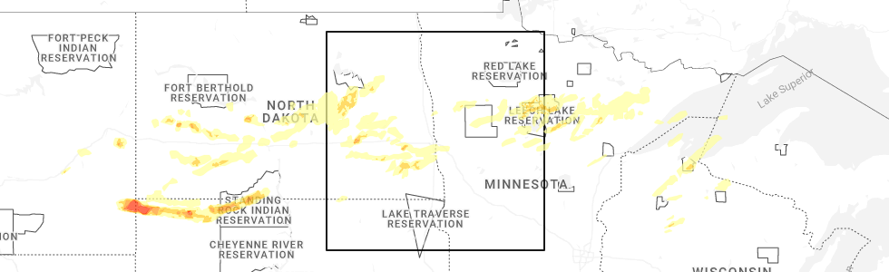
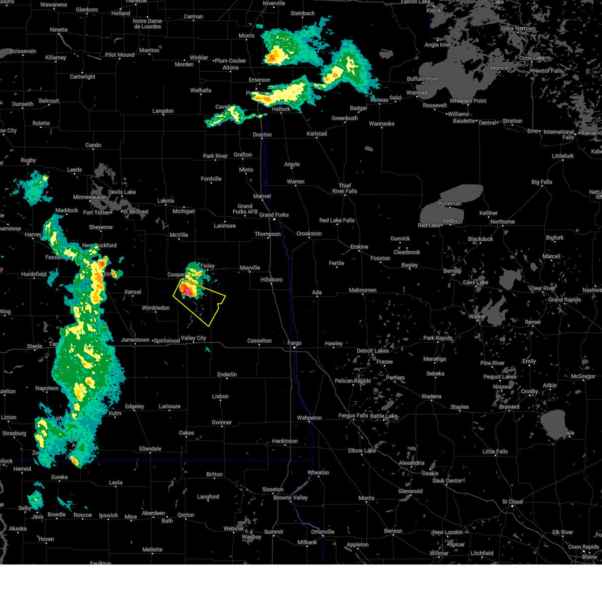
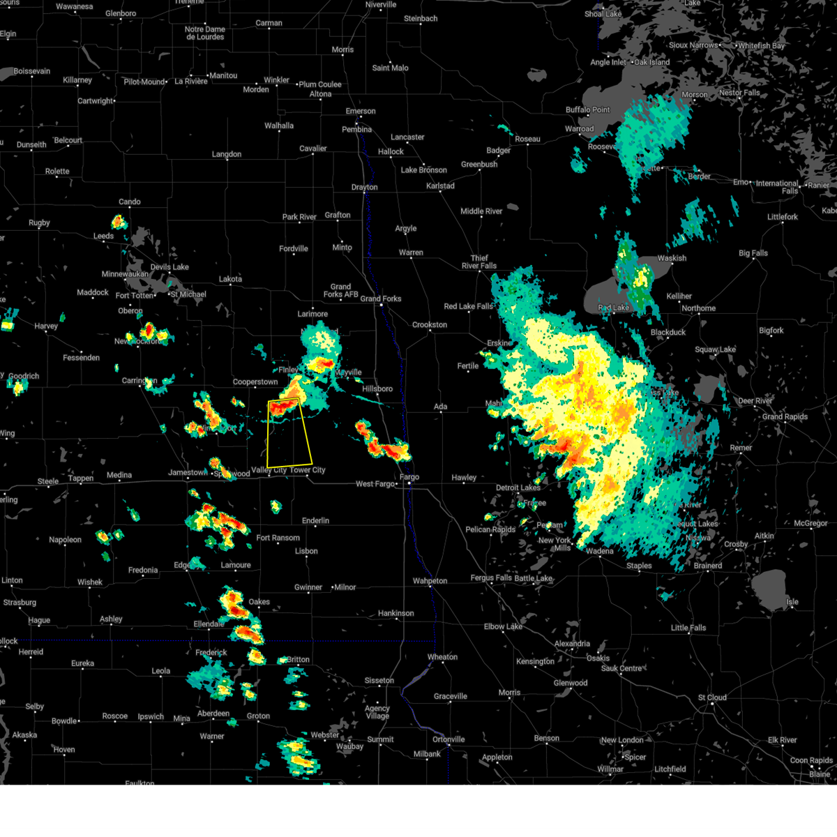
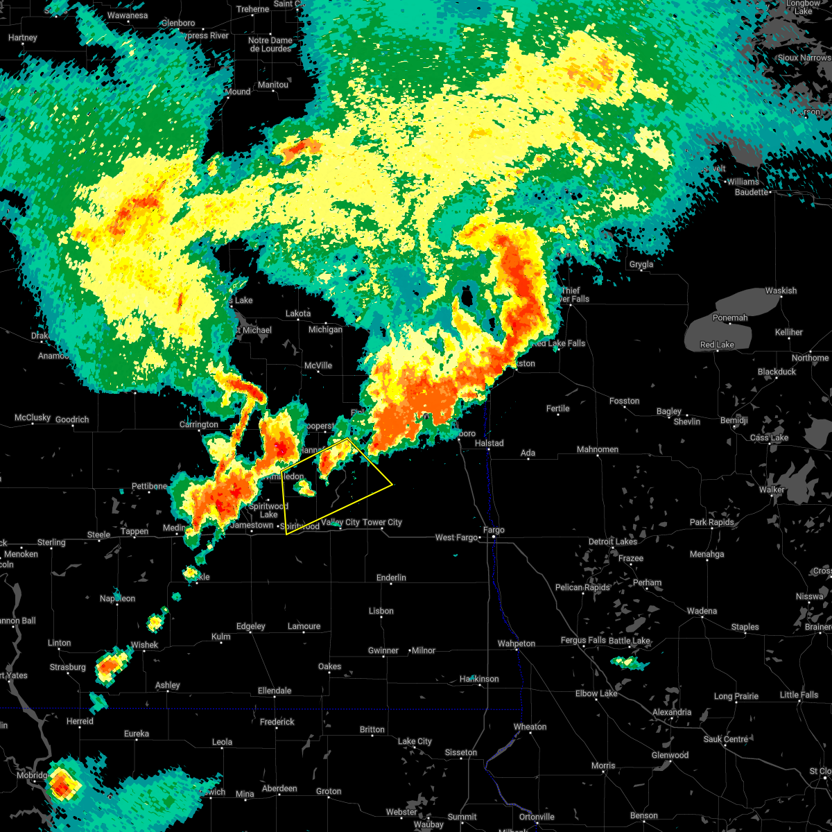
Hail Map for Luverne, ND
The Luverne, ND area has had 8 reports of on-the-ground hail by trained spotters, and has been under severe weather warnings 17 times during the past 12 months. Doppler radar has detected hail at or near Luverne, ND on 40 occasions, including 1 occasion during the past year.
| Name: | Luverne, ND |
| Where Located: | 60.3 miles WNW of Fargo, ND |
| Map: | Google Map for Luverne, ND |
| Population: | 31 |
| Housing Units: | 21 |
| More Info: | Search Google for Luverne, ND |
1
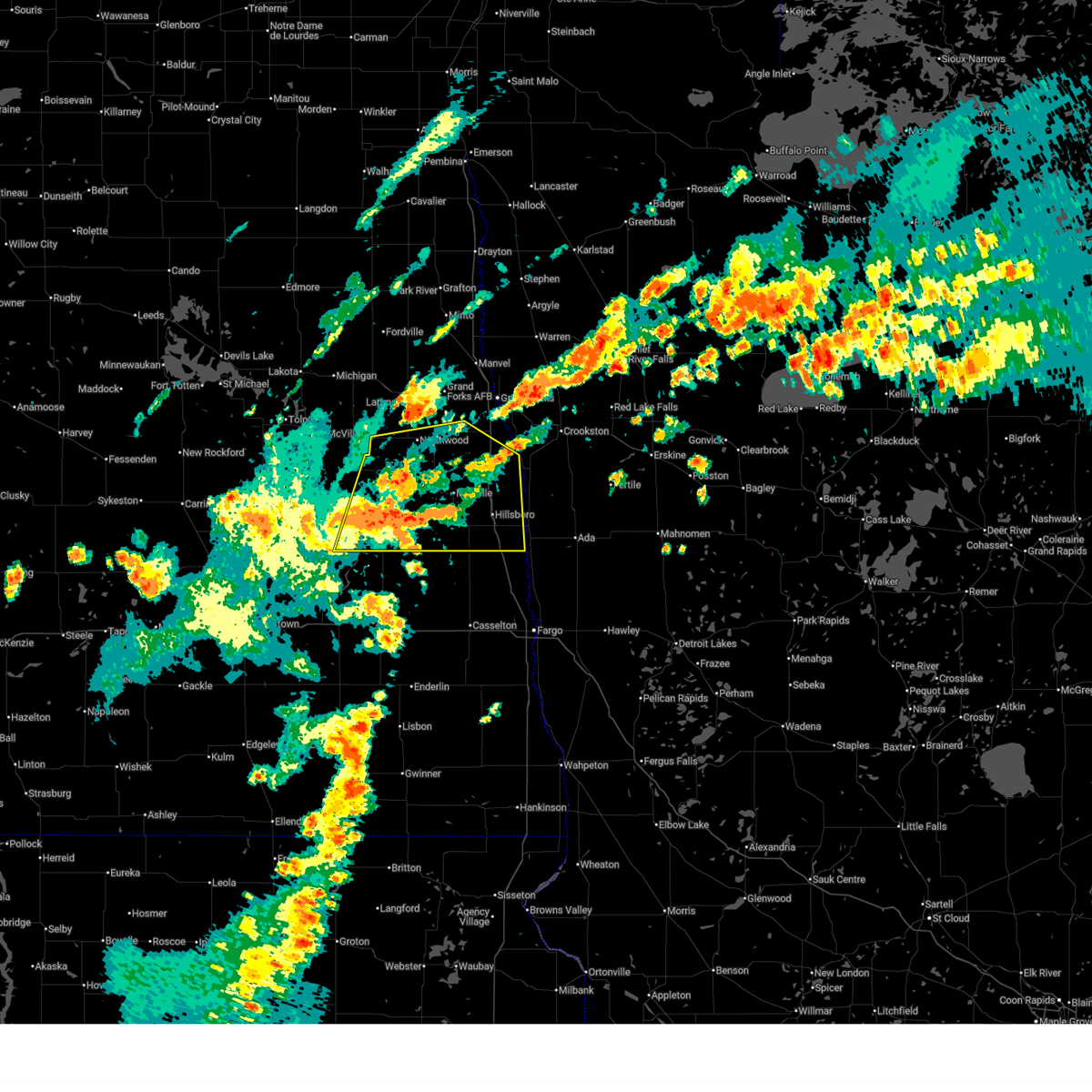
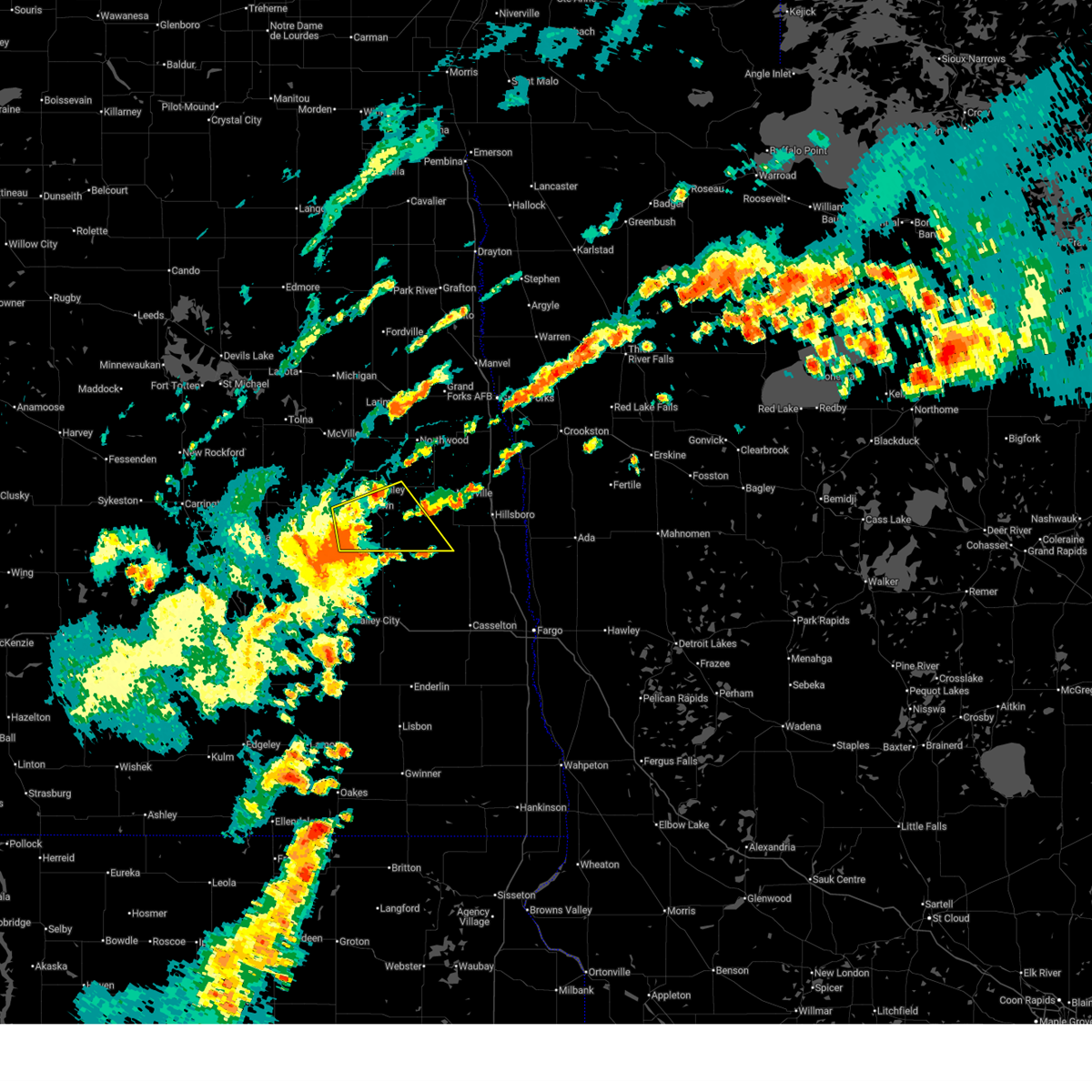
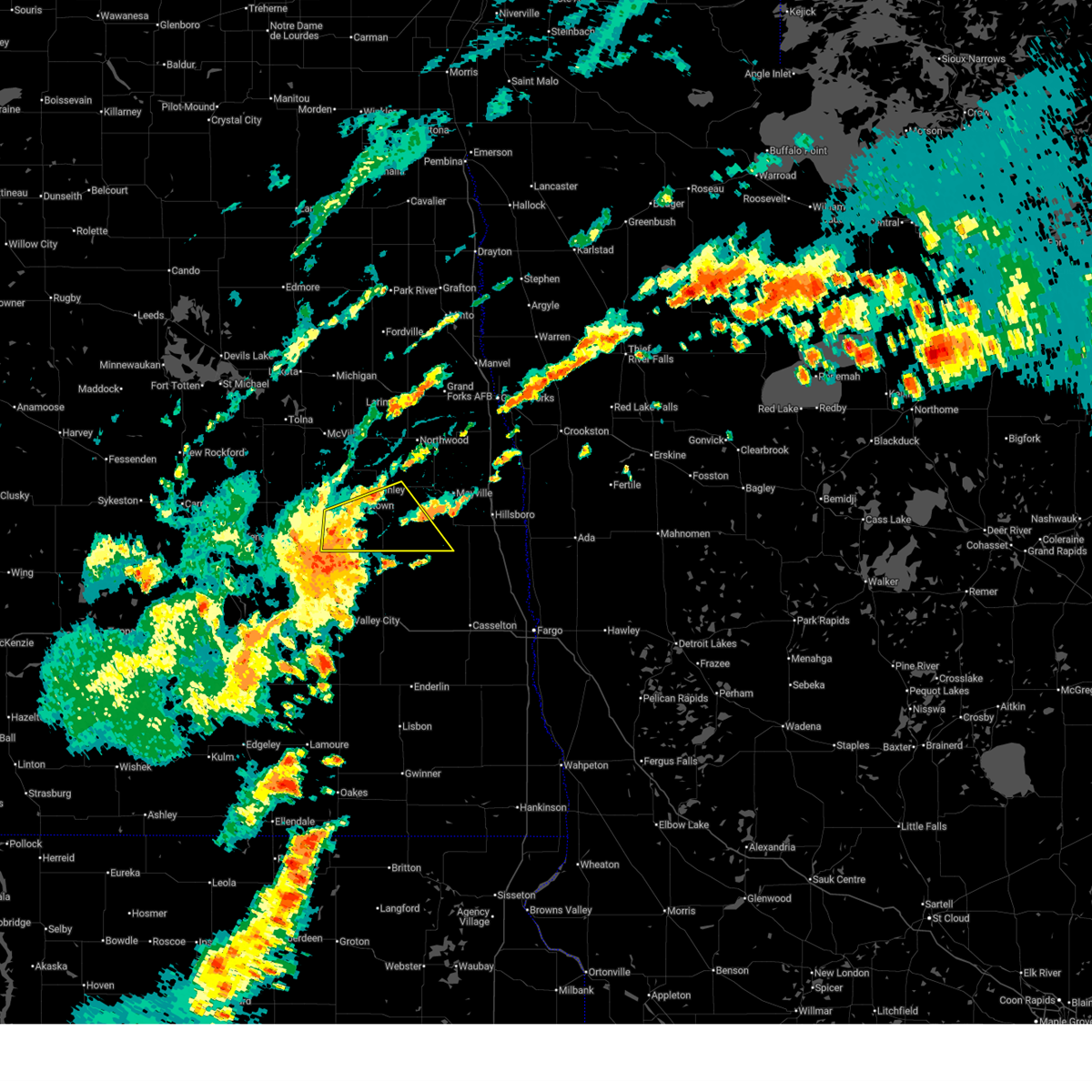
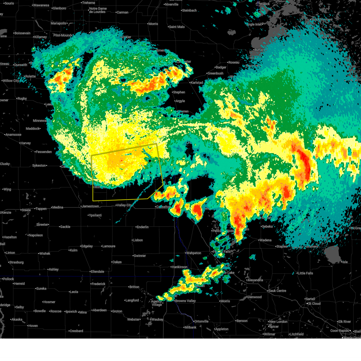
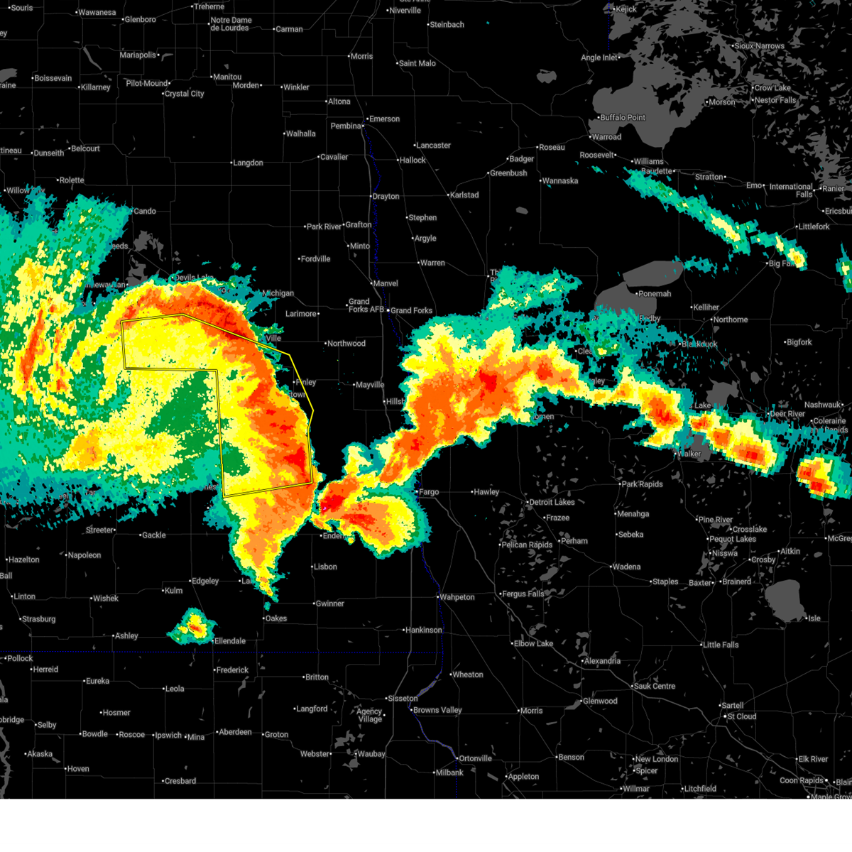
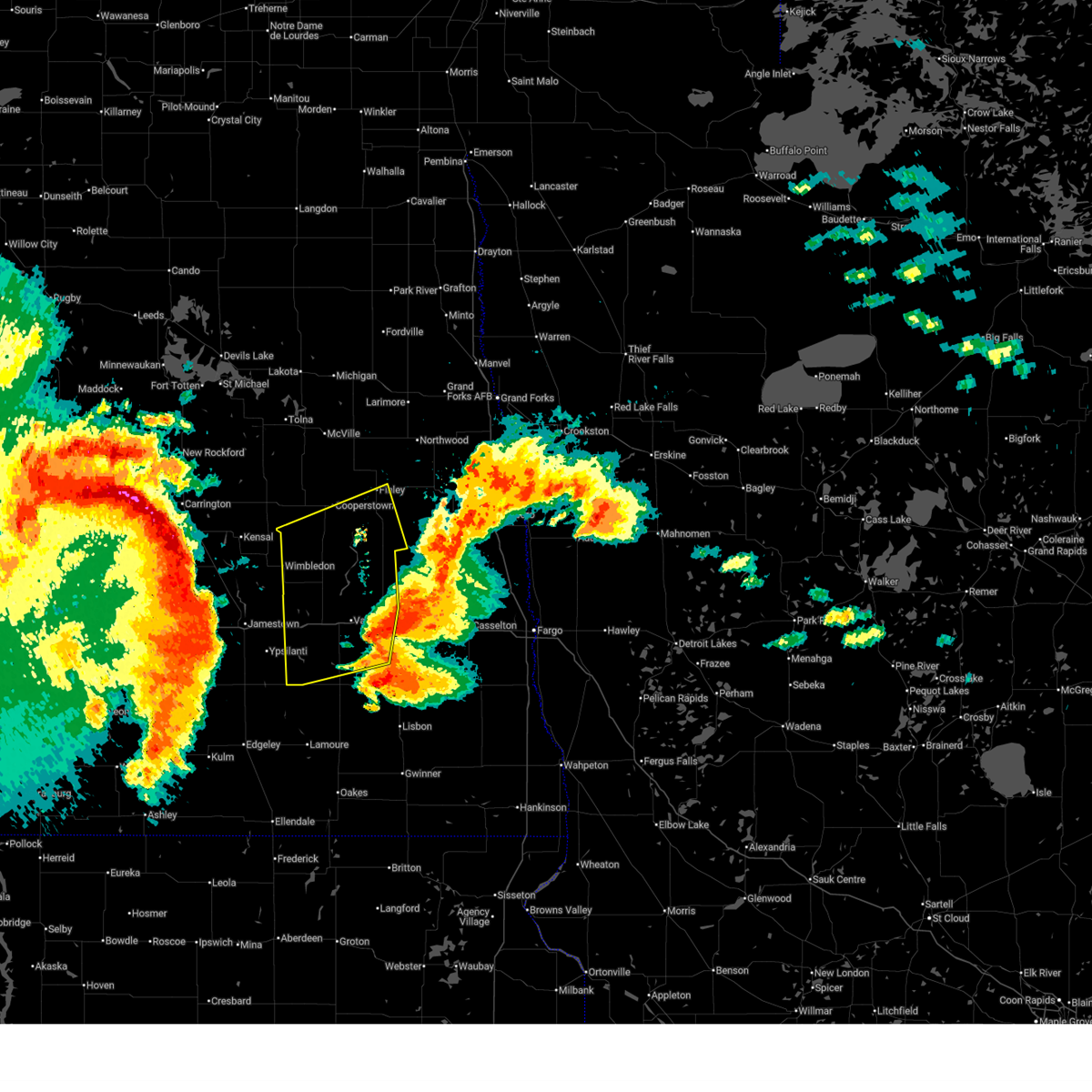
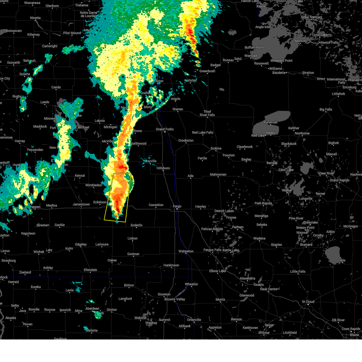
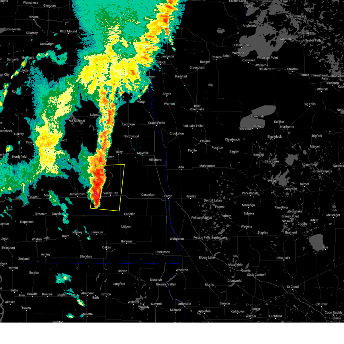
The Top Recent Hail Date for Luverne, ND is Friday, June 20, 2025 (5th out of 40)
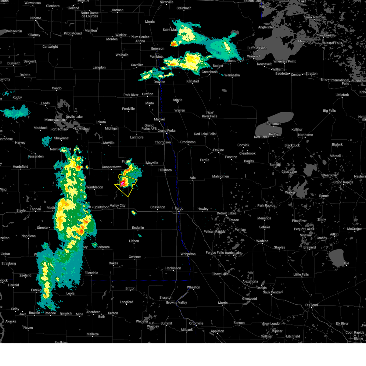
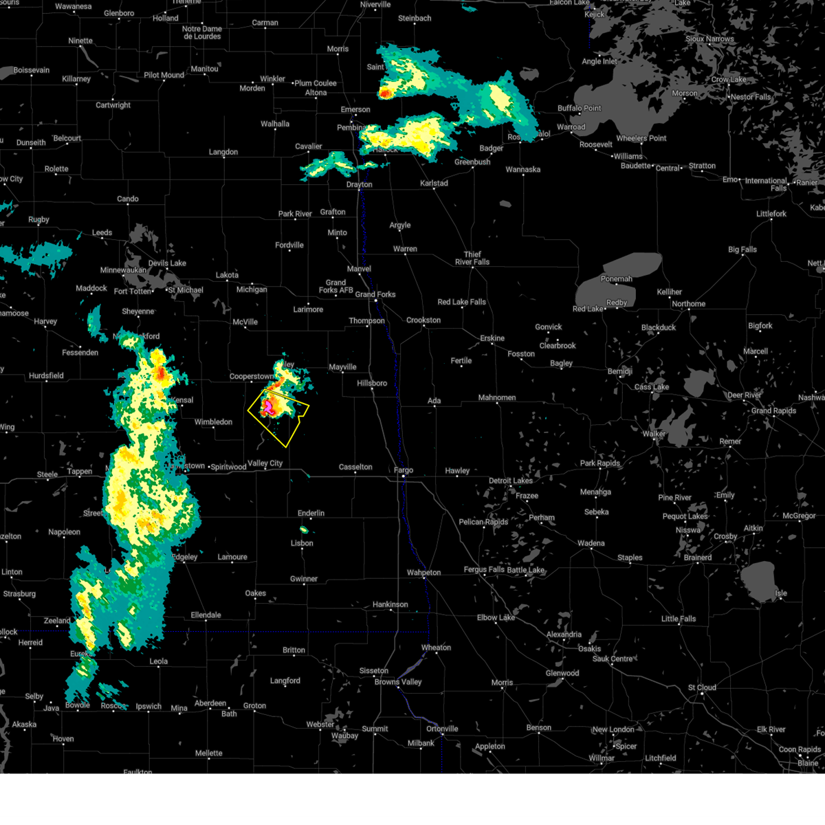
Hail and Wind Damage Spotted near Luverne, ND
| Date / Time | Report Details |
|---|---|
| 7/4/2025 4:25 PM CDT |
 Svrfgf the national weather service in grand forks has issued a * severe thunderstorm warning for, southern grand forks county in northeastern north dakota, traill county in southeastern north dakota, southeastern griggs county in southeastern north dakota, steele county in southeastern north dakota, * until 515 pm cdt. * at 425 pm cdt, severe thunderstorms were located along a line extending from near finley to near clifford, moving northeast at 35 mph (radar indicated). Hazards include 60 mph wind gusts and nickel size hail. expect damage to roofs, siding, and trees Svrfgf the national weather service in grand forks has issued a * severe thunderstorm warning for, southern grand forks county in northeastern north dakota, traill county in southeastern north dakota, southeastern griggs county in southeastern north dakota, steele county in southeastern north dakota, * until 515 pm cdt. * at 425 pm cdt, severe thunderstorms were located along a line extending from near finley to near clifford, moving northeast at 35 mph (radar indicated). Hazards include 60 mph wind gusts and nickel size hail. expect damage to roofs, siding, and trees
|
| 7/4/2025 4:01 PM CDT |
 At 401 pm cdt, severe thunderstorms were located along a line extending from 6 miles southeast of cooperstown to pillsbury, moving east at 45 mph (radar indicated). Hazards include 70 mph wind gusts and nickel size hail. Expect considerable tree damage. damage is likely to mobile homes, roofs, and outbuildings. Locations impacted include, finley, hope, galesburg, luverne, colgate, blabon, and sherbrooke. At 401 pm cdt, severe thunderstorms were located along a line extending from 6 miles southeast of cooperstown to pillsbury, moving east at 45 mph (radar indicated). Hazards include 70 mph wind gusts and nickel size hail. Expect considerable tree damage. damage is likely to mobile homes, roofs, and outbuildings. Locations impacted include, finley, hope, galesburg, luverne, colgate, blabon, and sherbrooke.
|
| 7/4/2025 3:53 PM CDT |
 Svrfgf the national weather service in grand forks has issued a * severe thunderstorm warning for, southwestern traill county in southeastern north dakota, southeastern griggs county in southeastern north dakota, southern steele county in southeastern north dakota, * until 430 pm cdt. * at 353 pm cdt, severe thunderstorms were located along a line extending from near cooperstown to pillsbury, moving east at 45 mph (radar indicated). Hazards include 60 mph wind gusts and nickel size hail. expect damage to roofs, siding, and trees Svrfgf the national weather service in grand forks has issued a * severe thunderstorm warning for, southwestern traill county in southeastern north dakota, southeastern griggs county in southeastern north dakota, southern steele county in southeastern north dakota, * until 430 pm cdt. * at 353 pm cdt, severe thunderstorms were located along a line extending from near cooperstown to pillsbury, moving east at 45 mph (radar indicated). Hazards include 60 mph wind gusts and nickel size hail. expect damage to roofs, siding, and trees
|
| 7/4/2025 3:24 PM CDT |
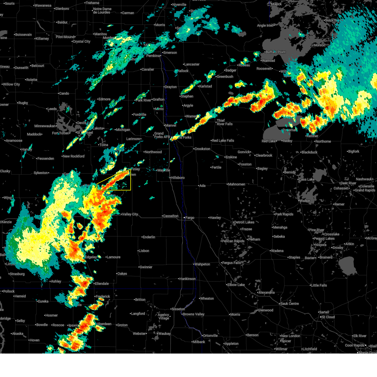 Svrfgf the national weather service in grand forks has issued a * severe thunderstorm warning for, southern griggs county in southeastern north dakota, southwestern steele county in southeastern north dakota, * until 430 pm cdt. * at 323 pm cdt, severe thunderstorms were located along a line extending from 6 miles west of walum to 6 miles southwest of finley, moving east at 20 mph (radar indicated). Hazards include 60 mph wind gusts and nickel size hail. expect damage to roofs, siding, and trees Svrfgf the national weather service in grand forks has issued a * severe thunderstorm warning for, southern griggs county in southeastern north dakota, southwestern steele county in southeastern north dakota, * until 430 pm cdt. * at 323 pm cdt, severe thunderstorms were located along a line extending from 6 miles west of walum to 6 miles southwest of finley, moving east at 20 mph (radar indicated). Hazards include 60 mph wind gusts and nickel size hail. expect damage to roofs, siding, and trees
|
| 6/28/2025 5:22 PM CDT | Quarter sized hail reported 8.5 miles NNE of Luverne, ND, corrects previous hail report from 15 n valley city. was also reports of a few tree branches down. |
| 6/28/2025 5:20 PM CDT | Quarter sized hail reported 8.5 miles NNE of Luverne, ND, was also reports of a few tree branches down. |
| 6/21/2025 2:40 AM CDT |
 The storms which prompted the warning have weakened below severe limits, and no longer pose an immediate threat to life or property. therefore, the warning will be allowed to expire. a tornado watch remains in effect until 300 am cdt for northwestern minnesota, and southeastern and northeastern north dakota. The storms which prompted the warning have weakened below severe limits, and no longer pose an immediate threat to life or property. therefore, the warning will be allowed to expire. a tornado watch remains in effect until 300 am cdt for northwestern minnesota, and southeastern and northeastern north dakota.
|
| 6/21/2025 2:22 AM CDT |
 At 222 am cdt, severe thunderstorms were located along a line extending from fisher to near hadler, moving northeast at 30 mph (public). Hazards include 70 mph wind gusts. Expect considerable tree damage. damage is likely to mobile homes, roofs, and outbuildings. these severe thunderstorms will remain over mainly rural areas of western norman, southwestern polk, southeastern grand forks, northern cass, traill and steele counties, including the following locations, west argusville and american crystal sugar. This includes interstate 29 between mile markers 77 and 129. At 222 am cdt, severe thunderstorms were located along a line extending from fisher to near hadler, moving northeast at 30 mph (public). Hazards include 70 mph wind gusts. Expect considerable tree damage. damage is likely to mobile homes, roofs, and outbuildings. these severe thunderstorms will remain over mainly rural areas of western norman, southwestern polk, southeastern grand forks, northern cass, traill and steele counties, including the following locations, west argusville and american crystal sugar. This includes interstate 29 between mile markers 77 and 129.
|
| 6/21/2025 2:22 AM CDT |
 the severe thunderstorm warning has been cancelled and is no longer in effect the severe thunderstorm warning has been cancelled and is no longer in effect
|
| 6/21/2025 1:43 AM CDT |
 Svrfgf the national weather service in grand forks has issued a * severe thunderstorm warning for, western norman county in northwestern minnesota, southwestern polk county in northwestern minnesota, southeastern grand forks county in northeastern north dakota, northern cass county in southeastern north dakota, traill county in southeastern north dakota, southeastern griggs county in southeastern north dakota, northeastern barnes county in southeastern north dakota, steele county in southeastern north dakota, * until 245 am cdt. * at 142 am cdt, severe thunderstorms were located along a line extending from reynolds to grandin, moving east at 30 mph. these are destructive storms for the central red river valley (public. at multiple ndanw sensors in the central red river valley reported winds gusts in excess of 90mph). Hazards include 100 mph wind gusts. You are in a life-threatening situation. flying debris may be deadly to those caught without shelter. mobile homes will be destroyed. expect considerable damage to homes and businesses. expect extensive tree damage and power outages. severe thunderstorms will be near, hillsboro, buxton, and reynolds around 145 am cdt. caledonia around 150 am cdt. halstad, hendrum, and shelly around 155 am cdt. climax and nielsville around 200 am cdt. fisher and eldred around 210 am cdt. other locations impacted by these severe thunderstorms include west argusville and american crystal sugar. This includes interstate 29 between mile markers 77 and 129. Svrfgf the national weather service in grand forks has issued a * severe thunderstorm warning for, western norman county in northwestern minnesota, southwestern polk county in northwestern minnesota, southeastern grand forks county in northeastern north dakota, northern cass county in southeastern north dakota, traill county in southeastern north dakota, southeastern griggs county in southeastern north dakota, northeastern barnes county in southeastern north dakota, steele county in southeastern north dakota, * until 245 am cdt. * at 142 am cdt, severe thunderstorms were located along a line extending from reynolds to grandin, moving east at 30 mph. these are destructive storms for the central red river valley (public. at multiple ndanw sensors in the central red river valley reported winds gusts in excess of 90mph). Hazards include 100 mph wind gusts. You are in a life-threatening situation. flying debris may be deadly to those caught without shelter. mobile homes will be destroyed. expect considerable damage to homes and businesses. expect extensive tree damage and power outages. severe thunderstorms will be near, hillsboro, buxton, and reynolds around 145 am cdt. caledonia around 150 am cdt. halstad, hendrum, and shelly around 155 am cdt. climax and nielsville around 200 am cdt. fisher and eldred around 210 am cdt. other locations impacted by these severe thunderstorms include west argusville and american crystal sugar. This includes interstate 29 between mile markers 77 and 129.
|
| 6/21/2025 1:12 AM CDT |
 Svrfgf the national weather service in grand forks has issued a * severe thunderstorm warning for, southwestern grand forks county in northeastern north dakota, northwestern cass county in southeastern north dakota, western traill county in southeastern north dakota, griggs county in southeastern north dakota, northern barnes county in southeastern north dakota, steele county in southeastern north dakota, * until 200 am cdt. * at 110 am cdt, a severe thunderstorm was located over galesburg, or 37 miles northeast of valley city, moving east at 15 mph. this is a destructive storm (emergency management. 111 mph wind gusts have been reported with this storm near luverne). Hazards include 100 mph wind gusts. You are in a life-threatening situation. flying debris may be deadly to those caught without shelter. mobile homes will be destroyed. expect considerable damage to homes and businesses. Expect extensive tree damage and power outages. Svrfgf the national weather service in grand forks has issued a * severe thunderstorm warning for, southwestern grand forks county in northeastern north dakota, northwestern cass county in southeastern north dakota, western traill county in southeastern north dakota, griggs county in southeastern north dakota, northern barnes county in southeastern north dakota, steele county in southeastern north dakota, * until 200 am cdt. * at 110 am cdt, a severe thunderstorm was located over galesburg, or 37 miles northeast of valley city, moving east at 15 mph. this is a destructive storm (emergency management. 111 mph wind gusts have been reported with this storm near luverne). Hazards include 100 mph wind gusts. You are in a life-threatening situation. flying debris may be deadly to those caught without shelter. mobile homes will be destroyed. expect considerable damage to homes and businesses. Expect extensive tree damage and power outages.
|
| 6/21/2025 12:28 AM CDT |
 The storms which prompted the warning have moved out of the area. therefore, the warning will be allowed to expire. however, gusty winds are still possible with these thunderstorms. a tornado watch remains in effect until 300 am cdt for southeastern and northeastern north dakota. remember, a severe thunderstorm warning still remains in effect for east central north dakota. widespread observed and long duration wind speeds have been greater than 75 mph within this area of storms. The storms which prompted the warning have moved out of the area. therefore, the warning will be allowed to expire. however, gusty winds are still possible with these thunderstorms. a tornado watch remains in effect until 300 am cdt for southeastern and northeastern north dakota. remember, a severe thunderstorm warning still remains in effect for east central north dakota. widespread observed and long duration wind speeds have been greater than 75 mph within this area of storms.
|
| 6/21/2025 12:16 AM CDT |
 Svrfgf the national weather service in grand forks has issued a * severe thunderstorm warning for, northwestern cass county in southeastern north dakota, griggs county in southeastern north dakota, barnes county in southeastern north dakota, steele county in southeastern north dakota, * until 115 am cdt. * at 1212 am cdt, severe thunderstorms were located along a line extending from 6 miles northeast of cooperstown to near sibley, moving east at 25 mph. widespread observed and long duration wind speeds have been greater than 75 mph within this area of storms. these are destructive winds (public). Hazards include 80 mph wind gusts. Flying debris will be dangerous to those caught without shelter. mobile homes will be heavily damaged. expect considerable damage to roofs, windows, and vehicles. Extensive tree damage and power outages are likely. Svrfgf the national weather service in grand forks has issued a * severe thunderstorm warning for, northwestern cass county in southeastern north dakota, griggs county in southeastern north dakota, barnes county in southeastern north dakota, steele county in southeastern north dakota, * until 115 am cdt. * at 1212 am cdt, severe thunderstorms were located along a line extending from 6 miles northeast of cooperstown to near sibley, moving east at 25 mph. widespread observed and long duration wind speeds have been greater than 75 mph within this area of storms. these are destructive winds (public). Hazards include 80 mph wind gusts. Flying debris will be dangerous to those caught without shelter. mobile homes will be heavily damaged. expect considerable damage to roofs, windows, and vehicles. Extensive tree damage and power outages are likely.
|
| 6/20/2025 11:30 PM CDT |
 The storms which prompted the warning have moved out of the area. therefore, the warning has been allowed to expire. a tornado watch remains in effect until 300 am cdt for southeastern north dakota. remember, a severe thunderstorm warning still remains in effect for all areas previously warned. The storms which prompted the warning have moved out of the area. therefore, the warning has been allowed to expire. a tornado watch remains in effect until 300 am cdt for southeastern north dakota. remember, a severe thunderstorm warning still remains in effect for all areas previously warned.
|
| 6/20/2025 11:29 PM CDT |
 Svrfgf the national weather service in grand forks has issued a * severe thunderstorm warning for, south central benson county in northeastern north dakota, southwestern nelson county in northeastern north dakota, griggs county in southeastern north dakota, northern barnes county in southeastern north dakota, eddy county in northeastern north dakota, western steele county in southeastern north dakota, * until 1230 am cdt. * at 1128 pm cdt, severe thunderstorms were located along a line extending from 6 miles east of bremen to near eldridge, moving east at 50 mph (public). Hazards include 70 mph wind gusts. Expect considerable tree damage. damage is likely to mobile homes, roofs, and outbuildings. severe thunderstorms will be near, new rockford around 1130 pm cdt. sheyenne, brantford, and southern spirit lake nation around 1135 pm cdt. wimbledon around 1150 pm cdt. sutton, warwick, and leal around 1155 pm cdt. rogers, hamar, and revere around 1200 am cdt. this includes the following highways, interstate 94 in north dakota between mile markers 272 and 303. Interstate 94 in minnesota between mile markers 272 and 303. Svrfgf the national weather service in grand forks has issued a * severe thunderstorm warning for, south central benson county in northeastern north dakota, southwestern nelson county in northeastern north dakota, griggs county in southeastern north dakota, northern barnes county in southeastern north dakota, eddy county in northeastern north dakota, western steele county in southeastern north dakota, * until 1230 am cdt. * at 1128 pm cdt, severe thunderstorms were located along a line extending from 6 miles east of bremen to near eldridge, moving east at 50 mph (public). Hazards include 70 mph wind gusts. Expect considerable tree damage. damage is likely to mobile homes, roofs, and outbuildings. severe thunderstorms will be near, new rockford around 1130 pm cdt. sheyenne, brantford, and southern spirit lake nation around 1135 pm cdt. wimbledon around 1150 pm cdt. sutton, warwick, and leal around 1155 pm cdt. rogers, hamar, and revere around 1200 am cdt. this includes the following highways, interstate 94 in north dakota between mile markers 272 and 303. Interstate 94 in minnesota between mile markers 272 and 303.
|
| 6/20/2025 10:37 PM CDT |
 Svrfgf the national weather service in grand forks has issued a * severe thunderstorm warning for, southern griggs county in southeastern north dakota, barnes county in southeastern north dakota, southwestern steele county in southeastern north dakota, * until 1130 pm cdt. * at 1037 pm cdt, severe thunderstorms were located along a line extending from near edmunds to near eldridge to near alfred, moving east at 65 mph. these are destructive storms for griggs, barnes, and steele counties (radar indicated). Hazards include 90 mph wind gusts and ping pong ball size hail. You are in a life-threatening situation. flying debris may be deadly to those caught without shelter. mobile homes will be heavily damaged or destroyed. homes and businesses will have substantial roof and window damage. expect extensive tree damage and power outages. severe thunderstorms will be near, wimbledon and urbana around 1055 pm cdt. eckelson and leal around 1100 pm cdt. sanborn, dazey, and rogers around 1105 pm cdt. hannaford, walum, and bald hill dam around 1110 pm cdt. valley city, cooperstown, and sibley around 1115 pm cdt. this includes the following highways, interstate 94 in north dakota between mile markers 272 and 306. Interstate 94 in minnesota between mile markers 272 and 306. Svrfgf the national weather service in grand forks has issued a * severe thunderstorm warning for, southern griggs county in southeastern north dakota, barnes county in southeastern north dakota, southwestern steele county in southeastern north dakota, * until 1130 pm cdt. * at 1037 pm cdt, severe thunderstorms were located along a line extending from near edmunds to near eldridge to near alfred, moving east at 65 mph. these are destructive storms for griggs, barnes, and steele counties (radar indicated). Hazards include 90 mph wind gusts and ping pong ball size hail. You are in a life-threatening situation. flying debris may be deadly to those caught without shelter. mobile homes will be heavily damaged or destroyed. homes and businesses will have substantial roof and window damage. expect extensive tree damage and power outages. severe thunderstorms will be near, wimbledon and urbana around 1055 pm cdt. eckelson and leal around 1100 pm cdt. sanborn, dazey, and rogers around 1105 pm cdt. hannaford, walum, and bald hill dam around 1110 pm cdt. valley city, cooperstown, and sibley around 1115 pm cdt. this includes the following highways, interstate 94 in north dakota between mile markers 272 and 306. Interstate 94 in minnesota between mile markers 272 and 306.
|
| 8/28/2024 11:21 PM CDT |
 the severe thunderstorm warning has been cancelled and is no longer in effect the severe thunderstorm warning has been cancelled and is no longer in effect
|
| 8/28/2024 11:21 PM CDT |
 At 1121 pm cdt, a severe thunderstorm was located 7 miles east of bald hill dam, or 9 miles northeast of valley city, moving east at 30 mph (radar indicated). Hazards include 60 mph wind gusts and nickel size hail. Expect damage to roofs, siding, and trees. locations impacted include, valley city, hope, tower city, sanborn, buffalo, oriska, and dazey. This includes interstate 94 in north dakota between mile markers 282 and 315. At 1121 pm cdt, a severe thunderstorm was located 7 miles east of bald hill dam, or 9 miles northeast of valley city, moving east at 30 mph (radar indicated). Hazards include 60 mph wind gusts and nickel size hail. Expect damage to roofs, siding, and trees. locations impacted include, valley city, hope, tower city, sanborn, buffalo, oriska, and dazey. This includes interstate 94 in north dakota between mile markers 282 and 315.
|
| 8/28/2024 10:54 PM CDT |
 Svrfgf the national weather service in grand forks has issued a * severe thunderstorm warning for, northwestern cass county in southeastern north dakota, southeastern griggs county in southeastern north dakota, central barnes county in southeastern north dakota, southwestern steele county in southeastern north dakota, * until midnight cdt. * at 1053 pm cdt, a severe thunderstorm was located over rogers, or 12 miles northwest of valley city, moving east at 30 mph (radar indicated). Hazards include 60 mph wind gusts and quarter size hail. Hail damage to vehicles is expected. Expect wind damage to roofs, siding, and trees. Svrfgf the national weather service in grand forks has issued a * severe thunderstorm warning for, northwestern cass county in southeastern north dakota, southeastern griggs county in southeastern north dakota, central barnes county in southeastern north dakota, southwestern steele county in southeastern north dakota, * until midnight cdt. * at 1053 pm cdt, a severe thunderstorm was located over rogers, or 12 miles northwest of valley city, moving east at 30 mph (radar indicated). Hazards include 60 mph wind gusts and quarter size hail. Hail damage to vehicles is expected. Expect wind damage to roofs, siding, and trees.
|
| 6/18/2024 1:32 AM CDT |
 At 132 am cdt, severe thunderstorms were located along a line extending from golden lake to near bald hill dam to near nortonville, moving east at 35 mph (radar indicated). Hazards include 70 mph wind gusts. Expect considerable tree damage. damage is likely to mobile homes, roofs, and outbuildings. locations impacted include, valley city, mayville, hillsboro, cooperstown, hatton, portland, and golden lake. this includes the following highways, interstate 29 between mile markers 97 and 122. Interstate 94 in north dakota between mile markers 272 and 325. At 132 am cdt, severe thunderstorms were located along a line extending from golden lake to near bald hill dam to near nortonville, moving east at 35 mph (radar indicated). Hazards include 70 mph wind gusts. Expect considerable tree damage. damage is likely to mobile homes, roofs, and outbuildings. locations impacted include, valley city, mayville, hillsboro, cooperstown, hatton, portland, and golden lake. this includes the following highways, interstate 29 between mile markers 97 and 122. Interstate 94 in north dakota between mile markers 272 and 325.
|
| 6/18/2024 1:23 AM CDT |
 Svrfgf the national weather service in grand forks has issued a * severe thunderstorm warning for, western cass county in southeastern north dakota, traill county in southeastern north dakota, eastern griggs county in southeastern north dakota, barnes county in southeastern north dakota, steele county in southeastern north dakota, * until 215 am cdt. * at 122 am cdt, severe thunderstorms were located along a line extending from near finley to bald hill dam to near nortonville, moving east at 35 mph (radar indicated). Hazards include 60 mph wind gusts. expect damage to roofs, siding, and trees Svrfgf the national weather service in grand forks has issued a * severe thunderstorm warning for, western cass county in southeastern north dakota, traill county in southeastern north dakota, eastern griggs county in southeastern north dakota, barnes county in southeastern north dakota, steele county in southeastern north dakota, * until 215 am cdt. * at 122 am cdt, severe thunderstorms were located along a line extending from near finley to bald hill dam to near nortonville, moving east at 35 mph (radar indicated). Hazards include 60 mph wind gusts. expect damage to roofs, siding, and trees
|
| 6/16/2024 4:53 AM CDT |
 At 453 am cdt, severe thunderstorms were located along a line extending from near luverne to 6 miles southeast of valley city, moving east at 45 mph (radar indicated). Hazards include 60 mph wind gusts and penny size hail. Expect damage to roofs, siding, and trees. locations impacted include, valley city, hope, oriska, luverne, sibley, pillsbury, and bald hill dam. This includes interstate 94 in north dakota between mile markers 284 and 302. At 453 am cdt, severe thunderstorms were located along a line extending from near luverne to 6 miles southeast of valley city, moving east at 45 mph (radar indicated). Hazards include 60 mph wind gusts and penny size hail. Expect damage to roofs, siding, and trees. locations impacted include, valley city, hope, oriska, luverne, sibley, pillsbury, and bald hill dam. This includes interstate 94 in north dakota between mile markers 284 and 302.
|
| 6/16/2024 4:30 AM CDT |
 Svrfgf the national weather service in grand forks has issued a * severe thunderstorm warning for, southeastern griggs county in southeastern north dakota, barnes county in southeastern north dakota, southwestern steele county in southeastern north dakota, * until 515 am cdt. * at 428 am cdt, severe thunderstorms were located along a line extending from near walum to 8 miles south of eckelson, moving east at 45 mph (radar indicated). Hazards include 60 mph wind gusts and quarter size hail. Hail damage to vehicles is expected. Expect wind damage to roofs, siding, and trees. Svrfgf the national weather service in grand forks has issued a * severe thunderstorm warning for, southeastern griggs county in southeastern north dakota, barnes county in southeastern north dakota, southwestern steele county in southeastern north dakota, * until 515 am cdt. * at 428 am cdt, severe thunderstorms were located along a line extending from near walum to 8 miles south of eckelson, moving east at 45 mph (radar indicated). Hazards include 60 mph wind gusts and quarter size hail. Hail damage to vehicles is expected. Expect wind damage to roofs, siding, and trees.
|
| 5/16/2024 9:23 PM CDT |
 At 922 pm cdt, a severe thunderstorm was located near pillsbury, or 22 miles north of valley city, moving southeast at 20 mph (report of 1 inch hail 2 miles north of luverne). Hazards include 60 mph wind gusts and quarter size hail. Hail damage to vehicles is expected. expect wind damage to roofs, siding, and trees. Locations impacted include, hope, luverne, sibley, and pillsbury. At 922 pm cdt, a severe thunderstorm was located near pillsbury, or 22 miles north of valley city, moving southeast at 20 mph (report of 1 inch hail 2 miles north of luverne). Hazards include 60 mph wind gusts and quarter size hail. Hail damage to vehicles is expected. expect wind damage to roofs, siding, and trees. Locations impacted include, hope, luverne, sibley, and pillsbury.
|
| 5/16/2024 9:23 PM CDT |
 the severe thunderstorm warning has been cancelled and is no longer in effect the severe thunderstorm warning has been cancelled and is no longer in effect
|
| 5/16/2024 9:15 PM CDT | Quarter sized hail reported 1.9 miles S of Luverne, ND, 1 inch hail reported 2 miles north of luverne nd. |
| 5/16/2024 9:09 PM CDT |
 At 907 pm cdt, a severe thunderstorm was located over luverne, or 23 miles north of valley city, moving southeast at 20 mph (radar indicated). Hazards include 60 mph wind gusts and quarter size hail. Hail damage to vehicles is expected. expect wind damage to roofs, siding, and trees. Locations impacted include, hope, luverne, sibley, and pillsbury. At 907 pm cdt, a severe thunderstorm was located over luverne, or 23 miles north of valley city, moving southeast at 20 mph (radar indicated). Hazards include 60 mph wind gusts and quarter size hail. Hail damage to vehicles is expected. expect wind damage to roofs, siding, and trees. Locations impacted include, hope, luverne, sibley, and pillsbury.
|
| 5/16/2024 8:44 PM CDT |
 Svrfgf the national weather service in grand forks has issued a * severe thunderstorm warning for, southeastern griggs county in southeastern north dakota, northeastern barnes county in southeastern north dakota, southwestern steele county in southeastern north dakota, * until 945 pm cdt. * at 844 pm cdt, a severe thunderstorm was located near hannaford, or 27 miles north of valley city, moving southeast at 20 mph (radar indicated). Hazards include 60 mph wind gusts and quarter size hail. Hail damage to vehicles is expected. Expect wind damage to roofs, siding, and trees. Svrfgf the national weather service in grand forks has issued a * severe thunderstorm warning for, southeastern griggs county in southeastern north dakota, northeastern barnes county in southeastern north dakota, southwestern steele county in southeastern north dakota, * until 945 pm cdt. * at 844 pm cdt, a severe thunderstorm was located near hannaford, or 27 miles north of valley city, moving southeast at 20 mph (radar indicated). Hazards include 60 mph wind gusts and quarter size hail. Hail damage to vehicles is expected. Expect wind damage to roofs, siding, and trees.
|
| 9/4/2023 11:39 PM CDT |
 At 1139 pm cdt, severe thunderstorms were located along a line extending from near derrick to near whitman to near finley, moving northeast at 45 mph (radar indicated). Hazards include 60 mph wind gusts. expect damage to roofs, siding, and trees At 1139 pm cdt, severe thunderstorms were located along a line extending from near derrick to near whitman to near finley, moving northeast at 45 mph (radar indicated). Hazards include 60 mph wind gusts. expect damage to roofs, siding, and trees
|
| 9/4/2023 10:34 PM CDT |
 At 1034 pm cdt, severe thunderstorms were located along a line extending from near flora to 7 miles northwest of mchenry to near adrian, moving east at 45 mph (radar indicated). Hazards include 60 mph wind gusts and penny size hail. expect damage to roofs, siding, and trees At 1034 pm cdt, severe thunderstorms were located along a line extending from near flora to 7 miles northwest of mchenry to near adrian, moving east at 45 mph (radar indicated). Hazards include 60 mph wind gusts and penny size hail. expect damage to roofs, siding, and trees
|
| 7/13/2023 3:12 PM CDT |
 At 312 pm cdt, a severe thunderstorm was located near pillsbury, or 25 miles north of valley city, moving east at 25 mph (radar indicated). Hazards include 60 mph wind gusts and quarter size hail. Hail damage to vehicles is expected. Expect wind damage to roofs, siding, and trees. At 312 pm cdt, a severe thunderstorm was located near pillsbury, or 25 miles north of valley city, moving east at 25 mph (radar indicated). Hazards include 60 mph wind gusts and quarter size hail. Hail damage to vehicles is expected. Expect wind damage to roofs, siding, and trees.
|
| 6/7/2023 5:13 PM CDT |
 The severe thunderstorm warning for west central cass, northeastern barnes and southwestern steele counties will expire at 515 pm cdt, the storm which prompted the warning has weakened below severe limits, and no longer poses an immediate threat to life or property. therefore, the warning will be allowed to expire. The severe thunderstorm warning for west central cass, northeastern barnes and southwestern steele counties will expire at 515 pm cdt, the storm which prompted the warning has weakened below severe limits, and no longer poses an immediate threat to life or property. therefore, the warning will be allowed to expire.
|
| 6/7/2023 4:56 PM CDT |
 At 456 pm cdt, a severe thunderstorm was located near pillsbury, or 19 miles north of valley city, moving south at 20 mph (radar indicated). Hazards include 60 mph wind gusts and quarter size hail. Hail damage to vehicles is expected. expect wind damage to roofs, siding, and trees. locations impacted include, luverne, sibley and pillsbury. hail threat, radar indicated max hail size, 1. 00 in wind threat, radar indicated max wind gust, 60 mph. At 456 pm cdt, a severe thunderstorm was located near pillsbury, or 19 miles north of valley city, moving south at 20 mph (radar indicated). Hazards include 60 mph wind gusts and quarter size hail. Hail damage to vehicles is expected. expect wind damage to roofs, siding, and trees. locations impacted include, luverne, sibley and pillsbury. hail threat, radar indicated max hail size, 1. 00 in wind threat, radar indicated max wind gust, 60 mph.
|
| 6/7/2023 4:35 PM CDT |
 At 434 pm cdt, a severe thunderstorm was located near luverne, or 26 miles north of valley city, moving south at 20 mph (radar indicated). Hazards include 60 mph wind gusts and quarter size hail. Hail damage to vehicles is expected. Expect wind damage to roofs, siding, and trees. At 434 pm cdt, a severe thunderstorm was located near luverne, or 26 miles north of valley city, moving south at 20 mph (radar indicated). Hazards include 60 mph wind gusts and quarter size hail. Hail damage to vehicles is expected. Expect wind damage to roofs, siding, and trees.
|
| 9/19/2022 11:38 AM CDT |
 The severe thunderstorm warning for southeastern griggs, northeastern barnes and southwestern steele counties will expire at 1145 am cdt, the storm which prompted the warning has weakened below severe limits, and no longer poses an immediate threat to life or property. therefore, the warning will be allowed to expire. The severe thunderstorm warning for southeastern griggs, northeastern barnes and southwestern steele counties will expire at 1145 am cdt, the storm which prompted the warning has weakened below severe limits, and no longer poses an immediate threat to life or property. therefore, the warning will be allowed to expire.
|
| 9/19/2022 11:19 AM CDT |
 At 1119 am cdt, a severe thunderstorm was located near hannaford, or 27 miles north of valley city, moving east at 45 mph (public report of quarter size near walum ). Hazards include 60 mph wind gusts and quarter size hail. Hail damage to vehicles is expected. expect wind damage to roofs, siding, and trees. locations impacted include, sibley, luverne, blabon and hope. hail threat, observed max hail size, 1. 00 in wind threat, radar indicated max wind gust, 60 mph. At 1119 am cdt, a severe thunderstorm was located near hannaford, or 27 miles north of valley city, moving east at 45 mph (public report of quarter size near walum ). Hazards include 60 mph wind gusts and quarter size hail. Hail damage to vehicles is expected. expect wind damage to roofs, siding, and trees. locations impacted include, sibley, luverne, blabon and hope. hail threat, observed max hail size, 1. 00 in wind threat, radar indicated max wind gust, 60 mph.
|
| 9/19/2022 10:55 AM CDT |
 At 1055 am cdt, a severe thunderstorm was located near wimbledon, or 28 miles northwest of valley city, moving east at 40 mph (radar indicated). Hazards include 60 mph wind gusts and quarter size hail. Hail damage to vehicles is expected. expect wind damage to roofs, siding, and trees. this severe thunderstorm will be near, dazey around 1110 am cdt. walum and hannaford around 1115 am cdt. other locations in the path of this severe thunderstorm include sibley, luverne, blabon and hope. hail threat, radar indicated max hail size, 1. 00 in wind threat, radar indicated max wind gust, 60 mph. At 1055 am cdt, a severe thunderstorm was located near wimbledon, or 28 miles northwest of valley city, moving east at 40 mph (radar indicated). Hazards include 60 mph wind gusts and quarter size hail. Hail damage to vehicles is expected. expect wind damage to roofs, siding, and trees. this severe thunderstorm will be near, dazey around 1110 am cdt. walum and hannaford around 1115 am cdt. other locations in the path of this severe thunderstorm include sibley, luverne, blabon and hope. hail threat, radar indicated max hail size, 1. 00 in wind threat, radar indicated max wind gust, 60 mph.
|
| 7/23/2022 12:30 AM CDT |
 At 1229 am cdt, severe thunderstorms were located along a line extending from near blabon to near luverne to near rogers, moving southeast at 60 mph. these are destructive storms (radar indicated). Hazards include 80 mph wind gusts and quarter size hail. Flying debris will be dangerous to those caught without shelter. mobile homes will be heavily damaged. expect considerable damage to roofs, windows, and vehicles. extensive tree damage and power outages are likely. locations impacted include, rogers, sibley, bald hill dam, pillsbury, hope, valley city and colgate. this includes interstate 94 in north dakota between mile markers 286 and 291. thunderstorm damage threat, destructive hail threat, radar indicated max hail size, 1. 00 in wind threat, radar indicated max wind gust, 80 mph. At 1229 am cdt, severe thunderstorms were located along a line extending from near blabon to near luverne to near rogers, moving southeast at 60 mph. these are destructive storms (radar indicated). Hazards include 80 mph wind gusts and quarter size hail. Flying debris will be dangerous to those caught without shelter. mobile homes will be heavily damaged. expect considerable damage to roofs, windows, and vehicles. extensive tree damage and power outages are likely. locations impacted include, rogers, sibley, bald hill dam, pillsbury, hope, valley city and colgate. this includes interstate 94 in north dakota between mile markers 286 and 291. thunderstorm damage threat, destructive hail threat, radar indicated max hail size, 1. 00 in wind threat, radar indicated max wind gust, 80 mph.
|
| 7/23/2022 12:00 AM CDT |
 At 1156 pm cdt, severe thunderstorms were located along a line extending from near mcville to near red willow lake to near glenfield, moving southeast at 60 mph. these are destructive storms (radar indicated). Hazards include 80 mph wind gusts and quarter size hail. Flying debris will be dangerous to those caught without shelter. mobile homes will be heavily damaged. expect considerable damage to roofs, windows, and vehicles. extensive tree damage and power outages are likely. severe thunderstorms will be near, sutton around 1200 am cdt. kloten, jessie and revere around 1205 am cdt. aneta around 1210 am cdt. sharon, cooperstown and wimbledon around 1215 am cdt. other locations in the path of these severe thunderstorms include leal and dazey. this includes interstate 94 in north dakota between mile markers 286 and 291. thunderstorm damage threat, destructive hail threat, radar indicated max hail size, 1. 00 in wind threat, radar indicated max wind gust, 80 mph. At 1156 pm cdt, severe thunderstorms were located along a line extending from near mcville to near red willow lake to near glenfield, moving southeast at 60 mph. these are destructive storms (radar indicated). Hazards include 80 mph wind gusts and quarter size hail. Flying debris will be dangerous to those caught without shelter. mobile homes will be heavily damaged. expect considerable damage to roofs, windows, and vehicles. extensive tree damage and power outages are likely. severe thunderstorms will be near, sutton around 1200 am cdt. kloten, jessie and revere around 1205 am cdt. aneta around 1210 am cdt. sharon, cooperstown and wimbledon around 1215 am cdt. other locations in the path of these severe thunderstorms include leal and dazey. this includes interstate 94 in north dakota between mile markers 286 and 291. thunderstorm damage threat, destructive hail threat, radar indicated max hail size, 1. 00 in wind threat, radar indicated max wind gust, 80 mph.
|
| 7/10/2022 7:20 AM CDT |
 At 720 am cdt, severe thunderstorms were located along a line extending from near edinburg to near larimore to near blabon, moving east at 55 mph (radar indicated). Hazards include 60 mph wind gusts and nickel size hail. Expect damage to roofs, siding, and trees. locations impacted include, larimore, kempton, arvilla, colgate, mandt, clifford, grand forks afb and galesburg. hail threat, radar indicated max hail size, 0. 88 in wind threat, radar indicated max wind gust, 60 mph. At 720 am cdt, severe thunderstorms were located along a line extending from near edinburg to near larimore to near blabon, moving east at 55 mph (radar indicated). Hazards include 60 mph wind gusts and nickel size hail. Expect damage to roofs, siding, and trees. locations impacted include, larimore, kempton, arvilla, colgate, mandt, clifford, grand forks afb and galesburg. hail threat, radar indicated max hail size, 0. 88 in wind threat, radar indicated max wind gust, 60 mph.
|
| 7/10/2022 6:55 AM CDT |
 At 655 am cdt, severe thunderstorms were located along a line extending from edmore to 6 miles north of pekin to revere, moving east at 45 mph (radar indicated). Hazards include 60 mph wind gusts and nickel size hail. Expect damage to roofs, siding, and trees. severe thunderstorms will be near, mcville around 700 am cdt. hannaford and walum around 705 am cdt. other locations in the path of these severe thunderstorms include adams, luverne, sibley, logan center, blabon, lankin and pillsbury. hail threat, radar indicated max hail size, 0. 88 in wind threat, radar indicated max wind gust, 60 mph. At 655 am cdt, severe thunderstorms were located along a line extending from edmore to 6 miles north of pekin to revere, moving east at 45 mph (radar indicated). Hazards include 60 mph wind gusts and nickel size hail. Expect damage to roofs, siding, and trees. severe thunderstorms will be near, mcville around 700 am cdt. hannaford and walum around 705 am cdt. other locations in the path of these severe thunderstorms include adams, luverne, sibley, logan center, blabon, lankin and pillsbury. hail threat, radar indicated max hail size, 0. 88 in wind threat, radar indicated max wind gust, 60 mph.
|
| 6/24/2022 7:57 PM CDT |
 The severe thunderstorm warning for northwestern cass, southeastern griggs, northern barnes and southwestern steele counties will expire at 800 pm cdt, the storm which prompted the warning has weakened below severe limits, and no longer poses an immediate threat to life or property. therefore, the warning will be allowed to expire. a severe thunderstorm watch remains in effect until 900 pm cdt for southeastern north dakota. The severe thunderstorm warning for northwestern cass, southeastern griggs, northern barnes and southwestern steele counties will expire at 800 pm cdt, the storm which prompted the warning has weakened below severe limits, and no longer poses an immediate threat to life or property. therefore, the warning will be allowed to expire. a severe thunderstorm watch remains in effect until 900 pm cdt for southeastern north dakota.
|
| 6/24/2022 7:40 PM CDT |
 At 740 pm cdt, a severe thunderstorm was located near walum, or 24 miles north of valley city, moving northeast at 15 mph (radar indicated). Hazards include quarter size hail. Damage to vehicles is expected. locations impacted include, sibley and luverne. this includes interstate 94 in north dakota near mile marker 272. hail threat, radar indicated max hail size, 1. 00 in wind threat, radar indicated max wind gust, <50 mph. At 740 pm cdt, a severe thunderstorm was located near walum, or 24 miles north of valley city, moving northeast at 15 mph (radar indicated). Hazards include quarter size hail. Damage to vehicles is expected. locations impacted include, sibley and luverne. this includes interstate 94 in north dakota near mile marker 272. hail threat, radar indicated max hail size, 1. 00 in wind threat, radar indicated max wind gust, <50 mph.
|
| 6/24/2022 7:22 PM CDT |
 At 721 pm cdt, a severe thunderstorm was located near walum, or 23 miles north of valley city, moving northeast at 25 mph (radar indicated). Hazards include half dollar size hail. Damage to vehicles is expected. this severe thunderstorm will be near, sibley around 730 pm cdt. luverne around 735 pm cdt. this includes interstate 94 in north dakota near mile marker 272. hail threat, radar indicated max hail size, 1. 25 in wind threat, radar indicated max wind gust, <50 mph. At 721 pm cdt, a severe thunderstorm was located near walum, or 23 miles north of valley city, moving northeast at 25 mph (radar indicated). Hazards include half dollar size hail. Damage to vehicles is expected. this severe thunderstorm will be near, sibley around 730 pm cdt. luverne around 735 pm cdt. this includes interstate 94 in north dakota near mile marker 272. hail threat, radar indicated max hail size, 1. 25 in wind threat, radar indicated max wind gust, <50 mph.
|
| 6/20/2022 12:49 AM CDT |
 At 1249 am cdt, a severe thunderstorm was located near hope, or 27 miles north of valley city, moving northeast at 45 mph (radar indicated). Hazards include 60 mph wind gusts and quarter size hail. Hail damage to vehicles is expected. expect wind damage to roofs, siding, and trees. this severe thunderstorm will be near, hope around 1255 am cdt. blabon around 100 am cdt. sherbrooke and finley around 105 am cdt. other locations in the path of this severe thunderstorm include golden lake and hatton. hail threat, radar indicated max hail size, 1. 00 in wind threat, radar indicated max wind gust, 60 mph. At 1249 am cdt, a severe thunderstorm was located near hope, or 27 miles north of valley city, moving northeast at 45 mph (radar indicated). Hazards include 60 mph wind gusts and quarter size hail. Hail damage to vehicles is expected. expect wind damage to roofs, siding, and trees. this severe thunderstorm will be near, hope around 1255 am cdt. blabon around 100 am cdt. sherbrooke and finley around 105 am cdt. other locations in the path of this severe thunderstorm include golden lake and hatton. hail threat, radar indicated max hail size, 1. 00 in wind threat, radar indicated max wind gust, 60 mph.
|
| 6/20/2022 12:32 AM CDT |
 At 1232 am cdt, severe thunderstorms were located along a line extending from near courtenay to near bald hill dam, moving northeast at 50 mph (radar indicated). Hazards include 60 mph wind gusts and nickel size hail. Expect damage to roofs, siding, and trees. locations impacted include, rogers, sibley, pillsbury, sutton, luverne, revere, cooperstown and jessie. hail threat, radar indicated max hail size, 0. 88 in wind threat, radar indicated max wind gust, 60 mph. At 1232 am cdt, severe thunderstorms were located along a line extending from near courtenay to near bald hill dam, moving northeast at 50 mph (radar indicated). Hazards include 60 mph wind gusts and nickel size hail. Expect damage to roofs, siding, and trees. locations impacted include, rogers, sibley, pillsbury, sutton, luverne, revere, cooperstown and jessie. hail threat, radar indicated max hail size, 0. 88 in wind threat, radar indicated max wind gust, 60 mph.
|
| 6/20/2022 12:11 AM CDT |
 At 1210 am cdt, severe thunderstorms were located along a line extending from near buchanan to near eckelson, moving northeast at 50 mph (radar indicated). Hazards include 60 mph wind gusts and nickel size hail. Expect damage to roofs, siding, and trees. severe thunderstorms will be near, eckelson and urbana around 1215 am cdt. sanborn around 1220 am cdt. rogers around 1225 am cdt. bald hill dam around 1230 am cdt. other locations in the path of these severe thunderstorms include wimbledon. this includes interstate 94 in north dakota between mile markers 272 and 287. hail threat, radar indicated max hail size, 0. 88 in wind threat, radar indicated max wind gust, 60 mph. At 1210 am cdt, severe thunderstorms were located along a line extending from near buchanan to near eckelson, moving northeast at 50 mph (radar indicated). Hazards include 60 mph wind gusts and nickel size hail. Expect damage to roofs, siding, and trees. severe thunderstorms will be near, eckelson and urbana around 1215 am cdt. sanborn around 1220 am cdt. rogers around 1225 am cdt. bald hill dam around 1230 am cdt. other locations in the path of these severe thunderstorms include wimbledon. this includes interstate 94 in north dakota between mile markers 272 and 287. hail threat, radar indicated max hail size, 0. 88 in wind threat, radar indicated max wind gust, 60 mph.
|
| 6/19/2022 11:19 PM CDT |
 At 1119 pm cdt, severe thunderstorms were located along a line extending from 6 miles north of golden lake to near colgate, moving east at 50 mph (radar indicated). Hazards include 70 mph wind gusts and quarter size hail. Hail damage to vehicles is expected. expect considerable tree damage. wind damage is also likely to mobile homes, roofs, and outbuildings. severe thunderstorms will be near, golden lake around 1120 pm cdt. northwood around 1125 pm cdt. hatton around 1130 pm cdt. galesburg around 1135 pm cdt. other locations in the path of these severe thunderstorms include holmes and clifford. this includes interstate 29 between mile markers 93 and 129. thunderstorm damage threat, considerable hail threat, radar indicated max hail size, 1. 00 in wind threat, radar indicated max wind gust, 70 mph. At 1119 pm cdt, severe thunderstorms were located along a line extending from 6 miles north of golden lake to near colgate, moving east at 50 mph (radar indicated). Hazards include 70 mph wind gusts and quarter size hail. Hail damage to vehicles is expected. expect considerable tree damage. wind damage is also likely to mobile homes, roofs, and outbuildings. severe thunderstorms will be near, golden lake around 1120 pm cdt. northwood around 1125 pm cdt. hatton around 1130 pm cdt. galesburg around 1135 pm cdt. other locations in the path of these severe thunderstorms include holmes and clifford. this includes interstate 29 between mile markers 93 and 129. thunderstorm damage threat, considerable hail threat, radar indicated max hail size, 1. 00 in wind threat, radar indicated max wind gust, 70 mph.
|
| 6/14/2022 6:31 AM CDT |
 At 630 am cdt, severe thunderstorms were located along a line extending from near dazey to near sibley to 6 miles southwest of page, moving north at 65 mph (radar indicated). Hazards include 70 mph wind gusts and quarter size hail. Hail damage to vehicles is expected. expect considerable tree damage. wind damage is also likely to mobile homes, roofs, and outbuildings. locations impacted include, sibley, luverne, page, colgate, hannaford, walum, hope and revere. this includes interstate 94 in north dakota between mile markers 271 and 311. thunderstorm damage threat, considerable hail threat, radar indicated max hail size, 1. 00 in wind threat, radar indicated max wind gust, 70 mph. At 630 am cdt, severe thunderstorms were located along a line extending from near dazey to near sibley to 6 miles southwest of page, moving north at 65 mph (radar indicated). Hazards include 70 mph wind gusts and quarter size hail. Hail damage to vehicles is expected. expect considerable tree damage. wind damage is also likely to mobile homes, roofs, and outbuildings. locations impacted include, sibley, luverne, page, colgate, hannaford, walum, hope and revere. this includes interstate 94 in north dakota between mile markers 271 and 311. thunderstorm damage threat, considerable hail threat, radar indicated max hail size, 1. 00 in wind threat, radar indicated max wind gust, 70 mph.
|
| 6/14/2022 6:00 AM CDT |
 At 600 am cdt, severe thunderstorms were located along a line extending from 9 miles north of marion to near hastings to nome, moving north at 65 mph (radar indicated). Hazards include 70 mph wind gusts and quarter size hail. Hail damage to vehicles is expected. expect considerable tree damage. wind damage is also likely to mobile homes, roofs, and outbuildings. severe thunderstorms will be near, fingal around 605 am cdt. eckelson, valley city and tower city around 615 am cdt. bald hill dam around 620 am cdt. other locations in the path of these severe thunderstorms include leal, rogers, sibley and dazey. this includes interstate 94 in north dakota between mile markers 271 and 311. thunderstorm damage threat, considerable hail threat, radar indicated max hail size, 1. 00 in wind threat, radar indicated max wind gust, 70 mph. At 600 am cdt, severe thunderstorms were located along a line extending from 9 miles north of marion to near hastings to nome, moving north at 65 mph (radar indicated). Hazards include 70 mph wind gusts and quarter size hail. Hail damage to vehicles is expected. expect considerable tree damage. wind damage is also likely to mobile homes, roofs, and outbuildings. severe thunderstorms will be near, fingal around 605 am cdt. eckelson, valley city and tower city around 615 am cdt. bald hill dam around 620 am cdt. other locations in the path of these severe thunderstorms include leal, rogers, sibley and dazey. this includes interstate 94 in north dakota between mile markers 271 and 311. thunderstorm damage threat, considerable hail threat, radar indicated max hail size, 1. 00 in wind threat, radar indicated max wind gust, 70 mph.
|
| 8/20/2021 4:51 PM CDT |
 The tornado warning for southeastern griggs and southwestern steele counties will expire at 500 pm cdt, the storm which prompted the warning has weakened below severe limits, and no longer appears capable of producing a tornado. therefore, the warning will be allowed to expire. however gusty winds are still possible with this thunderstorm. a severe thunderstorm watch remains in effect until 1000 pm cdt for southeastern north dakota. The tornado warning for southeastern griggs and southwestern steele counties will expire at 500 pm cdt, the storm which prompted the warning has weakened below severe limits, and no longer appears capable of producing a tornado. therefore, the warning will be allowed to expire. however gusty winds are still possible with this thunderstorm. a severe thunderstorm watch remains in effect until 1000 pm cdt for southeastern north dakota.
|
| 8/20/2021 4:27 PM CDT |
 At 427 pm cdt, a severe thunderstorm capable of producing a tornado was located near luverne, or 24 miles north of valley city, moving northeast at 25 mph (radar indicated rotation). Hazards include tornado. Flying debris will be dangerous to those caught without shelter. mobile homes will be damaged or destroyed. damage to roofs, windows, and vehicles will occur. tree damage is likely. Locations impacted include, blabon. At 427 pm cdt, a severe thunderstorm capable of producing a tornado was located near luverne, or 24 miles north of valley city, moving northeast at 25 mph (radar indicated rotation). Hazards include tornado. Flying debris will be dangerous to those caught without shelter. mobile homes will be damaged or destroyed. damage to roofs, windows, and vehicles will occur. tree damage is likely. Locations impacted include, blabon.
|
| 8/20/2021 4:11 PM CDT |
 At 411 pm cdt, a severe thunderstorm capable of producing a tornado was located near sibley, or 19 miles north of valley city, moving northeast at 25 mph (radar indicated rotation). Hazards include tornado. Flying debris will be dangerous to those caught without shelter. mobile homes will be damaged or destroyed. damage to roofs, windows, and vehicles will occur. tree damage is likely. this dangerous storm will be near, sibley around 420 pm cdt. luverne around 430 pm cdt. Other locations in the path of this tornadic thunderstorm include blabon. At 411 pm cdt, a severe thunderstorm capable of producing a tornado was located near sibley, or 19 miles north of valley city, moving northeast at 25 mph (radar indicated rotation). Hazards include tornado. Flying debris will be dangerous to those caught without shelter. mobile homes will be damaged or destroyed. damage to roofs, windows, and vehicles will occur. tree damage is likely. this dangerous storm will be near, sibley around 420 pm cdt. luverne around 430 pm cdt. Other locations in the path of this tornadic thunderstorm include blabon.
|
| 6/11/2021 4:47 AM CDT |
 At 447 am cdt, severe thunderstorms were located along a line extending from finley to near hope to 7 miles south of pillsbury, moving east at 55 mph (radar indicated). Hazards include 60 mph wind gusts. expect damage to roofs, siding, and trees At 447 am cdt, severe thunderstorms were located along a line extending from finley to near hope to 7 miles south of pillsbury, moving east at 55 mph (radar indicated). Hazards include 60 mph wind gusts. expect damage to roofs, siding, and trees
|
| 6/11/2021 4:24 AM CDT | Personal weather statio in steele county ND, 5.1 miles SSW of Luverne, ND |
| 6/11/2021 3:48 AM CDT |
 At 347 am cdt, severe thunderstorms were located along a line extending from near sutton to near wimbledon to near urbana, moving east at 50 mph (radar indicated). Hazards include 70 mph wind gusts. Expect considerable tree damage. Damage is likely to mobile homes, roofs, and outbuildings. At 347 am cdt, severe thunderstorms were located along a line extending from near sutton to near wimbledon to near urbana, moving east at 50 mph (radar indicated). Hazards include 70 mph wind gusts. Expect considerable tree damage. Damage is likely to mobile homes, roofs, and outbuildings.
|
| 6/7/2021 8:52 PM CDT |
 The severe thunderstorm warning for northwestern cass, griggs, northern barnes and southern steele counties will expire at 900 pm cdt, the storm which prompted the warning has weakened below severe limits. therefore, the warning will be allowed to expire. however gusty winds are still possible with this thunderstorm. a severe thunderstorm watch remains in effect until midnight cdt for southeastern north dakota. remember, a severe thunderstorm warning still remains in effect further south across southern barnes and southwestern cass counties until 915 pm. The severe thunderstorm warning for northwestern cass, griggs, northern barnes and southern steele counties will expire at 900 pm cdt, the storm which prompted the warning has weakened below severe limits. therefore, the warning will be allowed to expire. however gusty winds are still possible with this thunderstorm. a severe thunderstorm watch remains in effect until midnight cdt for southeastern north dakota. remember, a severe thunderstorm warning still remains in effect further south across southern barnes and southwestern cass counties until 915 pm.
|
| 6/7/2021 8:26 PM CDT |
 At 826 pm cdt, a severe thunderstorm was located near hannaford, or 32 miles north of valley city, moving northeast at 35 mph (radar indicated). Hazards include 60 mph wind gusts and quarter size hail. Hail damage to vehicles is expected. expect wind damage to roofs, siding, and trees. Locations impacted include, cooperstown and blabon. At 826 pm cdt, a severe thunderstorm was located near hannaford, or 32 miles north of valley city, moving northeast at 35 mph (radar indicated). Hazards include 60 mph wind gusts and quarter size hail. Hail damage to vehicles is expected. expect wind damage to roofs, siding, and trees. Locations impacted include, cooperstown and blabon.
|
| 6/7/2021 8:02 PM CDT |
 At 801 pm cdt, a severe thunderstorm was located near courtenay, or 33 miles northwest of valley city, moving northeast at 40 mph (radar indicated). Hazards include 60 mph wind gusts and quarter size hail. Hail damage to vehicles is expected. expect wind damage to roofs, siding, and trees. this severe thunderstorm will be near, sutton around 810 pm cdt. revere around 815 pm cdt. walum around 820 pm cdt. Other locations in the path of this severe thunderstorm include hannaford and cooperstown. At 801 pm cdt, a severe thunderstorm was located near courtenay, or 33 miles northwest of valley city, moving northeast at 40 mph (radar indicated). Hazards include 60 mph wind gusts and quarter size hail. Hail damage to vehicles is expected. expect wind damage to roofs, siding, and trees. this severe thunderstorm will be near, sutton around 810 pm cdt. revere around 815 pm cdt. walum around 820 pm cdt. Other locations in the path of this severe thunderstorm include hannaford and cooperstown.
|
| 9/2/2020 8:35 PM CDT |
 At 835 pm cdt, severe thunderstorms were located along a line extending from near alvarado to near pillsbury, moving east at 70 mph (radar indicated). Hazards include 60 mph wind gusts. expect damage to roofs, siding, and trees At 835 pm cdt, severe thunderstorms were located along a line extending from near alvarado to near pillsbury, moving east at 70 mph (radar indicated). Hazards include 60 mph wind gusts. expect damage to roofs, siding, and trees
|
| 9/2/2020 8:28 PM CDT |
 At 825 pm cdt, severe thunderstorms were located along a line extending from ardoch to near cooperstown, moving east at 60 mph (radar indicated). Hazards include 60 mph wind gusts. Expect damage to roofs, siding, and trees. locations impacted include, grand forks afb, larimore, cooperstown, northwood, golden lake, finley and emerado. This includes interstate 29 between mile markers 155 and 160. At 825 pm cdt, severe thunderstorms were located along a line extending from ardoch to near cooperstown, moving east at 60 mph (radar indicated). Hazards include 60 mph wind gusts. Expect damage to roofs, siding, and trees. locations impacted include, grand forks afb, larimore, cooperstown, northwood, golden lake, finley and emerado. This includes interstate 29 between mile markers 155 and 160.
|
| 9/2/2020 7:54 PM CDT |
 At 754 pm cdt, severe thunderstorms were located along a line extending from near dahlen to near bordulac, moving east at 60 mph (radar indicated). Hazards include 60 mph wind gusts. expect damage to roofs, siding, and trees At 754 pm cdt, severe thunderstorms were located along a line extending from near dahlen to near bordulac, moving east at 60 mph (radar indicated). Hazards include 60 mph wind gusts. expect damage to roofs, siding, and trees
|
| 7/24/2020 10:12 PM CDT |
 The severe thunderstorm warning for southwestern grand forks, southeastern nelson, eastern griggs and western steele counties will expire at 1015 pm cdt, the storms which prompted the warning have moved out of the area. therefore, the warning will be allowed to expire. however gusty winds are still possible with these thunderstorms. a severe thunderstorm watch remains in effect until 1100 pm cdt for southeastern and northeastern north dakota. The severe thunderstorm warning for southwestern grand forks, southeastern nelson, eastern griggs and western steele counties will expire at 1015 pm cdt, the storms which prompted the warning have moved out of the area. therefore, the warning will be allowed to expire. however gusty winds are still possible with these thunderstorms. a severe thunderstorm watch remains in effect until 1100 pm cdt for southeastern and northeastern north dakota.
|
| 7/24/2020 9:50 PM CDT |
 At 949 pm cdt, severe thunderstorms were located along a line extending from near logan center to hannaford, moving east at 15 mph (radar indicated). Hazards include 60 mph wind gusts. Expect damage to roofs, siding, and trees. These severe storms will be near, logan center around 1030 pm cdt. At 949 pm cdt, severe thunderstorms were located along a line extending from near logan center to hannaford, moving east at 15 mph (radar indicated). Hazards include 60 mph wind gusts. Expect damage to roofs, siding, and trees. These severe storms will be near, logan center around 1030 pm cdt.
|
| 7/24/2020 9:30 PM CDT |
 At 930 pm cdt, severe thunderstorms were located along a line extending from 7 miles northeast of kloten to near hannaford, moving east at 25 mph (radar indicated). Hazards include 60 mph wind gusts. Expect damage to roofs, siding, and trees. severe thunderstorms will be near, kloten around 935 pm cdt. Logan center around 1015 pm cdt. At 930 pm cdt, severe thunderstorms were located along a line extending from 7 miles northeast of kloten to near hannaford, moving east at 25 mph (radar indicated). Hazards include 60 mph wind gusts. Expect damage to roofs, siding, and trees. severe thunderstorms will be near, kloten around 935 pm cdt. Logan center around 1015 pm cdt.
|
| 7/17/2020 9:10 PM CDT |
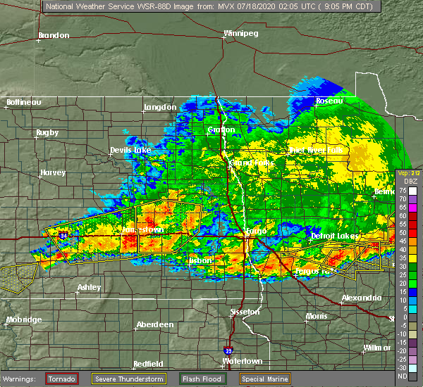 At 910 pm cdt, severe thunderstorms were located along a line extending from luverne to near eckelson to near gackle, moving southeast at 30 mph (radar indicated). Hazards include 60 mph wind gusts and quarter size hail. Hail damage to vehicles is expected. expect wind damage to roofs, siding, and trees. these severe storms will be near, luverne, sibley and eckelson around 915 pm cdt. pillsbury around 920 pm cdt. colgate around 930 pm cdt. hastings and page around 945 pm cdt. kathryn around 955 pm cdt. This includes interstate 94 in north dakota between mile markers 272 and 312. At 910 pm cdt, severe thunderstorms were located along a line extending from luverne to near eckelson to near gackle, moving southeast at 30 mph (radar indicated). Hazards include 60 mph wind gusts and quarter size hail. Hail damage to vehicles is expected. expect wind damage to roofs, siding, and trees. these severe storms will be near, luverne, sibley and eckelson around 915 pm cdt. pillsbury around 920 pm cdt. colgate around 930 pm cdt. hastings and page around 945 pm cdt. kathryn around 955 pm cdt. This includes interstate 94 in north dakota between mile markers 272 and 312.
|
| 7/17/2020 8:43 PM CDT |
 At 843 pm cdt, severe thunderstorms were located along a line extending from near hannaford to near spiritwood to near streeter, moving southeast at 30 mph (radar indicated). Hazards include 60 mph wind gusts and quarter size hail. Hail damage to vehicles is expected. expect wind damage to roofs, siding, and trees. severe thunderstorms will be near, hannaford and walum around 845 pm cdt. urbana around 900 pm cdt. luverne, sibley and eckelson around 905 pm cdt. sanborn around 910 pm cdt. pillsbury around 920 pm cdt. This includes interstate 94 in north dakota between mile markers 272 and 312. At 843 pm cdt, severe thunderstorms were located along a line extending from near hannaford to near spiritwood to near streeter, moving southeast at 30 mph (radar indicated). Hazards include 60 mph wind gusts and quarter size hail. Hail damage to vehicles is expected. expect wind damage to roofs, siding, and trees. severe thunderstorms will be near, hannaford and walum around 845 pm cdt. urbana around 900 pm cdt. luverne, sibley and eckelson around 905 pm cdt. sanborn around 910 pm cdt. pillsbury around 920 pm cdt. This includes interstate 94 in north dakota between mile markers 272 and 312.
|
| 7/17/2020 8:09 PM CDT |
 At 809 pm cdt, a severe thunderstorm was located near sibley, or 13 miles north of valley city, moving southeast at 25 mph (radar indicated). Hazards include 60 mph wind gusts and quarter size hail. Hail damage to vehicles is expected. expect wind damage to roofs, siding, and trees. This severe thunderstorm will remain over mainly rural areas of southeastern griggs, northeastern barnes and southwestern steele counties. At 809 pm cdt, a severe thunderstorm was located near sibley, or 13 miles north of valley city, moving southeast at 25 mph (radar indicated). Hazards include 60 mph wind gusts and quarter size hail. Hail damage to vehicles is expected. expect wind damage to roofs, siding, and trees. This severe thunderstorm will remain over mainly rural areas of southeastern griggs, northeastern barnes and southwestern steele counties.
|
| 7/17/2020 7:44 PM CDT |
 At 744 pm cdt, a severe thunderstorm was located near dazey, or 20 miles north of valley city, moving east at 25 mph (radar indicated). Hazards include 60 mph wind gusts and quarter size hail. Hail damage to vehicles is expected. expect wind damage to roofs, siding, and trees. this severe storm will be near, sibley around 800 pm cdt. luverne around 805 pm cdt. Pillsbury around 820 pm cdt. At 744 pm cdt, a severe thunderstorm was located near dazey, or 20 miles north of valley city, moving east at 25 mph (radar indicated). Hazards include 60 mph wind gusts and quarter size hail. Hail damage to vehicles is expected. expect wind damage to roofs, siding, and trees. this severe storm will be near, sibley around 800 pm cdt. luverne around 805 pm cdt. Pillsbury around 820 pm cdt.
|
| 7/17/2020 7:26 PM CDT |
 At 725 pm cdt, a severe thunderstorm was located near hannaford, or 28 miles northwest of valley city, moving southeast at 25 mph (radar indicated). Hazards include 60 mph wind gusts and quarter size hail. Hail damage to vehicles is expected. expect wind damage to roofs, siding, and trees. this severe thunderstorm will be near, hannaford around 730 pm cdt. walum around 735 pm cdt. dazey around 740 pm cdt. sibley and luverne around 800 pm cdt. Pillsbury around 815 pm cdt. At 725 pm cdt, a severe thunderstorm was located near hannaford, or 28 miles northwest of valley city, moving southeast at 25 mph (radar indicated). Hazards include 60 mph wind gusts and quarter size hail. Hail damage to vehicles is expected. expect wind damage to roofs, siding, and trees. this severe thunderstorm will be near, hannaford around 730 pm cdt. walum around 735 pm cdt. dazey around 740 pm cdt. sibley and luverne around 800 pm cdt. Pillsbury around 815 pm cdt.
|
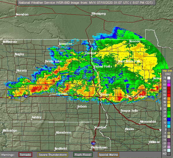
| 7/8/2020 1:32 AM CDT |
 At 131 am cdt, severe thunderstorms were located along a line extending from near sutton to near wimbledon to near eldridge, moving east at 70 mph. these are very dangerous storms (radar indicated). Hazards include 80 mph wind gusts and quarter size hail. Flying debris will be dangerous to those caught without shelter. mobile homes will be heavily damaged. expect considerable damage to roofs, windows, and vehicles. extensive tree damage and power outages are likely. severe thunderstorms will be near, sutton and wimbledon around 135 am cdt. revere and dazey around 140 am cdt. walum and hannaford around 145 am cdt. urbana, cooperstown and sibley around 150 am cdt. Luverne, sanborn and eckelson around 155 am cdt. At 131 am cdt, severe thunderstorms were located along a line extending from near sutton to near wimbledon to near eldridge, moving east at 70 mph. these are very dangerous storms (radar indicated). Hazards include 80 mph wind gusts and quarter size hail. Flying debris will be dangerous to those caught without shelter. mobile homes will be heavily damaged. expect considerable damage to roofs, windows, and vehicles. extensive tree damage and power outages are likely. severe thunderstorms will be near, sutton and wimbledon around 135 am cdt. revere and dazey around 140 am cdt. walum and hannaford around 145 am cdt. urbana, cooperstown and sibley around 150 am cdt. Luverne, sanborn and eckelson around 155 am cdt.
|
| 6/30/2020 10:20 PM CDT |
 The severe thunderstorm warning for southeastern nelson, griggs and western steele counties will expire at 1030 pm cdt, the storm which prompted the warning has weakened below severe limits, and no longer pose an immediate threat to life or property. therefore, the warning will be allowed to expire. however gusty winds and heavy rain are still possible with this thunderstorm. a severe thunderstorm watch remains in effect until 100 am cdt for southeastern and northeastern north dakota. The severe thunderstorm warning for southeastern nelson, griggs and western steele counties will expire at 1030 pm cdt, the storm which prompted the warning has weakened below severe limits, and no longer pose an immediate threat to life or property. therefore, the warning will be allowed to expire. however gusty winds and heavy rain are still possible with this thunderstorm. a severe thunderstorm watch remains in effect until 100 am cdt for southeastern and northeastern north dakota.
|
| 6/30/2020 10:08 PM CDT |
 At 1008 pm cdt, a severe thunderstorm was located over kloten, or 46 miles west of grand forks, moving northeast at 50 mph (radar indicated). Hazards include 60 mph wind gusts and penny size hail. Expect damage to roofs, siding, and trees. Locations impacted include, cooperstown, finley, mcville, hope, aneta, hannaford and sharon. At 1008 pm cdt, a severe thunderstorm was located over kloten, or 46 miles west of grand forks, moving northeast at 50 mph (radar indicated). Hazards include 60 mph wind gusts and penny size hail. Expect damage to roofs, siding, and trees. Locations impacted include, cooperstown, finley, mcville, hope, aneta, hannaford and sharon.
|
| 6/30/2020 9:40 PM CDT |
 At 940 pm cdt, a severe thunderstorm was located near sutton, or 38 miles northwest of valley city, moving northeast at 50 mph (radar indicated). Hazards include 60 mph wind gusts and penny size hail. expect damage to roofs, siding, and trees At 940 pm cdt, a severe thunderstorm was located near sutton, or 38 miles northwest of valley city, moving northeast at 50 mph (radar indicated). Hazards include 60 mph wind gusts and penny size hail. expect damage to roofs, siding, and trees
|
| 6/30/2020 9:38 PM CDT |
 At 938 pm cdt, a severe thunderstorm was located near finley, or 43 miles north of valley city, moving north at 40 mph (radar indicated). Hazards include 60 mph wind gusts. Expect damage to roofs, siding, and trees. Locations impacted include, golden lake, finley, hope, aneta, sharon, kloten and luverne. At 938 pm cdt, a severe thunderstorm was located near finley, or 43 miles north of valley city, moving north at 40 mph (radar indicated). Hazards include 60 mph wind gusts. Expect damage to roofs, siding, and trees. Locations impacted include, golden lake, finley, hope, aneta, sharon, kloten and luverne.
|
| 6/30/2020 9:10 PM CDT |
 At 909 pm cdt, a severe thunderstorm was located over luverne, or 23 miles north of valley city, moving north at 40 mph (radar indicated). Hazards include 60 mph wind gusts. expect damage to roofs, siding, and trees At 909 pm cdt, a severe thunderstorm was located over luverne, or 23 miles north of valley city, moving north at 40 mph (radar indicated). Hazards include 60 mph wind gusts. expect damage to roofs, siding, and trees
|
| 6/30/2020 8:45 PM CDT |
 At 845 pm cdt, a severe thunderstorm was located near sanborn, or near valley city, moving north at 50 mph (radar indicated). Hazards include 60 mph wind gusts and penny size hail. expect damage to roofs, siding, and trees At 845 pm cdt, a severe thunderstorm was located near sanborn, or near valley city, moving north at 50 mph (radar indicated). Hazards include 60 mph wind gusts and penny size hail. expect damage to roofs, siding, and trees
|
| 6/20/2020 1:25 PM CDT |
 At 125 pm cdt, a severe thunderstorm was located near dazey, or 17 miles northwest of valley city, moving northeast at 20 mph (radar indicated). Hazards include half dollar size hail. Damage to vehicles is expected. this severe thunderstorm will be near, sibley around 155 pm cdt. Luverne around 200 pm cdt. At 125 pm cdt, a severe thunderstorm was located near dazey, or 17 miles northwest of valley city, moving northeast at 20 mph (radar indicated). Hazards include half dollar size hail. Damage to vehicles is expected. this severe thunderstorm will be near, sibley around 155 pm cdt. Luverne around 200 pm cdt.
|
| 6/7/2020 8:35 PM CDT | Peak wind mesured on a persinal weather statio in steele county ND, 1.2 miles W of Luverne, ND |
| 6/7/2020 8:33 PM CDT | 1-inch tree limbs broken and shingles blown of in barnes county ND, 1.6 miles N of Luverne, ND |
| 6/7/2020 8:30 PM CDT | Peak wind measured at a personal weather statio in barnes county ND, 3.6 miles N of Luverne, ND |
| 6/7/2020 8:25 PM CDT | Storm damage reported in steele county ND, 1.2 miles W of Luverne, ND |
| 6/7/2020 8:24 PM CDT |
 At 823 pm cdt, severe thunderstorms were located along a line extending from revere to near hannaford to near pillsbury, moving north at 45 mph (public). Hazards include 70 mph wind gusts and quarter size hail. Hail damage to vehicles is expected. expect considerable tree damage. wind damage is also likely to mobile homes, roofs, and outbuildings. these severe storms will be near, hope around 830 pm cdt. blabon and cooperstown around 835 pm cdt. Sherbrooke around 840 pm cdt. At 823 pm cdt, severe thunderstorms were located along a line extending from revere to near hannaford to near pillsbury, moving north at 45 mph (public). Hazards include 70 mph wind gusts and quarter size hail. Hail damage to vehicles is expected. expect considerable tree damage. wind damage is also likely to mobile homes, roofs, and outbuildings. these severe storms will be near, hope around 830 pm cdt. blabon and cooperstown around 835 pm cdt. Sherbrooke around 840 pm cdt.
|
| 6/7/2020 8:02 PM CDT |
 At 802 pm cdt, a severe thunderstorm was located near rogers, or 13 miles northwest of valley city, moving north at 40 mph (radar indicated). Hazards include 60 mph wind gusts and quarter size hail. Hail damage to vehicles is expected. expect wind damage to roofs, siding, and trees. this severe storm will be near, dazey around 810 pm cdt. sibley, walum and luverne around 820 pm cdt. hannaford around 825 pm cdt. Cooperstown around 835 pm cdt. At 802 pm cdt, a severe thunderstorm was located near rogers, or 13 miles northwest of valley city, moving north at 40 mph (radar indicated). Hazards include 60 mph wind gusts and quarter size hail. Hail damage to vehicles is expected. expect wind damage to roofs, siding, and trees. this severe storm will be near, dazey around 810 pm cdt. sibley, walum and luverne around 820 pm cdt. hannaford around 825 pm cdt. Cooperstown around 835 pm cdt.
|
| 6/7/2020 7:41 PM CDT |
 At 741 pm cdt, a severe thunderstorm was located over sanborn, or 10 miles west of valley city, moving north at 40 mph (radar indicated). Hazards include 60 mph wind gusts and quarter size hail. Hail damage to vehicles is expected. expect wind damage to roofs, siding, and trees. this severe thunderstorm will be near, sanborn around 745 pm cdt. rogers, bald hill dam and leal around 800 pm cdt. dazey around 810 pm cdt. sibley, walum and luverne around 820 pm cdt. hannaford around 825 pm cdt. This includes interstate 94 in north dakota between mile markers 272 and 296. At 741 pm cdt, a severe thunderstorm was located over sanborn, or 10 miles west of valley city, moving north at 40 mph (radar indicated). Hazards include 60 mph wind gusts and quarter size hail. Hail damage to vehicles is expected. expect wind damage to roofs, siding, and trees. this severe thunderstorm will be near, sanborn around 745 pm cdt. rogers, bald hill dam and leal around 800 pm cdt. dazey around 810 pm cdt. sibley, walum and luverne around 820 pm cdt. hannaford around 825 pm cdt. This includes interstate 94 in north dakota between mile markers 272 and 296.
|
| 6/7/2020 8:30 AM CDT | Peak wind measured at a personal weather statio in barnes county ND, 3.6 miles N of Luverne, ND |
| 9/2/2019 5:26 PM CDT | Report from mping: 1-inch tree limbs broken; shingles blown of in steele county ND, 6.8 miles S of Luverne, ND |
| 9/2/2019 5:11 PM CDT |
 At 510 pm cdt, severe thunderstorms were located along a line extending from near mcville to near cooperstown to near eckelson, moving east at 45 mph. quarter sized hail has been reported at cooperstown and multiple 60 to 80 mph wind gusts have been reported in stutsman county. these are very dangerous storms (trained weather spotters). Hazards include 80 mph wind gusts and quarter size hail. Flying debris will be dangerous to those caught without shelter. mobile homes will be heavily damaged. expect considerable damage to roofs, windows, and vehicles. extensive tree damage and power outages are likely. locations impacted include, valley city, mayville, cooperstown, hatton, portland, golden lake and finley. This includes interstate 94 in north dakota between mile markers 271 and 317. At 510 pm cdt, severe thunderstorms were located along a line extending from near mcville to near cooperstown to near eckelson, moving east at 45 mph. quarter sized hail has been reported at cooperstown and multiple 60 to 80 mph wind gusts have been reported in stutsman county. these are very dangerous storms (trained weather spotters). Hazards include 80 mph wind gusts and quarter size hail. Flying debris will be dangerous to those caught without shelter. mobile homes will be heavily damaged. expect considerable damage to roofs, windows, and vehicles. extensive tree damage and power outages are likely. locations impacted include, valley city, mayville, cooperstown, hatton, portland, golden lake and finley. This includes interstate 94 in north dakota between mile markers 271 and 317.
|
| 9/2/2019 5:10 PM CDT | Measured by davis weather station in steele county ND, 5.1 miles SSW of Luverne, ND |
| 9/2/2019 4:59 PM CDT |
 At 458 pm cdt, severe thunderstorms were located along a line extending from near pekin to jessie to near ypsilanti, moving east at 45 mph. there have been multiple reports of 70 to 80 mph winds in stustman county. these are very dangerous storms (trained weather spotters). Hazards include 80 mph wind gusts and quarter size hail. Flying debris will be dangerous to those caught without shelter. mobile homes will be heavily damaged. expect considerable damage to roofs, windows, and vehicles. extensive tree damage and power outages are likely. locations impacted include, valley city, mayville, cooperstown, northwood, hatton, portland and golden lake. This includes interstate 94 in north dakota between mile markers 271 and 317. At 458 pm cdt, severe thunderstorms were located along a line extending from near pekin to jessie to near ypsilanti, moving east at 45 mph. there have been multiple reports of 70 to 80 mph winds in stustman county. these are very dangerous storms (trained weather spotters). Hazards include 80 mph wind gusts and quarter size hail. Flying debris will be dangerous to those caught without shelter. mobile homes will be heavily damaged. expect considerable damage to roofs, windows, and vehicles. extensive tree damage and power outages are likely. locations impacted include, valley city, mayville, cooperstown, northwood, hatton, portland and golden lake. This includes interstate 94 in north dakota between mile markers 271 and 317.
|
| 9/2/2019 4:43 PM CDT |
 At 442 pm cdt, severe thunderstorms were located along a line extending from near hamar to near mose to near jamestown, moving east at 45 mph. a 81 mph gust was reported a jamestown, this is a very dangerous line of storms! these are very dangerous storms (radar indicated). Hazards include 80 mph wind gusts and quarter size hail. Flying debris will be dangerous to those caught without shelter. mobile homes will be heavily damaged. expect considerable damage to roofs, windows, and vehicles. Extensive tree damage and power outages are likely. At 442 pm cdt, severe thunderstorms were located along a line extending from near hamar to near mose to near jamestown, moving east at 45 mph. a 81 mph gust was reported a jamestown, this is a very dangerous line of storms! these are very dangerous storms (radar indicated). Hazards include 80 mph wind gusts and quarter size hail. Flying debris will be dangerous to those caught without shelter. mobile homes will be heavily damaged. expect considerable damage to roofs, windows, and vehicles. Extensive tree damage and power outages are likely.
|
| 7/8/2019 6:52 PM CDT |
 At 652 pm cdt, severe thunderstorms were located along a line extending from cooperstown to near dazey to near spiritwood lake, moving east at 55 mph (radar indicated). Hazards include 60 mph wind gusts and penny size hail. expect damage to roofs, siding, and trees At 652 pm cdt, severe thunderstorms were located along a line extending from cooperstown to near dazey to near spiritwood lake, moving east at 55 mph (radar indicated). Hazards include 60 mph wind gusts and penny size hail. expect damage to roofs, siding, and trees
|
| 5/24/2019 6:22 PM CDT |
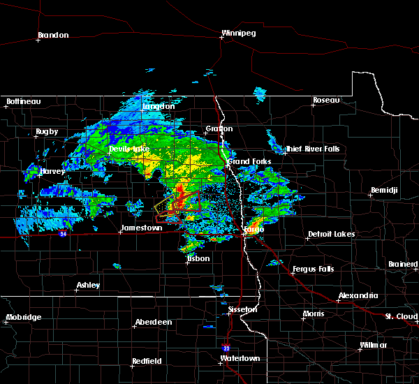 At 621 pm cdt, a severe thunderstorm was located over blabon, or 32 miles north of valley city, moving northeast at 30 mph (radar indicated). Hazards include 70 mph wind gusts and ping pong ball size hail. People and animals outdoors will be injured. expect hail damage to roofs, siding, windows, and vehicles. expect considerable tree damage. wind damage is also likely to mobile homes, roofs, and outbuildings. This severe thunderstorm will remain over mainly rural areas of northeastern barnes and southwestern steele counties. At 621 pm cdt, a severe thunderstorm was located over blabon, or 32 miles north of valley city, moving northeast at 30 mph (radar indicated). Hazards include 70 mph wind gusts and ping pong ball size hail. People and animals outdoors will be injured. expect hail damage to roofs, siding, windows, and vehicles. expect considerable tree damage. wind damage is also likely to mobile homes, roofs, and outbuildings. This severe thunderstorm will remain over mainly rural areas of northeastern barnes and southwestern steele counties.
|
| 1/1/0001 12:00 AM | Images of blades bent on wind turbines west of hope with time estimated based on radar in steele county ND, 5.6 miles SSW of Luverne, ND |
| 5/24/2019 6:12 PM CDT | Ping Pong Ball sized hail reported 4.7 miles S of Luverne, ND, picture on twitter of hail compared to a quarter with stone about 1.5 times larger |
| 5/24/2019 6:10 PM CDT | Quarter sized hail reported 8.5 miles NNE of Luverne, ND |
| 5/24/2019 6:10 PM CDT | Ping Pong Ball sized hail reported 4.7 miles S of Luverne, ND, picture on twitter of hail compared to a quarter with stone about 1.5 times larger |
| 5/24/2019 5:54 PM CDT |
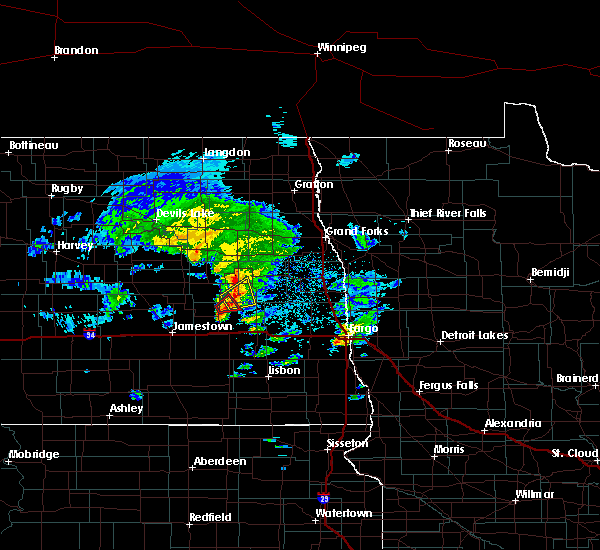 The national weather service in grand forks has issued a * severe thunderstorm warning for. southeastern griggs county in southeastern north dakota. north central barnes county in southeastern north dakota. southwestern steele county in southeastern north dakota. Until 645 pm cdt. The national weather service in grand forks has issued a * severe thunderstorm warning for. southeastern griggs county in southeastern north dakota. north central barnes county in southeastern north dakota. southwestern steele county in southeastern north dakota. Until 645 pm cdt.
|
| 7/4/2018 2:57 AM CDT |
 At 256 am cdt, severe thunderstorms were located along a line extending from near petersburg to nome, moving east at 70 mph (radar indicated). Hazards include 70 mph wind gusts and quarter size hail. Hail damage to vehicles is expected. expect considerable tree damage. wind damage is also likely to mobile homes, roofs, and outbuildings. these severe storms will be near, lucca around 300 am cdt. larimore and alice around 310 am cdt. turtle river state park, chaffee and arvilla around 315 am cdt. grand forks afb and leonard around 320 am cdt. This includes interstate 94 in north dakota between mile markers 287 and 327. At 256 am cdt, severe thunderstorms were located along a line extending from near petersburg to nome, moving east at 70 mph (radar indicated). Hazards include 70 mph wind gusts and quarter size hail. Hail damage to vehicles is expected. expect considerable tree damage. wind damage is also likely to mobile homes, roofs, and outbuildings. these severe storms will be near, lucca around 300 am cdt. larimore and alice around 310 am cdt. turtle river state park, chaffee and arvilla around 315 am cdt. grand forks afb and leonard around 320 am cdt. This includes interstate 94 in north dakota between mile markers 287 and 327.
|
| 7/4/2018 2:33 AM CDT |
 At 232 am cdt, severe thunderstorms were located along a line extending from near hamar to near marion, moving east at 60 mph (radar indicated). Hazards include 70 mph wind gusts and quarter size hail. Hail damage to vehicles is expected. expect considerable tree damage. wind damage is also likely to mobile homes, roofs, and outbuildings. severe thunderstorms will be near, tolna around 235 am cdt. litchville around 240 am cdt. hastings around 245 am cdt. kathryn around 250 am cdt. nome around 255 am cdt. This includes interstate 94 in north dakota between mile markers 272 and 327. At 232 am cdt, severe thunderstorms were located along a line extending from near hamar to near marion, moving east at 60 mph (radar indicated). Hazards include 70 mph wind gusts and quarter size hail. Hail damage to vehicles is expected. expect considerable tree damage. wind damage is also likely to mobile homes, roofs, and outbuildings. severe thunderstorms will be near, tolna around 235 am cdt. litchville around 240 am cdt. hastings around 245 am cdt. kathryn around 250 am cdt. nome around 255 am cdt. This includes interstate 94 in north dakota between mile markers 272 and 327.
|
| 6/29/2018 3:31 AM CDT |
 At 331 am cdt, severe thunderstorms were located along a line extending from 7 miles southwest of aneta to near luverne to near bald hill dam, moving east at 60 mph. these are very dangerous storms (radar indicated). Hazards include 80 mph wind gusts and nickel size hail. Flying debris will be dangerous to those caught without shelter. mobile homes will be heavily damaged. expect considerable damage to roofs, windows, and vehicles. extensive tree damage and power outages are likely. these severe storms will be near, pillsbury and blabon around 335 am cdt. hope, colgate and finley around 340 am cdt. golden lake around 350 am cdt. ayr, galesburg and clifford around 355 am cdt. Hatton, absaraka and erie around 400 am cdt. At 331 am cdt, severe thunderstorms were located along a line extending from 7 miles southwest of aneta to near luverne to near bald hill dam, moving east at 60 mph. these are very dangerous storms (radar indicated). Hazards include 80 mph wind gusts and nickel size hail. Flying debris will be dangerous to those caught without shelter. mobile homes will be heavily damaged. expect considerable damage to roofs, windows, and vehicles. extensive tree damage and power outages are likely. these severe storms will be near, pillsbury and blabon around 335 am cdt. hope, colgate and finley around 340 am cdt. golden lake around 350 am cdt. ayr, galesburg and clifford around 355 am cdt. Hatton, absaraka and erie around 400 am cdt.
|
| 6/29/2018 2:59 AM CDT |
 The national weather service in grand forks has issued a * severe thunderstorm warning for. southwestern grand forks county in northeastern north dakota. northwestern cass county in southeastern north dakota. western traill county in southeastern north dakota. Griggs county in southeastern north dakota. The national weather service in grand forks has issued a * severe thunderstorm warning for. southwestern grand forks county in northeastern north dakota. northwestern cass county in southeastern north dakota. western traill county in southeastern north dakota. Griggs county in southeastern north dakota.
|
| 6/5/2018 11:10 PM CDT |
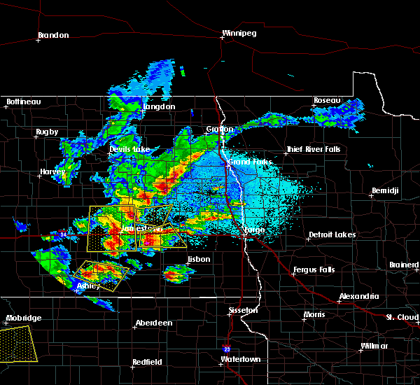 At 1110 pm cdt, a severe thunderstorm was located over wimbledon, or 21 miles northeast of jamestown, moving east at 30 mph (radar indicated). Hazards include ping pong ball size hail and 60 mph wind gusts. People and animals outdoors will be injured. expect hail damage to roofs, siding, windows, and vehicles. expect wind damage to roofs, siding, and trees. this severe thunderstorm will be near, leal around 1130 pm cdt. dazey around 1135 pm cdt. rogers around 1140 pm cdt. bald hill dam around 1150 pm cdt. Sibley around 1155 pm cdt. At 1110 pm cdt, a severe thunderstorm was located over wimbledon, or 21 miles northeast of jamestown, moving east at 30 mph (radar indicated). Hazards include ping pong ball size hail and 60 mph wind gusts. People and animals outdoors will be injured. expect hail damage to roofs, siding, windows, and vehicles. expect wind damage to roofs, siding, and trees. this severe thunderstorm will be near, leal around 1130 pm cdt. dazey around 1135 pm cdt. rogers around 1140 pm cdt. bald hill dam around 1150 pm cdt. Sibley around 1155 pm cdt.
|
| 9/1/2017 7:43 PM CDT |
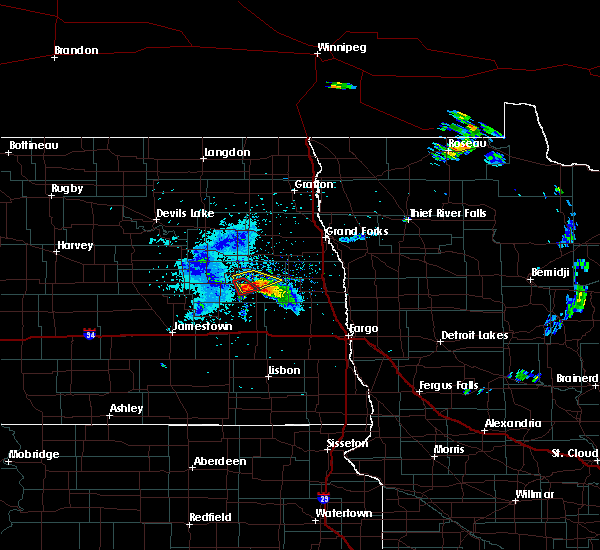 At 743 pm cdt, severe thunderstorms were located along a line extending from near sherbrooke to 8 miles west of blabon, moving south at 25 mph (radar indicated). Hazards include half dollar size hail. damage to vehicles is expected At 743 pm cdt, severe thunderstorms were located along a line extending from near sherbrooke to 8 miles west of blabon, moving south at 25 mph (radar indicated). Hazards include half dollar size hail. damage to vehicles is expected
|
| 7/21/2017 4:26 PM CDT |
 The severe thunderstorm warning for griggs, northwestern barnes and western steele counties will expire at 430 pm cdt, the storm which prompted the warning has moved out of the area. therefore the warning will be allowed to expire. however gusty winds are still possible with this thunderstorm. a severe thunderstorm watch remains in effect until 1100 pm cdt for southeastern north dakota. The severe thunderstorm warning for griggs, northwestern barnes and western steele counties will expire at 430 pm cdt, the storm which prompted the warning has moved out of the area. therefore the warning will be allowed to expire. however gusty winds are still possible with this thunderstorm. a severe thunderstorm watch remains in effect until 1100 pm cdt for southeastern north dakota.
|
| 7/21/2017 3:48 PM CDT |
 A severe thunderstorm warning remains in effect until 430 pm cdt for griggs. northwestern barnes and western steele counties. at 348 pm cdt, a severe thunderstorm was located over cooperstown, or 35 miles north of valley city, moving east at 45 mph. hazard. 60 mph wind gusts and half dollar size hail. source. Radar indicated. A severe thunderstorm warning remains in effect until 430 pm cdt for griggs. northwestern barnes and western steele counties. at 348 pm cdt, a severe thunderstorm was located over cooperstown, or 35 miles north of valley city, moving east at 45 mph. hazard. 60 mph wind gusts and half dollar size hail. source. Radar indicated.
|
| 7/21/2017 3:24 PM CDT |
 At 323 pm cdt, a severe thunderstorm was located near glenfield, or 40 miles north of jamestown, moving east at 40 mph (radar indicated). Hazards include 60 mph wind gusts and half dollar size hail. Hail damage to vehicles is expected. expect wind damage to roofs, siding, and trees. this severe thunderstorm will be near, sutton and mose around 335 pm cdt. binford around 340 pm cdt. revere around 345 pm cdt. jessie around 350 pm cdt. Cooperstown around 400 pm cdt. At 323 pm cdt, a severe thunderstorm was located near glenfield, or 40 miles north of jamestown, moving east at 40 mph (radar indicated). Hazards include 60 mph wind gusts and half dollar size hail. Hail damage to vehicles is expected. expect wind damage to roofs, siding, and trees. this severe thunderstorm will be near, sutton and mose around 335 pm cdt. binford around 340 pm cdt. revere around 345 pm cdt. jessie around 350 pm cdt. Cooperstown around 400 pm cdt.
|
| 7/6/2017 12:46 AM CDT |
 At 1246 am cdt, a severe thunderstorm was located over sherbrooke, or 39 miles north of valley city, moving southeast at 20 mph (radar indicated). Hazards include ping pong ball size hail and 60 mph wind gusts. People and animals outdoors will be injured. expect hail damage to roofs, siding, windows, and vehicles. expect wind damage to roofs, siding, and trees. this severe storm will be near, sherbrooke around 1255 am cdt. This includes interstate 29 between mile markers 93 and 94. At 1246 am cdt, a severe thunderstorm was located over sherbrooke, or 39 miles north of valley city, moving southeast at 20 mph (radar indicated). Hazards include ping pong ball size hail and 60 mph wind gusts. People and animals outdoors will be injured. expect hail damage to roofs, siding, windows, and vehicles. expect wind damage to roofs, siding, and trees. this severe storm will be near, sherbrooke around 1255 am cdt. This includes interstate 29 between mile markers 93 and 94.
|
| 7/6/2017 12:34 AM CDT |
 At 1234 am cdt, a severe thunderstorm was located near clifford, or 39 miles northeast of valley city, moving east at 30 mph (radar indicated). Hazards include 60 mph wind gusts and quarter size hail. Hail damage to vehicles is expected. expect wind damage to roofs, siding, and trees. this severe storm will be near, galesburg and clifford around 1245 am cdt. blanchard around 100 am cdt. This includes interstate 29 between mile markers 93 and 94. At 1234 am cdt, a severe thunderstorm was located near clifford, or 39 miles northeast of valley city, moving east at 30 mph (radar indicated). Hazards include 60 mph wind gusts and quarter size hail. Hail damage to vehicles is expected. expect wind damage to roofs, siding, and trees. this severe storm will be near, galesburg and clifford around 1245 am cdt. blanchard around 100 am cdt. This includes interstate 29 between mile markers 93 and 94.
|
| 7/6/2017 12:09 AM CDT |
 At 1208 am cdt, a severe thunderstorm was located over blabon, or 32 miles north of valley city, moving east at 40 mph (radar indicated). Hazards include ping pong ball size hail and 60 mph wind gusts. People and animals outdoors will be injured. expect hail damage to roofs, siding, windows, and vehicles. expect wind damage to roofs, siding, and trees. this severe thunderstorm will be near, sherbrooke around 1210 am cdt. hope around 1215 am cdt. colgate around 1220 am cdt. clifford around 1235 am cdt. galesburg around 1240 am cdt. This includes interstate 29 between mile markers 93 and 94. At 1208 am cdt, a severe thunderstorm was located over blabon, or 32 miles north of valley city, moving east at 40 mph (radar indicated). Hazards include ping pong ball size hail and 60 mph wind gusts. People and animals outdoors will be injured. expect hail damage to roofs, siding, windows, and vehicles. expect wind damage to roofs, siding, and trees. this severe thunderstorm will be near, sherbrooke around 1210 am cdt. hope around 1215 am cdt. colgate around 1220 am cdt. clifford around 1235 am cdt. galesburg around 1240 am cdt. This includes interstate 29 between mile markers 93 and 94.
|
| 7/4/2017 9:40 PM CDT | Golf Ball sized hail reported 7.1 miles NNE of Luverne, ND, hail near west end of lake astabula and sibley crossing. report and photo posted via social media. time estimated based on radar. |
| 7/4/2017 8:17 PM CDT |
 At 817 pm cdt, severe thunderstorms were located along a line extending from near sherbrooke to near luverne, moving southeast at 35 mph (radar indicated). Hazards include quarter size hail. damage to vehicles is expected At 817 pm cdt, severe thunderstorms were located along a line extending from near sherbrooke to near luverne, moving southeast at 35 mph (radar indicated). Hazards include quarter size hail. damage to vehicles is expected
|
| 7/4/2017 7:55 PM CDT |
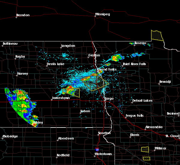 The severe thunderstorm warning for southeastern griggs, northeastern barnes and southwestern steele counties will expire at 800 pm cdt, the storm which prompted the warning has weakened below severe limits, and no longer pose an immediate threat to life or property. therefore the warning will be allowed to expire. however small hail and gusty winds are still possible with this thunderstorm. a severe thunderstorm watch remains in effect until midnight cdt for southeastern north dakota. The severe thunderstorm warning for southeastern griggs, northeastern barnes and southwestern steele counties will expire at 800 pm cdt, the storm which prompted the warning has weakened below severe limits, and no longer pose an immediate threat to life or property. therefore the warning will be allowed to expire. however small hail and gusty winds are still possible with this thunderstorm. a severe thunderstorm watch remains in effect until midnight cdt for southeastern north dakota.
|
| 7/4/2017 7:24 PM CDT |
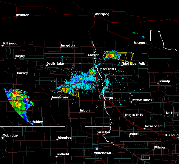 At 724 pm cdt, a severe thunderstorm was located over walum, or 26 miles northwest of valley city, moving southeast at 35 mph (radar indicated). Hazards include quarter size hail. Damage to vehicles is expected. Locations impacted include, hannaford, dazey, luverne, sibley, walum and pillsbury. At 724 pm cdt, a severe thunderstorm was located over walum, or 26 miles northwest of valley city, moving southeast at 35 mph (radar indicated). Hazards include quarter size hail. Damage to vehicles is expected. Locations impacted include, hannaford, dazey, luverne, sibley, walum and pillsbury.
|
| 7/4/2017 7:08 PM CDT |
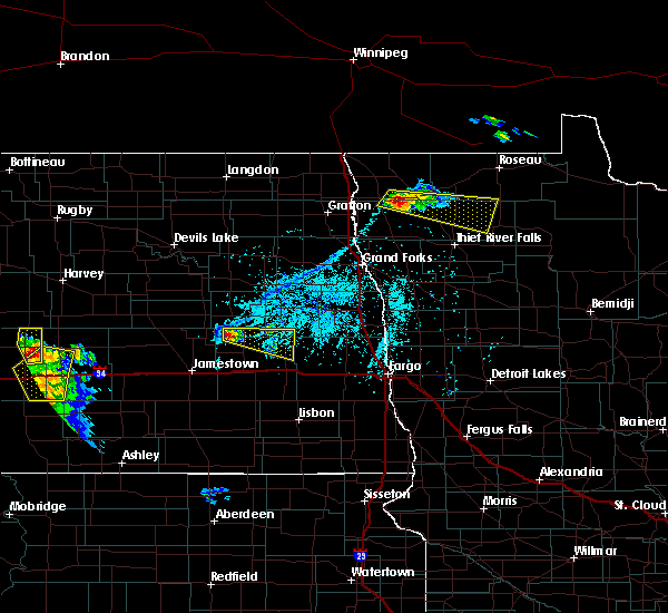 At 708 pm cdt, a severe thunderstorm was located near walum, or 26 miles northwest of valley city, moving southeast at 25 mph (radar indicated). Hazards include quarter size hail. damage to vehicles is expected At 708 pm cdt, a severe thunderstorm was located near walum, or 26 miles northwest of valley city, moving southeast at 25 mph (radar indicated). Hazards include quarter size hail. damage to vehicles is expected
|
| 6/9/2017 9:39 PM CDT |
 At 932 pm cdt, a confirmed tornado was located west of walum, or 27 miles north of valley city, moving east at 30 mph (weather spotters confirmed tornado). Hazards include damaging tornado and golf ball size hail. Flying debris will be dangerous to those caught without shelter. mobile homes will be damaged or destroyed. damage to roofs, windows, and vehicles will occur. tree damage is likely. this tornado will be near, hannaford and walum around 940 pm cdt. Luverne and sibley around 1005 pm cdt. At 932 pm cdt, a confirmed tornado was located west of walum, or 27 miles north of valley city, moving east at 30 mph (weather spotters confirmed tornado). Hazards include damaging tornado and golf ball size hail. Flying debris will be dangerous to those caught without shelter. mobile homes will be damaged or destroyed. damage to roofs, windows, and vehicles will occur. tree damage is likely. this tornado will be near, hannaford and walum around 940 pm cdt. Luverne and sibley around 1005 pm cdt.
|
| 6/9/2017 9:31 PM CDT |
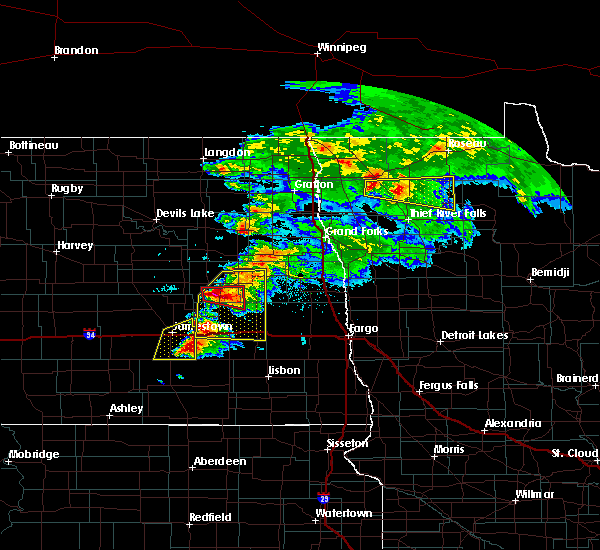 At 931 pm cdt, a severe thunderstorm capable of producing a tornado was located over hannaford, or 29 miles northwest of valley city, moving east at 55 mph (radar indicated rotation). Hazards include tornado and golf ball size hail. Flying debris will be dangerous to those caught without shelter. mobile homes will be damaged or destroyed. damage to roofs, windows, and vehicles will occur. tree damage is likely. This dangerous storm will be near, luverne and sibley around 945 pm cdt. At 931 pm cdt, a severe thunderstorm capable of producing a tornado was located over hannaford, or 29 miles northwest of valley city, moving east at 55 mph (radar indicated rotation). Hazards include tornado and golf ball size hail. Flying debris will be dangerous to those caught without shelter. mobile homes will be damaged or destroyed. damage to roofs, windows, and vehicles will occur. tree damage is likely. This dangerous storm will be near, luverne and sibley around 945 pm cdt.
|
| 6/9/2017 9:27 PM CDT |
 At 927 pm cdt, severe thunderstorms were located along a line extending from near finley to near valley city, moving east at 60 mph (radar indicated). Hazards include 60 mph wind gusts and quarter size hail. Hail damage to vehicles is expected. expect wind damage to roofs, siding, and trees. these severe storms will be near, finley around 930 pm cdt. oriska and sherbrooke around 935 pm cdt. This includes interstate 94 in north dakota between mile markers 272 and 307. At 927 pm cdt, severe thunderstorms were located along a line extending from near finley to near valley city, moving east at 60 mph (radar indicated). Hazards include 60 mph wind gusts and quarter size hail. Hail damage to vehicles is expected. expect wind damage to roofs, siding, and trees. these severe storms will be near, finley around 930 pm cdt. oriska and sherbrooke around 935 pm cdt. This includes interstate 94 in north dakota between mile markers 272 and 307.
|
| 6/9/2017 9:00 PM CDT |
 At 900 pm cdt, severe thunderstorms were located along a line extending from near binford to near spiritwood, moving east at 55 mph (radar indicated). Hazards include quarter size hail. Damage to vehicles is expected. severe thunderstorms will be near, binford around 905 pm cdt. sanborn and jessie around 910 pm cdt. cooperstown and rogers around 915 pm cdt. valley city and bald hill dam around 920 pm cdt. finley around 930 pm cdt. This includes interstate 94 in north dakota between mile markers 272 and 307. At 900 pm cdt, severe thunderstorms were located along a line extending from near binford to near spiritwood, moving east at 55 mph (radar indicated). Hazards include quarter size hail. Damage to vehicles is expected. severe thunderstorms will be near, binford around 905 pm cdt. sanborn and jessie around 910 pm cdt. cooperstown and rogers around 915 pm cdt. valley city and bald hill dam around 920 pm cdt. finley around 930 pm cdt. This includes interstate 94 in north dakota between mile markers 272 and 307.
|
| 8/18/2016 7:45 AM CDT |
 At 742 am cdt, severe thunderstorms were located along a line extending from near sibley to near kathryn to near berlin, moving east at 45 mph (radar indicated). Hazards include 70 mph wind gusts and quarter size hail. Hail damage to vehicles is expected. expect considerable tree damage. wind damage is also likely to mobile homes, roofs, and outbuildings. at 720 am, baseball size hail was reported and a semi truck was reported as overturned on i-94 near mile marker 278. these severe storms will be near, kathryn, luverne and sibley around 745 am cdt. pillsbury and little yellowstone around 750 am cdt. nome, colgate and fingal around 755 am cdt. page and lucca around 800 am cdt. Also includes interstate 94 in north dakota between mile markers 275 and 311. At 742 am cdt, severe thunderstorms were located along a line extending from near sibley to near kathryn to near berlin, moving east at 45 mph (radar indicated). Hazards include 70 mph wind gusts and quarter size hail. Hail damage to vehicles is expected. expect considerable tree damage. wind damage is also likely to mobile homes, roofs, and outbuildings. at 720 am, baseball size hail was reported and a semi truck was reported as overturned on i-94 near mile marker 278. these severe storms will be near, kathryn, luverne and sibley around 745 am cdt. pillsbury and little yellowstone around 750 am cdt. nome, colgate and fingal around 755 am cdt. page and lucca around 800 am cdt. Also includes interstate 94 in north dakota between mile markers 275 and 311.
|
| 8/18/2016 7:35 AM CDT |
 At 734 am cdt, severe thunderstorms were located along a line extending from near sibley to near hastings to 6 miles northwest of berlin, moving southeast at 45 mph (radar indicated). Hazards include 70 mph wind gusts and quarter size hail. Hail damage to vehicles is expected. expect considerable tree damage. wind damage is also likely to mobile homes, roofs, and outbuildings. these severe storms will be near, hastings and valley city around 740 am cdt. kathryn and pillsbury around 745 am cdt. little yellowstone around 750 am cdt. nome, lucca and fort ransom around 755 am cdt. page around 800 am cdt. Also includes interstate 94 in north dakota between mile markers 273 and 311. At 734 am cdt, severe thunderstorms were located along a line extending from near sibley to near hastings to 6 miles northwest of berlin, moving southeast at 45 mph (radar indicated). Hazards include 70 mph wind gusts and quarter size hail. Hail damage to vehicles is expected. expect considerable tree damage. wind damage is also likely to mobile homes, roofs, and outbuildings. these severe storms will be near, hastings and valley city around 740 am cdt. kathryn and pillsbury around 745 am cdt. little yellowstone around 750 am cdt. nome, lucca and fort ransom around 755 am cdt. page around 800 am cdt. Also includes interstate 94 in north dakota between mile markers 273 and 311.
|
| 8/18/2016 7:06 AM CDT |
 At 705 am cdt, severe thunderstorms were located along a line extending from near revere to near millarton, moving east at 45 mph (observation. at 656 am...a wind gust of 71 mph was reported at the jamestown airport). Hazards include 70 mph wind gusts and quarter size hail. Hail damage to vehicles is expected. expect considerable tree damage. wind damage is also likely to mobile homes, roofs, and outbuildings. these severe storms will be near, hannaford, cooperstown and walum around 710 am cdt. luverne around 725 am cdt. litchville, blabon and sherbrooke around 735 am cdt. hope, hastings and colgate around 740 am cdt. little yellowstone, kathryn and fort ransom around 750 am cdt. also includes the following highways, interstate 29 between mile markers 113 and 122. Interstate 94 in north dakota between mile markers 271 and 317. At 705 am cdt, severe thunderstorms were located along a line extending from near revere to near millarton, moving east at 45 mph (observation. at 656 am...a wind gust of 71 mph was reported at the jamestown airport). Hazards include 70 mph wind gusts and quarter size hail. Hail damage to vehicles is expected. expect considerable tree damage. wind damage is also likely to mobile homes, roofs, and outbuildings. these severe storms will be near, hannaford, cooperstown and walum around 710 am cdt. luverne around 725 am cdt. litchville, blabon and sherbrooke around 735 am cdt. hope, hastings and colgate around 740 am cdt. little yellowstone, kathryn and fort ransom around 750 am cdt. also includes the following highways, interstate 29 between mile markers 113 and 122. Interstate 94 in north dakota between mile markers 271 and 317.
|
| 8/3/2016 10:28 PM CDT |
 At 1028 pm cdt, a severe thunderstorm was located over cooperstown, or 35 miles north of valley city, moving east at 30 mph (radar indicated). Hazards include 60 mph wind gusts and quarter size hail. Hail damage to vehicles is expected. expect wind damage to roofs, siding, and trees. this severe storm will be near, finley and blabon around 1055 pm cdt. sherbrooke around 1100 pm cdt. A tornado watch remains in effect until 1100 pm cdt for southeastern north dakota. At 1028 pm cdt, a severe thunderstorm was located over cooperstown, or 35 miles north of valley city, moving east at 30 mph (radar indicated). Hazards include 60 mph wind gusts and quarter size hail. Hail damage to vehicles is expected. expect wind damage to roofs, siding, and trees. this severe storm will be near, finley and blabon around 1055 pm cdt. sherbrooke around 1100 pm cdt. A tornado watch remains in effect until 1100 pm cdt for southeastern north dakota.
|
| 8/3/2016 10:12 PM CDT |
 At 1011 pm cdt, a severe thunderstorm was located near cooperstown, or 37 miles north of valley city, moving east at 40 mph (radar indicated). Hazards include 60 mph wind gusts and quarter size hail. Hail damage to vehicles is expected. expect wind damage to roofs, siding, and trees. this severe thunderstorm will be near, cooperstown around 1020 pm cdt. finley and blabon around 1040 pm cdt. sherbrooke around 1045 pm cdt. A tornado watch remains in effect until 1100 pm cdt for southeastern north dakota. At 1011 pm cdt, a severe thunderstorm was located near cooperstown, or 37 miles north of valley city, moving east at 40 mph (radar indicated). Hazards include 60 mph wind gusts and quarter size hail. Hail damage to vehicles is expected. expect wind damage to roofs, siding, and trees. this severe thunderstorm will be near, cooperstown around 1020 pm cdt. finley and blabon around 1040 pm cdt. sherbrooke around 1045 pm cdt. A tornado watch remains in effect until 1100 pm cdt for southeastern north dakota.
|
| 7/20/2016 11:50 PM CDT |
 At 1149 pm cdt, severe thunderstorms were located along a line extending from near sherbrooke to 9 miles south of pillsbury, moving east at 55 mph (trained weather spotters report a measured gust of 58 mph with power outages in the city of hope). Hazards include 60 mph wind gusts. Expect damage to roofs. siding. and trees. these severe storms will be near, page around 1155 pm cdt. Roseville, ayr and clifford around 1200 am cdt. At 1149 pm cdt, severe thunderstorms were located along a line extending from near sherbrooke to 9 miles south of pillsbury, moving east at 55 mph (trained weather spotters report a measured gust of 58 mph with power outages in the city of hope). Hazards include 60 mph wind gusts. Expect damage to roofs. siding. and trees. these severe storms will be near, page around 1155 pm cdt. Roseville, ayr and clifford around 1200 am cdt.
|
| 7/20/2016 11:38 PM CDT |
 At 1137 pm cdt, a severe thunderstorm was located near hope, or 28 miles north of valley city, moving east at 60 mph (radar indicated). Hazards include 60 mph wind gusts and quarter size hail. Hail damage to vehicles is expected. expect wind damage to roofs, siding, and trees. this severe storm will be near, hope around 1140 pm cdt. colgate around 1145 pm cdt. Galesburg and clifford around 1155 pm cdt. At 1137 pm cdt, a severe thunderstorm was located near hope, or 28 miles north of valley city, moving east at 60 mph (radar indicated). Hazards include 60 mph wind gusts and quarter size hail. Hail damage to vehicles is expected. expect wind damage to roofs, siding, and trees. this severe storm will be near, hope around 1140 pm cdt. colgate around 1145 pm cdt. Galesburg and clifford around 1155 pm cdt.
|
| 7/20/2016 11:07 PM CDT |
 At 1106 pm cdt, a severe thunderstorm was located near sutton, or 33 miles north of jamestown, moving east at 60 mph (radar indicated). Hazards include 70 mph wind gusts and quarter size hail. Hail damage to vehicles is expected. expect considerable tree damage. wind damage is also likely to mobile homes, roofs, and outbuildings. this severe thunderstorm will be near, sutton around 1110 pm cdt. revere around 1115 pm cdt. hannaford and walum around 1120 pm cdt. cooperstown around 1125 pm cdt. Luverne and sibley around 1135 pm cdt. At 1106 pm cdt, a severe thunderstorm was located near sutton, or 33 miles north of jamestown, moving east at 60 mph (radar indicated). Hazards include 70 mph wind gusts and quarter size hail. Hail damage to vehicles is expected. expect considerable tree damage. wind damage is also likely to mobile homes, roofs, and outbuildings. this severe thunderstorm will be near, sutton around 1110 pm cdt. revere around 1115 pm cdt. hannaford and walum around 1120 pm cdt. cooperstown around 1125 pm cdt. Luverne and sibley around 1135 pm cdt.
|
| 7/11/2016 12:00 AM CDT |
 At 1200 am cdt, severe thunderstorms were located along a line extending from mcville to near oriska to near fort ransom, moving east at 60 mph (radar indicated). Hazards include 70 mph wind gusts. Expect considerable tree damage. damage is likely to mobile homes, roofs, and outbuildings. these severe storms will be near, oriska, fort ransom and englevale around 1205 am cdt. elliott around 1210 am cdt. lisbon around 1215 am cdt. Also includes interstate 94 in north dakota between mile markers 271 and 306. At 1200 am cdt, severe thunderstorms were located along a line extending from mcville to near oriska to near fort ransom, moving east at 60 mph (radar indicated). Hazards include 70 mph wind gusts. Expect considerable tree damage. damage is likely to mobile homes, roofs, and outbuildings. these severe storms will be near, oriska, fort ransom and englevale around 1205 am cdt. elliott around 1210 am cdt. lisbon around 1215 am cdt. Also includes interstate 94 in north dakota between mile markers 271 and 306.
|
| 7/10/2016 11:34 PM CDT |
 At 1133 pm cdt, severe thunderstorms were located along a line extending from near hamar to near adrian, moving east at 45 mph (radar indicated). Hazards include 70 mph wind gusts. Expect considerable tree damage. damage is likely to mobile homes, roofs, and outbuildings. severe thunderstorms will be near, tolna around 1145 pm cdt. litchville and pekin around 1150 pm cdt. mcville and hastings around 1155 pm cdt. kathryn around 1200 am cdt. little yellowstone and kloten around 1205 am cdt. Also includes interstate 94 in north dakota between mile markers 271 and 306. At 1133 pm cdt, severe thunderstorms were located along a line extending from near hamar to near adrian, moving east at 45 mph (radar indicated). Hazards include 70 mph wind gusts. Expect considerable tree damage. damage is likely to mobile homes, roofs, and outbuildings. severe thunderstorms will be near, tolna around 1145 pm cdt. litchville and pekin around 1150 pm cdt. mcville and hastings around 1155 pm cdt. kathryn around 1200 am cdt. little yellowstone and kloten around 1205 am cdt. Also includes interstate 94 in north dakota between mile markers 271 and 306.
|
| 7/9/2016 9:41 PM CDT |
 At 941 pm cdt, a severe thunderstorm was located near finley, or 40 miles north of valley city, moving southeast at 25 mph (radar indicated). Hazards include 60 mph wind gusts and quarter size hail. Hail damage to vehicles is expected. expect wind damage to roofs, siding, and trees. this severe storm will be near, finley around 950 pm cdt. Blabon and sherbrooke around 1005 pm cdt. At 941 pm cdt, a severe thunderstorm was located near finley, or 40 miles north of valley city, moving southeast at 25 mph (radar indicated). Hazards include 60 mph wind gusts and quarter size hail. Hail damage to vehicles is expected. expect wind damage to roofs, siding, and trees. this severe storm will be near, finley around 950 pm cdt. Blabon and sherbrooke around 1005 pm cdt.
|
| 7/9/2016 9:25 PM CDT |
 At 925 pm cdt, a severe thunderstorm was located 7 miles west of sharon, or 45 miles north of valley city, moving southeast at 25 mph (radar indicated). Hazards include 60 mph wind gusts and quarter size hail. Hail damage to vehicles is expected. expect wind damage to roofs, siding, and trees. this severe thunderstorm will be near, sharon around 935 pm cdt. finley around 945 pm cdt. sherbrooke around 1000 pm cdt. Blabon around 1005 pm cdt. At 925 pm cdt, a severe thunderstorm was located 7 miles west of sharon, or 45 miles north of valley city, moving southeast at 25 mph (radar indicated). Hazards include 60 mph wind gusts and quarter size hail. Hail damage to vehicles is expected. expect wind damage to roofs, siding, and trees. this severe thunderstorm will be near, sharon around 935 pm cdt. finley around 945 pm cdt. sherbrooke around 1000 pm cdt. Blabon around 1005 pm cdt.
|
| 7/4/2016 7:03 PM CDT |
 At 702 pm cdt, a severe thunderstorm was located 8 miles southwest of page, or 17 miles northeast of valley city, moving southeast at 40 mph (radar indicated). Hazards include 70 mph wind gusts and quarter size hail. Hail damage to vehicles is expected. expect considerable tree damage. wind damage is also likely to mobile homes, roofs, and outbuildings. this severe storm will be near, tower city and ayr around 715 pm cdt. buffalo around 720 pm cdt. absaraka around 725 pm cdt. wheatland and embden around 730 pm cdt. Also includes interstate 94 in north dakota between mile markers 289 and 324. At 702 pm cdt, a severe thunderstorm was located 8 miles southwest of page, or 17 miles northeast of valley city, moving southeast at 40 mph (radar indicated). Hazards include 70 mph wind gusts and quarter size hail. Hail damage to vehicles is expected. expect considerable tree damage. wind damage is also likely to mobile homes, roofs, and outbuildings. this severe storm will be near, tower city and ayr around 715 pm cdt. buffalo around 720 pm cdt. absaraka around 725 pm cdt. wheatland and embden around 730 pm cdt. Also includes interstate 94 in north dakota between mile markers 289 and 324.
|
| 7/4/2016 6:51 PM CDT | Half Dollar sized hail reported 3.1 miles W of Luverne, ND, hail up to a little bit bigger than a quarter. |
| 7/4/2016 6:38 PM CDT |
 At 638 pm cdt, a severe thunderstorm was located near pillsbury, or 20 miles north of valley city, moving southeast at 50 mph. this is a very dangerous storm (radar indicated). Hazards include 80 mph wind gusts and quarter size hail. Flying debris will be dangerous to those caught without shelter. mobile homes will be heavily damaged. expect considerable damage to roofs, windows, and vehicles. extensive tree damage and power outages are likely. this severe thunderstorm will be near, pillsbury around 640 pm cdt. page around 655 pm cdt. buffalo and ayr around 705 pm cdt. absaraka around 710 pm cdt. wheatland around 715 pm cdt. Also includes interstate 94 in north dakota between mile markers 289 and 324. At 638 pm cdt, a severe thunderstorm was located near pillsbury, or 20 miles north of valley city, moving southeast at 50 mph. this is a very dangerous storm (radar indicated). Hazards include 80 mph wind gusts and quarter size hail. Flying debris will be dangerous to those caught without shelter. mobile homes will be heavily damaged. expect considerable damage to roofs, windows, and vehicles. extensive tree damage and power outages are likely. this severe thunderstorm will be near, pillsbury around 640 pm cdt. page around 655 pm cdt. buffalo and ayr around 705 pm cdt. absaraka around 710 pm cdt. wheatland around 715 pm cdt. Also includes interstate 94 in north dakota between mile markers 289 and 324.
|
| 7/4/2016 6:33 PM CDT |
 At 631 pm cdt, a severe thunderstorm was located near cooperstown, or 33 miles north of valley city, moving southeast at 45 mph. this is a very dangerous storm (radar indicated. at 629 pm cdt, 62 mph wind was reported 3 miles west of cooperstown). Hazards include 80 mph wind gusts and quarter size hail. Flying debris will be dangerous to those caught without shelter. mobile homes will be heavily damaged. expect considerable damage to roofs, windows, and vehicles. extensive tree damage and power outages are likely. this severe storm will be near, blabon around 640 pm cdt. Luverne around 645 pm cdt. At 631 pm cdt, a severe thunderstorm was located near cooperstown, or 33 miles north of valley city, moving southeast at 45 mph. this is a very dangerous storm (radar indicated. at 629 pm cdt, 62 mph wind was reported 3 miles west of cooperstown). Hazards include 80 mph wind gusts and quarter size hail. Flying debris will be dangerous to those caught without shelter. mobile homes will be heavily damaged. expect considerable damage to roofs, windows, and vehicles. extensive tree damage and power outages are likely. this severe storm will be near, blabon around 640 pm cdt. Luverne around 645 pm cdt.
|
| 7/4/2016 6:09 PM CDT |
 At 607 pm cdt, a severe thunderstorm was located over binford, or 44 miles north of valley city, moving southeast at 50 mph. this is a very dangerous storm (radar indicated). Hazards include 80 mph wind gusts and half dollar size hail. Flying debris will be dangerous to those caught without shelter. mobile homes will be heavily damaged. expect considerable damage to roofs, windows, and vehicles. extensive tree damage and power outages are likely. this severe storm will be near, jessie around 610 pm cdt. cooperstown around 620 pm cdt. Blabon and luverne around 640 pm cdt. At 607 pm cdt, a severe thunderstorm was located over binford, or 44 miles north of valley city, moving southeast at 50 mph. this is a very dangerous storm (radar indicated). Hazards include 80 mph wind gusts and half dollar size hail. Flying debris will be dangerous to those caught without shelter. mobile homes will be heavily damaged. expect considerable damage to roofs, windows, and vehicles. extensive tree damage and power outages are likely. this severe storm will be near, jessie around 610 pm cdt. cooperstown around 620 pm cdt. Blabon and luverne around 640 pm cdt.
|
| 7/4/2016 5:51 PM CDT |
 At 551 pm cdt, a severe thunderstorm was located near pekin, or 34 miles southeast of devils lake, moving southeast at 50 mph (radar indicated). Hazards include 70 mph wind gusts and quarter size hail. Hail damage to vehicles is expected. expect considerable tree damage. wind damage is also likely to mobile homes, roofs, and outbuildings. this severe thunderstorm will be near, mcville around 600 pm cdt. kloten around 605 pm cdt. aneta around 610 pm cdt. sharon around 620 pm cdt. Finley around 625 pm cdt. At 551 pm cdt, a severe thunderstorm was located near pekin, or 34 miles southeast of devils lake, moving southeast at 50 mph (radar indicated). Hazards include 70 mph wind gusts and quarter size hail. Hail damage to vehicles is expected. expect considerable tree damage. wind damage is also likely to mobile homes, roofs, and outbuildings. this severe thunderstorm will be near, mcville around 600 pm cdt. kloten around 605 pm cdt. aneta around 610 pm cdt. sharon around 620 pm cdt. Finley around 625 pm cdt.
|
| 6/10/2016 2:50 AM CDT |
 At 249 am cdt, severe thunderstorms were located along a line extending from near mcville to near cooperstown to near rogers, moving east at 45 mph (radar indicated). Hazards include 60 mph wind gusts. Expect damage to roofs. siding. and trees. These severe storms will be near, bald hill dam and sharon around 300 am cdt. At 249 am cdt, severe thunderstorms were located along a line extending from near mcville to near cooperstown to near rogers, moving east at 45 mph (radar indicated). Hazards include 60 mph wind gusts. Expect damage to roofs. siding. and trees. These severe storms will be near, bald hill dam and sharon around 300 am cdt.
|
| 6/10/2016 2:33 AM CDT |
 At 231 am cdt, severe thunderstorms were located along a line extending from near hamar to near binford to near spiritwood lake, moving east at 45 mph (radar indicated). Hazards include 60 mph wind gusts. Expect damage to roofs. siding. and trees. these severe storms will be near, binford and red willow lake around 235 am cdt. jessie, leal and pekin around 240 am cdt. mcville, cooperstown and rogers around 245 am cdt. bald hill dam around 250 am cdt. Sharon around 255 am cdt. At 231 am cdt, severe thunderstorms were located along a line extending from near hamar to near binford to near spiritwood lake, moving east at 45 mph (radar indicated). Hazards include 60 mph wind gusts. Expect damage to roofs. siding. and trees. these severe storms will be near, binford and red willow lake around 235 am cdt. jessie, leal and pekin around 240 am cdt. mcville, cooperstown and rogers around 245 am cdt. bald hill dam around 250 am cdt. Sharon around 255 am cdt.
|
| 6/10/2016 2:11 AM CDT |
 At 210 am cdt, severe thunderstorms were located along a line extending from near st michael to near buchanan, moving east at 55 mph (radar indicated). Hazards include 60 mph wind gusts. Expect damage to roofs. siding. and trees. severe thunderstorms will be near, crary around 225 am cdt. doyon around 230 am cdt. bartlett around 235 am cdt. lakota and leal around 240 am cdt. Mapes around 245 am cdt. At 210 am cdt, severe thunderstorms were located along a line extending from near st michael to near buchanan, moving east at 55 mph (radar indicated). Hazards include 60 mph wind gusts. Expect damage to roofs. siding. and trees. severe thunderstorms will be near, crary around 225 am cdt. doyon around 230 am cdt. bartlett around 235 am cdt. lakota and leal around 240 am cdt. Mapes around 245 am cdt.
|
| 7/23/2015 11:17 PM CDT |
 At 1116 pm cdt, severe thunderstorms were located along a line extending from near logan center to blabon to near sanborn, moving east at 45 mph (radar indicated). Hazards include 70 mph wind gusts and nickel size hail. Expect considerable tree damage. damage is likely to mobile homes, roofs and outbuildings. these severe storms will be near, hope, blabon, sherbrooke and logan center around 1120 pm cdt. larimore and kempton around 1130 pm cdt. arvilla, roseville and clifford around 1140 pm cdt. Emerado, portland, grand forks afb and mayville around 1145 pm cdt. At 1116 pm cdt, severe thunderstorms were located along a line extending from near logan center to blabon to near sanborn, moving east at 45 mph (radar indicated). Hazards include 70 mph wind gusts and nickel size hail. Expect considerable tree damage. damage is likely to mobile homes, roofs and outbuildings. these severe storms will be near, hope, blabon, sherbrooke and logan center around 1120 pm cdt. larimore and kempton around 1130 pm cdt. arvilla, roseville and clifford around 1140 pm cdt. Emerado, portland, grand forks afb and mayville around 1145 pm cdt.
|
| 7/23/2015 10:40 PM CDT |
 At 1040 pm cdt, severe thunderstorms were located along a line extending from near tolna to near revere to spiritwood lake, moving east at 40 mph (radar indicated). Hazards include 70 mph wind gusts and nickel size hail. Expect considerable tree damage. damage is likely to mobile homes, roofs and outbuildings. severe thunderstorms will be near, mcville and hannaford around 1050 pm cdt. cooperstown and leal around 1055 pm cdt. rogers around 1105 pm cdt. bald hill dam around 1110 pm cdt. Finley, blabon and logan center around 1115 pm cdt. At 1040 pm cdt, severe thunderstorms were located along a line extending from near tolna to near revere to spiritwood lake, moving east at 40 mph (radar indicated). Hazards include 70 mph wind gusts and nickel size hail. Expect considerable tree damage. damage is likely to mobile homes, roofs and outbuildings. severe thunderstorms will be near, mcville and hannaford around 1050 pm cdt. cooperstown and leal around 1055 pm cdt. rogers around 1105 pm cdt. bald hill dam around 1110 pm cdt. Finley, blabon and logan center around 1115 pm cdt.
|
| 6/21/2015 11:22 PM CDT |
 The severe thunderstorm warning for southwestern steele and southeastern griggs counties will expire at 1130 pm cdt, the storm which prompted the warning has weakened below severe limits, and no longer pose an immediate threat to life or property. therefore the warning will be allowed to expire. however gusty winds are still possible with this thunderstorm. a severe thunderstorm watch remains in effect until 500 am cdt for southeastern north dakota. The severe thunderstorm warning for southwestern steele and southeastern griggs counties will expire at 1130 pm cdt, the storm which prompted the warning has weakened below severe limits, and no longer pose an immediate threat to life or property. therefore the warning will be allowed to expire. however gusty winds are still possible with this thunderstorm. a severe thunderstorm watch remains in effect until 500 am cdt for southeastern north dakota.
|
| 6/21/2015 11:02 PM CDT |
 At 1102 pm cdt, a severe thunderstorm was located 7 miles east of hannaford, or 28 miles north of valley city, moving east at 45 mph (radar indicated). Hazards include 70 mph wind gusts and quarter size hail. Hail damage to vehicles is expected. expect considerable tree damage. wind damage is also likely to mobile homes, roofs and outbuildings. this severe storm will be near, luverne around 1110 pm cdt. Hope and blabon around 1120 pm cdt. At 1102 pm cdt, a severe thunderstorm was located 7 miles east of hannaford, or 28 miles north of valley city, moving east at 45 mph (radar indicated). Hazards include 70 mph wind gusts and quarter size hail. Hail damage to vehicles is expected. expect considerable tree damage. wind damage is also likely to mobile homes, roofs and outbuildings. this severe storm will be near, luverne around 1110 pm cdt. Hope and blabon around 1120 pm cdt.
|
| 6/21/2015 10:52 PM CDT |
 At 1052 pm cdt, a severe thunderstorm was located over hannaford, or 29 miles north of valley city, moving east at 50 mph (radar indicated). Hazards include 70 mph wind gusts and quarter size hail. Hail damage to vehicles is expected. expect considerable tree damage. wind damage is also likely to mobile homes, roofs and outbuildings. this severe storm will be near, luverne around 1105 pm cdt. blabon around 1115 pm cdt. Hope around 1120 pm cdt. At 1052 pm cdt, a severe thunderstorm was located over hannaford, or 29 miles north of valley city, moving east at 50 mph (radar indicated). Hazards include 70 mph wind gusts and quarter size hail. Hail damage to vehicles is expected. expect considerable tree damage. wind damage is also likely to mobile homes, roofs and outbuildings. this severe storm will be near, luverne around 1105 pm cdt. blabon around 1115 pm cdt. Hope around 1120 pm cdt.
|
| 6/21/2015 10:29 PM CDT |
 At 1028 pm cdt, a severe thunderstorm was located 7 miles east of kensal, or 26 miles east of carrington, moving east at 50 mph (radar indicated). Hazards include 70 mph wind gusts and quarter size hail. Hail damage to vehicles is expected. expect considerable tree damage. wind damage is also likely to mobile homes, roofs and outbuildings. this severe thunderstorm will be near, sutton around 1035 pm cdt. revere around 1045 pm cdt. hannaford and walum around 1050 pm cdt. cooperstown around 1055 pm cdt. Luverne and sibley around 1105 pm cdt. At 1028 pm cdt, a severe thunderstorm was located 7 miles east of kensal, or 26 miles east of carrington, moving east at 50 mph (radar indicated). Hazards include 70 mph wind gusts and quarter size hail. Hail damage to vehicles is expected. expect considerable tree damage. wind damage is also likely to mobile homes, roofs and outbuildings. this severe thunderstorm will be near, sutton around 1035 pm cdt. revere around 1045 pm cdt. hannaford and walum around 1050 pm cdt. cooperstown around 1055 pm cdt. Luverne and sibley around 1105 pm cdt.
|
Hail Maps for Luverne, ND
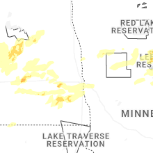


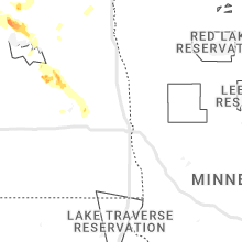


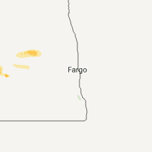


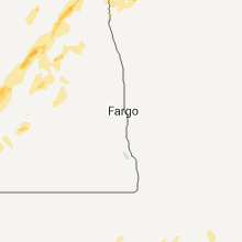
Connect with Interactive Hail Maps