

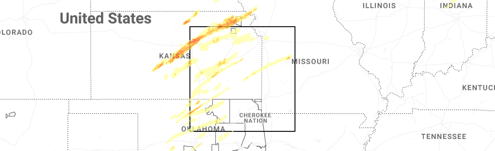
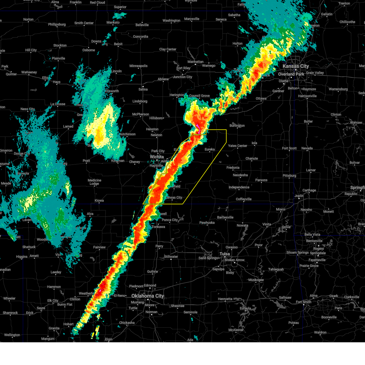
Hail Map for Madison, KS
The Madison, KS area has had 18 reports of on-the-ground hail by trained spotters, and has been under severe weather warnings 8 times during the past 12 months. Doppler radar has detected hail at or near Madison, KS on 82 occasions, including 5 occasions during the past year.
| Name: | Madison, KS |
| Where Located: | 48.7 miles NW of Chanute, KS |
| Map: | Google Map for Madison, KS |
| Population: | 701 |
| Housing Units: | 401 |
| More Info: | Search Google for Madison, KS |
1
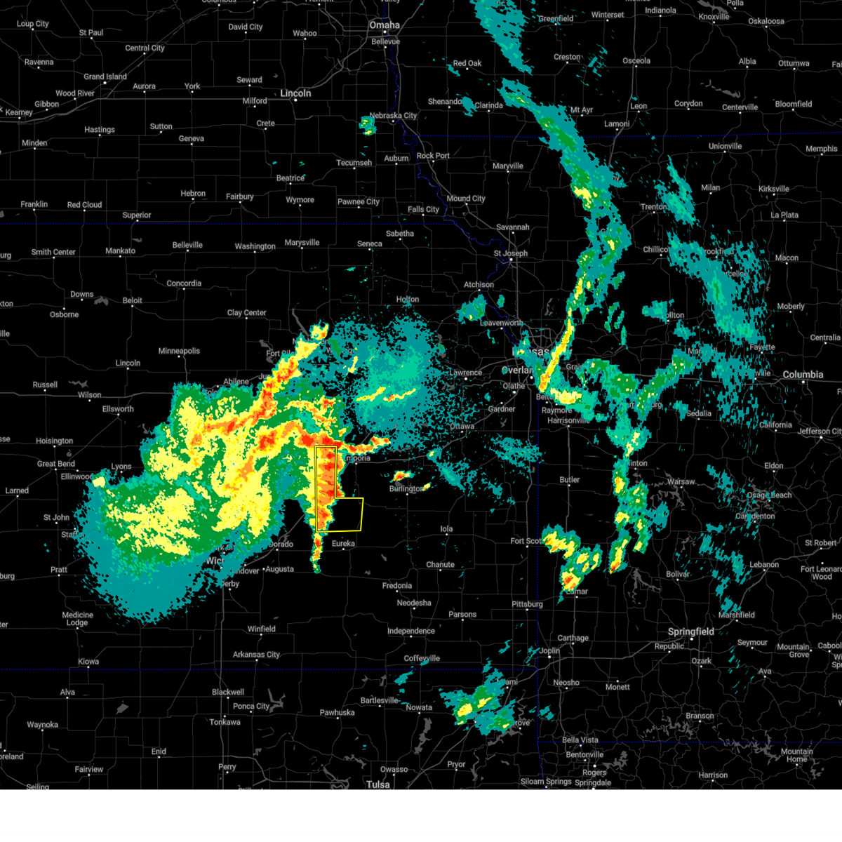
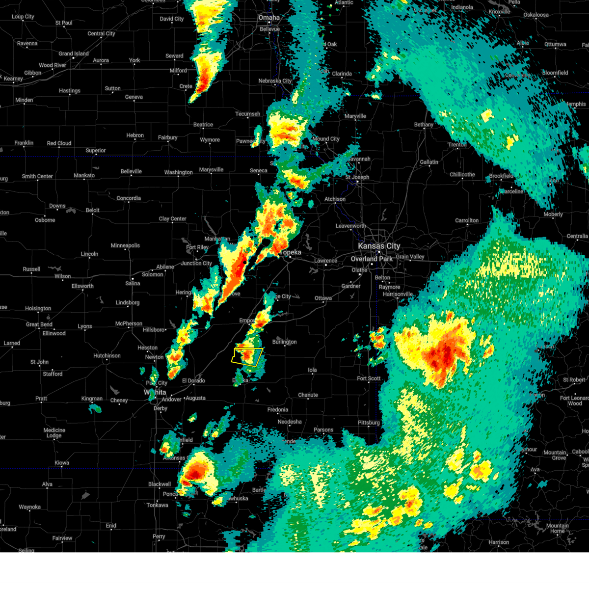
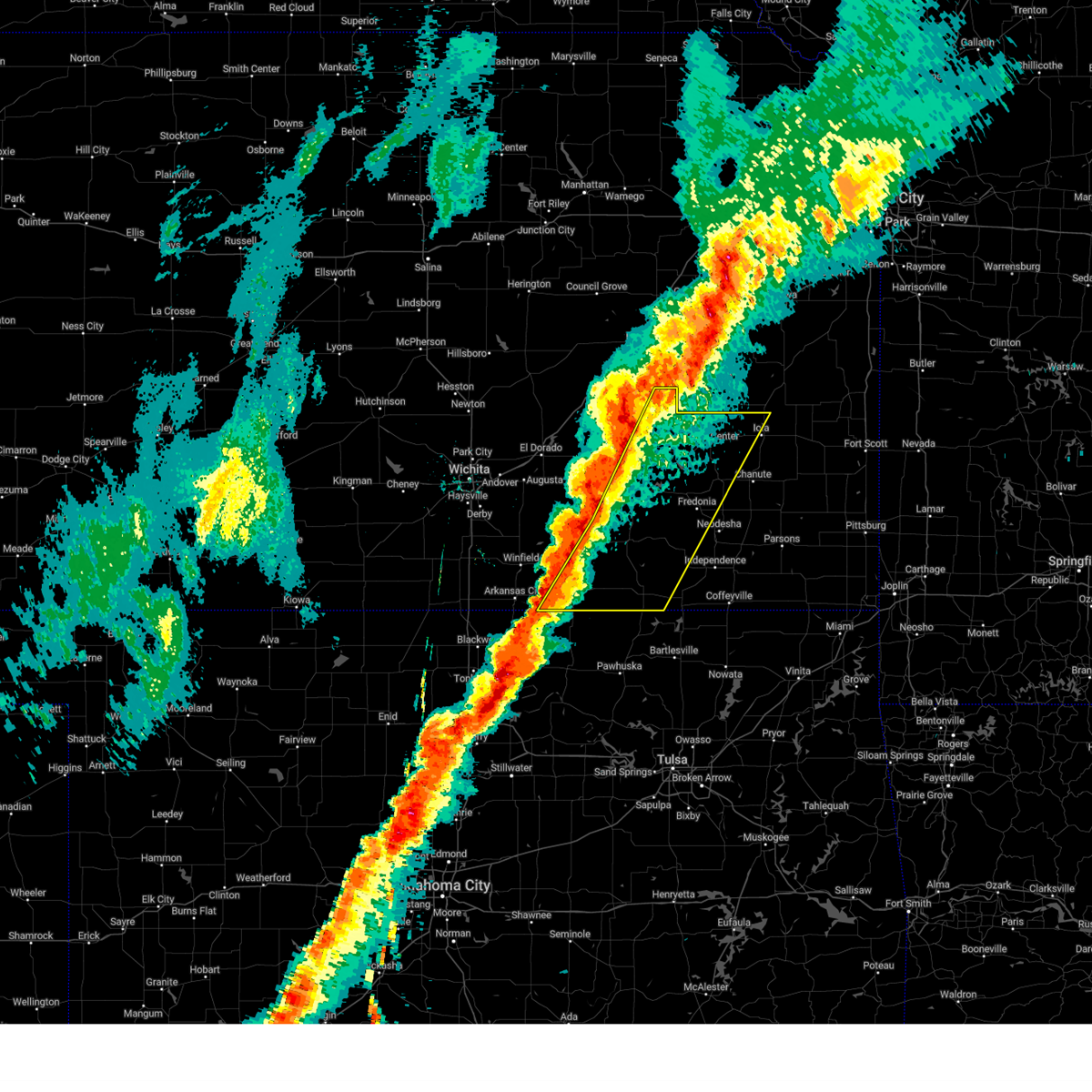
The Top Recent Hail Date for Madison, KS is Tuesday, April 1, 2025 (22nd out of 82)
Hail and Wind Damage Spotted near Madison, KS
| Date / Time | Report Details |
|---|---|
| 5/20/2025 12:55 AM CDT |
 The storm which prompted the warning has weakened below severe limits, and no longer poses an immediate threat to life or property. therefore, the warning will be allowed to expire. however, gusty winds are still possible with this thunderstorm. The storm which prompted the warning has weakened below severe limits, and no longer poses an immediate threat to life or property. therefore, the warning will be allowed to expire. however, gusty winds are still possible with this thunderstorm.
|
| 5/20/2025 12:27 AM CDT | Svrict the national weather service in wichita has issued a * severe thunderstorm warning for, eastern chase county in east central kansas, northwestern greenwood county in southeastern kansas, * until 100 am cdt. * at 1227 am cdt, a severe thunderstorm was located 16 miles south of cottonwood falls, moving northeast at 45 mph (trained weather spotters report multiple trees down). Hazards include 60 mph wind gusts. expect damage to roofs, siding, and trees |
| 5/19/2025 7:02 PM CDT |
 the severe thunderstorm warning has been cancelled and is no longer in effect the severe thunderstorm warning has been cancelled and is no longer in effect
|
| 5/19/2025 6:51 PM CDT | At 650 pm cdt, a severe thunderstorm was located 8 miles northwest of hamilton, or 8 miles southwest of madison, moving northeast at 50 mph (emergency management reported 60 mph winds 6 miles west of hamilton at 640 pm cdt). Hazards include ping pong ball size hail and 60 mph wind gusts. People and animals outdoors will be injured. expect hail damage to roofs, siding, windows, and vehicles. expect wind damage to roofs, siding, and trees. Locations impacted include, madison. |
| 5/19/2025 6:43 PM CDT | Svrict the national weather service in wichita has issued a * severe thunderstorm warning for, northern greenwood county in southeastern kansas, * until 730 pm cdt. * at 643 pm cdt, a severe thunderstorm was located 7 miles west of hamilton, or 10 miles north of eureka, moving northeast at 50 mph (radar indicated). Hazards include ping pong ball size hail and 60 mph wind gusts. People and animals outdoors will be injured. expect hail damage to roofs, siding, windows, and vehicles. Expect wind damage to roofs, siding, and trees. |
| 4/2/2025 4:31 AM CDT |
 Svrict the national weather service in wichita has issued a * severe thunderstorm warning for, elk county in southeastern kansas, wilson county in southeastern kansas, southeastern cowley county in south central kansas, northwestern montgomery county in southeastern kansas, chautauqua county in southeastern kansas, woodson county in southeastern kansas, eastern greenwood county in southeastern kansas, northwestern allen county in southeastern kansas, * until 515 am cdt. * at 430 am cdt, severe thunderstorms were located along a line extending from near madison to 5 miles northwest of howard to 5 miles southeast of dexter, moving northeast at 60 mph (radar indicated). Hazards include 60 mph wind gusts and quarter size hail. Hail damage to vehicles is expected. Expect wind damage to roofs, siding, and trees. Svrict the national weather service in wichita has issued a * severe thunderstorm warning for, elk county in southeastern kansas, wilson county in southeastern kansas, southeastern cowley county in south central kansas, northwestern montgomery county in southeastern kansas, chautauqua county in southeastern kansas, woodson county in southeastern kansas, eastern greenwood county in southeastern kansas, northwestern allen county in southeastern kansas, * until 515 am cdt. * at 430 am cdt, severe thunderstorms were located along a line extending from near madison to 5 miles northwest of howard to 5 miles southeast of dexter, moving northeast at 60 mph (radar indicated). Hazards include 60 mph wind gusts and quarter size hail. Hail damage to vehicles is expected. Expect wind damage to roofs, siding, and trees.
|
| 4/2/2025 4:29 AM CDT |
 Svrict the national weather service in wichita has issued a * severe thunderstorm warning for, elk county in southeastern kansas, wilson county in southeastern kansas, southeastern cowley county in south central kansas, northwestern montgomery county in southeastern kansas, chautauqua county in southeastern kansas, woodson county in southeastern kansas, eastern greenwood county in southeastern kansas, northwestern allen county in southeastern kansas, * until 515 am cdt. * at 428 am cdt, severe thunderstorms were located along a line extending from near madison to 5 miles northwest of howard to 5 miles southeast of dexter, moving northeast at 110 mph (radar indicated). Hazards include 60 mph wind gusts and quarter size hail. Hail damage to vehicles is expected. Expect wind damage to roofs, siding, and trees. Svrict the national weather service in wichita has issued a * severe thunderstorm warning for, elk county in southeastern kansas, wilson county in southeastern kansas, southeastern cowley county in south central kansas, northwestern montgomery county in southeastern kansas, chautauqua county in southeastern kansas, woodson county in southeastern kansas, eastern greenwood county in southeastern kansas, northwestern allen county in southeastern kansas, * until 515 am cdt. * at 428 am cdt, severe thunderstorms were located along a line extending from near madison to 5 miles northwest of howard to 5 miles southeast of dexter, moving northeast at 110 mph (radar indicated). Hazards include 60 mph wind gusts and quarter size hail. Hail damage to vehicles is expected. Expect wind damage to roofs, siding, and trees.
|
| 4/2/2025 3:43 AM CDT |
 Svrict the national weather service in wichita has issued a * severe thunderstorm warning for, northwestern elk county in southeastern kansas, cowley county in south central kansas, butler county in south central kansas, eastern sumner county in south central kansas, greenwood county in southeastern kansas, * until 430 am cdt. * at 342 am cdt, severe thunderstorms were located along a line extending from 15 miles east of el dorado to 6 miles southwest of geuda springs, moving northeast at 60 mph (radar indicated). Hazards include 60 mph wind gusts and quarter size hail. Hail damage to vehicles is expected. Expect wind damage to roofs, siding, and trees. Svrict the national weather service in wichita has issued a * severe thunderstorm warning for, northwestern elk county in southeastern kansas, cowley county in south central kansas, butler county in south central kansas, eastern sumner county in south central kansas, greenwood county in southeastern kansas, * until 430 am cdt. * at 342 am cdt, severe thunderstorms were located along a line extending from 15 miles east of el dorado to 6 miles southwest of geuda springs, moving northeast at 60 mph (radar indicated). Hazards include 60 mph wind gusts and quarter size hail. Hail damage to vehicles is expected. Expect wind damage to roofs, siding, and trees.
|
| 6/26/2024 4:29 AM CDT |
 At 427 am cdt, severe thunderstorms were located along a line extending from near kincaid to gas to hamilton, moving southeast at 75 mph. in some areas to the west of yates center and altoona, the damaging winds may occur well out ahead of the thunderstorm and rain (radar indicated). Hazards include 70 mph wind gusts. Expect considerable tree damage. damage is likely to mobile homes, roofs, and outbuildings. locations impacted include, chanute, iola, eureka, neodesha, fredonia, humboldt, yates center, erie, madison, st. Paul, la harpe, gas, moran, thayer, altoona, toronto, hamilton, buffalo, fall river, and neosho falls. At 427 am cdt, severe thunderstorms were located along a line extending from near kincaid to gas to hamilton, moving southeast at 75 mph. in some areas to the west of yates center and altoona, the damaging winds may occur well out ahead of the thunderstorm and rain (radar indicated). Hazards include 70 mph wind gusts. Expect considerable tree damage. damage is likely to mobile homes, roofs, and outbuildings. locations impacted include, chanute, iola, eureka, neodesha, fredonia, humboldt, yates center, erie, madison, st. Paul, la harpe, gas, moran, thayer, altoona, toronto, hamilton, buffalo, fall river, and neosho falls.
|
| 6/26/2024 4:11 AM CDT |
 Svrict the national weather service in wichita has issued a * severe thunderstorm warning for, wilson county in southeastern kansas, neosho county in southeastern kansas, woodson county in southeastern kansas, eastern greenwood county in southeastern kansas, allen county in southeastern kansas, * until 515 am cdt. * at 408 am cdt, severe thunderstorms were located along a line extending from near garnett to near westphalia to 5 miles west of olpe, moving southeast at 80 mph. in some areas to the west of yates center and fredonia, the damaging winds may occur well out ahead of the thunderstorm and rain (radar indicated). Hazards include 70 mph wind gusts. Expect considerable tree damage. Damage is likely to mobile homes, roofs, and outbuildings. Svrict the national weather service in wichita has issued a * severe thunderstorm warning for, wilson county in southeastern kansas, neosho county in southeastern kansas, woodson county in southeastern kansas, eastern greenwood county in southeastern kansas, allen county in southeastern kansas, * until 515 am cdt. * at 408 am cdt, severe thunderstorms were located along a line extending from near garnett to near westphalia to 5 miles west of olpe, moving southeast at 80 mph. in some areas to the west of yates center and fredonia, the damaging winds may occur well out ahead of the thunderstorm and rain (radar indicated). Hazards include 70 mph wind gusts. Expect considerable tree damage. Damage is likely to mobile homes, roofs, and outbuildings.
|
| 6/4/2024 8:10 PM CDT |
 The storm which prompted the warning has moved out of the area. therefore, the warning will be allowed to expire. a severe thunderstorm watch remains in effect until 900 pm cdt for southeastern kansas. The storm which prompted the warning has moved out of the area. therefore, the warning will be allowed to expire. a severe thunderstorm watch remains in effect until 900 pm cdt for southeastern kansas.
|
| 6/4/2024 8:00 PM CDT |
 At 800 pm cdt, a severe thunderstorm was located near madison, moving east at 20 mph (public). Hazards include 70 mph wind gusts and quarter size hail. Hail damage to vehicles is expected. expect considerable tree damage. wind damage is also likely to mobile homes, roofs, and outbuildings. Locations impacted include, madison. At 800 pm cdt, a severe thunderstorm was located near madison, moving east at 20 mph (public). Hazards include 70 mph wind gusts and quarter size hail. Hail damage to vehicles is expected. expect considerable tree damage. wind damage is also likely to mobile homes, roofs, and outbuildings. Locations impacted include, madison.
|
| 6/4/2024 7:36 PM CDT | Measured by a personal weather statio in greenwood county KS, 0.5 miles SSE of Madison, KS |
| 6/4/2024 7:21 PM CDT |
 Svrict the national weather service in wichita has issued a * severe thunderstorm warning for, northeastern greenwood county in southeastern kansas, * until 815 pm cdt. * at 721 pm cdt, a severe thunderstorm was located 8 miles southwest of olpe, or 9 miles northwest of madison, moving east at 20 mph (radar indicated). Hazards include 70 mph wind gusts and ping pong ball size hail. People and animals outdoors will be injured. expect hail damage to roofs, siding, windows, and vehicles. expect considerable tree damage. Wind damage is also likely to mobile homes, roofs, and outbuildings. Svrict the national weather service in wichita has issued a * severe thunderstorm warning for, northeastern greenwood county in southeastern kansas, * until 815 pm cdt. * at 721 pm cdt, a severe thunderstorm was located 8 miles southwest of olpe, or 9 miles northwest of madison, moving east at 20 mph (radar indicated). Hazards include 70 mph wind gusts and ping pong ball size hail. People and animals outdoors will be injured. expect hail damage to roofs, siding, windows, and vehicles. expect considerable tree damage. Wind damage is also likely to mobile homes, roofs, and outbuildings.
|
| 5/19/2024 9:27 PM CDT |
 the severe thunderstorm warning has been cancelled and is no longer in effect the severe thunderstorm warning has been cancelled and is no longer in effect
|
| 5/19/2024 9:04 PM CDT |
 the severe thunderstorm warning has been cancelled and is no longer in effect the severe thunderstorm warning has been cancelled and is no longer in effect
|
| 5/19/2024 9:04 PM CDT |
 At 903 pm cdt, severe thunderstorms were located along a line extending from emporia to near hamilton to 11 miles southwest of eureka, moving east at 65 mph (radar indicated). Hazards include 60 mph wind gusts and quarter size hail. Hail damage to vehicles is expected. expect wind damage to roofs, siding, and trees. Locations impacted include, eureka, madison, hamilton, severy, fall river, climax, virgil, eureka city lake, eureka airport, thrall, fall river state park, fall river lake, and piedmont. At 903 pm cdt, severe thunderstorms were located along a line extending from emporia to near hamilton to 11 miles southwest of eureka, moving east at 65 mph (radar indicated). Hazards include 60 mph wind gusts and quarter size hail. Hail damage to vehicles is expected. expect wind damage to roofs, siding, and trees. Locations impacted include, eureka, madison, hamilton, severy, fall river, climax, virgil, eureka city lake, eureka airport, thrall, fall river state park, fall river lake, and piedmont.
|
| 5/19/2024 8:59 PM CDT |
 At 859 pm cdt, severe thunderstorms were located along a line extending from near emporia to near hamilton to 12 miles east of leon, moving east at 55 mph (radar indicated). Hazards include 60 mph wind gusts and quarter size hail. Hail damage to vehicles is expected. expect wind damage to roofs, siding, and trees. Locations impacted include, el dorado, augusta, eureka, leon, madison, hamilton, severy, fall river, rosalia, cassoday, climax, virgil, eureka city lake, el dorado state park, eureka airport, thrall, fall river state park, el dorado airport, beaumont, and el dorado lake. At 859 pm cdt, severe thunderstorms were located along a line extending from near emporia to near hamilton to 12 miles east of leon, moving east at 55 mph (radar indicated). Hazards include 60 mph wind gusts and quarter size hail. Hail damage to vehicles is expected. expect wind damage to roofs, siding, and trees. Locations impacted include, el dorado, augusta, eureka, leon, madison, hamilton, severy, fall river, rosalia, cassoday, climax, virgil, eureka city lake, el dorado state park, eureka airport, thrall, fall river state park, el dorado airport, beaumont, and el dorado lake.
|
| 5/19/2024 8:59 PM CDT |
 the severe thunderstorm warning has been cancelled and is no longer in effect the severe thunderstorm warning has been cancelled and is no longer in effect
|
| 5/19/2024 8:38 PM CDT |
 Svrict the national weather service in wichita has issued a * severe thunderstorm warning for, chase county in east central kansas, northeastern butler county in south central kansas, greenwood county in southeastern kansas, * until 945 pm cdt. * at 838 pm cdt, severe thunderstorms were located along a line extending from 10 miles south of cottonwood falls to 18 miles east of burns to 5 miles east of el dorado, moving east at 65 mph (radar indicated). Hazards include 70 mph wind gusts and quarter size hail. Hail damage to vehicles is expected. expect considerable tree damage. Wind damage is also likely to mobile homes, roofs, and outbuildings. Svrict the national weather service in wichita has issued a * severe thunderstorm warning for, chase county in east central kansas, northeastern butler county in south central kansas, greenwood county in southeastern kansas, * until 945 pm cdt. * at 838 pm cdt, severe thunderstorms were located along a line extending from 10 miles south of cottonwood falls to 18 miles east of burns to 5 miles east of el dorado, moving east at 65 mph (radar indicated). Hazards include 70 mph wind gusts and quarter size hail. Hail damage to vehicles is expected. expect considerable tree damage. Wind damage is also likely to mobile homes, roofs, and outbuildings.
|
| 5/6/2024 9:42 PM CDT |
 The storms which prompted the warning have moved out of the area. therefore, the warning will be allowed to expire. however, small hail, gusty winds and heavy rain are still possible with these thunderstorms. a tornado watch remains in effect until 1100 pm cdt for southeastern kansas. The storms which prompted the warning have moved out of the area. therefore, the warning will be allowed to expire. however, small hail, gusty winds and heavy rain are still possible with these thunderstorms. a tornado watch remains in effect until 1100 pm cdt for southeastern kansas.
|
| 5/6/2024 9:13 PM CDT |
 At 913 pm cdt, severe thunderstorms were located along a line extending from 6 miles south of gridley to 8 miles southwest of fall river, moving east at 35 mph (radar indicated). Hazards include 70 mph wind gusts and penny size hail. Expect considerable tree damage. damage is likely to mobile homes, roofs, and outbuildings. Locations impacted include, madison, toronto, hamilton, severy, fall river, climax, virgil, new albany, coyville, batesville, toronto lake, fall river state park, fall river lake, and cross timbers state park. At 913 pm cdt, severe thunderstorms were located along a line extending from 6 miles south of gridley to 8 miles southwest of fall river, moving east at 35 mph (radar indicated). Hazards include 70 mph wind gusts and penny size hail. Expect considerable tree damage. damage is likely to mobile homes, roofs, and outbuildings. Locations impacted include, madison, toronto, hamilton, severy, fall river, climax, virgil, new albany, coyville, batesville, toronto lake, fall river state park, fall river lake, and cross timbers state park.
|
| 5/6/2024 8:46 PM CDT |
 Svrict the national weather service in wichita has issued a * severe thunderstorm warning for, northern elk county in southeastern kansas, northwestern wilson county in southeastern kansas, western woodson county in southeastern kansas, greenwood county in southeastern kansas, * until 945 pm cdt. * at 846 pm cdt, a severe thunderstorm was located 7 miles northwest of howard, moving north at 40 mph (radar indicated). Hazards include 60 mph wind gusts and quarter size hail. Hail damage to vehicles is expected. Expect wind damage to roofs, siding, and trees. Svrict the national weather service in wichita has issued a * severe thunderstorm warning for, northern elk county in southeastern kansas, northwestern wilson county in southeastern kansas, western woodson county in southeastern kansas, greenwood county in southeastern kansas, * until 945 pm cdt. * at 846 pm cdt, a severe thunderstorm was located 7 miles northwest of howard, moving north at 40 mph (radar indicated). Hazards include 60 mph wind gusts and quarter size hail. Hail damage to vehicles is expected. Expect wind damage to roofs, siding, and trees.
|
| 4/16/2024 5:04 AM CDT |
 the severe thunderstorm warning has been cancelled and is no longer in effect the severe thunderstorm warning has been cancelled and is no longer in effect
|
| 4/16/2024 4:55 AM CDT |
 the severe thunderstorm warning has been cancelled and is no longer in effect the severe thunderstorm warning has been cancelled and is no longer in effect
|
| 4/16/2024 4:55 AM CDT |
 At 455 am cdt, a severe thunderstorm was located near madison, moving northeast at 45 mph (radar indicated). Hazards include 60 mph wind gusts and quarter size hail. Hail damage to vehicles is expected. expect wind damage to roofs, siding, and trees. Locations impacted include, eureka, madison, hamilton, virgil, eureka city lake, eureka airport, and thrall. At 455 am cdt, a severe thunderstorm was located near madison, moving northeast at 45 mph (radar indicated). Hazards include 60 mph wind gusts and quarter size hail. Hail damage to vehicles is expected. expect wind damage to roofs, siding, and trees. Locations impacted include, eureka, madison, hamilton, virgil, eureka city lake, eureka airport, and thrall.
|
| 4/16/2024 4:12 AM CDT |
 Svrict the national weather service in wichita has issued a * severe thunderstorm warning for, northwestern elk county in southeastern kansas, northwestern woodson county in southeastern kansas, greenwood county in southeastern kansas, * until 515 am cdt. * at 412 am cdt, a severe thunderstorm was located 11 miles northwest of severy, or 11 miles southwest of eureka, moving northeast at 45 mph (radar indicated). Hazards include 60 mph wind gusts and quarter size hail. Hail damage to vehicles is expected. Expect wind damage to roofs, siding, and trees. Svrict the national weather service in wichita has issued a * severe thunderstorm warning for, northwestern elk county in southeastern kansas, northwestern woodson county in southeastern kansas, greenwood county in southeastern kansas, * until 515 am cdt. * at 412 am cdt, a severe thunderstorm was located 11 miles northwest of severy, or 11 miles southwest of eureka, moving northeast at 45 mph (radar indicated). Hazards include 60 mph wind gusts and quarter size hail. Hail damage to vehicles is expected. Expect wind damage to roofs, siding, and trees.
|
| 8/13/2023 6:43 PM CDT | Tree and minor building damage from outflow wind in greenwood county KS, 5.9 miles W of Madison, KS |
| 8/6/2023 12:53 AM CDT |
 The severe thunderstorm warning for northwestern elk, northern cowley, southeastern chase, eastern butler and greenwood counties will expire at 100 am cdt, the storms which prompted the warning have moved out of the area. therefore, the warning will be allowed to expire. however gusty winds and heavy rain are still possible with these thunderstorms. a severe thunderstorm warning remains in effect for eastern and southern elk counties and southeast cowley county until 115 am. a severe thunderstorm watch remains in effect until 300 am cdt for south central, southeastern and east central kansas. The severe thunderstorm warning for northwestern elk, northern cowley, southeastern chase, eastern butler and greenwood counties will expire at 100 am cdt, the storms which prompted the warning have moved out of the area. therefore, the warning will be allowed to expire. however gusty winds and heavy rain are still possible with these thunderstorms. a severe thunderstorm warning remains in effect for eastern and southern elk counties and southeast cowley county until 115 am. a severe thunderstorm watch remains in effect until 300 am cdt for south central, southeastern and east central kansas.
|
| 8/6/2023 12:46 AM CDT |
 At 1245 am cdt, severe thunderstorms were located along a line extending from hamilton to 7 miles north of grenola to just southeast of winfield, moving southeast at 55 mph (radar indicated). Hazards include 70 mph wind gusts and nickel size hail. Expect considerable tree damage. damage is likely to mobile homes, roofs, and outbuildings. locations impacted include, winfield, eureka, udall, madison, howard, burden, hamilton, severy, grenola, atlanta, latham, rosalia, cambridge, climax, matfield green, eureka city lake, eureka airport, thrall, beaumont and winfield city lake. thunderstorm damage threat, considerable hail threat, radar indicated max hail size, 0. 88 in wind threat, radar indicated max wind gust, 70 mph. At 1245 am cdt, severe thunderstorms were located along a line extending from hamilton to 7 miles north of grenola to just southeast of winfield, moving southeast at 55 mph (radar indicated). Hazards include 70 mph wind gusts and nickel size hail. Expect considerable tree damage. damage is likely to mobile homes, roofs, and outbuildings. locations impacted include, winfield, eureka, udall, madison, howard, burden, hamilton, severy, grenola, atlanta, latham, rosalia, cambridge, climax, matfield green, eureka city lake, eureka airport, thrall, beaumont and winfield city lake. thunderstorm damage threat, considerable hail threat, radar indicated max hail size, 0. 88 in wind threat, radar indicated max wind gust, 70 mph.
|
| 8/6/2023 12:29 AM CDT |
 At 1228 am cdt, severe thunderstorms were located along a line extending from near hamilton to latham to near oxford, moving southeast at 50 mph (radar indicated). Hazards include 70 mph wind gusts and nickel size hail. Expect considerable tree damage. damage is likely to mobile homes, roofs, and outbuildings. locations impacted include, el dorado, winfield, augusta, eureka, douglass, towanda, cottonwood falls, udall, leon, madison, howard, burden, hamilton, severy, grenola, atlanta, latham, rosalia, rock and cassoday. thunderstorm damage threat, considerable hail threat, radar indicated max hail size, 0. 88 in wind threat, radar indicated max wind gust, 70 mph. At 1228 am cdt, severe thunderstorms were located along a line extending from near hamilton to latham to near oxford, moving southeast at 50 mph (radar indicated). Hazards include 70 mph wind gusts and nickel size hail. Expect considerable tree damage. damage is likely to mobile homes, roofs, and outbuildings. locations impacted include, el dorado, winfield, augusta, eureka, douglass, towanda, cottonwood falls, udall, leon, madison, howard, burden, hamilton, severy, grenola, atlanta, latham, rosalia, rock and cassoday. thunderstorm damage threat, considerable hail threat, radar indicated max hail size, 0. 88 in wind threat, radar indicated max wind gust, 70 mph.
|
| 8/6/2023 12:15 AM CDT |
 At 1215 am cdt, severe thunderstorms were located along a line extending from 10 miles south of cottonwood falls to 7 miles south of leon to near wellington, moving southeast at 60 mph (radar indicated). Hazards include 70 mph wind gusts and nickel size hail. Expect considerable tree damage. damage is likely to mobile homes, roofs, and outbuildings. locations impacted include, el dorado, winfield, augusta, wellington, mulvane, eureka, douglass, belle plaine, towanda, conway springs, oxford, cottonwood falls, udall, leon, madison, howard, burden, argonia, hamilton and severy. thunderstorm damage threat, considerable hail threat, radar indicated max hail size, 0. 88 in wind threat, radar indicated max wind gust, 70 mph. At 1215 am cdt, severe thunderstorms were located along a line extending from 10 miles south of cottonwood falls to 7 miles south of leon to near wellington, moving southeast at 60 mph (radar indicated). Hazards include 70 mph wind gusts and nickel size hail. Expect considerable tree damage. damage is likely to mobile homes, roofs, and outbuildings. locations impacted include, el dorado, winfield, augusta, wellington, mulvane, eureka, douglass, belle plaine, towanda, conway springs, oxford, cottonwood falls, udall, leon, madison, howard, burden, argonia, hamilton and severy. thunderstorm damage threat, considerable hail threat, radar indicated max hail size, 0. 88 in wind threat, radar indicated max wind gust, 70 mph.
|
| 8/5/2023 11:56 PM CDT |
 At 1155 pm cdt, severe thunderstorms were located along a line extending from near florence to near benton to near norwich, moving southeast at 50 mph (radar indicated). Hazards include 70 mph wind gusts and nickel size hail. Expect considerable tree damage. Damage is likely to mobile homes, roofs, and outbuildings. At 1155 pm cdt, severe thunderstorms were located along a line extending from near florence to near benton to near norwich, moving southeast at 50 mph (radar indicated). Hazards include 70 mph wind gusts and nickel size hail. Expect considerable tree damage. Damage is likely to mobile homes, roofs, and outbuildings.
|
| 7/14/2023 4:51 PM CDT |
 At 451 pm cdt, severe thunderstorms were located along a line extending from 9 miles east of madison to near gridley to 6 miles west of toronto, moving east at 70 mph (radar indicated). Hazards include 70 mph wind gusts. Expect considerable tree damage. damage is likely to mobile homes, roofs, and outbuildings. locations impacted include, eureka, madison, hamilton, virgil, eureka city lake, eureka airport and thrall. thunderstorm damage threat, considerable hail threat, radar indicated max hail size, <. 75 in wind threat, radar indicated max wind gust, 70 mph. At 451 pm cdt, severe thunderstorms were located along a line extending from 9 miles east of madison to near gridley to 6 miles west of toronto, moving east at 70 mph (radar indicated). Hazards include 70 mph wind gusts. Expect considerable tree damage. damage is likely to mobile homes, roofs, and outbuildings. locations impacted include, eureka, madison, hamilton, virgil, eureka city lake, eureka airport and thrall. thunderstorm damage threat, considerable hail threat, radar indicated max hail size, <. 75 in wind threat, radar indicated max wind gust, 70 mph.
|
| 7/14/2023 4:36 PM CDT |
 At 436 pm cdt, severe thunderstorms were located along a line extending from 7 miles west of madison to 6 miles northwest of hamilton to near eureka, moving east at 65 mph (radar indicated). Hazards include 70 mph wind gusts. Expect considerable tree damage. damage is likely to mobile homes, roofs, and outbuildings. Locations impacted include, eureka, madison, hamilton, virgil, eureka city lake, eureka airport and thrall. At 436 pm cdt, severe thunderstorms were located along a line extending from 7 miles west of madison to 6 miles northwest of hamilton to near eureka, moving east at 65 mph (radar indicated). Hazards include 70 mph wind gusts. Expect considerable tree damage. damage is likely to mobile homes, roofs, and outbuildings. Locations impacted include, eureka, madison, hamilton, virgil, eureka city lake, eureka airport and thrall.
|
| 7/14/2023 4:23 PM CDT |
 At 423 pm cdt, severe thunderstorms were located along a line extending from 8 miles southeast of cottonwood falls to 14 miles west of hamilton to 14 miles northeast of leon, moving east at 70 mph (radar indicated). Hazards include 60 mph wind gusts. expect damage to roofs, siding, and trees At 423 pm cdt, severe thunderstorms were located along a line extending from 8 miles southeast of cottonwood falls to 14 miles west of hamilton to 14 miles northeast of leon, moving east at 70 mph (radar indicated). Hazards include 60 mph wind gusts. expect damage to roofs, siding, and trees
|
| 7/5/2023 1:23 AM CDT |
 The severe thunderstorm warning for northern wilson, northern neosho, woodson, greenwood and allen counties will expire at 130 am cdt, the storms which prompted the warning have weakened below severe limits, and no longer pose an immediate threat to life or property. therefore, the warning will be allowed to expire. however gusty winds and heavy rain are still possible with these thunderstorms. a severe thunderstorm watch remains in effect until 500 am cdt for southeastern kansas. The severe thunderstorm warning for northern wilson, northern neosho, woodson, greenwood and allen counties will expire at 130 am cdt, the storms which prompted the warning have weakened below severe limits, and no longer pose an immediate threat to life or property. therefore, the warning will be allowed to expire. however gusty winds and heavy rain are still possible with these thunderstorms. a severe thunderstorm watch remains in effect until 500 am cdt for southeastern kansas.
|
| 7/5/2023 12:56 AM CDT |
 At 1255 am cdt, severe thunderstorms were located along a line extending from 8 miles southeast of garnett to 5 miles east of yates center to 12 miles west of eureka, moving southeast at 35 mph (radar indicated). Hazards include 50 to 60 mph wind gusts. Expect damage to roofs, siding, and trees. locations impacted include, chanute, iola, eureka, humboldt, yates center, madison, la harpe, gas, moran, toronto, hamilton, severy, buffalo, fall river, neosho falls, savonburg, elsmore, benedict, climax and stark. hail threat, radar indicated max hail size, <. 75 in wind threat, radar indicated max wind gust, 60 mph. At 1255 am cdt, severe thunderstorms were located along a line extending from 8 miles southeast of garnett to 5 miles east of yates center to 12 miles west of eureka, moving southeast at 35 mph (radar indicated). Hazards include 50 to 60 mph wind gusts. Expect damage to roofs, siding, and trees. locations impacted include, chanute, iola, eureka, humboldt, yates center, madison, la harpe, gas, moran, toronto, hamilton, severy, buffalo, fall river, neosho falls, savonburg, elsmore, benedict, climax and stark. hail threat, radar indicated max hail size, <. 75 in wind threat, radar indicated max wind gust, 60 mph.
|
| 7/5/2023 12:34 AM CDT |
 At 1233 am cdt, severe thunderstorms were located along a line extending from 7 miles southwest of gridley to 14 miles northwest of eureka, moving south at 40 mph (radar indicated). Hazards include 60 mph wind gusts. Expect damage to roofs, siding, and trees. locations impacted include, madison, hamilton, virgil and thrall. hail threat, radar indicated max hail size, <. 75 in wind threat, radar indicated max wind gust, 60 mph. At 1233 am cdt, severe thunderstorms were located along a line extending from 7 miles southwest of gridley to 14 miles northwest of eureka, moving south at 40 mph (radar indicated). Hazards include 60 mph wind gusts. Expect damage to roofs, siding, and trees. locations impacted include, madison, hamilton, virgil and thrall. hail threat, radar indicated max hail size, <. 75 in wind threat, radar indicated max wind gust, 60 mph.
|
| 7/5/2023 12:27 AM CDT |
 At 1227 am cdt, severe thunderstorms were located along a line extending from near garnett to 5 miles southeast of gridley to 13 miles northwest of eureka, moving southeast at 35 mph (radar indicated). Hazards include 60 mph wind gusts. expect damage to roofs, siding, and trees At 1227 am cdt, severe thunderstorms were located along a line extending from near garnett to 5 miles southeast of gridley to 13 miles northwest of eureka, moving southeast at 35 mph (radar indicated). Hazards include 60 mph wind gusts. expect damage to roofs, siding, and trees
|
| 7/4/2023 11:56 PM CDT |
 At 1155 pm cdt, severe thunderstorms were located along a line extending from 9 miles west of emporia to near walton, moving south at 25 mph (radar indicated). Hazards include 50 to 60 mph wind gusts, and pea to penny size hail. Expect damage to roofs, siding, and trees. locations impacted include, newton, hesston, hillsboro, marion, north newton, peabody, cottonwood falls, whitewater, madison, strong city, florence, goessel, potwin, hamilton, walton, elbing, burns, lehigh, cassoday and bazaar. hail threat, radar indicated max hail size, 0. 75 in wind threat, radar indicated max wind gust, 60 mph. At 1155 pm cdt, severe thunderstorms were located along a line extending from 9 miles west of emporia to near walton, moving south at 25 mph (radar indicated). Hazards include 50 to 60 mph wind gusts, and pea to penny size hail. Expect damage to roofs, siding, and trees. locations impacted include, newton, hesston, hillsboro, marion, north newton, peabody, cottonwood falls, whitewater, madison, strong city, florence, goessel, potwin, hamilton, walton, elbing, burns, lehigh, cassoday and bazaar. hail threat, radar indicated max hail size, 0. 75 in wind threat, radar indicated max wind gust, 60 mph.
|
| 7/4/2023 11:44 PM CDT |
 At 1144 pm cdt, severe thunderstorms were located along a line extending from 5 miles southwest of americus to near goessel, moving southeast at 25 mph (radar indicated). Hazards include 60 mph wind gusts and penny size hail. expect damage to roofs, siding, and trees At 1144 pm cdt, severe thunderstorms were located along a line extending from 5 miles southwest of americus to near goessel, moving southeast at 25 mph (radar indicated). Hazards include 60 mph wind gusts and penny size hail. expect damage to roofs, siding, and trees
|
| 7/4/2023 6:11 PM CDT |
 At 610 pm cdt, severe thunderstorms were located from near hamilton to 9 miles northwest of toronto, moving east to southeast at 5 mph (radar indicated). Hazards include 50 to 60 mph wind gusts. Expect damage to roofs, siding, and trees. locations impacted include, madison, hamilton, virgil, eureka city lake, eureka airport and thrall. hail threat, radar indicated max hail size, <. 75 in wind threat, radar indicated max wind gust, 60 mph. At 610 pm cdt, severe thunderstorms were located from near hamilton to 9 miles northwest of toronto, moving east to southeast at 5 mph (radar indicated). Hazards include 50 to 60 mph wind gusts. Expect damage to roofs, siding, and trees. locations impacted include, madison, hamilton, virgil, eureka city lake, eureka airport and thrall. hail threat, radar indicated max hail size, <. 75 in wind threat, radar indicated max wind gust, 60 mph.
|
| 7/4/2023 5:53 PM CDT |
 At 553 pm cdt, a severe thunderstorm was located near hamilton, or 7 miles south of madison, moving east to southeast at 5 mph (radar indicated). Hazards include 60 mph wind gusts and penny size hail. expect damage to roofs, siding, and trees At 553 pm cdt, a severe thunderstorm was located near hamilton, or 7 miles south of madison, moving east to southeast at 5 mph (radar indicated). Hazards include 60 mph wind gusts and penny size hail. expect damage to roofs, siding, and trees
|
| 5/12/2023 5:19 PM CDT |
 At 518 pm cdt, a severe thunderstorm was located 8 miles northwest of hamilton, or 11 miles southwest of madison, moving north at 35 mph (radar indicated). Hazards include 60 mph wind gusts and quarter size hail. Hail damage to vehicles is expected. expect wind damage to roofs, siding, and trees. locations impacted include, madison, hamilton and thrall. hail threat, radar indicated max hail size, 1. 00 in wind threat, radar indicated max wind gust, 60 mph. At 518 pm cdt, a severe thunderstorm was located 8 miles northwest of hamilton, or 11 miles southwest of madison, moving north at 35 mph (radar indicated). Hazards include 60 mph wind gusts and quarter size hail. Hail damage to vehicles is expected. expect wind damage to roofs, siding, and trees. locations impacted include, madison, hamilton and thrall. hail threat, radar indicated max hail size, 1. 00 in wind threat, radar indicated max wind gust, 60 mph.
|
| 5/12/2023 5:04 PM CDT |
 At 504 pm cdt, a severe thunderstorm was located 7 miles north of eureka, moving northeast at 35 mph (radar indicated). Hazards include 60 mph wind gusts and quarter size hail. Hail damage to vehicles is expected. expect wind damage to roofs, siding, and trees. locations impacted include, eureka, madison, hamilton, virgil, eureka city lake, eureka airport and thrall. hail threat, radar indicated max hail size, 1. 00 in wind threat, radar indicated max wind gust, 60 mph. At 504 pm cdt, a severe thunderstorm was located 7 miles north of eureka, moving northeast at 35 mph (radar indicated). Hazards include 60 mph wind gusts and quarter size hail. Hail damage to vehicles is expected. expect wind damage to roofs, siding, and trees. locations impacted include, eureka, madison, hamilton, virgil, eureka city lake, eureka airport and thrall. hail threat, radar indicated max hail size, 1. 00 in wind threat, radar indicated max wind gust, 60 mph.
|
| 5/12/2023 4:49 PM CDT |
 At 449 pm cdt, a severe thunderstorm was located 7 miles west of eureka, moving northeast at 30 mph (radar indicated). Hazards include 60 mph wind gusts and quarter size hail. Hail damage to vehicles is expected. Expect wind damage to roofs, siding, and trees. At 449 pm cdt, a severe thunderstorm was located 7 miles west of eureka, moving northeast at 30 mph (radar indicated). Hazards include 60 mph wind gusts and quarter size hail. Hail damage to vehicles is expected. Expect wind damage to roofs, siding, and trees.
|
| 5/9/2023 5:12 PM CDT |
 The severe thunderstorm warning for northeastern butler and greenwood counties will expire at 515 pm cdt, the storm which prompted the warning has weakened below severe limits, and no longer poses an immediate threat to life or property. therefore, the warning will be allowed to expire. however gusty winds are still possible with this thunderstorm. a severe thunderstorm watch remains in effect until 600 pm cdt for south central, southeastern and east central kansas. a severe thunderstorm watch also remains in effect until 1100 pm cdt for southeastern kansas. remember, a severe thunderstorm warning still remains in effect for southern greenwood county. The severe thunderstorm warning for northeastern butler and greenwood counties will expire at 515 pm cdt, the storm which prompted the warning has weakened below severe limits, and no longer poses an immediate threat to life or property. therefore, the warning will be allowed to expire. however gusty winds are still possible with this thunderstorm. a severe thunderstorm watch remains in effect until 600 pm cdt for south central, southeastern and east central kansas. a severe thunderstorm watch also remains in effect until 1100 pm cdt for southeastern kansas. remember, a severe thunderstorm warning still remains in effect for southern greenwood county.
|
| 5/9/2023 4:30 PM CDT |
 At 429 pm cdt, a severe thunderstorm was located 7 miles northwest of hamilton, or 9 miles southwest of madison, moving southeast at 30 mph. 60 mph winds have been reported along the gust front, well ahead of the main precipitation area (radar indicated). Hazards include 60 mph wind gusts and quarter size hail. Hail damage to vehicles is expected. expect wind damage to roofs, siding, and trees. locations impacted include, eureka, madison, hamilton, virgil, eureka city lake, eureka airport and thrall. hail threat, radar indicated max hail size, 1. 00 in wind threat, observed max wind gust, 60 mph. At 429 pm cdt, a severe thunderstorm was located 7 miles northwest of hamilton, or 9 miles southwest of madison, moving southeast at 30 mph. 60 mph winds have been reported along the gust front, well ahead of the main precipitation area (radar indicated). Hazards include 60 mph wind gusts and quarter size hail. Hail damage to vehicles is expected. expect wind damage to roofs, siding, and trees. locations impacted include, eureka, madison, hamilton, virgil, eureka city lake, eureka airport and thrall. hail threat, radar indicated max hail size, 1. 00 in wind threat, observed max wind gust, 60 mph.
|
| 5/9/2023 4:03 PM CDT |
 At 403 pm cdt, a severe thunderstorm was located 16 miles south of cottonwood falls, moving southeast at 30 mph (radar indicated). Hazards include 60 mph wind gusts and quarter size hail. Hail damage to vehicles is expected. Expect wind damage to roofs, siding, and trees. At 403 pm cdt, a severe thunderstorm was located 16 miles south of cottonwood falls, moving southeast at 30 mph (radar indicated). Hazards include 60 mph wind gusts and quarter size hail. Hail damage to vehicles is expected. Expect wind damage to roofs, siding, and trees.
|
| 4/4/2023 8:55 PM CDT |
 At 855 pm cdt, severe thunderstorms were located along a line extending from admire to near americus to 9 miles southeast of cottonwood falls, moving northeast at 60 mph (radar indicated). Hazards include 60 mph wind gusts and quarter size hail. Hail damage to vehicles is expected. expect wind damage to roofs, siding, and trees. locations impacted include, madison, matfield green and saffordville. hail threat, radar indicated max hail size, 1. 00 in wind threat, radar indicated max wind gust, 60 mph. At 855 pm cdt, severe thunderstorms were located along a line extending from admire to near americus to 9 miles southeast of cottonwood falls, moving northeast at 60 mph (radar indicated). Hazards include 60 mph wind gusts and quarter size hail. Hail damage to vehicles is expected. expect wind damage to roofs, siding, and trees. locations impacted include, madison, matfield green and saffordville. hail threat, radar indicated max hail size, 1. 00 in wind threat, radar indicated max wind gust, 60 mph.
|
| 4/4/2023 8:39 PM CDT |
 At 838 pm cdt, severe thunderstorms were located along a line extending from allen to near americus to 9 miles south of cottonwood falls, moving northeast at 60 mph (radar indicated). Hazards include 60 mph wind gusts and quarter size hail. Hail damage to vehicles is expected. Expect wind damage to roofs, siding, and trees. At 838 pm cdt, severe thunderstorms were located along a line extending from allen to near americus to 9 miles south of cottonwood falls, moving northeast at 60 mph (radar indicated). Hazards include 60 mph wind gusts and quarter size hail. Hail damage to vehicles is expected. Expect wind damage to roofs, siding, and trees.
|
| 6/15/2022 10:48 PM CDT |
 At 1047 pm cdt, a severe thunderstorm was located near hamilton, or 10 miles south of madison, moving east at 20 mph (radar indicated). Hazards include golf ball size hail and 60 mph wind gusts. People and animals outdoors will be injured. expect hail damage to roofs, siding, windows, and vehicles. expect wind damage to roofs, siding, and trees. locations impacted include, madison, hamilton, virgil and eureka city lake. thunderstorm damage threat, considerable hail threat, radar indicated max hail size, 1. 75 in wind threat, radar indicated max wind gust, 60 mph. At 1047 pm cdt, a severe thunderstorm was located near hamilton, or 10 miles south of madison, moving east at 20 mph (radar indicated). Hazards include golf ball size hail and 60 mph wind gusts. People and animals outdoors will be injured. expect hail damage to roofs, siding, windows, and vehicles. expect wind damage to roofs, siding, and trees. locations impacted include, madison, hamilton, virgil and eureka city lake. thunderstorm damage threat, considerable hail threat, radar indicated max hail size, 1. 75 in wind threat, radar indicated max wind gust, 60 mph.
|
| 6/15/2022 10:37 PM CDT |
 At 1036 pm cdt, a severe thunderstorm was located over hamilton, or 10 miles south of madison, moving east at 20 mph (radar indicated). Hazards include 60 mph wind gusts and quarter size hail. Hail damage to vehicles is expected. expect wind damage to roofs, siding, and trees. locations impacted include, madison, hamilton, virgil, eureka city lake and thrall. hail threat, radar indicated max hail size, 1. 00 in wind threat, radar indicated max wind gust, 60 mph. At 1036 pm cdt, a severe thunderstorm was located over hamilton, or 10 miles south of madison, moving east at 20 mph (radar indicated). Hazards include 60 mph wind gusts and quarter size hail. Hail damage to vehicles is expected. expect wind damage to roofs, siding, and trees. locations impacted include, madison, hamilton, virgil, eureka city lake and thrall. hail threat, radar indicated max hail size, 1. 00 in wind threat, radar indicated max wind gust, 60 mph.
|
| 6/15/2022 10:22 PM CDT |
 At 1022 pm cdt, a severe thunderstorm was located near hamilton, or 11 miles southwest of madison, moving east at 25 mph (radar indicated). Hazards include 60 mph wind gusts and quarter size hail. Hail damage to vehicles is expected. expect wind damage to roofs, siding, and trees. locations impacted include, madison, hamilton, virgil, eureka city lake and thrall. hail threat, radar indicated max hail size, 1. 00 in wind threat, radar indicated max wind gust, 60 mph. At 1022 pm cdt, a severe thunderstorm was located near hamilton, or 11 miles southwest of madison, moving east at 25 mph (radar indicated). Hazards include 60 mph wind gusts and quarter size hail. Hail damage to vehicles is expected. expect wind damage to roofs, siding, and trees. locations impacted include, madison, hamilton, virgil, eureka city lake and thrall. hail threat, radar indicated max hail size, 1. 00 in wind threat, radar indicated max wind gust, 60 mph.
|
| 6/15/2022 10:02 PM CDT |
 At 1001 pm cdt, severe thunderstorms were located along a line extending from 6 miles west of gridley to 8 miles west of madison to 16 miles west of hamilton, and are nearly stationary (radar indicated). Hazards include 60 mph wind gusts and quarter size hail. Hail damage to vehicles is expected. expect wind damage to roofs, siding, and trees. locations impacted include, madison, hamilton, cassoday, virgil, eureka city lake and thrall. hail threat, radar indicated max hail size, 1. 00 in wind threat, radar indicated max wind gust, 60 mph. At 1001 pm cdt, severe thunderstorms were located along a line extending from 6 miles west of gridley to 8 miles west of madison to 16 miles west of hamilton, and are nearly stationary (radar indicated). Hazards include 60 mph wind gusts and quarter size hail. Hail damage to vehicles is expected. expect wind damage to roofs, siding, and trees. locations impacted include, madison, hamilton, cassoday, virgil, eureka city lake and thrall. hail threat, radar indicated max hail size, 1. 00 in wind threat, radar indicated max wind gust, 60 mph.
|
| 6/15/2022 9:44 PM CDT |
 At 944 pm cdt, severe thunderstorms were located along a line extending from 6 miles west of gridley to 8 miles west of madison to 17 miles west of hamilton, and are nearly stationary (radar indicated). Hazards include 60 mph wind gusts and quarter size hail. Hail damage to vehicles is expected. Expect wind damage to roofs, siding, and trees. At 944 pm cdt, severe thunderstorms were located along a line extending from 6 miles west of gridley to 8 miles west of madison to 17 miles west of hamilton, and are nearly stationary (radar indicated). Hazards include 60 mph wind gusts and quarter size hail. Hail damage to vehicles is expected. Expect wind damage to roofs, siding, and trees.
|
| 6/15/2022 9:33 PM CDT |
 At 933 pm cdt, severe thunderstorms were located along a line extending from 5 miles southeast of madison to 10 miles northwest of hamilton, and are nearly stationary (radar indicated). Hazards include 60 mph wind gusts and half dollar size hail. Hail damage to vehicles is expected. expect wind damage to roofs, siding, and trees. locations impacted include, madison. hail threat, radar indicated max hail size, 1. 25 in wind threat, radar indicated max wind gust, 60 mph. At 933 pm cdt, severe thunderstorms were located along a line extending from 5 miles southeast of madison to 10 miles northwest of hamilton, and are nearly stationary (radar indicated). Hazards include 60 mph wind gusts and half dollar size hail. Hail damage to vehicles is expected. expect wind damage to roofs, siding, and trees. locations impacted include, madison. hail threat, radar indicated max hail size, 1. 25 in wind threat, radar indicated max wind gust, 60 mph.
|
| 6/15/2022 9:25 PM CDT |
 At 924 pm cdt, a severe thunderstorm capable of producing a tornado was located over madison, and is nearly stationary. at 918 pm a funnel cloud was reported with this storm (radar indicated rotation). Hazards include tornado and ping pong ball size hail. Flying debris will be dangerous to those caught without shelter. mobile homes will be damaged or destroyed. damage to roofs, windows, and vehicles will occur. tree damage is likely. This tornadic thunderstorm will remain over mainly rural areas of northeastern greenwood county. At 924 pm cdt, a severe thunderstorm capable of producing a tornado was located over madison, and is nearly stationary. at 918 pm a funnel cloud was reported with this storm (radar indicated rotation). Hazards include tornado and ping pong ball size hail. Flying debris will be dangerous to those caught without shelter. mobile homes will be damaged or destroyed. damage to roofs, windows, and vehicles will occur. tree damage is likely. This tornadic thunderstorm will remain over mainly rural areas of northeastern greenwood county.
|
| 6/15/2022 9:20 PM CDT | Reports of power flashes... tree damage... shingles off some roofs in the southern part of madison along oak street. this is a preliminary report of thunderstorm wind d in greenwood county KS, 0.2 miles NE of Madison, KS |
| 6/15/2022 9:20 PM CDT | Reported tin roof ripped off a business in eastern part of madison. numerous large tree limbs knocked down and a large tree with several large limbs stripped. this is a in greenwood county KS, 0.5 miles WNW of Madison, KS |
| 6/15/2022 9:17 PM CDT |
 At 917 pm cdt, a severe thunderstorm capable of producing a tornado was located over madison, and is nearly stationary (radar indicated rotation). Hazards include tornado and ping pong ball size hail. Flying debris will be dangerous to those caught without shelter. mobile homes will be damaged or destroyed. damage to roofs, windows, and vehicles will occur. tree damage is likely. This dangerous storm will be near, madison around 930 pm cdt. At 917 pm cdt, a severe thunderstorm capable of producing a tornado was located over madison, and is nearly stationary (radar indicated rotation). Hazards include tornado and ping pong ball size hail. Flying debris will be dangerous to those caught without shelter. mobile homes will be damaged or destroyed. damage to roofs, windows, and vehicles will occur. tree damage is likely. This dangerous storm will be near, madison around 930 pm cdt.
|
| 6/15/2022 8:58 PM CDT |
 At 858 pm cdt, a severe thunderstorm was located over madison, and is nearly stationary (radar indicated). Hazards include 60 mph wind gusts and half dollar size hail. Hail damage to vehicles is expected. expect wind damage to roofs, siding, and trees. locations impacted include, madison. hail threat, radar indicated max hail size, 1. 25 in wind threat, radar indicated max wind gust, 60 mph. At 858 pm cdt, a severe thunderstorm was located over madison, and is nearly stationary (radar indicated). Hazards include 60 mph wind gusts and half dollar size hail. Hail damage to vehicles is expected. expect wind damage to roofs, siding, and trees. locations impacted include, madison. hail threat, radar indicated max hail size, 1. 25 in wind threat, radar indicated max wind gust, 60 mph.
|
| 6/15/2022 8:40 PM CDT |
 At 839 pm cdt, a severe thunderstorm was located over madison, moving east at 10 mph (radar indicated). Hazards include two inch hail and 60 mph wind gusts. People and animals outdoors will be injured. expect hail damage to roofs, siding, windows, and vehicles. expect wind damage to roofs, siding, and trees. locations impacted include, madison. thunderstorm damage threat, considerable hail threat, radar indicated max hail size, 2. 00 in wind threat, radar indicated max wind gust, 60 mph. At 839 pm cdt, a severe thunderstorm was located over madison, moving east at 10 mph (radar indicated). Hazards include two inch hail and 60 mph wind gusts. People and animals outdoors will be injured. expect hail damage to roofs, siding, windows, and vehicles. expect wind damage to roofs, siding, and trees. locations impacted include, madison. thunderstorm damage threat, considerable hail threat, radar indicated max hail size, 2. 00 in wind threat, radar indicated max wind gust, 60 mph.
|
| 6/15/2022 8:20 PM CDT |
 At 819 pm cdt, a severe thunderstorm was located near madison, moving east at 10 mph (radar indicated). Hazards include two inch hail and 60 mph wind gusts. People and animals outdoors will be injured. expect hail damage to roofs, siding, windows, and vehicles. Expect wind damage to roofs, siding, and trees. At 819 pm cdt, a severe thunderstorm was located near madison, moving east at 10 mph (radar indicated). Hazards include two inch hail and 60 mph wind gusts. People and animals outdoors will be injured. expect hail damage to roofs, siding, windows, and vehicles. Expect wind damage to roofs, siding, and trees.
|
| 6/11/2022 9:59 PM CDT |
 At 958 pm cdt, severe thunderstorms were located along a line extending from 7 miles west of toronto to 5 miles west of eureka to 11 miles east of el dorado, moving southeast at 30 mph (emergency management). Hazards include 70 mph wind gusts and quarter size hail. Hail damage to vehicles is expected. expect considerable tree damage. wind damage is also likely to mobile homes, roofs, and outbuildings. Locations impacted include, el dorado, eureka, madison, hamilton, burns, cassoday, eureka city lake, el dorado lake, el dorado state park, thrall and eureka airport. At 958 pm cdt, severe thunderstorms were located along a line extending from 7 miles west of toronto to 5 miles west of eureka to 11 miles east of el dorado, moving southeast at 30 mph (emergency management). Hazards include 70 mph wind gusts and quarter size hail. Hail damage to vehicles is expected. expect considerable tree damage. wind damage is also likely to mobile homes, roofs, and outbuildings. Locations impacted include, el dorado, eureka, madison, hamilton, burns, cassoday, eureka city lake, el dorado lake, el dorado state park, thrall and eureka airport.
|
| 6/11/2022 9:47 PM CDT |
 At 946 pm cdt, severe thunderstorms were located along a line extending from 8 miles south of hamilton to 7 miles west of eureka to 10 miles east of el dorado, moving south at 50 mph (emergency management). Hazards include 70 mph wind gusts and quarter size hail. Hail damage to vehicles is expected. expect considerable tree damage. wind damage is also likely to mobile homes, roofs, and outbuildings. Locations impacted include, el dorado, eureka, madison, hamilton, burns, cassoday, matfield green, eureka city lake, el dorado state park, thrall, eureka airport, wonsevu and el dorado lake. At 946 pm cdt, severe thunderstorms were located along a line extending from 8 miles south of hamilton to 7 miles west of eureka to 10 miles east of el dorado, moving south at 50 mph (emergency management). Hazards include 70 mph wind gusts and quarter size hail. Hail damage to vehicles is expected. expect considerable tree damage. wind damage is also likely to mobile homes, roofs, and outbuildings. Locations impacted include, el dorado, eureka, madison, hamilton, burns, cassoday, matfield green, eureka city lake, el dorado state park, thrall, eureka airport, wonsevu and el dorado lake.
|
| 6/11/2022 9:44 PM CDT | Storm damage reported in greenwood county KS, 7.8 miles E of Madison, KS |
| 6/11/2022 9:27 PM CDT |
 At 927 pm cdt, severe thunderstorms were located along a line extending from 6 miles southwest of madison to 20 miles west of hamilton to 5 miles east of burns, moving south at 50 mph (radar indicated). Hazards include 60 mph wind gusts and half dollar size hail. Hail damage to vehicles is expected. expect wind damage to roofs, siding, and trees. Locations impacted include, el dorado, eureka, madison, florence, hamilton, burns, cassoday, bazaar, matfield green, cedar point, eureka city lake, el dorado state park, thrall, eureka airport, wonsevu and el dorado lake. At 927 pm cdt, severe thunderstorms were located along a line extending from 6 miles southwest of madison to 20 miles west of hamilton to 5 miles east of burns, moving south at 50 mph (radar indicated). Hazards include 60 mph wind gusts and half dollar size hail. Hail damage to vehicles is expected. expect wind damage to roofs, siding, and trees. Locations impacted include, el dorado, eureka, madison, florence, hamilton, burns, cassoday, bazaar, matfield green, cedar point, eureka city lake, el dorado state park, thrall, eureka airport, wonsevu and el dorado lake.
|
| 6/11/2022 9:14 PM CDT |
 At 913 pm cdt, severe thunderstorms were located along a line extending from 7 miles southwest of olpe to 12 miles south of cottonwood falls to 5 miles east of florence, moving south at 50 mph (radar indicated). Hazards include 60 mph wind gusts and half dollar size hail. Hail damage to vehicles is expected. Expect wind damage to roofs, siding, and trees. At 913 pm cdt, severe thunderstorms were located along a line extending from 7 miles southwest of olpe to 12 miles south of cottonwood falls to 5 miles east of florence, moving south at 50 mph (radar indicated). Hazards include 60 mph wind gusts and half dollar size hail. Hail damage to vehicles is expected. Expect wind damage to roofs, siding, and trees.
|
| 5/15/2022 1:36 PM CDT |
 At 136 pm cdt, a severe thunderstorm was located over hamilton, or 10 miles south of madison, moving southeast at 40 mph (radar indicated). Hazards include quarter size hail. damage to vehicles is expected At 136 pm cdt, a severe thunderstorm was located over hamilton, or 10 miles south of madison, moving southeast at 40 mph (radar indicated). Hazards include quarter size hail. damage to vehicles is expected
|
| 4/29/2022 10:06 PM CDT |
 At 1006 pm cdt, a severe thunderstorm was located 7 miles north of eureka, moving east at 25 mph (radar indicated). Hazards include 60 mph wind gusts and quarter size hail. Hail damage to vehicles is expected. expect wind damage to roofs, siding, and trees. locations impacted include, eureka, madison, hamilton, rosalia, climax, virgil, eureka city lake, beaumont, thrall, eureka airport and piedmont. hail threat, radar indicated max hail size, 1. 00 in wind threat, radar indicated max wind gust, 60 mph. At 1006 pm cdt, a severe thunderstorm was located 7 miles north of eureka, moving east at 25 mph (radar indicated). Hazards include 60 mph wind gusts and quarter size hail. Hail damage to vehicles is expected. expect wind damage to roofs, siding, and trees. locations impacted include, eureka, madison, hamilton, rosalia, climax, virgil, eureka city lake, beaumont, thrall, eureka airport and piedmont. hail threat, radar indicated max hail size, 1. 00 in wind threat, radar indicated max wind gust, 60 mph.
|
| 4/29/2022 9:54 PM CDT |
 At 954 pm cdt, a severe thunderstorm was located 9 miles northwest of eureka, moving east at 25 mph (radar indicated). Hazards include ping pong ball size hail and 60 mph wind gusts. People and animals outdoors will be injured. expect hail damage to roofs, siding, windows, and vehicles. Expect wind damage to roofs, siding, and trees. At 954 pm cdt, a severe thunderstorm was located 9 miles northwest of eureka, moving east at 25 mph (radar indicated). Hazards include ping pong ball size hail and 60 mph wind gusts. People and animals outdoors will be injured. expect hail damage to roofs, siding, windows, and vehicles. Expect wind damage to roofs, siding, and trees.
|
| 8/13/2021 2:42 AM CDT |
 At 242 am cdt, severe thunderstorms were located along a line extending from near madison to near eureka, moving southeast at 20 mph (radar indicated). Hazards include 60 mph wind gusts and penny size hail. expect damage to roofs, siding, and trees At 242 am cdt, severe thunderstorms were located along a line extending from near madison to near eureka, moving southeast at 20 mph (radar indicated). Hazards include 60 mph wind gusts and penny size hail. expect damage to roofs, siding, and trees
|
| 6/25/2021 8:35 PM CDT |
 At 835 pm cdt, severe thunderstorms were located along a line extending from near hillsboro to 6 miles northeast of burns to 16 miles northeast of el dorado, moving northeast at 45 mph (radar indicated). Hazards include 60 mph wind gusts and penny size hail. expect damage to roofs, siding, and trees At 835 pm cdt, severe thunderstorms were located along a line extending from near hillsboro to 6 miles northeast of burns to 16 miles northeast of el dorado, moving northeast at 45 mph (radar indicated). Hazards include 60 mph wind gusts and penny size hail. expect damage to roofs, siding, and trees
|
| 6/25/2021 4:47 PM CDT |
 At 447 pm cdt, a severe thunderstorm was located 8 miles northwest of hamilton, or 8 miles southwest of madison, moving northeast at 40 mph (radar indicated). Hazards include 60 mph wind gusts and nickel size hail. Expect damage to roofs, siding, and trees. Locations impacted include, madison, hamilton, virgil and thrall. At 447 pm cdt, a severe thunderstorm was located 8 miles northwest of hamilton, or 8 miles southwest of madison, moving northeast at 40 mph (radar indicated). Hazards include 60 mph wind gusts and nickel size hail. Expect damage to roofs, siding, and trees. Locations impacted include, madison, hamilton, virgil and thrall.
|
| 6/25/2021 4:26 PM CDT |
 At 425 pm cdt, a severe thunderstorm was located 12 miles northwest of eureka, moving northeast at 35 mph (radar indicated). Hazards include 60 mph wind gusts and half dollar size hail. Hail damage to vehicles is expected. Expect wind damage to roofs, siding, and trees. At 425 pm cdt, a severe thunderstorm was located 12 miles northwest of eureka, moving northeast at 35 mph (radar indicated). Hazards include 60 mph wind gusts and half dollar size hail. Hail damage to vehicles is expected. Expect wind damage to roofs, siding, and trees.
|
| 3/10/2021 7:23 PM CST |
 At 723 pm cst, a severe thunderstorm was located over madison, moving northeast at 40 mph (radar indicated). Hazards include 60 mph wind gusts and quarter size hail. Hail damage to vehicles is expected. Expect wind damage to roofs, siding, and trees. At 723 pm cst, a severe thunderstorm was located over madison, moving northeast at 40 mph (radar indicated). Hazards include 60 mph wind gusts and quarter size hail. Hail damage to vehicles is expected. Expect wind damage to roofs, siding, and trees.
|
| 8/9/2020 7:25 PM CDT |
 At 723 pm cdt, a severe thunderstorm was located 9 miles east of hamilton, or 12 miles southeast of madison, moving northeast at 15 mph (radar indicated). Hazards include 60 mph wind gusts and nickel size hail. Expect damage to roofs, siding, and trees. Locations impacted include, madison, hamilton and virgil. At 723 pm cdt, a severe thunderstorm was located 9 miles east of hamilton, or 12 miles southeast of madison, moving northeast at 15 mph (radar indicated). Hazards include 60 mph wind gusts and nickel size hail. Expect damage to roofs, siding, and trees. Locations impacted include, madison, hamilton and virgil.
|
| 8/9/2020 7:03 PM CDT |
 At 701 pm cdt, a severe thunderstorm was located 6 miles west of gridley, or 9 miles southeast of madison, moving northeast at 20 mph (radar indicated). Hazards include 60 mph wind gusts and nickel size hail. expect damage to roofs, siding, and trees At 701 pm cdt, a severe thunderstorm was located 6 miles west of gridley, or 9 miles southeast of madison, moving northeast at 20 mph (radar indicated). Hazards include 60 mph wind gusts and nickel size hail. expect damage to roofs, siding, and trees
|
| 8/9/2020 6:15 PM CDT | At least 4 power poles snapped. time estimated from rada in lyon county KS, 5.7 miles SSW of Madison, KS |
| 7/19/2020 9:41 PM CDT |
 The national weather service in wichita has issued a * severe thunderstorm warning for. northern greenwood county in southeastern kansas. until 1045 pm cdt. At 940 pm cdt, a severe thunderstorm was located 10 miles west of madison, moving southeast at 5 mph. The national weather service in wichita has issued a * severe thunderstorm warning for. northern greenwood county in southeastern kansas. until 1045 pm cdt. At 940 pm cdt, a severe thunderstorm was located 10 miles west of madison, moving southeast at 5 mph.
|
| 7/19/2020 9:17 PM CDT |
 At 917 pm cdt, a severe thunderstorm was located over madison, moving southeast at 10 mph (radar indicated). Hazards include 60 mph wind gusts and nickel size hail. Expect damage to roofs, siding, and trees. Locations impacted include, madison. At 917 pm cdt, a severe thunderstorm was located over madison, moving southeast at 10 mph (radar indicated). Hazards include 60 mph wind gusts and nickel size hail. Expect damage to roofs, siding, and trees. Locations impacted include, madison.
|
| 7/19/2020 8:50 PM CDT |
 At 850 pm cdt, a severe thunderstorm was located near madison, moving southeast at 10 mph (radar indicated). Hazards include 60 mph wind gusts and quarter size hail. Hail damage to vehicles is expected. Expect wind damage to roofs, siding, and trees. At 850 pm cdt, a severe thunderstorm was located near madison, moving southeast at 10 mph (radar indicated). Hazards include 60 mph wind gusts and quarter size hail. Hail damage to vehicles is expected. Expect wind damage to roofs, siding, and trees.
|
| 5/14/2020 11:51 PM CDT |
 At 1151 pm cdt, a severe thunderstorm was located 7 miles west of eureka, moving east to southeast at 20 mph (radar indicated). Hazards include ping pong ball size hail and 60 mph wind gusts. People and animals outdoors will be injured. expect hail damage to roofs, siding, windows, and vehicles. expect wind damage to roofs, siding, and trees. Locations impacted include, eureka, madison, hamilton, severy, fall river, climax, virgil, eureka city lake, thrall, eureka airport, fall river state park, fall river lake and piedmont. At 1151 pm cdt, a severe thunderstorm was located 7 miles west of eureka, moving east to southeast at 20 mph (radar indicated). Hazards include ping pong ball size hail and 60 mph wind gusts. People and animals outdoors will be injured. expect hail damage to roofs, siding, windows, and vehicles. expect wind damage to roofs, siding, and trees. Locations impacted include, eureka, madison, hamilton, severy, fall river, climax, virgil, eureka city lake, thrall, eureka airport, fall river state park, fall river lake and piedmont.
|
| 5/14/2020 11:25 PM CDT |
 At 1124 pm cdt, severe thunderstorms were located along a line extending from 11 miles northwest of eureka to 11 miles northeast of leon, moving east at 25 mph (radar indicated). Hazards include ping pong ball size hail and 60 mph wind gusts. People and animals outdoors will be injured. expect hail damage to roofs, siding, windows, and vehicles. Expect wind damage to roofs, siding, and trees. At 1124 pm cdt, severe thunderstorms were located along a line extending from 11 miles northwest of eureka to 11 miles northeast of leon, moving east at 25 mph (radar indicated). Hazards include ping pong ball size hail and 60 mph wind gusts. People and animals outdoors will be injured. expect hail damage to roofs, siding, windows, and vehicles. Expect wind damage to roofs, siding, and trees.
|
| 5/14/2020 11:18 PM CDT |
 At 1118 pm cdt, a severe thunderstorm was located 12 miles northwest of eureka, moving east at 20 mph (radar indicated). Hazards include 60 mph wind gusts and half dollar size hail. Hail damage to vehicles is expected. expect wind damage to roofs, siding, and trees. Locations impacted include, madison, hamilton, virgil, eureka city lake and thrall. At 1118 pm cdt, a severe thunderstorm was located 12 miles northwest of eureka, moving east at 20 mph (radar indicated). Hazards include 60 mph wind gusts and half dollar size hail. Hail damage to vehicles is expected. expect wind damage to roofs, siding, and trees. Locations impacted include, madison, hamilton, virgil, eureka city lake and thrall.
|
| 5/14/2020 10:48 PM CDT |
 At 1048 pm cdt, a severe thunderstorm was located 19 miles east of burns, or 19 miles northwest of eureka, moving east at 25 mph (radar indicated). Hazards include 60 mph wind gusts and quarter size hail. Hail damage to vehicles is expected. Expect wind damage to roofs, siding, and trees. At 1048 pm cdt, a severe thunderstorm was located 19 miles east of burns, or 19 miles northwest of eureka, moving east at 25 mph (radar indicated). Hazards include 60 mph wind gusts and quarter size hail. Hail damage to vehicles is expected. Expect wind damage to roofs, siding, and trees.
|
| 5/4/2020 7:25 AM CDT | Quarter sized hail reported 2.9 miles SSE of Madison, KS |
| 5/3/2020 6:43 AM CDT |
 At 643 am cdt, a severe thunderstorm was located 17 miles south of cottonwood falls, moving east at 25 mph (radar indicated). Hazards include 60 mph wind gusts and quarter size hail. Hail damage to vehicles is expected. Expect wind damage to roofs, siding, and trees. At 643 am cdt, a severe thunderstorm was located 17 miles south of cottonwood falls, moving east at 25 mph (radar indicated). Hazards include 60 mph wind gusts and quarter size hail. Hail damage to vehicles is expected. Expect wind damage to roofs, siding, and trees.
|
| 9/27/2019 9:30 PM CDT |
 At 930 pm cdt, a severe thunderstorm was located 12 miles northeast of burns, or 14 miles southeast of florence, moving east at 20 mph (radar indicated). Hazards include ping pong ball size hail and 60 mph wind gusts. People and animals outdoors will be injured. expect hail damage to roofs, siding, windows, and vehicles. Expect wind damage to roofs, siding, and trees. At 930 pm cdt, a severe thunderstorm was located 12 miles northeast of burns, or 14 miles southeast of florence, moving east at 20 mph (radar indicated). Hazards include ping pong ball size hail and 60 mph wind gusts. People and animals outdoors will be injured. expect hail damage to roofs, siding, windows, and vehicles. Expect wind damage to roofs, siding, and trees.
|
| 8/30/2019 1:51 AM CDT | Tree limbs downed from estimated 60mph winds. small hail to in greenwood county KS, 2 miles NE of Madison, KS |
| 8/30/2019 1:43 AM CDT |
 At 142 am cdt, severe thunderstorms were located along a line extending from near hartford to 5 miles east of madison to near eureka, moving southeast at 40 mph (radar indicated). Hazards include 60 mph wind gusts and nickel size hail. expect damage to roofs, siding, and trees At 142 am cdt, severe thunderstorms were located along a line extending from near hartford to 5 miles east of madison to near eureka, moving southeast at 40 mph (radar indicated). Hazards include 60 mph wind gusts and nickel size hail. expect damage to roofs, siding, and trees
|
| 8/18/2019 2:13 AM CDT |
 The severe thunderstorm warning for northern elk, southeastern butler and northern greenwood counties will expire at 215 am cdt, the storms which prompted the warning have moved out of the area. therefore the warning will be allowed to expire. a severe thunderstorm warning remains in effect until 315 am for southeast greenwood county. a severe thunderstorm watch remains in effect until 300 am cdt for south central and southeastern kansas. The severe thunderstorm warning for northern elk, southeastern butler and northern greenwood counties will expire at 215 am cdt, the storms which prompted the warning have moved out of the area. therefore the warning will be allowed to expire. a severe thunderstorm warning remains in effect until 315 am for southeast greenwood county. a severe thunderstorm watch remains in effect until 300 am cdt for south central and southeastern kansas.
|
| 8/18/2019 2:02 AM CDT |
 At 202 am cdt, severe thunderstorms were located along a line extending from 8 miles southwest of gridley to 5 miles northwest of severy to 5 miles northwest of atlanta, moving southeast at 30 mph (radar indicated). Hazards include 60 mph wind gusts. Expect damage to roofs, siding, and trees. Locations impacted include, eureka, leon, howard, hamilton, severy, fall river, latham, climax, virgil, eureka city lake, eureka airport, fall river state park, el dorado airport, beaumont, fall river lake and piedmont. At 202 am cdt, severe thunderstorms were located along a line extending from 8 miles southwest of gridley to 5 miles northwest of severy to 5 miles northwest of atlanta, moving southeast at 30 mph (radar indicated). Hazards include 60 mph wind gusts. Expect damage to roofs, siding, and trees. Locations impacted include, eureka, leon, howard, hamilton, severy, fall river, latham, climax, virgil, eureka city lake, eureka airport, fall river state park, el dorado airport, beaumont, fall river lake and piedmont.
|
| 8/18/2019 12:55 AM CDT |
 The national weather service in wichita has issued a * severe thunderstorm warning for. northern elk county in southeastern kansas. southern butler county in south central kansas. greenwood county in southeastern kansas. Until 215 am cdt. The national weather service in wichita has issued a * severe thunderstorm warning for. northern elk county in southeastern kansas. southern butler county in south central kansas. greenwood county in southeastern kansas. Until 215 am cdt.
|
| 8/15/2019 11:59 PM CDT |
 At 1159 pm cdt, a severe thunderstorm was located near hartford, or 10 miles southeast of emporia, moving southeast at 25 mph (radar indicated). Hazards include 60 mph wind gusts and quarter size hail. Hail damage to vehicles is expected. Expect wind damage to roofs, siding, and trees. At 1159 pm cdt, a severe thunderstorm was located near hartford, or 10 miles southeast of emporia, moving southeast at 25 mph (radar indicated). Hazards include 60 mph wind gusts and quarter size hail. Hail damage to vehicles is expected. Expect wind damage to roofs, siding, and trees.
|
| 6/23/2019 6:33 AM CDT |
 At 633 am cdt, severe thunderstorms were located along a line extending from 7 miles southwest of gridley to 6 miles northeast of longton to chautauqua, moving east at 45 mph (radar indicated). Hazards include 60 mph wind gusts. Expect damage to roofs, siding, and trees. Locations impacted include, coffeyville, independence, neodesha, fredonia, cherryvale, caney, yates center, sedan, madison, dearing, altoona, longton, elk city, toronto, hamilton, severy, buffalo, tyro, fall river and neosho falls. At 633 am cdt, severe thunderstorms were located along a line extending from 7 miles southwest of gridley to 6 miles northeast of longton to chautauqua, moving east at 45 mph (radar indicated). Hazards include 60 mph wind gusts. Expect damage to roofs, siding, and trees. Locations impacted include, coffeyville, independence, neodesha, fredonia, cherryvale, caney, yates center, sedan, madison, dearing, altoona, longton, elk city, toronto, hamilton, severy, buffalo, tyro, fall river and neosho falls.
|
| 6/23/2019 6:07 AM CDT |
 At 607 am cdt, severe thunderstorms were located along a line extending from 11 miles west of hamilton to near howard to 6 miles southeast of cedar vale, moving east at 45 mph (radar indicated). Hazards include 60 mph wind gusts and penny size hail. expect damage to roofs, siding, and trees At 607 am cdt, severe thunderstorms were located along a line extending from 11 miles west of hamilton to near howard to 6 miles southeast of cedar vale, moving east at 45 mph (radar indicated). Hazards include 60 mph wind gusts and penny size hail. expect damage to roofs, siding, and trees
|
| 5/27/2019 3:36 AM CDT |
 The severe thunderstorm warning for northwestern wilson, western woodson and greenwood counties will expire at 345 am cdt, the storms which prompted the warning have moved out of the area. therefore, the warning will be allowed to expire. however gusty winds are still possible with these thunderstorms. a severe thunderstorm watch remains in effect until 500 am cdt for southeastern and east central kansas. a severe thunderstorm watch also remains in effect until 800 am cdt for southeastern kansas. The severe thunderstorm warning for northwestern wilson, western woodson and greenwood counties will expire at 345 am cdt, the storms which prompted the warning have moved out of the area. therefore, the warning will be allowed to expire. however gusty winds are still possible with these thunderstorms. a severe thunderstorm watch remains in effect until 500 am cdt for southeastern and east central kansas. a severe thunderstorm watch also remains in effect until 800 am cdt for southeastern kansas.
|
| 5/27/2019 3:20 AM CDT |
 At 320 am cdt, severe thunderstorms were located along a line extending from 5 miles northeast of madison to 7 miles southeast of hamilton to near howard, moving east at 40 mph (radar indicated). Hazards include 60 mph wind gusts and penny size hail. Expect damage to roofs, siding, and trees. Locations impacted include, eureka, yates center, madison, toronto, hamilton, severy, fall river, benedict, climax, virgil, coyville, eureka city lake, thrall, eureka airport, toronto lake, batesville, fall river state park, fall river lake, cross timbers state park and piedmont. At 320 am cdt, severe thunderstorms were located along a line extending from 5 miles northeast of madison to 7 miles southeast of hamilton to near howard, moving east at 40 mph (radar indicated). Hazards include 60 mph wind gusts and penny size hail. Expect damage to roofs, siding, and trees. Locations impacted include, eureka, yates center, madison, toronto, hamilton, severy, fall river, benedict, climax, virgil, coyville, eureka city lake, thrall, eureka airport, toronto lake, batesville, fall river state park, fall river lake, cross timbers state park and piedmont.
|
| 5/27/2019 3:12 AM CDT |
 At 312 am cdt, severe thunderstorms were located along a line extending from near olpe to 6 miles south of hamilton to 5 miles northwest of howard, moving east at 40 mph (radar indicated). Hazards include 60 mph wind gusts and penny size hail. Expect damage to roofs, siding, and trees. Locations impacted include, eureka, fredonia, yates center, madison, howard, toronto, hamilton, severy, fall river, benedict, climax, virgil, new albany, coyville, eureka city lake, buxton, thrall, eureka airport, toronto lake and batesville. At 312 am cdt, severe thunderstorms were located along a line extending from near olpe to 6 miles south of hamilton to 5 miles northwest of howard, moving east at 40 mph (radar indicated). Hazards include 60 mph wind gusts and penny size hail. Expect damage to roofs, siding, and trees. Locations impacted include, eureka, fredonia, yates center, madison, howard, toronto, hamilton, severy, fall river, benedict, climax, virgil, new albany, coyville, eureka city lake, buxton, thrall, eureka airport, toronto lake and batesville.
|
| 5/27/2019 2:36 AM CDT |
 At 236 am cdt, severe thunderstorms were located along a line extending from 12 miles south of cottonwood falls to 14 miles east of el dorado to near atlanta, moving east at 40 mph (radar indicated). Hazards include 60 mph wind gusts and penny size hail. expect damage to roofs, siding, and trees At 236 am cdt, severe thunderstorms were located along a line extending from 12 miles south of cottonwood falls to 14 miles east of el dorado to near atlanta, moving east at 40 mph (radar indicated). Hazards include 60 mph wind gusts and penny size hail. expect damage to roofs, siding, and trees
|
| 5/24/2019 7:20 PM CDT |
 At 720 pm cdt, severe thunderstorms were located along a line extending from 10 miles south of gridley to 5 miles west of severy, moving east at 65 mph (radar indicated). Hazards include 70 mph wind gusts and nickel size hail. Expect considerable tree damage. damage is likely to mobile homes, roofs, and outbuildings. Locations impacted include, eureka, madison, toronto, hamilton, severy, latham, rosalia, climax, virgil, eureka city lake, thrall, eureka airport, batesville, beaumont, piedmont and toronto lake. At 720 pm cdt, severe thunderstorms were located along a line extending from 10 miles south of gridley to 5 miles west of severy, moving east at 65 mph (radar indicated). Hazards include 70 mph wind gusts and nickel size hail. Expect considerable tree damage. damage is likely to mobile homes, roofs, and outbuildings. Locations impacted include, eureka, madison, toronto, hamilton, severy, latham, rosalia, climax, virgil, eureka city lake, thrall, eureka airport, batesville, beaumont, piedmont and toronto lake.
|
| 5/24/2019 6:50 PM CDT |
 At 649 pm cdt, severe thunderstorms were located along a line extending from near hamilton to 5 miles north of latham, moving east at 35 mph (radar indicated). Hazards include 70 mph wind gusts and nickel size hail. Expect considerable tree damage. damage is likely to mobile homes, roofs, and outbuildings. Locations impacted include, el dorado, eureka, leon, madison, toronto, hamilton, severy, latham, rosalia, cassoday, climax, virgil, matfield green, eureka city lake, el dorado state park, thrall, eureka airport, batesville, el dorado airport and beaumont. At 649 pm cdt, severe thunderstorms were located along a line extending from near hamilton to 5 miles north of latham, moving east at 35 mph (radar indicated). Hazards include 70 mph wind gusts and nickel size hail. Expect considerable tree damage. damage is likely to mobile homes, roofs, and outbuildings. Locations impacted include, el dorado, eureka, leon, madison, toronto, hamilton, severy, latham, rosalia, cassoday, climax, virgil, matfield green, eureka city lake, el dorado state park, thrall, eureka airport, batesville, el dorado airport and beaumont.
|
| 5/24/2019 6:43 PM CDT |
 At 643 pm cdt, severe thunderstorms were located along a line extending from hamilton to 6 miles south of leon, moving northeast at 40 mph (radar indicated). Hazards include 60 mph wind gusts and nickel size hail. expect damage to roofs, siding, and trees At 643 pm cdt, severe thunderstorms were located along a line extending from hamilton to 6 miles south of leon, moving northeast at 40 mph (radar indicated). Hazards include 60 mph wind gusts and nickel size hail. expect damage to roofs, siding, and trees
|
| 5/24/2019 6:13 PM CDT |
 At 609 pm cdt, severe thunderstorms were located along a line extending from 15 miles east of burns to near leon, moving east at 30 mph (radar indicated). Hazards include 60 mph wind gusts and nickel size hail. Expect damage to roofs, siding, and trees. Locations impacted include, el dorado, augusta, eureka, towanda, cottonwood falls, benton, leon, madison, strong city, potwin, hamilton, burns, rosalia, cassoday, bazaar, virgil, matfield green, eureka city lake, el dorado state park and thrall. At 609 pm cdt, severe thunderstorms were located along a line extending from 15 miles east of burns to near leon, moving east at 30 mph (radar indicated). Hazards include 60 mph wind gusts and nickel size hail. Expect damage to roofs, siding, and trees. Locations impacted include, el dorado, augusta, eureka, towanda, cottonwood falls, benton, leon, madison, strong city, potwin, hamilton, burns, rosalia, cassoday, bazaar, virgil, matfield green, eureka city lake, el dorado state park and thrall.
|
| 5/24/2019 5:46 PM CDT |
 At 546 pm cdt, severe thunderstorms were located along a line extending from 6 miles southwest of burns to 5 miles west of leon, moving northeast at 55 mph (radar indicated). Hazards include 70 mph wind gusts and nickel size hail. Expect considerable tree damage. Damage is likely to mobile homes, roofs, and outbuildings. At 546 pm cdt, severe thunderstorms were located along a line extending from 6 miles southwest of burns to 5 miles west of leon, moving northeast at 55 mph (radar indicated). Hazards include 70 mph wind gusts and nickel size hail. Expect considerable tree damage. Damage is likely to mobile homes, roofs, and outbuildings.
|
| 5/24/2019 4:16 PM CDT |
 At 416 pm cdt, a severe thunderstorm was located 18 miles east of burns, or 18 miles south of cottonwood falls, moving northeast at 30 mph (radar indicated). Hazards include 60 mph wind gusts and quarter size hail. Hail damage to vehicles is expected. expect wind damage to roofs, siding, and trees. Locations impacted include, madison, cassoday, bazaar and matfield green. At 416 pm cdt, a severe thunderstorm was located 18 miles east of burns, or 18 miles south of cottonwood falls, moving northeast at 30 mph (radar indicated). Hazards include 60 mph wind gusts and quarter size hail. Hail damage to vehicles is expected. expect wind damage to roofs, siding, and trees. Locations impacted include, madison, cassoday, bazaar and matfield green.
|
| 5/24/2019 3:53 PM CDT |
 At 353 pm cdt, a severe thunderstorm was located 10 miles southeast of burns, or 14 miles northeast of el dorado, moving northeast at 30 mph (radar indicated). Hazards include 60 mph wind gusts and quarter size hail. Hail damage to vehicles is expected. Expect wind damage to roofs, siding, and trees. At 353 pm cdt, a severe thunderstorm was located 10 miles southeast of burns, or 14 miles northeast of el dorado, moving northeast at 30 mph (radar indicated). Hazards include 60 mph wind gusts and quarter size hail. Hail damage to vehicles is expected. Expect wind damage to roofs, siding, and trees.
|
| 5/18/2019 11:51 AM CDT |
 The severe thunderstorm warning for southeastern chase, eastern butler and greenwood counties will expire at noon cdt, the storms which prompted the warning have moved out of the area. therefore, the warning will be allowed to expire. a tornado watch remains in effect until 500 pm cdt for south central and southeastern kansas. The severe thunderstorm warning for southeastern chase, eastern butler and greenwood counties will expire at noon cdt, the storms which prompted the warning have moved out of the area. therefore, the warning will be allowed to expire. a tornado watch remains in effect until 500 pm cdt for south central and southeastern kansas.
|
| 5/18/2019 11:41 AM CDT |
 At 1117 am cdt, severe thunderstorms were located along a line extending from 14 miles northeast of leon to 5 miles southwest of madison, moving north at 55 mph (radar indicated). Hazards include 70 mph wind gusts. Expect considerable tree damage. damage is likely to mobile homes, roofs, and outbuildings. Locations impacted include, eureka, madison, hamilton, latham, rosalia, cassoday, bazaar, climax, virgil, matfield green, eureka city lake, thrall, eureka airport, beaumont and el dorado state park. At 1117 am cdt, severe thunderstorms were located along a line extending from 14 miles northeast of leon to 5 miles southwest of madison, moving north at 55 mph (radar indicated). Hazards include 70 mph wind gusts. Expect considerable tree damage. damage is likely to mobile homes, roofs, and outbuildings. Locations impacted include, eureka, madison, hamilton, latham, rosalia, cassoday, bazaar, climax, virgil, matfield green, eureka city lake, thrall, eureka airport, beaumont and el dorado state park.
|
| 5/18/2019 11:17 AM CDT |
 At 1117 am cdt, severe thunderstorms were located along a line extending from 14 miles northeast of leon to 5 miles southwest of madison, moving north at 55 mph (radar indicated). Hazards include 70 mph wind gusts. Expect considerable tree damage. damage is likely to mobile homes, roofs, and outbuildings. Locations impacted include, eureka, madison, hamilton, latham, rosalia, cassoday, bazaar, climax, virgil, matfield green, eureka city lake, thrall, eureka airport, beaumont and el dorado state park. At 1117 am cdt, severe thunderstorms were located along a line extending from 14 miles northeast of leon to 5 miles southwest of madison, moving north at 55 mph (radar indicated). Hazards include 70 mph wind gusts. Expect considerable tree damage. damage is likely to mobile homes, roofs, and outbuildings. Locations impacted include, eureka, madison, hamilton, latham, rosalia, cassoday, bazaar, climax, virgil, matfield green, eureka city lake, thrall, eureka airport, beaumont and el dorado state park.
|
| 5/18/2019 11:11 AM CDT |
 At 1111 am cdt, severe thunderstorms were located along a line extending from near latham to 5 miles south of hamilton, moving northeast at 100 mph (radar indicated). Hazards include 70 mph wind gusts. Expect considerable tree damage. Damage is likely to mobile homes, roofs, and outbuildings. At 1111 am cdt, severe thunderstorms were located along a line extending from near latham to 5 miles south of hamilton, moving northeast at 100 mph (radar indicated). Hazards include 70 mph wind gusts. Expect considerable tree damage. Damage is likely to mobile homes, roofs, and outbuildings.
|
| 5/8/2019 1:54 AM CDT |
 At 153 am cdt, severe thunderstorms were located along a line extending from 10 miles west of hamilton to near severy to near longton to 5 miles west of caney, moving northeast at 35 mph (radar indicated). Hazards include 60 mph wind gusts. Expect damage to roofs, siding, and trees. Locations impacted include, eureka, sedan, madison, howard, moline, longton, hamilton, severy, fall river, peru, chautauqua, elk falls, niotaze, climax, virgil, eureka city lake, thrall, eureka airport, fall river state park and hale. At 153 am cdt, severe thunderstorms were located along a line extending from 10 miles west of hamilton to near severy to near longton to 5 miles west of caney, moving northeast at 35 mph (radar indicated). Hazards include 60 mph wind gusts. Expect damage to roofs, siding, and trees. Locations impacted include, eureka, sedan, madison, howard, moline, longton, hamilton, severy, fall river, peru, chautauqua, elk falls, niotaze, climax, virgil, eureka city lake, thrall, eureka airport, fall river state park and hale.
|
| 5/8/2019 1:23 AM CDT |
 At 123 am cdt, severe thunderstorms were located along a line extending from 13 miles west of eureka to 8 miles northwest of howard to near elgin, moving northeast at 35 mph (radar indicated). Hazards include 60 mph wind gusts. expect damage to roofs, siding, and trees At 123 am cdt, severe thunderstorms were located along a line extending from 13 miles west of eureka to 8 miles northwest of howard to near elgin, moving northeast at 35 mph (radar indicated). Hazards include 60 mph wind gusts. expect damage to roofs, siding, and trees
|
| 5/6/2019 8:50 PM CDT | Half Dollar sized hail reported 0.2 miles NE of Madison, KS |
| 5/6/2019 8:36 PM CDT |
 At 836 pm cdt, a severe thunderstorm was located 14 miles east of burns, or 19 miles northeast of el dorado, moving northeast at 25 mph (radar indicated). Hazards include ping pong ball size hail and 60 mph wind gusts. People and animals outdoors will be injured. expect hail damage to roofs, siding, windows, and vehicles. Expect wind damage to roofs, siding, and trees. At 836 pm cdt, a severe thunderstorm was located 14 miles east of burns, or 19 miles northeast of el dorado, moving northeast at 25 mph (radar indicated). Hazards include ping pong ball size hail and 60 mph wind gusts. People and animals outdoors will be injured. expect hail damage to roofs, siding, windows, and vehicles. Expect wind damage to roofs, siding, and trees.
|
| 4/29/2019 3:21 AM CDT |
 The severe thunderstorm warning for southeastern chase and northern greenwood counties will expire at 330 am cdt, the storms which prompted the warning have moved out of the area. therefore, the warning will be allowed to expire. a severe thunderstorm watch remains in effect until 600 am cdt for southeastern and east central kansas. The severe thunderstorm warning for southeastern chase and northern greenwood counties will expire at 330 am cdt, the storms which prompted the warning have moved out of the area. therefore, the warning will be allowed to expire. a severe thunderstorm watch remains in effect until 600 am cdt for southeastern and east central kansas.
|
| 4/29/2019 3:09 AM CDT | Pea size hail occurred as wel in greenwood county KS, 6.1 miles WNW of Madison, KS |
| 4/29/2019 2:50 AM CDT |
 At 250 am cdt, severe thunderstorms were located along a line extending from 10 miles east of cottonwood falls to 18 miles west of hamilton, moving east at 55 mph (radar indicated). Hazards include 60 mph wind gusts and quarter size hail. Hail damage to vehicles is expected. Expect wind damage to roofs, siding, and trees. At 250 am cdt, severe thunderstorms were located along a line extending from 10 miles east of cottonwood falls to 18 miles west of hamilton, moving east at 55 mph (radar indicated). Hazards include 60 mph wind gusts and quarter size hail. Hail damage to vehicles is expected. Expect wind damage to roofs, siding, and trees.
|
| 4/17/2019 9:07 PM CDT |
 The severe thunderstorm warning for central greenwood county will expire at 915 pm cdt, the storm which prompted the warning has weakened below severe limits, and no longer poses an immediate threat to life or property. therefore, the warning will be allowed to expire. a severe thunderstorm watch remains in effect until midnight cdt for southeastern kansas. The severe thunderstorm warning for central greenwood county will expire at 915 pm cdt, the storm which prompted the warning has weakened below severe limits, and no longer poses an immediate threat to life or property. therefore, the warning will be allowed to expire. a severe thunderstorm watch remains in effect until midnight cdt for southeastern kansas.
|
| 4/17/2019 8:46 PM CDT |
 At 846 pm cdt, a severe thunderstorm was located near hamilton, or 9 miles northeast of eureka, moving east at 35 mph (radar indicated). Hazards include 60 mph wind gusts and quarter size hail. Hail damage to vehicles is expected. expect wind damage to roofs, siding, and trees. Locations impacted include, eureka, madison, hamilton, virgil, eureka city lake, thrall and eureka airport. At 846 pm cdt, a severe thunderstorm was located near hamilton, or 9 miles northeast of eureka, moving east at 35 mph (radar indicated). Hazards include 60 mph wind gusts and quarter size hail. Hail damage to vehicles is expected. expect wind damage to roofs, siding, and trees. Locations impacted include, eureka, madison, hamilton, virgil, eureka city lake, thrall and eureka airport.
|
| 4/17/2019 8:28 PM CDT |
 At 827 pm cdt, a severe thunderstorm was located near eureka, moving east at 45 mph (radar indicated). Hazards include 60 mph wind gusts and quarter size hail. Hail damage to vehicles is expected. Expect wind damage to roofs, siding, and trees. At 827 pm cdt, a severe thunderstorm was located near eureka, moving east at 45 mph (radar indicated). Hazards include 60 mph wind gusts and quarter size hail. Hail damage to vehicles is expected. Expect wind damage to roofs, siding, and trees.
|
| 4/17/2019 8:10 PM CDT |
 At 809 pm cdt, a severe thunderstorm was located near gridley, or 8 miles east of madison, moving east at 35 mph (radar indicated). Hazards include 60 mph wind gusts and quarter size hail. Hail damage to vehicles is expected. expect wind damage to roofs, siding, and trees. Locations impacted include, madison and virgil. At 809 pm cdt, a severe thunderstorm was located near gridley, or 8 miles east of madison, moving east at 35 mph (radar indicated). Hazards include 60 mph wind gusts and quarter size hail. Hail damage to vehicles is expected. expect wind damage to roofs, siding, and trees. Locations impacted include, madison and virgil.
|
| 4/17/2019 7:52 PM CDT |
 At 752 pm cdt, a severe thunderstorm was located over hamilton, or 9 miles south of madison, moving northeast at 35 mph (radar indicated). Hazards include 60 mph wind gusts and quarter size hail. Hail damage to vehicles is expected. Expect wind damage to roofs, siding, and trees. At 752 pm cdt, a severe thunderstorm was located over hamilton, or 9 miles south of madison, moving northeast at 35 mph (radar indicated). Hazards include 60 mph wind gusts and quarter size hail. Hail damage to vehicles is expected. Expect wind damage to roofs, siding, and trees.
|
| 11/30/2018 9:07 PM CST |
 The severe thunderstorm warning for northeastern greenwood county will expire at 915 pm cst, the storm which prompted the warning has moved out of the area. therefore, the warning will be allowed to expire. The severe thunderstorm warning for northeastern greenwood county will expire at 915 pm cst, the storm which prompted the warning has moved out of the area. therefore, the warning will be allowed to expire.
|
| 11/30/2018 8:44 PM CST |
 At 844 pm cst, a severe thunderstorm was located over hamilton, or 10 miles south of madison, moving north at 45 mph (radar indicated). Hazards include 60 mph wind gusts and quarter size hail. Hail damage to vehicles is expected. expect wind damage to roofs, siding, and trees. Locations impacted include, madison, hamilton and virgil. At 844 pm cst, a severe thunderstorm was located over hamilton, or 10 miles south of madison, moving north at 45 mph (radar indicated). Hazards include 60 mph wind gusts and quarter size hail. Hail damage to vehicles is expected. expect wind damage to roofs, siding, and trees. Locations impacted include, madison, hamilton and virgil.
|
| 11/30/2018 8:37 PM CST |
 At 837 pm cst, a severe thunderstorm was located near hamilton, or 11 miles northeast of eureka, moving north at 40 mph (radar indicated). Hazards include 60 mph wind gusts and quarter size hail. Hail damage to vehicles is expected. Expect wind damage to roofs, siding, and trees. At 837 pm cst, a severe thunderstorm was located near hamilton, or 11 miles northeast of eureka, moving north at 40 mph (radar indicated). Hazards include 60 mph wind gusts and quarter size hail. Hail damage to vehicles is expected. Expect wind damage to roofs, siding, and trees.
|
| 6/26/2018 9:09 PM CDT |
 The severe thunderstorm warning for northeastern greenwood county will expire at 915 pm cdt, the storm which prompted the warning has moved out of the area. therefore, the warning will be allowed to expire. The severe thunderstorm warning for northeastern greenwood county will expire at 915 pm cdt, the storm which prompted the warning has moved out of the area. therefore, the warning will be allowed to expire.
|
| 6/26/2018 8:49 PM CDT |
 At 848 pm cdt, a severe thunderstorm was located near madison, moving southeast at 15 mph (radar indicated). Hazards include 60 mph wind gusts and half dollar size hail. Hail damage to vehicles is expected. expect wind damage to roofs, siding, and trees. Locations impacted include, madison, hamilton and virgil. At 848 pm cdt, a severe thunderstorm was located near madison, moving southeast at 15 mph (radar indicated). Hazards include 60 mph wind gusts and half dollar size hail. Hail damage to vehicles is expected. expect wind damage to roofs, siding, and trees. Locations impacted include, madison, hamilton and virgil.
|
| 6/26/2018 8:26 PM CDT |
 At 825 pm cdt, a severe thunderstorm was located over madison, moving southeast at 15 mph (radar indicated). Hazards include 60 mph wind gusts and half dollar size hail. Hail damage to vehicles is expected. Expect wind damage to roofs, siding, and trees. At 825 pm cdt, a severe thunderstorm was located over madison, moving southeast at 15 mph (radar indicated). Hazards include 60 mph wind gusts and half dollar size hail. Hail damage to vehicles is expected. Expect wind damage to roofs, siding, and trees.
|
| 6/26/2018 8:18 PM CDT | Quarter sized hail reported 4.9 miles SE of Madison, KS, a few quarter size stones. |
| 6/26/2018 7:32 PM CDT |
 At 731 pm cdt, a severe thunderstorm was located 6 miles southeast of madison, moving southeast at 20 mph (radar indicated). Hazards include two inch hail and 70 mph wind gusts. People and animals outdoors will be injured. expect hail damage to roofs, siding, windows, and vehicles. expect considerable tree damage. wind damage is also likely to mobile homes, roofs, and outbuildings. Locations impacted include, madison and virgil. At 731 pm cdt, a severe thunderstorm was located 6 miles southeast of madison, moving southeast at 20 mph (radar indicated). Hazards include two inch hail and 70 mph wind gusts. People and animals outdoors will be injured. expect hail damage to roofs, siding, windows, and vehicles. expect considerable tree damage. wind damage is also likely to mobile homes, roofs, and outbuildings. Locations impacted include, madison and virgil.
|
| 6/26/2018 7:12 PM CDT |
 At 712 pm cdt, a severe thunderstorm was located over madison, moving southeast at 20 mph (radar indicated). Hazards include two inch hail and 70 mph wind gusts. People and animals outdoors will be injured. expect hail damage to roofs, siding, windows, and vehicles. expect considerable tree damage. Wind damage is also likely to mobile homes, roofs, and outbuildings. At 712 pm cdt, a severe thunderstorm was located over madison, moving southeast at 20 mph (radar indicated). Hazards include two inch hail and 70 mph wind gusts. People and animals outdoors will be injured. expect hail damage to roofs, siding, windows, and vehicles. expect considerable tree damage. Wind damage is also likely to mobile homes, roofs, and outbuildings.
|
| 6/2/2018 6:03 AM CDT |
 The national weather service in wichita has issued a * severe thunderstorm warning for. woodson county in southeastern kansas. greenwood county in southeastern kansas. allen county in southeastern kansas. Until 700 am cdt. The national weather service in wichita has issued a * severe thunderstorm warning for. woodson county in southeastern kansas. greenwood county in southeastern kansas. allen county in southeastern kansas. Until 700 am cdt.
|
| 6/2/2018 6:03 AM CDT |
 At 602 am cdt, a severe thunderstorm was located 6 miles northwest of yates center, moving south at 30 mph (radar indicated). Hazards include 60 mph wind gusts. expect damage to roofs, siding, and trees At 602 am cdt, a severe thunderstorm was located 6 miles northwest of yates center, moving south at 30 mph (radar indicated). Hazards include 60 mph wind gusts. expect damage to roofs, siding, and trees
|
| 5/19/2018 1:54 AM CDT |
 The severe thunderstorm warning for elk and greenwood counties will expire at 200 am cdt, the storms which prompted the warning have weakened below severe limits, and no longer pose an immediate threat to life or property. therefore the warning will be allowed to expire. however gusty winds and heavy rain are still possible with these thunderstorms. The severe thunderstorm warning for elk and greenwood counties will expire at 200 am cdt, the storms which prompted the warning have weakened below severe limits, and no longer pose an immediate threat to life or property. therefore the warning will be allowed to expire. however gusty winds and heavy rain are still possible with these thunderstorms.
|
| 5/19/2018 1:31 AM CDT |
 At 130 am cdt, severe thunderstorms were located along a line extending from 12 miles northeast of el dorado, to 12 miles southwest of eureka, to 5 miles northwest of howard, to near moline, moving northeast at 45 mph (radar indicated). Hazards include 60 mph wind gusts. Expect damage to roofs, siding, and trees. Locations impacted include, eureka, madison, howard, moline, longton, hamilton, severy, grenola, fall river, elk falls, climax, virgil, eureka city lake, thrall, eureka airport, fall river state park, fall river lake and piedmont. At 130 am cdt, severe thunderstorms were located along a line extending from 12 miles northeast of el dorado, to 12 miles southwest of eureka, to 5 miles northwest of howard, to near moline, moving northeast at 45 mph (radar indicated). Hazards include 60 mph wind gusts. Expect damage to roofs, siding, and trees. Locations impacted include, eureka, madison, howard, moline, longton, hamilton, severy, grenola, fall river, elk falls, climax, virgil, eureka city lake, thrall, eureka airport, fall river state park, fall river lake and piedmont.
|
| 5/19/2018 1:06 AM CDT |
 At 106 am cdt, severe thunderstorms were located along a line extending from near leon, to near latham, to 8 miles north of cedar vale, to 6 miles northeast of grainola, moving northeast at 40 mph (radar indicated). Hazards include 60 mph wind gusts. expect damage to roofs, siding, and trees At 106 am cdt, severe thunderstorms were located along a line extending from near leon, to near latham, to 8 miles north of cedar vale, to 6 miles northeast of grainola, moving northeast at 40 mph (radar indicated). Hazards include 60 mph wind gusts. expect damage to roofs, siding, and trees
|
| 5/14/2018 8:48 PM CDT |
 At 847 pm cdt, a severe thunderstorm was located 7 miles southeast of liberal, or 8 miles west of lamar, moving east at 35mph (radar indicated). Hazards include ping pong ball size hail and 60 mph wind gusts. People and animals outdoors will be injured. expect hail damage to roofs, siding, windows, and vehicles. expect wind damage to roofs, siding, and trees. locations impacted include, el dorado, madison, hamilton, burns, neosho falls, rosalia, cassoday, virgil, eureka city lake, el dorado lake, el dorado state park and thrall. Time, mot, loc 0147z 288deg 129kt 3749 9443. At 847 pm cdt, a severe thunderstorm was located 7 miles southeast of liberal, or 8 miles west of lamar, moving east at 35mph (radar indicated). Hazards include ping pong ball size hail and 60 mph wind gusts. People and animals outdoors will be injured. expect hail damage to roofs, siding, windows, and vehicles. expect wind damage to roofs, siding, and trees. locations impacted include, el dorado, madison, hamilton, burns, neosho falls, rosalia, cassoday, virgil, eureka city lake, el dorado lake, el dorado state park and thrall. Time, mot, loc 0147z 288deg 129kt 3749 9443.
|
| 5/14/2018 8:16 PM CDT |
 The national weather service in wichita has issued a * severe thunderstorm warning for. southern chase county in east central kansas. northeastern butler county in south central kansas. northern woodson county in southeastern kansas. Northern greenwood county in southeastern kansas. The national weather service in wichita has issued a * severe thunderstorm warning for. southern chase county in east central kansas. northeastern butler county in south central kansas. northern woodson county in southeastern kansas. Northern greenwood county in southeastern kansas.
|
| 5/14/2018 7:08 PM CDT |
 At 708 pm cdt, a severe thunderstorm was located 14 miles southeast of cottonwood falls, moving northeast at 35 mph (radar indicated). Hazards include 60 mph wind gusts and half dollar size hail. Hail damage to vehicles is expected. Expect wind damage to roofs, siding, and trees. At 708 pm cdt, a severe thunderstorm was located 14 miles southeast of cottonwood falls, moving northeast at 35 mph (radar indicated). Hazards include 60 mph wind gusts and half dollar size hail. Hail damage to vehicles is expected. Expect wind damage to roofs, siding, and trees.
|
| 5/14/2018 6:20 PM CDT |
 The severe thunderstorm warning for southeastern chase and northwestern greenwood counties will expire at 630 pm cdt, the storm which prompted the warning has moved out of the area. therefore the warning will be allowed to expire. a severe thunderstorm watch remains in effect until 1000 pm cdt for south central, southeastern and east central kansas. The severe thunderstorm warning for southeastern chase and northwestern greenwood counties will expire at 630 pm cdt, the storm which prompted the warning has moved out of the area. therefore the warning will be allowed to expire. a severe thunderstorm watch remains in effect until 1000 pm cdt for south central, southeastern and east central kansas.
|
| 5/14/2018 5:47 PM CDT |
 At 547 pm cdt, a severe thunderstorm was located 12 miles west of hamilton, or 15 miles southwest of madison, moving northeast at 45 mph (radar indicated). Hazards include 60 mph wind gusts and quarter size hail. Hail damage to vehicles is expected. Expect wind damage to roofs, siding, and trees. At 547 pm cdt, a severe thunderstorm was located 12 miles west of hamilton, or 15 miles southwest of madison, moving northeast at 45 mph (radar indicated). Hazards include 60 mph wind gusts and quarter size hail. Hail damage to vehicles is expected. Expect wind damage to roofs, siding, and trees.
|
| 5/14/2018 5:05 PM CDT |
 At 503 pm cdt, a severe thunderstorm was located near madison, and is nearly stationary. at 455 pm cdt, a trained spotter reported 1 inch hail 2 miles north of hamilton (radar indicated). Hazards include 60 mph wind gusts and half dollar size hail. Hail damage to vehicles is expected. expect wind damage to roofs, siding, and trees. Locations impacted include, madison, hamilton and virgil. At 503 pm cdt, a severe thunderstorm was located near madison, and is nearly stationary. at 455 pm cdt, a trained spotter reported 1 inch hail 2 miles north of hamilton (radar indicated). Hazards include 60 mph wind gusts and half dollar size hail. Hail damage to vehicles is expected. expect wind damage to roofs, siding, and trees. Locations impacted include, madison, hamilton and virgil.
|
| 5/14/2018 4:48 PM CDT |
 At 447 pm cdt, a severe thunderstorm was located over hamilton, or 9 miles south of madison, moving northeast at 30 mph (radar indicated). Hazards include 60 mph wind gusts and half dollar size hail. Hail damage to vehicles is expected. Expect wind damage to roofs, siding, and trees. At 447 pm cdt, a severe thunderstorm was located over hamilton, or 9 miles south of madison, moving northeast at 30 mph (radar indicated). Hazards include 60 mph wind gusts and half dollar size hail. Hail damage to vehicles is expected. Expect wind damage to roofs, siding, and trees.
|
| 5/14/2018 3:03 PM CDT |
 The national weather service in wichita has issued a * severe thunderstorm warning for. northwestern woodson county in southeastern kansas. northeastern greenwood county in southeastern kansas. Until 345 pm cdt * at 302 pm cdt, a severe thunderstorm was located near hamilton, or. The national weather service in wichita has issued a * severe thunderstorm warning for. northwestern woodson county in southeastern kansas. northeastern greenwood county in southeastern kansas. Until 345 pm cdt * at 302 pm cdt, a severe thunderstorm was located near hamilton, or.
|
| 5/2/2018 7:25 PM CDT | Storm damage reported in greenwood county KS, 5 miles E of Madison, KS |
| 4/13/2018 2:41 PM CDT |
 At 240 pm cdt, a severe thunderstorm was located 6 miles southwest of hamilton, or 7 miles north of eureka, moving northeast at 60 mph (radar indicated). Hazards include 70 mph wind gusts and nickel size hail. Expect considerable tree damage. Damage is likely to mobile homes, roofs, and outbuildings. At 240 pm cdt, a severe thunderstorm was located 6 miles southwest of hamilton, or 7 miles north of eureka, moving northeast at 60 mph (radar indicated). Hazards include 70 mph wind gusts and nickel size hail. Expect considerable tree damage. Damage is likely to mobile homes, roofs, and outbuildings.
|
| 10/14/2017 5:47 PM CDT |
 At 547 pm cdt, a severe thunderstorm was located over hamilton, or 8 miles south of madison, moving northeast at 45 mph (radar indicated). Hazards include 70 mph wind gusts and quarter size hail. Hail damage to vehicles is expected. expect considerable tree damage. wind damage is also likely to mobile homes, roofs, and outbuildings. Locations impacted include, eureka, madison, hamilton, virgil, eureka city lake, thrall and eureka airport. At 547 pm cdt, a severe thunderstorm was located over hamilton, or 8 miles south of madison, moving northeast at 45 mph (radar indicated). Hazards include 70 mph wind gusts and quarter size hail. Hail damage to vehicles is expected. expect considerable tree damage. wind damage is also likely to mobile homes, roofs, and outbuildings. Locations impacted include, eureka, madison, hamilton, virgil, eureka city lake, thrall and eureka airport.
|
| 10/14/2017 5:23 PM CDT |
 At 523 pm cdt, a severe thunderstorm was located 10 miles northwest of eureka, moving northeast at 45 mph (radar indicated). Hazards include 70 mph wind gusts and quarter size hail. Hail damage to vehicles is expected. expect considerable tree damage. Wind damage is also likely to mobile homes, roofs, and outbuildings. At 523 pm cdt, a severe thunderstorm was located 10 miles northwest of eureka, moving northeast at 45 mph (radar indicated). Hazards include 70 mph wind gusts and quarter size hail. Hail damage to vehicles is expected. expect considerable tree damage. Wind damage is also likely to mobile homes, roofs, and outbuildings.
|
| 10/14/2017 4:41 PM CDT |
 At 440 pm cdt, a severe thunderstorm was located 10 miles west of madison, moving east at 40 mph (radar indicated). Hazards include 70 mph wind gusts and penny size hail. Expect considerable tree damage. damage is likely to mobile homes, roofs, and outbuildings. locations impacted include, madison. This storm has a history of producing damaging winds. At 440 pm cdt, a severe thunderstorm was located 10 miles west of madison, moving east at 40 mph (radar indicated). Hazards include 70 mph wind gusts and penny size hail. Expect considerable tree damage. damage is likely to mobile homes, roofs, and outbuildings. locations impacted include, madison. This storm has a history of producing damaging winds.
|
| 10/14/2017 4:26 PM CDT |
 At 424 pm cdt, a severe thunderstorm was located 15 miles southeast of cottonwood falls, moving east at 50 mph (radar indicated). Hazards include 70 mph wind gusts and penny size hail. Expect considerable tree damage. Damage is likely to mobile homes, roofs, and outbuildings. At 424 pm cdt, a severe thunderstorm was located 15 miles southeast of cottonwood falls, moving east at 50 mph (radar indicated). Hazards include 70 mph wind gusts and penny size hail. Expect considerable tree damage. Damage is likely to mobile homes, roofs, and outbuildings.
|
| 10/9/2017 5:05 PM CDT |
 The severe thunderstorm warning for northeastern greenwood county will expire at 515 pm cdt, the storm which prompted the warning has weakened below severe limits, and no longer poses an immediate threat to life or property. therefore the warning will be allowed to expire. however gusty winds and heavy rain are still possible with this thunderstorm. a severe thunderstorm watch remains in effect until 1000 pm cdt for southeastern kansas. The severe thunderstorm warning for northeastern greenwood county will expire at 515 pm cdt, the storm which prompted the warning has weakened below severe limits, and no longer poses an immediate threat to life or property. therefore the warning will be allowed to expire. however gusty winds and heavy rain are still possible with this thunderstorm. a severe thunderstorm watch remains in effect until 1000 pm cdt for southeastern kansas.
|
| 10/9/2017 4:56 PM CDT |
 At 455 pm cdt, a severe thunderstorm was located near madison, moving northeast at 25 mph (radar indicated). Hazards include 60 mph wind gusts and nickel size hail. Expect damage to roofs, siding, and trees. Locations impacted include, madison. At 455 pm cdt, a severe thunderstorm was located near madison, moving northeast at 25 mph (radar indicated). Hazards include 60 mph wind gusts and nickel size hail. Expect damage to roofs, siding, and trees. Locations impacted include, madison.
|
| 10/9/2017 4:42 PM CDT |
 At 441 pm cdt, a severe thunderstorm was located 9 miles northwest of hamilton, or 9 miles southwest of madison, moving northeast at 25 mph (radar indicated). Hazards include 60 mph wind gusts and quarter size hail. Hail damage to vehicles is expected. Expect wind damage to roofs, siding, and trees. At 441 pm cdt, a severe thunderstorm was located 9 miles northwest of hamilton, or 9 miles southwest of madison, moving northeast at 25 mph (radar indicated). Hazards include 60 mph wind gusts and quarter size hail. Hail damage to vehicles is expected. Expect wind damage to roofs, siding, and trees.
|
| 8/19/2017 2:39 PM CDT |
 At 238 pm cdt, a severe thunderstorm was located near hamilton, or 7 miles south of madison, moving east at 15 mph (radar indicated). Hazards include 60 mph wind gusts and quarter size hail. Hail damage to vehicles is expected. expect wind damage to roofs, siding, and trees. Locations impacted include, madison, hamilton and virgil. At 238 pm cdt, a severe thunderstorm was located near hamilton, or 7 miles south of madison, moving east at 15 mph (radar indicated). Hazards include 60 mph wind gusts and quarter size hail. Hail damage to vehicles is expected. expect wind damage to roofs, siding, and trees. Locations impacted include, madison, hamilton and virgil.
|
| 8/19/2017 2:25 PM CDT |
 At 225 pm cdt, a severe thunderstorm was located near madison, moving east at 10 mph (radar indicated). Hazards include 60 mph wind gusts and quarter size hail. Hail damage to vehicles is expected. Expect wind damage to roofs, siding, and trees. At 225 pm cdt, a severe thunderstorm was located near madison, moving east at 10 mph (radar indicated). Hazards include 60 mph wind gusts and quarter size hail. Hail damage to vehicles is expected. Expect wind damage to roofs, siding, and trees.
|
| 8/16/2017 4:10 PM CDT | Quarter sized hail reported 2.9 miles N of Madison, KS |
| 8/16/2017 4:02 PM CDT |
 At 402 pm cdt, a severe thunderstorm was located near madison, moving east at 20 mph (radar indicated). Hazards include 60 mph wind gusts and quarter size hail. Hail damage to vehicles is expected. Expect wind damage to roofs, siding, and trees. At 402 pm cdt, a severe thunderstorm was located near madison, moving east at 20 mph (radar indicated). Hazards include 60 mph wind gusts and quarter size hail. Hail damage to vehicles is expected. Expect wind damage to roofs, siding, and trees.
|
| 8/10/2017 6:51 PM CDT |
 The severe thunderstorm warning for northeastern greenwood county will expire at 700 pm cdt, the storm which prompted the warning has moved out of the area. therefore the warning will be allowed to expire. a severe thunderstorm watch remains in effect until 900 pm cdt for southeastern kansas. The severe thunderstorm warning for northeastern greenwood county will expire at 700 pm cdt, the storm which prompted the warning has moved out of the area. therefore the warning will be allowed to expire. a severe thunderstorm watch remains in effect until 900 pm cdt for southeastern kansas.
|
| 8/10/2017 6:36 PM CDT | Delayed report. several utility poles blown over 5 miles southeast of madison near 320th and z roa in greenwood county KS, 5.2 miles NW of Madison, KS |
| 8/10/2017 6:33 PM CDT |
 At 633 pm cdt, a severe thunderstorm was located near madison, moving east at 15 mph (radar indicated). Hazards include 60 mph wind gusts and quarter size hail. Hail damage to vehicles is expected. expect wind damage to roofs, siding, and trees. Locations impacted include, madison and virgil. At 633 pm cdt, a severe thunderstorm was located near madison, moving east at 15 mph (radar indicated). Hazards include 60 mph wind gusts and quarter size hail. Hail damage to vehicles is expected. expect wind damage to roofs, siding, and trees. Locations impacted include, madison and virgil.
|
| 8/10/2017 6:17 PM CDT |
 At 617 pm cdt, a severe thunderstorm was located near madison, moving east at 15 mph (radar indicated). Hazards include 60 mph wind gusts and quarter size hail. Hail damage to vehicles is expected. Expect wind damage to roofs, siding, and trees. At 617 pm cdt, a severe thunderstorm was located near madison, moving east at 15 mph (radar indicated). Hazards include 60 mph wind gusts and quarter size hail. Hail damage to vehicles is expected. Expect wind damage to roofs, siding, and trees.
|
| 7/26/2017 5:10 PM CDT |
 At 507 pm cdt, severe thunderstorms were located along a line extending from 5 miles southeast of burns to 6 miles northeast of el dorado to 5 miles east of augusta, moving east at 35 mph (radar indicated). Hazards include 70 mph wind gusts. Expect considerable tree damage. damage is likely to mobile homes, roofs, and outbuildings. Locations impacted include, el dorado, andover, augusta, eureka, towanda, benton, leon, madison, howard, potwin, hamilton, severy, burns, rosalia, cassoday, climax, virgil, eureka city lake, santa fe lake and el dorado state park. At 507 pm cdt, severe thunderstorms were located along a line extending from 5 miles southeast of burns to 6 miles northeast of el dorado to 5 miles east of augusta, moving east at 35 mph (radar indicated). Hazards include 70 mph wind gusts. Expect considerable tree damage. damage is likely to mobile homes, roofs, and outbuildings. Locations impacted include, el dorado, andover, augusta, eureka, towanda, benton, leon, madison, howard, potwin, hamilton, severy, burns, rosalia, cassoday, climax, virgil, eureka city lake, santa fe lake and el dorado state park.
|
| 7/26/2017 4:52 PM CDT |
 At 450 pm cdt, severe thunderstorms were located along a line extending from near burns to 7 miles north of el dorado to near augusta, moving east at 45 mph (radar indicated). Hazards include 70 mph wind gusts. Expect considerable tree damage. damage is likely to mobile homes, roofs, and outbuildings. Locations impacted include, el dorado, andover, augusta, eureka, towanda, benton, leon, madison, howard, potwin, hamilton, severy, burns, rosalia, cassoday, climax, virgil, matfield green, eureka city lake and santa fe lake. At 450 pm cdt, severe thunderstorms were located along a line extending from near burns to 7 miles north of el dorado to near augusta, moving east at 45 mph (radar indicated). Hazards include 70 mph wind gusts. Expect considerable tree damage. damage is likely to mobile homes, roofs, and outbuildings. Locations impacted include, el dorado, andover, augusta, eureka, towanda, benton, leon, madison, howard, potwin, hamilton, severy, burns, rosalia, cassoday, climax, virgil, matfield green, eureka city lake and santa fe lake.
|
| 7/26/2017 4:40 PM CDT |
 At 438 pm cdt, severe thunderstorms were located along a line extending from near peabody to near potwin to near andover, moving east at 45 mph (radar indicated). Hazards include 70 mph wind gusts. expect damage to roofs, siding, and trees At 438 pm cdt, severe thunderstorms were located along a line extending from near peabody to near potwin to near andover, moving east at 45 mph (radar indicated). Hazards include 70 mph wind gusts. expect damage to roofs, siding, and trees
|
| 6/17/2017 9:16 PM CDT |
 At 915 pm cdt, severe thunderstorms were located along a line extending from 10 miles west of madison to 16 miles northeast of el dorado to near potwin, moving southeast at 40 mph. the strongest storm was located near potwin (radar indicated). Hazards include golf ball size hail and 70 mph wind gusts. People and animals outdoors will be injured. expect hail damage to roofs, siding, windows, and vehicles. expect considerable tree damage. wind damage is also likely to mobile homes, roofs, and outbuildings. Locations impacted include, el dorado, eureka, towanda, benton, whitewater, madison, potwin, hamilton, elbing, burns, rosalia, cassoday, bazaar, virgil, matfield green, eureka city lake, el dorado state park, thrall, eureka airport and wonsevu. At 915 pm cdt, severe thunderstorms were located along a line extending from 10 miles west of madison to 16 miles northeast of el dorado to near potwin, moving southeast at 40 mph. the strongest storm was located near potwin (radar indicated). Hazards include golf ball size hail and 70 mph wind gusts. People and animals outdoors will be injured. expect hail damage to roofs, siding, windows, and vehicles. expect considerable tree damage. wind damage is also likely to mobile homes, roofs, and outbuildings. Locations impacted include, el dorado, eureka, towanda, benton, whitewater, madison, potwin, hamilton, elbing, burns, rosalia, cassoday, bazaar, virgil, matfield green, eureka city lake, el dorado state park, thrall, eureka airport and wonsevu.
|
| 6/17/2017 9:12 PM CDT |
 At 912 pm cdt, severe thunderstorms were located along a line extending from 11 miles west of madison to 16 miles northeast of el dorado to near whitewater, moving southeast at 40 mph (radar indicated). Hazards include 70 mph wind gusts and quarter size hail. Hail damage to vehicles is expected. expect considerable tree damage. wind damage is also likely to mobile homes, roofs, and outbuildings. Locations impacted include, el dorado, eureka, towanda, peabody, benton, whitewater, madison, florence, potwin, hamilton, elbing, burns, rosalia, cassoday, bazaar, virgil, matfield green, cedar point, eureka city lake and el dorado state park. At 912 pm cdt, severe thunderstorms were located along a line extending from 11 miles west of madison to 16 miles northeast of el dorado to near whitewater, moving southeast at 40 mph (radar indicated). Hazards include 70 mph wind gusts and quarter size hail. Hail damage to vehicles is expected. expect considerable tree damage. wind damage is also likely to mobile homes, roofs, and outbuildings. Locations impacted include, el dorado, eureka, towanda, peabody, benton, whitewater, madison, florence, potwin, hamilton, elbing, burns, rosalia, cassoday, bazaar, virgil, matfield green, cedar point, eureka city lake and el dorado state park.
|
| 6/17/2017 8:59 PM CDT |
 At 859 pm cdt, severe thunderstorms were located along a line extending from 13 miles south of cottonwood falls to 9 miles east of burns to near elbing, moving south at 30 mph (radar indicated). Hazards include 70 mph wind gusts and quarter size hail. Hail damage to vehicles is expected. expect considerable tree damage. wind damage is also likely to mobile homes, roofs, and outbuildings. Locations impacted include, el dorado, eureka, towanda, peabody, benton, whitewater, madison, florence, potwin, hamilton, elbing, burns, rosalia, cassoday, bazaar, virgil, matfield green, cedar point, eureka city lake and el dorado state park. At 859 pm cdt, severe thunderstorms were located along a line extending from 13 miles south of cottonwood falls to 9 miles east of burns to near elbing, moving south at 30 mph (radar indicated). Hazards include 70 mph wind gusts and quarter size hail. Hail damage to vehicles is expected. expect considerable tree damage. wind damage is also likely to mobile homes, roofs, and outbuildings. Locations impacted include, el dorado, eureka, towanda, peabody, benton, whitewater, madison, florence, potwin, hamilton, elbing, burns, rosalia, cassoday, bazaar, virgil, matfield green, cedar point, eureka city lake and el dorado state park.
|
| 6/17/2017 8:48 PM CDT |
 At 848 pm cdt, severe thunderstorms were located along a line extending from 10 miles west of olpe to 12 miles south of cottonwood falls to near elbing, moving southeast at 30 mph (radar indicated). Hazards include 70 mph wind gusts and quarter size hail. Hail damage to vehicles is expected. expect considerable tree damage. wind damage is also likely to mobile homes, roofs, and outbuildings. Locations impacted include, el dorado, eureka, towanda, peabody, cottonwood falls, benton, whitewater, madison, strong city, florence, potwin, hamilton, elbing, burns, rosalia, cassoday, bazaar, virgil, elmdale and matfield green. At 848 pm cdt, severe thunderstorms were located along a line extending from 10 miles west of olpe to 12 miles south of cottonwood falls to near elbing, moving southeast at 30 mph (radar indicated). Hazards include 70 mph wind gusts and quarter size hail. Hail damage to vehicles is expected. expect considerable tree damage. wind damage is also likely to mobile homes, roofs, and outbuildings. Locations impacted include, el dorado, eureka, towanda, peabody, cottonwood falls, benton, whitewater, madison, strong city, florence, potwin, hamilton, elbing, burns, rosalia, cassoday, bazaar, virgil, elmdale and matfield green.
|
| 6/17/2017 8:36 PM CDT |
 At 835 pm cdt, severe thunderstorms were located along a line extending from 7 miles east of strong city to 11 miles south of cottonwood falls to near peabody, moving southeast at 35 mph (radar indicated). Hazards include 60 mph wind gusts and quarter size hail. Hail damage to vehicles is expected. expect wind damage to roofs, siding, and trees. This warning replaces the previous severe thunderstorm warning that was in effect. At 835 pm cdt, severe thunderstorms were located along a line extending from 7 miles east of strong city to 11 miles south of cottonwood falls to near peabody, moving southeast at 35 mph (radar indicated). Hazards include 60 mph wind gusts and quarter size hail. Hail damage to vehicles is expected. expect wind damage to roofs, siding, and trees. This warning replaces the previous severe thunderstorm warning that was in effect.
|
| 6/15/2017 7:42 PM CDT |
 At 741 pm cdt, severe thunderstorms were located along a line extending from near gridley to 6 miles southeast of hamilton to eureka, moving southeast at 40 mph (radar indicated). Hazards include 60 mph wind gusts and quarter size hail. Hail damage to vehicles is expected. expect wind damage to roofs, siding, and trees. Locations impacted include, el dorado, eureka, towanda, madison, potwin, hamilton, burns, rosalia, cassoday, climax, virgil, eureka city lake, el dorado state park, thrall, eureka airport, el dorado airport and el dorado lake. At 741 pm cdt, severe thunderstorms were located along a line extending from near gridley to 6 miles southeast of hamilton to eureka, moving southeast at 40 mph (radar indicated). Hazards include 60 mph wind gusts and quarter size hail. Hail damage to vehicles is expected. expect wind damage to roofs, siding, and trees. Locations impacted include, el dorado, eureka, towanda, madison, potwin, hamilton, burns, rosalia, cassoday, climax, virgil, eureka city lake, el dorado state park, thrall, eureka airport, el dorado airport and el dorado lake.
|
| 6/15/2017 7:18 PM CDT |
 At 717 pm cdt, severe thunderstorms were located along a line extending from near olpe to 7 miles southwest of madison to 15 miles northwest of eureka, moving southeast at 40 mph (radar indicated). Hazards include 70 mph wind gusts and quarter size hail. Hail damage to vehicles is expected. expect considerable tree damage. wind damage is also likely to mobile homes, roofs, and outbuildings. Locations impacted include, el dorado, eureka, towanda, madison, potwin, hamilton, burns, rosalia, cassoday, climax, virgil, eureka city lake, el dorado state park, thrall, eureka airport, el dorado airport and el dorado lake. At 717 pm cdt, severe thunderstorms were located along a line extending from near olpe to 7 miles southwest of madison to 15 miles northwest of eureka, moving southeast at 40 mph (radar indicated). Hazards include 70 mph wind gusts and quarter size hail. Hail damage to vehicles is expected. expect considerable tree damage. wind damage is also likely to mobile homes, roofs, and outbuildings. Locations impacted include, el dorado, eureka, towanda, madison, potwin, hamilton, burns, rosalia, cassoday, climax, virgil, eureka city lake, el dorado state park, thrall, eureka airport, el dorado airport and el dorado lake.
|
| 6/15/2017 7:04 PM CDT |
 At 703 pm cdt, severe thunderstorms were located along a line extending from near olpe to 12 miles west of madison to 15 miles east of burns, moving southeast at 40 mph (radar indicated). Hazards include 70 mph wind gusts and quarter size hail. Hail damage to vehicles is expected. expect considerable tree damage. wind damage is also likely to mobile homes, roofs, and outbuildings. Locations impacted include, el dorado, eureka, towanda, madison, potwin, hamilton, burns, rosalia, cassoday, climax, virgil, eureka city lake, el dorado state park, thrall, eureka airport, el dorado airport and el dorado lake. At 703 pm cdt, severe thunderstorms were located along a line extending from near olpe to 12 miles west of madison to 15 miles east of burns, moving southeast at 40 mph (radar indicated). Hazards include 70 mph wind gusts and quarter size hail. Hail damage to vehicles is expected. expect considerable tree damage. wind damage is also likely to mobile homes, roofs, and outbuildings. Locations impacted include, el dorado, eureka, towanda, madison, potwin, hamilton, burns, rosalia, cassoday, climax, virgil, eureka city lake, el dorado state park, thrall, eureka airport, el dorado airport and el dorado lake.
|
| 6/15/2017 6:47 PM CDT |
 At 646 pm cdt, severe thunderstorms were located along a line extending from 10 miles southwest of emporia to 10 miles south of cottonwood falls to 8 miles east of burns, moving southeast at 40 mph (radar indicated). Hazards include 70 mph wind gusts and quarter size hail. Hail damage to vehicles is expected. expect considerable tree damage. wind damage is also likely to mobile homes, roofs, and outbuildings. This severe thunderstorm warning replaces the previous warning in effect for the area. At 646 pm cdt, severe thunderstorms were located along a line extending from 10 miles southwest of emporia to 10 miles south of cottonwood falls to 8 miles east of burns, moving southeast at 40 mph (radar indicated). Hazards include 70 mph wind gusts and quarter size hail. Hail damage to vehicles is expected. expect considerable tree damage. wind damage is also likely to mobile homes, roofs, and outbuildings. This severe thunderstorm warning replaces the previous warning in effect for the area.
|
| 5/27/2017 3:58 PM CDT |
 At 357 pm cdt, a severe thunderstorm was located near madison, moving east at 35 mph (radar indicated). Hazards include 60 mph wind gusts and quarter size hail. Hail damage to vehicles is expected. expect wind damage to roofs, siding, and trees. Locations impacted include, madison. At 357 pm cdt, a severe thunderstorm was located near madison, moving east at 35 mph (radar indicated). Hazards include 60 mph wind gusts and quarter size hail. Hail damage to vehicles is expected. expect wind damage to roofs, siding, and trees. Locations impacted include, madison.
|
| 5/27/2017 3:44 PM CDT |
 At 343 pm cdt, a severe thunderstorm was located 12 miles northwest of madison, moving southeast at 45 mph (radar indicated). Hazards include golf ball size hail and 60 mph wind gusts. People and animals outdoors will be injured. expect hail damage to roofs, siding, windows, and vehicles. Expect wind damage to roofs, siding, and trees. At 343 pm cdt, a severe thunderstorm was located 12 miles northwest of madison, moving southeast at 45 mph (radar indicated). Hazards include golf ball size hail and 60 mph wind gusts. People and animals outdoors will be injured. expect hail damage to roofs, siding, windows, and vehicles. Expect wind damage to roofs, siding, and trees.
|
| 5/18/2017 8:41 PM CDT |
 The severe thunderstorm warning for eastern greenwood county will expire at 845 pm cdt, the storms which prompted the warning have moved out of the area. therefore the warning will be allowed to expire. however gusty winds and heavy rain are still possible with these thunderstorms. a tornado watch remains in effect until 1100 pm cdt for southeastern kansas. remember, a severe thunderstorm warning still remains in effect for southeast greenwood and western woodson counties until 930 pm. The severe thunderstorm warning for eastern greenwood county will expire at 845 pm cdt, the storms which prompted the warning have moved out of the area. therefore the warning will be allowed to expire. however gusty winds and heavy rain are still possible with these thunderstorms. a tornado watch remains in effect until 1100 pm cdt for southeastern kansas. remember, a severe thunderstorm warning still remains in effect for southeast greenwood and western woodson counties until 930 pm.
|
| 5/18/2017 8:33 PM CDT |
 A severe thunderstorm warning remains in effect until 845 pm cdt for eastern greenwood county. at 832 pm cdt, severe thunderstorms were located along a line extending from near madison to 9 miles north of toronto, moving northeast at 60 mph. hazard. 70 mph wind gusts. A severe thunderstorm warning remains in effect until 845 pm cdt for eastern greenwood county. at 832 pm cdt, severe thunderstorms were located along a line extending from near madison to 9 miles north of toronto, moving northeast at 60 mph. hazard. 70 mph wind gusts.
|
| 5/18/2017 8:12 PM CDT |
 At 812 pm cdt, severe thunderstorms were located along a line extending from near cottonwood falls to near madison to 8 miles southeast of eureka, moving northeast at 60 mph (radar indicated). Hazards include 70 mph wind gusts and penny size hail. Expect considerable tree damage. damage is likely to mobile homes, roofs, and outbuildings. locations impacted include, eureka, cottonwood falls, madison, strong city, hamilton, severy, bazaar, climax, virgil, eureka city lake, thrall, eureka airport, saffordville, piedmont and tallgrass prairie preserve. A tornado watch remains in effect until 1100 pm cdt for southeastern and east central kansas. At 812 pm cdt, severe thunderstorms were located along a line extending from near cottonwood falls to near madison to 8 miles southeast of eureka, moving northeast at 60 mph (radar indicated). Hazards include 70 mph wind gusts and penny size hail. Expect considerable tree damage. damage is likely to mobile homes, roofs, and outbuildings. locations impacted include, eureka, cottonwood falls, madison, strong city, hamilton, severy, bazaar, climax, virgil, eureka city lake, thrall, eureka airport, saffordville, piedmont and tallgrass prairie preserve. A tornado watch remains in effect until 1100 pm cdt for southeastern and east central kansas.
|
| 5/18/2017 7:58 PM CDT |
 At 758 pm cdt, severe thunderstorms were located along a line extending from 12 miles south of cottonwood falls to 9 miles north of eureka to near severy, moving northeast at 60 mph (radar indicated). Hazards include 60 mph wind gusts and nickel size hail. Expect damage to roofs, siding, and trees. locations impacted include, eureka, cottonwood falls, madison, strong city, hamilton, severy, rosalia, cassoday, bazaar, climax, virgil, matfield green, eureka city lake, thrall, eureka airport, beaumont, saffordville, piedmont and tallgrass prairie preserve. A tornado watch remains in effect until 1100 pm cdt for south central, southeastern and east central kansas. At 758 pm cdt, severe thunderstorms were located along a line extending from 12 miles south of cottonwood falls to 9 miles north of eureka to near severy, moving northeast at 60 mph (radar indicated). Hazards include 60 mph wind gusts and nickel size hail. Expect damage to roofs, siding, and trees. locations impacted include, eureka, cottonwood falls, madison, strong city, hamilton, severy, rosalia, cassoday, bazaar, climax, virgil, matfield green, eureka city lake, thrall, eureka airport, beaumont, saffordville, piedmont and tallgrass prairie preserve. A tornado watch remains in effect until 1100 pm cdt for south central, southeastern and east central kansas.
|
| 5/18/2017 7:40 PM CDT |
 At 740 pm cdt, severe thunderstorms were located along a line extending from near el dorado to 13 miles northeast of leon to 5 miles west of grenola, moving northeast at 60 mph (radar indicated). Hazards include 60 mph wind gusts and nickel size hail. expect damage to roofs, siding, and trees At 740 pm cdt, severe thunderstorms were located along a line extending from near el dorado to 13 miles northeast of leon to 5 miles west of grenola, moving northeast at 60 mph (radar indicated). Hazards include 60 mph wind gusts and nickel size hail. expect damage to roofs, siding, and trees
|
| 3/6/2017 7:22 PM CST |
 At 722 pm cst, severe thunderstorms were located along a line extending from eureka to near atlanta, moving southeast at 40 mph (radar indicated). Hazards include 70 mph wind gusts and quarter size hail. Hail damage to vehicles is expected. expect considerable tree damage. wind damage is also likely to mobile homes, roofs, and outbuildings. locations impacted include, eureka, madison, hamilton, latham, climax, virgil, eureka city lake, beaumont, thrall, eureka airport and piedmont. A tornado watch remains in effect until 300 am cst for south central and southeastern kansas. At 722 pm cst, severe thunderstorms were located along a line extending from eureka to near atlanta, moving southeast at 40 mph (radar indicated). Hazards include 70 mph wind gusts and quarter size hail. Hail damage to vehicles is expected. expect considerable tree damage. wind damage is also likely to mobile homes, roofs, and outbuildings. locations impacted include, eureka, madison, hamilton, latham, climax, virgil, eureka city lake, beaumont, thrall, eureka airport and piedmont. A tornado watch remains in effect until 300 am cst for south central and southeastern kansas.
|
| 3/6/2017 7:08 PM CST |
 At 708 pm cst, severe thunderstorms were located along a line extending from 9 miles northwest of eureka to 5 miles southeast of douglass, moving southeast at 40 mph (radar indicated). Hazards include 70 mph wind gusts and quarter size hail. Hail damage to vehicles is expected. expect considerable tree damage. wind damage is also likely to mobile homes, roofs, and outbuildings. locations impacted include, eureka, douglass, leon, madison, hamilton, latham, rosalia, climax, virgil, eureka city lake, thrall, eureka airport, beaumont and piedmont. A tornado watch remains in effect until 300 am cst for south central and southeastern kansas. At 708 pm cst, severe thunderstorms were located along a line extending from 9 miles northwest of eureka to 5 miles southeast of douglass, moving southeast at 40 mph (radar indicated). Hazards include 70 mph wind gusts and quarter size hail. Hail damage to vehicles is expected. expect considerable tree damage. wind damage is also likely to mobile homes, roofs, and outbuildings. locations impacted include, eureka, douglass, leon, madison, hamilton, latham, rosalia, climax, virgil, eureka city lake, thrall, eureka airport, beaumont and piedmont. A tornado watch remains in effect until 300 am cst for south central and southeastern kansas.
|
| 3/6/2017 6:59 PM CST |
 At 659 pm cst, severe thunderstorms were located along a line extending from 14 miles northwest of eureka to near douglass, moving southeast at 40 mph (radar indicated). Hazards include 70 mph wind gusts and quarter size hail. Hail damage to vehicles is expected. expect considerable tree damage. wind damage is also likely to mobile homes, roofs, and outbuildings. locations impacted include, el dorado, augusta, eureka, douglass, leon, madison, hamilton, latham, rosalia, cassoday, climax, virgil, eureka city lake, el dorado state park, thrall, eureka airport, el dorado airport, beaumont, el dorado lake and piedmont. A tornado watch remains in effect until 300 am cst for south central and southeastern kansas. At 659 pm cst, severe thunderstorms were located along a line extending from 14 miles northwest of eureka to near douglass, moving southeast at 40 mph (radar indicated). Hazards include 70 mph wind gusts and quarter size hail. Hail damage to vehicles is expected. expect considerable tree damage. wind damage is also likely to mobile homes, roofs, and outbuildings. locations impacted include, el dorado, augusta, eureka, douglass, leon, madison, hamilton, latham, rosalia, cassoday, climax, virgil, eureka city lake, el dorado state park, thrall, eureka airport, el dorado airport, beaumont, el dorado lake and piedmont. A tornado watch remains in effect until 300 am cst for south central and southeastern kansas.
|
| 3/6/2017 6:47 PM CST |
 At 647 pm cst, severe thunderstorms were located along a line extending from 17 miles east of burns to 5 miles northeast of rose hill, moving southeast at 40 mph (radar indicated). Hazards include 70 mph wind gusts and half dollar size hail. Hail damage to vehicles is expected. expect considerable tree damage. wind damage is also likely to mobile homes, roofs, and outbuildings. Locations impacted include, el dorado, andover, augusta, rose hill, eureka, douglass, towanda, leon, madison, hamilton, latham, rosalia, cassoday, climax, virgil, matfield green, eureka city lake, santa fe lake, el dorado state park and thrall. At 647 pm cst, severe thunderstorms were located along a line extending from 17 miles east of burns to 5 miles northeast of rose hill, moving southeast at 40 mph (radar indicated). Hazards include 70 mph wind gusts and half dollar size hail. Hail damage to vehicles is expected. expect considerable tree damage. wind damage is also likely to mobile homes, roofs, and outbuildings. Locations impacted include, el dorado, andover, augusta, rose hill, eureka, douglass, towanda, leon, madison, hamilton, latham, rosalia, cassoday, climax, virgil, matfield green, eureka city lake, santa fe lake, el dorado state park and thrall.
|
| 3/6/2017 6:33 PM CST |
 At 633 pm cst, severe thunderstorms were located along a line extending from 12 miles east of burns to near andover, moving southeast at 40 mph (radar indicated). Hazards include 60 mph wind gusts and half dollar size hail. Hail damage to vehicles is expected. Expect wind damage to roofs, siding, and trees. At 633 pm cst, severe thunderstorms were located along a line extending from 12 miles east of burns to near andover, moving southeast at 40 mph (radar indicated). Hazards include 60 mph wind gusts and half dollar size hail. Hail damage to vehicles is expected. Expect wind damage to roofs, siding, and trees.
|
| 10/4/2016 8:48 PM CDT |
 At 847 pm cdt, a severe thunderstorm was located 10 miles west of madison, moving east at 45 mph (radar indicated). Hazards include 60 mph wind gusts and half dollar size hail. Hail damage to vehicles is expected. expect wind damage to roofs, siding, and trees. Locations impacted include, eureka, madison, hamilton, virgil, eureka city lake, thrall and eureka airport. At 847 pm cdt, a severe thunderstorm was located 10 miles west of madison, moving east at 45 mph (radar indicated). Hazards include 60 mph wind gusts and half dollar size hail. Hail damage to vehicles is expected. expect wind damage to roofs, siding, and trees. Locations impacted include, eureka, madison, hamilton, virgil, eureka city lake, thrall and eureka airport.
|
| 10/4/2016 8:29 PM CDT |
 At 829 pm cdt, a severe thunderstorm was located 17 miles east of burns, or 20 miles northeast of el dorado, moving east at 45 mph (radar indicated). Hazards include 60 mph wind gusts and half dollar size hail. Hail damage to vehicles is expected. Expect wind damage to roofs, siding, and trees. At 829 pm cdt, a severe thunderstorm was located 17 miles east of burns, or 20 miles northeast of el dorado, moving east at 45 mph (radar indicated). Hazards include 60 mph wind gusts and half dollar size hail. Hail damage to vehicles is expected. Expect wind damage to roofs, siding, and trees.
|
| 8/24/2016 7:05 PM CDT | 8 inch diameter tree limb down in lyon county KS, 5.7 miles SSW of Madison, KS |
| 8/24/2016 7:00 PM CDT | Ping Pong Ball sized hail reported 5 miles SSE of Madison, KS |
| 8/24/2016 6:57 PM CDT | Nickel hail and some tree damage was also reporte in greenwood county KS, 2.9 miles E of Madison, KS |
| 8/24/2016 6:53 PM CDT | Powerlines down in lyon county KS, 3.3 miles S of Madison, KS |
| 7/7/2016 9:23 PM CDT |
 The tornado warning for southeastern chase and northern greenwood counties will expire at 930 pm cdt, the storm which prompted the warning has moved out of the area. therefore the warning will be allowed to expire. however small hail and gusty winds are still possible with this thunderstorm. a severe thunderstorm watch remains in effect until 200 am cdt for south central, southeastern and east central kansas. The tornado warning for southeastern chase and northern greenwood counties will expire at 930 pm cdt, the storm which prompted the warning has moved out of the area. therefore the warning will be allowed to expire. however small hail and gusty winds are still possible with this thunderstorm. a severe thunderstorm watch remains in effect until 200 am cdt for south central, southeastern and east central kansas.
|
| 7/7/2016 8:59 PM CDT |
 At 856 pm cdt, a confirmed tornado was located 7 miles north northwest of thrall, moving east at 40 mph (weather spotters confirmed tornado). Hazards include damaging tornado and half dollar size hail. Flying debris will be dangerous to those caught without shelter. mobile homes will be damaged or destroyed. damage to roofs, windows, and vehicles will occur. tree damage is likely. this tornado will be near, madison around 900 pm cdt. hamilton around 905 pm cdt. Other locations impacted by this tornadic thunderstorm include thrall and virgil. At 856 pm cdt, a confirmed tornado was located 7 miles north northwest of thrall, moving east at 40 mph (weather spotters confirmed tornado). Hazards include damaging tornado and half dollar size hail. Flying debris will be dangerous to those caught without shelter. mobile homes will be damaged or destroyed. damage to roofs, windows, and vehicles will occur. tree damage is likely. this tornado will be near, madison around 900 pm cdt. hamilton around 905 pm cdt. Other locations impacted by this tornadic thunderstorm include thrall and virgil.
|
| 7/7/2016 8:49 PM CDT |
 At 848 pm cdt, a severe thunderstorm capable of producing a tornado was located 10 miles west of madison, moving east at 40 mph (radar indicated rotation). Hazards include tornado and half dollar size hail. Flying debris will be dangerous to those caught without shelter. mobile homes will be damaged or destroyed. damage to roofs, windows, and vehicles will occur. tree damage is likely. this dangerous storm will be near, madison around 900 pm cdt. hamilton around 905 pm cdt. Other locations impacted by this tornadic thunderstorm include thrall and virgil. At 848 pm cdt, a severe thunderstorm capable of producing a tornado was located 10 miles west of madison, moving east at 40 mph (radar indicated rotation). Hazards include tornado and half dollar size hail. Flying debris will be dangerous to those caught without shelter. mobile homes will be damaged or destroyed. damage to roofs, windows, and vehicles will occur. tree damage is likely. this dangerous storm will be near, madison around 900 pm cdt. hamilton around 905 pm cdt. Other locations impacted by this tornadic thunderstorm include thrall and virgil.
|
| 7/7/2016 8:40 PM CDT |
 At 840 pm cdt, a severe thunderstorm capable of producing a tornado was located 16 miles west of madison, moving east at 40 mph (radar indicated rotation). Hazards include tornado and quarter size hail. Flying debris will be dangerous to those caught without shelter. mobile homes will be damaged or destroyed. damage to roofs, windows, and vehicles will occur. tree damage is likely. this dangerous storm will be near, madison around 900 pm cdt. hamilton around 905 pm cdt. other locations impacted by this tornadic thunderstorm include thrall and virgil. This includes interstate 35 between mile markers 101 and 109. At 840 pm cdt, a severe thunderstorm capable of producing a tornado was located 16 miles west of madison, moving east at 40 mph (radar indicated rotation). Hazards include tornado and quarter size hail. Flying debris will be dangerous to those caught without shelter. mobile homes will be damaged or destroyed. damage to roofs, windows, and vehicles will occur. tree damage is likely. this dangerous storm will be near, madison around 900 pm cdt. hamilton around 905 pm cdt. other locations impacted by this tornadic thunderstorm include thrall and virgil. This includes interstate 35 between mile markers 101 and 109.
|
| 3/30/2016 3:44 PM CDT |
 At 341 pm cdt, a severe thunderstorm was located 12 miles southeast of cottonwood falls, moving northeast at 40 mph (public). Hazards include golf ball size hail and 60 mph wind gusts. People and animals outdoors will be injured. expect hail damage to roofs, siding, windows, and vehicles. expect wind damage to roofs, siding, and trees. locations impacted include, madison, bazaar, matfield green, saffordville and thrall. this storm continues to track right along the kansas turnpike and was located between mile marker 105 and 110. drivers should slow down due to storms and hail. This storm has already led to accidents along the turnpike further south. At 341 pm cdt, a severe thunderstorm was located 12 miles southeast of cottonwood falls, moving northeast at 40 mph (public). Hazards include golf ball size hail and 60 mph wind gusts. People and animals outdoors will be injured. expect hail damage to roofs, siding, windows, and vehicles. expect wind damage to roofs, siding, and trees. locations impacted include, madison, bazaar, matfield green, saffordville and thrall. this storm continues to track right along the kansas turnpike and was located between mile marker 105 and 110. drivers should slow down due to storms and hail. This storm has already led to accidents along the turnpike further south.
|
| 3/30/2016 3:37 PM CDT |
 At 336 pm cdt, a severe thunderstorm was located 13 miles south of cottonwood falls, moving northeast at 65 mph. public reported 1.25 inch hail at the service station at matfield green on interstate 35 (public). Hazards include golf ball size hail and 60 mph wind gusts. People and animals outdoors will be injured. expect hail damage to roofs, siding, windows, and vehicles. expect wind damage to roofs, siding, and trees. Locations impacted include, madison, bazaar, matfield green, saffordville and thrall. At 336 pm cdt, a severe thunderstorm was located 13 miles south of cottonwood falls, moving northeast at 65 mph. public reported 1.25 inch hail at the service station at matfield green on interstate 35 (public). Hazards include golf ball size hail and 60 mph wind gusts. People and animals outdoors will be injured. expect hail damage to roofs, siding, windows, and vehicles. expect wind damage to roofs, siding, and trees. Locations impacted include, madison, bazaar, matfield green, saffordville and thrall.
|
| 3/30/2016 3:19 PM CDT |
 At 319 pm cdt, a severe thunderstorm was located 18 miles east of burns, or 19 miles northwest of eureka, moving northeast at 40 mph (radar indicated). Hazards include golf ball size hail and 60 mph wind gusts. People and animals outdoors will be injured. expect hail damage to roofs, siding, windows, and vehicles. Expect wind damage to roofs, siding, and trees. At 319 pm cdt, a severe thunderstorm was located 18 miles east of burns, or 19 miles northwest of eureka, moving northeast at 40 mph (radar indicated). Hazards include golf ball size hail and 60 mph wind gusts. People and animals outdoors will be injured. expect hail damage to roofs, siding, windows, and vehicles. Expect wind damage to roofs, siding, and trees.
|
| 9/10/2015 10:18 PM CDT |
 At 1017 pm cdt, severe thunderstorms were located along a line extending from neosho falls to hamilton, moving southeast at 40 mph (radar indicated). Hazards include 70 mph wind gusts and quarter size hail. Hail damage to vehicles is expected. expect considerable tree damage. wind damage is also likely to mobile homes, roofs and outbuildings. Locations impacted include, iola, eureka, humboldt, yates center, madison, la harpe, gas, moran, toronto, hamilton, neosho falls, savonburg, piqua, elsmore, virgil, mildred, bassett, iola airport, batesville and cross timbers state park. At 1017 pm cdt, severe thunderstorms were located along a line extending from neosho falls to hamilton, moving southeast at 40 mph (radar indicated). Hazards include 70 mph wind gusts and quarter size hail. Hail damage to vehicles is expected. expect considerable tree damage. wind damage is also likely to mobile homes, roofs and outbuildings. Locations impacted include, iola, eureka, humboldt, yates center, madison, la harpe, gas, moran, toronto, hamilton, neosho falls, savonburg, piqua, elsmore, virgil, mildred, bassett, iola airport, batesville and cross timbers state park.
|
| 9/10/2015 10:00 PM CDT |
 At 1000 pm cdt, a severe thunderstorm was located 7 miles southeast of madison, moving east at 40 mph (radar indicated). Hazards include 70 mph wind gusts and half dollar size hail. Hail damage to vehicles is expected. expect considerable tree damage. Wind damage is also likely to mobile homes, roofs and outbuildings. At 1000 pm cdt, a severe thunderstorm was located 7 miles southeast of madison, moving east at 40 mph (radar indicated). Hazards include 70 mph wind gusts and half dollar size hail. Hail damage to vehicles is expected. expect considerable tree damage. Wind damage is also likely to mobile homes, roofs and outbuildings.
|
| 5/16/2015 5:30 PM CDT | At 528 pm cdt, severe thunderstorms were located along a line extending from 8 miles southwest of emporia, to olpe, to near madison to 6 miles southeast of hamilton, moving northeast at 45 mph (radar indicated). Hazards include 70 mph wind gusts and pea to penny size hail. Expect some tree damage. damage is also possible to mobile homes, roofs and outbuildings. locations impacted include, madison, hamilton and virgil. Possible. |
| 5/16/2015 5:27 PM CDT | A roof was blown off a barn due to staight line wind in greenwood county KS, 3.1 miles W of Madison, KS |
| 5/16/2015 5:25 PM CDT | Delayed report of small tree limbs down in madiso in greenwood county KS, 0.2 miles NE of Madison, KS |
| 5/16/2015 5:21 PM CDT | At 519 pm cdt, severe thunderstorms were located along a line extending from 6 miles west of olpe, to near madison to 6 miles east of eureka, moving northeast at 65 mph (radar indicated). Hazards include 70 mph wind gusts and pea to penny size hail. Expect tree damage. damage is possible to mobile homes, roofs and outbuildings. locations impacted include, madison, hamilton and virgil. Possible. |
| 5/16/2015 5:12 PM CDT | At 511 pm cdt, severe thunderstorms were located along a line extending from 13 miles southwest of olpe to 5 miles west of hamilton to near eureka, moving northeast at 60 mph (radar indicated. at 508 pm...59 mph winds were measured at the eureka airport). Hazards include 60 mph wind gusts and pea to penny size hail. Expect damage to roofs. Siding and trees. |
| 6/5/2014 7:25 AM CDT | Quarter sized hail reported 0.2 miles NE of Madison, KS, pea to quarter sized hail in addition to 1.90 inches of rain |
| 5/8/2014 5:32 PM CDT | Quarter sized hail reported 0.2 miles NE of Madison, KS, a few pieces of approximately quarter sized hail fell. |
| 5/8/2014 5:30 PM CDT | Quarter sized hail reported 3 miles SE of Madison, KS, trained spotter reported to law enforcement that they had quite a bit of pea sized hail with a few possibly as large as quarters. time is based on radar. |
| 4/13/2014 3:20 PM CDT | Storm damage reported in greenwood county KS, 0.2 miles NE of Madison, KS |
| 3/28/2012 9:15 PM CDT | Golf Ball sized hail reported 4.2 miles W of Madison, KS, a plethora of golfball-sized hail occurring 2 miles north of hilltop. |
| 3/28/2012 9:11 PM CDT | Tennis Ball sized hail reported 2.1 miles W of Madison, KS, golfball to tennis ball size hail. |
| 3/28/2012 8:57 PM CDT | Grapefruit sized hail reported 0.2 miles NE of Madison, KS |
| 3/28/2012 8:47 PM CDT | Quarter sized hail reported 0.2 miles NE of Madison, KS |
| 3/28/2012 8:00 PM CDT | Tennis Ball sized hail reported 4.3 miles NW of Madison, KS, also reporting a strongly rotating wall cloud. |
| 3/28/2012 7:15 PM CDT | Baseball sized hail reported 0.2 miles NE of Madison, KS, disk shaped with several golfball-sized. |
| 3/28/2012 7:10 PM CDT | Hen Egg sized hail reported 0.2 miles NE of Madison, KS, cars damaged in |
| 3/28/2012 7:05 PM CDT | Golf Ball sized hail reported 3 miles SE of Madison, KS, lots of golfball hail in town. |
| 3/28/2012 7:02 PM CDT | Golf Ball sized hail reported 0.2 miles NE of Madison, KS, relayed by wfo topeka. received on facebook page. |
| 3/28/2012 7:00 PM CDT | Tea Cup sized hail reported 0.2 miles NE of Madison, KS, hail was 3 1/4 inch size. |
| 1/1/0001 12:00 AM | Winds of 45-55 mph resulted in a few power poles being leaned over and tree damage in greenwood county KS, 0.2 miles NE of Madison, KS |
| 1/1/0001 12:00 AM | Relayed by ks in greenwood county KS, 0.2 miles NE of Madison, KS |
Hail Maps for Madison, KS


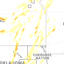

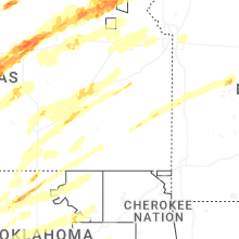


Connect with Interactive Hail Maps