

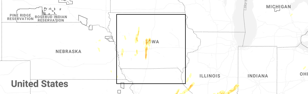
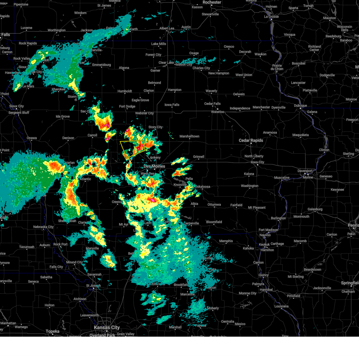
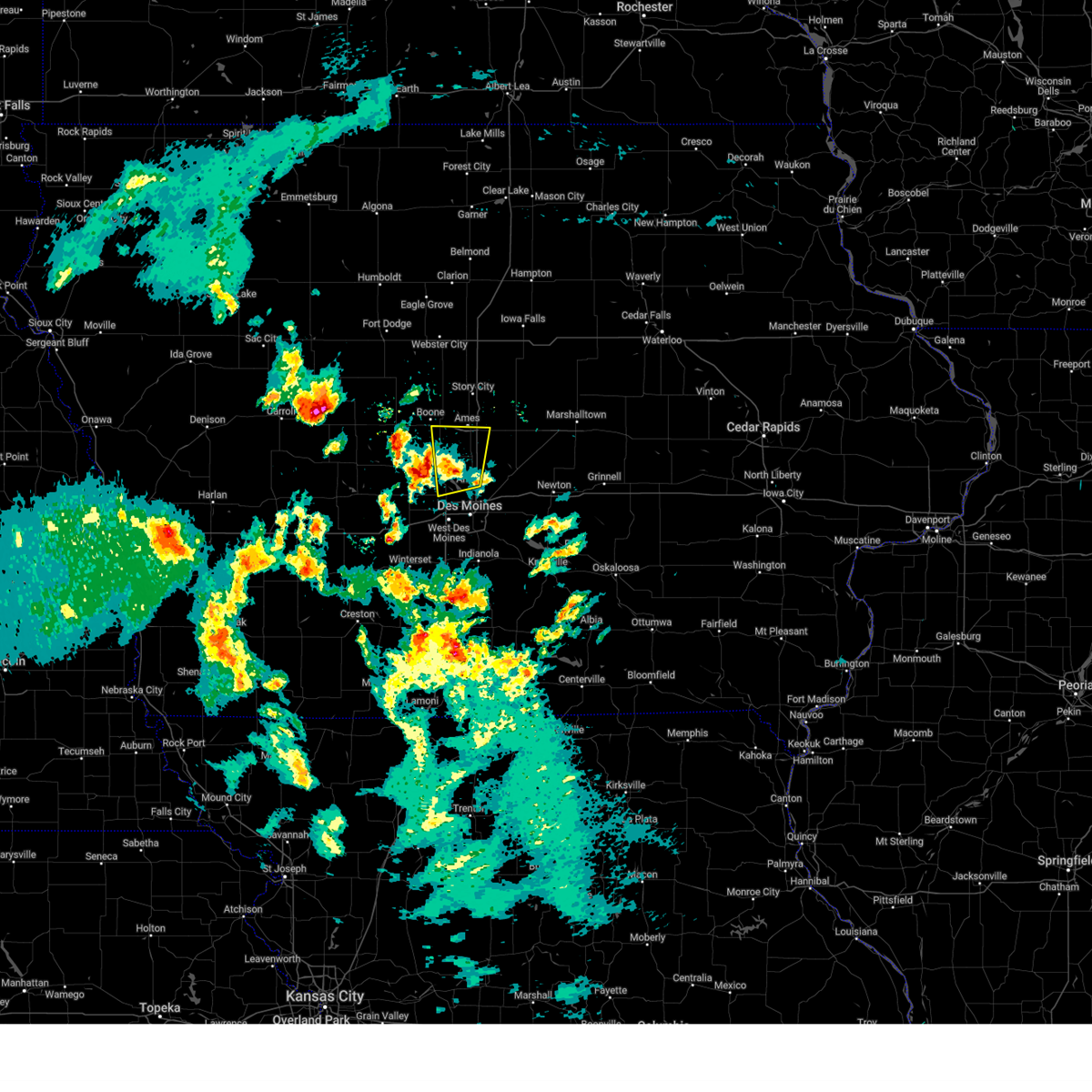
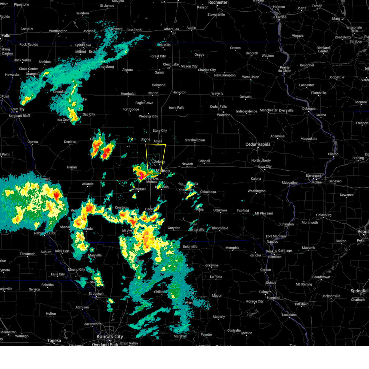
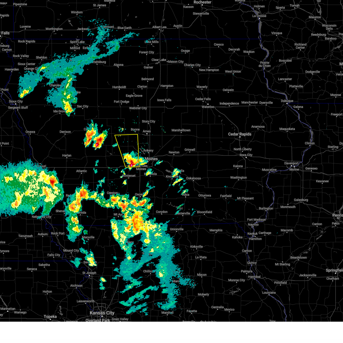
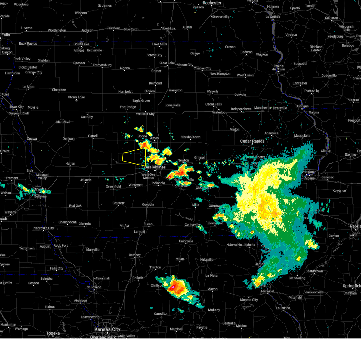
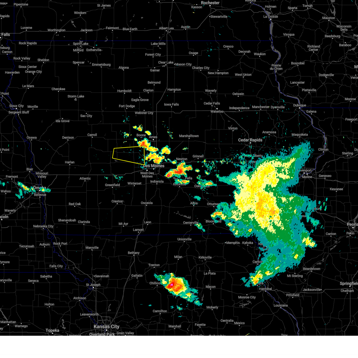
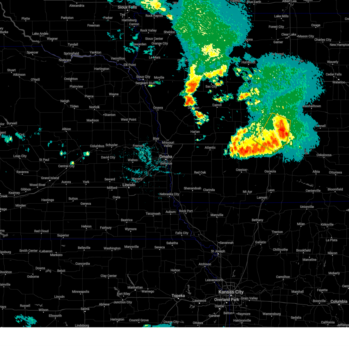
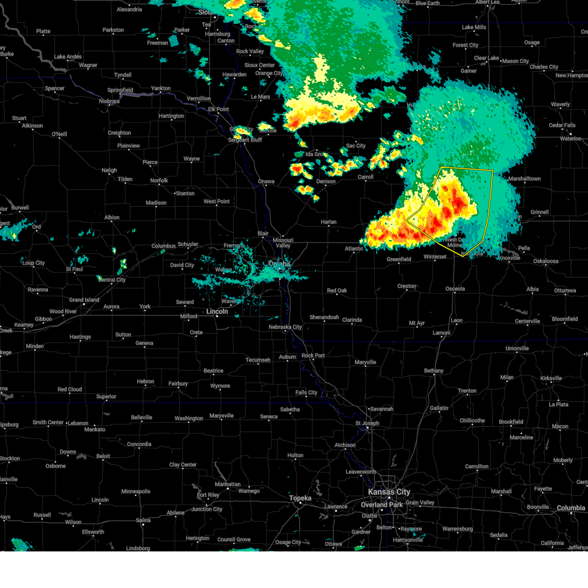
Hail Map for Madrid, IA
The Madrid, IA area has had 5 reports of on-the-ground hail by trained spotters, and has been under severe weather warnings 43 times during the past 12 months. Doppler radar has detected hail at or near Madrid, IA on 76 occasions, including 9 occasions during the past year.
| Name: | Madrid, IA |
| Where Located: | 22.5 miles NNW of Des Moines, IA |
| Map: | Google Map for Madrid, IA |
| Population: | 2543 |
| Housing Units: | 1138 |
| More Info: | Search Google for Madrid, IA |
2
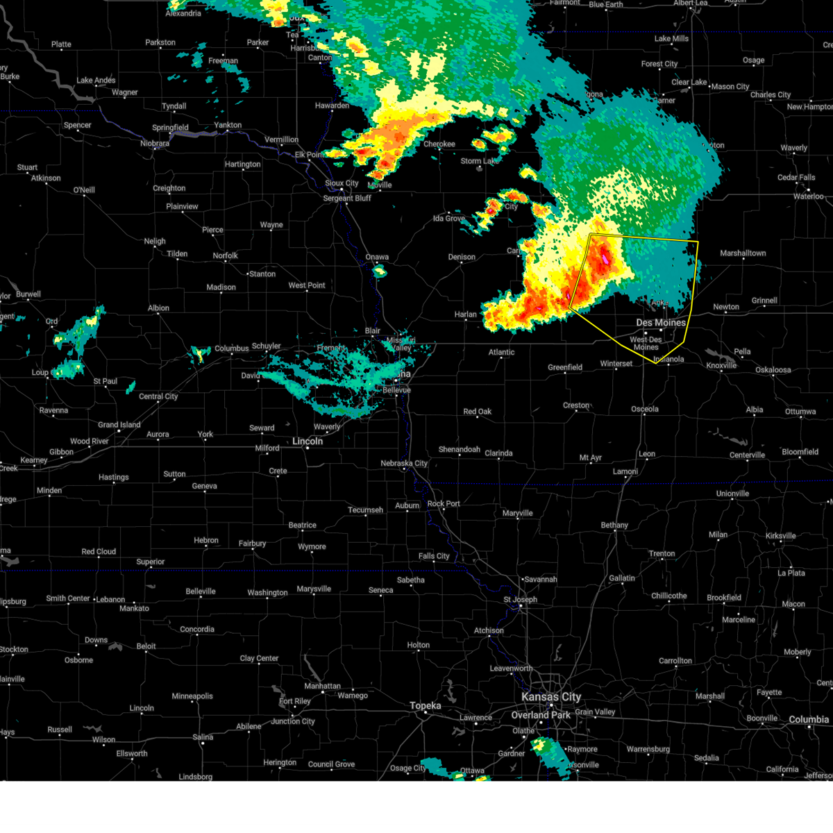
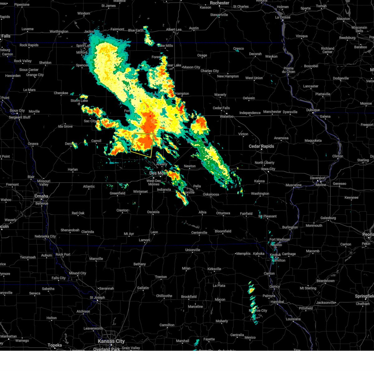
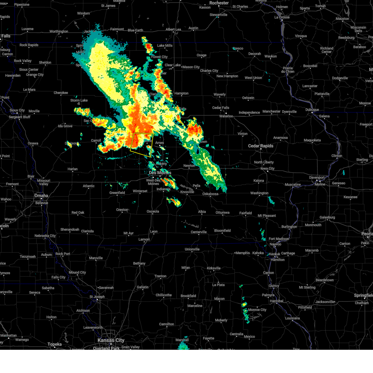
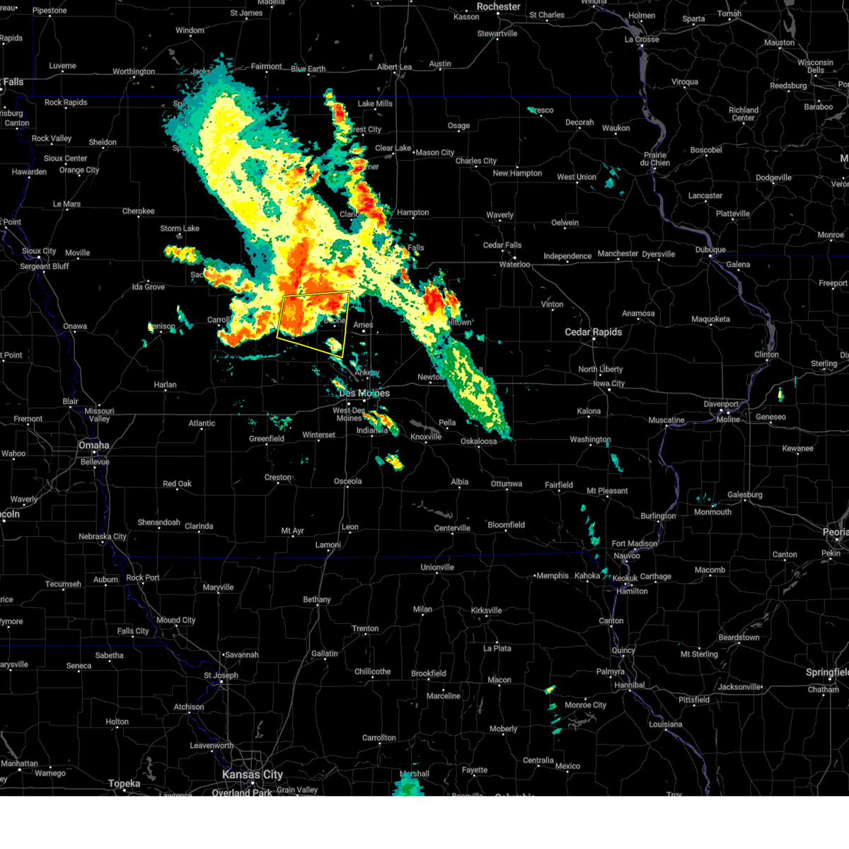
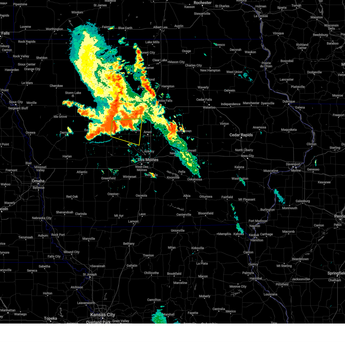
The Top Recent Hail Date for Madrid, IA is Friday, March 14, 2025 (3rd out of 76)
Hail and Wind Damage Spotted near Madrid, IA
| Date / Time | Report Details |
|---|---|
| 3/19/2025 4:19 AM CDT |
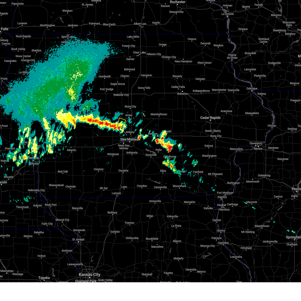 the severe thunderstorm warning has been cancelled and is no longer in effect the severe thunderstorm warning has been cancelled and is no longer in effect
|
| 3/19/2025 4:19 AM CDT |
 At 418 am cdt, a severe thunderstorm was located over madrid, or 11 miles south of boone, moving north at 35 mph (radar indicated). Hazards include quarter size hail. Damage to vehicles is expected. Locations impacted include, luther and madrid. At 418 am cdt, a severe thunderstorm was located over madrid, or 11 miles south of boone, moving north at 35 mph (radar indicated). Hazards include quarter size hail. Damage to vehicles is expected. Locations impacted include, luther and madrid.
|
| 3/19/2025 4:06 AM CDT |
 Svrdmx the national weather service in des moines has issued a * severe thunderstorm warning for, southeastern boone county in central iowa, northeastern dallas county in central iowa, * until 430 am cdt. * at 406 am cdt, a severe thunderstorm was located near granger, or 8 miles northwest of grimes, moving north at 30 mph (radar indicated). Hazards include quarter size hail. damage to vehicles is expected Svrdmx the national weather service in des moines has issued a * severe thunderstorm warning for, southeastern boone county in central iowa, northeastern dallas county in central iowa, * until 430 am cdt. * at 406 am cdt, a severe thunderstorm was located near granger, or 8 miles northwest of grimes, moving north at 30 mph (radar indicated). Hazards include quarter size hail. damage to vehicles is expected
|
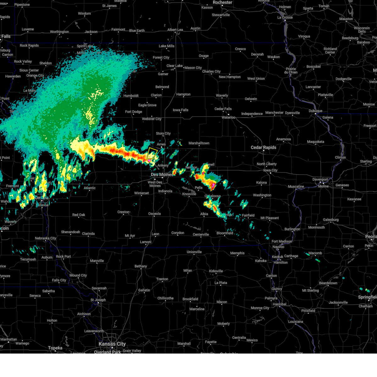
| 3/14/2025 6:18 PM CDT |
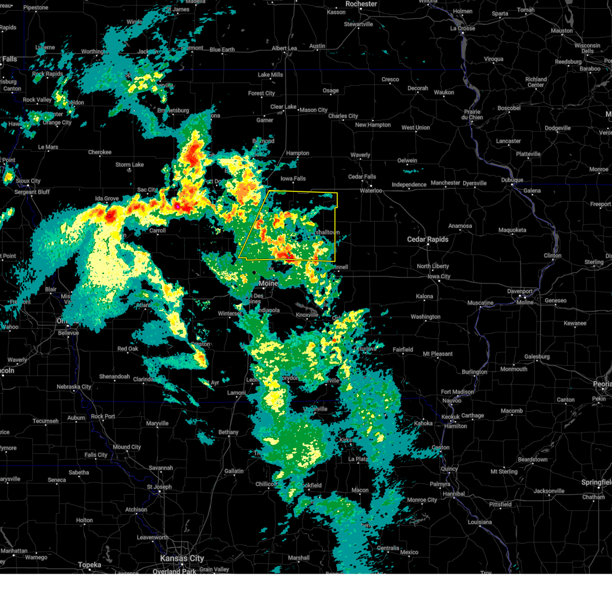 At 617 pm cdt, severe thunderstorms were located along a line extending from near iowa state center to collins to near laurel, moving north at 50 mph (trained weather spotters. several automated weather stations have gusted from 55 to 65 mph). Hazards include 70 mph wind gusts and quarter size hail. Hail damage to vehicles is expected. expect considerable tree damage. wind damage is also likely to mobile homes, roofs, and outbuildings. locations impacted include, steamboat rock, ferguson, radcliffe, green mountain, maxwell, wellsburg, cambridge, melbourne, buckeye, kelley, st. anthony, luther, drake airport, sheldahl, eldora, laurel, haverhill, clemons, story city, and colo. This includes interstate 35 between mile markers 101 and 140. At 617 pm cdt, severe thunderstorms were located along a line extending from near iowa state center to collins to near laurel, moving north at 50 mph (trained weather spotters. several automated weather stations have gusted from 55 to 65 mph). Hazards include 70 mph wind gusts and quarter size hail. Hail damage to vehicles is expected. expect considerable tree damage. wind damage is also likely to mobile homes, roofs, and outbuildings. locations impacted include, steamboat rock, ferguson, radcliffe, green mountain, maxwell, wellsburg, cambridge, melbourne, buckeye, kelley, st. anthony, luther, drake airport, sheldahl, eldora, laurel, haverhill, clemons, story city, and colo. This includes interstate 35 between mile markers 101 and 140.
|
| 3/14/2025 5:54 PM CDT |
 Svrdmx the national weather service in des moines has issued a * severe thunderstorm warning for, northern polk county in central iowa, story county in central iowa, hardin county in central iowa, marshall county in central iowa, southwestern grundy county in central iowa, northern jasper county in central iowa, southeastern hamilton county in central iowa, southeastern boone county in central iowa, * until 700 pm cdt. * at 554 pm cdt, severe thunderstorms were located along a line extending from near woodward to 4 miles southwest of maxwell to 6 miles southwest of laurel, moving north at 40 mph (radar indicated). Hazards include 70 mph wind gusts and quarter size hail. Hail damage to vehicles is expected. expect considerable tree damage. Wind damage is also likely to mobile homes, roofs, and outbuildings. Svrdmx the national weather service in des moines has issued a * severe thunderstorm warning for, northern polk county in central iowa, story county in central iowa, hardin county in central iowa, marshall county in central iowa, southwestern grundy county in central iowa, northern jasper county in central iowa, southeastern hamilton county in central iowa, southeastern boone county in central iowa, * until 700 pm cdt. * at 554 pm cdt, severe thunderstorms were located along a line extending from near woodward to 4 miles southwest of maxwell to 6 miles southwest of laurel, moving north at 40 mph (radar indicated). Hazards include 70 mph wind gusts and quarter size hail. Hail damage to vehicles is expected. expect considerable tree damage. Wind damage is also likely to mobile homes, roofs, and outbuildings.
|
| 3/14/2025 5:31 PM CDT |
 At 530 pm cdt, a severe thunderstorm was located over luther, or 7 miles southeast of boone, moving north at 50 mph (radar indicated). Hazards include 60 mph wind gusts and quarter size hail. Hail damage to vehicles is expected. expect wind damage to roofs, siding, and trees. locations impacted include, kelley, ames municipal airport, iowa state center, luther, ames, madrid, and nevada. This includes interstate 35 between mile markers 107 and 113. At 530 pm cdt, a severe thunderstorm was located over luther, or 7 miles southeast of boone, moving north at 50 mph (radar indicated). Hazards include 60 mph wind gusts and quarter size hail. Hail damage to vehicles is expected. expect wind damage to roofs, siding, and trees. locations impacted include, kelley, ames municipal airport, iowa state center, luther, ames, madrid, and nevada. This includes interstate 35 between mile markers 107 and 113.
|
| 3/14/2025 5:31 PM CDT |
 the severe thunderstorm warning has been cancelled and is no longer in effect the severe thunderstorm warning has been cancelled and is no longer in effect
|
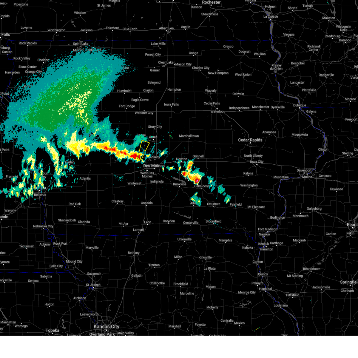
| 3/14/2025 5:30 PM CDT |
 At 530 pm cdt, a severe thunderstorm was located 5 miles southwest of ledges state park, or 8 miles southwest of boone, moving north at 50 mph (radar indicated). Hazards include 60 mph wind gusts and quarter size hail. Hail damage to vehicles is expected. expect wind damage to roofs, siding, and trees. Locations impacted include, dawson, perry, rippey, perry municipal airport, woodward, ledges state park, berkley, bouton, madrid, and luther. At 530 pm cdt, a severe thunderstorm was located 5 miles southwest of ledges state park, or 8 miles southwest of boone, moving north at 50 mph (radar indicated). Hazards include 60 mph wind gusts and quarter size hail. Hail damage to vehicles is expected. expect wind damage to roofs, siding, and trees. Locations impacted include, dawson, perry, rippey, perry municipal airport, woodward, ledges state park, berkley, bouton, madrid, and luther.
|
| 3/14/2025 5:16 PM CDT |
 At 515 pm cdt, a severe thunderstorm was located over big creek lake, or 10 miles north of johnston, moving north at 55 mph (radar indicated). Hazards include 60 mph wind gusts and quarter size hail. Hail damage to vehicles is expected. expect wind damage to roofs, siding, and trees. locations impacted include, big creek lake, iowa state center, cambridge, huxley, big creek state park, granger, saylorville lake, polk city, kelley, ames municipal airport, madrid, alleman, slater, ankeny, luther, sheldahl, ames, elkhart, grimes, and nevada. This includes interstate 35 between mile markers 93 and 113. At 515 pm cdt, a severe thunderstorm was located over big creek lake, or 10 miles north of johnston, moving north at 55 mph (radar indicated). Hazards include 60 mph wind gusts and quarter size hail. Hail damage to vehicles is expected. expect wind damage to roofs, siding, and trees. locations impacted include, big creek lake, iowa state center, cambridge, huxley, big creek state park, granger, saylorville lake, polk city, kelley, ames municipal airport, madrid, alleman, slater, ankeny, luther, sheldahl, ames, elkhart, grimes, and nevada. This includes interstate 35 between mile markers 93 and 113.
|
| 3/14/2025 5:15 PM CDT |
 At 514 pm cdt, a severe thunderstorm was located near minburn, or 8 miles southeast of perry, moving north at 50 mph (radar indicated). Hazards include 60 mph wind gusts and quarter size hail. Hail damage to vehicles is expected. expect wind damage to roofs, siding, and trees. Locations impacted include, rippey, perry municipal airport, minburn, berkley, dallas center, granger, perry, woodward, ledges state park, madrid, bouton, dawson, luther, and grimes. At 514 pm cdt, a severe thunderstorm was located near minburn, or 8 miles southeast of perry, moving north at 50 mph (radar indicated). Hazards include 60 mph wind gusts and quarter size hail. Hail damage to vehicles is expected. expect wind damage to roofs, siding, and trees. Locations impacted include, rippey, perry municipal airport, minburn, berkley, dallas center, granger, perry, woodward, ledges state park, madrid, bouton, dawson, luther, and grimes.
|
| 3/14/2025 5:03 PM CDT |
 Svrdmx the national weather service in des moines has issued a * severe thunderstorm warning for, northwestern polk county in central iowa, southwestern story county in central iowa, southeastern boone county in central iowa, northeastern dallas county in central iowa, * until 545 pm cdt. * at 503 pm cdt, a severe thunderstorm was located over johnston, moving north at 55 mph (trained weather spotters. quarter sized hail was reported in windsor heights). Hazards include 60 mph wind gusts and quarter size hail. Hail damage to vehicles is expected. Expect wind damage to roofs, siding, and trees. Svrdmx the national weather service in des moines has issued a * severe thunderstorm warning for, northwestern polk county in central iowa, southwestern story county in central iowa, southeastern boone county in central iowa, northeastern dallas county in central iowa, * until 545 pm cdt. * at 503 pm cdt, a severe thunderstorm was located over johnston, moving north at 55 mph (trained weather spotters. quarter sized hail was reported in windsor heights). Hazards include 60 mph wind gusts and quarter size hail. Hail damage to vehicles is expected. Expect wind damage to roofs, siding, and trees.
|
| 3/14/2025 4:56 PM CDT |
 Svrdmx the national weather service in des moines has issued a * severe thunderstorm warning for, southeastern greene county in west central iowa, southwestern boone county in central iowa, dallas county in central iowa, * until 545 pm cdt. * at 456 pm cdt, a severe thunderstorm was located over van meter, or near adel, moving north at 50 mph (radar indicated). Hazards include 60 mph wind gusts and quarter size hail. Hail damage to vehicles is expected. Expect wind damage to roofs, siding, and trees. Svrdmx the national weather service in des moines has issued a * severe thunderstorm warning for, southeastern greene county in west central iowa, southwestern boone county in central iowa, dallas county in central iowa, * until 545 pm cdt. * at 456 pm cdt, a severe thunderstorm was located over van meter, or near adel, moving north at 50 mph (radar indicated). Hazards include 60 mph wind gusts and quarter size hail. Hail damage to vehicles is expected. Expect wind damage to roofs, siding, and trees.
|
| 7/31/2024 8:50 PM CDT |
 the severe thunderstorm warning has been cancelled and is no longer in effect the severe thunderstorm warning has been cancelled and is no longer in effect
|
| 7/31/2024 8:50 PM CDT |
 At 850 pm cdt, severe thunderstorms were located along a line extending from iowa state center to near valeria to 4 miles east of pleasantville, moving northeast at 40 mph (radar indicated). Hazards include 60 mph wind gusts. Expect damage to roofs, siding, and trees. locations impacted include, des moines, ames, west des moines, ankeny, urbandale, johnston, clive, newton, indianola, altoona, waukee, boone, pella, norwalk, pleasant hill, grimes, knoxville, nevada, windsor heights, and carlisle. this includes the following highways, interstate 35 between mile markers 68 and 72, and between mile markers 87 and 125. interstate 80 between mile markers 121 and 173. Interstate 235 between mile markers 1 and 14. At 850 pm cdt, severe thunderstorms were located along a line extending from iowa state center to near valeria to 4 miles east of pleasantville, moving northeast at 40 mph (radar indicated). Hazards include 60 mph wind gusts. Expect damage to roofs, siding, and trees. locations impacted include, des moines, ames, west des moines, ankeny, urbandale, johnston, clive, newton, indianola, altoona, waukee, boone, pella, norwalk, pleasant hill, grimes, knoxville, nevada, windsor heights, and carlisle. this includes the following highways, interstate 35 between mile markers 68 and 72, and between mile markers 87 and 125. interstate 80 between mile markers 121 and 173. Interstate 235 between mile markers 1 and 14.
|
| 7/31/2024 8:33 PM CDT |
 the severe thunderstorm warning has been cancelled and is no longer in effect the severe thunderstorm warning has been cancelled and is no longer in effect
|
| 7/31/2024 8:33 PM CDT |
 At 831 pm cdt, severe thunderstorms were located along a line extending from sheldahl to ankeny regional airport to near pleasant hill to hartford, moving northeast at 45 mph (radar indicated). Hazards include 65 mph wind gusts. the des moines airport gusted to 66 mph. Expect damage to roofs, siding, and trees. locations impacted include, des moines, ames, west des moines, ankeny, urbandale, johnston, clive, indianola, altoona, waukee, norwalk, pleasant hill, grimes, nevada, adel, windsor heights, carlisle, bondurant, polk city, and huxley. this includes the following highways, interstate 35 between mile markers 43 and 72, and between mile markers 87 and 111. interstate 80 between mile markers 108 and 149. Interstate 235 between mile markers 1 and 14. At 831 pm cdt, severe thunderstorms were located along a line extending from sheldahl to ankeny regional airport to near pleasant hill to hartford, moving northeast at 45 mph (radar indicated). Hazards include 65 mph wind gusts. the des moines airport gusted to 66 mph. Expect damage to roofs, siding, and trees. locations impacted include, des moines, ames, west des moines, ankeny, urbandale, johnston, clive, indianola, altoona, waukee, norwalk, pleasant hill, grimes, nevada, adel, windsor heights, carlisle, bondurant, polk city, and huxley. this includes the following highways, interstate 35 between mile markers 43 and 72, and between mile markers 87 and 111. interstate 80 between mile markers 108 and 149. Interstate 235 between mile markers 1 and 14.
|
| 7/31/2024 8:27 PM CDT |
 Svrdmx the national weather service in des moines has issued a * severe thunderstorm warning for, polk county in central iowa, story county in central iowa, southwestern hardin county in central iowa, southwestern marshall county in central iowa, northeastern madison county in south central iowa, marion county in south central iowa, jasper county in central iowa, southern boone county in central iowa, dallas county in central iowa, warren county in south central iowa, * until 915 pm cdt. * at 825 pm cdt, severe thunderstorms were located along a line extending from 4 miles north of woodward to near margo frankel woods state park to milo, moving northeast at 40 mph (radar indicated). Hazards include 65 mph wind gusts. the des moines airport gusted to 66 mph. expect damage to roofs, siding, and trees Svrdmx the national weather service in des moines has issued a * severe thunderstorm warning for, polk county in central iowa, story county in central iowa, southwestern hardin county in central iowa, southwestern marshall county in central iowa, northeastern madison county in south central iowa, marion county in south central iowa, jasper county in central iowa, southern boone county in central iowa, dallas county in central iowa, warren county in south central iowa, * until 915 pm cdt. * at 825 pm cdt, severe thunderstorms were located along a line extending from 4 miles north of woodward to near margo frankel woods state park to milo, moving northeast at 40 mph (radar indicated). Hazards include 65 mph wind gusts. the des moines airport gusted to 66 mph. expect damage to roofs, siding, and trees
|
| 7/31/2024 8:15 PM CDT |
 the severe thunderstorm warning has been cancelled and is no longer in effect the severe thunderstorm warning has been cancelled and is no longer in effect
|
| 7/31/2024 8:15 PM CDT |
 At 814 pm cdt, severe thunderstorms were located along a line extending from near woodward to near urbandale to southridge mall to near spring hill, moving northeast at 40 mph (radar indicated). Hazards include 60 mph wind gusts and penny size hail. Expect damage to roofs, siding, and trees. locations impacted include, des moines, ames, west des moines, ankeny, urbandale, johnston, clive, indianola, altoona, waukee, norwalk, pleasant hill, grimes, nevada, winterset, adel, windsor heights, carlisle, bondurant, and polk city. this includes the following highways, interstate 35 between mile markers 43 and 72, and between mile markers 87 and 111. interstate 80 between mile markers 99 and 149. Interstate 235 between mile markers 1 and 14. At 814 pm cdt, severe thunderstorms were located along a line extending from near woodward to near urbandale to southridge mall to near spring hill, moving northeast at 40 mph (radar indicated). Hazards include 60 mph wind gusts and penny size hail. Expect damage to roofs, siding, and trees. locations impacted include, des moines, ames, west des moines, ankeny, urbandale, johnston, clive, indianola, altoona, waukee, norwalk, pleasant hill, grimes, nevada, winterset, adel, windsor heights, carlisle, bondurant, and polk city. this includes the following highways, interstate 35 between mile markers 43 and 72, and between mile markers 87 and 111. interstate 80 between mile markers 99 and 149. Interstate 235 between mile markers 1 and 14.
|
| 7/31/2024 7:54 PM CDT |
 Svrdmx the national weather service in des moines has issued a * severe thunderstorm warning for, polk county in central iowa, southwestern story county in central iowa, madison county in south central iowa, southeastern guthrie county in west central iowa, southeastern boone county in central iowa, eastern adair county in southwestern iowa, dallas county in central iowa, warren county in south central iowa, * until 845 pm cdt. * at 754 pm cdt, severe thunderstorms were located along a line extending from 6 miles west of minburn to near de soto to 4 miles southeast of badger creek state park to near st. charles, moving northeast at 50 mph (radar indicated). Hazards include 60 mph wind gusts and penny size hail. expect damage to roofs, siding, and trees Svrdmx the national weather service in des moines has issued a * severe thunderstorm warning for, polk county in central iowa, southwestern story county in central iowa, madison county in south central iowa, southeastern guthrie county in west central iowa, southeastern boone county in central iowa, eastern adair county in southwestern iowa, dallas county in central iowa, warren county in south central iowa, * until 845 pm cdt. * at 754 pm cdt, severe thunderstorms were located along a line extending from 6 miles west of minburn to near de soto to 4 miles southeast of badger creek state park to near st. charles, moving northeast at 50 mph (radar indicated). Hazards include 60 mph wind gusts and penny size hail. expect damage to roofs, siding, and trees
|
| 7/31/2024 2:18 AM CDT |
 At 218 am cdt, a severe thunderstorm was located near woodward, or 9 miles northwest of grimes, moving east at 40 mph (radar indicated). Hazards include 60 mph wind gusts and quarter size hail. Hail damage to vehicles is expected. expect wind damage to roofs, siding, and trees. Locations impacted include, urbandale, grimes, perry, madrid, dallas center, granger, woodward, minburn, dawson, bouton, and perry municipal airport. At 218 am cdt, a severe thunderstorm was located near woodward, or 9 miles northwest of grimes, moving east at 40 mph (radar indicated). Hazards include 60 mph wind gusts and quarter size hail. Hail damage to vehicles is expected. expect wind damage to roofs, siding, and trees. Locations impacted include, urbandale, grimes, perry, madrid, dallas center, granger, woodward, minburn, dawson, bouton, and perry municipal airport.
|
| 7/31/2024 2:18 AM CDT |
 the severe thunderstorm warning has been cancelled and is no longer in effect the severe thunderstorm warning has been cancelled and is no longer in effect
|
| 7/31/2024 1:56 AM CDT |
 Svrdmx the national weather service in des moines has issued a * severe thunderstorm warning for, southeastern greene county in west central iowa, northeastern guthrie county in west central iowa, southwestern boone county in central iowa, northern dallas county in central iowa, * until 245 am cdt. * at 156 am cdt, a severe thunderstorm was located miles southwest of perry, moving east at 40 mph (radar indicated). Hazards include 60 mph wind gusts and half dollar size hail. Hail damage to vehicles is expected. Expect wind damage to roofs, siding, and trees. Svrdmx the national weather service in des moines has issued a * severe thunderstorm warning for, southeastern greene county in west central iowa, northeastern guthrie county in west central iowa, southwestern boone county in central iowa, northern dallas county in central iowa, * until 245 am cdt. * at 156 am cdt, a severe thunderstorm was located miles southwest of perry, moving east at 40 mph (radar indicated). Hazards include 60 mph wind gusts and half dollar size hail. Hail damage to vehicles is expected. Expect wind damage to roofs, siding, and trees.
|
| 7/30/2024 9:45 AM CDT |
 At 945 am cdt, severe thunderstorms were located along a line extending from near elkhart to near pleasant hill to martensdale, moving southeast at 45 mph (radar indicated). Hazards include 60 mph wind gusts and penny size hail. Expect damage to roofs, siding, and trees. locations impacted include, des moines, west des moines, ankeny, urbandale, johnston, clive, altoona, waukee, norwalk, pleasant hill, grimes, adel, windsor heights, carlisle, bondurant, polk city, huxley, saylorville, madrid, and mitchellville. this includes the following highways, interstate 35 between mile markers 61 and 72, and between mile markers 87 and 106. interstate 80 between mile markers 109 and 148. Interstate 235 between mile markers 1 and 14. At 945 am cdt, severe thunderstorms were located along a line extending from near elkhart to near pleasant hill to martensdale, moving southeast at 45 mph (radar indicated). Hazards include 60 mph wind gusts and penny size hail. Expect damage to roofs, siding, and trees. locations impacted include, des moines, west des moines, ankeny, urbandale, johnston, clive, altoona, waukee, norwalk, pleasant hill, grimes, adel, windsor heights, carlisle, bondurant, polk city, huxley, saylorville, madrid, and mitchellville. this includes the following highways, interstate 35 between mile markers 61 and 72, and between mile markers 87 and 106. interstate 80 between mile markers 109 and 148. Interstate 235 between mile markers 1 and 14.
|
| 7/30/2024 9:45 AM CDT |
 the severe thunderstorm warning has been cancelled and is no longer in effect the severe thunderstorm warning has been cancelled and is no longer in effect
|
| 7/30/2024 9:23 AM CDT |
 At 922 am cdt, severe thunderstorms were located along a line extending from near kelley to polk city to near de soto, moving southeast at 40 mph (radar indicated. several weather stations have reported winds of 50 to 55 mph with these storms). Hazards include 60 mph wind gusts and nickel size hail. Expect damage to roofs, siding, and trees. locations impacted include, des moines, ames, west des moines, ankeny, urbandale, johnston, clive, altoona, waukee, boone, norwalk, pleasant hill, grimes, perry, nevada, adel, windsor heights, carlisle, bondurant, and polk city. this includes the following highways, interstate 35 between mile markers 61 and 72, and between mile markers 87 and 123. interstate 80 between mile markers 109 and 148. Interstate 235 between mile markers 1 and 14. At 922 am cdt, severe thunderstorms were located along a line extending from near kelley to polk city to near de soto, moving southeast at 40 mph (radar indicated. several weather stations have reported winds of 50 to 55 mph with these storms). Hazards include 60 mph wind gusts and nickel size hail. Expect damage to roofs, siding, and trees. locations impacted include, des moines, ames, west des moines, ankeny, urbandale, johnston, clive, altoona, waukee, boone, norwalk, pleasant hill, grimes, perry, nevada, adel, windsor heights, carlisle, bondurant, and polk city. this includes the following highways, interstate 35 between mile markers 61 and 72, and between mile markers 87 and 123. interstate 80 between mile markers 109 and 148. Interstate 235 between mile markers 1 and 14.
|
| 7/30/2024 9:23 AM CDT |
 the severe thunderstorm warning has been cancelled and is no longer in effect the severe thunderstorm warning has been cancelled and is no longer in effect
|
| 7/30/2024 9:17 AM CDT | Quarter sized hail reported 5.3 miles SSE of Madrid, IA, delayed report. |
| 7/30/2024 8:53 AM CDT |
 Svrdmx the national weather service in des moines has issued a * severe thunderstorm warning for, polk county in central iowa, story county in central iowa, eastern greene county in west central iowa, northeastern madison county in south central iowa, northeastern guthrie county in west central iowa, boone county in central iowa, dallas county in central iowa, northwestern warren county in south central iowa, * until 1000 am cdt. * at 853 am cdt, severe thunderstorms were located along a line extending from fraser to 4 miles north of bouton to near panora, moving southeast at 45 mph (radar indicated). Hazards include 60 mph wind gusts and nickel size hail. expect damage to roofs, siding, and trees Svrdmx the national weather service in des moines has issued a * severe thunderstorm warning for, polk county in central iowa, story county in central iowa, eastern greene county in west central iowa, northeastern madison county in south central iowa, northeastern guthrie county in west central iowa, boone county in central iowa, dallas county in central iowa, northwestern warren county in south central iowa, * until 1000 am cdt. * at 853 am cdt, severe thunderstorms were located along a line extending from fraser to 4 miles north of bouton to near panora, moving southeast at 45 mph (radar indicated). Hazards include 60 mph wind gusts and nickel size hail. expect damage to roofs, siding, and trees
|
| 7/30/2024 2:53 AM CDT | At 252 am cdt, severe thunderstorms were located along a line extending from 4 miles south of roland to 4 miles northwest of maxwell to 5 miles east of elkhart to near altoona to 4 miles southeast of southridge mall, moving southeast at 50 mph (automated systems. at 247 am, a measured wind gust of 59 mph was reported at the des moines international airport). Hazards include 60 mph wind gusts. Expect damage to roofs, siding, and trees. these severe storms will be near, nevada, carlisle, bondurant, mitchellville, colfax, prairie city, maxwell and colo around 255 am cdt. Other locations in the path of these severe thunderstorms include swan, sandyville, prairie city krohn airport, monroe, pleasantville, baxter and rhodes. |
| 7/30/2024 2:38 AM CDT | At 238 am cdt, severe thunderstorms were located along a line extending from 4 miles northwest of gilbert to ames municipal airport to near alleman to ankeny regional airport to walnut woods state park, moving southeast at 50 mph (radar indicated). Hazards include 60 mph wind gusts. Expect damage to roofs, siding, and trees. Locations impacted include, des moines, ames, altoona, norwalk, pleasant hill, nevada, carlisle, bondurant, indianola, hartford, runnells, collins, mingo, valeria, colfax, prairie city, colo, ackworth, swan, sandyville, prairie city krohn airport, pleasantville, baxter, rhodes and monroe. |
| 7/30/2024 2:38 AM CDT | the severe thunderstorm warning has been cancelled and is no longer in effect |
| 7/30/2024 2:23 AM CDT | Svrdmx the national weather service in des moines has issued a * severe thunderstorm warning for, polk county in central iowa, story county in central iowa, eastern greene county in west central iowa, southwestern marshall county in central iowa, southeastern webster county in central iowa, northwestern marion county in south central iowa, western jasper county in central iowa, boone county in central iowa, dallas county in central iowa, northern warren county in south central iowa, * until 315 am cdt. * at 222 am cdt, severe thunderstorms were located along a line extending from 4 miles southeast of stratford to near boone municipal airport to 4 miles northeast of madrid to near saylorville lake to near waukee, moving southeast at 50 mph (radar indicated). Hazards include 60 mph wind gusts. Expect damage to roofs, siding, and trees. severe thunderstorms will be near, des moines, ames, west des moines, ankeny, urbandale, johnston, clive and norwalk around 230 am cdt. altoona, pleasant hill, nevada, bondurant, southridge mall, adventureland amusement park, iowa state fairgrounds and prairie meadows around 235 am cdt. carlisle and roland around 240 am cdt. Other locations in the path of these severe thunderstorms include indianola, mitchellville, maxwell, spring hill, valeria, colfax, colo, hartford, runnells, collins, mingo, ackworth, prairie city, swan, sandyville, prairie city krohn airport, pleasantville, baxter, rhodes and monroe. |
| 7/30/2024 2:05 AM CDT | At 205 am cdt, severe thunderstorms were located along a line extending from lizard creek state recreation area to near dayton to near ogden to perry to near linden, moving east at 50 mph (radar indicated). Hazards include 60 mph wind gusts. Expect damage to roofs, siding, and trees. these severe storms will be near, boone, adel, ogden, dallas center, woodward, boone speedway, dayton and redfield around 210 am cdt. waukee, madrid, granger, de soto and luther around 215 am cdt. Other locations in the path of these severe thunderstorms include west des moines, urbandale, johnston, clive, grimes, polk city, van meter, saylorville lake and jordan creek town center. |
| 7/30/2024 2:05 AM CDT | the severe thunderstorm warning has been cancelled and is no longer in effect |
| 7/30/2024 1:56 AM CDT | At 156 am cdt, severe thunderstorms were located along a line extending from barnum to near harcourt to beaver to dawson to near panora, moving east at 50 mph (radar indicated). Hazards include 60 mph wind gusts. Expect damage to roofs, siding, and trees. these severe storms will be near, fort dodge, perry, ogden, dayton, redfield, coalville, otho and lehigh around 200 am cdt. Other locations in the path of these severe thunderstorms include boone, dallas center, woodward, minburn, fraser, ledges state park, brushy creek st recreation area, adel, de soto, boone speedway, stratford, duncombe, luther, boone municipal airport, urbandale, clive, waukee, grimes, madrid, granger, van meter, saylorville lake, west des moines, johnston, polk city, big creek lake, stanhope, sheldahl, webster city municipal airport, webster city and jordan creek town center. |
| 7/30/2024 1:43 AM CDT | Svrdmx the national weather service in des moines has issued a * severe thunderstorm warning for, northwestern polk county in central iowa, greene county in west central iowa, webster county in central iowa, guthrie county in west central iowa, southeastern pocahontas county in northwestern iowa, northeastern audubon county in west central iowa, calhoun county in west central iowa, southwestern hamilton county in central iowa, eastern carroll county in west central iowa, boone county in central iowa, dallas county in central iowa, * until 230 am cdt. * at 142 am cdt, severe thunderstorms were located along a line extending from near manson to somers to 5 miles west of dana to 4 miles northeast of bagley to near guthrie center, moving east at 50 mph (radar indicated). Hazards include 60 mph wind gusts. Expect damage to roofs, siding, and trees. severe thunderstorms will be near, panora, gowrie, lake panorama, grand junction, callender, harcourt, rippey and yale around 150 am cdt. fort dodge, perry, ogden, dayton, otho, boxholm and berkley around 155 am cdt. fort dodge regional airport, redfield, coalville, lehigh, diamondhead lake, minburn, pilot mound and bouton around 200 am cdt. Other locations in the path of these severe thunderstorms include boone, adel, dallas center, woodward, stratford, ledges state park, brushy creek st recreation area, madrid, de soto, boone speedway, duncombe, luther, boone municipal airport, urbandale, clive, waukee, grimes, granger, van meter, saylorville lake, big creek lake and stanhope. |
| 7/28/2024 8:17 PM CDT |
 The storm which prompted the warning has moved out of the area with a new warning issued for eastern boone and into story county. therefore, the warning has been allowed to expire. The storm which prompted the warning has moved out of the area with a new warning issued for eastern boone and into story county. therefore, the warning has been allowed to expire.
|
| 7/28/2024 8:00 PM CDT |
 the severe thunderstorm warning has been cancelled and is no longer in effect the severe thunderstorm warning has been cancelled and is no longer in effect
|
| 7/28/2024 8:00 PM CDT |
 At 800 pm cdt, a severe thunderstorm was located near ogden, or near boone, moving east at 40 mph (radar indicated). Hazards include 60 mph wind gusts and penny size hail. Expect damage to roofs, siding, and trees. Locations impacted include, boone, madrid, ogden, boone speedway, boxholm, pilot mound, luther, fraser, beaver, berkley, boone municipal airport, and ledges state park. At 800 pm cdt, a severe thunderstorm was located near ogden, or near boone, moving east at 40 mph (radar indicated). Hazards include 60 mph wind gusts and penny size hail. Expect damage to roofs, siding, and trees. Locations impacted include, boone, madrid, ogden, boone speedway, boxholm, pilot mound, luther, fraser, beaver, berkley, boone municipal airport, and ledges state park.
|
| 7/28/2024 7:52 PM CDT |
 At 752 pm cdt, a severe thunderstorm was located over ogden, or 9 miles west of boone, moving east at 40 mph (radar indicated). Hazards include 60 mph wind gusts and penny size hail. Expect damage to roofs, siding, and trees. Locations impacted include, boone, jefferson, madrid, ogden, boone speedway, dayton, grand junction, stratford, harcourt, paton, boxholm, pilot mound, luther, fraser, dana, beaver, berkley, jefferson municipal airport, boone municipal airport, and ledges state park. At 752 pm cdt, a severe thunderstorm was located over ogden, or 9 miles west of boone, moving east at 40 mph (radar indicated). Hazards include 60 mph wind gusts and penny size hail. Expect damage to roofs, siding, and trees. Locations impacted include, boone, jefferson, madrid, ogden, boone speedway, dayton, grand junction, stratford, harcourt, paton, boxholm, pilot mound, luther, fraser, dana, beaver, berkley, jefferson municipal airport, boone municipal airport, and ledges state park.
|
| 7/28/2024 7:35 PM CDT |
 Svrdmx the national weather service in des moines has issued a * severe thunderstorm warning for, northeastern greene county in west central iowa, southeastern webster county in central iowa, southwestern hamilton county in central iowa, boone county in central iowa, * until 815 pm cdt. * at 735 pm cdt, a severe thunderstorm was located near dana, or 5 miles northeast of jefferson, moving east at 25 mph (radar indicated). Hazards include 60 mph wind gusts and penny size hail. expect damage to roofs, siding, and trees Svrdmx the national weather service in des moines has issued a * severe thunderstorm warning for, northeastern greene county in west central iowa, southeastern webster county in central iowa, southwestern hamilton county in central iowa, boone county in central iowa, * until 815 pm cdt. * at 735 pm cdt, a severe thunderstorm was located near dana, or 5 miles northeast of jefferson, moving east at 25 mph (radar indicated). Hazards include 60 mph wind gusts and penny size hail. expect damage to roofs, siding, and trees
|
| 7/28/2024 6:02 PM CDT | Strong winds. large tree branch down. time estimated by social media time and rada in polk county IA, 3.9 miles NW of Madrid, IA |
| 7/15/2024 5:15 PM CDT |
 At 514 pm cdt, a severe thunderstorm was located over cambridge, or 8 miles south of nevada, moving southeast at 45 mph (radar indicated). Hazards include 60 mph wind gusts and quarter size hail. Hail damage to vehicles is expected. expect wind damage to roofs, siding, and trees. locations impacted include, ames, marshalltown, boone, nevada, story city, polk city, huxley, madrid, slater, state center, roland, baxter, gilbert, iowa state center, big creek lake, boone speedway, saylorville lake, maxwell, colo, and melbourne. This includes interstate 35 between mile markers 97 and 126. At 514 pm cdt, a severe thunderstorm was located over cambridge, or 8 miles south of nevada, moving southeast at 45 mph (radar indicated). Hazards include 60 mph wind gusts and quarter size hail. Hail damage to vehicles is expected. expect wind damage to roofs, siding, and trees. locations impacted include, ames, marshalltown, boone, nevada, story city, polk city, huxley, madrid, slater, state center, roland, baxter, gilbert, iowa state center, big creek lake, boone speedway, saylorville lake, maxwell, colo, and melbourne. This includes interstate 35 between mile markers 97 and 126.
|
| 7/15/2024 5:01 PM CDT |
 Svrdmx the national weather service in des moines has issued a * severe thunderstorm warning for, northern polk county in central iowa, story county in central iowa, western marshall county in central iowa, northern jasper county in central iowa, eastern boone county in central iowa, * until 530 pm cdt. * at 501 pm cdt, a severe thunderstorm was located over iowa state center, or over ames, moving southeast at 45 mph (radar indicated). Hazards include 60 mph wind gusts and quarter size hail. Hail damage to vehicles is expected. Expect wind damage to roofs, siding, and trees. Svrdmx the national weather service in des moines has issued a * severe thunderstorm warning for, northern polk county in central iowa, story county in central iowa, western marshall county in central iowa, northern jasper county in central iowa, eastern boone county in central iowa, * until 530 pm cdt. * at 501 pm cdt, a severe thunderstorm was located over iowa state center, or over ames, moving southeast at 45 mph (radar indicated). Hazards include 60 mph wind gusts and quarter size hail. Hail damage to vehicles is expected. Expect wind damage to roofs, siding, and trees.
|
| 6/4/2024 7:31 PM CDT |
 At 731 pm cdt, a severe thunderstorm was located near alleman, or 8 miles north of ankeny, moving east at 30 mph (radar indicated). Hazards include 60 mph wind gusts and nickel size hail. Expect damage to roofs, siding, and trees. locations impacted include, ames, ankeny, nevada, bondurant, polk city, huxley, madrid, slater, granger, big creek lake, iowa state center, saylorville lake, maxwell, cambridge, elkhart, alleman, sheldahl, kelley, big creek state park, and ames municipal airport. This includes interstate 35 between mile markers 93 and 113. At 731 pm cdt, a severe thunderstorm was located near alleman, or 8 miles north of ankeny, moving east at 30 mph (radar indicated). Hazards include 60 mph wind gusts and nickel size hail. Expect damage to roofs, siding, and trees. locations impacted include, ames, ankeny, nevada, bondurant, polk city, huxley, madrid, slater, granger, big creek lake, iowa state center, saylorville lake, maxwell, cambridge, elkhart, alleman, sheldahl, kelley, big creek state park, and ames municipal airport. This includes interstate 35 between mile markers 93 and 113.
|
| 6/4/2024 7:06 PM CDT |
 Svrdmx the national weather service in des moines has issued a * severe thunderstorm warning for, northern polk county in central iowa, southwestern story county in central iowa, southeastern boone county in central iowa, northeastern dallas county in central iowa, * until 745 pm cdt. * at 705 pm cdt, a severe thunderstorm was located over madrid, or 12 miles north of grimes, moving east at 30 mph (radar indicated). Hazards include 60 mph wind gusts and nickel size hail. expect damage to roofs, siding, and trees Svrdmx the national weather service in des moines has issued a * severe thunderstorm warning for, northern polk county in central iowa, southwestern story county in central iowa, southeastern boone county in central iowa, northeastern dallas county in central iowa, * until 745 pm cdt. * at 705 pm cdt, a severe thunderstorm was located over madrid, or 12 miles north of grimes, moving east at 30 mph (radar indicated). Hazards include 60 mph wind gusts and nickel size hail. expect damage to roofs, siding, and trees
|
| 5/24/2024 5:06 AM CDT |
 the severe thunderstorm warning has been cancelled and is no longer in effect the severe thunderstorm warning has been cancelled and is no longer in effect
|
| 5/24/2024 5:06 AM CDT |
 At 506 am cdt, severe thunderstorms were located along a line extending from near woolstock to 4 miles east of gilbert to adventureland amusement park, moving east at 55 mph (trained weather spotters). Hazards include 60 mph wind gusts and penny size hail. Expect damage to roofs, siding, and trees. locations impacted include, des moines, ames, west des moines, ankeny, urbandale, fort dodge, johnston, clive, altoona, waukee, boone, norwalk, pleasant hill, grimes, webster city, nevada, clarion, windsor heights, carlisle, and bondurant. this includes the following highways, interstate 35 between mile markers 66 and 72, and between mile markers 87 and 152. interstate 80 between mile markers 117 and 156. Interstate 235 between mile markers 1 and 14. At 506 am cdt, severe thunderstorms were located along a line extending from near woolstock to 4 miles east of gilbert to adventureland amusement park, moving east at 55 mph (trained weather spotters). Hazards include 60 mph wind gusts and penny size hail. Expect damage to roofs, siding, and trees. locations impacted include, des moines, ames, west des moines, ankeny, urbandale, fort dodge, johnston, clive, altoona, waukee, boone, norwalk, pleasant hill, grimes, webster city, nevada, clarion, windsor heights, carlisle, and bondurant. this includes the following highways, interstate 35 between mile markers 66 and 72, and between mile markers 87 and 152. interstate 80 between mile markers 117 and 156. Interstate 235 between mile markers 1 and 14.
|
| 5/24/2024 4:48 AM CDT |
 the tornado warning has been cancelled and is no longer in effect the tornado warning has been cancelled and is no longer in effect
|
| 5/24/2024 4:48 AM CDT |
 At 447 am cdt, a severe thunderstorm capable of producing a tornado was located over madrid, or 10 miles south of boone, moving east at 50 mph (radar indicated rotation). Hazards include tornado and quarter size hail. Flying debris will be dangerous to those caught without shelter. mobile homes will be damaged or destroyed. damage to roofs, windows, and vehicles will occur. tree damage is likely. this dangerous storm will be near, madrid and luther around 450 am cdt. Other locations impacted by this tornadic thunderstorm include luther and ledges state park. At 447 am cdt, a severe thunderstorm capable of producing a tornado was located over madrid, or 10 miles south of boone, moving east at 50 mph (radar indicated rotation). Hazards include tornado and quarter size hail. Flying debris will be dangerous to those caught without shelter. mobile homes will be damaged or destroyed. damage to roofs, windows, and vehicles will occur. tree damage is likely. this dangerous storm will be near, madrid and luther around 450 am cdt. Other locations impacted by this tornadic thunderstorm include luther and ledges state park.
|
| 5/24/2024 4:47 AM CDT | Large branch and power line down in stree in boone county IA, 0.5 miles NNW of Madrid, IA |
| 5/24/2024 4:46 AM CDT |
 Tordmx the national weather service in des moines has issued a * tornado warning for, northwestern polk county in central iowa, southwestern story county in central iowa, southeastern boone county in central iowa, northeastern dallas county in central iowa, * until 530 am cdt. * at 445 am cdt, a severe thunderstorm capable of producing a tornado was located near ledges state park, or 9 miles south of boone, moving east at 40 mph (radar indicated rotation). Hazards include tornado and quarter size hail. Flying debris will be dangerous to those caught without shelter. mobile homes will be damaged or destroyed. damage to roofs, windows, and vehicles will occur. tree damage is likely. this dangerous storm will be near, madrid, luther, and ledges state park around 450 am cdt. kelley around 455 am cdt. ames, iowa state center, and ames municipal airport around 500 am cdt. other locations impacted by this tornadic thunderstorm include kelley, luther, ledges state park, ames municipal airport, sheldahl, and cambridge. This includes interstate 35 between mile markers 105 and 119. Tordmx the national weather service in des moines has issued a * tornado warning for, northwestern polk county in central iowa, southwestern story county in central iowa, southeastern boone county in central iowa, northeastern dallas county in central iowa, * until 530 am cdt. * at 445 am cdt, a severe thunderstorm capable of producing a tornado was located near ledges state park, or 9 miles south of boone, moving east at 40 mph (radar indicated rotation). Hazards include tornado and quarter size hail. Flying debris will be dangerous to those caught without shelter. mobile homes will be damaged or destroyed. damage to roofs, windows, and vehicles will occur. tree damage is likely. this dangerous storm will be near, madrid, luther, and ledges state park around 450 am cdt. kelley around 455 am cdt. ames, iowa state center, and ames municipal airport around 500 am cdt. other locations impacted by this tornadic thunderstorm include kelley, luther, ledges state park, ames municipal airport, sheldahl, and cambridge. This includes interstate 35 between mile markers 105 and 119.
|
| 5/24/2024 4:40 AM CDT |
 Svrdmx the national weather service in des moines has issued a * severe thunderstorm warning for, polk county in central iowa, story county in central iowa, northern madison county in south central iowa, webster county in central iowa, southern wright county in north central iowa, western jasper county in central iowa, boone county in central iowa, hamilton county in central iowa, northern warren county in south central iowa, eastern greene county in west central iowa, southwestern hardin county in central iowa, northeastern calhoun county in west central iowa, southeastern humboldt county in north central iowa, dallas county in central iowa, * until 530 am cdt. * at 439 am cdt, severe thunderstorms were located along a line extending from lizard creek state recreation area to near ogden to near waukee, moving east at 55 mph (trained weather spotters). Hazards include 60 mph wind gusts and penny size hail. expect damage to roofs, siding, and trees Svrdmx the national weather service in des moines has issued a * severe thunderstorm warning for, polk county in central iowa, story county in central iowa, northern madison county in south central iowa, webster county in central iowa, southern wright county in north central iowa, western jasper county in central iowa, boone county in central iowa, hamilton county in central iowa, northern warren county in south central iowa, eastern greene county in west central iowa, southwestern hardin county in central iowa, northeastern calhoun county in west central iowa, southeastern humboldt county in north central iowa, dallas county in central iowa, * until 530 am cdt. * at 439 am cdt, severe thunderstorms were located along a line extending from lizard creek state recreation area to near ogden to near waukee, moving east at 55 mph (trained weather spotters). Hazards include 60 mph wind gusts and penny size hail. expect damage to roofs, siding, and trees
|
| 5/24/2024 4:28 AM CDT |
 Tordmx the national weather service in des moines has issued a * tornado warning for, northwestern polk county in central iowa, southeastern greene county in west central iowa, northeastern guthrie county in west central iowa, southern boone county in central iowa, northern dallas county in central iowa, * until 500 am cdt. * at 428 am cdt, a severe thunderstorm capable of producing a tornado was located over perry municipal airport, or over perry, moving east at 50 mph (radar indicated rotation). Hazards include tornado and quarter size hail. Flying debris will be dangerous to those caught without shelter. mobile homes will be damaged or destroyed. damage to roofs, windows, and vehicles will occur. tree damage is likely. this dangerous storm will be near, perry, woodward, and bouton around 435 am cdt. madrid and luther around 445 am cdt. Other locations impacted by this tornadic thunderstorm include dawson, bouton, perry municipal airport, luther, and ledges state park. Tordmx the national weather service in des moines has issued a * tornado warning for, northwestern polk county in central iowa, southeastern greene county in west central iowa, northeastern guthrie county in west central iowa, southern boone county in central iowa, northern dallas county in central iowa, * until 500 am cdt. * at 428 am cdt, a severe thunderstorm capable of producing a tornado was located over perry municipal airport, or over perry, moving east at 50 mph (radar indicated rotation). Hazards include tornado and quarter size hail. Flying debris will be dangerous to those caught without shelter. mobile homes will be damaged or destroyed. damage to roofs, windows, and vehicles will occur. tree damage is likely. this dangerous storm will be near, perry, woodward, and bouton around 435 am cdt. madrid and luther around 445 am cdt. Other locations impacted by this tornadic thunderstorm include dawson, bouton, perry municipal airport, luther, and ledges state park.
|
| 5/21/2024 4:19 PM CDT |
 Tordmx the national weather service in des moines has issued a * tornado warning for, northern polk county in central iowa, southwestern story county in central iowa, southeastern boone county in central iowa, eastern dallas county in central iowa, * until 500 pm cdt. * at 418 pm cdt, a severe thunderstorm capable of producing a tornado was located near adel, moving northeast at 45 mph (radar indicated rotation). Hazards include tornado and quarter size hail. Flying debris will be dangerous to those caught without shelter. mobile homes will be damaged or destroyed. damage to roofs, windows, and vehicles will occur. tree damage is likely. this dangerous storm will be near, urbandale, clive, waukee, and grimes around 425 pm cdt. johnston, granger, and saylorville lake around 430 pm cdt. ankeny, polk city, big creek lake, and big creek state park around 435 pm cdt. alleman around 440 pm cdt. sheldahl around 445 pm cdt. huxley and cambridge around 450 pm cdt. other locations impacted by this tornadic thunderstorm include big creek state park, elkhart, kelley, cambridge, sheldahl, and alleman. this includes the following highways, interstate 35 between mile markers 92 and 107. Interstate 80 near mile marker 111, and between mile markers 127 and 129. Tordmx the national weather service in des moines has issued a * tornado warning for, northern polk county in central iowa, southwestern story county in central iowa, southeastern boone county in central iowa, eastern dallas county in central iowa, * until 500 pm cdt. * at 418 pm cdt, a severe thunderstorm capable of producing a tornado was located near adel, moving northeast at 45 mph (radar indicated rotation). Hazards include tornado and quarter size hail. Flying debris will be dangerous to those caught without shelter. mobile homes will be damaged or destroyed. damage to roofs, windows, and vehicles will occur. tree damage is likely. this dangerous storm will be near, urbandale, clive, waukee, and grimes around 425 pm cdt. johnston, granger, and saylorville lake around 430 pm cdt. ankeny, polk city, big creek lake, and big creek state park around 435 pm cdt. alleman around 440 pm cdt. sheldahl around 445 pm cdt. huxley and cambridge around 450 pm cdt. other locations impacted by this tornadic thunderstorm include big creek state park, elkhart, kelley, cambridge, sheldahl, and alleman. this includes the following highways, interstate 35 between mile markers 92 and 107. Interstate 80 near mile marker 111, and between mile markers 127 and 129.
|
| 5/21/2024 4:11 PM CDT |
 Svrdmx the national weather service in des moines has issued a * severe thunderstorm warning for, northwestern lucas county in south central iowa, polk county in central iowa, northwestern decatur county in south central iowa, story county in central iowa, eastern madison county in south central iowa, eastern union county in south central iowa, southeastern boone county in central iowa, clarke county in south central iowa, eastern dallas county in central iowa, warren county in south central iowa, * until 515 pm cdt. * at 410 pm cdt, severe thunderstorms were located along a line extending from 4 miles west of granger to near grand river, moving northeast at 60 mph (radar indicated). Hazards include 60 mph wind gusts and quarter size hail. Hail damage to vehicles is expected. Expect wind damage to roofs, siding, and trees. Svrdmx the national weather service in des moines has issued a * severe thunderstorm warning for, northwestern lucas county in south central iowa, polk county in central iowa, northwestern decatur county in south central iowa, story county in central iowa, eastern madison county in south central iowa, eastern union county in south central iowa, southeastern boone county in central iowa, clarke county in south central iowa, eastern dallas county in central iowa, warren county in south central iowa, * until 515 pm cdt. * at 410 pm cdt, severe thunderstorms were located along a line extending from 4 miles west of granger to near grand river, moving northeast at 60 mph (radar indicated). Hazards include 60 mph wind gusts and quarter size hail. Hail damage to vehicles is expected. Expect wind damage to roofs, siding, and trees.
|
| 5/21/2024 12:34 AM CDT |
 the severe thunderstorm warning has been cancelled and is no longer in effect the severe thunderstorm warning has been cancelled and is no longer in effect
|
| 5/21/2024 12:14 AM CDT |
 At 1213 am cdt, severe thunderstorms were located along a line extending from 4 miles south of breda to near minburn, moving northeast at 20 mph (radar indicated). Hazards include 60 mph wind gusts and quarter size hail. Hail damage to vehicles is expected. expect wind damage to roofs, siding, and trees. Locations impacted include, boone, carroll, perry, jefferson, adel, madrid, ogden, lake city, dallas center, glidden, woodward, boone speedway, grand junction, scranton, bayard, churdan, farnhamville, lohrville, minburn, and bagley. At 1213 am cdt, severe thunderstorms were located along a line extending from 4 miles south of breda to near minburn, moving northeast at 20 mph (radar indicated). Hazards include 60 mph wind gusts and quarter size hail. Hail damage to vehicles is expected. expect wind damage to roofs, siding, and trees. Locations impacted include, boone, carroll, perry, jefferson, adel, madrid, ogden, lake city, dallas center, glidden, woodward, boone speedway, grand junction, scranton, bayard, churdan, farnhamville, lohrville, minburn, and bagley.
|
| 5/21/2024 12:14 AM CDT |
 the severe thunderstorm warning has been cancelled and is no longer in effect the severe thunderstorm warning has been cancelled and is no longer in effect
|
| 5/20/2024 11:58 PM CDT |
 Svrdmx the national weather service in des moines has issued a * severe thunderstorm warning for, greene county in west central iowa, southwestern webster county in central iowa, northeastern guthrie county in west central iowa, southeastern sac county in west central iowa, southern calhoun county in west central iowa, boone county in central iowa, carroll county in west central iowa, northwestern dallas county in central iowa, * until 1245 am cdt. * at 1158 pm cdt, severe thunderstorms were located along a line extending from arcadia to 6 miles northwest of adel, moving northeast at 20 mph (radar indicated). Hazards include 60 mph wind gusts and quarter size hail. Hail damage to vehicles is expected. Expect wind damage to roofs, siding, and trees. Svrdmx the national weather service in des moines has issued a * severe thunderstorm warning for, greene county in west central iowa, southwestern webster county in central iowa, northeastern guthrie county in west central iowa, southeastern sac county in west central iowa, southern calhoun county in west central iowa, boone county in central iowa, carroll county in west central iowa, northwestern dallas county in central iowa, * until 1245 am cdt. * at 1158 pm cdt, severe thunderstorms were located along a line extending from arcadia to 6 miles northwest of adel, moving northeast at 20 mph (radar indicated). Hazards include 60 mph wind gusts and quarter size hail. Hail damage to vehicles is expected. Expect wind damage to roofs, siding, and trees.
|
| 5/8/2024 7:23 PM CDT |
 At 722 pm cdt, a severe thunderstorm was located over granger, or 7 miles northwest of grimes, moving northeast at 20 mph (radar indicated). Hazards include 60 mph wind gusts and quarter size hail. Hail damage to vehicles is expected. expect wind damage to roofs, siding, and trees. Locations impacted include, polk city, madrid, dallas center, slater, granger, woodward, big creek lake, saylorville lake, sheldahl, and big creek state park. At 722 pm cdt, a severe thunderstorm was located over granger, or 7 miles northwest of grimes, moving northeast at 20 mph (radar indicated). Hazards include 60 mph wind gusts and quarter size hail. Hail damage to vehicles is expected. expect wind damage to roofs, siding, and trees. Locations impacted include, polk city, madrid, dallas center, slater, granger, woodward, big creek lake, saylorville lake, sheldahl, and big creek state park.
|
| 5/8/2024 7:10 PM CDT |
 Svrdmx the national weather service in des moines has issued a * severe thunderstorm warning for, northwestern polk county in central iowa, southwestern story county in central iowa, southeastern boone county in central iowa, northeastern dallas county in central iowa, * until 800 pm cdt. * at 709 pm cdt, a severe thunderstorm was located near dallas center, or 6 miles west of grimes, moving northeast at 20 mph (radar indicated). Hazards include 60 mph wind gusts and quarter size hail. Hail damage to vehicles is expected. Expect wind damage to roofs, siding, and trees. Svrdmx the national weather service in des moines has issued a * severe thunderstorm warning for, northwestern polk county in central iowa, southwestern story county in central iowa, southeastern boone county in central iowa, northeastern dallas county in central iowa, * until 800 pm cdt. * at 709 pm cdt, a severe thunderstorm was located near dallas center, or 6 miles west of grimes, moving northeast at 20 mph (radar indicated). Hazards include 60 mph wind gusts and quarter size hail. Hail damage to vehicles is expected. Expect wind damage to roofs, siding, and trees.
|
| 5/8/2024 6:53 PM CDT |
 At 653 pm cdt, a severe thunderstorm was located over bouton, or near perry, moving northeast at 35 mph (radar indicated). Hazards include 60 mph wind gusts and quarter size hail. Hail damage to vehicles is expected. expect wind damage to roofs, siding, and trees. Locations impacted include, perry, madrid, ogden, woodward, bouton, luther, berkley, perry municipal airport, and ledges state park. At 653 pm cdt, a severe thunderstorm was located over bouton, or near perry, moving northeast at 35 mph (radar indicated). Hazards include 60 mph wind gusts and quarter size hail. Hail damage to vehicles is expected. expect wind damage to roofs, siding, and trees. Locations impacted include, perry, madrid, ogden, woodward, bouton, luther, berkley, perry municipal airport, and ledges state park.
|
| 5/8/2024 6:39 PM CDT |
 Svrdmx the national weather service in des moines has issued a * severe thunderstorm warning for, southern boone county in central iowa, northern dallas county in central iowa, * until 730 pm cdt. * at 639 pm cdt, a severe thunderstorm was located over minburn, or 6 miles south of perry, moving northeast at 35 mph (radar indicated). Hazards include 60 mph wind gusts and quarter size hail. Hail damage to vehicles is expected. Expect wind damage to roofs, siding, and trees. Svrdmx the national weather service in des moines has issued a * severe thunderstorm warning for, southern boone county in central iowa, northern dallas county in central iowa, * until 730 pm cdt. * at 639 pm cdt, a severe thunderstorm was located over minburn, or 6 miles south of perry, moving northeast at 35 mph (radar indicated). Hazards include 60 mph wind gusts and quarter size hail. Hail damage to vehicles is expected. Expect wind damage to roofs, siding, and trees.
|
| 4/30/2024 6:24 PM CDT |
 Svrdmx the national weather service in des moines has issued a * severe thunderstorm warning for, story county in central iowa, marshall county in central iowa, southern hardin county in central iowa, boone county in central iowa, southeastern hamilton county in central iowa, * until 715 pm cdt. * at 624 pm cdt, a severe thunderstorm was located over ledges state park, or near boone, moving east at 65 mph (trained weather spotters). Hazards include 60 mph wind gusts and quarter size hail. Hail damage to vehicles is expected. Expect wind damage to roofs, siding, and trees. Svrdmx the national weather service in des moines has issued a * severe thunderstorm warning for, story county in central iowa, marshall county in central iowa, southern hardin county in central iowa, boone county in central iowa, southeastern hamilton county in central iowa, * until 715 pm cdt. * at 624 pm cdt, a severe thunderstorm was located over ledges state park, or near boone, moving east at 65 mph (trained weather spotters). Hazards include 60 mph wind gusts and quarter size hail. Hail damage to vehicles is expected. Expect wind damage to roofs, siding, and trees.
|
| 4/30/2024 6:15 PM CDT |
 At 614 pm cdt, a severe thunderstorm was located near ledges state park, or 5 miles southwest of boone, moving east at 50 mph (radar indicated). Hazards include 60 mph wind gusts and quarter size hail. Hail damage to vehicles is expected. expect wind damage to roofs, siding, and trees. Locations impacted include, boone, perry, jefferson, madrid, ogden, woodward, boone speedway, grand junction, sheldahl, rippey, pilot mound, dawson, bouton, luther, fraser, dana, beaver, berkley, jefferson municipal airport, and boone municipal airport. At 614 pm cdt, a severe thunderstorm was located near ledges state park, or 5 miles southwest of boone, moving east at 50 mph (radar indicated). Hazards include 60 mph wind gusts and quarter size hail. Hail damage to vehicles is expected. expect wind damage to roofs, siding, and trees. Locations impacted include, boone, perry, jefferson, madrid, ogden, woodward, boone speedway, grand junction, sheldahl, rippey, pilot mound, dawson, bouton, luther, fraser, dana, beaver, berkley, jefferson municipal airport, and boone municipal airport.
|
| 4/30/2024 6:15 PM CDT |
 the severe thunderstorm warning has been cancelled and is no longer in effect the severe thunderstorm warning has been cancelled and is no longer in effect
|
| 4/30/2024 6:02 PM CDT |
 the severe thunderstorm warning has been cancelled and is no longer in effect the severe thunderstorm warning has been cancelled and is no longer in effect
|
| 4/30/2024 6:02 PM CDT |
 At 601 pm cdt, a severe thunderstorm was located over rippey, or 8 miles northwest of perry, moving east at 55 mph (radar indicated). Hazards include 60 mph wind gusts and quarter size hail. Hail damage to vehicles is expected. expect wind damage to roofs, siding, and trees. Locations impacted include, boone, perry, jefferson, madrid, ogden, woodward, boone speedway, grand junction, scranton, sheldahl, bagley, rippey, jamaica, pilot mound, dawson, bouton, luther, fraser, dana, and beaver. At 601 pm cdt, a severe thunderstorm was located over rippey, or 8 miles northwest of perry, moving east at 55 mph (radar indicated). Hazards include 60 mph wind gusts and quarter size hail. Hail damage to vehicles is expected. expect wind damage to roofs, siding, and trees. Locations impacted include, boone, perry, jefferson, madrid, ogden, woodward, boone speedway, grand junction, scranton, sheldahl, bagley, rippey, jamaica, pilot mound, dawson, bouton, luther, fraser, dana, and beaver.
|
| 4/30/2024 5:39 PM CDT |
 Svrdmx the national weather service in des moines has issued a * severe thunderstorm warning for, greene county in west central iowa, northeastern guthrie county in west central iowa, boone county in central iowa, east central carroll county in west central iowa, northwestern dallas county in central iowa, * until 630 pm cdt. * at 539 pm cdt, a severe thunderstorm was located 6 miles south of scranton, or 8 miles southwest of jefferson, moving east at 50 mph (radar indicated). Hazards include 60 mph wind gusts and quarter size hail. Hail damage to vehicles is expected. Expect wind damage to roofs, siding, and trees. Svrdmx the national weather service in des moines has issued a * severe thunderstorm warning for, greene county in west central iowa, northeastern guthrie county in west central iowa, boone county in central iowa, east central carroll county in west central iowa, northwestern dallas county in central iowa, * until 630 pm cdt. * at 539 pm cdt, a severe thunderstorm was located 6 miles south of scranton, or 8 miles southwest of jefferson, moving east at 50 mph (radar indicated). Hazards include 60 mph wind gusts and quarter size hail. Hail damage to vehicles is expected. Expect wind damage to roofs, siding, and trees.
|
| 4/16/2024 11:49 AM CDT |
 The storm which prompted the warning has moved out of the area. therefore, the warning has been allowed to expire. a tornado watch remains in effect until 600 pm cdt for central iowa. to report severe weather, contact your nearest law enforcement agency. they will relay your report to the national weather service des moines. remember, a severe thunderstorm warning still remains in effect for portions of central iowa. The storm which prompted the warning has moved out of the area. therefore, the warning has been allowed to expire. a tornado watch remains in effect until 600 pm cdt for central iowa. to report severe weather, contact your nearest law enforcement agency. they will relay your report to the national weather service des moines. remember, a severe thunderstorm warning still remains in effect for portions of central iowa.
|
| 4/16/2024 11:27 AM CDT |
 At 1126 am cdt, a severe thunderstorm capable of producing a tornado was located near ledges state park, or 7 miles southwest of boone, moving north at 50 mph (radar indicated rotation. this storm produced a tornadic debris signature earlier, but the feature has dissipated). Hazards include tornado. Flying debris will be dangerous to those caught without shelter. mobile homes will be damaged or destroyed. damage to roofs, windows, and vehicles will occur. tree damage is likely. this dangerous storm will be near, ledges state park around 1130 am cdt. Other locations impacted by this tornadic thunderstorm include luther, bouton, and ledges state park. At 1126 am cdt, a severe thunderstorm capable of producing a tornado was located near ledges state park, or 7 miles southwest of boone, moving north at 50 mph (radar indicated rotation. this storm produced a tornadic debris signature earlier, but the feature has dissipated). Hazards include tornado. Flying debris will be dangerous to those caught without shelter. mobile homes will be damaged or destroyed. damage to roofs, windows, and vehicles will occur. tree damage is likely. this dangerous storm will be near, ledges state park around 1130 am cdt. Other locations impacted by this tornadic thunderstorm include luther, bouton, and ledges state park.
|
| 4/16/2024 11:11 AM CDT |
 At 1111 am cdt, a confirmed tornado was located over minburn, or 6 miles southeast of perry, moving north at 50 mph (radar confirmed tornado). Hazards include damaging tornado. Flying debris will be dangerous to those caught without shelter. mobile homes will be damaged or destroyed. damage to roofs, windows, and vehicles will occur. tree damage is likely. this tornado will be near, woodward and bouton around 1115 am cdt. ledges state park around 1125 am cdt. Other locations impacted by this tornadic thunderstorm include minburn, bouton, luther, and ledges state park. At 1111 am cdt, a confirmed tornado was located over minburn, or 6 miles southeast of perry, moving north at 50 mph (radar confirmed tornado). Hazards include damaging tornado. Flying debris will be dangerous to those caught without shelter. mobile homes will be damaged or destroyed. damage to roofs, windows, and vehicles will occur. tree damage is likely. this tornado will be near, woodward and bouton around 1115 am cdt. ledges state park around 1125 am cdt. Other locations impacted by this tornadic thunderstorm include minburn, bouton, luther, and ledges state park.
|
| 4/16/2024 11:09 AM CDT |
 Tordmx the national weather service in des moines has issued a * tornado warning for, southern boone county in central iowa, northeastern dallas county in central iowa, * until 1145 am cdt. * at 1108 am cdt, a severe thunderstorm capable of producing a tornado was located over minburn, or 8 miles southeast of perry, moving north at 55 mph (radar indicated rotation). Hazards include tornado. Flying debris will be dangerous to those caught without shelter. mobile homes will be damaged or destroyed. damage to roofs, windows, and vehicles will occur. tree damage is likely. this dangerous storm will be near, woodward and bouton around 1115 am cdt. ledges state park around 1120 am cdt. Other locations impacted by this tornadic thunderstorm include minburn, bouton, luther, and ledges state park. Tordmx the national weather service in des moines has issued a * tornado warning for, southern boone county in central iowa, northeastern dallas county in central iowa, * until 1145 am cdt. * at 1108 am cdt, a severe thunderstorm capable of producing a tornado was located over minburn, or 8 miles southeast of perry, moving north at 55 mph (radar indicated rotation). Hazards include tornado. Flying debris will be dangerous to those caught without shelter. mobile homes will be damaged or destroyed. damage to roofs, windows, and vehicles will occur. tree damage is likely. this dangerous storm will be near, woodward and bouton around 1115 am cdt. ledges state park around 1120 am cdt. Other locations impacted by this tornadic thunderstorm include minburn, bouton, luther, and ledges state park.
|
| 7/12/2023 8:05 AM CDT |
 At 805 am cdt, a severe thunderstorm was located over lake ahquabi state park, or 7 miles south of indianola, moving east at 55 mph (radar indicated). Hazards include 60 mph wind gusts and nickel size hail. Expect damage to roofs, siding, and trees. this severe thunderstorm will remain over mainly rural areas of polk, story, madison, northeastern union, eastern boone, clarke, eastern dallas and warren counties, including the following locations, truro, lake ahquabi state park, spring hill, martensdale, otter creek county park, maxwell, cambridge and lorimor. this includes the following highways, interstate 35 between mile markers 30 and 72, and between mile markers 87 and 120. interstate 80 between mile markers 107 and 146. interstate 235 between mile markers 1 and 14. hail threat, radar indicated max hail size, 0. 88 in wind threat, radar indicated max wind gust, 60 mph. At 805 am cdt, a severe thunderstorm was located over lake ahquabi state park, or 7 miles south of indianola, moving east at 55 mph (radar indicated). Hazards include 60 mph wind gusts and nickel size hail. Expect damage to roofs, siding, and trees. this severe thunderstorm will remain over mainly rural areas of polk, story, madison, northeastern union, eastern boone, clarke, eastern dallas and warren counties, including the following locations, truro, lake ahquabi state park, spring hill, martensdale, otter creek county park, maxwell, cambridge and lorimor. this includes the following highways, interstate 35 between mile markers 30 and 72, and between mile markers 87 and 120. interstate 80 between mile markers 107 and 146. interstate 235 between mile markers 1 and 14. hail threat, radar indicated max hail size, 0. 88 in wind threat, radar indicated max wind gust, 60 mph.
|
| 7/12/2023 7:41 AM CDT |
 At 740 am cdt, a severe thunderstorm was located near winterset, moving east at 55 mph (radar indicated). Hazards include 60 mph wind gusts and nickel size hail. Expect damage to roofs, siding, and trees. this severe thunderstorm will be near, east peru around 745 am cdt. truro and patterson around 750 am cdt. avenue of the saints event center, st. charles, martensdale, st. marys and bevington around 755 am cdt. new virginia around 800 am cdt. other locations in the path of this severe thunderstorm include lake ahquabi state park and otter creek county park. this includes the following highways, interstate 35 between mile markers 30 and 72, and between mile markers 87 and 120. interstate 80 between mile markers 96 and 146. interstate 235 between mile markers 1 and 14. hail threat, radar indicated max hail size, 0. 88 in wind threat, radar indicated max wind gust, 60 mph. At 740 am cdt, a severe thunderstorm was located near winterset, moving east at 55 mph (radar indicated). Hazards include 60 mph wind gusts and nickel size hail. Expect damage to roofs, siding, and trees. this severe thunderstorm will be near, east peru around 745 am cdt. truro and patterson around 750 am cdt. avenue of the saints event center, st. charles, martensdale, st. marys and bevington around 755 am cdt. new virginia around 800 am cdt. other locations in the path of this severe thunderstorm include lake ahquabi state park and otter creek county park. this includes the following highways, interstate 35 between mile markers 30 and 72, and between mile markers 87 and 120. interstate 80 between mile markers 96 and 146. interstate 235 between mile markers 1 and 14. hail threat, radar indicated max hail size, 0. 88 in wind threat, radar indicated max wind gust, 60 mph.
|
| 4/19/2023 10:27 PM CDT |
 The severe thunderstorm warning for northwestern polk, southwestern story, southeastern boone and northeastern dallas counties will expire at 1030 pm cdt, the storm which prompted the warning has moved out of the area. therefore, the warning will be allowed to expire. however gusty winds and heavy rain are still possible with additional thunderstorms. a tornado watch remains in effect until 1100 pm cdt for central iowa. remember, another severe thunderstorm warning still remains in effect for portions of polk, boone, story and marshall counties until 1100 pm cdt. The severe thunderstorm warning for northwestern polk, southwestern story, southeastern boone and northeastern dallas counties will expire at 1030 pm cdt, the storm which prompted the warning has moved out of the area. therefore, the warning will be allowed to expire. however gusty winds and heavy rain are still possible with additional thunderstorms. a tornado watch remains in effect until 1100 pm cdt for central iowa. remember, another severe thunderstorm warning still remains in effect for portions of polk, boone, story and marshall counties until 1100 pm cdt.
|
| 4/19/2023 10:10 PM CDT |
 At 1009 pm cdt, a severe thunderstorm was located over huxley, or 9 miles north of ankeny, moving northeast at 45 mph (radar indicated). Hazards include 60 mph wind gusts and quarter size hail. Hail damage to vehicles is expected. expect wind damage to roofs, siding, and trees. this severe thunderstorm will be near, cambridge around 1015 pm cdt. ames municipal airport around 1020 pm cdt. nevada and maxwell around 1025 pm cdt. other locations in the path of this severe thunderstorm include colo, mccallsburg, zearing, clemons and st. anthony. This includes interstate 35 between mile markers 97 and 121. At 1009 pm cdt, a severe thunderstorm was located over huxley, or 9 miles north of ankeny, moving northeast at 45 mph (radar indicated). Hazards include 60 mph wind gusts and quarter size hail. Hail damage to vehicles is expected. expect wind damage to roofs, siding, and trees. this severe thunderstorm will be near, cambridge around 1015 pm cdt. ames municipal airport around 1020 pm cdt. nevada and maxwell around 1025 pm cdt. other locations in the path of this severe thunderstorm include colo, mccallsburg, zearing, clemons and st. anthony. This includes interstate 35 between mile markers 97 and 121.
|
| 4/19/2023 9:44 PM CDT |
 At 944 pm cdt, a severe thunderstorm was located over granger, or 5 miles northwest of grimes, moving northeast at 25 mph (radar indicated). Hazards include 60 mph wind gusts and quarter size hail. Hail damage to vehicles is expected. expect wind damage to roofs, siding, and trees. this severe thunderstorm will be near, polk city and saylorville lake around 1000 pm cdt. other locations in the path of this severe thunderstorm include madrid, big creek lake, big creek state park, slater, sheldahl, alleman, kelley and huxley. this includes interstate 35 between mile markers 99 and 102. hail threat, radar indicated max hail size, 1. 00 in wind threat, radar indicated max wind gust, 60 mph. At 944 pm cdt, a severe thunderstorm was located over granger, or 5 miles northwest of grimes, moving northeast at 25 mph (radar indicated). Hazards include 60 mph wind gusts and quarter size hail. Hail damage to vehicles is expected. expect wind damage to roofs, siding, and trees. this severe thunderstorm will be near, polk city and saylorville lake around 1000 pm cdt. other locations in the path of this severe thunderstorm include madrid, big creek lake, big creek state park, slater, sheldahl, alleman, kelley and huxley. this includes interstate 35 between mile markers 99 and 102. hail threat, radar indicated max hail size, 1. 00 in wind threat, radar indicated max wind gust, 60 mph.
|
| 4/19/2023 9:34 PM CDT |
 At 934 pm cdt, a severe thunderstorm was located near granger, or 9 miles northwest of grimes, moving northeast at 45 mph (radar indicated). Hazards include quarter size hail. Damage to vehicles is expected. locations impacted include, big creek lake, big creek state park, madrid and sheldahl. hail threat, radar indicated max hail size, 1. 00 in wind threat, radar indicated max wind gust, <50 mph. At 934 pm cdt, a severe thunderstorm was located near granger, or 9 miles northwest of grimes, moving northeast at 45 mph (radar indicated). Hazards include quarter size hail. Damage to vehicles is expected. locations impacted include, big creek lake, big creek state park, madrid and sheldahl. hail threat, radar indicated max hail size, 1. 00 in wind threat, radar indicated max wind gust, <50 mph.
|
| 4/19/2023 9:19 PM CDT |
 At 919 pm cdt, a severe thunderstorm was located over dallas center, or near adel, moving northeast at 45 mph (radar indicated). Hazards include quarter size hail. Damage to vehicles is expected. this severe thunderstorm will be near, urbandale around 925 pm cdt. minburn around 930 pm cdt. granger around 935 pm cdt. other locations in the path of this severe thunderstorm include polk city, woodward, saylorville lake, madrid, big creek lake, sheldahl and big creek state park. this includes interstate 80 between mile markers 111 and 113. hail threat, radar indicated max hail size, 1. 00 in wind threat, radar indicated max wind gust, <50 mph. At 919 pm cdt, a severe thunderstorm was located over dallas center, or near adel, moving northeast at 45 mph (radar indicated). Hazards include quarter size hail. Damage to vehicles is expected. this severe thunderstorm will be near, urbandale around 925 pm cdt. minburn around 930 pm cdt. granger around 935 pm cdt. other locations in the path of this severe thunderstorm include polk city, woodward, saylorville lake, madrid, big creek lake, sheldahl and big creek state park. this includes interstate 80 between mile markers 111 and 113. hail threat, radar indicated max hail size, 1. 00 in wind threat, radar indicated max wind gust, <50 mph.
|
| 4/4/2023 7:48 PM CDT |
 At 747 pm cdt, a severe thunderstorm was located over badger creek state park, or 8 miles southwest of west des moines, moving northeast at 60 mph (radar indicated). Hazards include 60 mph wind gusts and quarter size hail. Hail damage to vehicles is expected. expect wind damage to roofs, siding, and trees. locations impacted include, jordan creek town center, walnut woods state park, west des moines, urbandale, clive, norwalk, windsor heights, valley west mall, des moines int`l airport, des moines, johnston, grimes, merle hay mall, drake stadium and knapp center, iowa events center, principal park, iowa state fairgrounds, ankeny, saylorville, ankeny regional airport, margo frankel woods state park, weh-weh-neh-kee state park and altoona. this includes the following highways, interstate 35 between mile markers 54 and 72, and between mile markers 87 and 90. interstate 80 between mile markers 97 and 140. interstate 235 between mile markers 1 and 14. hail threat, radar indicated max hail size, 1. 00 in wind threat, radar indicated max wind gust, 60 mph. At 747 pm cdt, a severe thunderstorm was located over badger creek state park, or 8 miles southwest of west des moines, moving northeast at 60 mph (radar indicated). Hazards include 60 mph wind gusts and quarter size hail. Hail damage to vehicles is expected. expect wind damage to roofs, siding, and trees. locations impacted include, jordan creek town center, walnut woods state park, west des moines, urbandale, clive, norwalk, windsor heights, valley west mall, des moines int`l airport, des moines, johnston, grimes, merle hay mall, drake stadium and knapp center, iowa events center, principal park, iowa state fairgrounds, ankeny, saylorville, ankeny regional airport, margo frankel woods state park, weh-weh-neh-kee state park and altoona. this includes the following highways, interstate 35 between mile markers 54 and 72, and between mile markers 87 and 90. interstate 80 between mile markers 97 and 140. interstate 235 between mile markers 1 and 14. hail threat, radar indicated max hail size, 1. 00 in wind threat, radar indicated max wind gust, 60 mph.
|
| 4/4/2023 7:27 PM CDT |
 At 727 pm cdt, a severe thunderstorm was located 5 miles north of macksburg, or 10 miles west of winterset, moving northeast at 65 mph (radar indicated). Hazards include 60 mph wind gusts and half dollar size hail. Hail damage to vehicles is expected. expect wind damage to roofs, siding, and trees. this severe thunderstorm will be near, winterset-madison county airport around 735 pm cdt. winterset around 740 pm cdt. de soto, van meter and badger creek state park around 745 pm cdt. other locations in the path of this severe thunderstorm include urbandale, waukee, jordan creek town center, valley west mall, cumming, walnut woods state park, west des moines, johnston, clive, grimes, windsor heights, merle hay mall, drake stadium and knapp center, iowa events center, des moines, ankeny, saylorville, iowa state fairgrounds, margo frankel woods state park, weh-weh-neh-kee state park, altoona and ankeny regional airport. this includes the following highways, interstate 35 between mile markers 54 and 72, and between mile markers 87 and 90. interstate 80 between mile markers 96 and 140. interstate 235 between mile markers 1 and 14. hail threat, radar indicated max hail size, 1. 25 in wind threat, radar indicated max wind gust, 60 mph. At 727 pm cdt, a severe thunderstorm was located 5 miles north of macksburg, or 10 miles west of winterset, moving northeast at 65 mph (radar indicated). Hazards include 60 mph wind gusts and half dollar size hail. Hail damage to vehicles is expected. expect wind damage to roofs, siding, and trees. this severe thunderstorm will be near, winterset-madison county airport around 735 pm cdt. winterset around 740 pm cdt. de soto, van meter and badger creek state park around 745 pm cdt. other locations in the path of this severe thunderstorm include urbandale, waukee, jordan creek town center, valley west mall, cumming, walnut woods state park, west des moines, johnston, clive, grimes, windsor heights, merle hay mall, drake stadium and knapp center, iowa events center, des moines, ankeny, saylorville, iowa state fairgrounds, margo frankel woods state park, weh-weh-neh-kee state park, altoona and ankeny regional airport. this includes the following highways, interstate 35 between mile markers 54 and 72, and between mile markers 87 and 90. interstate 80 between mile markers 96 and 140. interstate 235 between mile markers 1 and 14. hail threat, radar indicated max hail size, 1. 25 in wind threat, radar indicated max wind gust, 60 mph.
|
| 7/11/2022 5:15 AM CDT |
 At 513 am cdt, severe thunderstorms were located along a line extending from near story city to near nevada to 7 miles southeast of huxley, moving east at 50 mph (broadcast media. at 508 am cdt a local tv station reported large tree branches down in ames, with 58 mph winds at the airport). Hazards include 60 mph wind gusts and nickel size hail. Expect damage to roofs, siding, and trees. locations impacted include, ames, boone, nevada, story city, huxley, madrid, ogden, slater, roland, jewell junction, gilbert, woodward, iowa state center, boone speedway, maxwell, colo, cambridge, stratford, zearing and ellsworth. hail threat, radar indicated max hail size, 0. 88 in wind threat, observed max wind gust, 60 mph. At 513 am cdt, severe thunderstorms were located along a line extending from near story city to near nevada to 7 miles southeast of huxley, moving east at 50 mph (broadcast media. at 508 am cdt a local tv station reported large tree branches down in ames, with 58 mph winds at the airport). Hazards include 60 mph wind gusts and nickel size hail. Expect damage to roofs, siding, and trees. locations impacted include, ames, boone, nevada, story city, huxley, madrid, ogden, slater, roland, jewell junction, gilbert, woodward, iowa state center, boone speedway, maxwell, colo, cambridge, stratford, zearing and ellsworth. hail threat, radar indicated max hail size, 0. 88 in wind threat, observed max wind gust, 60 mph.
|
| 7/11/2022 4:44 AM CDT |
 At 443 am cdt, severe thunderstorms were located along a line extending from 6 miles southeast of gowrie to near boone to near woodward, moving east at 50 mph (radar indicated). Hazards include 60 mph wind gusts and nickel size hail. expect damage to roofs, siding, and trees At 443 am cdt, severe thunderstorms were located along a line extending from 6 miles southeast of gowrie to near boone to near woodward, moving east at 50 mph (radar indicated). Hazards include 60 mph wind gusts and nickel size hail. expect damage to roofs, siding, and trees
|
| 7/11/2022 4:20 AM CDT |
 At 419 am cdt, severe thunderstorms were located along a line extending from near gowrie to near jefferson to 9 miles north of lake panorama, moving east at 65 mph (radar indicated). Hazards include 70 mph wind gusts and quarter size hail. Hail damage to vehicles is expected. expect considerable tree damage. Wind damage is also likely to mobile homes, roofs, and outbuildings. At 419 am cdt, severe thunderstorms were located along a line extending from near gowrie to near jefferson to 9 miles north of lake panorama, moving east at 65 mph (radar indicated). Hazards include 70 mph wind gusts and quarter size hail. Hail damage to vehicles is expected. expect considerable tree damage. Wind damage is also likely to mobile homes, roofs, and outbuildings.
|
| 6/15/2022 2:25 AM CDT |
 The severe thunderstorm warning for southeastern greene, eastern guthrie, boone and dallas counties will expire at 230 am cdt, the storms which prompted the warning have weakened below severe limits, and have exited some of the warned area. therefore, the warning will be allowed to expire. however heavy rain is still possible with these thunderstorms. a severe thunderstorm watch remains in effect until 400 am cdt for central, south central, southwestern and west central iowa. The severe thunderstorm warning for southeastern greene, eastern guthrie, boone and dallas counties will expire at 230 am cdt, the storms which prompted the warning have weakened below severe limits, and have exited some of the warned area. therefore, the warning will be allowed to expire. however heavy rain is still possible with these thunderstorms. a severe thunderstorm watch remains in effect until 400 am cdt for central, south central, southwestern and west central iowa.
|
| 6/15/2022 1:41 AM CDT |
 At 139 am cdt, severe thunderstorms were located along a line extending from near jefferson to near stuart, moving northeast at 55 mph (radar indicated. at 134 am, guthrie county emergency management reported 65 mph wind near the intersection of 310th street and highway 25). Hazards include 60 mph wind gusts and penny size hail. expect damage to roofs, siding, and trees At 139 am cdt, severe thunderstorms were located along a line extending from near jefferson to near stuart, moving northeast at 55 mph (radar indicated. at 134 am, guthrie county emergency management reported 65 mph wind near the intersection of 310th street and highway 25). Hazards include 60 mph wind gusts and penny size hail. expect damage to roofs, siding, and trees
|
| 4/23/2022 6:20 PM CDT |
 At 620 pm cdt, severe thunderstorms were located along a line extending from near woodward to grimes to near west des moines, moving northeast at 50 mph (law enforcement). Hazards include 70 mph wind gusts and quarter size hail. Hail damage to vehicles is expected. expect considerable tree damage. wind damage is also likely to mobile homes, roofs, and outbuildings. Locations impacted include, des moines, ames, west des moines, ankeny, urbandale, johnston, clive, altoona, waukee, boone, norwalk, pleasant hill, grimes, windsor heights, bondurant, polk city, huxley, saylorville, madrid and slater. At 620 pm cdt, severe thunderstorms were located along a line extending from near woodward to grimes to near west des moines, moving northeast at 50 mph (law enforcement). Hazards include 70 mph wind gusts and quarter size hail. Hail damage to vehicles is expected. expect considerable tree damage. wind damage is also likely to mobile homes, roofs, and outbuildings. Locations impacted include, des moines, ames, west des moines, ankeny, urbandale, johnston, clive, altoona, waukee, boone, norwalk, pleasant hill, grimes, windsor heights, bondurant, polk city, huxley, saylorville, madrid and slater.
|
| 4/23/2022 6:07 PM CDT |
 At 607 pm cdt, severe thunderstorms were located along a line extending from near perry to near adel to near van meter, moving northeast at 50 mph (law enforcement). Hazards include 70 mph wind gusts and quarter size hail. Hail damage to vehicles is expected. expect considerable tree damage. Wind damage is also likely to mobile homes, roofs, and outbuildings. At 607 pm cdt, severe thunderstorms were located along a line extending from near perry to near adel to near van meter, moving northeast at 50 mph (law enforcement). Hazards include 70 mph wind gusts and quarter size hail. Hail damage to vehicles is expected. expect considerable tree damage. Wind damage is also likely to mobile homes, roofs, and outbuildings.
|
| 12/15/2021 6:19 PM CST |
 At 619 pm cst, severe thunderstorms were located along a line extending from 12 miles north of state center to near baxter to near carlisle, moving east at 80 mph. these are destructive storms for central iowa (radar indicated). Hazards include 80 mph wind gusts. Flying debris will be dangerous to those caught without shelter. mobile homes will be heavily damaged. expect considerable damage to roofs, windows, and vehicles. extensive tree damage and power outages are likely. Locations impacted include, des moines, west des moines, ankeny, urbandale, johnston, clive, indianola, altoona, waukee, norwalk, pleasant hill, grimes, winterset, adel, windsor heights, carlisle, bondurant, polk city, huxley and saylorville. At 619 pm cst, severe thunderstorms were located along a line extending from 12 miles north of state center to near baxter to near carlisle, moving east at 80 mph. these are destructive storms for central iowa (radar indicated). Hazards include 80 mph wind gusts. Flying debris will be dangerous to those caught without shelter. mobile homes will be heavily damaged. expect considerable damage to roofs, windows, and vehicles. extensive tree damage and power outages are likely. Locations impacted include, des moines, west des moines, ankeny, urbandale, johnston, clive, indianola, altoona, waukee, norwalk, pleasant hill, grimes, winterset, adel, windsor heights, carlisle, bondurant, polk city, huxley and saylorville.
|
| 12/15/2021 6:02 PM CST |
 At 601 pm cst, severe thunderstorms were located along a line extending from 6 miles north of union slogh to near webster city, moving northeast at 80 mph. these are destructive storms for portions of central and northern iowa (radar indicated). Hazards include 80 mph wind gusts. Flying debris will be dangerous to those caught without shelter. mobile homes will be heavily damaged. expect considerable damage to roofs, windows, and vehicles. extensive tree damage and power outages are likely. Locations impacted include, fort dodge, boone, algona, emmetsburg, dakota city, humboldt, madrid, ogden, gowrie, swan lake, five island lake, ingham lake, iowa lake, fort dodge regional airport, high lake, okamanpedan lake, boone speedway, armstrong, graettinger and dayton. At 601 pm cst, severe thunderstorms were located along a line extending from 6 miles north of union slogh to near webster city, moving northeast at 80 mph. these are destructive storms for portions of central and northern iowa (radar indicated). Hazards include 80 mph wind gusts. Flying debris will be dangerous to those caught without shelter. mobile homes will be heavily damaged. expect considerable damage to roofs, windows, and vehicles. extensive tree damage and power outages are likely. Locations impacted include, fort dodge, boone, algona, emmetsburg, dakota city, humboldt, madrid, ogden, gowrie, swan lake, five island lake, ingham lake, iowa lake, fort dodge regional airport, high lake, okamanpedan lake, boone speedway, armstrong, graettinger and dayton.
|
| 12/15/2021 5:55 PM CST |
 At 554 pm cst, severe thunderstorms were located along a line extending from near boone to grimes to near winterset, moving east at 80 mph. dallas county emergency management confirmed 80 mph winds moving through the county. these are destructive storms for central iowa (emergency management). Hazards include 80 mph wind gusts. Flying debris will be dangerous to those caught without shelter. mobile homes will be heavily damaged. expect considerable damage to roofs, windows, and vehicles. extensive tree damage and power outages are likely. Locations impacted include, des moines, west des moines, ankeny, urbandale, johnston, clive, indianola, altoona, waukee, norwalk, pleasant hill, grimes, perry, winterset, adel, greenfield, windsor heights, carlisle, bondurant and polk city. At 554 pm cst, severe thunderstorms were located along a line extending from near boone to grimes to near winterset, moving east at 80 mph. dallas county emergency management confirmed 80 mph winds moving through the county. these are destructive storms for central iowa (emergency management). Hazards include 80 mph wind gusts. Flying debris will be dangerous to those caught without shelter. mobile homes will be heavily damaged. expect considerable damage to roofs, windows, and vehicles. extensive tree damage and power outages are likely. Locations impacted include, des moines, west des moines, ankeny, urbandale, johnston, clive, indianola, altoona, waukee, norwalk, pleasant hill, grimes, perry, winterset, adel, greenfield, windsor heights, carlisle, bondurant and polk city.
|
| 12/15/2021 5:48 PM CST |
 At 547 pm cst, severe thunderstorms were located along a line extending from 9 miles east of five island lake to 10 miles east of gowrie, moving northeast at 80 mph. these are destructive storms for portions of central and northern iowa (radar indicated). Hazards include 80 mph wind gusts. Flying debris will be dangerous to those caught without shelter. mobile homes will be heavily damaged. expect considerable damage to roofs, windows, and vehicles. extensive tree damage and power outages are likely. These severe thunderstorms will remain over mainly rural areas of greene, emmet, webster, pocahontas, kossuth, eastern calhoun, humboldt, boone and palo alto counties, including the following locations, ayrshire, woodman hollow state park, kearney state park, curlew, whittemore, ottosen, pomeroy, jolley, jefferson municipal airport and swea city. At 547 pm cst, severe thunderstorms were located along a line extending from 9 miles east of five island lake to 10 miles east of gowrie, moving northeast at 80 mph. these are destructive storms for portions of central and northern iowa (radar indicated). Hazards include 80 mph wind gusts. Flying debris will be dangerous to those caught without shelter. mobile homes will be heavily damaged. expect considerable damage to roofs, windows, and vehicles. extensive tree damage and power outages are likely. These severe thunderstorms will remain over mainly rural areas of greene, emmet, webster, pocahontas, kossuth, eastern calhoun, humboldt, boone and palo alto counties, including the following locations, ayrshire, woodman hollow state park, kearney state park, curlew, whittemore, ottosen, pomeroy, jolley, jefferson municipal airport and swea city.
|
| 12/15/2021 5:40 PM CST |
 At 539 pm cst, severe thunderstorms were located along a line extending from 6 miles northwest of perry to 10 miles southwest of winterset, moving east at 65 mph. these are destructive storms for central iowa (radar indicated). Hazards include 80 mph wind gusts. Flying debris will be dangerous to those caught without shelter. mobile homes will be heavily damaged. expect considerable damage to roofs, windows, and vehicles. extensive tree damage and power outages are likely. Locations impacted include, des moines, west des moines, ankeny, urbandale, johnston, clive, indianola, altoona, waukee, norwalk, pleasant hill, grimes, perry, winterset, adel, greenfield, guthrie center, windsor heights, carlisle and bondurant. At 539 pm cst, severe thunderstorms were located along a line extending from 6 miles northwest of perry to 10 miles southwest of winterset, moving east at 65 mph. these are destructive storms for central iowa (radar indicated). Hazards include 80 mph wind gusts. Flying debris will be dangerous to those caught without shelter. mobile homes will be heavily damaged. expect considerable damage to roofs, windows, and vehicles. extensive tree damage and power outages are likely. Locations impacted include, des moines, west des moines, ankeny, urbandale, johnston, clive, indianola, altoona, waukee, norwalk, pleasant hill, grimes, perry, winterset, adel, greenfield, guthrie center, windsor heights, carlisle and bondurant.
|
| 12/15/2021 5:19 PM CST |
 At 518 pm cst, severe thunderstorms were located along a line extending from sioux rapids to near coon rapids, moving northeast at 80 mph. these are destructive storms for portions of central iowa (radar indicated). Hazards include 80 mph wind gusts. Flying debris will be dangerous to those caught without shelter. mobile homes will be heavily damaged. expect considerable damage to roofs, windows, and vehicles. extensive tree damage and power outages are likely. severe thunderstorms will be near, silver lake and rush lake around 530 pm cst. jefferson around 535 pm cst. Other locations in the path of these severe thunderstorms include emmetsburg and five island lake. At 518 pm cst, severe thunderstorms were located along a line extending from sioux rapids to near coon rapids, moving northeast at 80 mph. these are destructive storms for portions of central iowa (radar indicated). Hazards include 80 mph wind gusts. Flying debris will be dangerous to those caught without shelter. mobile homes will be heavily damaged. expect considerable damage to roofs, windows, and vehicles. extensive tree damage and power outages are likely. severe thunderstorms will be near, silver lake and rush lake around 530 pm cst. jefferson around 535 pm cst. Other locations in the path of these severe thunderstorms include emmetsburg and five island lake.
|
| 12/15/2021 5:10 PM CST |
 At 509 pm cst, severe thunderstorms were located along a line extending from near coon rapids to 8 miles north of lake icaria, moving east at 80 mph. these are destructive storms for central iowa (radar indicated). Hazards include 80 mph wind gusts. Flying debris will be dangerous to those caught without shelter. mobile homes will be heavily damaged. expect considerable damage to roofs, windows, and vehicles. Extensive tree damage and power outages are likely. At 509 pm cst, severe thunderstorms were located along a line extending from near coon rapids to 8 miles north of lake icaria, moving east at 80 mph. these are destructive storms for central iowa (radar indicated). Hazards include 80 mph wind gusts. Flying debris will be dangerous to those caught without shelter. mobile homes will be heavily damaged. expect considerable damage to roofs, windows, and vehicles. Extensive tree damage and power outages are likely.
|
| 8/31/2021 12:10 AM CDT |
 The severe thunderstorm warning for northern and central polk, story, southwestern marshall, southeastern boone and eastern dallas counties will expire at 1215 am cdt, the storm which prompted the warning has moved out of the area. therefore, the warning will be allowed to expire. however gusty winds and heavy rain are still possible with this thunderstorm. a severe thunderstorm warning remains in effect for southeast polk county and areas to the east and southeast until 1230 am cdt. to report severe weather, contact your nearest law enforcement agency. they will relay your report to the national weather service des moines. The severe thunderstorm warning for northern and central polk, story, southwestern marshall, southeastern boone and eastern dallas counties will expire at 1215 am cdt, the storm which prompted the warning has moved out of the area. therefore, the warning will be allowed to expire. however gusty winds and heavy rain are still possible with this thunderstorm. a severe thunderstorm warning remains in effect for southeast polk county and areas to the east and southeast until 1230 am cdt. to report severe weather, contact your nearest law enforcement agency. they will relay your report to the national weather service des moines.
|
| 8/30/2021 11:47 PM CDT |
 At 1146 pm cdt, a severe thunderstorm was located over bondurant, or near altoona, moving southeast at 15 mph (trained weather spotters reported 60 mph wind gusts in polk city at 1142 pm cdt). Hazards include 60 mph wind gusts and penny size hail. Expect damage to roofs, siding, and trees. locations impacted include, bondurant. hail threat, radar indicated max hail size, 0. 75 in wind threat, radar indicated max wind gust, 60 mph. At 1146 pm cdt, a severe thunderstorm was located over bondurant, or near altoona, moving southeast at 15 mph (trained weather spotters reported 60 mph wind gusts in polk city at 1142 pm cdt). Hazards include 60 mph wind gusts and penny size hail. Expect damage to roofs, siding, and trees. locations impacted include, bondurant. hail threat, radar indicated max hail size, 0. 75 in wind threat, radar indicated max wind gust, 60 mph.
|
| 8/30/2021 11:29 PM CDT |
 At 1129 pm cdt, a severe thunderstorm was located over slater, or 9 miles north of ankeny, moving southeast at 35 mph (radar indicated). Hazards include 60 mph wind gusts and penny size hail. Expect damage to roofs, siding, and trees. this severe thunderstorm will be near, saylorville around 1140 pm cdt. other locations in the path of this severe thunderstorm include ankeny and bondurant. this includes the following highways, interstate 35 between mile markers 68 and 72, and between mile markers 87 and 120. interstate 80 between mile markers 116 and 139. interstate 235 between mile markers 1 and 8, and between mile markers 13 and 14. hail threat, radar indicated max hail size, 0. 75 in wind threat, radar indicated max wind gust, 60 mph. At 1129 pm cdt, a severe thunderstorm was located over slater, or 9 miles north of ankeny, moving southeast at 35 mph (radar indicated). Hazards include 60 mph wind gusts and penny size hail. Expect damage to roofs, siding, and trees. this severe thunderstorm will be near, saylorville around 1140 pm cdt. other locations in the path of this severe thunderstorm include ankeny and bondurant. this includes the following highways, interstate 35 between mile markers 68 and 72, and between mile markers 87 and 120. interstate 80 between mile markers 116 and 139. interstate 235 between mile markers 1 and 8, and between mile markers 13 and 14. hail threat, radar indicated max hail size, 0. 75 in wind threat, radar indicated max wind gust, 60 mph.
|
| 7/9/2021 1:40 PM CDT |
 At 138 pm cdt, a severe thunderstorm was located over granger, or 7 miles northwest of grimes, moving southeast at 30 mph. this is a very rare and dangerous storm!! (trained weather spotters reported baseball sized hail. hail to softball sized is possible. this is a rare and very dangerouns situation. take cover now!). Hazards include softball size hail and 60 mph wind gusts. People and animals outdoors will be severely injured. expect shattered windows, extensive damage to roofs, siding, and vehicles. this severe storm will be near, polk city and saylorville lake around 145 pm cdt. waukee and grimes around 150 pm cdt. other locations in the path of this severe thunderstorm include urbandale, johnston, saylorville, des moines, west des moines, ankeny, clive, windsor heights, merle hay mall, valley west mall, jordan creek town center, drake stadium and knapp center, iowa events center, des moines int`l airport, principal park, iowa state fairgrounds and pleasant hill. this includes the following highways, interstate 35 between mile markers 68 and 72, and between mile markers 87 and 103. interstate 80 between mile markers 109 and 149. Interstate 235 between mile markers 1 and 14. At 138 pm cdt, a severe thunderstorm was located over granger, or 7 miles northwest of grimes, moving southeast at 30 mph. this is a very rare and dangerous storm!! (trained weather spotters reported baseball sized hail. hail to softball sized is possible. this is a rare and very dangerouns situation. take cover now!). Hazards include softball size hail and 60 mph wind gusts. People and animals outdoors will be severely injured. expect shattered windows, extensive damage to roofs, siding, and vehicles. this severe storm will be near, polk city and saylorville lake around 145 pm cdt. waukee and grimes around 150 pm cdt. other locations in the path of this severe thunderstorm include urbandale, johnston, saylorville, des moines, west des moines, ankeny, clive, windsor heights, merle hay mall, valley west mall, jordan creek town center, drake stadium and knapp center, iowa events center, des moines int`l airport, principal park, iowa state fairgrounds and pleasant hill. this includes the following highways, interstate 35 between mile markers 68 and 72, and between mile markers 87 and 103. interstate 80 between mile markers 109 and 149. Interstate 235 between mile markers 1 and 14.
|
| 7/9/2021 1:36 PM CDT |
 At 135 pm cdt, a severe thunderstorm was located near woodward, or 10 miles north of grimes, moving southeast at 30 mph. this is a very dangerous storm (radar indicated. at 128 pm, baseball sized hail was reported near woodward with this storm). Hazards include baseball size hail and 60 mph wind gusts. People and animals outdoors will be severely injured. expect shattered windows, extensive damage to roofs, siding, and vehicles. Locations impacted include, perry, huxley, madrid, dallas center, slater, granger, woodward, big creek lake, saylorville lake, minburn, sheldahl, kelley, bouton, luther, perry municipal airport, big creek state park and ledges state park. At 135 pm cdt, a severe thunderstorm was located near woodward, or 10 miles north of grimes, moving southeast at 30 mph. this is a very dangerous storm (radar indicated. at 128 pm, baseball sized hail was reported near woodward with this storm). Hazards include baseball size hail and 60 mph wind gusts. People and animals outdoors will be severely injured. expect shattered windows, extensive damage to roofs, siding, and vehicles. Locations impacted include, perry, huxley, madrid, dallas center, slater, granger, woodward, big creek lake, saylorville lake, minburn, sheldahl, kelley, bouton, luther, perry municipal airport, big creek state park and ledges state park.
|
| 7/9/2021 1:32 PM CDT |
 At 131 pm cdt, a severe thunderstorm was located over woodward, or 11 miles east of perry, moving southeast at 30 mph. this is a very dangerous storm (trained weather spotters. at 128 pm, baseball sized hail was reported near woodward with this storm). Hazards include baseball size hail and 60 mph wind gusts. People and animals outdoors will be severely injured. expect shattered windows, extensive damage to roofs, siding, and vehicles. this severe storm will be near, granger, saylorville lake and big creek lake around 140 pm cdt. polk city around 145 pm cdt. other locations in the path of this severe thunderstorm include urbandale, grimes, saylorville, west des moines, johnston, clive, windsor heights, merle hay mall, valley west mall, des moines, ankeny, drake stadium and knapp center, altoona, bondurant, iowa events center, principal park, des moines int`l airport, prairie meadows, adventureland amusement park and iowa state fairgrounds. this includes the following highways, interstate 35 between mile markers 68 and 72, and between mile markers 87 and 103. interstate 80 between mile markers 109 and 149. Interstate 235 between mile markers 1 and 14. At 131 pm cdt, a severe thunderstorm was located over woodward, or 11 miles east of perry, moving southeast at 30 mph. this is a very dangerous storm (trained weather spotters. at 128 pm, baseball sized hail was reported near woodward with this storm). Hazards include baseball size hail and 60 mph wind gusts. People and animals outdoors will be severely injured. expect shattered windows, extensive damage to roofs, siding, and vehicles. this severe storm will be near, granger, saylorville lake and big creek lake around 140 pm cdt. polk city around 145 pm cdt. other locations in the path of this severe thunderstorm include urbandale, grimes, saylorville, west des moines, johnston, clive, windsor heights, merle hay mall, valley west mall, des moines, ankeny, drake stadium and knapp center, altoona, bondurant, iowa events center, principal park, des moines int`l airport, prairie meadows, adventureland amusement park and iowa state fairgrounds. this includes the following highways, interstate 35 between mile markers 68 and 72, and between mile markers 87 and 103. interstate 80 between mile markers 109 and 149. Interstate 235 between mile markers 1 and 14.
|
| 7/9/2021 1:29 PM CDT |
 At 128 pm cdt, a severe thunderstorm was located over madrid, or 12 miles east of perry, moving southeast at 30 mph (radar indicated. this storm has a history of producing large hail to golf ball sized hail with larger hail to tennis ball sized possible). Hazards include tennis ball size hail and 60 mph wind gusts. People and animals outdoors will be injured. expect hail damage to roofs, siding, windows, and vehicles. expect wind damage to roofs, siding, and trees. Locations impacted include, perry, huxley, madrid, dallas center, slater, granger, woodward, big creek lake, saylorville lake, minburn, sheldahl, kelley, bouton, luther, perry municipal airport, big creek state park and ledges state park. At 128 pm cdt, a severe thunderstorm was located over madrid, or 12 miles east of perry, moving southeast at 30 mph (radar indicated. this storm has a history of producing large hail to golf ball sized hail with larger hail to tennis ball sized possible). Hazards include tennis ball size hail and 60 mph wind gusts. People and animals outdoors will be injured. expect hail damage to roofs, siding, windows, and vehicles. expect wind damage to roofs, siding, and trees. Locations impacted include, perry, huxley, madrid, dallas center, slater, granger, woodward, big creek lake, saylorville lake, minburn, sheldahl, kelley, bouton, luther, perry municipal airport, big creek state park and ledges state park.
|
| 7/9/2021 1:27 PM CDT |
 At 126 pm cdt, a severe thunderstorm was located over woodward, or 9 miles east of perry, moving southeast at 30 mph (radar indicated. this storm has a history of producing large hail to golf ball sized hail with larger hail to tennis ball sized possible). Hazards include tennis ball size hail and 60 mph wind gusts. People and animals outdoors will be injured. expect hail damage to roofs, siding, windows, and vehicles. expect wind damage to roofs, siding, and trees. this severe thunderstorm will be near, madrid around 130 pm cdt. granger, saylorville lake and big creek lake around 140 pm cdt. polk city around 145 pm cdt. other locations in the path of this severe thunderstorm include waukee, urbandale, grimes, saylorville, west des moines, johnston, clive, windsor heights, merle hay mall, valley west mall, des moines, ankeny and drake stadium and knapp center. this includes the following highways, interstate 35 between mile markers 68 and 72, and between mile markers 87 and 103. interstate 80 between mile markers 109 and 149. Interstate 235 between mile markers 1 and 14. At 126 pm cdt, a severe thunderstorm was located over woodward, or 9 miles east of perry, moving southeast at 30 mph (radar indicated. this storm has a history of producing large hail to golf ball sized hail with larger hail to tennis ball sized possible). Hazards include tennis ball size hail and 60 mph wind gusts. People and animals outdoors will be injured. expect hail damage to roofs, siding, windows, and vehicles. expect wind damage to roofs, siding, and trees. this severe thunderstorm will be near, madrid around 130 pm cdt. granger, saylorville lake and big creek lake around 140 pm cdt. polk city around 145 pm cdt. other locations in the path of this severe thunderstorm include waukee, urbandale, grimes, saylorville, west des moines, johnston, clive, windsor heights, merle hay mall, valley west mall, des moines, ankeny and drake stadium and knapp center. this includes the following highways, interstate 35 between mile markers 68 and 72, and between mile markers 87 and 103. interstate 80 between mile markers 109 and 149. Interstate 235 between mile markers 1 and 14.
|
| 7/9/2021 1:23 PM CDT | Quarter sized hail reported 6.9 miles SSE of Madrid, IA |
| 7/9/2021 1:18 PM CDT |
 At 116 pm cdt, a severe thunderstorm was located near woodward, or 9 miles northeast of perry, moving southeast at 30 mph (radar indicated. this storm has a history of producing golf ball sized hail and even larger hail is possible). Hazards include tennis ball size hail and 60 mph wind gusts. People and animals outdoors will be injured. expect hail damage to roofs, siding, windows, and vehicles. expect wind damage to roofs, siding, and trees. locations impacted include, ames, boone, perry, huxley, madrid, ogden, dallas center, slater, granger, woodward, boone speedway, big creek lake, saylorville lake, minburn, sheldahl, kelley, rippey, bouton, luther and berkley. This includes interstate 35 between mile markers 106 and 109. At 116 pm cdt, a severe thunderstorm was located near woodward, or 9 miles northeast of perry, moving southeast at 30 mph (radar indicated. this storm has a history of producing golf ball sized hail and even larger hail is possible). Hazards include tennis ball size hail and 60 mph wind gusts. People and animals outdoors will be injured. expect hail damage to roofs, siding, windows, and vehicles. expect wind damage to roofs, siding, and trees. locations impacted include, ames, boone, perry, huxley, madrid, ogden, dallas center, slater, granger, woodward, boone speedway, big creek lake, saylorville lake, minburn, sheldahl, kelley, rippey, bouton, luther and berkley. This includes interstate 35 between mile markers 106 and 109.
|
| 7/9/2021 1:01 PM CDT |
 At 100 pm cdt, a severe thunderstorm was located over ogden, or 10 miles west of boone, moving southeast at 30 mph (radar indicated. this storm has a history of producing large hail and the storm is intensifying). Hazards include tennis ball size hail and 60 mph wind gusts. People and animals outdoors will be injured. expect hail damage to roofs, siding, windows, and vehicles. Expect wind damage to roofs, siding, and trees. At 100 pm cdt, a severe thunderstorm was located over ogden, or 10 miles west of boone, moving southeast at 30 mph (radar indicated. this storm has a history of producing large hail and the storm is intensifying). Hazards include tennis ball size hail and 60 mph wind gusts. People and animals outdoors will be injured. expect hail damage to roofs, siding, windows, and vehicles. Expect wind damage to roofs, siding, and trees.
|
| 5/20/2021 9:39 PM CDT |
 At 938 pm cdt, a shower capable of producing a tornado was located near granger, or 8 miles northwest of grimes, moving north at 35 mph (radar indicated rotation). Hazards include tornado. Flying debris will be dangerous to those caught without shelter. mobile homes will be damaged or destroyed. damage to roofs, windows, and vehicles will occur. tree damage is likely. this dangerous storm will be near, woodward around 950 pm cdt. Madrid around 955 pm cdt. At 938 pm cdt, a shower capable of producing a tornado was located near granger, or 8 miles northwest of grimes, moving north at 35 mph (radar indicated rotation). Hazards include tornado. Flying debris will be dangerous to those caught without shelter. mobile homes will be damaged or destroyed. damage to roofs, windows, and vehicles will occur. tree damage is likely. this dangerous storm will be near, woodward around 950 pm cdt. Madrid around 955 pm cdt.
|
| 8/10/2020 11:06 AM CDT | Mesonet station cw2001 madri in boone county IA, 0.9 miles WNW of Madrid, IA |
| 8/10/2020 10:58 AM CDT |
 At 1058 am cdt, a severe thunderstorm was located over polk city, or near johnston, moving east at 70 mph (radar indicated). Hazards include 70 mph wind gusts. Expect considerable tree damage. Damage is likely to mobile homes, roofs, and outbuildings. At 1058 am cdt, a severe thunderstorm was located over polk city, or near johnston, moving east at 70 mph (radar indicated). Hazards include 70 mph wind gusts. Expect considerable tree damage. Damage is likely to mobile homes, roofs, and outbuildings.
|
| 8/10/2020 10:54 AM CDT | Several large tree limbs down... power ou in boone county IA, 6.5 miles S of Madrid, IA |
| 8/10/2020 10:25 AM CDT |
 At 1024 am cdt, severe thunderstorms were located along a line extending from near gowrie to 9 miles northwest of perry to near stuart, moving east at 55 mph (trained weather spotters and numerous other reports with 70 mph plus winds reported with these storms). Hazards include 70 mph wind gusts and quarter size hail. Hail damage to vehicles is expected. expect considerable tree damage. wind damage is also likely to mobile homes, roofs, and outbuildings. locations impacted include, west des moines, urbandale, johnston, clive, waukee, boone, grimes, perry, jefferson, adel, guthrie center, polk city, madrid, ogden, stuart, dallas center, earlham, granger, panora and de soto. this includes the following highways, interstate 35 between mile markers 67 and 72. interstate 80 between mile markers 100 and 129. Interstate 235 near mile marker 1. At 1024 am cdt, severe thunderstorms were located along a line extending from near gowrie to 9 miles northwest of perry to near stuart, moving east at 55 mph (trained weather spotters and numerous other reports with 70 mph plus winds reported with these storms). Hazards include 70 mph wind gusts and quarter size hail. Hail damage to vehicles is expected. expect considerable tree damage. wind damage is also likely to mobile homes, roofs, and outbuildings. locations impacted include, west des moines, urbandale, johnston, clive, waukee, boone, grimes, perry, jefferson, adel, guthrie center, polk city, madrid, ogden, stuart, dallas center, earlham, granger, panora and de soto. this includes the following highways, interstate 35 between mile markers 67 and 72. interstate 80 between mile markers 100 and 129. Interstate 235 near mile marker 1.
|
| 8/10/2020 10:11 AM CDT |
 At 1011 am cdt, severe thunderstorms were located along a line extending from 11 miles east of lake city to near jefferson to 8 miles west of stuart, moving east at 55 mph (radar indicated). Hazards include 70 mph wind gusts and quarter size hail. Hail damage to vehicles is expected. expect considerable tree damage. Wind damage is also likely to mobile homes, roofs, and outbuildings. At 1011 am cdt, severe thunderstorms were located along a line extending from 11 miles east of lake city to near jefferson to 8 miles west of stuart, moving east at 55 mph (radar indicated). Hazards include 70 mph wind gusts and quarter size hail. Hail damage to vehicles is expected. expect considerable tree damage. Wind damage is also likely to mobile homes, roofs, and outbuildings.
|
| 8/6/2020 3:35 PM CDT |
 At 334 pm cdt, a severe thunderstorm was located over big creek lake, or 8 miles north of johnston, moving southeast at 15 mph (radar indicated). Hazards include quarter size hail. damage to vehicles is expected At 334 pm cdt, a severe thunderstorm was located over big creek lake, or 8 miles north of johnston, moving southeast at 15 mph (radar indicated). Hazards include quarter size hail. damage to vehicles is expected
|
| 6/5/2020 4:37 AM CDT |
 At 437 am cdt, severe thunderstorms were located along a line extending from near saylorville lake to near earlham, moving southeast at 45 mph (radar indicated). Hazards include 70 mph wind gusts and quarter size hail. Hail damage to vehicles is expected. expect considerable tree damage. wind damage is also likely to mobile homes, roofs, and outbuildings. locations impacted include, des moines, west des moines, ankeny, urbandale, johnston, clive, altoona, waukee, grimes, perry, adel, windsor heights, bondurant, polk city, huxley, saylorville, madrid, stuart, dallas center and slater. this includes the following highways, interstate 35 between mile markers 67 and 72, and between mile markers 87 and 102. interstate 80 between mile markers 97 and 146. Interstate 235 between mile markers 1 and 14. At 437 am cdt, severe thunderstorms were located along a line extending from near saylorville lake to near earlham, moving southeast at 45 mph (radar indicated). Hazards include 70 mph wind gusts and quarter size hail. Hail damage to vehicles is expected. expect considerable tree damage. wind damage is also likely to mobile homes, roofs, and outbuildings. locations impacted include, des moines, west des moines, ankeny, urbandale, johnston, clive, altoona, waukee, grimes, perry, adel, windsor heights, bondurant, polk city, huxley, saylorville, madrid, stuart, dallas center and slater. this includes the following highways, interstate 35 between mile markers 67 and 72, and between mile markers 87 and 102. interstate 80 between mile markers 97 and 146. Interstate 235 between mile markers 1 and 14.
|
| 6/5/2020 4:28 AM CDT |
 The severe thunderstorm warning for southern greene, eastern guthrie, southwestern boone and northwestern dallas counties will expire at 430 am cdt, the storms which prompted the warning have moved out of the area. therefore, the warning will be allowed to expire. a severe thunderstorm watch remains in effect until 700 am cdt for central and west central iowa. remember, a severe thunderstorm warning still remains in effect for portions of boone, dallas and guthrie counties. The severe thunderstorm warning for southern greene, eastern guthrie, southwestern boone and northwestern dallas counties will expire at 430 am cdt, the storms which prompted the warning have moved out of the area. therefore, the warning will be allowed to expire. a severe thunderstorm watch remains in effect until 700 am cdt for central and west central iowa. remember, a severe thunderstorm warning still remains in effect for portions of boone, dallas and guthrie counties.
|
| 6/5/2020 4:12 AM CDT |
 At 411 am cdt, severe thunderstorms were located along a line extending from near boone speedway to 6 miles north of panora, moving southeast at 35 mph (radar indicated). Hazards include 70 mph wind gusts and quarter size hail. Hail damage to vehicles is expected. expect considerable tree damage. Wind damage is also likely to mobile homes, roofs, and outbuildings. At 411 am cdt, severe thunderstorms were located along a line extending from near boone speedway to 6 miles north of panora, moving southeast at 35 mph (radar indicated). Hazards include 70 mph wind gusts and quarter size hail. Hail damage to vehicles is expected. expect considerable tree damage. Wind damage is also likely to mobile homes, roofs, and outbuildings.
|
| 6/5/2020 4:05 AM CDT |
 At 404 am cdt, severe thunderstorms were located along a line extending from near ogden to near lake panorama, moving southeast at 35 mph (trained weather spotters reported trees and powerlines down in jefferson with this storm). Hazards include 70 mph wind gusts. Expect considerable tree damage. damage is likely to mobile homes, roofs, and outbuildings. Locations impacted include, boone, perry, jefferson, madrid, ogden, panora, woodward, lake panorama, boone speedway, grand junction, bayard, minburn, bagley, rippey, yale, jamaica, linden, boxholm, dawson and bouton. At 404 am cdt, severe thunderstorms were located along a line extending from near ogden to near lake panorama, moving southeast at 35 mph (trained weather spotters reported trees and powerlines down in jefferson with this storm). Hazards include 70 mph wind gusts. Expect considerable tree damage. damage is likely to mobile homes, roofs, and outbuildings. Locations impacted include, boone, perry, jefferson, madrid, ogden, panora, woodward, lake panorama, boone speedway, grand junction, bayard, minburn, bagley, rippey, yale, jamaica, linden, boxholm, dawson and bouton.
|
| 6/5/2020 3:45 AM CDT |
 At 345 am cdt, severe thunderstorms were located along a line extending from 8 miles northwest of ogden to 6 miles northeast of coon rapids, moving southeast at 30 mph (radar indicated). Hazards include 70 mph wind gusts. Expect considerable tree damage. Damage is likely to mobile homes, roofs, and outbuildings. At 345 am cdt, severe thunderstorms were located along a line extending from 8 miles northwest of ogden to 6 miles northeast of coon rapids, moving southeast at 30 mph (radar indicated). Hazards include 70 mph wind gusts. Expect considerable tree damage. Damage is likely to mobile homes, roofs, and outbuildings.
|
| 9/14/2019 3:36 PM CDT |
 The severe thunderstorm warning for northwestern polk, southwestern story, southeastern boone and northeastern dallas counties will expire at 345 pm cdt, the storm which prompted the warning has weakened below severe limits, and no longer poses an immediate threat to life or property. therefore, the warning will be allowed to expire. however, small hail is still possible with this thunderstorm. The severe thunderstorm warning for northwestern polk, southwestern story, southeastern boone and northeastern dallas counties will expire at 345 pm cdt, the storm which prompted the warning has weakened below severe limits, and no longer poses an immediate threat to life or property. therefore, the warning will be allowed to expire. however, small hail is still possible with this thunderstorm.
|
| 9/14/2019 3:22 PM CDT |
 At 259 pm cdt, a severe thunderstorm was located over woodward, or near perry, moving east at 35 mph (radar indicated). Hazards include quarter size hail. damage to vehicles is expected At 259 pm cdt, a severe thunderstorm was located over woodward, or near perry, moving east at 35 mph (radar indicated). Hazards include quarter size hail. damage to vehicles is expected
|
| 9/14/2019 3:00 PM CDT |
 The national weather service in des moines has issued a * severe thunderstorm warning for. northwestern polk county in central iowa. southwestern story county in central iowa. southeastern boone county in central iowa. Northeastern dallas county in central iowa. The national weather service in des moines has issued a * severe thunderstorm warning for. northwestern polk county in central iowa. southwestern story county in central iowa. southeastern boone county in central iowa. Northeastern dallas county in central iowa.
|
| 9/9/2019 5:25 PM CDT |
 The severe thunderstorm warning for northern polk, southwestern story and boone counties will expire at 530 pm cdt, the storms which prompted the warning have moved out of the area. therefore, the warning will be allowed to expire. however gusty winds are still possible with these thunderstorms. a tornado watch remains in effect until 1000 pm cdt for central iowa. remember, a severe thunderstorm warning still remains in effect for hardin, hamilton and portions of story and marshall counties until 600 pm. The severe thunderstorm warning for northern polk, southwestern story and boone counties will expire at 530 pm cdt, the storms which prompted the warning have moved out of the area. therefore, the warning will be allowed to expire. however gusty winds are still possible with these thunderstorms. a tornado watch remains in effect until 1000 pm cdt for central iowa. remember, a severe thunderstorm warning still remains in effect for hardin, hamilton and portions of story and marshall counties until 600 pm.
|
| 9/9/2019 4:57 PM CDT |
 At 439 pm cdt, severe thunderstorms were located along a line extending from near perry to near granger to waukee, moving northeast at 30 mph (radar indicated). Hazards include 60 mph wind gusts and penny size hail. expect damage to roofs, siding, and trees At 439 pm cdt, severe thunderstorms were located along a line extending from near perry to near granger to waukee, moving northeast at 30 mph (radar indicated). Hazards include 60 mph wind gusts and penny size hail. expect damage to roofs, siding, and trees
|
| 9/9/2019 4:39 PM CDT |
 At 439 pm cdt, severe thunderstorms were located along a line extending from near perry to near granger to waukee, moving northeast at 30 mph (radar indicated). Hazards include 60 mph wind gusts and penny size hail. expect damage to roofs, siding, and trees At 439 pm cdt, severe thunderstorms were located along a line extending from near perry to near granger to waukee, moving northeast at 30 mph (radar indicated). Hazards include 60 mph wind gusts and penny size hail. expect damage to roofs, siding, and trees
|
| 8/20/2019 4:35 AM CDT |
 At 435 am cdt, a severe thunderstorm was located near perry, moving east at 40 mph (radar indicated). Hazards include 60 mph wind gusts and quarter size hail. Hail damage to vehicles is expected. Expect wind damage to roofs, siding, and trees. At 435 am cdt, a severe thunderstorm was located near perry, moving east at 40 mph (radar indicated). Hazards include 60 mph wind gusts and quarter size hail. Hail damage to vehicles is expected. Expect wind damage to roofs, siding, and trees.
|
| 7/20/2019 4:45 PM CDT |
 At 444 pm cdt, a severe thunderstorm was located near woodward, or 10 miles north of grimes, moving southeast at 40 mph (radar indicated). Hazards include 60 mph wind gusts and penny size hail. Expect damage to roofs, siding, and trees. Locations impacted include, urbandale, johnston, grimes, perry, polk city, madrid, granger, woodward, big creek lake, saylorville lake, minburn, sheldahl, bouton, big creek state park and perry municipal airport. At 444 pm cdt, a severe thunderstorm was located near woodward, or 10 miles north of grimes, moving southeast at 40 mph (radar indicated). Hazards include 60 mph wind gusts and penny size hail. Expect damage to roofs, siding, and trees. Locations impacted include, urbandale, johnston, grimes, perry, polk city, madrid, granger, woodward, big creek lake, saylorville lake, minburn, sheldahl, bouton, big creek state park and perry municipal airport.
|
| 7/20/2019 4:28 PM CDT |
 At 428 pm cdt, a severe thunderstorm was located near perry, moving southeast at 40 mph (radar indicated). Hazards include 60 mph wind gusts and penny size hail. expect damage to roofs, siding, and trees At 428 pm cdt, a severe thunderstorm was located near perry, moving southeast at 40 mph (radar indicated). Hazards include 60 mph wind gusts and penny size hail. expect damage to roofs, siding, and trees
|
| 7/3/2019 4:17 PM CDT |
 The severe thunderstorm warning for northwestern polk, southern boone and dallas counties has expired, the storm which prompted the warning has weakened just below severe limits, and no longer poses an immediate threat to life or property. therefore, the warning has been allowed to expire. however gusty winds to 50 mph and heavy rain are still possible with this thunderstorm. The severe thunderstorm warning for northwestern polk, southern boone and dallas counties has expired, the storm which prompted the warning has weakened just below severe limits, and no longer poses an immediate threat to life or property. therefore, the warning has been allowed to expire. however gusty winds to 50 mph and heavy rain are still possible with this thunderstorm.
|
| 7/3/2019 3:39 PM CDT |
 At 339 pm cdt, a severe thunderstorm was located near perry, moving southeast at 40 mph (radar indicated). Hazards include 60 mph wind gusts and penny size hail. expect damage to roofs, siding, and trees At 339 pm cdt, a severe thunderstorm was located near perry, moving southeast at 40 mph (radar indicated). Hazards include 60 mph wind gusts and penny size hail. expect damage to roofs, siding, and trees
|
| 6/15/2019 5:09 PM CDT |
 At 509 pm cdt, severe thunderstorms were located along a line extending from near state center to 10 miles north of bondurant to saylorville, moving southeast at 45 mph (radar indicated. this storm has a history of producing wind gusts over 60 mph). Hazards include 60 mph wind gusts and penny size hail. Expect damage to roofs, siding, and trees. locations impacted include, des moines, ames, ankeny, johnston, altoona, pleasant hill, nevada, bondurant, polk city, huxley, saylorville, madrid, mitchellville, colfax, slater, baxter, saylorville lake, adventureland amusement park, iowa events center and big creek lake. this includes the following highways, interstate 35 between mile markers 87 and 114. interstate 80 between mile markers 132 and 152. Interstate 235 between mile markers 7 and 14. At 509 pm cdt, severe thunderstorms were located along a line extending from near state center to 10 miles north of bondurant to saylorville, moving southeast at 45 mph (radar indicated. this storm has a history of producing wind gusts over 60 mph). Hazards include 60 mph wind gusts and penny size hail. Expect damage to roofs, siding, and trees. locations impacted include, des moines, ames, ankeny, johnston, altoona, pleasant hill, nevada, bondurant, polk city, huxley, saylorville, madrid, mitchellville, colfax, slater, baxter, saylorville lake, adventureland amusement park, iowa events center and big creek lake. this includes the following highways, interstate 35 between mile markers 87 and 114. interstate 80 between mile markers 132 and 152. Interstate 235 between mile markers 7 and 14.
|
| 6/15/2019 4:51 PM CDT |
 At 450 pm cdt, a severe thunderstorm was located near huxley, or near ames, moving southeast at 35 mph (trained weather spotters. the ames airport recently gusted to 65 mph). Hazards include 60 mph wind gusts and penny size hail. expect damage to roofs, siding, and trees At 450 pm cdt, a severe thunderstorm was located near huxley, or near ames, moving southeast at 35 mph (trained weather spotters. the ames airport recently gusted to 65 mph). Hazards include 60 mph wind gusts and penny size hail. expect damage to roofs, siding, and trees
|
| 4/17/2019 3:32 PM CDT |
 At 331 pm cdt, a severe thunderstorm was located over woodward, or 9 miles east of perry, moving east at 40 mph (radar indicated). Hazards include 60 mph wind gusts and quarter size hail. Hail damage to vehicles is expected. expect wind damage to roofs, siding, and trees. Locations impacted include, johnston, grimes, madrid, dallas center, granger, woodward, big creek lake, saylorville lake, minburn, bouton and big creek state park. At 331 pm cdt, a severe thunderstorm was located over woodward, or 9 miles east of perry, moving east at 40 mph (radar indicated). Hazards include 60 mph wind gusts and quarter size hail. Hail damage to vehicles is expected. expect wind damage to roofs, siding, and trees. Locations impacted include, johnston, grimes, madrid, dallas center, granger, woodward, big creek lake, saylorville lake, minburn, bouton and big creek state park.
|
| 4/17/2019 3:13 PM CDT |
 At 312 pm cdt, a severe thunderstorm was located near perry, moving east at 40 mph (radar indicated). Hazards include 60 mph wind gusts and quarter size hail. Hail damage to vehicles is expected. expect wind damage to roofs, siding, and trees. Locations impacted include, johnston, grimes, perry, madrid, dallas center, granger, woodward, big creek lake, saylorville lake, minburn, dawson, bouton, perry municipal airport and big creek state park. At 312 pm cdt, a severe thunderstorm was located near perry, moving east at 40 mph (radar indicated). Hazards include 60 mph wind gusts and quarter size hail. Hail damage to vehicles is expected. expect wind damage to roofs, siding, and trees. Locations impacted include, johnston, grimes, perry, madrid, dallas center, granger, woodward, big creek lake, saylorville lake, minburn, dawson, bouton, perry municipal airport and big creek state park.
|
| 4/17/2019 3:04 PM CDT |
 At 304 pm cdt, a severe thunderstorm was located near panora, or 10 miles southwest of perry, moving east at 40 mph (radar indicated). Hazards include 60 mph wind gusts and quarter size hail. Hail damage to vehicles is expected. Expect wind damage to roofs, siding, and trees. At 304 pm cdt, a severe thunderstorm was located near panora, or 10 miles southwest of perry, moving east at 40 mph (radar indicated). Hazards include 60 mph wind gusts and quarter size hail. Hail damage to vehicles is expected. Expect wind damage to roofs, siding, and trees.
|
| 9/1/2018 9:21 PM CDT |
 At 901 pm cdt, a severe thunderstorm was located near madrid, or 10 miles north of grimes, moving northeast at 30 mph (radar indicated). Hazards include quarter size hail. Damage to vehicles is expected. Locations impacted include, ankeny, perry, polk city, huxley, madrid, slater, granger, woodward, big creek lake, saylorville lake, alleman, minburn, sheldahl, kelley, bouton and big creek state park. At 901 pm cdt, a severe thunderstorm was located near madrid, or 10 miles north of grimes, moving northeast at 30 mph (radar indicated). Hazards include quarter size hail. Damage to vehicles is expected. Locations impacted include, ankeny, perry, polk city, huxley, madrid, slater, granger, woodward, big creek lake, saylorville lake, alleman, minburn, sheldahl, kelley, bouton and big creek state park.
|
| 9/1/2018 9:01 PM CDT |
 At 901 pm cdt, a severe thunderstorm was located near madrid, or 10 miles north of grimes, moving northeast at 30 mph (radar indicated). Hazards include quarter size hail. Damage to vehicles is expected. Locations impacted include, ankeny, perry, polk city, huxley, madrid, slater, granger, woodward, big creek lake, saylorville lake, alleman, minburn, sheldahl, kelley, bouton and big creek state park. At 901 pm cdt, a severe thunderstorm was located near madrid, or 10 miles north of grimes, moving northeast at 30 mph (radar indicated). Hazards include quarter size hail. Damage to vehicles is expected. Locations impacted include, ankeny, perry, polk city, huxley, madrid, slater, granger, woodward, big creek lake, saylorville lake, alleman, minburn, sheldahl, kelley, bouton and big creek state park.
|
| 9/1/2018 8:50 PM CDT |
 At 849 pm cdt, a severe thunderstorm was located near woodward, or 9 miles northwest of grimes, moving northeast at 30 mph (radar indicated). Hazards include quarter size hail. damage to vehicles is expected At 849 pm cdt, a severe thunderstorm was located near woodward, or 9 miles northwest of grimes, moving northeast at 30 mph (radar indicated). Hazards include quarter size hail. damage to vehicles is expected
|
| 9/1/2018 7:36 PM CDT |
 The severe thunderstorm warning for northwestern polk, southwestern story, southeastern boone and northeastern dallas counties will expire at 745 pm cdt, the storm which prompted the warning has weakened below severe limits, and no longer poses an immediate threat to life or property. therefore, the warning will be allowed to expire. The severe thunderstorm warning for northwestern polk, southwestern story, southeastern boone and northeastern dallas counties will expire at 745 pm cdt, the storm which prompted the warning has weakened below severe limits, and no longer poses an immediate threat to life or property. therefore, the warning will be allowed to expire.
|
| 9/1/2018 7:24 PM CDT |
 At 723 pm cdt, a severe thunderstorm was located over big creek lake, or 10 miles northwest of ankeny, moving northeast at 35 mph (radar indicated). Hazards include quarter size hail. Damage to vehicles is expected. locations impacted include, grimes, polk city, huxley, madrid, slater, granger, big creek lake, saylorville lake, maxwell, cambridge, alleman, sheldahl and big creek state park. This includes interstate 35 between mile markers 99 and 107. At 723 pm cdt, a severe thunderstorm was located over big creek lake, or 10 miles northwest of ankeny, moving northeast at 35 mph (radar indicated). Hazards include quarter size hail. Damage to vehicles is expected. locations impacted include, grimes, polk city, huxley, madrid, slater, granger, big creek lake, saylorville lake, maxwell, cambridge, alleman, sheldahl and big creek state park. This includes interstate 35 between mile markers 99 and 107.
|
| 9/1/2018 7:07 PM CDT |
 At 707 pm cdt, a severe thunderstorm was located over saylorville lake, or near johnston, moving northeast at 40 mph (radar indicated). Hazards include half dollar size hail. damage to vehicles is expected At 707 pm cdt, a severe thunderstorm was located over saylorville lake, or near johnston, moving northeast at 40 mph (radar indicated). Hazards include half dollar size hail. damage to vehicles is expected
|
| 8/28/2018 11:34 AM CDT |
 At 1134 am cdt, a severe thunderstorm was located near woodward, or near perry, moving northeast at 50 mph (radar indicated). Hazards include ping pong ball size hail and 60 mph wind gusts. People and animals outdoors will be injured. expect hail damage to roofs, siding, windows, and vehicles. Expect wind damage to roofs, siding, and trees. At 1134 am cdt, a severe thunderstorm was located near woodward, or near perry, moving northeast at 50 mph (radar indicated). Hazards include ping pong ball size hail and 60 mph wind gusts. People and animals outdoors will be injured. expect hail damage to roofs, siding, windows, and vehicles. Expect wind damage to roofs, siding, and trees.
|
| 8/1/2018 8:41 PM CDT |
 At 841 pm cdt, a severe thunderstorm was located near huxley, or 9 miles northeast of ankeny, moving southeast at 25 mph (radar indicated). Hazards include 60 mph wind gusts and quarter size hail. Hail damage to vehicles is expected. expect wind damage to roofs, siding, and trees. locations impacted include, ames, ankeny, urbandale, johnston, boone, grimes, bondurant, polk city, huxley, saylorville, madrid, slater, granger, iowa state center, saylorville lake, big creek lake, boone speedway, maxwell, cambridge and elkhart. this includes the following highways, interstate 35 between mile markers 90 and 112. Interstate 80 between mile markers 129 and 132. At 841 pm cdt, a severe thunderstorm was located near huxley, or 9 miles northeast of ankeny, moving southeast at 25 mph (radar indicated). Hazards include 60 mph wind gusts and quarter size hail. Hail damage to vehicles is expected. expect wind damage to roofs, siding, and trees. locations impacted include, ames, ankeny, urbandale, johnston, boone, grimes, bondurant, polk city, huxley, saylorville, madrid, slater, granger, iowa state center, saylorville lake, big creek lake, boone speedway, maxwell, cambridge and elkhart. this includes the following highways, interstate 35 between mile markers 90 and 112. Interstate 80 between mile markers 129 and 132.
|
| 8/1/2018 8:16 PM CDT |
 At 816 pm cdt, a severe thunderstorm was located near huxley, or near ames, moving southeast at 25 mph (radar indicated). Hazards include 60 mph wind gusts and quarter size hail. Hail damage to vehicles is expected. Expect wind damage to roofs, siding, and trees. At 816 pm cdt, a severe thunderstorm was located near huxley, or near ames, moving southeast at 25 mph (radar indicated). Hazards include 60 mph wind gusts and quarter size hail. Hail damage to vehicles is expected. Expect wind damage to roofs, siding, and trees.
|
| 6/30/2018 5:53 PM CDT |
 At 553 pm cdt, a severe thunderstorm was located near woodward, or 8 miles northeast of perry, moving north at 25 mph (radar indicated). Hazards include 60 mph wind gusts. Expect damage to roofs, siding, and trees. Locations impacted include, boone, perry, madrid, ogden, dallas center, woodward, boone speedway, minburn, rippey, bouton, luther, berkley, boone municipal airport and ledges state park. At 553 pm cdt, a severe thunderstorm was located near woodward, or 8 miles northeast of perry, moving north at 25 mph (radar indicated). Hazards include 60 mph wind gusts. Expect damage to roofs, siding, and trees. Locations impacted include, boone, perry, madrid, ogden, dallas center, woodward, boone speedway, minburn, rippey, bouton, luther, berkley, boone municipal airport and ledges state park.
|
| 6/30/2018 5:43 PM CDT |
 At 543 pm cdt, a severe thunderstorm was located over woodward, or 7 miles east of perry, moving north at 25 mph (radar indicated). Hazards include 60 mph wind gusts. expect damage to roofs, siding, and trees At 543 pm cdt, a severe thunderstorm was located over woodward, or 7 miles east of perry, moving north at 25 mph (radar indicated). Hazards include 60 mph wind gusts. expect damage to roofs, siding, and trees
|
| 6/6/2018 6:14 PM CDT |
 At 614 pm cdt, severe thunderstorms were located along a line extending from near granger to near dallas center to 8 miles north of lake panorama, moving south at 20 mph (radar indicated). Hazards include tennis ball size hail and 70 mph wind gusts. People and animals outdoors will be injured. expect hail damage to roofs, siding, windows, and vehicles. expect considerable tree damage. wind damage is also likely to mobile homes, roofs, and outbuildings. locations impacted include, west des moines, urbandale, clive, waukee, grimes, perry, adel, guthrie center, madrid, stuart, dallas center, earlham, granger, panora, de soto, woodward, van meter, jordan creek town center, lake panorama and redfield. This includes interstate 80 between mile markers 100 and 121. At 614 pm cdt, severe thunderstorms were located along a line extending from near granger to near dallas center to 8 miles north of lake panorama, moving south at 20 mph (radar indicated). Hazards include tennis ball size hail and 70 mph wind gusts. People and animals outdoors will be injured. expect hail damage to roofs, siding, windows, and vehicles. expect considerable tree damage. wind damage is also likely to mobile homes, roofs, and outbuildings. locations impacted include, west des moines, urbandale, clive, waukee, grimes, perry, adel, guthrie center, madrid, stuart, dallas center, earlham, granger, panora, de soto, woodward, van meter, jordan creek town center, lake panorama and redfield. This includes interstate 80 between mile markers 100 and 121.
|
| 6/6/2018 6:00 PM CDT |
 At 600 pm cdt, severe thunderstorms were located along a line extending from big creek lake to near woodward to 8 miles north of lake panorama, moving south at 30 mph (radar indicated). Hazards include golf ball size hail and 70 mph wind gusts. People and animals outdoors will be injured. expect hail damage to roofs, siding, windows, and vehicles. expect considerable tree damage. wind damage is also likely to mobile homes, roofs, and outbuildings. locations impacted include, west des moines, urbandale, clive, waukee, grimes, perry, jefferson, adel, guthrie center, madrid, stuart, dallas center, earlham, granger, panora, de soto, woodward, van meter, jordan creek town center and lake panorama. This includes interstate 80 between mile markers 100 and 121. At 600 pm cdt, severe thunderstorms were located along a line extending from big creek lake to near woodward to 8 miles north of lake panorama, moving south at 30 mph (radar indicated). Hazards include golf ball size hail and 70 mph wind gusts. People and animals outdoors will be injured. expect hail damage to roofs, siding, windows, and vehicles. expect considerable tree damage. wind damage is also likely to mobile homes, roofs, and outbuildings. locations impacted include, west des moines, urbandale, clive, waukee, grimes, perry, jefferson, adel, guthrie center, madrid, stuart, dallas center, earlham, granger, panora, de soto, woodward, van meter, jordan creek town center and lake panorama. This includes interstate 80 between mile markers 100 and 121.
|
| 6/6/2018 5:57 PM CDT |
 At 556 pm cdt, severe thunderstorms were located along a line extending from near big creek lake to 7 miles west of perry, moving south at 35 mph (radar indicated). Hazards include 70 mph wind gusts and quarter size hail. Hail damage to vehicles is expected. expect considerable tree damage. Wind damage is also likely to mobile homes, roofs, and outbuildings. At 556 pm cdt, severe thunderstorms were located along a line extending from near big creek lake to 7 miles west of perry, moving south at 35 mph (radar indicated). Hazards include 70 mph wind gusts and quarter size hail. Hail damage to vehicles is expected. expect considerable tree damage. Wind damage is also likely to mobile homes, roofs, and outbuildings.
|
| 6/6/2018 5:50 PM CDT |
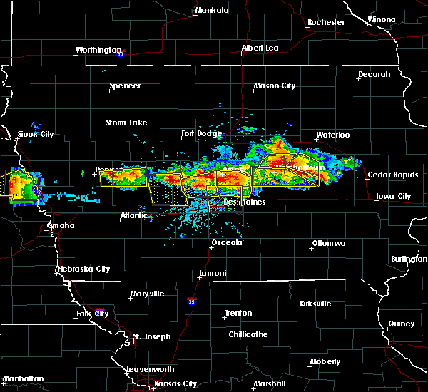 At 550 pm cdt, severe thunderstorms were located along a line extending from slater to near granger to near perry, moving south at 15 mph (radar indicated). Hazards include 70 mph wind gusts and quarter size hail. Hail damage to vehicles is expected. expect considerable tree damage. wind damage is also likely to mobile homes, roofs, and outbuildings. Locations impacted include, ankeny, johnston, perry, polk city, madrid, granger, woodward, big creek lake, saylorville lake, minburn, sheldahl, bouton, luther, berkley, perry municipal airport, big creek state park and ledges state park. At 550 pm cdt, severe thunderstorms were located along a line extending from slater to near granger to near perry, moving south at 15 mph (radar indicated). Hazards include 70 mph wind gusts and quarter size hail. Hail damage to vehicles is expected. expect considerable tree damage. wind damage is also likely to mobile homes, roofs, and outbuildings. Locations impacted include, ankeny, johnston, perry, polk city, madrid, granger, woodward, big creek lake, saylorville lake, minburn, sheldahl, bouton, luther, berkley, perry municipal airport, big creek state park and ledges state park.
|
| 6/6/2018 5:25 PM CDT |
 At 525 pm cdt, a severe thunderstorm was located over woodward, or 10 miles east of perry, moving southeast at 25 mph (radar indicated). Hazards include 60 mph wind gusts and quarter size hail. Hail damage to vehicles is expected. Expect wind damage to roofs, siding, and trees. At 525 pm cdt, a severe thunderstorm was located over woodward, or 10 miles east of perry, moving southeast at 25 mph (radar indicated). Hazards include 60 mph wind gusts and quarter size hail. Hail damage to vehicles is expected. Expect wind damage to roofs, siding, and trees.
|
| 6/6/2018 5:09 PM CDT |
 At 508 pm cdt, a severe thunderstorm was located near iowa state center, or near ames, moving east at 20 mph. a second severe storm was located near berkley moving east southeast at 20 mph (radar indicated). Hazards include 60 mph wind gusts and quarter size hail. Hail damage to vehicles is expected. expect wind damage to roofs, siding, and trees. locations impacted include, ames, boone, nevada, story city, madrid, ogden, slater, gilbert, iowa state center, boone speedway, kelley, luther, berkley, boone municipal airport, ledges state park and ames municipal airport. This includes interstate 35 between mile markers 110 and 121. At 508 pm cdt, a severe thunderstorm was located near iowa state center, or near ames, moving east at 20 mph. a second severe storm was located near berkley moving east southeast at 20 mph (radar indicated). Hazards include 60 mph wind gusts and quarter size hail. Hail damage to vehicles is expected. expect wind damage to roofs, siding, and trees. locations impacted include, ames, boone, nevada, story city, madrid, ogden, slater, gilbert, iowa state center, boone speedway, kelley, luther, berkley, boone municipal airport, ledges state park and ames municipal airport. This includes interstate 35 between mile markers 110 and 121.
|
| 6/6/2018 5:00 PM CDT |
 At 500 pm cdt, a severe thunderstorm was located near boone speedway, or near boone, moving east at 20 mph. a second severe storm was located near berkley moving east at 15 mph (radar indicated). Hazards include 60 mph wind gusts and quarter size hail. Hail damage to vehicles is expected. expect wind damage to roofs, siding, and trees. locations impacted include, ames, boone, nevada, story city, madrid, ogden, slater, gilbert, iowa state center, boone speedway, grand junction, kelley, rippey, pilot mound, luther, fraser, beaver, berkley, boone municipal airport and ledges state park. This includes interstate 35 between mile markers 110 and 121. At 500 pm cdt, a severe thunderstorm was located near boone speedway, or near boone, moving east at 20 mph. a second severe storm was located near berkley moving east at 15 mph (radar indicated). Hazards include 60 mph wind gusts and quarter size hail. Hail damage to vehicles is expected. expect wind damage to roofs, siding, and trees. locations impacted include, ames, boone, nevada, story city, madrid, ogden, slater, gilbert, iowa state center, boone speedway, grand junction, kelley, rippey, pilot mound, luther, fraser, beaver, berkley, boone municipal airport and ledges state park. This includes interstate 35 between mile markers 110 and 121.
|
| 6/6/2018 4:40 PM CDT |
 At 439 pm cdt, a severe thunderstorm was located near ogden, or near boone, moving northeast at 25 mph. there are a cluster of storms across the warning area that all may be severe moving northeast at 25 mph (radar indicated). Hazards include 60 mph wind gusts and quarter size hail. Hail damage to vehicles is expected. Expect wind damage to roofs, siding, and trees. At 439 pm cdt, a severe thunderstorm was located near ogden, or near boone, moving northeast at 25 mph. there are a cluster of storms across the warning area that all may be severe moving northeast at 25 mph (radar indicated). Hazards include 60 mph wind gusts and quarter size hail. Hail damage to vehicles is expected. Expect wind damage to roofs, siding, and trees.
|
| 5/3/2018 5:43 PM CDT |
 At 543 pm cdt, a severe thunderstorm capable of producing a tornado was located over clive, moving northeast at 40 mph (radar indicated rotation). Hazards include tornado and quarter size hail. Flying debris will be dangerous to those caught without shelter. mobile homes will be damaged or destroyed. damage to roofs, windows, and vehicles will occur. tree damage is likely. this dangerous storm will be near, ankeny and granger around 555 pm cdt. polk city and saylorville lake around 600 pm cdt. big creek lake around 605 pm cdt. slater around 610 pm cdt. huxley around 615 pm cdt. other locations impacted by this tornadic thunderstorm include big creek state park, sheldahl, alleman, elkhart, cambridge and ankeny regional airport. This includes interstate 35 between mile markers 92 and 105. At 543 pm cdt, a severe thunderstorm capable of producing a tornado was located over clive, moving northeast at 40 mph (radar indicated rotation). Hazards include tornado and quarter size hail. Flying debris will be dangerous to those caught without shelter. mobile homes will be damaged or destroyed. damage to roofs, windows, and vehicles will occur. tree damage is likely. this dangerous storm will be near, ankeny and granger around 555 pm cdt. polk city and saylorville lake around 600 pm cdt. big creek lake around 605 pm cdt. slater around 610 pm cdt. huxley around 615 pm cdt. other locations impacted by this tornadic thunderstorm include big creek state park, sheldahl, alleman, elkhart, cambridge and ankeny regional airport. This includes interstate 35 between mile markers 92 and 105.
|
| 5/1/2018 5:09 PM CDT | Golf Ball sized hail reported 1.7 miles S of Madrid, IA |
| 5/1/2018 5:09 PM CDT |
 At 508 pm cdt, a severe thunderstorm was located near madrid, or 8 miles southeast of boone, moving northeast at 45 mph (radar indicated). Hazards include ping pong ball size hail and 60 mph wind gusts. People and animals outdoors will be injured. expect hail damage to roofs, siding, windows, and vehicles. Expect wind damage to roofs, siding, and trees. At 508 pm cdt, a severe thunderstorm was located near madrid, or 8 miles southeast of boone, moving northeast at 45 mph (radar indicated). Hazards include ping pong ball size hail and 60 mph wind gusts. People and animals outdoors will be injured. expect hail damage to roofs, siding, windows, and vehicles. Expect wind damage to roofs, siding, and trees.
|
| 5/1/2018 5:07 PM CDT |
 At 505 pm cdt, a severe thunderstorm was located near madrid, or 8 miles southeast of boone, moving northeast at 45 mph (trained weather spotters). Hazards include ping pong ball size hail and 60 mph wind gusts. People and animals outdoors will be injured. expect hail damage to roofs, siding, windows, and vehicles. expect wind damage to roofs, siding, and trees. Locations impacted include, ames, boone, madrid, woodward, boone speedway, bouton, luther, boone municipal airport and ledges state park. At 505 pm cdt, a severe thunderstorm was located near madrid, or 8 miles southeast of boone, moving northeast at 45 mph (trained weather spotters). Hazards include ping pong ball size hail and 60 mph wind gusts. People and animals outdoors will be injured. expect hail damage to roofs, siding, windows, and vehicles. expect wind damage to roofs, siding, and trees. Locations impacted include, ames, boone, madrid, woodward, boone speedway, bouton, luther, boone municipal airport and ledges state park.
|
| 5/1/2018 5:06 PM CDT | Ping Pong Ball sized hail reported 3 miles S of Madrid, IA |
| 5/1/2018 4:51 PM CDT |
 At 450 pm cdt, a severe thunderstorm was located near woodward, or 9 miles northeast of perry, moving northeast at 35 mph (trained weather spotters reported golfball sized hail in woodward at 448 pm). Hazards include ping pong ball size hail and 60 mph wind gusts. People and animals outdoors will be injured. expect hail damage to roofs, siding, windows, and vehicles. expect wind damage to roofs, siding, and trees. locations impacted include, ames, boone, perry, story city, madrid, ogden, roland, gilbert, woodward, boone speedway, minburn, bouton, luther, fraser, perry municipal airport, boone municipal airport and ledges state park. This includes interstate 35 between mile markers 121 and 126. At 450 pm cdt, a severe thunderstorm was located near woodward, or 9 miles northeast of perry, moving northeast at 35 mph (trained weather spotters reported golfball sized hail in woodward at 448 pm). Hazards include ping pong ball size hail and 60 mph wind gusts. People and animals outdoors will be injured. expect hail damage to roofs, siding, windows, and vehicles. expect wind damage to roofs, siding, and trees. locations impacted include, ames, boone, perry, story city, madrid, ogden, roland, gilbert, woodward, boone speedway, minburn, bouton, luther, fraser, perry municipal airport, boone municipal airport and ledges state park. This includes interstate 35 between mile markers 121 and 126.
|
| 5/1/2018 4:35 PM CDT |
 At 435 pm cdt, a severe thunderstorm was located near perry, moving northeast at 40 mph (radar indicated). Hazards include 60 mph wind gusts and quarter size hail. Hail damage to vehicles is expected. Expect wind damage to roofs, siding, and trees. At 435 pm cdt, a severe thunderstorm was located near perry, moving northeast at 40 mph (radar indicated). Hazards include 60 mph wind gusts and quarter size hail. Hail damage to vehicles is expected. Expect wind damage to roofs, siding, and trees.
|
| 7/20/2017 9:44 PM CDT |
 At 943 pm cdt, severe thunderstorms were located along a line extending from iowa state center to saylorville, moving east at 40 mph (radar indicated. in addition...several reports of tree branches downed have been reported with these storms). Hazards include 60 mph wind gusts. Expect damage to roofs, siding, and trees. locations impacted include, ames, ankeny, urbandale, johnston, altoona, grimes, nevada, bondurant, polk city, huxley, saylorville, madrid, mitchellville, slater, granger, saylorville lake, big creek lake, adventureland amusement park, iowa state center and prairie meadows. this includes the following highways, interstate 35 between mile markers 88 and 113. Interstate 80 between mile markers 141 and 149. At 943 pm cdt, severe thunderstorms were located along a line extending from iowa state center to saylorville, moving east at 40 mph (radar indicated. in addition...several reports of tree branches downed have been reported with these storms). Hazards include 60 mph wind gusts. Expect damage to roofs, siding, and trees. locations impacted include, ames, ankeny, urbandale, johnston, altoona, grimes, nevada, bondurant, polk city, huxley, saylorville, madrid, mitchellville, slater, granger, saylorville lake, big creek lake, adventureland amusement park, iowa state center and prairie meadows. this includes the following highways, interstate 35 between mile markers 88 and 113. Interstate 80 between mile markers 141 and 149.
|
| 7/20/2017 9:33 PM CDT |
 At 931 pm cdt, severe thunderstorms were located along a line extending from near madrid to near granger, moving east at 30 mph (emergency management. at 927 pm...estimated wind gusts of 60 mph and branches down 2 miles north of woodward). Hazards include 60 mph wind gusts. Expect damage to roofs, siding, and trees. Locations impacted include, urbandale, waukee, grimes, perry, madrid, dallas center, granger, woodward, minburn, bouton and perry municipal airport. At 931 pm cdt, severe thunderstorms were located along a line extending from near madrid to near granger, moving east at 30 mph (emergency management. at 927 pm...estimated wind gusts of 60 mph and branches down 2 miles north of woodward). Hazards include 60 mph wind gusts. Expect damage to roofs, siding, and trees. Locations impacted include, urbandale, waukee, grimes, perry, madrid, dallas center, granger, woodward, minburn, bouton and perry municipal airport.
|
| 7/20/2017 9:32 PM CDT | Small branches broken or down. time estimated from rada in boone county IA, 0.4 miles SW of Madrid, IA |
| 7/20/2017 9:19 PM CDT |
 At 919 pm cdt, severe thunderstorms were located along a line extending from near woodward to near dallas center, moving east at 40 mph (trained weather spotters). Hazards include 60 mph wind gusts. Expect damage to roofs, siding, and trees. Locations impacted include, urbandale, waukee, grimes, perry, madrid, dallas center, granger, woodward, minburn, bouton and perry municipal airport. At 919 pm cdt, severe thunderstorms were located along a line extending from near woodward to near dallas center, moving east at 40 mph (trained weather spotters). Hazards include 60 mph wind gusts. Expect damage to roofs, siding, and trees. Locations impacted include, urbandale, waukee, grimes, perry, madrid, dallas center, granger, woodward, minburn, bouton and perry municipal airport.
|
| 7/20/2017 9:19 PM CDT |
 At 918 pm cdt, a severe thunderstorm was located near woodward, or 10 miles east of perry, moving east at 40 mph (trained weather spotters. several reports of 60 mph wind gusts have been received, with branches down). Hazards include 60 mph wind gusts. expect damage to roofs, siding, and trees At 918 pm cdt, a severe thunderstorm was located near woodward, or 10 miles east of perry, moving east at 40 mph (trained weather spotters. several reports of 60 mph wind gusts have been received, with branches down). Hazards include 60 mph wind gusts. expect damage to roofs, siding, and trees
|
| 7/20/2017 9:06 PM CDT |
 At 905 pm cdt, a severe thunderstorm was located over perry, moving east at 40 mph (trained weather spotters. at 901 pm a trained weather spotter reported a 59 mph wind gust 2 south of dawson). Hazards include 60 mph wind gusts. Expect damage to roofs, siding, and trees. Locations impacted include, urbandale, waukee, grimes, perry, madrid, dallas center, granger, woodward, lake panorama, minburn, yale, jamaica, dawson, bouton, perry municipal airport and lakin slough game management area. At 905 pm cdt, a severe thunderstorm was located over perry, moving east at 40 mph (trained weather spotters. at 901 pm a trained weather spotter reported a 59 mph wind gust 2 south of dawson). Hazards include 60 mph wind gusts. Expect damage to roofs, siding, and trees. Locations impacted include, urbandale, waukee, grimes, perry, madrid, dallas center, granger, woodward, lake panorama, minburn, yale, jamaica, dawson, bouton, perry municipal airport and lakin slough game management area.
|
| 7/20/2017 8:57 PM CDT |
 At 856 pm cdt, a severe thunderstorm was located 9 miles northeast of panora, or 9 miles west of perry, moving east at 35 mph (radar indicated). Hazards include 60 mph wind gusts. expect damage to roofs, siding, and trees At 856 pm cdt, a severe thunderstorm was located 9 miles northeast of panora, or 9 miles west of perry, moving east at 35 mph (radar indicated). Hazards include 60 mph wind gusts. expect damage to roofs, siding, and trees
|
| 6/27/2017 10:48 PM CDT |
 At 347 am cdt, a severe thunderstorm was located near madrid, or 8 miles south of boone, moving northeast at 25 mph (radar indicated). Hazards include 60 mph wind gusts and quarter size hail. Hail damage to vehicles is expected. expect wind damage to roofs, siding, and trees. Locations impacted include, madrid and luther. At 347 am cdt, a severe thunderstorm was located near madrid, or 8 miles south of boone, moving northeast at 25 mph (radar indicated). Hazards include 60 mph wind gusts and quarter size hail. Hail damage to vehicles is expected. expect wind damage to roofs, siding, and trees. Locations impacted include, madrid and luther.
|
| 6/27/2017 10:34 PM CDT |
 At 334 am cdt, a severe thunderstorm was located near madrid, or 9 miles south of boone, moving northeast at 45 mph (radar indicated). Hazards include 60 mph wind gusts and quarter size hail. Hail damage to vehicles is expected. expect wind damage to roofs, siding, and trees. Locations impacted include, madrid, woodward, luther and ledges state park. At 334 am cdt, a severe thunderstorm was located near madrid, or 9 miles south of boone, moving northeast at 45 mph (radar indicated). Hazards include 60 mph wind gusts and quarter size hail. Hail damage to vehicles is expected. expect wind damage to roofs, siding, and trees. Locations impacted include, madrid, woodward, luther and ledges state park.
|
| 6/27/2017 10:23 PM CDT |
 At 323 am cdt, a severe thunderstorm was located near woodward, or near perry, moving northeast at 25 mph (radar indicated). Hazards include 60 mph wind gusts and quarter size hail. Hail damage to vehicles is expected. Expect wind damage to roofs, siding, and trees. At 323 am cdt, a severe thunderstorm was located near woodward, or near perry, moving northeast at 25 mph (radar indicated). Hazards include 60 mph wind gusts and quarter size hail. Hail damage to vehicles is expected. Expect wind damage to roofs, siding, and trees.
|
| 5/17/2017 4:40 PM CDT |
 At 440 pm cdt, severe thunderstorms were located along a line extending from 10 miles northwest of boone to near nevada to near colfax, moving northeast at 70 mph (trained weather spotters. these storms have a history of producing wind gusts from 60 to 70 mph with numerous trees down and minor structural damage). Hazards include 70 mph wind gusts. Expect considerable tree damage. damage is likely to mobile homes, roofs, and outbuildings. locations impacted include, ames, ankeny, newton, altoona, boone, nevada, jefferson, bondurant, story city, huxley, madrid, mitchellville, colfax, ogden, prairie city, slater, state center, roland, baxter and gilbert. this includes the following highways, interstate 35 between mile markers 91 and 126. interstate 80 between mile markers 141 and 164. A tornado watch remains in effect until 700 pm cdt for central and west central iowa. At 440 pm cdt, severe thunderstorms were located along a line extending from 10 miles northwest of boone to near nevada to near colfax, moving northeast at 70 mph (trained weather spotters. these storms have a history of producing wind gusts from 60 to 70 mph with numerous trees down and minor structural damage). Hazards include 70 mph wind gusts. Expect considerable tree damage. damage is likely to mobile homes, roofs, and outbuildings. locations impacted include, ames, ankeny, newton, altoona, boone, nevada, jefferson, bondurant, story city, huxley, madrid, mitchellville, colfax, ogden, prairie city, slater, state center, roland, baxter and gilbert. this includes the following highways, interstate 35 between mile markers 91 and 126. interstate 80 between mile markers 141 and 164. A tornado watch remains in effect until 700 pm cdt for central and west central iowa.
|
| 5/17/2017 4:17 PM CDT |
 At 415 pm cdt, severe thunderstorms were located along a line extending from 7 miles south of jefferson to near grimes to near carlisle, moving north at 60 mph (trained weather spotters. at 410 pm...65 to 70 mph winds were reported in west des moines). Hazards include 70 mph wind gusts. Expect considerable tree damage. Damage is likely to mobile homes, roofs, and outbuildings. At 415 pm cdt, severe thunderstorms were located along a line extending from 7 miles south of jefferson to near grimes to near carlisle, moving north at 60 mph (trained weather spotters. at 410 pm...65 to 70 mph winds were reported in west des moines). Hazards include 70 mph wind gusts. Expect considerable tree damage. Damage is likely to mobile homes, roofs, and outbuildings.
|
| 5/16/2017 9:39 PM CDT |
 At 938 pm cdt, a severe thunderstorm was located near huxley, or near ames, moving east at 60 mph (emergency management). Hazards include 60 mph wind gusts and nickel size hail at 937 pm two miles north of luther. Expect damage to roofs, siding, and trees. locations impacted include, ames, nevada, huxley, madrid, slater, iowa state center, big creek lake, maxwell, colo, cambridge, collins, sheldahl, kelley, luther, ledges state park, ames municipal airport and big creek state park. This includes interstate 35 between mile markers 101 and 116. At 938 pm cdt, a severe thunderstorm was located near huxley, or near ames, moving east at 60 mph (emergency management). Hazards include 60 mph wind gusts and nickel size hail at 937 pm two miles north of luther. Expect damage to roofs, siding, and trees. locations impacted include, ames, nevada, huxley, madrid, slater, iowa state center, big creek lake, maxwell, colo, cambridge, collins, sheldahl, kelley, luther, ledges state park, ames municipal airport and big creek state park. This includes interstate 35 between mile markers 101 and 116.
|
| 5/16/2017 9:30 PM CDT |
 At 929 pm cdt, a severe thunderstorm was located over madrid, or 11 miles south of boone, moving east at 60 mph (radar indicated). Hazards include 60 mph wind gusts. expect damage to roofs, siding, and trees At 929 pm cdt, a severe thunderstorm was located over madrid, or 11 miles south of boone, moving east at 60 mph (radar indicated). Hazards include 60 mph wind gusts. expect damage to roofs, siding, and trees
|
| 5/16/2017 9:15 PM CDT |
 At 915 pm cdt, a severe thunderstorm was located near perry, moving northeast at 60 mph (radar indicated). Hazards include 60 mph wind gusts and quarter size hail. Hail damage to vehicles is expected. expect wind damage to roofs, siding, and trees. Locations impacted include, boone, perry, jefferson, madrid, ogden, dallas center, granger, woodward, boone speedway, grand junction, minburn, bagley, rippey, yale, paton, jamaica, boxholm, pilot mound, dawson and bouton. At 915 pm cdt, a severe thunderstorm was located near perry, moving northeast at 60 mph (radar indicated). Hazards include 60 mph wind gusts and quarter size hail. Hail damage to vehicles is expected. expect wind damage to roofs, siding, and trees. Locations impacted include, boone, perry, jefferson, madrid, ogden, dallas center, granger, woodward, boone speedway, grand junction, minburn, bagley, rippey, yale, paton, jamaica, boxholm, pilot mound, dawson and bouton.
|
| 5/16/2017 8:57 PM CDT |
 At 857 pm cdt, a severe thunderstorm was located near panora, or 10 miles northeast of guthrie center, moving northeast at 60 mph (radar indicated). Hazards include 60 mph wind gusts and quarter size hail. Hail damage to vehicles is expected. Expect wind damage to roofs, siding, and trees. At 857 pm cdt, a severe thunderstorm was located near panora, or 10 miles northeast of guthrie center, moving northeast at 60 mph (radar indicated). Hazards include 60 mph wind gusts and quarter size hail. Hail damage to vehicles is expected. Expect wind damage to roofs, siding, and trees.
|
| 3/6/2017 6:55 PM CST |
 At 653 pm cst, severe thunderstorms were located along a line extending from near roland to 9 miles north of lakeside casino, moving east at 75 mph (radar indicated. at 6:45pm 67 mph wind was reported at the ames airport. 50-60 mph wind was observed at 6:41pm at the national weather service office in north johnston). Hazards include 60 mph wind gusts and quarter size hail. Hail damage to vehicles is expected. expect wind damage to roofs, siding, and trees. locations impacted include, des moines, ames, west des moines, ankeny, urbandale, johnston, clive, indianola, altoona, waukee, boone, norwalk, pleasant hill, grimes, perry, nevada, winterset, adel, windsor heights and carlisle. this includes the following highways, interstate 35 between mile markers 44 and 72, and between mile markers 87 and 126. interstate 80 between mile markers 99 and 149. interstate 235 between mile markers 1 and 14. A tornado watch remains in effect until 1000 pm cst for central, south central and southwestern iowa. At 653 pm cst, severe thunderstorms were located along a line extending from near roland to 9 miles north of lakeside casino, moving east at 75 mph (radar indicated. at 6:45pm 67 mph wind was reported at the ames airport. 50-60 mph wind was observed at 6:41pm at the national weather service office in north johnston). Hazards include 60 mph wind gusts and quarter size hail. Hail damage to vehicles is expected. expect wind damage to roofs, siding, and trees. locations impacted include, des moines, ames, west des moines, ankeny, urbandale, johnston, clive, indianola, altoona, waukee, boone, norwalk, pleasant hill, grimes, perry, nevada, winterset, adel, windsor heights and carlisle. this includes the following highways, interstate 35 between mile markers 44 and 72, and between mile markers 87 and 126. interstate 80 between mile markers 99 and 149. interstate 235 between mile markers 1 and 14. A tornado watch remains in effect until 1000 pm cst for central, south central and southwestern iowa.
|
| 3/6/2017 6:36 PM CST |
 At 635 pm cst, severe thunderstorms were located along a line extending from near story city to 12 miles east of green valley lake, moving east at 55 mph (radar indicated). Hazards include 60 mph wind gusts and quarter size hail. Hail damage to vehicles is expected. expect wind damage to roofs, siding, and trees. locations impacted include, boone, perry, winterset, adel, madrid, ogden, dallas center, earlham, de soto, woodward, van meter, boone speedway, redfield, dexter, diamondhead lake, minburn, pilot mound, bouton, luther and macksburg. this includes interstate 80 between mile markers 95 and 114. A tornado watch remains in effect until 1000 pm cst for central, south central, southwestern and west central iowa. At 635 pm cst, severe thunderstorms were located along a line extending from near story city to 12 miles east of green valley lake, moving east at 55 mph (radar indicated). Hazards include 60 mph wind gusts and quarter size hail. Hail damage to vehicles is expected. expect wind damage to roofs, siding, and trees. locations impacted include, boone, perry, winterset, adel, madrid, ogden, dallas center, earlham, de soto, woodward, van meter, boone speedway, redfield, dexter, diamondhead lake, minburn, pilot mound, bouton, luther and macksburg. this includes interstate 80 between mile markers 95 and 114. A tornado watch remains in effect until 1000 pm cst for central, south central, southwestern and west central iowa.
|
| 3/6/2017 6:30 PM CST |
 At 629 pm cst, severe thunderstorms were located along a line extending from 9 miles north of boone to 7 miles northeast of green valley lake, moving east at 40 mph (radar indicated). Hazards include 60 mph wind gusts and quarter size hail. Hail damage to vehicles is expected. Expect wind damage to roofs, siding, and trees. At 629 pm cst, severe thunderstorms were located along a line extending from 9 miles north of boone to 7 miles northeast of green valley lake, moving east at 40 mph (radar indicated). Hazards include 60 mph wind gusts and quarter size hail. Hail damage to vehicles is expected. Expect wind damage to roofs, siding, and trees.
|
| 3/6/2017 6:03 PM CST |
 At 603 pm cst, severe thunderstorms were located along a line extending from 8 miles southeast of gowrie to 8 miles northeast of lake icaria, moving east at 40 mph (radar indicated). Hazards include 60 mph wind gusts and quarter size hail. Hail damage to vehicles is expected. Expect wind damage to roofs, siding, and trees. At 603 pm cst, severe thunderstorms were located along a line extending from 8 miles southeast of gowrie to 8 miles northeast of lake icaria, moving east at 40 mph (radar indicated). Hazards include 60 mph wind gusts and quarter size hail. Hail damage to vehicles is expected. Expect wind damage to roofs, siding, and trees.
|
| 8/11/2016 9:09 PM CDT |
 At 908 pm cdt, severe thunderstorms were located along a line extending from near slater to saylorville lake to 6 miles east of winterset, moving east at 45 mph (trained weather spotters. winds gusts estimated from 60 to 65 mph were reported 1 mile northwest of grimes). Hazards include 60 mph wind gusts. Expect damage to roofs. siding. and trees. Locations impacted include, des moines, west des moines, ankeny, urbandale, johnston, clive, altoona, waukee, norwalk, pleasant hill, grimes, perry, winterset, adel, windsor heights, carlisle, bondurant, polk city, huxley and saylorville. At 908 pm cdt, severe thunderstorms were located along a line extending from near slater to saylorville lake to 6 miles east of winterset, moving east at 45 mph (trained weather spotters. winds gusts estimated from 60 to 65 mph were reported 1 mile northwest of grimes). Hazards include 60 mph wind gusts. Expect damage to roofs. siding. and trees. Locations impacted include, des moines, west des moines, ankeny, urbandale, johnston, clive, altoona, waukee, norwalk, pleasant hill, grimes, perry, winterset, adel, windsor heights, carlisle, bondurant, polk city, huxley and saylorville.
|
| 8/11/2016 9:04 PM CDT |
 At 902 pm cdt, severe thunderstorms were located along a line extending from madrid to near grimes to near winterset, moving east at 45 mph. an area of enhanced winds on radar are currently indicated over granger, johnston, and polk city (radar indicated). Hazards include 60 mph wind gusts. Expect damage to roofs. siding. and trees. Locations impacted include, des moines, west des moines, ankeny, urbandale, johnston, clive, altoona, waukee, norwalk, pleasant hill, grimes, perry, winterset, adel, windsor heights, carlisle, bondurant, polk city, huxley and saylorville. At 902 pm cdt, severe thunderstorms were located along a line extending from madrid to near grimes to near winterset, moving east at 45 mph. an area of enhanced winds on radar are currently indicated over granger, johnston, and polk city (radar indicated). Hazards include 60 mph wind gusts. Expect damage to roofs. siding. and trees. Locations impacted include, des moines, west des moines, ankeny, urbandale, johnston, clive, altoona, waukee, norwalk, pleasant hill, grimes, perry, winterset, adel, windsor heights, carlisle, bondurant, polk city, huxley and saylorville.
|
| 8/11/2016 8:50 PM CDT |
 At 850 pm cdt, severe thunderstorms were located along a line extending from near woodward to adel to 7 miles west of winterset, moving east at 45 mph (radar indicated). Hazards include 60 mph wind gusts. Expect damage to roofs. siding. and trees. Locations impacted include, des moines, west des moines, ankeny, urbandale, johnston, clive, altoona, waukee, norwalk, pleasant hill, grimes, perry, winterset, adel, windsor heights, carlisle, bondurant, polk city, huxley and saylorville. At 850 pm cdt, severe thunderstorms were located along a line extending from near woodward to adel to 7 miles west of winterset, moving east at 45 mph (radar indicated). Hazards include 60 mph wind gusts. Expect damage to roofs. siding. and trees. Locations impacted include, des moines, west des moines, ankeny, urbandale, johnston, clive, altoona, waukee, norwalk, pleasant hill, grimes, perry, winterset, adel, windsor heights, carlisle, bondurant, polk city, huxley and saylorville.
|
| 8/11/2016 8:39 PM CDT |
 At 838 pm cdt, severe thunderstorms were located along a line extending from near perry to 7 miles west of adel to stuart, moving east at 40 mph (radar indicated). Hazards include 60 mph wind gusts. Expect damage to roofs. siding. And trees. At 838 pm cdt, severe thunderstorms were located along a line extending from near perry to 7 miles west of adel to stuart, moving east at 40 mph (radar indicated). Hazards include 60 mph wind gusts. Expect damage to roofs. siding. And trees.
|
| 7/6/2016 12:31 AM CDT |
 At 1230 am cdt, severe thunderstorms were located along a line extending from webster city to madrid, moving east at 50 mph (radar indicated). Hazards include 60 mph wind gusts. Expect damage to roofs. siding. and trees. Locations impacted include, ames, boone, webster city, perry, nevada, iowa falls, story city, huxley, madrid, slater, roland, jewell junction, gilbert, woodward, iowa state center, boone speedway, maxwell, colo, hubbard and cambridge. At 1230 am cdt, severe thunderstorms were located along a line extending from webster city to madrid, moving east at 50 mph (radar indicated). Hazards include 60 mph wind gusts. Expect damage to roofs. siding. and trees. Locations impacted include, ames, boone, webster city, perry, nevada, iowa falls, story city, huxley, madrid, slater, roland, jewell junction, gilbert, woodward, iowa state center, boone speedway, maxwell, colo, hubbard and cambridge.
|
| 7/6/2016 12:14 AM CDT |
 At 1213 am cdt, severe thunderstorms were located along a line extending from 7 miles southeast of fort dodge to near perry, moving east at 50 mph (radar indicated). Hazards include 70 mph wind gusts and quarter size hail. Hail damage to vehicles is expected. expect considerable tree damage. Wind damage is also likely to mobile homes, roofs, and outbuildings. At 1213 am cdt, severe thunderstorms were located along a line extending from 7 miles southeast of fort dodge to near perry, moving east at 50 mph (radar indicated). Hazards include 70 mph wind gusts and quarter size hail. Hail damage to vehicles is expected. expect considerable tree damage. Wind damage is also likely to mobile homes, roofs, and outbuildings.
|
| 5/26/2016 3:37 AM CDT |
 The severe thunderstorm warning for southwestern story, southwestern hamilton, northwestern polk, boone and northeastern dallas counties will expire at 345 am cdt, the storms which prompted the warning have weakened below severe limits, and exited the warned area. therefore the warning will be allowed to expire. The severe thunderstorm warning for southwestern story, southwestern hamilton, northwestern polk, boone and northeastern dallas counties will expire at 345 am cdt, the storms which prompted the warning have weakened below severe limits, and exited the warned area. therefore the warning will be allowed to expire.
|
| 5/26/2016 3:26 AM CDT |
 At 326 am cdt, severe thunderstorms were located along a line extending from 6 miles northeast of story city to 4 miles northwest of perry, moving east at 50 mph (radar indicated). Hazards include 60 mph wind gusts. Expect damage to roofs. siding. and trees. Locations impacted include, ames, boone, madrid, ogden, slater, woodward, boone speedway, sheldahl, kelley, bouton, luther, berkley, ledges state park, boone municipal airport and big creek state park. At 326 am cdt, severe thunderstorms were located along a line extending from 6 miles northeast of story city to 4 miles northwest of perry, moving east at 50 mph (radar indicated). Hazards include 60 mph wind gusts. Expect damage to roofs. siding. and trees. Locations impacted include, ames, boone, madrid, ogden, slater, woodward, boone speedway, sheldahl, kelley, bouton, luther, berkley, ledges state park, boone municipal airport and big creek state park.
|
| 5/26/2016 3:18 AM CDT |
 At 317 am cdt, severe thunderstorms were located along a line extending from 4 miles south of jewell junction to 10 miles northeast of lake panorama, moving southeast at 55 mph (radar indicated). Hazards include 60 mph wind gusts. Expect damage to roofs. siding. and trees. Locations impacted include, ames, boone, perry, madrid, ogden, slater, woodward, boone speedway, stratford, stanhope, minburn, sheldahl, kelley, boxholm, pilot mound, bouton, luther, fraser, beaver and berkley. At 317 am cdt, severe thunderstorms were located along a line extending from 4 miles south of jewell junction to 10 miles northeast of lake panorama, moving southeast at 55 mph (radar indicated). Hazards include 60 mph wind gusts. Expect damage to roofs. siding. and trees. Locations impacted include, ames, boone, perry, madrid, ogden, slater, woodward, boone speedway, stratford, stanhope, minburn, sheldahl, kelley, boxholm, pilot mound, bouton, luther, fraser, beaver and berkley.
|
| 5/26/2016 3:09 AM CDT |
 The severe thunderstorm warning for northwestern polk, southeastern boone and northeastern dallas counties will expire at 315 am cdt, the storm which prompted the warning has moved out of the area. therefore the warning will be allowed to expire. to report severe weather, contact your nearest law enforcement agency. they will relay your report to the national weather service des moines. The severe thunderstorm warning for northwestern polk, southeastern boone and northeastern dallas counties will expire at 315 am cdt, the storm which prompted the warning has moved out of the area. therefore the warning will be allowed to expire. to report severe weather, contact your nearest law enforcement agency. they will relay your report to the national weather service des moines.
|
| 5/26/2016 2:57 AM CDT |
 At 256 am cdt, a severe thunderstorm was located near granger, or 9 miles north of grimes, moving northeast at 30 mph (radar indicated). Hazards include 60 mph wind gusts and quarter size hail. Hail damage to vehicles is expected. expect wind damage to roofs, siding, and trees. locations impacted include, urbandale, johnston, clive, waukee, grimes, polk city, madrid, granger, woodward, saylorville lake, big creek lake, bouton and big creek state park. This includes interstate 80 between mile markers 127 and 132. At 256 am cdt, a severe thunderstorm was located near granger, or 9 miles north of grimes, moving northeast at 30 mph (radar indicated). Hazards include 60 mph wind gusts and quarter size hail. Hail damage to vehicles is expected. expect wind damage to roofs, siding, and trees. locations impacted include, urbandale, johnston, clive, waukee, grimes, polk city, madrid, granger, woodward, saylorville lake, big creek lake, bouton and big creek state park. This includes interstate 80 between mile markers 127 and 132.
|
| 5/26/2016 2:54 AM CDT |
 At 254 am cdt, severe thunderstorms were located along a line extending from 4 miles north of lake city to 7 miles south of panora, moving east at 60 mph (radar indicated). Hazards include 60 mph wind gusts and penny size hail. Expect damage to roofs. siding. And trees. At 254 am cdt, severe thunderstorms were located along a line extending from 4 miles north of lake city to 7 miles south of panora, moving east at 60 mph (radar indicated). Hazards include 60 mph wind gusts and penny size hail. Expect damage to roofs. siding. And trees.
|
| 5/26/2016 2:43 AM CDT |
 At 241 am cdt, a severe thunderstorm was located 5 miles south of woodward, or 8 miles southeast of perry, moving northeast at 30 mph (law enforcement. at 234 am cdt half dollar size hail was reported approximately one mile south of minburn). Hazards include 60 mph wind gusts and half dollar size hail. Hail damage to vehicles is expected. expect wind damage to roofs, siding, and trees. locations impacted include, urbandale, johnston, clive, waukee, grimes, perry, polk city, madrid, dallas center, granger, woodward, saylorville lake, big creek lake, minburn, bouton and big creek state park. This includes interstate 80 between mile markers 127 and 132. At 241 am cdt, a severe thunderstorm was located 5 miles south of woodward, or 8 miles southeast of perry, moving northeast at 30 mph (law enforcement. at 234 am cdt half dollar size hail was reported approximately one mile south of minburn). Hazards include 60 mph wind gusts and half dollar size hail. Hail damage to vehicles is expected. expect wind damage to roofs, siding, and trees. locations impacted include, urbandale, johnston, clive, waukee, grimes, perry, polk city, madrid, dallas center, granger, woodward, saylorville lake, big creek lake, minburn, bouton and big creek state park. This includes interstate 80 between mile markers 127 and 132.
|
| 5/26/2016 2:30 AM CDT |
 At 230 am cdt, a severe thunderstorm was located 4 miles northwest of dallas center, or 7 miles south of perry, moving east at 25 mph (radar indicated). Hazards include 60 mph wind gusts and half dollar size hail. Hail damage to vehicles is expected. Expect wind damage to roofs, siding, and trees. At 230 am cdt, a severe thunderstorm was located 4 miles northwest of dallas center, or 7 miles south of perry, moving east at 25 mph (radar indicated). Hazards include 60 mph wind gusts and half dollar size hail. Hail damage to vehicles is expected. Expect wind damage to roofs, siding, and trees.
|
| 11/11/2015 3:58 PM CST | The severe thunderstorm warning for western story, polk, northern warren, eastern boone and northeastern dallas counties will expire at 400 pm cst, the storms which prompted the warning have moved out of the area. therefore the warning will be allowed to expire. however gusty winds are still possible with these thunderstorms. a tornado watch remains in effect until 600 pm cst for south central iowa. |
| 11/11/2015 3:18 PM CST |
 At 318 pm cst, a severe thunderstorm capable of producing a tornado was located 5 miles southwest of woodward, or 5 miles southeast of perry, moving northeast at 50 mph (radar indicated rotation). Hazards include tornado. Flying debris will be dangerous to those caught without shelter. mobile homes will be damaged or destroyed. damage to roofs, windows and vehicles will occur. tree damage is likely. this dangerous storm will be near, madrid around 330 pm cst. Other locations impacted by this tornadic thunderstorm include bouton and minburn. At 318 pm cst, a severe thunderstorm capable of producing a tornado was located 5 miles southwest of woodward, or 5 miles southeast of perry, moving northeast at 50 mph (radar indicated rotation). Hazards include tornado. Flying debris will be dangerous to those caught without shelter. mobile homes will be damaged or destroyed. damage to roofs, windows and vehicles will occur. tree damage is likely. this dangerous storm will be near, madrid around 330 pm cst. Other locations impacted by this tornadic thunderstorm include bouton and minburn.
|
| 11/11/2015 3:09 PM CST |
 At 309 pm cst, a severe thunderstorm capable of producing a tornado was located 4 miles west of dallas center, or 6 miles northwest of adel, moving northeast at 40 mph (radar indicated rotation). Hazards include tornado. Flying debris will be dangerous to those caught without shelter. mobile homes will be damaged or destroyed. damage to roofs, windows and vehicles will occur. tree damage is likely. this dangerous storm will be near, woodward around 330 pm cst. madrid around 335 pm cst. Other locations impacted by this tornadic thunderstorm include bouton, berkley, perry municipal airport and minburn. At 309 pm cst, a severe thunderstorm capable of producing a tornado was located 4 miles west of dallas center, or 6 miles northwest of adel, moving northeast at 40 mph (radar indicated rotation). Hazards include tornado. Flying debris will be dangerous to those caught without shelter. mobile homes will be damaged or destroyed. damage to roofs, windows and vehicles will occur. tree damage is likely. this dangerous storm will be near, woodward around 330 pm cst. madrid around 335 pm cst. Other locations impacted by this tornadic thunderstorm include bouton, berkley, perry municipal airport and minburn.
|
| 11/11/2015 3:07 PM CST |
 At 307 pm cst, severe thunderstorms were located along a line extending from 6 miles northwest of perry to 12 miles northeast of osceola, moving northeast at 45 mph (radar indicated). Hazards include 60 mph wind gusts. Expect damage to roofs. Siding and trees. At 307 pm cst, severe thunderstorms were located along a line extending from 6 miles northwest of perry to 12 miles northeast of osceola, moving northeast at 45 mph (radar indicated). Hazards include 60 mph wind gusts. Expect damage to roofs. Siding and trees.
|
| 11/11/2015 2:46 PM CST |
 At 246 pm cst, severe thunderstorms were located along a line extending from 8 miles northwest of carroll to 7 miles southeast of coon rapids to 7 miles west of winterset, moving northeast at 50 mph (radar indicated). Hazards include 60 mph wind gusts and quarter size hail. Hail damage to vehicles is expected. Expect wind damage to roofs, siding and trees. At 246 pm cst, severe thunderstorms were located along a line extending from 8 miles northwest of carroll to 7 miles southeast of coon rapids to 7 miles west of winterset, moving northeast at 50 mph (radar indicated). Hazards include 60 mph wind gusts and quarter size hail. Hail damage to vehicles is expected. Expect wind damage to roofs, siding and trees.
|
| 9/6/2015 9:20 PM CDT |
 At 920 pm cdt, a severe thunderstorm was located over big creek lake, or 11 miles north of johnston, moving southeast at 20 mph (radar indicated). Hazards include 60 mph wind gusts. Expect damage to roofs. siding and trees. this severe storm will be near, saylorville lake around 925 pm cdt. polk city around 930 pm cdt. ankeny around 1000 pm cdt. other locations impacted by this severe thunderstorm include alleman, big creek state park, elkhart and sheldahl. This includes interstate 35 between mile markers 92 and 101. At 920 pm cdt, a severe thunderstorm was located over big creek lake, or 11 miles north of johnston, moving southeast at 20 mph (radar indicated). Hazards include 60 mph wind gusts. Expect damage to roofs. siding and trees. this severe storm will be near, saylorville lake around 925 pm cdt. polk city around 930 pm cdt. ankeny around 1000 pm cdt. other locations impacted by this severe thunderstorm include alleman, big creek state park, elkhart and sheldahl. This includes interstate 35 between mile markers 92 and 101.
|
| 9/6/2015 9:12 PM CDT |
 At 912 pm cdt, a severe thunderstorm was located over madrid, or 13 miles south of boone, moving east at 20 mph (radar indicated). Hazards include 60 mph wind gusts. Expect damage to roofs. siding and trees. this severe thunderstorm will be near, big creek lake and saylorville lake around 920 pm cdt. polk city around 930 pm cdt. other locations impacted by this severe thunderstorm include alleman, big creek state park, elkhart and sheldahl. This includes interstate 35 between mile markers 92 and 101. At 912 pm cdt, a severe thunderstorm was located over madrid, or 13 miles south of boone, moving east at 20 mph (radar indicated). Hazards include 60 mph wind gusts. Expect damage to roofs. siding and trees. this severe thunderstorm will be near, big creek lake and saylorville lake around 920 pm cdt. polk city around 930 pm cdt. other locations impacted by this severe thunderstorm include alleman, big creek state park, elkhart and sheldahl. This includes interstate 35 between mile markers 92 and 101.
|
| 6/7/2015 1:36 AM CDT | At 135 am cdt, a severe thunderstorm was located 6 miles east of boone speedway, or 7 miles southeast of boone, moving east at 45 mph (radar indicated). Hazards include 60 mph wind gusts. Expect damage to roofs. siding and trees. Locations impacted include, boone, madrid, ogden, woodward, boone speedway, sheldahl, luther, berkley, boone municipal airport and ledges state park. |
| 6/7/2015 12:59 AM CDT | At 1259 am cdt, a severe thunderstorm was located 4 miles northeast of jefferson, moving east at 55 mph (radar indicated). Hazards include 60 mph wind gusts. Expect damage to roofs. Siding and trees. |
| 7/22/2013 8:45 PM CDT | Quarter sized hail reported 1.9 miles E of Madrid, IA |
| 1/1/0001 12:00 AM | Delayed report. time estimated. 10 x 34 ft section of a newly constructed house roof blown off and trusses snapped in half. several 18 to 24 ft diameter trees snapped o in polk county IA, 3.9 miles NW of Madrid, IA |
| 1/1/0001 12:00 AM | Corrugated steel roof from a house ripped off and thrown approximately 120 yards. a section of the roof impaled the side of a neighboring house...with part of the metal in polk county IA, 3.6 miles NNW of Madrid, IA |
Hail Maps for Madrid, IA
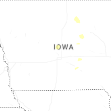
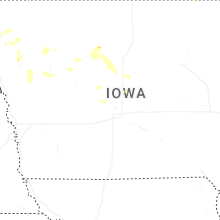
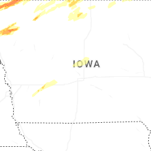

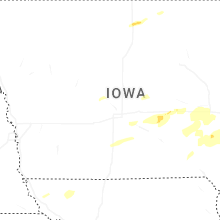


Connect with Interactive Hail Maps