

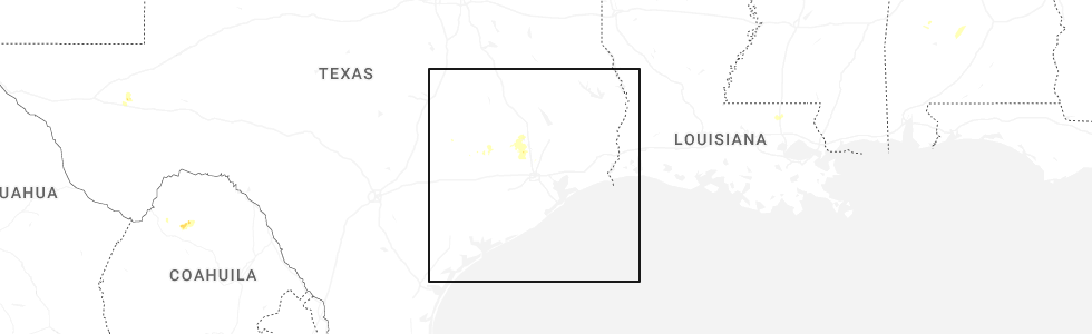
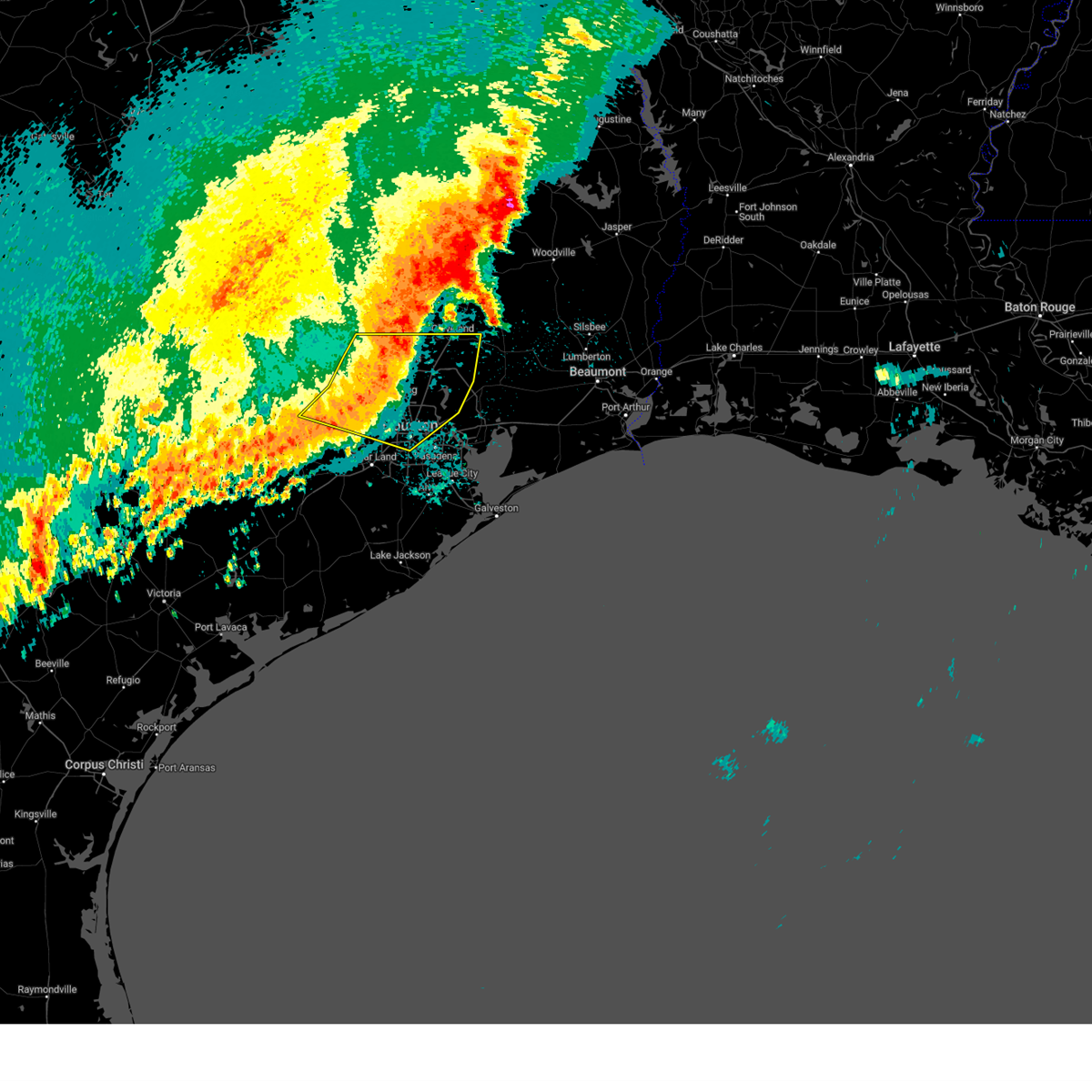
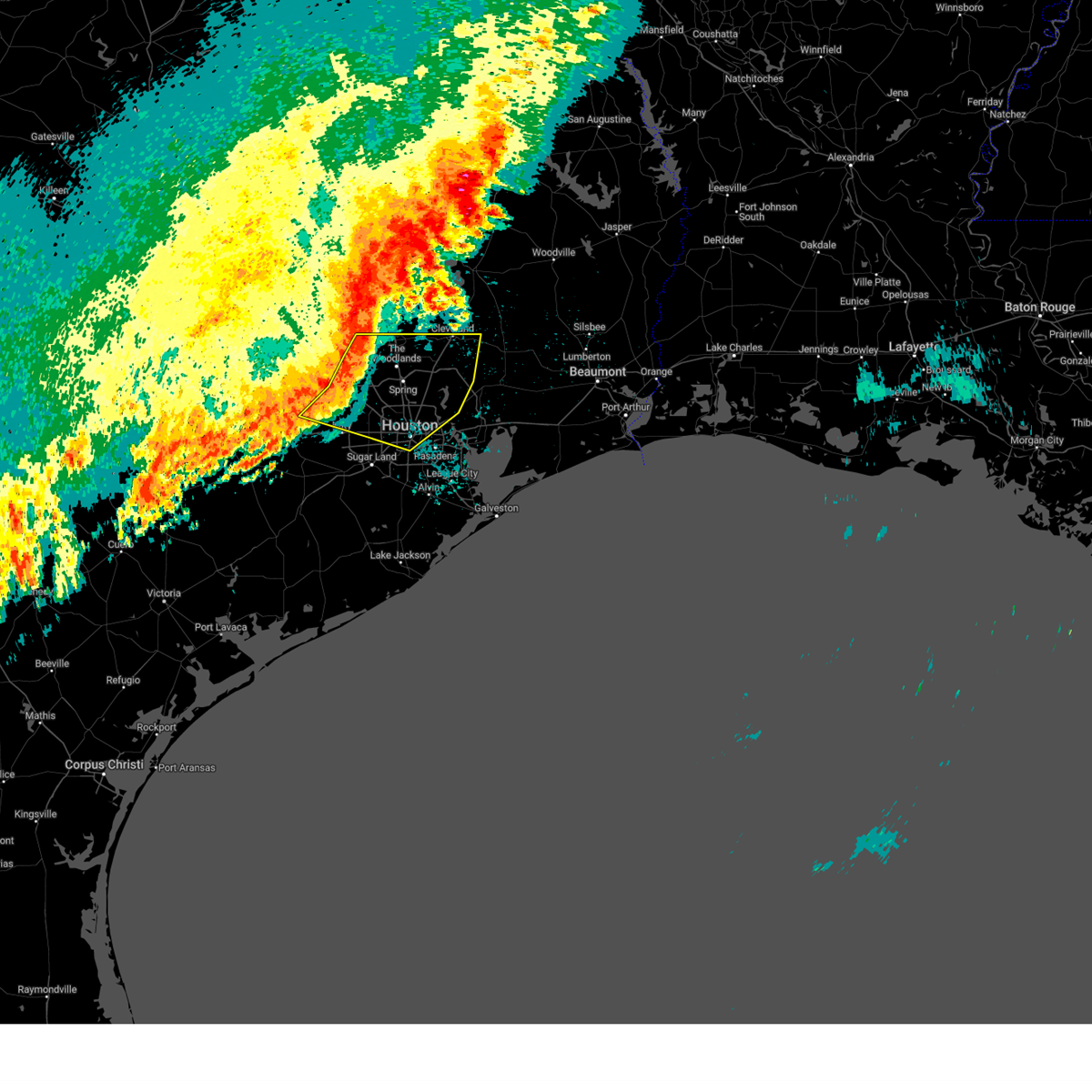
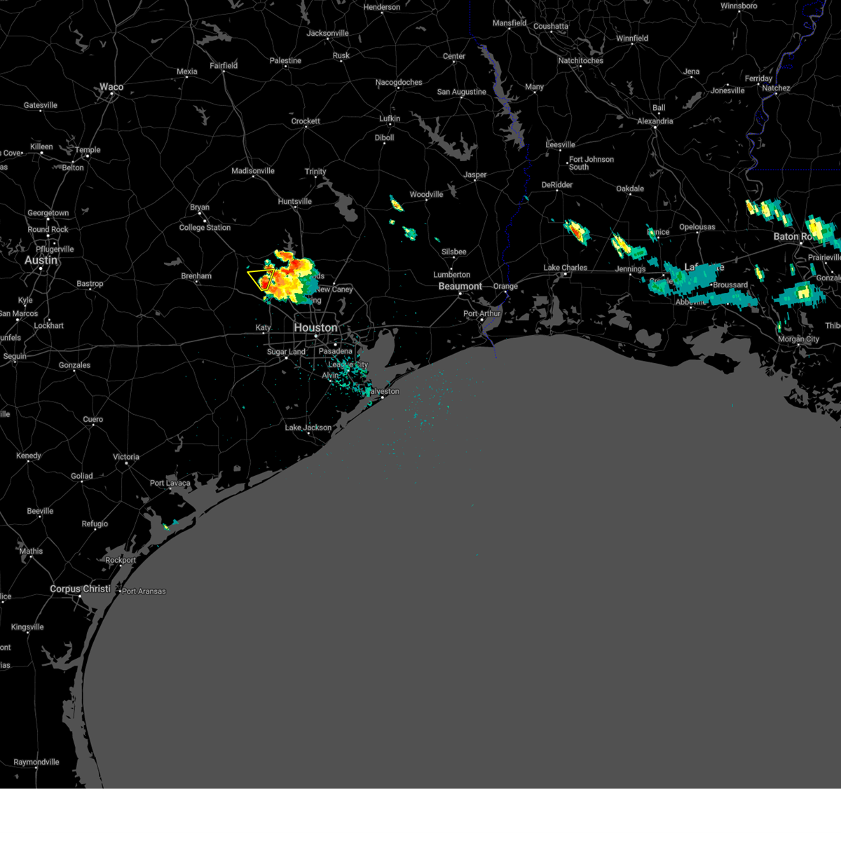
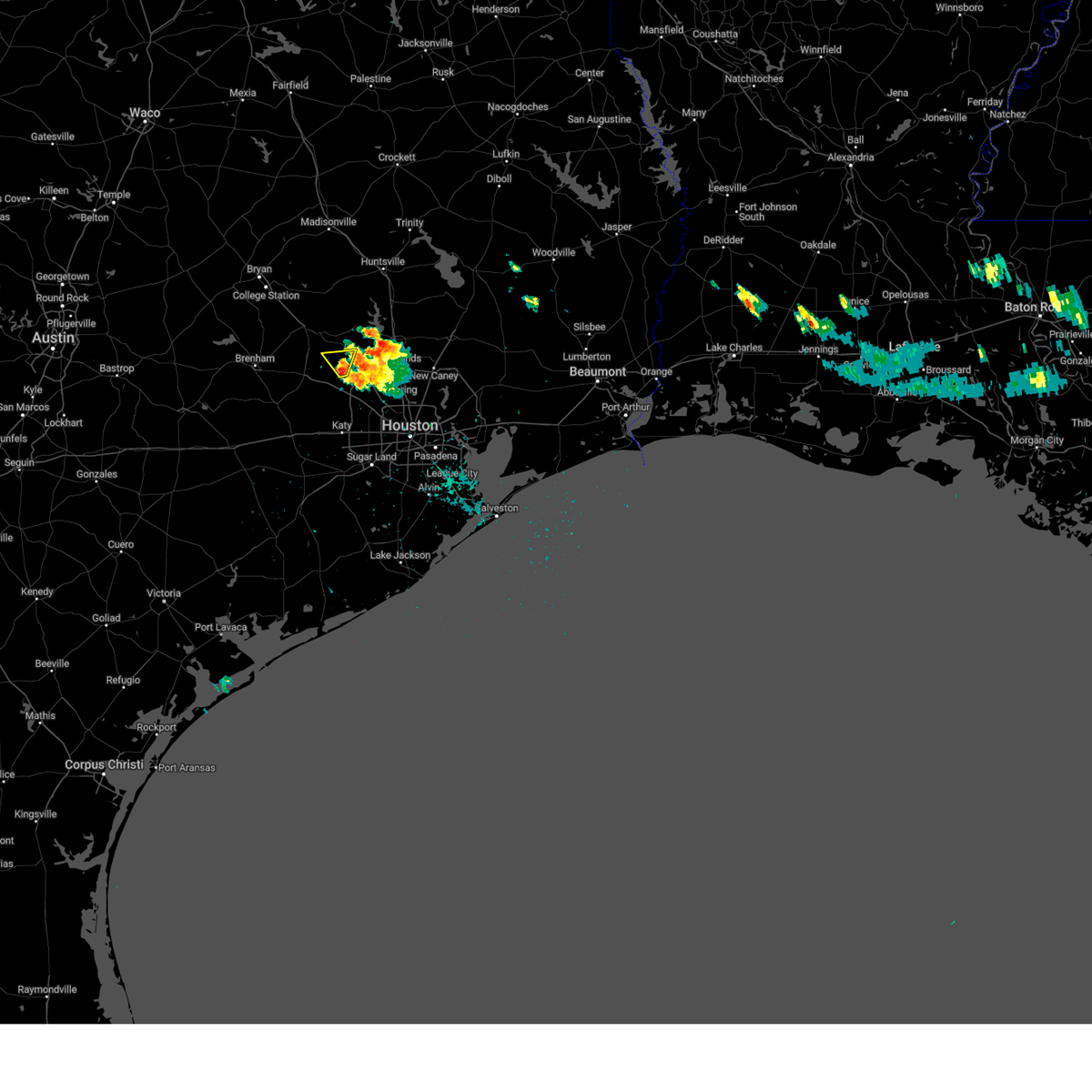
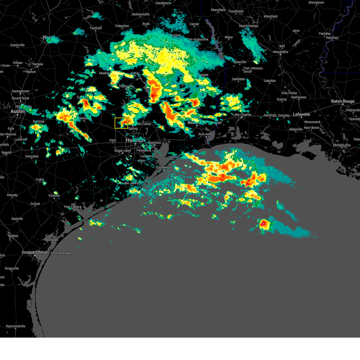
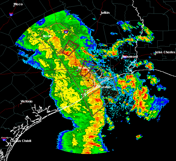
Hail Map for Magnolia, TX
The Magnolia, TX area has had 6 reports of on-the-ground hail by trained spotters, and has been under severe weather warnings 11 times during the past 12 months. Doppler radar has detected hail at or near Magnolia, TX on 52 occasions, including 7 occasions during the past year.
| Name: | Magnolia, TX |
| Where Located: | 38.1 miles NW of Houston, TX |
| Map: | Google Map for Magnolia, TX |
| Population: | 1393 |
| Housing Units: | 593 |
| More Info: | Search Google for Magnolia, TX |
1
The Top Recent Hail Date for Magnolia, TX is Friday, June 13, 2025 (9th out of 52)
Hail and Wind Damage Spotted near Magnolia, TX
| Date / Time | Report Details |
|---|---|
| 6/24/2025 4:50 PM CDT |
 At 450 pm cdt, a severe thunderstorm was located over todd mission, or near pinehurst, moving northwest at 35 mph (radar indicated). Hazards include 60 mph wind gusts and quarter size hail. Hail damage to vehicles is expected. expect wind damage to roofs, siding, and trees. Locations impacted include, pinehurst, magnolia, and stagecoach. At 450 pm cdt, a severe thunderstorm was located over todd mission, or near pinehurst, moving northwest at 35 mph (radar indicated). Hazards include 60 mph wind gusts and quarter size hail. Hail damage to vehicles is expected. expect wind damage to roofs, siding, and trees. Locations impacted include, pinehurst, magnolia, and stagecoach.
|
| 6/24/2025 4:29 PM CDT |
 Svrhgx the national weather service in league city has issued a * severe thunderstorm warning for, southwestern montgomery county in southeastern texas, northeastern waller county in southeastern texas, northwestern harris county in southeastern texas, * until 515 pm cdt. * at 428 pm cdt, a severe thunderstorm was located near tomball, moving north at 20 mph (radar indicated). Hazards include 60 mph wind gusts and quarter size hail. Hail damage to vehicles is expected. Expect wind damage to roofs, siding, and trees. Svrhgx the national weather service in league city has issued a * severe thunderstorm warning for, southwestern montgomery county in southeastern texas, northeastern waller county in southeastern texas, northwestern harris county in southeastern texas, * until 515 pm cdt. * at 428 pm cdt, a severe thunderstorm was located near tomball, moving north at 20 mph (radar indicated). Hazards include 60 mph wind gusts and quarter size hail. Hail damage to vehicles is expected. Expect wind damage to roofs, siding, and trees.
|
| 6/13/2025 5:59 PM CDT |
 Svrhgx the national weather service in league city has issued a * severe thunderstorm warning for, west central montgomery county in southeastern texas, * until 630 pm cdt. * at 559 pm cdt, a severe thunderstorm was located near pinehurst, moving east at 15 mph (radar indicated). Hazards include 60 mph wind gusts and penny size hail. expect damage to roofs, siding, and trees Svrhgx the national weather service in league city has issued a * severe thunderstorm warning for, west central montgomery county in southeastern texas, * until 630 pm cdt. * at 559 pm cdt, a severe thunderstorm was located near pinehurst, moving east at 15 mph (radar indicated). Hazards include 60 mph wind gusts and penny size hail. expect damage to roofs, siding, and trees
|
| 5/27/2025 12:11 AM CDT |
 At 1210 am cdt, severe thunderstorms were located along a line extending from near lake conroe dam to 6 miles east of pinehurst to near cypress to 7 miles northeast of pattison, moving east at 40 mph. houston hooks airport received a gust to 67 mph at 1202 am (radar indicated). Hazards include 70 mph wind gusts. Expect considerable tree damage. damage is likely to mobile homes, roofs, and outbuildings. Locations impacted include, conroe, bellaire, humble, west university place, katy, tomball, jacinto city, cleveland, jersey village, hunters creek village, bunker hill village, piney point village, pinehurst, downtown houston, greenway / upper kirby area, kingwood, spring branch north, second ward, the woodlands, and greater greenspoint. At 1210 am cdt, severe thunderstorms were located along a line extending from near lake conroe dam to 6 miles east of pinehurst to near cypress to 7 miles northeast of pattison, moving east at 40 mph. houston hooks airport received a gust to 67 mph at 1202 am (radar indicated). Hazards include 70 mph wind gusts. Expect considerable tree damage. damage is likely to mobile homes, roofs, and outbuildings. Locations impacted include, conroe, bellaire, humble, west university place, katy, tomball, jacinto city, cleveland, jersey village, hunters creek village, bunker hill village, piney point village, pinehurst, downtown houston, greenway / upper kirby area, kingwood, spring branch north, second ward, the woodlands, and greater greenspoint.
|
| 5/26/2025 11:46 PM CDT |
 Svrhgx the national weather service in league city has issued a * severe thunderstorm warning for, eastern austin county in southeastern texas, montgomery county in southeastern texas, south central san jacinto county in southeastern texas, southwestern liberty county in southeastern texas, southern waller county in southeastern texas, harris county in southeastern texas, * until 1245 am cdt. * at 1146 pm cdt, severe thunderstorms were located along a line extending from near montgomery to magnolia to hockley to 7 miles northwest of pattison, moving east at 40 mph (radar indicated). Hazards include 60 mph wind gusts. expect damage to roofs, siding, and trees Svrhgx the national weather service in league city has issued a * severe thunderstorm warning for, eastern austin county in southeastern texas, montgomery county in southeastern texas, south central san jacinto county in southeastern texas, southwestern liberty county in southeastern texas, southern waller county in southeastern texas, harris county in southeastern texas, * until 1245 am cdt. * at 1146 pm cdt, severe thunderstorms were located along a line extending from near montgomery to magnolia to hockley to 7 miles northwest of pattison, moving east at 40 mph (radar indicated). Hazards include 60 mph wind gusts. expect damage to roofs, siding, and trees
|
| 5/23/2025 6:00 PM CDT |
 the severe thunderstorm warning has been cancelled and is no longer in effect the severe thunderstorm warning has been cancelled and is no longer in effect
|
| 5/23/2025 5:45 PM CDT |
 Svrhgx the national weather service in league city has issued a * severe thunderstorm warning for, southeastern grimes county in southeastern texas, west central montgomery county in southeastern texas, northeastern waller county in southeastern texas, * until 615 pm cdt. * at 545 pm cdt, a severe thunderstorm was located near magnolia, or 8 miles west of pinehurst, and is nearly stationary (radar indicated). Hazards include quarter size hail. damage to vehicles is expected Svrhgx the national weather service in league city has issued a * severe thunderstorm warning for, southeastern grimes county in southeastern texas, west central montgomery county in southeastern texas, northeastern waller county in southeastern texas, * until 615 pm cdt. * at 545 pm cdt, a severe thunderstorm was located near magnolia, or 8 miles west of pinehurst, and is nearly stationary (radar indicated). Hazards include quarter size hail. damage to vehicles is expected
|
| 5/5/2025 6:39 PM CDT |
 The storm which prompted the warning has weakened below severe limits, and has exited the warned area. therefore, the warning will be allowed to expire. a severe thunderstorm watch remains in effect until 800 pm cdt for southeastern texas. The storm which prompted the warning has weakened below severe limits, and has exited the warned area. therefore, the warning will be allowed to expire. a severe thunderstorm watch remains in effect until 800 pm cdt for southeastern texas.
|
| 5/5/2025 6:11 PM CDT |
 Svrhgx the national weather service in league city has issued a * severe thunderstorm warning for, southwestern montgomery county in southeastern texas, northwestern harris county in southeastern texas, * until 645 pm cdt. * at 611 pm cdt, a severe thunderstorm was located near stagecoach, or near tomball, moving east at 15 mph (public). Hazards include ping pong ball size hail and 60 mph wind gusts. People and animals outdoors will be injured. expect hail damage to roofs, siding, windows, and vehicles. Expect wind damage to roofs, siding, and trees. Svrhgx the national weather service in league city has issued a * severe thunderstorm warning for, southwestern montgomery county in southeastern texas, northwestern harris county in southeastern texas, * until 645 pm cdt. * at 611 pm cdt, a severe thunderstorm was located near stagecoach, or near tomball, moving east at 15 mph (public). Hazards include ping pong ball size hail and 60 mph wind gusts. People and animals outdoors will be injured. expect hail damage to roofs, siding, windows, and vehicles. Expect wind damage to roofs, siding, and trees.
|
| 5/5/2025 6:04 PM CDT |
 At 604 pm cdt, a severe thunderstorm was located near stagecoach, or near pinehurst, moving east at 15 mph (radar indicated). Hazards include 60 mph wind gusts and quarter size hail. Hail damage to vehicles is expected. expect wind damage to roofs, siding, and trees. Locations impacted include, tomball, pinehurst, magnolia, and stagecoach. At 604 pm cdt, a severe thunderstorm was located near stagecoach, or near pinehurst, moving east at 15 mph (radar indicated). Hazards include 60 mph wind gusts and quarter size hail. Hail damage to vehicles is expected. expect wind damage to roofs, siding, and trees. Locations impacted include, tomball, pinehurst, magnolia, and stagecoach.
|
| 5/5/2025 5:44 PM CDT |
 Svrhgx the national weather service in league city has issued a * severe thunderstorm warning for, southwestern montgomery county in southeastern texas, northeastern waller county in southeastern texas, northwestern harris county in southeastern texas, * until 615 pm cdt. * at 544 pm cdt, a severe thunderstorm was located near waller, or 7 miles east of prairie view, moving east at 15 mph (radar indicated). Hazards include 60 mph wind gusts and quarter size hail. Hail damage to vehicles is expected. Expect wind damage to roofs, siding, and trees. Svrhgx the national weather service in league city has issued a * severe thunderstorm warning for, southwestern montgomery county in southeastern texas, northeastern waller county in southeastern texas, northwestern harris county in southeastern texas, * until 615 pm cdt. * at 544 pm cdt, a severe thunderstorm was located near waller, or 7 miles east of prairie view, moving east at 15 mph (radar indicated). Hazards include 60 mph wind gusts and quarter size hail. Hail damage to vehicles is expected. Expect wind damage to roofs, siding, and trees.
|
| 5/31/2024 6:14 AM CDT |
 At 613 am cdt, severe thunderstorms were located along a line extending from 7 miles northeast of huntsville to 7 miles southeast of columbus, moving southeast at 40 mph (radar indicated). Hazards include 60 mph wind gusts and penny size hail. Expect damage to roofs, siding, and trees. Locations impacted include, huntsville, brenham, tomball, navasota, crockett, sealy, hempstead, prairie view, bellville, columbus, pinehurst, austonio, washington, shelby, hockley, trinity, waller, grapeland, magnolia, and new waverly. At 613 am cdt, severe thunderstorms were located along a line extending from 7 miles northeast of huntsville to 7 miles southeast of columbus, moving southeast at 40 mph (radar indicated). Hazards include 60 mph wind gusts and penny size hail. Expect damage to roofs, siding, and trees. Locations impacted include, huntsville, brenham, tomball, navasota, crockett, sealy, hempstead, prairie view, bellville, columbus, pinehurst, austonio, washington, shelby, hockley, trinity, waller, grapeland, magnolia, and new waverly.
|
| 5/31/2024 5:58 AM CDT |
 Svrhgx the national weather service in league city has issued a * severe thunderstorm warning for, southwestern trinity county in southeastern texas, northeastern colorado county in southeastern texas, austin county in southeastern texas, grimes county in southeastern texas, southeastern brazos county in southeastern texas, washington county in southeastern texas, western montgomery county in southeastern texas, houston county in southeastern texas, eastern madison county in southeastern texas, waller county in southeastern texas, walker county in southeastern texas, northwestern harris county in southeastern texas, * until 645 am cdt. * at 557 am cdt, severe thunderstorms were located along a line extending from 7 miles west of riverside to 6 miles north of columbus, moving southeast at around 40 mph (radar indicated). Hazards include 60 mph wind gusts and penny size hail. expect damage to roofs, siding, and trees Svrhgx the national weather service in league city has issued a * severe thunderstorm warning for, southwestern trinity county in southeastern texas, northeastern colorado county in southeastern texas, austin county in southeastern texas, grimes county in southeastern texas, southeastern brazos county in southeastern texas, washington county in southeastern texas, western montgomery county in southeastern texas, houston county in southeastern texas, eastern madison county in southeastern texas, waller county in southeastern texas, walker county in southeastern texas, northwestern harris county in southeastern texas, * until 645 am cdt. * at 557 am cdt, severe thunderstorms were located along a line extending from 7 miles west of riverside to 6 miles north of columbus, moving southeast at around 40 mph (radar indicated). Hazards include 60 mph wind gusts and penny size hail. expect damage to roofs, siding, and trees
|
| 5/28/2024 12:51 PM CDT | *** 1 fatal *** corrects previous tstm wnd dmg report from 6 nw the woodlands. strong thunderstorm winds resulted in the collapse of a home under construction with work in montgomery county TX, 11 miles W of Magnolia, TX |
| 5/28/2024 12:39 PM CDT |
 Svrhgx the national weather service in league city has issued a * severe thunderstorm warning for, northeastern austin county in southeastern texas, southeastern grimes county in southeastern texas, southeastern washington county in southeastern texas, southwestern montgomery county in southeastern texas, waller county in southeastern texas, northwestern harris county in southeastern texas, * until 115 pm cdt. * at 1239 pm cdt, a severe thunderstorm was located near hempstead, moving southeast at 45 mph (radar indicated). Hazards include 60 mph wind gusts and quarter size hail. Hail damage to vehicles is expected. Expect wind damage to roofs, siding, and trees. Svrhgx the national weather service in league city has issued a * severe thunderstorm warning for, northeastern austin county in southeastern texas, southeastern grimes county in southeastern texas, southeastern washington county in southeastern texas, southwestern montgomery county in southeastern texas, waller county in southeastern texas, northwestern harris county in southeastern texas, * until 115 pm cdt. * at 1239 pm cdt, a severe thunderstorm was located near hempstead, moving southeast at 45 mph (radar indicated). Hazards include 60 mph wind gusts and quarter size hail. Hail damage to vehicles is expected. Expect wind damage to roofs, siding, and trees.
|
| 5/28/2024 12:35 PM CDT |
 Svrhgx the national weather service in league city has issued a * severe thunderstorm warning for, southern montgomery county in southeastern texas, southern san jacinto county in southeastern texas, northwestern liberty county in southeastern texas, south central polk county in southeastern texas, northern harris county in southeastern texas, * until 130 pm cdt. * at 1234 pm cdt, severe thunderstorms were located along a line extending from near west livingston to 8 miles east of new waverly to near montgomery, moving south at 25 mph (radar indicated). Hazards include 60 mph wind gusts and quarter size hail. Hail damage to vehicles is expected. Expect wind damage to roofs, siding, and trees. Svrhgx the national weather service in league city has issued a * severe thunderstorm warning for, southern montgomery county in southeastern texas, southern san jacinto county in southeastern texas, northwestern liberty county in southeastern texas, south central polk county in southeastern texas, northern harris county in southeastern texas, * until 130 pm cdt. * at 1234 pm cdt, severe thunderstorms were located along a line extending from near west livingston to 8 miles east of new waverly to near montgomery, moving south at 25 mph (radar indicated). Hazards include 60 mph wind gusts and quarter size hail. Hail damage to vehicles is expected. Expect wind damage to roofs, siding, and trees.
|
| 5/28/2024 12:32 PM CDT | *** 1 fatal *** strong thunderstorm winds resulted in the collapse of a home under construction with workers inside. one worker was killed after being trapped under the in montgomery county TX, 11 miles W of Magnolia, TX |
| 5/28/2024 12:26 PM CDT |
 Svrhgx the national weather service in league city has issued a * severe thunderstorm warning for, northwestern montgomery county in southeastern texas, south central walker county in southeastern texas, * until 100 pm cdt. * at 1225 pm cdt, a severe thunderstorm was located near montgomery, or 13 miles west of willis, moving southeast at 25 mph (radar indicated). Hazards include golf ball size hail and 70 mph wind gusts. People and animals outdoors will be injured. expect hail damage to roofs, siding, windows, and vehicles. expect considerable tree damage. Wind damage is also likely to mobile homes, roofs, and outbuildings. Svrhgx the national weather service in league city has issued a * severe thunderstorm warning for, northwestern montgomery county in southeastern texas, south central walker county in southeastern texas, * until 100 pm cdt. * at 1225 pm cdt, a severe thunderstorm was located near montgomery, or 13 miles west of willis, moving southeast at 25 mph (radar indicated). Hazards include golf ball size hail and 70 mph wind gusts. People and animals outdoors will be injured. expect hail damage to roofs, siding, windows, and vehicles. expect considerable tree damage. Wind damage is also likely to mobile homes, roofs, and outbuildings.
|
| 5/5/2024 6:25 AM CDT |
 The storms which prompted the warning have weakened below severe limits, and no longer pose an immediate threat to life or property. therefore, the warning will be allowed to expire. however, gusty winds are still possible with these thunderstorms. to report severe weather, contact your nearest law enforcement agency. they will relay your report to the national weather service league city. The storms which prompted the warning have weakened below severe limits, and no longer pose an immediate threat to life or property. therefore, the warning will be allowed to expire. however, gusty winds are still possible with these thunderstorms. to report severe weather, contact your nearest law enforcement agency. they will relay your report to the national weather service league city.
|
| 5/5/2024 5:44 AM CDT |
 Svrhgx the national weather service in league city has issued a * severe thunderstorm warning for, southwestern trinity county in southeastern texas, southeastern grimes county in southeastern texas, montgomery county in southeastern texas, san jacinto county in southeastern texas, southern houston county in southeastern texas, eastern madison county in southeastern texas, west central liberty county in southeastern texas, northeastern waller county in southeastern texas, west central polk county in southeastern texas, walker county in southeastern texas, northwestern harris county in southeastern texas, * until 630 am cdt. * at 543 am cdt, severe thunderstorms were located along a line extending from 14 miles east of madisonville to near hockley, moving east at 35 mph (radar indicated). Hazards include 60 mph wind gusts. expect damage to roofs, siding, and trees Svrhgx the national weather service in league city has issued a * severe thunderstorm warning for, southwestern trinity county in southeastern texas, southeastern grimes county in southeastern texas, montgomery county in southeastern texas, san jacinto county in southeastern texas, southern houston county in southeastern texas, eastern madison county in southeastern texas, west central liberty county in southeastern texas, northeastern waller county in southeastern texas, west central polk county in southeastern texas, walker county in southeastern texas, northwestern harris county in southeastern texas, * until 630 am cdt. * at 543 am cdt, severe thunderstorms were located along a line extending from 14 miles east of madisonville to near hockley, moving east at 35 mph (radar indicated). Hazards include 60 mph wind gusts. expect damage to roofs, siding, and trees
|
| 5/5/2024 5:27 AM CDT |
 At 527 am cdt, severe thunderstorms were located along a line extending from 10 miles northwest of riverside to near waller, moving east at 30 mph (radar indicated). Hazards include 60 mph wind gusts. Expect damage to roofs, siding, and trees. Locations impacted include, huntsville, tomball, navasota, hempstead, prairie view, madisonville, pinehurst, washington, trinity, magnolia, new waverly, montgomery, stagecoach, riverside, bedias, anderson, todd mission, huntsville state park, lake conroe dam, and dobbin. At 527 am cdt, severe thunderstorms were located along a line extending from 10 miles northwest of riverside to near waller, moving east at 30 mph (radar indicated). Hazards include 60 mph wind gusts. Expect damage to roofs, siding, and trees. Locations impacted include, huntsville, tomball, navasota, hempstead, prairie view, madisonville, pinehurst, washington, trinity, magnolia, new waverly, montgomery, stagecoach, riverside, bedias, anderson, todd mission, huntsville state park, lake conroe dam, and dobbin.
|
| 5/5/2024 5:08 AM CDT |
 Svrhgx the national weather service in league city has issued a * severe thunderstorm warning for, southwestern trinity county in southeastern texas, grimes county in southeastern texas, southeastern brazos county in southeastern texas, eastern washington county in southeastern texas, western montgomery county in southeastern texas, southwestern houston county in southeastern texas, southeastern madison county in southeastern texas, northern waller county in southeastern texas, walker county in southeastern texas, northwestern harris county in southeastern texas, * until 545 am cdt. * at 507 am cdt, severe thunderstorms were located along a line extending from 6 miles east of madisonville to hempstead, moving east at 30 mph (radar indicated). Hazards include 60 mph wind gusts. expect damage to roofs, siding, and trees Svrhgx the national weather service in league city has issued a * severe thunderstorm warning for, southwestern trinity county in southeastern texas, grimes county in southeastern texas, southeastern brazos county in southeastern texas, eastern washington county in southeastern texas, western montgomery county in southeastern texas, southwestern houston county in southeastern texas, southeastern madison county in southeastern texas, northern waller county in southeastern texas, walker county in southeastern texas, northwestern harris county in southeastern texas, * until 545 am cdt. * at 507 am cdt, severe thunderstorms were located along a line extending from 6 miles east of madisonville to hempstead, moving east at 30 mph (radar indicated). Hazards include 60 mph wind gusts. expect damage to roofs, siding, and trees
|
| 10/26/2023 6:10 PM CDT |
 The tornado warning for southwestern montgomery, eastern waller and northwestern harris counties will expire at 615 pm cdt, the storm which prompted the warning has weakened below severe limits, and has exited the warned area. therefore, the warning will be allowed to expire. The tornado warning for southwestern montgomery, eastern waller and northwestern harris counties will expire at 615 pm cdt, the storm which prompted the warning has weakened below severe limits, and has exited the warned area. therefore, the warning will be allowed to expire.
|
| 10/26/2023 5:59 PM CDT |
 At 559 pm cdt, a severe thunderstorm capable of producing a tornado was located near magnolia, or near pinehurst, moving east at 25 mph (radar indicated rotation). Hazards include tornado. Flying debris will be dangerous to those caught without shelter. mobile homes will be damaged or destroyed. damage to roofs, windows, and vehicles will occur. tree damage is likely. This dangerous storm will be near, pinehurst, magnolia, and stagecoach around 605 pm cdt. At 559 pm cdt, a severe thunderstorm capable of producing a tornado was located near magnolia, or near pinehurst, moving east at 25 mph (radar indicated rotation). Hazards include tornado. Flying debris will be dangerous to those caught without shelter. mobile homes will be damaged or destroyed. damage to roofs, windows, and vehicles will occur. tree damage is likely. This dangerous storm will be near, pinehurst, magnolia, and stagecoach around 605 pm cdt.
|
| 9/8/2023 6:40 PM CDT |
 The severe thunderstorm warning for southwestern montgomery and northwestern harris counties will expire at 645 pm cdt, the storm which prompted the warning has weakened below severe limits, and no longer poses an immediate threat to life or property. therefore, the warning will be allowed to expire. The severe thunderstorm warning for southwestern montgomery and northwestern harris counties will expire at 645 pm cdt, the storm which prompted the warning has weakened below severe limits, and no longer poses an immediate threat to life or property. therefore, the warning will be allowed to expire.
|
| 9/8/2023 6:11 PM CDT | Nickel size hail... tree limbs and fences down were also reported. report shared via social medi in montgomery county TX, 1.4 miles NNW of Magnolia, TX |
| 9/8/2023 6:10 PM CDT |
 At 609 pm cdt, a severe thunderstorm was located near cypress, or near tomball, moving south at 15 mph (public). Hazards include 60 mph wind gusts and penny size hail. expect damage to roofs, siding, and trees At 609 pm cdt, a severe thunderstorm was located near cypress, or near tomball, moving south at 15 mph (public). Hazards include 60 mph wind gusts and penny size hail. expect damage to roofs, siding, and trees
|
| 8/24/2023 7:26 PM CDT |
 At 726 pm cdt, a severe thunderstorm was located over pinehurst, moving southwest at 10 mph (radar indicated). Hazards include 60 mph wind gusts. expect damage to roofs, siding, and trees At 726 pm cdt, a severe thunderstorm was located over pinehurst, moving southwest at 10 mph (radar indicated). Hazards include 60 mph wind gusts. expect damage to roofs, siding, and trees
|
| 6/21/2023 8:21 PM CDT |
 At 819 pm cdt, a severe thunderstorm was located over western conroe, moving southeast at 55 mph. there have been no reports of strong damaging winds yet with this warning, but wind gusts to 60 mph are still possible (radar indicated). Hazards include 60 mph wind gusts and nickel size hail. Expect damage to roofs, siding, and trees. locations impacted include, conroe, western huntsville, willis, pinehurst, the woodlands, panorama village, shenandoah, magnolia, cut and shoot, new waverly, montgomery, anderson, woodloch, todd mission, huntsville state park, lake conroe dam, crabbs prairie, dobbin, dacus and plantersville. hail threat, radar indicated max hail size, 0. 88 in wind threat, radar indicated max wind gust, 60 mph. At 819 pm cdt, a severe thunderstorm was located over western conroe, moving southeast at 55 mph. there have been no reports of strong damaging winds yet with this warning, but wind gusts to 60 mph are still possible (radar indicated). Hazards include 60 mph wind gusts and nickel size hail. Expect damage to roofs, siding, and trees. locations impacted include, conroe, western huntsville, willis, pinehurst, the woodlands, panorama village, shenandoah, magnolia, cut and shoot, new waverly, montgomery, anderson, woodloch, todd mission, huntsville state park, lake conroe dam, crabbs prairie, dobbin, dacus and plantersville. hail threat, radar indicated max hail size, 0. 88 in wind threat, radar indicated max wind gust, 60 mph.
|
| 6/21/2023 7:55 PM CDT |
 At 754 pm cdt, a severe thunderstorm was located 11 miles north of montgomery, or 16 miles southwest of huntsville, moving southeast at 55 mph (radar indicated). Hazards include 60 mph wind gusts and nickel size hail. expect damage to roofs, siding, and trees At 754 pm cdt, a severe thunderstorm was located 11 miles north of montgomery, or 16 miles southwest of huntsville, moving southeast at 55 mph (radar indicated). Hazards include 60 mph wind gusts and nickel size hail. expect damage to roofs, siding, and trees
|
| 6/10/2023 11:06 PM CDT |
 At 1106 pm cdt, severe thunderstorms were located along a line extending from near montgomery to 7 miles north of hempstead to 7 miles east of brenham, moving east at 50 mph (radar indicated). Hazards include 60 mph wind gusts and quarter size hail. Hail damage to vehicles is expected. Expect wind damage to roofs, siding, and trees. At 1106 pm cdt, severe thunderstorms were located along a line extending from near montgomery to 7 miles north of hempstead to 7 miles east of brenham, moving east at 50 mph (radar indicated). Hazards include 60 mph wind gusts and quarter size hail. Hail damage to vehicles is expected. Expect wind damage to roofs, siding, and trees.
|
| 6/10/2023 8:20 PM CDT |
 At 819 pm cdt, severe thunderstorms were located along a line extending from near chester to near coldspring to 7 miles north of montgomery, moving southeast at 30 mph. this line of storms has a history of producing strong damaging winds in the huntsville area (radar indicated). Hazards include 60 mph wind gusts and nickel size hail. expect damage to roofs, siding, and trees At 819 pm cdt, severe thunderstorms were located along a line extending from near chester to near coldspring to 7 miles north of montgomery, moving southeast at 30 mph. this line of storms has a history of producing strong damaging winds in the huntsville area (radar indicated). Hazards include 60 mph wind gusts and nickel size hail. expect damage to roofs, siding, and trees
|
| 6/8/2023 5:20 PM CDT |
 The severe thunderstorm warning for southwestern montgomery and northeastern waller counties will expire at 530 pm cdt, the storm which prompted the warning has weakened below severe limits, and no longer poses an immediate threat to life or property. therefore, the warning will be allowed to expire. The severe thunderstorm warning for southwestern montgomery and northeastern waller counties will expire at 530 pm cdt, the storm which prompted the warning has weakened below severe limits, and no longer poses an immediate threat to life or property. therefore, the warning will be allowed to expire.
|
| 6/8/2023 5:08 PM CDT |
 At 508 pm cdt, a severe thunderstorm was located over magnolia, or over pinehurst, moving southeast at 25 mph (radar indicated). Hazards include 60 mph wind gusts. expect damage to roofs, siding, and trees At 508 pm cdt, a severe thunderstorm was located over magnolia, or over pinehurst, moving southeast at 25 mph (radar indicated). Hazards include 60 mph wind gusts. expect damage to roofs, siding, and trees
|
| 6/4/2023 1:04 AM CDT |
 At 104 am cdt, severe thunderstorms were located along a line extending from 11 miles east of anderson to near montgomery to near pinehurst to hockley, moving southeast at 30 mph (radar indicated). Hazards include 60 mph wind gusts. Expect damage to roofs, siding, and trees. locations impacted include, conroe, tomball, willis, pinehurst, the woodlands, spring, oak ridge north, panorama village, shenandoah, magnolia, cut and shoot, new waverly, montgomery, stagecoach, woodloch, the woodlands pavillion, hooks airport, chateau woods, splashtown and lake conroe dam. hail threat, radar indicated max hail size, <. 75 in wind threat, radar indicated max wind gust, 60 mph. At 104 am cdt, severe thunderstorms were located along a line extending from 11 miles east of anderson to near montgomery to near pinehurst to hockley, moving southeast at 30 mph (radar indicated). Hazards include 60 mph wind gusts. Expect damage to roofs, siding, and trees. locations impacted include, conroe, tomball, willis, pinehurst, the woodlands, spring, oak ridge north, panorama village, shenandoah, magnolia, cut and shoot, new waverly, montgomery, stagecoach, woodloch, the woodlands pavillion, hooks airport, chateau woods, splashtown and lake conroe dam. hail threat, radar indicated max hail size, <. 75 in wind threat, radar indicated max wind gust, 60 mph.
|
| 6/4/2023 12:45 AM CDT | Numerous large branches downed across the city of magnoli in montgomery county TX, 0.5 miles ESE of Magnolia, TX |
| 6/4/2023 12:43 AM CDT |
 At 1243 am cdt, severe thunderstorms were located along a line extending from 12 miles northeast of anderson to 6 miles west of montgomery to near todd mission to hockley, moving east at 15 mph (radar indicated). Hazards include 60 mph wind gusts and penny size hail. expect damage to roofs, siding, and trees At 1243 am cdt, severe thunderstorms were located along a line extending from 12 miles northeast of anderson to 6 miles west of montgomery to near todd mission to hockley, moving east at 15 mph (radar indicated). Hazards include 60 mph wind gusts and penny size hail. expect damage to roofs, siding, and trees
|
| 6/4/2023 12:21 AM CDT |
 At 1220 am cdt, a severe thunderstorm was located near todd mission, or 12 miles southeast of navasota, moving southeast at 25 mph (radar indicated). Hazards include 70 mph wind gusts and quarter size hail. Hail damage to vehicles is expected. expect considerable tree damage. Wind damage is also likely to mobile homes, roofs, and outbuildings. At 1220 am cdt, a severe thunderstorm was located near todd mission, or 12 miles southeast of navasota, moving southeast at 25 mph (radar indicated). Hazards include 70 mph wind gusts and quarter size hail. Hail damage to vehicles is expected. expect considerable tree damage. Wind damage is also likely to mobile homes, roofs, and outbuildings.
|
| 1/24/2023 11:44 AM CST |
 At 1143 am cst, a severe thunderstorm was located over tomball, moving northeast at 45 mph (radar indicated). Hazards include 60 mph wind gusts and quarter size hail. Hail damage to vehicles is expected. expect wind damage to roofs, siding, and trees. Locations impacted include, tomball, jersey village, pinehurst, the woodlands, spring, magnolia, stagecoach, willowbrook, cypress and hooks airport. At 1143 am cst, a severe thunderstorm was located over tomball, moving northeast at 45 mph (radar indicated). Hazards include 60 mph wind gusts and quarter size hail. Hail damage to vehicles is expected. expect wind damage to roofs, siding, and trees. Locations impacted include, tomball, jersey village, pinehurst, the woodlands, spring, magnolia, stagecoach, willowbrook, cypress and hooks airport.
|
| 1/24/2023 11:27 AM CST |
 At 1130 am cst, a severe thunderstorm was located near cypress, or 10 miles north of katy, moving northeast at 45 mph (radar indicated). Hazards include 60 mph wind gusts and quarter size hail. Hail damage to vehicles is expected. Expect wind damage to roofs, siding, and trees. At 1130 am cst, a severe thunderstorm was located near cypress, or 10 miles north of katy, moving northeast at 45 mph (radar indicated). Hazards include 60 mph wind gusts and quarter size hail. Hail damage to vehicles is expected. Expect wind damage to roofs, siding, and trees.
|
| 5/25/2022 1:29 AM CDT |
 At 127 am cdt, severe thunderstorms were located along a line extending from 10 miles southwest of centerville to near bedias to near navasota to 9 miles north of bellville to sublime, moving southeast at 50 mph (radar indicated). Hazards include 60 mph wind gusts. expect damage to roofs, siding, and trees At 127 am cdt, severe thunderstorms were located along a line extending from 10 miles southwest of centerville to near bedias to near navasota to 9 miles north of bellville to sublime, moving southeast at 50 mph (radar indicated). Hazards include 60 mph wind gusts. expect damage to roofs, siding, and trees
|
| 3/30/2022 9:21 AM CDT |
 The tornado warning for southwestern montgomery and northwestern harris counties will expire at 930 am cdt, the tornadic thunderstorm which prompted the warning has weakened. therefore, the warning will be allowed to expire. however gusty winds between 30 and 50 mph are still possible with this thunderstorm. The tornado warning for southwestern montgomery and northwestern harris counties will expire at 930 am cdt, the tornadic thunderstorm which prompted the warning has weakened. therefore, the warning will be allowed to expire. however gusty winds between 30 and 50 mph are still possible with this thunderstorm.
|
| 3/30/2022 9:04 AM CDT |
 At 904 am cdt, a severe thunderstorm capable of producing a tornado was located over pinehurst, moving east at 20 to 30 mph (radar indicated rotation). Hazards include tornado. Flying debris will be dangerous to those caught without shelter. mobile homes will be damaged or destroyed. damage to roofs, windows, and vehicles will occur. tree damage is likely. This dangerous storm will be near, the woodlands around 920 am cdt. At 904 am cdt, a severe thunderstorm capable of producing a tornado was located over pinehurst, moving east at 20 to 30 mph (radar indicated rotation). Hazards include tornado. Flying debris will be dangerous to those caught without shelter. mobile homes will be damaged or destroyed. damage to roofs, windows, and vehicles will occur. tree damage is likely. This dangerous storm will be near, the woodlands around 920 am cdt.
|
| 12/18/2021 10:30 AM CST | Trees down... montgomery driv in montgomery county TX, 12.3 miles W of Magnolia, TX |
| 10/27/2021 8:06 AM CDT |
 At 805 am cdt, a severe thunderstorm capable of producing a tornado was located over pinehurst, moving east at 35 mph (radar indicated rotation). Hazards include tornado. Flying debris will be dangerous to those caught without shelter. mobile homes will be damaged or destroyed. damage to roofs, windows, and vehicles will occur. tree damage is likely. this dangerous storm will be near, tomball around 815 am cdt. the woodlands around 820 am cdt. Spring, oak ridge north, shenandoah, woodloch, the woodlands pavillion, chateau woods and splashtown around 830 am cdt. At 805 am cdt, a severe thunderstorm capable of producing a tornado was located over pinehurst, moving east at 35 mph (radar indicated rotation). Hazards include tornado. Flying debris will be dangerous to those caught without shelter. mobile homes will be damaged or destroyed. damage to roofs, windows, and vehicles will occur. tree damage is likely. this dangerous storm will be near, tomball around 815 am cdt. the woodlands around 820 am cdt. Spring, oak ridge north, shenandoah, woodloch, the woodlands pavillion, chateau woods and splashtown around 830 am cdt.
|
| 7/13/2021 4:09 PM CDT |
 The severe thunderstorm warning for southwestern montgomery county will expire at 415 pm cdt, the storm which prompted the warning has weakened below severe limits, and no longer poses an immediate threat to life or property. therefore, the warning will be allowed to expire. however gusty winds are still possible with this thunderstorm. The severe thunderstorm warning for southwestern montgomery county will expire at 415 pm cdt, the storm which prompted the warning has weakened below severe limits, and no longer poses an immediate threat to life or property. therefore, the warning will be allowed to expire. however gusty winds are still possible with this thunderstorm.
|
| 7/13/2021 3:59 PM CDT |
 At 359 pm cdt, a severe thunderstorm was located near magnolia, or near pinehurst, moving northwest at 15 mph (radar indicated). Hazards include 60 mph wind gusts and quarter size hail. Hail damage to vehicles is expected. expect wind damage to roofs, siding, and trees. Locations impacted include, pinehurst and magnolia. At 359 pm cdt, a severe thunderstorm was located near magnolia, or near pinehurst, moving northwest at 15 mph (radar indicated). Hazards include 60 mph wind gusts and quarter size hail. Hail damage to vehicles is expected. expect wind damage to roofs, siding, and trees. Locations impacted include, pinehurst and magnolia.
|
| 7/13/2021 3:41 PM CDT |
 At 340 pm cdt, a severe thunderstorm was located over pinehurst, moving northwest at 15 mph (radar indicated). Hazards include quarter size hail. damage to vehicles is expected At 340 pm cdt, a severe thunderstorm was located over pinehurst, moving northwest at 15 mph (radar indicated). Hazards include quarter size hail. damage to vehicles is expected
|
| 5/18/2021 10:09 PM CDT |
 The severe thunderstorm warning for montgomery and north central harris counties will expire at 1015 pm cdt, the storms which prompted the warning have weakened below severe limits, and no longer pose an immediate threat to life or property. therefore, the warning will be allowed to expire. however gusty winds are still possible with these thunderstorms. a tornado watch remains in effect until 200 am cdt for southeastern texas. The severe thunderstorm warning for montgomery and north central harris counties will expire at 1015 pm cdt, the storms which prompted the warning have weakened below severe limits, and no longer pose an immediate threat to life or property. therefore, the warning will be allowed to expire. however gusty winds are still possible with these thunderstorms. a tornado watch remains in effect until 200 am cdt for southeastern texas.
|
| 5/18/2021 9:44 PM CDT |
 At 944 pm cdt, severe thunderstorms were located along a line extending from near montgomery to near the woodlands to near hooks airport, moving east at 30 mph (radar indicated). Hazards include 60 mph wind gusts. expect damage to roofs, siding, and trees At 944 pm cdt, severe thunderstorms were located along a line extending from near montgomery to near the woodlands to near hooks airport, moving east at 30 mph (radar indicated). Hazards include 60 mph wind gusts. expect damage to roofs, siding, and trees
|
| 5/18/2021 9:25 PM CDT |
 At 924 pm cdt, a severe thunderstorm was located over todd mission, or 8 miles west of pinehurst, moving northeast at 30 mph (radar indicated). Hazards include 60 mph wind gusts and quarter size hail. Hail damage to vehicles is expected. Expect wind damage to roofs, siding, and trees. At 924 pm cdt, a severe thunderstorm was located over todd mission, or 8 miles west of pinehurst, moving northeast at 30 mph (radar indicated). Hazards include 60 mph wind gusts and quarter size hail. Hail damage to vehicles is expected. Expect wind damage to roofs, siding, and trees.
|
| 4/15/2021 7:02 PM CDT | Quarter sized hail reported 4 miles N of Magnolia, TX |
| 1/6/2021 3:18 PM CST |
 At 317 pm cst, severe thunderstorms were located along a line extending from near huntsville state park to near hempstead, moving east at 40 mph (radar indicated). Hazards include 60 mph wind gusts. expect damage to roofs, siding, and trees At 317 pm cst, severe thunderstorms were located along a line extending from near huntsville state park to near hempstead, moving east at 40 mph (radar indicated). Hazards include 60 mph wind gusts. expect damage to roofs, siding, and trees
|
| 5/27/2020 4:06 PM CDT |
 At 406 pm cdt, severe thunderstorms were located along a line extending from splendora to woodloch to 6 miles northwest of the woodlands to stagecoach, moving southeast at 20 mph (radar indicated). Hazards include 60 mph wind gusts and quarter size hail. Hail damage to vehicles is expected. Expect wind damage to roofs, siding, and trees. At 406 pm cdt, severe thunderstorms were located along a line extending from splendora to woodloch to 6 miles northwest of the woodlands to stagecoach, moving southeast at 20 mph (radar indicated). Hazards include 60 mph wind gusts and quarter size hail. Hail damage to vehicles is expected. Expect wind damage to roofs, siding, and trees.
|
| 5/27/2020 3:40 PM CDT |
 At 340 pm cdt, severe thunderstorms were located along a line extending from 6 miles northeast of todd mission to near waller to near bellville, moving southeast at 60 mph (radar indicated). Hazards include 70 mph wind gusts and half dollar size hail. Hail damage to vehicles is expected. expect considerable tree damage. wind damage is also likely to mobile homes, roofs, and outbuildings. Locations impacted include, tomball, prairie view, brookshire, pinehurst, the woodlands, hockley, oak ridge north, waller, shenandoah, magnolia, pine island, montgomery, stagecoach, pattison, woodloch, todd mission, the woodlands pavillion, hooks airport, cypress and dobbin. At 340 pm cdt, severe thunderstorms were located along a line extending from 6 miles northeast of todd mission to near waller to near bellville, moving southeast at 60 mph (radar indicated). Hazards include 70 mph wind gusts and half dollar size hail. Hail damage to vehicles is expected. expect considerable tree damage. wind damage is also likely to mobile homes, roofs, and outbuildings. Locations impacted include, tomball, prairie view, brookshire, pinehurst, the woodlands, hockley, oak ridge north, waller, shenandoah, magnolia, pine island, montgomery, stagecoach, pattison, woodloch, todd mission, the woodlands pavillion, hooks airport, cypress and dobbin.
|
| 5/27/2020 3:36 PM CDT |
 At 336 pm cdt, severe thunderstorms were located along a line extending from 7 miles west of montgomery to near prairie view to near bellville, moving southeast at 40 mph (radar indicated). Hazards include 70 mph wind gusts and half dollar size hail. Hail damage to vehicles is expected. expect considerable tree damage. wind damage is also likely to mobile homes, roofs, and outbuildings. Locations impacted include, conroe, brenham, tomball, navasota, hempstead, prairie view, brookshire, pinehurst, the woodlands, washington, hockley, oak ridge north, waller, panorama village, shenandoah, magnolia, cut and shoot, pine island, montgomery and stagecoach. At 336 pm cdt, severe thunderstorms were located along a line extending from 7 miles west of montgomery to near prairie view to near bellville, moving southeast at 40 mph (radar indicated). Hazards include 70 mph wind gusts and half dollar size hail. Hail damage to vehicles is expected. expect considerable tree damage. wind damage is also likely to mobile homes, roofs, and outbuildings. Locations impacted include, conroe, brenham, tomball, navasota, hempstead, prairie view, brookshire, pinehurst, the woodlands, washington, hockley, oak ridge north, waller, panorama village, shenandoah, magnolia, cut and shoot, pine island, montgomery and stagecoach.
|
| 5/27/2020 3:21 PM CDT |
 At 318 pm cdt, a severe thunderstorm capable of producing a tornado was located near washington, or 9 miles south of navasota, moving southeast at 50 mph (radar indicated rotation). Hazards include tornado and ping pong ball size hail. Flying debris will be dangerous to those caught without shelter. mobile homes will be damaged or destroyed. damage to roofs, windows, and vehicles will occur. Tree damage is likely. At 318 pm cdt, a severe thunderstorm capable of producing a tornado was located near washington, or 9 miles south of navasota, moving southeast at 50 mph (radar indicated rotation). Hazards include tornado and ping pong ball size hail. Flying debris will be dangerous to those caught without shelter. mobile homes will be damaged or destroyed. damage to roofs, windows, and vehicles will occur. Tree damage is likely.
|
| 5/27/2020 3:08 PM CDT |
 At 308 pm cdt, severe thunderstorms were located along a line extending from 7 miles northeast of anderson to near navasota to near brenham, moving southeast at 60 mph (radar indicated). Hazards include ping pong ball size hail and 60 mph wind gusts. People and animals outdoors will be injured. expect hail damage to roofs, siding, windows, and vehicles. Expect wind damage to roofs, siding, and trees. At 308 pm cdt, severe thunderstorms were located along a line extending from 7 miles northeast of anderson to near navasota to near brenham, moving southeast at 60 mph (radar indicated). Hazards include ping pong ball size hail and 60 mph wind gusts. People and animals outdoors will be injured. expect hail damage to roofs, siding, windows, and vehicles. Expect wind damage to roofs, siding, and trees.
|
| 4/29/2020 4:55 AM CDT |
 At 455 am cdt, severe thunderstorms were located along a line extending from near nome to barrett to northside / northline to 7 miles south of waller to near lake somerville state park & trailway, moving south at 40 mph (radar indicated). Hazards include 60 mph wind gusts and penny size hail. Expect damage to roofs, siding, and trees. Locations impacted include, northwestern pasadena, northern baytown, deer park, bellaire, humble, west university place, katy, galena park, tomball, jacinto city, liberty, jersey village, dayton, hempstead, prairie view, hunters creek village, bunker hill village, piney point village, pinehurst and cloverleaf. At 455 am cdt, severe thunderstorms were located along a line extending from near nome to barrett to northside / northline to 7 miles south of waller to near lake somerville state park & trailway, moving south at 40 mph (radar indicated). Hazards include 60 mph wind gusts and penny size hail. Expect damage to roofs, siding, and trees. Locations impacted include, northwestern pasadena, northern baytown, deer park, bellaire, humble, west university place, katy, galena park, tomball, jacinto city, liberty, jersey village, dayton, hempstead, prairie view, hunters creek village, bunker hill village, piney point village, pinehurst and cloverleaf.
|
| 4/29/2020 4:11 AM CDT |
 At 410 am cdt, severe thunderstorms were located along a line extending from near honey island to near splendora to near woodloch to near navasota to 9 miles north of caldwell, moving south at 40 mph (radar indicated). Hazards include 60 mph wind gusts and quarter size hail. Hail damage to vehicles is expected. Expect wind damage to roofs, siding, and trees. At 410 am cdt, severe thunderstorms were located along a line extending from near honey island to near splendora to near woodloch to near navasota to 9 miles north of caldwell, moving south at 40 mph (radar indicated). Hazards include 60 mph wind gusts and quarter size hail. Hail damage to vehicles is expected. Expect wind damage to roofs, siding, and trees.
|
| 4/24/2020 10:38 PM CDT | Golf Ball sized hail reported 6.1 miles N of Magnolia, TX, report from mping: golf ball (1.75 in.). |
| 4/24/2020 9:53 PM CDT |
 At 953 pm cdt, a severe thunderstorm was located over tomball, moving southeast at 40 mph (radar indicated). Hazards include 60 mph wind gusts and quarter size hail. Hail damage to vehicles is expected. expect wind damage to roofs, siding, and trees. Locations impacted include, tomball, pinehurst, the woodlands, oak ridge north, shenandoah, magnolia, stagecoach, the woodlands pavillion, cypress, hooks airport and chateau woods. At 953 pm cdt, a severe thunderstorm was located over tomball, moving southeast at 40 mph (radar indicated). Hazards include 60 mph wind gusts and quarter size hail. Hail damage to vehicles is expected. expect wind damage to roofs, siding, and trees. Locations impacted include, tomball, pinehurst, the woodlands, oak ridge north, shenandoah, magnolia, stagecoach, the woodlands pavillion, cypress, hooks airport and chateau woods.
|
| 4/24/2020 9:48 PM CDT | Ping Pong Ball sized hail reported 2.8 miles WNW of Magnolia, TX |
| 4/24/2020 9:42 PM CDT | Quarter sized hail reported 0.5 miles ESE of Magnolia, TX |
| 4/24/2020 9:28 PM CDT |
 At 928 pm cdt, a severe thunderstorm was located over todd mission, or 8 miles northwest of pinehurst, moving southeast at 40 mph (radar indicated). Hazards include ping pong ball size hail and 60 mph wind gusts. People and animals outdoors will be injured. expect hail damage to roofs, siding, windows, and vehicles. Expect wind damage to roofs, siding, and trees. At 928 pm cdt, a severe thunderstorm was located over todd mission, or 8 miles northwest of pinehurst, moving southeast at 40 mph (radar indicated). Hazards include ping pong ball size hail and 60 mph wind gusts. People and animals outdoors will be injured. expect hail damage to roofs, siding, windows, and vehicles. Expect wind damage to roofs, siding, and trees.
|
| 4/24/2020 9:21 PM CDT |
 At 920 pm cdt, a severe thunderstorm was located near magnolia, or 7 miles north of pinehurst, moving southeast at 50 mph (radar indicated. public reports of dime sized hail were common with this storm). Hazards include 60 mph wind gusts and up to quarter size hail. Hail damage to vehicles is expected. expect wind damage to roofs, siding, and trees. Locations impacted include, western conroe, pinehurst, magnolia, montgomery, todd mission, lake conroe dam, plantersville, dobbin and dacus. At 920 pm cdt, a severe thunderstorm was located near magnolia, or 7 miles north of pinehurst, moving southeast at 50 mph (radar indicated. public reports of dime sized hail were common with this storm). Hazards include 60 mph wind gusts and up to quarter size hail. Hail damage to vehicles is expected. expect wind damage to roofs, siding, and trees. Locations impacted include, western conroe, pinehurst, magnolia, montgomery, todd mission, lake conroe dam, plantersville, dobbin and dacus.
|
| 4/24/2020 8:58 PM CDT |
 At 858 pm cdt, a severe thunderstorm was located near anderson, or near navasota, moving southeast at 50 mph (radar indicated). Hazards include 60 mph wind gusts and quarter size hail. Hail damage to vehicles is expected. Expect wind damage to roofs, siding, and trees. At 858 pm cdt, a severe thunderstorm was located near anderson, or near navasota, moving southeast at 50 mph (radar indicated). Hazards include 60 mph wind gusts and quarter size hail. Hail damage to vehicles is expected. Expect wind damage to roofs, siding, and trees.
|
| 4/9/2020 5:37 PM CDT |
 At 536 pm cdt, severe thunderstorms were located along a line extending from near hearne to near snook to near giddings, moving east at 45 mph. these storms have had a history of producing quarter sized hail (radar indicated). Hazards include 70 mph wind gusts and quarter size hail. Hail damage to vehicles is expected. expect considerable tree damage. wind damage is also likely to mobile homes, roofs, and outbuildings. Locations impacted include, conroe, huntsville, willis, pinehurst, the woodlands, panorama village, magnolia, cut and shoot, new waverly, coldspring, point blank, montgomery, stagecoach, riverside, huntsville state park, lake conroe dam, crabbs prairie, oakhurst and evergreen. At 536 pm cdt, severe thunderstorms were located along a line extending from near hearne to near snook to near giddings, moving east at 45 mph. these storms have had a history of producing quarter sized hail (radar indicated). Hazards include 70 mph wind gusts and quarter size hail. Hail damage to vehicles is expected. expect considerable tree damage. wind damage is also likely to mobile homes, roofs, and outbuildings. Locations impacted include, conroe, huntsville, willis, pinehurst, the woodlands, panorama village, magnolia, cut and shoot, new waverly, coldspring, point blank, montgomery, stagecoach, riverside, huntsville state park, lake conroe dam, crabbs prairie, oakhurst and evergreen.
|
| 4/9/2020 5:19 PM CDT |
 At 517 pm cdt, a cluster of severe thunderstorms were located along a line extending from 13 miles northwest of huntsville to 6 miles southwest of new waverly to near prairie view, moving east at 45 mph. this storm has had a history of producing quarter sized hail (radar indicated). Hazards include 70 mph wind gusts and quarter size hail. Hail damage to vehicles is expected. expect considerable tree damage. wind damage is also likely to mobile homes, roofs, and outbuildings. Locations impacted include, conroe, huntsville, hempstead, willis, prairie view, pinehurst, the woodlands, waller, panorama village, magnolia, cut and shoot, new waverly, pine island, coldspring, point blank, montgomery, stagecoach, riverside, todd mission and huntsville state park. At 517 pm cdt, a cluster of severe thunderstorms were located along a line extending from 13 miles northwest of huntsville to 6 miles southwest of new waverly to near prairie view, moving east at 45 mph. this storm has had a history of producing quarter sized hail (radar indicated). Hazards include 70 mph wind gusts and quarter size hail. Hail damage to vehicles is expected. expect considerable tree damage. wind damage is also likely to mobile homes, roofs, and outbuildings. Locations impacted include, conroe, huntsville, hempstead, willis, prairie view, pinehurst, the woodlands, waller, panorama village, magnolia, cut and shoot, new waverly, pine island, coldspring, point blank, montgomery, stagecoach, riverside, todd mission and huntsville state park.
|
| 4/9/2020 5:00 PM CDT |
 At 458 pm cdt, a cluster of severe thunderstorms were located along a line extending from near bedias to near montgomery to 6 miles southwest of brenham, moving east at 45 mph. these storms have had a history of producing quarter sized hail (radar indicated). Hazards include 70 mph wind gusts and quarter size hail. Hail damage to vehicles is expected. expect considerable tree damage. Wind damage is also likely to mobile homes, roofs, and outbuildings. At 458 pm cdt, a cluster of severe thunderstorms were located along a line extending from near bedias to near montgomery to 6 miles southwest of brenham, moving east at 45 mph. these storms have had a history of producing quarter sized hail (radar indicated). Hazards include 70 mph wind gusts and quarter size hail. Hail damage to vehicles is expected. expect considerable tree damage. Wind damage is also likely to mobile homes, roofs, and outbuildings.
|
| 1/10/2020 11:22 PM CST |
 At 1121 pm cst, severe thunderstorms were located along a line extending from 8 miles south of riverside to near new waverly to 6 miles east of pinehurst to near cypress to near katy, moving northeast at 35 mph (radar indicated). Hazards include 60 mph wind gusts. expect damage to roofs, siding, and trees At 1121 pm cst, severe thunderstorms were located along a line extending from 8 miles south of riverside to near new waverly to 6 miles east of pinehurst to near cypress to near katy, moving northeast at 35 mph (radar indicated). Hazards include 60 mph wind gusts. expect damage to roofs, siding, and trees
|
| 1/10/2020 11:22 PM CST |
 The tornado warning for southwestern montgomery county will expire at 1130 pm cst, the storm which prompted the warning has weakened below severe limits, and no longer appears capable of producing a tornado. therefore, the warning will be allowed to expire. however gusty winds are still possible with this thunderstorm. a tornado watch remains in effect until 400 am cst for southeastern texas. The tornado warning for southwestern montgomery county will expire at 1130 pm cst, the storm which prompted the warning has weakened below severe limits, and no longer appears capable of producing a tornado. therefore, the warning will be allowed to expire. however gusty winds are still possible with this thunderstorm. a tornado watch remains in effect until 400 am cst for southeastern texas.
|
| 1/10/2020 11:17 PM CST | Tree damage reported at nicholls sawmill rd and butera r in montgomery county TX, 5.4 miles N of Magnolia, TX |
| 1/10/2020 11:12 PM CST |
 At 1111 pm cst, a severe thunderstorm capable of producing a tornado was located over pinehurst, moving east at 50 mph (radar indicated rotation). Hazards include tornado. Flying debris will be dangerous to those caught without shelter. mobile homes will be damaged or destroyed. damage to roofs, windows, and vehicles will occur. tree damage is likely. This dangerous storm will be near, the woodlands around 1120 pm cst. At 1111 pm cst, a severe thunderstorm capable of producing a tornado was located over pinehurst, moving east at 50 mph (radar indicated rotation). Hazards include tornado. Flying debris will be dangerous to those caught without shelter. mobile homes will be damaged or destroyed. damage to roofs, windows, and vehicles will occur. tree damage is likely. This dangerous storm will be near, the woodlands around 1120 pm cst.
|
| 1/10/2020 10:55 PM CST |
 At 1055 pm cst, a severe thunderstorm capable of producing a tornado was located near waller, or near prairie view, moving east at 50 mph (radar indicated rotation). Hazards include tornado. Flying debris will be dangerous to those caught without shelter. mobile homes will be damaged or destroyed. damage to roofs, windows, and vehicles will occur. tree damage is likely. this dangerous storm will be near, pinehurst, magnolia and stagecoach around 1110 pm cst. The woodlands around 1125 pm cst. At 1055 pm cst, a severe thunderstorm capable of producing a tornado was located near waller, or near prairie view, moving east at 50 mph (radar indicated rotation). Hazards include tornado. Flying debris will be dangerous to those caught without shelter. mobile homes will be damaged or destroyed. damage to roofs, windows, and vehicles will occur. tree damage is likely. this dangerous storm will be near, pinehurst, magnolia and stagecoach around 1110 pm cst. The woodlands around 1125 pm cst.
|
| 6/28/2019 5:18 PM CDT |
 At 518 pm cdt, a severe thunderstorm was located over hooks airport, or near tomball, moving northwest at 20 mph (radar indicated). Hazards include quarter size hail. damage to vehicles is expected At 518 pm cdt, a severe thunderstorm was located over hooks airport, or near tomball, moving northwest at 20 mph (radar indicated). Hazards include quarter size hail. damage to vehicles is expected
|
| 6/16/2019 10:31 PM CDT |
 The national weather service in league city has issued a * severe thunderstorm warning for. southwestern san jacinto county in southeastern texas. montgomery county in southeastern texas. northeastern waller county in southeastern texas. North central harris county in southeastern texas. The national weather service in league city has issued a * severe thunderstorm warning for. southwestern san jacinto county in southeastern texas. montgomery county in southeastern texas. northeastern waller county in southeastern texas. North central harris county in southeastern texas.
|
| 5/3/2019 1:12 PM CDT |
 The national weather service in league city has issued a * tornado warning for. southwestern montgomery county in southeastern texas. eastern waller county in southeastern texas. northwestern harris county in southeastern texas. Until 145 pm cdt. The national weather service in league city has issued a * tornado warning for. southwestern montgomery county in southeastern texas. eastern waller county in southeastern texas. northwestern harris county in southeastern texas. Until 145 pm cdt.
|
| 4/13/2019 2:14 PM CDT |
 At 213 pm cdt, a severe thunderstorm was located over todd mission, or 7 miles northwest of pinehurst, moving northeast at 35 mph (radar indicated). Hazards include 60 mph wind gusts and nickel size hail. expect damage to roofs, siding, and trees At 213 pm cdt, a severe thunderstorm was located over todd mission, or 7 miles northwest of pinehurst, moving northeast at 35 mph (radar indicated). Hazards include 60 mph wind gusts and nickel size hail. expect damage to roofs, siding, and trees
|
| 4/7/2019 12:58 PM CDT |
 At 1258 pm cdt, severe thunderstorms were located along a line extending from 6 miles northwest of montgomery to 6 miles east of texas city, moving north at 45 mph. pea size hail has been reported with these storms. some of the storms show weak rotation and funnel clouds could be possible. weak tornadoes could form with little to no warning (radar indicated). Hazards include 60 mph wind gusts and penny size hail. expect damage to roofs, siding, and trees At 1258 pm cdt, severe thunderstorms were located along a line extending from 6 miles northwest of montgomery to 6 miles east of texas city, moving north at 45 mph. pea size hail has been reported with these storms. some of the storms show weak rotation and funnel clouds could be possible. weak tornadoes could form with little to no warning (radar indicated). Hazards include 60 mph wind gusts and penny size hail. expect damage to roofs, siding, and trees
|
| 4/7/2019 12:54 PM CDT |
 At 1254 pm cdt, a severe thunderstorm capable of producing a tornado was located near pinehurst, moving northeast at 30 mph (radar indicated rotation). Hazards include tornado. Flying debris will be dangerous to those caught without shelter. mobile homes will be damaged or destroyed. damage to roofs, windows, and vehicles will occur. tree damage is likely. this dangerous storm will be near, montgomery and lake conroe dam around 110 pm cdt. Northwestern conroe, willis and panorama village around 115 pm cdt. At 1254 pm cdt, a severe thunderstorm capable of producing a tornado was located near pinehurst, moving northeast at 30 mph (radar indicated rotation). Hazards include tornado. Flying debris will be dangerous to those caught without shelter. mobile homes will be damaged or destroyed. damage to roofs, windows, and vehicles will occur. tree damage is likely. this dangerous storm will be near, montgomery and lake conroe dam around 110 pm cdt. Northwestern conroe, willis and panorama village around 115 pm cdt.
|
| 4/7/2019 12:51 PM CDT |
 At 1250 pm cdt, severe thunderstorms were located along a line extending from near lake conroe dam to near deer park, moving northeast at 50 mph. pea size hail has been reported with these storms. some of the storms show weak rotation and funnel clouds could be possible. weak tornadoes could form with little to no warning (radar indicated). Hazards include 60 mph wind gusts and penny size hail. Expect damage to roofs, siding, and trees. Locations impacted include, pasadena, pearland, league city, western baytown, missouri city, conroe, galveston island west end, galveston causeway, texas city, friendswood, la porte, deer park, alvin, dickinson, stafford, south houston, bellaire, humble, west university place and la marque. At 1250 pm cdt, severe thunderstorms were located along a line extending from near lake conroe dam to near deer park, moving northeast at 50 mph. pea size hail has been reported with these storms. some of the storms show weak rotation and funnel clouds could be possible. weak tornadoes could form with little to no warning (radar indicated). Hazards include 60 mph wind gusts and penny size hail. Expect damage to roofs, siding, and trees. Locations impacted include, pasadena, pearland, league city, western baytown, missouri city, conroe, galveston island west end, galveston causeway, texas city, friendswood, la porte, deer park, alvin, dickinson, stafford, south houston, bellaire, humble, west university place and la marque.
|
| 4/7/2019 12:35 PM CDT |
 At 1235 pm cdt, severe thunderstorms were located along a line extending from pinehurst to friendswood, moving northeast at 50 mph. pea size hail has been reported with these storms. some of the storms show weak rotation and funnel clouds could be possible. weak tornadoes could form with little to no warning (radar indicated). Hazards include 60 mph wind gusts and penny size hail. expect damage to roofs, siding, and trees At 1235 pm cdt, severe thunderstorms were located along a line extending from pinehurst to friendswood, moving northeast at 50 mph. pea size hail has been reported with these storms. some of the storms show weak rotation and funnel clouds could be possible. weak tornadoes could form with little to no warning (radar indicated). Hazards include 60 mph wind gusts and penny size hail. expect damage to roofs, siding, and trees
|
| 4/7/2019 12:04 PM CDT |
 At 1204 pm cdt, severe thunderstorms were located along a line extending from 6 miles northwest of katy to near danbury, moving northeast at 55 mph (radar indicated). Hazards include 60 mph wind gusts. expect damage to roofs, siding, and trees At 1204 pm cdt, severe thunderstorms were located along a line extending from 6 miles northwest of katy to near danbury, moving northeast at 55 mph (radar indicated). Hazards include 60 mph wind gusts. expect damage to roofs, siding, and trees
|
| 6/13/2018 7:25 PM CDT |
 The national weather service in league city has issued a * severe thunderstorm warning for. southwestern montgomery county in southeastern texas. northeastern waller county in southeastern texas. northwestern harris county in southeastern texas. Until 800 pm cdt. The national weather service in league city has issued a * severe thunderstorm warning for. southwestern montgomery county in southeastern texas. northeastern waller county in southeastern texas. northwestern harris county in southeastern texas. Until 800 pm cdt.
|
| 6/13/2018 6:44 PM CDT |
 At 644 pm cdt, a severe thunderstorm was located near pinehurst, moving northwest at 15 mph (radar indicated). Hazards include 60 mph wind gusts and quarter size hail. Hail damage to vehicles is expected. Expect wind damage to roofs, siding, and trees. At 644 pm cdt, a severe thunderstorm was located near pinehurst, moving northwest at 15 mph (radar indicated). Hazards include 60 mph wind gusts and quarter size hail. Hail damage to vehicles is expected. Expect wind damage to roofs, siding, and trees.
|
| 4/7/2018 1:06 AM CDT |
 At 105 am cdt, severe thunderstorms were located along a line extending from 6 miles west of huntsville state park to navasota, moving southeast at 35 mph (radar indicated). Hazards include 60 mph wind gusts and quarter size hail. Hail damage to vehicles is expected. expect wind damage to roofs, siding, and trees. Locations impacted include, northwestern conroe, southeastern huntsville, navasota, willis, prairie view, pinehurst, washington, panorama village, magnolia, new waverly, montgomery, anderson, todd mission, huntsville state park, lake conroe dam, dobbin, dacus, plantersville and richards. At 105 am cdt, severe thunderstorms were located along a line extending from 6 miles west of huntsville state park to navasota, moving southeast at 35 mph (radar indicated). Hazards include 60 mph wind gusts and quarter size hail. Hail damage to vehicles is expected. expect wind damage to roofs, siding, and trees. Locations impacted include, northwestern conroe, southeastern huntsville, navasota, willis, prairie view, pinehurst, washington, panorama village, magnolia, new waverly, montgomery, anderson, todd mission, huntsville state park, lake conroe dam, dobbin, dacus, plantersville and richards.
|
| 4/7/2018 12:39 AM CDT |
 At 1239 am cdt, severe thunderstorms were located along a line extending from 8 miles southeast of bedias to near millican, moving southeast at 35 mph (radar indicated). Hazards include 60 mph wind gusts and quarter size hail. Hail damage to vehicles is expected. Expect wind damage to roofs, siding, and trees. At 1239 am cdt, severe thunderstorms were located along a line extending from 8 miles southeast of bedias to near millican, moving southeast at 35 mph (radar indicated). Hazards include 60 mph wind gusts and quarter size hail. Hail damage to vehicles is expected. Expect wind damage to roofs, siding, and trees.
|
| 3/18/2018 7:52 PM CDT |
 At 750 pm cdt, a severe thunderstorm was located near montgomery, or 8 miles north of pinehurst, moving east at 35 mph. this storm has a history of producing up to golfball size hail and winds in excess of 70 mph as it moved through snook (radar indicated). Hazards include tennis ball size hail and 70 mph wind gusts. People and animals outdoors will be injured. expect hail damage to roofs, siding, windows, and vehicles. expect wind damage to roofs, siding, and trees. Locations impacted include, pinehurst, magnolia, montgomery, stagecoach, todd mission, plantersville, dobbin and dacus. At 750 pm cdt, a severe thunderstorm was located near montgomery, or 8 miles north of pinehurst, moving east at 35 mph. this storm has a history of producing up to golfball size hail and winds in excess of 70 mph as it moved through snook (radar indicated). Hazards include tennis ball size hail and 70 mph wind gusts. People and animals outdoors will be injured. expect hail damage to roofs, siding, windows, and vehicles. expect wind damage to roofs, siding, and trees. Locations impacted include, pinehurst, magnolia, montgomery, stagecoach, todd mission, plantersville, dobbin and dacus.
|
| 3/18/2018 7:14 PM CDT |
 At 713 pm cdt, a severe thunderstorm was located over navasota, moving east at 35 mph (radar indicated). Hazards include tennis ball size hail and 60 mph wind gusts. People and animals outdoors will be injured. expect hail damage to roofs, siding, windows, and vehicles. Expect wind damage to roofs, siding, and trees. At 713 pm cdt, a severe thunderstorm was located over navasota, moving east at 35 mph (radar indicated). Hazards include tennis ball size hail and 60 mph wind gusts. People and animals outdoors will be injured. expect hail damage to roofs, siding, windows, and vehicles. Expect wind damage to roofs, siding, and trees.
|
| 8/27/2017 12:54 PM CDT |
 The tornado warning for southwestern montgomery and north central harris counties will expire at 100 pm cdt, the storm which prompted the warning has weakened below severe limits, and no longer appears capable of producing a tornado. therefore the warning will be allowed to expire. however heavy rain is still possible with this thunderstorm. a tornado watch remains in effect until 200 am cdt for southeastern texas. The tornado warning for southwestern montgomery and north central harris counties will expire at 100 pm cdt, the storm which prompted the warning has weakened below severe limits, and no longer appears capable of producing a tornado. therefore the warning will be allowed to expire. however heavy rain is still possible with this thunderstorm. a tornado watch remains in effect until 200 am cdt for southeastern texas.
|
| 8/27/2017 12:37 PM CDT |
 At 1237 pm cdt, a severe thunderstorm capable of producing a tornado was located over hooks airport, or near tomball, moving north at 25 mph (radar indicated rotation). Hazards include tornado. Flying debris will be dangerous to those caught without shelter. mobile homes will be damaged or destroyed. damage to roofs, windows, and vehicles will occur. Tree damage is likely. At 1237 pm cdt, a severe thunderstorm capable of producing a tornado was located over hooks airport, or near tomball, moving north at 25 mph (radar indicated rotation). Hazards include tornado. Flying debris will be dangerous to those caught without shelter. mobile homes will be damaged or destroyed. damage to roofs, windows, and vehicles will occur. Tree damage is likely.
|
| 8/27/2017 3:40 AM CDT |
 At 340 am cdt, a severe thunderstorm capable of producing a tornado was located near hockley, or 11 miles north of katy, moving north at 30 mph (radar indicated rotation). Hazards include tornado. Flying debris will be dangerous to those caught without shelter. mobile homes will be damaged or destroyed. damage to roofs, windows, and vehicles will occur. Tree damage is likely. At 340 am cdt, a severe thunderstorm capable of producing a tornado was located near hockley, or 11 miles north of katy, moving north at 30 mph (radar indicated rotation). Hazards include tornado. Flying debris will be dangerous to those caught without shelter. mobile homes will be damaged or destroyed. damage to roofs, windows, and vehicles will occur. Tree damage is likely.
|
| 8/26/2017 6:16 PM CDT |
 At 613 pm cdt, a severe thunderstorm capable of producing tornadoes was moving northwest at 35 mph. thunderstorms capable of producing tornadoes were located 14 miles southeast of sugar land and 10 miles west of sugar land respectively (radar indicated rotation). Hazards include tornado. Flying debris will be dangerous to those caught without shelter. mobile homes will be damaged or destroyed. damage to roofs, windows, and vehicles will occur. Tree damage is likely. At 613 pm cdt, a severe thunderstorm capable of producing tornadoes was moving northwest at 35 mph. thunderstorms capable of producing tornadoes were located 14 miles southeast of sugar land and 10 miles west of sugar land respectively (radar indicated rotation). Hazards include tornado. Flying debris will be dangerous to those caught without shelter. mobile homes will be damaged or destroyed. damage to roofs, windows, and vehicles will occur. Tree damage is likely.
|
| 8/26/2017 5:28 PM CDT |
 At 524 pm cdt, a band of showers and thunderstorms, with embedded cells showing rotation capable of producing a tornado was located from about 6 miles west of pinehurst to about 7 miles west of tomball. movement of individual cells within the band is northwest at 35 mph (radar indicated rotation). Hazards include tornado. Flying debris will be dangerous to those caught without shelter. mobile homes will be damaged or destroyed. damage to roofs, windows, and vehicles will occur. tree damage is likely. Locations impacted include, tomball, pinehurst, magnolia, stagecoach, todd mission, cypress, plantersville, dobbin and dacus. At 524 pm cdt, a band of showers and thunderstorms, with embedded cells showing rotation capable of producing a tornado was located from about 6 miles west of pinehurst to about 7 miles west of tomball. movement of individual cells within the band is northwest at 35 mph (radar indicated rotation). Hazards include tornado. Flying debris will be dangerous to those caught without shelter. mobile homes will be damaged or destroyed. damage to roofs, windows, and vehicles will occur. tree damage is likely. Locations impacted include, tomball, pinehurst, magnolia, stagecoach, todd mission, cypress, plantersville, dobbin and dacus.
|
| 8/26/2017 4:59 PM CDT |
 At 457 pm cdt, 2 severe thunderstorms capable of producing a tornado were located in the warned area. one was located about 10 miles west of hooks airport. the second was about 4 miles southwest of todd mission. both were moving northwest at 35 mph (radar indicated rotation). Hazards include tornado. Flying debris will be dangerous to those caught without shelter. mobile homes will be damaged or destroyed. damage to roofs, windows, and vehicles will occur. Tree damage is likely. At 457 pm cdt, 2 severe thunderstorms capable of producing a tornado were located in the warned area. one was located about 10 miles west of hooks airport. the second was about 4 miles southwest of todd mission. both were moving northwest at 35 mph (radar indicated rotation). Hazards include tornado. Flying debris will be dangerous to those caught without shelter. mobile homes will be damaged or destroyed. damage to roofs, windows, and vehicles will occur. Tree damage is likely.
|
| 8/26/2017 4:52 PM CDT |
 At 450 pm cdt, 2 severe thunderstorm capable of producing a tornado were in the area. one was about 10 miles northwest of jersey village. the second was in extreme southeast waller county. both are moving northwest at 35 mph (radar indicated rotation). Hazards include tornado. Flying debris will be dangerous to those caught without shelter. mobile homes will be damaged or destroyed. damage to roofs, windows, and vehicles will occur. tree damage is likely. Locations impacted include, tomball, pinehurst, hockley, magnolia, stagecoach, todd mission, willowbrook, cypress, plantersville and dobbin. At 450 pm cdt, 2 severe thunderstorm capable of producing a tornado were in the area. one was about 10 miles northwest of jersey village. the second was in extreme southeast waller county. both are moving northwest at 35 mph (radar indicated rotation). Hazards include tornado. Flying debris will be dangerous to those caught without shelter. mobile homes will be damaged or destroyed. damage to roofs, windows, and vehicles will occur. tree damage is likely. Locations impacted include, tomball, pinehurst, hockley, magnolia, stagecoach, todd mission, willowbrook, cypress, plantersville and dobbin.
|
| 8/26/2017 4:24 PM CDT |
 At 421 pm cdt, three separate rotating severe thunderstorms are capable of producing a tornado in the warned area. one was located between addicks and jersey village. the second was over highway 290 near cypress. the third a couple miles east of waller on the harris and waller county line. all were moving northwest at 35 mph (radar indicated rotation). Hazards include tornado. Flying debris will be dangerous to those caught without shelter. mobile homes will be damaged or destroyed. damage to roofs, windows, and vehicles will occur. tree damage is likely. Locations impacted include, tomball, jersey village, pinehurst, spring branch north, addicks park ten, spring branch west, northern eldridge / west oaks, hockley, waller, magnolia, stagecoach, todd mission, fairbanks / northwest crossing, willowbrook, westbranch, cypress, greater inwood, carverdale, western acres home and spring branch central. At 421 pm cdt, three separate rotating severe thunderstorms are capable of producing a tornado in the warned area. one was located between addicks and jersey village. the second was over highway 290 near cypress. the third a couple miles east of waller on the harris and waller county line. all were moving northwest at 35 mph (radar indicated rotation). Hazards include tornado. Flying debris will be dangerous to those caught without shelter. mobile homes will be damaged or destroyed. damage to roofs, windows, and vehicles will occur. tree damage is likely. Locations impacted include, tomball, jersey village, pinehurst, spring branch north, addicks park ten, spring branch west, northern eldridge / west oaks, hockley, waller, magnolia, stagecoach, todd mission, fairbanks / northwest crossing, willowbrook, westbranch, cypress, greater inwood, carverdale, western acres home and spring branch central.
|
| 8/26/2017 4:17 PM CDT |
 At 416 pm cdt, a severe thunderstorm capable of producing a tornado was located near cypress, or near jersey village, moving northwest at 35 mph. additional rotating cells are situated within the warning and could also develop tornadoes (radar indicated rotation). Hazards include tornado. Flying debris will be dangerous to those caught without shelter. mobile homes will be damaged or destroyed. damage to roofs, windows, and vehicles will occur. Tree damage is likely. At 416 pm cdt, a severe thunderstorm capable of producing a tornado was located near cypress, or near jersey village, moving northwest at 35 mph. additional rotating cells are situated within the warning and could also develop tornadoes (radar indicated rotation). Hazards include tornado. Flying debris will be dangerous to those caught without shelter. mobile homes will be damaged or destroyed. damage to roofs, windows, and vehicles will occur. Tree damage is likely.
|
| 8/26/2017 4:03 PM CDT |
 At 401 pm cdt, a confirmed tornado was located near cypress, or 11 miles southwest of tomball, moving northwest at 35 mph. a harris county precinct 5 constable reported the tornado at barker cypress and west road (radar confirmed tornado). Hazards include damaging tornado. Flying debris will be dangerous to those caught without shelter. mobile homes will be damaged or destroyed. damage to roofs, windows, and vehicles will occur. tree damage is likely. Locations impacted include, prairie view, pinehurst, hockley, waller, magnolia, stagecoach and cypress. At 401 pm cdt, a confirmed tornado was located near cypress, or 11 miles southwest of tomball, moving northwest at 35 mph. a harris county precinct 5 constable reported the tornado at barker cypress and west road (radar confirmed tornado). Hazards include damaging tornado. Flying debris will be dangerous to those caught without shelter. mobile homes will be damaged or destroyed. damage to roofs, windows, and vehicles will occur. tree damage is likely. Locations impacted include, prairie view, pinehurst, hockley, waller, magnolia, stagecoach and cypress.
|
| 8/26/2017 3:57 PM CDT |
 At 356 pm cdt, a severe thunderstorm capable of producing a tornado was located near cypress, or 10 miles northwest of jersey village, moving northwest at 35 mph (radar indicated rotation). Hazards include tornado. Flying debris will be dangerous to those caught without shelter. mobile homes will be damaged or destroyed. damage to roofs, windows, and vehicles will occur. tree damage is likely. Locations impacted include, prairie view, pinehurst, hockley, waller, magnolia, stagecoach and cypress. At 356 pm cdt, a severe thunderstorm capable of producing a tornado was located near cypress, or 10 miles northwest of jersey village, moving northwest at 35 mph (radar indicated rotation). Hazards include tornado. Flying debris will be dangerous to those caught without shelter. mobile homes will be damaged or destroyed. damage to roofs, windows, and vehicles will occur. tree damage is likely. Locations impacted include, prairie view, pinehurst, hockley, waller, magnolia, stagecoach and cypress.
|
| 8/26/2017 3:40 PM CDT |
 At 340 pm cdt, a severe thunderstorm capable of producing a tornado was located over addicks park ten, moving northwest at 35 mph (radar indicated rotation). Hazards include tornado. Flying debris will be dangerous to those caught without shelter. mobile homes will be damaged or destroyed. damage to roofs, windows, and vehicles will occur. Tree damage is likely. At 340 pm cdt, a severe thunderstorm capable of producing a tornado was located over addicks park ten, moving northwest at 35 mph (radar indicated rotation). Hazards include tornado. Flying debris will be dangerous to those caught without shelter. mobile homes will be damaged or destroyed. damage to roofs, windows, and vehicles will occur. Tree damage is likely.
|
| 4/2/2017 1:01 PM CDT |
 At 100 pm cdt, a severe thunderstorm was located over waller, or near prairie view, moving northeast at 20 mph (radar indicated). Hazards include 60 mph wind gusts and quarter size hail. Hail damage to vehicles is expected. Expect wind damage to roofs, siding, and trees. At 100 pm cdt, a severe thunderstorm was located over waller, or near prairie view, moving northeast at 20 mph (radar indicated). Hazards include 60 mph wind gusts and quarter size hail. Hail damage to vehicles is expected. Expect wind damage to roofs, siding, and trees.
|
| 4/2/2017 12:24 PM CDT |
 At 1224 pm cdt, a severe thunderstorm was located over hempstead, moving northeast at 25 mph (radar indicated). Hazards include 60 mph wind gusts and quarter size hail. Hail damage to vehicles is expected. Expect wind damage to roofs, siding, and trees. At 1224 pm cdt, a severe thunderstorm was located over hempstead, moving northeast at 25 mph (radar indicated). Hazards include 60 mph wind gusts and quarter size hail. Hail damage to vehicles is expected. Expect wind damage to roofs, siding, and trees.
|
| 4/2/2017 7:22 AM CDT |
 At 721 am cdt, a severe thunderstorm capable of producing a tornado was located near montgomery, or 13 miles north of pinehurst, moving north at 25 mph (radar indicated rotation). Hazards include tornado. Flying debris will be dangerous to those caught without shelter. mobile homes will be damaged or destroyed. damage to roofs, windows, and vehicles will occur. tree damage is likely. Locations impacted include, pinehurst, montgomery, todd mission, plantersville, dobbin and dacus. At 721 am cdt, a severe thunderstorm capable of producing a tornado was located near montgomery, or 13 miles north of pinehurst, moving north at 25 mph (radar indicated rotation). Hazards include tornado. Flying debris will be dangerous to those caught without shelter. mobile homes will be damaged or destroyed. damage to roofs, windows, and vehicles will occur. tree damage is likely. Locations impacted include, pinehurst, montgomery, todd mission, plantersville, dobbin and dacus.
|
| 3/24/2017 9:08 PM CDT |
 The tornado warning for southeastern grimes, west central montgomery and northeastern waller counties will expire at 915 pm cdt, the storm which prompted the warning has weakened below severe limits, and has exited the warned area. therefore, the warning will be allowed to expire. however gusty winds are still possible with this thunderstorm. a tornado watch remains in effect until midnight cdt for southeastern texas. remember, a tornado warning still remains in effect through midnight. The tornado warning for southeastern grimes, west central montgomery and northeastern waller counties will expire at 915 pm cdt, the storm which prompted the warning has weakened below severe limits, and has exited the warned area. therefore, the warning will be allowed to expire. however gusty winds are still possible with this thunderstorm. a tornado watch remains in effect until midnight cdt for southeastern texas. remember, a tornado warning still remains in effect through midnight.
|
| 3/24/2017 8:48 PM CDT |
 At 848 pm cdt, a severe thunderstorm capable of producing a tornado was located near todd mission, or 11 miles northeast of prairie view, moving northeast at 20 mph (radar indicated rotation). Hazards include tornado and quarter size hail. Flying debris will be dangerous to those caught without shelter. mobile homes will be damaged or destroyed. damage to roofs, windows, and vehicles will occur. Tree damage is likely. At 848 pm cdt, a severe thunderstorm capable of producing a tornado was located near todd mission, or 11 miles northeast of prairie view, moving northeast at 20 mph (radar indicated rotation). Hazards include tornado and quarter size hail. Flying debris will be dangerous to those caught without shelter. mobile homes will be damaged or destroyed. damage to roofs, windows, and vehicles will occur. Tree damage is likely.
|
| 3/24/2017 8:30 PM CDT |
 At 830 pm cdt, a severe thunderstorm was located 8 miles north of prairie view, moving northeast at 30 mph (radar indicated). Hazards include 60 mph wind gusts and quarter size hail. Hail damage to vehicles is expected. Expect wind damage to roofs, siding, and trees. At 830 pm cdt, a severe thunderstorm was located 8 miles north of prairie view, moving northeast at 30 mph (radar indicated). Hazards include 60 mph wind gusts and quarter size hail. Hail damage to vehicles is expected. Expect wind damage to roofs, siding, and trees.
|
| 2/20/2017 6:20 AM CST |
 At 619 am cst, severe thunderstorms were located along a line extending from conroe to aldine, moving northeast at 55 mph (radar indicated). Hazards include 60 mph wind gusts. Expect damage to roofs, siding, and trees. Locations impacted include, conroe, humble, tomball, jersey village, willis, hunters creek village, bunker hill village, piney point village, pinehurst, kingwood, spring branch north, the woodlands, greater greenspoint, spring, aldine, spring branch west, eastern addicks park ten, spring valley, northern northside / northline and oak ridge north. At 619 am cst, severe thunderstorms were located along a line extending from conroe to aldine, moving northeast at 55 mph (radar indicated). Hazards include 60 mph wind gusts. Expect damage to roofs, siding, and trees. Locations impacted include, conroe, humble, tomball, jersey village, willis, hunters creek village, bunker hill village, piney point village, pinehurst, kingwood, spring branch north, the woodlands, greater greenspoint, spring, aldine, spring branch west, eastern addicks park ten, spring valley, northern northside / northline and oak ridge north.
|
| 2/20/2017 5:48 AM CST |
 At 547 am cst, severe thunderstorms were located along a line extending from waller to pecan grove, moving northeast at 50 mph (radar indicated). Hazards include 60 mph wind gusts. expect damage to roofs, siding, and trees At 547 am cst, severe thunderstorms were located along a line extending from waller to pecan grove, moving northeast at 50 mph (radar indicated). Hazards include 60 mph wind gusts. expect damage to roofs, siding, and trees
|
| 1/2/2017 7:45 AM CST |
 At 745 am cst, severe thunderstorms were located along a line extending from near apple springs to 6 miles north of hockley to weston lakes, moving east at 35 mph (radar indicated). Hazards include 60 mph wind gusts and penny size hail. expect damage to roofs, siding, and trees At 745 am cst, severe thunderstorms were located along a line extending from near apple springs to 6 miles north of hockley to weston lakes, moving east at 35 mph (radar indicated). Hazards include 60 mph wind gusts and penny size hail. expect damage to roofs, siding, and trees
|
| 1/2/2017 7:34 AM CST |
 At 732 am cst, severe thunderstorms were located along a line extending from huntsville to lake conroe dam to hempstead, moving east at 45 mph (radar indicated). Hazards include 60 mph wind gusts. Expect damage to roofs, siding, and trees. Locations impacted include, conroe, huntsville, tomball, navasota, hempstead, willis, prairie view, pinehurst, spring, the woodlands, hockley, oak ridge north, waller, panorama village, shenandoah, magnolia, new waverly, pine island, montgomery and stagecoach. At 732 am cst, severe thunderstorms were located along a line extending from huntsville to lake conroe dam to hempstead, moving east at 45 mph (radar indicated). Hazards include 60 mph wind gusts. Expect damage to roofs, siding, and trees. Locations impacted include, conroe, huntsville, tomball, navasota, hempstead, willis, prairie view, pinehurst, spring, the woodlands, hockley, oak ridge north, waller, panorama village, shenandoah, magnolia, new waverly, pine island, montgomery and stagecoach.
|
| 1/2/2017 6:50 AM CST |
 At 646 am cst, severe thunderstorms were located along a line extending from 9 miles east of kyle field to near college station to 6 miles southeast of snook to 10 miles east of somerville to near brenham to 9 miles northeast of industry, moving east at 35 mph (radar indicated). Hazards include 60 mph wind gusts. expect damage to roofs, siding, and trees At 646 am cst, severe thunderstorms were located along a line extending from 9 miles east of kyle field to near college station to 6 miles southeast of snook to 10 miles east of somerville to near brenham to 9 miles northeast of industry, moving east at 35 mph (radar indicated). Hazards include 60 mph wind gusts. expect damage to roofs, siding, and trees
|
| 9/9/2016 2:34 PM CDT |
 The national weather service in league city has issued a * severe thunderstorm warning for. southwestern montgomery county in southeastern texas. north central harris county in southeastern texas. until 300 pm cdt. at 234 pm cdt. A severe thunderstorm was located over. The national weather service in league city has issued a * severe thunderstorm warning for. southwestern montgomery county in southeastern texas. north central harris county in southeastern texas. until 300 pm cdt. at 234 pm cdt. A severe thunderstorm was located over.
|
| 5/27/2016 4:42 AM CDT |
 At 441 am cdt, severe thunderstorms were located along a line extending from willis to near chateau woods to near katy, moving east at 50 mph (radar indicated). Hazards include 60 mph wind gusts. Expect damage to roofs. siding. and trees. Locations impacted include, conroe, humble, katy, tomball, cleveland, jersey village, willis, pinehurst, greater greenspoint, spring, kingwood, northside / northline, the woodlands, aldine, northern addicks park ten, hockley, oak ridge north, panorama village, shenandoah and splendora. At 441 am cdt, severe thunderstorms were located along a line extending from willis to near chateau woods to near katy, moving east at 50 mph (radar indicated). Hazards include 60 mph wind gusts. Expect damage to roofs. siding. and trees. Locations impacted include, conroe, humble, katy, tomball, cleveland, jersey village, willis, pinehurst, greater greenspoint, spring, kingwood, northside / northline, the woodlands, aldine, northern addicks park ten, hockley, oak ridge north, panorama village, shenandoah and splendora.
|
| 5/27/2016 4:24 AM CDT |
 At 423 am cdt, severe thunderstorms were located along a line extending from near montgomery to near tomball to near brookshire, moving east at 40 mph (radar indicated). Hazards include 60 mph wind gusts. Expect damage to roofs. siding. and trees. Locations impacted include, conroe, humble, katy, tomball, cleveland, jersey village, willis, prairie view, pinehurst, greater greenspoint, addicks park ten, spring, kingwood, northside / northline, the woodlands, aldine, spring branch north, spring branch west, northern greater heights and near northside houston. At 423 am cdt, severe thunderstorms were located along a line extending from near montgomery to near tomball to near brookshire, moving east at 40 mph (radar indicated). Hazards include 60 mph wind gusts. Expect damage to roofs. siding. and trees. Locations impacted include, conroe, humble, katy, tomball, cleveland, jersey village, willis, prairie view, pinehurst, greater greenspoint, addicks park ten, spring, kingwood, northside / northline, the woodlands, aldine, spring branch north, spring branch west, northern greater heights and near northside houston.
|
| 5/27/2016 4:08 AM CDT |
 At 408 am cdt, severe thunderstorms were located along a line extending from 8 miles north of todd mission to 6 miles west of stagecoach to pattison, moving east at 40 mph (radar indicated). Hazards include 60 mph wind gusts and penny size hail. Expect damage to roofs. siding. And trees. At 408 am cdt, severe thunderstorms were located along a line extending from 8 miles north of todd mission to 6 miles west of stagecoach to pattison, moving east at 40 mph (radar indicated). Hazards include 60 mph wind gusts and penny size hail. Expect damage to roofs. siding. And trees.
|
| 5/27/2016 3:55 AM CDT |
 At 355 am cdt, severe thunderstorms were located along a line extending from near navasota to prairie view to sealy, moving east at 40 mph (radar indicated). Hazards include 70 mph wind gusts and quarter size hail. Hail damage to vehicles is expected. expect considerable tree damage. wind damage is also likely to mobile homes, roofs, and outbuildings. Locations impacted include, katy, navasota, sealy, hempstead, prairie view, brookshire, bellville, pinehurst, washington, hockley, waller, magnolia, pine island, san felipe, stagecoach, pattison, todd mission, dobbin, monaville and cat spring. At 355 am cdt, severe thunderstorms were located along a line extending from near navasota to prairie view to sealy, moving east at 40 mph (radar indicated). Hazards include 70 mph wind gusts and quarter size hail. Hail damage to vehicles is expected. expect considerable tree damage. wind damage is also likely to mobile homes, roofs, and outbuildings. Locations impacted include, katy, navasota, sealy, hempstead, prairie view, brookshire, bellville, pinehurst, washington, hockley, waller, magnolia, pine island, san felipe, stagecoach, pattison, todd mission, dobbin, monaville and cat spring.
|
| 5/27/2016 3:34 AM CDT |
 At 333 am cdt, severe thunderstorms were located along a line extending from near washington to 7 miles west of hempstead to 12 miles northeast of columbus, moving east at 40 mph. the storm has intensified recently (radar indicated). Hazards include 70 mph wind gusts and quarter size hail. Hail damage to vehicles is expected. expect considerable tree damage. wind damage is also likely to mobile homes, roofs, and outbuildings. Locations impacted include, brenham, katy, navasota, sealy, hempstead, prairie view, brookshire, bellville, pinehurst, washington, hockley, waller, magnolia, pine island, san felipe, stagecoach, pattison, todd mission, dobbin and monaville. At 333 am cdt, severe thunderstorms were located along a line extending from near washington to 7 miles west of hempstead to 12 miles northeast of columbus, moving east at 40 mph. the storm has intensified recently (radar indicated). Hazards include 70 mph wind gusts and quarter size hail. Hail damage to vehicles is expected. expect considerable tree damage. wind damage is also likely to mobile homes, roofs, and outbuildings. Locations impacted include, brenham, katy, navasota, sealy, hempstead, prairie view, brookshire, bellville, pinehurst, washington, hockley, waller, magnolia, pine island, san felipe, stagecoach, pattison, todd mission, dobbin and monaville.
|
| 5/27/2016 3:28 AM CDT |
 At 328 am cdt, severe thunderstorms were located along a line extending from 8 miles west of washington to 9 miles southeast of brenham to 9 miles northeast of columbus, moving east at 40 mph (radar indicated). Hazards include 60 mph wind gusts and nickel size hail. Expect damage to roofs. siding. And trees. At 328 am cdt, severe thunderstorms were located along a line extending from 8 miles west of washington to 9 miles southeast of brenham to 9 miles northeast of columbus, moving east at 40 mph (radar indicated). Hazards include 60 mph wind gusts and nickel size hail. Expect damage to roofs. siding. And trees.
|
| 5/26/2016 5:48 PM CDT |
 At 547 pm cdt, severe thunderstorms were located along a line extending from near cut and shoot to near the woodlands to near stagecoach, moving east at 20 mph (radar indicated). Hazards include 60 mph wind gusts and nickel size hail. Expect damage to roofs. siding. And trees. At 547 pm cdt, severe thunderstorms were located along a line extending from near cut and shoot to near the woodlands to near stagecoach, moving east at 20 mph (radar indicated). Hazards include 60 mph wind gusts and nickel size hail. Expect damage to roofs. siding. And trees.
|
| 5/26/2016 4:50 PM CDT |
 At 449 pm cdt, severe thunderstorms were located along a line extending from willis to 6 miles southwest of conroe to near stagecoach, moving east at 25 mph (radar indicated). Hazards include ping pong ball size hail and 60 mph wind gusts. People and animals outdoors will be injured. expect hail damage to roofs, siding, windows, and vehicles. expect wind damage to roofs, siding, and trees. Locations impacted include, conroe, willis, pinehurst, the woodlands, oak ridge north, panorama village, shenandoah, magnolia, cut and shoot, montgomery, stagecoach, woodloch, lake conroe dam, the woodlands pavillion, chateau woods and dobbin. At 449 pm cdt, severe thunderstorms were located along a line extending from willis to 6 miles southwest of conroe to near stagecoach, moving east at 25 mph (radar indicated). Hazards include ping pong ball size hail and 60 mph wind gusts. People and animals outdoors will be injured. expect hail damage to roofs, siding, windows, and vehicles. expect wind damage to roofs, siding, and trees. Locations impacted include, conroe, willis, pinehurst, the woodlands, oak ridge north, panorama village, shenandoah, magnolia, cut and shoot, montgomery, stagecoach, woodloch, lake conroe dam, the woodlands pavillion, chateau woods and dobbin.
|
| 5/26/2016 4:38 PM CDT |
 At 436 pm cdt, severe thunderstorms were located along a line extending from near lake conroe dam to 6 miles northeast of pinehurst to near stagecoach, moving east at 25 mph. one strong core of the storm likely producing large hail is 4 to 8 miles northeast of pinehurst (radar indicated). Hazards include ping pong ball size hail and 60 mph wind gusts. People and animals outdoors will be injured. expect hail damage to roofs, siding, windows, and vehicles. expect wind damage to roofs, siding, and trees. Locations impacted include, conroe, tomball, willis, pinehurst, the woodlands, spring, oak ridge north, panorama village, shenandoah, magnolia, cut and shoot, new waverly, montgomery, stagecoach, woodloch, todd mission, lake conroe dam, porter heights, splashtown and hooks airport. At 436 pm cdt, severe thunderstorms were located along a line extending from near lake conroe dam to 6 miles northeast of pinehurst to near stagecoach, moving east at 25 mph. one strong core of the storm likely producing large hail is 4 to 8 miles northeast of pinehurst (radar indicated). Hazards include ping pong ball size hail and 60 mph wind gusts. People and animals outdoors will be injured. expect hail damage to roofs, siding, windows, and vehicles. expect wind damage to roofs, siding, and trees. Locations impacted include, conroe, tomball, willis, pinehurst, the woodlands, spring, oak ridge north, panorama village, shenandoah, magnolia, cut and shoot, new waverly, montgomery, stagecoach, woodloch, todd mission, lake conroe dam, porter heights, splashtown and hooks airport.
|
| 5/26/2016 4:29 PM CDT |
 At 428 pm cdt, severe thunderstorms were located along a line extending from near montgomery to near pinehurst to near stagecoach, moving east at 25 mph (radar indicated). Hazards include 60 mph wind gusts and penny size hail. Expect damage to roofs. siding. And trees. At 428 pm cdt, severe thunderstorms were located along a line extending from near montgomery to near pinehurst to near stagecoach, moving east at 25 mph (radar indicated). Hazards include 60 mph wind gusts and penny size hail. Expect damage to roofs. siding. And trees.
|
| 5/26/2016 4:19 PM CDT |
 At 418 pm cdt, a severe thunderstorm was located over stagecoach, or near tomball, moving east at 30 mph. the storm has weakened slightly but ist still capable of damaging winds (radar indicated). Hazards include 60 mph wind gusts and quarter size hail. Hail damage to vehicles is expected. expect wind damage to roofs, siding, and trees. Locations impacted include, conroe, tomball, pinehurst, the woodlands, magnolia, stagecoach, todd mission, hooks airport and plantersville. At 418 pm cdt, a severe thunderstorm was located over stagecoach, or near tomball, moving east at 30 mph. the storm has weakened slightly but ist still capable of damaging winds (radar indicated). Hazards include 60 mph wind gusts and quarter size hail. Hail damage to vehicles is expected. expect wind damage to roofs, siding, and trees. Locations impacted include, conroe, tomball, pinehurst, the woodlands, magnolia, stagecoach, todd mission, hooks airport and plantersville.
|
| 5/26/2016 3:57 PM CDT |
 At 356 pm cdt, a severe thunderstorm was located near todd mission, or 9 miles west of pinehurst, moving east at 30 mph (radar indicated). Hazards include 75 mph wind gusts. Expect considerable tree damage. Damage is likely to mobile homes, roofs, and outbuildings. At 356 pm cdt, a severe thunderstorm was located near todd mission, or 9 miles west of pinehurst, moving east at 30 mph (radar indicated). Hazards include 75 mph wind gusts. Expect considerable tree damage. Damage is likely to mobile homes, roofs, and outbuildings.
|
| 5/26/2016 3:37 PM CDT |
 At 337 pm cdt, a severe thunderstorm was located 8 miles southeast of washington, or 10 miles south of navasota, moving east at 15 mph (radar indicated). Hazards include 70 mph wind gusts and quarter size hail. Hail damage to vehicles is expected. expect considerable tree damage. wind damage is also likely to mobile homes, roofs, and outbuildings. Locations impacted include, navasota, pinehurst, washington, magnolia, montgomery, todd mission, dobbin and plantersville. At 337 pm cdt, a severe thunderstorm was located 8 miles southeast of washington, or 10 miles south of navasota, moving east at 15 mph (radar indicated). Hazards include 70 mph wind gusts and quarter size hail. Hail damage to vehicles is expected. expect considerable tree damage. wind damage is also likely to mobile homes, roofs, and outbuildings. Locations impacted include, navasota, pinehurst, washington, magnolia, montgomery, todd mission, dobbin and plantersville.
|
| 5/26/2016 3:26 PM CDT |
 At 326 pm cdt, a severe thunderstorm was located 7 miles southeast of washington, or 10 miles south of navasota, moving east at 35 mph (radar indicated). Hazards include 60 mph wind gusts and quarter size hail. Hail damage to vehicles is expected. Expect wind damage to roofs, siding, and trees. At 326 pm cdt, a severe thunderstorm was located 7 miles southeast of washington, or 10 miles south of navasota, moving east at 35 mph (radar indicated). Hazards include 60 mph wind gusts and quarter size hail. Hail damage to vehicles is expected. Expect wind damage to roofs, siding, and trees.
|
| 5/21/2016 12:45 PM CDT | The national weather service in league city has issued a * severe thunderstorm warning for. northeastern waller county in southeastern texas. southeastern grimes county in southeastern texas. west central montgomery county in southeastern texas. Until 115 pm cdt. |
| 4/30/2016 7:44 AM CDT |
 At 742 am cdt, severe thunderstorms were located along a line extending from 12 miles west of trinity to near new waverly to lake conroe dam, moving northeast at 40 mph (radar indicated). Hazards include 60 mph wind gusts and penny size hail. Expect damage to roofs. siding. and trees. trees will topple under lower wind speeds due to the recently saturated grounds. Locations impacted include, conroe, huntsville, humble, tomball, jersey village, willis, pinehurst, greater greenspoint, spring, kingwood, the woodlands, aldine, northwestern northside / northline, oak ridge north, panorama village, shenandoah, splendora, patton village, roman forest and magnolia. At 742 am cdt, severe thunderstorms were located along a line extending from 12 miles west of trinity to near new waverly to lake conroe dam, moving northeast at 40 mph (radar indicated). Hazards include 60 mph wind gusts and penny size hail. Expect damage to roofs. siding. and trees. trees will topple under lower wind speeds due to the recently saturated grounds. Locations impacted include, conroe, huntsville, humble, tomball, jersey village, willis, pinehurst, greater greenspoint, spring, kingwood, the woodlands, aldine, northwestern northside / northline, oak ridge north, panorama village, shenandoah, splendora, patton village, roman forest and magnolia.
|
| 4/30/2016 7:36 AM CDT | Tree down on boothill and old coach roa in montgomery county TX, 5.1 miles NNW of Magnolia, TX |
| 4/30/2016 7:13 AM CDT |
 At 711 am cdt, severe thunderstorms were located along a line extending from 6 miles south of bedias to 7 miles west of todd mission to waller, moving northeast at 40 mph (radar indicated winds in excess of 55 knots just off the surface with these storms). Hazards include 60 mph wind gusts and penny size hail. Expect damage to roofs. siding. and trees. Toppled trees. At 711 am cdt, severe thunderstorms were located along a line extending from 6 miles south of bedias to 7 miles west of todd mission to waller, moving northeast at 40 mph (radar indicated winds in excess of 55 knots just off the surface with these storms). Hazards include 60 mph wind gusts and penny size hail. Expect damage to roofs. siding. and trees. Toppled trees.
|
| 4/27/2016 4:25 AM CDT |
 At 425 am cdt, severe thunderstorms were located along a line extending from near huntsville state park to near todd mission to 8 miles east of columbus, moving northeast at 145 mph (radar indicated). Hazards include 60 mph wind gusts and nickel size hail. Expect damage to roofs. siding. And trees. At 425 am cdt, severe thunderstorms were located along a line extending from near huntsville state park to near todd mission to 8 miles east of columbus, moving northeast at 145 mph (radar indicated). Hazards include 60 mph wind gusts and nickel size hail. Expect damage to roofs. siding. And trees.
|
| 12/12/2015 6:17 PM CST |
 At 616 pm cst, a severe thunderstorm was located over stagecoach, or over pinehurst, moving north at 35 mph (radar indicated). Hazards include 60 mph wind gusts. Expect damage to roofs. siding and trees. Locations impacted include, western conroe, pinehurst, the woodlands, magnolia, stagecoach and dobbin. At 616 pm cst, a severe thunderstorm was located over stagecoach, or over pinehurst, moving north at 35 mph (radar indicated). Hazards include 60 mph wind gusts. Expect damage to roofs. siding and trees. Locations impacted include, western conroe, pinehurst, the woodlands, magnolia, stagecoach and dobbin.
|
| 12/12/2015 6:00 PM CST |
 At 559 pm cst, a severe thunderstorm was located near cypress, or 9 miles southwest of tomball, moving north at 35 mph (radar indicated). Hazards include 60 mph wind gusts. Expect damage to roofs. Siding and trees. At 559 pm cst, a severe thunderstorm was located near cypress, or 9 miles southwest of tomball, moving north at 35 mph (radar indicated). Hazards include 60 mph wind gusts. Expect damage to roofs. Siding and trees.
|
| 12/12/2015 4:52 PM CST |
 At 451 pm cst, a severe thunderstorm capable of producing a tornado was located over magnolia, or near pinehurst, moving north at 40 mph (radar indicated rotation). Hazards include tornado. Expect damage to mobile homes. roofs and vehicles. Locations impacted include, pinehurst, magnolia, montgomery, stagecoach, dacus and dobbin. At 451 pm cst, a severe thunderstorm capable of producing a tornado was located over magnolia, or near pinehurst, moving north at 40 mph (radar indicated rotation). Hazards include tornado. Expect damage to mobile homes. roofs and vehicles. Locations impacted include, pinehurst, magnolia, montgomery, stagecoach, dacus and dobbin.
|
| 12/12/2015 4:44 PM CST |
 At 443 pm cst, a severe thunderstorm capable of producing a tornado was located near magnolia, or near pinehurst, moving north at 40 mph (radar indicated rotation). Hazards include tornado. Expect damage to mobile homes. roofs and vehicles. Locations impacted include, pinehurst, magnolia, montgomery, stagecoach, todd mission, lake conroe dam, dobbin and dacus. At 443 pm cst, a severe thunderstorm capable of producing a tornado was located near magnolia, or near pinehurst, moving north at 40 mph (radar indicated rotation). Hazards include tornado. Expect damage to mobile homes. roofs and vehicles. Locations impacted include, pinehurst, magnolia, montgomery, stagecoach, todd mission, lake conroe dam, dobbin and dacus.
|
| 12/12/2015 4:37 PM CST |
 At 437 pm cst, a severe thunderstorm capable of producing a tornado was located near stagecoach, or 7 miles southwest of pinehurst, moving north at 40 mph (radar indicated rotation). Hazards include tornado. Expect damage to mobile homes. Roofs and vehicles. At 437 pm cst, a severe thunderstorm capable of producing a tornado was located near stagecoach, or 7 miles southwest of pinehurst, moving north at 40 mph (radar indicated rotation). Hazards include tornado. Expect damage to mobile homes. Roofs and vehicles.
|
| 5/25/2015 8:41 PM CDT | At 840 pm cdt, doppler radar indicated a severe thunderstorm capable of producing quarter size hail and damaging winds in excess of 60 mph. this storm was located near waller, or near prairie view, and moving east at 40 mph. |
| 5/25/2015 8:01 PM CDT | At 801 pm cdt, doppler radar indicated a severe thunderstorm capable of producing a tornado. this dangerous storm was located near lake conroe dam, or 9 miles west of conroe, moving northeast at 50 mph. locations impacted include, northern conroe, willis, pinehurst, panorama village, magnolia, montgomery, lake conroe dam and dobbin. |
| 5/25/2015 7:50 PM CDT | At 749 pm cdt, doppler radar indicated a severe thunderstorm capable of producing a tornado. this dangerous storm was located over magnolia, or near pinehurst, and moving northeast at 50 mph. |
| 5/25/2015 7:43 PM CDT | At 742 pm cdt, doppler radar indicated a severe thunderstorm capable of producing quarter size hail and damaging winds in excess of 60 mph. this storm was located near todd mission, or 11 miles northeast of prairie view, and moving east at 40 mph. |
| 4/27/2015 4:27 AM CDT | At 426 am cdt, doppler radar indicated a line of severe thunderstorms capable of producing destructive winds in excess of 80 mph. these storms were located along a line extending from 12 miles southeast of bedias to 7 miles southwest of huntsville state park to lake conroe dam to near cypress, and moving east at 65 mph. |
| 4/27/2015 4:16 AM CDT | At 415 am cdt, doppler radar indicated a line of severe thunderstorms capable of producing damaging winds in excess of 60 mph. these storms were located along a line extending from 9 miles northeast of anderson to near magnolia to near pattison, moving east at 50 mph. locations impacted include, conroe, katy, tomball, jersey village, navasota, sealy, hempstead, willis, prairie view, brookshire, hunters creek village, bunker hill village, piney point village, pinehurst, spring valley, spring branch west, greater greenspoint, addicks park ten, spring and the woodlands. a tornado watch remains in effect until 900 am cdt for southeastern texas. |
| 4/27/2015 3:52 AM CDT | At 352 am cdt, doppler radar indicated a line of severe thunderstorms capable of producing damaging winds in excess of 60 mph. these storms were located along a line extending from near snook to 9 miles east of brenham to 7 miles east of columbus, and moving east at 55 mph. they have a history of producing wind damage. |
| 4/19/2015 6:14 PM CDT | At 614 pm cdt, doppler radar indicated a severe thunderstorm capable of producing large damaging hail up to golf ball size. this storm was located near waller, or 9 miles east of prairie view, moving southeast at 25 mph. locations impacted include, tomball, pinehurst, hockley, waller, magnolia, stagecoach and cypress. |
| 4/19/2015 6:05 PM CDT | A severe thunderstorm warning remains in effect until 630 pm cdt for northwestern harris. northeastern waller. southwestern montgomery and south central grimes counties. at 604 pm cdt. doppler radar indicated a severe thunderstorm capable of producing quarter size hail and damaging winds in excess of 60 mph. this storm was located near waller. Or near prairie view. |
| 4/19/2015 5:59 PM CDT | The national weather service in league city has issued a * severe thunderstorm warning for. northwestern harris county in southeastern texas. northeastern waller county in southeastern texas. southwestern montgomery county in southeastern texas. South central grimes county in southeastern texas. |
| 4/19/2015 5:55 PM CDT | At 553 pm cdt, doppler radar indicated a cluster of severe thunderstorms capable of producing quarter size hail and damaging winds in excess of 60 mph. these storms stretched across southern montgomery county from pinehurst to the woodlands, and moving east southeast at 30 mph. this storm has a history of producing quarter size hail. |
| 4/19/2015 5:39 PM CDT | At 536 pm cdt, doppler radar indicated a cluster of severe thunderstorms in the magnolia and pinehurst areas capable of producing quarter size hail and damaging winds in excess of 60 mph. this cluster was moving east southeast at 25 mph. one inch hail was reported in magnolia on fm 1488 at 527 pm, and the overall storm strength as remained about the same. locations impacted include, conroe, pinehurst, the woodlands, oak ridge north, panorama village, shenandoah, magnolia, cut and shoot, stagecoach, woodloch, todd mission, lake conroe dam, the woodlands pavillion, chateau woods and porter heights. |
| 4/19/2015 5:27 PM CDT | Quarter sized hail reported 0.5 miles ESE of Magnolia, TX, 1.00 hail on fm 1488 |
| 4/19/2015 5:12 PM CDT | The national weather service in league city has issued a * severe thunderstorm warning for. northwestern harris county in southeastern texas. northeastern waller county in southeastern texas. southwestern montgomery county in southeastern texas. Southeastern grimes county in southeastern texas. |
| 4/27/2013 5:48 PM CDT | Quarter sized hail reported 8.9 miles WNW of Magnolia, TX, quater size hail reported |
| 8/18/2012 6:17 PM CDT | Trees down near the intersection of fm 1774 and fm 148 in montgomery county TX, 0.5 miles ESE of Magnolia, TX |
| 1/1/0001 12:00 AM | Shi in montgomery county TX, 0.5 miles ESE of Magnolia, TX |
Hail Maps for Magnolia, TX
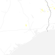
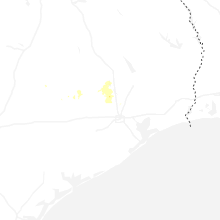

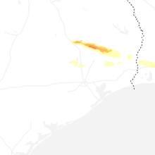


Connect with Interactive Hail Maps