

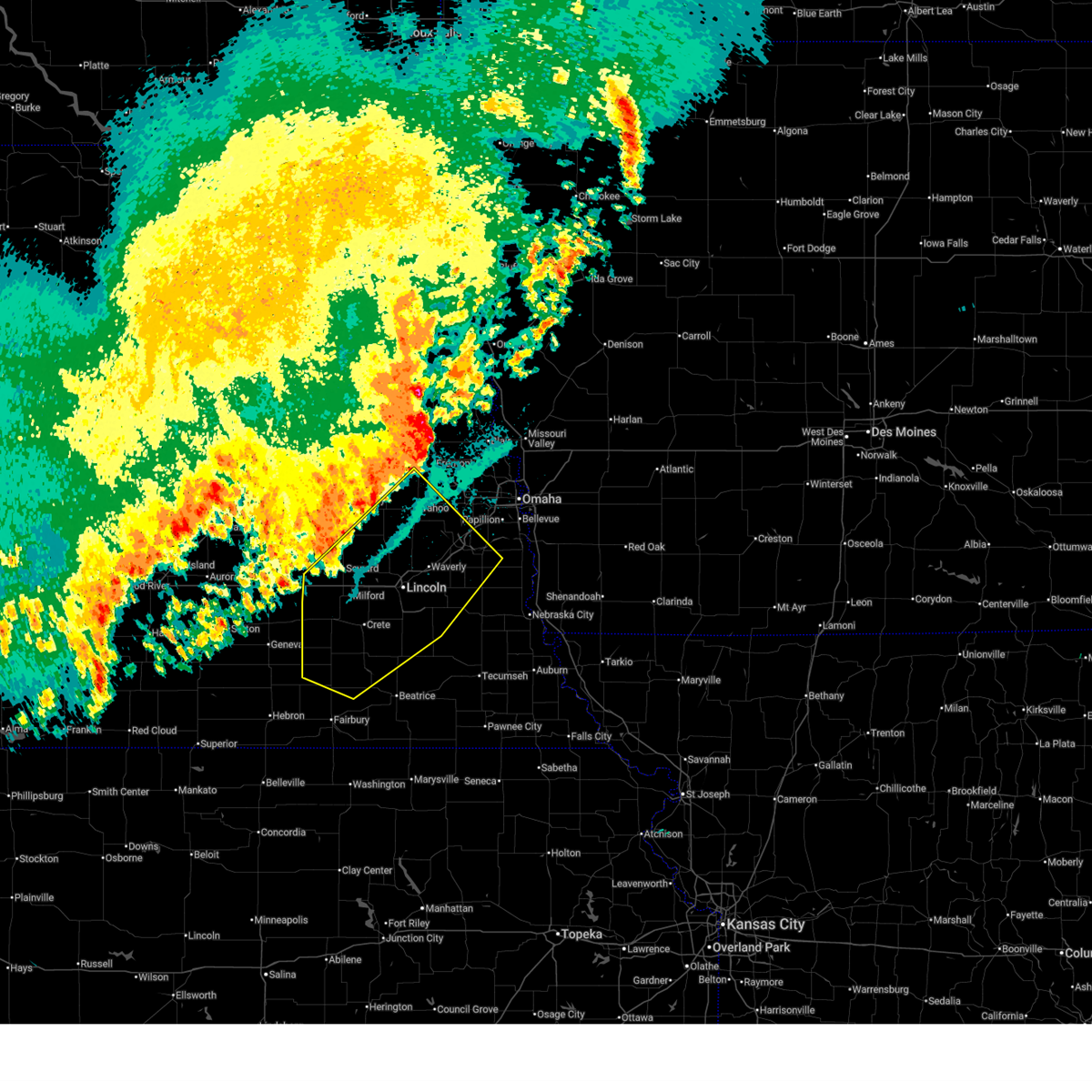
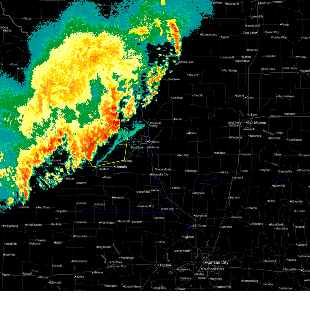
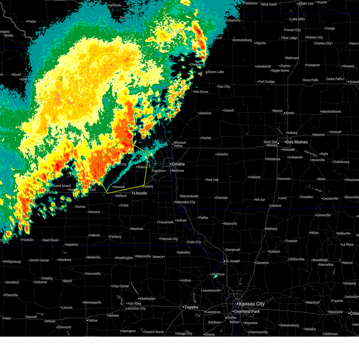
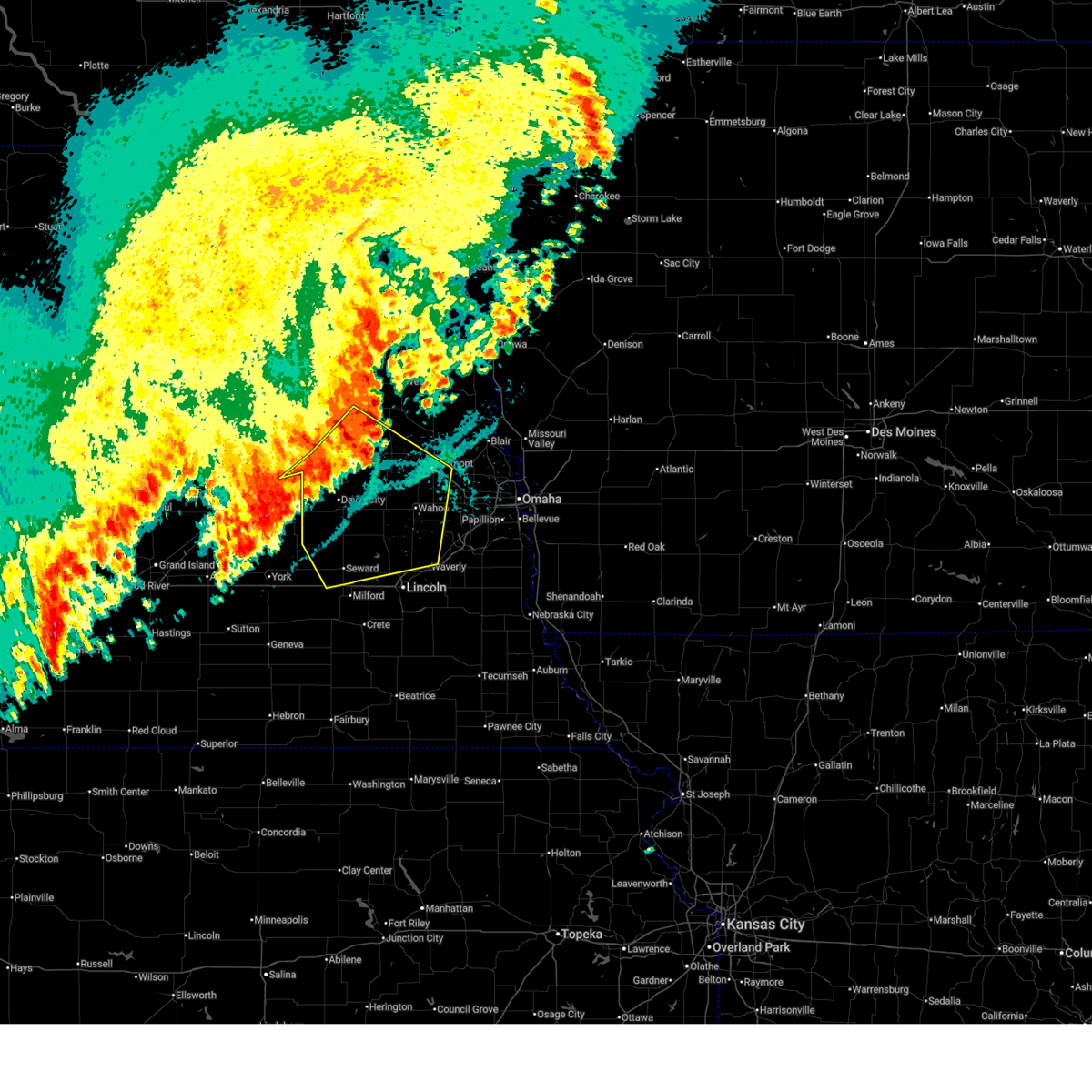
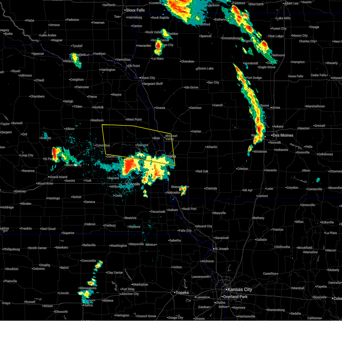
Hail Map for Malmo, NE
The Malmo, NE area has had 5 reports of on-the-ground hail by trained spotters, and has been under severe weather warnings 27 times during the past 12 months. Doppler radar has detected hail at or near Malmo, NE on 91 occasions, including 6 occasions during the past year.
| Name: | Malmo, NE |
| Where Located: | 40.7 miles W of Omaha, NE |
| Map: | Google Map for Malmo, NE |
| Population: | 120 |
| Housing Units: | 57 |
| More Info: | Search Google for Malmo, NE |
3
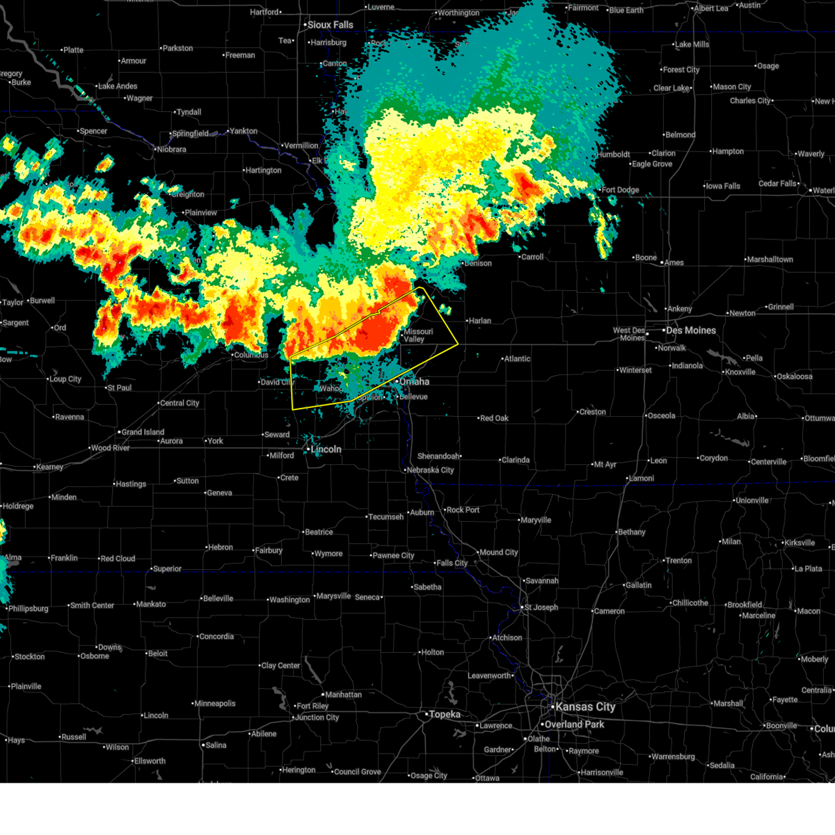
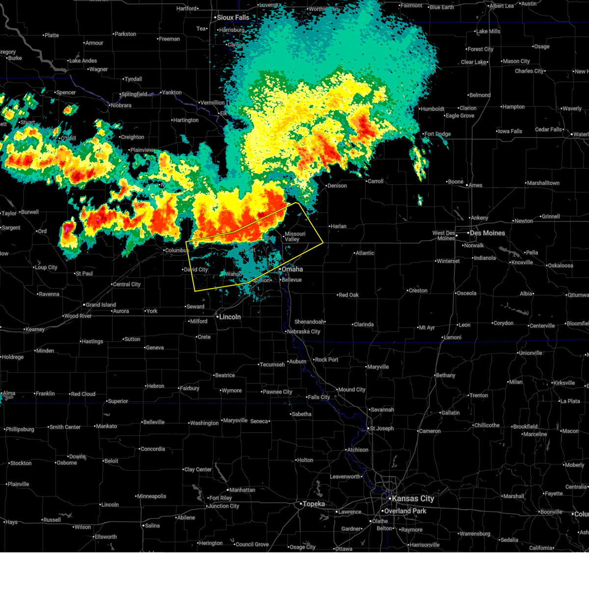
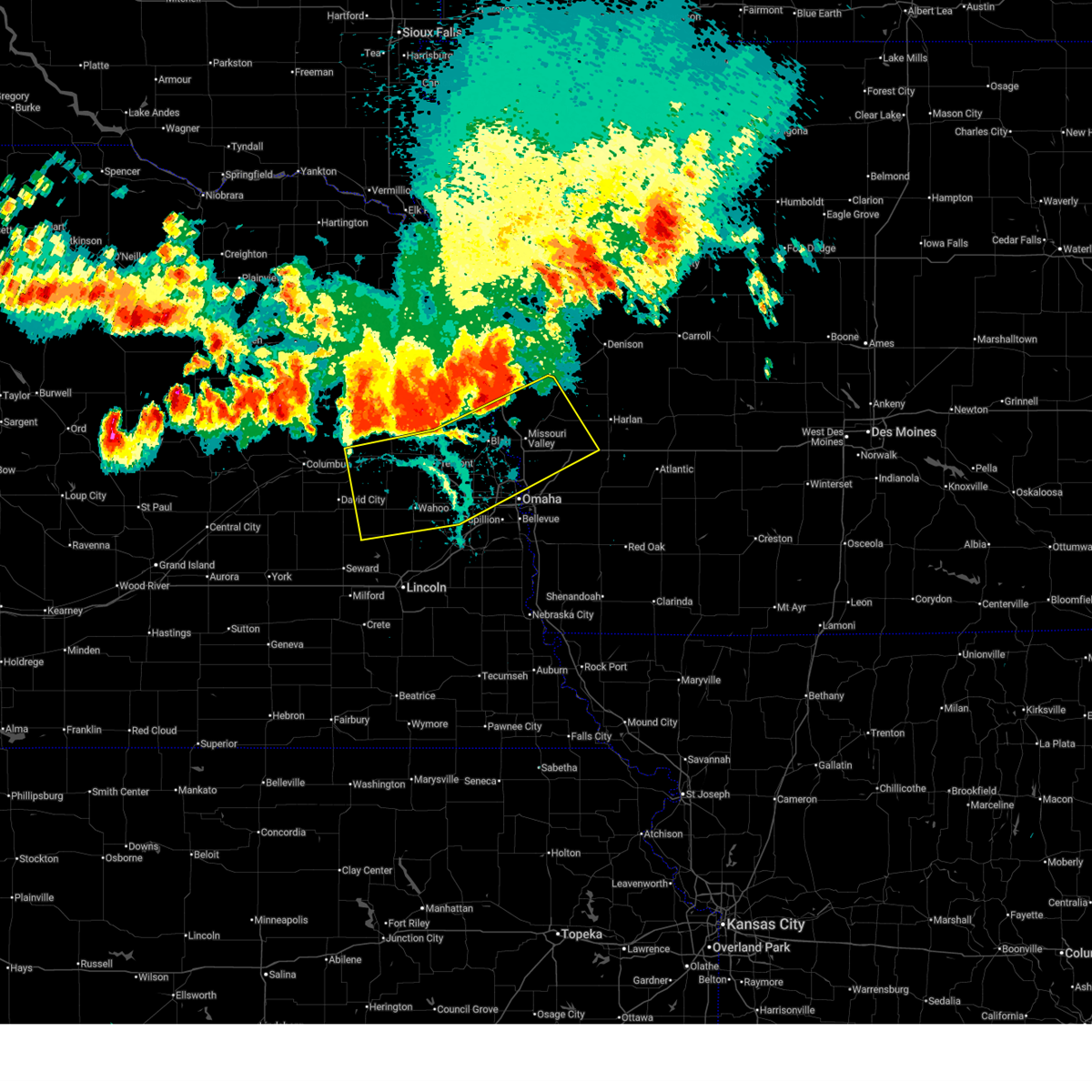
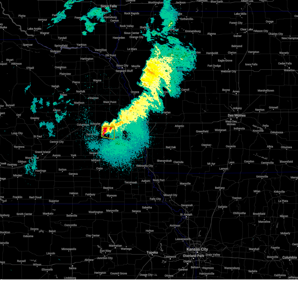
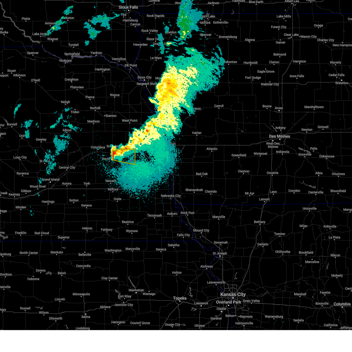
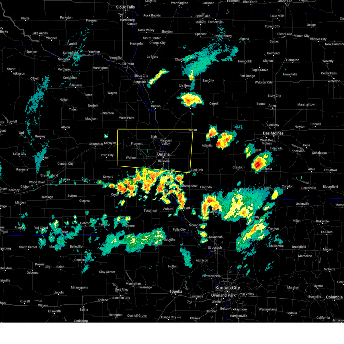
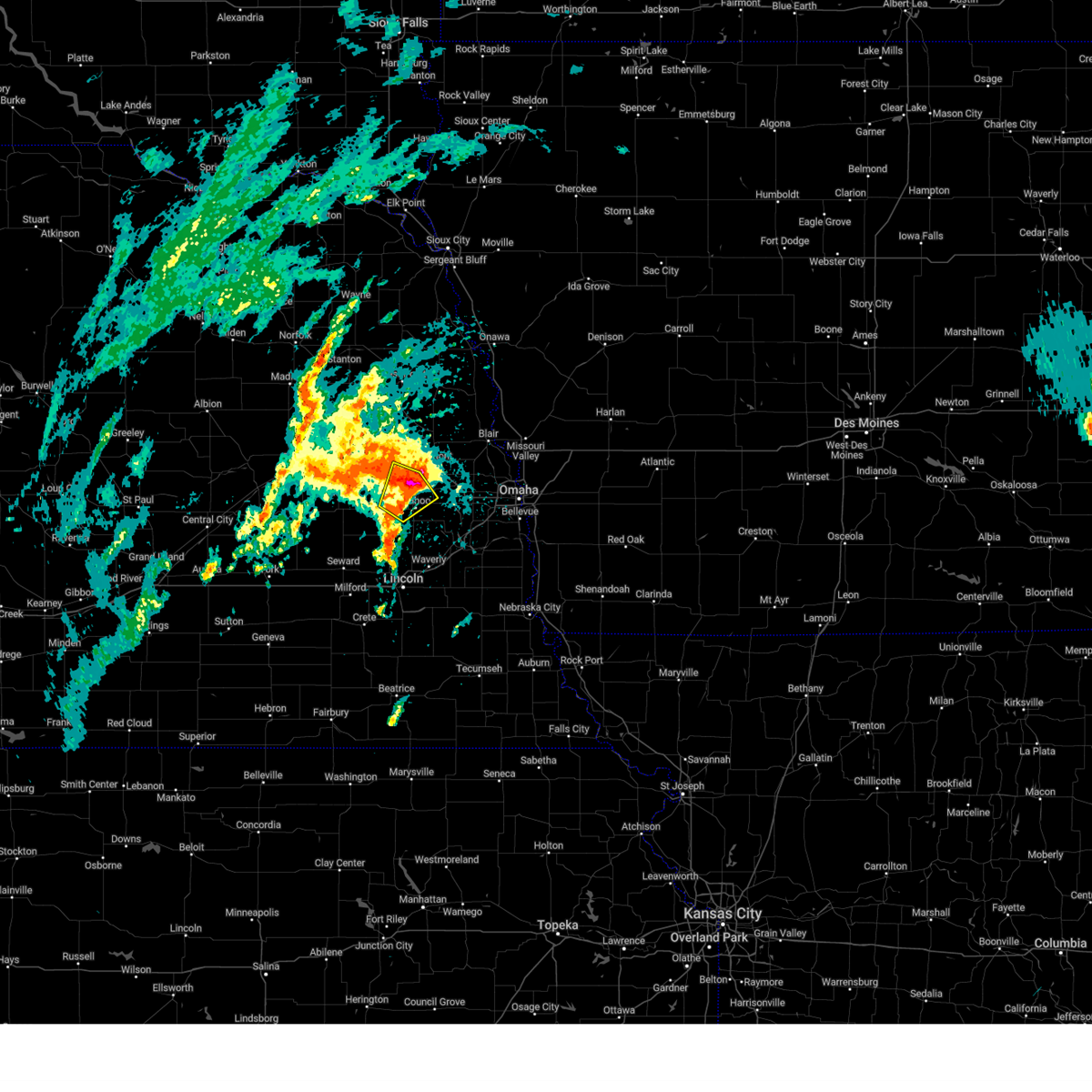
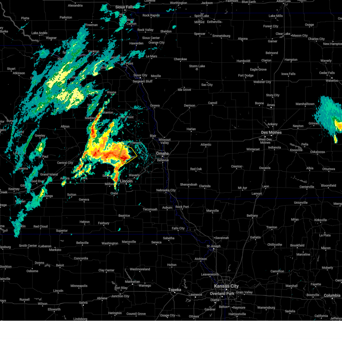
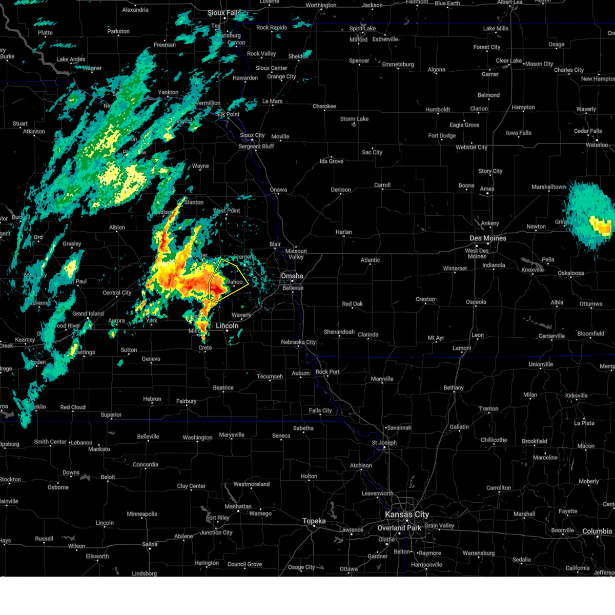
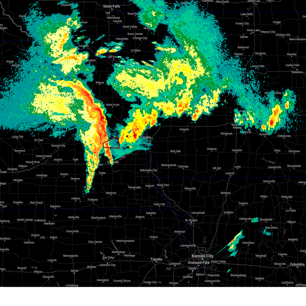
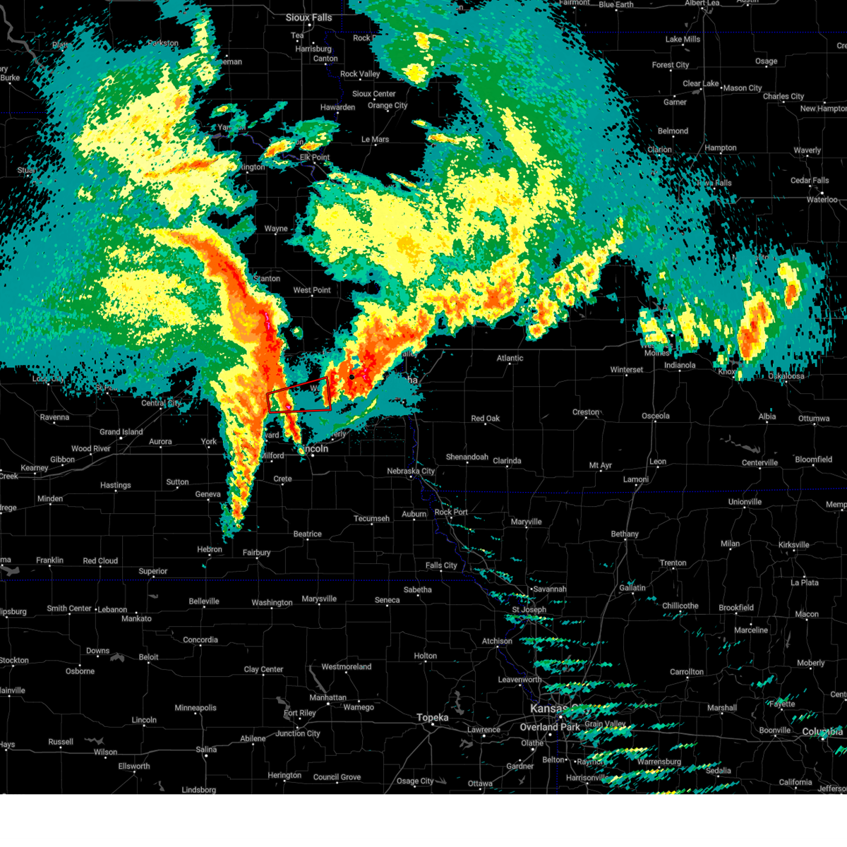
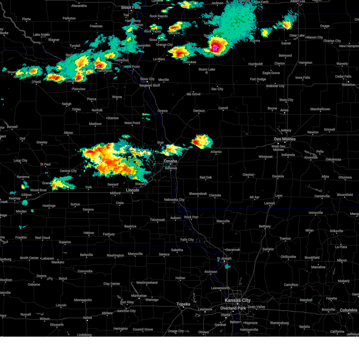
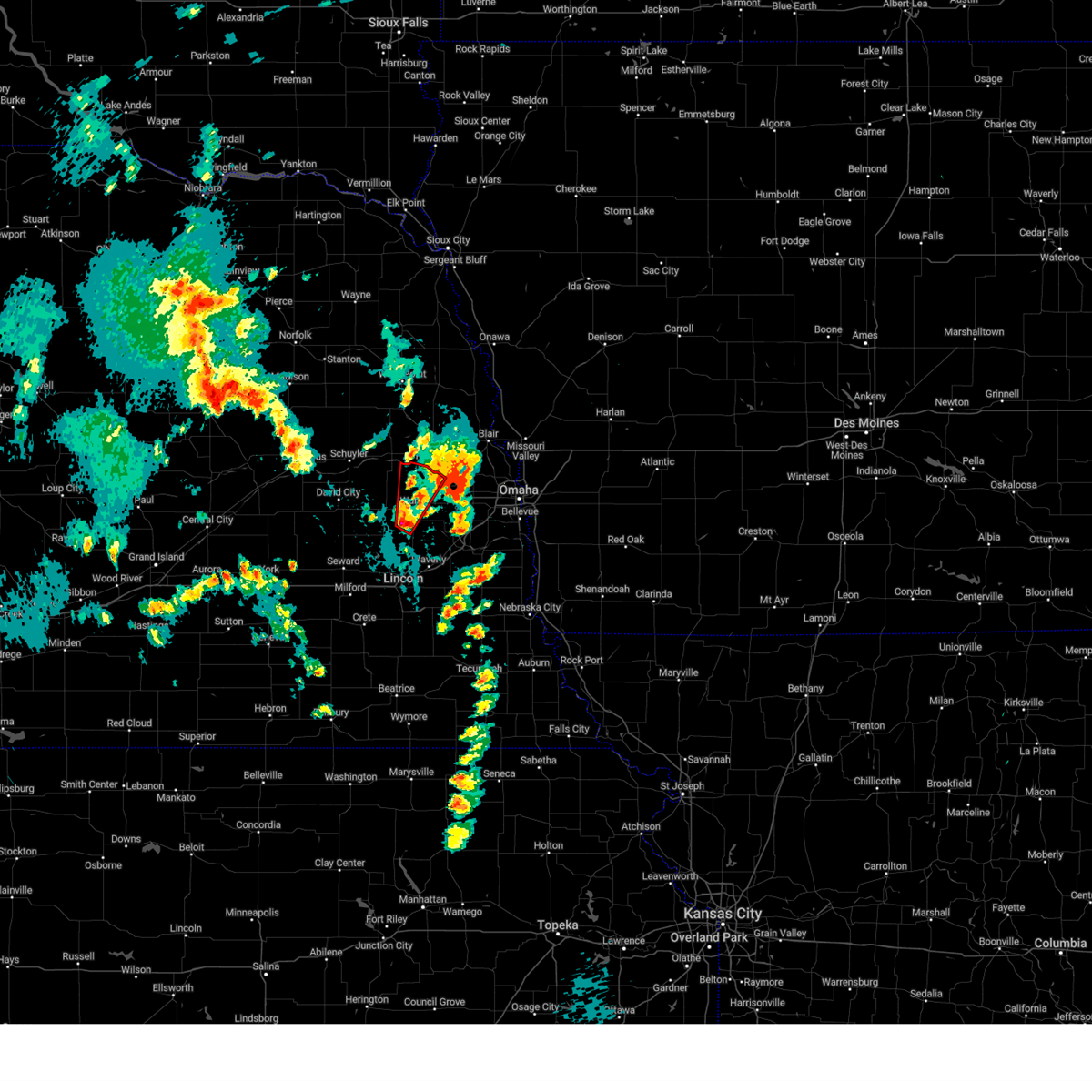
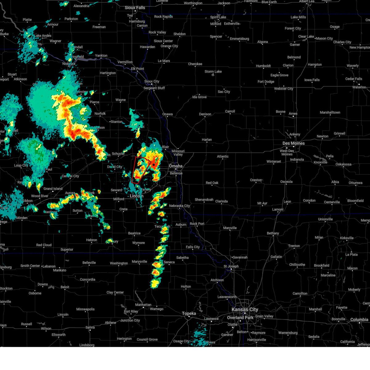
The Top Recent Hail Date for Malmo, NE is Monday, July 7, 2025 (18th out of 91)

Hail and Wind Damage Spotted near Malmo, NE
| Date / Time | Report Details |
|---|---|
| 7/15/2025 11:29 PM CDT |
 Svroax the national weather service in omaha has issued a * severe thunderstorm warning for, southwestern sarpy county in east central nebraska, lancaster county in southeastern nebraska, seward county in southeastern nebraska, northeastern jefferson county in southeastern nebraska, northwestern otoe county in southeastern nebraska, southeastern butler county in east central nebraska, saline county in southeastern nebraska, saunders county in east central nebraska, northwestern gage county in southeastern nebraska, western cass county in southeastern nebraska, * until midnight cdt. * at 1128 pm cdt, severe thunderstorms were located along a line extending from near mead to 5 miles south of friend, moving southeast at 40 mph (public). Hazards include 60 mph wind gusts. Expect damage to roofs, siding, and trees. severe thunderstorms will be near, lincoln, crete, dorchester, pleasant dale, davey, emerald, lincoln airport, and pioneers park around 1135 pm cdt. waverly and ashland around 1140 pm cdt. greenwood, western, and holmes lake park around 1145 pm cdt. other locations in the path of these severe thunderstorms include wilber, swanton and walton. This includes interstate 80 in nebraska between mile markers 366 and 432. Svroax the national weather service in omaha has issued a * severe thunderstorm warning for, southwestern sarpy county in east central nebraska, lancaster county in southeastern nebraska, seward county in southeastern nebraska, northeastern jefferson county in southeastern nebraska, northwestern otoe county in southeastern nebraska, southeastern butler county in east central nebraska, saline county in southeastern nebraska, saunders county in east central nebraska, northwestern gage county in southeastern nebraska, western cass county in southeastern nebraska, * until midnight cdt. * at 1128 pm cdt, severe thunderstorms were located along a line extending from near mead to 5 miles south of friend, moving southeast at 40 mph (public). Hazards include 60 mph wind gusts. Expect damage to roofs, siding, and trees. severe thunderstorms will be near, lincoln, crete, dorchester, pleasant dale, davey, emerald, lincoln airport, and pioneers park around 1135 pm cdt. waverly and ashland around 1140 pm cdt. greenwood, western, and holmes lake park around 1145 pm cdt. other locations in the path of these severe thunderstorms include wilber, swanton and walton. This includes interstate 80 in nebraska between mile markers 366 and 432.
|
| 7/15/2025 11:21 PM CDT |
 At 1120 pm cdt, severe thunderstorms were located along a line extending from near morse bluff to 2 miles west of weston to 2 miles northwest of dwight, moving east at 40 mph (law enforcement). Hazards include 60 mph wind gusts. Expect damage to roofs, siding, and trees. Locations impacted include, fremont, seward, wahoo, david city, waverly, north bend, ceresco, cedar bluffs, valparaiso, mead, malcolm, brainard, inglewood, weston, prague, staplehurst, garland, dwight, bee, and ulysses. At 1120 pm cdt, severe thunderstorms were located along a line extending from near morse bluff to 2 miles west of weston to 2 miles northwest of dwight, moving east at 40 mph (law enforcement). Hazards include 60 mph wind gusts. Expect damage to roofs, siding, and trees. Locations impacted include, fremont, seward, wahoo, david city, waverly, north bend, ceresco, cedar bluffs, valparaiso, mead, malcolm, brainard, inglewood, weston, prague, staplehurst, garland, dwight, bee, and ulysses.
|
| 7/15/2025 11:21 PM CDT |
 the severe thunderstorm warning has been cancelled and is no longer in effect the severe thunderstorm warning has been cancelled and is no longer in effect
|
| 7/15/2025 11:08 PM CDT |
 the severe thunderstorm warning has been cancelled and is no longer in effect the severe thunderstorm warning has been cancelled and is no longer in effect
|
| 7/15/2025 11:08 PM CDT |
 At 1108 pm cdt, severe thunderstorms were located along a line extending from 4 miles west of north bend to 4 miles southeast of bruno to 6 miles south of david city, moving east at 40 mph (law enforcement). Hazards include 60 mph wind gusts. Expect damage to roofs, siding, and trees. Locations impacted include, north bend, brainard, weston, prague, morse bluff, malmo, cedar bluffs, wahoo, colon, fremont, inglewood, woodcliff and mead. At 1108 pm cdt, severe thunderstorms were located along a line extending from 4 miles west of north bend to 4 miles southeast of bruno to 6 miles south of david city, moving east at 40 mph (law enforcement). Hazards include 60 mph wind gusts. Expect damage to roofs, siding, and trees. Locations impacted include, north bend, brainard, weston, prague, morse bluff, malmo, cedar bluffs, wahoo, colon, fremont, inglewood, woodcliff and mead.
|
| 7/15/2025 10:51 PM CDT |
 Svroax the national weather service in omaha has issued a * severe thunderstorm warning for, colfax county in northeastern nebraska, southeastern platte county in northeastern nebraska, northern lancaster county in southeastern nebraska, southwestern dodge county in east central nebraska, northern seward county in southeastern nebraska, northwestern douglas county in east central nebraska, butler county in east central nebraska, saunders county in east central nebraska, * until 1130 pm cdt. * at 1051 pm cdt, severe thunderstorms were located along a line extending from 6 miles north of schuyler to near octavia to 3 miles north of rising city, moving southeast at 40 mph (law enforcement). Hazards include 60 mph wind gusts. Expect damage to roofs, siding, and trees. severe thunderstorms will be near, david city, schuyler, rising city, octavia, bruno, linwood, and abie around 1055 pm cdt. brainard around 1100 pm cdt. north bend and prague around 1105 pm cdt. dwight and morse bluff around 1110 pm cdt. other locations in the path of these severe thunderstorms include weston, malmo and valparaiso. This includes interstate 80 in nebraska between mile markers 373 and 377. Svroax the national weather service in omaha has issued a * severe thunderstorm warning for, colfax county in northeastern nebraska, southeastern platte county in northeastern nebraska, northern lancaster county in southeastern nebraska, southwestern dodge county in east central nebraska, northern seward county in southeastern nebraska, northwestern douglas county in east central nebraska, butler county in east central nebraska, saunders county in east central nebraska, * until 1130 pm cdt. * at 1051 pm cdt, severe thunderstorms were located along a line extending from 6 miles north of schuyler to near octavia to 3 miles north of rising city, moving southeast at 40 mph (law enforcement). Hazards include 60 mph wind gusts. Expect damage to roofs, siding, and trees. severe thunderstorms will be near, david city, schuyler, rising city, octavia, bruno, linwood, and abie around 1055 pm cdt. brainard around 1100 pm cdt. north bend and prague around 1105 pm cdt. dwight and morse bluff around 1110 pm cdt. other locations in the path of these severe thunderstorms include weston, malmo and valparaiso. This includes interstate 80 in nebraska between mile markers 373 and 377.
|
| 7/7/2025 9:53 PM CDT |
 the severe thunderstorm warning has been cancelled and is no longer in effect the severe thunderstorm warning has been cancelled and is no longer in effect
|
| 7/7/2025 9:53 PM CDT |
 At 951 pm cdt, severe thunderstorms were located along a line extending from 4 miles east of logan to bennington to near colon, moving southeast at 45 mph (weather instrumentation. at 949 pm, 61 mph winds were reported at the nws in valley). Hazards include 60 mph wind gusts and quarter size hail. Hail damage to vehicles is expected. expect wind damage to roofs, siding, and trees. these severe storms will be near, omaha, wahoo, bennington, boys town, elkhorn, valley, yutan, waterloo, mead, and leshara around 955 pm cdt. carter lake, crescent, persia, ithaca, eppley airfield, midtown, benson, and zorinsky lake around 1000 pm cdt. Other locations in the path of these severe thunderstorms include millard, underwood, neola and minden. At 951 pm cdt, severe thunderstorms were located along a line extending from 4 miles east of logan to bennington to near colon, moving southeast at 45 mph (weather instrumentation. at 949 pm, 61 mph winds were reported at the nws in valley). Hazards include 60 mph wind gusts and quarter size hail. Hail damage to vehicles is expected. expect wind damage to roofs, siding, and trees. these severe storms will be near, omaha, wahoo, bennington, boys town, elkhorn, valley, yutan, waterloo, mead, and leshara around 955 pm cdt. carter lake, crescent, persia, ithaca, eppley airfield, midtown, benson, and zorinsky lake around 1000 pm cdt. Other locations in the path of these severe thunderstorms include millard, underwood, neola and minden.
|
| 7/7/2025 9:41 PM CDT |
 At 940 pm cdt, severe thunderstorms were located along a line extending from 2 miles southwest of woodbine to 2 miles east of fremont to near octavia, moving south at 40 mph (radar indicated). Hazards include 60 mph wind gusts and quarter size hail. Hail damage to vehicles is expected. expect wind damage to roofs, siding, and trees. these severe storms will be near, fremont, blair, missouri valley, logan, arlington, cedar bluffs, kennard, inglewood, prague, and leshara around 945 pm cdt. Other locations in the path of these severe thunderstorms include bennington, valley, fort calhoun, brainard, malmo, omaha, wahoo, elkhorn, yutan, waterloo, mead, weston, flanagan lake, ithaca, florence, standing bear lake, boys town, neola, crescent, valparaiso, eppley airfield, benson, zorinsky lake, millard, carter lake, underwood and midtown. At 940 pm cdt, severe thunderstorms were located along a line extending from 2 miles southwest of woodbine to 2 miles east of fremont to near octavia, moving south at 40 mph (radar indicated). Hazards include 60 mph wind gusts and quarter size hail. Hail damage to vehicles is expected. expect wind damage to roofs, siding, and trees. these severe storms will be near, fremont, blair, missouri valley, logan, arlington, cedar bluffs, kennard, inglewood, prague, and leshara around 945 pm cdt. Other locations in the path of these severe thunderstorms include bennington, valley, fort calhoun, brainard, malmo, omaha, wahoo, elkhorn, yutan, waterloo, mead, weston, flanagan lake, ithaca, florence, standing bear lake, boys town, neola, crescent, valparaiso, eppley airfield, benson, zorinsky lake, millard, carter lake, underwood and midtown.
|
| 7/7/2025 9:29 PM CDT |
 Svroax the national weather service in omaha has issued a * severe thunderstorm warning for, northwestern pottawattamie county in southwestern iowa, harrison county in southwestern iowa, southwestern shelby county in southwestern iowa, northwestern sarpy county in east central nebraska, southeastern burt county in east central nebraska, southeastern colfax county in northeastern nebraska, washington county in east central nebraska, southern dodge county in east central nebraska, douglas county in east central nebraska, eastern butler county in east central nebraska, saunders county in east central nebraska, * until 1015 pm cdt. * at 928 pm cdt, severe thunderstorms were located along a line extending from 6 miles northwest of woodbine to nickerson to schuyler, moving south at 40 mph (radar indicated). Hazards include 60 mph wind gusts and quarter size hail. Hail damage to vehicles is expected. expect wind damage to roofs, siding, and trees. severe thunderstorms will be near, fremont, blair, logan, woodbine, arlington, cedar bluffs, inglewood, modale, magnolia, and morse bluff around 935 pm cdt. missouri valley, kennard, prague, and bruno around 940 pm cdt. valley, fort calhoun, malmo, leshara, and colon around 945 pm cdt. other locations in the path of these severe thunderstorms include omaha, wahoo, bennington, waterloo, brainard, elkhorn, yutan, mead, weston, flanagan lake, standing bear lake, boys town, neola, crescent, ithaca, benson, florence, zorinsky lake, millard, carter lake, underwood, valparaiso and eppley airfield. this includes the following highways, interstate 29 between mile markers 58 and 92. Interstate 80 in iowa between mile markers 20 and 34. Svroax the national weather service in omaha has issued a * severe thunderstorm warning for, northwestern pottawattamie county in southwestern iowa, harrison county in southwestern iowa, southwestern shelby county in southwestern iowa, northwestern sarpy county in east central nebraska, southeastern burt county in east central nebraska, southeastern colfax county in northeastern nebraska, washington county in east central nebraska, southern dodge county in east central nebraska, douglas county in east central nebraska, eastern butler county in east central nebraska, saunders county in east central nebraska, * until 1015 pm cdt. * at 928 pm cdt, severe thunderstorms were located along a line extending from 6 miles northwest of woodbine to nickerson to schuyler, moving south at 40 mph (radar indicated). Hazards include 60 mph wind gusts and quarter size hail. Hail damage to vehicles is expected. expect wind damage to roofs, siding, and trees. severe thunderstorms will be near, fremont, blair, logan, woodbine, arlington, cedar bluffs, inglewood, modale, magnolia, and morse bluff around 935 pm cdt. missouri valley, kennard, prague, and bruno around 940 pm cdt. valley, fort calhoun, malmo, leshara, and colon around 945 pm cdt. other locations in the path of these severe thunderstorms include omaha, wahoo, bennington, waterloo, brainard, elkhorn, yutan, mead, weston, flanagan lake, standing bear lake, boys town, neola, crescent, ithaca, benson, florence, zorinsky lake, millard, carter lake, underwood, valparaiso and eppley airfield. this includes the following highways, interstate 29 between mile markers 58 and 92. Interstate 80 in iowa between mile markers 20 and 34.
|
| 7/6/2025 4:28 PM CDT | the severe thunderstorm warning has been cancelled and is no longer in effect |
| 7/6/2025 4:17 PM CDT |
 Svroax the national weather service in omaha has issued a * severe thunderstorm warning for, north central lancaster county in southeastern nebraska, east central butler county in east central nebraska, southwestern saunders county in east central nebraska, * until 500 pm cdt. * at 416 pm cdt, a severe thunderstorm was located over brainard, or 9 miles southeast of david city, moving east at 25 mph (radar indicated). Hazards include 60 mph wind gusts and quarter size hail. Hail damage to vehicles is expected. expect wind damage to roofs, siding, and trees. This severe thunderstorm will be near, weston around 435 pm cdt. Svroax the national weather service in omaha has issued a * severe thunderstorm warning for, north central lancaster county in southeastern nebraska, east central butler county in east central nebraska, southwestern saunders county in east central nebraska, * until 500 pm cdt. * at 416 pm cdt, a severe thunderstorm was located over brainard, or 9 miles southeast of david city, moving east at 25 mph (radar indicated). Hazards include 60 mph wind gusts and quarter size hail. Hail damage to vehicles is expected. expect wind damage to roofs, siding, and trees. This severe thunderstorm will be near, weston around 435 pm cdt.
|
| 6/19/2025 11:55 PM CDT |
 The strong winds which prompted the warning have weakened below severe limits, and the storm has exited the warned area. therefore, the warning will be allowed to expire. however, gusty winds up to 40 mph are still possible. The strong winds which prompted the warning have weakened below severe limits, and the storm has exited the warned area. therefore, the warning will be allowed to expire. however, gusty winds up to 40 mph are still possible.
|
| 6/19/2025 11:42 PM CDT |
 At 1141 pm cdt, a severe thunderstorm was located near valparaiso, or 13 miles southwest of wahoo, moving southeast at 20 mph (radar indicated). Hazards include 60 mph wind gusts and quarter size hail. Hail damage to vehicles is expected. expect wind damage to roofs, siding, and trees. this severe storm will be near, valparaiso around 1145 pm cdt. Other locations in the path of this severe thunderstorm include ceresco. At 1141 pm cdt, a severe thunderstorm was located near valparaiso, or 13 miles southwest of wahoo, moving southeast at 20 mph (radar indicated). Hazards include 60 mph wind gusts and quarter size hail. Hail damage to vehicles is expected. expect wind damage to roofs, siding, and trees. this severe storm will be near, valparaiso around 1145 pm cdt. Other locations in the path of this severe thunderstorm include ceresco.
|
| 6/19/2025 11:33 PM CDT |
 Svroax the national weather service in omaha has issued a * severe thunderstorm warning for, northern lancaster county in southeastern nebraska, northeastern seward county in southeastern nebraska, southeastern butler county in east central nebraska, southern saunders county in east central nebraska, * until 1215 am cdt. * at 1132 pm cdt, a severe thunderstorm was located 5 miles southeast of brainard, or 13 miles southeast of david city, moving southeast at 20 mph (radar indicated). Hazards include 60 mph wind gusts and quarter size hail. Hail damage to vehicles is expected. expect wind damage to roofs, siding, and trees. this severe thunderstorm will be near, valparaiso around 1140 pm cdt. This includes interstate 80 in nebraska between mile markers 405 and 407. Svroax the national weather service in omaha has issued a * severe thunderstorm warning for, northern lancaster county in southeastern nebraska, northeastern seward county in southeastern nebraska, southeastern butler county in east central nebraska, southern saunders county in east central nebraska, * until 1215 am cdt. * at 1132 pm cdt, a severe thunderstorm was located 5 miles southeast of brainard, or 13 miles southeast of david city, moving southeast at 20 mph (radar indicated). Hazards include 60 mph wind gusts and quarter size hail. Hail damage to vehicles is expected. expect wind damage to roofs, siding, and trees. this severe thunderstorm will be near, valparaiso around 1140 pm cdt. This includes interstate 80 in nebraska between mile markers 405 and 407.
|
| 6/19/2025 11:14 PM CDT |
 Svroax the national weather service in omaha has issued a * severe thunderstorm warning for, northwestern mills county in southwestern iowa, western pottawattamie county in southwestern iowa, southwestern harrison county in southwestern iowa, south central burt county in east central nebraska, colfax county in northeastern nebraska, douglas county in east central nebraska, northern saunders county in east central nebraska, northeastern sarpy county in east central nebraska, southwestern cuming county in northeastern nebraska, washington county in east central nebraska, dodge county in east central nebraska, northeastern butler county in east central nebraska, southeastern stanton county in northeastern nebraska, * until midnight cdt. * at 1111 pm cdt, showers and thunderstorms producing damaging winds up to 60 mph were located across southern dodge, northern saunders, and into washington and douglas counties, moving east at 20 mph (radar indicated). Hazards include 60 mph wind gusts. Expect damage to roofs, siding, and trees. this severe thunderstorm will be near, fremont and cedar bluffs around 1115 pm cdt. inglewood around 1125 pm cdt. woodcliff around 1130 pm cdt. other locations in the path of this severe thunderstorm include arlington. people attending charles schwab field should seek safe shelter immediately! this includes the following highways, interstate 29 between mile markers 42 and 84. interstate 80 in iowa between mile markers 1 and 14. Interstate 80 in nebraska between mile markers 443 and 454. Svroax the national weather service in omaha has issued a * severe thunderstorm warning for, northwestern mills county in southwestern iowa, western pottawattamie county in southwestern iowa, southwestern harrison county in southwestern iowa, south central burt county in east central nebraska, colfax county in northeastern nebraska, douglas county in east central nebraska, northern saunders county in east central nebraska, northeastern sarpy county in east central nebraska, southwestern cuming county in northeastern nebraska, washington county in east central nebraska, dodge county in east central nebraska, northeastern butler county in east central nebraska, southeastern stanton county in northeastern nebraska, * until midnight cdt. * at 1111 pm cdt, showers and thunderstorms producing damaging winds up to 60 mph were located across southern dodge, northern saunders, and into washington and douglas counties, moving east at 20 mph (radar indicated). Hazards include 60 mph wind gusts. Expect damage to roofs, siding, and trees. this severe thunderstorm will be near, fremont and cedar bluffs around 1115 pm cdt. inglewood around 1125 pm cdt. woodcliff around 1130 pm cdt. other locations in the path of this severe thunderstorm include arlington. people attending charles schwab field should seek safe shelter immediately! this includes the following highways, interstate 29 between mile markers 42 and 84. interstate 80 in iowa between mile markers 1 and 14. Interstate 80 in nebraska between mile markers 443 and 454.
|
| 5/19/2025 6:17 PM CDT | the severe thunderstorm warning has been cancelled and is no longer in effect |
| 5/19/2025 6:15 PM CDT | At 615 pm cdt, a severe thunderstorm was located 5 miles southeast of bruno, or 13 miles west of wahoo, moving northeast at 25 mph (radar indicated). Hazards include 60 mph wind gusts and penny size hail. Expect damage to roofs, siding, and trees. Locations impacted include, wahoo, brainard, weston, prague, malmo, colon, bruno, abie, lake wanahoo recreation area, and czechland lake. |
| 5/19/2025 6:15 PM CDT | the severe thunderstorm warning has been cancelled and is no longer in effect |
| 5/19/2025 5:48 PM CDT | Svroax the national weather service in omaha has issued a * severe thunderstorm warning for, northwestern lancaster county in southeastern nebraska, northeastern seward county in southeastern nebraska, southeastern butler county in east central nebraska, southwestern saunders county in east central nebraska, * until 630 pm cdt. * at 548 pm cdt, a severe thunderstorm was located 3 miles east of dwight, or 13 miles northeast of seward, moving northeast at 25 mph (radar indicated). Hazards include 60 mph wind gusts and quarter size hail. Hail damage to vehicles is expected. Expect wind damage to roofs, siding, and trees. |
| 4/21/2025 9:48 PM CDT |
 At 948 pm cdt, a severe thunderstorm was located near prague, or 11 miles northwest of wahoo, moving east at 40 mph (radar indicated). Hazards include 60 mph wind gusts and quarter size hail. Hail damage to vehicles is expected. expect wind damage to roofs, siding, and trees. this severe storm will be near, colon around 955 pm cdt. Other locations impacted by this severe thunderstorm include czechland lake and lake wanahoo recreation area. At 948 pm cdt, a severe thunderstorm was located near prague, or 11 miles northwest of wahoo, moving east at 40 mph (radar indicated). Hazards include 60 mph wind gusts and quarter size hail. Hail damage to vehicles is expected. expect wind damage to roofs, siding, and trees. this severe storm will be near, colon around 955 pm cdt. Other locations impacted by this severe thunderstorm include czechland lake and lake wanahoo recreation area.
|
| 4/21/2025 9:48 PM CDT |
 the severe thunderstorm warning has been cancelled and is no longer in effect the severe thunderstorm warning has been cancelled and is no longer in effect
|
| 4/21/2025 9:34 PM CDT |
 Svroax the national weather service in omaha has issued a * severe thunderstorm warning for, northeastern butler county in east central nebraska, northwestern saunders county in east central nebraska, * until 1015 pm cdt. * at 934 pm cdt, a severe thunderstorm was located over abie, or 10 miles northeast of david city, moving east at 40 mph (radar indicated). Hazards include 60 mph wind gusts and quarter size hail. Hail damage to vehicles is expected. expect wind damage to roofs, siding, and trees. this severe thunderstorm will be near, prague around 940 pm cdt. colon around 955 pm cdt. Other locations impacted by this severe thunderstorm include czechland lake and lake wanahoo recreation area. Svroax the national weather service in omaha has issued a * severe thunderstorm warning for, northeastern butler county in east central nebraska, northwestern saunders county in east central nebraska, * until 1015 pm cdt. * at 934 pm cdt, a severe thunderstorm was located over abie, or 10 miles northeast of david city, moving east at 40 mph (radar indicated). Hazards include 60 mph wind gusts and quarter size hail. Hail damage to vehicles is expected. expect wind damage to roofs, siding, and trees. this severe thunderstorm will be near, prague around 940 pm cdt. colon around 955 pm cdt. Other locations impacted by this severe thunderstorm include czechland lake and lake wanahoo recreation area.
|
| 3/14/2025 4:59 PM CDT |
 At 458 pm cdt, severe thunderstorms were located along a line extending from 2 miles southwest of north bend to 2 miles west of fort calhoun to near oakland, moving north at 55 mph (weather instrument measurement. at 4:48 pm, a 62 mph wind gust was reported at omaha eppley field). Hazards include 60 mph wind gusts and nickel size hail. Expect damage to roofs, siding, and trees. Locations impacted include, two rivers state recreation area, millard, council bluffs airport, florence, tennant, ralston, inglewood, nishna bend recreation area, winslow, czechland lake, arlington, historical village welcome center, narrows river park, underwood, benson, standing bear lake, glenwood, magnolia, emerson, and woodcliff. At 458 pm cdt, severe thunderstorms were located along a line extending from 2 miles southwest of north bend to 2 miles west of fort calhoun to near oakland, moving north at 55 mph (weather instrument measurement. at 4:48 pm, a 62 mph wind gust was reported at omaha eppley field). Hazards include 60 mph wind gusts and nickel size hail. Expect damage to roofs, siding, and trees. Locations impacted include, two rivers state recreation area, millard, council bluffs airport, florence, tennant, ralston, inglewood, nishna bend recreation area, winslow, czechland lake, arlington, historical village welcome center, narrows river park, underwood, benson, standing bear lake, glenwood, magnolia, emerson, and woodcliff.
|
| 3/14/2025 4:48 PM CDT |
 At 448 pm cdt, severe thunderstorms were located along a line extending from 3 miles southwest of prague to 2 miles north of standing bear lake to 3 miles east of oakland, moving north at 55 mph (radar indicated). Hazards include 60 mph wind gusts and nickel size hail. Expect damage to roofs, siding, and trees. Locations impacted include, two rivers state recreation area, millard, council bluffs airport, florence, tennant, ralston, inglewood, nishna bend recreation area, winslow, czechland lake, arlington, historical village welcome center, narrows river park, underwood, benson, standing bear lake, glenwood, magnolia, emerson, and woodcliff. At 448 pm cdt, severe thunderstorms were located along a line extending from 3 miles southwest of prague to 2 miles north of standing bear lake to 3 miles east of oakland, moving north at 55 mph (radar indicated). Hazards include 60 mph wind gusts and nickel size hail. Expect damage to roofs, siding, and trees. Locations impacted include, two rivers state recreation area, millard, council bluffs airport, florence, tennant, ralston, inglewood, nishna bend recreation area, winslow, czechland lake, arlington, historical village welcome center, narrows river park, underwood, benson, standing bear lake, glenwood, magnolia, emerson, and woodcliff.
|
| 3/14/2025 4:38 PM CDT |
 At 438 pm cdt, severe thunderstorms were located along a line extending from malmo to 2 miles southeast of carson, moving north at 50 mph (radar indicated). Hazards include 60 mph wind gusts and nickel size hail. Expect damage to roofs, siding, and trees. Locations impacted include, two rivers state recreation area, millard, council bluffs airport, florence, tennant, ralston, inglewood, nishna bend recreation area, winslow, czechland lake, arlington, historical village welcome center, narrows river park, underwood, benson, standing bear lake, glenwood, magnolia, emerson, and woodcliff. At 438 pm cdt, severe thunderstorms were located along a line extending from malmo to 2 miles southeast of carson, moving north at 50 mph (radar indicated). Hazards include 60 mph wind gusts and nickel size hail. Expect damage to roofs, siding, and trees. Locations impacted include, two rivers state recreation area, millard, council bluffs airport, florence, tennant, ralston, inglewood, nishna bend recreation area, winslow, czechland lake, arlington, historical village welcome center, narrows river park, underwood, benson, standing bear lake, glenwood, magnolia, emerson, and woodcliff.
|
| 3/14/2025 4:24 PM CDT |
 Svroax the national weather service in omaha has issued a * severe thunderstorm warning for, west central montgomery county in southwestern iowa, northern mills county in southwestern iowa, pottawattamie county in southwestern iowa, southern harrison county in southwestern iowa, southwestern shelby county in southwestern iowa, sarpy county in east central nebraska, south central burt county in east central nebraska, washington county in east central nebraska, dodge county in east central nebraska, douglas county in east central nebraska, saunders county in east central nebraska, * until 515 pm cdt. * at 424 pm cdt, severe thunderstorms were located along a line extending from 5 miles south of weston to 2 miles northeast of emerson, moving north at 55 mph (radar indicated). Hazards include 60 mph wind gusts and nickel size hail. expect damage to roofs, siding, and trees Svroax the national weather service in omaha has issued a * severe thunderstorm warning for, west central montgomery county in southwestern iowa, northern mills county in southwestern iowa, pottawattamie county in southwestern iowa, southern harrison county in southwestern iowa, southwestern shelby county in southwestern iowa, sarpy county in east central nebraska, south central burt county in east central nebraska, washington county in east central nebraska, dodge county in east central nebraska, douglas county in east central nebraska, saunders county in east central nebraska, * until 515 pm cdt. * at 424 pm cdt, severe thunderstorms were located along a line extending from 5 miles south of weston to 2 miles northeast of emerson, moving north at 55 mph (radar indicated). Hazards include 60 mph wind gusts and nickel size hail. expect damage to roofs, siding, and trees
|
| 6/18/2024 5:54 PM CDT |
 Svroax the national weather service in omaha has issued a * severe thunderstorm warning for, lancaster county in southeastern nebraska, northeastern seward county in southeastern nebraska, southeastern butler county in east central nebraska, saunders county in east central nebraska, * until 645 pm cdt. * at 553 pm cdt, severe thunderstorms were located along a line extending from 6 miles west of weston to 2 miles west of valparaiso to 3 miles northwest of malcolm, moving east at 35 mph (radar indicated). Hazards include 60 mph wind gusts and penny size hail. expect damage to roofs, siding, and trees Svroax the national weather service in omaha has issued a * severe thunderstorm warning for, lancaster county in southeastern nebraska, northeastern seward county in southeastern nebraska, southeastern butler county in east central nebraska, saunders county in east central nebraska, * until 645 pm cdt. * at 553 pm cdt, severe thunderstorms were located along a line extending from 6 miles west of weston to 2 miles west of valparaiso to 3 miles northwest of malcolm, moving east at 35 mph (radar indicated). Hazards include 60 mph wind gusts and penny size hail. expect damage to roofs, siding, and trees
|
| 5/24/2024 2:18 AM CDT |
 the severe thunderstorm warning has been cancelled and is no longer in effect the severe thunderstorm warning has been cancelled and is no longer in effect
|
| 5/24/2024 2:18 AM CDT |
 At 218 am cdt, severe thunderstorms were located along a line extending from 3 miles southeast of craig to 5 miles southwest of kennard to lincoln, moving east at 55 mph (radar indicated). Hazards include 70 mph wind gusts and quarter size hail. Hail damage to vehicles is expected. expect considerable tree damage. wind damage is also likely to mobile homes, roofs, and outbuildings. Locations impacted include, omaha, lincoln, western council bluffs, bellevue, fremont, papillion, blair, ralston, wahoo, gretna, bennington, boys town, elkhorn, millard, offutt afb, la vista, carter lake, waverly, missouri valley, and ashland. At 218 am cdt, severe thunderstorms were located along a line extending from 3 miles southeast of craig to 5 miles southwest of kennard to lincoln, moving east at 55 mph (radar indicated). Hazards include 70 mph wind gusts and quarter size hail. Hail damage to vehicles is expected. expect considerable tree damage. wind damage is also likely to mobile homes, roofs, and outbuildings. Locations impacted include, omaha, lincoln, western council bluffs, bellevue, fremont, papillion, blair, ralston, wahoo, gretna, bennington, boys town, elkhorn, millard, offutt afb, la vista, carter lake, waverly, missouri valley, and ashland.
|
| 5/24/2024 1:53 AM CDT |
 Svroax the national weather service in omaha has issued a * severe thunderstorm warning for, western pottawattamie county in southwestern iowa, southwestern harrison county in southwestern iowa, southern burt county in east central nebraska, northeastern colfax county in northeastern nebraska, lancaster county in southeastern nebraska, eastern seward county in southeastern nebraska, douglas county in east central nebraska, saunders county in east central nebraska, sarpy county in east central nebraska, washington county in east central nebraska, dodge county in east central nebraska, northwestern otoe county in southeastern nebraska, southeastern butler county in east central nebraska, cass county in southeastern nebraska, * until 245 am cdt. * at 153 am cdt, severe thunderstorms were located along a line extending from 4 miles northeast of snyder to 2 miles west of cedar bluffs to near pleasant dale, moving east at 55 mph (radar indicated). Hazards include 70 mph wind gusts and quarter size hail. Hail damage to vehicles is expected. expect considerable tree damage. Wind damage is also likely to mobile homes, roofs, and outbuildings. Svroax the national weather service in omaha has issued a * severe thunderstorm warning for, western pottawattamie county in southwestern iowa, southwestern harrison county in southwestern iowa, southern burt county in east central nebraska, northeastern colfax county in northeastern nebraska, lancaster county in southeastern nebraska, eastern seward county in southeastern nebraska, douglas county in east central nebraska, saunders county in east central nebraska, sarpy county in east central nebraska, washington county in east central nebraska, dodge county in east central nebraska, northwestern otoe county in southeastern nebraska, southeastern butler county in east central nebraska, cass county in southeastern nebraska, * until 245 am cdt. * at 153 am cdt, severe thunderstorms were located along a line extending from 4 miles northeast of snyder to 2 miles west of cedar bluffs to near pleasant dale, moving east at 55 mph (radar indicated). Hazards include 70 mph wind gusts and quarter size hail. Hail damage to vehicles is expected. expect considerable tree damage. Wind damage is also likely to mobile homes, roofs, and outbuildings.
|
| 5/24/2024 1:17 AM CDT |
 Svroax the national weather service in omaha has issued a * severe thunderstorm warning for, southwestern burt county in east central nebraska, southern cuming county in northeastern nebraska, colfax county in northeastern nebraska, eastern platte county in northeastern nebraska, dodge county in east central nebraska, northern butler county in east central nebraska, northern saunders county in east central nebraska, southeastern stanton county in northeastern nebraska, * until 200 am cdt. * at 117 am cdt, severe thunderstorms were located along a line extending from 2 miles north of leigh to 5 miles south of bellwood, moving east at 65 mph (radar indicated). Hazards include 70 mph wind gusts and quarter size hail. Hail damage to vehicles is expected. expect considerable tree damage. Wind damage is also likely to mobile homes, roofs, and outbuildings. Svroax the national weather service in omaha has issued a * severe thunderstorm warning for, southwestern burt county in east central nebraska, southern cuming county in northeastern nebraska, colfax county in northeastern nebraska, eastern platte county in northeastern nebraska, dodge county in east central nebraska, northern butler county in east central nebraska, northern saunders county in east central nebraska, southeastern stanton county in northeastern nebraska, * until 200 am cdt. * at 117 am cdt, severe thunderstorms were located along a line extending from 2 miles north of leigh to 5 miles south of bellwood, moving east at 65 mph (radar indicated). Hazards include 70 mph wind gusts and quarter size hail. Hail damage to vehicles is expected. expect considerable tree damage. Wind damage is also likely to mobile homes, roofs, and outbuildings.
|
| 5/21/2024 12:25 PM CDT |
 The storm which prompted the warning has moved out of the area. therefore, the warning will be allowed to expire. however, small hail is still possible with this thunderstorm. a tornado watch remains in effect until 500 pm cdt for east central nebraska. remember, a severe thunderstorm warning still remains in effect for saunders, dodge, and washington counties. The storm which prompted the warning has moved out of the area. therefore, the warning will be allowed to expire. however, small hail is still possible with this thunderstorm. a tornado watch remains in effect until 500 pm cdt for east central nebraska. remember, a severe thunderstorm warning still remains in effect for saunders, dodge, and washington counties.
|
| 5/21/2024 12:16 PM CDT |
 Svroax the national weather service in omaha has issued a * severe thunderstorm warning for, southwestern harrison county in southwestern iowa, southern burt county in east central nebraska, washington county in east central nebraska, eastern dodge county in east central nebraska, northwestern douglas county in east central nebraska, northern saunders county in east central nebraska, * until 100 pm cdt. * at 1216 pm cdt, a severe thunderstorm was located near malmo, or 6 miles northwest of wahoo, moving northeast at 55 mph (radar indicated). Hazards include two inch hail and 60 mph wind gusts. People and animals outdoors will be injured. expect hail damage to roofs, siding, windows, and vehicles. expect wind damage to roofs, siding, and trees. this severe thunderstorm will be near, cedar bluffs and colon around 1220 pm cdt. fremont, inglewood, and woodcliff around 1225 pm cdt. arlington and nickerson around 1235 pm cdt. herman around 1250 pm cdt. other locations impacted by this severe thunderstorm include camp eagle, summit lake state recreation area, camp cedars, desoto bend national wildlife refuge, winslow, fontanelle, ames, lake wanahoo recreation area, and fremont lakes state recreation area. This includes interstate 29 between mile markers 77 and 84. Svroax the national weather service in omaha has issued a * severe thunderstorm warning for, southwestern harrison county in southwestern iowa, southern burt county in east central nebraska, washington county in east central nebraska, eastern dodge county in east central nebraska, northwestern douglas county in east central nebraska, northern saunders county in east central nebraska, * until 100 pm cdt. * at 1216 pm cdt, a severe thunderstorm was located near malmo, or 6 miles northwest of wahoo, moving northeast at 55 mph (radar indicated). Hazards include two inch hail and 60 mph wind gusts. People and animals outdoors will be injured. expect hail damage to roofs, siding, windows, and vehicles. expect wind damage to roofs, siding, and trees. this severe thunderstorm will be near, cedar bluffs and colon around 1220 pm cdt. fremont, inglewood, and woodcliff around 1225 pm cdt. arlington and nickerson around 1235 pm cdt. herman around 1250 pm cdt. other locations impacted by this severe thunderstorm include camp eagle, summit lake state recreation area, camp cedars, desoto bend national wildlife refuge, winslow, fontanelle, ames, lake wanahoo recreation area, and fremont lakes state recreation area. This includes interstate 29 between mile markers 77 and 84.
|
| 5/21/2024 12:15 PM CDT | Half Dollar sized hail reported 0.3 miles SSW of Malmo, NE |
| 5/21/2024 12:14 PM CDT |
 At 1214 pm cdt, a severe thunderstorm was located over malmo, or 5 miles northwest of wahoo, moving northeast at 50 mph (radar indicated). Hazards include two inch hail. People and animals outdoors will be injured. expect damage to roofs, siding, windows, and vehicles. this severe storm will be near, colon around 1220 pm cdt. cedar bluffs around 1225 pm cdt. Other locations impacted by this severe thunderstorm include czechland lake and lake wanahoo recreation area. At 1214 pm cdt, a severe thunderstorm was located over malmo, or 5 miles northwest of wahoo, moving northeast at 50 mph (radar indicated). Hazards include two inch hail. People and animals outdoors will be injured. expect damage to roofs, siding, windows, and vehicles. this severe storm will be near, colon around 1220 pm cdt. cedar bluffs around 1225 pm cdt. Other locations impacted by this severe thunderstorm include czechland lake and lake wanahoo recreation area.
|
| 5/21/2024 12:04 PM CDT |
 the severe thunderstorm warning has been cancelled and is no longer in effect the severe thunderstorm warning has been cancelled and is no longer in effect
|
| 5/21/2024 12:04 PM CDT |
 At 1203 pm cdt, a severe thunderstorm was located 5 miles west of weston, or 12 miles west of wahoo, moving northeast at 50 mph (radar indicated). Hazards include ping pong ball size hail. People and animals outdoors will be injured. expect damage to roofs, siding, windows, and vehicles. this severe storm will be near, weston and malmo around 1210 pm cdt. colon around 1215 pm cdt. cedar bluffs around 1225 pm cdt. Other locations impacted by this severe thunderstorm include czechland lake and lake wanahoo recreation area. At 1203 pm cdt, a severe thunderstorm was located 5 miles west of weston, or 12 miles west of wahoo, moving northeast at 50 mph (radar indicated). Hazards include ping pong ball size hail. People and animals outdoors will be injured. expect damage to roofs, siding, windows, and vehicles. this severe storm will be near, weston and malmo around 1210 pm cdt. colon around 1215 pm cdt. cedar bluffs around 1225 pm cdt. Other locations impacted by this severe thunderstorm include czechland lake and lake wanahoo recreation area.
|
| 5/21/2024 11:57 AM CDT |
 the severe thunderstorm warning has been cancelled and is no longer in effect the severe thunderstorm warning has been cancelled and is no longer in effect
|
| 5/21/2024 11:57 AM CDT |
 At 1157 am cdt, a severe thunderstorm was located 5 miles northwest of valparaiso, or 14 miles southeast of david city, moving northeast at 55 mph (radar indicated). Hazards include golf ball size hail. People and animals outdoors will be injured. expect damage to roofs, siding, windows, and vehicles. this severe storm will be near, weston around 1205 pm cdt. malmo around 1210 pm cdt. colon around 1215 pm cdt. cedar bluffs around 1220 pm cdt. Other locations impacted by this severe thunderstorm include czechland lake and lake wanahoo recreation area. At 1157 am cdt, a severe thunderstorm was located 5 miles northwest of valparaiso, or 14 miles southeast of david city, moving northeast at 55 mph (radar indicated). Hazards include golf ball size hail. People and animals outdoors will be injured. expect damage to roofs, siding, windows, and vehicles. this severe storm will be near, weston around 1205 pm cdt. malmo around 1210 pm cdt. colon around 1215 pm cdt. cedar bluffs around 1220 pm cdt. Other locations impacted by this severe thunderstorm include czechland lake and lake wanahoo recreation area.
|
| 5/21/2024 11:48 AM CDT |
 Svroax the national weather service in omaha has issued a * severe thunderstorm warning for, northwestern lancaster county in southeastern nebraska, northeastern seward county in southeastern nebraska, southeastern butler county in east central nebraska, saunders county in east central nebraska, * until 1230 pm cdt. * at 1147 am cdt, a severe thunderstorm was located 4 miles southeast of ulysses, or 9 miles north of seward, moving northeast at 50 mph (radar indicated). Hazards include golf ball size hail. People and animals outdoors will be injured. expect damage to roofs, siding, windows, and vehicles. this severe thunderstorm will be near, dwight around 1155 am cdt. brainard around 1200 pm cdt. prague and malmo around 1215 pm cdt. Other locations impacted by this severe thunderstorm include czechland lake, lake wanahoo recreation area, and garrison. Svroax the national weather service in omaha has issued a * severe thunderstorm warning for, northwestern lancaster county in southeastern nebraska, northeastern seward county in southeastern nebraska, southeastern butler county in east central nebraska, saunders county in east central nebraska, * until 1230 pm cdt. * at 1147 am cdt, a severe thunderstorm was located 4 miles southeast of ulysses, or 9 miles north of seward, moving northeast at 50 mph (radar indicated). Hazards include golf ball size hail. People and animals outdoors will be injured. expect damage to roofs, siding, windows, and vehicles. this severe thunderstorm will be near, dwight around 1155 am cdt. brainard around 1200 pm cdt. prague and malmo around 1215 pm cdt. Other locations impacted by this severe thunderstorm include czechland lake, lake wanahoo recreation area, and garrison.
|
| 5/21/2024 5:35 AM CDT |
 At 535 am cdt, a severe thunderstorm capable of producing a tornado was located 6 miles north of valparaiso, or 13 miles west of wahoo, moving east at 45 mph (radar indicated rotation). Hazards include tornado. Flying debris will be dangerous to those caught without shelter. mobile homes will be damaged or destroyed. damage to roofs, windows, and vehicles will occur. tree damage is likely. this dangerous storm will be near, weston around 540 am cdt. Other locations in the path of this tornadic thunderstorm include wahoo. At 535 am cdt, a severe thunderstorm capable of producing a tornado was located 6 miles north of valparaiso, or 13 miles west of wahoo, moving east at 45 mph (radar indicated rotation). Hazards include tornado. Flying debris will be dangerous to those caught without shelter. mobile homes will be damaged or destroyed. damage to roofs, windows, and vehicles will occur. tree damage is likely. this dangerous storm will be near, weston around 540 am cdt. Other locations in the path of this tornadic thunderstorm include wahoo.
|
| 5/21/2024 5:29 AM CDT |
 Toroax the national weather service in omaha has issued a * tornado warning for, southeastern butler county in east central nebraska, southwestern saunders county in east central nebraska, * until 600 am cdt. * at 529 am cdt, a severe thunderstorm capable of producing a tornado was located near brainard, or 10 miles southeast of david city, moving east at 40 mph (radar indicated rotation). Hazards include tornado. Flying debris will be dangerous to those caught without shelter. mobile homes will be damaged or destroyed. damage to roofs, windows, and vehicles will occur. tree damage is likely. this dangerous storm will be near, weston around 540 am cdt. Other locations in the path of this tornadic thunderstorm include wahoo. Toroax the national weather service in omaha has issued a * tornado warning for, southeastern butler county in east central nebraska, southwestern saunders county in east central nebraska, * until 600 am cdt. * at 529 am cdt, a severe thunderstorm capable of producing a tornado was located near brainard, or 10 miles southeast of david city, moving east at 40 mph (radar indicated rotation). Hazards include tornado. Flying debris will be dangerous to those caught without shelter. mobile homes will be damaged or destroyed. damage to roofs, windows, and vehicles will occur. tree damage is likely. this dangerous storm will be near, weston around 540 am cdt. Other locations in the path of this tornadic thunderstorm include wahoo.
|
| 5/21/2024 5:24 AM CDT |
 At 524 am cdt, severe thunderstorms were located along a line extending from 3 miles east of david city to 2 miles east of friend, moving east at 60 mph (radar indicated). Hazards include 60 mph wind gusts. Expect damage to roofs, siding, and trees. Locations impacted include, seward, david city, crete, milford, friend, dorchester, valparaiso, beaver crossing, malcolm, brainard, weston, prague, staplehurst, garland, pleasant dale, dwight, bee, ulysses, raymond, and goehner. At 524 am cdt, severe thunderstorms were located along a line extending from 3 miles east of david city to 2 miles east of friend, moving east at 60 mph (radar indicated). Hazards include 60 mph wind gusts. Expect damage to roofs, siding, and trees. Locations impacted include, seward, david city, crete, milford, friend, dorchester, valparaiso, beaver crossing, malcolm, brainard, weston, prague, staplehurst, garland, pleasant dale, dwight, bee, ulysses, raymond, and goehner.
|
| 5/21/2024 5:03 AM CDT |
 Svroax the national weather service in omaha has issued a * severe thunderstorm warning for, northwestern lancaster county in southeastern nebraska, seward county in southeastern nebraska, northern saline county in southeastern nebraska, butler county in east central nebraska, western saunders county in east central nebraska, * until 545 am cdt. * at 502 am cdt, severe thunderstorms were located along a line extending from 5 miles south of shelby to 4 miles southeast of mccool junction, moving east at 60 mph (public. at 456 am cdt, a 66 mph wind gust was reported 3 miles southwest of fairmont). Hazards include 70 mph wind gusts. Expect considerable tree damage. Damage is likely to mobile homes, roofs, and outbuildings. Svroax the national weather service in omaha has issued a * severe thunderstorm warning for, northwestern lancaster county in southeastern nebraska, seward county in southeastern nebraska, northern saline county in southeastern nebraska, butler county in east central nebraska, western saunders county in east central nebraska, * until 545 am cdt. * at 502 am cdt, severe thunderstorms were located along a line extending from 5 miles south of shelby to 4 miles southeast of mccool junction, moving east at 60 mph (public. at 456 am cdt, a 66 mph wind gust was reported 3 miles southwest of fairmont). Hazards include 70 mph wind gusts. Expect considerable tree damage. Damage is likely to mobile homes, roofs, and outbuildings.
|
| 5/21/2024 4:51 AM CDT |
 At 451 am cdt, a severe thunderstorm was located over malmo, or 5 miles northwest of wahoo, moving northeast at 50 mph (radar indicated). Hazards include quarter size hail. Damage to vehicles is expected. Locations impacted include, wahoo, yutan, mead, weston, malmo, leshara, colon, woodcliff, and lake wanahoo recreation area. At 451 am cdt, a severe thunderstorm was located over malmo, or 5 miles northwest of wahoo, moving northeast at 50 mph (radar indicated). Hazards include quarter size hail. Damage to vehicles is expected. Locations impacted include, wahoo, yutan, mead, weston, malmo, leshara, colon, woodcliff, and lake wanahoo recreation area.
|
| 5/21/2024 4:42 AM CDT |
 Svroax the national weather service in omaha has issued a * severe thunderstorm warning for, saunders county in east central nebraska, * until 530 am cdt. * at 441 am cdt, a severe thunderstorm was located 5 miles southwest of weston, or 11 miles west of wahoo, moving east at 25 mph (radar indicated). Hazards include quarter size hail. damage to vehicles is expected Svroax the national weather service in omaha has issued a * severe thunderstorm warning for, saunders county in east central nebraska, * until 530 am cdt. * at 441 am cdt, a severe thunderstorm was located 5 miles southwest of weston, or 11 miles west of wahoo, moving east at 25 mph (radar indicated). Hazards include quarter size hail. damage to vehicles is expected
|
| 5/20/2024 10:18 PM CDT |
 the severe thunderstorm warning has been cancelled and is no longer in effect the severe thunderstorm warning has been cancelled and is no longer in effect
|
| 5/20/2024 10:18 PM CDT |
 At 1017 pm cdt, a severe thunderstorm was located over valparaiso, or 15 miles southwest of wahoo, moving east at 15 mph (radar indicated). Hazards include ping pong ball size hail and 60 mph wind gusts. People and animals outdoors will be injured. expect hail damage to roofs, siding, windows, and vehicles. expect wind damage to roofs, siding, and trees. Locations impacted include, wahoo, yutan, ceresco, valparaiso, mead, weston, ithaca, malmo, leshara, colon, woodcliff, memphis, lake wanahoo recreation area, and memphis state recreation area. At 1017 pm cdt, a severe thunderstorm was located over valparaiso, or 15 miles southwest of wahoo, moving east at 15 mph (radar indicated). Hazards include ping pong ball size hail and 60 mph wind gusts. People and animals outdoors will be injured. expect hail damage to roofs, siding, windows, and vehicles. expect wind damage to roofs, siding, and trees. Locations impacted include, wahoo, yutan, ceresco, valparaiso, mead, weston, ithaca, malmo, leshara, colon, woodcliff, memphis, lake wanahoo recreation area, and memphis state recreation area.
|
| 5/20/2024 9:53 PM CDT |
 Svroax the national weather service in omaha has issued a * severe thunderstorm warning for, northeastern seward county in southeastern nebraska, southeastern butler county in east central nebraska, saunders county in east central nebraska, * until 1100 pm cdt. * at 953 pm cdt, a severe thunderstorm was located 3 miles east of dwight, or 13 miles southeast of david city, moving northeast at 25 mph (radar indicated). Hazards include ping pong ball size hail and 60 mph wind gusts. People and animals outdoors will be injured. expect hail damage to roofs, siding, windows, and vehicles. Expect wind damage to roofs, siding, and trees. Svroax the national weather service in omaha has issued a * severe thunderstorm warning for, northeastern seward county in southeastern nebraska, southeastern butler county in east central nebraska, saunders county in east central nebraska, * until 1100 pm cdt. * at 953 pm cdt, a severe thunderstorm was located 3 miles east of dwight, or 13 miles southeast of david city, moving northeast at 25 mph (radar indicated). Hazards include ping pong ball size hail and 60 mph wind gusts. People and animals outdoors will be injured. expect hail damage to roofs, siding, windows, and vehicles. Expect wind damage to roofs, siding, and trees.
|
| 5/20/2024 9:41 PM CDT | Quarter sized hail reported 1.1 miles N of Malmo, NE |
| 5/20/2024 9:31 PM CDT |
 At 930 pm cdt, a severe thunderstorm was located over colon, or 5 miles north of wahoo, moving east at 35 mph (trained weather spotters. at 928 pm, golf ball sized hail was was reported 2 miles northwest of weston). Hazards include golf ball size hail and 60 mph wind gusts. People and animals outdoors will be injured. expect hail damage to roofs, siding, windows, and vehicles. expect wind damage to roofs, siding, and trees. Locations impacted include, wahoo, yutan, cedar bluffs, mead, brainard, weston, prague, ithaca, malmo, leshara, colon, bruno, abie, woodcliff, two rivers state recreation area, lake wanahoo recreation area, camp eagle, czechland lake, and camp cedars. At 930 pm cdt, a severe thunderstorm was located over colon, or 5 miles north of wahoo, moving east at 35 mph (trained weather spotters. at 928 pm, golf ball sized hail was was reported 2 miles northwest of weston). Hazards include golf ball size hail and 60 mph wind gusts. People and animals outdoors will be injured. expect hail damage to roofs, siding, windows, and vehicles. expect wind damage to roofs, siding, and trees. Locations impacted include, wahoo, yutan, cedar bluffs, mead, brainard, weston, prague, ithaca, malmo, leshara, colon, bruno, abie, woodcliff, two rivers state recreation area, lake wanahoo recreation area, camp eagle, czechland lake, and camp cedars.
|
| 5/20/2024 9:14 PM CDT |
 At 914 pm cdt, a severe thunderstorm was located near malmo, or 8 miles northwest of wahoo, moving east at 25 mph (radar indicated). Hazards include ping pong ball size hail and 60 mph wind gusts. People and animals outdoors will be injured. expect hail damage to roofs, siding, windows, and vehicles. expect wind damage to roofs, siding, and trees. Locations impacted include, wahoo, david city, yutan, cedar bluffs, mead, brainard, weston, prague, ithaca, malmo, leshara, colon, bruno, abie, woodcliff, two rivers state recreation area, lake wanahoo recreation area, camp eagle, czechland lake, and camp cedars. At 914 pm cdt, a severe thunderstorm was located near malmo, or 8 miles northwest of wahoo, moving east at 25 mph (radar indicated). Hazards include ping pong ball size hail and 60 mph wind gusts. People and animals outdoors will be injured. expect hail damage to roofs, siding, windows, and vehicles. expect wind damage to roofs, siding, and trees. Locations impacted include, wahoo, david city, yutan, cedar bluffs, mead, brainard, weston, prague, ithaca, malmo, leshara, colon, bruno, abie, woodcliff, two rivers state recreation area, lake wanahoo recreation area, camp eagle, czechland lake, and camp cedars.
|
| 5/20/2024 8:57 PM CDT |
 Svroax the national weather service in omaha has issued a * severe thunderstorm warning for, southeastern butler county in east central nebraska, saunders county in east central nebraska, * until 1000 pm cdt. * at 857 pm cdt, a severe thunderstorm was located 3 miles southeast of bruno, or 11 miles east of david city, moving east at 35 mph (radar indicated). Hazards include 60 mph wind gusts and quarter size hail. Hail damage to vehicles is expected. Expect wind damage to roofs, siding, and trees. Svroax the national weather service in omaha has issued a * severe thunderstorm warning for, southeastern butler county in east central nebraska, saunders county in east central nebraska, * until 1000 pm cdt. * at 857 pm cdt, a severe thunderstorm was located 3 miles southeast of bruno, or 11 miles east of david city, moving east at 35 mph (radar indicated). Hazards include 60 mph wind gusts and quarter size hail. Hail damage to vehicles is expected. Expect wind damage to roofs, siding, and trees.
|
| 5/20/2024 8:41 PM CDT |
 the severe thunderstorm warning has been cancelled and is no longer in effect the severe thunderstorm warning has been cancelled and is no longer in effect
|
| 5/20/2024 8:24 PM CDT |
 At 823 pm cdt, a severe thunderstorm was located over weston, or 6 miles west of wahoo, moving north at 25 mph (radar indicated). Hazards include 60 mph wind gusts and quarter size hail. Hail damage to vehicles is expected. expect wind damage to roofs, siding, and trees. Locations impacted include, weston, malmo, colon, and lake wanahoo recreation area. At 823 pm cdt, a severe thunderstorm was located over weston, or 6 miles west of wahoo, moving north at 25 mph (radar indicated). Hazards include 60 mph wind gusts and quarter size hail. Hail damage to vehicles is expected. expect wind damage to roofs, siding, and trees. Locations impacted include, weston, malmo, colon, and lake wanahoo recreation area.
|
| 5/20/2024 8:24 PM CDT |
 the severe thunderstorm warning has been cancelled and is no longer in effect the severe thunderstorm warning has been cancelled and is no longer in effect
|
| 5/20/2024 8:16 PM CDT |
 At 816 pm cdt, a severe thunderstorm was located over weston, or 7 miles southwest of wahoo, moving north at 30 mph (radar indicated). Hazards include 60 mph wind gusts and quarter size hail. Hail damage to vehicles is expected. expect wind damage to roofs, siding, and trees. Locations impacted include, wahoo, ceresco, valparaiso, mead, weston, davey, ithaca, malmo, colon, and lake wanahoo recreation area. At 816 pm cdt, a severe thunderstorm was located over weston, or 7 miles southwest of wahoo, moving north at 30 mph (radar indicated). Hazards include 60 mph wind gusts and quarter size hail. Hail damage to vehicles is expected. expect wind damage to roofs, siding, and trees. Locations impacted include, wahoo, ceresco, valparaiso, mead, weston, davey, ithaca, malmo, colon, and lake wanahoo recreation area.
|
| 5/20/2024 7:56 PM CDT |
 Svroax the national weather service in omaha has issued a * severe thunderstorm warning for, northwestern lancaster county in southeastern nebraska, southern saunders county in east central nebraska, * until 900 pm cdt. * at 756 pm cdt, a severe thunderstorm was located 5 miles northwest of davey, or 14 miles southwest of wahoo, moving north at 25 mph (radar indicated). Hazards include 60 mph wind gusts and quarter size hail. Hail damage to vehicles is expected. Expect wind damage to roofs, siding, and trees. Svroax the national weather service in omaha has issued a * severe thunderstorm warning for, northwestern lancaster county in southeastern nebraska, southern saunders county in east central nebraska, * until 900 pm cdt. * at 756 pm cdt, a severe thunderstorm was located 5 miles northwest of davey, or 14 miles southwest of wahoo, moving north at 25 mph (radar indicated). Hazards include 60 mph wind gusts and quarter size hail. Hail damage to vehicles is expected. Expect wind damage to roofs, siding, and trees.
|
| 5/6/2024 7:45 PM CDT |
 The storms which prompted the warning have weakened below severe limits, and no longer pose an immediate threat to life or property. therefore, the warning will be allowed to expire. however, small hail up to the size of dimes and gusty winds up to 50 mph are still possible with these thunderstorms. a tornado watch remains in effect until 1100 pm cdt for east central nebraska. The storms which prompted the warning have weakened below severe limits, and no longer pose an immediate threat to life or property. therefore, the warning will be allowed to expire. however, small hail up to the size of dimes and gusty winds up to 50 mph are still possible with these thunderstorms. a tornado watch remains in effect until 1100 pm cdt for east central nebraska.
|
| 5/6/2024 7:34 PM CDT |
 At 734 pm cdt, severe thunderstorms were located along a line extending from 6 miles southwest of hooper to near colon, moving northeast at 65 mph (radar indicated). Hazards include 60 mph wind gusts and nickel size hail. Expect damage to roofs, siding, and trees. Locations impacted include, fremont, wahoo, hooper, cedar bluffs, nickerson, inglewood, uehling, morse bluff, malmo, colon, woodcliff, winslow, ames, lake wanahoo recreation area, fremont lakes state recreation area, camp eagle, and camp cedars. At 734 pm cdt, severe thunderstorms were located along a line extending from 6 miles southwest of hooper to near colon, moving northeast at 65 mph (radar indicated). Hazards include 60 mph wind gusts and nickel size hail. Expect damage to roofs, siding, and trees. Locations impacted include, fremont, wahoo, hooper, cedar bluffs, nickerson, inglewood, uehling, morse bluff, malmo, colon, woodcliff, winslow, ames, lake wanahoo recreation area, fremont lakes state recreation area, camp eagle, and camp cedars.
|
| 5/6/2024 7:19 PM CDT |
 the severe thunderstorm warning has been cancelled and is no longer in effect the severe thunderstorm warning has been cancelled and is no longer in effect
|
| 5/6/2024 7:19 PM CDT |
 At 719 pm cdt, severe thunderstorms were located along a line extending from 3 miles northeast of prague to 4 miles south of weston, moving northeast at 40 mph (radar indicated). Hazards include 60 mph wind gusts and quarter size hail. Hail damage to vehicles is expected. expect wind damage to roofs, siding, and trees. Locations impacted include, fremont, wahoo, north bend, scribner, hooper, cedar bluffs, valparaiso, nickerson, inglewood, weston, prague, uehling, morse bluff, malmo, colon, woodcliff, winslow, ames, lake wanahoo recreation area, and fremont lakes state recreation area. At 719 pm cdt, severe thunderstorms were located along a line extending from 3 miles northeast of prague to 4 miles south of weston, moving northeast at 40 mph (radar indicated). Hazards include 60 mph wind gusts and quarter size hail. Hail damage to vehicles is expected. expect wind damage to roofs, siding, and trees. Locations impacted include, fremont, wahoo, north bend, scribner, hooper, cedar bluffs, valparaiso, nickerson, inglewood, weston, prague, uehling, morse bluff, malmo, colon, woodcliff, winslow, ames, lake wanahoo recreation area, and fremont lakes state recreation area.
|
| 5/6/2024 7:11 PM CDT |
 Svroax the national weather service in omaha has issued a * severe thunderstorm warning for, dodge county in east central nebraska, southeastern butler county in east central nebraska, western saunders county in east central nebraska, * until 745 pm cdt. * at 710 pm cdt, a severe thunderstorm was located 3 miles southwest of malmo, or 8 miles west of wahoo, moving northeast at 65 mph (radar indicated). Hazards include 60 mph wind gusts and quarter size hail. Hail damage to vehicles is expected. Expect wind damage to roofs, siding, and trees. Svroax the national weather service in omaha has issued a * severe thunderstorm warning for, dodge county in east central nebraska, southeastern butler county in east central nebraska, western saunders county in east central nebraska, * until 745 pm cdt. * at 710 pm cdt, a severe thunderstorm was located 3 miles southwest of malmo, or 8 miles west of wahoo, moving northeast at 65 mph (radar indicated). Hazards include 60 mph wind gusts and quarter size hail. Hail damage to vehicles is expected. Expect wind damage to roofs, siding, and trees.
|
| 4/26/2024 3:41 PM CDT |
 At 341 pm cdt, a severe thunderstorm capable of producing a tornado was located 3 miles southeast of weston, or 6 miles southwest of wahoo, moving north at 40 mph (radar indicated rotation). Hazards include tornado and golf ball size hail. Flying debris will be dangerous to those caught without shelter. mobile homes will be damaged or destroyed. damage to roofs, windows, and vehicles will occur. tree damage is likely. this dangerous storm will be near, wahoo and weston around 345 pm cdt. malmo and colon around 350 pm cdt. Other locations in the path of this tornadic thunderstorm include cedar bluffs. At 341 pm cdt, a severe thunderstorm capable of producing a tornado was located 3 miles southeast of weston, or 6 miles southwest of wahoo, moving north at 40 mph (radar indicated rotation). Hazards include tornado and golf ball size hail. Flying debris will be dangerous to those caught without shelter. mobile homes will be damaged or destroyed. damage to roofs, windows, and vehicles will occur. tree damage is likely. this dangerous storm will be near, wahoo and weston around 345 pm cdt. malmo and colon around 350 pm cdt. Other locations in the path of this tornadic thunderstorm include cedar bluffs.
|
| 4/26/2024 3:35 PM CDT |
 At 334 pm cdt, a severe thunderstorm capable of producing a tornado was located 4 miles west of ceresco, or 10 miles southwest of wahoo, moving north at 40 mph (radar indicated rotation). Hazards include tornado and golf ball size hail. Flying debris will be dangerous to those caught without shelter. mobile homes will be damaged or destroyed. damage to roofs, windows, and vehicles will occur. tree damage is likely. this dangerous storm will be near, weston around 340 pm cdt. wahoo around 345 pm cdt. Other locations in the path of this tornadic thunderstorm include malmo, colon and cedar bluffs. At 334 pm cdt, a severe thunderstorm capable of producing a tornado was located 4 miles west of ceresco, or 10 miles southwest of wahoo, moving north at 40 mph (radar indicated rotation). Hazards include tornado and golf ball size hail. Flying debris will be dangerous to those caught without shelter. mobile homes will be damaged or destroyed. damage to roofs, windows, and vehicles will occur. tree damage is likely. this dangerous storm will be near, weston around 340 pm cdt. wahoo around 345 pm cdt. Other locations in the path of this tornadic thunderstorm include malmo, colon and cedar bluffs.
|
| 4/26/2024 3:35 PM CDT |
 the tornado warning has been cancelled and is no longer in effect the tornado warning has been cancelled and is no longer in effect
|
| 4/26/2024 3:29 PM CDT |
 Toroax the national weather service in omaha has issued a * tornado warning for, north central lancaster county in southeastern nebraska, central saunders county in east central nebraska, * until 415 pm cdt. * at 329 pm cdt, a severe thunderstorm capable of producing a tornado was located 4 miles north of raymond, or 14 miles southwest of wahoo, moving north at 40 mph (radar indicated rotation). Hazards include tornado and golf ball size hail. Flying debris will be dangerous to those caught without shelter. mobile homes will be damaged or destroyed. damage to roofs, windows, and vehicles will occur. tree damage is likely. this dangerous storm will be near, weston around 340 pm cdt. wahoo around 345 pm cdt. Other locations in the path of this tornadic thunderstorm include malmo, colon and cedar bluffs. Toroax the national weather service in omaha has issued a * tornado warning for, north central lancaster county in southeastern nebraska, central saunders county in east central nebraska, * until 415 pm cdt. * at 329 pm cdt, a severe thunderstorm capable of producing a tornado was located 4 miles north of raymond, or 14 miles southwest of wahoo, moving north at 40 mph (radar indicated rotation). Hazards include tornado and golf ball size hail. Flying debris will be dangerous to those caught without shelter. mobile homes will be damaged or destroyed. damage to roofs, windows, and vehicles will occur. tree damage is likely. this dangerous storm will be near, weston around 340 pm cdt. wahoo around 345 pm cdt. Other locations in the path of this tornadic thunderstorm include malmo, colon and cedar bluffs.
|
| 4/26/2024 3:22 PM CDT |
 Svroax the national weather service in omaha has issued a * severe thunderstorm warning for, northwestern lancaster county in southeastern nebraska, central saunders county in east central nebraska, * until 400 pm cdt. * at 322 pm cdt, a severe thunderstorm was located over raymond, or 12 miles northwest of lincoln, moving north at 45 mph (radar indicated). Hazards include ping pong ball size hail. People and animals outdoors will be injured. Expect damage to roofs, siding, windows, and vehicles. Svroax the national weather service in omaha has issued a * severe thunderstorm warning for, northwestern lancaster county in southeastern nebraska, central saunders county in east central nebraska, * until 400 pm cdt. * at 322 pm cdt, a severe thunderstorm was located over raymond, or 12 miles northwest of lincoln, moving north at 45 mph (radar indicated). Hazards include ping pong ball size hail. People and animals outdoors will be injured. Expect damage to roofs, siding, windows, and vehicles.
|
| 10/3/2023 7:52 PM CDT |
 At 751 pm cdt, severe thunderstorms were located along a line extending from near wisner to 2 miles southwest of west point to 2 miles southeast of prague, moving northeast at 65 mph (radar indicated). Hazards include 60 mph wind gusts. Expect damage to roofs, siding, and trees. locations impacted include, fremont, wahoo, west point, valley, oakland, arlington, north bend, yutan, scribner, lyons, hooper, walthill, winnebago, beemer, cedar bluffs, valparaiso, mead, bancroft, nickerson, and inglewood. hail threat, radar indicated max hail size, <. 75 in wind threat, observed max wind gust, 60 mph. At 751 pm cdt, severe thunderstorms were located along a line extending from near wisner to 2 miles southwest of west point to 2 miles southeast of prague, moving northeast at 65 mph (radar indicated). Hazards include 60 mph wind gusts. Expect damage to roofs, siding, and trees. locations impacted include, fremont, wahoo, west point, valley, oakland, arlington, north bend, yutan, scribner, lyons, hooper, walthill, winnebago, beemer, cedar bluffs, valparaiso, mead, bancroft, nickerson, and inglewood. hail threat, radar indicated max hail size, <. 75 in wind threat, observed max wind gust, 60 mph.
|
| 10/3/2023 7:36 PM CDT |
 At 736 pm cdt, severe thunderstorms were located along a line extending from 5 miles north of clarkson to 6 miles southeast of howells to near dwight, moving northeast at 65 mph (radar indicated). Hazards include 70 mph wind gusts. Expect considerable tree damage. Damage is likely to mobile homes, roofs, and outbuildings. At 736 pm cdt, severe thunderstorms were located along a line extending from 5 miles north of clarkson to 6 miles southeast of howells to near dwight, moving northeast at 65 mph (radar indicated). Hazards include 70 mph wind gusts. Expect considerable tree damage. Damage is likely to mobile homes, roofs, and outbuildings.
|
| 7/24/2023 4:55 AM CDT |
 The severe thunderstorm warning for northeastern butler and northwestern saunders counties will expire at 500 am cdt, the storm which prompted the warning has weakened below severe limits, and has exited the warned area. therefore, the warning will be allowed to expire. however gusty winds are still possible with this thunderstorm. a severe thunderstorm watch remains in effect until 900 am cdt for northeastern and east central nebraska. The severe thunderstorm warning for northeastern butler and northwestern saunders counties will expire at 500 am cdt, the storm which prompted the warning has weakened below severe limits, and has exited the warned area. therefore, the warning will be allowed to expire. however gusty winds are still possible with this thunderstorm. a severe thunderstorm watch remains in effect until 900 am cdt for northeastern and east central nebraska.
|
| 7/24/2023 4:37 AM CDT |
 At 437 am cdt, a severe thunderstorm was located near prague, or 14 miles east of david city, moving southeast at 30 mph (radar indicated). Hazards include 60 mph wind gusts and quarter size hail. Hail damage to vehicles is expected. expect wind damage to roofs, siding, and trees. locations impacted include, prague, malmo and weston. hail threat, radar indicated max hail size, 1. 00 in wind threat, radar indicated max wind gust, 60 mph. At 437 am cdt, a severe thunderstorm was located near prague, or 14 miles east of david city, moving southeast at 30 mph (radar indicated). Hazards include 60 mph wind gusts and quarter size hail. Hail damage to vehicles is expected. expect wind damage to roofs, siding, and trees. locations impacted include, prague, malmo and weston. hail threat, radar indicated max hail size, 1. 00 in wind threat, radar indicated max wind gust, 60 mph.
|
| 7/24/2023 4:18 AM CDT |
 At 417 am cdt, a severe thunderstorm was located 3 miles northwest of linwood, or 14 miles northeast of david city, moving southeast at 30 mph (radar indicated). Hazards include 60 mph wind gusts and quarter size hail. Hail damage to vehicles is expected. expect wind damage to roofs, siding, and trees. this severe thunderstorm will be near, abie around 430 am cdt. bruno around 435 am cdt. other locations in the path of this severe thunderstorm include prague, malmo and weston. hail threat, radar indicated max hail size, 1. 00 in wind threat, radar indicated max wind gust, 60 mph. At 417 am cdt, a severe thunderstorm was located 3 miles northwest of linwood, or 14 miles northeast of david city, moving southeast at 30 mph (radar indicated). Hazards include 60 mph wind gusts and quarter size hail. Hail damage to vehicles is expected. expect wind damage to roofs, siding, and trees. this severe thunderstorm will be near, abie around 430 am cdt. bruno around 435 am cdt. other locations in the path of this severe thunderstorm include prague, malmo and weston. hail threat, radar indicated max hail size, 1. 00 in wind threat, radar indicated max wind gust, 60 mph.
|
| 7/12/2023 5:53 AM CDT |
 At 553 am cdt, severe thunderstorms were located along a line extending from 2 miles south of pisgah to near bennington to 4 miles north of valparaiso, moving southeast at 75 mph (radar indicated). Hazards include 70 mph wind gusts. Expect considerable tree damage. damage is likely to mobile homes, roofs, and outbuildings. locations impacted include, ralston, boys town, woodbine, aksarben, benson, florence, standing bear lake, chalco, council bluffs, bellevue, papillion, offutt afb, la vista, carter lake, logan, south omaha, midtown, eppley airfield, waverly, greenwood, persia, glenwood, eagle, neola, minden, pacific junction, murdock and elmwood. people attending westfair amphitheater should seek safe shelter immediately! thunderstorm damage threat, considerable hail threat, radar indicated max hail size, <. 75 in wind threat, observed max wind gust, 70 mph. At 553 am cdt, severe thunderstorms were located along a line extending from 2 miles south of pisgah to near bennington to 4 miles north of valparaiso, moving southeast at 75 mph (radar indicated). Hazards include 70 mph wind gusts. Expect considerable tree damage. damage is likely to mobile homes, roofs, and outbuildings. locations impacted include, ralston, boys town, woodbine, aksarben, benson, florence, standing bear lake, chalco, council bluffs, bellevue, papillion, offutt afb, la vista, carter lake, logan, south omaha, midtown, eppley airfield, waverly, greenwood, persia, glenwood, eagle, neola, minden, pacific junction, murdock and elmwood. people attending westfair amphitheater should seek safe shelter immediately! thunderstorm damage threat, considerable hail threat, radar indicated max hail size, <. 75 in wind threat, observed max wind gust, 70 mph.
|
| 7/12/2023 5:18 AM CDT |
 At 518 am cdt, severe thunderstorms were located along a line extending from 5 miles west of winnebago to 4 miles north of snyder to 2 miles northeast of platte center, moving southeast at 80 mph (radar indicated). Hazards include 70 mph wind gusts and penny size hail. Expect considerable tree damage. damage is likely to mobile homes, roofs, and outbuildings. severe thunderstorms will be near, scribner, snyder and macy around 525 am cdt. hooper around 530 am cdt. decatur and nickerson around 535 am cdt. other locations in the path of these severe thunderstorms include fremont, arlington, inglewood, octavia, abie, valley, kennard, blencoe, bruno, bennington, elkhorn, waterloo, pisgah, little sioux, omaha, boys town, millard, valparaiso, mondamin, weston, standing bear lake, flanagan lake, zorinsky lake, ralston, la vista, carter lake, logan, woodbine, ceresco, magnolia, davey, aksarben and midtown. people attending westfair amphitheater should seek safe shelter immediately! this includes the following highways, interstate 29 between mile markers 32 and 125. interstate 80 in iowa between mile markers 1 and 31. interstate 80 in nebraska between mile markers 409 and 454. thunderstorm damage threat, considerable hail threat, radar indicated max hail size, 0. 75 in wind threat, observed max wind gust, 70 mph. At 518 am cdt, severe thunderstorms were located along a line extending from 5 miles west of winnebago to 4 miles north of snyder to 2 miles northeast of platte center, moving southeast at 80 mph (radar indicated). Hazards include 70 mph wind gusts and penny size hail. Expect considerable tree damage. damage is likely to mobile homes, roofs, and outbuildings. severe thunderstorms will be near, scribner, snyder and macy around 525 am cdt. hooper around 530 am cdt. decatur and nickerson around 535 am cdt. other locations in the path of these severe thunderstorms include fremont, arlington, inglewood, octavia, abie, valley, kennard, blencoe, bruno, bennington, elkhorn, waterloo, pisgah, little sioux, omaha, boys town, millard, valparaiso, mondamin, weston, standing bear lake, flanagan lake, zorinsky lake, ralston, la vista, carter lake, logan, woodbine, ceresco, magnolia, davey, aksarben and midtown. people attending westfair amphitheater should seek safe shelter immediately! this includes the following highways, interstate 29 between mile markers 32 and 125. interstate 80 in iowa between mile markers 1 and 31. interstate 80 in nebraska between mile markers 409 and 454. thunderstorm damage threat, considerable hail threat, radar indicated max hail size, 0. 75 in wind threat, observed max wind gust, 70 mph.
|
| 7/4/2023 7:02 PM CDT |
 At 702 pm cdt, severe thunderstorms were located along a line extending from 2 miles east of wahoo to near malcolm to near beaver crossing, moving southeast at 25 mph (radar indicated). Hazards include 60 mph wind gusts and quarter size hail. Hail damage to vehicles is expected. expect wind damage to roofs, siding, and trees. locations impacted include, seward, wahoo, utica, valparaiso, malcolm, weston, prague, staplehurst, garland, dwight, bee, raymond, goehner, malmo, branched oak state recreation area, lake wanahoo recreation area, czechland lake and tamora. people attending seward should seek safe shelter immediately! hail threat, radar indicated max hail size, 1. 00 in wind threat, radar indicated max wind gust, 60 mph. At 702 pm cdt, severe thunderstorms were located along a line extending from 2 miles east of wahoo to near malcolm to near beaver crossing, moving southeast at 25 mph (radar indicated). Hazards include 60 mph wind gusts and quarter size hail. Hail damage to vehicles is expected. expect wind damage to roofs, siding, and trees. locations impacted include, seward, wahoo, utica, valparaiso, malcolm, weston, prague, staplehurst, garland, dwight, bee, raymond, goehner, malmo, branched oak state recreation area, lake wanahoo recreation area, czechland lake and tamora. people attending seward should seek safe shelter immediately! hail threat, radar indicated max hail size, 1. 00 in wind threat, radar indicated max wind gust, 60 mph.
|
| 7/4/2023 6:56 PM CDT |
 At 655 pm cdt, severe thunderstorms were located along a line extending from 2 miles north of wahoo to ceresco to near malcolm to 3 miles east of cordova, moving southeast at 30 mph (radar indicated). Hazards include 60 mph wind gusts and quarter size hail. Hail damage to vehicles is expected. expect wind damage to roofs, siding, and trees. these severe storms will be near, malcolm and raymond around 700 pm cdt. other locations in the path of these severe thunderstorms include friend, pleasant dale, davey, emerald, lincoln airport, dorchester, pioneers park, lincoln, waverly, holmes lake park, walton and ashland. people attending seward should seek safe shelter immediately! hail threat, radar indicated max hail size, 1. 00 in wind threat, radar indicated max wind gust, 60 mph. At 655 pm cdt, severe thunderstorms were located along a line extending from 2 miles north of wahoo to ceresco to near malcolm to 3 miles east of cordova, moving southeast at 30 mph (radar indicated). Hazards include 60 mph wind gusts and quarter size hail. Hail damage to vehicles is expected. expect wind damage to roofs, siding, and trees. these severe storms will be near, malcolm and raymond around 700 pm cdt. other locations in the path of these severe thunderstorms include friend, pleasant dale, davey, emerald, lincoln airport, dorchester, pioneers park, lincoln, waverly, holmes lake park, walton and ashland. people attending seward should seek safe shelter immediately! hail threat, radar indicated max hail size, 1. 00 in wind threat, radar indicated max wind gust, 60 mph.
|
| 7/4/2023 6:50 PM CDT |
 At 649 pm cdt, severe thunderstorms were located along a line extending from 2 miles south of colon to 3 miles north of malcolm to 3 miles northwest of beaver crossing, moving southeast at 25 mph (radar indicated). Hazards include 70 mph wind gusts and quarter size hail. Hail damage to vehicles is expected. expect considerable tree damage. wind damage is also likely to mobile homes, roofs, and outbuildings. locations impacted include, malcolm and raymond. people attending seward should seek safe shelter immediately! thunderstorm damage threat, considerable hail threat, radar indicated max hail size, 1. 00 in wind threat, radar indicated max wind gust, 70 mph. At 649 pm cdt, severe thunderstorms were located along a line extending from 2 miles south of colon to 3 miles north of malcolm to 3 miles northwest of beaver crossing, moving southeast at 25 mph (radar indicated). Hazards include 70 mph wind gusts and quarter size hail. Hail damage to vehicles is expected. expect considerable tree damage. wind damage is also likely to mobile homes, roofs, and outbuildings. locations impacted include, malcolm and raymond. people attending seward should seek safe shelter immediately! thunderstorm damage threat, considerable hail threat, radar indicated max hail size, 1. 00 in wind threat, radar indicated max wind gust, 70 mph.
|
| 7/4/2023 6:43 PM CDT |
 At 643 pm cdt, severe thunderstorms were located along a line extending from 4 miles northeast of malmo to 4 miles southeast of weston to 3 miles northeast of garland to 3 miles west of beaver crossing, moving southeast at 30 mph (radar indicated). Hazards include 70 mph wind gusts and quarter size hail. Hail damage to vehicles is expected. expect considerable tree damage. wind damage is also likely to mobile homes, roofs, and outbuildings. severe thunderstorms will be near, ceresco, malcolm and raymond around 655 pm cdt. davey around 700 pm cdt. other locations in the path of these severe thunderstorms include friend, mead, pleasant dale, emerald, lincoln airport, ithaca, waverly, dorchester, pioneers park, lincoln, holmes lake park, ashland, greenwood and walton. people attending the seward fourth of july celebration should seek safe shelter immediately! this includes interstate 80 in nebraska between mile markers 369 and 415. thunderstorm damage threat, considerable hail threat, radar indicated max hail size, 1. 00 in wind threat, radar indicated max wind gust, 70 mph. At 643 pm cdt, severe thunderstorms were located along a line extending from 4 miles northeast of malmo to 4 miles southeast of weston to 3 miles northeast of garland to 3 miles west of beaver crossing, moving southeast at 30 mph (radar indicated). Hazards include 70 mph wind gusts and quarter size hail. Hail damage to vehicles is expected. expect considerable tree damage. wind damage is also likely to mobile homes, roofs, and outbuildings. severe thunderstorms will be near, ceresco, malcolm and raymond around 655 pm cdt. davey around 700 pm cdt. other locations in the path of these severe thunderstorms include friend, mead, pleasant dale, emerald, lincoln airport, ithaca, waverly, dorchester, pioneers park, lincoln, holmes lake park, ashland, greenwood and walton. people attending the seward fourth of july celebration should seek safe shelter immediately! this includes interstate 80 in nebraska between mile markers 369 and 415. thunderstorm damage threat, considerable hail threat, radar indicated max hail size, 1. 00 in wind threat, radar indicated max wind gust, 70 mph.
|
| 7/4/2023 6:38 PM CDT |
 At 637 pm cdt, severe thunderstorms were located along a line extending from 5 miles southeast of morse bluff to 5 miles southwest of valparaiso to utica, moving southeast at 30 mph (radar indicated). Hazards include 70 mph wind gusts and quarter size hail. Hail damage to vehicles is expected. expect considerable tree damage. wind damage is also likely to mobile homes, roofs, and outbuildings. these severe storms will be near, garland around 645 pm cdt. other locations in the path of these severe thunderstorms include malcolm, raymond, goehner, weston and wahoo. people attending seward should seek safe shelter immediately! thunderstorm damage threat, considerable hail threat, radar indicated max hail size, 1. 00 in wind threat, radar indicated max wind gust, 70 mph. At 637 pm cdt, severe thunderstorms were located along a line extending from 5 miles southeast of morse bluff to 5 miles southwest of valparaiso to utica, moving southeast at 30 mph (radar indicated). Hazards include 70 mph wind gusts and quarter size hail. Hail damage to vehicles is expected. expect considerable tree damage. wind damage is also likely to mobile homes, roofs, and outbuildings. these severe storms will be near, garland around 645 pm cdt. other locations in the path of these severe thunderstorms include malcolm, raymond, goehner, weston and wahoo. people attending seward should seek safe shelter immediately! thunderstorm damage threat, considerable hail threat, radar indicated max hail size, 1. 00 in wind threat, radar indicated max wind gust, 70 mph.
|
| 7/4/2023 6:26 PM CDT |
 At 625 pm cdt, severe thunderstorms were located along a line extending from near north bend to 4 miles southeast of brainard to 3 miles east of gresham, moving southeast at 25 mph (trained weather spotters). Hazards include 60 mph wind gusts and quarter size hail. Hail damage to vehicles is expected. expect wind damage to roofs, siding, and trees. severe thunderstorms will be near, dwight around 630 pm cdt. utica and valparaiso around 640 pm cdt. prague and staplehurst around 645 pm cdt. other locations in the path of these severe thunderstorms include garland, malmo, goehner, malcolm, raymond and wahoo. people attending the seward fourth of july celebration should seek safe shelter immediately! this includes interstate 80 in nebraska between mile markers 366 and 373. hail threat, radar indicated max hail size, 1. 00 in wind threat, radar indicated max wind gust, 60 mph. At 625 pm cdt, severe thunderstorms were located along a line extending from near north bend to 4 miles southeast of brainard to 3 miles east of gresham, moving southeast at 25 mph (trained weather spotters). Hazards include 60 mph wind gusts and quarter size hail. Hail damage to vehicles is expected. expect wind damage to roofs, siding, and trees. severe thunderstorms will be near, dwight around 630 pm cdt. utica and valparaiso around 640 pm cdt. prague and staplehurst around 645 pm cdt. other locations in the path of these severe thunderstorms include garland, malmo, goehner, malcolm, raymond and wahoo. people attending the seward fourth of july celebration should seek safe shelter immediately! this includes interstate 80 in nebraska between mile markers 366 and 373. hail threat, radar indicated max hail size, 1. 00 in wind threat, radar indicated max wind gust, 60 mph.
|
| 6/4/2023 2:13 PM CDT |
 At 213 pm cdt, a severe thunderstorm was located 3 miles northeast of colon, or 7 miles southwest of fremont, moving southwest at 25 mph (radar indicated). Hazards include 60 mph wind gusts and quarter size hail. Hail damage to vehicles is expected. expect wind damage to roofs, siding, and trees. this severe thunderstorm will be near, colon around 220 pm cdt. wahoo around 230 pm cdt. other locations in the path of this severe thunderstorm include malmo. hail threat, radar indicated max hail size, 1. 00 in wind threat, radar indicated max wind gust, 60 mph. At 213 pm cdt, a severe thunderstorm was located 3 miles northeast of colon, or 7 miles southwest of fremont, moving southwest at 25 mph (radar indicated). Hazards include 60 mph wind gusts and quarter size hail. Hail damage to vehicles is expected. expect wind damage to roofs, siding, and trees. this severe thunderstorm will be near, colon around 220 pm cdt. wahoo around 230 pm cdt. other locations in the path of this severe thunderstorm include malmo. hail threat, radar indicated max hail size, 1. 00 in wind threat, radar indicated max wind gust, 60 mph.
|
| 5/12/2023 6:45 PM CDT |
 At 645 pm cdt, severe thunderstorms were located along a line extending from 4 miles north of hooper to 6 miles south of scribner to 3 miles east of morse bluff to near malmo, moving north at 35 mph (radar indicated). Hazards include golf ball size hail and 60 mph wind gusts. People and animals outdoors will be injured. expect hail damage to roofs, siding, windows, and vehicles. Expect wind damage to roofs, siding, and trees. At 645 pm cdt, severe thunderstorms were located along a line extending from 4 miles north of hooper to 6 miles south of scribner to 3 miles east of morse bluff to near malmo, moving north at 35 mph (radar indicated). Hazards include golf ball size hail and 60 mph wind gusts. People and animals outdoors will be injured. expect hail damage to roofs, siding, windows, and vehicles. Expect wind damage to roofs, siding, and trees.
|
| 5/12/2023 6:01 PM CDT |
 At 600 pm cdt, a severe thunderstorm capable of producing a tornado was located 3 miles west of colon, or 7 miles northwest of wahoo, moving north at 30 mph (radar indicated rotation). Hazards include tornado and ping pong ball size hail. Flying debris will be dangerous to those caught without shelter. mobile homes will be damaged or destroyed. damage to roofs, windows, and vehicles will occur. tree damage is likely. this dangerous storm will be near, cedar bluffs around 615 pm cdt. fremont and inglewood around 620 pm cdt. nickerson around 635 pm cdt. hooper around 645 pm cdt. Other locations impacted by this tornadic thunderstorm include camp eagle, camp cedars, fremont lakes state recreation area, winslow, ames and lake wanahoo recreation area. At 600 pm cdt, a severe thunderstorm capable of producing a tornado was located 3 miles west of colon, or 7 miles northwest of wahoo, moving north at 30 mph (radar indicated rotation). Hazards include tornado and ping pong ball size hail. Flying debris will be dangerous to those caught without shelter. mobile homes will be damaged or destroyed. damage to roofs, windows, and vehicles will occur. tree damage is likely. this dangerous storm will be near, cedar bluffs around 615 pm cdt. fremont and inglewood around 620 pm cdt. nickerson around 635 pm cdt. hooper around 645 pm cdt. Other locations impacted by this tornadic thunderstorm include camp eagle, camp cedars, fremont lakes state recreation area, winslow, ames and lake wanahoo recreation area.
|
| 5/12/2023 5:50 PM CDT |
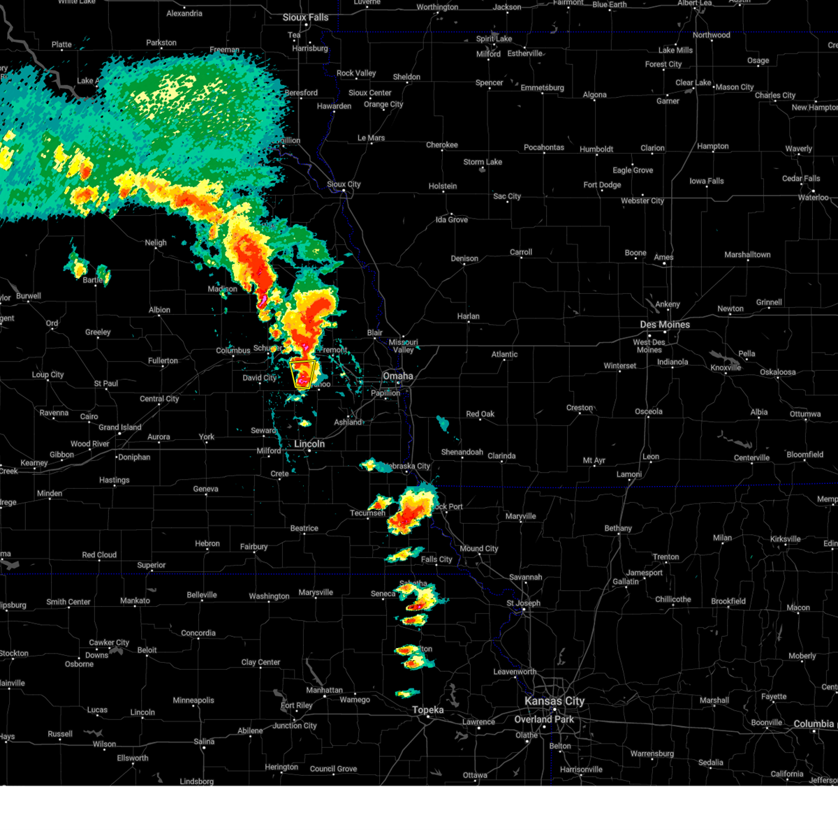 At 550 pm cdt, a severe thunderstorm was located over prague, or 10 miles northwest of wahoo, moving north at 35 mph (trained weather spotters). Hazards include 60 mph wind gusts and half dollar size hail. Hail damage to vehicles is expected. expect wind damage to roofs, siding, and trees. locations impacted include, prague, malmo and czechland lake. hail threat, observed max hail size, 1. 25 in wind threat, radar indicated max wind gust, 60 mph. At 550 pm cdt, a severe thunderstorm was located over prague, or 10 miles northwest of wahoo, moving north at 35 mph (trained weather spotters). Hazards include 60 mph wind gusts and half dollar size hail. Hail damage to vehicles is expected. expect wind damage to roofs, siding, and trees. locations impacted include, prague, malmo and czechland lake. hail threat, observed max hail size, 1. 25 in wind threat, radar indicated max wind gust, 60 mph.
|
| 5/12/2023 5:31 PM CDT |
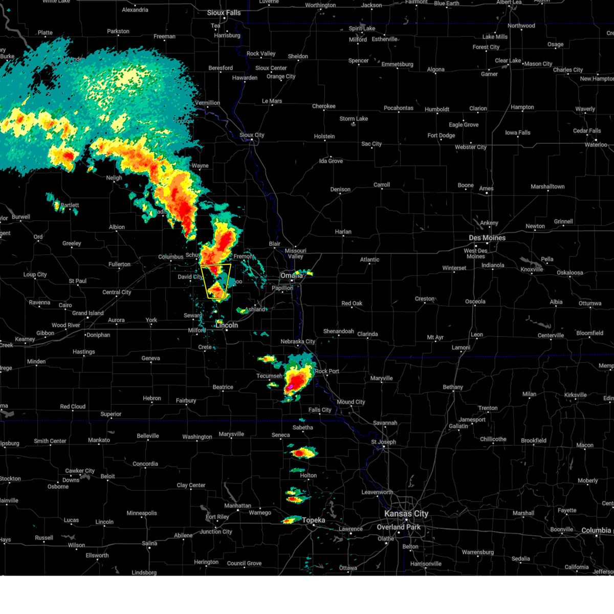 At 531 pm cdt, a severe thunderstorm was located 5 miles southwest of weston, or 11 miles west of wahoo, moving north at 35 mph (trained weather spotters). Hazards include 60 mph wind gusts and quarter size hail. Hail damage to vehicles is expected. expect wind damage to roofs, siding, and trees. locations impacted include, weston, prague, malmo, bruno, abie and czechland lake. hail threat, observed max hail size, 1. 00 in wind threat, radar indicated max wind gust, 60 mph. At 531 pm cdt, a severe thunderstorm was located 5 miles southwest of weston, or 11 miles west of wahoo, moving north at 35 mph (trained weather spotters). Hazards include 60 mph wind gusts and quarter size hail. Hail damage to vehicles is expected. expect wind damage to roofs, siding, and trees. locations impacted include, weston, prague, malmo, bruno, abie and czechland lake. hail threat, observed max hail size, 1. 00 in wind threat, radar indicated max wind gust, 60 mph.
|
| 5/12/2023 5:16 PM CDT |
 At 516 pm cdt, a severe thunderstorm was located near valparaiso, or 16 miles southwest of wahoo, moving north at 50 mph (trained weather spotters). Hazards include 60 mph wind gusts and quarter size hail. Hail damage to vehicles is expected. expect wind damage to roofs, siding, and trees. locations impacted include, weston, malmo, prague and abie. hail threat, observed max hail size, 1. 00 in wind threat, radar indicated max wind gust, 60 mph. At 516 pm cdt, a severe thunderstorm was located near valparaiso, or 16 miles southwest of wahoo, moving north at 50 mph (trained weather spotters). Hazards include 60 mph wind gusts and quarter size hail. Hail damage to vehicles is expected. expect wind damage to roofs, siding, and trees. locations impacted include, weston, malmo, prague and abie. hail threat, observed max hail size, 1. 00 in wind threat, radar indicated max wind gust, 60 mph.
|
| 5/12/2023 4:58 PM CDT |
 At 458 pm cdt, a severe thunderstorm was located near raymond, or 12 miles northwest of lincoln, moving north at 35 mph (trained weather spotters). Hazards include 60 mph wind gusts and quarter size hail. Hail damage to vehicles is expected. expect wind damage to roofs, siding, and trees. this severe thunderstorm will be near, valparaiso around 515 pm cdt. other locations in the path of this severe thunderstorm include weston, malmo, bruno, prague and abie. hail threat, observed max hail size, 1. 00 in wind threat, radar indicated max wind gust, 60 mph. At 458 pm cdt, a severe thunderstorm was located near raymond, or 12 miles northwest of lincoln, moving north at 35 mph (trained weather spotters). Hazards include 60 mph wind gusts and quarter size hail. Hail damage to vehicles is expected. expect wind damage to roofs, siding, and trees. this severe thunderstorm will be near, valparaiso around 515 pm cdt. other locations in the path of this severe thunderstorm include weston, malmo, bruno, prague and abie. hail threat, observed max hail size, 1. 00 in wind threat, radar indicated max wind gust, 60 mph.
|
| 4/19/2023 12:02 AM CDT |
 At 1200 am cdt, a severe thunderstorm was located 3 miles northeast of colon, or 7 miles southwest of fremont, moving northeast at 45 mph (0.8" hail was reported by a trained spotter in wahoo at 12:00am). Hazards include 60 mph wind gusts and quarter size hail. Hail damage to vehicles is expected. expect wind damage to roofs, siding, and trees. locations impacted include, wahoo, cedar bluffs, valparaiso, weston, prague, malmo, leshara, colon, woodcliff, lake wanahoo recreation area, ames, camp eagle, camp cedars and czechland lake. hail threat, observed max hail size, 1. 00 in wind threat, radar indicated max wind gust, 60 mph. At 1200 am cdt, a severe thunderstorm was located 3 miles northeast of colon, or 7 miles southwest of fremont, moving northeast at 45 mph (0.8" hail was reported by a trained spotter in wahoo at 12:00am). Hazards include 60 mph wind gusts and quarter size hail. Hail damage to vehicles is expected. expect wind damage to roofs, siding, and trees. locations impacted include, wahoo, cedar bluffs, valparaiso, weston, prague, malmo, leshara, colon, woodcliff, lake wanahoo recreation area, ames, camp eagle, camp cedars and czechland lake. hail threat, observed max hail size, 1. 00 in wind threat, radar indicated max wind gust, 60 mph.
|
| 4/18/2023 11:56 PM CDT |
 At 1156 pm cdt, a severe thunderstorm was located over colon, or 6 miles north of wahoo, moving northeast at 45 mph (trained weather spotters). Hazards include 60 mph wind gusts and quarter size hail. Hail damage to vehicles is expected. expect wind damage to roofs, siding, and trees. locations impacted include, cedar bluffs, leshara and woodcliff. hail threat, observed max hail size, 1. 00 in wind threat, radar indicated max wind gust, 60 mph. At 1156 pm cdt, a severe thunderstorm was located over colon, or 6 miles north of wahoo, moving northeast at 45 mph (trained weather spotters). Hazards include 60 mph wind gusts and quarter size hail. Hail damage to vehicles is expected. expect wind damage to roofs, siding, and trees. locations impacted include, cedar bluffs, leshara and woodcliff. hail threat, observed max hail size, 1. 00 in wind threat, radar indicated max wind gust, 60 mph.
|
| 4/18/2023 11:32 PM CDT |
 At 1131 pm cdt, a severe thunderstorm was located 3 miles northwest of valparaiso, or 15 miles southeast of david city, moving northeast at 50 mph (trained weather spotters reported 1" hail at seward at 11:14pm). Hazards include 60 mph wind gusts and quarter size hail. Hail damage to vehicles is expected. expect wind damage to roofs, siding, and trees. this severe thunderstorm will be near, weston around 1145 pm cdt. wahoo, prague and malmo around 1150 pm cdt. other locations in the path of this severe thunderstorm include colon, cedar bluffs, leshara and woodcliff. hail threat, observed max hail size, 1. 00 in wind threat, radar indicated max wind gust, 60 mph. At 1131 pm cdt, a severe thunderstorm was located 3 miles northwest of valparaiso, or 15 miles southeast of david city, moving northeast at 50 mph (trained weather spotters reported 1" hail at seward at 11:14pm). Hazards include 60 mph wind gusts and quarter size hail. Hail damage to vehicles is expected. expect wind damage to roofs, siding, and trees. this severe thunderstorm will be near, weston around 1145 pm cdt. wahoo, prague and malmo around 1150 pm cdt. other locations in the path of this severe thunderstorm include colon, cedar bluffs, leshara and woodcliff. hail threat, observed max hail size, 1. 00 in wind threat, radar indicated max wind gust, 60 mph.
|
| 6/25/2022 9:25 AM CDT |
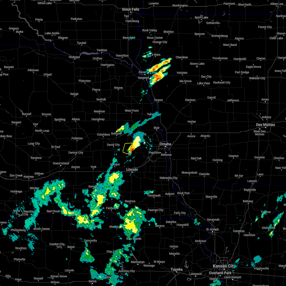 The severe thunderstorm warning for southwestern saunders county will expire at 930 am cdt, the storm which prompted the warning has moved out of the area. therefore, the warning will be allowed to expire. remember, a severe thunderstorm warning still remains in effect for central saunders county until 945 am cdt. The severe thunderstorm warning for southwestern saunders county will expire at 930 am cdt, the storm which prompted the warning has moved out of the area. therefore, the warning will be allowed to expire. remember, a severe thunderstorm warning still remains in effect for central saunders county until 945 am cdt.
|
| 6/25/2022 9:08 AM CDT |
 At 907 am cdt, a severe thunderstorm was located 5 miles northwest of weston, or 10 miles west of wahoo, moving east at 30 mph (radar indicated). Hazards include 60 mph wind gusts and half dollar size hail. Hail damage to vehicles is expected. expect wind damage to roofs, siding, and trees. locations impacted include, weston, prague and malmo. hail threat, observed max hail size, 1. 25 in wind threat, radar indicated max wind gust, 60 mph. At 907 am cdt, a severe thunderstorm was located 5 miles northwest of weston, or 10 miles west of wahoo, moving east at 30 mph (radar indicated). Hazards include 60 mph wind gusts and half dollar size hail. Hail damage to vehicles is expected. expect wind damage to roofs, siding, and trees. locations impacted include, weston, prague and malmo. hail threat, observed max hail size, 1. 25 in wind threat, radar indicated max wind gust, 60 mph.
|
| 6/25/2022 8:55 AM CDT |
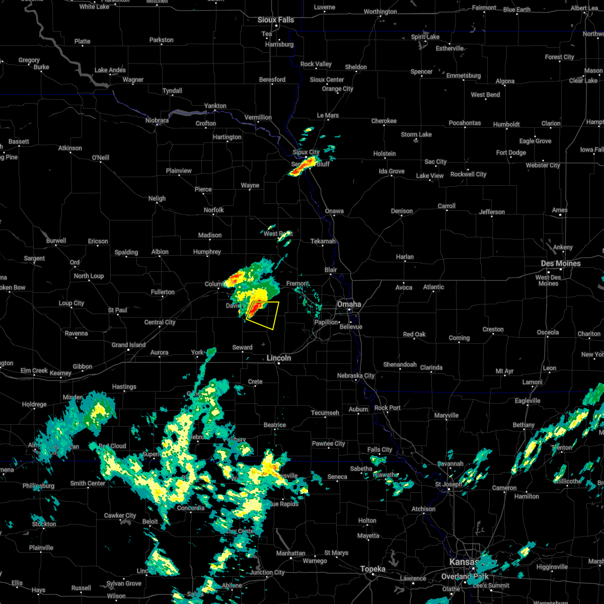 At 855 am cdt, a severe thunderstorm was located 3 miles southeast of bruno, or 9 miles east of david city, moving east at 30 mph (radar indicated). Hazards include 60 mph wind gusts and half dollar size hail. Hail damage to vehicles is expected. expect wind damage to roofs, siding, and trees. locations impacted include, prague, weston and malmo. hail threat, observed max hail size, 1. 25 in wind threat, radar indicated max wind gust, 60 mph. At 855 am cdt, a severe thunderstorm was located 3 miles southeast of bruno, or 9 miles east of david city, moving east at 30 mph (radar indicated). Hazards include 60 mph wind gusts and half dollar size hail. Hail damage to vehicles is expected. expect wind damage to roofs, siding, and trees. locations impacted include, prague, weston and malmo. hail threat, observed max hail size, 1. 25 in wind threat, radar indicated max wind gust, 60 mph.
|
| 6/25/2022 8:40 AM CDT |
 At 839 am cdt, a severe thunderstorm was located near david city, moving east at 30 mph (public). Hazards include ping pong ball size hail and 60 mph wind gusts. People and animals outdoors will be injured. expect hail damage to roofs, siding, windows, and vehicles. expect wind damage to roofs, siding, and trees. this severe thunderstorm will be near, brainard and bruno around 850 am cdt. other locations in the path of this severe thunderstorm include prague, weston and malmo. hail threat, observed max hail size, 1. 50 in wind threat, radar indicated max wind gust, 60 mph. At 839 am cdt, a severe thunderstorm was located near david city, moving east at 30 mph (public). Hazards include ping pong ball size hail and 60 mph wind gusts. People and animals outdoors will be injured. expect hail damage to roofs, siding, windows, and vehicles. expect wind damage to roofs, siding, and trees. this severe thunderstorm will be near, brainard and bruno around 850 am cdt. other locations in the path of this severe thunderstorm include prague, weston and malmo. hail threat, observed max hail size, 1. 50 in wind threat, radar indicated max wind gust, 60 mph.
|
| 6/16/2022 9:18 PM CDT |
 At 917 pm cdt, a severe thunderstorm was located near octavia, or 9 miles northeast of david city, moving east at 35 mph (radar indicated). Hazards include 60 mph wind gusts and quarter size hail. Hail damage to vehicles is expected. expect wind damage to roofs, siding, and trees. this severe thunderstorm will be near, prague around 935 pm cdt. other locations in the path of this severe thunderstorm include malmo. hail threat, radar indicated max hail size, 1. 00 in wind threat, radar indicated max wind gust, 60 mph. At 917 pm cdt, a severe thunderstorm was located near octavia, or 9 miles northeast of david city, moving east at 35 mph (radar indicated). Hazards include 60 mph wind gusts and quarter size hail. Hail damage to vehicles is expected. expect wind damage to roofs, siding, and trees. this severe thunderstorm will be near, prague around 935 pm cdt. other locations in the path of this severe thunderstorm include malmo. hail threat, radar indicated max hail size, 1. 00 in wind threat, radar indicated max wind gust, 60 mph.
|
| 6/15/2022 1:42 AM CDT |
 At 141 am cdt, a severe thunderstorm was located near wahoo, moving northeast at 50 mph (radar indicated). Hazards include 60 mph wind gusts and half dollar size hail. Hail damage to vehicles is expected. expect wind damage to roofs, siding, and trees. this severe storm will be near, mead around 145 am cdt. yutan around 150 am cdt. other locations in the path of this severe thunderstorm include leshara. hail threat, radar indicated max hail size, 1. 25 in wind threat, radar indicated max wind gust, 60 mph. At 141 am cdt, a severe thunderstorm was located near wahoo, moving northeast at 50 mph (radar indicated). Hazards include 60 mph wind gusts and half dollar size hail. Hail damage to vehicles is expected. expect wind damage to roofs, siding, and trees. this severe storm will be near, mead around 145 am cdt. yutan around 150 am cdt. other locations in the path of this severe thunderstorm include leshara. hail threat, radar indicated max hail size, 1. 25 in wind threat, radar indicated max wind gust, 60 mph.
|
| 6/15/2022 1:32 AM CDT |
 At 131 am cdt, a severe thunderstorm was located near weston, or 6 miles southwest of wahoo, moving northeast at 50 mph (radar indicated). Hazards include 60 mph wind gusts and half dollar size hail. Hail damage to vehicles is expected. expect wind damage to roofs, siding, and trees. this severe storm will be near, malmo around 135 am cdt. wahoo and ithaca around 140 am cdt. other locations in the path of this severe thunderstorm include mead, colon, yutan, leshara and woodcliff. hail threat, radar indicated max hail size, 1. 25 in wind threat, radar indicated max wind gust, 60 mph. At 131 am cdt, a severe thunderstorm was located near weston, or 6 miles southwest of wahoo, moving northeast at 50 mph (radar indicated). Hazards include 60 mph wind gusts and half dollar size hail. Hail damage to vehicles is expected. expect wind damage to roofs, siding, and trees. this severe storm will be near, malmo around 135 am cdt. wahoo and ithaca around 140 am cdt. other locations in the path of this severe thunderstorm include mead, colon, yutan, leshara and woodcliff. hail threat, radar indicated max hail size, 1. 25 in wind threat, radar indicated max wind gust, 60 mph.
|
| 6/15/2022 1:23 AM CDT |
 At 122 am cdt, a severe thunderstorm was located over valparaiso, or 14 miles southwest of wahoo, moving northeast at 50 mph (radar indicated). Hazards include golf ball size hail and 60 mph wind gusts. People and animals outdoors will be injured. expect hail damage to roofs, siding, windows, and vehicles. expect wind damage to roofs, siding, and trees. this severe storm will be near, ceresco and weston around 130 am cdt. other locations in the path of this severe thunderstorm include wahoo, ithaca, mead, colon, yutan and leshara. thunderstorm damage threat, considerable hail threat, radar indicated max hail size, 1. 75 in wind threat, radar indicated max wind gust, 60 mph. At 122 am cdt, a severe thunderstorm was located over valparaiso, or 14 miles southwest of wahoo, moving northeast at 50 mph (radar indicated). Hazards include golf ball size hail and 60 mph wind gusts. People and animals outdoors will be injured. expect hail damage to roofs, siding, windows, and vehicles. expect wind damage to roofs, siding, and trees. this severe storm will be near, ceresco and weston around 130 am cdt. other locations in the path of this severe thunderstorm include wahoo, ithaca, mead, colon, yutan and leshara. thunderstorm damage threat, considerable hail threat, radar indicated max hail size, 1. 75 in wind threat, radar indicated max wind gust, 60 mph.
|
| 6/15/2022 1:12 AM CDT |
 At 111 am cdt, a severe thunderstorm was located 4 miles east of bee, or 9 miles northeast of seward, moving northeast at 50 mph (radar indicated). Hazards include two inch hail and 70 mph wind gusts. People and animals outdoors will be injured. expect hail damage to roofs, siding, windows, and vehicles. expect considerable tree damage. wind damage is also likely to mobile homes, roofs, and outbuildings. this severe thunderstorm will be near, valparaiso around 120 am cdt. ceresco and weston around 130 am cdt. other locations in the path of this severe thunderstorm include wahoo, ithaca, colon, mead, yutan and leshara. thunderstorm damage threat, considerable hail threat, radar indicated max hail size, 2. 00 in wind threat, radar indicated max wind gust, 70 mph. At 111 am cdt, a severe thunderstorm was located 4 miles east of bee, or 9 miles northeast of seward, moving northeast at 50 mph (radar indicated). Hazards include two inch hail and 70 mph wind gusts. People and animals outdoors will be injured. expect hail damage to roofs, siding, windows, and vehicles. expect considerable tree damage. wind damage is also likely to mobile homes, roofs, and outbuildings. this severe thunderstorm will be near, valparaiso around 120 am cdt. ceresco and weston around 130 am cdt. other locations in the path of this severe thunderstorm include wahoo, ithaca, colon, mead, yutan and leshara. thunderstorm damage threat, considerable hail threat, radar indicated max hail size, 2. 00 in wind threat, radar indicated max wind gust, 70 mph.
|
| 6/7/2022 8:50 PM CDT |
 At 850 pm cdt, a severe thunderstorm was located 3 miles west of ceresco, or 10 miles southwest of wahoo, moving east at 30 mph (trained weather spotters). Hazards include golf ball size hail and 60 mph wind gusts. People and animals outdoors will be injured. expect hail damage to roofs, siding, windows, and vehicles. expect wind damage to roofs, siding, and trees. locations impacted include, wahoo, ceresco, valparaiso, mead, weston, davey, ithaca, branched oak state recreation area, lake wanahoo recreation area and memphis state recreation area. thunderstorm damage threat, considerable hail threat, radar indicated max hail size, 1. 75 in wind threat, radar indicated max wind gust, 60 mph. At 850 pm cdt, a severe thunderstorm was located 3 miles west of ceresco, or 10 miles southwest of wahoo, moving east at 30 mph (trained weather spotters). Hazards include golf ball size hail and 60 mph wind gusts. People and animals outdoors will be injured. expect hail damage to roofs, siding, windows, and vehicles. expect wind damage to roofs, siding, and trees. locations impacted include, wahoo, ceresco, valparaiso, mead, weston, davey, ithaca, branched oak state recreation area, lake wanahoo recreation area and memphis state recreation area. thunderstorm damage threat, considerable hail threat, radar indicated max hail size, 1. 75 in wind threat, radar indicated max wind gust, 60 mph.
|
| 6/7/2022 8:45 PM CDT |
 At 844 pm cdt, a severe thunderstorm was located 3 miles east of valparaiso, or 12 miles southwest of wahoo, moving east at 30 mph (radar indicated). Hazards include ping pong ball size hail and 60 mph wind gusts. People and animals outdoors will be injured. expect hail damage to roofs, siding, windows, and vehicles. expect wind damage to roofs, siding, and trees. locations impacted include, ceresco and davey. hail threat, radar indicated max hail size, 1. 50 in wind threat, radar indicated max wind gust, 60 mph. At 844 pm cdt, a severe thunderstorm was located 3 miles east of valparaiso, or 12 miles southwest of wahoo, moving east at 30 mph (radar indicated). Hazards include ping pong ball size hail and 60 mph wind gusts. People and animals outdoors will be injured. expect hail damage to roofs, siding, windows, and vehicles. expect wind damage to roofs, siding, and trees. locations impacted include, ceresco and davey. hail threat, radar indicated max hail size, 1. 50 in wind threat, radar indicated max wind gust, 60 mph.
|
| 6/7/2022 8:32 PM CDT |
 At 832 pm cdt, a severe thunderstorm was located 4 miles north of valparaiso, or 13 miles west of wahoo, moving east at 30 mph (radar indicated). Hazards include ping pong ball size hail and 60 mph wind gusts. People and animals outdoors will be injured. expect hail damage to roofs, siding, windows, and vehicles. expect wind damage to roofs, siding, and trees. this severe thunderstorm will be near, valparaiso around 835 pm cdt. weston around 845 pm cdt. other locations in the path of this severe thunderstorm include wahoo, ceresco and ithaca. hail threat, radar indicated max hail size, 1. 50 in wind threat, radar indicated max wind gust, 60 mph. At 832 pm cdt, a severe thunderstorm was located 4 miles north of valparaiso, or 13 miles west of wahoo, moving east at 30 mph (radar indicated). Hazards include ping pong ball size hail and 60 mph wind gusts. People and animals outdoors will be injured. expect hail damage to roofs, siding, windows, and vehicles. expect wind damage to roofs, siding, and trees. this severe thunderstorm will be near, valparaiso around 835 pm cdt. weston around 845 pm cdt. other locations in the path of this severe thunderstorm include wahoo, ceresco and ithaca. hail threat, radar indicated max hail size, 1. 50 in wind threat, radar indicated max wind gust, 60 mph.
|
| 5/18/2022 12:23 AM CDT |
 The severe thunderstorm warning for east central butler and southwestern saunders counties will expire at 1230 am cdt, the storm which prompted the warning has moved out of the area. therefore, the warning will be allowed to expire. however heavy rain is still possible with this thunderstorm. The severe thunderstorm warning for east central butler and southwestern saunders counties will expire at 1230 am cdt, the storm which prompted the warning has moved out of the area. therefore, the warning will be allowed to expire. however heavy rain is still possible with this thunderstorm.
|
| 5/18/2022 12:00 AM CDT |
 At 1200 am cdt, a severe thunderstorm was located near malmo, or 5 miles west of wahoo, moving east at 30 mph (radar indicated). Hazards include quarter size hail. Damage to vehicles is expected. locations impacted include, wahoo, colon, mead and ithaca. hail threat, radar indicated max hail size, 1. 00 in wind threat, radar indicated max wind gust, <50 mph. At 1200 am cdt, a severe thunderstorm was located near malmo, or 5 miles west of wahoo, moving east at 30 mph (radar indicated). Hazards include quarter size hail. Damage to vehicles is expected. locations impacted include, wahoo, colon, mead and ithaca. hail threat, radar indicated max hail size, 1. 00 in wind threat, radar indicated max wind gust, <50 mph.
|
| 5/17/2022 11:42 PM CDT |
 At 1142 pm cdt, a severe thunderstorm was located 3 miles southeast of bruno, or 11 miles east of david city, moving east at 35 mph (radar indicated). Hazards include quarter size hail. Damage to vehicles is expected. this severe thunderstorm will be near, prague around 1150 pm cdt. weston and malmo around 1200 am cdt. other locations in the path of this severe thunderstorm include wahoo, colon, mead and ithaca. hail threat, radar indicated max hail size, 1. 00 in wind threat, radar indicated max wind gust, <50 mph. At 1142 pm cdt, a severe thunderstorm was located 3 miles southeast of bruno, or 11 miles east of david city, moving east at 35 mph (radar indicated). Hazards include quarter size hail. Damage to vehicles is expected. this severe thunderstorm will be near, prague around 1150 pm cdt. weston and malmo around 1200 am cdt. other locations in the path of this severe thunderstorm include wahoo, colon, mead and ithaca. hail threat, radar indicated max hail size, 1. 00 in wind threat, radar indicated max wind gust, <50 mph.
|
| 5/12/2022 6:02 PM CDT |
 At 601 pm cdt, a severe thunderstorm was located 5 miles northeast of schuyler, or 18 miles east of columbus, moving north at 60 mph (radar indicated). Hazards include 70 mph wind gusts, quarter size hail, and blowing dust. Hail damage to vehicles is expected. expect considerable tree damage. wind damage is also likely to mobile homes, roofs, and outbuildings. this severe thunderstorm will be near, dodge and snyder around 620 pm cdt. other locations in the path of this severe thunderstorm include west point. thunderstorm damage threat, considerable hail threat, radar indicated max hail size, 1. 00 in wind threat, radar indicated max wind gust, 70 mph. At 601 pm cdt, a severe thunderstorm was located 5 miles northeast of schuyler, or 18 miles east of columbus, moving north at 60 mph (radar indicated). Hazards include 70 mph wind gusts, quarter size hail, and blowing dust. Hail damage to vehicles is expected. expect considerable tree damage. wind damage is also likely to mobile homes, roofs, and outbuildings. this severe thunderstorm will be near, dodge and snyder around 620 pm cdt. other locations in the path of this severe thunderstorm include west point. thunderstorm damage threat, considerable hail threat, radar indicated max hail size, 1. 00 in wind threat, radar indicated max wind gust, 70 mph.
|
| 4/29/2022 8:31 PM CDT |
 At 831 pm cdt, severe thunderstorms were located along a line extending from near scribner to 9 miles northwest of waverly, moving east at 50 mph (radar indicated). Hazards include 60 mph wind gusts. Expect damage to roofs, siding, and trees. locations impacted include, hooper. hail threat, radar indicated max hail size, <. 75 in wind threat, radar indicated max wind gust, 60 mph. At 831 pm cdt, severe thunderstorms were located along a line extending from near scribner to 9 miles northwest of waverly, moving east at 50 mph (radar indicated). Hazards include 60 mph wind gusts. Expect damage to roofs, siding, and trees. locations impacted include, hooper. hail threat, radar indicated max hail size, <. 75 in wind threat, radar indicated max wind gust, 60 mph.
|
| 4/29/2022 8:07 PM CDT |
 At 807 pm cdt, severe thunderstorms were located along a line extending from 6 miles north of schuyler to garland, moving northeast at 40 mph (radar indicated). Hazards include 60 mph wind gusts. Expect damage to roofs, siding, and trees. severe thunderstorms will be near, schuyler around 810 pm cdt. dwight around 815 pm cdt. valparaiso around 825 pm cdt. other locations in the path of these severe thunderstorms include wahoo and hooper. hail threat, radar indicated max hail size, <. 75 in wind threat, radar indicated max wind gust, 60 mph. At 807 pm cdt, severe thunderstorms were located along a line extending from 6 miles north of schuyler to garland, moving northeast at 40 mph (radar indicated). Hazards include 60 mph wind gusts. Expect damage to roofs, siding, and trees. severe thunderstorms will be near, schuyler around 810 pm cdt. dwight around 815 pm cdt. valparaiso around 825 pm cdt. other locations in the path of these severe thunderstorms include wahoo and hooper. hail threat, radar indicated max hail size, <. 75 in wind threat, radar indicated max wind gust, 60 mph.
|
| 4/12/2022 7:10 PM CDT |
 At 710 pm cdt, severe thunderstorms were located along a line extending from 4 miles northwest of mead to 6 miles northeast of pleasant dale, moving east at 35 mph (radar indicated). Hazards include 70 mph wind gusts and quarter size hail. Hail damage to vehicles is expected. expect considerable tree damage. wind damage is also likely to mobile homes, roofs, and outbuildings. Locations impacted include, wahoo, mead, yutan, valley, lincoln, waterloo, waverly and greenwood. At 710 pm cdt, severe thunderstorms were located along a line extending from 4 miles northwest of mead to 6 miles northeast of pleasant dale, moving east at 35 mph (radar indicated). Hazards include 70 mph wind gusts and quarter size hail. Hail damage to vehicles is expected. expect considerable tree damage. wind damage is also likely to mobile homes, roofs, and outbuildings. Locations impacted include, wahoo, mead, yutan, valley, lincoln, waterloo, waverly and greenwood.
|
| 4/12/2022 6:44 PM CDT |
 At 643 pm cdt, severe thunderstorms were located along a line extending from near prague to 5 miles southwest of seward, moving east at 45 mph (radar indicated). Hazards include 60 mph wind gusts and half dollar size hail. Hail damage to vehicles is expected. expect wind damage to roofs, siding, and trees. severe thunderstorms will be near, weston and prague around 650 pm cdt. wahoo and garland around 700 pm cdt. other locations in the path of these severe thunderstorms include pleasant dale, mead, yutan, valley, lincoln, waterloo and waverly. This includes interstate 80 in nebraska between mile markers 366 and 414. At 643 pm cdt, severe thunderstorms were located along a line extending from near prague to 5 miles southwest of seward, moving east at 45 mph (radar indicated). Hazards include 60 mph wind gusts and half dollar size hail. Hail damage to vehicles is expected. expect wind damage to roofs, siding, and trees. severe thunderstorms will be near, weston and prague around 650 pm cdt. wahoo and garland around 700 pm cdt. other locations in the path of these severe thunderstorms include pleasant dale, mead, yutan, valley, lincoln, waterloo and waverly. This includes interstate 80 in nebraska between mile markers 366 and 414.
|
| 8/24/2021 11:49 PM CDT |
 At 1149 pm cdt, a severe thunderstorm was located 5 miles east of prague, or 34 miles north of lincoln, moving east at 20 mph (radar indicated). Hazards include 60 mph wind gusts and quarter size hail. Hail damage to vehicles is expected. expect wind damage to roofs, siding, and trees. locations impacted include, prague, malmo, bruno and abie. hail threat, radar indicated max hail size, 1. 00 in wind threat, radar indicated max wind gust, 60 mph. At 1149 pm cdt, a severe thunderstorm was located 5 miles east of prague, or 34 miles north of lincoln, moving east at 20 mph (radar indicated). Hazards include 60 mph wind gusts and quarter size hail. Hail damage to vehicles is expected. expect wind damage to roofs, siding, and trees. locations impacted include, prague, malmo, bruno and abie. hail threat, radar indicated max hail size, 1. 00 in wind threat, radar indicated max wind gust, 60 mph.
|
| 8/24/2021 11:45 PM CDT |
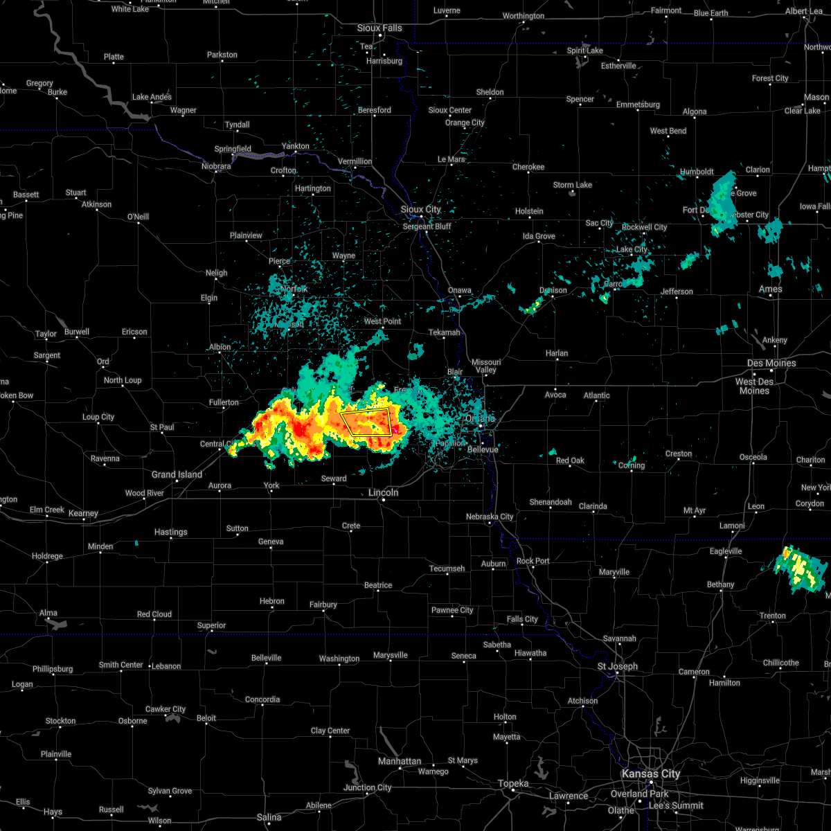 At 1145 pm cdt, a severe thunderstorm was located near prague, or 33 miles east of columbus, moving east at 20 mph (radar indicated). Hazards include 60 mph wind gusts and quarter size hail. Hail damage to vehicles is expected. expect wind damage to roofs, siding, and trees. this severe thunderstorm will remain over mainly rural areas of east central butler and northwestern saunders counties, including the following locations, malmo, bruno and abie. hail threat, radar indicated max hail size, 1. 00 in wind threat, radar indicated max wind gust, 60 mph. At 1145 pm cdt, a severe thunderstorm was located near prague, or 33 miles east of columbus, moving east at 20 mph (radar indicated). Hazards include 60 mph wind gusts and quarter size hail. Hail damage to vehicles is expected. expect wind damage to roofs, siding, and trees. this severe thunderstorm will remain over mainly rural areas of east central butler and northwestern saunders counties, including the following locations, malmo, bruno and abie. hail threat, radar indicated max hail size, 1. 00 in wind threat, radar indicated max wind gust, 60 mph.
|
| 8/24/2021 11:23 PM CDT |
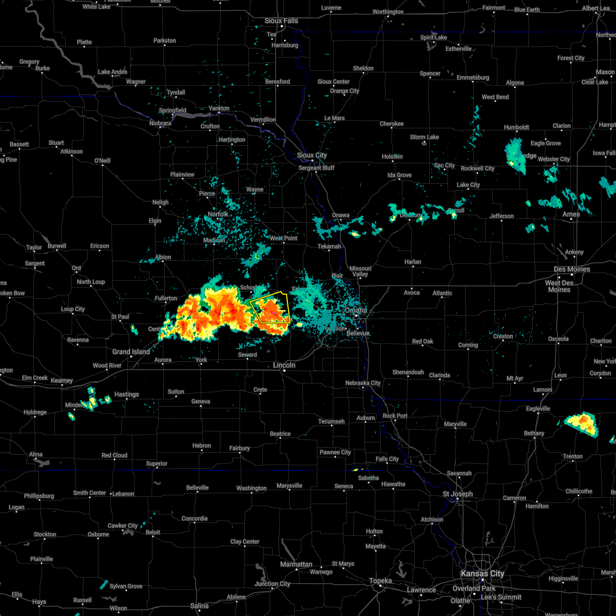 At 1123 pm cdt, a severe thunderstorm was located over prague, or 27 miles east of columbus, moving east at 20 mph (radar indicated). Hazards include 60 mph wind gusts and half dollar size hail. Hail damage to vehicles is expected. expect wind damage to roofs, siding, and trees. locations impacted include, prague, morse bluff, malmo, bruno and abie. hail threat, radar indicated max hail size, 1. 25 in wind threat, radar indicated max wind gust, 60 mph. At 1123 pm cdt, a severe thunderstorm was located over prague, or 27 miles east of columbus, moving east at 20 mph (radar indicated). Hazards include 60 mph wind gusts and half dollar size hail. Hail damage to vehicles is expected. expect wind damage to roofs, siding, and trees. locations impacted include, prague, morse bluff, malmo, bruno and abie. hail threat, radar indicated max hail size, 1. 25 in wind threat, radar indicated max wind gust, 60 mph.
|
| 8/24/2021 11:11 PM CDT |
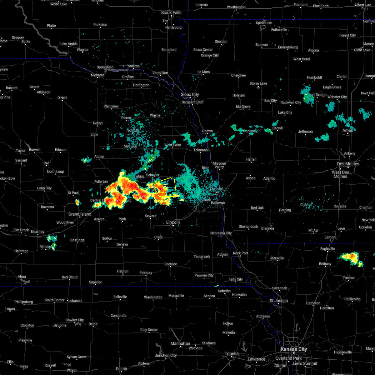 At 1111 pm cdt, a severe thunderstorm was located 6 miles west of prague, or 23 miles east of columbus, moving east at 20 mph (radar indicated). Hazards include 60 mph wind gusts and quarter size hail. Hail damage to vehicles is expected. Expect wind damage to roofs, siding, and trees. At 1111 pm cdt, a severe thunderstorm was located 6 miles west of prague, or 23 miles east of columbus, moving east at 20 mph (radar indicated). Hazards include 60 mph wind gusts and quarter size hail. Hail damage to vehicles is expected. Expect wind damage to roofs, siding, and trees.
|
| 8/7/2021 9:26 PM CDT |
 The severe thunderstorm warning for northeastern butler and central saunders counties will expire at 930 pm cdt, the storms which prompted the warning have weakened below severe limits. therefore, the warning will be allowed to expire. however gusty winds and extremely heavy rain and flash flooding are still possible with these thunderstorms. a severe thunderstorm watch remains in effect until 100 am cdt for southeastern, northeastern and east central nebraska. The severe thunderstorm warning for northeastern butler and central saunders counties will expire at 930 pm cdt, the storms which prompted the warning have weakened below severe limits. therefore, the warning will be allowed to expire. however gusty winds and extremely heavy rain and flash flooding are still possible with these thunderstorms. a severe thunderstorm watch remains in effect until 100 am cdt for southeastern, northeastern and east central nebraska.
|
| 8/7/2021 9:15 PM CDT |
 At 914 pm cdt, severe thunderstorms were located along a line extending from david city to 6 miles south of mead, moving east at 30 mph (trained weather spotters. a mesonet observation reported 63 mph wind gust north of memphis at 9 pm). Hazards include 60 mph wind gusts and nickel size hail. Expect damage to roofs, siding, and trees. locations impacted include, wahoo, david city, yutan, mead, brainard, weston, prague, ceresco, ithaca, octavia, malmo, memphis, colon, bruno, abie, garrison and memphis state recreation area. hail threat, radar indicated max hail size, 0. 88 in wind threat, observed max wind gust, 60 mph. At 914 pm cdt, severe thunderstorms were located along a line extending from david city to 6 miles south of mead, moving east at 30 mph (trained weather spotters. a mesonet observation reported 63 mph wind gust north of memphis at 9 pm). Hazards include 60 mph wind gusts and nickel size hail. Expect damage to roofs, siding, and trees. locations impacted include, wahoo, david city, yutan, mead, brainard, weston, prague, ceresco, ithaca, octavia, malmo, memphis, colon, bruno, abie, garrison and memphis state recreation area. hail threat, radar indicated max hail size, 0. 88 in wind threat, observed max wind gust, 60 mph.
|
| 8/7/2021 8:55 PM CDT |
 At 854 pm cdt, severe thunderstorms were located along a line extending from near bellwood to near wahoo, moving east northeast at 40 mph (radar indicated. these storms have a history of producing hail larger than quarters). Hazards include 60 mph wind gusts and quarter size hail. Hail damage to vehicles is expected. Expect wind damage to roofs, siding, and trees. At 854 pm cdt, severe thunderstorms were located along a line extending from near bellwood to near wahoo, moving east northeast at 40 mph (radar indicated. these storms have a history of producing hail larger than quarters). Hazards include 60 mph wind gusts and quarter size hail. Hail damage to vehicles is expected. Expect wind damage to roofs, siding, and trees.
|
| 8/7/2021 8:09 PM CDT |
 At 809 pm cdt, a severe thunderstorm was located over wahoo, or 26 miles north of lincoln, moving east at 30 mph (radar indicated). Hazards include 70 mph wind gusts and ping pong ball size hail. People and animals outdoors will be injured. expect hail damage to roofs, siding, windows, and vehicles. expect considerable tree damage. wind damage is also likely to mobile homes, roofs, and outbuildings. locations impacted include, mead, yutan, waterloo, gretna, elkhorn, springfield, millard, papillion, la vista and ralston. thunderstorm damage threat, considerable hail threat, radar indicated max hail size, 1. 50 in wind threat, radar indicated max wind gust, 70 mph. At 809 pm cdt, a severe thunderstorm was located over wahoo, or 26 miles north of lincoln, moving east at 30 mph (radar indicated). Hazards include 70 mph wind gusts and ping pong ball size hail. People and animals outdoors will be injured. expect hail damage to roofs, siding, windows, and vehicles. expect considerable tree damage. wind damage is also likely to mobile homes, roofs, and outbuildings. locations impacted include, mead, yutan, waterloo, gretna, elkhorn, springfield, millard, papillion, la vista and ralston. thunderstorm damage threat, considerable hail threat, radar indicated max hail size, 1. 50 in wind threat, radar indicated max wind gust, 70 mph.
|
| 8/7/2021 8:01 PM CDT |
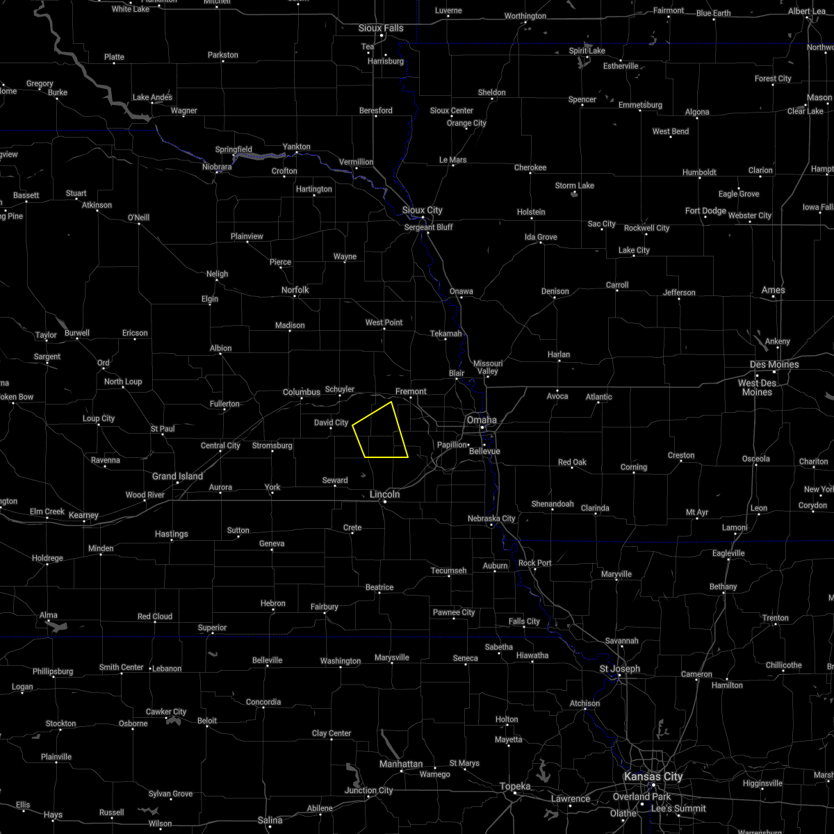 At 801 pm cdt, a severe thunderstorm was located over wahoo, or 29 miles north of lincoln, moving east at 25 mph (radar indicated). Hazards include 70 mph wind gusts and ping pong ball size hail. People and animals outdoors will be injured. expect hail damage to roofs, siding, windows, and vehicles. expect considerable tree damage. wind damage is also likely to mobile homes, roofs, and outbuildings. locations impacted include, wahoo, valparaiso, weston, prague, malmo and colon. thunderstorm damage threat, considerable hail threat, radar indicated max hail size, 1. 50 in wind threat, radar indicated max wind gust, 70 mph. At 801 pm cdt, a severe thunderstorm was located over wahoo, or 29 miles north of lincoln, moving east at 25 mph (radar indicated). Hazards include 70 mph wind gusts and ping pong ball size hail. People and animals outdoors will be injured. expect hail damage to roofs, siding, windows, and vehicles. expect considerable tree damage. wind damage is also likely to mobile homes, roofs, and outbuildings. locations impacted include, wahoo, valparaiso, weston, prague, malmo and colon. thunderstorm damage threat, considerable hail threat, radar indicated max hail size, 1. 50 in wind threat, radar indicated max wind gust, 70 mph.
|
| 8/7/2021 7:56 PM CDT |
 At 755 pm cdt, a severe thunderstorm was located over wahoo, or 26 miles north of lincoln, moving east at 35 mph (radar indicated). Hazards include 70 mph wind gusts and ping pong ball size hail. People and animals outdoors will be injured. expect hail damage to roofs, siding, windows, and vehicles. expect considerable tree damage. wind damage is also likely to mobile homes, roofs, and outbuildings. this severe thunderstorm will be near, mead around 810 pm cdt. yutan around 815 pm cdt. other locations in the path of this severe thunderstorm include waterloo, gretna, elkhorn, millard, papillion, la vista and ralston. this includes interstate 80 in nebraska between mile markers 428 and 450. thunderstorm damage threat, considerable hail threat, radar indicated max hail size, 1. 50 in wind threat, radar indicated max wind gust, 70 mph. At 755 pm cdt, a severe thunderstorm was located over wahoo, or 26 miles north of lincoln, moving east at 35 mph (radar indicated). Hazards include 70 mph wind gusts and ping pong ball size hail. People and animals outdoors will be injured. expect hail damage to roofs, siding, windows, and vehicles. expect considerable tree damage. wind damage is also likely to mobile homes, roofs, and outbuildings. this severe thunderstorm will be near, mead around 810 pm cdt. yutan around 815 pm cdt. other locations in the path of this severe thunderstorm include waterloo, gretna, elkhorn, millard, papillion, la vista and ralston. this includes interstate 80 in nebraska between mile markers 428 and 450. thunderstorm damage threat, considerable hail threat, radar indicated max hail size, 1. 50 in wind threat, radar indicated max wind gust, 70 mph.
|
| 8/7/2021 7:50 PM CDT |
 At 749 pm cdt, a severe thunderstorm was located near weston, or 29 miles north of lincoln, moving northeast at 40 mph (radar indicated). Hazards include ping pong ball size hail and 60 mph wind gusts. People and animals outdoors will be injured. expect hail damage to roofs, siding, windows, and vehicles. expect wind damage to roofs, siding, and trees. locations impacted include, wahoo. hail threat, radar indicated max hail size, 1. 50 in wind threat, radar indicated max wind gust, 60 mph. At 749 pm cdt, a severe thunderstorm was located near weston, or 29 miles north of lincoln, moving northeast at 40 mph (radar indicated). Hazards include ping pong ball size hail and 60 mph wind gusts. People and animals outdoors will be injured. expect hail damage to roofs, siding, windows, and vehicles. expect wind damage to roofs, siding, and trees. locations impacted include, wahoo. hail threat, radar indicated max hail size, 1. 50 in wind threat, radar indicated max wind gust, 60 mph.
|
| 8/7/2021 7:29 PM CDT |
 At 729 pm cdt, a severe thunderstorm was located over brainard, or 27 miles northwest of lincoln, moving northeast at 25 mph (radar indicated). Hazards include ping pong ball size hail and 60 mph wind gusts. People and animals outdoors will be injured. expect hail damage to roofs, siding, windows, and vehicles. expect wind damage to roofs, siding, and trees. this severe thunderstorm will be near, valparaiso around 735 pm cdt. other locations in the path of this severe thunderstorm include weston, prague and wahoo. hail threat, radar indicated max hail size, 1. 50 in wind threat, radar indicated max wind gust, 60 mph. At 729 pm cdt, a severe thunderstorm was located over brainard, or 27 miles northwest of lincoln, moving northeast at 25 mph (radar indicated). Hazards include ping pong ball size hail and 60 mph wind gusts. People and animals outdoors will be injured. expect hail damage to roofs, siding, windows, and vehicles. expect wind damage to roofs, siding, and trees. this severe thunderstorm will be near, valparaiso around 735 pm cdt. other locations in the path of this severe thunderstorm include weston, prague and wahoo. hail threat, radar indicated max hail size, 1. 50 in wind threat, radar indicated max wind gust, 60 mph.
|
| 8/7/2021 6:54 PM CDT |
 At 654 pm cdt, a severe thunderstorm was located 6 miles northeast of ulysses, or 22 miles southeast of columbus, moving northeast at 25 mph (radar indicated). Hazards include 60 mph wind gusts and half dollar size hail. Hail damage to vehicles is expected. expect wind damage to roofs, siding, and trees. this severe thunderstorm will be near, david city around 710 pm cdt. other locations in the path of this severe thunderstorm include brainard and prague. hail threat, radar indicated max hail size, 1. 25 in wind threat, radar indicated max wind gust, 60 mph. At 654 pm cdt, a severe thunderstorm was located 6 miles northeast of ulysses, or 22 miles southeast of columbus, moving northeast at 25 mph (radar indicated). Hazards include 60 mph wind gusts and half dollar size hail. Hail damage to vehicles is expected. expect wind damage to roofs, siding, and trees. this severe thunderstorm will be near, david city around 710 pm cdt. other locations in the path of this severe thunderstorm include brainard and prague. hail threat, radar indicated max hail size, 1. 25 in wind threat, radar indicated max wind gust, 60 mph.
|
| 7/10/2021 12:19 AM CDT |
 At 1218 am cdt, severe thunderstorms were located along a line extending from near nickerson to 4 miles southeast of prague, moving southeast at 45 mph (radar indicated). Hazards include 70 mph wind gusts. Expect considerable tree damage. damage is likely to mobile homes, roofs, and outbuildings. Locations impacted include, wahoo. At 1218 am cdt, severe thunderstorms were located along a line extending from near nickerson to 4 miles southeast of prague, moving southeast at 45 mph (radar indicated). Hazards include 70 mph wind gusts. Expect considerable tree damage. damage is likely to mobile homes, roofs, and outbuildings. Locations impacted include, wahoo.
|
| 7/10/2021 12:09 AM CDT |
 At 1209 am cdt, severe thunderstorms were located along a line extending from near hooper to near prague, moving southeast at 45 mph (radar indicated). Hazards include 70 mph wind gusts. Expect considerable tree damage. damage is likely to mobile homes, roofs, and outbuildings. these severe storms will be near, fremont and nickerson around 1215 am cdt. Other locations in the path of these severe thunderstorms include wahoo and mead. At 1209 am cdt, severe thunderstorms were located along a line extending from near hooper to near prague, moving southeast at 45 mph (radar indicated). Hazards include 70 mph wind gusts. Expect considerable tree damage. damage is likely to mobile homes, roofs, and outbuildings. these severe storms will be near, fremont and nickerson around 1215 am cdt. Other locations in the path of these severe thunderstorms include wahoo and mead.
|
| 7/10/2021 12:02 AM CDT |
 At 1202 am cdt, severe thunderstorms were located along a line extending from hooper to 7 miles northwest of prague, moving southeast at 45 mph (radar indicated). Hazards include 70 mph wind gusts and penny size hail. Expect considerable tree damage. damage is likely to mobile homes, roofs, and outbuildings. these severe storms will be near, hooper around 1205 am cdt. nickerson and prague around 1210 am cdt. Other locations in the path of these severe thunderstorms include fremont, weston, wahoo and mead. At 1202 am cdt, severe thunderstorms were located along a line extending from hooper to 7 miles northwest of prague, moving southeast at 45 mph (radar indicated). Hazards include 70 mph wind gusts and penny size hail. Expect considerable tree damage. damage is likely to mobile homes, roofs, and outbuildings. these severe storms will be near, hooper around 1205 am cdt. nickerson and prague around 1210 am cdt. Other locations in the path of these severe thunderstorms include fremont, weston, wahoo and mead.
|
| 7/9/2021 11:53 PM CDT |
 At 1153 pm cdt, severe thunderstorms were located along a line extending from scribner to near schuyler, moving southeast at 45 mph (radar indicated). Hazards include 70 mph wind gusts and penny size hail. Expect considerable tree damage. damage is likely to mobile homes, roofs, and outbuildings. these severe storms will be near, hooper around 1200 am cdt. Other locations in the path of these severe thunderstorms include nickerson, prague, fremont, weston, wahoo and mead. At 1153 pm cdt, severe thunderstorms were located along a line extending from scribner to near schuyler, moving southeast at 45 mph (radar indicated). Hazards include 70 mph wind gusts and penny size hail. Expect considerable tree damage. damage is likely to mobile homes, roofs, and outbuildings. these severe storms will be near, hooper around 1200 am cdt. Other locations in the path of these severe thunderstorms include nickerson, prague, fremont, weston, wahoo and mead.
|
| 7/9/2021 11:41 PM CDT |
 At 1140 pm cdt, severe thunderstorms were located along a line extending from near snyder to 5 miles northwest of schuyler, moving southeast at 45 mph (radar indicated). Hazards include 70 mph wind gusts and penny size hail. Expect considerable tree damage. damage is likely to mobile homes, roofs, and outbuildings. severe thunderstorms will be near, snyder around 1145 pm cdt. scribner around 1150 pm cdt. hooper around 1200 am cdt. Other locations in the path of these severe thunderstorms include nickerson, prague, fremont, weston and wahoo. At 1140 pm cdt, severe thunderstorms were located along a line extending from near snyder to 5 miles northwest of schuyler, moving southeast at 45 mph (radar indicated). Hazards include 70 mph wind gusts and penny size hail. Expect considerable tree damage. damage is likely to mobile homes, roofs, and outbuildings. severe thunderstorms will be near, snyder around 1145 pm cdt. scribner around 1150 pm cdt. hooper around 1200 am cdt. Other locations in the path of these severe thunderstorms include nickerson, prague, fremont, weston and wahoo.
|
| 7/9/2021 11:34 PM CDT |
 At 1134 pm cdt, severe thunderstorms were located along a line extending from 7 miles east of hooper to 4 miles southwest of david city, moving east at 45 mph (radar indicated). Hazards include 60 mph wind gusts and penny size hail. Expect damage to roofs, siding, and trees. Locations impacted include, fremont, schuyler, david city, north bend, scribner, hooper, cedar bluffs, bellwood, rising city, nickerson, prague, snyder, uehling, morse bluff, octavia, malmo, winslow, bruno, rogers and linwood. At 1134 pm cdt, severe thunderstorms were located along a line extending from 7 miles east of hooper to 4 miles southwest of david city, moving east at 45 mph (radar indicated). Hazards include 60 mph wind gusts and penny size hail. Expect damage to roofs, siding, and trees. Locations impacted include, fremont, schuyler, david city, north bend, scribner, hooper, cedar bluffs, bellwood, rising city, nickerson, prague, snyder, uehling, morse bluff, octavia, malmo, winslow, bruno, rogers and linwood.
|
| 7/9/2021 11:18 PM CDT |
 At 1118 pm cdt, severe thunderstorms were located along a line extending from near hooper to near shelby, moving east at 40 mph (radar indicated). Hazards include 65 mph wind gusts and penny size hail. Expect damage to roofs, siding, and trees. Locations impacted include, columbus, fremont, schuyler, david city, north bend, scribner, hooper, cedar bluffs, bellwood, rising city, nickerson, prague, snyder, uehling, morse bluff, octavia, malmo, winslow, bruno and rogers. At 1118 pm cdt, severe thunderstorms were located along a line extending from near hooper to near shelby, moving east at 40 mph (radar indicated). Hazards include 65 mph wind gusts and penny size hail. Expect damage to roofs, siding, and trees. Locations impacted include, columbus, fremont, schuyler, david city, north bend, scribner, hooper, cedar bluffs, bellwood, rising city, nickerson, prague, snyder, uehling, morse bluff, octavia, malmo, winslow, bruno and rogers.
|
| 7/9/2021 11:11 PM CDT |
 At 1111 pm cdt, severe thunderstorms were located along a line extending from near scribner to 4 miles north of rising city, moving east at 40 mph (radar indicated). Hazards include 65 mph wind gusts and penny size hail. Expect damage to roofs, siding, and trees. Locations impacted include, columbus, fremont, schuyler, david city, north bend, scribner, hooper, dodge, cedar bluffs, bellwood, rising city, nickerson, duncan, prague, snyder, uehling, morse bluff, octavia, malmo and winslow. At 1111 pm cdt, severe thunderstorms were located along a line extending from near scribner to 4 miles north of rising city, moving east at 40 mph (radar indicated). Hazards include 65 mph wind gusts and penny size hail. Expect damage to roofs, siding, and trees. Locations impacted include, columbus, fremont, schuyler, david city, north bend, scribner, hooper, dodge, cedar bluffs, bellwood, rising city, nickerson, duncan, prague, snyder, uehling, morse bluff, octavia, malmo and winslow.
|
| 7/9/2021 10:56 PM CDT |
 At 1055 pm cdt, severe thunderstorms were located along a line extending from 4 miles southwest of snyder to 5 miles south of columbus, moving east at 45 mph (radar indicated). Hazards include 65 mph wind gusts and penny size hail. Expect damage to roofs, siding, and trees. severe thunderstorms will be near, dodge and snyder around 1100 pm cdt. david city and scribner around 1110 pm cdt. schuyler and hooper around 1115 pm cdt. Other locations in the path of these severe thunderstorms include nickerson, uehling, north bend, prague, cedar bluffs and fremont. At 1055 pm cdt, severe thunderstorms were located along a line extending from 4 miles southwest of snyder to 5 miles south of columbus, moving east at 45 mph (radar indicated). Hazards include 65 mph wind gusts and penny size hail. Expect damage to roofs, siding, and trees. severe thunderstorms will be near, dodge and snyder around 1100 pm cdt. david city and scribner around 1110 pm cdt. schuyler and hooper around 1115 pm cdt. Other locations in the path of these severe thunderstorms include nickerson, uehling, north bend, prague, cedar bluffs and fremont.
|
| 6/24/2021 1:55 AM CDT |
 At 155 am cdt, severe thunderstorms were located along a line extending from 7 miles southeast of schuyler to 4 miles north of gresham, moving southeast at 50 mph (radar indicated). Hazards include 65 mph wind gusts. Expect damage to roofs, siding, and trees. severe thunderstorms will be near, prague and ulysses around 205 am cdt. weston, staplehurst and bee around 215 am cdt. other locations in the path of these severe thunderstorms include seward, wahoo, mead, garland, milford and pleasant dale. This includes interstate 80 in nebraska between mile markers 366 and 388. At 155 am cdt, severe thunderstorms were located along a line extending from 7 miles southeast of schuyler to 4 miles north of gresham, moving southeast at 50 mph (radar indicated). Hazards include 65 mph wind gusts. Expect damage to roofs, siding, and trees. severe thunderstorms will be near, prague and ulysses around 205 am cdt. weston, staplehurst and bee around 215 am cdt. other locations in the path of these severe thunderstorms include seward, wahoo, mead, garland, milford and pleasant dale. This includes interstate 80 in nebraska between mile markers 366 and 388.
|
| 6/24/2021 1:34 AM CDT |
 At 132 am cdt, doppler radar indicated storms located along a line extending from 4 miles southeast of winside to near columbus, moving east at 75 mph. these are very dangerous storms (doppler radar. this storm has a history of producing 80 mph gusts and uprooting trees). Hazards include 80 mph wind gusts and penny size hail. Flying debris will be dangerous to those caught without shelter. mobile homes will be heavily damaged. expect considerable damage to roofs, windows, and vehicles. extensive tree damage and power outages are likely. these severe storms will be near, wisner around 140 am cdt. Other locations in the path of these severe thunderstorms include schuyler, david city, pender, bancroft, prague, walthill and cedar bluffs. At 132 am cdt, doppler radar indicated storms located along a line extending from 4 miles southeast of winside to near columbus, moving east at 75 mph. these are very dangerous storms (doppler radar. this storm has a history of producing 80 mph gusts and uprooting trees). Hazards include 80 mph wind gusts and penny size hail. Flying debris will be dangerous to those caught without shelter. mobile homes will be heavily damaged. expect considerable damage to roofs, windows, and vehicles. extensive tree damage and power outages are likely. these severe storms will be near, wisner around 140 am cdt. Other locations in the path of these severe thunderstorms include schuyler, david city, pender, bancroft, prague, walthill and cedar bluffs.
|
| 6/24/2021 1:22 AM CDT |
 At 121 am cdt, severe thunderstorms were located along a line extending from near hoskins to 4 miles south of monroe, moving east at 75 mph. these are very dangerous storms (this line of storms has a history of producing wind gusts over 80 mph). Hazards include 80 mph wind gusts and penny size hail. Flying debris will be dangerous to those caught without shelter. mobile homes will be heavily damaged. expect considerable damage to roofs, windows, and vehicles. extensive tree damage and power outages are likely. severe thunderstorms will be near, columbus around 130 am cdt. bellwood and pilger around 135 am cdt. david city and wisner around 140 am cdt. Other locations in the path of these severe thunderstorms include schuyler and pender. At 121 am cdt, severe thunderstorms were located along a line extending from near hoskins to 4 miles south of monroe, moving east at 75 mph. these are very dangerous storms (this line of storms has a history of producing wind gusts over 80 mph). Hazards include 80 mph wind gusts and penny size hail. Flying debris will be dangerous to those caught without shelter. mobile homes will be heavily damaged. expect considerable damage to roofs, windows, and vehicles. extensive tree damage and power outages are likely. severe thunderstorms will be near, columbus around 130 am cdt. bellwood and pilger around 135 am cdt. david city and wisner around 140 am cdt. Other locations in the path of these severe thunderstorms include schuyler and pender.
|
| 8/16/2020 4:43 PM CDT |
 At 443 pm cdt, a severe thunderstorm was located over prague, or 31 miles east of columbus, moving south at 30 mph (radar indicated). Hazards include 60 mph wind gusts and quarter size hail. Hail damage to vehicles is expected. expect wind damage to roofs, siding, and trees. Locations impacted include, schuyler, wahoo, north bend, cedar bluffs, brainard, weston, prague, ithaca, morse bluff, octavia, malmo, colon, bruno, rogers, linwood and abie. At 443 pm cdt, a severe thunderstorm was located over prague, or 31 miles east of columbus, moving south at 30 mph (radar indicated). Hazards include 60 mph wind gusts and quarter size hail. Hail damage to vehicles is expected. expect wind damage to roofs, siding, and trees. Locations impacted include, schuyler, wahoo, north bend, cedar bluffs, brainard, weston, prague, ithaca, morse bluff, octavia, malmo, colon, bruno, rogers, linwood and abie.
|
| 8/16/2020 4:41 PM CDT |
 At 440 pm cdt, a severe thunderstorm was located near wahoo, or 28 miles west of omaha, moving southeast at 20 mph (radar indicated). Hazards include golf ball size hail and 60 mph wind gusts. People and animals outdoors will be injured. expect hail damage to roofs, siding, windows, and vehicles. Expect wind damage to roofs, siding, and trees. At 440 pm cdt, a severe thunderstorm was located near wahoo, or 28 miles west of omaha, moving southeast at 20 mph (radar indicated). Hazards include golf ball size hail and 60 mph wind gusts. People and animals outdoors will be injured. expect hail damage to roofs, siding, windows, and vehicles. Expect wind damage to roofs, siding, and trees.
|
| 8/16/2020 4:27 PM CDT |
 At 427 pm cdt, a severe thunderstorm was located over north bend, or 28 miles east of columbus, moving south at 30 mph (radar indicated). Hazards include 60 mph wind gusts and quarter size hail. Hail damage to vehicles is expected. Expect wind damage to roofs, siding, and trees. At 427 pm cdt, a severe thunderstorm was located over north bend, or 28 miles east of columbus, moving south at 30 mph (radar indicated). Hazards include 60 mph wind gusts and quarter size hail. Hail damage to vehicles is expected. Expect wind damage to roofs, siding, and trees.
|
| 8/16/2020 4:18 PM CDT |
 At 418 pm cdt, a severe thunderstorm was located 5 miles northeast of prague, or 33 miles east of columbus, moving southeast at 25 mph (radar indicated). Hazards include quarter size hail. damage to vehicles is expected At 418 pm cdt, a severe thunderstorm was located 5 miles northeast of prague, or 33 miles east of columbus, moving southeast at 25 mph (radar indicated). Hazards include quarter size hail. damage to vehicles is expected
|
| 8/16/2020 3:38 PM CDT |
 At 337 pm cdt, a severe thunderstorm was located over north bend, or 27 miles east of columbus, moving southeast at 25 mph (radar indicated). Hazards include 60 mph wind gusts and quarter size hail. Hail damage to vehicles is expected. Expect wind damage to roofs, siding, and trees. At 337 pm cdt, a severe thunderstorm was located over north bend, or 27 miles east of columbus, moving southeast at 25 mph (radar indicated). Hazards include 60 mph wind gusts and quarter size hail. Hail damage to vehicles is expected. Expect wind damage to roofs, siding, and trees.
|
| 7/9/2020 1:25 AM CDT |
 The severe thunderstorm warning for southeastern colfax, southwestern dodge, northeastern butler and northwestern saunders counties will expire at 130 am cdt, the storms which prompted the warning have weakened below severe limits, and no longer pose an immediate threat to life or property. therefore, the warning will be allowed to expire. strong winds up to 55 mph remain possible with these storms. a severe thunderstorm watch remains in effect until 500 am cdt for northeastern and east central nebraska. The severe thunderstorm warning for southeastern colfax, southwestern dodge, northeastern butler and northwestern saunders counties will expire at 130 am cdt, the storms which prompted the warning have weakened below severe limits, and no longer pose an immediate threat to life or property. therefore, the warning will be allowed to expire. strong winds up to 55 mph remain possible with these storms. a severe thunderstorm watch remains in effect until 500 am cdt for northeastern and east central nebraska.
|
| 7/9/2020 1:16 AM CDT |
 At 116 am cdt, severe thunderstorms were located along a line extending from 6 miles north of schuyler to 6 miles southwest of north bend to 5 miles north of weston, moving northeast at 35 mph (radar indicated). Hazards include 60 mph wind gusts. Expect damage to roofs, siding, and trees. Locations impacted include, north bend, weston, prague, morse bluff, malmo, rogers and linwood. At 116 am cdt, severe thunderstorms were located along a line extending from 6 miles north of schuyler to 6 miles southwest of north bend to 5 miles north of weston, moving northeast at 35 mph (radar indicated). Hazards include 60 mph wind gusts. Expect damage to roofs, siding, and trees. Locations impacted include, north bend, weston, prague, morse bluff, malmo, rogers and linwood.
|
| 7/9/2020 1:04 AM CDT |
 At 103 am cdt, severe thunderstorms were located along a line extending from 5 miles west of schuyler to 9 miles northeast of david city to 4 miles east of brainard, moving northeast at 40 mph (radar indicated). Hazards include 60 mph wind gusts. expect damage to roofs, siding, and trees At 103 am cdt, severe thunderstorms were located along a line extending from 5 miles west of schuyler to 9 miles northeast of david city to 4 miles east of brainard, moving northeast at 40 mph (radar indicated). Hazards include 60 mph wind gusts. expect damage to roofs, siding, and trees
|
| 7/1/2020 12:05 AM CDT |
 At 1139 pm cdt, severe thunderstorms were located along a line extending from 4 miles northeast of snyder to 4 miles southwest of cedar bluffs to near weston, moving east at 35 mph (radar indicated). Hazards include 60 mph wind gusts and penny size hail. expect damage to roofs, siding, and trees At 1139 pm cdt, severe thunderstorms were located along a line extending from 4 miles northeast of snyder to 4 miles southwest of cedar bluffs to near weston, moving east at 35 mph (radar indicated). Hazards include 60 mph wind gusts and penny size hail. expect damage to roofs, siding, and trees
|
| 6/30/2020 11:39 PM CDT |
 At 1139 pm cdt, severe thunderstorms were located along a line extending from 4 miles northeast of snyder to 4 miles southwest of cedar bluffs to near weston, moving east at 35 mph (radar indicated). Hazards include 60 mph wind gusts and penny size hail. expect damage to roofs, siding, and trees At 1139 pm cdt, severe thunderstorms were located along a line extending from 4 miles northeast of snyder to 4 miles southwest of cedar bluffs to near weston, moving east at 35 mph (radar indicated). Hazards include 60 mph wind gusts and penny size hail. expect damage to roofs, siding, and trees
|
| 6/30/2020 11:10 PM CDT |
 At 1109 pm cdt, a severe thunderstorm was located over schuyler, or 13 miles east of columbus, moving east at 40 mph (radar indicated). Hazards include 75 mph wind gusts and penny size hail. Expect considerable tree damage. Damage is likely to mobile homes, roofs, and outbuildings. At 1109 pm cdt, a severe thunderstorm was located over schuyler, or 13 miles east of columbus, moving east at 40 mph (radar indicated). Hazards include 75 mph wind gusts and penny size hail. Expect considerable tree damage. Damage is likely to mobile homes, roofs, and outbuildings.
|
| 6/4/2020 11:52 PM CDT | Quarter sized hail reported 0.3 miles SSW of Malmo, NE |
| 6/4/2020 11:38 PM CDT |
 At 1137 pm cdt, severe thunderstorms were located along a line extending from near prague to near valparaiso, moving east at 35 mph (radar indicated). Hazards include 60 mph wind gusts and quarter size hail. Hail damage to vehicles is expected. Expect wind damage to roofs, siding, and trees. At 1137 pm cdt, severe thunderstorms were located along a line extending from near prague to near valparaiso, moving east at 35 mph (radar indicated). Hazards include 60 mph wind gusts and quarter size hail. Hail damage to vehicles is expected. Expect wind damage to roofs, siding, and trees.
|
| 5/24/2020 4:54 AM CDT |
 At 454 am cdt, severe thunderstorms were located along a line extending from near yutan to near waverly to near hallam, moving southeast at 35 mph (radar indicated). Hazards include 75 mph wind gusts and penny size hail. Expect considerable tree damage. Damage is likely to mobile homes, roofs, and outbuildings. At 454 am cdt, severe thunderstorms were located along a line extending from near yutan to near waverly to near hallam, moving southeast at 35 mph (radar indicated). Hazards include 75 mph wind gusts and penny size hail. Expect considerable tree damage. Damage is likely to mobile homes, roofs, and outbuildings.
|
| 9/21/2019 8:19 PM CDT |
 At 819 pm cdt, a severe thunderstorm was located over wahoo, or 29 miles north of lincoln, moving northeast at 40 mph (radar indicated). Hazards include 60 mph wind gusts and half dollar size hail. Hail damage to vehicles is expected. Expect wind damage to roofs, siding, and trees. At 819 pm cdt, a severe thunderstorm was located over wahoo, or 29 miles north of lincoln, moving northeast at 40 mph (radar indicated). Hazards include 60 mph wind gusts and half dollar size hail. Hail damage to vehicles is expected. Expect wind damage to roofs, siding, and trees.
|
| 5/5/2019 3:44 PM CDT |
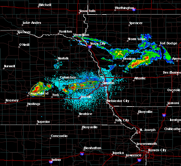 At 344 pm cdt, a severe thunderstorm was located near brainard, or 28 miles northwest of lincoln, moving east at 30 mph (radar indicated). Hazards include two inch hail and 60 mph wind gusts. People and animals outdoors will be injured. expect hail damage to roofs, siding, windows, and vehicles. Expect wind damage to roofs, siding, and trees. At 344 pm cdt, a severe thunderstorm was located near brainard, or 28 miles northwest of lincoln, moving east at 30 mph (radar indicated). Hazards include two inch hail and 60 mph wind gusts. People and animals outdoors will be injured. expect hail damage to roofs, siding, windows, and vehicles. Expect wind damage to roofs, siding, and trees.
|
| 5/5/2019 3:38 PM CDT |
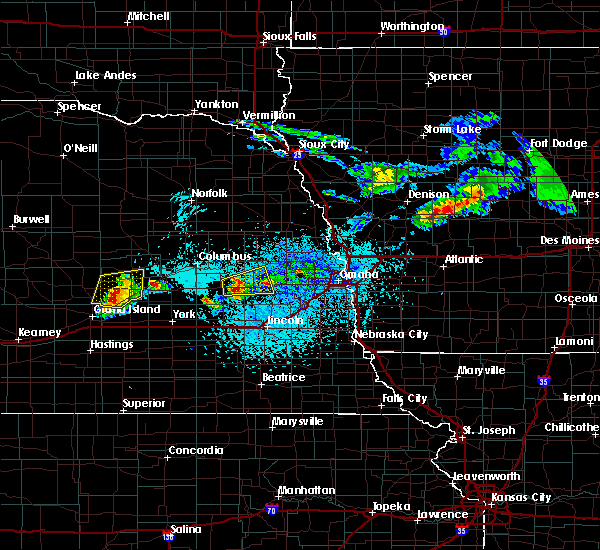 At 338 pm cdt, a severe thunderstorm was located near brainard, or 27 miles southeast of columbus, moving east at 30 mph (radar indicated). Hazards include two inch hail and 60 mph wind gusts. People and animals outdoors will be injured. expect hail damage to roofs, siding, windows, and vehicles. expect wind damage to roofs, siding, and trees. Locations impacted include, brainard, weston, prague, malmo and bruno. At 338 pm cdt, a severe thunderstorm was located near brainard, or 27 miles southeast of columbus, moving east at 30 mph (radar indicated). Hazards include two inch hail and 60 mph wind gusts. People and animals outdoors will be injured. expect hail damage to roofs, siding, windows, and vehicles. expect wind damage to roofs, siding, and trees. Locations impacted include, brainard, weston, prague, malmo and bruno.
|
| 5/5/2019 3:37 PM CDT |
 At 336 pm cdt, a severe thunderstorm was located near wahoo, or 30 miles north of lincoln, moving east at 30 mph (radar indicated). Hazards include two inch hail and 60 mph wind gusts. People and animals outdoors will be injured. expect hail damage to roofs, siding, windows, and vehicles. Expect wind damage to roofs, siding, and trees. At 336 pm cdt, a severe thunderstorm was located near wahoo, or 30 miles north of lincoln, moving east at 30 mph (radar indicated). Hazards include two inch hail and 60 mph wind gusts. People and animals outdoors will be injured. expect hail damage to roofs, siding, windows, and vehicles. Expect wind damage to roofs, siding, and trees.
|
| 5/5/2019 3:34 PM CDT |
 At 334 pm cdt, a severe thunderstorm was located over brainard, or 26 miles southeast of columbus, moving east at 30 mph (radar indicated). Hazards include two inch hail and 60 mph wind gusts. People and animals outdoors will be injured. expect hail damage to roofs, siding, windows, and vehicles. expect wind damage to roofs, siding, and trees. Locations impacted include, david city, brainard, weston, prague, malmo, bruno and abie. At 334 pm cdt, a severe thunderstorm was located over brainard, or 26 miles southeast of columbus, moving east at 30 mph (radar indicated). Hazards include two inch hail and 60 mph wind gusts. People and animals outdoors will be injured. expect hail damage to roofs, siding, windows, and vehicles. expect wind damage to roofs, siding, and trees. Locations impacted include, david city, brainard, weston, prague, malmo, bruno and abie.
|
| 5/5/2019 3:31 PM CDT |
 At 331 pm cdt, a severe thunderstorm was located over brainard, or 24 miles southeast of columbus, moving east at 30 mph (radar indicated). Hazards include two inch hail and 60 mph wind gusts. People and animals outdoors will be injured. expect hail damage to roofs, siding, windows, and vehicles. expect wind damage to roofs, siding, and trees. Locations impacted include, david city, brainard, weston, prague, malmo, bruno and abie. At 331 pm cdt, a severe thunderstorm was located over brainard, or 24 miles southeast of columbus, moving east at 30 mph (radar indicated). Hazards include two inch hail and 60 mph wind gusts. People and animals outdoors will be injured. expect hail damage to roofs, siding, windows, and vehicles. expect wind damage to roofs, siding, and trees. Locations impacted include, david city, brainard, weston, prague, malmo, bruno and abie.
|
| 5/5/2019 3:25 PM CDT |
 At 325 pm cdt, a severe thunderstorm was located over brainard, or 22 miles southeast of columbus, moving east at 30 mph (radar indicated). Hazards include two inch hail and 60 mph wind gusts. People and animals outdoors will be injured. expect hail damage to roofs, siding, windows, and vehicles. expect wind damage to roofs, siding, and trees. Locations impacted include, david city, brainard, weston, prague, malmo, bruno, abie and garrison. At 325 pm cdt, a severe thunderstorm was located over brainard, or 22 miles southeast of columbus, moving east at 30 mph (radar indicated). Hazards include two inch hail and 60 mph wind gusts. People and animals outdoors will be injured. expect hail damage to roofs, siding, windows, and vehicles. expect wind damage to roofs, siding, and trees. Locations impacted include, david city, brainard, weston, prague, malmo, bruno, abie and garrison.
|
| 5/5/2019 3:21 PM CDT |
 At 320 pm cdt, a severe thunderstorm was located over brainard, or 22 miles southeast of columbus, moving east at 30 mph (radar indicated). Hazards include two inch hail and 60 mph wind gusts. People and animals outdoors will be injured. expect hail damage to roofs, siding, windows, and vehicles. expect wind damage to roofs, siding, and trees. Locations impacted include, david city, brainard, weston, prague, malmo, bruno, abie and garrison. At 320 pm cdt, a severe thunderstorm was located over brainard, or 22 miles southeast of columbus, moving east at 30 mph (radar indicated). Hazards include two inch hail and 60 mph wind gusts. People and animals outdoors will be injured. expect hail damage to roofs, siding, windows, and vehicles. expect wind damage to roofs, siding, and trees. Locations impacted include, david city, brainard, weston, prague, malmo, bruno, abie and garrison.
|
| 5/5/2019 3:17 PM CDT |
 At 317 pm cdt, a severe thunderstorm was located near brainard, or 22 miles southeast of columbus, moving east at 30 mph (radar indicated). Hazards include two inch hail and 60 mph wind gusts. People and animals outdoors will be injured. expect hail damage to roofs, siding, windows, and vehicles. Expect wind damage to roofs, siding, and trees. At 317 pm cdt, a severe thunderstorm was located near brainard, or 22 miles southeast of columbus, moving east at 30 mph (radar indicated). Hazards include two inch hail and 60 mph wind gusts. People and animals outdoors will be injured. expect hail damage to roofs, siding, windows, and vehicles. Expect wind damage to roofs, siding, and trees.
|
| 9/20/2018 4:55 PM CDT |
 At 455 pm cdt, a severe thunderstorm was located near cedar bluffs, or 35 miles west of omaha, moving northeast at 55 mph (radar indicated). Hazards include 60 mph wind gusts. expect damage to roofs, siding, and trees At 455 pm cdt, a severe thunderstorm was located near cedar bluffs, or 35 miles west of omaha, moving northeast at 55 mph (radar indicated). Hazards include 60 mph wind gusts. expect damage to roofs, siding, and trees
|
| 9/18/2018 3:22 PM CDT |
 At 321 pm cdt, a severe thunderstorm was located 4 miles northwest of wahoo, or 30 miles north of lincoln, moving east at 45 mph (radar indicated). Hazards include 60 mph wind gusts and quarter size hail. Hail damage to vehicles is expected. Expect wind damage to roofs, siding, and trees. At 321 pm cdt, a severe thunderstorm was located 4 miles northwest of wahoo, or 30 miles north of lincoln, moving east at 45 mph (radar indicated). Hazards include 60 mph wind gusts and quarter size hail. Hail damage to vehicles is expected. Expect wind damage to roofs, siding, and trees.
|
| 6/30/2018 7:18 PM CDT |
 At 718 pm cdt, a severe thunderstorm was located 4 miles northeast of ulysses, or 25 miles southeast of columbus, moving east at 45 mph (radar indicated). Hazards include 70 mph wind gusts. Expect considerable tree damage. Damage is likely to mobile homes, roofs, and outbuildings. At 718 pm cdt, a severe thunderstorm was located 4 miles northeast of ulysses, or 25 miles southeast of columbus, moving east at 45 mph (radar indicated). Hazards include 70 mph wind gusts. Expect considerable tree damage. Damage is likely to mobile homes, roofs, and outbuildings.
|
| 6/9/2018 3:00 AM CDT |
 At 300 am cdt, severe thunderstorms were located along a line extending from near howells to near brainard, moving east at 40 mph (radar indicated). Hazards include 60 mph wind gusts. expect damage to roofs, siding, and trees At 300 am cdt, severe thunderstorms were located along a line extending from near howells to near brainard, moving east at 40 mph (radar indicated). Hazards include 60 mph wind gusts. expect damage to roofs, siding, and trees
|
| 6/6/2018 8:54 PM CDT |
 At 854 pm cdt, severe thunderstorms were located along a line extending from 3 miles north of weston to near dwight, moving southeast at 35 mph (radar indicated). Hazards include 60 mph wind gusts and quarter size hail. Hail damage to vehicles is expected. expect wind damage to roofs, siding, and trees. Locations impacted include, seward, wahoo, valparaiso, brainard, weston, staplehurst, garland, dwight, bee, ceresco, malcolm, raymond, davey, malmo and branched oak state recreation area. At 854 pm cdt, severe thunderstorms were located along a line extending from 3 miles north of weston to near dwight, moving southeast at 35 mph (radar indicated). Hazards include 60 mph wind gusts and quarter size hail. Hail damage to vehicles is expected. expect wind damage to roofs, siding, and trees. Locations impacted include, seward, wahoo, valparaiso, brainard, weston, staplehurst, garland, dwight, bee, ceresco, malcolm, raymond, davey, malmo and branched oak state recreation area.
|
| 6/6/2018 8:41 PM CDT |
 At 840 pm cdt, severe thunderstorms were located along a line extending from near prague to 4 miles northeast of ulysses, moving southeast at 40 mph (radar indicated). Hazards include 60 mph wind gusts and quarter size hail. Hail damage to vehicles is expected. Expect wind damage to roofs, siding, and trees. At 840 pm cdt, severe thunderstorms were located along a line extending from near prague to 4 miles northeast of ulysses, moving southeast at 40 mph (radar indicated). Hazards include 60 mph wind gusts and quarter size hail. Hail damage to vehicles is expected. Expect wind damage to roofs, siding, and trees.
|
| 6/6/2018 8:18 PM CDT |
 At 818 pm cdt, severe thunderstorms were located along a line extending from near cedar bluffs to 6 miles east of brainard to near shelby, moving south at 30 mph (radar indicated). Hazards include golf ball size hail and 70 mph wind gusts. People and animals outdoors will be injured. expect hail damage to roofs, siding, windows, and vehicles. expect considerable tree damage. wind damage is also likely to mobile homes, roofs, and outbuildings. Locations impacted include, wahoo, david city, valparaiso, bellwood, rising city, brainard, weston, prague, dwight, and ulysses. At 818 pm cdt, severe thunderstorms were located along a line extending from near cedar bluffs to 6 miles east of brainard to near shelby, moving south at 30 mph (radar indicated). Hazards include golf ball size hail and 70 mph wind gusts. People and animals outdoors will be injured. expect hail damage to roofs, siding, windows, and vehicles. expect considerable tree damage. wind damage is also likely to mobile homes, roofs, and outbuildings. Locations impacted include, wahoo, david city, valparaiso, bellwood, rising city, brainard, weston, prague, dwight, and ulysses.
|
| 6/6/2018 7:56 PM CDT |
 At 755 pm cdt, severe thunderstorms were located along a line extending from near cedar bluffs to 6 miles south of columbus, moving south at 40 mph (radar indicated). Hazards include golf ball size hail and 70 mph wind gusts. People and animals outdoors will be injured. expect hail damage to roofs, siding, windows, and vehicles. expect considerable tree damage. Wind damage is also likely to mobile homes, roofs, and outbuildings. At 755 pm cdt, severe thunderstorms were located along a line extending from near cedar bluffs to 6 miles south of columbus, moving south at 40 mph (radar indicated). Hazards include golf ball size hail and 70 mph wind gusts. People and animals outdoors will be injured. expect hail damage to roofs, siding, windows, and vehicles. expect considerable tree damage. Wind damage is also likely to mobile homes, roofs, and outbuildings.
|
| 6/1/2018 11:26 PM CDT |
 At 1124 pm cdt, the leading edge of a line of severe thunderstorms was located along a line extending from 4 miles north of nickerson to near mead, moving east at 40 mph. additional damaging winds are expected well behind the leading edge of these storms (trained weather spotters reported 60 mph winds at dodge. wind damage has been reported along this entire line of storms). Hazards include 70 mph wind gusts and penny size hail. Expect considerable tree damage. damage is likely to mobile homes, roofs, and outbuildings. Locations impacted include, fremont, wahoo, david city, north bend, scribner, hooper, cedar bluffs, rising city, nickerson, brainard, inglewood, weston, prague, snyder, uehling, morse bluff, octavia, malmo, colon and winslow. At 1124 pm cdt, the leading edge of a line of severe thunderstorms was located along a line extending from 4 miles north of nickerson to near mead, moving east at 40 mph. additional damaging winds are expected well behind the leading edge of these storms (trained weather spotters reported 60 mph winds at dodge. wind damage has been reported along this entire line of storms). Hazards include 70 mph wind gusts and penny size hail. Expect considerable tree damage. damage is likely to mobile homes, roofs, and outbuildings. Locations impacted include, fremont, wahoo, david city, north bend, scribner, hooper, cedar bluffs, rising city, nickerson, brainard, inglewood, weston, prague, snyder, uehling, morse bluff, octavia, malmo, colon and winslow.
|
| 6/1/2018 11:09 PM CDT |
 At 1107 pm cdt, the leading edge of severe thunderstorms was located along a line extending from near scribner to 3 miles west of cedar bluffs to 5 miles south of david city, moving east at 50 mph. damaging winds continue well behind the leading edge of the storms as well (trained weather spotters reported power lines down in clarkson. additional wind damage has been reported along this entire line of storms). Hazards include 70 mph wind gusts and quarter size hail. Hail damage to vehicles is expected. expect considerable tree damage. wind damage is also likely to mobile homes, roofs, and outbuildings. Locations impacted include, fremont, wahoo, david city, north bend, scribner, hooper, dodge, cedar bluffs, valparaiso, bellwood, rising city, nickerson, brainard, inglewood, weston, prague, snyder, uehling, dwight and ulysses. At 1107 pm cdt, the leading edge of severe thunderstorms was located along a line extending from near scribner to 3 miles west of cedar bluffs to 5 miles south of david city, moving east at 50 mph. damaging winds continue well behind the leading edge of the storms as well (trained weather spotters reported power lines down in clarkson. additional wind damage has been reported along this entire line of storms). Hazards include 70 mph wind gusts and quarter size hail. Hail damage to vehicles is expected. expect considerable tree damage. wind damage is also likely to mobile homes, roofs, and outbuildings. Locations impacted include, fremont, wahoo, david city, north bend, scribner, hooper, dodge, cedar bluffs, valparaiso, bellwood, rising city, nickerson, brainard, inglewood, weston, prague, snyder, uehling, dwight and ulysses.
|
| 6/1/2018 10:44 PM CDT |
 At 1043 pm cdt, severe thunderstorms were located along a line extending from near howells to 6 miles north of schuyler to 6 miles south of duncan, moving east at 40 mph. this is the leading edge of an area of damaging thunderstorm winds (trained weather spotters reported wind damage across platte county and the columbus airport measured 63 mph wind gust at 1042 pm). Hazards include 70 mph wind gusts and half dollar size hail. Hail damage to vehicles is expected. expect considerable tree damage. Wind damage is also likely to mobile homes, roofs, and outbuildings. At 1043 pm cdt, severe thunderstorms were located along a line extending from near howells to 6 miles north of schuyler to 6 miles south of duncan, moving east at 40 mph. this is the leading edge of an area of damaging thunderstorm winds (trained weather spotters reported wind damage across platte county and the columbus airport measured 63 mph wind gust at 1042 pm). Hazards include 70 mph wind gusts and half dollar size hail. Hail damage to vehicles is expected. expect considerable tree damage. Wind damage is also likely to mobile homes, roofs, and outbuildings.
|
| 6/27/2017 7:43 PM CDT |
 At 1242 am cdt, severe thunderstorms were located along a line extending from 5 miles northwest of prague to 4 miles northeast of garland to 3 miles south of beaver crossing, moving east at 55 mph (radar indicated). Hazards include 60 mph wind gusts. Expect damage to roofs, siding, and trees. locations impacted include, lincoln, seward, wahoo, milford, valparaiso, mead, beaver crossing, brainard, weston, prague, garland, pleasant dale, dwight, bee, ceresco, malcolm, roca, denton, raymond and davey. this includes the following highways, highway 77 in nebraska between mile markers 51 and 108. highway 92 in nebraska between mile markers 425 and 452. Interstate 80 in nebraska between mile markers 371 and 407. At 1242 am cdt, severe thunderstorms were located along a line extending from 5 miles northwest of prague to 4 miles northeast of garland to 3 miles south of beaver crossing, moving east at 55 mph (radar indicated). Hazards include 60 mph wind gusts. Expect damage to roofs, siding, and trees. locations impacted include, lincoln, seward, wahoo, milford, valparaiso, mead, beaver crossing, brainard, weston, prague, garland, pleasant dale, dwight, bee, ceresco, malcolm, roca, denton, raymond and davey. this includes the following highways, highway 77 in nebraska between mile markers 51 and 108. highway 92 in nebraska between mile markers 425 and 452. Interstate 80 in nebraska between mile markers 371 and 407.
|
| 6/27/2017 7:35 PM CDT |
 At 1235 am cdt, severe thunderstorms were located along a line extending from 8 miles northwest of prague to near bee to 6 miles northwest of dorchester, moving east at 55 mph (radar indicated). Hazards include 60 mph wind gusts. expect damage to roofs, siding, and trees At 1235 am cdt, severe thunderstorms were located along a line extending from 8 miles northwest of prague to near bee to 6 miles northwest of dorchester, moving east at 55 mph (radar indicated). Hazards include 60 mph wind gusts. expect damage to roofs, siding, and trees
|
| 6/16/2017 7:36 PM CDT |
 At 736 pm cdt, severe thunderstorms were located along a line extending from 4 miles southwest of missouri valley to 8 miles southwest of fort calhoun to 3 miles south of waterloo to near wahoo, moving southeast at 40 mph. these are very dangerous storms (radar indicated). Hazards include 80 mph wind gusts and quarter size hail. Flying debris will be dangerous to those caught without shelter. mobile homes will be heavily damaged. expect considerable damage to roofs, windows, and vehicles. extensive tree damage and power outages are likely. locations impacted include, omaha, council bluffs, bellevue, papillion, la vista, blair, ralston, wahoo, gretna, missouri valley, ashland, valley, springfield, yutan, underwood, fort calhoun, waterloo, mead, cedar creek and kennard. this includes the following highways, highway 275 in nebraska near mile marker 167. highway 30 in iowa between mile markers 1 and 5. highway 30 in nebraska between mile markers 441 and 444, and near mile marker 450. highway 75 in nebraska between mile markers 76 and 114. highway 77 in nebraska between mile markers 90 and 104. highway 92 in nebraska between mile markers 446 and 466. interstate 29 between mile markers 39 and 79. interstate 80 in iowa between mile markers 1 and 23. Interstate 80 in nebraska between mile markers 428 and 454. At 736 pm cdt, severe thunderstorms were located along a line extending from 4 miles southwest of missouri valley to 8 miles southwest of fort calhoun to 3 miles south of waterloo to near wahoo, moving southeast at 40 mph. these are very dangerous storms (radar indicated). Hazards include 80 mph wind gusts and quarter size hail. Flying debris will be dangerous to those caught without shelter. mobile homes will be heavily damaged. expect considerable damage to roofs, windows, and vehicles. extensive tree damage and power outages are likely. locations impacted include, omaha, council bluffs, bellevue, papillion, la vista, blair, ralston, wahoo, gretna, missouri valley, ashland, valley, springfield, yutan, underwood, fort calhoun, waterloo, mead, cedar creek and kennard. this includes the following highways, highway 275 in nebraska near mile marker 167. highway 30 in iowa between mile markers 1 and 5. highway 30 in nebraska between mile markers 441 and 444, and near mile marker 450. highway 75 in nebraska between mile markers 76 and 114. highway 77 in nebraska between mile markers 90 and 104. highway 92 in nebraska between mile markers 446 and 466. interstate 29 between mile markers 39 and 79. interstate 80 in iowa between mile markers 1 and 23. Interstate 80 in nebraska between mile markers 428 and 454.
|
| 6/16/2017 7:30 PM CDT |
 At 729 pm cdt, severe thunderstorms were located along a line extending from 5 miles south of modale to 5 miles south of kennard to near valley to 4 miles northwest of wahoo, moving southeast at 40 mph (radar indicated). Hazards include 60 mph wind gusts and quarter size hail. Hail damage to vehicles is expected. Expect wind damage to roofs, siding, and trees. At 729 pm cdt, severe thunderstorms were located along a line extending from 5 miles south of modale to 5 miles south of kennard to near valley to 4 miles northwest of wahoo, moving southeast at 40 mph (radar indicated). Hazards include 60 mph wind gusts and quarter size hail. Hail damage to vehicles is expected. Expect wind damage to roofs, siding, and trees.
|
| 6/16/2017 7:07 PM CDT |
 At 706 pm cdt, severe thunderstorms were located along a line extending from 4 miles northwest of pisgah to near shelby, moving southeast at 35 mph (radar indicated). Hazards include 70 mph wind gusts and quarter size hail. Hail damage to vehicles is expected. expect considerable tree damage. Wind damage is also likely to mobile homes, roofs, and outbuildings. At 706 pm cdt, severe thunderstorms were located along a line extending from 4 miles northwest of pisgah to near shelby, moving southeast at 35 mph (radar indicated). Hazards include 70 mph wind gusts and quarter size hail. Hail damage to vehicles is expected. expect considerable tree damage. Wind damage is also likely to mobile homes, roofs, and outbuildings.
|
| 6/13/2017 11:37 PM CDT |
 The severe thunderstorm warning for southern colfax, northern lancaster, southwestern dodge, northeastern seward, eastern butler and saunders counties will expire at 1145 pm cdt, the storms which prompted the warning have weakened below severe limits, and no longer pose an immediate threat to life or property. therefore the warning will be allowed to expire. however small hail, gusty winds and heavy rain are still possible with these thunderstorms. a severe thunderstorm watch remains in effect until 100 am cdt for southeastern, northeastern and east central nebraska. The severe thunderstorm warning for southern colfax, northern lancaster, southwestern dodge, northeastern seward, eastern butler and saunders counties will expire at 1145 pm cdt, the storms which prompted the warning have weakened below severe limits, and no longer pose an immediate threat to life or property. therefore the warning will be allowed to expire. however small hail, gusty winds and heavy rain are still possible with these thunderstorms. a severe thunderstorm watch remains in effect until 100 am cdt for southeastern, northeastern and east central nebraska.
|
| 6/13/2017 11:31 PM CDT |
 At 1130 pm cdt, severe thunderstorms were located along a line extending from near schuyler to near north bend to 3 miles north of wahoo to 7 miles southeast of valparaiso, moving northeast at 45 mph (trained weather spotters). Hazards include 60 mph wind gusts. Expect damage to roofs, siding, and trees. locations impacted include, schuyler, wahoo, waverly, north bend, cedar bluffs, valparaiso, mead, weston, prague, ceresco, raymond, davey, ithaca, morse bluff, octavia, malmo, colon, bruno, rogers and linwood. this includes the following highways, highway 30 in nebraska between mile markers 387 and 420. highway 77 in nebraska near mile marker 74, and between mile markers 81 and 100. Highway 92 in nebraska between mile markers 433 and 452. At 1130 pm cdt, severe thunderstorms were located along a line extending from near schuyler to near north bend to 3 miles north of wahoo to 7 miles southeast of valparaiso, moving northeast at 45 mph (trained weather spotters). Hazards include 60 mph wind gusts. Expect damage to roofs, siding, and trees. locations impacted include, schuyler, wahoo, waverly, north bend, cedar bluffs, valparaiso, mead, weston, prague, ceresco, raymond, davey, ithaca, morse bluff, octavia, malmo, colon, bruno, rogers and linwood. this includes the following highways, highway 30 in nebraska between mile markers 387 and 420. highway 77 in nebraska near mile marker 74, and between mile markers 81 and 100. Highway 92 in nebraska between mile markers 433 and 452.
|
| 6/13/2017 11:14 PM CDT |
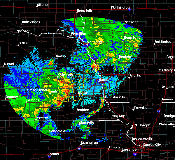 At 1112 pm cdt, severe thunderstorms were located along a line extending from near bellwood to 6 miles west of prague to near valparaiso to 6 miles southeast of pleasant dale, moving northeast at 40 mph (trained weather spotters). Hazards include 60 mph wind gusts. expect damage to roofs, siding, and trees At 1112 pm cdt, severe thunderstorms were located along a line extending from near bellwood to 6 miles west of prague to near valparaiso to 6 miles southeast of pleasant dale, moving northeast at 40 mph (trained weather spotters). Hazards include 60 mph wind gusts. expect damage to roofs, siding, and trees
|
| 6/13/2017 9:55 PM CDT |
 The severe thunderstorm warning for northwestern lancaster, seward, butler and western saunders counties will expire at 1000 pm cdt, the storms which prompted the warning have weakened below severe limits, and no longer pose an immediate threat to life or property. therefore the warning will be allowed to expire. however nickel size hail, gusty winds and heavy rain are still possible with these thunderstorms. a severe thunderstorm watch remains in effect until 100 am cdt for southeastern and east central nebraska. The severe thunderstorm warning for northwestern lancaster, seward, butler and western saunders counties will expire at 1000 pm cdt, the storms which prompted the warning have weakened below severe limits, and no longer pose an immediate threat to life or property. therefore the warning will be allowed to expire. however nickel size hail, gusty winds and heavy rain are still possible with these thunderstorms. a severe thunderstorm watch remains in effect until 100 am cdt for southeastern and east central nebraska.
|
| 6/13/2017 9:47 PM CDT |
 At 946 pm cdt, severe thunderstorms were located along a line extending from 3 miles southwest of cedar bluffs to near valparaiso to 5 miles west of milford, moving east at 25 mph (radar indicated). Hazards include 60 mph wind gusts and quarter size hail. Hail damage to vehicles is expected. expect wind damage to roofs, siding, and trees. locations impacted include, seward, david city, milford, utica, valparaiso, beaver crossing, brainard, weston, prague, staplehurst, garland, pleasant dale, dwight, bee, ulysses, malcolm, raymond, goehner, cordova and octavia. this includes the following highways, highway 92 in nebraska between mile markers 419 and 446. Interstate 80 in nebraska between mile markers 366 and 390. At 946 pm cdt, severe thunderstorms were located along a line extending from 3 miles southwest of cedar bluffs to near valparaiso to 5 miles west of milford, moving east at 25 mph (radar indicated). Hazards include 60 mph wind gusts and quarter size hail. Hail damage to vehicles is expected. expect wind damage to roofs, siding, and trees. locations impacted include, seward, david city, milford, utica, valparaiso, beaver crossing, brainard, weston, prague, staplehurst, garland, pleasant dale, dwight, bee, ulysses, malcolm, raymond, goehner, cordova and octavia. this includes the following highways, highway 92 in nebraska between mile markers 419 and 446. Interstate 80 in nebraska between mile markers 366 and 390.
|
| 6/13/2017 9:37 PM CDT |
 At 936 pm cdt, severe thunderstorms were located along a line extending from 5 miles south of north bend to near dwight to 3 miles north of beaver crossing, moving east at 25 mph (radar indicated). Hazards include 60 mph wind gusts and quarter size hail. Hail damage to vehicles is expected. expect wind damage to roofs, siding, and trees. locations impacted include, seward, david city, milford, utica, valparaiso, beaver crossing, brainard, weston, prague, staplehurst, garland, pleasant dale, dwight, bee, ulysses, malcolm, raymond, goehner, cordova and octavia. this includes the following highways, highway 92 in nebraska between mile markers 419 and 446. Interstate 80 in nebraska between mile markers 366 and 390. At 936 pm cdt, severe thunderstorms were located along a line extending from 5 miles south of north bend to near dwight to 3 miles north of beaver crossing, moving east at 25 mph (radar indicated). Hazards include 60 mph wind gusts and quarter size hail. Hail damage to vehicles is expected. expect wind damage to roofs, siding, and trees. locations impacted include, seward, david city, milford, utica, valparaiso, beaver crossing, brainard, weston, prague, staplehurst, garland, pleasant dale, dwight, bee, ulysses, malcolm, raymond, goehner, cordova and octavia. this includes the following highways, highway 92 in nebraska between mile markers 419 and 446. Interstate 80 in nebraska between mile markers 366 and 390.
|
| 6/13/2017 9:27 PM CDT |
 At 926 pm cdt, severe thunderstorms were located along a line extending from 6 miles northeast of north bend to near dwight to 4 miles south of seward, moving east at 30 mph (radar indicated). Hazards include 60 mph wind gusts and quarter size hail. Hail damage to vehicles is expected. Expect wind damage to roofs, siding, and trees. At 926 pm cdt, severe thunderstorms were located along a line extending from 6 miles northeast of north bend to near dwight to 4 miles south of seward, moving east at 30 mph (radar indicated). Hazards include 60 mph wind gusts and quarter size hail. Hail damage to vehicles is expected. Expect wind damage to roofs, siding, and trees.
|
| 6/13/2017 9:18 PM CDT |
 At 918 pm cdt, severe thunderstorms were located along a line extending from 4 miles southwest of snyder to 5 miles southwest of prague to 4 miles west of beaver crossing, moving east at 35 mph (radar indicated). Hazards include 60 mph wind gusts and half dollar size hail. Hail damage to vehicles is expected. expect wind damage to roofs, siding, and trees. locations impacted include, fremont, seward, schuyler, wahoo, david city, milford, north bend, utica, hooper, cedar bluffs, valparaiso, bellwood, beaver crossing, rising city, brainard, inglewood, weston, prague, staplehurst and garland. this includes the following highways, highway 275 in nebraska between mile markers 135 and 140. highway 30 in nebraska between mile markers 387 and 426. highway 77 in nebraska between mile markers 90 and 93, and between mile markers 108 and 126. highway 92 in nebraska between mile markers 412 and 452. Interstate 80 in nebraska between mile markers 366 and 392. At 918 pm cdt, severe thunderstorms were located along a line extending from 4 miles southwest of snyder to 5 miles southwest of prague to 4 miles west of beaver crossing, moving east at 35 mph (radar indicated). Hazards include 60 mph wind gusts and half dollar size hail. Hail damage to vehicles is expected. expect wind damage to roofs, siding, and trees. locations impacted include, fremont, seward, schuyler, wahoo, david city, milford, north bend, utica, hooper, cedar bluffs, valparaiso, bellwood, beaver crossing, rising city, brainard, inglewood, weston, prague, staplehurst and garland. this includes the following highways, highway 275 in nebraska between mile markers 135 and 140. highway 30 in nebraska between mile markers 387 and 426. highway 77 in nebraska between mile markers 90 and 93, and between mile markers 108 and 126. highway 92 in nebraska between mile markers 412 and 452. Interstate 80 in nebraska between mile markers 366 and 392.
|
| 6/13/2017 9:07 PM CDT |
 At 906 pm cdt, severe thunderstorms were located along a line extending from 6 miles south of howells to 5 miles east of david city to 3 miles southwest of beaver crossing, moving east at 40 mph (radar indicated). Hazards include 60 mph wind gusts and quarter size hail. Hail damage to vehicles is expected. Expect wind damage to roofs, siding, and trees. At 906 pm cdt, severe thunderstorms were located along a line extending from 6 miles south of howells to 5 miles east of david city to 3 miles southwest of beaver crossing, moving east at 40 mph (radar indicated). Hazards include 60 mph wind gusts and quarter size hail. Hail damage to vehicles is expected. Expect wind damage to roofs, siding, and trees.
|
| 6/13/2017 8:59 PM CDT |
 At 859 pm cdt, severe thunderstorms were located along a line extending from 4 miles east of scribner to 3 miles south of inglewood to 5 miles south of valparaiso, moving east at 45 mph (radar indicated). Hazards include 60 mph wind gusts. Expect damage to roofs, siding, and trees. locations impacted include, fremont, schuyler, wahoo, david city, north bend, scribner, hooper, clarkson, dodge, cedar bluffs, valparaiso, howells, bellwood, rising city, nickerson, brainard, inglewood, weston, prague and snyder. this includes the following highways, highway 275 in nebraska between mile markers 124 and 156. highway 30 in nebraska between mile markers 387 and 426. highway 77 in nebraska between mile markers 90 and 93, and between mile markers 108 and 135. Highway 92 in nebraska between mile markers 409 and 446. At 859 pm cdt, severe thunderstorms were located along a line extending from 4 miles east of scribner to 3 miles south of inglewood to 5 miles south of valparaiso, moving east at 45 mph (radar indicated). Hazards include 60 mph wind gusts. Expect damage to roofs, siding, and trees. locations impacted include, fremont, schuyler, wahoo, david city, north bend, scribner, hooper, clarkson, dodge, cedar bluffs, valparaiso, howells, bellwood, rising city, nickerson, brainard, inglewood, weston, prague and snyder. this includes the following highways, highway 275 in nebraska between mile markers 124 and 156. highway 30 in nebraska between mile markers 387 and 426. highway 77 in nebraska between mile markers 90 and 93, and between mile markers 108 and 135. Highway 92 in nebraska between mile markers 409 and 446.
|
| 6/13/2017 8:42 PM CDT |
 At 840 pm cdt, severe thunderstorms were located along a line extending from dodge to near north bend to 3 miles southeast of ulysses, moving east at 45 mph. another line of storms was moving across southern platte and into western butler counties, also moving east at 45 mph (radar indicated). Hazards include 60 mph wind gusts. expect damage to roofs, siding, and trees At 840 pm cdt, severe thunderstorms were located along a line extending from dodge to near north bend to 3 miles southeast of ulysses, moving east at 45 mph. another line of storms was moving across southern platte and into western butler counties, also moving east at 45 mph (radar indicated). Hazards include 60 mph wind gusts. expect damage to roofs, siding, and trees
|
| 6/13/2017 8:32 PM CDT |
 At 831 pm cdt, severe thunderstorms were located along a line extending from near howells to 6 miles northeast of schuyler to 4 miles south of david city, moving east at 50 mph (radar indicated). Hazards include 70 mph wind gusts and nickel size hail. Expect considerable tree damage. damage is likely to mobile homes, roofs, and outbuildings. locations impacted include, schuyler, wahoo, david city, north bend, scribner, clarkson, dodge, cedar bluffs, valparaiso, howells, bellwood, rising city, brainard, weston, prague, snyder, dwight, ulysses, morse bluff and octavia. this includes the following highways, highway 275 in nebraska between mile markers 127 and 132. highway 30 in nebraska between mile markers 387 and 420. highway 77 in nebraska between mile markers 85 and 93. Highway 92 in nebraska between mile markers 409 and 446. At 831 pm cdt, severe thunderstorms were located along a line extending from near howells to 6 miles northeast of schuyler to 4 miles south of david city, moving east at 50 mph (radar indicated). Hazards include 70 mph wind gusts and nickel size hail. Expect considerable tree damage. damage is likely to mobile homes, roofs, and outbuildings. locations impacted include, schuyler, wahoo, david city, north bend, scribner, clarkson, dodge, cedar bluffs, valparaiso, howells, bellwood, rising city, brainard, weston, prague, snyder, dwight, ulysses, morse bluff and octavia. this includes the following highways, highway 275 in nebraska between mile markers 127 and 132. highway 30 in nebraska between mile markers 387 and 420. highway 77 in nebraska between mile markers 85 and 93. Highway 92 in nebraska between mile markers 409 and 446.
|
| 6/13/2017 8:21 PM CDT |
 At 821 pm cdt, severe thunderstorms were located along a line extending from 3 miles southwest of clarkson to 3 miles west of schuyler to 3 miles northeast of ulysses, moving east at 50 mph (trained weather spotters). Hazards include 70 mph wind gusts and nickel size hail. Expect considerable tree damage. Damage is likely to mobile homes, roofs, and outbuildings. At 821 pm cdt, severe thunderstorms were located along a line extending from 3 miles southwest of clarkson to 3 miles west of schuyler to 3 miles northeast of ulysses, moving east at 50 mph (trained weather spotters). Hazards include 70 mph wind gusts and nickel size hail. Expect considerable tree damage. Damage is likely to mobile homes, roofs, and outbuildings.
|
| 5/17/2017 2:49 AM CDT |
 At 249 am cdt, severe thunderstorms were located along a line extending from near weston to 4 miles north of lincoln to 4 miles northeast of hallam, moving east at 50 mph (radar indicated). Hazards include 60 mph wind gusts. Expect damage to roofs, siding, and trees. locations impacted include, lincoln, wahoo, waverly, hickman, bennet, valparaiso, weston, panama, ceresco, roca, raymond, davey, ithaca, sprague, malmo, colon, stagecoach state recreation area, wagon train state recreation area and bluestem state recreation area. this includes the following highways, highway 2 in nebraska between mile markers 466 and 472. highway 77 in nebraska between mile markers 48 and 97. highway 92 in nebraska between mile markers 438 and 452. Interstate 80 in nebraska between mile markers 395 and 412. At 249 am cdt, severe thunderstorms were located along a line extending from near weston to 4 miles north of lincoln to 4 miles northeast of hallam, moving east at 50 mph (radar indicated). Hazards include 60 mph wind gusts. Expect damage to roofs, siding, and trees. locations impacted include, lincoln, wahoo, waverly, hickman, bennet, valparaiso, weston, panama, ceresco, roca, raymond, davey, ithaca, sprague, malmo, colon, stagecoach state recreation area, wagon train state recreation area and bluestem state recreation area. this includes the following highways, highway 2 in nebraska between mile markers 466 and 472. highway 77 in nebraska between mile markers 48 and 97. highway 92 in nebraska between mile markers 438 and 452. Interstate 80 in nebraska between mile markers 395 and 412.
|
| 5/17/2017 2:41 AM CDT |
 At 241 am cdt, severe thunderstorms were located along a line extending from 6 miles west of weston to 6 miles northwest of lincoln to 4 miles northwest of hallam, moving east at 40 mph (radar indicated). Hazards include 60 mph wind gusts. Expect damage to roofs, siding, and trees. locations impacted include, lincoln, wahoo, waverly, hickman, bennet, firth, valparaiso, weston, panama, hallam, ceresco, malcolm, roca, denton, raymond, davey, ithaca, sprague, malmo and colon. people attending sherman field and haymarket park should seek safe shelter immediately! this includes the following highways, highway 2 in nebraska between mile markers 466 and 472. highway 77 in nebraska between mile markers 42 and 97. highway 92 in nebraska between mile markers 433 and 452. Interstate 80 in nebraska between mile markers 390 and 412. At 241 am cdt, severe thunderstorms were located along a line extending from 6 miles west of weston to 6 miles northwest of lincoln to 4 miles northwest of hallam, moving east at 40 mph (radar indicated). Hazards include 60 mph wind gusts. Expect damage to roofs, siding, and trees. locations impacted include, lincoln, wahoo, waverly, hickman, bennet, firth, valparaiso, weston, panama, hallam, ceresco, malcolm, roca, denton, raymond, davey, ithaca, sprague, malmo and colon. people attending sherman field and haymarket park should seek safe shelter immediately! this includes the following highways, highway 2 in nebraska between mile markers 466 and 472. highway 77 in nebraska between mile markers 42 and 97. highway 92 in nebraska between mile markers 433 and 452. Interstate 80 in nebraska between mile markers 390 and 412.
|
| 5/17/2017 2:27 AM CDT |
 At 227 am cdt, severe thunderstorms were located along a line extending from near bee to 3 miles northwest of pleasant dale to 5 miles northwest of wilber, moving east at 50 mph (radar indicated). Hazards include 60 mph wind gusts. expect damage to roofs, siding, and trees At 227 am cdt, severe thunderstorms were located along a line extending from near bee to 3 miles northwest of pleasant dale to 5 miles northwest of wilber, moving east at 50 mph (radar indicated). Hazards include 60 mph wind gusts. expect damage to roofs, siding, and trees
|
| 5/16/2017 5:57 PM CDT |
 The severe thunderstorm warning for saunders county will expire at 600 pm cdt, this warning will expire but a new warning has been issued that covers much of saunders county. this storm is likely producing very strong winds over 60 mph. a severe thunderstorm watch remains in effect until midnight cdt for east central nebraska. The severe thunderstorm warning for saunders county will expire at 600 pm cdt, this warning will expire but a new warning has been issued that covers much of saunders county. this storm is likely producing very strong winds over 60 mph. a severe thunderstorm watch remains in effect until midnight cdt for east central nebraska.
|
| 5/16/2017 5:53 PM CDT |
 At 553 pm cdt, severe thunderstorms were located along a line extending from 3 miles south of inglewood to lincoln, moving east at 35 mph. outflow winds may reach 60 to 65 mph (radar indicated). Hazards include 60 mph wind gusts. expect damage to roofs, siding, and trees At 553 pm cdt, severe thunderstorms were located along a line extending from 3 miles south of inglewood to lincoln, moving east at 35 mph. outflow winds may reach 60 to 65 mph (radar indicated). Hazards include 60 mph wind gusts. expect damage to roofs, siding, and trees
|
| 5/16/2017 5:47 PM CDT |
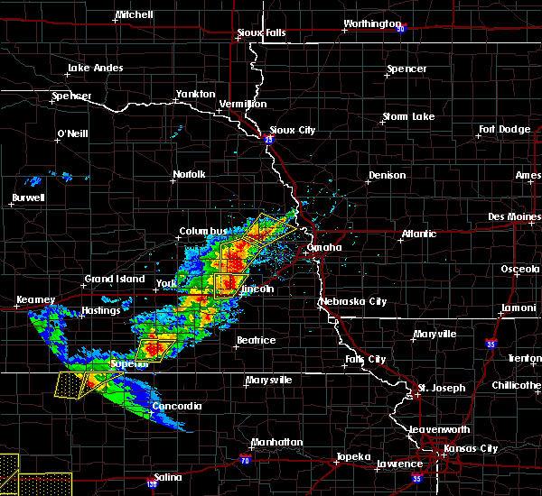 At 547 pm cdt, a severe thunderstorm was located near weston, or 25 miles north of lincoln, moving northeast at 25 mph (radar indicated). Hazards include 60 mph wind gusts and half dollar size hail. Hail damage to vehicles is expected. expect wind damage to roofs, siding, and trees. locations impacted include, wahoo, cedar bluffs, valparaiso, weston, prague, malmo and colon. this includes the following highways, highway 77 in nebraska between mile markers 87 and 97, and between mile markers 104 and 108. Highway 92 in nebraska between mile markers 434 and 452. At 547 pm cdt, a severe thunderstorm was located near weston, or 25 miles north of lincoln, moving northeast at 25 mph (radar indicated). Hazards include 60 mph wind gusts and half dollar size hail. Hail damage to vehicles is expected. expect wind damage to roofs, siding, and trees. locations impacted include, wahoo, cedar bluffs, valparaiso, weston, prague, malmo and colon. this includes the following highways, highway 77 in nebraska between mile markers 87 and 97, and between mile markers 104 and 108. Highway 92 in nebraska between mile markers 434 and 452.
|
| 5/16/2017 5:42 PM CDT |
 At 542 pm cdt, a severe thunderstorm was located over weston, or 24 miles north of lincoln, moving northeast at 25 mph (radar indicated). Hazards include 60 mph wind gusts and half dollar size hail. Hail damage to vehicles is expected. expect wind damage to roofs, siding, and trees. locations impacted include, wahoo, cedar bluffs, valparaiso, weston, prague, malmo and colon. this includes the following highways, highway 77 in nebraska between mile markers 87 and 97, and between mile markers 104 and 108. Highway 92 in nebraska between mile markers 434 and 452. At 542 pm cdt, a severe thunderstorm was located over weston, or 24 miles north of lincoln, moving northeast at 25 mph (radar indicated). Hazards include 60 mph wind gusts and half dollar size hail. Hail damage to vehicles is expected. expect wind damage to roofs, siding, and trees. locations impacted include, wahoo, cedar bluffs, valparaiso, weston, prague, malmo and colon. this includes the following highways, highway 77 in nebraska between mile markers 87 and 97, and between mile markers 104 and 108. Highway 92 in nebraska between mile markers 434 and 452.
|
| 5/16/2017 5:37 PM CDT |
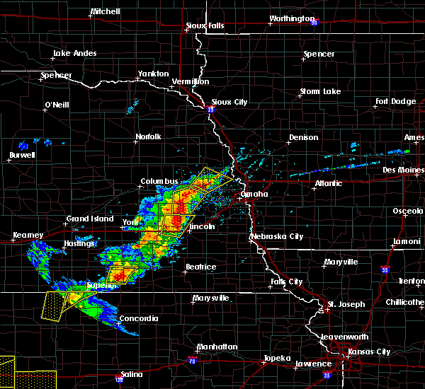 At 542 pm cdt, a severe thunderstorm was located over weston, or 24 miles north of lincoln, moving northeast at 25 mph (radar indicated). Hazards include 60 mph wind gusts and half dollar size hail. Hail damage to vehicles is expected. expect wind damage to roofs, siding, and trees. locations impacted include, wahoo, cedar bluffs, valparaiso, weston, prague, malmo and colon. this includes the following highways, highway 77 in nebraska between mile markers 87 and 97, and between mile markers 104 and 108. Highway 92 in nebraska between mile markers 434 and 452. At 542 pm cdt, a severe thunderstorm was located over weston, or 24 miles north of lincoln, moving northeast at 25 mph (radar indicated). Hazards include 60 mph wind gusts and half dollar size hail. Hail damage to vehicles is expected. expect wind damage to roofs, siding, and trees. locations impacted include, wahoo, cedar bluffs, valparaiso, weston, prague, malmo and colon. this includes the following highways, highway 77 in nebraska between mile markers 87 and 97, and between mile markers 104 and 108. Highway 92 in nebraska between mile markers 434 and 452.
|
| 5/16/2017 5:28 PM CDT |
 At 528 pm cdt, a severe thunderstorm was located 5 miles west of weston, or 28 miles north of lincoln, moving northeast at 25 mph. another storm with hail was just south of cedar bluffs, also moving northeast (radar indicated). Hazards include 60 mph wind gusts and half dollar size hail. Hail damage to vehicles is expected. expect wind damage to roofs, siding, and trees. locations impacted include, wahoo, cedar bluffs, valparaiso, weston, prague, malmo and colon. this includes the following highways, highway 77 in nebraska between mile markers 87 and 97, and between mile markers 104 and 108. Highway 92 in nebraska between mile markers 434 and 452. At 528 pm cdt, a severe thunderstorm was located 5 miles west of weston, or 28 miles north of lincoln, moving northeast at 25 mph. another storm with hail was just south of cedar bluffs, also moving northeast (radar indicated). Hazards include 60 mph wind gusts and half dollar size hail. Hail damage to vehicles is expected. expect wind damage to roofs, siding, and trees. locations impacted include, wahoo, cedar bluffs, valparaiso, weston, prague, malmo and colon. this includes the following highways, highway 77 in nebraska between mile markers 87 and 97, and between mile markers 104 and 108. Highway 92 in nebraska between mile markers 434 and 452.
|
| 5/16/2017 5:19 PM CDT |
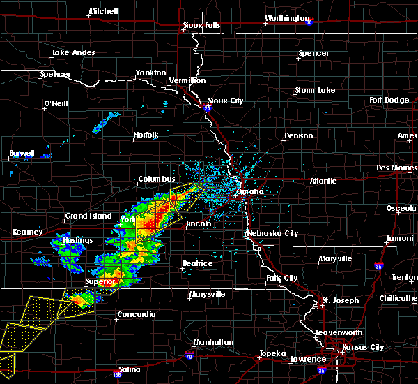 At 519 pm cdt, a severe thunderstorm was located 5 miles west of weston, or 26 miles north of lincoln, moving northeast at 25 mph (radar indicated). Hazards include 60 mph wind gusts and half dollar size hail. Hail damage to vehicles is expected. Expect wind damage to roofs, siding, and trees. At 519 pm cdt, a severe thunderstorm was located 5 miles west of weston, or 26 miles north of lincoln, moving northeast at 25 mph (radar indicated). Hazards include 60 mph wind gusts and half dollar size hail. Hail damage to vehicles is expected. Expect wind damage to roofs, siding, and trees.
|
| 9/16/2016 12:21 AM CDT |
 The severe thunderstorm warning for eastern butler and western saunders counties will expire at 1230 am cdt, the storm which prompted the warning has weakened below severe limits, and no longer poses an immediate threat to life or property. therefore, the warning will be allowed to expire. however gusty winds and heavy rain are still possible with this thunderstorm. The severe thunderstorm warning for eastern butler and western saunders counties will expire at 1230 am cdt, the storm which prompted the warning has weakened below severe limits, and no longer poses an immediate threat to life or property. therefore, the warning will be allowed to expire. however gusty winds and heavy rain are still possible with this thunderstorm.
|
| 9/16/2016 12:11 AM CDT |
 At 1211 am cdt, a severe thunderstorm was located 6 miles southwest of prague, or 28 miles southeast of columbus, moving east at 40 mph (radar indicated). Hazards include 60 mph wind gusts and nickel size hail. Expect damage to roofs. siding. and trees. locations impacted include, wahoo, david city, valparaiso, brainard, weston, prague, dwight, ceresco, octavia, malmo, colon, bruno and abie. this includes the following highways, highway 77 in nebraska between milemarkers 82 and 93. Highway 92 in nebraska between mile markers 423 and 446. At 1211 am cdt, a severe thunderstorm was located 6 miles southwest of prague, or 28 miles southeast of columbus, moving east at 40 mph (radar indicated). Hazards include 60 mph wind gusts and nickel size hail. Expect damage to roofs. siding. and trees. locations impacted include, wahoo, david city, valparaiso, brainard, weston, prague, dwight, ceresco, octavia, malmo, colon, bruno and abie. this includes the following highways, highway 77 in nebraska between milemarkers 82 and 93. Highway 92 in nebraska between mile markers 423 and 446.
|
| 9/16/2016 12:05 AM CDT |
 At 1204 am cdt, a severe thunderstorm was located over brainard, or 25 miles southeast of columbus, moving east at 30 mph (radar indicated). Hazards include 60 mph wind gusts and nickel size hail. Expect damage to roofs. siding. and trees. locations impacted include, wahoo, david city, valparaiso, brainard, weston, prague, dwight, ceresco, octavia, malmo, colon, bruno, abie and garrison. this includes the following highways, highway 77 in nebraska between milemarkers 82 and 93. Highway 92 in nebraska between mile markers 419 and 446. At 1204 am cdt, a severe thunderstorm was located over brainard, or 25 miles southeast of columbus, moving east at 30 mph (radar indicated). Hazards include 60 mph wind gusts and nickel size hail. Expect damage to roofs. siding. and trees. locations impacted include, wahoo, david city, valparaiso, brainard, weston, prague, dwight, ceresco, octavia, malmo, colon, bruno, abie and garrison. this includes the following highways, highway 77 in nebraska between milemarkers 82 and 93. Highway 92 in nebraska between mile markers 419 and 446.
|
| 9/15/2016 11:58 PM CDT |
 At 1158 pm cdt, a severe thunderstorm was located near brainard, or 26 miles southeast of columbus, moving east at 35 mph. this storm does have some rotation (radar indicated). Hazards include 60 mph wind gusts and quarter size hail. Hail damage to vehicles is expected. expect wind damage to roofs, siding, and trees. locations impacted include, wahoo, david city, valparaiso, bellwood, brainard, weston, prague, dwight, ulysses, ceresco, octavia, malmo, colon, bruno, abie and garrison. this includes the following highways, highway 77 in nebraska between milemarkers 82 and 93. Highway 92 in nebraska between mile markers 415 and 446. At 1158 pm cdt, a severe thunderstorm was located near brainard, or 26 miles southeast of columbus, moving east at 35 mph. this storm does have some rotation (radar indicated). Hazards include 60 mph wind gusts and quarter size hail. Hail damage to vehicles is expected. expect wind damage to roofs, siding, and trees. locations impacted include, wahoo, david city, valparaiso, bellwood, brainard, weston, prague, dwight, ulysses, ceresco, octavia, malmo, colon, bruno, abie and garrison. this includes the following highways, highway 77 in nebraska between milemarkers 82 and 93. Highway 92 in nebraska between mile markers 415 and 446.
|
| 9/15/2016 11:51 PM CDT |
 At 1151 pm cdt, a severe thunderstorm was located 5 miles south of david city, or 21 miles southeast of columbus, moving east at 35 mph (radar indicated). Hazards include 60 mph wind gusts and quarter size hail. Hail damage to vehicles is expected. expect wind damage to roofs, siding, and trees. locations impacted include, wahoo, david city, valparaiso, bellwood, brainard, weston, prague, dwight, ulysses, ceresco, octavia, malmo, colon, bruno, abie and garrison. this includes the following highways, highway 77 in nebraska between milemarkers 82 and 93. Highway 92 in nebraska between mile markers 415 and 446. At 1151 pm cdt, a severe thunderstorm was located 5 miles south of david city, or 21 miles southeast of columbus, moving east at 35 mph (radar indicated). Hazards include 60 mph wind gusts and quarter size hail. Hail damage to vehicles is expected. expect wind damage to roofs, siding, and trees. locations impacted include, wahoo, david city, valparaiso, bellwood, brainard, weston, prague, dwight, ulysses, ceresco, octavia, malmo, colon, bruno, abie and garrison. this includes the following highways, highway 77 in nebraska between milemarkers 82 and 93. Highway 92 in nebraska between mile markers 415 and 446.
|
| 9/15/2016 11:44 PM CDT |
 At 1144 pm cdt, a severe thunderstorm was located 5 miles south of david city, or 20 miles southeast of columbus, moving east at 40 mph (radar indicated). Hazards include 60 mph wind gusts and quarter size hail. Hail damage to vehicles is expected. Expect wind damage to roofs, siding, and trees. At 1144 pm cdt, a severe thunderstorm was located 5 miles south of david city, or 20 miles southeast of columbus, moving east at 40 mph (radar indicated). Hazards include 60 mph wind gusts and quarter size hail. Hail damage to vehicles is expected. Expect wind damage to roofs, siding, and trees.
|
| 8/2/2016 2:38 AM CDT |
 At 237 am cdt, severe thunderstorms were located along a line extending from 4 miles north of prague to 5 miles south of weston to near valparaiso, moving east at 45 mph (radar indicated). Hazards include 60 mph wind gusts. Expect damage to roofs. siding. and trees. locations impacted include, wahoo, yutan, cedar bluffs, valparaiso, mead, weston, prague, ceresco, ithaca, malmo, memphis, colon and memphis state recreation area. this includes the following highways, highway 77 in nebraska between milemarkers 82 and 108. Highway 92 in nebraska between mile markers 434 and 459. At 237 am cdt, severe thunderstorms were located along a line extending from 4 miles north of prague to 5 miles south of weston to near valparaiso, moving east at 45 mph (radar indicated). Hazards include 60 mph wind gusts. Expect damage to roofs. siding. and trees. locations impacted include, wahoo, yutan, cedar bluffs, valparaiso, mead, weston, prague, ceresco, ithaca, malmo, memphis, colon and memphis state recreation area. this includes the following highways, highway 77 in nebraska between milemarkers 82 and 108. Highway 92 in nebraska between mile markers 434 and 459.
|
| 8/2/2016 2:28 AM CDT |
 At 228 am cdt, severe thunderstorms were located along a line extending from 8 miles west of prague to 5 miles east of brainard to near dwight, moving east at 40 mph (radar indicated). Hazards include 60 mph wind gusts. Expect damage to roofs. siding. and trees. locations impacted include, wahoo, yutan, cedar bluffs, valparaiso, mead, brainard, weston, prague, dwight, ceresco, ithaca, malmo, memphis, colon, bruno, linwood, abie and memphis state recreation area. this includes the following highways, highway 77 in nebraska between milemarkers 82 and 108. Highway 92 in nebraska between mile markers 428 and 459. At 228 am cdt, severe thunderstorms were located along a line extending from 8 miles west of prague to 5 miles east of brainard to near dwight, moving east at 40 mph (radar indicated). Hazards include 60 mph wind gusts. Expect damage to roofs. siding. and trees. locations impacted include, wahoo, yutan, cedar bluffs, valparaiso, mead, brainard, weston, prague, dwight, ceresco, ithaca, malmo, memphis, colon, bruno, linwood, abie and memphis state recreation area. this includes the following highways, highway 77 in nebraska between milemarkers 82 and 108. Highway 92 in nebraska between mile markers 428 and 459.
|
| 8/2/2016 2:21 AM CDT |
 At 221 am cdt, severe thunderstorms were located along a line extending from 7 miles northeast of david city to near brainard to 3 miles northwest of bee, moving east at 40 mph (radar indicated). Hazards include 60 mph wind gusts. Expect damage to roofs. siding. And trees. At 221 am cdt, severe thunderstorms were located along a line extending from 7 miles northeast of david city to near brainard to 3 miles northwest of bee, moving east at 40 mph (radar indicated). Hazards include 60 mph wind gusts. Expect damage to roofs. siding. And trees.
|
| 7/31/2016 9:41 AM CDT |
 The severe thunderstorm warning for southeastern butler and western saunders counties will expire at 945 am cdt, the storm which prompted the warning has weakened below severe limits, and no longer pose an immediate threat to life or property. therefore, the warning will be allowed to expire. however gusty winds and heavy rain are still possible with this thunderstorm. The severe thunderstorm warning for southeastern butler and western saunders counties will expire at 945 am cdt, the storm which prompted the warning has weakened below severe limits, and no longer pose an immediate threat to life or property. therefore, the warning will be allowed to expire. however gusty winds and heavy rain are still possible with this thunderstorm.
|
| 7/31/2016 9:34 AM CDT |
 At 933 am cdt, a severe thunderstorm was located near weston, or 29 miles north of lincoln, moving east at 30 mph. the storm has weakened a little compared to earlier but the warning remains in effect (radar indicated). Hazards include 60 mph wind gusts. Expect damage to roofs. siding. and trees. locations impacted include, valparaiso, weston, prague, malmo, bruno, linwood and abie. This includes highway 92 in nebraska between mile markers 430 and 442. At 933 am cdt, a severe thunderstorm was located near weston, or 29 miles north of lincoln, moving east at 30 mph. the storm has weakened a little compared to earlier but the warning remains in effect (radar indicated). Hazards include 60 mph wind gusts. Expect damage to roofs. siding. and trees. locations impacted include, valparaiso, weston, prague, malmo, bruno, linwood and abie. This includes highway 92 in nebraska between mile markers 430 and 442.
|
| 7/31/2016 9:26 AM CDT |
 At 925 am cdt, a severe thunderstorm was located 4 miles northwest of weston, or 29 miles north of lincoln, moving east at 30 mph (radar indicated). Hazards include 60 mph wind gusts and penny size hail. Expect damage to roofs. siding. and trees. locations impacted include, valparaiso, brainard, weston, prague, dwight, malmo, bruno, linwood and abie. This includes highway 92 in nebraska between mile markers 428 and 442. At 925 am cdt, a severe thunderstorm was located 4 miles northwest of weston, or 29 miles north of lincoln, moving east at 30 mph (radar indicated). Hazards include 60 mph wind gusts and penny size hail. Expect damage to roofs. siding. and trees. locations impacted include, valparaiso, brainard, weston, prague, dwight, malmo, bruno, linwood and abie. This includes highway 92 in nebraska between mile markers 428 and 442.
|
| 7/31/2016 9:21 AM CDT |
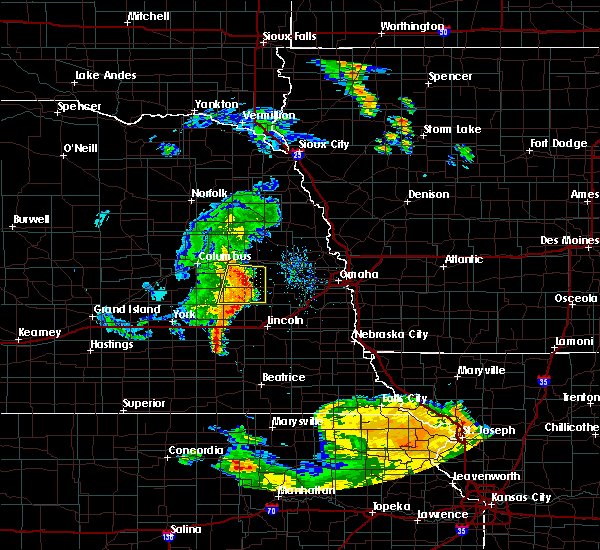 At 919 am cdt, a severe thunderstorm was located 6 miles west of weston, or 28 miles north of lincoln, moving east at 30 mph. this storm has weakened slightly since 910 am but strong winds are still possible (radar indicated). Hazards include 60 mph wind gusts and penny size hail. Expect damage to roofs. siding. and trees. locations impacted include, valparaiso, brainard, weston, prague, dwight, octavia, malmo, bruno, linwood and abie. This includes highway 92 in nebraska between mile markers 423 and 442. At 919 am cdt, a severe thunderstorm was located 6 miles west of weston, or 28 miles north of lincoln, moving east at 30 mph. this storm has weakened slightly since 910 am but strong winds are still possible (radar indicated). Hazards include 60 mph wind gusts and penny size hail. Expect damage to roofs. siding. and trees. locations impacted include, valparaiso, brainard, weston, prague, dwight, octavia, malmo, bruno, linwood and abie. This includes highway 92 in nebraska between mile markers 423 and 442.
|
| 7/31/2016 9:14 AM CDT |
 At 913 am cdt, a severe thunderstorm was located 4 miles northeast of brainard, or 26 miles southeast of columbus, moving east at 30 mph (radar indicated). Hazards include 60 mph wind gusts and penny size hail. Expect damage to roofs. siding. and trees. locations impacted include, valparaiso, brainard, weston, prague, dwight, octavia, malmo, bruno, linwood and abie. This includes highway 92 in nebraska between mile markers 423 and 442. At 913 am cdt, a severe thunderstorm was located 4 miles northeast of brainard, or 26 miles southeast of columbus, moving east at 30 mph (radar indicated). Hazards include 60 mph wind gusts and penny size hail. Expect damage to roofs. siding. and trees. locations impacted include, valparaiso, brainard, weston, prague, dwight, octavia, malmo, bruno, linwood and abie. This includes highway 92 in nebraska between mile markers 423 and 442.
|
| 7/31/2016 9:05 AM CDT |
 At 905 am cdt, a severe thunderstorm was located near brainard, or 22 miles southeast of columbus, moving east at 25 mph (radar indicated). Hazards include 60 mph wind gusts and penny size hail. Expect damage to roofs. siding. And trees. At 905 am cdt, a severe thunderstorm was located near brainard, or 22 miles southeast of columbus, moving east at 25 mph (radar indicated). Hazards include 60 mph wind gusts and penny size hail. Expect damage to roofs. siding. And trees.
|
| 7/5/2016 10:00 PM CDT |
 At 958 pm cdt, severe thunderstorms were located along a line extending from 3 miles southeast of uehling to 3 miles south of cedar bluffs, moving east at 45 mph. radar indicated that winds had decreased a little from earlier. the large hail was most likely in northeast dodge county (radar indicated). Hazards include 60 mph wind gusts and quarter size hail. Hail damage to vehicles is expected. expect wind damage to roofs, siding and trees. locations impacted include, fremont, valley, arlington, north bend, scribner, waterloo, hooper, cedar bluffs, nickerson, inglewood, prague, morse bluff, malmo, leshara, colon, winslow, fremont lakes state recreation area, 7 miles north of north bend, camp eagle and camp cedars. this includes the following highways, highway 275 in nebraska between mile markers 129 and 167. highway 30 in nebraska between mile markers 411 and 438. Highway 77 in nebraska between milemarkers 104 and 129. At 958 pm cdt, severe thunderstorms were located along a line extending from 3 miles southeast of uehling to 3 miles south of cedar bluffs, moving east at 45 mph. radar indicated that winds had decreased a little from earlier. the large hail was most likely in northeast dodge county (radar indicated). Hazards include 60 mph wind gusts and quarter size hail. Hail damage to vehicles is expected. expect wind damage to roofs, siding and trees. locations impacted include, fremont, valley, arlington, north bend, scribner, waterloo, hooper, cedar bluffs, nickerson, inglewood, prague, morse bluff, malmo, leshara, colon, winslow, fremont lakes state recreation area, 7 miles north of north bend, camp eagle and camp cedars. this includes the following highways, highway 275 in nebraska between mile markers 129 and 167. highway 30 in nebraska between mile markers 411 and 438. Highway 77 in nebraska between milemarkers 104 and 129.
|
| 7/5/2016 9:51 PM CDT |
 At 950 pm cdt, severe thunderstorms were located along a line extending from 4 miles north of hooper to 6 miles southwest of cedar bluffs, moving east at 35 mph (radar indicated). Hazards include 70 mph wind gusts and quarter size hail. Hail damage to vehicles is expected. expect considerable tree damage. wind damage is also likely to mobile homes, roofs and outbuildings. locations impacted include, fremont, valley, arlington, north bend, scribner, waterloo, hooper, cedar bluffs, nickerson, inglewood, prague, morse bluff, malmo, leshara, colon, winslow, fremont lakes state recreation area, 7 miles north of north bend, camp eagle and camp cedars. this includes the following highways, highway 275 in nebraska between mile markers 129 and 167. highway 30 in nebraska between mile markers 411 and 438. Highway 77 in nebraska between milemarkers 104 and 129. At 950 pm cdt, severe thunderstorms were located along a line extending from 4 miles north of hooper to 6 miles southwest of cedar bluffs, moving east at 35 mph (radar indicated). Hazards include 70 mph wind gusts and quarter size hail. Hail damage to vehicles is expected. expect considerable tree damage. wind damage is also likely to mobile homes, roofs and outbuildings. locations impacted include, fremont, valley, arlington, north bend, scribner, waterloo, hooper, cedar bluffs, nickerson, inglewood, prague, morse bluff, malmo, leshara, colon, winslow, fremont lakes state recreation area, 7 miles north of north bend, camp eagle and camp cedars. this includes the following highways, highway 275 in nebraska between mile markers 129 and 167. highway 30 in nebraska between mile markers 411 and 438. Highway 77 in nebraska between milemarkers 104 and 129.
|
| 7/5/2016 9:42 PM CDT |
 At 940 pm cdt, severe thunderstorms were located along a line extending from near scribner to 4 miles northeast of prague, moving east at 45 mph. the strongest winds are tracking along the platte river and from north bend to fremont (radar indicated). Hazards include 70 mph wind gusts and quarter size hail. Hail damage to vehicles is expected. expect considerable tree damage. wind damage is also likely to mobile homes, roofs and outbuildings. locations impacted include, fremont, valley, arlington, north bend, scribner, waterloo, hooper, cedar bluffs, nickerson, inglewood, prague, morse bluff, malmo, leshara, colon, winslow, fremont lakes state recreation area, 7 miles north of north bend, camp eagle and camp cedars. this includes the following highways, highway 275 in nebraska between mile markers 129 and 167. highway 30 in nebraska between mile markers 411 and 438. Highway 77 in nebraska between milemarkers 104 and 129. At 940 pm cdt, severe thunderstorms were located along a line extending from near scribner to 4 miles northeast of prague, moving east at 45 mph. the strongest winds are tracking along the platte river and from north bend to fremont (radar indicated). Hazards include 70 mph wind gusts and quarter size hail. Hail damage to vehicles is expected. expect considerable tree damage. wind damage is also likely to mobile homes, roofs and outbuildings. locations impacted include, fremont, valley, arlington, north bend, scribner, waterloo, hooper, cedar bluffs, nickerson, inglewood, prague, morse bluff, malmo, leshara, colon, winslow, fremont lakes state recreation area, 7 miles north of north bend, camp eagle and camp cedars. this includes the following highways, highway 275 in nebraska between mile markers 129 and 167. highway 30 in nebraska between mile markers 411 and 438. Highway 77 in nebraska between milemarkers 104 and 129.
|
| 7/5/2016 9:34 PM CDT |
 At 933 pm cdt, severe thunderstorms were located along a line extending from near scribner to near prague, moving east at 45 mph. some strong winds are occurring with a gust front out ahead of the main area of rain and hail (radar indicated). Hazards include 70 mph wind gusts and quarter size hail. Hail damage to vehicles is expected. expect considerable tree damage. Wind damage is also likely to mobile homes, roofs and outbuildings. At 933 pm cdt, severe thunderstorms were located along a line extending from near scribner to near prague, moving east at 45 mph. some strong winds are occurring with a gust front out ahead of the main area of rain and hail (radar indicated). Hazards include 70 mph wind gusts and quarter size hail. Hail damage to vehicles is expected. expect considerable tree damage. Wind damage is also likely to mobile homes, roofs and outbuildings.
|
| 7/5/2016 9:24 PM CDT |
 At 923 pm cdt, severe thunderstorms were located along a line extending from 4 miles south of snyder to 6 miles northwest of prague, moving east at 45 mph. the strongest winds are likely from along the platte river northward into colfax and dodge counties. these are very dangerous storms (radar indicated). Hazards include 80 mph wind gusts and quarter size hail. Flying debris will be dangerous to those caught without shelter. mobile homes will be heavily damaged. expect considerable damage to roofs, windows and vehicles. extensive tree damage and power outages are likely. locations impacted include, schuyler, david city, north bend, prague, morse bluff, octavia, malmo, bruno, rogers, linwood, abie, 7 miles north of north bend and 9 miles north of schuyler. This includes highway 30 in nebraska between mile markers 393 and 414. At 923 pm cdt, severe thunderstorms were located along a line extending from 4 miles south of snyder to 6 miles northwest of prague, moving east at 45 mph. the strongest winds are likely from along the platte river northward into colfax and dodge counties. these are very dangerous storms (radar indicated). Hazards include 80 mph wind gusts and quarter size hail. Flying debris will be dangerous to those caught without shelter. mobile homes will be heavily damaged. expect considerable damage to roofs, windows and vehicles. extensive tree damage and power outages are likely. locations impacted include, schuyler, david city, north bend, prague, morse bluff, octavia, malmo, bruno, rogers, linwood, abie, 7 miles north of north bend and 9 miles north of schuyler. This includes highway 30 in nebraska between mile markers 393 and 414.
|
| 7/5/2016 9:16 PM CDT |
 At 916 pm cdt, severe thunderstorms were located along a line extending from 7 miles south of dodge to 6 miles southeast of schuyler, moving east at 45 mph. these are very dangerous storms (radar indicated). Hazards include 80 mph wind gusts and quarter size hail. Flying debris will be dangerous to those caught without shelter. mobile homes will be heavily damaged. expect considerable damage to roofs, windows and vehicles. extensive tree damage and power outages are likely. locations impacted include, schuyler, david city, north bend, prague, morse bluff, octavia, malmo, bruno, rogers, linwood, abie, 7 miles north of north bend and 9 miles north of schuyler. This includes highway 30 in nebraska between mile markers 393 and 414. At 916 pm cdt, severe thunderstorms were located along a line extending from 7 miles south of dodge to 6 miles southeast of schuyler, moving east at 45 mph. these are very dangerous storms (radar indicated). Hazards include 80 mph wind gusts and quarter size hail. Flying debris will be dangerous to those caught without shelter. mobile homes will be heavily damaged. expect considerable damage to roofs, windows and vehicles. extensive tree damage and power outages are likely. locations impacted include, schuyler, david city, north bend, prague, morse bluff, octavia, malmo, bruno, rogers, linwood, abie, 7 miles north of north bend and 9 miles north of schuyler. This includes highway 30 in nebraska between mile markers 393 and 414.
|
| 7/5/2016 9:09 PM CDT |
 At 909 pm cdt, severe thunderstorms were located along a line extending from 5 miles south of howells to david city, moving east at 45 mph. strong winds are occurring out ahead of the rain and hail (radar indicated). Hazards include 70 mph wind gusts and quarter size hail. Hail damage to vehicles is expected. expect considerable tree damage. Wind damage is also likely to mobile homes, roofs and outbuildings. At 909 pm cdt, severe thunderstorms were located along a line extending from 5 miles south of howells to david city, moving east at 45 mph. strong winds are occurring out ahead of the rain and hail (radar indicated). Hazards include 70 mph wind gusts and quarter size hail. Hail damage to vehicles is expected. expect considerable tree damage. Wind damage is also likely to mobile homes, roofs and outbuildings.
|
| 5/27/2016 9:45 PM CDT |
 At 945 pm cdt, a severe thunderstorm was located near wahoo, or 31 miles north of lincoln, moving northeast at 25 mph (radar indicated). Hazards include 60 mph wind gusts. Expect damage to roofs. siding and trees. locations impacted include, wahoo, cedar bluffs, malmo, leshara and colon. this includes the following highways, highway 77 in nebraska near milemarker 97, and between milemarkers 104 and 108. Highway 92 in nebraska near mile marker 452. At 945 pm cdt, a severe thunderstorm was located near wahoo, or 31 miles north of lincoln, moving northeast at 25 mph (radar indicated). Hazards include 60 mph wind gusts. Expect damage to roofs. siding and trees. locations impacted include, wahoo, cedar bluffs, malmo, leshara and colon. this includes the following highways, highway 77 in nebraska near milemarker 97, and between milemarkers 104 and 108. Highway 92 in nebraska near mile marker 452.
|
| 5/27/2016 9:33 PM CDT |
 At 933 pm cdt, a severe thunderstorm was located near weston, or 26 miles north of lincoln, moving northeast at 25 mph (radar indicated). Hazards include 60 mph wind gusts. Expect damage to roofs. Siding and trees. At 933 pm cdt, a severe thunderstorm was located near weston, or 26 miles north of lincoln, moving northeast at 25 mph (radar indicated). Hazards include 60 mph wind gusts. Expect damage to roofs. Siding and trees.
|
| 5/11/2016 2:25 AM CDT |
 At 225 am cdt, a severe thunderstorm was located near wahoo, or 26 miles north of lincoln, moving northeast at 25 mph (radar indicated). Hazards include 60 mph wind gusts and quarter size hail. Hail damage to vehicles is expected. expect wind damage to roofs, siding and trees. locations impacted include, wahoo, cedar bluffs, mead, weston, prague, ceresco, ithaca, malmo, memphis, colon, memphis state recreation area and camp eagle. this includes the following highways, highway 77 in nebraska between milemarkers 82 and 108. Highway 92 in nebraska between mile markers 442 and 459. At 225 am cdt, a severe thunderstorm was located near wahoo, or 26 miles north of lincoln, moving northeast at 25 mph (radar indicated). Hazards include 60 mph wind gusts and quarter size hail. Hail damage to vehicles is expected. expect wind damage to roofs, siding and trees. locations impacted include, wahoo, cedar bluffs, mead, weston, prague, ceresco, ithaca, malmo, memphis, colon, memphis state recreation area and camp eagle. this includes the following highways, highway 77 in nebraska between milemarkers 82 and 108. Highway 92 in nebraska between mile markers 442 and 459.
|
| 5/11/2016 2:12 AM CDT |
 At 212 am cdt, a severe thunderstorm was located near weston, or 22 miles north of lincoln, moving northeast at 25 mph (radar indicated). Hazards include 60 mph wind gusts and quarter size hail. Hail damage to vehicles is expected. Expect wind damage to roofs, siding and trees. At 212 am cdt, a severe thunderstorm was located near weston, or 22 miles north of lincoln, moving northeast at 25 mph (radar indicated). Hazards include 60 mph wind gusts and quarter size hail. Hail damage to vehicles is expected. Expect wind damage to roofs, siding and trees.
|
| 8/2/2015 8:13 PM CDT |
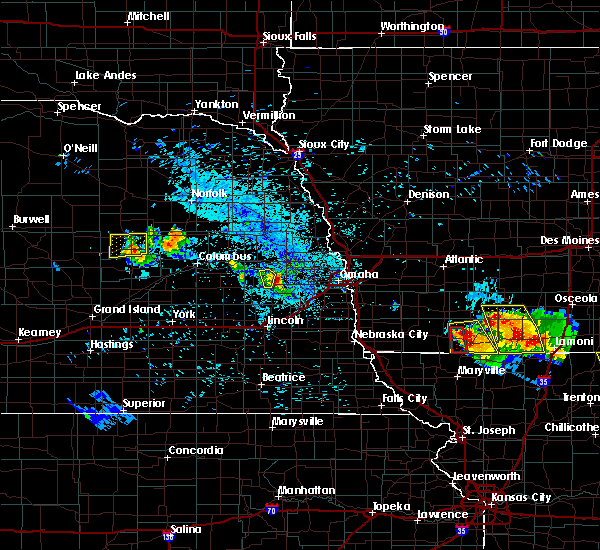 At 813 pm cdt, a severe thunderstorm was located near dolon, or 29 miles west of omaha, moving east at 30 mph (radar indicated). Hazards include quarter size hail. Damage to vehicles is expected. locations impacted include, malmo and colon. This includes highway 92 in nebraska near mile marker 446. At 813 pm cdt, a severe thunderstorm was located near dolon, or 29 miles west of omaha, moving east at 30 mph (radar indicated). Hazards include quarter size hail. Damage to vehicles is expected. locations impacted include, malmo and colon. This includes highway 92 in nebraska near mile marker 446.
|
| 8/2/2015 8:04 PM CDT |
 At 804 pm cdt, a severe thunderstorm was located near malmo, or 32 miles north of lincoln, moving east at 20 mph (radar indicated). Hazards include quarter size hail. Damage to vehicles is expected. locations impacted include, malmo and colon. This includes highway 92 in nebraska between mile markers 442 and 446. At 804 pm cdt, a severe thunderstorm was located near malmo, or 32 miles north of lincoln, moving east at 20 mph (radar indicated). Hazards include quarter size hail. Damage to vehicles is expected. locations impacted include, malmo and colon. This includes highway 92 in nebraska between mile markers 442 and 446.
|
| 8/2/2015 7:50 PM CDT | Half Dollar sized hail reported 0.3 miles SSW of Malmo, NE, via twitter. |
| 8/2/2015 7:43 PM CDT |
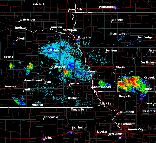 At 742 pm cdt, a severe thunderstorm was located over prague, or 28 miles east of columbus, moving east at 20 mph (radar indicated). Hazards include quarter size hail. damage to vehicles is expected At 742 pm cdt, a severe thunderstorm was located over prague, or 28 miles east of columbus, moving east at 20 mph (radar indicated). Hazards include quarter size hail. damage to vehicles is expected
|
| 7/25/2015 12:32 AM CDT |
 At 1231 am cdt, a severe thunderstorm was located south of valparaiso, or 15 miles north of lincoln, moving northeast at 50 mph (public). Hazards include 70 mph wind gusts. Expect considerable tree damage. damage is likely to mobile homes, roofs and outbuildings. Locations impacted include, seward, wahoo, ashland, valparaiso, mead, brainard, weston, garland, pleasant dale, dwight, bee, ceresco, malcolm, denton, ithaca, malmo, memphis, colon, branched oak state recreation area and conestoga state recreation area. At 1231 am cdt, a severe thunderstorm was located south of valparaiso, or 15 miles north of lincoln, moving northeast at 50 mph (public). Hazards include 70 mph wind gusts. Expect considerable tree damage. damage is likely to mobile homes, roofs and outbuildings. Locations impacted include, seward, wahoo, ashland, valparaiso, mead, brainard, weston, garland, pleasant dale, dwight, bee, ceresco, malcolm, denton, ithaca, malmo, memphis, colon, branched oak state recreation area and conestoga state recreation area.
|
| 7/25/2015 12:18 AM CDT |
 At 1218 am cdt, a severe thunderstorm was located near valparaiso, or 13 miles northwest of lincoln, moving northeast at 60 mph (radar indicated). Hazards include 60 mph wind gusts and penny size hail. Expect damage to roofs. Siding and trees. At 1218 am cdt, a severe thunderstorm was located near valparaiso, or 13 miles northwest of lincoln, moving northeast at 60 mph (radar indicated). Hazards include 60 mph wind gusts and penny size hail. Expect damage to roofs. Siding and trees.
|
| 7/24/2015 11:28 PM CDT |
 At 1128 pm cdt, severe thunderstorms were located along a line extending from near shelby to near bruning, moving east at 40 mph (radar indicated). Hazards include 60 mph wind gusts. Expect damage to roofs. Siding and trees. At 1128 pm cdt, severe thunderstorms were located along a line extending from near shelby to near bruning, moving east at 40 mph (radar indicated). Hazards include 60 mph wind gusts. Expect damage to roofs. Siding and trees.
|
| 5/3/2015 10:40 PM CDT | The severe thunderstorm warning for central saunders county will expire at 1045 pm cdt, the storm which prompted the warning has weakened below severe limits, and no longer poses an immediate threat to life or property. therefore the warning will be allowed to expire. however small hail and heavy rain are still possible with this thunderstorm. |
| 5/3/2015 10:15 PM CDT | At 1015 pm cdt, a severe thunderstorm was located near wahoo, or 30 miles north of lincoln, moving east at 15 mph (radar indicated). Hazards include quarter size hail. damage to vehicles is expected |
| 5/2/2015 11:46 PM CDT | At 1146 pm cdt, severe thunderstorms were located along a line extending from near prague to near brainard, moving east at 30 mph (radar indicated). Hazards include quarter size hail. Damage to vehicles is expected. locations impacted include, valparaiso, weston, prague and malmo. this includes highway 92 in nebraska between mile markers 430 and 442, and between mile markers 433 and 442. 1. 00in. |
| 5/2/2015 11:19 PM CDT | At 1118 pm cdt, severe thunderstorms were located along a line extending from near bellwood to near david city, moving east at 25 mph (radar indicated). Hazards include half dollar size hail. damage to vehicles is expected |
| 4/12/2015 7:53 PM CDT | A severe thunderstorm warning remains in effect until 815 pm cdt for saunders county. at 753 pm cdt. a severe thunderstorm was located over wahoo. or 26 miles north of lincoln. moving east at 25 mph. hazard. 60 mph wind gusts and quarter size hail. source. Radar indicated. |
| 4/12/2015 7:38 PM CDT | A severe thunderstorm warning remains in effect until 815 pm cdt for saunders county. at 738 pm cdt. a severe thunderstorm was located over weston. or 26 miles north of lincoln. moving east at 30 mph. hazard. 60 mph wind gusts and quarter size hail. source. Radar indicated. |
| 4/12/2015 7:28 PM CDT | The national weather service in omaha has issued a * severe thunderstorm warning for. saunders county in east central nebraska. until 815 pm cdt * at 727 pm cdt. a severe thunderstorm was located near weston. or 26 miles north of lincoln. Moving east at 30 mph. |
| 6/3/2014 7:18 PM CDT | Tennis Ball sized hail reported 1.5 miles NE of Malmo, NE, hail took out windshield on deputy sherriffs cruiser. |
Hail Maps for Malmo, NE
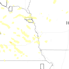
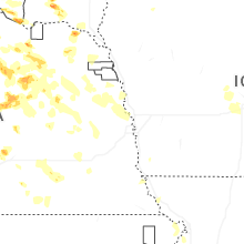
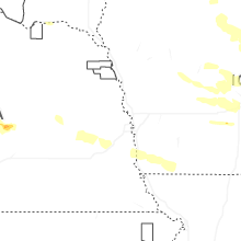
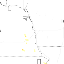
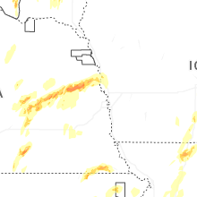


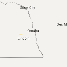


Connect with Interactive Hail Maps