

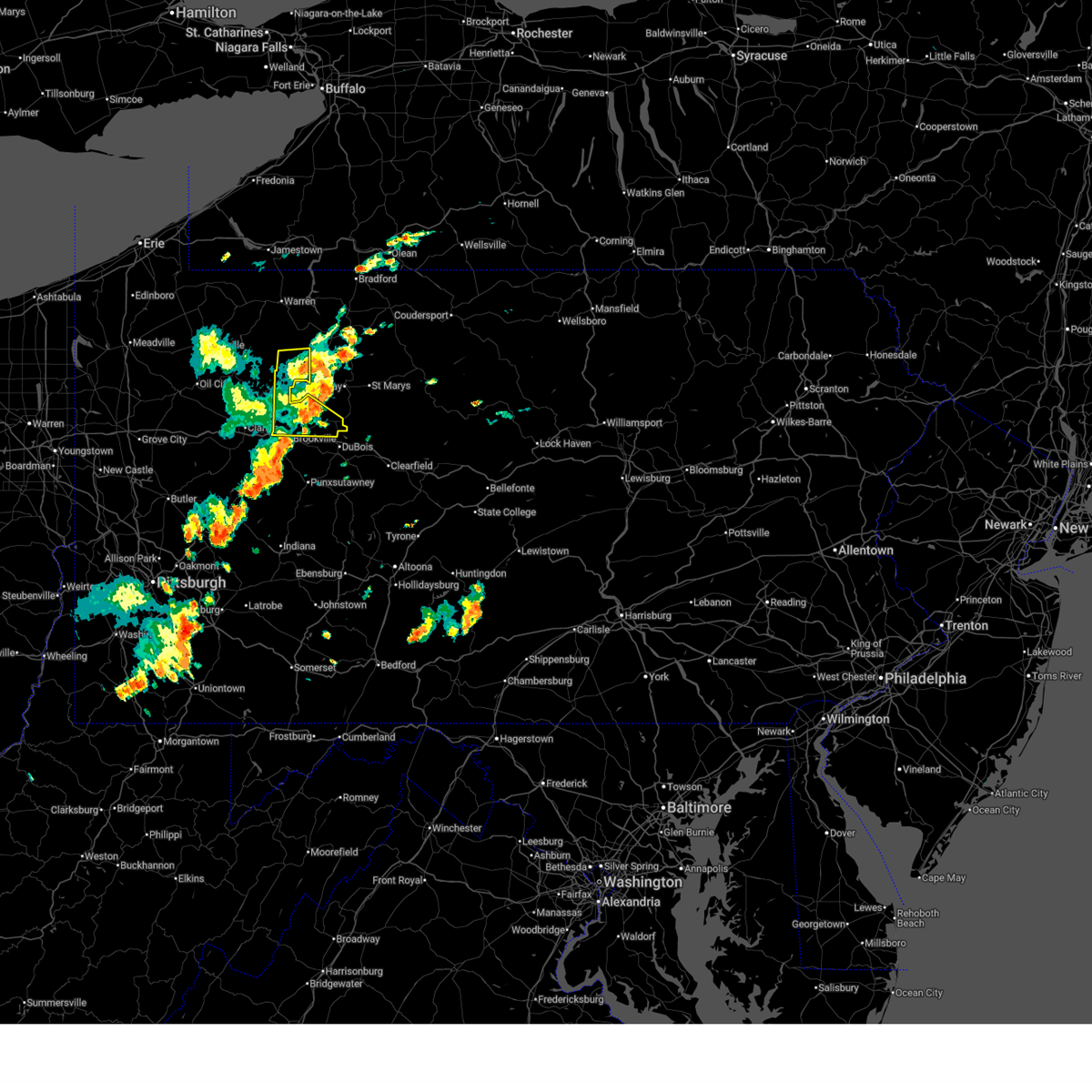
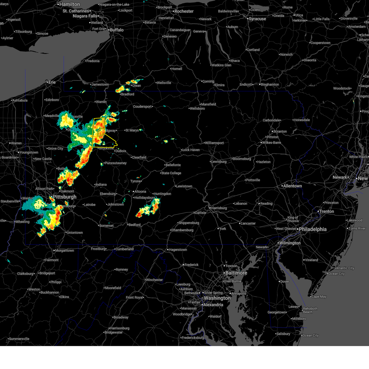
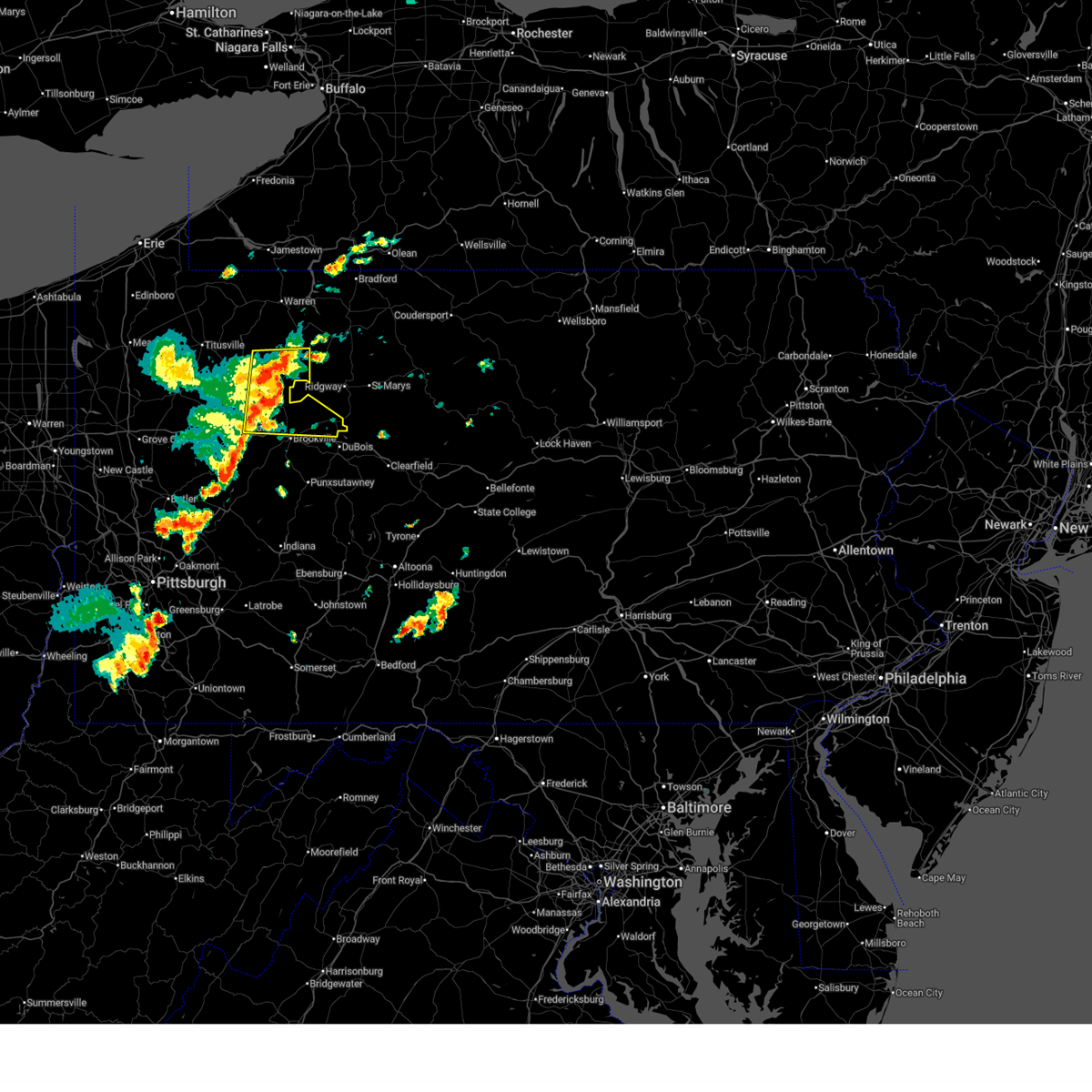
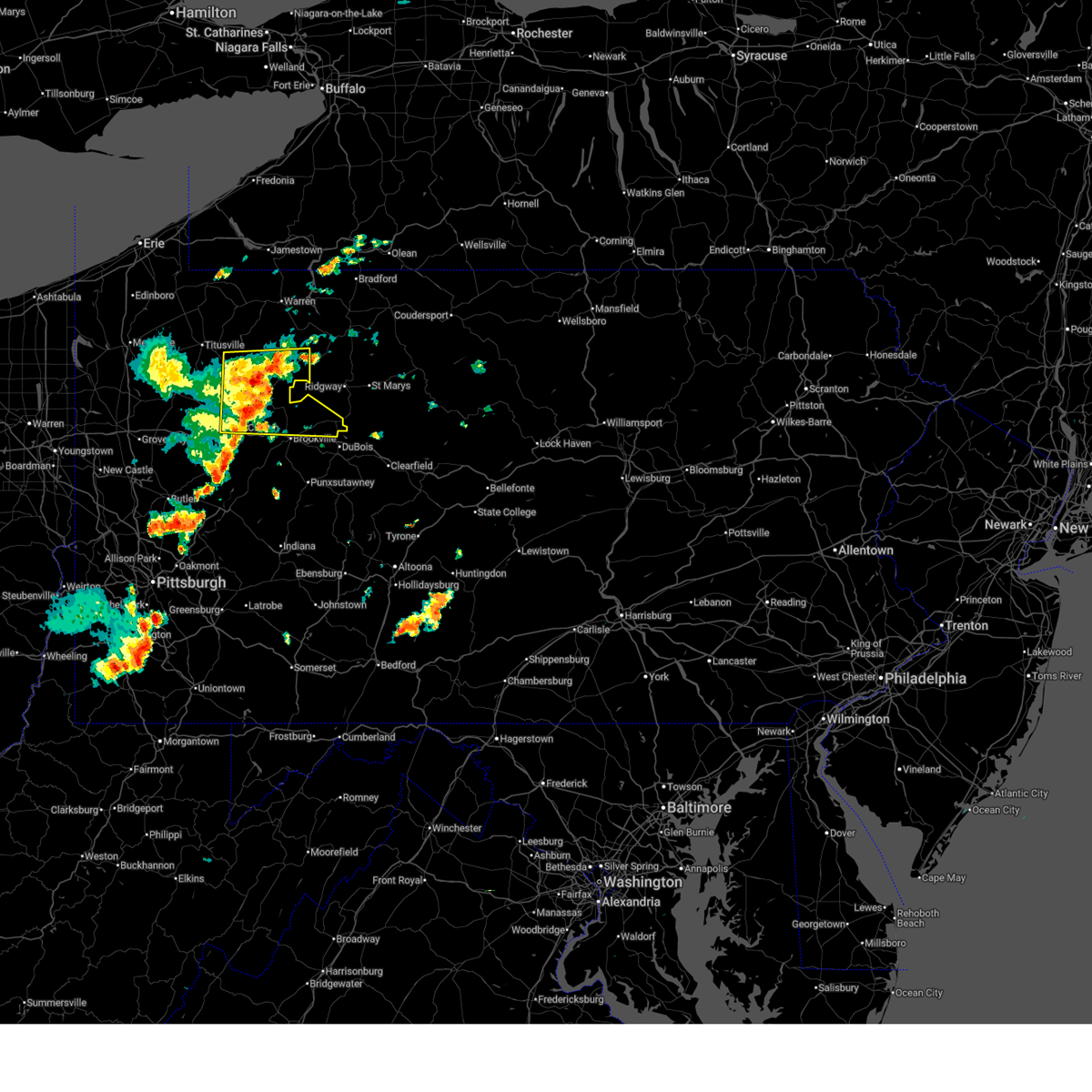
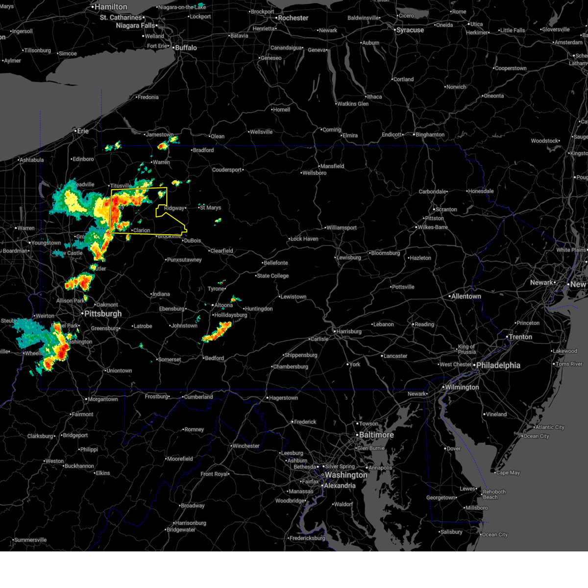
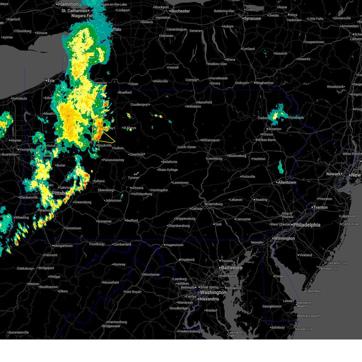
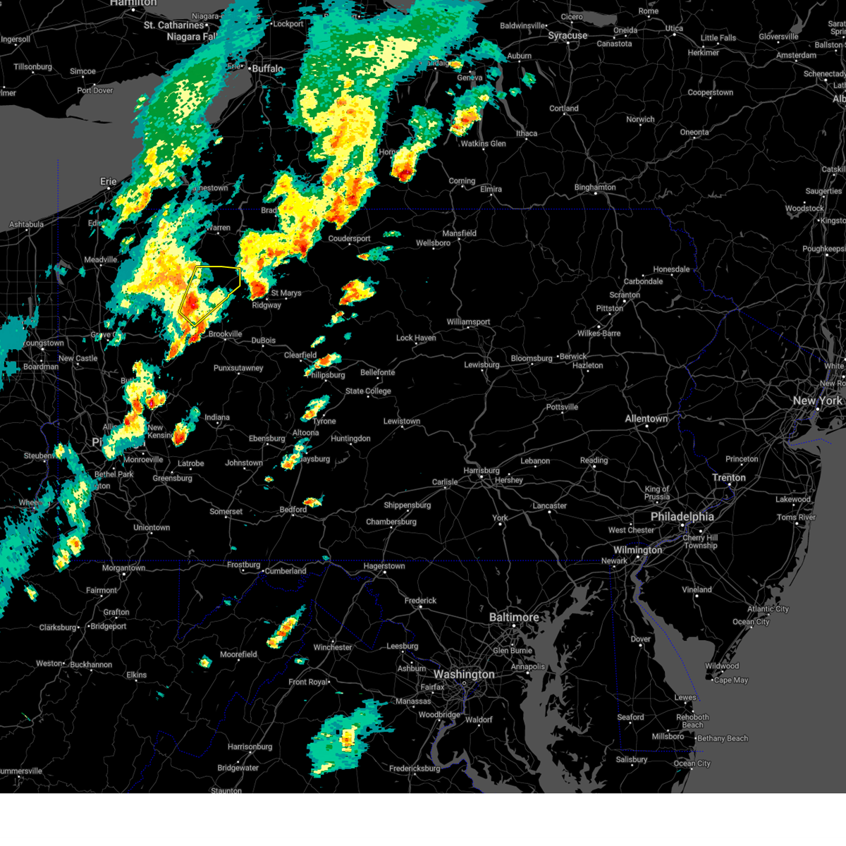
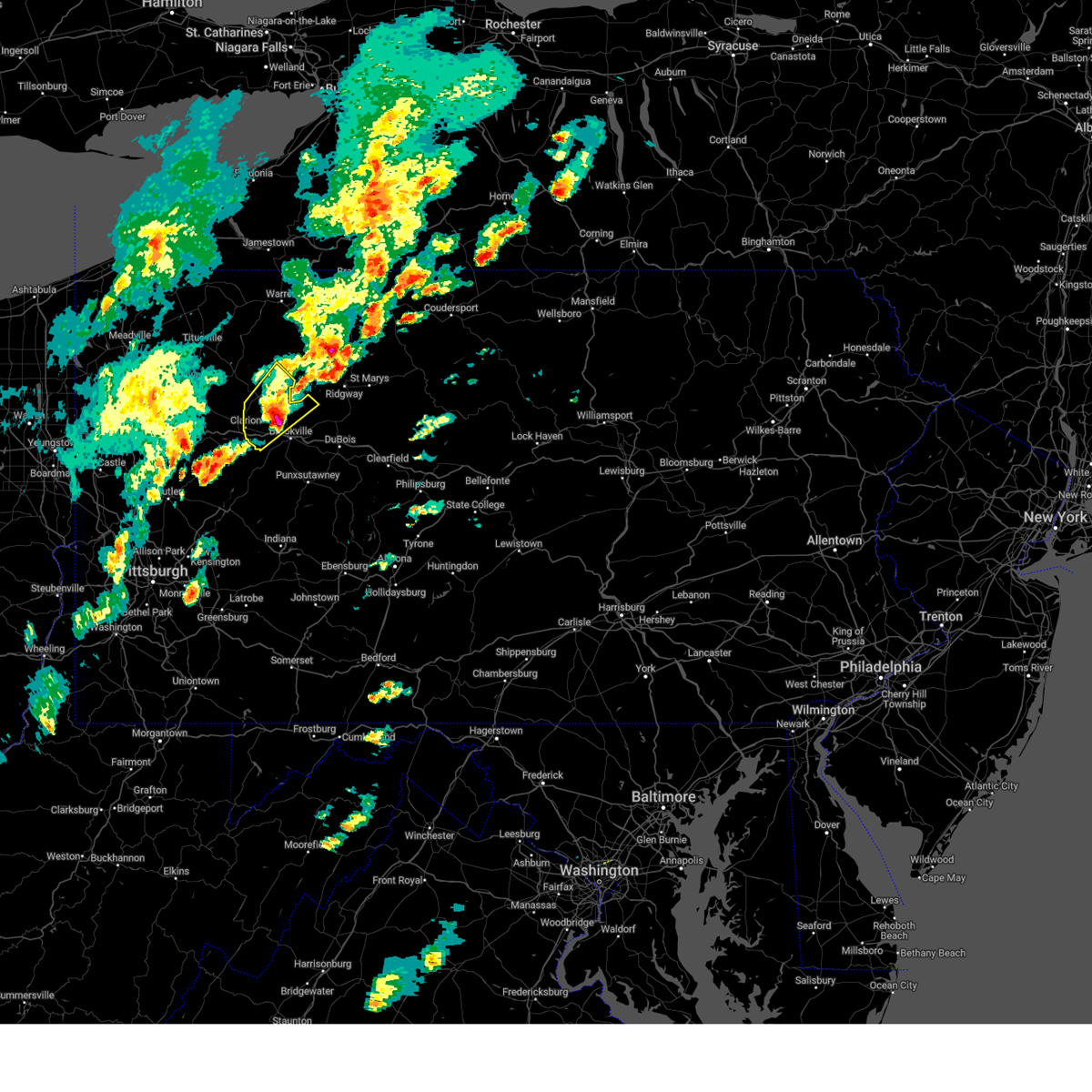
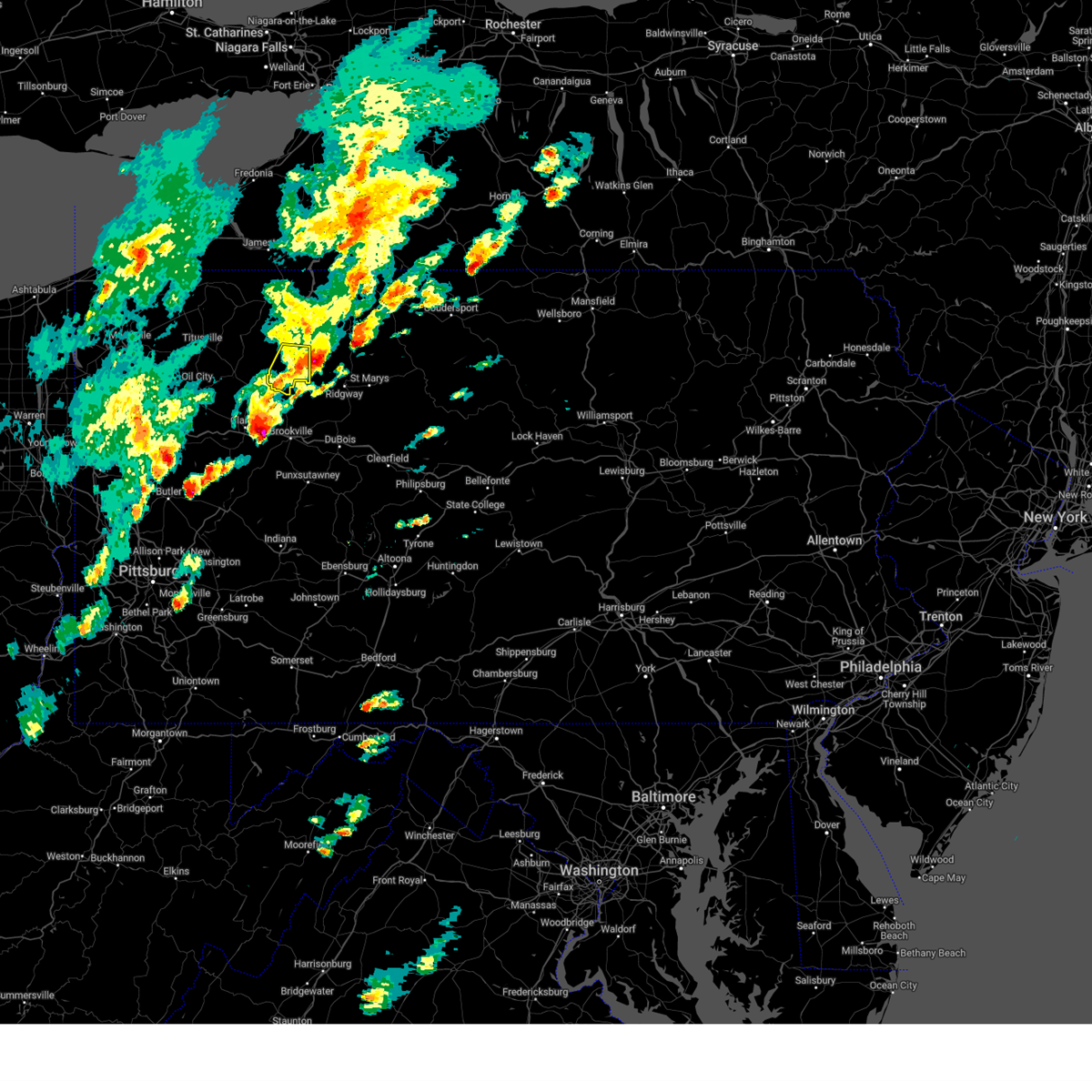
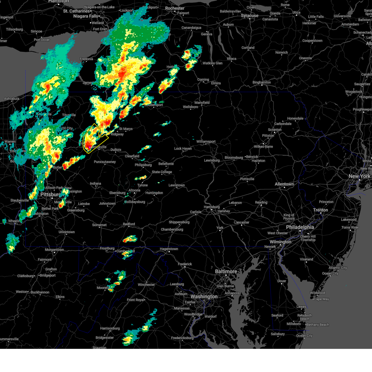
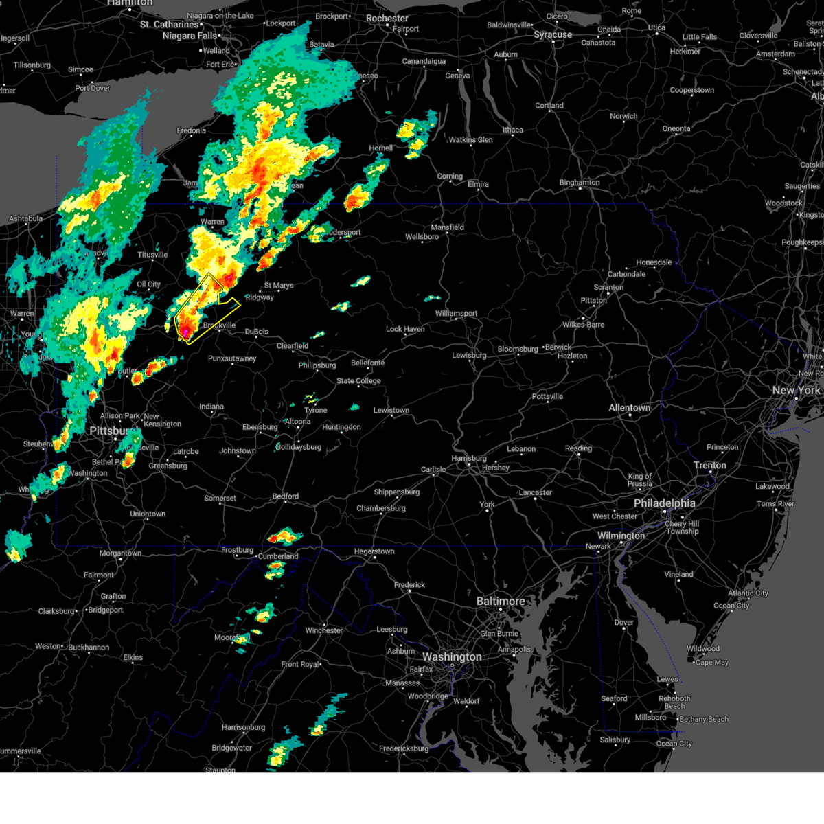
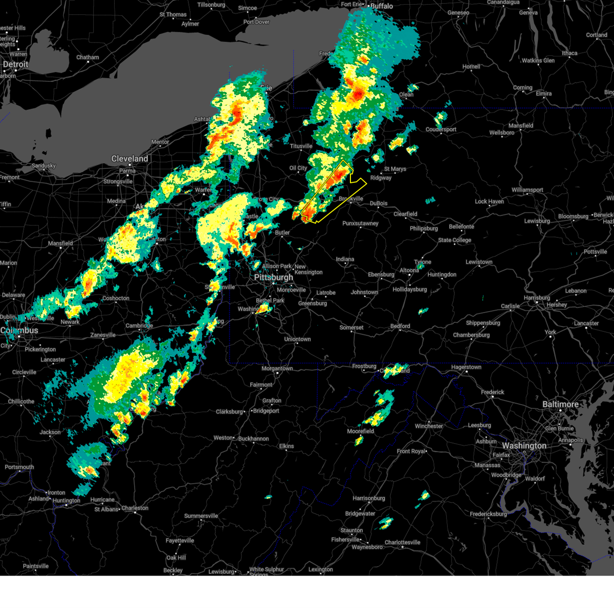
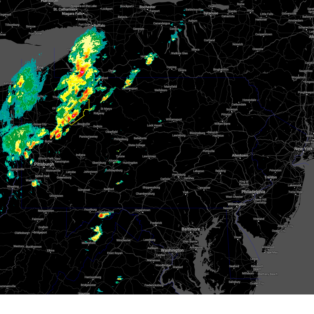
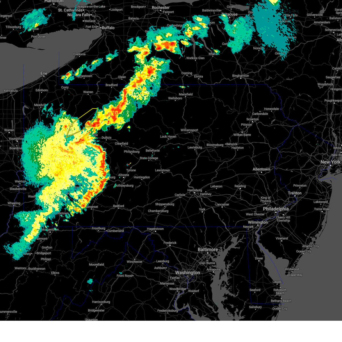
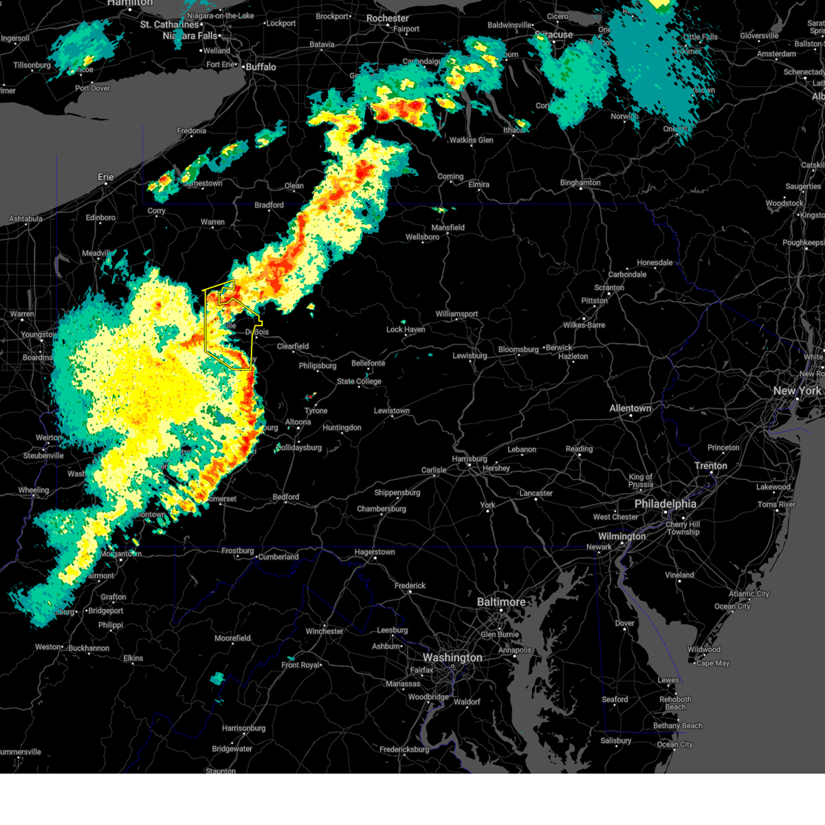
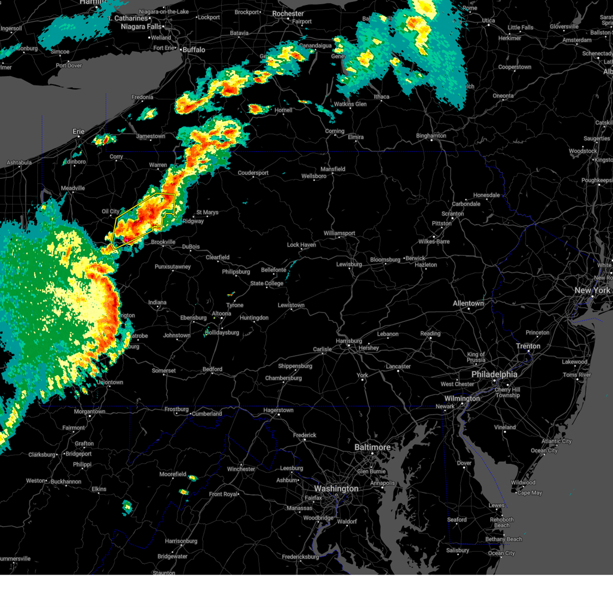
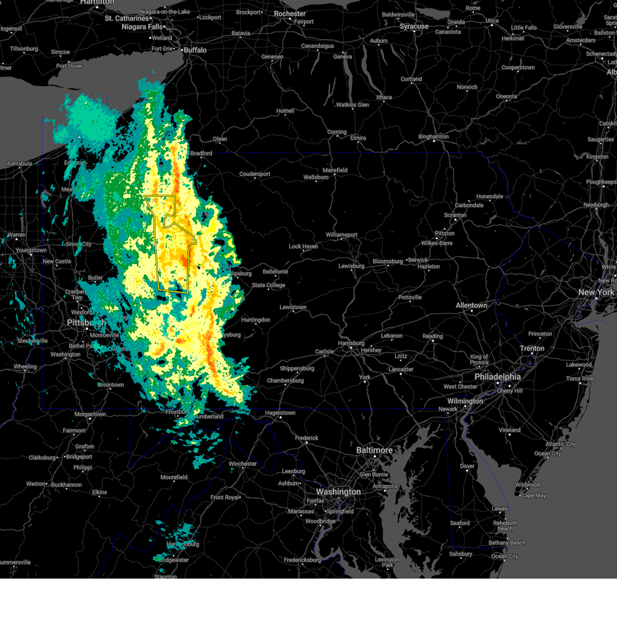
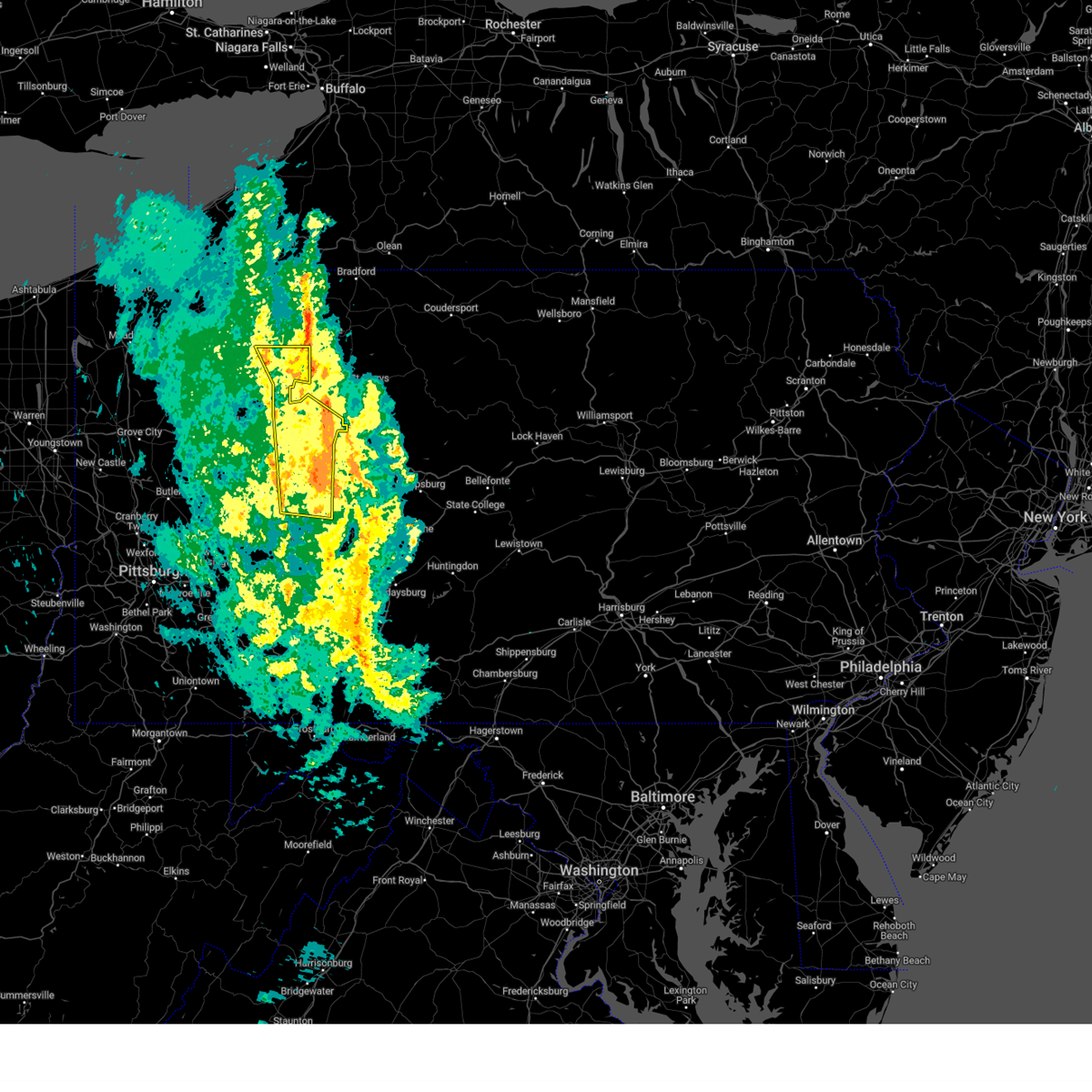
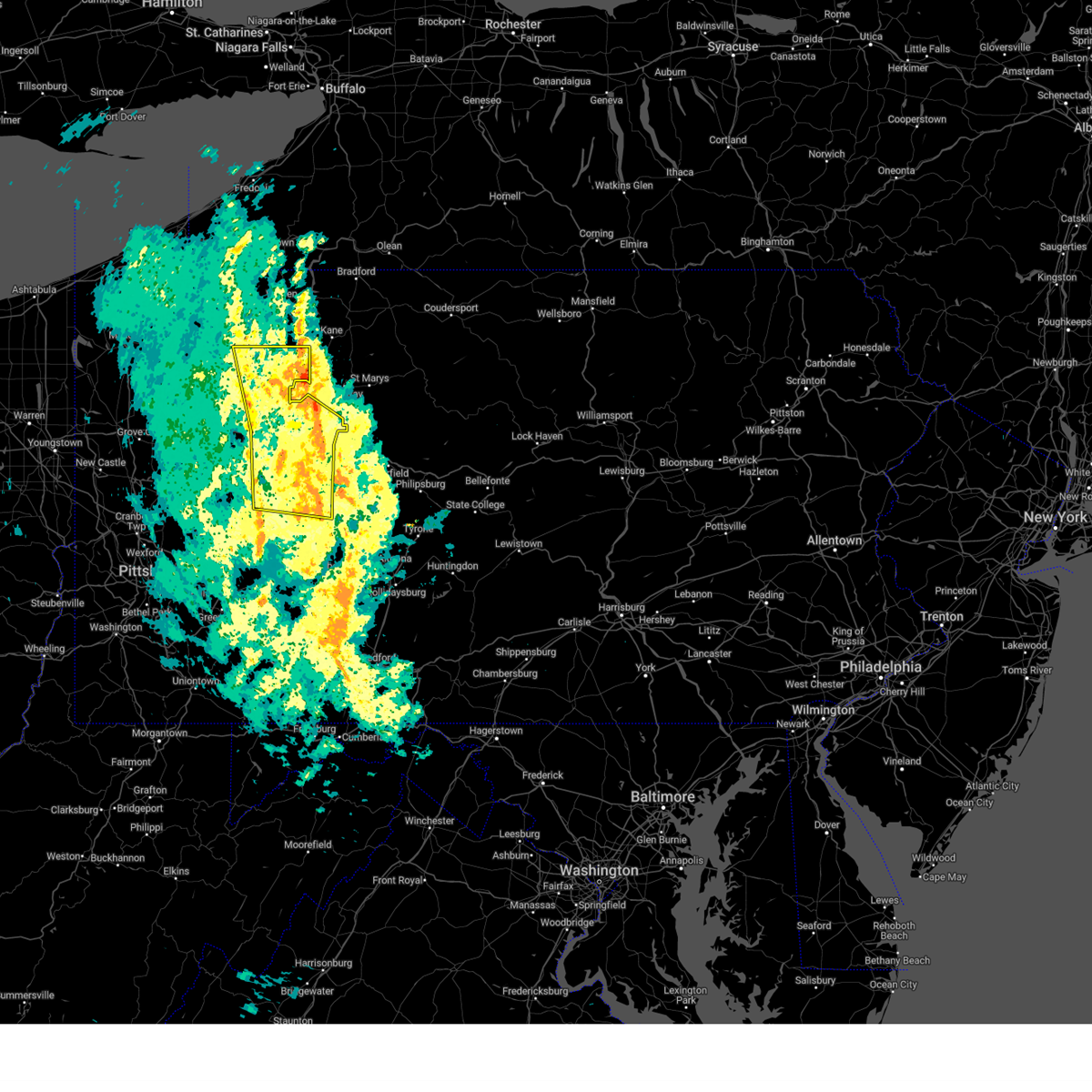
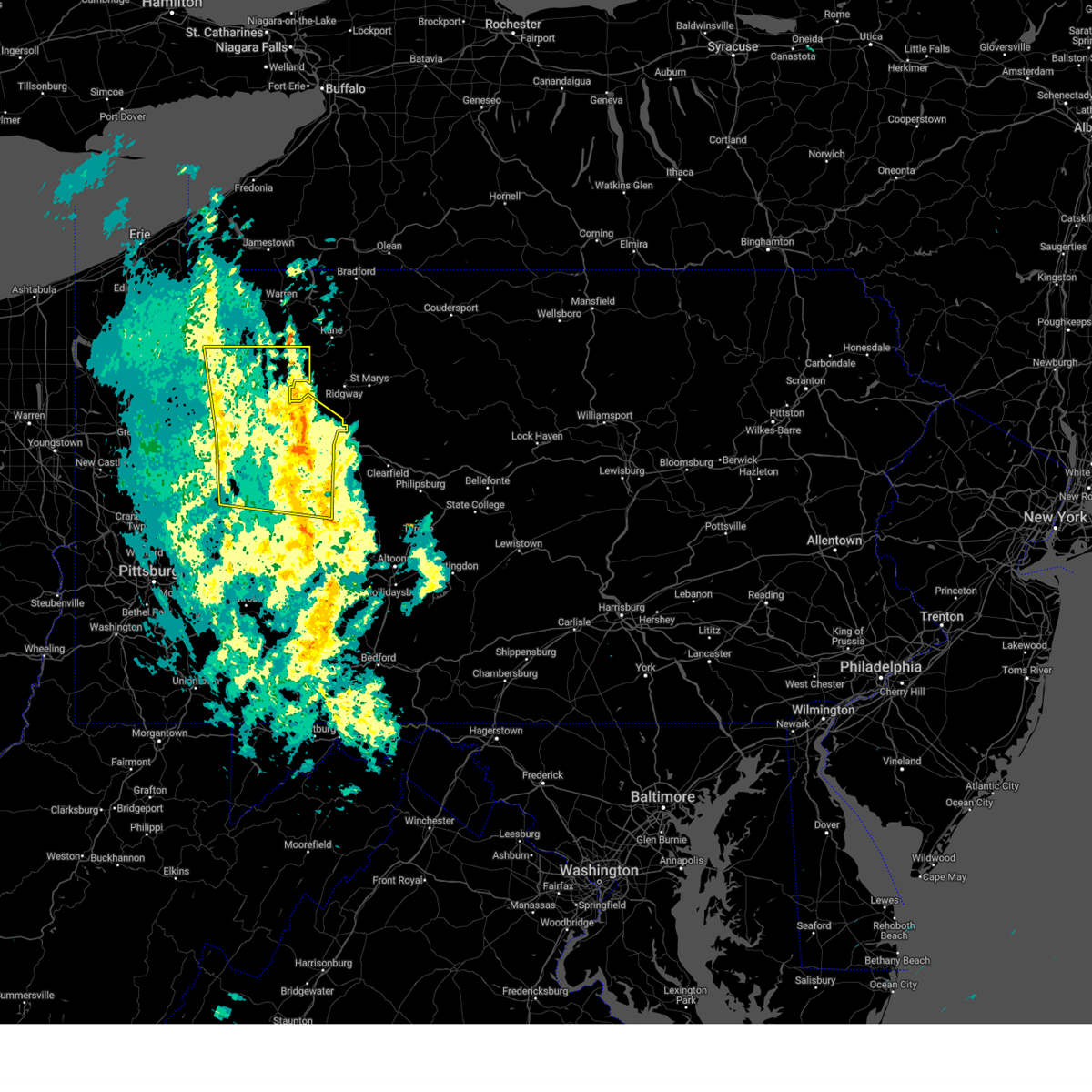
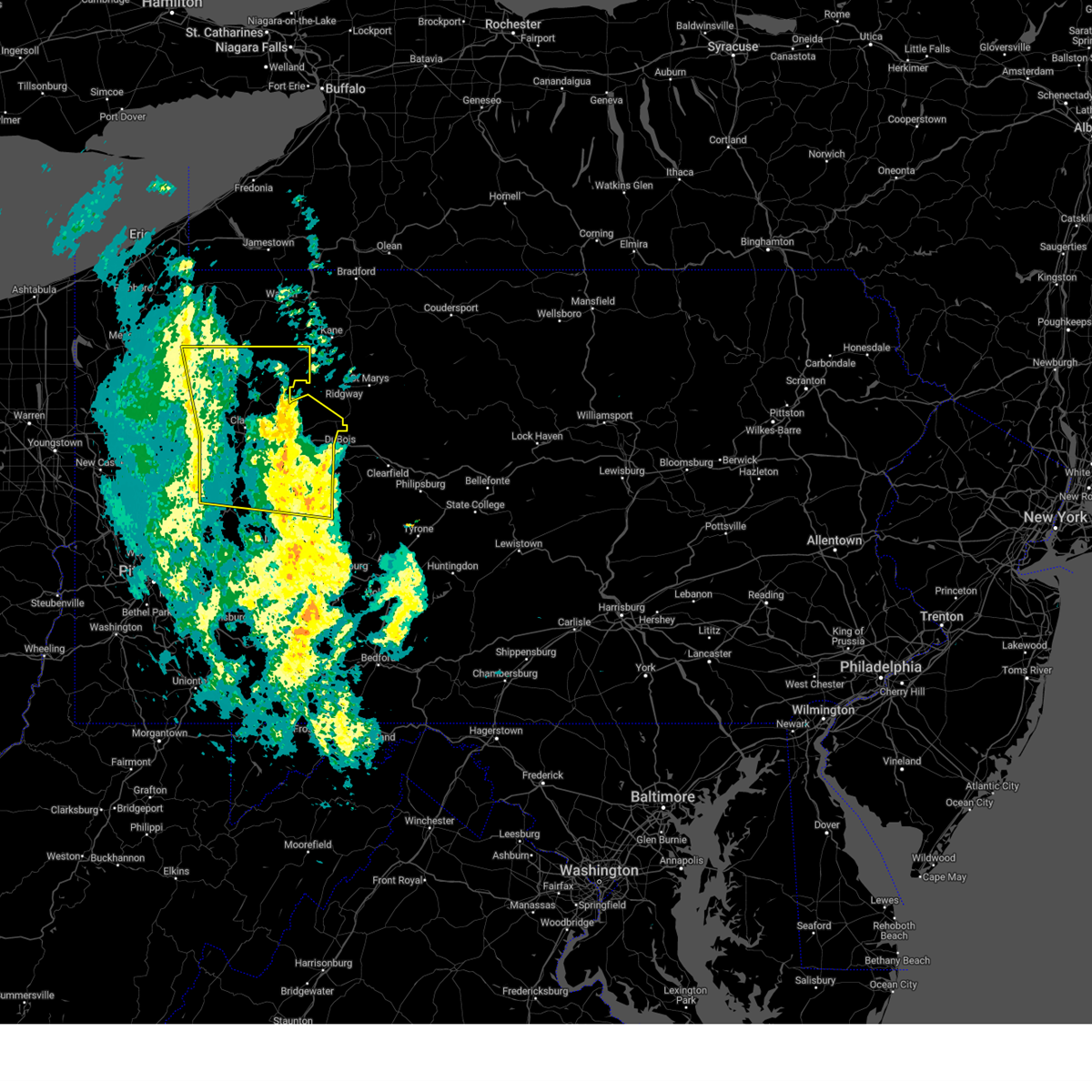
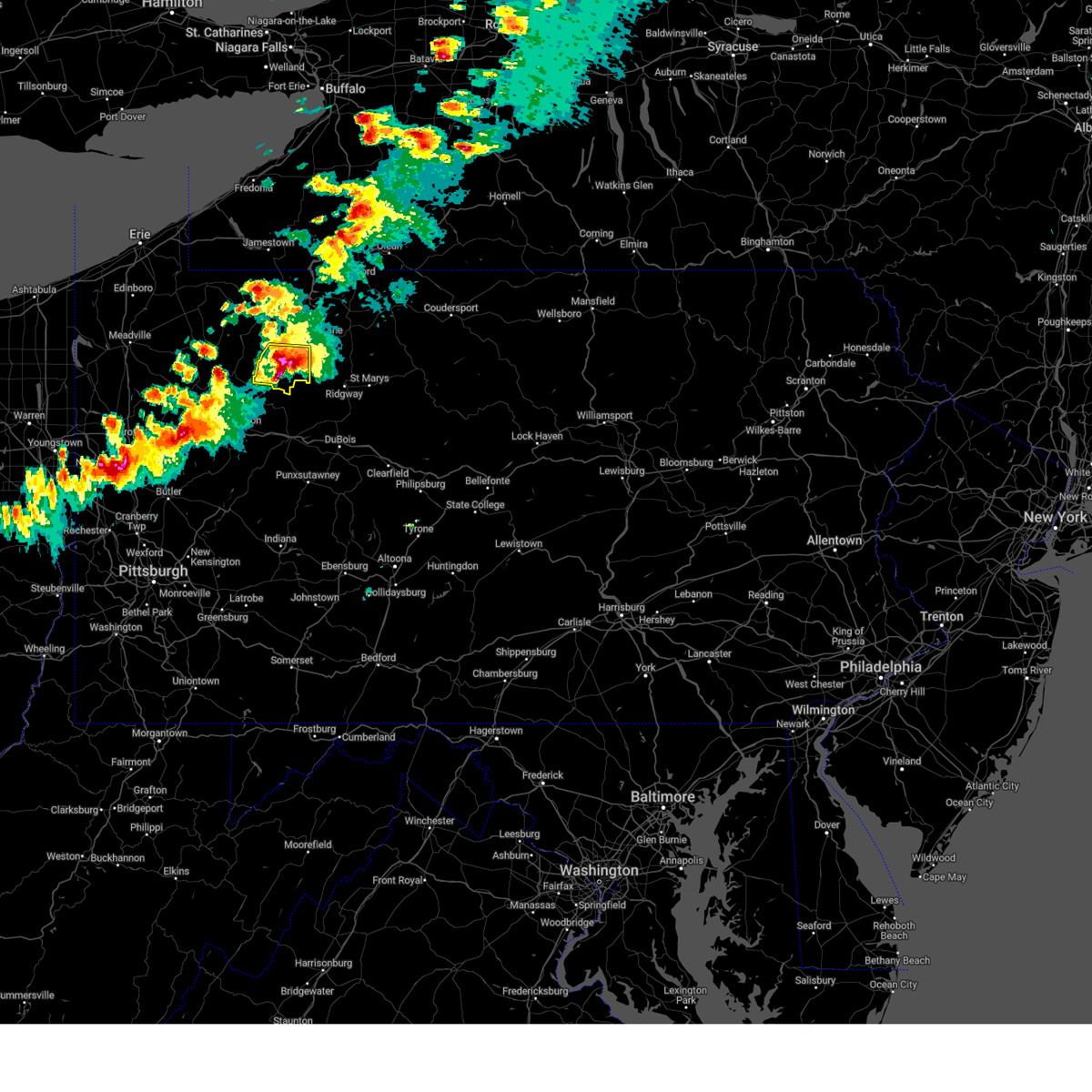
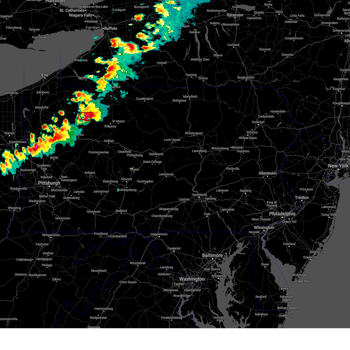
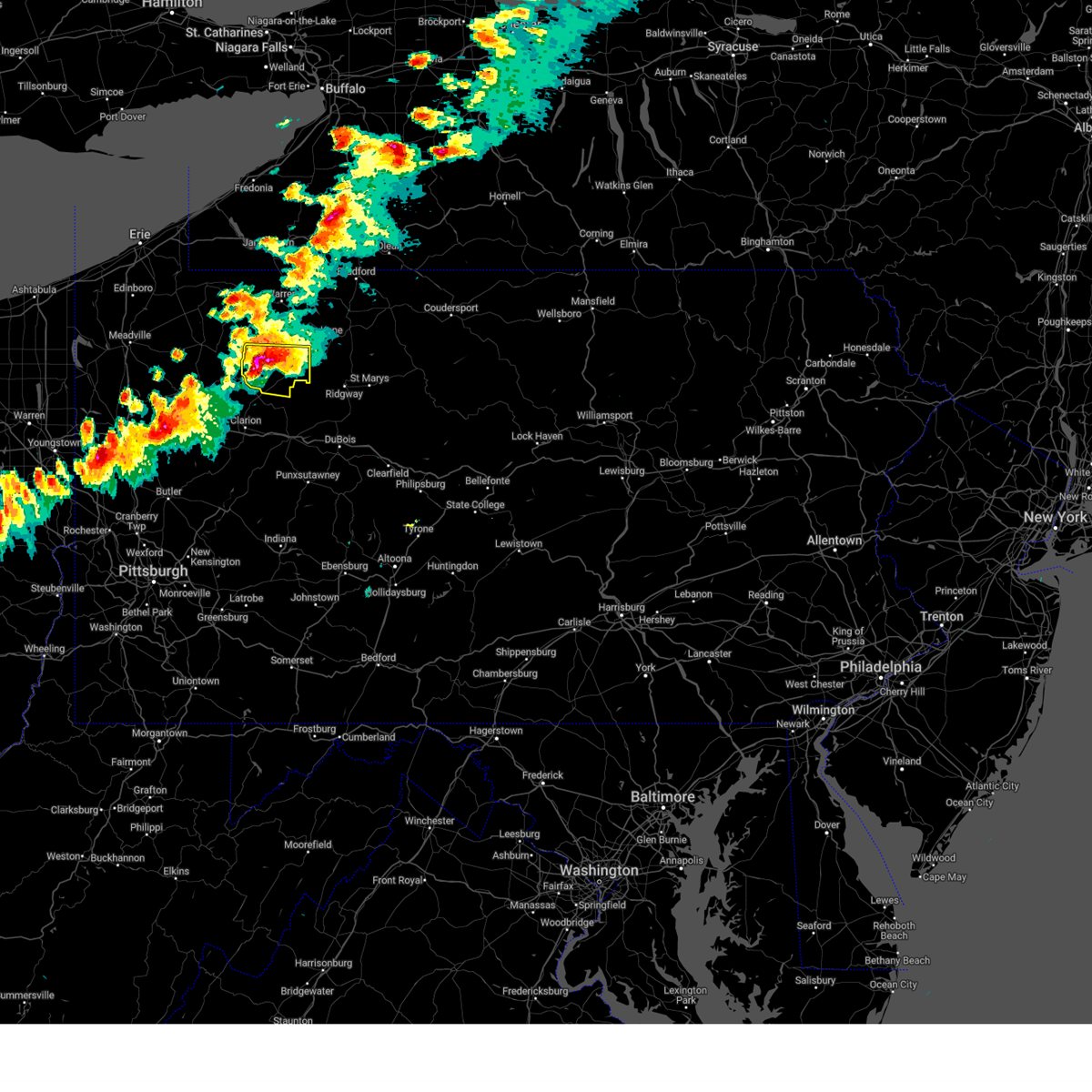
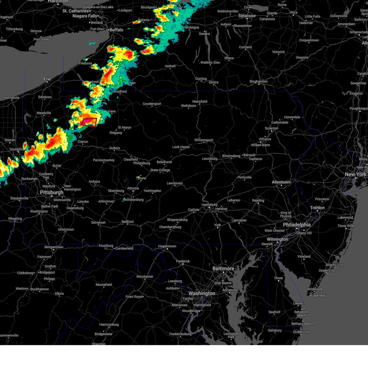
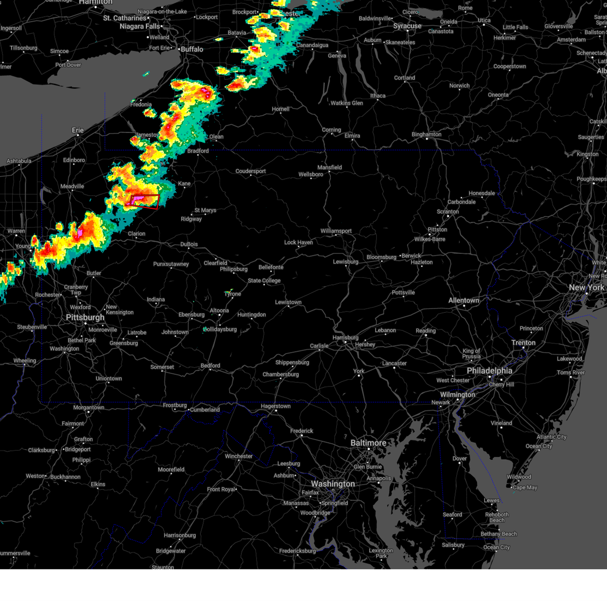
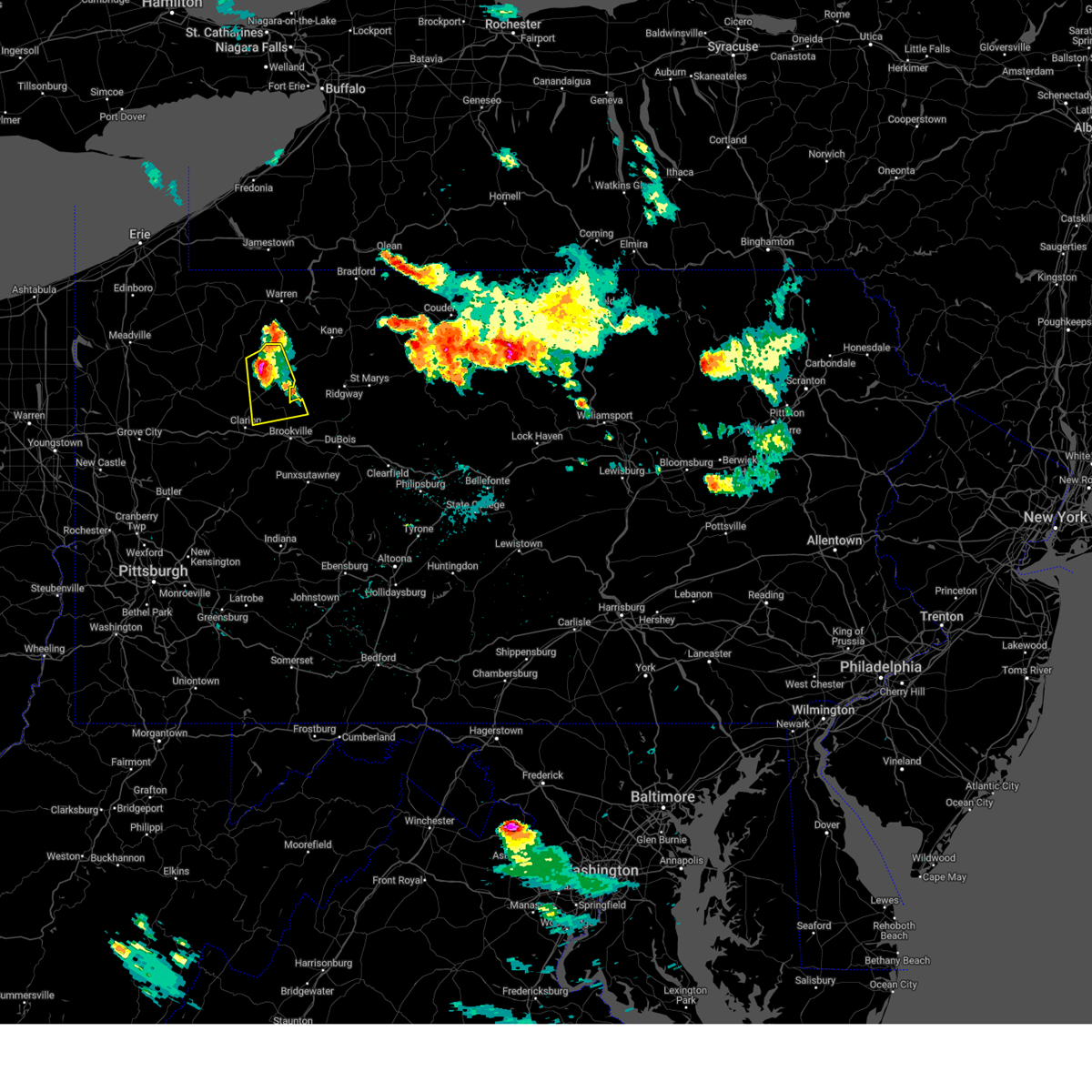
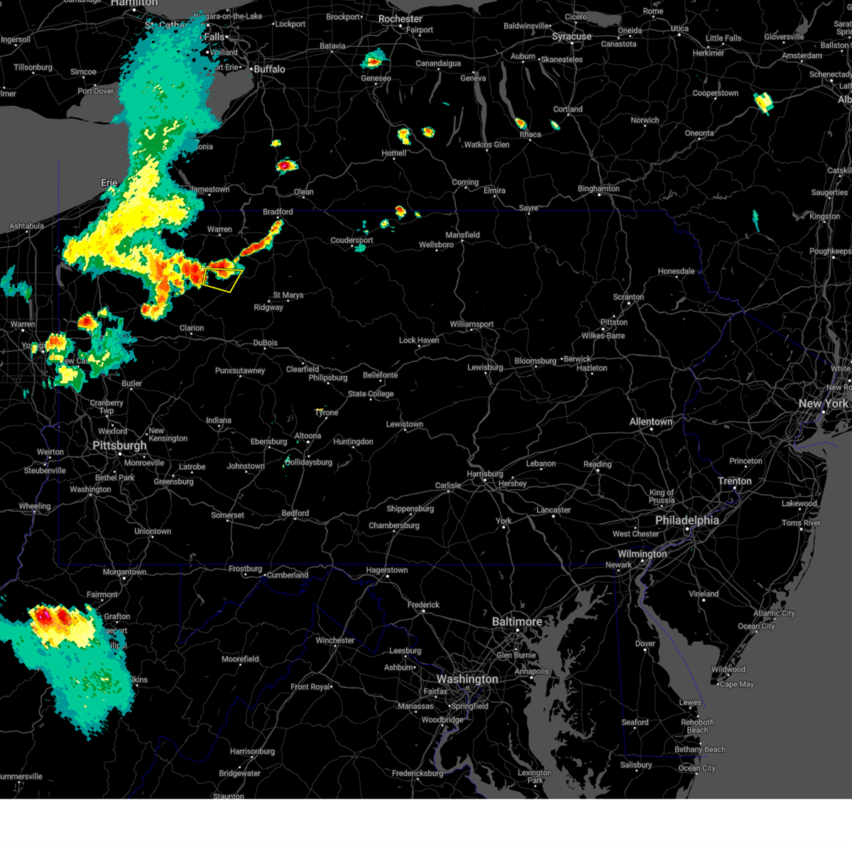
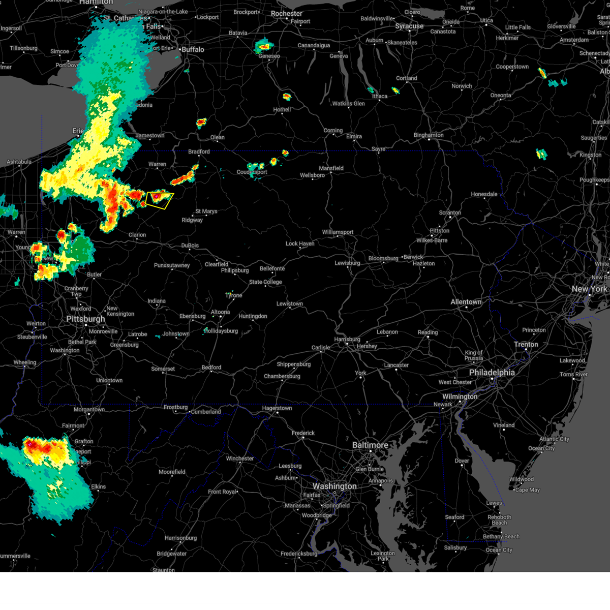
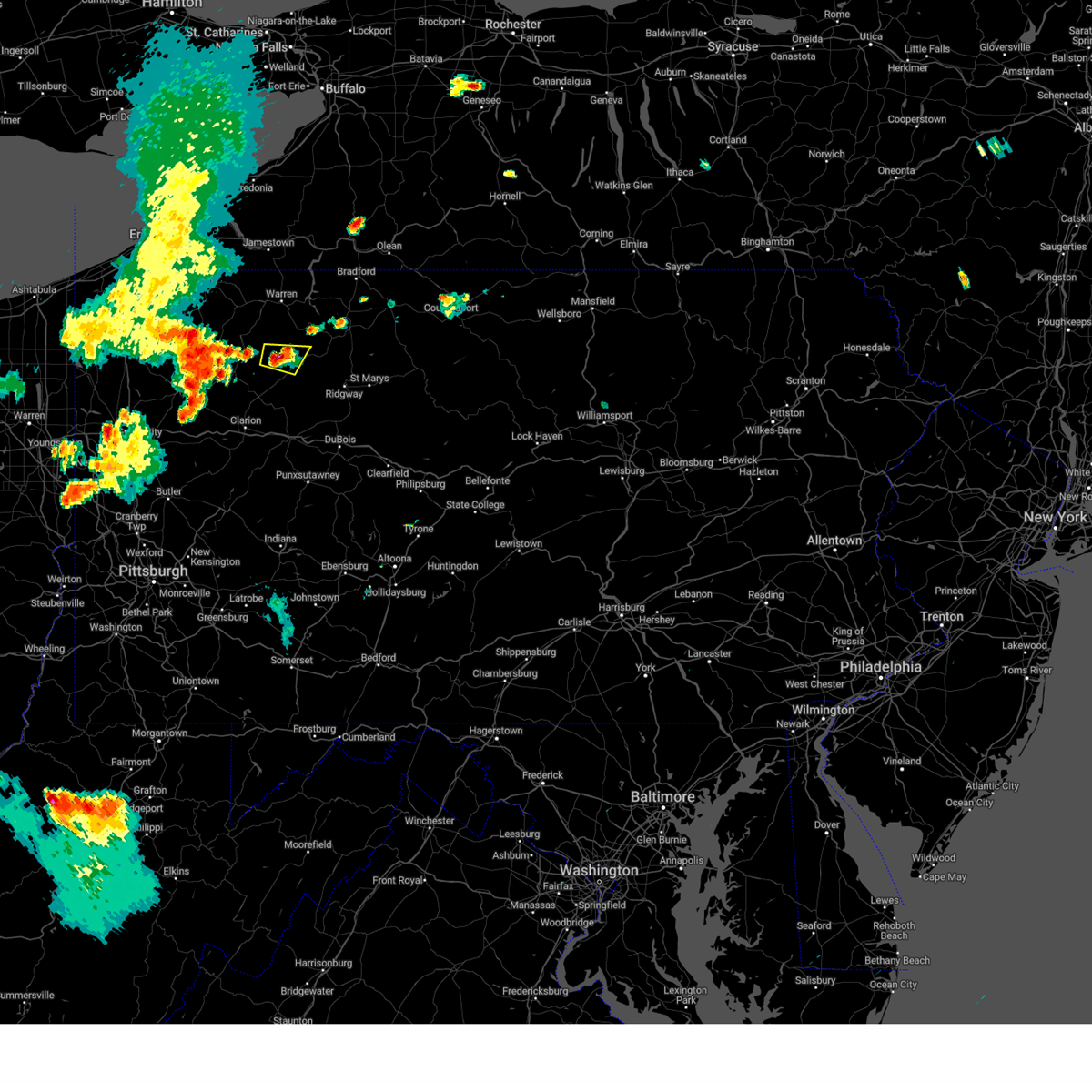
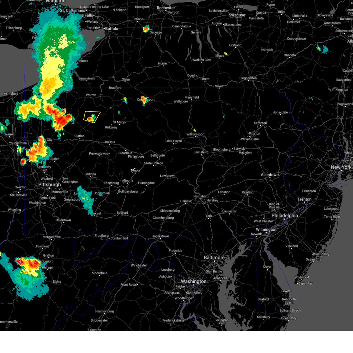
Hail Map for Marienville, PA
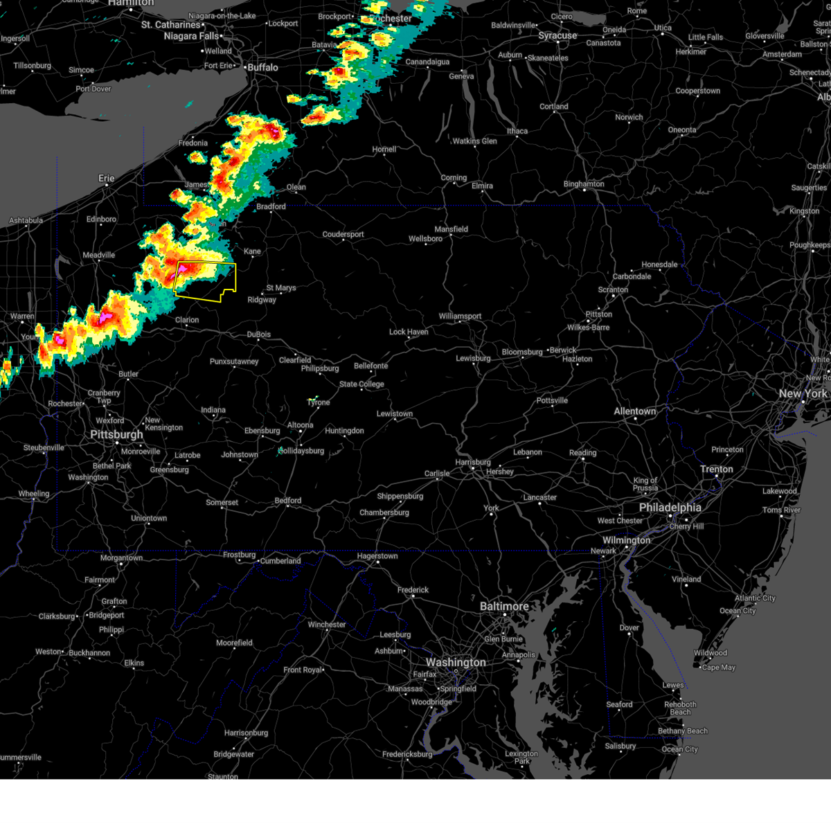
The Marienville, PA area has had 3 reports of on-the-ground hail by trained spotters, and has been under severe weather warnings 73 times during the past 12 months. Doppler radar has detected hail at or near Marienville, PA on 34 occasions, including 3 occasions during the past year.
| Name: | Marienville, PA |
| Where Located: | 80.2 miles NW of State College, PA |
| Map: | Google Map for Marienville, PA |
| Population: | 3137 |
| Housing Units: | 650 |
| More Info: | Search Google for Marienville, PA |
5
The Top Recent Hail Date for Marienville, PA is Sunday, October 6, 2024 (1st out of 34)

Hail and Wind Damage Spotted near Marienville, PA
| Date / Time | Report Details |
|---|---|
| 6/28/2025 12:59 PM EDT |
 The storms which prompted the warning have moved out of the area. therefore, the warning will be allowed to expire. however, gusty winds are still possible with these thunderstorms. to report severe weather, contact your nearest law enforcement agency. they will send your report to the national weather service office. a severe thunderstorm watch remains in effect until 800 pm edt saturday for portions of northwest and west central pennsylvania. The storms which prompted the warning have moved out of the area. therefore, the warning will be allowed to expire. however, gusty winds are still possible with these thunderstorms. to report severe weather, contact your nearest law enforcement agency. they will send your report to the national weather service office. a severe thunderstorm watch remains in effect until 800 pm edt saturday for portions of northwest and west central pennsylvania.
|
| 6/28/2025 12:46 PM EDT |
 the severe thunderstorm warning has been cancelled and is no longer in effect the severe thunderstorm warning has been cancelled and is no longer in effect
|
| 6/28/2025 12:46 PM EDT |
 At 1246 pm edt, severe thunderstorms were located along a line from 12 miles northeast of marienville to 7 miles northeast of brookville, moving east at 45 mph (law enforcement reported widespread wind damage across venango county). Hazards include 70 mph wind gusts. Expect considerable tree damage. damage is likely to mobile homes, roofs, and outbuildings. Locations impacted include, brookville, marienville, brockway, corsica, sigel, clear creek state park and clarington. At 1246 pm edt, severe thunderstorms were located along a line from 12 miles northeast of marienville to 7 miles northeast of brookville, moving east at 45 mph (law enforcement reported widespread wind damage across venango county). Hazards include 70 mph wind gusts. Expect considerable tree damage. damage is likely to mobile homes, roofs, and outbuildings. Locations impacted include, brookville, marienville, brockway, corsica, sigel, clear creek state park and clarington.
|
| 6/28/2025 12:31 PM EDT |
 At 1231 pm edt, severe thunderstorms were located along a line from 6 miles north of marienville to 8 miles northwest of brookville, moving east at 45 mph (law enforcement reported widespread wind damage across clarion county). Hazards include 70 mph wind gusts. Expect considerable tree damage. damage is likely to mobile homes, roofs, and outbuildings. Locations impacted include, clarion, marienville, brockway, strattanville, corsica, sigel, fisher, leeper, kellettville, clarington, clear creek state park, cook forest state park and starr. At 1231 pm edt, severe thunderstorms were located along a line from 6 miles north of marienville to 8 miles northwest of brookville, moving east at 45 mph (law enforcement reported widespread wind damage across clarion county). Hazards include 70 mph wind gusts. Expect considerable tree damage. damage is likely to mobile homes, roofs, and outbuildings. Locations impacted include, clarion, marienville, brockway, strattanville, corsica, sigel, fisher, leeper, kellettville, clarington, clear creek state park, cook forest state park and starr.
|
| 6/28/2025 12:31 PM EDT |
 the severe thunderstorm warning has been cancelled and is no longer in effect the severe thunderstorm warning has been cancelled and is no longer in effect
|
| 6/28/2025 12:25 PM EDT | Wires down on guitonville roa in forest county PA, 8.6 miles E of Marienville, PA |
| 6/28/2025 12:23 PM EDT |
 At 1223 pm edt, severe thunderstorms were located along a line from 9 miles northwest of marienville to over clarion, moving east at 45 mph (law enforcement reported widespread wind damage across clarion county). Hazards include 70 mph wind gusts. Expect considerable tree damage. damage is likely to mobile homes, roofs, and outbuildings. Locations impacted include, clarion, marienville, knox, brockway, tionesta, strattanville, shippenville, corsica, sigel, leeper, fisher, kellettville, fryburg, west hickory, cook forest state park, clarington, clear creek state park, starr and east hickory. At 1223 pm edt, severe thunderstorms were located along a line from 9 miles northwest of marienville to over clarion, moving east at 45 mph (law enforcement reported widespread wind damage across clarion county). Hazards include 70 mph wind gusts. Expect considerable tree damage. damage is likely to mobile homes, roofs, and outbuildings. Locations impacted include, clarion, marienville, knox, brockway, tionesta, strattanville, shippenville, corsica, sigel, leeper, fisher, kellettville, fryburg, west hickory, cook forest state park, clarington, clear creek state park, starr and east hickory.
|
| 6/28/2025 12:08 PM EDT |
 At 1208 pm edt, severe thunderstorms were located along a line from near tionesta to over knox, or along a line from 14 miles northeast of oil city to over knox, moving east at 45 mph (law enforcement reported wind damage across venango county). Hazards include 60 mph wind gusts. Expect damage to roofs, siding, and trees. Locations impacted include, clarion, brookville, marienville, knox, brockway, tionesta, strattanville, shippenville, corsica, sigel, pleasantville, leeper, fisher, kellettville, fryburg, west hickory, cook forest state park, clarington, starr and clear creek state park. At 1208 pm edt, severe thunderstorms were located along a line from near tionesta to over knox, or along a line from 14 miles northeast of oil city to over knox, moving east at 45 mph (law enforcement reported wind damage across venango county). Hazards include 60 mph wind gusts. Expect damage to roofs, siding, and trees. Locations impacted include, clarion, brookville, marienville, knox, brockway, tionesta, strattanville, shippenville, corsica, sigel, pleasantville, leeper, fisher, kellettville, fryburg, west hickory, cook forest state park, clarington, starr and clear creek state park.
|
| 6/28/2025 12:05 PM EDT |
 Svrpbz the national weather service in pittsburgh has issued a * severe thunderstorm warning for, forest county in northwestern pennsylvania, eastern venango county in northwestern pennsylvania, northern clarion county in west central pennsylvania, northern jefferson pa county in west central pennsylvania, * until 100 pm edt. * at 1205 pm edt, severe thunderstorms were located along a line from near tionesta to near knox, or along a line from 12 miles northeast of oil city to near knox, moving east at 45 mph (radar indicated). Hazards include 60 mph wind gusts. expect damage to roofs, siding, and trees Svrpbz the national weather service in pittsburgh has issued a * severe thunderstorm warning for, forest county in northwestern pennsylvania, eastern venango county in northwestern pennsylvania, northern clarion county in west central pennsylvania, northern jefferson pa county in west central pennsylvania, * until 100 pm edt. * at 1205 pm edt, severe thunderstorms were located along a line from near tionesta to near knox, or along a line from 12 miles northeast of oil city to near knox, moving east at 45 mph (radar indicated). Hazards include 60 mph wind gusts. expect damage to roofs, siding, and trees
|
| 6/27/2025 6:24 PM EDT |
 The storm which prompted the warning has weakened below severe limits, and no longer poses an immediate threat to life or property. therefore, the warning will be allowed to expire. however, gusty winds and heavy rain are still possible with this thunderstorm. The storm which prompted the warning has weakened below severe limits, and no longer poses an immediate threat to life or property. therefore, the warning will be allowed to expire. however, gusty winds and heavy rain are still possible with this thunderstorm.
|
| 6/27/2025 6:04 PM EDT |
 At 604 pm edt, a severe thunderstorm was located 9 miles northeast of clarion, moving northeast at 25 mph (radar indicated). Hazards include 60 mph wind gusts. Expect damage to roofs, siding, and trees. Locations impacted include, clarion, brookville, marienville, strattanville, summerville, limestone, corsica, sigel, fisher, leeper, kellettville, clarington, cook forest state park and clear creek state park. At 604 pm edt, a severe thunderstorm was located 9 miles northeast of clarion, moving northeast at 25 mph (radar indicated). Hazards include 60 mph wind gusts. Expect damage to roofs, siding, and trees. Locations impacted include, clarion, brookville, marienville, strattanville, summerville, limestone, corsica, sigel, fisher, leeper, kellettville, clarington, cook forest state park and clear creek state park.
|
| 6/27/2025 5:42 PM EDT |
 Svrpbz the national weather service in pittsburgh has issued a * severe thunderstorm warning for, forest county in northwestern pennsylvania, clarion county in west central pennsylvania, northwestern jefferson pa county in west central pennsylvania, * until 630 pm edt. * at 542 pm edt, a severe thunderstorm was located over clarion, moving northeast at 25 mph (radar indicated). Hazards include 60 mph wind gusts. expect damage to roofs, siding, and trees Svrpbz the national weather service in pittsburgh has issued a * severe thunderstorm warning for, forest county in northwestern pennsylvania, clarion county in west central pennsylvania, northwestern jefferson pa county in west central pennsylvania, * until 630 pm edt. * at 542 pm edt, a severe thunderstorm was located over clarion, moving northeast at 25 mph (radar indicated). Hazards include 60 mph wind gusts. expect damage to roofs, siding, and trees
|
| 6/19/2025 12:48 AM EDT |
 the severe thunderstorm warning has been cancelled and is no longer in effect the severe thunderstorm warning has been cancelled and is no longer in effect
|
| 6/19/2025 12:48 AM EDT |
 At 1248 am edt, severe thunderstorms were located along a line from 10 miles northeast of marienville to 7 miles north of brookville, moving east at 30 mph (law enforcement reported trees and wires down with this line of storms). Hazards include 60 mph wind gusts. Expect damage to roofs, siding, and trees. Locations impacted include, marienville, brockway, sigel, clear creek state park and clarington. At 1248 am edt, severe thunderstorms were located along a line from 10 miles northeast of marienville to 7 miles north of brookville, moving east at 30 mph (law enforcement reported trees and wires down with this line of storms). Hazards include 60 mph wind gusts. Expect damage to roofs, siding, and trees. Locations impacted include, marienville, brockway, sigel, clear creek state park and clarington.
|
| 6/19/2025 12:38 AM EDT |
 At 1238 am edt, severe thunderstorms were located along a line from 8 miles north of marienville to 8 miles southeast of new bethlehem, or along a line from 8 miles north of marienville to 14 miles west of punxsutawney, moving east at 30 mph (law enforcement reported trees and wires down with this line of storms). Hazards include 60 mph wind gusts. Expect damage to roofs, siding, and trees. Locations impacted include, punxsutawney, brookville, marienville, reynoldsville, brockway, sykesville, falls creek, big run, summerville, hawthorn, corsica, sigel, timblin, fisher, worthville, knox-dale, clear creek state park, clarington, anita and cook forest state park. At 1238 am edt, severe thunderstorms were located along a line from 8 miles north of marienville to 8 miles southeast of new bethlehem, or along a line from 8 miles north of marienville to 14 miles west of punxsutawney, moving east at 30 mph (law enforcement reported trees and wires down with this line of storms). Hazards include 60 mph wind gusts. Expect damage to roofs, siding, and trees. Locations impacted include, punxsutawney, brookville, marienville, reynoldsville, brockway, sykesville, falls creek, big run, summerville, hawthorn, corsica, sigel, timblin, fisher, worthville, knox-dale, clear creek state park, clarington, anita and cook forest state park.
|
| 6/19/2025 12:38 AM EDT |
 the severe thunderstorm warning has been cancelled and is no longer in effect the severe thunderstorm warning has been cancelled and is no longer in effect
|
| 6/19/2025 12:25 AM EDT |
 At 1225 am edt, severe thunderstorms were located along a line from over marienville to over delmont, or along a line from over marienville to 7 miles north of greensburg, moving east at 30 mph (law enforcement reported trees and wires down with this line of storms). Hazards include 60 mph wind gusts. Expect damage to roofs, siding, and trees. Locations impacted include, punxsutawney, clarion, brookville, marienville, reynoldsville, brockway, new bethlehem, sykesville, falls creek, big run, dayton, strattanville, summerville, limestone, rossiter, hawthorn, corsica, sigel, timblin and fisher. At 1225 am edt, severe thunderstorms were located along a line from over marienville to over delmont, or along a line from over marienville to 7 miles north of greensburg, moving east at 30 mph (law enforcement reported trees and wires down with this line of storms). Hazards include 60 mph wind gusts. Expect damage to roofs, siding, and trees. Locations impacted include, punxsutawney, clarion, brookville, marienville, reynoldsville, brockway, new bethlehem, sykesville, falls creek, big run, dayton, strattanville, summerville, limestone, rossiter, hawthorn, corsica, sigel, timblin and fisher.
|
| 6/19/2025 12:25 AM EDT |
 the severe thunderstorm warning has been cancelled and is no longer in effect the severe thunderstorm warning has been cancelled and is no longer in effect
|
| 6/19/2025 12:14 AM EDT |
 the severe thunderstorm warning has been cancelled and is no longer in effect the severe thunderstorm warning has been cancelled and is no longer in effect
|
| 6/19/2025 12:14 AM EDT |
 At 1214 am edt, severe thunderstorms were located along a line from 9 miles west of marienville to over murrysville, or along a line from 9 miles west of marienville to 6 miles east of monroeville, moving east at 30 mph (law enforcement reported trees and wires down with this line of storms). Hazards include 60 mph wind gusts. Expect damage to roofs, siding, and trees. Locations impacted include, pittsburgh, penn hills, monroeville, indiana, punxsutawney, clarion, vandergrift, kittanning, brookville, marienville, homer city, apollo, knox, rimersburg, plum, murrysville, wilkinsburg, new kensington, lower burrell and harrison township. At 1214 am edt, severe thunderstorms were located along a line from 9 miles west of marienville to over murrysville, or along a line from 9 miles west of marienville to 6 miles east of monroeville, moving east at 30 mph (law enforcement reported trees and wires down with this line of storms). Hazards include 60 mph wind gusts. Expect damage to roofs, siding, and trees. Locations impacted include, pittsburgh, penn hills, monroeville, indiana, punxsutawney, clarion, vandergrift, kittanning, brookville, marienville, homer city, apollo, knox, rimersburg, plum, murrysville, wilkinsburg, new kensington, lower burrell and harrison township.
|
| 6/18/2025 11:57 PM EDT |
 Svrpbz the national weather service in pittsburgh has issued a * severe thunderstorm warning for, forest county in northwestern pennsylvania, eastern venango county in northwestern pennsylvania, northeastern allegheny county in southwestern pennsylvania, northern westmoreland county in southwestern pennsylvania, armstrong county in west central pennsylvania, eastern butler county in west central pennsylvania, clarion county in west central pennsylvania, indiana county in west central pennsylvania, jefferson pa county in west central pennsylvania, * until 115 am edt. * at 1157 pm edt, severe thunderstorms were located along a line from near tionesta to over penn hills, or along a line from 16 miles northeast of oil city to over penn hills, moving east at 30 mph (law enforcement reported trees and wires down with this line of storms). Hazards include 60 mph wind gusts. expect damage to roofs, siding, and trees Svrpbz the national weather service in pittsburgh has issued a * severe thunderstorm warning for, forest county in northwestern pennsylvania, eastern venango county in northwestern pennsylvania, northeastern allegheny county in southwestern pennsylvania, northern westmoreland county in southwestern pennsylvania, armstrong county in west central pennsylvania, eastern butler county in west central pennsylvania, clarion county in west central pennsylvania, indiana county in west central pennsylvania, jefferson pa county in west central pennsylvania, * until 115 am edt. * at 1157 pm edt, severe thunderstorms were located along a line from near tionesta to over penn hills, or along a line from 16 miles northeast of oil city to over penn hills, moving east at 30 mph (law enforcement reported trees and wires down with this line of storms). Hazards include 60 mph wind gusts. expect damage to roofs, siding, and trees
|
| 6/9/2025 6:26 PM EDT |
 the severe thunderstorm warning has been cancelled and is no longer in effect the severe thunderstorm warning has been cancelled and is no longer in effect
|
| 6/9/2025 6:18 PM EDT |
 the severe thunderstorm warning has been cancelled and is no longer in effect the severe thunderstorm warning has been cancelled and is no longer in effect
|
| 6/9/2025 6:18 PM EDT |
 At 618 pm edt, a severe thunderstorm was located 9 miles south of tionesta, or 12 miles north of clarion, moving northeast at 40 mph (radar indicated). Hazards include 60 mph wind gusts and small hail. Expect damage to roofs, siding, and trees. Locations impacted include, marienville, kellettville, leeper, fryburg, cook forest state park and starr. At 618 pm edt, a severe thunderstorm was located 9 miles south of tionesta, or 12 miles north of clarion, moving northeast at 40 mph (radar indicated). Hazards include 60 mph wind gusts and small hail. Expect damage to roofs, siding, and trees. Locations impacted include, marienville, kellettville, leeper, fryburg, cook forest state park and starr.
|
| 6/9/2025 6:09 PM EDT | Svrpbz the national weather service in pittsburgh has issued a * severe thunderstorm warning for, forest county in northwestern pennsylvania, east central venango county in northwestern pennsylvania, northeastern clarion county in west central pennsylvania, * until 715 pm edt. * at 609 pm edt, a severe thunderstorm was located 6 miles northeast of knox, moving northeast at 40 mph (radar indicated). Hazards include 60 mph wind gusts and small hail. expect damage to roofs, siding, and trees |
| 6/9/2025 5:39 PM EDT |
 The severe thunderstorm warning that was previously in effect has been upgraded to a tornado warning. please refer to that bulletin for the latest information on this dangerous weather situation. to report severe weather, contact your nearest law enforcement agency. they will send your report to the national weather service office. The severe thunderstorm warning that was previously in effect has been upgraded to a tornado warning. please refer to that bulletin for the latest information on this dangerous weather situation. to report severe weather, contact your nearest law enforcement agency. they will send your report to the national weather service office.
|
| 6/9/2025 5:36 PM EDT |
 The storm which prompted the warning has moved out of the area. therefore, the warning will be allowed to expire. to report severe weather, contact your nearest law enforcement agency. they will send your report to the national weather service office. a severe thunderstorm watch remains in effect until 1000 pm edt monday for a portion of northwest pennsylvania. The storm which prompted the warning has moved out of the area. therefore, the warning will be allowed to expire. to report severe weather, contact your nearest law enforcement agency. they will send your report to the national weather service office. a severe thunderstorm watch remains in effect until 1000 pm edt monday for a portion of northwest pennsylvania.
|
| 6/9/2025 5:30 PM EDT |
 At 530 pm edt, a severe thunderstorm was located near clarion, moving northeast at 30 mph (radar indicated). Hazards include 60 mph wind gusts and half dollar size hail. Hail damage to vehicles is expected. expect wind damage to roofs, siding, and trees. Locations impacted include, clarion, marienville, strattanville, limestone, corsica, sigel, fisher, leeper, cook forest state park, clarington and clear creek state park. At 530 pm edt, a severe thunderstorm was located near clarion, moving northeast at 30 mph (radar indicated). Hazards include 60 mph wind gusts and half dollar size hail. Hail damage to vehicles is expected. expect wind damage to roofs, siding, and trees. Locations impacted include, clarion, marienville, strattanville, limestone, corsica, sigel, fisher, leeper, cook forest state park, clarington and clear creek state park.
|
| 6/9/2025 5:22 PM EDT |
 At 522 pm edt, a severe thunderstorm was located near clarion, moving northeast at 30 mph (radar indicated). Hazards include ping pong ball size hail and 60 mph wind gusts. People and animals outdoors will be injured. expect hail damage to roofs, siding, windows, and vehicles. expect wind damage to roofs, siding, and trees. Locations impacted include, clarion, marienville, strattanville, limestone, shippenville, corsica, sigel, fisher, leeper, cook forest state park, clarington and clear creek state park. At 522 pm edt, a severe thunderstorm was located near clarion, moving northeast at 30 mph (radar indicated). Hazards include ping pong ball size hail and 60 mph wind gusts. People and animals outdoors will be injured. expect hail damage to roofs, siding, windows, and vehicles. expect wind damage to roofs, siding, and trees. Locations impacted include, clarion, marienville, strattanville, limestone, shippenville, corsica, sigel, fisher, leeper, cook forest state park, clarington and clear creek state park.
|
| 6/9/2025 5:19 PM EDT |
 the severe thunderstorm warning has been cancelled and is no longer in effect the severe thunderstorm warning has been cancelled and is no longer in effect
|
| 6/9/2025 5:19 PM EDT |
 At 519 pm edt, a severe thunderstorm was located 9 miles northeast of marienville, moving northeast at 35 mph (radar indicated). Hazards include 60 mph wind gusts and small hail. Expect damage to roofs, siding, and trees. Locations impacted include, marienville. At 519 pm edt, a severe thunderstorm was located 9 miles northeast of marienville, moving northeast at 35 mph (radar indicated). Hazards include 60 mph wind gusts and small hail. Expect damage to roofs, siding, and trees. Locations impacted include, marienville.
|
| 6/9/2025 5:19 PM EDT |
 At 519 pm edt, a severe thunderstorm was located near clarion, moving northeast at 30 mph (radar indicated). Hazards include ping pong ball size hail and 60 mph wind gusts. People and animals outdoors will be injured. expect hail damage to roofs, siding, windows, and vehicles. expect wind damage to roofs, siding, and trees. Locations impacted include, clarion, marienville, sligo, strattanville, limestone, shippenville, corsica, sigel, fisher, leeper, cook forest state park, clarington and clear creek state park. At 519 pm edt, a severe thunderstorm was located near clarion, moving northeast at 30 mph (radar indicated). Hazards include ping pong ball size hail and 60 mph wind gusts. People and animals outdoors will be injured. expect hail damage to roofs, siding, windows, and vehicles. expect wind damage to roofs, siding, and trees. Locations impacted include, clarion, marienville, sligo, strattanville, limestone, shippenville, corsica, sigel, fisher, leeper, cook forest state park, clarington and clear creek state park.
|
| 6/9/2025 5:08 PM EDT | the severe thunderstorm warning has been cancelled and is no longer in effect |
| 6/9/2025 5:08 PM EDT | At 508 pm edt, a severe thunderstorm was located over marienville, moving northeast at 35 mph (radar indicated). Hazards include 60 mph wind gusts and quarter size hail. Hail damage to vehicles is expected. expect wind damage to roofs, siding, and trees. Locations impacted include, marienville, leeper and cook forest state park. |
| 6/9/2025 5:07 PM EDT | At 507 pm edt, a severe thunderstorm was located 7 miles north of rimersburg, or 7 miles southwest of clarion, moving northeast at 40 mph (radar indicated). Hazards include 60 mph wind gusts and half dollar size hail. Hail damage to vehicles is expected. expect wind damage to roofs, siding, and trees. Locations impacted include, clarion, marienville, rimersburg, sligo, strattanville, limestone, shippenville, corsica, callensburg, sigel, fisher, leeper, cook forest state park, clarington and clear creek state park. |
| 6/9/2025 4:59 PM EDT |
 At 459 pm edt, a severe thunderstorm was located near marienville, moving northeast at 35 mph (radar indicated). Hazards include 60 mph wind gusts and quarter size hail. Hail damage to vehicles is expected. expect wind damage to roofs, siding, and trees. Locations impacted include, marienville, leeper, cook forest state park, clarington and clear creek state park. At 459 pm edt, a severe thunderstorm was located near marienville, moving northeast at 35 mph (radar indicated). Hazards include 60 mph wind gusts and quarter size hail. Hail damage to vehicles is expected. expect wind damage to roofs, siding, and trees. Locations impacted include, marienville, leeper, cook forest state park, clarington and clear creek state park.
|
| 6/9/2025 4:58 PM EDT |
 Svrpbz the national weather service in pittsburgh has issued a * severe thunderstorm warning for, southeastern forest county in northwestern pennsylvania, clarion county in west central pennsylvania, northwestern jefferson pa county in west central pennsylvania, * until 545 pm edt. * at 458 pm edt, a severe thunderstorm was located near rimersburg, moving northeast at 40 mph (radar indicated). Hazards include 60 mph wind gusts and small hail. expect damage to roofs, siding, and trees Svrpbz the national weather service in pittsburgh has issued a * severe thunderstorm warning for, southeastern forest county in northwestern pennsylvania, clarion county in west central pennsylvania, northwestern jefferson pa county in west central pennsylvania, * until 545 pm edt. * at 458 pm edt, a severe thunderstorm was located near rimersburg, moving northeast at 40 mph (radar indicated). Hazards include 60 mph wind gusts and small hail. expect damage to roofs, siding, and trees
|
| 6/9/2025 4:49 PM EDT |
 Svrpbz the national weather service in pittsburgh has issued a * severe thunderstorm warning for, forest county in northwestern pennsylvania, northeastern clarion county in west central pennsylvania, northwestern jefferson pa county in west central pennsylvania, * until 545 pm edt. * at 449 pm edt, a severe thunderstorm was located 9 miles southwest of marienville, moving northeast at 35 mph (radar indicated). Hazards include 60 mph wind gusts and quarter size hail. Hail damage to vehicles is expected. Expect wind damage to roofs, siding, and trees. Svrpbz the national weather service in pittsburgh has issued a * severe thunderstorm warning for, forest county in northwestern pennsylvania, northeastern clarion county in west central pennsylvania, northwestern jefferson pa county in west central pennsylvania, * until 545 pm edt. * at 449 pm edt, a severe thunderstorm was located 9 miles southwest of marienville, moving northeast at 35 mph (radar indicated). Hazards include 60 mph wind gusts and quarter size hail. Hail damage to vehicles is expected. Expect wind damage to roofs, siding, and trees.
|
| 4/29/2025 6:09 PM EDT |
 The storm which prompted the warning has moved out of the area. therefore, the warning will be allowed to expire. however, gusty winds are still possible with this thunderstorm. a severe thunderstorm watch remains in effect until 1000 pm edt for northwestern and west central pennsylvania. remember, a severe thunderstorm warning still remains in effect for forest county. The storm which prompted the warning has moved out of the area. therefore, the warning will be allowed to expire. however, gusty winds are still possible with this thunderstorm. a severe thunderstorm watch remains in effect until 1000 pm edt for northwestern and west central pennsylvania. remember, a severe thunderstorm warning still remains in effect for forest county.
|
| 4/29/2025 6:08 PM EDT |
 Svrpbz the national weather service in pittsburgh has issued a * severe thunderstorm warning for, jefferson county in west central pennsylvania, southeastern forest county in northwestern pennsylvania, * until 645 pm edt. * at 608 pm edt, severe thunderstorms were located along a line extending from 6 miles northwest of portland mills to 7 miles southeast of clarion to 11 miles southeast of punxsutawney, moving east at 55 mph (radar indicated). Hazards include 70 mph wind gusts. Trees snapped and uprooted. Power outages can be expected. Svrpbz the national weather service in pittsburgh has issued a * severe thunderstorm warning for, jefferson county in west central pennsylvania, southeastern forest county in northwestern pennsylvania, * until 645 pm edt. * at 608 pm edt, severe thunderstorms were located along a line extending from 6 miles northwest of portland mills to 7 miles southeast of clarion to 11 miles southeast of punxsutawney, moving east at 55 mph (radar indicated). Hazards include 70 mph wind gusts. Trees snapped and uprooted. Power outages can be expected.
|
| 4/29/2025 5:44 PM EDT | At 543 pm edt, a severe thunderstorm was located over marienville, moving east at 50 mph (radar indicated). Hazards include 60 mph wind gusts. Expect damage to trees and power lines, resulting in some power outages. Locations impacted include, marienville, knox, shippenville, fryburg, leeper, cook forest state park, and clarington. |
| 4/29/2025 5:44 PM EDT | the severe thunderstorm warning has been cancelled and is no longer in effect |
| 4/29/2025 5:28 PM EDT |
 Svrpbz the national weather service in pittsburgh has issued a * severe thunderstorm warning for, southeastern venango county in northwestern pennsylvania, northern clarion county in west central pennsylvania, forest county in northwestern pennsylvania, * until 615 pm edt. * at 528 pm edt, a severe thunderstorm was located 9 miles south of tionesta, or 10 miles north of clarion, moving east at 65 mph (radar indicated). Hazards include 60 mph wind gusts. expect damage to trees and power lines, resulting in some power outages Svrpbz the national weather service in pittsburgh has issued a * severe thunderstorm warning for, southeastern venango county in northwestern pennsylvania, northern clarion county in west central pennsylvania, forest county in northwestern pennsylvania, * until 615 pm edt. * at 528 pm edt, a severe thunderstorm was located 9 miles south of tionesta, or 10 miles north of clarion, moving east at 65 mph (radar indicated). Hazards include 60 mph wind gusts. expect damage to trees and power lines, resulting in some power outages
|
| 3/16/2025 2:06 PM EDT |
 The storms which prompted the warning have moved out of the area. therefore, the warning will be allowed to expire. however, gusty winds are still possible with these thunderstorms. a tornado watch remains in effect until 400 pm edt for portions of northwest and west central pennsylvania. The storms which prompted the warning have moved out of the area. therefore, the warning will be allowed to expire. however, gusty winds are still possible with these thunderstorms. a tornado watch remains in effect until 400 pm edt for portions of northwest and west central pennsylvania.
|
| 3/16/2025 1:56 PM EDT |
 the severe thunderstorm warning has been cancelled and is no longer in effect the severe thunderstorm warning has been cancelled and is no longer in effect
|
| 3/16/2025 1:56 PM EDT |
 At 156 pm edt, severe thunderstorms were located along a line from 9 miles northeast of marienville to over reynoldsville, or along a line from 9 miles northeast of marienville to 11 miles east of brookville, moving northeast at 55 mph (radar indicated). Hazards include 70 mph wind gusts and small hail. Expect considerable tree damage. damage is likely to mobile homes, roofs, and outbuildings. this severe thunderstorm will be near, brookville around 140 pm edt. marienville and punxsutawney around 145 pm edt. reynoldsville around 155 pm edt. brockway around 205 pm edt. Other locations impacted by the severe thunderstorm include sigel, knox-dale, clear creek state park, clarington, anita, sykesville and falls creek. At 156 pm edt, severe thunderstorms were located along a line from 9 miles northeast of marienville to over reynoldsville, or along a line from 9 miles northeast of marienville to 11 miles east of brookville, moving northeast at 55 mph (radar indicated). Hazards include 70 mph wind gusts and small hail. Expect considerable tree damage. damage is likely to mobile homes, roofs, and outbuildings. this severe thunderstorm will be near, brookville around 140 pm edt. marienville and punxsutawney around 145 pm edt. reynoldsville around 155 pm edt. brockway around 205 pm edt. Other locations impacted by the severe thunderstorm include sigel, knox-dale, clear creek state park, clarington, anita, sykesville and falls creek.
|
| 3/16/2025 1:52 PM EDT | Time estimated. 1...918 customers without power... of 280f forest count in forest county PA, 0.4 miles SE of Marienville, PA |
| 3/16/2025 1:35 PM EDT |
 At 135 pm edt, severe thunderstorms were located along a line from 11 miles northeast of clarion to 10 miles west of punxsutawney, moving northeast at 55 mph (radar indicated). Hazards include 70 mph wind gusts and quarter size hail. Hail damage to vehicles is expected. expect considerable tree damage. wind damage is also likely to mobile homes, roofs, and outbuildings. this severe thunderstorm will be near, clarion and new bethlehem around 125 pm edt. brookville around 140 pm edt. marienville and punxsutawney around 145 pm edt. reynoldsville around 155 pm edt. brockway around 205 pm edt. Other locations impacted by the severe thunderstorm include limestone, hawthorn, rural valley, distant, atwood, dayton, mahoning creek lake, strattanville, smicksburg and plumville. At 135 pm edt, severe thunderstorms were located along a line from 11 miles northeast of clarion to 10 miles west of punxsutawney, moving northeast at 55 mph (radar indicated). Hazards include 70 mph wind gusts and quarter size hail. Hail damage to vehicles is expected. expect considerable tree damage. wind damage is also likely to mobile homes, roofs, and outbuildings. this severe thunderstorm will be near, clarion and new bethlehem around 125 pm edt. brookville around 140 pm edt. marienville and punxsutawney around 145 pm edt. reynoldsville around 155 pm edt. brockway around 205 pm edt. Other locations impacted by the severe thunderstorm include limestone, hawthorn, rural valley, distant, atwood, dayton, mahoning creek lake, strattanville, smicksburg and plumville.
|
| 3/16/2025 1:35 PM EDT |
 the severe thunderstorm warning has been cancelled and is no longer in effect the severe thunderstorm warning has been cancelled and is no longer in effect
|
| 3/16/2025 1:21 PM EDT |
 Svrpbz the national weather service in pittsburgh has issued a * severe thunderstorm warning for, forest county in northwestern pennsylvania, northeastern venango county in northwestern pennsylvania, southeastern armstrong county in west central pennsylvania, clarion county in west central pennsylvania, indiana county in west central pennsylvania, jefferson pa county in west central pennsylvania, * until 215 pm edt. * at 121 pm edt, severe thunderstorms were located along a line from near clarion to 10 miles east of kittanning, moving northeast at 55 mph (radar indicated). Hazards include 70 mph wind gusts and half dollar size hail. Hail damage to vehicles is expected. expect considerable tree damage. wind damage is also likely to mobile homes, roofs, and outbuildings. this severe thunderstorm will be near, clarion, new bethlehem and knox around 125 pm edt. brookville around 140 pm edt. marienville and punxsutawney around 145 pm edt. reynoldsville around 155 pm edt. brockway around 205 pm edt. Other locations impacted by the severe thunderstorm include limestone, hawthorn, rural valley, distant, shippenville, atwood, dayton, mahoning creek lake, strattanville and smicksburg. Svrpbz the national weather service in pittsburgh has issued a * severe thunderstorm warning for, forest county in northwestern pennsylvania, northeastern venango county in northwestern pennsylvania, southeastern armstrong county in west central pennsylvania, clarion county in west central pennsylvania, indiana county in west central pennsylvania, jefferson pa county in west central pennsylvania, * until 215 pm edt. * at 121 pm edt, severe thunderstorms were located along a line from near clarion to 10 miles east of kittanning, moving northeast at 55 mph (radar indicated). Hazards include 70 mph wind gusts and half dollar size hail. Hail damage to vehicles is expected. expect considerable tree damage. wind damage is also likely to mobile homes, roofs, and outbuildings. this severe thunderstorm will be near, clarion, new bethlehem and knox around 125 pm edt. brookville around 140 pm edt. marienville and punxsutawney around 145 pm edt. reynoldsville around 155 pm edt. brockway around 205 pm edt. Other locations impacted by the severe thunderstorm include limestone, hawthorn, rural valley, distant, shippenville, atwood, dayton, mahoning creek lake, strattanville and smicksburg.
|
| 11/20/2024 6:13 PM EST |
 The winds have weakened below severe limits. gusty winds are still possible. The winds have weakened below severe limits. gusty winds are still possible.
|
| 11/20/2024 6:05 PM EST |
 the severe thunderstorm warning has been cancelled and is no longer in effect the severe thunderstorm warning has been cancelled and is no longer in effect
|
| 11/20/2024 6:05 PM EST |
 At 605 pm est, severe thunderstorms were located along a line from 15 miles north of marienville to 10 miles southwest of punxsutawney, moving east at 40 mph (radar indicated). Hazards include 60 mph wind gusts. Expect damage to roofs, siding, and trees. Locations impacted include, punxsutawney, brookville, marienville, reynoldsville, brockway, sykesville, falls creek, big run, summerville, rossiter, glen campbell, sigel, kellettville, worthville, knox-dale, clear creek state park, anita, clarington and rochester mills. At 605 pm est, severe thunderstorms were located along a line from 15 miles north of marienville to 10 miles southwest of punxsutawney, moving east at 40 mph (radar indicated). Hazards include 60 mph wind gusts. Expect damage to roofs, siding, and trees. Locations impacted include, punxsutawney, brookville, marienville, reynoldsville, brockway, sykesville, falls creek, big run, summerville, rossiter, glen campbell, sigel, kellettville, worthville, knox-dale, clear creek state park, anita, clarington and rochester mills.
|
| 11/20/2024 5:54 PM EST |
 At 554 pm est, severe thunderstorms were located along a line from 13 miles north of tionesta to 12 miles north of indiana, or along a line from 18 miles northwest of marienville to 12 miles north of indiana, moving east at 40 mph (radar indicated). Hazards include 60 mph wind gusts. Expect damage to roofs, siding, and trees. Locations impacted include, punxsutawney, brookville, marienville, reynoldsville, brockway, new bethlehem, sykesville, falls creek, rural valley, big run, dayton, strattanville, summerville, limestone, rossiter, hawthorn, corsica, plumville, glen campbell and sigel. At 554 pm est, severe thunderstorms were located along a line from 13 miles north of tionesta to 12 miles north of indiana, or along a line from 18 miles northwest of marienville to 12 miles north of indiana, moving east at 40 mph (radar indicated). Hazards include 60 mph wind gusts. Expect damage to roofs, siding, and trees. Locations impacted include, punxsutawney, brookville, marienville, reynoldsville, brockway, new bethlehem, sykesville, falls creek, rural valley, big run, dayton, strattanville, summerville, limestone, rossiter, hawthorn, corsica, plumville, glen campbell and sigel.
|
| 11/20/2024 5:54 PM EST |
 the severe thunderstorm warning has been cancelled and is no longer in effect the severe thunderstorm warning has been cancelled and is no longer in effect
|
| 11/20/2024 5:38 PM EST |
 At 538 pm est, severe thunderstorms were located along a line from 13 miles north of tionesta to 10 miles east of kittanning, or along a line from 22 miles northeast of oil city to 10 miles east of kittanning, moving east at 40 mph (radar indicated). Hazards include 60 mph wind gusts. Expect damage to roofs, siding, and trees. Locations impacted include, punxsutawney, clarion, kittanning, brookville, marienville, knox, rimersburg, reynoldsville, brockway, new bethlehem, tionesta, sykesville, falls creek, rural valley, sligo, big run, dayton, strattanville, summerville and limestone. At 538 pm est, severe thunderstorms were located along a line from 13 miles north of tionesta to 10 miles east of kittanning, or along a line from 22 miles northeast of oil city to 10 miles east of kittanning, moving east at 40 mph (radar indicated). Hazards include 60 mph wind gusts. Expect damage to roofs, siding, and trees. Locations impacted include, punxsutawney, clarion, kittanning, brookville, marienville, knox, rimersburg, reynoldsville, brockway, new bethlehem, tionesta, sykesville, falls creek, rural valley, sligo, big run, dayton, strattanville, summerville and limestone.
|
| 11/20/2024 5:20 PM EST |
 Svrpbz the national weather service in pittsburgh has issued a * severe thunderstorm warning for, forest county in northwestern pennsylvania, eastern venango county in northwestern pennsylvania, central armstrong county in west central pennsylvania, clarion county in west central pennsylvania, northeastern indiana county in west central pennsylvania, jefferson pa county in west central pennsylvania, * until 615 pm est. * at 520 pm est, severe thunderstorms were located along a line from 17 miles north of oil city to near ford city, or along a line from 17 miles north of oil city to near kittanning, moving east at 40 mph (radar indicated). Hazards include 60 mph wind gusts. expect damage to roofs, siding, and trees Svrpbz the national weather service in pittsburgh has issued a * severe thunderstorm warning for, forest county in northwestern pennsylvania, eastern venango county in northwestern pennsylvania, central armstrong county in west central pennsylvania, clarion county in west central pennsylvania, northeastern indiana county in west central pennsylvania, jefferson pa county in west central pennsylvania, * until 615 pm est. * at 520 pm est, severe thunderstorms were located along a line from 17 miles north of oil city to near ford city, or along a line from 17 miles north of oil city to near kittanning, moving east at 40 mph (radar indicated). Hazards include 60 mph wind gusts. expect damage to roofs, siding, and trees
|
| 10/6/2024 7:01 PM EDT |
 the severe thunderstorm warning has been cancelled and is no longer in effect the severe thunderstorm warning has been cancelled and is no longer in effect
|
| 10/6/2024 6:59 PM EDT |
 the tornado warning has been cancelled and is no longer in effect the tornado warning has been cancelled and is no longer in effect
|
| 10/6/2024 6:52 PM EDT | Quarter sized hail reported 0.4 miles SE of Marienville, PA |
| 10/6/2024 6:51 PM EDT |
 At 651 pm edt, a severe thunderstorm was located 8 miles northeast of marienville, moving east at 45 mph (law enforcement reported). Hazards include 70 mph wind gusts and half dollar size hail. Hail damage to vehicles is expected. expect considerable tree damage. wind damage is also likely to mobile homes, roofs, and outbuildings. Locations impacted include, marienville. At 651 pm edt, a severe thunderstorm was located 8 miles northeast of marienville, moving east at 45 mph (law enforcement reported). Hazards include 70 mph wind gusts and half dollar size hail. Hail damage to vehicles is expected. expect considerable tree damage. wind damage is also likely to mobile homes, roofs, and outbuildings. Locations impacted include, marienville.
|
| 10/6/2024 6:50 PM EDT |
 At 650 pm edt, a severe thunderstorm capable of producing a tornado was located near marienville, moving east at 45 mph (radar indicated rotation). Hazards include tornado and half dollar size hail. Flying debris will be dangerous to those caught without shelter. mobile homes will be damaged or destroyed. damage to roofs, windows and vehicles will occur. tree damage is likely. Locations impacted include, marienville. At 650 pm edt, a severe thunderstorm capable of producing a tornado was located near marienville, moving east at 45 mph (radar indicated rotation). Hazards include tornado and half dollar size hail. Flying debris will be dangerous to those caught without shelter. mobile homes will be damaged or destroyed. damage to roofs, windows and vehicles will occur. tree damage is likely. Locations impacted include, marienville.
|
| 10/6/2024 6:46 PM EDT |
 At 646 pm edt, a severe thunderstorm capable of producing a tornado was located over marienville, moving east at 45 mph (radar indicated rotation). Hazards include tornado and half dollar size hail. Flying debris will be dangerous to those caught without shelter. mobile homes will be damaged or destroyed. damage to roofs, windows and vehicles will occur. tree damage is likely. Locations impacted include, marienville. At 646 pm edt, a severe thunderstorm capable of producing a tornado was located over marienville, moving east at 45 mph (radar indicated rotation). Hazards include tornado and half dollar size hail. Flying debris will be dangerous to those caught without shelter. mobile homes will be damaged or destroyed. damage to roofs, windows and vehicles will occur. tree damage is likely. Locations impacted include, marienville.
|
| 10/6/2024 6:45 PM EDT |
 the severe thunderstorm warning has been cancelled and is no longer in effect the severe thunderstorm warning has been cancelled and is no longer in effect
|
| 10/6/2024 6:45 PM EDT |
 At 645 pm edt, a severe thunderstorm was located near marienville, moving east at 45 mph (law enforcement reported wind damage across venango county). Hazards include 70 mph wind gusts and half dollar size hail. Hail damage to vehicles is expected. expect considerable tree damage. wind damage is also likely to mobile homes, roofs, and outbuildings. Locations impacted include, marienville and kellettville. At 645 pm edt, a severe thunderstorm was located near marienville, moving east at 45 mph (law enforcement reported wind damage across venango county). Hazards include 70 mph wind gusts and half dollar size hail. Hail damage to vehicles is expected. expect considerable tree damage. wind damage is also likely to mobile homes, roofs, and outbuildings. Locations impacted include, marienville and kellettville.
|
| 10/6/2024 6:42 PM EDT |
 The tornado warning that was previously in effect has been reissued for forest county and is in effect until 715 pm edt. please refer to that bulletin for the latest severe weather information. to report severe weather, contact your nearest law enforcement agency. they will send your report to the national weather service office. a severe thunderstorm watch remains in effect until 1100 pm edt sunday for a portion of northwest pennsylvania. The tornado warning that was previously in effect has been reissued for forest county and is in effect until 715 pm edt. please refer to that bulletin for the latest severe weather information. to report severe weather, contact your nearest law enforcement agency. they will send your report to the national weather service office. a severe thunderstorm watch remains in effect until 1100 pm edt sunday for a portion of northwest pennsylvania.
|
| 10/6/2024 6:38 PM EDT |
 Torpbz the national weather service in pittsburgh has issued a * tornado warning for, southeastern forest county in northwestern pennsylvania, * until 715 pm edt. * at 638 pm edt, a severe thunderstorm capable of producing a tornado was located near marienville, moving east at 45 mph (radar indicated rotation). Hazards include tornado and half dollar size hail. Flying debris will be dangerous to those caught without shelter. mobile homes will be damaged or destroyed. damage to roofs, windows and vehicles will occur. Tree damage is likely. Torpbz the national weather service in pittsburgh has issued a * tornado warning for, southeastern forest county in northwestern pennsylvania, * until 715 pm edt. * at 638 pm edt, a severe thunderstorm capable of producing a tornado was located near marienville, moving east at 45 mph (radar indicated rotation). Hazards include tornado and half dollar size hail. Flying debris will be dangerous to those caught without shelter. mobile homes will be damaged or destroyed. damage to roofs, windows and vehicles will occur. Tree damage is likely.
|
| 10/6/2024 6:35 PM EDT |
 At 635 pm edt, a severe thunderstorm was located 7 miles northwest of marienville, moving east at 45 mph (law enforcement reported. wind damage across venango county). Hazards include 70 mph wind gusts and ping pong ball size hail. People and animals outdoors will be injured. expect hail damage to roofs, siding, windows, and vehicles. expect considerable tree damage. wind damage is also likely to mobile homes, roofs, and outbuildings. Locations impacted include, marienville, kellettville, starr and east hickory. At 635 pm edt, a severe thunderstorm was located 7 miles northwest of marienville, moving east at 45 mph (law enforcement reported. wind damage across venango county). Hazards include 70 mph wind gusts and ping pong ball size hail. People and animals outdoors will be injured. expect hail damage to roofs, siding, windows, and vehicles. expect considerable tree damage. wind damage is also likely to mobile homes, roofs, and outbuildings. Locations impacted include, marienville, kellettville, starr and east hickory.
|
| 10/6/2024 6:32 PM EDT |
 At 632 pm edt, a severe thunderstorm capable of producing a tornado was located 7 miles west of marienville, moving east at 45 mph (radar indicated rotation). Hazards include tornado and ping pong ball size hail. Flying debris will be dangerous to those caught without shelter. mobile homes will be damaged or destroyed. damage to roofs, windows and vehicles will occur. tree damage is likely. Locations impacted include, marienville, kellettville and starr. At 632 pm edt, a severe thunderstorm capable of producing a tornado was located 7 miles west of marienville, moving east at 45 mph (radar indicated rotation). Hazards include tornado and ping pong ball size hail. Flying debris will be dangerous to those caught without shelter. mobile homes will be damaged or destroyed. damage to roofs, windows and vehicles will occur. tree damage is likely. Locations impacted include, marienville, kellettville and starr.
|
| 10/6/2024 6:25 PM EDT |
 the tornado warning has been cancelled and is no longer in effect the tornado warning has been cancelled and is no longer in effect
|
| 10/6/2024 6:25 PM EDT |
 At 625 pm edt, a severe thunderstorm capable of producing a tornado was located 5 miles east of tionesta, or 12 miles west of marienville, moving east at 45 mph (radar indicated rotation). Hazards include tornado and ping pong ball size hail. Flying debris will be dangerous to those caught without shelter. mobile homes will be damaged or destroyed. damage to roofs, windows and vehicles will occur. tree damage is likely. Locations impacted include, marienville, tionesta, kellettville, west hickory, starr and east hickory. At 625 pm edt, a severe thunderstorm capable of producing a tornado was located 5 miles east of tionesta, or 12 miles west of marienville, moving east at 45 mph (radar indicated rotation). Hazards include tornado and ping pong ball size hail. Flying debris will be dangerous to those caught without shelter. mobile homes will be damaged or destroyed. damage to roofs, windows and vehicles will occur. tree damage is likely. Locations impacted include, marienville, tionesta, kellettville, west hickory, starr and east hickory.
|
| 10/6/2024 6:23 PM EDT |
 Svrpbz the national weather service in pittsburgh has issued a * severe thunderstorm warning for, forest county in northwestern pennsylvania, northeastern clarion county in west central pennsylvania, * until 715 pm edt. * at 623 pm edt, a severe thunderstorm was located 5 miles northeast of tionesta, or 14 miles west of marienville, moving east at 45 mph (law enforcement reported. wind damage across venango county). Hazards include 70 mph wind gusts and ping pong ball size hail. People and animals outdoors will be injured. expect hail damage to roofs, siding, windows, and vehicles. expect considerable tree damage. Wind damage is also likely to mobile homes, roofs, and outbuildings. Svrpbz the national weather service in pittsburgh has issued a * severe thunderstorm warning for, forest county in northwestern pennsylvania, northeastern clarion county in west central pennsylvania, * until 715 pm edt. * at 623 pm edt, a severe thunderstorm was located 5 miles northeast of tionesta, or 14 miles west of marienville, moving east at 45 mph (law enforcement reported. wind damage across venango county). Hazards include 70 mph wind gusts and ping pong ball size hail. People and animals outdoors will be injured. expect hail damage to roofs, siding, windows, and vehicles. expect considerable tree damage. Wind damage is also likely to mobile homes, roofs, and outbuildings.
|
| 10/6/2024 6:14 PM EDT |
 Torpbz the national weather service in pittsburgh has issued a * tornado warning for, northwestern forest county in northwestern pennsylvania, northeastern venango county in northwestern pennsylvania, * until 645 pm edt. * at 614 pm edt, a severe thunderstorm capable of producing a tornado was located 7 miles northwest of tionesta, or 14 miles northeast of oil city, moving east at 40 mph (radar indicated rotation). Hazards include tornado and half dollar size hail. Flying debris will be dangerous to those caught without shelter. mobile homes will be damaged or destroyed. damage to roofs, windows and vehicles will occur. Tree damage is likely. Torpbz the national weather service in pittsburgh has issued a * tornado warning for, northwestern forest county in northwestern pennsylvania, northeastern venango county in northwestern pennsylvania, * until 645 pm edt. * at 614 pm edt, a severe thunderstorm capable of producing a tornado was located 7 miles northwest of tionesta, or 14 miles northeast of oil city, moving east at 40 mph (radar indicated rotation). Hazards include tornado and half dollar size hail. Flying debris will be dangerous to those caught without shelter. mobile homes will be damaged or destroyed. damage to roofs, windows and vehicles will occur. Tree damage is likely.
|
| 9/21/2024 8:53 PM EDT |
 the severe thunderstorm warning has been cancelled and is no longer in effect the severe thunderstorm warning has been cancelled and is no longer in effect
|
| 9/21/2024 8:43 PM EDT |
 At 842 pm edt, a severe thunderstorm was located near marienville, moving south at 25 mph (radar indicated). Hazards include 60 mph wind gusts and quarter size hail. Minor hail damage to vehicles is possible. expect wind damage to trees and power lines, resulting in some power outages. Locations impacted include, marienville, sigel, fisher, kellettville, leeper, clarington, clear creek state park, and cook forest state park. At 842 pm edt, a severe thunderstorm was located near marienville, moving south at 25 mph (radar indicated). Hazards include 60 mph wind gusts and quarter size hail. Minor hail damage to vehicles is possible. expect wind damage to trees and power lines, resulting in some power outages. Locations impacted include, marienville, sigel, fisher, kellettville, leeper, clarington, clear creek state park, and cook forest state park.
|
| 9/21/2024 8:29 PM EDT |
 Svrpbz the national weather service in pittsburgh has issued a * severe thunderstorm warning for, northwestern jefferson county in west central pennsylvania, northeastern clarion county in west central pennsylvania, central forest county in northwestern pennsylvania, * until 915 pm edt. * at 829 pm edt, a severe thunderstorm was located 7 miles west of marienville, moving south at 25 mph (radar indicated). Hazards include 60 mph wind gusts and quarter size hail. Minor hail damage to vehicles is possible. Expect wind damage to trees and power lines, resulting in some power outages. Svrpbz the national weather service in pittsburgh has issued a * severe thunderstorm warning for, northwestern jefferson county in west central pennsylvania, northeastern clarion county in west central pennsylvania, central forest county in northwestern pennsylvania, * until 915 pm edt. * at 829 pm edt, a severe thunderstorm was located 7 miles west of marienville, moving south at 25 mph (radar indicated). Hazards include 60 mph wind gusts and quarter size hail. Minor hail damage to vehicles is possible. Expect wind damage to trees and power lines, resulting in some power outages.
|
| 6/26/2024 3:20 PM EDT | Time estimate by radar (public report had 3:30 pm). one 8 inch and one 12 inch diameter tree fell on guitonville roa in forest county PA, 9.1 miles E of Marienville, PA |
| 6/18/2024 7:25 PM EDT |
 The storm which prompted the warning has moved out of the area. therefore, the warning will be allowed to expire. The storm which prompted the warning has moved out of the area. therefore, the warning will be allowed to expire.
|
| 6/18/2024 7:19 PM EDT |
 At 719 pm edt, a severe thunderstorm was located 8 miles southwest of sheffield, or 9 miles north of marienville, moving north at 15 mph (radar indicated). Hazards include 60 mph wind gusts and half dollar size hail. Minor hail damage to vehicles is possible. expect wind damage to trees and power lines, resulting in some power outages. Locations impacted include, kellettville. At 719 pm edt, a severe thunderstorm was located 8 miles southwest of sheffield, or 9 miles north of marienville, moving north at 15 mph (radar indicated). Hazards include 60 mph wind gusts and half dollar size hail. Minor hail damage to vehicles is possible. expect wind damage to trees and power lines, resulting in some power outages. Locations impacted include, kellettville.
|
| 6/18/2024 7:05 PM EDT |
 At 705 pm edt, a severe thunderstorm was located 7 miles north of marienville, moving north at 15 mph (radar indicated). Hazards include 60 mph wind gusts and quarter size hail. Minor hail damage to vehicles is possible. expect wind damage to trees and power lines, resulting in some power outages. Locations impacted include, kellettville. At 705 pm edt, a severe thunderstorm was located 7 miles north of marienville, moving north at 15 mph (radar indicated). Hazards include 60 mph wind gusts and quarter size hail. Minor hail damage to vehicles is possible. expect wind damage to trees and power lines, resulting in some power outages. Locations impacted include, kellettville.
|
| 6/18/2024 6:56 PM EDT |
 Svrpbz the national weather service in pittsburgh has issued a * severe thunderstorm warning for, northeastern forest county in northwestern pennsylvania, * until 730 pm edt. * at 656 pm edt, a severe thunderstorm was located near marienville, moving northeast at 15 mph (radar indicated). Hazards include 60 mph wind gusts and quarter size hail. Minor hail damage to vehicles is possible. Expect wind damage to trees and power lines, resulting in some power outages. Svrpbz the national weather service in pittsburgh has issued a * severe thunderstorm warning for, northeastern forest county in northwestern pennsylvania, * until 730 pm edt. * at 656 pm edt, a severe thunderstorm was located near marienville, moving northeast at 15 mph (radar indicated). Hazards include 60 mph wind gusts and quarter size hail. Minor hail damage to vehicles is possible. Expect wind damage to trees and power lines, resulting in some power outages.
|
| 5/25/2024 2:51 PM EDT |
 The storm which prompted the warning has weakened below severe limits, and no longer poses an immediate threat to life or property. therefore, the warning will be allowed to expire. however, gusty winds and heavy rain are still possible with this thunderstorm. The storm which prompted the warning has weakened below severe limits, and no longer poses an immediate threat to life or property. therefore, the warning will be allowed to expire. however, gusty winds and heavy rain are still possible with this thunderstorm.
|
| 5/25/2024 2:38 PM EDT |
 At 238 pm edt, a severe thunderstorm was located 10 miles southwest of marienville, moving east at 25 mph (radar indicated). Hazards include 60 mph wind gusts and penny size hail. Expect damage to trees and power lines, resulting in some power outages. Locations impacted include, marienville, sigel, fisher, leeper, clarington, clear creek state park, and cook forest state park. At 238 pm edt, a severe thunderstorm was located 10 miles southwest of marienville, moving east at 25 mph (radar indicated). Hazards include 60 mph wind gusts and penny size hail. Expect damage to trees and power lines, resulting in some power outages. Locations impacted include, marienville, sigel, fisher, leeper, clarington, clear creek state park, and cook forest state park.
|
| 5/25/2024 2:22 PM EDT |
 the severe thunderstorm warning has been cancelled and is no longer in effect the severe thunderstorm warning has been cancelled and is no longer in effect
|
| 5/25/2024 2:22 PM EDT |
 At 222 pm edt, a severe thunderstorm was located near clarion, moving east at 25 mph (radar indicated). Hazards include 60 mph wind gusts and quarter size hail. Minor hail damage to vehicles is possible. expect wind damage to trees and power lines, resulting in some power outages. Locations impacted include, clarion, marienville, strattanville, sigel, fryburg, fisher, leeper, clarington, clear creek state park, and cook forest state park. At 222 pm edt, a severe thunderstorm was located near clarion, moving east at 25 mph (radar indicated). Hazards include 60 mph wind gusts and quarter size hail. Minor hail damage to vehicles is possible. expect wind damage to trees and power lines, resulting in some power outages. Locations impacted include, clarion, marienville, strattanville, sigel, fryburg, fisher, leeper, clarington, clear creek state park, and cook forest state park.
|
| 5/25/2024 2:14 PM EDT |
 Svrpbz the national weather service in pittsburgh has issued a * severe thunderstorm warning for, eastern venango county in northwestern pennsylvania, northwestern jefferson county in west central pennsylvania, northeastern clarion county in west central pennsylvania, southern forest county in northwestern pennsylvania, * until 300 pm edt. * at 214 pm edt, a severe thunderstorm was located near clarion, moving east at 25 mph (radar indicated). Hazards include 60 mph wind gusts and quarter size hail. Minor hail damage to vehicles is possible. Expect wind damage to trees and power lines, resulting in some power outages. Svrpbz the national weather service in pittsburgh has issued a * severe thunderstorm warning for, eastern venango county in northwestern pennsylvania, northwestern jefferson county in west central pennsylvania, northeastern clarion county in west central pennsylvania, southern forest county in northwestern pennsylvania, * until 300 pm edt. * at 214 pm edt, a severe thunderstorm was located near clarion, moving east at 25 mph (radar indicated). Hazards include 60 mph wind gusts and quarter size hail. Minor hail damage to vehicles is possible. Expect wind damage to trees and power lines, resulting in some power outages.
|
| 8/25/2023 2:25 AM EDT |
 The severe thunderstorm warning for southeastern butler, indiana, northeastern allegheny, jefferson, north central westmoreland, armstrong, eastern clarion and eastern forest counties will expire at 230 am edt, the storms which prompted the warning have moved out of the area. therefore, the warning will be allowed to expire. The severe thunderstorm warning for southeastern butler, indiana, northeastern allegheny, jefferson, north central westmoreland, armstrong, eastern clarion and eastern forest counties will expire at 230 am edt, the storms which prompted the warning have moved out of the area. therefore, the warning will be allowed to expire.
|
| 8/25/2023 2:02 AM EDT |
 At 202 am edt, severe thunderstorms were located along a line extending from near portland mills to 7 miles northwest of punxsutawney to near delmont, moving east at 60 mph (radar indicated). Hazards include 60 mph wind gusts. Expect damage to trees and power lines, resulting in some power outages. locations impacted include, indiana, punxsutawney, clarion, vandergrift, kittanning, brookville, marienville, apollo, rimersburg, lower burrell, harrison township, tarentum, natrona heights, brackenridge, ford city, reynoldsville, leechburg, brockway, sarver, and freeport. hail threat, radar indicated max hail size, <. 75 in wind threat, radar indicated max wind gust, 60 mph. At 202 am edt, severe thunderstorms were located along a line extending from near portland mills to 7 miles northwest of punxsutawney to near delmont, moving east at 60 mph (radar indicated). Hazards include 60 mph wind gusts. Expect damage to trees and power lines, resulting in some power outages. locations impacted include, indiana, punxsutawney, clarion, vandergrift, kittanning, brookville, marienville, apollo, rimersburg, lower burrell, harrison township, tarentum, natrona heights, brackenridge, ford city, reynoldsville, leechburg, brockway, sarver, and freeport. hail threat, radar indicated max hail size, <. 75 in wind threat, radar indicated max wind gust, 60 mph.
|
| 8/25/2023 1:56 AM EDT |
 The severe thunderstorm warning for southeastern mercer, venango, northeastern lawrence, northern butler, northwestern jefferson, northwestern armstrong, clarion and forest counties will expire at 200 am edt, the storms which prompted the warning have moved out of the area. therefore, the warning will be allowed to expire. a severe thunderstorm watch remains in effect until 300 am edt for western and northwestern pennsylvania. The severe thunderstorm warning for southeastern mercer, venango, northeastern lawrence, northern butler, northwestern jefferson, northwestern armstrong, clarion and forest counties will expire at 200 am edt, the storms which prompted the warning have moved out of the area. therefore, the warning will be allowed to expire. a severe thunderstorm watch remains in effect until 300 am edt for western and northwestern pennsylvania.
|
| 8/25/2023 1:46 AM EDT |
 At 145 am edt, severe thunderstorms were located along a line extending from near james city to near rimersburg to freeport, moving east at 65 mph (radar indicated). Hazards include 60 mph wind gusts. expect damage to trees and power lines, resulting in some power outages At 145 am edt, severe thunderstorms were located along a line extending from near james city to near rimersburg to freeport, moving east at 65 mph (radar indicated). Hazards include 60 mph wind gusts. expect damage to trees and power lines, resulting in some power outages
|
| 8/25/2023 1:11 AM EDT |
 At 111 am edt, severe thunderstorms were located along a line extending from 7 miles southeast of guys mills to near grove city to near new castle, moving east at 55 mph (radar indicated). Hazards include 60 mph wind gusts. expect damage to trees and power lines, resulting in some power outages At 111 am edt, severe thunderstorms were located along a line extending from 7 miles southeast of guys mills to near grove city to near new castle, moving east at 55 mph (radar indicated). Hazards include 60 mph wind gusts. expect damage to trees and power lines, resulting in some power outages
|
| 7/20/2023 9:02 PM EDT |
 At 902 pm edt, severe thunderstorms were located along a line extending from medix run to 7 miles south of new bethlehem, moving southeast at 40 mph (law enforcement reported trees down). Hazards include 60 mph wind gusts. Expect damage to trees and power lines, resulting in some power outages. locations impacted include, punxsutawney, clarion, kittanning, brookville, marienville, knox, ford city, reynoldsville, brockway, new bethlehem, west kittanning, sykesville, falls creek, rural valley, sligo, big run, dayton, strattanville, summerville, and limestone. hail threat, radar indicated max hail size, <. 75 in wind threat, observed max wind gust, 60 mph. At 902 pm edt, severe thunderstorms were located along a line extending from medix run to 7 miles south of new bethlehem, moving southeast at 40 mph (law enforcement reported trees down). Hazards include 60 mph wind gusts. Expect damage to trees and power lines, resulting in some power outages. locations impacted include, punxsutawney, clarion, kittanning, brookville, marienville, knox, ford city, reynoldsville, brockway, new bethlehem, west kittanning, sykesville, falls creek, rural valley, sligo, big run, dayton, strattanville, summerville, and limestone. hail threat, radar indicated max hail size, <. 75 in wind threat, observed max wind gust, 60 mph.
|
| 7/20/2023 8:45 PM EDT |
 At 844 pm edt, severe thunderstorms were located along a line extending from near st. marys to near rimersburg, moving southeast at 40 mph (law enforcement reported trees down and power outages). Hazards include 60 mph wind gusts and penny size hail. Expect damage to trees and power lines, resulting in some power outages. locations impacted include, punxsutawney, clarion, kittanning, brookville, marienville, knox, ford city, reynoldsville, brockway, new bethlehem, west kittanning, sykesville, falls creek, rural valley, sligo, big run, dayton, strattanville, summerville, and limestone. hail threat, radar indicated max hail size, 0. 75 in wind threat, observed max wind gust, 60 mph. At 844 pm edt, severe thunderstorms were located along a line extending from near st. marys to near rimersburg, moving southeast at 40 mph (law enforcement reported trees down and power outages). Hazards include 60 mph wind gusts and penny size hail. Expect damage to trees and power lines, resulting in some power outages. locations impacted include, punxsutawney, clarion, kittanning, brookville, marienville, knox, ford city, reynoldsville, brockway, new bethlehem, west kittanning, sykesville, falls creek, rural valley, sligo, big run, dayton, strattanville, summerville, and limestone. hail threat, radar indicated max hail size, 0. 75 in wind threat, observed max wind gust, 60 mph.
|
| 7/20/2023 8:27 PM EDT |
 The severe thunderstorm warning for mercer, venango, lawrence, northern butler, northern jefferson, northwestern armstrong, clarion and forest counties will expire at 830 pm edt, the storms which prompted the warning have moved out of portions of the area. therefore, the warning will be allowed to expire. a new warning covers the new threat. a severe thunderstorm watch remains in effect until 300 am edt for east central ohio, and western, northwestern and west central pennsylvania. The severe thunderstorm warning for mercer, venango, lawrence, northern butler, northern jefferson, northwestern armstrong, clarion and forest counties will expire at 830 pm edt, the storms which prompted the warning have moved out of portions of the area. therefore, the warning will be allowed to expire. a new warning covers the new threat. a severe thunderstorm watch remains in effect until 300 am edt for east central ohio, and western, northwestern and west central pennsylvania.
|
| 7/20/2023 8:25 PM EDT |
 At 825 pm edt, severe thunderstorms were located along a line extending from johnsonburg to 7 miles northwest of rimersburg, moving southeast at 40 mph (radar indicated). Hazards include 60 mph wind gusts and penny size hail. expect damage to trees and power lines, resulting in some power outages At 825 pm edt, severe thunderstorms were located along a line extending from johnsonburg to 7 miles northwest of rimersburg, moving southeast at 40 mph (radar indicated). Hazards include 60 mph wind gusts and penny size hail. expect damage to trees and power lines, resulting in some power outages
|
| 7/20/2023 8:21 PM EDT | Report of tree down on greenwood road in barnett township. time estimated based on rada in forest county PA, 7.8 miles NNE of Marienville, PA |
| 7/20/2023 8:20 PM EDT | Report of tree down on greenwood road. time estimated based on rada in forest county PA, 7.2 miles NNE of Marienville, PA |
| 7/20/2023 8:02 PM EDT |
 At 801 pm edt, severe thunderstorms were located along a line extending from near james city to 8 miles north of knox to near new wilmington, moving east at 60 mph (law enforcement reported trees down in mercer county). Hazards include 70 mph wind gusts and quarter size hail. Minor hail damage to vehicles is possible. trees snapped and uprooted. power outages can be expected. locations impacted include, new castle, hermitage, sharon, butler, oil city, grove city, franklin, clarion, sharpsville, brookville, marienville, knox, rimersburg, ellwood city, homeacre-lyndora, greenville, sugarcreek, farrell, shanor-northvue, and meridian. thunderstorm damage threat, considerable hail threat, radar indicated max hail size, 1. 00 in wind threat, radar indicated max wind gust, 70 mph. At 801 pm edt, severe thunderstorms were located along a line extending from near james city to 8 miles north of knox to near new wilmington, moving east at 60 mph (law enforcement reported trees down in mercer county). Hazards include 70 mph wind gusts and quarter size hail. Minor hail damage to vehicles is possible. trees snapped and uprooted. power outages can be expected. locations impacted include, new castle, hermitage, sharon, butler, oil city, grove city, franklin, clarion, sharpsville, brookville, marienville, knox, rimersburg, ellwood city, homeacre-lyndora, greenville, sugarcreek, farrell, shanor-northvue, and meridian. thunderstorm damage threat, considerable hail threat, radar indicated max hail size, 1. 00 in wind threat, radar indicated max wind gust, 70 mph.
|
| 7/20/2023 7:56 PM EDT |
 At 755 pm edt, severe thunderstorms were located along a line extending from near sheffield to 6 miles southeast of oil city to near farrell, moving east at 60 mph (radar indicated). Hazards include 70 mph wind gusts and quarter size hail. Minor hail damage to vehicles is possible. trees snapped and uprooted. power outages can be expected. locations impacted include, new castle, hermitage, sharon, butler, oil city, grove city, franklin, clarion, sharpsville, brookville, marienville, knox, rimersburg, ellwood city, homeacre-lyndora, greenville, sugarcreek, farrell, shanor-northvue, and meridian. thunderstorm damage threat, considerable hail threat, radar indicated max hail size, 1. 00 in wind threat, radar indicated max wind gust, 70 mph. At 755 pm edt, severe thunderstorms were located along a line extending from near sheffield to 6 miles southeast of oil city to near farrell, moving east at 60 mph (radar indicated). Hazards include 70 mph wind gusts and quarter size hail. Minor hail damage to vehicles is possible. trees snapped and uprooted. power outages can be expected. locations impacted include, new castle, hermitage, sharon, butler, oil city, grove city, franklin, clarion, sharpsville, brookville, marienville, knox, rimersburg, ellwood city, homeacre-lyndora, greenville, sugarcreek, farrell, shanor-northvue, and meridian. thunderstorm damage threat, considerable hail threat, radar indicated max hail size, 1. 00 in wind threat, radar indicated max wind gust, 70 mph.
|
| 7/20/2023 7:40 PM EDT |
 At 740 pm edt, severe thunderstorms were located along a line extending from near chapman state park to sugarcreek to vienna center, moving east at 60 mph (radar indicated). Hazards include 60 mph wind gusts and quarter size hail. Minor hail damage to vehicles is possible. Expect wind damage to trees and power lines, resulting in some power outages. At 740 pm edt, severe thunderstorms were located along a line extending from near chapman state park to sugarcreek to vienna center, moving east at 60 mph (radar indicated). Hazards include 60 mph wind gusts and quarter size hail. Minor hail damage to vehicles is possible. Expect wind damage to trees and power lines, resulting in some power outages.
|
| 4/1/2023 2:20 PM EDT | Trees down on several roads in and around marienville. time estimated from rada in forest county PA, 2.1 miles WNW of Marienville, PA |
| 4/1/2023 1:59 PM EDT |
 At 158 pm edt, severe thunderstorms were located along a line extending from oil city to plum, moving east at 65 mph (radar indicated). Hazards include 60 mph wind gusts. expect damage to trees and power lines, resulting in some power outages At 158 pm edt, severe thunderstorms were located along a line extending from oil city to plum, moving east at 65 mph (radar indicated). Hazards include 60 mph wind gusts. expect damage to trees and power lines, resulting in some power outages
|
| 7/25/2022 2:42 AM EDT |
 The severe thunderstorm warning for northeastern venango, northern jefferson, northern clarion and forest counties will expire at 245 am edt, the storm which prompted the warning has weakened below severe limits, and has exited the warned area. therefore, the warning will be allowed to expire. however heavy rain is still possible with this thunderstorm. a tornado watch remains in effect until 700 am edt for northwestern and west central pennsylvania. The severe thunderstorm warning for northeastern venango, northern jefferson, northern clarion and forest counties will expire at 245 am edt, the storm which prompted the warning has weakened below severe limits, and has exited the warned area. therefore, the warning will be allowed to expire. however heavy rain is still possible with this thunderstorm. a tornado watch remains in effect until 700 am edt for northwestern and west central pennsylvania.
|
| 7/25/2022 2:28 AM EDT |
 At 228 am edt, a severe thunderstorm was located over marienville, moving east at 25 mph (radar indicated). Hazards include 60 mph wind gusts. Expect damage to trees and power lines, resulting in some power outages. locations impacted include, oil city, marienville, sugarcreek, tionesta, hasson heights, seneca, rouseville, woodland heights, sigel, fryburg, kellettville, and west hickory. hail threat, radar indicated max hail size, <. 75 in wind threat, radar indicated max wind gust, 60 mph. At 228 am edt, a severe thunderstorm was located over marienville, moving east at 25 mph (radar indicated). Hazards include 60 mph wind gusts. Expect damage to trees and power lines, resulting in some power outages. locations impacted include, oil city, marienville, sugarcreek, tionesta, hasson heights, seneca, rouseville, woodland heights, sigel, fryburg, kellettville, and west hickory. hail threat, radar indicated max hail size, <. 75 in wind threat, radar indicated max wind gust, 60 mph.
|
| 7/25/2022 2:24 AM EDT | Report of trees down on powerlines near blue jay creek road and state route 66. time estimated based on rada in forest county PA, 5.6 miles SW of Marienville, PA |
| 7/25/2022 1:24 AM EDT |
 At 124 am edt, a severe thunderstorm was located near oil city, moving east at 25 mph (radar indicated). Hazards include 60 mph wind gusts. expect damage to trees and power lines, resulting in some power outages At 124 am edt, a severe thunderstorm was located near oil city, moving east at 25 mph (radar indicated). Hazards include 60 mph wind gusts. expect damage to trees and power lines, resulting in some power outages
|
| 7/24/2022 8:25 PM EDT |
 The severe thunderstorm warning for east central venango, northwestern jefferson, northern clarion and southern forest counties will expire at 830 pm edt, the storm which prompted the warning has weakened below severe limits, and no longer poses an immediate threat to life or property. therefore, the warning will be allowed to expire. The severe thunderstorm warning for east central venango, northwestern jefferson, northern clarion and southern forest counties will expire at 830 pm edt, the storm which prompted the warning has weakened below severe limits, and no longer poses an immediate threat to life or property. therefore, the warning will be allowed to expire.
|
| 7/24/2022 8:11 PM EDT |
 At 811 pm edt, a severe thunderstorm was located 8 miles southeast of tionesta, or 12 miles north of clarion, and is nearly stationary (radar indicated). Hazards include 60 mph wind gusts. Expect damage to trees and power lines, resulting in some power outages. locations impacted include, marienville, knox, shippenville, sigel, fryburg, fisher, leeper, clarington, clear creek state park, and cook forest state park. hail threat, radar indicated max hail size, <. 75 in wind threat, radar indicated max wind gust, 60 mph. At 811 pm edt, a severe thunderstorm was located 8 miles southeast of tionesta, or 12 miles north of clarion, and is nearly stationary (radar indicated). Hazards include 60 mph wind gusts. Expect damage to trees and power lines, resulting in some power outages. locations impacted include, marienville, knox, shippenville, sigel, fryburg, fisher, leeper, clarington, clear creek state park, and cook forest state park. hail threat, radar indicated max hail size, <. 75 in wind threat, radar indicated max wind gust, 60 mph.
|
| 7/24/2022 7:58 PM EDT |
 At 758 pm edt, a severe thunderstorm was located 9 miles north of knox, moving east at 30 mph (radar indicated). Hazards include 60 mph wind gusts. expect damage to trees and power lines, resulting in some power outages At 758 pm edt, a severe thunderstorm was located 9 miles north of knox, moving east at 30 mph (radar indicated). Hazards include 60 mph wind gusts. expect damage to trees and power lines, resulting in some power outages
|
| 7/24/2022 5:26 PM EDT | Report of trees down on power line. time estimated based on rada in forest county PA, 5.6 miles SW of Marienville, PA |
| 7/24/2022 3:35 PM EDT |
 The severe thunderstorm warning for northwestern jefferson, northeastern clarion and southern forest counties will expire at 345 pm edt, the storm which prompted the warning has weakened below severe limits, and no longer poses an immediate threat to life or property. therefore, the warning will be allowed to expire. a severe thunderstorm watch remains in effect until 1000 pm edt for northwestern and west central pennsylvania. The severe thunderstorm warning for northwestern jefferson, northeastern clarion and southern forest counties will expire at 345 pm edt, the storm which prompted the warning has weakened below severe limits, and no longer poses an immediate threat to life or property. therefore, the warning will be allowed to expire. a severe thunderstorm watch remains in effect until 1000 pm edt for northwestern and west central pennsylvania.
|
| 7/24/2022 3:20 PM EDT |
 At 320 pm edt, a severe thunderstorm was located 9 miles southwest of marienville, moving east at 45 mph (radar indicated). Hazards include 60 mph wind gusts and quarter size hail. Minor hail damage to vehicles is possible. expect wind damage to trees and power lines, resulting in some power outages. locations impacted include, marienville, fryburg, leeper, clarington, clear creek state park, and cook forest state park. hail threat, radar indicated max hail size, 1. 00 in wind threat, radar indicated max wind gust, 60 mph. At 320 pm edt, a severe thunderstorm was located 9 miles southwest of marienville, moving east at 45 mph (radar indicated). Hazards include 60 mph wind gusts and quarter size hail. Minor hail damage to vehicles is possible. expect wind damage to trees and power lines, resulting in some power outages. locations impacted include, marienville, fryburg, leeper, clarington, clear creek state park, and cook forest state park. hail threat, radar indicated max hail size, 1. 00 in wind threat, radar indicated max wind gust, 60 mph.
|
| 7/24/2022 3:09 PM EDT |
 At 308 pm edt, a severe thunderstorm was located 7 miles south of tionesta, or 11 miles northeast of knox, moving east at 45 mph (radar indicated). Hazards include 60 mph wind gusts and quarter size hail. Minor hail damage to vehicles is possible. Expect wind damage to trees and power lines, resulting in some power outages. At 308 pm edt, a severe thunderstorm was located 7 miles south of tionesta, or 11 miles northeast of knox, moving east at 45 mph (radar indicated). Hazards include 60 mph wind gusts and quarter size hail. Minor hail damage to vehicles is possible. Expect wind damage to trees and power lines, resulting in some power outages.
|
| 6/22/2022 4:43 PM EDT |
 The severe thunderstorm warning for northwestern jefferson, northeastern clarion and central forest counties will expire at 445 pm edt, the storm which prompted the warning has weakened. therefore, the warning will be allowed to expire. however gusty winds are still possible with this thunderstorm. a severe thunderstorm watch remains in effect until 1000 pm edt for northwestern and west central pennsylvania. The severe thunderstorm warning for northwestern jefferson, northeastern clarion and central forest counties will expire at 445 pm edt, the storm which prompted the warning has weakened. therefore, the warning will be allowed to expire. however gusty winds are still possible with this thunderstorm. a severe thunderstorm watch remains in effect until 1000 pm edt for northwestern and west central pennsylvania.
|
| 6/22/2022 4:40 PM EDT | A few trees dow in forest county PA, 10.9 miles ESE of Marienville, PA |
| 6/22/2022 4:22 PM EDT |
 At 421 pm edt, a severe thunderstorm was located near marienville, moving southeast at 25 mph (radar indicated). Hazards include 60 mph wind gusts. Expect damage to trees and power lines, resulting in some power outages. locations impacted include, marienville, tionesta, sigel, kellettville, leeper, clarington, clear creek state park, cook forest state park, and starr. hail threat, radar indicated max hail size, <. 75 in wind threat, radar indicated max wind gust, 60 mph. At 421 pm edt, a severe thunderstorm was located near marienville, moving southeast at 25 mph (radar indicated). Hazards include 60 mph wind gusts. Expect damage to trees and power lines, resulting in some power outages. locations impacted include, marienville, tionesta, sigel, kellettville, leeper, clarington, clear creek state park, cook forest state park, and starr. hail threat, radar indicated max hail size, <. 75 in wind threat, radar indicated max wind gust, 60 mph.
|
| 6/22/2022 4:13 PM EDT |
 At 413 pm edt, a severe thunderstorm was located 7 miles east of tionesta, or 10 miles west of marienville, moving southeast at 25 mph (radar indicated). Hazards include 60 mph wind gusts. expect damage to trees and power lines, resulting in some power outages At 413 pm edt, a severe thunderstorm was located 7 miles east of tionesta, or 10 miles west of marienville, moving southeast at 25 mph (radar indicated). Hazards include 60 mph wind gusts. expect damage to trees and power lines, resulting in some power outages
|
| 6/16/2022 5:10 PM EDT |
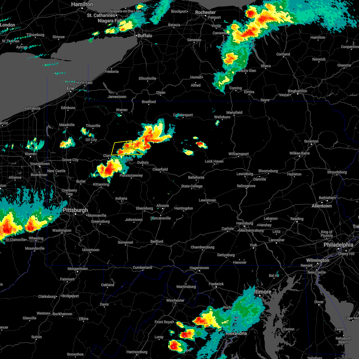 The severe thunderstorm warning for northern jefferson, northeastern clarion and southeastern forest counties will expire at 515 pm edt, the storm which prompted the warning has moved out of the area. therefore, the warning will be allowed to expire. however small hail is still possible with this thunderstorm. a severe thunderstorm watch remains in effect until 900 pm edt for northwestern and west central pennsylvania. The severe thunderstorm warning for northern jefferson, northeastern clarion and southeastern forest counties will expire at 515 pm edt, the storm which prompted the warning has moved out of the area. therefore, the warning will be allowed to expire. however small hail is still possible with this thunderstorm. a severe thunderstorm watch remains in effect until 900 pm edt for northwestern and west central pennsylvania.
|
| 6/16/2022 4:56 PM EDT |
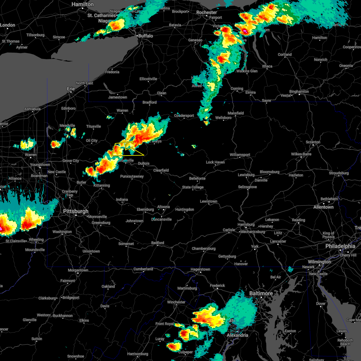 At 456 pm edt, a severe thunderstorm was located 8 miles southwest of marienville, moving east at 45 mph (radar indicated). Hazards include 60 mph wind gusts and half dollar size hail. Minor hail damage to vehicles is possible. Expect wind damage to trees and power lines, resulting in some power outages. At 456 pm edt, a severe thunderstorm was located 8 miles southwest of marienville, moving east at 45 mph (radar indicated). Hazards include 60 mph wind gusts and half dollar size hail. Minor hail damage to vehicles is possible. Expect wind damage to trees and power lines, resulting in some power outages.
|
| 6/16/2022 4:33 PM EDT |
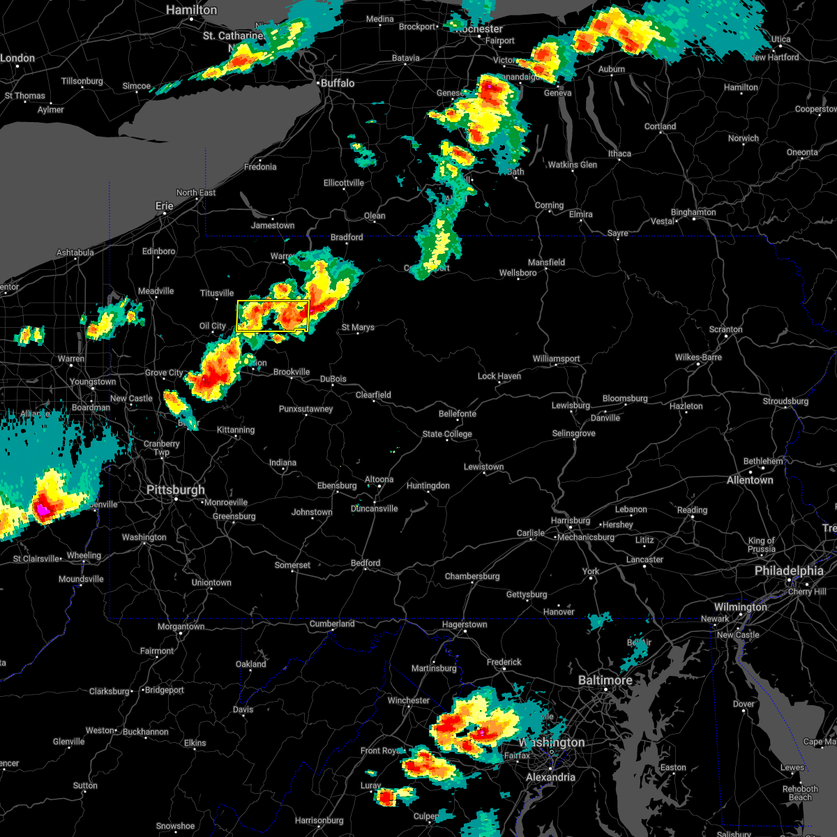 At 432 pm edt, a severe thunderstorm was located near tionesta, or 10 miles east of oil city, moving east at 45 mph (radar indicated). Hazards include golf ball size hail and 60 mph wind gusts. People and animals outdoors will be injured. expect hail damage to roofs, siding, windows, and vehicles. expect wind damage to trees and power lines, resulting in some power outages. locations impacted include, marienville, tionesta, kellettville, west hickory, east hickory, and starr. thunderstorm damage threat, considerable hail threat, radar indicated max hail size, 1. 75 in wind threat, radar indicated max wind gust, 60 mph. At 432 pm edt, a severe thunderstorm was located near tionesta, or 10 miles east of oil city, moving east at 45 mph (radar indicated). Hazards include golf ball size hail and 60 mph wind gusts. People and animals outdoors will be injured. expect hail damage to roofs, siding, windows, and vehicles. expect wind damage to trees and power lines, resulting in some power outages. locations impacted include, marienville, tionesta, kellettville, west hickory, east hickory, and starr. thunderstorm damage threat, considerable hail threat, radar indicated max hail size, 1. 75 in wind threat, radar indicated max wind gust, 60 mph.
|
| 6/16/2022 4:23 PM EDT |
 At 423 pm edt, a severe thunderstorm was located near oil city, moving east at 45 mph (radar indicated). Hazards include golf ball size hail and 60 mph wind gusts. People and animals outdoors will be injured. expect hail damage to roofs, siding, windows, and vehicles. expect wind damage to trees and power lines, resulting in some power outages. locations impacted include, oil city, marienville, tionesta, hasson heights, seneca, rouseville, woodland heights, pleasantville, kellettville, west hickory, starr, and east hickory. thunderstorm damage threat, considerable hail threat, radar indicated max hail size, 1. 75 in wind threat, radar indicated max wind gust, 60 mph. At 423 pm edt, a severe thunderstorm was located near oil city, moving east at 45 mph (radar indicated). Hazards include golf ball size hail and 60 mph wind gusts. People and animals outdoors will be injured. expect hail damage to roofs, siding, windows, and vehicles. expect wind damage to trees and power lines, resulting in some power outages. locations impacted include, oil city, marienville, tionesta, hasson heights, seneca, rouseville, woodland heights, pleasantville, kellettville, west hickory, starr, and east hickory. thunderstorm damage threat, considerable hail threat, radar indicated max hail size, 1. 75 in wind threat, radar indicated max wind gust, 60 mph.
|
| 6/16/2022 4:13 PM EDT |
 At 413 pm edt, a severe thunderstorm was located over sugarcreek, or near oil city, moving east at 45 mph (radar indicated). Hazards include 60 mph wind gusts and quarter size hail. Minor hail damage to vehicles is possible. expect wind damage to trees and power lines, resulting in some power outages. locations impacted include, oil city, franklin, marienville, sugarcreek, tionesta, hasson heights, seneca, rouseville, cooperstown, woodland heights, pleasantville, and kellettville. hail threat, radar indicated max hail size, 1. 00 in wind threat, radar indicated max wind gust, 60 mph. At 413 pm edt, a severe thunderstorm was located over sugarcreek, or near oil city, moving east at 45 mph (radar indicated). Hazards include 60 mph wind gusts and quarter size hail. Minor hail damage to vehicles is possible. expect wind damage to trees and power lines, resulting in some power outages. locations impacted include, oil city, franklin, marienville, sugarcreek, tionesta, hasson heights, seneca, rouseville, cooperstown, woodland heights, pleasantville, and kellettville. hail threat, radar indicated max hail size, 1. 00 in wind threat, radar indicated max wind gust, 60 mph.
|
| 6/16/2022 3:55 PM EDT |
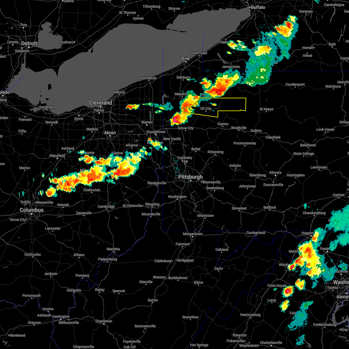 At 355 pm edt, a severe thunderstorm was located 10 miles northwest of franklin, moving east at 45 mph (radar indicated). Hazards include 60 mph wind gusts and quarter size hail. Minor hail damage to vehicles is possible. Expect wind damage to trees and power lines, resulting in some power outages. At 355 pm edt, a severe thunderstorm was located 10 miles northwest of franklin, moving east at 45 mph (radar indicated). Hazards include 60 mph wind gusts and quarter size hail. Minor hail damage to vehicles is possible. Expect wind damage to trees and power lines, resulting in some power outages.
|
| 10/16/2021 8:06 AM EDT | Multiple trees down in area... one tree on a house. time estimated from rada in jefferson county PA, 9.1 miles NNW of Marienville, PA |
| 9/13/2021 6:34 PM EDT |
 At 634 pm edt, a severe thunderstorm was located 10 miles north of clarion, moving east at 55 mph (radar indicated). Hazards include 60 mph wind gusts and quarter size hail. Minor hail damage to vehicles is possible. expect wind damage to trees and power lines, resulting in some power outages. locations impacted include, marienville, fryburg, fisher, leeper, clarington, and cook forest state park. hail threat, radar indicated max hail size, 1. 00 in wind threat, radar indicated max wind gust, 60 mph. At 634 pm edt, a severe thunderstorm was located 10 miles north of clarion, moving east at 55 mph (radar indicated). Hazards include 60 mph wind gusts and quarter size hail. Minor hail damage to vehicles is possible. expect wind damage to trees and power lines, resulting in some power outages. locations impacted include, marienville, fryburg, fisher, leeper, clarington, and cook forest state park. hail threat, radar indicated max hail size, 1. 00 in wind threat, radar indicated max wind gust, 60 mph.
|
| 9/13/2021 6:27 PM EDT |
 At 626 pm edt, a severe thunderstorm was located 9 miles northeast of knox, moving east at 40 mph (radar indicated). Hazards include 60 mph wind gusts and quarter size hail. Minor hail damage to vehicles is possible. expect wind damage to trees and power lines, resulting in some power outages. locations impacted include, marienville, fryburg, fisher, leeper, clarington, and cook forest state park. hail threat, radar indicated max hail size, 1. 00 in wind threat, radar indicated max wind gust, 60 mph. At 626 pm edt, a severe thunderstorm was located 9 miles northeast of knox, moving east at 40 mph (radar indicated). Hazards include 60 mph wind gusts and quarter size hail. Minor hail damage to vehicles is possible. expect wind damage to trees and power lines, resulting in some power outages. locations impacted include, marienville, fryburg, fisher, leeper, clarington, and cook forest state park. hail threat, radar indicated max hail size, 1. 00 in wind threat, radar indicated max wind gust, 60 mph.
|
| 9/13/2021 6:16 PM EDT |
 At 616 pm edt, a severe thunderstorm was located near tionesta, or 13 miles west of marienville, moving east at 55 mph (radar indicated). Hazards include 60 mph wind gusts and quarter size hail. Minor hail damage to vehicles is possible. expect wind damage to trees and power lines, resulting in some power outages. locations impacted include, marienville, tionesta, fryburg, fisher, kellettville, leeper, clarington, cook forest state park, starr, and cranberry township. hail threat, radar indicated max hail size, 1. 00 in wind threat, radar indicated max wind gust, 60 mph. At 616 pm edt, a severe thunderstorm was located near tionesta, or 13 miles west of marienville, moving east at 55 mph (radar indicated). Hazards include 60 mph wind gusts and quarter size hail. Minor hail damage to vehicles is possible. expect wind damage to trees and power lines, resulting in some power outages. locations impacted include, marienville, tionesta, fryburg, fisher, kellettville, leeper, clarington, cook forest state park, starr, and cranberry township. hail threat, radar indicated max hail size, 1. 00 in wind threat, radar indicated max wind gust, 60 mph.
|
| 9/13/2021 6:08 PM EDT |
 At 608 pm edt, a severe thunderstorm was located near tionesta, or 8 miles east of oil city, moving east at 55 mph (radar indicated). Hazards include 60 mph wind gusts and half dollar size hail. Minor hail damage to vehicles is possible. expect wind damage to trees and power lines, resulting in some power outages. locations impacted include, oil city, marienville, sugarcreek, tionesta, hasson heights, seneca, rouseville, woodland heights, fryburg, kellettville, fisher, and leeper. hail threat, radar indicated max hail size, 1. 25 in wind threat, radar indicated max wind gust, 60 mph. At 608 pm edt, a severe thunderstorm was located near tionesta, or 8 miles east of oil city, moving east at 55 mph (radar indicated). Hazards include 60 mph wind gusts and half dollar size hail. Minor hail damage to vehicles is possible. expect wind damage to trees and power lines, resulting in some power outages. locations impacted include, oil city, marienville, sugarcreek, tionesta, hasson heights, seneca, rouseville, woodland heights, fryburg, kellettville, fisher, and leeper. hail threat, radar indicated max hail size, 1. 25 in wind threat, radar indicated max wind gust, 60 mph.
|
| 9/13/2021 5:59 PM EDT |
 At 559 pm edt, a severe thunderstorm was located over oil city, moving east at 55 mph (radar indicated). Hazards include 60 mph wind gusts and quarter size hail. Minor hail damage to vehicles is possible. Expect wind damage to trees and power lines, resulting in some power outages. At 559 pm edt, a severe thunderstorm was located over oil city, moving east at 55 mph (radar indicated). Hazards include 60 mph wind gusts and quarter size hail. Minor hail damage to vehicles is possible. Expect wind damage to trees and power lines, resulting in some power outages.
|
| 8/12/2021 6:53 PM EDT |
 At 653 pm edt, severe thunderstorms were located along a line extending from 8 miles northeast of tionesta to 8 miles south of marienville to brookville, moving east at 25 mph (radar indicated). Hazards include 60 mph wind gusts. expect damage to trees and power lines, resulting in some power outages At 653 pm edt, severe thunderstorms were located along a line extending from 8 miles northeast of tionesta to 8 miles south of marienville to brookville, moving east at 25 mph (radar indicated). Hazards include 60 mph wind gusts. expect damage to trees and power lines, resulting in some power outages
|
| 8/1/2021 2:09 PM EDT |
 The severe thunderstorm warning for southeastern venango, northwestern jefferson, northeastern clarion and central forest counties will expire at 215 pm edt, the storm which prompted the warning has weakened below severe limits, and no longer poses an immediate threat to life or property. therefore, the warning will be allowed to expire. however small hail is still possible with this thunderstorm. The severe thunderstorm warning for southeastern venango, northwestern jefferson, northeastern clarion and central forest counties will expire at 215 pm edt, the storm which prompted the warning has weakened below severe limits, and no longer poses an immediate threat to life or property. therefore, the warning will be allowed to expire. however small hail is still possible with this thunderstorm.
|
| 8/1/2021 1:54 PM EDT |
 At 154 pm edt, a severe thunderstorm was located 7 miles southeast of tionesta, or 12 miles west of marienville, moving east at 45 mph (radar). Hazards include quarter-size hail. Minor damage to vehicles is possible. Locations impacted include, marienville, sigel, fryburg, fisher, leeper, clarington, clear creek state park, cook forest state park,. At 154 pm edt, a severe thunderstorm was located 7 miles southeast of tionesta, or 12 miles west of marienville, moving east at 45 mph (radar). Hazards include quarter-size hail. Minor damage to vehicles is possible. Locations impacted include, marienville, sigel, fryburg, fisher, leeper, clarington, clear creek state park, cook forest state park,.
|
| 8/1/2021 1:50 PM EDT |
 At 150 pm edt, a severe thunderstorm was located near tionesta, or 13 miles northeast of knox, moving east at 45 mph (radar). Hazards include quarter-size hail. minor damage to vehicles is possible At 150 pm edt, a severe thunderstorm was located near tionesta, or 13 miles northeast of knox, moving east at 45 mph (radar). Hazards include quarter-size hail. minor damage to vehicles is possible
|
| 7/20/2021 8:41 PM EDT |
 The severe thunderstorm warning for east central venango, northwestern jefferson, northeastern clarion and central forest counties will expire at 845 pm edt, the storm which prompted the warning has moved out of the area. therefore, the warning will be allowed to expire. remember, a severe thunderstorm warning still remains in effect for eastern clarion and jefferson county ntil 915 pm. The severe thunderstorm warning for east central venango, northwestern jefferson, northeastern clarion and central forest counties will expire at 845 pm edt, the storm which prompted the warning has moved out of the area. therefore, the warning will be allowed to expire. remember, a severe thunderstorm warning still remains in effect for eastern clarion and jefferson county ntil 915 pm.
|
| 7/20/2021 8:17 PM EDT |
 At 817 pm edt, a severe thunderstorm was located 10 miles northwest of brookville, moving southeast at 30 mph (radar). Hazards include wind gusts to 60 mph and quarter-size hail. Minor hail damage to vehicles is possible. expect wind damage to trees and power lines, resulting in some power outages. Locations impacted include, clarion, marienville, tionesta, strattanville, shippenville, corsica, sigel, fryburg, kellettville, fisher, leeper, cook forest state park, this includes interstate 80 in pennsylvania between mile markers 57 and 74. At 817 pm edt, a severe thunderstorm was located 10 miles northwest of brookville, moving southeast at 30 mph (radar). Hazards include wind gusts to 60 mph and quarter-size hail. Minor hail damage to vehicles is possible. expect wind damage to trees and power lines, resulting in some power outages. Locations impacted include, clarion, marienville, tionesta, strattanville, shippenville, corsica, sigel, fryburg, kellettville, fisher, leeper, cook forest state park, this includes interstate 80 in pennsylvania between mile markers 57 and 74.
|
| 7/20/2021 7:54 PM EDT |
 At 754 pm edt, a severe thunderstorm was located 7 miles southeast of tionesta, or 12 miles north of clarion, moving southeast at 30 mph (radar). Hazards include wind gusts to 60 mph and quarter-size hail. Minor hail damage to vehicles is possible. Expect wind damage to trees and power lines, resulting in some power outages. At 754 pm edt, a severe thunderstorm was located 7 miles southeast of tionesta, or 12 miles north of clarion, moving southeast at 30 mph (radar). Hazards include wind gusts to 60 mph and quarter-size hail. Minor hail damage to vehicles is possible. Expect wind damage to trees and power lines, resulting in some power outages.
|
| 7/13/2021 5:41 PM EDT |
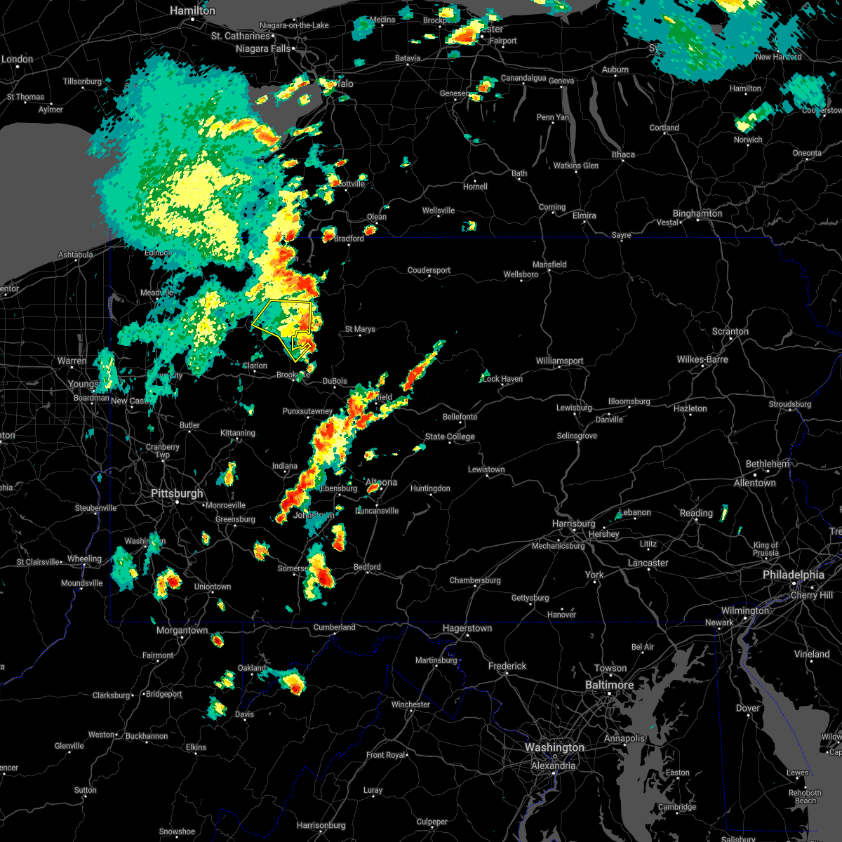 At 541 pm edt, a severe thunderstorm was located over ludlow, or 7 miles northwest of kane, moving northeast at 35 mph (radar). Hazards include wind gusts to 60 mph. Expect damage to trees and power lines, resulting in some power outages. Locations impacted include, marienville, kellettville, clarington, clear creek state park, starr,. At 541 pm edt, a severe thunderstorm was located over ludlow, or 7 miles northwest of kane, moving northeast at 35 mph (radar). Hazards include wind gusts to 60 mph. Expect damage to trees and power lines, resulting in some power outages. Locations impacted include, marienville, kellettville, clarington, clear creek state park, starr,.
|
| 7/13/2021 5:32 PM EDT |
 At 532 pm edt, a severe thunderstorm was located over sheffield, or 10 miles west of kane, moving northeast at 35 mph (radar). Hazards include wind gusts to 60 mph. Expect damage to trees and power lines, resulting in some power outages. Locations impacted include, marienville, sigel, kellettville, leeper, clarington, clear creek state park, cook forest state park, starr,. At 532 pm edt, a severe thunderstorm was located over sheffield, or 10 miles west of kane, moving northeast at 35 mph (radar). Hazards include wind gusts to 60 mph. Expect damage to trees and power lines, resulting in some power outages. Locations impacted include, marienville, sigel, kellettville, leeper, clarington, clear creek state park, cook forest state park, starr,.
|
| 7/13/2021 5:19 PM EDT | Trees down on state route 66 in forest county PA, 2.1 miles WNW of Marienville, PA |
| 7/13/2021 5:16 PM EDT |
 At 515 pm edt, a severe thunderstorm was located over marienville, moving northeast at 40 mph (radar). Hazards include wind gusts to 60 mph. Expect damage to trees and power lines, resulting in some power outages. Locations impacted include, clarion, marienville, knox, strattanville, limestone, shippenville, corsica, sigel, fryburg, kellettville, fisher, leeper, this includes interstate 80 in pennsylvania between mile markers 57 and 75. At 515 pm edt, a severe thunderstorm was located over marienville, moving northeast at 40 mph (radar). Hazards include wind gusts to 60 mph. Expect damage to trees and power lines, resulting in some power outages. Locations impacted include, clarion, marienville, knox, strattanville, limestone, shippenville, corsica, sigel, fryburg, kellettville, fisher, leeper, this includes interstate 80 in pennsylvania between mile markers 57 and 75.
|
| 7/13/2021 5:12 PM EDT |
 At 512 pm edt, a severe thunderstorm was located near marienville, moving northeast at 35 mph (radar). Hazards include wind gusts to 60 mph. expect damage to trees and power lines, resulting in some power outages At 512 pm edt, a severe thunderstorm was located near marienville, moving northeast at 35 mph (radar). Hazards include wind gusts to 60 mph. expect damage to trees and power lines, resulting in some power outages
|
| 7/13/2021 4:47 PM EDT |
 At 447 pm edt, a severe thunderstorm was located near clarion, moving northeast at 40 mph (radar). Hazards include wind gusts to 60 mph. expect damage to trees and power lines, resulting in some power outages At 447 pm edt, a severe thunderstorm was located near clarion, moving northeast at 40 mph (radar). Hazards include wind gusts to 60 mph. expect damage to trees and power lines, resulting in some power outages
|
| 6/21/2021 3:01 PM EDT |
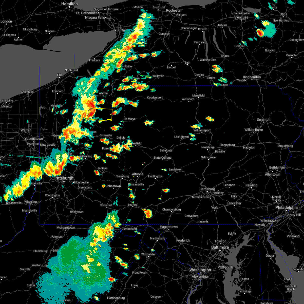 At 301 pm edt, a severe thunderstorm was located 9 miles northeast of tionesta, or 11 miles northwest of marienville, moving east at 55 mph (radar). Hazards include wind gusts to 60 mph. Expect damage to trees and power lines, resulting in some power outages. Locations impacted include, marienville, tionesta, kellettville, west hickory, east hickory, starr,. At 301 pm edt, a severe thunderstorm was located 9 miles northeast of tionesta, or 11 miles northwest of marienville, moving east at 55 mph (radar). Hazards include wind gusts to 60 mph. Expect damage to trees and power lines, resulting in some power outages. Locations impacted include, marienville, tionesta, kellettville, west hickory, east hickory, starr,.
|
| 6/21/2021 2:45 PM EDT |
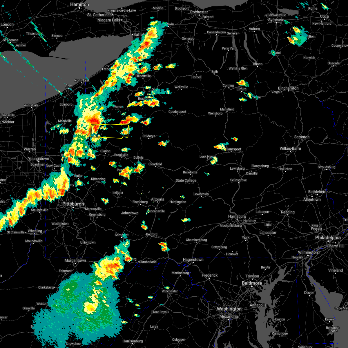 At 245 pm edt, a severe thunderstorm was located over enterprise, or 12 miles northeast of oil city, moving east at 55 mph (radar). Hazards include wind gusts to 60 mph. expect damage to trees and power lines, resulting in some power outages At 245 pm edt, a severe thunderstorm was located over enterprise, or 12 miles northeast of oil city, moving east at 55 mph (radar). Hazards include wind gusts to 60 mph. expect damage to trees and power lines, resulting in some power outages
|
| 11/15/2020 3:52 PM EST |
 The severe thunderstorm warning for north central indiana, western jefferson, east central armstrong, eastern clarion and forest counties will expire at 400 pm est, the storms which prompted the warning have moved out of the area. therefore, the warning will be allowed to expire. however gusty winds are still possible with these thunderstorms. a severe thunderstorm watch remains in effect until 600 pm est for northwestern and west central pennsylvania. remember, a severe thunderstorm warning still remains in effect for eastern jefferson, eastern indiana counties until 4 pm. The severe thunderstorm warning for north central indiana, western jefferson, east central armstrong, eastern clarion and forest counties will expire at 400 pm est, the storms which prompted the warning have moved out of the area. therefore, the warning will be allowed to expire. however gusty winds are still possible with these thunderstorms. a severe thunderstorm watch remains in effect until 600 pm est for northwestern and west central pennsylvania. remember, a severe thunderstorm warning still remains in effect for eastern jefferson, eastern indiana counties until 4 pm.
|
| 11/15/2020 3:36 PM EST |
 At 335 pm est, severe thunderstorms were located along a line extending from 8 miles southwest of sheffield to 13 miles south of new bethlehem, moving east at 55 mph (law enforcement). Hazards include wind gusts to 60 mph. Expect damage to trees and power lines, resulting in some power outages. Locations impacted include, punxsutawney, clarion, kittanning, brookville, marienville, ford city, new bethlehem, west kittanning, rural valley, dayton, strattanville, summerville, this includes interstate 80 in pennsylvania between mile markers 61 and 86. At 335 pm est, severe thunderstorms were located along a line extending from 8 miles southwest of sheffield to 13 miles south of new bethlehem, moving east at 55 mph (law enforcement). Hazards include wind gusts to 60 mph. Expect damage to trees and power lines, resulting in some power outages. Locations impacted include, punxsutawney, clarion, kittanning, brookville, marienville, ford city, new bethlehem, west kittanning, rural valley, dayton, strattanville, summerville, this includes interstate 80 in pennsylvania between mile markers 61 and 86.
|
| 11/15/2020 3:13 PM EST |
 At 312 pm est, severe thunderstorms were located along a line extending from near tionesta to near ford city, moving east at 55 mph (law enforcement). Hazards include wind gusts to 60 mph. expect damage to trees and power lines, resulting in some power outages At 312 pm est, severe thunderstorms were located along a line extending from near tionesta to near ford city, moving east at 55 mph (law enforcement). Hazards include wind gusts to 60 mph. expect damage to trees and power lines, resulting in some power outages
|
| 6/3/2020 9:11 AM EDT |
 At 911 am edt, a severe thunderstorm was located near portland mills, or 10 miles southwest of ridgway, moving east at 55 mph (radar). Hazards include wind gusts to 60 mph and quarter-size hail. Minor hail damage to vehicles is possible. expect wind damage to trees and power lines, resulting in some power outages. Locations impacted include, brookville, marienville, reynoldsville, brockway, falls creek, shippenville, corsica, sigel, fryburg, fisher, leeper, cook forest state park, this includes interstate 80 in pennsylvania between mile markers 71 and 96. At 911 am edt, a severe thunderstorm was located near portland mills, or 10 miles southwest of ridgway, moving east at 55 mph (radar). Hazards include wind gusts to 60 mph and quarter-size hail. Minor hail damage to vehicles is possible. expect wind damage to trees and power lines, resulting in some power outages. Locations impacted include, brookville, marienville, reynoldsville, brockway, falls creek, shippenville, corsica, sigel, fryburg, fisher, leeper, cook forest state park, this includes interstate 80 in pennsylvania between mile markers 71 and 96.
|
| 6/3/2020 8:54 AM EDT |
 At 854 am edt, a severe thunderstorm was located near marienville, moving east at 55 mph (radar). Hazards include wind gusts to 70 mph and half dollar-size hail. Minor hail damage to vehicles is possible. trees snapped and uprooted. Power outages can be expected. At 854 am edt, a severe thunderstorm was located near marienville, moving east at 55 mph (radar). Hazards include wind gusts to 70 mph and half dollar-size hail. Minor hail damage to vehicles is possible. trees snapped and uprooted. Power outages can be expected.
|
| 6/3/2020 8:43 AM EDT |
 At 843 am edt, a severe thunderstorm was located near tionesta, or 14 miles north of clarion, moving east at 60 mph (radar). Hazards include wind gusts to 70 mph and half dollar-size hail. Minor hail damage to vehicles is possible. trees snapped and uprooted. power outages can be expected. Locations impacted include, tionesta, pleasantville, fryburg, leeper, starr, cook forest state park,. At 843 am edt, a severe thunderstorm was located near tionesta, or 14 miles north of clarion, moving east at 60 mph (radar). Hazards include wind gusts to 70 mph and half dollar-size hail. Minor hail damage to vehicles is possible. trees snapped and uprooted. power outages can be expected. Locations impacted include, tionesta, pleasantville, fryburg, leeper, starr, cook forest state park,.
|
| 6/3/2020 8:26 AM EDT |
 At 824 am edt, a severe thunderstorm was located near oil city, moving east at 60 mph (radar). Hazards include wind gusts to 60 mph and quarter-size hail. Minor hail damage to vehicles is possible. Expect wind damage to trees and power lines, resulting in some power outages. At 824 am edt, a severe thunderstorm was located near oil city, moving east at 60 mph (radar). Hazards include wind gusts to 60 mph and quarter-size hail. Minor hail damage to vehicles is possible. Expect wind damage to trees and power lines, resulting in some power outages.
|
| 4/7/2020 11:27 PM EDT |
 At 1127 pm edt, a severe thunderstorm was located near tionesta, or 17 miles northeast of oil city, moving east at 45 mph (radar). Hazards include wind gusts to 60 mph and quarter-size hail. Minor hail damage to vehicles is possible. Expect wind damage to trees and power lines, resulting in some power outages. At 1127 pm edt, a severe thunderstorm was located near tionesta, or 17 miles northeast of oil city, moving east at 45 mph (radar). Hazards include wind gusts to 60 mph and quarter-size hail. Minor hail damage to vehicles is possible. Expect wind damage to trees and power lines, resulting in some power outages.
|
| 3/20/2020 1:50 PM EDT |
 At 149 pm edt, a severe thunderstorm was located near tionesta, or 13 miles north of clarion, moving east at 55 mph (radar). Hazards include wind gusts to 60 mph. Expect damage to trees and power lines, resulting in some power outages. Locations impacted include, marienville, tionesta, kellettville, leeper, fryburg, clarington, clear creek state park, starr, cook forest state park,. At 149 pm edt, a severe thunderstorm was located near tionesta, or 13 miles north of clarion, moving east at 55 mph (radar). Hazards include wind gusts to 60 mph. Expect damage to trees and power lines, resulting in some power outages. Locations impacted include, marienville, tionesta, kellettville, leeper, fryburg, clarington, clear creek state park, starr, cook forest state park,.
|
| 3/20/2020 1:32 PM EDT |
 At 132 pm edt, a severe thunderstorm was located over oil city, moving east at 55 mph (radar). Hazards include wind gusts to 60 mph. Expect damage to trees and power lines, resulting in some power outages. Locations impacted include, oil city, franklin, marienville, sugarcreek, tionesta, enterprise, hasson heights, seneca, rouseville, woodland heights, pleasantville, fryburg,. At 132 pm edt, a severe thunderstorm was located over oil city, moving east at 55 mph (radar). Hazards include wind gusts to 60 mph. Expect damage to trees and power lines, resulting in some power outages. Locations impacted include, oil city, franklin, marienville, sugarcreek, tionesta, enterprise, hasson heights, seneca, rouseville, woodland heights, pleasantville, fryburg,.
|
| 3/20/2020 1:25 PM EDT |
 At 125 pm edt, a severe thunderstorm was located over sugarcreek, or over franklin, moving east at 55 mph (radar). Hazards include wind gusts to 60 mph. expect damage to trees and power lines, resulting in some power outages At 125 pm edt, a severe thunderstorm was located over sugarcreek, or over franklin, moving east at 55 mph (radar). Hazards include wind gusts to 60 mph. expect damage to trees and power lines, resulting in some power outages
|
| 8/18/2019 5:49 PM EDT |
 A severe thunderstorm warning remains in effect until 615 pm edt for northwestern jefferson. northeastern clarion and southern forest counties. at 549 pm edt, a severe thunderstorm was located 8 miles north of clarion, moving east at 20 mph. hazard. Wind gusts to 60 mph and quarter-size hail. A severe thunderstorm warning remains in effect until 615 pm edt for northwestern jefferson. northeastern clarion and southern forest counties. at 549 pm edt, a severe thunderstorm was located 8 miles north of clarion, moving east at 20 mph. hazard. Wind gusts to 60 mph and quarter-size hail.
|
| 8/18/2019 5:30 PM EDT |
 At 530 pm edt, a severe thunderstorm was located 8 miles northeast of knox, moving east at 20 mph (radar). Hazards include wind gusts to 60 mph. expect damage to trees and power lines, resulting in some power outages At 530 pm edt, a severe thunderstorm was located 8 miles northeast of knox, moving east at 20 mph (radar). Hazards include wind gusts to 60 mph. expect damage to trees and power lines, resulting in some power outages
|
| 5/25/2019 7:50 PM EDT |
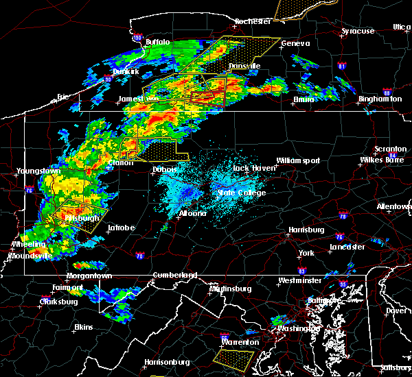 At 750 pm edt, a severe thunderstorm was located 7 miles northwest of portland mills, or 9 miles east of marienville, moving east at 45 mph (radar). Hazards include wind gusts to 60 mph and quarter-size hail. Minor hail damage to vehicles is possible. expect wind damage to trees and power lines, resulting in some power outages. Locations impacted include, marienville, clarington, clear creek state park, cook forest state park,. At 750 pm edt, a severe thunderstorm was located 7 miles northwest of portland mills, or 9 miles east of marienville, moving east at 45 mph (radar). Hazards include wind gusts to 60 mph and quarter-size hail. Minor hail damage to vehicles is possible. expect wind damage to trees and power lines, resulting in some power outages. Locations impacted include, marienville, clarington, clear creek state park, cook forest state park,.
|
| 5/25/2019 7:33 PM EDT |
 At 733 pm edt, a severe thunderstorm was located near marienville, moving east at 45 mph (radar). Hazards include wind gusts to 60 mph and quarter-size hail. Minor hail damage to vehicles is possible. Expect wind damage to trees and power lines, resulting in some power outages. At 733 pm edt, a severe thunderstorm was located near marienville, moving east at 45 mph (radar). Hazards include wind gusts to 60 mph and quarter-size hail. Minor hail damage to vehicles is possible. Expect wind damage to trees and power lines, resulting in some power outages.
|
| 5/25/2019 7:22 PM EDT |
 At 722 pm edt, a severe thunderstorm was located near tionesta, or 12 miles west of marienville, moving east at 35 mph (radar). Hazards include wind gusts to 60 mph and quarter-size hail. Minor hail damage to vehicles is possible. expect wind damage to trees and power lines, resulting in some power outages. Locations impacted include, marienville, tionesta, kellettville, west hickory, east hickory, starr,. At 722 pm edt, a severe thunderstorm was located near tionesta, or 12 miles west of marienville, moving east at 35 mph (radar). Hazards include wind gusts to 60 mph and quarter-size hail. Minor hail damage to vehicles is possible. expect wind damage to trees and power lines, resulting in some power outages. Locations impacted include, marienville, tionesta, kellettville, west hickory, east hickory, starr,.
|
| 5/25/2019 6:58 PM EDT |
 At 658 pm edt, severe thunderstorms were located along a line extending from near tionesta to 10 miles southeast of greenville, moving east at 40 mph (radar). Hazards include wind gusts to 60 mph and quarter-size hail. Minor hail damage to vehicles is possible. Expect wind damage to trees and power lines, resulting in some power outages. At 658 pm edt, severe thunderstorms were located along a line extending from near tionesta to 10 miles southeast of greenville, moving east at 40 mph (radar). Hazards include wind gusts to 60 mph and quarter-size hail. Minor hail damage to vehicles is possible. Expect wind damage to trees and power lines, resulting in some power outages.
|
| 4/14/2019 8:54 PM EDT |
 At 853 pm edt, severe thunderstorms were located along a line extending from 8 miles south of sheffield to 7 miles northeast of new bethlehem, moving east at 45 mph (radar). Hazards include wind gusts to 60 mph. Expect damage to trees and power lines, resulting in some power outages. locations impacted include, brookville, marienville, reynoldsville, brockway, sykesville, falls creek, summerville, corsica, sigel, fisher, clarington, clear creek state park, this includes interstate 80 in pennsylvania between mile markers 68 and 96. A tornado watch remains in effect until 300 am edt for northwestern and west central pennsylvania. At 853 pm edt, severe thunderstorms were located along a line extending from 8 miles south of sheffield to 7 miles northeast of new bethlehem, moving east at 45 mph (radar). Hazards include wind gusts to 60 mph. Expect damage to trees and power lines, resulting in some power outages. locations impacted include, brookville, marienville, reynoldsville, brockway, sykesville, falls creek, summerville, corsica, sigel, fisher, clarington, clear creek state park, this includes interstate 80 in pennsylvania between mile markers 68 and 96. A tornado watch remains in effect until 300 am edt for northwestern and west central pennsylvania.
|
| 4/14/2019 8:42 PM EDT |
 At 842 pm edt, severe thunderstorms were located along a line extending from 7 miles west of marienville to near new bethlehem, moving east at 35 mph (radar). Hazards include wind gusts to 60 mph. Expect damage to trees and power lines, resulting in some power outages. locations impacted include, clarion, brookville, marienville, reynoldsville, brockway, sykesville, falls creek, strattanville, summerville, limestone, corsica, sigel, this includes interstate 80 in pennsylvania between mile markers 63 and 96. A tornado watch remains in effect until 300 am edt for northwestern and west central pennsylvania. At 842 pm edt, severe thunderstorms were located along a line extending from 7 miles west of marienville to near new bethlehem, moving east at 35 mph (radar). Hazards include wind gusts to 60 mph. Expect damage to trees and power lines, resulting in some power outages. locations impacted include, clarion, brookville, marienville, reynoldsville, brockway, sykesville, falls creek, strattanville, summerville, limestone, corsica, sigel, this includes interstate 80 in pennsylvania between mile markers 63 and 96. A tornado watch remains in effect until 300 am edt for northwestern and west central pennsylvania.
|
| 4/14/2019 8:29 PM EDT |
 At 828 pm edt, severe thunderstorms were located along a line extending from near tionesta to near rimersburg, moving east at 35 mph (radar). Hazards include wind gusts to 60 mph. expect damage to trees and power lines, resulting in some power outages At 828 pm edt, severe thunderstorms were located along a line extending from near tionesta to near rimersburg, moving east at 35 mph (radar). Hazards include wind gusts to 60 mph. expect damage to trees and power lines, resulting in some power outages
|
| 1/8/2019 5:57 PM EST |
 The severe thunderstorm warning for northern jefferson, northeastern clarion and southeastern forest counties will expire at 600 pm est, the storm that prompted the warning has weakened below severe limits and no longer poses an immediate threat to life and property. therefore, the warning will be allowed to expire. The severe thunderstorm warning for northern jefferson, northeastern clarion and southeastern forest counties will expire at 600 pm est, the storm that prompted the warning has weakened below severe limits and no longer poses an immediate threat to life and property. therefore, the warning will be allowed to expire.
|
| 1/8/2019 5:44 PM EST |
 At 544 pm est, a severe thunderstorm was located near marienville, moving east at 50 mph (radar). Hazards include wind gusts to 60 mph and quarter-size hail. Minor hail damage to vehicles is possible. expect wind damage to trees and power lines, resulting in some power outages. Locations impacted include, marienville, sigel, fisher, leeper, clarington, clear creek state park, cook forest state park,. At 544 pm est, a severe thunderstorm was located near marienville, moving east at 50 mph (radar). Hazards include wind gusts to 60 mph and quarter-size hail. Minor hail damage to vehicles is possible. expect wind damage to trees and power lines, resulting in some power outages. Locations impacted include, marienville, sigel, fisher, leeper, clarington, clear creek state park, cook forest state park,.
|
| 1/8/2019 5:28 PM EST |
 At 527 pm est, a severe thunderstorm was located 7 miles north of clarion, moving east at 50 mph (radar). Hazards include wind gusts to 60 mph and quarter-size hail. Minor hail damage to vehicles is possible. Expect wind damage to trees and power lines, resulting in some power outages. At 527 pm est, a severe thunderstorm was located 7 miles north of clarion, moving east at 50 mph (radar). Hazards include wind gusts to 60 mph and quarter-size hail. Minor hail damage to vehicles is possible. Expect wind damage to trees and power lines, resulting in some power outages.
|
| 1/8/2019 4:54 PM EST |
 At 454 pm est, a severe thunderstorm was located near marienville, moving northeast at 45 mph (radar). Hazards include wind gusts to 60 mph and quarter-size hail. Minor hail damage to vehicles is possible. expect wind damage to trees and power lines, resulting in some power outages. Locations impacted include, marienville, clarington, clear creek state park,. At 454 pm est, a severe thunderstorm was located near marienville, moving northeast at 45 mph (radar). Hazards include wind gusts to 60 mph and quarter-size hail. Minor hail damage to vehicles is possible. expect wind damage to trees and power lines, resulting in some power outages. Locations impacted include, marienville, clarington, clear creek state park,.
|
| 1/8/2019 4:36 PM EST |
 At 436 pm est, a severe thunderstorm was located near clarion, moving northeast at 45 mph (radar). Hazards include wind gusts to 60 mph and quarter-size hail. Minor hail damage to vehicles is possible. Expect wind damage to trees and power lines, resulting in some power outages. At 436 pm est, a severe thunderstorm was located near clarion, moving northeast at 45 mph (radar). Hazards include wind gusts to 60 mph and quarter-size hail. Minor hail damage to vehicles is possible. Expect wind damage to trees and power lines, resulting in some power outages.
|
| 10/2/2018 5:41 PM EDT |
 At 541 pm edt, a severe thunderstorm was located near marienville, moving east at 35 mph (radar). Hazards include wind gusts to 60 mph and quarter-size hail. Minor hail damage to vehicles is possible. expect wind damage to trees and power lines, resulting in some power outages. Locations impacted include, marienville, kellettville, starr, a tornado watch remains in effect until 1100 pm edt for northwestern pennsylvania. At 541 pm edt, a severe thunderstorm was located near marienville, moving east at 35 mph (radar). Hazards include wind gusts to 60 mph and quarter-size hail. Minor hail damage to vehicles is possible. expect wind damage to trees and power lines, resulting in some power outages. Locations impacted include, marienville, kellettville, starr, a tornado watch remains in effect until 1100 pm edt for northwestern pennsylvania.
|
| 10/2/2018 5:26 PM EDT |
 At 526 pm edt, a severe thunderstorm was located 10 miles northwest of marienville, moving east at 35 mph (radar). Hazards include wind gusts to 60 mph and quarter-size hail. Minor hail damage to vehicles is possible. Expect wind damage to trees and power lines, resulting in some power outages. At 526 pm edt, a severe thunderstorm was located 10 miles northwest of marienville, moving east at 35 mph (radar). Hazards include wind gusts to 60 mph and quarter-size hail. Minor hail damage to vehicles is possible. Expect wind damage to trees and power lines, resulting in some power outages.
|
| 10/2/2018 5:18 PM EDT |
 At 517 pm edt, a severe thunderstorm capable of producing a tornado was located 8 miles east of marienville, moving southeast at 45 mph (radar indicated rotation). Hazards include tornado and quarter-size hail. Flying debris will be dangerous to those caught without shelter. mobile homes will be damaged or destroyed. damage to roofs, windows, and vehicles will occur. tree damage is likely. Locations impacted include, marienville,. At 517 pm edt, a severe thunderstorm capable of producing a tornado was located 8 miles east of marienville, moving southeast at 45 mph (radar indicated rotation). Hazards include tornado and quarter-size hail. Flying debris will be dangerous to those caught without shelter. mobile homes will be damaged or destroyed. damage to roofs, windows, and vehicles will occur. tree damage is likely. Locations impacted include, marienville,.
|
| 10/2/2018 5:09 PM EDT |
 At 509 pm edt, a severe thunderstorm capable of producing a tornado was located near marienville, moving east at 50 mph (radar indicated rotation). Hazards include tornado and quarter-size hail. Flying debris will be dangerous to those caught without shelter. mobile homes will be damaged or destroyed. damage to roofs, windows, and vehicles will occur. tree damage is likely. This tornadic thunderstorm will remain over mainly rural areas of northeastern forest county. At 509 pm edt, a severe thunderstorm capable of producing a tornado was located near marienville, moving east at 50 mph (radar indicated rotation). Hazards include tornado and quarter-size hail. Flying debris will be dangerous to those caught without shelter. mobile homes will be damaged or destroyed. damage to roofs, windows, and vehicles will occur. tree damage is likely. This tornadic thunderstorm will remain over mainly rural areas of northeastern forest county.
|
| 10/2/2018 4:58 PM EDT |
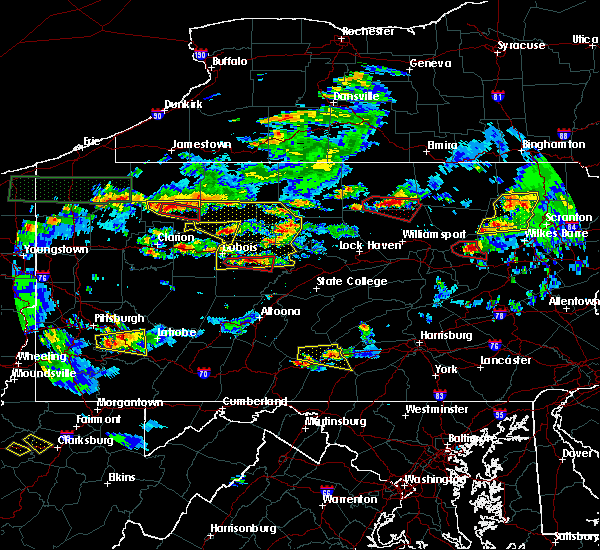 At 458 pm edt, a severe thunderstorm was located 7 miles north of marienville, moving east at 40 mph (radar). Hazards include wind gusts to 60 mph and quarter-size hail. Minor hail damage to vehicles is possible. expect wind damage to trees and power lines, resulting in some power outages. Locations impacted include, marienville, kellettville, west hickory, east hickory, starr, a tornado watch remains in effect until 1100 pm edt for northwestern pennsylvania. At 458 pm edt, a severe thunderstorm was located 7 miles north of marienville, moving east at 40 mph (radar). Hazards include wind gusts to 60 mph and quarter-size hail. Minor hail damage to vehicles is possible. expect wind damage to trees and power lines, resulting in some power outages. Locations impacted include, marienville, kellettville, west hickory, east hickory, starr, a tornado watch remains in effect until 1100 pm edt for northwestern pennsylvania.
|
| 10/2/2018 4:54 PM EDT |
 At 454 pm edt, a severe thunderstorm capable of producing a tornado was located 7 miles northwest of marienville, moving southeast at 45 mph (radar indicated rotation). Hazards include tornado. Flying debris will be dangerous to those caught without shelter. mobile homes will be damaged or destroyed. damage to roofs, windows, and vehicles will occur. tree damage is likely. this dangerous storm will be near, marienville around 505 pm edt. other locations impacted by this tornadic thunderstorm include kellettville. Please report severe weather by calling 412-262-1988, posting to the nws pittsburgh facebook page, or using twitter @nwspittsburgh. At 454 pm edt, a severe thunderstorm capable of producing a tornado was located 7 miles northwest of marienville, moving southeast at 45 mph (radar indicated rotation). Hazards include tornado. Flying debris will be dangerous to those caught without shelter. mobile homes will be damaged or destroyed. damage to roofs, windows, and vehicles will occur. tree damage is likely. this dangerous storm will be near, marienville around 505 pm edt. other locations impacted by this tornadic thunderstorm include kellettville. Please report severe weather by calling 412-262-1988, posting to the nws pittsburgh facebook page, or using twitter @nwspittsburgh.
|
| 10/2/2018 4:51 PM EDT |
 At 450 pm edt, a severe thunderstorm was located 10 miles northwest of marienville, moving east at 40 mph (radar). Hazards include wind gusts to 60 mph and quarter-size hail. Minor hail damage to vehicles is possible. expect wind damage to trees and power lines, resulting in some power outages. Locations impacted include, marienville, kellettville, west hickory, east hickory, starr, a tornado watch remains in effect until 1100 pm edt for northwestern pennsylvania. At 450 pm edt, a severe thunderstorm was located 10 miles northwest of marienville, moving east at 40 mph (radar). Hazards include wind gusts to 60 mph and quarter-size hail. Minor hail damage to vehicles is possible. expect wind damage to trees and power lines, resulting in some power outages. Locations impacted include, marienville, kellettville, west hickory, east hickory, starr, a tornado watch remains in effect until 1100 pm edt for northwestern pennsylvania.
|
| 10/2/2018 4:33 PM EDT |
 At 433 pm edt, a severe thunderstorm was located near enterprise, or 18 miles northeast of oil city, moving east at 40 mph (radar). Hazards include wind gusts to 60 mph. expect damage to trees and power lines, resulting in some power outages At 433 pm edt, a severe thunderstorm was located near enterprise, or 18 miles northeast of oil city, moving east at 40 mph (radar). Hazards include wind gusts to 60 mph. expect damage to trees and power lines, resulting in some power outages
|
| 9/21/2018 7:35 PM EDT |
 A severe thunderstorm warning remains in effect until 800 pm edt for northeastern butler. northwestern jefferson. northwestern armstrong. clarion and southern forest counties. At 734 pm edt, severe thunderstorms were located along a line extending from near tionesta to 11 miles east of slippery rock, moving east at 30 mph. A severe thunderstorm warning remains in effect until 800 pm edt for northeastern butler. northwestern jefferson. northwestern armstrong. clarion and southern forest counties. At 734 pm edt, severe thunderstorms were located along a line extending from near tionesta to 11 miles east of slippery rock, moving east at 30 mph.
|
| 9/21/2018 7:25 PM EDT |
 A severe thunderstorm warning remains in effect until 800 pm edt for southeastern venango. northeastern butler. northwestern jefferson. northwestern armstrong. clarion and southern forest counties. At 725 pm edt, severe thunderstorms were located along a line extending from near tionesta to 8 miles east of slippery rock, moving. A severe thunderstorm warning remains in effect until 800 pm edt for southeastern venango. northeastern butler. northwestern jefferson. northwestern armstrong. clarion and southern forest counties. At 725 pm edt, severe thunderstorms were located along a line extending from near tionesta to 8 miles east of slippery rock, moving.
|
| 9/21/2018 7:14 PM EDT |
 The national weather service in pittsburgh has issued a * severe thunderstorm warning for. southeastern mercer county in northwestern pennsylvania. southeastern venango county in northwestern pennsylvania. northeastern butler county in west central pennsylvania. Northwestern jefferson county in west central pennsylvania. The national weather service in pittsburgh has issued a * severe thunderstorm warning for. southeastern mercer county in northwestern pennsylvania. southeastern venango county in northwestern pennsylvania. northeastern butler county in west central pennsylvania. Northwestern jefferson county in west central pennsylvania.
|
| 8/29/2018 6:40 PM EDT |
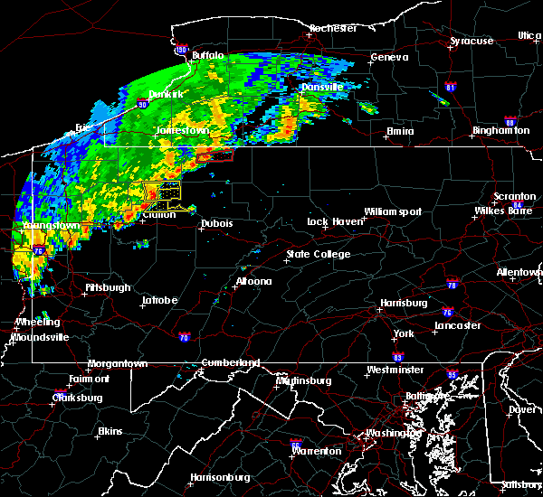 At 640 pm edt, severe thunderstorms were located along a line extending from 9 miles southwest of sheffield to near marienville to 7 miles northeast of clarion, moving east at 35 mph (radar). Hazards include wind gusts to 60 mph. expect damage to trees and power lines, resulting in some power outages At 640 pm edt, severe thunderstorms were located along a line extending from 9 miles southwest of sheffield to near marienville to 7 miles northeast of clarion, moving east at 35 mph (radar). Hazards include wind gusts to 60 mph. expect damage to trees and power lines, resulting in some power outages
|
| 8/29/2018 6:36 PM EDT |
 At 636 pm edt, severe thunderstorms were located along a line extending from 11 miles northeast of tionesta to 6 miles west of marienville, moving east at 40 mph (radar). Hazards include wind gusts to 60 mph. Expect damage to trees and power lines, resulting in some power outages. Locations impacted include, marienville, kellettville,. At 636 pm edt, severe thunderstorms were located along a line extending from 11 miles northeast of tionesta to 6 miles west of marienville, moving east at 40 mph (radar). Hazards include wind gusts to 60 mph. Expect damage to trees and power lines, resulting in some power outages. Locations impacted include, marienville, kellettville,.
|
| 8/29/2018 6:02 PM EDT |
 At 602 pm edt, severe thunderstorms were located along a line extending from near titusville to near oil city, moving east at 35 mph (radar). Hazards include wind gusts to 60 mph. damage to trees and power lines At 602 pm edt, severe thunderstorms were located along a line extending from near titusville to near oil city, moving east at 35 mph (radar). Hazards include wind gusts to 60 mph. damage to trees and power lines
|
| 6/18/2018 9:31 PM EDT |
 At 930 pm edt, severe thunderstorms were located along a line extending from 6 miles east of tionesta to near marienville, moving southeast at 30 mph (radar). Hazards include wind gusts to 60 mph. Expect damage to trees and power lines, resulting in some power outages. Locations impacted include, marienville, brockway, tionesta, pleasantville, kellettville, west hickory, leeper, clarington, clear creek state park, cook forest state park, starr, east hickory,. At 930 pm edt, severe thunderstorms were located along a line extending from 6 miles east of tionesta to near marienville, moving southeast at 30 mph (radar). Hazards include wind gusts to 60 mph. Expect damage to trees and power lines, resulting in some power outages. Locations impacted include, marienville, brockway, tionesta, pleasantville, kellettville, west hickory, leeper, clarington, clear creek state park, cook forest state park, starr, east hickory,.
|
| 6/18/2018 9:00 PM EDT |
 At 859 pm edt, severe thunderstorms were located along a line extending from near enterprise to 6 miles northeast of marienville, moving southeast at 35 mph (radar). Hazards include wind gusts to 60 mph. expect damage to trees and power lines, resulting in some power outages At 859 pm edt, severe thunderstorms were located along a line extending from near enterprise to 6 miles northeast of marienville, moving southeast at 35 mph (radar). Hazards include wind gusts to 60 mph. expect damage to trees and power lines, resulting in some power outages
|
| 6/18/2018 8:51 PM EDT |
 At 850 pm edt, severe thunderstorms were located along a line extending from ludlow to 6 miles northeast of marienville to near titusville, moving southeast at 35 mph (radar). Hazards include wind gusts to 60 mph. Expect damage to trees and power lines, resulting in some power outages. Locations impacted include, marienville, tionesta, pleasantville, kellettville, west hickory, starr, east hickory,. At 850 pm edt, severe thunderstorms were located along a line extending from ludlow to 6 miles northeast of marienville to near titusville, moving southeast at 35 mph (radar). Hazards include wind gusts to 60 mph. Expect damage to trees and power lines, resulting in some power outages. Locations impacted include, marienville, tionesta, pleasantville, kellettville, west hickory, starr, east hickory,.
|
| 6/18/2018 8:20 PM EDT |
 At 819 pm edt, severe thunderstorms were located along a line extending from near warren to 8 miles southwest of chapman state park to 6 miles northwest of titusville, moving southeast at 50 mph (radar). Hazards include wind gusts to 60 mph. expect damage to trees and power lines, resulting in some power outages At 819 pm edt, severe thunderstorms were located along a line extending from near warren to 8 miles southwest of chapman state park to 6 miles northwest of titusville, moving southeast at 50 mph (radar). Hazards include wind gusts to 60 mph. expect damage to trees and power lines, resulting in some power outages
|
| 5/15/2018 12:23 PM EDT |
 The severe thunderstorm warning for northern jefferson, northeastern clarion and central forest counties will expire at 1230 pm edt, the storm that prompted the warning has moved out of the area. therefore, the warning will be allowed to expire. The severe thunderstorm warning for northern jefferson, northeastern clarion and central forest counties will expire at 1230 pm edt, the storm that prompted the warning has moved out of the area. therefore, the warning will be allowed to expire.
|
| 5/15/2018 12:13 PM EDT | Trees down on greenwald r in forest county PA, 8.1 miles N of Marienville, PA |
| 5/15/2018 11:56 AM EDT |
 At 1156 am edt, a severe thunderstorm was located 9 miles southeast of tionesta, or 11 miles southwest of marienville, moving east at 45 mph (radar). Hazards include wind gusts to 60 mph and quarter-size hail. Minor hail damage to vehicles is possible. Expect wind damage to trees and power lines, resulting in some power outages. At 1156 am edt, a severe thunderstorm was located 9 miles southeast of tionesta, or 11 miles southwest of marienville, moving east at 45 mph (radar). Hazards include wind gusts to 60 mph and quarter-size hail. Minor hail damage to vehicles is possible. Expect wind damage to trees and power lines, resulting in some power outages.
|
| 5/4/2018 4:46 PM EDT |
 At 446 pm edt, severe thunderstorms were located along a line extending from 10 miles northwest of marienville to near tionesta to 8 miles north of knox, moving east at 45 mph (radar). Hazards include wind gusts to 60 mph. Expect damage to trees and power lines, resulting in some power outages. Locations impacted include, marienville, tionesta, fryburg, kellettville, leeper, west hickory, starr, east hickory, cranberry township, cook forest state park,. At 446 pm edt, severe thunderstorms were located along a line extending from 10 miles northwest of marienville to near tionesta to 8 miles north of knox, moving east at 45 mph (radar). Hazards include wind gusts to 60 mph. Expect damage to trees and power lines, resulting in some power outages. Locations impacted include, marienville, tionesta, fryburg, kellettville, leeper, west hickory, starr, east hickory, cranberry township, cook forest state park,.
|
| 5/4/2018 4:30 PM EDT |
 At 430 pm edt, showers and thunderstorms were located along a line extending from near enterprise to oil city to near franklin, moving east at 65 mph (radar). Hazards include wind gusts to 60 mph. Expect damage to trees and power lines, resulting in some power outages. Locations impacted include, oil city, franklin, marienville, sugarcreek, tionesta, hasson heights, seneca, polk, rouseville, cooperstown, woodland heights, pleasantville,. At 430 pm edt, showers and thunderstorms were located along a line extending from near enterprise to oil city to near franklin, moving east at 65 mph (radar). Hazards include wind gusts to 60 mph. Expect damage to trees and power lines, resulting in some power outages. Locations impacted include, oil city, franklin, marienville, sugarcreek, tionesta, hasson heights, seneca, polk, rouseville, cooperstown, woodland heights, pleasantville,.
|
| 5/4/2018 4:10 PM EDT |
 At 409 pm edt, severe thunderstorms were located along a line extending from 8 miles southeast of guys mills to 6 miles west of sugarcreek to 10 miles northwest of grove city, moving east at 50 mph (radar). Hazards include wind gusts to 60 mph. expect damage to trees and power lines, resulting in some power outages At 409 pm edt, severe thunderstorms were located along a line extending from 8 miles southeast of guys mills to 6 miles west of sugarcreek to 10 miles northwest of grove city, moving east at 50 mph (radar). Hazards include wind gusts to 60 mph. expect damage to trees and power lines, resulting in some power outages
|
| 11/5/2017 8:13 PM EST |
 At 813 pm est, severe thunderstorms were located along a line extending from 11 miles south of chapman state park to near rimersburg, moving east at 50 mph (radar). Hazards include 60 mph wind gusts. expect damage to trees and power lines, resulting in some power outages At 813 pm est, severe thunderstorms were located along a line extending from 11 miles south of chapman state park to near rimersburg, moving east at 50 mph (radar). Hazards include 60 mph wind gusts. expect damage to trees and power lines, resulting in some power outages
|
| 8/22/2017 1:58 PM EDT | Multiple trees down on guitonville road and multiple tree limbs down on blood road in forest county PA, 3.1 miles ENE of Marienville, PA |
| 8/22/2017 1:55 PM EDT |
 At 152 pm edt, a severe thunderstorm was located near knox, moving east at 45 mph (radar). Hazards include 60 mph wind gusts. damage to trees and power lines At 152 pm edt, a severe thunderstorm was located near knox, moving east at 45 mph (radar). Hazards include 60 mph wind gusts. damage to trees and power lines
|
| 8/22/2017 1:52 PM EDT |
 At 152 pm edt, a severe thunderstorm was located near knox, moving east at 45 mph (radar). Hazards include 60 mph wind gusts. damage to trees and power lines At 152 pm edt, a severe thunderstorm was located near knox, moving east at 45 mph (radar). Hazards include 60 mph wind gusts. damage to trees and power lines
|
| 8/4/2017 3:58 PM EDT |
 At 357 pm edt, a severe thunderstorm was located near clarion, moving northeast at 45 mph (radar). Hazards include 60 mph wind gusts. Damage to trees and power lines. Locations impacted include, clarion, brookville, marienville, knox, sligo, strattanville, limestone, shippenville, corsica, sigel, fryburg, fisher, this includes interstate 80 in pennsylvania between mile markers 51 and 78. At 357 pm edt, a severe thunderstorm was located near clarion, moving northeast at 45 mph (radar). Hazards include 60 mph wind gusts. Damage to trees and power lines. Locations impacted include, clarion, brookville, marienville, knox, sligo, strattanville, limestone, shippenville, corsica, sigel, fryburg, fisher, this includes interstate 80 in pennsylvania between mile markers 51 and 78.
|
| 8/4/2017 3:45 PM EDT |
 At 345 pm edt, a severe thunderstorm was located near clarion, moving northeast at 45 mph (radar). Hazards include 60 mph wind gusts. damage to trees and power lines At 345 pm edt, a severe thunderstorm was located near clarion, moving northeast at 45 mph (radar). Hazards include 60 mph wind gusts. damage to trees and power lines
|
| 6/18/2017 4:25 PM EDT |
 At 425 pm edt, severe thunderstorms were located along a line extending from 9 miles northwest of marienville to 8 miles east of butler, moving east at 15 mph (radar). Hazards include 60 mph wind gusts. Expect damage to trees and power lines, resulting in some power outages. Locations impacted include, butler, clarion, brookville, marienville, knox, rimersburg, homeacre-lyndora, shanor-northvue, meridian, new bethlehem, tionesta, chicora, this includes interstate 80 in pennsylvania between mile markers 40 and 85. At 425 pm edt, severe thunderstorms were located along a line extending from 9 miles northwest of marienville to 8 miles east of butler, moving east at 15 mph (radar). Hazards include 60 mph wind gusts. Expect damage to trees and power lines, resulting in some power outages. Locations impacted include, butler, clarion, brookville, marienville, knox, rimersburg, homeacre-lyndora, shanor-northvue, meridian, new bethlehem, tionesta, chicora, this includes interstate 80 in pennsylvania between mile markers 40 and 85.
|
| 6/18/2017 3:57 PM EDT |
 At 356 pm edt, severe thunderstorms were located along a line extending from 9 miles north of tionesta to shanor-northvue, moving east at 40 mph (radar). Hazards include 60 mph wind gusts. expect damage to trees and power lines, resulting in some power outages At 356 pm edt, severe thunderstorms were located along a line extending from 9 miles north of tionesta to shanor-northvue, moving east at 40 mph (radar). Hazards include 60 mph wind gusts. expect damage to trees and power lines, resulting in some power outages
|
| 5/18/2017 5:20 PM EDT |
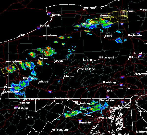 At 520 pm edt, a severe thunderstorm was located near marienville, moving northeast at 45 mph (radar). Hazards include 60 mph wind gusts and quarter-size hail. Minor hail damage to vehicles is possible. expect wind damage to trees and power lines, resulting in some power outages. Locations impacted include, marienville,. At 520 pm edt, a severe thunderstorm was located near marienville, moving northeast at 45 mph (radar). Hazards include 60 mph wind gusts and quarter-size hail. Minor hail damage to vehicles is possible. expect wind damage to trees and power lines, resulting in some power outages. Locations impacted include, marienville,.
|
| 5/18/2017 5:11 PM EDT |
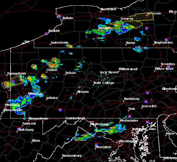 At 510 pm edt, a severe thunderstorm was located near marienville, moving northeast at 45 mph (radar). Hazards include 60 mph wind gusts and quarter-size hail. Minor hail damage to vehicles is possible. Expect wind damage to trees and power lines, resulting in some power outages. At 510 pm edt, a severe thunderstorm was located near marienville, moving northeast at 45 mph (radar). Hazards include 60 mph wind gusts and quarter-size hail. Minor hail damage to vehicles is possible. Expect wind damage to trees and power lines, resulting in some power outages.
|
| 5/1/2017 3:44 PM EDT |
 At 343 pm edt, severe thunderstorms were located along a line extending from near chapman state park to 9 miles south of marienville, moving east at 45 mph (public). Hazards include ping pong ball-size hail and 60 mph wind gusts. People and animals outdoors will be injured. expect hail damage to roofs, siding, windows, and vehicles. expect wind damage to trees and power lines, resulting in some power outages. locations impacted include, brookville, marienville, corsica, sigel, kellettville, clarington, clear creek state park, starr, this includes interstate 80 in pennsylvania between mile markers 73 and 88. A tornado watch remains in effect until 700 pm edt for northwestern and west central pennsylvania. At 343 pm edt, severe thunderstorms were located along a line extending from near chapman state park to 9 miles south of marienville, moving east at 45 mph (public). Hazards include ping pong ball-size hail and 60 mph wind gusts. People and animals outdoors will be injured. expect hail damage to roofs, siding, windows, and vehicles. expect wind damage to trees and power lines, resulting in some power outages. locations impacted include, brookville, marienville, corsica, sigel, kellettville, clarington, clear creek state park, starr, this includes interstate 80 in pennsylvania between mile markers 73 and 88. A tornado watch remains in effect until 700 pm edt for northwestern and west central pennsylvania.
|
| 5/1/2017 3:42 PM EDT | Ping Pong Ball sized hail reported 2.1 miles WNW of Marienville, PA |
| 5/1/2017 3:42 PM EDT | Numerous trees down in forest county PA, 5.6 miles SW of Marienville, PA |
| 5/1/2017 3:42 PM EDT |
 The tornado warning for northeastern clarion and central forest counties will expire at 345 pm edt, the tornadic thunderstorm that prompted the warning has weakend. therefore, the warning will be allowed to expire. a tornado watch remains in effect until 700 pm edt for northwestern and west central pennsylvania. remember, a severe thunderstorm warning still remains in effect for forest county. The tornado warning for northeastern clarion and central forest counties will expire at 345 pm edt, the tornadic thunderstorm that prompted the warning has weakend. therefore, the warning will be allowed to expire. a tornado watch remains in effect until 700 pm edt for northwestern and west central pennsylvania. remember, a severe thunderstorm warning still remains in effect for forest county.
|
| 5/1/2017 3:30 PM EDT |
 At 329 pm edt, a severe thunderstorm capable of producing a tornado was located 10 miles southwest of marienville, moving northeast at 55 mph (radar indicated rotation). Hazards include tornado. Flying debris will be dangerous to those caught without shelter. mobile homes will be damaged or destroyed. damage to roofs, windows, and vehicles will occur. tree damage is likely. this dangerous storm will be near, marienville around 340 pm edt. Other locations impacted by this tornadic thunderstorm include leeper, cook forest state park and kellettville. At 329 pm edt, a severe thunderstorm capable of producing a tornado was located 10 miles southwest of marienville, moving northeast at 55 mph (radar indicated rotation). Hazards include tornado. Flying debris will be dangerous to those caught without shelter. mobile homes will be damaged or destroyed. damage to roofs, windows, and vehicles will occur. tree damage is likely. this dangerous storm will be near, marienville around 340 pm edt. Other locations impacted by this tornadic thunderstorm include leeper, cook forest state park and kellettville.
|
| 5/1/2017 3:29 PM EDT |
 At 328 pm edt, severe thunderstorms were located along a line extending from 8 miles southeast of garland to near clarion, moving east at 45 mph (public). Hazards include 60 mph wind gusts. Expect damage to trees and power lines, resulting in some power outages. locations impacted include, clarion, brookville, marienville, tionesta, strattanville, corsica, sigel, kellettville, west hickory, fisher, leeper, fryburg, this includes interstate 80 in pennsylvania between mile markers 63 and 88. A tornado watch remains in effect until 700 pm edt for northwestern and west central pennsylvania. At 328 pm edt, severe thunderstorms were located along a line extending from 8 miles southeast of garland to near clarion, moving east at 45 mph (public). Hazards include 60 mph wind gusts. Expect damage to trees and power lines, resulting in some power outages. locations impacted include, clarion, brookville, marienville, tionesta, strattanville, corsica, sigel, kellettville, west hickory, fisher, leeper, fryburg, this includes interstate 80 in pennsylvania between mile markers 63 and 88. A tornado watch remains in effect until 700 pm edt for northwestern and west central pennsylvania.
|
| 5/1/2017 3:25 PM EDT |
 At 324 pm edt, a severe thunderstorm capable of producing a tornado was located 7 miles north of clarion, moving northeast at 55 mph (radar indicated rotation). Hazards include tornado. Flying debris will be dangerous to those caught without shelter. mobile homes will be damaged or destroyed. damage to roofs, windows, and vehicles will occur. tree damage is likely. this dangerous storm will be near, marienville around 340 pm edt. Other locations impacted by this tornadic thunderstorm include fryburg, kellettville, leeper and cook forest state park. At 324 pm edt, a severe thunderstorm capable of producing a tornado was located 7 miles north of clarion, moving northeast at 55 mph (radar indicated rotation). Hazards include tornado. Flying debris will be dangerous to those caught without shelter. mobile homes will be damaged or destroyed. damage to roofs, windows, and vehicles will occur. tree damage is likely. this dangerous storm will be near, marienville around 340 pm edt. Other locations impacted by this tornadic thunderstorm include fryburg, kellettville, leeper and cook forest state park.
|
| 5/1/2017 3:23 PM EDT |
 At 323 pm edt, severe thunderstorms were located along a line extending from 7 miles east of grand valley to near clarion, moving east at 45 mph (public). Hazards include 60 mph wind gusts. Expect damage to trees and power lines, resulting in some power outages. locations impacted include, clarion, brookville, marienville, tionesta, strattanville, shippenville, corsica, sigel, fryburg, kellettville, west hickory, fisher, this includes interstate 80 in pennsylvania between mile markers 56 and 88. A tornado watch remains in effect until 700 pm edt for northwestern and west central pennsylvania. At 323 pm edt, severe thunderstorms were located along a line extending from 7 miles east of grand valley to near clarion, moving east at 45 mph (public). Hazards include 60 mph wind gusts. Expect damage to trees and power lines, resulting in some power outages. locations impacted include, clarion, brookville, marienville, tionesta, strattanville, shippenville, corsica, sigel, fryburg, kellettville, west hickory, fisher, this includes interstate 80 in pennsylvania between mile markers 56 and 88. A tornado watch remains in effect until 700 pm edt for northwestern and west central pennsylvania.
|
| 5/1/2017 3:10 PM EDT |
 At 309 pm edt, severe thunderstorms were located along a line extending from near enterprise to near knox, moving east at 45 mph (public). Hazards include 60 mph wind gusts. expect damage to trees and power lines, resulting in some power outages At 309 pm edt, severe thunderstorms were located along a line extending from near enterprise to near knox, moving east at 45 mph (public). Hazards include 60 mph wind gusts. expect damage to trees and power lines, resulting in some power outages
|
| 5/1/2017 2:50 PM EDT | Ping Pong Ball sized hail reported 2.1 miles WNW of Marienville, PA |
| 4/20/2017 9:58 PM EDT |
 The severe thunderstorm warning for northeastern clarion and southeastern forest counties will expire at 1000 pm edt, the storm that prompted the warning has moved out of the area. therefore, the warning will be allowed to expire. however heavy rain is still possible with othere thunderstorms in the area. localized flooding is a possibility. do not drive through areas where water covers the road. The severe thunderstorm warning for northeastern clarion and southeastern forest counties will expire at 1000 pm edt, the storm that prompted the warning has moved out of the area. therefore, the warning will be allowed to expire. however heavy rain is still possible with othere thunderstorms in the area. localized flooding is a possibility. do not drive through areas where water covers the road.
|
| 4/20/2017 9:38 PM EDT |
 At 938 pm edt, a severe thunderstorm was located near marienville, moving east at 45 mph (radar). Hazards include 60 mph wind gusts and quarter-size hail. Hail damage to vehicles is expected. Expect wind damage to trees and power lines, resulting in some power outages. At 938 pm edt, a severe thunderstorm was located near marienville, moving east at 45 mph (radar). Hazards include 60 mph wind gusts and quarter-size hail. Hail damage to vehicles is expected. Expect wind damage to trees and power lines, resulting in some power outages.
|
| 4/20/2017 9:26 PM EDT |
 The severe thunderstorm warning for northeastern venango, northeastern clarion and forest counties will expire at 930 pm edt, the storm that prompted the warning has weakened below severe limits and no longer pose an immediate threat to life and property. therefore, the warning will be allowed to expire. The severe thunderstorm warning for northeastern venango, northeastern clarion and forest counties will expire at 930 pm edt, the storm that prompted the warning has weakened below severe limits and no longer pose an immediate threat to life and property. therefore, the warning will be allowed to expire.
|
| 4/20/2017 9:11 PM EDT |
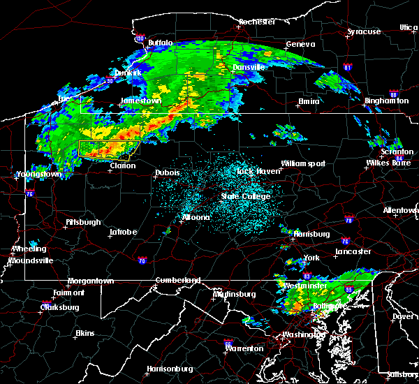 At 911 pm edt, a severe thunderstorm was located 8 miles east of tionesta, or 8 miles west of marienville, moving east at 40 mph (radar). Hazards include 60 mph wind gusts and quarter-size hail. Hail damage to vehicles is expected. expect wind damage to trees and power lines, resulting in some power outages. Locations impacted include, oil city, marienville, sugarcreek, tionesta, hasson heights, rouseville, woodland heights, pleasantville, kellettville, west hickory, leeper, starr,. At 911 pm edt, a severe thunderstorm was located 8 miles east of tionesta, or 8 miles west of marienville, moving east at 40 mph (radar). Hazards include 60 mph wind gusts and quarter-size hail. Hail damage to vehicles is expected. expect wind damage to trees and power lines, resulting in some power outages. Locations impacted include, oil city, marienville, sugarcreek, tionesta, hasson heights, rouseville, woodland heights, pleasantville, kellettville, west hickory, leeper, starr,.
|
| 4/20/2017 8:55 PM EDT |
 At 855 pm edt, a severe thunderstorm was located over tionesta, or 15 miles east of oil city, moving east at 45 mph (radar). Hazards include 60 mph wind gusts and quarter-size hail. Hail damage to vehicles is expected. expect wind damage to trees and power lines, resulting in some power outages. Locations impacted include, oil city, marienville, sugarcreek, tionesta, hasson heights, rouseville, woodland heights, pleasantville, kellettville, west hickory, leeper, starr,. At 855 pm edt, a severe thunderstorm was located over tionesta, or 15 miles east of oil city, moving east at 45 mph (radar). Hazards include 60 mph wind gusts and quarter-size hail. Hail damage to vehicles is expected. expect wind damage to trees and power lines, resulting in some power outages. Locations impacted include, oil city, marienville, sugarcreek, tionesta, hasson heights, rouseville, woodland heights, pleasantville, kellettville, west hickory, leeper, starr,.
|
| 4/20/2017 8:40 PM EDT |
 At 840 pm edt, a severe thunderstorm was located near oil city, moving east at 45 mph (radar). Hazards include 60 mph wind gusts and quarter-size hail. Hail damage to vehicles is expected. Expect wind damage to trees and power lines, resulting in some power outages. At 840 pm edt, a severe thunderstorm was located near oil city, moving east at 45 mph (radar). Hazards include 60 mph wind gusts and quarter-size hail. Hail damage to vehicles is expected. Expect wind damage to trees and power lines, resulting in some power outages.
|
| 1/12/2017 2:24 PM EST |
 At 223 pm est, a severe thunderstorm was located near knox, moving east at 60 mph (radar indicated). Hazards include 60 mph wind gusts. expect damage to trees and power lines, resulting in some power outages At 223 pm est, a severe thunderstorm was located near knox, moving east at 60 mph (radar indicated). Hazards include 60 mph wind gusts. expect damage to trees and power lines, resulting in some power outages
|
| 8/13/2016 7:47 PM EDT |
 At 747 pm edt, severe thunderstorms were located along a line extending from 6 miles southwest of james city to near clarion, moving southeast at 15 mph (radar indicated). Hazards include 60 mph wind gusts. Expect damage to trees and power lines. Resulting in some power outages. At 747 pm edt, severe thunderstorms were located along a line extending from 6 miles southwest of james city to near clarion, moving southeast at 15 mph (radar indicated). Hazards include 60 mph wind gusts. Expect damage to trees and power lines. Resulting in some power outages.
|
| 8/13/2016 7:35 PM EDT | Multiple 1+ foot diameter limbs down near roses... p in forest county PA, 3.8 miles ENE of Marienville, PA |
| 8/13/2016 7:35 PM EDT |
 At 735 pm edt, severe thunderstorms were located along a line extending from ludlow to 7 miles southwest of marienville, moving east at 40 mph (radar indicated). Hazards include 60 mph wind gusts. Expect damage to trees and power lines. resulting in some power outages. locations impacted include, clarion, marienville, strattanville, shippenville, sigel, kellettville, leeper, fisher, cook forest state park, clear creek state park and clarington. this includes interstate 80 in pennsylvania between mile markers 54 and 63. Please report severe weather by calling 4 1 2, 2 6 2, 1 9 8 8, posting to the nws pittsburgh facebook page, or using twitter @nwspittsburgh. At 735 pm edt, severe thunderstorms were located along a line extending from ludlow to 7 miles southwest of marienville, moving east at 40 mph (radar indicated). Hazards include 60 mph wind gusts. Expect damage to trees and power lines. resulting in some power outages. locations impacted include, clarion, marienville, strattanville, shippenville, sigel, kellettville, leeper, fisher, cook forest state park, clear creek state park and clarington. this includes interstate 80 in pennsylvania between mile markers 54 and 63. Please report severe weather by calling 4 1 2, 2 6 2, 1 9 8 8, posting to the nws pittsburgh facebook page, or using twitter @nwspittsburgh.
|
| 8/13/2016 7:22 PM EDT |
 At 722 pm edt, severe thunderstorms were located along a line extending from sheffield to 9 miles southeast of tionesta, moving east at 40 mph (radar indicated). Hazards include 60 mph wind gusts. Expect damage to trees and power lines. Resulting in some power outages. At 722 pm edt, severe thunderstorms were located along a line extending from sheffield to 9 miles southeast of tionesta, moving east at 40 mph (radar indicated). Hazards include 60 mph wind gusts. Expect damage to trees and power lines. Resulting in some power outages.
|
| 8/11/2016 8:39 PM EDT | The severe thunderstorm warning for northwestern jefferson and southeastern forest counties will expire at 845 pm edt, the storm which prompted the warning has moved out of the area. therefore, the warning will be allowed to expire. |
| 8/11/2016 8:19 PM EDT |
 At 818 pm edt, a severe thunderstorm was located 10 miles south of marienville, moving east at 25 mph (radar indicated). Hazards include 60 mph wind gusts. Expect damage to trees and power lines. resulting in some power outages. locations impacted include, marienville, sigel, clear creek state park, clarington and cook forest state park. Please report severe weather by calling 4 1 2, 2 6 2, 1 9 8 8, posting to the nws pittsburgh facebook page, or using twitter @nwspittsburgh. At 818 pm edt, a severe thunderstorm was located 10 miles south of marienville, moving east at 25 mph (radar indicated). Hazards include 60 mph wind gusts. Expect damage to trees and power lines. resulting in some power outages. locations impacted include, marienville, sigel, clear creek state park, clarington and cook forest state park. Please report severe weather by calling 4 1 2, 2 6 2, 1 9 8 8, posting to the nws pittsburgh facebook page, or using twitter @nwspittsburgh.
|
| 8/11/2016 7:56 PM EDT |
 At 756 pm edt, a severe thunderstorm was located 11 miles northeast of clarion, moving east at 30 mph (radar indicated). Hazards include 60 mph wind gusts. Expect damage to trees and power lines. Resulting in some power outages. At 756 pm edt, a severe thunderstorm was located 11 miles northeast of clarion, moving east at 30 mph (radar indicated). Hazards include 60 mph wind gusts. Expect damage to trees and power lines. Resulting in some power outages.
|
| 7/14/2016 1:11 AM EDT | The severe thunderstorm warning for forest county will expire at 115 am edt, the severe thunderstorm which prompted the warning has weakened. therefore, the warning will be allowed to expire. |
| 7/14/2016 12:52 AM EDT |
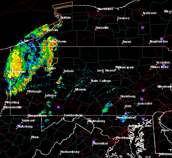 At 1252 am edt, a severe thunderstorm was located near marienville, moving northeast at 30 mph (radar indicated). Hazards include 60 mph wind gusts and quarter size hail. Hail damage to vehicles is expected. expect wind damage to trees and power lines, resulting in some power outages. locations impacted include, marienville and kellettville. Please report severe weather by calling 4 1 2, 2 6 2, 1 9 8 8, posting to the nws pittsburgh facebook page, or using twitter @nwspittsburgh. At 1252 am edt, a severe thunderstorm was located near marienville, moving northeast at 30 mph (radar indicated). Hazards include 60 mph wind gusts and quarter size hail. Hail damage to vehicles is expected. expect wind damage to trees and power lines, resulting in some power outages. locations impacted include, marienville and kellettville. Please report severe weather by calling 4 1 2, 2 6 2, 1 9 8 8, posting to the nws pittsburgh facebook page, or using twitter @nwspittsburgh.
|
| 7/14/2016 12:45 AM EDT | Several trees and wires dow in forest county PA, 3.9 miles E of Marienville, PA |
| 7/14/2016 12:32 AM EDT |
 At 1232 am edt, a severe thunderstorm was located 9 miles southeast of tionesta, or 10 miles north of clarion, moving northeast at 35 mph (radar indicated). Hazards include 60 mph wind gusts and quarter size hail. Hail damage to vehicles is expected. Expect wind damage to trees and power lines, resulting in some power outages. At 1232 am edt, a severe thunderstorm was located 9 miles southeast of tionesta, or 10 miles north of clarion, moving northeast at 35 mph (radar indicated). Hazards include 60 mph wind gusts and quarter size hail. Hail damage to vehicles is expected. Expect wind damage to trees and power lines, resulting in some power outages.
|
| 6/16/2016 11:23 AM EDT |
 The severe thunderstorm warning for jefferson and eastern forest counties will expire at 1130 am edt, the storms which prompted the warning have moved out of the area. therefore, the warning will be allowed to expire. The severe thunderstorm warning for jefferson and eastern forest counties will expire at 1130 am edt, the storms which prompted the warning have moved out of the area. therefore, the warning will be allowed to expire.
|
| 6/16/2016 11:14 AM EDT |
 At 1113 am edt, severe thunderstorms were located along a line extending from near ludlow to near reynoldsville, moving east at 35 mph (radar indicated). Hazards include 60 mph wind gusts and penny size hail. Expect damage to trees and power lines. resulting in some power outages. locations impacted include, punxsutawney, brookville, marienville, reynoldsville, brockway, sykesville, falls creek, big run, anita and clear creek state park. this includes interstate 80 in pennsylvania between mile markers 80 and 96. Please report severe weather by calling 4 1 2, 2 6 2, 1 9 8 8, posting to the nws pittsburgh facebook page, or using twitter @nwspittsburgh. At 1113 am edt, severe thunderstorms were located along a line extending from near ludlow to near reynoldsville, moving east at 35 mph (radar indicated). Hazards include 60 mph wind gusts and penny size hail. Expect damage to trees and power lines. resulting in some power outages. locations impacted include, punxsutawney, brookville, marienville, reynoldsville, brockway, sykesville, falls creek, big run, anita and clear creek state park. this includes interstate 80 in pennsylvania between mile markers 80 and 96. Please report severe weather by calling 4 1 2, 2 6 2, 1 9 8 8, posting to the nws pittsburgh facebook page, or using twitter @nwspittsburgh.
|
| 6/16/2016 10:45 AM EDT |
 At 1044 am edt, severe thunderstorms were located along a line extending from 9 miles south of chapman state park to near new bethlehem, moving east at 35 mph (radar indicated). Hazards include 60 mph wind gusts and penny size hail. Expect damage to trees and power lines. resulting in some power outages. locations impacted include, punxsutawney, brookville, marienville, reynoldsville, brockway, new bethlehem, sykesville, falls creek, big run, strattanville, summerville, limestone, hawthorn, corsica, sigel, timblin, leeper, kellettville, fisher and worthville. this includes interstate 80 in pennsylvania between mile markers 65 and 96. Please report severe weather by calling 4 1 2, 2 6 2, 1 9 8 8, posting to the nws pittsburgh facebook page, or using twitter @nwspittsburgh. At 1044 am edt, severe thunderstorms were located along a line extending from 9 miles south of chapman state park to near new bethlehem, moving east at 35 mph (radar indicated). Hazards include 60 mph wind gusts and penny size hail. Expect damage to trees and power lines. resulting in some power outages. locations impacted include, punxsutawney, brookville, marienville, reynoldsville, brockway, new bethlehem, sykesville, falls creek, big run, strattanville, summerville, limestone, hawthorn, corsica, sigel, timblin, leeper, kellettville, fisher and worthville. this includes interstate 80 in pennsylvania between mile markers 65 and 96. Please report severe weather by calling 4 1 2, 2 6 2, 1 9 8 8, posting to the nws pittsburgh facebook page, or using twitter @nwspittsburgh.
|
| 6/16/2016 10:24 AM EDT |
 At 1023 am edt, severe thunderstorms were located along a line extending from 6 miles east of enterprise to rimersburg, moving east at 35 mph (radar indicated). Hazards include 60 mph wind gusts and penny size hail. Expect damage to trees and power lines. Resulting in some power outages. At 1023 am edt, severe thunderstorms were located along a line extending from 6 miles east of enterprise to rimersburg, moving east at 35 mph (radar indicated). Hazards include 60 mph wind gusts and penny size hail. Expect damage to trees and power lines. Resulting in some power outages.
|
| 8/3/2015 10:04 PM EDT |
 At 1004 pm edt, a severe thunderstorm was located near clarion, moving northeast at 30 mph (trained weather spotters). Hazards include 60 mph wind gusts and quarter size hail. Hail damage to vehicles is expected. expect wind damage to trees and some power outages. Locations impacted include, clarion, brookville, marienville, strattanville, summerville, limestone, shippenville, corsica, sigel, fisher, leeper, cook forest state park, clarington and clear creek state park. At 1004 pm edt, a severe thunderstorm was located near clarion, moving northeast at 30 mph (trained weather spotters). Hazards include 60 mph wind gusts and quarter size hail. Hail damage to vehicles is expected. expect wind damage to trees and some power outages. Locations impacted include, clarion, brookville, marienville, strattanville, summerville, limestone, shippenville, corsica, sigel, fisher, leeper, cook forest state park, clarington and clear creek state park.
|
| 8/3/2015 9:38 PM EDT |
 At 938 pm edt, a severe thunderstorm was located near rimersburg, moving northeast at 30 mph (trained weather spotters). Hazards include 60 mph wind gusts and quarter size hail. Hail damage to vehicles is expected. Expect wind damage to trees and some power outages. At 938 pm edt, a severe thunderstorm was located near rimersburg, moving northeast at 30 mph (trained weather spotters). Hazards include 60 mph wind gusts and quarter size hail. Hail damage to vehicles is expected. Expect wind damage to trees and some power outages.
|
| 7/19/2015 8:02 PM EDT |
 At 801 pm edt, a severe thunderstorm was located near tionesta, or 14 miles west of marienville, moving southeast at 30 mph (radar indicated). Hazards include 60 mph wind gusts. expect damage to trees and some power outages locations impacted include, marienville, tionesta, sigel, fryburg, leeper, cook forest state park, clear creek state park and clarington At 801 pm edt, a severe thunderstorm was located near tionesta, or 14 miles west of marienville, moving southeast at 30 mph (radar indicated). Hazards include 60 mph wind gusts. expect damage to trees and some power outages locations impacted include, marienville, tionesta, sigel, fryburg, leeper, cook forest state park, clear creek state park and clarington
|
| 7/19/2015 7:53 PM EDT |
 At 752 pm edt, a severe thunderstorm was located near tionesta, or 12 miles east of oil city, moving east at 35 mph (radar indicated). Hazards include 60 mph wind gusts. expect damage to trees and some power outages At 752 pm edt, a severe thunderstorm was located near tionesta, or 12 miles east of oil city, moving east at 35 mph (radar indicated). Hazards include 60 mph wind gusts. expect damage to trees and some power outages
|
| 7/19/2015 7:22 PM EDT |
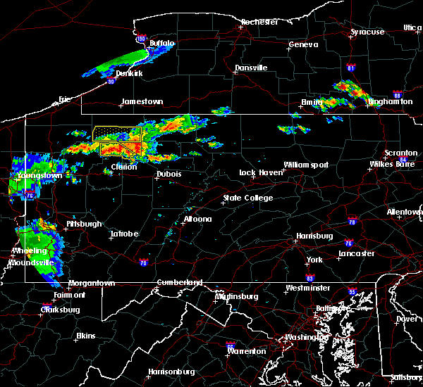 At 721 pm edt, a severe thunderstorm was located near tionesta, or 10 miles west of marienville, moving east at 25 mph (radar indicated). Hazards include 60 mph wind gusts. expect damage to trees and some power outages locations impacted include, marienville, tionesta, kellettville, west hickory, east hickory and starr At 721 pm edt, a severe thunderstorm was located near tionesta, or 10 miles west of marienville, moving east at 25 mph (radar indicated). Hazards include 60 mph wind gusts. expect damage to trees and some power outages locations impacted include, marienville, tionesta, kellettville, west hickory, east hickory and starr
|
| 7/19/2015 7:10 PM EDT |
 At 709 pm edt, severe thunderstorms were located along a line extending from near enterprise to 6 miles east of tionesta, moving east at 40 mph (radar). Hazards include 60 mph wind gusts. expect damage to trees and some power outages locations impacted include, marienville, tionesta, pleasantville, kellettville, west hickory, east hickory, starr and oil creek state park At 709 pm edt, severe thunderstorms were located along a line extending from near enterprise to 6 miles east of tionesta, moving east at 40 mph (radar). Hazards include 60 mph wind gusts. expect damage to trees and some power outages locations impacted include, marienville, tionesta, pleasantville, kellettville, west hickory, east hickory, starr and oil creek state park
|
| 7/19/2015 7:02 PM EDT |
 At 701 pm edt, severe thunderstorms were located along a line extending from near titusville to near tionesta, moving southeast at 20 mph (radar indicated). Hazards include 60 mph wind gusts and quarter size hail. wind damage to trees and some power outages At 701 pm edt, severe thunderstorms were located along a line extending from near titusville to near tionesta, moving southeast at 20 mph (radar indicated). Hazards include 60 mph wind gusts and quarter size hail. wind damage to trees and some power outages
|
| 7/7/2015 4:55 PM EDT | The severe thunderstorm warning for northeastern forest county will expire at 500 pm edt, the storm which prompted the warning has weakened below severe limits and exited the warned area. therefore the warning will be allowed to expire. however gusty winds are still possible with thunderstorms in the area. |
| 7/7/2015 4:41 PM EDT |
 At 440 pm edt, a severe thunderstorm was located 8 miles northwest of marienville, moving northeast at 40 mph (radar indicated). Hazards include 60 mph wind gusts. expect damage to trees and some power outages locations impacted include, marienville, kellettville and starr At 440 pm edt, a severe thunderstorm was located 8 miles northwest of marienville, moving northeast at 40 mph (radar indicated). Hazards include 60 mph wind gusts. expect damage to trees and some power outages locations impacted include, marienville, kellettville and starr
|
| 7/7/2015 4:23 PM EDT |
 At 423 pm edt, a severe thunderstorm was located near tionesta, or 14 miles west of marienville, moving northeast at 40 mph (radar indicated). Hazards include 60 mph wind gusts. expect damage to trees and some power outages At 423 pm edt, a severe thunderstorm was located near tionesta, or 14 miles west of marienville, moving northeast at 40 mph (radar indicated). Hazards include 60 mph wind gusts. expect damage to trees and some power outages
|
| 6/12/2015 5:43 PM EDT |
 At 543 pm edt, a severe thunderstorm was located 7 miles east of marienville, moving east at 40 mph (radar indicated). Hazards include 60 mph wind gusts and penny size hail. Expect damage to roofs. siding and trees. Locations impacted include, marienville. At 543 pm edt, a severe thunderstorm was located 7 miles east of marienville, moving east at 40 mph (radar indicated). Hazards include 60 mph wind gusts and penny size hail. Expect damage to roofs. siding and trees. Locations impacted include, marienville.
|
| 6/12/2015 5:35 PM EDT |
 At 534 pm edt, a severe thunderstorm was located near marienville, moving east at 45 mph (radar indicated). Hazards include 60 mph wind gusts and penny size hail. Expect damage to roofs. Siding and trees. At 534 pm edt, a severe thunderstorm was located near marienville, moving east at 45 mph (radar indicated). Hazards include 60 mph wind gusts and penny size hail. Expect damage to roofs. Siding and trees.
|
| 5/11/2015 9:02 PM EDT | At 901 pm edt, severe thunderstorms were located along a line extending from 8 miles southwest of titusville to 7 miles east of oil city to near knox, moving east at 50 mph (radar indicated). Hazards include 60 mph wind gusts. Expect damage to roofs. siding and trees. locations impacted include, oil city, franklin, marienville, knox, sugarcreek, tionesta, hasson heights, seneca, polk, emlenton, rouseville, shippenville, cooperstown, kennerdell, woodland heights, pleasantville, utica, leeper, kellettville and fryburg. 75in. |
| 5/11/2015 8:45 PM EDT | At 845 pm edt, severe thunderstorms were located along a line extending from 6 miles northwest of sugarcreek to near knox, moving northeast at 45 mph (radar indicated). Hazards include 60 mph wind gusts. Expect damage to roofs. Siding and trees. |
| 6/24/2014 4:22 PM EDT | Large oak tree on blue jay rd in forest county PA, 5.9 miles S of Marienville, PA |
| 6/17/2014 10:26 PM EDT | Roof partially blown off house in forest county PA, 3.8 miles ENE of Marienville, PA |
| 6/17/2014 10:26 PM EDT | Multiple trees down on route 899 in jenks township in forest county PA, 3.1 miles NE of Marienville, PA |
| 7/18/2013 4:50 PM EDT | Tree and power lines down blocking route 899 in jenks township in forest county PA, 2.1 miles WNW of Marienville, PA |
| 6/25/2013 6:00 PM EDT | Multiple trees down in marienville in forest county PA, 2.1 miles WNW of Marienville, PA |
| 6/25/2013 5:58 PM EDT | Numerous trees down in forest county PA, 2.1 miles WNW of Marienville, PA |
| 9/22/2012 7:35 PM EDT | Trees down in forest county PA, 5.6 miles SW of Marienville, PA |
| 6/3/2012 6:10 PM EDT | Trees and limbs down in millstone township in elk county PA, 8.3 miles NNW of Marienville, PA |
Hail Maps for Marienville, PA


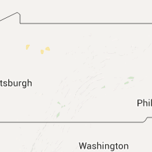


Connect with Interactive Hail Maps