

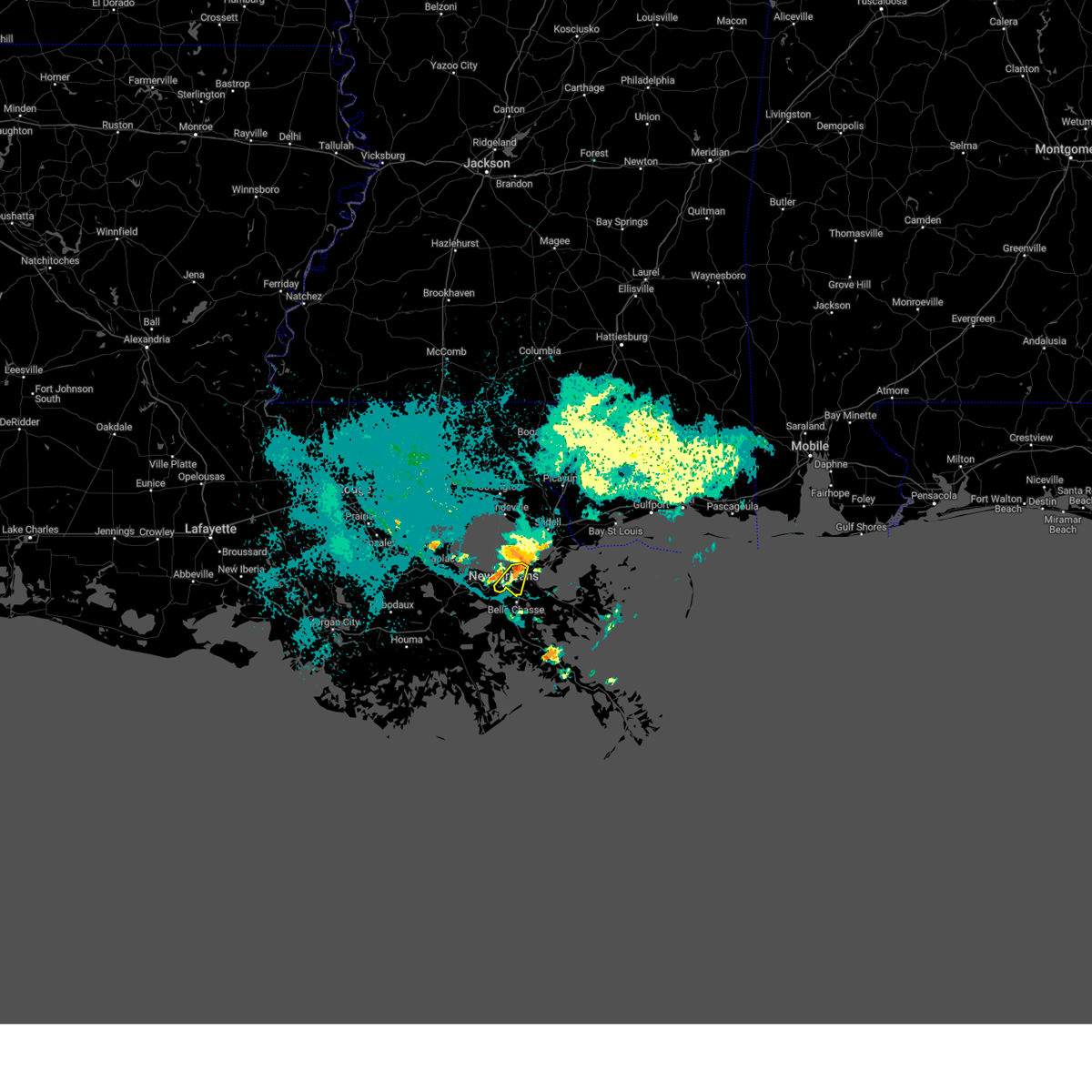
Hail Map for Marrero, LA
The Marrero, LA area has had 4 reports of on-the-ground hail by trained spotters, and has been under severe weather warnings 17 times during the past 12 months. Doppler radar has detected hail at or near Marrero, LA on 51 occasions, including 3 occasions during the past year.
| Name: | Marrero, LA |
| Where Located: | 5.5 miles SSW of New Orleans, LA |
| Map: | Google Map for Marrero, LA |
| Population: | 33141 |
| Housing Units: | 13212 |
| More Info: | Search Google for Marrero, LA |
1
The Top Recent Hail Date for Marrero, LA is Wednesday, June 11, 2025 (15th out of 51)
Hail and Wind Damage Spotted near Marrero, LA
| Date / Time | Report Details |
|---|---|
| 5/7/2025 9:19 AM CDT |
 the severe thunderstorm warning has been cancelled and is no longer in effect the severe thunderstorm warning has been cancelled and is no longer in effect
|
| 5/7/2025 9:19 AM CDT |
 At 919 am cdt, severe thunderstorms were located along a line extending from 7 miles northeast of metairie to near jean lafitte, moving east at 40 mph (radar indicated). Hazards include 60 mph wind gusts and penny size hail. Expect damage to roofs, siding, and trees. locations impacted include, woodmere, lake catherine, violet, terrytown, meraux, chalmette, poydras, marrero, gretna, lakefront airport, harvey, new orleans, east new orleans, estelle, shell beach, timberlane, belle chasse, arabi, jean lafitte, and jefferson. this includes the following interstates, interstate 10 in louisiana between mile markers 230 and 256. interstate 510 between mile markers 1 and 3. Interstate 610 between mile markers 1 and 4. At 919 am cdt, severe thunderstorms were located along a line extending from 7 miles northeast of metairie to near jean lafitte, moving east at 40 mph (radar indicated). Hazards include 60 mph wind gusts and penny size hail. Expect damage to roofs, siding, and trees. locations impacted include, woodmere, lake catherine, violet, terrytown, meraux, chalmette, poydras, marrero, gretna, lakefront airport, harvey, new orleans, east new orleans, estelle, shell beach, timberlane, belle chasse, arabi, jean lafitte, and jefferson. this includes the following interstates, interstate 10 in louisiana between mile markers 230 and 256. interstate 510 between mile markers 1 and 3. Interstate 610 between mile markers 1 and 4.
|
| 5/7/2025 9:12 AM CDT | Broadcast media reports wind damage including a bent traffic light pole and downed powerline in jefferson county LA, 1 miles SSW of Marrero, LA |
| 5/7/2025 9:12 AM CDT | Broadcast media reports downed power lines on avenue d in marrer in jefferson county LA, 1.6 miles SSW of Marrero, LA |
| 5/7/2025 9:09 AM CDT |
 Svrlix the national weather service in new orleans has issued a * severe thunderstorm warning for, western st. bernard parish in southeastern louisiana, eastern st. charles parish in southeastern louisiana, orleans parish in southeastern louisiana, northwestern jefferson parish in southeastern louisiana, northwestern plaquemines parish in southeastern louisiana, * until 1015 am cdt. * at 909 am cdt, severe thunderstorms were located along a line extending from 10 miles north of metairie to near barataria, moving east at 35 mph (radar indicated). Hazards include 60 mph wind gusts and penny size hail. expect damage to roofs, siding, and trees Svrlix the national weather service in new orleans has issued a * severe thunderstorm warning for, western st. bernard parish in southeastern louisiana, eastern st. charles parish in southeastern louisiana, orleans parish in southeastern louisiana, northwestern jefferson parish in southeastern louisiana, northwestern plaquemines parish in southeastern louisiana, * until 1015 am cdt. * at 909 am cdt, severe thunderstorms were located along a line extending from 10 miles north of metairie to near barataria, moving east at 35 mph (radar indicated). Hazards include 60 mph wind gusts and penny size hail. expect damage to roofs, siding, and trees
|
| 5/2/2025 8:20 PM CDT | Reported roof damage and a shed tossed into a street between lapalco blvd near belle terre rd and avenue f near patriot street. possible tornado. time estimated by rada in jefferson county LA, 0.5 miles WSW of Marrero, LA |
| 3/31/2025 9:43 AM CDT |
 the severe thunderstorm warning has been cancelled and is no longer in effect the severe thunderstorm warning has been cancelled and is no longer in effect
|
| 3/31/2025 9:01 AM CDT |
 Svrlix the national weather service in new orleans has issued a * severe thunderstorm warning for, st. bernard parish in southeastern louisiana, southern st. charles parish in southeastern louisiana, southwestern orleans parish in southeastern louisiana, terrebonne parish in southeastern louisiana, jefferson parish in southeastern louisiana, lafourche parish in southeastern louisiana, plaquemines parish in southeastern louisiana, * until 1000 am cdt. * at 900 am cdt, a severe thunderstorm was located near barataria, or 13 miles northeast of larose, moving east at 45 mph (radar indicated). Hazards include 60 mph wind gusts and quarter size hail. Hail damage to vehicles is expected. Expect wind damage to roofs, siding, and trees. Svrlix the national weather service in new orleans has issued a * severe thunderstorm warning for, st. bernard parish in southeastern louisiana, southern st. charles parish in southeastern louisiana, southwestern orleans parish in southeastern louisiana, terrebonne parish in southeastern louisiana, jefferson parish in southeastern louisiana, lafourche parish in southeastern louisiana, plaquemines parish in southeastern louisiana, * until 1000 am cdt. * at 900 am cdt, a severe thunderstorm was located near barataria, or 13 miles northeast of larose, moving east at 45 mph (radar indicated). Hazards include 60 mph wind gusts and quarter size hail. Hail damage to vehicles is expected. Expect wind damage to roofs, siding, and trees.
|
| 3/31/2025 8:38 AM CDT |
 At 838 am cdt, a severe thunderstorm was located over lockport, or 8 miles northwest of larose, moving east at 40 mph (radar indicated). Hazards include 60 mph wind gusts and penny size hail. Expect damage to roofs, siding, and trees. locations impacted include, mathews, schriever, cut off, luling, poydras, boutte, river ridge, jean lafitte, myrtle grove, raceland, ama, larose, avondale, estelle, bayou cane, st. rose, woodmere, paradis, gray, and des allemands. This includes interstate 310 between mile markers 7 and 11. At 838 am cdt, a severe thunderstorm was located over lockport, or 8 miles northwest of larose, moving east at 40 mph (radar indicated). Hazards include 60 mph wind gusts and penny size hail. Expect damage to roofs, siding, and trees. locations impacted include, mathews, schriever, cut off, luling, poydras, boutte, river ridge, jean lafitte, myrtle grove, raceland, ama, larose, avondale, estelle, bayou cane, st. rose, woodmere, paradis, gray, and des allemands. This includes interstate 310 between mile markers 7 and 11.
|
| 3/31/2025 8:38 AM CDT |
 the severe thunderstorm warning has been cancelled and is no longer in effect the severe thunderstorm warning has been cancelled and is no longer in effect
|
| 3/31/2025 8:21 AM CDT |
 the severe thunderstorm warning has been cancelled and is no longer in effect the severe thunderstorm warning has been cancelled and is no longer in effect
|
| 3/31/2025 8:21 AM CDT |
 At 821 am cdt, severe thunderstorms were located along a line extending from river ridge to 7 miles southeast of amelia, moving southeast at 30 mph (radar indicated). Hazards include 60 mph wind gusts and penny size hail. Expect damage to roofs, siding, and trees. locations impacted include, mathews, schriever, cut off, ama, chackbay, estelle, thibodaux, norco, gray, terrytown, hahnville, bridge city, marrero, westwego, harahan, labadieville, shell beach, taft, new sarpy, and luling. This includes interstate 310 between mile markers 1 and 11. At 821 am cdt, severe thunderstorms were located along a line extending from river ridge to 7 miles southeast of amelia, moving southeast at 30 mph (radar indicated). Hazards include 60 mph wind gusts and penny size hail. Expect damage to roofs, siding, and trees. locations impacted include, mathews, schriever, cut off, ama, chackbay, estelle, thibodaux, norco, gray, terrytown, hahnville, bridge city, marrero, westwego, harahan, labadieville, shell beach, taft, new sarpy, and luling. This includes interstate 310 between mile markers 1 and 11.
|
| 3/31/2025 7:57 AM CDT |
 Svrlix the national weather service in new orleans has issued a * severe thunderstorm warning for, st. john the baptist parish in southeastern louisiana, southern st. james parish in southeastern louisiana, central st. bernard parish in southeastern louisiana, st. charles parish in southeastern louisiana, southwestern orleans parish in southeastern louisiana, northern terrebonne parish in southeastern louisiana, jefferson parish in southeastern louisiana, lafourche parish in southeastern louisiana, northwestern plaquemines parish in southeastern louisiana, southeastern assumption parish in southeastern louisiana, * until 900 am cdt. * at 756 am cdt, a severe thunderstorm was located near wallace, or near reserve, moving east at 40 mph (radar indicated). Hazards include 60 mph wind gusts. expect damage to roofs, siding, and trees Svrlix the national weather service in new orleans has issued a * severe thunderstorm warning for, st. john the baptist parish in southeastern louisiana, southern st. james parish in southeastern louisiana, central st. bernard parish in southeastern louisiana, st. charles parish in southeastern louisiana, southwestern orleans parish in southeastern louisiana, northern terrebonne parish in southeastern louisiana, jefferson parish in southeastern louisiana, lafourche parish in southeastern louisiana, northwestern plaquemines parish in southeastern louisiana, southeastern assumption parish in southeastern louisiana, * until 900 am cdt. * at 756 am cdt, a severe thunderstorm was located near wallace, or near reserve, moving east at 40 mph (radar indicated). Hazards include 60 mph wind gusts. expect damage to roofs, siding, and trees
|
| 3/24/2025 10:59 AM CDT |
 the severe thunderstorm warning has been cancelled and is no longer in effect the severe thunderstorm warning has been cancelled and is no longer in effect
|
| 3/24/2025 10:59 AM CDT |
 At 1059 am cdt, a severe thunderstorm was located near poydras, or 7 miles east of belle chasse, moving east at 60 mph (radar indicated). Hazards include ping pong ball size hail and 60 mph wind gusts. People and animals outdoors will be injured. expect hail damage to roofs, siding, windows, and vehicles. expect wind damage to roofs, siding, and trees. Locations impacted include, woodmere, violet, terrytown, lafitte, poydras, marrero, jean lafitte, myrtle grove, gretna, harvey, estelle, timberlane, belle chasse, barataria, and meraux. At 1059 am cdt, a severe thunderstorm was located near poydras, or 7 miles east of belle chasse, moving east at 60 mph (radar indicated). Hazards include ping pong ball size hail and 60 mph wind gusts. People and animals outdoors will be injured. expect hail damage to roofs, siding, windows, and vehicles. expect wind damage to roofs, siding, and trees. Locations impacted include, woodmere, violet, terrytown, lafitte, poydras, marrero, jean lafitte, myrtle grove, gretna, harvey, estelle, timberlane, belle chasse, barataria, and meraux.
|
| 3/24/2025 10:36 AM CDT |
 Svrlix the national weather service in new orleans has issued a * severe thunderstorm warning for, west central st. bernard parish in southeastern louisiana, southeastern st. charles parish in southeastern louisiana, southwestern orleans parish in southeastern louisiana, central jefferson parish in southeastern louisiana, northeastern lafourche parish in southeastern louisiana, northwestern plaquemines parish in southeastern louisiana, * until 1115 am cdt. * at 1036 am cdt, a severe thunderstorm was located 9 miles southwest of avondale, moving east at 60 mph (radar indicated). Hazards include ping pong ball size hail and 60 mph wind gusts. People and animals outdoors will be injured. expect hail damage to roofs, siding, windows, and vehicles. Expect wind damage to roofs, siding, and trees. Svrlix the national weather service in new orleans has issued a * severe thunderstorm warning for, west central st. bernard parish in southeastern louisiana, southeastern st. charles parish in southeastern louisiana, southwestern orleans parish in southeastern louisiana, central jefferson parish in southeastern louisiana, northeastern lafourche parish in southeastern louisiana, northwestern plaquemines parish in southeastern louisiana, * until 1115 am cdt. * at 1036 am cdt, a severe thunderstorm was located 9 miles southwest of avondale, moving east at 60 mph (radar indicated). Hazards include ping pong ball size hail and 60 mph wind gusts. People and animals outdoors will be injured. expect hail damage to roofs, siding, windows, and vehicles. Expect wind damage to roofs, siding, and trees.
|
| 8/16/2024 2:18 PM CDT |
 Svrlix the national weather service in new orleans has issued a * severe thunderstorm warning for, northwestern jefferson parish in southeastern louisiana, * until 300 pm cdt. * at 217 pm cdt, a severe thunderstorm was located over harahan, or over avondale, moving northwest at 5 mph (radar indicated). Hazards include 60 mph wind gusts and penny size hail. expect damage to roofs, siding, and trees Svrlix the national weather service in new orleans has issued a * severe thunderstorm warning for, northwestern jefferson parish in southeastern louisiana, * until 300 pm cdt. * at 217 pm cdt, a severe thunderstorm was located over harahan, or over avondale, moving northwest at 5 mph (radar indicated). Hazards include 60 mph wind gusts and penny size hail. expect damage to roofs, siding, and trees
|
| 8/14/2024 9:03 PM CDT |
 At 903 pm cdt, a severe thunderstorm was located over gretna, or near harvey, moving southwest at 40 mph (radar indicated). Hazards include 60 mph wind gusts. Expect damage to roofs, siding, and trees. locations impacted include, new orleans, chalmette, east new orleans, belle chasse, gretna, arabi, terrytown, and lakefront airport. this includes the following interstates, interstate 10 in louisiana between mile markers 233 and 248. interstate 510 between mile markers 1 and 3. Interstate 610 between mile markers 2 and 4. At 903 pm cdt, a severe thunderstorm was located over gretna, or near harvey, moving southwest at 40 mph (radar indicated). Hazards include 60 mph wind gusts. Expect damage to roofs, siding, and trees. locations impacted include, new orleans, chalmette, east new orleans, belle chasse, gretna, arabi, terrytown, and lakefront airport. this includes the following interstates, interstate 10 in louisiana between mile markers 233 and 248. interstate 510 between mile markers 1 and 3. Interstate 610 between mile markers 2 and 4.
|
| 8/14/2024 8:53 PM CDT |
 At 852 pm cdt, a severe thunderstorm was located near east new orleans, moving southwest at 30 mph (radar indicated). Hazards include 60 mph wind gusts. Expect damage to roofs, siding, and trees. locations impacted include, new orleans, chalmette, east new orleans, belle chasse, gretna, arabi, terrytown, meraux, and lakefront airport. this includes the following interstates, interstate 10 in louisiana between mile markers 232 and 249. interstate 510 between mile markers 1 and 3. interstate 610 between mile markers 1 and 4. Lakefront airport has already recorded multiple wind gust up to 48 mph. At 852 pm cdt, a severe thunderstorm was located near east new orleans, moving southwest at 30 mph (radar indicated). Hazards include 60 mph wind gusts. Expect damage to roofs, siding, and trees. locations impacted include, new orleans, chalmette, east new orleans, belle chasse, gretna, arabi, terrytown, meraux, and lakefront airport. this includes the following interstates, interstate 10 in louisiana between mile markers 232 and 249. interstate 510 between mile markers 1 and 3. interstate 610 between mile markers 1 and 4. Lakefront airport has already recorded multiple wind gust up to 48 mph.
|
| 8/14/2024 8:35 PM CDT |
 Svrlix the national weather service in new orleans has issued a * severe thunderstorm warning for, west central st. bernard parish in southeastern louisiana, southwestern orleans parish in southeastern louisiana, * until 915 pm cdt. * at 835 pm cdt, a severe thunderstorm was located near east new orleans, moving southwest at 40 mph (radar indicated). Hazards include 60 mph wind gusts. expect damage to roofs, siding, and trees Svrlix the national weather service in new orleans has issued a * severe thunderstorm warning for, west central st. bernard parish in southeastern louisiana, southwestern orleans parish in southeastern louisiana, * until 915 pm cdt. * at 835 pm cdt, a severe thunderstorm was located near east new orleans, moving southwest at 40 mph (radar indicated). Hazards include 60 mph wind gusts. expect damage to roofs, siding, and trees
|
| 5/30/2024 11:38 AM CDT |
 The storm which prompted the warning has weakened below severe limits, and no longer poses an immediate threat to life or property. therefore, the warning will be allowed to expire. The storm which prompted the warning has weakened below severe limits, and no longer poses an immediate threat to life or property. therefore, the warning will be allowed to expire.
|
| 5/30/2024 11:23 AM CDT |
 At 1123 am cdt, a severe thunderstorm was located near gretna, or near harvey, moving east at 10 mph (radar indicated). Hazards include 60 mph wind gusts and penny size hail. Expect damage to roofs, siding, and trees. locations impacted include, new orleans, chalmette, avondale, metairie, marrero, harvey, east new orleans, timberlane, belle chasse, jefferson, gretna, harahan, westwego, river ridge, elmwood, terrytown, meraux, bridge city, waggaman, and arabi. this includes the following interstates, interstate 10 in louisiana between mile markers 222 and 248. interstate 510 between mile markers 1 and 3. Interstate 610 between mile markers 1 and 4. At 1123 am cdt, a severe thunderstorm was located near gretna, or near harvey, moving east at 10 mph (radar indicated). Hazards include 60 mph wind gusts and penny size hail. Expect damage to roofs, siding, and trees. locations impacted include, new orleans, chalmette, avondale, metairie, marrero, harvey, east new orleans, timberlane, belle chasse, jefferson, gretna, harahan, westwego, river ridge, elmwood, terrytown, meraux, bridge city, waggaman, and arabi. this includes the following interstates, interstate 10 in louisiana between mile markers 222 and 248. interstate 510 between mile markers 1 and 3. Interstate 610 between mile markers 1 and 4.
|
| 5/30/2024 11:06 AM CDT |
 Svrlix the national weather service in new orleans has issued a * severe thunderstorm warning for, west central st. bernard parish in southeastern louisiana, southwestern orleans parish in southeastern louisiana, northwestern jefferson parish in southeastern louisiana, northwestern plaquemines parish in southeastern louisiana, * until 1145 am cdt. * at 1105 am cdt, a severe thunderstorm was located over jefferson, or near marrero, moving east at 10 mph (radar indicated). Hazards include 60 mph wind gusts and penny size hail. expect damage to roofs, siding, and trees Svrlix the national weather service in new orleans has issued a * severe thunderstorm warning for, west central st. bernard parish in southeastern louisiana, southwestern orleans parish in southeastern louisiana, northwestern jefferson parish in southeastern louisiana, northwestern plaquemines parish in southeastern louisiana, * until 1145 am cdt. * at 1105 am cdt, a severe thunderstorm was located over jefferson, or near marrero, moving east at 10 mph (radar indicated). Hazards include 60 mph wind gusts and penny size hail. expect damage to roofs, siding, and trees
|
| 5/17/2024 1:26 AM CDT |
 the severe thunderstorm warning has been cancelled and is no longer in effect the severe thunderstorm warning has been cancelled and is no longer in effect
|
| 5/17/2024 1:19 AM CDT |
 At 119 am cdt, a severe thunderstorm was located near des allemands, or 9 miles southwest of hahnville, moving east at 60 mph (radar indicated). Hazards include quarter size hail. Damage to vehicles is expected. locations impacted include, avondale, marrero, westwego, paradis, des allemands, bayou gauche, luling, boutte, bridge city, and waggaman. This includes interstate 310 near mile marker 11. At 119 am cdt, a severe thunderstorm was located near des allemands, or 9 miles southwest of hahnville, moving east at 60 mph (radar indicated). Hazards include quarter size hail. Damage to vehicles is expected. locations impacted include, avondale, marrero, westwego, paradis, des allemands, bayou gauche, luling, boutte, bridge city, and waggaman. This includes interstate 310 near mile marker 11.
|
| 5/17/2024 1:08 AM CDT |
 Svrlix the national weather service in new orleans has issued a * severe thunderstorm warning for, southern st. john the baptist parish in southeastern louisiana, southern st. charles parish in southeastern louisiana, northwestern jefferson parish in southeastern louisiana, northeastern lafourche parish in southeastern louisiana, * until 200 am cdt. * at 108 am cdt, a severe thunderstorm was located near raceland, or 8 miles east of thibodaux, moving east at 50 mph (radar indicated). Hazards include quarter size hail. damage to vehicles is expected Svrlix the national weather service in new orleans has issued a * severe thunderstorm warning for, southern st. john the baptist parish in southeastern louisiana, southern st. charles parish in southeastern louisiana, northwestern jefferson parish in southeastern louisiana, northeastern lafourche parish in southeastern louisiana, * until 200 am cdt. * at 108 am cdt, a severe thunderstorm was located near raceland, or 8 miles east of thibodaux, moving east at 50 mph (radar indicated). Hazards include quarter size hail. damage to vehicles is expected
|
| 5/16/2024 11:53 PM CDT |
 At 1152 pm cdt, severe thunderstorms were located along a line extending from near meraux to near myrtle grove, moving east at 55 mph. these are destructive storms for new orleans and surounding cities across the southshore and portions of southeastern louisiana (radar indicated). Hazards include 80 mph wind gusts and penny size hail. Flying debris will be dangerous to those caught without shelter. mobile homes will be heavily damaged. expect considerable damage to roofs, windows, and vehicles. extensive tree damage and power outages are likely. locations impacted include, new orleans, chalmette, avondale, metairie, marrero, harvey, east new orleans, timberlane, belle chasse, jefferson, gretna, harahan, westwego, jean lafitte, lake catherine, poydras, river ridge, myrtle grove, pointe a la hache, and estelle. this includes the following interstates, interstate 10 in louisiana between mile markers 225 and 256. interstate 510 between mile markers 1 and 3. Interstate 610 between mile markers 1 and 4. At 1152 pm cdt, severe thunderstorms were located along a line extending from near meraux to near myrtle grove, moving east at 55 mph. these are destructive storms for new orleans and surounding cities across the southshore and portions of southeastern louisiana (radar indicated). Hazards include 80 mph wind gusts and penny size hail. Flying debris will be dangerous to those caught without shelter. mobile homes will be heavily damaged. expect considerable damage to roofs, windows, and vehicles. extensive tree damage and power outages are likely. locations impacted include, new orleans, chalmette, avondale, metairie, marrero, harvey, east new orleans, timberlane, belle chasse, jefferson, gretna, harahan, westwego, jean lafitte, lake catherine, poydras, river ridge, myrtle grove, pointe a la hache, and estelle. this includes the following interstates, interstate 10 in louisiana between mile markers 225 and 256. interstate 510 between mile markers 1 and 3. Interstate 610 between mile markers 1 and 4.
|
| 5/16/2024 11:38 PM CDT |
 the severe thunderstorm warning has been cancelled and is no longer in effect the severe thunderstorm warning has been cancelled and is no longer in effect
|
| 5/16/2024 11:38 PM CDT |
 At 1137 pm cdt, severe thunderstorms were located along a line extending from jefferson to near barataria, moving east at 55 mph. these are destructive storms for new orleans and surounding cities across the southshore and portions of southeastern louisiana (radar indicated). Hazards include 80 mph wind gusts and penny size hail. Flying debris will be dangerous to those caught without shelter. mobile homes will be heavily damaged. expect considerable damage to roofs, windows, and vehicles. extensive tree damage and power outages are likely. locations impacted include, new orleans, chalmette, avondale, metairie, marrero, harvey, east new orleans, timberlane, belle chasse, hahnville, jefferson, gretna, harahan, westwego, lockport, jean lafitte, lake catherine, luling, poydras, and river ridge. this includes the following interstates, interstate 10 in louisiana between mile markers 214 and 256. interstate 310 between mile markers 1 and 7. interstate 510 between mile markers 1 and 3. Interstate 610 between mile markers 1 and 4. At 1137 pm cdt, severe thunderstorms were located along a line extending from jefferson to near barataria, moving east at 55 mph. these are destructive storms for new orleans and surounding cities across the southshore and portions of southeastern louisiana (radar indicated). Hazards include 80 mph wind gusts and penny size hail. Flying debris will be dangerous to those caught without shelter. mobile homes will be heavily damaged. expect considerable damage to roofs, windows, and vehicles. extensive tree damage and power outages are likely. locations impacted include, new orleans, chalmette, avondale, metairie, marrero, harvey, east new orleans, timberlane, belle chasse, hahnville, jefferson, gretna, harahan, westwego, lockport, jean lafitte, lake catherine, luling, poydras, and river ridge. this includes the following interstates, interstate 10 in louisiana between mile markers 214 and 256. interstate 310 between mile markers 1 and 7. interstate 510 between mile markers 1 and 3. Interstate 610 between mile markers 1 and 4.
|
| 5/16/2024 11:28 PM CDT |
 At 1128 pm cdt, severe thunderstorms were located along a line extending from near st. rose to 10 miles southeast of bayou gauche, moving east at 55 mph (radar indicated). Hazards include 70 mph wind gusts and penny size hail. Expect considerable tree damage. damage is likely to mobile homes, roofs, and outbuildings. locations impacted include, new orleans, metairie, hahnville, laplace, marrero, chalmette, avondale, harvey, east new orleans, timberlane, belle chasse, reserve, jefferson, gretna, harahan, westwego, lockport, jean lafitte, mathews, and montz. this includes the following interstates, interstate 10 in louisiana between mile markers 205 and 256. interstate 55 in louisiana between mile markers 1 and 14. interstate 310 between mile markers 1 and 11. interstate 510 between mile markers 1 and 3. Interstate 610 between mile markers 1 and 4. At 1128 pm cdt, severe thunderstorms were located along a line extending from near st. rose to 10 miles southeast of bayou gauche, moving east at 55 mph (radar indicated). Hazards include 70 mph wind gusts and penny size hail. Expect considerable tree damage. damage is likely to mobile homes, roofs, and outbuildings. locations impacted include, new orleans, metairie, hahnville, laplace, marrero, chalmette, avondale, harvey, east new orleans, timberlane, belle chasse, reserve, jefferson, gretna, harahan, westwego, lockport, jean lafitte, mathews, and montz. this includes the following interstates, interstate 10 in louisiana between mile markers 205 and 256. interstate 55 in louisiana between mile markers 1 and 14. interstate 310 between mile markers 1 and 11. interstate 510 between mile markers 1 and 3. Interstate 610 between mile markers 1 and 4.
|
| 5/16/2024 11:28 PM CDT |
 the severe thunderstorm warning has been cancelled and is no longer in effect the severe thunderstorm warning has been cancelled and is no longer in effect
|
| 5/16/2024 11:05 PM CDT |
 Svrlix the national weather service in new orleans has issued a * severe thunderstorm warning for, st. john the baptist parish in southeastern louisiana, southeastern st. james parish in southeastern louisiana, northwestern st. bernard parish in southeastern louisiana, st. charles parish in southeastern louisiana, orleans parish in southeastern louisiana, north central terrebonne parish in southeastern louisiana, jefferson parish in southeastern louisiana, northern lafourche parish in southeastern louisiana, northwestern plaquemines parish in southeastern louisiana, * until midnight cdt. * at 1105 pm cdt, severe thunderstorms were located along a line extending from near edgard to raceland, moving east at 55 mph (radar indicated). Hazards include 70 mph wind gusts and penny size hail. Expect considerable tree damage. Damage is likely to mobile homes, roofs, and outbuildings. Svrlix the national weather service in new orleans has issued a * severe thunderstorm warning for, st. john the baptist parish in southeastern louisiana, southeastern st. james parish in southeastern louisiana, northwestern st. bernard parish in southeastern louisiana, st. charles parish in southeastern louisiana, orleans parish in southeastern louisiana, north central terrebonne parish in southeastern louisiana, jefferson parish in southeastern louisiana, northern lafourche parish in southeastern louisiana, northwestern plaquemines parish in southeastern louisiana, * until midnight cdt. * at 1105 pm cdt, severe thunderstorms were located along a line extending from near edgard to raceland, moving east at 55 mph (radar indicated). Hazards include 70 mph wind gusts and penny size hail. Expect considerable tree damage. Damage is likely to mobile homes, roofs, and outbuildings.
|
| 4/10/2024 9:59 AM CDT |
 Svrlix the national weather service in new orleans has issued a * severe thunderstorm warning for, northwestern st. bernard parish in southeastern louisiana, east central st. charles parish in southeastern louisiana, orleans parish in southeastern louisiana, southern st. tammany parish in southeastern louisiana, northwestern jefferson parish in southeastern louisiana, northwestern plaquemines parish in southeastern louisiana, * until 1045 am cdt. * at 958 am cdt, severe thunderstorms were located along a line extending from near metairie to 6 miles northwest of new orleans to 10 miles west of slidell to near lacombe, moving east at 55 mph. these are destructive storms for hurricane force winds! (radar indicated). Hazards include 80 mph wind gusts. Flying debris will be dangerous to those caught without shelter. mobile homes will be heavily damaged. expect considerable damage to roofs, windows, and vehicles. Extensive tree damage and power outages are likely. Svrlix the national weather service in new orleans has issued a * severe thunderstorm warning for, northwestern st. bernard parish in southeastern louisiana, east central st. charles parish in southeastern louisiana, orleans parish in southeastern louisiana, southern st. tammany parish in southeastern louisiana, northwestern jefferson parish in southeastern louisiana, northwestern plaquemines parish in southeastern louisiana, * until 1045 am cdt. * at 958 am cdt, severe thunderstorms were located along a line extending from near metairie to 6 miles northwest of new orleans to 10 miles west of slidell to near lacombe, moving east at 55 mph. these are destructive storms for hurricane force winds! (radar indicated). Hazards include 80 mph wind gusts. Flying debris will be dangerous to those caught without shelter. mobile homes will be heavily damaged. expect considerable damage to roofs, windows, and vehicles. Extensive tree damage and power outages are likely.
|
| 4/10/2024 8:39 AM CDT |
 At 839 am cdt, a severe thunderstorm was located over marrero, moving northeast at 30 mph (radar indicated). Hazards include 70 mph wind gusts. Expect considerable tree damage. damage is likely to mobile homes, roofs, and outbuildings. locations impacted include, new orleans, chalmette, marrero, harvey, east new orleans, timberlane, belle chasse, metairie, jefferson, gretna, westwego, woodmere, lake catherine, violet, terrytown, meraux, estelle, arabi, bridge city, and poydras. this includes the following interstates, interstate 10 in louisiana between mile markers 231 and 256. interstate 510 between mile markers 1 and 3. Interstate 610 between mile markers 1 and 4. At 839 am cdt, a severe thunderstorm was located over marrero, moving northeast at 30 mph (radar indicated). Hazards include 70 mph wind gusts. Expect considerable tree damage. damage is likely to mobile homes, roofs, and outbuildings. locations impacted include, new orleans, chalmette, marrero, harvey, east new orleans, timberlane, belle chasse, metairie, jefferson, gretna, westwego, woodmere, lake catherine, violet, terrytown, meraux, estelle, arabi, bridge city, and poydras. this includes the following interstates, interstate 10 in louisiana between mile markers 231 and 256. interstate 510 between mile markers 1 and 3. Interstate 610 between mile markers 1 and 4.
|
| 4/10/2024 8:33 AM CDT |
 At 833 am cdt, a severe thunderstorm was located over estelle, or near marrero, moving northeast at 30 mph (radar indicated). Hazards include 60 mph wind gusts. Expect damage to roofs, siding, and trees. locations impacted include, new orleans, chalmette, marrero, harvey, east new orleans, timberlane, belle chasse, metairie, avondale, jefferson, gretna, westwego, woodmere, lake catherine, violet, terrytown, meraux, bridge city, estelle, and arabi. this includes the following interstates, interstate 10 in louisiana between mile markers 229 and 256. interstate 510 between mile markers 1 and 3. Interstate 610 between mile markers 1 and 4. At 833 am cdt, a severe thunderstorm was located over estelle, or near marrero, moving northeast at 30 mph (radar indicated). Hazards include 60 mph wind gusts. Expect damage to roofs, siding, and trees. locations impacted include, new orleans, chalmette, marrero, harvey, east new orleans, timberlane, belle chasse, metairie, avondale, jefferson, gretna, westwego, woodmere, lake catherine, violet, terrytown, meraux, bridge city, estelle, and arabi. this includes the following interstates, interstate 10 in louisiana between mile markers 229 and 256. interstate 510 between mile markers 1 and 3. Interstate 610 between mile markers 1 and 4.
|
| 4/10/2024 8:33 AM CDT |
 the severe thunderstorm warning has been cancelled and is no longer in effect the severe thunderstorm warning has been cancelled and is no longer in effect
|
| 4/10/2024 8:24 AM CDT |
 Svrlix the national weather service in new orleans has issued a * severe thunderstorm warning for, northwestern st. bernard parish in southeastern louisiana, southeastern st. charles parish in southeastern louisiana, orleans parish in southeastern louisiana, northwestern jefferson parish in southeastern louisiana, northwestern plaquemines parish in southeastern louisiana, * until 930 am cdt. * at 824 am cdt, a severe thunderstorm was located near estelle, or near avondale, moving northeast at 30 mph (radar indicated). Hazards include 60 mph wind gusts. expect damage to roofs, siding, and trees Svrlix the national weather service in new orleans has issued a * severe thunderstorm warning for, northwestern st. bernard parish in southeastern louisiana, southeastern st. charles parish in southeastern louisiana, orleans parish in southeastern louisiana, northwestern jefferson parish in southeastern louisiana, northwestern plaquemines parish in southeastern louisiana, * until 930 am cdt. * at 824 am cdt, a severe thunderstorm was located near estelle, or near avondale, moving northeast at 30 mph (radar indicated). Hazards include 60 mph wind gusts. expect damage to roofs, siding, and trees
|
| 4/10/2024 8:19 AM CDT |
 the severe thunderstorm warning has been cancelled and is no longer in effect the severe thunderstorm warning has been cancelled and is no longer in effect
|
| 4/10/2024 8:19 AM CDT |
 At 818 am cdt, a severe thunderstorm was located over avondale, moving north at 45 mph (radar indicated). Hazards include 60 mph wind gusts and quarter size hail. Hail damage to vehicles is expected. expect wind damage to roofs, siding, and trees. Locations impacted include, marrero, harvey, avondale, timberlane, gretna, westwego, jean lafitte, woodmere, estelle, terrytown, waggaman, bridge city, and barataria. At 818 am cdt, a severe thunderstorm was located over avondale, moving north at 45 mph (radar indicated). Hazards include 60 mph wind gusts and quarter size hail. Hail damage to vehicles is expected. expect wind damage to roofs, siding, and trees. Locations impacted include, marrero, harvey, avondale, timberlane, gretna, westwego, jean lafitte, woodmere, estelle, terrytown, waggaman, bridge city, and barataria.
|
| 4/10/2024 7:50 AM CDT |
 Svrlix the national weather service in new orleans has issued a * severe thunderstorm warning for, southeastern st. charles parish in southeastern louisiana, northwestern jefferson parish in southeastern louisiana, northeastern lafourche parish in southeastern louisiana, * until 830 am cdt. * at 750 am cdt, a severe thunderstorm was located near larose, moving northeast at 45 mph (radar indicated). Hazards include 60 mph wind gusts and quarter size hail. Hail damage to vehicles is expected. Expect wind damage to roofs, siding, and trees. Svrlix the national weather service in new orleans has issued a * severe thunderstorm warning for, southeastern st. charles parish in southeastern louisiana, northwestern jefferson parish in southeastern louisiana, northeastern lafourche parish in southeastern louisiana, * until 830 am cdt. * at 750 am cdt, a severe thunderstorm was located near larose, moving northeast at 45 mph (radar indicated). Hazards include 60 mph wind gusts and quarter size hail. Hail damage to vehicles is expected. Expect wind damage to roofs, siding, and trees.
|
| 3/15/2024 3:37 PM CDT |
 The storms which prompted the warning have weakened below severe limits, and have exited the warned area. therefore, the warning will be allowed to expire. however, gusty winds are still possible with these thunderstorms. a severe thunderstorm watch remains in effect until 700 pm cdt for southeastern louisiana. The storms which prompted the warning have weakened below severe limits, and have exited the warned area. therefore, the warning will be allowed to expire. however, gusty winds are still possible with these thunderstorms. a severe thunderstorm watch remains in effect until 700 pm cdt for southeastern louisiana.
|
| 3/15/2024 3:33 PM CDT |
 At 333 pm cdt, severe thunderstorms were located along a line extending from near meraux to near estelle, moving southeast at 40 mph (radar indicated). Hazards include 60 mph wind gusts. Expect damage to roofs, siding, and trees. Locations impacted include, new orleans, chalmette, marrero, harvey, timberlane, belle chasse, gretna, westwego, jean lafitte, woodmere, lake catherine, violet, terrytown, meraux, estelle, and arabi. At 333 pm cdt, severe thunderstorms were located along a line extending from near meraux to near estelle, moving southeast at 40 mph (radar indicated). Hazards include 60 mph wind gusts. Expect damage to roofs, siding, and trees. Locations impacted include, new orleans, chalmette, marrero, harvey, timberlane, belle chasse, gretna, westwego, jean lafitte, woodmere, lake catherine, violet, terrytown, meraux, estelle, and arabi.
|
| 3/15/2024 3:20 PM CDT |
 At 320 pm cdt, severe thunderstorms were located along a line extending from east new orleans to avondale, moving southeast at 40 mph (radar indicated). Hazards include 60 mph wind gusts. Expect damage to roofs, siding, and trees. locations impacted include, new orleans, chalmette, avondale, marrero, harvey, east new orleans, timberlane, belle chasse, metairie, hahnville, jefferson, gretna, harahan, westwego, jean lafitte, lake catherine, luling, river ridge, boutte, and ama. this includes the following interstates, interstate 10 in louisiana between mile markers 229 and 255. interstate 310 between mile markers 8 and 11. interstate 510 between mile markers 1 and 3. Interstate 610 between mile markers 1 and 4. At 320 pm cdt, severe thunderstorms were located along a line extending from east new orleans to avondale, moving southeast at 40 mph (radar indicated). Hazards include 60 mph wind gusts. Expect damage to roofs, siding, and trees. locations impacted include, new orleans, chalmette, avondale, marrero, harvey, east new orleans, timberlane, belle chasse, metairie, hahnville, jefferson, gretna, harahan, westwego, jean lafitte, lake catherine, luling, river ridge, boutte, and ama. this includes the following interstates, interstate 10 in louisiana between mile markers 229 and 255. interstate 310 between mile markers 8 and 11. interstate 510 between mile markers 1 and 3. Interstate 610 between mile markers 1 and 4.
|
| 3/15/2024 3:20 PM CDT |
 the severe thunderstorm warning has been cancelled and is no longer in effect the severe thunderstorm warning has been cancelled and is no longer in effect
|
| 3/15/2024 3:09 PM CDT |
 At 308 pm cdt, severe thunderstorms were located along a line extending from 6 miles northwest of new orleans to waggaman, moving southeast at 40 mph (radar indicated). Hazards include 60 mph wind gusts. Expect damage to roofs, siding, and trees. locations impacted include, new orleans, chalmette, avondale, metairie, hahnville, marrero, harvey, east new orleans, timberlane, belle chasse, jefferson, gretna, harahan, westwego, jean lafitte, lake catherine, montz, luling, river ridge, and boutte. this includes the following interstates, interstate 10 in louisiana between mile markers 217 and 255. interstate 310 between mile markers 1 and 11. interstate 510 between mile markers 1 and 3. Interstate 610 between mile markers 1 and 4. At 308 pm cdt, severe thunderstorms were located along a line extending from 6 miles northwest of new orleans to waggaman, moving southeast at 40 mph (radar indicated). Hazards include 60 mph wind gusts. Expect damage to roofs, siding, and trees. locations impacted include, new orleans, chalmette, avondale, metairie, hahnville, marrero, harvey, east new orleans, timberlane, belle chasse, jefferson, gretna, harahan, westwego, jean lafitte, lake catherine, montz, luling, river ridge, and boutte. this includes the following interstates, interstate 10 in louisiana between mile markers 217 and 255. interstate 310 between mile markers 1 and 11. interstate 510 between mile markers 1 and 3. Interstate 610 between mile markers 1 and 4.
|
| 3/15/2024 2:48 PM CDT |
 Svrlix the national weather service in new orleans has issued a * severe thunderstorm warning for, central st. john the baptist parish in southeastern louisiana, northwestern st. bernard parish in southeastern louisiana, st. charles parish in southeastern louisiana, orleans parish in southeastern louisiana, northwestern jefferson parish in southeastern louisiana, northwestern plaquemines parish in southeastern louisiana, * until 345 pm cdt. * at 247 pm cdt, severe thunderstorms were located along a line extending from 9 miles south of madisonville to near laplace, moving southeast at 40 mph (radar indicated). Hazards include 60 mph wind gusts. expect damage to roofs, siding, and trees Svrlix the national weather service in new orleans has issued a * severe thunderstorm warning for, central st. john the baptist parish in southeastern louisiana, northwestern st. bernard parish in southeastern louisiana, st. charles parish in southeastern louisiana, orleans parish in southeastern louisiana, northwestern jefferson parish in southeastern louisiana, northwestern plaquemines parish in southeastern louisiana, * until 345 pm cdt. * at 247 pm cdt, severe thunderstorms were located along a line extending from 9 miles south of madisonville to near laplace, moving southeast at 40 mph (radar indicated). Hazards include 60 mph wind gusts. expect damage to roofs, siding, and trees
|
| 3/4/2024 12:23 PM CST |
 Svrlix the national weather service in new orleans has issued a * severe thunderstorm warning for, west central st. bernard parish in southeastern louisiana, south central orleans parish in southeastern louisiana, north central jefferson parish in southeastern louisiana, northwestern plaquemines parish in southeastern louisiana, * until 115 pm cst. * at 1222 pm cst, a severe thunderstorm was located over estelle, or near marrero, moving northeast at 15 mph (radar indicated). Hazards include 60 mph wind gusts and half dollar size hail. Hail damage to vehicles is expected. Expect wind damage to roofs, siding, and trees. Svrlix the national weather service in new orleans has issued a * severe thunderstorm warning for, west central st. bernard parish in southeastern louisiana, south central orleans parish in southeastern louisiana, north central jefferson parish in southeastern louisiana, northwestern plaquemines parish in southeastern louisiana, * until 115 pm cst. * at 1222 pm cst, a severe thunderstorm was located over estelle, or near marrero, moving northeast at 15 mph (radar indicated). Hazards include 60 mph wind gusts and half dollar size hail. Hail damage to vehicles is expected. Expect wind damage to roofs, siding, and trees.
|
| 2/12/2024 3:18 AM CST |
 At 318 am cst, a severe thunderstorm was located over arabi, or near chalmette, moving northeast at 55 mph (radar indicated). Hazards include 60 mph wind gusts and quarter size hail. Hail damage to vehicles is expected. expect wind damage to roofs, siding, and trees. locations impacted include, new orleans, chalmette, east new orleans, harvey, timberlane, marrero, gretna, lake catherine, terrytown, meraux, arabi, violet, and lakefront airport. this includes the following interstates, interstate 10 in louisiana between mile markers 232 and 256. interstate 510 between mile markers 1 and 3. Interstate 610 between mile markers 1 and 4. At 318 am cst, a severe thunderstorm was located over arabi, or near chalmette, moving northeast at 55 mph (radar indicated). Hazards include 60 mph wind gusts and quarter size hail. Hail damage to vehicles is expected. expect wind damage to roofs, siding, and trees. locations impacted include, new orleans, chalmette, east new orleans, harvey, timberlane, marrero, gretna, lake catherine, terrytown, meraux, arabi, violet, and lakefront airport. this includes the following interstates, interstate 10 in louisiana between mile markers 232 and 256. interstate 510 between mile markers 1 and 3. Interstate 610 between mile markers 1 and 4.
|
| 2/12/2024 3:11 AM CST |
 At 310 am cst, a severe thunderstorm was located over westwego, or over marrero, moving northeast at 55 mph (radar indicated). Hazards include 60 mph wind gusts and quarter size hail. Hail damage to vehicles is expected. Expect wind damage to roofs, siding, and trees. At 310 am cst, a severe thunderstorm was located over westwego, or over marrero, moving northeast at 55 mph (radar indicated). Hazards include 60 mph wind gusts and quarter size hail. Hail damage to vehicles is expected. Expect wind damage to roofs, siding, and trees.
|
| 1/9/2024 2:06 AM CST |
 At 206 am cst, severe thunderstorms were located along a line extending from 6 miles west of lake catherine to belle chasse, moving east at 30 mph (radar indicated). Hazards include 60 mph wind gusts and penny size hail. Expect damage to roofs, siding, and trees. locations impacted include, new orleans, chalmette, harvey, east new orleans, timberlane, belle chasse, marrero, gretna, lake catherine, woodmere, violet, terrytown, meraux, estelle, arabi, and lakefront airport. this includes the following interstates, interstate 10 in louisiana between mile markers 236 and 256. interstate 510 between mile markers 1 and 3. Interstate 610 between mile markers 2 and 4. At 206 am cst, severe thunderstorms were located along a line extending from 6 miles west of lake catherine to belle chasse, moving east at 30 mph (radar indicated). Hazards include 60 mph wind gusts and penny size hail. Expect damage to roofs, siding, and trees. locations impacted include, new orleans, chalmette, harvey, east new orleans, timberlane, belle chasse, marrero, gretna, lake catherine, woodmere, violet, terrytown, meraux, estelle, arabi, and lakefront airport. this includes the following interstates, interstate 10 in louisiana between mile markers 236 and 256. interstate 510 between mile markers 1 and 3. Interstate 610 between mile markers 2 and 4.
|
| 1/9/2024 1:40 AM CST |
 At 140 am cst, severe thunderstorms were located along a line extending from 6 miles west of east new orleans to near avondale, moving east at 30 mph (radar indicated). Hazards include 60 mph wind gusts and penny size hail. Expect damage to roofs, siding, and trees. locations impacted include, new orleans, chalmette, avondale, metairie, marrero, harvey, east new orleans, timberlane, belle chasse, jefferson, gretna, harahan, westwego, lake catherine, river ridge, ama, estelle, woodmere, elmwood, and violet. this includes the following interstates, interstate 10 in louisiana between mile markers 222 and 256. interstate 510 between mile markers 1 and 3. Interstate 610 between mile markers 1 and 4. At 140 am cst, severe thunderstorms were located along a line extending from 6 miles west of east new orleans to near avondale, moving east at 30 mph (radar indicated). Hazards include 60 mph wind gusts and penny size hail. Expect damage to roofs, siding, and trees. locations impacted include, new orleans, chalmette, avondale, metairie, marrero, harvey, east new orleans, timberlane, belle chasse, jefferson, gretna, harahan, westwego, lake catherine, river ridge, ama, estelle, woodmere, elmwood, and violet. this includes the following interstates, interstate 10 in louisiana between mile markers 222 and 256. interstate 510 between mile markers 1 and 3. Interstate 610 between mile markers 1 and 4.
|
| 1/9/2024 1:20 AM CST |
 At 120 am cst, severe thunderstorms were located along a line extending from near metairie to near bayou gauche, moving east at 30 mph (radar indicated). Hazards include 60 mph wind gusts and penny size hail. expect damage to roofs, siding, and trees At 120 am cst, severe thunderstorms were located along a line extending from near metairie to near bayou gauche, moving east at 30 mph (radar indicated). Hazards include 60 mph wind gusts and penny size hail. expect damage to roofs, siding, and trees
|
| 9/7/2023 6:13 PM CDT |
 The severe thunderstorm warning for southwestern st. john the baptist, southeastern st. james, st. charles, northeastern lafourche, northwestern jefferson and northwestern plaquemines parishes will expire at 615 pm cdt, the storm which prompted the warning has moved out of the area. therefore, the warning will be allowed to expire. however, heavy rain is still possible with this thunderstorm. remember, a severe thunderstorm warning still remains in effect for lafourche, st. james parishes until 7:00pm. The severe thunderstorm warning for southwestern st. john the baptist, southeastern st. james, st. charles, northeastern lafourche, northwestern jefferson and northwestern plaquemines parishes will expire at 615 pm cdt, the storm which prompted the warning has moved out of the area. therefore, the warning will be allowed to expire. however, heavy rain is still possible with this thunderstorm. remember, a severe thunderstorm warning still remains in effect for lafourche, st. james parishes until 7:00pm.
|
| 9/7/2023 5:48 PM CDT |
 At 546 pm cdt, a severe thunderstorm was located near luling, or near avondale, moving southwest at 20 mph (radar indicated). Hazards include 70 mph wind gusts and quarter size hail. Hail damage to vehicles is expected. expect considerable tree damage. wind damage is also likely to mobile homes, roofs, and outbuildings. locations impacted include, cut off, avondale, larose, hahnville, marrero, harvey, metairie, belle chasse, jefferson, harahan, westwego, jean lafitte, luling, river ridge, bo!** weakened. utte, ama, destrehan, estelle, st. rose, and woodmere. this includes the following interstates, interstate 10 in louisiana between mile markers 219 and 224. Interstate 310 between mile markers 1 and 11. At 546 pm cdt, a severe thunderstorm was located near luling, or near avondale, moving southwest at 20 mph (radar indicated). Hazards include 70 mph wind gusts and quarter size hail. Hail damage to vehicles is expected. expect considerable tree damage. wind damage is also likely to mobile homes, roofs, and outbuildings. locations impacted include, cut off, avondale, larose, hahnville, marrero, harvey, metairie, belle chasse, jefferson, harahan, westwego, jean lafitte, luling, river ridge, bo!** weakened. utte, ama, destrehan, estelle, st. rose, and woodmere. this includes the following interstates, interstate 10 in louisiana between mile markers 219 and 224. Interstate 310 between mile markers 1 and 11.
|
| 9/7/2023 5:25 PM CDT |
 At 524 pm cdt, a severe thunderstorm was located over avondale, moving southwest at 35 mph (radar indicated). Hazards include 70 mph wind gusts and quarter size hail. Hail damage to vehicles is expected. expect considerable tree damage. Wind damage is also likely to mobile homes, roofs, and outbuildings. At 524 pm cdt, a severe thunderstorm was located over avondale, moving southwest at 35 mph (radar indicated). Hazards include 70 mph wind gusts and quarter size hail. Hail damage to vehicles is expected. expect considerable tree damage. Wind damage is also likely to mobile homes, roofs, and outbuildings.
|
| 8/27/2023 5:54 PM CDT |
 The severe thunderstorm warning for southeastern st. charles and northwestern jefferson parishes will expire at 600 pm cdt, the storm which prompted the warning has weakened below severe limits, and has exited the warned area. therefore, the warning will be allowed to expire. The severe thunderstorm warning for southeastern st. charles and northwestern jefferson parishes will expire at 600 pm cdt, the storm which prompted the warning has weakened below severe limits, and has exited the warned area. therefore, the warning will be allowed to expire.
|
| 8/27/2023 5:35 PM CDT |
 At 535 pm cdt, a severe thunderstorm was located 7 miles south of avondale, moving south at 30 mph (radar indicated). Hazards include ping pong ball size hail and 60 mph wind gusts. People and animals outdoors will be injured. expect hail damage to roofs, siding, windows, and vehicles. Expect wind damage to roofs, siding, and trees. At 535 pm cdt, a severe thunderstorm was located 7 miles south of avondale, moving south at 30 mph (radar indicated). Hazards include ping pong ball size hail and 60 mph wind gusts. People and animals outdoors will be injured. expect hail damage to roofs, siding, windows, and vehicles. Expect wind damage to roofs, siding, and trees.
|
| 8/27/2023 5:30 PM CDT |
 At 530 pm cdt, a severe thunderstorm was located over estelle, or over marrero, moving south at 15 mph (radar indicated). Hazards include ping pong ball size hail and 60 mph wind gusts. People and animals outdoors will be injured. expect hail damage to roofs, siding, windows, and vehicles. expect wind damage to roofs, siding, and trees. locations impacted include, marrero, harvey, avondale, timberlane, belle chasse, gretna, harahan, westwego, jean lafitte, woodmere, estelle, bridge city, terrytown, barataria, and lafitte. hail threat, radar indicated max hail size, 1. 50 in wind threat, radar indicated max wind gust, 60 mph. At 530 pm cdt, a severe thunderstorm was located over estelle, or over marrero, moving south at 15 mph (radar indicated). Hazards include ping pong ball size hail and 60 mph wind gusts. People and animals outdoors will be injured. expect hail damage to roofs, siding, windows, and vehicles. expect wind damage to roofs, siding, and trees. locations impacted include, marrero, harvey, avondale, timberlane, belle chasse, gretna, harahan, westwego, jean lafitte, woodmere, estelle, bridge city, terrytown, barataria, and lafitte. hail threat, radar indicated max hail size, 1. 50 in wind threat, radar indicated max wind gust, 60 mph.
|
| 8/27/2023 5:20 PM CDT |
 At 520 pm cdt, a severe thunderstorm was located over marrero, moving south at 10 mph (radar indicated). Hazards include 60 mph wind gusts and quarter size hail. Hail damage to vehicles is expected. Expect wind damage to roofs, siding, and trees. At 520 pm cdt, a severe thunderstorm was located over marrero, moving south at 10 mph (radar indicated). Hazards include 60 mph wind gusts and quarter size hail. Hail damage to vehicles is expected. Expect wind damage to roofs, siding, and trees.
|
| 6/20/2023 3:12 PM CDT |
 At 312 pm cdt, a severe thunderstorm was located near estelle, or near marrero, moving southeast at 20 mph (radar indicated). Hazards include 60 mph wind gusts and quarter size hail. Hail damage to vehicles is expected. Expect wind damage to roofs, siding, and trees. At 312 pm cdt, a severe thunderstorm was located near estelle, or near marrero, moving southeast at 20 mph (radar indicated). Hazards include 60 mph wind gusts and quarter size hail. Hail damage to vehicles is expected. Expect wind damage to roofs, siding, and trees.
|
| 6/19/2023 10:02 PM CDT |
 At 1001 pm cdt, a severe thunderstorm was located near east new orleans, moving south at 45 mph (radar indicated). Hazards include 70 mph wind gusts. Expect considerable tree damage. Damage is likely to mobile homes, roofs, and outbuildings. At 1001 pm cdt, a severe thunderstorm was located near east new orleans, moving south at 45 mph (radar indicated). Hazards include 70 mph wind gusts. Expect considerable tree damage. Damage is likely to mobile homes, roofs, and outbuildings.
|
| 6/15/2023 2:57 PM CDT |
 At 256 pm cdt, a severe thunderstorm was located 7 miles northwest of metairie, moving southeast at 25 mph (radar indicated). Hazards include 60 mph wind gusts and half dollar size hail. Hail damage to vehicles is expected. Expect wind damage to roofs, siding, and trees. At 256 pm cdt, a severe thunderstorm was located 7 miles northwest of metairie, moving southeast at 25 mph (radar indicated). Hazards include 60 mph wind gusts and half dollar size hail. Hail damage to vehicles is expected. Expect wind damage to roofs, siding, and trees.
|
| 6/4/2023 10:59 PM CDT |
 At 1058 pm cdt, a severe thunderstorm was located over marrero, moving southwest at 10 mph (radar indicated). Hazards include 60 mph wind gusts and quarter size hail. Hail damage to vehicles is expected. expect wind damage to roofs, siding, and trees. locations impacted include, new orleans, harvey, timberlane, marrero, avondale, jefferson, gretna, westwego, terrytown and bridge city. this includes interstate 10 in louisiana between mile markers 232 and 236. hail threat, radar indicated max hail size, 1. 00 in wind threat, radar indicated max wind gust, 60 mph. At 1058 pm cdt, a severe thunderstorm was located over marrero, moving southwest at 10 mph (radar indicated). Hazards include 60 mph wind gusts and quarter size hail. Hail damage to vehicles is expected. expect wind damage to roofs, siding, and trees. locations impacted include, new orleans, harvey, timberlane, marrero, avondale, jefferson, gretna, westwego, terrytown and bridge city. this includes interstate 10 in louisiana between mile markers 232 and 236. hail threat, radar indicated max hail size, 1. 00 in wind threat, radar indicated max wind gust, 60 mph.
|
| 6/4/2023 10:30 PM CDT |
 At 1030 pm cdt, a severe thunderstorm was located near arabi, or near chalmette, moving south at 15 mph (radar indicated). Hazards include 60 mph wind gusts and quarter size hail. Hail damage to vehicles is expected. Expect wind damage to roofs, siding, and trees. At 1030 pm cdt, a severe thunderstorm was located near arabi, or near chalmette, moving south at 15 mph (radar indicated). Hazards include 60 mph wind gusts and quarter size hail. Hail damage to vehicles is expected. Expect wind damage to roofs, siding, and trees.
|
| 6/4/2023 9:29 PM CDT |
 At 928 pm cdt, a severe thunderstorm was located near east new orleans, moving southwest at 15 mph (radar indicated). Hazards include 60 mph wind gusts and quarter size hail. Hail damage to vehicles is expected. Expect wind damage to roofs, siding, and trees. At 928 pm cdt, a severe thunderstorm was located near east new orleans, moving southwest at 15 mph (radar indicated). Hazards include 60 mph wind gusts and quarter size hail. Hail damage to vehicles is expected. Expect wind damage to roofs, siding, and trees.
|
| 5/6/2023 9:05 AM CDT |
 At 905 am cdt, severe thunderstorms were located along a line extending from 8 miles southwest of lacombe to gretna, moving east at 40 mph (radar indicated). Hazards include 60 mph wind gusts. Expect damage to roofs, siding, and trees. locations impacted include, new orleans, chalmette, avondale, metairie, marrero, harvey, east new orleans, timberlane, belle chasse, jefferson, gretna, harahan, westwego, poydras, river ridge, ama, estelle, woodmere, elmwood and violet. this includes the following interstates, interstate 10 in louisiana between mile markers 221 and 256. interstate 310 near mile marker 1. interstate 510 between mile markers 1 and 3. Interstate 610 between mile markers 1 and 4. At 905 am cdt, severe thunderstorms were located along a line extending from 8 miles southwest of lacombe to gretna, moving east at 40 mph (radar indicated). Hazards include 60 mph wind gusts. Expect damage to roofs, siding, and trees. locations impacted include, new orleans, chalmette, avondale, metairie, marrero, harvey, east new orleans, timberlane, belle chasse, jefferson, gretna, harahan, westwego, poydras, river ridge, ama, estelle, woodmere, elmwood and violet. this includes the following interstates, interstate 10 in louisiana between mile markers 221 and 256. interstate 310 near mile marker 1. interstate 510 between mile markers 1 and 3. Interstate 610 between mile markers 1 and 4.
|
| 5/6/2023 8:47 AM CDT |
 At 846 am cdt, severe thunderstorms were located along a line extending from 13 miles south of madisonville to waggaman, moving east at 40 mph (radar indicated). Hazards include 60 mph wind gusts. expect damage to roofs, siding, and trees At 846 am cdt, severe thunderstorms were located along a line extending from 13 miles south of madisonville to waggaman, moving east at 40 mph (radar indicated). Hazards include 60 mph wind gusts. expect damage to roofs, siding, and trees
|
| 4/15/2023 1:19 PM CDT |
 At 119 pm cdt, a severe thunderstorm was located over arabi, or over chalmette, moving east at 45 mph (radar indicated). Hazards include 60 mph wind gusts. Expect damage to roofs, siding, and trees. locations impacted include, new orleans, chalmette, east new orleans, belle chasse, jefferson, gretna, violet, meraux, arabi, terrytown, poydras and lakefront airport. this includes the following interstates, interstate 10 in louisiana between mile markers 232 and 255. interstate 510 between mile markers 1 and 3. interstate 610 between mile markers 2 and 4. hail threat, radar indicated max hail size, <. 75 in wind threat, radar indicated max wind gust, 60 mph. At 119 pm cdt, a severe thunderstorm was located over arabi, or over chalmette, moving east at 45 mph (radar indicated). Hazards include 60 mph wind gusts. Expect damage to roofs, siding, and trees. locations impacted include, new orleans, chalmette, east new orleans, belle chasse, jefferson, gretna, violet, meraux, arabi, terrytown, poydras and lakefront airport. this includes the following interstates, interstate 10 in louisiana between mile markers 232 and 255. interstate 510 between mile markers 1 and 3. interstate 610 between mile markers 2 and 4. hail threat, radar indicated max hail size, <. 75 in wind threat, radar indicated max wind gust, 60 mph.
|
| 4/15/2023 1:04 PM CDT |
 At 104 pm cdt, a severe thunderstorm was located over river ridge, or over metairie, moving east at 45 mph (radar indicated). Hazards include 60 mph wind gusts. expect damage to roofs, siding, and trees At 104 pm cdt, a severe thunderstorm was located over river ridge, or over metairie, moving east at 45 mph (radar indicated). Hazards include 60 mph wind gusts. expect damage to roofs, siding, and trees
|
| 1/24/2023 11:00 PM CST |
 At 1059 pm cst, severe thunderstorms capable of producing both tornadoes and extensive straight line wind damage were located along a line extending from near gretna to estelle to jean lafitte, moving northeast at 60 mph (radar indicated rotation). Hazards include tornado. Flying debris will be dangerous to those caught without shelter. mobile homes will be damaged or destroyed. damage to roofs, windows, and vehicles will occur. tree damage is likely. these dangerous storms will be near, chalmette, arabi, meraux, violet and poydras around 1110 pm cst. new orleans and east new orleans around 1115 pm cst. other locations impacted by these tornadic storms include lakefront airport. this includes the following interstates, interstate 10 in louisiana between mile markers 234 and 256. interstate 510 between mile markers 1 and 3. Interstate 610 between mile markers 3 and 4. At 1059 pm cst, severe thunderstorms capable of producing both tornadoes and extensive straight line wind damage were located along a line extending from near gretna to estelle to jean lafitte, moving northeast at 60 mph (radar indicated rotation). Hazards include tornado. Flying debris will be dangerous to those caught without shelter. mobile homes will be damaged or destroyed. damage to roofs, windows, and vehicles will occur. tree damage is likely. these dangerous storms will be near, chalmette, arabi, meraux, violet and poydras around 1110 pm cst. new orleans and east new orleans around 1115 pm cst. other locations impacted by these tornadic storms include lakefront airport. this includes the following interstates, interstate 10 in louisiana between mile markers 234 and 256. interstate 510 between mile markers 1 and 3. Interstate 610 between mile markers 3 and 4.
|
| 1/4/2023 1:12 AM CST |
 At 111 am cst, a severe thunderstorm was located over lockport, or 9 miles east of houma, moving northeast at 55 mph (radar indicated). Hazards include 60 mph wind gusts and quarter size hail. Hail damage to vehicles is expected. Expect wind damage to roofs, siding, and trees. At 111 am cst, a severe thunderstorm was located over lockport, or 9 miles east of houma, moving northeast at 55 mph (radar indicated). Hazards include 60 mph wind gusts and quarter size hail. Hail damage to vehicles is expected. Expect wind damage to roofs, siding, and trees.
|
| 12/14/2022 4:00 PM CST |
 At 400 pm cst, a confirmed tornado was located near gretna, or near harvey, moving northeast at 35 mph (radar confirmed tornado). Hazards include damaging tornado. Flying debris will be dangerous to those caught without shelter. mobile homes will be damaged or destroyed. damage to roofs, windows, and vehicles will occur. tree damage is likely. locations impacted include, new orleans, east new orleans, harvey, chalmette, gretna, arabi, terrytown and lakefront airport. this includes the following interstates, interstate 10 in louisiana between mile markers 235 and 248. interstate 510 between mile markers 1 and 3. Interstate 610 near mile marker 4. At 400 pm cst, a confirmed tornado was located near gretna, or near harvey, moving northeast at 35 mph (radar confirmed tornado). Hazards include damaging tornado. Flying debris will be dangerous to those caught without shelter. mobile homes will be damaged or destroyed. damage to roofs, windows, and vehicles will occur. tree damage is likely. locations impacted include, new orleans, east new orleans, harvey, chalmette, gretna, arabi, terrytown and lakefront airport. this includes the following interstates, interstate 10 in louisiana between mile markers 235 and 248. interstate 510 between mile markers 1 and 3. Interstate 610 near mile marker 4.
|
| 12/14/2022 3:53 PM CST |
 At 352 pm cst, a severe thunderstorm capable of producing a tornado was located over westwego, or over marrero, moving northeast at 35 mph (radar indicated rotation). Hazards include tornado. Flying debris will be dangerous to those caught without shelter. mobile homes will be damaged or destroyed. damage to roofs, windows, and vehicles will occur. tree damage is likely. other locations impacted by this tornadic thunderstorm include lakefront airport. this includes the following interstates, interstate 10 in louisiana between mile markers 232 and 248. interstate 510 between mile markers 1 and 3. Interstate 610 between mile markers 1 and 4. At 352 pm cst, a severe thunderstorm capable of producing a tornado was located over westwego, or over marrero, moving northeast at 35 mph (radar indicated rotation). Hazards include tornado. Flying debris will be dangerous to those caught without shelter. mobile homes will be damaged or destroyed. damage to roofs, windows, and vehicles will occur. tree damage is likely. other locations impacted by this tornadic thunderstorm include lakefront airport. this includes the following interstates, interstate 10 in louisiana between mile markers 232 and 248. interstate 510 between mile markers 1 and 3. Interstate 610 between mile markers 1 and 4.
|
| 12/14/2022 3:44 PM CST |
 At 344 pm cst, a severe thunderstorm capable of producing a tornado was located near avondale, moving northeast at 35 mph (radar indicated rotation). Hazards include tornado. Flying debris will be dangerous to those caught without shelter. mobile homes will be damaged or destroyed. damage to roofs, windows, and vehicles will occur. tree damage is likely. this dangerous storm will be near, marrero, jefferson, harahan, westwego, bridge city and elmwood around 355 pm cst. harvey, metairie, gretna and terrytown around 400 pm cst. chalmette and arabi around 410 pm cst. east new orleans around 420 pm cst. new orleans around 430 pm cst. other locations impacted by this tornadic thunderstorm include lakefront airport. this includes the following interstates, interstate 10 in louisiana between mile markers 231 and 248. interstate 510 between mile markers 1 and 3. Interstate 610 between mile markers 1 and 4. At 344 pm cst, a severe thunderstorm capable of producing a tornado was located near avondale, moving northeast at 35 mph (radar indicated rotation). Hazards include tornado. Flying debris will be dangerous to those caught without shelter. mobile homes will be damaged or destroyed. damage to roofs, windows, and vehicles will occur. tree damage is likely. this dangerous storm will be near, marrero, jefferson, harahan, westwego, bridge city and elmwood around 355 pm cst. harvey, metairie, gretna and terrytown around 400 pm cst. chalmette and arabi around 410 pm cst. east new orleans around 420 pm cst. new orleans around 430 pm cst. other locations impacted by this tornadic thunderstorm include lakefront airport. this includes the following interstates, interstate 10 in louisiana between mile markers 231 and 248. interstate 510 between mile markers 1 and 3. Interstate 610 between mile markers 1 and 4.
|
| 12/14/2022 3:27 PM CST |
 At 326 pm cst, a severe thunderstorm capable of producing a tornado was located 7 miles southeast of bayou gauche, or 11 miles north of larose, moving northeast at 40 mph (radar indicated rotation). Hazards include tornado. Flying debris will be dangerous to those caught without shelter. mobile homes will be damaged or destroyed. damage to roofs, windows, and vehicles will occur. tree damage is likely. this dangerous storm will be near, avondale, woodmere and estelle around 350 pm cst. Marrero and westwego around 355 pm cst. At 326 pm cst, a severe thunderstorm capable of producing a tornado was located 7 miles southeast of bayou gauche, or 11 miles north of larose, moving northeast at 40 mph (radar indicated rotation). Hazards include tornado. Flying debris will be dangerous to those caught without shelter. mobile homes will be damaged or destroyed. damage to roofs, windows, and vehicles will occur. tree damage is likely. this dangerous storm will be near, avondale, woodmere and estelle around 350 pm cst. Marrero and westwego around 355 pm cst.
|
| 12/14/2022 3:14 PM CST |
 At 313 pm cst, a severe thunderstorm capable of producing a tornado was located near lockport, or near larose, moving northeast at 40 mph (radar indicated rotation). Hazards include tornado. Flying debris will be dangerous to those caught without shelter. mobile homes will be damaged or destroyed. damage to roofs, windows, and vehicles will occur. tree damage is likely. This dangerous storm will be near, avondale, marrero, westwego, estelle and woodmere around 345 pm cst. At 313 pm cst, a severe thunderstorm capable of producing a tornado was located near lockport, or near larose, moving northeast at 40 mph (radar indicated rotation). Hazards include tornado. Flying debris will be dangerous to those caught without shelter. mobile homes will be damaged or destroyed. damage to roofs, windows, and vehicles will occur. tree damage is likely. This dangerous storm will be near, avondale, marrero, westwego, estelle and woodmere around 345 pm cst.
|
| 11/26/2022 1:55 PM CST |
 At 155 pm cst, a severe thunderstorm was located near lockport, or 7 miles northwest of larose, moving northeast at 50 mph (radar indicated). Hazards include 60 mph wind gusts. expect damage to roofs, siding, and trees At 155 pm cst, a severe thunderstorm was located near lockport, or 7 miles northwest of larose, moving northeast at 50 mph (radar indicated). Hazards include 60 mph wind gusts. expect damage to roofs, siding, and trees
|
| 6/5/2022 1:44 PM CDT |
 At 143 pm cdt, a severe thunderstorm was located over river ridge, or near metairie, moving west at 5 mph (radar indicated). Hazards include quarter size hail. damage to vehicles is expected At 143 pm cdt, a severe thunderstorm was located over river ridge, or near metairie, moving west at 5 mph (radar indicated). Hazards include quarter size hail. damage to vehicles is expected
|
| 5/15/2022 5:51 PM CDT |
 The severe thunderstorm warning for southwestern orleans, north central jefferson and northwestern plaquemines parishes will expire at 600 pm cdt, the storm which prompted the warning has weakened below severe limits, and no longer poses an immediate threat to life or property. therefore, the warning will be allowed to expire. however small hail, gusty winds and heavy rain are still possible with this thunderstorm. to report severe weather, contact your nearest law enforcement agency. they will relay your report to the national weather service new orleans. The severe thunderstorm warning for southwestern orleans, north central jefferson and northwestern plaquemines parishes will expire at 600 pm cdt, the storm which prompted the warning has weakened below severe limits, and no longer poses an immediate threat to life or property. therefore, the warning will be allowed to expire. however small hail, gusty winds and heavy rain are still possible with this thunderstorm. to report severe weather, contact your nearest law enforcement agency. they will relay your report to the national weather service new orleans.
|
| 5/15/2022 5:45 PM CDT |
 At 543 pm cdt, a severe thunderstorm was located over belle chasse, moving northwest at 5 mph (trained weather spotters). Hazards include quarter size hail. Damage to vehicles is expected. locations impacted include, new orleans, marrero, harvey, timberlane, belle chasse, avondale, jefferson, gretna, harahan, westwego, woodmere, terrytown, bridge city, estelle and elmwood. this includes interstate 10 in louisiana between mile markers 234 and 236. hail threat, observed max hail size, 1. 00 in wind threat, radar indicated max wind gust, <50 mph. At 543 pm cdt, a severe thunderstorm was located over belle chasse, moving northwest at 5 mph (trained weather spotters). Hazards include quarter size hail. Damage to vehicles is expected. locations impacted include, new orleans, marrero, harvey, timberlane, belle chasse, avondale, jefferson, gretna, harahan, westwego, woodmere, terrytown, bridge city, estelle and elmwood. this includes interstate 10 in louisiana between mile markers 234 and 236. hail threat, observed max hail size, 1. 00 in wind threat, radar indicated max wind gust, <50 mph.
|
| 5/15/2022 5:31 PM CDT |
 At 529 pm cdt, a severe thunderstorm was located over woodmere, or over harvey, moving northwest at 5 mph (trained weather spotters). Hazards include 60 mph wind gusts and half dollar size hail. Hail damage to vehicles is expected. expect wind damage to roofs, siding, and trees. locations impacted include, new orleans, marrero, harvey, timberlane, belle chasse, avondale, jefferson, gretna, harahan, westwego, woodmere, terrytown, bridge city, estelle and elmwood. this includes interstate 10 in louisiana between mile markers 234 and 236. hail threat, observed max hail size, 1. 25 in wind threat, radar indicated max wind gust, 60 mph. At 529 pm cdt, a severe thunderstorm was located over woodmere, or over harvey, moving northwest at 5 mph (trained weather spotters). Hazards include 60 mph wind gusts and half dollar size hail. Hail damage to vehicles is expected. expect wind damage to roofs, siding, and trees. locations impacted include, new orleans, marrero, harvey, timberlane, belle chasse, avondale, jefferson, gretna, harahan, westwego, woodmere, terrytown, bridge city, estelle and elmwood. this includes interstate 10 in louisiana between mile markers 234 and 236. hail threat, observed max hail size, 1. 25 in wind threat, radar indicated max wind gust, 60 mph.
|
| 5/15/2022 5:13 PM CDT |
 At 511 pm cdt, a severe thunderstorm was located over belle chasse, moving northwest at 5 mph (trained weather spotters). Hazards include golf ball size hail and 60 mph wind gusts. People and animals outdoors will be injured. expect hail damage to roofs, siding, windows, and vehicles. Expect wind damage to roofs, siding, and trees. At 511 pm cdt, a severe thunderstorm was located over belle chasse, moving northwest at 5 mph (trained weather spotters). Hazards include golf ball size hail and 60 mph wind gusts. People and animals outdoors will be injured. expect hail damage to roofs, siding, windows, and vehicles. Expect wind damage to roofs, siding, and trees.
|
| 5/15/2022 4:59 PM CDT |
 At 458 pm cdt, a severe thunderstorm was located over belle chasse, and is nearly stationary (radar indicated). Hazards include golf ball size hail and 60 mph wind gusts. People and animals outdoors will be injured. expect hail damage to roofs, siding, windows, and vehicles. expect wind damage to roofs, siding, and trees. locations impacted include, harvey, timberlane, belle chasse, marrero, gretna, jean lafitte, woodmere, terrytown, estelle and poydras. thunderstorm damage threat, considerable hail threat, radar indicated max hail size, 1. 75 in wind threat, radar indicated max wind gust, 60 mph. At 458 pm cdt, a severe thunderstorm was located over belle chasse, and is nearly stationary (radar indicated). Hazards include golf ball size hail and 60 mph wind gusts. People and animals outdoors will be injured. expect hail damage to roofs, siding, windows, and vehicles. expect wind damage to roofs, siding, and trees. locations impacted include, harvey, timberlane, belle chasse, marrero, gretna, jean lafitte, woodmere, terrytown, estelle and poydras. thunderstorm damage threat, considerable hail threat, radar indicated max hail size, 1. 75 in wind threat, radar indicated max wind gust, 60 mph.
|
| 5/15/2022 4:32 PM CDT |
 At 432 pm cdt, a severe thunderstorm was located over belle chasse, and is nearly stationary (radar indicated). Hazards include golf ball size hail and 60 mph wind gusts. People and animals outdoors will be injured. expect hail damage to roofs, siding, windows, and vehicles. expect wind damage to roofs, siding, and trees. locations impacted include, new orleans, harvey, timberlane, belle chasse, chalmette, marrero, gretna, jean lafitte, woodmere, terrytown, meraux, poydras, estelle and violet. thunderstorm damage threat, considerable hail threat, radar indicated max hail size, 1. 75 in wind threat, radar indicated max wind gust, 60 mph. At 432 pm cdt, a severe thunderstorm was located over belle chasse, and is nearly stationary (radar indicated). Hazards include golf ball size hail and 60 mph wind gusts. People and animals outdoors will be injured. expect hail damage to roofs, siding, windows, and vehicles. expect wind damage to roofs, siding, and trees. locations impacted include, new orleans, harvey, timberlane, belle chasse, chalmette, marrero, gretna, jean lafitte, woodmere, terrytown, meraux, poydras, estelle and violet. thunderstorm damage threat, considerable hail threat, radar indicated max hail size, 1. 75 in wind threat, radar indicated max wind gust, 60 mph.
|
| 5/15/2022 4:26 PM CDT |
 At 425 pm cdt, a severe thunderstorm was located near belle chasse, and is nearly stationary (radar indicated). Hazards include 60 mph wind gusts and quarter size hail. Hail damage to vehicles is expected. Expect wind damage to roofs, siding, and trees. At 425 pm cdt, a severe thunderstorm was located near belle chasse, and is nearly stationary (radar indicated). Hazards include 60 mph wind gusts and quarter size hail. Hail damage to vehicles is expected. Expect wind damage to roofs, siding, and trees.
|
| 5/13/2022 5:55 PM CDT |
 The severe thunderstorm warning for central jefferson and northwestern plaquemines parishes will expire at 600 pm cdt, the storm which prompted the warning has weakened below severe limits, and no longer poses an immediate threat to life or property. therefore, the warning will be allowed to expire. however, heavy rain is still possible with this thunderstorm. to report severe weather, contact your nearest law enforcement agency. they will relay your report to the national weather service new orleans. The severe thunderstorm warning for central jefferson and northwestern plaquemines parishes will expire at 600 pm cdt, the storm which prompted the warning has weakened below severe limits, and no longer poses an immediate threat to life or property. therefore, the warning will be allowed to expire. however, heavy rain is still possible with this thunderstorm. to report severe weather, contact your nearest law enforcement agency. they will relay your report to the national weather service new orleans.
|
| 5/13/2022 5:24 PM CDT |
 At 523 pm cdt, a severe thunderstorm was located near woodmere, or near belle chasse, moving south at 5 mph (radar indicated). Hazards include 60 mph wind gusts and penny size hail. Expect damage to roofs, siding, and trees. locations impacted include, harvey, timberlane, belle chasse, marrero, gretna, westwego, jean lafitte, woodmere, lafitte, estelle, barataria and terrytown. hail threat, radar indicated max hail size, 0. 75 in wind threat, radar indicated max wind gust, 60 mph. At 523 pm cdt, a severe thunderstorm was located near woodmere, or near belle chasse, moving south at 5 mph (radar indicated). Hazards include 60 mph wind gusts and penny size hail. Expect damage to roofs, siding, and trees. locations impacted include, harvey, timberlane, belle chasse, marrero, gretna, westwego, jean lafitte, woodmere, lafitte, estelle, barataria and terrytown. hail threat, radar indicated max hail size, 0. 75 in wind threat, radar indicated max wind gust, 60 mph.
|
| 5/13/2022 5:10 PM CDT |
 At 509 pm cdt, a severe thunderstorm was located over woodmere, or near belle chasse, moving south at 10 mph (radar indicated). Hazards include 60 mph wind gusts and nickel size hail. expect damage to roofs, siding, and trees At 509 pm cdt, a severe thunderstorm was located over woodmere, or near belle chasse, moving south at 10 mph (radar indicated). Hazards include 60 mph wind gusts and nickel size hail. expect damage to roofs, siding, and trees
|
| 3/30/2022 8:39 PM CDT |
 The severe thunderstorm warning for northwestern st. bernard, orleans, northwestern jefferson and northwestern plaquemines parishes will expire at 845 pm cdt, the storm which prompted the warning has weakened below severe limits, and no longer poses an immediate threat to life or property. therefore, the warning will be allowed to expire. however gusty winds are still possible with this thunderstorm. a tornado watch remains in effect until 900 pm cdt for southeastern louisiana. The severe thunderstorm warning for northwestern st. bernard, orleans, northwestern jefferson and northwestern plaquemines parishes will expire at 845 pm cdt, the storm which prompted the warning has weakened below severe limits, and no longer poses an immediate threat to life or property. therefore, the warning will be allowed to expire. however gusty winds are still possible with this thunderstorm. a tornado watch remains in effect until 900 pm cdt for southeastern louisiana.
|
| 3/30/2022 8:16 PM CDT |
 At 816 pm cdt, a severe thunderstorm was located near lake catherine, or 9 miles east of new orleans, moving east at 45 mph (radar indicated). Hazards include 70 mph wind gusts. Expect considerable tree damage. damage is likely to mobile homes, roofs, and outbuildings. locations impacted include, new orleans, chalmette, avondale, marrero, harvey, east new orleans, timberlane, belle chasse, metairie, jefferson, gretna, harahan, westwego, lake catherine, poydras, estelle, woodmere, elmwood, violet and terrytown. this includes the following interstates, interstate 10 in louisiana between mile markers 231 and 254. interstate 510 between mile markers 1 and 3. Interstate 610 between mile markers 1 and 4. At 816 pm cdt, a severe thunderstorm was located near lake catherine, or 9 miles east of new orleans, moving east at 45 mph (radar indicated). Hazards include 70 mph wind gusts. Expect considerable tree damage. damage is likely to mobile homes, roofs, and outbuildings. locations impacted include, new orleans, chalmette, avondale, marrero, harvey, east new orleans, timberlane, belle chasse, metairie, jefferson, gretna, harahan, westwego, lake catherine, poydras, estelle, woodmere, elmwood, violet and terrytown. this includes the following interstates, interstate 10 in louisiana between mile markers 231 and 254. interstate 510 between mile markers 1 and 3. Interstate 610 between mile markers 1 and 4.
|
| 3/30/2022 8:11 PM CDT |
 At 811 pm cdt, a severe thunderstorm was located near new orleans, moving east at 45 mph (radar indicated). Hazards include 70 mph wind gusts. Expect considerable tree damage. damage is likely to mobile homes, roofs, and outbuildings. locations impacted include, new orleans, chalmette, avondale, marrero, harvey, east new orleans, timberlane, belle chasse, metairie, jefferson, gretna, harahan, westwego, lake catherine, luling, poydras, estelle, woodmere, elmwood and violet. this includes the following interstates, interstate 10 in louisiana between mile markers 232 and 254. interstate 510 between mile markers 1 and 3. Interstate 610 between mile markers 1 and 4. At 811 pm cdt, a severe thunderstorm was located near new orleans, moving east at 45 mph (radar indicated). Hazards include 70 mph wind gusts. Expect considerable tree damage. damage is likely to mobile homes, roofs, and outbuildings. locations impacted include, new orleans, chalmette, avondale, marrero, harvey, east new orleans, timberlane, belle chasse, metairie, jefferson, gretna, harahan, westwego, lake catherine, luling, poydras, estelle, woodmere, elmwood and violet. this includes the following interstates, interstate 10 in louisiana between mile markers 232 and 254. interstate 510 between mile markers 1 and 3. Interstate 610 between mile markers 1 and 4.
|
| 3/30/2022 8:06 PM CDT |
 At 805 pm cdt, a severe thunderstorm was located over new orleans, moving east at 40 mph (radar indicated). Hazards include 70 mph wind gusts. Expect considerable tree damage. Damage is likely to mobile homes, roofs, and outbuildings. At 805 pm cdt, a severe thunderstorm was located over new orleans, moving east at 40 mph (radar indicated). Hazards include 70 mph wind gusts. Expect considerable tree damage. Damage is likely to mobile homes, roofs, and outbuildings.
|
| 3/22/2022 7:19 PM CDT |
 At 718 pm cdt, a severe thunderstorm capable of producing a tornado was located over woodmere, or over marrero, moving northeast at 45 mph (radar indicated rotation). Hazards include tornado. Flying debris will be dangerous to those caught without shelter. mobile homes will be damaged or destroyed. damage to roofs, windows, and vehicles will occur. tree damage is likely. this dangerous storm will be near, arabi, meraux and violet around 730 pm cdt. chalmette around 735 pm cdt. east new orleans around 740 pm cdt. new orleans around 755 pm cdt. other locations impacted by this tornadic thunderstorm include lakefront airport. this includes the following interstates, interstate 10 in louisiana between mile markers 232 and 255. interstate 510 between mile markers 1 and 3. Interstate 610 between mile markers 1 and 4. At 718 pm cdt, a severe thunderstorm capable of producing a tornado was located over woodmere, or over marrero, moving northeast at 45 mph (radar indicated rotation). Hazards include tornado. Flying debris will be dangerous to those caught without shelter. mobile homes will be damaged or destroyed. damage to roofs, windows, and vehicles will occur. tree damage is likely. this dangerous storm will be near, arabi, meraux and violet around 730 pm cdt. chalmette around 735 pm cdt. east new orleans around 740 pm cdt. new orleans around 755 pm cdt. other locations impacted by this tornadic thunderstorm include lakefront airport. this includes the following interstates, interstate 10 in louisiana between mile markers 232 and 255. interstate 510 between mile markers 1 and 3. Interstate 610 between mile markers 1 and 4.
|
| 3/22/2022 7:10 PM CDT |
 At 710 pm cdt, a severe thunderstorm capable of producing a tornado was located near jean lafitte, or 9 miles south of marrero, moving northeast at 40 mph (radar indicated rotation). Hazards include tornado. Flying debris will be dangerous to those caught without shelter. mobile homes will be damaged or destroyed. damage to roofs, windows, and vehicles will occur. tree damage is likely. this dangerous storm will be near, marrero, westwego, estelle and woodmere around 725 pm cdt. timberlane, harvey, gretna and terrytown around 730 pm cdt. Belle chasse around 735 pm cdt. At 710 pm cdt, a severe thunderstorm capable of producing a tornado was located near jean lafitte, or 9 miles south of marrero, moving northeast at 40 mph (radar indicated rotation). Hazards include tornado. Flying debris will be dangerous to those caught without shelter. mobile homes will be damaged or destroyed. damage to roofs, windows, and vehicles will occur. tree damage is likely. this dangerous storm will be near, marrero, westwego, estelle and woodmere around 725 pm cdt. timberlane, harvey, gretna and terrytown around 730 pm cdt. Belle chasse around 735 pm cdt.
|
| 3/22/2022 7:00 PM CDT |
 At 700 pm cdt, a severe thunderstorm capable of producing a tornado was located 7 miles west of barataria, or 11 miles northeast of larose, moving northeast at 40 mph (radar indicated rotation). Hazards include tornado and quarter size hail. Flying debris will be dangerous to those caught without shelter. mobile homes will be damaged or destroyed. damage to roofs, windows, and vehicles will occur. tree damage is likely. this dangerous storm will be near, barataria around 710 pm cdt. jean lafitte and lafitte around 715 pm cdt. marrero, westwego, estelle and woodmere around 725 pm cdt. timberlane, harvey, gretna and terrytown around 730 pm cdt. Belle chasse around 735 pm cdt. At 700 pm cdt, a severe thunderstorm capable of producing a tornado was located 7 miles west of barataria, or 11 miles northeast of larose, moving northeast at 40 mph (radar indicated rotation). Hazards include tornado and quarter size hail. Flying debris will be dangerous to those caught without shelter. mobile homes will be damaged or destroyed. damage to roofs, windows, and vehicles will occur. tree damage is likely. this dangerous storm will be near, barataria around 710 pm cdt. jean lafitte and lafitte around 715 pm cdt. marrero, westwego, estelle and woodmere around 725 pm cdt. timberlane, harvey, gretna and terrytown around 730 pm cdt. Belle chasse around 735 pm cdt.
|
| 3/11/2022 7:22 PM CST |
 At 722 pm cst, a severe thunderstorm was located over bridge city, or near marrero, moving east at 35 mph (radar indicated). Hazards include quarter size hail. damage to vehicles is expected At 722 pm cst, a severe thunderstorm was located over bridge city, or near marrero, moving east at 35 mph (radar indicated). Hazards include quarter size hail. damage to vehicles is expected
|
| 3/11/2022 7:05 PM CST |
 At 705 pm cst, a severe thunderstorm capable of producing a tornado was located near luling, or 8 miles southwest of avondale, moving east at 45 mph (radar indicated rotation). Hazards include tornado and quarter size hail. Flying debris will be dangerous to those caught without shelter. mobile homes will be damaged or destroyed. damage to roofs, windows, and vehicles will occur. tree damage is likely. this dangerous storm will be near, avondale and westwego around 720 pm cst. Marrero and estelle around 725 pm cst. At 705 pm cst, a severe thunderstorm capable of producing a tornado was located near luling, or 8 miles southwest of avondale, moving east at 45 mph (radar indicated rotation). Hazards include tornado and quarter size hail. Flying debris will be dangerous to those caught without shelter. mobile homes will be damaged or destroyed. damage to roofs, windows, and vehicles will occur. tree damage is likely. this dangerous storm will be near, avondale and westwego around 720 pm cst. Marrero and estelle around 725 pm cst.
|
| 3/11/2022 6:55 PM CST |
 At 654 pm cst, a severe thunderstorm capable of producing a tornado was located over bayou gauche, or 11 miles south of hahnville, moving east at 60 mph (radar indicated rotation). Hazards include tornado and quarter size hail. Flying debris will be dangerous to those caught without shelter. mobile homes will be damaged or destroyed. damage to roofs, windows, and vehicles will occur. tree damage is likely. this dangerous storm will be near, avondale, westwego, barataria and lafitte around 710 pm cst. Marrero, jean lafitte and estelle around 715 pm cst. At 654 pm cst, a severe thunderstorm capable of producing a tornado was located over bayou gauche, or 11 miles south of hahnville, moving east at 60 mph (radar indicated rotation). Hazards include tornado and quarter size hail. Flying debris will be dangerous to those caught without shelter. mobile homes will be damaged or destroyed. damage to roofs, windows, and vehicles will occur. tree damage is likely. this dangerous storm will be near, avondale, westwego, barataria and lafitte around 710 pm cst. Marrero, jean lafitte and estelle around 715 pm cst.
|
| 3/11/2022 6:40 PM CST |
 At 640 pm cst, a severe thunderstorm was located near raceland, or 14 miles east of thibodaux, moving east at 40 mph (radar indicated). Hazards include 60 mph wind gusts and quarter size hail. Hail damage to vehicles is expected. Expect wind damage to roofs, siding, and trees. At 640 pm cst, a severe thunderstorm was located near raceland, or 14 miles east of thibodaux, moving east at 40 mph (radar indicated). Hazards include 60 mph wind gusts and quarter size hail. Hail damage to vehicles is expected. Expect wind damage to roofs, siding, and trees.
|
| 10/27/2021 6:49 PM CDT |
 At 648 pm cdt, severe thunderstorms were located along a line extending from gretna to 7 miles north of myrtle grove to 10 miles east of golden meadow, moving northeast at 35 mph (radar indicated). Hazards include 60 mph wind gusts. expect damage to roofs, siding, and trees At 648 pm cdt, severe thunderstorms were located along a line extending from gretna to 7 miles north of myrtle grove to 10 miles east of golden meadow, moving northeast at 35 mph (radar indicated). Hazards include 60 mph wind gusts. expect damage to roofs, siding, and trees
|
| 10/27/2021 6:17 PM CDT |
 At 616 pm cdt, severe thunderstorms were located along a line extending from 13 miles southwest of lacombe to near jefferson to near jean lafitte to 9 miles west of leeville, moving northeast at 45 mph (radar indicated). Hazards include 60 mph wind gusts. Expect damage to roofs, siding, and trees. locations impacted include, new orleans, chalmette, cut off, galliano, avondale, larose, metairie, marrero, harvey, east new orleans, timberlane, belle chasse, jefferson, gretna, harahan, westwego, golden meadow, jean lafitte, luling and river ridge. this includes the following interstates, interstate 10 in louisiana between mile markers 217 and 254. interstate 310 between mile markers 1 and 7. interstate 510 between mile markers 1 and 3. interstate 610 between mile markers 1 and 4. hail threat, radar indicated max hail size, <. 75 in wind threat, radar indicated max wind gust, 60 mph. At 616 pm cdt, severe thunderstorms were located along a line extending from 13 miles southwest of lacombe to near jefferson to near jean lafitte to 9 miles west of leeville, moving northeast at 45 mph (radar indicated). Hazards include 60 mph wind gusts. Expect damage to roofs, siding, and trees. locations impacted include, new orleans, chalmette, cut off, galliano, avondale, larose, metairie, marrero, harvey, east new orleans, timberlane, belle chasse, jefferson, gretna, harahan, westwego, golden meadow, jean lafitte, luling and river ridge. this includes the following interstates, interstate 10 in louisiana between mile markers 217 and 254. interstate 310 between mile markers 1 and 7. interstate 510 between mile markers 1 and 3. interstate 610 between mile markers 1 and 4. hail threat, radar indicated max hail size, <. 75 in wind threat, radar indicated max wind gust, 60 mph.
|
| 10/27/2021 5:56 PM CDT |
 At 555 pm cdt, severe thunderstorms were located along a line extending from 13 miles southwest of madisonville to near new sarpy to bayou gauche to near cocodrie, moving east at 45 mph (radar indicated). Hazards include 60 mph wind gusts. expect damage to roofs, siding, and trees At 555 pm cdt, severe thunderstorms were located along a line extending from 13 miles southwest of madisonville to near new sarpy to bayou gauche to near cocodrie, moving east at 45 mph (radar indicated). Hazards include 60 mph wind gusts. expect damage to roofs, siding, and trees
|
| 6/21/2021 4:54 PM CDT |
 The severe thunderstorm warning for south central st. john the baptist, st. charles, west central orleans and northwestern jefferson parishes will expire at 500 pm cdt, the storms which prompted the severe thunderstorm warning have weakened. therefore, the warning will be allowed to expire. however, heavy rain is still occurring with these storms and a flash flood warning remains in effect for portions of the area. The severe thunderstorm warning for south central st. john the baptist, st. charles, west central orleans and northwestern jefferson parishes will expire at 500 pm cdt, the storms which prompted the severe thunderstorm warning have weakened. therefore, the warning will be allowed to expire. however, heavy rain is still occurring with these storms and a flash flood warning remains in effect for portions of the area.
|
| 6/21/2021 4:16 PM CDT |
 At 415 pm cdt, severe thunderstorms were located along a line extending from near killona to near ama, moving northeast at 20 mph (radar indicated). Hazards include 60 mph wind gusts. expect damage to roofs, siding, and trees At 415 pm cdt, severe thunderstorms were located along a line extending from near killona to near ama, moving northeast at 20 mph (radar indicated). Hazards include 60 mph wind gusts. expect damage to roofs, siding, and trees
|
| 5/18/2021 5:41 AM CDT |
 At 541 am cdt, a severe thunderstorm was located near violet, or near belle chasse, moving northeast at 20 mph (radar indicated). Hazards include 60 mph wind gusts. Expect damage to roofs, siding, and trees. locations impacted include, new orleans, chalmette, marrero, harvey, east new orleans, timberlane, belle chasse, gretna, westwego, woodmere, violet, terrytown, meraux, poydras, arabi, estelle and lakefront airport. this includes the following interstates, interstate 10 in louisiana between mile markers 232 and 248. interstate 510 between mile markers 1 and 3. Interstate 610 between mile markers 1 and 4. At 541 am cdt, a severe thunderstorm was located near violet, or near belle chasse, moving northeast at 20 mph (radar indicated). Hazards include 60 mph wind gusts. Expect damage to roofs, siding, and trees. locations impacted include, new orleans, chalmette, marrero, harvey, east new orleans, timberlane, belle chasse, gretna, westwego, woodmere, violet, terrytown, meraux, poydras, arabi, estelle and lakefront airport. this includes the following interstates, interstate 10 in louisiana between mile markers 232 and 248. interstate 510 between mile markers 1 and 3. Interstate 610 between mile markers 1 and 4.
|
| 5/18/2021 5:26 AM CDT |
 At 525 am cdt, a severe thunderstorm was located near belle chasse, moving northeast at 20 mph (radar indicated). Hazards include 60 mph wind gusts. expect damage to roofs, siding, and trees At 525 am cdt, a severe thunderstorm was located near belle chasse, moving northeast at 20 mph (radar indicated). Hazards include 60 mph wind gusts. expect damage to roofs, siding, and trees
|
| 5/12/2021 2:08 AM CDT |
 At 208 am cdt, a severe thunderstorm capable of producing a tornado was located near gretna, or near harvey, moving east at 25 mph (radar indicated rotation). Hazards include tornado. Flying debris will be dangerous to those caught without shelter. mobile homes will be damaged or destroyed. damage to roofs, windows, and vehicles will occur. tree damage is likely. this dangerous storm will be near, belle chasse and arabi around 220 am cdt. chalmette and meraux around 225 am cdt. east new orleans, violet and poydras around 230 am cdt. other locations impacted by this tornadic thunderstorm include lakefront airport. this includes the following interstates, interstate 10 in louisiana between mile markers 228 and 250. interstate 510 between mile markers 1 and 3. Interstate 610 between mile markers 1 and 4. At 208 am cdt, a severe thunderstorm capable of producing a tornado was located near gretna, or near harvey, moving east at 25 mph (radar indicated rotation). Hazards include tornado. Flying debris will be dangerous to those caught without shelter. mobile homes will be damaged or destroyed. damage to roofs, windows, and vehicles will occur. tree damage is likely. this dangerous storm will be near, belle chasse and arabi around 220 am cdt. chalmette and meraux around 225 am cdt. east new orleans, violet and poydras around 230 am cdt. other locations impacted by this tornadic thunderstorm include lakefront airport. this includes the following interstates, interstate 10 in louisiana between mile markers 228 and 250. interstate 510 between mile markers 1 and 3. Interstate 610 between mile markers 1 and 4.
|
| 5/12/2021 1:58 AM CDT |
 At 158 am cdt, severe thunderstorms were located along a line extending from near metairie to 7 miles west of jean lafitte, moving northeast at 45 mph (radar indicated). Hazards include 60 mph wind gusts and quarter size hail. Hail damage to vehicles is expected. Expect wind damage to roofs, siding, and trees. At 158 am cdt, severe thunderstorms were located along a line extending from near metairie to 7 miles west of jean lafitte, moving northeast at 45 mph (radar indicated). Hazards include 60 mph wind gusts and quarter size hail. Hail damage to vehicles is expected. Expect wind damage to roofs, siding, and trees.
|
| 4/13/2021 3:45 PM CDT |
 At 344 pm cdt, a severe thunderstorm was located 11 miles east of leeville, or 23 miles southeast of galliano, moving southeast at 35 mph (radar indicated). Hazards include 60 mph wind gusts. expect damage to roofs, siding, and trees At 344 pm cdt, a severe thunderstorm was located 11 miles east of leeville, or 23 miles southeast of galliano, moving southeast at 35 mph (radar indicated). Hazards include 60 mph wind gusts. expect damage to roofs, siding, and trees
|
| 4/10/2021 5:29 AM CDT |
 At 529 am cdt, severe thunderstorms were located along a line extending from 6 miles north of shell beach to woodmere, moving southeast at 40 mph (radar indicated). Hazards include 60 mph wind gusts. Expect damage to roofs, siding, and trees. Locations impacted include, new orleans, chalmette, harvey, east new orleans, timberlane, belle chasse, marrero, gretna, jean lafitte, lake catherine, woodmere, violet, terrytown, meraux, poydras, shell beach, arabi, estelle and lakefront airport. At 529 am cdt, severe thunderstorms were located along a line extending from 6 miles north of shell beach to woodmere, moving southeast at 40 mph (radar indicated). Hazards include 60 mph wind gusts. Expect damage to roofs, siding, and trees. Locations impacted include, new orleans, chalmette, harvey, east new orleans, timberlane, belle chasse, marrero, gretna, jean lafitte, lake catherine, woodmere, violet, terrytown, meraux, poydras, shell beach, arabi, estelle and lakefront airport.
|
| 4/10/2021 4:58 AM CDT |
 At 458 am cdt, severe thunderstorms were located along a line extending from 8 miles north of new orleans to 7 miles northwest of metairie, moving southeast at 35 mph (radar indicated). Hazards include 70 mph wind gusts. Expect considerable tree damage. Damage is likely to mobile homes, roofs, and outbuildings. At 458 am cdt, severe thunderstorms were located along a line extending from 8 miles north of new orleans to 7 miles northwest of metairie, moving southeast at 35 mph (radar indicated). Hazards include 70 mph wind gusts. Expect considerable tree damage. Damage is likely to mobile homes, roofs, and outbuildings.
|
| 4/8/2021 4:09 AM CDT |
 At 409 am cdt, a severe thunderstorm capable of producing a tornado was located over avondale, moving east at 25 mph (radar indicated rotation). Hazards include tornado. Flying debris will be dangerous to those caught without shelter. mobile homes will be damaged or destroyed. damage to roofs, windows, and vehicles will occur. tree damage is likely. this dangerous storm will be near, marrero around 420 am cdt. harvey, gretna, woodmere and estelle around 425 am cdt. Timberlane and terrytown around 430 am cdt. At 409 am cdt, a severe thunderstorm capable of producing a tornado was located over avondale, moving east at 25 mph (radar indicated rotation). Hazards include tornado. Flying debris will be dangerous to those caught without shelter. mobile homes will be damaged or destroyed. damage to roofs, windows, and vehicles will occur. tree damage is likely. this dangerous storm will be near, marrero around 420 am cdt. harvey, gretna, woodmere and estelle around 425 am cdt. Timberlane and terrytown around 430 am cdt.
|
| 4/8/2021 4:00 AM CDT |
 At 400 am cdt, a severe thunderstorm capable of producing a tornado was located over waggaman, or near avondale, moving east at 35 mph (radar indicated rotation). Hazards include tornado. Flying debris will be dangerous to those caught without shelter. mobile homes will be damaged or destroyed. damage to roofs, windows, and vehicles will occur. tree damage is likely. this dangerous storm will be near, avondale, jefferson and elmwood around 405 am cdt. westwego and bridge city around 410 am cdt. marrero, metairie, woodmere and estelle around 415 am cdt. Harvey, timberlane, gretna and terrytown around 420 am cdt. At 400 am cdt, a severe thunderstorm capable of producing a tornado was located over waggaman, or near avondale, moving east at 35 mph (radar indicated rotation). Hazards include tornado. Flying debris will be dangerous to those caught without shelter. mobile homes will be damaged or destroyed. damage to roofs, windows, and vehicles will occur. tree damage is likely. this dangerous storm will be near, avondale, jefferson and elmwood around 405 am cdt. westwego and bridge city around 410 am cdt. marrero, metairie, woodmere and estelle around 415 am cdt. Harvey, timberlane, gretna and terrytown around 420 am cdt.
|
| 11/25/2020 4:19 PM CST |
 At 419 pm cst, severe thunderstorms were located along a line extending from near gretna to terrytown to harvey, moving east at 15 mph (radar indicated). Hazards include 60 mph wind gusts. expect damage to roofs, siding, and trees At 419 pm cst, severe thunderstorms were located along a line extending from near gretna to terrytown to harvey, moving east at 15 mph (radar indicated). Hazards include 60 mph wind gusts. expect damage to roofs, siding, and trees
|
| 11/25/2020 4:06 PM CST |
 At 406 pm cst, a severe thunderstorm was located over westwego, or near marrero, moving east at 5 mph (radar indicated). Hazards include 60 mph wind gusts. Expect damage to roofs, siding, and trees. Locations impacted include, harvey, marrero, timberlane, gretna and westwego. At 406 pm cst, a severe thunderstorm was located over westwego, or near marrero, moving east at 5 mph (radar indicated). Hazards include 60 mph wind gusts. Expect damage to roofs, siding, and trees. Locations impacted include, harvey, marrero, timberlane, gretna and westwego.
|
| 11/25/2020 3:58 PM CST |
 At 358 pm cst, a severe thunderstorm was located over jefferson, or near metairie, moving east at 5 mph (radar indicated). Hazards include 60 mph wind gusts. expect damage to roofs, siding, and trees At 358 pm cst, a severe thunderstorm was located over jefferson, or near metairie, moving east at 5 mph (radar indicated). Hazards include 60 mph wind gusts. expect damage to roofs, siding, and trees
|
| 8/16/2020 9:58 PM CDT |
 At 958 pm cdt, severe thunderstorms were located along a line extending from 6 miles east of poydras to near estelle to gramercy, moving south at 45 mph (radar indicated). Hazards include 60 mph wind gusts. expect damage to roofs, siding, and trees At 958 pm cdt, severe thunderstorms were located along a line extending from 6 miles east of poydras to near estelle to gramercy, moving south at 45 mph (radar indicated). Hazards include 60 mph wind gusts. expect damage to roofs, siding, and trees
|
| 8/16/2020 9:46 PM CDT |
 At 944 pm cdt, severe thunderstorms were located along a line extending from 8 miles northeast of meraux to metairie to near whitehall, moving south at 35 mph (lakefront airport reported a 58 mph wind gust at 9:38 pm). Hazards include 60 mph wind gusts. Expect damage to roofs, siding, and trees. locations impacted include, new orleans, reserve, chalmette, avondale, metairie, hahnville, laplace, east new orleans, marrero, harvey, jefferson, gretna, harahan, westwego, lake catherine, montz, river ridge, ama, destrehan and st. Rose. At 944 pm cdt, severe thunderstorms were located along a line extending from 8 miles northeast of meraux to metairie to near whitehall, moving south at 35 mph (lakefront airport reported a 58 mph wind gust at 9:38 pm). Hazards include 60 mph wind gusts. Expect damage to roofs, siding, and trees. locations impacted include, new orleans, reserve, chalmette, avondale, metairie, hahnville, laplace, east new orleans, marrero, harvey, jefferson, gretna, harahan, westwego, lake catherine, montz, river ridge, ama, destrehan and st. Rose.
|
| 8/16/2020 9:27 PM CDT |
 At 926 pm cdt, severe thunderstorms were located along a line extending from near lake catherine to 11 miles north of metairie to 7 miles west of springfield, moving south at 35 mph (radar indicated). Hazards include 60 mph wind gusts. expect damage to roofs, siding, and trees At 926 pm cdt, severe thunderstorms were located along a line extending from near lake catherine to 11 miles north of metairie to 7 miles west of springfield, moving south at 35 mph (radar indicated). Hazards include 60 mph wind gusts. expect damage to roofs, siding, and trees
|
| 8/2/2020 2:00 PM CDT | Ship on the mississippi river measured a 73 mph wind gust. multiple reports of trees down in jefferson and orleans parishes. minor structural damage also observe in jefferson county LA, 0.8 miles S of Marrero, LA |
| 4/29/2020 7:09 AM CDT |
 At 708 am cdt, a severe thunderstorm was located near east new orleans, moving southeast at 55 mph (radar indicated). Hazards include 60 mph wind gusts. expect damage to roofs, siding, and trees At 708 am cdt, a severe thunderstorm was located near east new orleans, moving southeast at 55 mph (radar indicated). Hazards include 60 mph wind gusts. expect damage to roofs, siding, and trees
|
| 4/18/2020 9:54 PM CDT |
 At 953 pm cdt, a severe thunderstorm was located over river ridge, or near avondale, moving east at 30 mph (radar indicated). Hazards include quarter size hail. Damage to vehicles is expected. locations impacted include, new orleans, metairie, chalmette, east new orleans, avondale, harvey, marrero, belle chasse, jefferson, gretna, harahan, westwego, elmwood, violet, terrytown, meraux, bridge city, river ridge, waggaman and arabi. The main storm has wekaened but there is another storm in northwestern jefferson parish and could still be close to severe. At 953 pm cdt, a severe thunderstorm was located over river ridge, or near avondale, moving east at 30 mph (radar indicated). Hazards include quarter size hail. Damage to vehicles is expected. locations impacted include, new orleans, metairie, chalmette, east new orleans, avondale, harvey, marrero, belle chasse, jefferson, gretna, harahan, westwego, elmwood, violet, terrytown, meraux, bridge city, river ridge, waggaman and arabi. The main storm has wekaened but there is another storm in northwestern jefferson parish and could still be close to severe.
|
| 4/18/2020 9:44 PM CDT |
 At 943 pm cdt, a severe thunderstorm was located over metairie, moving east at 35 mph (radar indicated). Hazards include quarter size hail. Damage to vehicles is expected. locations impacted include, new orleans, metairie, chalmette, east new orleans, avondale, harvey, belle chasse, jefferson, gretna, harahan, westwego, elmwood, violet, meraux, bridge city, river ridge, ama, waggaman, arabi and st. rose. there has been a report of penny size hail 2 miles southwest of metarie. The storm is weakening but will hold on to the warning for now. At 943 pm cdt, a severe thunderstorm was located over metairie, moving east at 35 mph (radar indicated). Hazards include quarter size hail. Damage to vehicles is expected. locations impacted include, new orleans, metairie, chalmette, east new orleans, avondale, harvey, belle chasse, jefferson, gretna, harahan, westwego, elmwood, violet, meraux, bridge city, river ridge, ama, waggaman, arabi and st. rose. there has been a report of penny size hail 2 miles southwest of metarie. The storm is weakening but will hold on to the warning for now.
|
| 4/18/2020 9:35 PM CDT |
 At 935 pm cdt, a severe thunderstorm was located over river ridge, or near metairie, moving east at 40 mph (radar indicated). Hazards include quarter size hail. damage to vehicles is expected At 935 pm cdt, a severe thunderstorm was located over river ridge, or near metairie, moving east at 40 mph (radar indicated). Hazards include quarter size hail. damage to vehicles is expected
|
| 2/5/2020 1:34 PM CST |
 At 134 pm cst, a severe thunderstorm was located near east new orleans, moving northeast at 55 mph (radar indicated). Hazards include 60 mph wind gusts and quarter size hail. Hail damage to vehicles is expected. expect wind damage to roofs, siding, and trees. Locations impacted include, new orleans, chalmette, east new orleans, belle chasse, gretna, lake catherine, meraux, arabi, terrytown and lakefront airport. At 134 pm cst, a severe thunderstorm was located near east new orleans, moving northeast at 55 mph (radar indicated). Hazards include 60 mph wind gusts and quarter size hail. Hail damage to vehicles is expected. expect wind damage to roofs, siding, and trees. Locations impacted include, new orleans, chalmette, east new orleans, belle chasse, gretna, lake catherine, meraux, arabi, terrytown and lakefront airport.
|
| 2/5/2020 1:15 PM CST |
 At 114 pm cst, a severe thunderstorm was located over westwego, or over marrero, moving northeast at 55 mph (radar indicated). Hazards include 60 mph wind gusts and quarter size hail. Hail damage to vehicles is expected. Expect wind damage to roofs, siding, and trees. At 114 pm cst, a severe thunderstorm was located over westwego, or over marrero, moving northeast at 55 mph (radar indicated). Hazards include 60 mph wind gusts and quarter size hail. Hail damage to vehicles is expected. Expect wind damage to roofs, siding, and trees.
|
| 10/21/2019 12:53 PM CDT |
 At 1252 pm cdt, a severe thunderstorm was located over arabi, or near new orleans, moving northeast at 45 mph (radar indicated). Hazards include 60 mph wind gusts. Expect damage to roofs, siding, and trees. Locations impacted include, new orleans, chalmette, east new orleans, belle chasse, timberlane, gretna, violet, meraux, arabi, poydras, terrytown and lakefront airport. At 1252 pm cdt, a severe thunderstorm was located over arabi, or near new orleans, moving northeast at 45 mph (radar indicated). Hazards include 60 mph wind gusts. Expect damage to roofs, siding, and trees. Locations impacted include, new orleans, chalmette, east new orleans, belle chasse, timberlane, gretna, violet, meraux, arabi, poydras, terrytown and lakefront airport.
|
| 10/21/2019 12:43 PM CDT |
 At 1243 pm cdt, a severe thunderstorm was located over marrero, moving northeast at 40 mph (radar indicated). Hazards include 60 mph wind gusts. Expect damage to roofs, siding, and trees. Locations impacted include, new orleans, chalmette, avondale, marrero, harvey, east new orleans, timberlane, belle chasse, metairie, jefferson, gretna, harahan, westwego, poydras, river ridge, estelle, woodmere, elmwood, violet and terrytown. At 1243 pm cdt, a severe thunderstorm was located over marrero, moving northeast at 40 mph (radar indicated). Hazards include 60 mph wind gusts. Expect damage to roofs, siding, and trees. Locations impacted include, new orleans, chalmette, avondale, marrero, harvey, east new orleans, timberlane, belle chasse, metairie, jefferson, gretna, harahan, westwego, poydras, river ridge, estelle, woodmere, elmwood, violet and terrytown.
|
| 10/21/2019 12:40 PM CDT |
 At 1240 pm cdt, a severe thunderstorm was located over westwego, or over marrero, moving northeast at 40 mph (radar indicated). Hazards include 60 mph wind gusts. Expect damage to roofs, siding, and trees. Locations impacted include, new orleans, chalmette, avondale, marrero, harvey, east new orleans, timberlane, belle chasse, metairie, jefferson, gretna, harahan, westwego, poydras, river ridge, estelle, woodmere, elmwood, violet and terrytown. At 1240 pm cdt, a severe thunderstorm was located over westwego, or over marrero, moving northeast at 40 mph (radar indicated). Hazards include 60 mph wind gusts. Expect damage to roofs, siding, and trees. Locations impacted include, new orleans, chalmette, avondale, marrero, harvey, east new orleans, timberlane, belle chasse, metairie, jefferson, gretna, harahan, westwego, poydras, river ridge, estelle, woodmere, elmwood, violet and terrytown.
|
| 10/21/2019 12:37 PM CDT |
 At 1237 pm cdt, a severe thunderstorm was located near avondale, moving northeast at 30 mph (radar indicated). Hazards include 60 mph wind gusts. expect damage to roofs, siding, and trees At 1237 pm cdt, a severe thunderstorm was located near avondale, moving northeast at 30 mph (radar indicated). Hazards include 60 mph wind gusts. expect damage to roofs, siding, and trees
|
| 7/29/2019 1:25 PM CDT | Several large tree limbs down and siding peeled from a house near saddler road and 4th street in marrer in jefferson county LA, 0.8 miles S of Marrero, LA |
| 7/10/2019 8:56 AM CDT |
 The tornado warning for west central orleans and north central jefferson parishes will expire at 900 am cdt, the storm which prompted the warning has weakened below severe limits, and no longer appears capable of producing a tornado. therefore, the warning will be allowed to expire. The tornado warning for west central orleans and north central jefferson parishes will expire at 900 am cdt, the storm which prompted the warning has weakened below severe limits, and no longer appears capable of producing a tornado. therefore, the warning will be allowed to expire.
|
| 7/10/2019 8:47 AM CDT |
 At 846 am cdt, a severe thunderstorm capable of producing a tornado was located over jefferson, or over metairie, moving southwest at 10 mph (radar indicated rotation). Hazards include tornado. Flying debris will be dangerous to those caught without shelter. mobile homes will be damaged or destroyed. damage to roofs, windows, and vehicles will occur. tree damage is likely. this dangerous storm will be near, marrero and westwego around 850 am cdt. Jefferson, bridge city and elmwood around 900 am cdt. At 846 am cdt, a severe thunderstorm capable of producing a tornado was located over jefferson, or over metairie, moving southwest at 10 mph (radar indicated rotation). Hazards include tornado. Flying debris will be dangerous to those caught without shelter. mobile homes will be damaged or destroyed. damage to roofs, windows, and vehicles will occur. tree damage is likely. this dangerous storm will be near, marrero and westwego around 850 am cdt. Jefferson, bridge city and elmwood around 900 am cdt.
|
| 7/10/2019 8:29 AM CDT |
 At 829 am cdt, a severe thunderstorm capable of producing a tornado was located over new orleans, moving southwest at 10 mph (radar indicated rotation). Hazards include tornado. Flying debris will be dangerous to those caught without shelter. mobile homes will be damaged or destroyed. damage to roofs, windows, and vehicles will occur. tree damage is likely. this dangerous storm will be near, metairie and harvey around 835 am cdt. marrero around 850 am cdt. westwego around 855 am cdt. Jefferson, bridge city and elmwood around 900 am cdt. At 829 am cdt, a severe thunderstorm capable of producing a tornado was located over new orleans, moving southwest at 10 mph (radar indicated rotation). Hazards include tornado. Flying debris will be dangerous to those caught without shelter. mobile homes will be damaged or destroyed. damage to roofs, windows, and vehicles will occur. tree damage is likely. this dangerous storm will be near, metairie and harvey around 835 am cdt. marrero around 850 am cdt. westwego around 855 am cdt. Jefferson, bridge city and elmwood around 900 am cdt.
|
| 7/10/2019 7:45 AM CDT |
 At 745 am cdt, a severe thunderstorm was located near new orleans, and is nearly stationary (radar indicated). Hazards include 60 mph wind gusts. expect damage to roofs, siding, and trees At 745 am cdt, a severe thunderstorm was located near new orleans, and is nearly stationary (radar indicated). Hazards include 60 mph wind gusts. expect damage to roofs, siding, and trees
|
| 6/6/2019 12:21 PM CDT |
 At 1221 pm cdt, a severe thunderstorm capable of producing a tornado was located over terrytown, or over timberlane, moving northeast at 35 mph (radar indicated rotation). Hazards include tornado. Flying debris will be dangerous to those caught without shelter. mobile homes will be damaged or destroyed. damage to roofs, windows, and vehicles will occur. tree damage is likely. this dangerous storm will be near, chalmette and arabi around 1230 pm cdt. Other locations impacted by this tornadic thunderstorm include lakefront airport. At 1221 pm cdt, a severe thunderstorm capable of producing a tornado was located over terrytown, or over timberlane, moving northeast at 35 mph (radar indicated rotation). Hazards include tornado. Flying debris will be dangerous to those caught without shelter. mobile homes will be damaged or destroyed. damage to roofs, windows, and vehicles will occur. tree damage is likely. this dangerous storm will be near, chalmette and arabi around 1230 pm cdt. Other locations impacted by this tornadic thunderstorm include lakefront airport.
|
| 6/6/2019 12:13 PM CDT |
 At 1213 pm cdt, a severe thunderstorm capable of producing a tornado was located over harvey, moving northeast at 40 mph (radar indicated rotation). Hazards include tornado. Flying debris will be dangerous to those caught without shelter. mobile homes will be damaged or destroyed. damage to roofs, windows, and vehicles will occur. tree damage is likely. this dangerous storm will be near, chalmette and arabi around 1230 pm cdt. new orleans around 1250 pm cdt. Other locations impacted by this tornadic thunderstorm include lakefront airport. At 1213 pm cdt, a severe thunderstorm capable of producing a tornado was located over harvey, moving northeast at 40 mph (radar indicated rotation). Hazards include tornado. Flying debris will be dangerous to those caught without shelter. mobile homes will be damaged or destroyed. damage to roofs, windows, and vehicles will occur. tree damage is likely. this dangerous storm will be near, chalmette and arabi around 1230 pm cdt. new orleans around 1250 pm cdt. Other locations impacted by this tornadic thunderstorm include lakefront airport.
|
| 6/6/2019 12:09 PM CDT |
 At 1209 pm cdt, a severe thunderstorm was located over estelle, or over marrero, moving northeast at 40 mph (radar indicated). Hazards include 60 mph wind gusts. expect damage to roofs, siding, and trees At 1209 pm cdt, a severe thunderstorm was located over estelle, or over marrero, moving northeast at 40 mph (radar indicated). Hazards include 60 mph wind gusts. expect damage to roofs, siding, and trees
|
| 5/12/2019 5:07 AM CDT |
 The severe thunderstorm warning for southwestern st. john the baptist, southeastern st. james, northwestern st. bernard, northwestern st. charles, orleans and northwestern jefferson parishes will expire at 515 am cdt, the storms which prompted the warning have weakened below severe limits, and no longer pose an immediate threat to life or property. therefore, the warning will be allowed to expire. however gusty winds to around 40 mph and heavy rain are still possible with these thunderstorms. The severe thunderstorm warning for southwestern st. john the baptist, southeastern st. james, northwestern st. bernard, northwestern st. charles, orleans and northwestern jefferson parishes will expire at 515 am cdt, the storms which prompted the warning have weakened below severe limits, and no longer pose an immediate threat to life or property. therefore, the warning will be allowed to expire. however gusty winds to around 40 mph and heavy rain are still possible with these thunderstorms.
|
| 5/12/2019 4:10 AM CDT |
 The national weather service in new orleans has issued a * severe thunderstorm warning for. southwestern st. john the baptist parish in southeastern louisiana. southeastern st. james parish in southeastern louisiana. northwestern st. Bernard parish in southeastern louisiana. The national weather service in new orleans has issued a * severe thunderstorm warning for. southwestern st. john the baptist parish in southeastern louisiana. southeastern st. james parish in southeastern louisiana. northwestern st. Bernard parish in southeastern louisiana.
|
| 4/25/2019 10:08 AM CDT |
 At 1008 am cdt, a severe thunderstorm was located near avondale, moving east at 20 mph (radar indicated). Hazards include 60 mph wind gusts. expect damage to roofs, siding, and trees At 1008 am cdt, a severe thunderstorm was located near avondale, moving east at 20 mph (radar indicated). Hazards include 60 mph wind gusts. expect damage to roofs, siding, and trees
|
| 4/4/2019 12:31 PM CDT |
 At 1231 pm cdt, severe thunderstorms were located along a line extending from 7 miles south of avondale to near barataria to 9 miles northeast of larose, moving east at 30 mph (radar indicated). Hazards include 60 mph wind gusts. Expect damage to roofs, siding, and trees. Locations impacted include, marrero, harvey, timberlane, avondale, belle chasse, gretna, westwego, jean lafitte, woodmere, lafitte, estelle, barataria and terrytown. At 1231 pm cdt, severe thunderstorms were located along a line extending from 7 miles south of avondale to near barataria to 9 miles northeast of larose, moving east at 30 mph (radar indicated). Hazards include 60 mph wind gusts. Expect damage to roofs, siding, and trees. Locations impacted include, marrero, harvey, timberlane, avondale, belle chasse, gretna, westwego, jean lafitte, woodmere, lafitte, estelle, barataria and terrytown.
|
| 4/4/2019 12:16 PM CDT |
 At 1215 pm cdt, severe thunderstorms were located along a line extending from near bayou gauche to 8 miles southeast of des allemands to 6 miles north of larose, moving east at 30 mph (radar indicated). Hazards include 60 mph wind gusts. expect damage to roofs, siding, and trees At 1215 pm cdt, severe thunderstorms were located along a line extending from near bayou gauche to 8 miles southeast of des allemands to 6 miles north of larose, moving east at 30 mph (radar indicated). Hazards include 60 mph wind gusts. expect damage to roofs, siding, and trees
|
| 11/25/2018 12:56 PM CST |
 At 1256 pm cst, a severe thunderstorm capable of producing a tornado was located 9 miles west of barataria, or 10 miles northeast of larose, moving east at 30 mph (radar indicated rotation). Hazards include tornado. Flying debris will be dangerous to those caught without shelter. mobile homes will be damaged or destroyed. damage to roofs, windows, and vehicles will occur. Tree damage is likely. At 1256 pm cst, a severe thunderstorm capable of producing a tornado was located 9 miles west of barataria, or 10 miles northeast of larose, moving east at 30 mph (radar indicated rotation). Hazards include tornado. Flying debris will be dangerous to those caught without shelter. mobile homes will be damaged or destroyed. damage to roofs, windows, and vehicles will occur. Tree damage is likely.
|
| 7/2/2018 2:40 PM CDT |
 At 235 pm cdt, a severe thunderstorm was located over chalmette, moving southwest at 20 mph (radar indicated). Hazards include 60 mph wind gusts. Expect damage to roofs, siding, and trees. Locations impacted include, new orleans, chalmette, avondale, metairie, marrero, harvey, east new orleans, timberlane, belle chasse, jefferson, gretna, harahan, westwego, lake catherine, poydras, river ridge, estelle, woodmere, elmwood and violet. At 235 pm cdt, a severe thunderstorm was located over chalmette, moving southwest at 20 mph (radar indicated). Hazards include 60 mph wind gusts. Expect damage to roofs, siding, and trees. Locations impacted include, new orleans, chalmette, avondale, metairie, marrero, harvey, east new orleans, timberlane, belle chasse, jefferson, gretna, harahan, westwego, lake catherine, poydras, river ridge, estelle, woodmere, elmwood and violet.
|
| 7/2/2018 2:36 PM CDT |
 At 235 pm cdt, a severe thunderstorm was located over chalmette, moving southwest at 20 mph (radar indicated). Hazards include 60 mph wind gusts. Expect damage to roofs, siding, and trees. Locations impacted include, new orleans, chalmette, avondale, metairie, marrero, harvey, east new orleans, timberlane, belle chasse, jefferson, gretna, harahan, westwego, lake catherine, poydras, river ridge, estelle, woodmere, elmwood and violet. At 235 pm cdt, a severe thunderstorm was located over chalmette, moving southwest at 20 mph (radar indicated). Hazards include 60 mph wind gusts. Expect damage to roofs, siding, and trees. Locations impacted include, new orleans, chalmette, avondale, metairie, marrero, harvey, east new orleans, timberlane, belle chasse, jefferson, gretna, harahan, westwego, lake catherine, poydras, river ridge, estelle, woodmere, elmwood and violet.
|
| 7/2/2018 2:12 PM CDT |
 At 212 pm cdt, a severe thunderstorm was located over east new orleans, moving southwest at 20 mph (radar indicated). Hazards include 60 mph wind gusts. expect damage to roofs, siding, and trees At 212 pm cdt, a severe thunderstorm was located over east new orleans, moving southwest at 20 mph (radar indicated). Hazards include 60 mph wind gusts. expect damage to roofs, siding, and trees
|
| 6/11/2018 1:39 PM CDT |
 At 138 pm cdt, a severe thunderstorm was located near avondale, moving northeast at 15 mph (radar indicated). Hazards include 60 mph wind gusts. expect damage to roofs, siding, and trees At 138 pm cdt, a severe thunderstorm was located near avondale, moving northeast at 15 mph (radar indicated). Hazards include 60 mph wind gusts. expect damage to roofs, siding, and trees
|
| 6/5/2018 2:55 PM CDT |
 The severe thunderstorm warning for central st. charles, southwestern orleans and northwestern jefferson parishes will expire at 300 pm cdt, the storm which prompted the warning has weakened below severe limits. therefore, the warning will be allowed to expire. however heavy rain and flash flooding is still possible with this thunderstorm. The severe thunderstorm warning for central st. charles, southwestern orleans and northwestern jefferson parishes will expire at 300 pm cdt, the storm which prompted the warning has weakened below severe limits. therefore, the warning will be allowed to expire. however heavy rain and flash flooding is still possible with this thunderstorm.
|
| 6/5/2018 2:32 PM CDT |
 At 232 pm cdt, a severe thunderstorm was located over destrehan, or near hahnville, moving east at 25 mph (radar indicated). Hazards include 60 mph wind gusts and quarter size hail. Hail damage to vehicles is expected. Expect wind damage to roofs, siding, and trees. At 232 pm cdt, a severe thunderstorm was located over destrehan, or near hahnville, moving east at 25 mph (radar indicated). Hazards include 60 mph wind gusts and quarter size hail. Hail damage to vehicles is expected. Expect wind damage to roofs, siding, and trees.
|
| 5/18/2018 5:34 PM CDT |
 At 533 pm cdt, a severe thunderstorm was located over waggaman, or near avondale, moving south at 10 mph (radar indicated). Hazards include 60 mph wind gusts and quarter size hail. Hail damage to vehicles is expected. Expect wind damage to roofs, siding, and trees. At 533 pm cdt, a severe thunderstorm was located over waggaman, or near avondale, moving south at 10 mph (radar indicated). Hazards include 60 mph wind gusts and quarter size hail. Hail damage to vehicles is expected. Expect wind damage to roofs, siding, and trees.
|
| 5/18/2018 4:34 PM CDT |
 At 433 pm cdt, a severe thunderstorm was located over gretna, or near new orleans, moving southeast at 5 mph (radar indicated). Hazards include golf ball size hail and 60 mph wind gusts. People and animals outdoors will be injured. expect hail damage to roofs, siding, windows, and vehicles. expect wind damage to roofs, siding, and trees. Locations impacted include, new orleans, marrero, harvey, timberlane, belle chasse, metairie, jefferson, gretna, westwego, woodmere, terrytown, bridge city, estelle, arabi, elmwood and lakefront airport. At 433 pm cdt, a severe thunderstorm was located over gretna, or near new orleans, moving southeast at 5 mph (radar indicated). Hazards include golf ball size hail and 60 mph wind gusts. People and animals outdoors will be injured. expect hail damage to roofs, siding, windows, and vehicles. expect wind damage to roofs, siding, and trees. Locations impacted include, new orleans, marrero, harvey, timberlane, belle chasse, metairie, jefferson, gretna, westwego, woodmere, terrytown, bridge city, estelle, arabi, elmwood and lakefront airport.
|
| 5/18/2018 4:14 PM CDT |
 At 413 pm cdt, a severe thunderstorm was located over new orleans, moving southeast at 5 mph (radar indicated). Hazards include golf ball size hail and 60 mph wind gusts. People and animals outdoors will be injured. expect hail damage to roofs, siding, windows, and vehicles. Expect wind damage to roofs, siding, and trees. At 413 pm cdt, a severe thunderstorm was located over new orleans, moving southeast at 5 mph (radar indicated). Hazards include golf ball size hail and 60 mph wind gusts. People and animals outdoors will be injured. expect hail damage to roofs, siding, windows, and vehicles. Expect wind damage to roofs, siding, and trees.
|
| 4/22/2018 10:14 AM CDT |
 At 1013 am cdt, a severe thunderstorm capable of producing a tornado was located 7 miles south of avondale, moving northeast at 20 mph (radar indicated rotation). Hazards include tornado. Flying debris will be dangerous to those caught without shelter. mobile homes will be damaged or destroyed. damage to roofs, windows, and vehicles will occur. tree damage is likely. this dangerous storm will be near, avondale, woodmere and estelle around 1040 am cdt. Marrero, harvey, westwego and bridge city around 1045 am cdt. At 1013 am cdt, a severe thunderstorm capable of producing a tornado was located 7 miles south of avondale, moving northeast at 20 mph (radar indicated rotation). Hazards include tornado. Flying debris will be dangerous to those caught without shelter. mobile homes will be damaged or destroyed. damage to roofs, windows, and vehicles will occur. tree damage is likely. this dangerous storm will be near, avondale, woodmere and estelle around 1040 am cdt. Marrero, harvey, westwego and bridge city around 1045 am cdt.
|
| 4/14/2018 10:55 AM CDT |
 At 1055 am cdt, severe thunderstorms were located along a line extending from near st. rose to 20 miles west of dulac, moving east at 20 mph (radar indicated). Hazards include 60 mph wind gusts and penny size hail. Expect damage to roofs, siding, and trees. these severe storms will be near, river ridge, waggaman, ama, st. rose and destrehan around 1100 am cdt. jefferson, harahan and elmwood around 1105 am cdt. avondale and bridge city around 1110 am cdt. metairie and westwego around 1115 am cdt. other locations impacted by these severe thunderstorms include new orleans armstrong airport and lakefront airport. A tornado watch remains in effect until 200 pm cdt for southeastern louisiana. At 1055 am cdt, severe thunderstorms were located along a line extending from near st. rose to 20 miles west of dulac, moving east at 20 mph (radar indicated). Hazards include 60 mph wind gusts and penny size hail. Expect damage to roofs, siding, and trees. these severe storms will be near, river ridge, waggaman, ama, st. rose and destrehan around 1100 am cdt. jefferson, harahan and elmwood around 1105 am cdt. avondale and bridge city around 1110 am cdt. metairie and westwego around 1115 am cdt. other locations impacted by these severe thunderstorms include new orleans armstrong airport and lakefront airport. A tornado watch remains in effect until 200 pm cdt for southeastern louisiana.
|
| 4/14/2018 10:26 AM CDT |
 At 1024 am cdt, severe thunderstorms were located along a line extending from killona to 13 miles west of dulac, moving east at 30 mph (radar indicated). Hazards include 60 mph wind gusts and nickel size hail. Expect damage to roofs, siding, and trees. severe thunderstorms will be near, hahnville, taft, montz and killona around 1030 am cdt. norco, new sarpy, luling and boutte around 1035 am cdt. destrehan around 1040 am cdt. st. rose around 1045 am cdt. dulac and ama around 1050 am cdt. river ridge and waggaman around 1055 am cdt. avondale, jefferson, harahan, elmwood and bridge city around 1100 am cdt. westwego and chauvin around 1105 am cdt. other locations impacted by these severe thunderstorms include new orleans armstrong airport and lakefront airport. A tornado watch remains in effect until 200 pm cdt for southeastern louisiana. At 1024 am cdt, severe thunderstorms were located along a line extending from killona to 13 miles west of dulac, moving east at 30 mph (radar indicated). Hazards include 60 mph wind gusts and nickel size hail. Expect damage to roofs, siding, and trees. severe thunderstorms will be near, hahnville, taft, montz and killona around 1030 am cdt. norco, new sarpy, luling and boutte around 1035 am cdt. destrehan around 1040 am cdt. st. rose around 1045 am cdt. dulac and ama around 1050 am cdt. river ridge and waggaman around 1055 am cdt. avondale, jefferson, harahan, elmwood and bridge city around 1100 am cdt. westwego and chauvin around 1105 am cdt. other locations impacted by these severe thunderstorms include new orleans armstrong airport and lakefront airport. A tornado watch remains in effect until 200 pm cdt for southeastern louisiana.
|
| 10/22/2017 12:02 PM CDT |
 At 1201 pm cdt, a severe thunderstorm was located near avondale, moving east at 40 mph (radar indicated). Hazards include 60 mph wind gusts. expect damage to roofs, siding, and trees At 1201 pm cdt, a severe thunderstorm was located near avondale, moving east at 40 mph (radar indicated). Hazards include 60 mph wind gusts. expect damage to roofs, siding, and trees
|
| 5/12/2017 11:04 AM CDT |
 At 1104 am cdt, a severe thunderstorm capable of producing a tornado was located near avondale, moving east at 30 mph (radar indicated rotation). Hazards include tornado. Flying debris will be dangerous to those caught without shelter. mobile homes will be damaged or destroyed. damage to roofs, windows, and vehicles will occur. tree damage is likely. this dangerous storm will be near, westwego around 1110 am cdt. marrero around 1115 am cdt. timberlane, harvey, estelle and woodmere around 1120 am cdt. Belle chasse around 1130 am cdt. At 1104 am cdt, a severe thunderstorm capable of producing a tornado was located near avondale, moving east at 30 mph (radar indicated rotation). Hazards include tornado. Flying debris will be dangerous to those caught without shelter. mobile homes will be damaged or destroyed. damage to roofs, windows, and vehicles will occur. tree damage is likely. this dangerous storm will be near, westwego around 1110 am cdt. marrero around 1115 am cdt. timberlane, harvey, estelle and woodmere around 1120 am cdt. Belle chasse around 1130 am cdt.
|
| 5/12/2017 11:00 AM CDT |
 At 1100 am cdt, a severe thunderstorm was located near avondale, moving east at 35 mph (radar indicated). Hazards include 60 mph wind gusts. expect damage to roofs, siding, and trees At 1100 am cdt, a severe thunderstorm was located near avondale, moving east at 35 mph (radar indicated). Hazards include 60 mph wind gusts. expect damage to roofs, siding, and trees
|
| 5/12/2017 10:50 AM CDT |
 At 1049 am cdt, a severe thunderstorm capable of producing a tornado was located over river ridge, or near metairie, moving east at 35 mph (radar indicated rotation). Hazards include tornado. Flying debris will be dangerous to those caught without shelter. mobile homes will be damaged or destroyed. damage to roofs, windows, and vehicles will occur. tree damage is likely. this dangerous storm will be near, jefferson, harahan and elmwood around 1055 am cdt. avondale and bridge city around 1100 am cdt. metairie, marrero and westwego around 1105 am cdt. Other locations impacted by this tornadic thunderstorm include new orleans armstrong airport. At 1049 am cdt, a severe thunderstorm capable of producing a tornado was located over river ridge, or near metairie, moving east at 35 mph (radar indicated rotation). Hazards include tornado. Flying debris will be dangerous to those caught without shelter. mobile homes will be damaged or destroyed. damage to roofs, windows, and vehicles will occur. tree damage is likely. this dangerous storm will be near, jefferson, harahan and elmwood around 1055 am cdt. avondale and bridge city around 1100 am cdt. metairie, marrero and westwego around 1105 am cdt. Other locations impacted by this tornadic thunderstorm include new orleans armstrong airport.
|
| 5/12/2017 10:43 AM CDT |
 At 1043 am cdt, a severe thunderstorm capable of producing a tornado was located over st. rose, or near hahnville, moving east at 30 mph (radar indicated rotation). Hazards include tornado. Flying debris will be dangerous to those caught without shelter. mobile homes will be damaged or destroyed. damage to roofs, windows, and vehicles will occur. tree damage is likely. this dangerous storm will be near, harahan, river ridge and waggaman around 1055 am cdt. avondale, jefferson, elmwood and bridge city around 1100 am cdt. metairie and westwego around 1105 am cdt. marrero around 1110 am cdt. Other locations impacted by this tornadic thunderstorm include new orleans armstrong airport. At 1043 am cdt, a severe thunderstorm capable of producing a tornado was located over st. rose, or near hahnville, moving east at 30 mph (radar indicated rotation). Hazards include tornado. Flying debris will be dangerous to those caught without shelter. mobile homes will be damaged or destroyed. damage to roofs, windows, and vehicles will occur. tree damage is likely. this dangerous storm will be near, harahan, river ridge and waggaman around 1055 am cdt. avondale, jefferson, elmwood and bridge city around 1100 am cdt. metairie and westwego around 1105 am cdt. marrero around 1110 am cdt. Other locations impacted by this tornadic thunderstorm include new orleans armstrong airport.
|
| 5/3/2017 2:38 PM CDT |
 At 238 pm cdt, severe thunderstorms were located along a line extending from avondale to lafitte to 9 miles northeast of golden meadow, moving east at 45 mph (radar indicated). Hazards include 60 mph wind gusts and quarter size hail. Hail damage to vehicles is expected. expect wind damage to roofs, siding, and trees. locations impacted include, new orleans, chalmette, avondale, marrero, harvey, timberlane, belle chasse, metairie, port sulphur, jefferson, gretna, harahan, westwego, jean lafitte, poydras, river ridge, myrtle grove, pointe a la hache, estelle and woodmere. A tornado watch remains in effect until 500 pm cdt for southeastern louisiana. At 238 pm cdt, severe thunderstorms were located along a line extending from avondale to lafitte to 9 miles northeast of golden meadow, moving east at 45 mph (radar indicated). Hazards include 60 mph wind gusts and quarter size hail. Hail damage to vehicles is expected. expect wind damage to roofs, siding, and trees. locations impacted include, new orleans, chalmette, avondale, marrero, harvey, timberlane, belle chasse, metairie, port sulphur, jefferson, gretna, harahan, westwego, jean lafitte, poydras, river ridge, myrtle grove, pointe a la hache, estelle and woodmere. A tornado watch remains in effect until 500 pm cdt for southeastern louisiana.
|
| 5/3/2017 2:24 PM CDT |
 At 223 pm cdt, severe thunderstorms were located along a line extending from luling to 7 miles west of barataria to near cut off, moving east at 45 mph (radar indicated). Hazards include 60 mph wind gusts and quarter size hail. Hail damage to vehicles is expected. Expect wind damage to roofs, siding, and trees. At 223 pm cdt, severe thunderstorms were located along a line extending from luling to 7 miles west of barataria to near cut off, moving east at 45 mph (radar indicated). Hazards include 60 mph wind gusts and quarter size hail. Hail damage to vehicles is expected. Expect wind damage to roofs, siding, and trees.
|
| 5/3/2017 2:10 PM CDT |
 At 209 pm cdt, a severe thunderstorm was located over des allemands, or 11 miles south of hahnville, moving east at 50 mph (radar indicated). Hazards include 60 mph wind gusts and quarter size hail. Hail damage to vehicles is expected. Expect wind damage to roofs, siding, and trees. At 209 pm cdt, a severe thunderstorm was located over des allemands, or 11 miles south of hahnville, moving east at 50 mph (radar indicated). Hazards include 60 mph wind gusts and quarter size hail. Hail damage to vehicles is expected. Expect wind damage to roofs, siding, and trees.
|
| 2/7/2017 12:05 PM CST |
 At 1204 pm cst, a severe thunderstorm capable of producing a tornado was located over avondale, moving east at 35 mph (radar indicated rotation). Hazards include tornado and quarter size hail. Flying debris will be dangerous to those caught without shelter. mobile homes will be damaged or destroyed. damage to roofs, windows, and vehicles will occur. tree damage is likely. Locations impacted include, new orleans, chalmette, harvey, marrero, timberlane, avondale, east new orleans, belle chasse, jefferson, gretna, harahan, westwego, meraux, estelle, woodmere, arabi, terrytown, violet, poydras and bridge city. At 1204 pm cst, a severe thunderstorm capable of producing a tornado was located over avondale, moving east at 35 mph (radar indicated rotation). Hazards include tornado and quarter size hail. Flying debris will be dangerous to those caught without shelter. mobile homes will be damaged or destroyed. damage to roofs, windows, and vehicles will occur. tree damage is likely. Locations impacted include, new orleans, chalmette, harvey, marrero, timberlane, avondale, east new orleans, belle chasse, jefferson, gretna, harahan, westwego, meraux, estelle, woodmere, arabi, terrytown, violet, poydras and bridge city.
|
| 9/3/2016 3:05 PM CDT | Partial building collapse at an auto dealership. unknown cause but occurred during torrential rainfall and possible downburst prior to and during time of collaps in jefferson county LA, 0.8 miles S of Marrero, LA |
| 8/4/2016 3:35 PM CDT |
 At 334 pm cdt, a severe thunderstorm was located over gretna, or over new orleans, and is nearly stationary (radar indicated). Hazards include 60 mph wind gusts. Expect damage to roofs. siding. And trees. At 334 pm cdt, a severe thunderstorm was located over gretna, or over new orleans, and is nearly stationary (radar indicated). Hazards include 60 mph wind gusts. Expect damage to roofs. siding. And trees.
|
| 6/4/2016 9:35 PM CDT |
 At 935 pm cdt, severe thunderstorms were located along a line extending from metairie to near new orleans to near violet, moving northeast at 50 mph (radar indicated). Hazards include 60 mph wind gusts. Expect damage to roofs. siding. And trees. At 935 pm cdt, severe thunderstorms were located along a line extending from metairie to near new orleans to near violet, moving northeast at 50 mph (radar indicated). Hazards include 60 mph wind gusts. Expect damage to roofs. siding. And trees.
|
| 5/1/2016 12:11 PM CDT | The severe thunderstorm warning for orleans and northwestern st. bernard parishes will expire at 1215 pm cdt, the storm which prompted the warning has weakened below severe limits, and no longer pose an immediate threat to life or property. therefore the warning will be allowed to expire. |
| 5/1/2016 12:03 PM CDT |
 At 1202 pm cdt, a severe thunderstorm was located near east new orleans, moving east at 30 mph (radar indicated). Hazards include quarter size hail. Damage to vehicles is expected. Locations impacted include, new orleans, chalmette, east new orleans, gretna, arabi, meraux and lakefront airport. At 1202 pm cdt, a severe thunderstorm was located near east new orleans, moving east at 30 mph (radar indicated). Hazards include quarter size hail. Damage to vehicles is expected. Locations impacted include, new orleans, chalmette, east new orleans, gretna, arabi, meraux and lakefront airport.
|
| 5/1/2016 11:53 AM CDT |
 At 1152 am cdt, a severe thunderstorm was located over east new orleans, moving east at 35 mph (radar indicated). Hazards include quarter size hail. Damage to vehicles is expected. Locations impacted include, new orleans, chalmette, harvey, cut off, avondale, east new orleans, marrero, timberlane, larose, belle chasse, metairie, galliano, jefferson, gretna, harahan, westwego, jean lafitte, lafitte, meraux and estelle. At 1152 am cdt, a severe thunderstorm was located over east new orleans, moving east at 35 mph (radar indicated). Hazards include quarter size hail. Damage to vehicles is expected. Locations impacted include, new orleans, chalmette, harvey, cut off, avondale, east new orleans, marrero, timberlane, larose, belle chasse, metairie, galliano, jefferson, gretna, harahan, westwego, jean lafitte, lafitte, meraux and estelle.
|
| 5/1/2016 11:07 AM CDT |
 At 1106 am cdt, severe thunderstorms were located along a line extending from 7 miles southeast of madisonville to near lockport, moving southeast at 35 mph (radar indicated). Hazards include 60 mph wind gusts and quarter size hail. Hail damage to vehicles is expected. Expect wind damage to roofs, siding, and trees. At 1106 am cdt, severe thunderstorms were located along a line extending from 7 miles southeast of madisonville to near lockport, moving southeast at 35 mph (radar indicated). Hazards include 60 mph wind gusts and quarter size hail. Hail damage to vehicles is expected. Expect wind damage to roofs, siding, and trees.
|
| 4/30/2016 3:59 PM CDT |
 At 358 pm cdt, severe thunderstorms were located along a line extending from near arabi to lafitte, moving east at 25 mph (radar indicated). Hazards include 60 mph wind gusts. Expect damage to roofs. siding. and trees. Locations impacted include, new orleans, chalmette, harvey, avondale, east new orleans, marrero, timberlane, belle chasse, metairie, jefferson, gretna, harahan, westwego, jean lafitte, meraux, estelle, woodmere, arabi, poydras and bridge city. At 358 pm cdt, severe thunderstorms were located along a line extending from near arabi to lafitte, moving east at 25 mph (radar indicated). Hazards include 60 mph wind gusts. Expect damage to roofs. siding. and trees. Locations impacted include, new orleans, chalmette, harvey, avondale, east new orleans, marrero, timberlane, belle chasse, metairie, jefferson, gretna, harahan, westwego, jean lafitte, meraux, estelle, woodmere, arabi, poydras and bridge city.
|
| 4/30/2016 3:16 PM CDT |
 At 315 pm cdt, severe thunderstorms were located along a line extending from 6 miles north of st. rose to 6 miles southeast of bayou gauche, moving east at 25 mph (radar indicated). Hazards include 60 mph wind gusts. Expect damage to roofs. siding. And trees. At 315 pm cdt, severe thunderstorms were located along a line extending from 6 miles north of st. rose to 6 miles southeast of bayou gauche, moving east at 25 mph (radar indicated). Hazards include 60 mph wind gusts. Expect damage to roofs. siding. And trees.
|
| 3/11/2016 4:57 AM CST |
 At 456 am cst, severe thunderstorms were located along a line extending from 8 miles north of reserve to near waggaman to near barataria to 8 miles northeast of golden meadow, moving northeast at 50 mph (radar indicated). Hazards include 60 mph wind gusts. Expect damage to roofs. Siding and trees. At 456 am cst, severe thunderstorms were located along a line extending from 8 miles north of reserve to near waggaman to near barataria to 8 miles northeast of golden meadow, moving northeast at 50 mph (radar indicated). Hazards include 60 mph wind gusts. Expect damage to roofs. Siding and trees.
|
| 3/11/2016 4:45 AM CST |
 At 444 am cst, severe thunderstorms were located along a line extending from near sorrento to near destrehan to 10 miles south of lafitte, moving northeast at 60 mph (radar indicated). Hazards include 60 mph wind gusts. Expect damage to roofs. siding and trees. Locations impacted include, new orleans, hammond, hahnville, reserve, galliano, marrero, belle chasse, metairie, chalmette, harvey, cut off, laplace, avondale, timberlane, larose, jefferson, gretna, harahan, westwego and ponchatoula. At 444 am cst, severe thunderstorms were located along a line extending from near sorrento to near destrehan to 10 miles south of lafitte, moving northeast at 60 mph (radar indicated). Hazards include 60 mph wind gusts. Expect damage to roofs. siding and trees. Locations impacted include, new orleans, hammond, hahnville, reserve, galliano, marrero, belle chasse, metairie, chalmette, harvey, cut off, laplace, avondale, timberlane, larose, jefferson, gretna, harahan, westwego and ponchatoula.
|
| 3/11/2016 4:28 AM CST |
 The national weather service in new orleans has issued a * severe thunderstorm warning for. central lafourche parish in southeastern louisiana. st. charles parish in southeastern louisiana. southwestern orleans parish in southeastern louisiana. west central st. Bernard parish in southeastern louisiana. The national weather service in new orleans has issued a * severe thunderstorm warning for. central lafourche parish in southeastern louisiana. st. charles parish in southeastern louisiana. southwestern orleans parish in southeastern louisiana. west central st. Bernard parish in southeastern louisiana.
|
| 10/25/2015 10:08 PM CDT |
 The tornado warning for southeastern st. charles and northwestern jefferson parishes will expire at 1015 pm cdt, the tornadic thunderstorm which prompted the warning has weakened. therefore the warning will be allowed to expire. a tornado watch remains in effect until 200 am cdt for southeastern louisiana. The tornado warning for southeastern st. charles and northwestern jefferson parishes will expire at 1015 pm cdt, the tornadic thunderstorm which prompted the warning has weakened. therefore the warning will be allowed to expire. a tornado watch remains in effect until 200 am cdt for southeastern louisiana.
|
| 10/25/2015 9:44 PM CDT |
 At 944 pm cdt, a severe thunderstorm capable of producing a tornado was located near barataria, or 10 miles south of avondale, moving north at 35 mph (radar indicated rotation). Hazards include tornado. Flying debris will be dangerous to those caught without shelter. mobile homes will be damaged or destroyed. damage to roofs, windows and vehicles will occur. tree damage is likely. this dangerous storm will be near, marrero, woodmere and estelle around 1000 pm cdt. Avondale, harvey and westwego around 1005 pm cdt. At 944 pm cdt, a severe thunderstorm capable of producing a tornado was located near barataria, or 10 miles south of avondale, moving north at 35 mph (radar indicated rotation). Hazards include tornado. Flying debris will be dangerous to those caught without shelter. mobile homes will be damaged or destroyed. damage to roofs, windows and vehicles will occur. tree damage is likely. this dangerous storm will be near, marrero, woodmere and estelle around 1000 pm cdt. Avondale, harvey and westwego around 1005 pm cdt.
|
| 8/8/2015 10:25 PM CDT |
 The severe thunderstorm warning for orleans, northwestern st. bernard, northwestern plaquemines and northwestern jefferson parishes will expire at 1030 pm cdt, the storm which prompted the warning has weakened below severe limits, and no longer poses an immediate threat to life or property. therefore the warning will be allowed to expire. The severe thunderstorm warning for orleans, northwestern st. bernard, northwestern plaquemines and northwestern jefferson parishes will expire at 1030 pm cdt, the storm which prompted the warning has weakened below severe limits, and no longer poses an immediate threat to life or property. therefore the warning will be allowed to expire.
|
| 8/8/2015 9:29 PM CDT |
 The national weather service in new orleans has issued a * severe thunderstorm warning for. orleans parish in southeastern louisiana. northwestern st. bernard parish in southeastern louisiana. northwestern plaquemines parish in southeastern louisiana. Northwestern jefferson parish in southeastern louisiana. The national weather service in new orleans has issued a * severe thunderstorm warning for. orleans parish in southeastern louisiana. northwestern st. bernard parish in southeastern louisiana. northwestern plaquemines parish in southeastern louisiana. Northwestern jefferson parish in southeastern louisiana.
|
| 7/29/2015 6:56 PM CDT |
 At 656 pm cdt, doppler radar indicated a line of severe thunderstorms capable of producing damaging winds in excess of 60 mph. these storms were located along a line extending from 12 miles south of madisonville to near metairie to chalmette, and moving southwest at 20 mph. At 656 pm cdt, doppler radar indicated a line of severe thunderstorms capable of producing damaging winds in excess of 60 mph. these storms were located along a line extending from 12 miles south of madisonville to near metairie to chalmette, and moving southwest at 20 mph.
|
| 7/5/2015 5:52 PM CDT |
 At 551 pm cdt, doppler radar indicated a line of severe thunderstorms capable of producing damaging winds in excess of 60 mph. these storms were located along a line extending from near poydras to near st. rose, and moving southwest at 20 mph. lakefront airport in new orleans measured a gust to 59 mph at 531 pm cdt. At 551 pm cdt, doppler radar indicated a line of severe thunderstorms capable of producing damaging winds in excess of 60 mph. these storms were located along a line extending from near poydras to near st. rose, and moving southwest at 20 mph. lakefront airport in new orleans measured a gust to 59 mph at 531 pm cdt.
|
| 7/5/2015 5:17 PM CDT |
 At 516 pm cdt, doppler radar indicated a line of severe thunderstorms capable of producing damaging winds in excess of 60 mph. these storms were located along a line extending from 8 miles southwest of lake catherine to 8 miles northwest of metairie. these storms were moving south 20 mph. lakefront airport reported gusts of 52 mph at 509 pm cdt with this line of storms. At 516 pm cdt, doppler radar indicated a line of severe thunderstorms capable of producing damaging winds in excess of 60 mph. these storms were located along a line extending from 8 miles southwest of lake catherine to 8 miles northwest of metairie. these storms were moving south 20 mph. lakefront airport reported gusts of 52 mph at 509 pm cdt with this line of storms.
|
| 5/31/2015 2:31 PM CDT | At 229 pm cdt, doppler radar indicated a severe thunderstorm capable of producing damaging winds in excess of 60 mph. this storm was located near new orleans, and moving northeast at 10 mph. |
| 5/26/2015 4:01 AM CDT | At 400 am cdt, doppler radar indicated a severe thunderstorm capable of producing damaging winds in excess of 60 mph. this storm was located over ama, or 7 miles east of hahnville, and moving east at 30 mph. |
| 4/27/2015 10:39 AM CDT | At 1038 am cdt, doppler radar indicated a severe squall line capable of producing both tornadoes and extensive straight line wind damage. these dangerous storms were located over new orleans, moving southeast at 40 mph. locations impacted include, new orleans, timberlane, chalmette, harvey, belle chasse, metairie, marrero, jefferson, gretna, westwego, terrytown, bridge city, meraux, poydras, arabi, violet and elmwood. |
| 4/27/2015 10:38 AM CDT | At 1038 am cdt, doppler radar indicated a severe thunderstorm capable of producing a tornado. this dangerous storm was located over woodmere, or near belle chasse, moving east at 45 mph. locations impacted include, new orleans, belle chasse, harvey, marrero, timberlane, avondale, chalmette, gretna, westwego, jean lafitte, terrytown, meraux, estelle, poydras, woodmere, violet, barataria, arabi, bridge city and lafitte. |
| 4/27/2015 10:32 AM CDT | At 1032 am cdt, doppler radar indicated a severe thunderstorm capable of producing a tornado. this dangerous storm was located over metairie, and moving east at 40 mph. |
| 4/27/2015 10:24 AM CDT | At 1023 am cdt, doppler radar indicated a severe thunderstorm capable of producing a tornado. this dangerous storm was located near avondale, and moving east at 45 mph. |
| 4/27/2015 10:18 AM CDT | At 1015 am cdt, doppler radar indicated a line of severe thunderstorms capable of producing destructive winds in excess of 70 mph. these storms were located along a line extending from 6 miles northeast of laplace to 8 miles southeast of bayou gauche to near larose to 20 miles west of dulac, and moving southeast at 45 mph. |
| 4/25/2015 1:32 PM CDT | At 131 pm cdt, doppler radar indicated a line of severe thunderstorms capable of producing damaging winds in excess of 60 mph. these storms were located along a line extending from 6 miles southwest of madisonville to 12 miles north of metairie to near new orleans to near westwego, moving east at 65 mph. locations impacted include, new orleans, slidell, covington, belle chasse, east new orleans, harvey, timberlane, avondale, chalmette, metairie, marrero, hahnville, jefferson, gretna, harahan, westwego, abita springs, madisonville, bridge city and estelle. |
| 4/25/2015 1:17 PM CDT | At 116 pm cdt, doppler radar indicated a line of severe thunderstorms capable of producing destructive winds in excess of 70 mph. these storms were located along a line extending from 9 miles south of springfield to 7 miles northeast of laplace to near st. rose to luling, and moving east at 65 mph. |
| 4/24/2015 6:16 PM CDT | At 615 pm cdt, doppler radar indicated a severe thunderstorm capable of producing large hail up to ping pong ball size and damaging winds in excess of 60 mph. this storm was located near jean lafitte, or 7 miles south of avondale, moving east at 35 mph. locations impacted include, belle chasse, harvey, marrero, timberlane, avondale, hahnville, westwego, jean lafitte, des allemands, myrtle grove, estelle, luling, lafitte, bayou gauche, boutte, woodmere, barataria, paradis, ama and destrehan. a tornado watch remains in effect until 800 pm cdt for southeastern louisiana. |
| 4/24/2015 5:57 PM CDT | At 553 pm cdt, doppler radar indicated a severe thunderstorm capable of producing large hail up to ping pong ball size and damaging winds in excess of 60 mph. this storm was located over paradis, or 7 miles south of hahnville, and moving east at 35 mph. |
| 6/6/2013 5:10 PM CDT | Quarter sized hail reported 0.8 miles S of Marrero, LA, quarter size hail in marrero relayed via social media. |
| 2/24/2013 9:15 PM CST | Golf Ball sized hail reported 0.8 miles S of Marrero, LA, fire station 86 near lapalco and westwood reported golfball size hail. |
| 2/24/2013 9:15 PM CST | Tennis Ball sized hail reported 0.8 miles S of Marrero, LA, facebook picture indicates oblong shaped hail stone in persons hand with size of about 2.25 to 2.5 inches. |
| 12/25/2012 6:15 PM CST | Gas station sign blown over and minor damage to a wendys drive through awning near barataria and lapalco in marrer in jefferson county LA, 0.8 miles S of Marrero, LA |
| 8/9/2012 1:34 PM CDT | Damage to fencing and small objects 5400 block of tusa drive. also some images available from twitter and media.radar signature strongly suggestive of a wet microburst in jefferson county LA, 0.8 miles S of Marrero, LA |
| 6/14/2012 2:27 PM CDT | Newspaper reports downed trees and power lines in marrero and harvey due to thunderstorm winds in jefferson county LA, 0.8 miles S of Marrero, LA |
| 1/1/0001 12:00 AM | Half Dollar sized hail reported 0.8 miles S of Marrero, LA, trained spotter reported half dollar sized hail in marrero. |
| 1/1/0001 12:00 AM | Emergency manager reported damage at the corner of ames and fourth. power lines down...roof damage to a business with debris thrown about and standing water on streets in jefferson county LA, 0.8 miles S of Marrero, LA |
| 1/1/0001 12:00 AM | Emergency manager reported power lines down in the vicinity of ames blvd. and fourth stree in jefferson county LA, 0.8 miles S of Marrero, LA |
| 1/1/0001 12:00 AM | Emergency manager reported damage at the corner of ames and fourth. power lines down...roof damage to a business with debris thrown about and standing water on streets in jefferson county LA, 0.8 miles S of Marrero, LA |
| 1/1/0001 12:00 AM | Emergency manager reported damage at the corner of ames and fourth. power lines down...roof damage to a business with debris thrown about and standing water on streets in jefferson county LA, 1.7 miles SSE of Marrero, LA |
Hail Maps for Marrero, LA


Connect with Interactive Hail Maps