

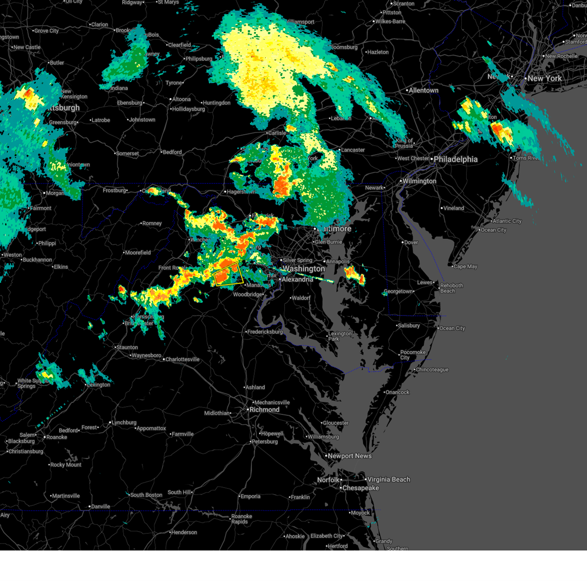
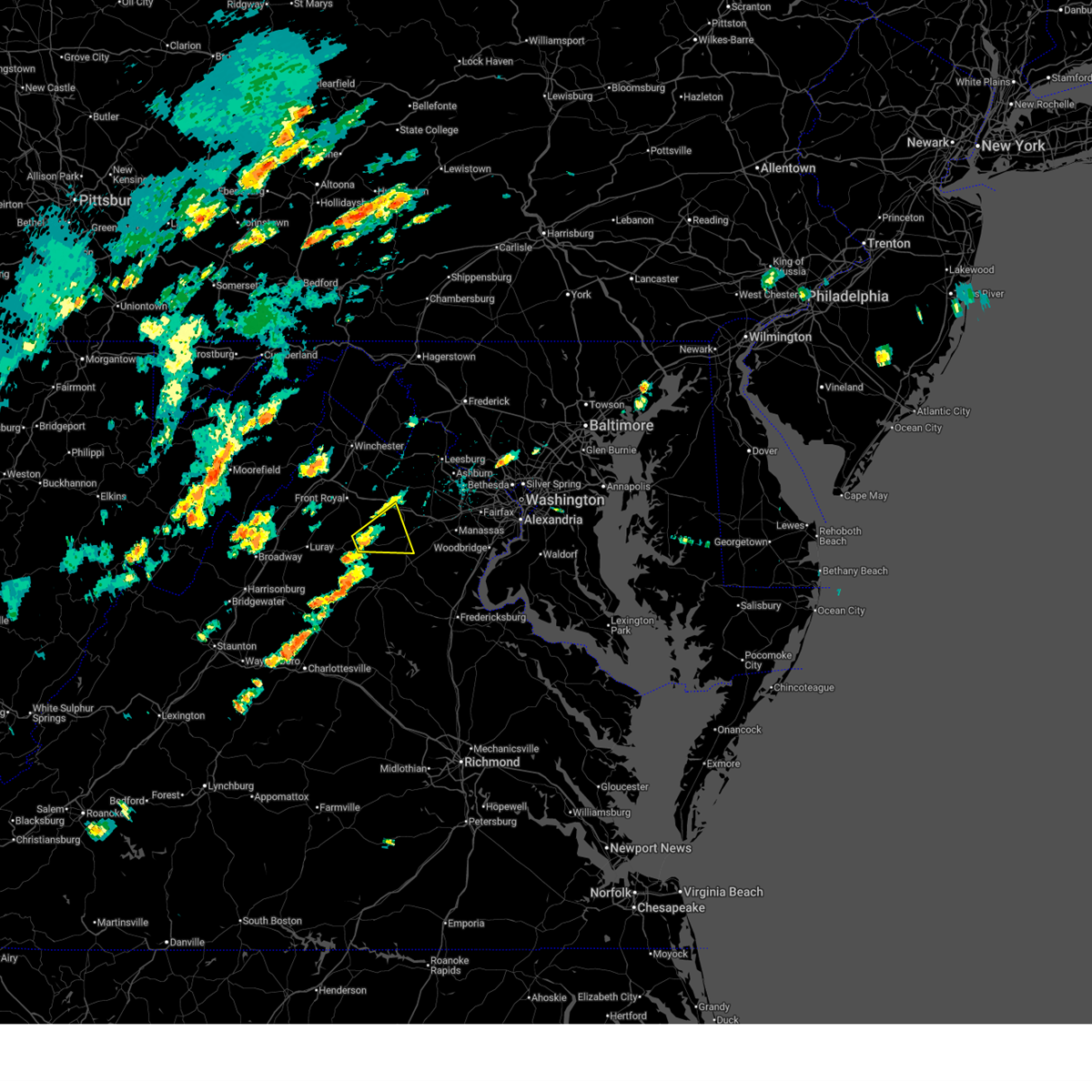
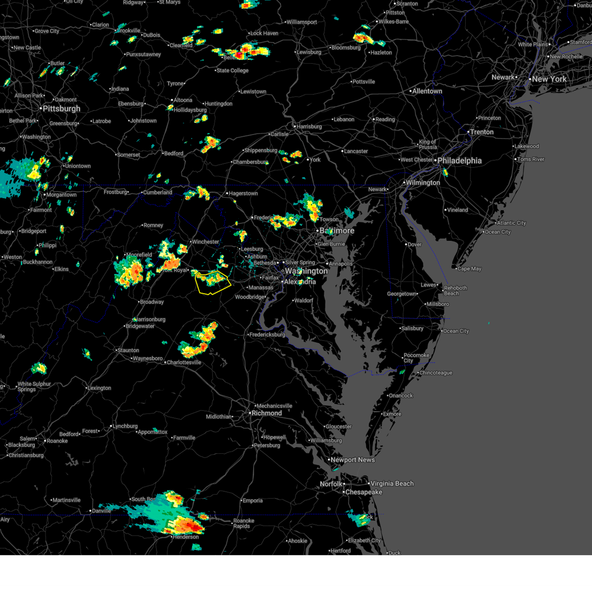
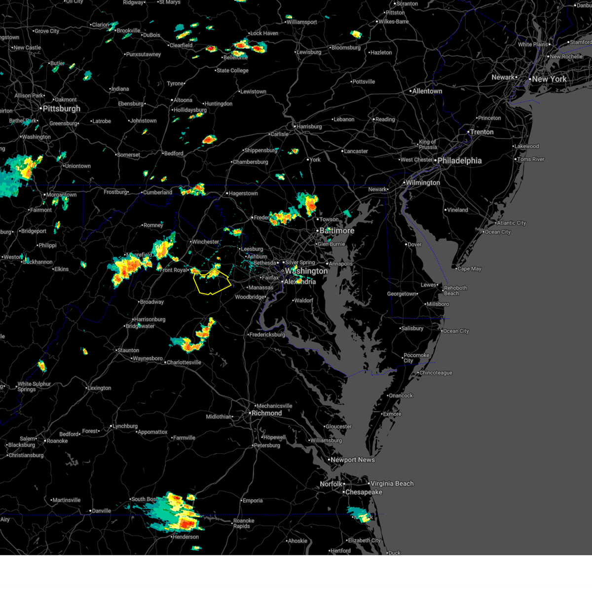
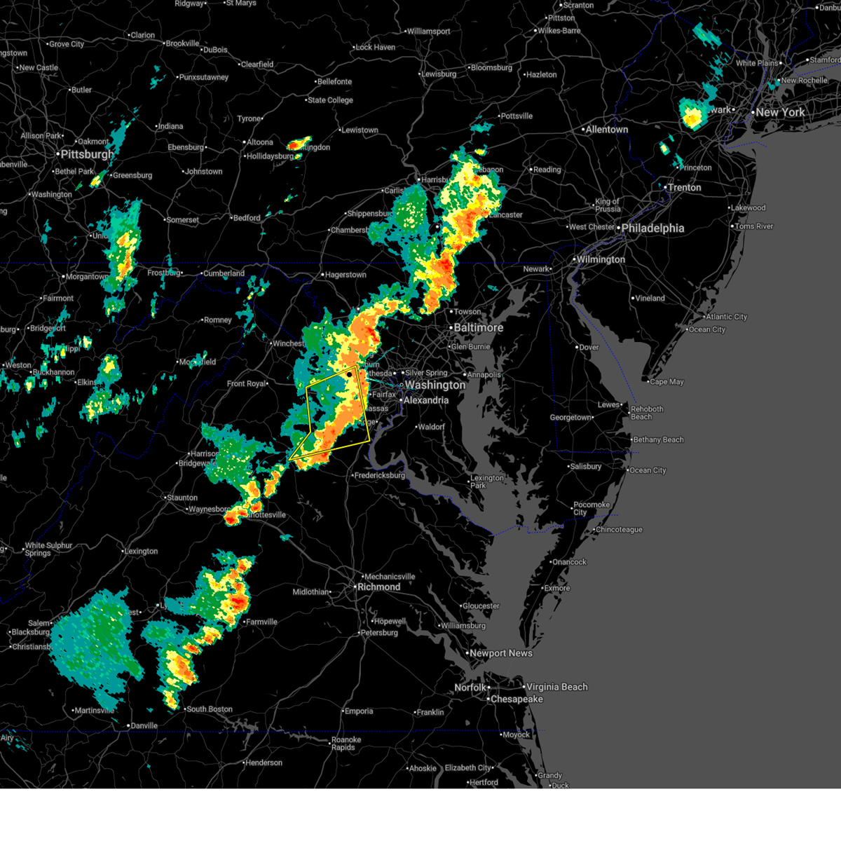
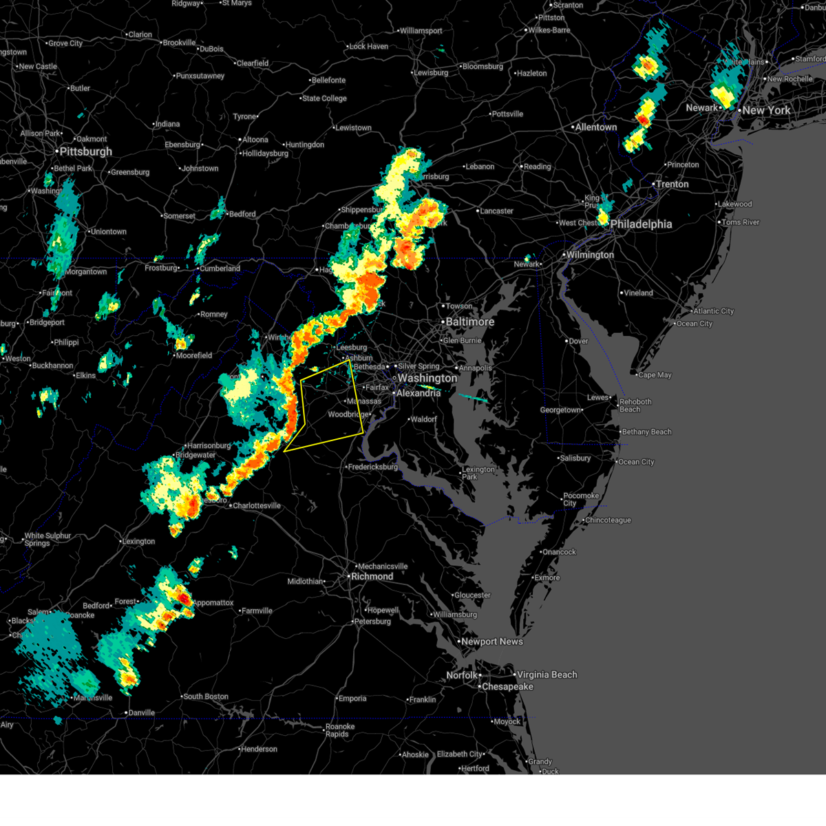
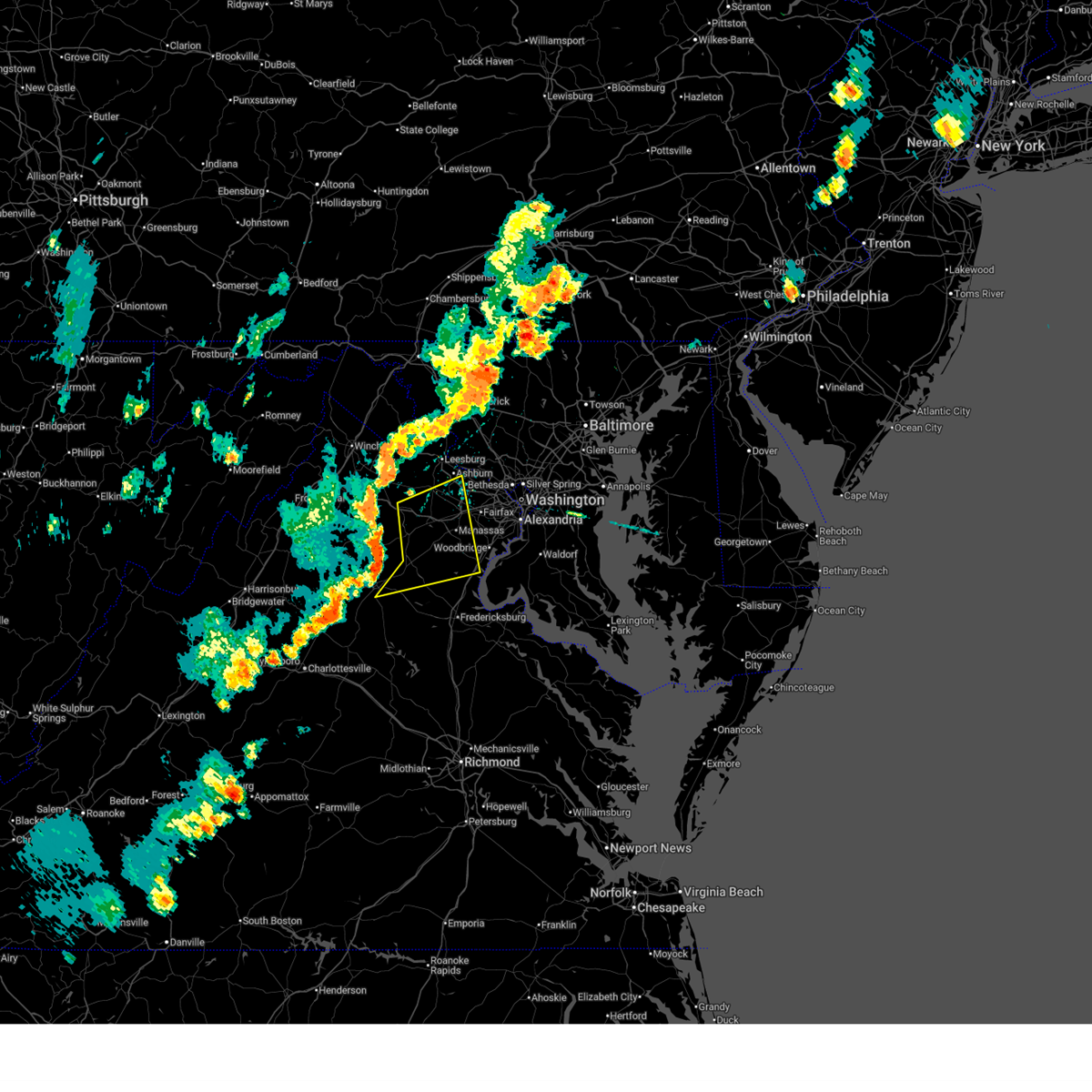
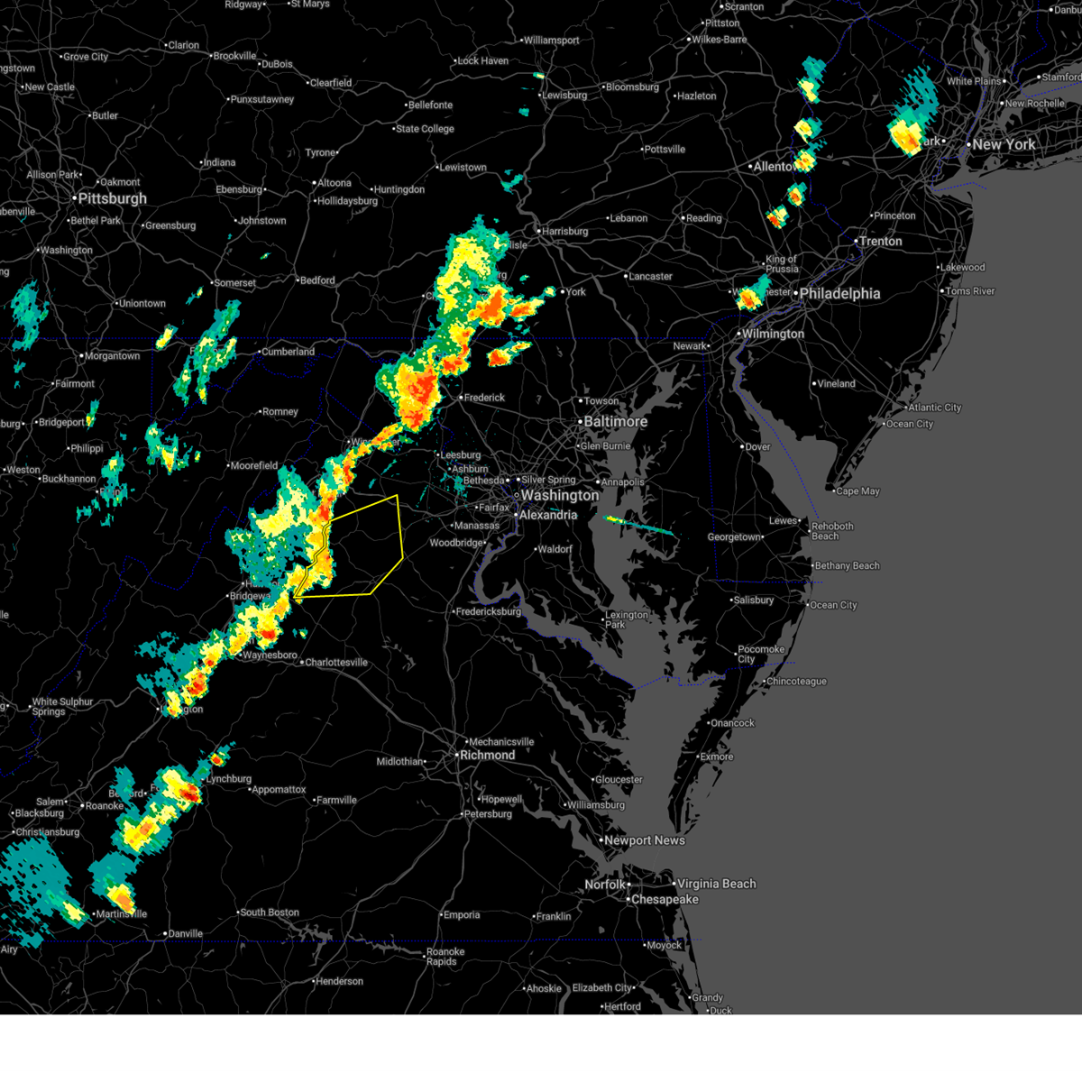
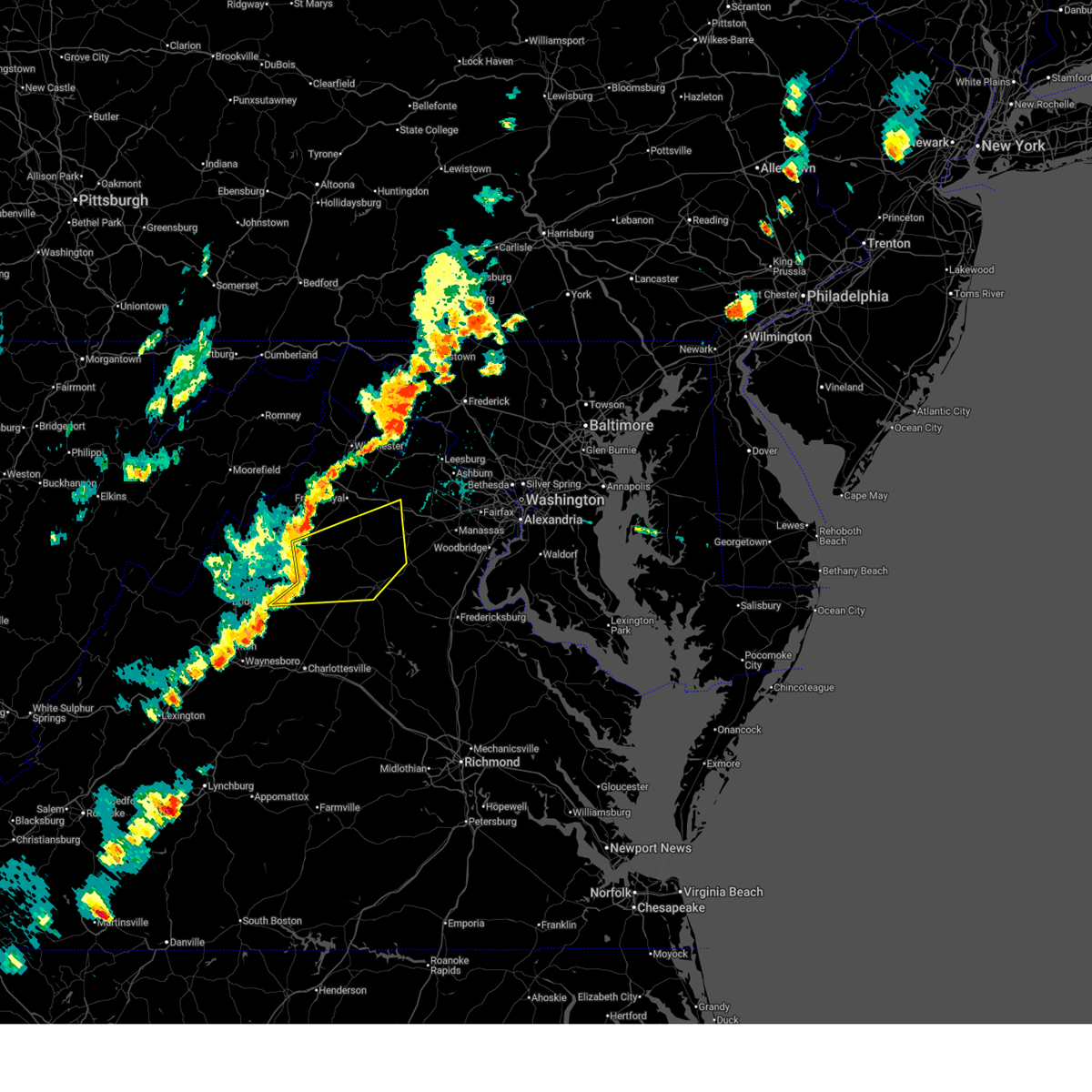
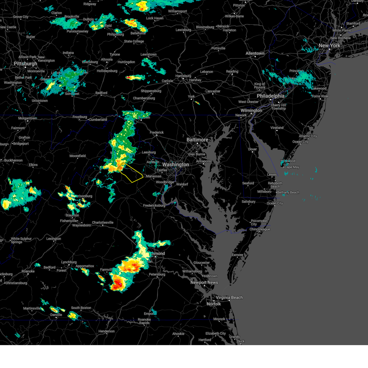
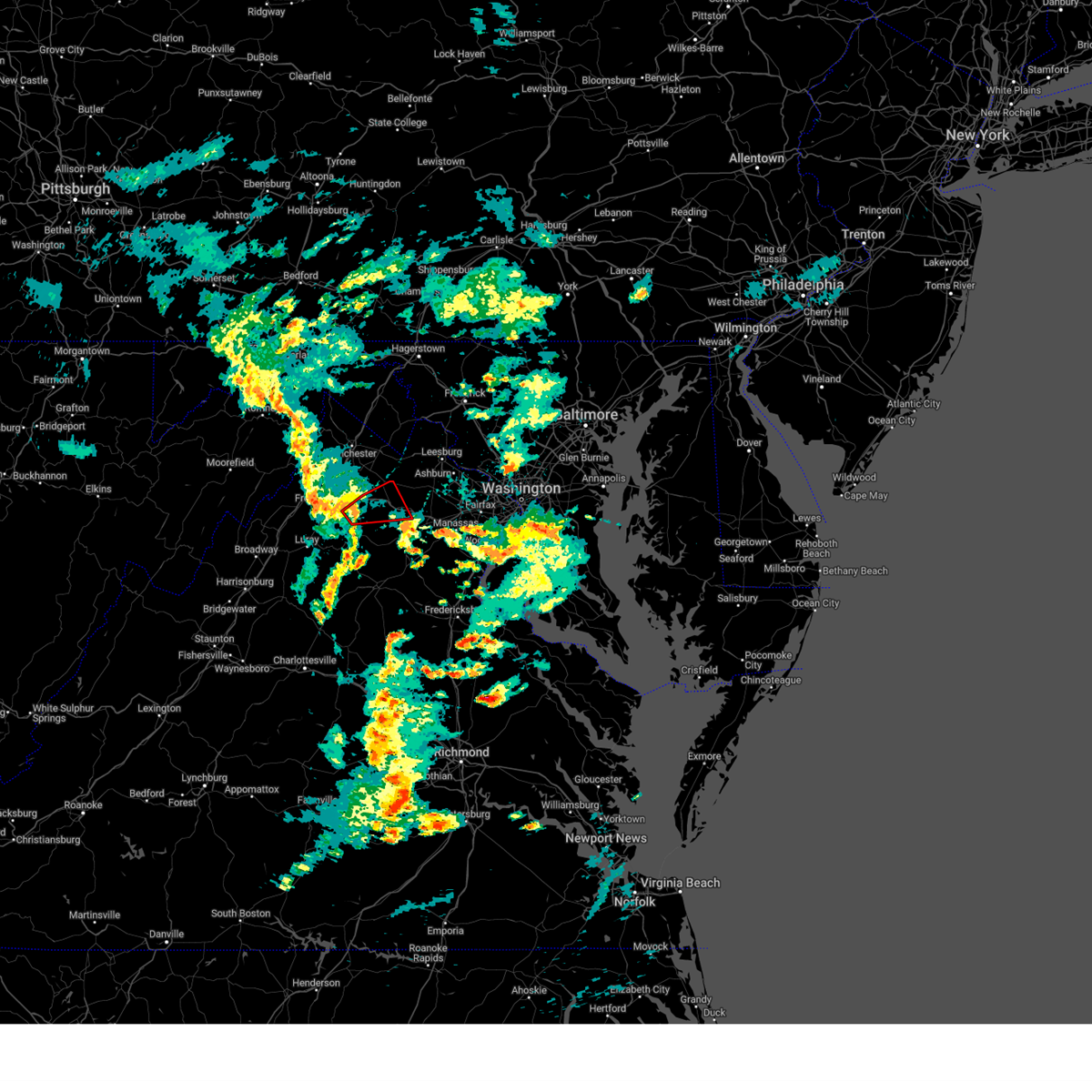
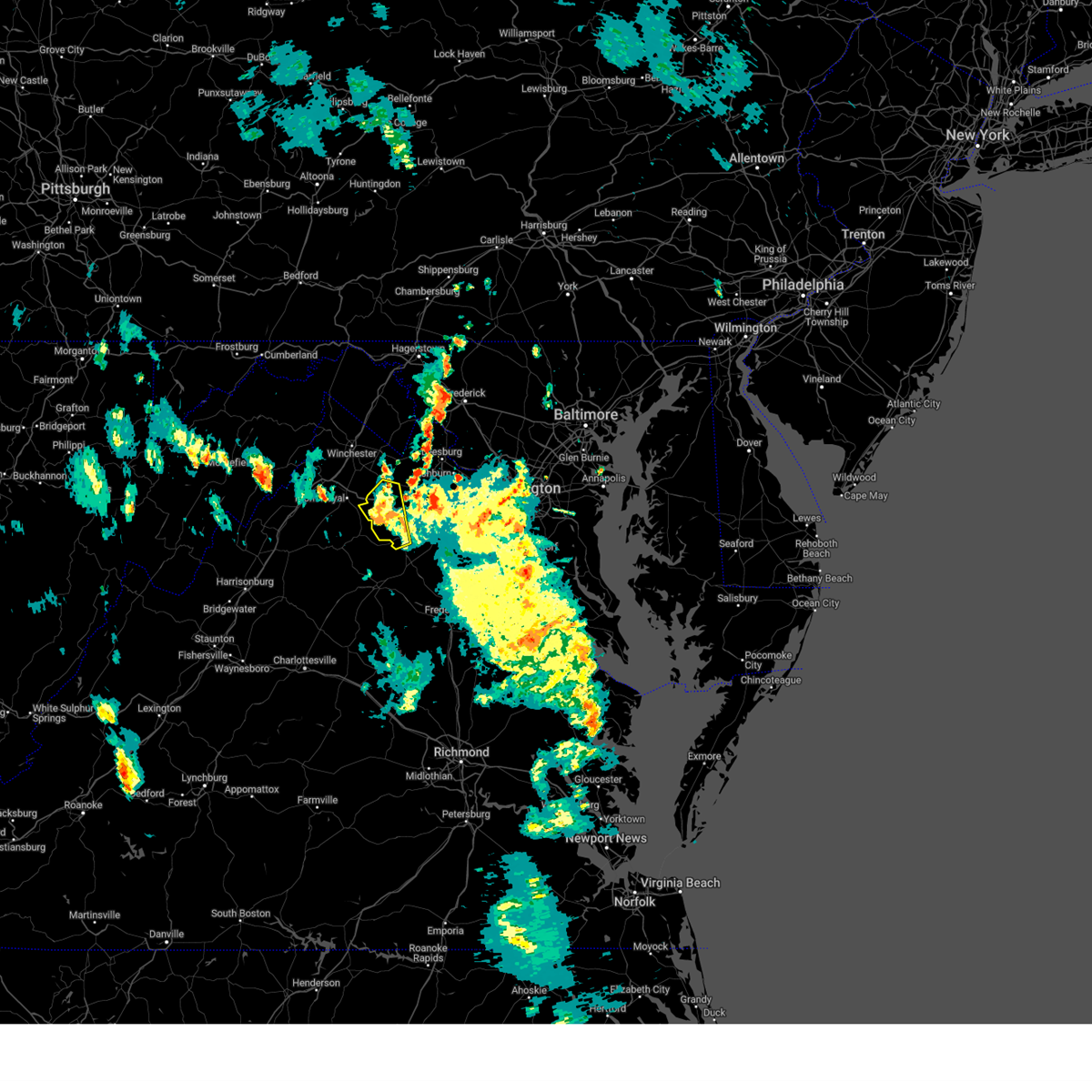
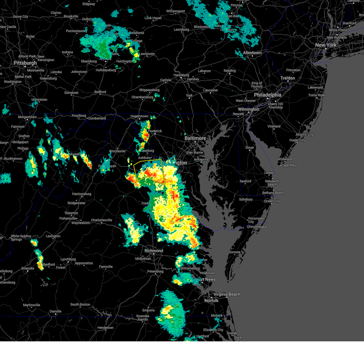
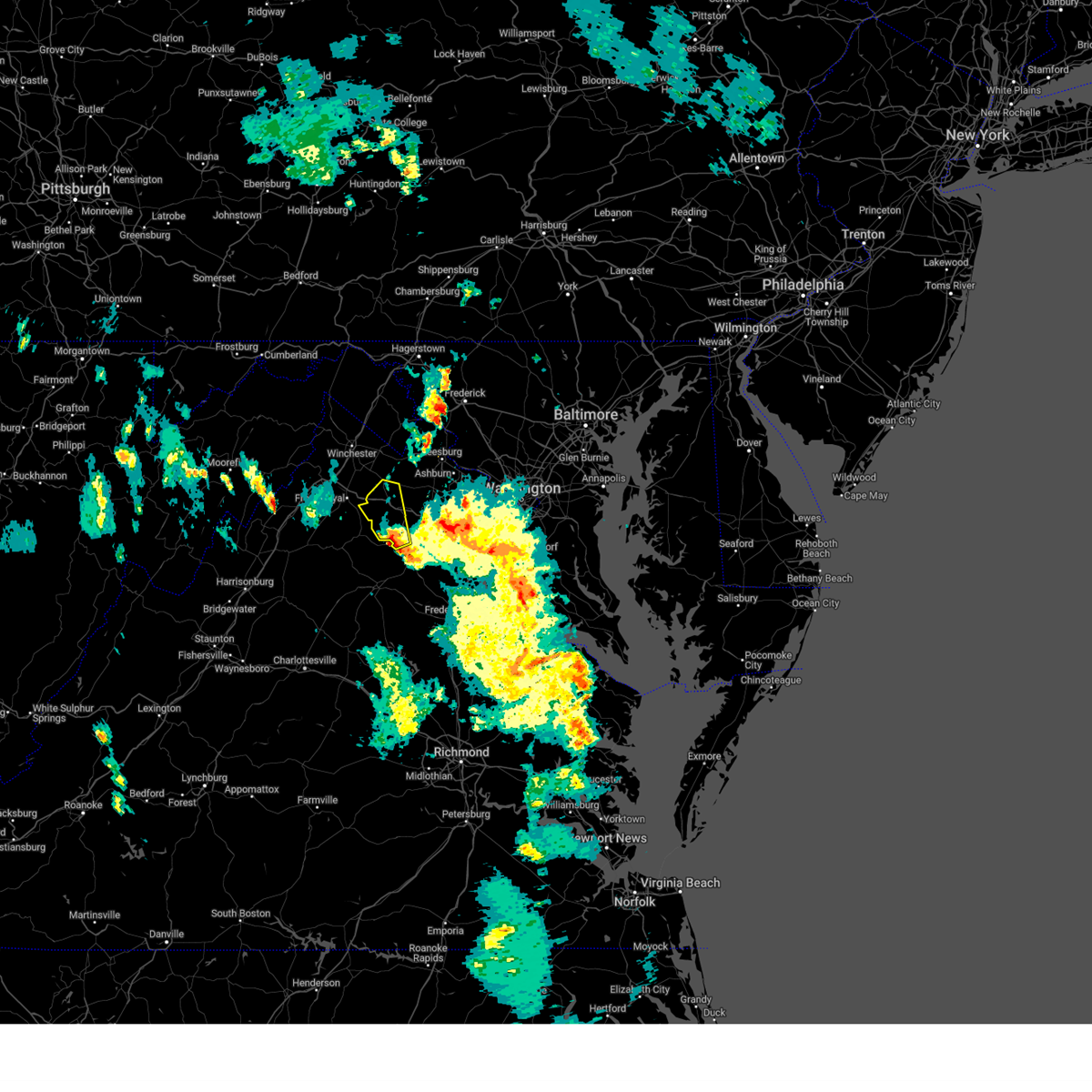
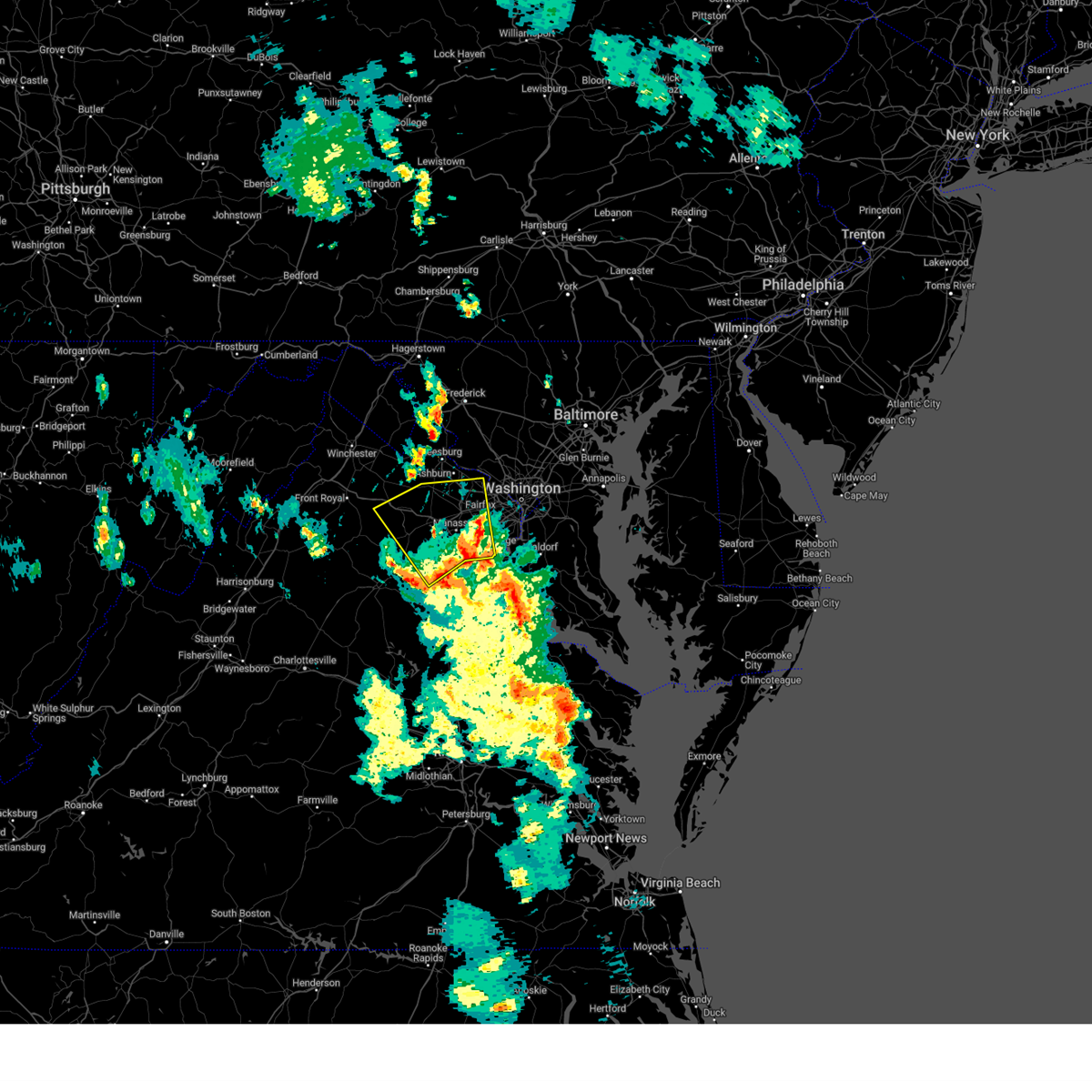
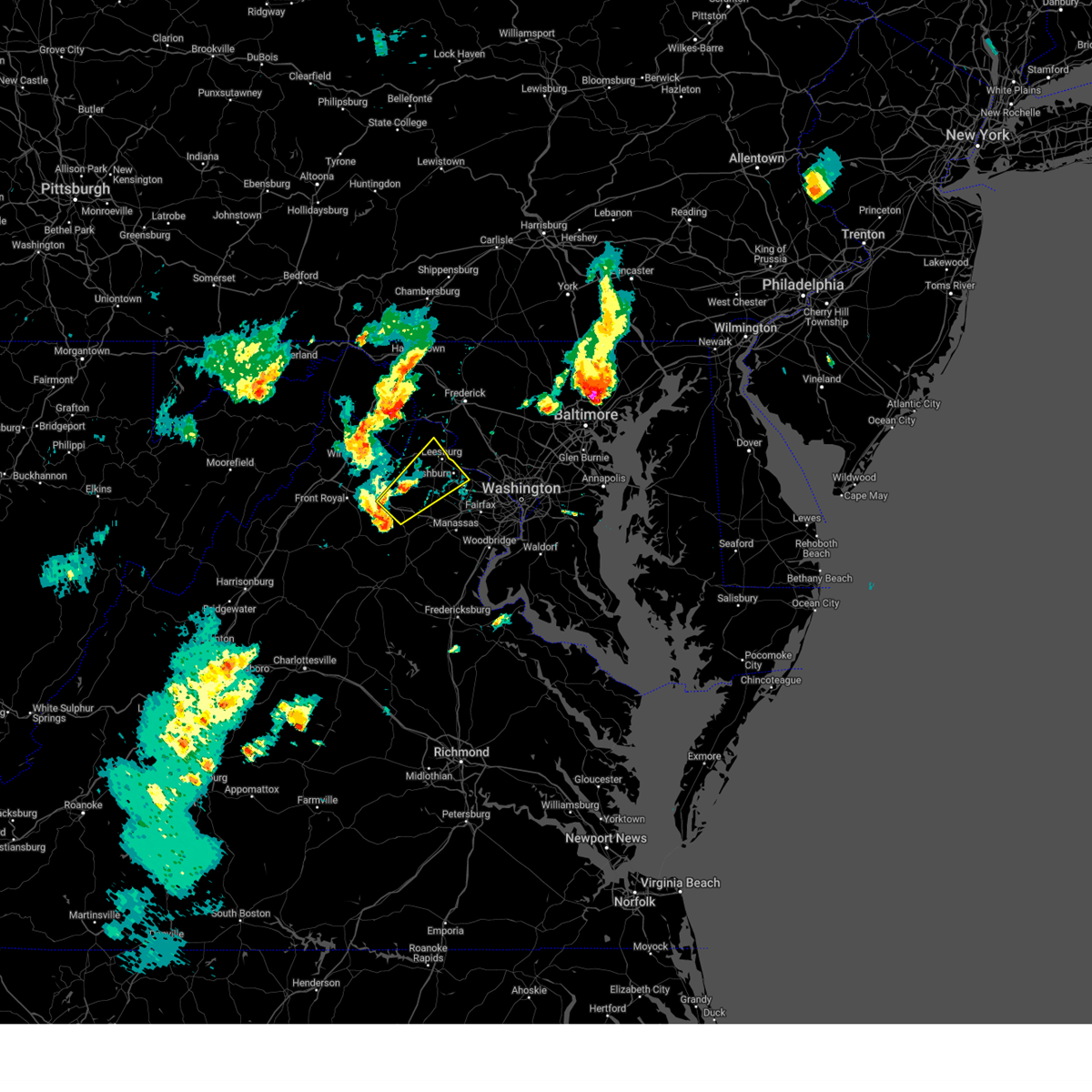
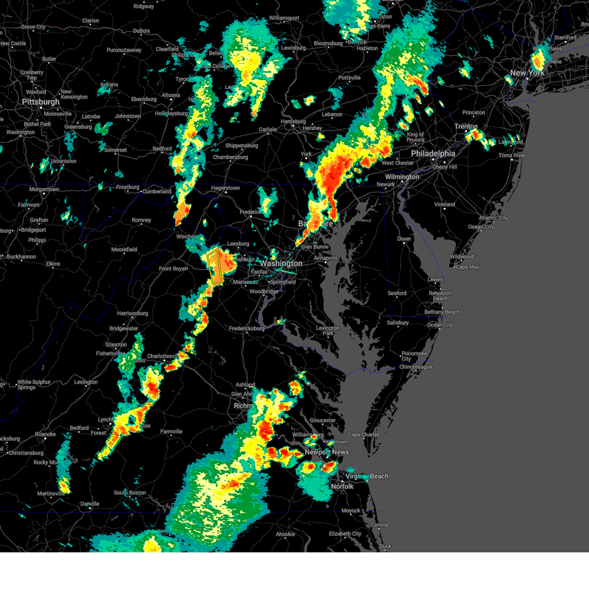
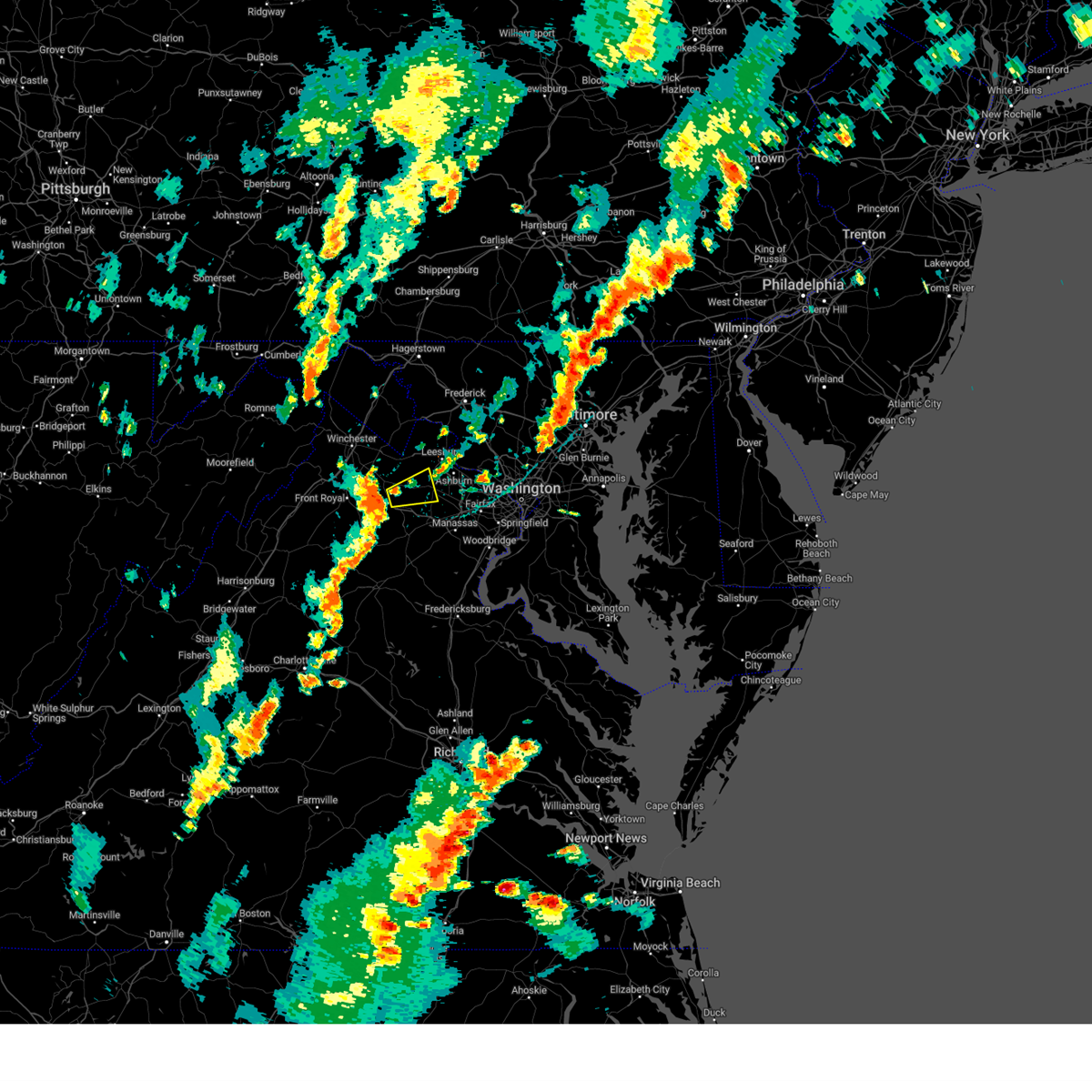
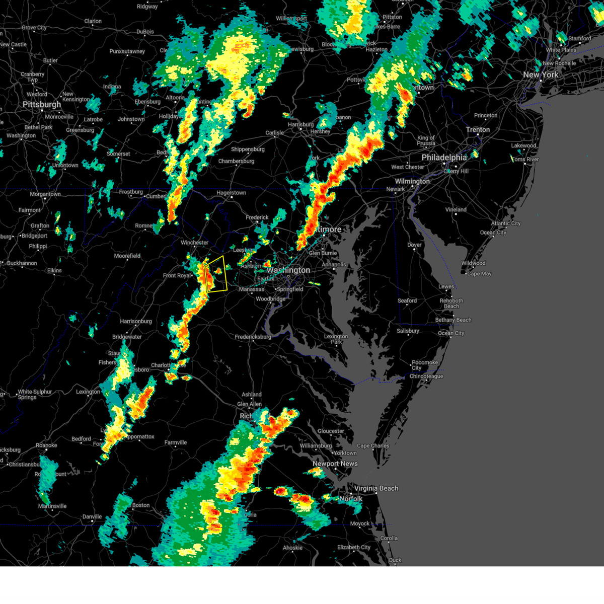
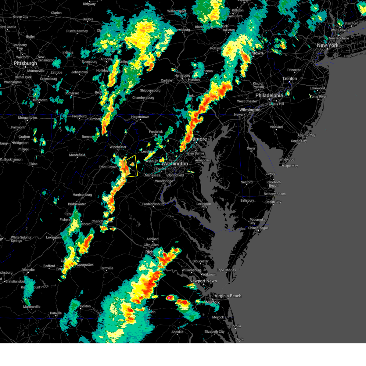
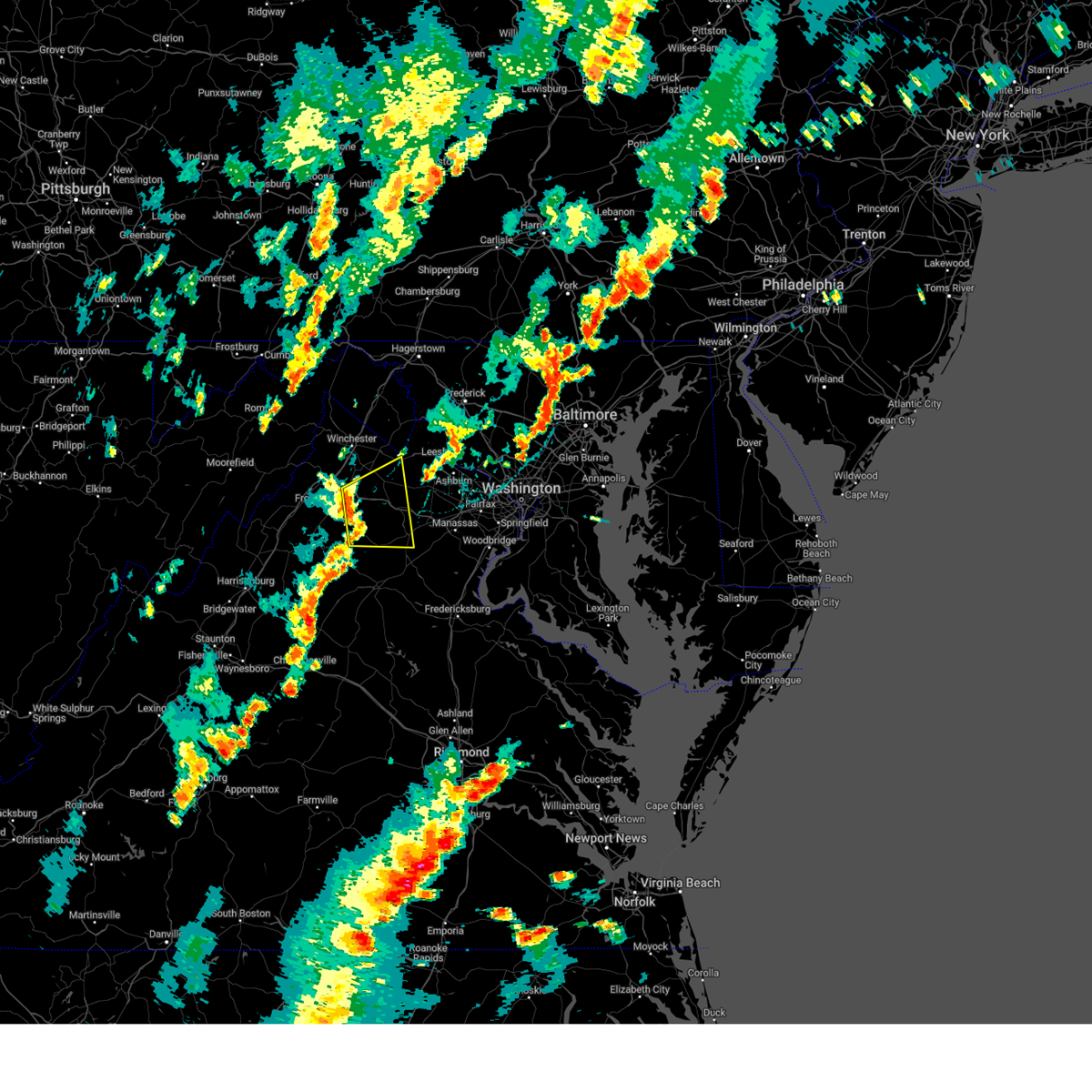
Hail Map for Marshall, VA
The Marshall, VA area has had 5 reports of on-the-ground hail by trained spotters, and has been under severe weather warnings 42 times during the past 12 months. Doppler radar has detected hail at or near Marshall, VA on 29 occasions, including 1 occasion during the past year.
| Name: | Marshall, VA |
| Where Located: | 72.3 miles WSW of Baltimore, MD |
| Map: | Google Map for Marshall, VA |
| Population: | 1480 |
| Housing Units: | 578 |
| More Info: | Search Google for Marshall, VA |
0
The Top Recent Hail Date for Marshall, VA is Thursday, August 29, 2024 (19th out of 29)

Hail and Wind Damage Spotted near Marshall, VA
| Date / Time | Report Details |
|---|---|
| 7/16/2025 9:02 PM EDT | Large tree down at intersection of rectortown rd and frogtown rd in fauquier county VA, 2.8 miles S of Marshall, VA |
| 7/16/2025 8:05 PM EDT |
 At 805 pm edt, a severe thunderstorm was located near haymarket, or 9 miles southwest of south riding, moving east at 30 mph (radar indicated). Hazards include 60 mph wind gusts and quarter size hail. Damaging winds will cause some trees and large branches to fall. this could injure those outdoors, as well as damage homes and vehicles. roadways may become blocked by downed trees. localized power outages are possible. unsecured light objects may become projectiles. Locations impacted include, linton hall, bull run, haymarket, the plains, sudley, gainesville, new baltimore, marshall, catharpin, woolsey, broken hill, meadowville, airlie, and broad run. At 805 pm edt, a severe thunderstorm was located near haymarket, or 9 miles southwest of south riding, moving east at 30 mph (radar indicated). Hazards include 60 mph wind gusts and quarter size hail. Damaging winds will cause some trees and large branches to fall. this could injure those outdoors, as well as damage homes and vehicles. roadways may become blocked by downed trees. localized power outages are possible. unsecured light objects may become projectiles. Locations impacted include, linton hall, bull run, haymarket, the plains, sudley, gainesville, new baltimore, marshall, catharpin, woolsey, broken hill, meadowville, airlie, and broad run.
|
| 7/16/2025 7:47 PM EDT |
 Svrlwx the national weather service in sterling virginia has issued a * severe thunderstorm warning for, south central loudoun county in northern virginia, west central fairfax county in northern virginia, northeastern fauquier county in northern virginia, northwestern prince william county in northern virginia, the northwestern city of manassas in northern virginia, * until 815 pm edt. * at 747 pm edt, a severe thunderstorm was located near the plains, or near warrenton, moving east at 35 mph (radar indicated). Hazards include 60 mph wind gusts and quarter size hail. Damaging winds will cause some trees and large branches to fall. this could injure those outdoors, as well as damage homes and vehicles. roadways may become blocked by downed trees. localized power outages are possible. Unsecured light objects may become projectiles. Svrlwx the national weather service in sterling virginia has issued a * severe thunderstorm warning for, south central loudoun county in northern virginia, west central fairfax county in northern virginia, northeastern fauquier county in northern virginia, northwestern prince william county in northern virginia, the northwestern city of manassas in northern virginia, * until 815 pm edt. * at 747 pm edt, a severe thunderstorm was located near the plains, or near warrenton, moving east at 35 mph (radar indicated). Hazards include 60 mph wind gusts and quarter size hail. Damaging winds will cause some trees and large branches to fall. this could injure those outdoors, as well as damage homes and vehicles. roadways may become blocked by downed trees. localized power outages are possible. Unsecured light objects may become projectiles.
|
| 7/8/2025 4:01 PM EDT |
 the severe thunderstorm warning has been cancelled and is no longer in effect the severe thunderstorm warning has been cancelled and is no longer in effect
|
| 7/8/2025 4:01 PM EDT |
 At 401 pm edt, a severe thunderstorm was located near delaplane, or 12 miles northwest of warrenton, moving east at 25 mph (radar indicated). Hazards include 60 mph wind gusts. Damaging winds will cause some trees and large branches to fall. this could injure those outdoors, as well as damage homes and vehicles. roadways may become blocked by downed trees. localized power outages are possible. unsecured light objects may become projectiles. Locations impacted include, the plains, hume, delaplane, new baltimore, marshall, saint louis, meadowville, markham, ashville, rectortown, and ada. At 401 pm edt, a severe thunderstorm was located near delaplane, or 12 miles northwest of warrenton, moving east at 25 mph (radar indicated). Hazards include 60 mph wind gusts. Damaging winds will cause some trees and large branches to fall. this could injure those outdoors, as well as damage homes and vehicles. roadways may become blocked by downed trees. localized power outages are possible. unsecured light objects may become projectiles. Locations impacted include, the plains, hume, delaplane, new baltimore, marshall, saint louis, meadowville, markham, ashville, rectortown, and ada.
|
| 7/8/2025 3:34 PM EDT |
 Svrlwx the national weather service in sterling virginia has issued a * severe thunderstorm warning for, southwestern loudoun county in northern virginia, east central warren county in northwestern virginia, northeastern rappahannock county in northwestern virginia, northwestern fauquier county in northern virginia, * until 415 pm edt. * at 334 pm edt, a severe thunderstorm was located near linden, or near front royal, moving east at 25 mph (radar indicated). Hazards include 60 mph wind gusts. Damaging winds will cause some trees and large branches to fall. this could injure those outdoors, as well as damage homes and vehicles. roadways may become blocked by downed trees. localized power outages are possible. Unsecured light objects may become projectiles. Svrlwx the national weather service in sterling virginia has issued a * severe thunderstorm warning for, southwestern loudoun county in northern virginia, east central warren county in northwestern virginia, northeastern rappahannock county in northwestern virginia, northwestern fauquier county in northern virginia, * until 415 pm edt. * at 334 pm edt, a severe thunderstorm was located near linden, or near front royal, moving east at 25 mph (radar indicated). Hazards include 60 mph wind gusts. Damaging winds will cause some trees and large branches to fall. this could injure those outdoors, as well as damage homes and vehicles. roadways may become blocked by downed trees. localized power outages are possible. Unsecured light objects may become projectiles.
|
| 7/1/2025 12:41 PM EDT |
 Svrlwx the national weather service in sterling virginia has issued a * severe thunderstorm warning for, northeastern rappahannock county in northwestern virginia, central fauquier county in northern virginia, north central culpeper county in northern virginia, * until 115 pm edt. * at 1241 pm edt, a severe thunderstorm was located 8 miles east of sperryville, or 15 miles west of warrenton, moving east at 15 mph (radar indicated). Hazards include 60 mph wind gusts and quarter size hail. Damaging winds will cause some trees and large branches to fall. this could injure those outdoors, as well as damage homes and vehicles. roadways may become blocked by downed trees. localized power outages are possible. Unsecured light objects may become projectiles. Svrlwx the national weather service in sterling virginia has issued a * severe thunderstorm warning for, northeastern rappahannock county in northwestern virginia, central fauquier county in northern virginia, north central culpeper county in northern virginia, * until 115 pm edt. * at 1241 pm edt, a severe thunderstorm was located 8 miles east of sperryville, or 15 miles west of warrenton, moving east at 15 mph (radar indicated). Hazards include 60 mph wind gusts and quarter size hail. Damaging winds will cause some trees and large branches to fall. this could injure those outdoors, as well as damage homes and vehicles. roadways may become blocked by downed trees. localized power outages are possible. Unsecured light objects may become projectiles.
|
| 6/25/2025 2:34 PM EDT | Tree down near intersection of cliff mills rd and brown more ln in fauquier county VA, 10.5 miles NNE of Marshall, VA |
| 6/25/2025 2:10 PM EDT |
 At 210 pm edt, severe thunderstorms were located along a line extending from near the plains to 7 miles south of delaplane to near hume, moving southeast at 15 mph (radar indicated). Hazards include 60 mph wind gusts. Damaging winds will cause some trees and large branches to fall. this could injure those outdoors, as well as damage homes and vehicles. roadways may become blocked by downed trees. localized power outages are possible. unsecured light objects may become projectiles. Locations impacted include, warrenton, the plains, hume, new baltimore, marshall, hackleys crossroads, cresthill, orlean, meadowville, airlie, ashville, ada, and broad run. At 210 pm edt, severe thunderstorms were located along a line extending from near the plains to 7 miles south of delaplane to near hume, moving southeast at 15 mph (radar indicated). Hazards include 60 mph wind gusts. Damaging winds will cause some trees and large branches to fall. this could injure those outdoors, as well as damage homes and vehicles. roadways may become blocked by downed trees. localized power outages are possible. unsecured light objects may become projectiles. Locations impacted include, warrenton, the plains, hume, new baltimore, marshall, hackleys crossroads, cresthill, orlean, meadowville, airlie, ashville, ada, and broad run.
|
| 6/25/2025 2:00 PM EDT |
 Svrlwx the national weather service in sterling virginia has issued a * severe thunderstorm warning for, northeastern rappahannock county in northwestern virginia, northwestern fauquier county in northern virginia, * until 230 pm edt. * at 200 pm edt, severe thunderstorms were located along a line extending from near the plains to near hume to near linden, moving southeast at 15 mph (radar indicated). Hazards include 60 mph wind gusts. Damaging winds will cause some trees and large branches to fall. this could injure those outdoors, as well as damage homes and vehicles. roadways may become blocked by downed trees. localized power outages are possible. Unsecured light objects may become projectiles. Svrlwx the national weather service in sterling virginia has issued a * severe thunderstorm warning for, northeastern rappahannock county in northwestern virginia, northwestern fauquier county in northern virginia, * until 230 pm edt. * at 200 pm edt, severe thunderstorms were located along a line extending from near the plains to near hume to near linden, moving southeast at 15 mph (radar indicated). Hazards include 60 mph wind gusts. Damaging winds will cause some trees and large branches to fall. this could injure those outdoors, as well as damage homes and vehicles. roadways may become blocked by downed trees. localized power outages are possible. Unsecured light objects may become projectiles.
|
| 6/25/2025 1:45 PM EDT | Five trees were down around the 3700 block of ashville roa in fauquier county VA, 3.7 miles ESE of Marshall, VA |
| 6/19/2025 3:58 PM EDT |
 The storm which prompted the warning has weakened below severe limits, and no longer poses an immediate threat to life or property. therefore, the warning will be allowed to expire. however, gusty winds and heavy rain are still possible with this thunderstorm. a severe thunderstorm watch remains in effect until 900 pm edt for northern virginia. The storm which prompted the warning has weakened below severe limits, and no longer poses an immediate threat to life or property. therefore, the warning will be allowed to expire. however, gusty winds and heavy rain are still possible with this thunderstorm. a severe thunderstorm watch remains in effect until 900 pm edt for northern virginia.
|
| 6/19/2025 3:22 PM EDT |
 At 321 pm edt, a severe thunderstorm was located near bealeton, or 8 miles southwest of warrenton, moving east at 45 mph (emergency management reports a history of downed trees with this line of storms). Hazards include 70 mph wind gusts. Damaging winds will cause some trees and large branches to fall. this could injure those outdoors, as well as damage homes and vehicles. roadways may become blocked by downed trees. localized power outages are possible. unsecured light objects may become projectiles. Locations impacted include, centreville, dale city, south riding, broadlands, brambleton, warrenton, dulles international airport, ashburn, linton hall, sterling, chantilly, montclair, bull run, triangle, dumfries, bealeton, haymarket, arcola, the plains, and manassas. At 321 pm edt, a severe thunderstorm was located near bealeton, or 8 miles southwest of warrenton, moving east at 45 mph (emergency management reports a history of downed trees with this line of storms). Hazards include 70 mph wind gusts. Damaging winds will cause some trees and large branches to fall. this could injure those outdoors, as well as damage homes and vehicles. roadways may become blocked by downed trees. localized power outages are possible. unsecured light objects may become projectiles. Locations impacted include, centreville, dale city, south riding, broadlands, brambleton, warrenton, dulles international airport, ashburn, linton hall, sterling, chantilly, montclair, bull run, triangle, dumfries, bealeton, haymarket, arcola, the plains, and manassas.
|
| 6/19/2025 3:18 PM EDT |
 Svrlwx the national weather service in sterling virginia has issued a * severe thunderstorm warning for, southeastern loudoun county in northern virginia, northwestern stafford county in northern virginia, western fairfax county in northern virginia, eastern fauquier county in northern virginia, central culpeper county in northern virginia, the city of manassas park in northern virginia, prince william county in northern virginia, the city of manassas in northern virginia, * until 400 pm edt. * at 318 pm edt, a severe thunderstorm was located 8 miles west of bealeton, or 10 miles southwest of warrenton, moving east at 45 mph (emergency management reports a history of downed trees with this line of storms). Hazards include 60 mph wind gusts. Damaging winds will cause some trees and large branches to fall. this could injure those outdoors, as well as damage homes and vehicles. roadways may become blocked by downed trees. localized power outages are possible. Unsecured light objects may become projectiles. Svrlwx the national weather service in sterling virginia has issued a * severe thunderstorm warning for, southeastern loudoun county in northern virginia, northwestern stafford county in northern virginia, western fairfax county in northern virginia, eastern fauquier county in northern virginia, central culpeper county in northern virginia, the city of manassas park in northern virginia, prince william county in northern virginia, the city of manassas in northern virginia, * until 400 pm edt. * at 318 pm edt, a severe thunderstorm was located 8 miles west of bealeton, or 10 miles southwest of warrenton, moving east at 45 mph (emergency management reports a history of downed trees with this line of storms). Hazards include 60 mph wind gusts. Damaging winds will cause some trees and large branches to fall. this could injure those outdoors, as well as damage homes and vehicles. roadways may become blocked by downed trees. localized power outages are possible. Unsecured light objects may become projectiles.
|
| 6/19/2025 3:00 PM EDT |
 the severe thunderstorm warning has been cancelled and is no longer in effect the severe thunderstorm warning has been cancelled and is no longer in effect
|
| 6/19/2025 3:00 PM EDT |
 At 300 pm edt, severe thunderstorms were located along a line extending from near sperryville to 10 miles east of big meadows to 6 miles northwest of madison to near afton, moving east at 45 mph (radar indicated). Hazards include 60 mph wind gusts. Damaging winds will cause some trees and large branches to fall. this could injure those outdoors, as well as damage homes and vehicles. roadways may become blocked by downed trees. localized power outages are possible. unsecured light objects may become projectiles. Locations impacted include, culpeper, warrenton, madison, sperryville, hume, big meadows, marshall, brightwood, opal, flint hill, washington, castleton, catalpa, brandy station, hackleys crossroads, haywood, amissville, jeffersonton, cresthill, and syria. At 300 pm edt, severe thunderstorms were located along a line extending from near sperryville to 10 miles east of big meadows to 6 miles northwest of madison to near afton, moving east at 45 mph (radar indicated). Hazards include 60 mph wind gusts. Damaging winds will cause some trees and large branches to fall. this could injure those outdoors, as well as damage homes and vehicles. roadways may become blocked by downed trees. localized power outages are possible. unsecured light objects may become projectiles. Locations impacted include, culpeper, warrenton, madison, sperryville, hume, big meadows, marshall, brightwood, opal, flint hill, washington, castleton, catalpa, brandy station, hackleys crossroads, haywood, amissville, jeffersonton, cresthill, and syria.
|
| 6/19/2025 2:43 PM EDT |
 Svrlwx the national weather service in sterling virginia has issued a * severe thunderstorm warning for, madison county in northwestern virginia, east central rockingham county in western virginia, south central warren county in northwestern virginia, central page county in northwestern virginia, rappahannock county in northwestern virginia, north central greene county in central virginia, western fauquier county in northern virginia, western culpeper county in northern virginia, * until 330 pm edt. * at 243 pm edt, severe thunderstorms were located along a line extending from luray to near big meadows to 8 miles southeast of shenandoah to near stuarts draft, moving east at 45 mph (radar indicated). Hazards include 60 mph wind gusts. Damaging winds will cause some trees and large branches to fall. this could injure those outdoors, as well as damage homes and vehicles. roadways may become blocked by downed trees. localized power outages are possible. Unsecured light objects may become projectiles. Svrlwx the national weather service in sterling virginia has issued a * severe thunderstorm warning for, madison county in northwestern virginia, east central rockingham county in western virginia, south central warren county in northwestern virginia, central page county in northwestern virginia, rappahannock county in northwestern virginia, north central greene county in central virginia, western fauquier county in northern virginia, western culpeper county in northern virginia, * until 330 pm edt. * at 243 pm edt, severe thunderstorms were located along a line extending from luray to near big meadows to 8 miles southeast of shenandoah to near stuarts draft, moving east at 45 mph (radar indicated). Hazards include 60 mph wind gusts. Damaging winds will cause some trees and large branches to fall. this could injure those outdoors, as well as damage homes and vehicles. roadways may become blocked by downed trees. localized power outages are possible. Unsecured light objects may become projectiles.
|
| 6/6/2025 6:40 PM EDT | the severe thunderstorm warning has been cancelled and is no longer in effect |
| 6/6/2025 6:23 PM EDT |
 Svrlwx the national weather service in sterling virginia has issued a * severe thunderstorm warning for, northeastern warren county in northwestern virginia, northwestern fauquier county in northern virginia, * until 700 pm edt. * at 623 pm edt, a severe thunderstorm was located over linden, or 7 miles southeast of front royal, moving southeast at 40 mph (radar indicated). Hazards include 60 mph wind gusts. Damaging winds will cause some trees and large branches to fall. this could injure those outdoors, as well as damage homes and vehicles. roadways may become blocked by downed trees. localized power outages are possible. Unsecured light objects may become projectiles. Svrlwx the national weather service in sterling virginia has issued a * severe thunderstorm warning for, northeastern warren county in northwestern virginia, northwestern fauquier county in northern virginia, * until 700 pm edt. * at 623 pm edt, a severe thunderstorm was located over linden, or 7 miles southeast of front royal, moving southeast at 40 mph (radar indicated). Hazards include 60 mph wind gusts. Damaging winds will cause some trees and large branches to fall. this could injure those outdoors, as well as damage homes and vehicles. roadways may become blocked by downed trees. localized power outages are possible. Unsecured light objects may become projectiles.
|
| 5/30/2025 7:18 PM EDT |
 the tornado warning has been cancelled and is no longer in effect the tornado warning has been cancelled and is no longer in effect
|
| 5/30/2025 7:05 PM EDT |
 At 705 pm edt, a severe thunderstorm capable of producing a tornado was located near the plains, or 12 miles north of warrenton, moving northeast at 35 mph (radar indicated rotation). Hazards include tornado. For those in the direct path of a tornado touchdown, flying debris will be dangerous to those caught without shelter. damage to roofs, siding, and windows may occur. mobile homes may be damaged or destroyed. tree damage is likely. this dangerous storm will be near, middleburg around 710 pm edt. Other locations impacted by this tornadic thunderstorm include saint louis, marshall, aldie, halfway, and rectortown. At 705 pm edt, a severe thunderstorm capable of producing a tornado was located near the plains, or 12 miles north of warrenton, moving northeast at 35 mph (radar indicated rotation). Hazards include tornado. For those in the direct path of a tornado touchdown, flying debris will be dangerous to those caught without shelter. damage to roofs, siding, and windows may occur. mobile homes may be damaged or destroyed. tree damage is likely. this dangerous storm will be near, middleburg around 710 pm edt. Other locations impacted by this tornadic thunderstorm include saint louis, marshall, aldie, halfway, and rectortown.
|
| 5/30/2025 6:55 PM EDT |
 Torlwx the national weather service in sterling virginia has issued a * tornado warning for, southwestern loudoun county in northern virginia, northwestern fauquier county in northern virginia, northwestern prince william county in northern virginia, * until 730 pm edt. * at 654 pm edt, a severe thunderstorm capable of producing a tornado was located near hume, or 10 miles northwest of warrenton, moving northeast at 35 mph (radar indicated rotation). Hazards include tornado. For those in the direct path of a tornado touchdown, flying debris will be dangerous to those caught without shelter. damage to roofs, siding, and windows may occur. mobile homes may be damaged or destroyed. tree damage is likely. this dangerous storm will be near, the plains around 700 pm edt. middleburg around 705 pm edt. Other locations impacted by this tornadic thunderstorm include saint louis, aldie, halfway, marshall, philomont, ashville, rectortown, and ada. Torlwx the national weather service in sterling virginia has issued a * tornado warning for, southwestern loudoun county in northern virginia, northwestern fauquier county in northern virginia, northwestern prince william county in northern virginia, * until 730 pm edt. * at 654 pm edt, a severe thunderstorm capable of producing a tornado was located near hume, or 10 miles northwest of warrenton, moving northeast at 35 mph (radar indicated rotation). Hazards include tornado. For those in the direct path of a tornado touchdown, flying debris will be dangerous to those caught without shelter. damage to roofs, siding, and windows may occur. mobile homes may be damaged or destroyed. tree damage is likely. this dangerous storm will be near, the plains around 700 pm edt. middleburg around 705 pm edt. Other locations impacted by this tornadic thunderstorm include saint louis, aldie, halfway, marshall, philomont, ashville, rectortown, and ada.
|
| 5/30/2025 6:51 PM EDT |
 At 651 pm edt, severe thunderstorms were located along a line extending from near linden to hume to 10 miles west of warrenton to 7 miles northwest of culpeper, moving east at 35 mph (radar indicated). Hazards include 60 mph wind gusts and quarter size hail. Damaging winds will cause some trees and large branches to fall. this could injure those outdoors, as well as damage homes and vehicles. roadways may become blocked by downed trees. localized power outages are possible. unsecured light objects may become projectiles. Locations impacted include, catalpa, warrenton, brandy station, hackleys crossroads, amissville, jeffersonton, cresthill, delaplane, turnbull, meadowville, cardova, linden, reva, rixeyville, alanthus, the plains, boston, culpeper, viewtown, and hume. At 651 pm edt, severe thunderstorms were located along a line extending from near linden to hume to 10 miles west of warrenton to 7 miles northwest of culpeper, moving east at 35 mph (radar indicated). Hazards include 60 mph wind gusts and quarter size hail. Damaging winds will cause some trees and large branches to fall. this could injure those outdoors, as well as damage homes and vehicles. roadways may become blocked by downed trees. localized power outages are possible. unsecured light objects may become projectiles. Locations impacted include, catalpa, warrenton, brandy station, hackleys crossroads, amissville, jeffersonton, cresthill, delaplane, turnbull, meadowville, cardova, linden, reva, rixeyville, alanthus, the plains, boston, culpeper, viewtown, and hume.
|
| 5/30/2025 6:45 PM EDT |
 the tornado warning has been cancelled and is no longer in effect the tornado warning has been cancelled and is no longer in effect
|
| 5/30/2025 6:38 PM EDT |
 At 638 pm edt, a severe thunderstorm capable of producing a tornado was located near linden, or 7 miles southeast of front royal, moving northeast at 40 mph (radar indicated rotation). Hazards include tornado. For those in the direct path of a tornado touchdown, flying debris will be dangerous to those caught without shelter. damage to roofs, siding, and windows may occur. mobile homes may be damaged or destroyed. tree damage is likely. this dangerous storm will be near, delaplane, linden, and hume around 645 pm edt. Other locations impacted by this tornadic thunderstorm include glen echo, huntly, arco, markham, marshall, ashville, rectortown, chester gap, ada, and upperville. At 638 pm edt, a severe thunderstorm capable of producing a tornado was located near linden, or 7 miles southeast of front royal, moving northeast at 40 mph (radar indicated rotation). Hazards include tornado. For those in the direct path of a tornado touchdown, flying debris will be dangerous to those caught without shelter. damage to roofs, siding, and windows may occur. mobile homes may be damaged or destroyed. tree damage is likely. this dangerous storm will be near, delaplane, linden, and hume around 645 pm edt. Other locations impacted by this tornadic thunderstorm include glen echo, huntly, arco, markham, marshall, ashville, rectortown, chester gap, ada, and upperville.
|
| 5/30/2025 6:30 PM EDT |
 Svrlwx the national weather service in sterling virginia has issued a * severe thunderstorm warning for, east central madison county in northwestern virginia, southeastern warren county in northwestern virginia, central rappahannock county in northwestern virginia, northwestern fauquier county in northern virginia, northwestern culpeper county in northern virginia, * until 715 pm edt. * at 630 pm edt, severe thunderstorms were located along a line extending from near front royal to 9 miles west of hume to near sperryville to 6 miles northwest of madison, moving east at 35 mph (radar indicated). Hazards include 60 mph wind gusts. Damaging winds will cause some trees and large branches to fall. this could injure those outdoors, as well as damage homes and vehicles. roadways may become blocked by downed trees. localized power outages are possible. Unsecured light objects may become projectiles. Svrlwx the national weather service in sterling virginia has issued a * severe thunderstorm warning for, east central madison county in northwestern virginia, southeastern warren county in northwestern virginia, central rappahannock county in northwestern virginia, northwestern fauquier county in northern virginia, northwestern culpeper county in northern virginia, * until 715 pm edt. * at 630 pm edt, severe thunderstorms were located along a line extending from near front royal to 9 miles west of hume to near sperryville to 6 miles northwest of madison, moving east at 35 mph (radar indicated). Hazards include 60 mph wind gusts. Damaging winds will cause some trees and large branches to fall. this could injure those outdoors, as well as damage homes and vehicles. roadways may become blocked by downed trees. localized power outages are possible. Unsecured light objects may become projectiles.
|
| 5/30/2025 6:26 PM EDT |
 Torlwx the national weather service in sterling virginia has issued a * tornado warning for, southern warren county in northwestern virginia, northern rappahannock county in northwestern virginia, northwestern fauquier county in northern virginia, * until 700 pm edt. * at 626 pm edt, a severe thunderstorm capable of producing a tornado was located 9 miles north of sperryville, or 9 miles south of front royal, moving east at 40 mph (radar indicated rotation). Hazards include tornado. For those in the direct path of a tornado touchdown, flying debris will be dangerous to those caught without shelter. damage to roofs, siding, and windows may occur. mobile homes may be damaged or destroyed. tree damage is likely. this dangerous storm will be near, linden and hume around 635 pm edt. delaplane around 645 pm edt. Other locations impacted by this tornadic thunderstorm include huntly, arco, marshall, flint hill, fourway, cresthill, rectortown, glen echo, meadowville, and markham. Torlwx the national weather service in sterling virginia has issued a * tornado warning for, southern warren county in northwestern virginia, northern rappahannock county in northwestern virginia, northwestern fauquier county in northern virginia, * until 700 pm edt. * at 626 pm edt, a severe thunderstorm capable of producing a tornado was located 9 miles north of sperryville, or 9 miles south of front royal, moving east at 40 mph (radar indicated rotation). Hazards include tornado. For those in the direct path of a tornado touchdown, flying debris will be dangerous to those caught without shelter. damage to roofs, siding, and windows may occur. mobile homes may be damaged or destroyed. tree damage is likely. this dangerous storm will be near, linden and hume around 635 pm edt. delaplane around 645 pm edt. Other locations impacted by this tornadic thunderstorm include huntly, arco, marshall, flint hill, fourway, cresthill, rectortown, glen echo, meadowville, and markham.
|
| 5/16/2025 4:30 PM EDT | Svrlwx the national weather service in sterling virginia has issued a * severe thunderstorm warning for, west central montgomery county in central maryland, southern frederick county in north central maryland, loudoun county in northern virginia, northwestern fairfax county in northern virginia, northwestern fauquier county in northern virginia, northwestern prince william county in northern virginia, * until 515 pm edt. * at 430 pm edt, severe thunderstorms were located along a line extending from near berryville to near bluemont to near hume, moving east at 45 mph (radar indicated). Hazards include 60 mph wind gusts. Damaging winds will cause some trees and large branches to fall. this could injure those outdoors, as well as damage homes and vehicles. roadways may become blocked by downed trees. localized power outages are possible. Unsecured light objects may become projectiles. |
| 5/5/2025 7:41 PM EDT |
 The storms which prompted the warning have weakened below severe limits, and no longer pose an immediate threat to life or property. therefore, the warning will be allowed to expire. a severe thunderstorm watch remains in effect until midnight edt for northern virginia. The storms which prompted the warning have weakened below severe limits, and no longer pose an immediate threat to life or property. therefore, the warning will be allowed to expire. a severe thunderstorm watch remains in effect until midnight edt for northern virginia.
|
| 5/5/2025 7:40 PM EDT |
 The storm which prompted the warning has weakened below severe limits, and no longer poses an immediate threat to life or property. therefore, the warning will be allowed to expire. a severe thunderstorm watch remains in effect until midnight edt for northern virginia. The storm which prompted the warning has weakened below severe limits, and no longer poses an immediate threat to life or property. therefore, the warning will be allowed to expire. a severe thunderstorm watch remains in effect until midnight edt for northern virginia.
|
| 5/5/2025 7:24 PM EDT |
 the severe thunderstorm warning has been cancelled and is no longer in effect the severe thunderstorm warning has been cancelled and is no longer in effect
|
| 5/5/2025 7:24 PM EDT |
 At 724 pm edt, severe thunderstorms were located along a line extending from near chantilly to near haymarket to near warrenton, moving northwest at 40 mph (radar indicated). Hazards include 60 mph wind gusts and quarter size hail. Damaging winds will cause some trees and large branches to fall. this could injure those outdoors, as well as damage homes and vehicles. roadways may become blocked by downed trees. localized power outages are possible. unsecured light objects may become projectiles. Locations impacted include, catharpin, woolsey, aldie, linton hall, herndon, the plains, burke, oakton, lake ridge, clifton, brambleton, great falls, fairfax, greenwich, gainesville, manassas, sterling, wolf trap, broken hill, and manassas park. At 724 pm edt, severe thunderstorms were located along a line extending from near chantilly to near haymarket to near warrenton, moving northwest at 40 mph (radar indicated). Hazards include 60 mph wind gusts and quarter size hail. Damaging winds will cause some trees and large branches to fall. this could injure those outdoors, as well as damage homes and vehicles. roadways may become blocked by downed trees. localized power outages are possible. unsecured light objects may become projectiles. Locations impacted include, catharpin, woolsey, aldie, linton hall, herndon, the plains, burke, oakton, lake ridge, clifton, brambleton, great falls, fairfax, greenwich, gainesville, manassas, sterling, wolf trap, broken hill, and manassas park.
|
| 5/5/2025 7:20 PM EDT |
 Svrlwx the national weather service in sterling virginia has issued a * severe thunderstorm warning for, northwestern fauquier county in northern virginia, * until 745 pm edt. * at 719 pm edt, a severe thunderstorm was located near warrenton, moving north at 35 mph (radar indicated). Hazards include quarter size hail. some hail damage to agriculture is expected Svrlwx the national weather service in sterling virginia has issued a * severe thunderstorm warning for, northwestern fauquier county in northern virginia, * until 745 pm edt. * at 719 pm edt, a severe thunderstorm was located near warrenton, moving north at 35 mph (radar indicated). Hazards include quarter size hail. some hail damage to agriculture is expected
|
| 5/5/2025 6:58 PM EDT |
 Svrlwx the national weather service in sterling virginia has issued a * severe thunderstorm warning for, northwestern stafford county in northern virginia, southeastern loudoun county in northern virginia, the city of fairfax in northern virginia, western fairfax county in northern virginia, fauquier county in northern virginia, the city of manassas park in northern virginia, prince william county in northern virginia, the city of manassas in northern virginia, * until 745 pm edt. * at 658 pm edt, severe thunderstorms were located along a line extending from woodbridge to near dale city to 6 miles southeast of bealeton, moving northwest at 25 mph (radar indicated). Hazards include 60 mph wind gusts and quarter size hail. Damaging winds will cause some trees and large branches to fall. this could injure those outdoors, as well as damage homes and vehicles. roadways may become blocked by downed trees. localized power outages are possible. Unsecured light objects may become projectiles. Svrlwx the national weather service in sterling virginia has issued a * severe thunderstorm warning for, northwestern stafford county in northern virginia, southeastern loudoun county in northern virginia, the city of fairfax in northern virginia, western fairfax county in northern virginia, fauquier county in northern virginia, the city of manassas park in northern virginia, prince william county in northern virginia, the city of manassas in northern virginia, * until 745 pm edt. * at 658 pm edt, severe thunderstorms were located along a line extending from woodbridge to near dale city to 6 miles southeast of bealeton, moving northwest at 25 mph (radar indicated). Hazards include 60 mph wind gusts and quarter size hail. Damaging winds will cause some trees and large branches to fall. this could injure those outdoors, as well as damage homes and vehicles. roadways may become blocked by downed trees. localized power outages are possible. Unsecured light objects may become projectiles.
|
| 5/3/2025 5:07 PM EDT |
 Svrlwx the national weather service in sterling virginia has issued a * severe thunderstorm warning for, central loudoun county in northern virginia, north central fauquier county in northern virginia, northwestern prince william county in northern virginia, * until 600 pm edt. * at 507 pm edt, a severe thunderstorm was located near delaplane, or 10 miles northwest of warrenton, moving northeast at 35 mph (radar indicated). Hazards include 60 mph wind gusts and quarter size hail. Damaging winds will cause some trees and large branches to fall. this could injure those outdoors, as well as damage homes and vehicles. roadways may become blocked by downed trees. localized power outages are possible. Unsecured light objects may become projectiles. Svrlwx the national weather service in sterling virginia has issued a * severe thunderstorm warning for, central loudoun county in northern virginia, north central fauquier county in northern virginia, northwestern prince william county in northern virginia, * until 600 pm edt. * at 507 pm edt, a severe thunderstorm was located near delaplane, or 10 miles northwest of warrenton, moving northeast at 35 mph (radar indicated). Hazards include 60 mph wind gusts and quarter size hail. Damaging winds will cause some trees and large branches to fall. this could injure those outdoors, as well as damage homes and vehicles. roadways may become blocked by downed trees. localized power outages are possible. Unsecured light objects may become projectiles.
|
| 8/29/2024 5:37 PM EDT |
 At 537 pm edt, severe thunderstorms were located along a line extending from near leesburg to oatlands to middleburg, moving northwest at 15 mph (radar indicated). Hazards include 60 mph wind gusts and penny size hail. Damaging winds will cause some trees and large branches to fall. this could injure those outdoors, as well as damage homes and vehicles. roadways may become blocked by downed trees. localized power outages are possible. unsecured light objects may become projectiles. Locations impacted include, leesburg, broadlands, lansdowne, brambleton, ashburn, middleburg, the plains, oatlands, belmont, marshall, saint louis, paeonian springs, gleedsville, rectortown, aldie, halfway, philomont, and hughesville. At 537 pm edt, severe thunderstorms were located along a line extending from near leesburg to oatlands to middleburg, moving northwest at 15 mph (radar indicated). Hazards include 60 mph wind gusts and penny size hail. Damaging winds will cause some trees and large branches to fall. this could injure those outdoors, as well as damage homes and vehicles. roadways may become blocked by downed trees. localized power outages are possible. unsecured light objects may become projectiles. Locations impacted include, leesburg, broadlands, lansdowne, brambleton, ashburn, middleburg, the plains, oatlands, belmont, marshall, saint louis, paeonian springs, gleedsville, rectortown, aldie, halfway, philomont, and hughesville.
|
| 8/29/2024 5:29 PM EDT |
 At 529 pm edt, severe thunderstorms were located along a line extending from near leesburg to oatlands to near middleburg, and are nearly stationary (radar indicated). Hazards include 60 mph wind gusts and penny size hail. Damaging winds will cause some trees and large branches to fall. this could injure those outdoors, as well as damage homes and vehicles. roadways may become blocked by downed trees. localized power outages are possible. unsecured light objects may become projectiles. Locations impacted include, leesburg, broadlands, lansdowne, brambleton, ashburn, middleburg, the plains, oatlands, belmont, marshall, saint louis, paeonian springs, gleedsville, rectortown, aldie, halfway, philomont, and hughesville. At 529 pm edt, severe thunderstorms were located along a line extending from near leesburg to oatlands to near middleburg, and are nearly stationary (radar indicated). Hazards include 60 mph wind gusts and penny size hail. Damaging winds will cause some trees and large branches to fall. this could injure those outdoors, as well as damage homes and vehicles. roadways may become blocked by downed trees. localized power outages are possible. unsecured light objects may become projectiles. Locations impacted include, leesburg, broadlands, lansdowne, brambleton, ashburn, middleburg, the plains, oatlands, belmont, marshall, saint louis, paeonian springs, gleedsville, rectortown, aldie, halfway, philomont, and hughesville.
|
| 8/29/2024 5:16 PM EDT |
 Svrlwx the national weather service in sterling virginia has issued a * severe thunderstorm warning for, central loudoun county in northern virginia, north central fauquier county in northern virginia, northwestern prince william county in northern virginia, * until 545 pm edt. * at 516 pm edt, severe thunderstorms were located along a line extending from near broadlands to near oatlands to near the plains, moving northwest at 15 mph (radar indicated). Hazards include 60 mph wind gusts and quarter size hail. Damaging winds will cause some trees and large branches to fall. this could injure those outdoors, as well as damage homes and vehicles. roadways may become blocked by downed trees. localized power outages are possible. Unsecured light objects may become projectiles. Svrlwx the national weather service in sterling virginia has issued a * severe thunderstorm warning for, central loudoun county in northern virginia, north central fauquier county in northern virginia, northwestern prince william county in northern virginia, * until 545 pm edt. * at 516 pm edt, severe thunderstorms were located along a line extending from near broadlands to near oatlands to near the plains, moving northwest at 15 mph (radar indicated). Hazards include 60 mph wind gusts and quarter size hail. Damaging winds will cause some trees and large branches to fall. this could injure those outdoors, as well as damage homes and vehicles. roadways may become blocked by downed trees. localized power outages are possible. Unsecured light objects may become projectiles.
|
| 8/3/2024 5:25 PM EDT |
 The storms which prompted the warning have moved out of the area. therefore, the warning will be allowed to expire. a severe thunderstorm watch remains in effect until 900 pm edt for northern virginia. to report severe weather, contact your nearest law enforcement agency. they will relay your report to the national weather service sterling virginia. The storms which prompted the warning have moved out of the area. therefore, the warning will be allowed to expire. a severe thunderstorm watch remains in effect until 900 pm edt for northern virginia. to report severe weather, contact your nearest law enforcement agency. they will relay your report to the national weather service sterling virginia.
|
| 8/3/2024 5:12 PM EDT | At 512 pm edt, severe thunderstorms were located along a line extending from near bluemont to near middleburg to near warrenton, moving northeast at 45 mph (radar indicated). Hazards include 60 mph wind gusts. Damaging winds will cause some trees and large branches to fall. this could injure those outdoors, as well as damage homes and vehicles. roadways may become blocked by downed trees. localized power outages are possible. unsecured light objects may become projectiles. Locations impacted include, delaplane, marshall, meadowville, upperville, and rectortown. |
| 8/3/2024 5:12 PM EDT | the severe thunderstorm warning has been cancelled and is no longer in effect |
| 8/3/2024 5:02 PM EDT |
 Svrlwx the national weather service in sterling virginia has issued a * severe thunderstorm warning for, southwestern loudoun county in northern virginia, north central fauquier county in northern virginia, northwestern prince william county in northern virginia, * until 530 pm edt. * at 500 pm edt, a severe thunderstorm was located near delaplane, or 15 miles north of warrenton, moving east at 40 mph. this is a destructive storm for delaplane, middleburg, and aldie (radar indicated). Hazards include 80 mph wind gusts. Expect considerable damage to trees and power lines. your life is at significant risk if outdoors. In addition to some trees falling into homes, wind damage is possible to roofs, sheds, open garages, and mobile homes. Svrlwx the national weather service in sterling virginia has issued a * severe thunderstorm warning for, southwestern loudoun county in northern virginia, north central fauquier county in northern virginia, northwestern prince william county in northern virginia, * until 530 pm edt. * at 500 pm edt, a severe thunderstorm was located near delaplane, or 15 miles north of warrenton, moving east at 40 mph. this is a destructive storm for delaplane, middleburg, and aldie (radar indicated). Hazards include 80 mph wind gusts. Expect considerable damage to trees and power lines. your life is at significant risk if outdoors. In addition to some trees falling into homes, wind damage is possible to roofs, sheds, open garages, and mobile homes.
|
| 8/3/2024 4:57 PM EDT |
 the severe thunderstorm warning has been cancelled and is no longer in effect the severe thunderstorm warning has been cancelled and is no longer in effect
|
| 8/3/2024 4:57 PM EDT |
 At 457 pm edt, severe thunderstorms were located along a line extending from near linden to 10 miles south of hume, moving northeast at 30 mph (radar indicated). Hazards include 70 mph wind gusts. Damaging winds will cause some trees and large branches to fall. this could injure those outdoors, as well as damage homes and vehicles. roadways may become blocked by downed trees. localized power outages are possible. unsecured light objects may become projectiles. Locations impacted include, hume, delaplane, marshall, meadowville, upperville, markham, ashville, cresthill, rectortown, paris, and ada. At 457 pm edt, severe thunderstorms were located along a line extending from near linden to 10 miles south of hume, moving northeast at 30 mph (radar indicated). Hazards include 70 mph wind gusts. Damaging winds will cause some trees and large branches to fall. this could injure those outdoors, as well as damage homes and vehicles. roadways may become blocked by downed trees. localized power outages are possible. unsecured light objects may become projectiles. Locations impacted include, hume, delaplane, marshall, meadowville, upperville, markham, ashville, cresthill, rectortown, paris, and ada.
|
| 8/3/2024 4:39 PM EDT |
 Svrlwx the national weather service in sterling virginia has issued a * severe thunderstorm warning for, west central loudoun county in northern virginia, eastern warren county in northwestern virginia, southern clarke county in northwestern virginia, northeastern rappahannock county in northwestern virginia, northwestern fauquier county in northern virginia, north central culpeper county in northern virginia, * until 530 pm edt. * at 439 pm edt, severe thunderstorms were located along a line extending from front royal to near sperryville, moving east at 30 mph (radar indicated). Hazards include 60 mph wind gusts. Damaging winds will cause some trees and large branches to fall. this could injure those outdoors, as well as damage homes and vehicles. roadways may become blocked by downed trees. localized power outages are possible. Unsecured light objects may become projectiles. Svrlwx the national weather service in sterling virginia has issued a * severe thunderstorm warning for, west central loudoun county in northern virginia, eastern warren county in northwestern virginia, southern clarke county in northwestern virginia, northeastern rappahannock county in northwestern virginia, northwestern fauquier county in northern virginia, north central culpeper county in northern virginia, * until 530 pm edt. * at 439 pm edt, severe thunderstorms were located along a line extending from front royal to near sperryville, moving east at 30 mph (radar indicated). Hazards include 60 mph wind gusts. Damaging winds will cause some trees and large branches to fall. this could injure those outdoors, as well as damage homes and vehicles. roadways may become blocked by downed trees. localized power outages are possible. Unsecured light objects may become projectiles.
|
| 7/17/2024 4:58 PM EDT |
 The storms which prompted the warning have weakened below severe limits, and have exited the warned area. therefore, the warning will be allowed to expire. however, gusty winds and heavy rain are still possible with these thunderstorms. a severe thunderstorm watch remains in effect until 1000 pm edt for central maryland, and northern virginia. The storms which prompted the warning have weakened below severe limits, and have exited the warned area. therefore, the warning will be allowed to expire. however, gusty winds and heavy rain are still possible with these thunderstorms. a severe thunderstorm watch remains in effect until 1000 pm edt for central maryland, and northern virginia.
|
| 7/17/2024 4:45 PM EDT |
 At 444 pm edt, severe thunderstorms were located along a line extending from purcellville to near oatlands to near the plains, moving east at 35 mph (radar indicated). Hazards include 60 mph wind gusts. Damaging winds will cause some trees and large branches to fall. this could injure those outdoors, as well as damage homes and vehicles. roadways may become blocked by downed trees. localized power outages are possible. unsecured light objects may become projectiles. Locations impacted include, leesburg, broadlands, lansdowne, brambleton, ashburn, purcellville, middleburg, round hill, the plains, delaplane, oatlands, bluemont, belmont, marshall, hamilton, hillsboro, gleedsville, waterford, aldie, and halfway. At 444 pm edt, severe thunderstorms were located along a line extending from purcellville to near oatlands to near the plains, moving east at 35 mph (radar indicated). Hazards include 60 mph wind gusts. Damaging winds will cause some trees and large branches to fall. this could injure those outdoors, as well as damage homes and vehicles. roadways may become blocked by downed trees. localized power outages are possible. unsecured light objects may become projectiles. Locations impacted include, leesburg, broadlands, lansdowne, brambleton, ashburn, purcellville, middleburg, round hill, the plains, delaplane, oatlands, bluemont, belmont, marshall, hamilton, hillsboro, gleedsville, waterford, aldie, and halfway.
|
| 7/17/2024 4:45 PM EDT |
 the severe thunderstorm warning has been cancelled and is no longer in effect the severe thunderstorm warning has been cancelled and is no longer in effect
|
| 7/17/2024 4:30 PM EDT | the severe thunderstorm warning has been cancelled and is no longer in effect |
| 7/17/2024 4:30 PM EDT | At 429 pm edt, severe thunderstorms were located along a line extending from bluemont to near middleburg to near delaplane, moving east at 35 mph (radar indicated). Hazards include 60 mph wind gusts. Damaging winds will cause some trees and large branches to fall. this could injure those outdoors, as well as damage homes and vehicles. roadways may become blocked by downed trees. localized power outages are possible. unsecured light objects may become projectiles. Locations impacted include, leesburg, broadlands, lansdowne, brambleton, ashburn, purcellville, berryville, middleburg, round hill, the plains, delaplane, hume, oatlands, bluemont, belmont, marshall, hamilton, hillsboro, gleedsville, and waterford. |
| 7/17/2024 4:14 PM EDT |
 Svrlwx the national weather service in sterling virginia has issued a * severe thunderstorm warning for, loudoun county in northern virginia, southeastern frederick county in northwestern virginia, northeastern warren county in northwestern virginia, clarke county in northwestern virginia, northeastern rappahannock county in northwestern virginia, northwestern fauquier county in northern virginia, northwestern prince william county in northern virginia, southeastern jefferson county in the panhandle of west virginia, * until 500 pm edt. * at 414 pm edt, severe thunderstorms were located along a line extending from near berryville to 6 miles north of delaplane to near hume, moving east at 35 mph (radar indicated). Hazards include 60 mph wind gusts. Damaging winds will cause some trees and large branches to fall. this could injure those outdoors, as well as damage homes and vehicles. roadways may become blocked by downed trees. localized power outages are possible. Unsecured light objects may become projectiles. Svrlwx the national weather service in sterling virginia has issued a * severe thunderstorm warning for, loudoun county in northern virginia, southeastern frederick county in northwestern virginia, northeastern warren county in northwestern virginia, clarke county in northwestern virginia, northeastern rappahannock county in northwestern virginia, northwestern fauquier county in northern virginia, northwestern prince william county in northern virginia, southeastern jefferson county in the panhandle of west virginia, * until 500 pm edt. * at 414 pm edt, severe thunderstorms were located along a line extending from near berryville to 6 miles north of delaplane to near hume, moving east at 35 mph (radar indicated). Hazards include 60 mph wind gusts. Damaging winds will cause some trees and large branches to fall. this could injure those outdoors, as well as damage homes and vehicles. roadways may become blocked by downed trees. localized power outages are possible. Unsecured light objects may become projectiles.
|
| 7/15/2024 4:19 PM EDT | Fauquier 911 center reported large tree down onto communications line along 10700th block of bears den road in marshal in fauquier county VA, 12.1 miles NNE of Marshall, VA |
| 7/10/2024 6:03 PM EDT | At 602 pm edt, a severe thunderstorm was located over warrenton, moving northeast at 15 mph (radar indicated). Hazards include 60 mph wind gusts. Damaging winds will cause some trees and large branches to fall. this could injure those outdoors, as well as damage homes and vehicles. roadways may become blocked by downed trees. localized power outages are possible. unsecured light objects may become projectiles. Locations impacted include, warrenton, new baltimore, marshall, turnbull, meadowville, airlie, and broken hill. |
| 7/10/2024 6:03 PM EDT | the severe thunderstorm warning has been cancelled and is no longer in effect |
| 7/10/2024 5:41 PM EDT |
 Svrlwx the national weather service in sterling virginia has issued a * severe thunderstorm warning for, east central rappahannock county in northwestern virginia, central fauquier county in northern virginia, north central culpeper county in northern virginia, * until 615 pm edt. * at 540 pm edt, a severe thunderstorm was located 7 miles southwest of warrenton, moving northeast at 25 mph (radar indicated). Hazards include 60 mph wind gusts. Damaging winds will cause some trees and large branches to fall. this could injure those outdoors, as well as damage homes and vehicles. roadways may become blocked by downed trees. localized power outages are possible. Unsecured light objects may become projectiles. Svrlwx the national weather service in sterling virginia has issued a * severe thunderstorm warning for, east central rappahannock county in northwestern virginia, central fauquier county in northern virginia, north central culpeper county in northern virginia, * until 615 pm edt. * at 540 pm edt, a severe thunderstorm was located 7 miles southwest of warrenton, moving northeast at 25 mph (radar indicated). Hazards include 60 mph wind gusts. Damaging winds will cause some trees and large branches to fall. this could injure those outdoors, as well as damage homes and vehicles. roadways may become blocked by downed trees. localized power outages are possible. Unsecured light objects may become projectiles.
|
| 6/26/2024 8:33 PM EDT |
 Svrlwx the national weather service in sterling virginia has issued a * severe thunderstorm warning for, loudoun county in northern virginia, eastern frederick county in northwestern virginia, clarke county in northwestern virginia, north central rappahannock county in northwestern virginia, northwestern fauquier county in northern virginia, northwestern prince william county in northern virginia, southern jefferson county in the panhandle of west virginia, * until 900 pm edt. * at 832 pm edt, severe thunderstorms were located along a line extending from stephens city to near linden to 6 miles south of front royal, moving east at 55 mph (radar indicated). Hazards include 60 mph wind gusts. Damaging winds will cause some trees and large branches to fall. this could injure those outdoors, as well as damage homes and vehicles. roadways may become blocked by downed trees. localized power outages are possible. Unsecured light objects may become projectiles. Svrlwx the national weather service in sterling virginia has issued a * severe thunderstorm warning for, loudoun county in northern virginia, eastern frederick county in northwestern virginia, clarke county in northwestern virginia, north central rappahannock county in northwestern virginia, northwestern fauquier county in northern virginia, northwestern prince william county in northern virginia, southern jefferson county in the panhandle of west virginia, * until 900 pm edt. * at 832 pm edt, severe thunderstorms were located along a line extending from stephens city to near linden to 6 miles south of front royal, moving east at 55 mph (radar indicated). Hazards include 60 mph wind gusts. Damaging winds will cause some trees and large branches to fall. this could injure those outdoors, as well as damage homes and vehicles. roadways may become blocked by downed trees. localized power outages are possible. Unsecured light objects may become projectiles.
|
| 5/26/2024 10:18 PM EDT |
 the severe thunderstorm warning has been cancelled and is no longer in effect the severe thunderstorm warning has been cancelled and is no longer in effect
|
| 5/26/2024 9:52 PM EDT |
 At 952 pm edt, severe thunderstorms were located along a line extending from barnes gap to near greenwood to near stephens city to 9 miles northeast of sperryville to 8 miles northwest of spotsylvania, moving east at 35 mph (radar indicated). Hazards include 60 mph wind gusts. Damaging winds will cause some trees and large branches to fall. this could injure those outdoors, as well as damage homes and vehicles. roadways may become blocked by downed trees. localized power outages are possible. unsecured light objects may become projectiles. Locations impacted include, winchester, fredericksburg, culpeper, front royal, warrenton, hancock, paw paw, millwood pike, bealeton, inwood, stephens city, berkeley springs, delaplane, linden, massaponax, hume, spotsylvania, falmouth, marshall, and middletown. At 952 pm edt, severe thunderstorms were located along a line extending from barnes gap to near greenwood to near stephens city to 9 miles northeast of sperryville to 8 miles northwest of spotsylvania, moving east at 35 mph (radar indicated). Hazards include 60 mph wind gusts. Damaging winds will cause some trees and large branches to fall. this could injure those outdoors, as well as damage homes and vehicles. roadways may become blocked by downed trees. localized power outages are possible. unsecured light objects may become projectiles. Locations impacted include, winchester, fredericksburg, culpeper, front royal, warrenton, hancock, paw paw, millwood pike, bealeton, inwood, stephens city, berkeley springs, delaplane, linden, massaponax, hume, spotsylvania, falmouth, marshall, and middletown.
|
| 5/26/2024 9:52 PM EDT |
 the severe thunderstorm warning has been cancelled and is no longer in effect the severe thunderstorm warning has been cancelled and is no longer in effect
|
| 5/26/2024 9:50 PM EDT |
 Svrlwx the national weather service in sterling virginia has issued a * severe thunderstorm warning for, stafford county in northern virginia, south central loudoun county in northern virginia, king george county in central virginia, northeastern orange county in central virginia, the city of fredericksburg in central virginia, southwestern fairfax county in northern virginia, fauquier county in northern virginia, northeastern culpeper county in northern virginia, the city of manassas park in northern virginia, prince william county in northern virginia, the city of manassas in northern virginia, eastern spotsylvania county in central virginia, * until 1045 pm edt. * at 950 pm edt, severe thunderstorms were located along a line extending from 10 miles south of hume to 11 miles southeast of culpeper to near montpelier, moving northeast at 30 mph (radar indicated). Hazards include 60 mph wind gusts and quarter size hail. Damaging winds will cause some trees and large branches to fall. this could injure those outdoors, as well as damage homes and vehicles. roadways may become blocked by downed trees. localized power outages are possible. Unsecured light objects may become projectiles. Svrlwx the national weather service in sterling virginia has issued a * severe thunderstorm warning for, stafford county in northern virginia, south central loudoun county in northern virginia, king george county in central virginia, northeastern orange county in central virginia, the city of fredericksburg in central virginia, southwestern fairfax county in northern virginia, fauquier county in northern virginia, northeastern culpeper county in northern virginia, the city of manassas park in northern virginia, prince william county in northern virginia, the city of manassas in northern virginia, eastern spotsylvania county in central virginia, * until 1045 pm edt. * at 950 pm edt, severe thunderstorms were located along a line extending from 10 miles south of hume to 11 miles southeast of culpeper to near montpelier, moving northeast at 30 mph (radar indicated). Hazards include 60 mph wind gusts and quarter size hail. Damaging winds will cause some trees and large branches to fall. this could injure those outdoors, as well as damage homes and vehicles. roadways may become blocked by downed trees. localized power outages are possible. Unsecured light objects may become projectiles.
|
| 5/26/2024 9:05 PM EDT |
 Svrlwx the national weather service in sterling virginia has issued a * severe thunderstorm warning for, northwestern washington county in north central maryland, northeastern allegany county in western maryland, southwestern stafford county in northern virginia, southwestern loudoun county in northern virginia, northeastern shenandoah county in northwestern virginia, frederick county in northwestern virginia, orange county in central virginia, the city of fredericksburg in central virginia, rappahannock county in northwestern virginia, central fauquier county in northern virginia, culpeper county in northern virginia, central madison county in northwestern virginia, warren county in northwestern virginia, western clarke county in northwestern virginia, northeastern page county in northwestern virginia, the city of winchester in northwestern virginia, spotsylvania county in central virginia, west central jefferson county in the panhandle of west virginia, morgan county in the panhandle of west virginia, northeastern mineral county in eastern west virginia, northeastern hardy county in eastern west virginia, western berkeley county in the panhandle of west virginia, hampshire county in eastern west virginia, * until 1000 pm edt. * at 905 pm edt, severe thunderstorms were located along a line extending from near la vale to 6 miles south of romney to 6 miles north of basye-bryce mountain to near mount jackson to 6 miles north of boswells tavern, moving east at 35 mph (radar indicated). Hazards include 60 mph wind gusts. Damaging winds will cause some trees and large branches to fall. this could injure those outdoors, as well as damage homes and vehicles. roadways may become blocked by downed trees. localized power outages are possible. Unsecured light objects may become projectiles. Svrlwx the national weather service in sterling virginia has issued a * severe thunderstorm warning for, northwestern washington county in north central maryland, northeastern allegany county in western maryland, southwestern stafford county in northern virginia, southwestern loudoun county in northern virginia, northeastern shenandoah county in northwestern virginia, frederick county in northwestern virginia, orange county in central virginia, the city of fredericksburg in central virginia, rappahannock county in northwestern virginia, central fauquier county in northern virginia, culpeper county in northern virginia, central madison county in northwestern virginia, warren county in northwestern virginia, western clarke county in northwestern virginia, northeastern page county in northwestern virginia, the city of winchester in northwestern virginia, spotsylvania county in central virginia, west central jefferson county in the panhandle of west virginia, morgan county in the panhandle of west virginia, northeastern mineral county in eastern west virginia, northeastern hardy county in eastern west virginia, western berkeley county in the panhandle of west virginia, hampshire county in eastern west virginia, * until 1000 pm edt. * at 905 pm edt, severe thunderstorms were located along a line extending from near la vale to 6 miles south of romney to 6 miles north of basye-bryce mountain to near mount jackson to 6 miles north of boswells tavern, moving east at 35 mph (radar indicated). Hazards include 60 mph wind gusts. Damaging winds will cause some trees and large branches to fall. this could injure those outdoors, as well as damage homes and vehicles. roadways may become blocked by downed trees. localized power outages are possible. Unsecured light objects may become projectiles.
|
| 9/7/2023 3:58 PM EDT | Quarter sized hail reported 6.8 miles SSE of Marshall, VA |
| 9/7/2023 3:46 PM EDT | Delaplane fire dept responded to several calls of downed trees and wire in fauquier county VA, 5.5 miles SE of Marshall, VA |
| 9/7/2023 3:45 PM EDT | Downed trees and wires caused a power outage near delaplan in fauquier county VA, 6 miles ESE of Marshall, VA |
| 8/7/2023 4:29 PM EDT |
 At 428 pm edt, severe thunderstorms were located along a line extending from near berryville to 6 miles east of big meadows, moving east at 25 mph (radar indicated). Hazards include 60 mph wind gusts and quarter size hail. Damaging winds will cause some trees and large branches to fall. this could injure those outdoors, as well as damage homes and vehicles. roadways may become blocked by downed trees. localized power outages are possible. Unsecured light objects may become projectiles. At 428 pm edt, severe thunderstorms were located along a line extending from near berryville to 6 miles east of big meadows, moving east at 25 mph (radar indicated). Hazards include 60 mph wind gusts and quarter size hail. Damaging winds will cause some trees and large branches to fall. this could injure those outdoors, as well as damage homes and vehicles. roadways may become blocked by downed trees. localized power outages are possible. Unsecured light objects may become projectiles.
|
| 7/29/2023 4:15 PM EDT |
 At 415 pm edt, a severe thunderstorm was located over the plains, or 7 miles north of warrenton, moving east at 30 mph (radar indicated). Hazards include 60 mph wind gusts and quarter size hail. Damaging winds will cause some trees and large branches to fall. this could injure those outdoors, as well as damage homes and vehicles. roadways may become blocked by downed trees. localized power outages are possible. unsecured light objects may become projectiles. locations impacted include, south riding, linton hall, bull run, haymarket, the plains, gainesville, new baltimore, marshall, catharpin, woolsey, broken hill, greenwich, meadowville, airlie, broad run and ada. hail threat, radar indicated max hail size, 1. 00 in wind threat, radar indicated max wind gust, 60 mph. At 415 pm edt, a severe thunderstorm was located over the plains, or 7 miles north of warrenton, moving east at 30 mph (radar indicated). Hazards include 60 mph wind gusts and quarter size hail. Damaging winds will cause some trees and large branches to fall. this could injure those outdoors, as well as damage homes and vehicles. roadways may become blocked by downed trees. localized power outages are possible. unsecured light objects may become projectiles. locations impacted include, south riding, linton hall, bull run, haymarket, the plains, gainesville, new baltimore, marshall, catharpin, woolsey, broken hill, greenwich, meadowville, airlie, broad run and ada. hail threat, radar indicated max hail size, 1. 00 in wind threat, radar indicated max wind gust, 60 mph.
|
| 7/29/2023 4:02 PM EDT |
 At 401 pm edt, a severe thunderstorm was located near hume, or 10 miles northwest of warrenton, moving east at 30 mph (radar indicated). Hazards include 60 mph wind gusts and quarter size hail. Damaging winds will cause some trees and large branches to fall. this could injure those outdoors, as well as damage homes and vehicles. roadways may become blocked by downed trees. localized power outages are possible. Unsecured light objects may become projectiles. At 401 pm edt, a severe thunderstorm was located near hume, or 10 miles northwest of warrenton, moving east at 30 mph (radar indicated). Hazards include 60 mph wind gusts and quarter size hail. Damaging winds will cause some trees and large branches to fall. this could injure those outdoors, as well as damage homes and vehicles. roadways may become blocked by downed trees. localized power outages are possible. Unsecured light objects may become projectiles.
|
| 4/22/2023 1:12 PM EDT |
 At 112 pm edt, a severe thunderstorm was located near the plains, or near warrenton, moving northeast at 45 mph (radar indicated). Hazards include 60 mph wind gusts. Damaging winds will cause some trees and large branches to fall. this could injure those outdoors, as well as damage homes and vehicles. roadways may become blocked by downed trees. localized power outages are possible. unsecured light objects may become projectiles. Locations impacted include, warrenton, linton hall, bull run, haymarket, middleburg, the plains, manassas, sudley, manassas park, gainesville, new baltimore, independent hill, marshall, nokesville, catlett, calverton, catharpin, woolsey, broken hill and meadowville. At 112 pm edt, a severe thunderstorm was located near the plains, or near warrenton, moving northeast at 45 mph (radar indicated). Hazards include 60 mph wind gusts. Damaging winds will cause some trees and large branches to fall. this could injure those outdoors, as well as damage homes and vehicles. roadways may become blocked by downed trees. localized power outages are possible. unsecured light objects may become projectiles. Locations impacted include, warrenton, linton hall, bull run, haymarket, middleburg, the plains, manassas, sudley, manassas park, gainesville, new baltimore, independent hill, marshall, nokesville, catlett, calverton, catharpin, woolsey, broken hill and meadowville.
|
| 4/22/2023 1:04 PM EDT |
 At 103 pm edt, a severe thunderstorm was located near warrenton, moving northeast at 30 mph (radar indicated). Hazards include 60 mph wind gusts. Damaging winds will cause some trees and large branches to fall. this could injure those outdoors, as well as damage homes and vehicles. roadways may become blocked by downed trees. localized power outages are possible. unsecured light objects may become projectiles. locations impacted include, warrenton, linton hall, bull run, haymarket, the plains, delaplane, manassas, sudley, manassas park, gainesville, new baltimore, independent hill, marshall, nokesville, catlett, calverton, midland, catharpin, woolsey and broken hill. hail threat, radar indicated max hail size, <. 75 in wind threat, radar indicated max wind gust, 60 mph. At 103 pm edt, a severe thunderstorm was located near warrenton, moving northeast at 30 mph (radar indicated). Hazards include 60 mph wind gusts. Damaging winds will cause some trees and large branches to fall. this could injure those outdoors, as well as damage homes and vehicles. roadways may become blocked by downed trees. localized power outages are possible. unsecured light objects may become projectiles. locations impacted include, warrenton, linton hall, bull run, haymarket, the plains, delaplane, manassas, sudley, manassas park, gainesville, new baltimore, independent hill, marshall, nokesville, catlett, calverton, midland, catharpin, woolsey and broken hill. hail threat, radar indicated max hail size, <. 75 in wind threat, radar indicated max wind gust, 60 mph.
|
| 4/22/2023 12:48 PM EDT |
 At 1247 pm edt, a severe thunderstorm was located 7 miles north of culpeper, moving northeast at 30 mph (radar indicated). Hazards include 60 mph wind gusts. Damaging winds will cause some trees and large branches to fall. this could injure those outdoors, as well as damage homes and vehicles. roadways may become blocked by downed trees. localized power outages are possible. Unsecured light objects may become projectiles. At 1247 pm edt, a severe thunderstorm was located 7 miles north of culpeper, moving northeast at 30 mph (radar indicated). Hazards include 60 mph wind gusts. Damaging winds will cause some trees and large branches to fall. this could injure those outdoors, as well as damage homes and vehicles. roadways may become blocked by downed trees. localized power outages are possible. Unsecured light objects may become projectiles.
|
| 8/4/2022 8:48 PM EDT |
 At 848 pm edt, severe thunderstorms were located along a line extending from near delaplane to 6 miles northeast of hume to 7 miles northwest of warrenton, moving northeast at 25 mph (radar indicated). Hazards include 60 mph wind gusts. Damaging winds will cause some trees and large branches to fall. this could injure those outdoors, as well as damage homes and vehicles. roadways may become blocked by downed trees. localized power outages are possible. unsecured light objects may become projectiles. locations impacted include, delaplane, marshall, ashville and ada. hail threat, radar indicated max hail size, <. 75 in wind threat, radar indicated max wind gust, 60 mph. At 848 pm edt, severe thunderstorms were located along a line extending from near delaplane to 6 miles northeast of hume to 7 miles northwest of warrenton, moving northeast at 25 mph (radar indicated). Hazards include 60 mph wind gusts. Damaging winds will cause some trees and large branches to fall. this could injure those outdoors, as well as damage homes and vehicles. roadways may become blocked by downed trees. localized power outages are possible. unsecured light objects may become projectiles. locations impacted include, delaplane, marshall, ashville and ada. hail threat, radar indicated max hail size, <. 75 in wind threat, radar indicated max wind gust, 60 mph.
|
| 8/4/2022 8:44 PM EDT |
 At 844 pm edt, a severe thunderstorm was located over the plains, or 10 miles north of warrenton, moving northeast at 25 mph (radar indicated). Hazards include 60 mph wind gusts. Damaging winds will cause some trees and large branches to fall. this could injure those outdoors, as well as damage homes and vehicles. roadways may become blocked by downed trees. localized power outages are possible. Unsecured light objects may become projectiles. At 844 pm edt, a severe thunderstorm was located over the plains, or 10 miles north of warrenton, moving northeast at 25 mph (radar indicated). Hazards include 60 mph wind gusts. Damaging winds will cause some trees and large branches to fall. this could injure those outdoors, as well as damage homes and vehicles. roadways may become blocked by downed trees. localized power outages are possible. Unsecured light objects may become projectiles.
|
| 8/4/2022 8:26 PM EDT |
 At 826 pm edt, severe thunderstorms were located along a line extending from near linden to near hume to 7 miles northeast of sperryville, moving northeast at 25 mph (radar indicated). Hazards include 60 mph wind gusts. Damaging winds will cause some trees and large branches to fall. this could injure those outdoors, as well as damage homes and vehicles. roadways may become blocked by downed trees. localized power outages are possible. unsecured light objects may become projectiles. locations impacted include, hume, delaplane, marshall, flint hill, markham, hackleys crossroads, ashville, cresthill, orlean and ada. hail threat, radar indicated max hail size, <. 75 in wind threat, radar indicated max wind gust, 60 mph. At 826 pm edt, severe thunderstorms were located along a line extending from near linden to near hume to 7 miles northeast of sperryville, moving northeast at 25 mph (radar indicated). Hazards include 60 mph wind gusts. Damaging winds will cause some trees and large branches to fall. this could injure those outdoors, as well as damage homes and vehicles. roadways may become blocked by downed trees. localized power outages are possible. unsecured light objects may become projectiles. locations impacted include, hume, delaplane, marshall, flint hill, markham, hackleys crossroads, ashville, cresthill, orlean and ada. hail threat, radar indicated max hail size, <. 75 in wind threat, radar indicated max wind gust, 60 mph.
|
| 8/4/2022 8:08 PM EDT |
 At 807 pm edt, severe thunderstorms were located along a line extending from near front royal to 10 miles southwest of hume to near sperryville, moving northeast at 25 mph (radar indicated). Hazards include 60 mph wind gusts. Damaging winds will cause some trees and large branches to fall. this could injure those outdoors, as well as damage homes and vehicles. roadways may become blocked by downed trees. localized power outages are possible. Unsecured light objects may become projectiles. At 807 pm edt, severe thunderstorms were located along a line extending from near front royal to 10 miles southwest of hume to near sperryville, moving northeast at 25 mph (radar indicated). Hazards include 60 mph wind gusts. Damaging winds will cause some trees and large branches to fall. this could injure those outdoors, as well as damage homes and vehicles. roadways may become blocked by downed trees. localized power outages are possible. Unsecured light objects may become projectiles.
|
| 7/14/2022 5:50 PM EDT | Trees blew down in the 7000 block of va-688 leeds manor roa in fauquier county VA, 11.2 miles NNE of Marshall, VA |
| 7/12/2022 5:33 PM EDT |
 At 533 pm edt, a severe thunderstorm was located near sperryville, or 12 miles south of front royal, moving east at 45 mph (radar indicated). Hazards include 60 mph wind gusts and quarter size hail. Damaging winds will cause some trees and large branches to fall. this could injure those outdoors, as well as damage homes and vehicles. roadways may become blocked by downed trees. localized power outages are possible. unsecured light objects may become projectiles. locations impacted include, warrenton, sperryville, hume, marshall, chester gap, opal, flint hill, washington, huntly, hackleys crossroads, amissville, jeffersonton, cresthill, turnbull, glen echo, bentonville, meadowville, rock mills, rileyville and kimball. hail threat, radar indicated max hail size, 1. 00 in wind threat, radar indicated max wind gust, 60 mph. At 533 pm edt, a severe thunderstorm was located near sperryville, or 12 miles south of front royal, moving east at 45 mph (radar indicated). Hazards include 60 mph wind gusts and quarter size hail. Damaging winds will cause some trees and large branches to fall. this could injure those outdoors, as well as damage homes and vehicles. roadways may become blocked by downed trees. localized power outages are possible. unsecured light objects may become projectiles. locations impacted include, warrenton, sperryville, hume, marshall, chester gap, opal, flint hill, washington, huntly, hackleys crossroads, amissville, jeffersonton, cresthill, turnbull, glen echo, bentonville, meadowville, rock mills, rileyville and kimball. hail threat, radar indicated max hail size, 1. 00 in wind threat, radar indicated max wind gust, 60 mph.
|
| 7/12/2022 5:16 PM EDT |
 At 516 pm edt, a severe thunderstorm was located near luray, or 10 miles southeast of woodstock, moving east at 45 mph (radar indicated). Hazards include 60 mph wind gusts and quarter size hail. Damaging winds will cause some trees and large branches to fall. this could injure those outdoors, as well as damage homes and vehicles. roadways may become blocked by downed trees. localized power outages are possible. Unsecured light objects may become projectiles. At 516 pm edt, a severe thunderstorm was located near luray, or 10 miles southeast of woodstock, moving east at 45 mph (radar indicated). Hazards include 60 mph wind gusts and quarter size hail. Damaging winds will cause some trees and large branches to fall. this could injure those outdoors, as well as damage homes and vehicles. roadways may become blocked by downed trees. localized power outages are possible. Unsecured light objects may become projectiles.
|
| 7/12/2022 5:01 PM EDT | Quarter sized hail reported 0.4 miles E of Marshall, VA |
| 7/12/2022 5:01 PM EDT | Half Dollar sized hail reported 0.4 miles E of Marshall, VA |
| 7/12/2022 4:53 PM EDT |
 At 452 pm edt, severe thunderstorms were located along a line extending from near leesburg to near hume, moving east at 55 mph (radar indicated). Hazards include 60 mph wind gusts and quarter size hail. Damaging winds will cause some trees and large branches to fall. this could injure those outdoors, as well as damage homes and vehicles. roadways may become blocked by downed trees. localized power outages are possible. unsecured light objects may become projectiles. locations impacted include, leesburg, south riding, broadlands, lansdowne, brambleton, ashburn, linton hall, purcellville, haymarket, middleburg, round hill, arcola, the plains, delaplane, hume, oatlands, bluemont, gainesville, new baltimore and belmont. hail threat, radar indicated max hail size, 1. 00 in wind threat, radar indicated max wind gust, 60 mph. At 452 pm edt, severe thunderstorms were located along a line extending from near leesburg to near hume, moving east at 55 mph (radar indicated). Hazards include 60 mph wind gusts and quarter size hail. Damaging winds will cause some trees and large branches to fall. this could injure those outdoors, as well as damage homes and vehicles. roadways may become blocked by downed trees. localized power outages are possible. unsecured light objects may become projectiles. locations impacted include, leesburg, south riding, broadlands, lansdowne, brambleton, ashburn, linton hall, purcellville, haymarket, middleburg, round hill, arcola, the plains, delaplane, hume, oatlands, bluemont, gainesville, new baltimore and belmont. hail threat, radar indicated max hail size, 1. 00 in wind threat, radar indicated max wind gust, 60 mph.
|
| 7/12/2022 4:27 PM EDT |
 At 427 pm edt, severe thunderstorms were located along a line extending from near berryville to 9 miles southwest of front royal, moving east at 55 mph (radar indicated). Hazards include 60 mph wind gusts and quarter size hail. Damaging winds will cause some trees and large branches to fall. this could injure those outdoors, as well as damage homes and vehicles. roadways may become blocked by downed trees. localized power outages are possible. Unsecured light objects may become projectiles. At 427 pm edt, severe thunderstorms were located along a line extending from near berryville to 9 miles southwest of front royal, moving east at 55 mph (radar indicated). Hazards include 60 mph wind gusts and quarter size hail. Damaging winds will cause some trees and large branches to fall. this could injure those outdoors, as well as damage homes and vehicles. roadways may become blocked by downed trees. localized power outages are possible. Unsecured light objects may become projectiles.
|
| 6/22/2022 4:33 PM EDT |
 At 433 pm edt, a severe thunderstorm was located near warrenton, moving south at 45 mph (radar indicated). Hazards include 60 mph wind gusts and quarter size hail. Damaging winds will cause some trees and large branches to fall. this could injure those outdoors, as well as damage homes and vehicles. roadways may become blocked by downed trees. localized power outages are possible. unsecured light objects may become projectiles. locations impacted include, warrenton, new baltimore, marshall, meadowville, airlie, broad run, broken hill, auburn, casanova, ashville, orlean and ada. hail threat, radar indicated max hail size, 1. 00 in wind threat, radar indicated max wind gust, 60 mph. At 433 pm edt, a severe thunderstorm was located near warrenton, moving south at 45 mph (radar indicated). Hazards include 60 mph wind gusts and quarter size hail. Damaging winds will cause some trees and large branches to fall. this could injure those outdoors, as well as damage homes and vehicles. roadways may become blocked by downed trees. localized power outages are possible. unsecured light objects may become projectiles. locations impacted include, warrenton, new baltimore, marshall, meadowville, airlie, broad run, broken hill, auburn, casanova, ashville, orlean and ada. hail threat, radar indicated max hail size, 1. 00 in wind threat, radar indicated max wind gust, 60 mph.
|
| 6/22/2022 4:20 PM EDT |
 At 420 pm edt, severe thunderstorms were located along a line extending from inwood to middleburg, moving southwest at 30 mph (radar indicated). Hazards include 60 mph wind gusts and quarter size hail. Damaging winds will cause some trees and large branches to fall. this could injure those outdoors, as well as damage homes and vehicles. roadways may become blocked by downed trees. localized power outages are possible. unsecured light objects may become projectiles. locations impacted include, winchester, millwood pike, berryville, middleburg, the plains, delaplane, bluemont, marshall, boyce, gaylord, clear brook, ridgeway, stephenson, halfway, cedar hill, philomont, stringtown, rippon, saint louis and brucetown. hail threat, radar indicated max hail size, 1. 00 in wind threat, radar indicated max wind gust, 60 mph. At 420 pm edt, severe thunderstorms were located along a line extending from inwood to middleburg, moving southwest at 30 mph (radar indicated). Hazards include 60 mph wind gusts and quarter size hail. Damaging winds will cause some trees and large branches to fall. this could injure those outdoors, as well as damage homes and vehicles. roadways may become blocked by downed trees. localized power outages are possible. unsecured light objects may become projectiles. locations impacted include, winchester, millwood pike, berryville, middleburg, the plains, delaplane, bluemont, marshall, boyce, gaylord, clear brook, ridgeway, stephenson, halfway, cedar hill, philomont, stringtown, rippon, saint louis and brucetown. hail threat, radar indicated max hail size, 1. 00 in wind threat, radar indicated max wind gust, 60 mph.
|
| 6/22/2022 4:18 PM EDT |
 At 417 pm edt, a severe thunderstorm was located near middleburg, or 14 miles west of brambleton, moving south at 45 mph. this is a destructive storm for near middleburg moving south towards marshall (radar indicated). Hazards include 80 mph wind gusts and quarter size hail. Expect considerable damage to trees and power lines. your life is at significant risk if outdoors. In addition to some trees falling into homes, wind damage is possible to roofs, sheds, open garages, and mobile homes. At 417 pm edt, a severe thunderstorm was located near middleburg, or 14 miles west of brambleton, moving south at 45 mph. this is a destructive storm for near middleburg moving south towards marshall (radar indicated). Hazards include 80 mph wind gusts and quarter size hail. Expect considerable damage to trees and power lines. your life is at significant risk if outdoors. In addition to some trees falling into homes, wind damage is possible to roofs, sheds, open garages, and mobile homes.
|
| 6/22/2022 4:15 PM EDT | Numerous trees and branches down between middleburg and upperville in fauquier county VA, 7.7 miles S of Marshall, VA |
| 6/22/2022 4:08 PM EDT |
 At 407 pm edt, severe thunderstorms were located along a line extending from near martinsburg to near oatlands, moving southwest at 30 mph (radar indicated). Hazards include 60 mph wind gusts and quarter size hail. Damaging winds will cause some trees and large branches to fall. this could injure those outdoors, as well as damage homes and vehicles. roadways may become blocked by downed trees. localized power outages are possible. Unsecured light objects may become projectiles. At 407 pm edt, severe thunderstorms were located along a line extending from near martinsburg to near oatlands, moving southwest at 30 mph (radar indicated). Hazards include 60 mph wind gusts and quarter size hail. Damaging winds will cause some trees and large branches to fall. this could injure those outdoors, as well as damage homes and vehicles. roadways may become blocked by downed trees. localized power outages are possible. Unsecured light objects may become projectiles.
|
| 6/16/2022 4:22 PM EDT |
 At 422 pm edt, a severe thunderstorm was located near front royal, moving east at 20 mph (radar indicated). Hazards include 60 mph wind gusts and quarter size hail. Damaging winds will cause some trees and large branches to fall. this could injure those outdoors, as well as damage homes and vehicles. roadways may become blocked by downed trees. localized power outages are possible. Unsecured light objects may become projectiles. At 422 pm edt, a severe thunderstorm was located near front royal, moving east at 20 mph (radar indicated). Hazards include 60 mph wind gusts and quarter size hail. Damaging winds will cause some trees and large branches to fall. this could injure those outdoors, as well as damage homes and vehicles. roadways may become blocked by downed trees. localized power outages are possible. Unsecured light objects may become projectiles.
|
| 6/16/2022 4:02 PM EDT |
 At 401 pm edt, a severe thunderstorm was located near linden, or 7 miles southeast of front royal, moving east at 20 mph (radar indicated). Hazards include 60 mph wind gusts and quarter size hail. Damaging winds will cause some trees and large branches to fall. this could injure those outdoors, as well as damage homes and vehicles. roadways may become blocked by downed trees. localized power outages are possible. unsecured light objects may become projectiles. locations impacted include, hume, delaplane, marshall, chester gap, flint hill, huntly, meadowville, markham, ashville and ada. hail threat, radar indicated max hail size, 1. 00 in wind threat, radar indicated max wind gust, 60 mph. At 401 pm edt, a severe thunderstorm was located near linden, or 7 miles southeast of front royal, moving east at 20 mph (radar indicated). Hazards include 60 mph wind gusts and quarter size hail. Damaging winds will cause some trees and large branches to fall. this could injure those outdoors, as well as damage homes and vehicles. roadways may become blocked by downed trees. localized power outages are possible. unsecured light objects may become projectiles. locations impacted include, hume, delaplane, marshall, chester gap, flint hill, huntly, meadowville, markham, ashville and ada. hail threat, radar indicated max hail size, 1. 00 in wind threat, radar indicated max wind gust, 60 mph.
|
| 6/16/2022 3:43 PM EDT |
 At 343 pm edt, a severe thunderstorm was located near front royal, moving east at 20 mph (radar indicated). Hazards include 60 mph wind gusts and quarter size hail. Damaging winds will cause some trees and large branches to fall. this could injure those outdoors, as well as damage homes and vehicles. roadways may become blocked by downed trees. localized power outages are possible. Unsecured light objects may become projectiles. At 343 pm edt, a severe thunderstorm was located near front royal, moving east at 20 mph (radar indicated). Hazards include 60 mph wind gusts and quarter size hail. Damaging winds will cause some trees and large branches to fall. this could injure those outdoors, as well as damage homes and vehicles. roadways may become blocked by downed trees. localized power outages are possible. Unsecured light objects may become projectiles.
|
| 8/11/2021 3:24 PM EDT |
 At 324 pm edt, severe thunderstorms were located along a line extending from near purcellville to near hume, moving east at 20 mph (radar indicated). Hazards include 60 mph wind gusts and quarter size hail. Damaging winds will cause some trees and large branches to fall. this could injure those outdoors, as well as damage homes and vehicles. roadways may become blocked by downed trees. localized power outages are possible. unsecured light objects may become projectiles. locations impacted include, leesburg, warrenton, purcellville, middleburg, round hill, the plains, oatlands, bluemont, marshall, hamilton, saint louis, paeonian springs, gleedsville, rectortown, orlean, aldie, meadowville, halfway, airlie and philomont. hail threat, radar indicated max hail size, 1. 00 in wind threat, radar indicated max wind gust, 60 mph. At 324 pm edt, severe thunderstorms were located along a line extending from near purcellville to near hume, moving east at 20 mph (radar indicated). Hazards include 60 mph wind gusts and quarter size hail. Damaging winds will cause some trees and large branches to fall. this could injure those outdoors, as well as damage homes and vehicles. roadways may become blocked by downed trees. localized power outages are possible. unsecured light objects may become projectiles. locations impacted include, leesburg, warrenton, purcellville, middleburg, round hill, the plains, oatlands, bluemont, marshall, hamilton, saint louis, paeonian springs, gleedsville, rectortown, orlean, aldie, meadowville, halfway, airlie and philomont. hail threat, radar indicated max hail size, 1. 00 in wind threat, radar indicated max wind gust, 60 mph.
|
| 8/11/2021 3:19 PM EDT | A tree fell onto a car on i-66 at mm 26... with no injurie in fauquier county VA, 2.1 miles E of Marshall, VA |
| 8/11/2021 3:18 PM EDT |
 At 318 pm edt, severe thunderstorms were located along a line extending from near round hill to near hume, moving east at 20 mph (radar indicated). Hazards include 60 mph wind gusts and quarter size hail. Damaging winds will cause some trees and large branches to fall. this could injure those outdoors, as well as damage homes and vehicles. roadways may become blocked by downed trees. localized power outages are possible. Unsecured light objects may become projectiles. At 318 pm edt, severe thunderstorms were located along a line extending from near round hill to near hume, moving east at 20 mph (radar indicated). Hazards include 60 mph wind gusts and quarter size hail. Damaging winds will cause some trees and large branches to fall. this could injure those outdoors, as well as damage homes and vehicles. roadways may become blocked by downed trees. localized power outages are possible. Unsecured light objects may become projectiles.
|
| 8/10/2021 5:16 PM EDT |
 At 516 pm edt, severe thunderstorms were located along a line extending from near berryville to near hume, moving east at 20 mph (radar indicated). Hazards include 60 mph wind gusts. Damaging winds will cause some trees and large branches to fall. this could injure those outdoors, as well as damage homes and vehicles. roadways may become blocked by downed trees. localized power outages are possible. Unsecured light objects may become projectiles. At 516 pm edt, severe thunderstorms were located along a line extending from near berryville to near hume, moving east at 20 mph (radar indicated). Hazards include 60 mph wind gusts. Damaging winds will cause some trees and large branches to fall. this could injure those outdoors, as well as damage homes and vehicles. roadways may become blocked by downed trees. localized power outages are possible. Unsecured light objects may become projectiles.
|
| 8/10/2021 3:05 PM EDT |
 The severe thunderstorm warning for central rappahannock, west central fauquier and north central culpeper counties will expire at 315 pm edt, the storm which prompted the warning has weakened below severe limits, and no longer poses an immediate threat to life or property. therefore, the warning will be allowed to expire. to report severe weather, contact your nearest law enforcement agency. they will relay your report to the national weather service sterling virginia. The severe thunderstorm warning for central rappahannock, west central fauquier and north central culpeper counties will expire at 315 pm edt, the storm which prompted the warning has weakened below severe limits, and no longer poses an immediate threat to life or property. therefore, the warning will be allowed to expire. to report severe weather, contact your nearest law enforcement agency. they will relay your report to the national weather service sterling virginia.
|
| 8/10/2021 2:44 PM EDT |
 At 244 pm edt, a severe thunderstorm was located 8 miles east of sperryville, or 15 miles west of warrenton, moving east at 15 mph (radar indicated). Hazards include 60 mph wind gusts and penny size hail. Damaging winds will cause some trees and large branches to fall. this could injure those outdoors, as well as damage homes and vehicles. roadways may become blocked by downed trees. localized power outages are possible. unsecured light objects may become projectiles. locations impacted include, marshall, flint hill, washington, viewtown, hackleys crossroads, amissville, jeffersonton, cresthill, orlean, turnbull, five forks, rock mills and ada. hail threat, radar indicated max hail size, 0. 75 in wind threat, radar indicated max wind gust, 60 mph. At 244 pm edt, a severe thunderstorm was located 8 miles east of sperryville, or 15 miles west of warrenton, moving east at 15 mph (radar indicated). Hazards include 60 mph wind gusts and penny size hail. Damaging winds will cause some trees and large branches to fall. this could injure those outdoors, as well as damage homes and vehicles. roadways may become blocked by downed trees. localized power outages are possible. unsecured light objects may become projectiles. locations impacted include, marshall, flint hill, washington, viewtown, hackleys crossroads, amissville, jeffersonton, cresthill, orlean, turnbull, five forks, rock mills and ada. hail threat, radar indicated max hail size, 0. 75 in wind threat, radar indicated max wind gust, 60 mph.
|
| 8/10/2021 2:30 PM EDT |
 At 230 pm edt, a severe thunderstorm was developing near sperryville, or 16 miles south of front royal, moving east at 15 mph (radar indicated). Hazards include 60 mph wind gusts. Damaging winds will cause some trees and large branches to fall. this could injure those outdoors, as well as damage homes and vehicles. roadways may become blocked by downed trees. localized power outages are possible. Unsecured light objects may become projectiles. At 230 pm edt, a severe thunderstorm was developing near sperryville, or 16 miles south of front royal, moving east at 15 mph (radar indicated). Hazards include 60 mph wind gusts. Damaging winds will cause some trees and large branches to fall. this could injure those outdoors, as well as damage homes and vehicles. roadways may become blocked by downed trees. localized power outages are possible. Unsecured light objects may become projectiles.
|
| 7/14/2021 4:34 PM EDT |
 At 434 pm edt, severe thunderstorms were located along a line extending from near arcola to near warrenton, moving east at 25 mph (radar indicated). Hazards include 60 mph wind gusts. Damaging winds will cause some trees and large branches to fall. this could injure those outdoors, as well as damage homes and vehicles. roadways may become blocked by downed trees. localized power outages are possible. unsecured light objects may become projectiles. Locations impacted include, south riding, brambleton, warrenton, linton hall, haymarket, middleburg, arcola, the plains, gainesville, new baltimore, marshall, nokesville, catlett, catharpin, woolsey, broken hill, auburn, greenwich, meadowville and halfway. At 434 pm edt, severe thunderstorms were located along a line extending from near arcola to near warrenton, moving east at 25 mph (radar indicated). Hazards include 60 mph wind gusts. Damaging winds will cause some trees and large branches to fall. this could injure those outdoors, as well as damage homes and vehicles. roadways may become blocked by downed trees. localized power outages are possible. unsecured light objects may become projectiles. Locations impacted include, south riding, brambleton, warrenton, linton hall, haymarket, middleburg, arcola, the plains, gainesville, new baltimore, marshall, nokesville, catlett, catharpin, woolsey, broken hill, auburn, greenwich, meadowville and halfway.
|
| 7/14/2021 4:08 PM EDT | Tree down on free state road at mountjoy roa in fauquier county VA, 2.5 miles ENE of Marshall, VA |
| 7/14/2021 4:01 PM EDT |
 At 401 pm edt, severe thunderstorms were located along a line extending from near delaplane to near hume, moving east at 25 mph (radar indicated). Hazards include 60 mph wind gusts and quarter size hail. Damaging winds will cause some trees and large branches to fall. this could injure those outdoors, as well as damage homes and vehicles. roadways may become blocked by downed trees. localized power outages are possible. Unsecured light objects may become projectiles. At 401 pm edt, severe thunderstorms were located along a line extending from near delaplane to near hume, moving east at 25 mph (radar indicated). Hazards include 60 mph wind gusts and quarter size hail. Damaging winds will cause some trees and large branches to fall. this could injure those outdoors, as well as damage homes and vehicles. roadways may become blocked by downed trees. localized power outages are possible. Unsecured light objects may become projectiles.
|
| 7/1/2021 2:11 PM EDT |
 At 211 pm edt, severe thunderstorms were located along a line extending from near the plains to warrenton to near bealeton, moving east at 30 mph (radar indicated). Hazards include 60 mph wind gusts. Damaging winds will cause some trees and large branches to fall. this could injure those outdoors, as well as damage homes and vehicles. roadways may become blocked by downed trees. localized power outages are possible. Unsecured light objects may become projectiles. At 211 pm edt, severe thunderstorms were located along a line extending from near the plains to warrenton to near bealeton, moving east at 30 mph (radar indicated). Hazards include 60 mph wind gusts. Damaging winds will cause some trees and large branches to fall. this could injure those outdoors, as well as damage homes and vehicles. roadways may become blocked by downed trees. localized power outages are possible. Unsecured light objects may become projectiles.
|
| 6/21/2021 4:43 PM EDT |
 At 442 pm edt, severe thunderstorms were located along a line extending from near delaplane to near hume, moving east at 30 mph (radar indicated). Hazards include 60 mph wind gusts. Damaging winds will cause some trees and large branches to fall. this could injure those outdoors, as well as damage homes and vehicles. roadways may become blocked by downed trees. localized power outages are possible. Unsecured light objects may become projectiles. At 442 pm edt, severe thunderstorms were located along a line extending from near delaplane to near hume, moving east at 30 mph (radar indicated). Hazards include 60 mph wind gusts. Damaging winds will cause some trees and large branches to fall. this could injure those outdoors, as well as damage homes and vehicles. roadways may become blocked by downed trees. localized power outages are possible. Unsecured light objects may become projectiles.
|
| 6/8/2021 8:43 PM EDT |
 The severe thunderstorm warning for north central fauquier county will expire at 845 pm edt, the storm which prompted the warning has moved out of the area. therefore, the warning will be allowed to expire. to report severe weather, contact your nearest law enforcement agency. they will relay your report to the national weather service sterling virginia. The severe thunderstorm warning for north central fauquier county will expire at 845 pm edt, the storm which prompted the warning has moved out of the area. therefore, the warning will be allowed to expire. to report severe weather, contact your nearest law enforcement agency. they will relay your report to the national weather service sterling virginia.
|
| 6/8/2021 8:23 PM EDT |
 At 823 pm edt, a severe thunderstorm was located near warrenton, moving east at 15 mph (radar indicated). Hazards include 60 mph wind gusts. Damaging winds will cause some trees and large branches to fall. this could injure those outdoors, as well as damage homes and vehicles. roadways may become blocked by downed trees. localized power outages are possible. unsecured light objects may become projectiles. Locations impacted include, warrenton, the plains, new baltimore, marshall, meadowville, airlie, broken hill, ashville and ada. At 823 pm edt, a severe thunderstorm was located near warrenton, moving east at 15 mph (radar indicated). Hazards include 60 mph wind gusts. Damaging winds will cause some trees and large branches to fall. this could injure those outdoors, as well as damage homes and vehicles. roadways may become blocked by downed trees. localized power outages are possible. unsecured light objects may become projectiles. Locations impacted include, warrenton, the plains, new baltimore, marshall, meadowville, airlie, broken hill, ashville and ada.
|
| 6/8/2021 8:22 PM EDT | At least half a dozen trees and large limbs blew down on va-721 free state road near and south of i-6 in fauquier county VA, 3.4 miles NE of Marshall, VA |
| 6/8/2021 8:07 PM EDT |
 At 807 pm edt, a severe thunderstorm was located near hume, or 8 miles northwest of warrenton, moving east at 15 mph (radar indicated). Hazards include 60 mph wind gusts and quarter size hail. Damaging winds will cause some trees and large branches to fall. this could injure those outdoors, as well as damage homes and vehicles. roadways may become blocked by downed trees. localized power outages are possible. unsecured light objects may become projectiles. Locations impacted include, warrenton, the plains, hume, new baltimore, marshall, meadowville, airlie, broken hill, auburn, ashville, orlean and ada. At 807 pm edt, a severe thunderstorm was located near hume, or 8 miles northwest of warrenton, moving east at 15 mph (radar indicated). Hazards include 60 mph wind gusts and quarter size hail. Damaging winds will cause some trees and large branches to fall. this could injure those outdoors, as well as damage homes and vehicles. roadways may become blocked by downed trees. localized power outages are possible. unsecured light objects may become projectiles. Locations impacted include, warrenton, the plains, hume, new baltimore, marshall, meadowville, airlie, broken hill, auburn, ashville, orlean and ada.
|
| 6/8/2021 8:02 PM EDT |
 At 802 pm edt, a severe thunderstorm was located near hume, or 9 miles northwest of warrenton, moving east at 15 mph (radar indicated). Hazards include 60 mph wind gusts. Damaging winds will cause some trees and large branches to fall. this could injure those outdoors, as well as damage homes and vehicles. roadways may become blocked by downed trees. localized power outages are possible. Unsecured light objects may become projectiles. At 802 pm edt, a severe thunderstorm was located near hume, or 9 miles northwest of warrenton, moving east at 15 mph (radar indicated). Hazards include 60 mph wind gusts. Damaging winds will cause some trees and large branches to fall. this could injure those outdoors, as well as damage homes and vehicles. roadways may become blocked by downed trees. localized power outages are possible. Unsecured light objects may become projectiles.
|
| 8/28/2020 5:51 PM EDT |
 The severe thunderstorm warning for northwestern fauquier and northeastern rappahannock counties will expire at 600 pm edt, the storm which prompted the warning has weakened below severe limits, and no longer poses an immediate threat to life or property. therefore, the warning will be allowed to expire. however gusty winds are still possible with this thunderstorm. a severe thunderstorm watch remains in effect until 800 pm edt for northern and northwestern virginia. The severe thunderstorm warning for northwestern fauquier and northeastern rappahannock counties will expire at 600 pm edt, the storm which prompted the warning has weakened below severe limits, and no longer poses an immediate threat to life or property. therefore, the warning will be allowed to expire. however gusty winds are still possible with this thunderstorm. a severe thunderstorm watch remains in effect until 800 pm edt for northern and northwestern virginia.
|
| 8/28/2020 5:43 PM EDT |
 At 543 pm edt, a severe thunderstorm was located near hume, or 12 miles west of warrenton, moving east at 15 mph (radar indicated). Hazards include 60 mph wind gusts and half dollar size hail. Damaging winds will cause some trees and large branches to fall. this could injure those outdoors, as well as damage homes and vehicles. roadways may become blocked by downed trees. localized power outages are possible. unsecured light objects may become projectiles. Locations impacted include, hume, marshall, chester gap, flint hill, huntly, ashville, cresthill, orlean and ada. At 543 pm edt, a severe thunderstorm was located near hume, or 12 miles west of warrenton, moving east at 15 mph (radar indicated). Hazards include 60 mph wind gusts and half dollar size hail. Damaging winds will cause some trees and large branches to fall. this could injure those outdoors, as well as damage homes and vehicles. roadways may become blocked by downed trees. localized power outages are possible. unsecured light objects may become projectiles. Locations impacted include, hume, marshall, chester gap, flint hill, huntly, ashville, cresthill, orlean and ada.
|
| 8/28/2020 5:21 PM EDT |
 At 521 pm edt, a severe thunderstorm was located 8 miles southwest of hume, or 10 miles south of front royal, moving east at 20 mph (radar indicated). Hazards include 60 mph wind gusts and quarter size hail. Damaging winds will cause some trees and large branches to fall. this could injure those outdoors, as well as damage homes and vehicles. roadways may become blocked by downed trees. localized power outages are possible. Unsecured light objects may become projectiles. At 521 pm edt, a severe thunderstorm was located 8 miles southwest of hume, or 10 miles south of front royal, moving east at 20 mph (radar indicated). Hazards include 60 mph wind gusts and quarter size hail. Damaging winds will cause some trees and large branches to fall. this could injure those outdoors, as well as damage homes and vehicles. roadways may become blocked by downed trees. localized power outages are possible. Unsecured light objects may become projectiles.
|
| 8/25/2020 6:42 PM EDT |
 At 642 pm edt, severe thunderstorms were located along a line extending from near delaplane to 7 miles south of strasburg, moving southeast at 25 mph (radar indicated). Hazards include 60 mph wind gusts. Damaging winds will cause some trees and large branches to fall. this could injure those outdoors, as well as damage homes and vehicles. roadways may become blocked by downed trees. localized power outages are possible. Unsecured light objects may become projectiles. At 642 pm edt, severe thunderstorms were located along a line extending from near delaplane to 7 miles south of strasburg, moving southeast at 25 mph (radar indicated). Hazards include 60 mph wind gusts. Damaging winds will cause some trees and large branches to fall. this could injure those outdoors, as well as damage homes and vehicles. roadways may become blocked by downed trees. localized power outages are possible. Unsecured light objects may become projectiles.
|
| 8/25/2020 6:27 PM EDT |
 At 626 pm edt, severe thunderstorms with a history of producing wind damage were located along a line extending from near oatlands to 6 miles north of linden, moving southeast at 40 mph (radar indicated). Hazards include 60 mph wind gusts. Damaging winds will cause some trees and large branches to fall. this could injure those outdoors, as well as damage homes and vehicles. roadways may become blocked by downed trees. localized power outages are possible. Unsecured light objects may become projectiles. At 626 pm edt, severe thunderstorms with a history of producing wind damage were located along a line extending from near oatlands to 6 miles north of linden, moving southeast at 40 mph (radar indicated). Hazards include 60 mph wind gusts. Damaging winds will cause some trees and large branches to fall. this could injure those outdoors, as well as damage homes and vehicles. roadways may become blocked by downed trees. localized power outages are possible. Unsecured light objects may become projectiles.
|
| 8/25/2020 6:20 PM EDT |
 At 619 pm edt, a severe thunderstorm was located near berryville, or 8 miles southeast of millwood pike, moving southeast at 25 mph (radar indicated). Hazards include 60 mph wind gusts and quarter size hail. Damaging winds will cause some trees and large branches to fall. this could injure those outdoors, as well as damage homes and vehicles. roadways may become blocked by downed trees. localized power outages are possible. unsecured light objects may become projectiles. Locations impacted include, berryville, middleburg, hume, delaplane, marshall, boyce, saint louis, howellsville, white post, briggs, rectortown, blue mountain, millwood, upperville, markham, bethel, ashville, paris, ada and halfway. At 619 pm edt, a severe thunderstorm was located near berryville, or 8 miles southeast of millwood pike, moving southeast at 25 mph (radar indicated). Hazards include 60 mph wind gusts and quarter size hail. Damaging winds will cause some trees and large branches to fall. this could injure those outdoors, as well as damage homes and vehicles. roadways may become blocked by downed trees. localized power outages are possible. unsecured light objects may become projectiles. Locations impacted include, berryville, middleburg, hume, delaplane, marshall, boyce, saint louis, howellsville, white post, briggs, rectortown, blue mountain, millwood, upperville, markham, bethel, ashville, paris, ada and halfway.
|
| 8/25/2020 6:06 PM EDT |
 At 606 pm edt, a severe thunderstorm was located near millwood pike, moving southeast at 25 mph (radar indicated). Hazards include 60 mph wind gusts and quarter size hail. Damaging winds will cause some trees and large branches to fall. this could injure those outdoors, as well as damage homes and vehicles. roadways may become blocked by downed trees. localized power outages are possible. Unsecured light objects may become projectiles. At 606 pm edt, a severe thunderstorm was located near millwood pike, moving southeast at 25 mph (radar indicated). Hazards include 60 mph wind gusts and quarter size hail. Damaging winds will cause some trees and large branches to fall. this could injure those outdoors, as well as damage homes and vehicles. roadways may become blocked by downed trees. localized power outages are possible. Unsecured light objects may become projectiles.
|
| 8/25/2020 11:27 AM EDT |
 At 1127 am edt, a severe thunderstorm was located near berryville, or 8 miles east of millwood pike, moving southeast at 45 mph (radar indicated). Hazards include 60 mph wind gusts and quarter size hail. Damaging winds will cause some trees and large branches to fall. this could injure those outdoors, as well as damage homes and vehicles. roadways may become blocked by downed trees. localized power outages are possible. Unsecured light objects may become projectiles. At 1127 am edt, a severe thunderstorm was located near berryville, or 8 miles east of millwood pike, moving southeast at 45 mph (radar indicated). Hazards include 60 mph wind gusts and quarter size hail. Damaging winds will cause some trees and large branches to fall. this could injure those outdoors, as well as damage homes and vehicles. roadways may become blocked by downed trees. localized power outages are possible. Unsecured light objects may become projectiles.
|
| 7/22/2020 3:03 PM EDT |
 At 303 pm edt, severe thunderstorms were located along a line extending from near leesburg to middleburg to near hume, moving east at 10 mph (radar indicated). Hazards include scattered damaging wind gusts up to 60 mph and isolated hail up to quarter size. Damaging winds will cause some trees and large branches to fall. this could injure those outdoors, as well as damage homes and vehicles. roadways may become blocked by downed trees. localized power outages are possible. unsecured light objects may become projectiles. Locations impacted include, leesburg, south riding, broadlands, lansdowne, lowes island, brambleton, dulles international airport, ashburn, sterling, chantilly, countryside, haymarket, middleburg, arcola, the plains, oatlands, gainesville, belmont, marshall and catharpin. At 303 pm edt, severe thunderstorms were located along a line extending from near leesburg to middleburg to near hume, moving east at 10 mph (radar indicated). Hazards include scattered damaging wind gusts up to 60 mph and isolated hail up to quarter size. Damaging winds will cause some trees and large branches to fall. this could injure those outdoors, as well as damage homes and vehicles. roadways may become blocked by downed trees. localized power outages are possible. unsecured light objects may become projectiles. Locations impacted include, leesburg, south riding, broadlands, lansdowne, lowes island, brambleton, dulles international airport, ashburn, sterling, chantilly, countryside, haymarket, middleburg, arcola, the plains, oatlands, gainesville, belmont, marshall and catharpin.
|
| 7/22/2020 2:46 PM EDT |
 At 246 pm edt, severe thunderstorms were located along a line extending from near purcellville to near middleburg to near hume, moving east at 10 mph (radar indicated). Hazards include scattered damaging wind gusts up to 60 mph and isolated hail up to quarter size. Damaging winds will cause some trees and large branches to fall. this could injure those outdoors, as well as damage homes and vehicles. roadways may become blocked by downed trees. localized power outages are possible. unsecured light objects may become projectiles. Locations impacted include, leesburg, south riding, broadlands, lansdowne, lowes island, brambleton, dulles international airport, ashburn, sterling, chantilly, countryside, haymarket, middleburg, arcola, the plains, delaplane, oatlands, gainesville, belmont and marshall. At 246 pm edt, severe thunderstorms were located along a line extending from near purcellville to near middleburg to near hume, moving east at 10 mph (radar indicated). Hazards include scattered damaging wind gusts up to 60 mph and isolated hail up to quarter size. Damaging winds will cause some trees and large branches to fall. this could injure those outdoors, as well as damage homes and vehicles. roadways may become blocked by downed trees. localized power outages are possible. unsecured light objects may become projectiles. Locations impacted include, leesburg, south riding, broadlands, lansdowne, lowes island, brambleton, dulles international airport, ashburn, sterling, chantilly, countryside, haymarket, middleburg, arcola, the plains, delaplane, oatlands, gainesville, belmont and marshall.
|
| 7/22/2020 2:36 PM EDT |
 At 236 pm edt, severe thunderstorms were located along a line extending from near purcellville to near middleburg to near hume, moving southeast at 10 mph (radar indicated). Hazards include 60 mph wind gusts. Damaging winds will cause some trees and large branches to fall. this could injure those outdoors, as well as damage homes and vehicles. roadways may become blocked by downed trees. localized power outages are possible. Unsecured light objects may become projectiles. At 236 pm edt, severe thunderstorms were located along a line extending from near purcellville to near middleburg to near hume, moving southeast at 10 mph (radar indicated). Hazards include 60 mph wind gusts. Damaging winds will cause some trees and large branches to fall. this could injure those outdoors, as well as damage homes and vehicles. roadways may become blocked by downed trees. localized power outages are possible. Unsecured light objects may become projectiles.
|
| 7/22/2020 2:26 PM EDT |
 At 226 pm edt, a severe thunderstorm was located over hume, or 11 miles southeast of front royal, moving east at 15 mph (radar indicated). Hazards include 60 mph wind gusts. Damaging winds will cause some trees and large branches to fall. this could injure those outdoors, as well as damage homes and vehicles. roadways may become blocked by downed trees. localized power outages are possible. unsecured light objects may become projectiles. Locations impacted include, linden, hume, delaplane, marshall, chester gap, huntly, markham, ashville, rectortown and ada. At 226 pm edt, a severe thunderstorm was located over hume, or 11 miles southeast of front royal, moving east at 15 mph (radar indicated). Hazards include 60 mph wind gusts. Damaging winds will cause some trees and large branches to fall. this could injure those outdoors, as well as damage homes and vehicles. roadways may become blocked by downed trees. localized power outages are possible. unsecured light objects may become projectiles. Locations impacted include, linden, hume, delaplane, marshall, chester gap, huntly, markham, ashville, rectortown and ada.
|
| 7/22/2020 2:09 PM EDT |
 At 209 pm edt, a severe thunderstorm was located near hume, or 8 miles southeast of front royal, moving east at 15 mph (radar indicated). Hazards include 70 mph wind gusts and half dollar size hail. Damaging winds will cause some trees and large branches to fall. this could injure those outdoors, as well as damage homes and vehicles. roadways may become blocked by downed trees. localized power outages are possible. unsecured light objects may become projectiles. Locations impacted include, linden, hume, delaplane, marshall, chester gap, huntly, markham, ashville, rectortown and ada. At 209 pm edt, a severe thunderstorm was located near hume, or 8 miles southeast of front royal, moving east at 15 mph (radar indicated). Hazards include 70 mph wind gusts and half dollar size hail. Damaging winds will cause some trees and large branches to fall. this could injure those outdoors, as well as damage homes and vehicles. roadways may become blocked by downed trees. localized power outages are possible. unsecured light objects may become projectiles. Locations impacted include, linden, hume, delaplane, marshall, chester gap, huntly, markham, ashville, rectortown and ada.
|
| 7/22/2020 1:59 PM EDT |
 At 158 pm edt, a severe thunderstorm was located near linden, or near front royal, moving east at 15 mph (radar indicated). Hazards include 60 mph wind gusts. Damaging winds will cause some trees and large branches to fall. this could injure those outdoors, as well as damage homes and vehicles. roadways may become blocked by downed trees. localized power outages are possible. Unsecured light objects may become projectiles. At 158 pm edt, a severe thunderstorm was located near linden, or near front royal, moving east at 15 mph (radar indicated). Hazards include 60 mph wind gusts. Damaging winds will cause some trees and large branches to fall. this could injure those outdoors, as well as damage homes and vehicles. roadways may become blocked by downed trees. localized power outages are possible. Unsecured light objects may become projectiles.
|
| 6/4/2020 7:04 PM EDT |
 At 703 pm edt, a severe thunderstorm was located over middleburg, or 10 miles west of brambleton, moving northeast at 30 mph (radar indicated). Hazards include 60 mph wind gusts. Damaging winds will cause some trees and large branches to fall. this could injure those outdoors, as well as damage homes and vehicles. roadways may become blocked by downed trees. localized power outages are possible. unsecured light objects may become projectiles. Locations impacted include, brambleton, middleburg, the plains, oatlands, delaplane, marshall, saint louis, rectortown, aldie, halfway, meadowville, upperville and philomont. At 703 pm edt, a severe thunderstorm was located over middleburg, or 10 miles west of brambleton, moving northeast at 30 mph (radar indicated). Hazards include 60 mph wind gusts. Damaging winds will cause some trees and large branches to fall. this could injure those outdoors, as well as damage homes and vehicles. roadways may become blocked by downed trees. localized power outages are possible. unsecured light objects may become projectiles. Locations impacted include, brambleton, middleburg, the plains, oatlands, delaplane, marshall, saint louis, rectortown, aldie, halfway, meadowville, upperville and philomont.
|
| 6/4/2020 6:56 PM EDT |
 At 656 pm edt, a severe thunderstorm was located near middleburg, or 14 miles north of warrenton, moving northeast at 30 mph (trained weather spotters reported multiple trees down at a residence in marshall, virgiia, with one falling on a structure). Hazards include 60 mph wind gusts and quarter size hail. Damaging winds will cause some trees and large branches to fall. this could injure those outdoors, as well as damage homes and vehicles. roadways may become blocked by downed trees. localized power outages are possible. unsecured light objects may become projectiles. Locations impacted include, brambleton, middleburg, the plains, oatlands, delaplane, marshall, saint louis, rectortown, aldie, halfway, meadowville, upperville, markham, philomont, ashville and ada. At 656 pm edt, a severe thunderstorm was located near middleburg, or 14 miles north of warrenton, moving northeast at 30 mph (trained weather spotters reported multiple trees down at a residence in marshall, virgiia, with one falling on a structure). Hazards include 60 mph wind gusts and quarter size hail. Damaging winds will cause some trees and large branches to fall. this could injure those outdoors, as well as damage homes and vehicles. roadways may become blocked by downed trees. localized power outages are possible. unsecured light objects may become projectiles. Locations impacted include, brambleton, middleburg, the plains, oatlands, delaplane, marshall, saint louis, rectortown, aldie, halfway, meadowville, upperville, markham, philomont, ashville and ada.
|
| 6/4/2020 6:51 PM EDT | Multiple trees down on property... one that fell onto resident's garage in fauquier county VA, 5 miles ESE of Marshall, VA |
| 6/4/2020 6:51 PM EDT |
 At 651 pm edt, a severe thunderstorm was located near middleburg, or 14 miles north of warrenton, moving northeast at 30 mph (radar indicated). Hazards include 60 mph wind gusts and quarter size hail. Damaging winds will cause some trees and large branches to fall. this could injure those outdoors, as well as damage homes and vehicles. roadways may become blocked by downed trees. localized power outages are possible. unsecured light objects may become projectiles. Locations impacted include, brambleton, middleburg, the plains, oatlands, delaplane, marshall, saint louis, rectortown, aldie, halfway, meadowville, upperville, markham, philomont, ashville and ada. At 651 pm edt, a severe thunderstorm was located near middleburg, or 14 miles north of warrenton, moving northeast at 30 mph (radar indicated). Hazards include 60 mph wind gusts and quarter size hail. Damaging winds will cause some trees and large branches to fall. this could injure those outdoors, as well as damage homes and vehicles. roadways may become blocked by downed trees. localized power outages are possible. unsecured light objects may become projectiles. Locations impacted include, brambleton, middleburg, the plains, oatlands, delaplane, marshall, saint louis, rectortown, aldie, halfway, meadowville, upperville, markham, philomont, ashville and ada.
|
| 6/4/2020 6:41 PM EDT |
 At 641 pm edt, a severe thunderstorm was located over hume, or 11 miles northwest of warrenton, moving northeast at 30 mph (radar indicated). Hazards include 60 mph wind gusts and quarter size hail. Damaging winds will cause some trees and large branches to fall. this could injure those outdoors, as well as damage homes and vehicles. roadways may become blocked by downed trees. localized power outages are possible. Unsecured light objects may become projectiles. At 641 pm edt, a severe thunderstorm was located over hume, or 11 miles northwest of warrenton, moving northeast at 30 mph (radar indicated). Hazards include 60 mph wind gusts and quarter size hail. Damaging winds will cause some trees and large branches to fall. this could injure those outdoors, as well as damage homes and vehicles. roadways may become blocked by downed trees. localized power outages are possible. Unsecured light objects may become projectiles.
|
| 9/11/2019 4:31 PM EDT |
 At 431 pm edt, severe thunderstorms were located along a line extending from near the plains to near warrenton to near sperryville, moving southeast at 15 mph (radar indicated). Hazards include 60 mph wind gusts and quarter size hail. Damaging winds will cause some trees and large branches to fall. this could injure those outdoors, as well as damage homes and vehicles. roadways may become blocked by downed trees. localized power outages are possible. unsecured light objects may become projectiles. Locations impacted include, culpeper, warrenton, linton hall, bealeton, haymarket, sperryville, the plains, gainesville, new baltimore, marshall, opal, midland, castleton, catalpa, broken hill, hackleys crossroads, amissville, casanova, jeffersonton and cresthill. At 431 pm edt, severe thunderstorms were located along a line extending from near the plains to near warrenton to near sperryville, moving southeast at 15 mph (radar indicated). Hazards include 60 mph wind gusts and quarter size hail. Damaging winds will cause some trees and large branches to fall. this could injure those outdoors, as well as damage homes and vehicles. roadways may become blocked by downed trees. localized power outages are possible. unsecured light objects may become projectiles. Locations impacted include, culpeper, warrenton, linton hall, bealeton, haymarket, sperryville, the plains, gainesville, new baltimore, marshall, opal, midland, castleton, catalpa, broken hill, hackleys crossroads, amissville, casanova, jeffersonton and cresthill.
|
| 9/11/2019 4:18 PM EDT | Tree reported down on citation drive near bears den roa in fauquier county VA, 12.1 miles NNE of Marshall, VA |
| 9/11/2019 4:15 PM EDT |
 At 415 pm edt, severe thunderstorms were located along a line extending from near the plains to near hume to near sperryville, moving southeast at 25 mph (radar indicated). Hazards include 60 mph wind gusts and quarter size hail. Damaging winds will cause some trees and large branches to fall. this could injure those outdoors, as well as damage homes and vehicles. roadways may become blocked by downed trees. localized power outages are possible. unsecured light objects may become projectiles. Locations impacted include, warrenton, haymarket, sperryville, the plains, hume, gainesville, new baltimore, marshall, opal, flint hill, washington, castleton, catalpa, broken hill, hackleys crossroads, amissville, jeffersonton, cresthill, turnbull and meadowville. At 415 pm edt, severe thunderstorms were located along a line extending from near the plains to near hume to near sperryville, moving southeast at 25 mph (radar indicated). Hazards include 60 mph wind gusts and quarter size hail. Damaging winds will cause some trees and large branches to fall. this could injure those outdoors, as well as damage homes and vehicles. roadways may become blocked by downed trees. localized power outages are possible. unsecured light objects may become projectiles. Locations impacted include, warrenton, haymarket, sperryville, the plains, hume, gainesville, new baltimore, marshall, opal, flint hill, washington, castleton, catalpa, broken hill, hackleys crossroads, amissville, jeffersonton, cresthill, turnbull and meadowville.
|
| 9/11/2019 4:14 PM EDT | Tree reported down the 5700 block of wilson roa in fauquier county VA, 6.4 miles NE of Marshall, VA |
| 9/11/2019 4:11 PM EDT |
 At 410 pm edt, severe thunderstorms were located along a line extending from near delaplane to near hume to near sperryville, moving southeast at 15 mph (radar indicated). Hazards include 60 mph wind gusts and quarter size hail. Damaging winds will cause some trees and large branches to fall. this could injure those outdoors, as well as damage homes and vehicles. roadways may become blocked by downed trees. localized power outages are possible. Unsecured light objects may become projectiles. At 410 pm edt, severe thunderstorms were located along a line extending from near delaplane to near hume to near sperryville, moving southeast at 15 mph (radar indicated). Hazards include 60 mph wind gusts and quarter size hail. Damaging winds will cause some trees and large branches to fall. this could injure those outdoors, as well as damage homes and vehicles. roadways may become blocked by downed trees. localized power outages are possible. Unsecured light objects may become projectiles.
|
| 9/11/2019 3:54 PM EDT |
 At 354 pm edt, a severe thunderstorm was located near middleburg, or 14 miles west of brambleton, moving east at 20 mph (radar indicated). Hazards include 60 mph wind gusts and quarter size hail. Damaging winds will cause some trees and large branches to fall. this could injure those outdoors, as well as damage homes and vehicles. roadways may become blocked by downed trees. localized power outages are possible. unsecured light objects may become projectiles. Locations impacted include, middleburg, the plains, delaplane, marshall, saint louis, halfway, upperville, ashville, rectortown and ada. At 354 pm edt, a severe thunderstorm was located near middleburg, or 14 miles west of brambleton, moving east at 20 mph (radar indicated). Hazards include 60 mph wind gusts and quarter size hail. Damaging winds will cause some trees and large branches to fall. this could injure those outdoors, as well as damage homes and vehicles. roadways may become blocked by downed trees. localized power outages are possible. unsecured light objects may become projectiles. Locations impacted include, middleburg, the plains, delaplane, marshall, saint louis, halfway, upperville, ashville, rectortown and ada.
|
| 9/11/2019 3:46 PM EDT |
 At 346 pm edt, severe thunderstorms were located along a line extending from near linden to 7 miles south of front royal to 7 miles northeast of luray, moving southeast at 25 mph (radar indicated). Hazards include 60 mph wind gusts and quarter size hail. Damaging winds will cause some trees and large branches to fall. this could injure those outdoors, as well as damage homes and vehicles. roadways may become blocked by downed trees. localized power outages are possible. Unsecured light objects may become projectiles. At 346 pm edt, severe thunderstorms were located along a line extending from near linden to 7 miles south of front royal to 7 miles northeast of luray, moving southeast at 25 mph (radar indicated). Hazards include 60 mph wind gusts and quarter size hail. Damaging winds will cause some trees and large branches to fall. this could injure those outdoors, as well as damage homes and vehicles. roadways may become blocked by downed trees. localized power outages are possible. Unsecured light objects may become projectiles.
|
| 9/11/2019 3:43 PM EDT |
 A severe thunderstorm warning remains in effect until 415 pm edt for southwestern loudoun. southeastern clarke and north central fauquier counties. at 342 pm edt, a severe thunderstorm was located near delaplane, or 17 miles east of front royal, moving east at 35 mph. This is a very dangerous storm. A severe thunderstorm warning remains in effect until 415 pm edt for southwestern loudoun. southeastern clarke and north central fauquier counties. at 342 pm edt, a severe thunderstorm was located near delaplane, or 17 miles east of front royal, moving east at 35 mph. This is a very dangerous storm.
|
| 9/11/2019 3:37 PM EDT |
 At 322 pm edt, a severe thunderstorm was located near linden, or 8 miles northeast of front royal, moving east at 20 mph (radar indicated). Hazards include 60 mph wind gusts and quarter size hail. Damaging winds will cause some trees and large branches to fall. this could injure those outdoors, as well as damage homes and vehicles. roadways may become blocked by downed trees. localized power outages are possible. Unsecured light objects may become projectiles. At 322 pm edt, a severe thunderstorm was located near linden, or 8 miles northeast of front royal, moving east at 20 mph (radar indicated). Hazards include 60 mph wind gusts and quarter size hail. Damaging winds will cause some trees and large branches to fall. this could injure those outdoors, as well as damage homes and vehicles. roadways may become blocked by downed trees. localized power outages are possible. Unsecured light objects may become projectiles.
|
| 9/11/2019 3:23 PM EDT |
 The national weather service in sterling virginia has issued a * severe thunderstorm warning for. southwestern loudoun county in northern virginia. southeastern clarke county in northwestern virginia. northeastern warren county in northwestern virginia. Northwestern fauquier county in northern virginia. The national weather service in sterling virginia has issued a * severe thunderstorm warning for. southwestern loudoun county in northern virginia. southeastern clarke county in northwestern virginia. northeastern warren county in northwestern virginia. Northwestern fauquier county in northern virginia.
|
| 8/7/2019 3:27 PM EDT |
 At 326 pm edt, a severe thunderstorm was located near hume, or 8 miles northwest of warrenton, moving northeast at 20 mph (radar indicated). Hazards include 60 mph wind gusts and quarter size hail. Damaging winds will cause some trees and large branches to fall. this could injure those outdoors, as well as damage homes and vehicles. roadways may become blocked by downed trees. localized power outages are possible. unsecured light objects may become projectiles. Locations impacted include, warrenton, new baltimore, marshall, meadowville, airlie, hackleys crossroads, ashville, cresthill, orlean and ada. At 326 pm edt, a severe thunderstorm was located near hume, or 8 miles northwest of warrenton, moving northeast at 20 mph (radar indicated). Hazards include 60 mph wind gusts and quarter size hail. Damaging winds will cause some trees and large branches to fall. this could injure those outdoors, as well as damage homes and vehicles. roadways may become blocked by downed trees. localized power outages are possible. unsecured light objects may become projectiles. Locations impacted include, warrenton, new baltimore, marshall, meadowville, airlie, hackleys crossroads, ashville, cresthill, orlean and ada.
|
| 8/7/2019 3:00 PM EDT |
 At 300 pm edt, a severe thunderstorm was located 7 miles south of hume, or 12 miles west of warrenton, moving northeast at 20 mph (radar indicated). Hazards include 60 mph wind gusts and quarter size hail. Damaging winds will cause some trees and large branches to fall. this could injure those outdoors, as well as damage homes and vehicles. roadways may become blocked by downed trees. localized power outages are possible. Unsecured light objects may become projectiles. At 300 pm edt, a severe thunderstorm was located 7 miles south of hume, or 12 miles west of warrenton, moving northeast at 20 mph (radar indicated). Hazards include 60 mph wind gusts and quarter size hail. Damaging winds will cause some trees and large branches to fall. this could injure those outdoors, as well as damage homes and vehicles. roadways may become blocked by downed trees. localized power outages are possible. Unsecured light objects may become projectiles.
|
| 8/7/2019 2:58 PM EDT |
 The severe thunderstorm warning for central fauquier and northeastern rappahannock counties will expire at 300 pm edt, the storm which prompted the warning has weakened below severe limits, and no longer poses an immediate threat to life or property. therefore, the warning will be allowed to expire. however small hail and gusty winds are still possible with this thunderstorm. a severe thunderstorm watch remains in effect until 800 pm edt for northern virginia. The severe thunderstorm warning for central fauquier and northeastern rappahannock counties will expire at 300 pm edt, the storm which prompted the warning has weakened below severe limits, and no longer poses an immediate threat to life or property. therefore, the warning will be allowed to expire. however small hail and gusty winds are still possible with this thunderstorm. a severe thunderstorm watch remains in effect until 800 pm edt for northern virginia.
|
| 8/7/2019 2:47 PM EDT |
 At 247 pm edt, a severe thunderstorm was located near hume, or 8 miles northwest of warrenton, moving northeast at 25 mph (radar indicated). Hazards include 60 mph wind gusts and quarter size hail. Damaging winds will cause some trees and large branches to fall. this could injure those outdoors, as well as damage homes and vehicles. roadways may become blocked by downed trees. localized power outages are possible. unsecured light objects may become projectiles. Locations impacted include, warrenton, new baltimore, marshall, meadowville, airlie, hackleys crossroads, amissville, ashville, cresthill, orlean and ada. At 247 pm edt, a severe thunderstorm was located near hume, or 8 miles northwest of warrenton, moving northeast at 25 mph (radar indicated). Hazards include 60 mph wind gusts and quarter size hail. Damaging winds will cause some trees and large branches to fall. this could injure those outdoors, as well as damage homes and vehicles. roadways may become blocked by downed trees. localized power outages are possible. unsecured light objects may become projectiles. Locations impacted include, warrenton, new baltimore, marshall, meadowville, airlie, hackleys crossroads, amissville, ashville, cresthill, orlean and ada.
|
| 8/7/2019 2:21 PM EDT |
 At 221 pm edt, a severe thunderstorm was located 7 miles northeast of sperryville, or 16 miles south of front royal, moving northeast at 25 mph (radar indicated). Hazards include 60 mph wind gusts and quarter size hail. Damaging winds will cause some trees and large branches to fall. this could injure those outdoors, as well as damage homes and vehicles. roadways may become blocked by downed trees. localized power outages are possible. Unsecured light objects may become projectiles. At 221 pm edt, a severe thunderstorm was located 7 miles northeast of sperryville, or 16 miles south of front royal, moving northeast at 25 mph (radar indicated). Hazards include 60 mph wind gusts and quarter size hail. Damaging winds will cause some trees and large branches to fall. this could injure those outdoors, as well as damage homes and vehicles. roadways may become blocked by downed trees. localized power outages are possible. Unsecured light objects may become projectiles.
|
| 7/30/2019 5:56 PM EDT |
 The severe thunderstorm warning for north central fauquier county will expire at 600 pm edt, the severe thunderstorm which prompted the warning has weakened. therefore, the warning will be allowed to expire. however heavy rain and frequent lightning are still possible with this thunderstorm. to report severe weather, contact your nearest law enforcement agency. they will relay your report to the national weather service sterling virginia. The severe thunderstorm warning for north central fauquier county will expire at 600 pm edt, the severe thunderstorm which prompted the warning has weakened. therefore, the warning will be allowed to expire. however heavy rain and frequent lightning are still possible with this thunderstorm. to report severe weather, contact your nearest law enforcement agency. they will relay your report to the national weather service sterling virginia.
|
| 7/30/2019 5:49 PM EDT |
 At 548 pm edt, a severe thunderstorm was located near delaplane, or 13 miles north of warrenton, moving northeast at 10 mph (radar indicated). Hazards include 60 mph wind gusts. Damaging winds will cause some trees and large branches to fall. this could injure those outdoors, as well as damage homes and vehicles. roadways may become blocked by downed trees. localized power outages are possible. unsecured light objects may become projectiles. Locations impacted include, the plains, marshall, halfway and rectortown. At 548 pm edt, a severe thunderstorm was located near delaplane, or 13 miles north of warrenton, moving northeast at 10 mph (radar indicated). Hazards include 60 mph wind gusts. Damaging winds will cause some trees and large branches to fall. this could injure those outdoors, as well as damage homes and vehicles. roadways may become blocked by downed trees. localized power outages are possible. unsecured light objects may become projectiles. Locations impacted include, the plains, marshall, halfway and rectortown.
|
| 7/30/2019 5:31 PM EDT |
 At 531 pm edt, a severe thunderstorm was located over the plains, or 9 miles north of warrenton, moving north at 10 mph (radar indicated). Hazards include 60 mph wind gusts. Damaging winds will cause some trees and large branches to fall. this could injure those outdoors, as well as damage homes and vehicles. roadways may become blocked by downed trees. localized power outages are possible. Unsecured light objects may become projectiles. At 531 pm edt, a severe thunderstorm was located over the plains, or 9 miles north of warrenton, moving north at 10 mph (radar indicated). Hazards include 60 mph wind gusts. Damaging winds will cause some trees and large branches to fall. this could injure those outdoors, as well as damage homes and vehicles. roadways may become blocked by downed trees. localized power outages are possible. Unsecured light objects may become projectiles.
|
| 7/17/2019 4:22 PM EDT |
 The severe thunderstorm warning for southwestern loudoun, south central clarke, northeastern warren, northwestern fauquier and north central rappahannock counties will expire at 430 pm edt, the storm which prompted the warning has moved out of the area. therefore, the warning will be allowed to expire. however gusty winds are still possible with this thunderstorm. remember, a severe thunderstorm warning still remains in effect for northern fauquier and loudoun counties. The severe thunderstorm warning for southwestern loudoun, south central clarke, northeastern warren, northwestern fauquier and north central rappahannock counties will expire at 430 pm edt, the storm which prompted the warning has moved out of the area. therefore, the warning will be allowed to expire. however gusty winds are still possible with this thunderstorm. remember, a severe thunderstorm warning still remains in effect for northern fauquier and loudoun counties.
|
| 7/17/2019 4:12 PM EDT |
 At 411 pm edt, a severe thunderstorm was located near delaplane, or 16 miles east of front royal, moving east at 35 mph (radar indicated). Hazards include 60 mph wind gusts. Damaging winds will cause some trees and large branches to fall. this could injure those outdoors, as well as damage homes and vehicles. roadways may become blocked by downed trees. localized power outages are possible. Unsecured light objects may become projectiles. At 411 pm edt, a severe thunderstorm was located near delaplane, or 16 miles east of front royal, moving east at 35 mph (radar indicated). Hazards include 60 mph wind gusts. Damaging winds will cause some trees and large branches to fall. this could injure those outdoors, as well as damage homes and vehicles. roadways may become blocked by downed trees. localized power outages are possible. Unsecured light objects may become projectiles.
|
| 7/17/2019 3:57 PM EDT |
 At 356 pm edt, a severe thunderstorm was located over linden, or near front royal, moving northeast at 35 mph (radar indicated). Hazards include 60 mph wind gusts. Damaging winds will cause some trees and large branches to fall. this could injure those outdoors, as well as damage homes and vehicles. roadways may become blocked by downed trees. localized power outages are possible. unsecured light objects may become projectiles. Locations impacted include, front royal, hume, delaplane, linden, marshall, chester gap, huntly, howellsville, riverton, blue mountain, markham, ashville and paris. At 356 pm edt, a severe thunderstorm was located over linden, or near front royal, moving northeast at 35 mph (radar indicated). Hazards include 60 mph wind gusts. Damaging winds will cause some trees and large branches to fall. this could injure those outdoors, as well as damage homes and vehicles. roadways may become blocked by downed trees. localized power outages are possible. unsecured light objects may become projectiles. Locations impacted include, front royal, hume, delaplane, linden, marshall, chester gap, huntly, howellsville, riverton, blue mountain, markham, ashville and paris.
|
| 7/17/2019 3:40 PM EDT |
 At 339 pm edt, a severe thunderstorm was located 7 miles southwest of front royal, moving northeast at 35 mph (radar indicated). Hazards include 60 mph wind gusts. Damaging winds will cause some trees and large branches to fall. this could injure those outdoors, as well as damage homes and vehicles. roadways may become blocked by downed trees. localized power outages are possible. Unsecured light objects may become projectiles. At 339 pm edt, a severe thunderstorm was located 7 miles southwest of front royal, moving northeast at 35 mph (radar indicated). Hazards include 60 mph wind gusts. Damaging winds will cause some trees and large branches to fall. this could injure those outdoors, as well as damage homes and vehicles. roadways may become blocked by downed trees. localized power outages are possible. Unsecured light objects may become projectiles.
|
| 7/2/2019 7:09 PM EDT | Tree down... taking down a power line... at intersection of cartrs run rd. and sylvan l in fauquier county VA, 7 miles NNE of Marshall, VA |
| 6/28/2019 7:08 PM EDT |
 The severe thunderstorm warning for northwestern fauquier county will expire at 715 pm edt, the storm which prompted the warning has weakened below severe limits, and has exited the warned area. therefore, the warning will be allowed to expire. however gusty winds and heavy rain are still possible with this thunderstorm. to report severe weather, contact your nearest law enforcement agency. they will relay your report to the national weather service sterling virginia. The severe thunderstorm warning for northwestern fauquier county will expire at 715 pm edt, the storm which prompted the warning has weakened below severe limits, and has exited the warned area. therefore, the warning will be allowed to expire. however gusty winds and heavy rain are still possible with this thunderstorm. to report severe weather, contact your nearest law enforcement agency. they will relay your report to the national weather service sterling virginia.
|
| 6/28/2019 6:48 PM EDT |
 At 647 pm edt, a severe thunderstorm was located over hume, or 11 miles southeast of front royal, moving southeast at 15 mph (radar indicated). Hazards include 70 mph wind gusts and ping pong ball size hail. Damaging winds will cause some trees and large branches to fall. this could injure those outdoors, as well as damage homes and vehicles. roadways may become blocked by downed trees. localized power outages are possible. unsecured light objects may become projectiles. Locations impacted include, hume, delaplane, marshall, chester gap, meadowville, markham, ashville, cresthill, orlean and ada. At 647 pm edt, a severe thunderstorm was located over hume, or 11 miles southeast of front royal, moving southeast at 15 mph (radar indicated). Hazards include 70 mph wind gusts and ping pong ball size hail. Damaging winds will cause some trees and large branches to fall. this could injure those outdoors, as well as damage homes and vehicles. roadways may become blocked by downed trees. localized power outages are possible. unsecured light objects may become projectiles. Locations impacted include, hume, delaplane, marshall, chester gap, meadowville, markham, ashville, cresthill, orlean and ada.
|
| 6/28/2019 6:41 PM EDT | Tree down in the 10600 block of hume roa in fauquier county VA, 6.9 miles ENE of Marshall, VA |
| 6/28/2019 6:22 PM EDT |
 The national weather service in sterling virginia has issued a * severe thunderstorm warning for. southern clarke county in northwestern virginia. northwestern fauquier county in northern virginia. northeastern rappahannock county in northwestern virginia. Until 715 pm edt. The national weather service in sterling virginia has issued a * severe thunderstorm warning for. southern clarke county in northwestern virginia. northwestern fauquier county in northern virginia. northeastern rappahannock county in northwestern virginia. Until 715 pm edt.
|
| 6/28/2019 6:22 PM EDT |
 At 622 pm edt, a severe thunderstorm was located over linden, or near front royal, moving southeast at 10 mph (radar indicated). Hazards include 70 mph wind gusts and ping pong ball size hail. Damaging winds will cause some trees and large branches to fall. this could injure those outdoors, as well as damage homes and vehicles. roadways may become blocked by downed trees. localized power outages are possible. Unsecured light objects may become projectiles. At 622 pm edt, a severe thunderstorm was located over linden, or near front royal, moving southeast at 10 mph (radar indicated). Hazards include 70 mph wind gusts and ping pong ball size hail. Damaging winds will cause some trees and large branches to fall. this could injure those outdoors, as well as damage homes and vehicles. roadways may become blocked by downed trees. localized power outages are possible. Unsecured light objects may become projectiles.
|
| 6/28/2019 6:07 PM EDT |
 At 607 pm edt, severe thunderstorms were located along a line extending from near bluemont to near delaplane, moving east at 15 mph (radar indicated). Hazards include 60 mph wind gusts. Damaging winds will cause some trees and large branches to fall. this could injure those outdoors, as well as damage homes and vehicles. roadways may become blocked by downed trees. localized power outages are possible. unsecured light objects may become projectiles. Locations impacted include, purcellville, middleburg, round hill, delaplane, linden, bluemont, marshall, hamilton, saint louis, howellsville, rectortown, wickliffe, blue mountain, upperville, markham, philomont, lincoln, ashville, hughesville and paris. At 607 pm edt, severe thunderstorms were located along a line extending from near bluemont to near delaplane, moving east at 15 mph (radar indicated). Hazards include 60 mph wind gusts. Damaging winds will cause some trees and large branches to fall. this could injure those outdoors, as well as damage homes and vehicles. roadways may become blocked by downed trees. localized power outages are possible. unsecured light objects may become projectiles. Locations impacted include, purcellville, middleburg, round hill, delaplane, linden, bluemont, marshall, hamilton, saint louis, howellsville, rectortown, wickliffe, blue mountain, upperville, markham, philomont, lincoln, ashville, hughesville and paris.
|
| 6/28/2019 5:42 PM EDT |
 At 542 pm edt, severe thunderstorms were located along a line extending from near berryville to linden, moving southeast at 15 mph (radar indicated). Hazards include 60 mph wind gusts. Damaging winds will cause some trees and large branches to fall. this could injure those outdoors, as well as damage homes and vehicles. roadways may become blocked by downed trees. localized power outages are possible. Unsecured light objects may become projectiles. At 542 pm edt, severe thunderstorms were located along a line extending from near berryville to linden, moving southeast at 15 mph (radar indicated). Hazards include 60 mph wind gusts. Damaging winds will cause some trees and large branches to fall. this could injure those outdoors, as well as damage homes and vehicles. roadways may become blocked by downed trees. localized power outages are possible. Unsecured light objects may become projectiles.
|
| 6/27/2019 6:58 PM EDT |
 The severe thunderstorm warning for south central loudoun, north central fauquier and northwestern prince william counties will expire at 700 pm edt, the storm which prompted the warning has weakened below severe limits, and no longer poses an immediate threat to life or property. therefore, the warning will be allowed to expire. however small hail and gusty winds are still possible with this thunderstorm. The severe thunderstorm warning for south central loudoun, north central fauquier and northwestern prince william counties will expire at 700 pm edt, the storm which prompted the warning has weakened below severe limits, and no longer poses an immediate threat to life or property. therefore, the warning will be allowed to expire. however small hail and gusty winds are still possible with this thunderstorm.
|
| 6/27/2019 6:51 PM EDT |
 At 651 pm edt, a severe thunderstorm was located near middleburg, or 12 miles west of brambleton, moving southeast at 15 mph (radar indicated). Hazards include 60 mph wind gusts and quarter size hail. Damaging winds will cause some trees and large branches to fall. this could injure those outdoors, as well as damage homes and vehicles. roadways may become blocked by downed trees. localized power outages are possible. unsecured light objects may become projectiles. Locations impacted include, middleburg, the plains, marshall, aldie and halfway. At 651 pm edt, a severe thunderstorm was located near middleburg, or 12 miles west of brambleton, moving southeast at 15 mph (radar indicated). Hazards include 60 mph wind gusts and quarter size hail. Damaging winds will cause some trees and large branches to fall. this could injure those outdoors, as well as damage homes and vehicles. roadways may become blocked by downed trees. localized power outages are possible. unsecured light objects may become projectiles. Locations impacted include, middleburg, the plains, marshall, aldie and halfway.
|
| 6/27/2019 6:40 PM EDT |
 At 640 pm edt, a severe thunderstorm was located over middleburg, or 12 miles west of brambleton, moving southeast at 15 mph (radar indicated). Hazards include 60 mph wind gusts and quarter size hail. Damaging winds will cause some trees and large branches to fall. this could injure those outdoors, as well as damage homes and vehicles. roadways may become blocked by downed trees. localized power outages are possible. unsecured light objects may become projectiles. Locations impacted include, middleburg, the plains, marshall, saint louis, aldie, halfway and rectortown. At 640 pm edt, a severe thunderstorm was located over middleburg, or 12 miles west of brambleton, moving southeast at 15 mph (radar indicated). Hazards include 60 mph wind gusts and quarter size hail. Damaging winds will cause some trees and large branches to fall. this could injure those outdoors, as well as damage homes and vehicles. roadways may become blocked by downed trees. localized power outages are possible. unsecured light objects may become projectiles. Locations impacted include, middleburg, the plains, marshall, saint louis, aldie, halfway and rectortown.
|
| 6/27/2019 6:14 PM EDT |
 At 614 pm edt, a severe thunderstorm was located near middleburg, or 14 miles west of leesburg, moving south at 15 mph (radar indicated). Hazards include 60 mph wind gusts and quarter size hail. Damaging winds will cause some trees and large branches to fall. this could injure those outdoors, as well as damage homes and vehicles. roadways may become blocked by downed trees. localized power outages are possible. Unsecured light objects may become projectiles. At 614 pm edt, a severe thunderstorm was located near middleburg, or 14 miles west of leesburg, moving south at 15 mph (radar indicated). Hazards include 60 mph wind gusts and quarter size hail. Damaging winds will cause some trees and large branches to fall. this could injure those outdoors, as well as damage homes and vehicles. roadways may become blocked by downed trees. localized power outages are possible. Unsecured light objects may become projectiles.
|
| 6/2/2019 5:13 PM EDT |
 The severe thunderstorm warning for northwestern fauquier county will expire at 515 pm edt, the storm which prompted the warning has weakened below severe limits, and no longer poses an immediate threat to life or property. therefore, the warning will be allowed to expire. a severe thunderstorm watch remains in effect until 800 pm edt for northern and northwestern virginia. The severe thunderstorm warning for northwestern fauquier county will expire at 515 pm edt, the storm which prompted the warning has weakened below severe limits, and no longer poses an immediate threat to life or property. therefore, the warning will be allowed to expire. a severe thunderstorm watch remains in effect until 800 pm edt for northern and northwestern virginia.
|
| 6/2/2019 4:57 PM EDT |
 At 457 pm edt, a severe thunderstorm was located over hume, or 11 miles southeast of front royal, moving east at 25 mph (radar indicated). Hazards include 60 mph wind gusts and quarter size hail. Damaging winds will cause some trees and large branches to fall. this could injure those outdoors, as well as damage homes and vehicles. roadways may become blocked by downed trees. localized power outages are possible. unsecured light objects may become projectiles. Locations impacted include, hume, marshall, ashville, cresthill, orlean and ada. At 457 pm edt, a severe thunderstorm was located over hume, or 11 miles southeast of front royal, moving east at 25 mph (radar indicated). Hazards include 60 mph wind gusts and quarter size hail. Damaging winds will cause some trees and large branches to fall. this could injure those outdoors, as well as damage homes and vehicles. roadways may become blocked by downed trees. localized power outages are possible. unsecured light objects may become projectiles. Locations impacted include, hume, marshall, ashville, cresthill, orlean and ada.
|
| 6/2/2019 4:47 PM EDT |
 At 447 pm edt, a severe thunderstorm was located near linden, or 7 miles southeast of front royal, moving east at 25 mph (radar indicated). Hazards include two inch hail and 60 mph wind gusts. Expect wind damage to trees and power lines. hail is large enough to dent and damage vehicles. some hail damage to roofs, siding, and windows is possible. Locations impacted include, hume, marshall, chester gap, flint hill, huntly, ashville, cresthill, orlean and ada. At 447 pm edt, a severe thunderstorm was located near linden, or 7 miles southeast of front royal, moving east at 25 mph (radar indicated). Hazards include two inch hail and 60 mph wind gusts. Expect wind damage to trees and power lines. hail is large enough to dent and damage vehicles. some hail damage to roofs, siding, and windows is possible. Locations impacted include, hume, marshall, chester gap, flint hill, huntly, ashville, cresthill, orlean and ada.
|
| 6/2/2019 4:36 PM EDT |
 At 436 pm edt, a severe thunderstorm was located near front royal, moving east at 25 mph (radar indicated). Hazards include 60 mph wind gusts and quarter size hail. Damaging winds will cause some trees and large branches to fall. this could injure those outdoors, as well as damage homes and vehicles. roadways may become blocked by downed trees. localized power outages are possible. Unsecured light objects may become projectiles. At 436 pm edt, a severe thunderstorm was located near front royal, moving east at 25 mph (radar indicated). Hazards include 60 mph wind gusts and quarter size hail. Damaging winds will cause some trees and large branches to fall. this could injure those outdoors, as well as damage homes and vehicles. roadways may become blocked by downed trees. localized power outages are possible. Unsecured light objects may become projectiles.
|
| 6/2/2019 4:21 PM EDT |
 At 421 pm edt, a severe thunderstorm was located over delaplane, or 11 miles east of front royal, moving east at 25 mph (radar indicated). Hazards include 60 mph wind gusts and quarter size hail. Damaging winds will cause some trees and large branches to fall. this could injure those outdoors, as well as damage homes and vehicles. roadways may become blocked by downed trees. localized power outages are possible. Unsecured light objects may become projectiles. At 421 pm edt, a severe thunderstorm was located over delaplane, or 11 miles east of front royal, moving east at 25 mph (radar indicated). Hazards include 60 mph wind gusts and quarter size hail. Damaging winds will cause some trees and large branches to fall. this could injure those outdoors, as well as damage homes and vehicles. roadways may become blocked by downed trees. localized power outages are possible. Unsecured light objects may become projectiles.
|
| 5/30/2019 2:41 PM EDT |
 At 241 pm edt, a severe thunderstorm was located 8 miles south of front royal, moving east at 35 mph (radar indicated). Hazards include 60 mph wind gusts and quarter size hail. Damaging winds will cause some trees and large branches to fall. this could injure those outdoors, as well as damage homes and vehicles. roadways may become blocked by downed trees. localized power outages are possible. Unsecured light objects may become projectiles. At 241 pm edt, a severe thunderstorm was located 8 miles south of front royal, moving east at 35 mph (radar indicated). Hazards include 60 mph wind gusts and quarter size hail. Damaging winds will cause some trees and large branches to fall. this could injure those outdoors, as well as damage homes and vehicles. roadways may become blocked by downed trees. localized power outages are possible. Unsecured light objects may become projectiles.
|
| 5/30/2019 2:32 PM EDT |
 At 232 pm edt, a severe thunderstorm was located over the plains, or 11 miles north of warrenton, moving east at 40 mph (radar indicated). Hazards include 60 mph wind gusts and quarter size hail. Damaging winds will cause some trees and large branches to fall. this could injure those outdoors, as well as damage homes and vehicles. roadways may become blocked by downed trees. localized power outages are possible. Unsecured light objects may become projectiles. At 232 pm edt, a severe thunderstorm was located over the plains, or 11 miles north of warrenton, moving east at 40 mph (radar indicated). Hazards include 60 mph wind gusts and quarter size hail. Damaging winds will cause some trees and large branches to fall. this could injure those outdoors, as well as damage homes and vehicles. roadways may become blocked by downed trees. localized power outages are possible. Unsecured light objects may become projectiles.
|
| 5/25/2019 7:22 PM EDT | Tree down on waterloo road near old bridge roa in culpeper county VA, 12.2 miles NNE of Marshall, VA |
| 5/25/2019 6:22 PM EDT |
 At 622 pm edt, a severe thunderstorm was located over hume, or 12 miles southeast of front royal, moving southeast at 30 mph (radar indicated). Hazards include 60 mph wind gusts and quarter size hail. Damaging winds will cause some trees and large branches to fall. this could injure those outdoors, as well as damage homes and vehicles. roadways may become blocked by downed trees. localized power outages are possible. unsecured light objects may become projectiles. Locations impacted include, hume, delaplane, flint hill, markham, hackleys crossroads, amissville, ashville, cresthill, orlean and ada. At 622 pm edt, a severe thunderstorm was located over hume, or 12 miles southeast of front royal, moving southeast at 30 mph (radar indicated). Hazards include 60 mph wind gusts and quarter size hail. Damaging winds will cause some trees and large branches to fall. this could injure those outdoors, as well as damage homes and vehicles. roadways may become blocked by downed trees. localized power outages are possible. unsecured light objects may become projectiles. Locations impacted include, hume, delaplane, flint hill, markham, hackleys crossroads, amissville, ashville, cresthill, orlean and ada.
|
| 5/25/2019 5:54 PM EDT |
 At 554 pm edt, a severe thunderstorm was located near front royal, moving southeast at 30 mph (radar indicated). Hazards include 70 mph wind gusts and ping pong ball size hail. Damaging winds will cause some trees and large branches to fall. this could injure those outdoors, as well as damage homes and vehicles. roadways may become blocked by downed trees. localized power outages are possible. Unsecured light objects may become projectiles. At 554 pm edt, a severe thunderstorm was located near front royal, moving southeast at 30 mph (radar indicated). Hazards include 70 mph wind gusts and ping pong ball size hail. Damaging winds will cause some trees and large branches to fall. this could injure those outdoors, as well as damage homes and vehicles. roadways may become blocked by downed trees. localized power outages are possible. Unsecured light objects may become projectiles.
|
| 5/23/2019 3:12 PM EDT |
 The severe thunderstorm warning for southeastern warren, northwestern fauquier, northeastern rappahannock and north central culpeper counties will expire at 315 pm edt, the storms which prompted the warning have moved out of the area. therefore, the warning will be allowed to expire. a severe thunderstorm watch remains in effect until 800 pm edt for northern and northwestern virginia. The severe thunderstorm warning for southeastern warren, northwestern fauquier, northeastern rappahannock and north central culpeper counties will expire at 315 pm edt, the storms which prompted the warning have moved out of the area. therefore, the warning will be allowed to expire. a severe thunderstorm watch remains in effect until 800 pm edt for northern and northwestern virginia.
|
| 5/23/2019 2:51 PM EDT |
 At 250 pm edt, severe thunderstorms were located along a line extending from near middleburg to near hume, moving east at 50 mph (radar indicated). Hazards include 60 mph wind gusts. Damaging winds will cause some trees and large branches to fall. this could injure those outdoors, as well as damage homes and vehicles. roadways may become blocked by downed trees. localized power outages are possible. unsecured light objects may become projectiles. Locations impacted include, the plains, hume, delaplane, linden, marshall, chester gap, flint hill, huntly, hackleys crossroads, cresthill, rectortown, orlean, blue mountain, halfway, meadowville, markham, ashville and ada. At 250 pm edt, severe thunderstorms were located along a line extending from near middleburg to near hume, moving east at 50 mph (radar indicated). Hazards include 60 mph wind gusts. Damaging winds will cause some trees and large branches to fall. this could injure those outdoors, as well as damage homes and vehicles. roadways may become blocked by downed trees. localized power outages are possible. unsecured light objects may become projectiles. Locations impacted include, the plains, hume, delaplane, linden, marshall, chester gap, flint hill, huntly, hackleys crossroads, cresthill, rectortown, orlean, blue mountain, halfway, meadowville, markham, ashville and ada.
|
| 5/23/2019 2:30 PM EDT |
 At 229 pm edt, severe thunderstorms were located along a line extending from near front royal to 9 miles northeast of luray, moving east at 40 mph (radar indicated). Hazards include 60 mph wind gusts. Damaging winds will cause some trees and large branches to fall. this could injure those outdoors, as well as damage homes and vehicles. roadways may become blocked by downed trees. localized power outages are possible. Unsecured light objects may become projectiles. At 229 pm edt, severe thunderstorms were located along a line extending from near front royal to 9 miles northeast of luray, moving east at 40 mph (radar indicated). Hazards include 60 mph wind gusts. Damaging winds will cause some trees and large branches to fall. this could injure those outdoors, as well as damage homes and vehicles. roadways may become blocked by downed trees. localized power outages are possible. Unsecured light objects may become projectiles.
|
| 4/26/2019 1:51 PM EDT |
 At 150 pm edt, severe thunderstorms were located along a line extending from 10 miles south of hume to near culpeper, moving east at 40 mph (radar indicated). Hazards include 60 mph wind gusts and quarter size hail. Damaging winds will cause some trees and large branches to fall. this could injure those outdoors, as well as damage homes and vehicles. roadways may become blocked by downed trees. localized power outages are possible. Unsecured light objects may become projectiles. At 150 pm edt, severe thunderstorms were located along a line extending from 10 miles south of hume to near culpeper, moving east at 40 mph (radar indicated). Hazards include 60 mph wind gusts and quarter size hail. Damaging winds will cause some trees and large branches to fall. this could injure those outdoors, as well as damage homes and vehicles. roadways may become blocked by downed trees. localized power outages are possible. Unsecured light objects may become projectiles.
|
| 4/15/2019 1:43 AM EDT |
 At 142 am edt, severe thunderstorms were located along a line extending from near purcellville to 7 miles west of bealeton, moving northeast at 55 mph (radar indicated). Hazards include 60 mph wind gusts. Damaging winds will cause some trees and large branches to fall. this could injure those outdoors, as well as damage homes and vehicles. roadways may become blocked by downed trees. localized power outages are possible. Unsecured light objects may become projectiles. At 142 am edt, severe thunderstorms were located along a line extending from near purcellville to 7 miles west of bealeton, moving northeast at 55 mph (radar indicated). Hazards include 60 mph wind gusts. Damaging winds will cause some trees and large branches to fall. this could injure those outdoors, as well as damage homes and vehicles. roadways may become blocked by downed trees. localized power outages are possible. Unsecured light objects may become projectiles.
|
| 8/17/2018 5:37 PM EDT |
 The severe thunderstorm warning for northern fauquier and central rappahannock counties will expire at 545 pm edt, the storm which prompted the warning has weakened below severe limits, and have exited the warned area. therefore the warning will be allowed to expire. to report severe weather, contact your nearest law enforcement agency. they will relay your report to the national weather service sterling virginia. The severe thunderstorm warning for northern fauquier and central rappahannock counties will expire at 545 pm edt, the storm which prompted the warning has weakened below severe limits, and have exited the warned area. therefore the warning will be allowed to expire. to report severe weather, contact your nearest law enforcement agency. they will relay your report to the national weather service sterling virginia.
|
| 8/17/2018 5:23 PM EDT |
 At 523 pm edt, a severe thunderstorm was located near hume, or 11 miles west of warrenton, moving northeast at 30 mph (radar indicated). Hazards include 60 mph wind gusts. Damaging winds will cause some trees and large branches to fall. this could injure those outdoors, as well as damage homes and vehicles. roadways may become blocked by downed trees. localized power outages are possible. unsecured light objects may become projectiles. Locations impacted include, warrenton, the plains, hume, new baltimore, marshall, flint hill, washington, broken hill, hackleys crossroads, cresthill, rectortown, orlean, five forks, meadowville, rock mills, airlie, ashville, ada and halfway. At 523 pm edt, a severe thunderstorm was located near hume, or 11 miles west of warrenton, moving northeast at 30 mph (radar indicated). Hazards include 60 mph wind gusts. Damaging winds will cause some trees and large branches to fall. this could injure those outdoors, as well as damage homes and vehicles. roadways may become blocked by downed trees. localized power outages are possible. unsecured light objects may become projectiles. Locations impacted include, warrenton, the plains, hume, new baltimore, marshall, flint hill, washington, broken hill, hackleys crossroads, cresthill, rectortown, orlean, five forks, meadowville, rock mills, airlie, ashville, ada and halfway.
|
| 8/17/2018 5:07 PM EDT |
 At 507 pm edt, a severe thunderstorm was located near delaplane, or 12 miles east of front royal, moving northeast at 30 mph (radar indicated). Hazards include 70 mph wind gusts and quarter size hail. Damaging winds will cause some trees and large branches to fall. this could injure those outdoors, as well as damage homes and vehicles. roadways may become blocked by downed trees. localized power outages are possible. unsecured light objects may become projectiles. Locations impacted include, the plains, hume, delaplane, linden, marshall, chester gap, flint hill, huntly, cresthill, rectortown, upperville, markham, ashville, paris and ada. At 507 pm edt, a severe thunderstorm was located near delaplane, or 12 miles east of front royal, moving northeast at 30 mph (radar indicated). Hazards include 70 mph wind gusts and quarter size hail. Damaging winds will cause some trees and large branches to fall. this could injure those outdoors, as well as damage homes and vehicles. roadways may become blocked by downed trees. localized power outages are possible. unsecured light objects may become projectiles. Locations impacted include, the plains, hume, delaplane, linden, marshall, chester gap, flint hill, huntly, cresthill, rectortown, upperville, markham, ashville, paris and ada.
|
| 8/17/2018 5:06 PM EDT |
 At 505 pm edt, a severe thunderstorm was located near sperryville, or 15 miles south of front royal, moving northeast at 30 mph (radar indicated). Hazards include 60 to 70 mph wind gusts and quarter size hail. Damaging winds will cause some trees and large branches to fall. this could injure those outdoors, as well as damage homes and vehicles. roadways may become blocked by downed trees. localized power outages are possible. Unsecured light objects may become projectiles. At 505 pm edt, a severe thunderstorm was located near sperryville, or 15 miles south of front royal, moving northeast at 30 mph (radar indicated). Hazards include 60 to 70 mph wind gusts and quarter size hail. Damaging winds will cause some trees and large branches to fall. this could injure those outdoors, as well as damage homes and vehicles. roadways may become blocked by downed trees. localized power outages are possible. Unsecured light objects may become projectiles.
|
| 8/17/2018 4:58 PM EDT |
 At 458 pm edt, a severe thunderstorm was located over linden, or 8 miles east of front royal, moving northeast at 30 mph (radar indicated). Hazards include 70 mph wind gusts. Damaging winds will cause some trees and large branches to fall. this could injure those outdoors, as well as damage homes and vehicles. roadways may become blocked by downed trees. localized power outages are possible. unsecured light objects may become projectiles. Locations impacted include, the plains, hume, delaplane, linden, bluemont, marshall, chester gap, flint hill, saint louis, huntly, cresthill, rectortown, upperville, markham, ashville, paris and ada. At 458 pm edt, a severe thunderstorm was located over linden, or 8 miles east of front royal, moving northeast at 30 mph (radar indicated). Hazards include 70 mph wind gusts. Damaging winds will cause some trees and large branches to fall. this could injure those outdoors, as well as damage homes and vehicles. roadways may become blocked by downed trees. localized power outages are possible. unsecured light objects may become projectiles. Locations impacted include, the plains, hume, delaplane, linden, bluemont, marshall, chester gap, flint hill, saint louis, huntly, cresthill, rectortown, upperville, markham, ashville, paris and ada.
|
| 8/17/2018 4:53 PM EDT |
 At 453 pm edt, a severe thunderstorm was located over linden, or near front royal, moving northeast at 30 mph (radar indicated). Hazards include 60 mph wind gusts. Damaging winds will cause some trees and large branches to fall. this could injure those outdoors, as well as damage homes and vehicles. roadways may become blocked by downed trees. localized power outages are possible. unsecured light objects may become projectiles. Locations impacted include, the plains, hume, delaplane, linden, bluemont, marshall, chester gap, flint hill, saint louis, huntly, arco, cresthill, rectortown, blue mountain, upperville, markham, ashville, paris and ada. At 453 pm edt, a severe thunderstorm was located over linden, or near front royal, moving northeast at 30 mph (radar indicated). Hazards include 60 mph wind gusts. Damaging winds will cause some trees and large branches to fall. this could injure those outdoors, as well as damage homes and vehicles. roadways may become blocked by downed trees. localized power outages are possible. unsecured light objects may become projectiles. Locations impacted include, the plains, hume, delaplane, linden, bluemont, marshall, chester gap, flint hill, saint louis, huntly, arco, cresthill, rectortown, blue mountain, upperville, markham, ashville, paris and ada.
|
| 8/17/2018 4:41 PM EDT |
 At 440 pm edt, a severe thunderstorm was located near front royal, moving northeast at 30 mph (radar indicated). Hazards include 60 mph wind gusts. Damaging winds will cause some trees and large branches to fall. this could injure those outdoors, as well as damage homes and vehicles. roadways may become blocked by downed trees. localized power outages are possible. Unsecured light objects may become projectiles. At 440 pm edt, a severe thunderstorm was located near front royal, moving northeast at 30 mph (radar indicated). Hazards include 60 mph wind gusts. Damaging winds will cause some trees and large branches to fall. this could injure those outdoors, as well as damage homes and vehicles. roadways may become blocked by downed trees. localized power outages are possible. Unsecured light objects may become projectiles.
|
| 6/23/2018 5:12 PM EDT |
 At 512 pm edt, severe thunderstorms were located along a line extending from the plains to 8 miles southwest of warrenton, moving east at 20 mph (radar indicated). Hazards include 60 mph wind gusts. Damaging winds will cause some trees and large branches to fall. this could injure those outdoors, as well as damage homes and vehicles. roadways may become blocked by downed trees. localized power outages are possible. Unsecured light objects may become projectiles. At 512 pm edt, severe thunderstorms were located along a line extending from the plains to 8 miles southwest of warrenton, moving east at 20 mph (radar indicated). Hazards include 60 mph wind gusts. Damaging winds will cause some trees and large branches to fall. this could injure those outdoors, as well as damage homes and vehicles. roadways may become blocked by downed trees. localized power outages are possible. Unsecured light objects may become projectiles.
|
| 6/9/2018 8:05 PM EDT | Tree down along the 6800 block of wilson roa in fauquier county VA, 8 miles NNE of Marshall, VA |
| 6/9/2018 7:38 PM EDT | Tree down along the 6800 block of wilson roa in fauquier county VA, 8 miles NNE of Marshall, VA |
| 6/9/2018 7:38 PM EDT |
 The severe thunderstorm warning for southwestern loudoun and north central fauquier counties will expire at 745 pm edt, the storm which prompted the warning has weakened below severe limits, and no longer pose an immediate threat to life or property. therefore the warning will be allowed to expire. to report severe weather, contact your nearest law enforcement agency. they will relay your report to the national weather service sterling virginia. The severe thunderstorm warning for southwestern loudoun and north central fauquier counties will expire at 745 pm edt, the storm which prompted the warning has weakened below severe limits, and no longer pose an immediate threat to life or property. therefore the warning will be allowed to expire. to report severe weather, contact your nearest law enforcement agency. they will relay your report to the national weather service sterling virginia.
|
| 6/9/2018 7:23 PM EDT |
 At 722 pm edt, a severe thunderstorm was located near linden, or 8 miles southeast of front royal, moving southeast at 20 mph (radar indicated). Hazards include 60 mph wind gusts and quarter size hail. Damaging winds will cause some trees and large branches to fall. this could injure those outdoors, as well as damage homes and vehicles. roadways may become blocked by downed trees. localized power outages are possible. unsecured light objects may become projectiles. Locations impacted include, front royal, linden, hume, marshall, chester gap, flint hill, huntly, markham, ashville, cresthill and ada. At 722 pm edt, a severe thunderstorm was located near linden, or 8 miles southeast of front royal, moving southeast at 20 mph (radar indicated). Hazards include 60 mph wind gusts and quarter size hail. Damaging winds will cause some trees and large branches to fall. this could injure those outdoors, as well as damage homes and vehicles. roadways may become blocked by downed trees. localized power outages are possible. unsecured light objects may become projectiles. Locations impacted include, front royal, linden, hume, marshall, chester gap, flint hill, huntly, markham, ashville, cresthill and ada.
|
| 6/9/2018 7:16 PM EDT |
 At 716 pm edt, a severe thunderstorm was located over delaplane, or 14 miles east of front royal, moving southeast at 20 mph (radar indicated). Hazards include 60 mph wind gusts and quarter size hail. Damaging winds will cause some trees and large branches to fall. this could injure those outdoors, as well as damage homes and vehicles. roadways may become blocked by downed trees. localized power outages are possible. Unsecured light objects may become projectiles. At 716 pm edt, a severe thunderstorm was located over delaplane, or 14 miles east of front royal, moving southeast at 20 mph (radar indicated). Hazards include 60 mph wind gusts and quarter size hail. Damaging winds will cause some trees and large branches to fall. this could injure those outdoors, as well as damage homes and vehicles. roadways may become blocked by downed trees. localized power outages are possible. Unsecured light objects may become projectiles.
|
| 6/9/2018 6:53 PM EDT |
 At 653 pm edt, a severe thunderstorm was located over front royal, moving southeast at 20 mph (radar indicated). Hazards include 60 mph wind gusts and quarter size hail. Damaging winds will cause some trees and large branches to fall. this could injure those outdoors, as well as damage homes and vehicles. roadways may become blocked by downed trees. localized power outages are possible. Unsecured light objects may become projectiles. At 653 pm edt, a severe thunderstorm was located over front royal, moving southeast at 20 mph (radar indicated). Hazards include 60 mph wind gusts and quarter size hail. Damaging winds will cause some trees and large branches to fall. this could injure those outdoors, as well as damage homes and vehicles. roadways may become blocked by downed trees. localized power outages are possible. Unsecured light objects may become projectiles.
|
| 5/14/2018 6:05 PM EDT |
 At 605 pm edt, severe thunderstorms were located along a line extending from oatlands to 8 miles north of madison, moving southeast at 40 mph (radar indicated). Hazards include 60 mph wind gusts and quarter size hail. Damaging winds will cause some trees and large branches to fall. this could injure those outdoors, as well as damage homes and vehicles. roadways may become blocked by downed trees. localized power outages are possible. unsecured light objects may become projectiles. Locations impacted include, culpeper, warrenton, haymarket, middleburg, sperryville, the plains, hume, delaplane, gainesville, new baltimore, marshall, chester gap, flint hill, washington, castleton, catharpin, huntly, woolsey, hackleys crossroads and cresthill. At 605 pm edt, severe thunderstorms were located along a line extending from oatlands to 8 miles north of madison, moving southeast at 40 mph (radar indicated). Hazards include 60 mph wind gusts and quarter size hail. Damaging winds will cause some trees and large branches to fall. this could injure those outdoors, as well as damage homes and vehicles. roadways may become blocked by downed trees. localized power outages are possible. unsecured light objects may become projectiles. Locations impacted include, culpeper, warrenton, haymarket, middleburg, sperryville, the plains, hume, delaplane, gainesville, new baltimore, marshall, chester gap, flint hill, washington, castleton, catharpin, huntly, woolsey, hackleys crossroads and cresthill.
|
| 5/14/2018 5:35 PM EDT |
 At 535 pm edt, severe thunderstorms were located along a line extending from near berryville to near luray, moving southeast at 40 mph (radar indicated). Hazards include 70 mph wind gusts and quarter size hail. Damaging winds will cause some trees and large branches to fall. this could injure those outdoors, as well as damage homes and vehicles. roadways may become blocked by downed trees. localized power outages are possible. Unsecured light objects may become projectiles. At 535 pm edt, severe thunderstorms were located along a line extending from near berryville to near luray, moving southeast at 40 mph (radar indicated). Hazards include 70 mph wind gusts and quarter size hail. Damaging winds will cause some trees and large branches to fall. this could injure those outdoors, as well as damage homes and vehicles. roadways may become blocked by downed trees. localized power outages are possible. Unsecured light objects may become projectiles.
|
| 5/10/2018 6:12 PM EDT |
 At 612 pm edt, severe thunderstorms were located along a line extending from near the plains to near warrenton to 7 miles southeast of sperryville, moving east at 40 mph (radar indicated). Hazards include 60 mph wind gusts. Damaging winds will cause some trees and large branches to fall. this could injure those outdoors, as well as damage homes and vehicles. roadways may become blocked by downed trees. localized power outages are possible. unsecured light objects may become projectiles. Locations impacted include, warrenton, bealeton, haymarket, the plains, gainesville, new baltimore, marshall, opal, castleton, woolsey, broken hill, hackleys crossroads, amissville, casanova, jeffersonton, cresthill, turnbull, meadowville, halfway and rock mills. At 612 pm edt, severe thunderstorms were located along a line extending from near the plains to near warrenton to 7 miles southeast of sperryville, moving east at 40 mph (radar indicated). Hazards include 60 mph wind gusts. Damaging winds will cause some trees and large branches to fall. this could injure those outdoors, as well as damage homes and vehicles. roadways may become blocked by downed trees. localized power outages are possible. unsecured light objects may become projectiles. Locations impacted include, warrenton, bealeton, haymarket, the plains, gainesville, new baltimore, marshall, opal, castleton, woolsey, broken hill, hackleys crossroads, amissville, casanova, jeffersonton, cresthill, turnbull, meadowville, halfway and rock mills.
|
| 5/10/2018 5:48 PM EDT |
 At 547 pm edt, severe thunderstorms were located along a line extending from 8 miles northeast of front royal to near linden to 10 miles north of sperryville, moving east at 40 mph (radar indicated). Hazards include 60 mph wind gusts. Damaging winds will cause some trees and large branches to fall. this could injure those outdoors, as well as damage homes and vehicles. roadways may become blocked by downed trees. localized power outages are possible. Unsecured light objects may become projectiles. At 547 pm edt, severe thunderstorms were located along a line extending from 8 miles northeast of front royal to near linden to 10 miles north of sperryville, moving east at 40 mph (radar indicated). Hazards include 60 mph wind gusts. Damaging winds will cause some trees and large branches to fall. this could injure those outdoors, as well as damage homes and vehicles. roadways may become blocked by downed trees. localized power outages are possible. Unsecured light objects may become projectiles.
|
| 9/5/2017 5:01 PM EDT |
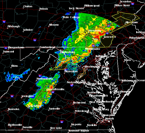 At 501 pm edt, severe thunderstorms were located along a line extending from near bluemont to 7 miles north of delaplane to near linden, moving east at 35 mph (radar indicated). Hazards include 60 mph wind gusts. Damaging winds will cause some trees and large branches to fall. this could injure those outdoors, as well as damage homes and vehicles. roadways may become blocked by downed trees. localized power outages are possible. unsecured light objects may become projectiles. Locations impacted include, front royal, purcellville, berryville, middleburg, round hill, delaplane, linden, bluemont, marshall, hamilton, hillsboro, gaylord, blue mountain, philomont, bethel, lincoln, saint louis, howellsville, briggs and rectortown. At 501 pm edt, severe thunderstorms were located along a line extending from near bluemont to 7 miles north of delaplane to near linden, moving east at 35 mph (radar indicated). Hazards include 60 mph wind gusts. Damaging winds will cause some trees and large branches to fall. this could injure those outdoors, as well as damage homes and vehicles. roadways may become blocked by downed trees. localized power outages are possible. unsecured light objects may become projectiles. Locations impacted include, front royal, purcellville, berryville, middleburg, round hill, delaplane, linden, bluemont, marshall, hamilton, hillsboro, gaylord, blue mountain, philomont, bethel, lincoln, saint louis, howellsville, briggs and rectortown.
|
| 9/5/2017 4:46 PM EDT |
 At 446 pm edt, severe thunderstorms were located along a line extending from near berryville to near linden to near front royal, moving northeast at 35 mph (radar indicated). Hazards include 60 mph wind gusts. Damaging winds will cause some trees and large branches to fall. this could injure those outdoors, as well as damage homes and vehicles. roadways may become blocked by downed trees. localized power outages are possible. Unsecured light objects may become projectiles. At 446 pm edt, severe thunderstorms were located along a line extending from near berryville to near linden to near front royal, moving northeast at 35 mph (radar indicated). Hazards include 60 mph wind gusts. Damaging winds will cause some trees and large branches to fall. this could injure those outdoors, as well as damage homes and vehicles. roadways may become blocked by downed trees. localized power outages are possible. Unsecured light objects may become projectiles.
|
| 8/11/2017 6:15 PM EDT |
 At 614 pm edt, a severe thunderstorm capable of producing a tornado was located near the plains, or near warrenton, moving east at 15 mph (radar indicated rotation). Hazards include tornado and half dollar size hail. For those in the direct path of a tornado touchdown, flying debris will be dangerous to those caught without shelter. damage to roofs, siding, and windows may occur. mobile homes may be damaged or destroyed. tree damage is likely. This tornadic thunderstorm will remain over mainly rural areas of central fauquier and northwestern prince william counties, including the following locations: new baltimore, meadowville, airlie, broad run, broken hill, auburn, marshall and gainesville. At 614 pm edt, a severe thunderstorm capable of producing a tornado was located near the plains, or near warrenton, moving east at 15 mph (radar indicated rotation). Hazards include tornado and half dollar size hail. For those in the direct path of a tornado touchdown, flying debris will be dangerous to those caught without shelter. damage to roofs, siding, and windows may occur. mobile homes may be damaged or destroyed. tree damage is likely. This tornadic thunderstorm will remain over mainly rural areas of central fauquier and northwestern prince william counties, including the following locations: new baltimore, meadowville, airlie, broad run, broken hill, auburn, marshall and gainesville.
|
| 8/11/2017 6:02 PM EDT | Downed tree near winchester rd and carters run rd in fauquier county VA, 0.7 miles N of Marshall, VA |
| 8/11/2017 6:02 PM EDT |
 At 602 pm edt, a severe thunderstorm capable of producing a tornado was located near the plains, or near warrenton, moving east at 15 mph (radar indicated rotation). Hazards include tornado and half dollar size hail. For those in the direct path of a tornado touchdown, flying debris will be dangerous to those caught without shelter. damage to roofs, siding, and windows may occur. mobile homes may be damaged or destroyed. tree damage is likely. this dangerous storm will be near, warrenton around 615 pm edt. the plains around 620 pm edt. Other locations impacted by this tornadic thunderstorm include new baltimore, meadowville, airlie, broad run, broken hill, auburn, marshall and gainesville. At 602 pm edt, a severe thunderstorm capable of producing a tornado was located near the plains, or near warrenton, moving east at 15 mph (radar indicated rotation). Hazards include tornado and half dollar size hail. For those in the direct path of a tornado touchdown, flying debris will be dangerous to those caught without shelter. damage to roofs, siding, and windows may occur. mobile homes may be damaged or destroyed. tree damage is likely. this dangerous storm will be near, warrenton around 615 pm edt. the plains around 620 pm edt. Other locations impacted by this tornadic thunderstorm include new baltimore, meadowville, airlie, broad run, broken hill, auburn, marshall and gainesville.
|
| 8/11/2017 6:01 PM EDT | Downed tree near free state rd and crest hill rd in fauquier county VA, 1.7 miles ENE of Marshall, VA |
| 8/11/2017 5:58 PM EDT | Four inch diameter limbs down on carters run road... about 1.5 miles south of intersection with state route 1 in fauquier county VA, 2.1 miles NNE of Marshall, VA |
| 8/11/2017 5:56 PM EDT |
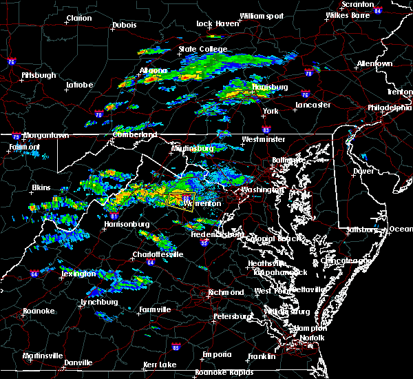 At 555 pm edt, a severe thunderstorm was located near hume, or 10 miles northwest of warrenton, moving east at 15 mph (radar indicated). Hazards include 60 mph wind gusts and quarter size hail. Damaging winds will cause some trees and large branches to fall. this could injure those outdoors, as well as damage homes and vehicles. roadways may become blocked by downed trees. localized power outages are possible. Unsecured light objects may become projectiles. At 555 pm edt, a severe thunderstorm was located near hume, or 10 miles northwest of warrenton, moving east at 15 mph (radar indicated). Hazards include 60 mph wind gusts and quarter size hail. Damaging winds will cause some trees and large branches to fall. this could injure those outdoors, as well as damage homes and vehicles. roadways may become blocked by downed trees. localized power outages are possible. Unsecured light objects may become projectiles.
|
| 8/11/2017 5:46 PM EDT | Downed tree near moreland rd and ramey rd in fauquier county VA, 5.5 miles ENE of Marshall, VA |
| 7/14/2017 3:57 PM EDT |
 At 356 pm edt, a severe thunderstorm was located near the plains, or 13 miles north of warrenton, moving east at 10 mph (radar indicated). Hazards include 60 mph wind gusts. Damaging winds will cause some trees and large branches to fall. this could injure those outdoors, as well as damage homes and vehicles. roadways may become blocked by downed trees. localized power outages are possible. unsecured light objects may become projectiles. Locations impacted include, middleburg, the plains, delaplane, marshall, halfway and rectortown. At 356 pm edt, a severe thunderstorm was located near the plains, or 13 miles north of warrenton, moving east at 10 mph (radar indicated). Hazards include 60 mph wind gusts. Damaging winds will cause some trees and large branches to fall. this could injure those outdoors, as well as damage homes and vehicles. roadways may become blocked by downed trees. localized power outages are possible. unsecured light objects may become projectiles. Locations impacted include, middleburg, the plains, delaplane, marshall, halfway and rectortown.
|
| 7/14/2017 3:45 PM EDT | Tree down in the 7600 block of frogtown road in fauquier county VA, 2.2 miles SSW of Marshall, VA |
| 7/14/2017 3:38 PM EDT |
 At 338 pm edt, a severe thunderstorm was located near delaplane, or 17 miles west of brambleton, moving east at 10 mph (radar indicated). Hazards include 60 mph wind gusts and quarter size hail. Damaging winds will cause some trees and large branches to fall. this could injure those outdoors, as well as damage homes and vehicles. roadways may become blocked by downed trees. localized power outages are possible. unsecured light objects may become projectiles. Locations impacted include, middleburg, delaplane, marshall, saint louis, halfway, upperville, markham and rectortown. At 338 pm edt, a severe thunderstorm was located near delaplane, or 17 miles west of brambleton, moving east at 10 mph (radar indicated). Hazards include 60 mph wind gusts and quarter size hail. Damaging winds will cause some trees and large branches to fall. this could injure those outdoors, as well as damage homes and vehicles. roadways may become blocked by downed trees. localized power outages are possible. unsecured light objects may become projectiles. Locations impacted include, middleburg, delaplane, marshall, saint louis, halfway, upperville, markham and rectortown.
|
| 7/14/2017 3:37 PM EDT | Tree down in the 2700 block of rokeby road in fauquier county VA, 5.8 miles SSE of Marshall, VA |
| 7/14/2017 3:37 PM EDT | Tree down in the 3000 block of rokeby road in fauquier county VA, 5.1 miles SE of Marshall, VA |
| 7/14/2017 3:37 PM EDT | Tree down in the 3400 block of groves lane in fauquier county VA, 4.2 miles ESE of Marshall, VA |
| 7/14/2017 3:27 PM EDT |
 At 327 pm edt, a severe thunderstorm was located near delaplane, or 16 miles east of front royal, moving east at 10 mph (radar indicated). Hazards include 60 mph wind gusts and quarter size hail. Damaging winds will cause some trees and large branches to fall. this could injure those outdoors, as well as damage homes and vehicles. roadways may become blocked by downed trees. localized power outages are possible. unsecured light objects may become projectiles. Locations impacted include, middleburg, delaplane, marshall, saint louis, halfway, upperville, markham, rectortown and paris. At 327 pm edt, a severe thunderstorm was located near delaplane, or 16 miles east of front royal, moving east at 10 mph (radar indicated). Hazards include 60 mph wind gusts and quarter size hail. Damaging winds will cause some trees and large branches to fall. this could injure those outdoors, as well as damage homes and vehicles. roadways may become blocked by downed trees. localized power outages are possible. unsecured light objects may become projectiles. Locations impacted include, middleburg, delaplane, marshall, saint louis, halfway, upperville, markham, rectortown and paris.
|
| 7/14/2017 3:24 PM EDT |
 At 324 pm edt, a severe thunderstorm was located near delaplane, or 15 miles east of front royal, moving east at 10 mph (radar indicated). Hazards include 60 mph wind gusts and quarter size hail. Damaging winds will cause some trees and large branches to fall. this could injure those outdoors, as well as damage homes and vehicles. roadways may become blocked by downed trees. localized power outages are possible. Unsecured light objects may become projectiles. At 324 pm edt, a severe thunderstorm was located near delaplane, or 15 miles east of front royal, moving east at 10 mph (radar indicated). Hazards include 60 mph wind gusts and quarter size hail. Damaging winds will cause some trees and large branches to fall. this could injure those outdoors, as well as damage homes and vehicles. roadways may become blocked by downed trees. localized power outages are possible. Unsecured light objects may become projectiles.
|
| 7/11/2017 5:41 PM EDT |
 The national weather service in sterling virginia has issued a * severe thunderstorm warning for. southwestern loudoun county in northern virginia. southeastern clarke county in northwestern virginia. north central fauquier county in northern virginia. Until 630 pm edt. The national weather service in sterling virginia has issued a * severe thunderstorm warning for. southwestern loudoun county in northern virginia. southeastern clarke county in northwestern virginia. north central fauquier county in northern virginia. Until 630 pm edt.
|
| 5/18/2017 7:27 PM EDT |
 The severe thunderstorm warning for eastern warren. northwestern fauquier. northeastern rappahannock and northwestern prince william counties will expire at 730 pm edt. the storms which prompted the warning have moved out of the area. therefore the warning will be allowed to expire. Remember, a severe thunderstorm warning still remains in effect east. The severe thunderstorm warning for eastern warren. northwestern fauquier. northeastern rappahannock and northwestern prince william counties will expire at 730 pm edt. the storms which prompted the warning have moved out of the area. therefore the warning will be allowed to expire. Remember, a severe thunderstorm warning still remains in effect east.
|
| 5/18/2017 7:24 PM EDT |
 At 723 pm edt, severe thunderstorms were located along a line extending from near middleburg to near hume, moving southeast at 20 mph (trained weather spotters). Hazards include 60 mph wind gusts and half dollar size hail. Damaging winds will cause some trees and large branches to fall. this could injure those outdoors, as well as damage homes and vehicles. roadways may become blocked by downed trees. localized power outages are possible. Unsecured light objects may become projectiles. At 723 pm edt, severe thunderstorms were located along a line extending from near middleburg to near hume, moving southeast at 20 mph (trained weather spotters). Hazards include 60 mph wind gusts and half dollar size hail. Damaging winds will cause some trees and large branches to fall. this could injure those outdoors, as well as damage homes and vehicles. roadways may become blocked by downed trees. localized power outages are possible. Unsecured light objects may become projectiles.
|
| 5/18/2017 7:10 PM EDT |
 At 710 pm edt, severe thunderstorms were located along a line extending from near delaplane to hume, moving east at 25 mph (public). Hazards include 60 mph wind gusts and quarter size hail. Damaging winds will cause some trees and large branches to fall. this could injure those outdoors, as well as damage homes and vehicles. roadways may become blocked by downed trees. localized power outages are possible. unsecured light objects may become projectiles. Locations impacted include, the plains, hume, delaplane, new baltimore, marshall, halfway, meadowville, airlie, markham, ashville, rectortown and ada. At 710 pm edt, severe thunderstorms were located along a line extending from near delaplane to hume, moving east at 25 mph (public). Hazards include 60 mph wind gusts and quarter size hail. Damaging winds will cause some trees and large branches to fall. this could injure those outdoors, as well as damage homes and vehicles. roadways may become blocked by downed trees. localized power outages are possible. unsecured light objects may become projectiles. Locations impacted include, the plains, hume, delaplane, new baltimore, marshall, halfway, meadowville, airlie, markham, ashville, rectortown and ada.
|
| 5/18/2017 6:48 PM EDT |
 At 648 pm edt, severe thunderstorms were located along a line extending from 7 miles southeast of stephens city to near front royal, moving east at 30 mph (public). Hazards include 60 mph wind gusts and quarter size hail. Damaging winds will cause some trees and large branches to fall. this could injure those outdoors, as well as damage homes and vehicles. roadways may become blocked by downed trees. localized power outages are possible. Unsecured light objects may become projectiles. At 648 pm edt, severe thunderstorms were located along a line extending from 7 miles southeast of stephens city to near front royal, moving east at 30 mph (public). Hazards include 60 mph wind gusts and quarter size hail. Damaging winds will cause some trees and large branches to fall. this could injure those outdoors, as well as damage homes and vehicles. roadways may become blocked by downed trees. localized power outages are possible. Unsecured light objects may become projectiles.
|
| 4/30/2017 2:54 PM EDT |
 At 253 pm edt, a severe thunderstorm was located near middleburg, or 15 miles west of brambleton, moving northeast at 20 mph (radar indicated). Hazards include 60 mph wind gusts and quarter size hail. Damaging winds will cause some trees and large branches to fall. this could injure those outdoors, as well as damage homes and vehicles. roadways may become blocked by downed trees. localized power outages are possible. unsecured light objects may become projectiles. Locations impacted include, south riding, brambleton, middleburg, arcola, marshall, saint louis, aldie, halfway, upperville, philomont and rectortown. At 253 pm edt, a severe thunderstorm was located near middleburg, or 15 miles west of brambleton, moving northeast at 20 mph (radar indicated). Hazards include 60 mph wind gusts and quarter size hail. Damaging winds will cause some trees and large branches to fall. this could injure those outdoors, as well as damage homes and vehicles. roadways may become blocked by downed trees. localized power outages are possible. unsecured light objects may become projectiles. Locations impacted include, south riding, brambleton, middleburg, arcola, marshall, saint louis, aldie, halfway, upperville, philomont and rectortown.
|
| 4/30/2017 2:39 PM EDT |
 At 238 pm edt, a severe thunderstorm was located over delaplane, or 15 miles north of warrenton, moving northeast at 20 mph (radar indicated). Hazards include 60 mph wind gusts and quarter size hail. Damaging winds will cause some trees and large branches to fall. this could injure those outdoors, as well as damage homes and vehicles. roadways may become blocked by downed trees. localized power outages are possible. Unsecured light objects may become projectiles. At 238 pm edt, a severe thunderstorm was located over delaplane, or 15 miles north of warrenton, moving northeast at 20 mph (radar indicated). Hazards include 60 mph wind gusts and quarter size hail. Damaging winds will cause some trees and large branches to fall. this could injure those outdoors, as well as damage homes and vehicles. roadways may become blocked by downed trees. localized power outages are possible. Unsecured light objects may become projectiles.
|
| 3/1/2017 1:01 PM EST |
 At 100 pm est, severe thunderstorms were located along a line extending from near middleburg to near culpeper, moving east at 55 mph (radar indicated). Hazards include 60 mph wind gusts. Damaging winds will cause some trees and large branches to fall. this could injure those outdoors, as well as damage homes and vehicles. roadways may become blocked by downed trees. localized power outages are possible. unsecured light objects may become projectiles. Locations impacted include, leesburg, culpeper, broadlands, lansdowne, brambleton, warrenton, orange, madison, ashburn, linton hall, bealeton, haymarket, middleburg, arcola, the plains, oatlands, delaplane, gainesville, new baltimore and belmont. At 100 pm est, severe thunderstorms were located along a line extending from near middleburg to near culpeper, moving east at 55 mph (radar indicated). Hazards include 60 mph wind gusts. Damaging winds will cause some trees and large branches to fall. this could injure those outdoors, as well as damage homes and vehicles. roadways may become blocked by downed trees. localized power outages are possible. unsecured light objects may become projectiles. Locations impacted include, leesburg, culpeper, broadlands, lansdowne, brambleton, warrenton, orange, madison, ashburn, linton hall, bealeton, haymarket, middleburg, arcola, the plains, oatlands, delaplane, gainesville, new baltimore and belmont.
|
| 3/1/2017 12:47 PM EST |
 At 1247 pm est, severe thunderstorms were located along a line extending from 6 miles northwest of delaplane to madison, moving east at 55 mph (radar indicated). Hazards include 60 mph wind gusts. Damaging winds will cause some trees and large branches to fall. this could injure those outdoors, as well as damage homes and vehicles. roadways may become blocked by downed trees. localized power outages are possible. unsecured light objects may become projectiles. Locations impacted include, leesburg, culpeper, broadlands, lansdowne, brambleton, warrenton, orange, madison, ashburn, linton hall, bealeton, haymarket, middleburg, stanardsville, sperryville, arcola, the plains, delaplane, linden and hume. At 1247 pm est, severe thunderstorms were located along a line extending from 6 miles northwest of delaplane to madison, moving east at 55 mph (radar indicated). Hazards include 60 mph wind gusts. Damaging winds will cause some trees and large branches to fall. this could injure those outdoors, as well as damage homes and vehicles. roadways may become blocked by downed trees. localized power outages are possible. unsecured light objects may become projectiles. Locations impacted include, leesburg, culpeper, broadlands, lansdowne, brambleton, warrenton, orange, madison, ashburn, linton hall, bealeton, haymarket, middleburg, stanardsville, sperryville, arcola, the plains, delaplane, linden and hume.
|
| 3/1/2017 12:26 PM EST |
 At 1226 pm est, severe thunderstorms were located along a line extending from near strasburg to 8 miles southeast of massanutten, moving east at 55 mph (radar indicated). Hazards include 60 mph wind gusts. Damaging winds will cause some trees and large branches to fall. this could injure those outdoors, as well as damage homes and vehicles. roadways may become blocked by downed trees. localized power outages are possible. Unsecured light objects may become projectiles. At 1226 pm est, severe thunderstorms were located along a line extending from near strasburg to 8 miles southeast of massanutten, moving east at 55 mph (radar indicated). Hazards include 60 mph wind gusts. Damaging winds will cause some trees and large branches to fall. this could injure those outdoors, as well as damage homes and vehicles. roadways may become blocked by downed trees. localized power outages are possible. Unsecured light objects may become projectiles.
|
| 8/17/2016 8:28 PM EDT |
 The severe thunderstorm warning for northwestern prince william, central loudoun and northeastern fauquier counties will expire at 830 pm edt, the storms which prompted the warning have weakened below severe limits, and no longer pose an immediate threat to life or property. therefore the warning will be allowed to expire. however gusty winds are still possible with these thunderstorms. The severe thunderstorm warning for northwestern prince william, central loudoun and northeastern fauquier counties will expire at 830 pm edt, the storms which prompted the warning have weakened below severe limits, and no longer pose an immediate threat to life or property. therefore the warning will be allowed to expire. however gusty winds are still possible with these thunderstorms.
|
| 8/17/2016 8:18 PM EDT |
 At 817 pm edt, severe thunderstorms were located along a line extending from near middleburg to near warrenton, moving northeast at 45 mph (law enforcement). Hazards include 70 mph wind gusts. Damaging winds will cause some trees and large branches to fall. this could injure those outdoors, as well as damage homes and vehicles. roadways may become blocked by downed trees. localized power outages are possible. unsecured light objects may become projectiles. Locations impacted include, leesburg, south riding, brambleton, warrenton, linton hall, bull run, haymarket, middleburg, arcola, the plains, oatlands, gainesville, new baltimore, marshall, nokesville, hamilton, woolsey, broad run, philomont and hughesville. At 817 pm edt, severe thunderstorms were located along a line extending from near middleburg to near warrenton, moving northeast at 45 mph (law enforcement). Hazards include 70 mph wind gusts. Damaging winds will cause some trees and large branches to fall. this could injure those outdoors, as well as damage homes and vehicles. roadways may become blocked by downed trees. localized power outages are possible. unsecured light objects may become projectiles. Locations impacted include, leesburg, south riding, brambleton, warrenton, linton hall, bull run, haymarket, middleburg, arcola, the plains, oatlands, gainesville, new baltimore, marshall, nokesville, hamilton, woolsey, broad run, philomont and hughesville.
|
| 8/17/2016 7:58 PM EDT |
 At 757 pm edt, severe thunderstorms were located along a line extending from near linden to 10 miles west of warrenton, moving northeast at 45 mph (law enforcement). Hazards include 70 mph wind gusts. Damaging winds will cause some trees and large branches to fall. this could injure those outdoors, as well as damage homes and vehicles. roadways may become blocked by downed trees. localized power outages are possible. Unsecured light objects may become projectiles. At 757 pm edt, severe thunderstorms were located along a line extending from near linden to 10 miles west of warrenton, moving northeast at 45 mph (law enforcement). Hazards include 70 mph wind gusts. Damaging winds will cause some trees and large branches to fall. this could injure those outdoors, as well as damage homes and vehicles. roadways may become blocked by downed trees. localized power outages are possible. Unsecured light objects may become projectiles.
|
| 8/17/2016 7:51 PM EDT |
 At 751 pm edt, severe thunderstorms were located along a line extending from linden to 7 miles east of sperryville, moving northeast at 65 mph (law enforcement). Hazards include 70 mph wind gusts. Damaging winds will cause some trees and large branches to fall. this could injure those outdoors, as well as damage homes and vehicles. roadways may become blocked by downed trees. localized power outages are possible. unsecured light objects may become projectiles. Locations impacted include, hume, linden, delaplane, marshall, chester gap, flint hill, washington, amissville, markham, viewtown, glen echo, rectortown, upperville, rock mills, ada, ashville, orlean, hackleys crossroads, castleton and cresthill. At 751 pm edt, severe thunderstorms were located along a line extending from linden to 7 miles east of sperryville, moving northeast at 65 mph (law enforcement). Hazards include 70 mph wind gusts. Damaging winds will cause some trees and large branches to fall. this could injure those outdoors, as well as damage homes and vehicles. roadways may become blocked by downed trees. localized power outages are possible. unsecured light objects may become projectiles. Locations impacted include, hume, linden, delaplane, marshall, chester gap, flint hill, washington, amissville, markham, viewtown, glen echo, rectortown, upperville, rock mills, ada, ashville, orlean, hackleys crossroads, castleton and cresthill.
|
| 8/17/2016 7:35 PM EDT |
 At 734 pm edt, severe thunderstorms were located along a line extending from 9 miles northwest of sperryville to near big meadows, moving northeast at 65 mph (law enforcement). Hazards include 70 mph wind gusts. Damaging winds will cause some trees and large branches to fall. this could injure those outdoors, as well as damage homes and vehicles. roadways may become blocked by downed trees. localized power outages are possible. unsecured light objects may become projectiles. Locations impacted include, hume, delaplane, linden, marshall, chester gap, flint hill, washington, viewtown, markham, amissville, glen echo, orlean, hackleys crossroads, arco, compton, rectortown, upperville, rock mills, ada and ashville. At 734 pm edt, severe thunderstorms were located along a line extending from 9 miles northwest of sperryville to near big meadows, moving northeast at 65 mph (law enforcement). Hazards include 70 mph wind gusts. Damaging winds will cause some trees and large branches to fall. this could injure those outdoors, as well as damage homes and vehicles. roadways may become blocked by downed trees. localized power outages are possible. unsecured light objects may become projectiles. Locations impacted include, hume, delaplane, linden, marshall, chester gap, flint hill, washington, viewtown, markham, amissville, glen echo, orlean, hackleys crossroads, arco, compton, rectortown, upperville, rock mills, ada and ashville.
|
| 8/16/2016 4:40 PM EDT | Tree down on power lines on delaplane grade road in fauquier county VA, 6.4 miles SSE of Marshall, VA |
| 8/6/2016 2:06 PM EDT |
 At 205 pm edt, a severe thunderstorm was located near the plains, or 7 miles northwest of warrenton, moving southeast at 25 mph (radar indicated). Hazards include 60 mph wind gusts. Damaging winds will cause some trees and large branches to fall. this could injure those outdoors, as well as damage homes and vehicles. roadways may become blocked by downed trees. localized power outages are possible. Unsecured light objects may become projectiles. At 205 pm edt, a severe thunderstorm was located near the plains, or 7 miles northwest of warrenton, moving southeast at 25 mph (radar indicated). Hazards include 60 mph wind gusts. Damaging winds will cause some trees and large branches to fall. this could injure those outdoors, as well as damage homes and vehicles. roadways may become blocked by downed trees. localized power outages are possible. Unsecured light objects may become projectiles.
|
| 7/30/2016 5:01 PM EDT |
 At 500 pm edt, a severe thunderstorm was located over delaplane, or 13 miles east of front royal, moving east at 10 mph (radar indicated). Hazards include 60 mph wind gusts. Damaging winds will cause some trees and large branches to fall. this could injure those outdoors, as well as damage homes and vehicles. roadways may become blocked by downed trees. localized power outages are possible. unsecured light objects may become projectiles. Locations impacted include, middleburg, the plains, hume, delaplane, marshall, aldie, markham, rectortown, upperville, saint louis, halfway, ada and ashville. At 500 pm edt, a severe thunderstorm was located over delaplane, or 13 miles east of front royal, moving east at 10 mph (radar indicated). Hazards include 60 mph wind gusts. Damaging winds will cause some trees and large branches to fall. this could injure those outdoors, as well as damage homes and vehicles. roadways may become blocked by downed trees. localized power outages are possible. unsecured light objects may become projectiles. Locations impacted include, middleburg, the plains, hume, delaplane, marshall, aldie, markham, rectortown, upperville, saint louis, halfway, ada and ashville.
|
| 7/30/2016 4:46 PM EDT |
 At 446 pm edt, a severe thunderstorm was located near delaplane, or 11 miles east of front royal, moving east at 20 mph (radar indicated). Hazards include 60 mph wind gusts. Damaging winds will cause some trees and large branches to fall. this could injure those outdoors, as well as damage homes and vehicles. roadways may become blocked by downed trees. localized power outages are possible. Unsecured light objects may become projectiles. At 446 pm edt, a severe thunderstorm was located near delaplane, or 11 miles east of front royal, moving east at 20 mph (radar indicated). Hazards include 60 mph wind gusts. Damaging winds will cause some trees and large branches to fall. this could injure those outdoors, as well as damage homes and vehicles. roadways may become blocked by downed trees. localized power outages are possible. Unsecured light objects may become projectiles.
|
| 7/18/2016 3:14 PM EDT |
 At 314 pm edt, severe thunderstorms were located along a line extending from near hume to 6 miles southeast of sperryville to near big meadows, moving east at 35 mph (trained weather spotters). Hazards include 60 mph wind gusts and quarter size hail. Damaging winds will cause some trees and large branches to fall. this could injure those outdoors, as well as damage homes and vehicles. roadways may become blocked by downed trees. localized power outages are possible. unsecured light objects may become projectiles. Locations impacted include, warrenton, sperryville, hume, marshall, brightwood, flint hill, washington, amissville, viewtown, etlan, syria, slate mills, boston, haywood, reva, orlean, cardova, hackleys crossroads, woodville and five forks. At 314 pm edt, severe thunderstorms were located along a line extending from near hume to 6 miles southeast of sperryville to near big meadows, moving east at 35 mph (trained weather spotters). Hazards include 60 mph wind gusts and quarter size hail. Damaging winds will cause some trees and large branches to fall. this could injure those outdoors, as well as damage homes and vehicles. roadways may become blocked by downed trees. localized power outages are possible. unsecured light objects may become projectiles. Locations impacted include, warrenton, sperryville, hume, marshall, brightwood, flint hill, washington, amissville, viewtown, etlan, syria, slate mills, boston, haywood, reva, orlean, cardova, hackleys crossroads, woodville and five forks.
|
| 7/18/2016 3:07 PM EDT |
 At 307 pm edt, severe thunderstorms were located along a line extending from linden to near sperryville to near big meadows, moving southeast at 30 mph (radar indicated). Hazards include 60 mph wind gusts. Damaging winds will cause some trees and large branches to fall. this could injure those outdoors, as well as damage homes and vehicles. roadways may become blocked by downed trees. localized power outages are possible. Unsecured light objects may become projectiles. At 307 pm edt, severe thunderstorms were located along a line extending from linden to near sperryville to near big meadows, moving southeast at 30 mph (radar indicated). Hazards include 60 mph wind gusts. Damaging winds will cause some trees and large branches to fall. this could injure those outdoors, as well as damage homes and vehicles. roadways may become blocked by downed trees. localized power outages are possible. Unsecured light objects may become projectiles.
|
| 7/18/2016 3:01 PM EDT |
 At 300 pm edt, a severe thunderstorm was located 7 miles south of berryville, or 12 miles southeast of millwood pike, moving east at 35 mph (trained weather spotters). Hazards include 60 mph wind gusts. Damaging winds will cause some trees and large branches to fall. this could injure those outdoors, as well as damage homes and vehicles. roadways may become blocked by downed trees. localized power outages are possible. Unsecured light objects may become projectiles. At 300 pm edt, a severe thunderstorm was located 7 miles south of berryville, or 12 miles southeast of millwood pike, moving east at 35 mph (trained weather spotters). Hazards include 60 mph wind gusts. Damaging winds will cause some trees and large branches to fall. this could injure those outdoors, as well as damage homes and vehicles. roadways may become blocked by downed trees. localized power outages are possible. Unsecured light objects may become projectiles.
|
| 6/28/2016 5:21 PM EDT |
 The severe thunderstorm warning for west central fairfax, northwestern prince william, south central loudoun and northeastern fauquier counties will expire at 530 pm edt, the storm which prompted the warning has weakened below severe limits, and no longer pose an immediate threat to life or property. therefore the warning will be allowed to expire. however small hail and gusty winds are still possible with this thunderstorm. a severe thunderstorm watch remains in effect until 1000 pm edt for northern virginia. The severe thunderstorm warning for west central fairfax, northwestern prince william, south central loudoun and northeastern fauquier counties will expire at 530 pm edt, the storm which prompted the warning has weakened below severe limits, and no longer pose an immediate threat to life or property. therefore the warning will be allowed to expire. however small hail and gusty winds are still possible with this thunderstorm. a severe thunderstorm watch remains in effect until 1000 pm edt for northern virginia.
|
| 6/28/2016 5:03 PM EDT |
 At 503 pm edt, a severe thunderstorm was located near middleburg, or 11 miles southwest of brambleton, moving southeast at 15 mph (radar indicated). Hazards include 60 mph wind gusts and quarter size hail. Damaging winds will cause some trees and large branches to fall. this could injure those outdoors, as well as damage homes and vehicles. roadways may become blocked by downed trees. localized power outages are possible. unsecured light objects may become projectiles. Locations impacted include, centreville, south riding, linton hall, chantilly, bull run, haymarket, middleburg, arcola, the plains, sudley, gainesville, new baltimore, marshall, nokesville, greenwich, woolsey, broad run, aldie, catharpin and halfway. At 503 pm edt, a severe thunderstorm was located near middleburg, or 11 miles southwest of brambleton, moving southeast at 15 mph (radar indicated). Hazards include 60 mph wind gusts and quarter size hail. Damaging winds will cause some trees and large branches to fall. this could injure those outdoors, as well as damage homes and vehicles. roadways may become blocked by downed trees. localized power outages are possible. unsecured light objects may become projectiles. Locations impacted include, centreville, south riding, linton hall, chantilly, bull run, haymarket, middleburg, arcola, the plains, sudley, gainesville, new baltimore, marshall, nokesville, greenwich, woolsey, broad run, aldie, catharpin and halfway.
|
| 6/28/2016 4:46 PM EDT |
 At 446 pm edt, a severe thunderstorm was located over middleburg, or 12 miles west of brambleton, moving southeast at 25 mph (radar indicated). Hazards include 60 mph wind gusts and quarter size hail. Damaging winds will cause some trees and large branches to fall. this could injure those outdoors, as well as damage homes and vehicles. roadways may become blocked by downed trees. localized power outages are possible. Unsecured light objects may become projectiles. At 446 pm edt, a severe thunderstorm was located over middleburg, or 12 miles west of brambleton, moving southeast at 25 mph (radar indicated). Hazards include 60 mph wind gusts and quarter size hail. Damaging winds will cause some trees and large branches to fall. this could injure those outdoors, as well as damage homes and vehicles. roadways may become blocked by downed trees. localized power outages are possible. Unsecured light objects may become projectiles.
|
| 6/21/2016 3:17 PM EDT |
 At 316 pm edt, a severe thunderstorm was located over the plains, or 9 miles north of warrenton, moving east at 35 mph (radar indicated). Hazards include 60 mph wind gusts. Damaging winds will cause some trees and large branches to fall. this could injure those outdoors, as well as damage homes and vehicles. roadways may become blocked by downed trees. localized power outages are possible. Unsecured light objects may become projectiles. At 316 pm edt, a severe thunderstorm was located over the plains, or 9 miles north of warrenton, moving east at 35 mph (radar indicated). Hazards include 60 mph wind gusts. Damaging winds will cause some trees and large branches to fall. this could injure those outdoors, as well as damage homes and vehicles. roadways may become blocked by downed trees. localized power outages are possible. Unsecured light objects may become projectiles.
|
| 6/21/2016 1:16 PM EDT |
 At 116 pm edt, a severe thunderstorm was located near middleburg, or 10 miles west of brambleton, moving east at 40 mph (radar indicated). Hazards include two inch hail and 70 mph wind gusts. Expect wind damage to trees and power lines. hail is large enough to dent and damage vehicles. some hail damage to roofs, siding, and windows is possible. Locations impacted include, centreville, reston, south riding, herndon, fairfax, broadlands, lowes island, brambleton, dulles international airport, ashburn, oakton, sterling, chantilly, wolf trap, great falls, countryside, middleburg, arcola, the plains and oatlands. At 116 pm edt, a severe thunderstorm was located near middleburg, or 10 miles west of brambleton, moving east at 40 mph (radar indicated). Hazards include two inch hail and 70 mph wind gusts. Expect wind damage to trees and power lines. hail is large enough to dent and damage vehicles. some hail damage to roofs, siding, and windows is possible. Locations impacted include, centreville, reston, south riding, herndon, fairfax, broadlands, lowes island, brambleton, dulles international airport, ashburn, oakton, sterling, chantilly, wolf trap, great falls, countryside, middleburg, arcola, the plains and oatlands.
|
| 6/21/2016 1:12 PM EDT |
 At 112 pm edt, doppler radar indicated a severe thunderstorm capable of producing quarter size hail and destructive winds in excess of 70 mph. this storm was located near middleburg, or 13 miles west of brambleton, and moving east at 40 mph. At 112 pm edt, doppler radar indicated a severe thunderstorm capable of producing quarter size hail and destructive winds in excess of 70 mph. this storm was located near middleburg, or 13 miles west of brambleton, and moving east at 40 mph.
|
| 6/16/2016 8:39 PM EDT |
 The severe thunderstorm warning for northwestern prince william, southeastern rappahannock, loudoun, western culpeper, east central madison, central fauquier and southeastern jefferson counties will expire at 845 pm edt, the storms which prompted the warning have moved out of the area. therefore the warning will be allowed to expire. a severe thunderstorm watch remains in effect until 1000 pm edt for northwestern virginia, and central west virginia. The severe thunderstorm warning for northwestern prince william, southeastern rappahannock, loudoun, western culpeper, east central madison, central fauquier and southeastern jefferson counties will expire at 845 pm edt, the storms which prompted the warning have moved out of the area. therefore the warning will be allowed to expire. a severe thunderstorm watch remains in effect until 1000 pm edt for northwestern virginia, and central west virginia.
|
| 6/16/2016 8:39 PM EDT | The severe thunderstorm warning for northwestern prince william, southeastern rappahannock, loudoun, western culpeper, east central madison, central fauquier and southeastern jefferson counties will expire at 845 pm edt, the storms which prompted the warning have moved out of the area. therefore the warning will be allowed to expire. a severe thunderstorm watch remains in effect until 1000 pm edt for northwestern virginia, and central west virginia. |
| 6/16/2016 8:25 PM EDT |
 At 824 pm edt, severe thunderstorms were located along a line extending from near lansdowne to near centreville to near culpeper, moving east at 50 mph (radar indicated). Hazards include 60 mph wind gusts. Damaging winds will cause some trees and large branches to fall. this could injure those outdoors, as well as damage homes and vehicles. roadways may become blocked by downed trees. localized power outages are possible. unsecured light objects may become projectiles. Locations impacted include, leesburg, south riding, culpeper, brambleton, warrenton, charles town, linton hall, purcellville, ranson, bealeton, haymarket, middleburg, round hill, arcola, the plains, oatlands, gainesville, new baltimore, lovettsville and marshall. At 824 pm edt, severe thunderstorms were located along a line extending from near lansdowne to near centreville to near culpeper, moving east at 50 mph (radar indicated). Hazards include 60 mph wind gusts. Damaging winds will cause some trees and large branches to fall. this could injure those outdoors, as well as damage homes and vehicles. roadways may become blocked by downed trees. localized power outages are possible. unsecured light objects may become projectiles. Locations impacted include, leesburg, south riding, culpeper, brambleton, warrenton, charles town, linton hall, purcellville, ranson, bealeton, haymarket, middleburg, round hill, arcola, the plains, oatlands, gainesville, new baltimore, lovettsville and marshall.
|
| 6/16/2016 8:02 PM EDT |
 At 801 pm edt, severe thunderstorms were located along a line extending from near round hill to near the plains and marshall to near sperryville, moving east at 45 mph (radar indicated). Hazards include 60 mph wind gusts. Damaging winds will cause some trees and large branches to fall. this could injure those outdoors, as well as damage homes and vehicles. roadways may become blocked by downed trees. localized power outages are possible. unsecured light objects may become projectiles. Locations impacted include, leesburg, south riding, culpeper, brambleton, warrenton, charles town, linton hall, purcellville, ranson, bealeton, haymarket, middleburg, round hill, sperryville, arcola, the plains, hume, delaplane, bluemont and oatlands. At 801 pm edt, severe thunderstorms were located along a line extending from near round hill to near the plains and marshall to near sperryville, moving east at 45 mph (radar indicated). Hazards include 60 mph wind gusts. Damaging winds will cause some trees and large branches to fall. this could injure those outdoors, as well as damage homes and vehicles. roadways may become blocked by downed trees. localized power outages are possible. unsecured light objects may become projectiles. Locations impacted include, leesburg, south riding, culpeper, brambleton, warrenton, charles town, linton hall, purcellville, ranson, bealeton, haymarket, middleburg, round hill, sperryville, arcola, the plains, hume, delaplane, bluemont and oatlands.
|
| 6/16/2016 8:00 PM EDT | Trees down achilles lane and crest hill rd in fauquier county VA, 3.4 miles ENE of Marshall, VA |
| 6/16/2016 7:39 PM EDT |
 At 739 pm edt, severe thunderstorms were located along a line extending from near charles town to near linden to 7 miles south of front royal to stanley, moving east at 50 mph (radar indicated). Hazards include 60 mph wind gusts and quarter size hail. Damaging winds will cause some trees and large branches to fall. this could injure those outdoors, as well as damage homes and vehicles. roadways may become blocked by downed trees. localized power outages are possible. Unsecured light objects may become projectiles. At 739 pm edt, severe thunderstorms were located along a line extending from near charles town to near linden to 7 miles south of front royal to stanley, moving east at 50 mph (radar indicated). Hazards include 60 mph wind gusts and quarter size hail. Damaging winds will cause some trees and large branches to fall. this could injure those outdoors, as well as damage homes and vehicles. roadways may become blocked by downed trees. localized power outages are possible. Unsecured light objects may become projectiles.
|
| 6/16/2016 6:38 PM EDT |
 The tornado warning for northwestern prince william, southwestern loudoun and north central fauquier counties will expire at 645 pm edt, the tornado threat has diminished and the tornado warning has been cancelled. however, large hail remains likely and a severe thunderstorm warning remains in effect for the area. however small hail is still possible with this thunderstorm. a severe thunderstorm watch remains in effect until 1000 pm edt for northern virginia. remember, a severe thunderstorm warning still remains in effect. The tornado warning for northwestern prince william, southwestern loudoun and north central fauquier counties will expire at 645 pm edt, the tornado threat has diminished and the tornado warning has been cancelled. however, large hail remains likely and a severe thunderstorm warning remains in effect for the area. however small hail is still possible with this thunderstorm. a severe thunderstorm watch remains in effect until 1000 pm edt for northern virginia. remember, a severe thunderstorm warning still remains in effect.
|
| 6/16/2016 6:20 PM EDT |
 At 619 pm edt, a severe thunderstorm capable of producing a tornado was near over middleburg, or 13 miles west of brambleton, moving southeast at 25 mph (radar indicated rotation). Hazards include tornado and two inch hail. For those in the direct path of a tornado touchdown, flying debris will be dangerous to those caught without shelter. damage to roofs, siding, and windows may occur. mobile homes may be damaged or destroyed. tree damage is likely. this dangerous storm will be near, the plains around 635 pm edt. Other locations impacted by this tornadic thunderstorm include aldie, broad run, saint louis, halfway, woolsey and marshall. At 619 pm edt, a severe thunderstorm capable of producing a tornado was near over middleburg, or 13 miles west of brambleton, moving southeast at 25 mph (radar indicated rotation). Hazards include tornado and two inch hail. For those in the direct path of a tornado touchdown, flying debris will be dangerous to those caught without shelter. damage to roofs, siding, and windows may occur. mobile homes may be damaged or destroyed. tree damage is likely. this dangerous storm will be near, the plains around 635 pm edt. Other locations impacted by this tornadic thunderstorm include aldie, broad run, saint louis, halfway, woolsey and marshall.
|
| 6/16/2016 6:13 PM EDT |
 At 612 pm edt, a severe thunderstorm was located near middleburg, or 17 miles west of leesburg, moving southeast at 25 mph (radar indicated). Hazards include tornado and two inch hail. Expect wind damage to trees and power lines. hail is large enough to dent and damage vehicles. some hail damage to roofs, siding, and windows is possible. Locations impacted include, middleburg, marshall, rectortown, upperville, saint louis and philomont. At 612 pm edt, a severe thunderstorm was located near middleburg, or 17 miles west of leesburg, moving southeast at 25 mph (radar indicated). Hazards include tornado and two inch hail. Expect wind damage to trees and power lines. hail is large enough to dent and damage vehicles. some hail damage to roofs, siding, and windows is possible. Locations impacted include, middleburg, marshall, rectortown, upperville, saint louis and philomont.
|
| 6/16/2016 6:05 PM EDT |
 At 604 pm edt, a severe thunderstorm capable of producing a tornado was located near bluemont, or 15 miles south of charles town, moving southeast at 25 mph (radar indicated rotation). Hazards include tornado and hail up to two inches in diameter. For those in the direct path of a tornado touchdown. flying debris will be dangerous to those caught without shelter. damage to roofs, siding, and windows may occur. mobile homes may be damaged or destroyed. tree damage is likely. this dangerous storm will be near, middleburg around 625 pm edt. the plains around 635 pm edt. Other locations impacted by this tornadic thunderstorm include aldie, woolsey, broad run, rectortown, upperville, saint louis, meadowville, halfway, philomont and marshall. At 604 pm edt, a severe thunderstorm capable of producing a tornado was located near bluemont, or 15 miles south of charles town, moving southeast at 25 mph (radar indicated rotation). Hazards include tornado and hail up to two inches in diameter. For those in the direct path of a tornado touchdown. flying debris will be dangerous to those caught without shelter. damage to roofs, siding, and windows may occur. mobile homes may be damaged or destroyed. tree damage is likely. this dangerous storm will be near, middleburg around 625 pm edt. the plains around 635 pm edt. Other locations impacted by this tornadic thunderstorm include aldie, woolsey, broad run, rectortown, upperville, saint louis, meadowville, halfway, philomont and marshall.
|
| 6/16/2016 5:58 PM EDT |
 At 557 pm edt, a severe thunderstorm capable of producing a tornado was located near berryville, or 12 miles southeast of millwood pike, moving southeast at 25 mph (radar indicated rotation). Hazards include tornado and two inch hail. For those in the direct path of a tornado touchdown, flying debris will be dangerous to those caught without shelter. damage to roofs, siding, and windows may occur. mobile homes may be damaged or destroyed. tree damage is likely. this dangerous storm will be near, delaplane around 620 pm edt. middleburg around 630 pm edt. Other locations impacted by this tornadic thunderstorm include rectortown, briggs, upperville, saint louis, paris, philomont and marshall. At 557 pm edt, a severe thunderstorm capable of producing a tornado was located near berryville, or 12 miles southeast of millwood pike, moving southeast at 25 mph (radar indicated rotation). Hazards include tornado and two inch hail. For those in the direct path of a tornado touchdown, flying debris will be dangerous to those caught without shelter. damage to roofs, siding, and windows may occur. mobile homes may be damaged or destroyed. tree damage is likely. this dangerous storm will be near, delaplane around 620 pm edt. middleburg around 630 pm edt. Other locations impacted by this tornadic thunderstorm include rectortown, briggs, upperville, saint louis, paris, philomont and marshall.
|
| 6/16/2016 5:50 PM EDT |
 At 550 pm edt, a severe thunderstorm capable of producing a tornado was located over berryville, or 10 miles east of millwood pike, moving southeast at 25 mph (radar indicated rotation). Hazards include tornado and half dollar size hail. For those in the direct path of a tornado touchdown. flying debris will be dangerous to those caught without shelter. damage to roofs, siding, and windows may occur. mobile homes may be damaged or destroyed. tree damage is likely. this dangerous storm will be near, bluemont around 605 pm edt. delaplane around 620 pm edt. middleburg around 630 pm edt. Other locations impacted by this tornadic thunderstorm include rectortown, briggs, upperville, saint louis, paris, philomont and marshall. At 550 pm edt, a severe thunderstorm capable of producing a tornado was located over berryville, or 10 miles east of millwood pike, moving southeast at 25 mph (radar indicated rotation). Hazards include tornado and half dollar size hail. For those in the direct path of a tornado touchdown. flying debris will be dangerous to those caught without shelter. damage to roofs, siding, and windows may occur. mobile homes may be damaged or destroyed. tree damage is likely. this dangerous storm will be near, bluemont around 605 pm edt. delaplane around 620 pm edt. middleburg around 630 pm edt. Other locations impacted by this tornadic thunderstorm include rectortown, briggs, upperville, saint louis, paris, philomont and marshall.
|
| 6/16/2016 5:47 PM EDT |
 At 546 pm edt, a severe thunderstorm was located over berryville, or 9 miles east of millwood pike, moving southeast at 30 mph (radar indicated). Hazards include 70 mph wind gusts and half dollar size hail. Damaging winds will cause some trees and large branches to fall. this could injure those outdoors, as well as damage homes and vehicles. roadways may become blocked by downed trees. localized power outages are possible. Unsecured light objects may become projectiles. At 546 pm edt, a severe thunderstorm was located over berryville, or 9 miles east of millwood pike, moving southeast at 30 mph (radar indicated). Hazards include 70 mph wind gusts and half dollar size hail. Damaging winds will cause some trees and large branches to fall. this could injure those outdoors, as well as damage homes and vehicles. roadways may become blocked by downed trees. localized power outages are possible. Unsecured light objects may become projectiles.
|
| 7/14/2015 7:15 PM EDT |
 At 715 pm edt, doppler radar indicated a severe thunderstorm capable of producing quarter size hail and damaging winds in excess of 60 mph. this storm was located near middleburg, or 14 miles west of brambleton, moving east at 25 mph. locations impacted include, the plains, middleburg, delaplane, aldie, rectortown, upperville, saint louis, halfway, marshall, ashville and broad run. At 715 pm edt, doppler radar indicated a severe thunderstorm capable of producing quarter size hail and damaging winds in excess of 60 mph. this storm was located near middleburg, or 14 miles west of brambleton, moving east at 25 mph. locations impacted include, the plains, middleburg, delaplane, aldie, rectortown, upperville, saint louis, halfway, marshall, ashville and broad run.
|
| 7/14/2015 7:06 PM EDT |
 At 705 pm edt, doppler radar indicated a severe thunderstorm capable of producing quarter size hail and damaging winds in excess of 60 mph. this storm was located over delaplane, or 16 miles east of front royal, moving east at 25 mph. locations impacted include, the plains, middleburg, delaplane, markham, rectortown, upperville, philomont, ashville, aldie, saint louis, halfway, marshall, broad run and ada. At 705 pm edt, doppler radar indicated a severe thunderstorm capable of producing quarter size hail and damaging winds in excess of 60 mph. this storm was located over delaplane, or 16 miles east of front royal, moving east at 25 mph. locations impacted include, the plains, middleburg, delaplane, markham, rectortown, upperville, philomont, ashville, aldie, saint louis, halfway, marshall, broad run and ada.
|
| 7/14/2015 6:58 PM EDT |
 At 657 pm edt, doppler radar indicated a severe thunderstorm capable of producing quarter size hail and damaging winds in excess of 60 mph. this storm was located near delaplane, or 12 miles east of front royal, and moving east at 25 mph. At 657 pm edt, doppler radar indicated a severe thunderstorm capable of producing quarter size hail and damaging winds in excess of 60 mph. this storm was located near delaplane, or 12 miles east of front royal, and moving east at 25 mph.
|
| 7/14/2015 6:43 PM EDT |
 At 643 pm edt, doppler radar indicated a severe thunderstorm capable of producing large damaging hail up to golf ball size and damaging winds in excess of 60 mph. this storm was located near linden, or 8 miles northeast of front royal, moving east at 25 mph. locations impacted include, delaplane, bluemont, white post, rectortown, upperville, millwood, paris, howellsville, blue mountain, marshall and bethel. At 643 pm edt, doppler radar indicated a severe thunderstorm capable of producing large damaging hail up to golf ball size and damaging winds in excess of 60 mph. this storm was located near linden, or 8 miles northeast of front royal, moving east at 25 mph. locations impacted include, delaplane, bluemont, white post, rectortown, upperville, millwood, paris, howellsville, blue mountain, marshall and bethel.
|
| 7/14/2015 6:34 PM EDT |
 At 634 pm edt, doppler radar indicated a severe thunderstorm capable of producing large damaging hail up to golf ball size and damaging winds in excess of 60 mph. this storm was located near front royal, moving east at 25 mph. locations impacted include, front royal, linden, delaplane, bluemont, boyce, nineveh, markham, white post, rectortown, upperville, riverside, howellsville, blue mountain, riverton, buckton, millwood, paris, armel, marshall and cedarville. At 634 pm edt, doppler radar indicated a severe thunderstorm capable of producing large damaging hail up to golf ball size and damaging winds in excess of 60 mph. this storm was located near front royal, moving east at 25 mph. locations impacted include, front royal, linden, delaplane, bluemont, boyce, nineveh, markham, white post, rectortown, upperville, riverside, howellsville, blue mountain, riverton, buckton, millwood, paris, armel, marshall and cedarville.
|
| 7/14/2015 6:28 PM EDT |
 At 628 pm edt, doppler radar indicated a severe thunderstorm capable of producing quarter size hail and damaging winds in excess of 60 mph. this storm was located near front royal, and moving east at 25 mph. At 628 pm edt, doppler radar indicated a severe thunderstorm capable of producing quarter size hail and damaging winds in excess of 60 mph. this storm was located near front royal, and moving east at 25 mph.
|
| 6/30/2015 11:55 PM EDT |
 At 1154 pm edt, doppler radar indicated a severe thunderstorm capable of producing quarter size hail and damaging winds in excess of 60 mph. this storm was located near warrenton, and moving northeast at 30 mph. At 1154 pm edt, doppler radar indicated a severe thunderstorm capable of producing quarter size hail and damaging winds in excess of 60 mph. this storm was located near warrenton, and moving northeast at 30 mph.
|
| 6/30/2015 11:36 PM EDT |
 At 1136 pm edt, doppler radar indicated a severe thunderstorm capable of producing quarter size hail and damaging winds in excess of 60 mph. this storm was located 9 miles south of hume, or 9 miles west of warrenton, and moving northeast at 30 mph. At 1136 pm edt, doppler radar indicated a severe thunderstorm capable of producing quarter size hail and damaging winds in excess of 60 mph. this storm was located 9 miles south of hume, or 9 miles west of warrenton, and moving northeast at 30 mph.
|
| 6/23/2015 7:05 PM EDT |
 At 705 pm edt, doppler radar indicated a line of severe thunderstorms capable of producing quarter size hail and damaging winds in excess of 60 mph. these storms were located along a line extending from chantilly to near sperryville, moving southeast at 40 mph. locations impacted include, culpeper, warrenton, dale city, centreville, haymarket, the plains, hume, bealeton, bull run, lake ridge, linton hall, lorton, newington, manassas, manassas park, occoquan, remington, washington, amissville and bristersburg. At 705 pm edt, doppler radar indicated a line of severe thunderstorms capable of producing quarter size hail and damaging winds in excess of 60 mph. these storms were located along a line extending from chantilly to near sperryville, moving southeast at 40 mph. locations impacted include, culpeper, warrenton, dale city, centreville, haymarket, the plains, hume, bealeton, bull run, lake ridge, linton hall, lorton, newington, manassas, manassas park, occoquan, remington, washington, amissville and bristersburg.
|
| 6/23/2015 6:46 PM EDT |
 At 645 pm edt, doppler radar indicated a line of severe thunderstorms capable of producing quarter size hail and damaging winds in excess of 60 mph. these storms were located along a line extending from near arcola to near luray, and moving southeast at 40 mph. At 645 pm edt, doppler radar indicated a line of severe thunderstorms capable of producing quarter size hail and damaging winds in excess of 60 mph. these storms were located along a line extending from near arcola to near luray, and moving southeast at 40 mph.
|
| 6/20/2015 7:23 PM EDT |
 At 722 pm edt, doppler radar indicated the thunderstorm that prompted the tornado warning has weakened. however a severe thunderstorm warning remains in effect for the same areas. this storm was located near the plains, or 11 miles southwest of brambleton, moving northeast at 20 mph. locations impacted include, the plains and halfway. At 722 pm edt, doppler radar indicated the thunderstorm that prompted the tornado warning has weakened. however a severe thunderstorm warning remains in effect for the same areas. this storm was located near the plains, or 11 miles southwest of brambleton, moving northeast at 20 mph. locations impacted include, the plains and halfway.
|
| 6/20/2015 7:14 PM EDT |
 At 714 pm edt, doppler radar indicated a severe thunderstorm capable of producing a tornado. this dangerous storm was located over the plains, or 12 miles north of warrenton, moving northeast at 35 mph. locations impacted include, the plains and halfway. At 714 pm edt, doppler radar indicated a severe thunderstorm capable of producing a tornado. this dangerous storm was located over the plains, or 12 miles north of warrenton, moving northeast at 35 mph. locations impacted include, the plains and halfway.
|
| 6/20/2015 7:05 PM EDT |
 At 705 pm edt, doppler radar indicated a severe thunderstorm capable of producing a tornado. this dangerous storm was located near the plains, or 7 miles northwest of warrenton, and moving northeast at 20 mph. At 705 pm edt, doppler radar indicated a severe thunderstorm capable of producing a tornado. this dangerous storm was located near the plains, or 7 miles northwest of warrenton, and moving northeast at 20 mph.
|
| 6/19/2015 1:01 AM EDT | At 100 am edt, doppler radar indicated a severe thunderstorm capable of producing damaging winds in excess of 60 mph. this storm was located near middleburg, or 15 miles west of brambleton, moving east at 25 mph. locations impacted include, the plains, middleburg, delaplane, rectortown, upperville, saint louis, halfway, marshall and ashville. |
| 6/19/2015 12:50 AM EDT | At 1249 am edt, doppler radar indicated a severe thunderstorm capable of producing damaging winds in excess of 60 mph. this storm was located near delaplane, or 14 miles east of front royal, and moving east at 25 mph. |
| 6/8/2015 6:56 PM EDT | The severe thunderstorm warning for northeastern warren, northwestern fauquier, southern clarke and west central loudoun counties will expire at 700 pm edt, the storm which prompted the warning has weakened below severe limits, and no longer poses an immediate threat to life or property. therefore the warning will be allowed to expire. |
| 6/8/2015 6:45 PM EDT | At 644 pm edt, doppler radar indicated a severe thunderstorm capable of producing damaging winds in excess of 60 mph. this storm was located 7 miles northwest of delaplane, or 11 miles northeast of front royal, moving east at 40 mph. locations impacted include, purcellville, round hill, the plains, middleburg, linden, delaplane, bluemont, markham, white post, rectortown, upperville, philomont, howellsville, blue mountain, millwood, saint louis, halfway, paris, marshall and ashville. a tornado watch remains in effect until 800 pm edt for northwestern virginia. |
| 6/8/2015 6:27 PM EDT | At 627 pm edt, doppler radar indicated a severe thunderstorm capable of producing damaging winds in excess of 60 mph. this storm was located near front royal, and moving east at 35 mph. |
| 5/6/2015 4:51 PM EDT | At 451 pm edt, doppler radar indicated a severe thunderstorm capable of producing large damaging hail up to golf ball size and damaging winds in excess of 60 mph. this storm was located near halfway. this storm was nearly stationary. locations impacted include, halfway. |
| 5/6/2015 4:48 PM EDT | At 448 pm edt, doppler radar indicated a severe thunderstorm capable of producing large damaging hail up to golf ball size and damaging winds in excess of 60 mph. this storm was located near saint louis, and moving east at 5 mph. |
| 8/31/2014 6:11 PM EDT | Trees down on multiple roads in fauquier county VA, 8.5 miles NE of Marshall, VA |
| 7/9/2014 3:52 PM EDT | A tree limb was down blocking conde roa in fauquier county VA, 8.6 miles NNE of Marshall, VA |
| 7/9/2014 3:39 PM EDT | Two 4-inch in diameter tree limbs down at 4632 ada roa in fauquier county VA, 5 miles NE of Marshall, VA |
| 9/27/2012 7:11 PM EDT | Multiple 5 to 7 inch branches blown dow in fauquier county VA, 5 miles ESE of Marshall, VA |
| 7/8/2012 3:45 PM EDT | Numerous trees and power lines down in and around the delaplane area and towards marshall. largest trees were 16 to 20 inches in diamete in fauquier county VA, 5 miles ESE of Marshall, VA |
| 7/4/2012 10:06 PM EDT | Tree down near east main st and winchester road near marshall due to strong thunderstorm wind in fauquier county VA, 0.1 miles WSW of Marshall, VA |
| 7/4/2012 9:57 PM EDT | Tree down near grove lane near asheville due to strong thunderstorm wind in fauquier county VA, 3.9 miles ESE of Marshall, VA |
| 7/4/2012 9:57 PM EDT | Tree down near grove lane near ashville due to strong thunderstorm wind in fauquier county VA, 3.9 miles ESE of Marshall, VA |
| 7/4/2012 9:57 PM EDT | Tree down along cobbler mountain road near ashville due to strong thunderstorm wind in fauquier county VA, 5 miles ESE of Marshall, VA |
| 6/29/2012 10:09 PM EDT | Numerous trees down along roadways...some onto houses and cars in a stretch from 5 miles west of marshall through marshall to warrento in fauquier county VA, 0.4 miles E of Marshall, VA |
| 8/21/2011 1:40 PM EDT | Quarter sized hail reported 9 miles NE of Marshall, VA, some small branches were broken from trees by thunderstorm wind |
| 1/1/0001 12:00 AM | Tree down into eastbound lane of interstate 66 in fauquier county VA, 0.8 miles NE of Marshall, VA |
| 1/1/0001 12:00 AM | Tree and power lines down near intersection of crest hill road and hume roa in fauquier county VA, 5.5 miles ENE of Marshall, VA |
| 1/1/0001 12:00 AM | Large birch tree and bush on a residential property snapped in hal in fauquier county VA, 6.7 miles ESE of Marshall, VA |
| 1/1/0001 12:00 AM | Storm damage reported in fauquier county VA, 6.5 miles ESE of Marshall, VA |
| 1/1/0001 12:00 AM | Quarter sized hail reported 11.8 miles NNE of Marshall, VA |
Hail Maps for Marshall, VA


Connect with Interactive Hail Maps