

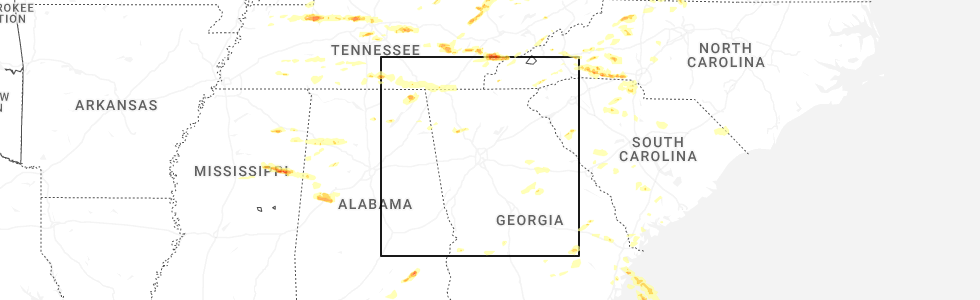
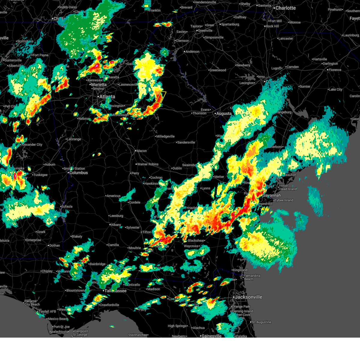
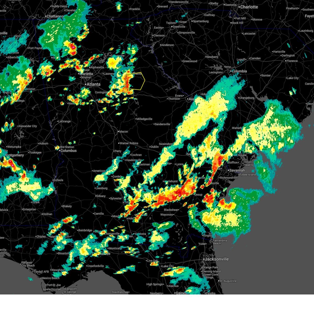
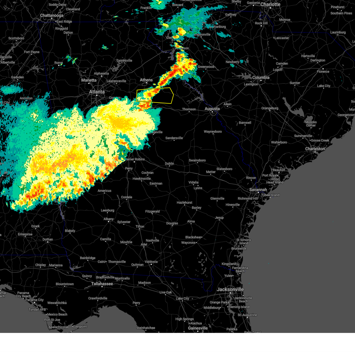
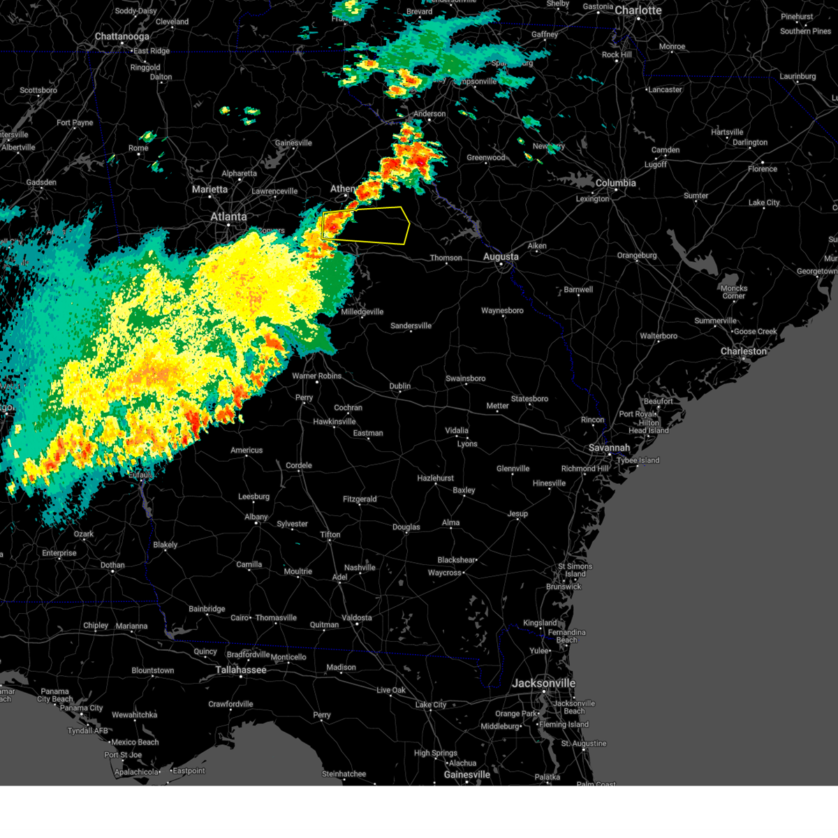
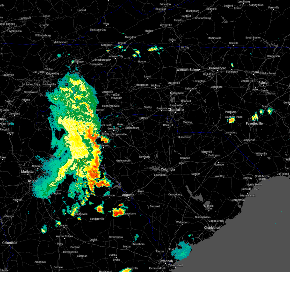
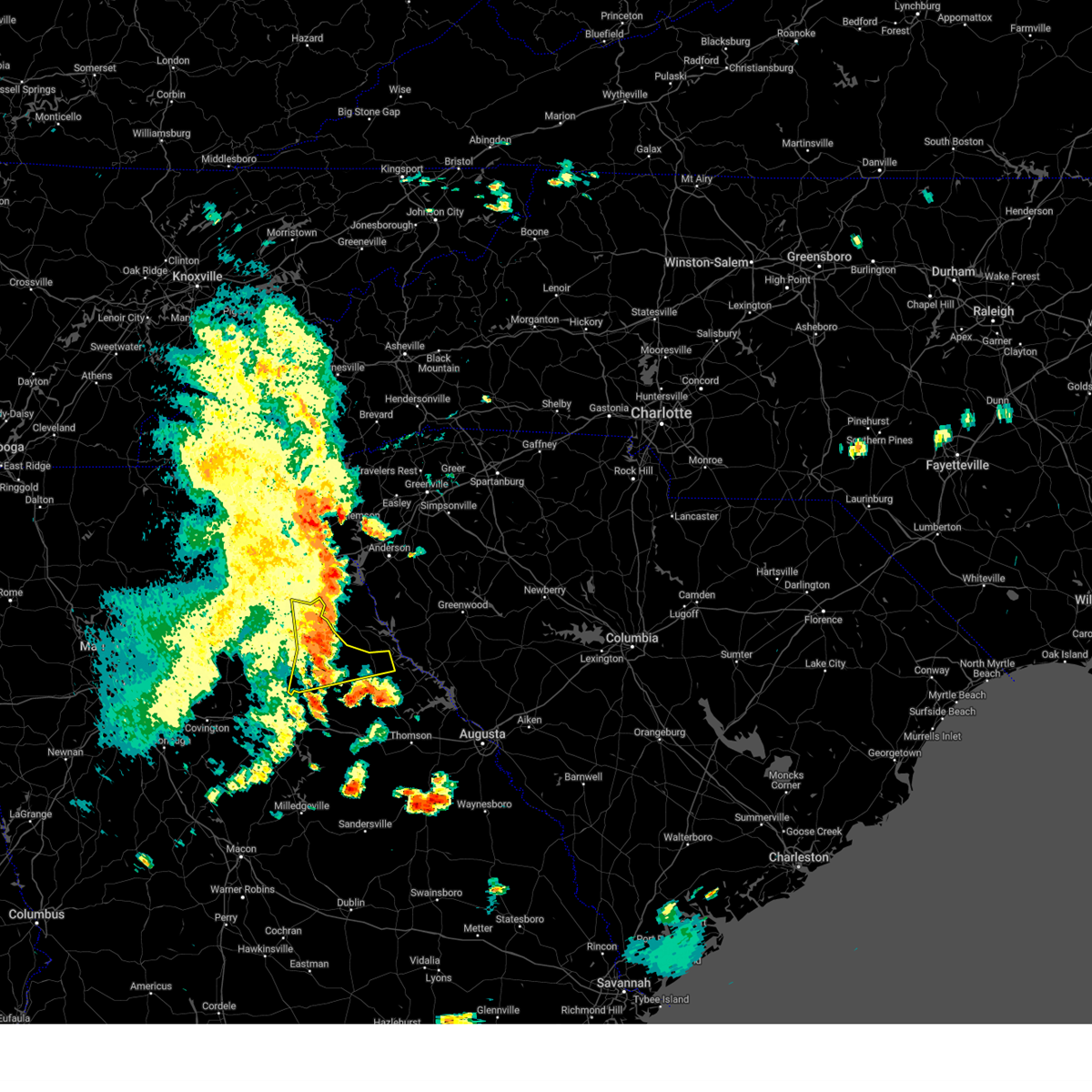
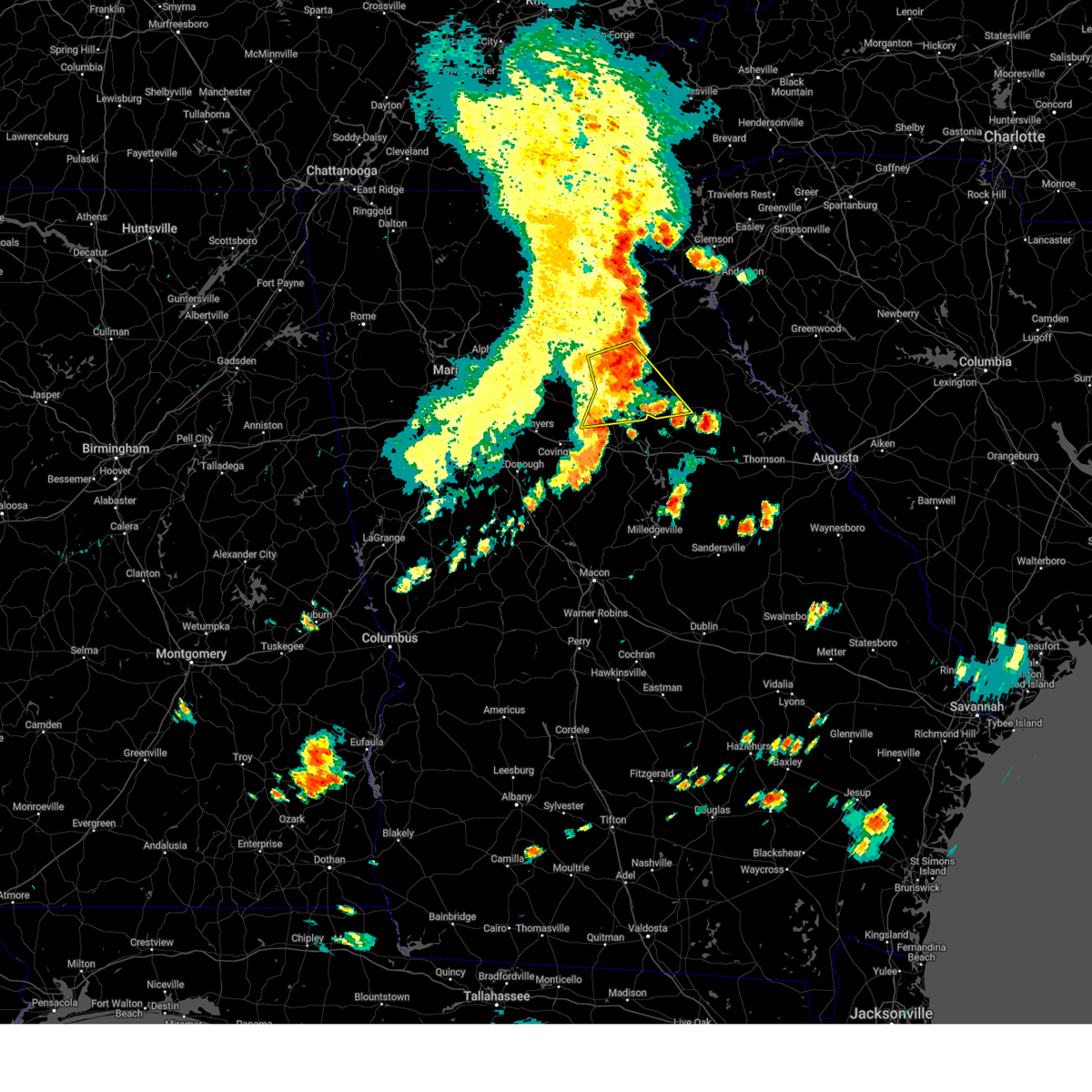
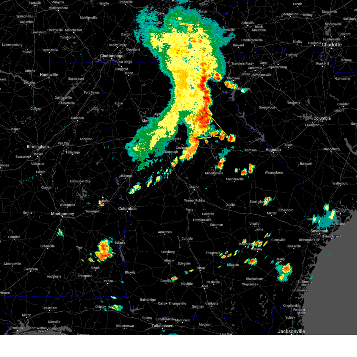
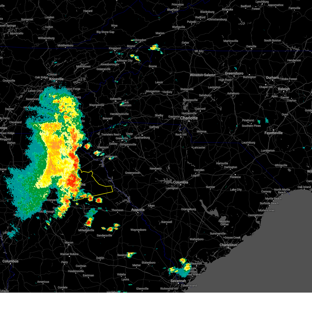
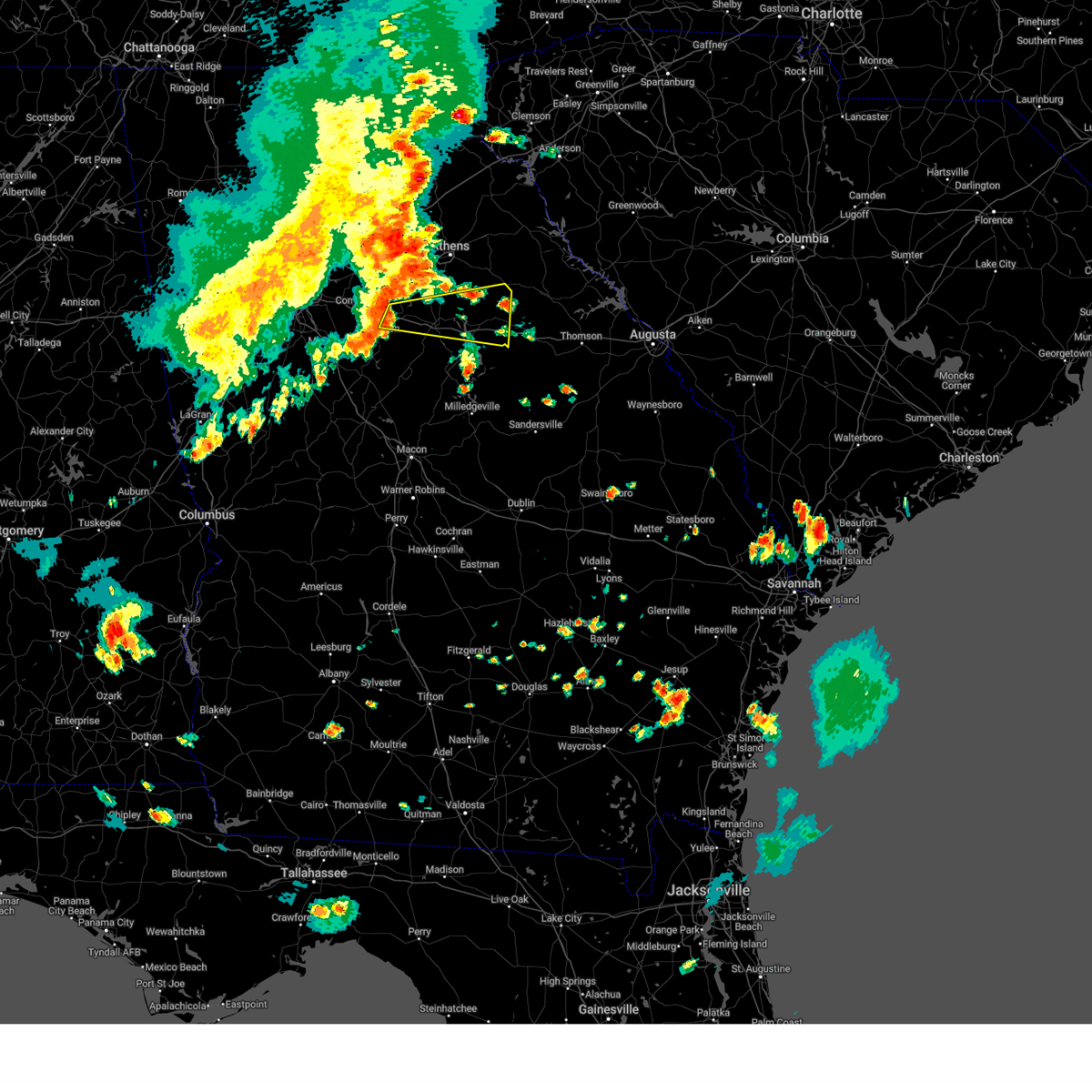
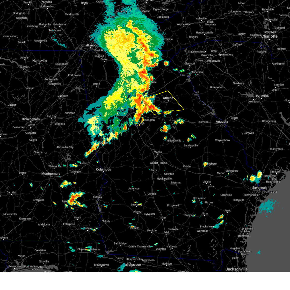
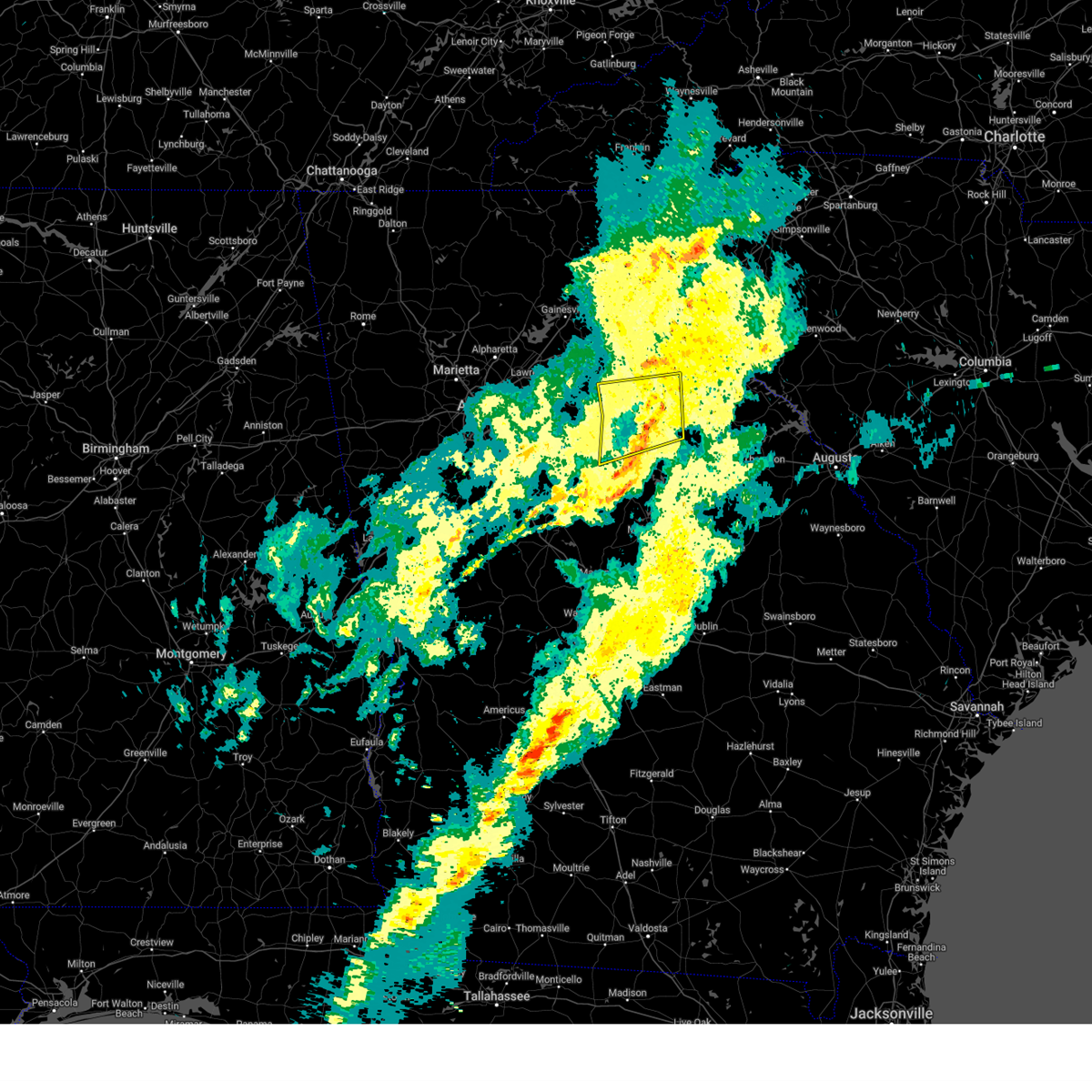
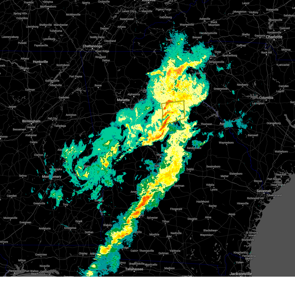
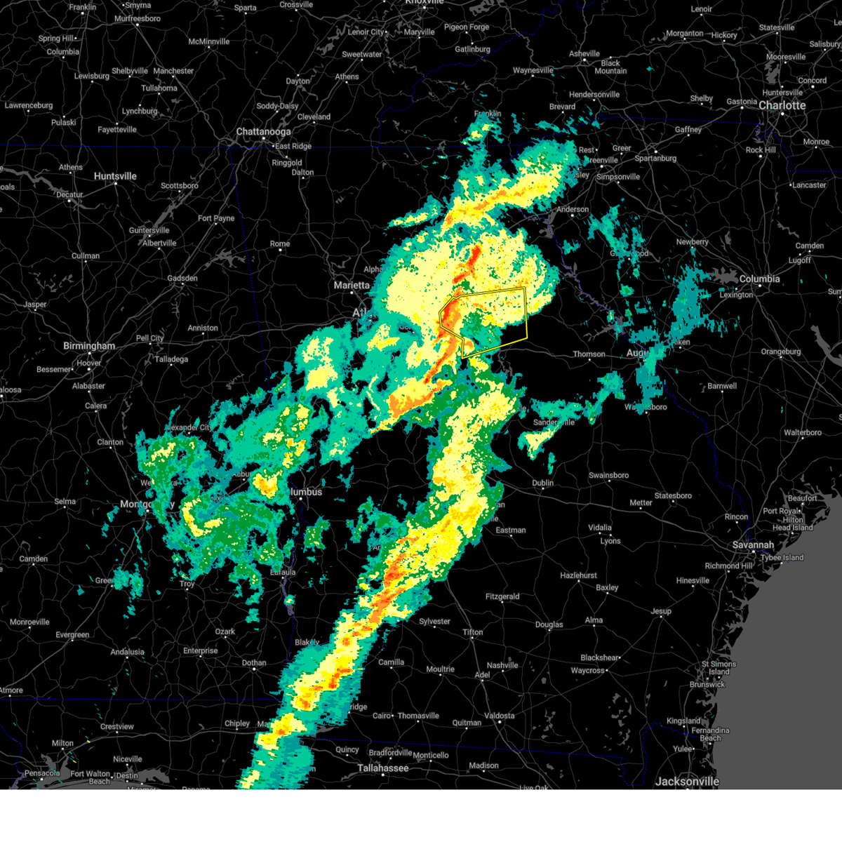
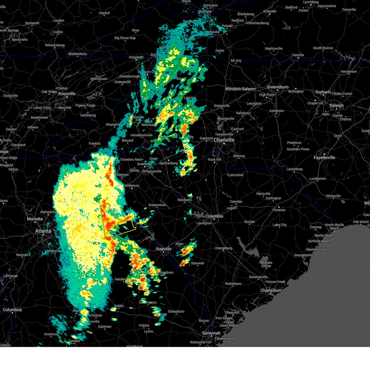
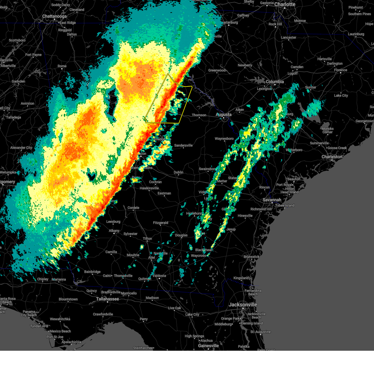
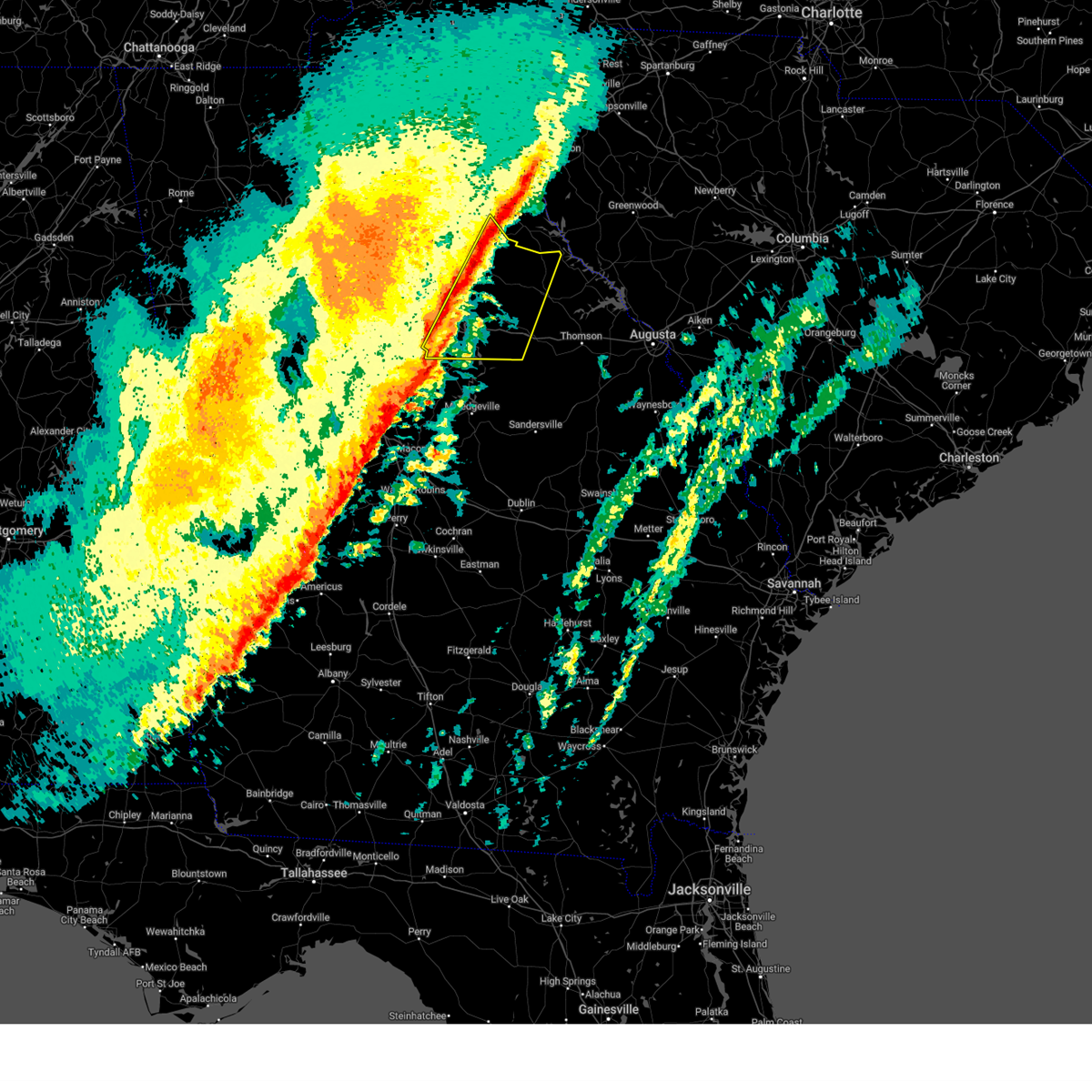
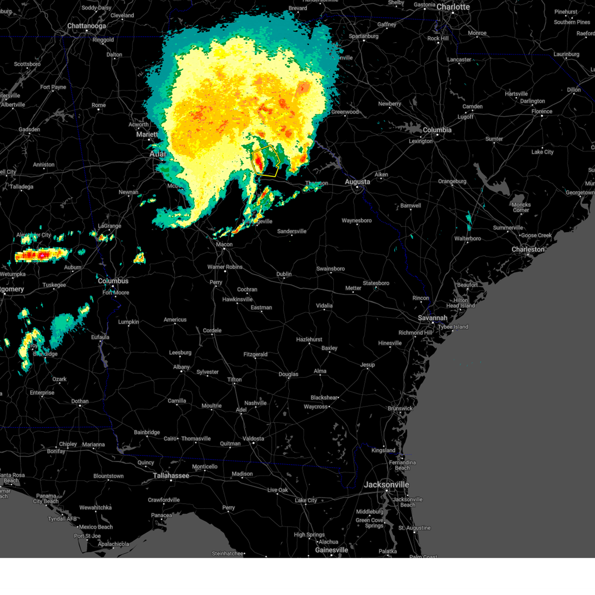
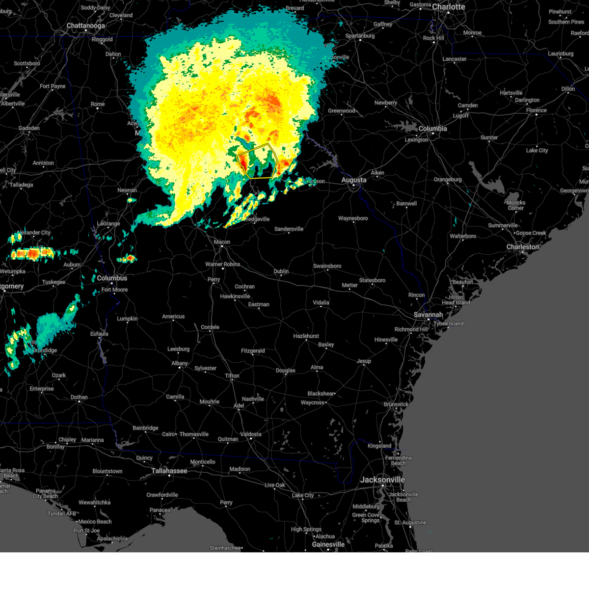
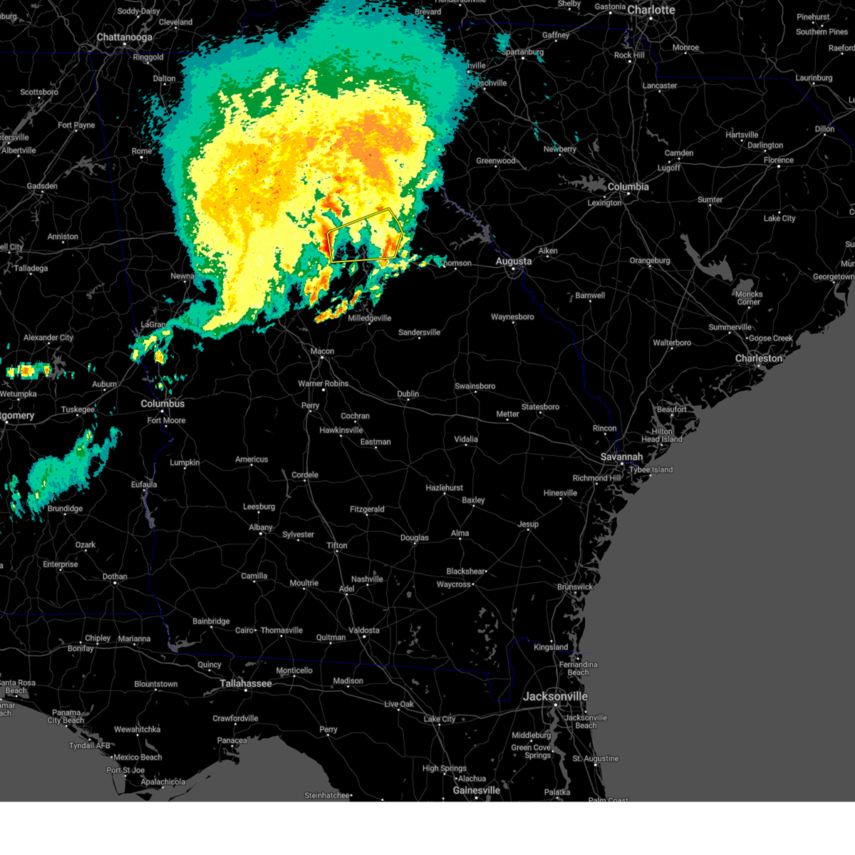
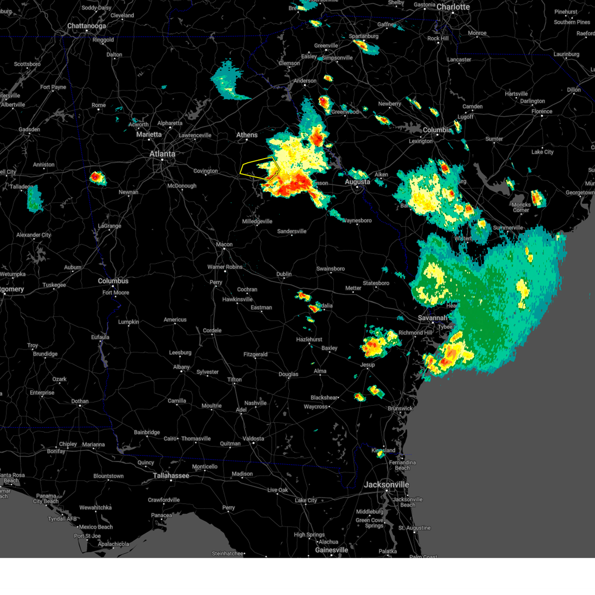
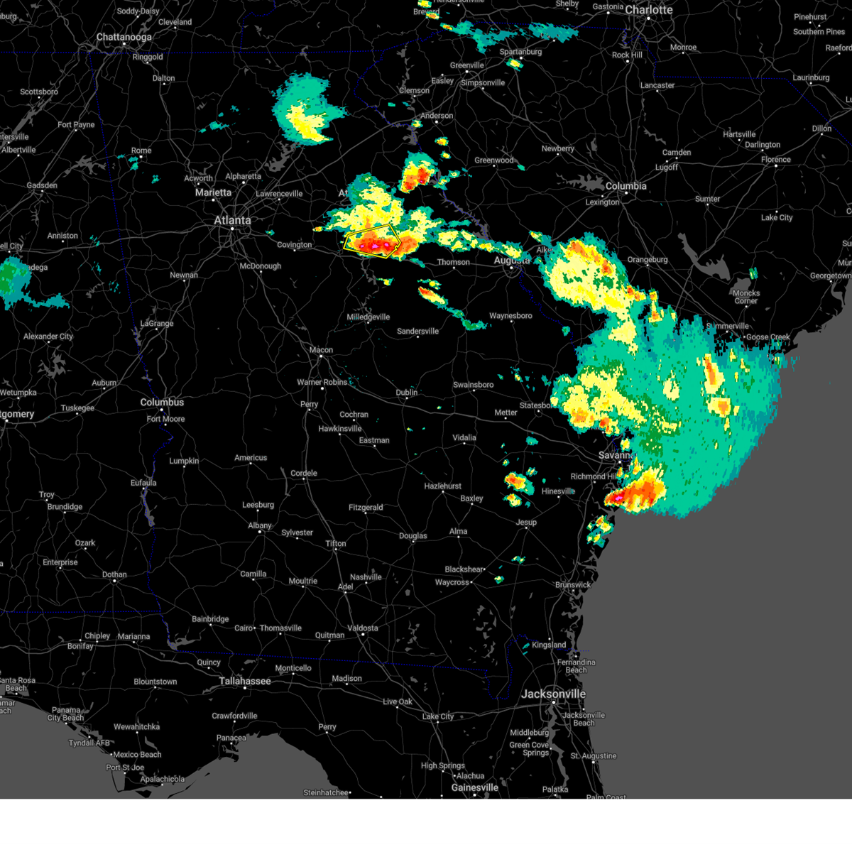
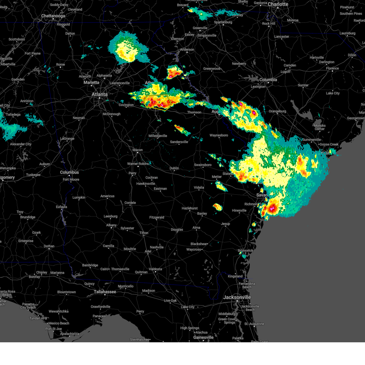
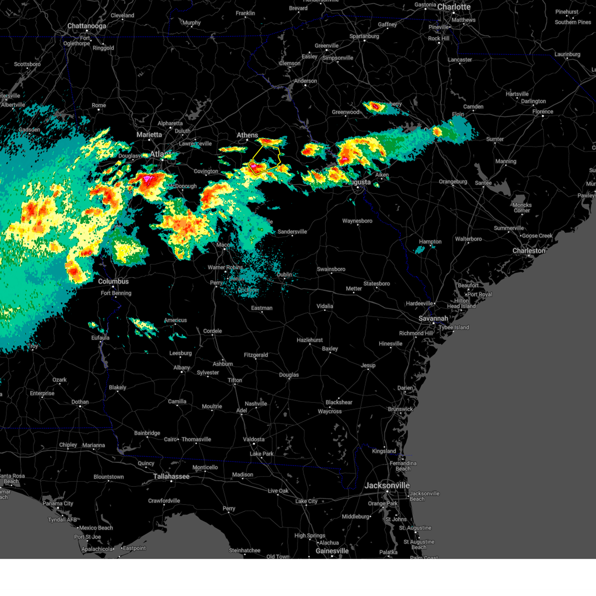
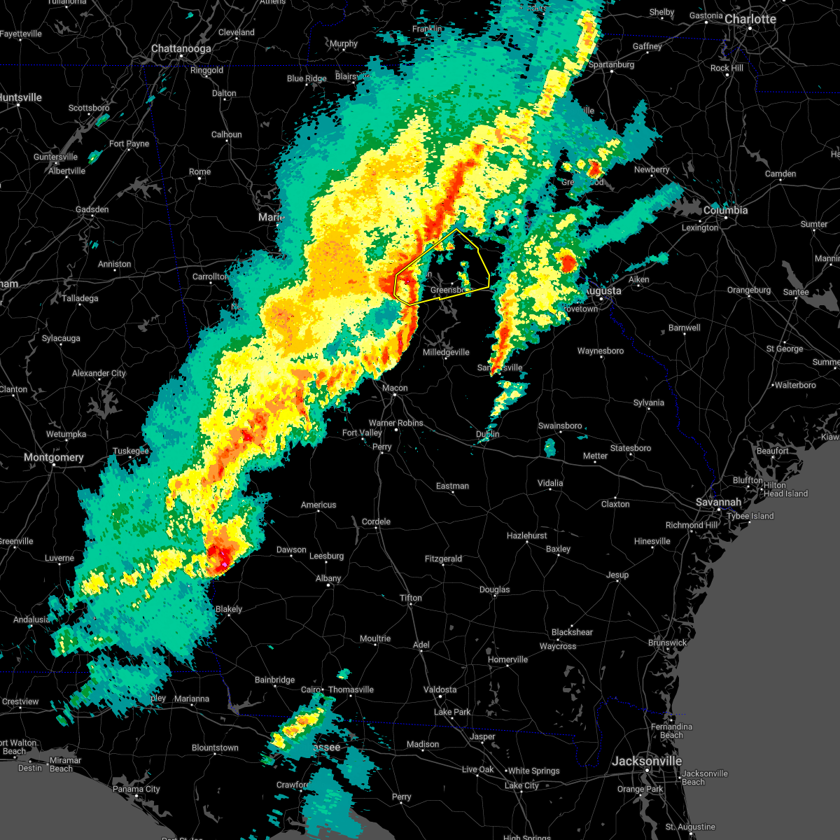
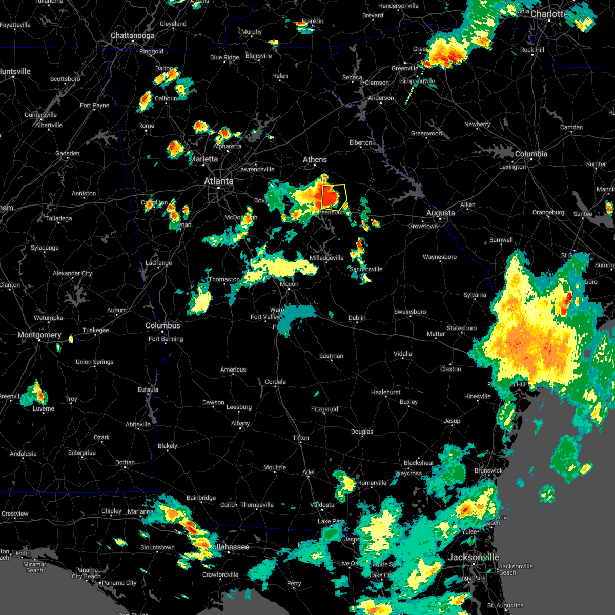
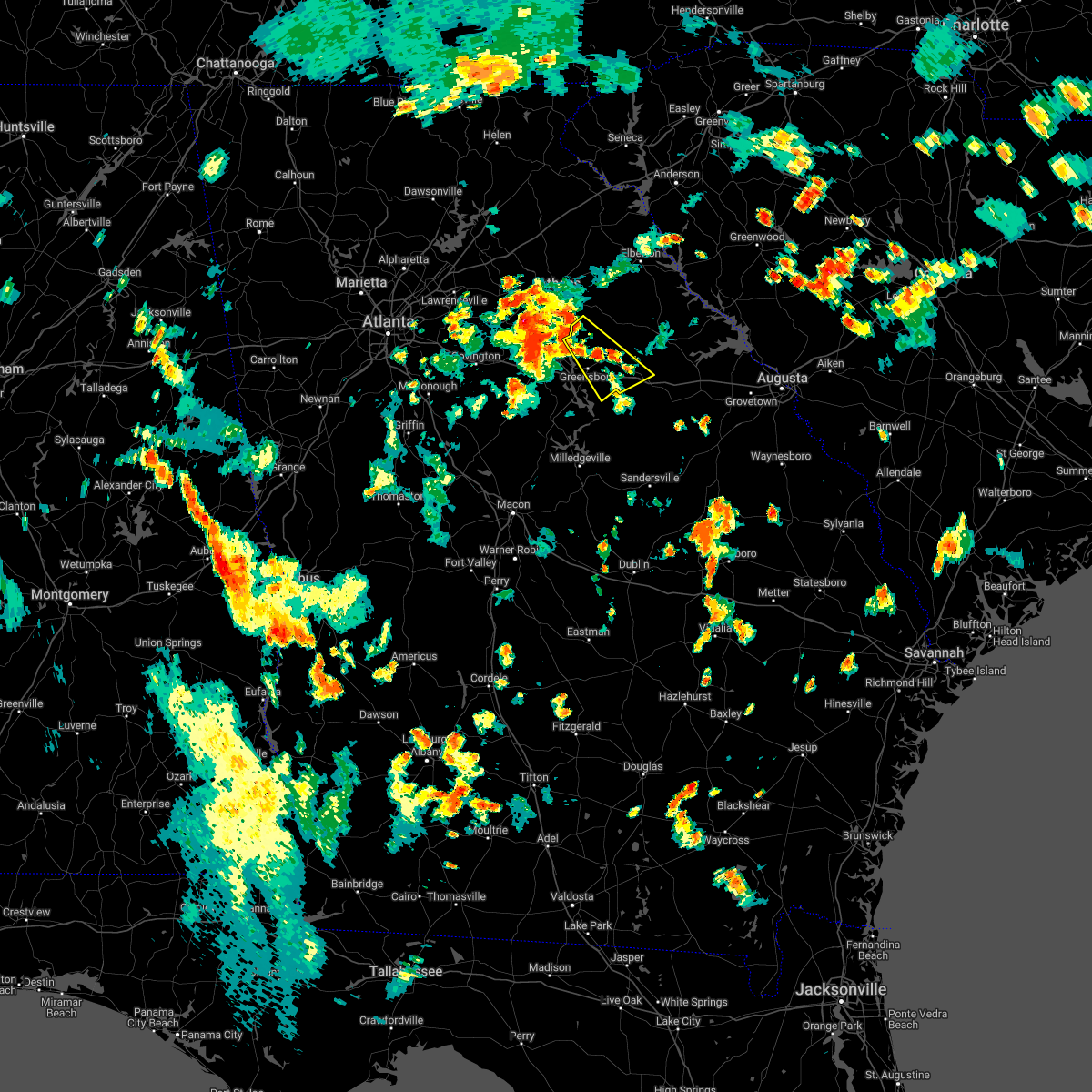
Hail Map for Maxeys, GA
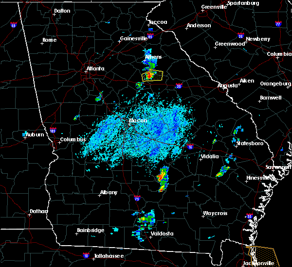
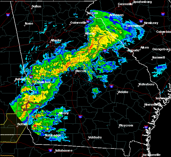
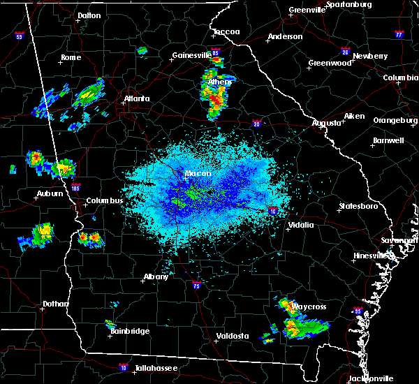
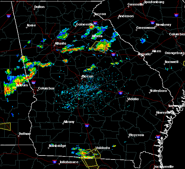
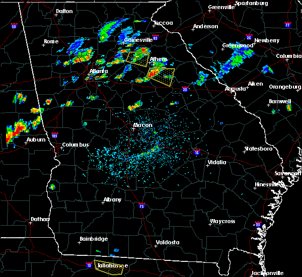
The Maxeys, GA area has had 0 reports of on-the-ground hail by trained spotters, and has been under severe weather warnings 26 times during the past 12 months. Doppler radar has detected hail at or near Maxeys, GA on 35 occasions, including 3 occasions during the past year.
| Name: | Maxeys, GA |
| Where Located: | 70 miles E of Atlanta, GA |
| Map: | Google Map for Maxeys, GA |
| Population: | 224 |
| Housing Units: | 94 |
| More Info: | Search Google for Maxeys, GA |
0
The Top Recent Hail Date for Maxeys, GA is Thursday, May 8, 2025 (35th out of 35)
Hail and Wind Damage Spotted near Maxeys, GA
| Date / Time | Report Details |
|---|---|
| 6/14/2025 6:05 PM EDT |
 At 605 pm edt, severe thunderstorms were located along a line extending from arnoldsville to near maxeys, moving east at 20 mph (radar indicated). Hazards include 60 mph wind gusts and dime size hail. Expect damage to roofs, siding, and trees. Locations impacted include, woodville, maxeys, and penfield. At 605 pm edt, severe thunderstorms were located along a line extending from arnoldsville to near maxeys, moving east at 20 mph (radar indicated). Hazards include 60 mph wind gusts and dime size hail. Expect damage to roofs, siding, and trees. Locations impacted include, woodville, maxeys, and penfield.
|
| 6/14/2025 5:51 PM EDT |
 At 551 pm edt, severe thunderstorms were located along a line extending from near dunlap to near wrayswood, moving east at 20 mph (radar indicated). Hazards include 60 mph wind gusts and dime size hail. Expect damage to roofs, siding, and trees. Locations impacted include, lexington, crawford, woodville, maxeys, stephens, penfield, and hutchings. At 551 pm edt, severe thunderstorms were located along a line extending from near dunlap to near wrayswood, moving east at 20 mph (radar indicated). Hazards include 60 mph wind gusts and dime size hail. Expect damage to roofs, siding, and trees. Locations impacted include, lexington, crawford, woodville, maxeys, stephens, penfield, and hutchings.
|
| 6/14/2025 5:51 PM EDT |
 the severe thunderstorm warning has been cancelled and is no longer in effect the severe thunderstorm warning has been cancelled and is no longer in effect
|
| 6/14/2025 5:28 PM EDT |
 Svrffc the national weather service in peachtree city has issued a * severe thunderstorm warning for, oconee county in northeastern georgia, north central morgan county in north central georgia, southeastern clarke county in northeastern georgia, northwestern greene county in east central georgia, western oglethorpe county in northeastern georgia, * until 615 pm edt. * at 528 pm edt, severe thunderstorms were located along a line extending from state botanical garden of ga to apalachee, moving east at 20 mph (radar indicated). Hazards include 60 mph wind gusts and dime size hail. expect damage to roofs, siding, and trees Svrffc the national weather service in peachtree city has issued a * severe thunderstorm warning for, oconee county in northeastern georgia, north central morgan county in north central georgia, southeastern clarke county in northeastern georgia, northwestern greene county in east central georgia, western oglethorpe county in northeastern georgia, * until 615 pm edt. * at 528 pm edt, severe thunderstorms were located along a line extending from state botanical garden of ga to apalachee, moving east at 20 mph (radar indicated). Hazards include 60 mph wind gusts and dime size hail. expect damage to roofs, siding, and trees
|
| 6/8/2025 8:30 AM EDT |
 the severe thunderstorm warning has been cancelled and is no longer in effect the severe thunderstorm warning has been cancelled and is no longer in effect
|
| 6/8/2025 8:13 AM EDT |
 Svrffc the national weather service in peachtree city has issued a * severe thunderstorm warning for, southeastern oconee county in northeastern georgia, northeastern morgan county in north central georgia, east central walton county in north central georgia, northern greene county in east central georgia, northwestern taliaferro county in east central georgia, southwestern wilkes county in east central georgia, southwestern oglethorpe county in northeastern georgia, * until 900 am edt. * at 812 am edt, a severe thunderstorm was located over bostwick, or 9 miles southwest of watkinsville, moving east at 45 mph (radar indicated). Hazards include 60 mph wind gusts. expect damage to roofs, siding, and trees Svrffc the national weather service in peachtree city has issued a * severe thunderstorm warning for, southeastern oconee county in northeastern georgia, northeastern morgan county in north central georgia, east central walton county in north central georgia, northern greene county in east central georgia, northwestern taliaferro county in east central georgia, southwestern wilkes county in east central georgia, southwestern oglethorpe county in northeastern georgia, * until 900 am edt. * at 812 am edt, a severe thunderstorm was located over bostwick, or 9 miles southwest of watkinsville, moving east at 45 mph (radar indicated). Hazards include 60 mph wind gusts. expect damage to roofs, siding, and trees
|
| 6/7/2025 7:26 PM EDT |
 The storms which prompted the warning have weakened below severe limits, and have exited the warned area. therefore, the warning will be allowed to expire. however, gusty winds are still possible with these thunderstorms. a severe thunderstorm watch remains in effect until 1100 pm edt for northeastern and east central georgia. remember, a severe thunderstorm warning still remains in effect for eastern ogelthorpe and northern wilkes counties. The storms which prompted the warning have weakened below severe limits, and have exited the warned area. therefore, the warning will be allowed to expire. however, gusty winds are still possible with these thunderstorms. a severe thunderstorm watch remains in effect until 1100 pm edt for northeastern and east central georgia. remember, a severe thunderstorm warning still remains in effect for eastern ogelthorpe and northern wilkes counties.
|
| 6/7/2025 7:17 PM EDT |
 the severe thunderstorm warning has been cancelled and is no longer in effect the severe thunderstorm warning has been cancelled and is no longer in effect
|
| 6/7/2025 7:17 PM EDT |
 At 717 pm edt, severe thunderstorms were located along a line extending from near hartwell to near ruckersville to 6 miles east of lexington, moving east at 50 mph (radar indicated). Hazards include 60 mph wind gusts. Expect damage to roofs, siding, and trees. Locations impacted include, danielsville, lexington, comer, crawford, colbert, tignall, arnoldsville, ila, carlton, maxeys, athens-clarke county, stephens, delhi, smithonia, hutchings, danburg, vesta, point peter, mallorysville, and jacksons crossroads. At 717 pm edt, severe thunderstorms were located along a line extending from near hartwell to near ruckersville to 6 miles east of lexington, moving east at 50 mph (radar indicated). Hazards include 60 mph wind gusts. Expect damage to roofs, siding, and trees. Locations impacted include, danielsville, lexington, comer, crawford, colbert, tignall, arnoldsville, ila, carlton, maxeys, athens-clarke county, stephens, delhi, smithonia, hutchings, danburg, vesta, point peter, mallorysville, and jacksons crossroads.
|
| 6/7/2025 7:07 PM EDT |
 The storm which prompted the warning has weakened below severe limits, and has exited the warned area. therefore, the warning will be allowed to expire. a severe thunderstorm watch remains in effect until 900 pm edt for north central, northeastern and east central georgia. The storm which prompted the warning has weakened below severe limits, and has exited the warned area. therefore, the warning will be allowed to expire. a severe thunderstorm watch remains in effect until 900 pm edt for north central, northeastern and east central georgia.
|
| 6/7/2025 6:57 PM EDT |
 The storms which prompted the warning have moved out of the area. therefore, the warning will be allowed to expire. a severe thunderstorm watch remains in effect until 900 pm edt for north central, northeastern and east central georgia. remember, a severe thunderstorm warning still remains in effect for clarke, ogelthorpe, madison, oconee, and jackson counties. The storms which prompted the warning have moved out of the area. therefore, the warning will be allowed to expire. a severe thunderstorm watch remains in effect until 900 pm edt for north central, northeastern and east central georgia. remember, a severe thunderstorm warning still remains in effect for clarke, ogelthorpe, madison, oconee, and jackson counties.
|
| 6/7/2025 6:54 PM EDT |
 At 653 pm edt, a severe thunderstorm was located near madison, moving east at 45 mph (radar indicated). Hazards include 60 mph wind gusts. Expect damage to roofs, siding, and trees. Locations impacted include, madison, greensboro, union point, rutledge, bostwick, woodville, white plains, siloam, maxeys, buckhead, veazey, robinson, wrayswood, hard labor creek state park, greshamville, parks mill, carey, swords, penfield, and philomath. At 653 pm edt, a severe thunderstorm was located near madison, moving east at 45 mph (radar indicated). Hazards include 60 mph wind gusts. Expect damage to roofs, siding, and trees. Locations impacted include, madison, greensboro, union point, rutledge, bostwick, woodville, white plains, siloam, maxeys, buckhead, veazey, robinson, wrayswood, hard labor creek state park, greshamville, parks mill, carey, swords, penfield, and philomath.
|
| 6/7/2025 6:54 PM EDT |
 the severe thunderstorm warning has been cancelled and is no longer in effect the severe thunderstorm warning has been cancelled and is no longer in effect
|
| 6/7/2025 6:48 PM EDT |
 At 648 pm edt, severe thunderstorms were located along a line extending from beechwood hills to philomath, moving east at 60 mph (radar indicated). Hazards include 60 mph wind gusts. Expect damage to roofs, siding, and trees. Locations impacted include, jefferson, watkinsville, lexington, athens, statham, arcade, nicholson, winterville, bogart, crawford, north high shoals, bostwick, arnoldsville, good hope, bishop, maxeys, hull, whitehall, athens-clarke county, and stephens. At 648 pm edt, severe thunderstorms were located along a line extending from beechwood hills to philomath, moving east at 60 mph (radar indicated). Hazards include 60 mph wind gusts. Expect damage to roofs, siding, and trees. Locations impacted include, jefferson, watkinsville, lexington, athens, statham, arcade, nicholson, winterville, bogart, crawford, north high shoals, bostwick, arnoldsville, good hope, bishop, maxeys, hull, whitehall, athens-clarke county, and stephens.
|
| 6/7/2025 6:48 PM EDT |
 the severe thunderstorm warning has been cancelled and is no longer in effect the severe thunderstorm warning has been cancelled and is no longer in effect
|
| 6/7/2025 6:45 PM EDT |
 Svrffc the national weather service in peachtree city has issued a * severe thunderstorm warning for, eastern oconee county in northeastern georgia, north central morgan county in north central georgia, southeastern banks county in northeastern georgia, eastern clarke county in northeastern georgia, northeastern jackson county in northeastern georgia, northwestern wilkes county in east central georgia, oglethorpe county in northeastern georgia, madison county in northeastern georgia, * until 730 pm edt. * at 644 pm edt, severe thunderstorms were located along a line extending from near banks crossing to diamond hill to farmington, moving east at 50 mph (radar indicated). Hazards include 60 mph wind gusts. expect damage to roofs, siding, and trees Svrffc the national weather service in peachtree city has issued a * severe thunderstorm warning for, eastern oconee county in northeastern georgia, north central morgan county in north central georgia, southeastern banks county in northeastern georgia, eastern clarke county in northeastern georgia, northeastern jackson county in northeastern georgia, northwestern wilkes county in east central georgia, oglethorpe county in northeastern georgia, madison county in northeastern georgia, * until 730 pm edt. * at 644 pm edt, severe thunderstorms were located along a line extending from near banks crossing to diamond hill to farmington, moving east at 50 mph (radar indicated). Hazards include 60 mph wind gusts. expect damage to roofs, siding, and trees
|
| 6/7/2025 6:34 PM EDT |
 Svrffc the national weather service in peachtree city has issued a * severe thunderstorm warning for, southeastern oconee county in northeastern georgia, morgan county in north central georgia, southeastern walton county in north central georgia, greene county in east central georgia, western taliaferro county in east central georgia, southwestern oglethorpe county in northeastern georgia, northeastern newton county in north central georgia, * until 715 pm edt. * at 634 pm edt, a severe thunderstorm was located over brick store, or near covington, moving east at 45 mph (radar indicated). Hazards include 60 mph wind gusts. expect damage to roofs, siding, and trees Svrffc the national weather service in peachtree city has issued a * severe thunderstorm warning for, southeastern oconee county in northeastern georgia, morgan county in north central georgia, southeastern walton county in north central georgia, greene county in east central georgia, western taliaferro county in east central georgia, southwestern oglethorpe county in northeastern georgia, northeastern newton county in north central georgia, * until 715 pm edt. * at 634 pm edt, a severe thunderstorm was located over brick store, or near covington, moving east at 45 mph (radar indicated). Hazards include 60 mph wind gusts. expect damage to roofs, siding, and trees
|
| 6/7/2025 6:12 PM EDT |
 Svrffc the national weather service in peachtree city has issued a * severe thunderstorm warning for, oconee county in northeastern georgia, barrow county in north central georgia, northwestern morgan county in north central georgia, east central gwinnett county in north central georgia, clarke county in northeastern georgia, walton county in north central georgia, southern jackson county in northeastern georgia, western oglethorpe county in northeastern georgia, southwestern madison county in northeastern georgia, * until 700 pm edt. * at 612 pm edt, severe thunderstorms were located along a line extending from lawrenceville to near ebenezer, moving east at 60 mph (radar indicated). Hazards include 60 mph wind gusts. expect damage to roofs, siding, and trees Svrffc the national weather service in peachtree city has issued a * severe thunderstorm warning for, oconee county in northeastern georgia, barrow county in north central georgia, northwestern morgan county in north central georgia, east central gwinnett county in north central georgia, clarke county in northeastern georgia, walton county in north central georgia, southern jackson county in northeastern georgia, western oglethorpe county in northeastern georgia, southwestern madison county in northeastern georgia, * until 700 pm edt. * at 612 pm edt, severe thunderstorms were located along a line extending from lawrenceville to near ebenezer, moving east at 60 mph (radar indicated). Hazards include 60 mph wind gusts. expect damage to roofs, siding, and trees
|
| 4/7/2025 8:52 AM EDT |
 The storms which prompted the warning have moved out of the area. therefore, the warning will be allowed to expire. however, gusty winds are still possible with these thunderstorms. The storms which prompted the warning have moved out of the area. therefore, the warning will be allowed to expire. however, gusty winds are still possible with these thunderstorms.
|
| 4/7/2025 8:42 AM EDT |
 At 842 am edt, severe thunderstorms were located along a line extending from diamond hill to arnoldsville to near maxeys, moving northeast at 75 mph (radar indicated). Hazards include 60 mph wind gusts. Expect damage to roofs, siding, and trees. Locations impacted include, bishop, madison, arnoldsville, north high shoals, beechwood hills, wrayswood, eastville, hutchings, barnett shoals, greshamville, lexington, maxeys, penfield, watkinsville, apalachee, whitehall, stephens, woodville, bostwick, and buckhead. At 842 am edt, severe thunderstorms were located along a line extending from diamond hill to arnoldsville to near maxeys, moving northeast at 75 mph (radar indicated). Hazards include 60 mph wind gusts. Expect damage to roofs, siding, and trees. Locations impacted include, bishop, madison, arnoldsville, north high shoals, beechwood hills, wrayswood, eastville, hutchings, barnett shoals, greshamville, lexington, maxeys, penfield, watkinsville, apalachee, whitehall, stephens, woodville, bostwick, and buckhead.
|
| 4/7/2025 8:20 AM EDT |
 Svrffc the national weather service in peachtree city has issued a * severe thunderstorm warning for, oconee county in northeastern georgia, morgan county in north central georgia, southern clarke county in northeastern georgia, eastern walton county in north central georgia, northern greene county in east central georgia, western oglethorpe county in northeastern georgia, * until 900 am edt. * at 820 am edt, severe thunderstorms were located along a line extending from near campton to ebenezer to near rutledge, moving northeast at 75 mph (radar indicated). Hazards include 60 mph wind gusts. expect damage to roofs, siding, and trees Svrffc the national weather service in peachtree city has issued a * severe thunderstorm warning for, oconee county in northeastern georgia, morgan county in north central georgia, southern clarke county in northeastern georgia, eastern walton county in north central georgia, northern greene county in east central georgia, western oglethorpe county in northeastern georgia, * until 900 am edt. * at 820 am edt, severe thunderstorms were located along a line extending from near campton to ebenezer to near rutledge, moving northeast at 75 mph (radar indicated). Hazards include 60 mph wind gusts. expect damage to roofs, siding, and trees
|
| 3/31/2025 2:31 PM EDT |
 Svrffc the national weather service in peachtree city has issued a * severe thunderstorm warning for, northern wilkes county in east central georgia, oglethorpe county in northeastern georgia, central madison county in northeastern georgia, * until 315 pm edt. * at 231 pm edt, severe thunderstorms were located along a line extending from near danielsville to woodville, moving east at 40 mph (radar indicated). Hazards include 60 mph wind gusts. expect damage to roofs, siding, and trees Svrffc the national weather service in peachtree city has issued a * severe thunderstorm warning for, northern wilkes county in east central georgia, oglethorpe county in northeastern georgia, central madison county in northeastern georgia, * until 315 pm edt. * at 231 pm edt, severe thunderstorms were located along a line extending from near danielsville to woodville, moving east at 40 mph (radar indicated). Hazards include 60 mph wind gusts. expect damage to roofs, siding, and trees
|
| 2/16/2025 5:54 AM EST |
 The storms which prompted the warning have moved out of the area. therefore, the warning will be allowed to expire. a tornado watch remains in effect until 900 am est for central georgia. remember, a severe thunderstorm warning still remains in effect for eastern oglethorpe and greene counties, as well as taliaferro, wilkes, and northern hancock counties. The storms which prompted the warning have moved out of the area. therefore, the warning will be allowed to expire. a tornado watch remains in effect until 900 am est for central georgia. remember, a severe thunderstorm warning still remains in effect for eastern oglethorpe and greene counties, as well as taliaferro, wilkes, and northern hancock counties.
|
| 2/16/2025 5:46 AM EST |
 the severe thunderstorm warning has been cancelled and is no longer in effect the severe thunderstorm warning has been cancelled and is no longer in effect
|
| 2/16/2025 5:46 AM EST |
 At 545 am est, severe thunderstorms were located along a line extending from near point peter to eatonton, moving east at 60 mph (radar indicated). Hazards include 60 mph wind gusts. Expect damage to roofs, siding, and trees. Locations impacted include, washington, madison, greensboro, crawfordville, lexington, union point, comer, crawford, tignall, arnoldsville, woodville, white plains, siloam, carlton, maxeys, rayle, buckhead, reynolds at lake oconee, phoenix, and athens-clarke county. At 545 am est, severe thunderstorms were located along a line extending from near point peter to eatonton, moving east at 60 mph (radar indicated). Hazards include 60 mph wind gusts. Expect damage to roofs, siding, and trees. Locations impacted include, washington, madison, greensboro, crawfordville, lexington, union point, comer, crawford, tignall, arnoldsville, woodville, white plains, siloam, carlton, maxeys, rayle, buckhead, reynolds at lake oconee, phoenix, and athens-clarke county.
|
| 2/16/2025 5:16 AM EST | Svrffc the national weather service in peachtree city has issued a * severe thunderstorm warning for, north central hancock county in east central georgia, clarke county in northeastern georgia, taliaferro county in east central georgia, southeastern jackson county in northeastern georgia, western wilkes county in east central georgia, madison county in northeastern georgia, southeastern newton county in north central georgia, oconee county in northeastern georgia, morgan county in north central georgia, northern putnam county in central georgia, southeastern banks county in northeastern georgia, eastern walton county in north central georgia, greene county in east central georgia, oglethorpe county in northeastern georgia, northern jasper county in central georgia, * until 600 am est. * at 516 am est, severe thunderstorms were located along a line extending from near westgate park to turtle cove, moving east at 60 mph (radar indicated). Hazards include 60 mph wind gusts. expect damage to roofs, siding, and trees |
| 5/27/2024 9:59 AM EDT |
 the severe thunderstorm warning has been cancelled and is no longer in effect the severe thunderstorm warning has been cancelled and is no longer in effect
|
| 5/27/2024 9:59 AM EDT |
 At 958 am edt, a severe thunderstorm was located over woodville, or 10 miles northeast of greensboro, moving east at 65 mph (radar indicated). Hazards include 60 mph wind gusts. Expect damage to roofs, siding, and trees. Locations impacted include, greensboro, lexington, union point, woodville, maxeys, stephens, penfield, philomath, and hutchings. At 958 am edt, a severe thunderstorm was located over woodville, or 10 miles northeast of greensboro, moving east at 65 mph (radar indicated). Hazards include 60 mph wind gusts. Expect damage to roofs, siding, and trees. Locations impacted include, greensboro, lexington, union point, woodville, maxeys, stephens, penfield, philomath, and hutchings.
|
| 5/27/2024 9:53 AM EDT |
 At 952 am edt, a severe thunderstorm was located over penfield, or 7 miles north of greensboro, moving east at 65 mph (radar indicated). Hazards include 60 mph wind gusts. Expect damage to roofs, siding, and trees. Locations impacted include, greensboro, lexington, union point, woodville, maxeys, stephens, wrayswood, hutchings, greshamville, carey, penfield, philomath, and farmington. At 952 am edt, a severe thunderstorm was located over penfield, or 7 miles north of greensboro, moving east at 65 mph (radar indicated). Hazards include 60 mph wind gusts. Expect damage to roofs, siding, and trees. Locations impacted include, greensboro, lexington, union point, woodville, maxeys, stephens, wrayswood, hutchings, greshamville, carey, penfield, philomath, and farmington.
|
| 5/27/2024 9:53 AM EDT |
 the severe thunderstorm warning has been cancelled and is no longer in effect the severe thunderstorm warning has been cancelled and is no longer in effect
|
| 5/27/2024 9:40 AM EDT |
 Svrffc the national weather service in peachtree city has issued a * severe thunderstorm warning for, southeastern oconee county in northeastern georgia, central morgan county in north central georgia, greene county in east central georgia, northwestern taliaferro county in east central georgia, southwestern oglethorpe county in northeastern georgia, * until 1015 am edt. * at 940 am edt, a severe thunderstorm was located near madison, moving east at 65 mph (radar indicated). Hazards include 60 mph wind gusts. expect damage to roofs, siding, and trees Svrffc the national weather service in peachtree city has issued a * severe thunderstorm warning for, southeastern oconee county in northeastern georgia, central morgan county in north central georgia, greene county in east central georgia, northwestern taliaferro county in east central georgia, southwestern oglethorpe county in northeastern georgia, * until 1015 am edt. * at 940 am edt, a severe thunderstorm was located near madison, moving east at 65 mph (radar indicated). Hazards include 60 mph wind gusts. expect damage to roofs, siding, and trees
|
| 5/24/2024 6:29 PM EDT |
 The storm which prompted the warning has moved out of the area. therefore, the warning will be allowed to expire. however, gusty winds and heavy rain are still possible with this thunderstorm. to report severe weather, contact your nearest law enforcement agency. they will relay your report to the national weather service peachtree city. The storm which prompted the warning has moved out of the area. therefore, the warning will be allowed to expire. however, gusty winds and heavy rain are still possible with this thunderstorm. to report severe weather, contact your nearest law enforcement agency. they will relay your report to the national weather service peachtree city.
|
| 5/24/2024 6:00 PM EDT |
 the severe thunderstorm warning has been cancelled and is no longer in effect the severe thunderstorm warning has been cancelled and is no longer in effect
|
| 5/24/2024 6:00 PM EDT |
 At 559 pm edt, a severe thunderstorm was located over wrayswood, or 10 miles northwest of greensboro, moving east at 15 mph (radar indicated). Hazards include 60 mph wind gusts and quarter size hail. Hail damage to vehicles is expected. expect wind damage to roofs, siding, and trees. Locations impacted include, greensboro, union point, woodville, siloam, maxeys, penfield, wrayswood, greshamville, and daniel springs. At 559 pm edt, a severe thunderstorm was located over wrayswood, or 10 miles northwest of greensboro, moving east at 15 mph (radar indicated). Hazards include 60 mph wind gusts and quarter size hail. Hail damage to vehicles is expected. expect wind damage to roofs, siding, and trees. Locations impacted include, greensboro, union point, woodville, siloam, maxeys, penfield, wrayswood, greshamville, and daniel springs.
|
| 5/24/2024 5:40 PM EDT |
 Svrffc the national weather service in peachtree city has issued a * severe thunderstorm warning for, southeastern oconee county in northeastern georgia, central morgan county in north central georgia, northern greene county in east central georgia, southwestern oglethorpe county in northeastern georgia, * until 630 pm edt. * at 539 pm edt, a severe thunderstorm was located near apalachee, or 10 miles northeast of madison, moving east at 15 mph (radar indicated). Hazards include 60 mph wind gusts and quarter size hail. Hail damage to vehicles is expected. Expect wind damage to roofs, siding, and trees. Svrffc the national weather service in peachtree city has issued a * severe thunderstorm warning for, southeastern oconee county in northeastern georgia, central morgan county in north central georgia, northern greene county in east central georgia, southwestern oglethorpe county in northeastern georgia, * until 630 pm edt. * at 539 pm edt, a severe thunderstorm was located near apalachee, or 10 miles northeast of madison, moving east at 15 mph (radar indicated). Hazards include 60 mph wind gusts and quarter size hail. Hail damage to vehicles is expected. Expect wind damage to roofs, siding, and trees.
|
| 4/3/2024 3:24 AM EDT |
 The storm which prompted the warning has moved out of the area. therefore, the warning will be allowed to expire. a tornado watch remains in effect until 400 am edt for north central, northeastern and east central georgia. remember, a tornado warning still remains in effect for oglethorpe county. The storm which prompted the warning has moved out of the area. therefore, the warning will be allowed to expire. a tornado watch remains in effect until 400 am edt for north central, northeastern and east central georgia. remember, a tornado warning still remains in effect for oglethorpe county.
|
| 4/3/2024 3:01 AM EDT |
 Torffc the national weather service in peachtree city has issued a * tornado warning for, northern greene county in east central georgia, northwestern taliaferro county in east central georgia, southwestern wilkes county in east central georgia, southwestern oglethorpe county in northeastern georgia, * until 345 am edt. * at 301 am edt, a severe thunderstorm capable of producing a tornado was located over greshamville, or 7 miles northwest of greensboro, moving northeast at 50 mph (radar indicated rotation). Hazards include tornado. Flying debris will be dangerous to those caught without shelter. mobile homes will be damaged or destroyed. damage to roofs, windows, and vehicles will occur. Tree damage is likely. Torffc the national weather service in peachtree city has issued a * tornado warning for, northern greene county in east central georgia, northwestern taliaferro county in east central georgia, southwestern wilkes county in east central georgia, southwestern oglethorpe county in northeastern georgia, * until 345 am edt. * at 301 am edt, a severe thunderstorm capable of producing a tornado was located over greshamville, or 7 miles northwest of greensboro, moving northeast at 50 mph (radar indicated rotation). Hazards include tornado. Flying debris will be dangerous to those caught without shelter. mobile homes will be damaged or destroyed. damage to roofs, windows, and vehicles will occur. Tree damage is likely.
|
| 4/3/2024 2:48 AM EDT |
 Svrffc the national weather service in peachtree city has issued a * severe thunderstorm warning for, southeastern oconee county in northeastern georgia, central morgan county in north central georgia, northern greene county in east central georgia, southwestern oglethorpe county in northeastern georgia, * until 330 am edt. * at 248 am edt, a severe thunderstorm was located over madison, moving northeast at 55 mph (radar indicated). Hazards include 60 mph wind gusts. expect damage to roofs, siding, and trees Svrffc the national weather service in peachtree city has issued a * severe thunderstorm warning for, southeastern oconee county in northeastern georgia, central morgan county in north central georgia, northern greene county in east central georgia, southwestern oglethorpe county in northeastern georgia, * until 330 am edt. * at 248 am edt, a severe thunderstorm was located over madison, moving northeast at 55 mph (radar indicated). Hazards include 60 mph wind gusts. expect damage to roofs, siding, and trees
|
| 2/28/2024 4:42 PM EST |
 At 441 pm est, severe thunderstorms were located along a line extending from vesta to near lexington to greshamville, moving east at 50 mph (radar indicated). Hazards include 60 mph wind gusts. Expect damage to roofs, siding, and trees. Locations impacted include, washington, greensboro, lexington, union point, tignall, woodville, maxeys, rayle, stephens, delhi, wrayswood, hutchings, greshamville, newtown, danburg, penfield, lyneville, vesta, carters grove, and apalachee. At 441 pm est, severe thunderstorms were located along a line extending from vesta to near lexington to greshamville, moving east at 50 mph (radar indicated). Hazards include 60 mph wind gusts. Expect damage to roofs, siding, and trees. Locations impacted include, washington, greensboro, lexington, union point, tignall, woodville, maxeys, rayle, stephens, delhi, wrayswood, hutchings, greshamville, newtown, danburg, penfield, lyneville, vesta, carters grove, and apalachee.
|
| 2/28/2024 4:25 PM EST |
 Svrffc the national weather service in peachtree city has issued a * severe thunderstorm warning for, southeastern oconee county in northeastern georgia, northern morgan county in north central georgia, southeastern clarke county in northeastern georgia, northern greene county in east central georgia, northwestern taliaferro county in east central georgia, wilkes county in east central georgia, oglethorpe county in northeastern georgia, * until 515 pm est. * at 424 pm est, severe thunderstorms were located along a line extending from near smithonia to barnett shoals to near hard labor creek state park, moving east at 50 mph (radar indicated). Hazards include 60 mph wind gusts. expect damage to roofs, siding, and trees Svrffc the national weather service in peachtree city has issued a * severe thunderstorm warning for, southeastern oconee county in northeastern georgia, northern morgan county in north central georgia, southeastern clarke county in northeastern georgia, northern greene county in east central georgia, northwestern taliaferro county in east central georgia, wilkes county in east central georgia, oglethorpe county in northeastern georgia, * until 515 pm est. * at 424 pm est, severe thunderstorms were located along a line extending from near smithonia to barnett shoals to near hard labor creek state park, moving east at 50 mph (radar indicated). Hazards include 60 mph wind gusts. expect damage to roofs, siding, and trees
|
| 8/15/2023 2:05 PM EDT |
 At 205 pm edt, a severe thunderstorm was located over hutchings, or near lexington, moving east at 20 mph (radar indicated). Hazards include 60 mph wind gusts and quarter size hail. Hail damage to vehicles is expected. Expect wind damage to roofs, siding, and trees. At 205 pm edt, a severe thunderstorm was located over hutchings, or near lexington, moving east at 20 mph (radar indicated). Hazards include 60 mph wind gusts and quarter size hail. Hail damage to vehicles is expected. Expect wind damage to roofs, siding, and trees.
|
| 8/7/2023 6:29 PM EDT |
 At 629 pm edt, severe thunderstorms were located along a line extending from bear creek reservoir to near bostwick to near farrar, moving east at 45 mph (radar indicated). Hazards include 60 mph wind gusts and quarter size hail. Hail damage to vehicles is expected. Expect wind damage to roofs, siding, and trees. At 629 pm edt, severe thunderstorms were located along a line extending from bear creek reservoir to near bostwick to near farrar, moving east at 45 mph (radar indicated). Hazards include 60 mph wind gusts and quarter size hail. Hail damage to vehicles is expected. Expect wind damage to roofs, siding, and trees.
|
| 8/7/2023 6:27 PM EDT |
 The severe thunderstorm warning for oconee, southeastern clarke, northern wilkes and oglethorpe counties will expire at 630 pm edt, the storms which prompted the warning have weakened below severe limits, and have exited the warned area. therefore, the warning will be allowed to expire. a severe thunderstorm watch remains in effect until 800 pm edt for north central and northeastern georgia. a severe thunderstorm watch also remains in effect until midnight edt for northeastern and east central georgia. The severe thunderstorm warning for oconee, southeastern clarke, northern wilkes and oglethorpe counties will expire at 630 pm edt, the storms which prompted the warning have weakened below severe limits, and have exited the warned area. therefore, the warning will be allowed to expire. a severe thunderstorm watch remains in effect until 800 pm edt for north central and northeastern georgia. a severe thunderstorm watch also remains in effect until midnight edt for northeastern and east central georgia.
|
| 8/7/2023 5:46 PM EDT |
 At 546 pm edt, severe thunderstorms were located along a line extending from point peter to near dunlap to north high shoals, moving east at 60 mph (radar indicated). Hazards include 60 mph wind gusts and quarter size hail. Hail damage to vehicles is expected. Expect wind damage to roofs, siding, and trees. At 546 pm edt, severe thunderstorms were located along a line extending from point peter to near dunlap to north high shoals, moving east at 60 mph (radar indicated). Hazards include 60 mph wind gusts and quarter size hail. Hail damage to vehicles is expected. Expect wind damage to roofs, siding, and trees.
|
| 8/3/2023 5:26 PM EDT |
 The severe thunderstorm warning for southeastern oconee, northern greene, central taliaferro, wilkes and central oglethorpe counties will expire at 530 pm edt, the storms which prompted the warning have weakened below severe limits, and no longer pose an immediate threat to life or property. therefore, the warning will be allowed to expire. however, gusty winds and heavy rain are still possible with these thunderstorms. a severe thunderstorm watch remains in effect until 900 pm edt for northeastern and east central georgia. The severe thunderstorm warning for southeastern oconee, northern greene, central taliaferro, wilkes and central oglethorpe counties will expire at 530 pm edt, the storms which prompted the warning have weakened below severe limits, and no longer pose an immediate threat to life or property. therefore, the warning will be allowed to expire. however, gusty winds and heavy rain are still possible with these thunderstorms. a severe thunderstorm watch remains in effect until 900 pm edt for northeastern and east central georgia.
|
| 8/3/2023 5:02 PM EDT |
 At 502 pm edt, severe thunderstorms were located along a line extending from near delhi to near woodville to wrayswood, moving southeast at 30 mph (radar indicated). Hazards include 60 mph wind gusts. Expect damage to roofs, siding, and trees. locations impacted include, washington, greensboro, crawfordville, lexington, union point, tignall, woodville, siloam, maxeys, rayle, stephens, delhi, wrayswood, hutchings, holliday park, newtown, danburg, penfield, lyneville, and vesta. hail threat, radar indicated max hail size, <. 75 in wind threat, radar indicated max wind gust, 60 mph. At 502 pm edt, severe thunderstorms were located along a line extending from near delhi to near woodville to wrayswood, moving southeast at 30 mph (radar indicated). Hazards include 60 mph wind gusts. Expect damage to roofs, siding, and trees. locations impacted include, washington, greensboro, crawfordville, lexington, union point, tignall, woodville, siloam, maxeys, rayle, stephens, delhi, wrayswood, hutchings, holliday park, newtown, danburg, penfield, lyneville, and vesta. hail threat, radar indicated max hail size, <. 75 in wind threat, radar indicated max wind gust, 60 mph.
|
| 8/3/2023 4:46 PM EDT |
 At 446 pm edt, severe thunderstorms were located along a line extending from near vesta to near apalachee, moving southeast at 35 mph (radar indicated). Hazards include 60 mph wind gusts. expect damage to roofs, siding, and trees At 446 pm edt, severe thunderstorms were located along a line extending from near vesta to near apalachee, moving southeast at 35 mph (radar indicated). Hazards include 60 mph wind gusts. expect damage to roofs, siding, and trees
|
| 7/20/2023 6:46 PM EDT |
 At 646 pm edt, severe thunderstorms were located along a line extending from near carlton to conyers, moving southeast at 50 mph (radar indicated). Hazards include 60 mph wind gusts and nickel size hail. expect damage to roofs, siding, and trees At 646 pm edt, severe thunderstorms were located along a line extending from near carlton to conyers, moving southeast at 50 mph (radar indicated). Hazards include 60 mph wind gusts and nickel size hail. expect damage to roofs, siding, and trees
|
| 7/1/2023 8:20 PM EDT |
 At 820 pm edt, a severe thunderstorm was located over arnoldsville, or 7 miles southeast of athens, moving southeast at 15 mph (radar indicated). Hazards include 60 mph wind gusts and quarter size hail. Hail damage to vehicles is expected. Expect wind damage to roofs, siding, and trees. At 820 pm edt, a severe thunderstorm was located over arnoldsville, or 7 miles southeast of athens, moving southeast at 15 mph (radar indicated). Hazards include 60 mph wind gusts and quarter size hail. Hail damage to vehicles is expected. Expect wind damage to roofs, siding, and trees.
|
| 6/25/2023 6:37 PM EDT |
 At 637 pm edt, severe thunderstorms were located along a line extending from crawford to near social circle, moving southeast at 45 mph (radar indicated). Hazards include 60 mph wind gusts. expect damage to roofs, siding, and trees At 637 pm edt, severe thunderstorms were located along a line extending from crawford to near social circle, moving southeast at 45 mph (radar indicated). Hazards include 60 mph wind gusts. expect damage to roofs, siding, and trees
|
| 6/25/2023 6:07 PM EDT |
 At 607 pm edt, severe thunderstorms were located along a line extending from near danielsville to auburn, moving southeast at 25 mph (radar indicated). Hazards include 60 mph wind gusts. expect damage to roofs, siding, and trees At 607 pm edt, severe thunderstorms were located along a line extending from near danielsville to auburn, moving southeast at 25 mph (radar indicated). Hazards include 60 mph wind gusts. expect damage to roofs, siding, and trees
|
| 3/27/2023 12:30 AM EDT |
 At 1230 am edt, severe thunderstorms were located along a line extending from near bostwick to turtle cove, moving northeast at 60 mph (radar indicated). Hazards include 60 mph wind gusts. expect damage to roofs, siding, and trees At 1230 am edt, severe thunderstorms were located along a line extending from near bostwick to turtle cove, moving northeast at 60 mph (radar indicated). Hazards include 60 mph wind gusts. expect damage to roofs, siding, and trees
|
| 3/26/2023 9:14 PM EDT |
 At 914 pm edt, a severe thunderstorm was located near penfield, or 9 miles north of greensboro, moving northeast at 25 mph (radar indicated). Hazards include 60 mph wind gusts and quarter size hail. Hail damage to vehicles is expected. Expect wind damage to roofs, siding, and trees. At 914 pm edt, a severe thunderstorm was located near penfield, or 9 miles north of greensboro, moving northeast at 25 mph (radar indicated). Hazards include 60 mph wind gusts and quarter size hail. Hail damage to vehicles is expected. Expect wind damage to roofs, siding, and trees.
|
| 1/12/2023 5:14 PM EST |
 At 514 pm est, a severe thunderstorm was located near godfrey, or near madison, moving east at 55 mph (radar indicated). Hazards include 60 mph wind gusts. expect damage to roofs, siding, and trees At 514 pm est, a severe thunderstorm was located near godfrey, or near madison, moving east at 55 mph (radar indicated). Hazards include 60 mph wind gusts. expect damage to roofs, siding, and trees
|
| 7/19/2022 7:06 PM EDT |
 At 706 pm edt, a severe thunderstorm was located over woodville, or near greensboro, moving east at 30 mph (radar indicated). Hazards include 60 mph wind gusts and quarter size hail. Hail damage to vehicles is expected. expect wind damage to roofs, siding, and trees. locations impacted include, greensboro, union point, woodville, maxeys and penfield. hail threat, radar indicated max hail size, 1. 00 in wind threat, radar indicated max wind gust, 60 mph. At 706 pm edt, a severe thunderstorm was located over woodville, or near greensboro, moving east at 30 mph (radar indicated). Hazards include 60 mph wind gusts and quarter size hail. Hail damage to vehicles is expected. expect wind damage to roofs, siding, and trees. locations impacted include, greensboro, union point, woodville, maxeys and penfield. hail threat, radar indicated max hail size, 1. 00 in wind threat, radar indicated max wind gust, 60 mph.
|
| 7/19/2022 6:42 PM EDT |
 At 642 pm edt, a severe thunderstorm was located over wrayswood, or 10 miles northwest of greensboro, moving east at 30 mph (radar indicated). Hazards include 60 mph wind gusts and quarter size hail. Hail damage to vehicles is expected. Expect wind damage to roofs, siding, and trees. At 642 pm edt, a severe thunderstorm was located over wrayswood, or 10 miles northwest of greensboro, moving east at 30 mph (radar indicated). Hazards include 60 mph wind gusts and quarter size hail. Hail damage to vehicles is expected. Expect wind damage to roofs, siding, and trees.
|
| 7/3/2022 6:46 PM EDT |
 At 646 pm edt, a severe thunderstorm was located over union point, or near greensboro, and is nearly stationary (radar indicated). Hazards include 60 mph wind gusts and quarter size hail. Hail damage to vehicles is expected. Expect wind damage to roofs, siding, and trees. At 646 pm edt, a severe thunderstorm was located over union point, or near greensboro, and is nearly stationary (radar indicated). Hazards include 60 mph wind gusts and quarter size hail. Hail damage to vehicles is expected. Expect wind damage to roofs, siding, and trees.
|
| 4/24/2021 10:11 PM EDT |
 The severe thunderstorm warning for oconee, morgan, putnam, southeastern clarke, greene, oglethorpe and northern jasper counties will expire at 1015 pm edt, the storms which prompted the warning have weakened below severe limits, and no longer pose an immediate threat to life or property. therefore, the warning will be allowed to expire. The severe thunderstorm warning for oconee, morgan, putnam, southeastern clarke, greene, oglethorpe and northern jasper counties will expire at 1015 pm edt, the storms which prompted the warning have weakened below severe limits, and no longer pose an immediate threat to life or property. therefore, the warning will be allowed to expire.
|
| 4/24/2021 9:36 PM EDT |
 At 936 pm edt, severe thunderstorms were located along a line extending from near eastville to 6 miles southwest of madison to near flovilla, moving east at 45 mph (radar indicated). Hazards include 60 mph wind gusts and penny size hail. expect damage to roofs, siding, and trees At 936 pm edt, severe thunderstorms were located along a line extending from near eastville to 6 miles southwest of madison to near flovilla, moving east at 45 mph (radar indicated). Hazards include 60 mph wind gusts and penny size hail. expect damage to roofs, siding, and trees
|
| 6/27/2020 6:02 PM EDT |
 At 601 pm edt, severe thunderstorms were located along a line extending from point peter to near maxeys, moving east at 40 mph (radar indicated). Hazards include 60 mph wind gusts and penny size hail. expect damage to roofs, siding, and trees At 601 pm edt, severe thunderstorms were located along a line extending from point peter to near maxeys, moving east at 40 mph (radar indicated). Hazards include 60 mph wind gusts and penny size hail. expect damage to roofs, siding, and trees
|
| 6/27/2020 5:25 PM EDT |
 At 525 pm edt, severe thunderstorms were located along a line extending from near carnesville to oconee heights to near herndonville, moving east at 45 mph (radar indicated). Hazards include 60 mph wind gusts. expect damage to roofs, siding, and trees At 525 pm edt, severe thunderstorms were located along a line extending from near carnesville to oconee heights to near herndonville, moving east at 45 mph (radar indicated). Hazards include 60 mph wind gusts. expect damage to roofs, siding, and trees
|
| 6/24/2020 4:20 PM EDT |
 At 420 pm edt, a severe thunderstorm was located over hutchings, or over lexington, moving east at 40 mph (radar indicated). Hazards include 60 mph wind gusts and quarter size hail. Hail damage to vehicles is expected. Expect wind damage to roofs, siding, and trees. At 420 pm edt, a severe thunderstorm was located over hutchings, or over lexington, moving east at 40 mph (radar indicated). Hazards include 60 mph wind gusts and quarter size hail. Hail damage to vehicles is expected. Expect wind damage to roofs, siding, and trees.
|
| 5/28/2020 3:22 PM EDT |
 At 321 pm edt, a severe thunderstorm was located near wrayswood, or 10 miles northwest of greensboro, moving northeast at 20 mph (radar indicated). Hazards include 60 mph wind gusts and quarter size hail. Hail damage to vehicles is expected. expect wind damage to roofs, siding, and trees. Locations impacted include, woodville, maxeys, penfield and wrayswood. At 321 pm edt, a severe thunderstorm was located near wrayswood, or 10 miles northwest of greensboro, moving northeast at 20 mph (radar indicated). Hazards include 60 mph wind gusts and quarter size hail. Hail damage to vehicles is expected. expect wind damage to roofs, siding, and trees. Locations impacted include, woodville, maxeys, penfield and wrayswood.
|
| 5/28/2020 3:08 PM EDT |
 At 308 pm edt, a severe thunderstorm was located over wrayswood, or 10 miles northeast of madison, moving northeast at 20 mph (radar indicated). Hazards include 60 mph wind gusts and quarter size hail. Hail damage to vehicles is expected. Expect wind damage to roofs, siding, and trees. At 308 pm edt, a severe thunderstorm was located over wrayswood, or 10 miles northeast of madison, moving northeast at 20 mph (radar indicated). Hazards include 60 mph wind gusts and quarter size hail. Hail damage to vehicles is expected. Expect wind damage to roofs, siding, and trees.
|
| 3/31/2020 12:54 PM EDT |
 The severe thunderstorm warning for greene and southern oglethorpe counties will expire at 100 pm edt, the storms which prompted the warning have weakened below severe limits, and no longer pose an immediate threat to life or property. therefore, the warning will be allowed to expire. however gusty winds are still possible with these thunderstorms. a tornado watch remains in effect until 400 pm edt for central, north central and east central georgia. to report severe weather, contact your nearest law enforcement agency. they will relay your report to the national weather service peachtree city. The severe thunderstorm warning for greene and southern oglethorpe counties will expire at 100 pm edt, the storms which prompted the warning have weakened below severe limits, and no longer pose an immediate threat to life or property. therefore, the warning will be allowed to expire. however gusty winds are still possible with these thunderstorms. a tornado watch remains in effect until 400 pm edt for central, north central and east central georgia. to report severe weather, contact your nearest law enforcement agency. they will relay your report to the national weather service peachtree city.
|
| 3/31/2020 12:46 PM EDT |
 At 1245 pm edt, severe thunderstorms were located along a line extending from hutchings to near phoenix, moving east at 60 mph (radar indicated). Hazards include 60 mph wind gusts. Expect damage to roofs, siding, and trees. Locations impacted include, greensboro, lexington, union point, crawford, woodville, white plains, siloam, maxeys, reynolds at lake oconee, stephens, veazey, hutchings, daniel springs, carey, penfield and philomath. At 1245 pm edt, severe thunderstorms were located along a line extending from hutchings to near phoenix, moving east at 60 mph (radar indicated). Hazards include 60 mph wind gusts. Expect damage to roofs, siding, and trees. Locations impacted include, greensboro, lexington, union point, crawford, woodville, white plains, siloam, maxeys, reynolds at lake oconee, stephens, veazey, hutchings, daniel springs, carey, penfield and philomath.
|
| 3/31/2020 12:27 PM EDT |
 At 1227 pm edt, severe thunderstorms were located along a line extending from north high shoals to near shady dale, moving east at 60 mph (radar indicated). Hazards include 60 mph wind gusts. expect damage to roofs, siding, and trees At 1227 pm edt, severe thunderstorms were located along a line extending from north high shoals to near shady dale, moving east at 60 mph (radar indicated). Hazards include 60 mph wind gusts. expect damage to roofs, siding, and trees
|
| 9/13/2019 9:15 PM EDT |
 At 914 pm edt, severe thunderstorms were located along a line extending from arnoldsville to gratis, moving southwest at 15 mph (radar indicated). Hazards include 60 mph wind gusts. expect damage to roofs, siding, and trees At 914 pm edt, severe thunderstorms were located along a line extending from arnoldsville to gratis, moving southwest at 15 mph (radar indicated). Hazards include 60 mph wind gusts. expect damage to roofs, siding, and trees
|
| 8/23/2019 6:18 PM EDT |
 At 617 pm edt, a severe thunderstorm was located over bostwick, or 8 miles south of watkinsville, moving northeast at 10 mph (radar indicated). Hazards include 60 mph wind gusts and quarter size hail. Hail damage to vehicles is expected. Expect wind damage to roofs, siding, and trees. At 617 pm edt, a severe thunderstorm was located over bostwick, or 8 miles south of watkinsville, moving northeast at 10 mph (radar indicated). Hazards include 60 mph wind gusts and quarter size hail. Hail damage to vehicles is expected. Expect wind damage to roofs, siding, and trees.
|
| 8/7/2019 9:37 PM EDT |
 At 937 pm edt, a severe thunderstorm was located over barnett shoals, or 7 miles east of watkinsville, moving southeast at 25 mph (radar indicated). Hazards include 60 mph wind gusts and quarter size hail. Hail damage to vehicles is expected. Expect wind damage to roofs, siding, and trees. At 937 pm edt, a severe thunderstorm was located over barnett shoals, or 7 miles east of watkinsville, moving southeast at 25 mph (radar indicated). Hazards include 60 mph wind gusts and quarter size hail. Hail damage to vehicles is expected. Expect wind damage to roofs, siding, and trees.
|
| 4/14/2019 9:22 PM EDT |
 At 921 pm edt, a severe thunderstorm capable of producing a tornado was located over penfield, or near greensboro, moving northeast at 45 mph (radar indicated rotation). Hazards include tornado. Flying debris will be dangerous to those caught without shelter. mobile homes will be damaged or destroyed. damage to roofs, windows, and vehicles will occur. Tree damage is likely. At 921 pm edt, a severe thunderstorm capable of producing a tornado was located over penfield, or near greensboro, moving northeast at 45 mph (radar indicated rotation). Hazards include tornado. Flying debris will be dangerous to those caught without shelter. mobile homes will be damaged or destroyed. damage to roofs, windows, and vehicles will occur. Tree damage is likely.
|
| 9/27/2018 5:50 PM EDT |
 At 549 pm edt, severe thunderstorms were located along a line extending from nicholson to near smithonia to near woodville, moving northeast at 60 mph (trained weather spotters reported numerous trees down in multiple locations). Hazards include 70 mph wind gusts. Expect considerable tree damage. damage is likely to mobile homes, roofs, and outbuildings. Locations impacted include, danielsville, lexington, athens, arcade, nicholson, comer, winterville, crawford, colbert, arnoldsville, ila, carlton, maxeys, hull, whitehall, athens-clarke county, stephens, westgate park, diamond hill and smithonia. At 549 pm edt, severe thunderstorms were located along a line extending from nicholson to near smithonia to near woodville, moving northeast at 60 mph (trained weather spotters reported numerous trees down in multiple locations). Hazards include 70 mph wind gusts. Expect considerable tree damage. damage is likely to mobile homes, roofs, and outbuildings. Locations impacted include, danielsville, lexington, athens, arcade, nicholson, comer, winterville, crawford, colbert, arnoldsville, ila, carlton, maxeys, hull, whitehall, athens-clarke county, stephens, westgate park, diamond hill and smithonia.
|
| 9/27/2018 5:46 PM EDT |
 At 545 pm edt, severe thunderstorms were located along a line extending from near nicholson to near arnoldsville to woodville, moving northeast at 90 mph (trained weather spotters reported numerous trees down in multiple locations). Hazards include 70 mph wind gusts. Expect considerable tree damage. Damage is likely to mobile homes, roofs, and outbuildings. At 545 pm edt, severe thunderstorms were located along a line extending from near nicholson to near arnoldsville to woodville, moving northeast at 90 mph (trained weather spotters reported numerous trees down in multiple locations). Hazards include 70 mph wind gusts. Expect considerable tree damage. Damage is likely to mobile homes, roofs, and outbuildings.
|
| 9/27/2018 5:37 PM EDT |
 At 536 pm edt, severe thunderstorms were located along a line extending from near arcade to whitehall to penfield, moving northeast at 55 mph (trained weather spotters have reported numerous trees down in multiple locations). Hazards include 70 mph wind gusts. Expect considerable tree damage. damage is likely to mobile homes, roofs, and outbuildings. Locations impacted include, winder, jefferson, greensboro, watkinsville, lexington, athens, statham, arcade, nicholson, union point, winterville, bogart, crawford, north high shoals, bethlehem, colbert, arnoldsville, woodville, maxeys and bishop. At 536 pm edt, severe thunderstorms were located along a line extending from near arcade to whitehall to penfield, moving northeast at 55 mph (trained weather spotters have reported numerous trees down in multiple locations). Hazards include 70 mph wind gusts. Expect considerable tree damage. damage is likely to mobile homes, roofs, and outbuildings. Locations impacted include, winder, jefferson, greensboro, watkinsville, lexington, athens, statham, arcade, nicholson, union point, winterville, bogart, crawford, north high shoals, bethlehem, colbert, arnoldsville, woodville, maxeys and bishop.
|
| 9/27/2018 5:26 PM EDT |
 A severe thunderstorm warning remains in effect until 545 pm edt for oconee. southeastern barrow. morgan. clarke. northeastern walton. northern greene. southeastern jackson. oglethorpe and southwestern madison counties. At 524 pm edt, severe thunderstorms were located along a line extending from gratis to apalachee to near godfrey, moving northeast. A severe thunderstorm warning remains in effect until 545 pm edt for oconee. southeastern barrow. morgan. clarke. northeastern walton. northern greene. southeastern jackson. oglethorpe and southwestern madison counties. At 524 pm edt, severe thunderstorms were located along a line extending from gratis to apalachee to near godfrey, moving northeast.
|
| 9/27/2018 5:08 PM EDT |
 At 506 pm edt, severe thunderstorms were located along a line extending from near between to hard labor creek state park to shady dale, moving northeast at 35 mph (radar indicated. multiple trees have been reported down with this storm). Hazards include 60 mph wind gusts and quarter size hail. Hail damage to vehicles is expected. Expect wind damage to roofs, siding, and trees. At 506 pm edt, severe thunderstorms were located along a line extending from near between to hard labor creek state park to shady dale, moving northeast at 35 mph (radar indicated. multiple trees have been reported down with this storm). Hazards include 60 mph wind gusts and quarter size hail. Hail damage to vehicles is expected. Expect wind damage to roofs, siding, and trees.
|
| 7/22/2018 8:17 PM EDT |
 At 817 pm edt, a severe thunderstorm was located over arnoldsville, or 7 miles west of lexington, moving southeast at 20 mph (radar indicated). Hazards include 60 mph wind gusts and quarter size hail. Hail damage to vehicles is expected. expect wind damage to roofs, siding, and trees. Locations impacted include, watkinsville, lexington, athens, winterville, crawford, colbert, arnoldsville, maxeys, hull, athens-clarke county, whitehall, stephens, smithonia, hutchings, barnett shoals, dunlap, state botanical garden of ga, watson mill bridge state park and point peter. At 817 pm edt, a severe thunderstorm was located over arnoldsville, or 7 miles west of lexington, moving southeast at 20 mph (radar indicated). Hazards include 60 mph wind gusts and quarter size hail. Hail damage to vehicles is expected. expect wind damage to roofs, siding, and trees. Locations impacted include, watkinsville, lexington, athens, winterville, crawford, colbert, arnoldsville, maxeys, hull, athens-clarke county, whitehall, stephens, smithonia, hutchings, barnett shoals, dunlap, state botanical garden of ga, watson mill bridge state park and point peter.
|
| 7/22/2018 7:49 PM EDT |
 At 749 pm edt, a severe thunderstorm was located over athens-clarke county, or over athens, moving southeast at 20 mph (radar indicated). Hazards include 60 mph wind gusts and quarter size hail. Hail damage to vehicles is expected. Expect wind damage to roofs, siding, and trees. At 749 pm edt, a severe thunderstorm was located over athens-clarke county, or over athens, moving southeast at 20 mph (radar indicated). Hazards include 60 mph wind gusts and quarter size hail. Hail damage to vehicles is expected. Expect wind damage to roofs, siding, and trees.
|
| 6/1/2018 4:30 PM EDT |
 At 429 pm edt, severe thunderstorms were located along a line extending from near barnett shoals to buckhead, moving east at 30 mph (radar indicated). Hazards include 60 mph wind gusts and penny size hail. expect damage to roofs, siding, and trees At 429 pm edt, severe thunderstorms were located along a line extending from near barnett shoals to buckhead, moving east at 30 mph (radar indicated). Hazards include 60 mph wind gusts and penny size hail. expect damage to roofs, siding, and trees
|
| 7/23/2017 8:55 PM EDT |
 At 855 pm edt, a severe thunderstorm was located over penfield, or 7 miles north of greensboro, moving southeast at 20 mph (radar indicated). Hazards include 60 mph wind gusts and penny size hail. expect damage to roofs, siding, and trees At 855 pm edt, a severe thunderstorm was located over penfield, or 7 miles north of greensboro, moving southeast at 20 mph (radar indicated). Hazards include 60 mph wind gusts and penny size hail. expect damage to roofs, siding, and trees
|
| 7/7/2017 5:25 PM EDT |
 The severe thunderstorm warning for southeastern oconee, northern greene and southwestern oglethorpe counties will expire at 530 pm edt, the storm which prompted the warning has weakened below severe limits, and has exited the warned area. therefore, the warning will be allowed to expire. however gusty winds are still possible with this thunderstorm. The severe thunderstorm warning for southeastern oconee, northern greene and southwestern oglethorpe counties will expire at 530 pm edt, the storm which prompted the warning has weakened below severe limits, and has exited the warned area. therefore, the warning will be allowed to expire. however gusty winds are still possible with this thunderstorm.
|
| 7/7/2017 5:06 PM EDT |
 At 506 pm edt, a severe thunderstorm was located over maxeys, or 8 miles south of lexington, moving east at 20 mph (radar indicated). Hazards include 60 mph wind gusts and quarter size hail. Hail damage to vehicles is expected. expect wind damage to roofs, siding, and trees. Locations impacted include, lexington, union point, woodville, maxeys, stephens, penfield, wrayswood, philomath and hutchings. At 506 pm edt, a severe thunderstorm was located over maxeys, or 8 miles south of lexington, moving east at 20 mph (radar indicated). Hazards include 60 mph wind gusts and quarter size hail. Hail damage to vehicles is expected. expect wind damage to roofs, siding, and trees. Locations impacted include, lexington, union point, woodville, maxeys, stephens, penfield, wrayswood, philomath and hutchings.
|
| 7/7/2017 4:37 PM EDT |
 At 437 pm edt, a severe thunderstorm was located near barnett shoals, or 8 miles southeast of watkinsville, moving east at 20 mph (radar indicated). Hazards include 60 mph wind gusts and quarter size hail. Hail damage to vehicles is expected. Expect wind damage to roofs, siding, and trees. At 437 pm edt, a severe thunderstorm was located near barnett shoals, or 8 miles southeast of watkinsville, moving east at 20 mph (radar indicated). Hazards include 60 mph wind gusts and quarter size hail. Hail damage to vehicles is expected. Expect wind damage to roofs, siding, and trees.
|
| 7/6/2017 5:07 PM EDT |
 At 507 pm edt, a severe thunderstorm was located near lexington, moving east at 15 mph (radar indicated). Hazards include 60 mph wind gusts and quarter size hail. Hail damage to vehicles is expected. expect wind damage to roofs, siding, and trees. Locations impacted include, lexington, maxeys, rayle, stephens, jacksons crossroads, celeste, philomath, vesta and hutchings. At 507 pm edt, a severe thunderstorm was located near lexington, moving east at 15 mph (radar indicated). Hazards include 60 mph wind gusts and quarter size hail. Hail damage to vehicles is expected. expect wind damage to roofs, siding, and trees. Locations impacted include, lexington, maxeys, rayle, stephens, jacksons crossroads, celeste, philomath, vesta and hutchings.
|
| 7/6/2017 4:56 PM EDT | Tree reported down at the intersection of stephens salem rd and hugh culbreth r in oglethorpe county GA, 5 miles WSW of Maxeys, GA |
| 7/6/2017 4:53 PM EDT |
 At 453 pm edt, a severe thunderstorm was located over stephens, or near lexington, moving east at 15 mph (radar indicated). Hazards include 60 mph wind gusts and quarter size hail. Hail damage to vehicles is expected. Expect wind damage to roofs, siding, and trees. At 453 pm edt, a severe thunderstorm was located over stephens, or near lexington, moving east at 15 mph (radar indicated). Hazards include 60 mph wind gusts and quarter size hail. Hail damage to vehicles is expected. Expect wind damage to roofs, siding, and trees.
|
| 6/22/2017 8:47 PM EDT |
 At 846 pm edt, severe thunderstorms were located along a line extending from near pannell to near farmington to buckhead, moving northeast at 30 mph (radar indicated). Hazards include 60 mph wind gusts. expect damage to roofs, siding, and trees At 846 pm edt, severe thunderstorms were located along a line extending from near pannell to near farmington to buckhead, moving northeast at 30 mph (radar indicated). Hazards include 60 mph wind gusts. expect damage to roofs, siding, and trees
|
| 6/15/2017 6:36 PM EDT |
 At 636 pm edt, a severe thunderstorm was located over maxeys, or 7 miles southwest of lexington, moving northeast at 10 mph (radar indicated). Hazards include 60 mph wind gusts. Expect damage to roofs, siding, and trees. Locations impacted include, lexington, maxeys, stephens and philomath. At 636 pm edt, a severe thunderstorm was located over maxeys, or 7 miles southwest of lexington, moving northeast at 10 mph (radar indicated). Hazards include 60 mph wind gusts. Expect damage to roofs, siding, and trees. Locations impacted include, lexington, maxeys, stephens and philomath.
|
| 6/15/2017 6:13 PM EDT |
 At 613 pm edt, a severe thunderstorm was located near stephens, or 7 miles south of lexington, moving northeast at 10 mph (radar indicated). Hazards include 60 mph wind gusts. expect damage to roofs, siding, and trees At 613 pm edt, a severe thunderstorm was located near stephens, or 7 miles south of lexington, moving northeast at 10 mph (radar indicated). Hazards include 60 mph wind gusts. expect damage to roofs, siding, and trees
|
| 5/29/2017 5:43 PM EDT |
 At 542 pm edt, a severe thunderstorm was located over wrayswood, or 8 miles northwest of greensboro, moving east at 25 mph (radar indicated). Hazards include 60 mph wind gusts and quarter size hail. Hail damage to vehicles is expected. expect wind damage to roofs, siding, and trees. Locations impacted include, greensboro, union point, woodville, maxeys, stephens, penfield, wrayswood and philomath. At 542 pm edt, a severe thunderstorm was located over wrayswood, or 8 miles northwest of greensboro, moving east at 25 mph (radar indicated). Hazards include 60 mph wind gusts and quarter size hail. Hail damage to vehicles is expected. expect wind damage to roofs, siding, and trees. Locations impacted include, greensboro, union point, woodville, maxeys, stephens, penfield, wrayswood and philomath.
|
| 5/29/2017 5:30 PM EDT |
 At 530 pm edt, a severe thunderstorm was located near greshamville, or 7 miles northeast of madison, moving east at 25 mph (radar indicated). Hazards include 60 mph wind gusts and quarter size hail. Hail damage to vehicles is expected. Expect wind damage to roofs, siding, and trees. At 530 pm edt, a severe thunderstorm was located near greshamville, or 7 miles northeast of madison, moving east at 25 mph (radar indicated). Hazards include 60 mph wind gusts and quarter size hail. Hail damage to vehicles is expected. Expect wind damage to roofs, siding, and trees.
|
| 4/27/2017 7:53 PM EDT |
 At 753 pm edt, a severe thunderstorm was located over greshamville, or 8 miles northeast of madison, moving east at 30 mph (radar indicated). Hazards include 60 mph wind gusts and quarter size hail. Hail damage to vehicles is expected. Expect wind damage to roofs, siding, and trees. At 753 pm edt, a severe thunderstorm was located over greshamville, or 8 miles northeast of madison, moving east at 30 mph (radar indicated). Hazards include 60 mph wind gusts and quarter size hail. Hail damage to vehicles is expected. Expect wind damage to roofs, siding, and trees.
|
| 4/5/2017 1:37 PM EDT |
 The severe thunderstorm warning for southeastern clarke, northwestern wilkes and oglethorpe counties will expire at 145 pm edt, the storm which prompted the warning has weakened below severe limits, and has exited the warned area. therefore, the warning will be allowed to expire. however gusty winds are still possible with this thunderstorm. a tornado watch remains in effect until 400 pm edt for northeastern georgia. a tornado watch also remains in effect until 800 pm edt for east central georgia. to report severe weather, contact your nearest law enforcement agency. they will relay your report to the national weather service peachtree city. The severe thunderstorm warning for southeastern clarke, northwestern wilkes and oglethorpe counties will expire at 145 pm edt, the storm which prompted the warning has weakened below severe limits, and has exited the warned area. therefore, the warning will be allowed to expire. however gusty winds are still possible with this thunderstorm. a tornado watch remains in effect until 400 pm edt for northeastern georgia. a tornado watch also remains in effect until 800 pm edt for east central georgia. to report severe weather, contact your nearest law enforcement agency. they will relay your report to the national weather service peachtree city.
|
| 4/5/2017 1:14 PM EDT |
 At 114 pm edt, a severe thunderstorm was located near stephens, or 8 miles southwest of lexington, moving northeast at 60 mph (radar indicated). Hazards include 60 mph wind gusts and quarter size hail. Hail damage to vehicles is expected. Expect wind damage to roofs, siding, and trees. At 114 pm edt, a severe thunderstorm was located near stephens, or 8 miles southwest of lexington, moving northeast at 60 mph (radar indicated). Hazards include 60 mph wind gusts and quarter size hail. Hail damage to vehicles is expected. Expect wind damage to roofs, siding, and trees.
|
| 4/5/2017 1:07 PM EDT |
 At 107 pm edt, a severe thunderstorm was located over greshamville, or 8 miles northwest of greensboro, moving northeast at 55 mph (radar indicated). Hazards include 60 mph wind gusts and quarter size hail. Hail damage to vehicles is expected. Expect wind damage to roofs, siding, and trees. At 107 pm edt, a severe thunderstorm was located over greshamville, or 8 miles northwest of greensboro, moving northeast at 55 mph (radar indicated). Hazards include 60 mph wind gusts and quarter size hail. Hail damage to vehicles is expected. Expect wind damage to roofs, siding, and trees.
|
| 4/5/2017 11:41 AM EDT |
 At 1141 am edt, severe thunderstorms were located along a line extending from near sweet city to near vesta to near maxeys, moving east at 45 mph (radar indicated). Hazards include 60 mph wind gusts and quarter size hail. Hail damage to vehicles is expected. Expect wind damage to roofs, siding, and trees. At 1141 am edt, severe thunderstorms were located along a line extending from near sweet city to near vesta to near maxeys, moving east at 45 mph (radar indicated). Hazards include 60 mph wind gusts and quarter size hail. Hail damage to vehicles is expected. Expect wind damage to roofs, siding, and trees.
|
| 4/3/2017 2:07 PM EDT |
 At 207 pm edt, severe thunderstorms were located along a line extending from near dunlap to near wrayswood to eatonton, moving east at 40 mph (radar indicated). Hazards include 60 mph wind gusts and penny size hail. expect damage to roofs, siding, and trees At 207 pm edt, severe thunderstorms were located along a line extending from near dunlap to near wrayswood to eatonton, moving east at 40 mph (radar indicated). Hazards include 60 mph wind gusts and penny size hail. expect damage to roofs, siding, and trees
|
| 3/21/2017 9:42 PM EDT |
 At 941 pm edt, severe thunderstorms were located extending from vesta to woodville to near swords, moving southeast at 55 mph (radar indicated). Hazards include 60 mph wind gusts and penny size hail. Expect damage to roofs, siding, and trees. Locations impacted include, washington, greensboro, lexington, union point, comer, crawford, tignall, woodville, carlton, maxeys, rayle, stephens, delhi, wrayswood, hutchings, greshamville, newtown, danburg, penfield and lyneville. At 941 pm edt, severe thunderstorms were located extending from vesta to woodville to near swords, moving southeast at 55 mph (radar indicated). Hazards include 60 mph wind gusts and penny size hail. Expect damage to roofs, siding, and trees. Locations impacted include, washington, greensboro, lexington, union point, comer, crawford, tignall, woodville, carlton, maxeys, rayle, stephens, delhi, wrayswood, hutchings, greshamville, newtown, danburg, penfield and lyneville.
|
| 3/21/2017 9:22 PM EDT |
 At 921 pm edt, severe thunderstorms were located extending from near bowman to arnoldsville to good hope, moving southeast at 60 mph (radar indicated, plus numerous reports of downed trees and powerlines across north georgia). Hazards include 60 mph wind gusts and penny size hail. expect damage to roofs, siding, and trees At 921 pm edt, severe thunderstorms were located extending from near bowman to arnoldsville to good hope, moving southeast at 60 mph (radar indicated, plus numerous reports of downed trees and powerlines across north georgia). Hazards include 60 mph wind gusts and penny size hail. expect damage to roofs, siding, and trees
|
| 3/21/2017 8:49 PM EDT |
 At 849 pm edt, a severe thunderstorm was located near barnett shoals, or 9 miles southwest of lexington, moving east at 30 mph (radar indicated). Hazards include 60 mph wind gusts and quarter size hail. Hail damage to vehicles is expected. Expect wind damage to roofs, siding, and trees. At 849 pm edt, a severe thunderstorm was located near barnett shoals, or 9 miles southwest of lexington, moving east at 30 mph (radar indicated). Hazards include 60 mph wind gusts and quarter size hail. Hail damage to vehicles is expected. Expect wind damage to roofs, siding, and trees.
|
| 3/21/2017 8:05 PM EDT |
 At 804 pm edt, a severe thunderstorm was located over hull, or near athens, moving east at 30 mph (radar indicated). Hazards include golf ball size hail and 60 mph wind gusts. People and animals outdoors will be injured. expect hail damage to roofs, siding, windows, and vehicles. expect wind damage to roofs, siding, and trees. Locations impacted include, watkinsville, lexington, athens, winterville, crawford, arnoldsville, maxeys, athens-clarke county, whitehall, stephens, james holland youth sports cmpx, smithonia, beechwood hills, sandy creek recreation area, oconee heights, hutchings, barnett shoals, barretts mill, dunlap and state botanical garden of ga. At 804 pm edt, a severe thunderstorm was located over hull, or near athens, moving east at 30 mph (radar indicated). Hazards include golf ball size hail and 60 mph wind gusts. People and animals outdoors will be injured. expect hail damage to roofs, siding, windows, and vehicles. expect wind damage to roofs, siding, and trees. Locations impacted include, watkinsville, lexington, athens, winterville, crawford, arnoldsville, maxeys, athens-clarke county, whitehall, stephens, james holland youth sports cmpx, smithonia, beechwood hills, sandy creek recreation area, oconee heights, hutchings, barnett shoals, barretts mill, dunlap and state botanical garden of ga.
|
| 3/21/2017 7:51 PM EDT |
 At 751 pm edt, a severe thunderstorm was located over james holland youth sports cmpx, or near athens, moving east at 30 mph (radar indicated). Hazards include golf ball size hail and 60 mph wind gusts. People and animals outdoors will be injured. expect hail damage to roofs, siding, windows, and vehicles. expect wind damage to roofs, siding, and trees. Locations impacted include, watkinsville, lexington, athens, comer, winterville, bogart, crawford, colbert, arnoldsville, carlton, maxeys, hull, whitehall, athens-clarke county, stephens, westgate park, diamond hill, smithonia, beechwood hills and oconee heights. At 751 pm edt, a severe thunderstorm was located over james holland youth sports cmpx, or near athens, moving east at 30 mph (radar indicated). Hazards include golf ball size hail and 60 mph wind gusts. People and animals outdoors will be injured. expect hail damage to roofs, siding, windows, and vehicles. expect wind damage to roofs, siding, and trees. Locations impacted include, watkinsville, lexington, athens, comer, winterville, bogart, crawford, colbert, arnoldsville, carlton, maxeys, hull, whitehall, athens-clarke county, stephens, westgate park, diamond hill, smithonia, beechwood hills and oconee heights.
|
| 3/21/2017 7:45 PM EDT |
 At 745 pm edt, a severe thunderstorm was located over westgate park, or near athens, moving east at 30 mph (radar indicated). Hazards include 60 mph wind gusts and quarter size hail. Hail damage to vehicles is expected. Expect wind damage to roofs, siding, and trees. At 745 pm edt, a severe thunderstorm was located over westgate park, or near athens, moving east at 30 mph (radar indicated). Hazards include 60 mph wind gusts and quarter size hail. Hail damage to vehicles is expected. Expect wind damage to roofs, siding, and trees.
|
| 8/17/2016 9:02 PM EDT |
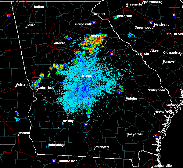 At 902 pm edt, a severe thunderstorm was located near lexington, moving east at 15 mph (radar indicated). Hazards include 60 mph wind gusts and quarter size hail. Hail damage to vehicles is expected. expect wind damage to roofs, siding, and trees. Other locations in the warning include but are not limited to lexington, crawford, arnoldsville, maxeys, stephens and hutchings. At 902 pm edt, a severe thunderstorm was located near lexington, moving east at 15 mph (radar indicated). Hazards include 60 mph wind gusts and quarter size hail. Hail damage to vehicles is expected. expect wind damage to roofs, siding, and trees. Other locations in the warning include but are not limited to lexington, crawford, arnoldsville, maxeys, stephens and hutchings.
|
| 8/17/2016 8:29 PM EDT |
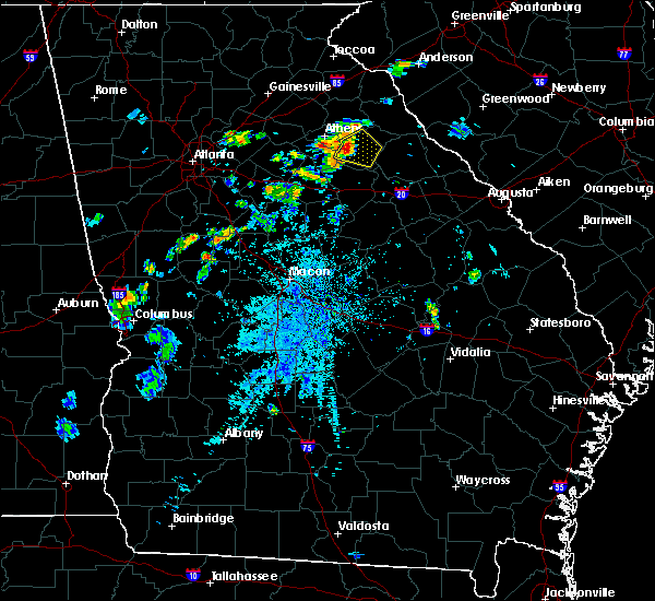 At 829 pm edt, a severe thunderstorm was located over hutchings, or near lexington, moving east at 15 mph (radar indicated). Hazards include 60 mph wind gusts and quarter size hail. Hail damage to vehicles is expected. expect wind damage to roofs, siding, and trees. Other locations in the warning include but are not limited to lexington, crawford, arnoldsville, maxeys, stephens and hutchings. At 829 pm edt, a severe thunderstorm was located over hutchings, or near lexington, moving east at 15 mph (radar indicated). Hazards include 60 mph wind gusts and quarter size hail. Hail damage to vehicles is expected. expect wind damage to roofs, siding, and trees. Other locations in the warning include but are not limited to lexington, crawford, arnoldsville, maxeys, stephens and hutchings.
|
| 8/2/2016 4:25 PM EDT | There were multiple trees down in southeast oglethorpe county and east of maxey in oglethorpe county GA, 3.2 miles W of Maxeys, GA |
| 7/6/2016 2:04 PM EDT |
 At 203 pm edt, severe thunderstorms were located along a line extending from near colbert to near crawford, moving east at 35 mph (radar indicated). Hazards include 60 mph wind gusts. Expect damage to roofs. siding. and trees. other locations in the warning include but are not limited to lexington, comer, winterville, crawford, colbert, arnoldsville. Carlton, maxeys, stephens, smithonia, vesta, point peter, watson mill bridge state park, dunlap, philomath and hutchings. At 203 pm edt, severe thunderstorms were located along a line extending from near colbert to near crawford, moving east at 35 mph (radar indicated). Hazards include 60 mph wind gusts. Expect damage to roofs. siding. and trees. other locations in the warning include but are not limited to lexington, comer, winterville, crawford, colbert, arnoldsville. Carlton, maxeys, stephens, smithonia, vesta, point peter, watson mill bridge state park, dunlap, philomath and hutchings.
|
| 7/6/2016 1:50 PM EDT |
 At 149 pm edt, severe thunderstorms were located along a line extending from near hull to near winterville to near watkinsville, moving east at 40 mph (radar indicated). Hazards include 60 mph wind gusts. Expect damage to roofs. siding. and trees. Other locations in the warning include but are not limited to lexington, athens, comer, winterville, crawford, colbert, arnoldsville, carlton, maxeys, hull, whitehall, athens-clarke county, stephens, smithonia, vesta, point peter, barnett shoals, watson mill bridge state park, sandy creek recreation area and barretts mill. At 149 pm edt, severe thunderstorms were located along a line extending from near hull to near winterville to near watkinsville, moving east at 40 mph (radar indicated). Hazards include 60 mph wind gusts. Expect damage to roofs. siding. and trees. Other locations in the warning include but are not limited to lexington, athens, comer, winterville, crawford, colbert, arnoldsville, carlton, maxeys, hull, whitehall, athens-clarke county, stephens, smithonia, vesta, point peter, barnett shoals, watson mill bridge state park, sandy creek recreation area and barretts mill.
|
| 6/9/2015 4:36 PM EDT |
 At 434 pm edt, a cluster of severe thunderstorms were located near maxeys, or 7 miles north of greensboro, moving east at 20 mph (radar indicated). Hazards include 60 mph wind gusts and quarter size hail. Hail damage to vehicles is expected. expect wind damage to roofs, siding and trees. Other locations in the warning include but are not limited to greensboro, union point, woodville, siloam, maxeys, penfield, apalachee, greshamville, farmington and wrayswood. At 434 pm edt, a cluster of severe thunderstorms were located near maxeys, or 7 miles north of greensboro, moving east at 20 mph (radar indicated). Hazards include 60 mph wind gusts and quarter size hail. Hail damage to vehicles is expected. expect wind damage to roofs, siding and trees. Other locations in the warning include but are not limited to greensboro, union point, woodville, siloam, maxeys, penfield, apalachee, greshamville, farmington and wrayswood.
|
| 6/9/2015 4:01 PM EDT |
 At 401 pm edt, a severe thunderstorm was located near bostwick, or 9 miles south of watkinsville, moving east at 20 mph (radar indicated). Hazards include 60 mph wind gusts and quarter size hail. Hail damage to vehicles is expected. expect wind damage to roofs, siding and trees. Other locations in the warning include but are not limited to greensboro, union point, woodville, siloam, maxeys, penfield, apalachee, greshamville, farmington and wrayswood. At 401 pm edt, a severe thunderstorm was located near bostwick, or 9 miles south of watkinsville, moving east at 20 mph (radar indicated). Hazards include 60 mph wind gusts and quarter size hail. Hail damage to vehicles is expected. expect wind damage to roofs, siding and trees. Other locations in the warning include but are not limited to greensboro, union point, woodville, siloam, maxeys, penfield, apalachee, greshamville, farmington and wrayswood.
|
| 6/9/2015 2:07 PM EDT |
 At 206 pm edt, a cluster of severe thunderstorms were located near rayle, or 7 miles west of washington, moving east at 25 mph (radar indicated). Hazards include 60 mph wind gusts and quarter size hail. Hail damage to vehicles is expected. expect wind damage to roofs, siding and trees. other locations in the warning include but are not limited to washington, tignall, woodville, maxeys, rayle, stephens, lyneville, celeste, holliday park, lundberg, carters grove, newtown, metasville, aonia, floral hill, rocky creek fire dept,. Daniel springs, danburg, philomath and ficklin. At 206 pm edt, a cluster of severe thunderstorms were located near rayle, or 7 miles west of washington, moving east at 25 mph (radar indicated). Hazards include 60 mph wind gusts and quarter size hail. Hail damage to vehicles is expected. expect wind damage to roofs, siding and trees. other locations in the warning include but are not limited to washington, tignall, woodville, maxeys, rayle, stephens, lyneville, celeste, holliday park, lundberg, carters grove, newtown, metasville, aonia, floral hill, rocky creek fire dept,. Daniel springs, danburg, philomath and ficklin.
|
| 6/9/2015 1:37 PM EDT |
 At 137 pm edt, a severe thunderstorm was located near maxeys, or 7 miles south of lexington, moving east at 25 mph (radar indicated). Hazards include 60 mph wind gusts and quarter size hail. Hail damage to vehicles is expected. expect wind damage to roofs, siding and trees. other locations in the warning include but are not limited to washington, tignall, woodville, maxeys, rayle, stephens, lyneville, celeste, holliday park, lundberg, carters grove, newtown, metasville, aonia, floral hill, rocky creek fire dept,. Daniel springs, danburg, philomath and ficklin. At 137 pm edt, a severe thunderstorm was located near maxeys, or 7 miles south of lexington, moving east at 25 mph (radar indicated). Hazards include 60 mph wind gusts and quarter size hail. Hail damage to vehicles is expected. expect wind damage to roofs, siding and trees. other locations in the warning include but are not limited to washington, tignall, woodville, maxeys, rayle, stephens, lyneville, celeste, holliday park, lundberg, carters grove, newtown, metasville, aonia, floral hill, rocky creek fire dept,. Daniel springs, danburg, philomath and ficklin.
|
| 6/3/2015 6:32 PM EDT | Numerous trees down. reports of at least 6 to 8 with reports still coming in to em in oglethorpe county GA, 2.6 miles SSW of Maxeys, GA |
| 6/3/2015 6:31 PM EDT | At 630 pm edt, a severe thunderstorm was located from maxeys to near lexington, moving northeast at 10 mph (radar indicated). Hazards include 60 mph wind gusts and quarter size hail. Hail damage to vehicles is expected. expect wind damage to roofs, siding and trees. Other locations in the warning include but are not limited to lexington, crawford, arnoldsville, maxeys, rayle, stephens, jacksons crossroads, philomath and hutchings. |
| 5/26/2015 6:38 PM EDT | The severe thunderstorm warning for madison, southeastern banks, clarke, oglethorpe and eastern jackson counties will expire at 645 pm edt, the storms which prompted the warning will soon move out of the area. therefore the warning will be allowed to expire. however heavy rain is still possible with these thunderstorms and isolated flooding is still a threat. |
| 5/26/2015 6:27 PM EDT | At 625 pm edt, severe thunderstorms were located along a line extending from near ila to near comer to near lexington, moving northeast at 50 mph (radar indicated). Hazards include 60 mph wind gusts and quarter size hail. Hail damage to vehicles is expected. expect wind damage to roofs, siding and trees. Other locations in the warning include but are not limited to jefferson, commerce, danielsville, lexington, athens, arcade, nicholson, comer, winterville, crawford, colbert, arnoldsville, ila, carlton, hull, athens-clarke county (balance), whitehall, stephens, smithonia and beechwood hills. |
| 5/26/2015 6:00 PM EDT | At 600 pm edt, severe thunderstorms were located along a line extending from near arcade to athens-clarke county (balance) to 8 miles north of buckhead, moving northeast at 50 mph (law enforcement). Hazards include 60 mph wind gusts. Expect damage to roofs. siding and trees. Other locations in the warning include but are not limited to jefferson, commerce, madison, watkinsville, danielsville, lexington, athens, statham, arcade, nicholson, comer, winterville, bogart, crawford, north high shoals, colbert, arnoldsville, ila, woodville and carlton. |
| 5/26/2015 5:51 PM EDT | At 551 pm edt, severe thunderstorms were located along a line extending from near statham to near north high shoals to near bostwick, moving east at 40 mph (law enforcement). Hazards include 70 mph wind gusts. Expect considerable tree damage. damage is likely to mobile homes, roofs and outbuildings. Other locations in the warning include but are not limited to winder, monroe, madison, watkinsville, athens, statham, winterville, bogart, crawford, rutledge, north high shoals, bethlehem, bostwick, arnoldsville, good hope, bishop, maxeys, buckhead, athens-clarke county (balance) and whitehall. |
| 5/26/2015 5:38 PM EDT | At 536 pm edt, severe thunderstorms were located along a line extending from near winder to near north high shoals to near bostwick, moving northeast at 60 mph (law enforcement). Hazards include 70 mph wind gusts. Expect considerable tree damage. damage is likely to mobile homes, roofs and outbuildings. Other locations in the warning include but are not limited to winder, monroe, madison, watkinsville, athens, loganville, social circle, statham, walnut grove, winterville, bogart, crawford, rutledge, newborn, north high shoals, bethlehem, bostwick, arnoldsville, between and good hope. |
| 5/26/2015 5:15 PM EDT | At 515 pm edt, severe thunderstorms were located along a line extending from near loganville to near jersey to near mansfield, moving northeast at 60 mph (radar indicated). Hazards include 60 mph wind gusts. Expect damage to roofs. siding and trees. Other locations in the warning include but are not limited to conyers, winder, monroe, madison, watkinsville, athens, loganville, social circle, statham, walnut grove, winterville, bogart, crawford, rutledge, newborn, north high shoals, bethlehem, bostwick, arnoldsville and between. |
| 5/25/2014 7:15 PM EDT | A couple trees and powerlines down off bairdstown road in greene county GA, 3.1 miles N of Maxeys, GA |
| 5/25/2014 7:12 PM EDT | Powerline down in oglethorpe county GA, 1.8 miles S of Maxeys, GA |
| 6/18/2013 6:15 PM EDT | A few trees down along highway 15 nort in greene county GA, 7.5 miles NE of Maxeys, GA |
| 7/5/2012 10:15 PM EDT | 4 trees down in maxeys area. 1 power line down down in crawford are in oglethorpe county GA, 0.5 miles SW of Maxeys, GA |
Hail Maps for Maxeys, GA


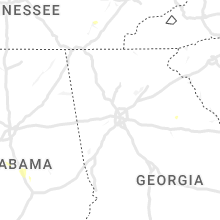


Connect with Interactive Hail Maps