

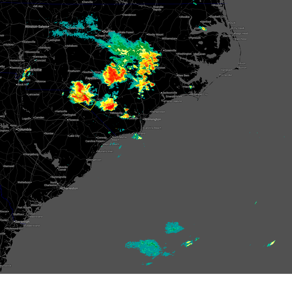
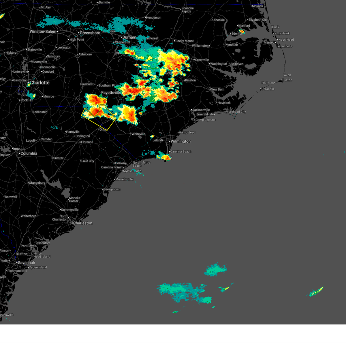
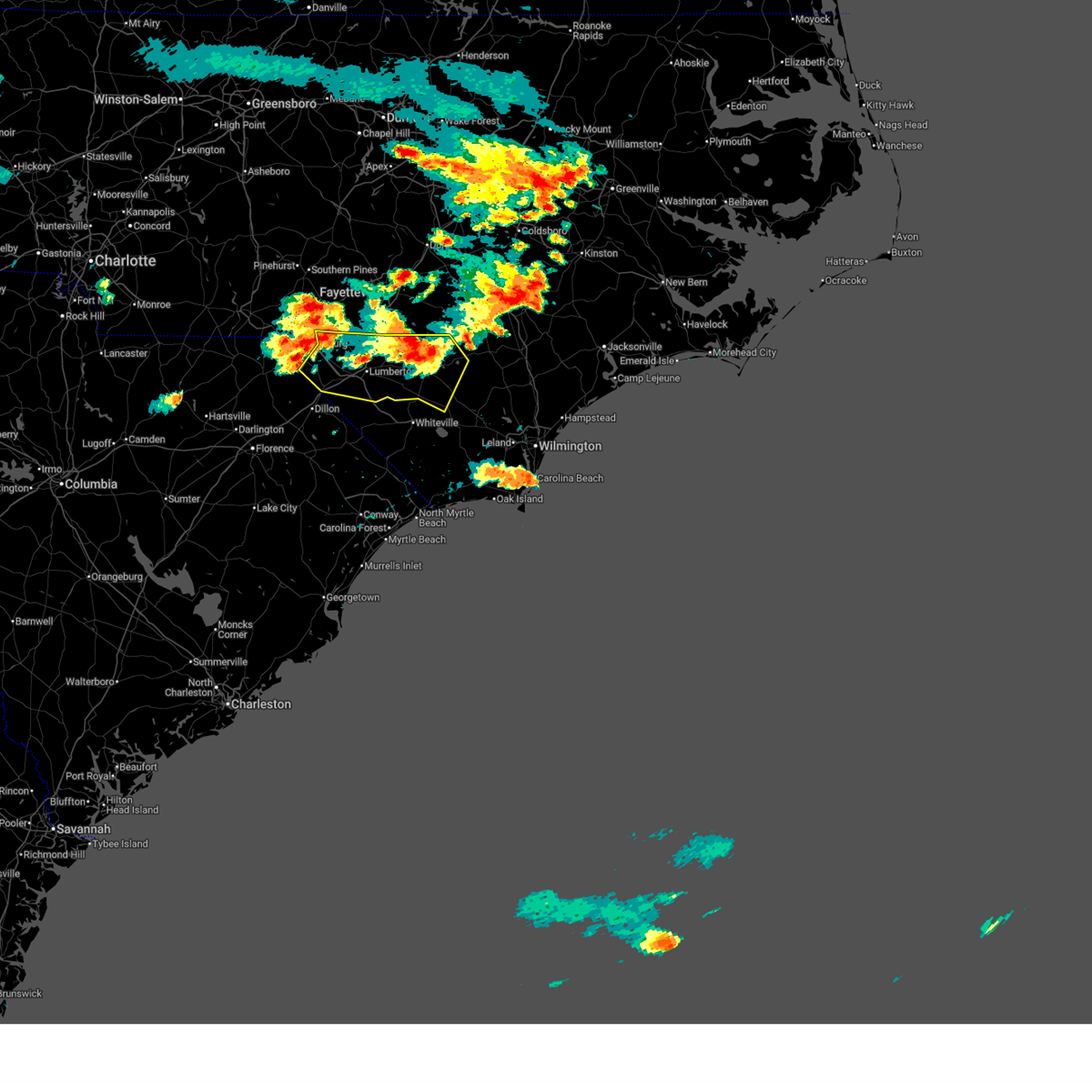
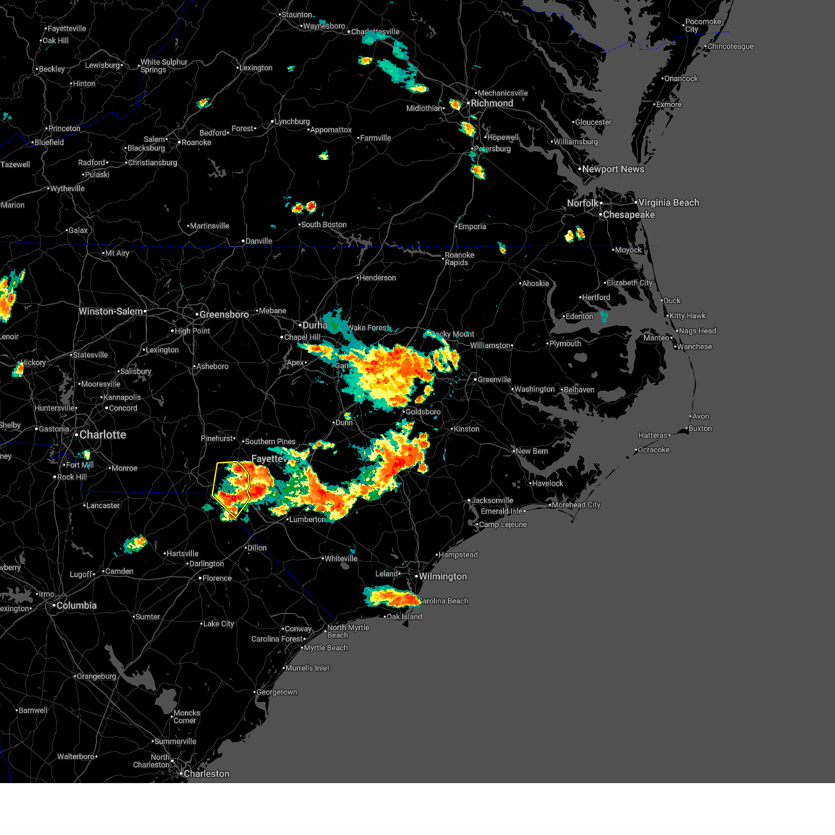
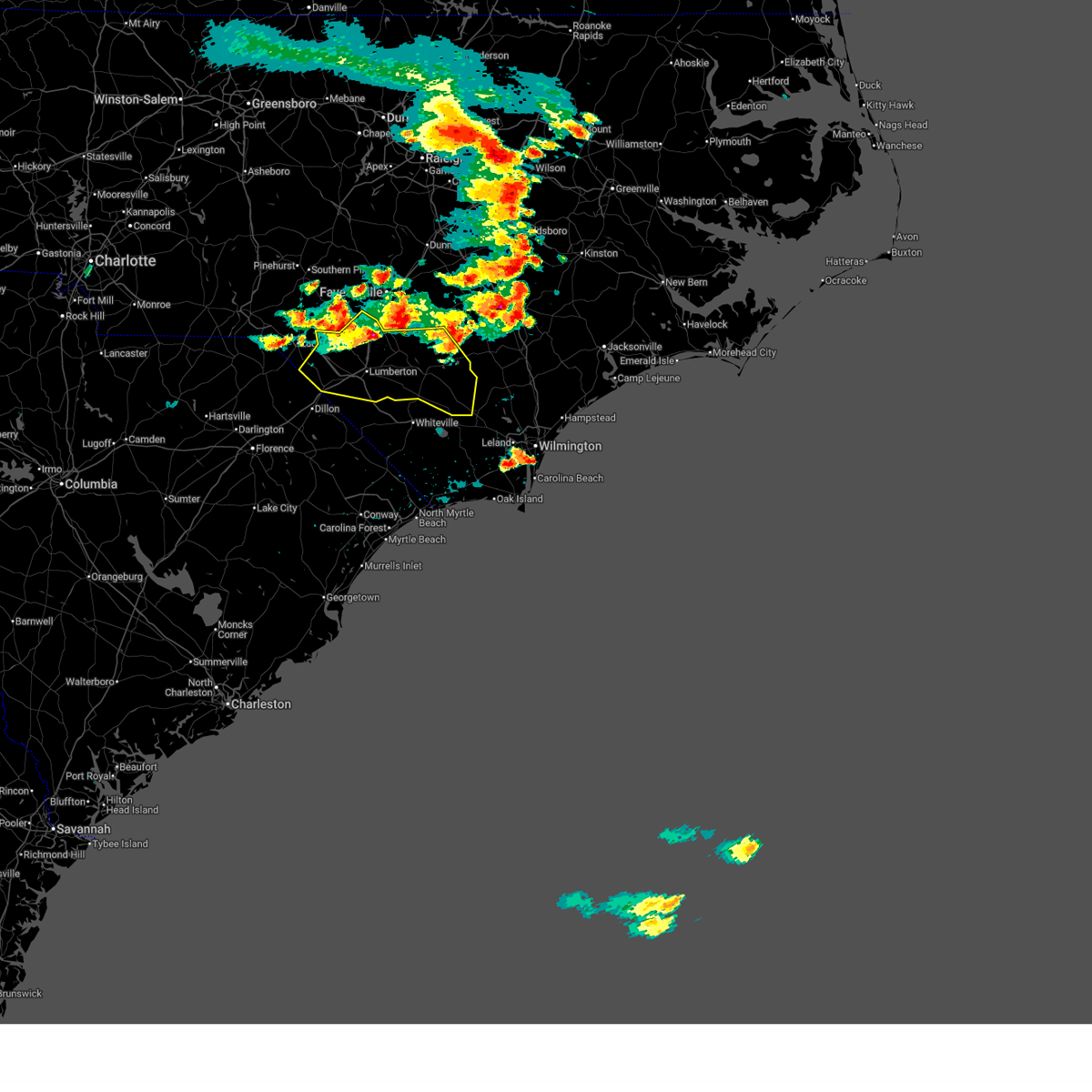
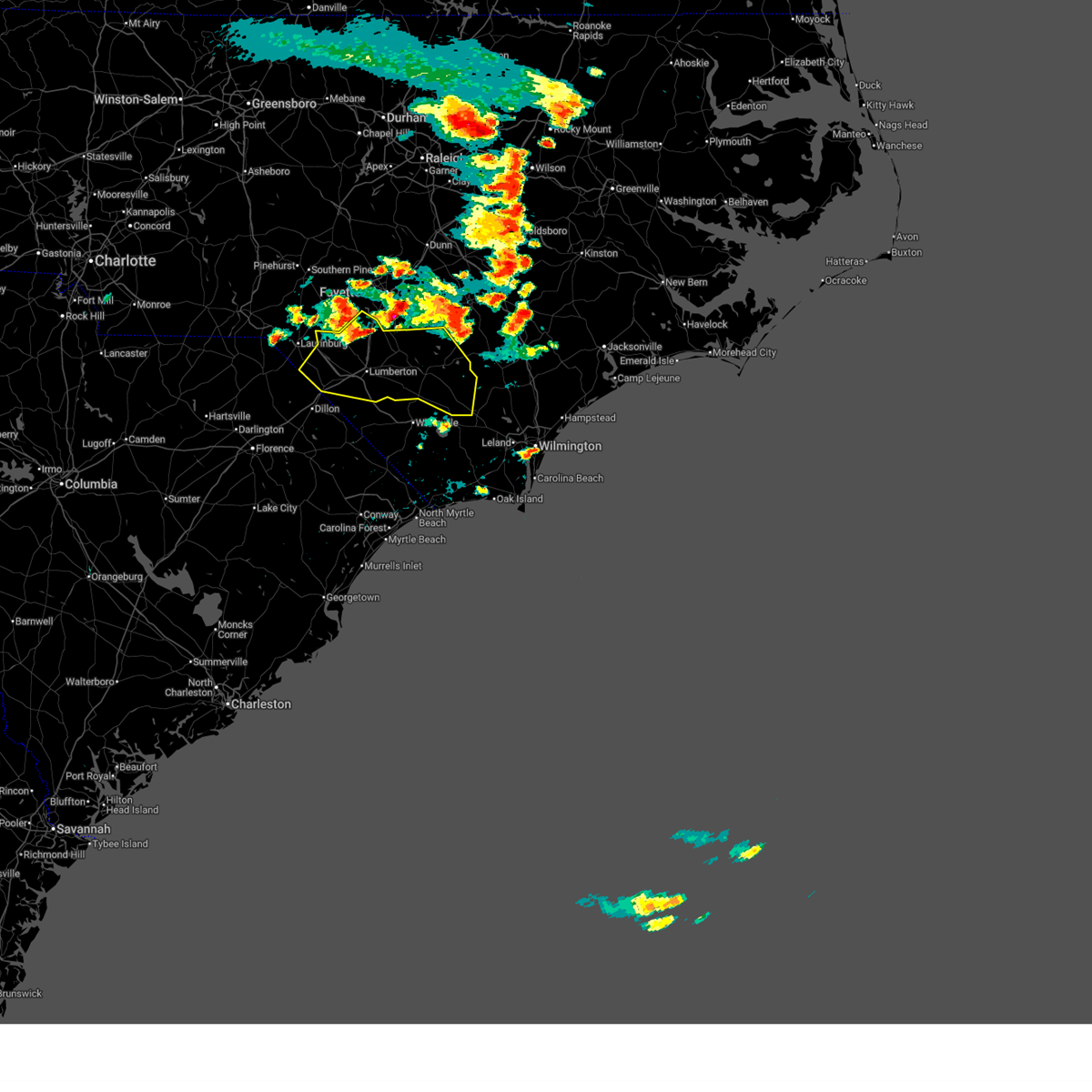
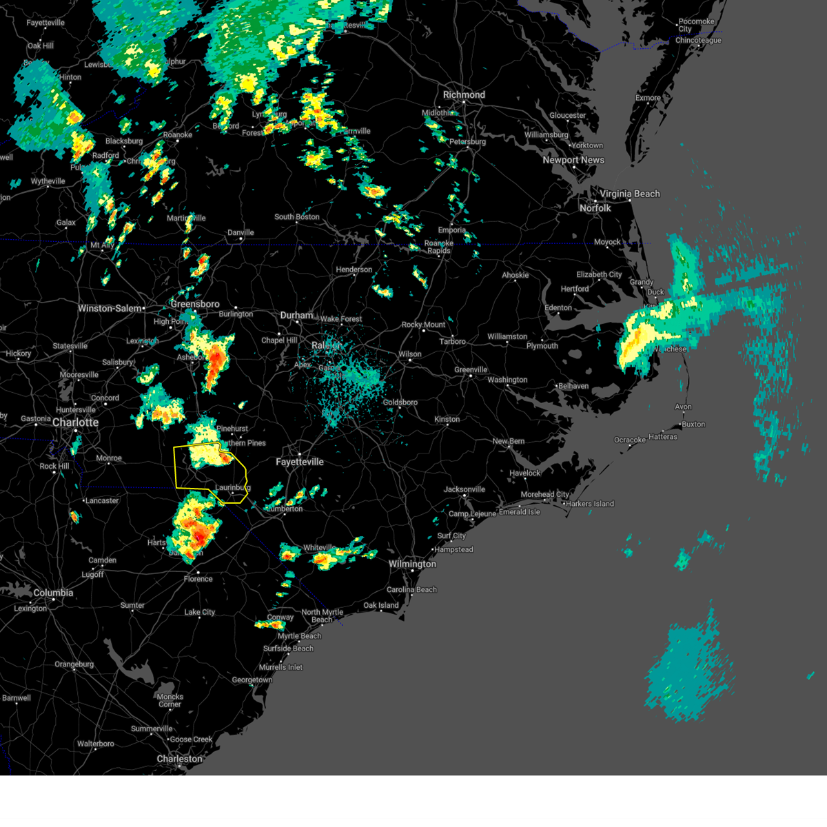
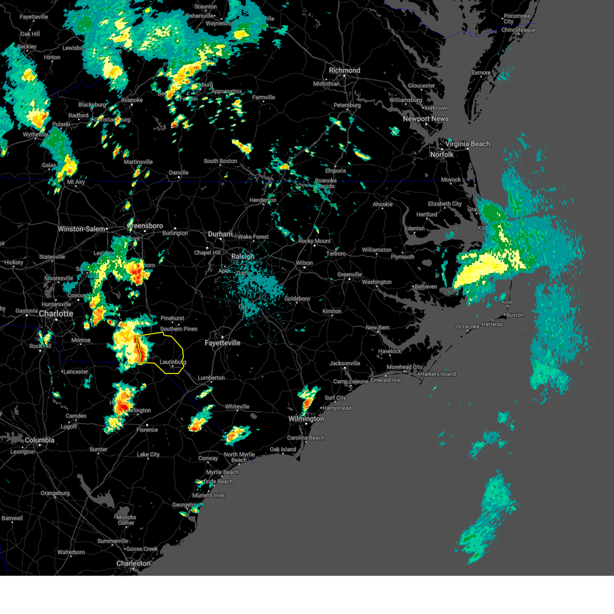
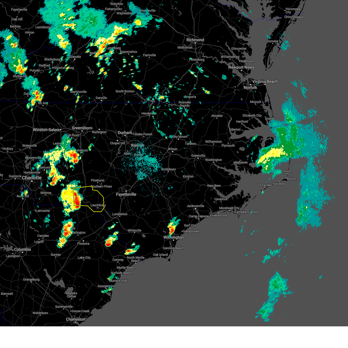
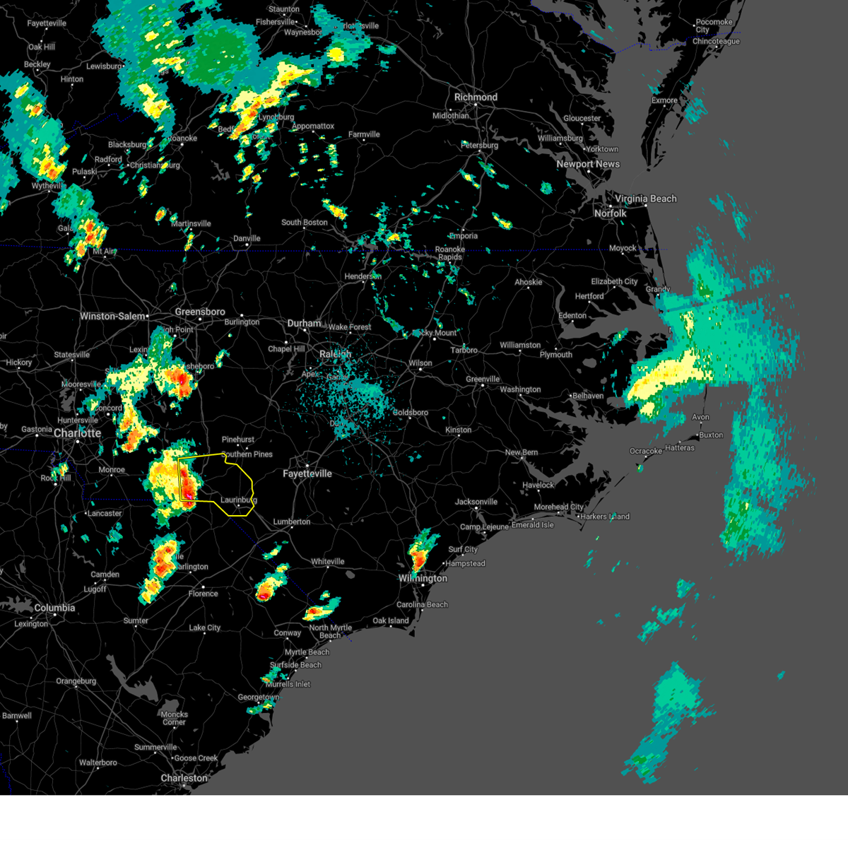
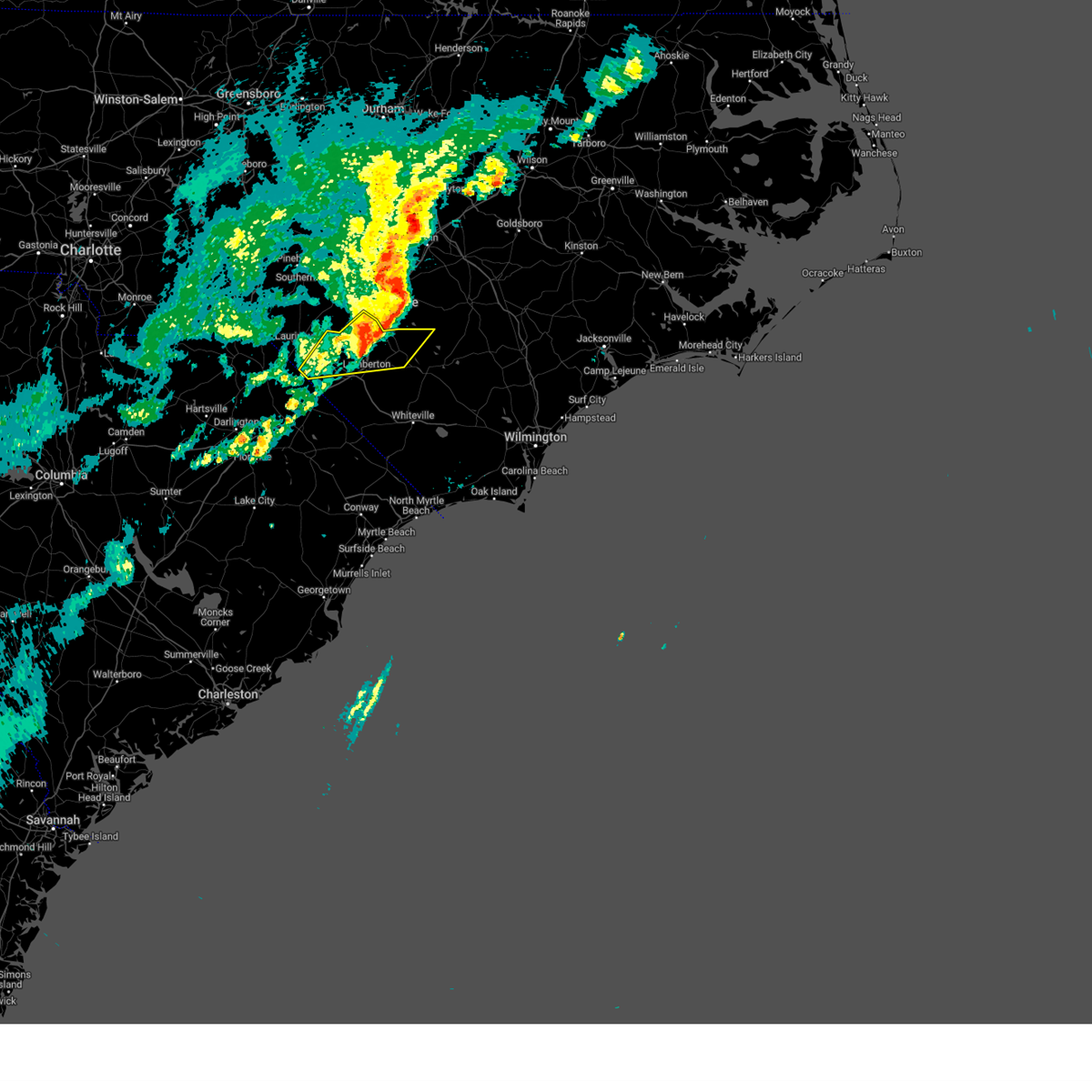
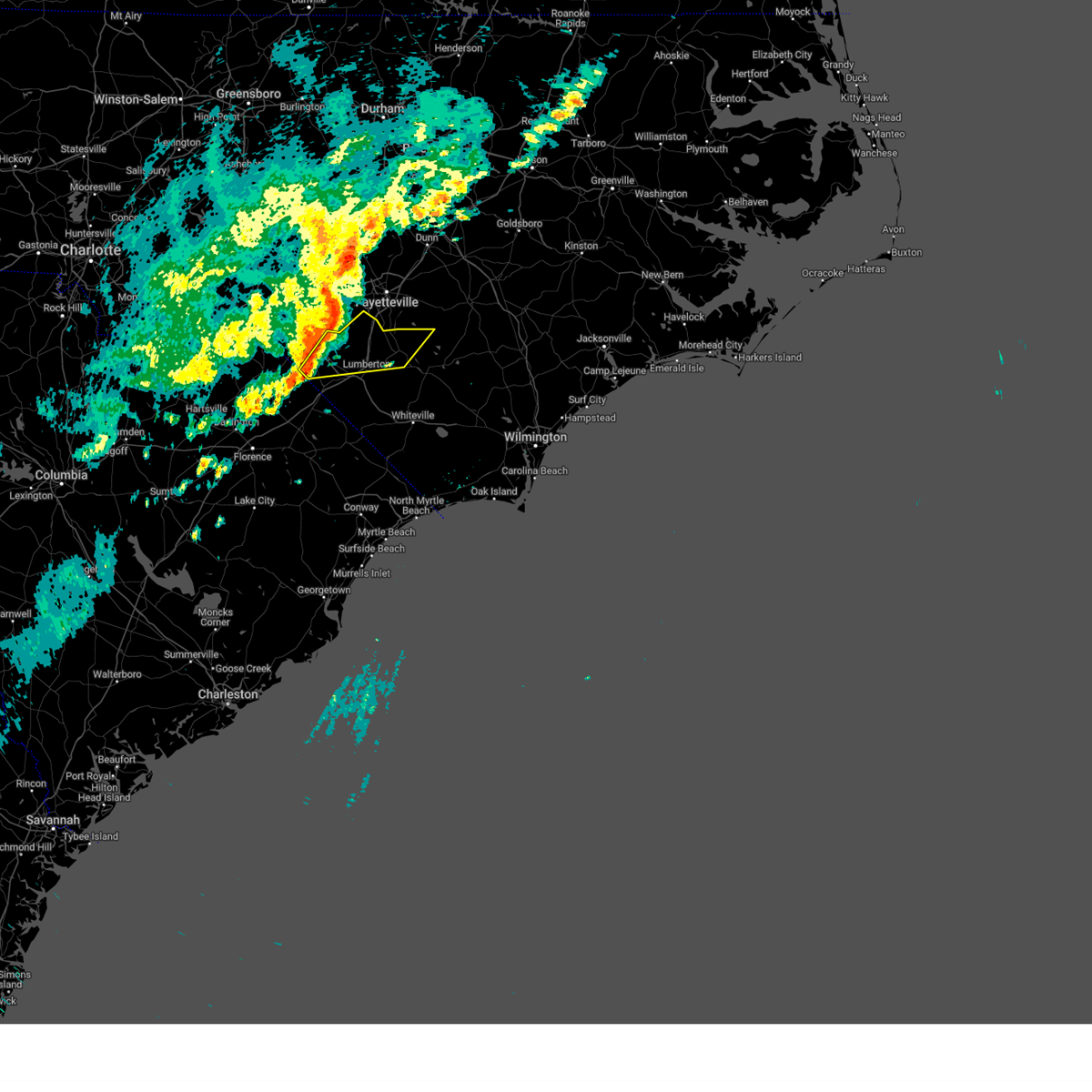
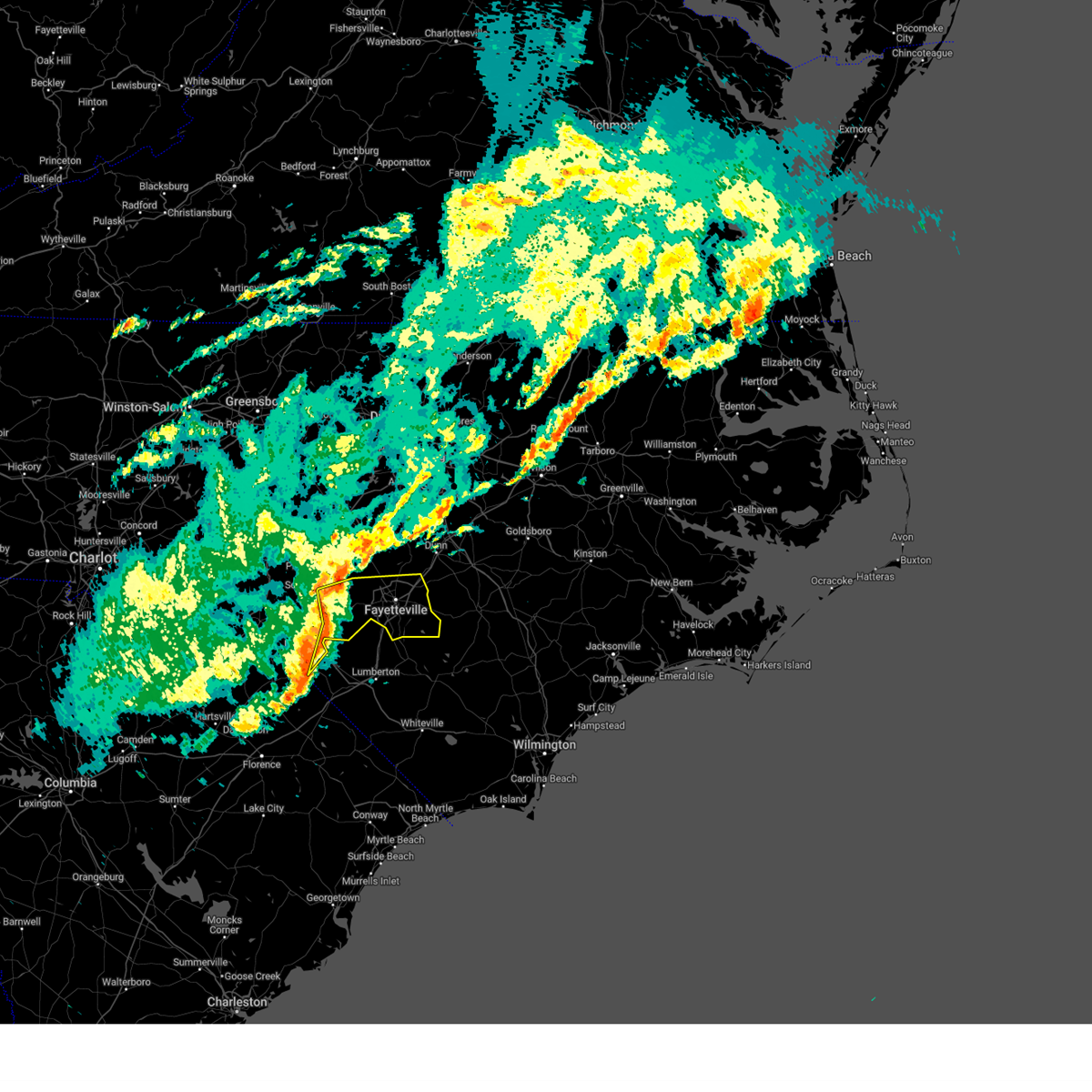
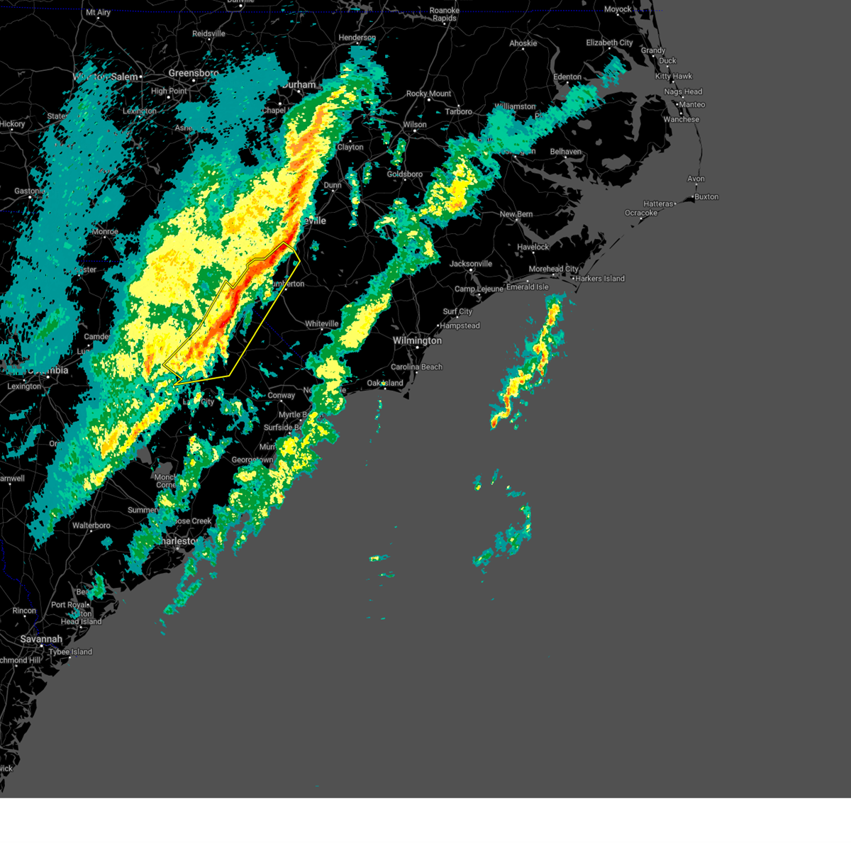
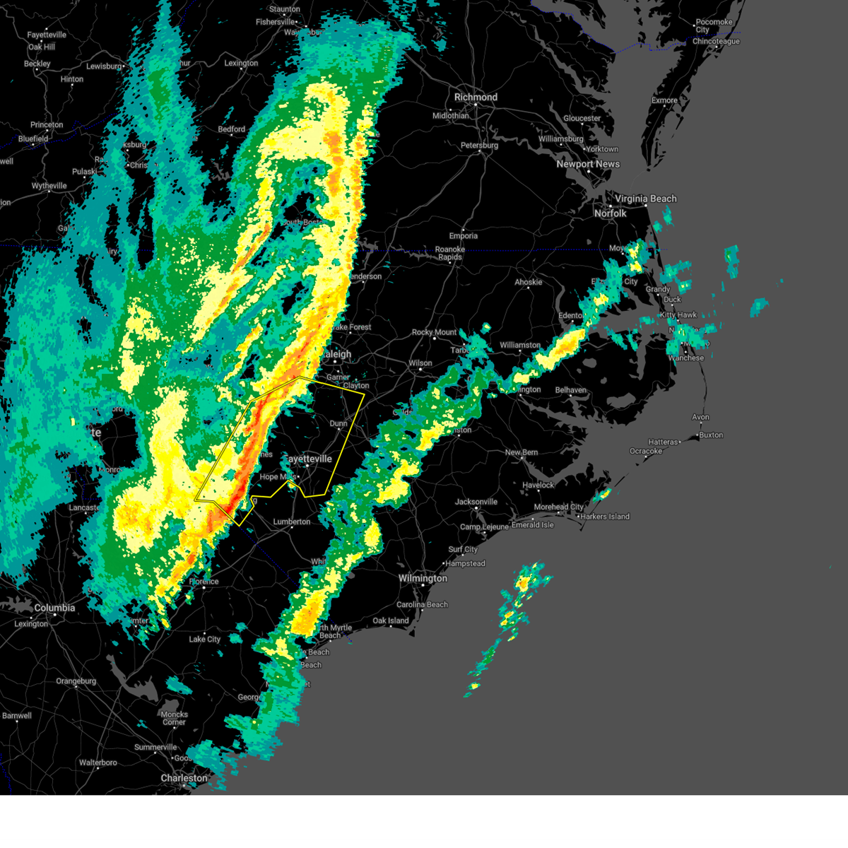
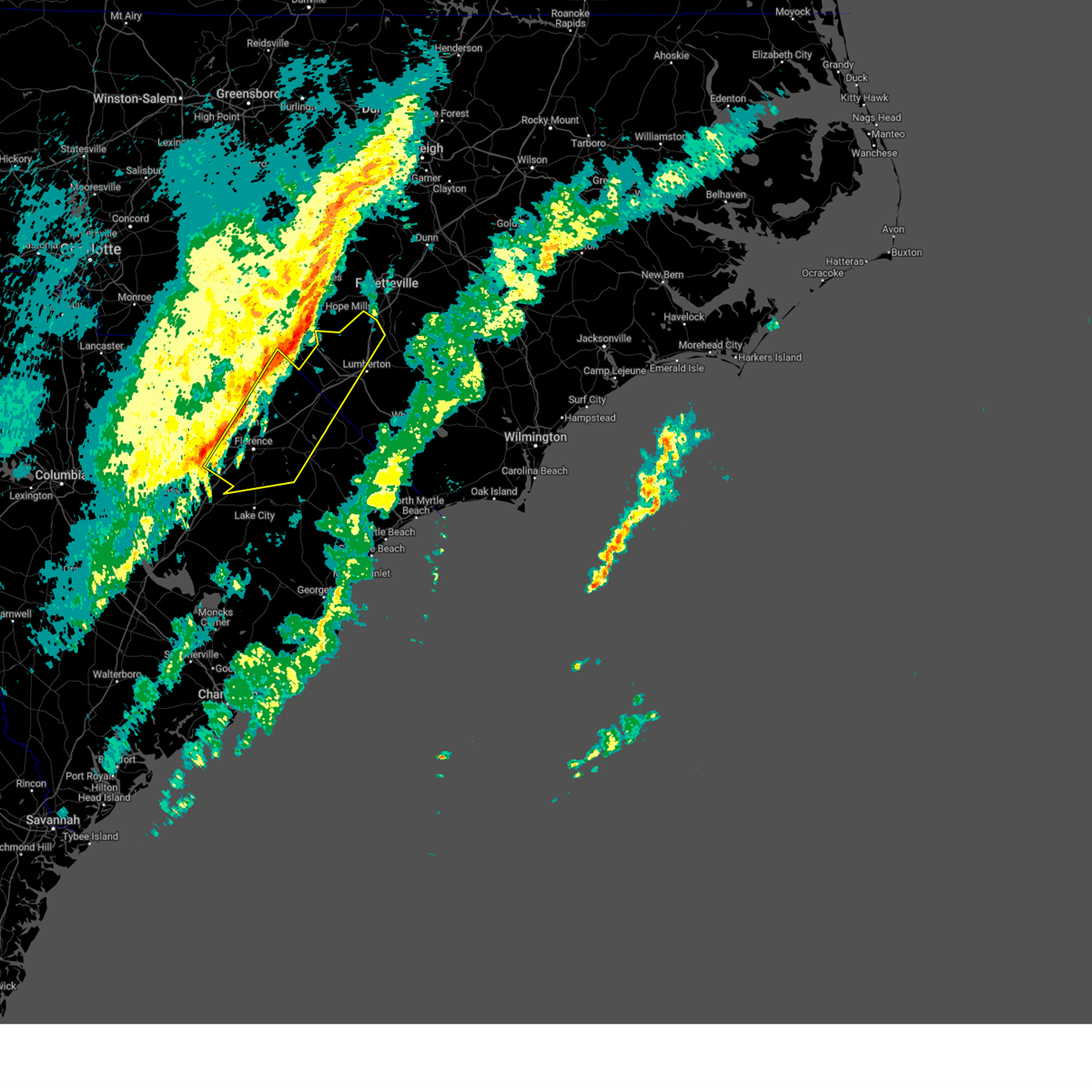
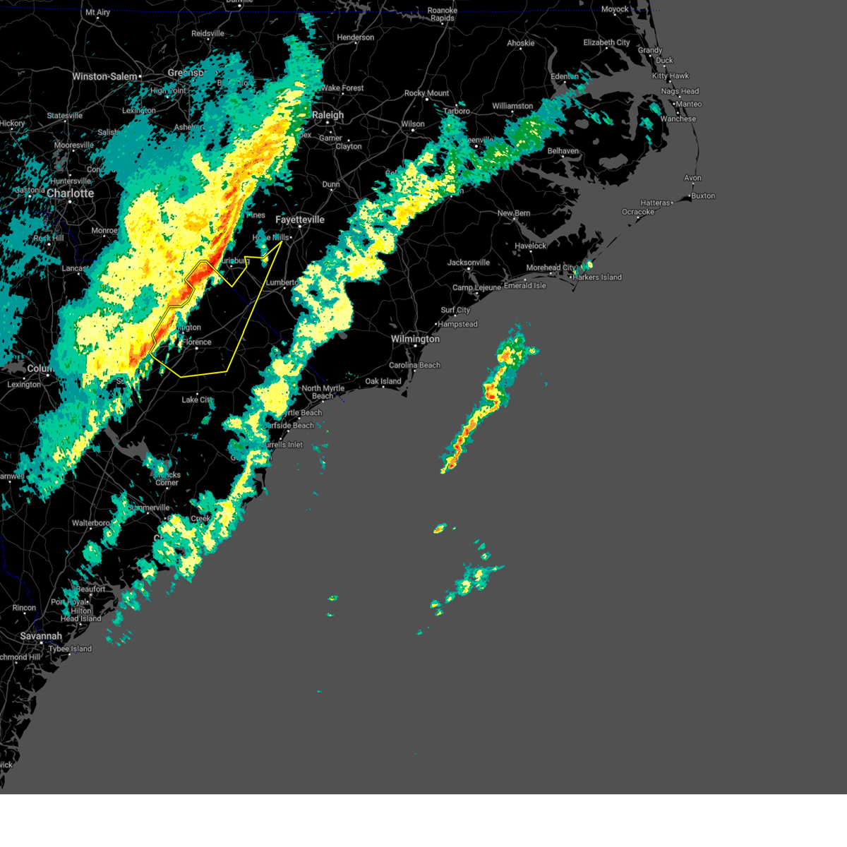
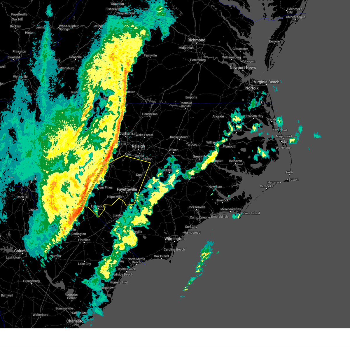
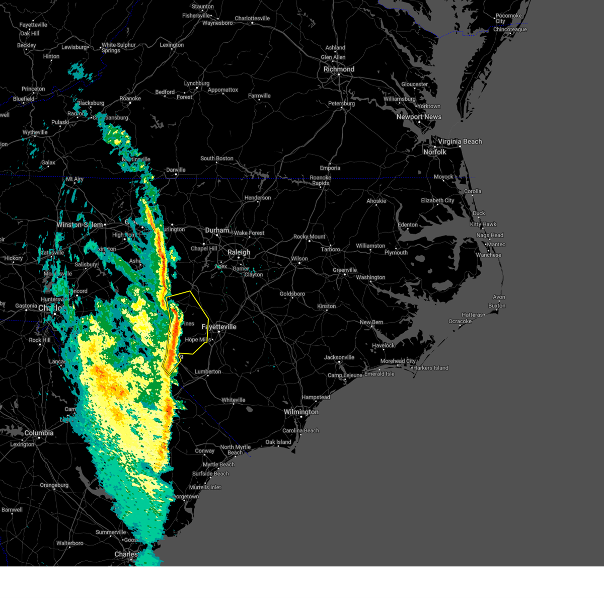
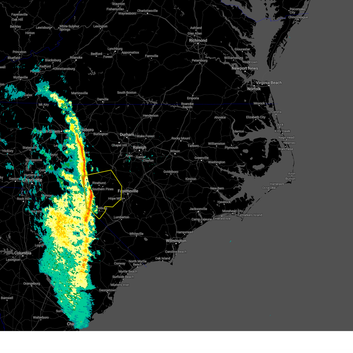
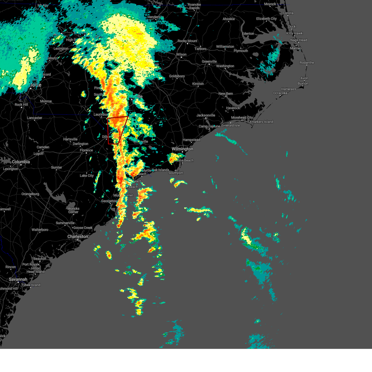
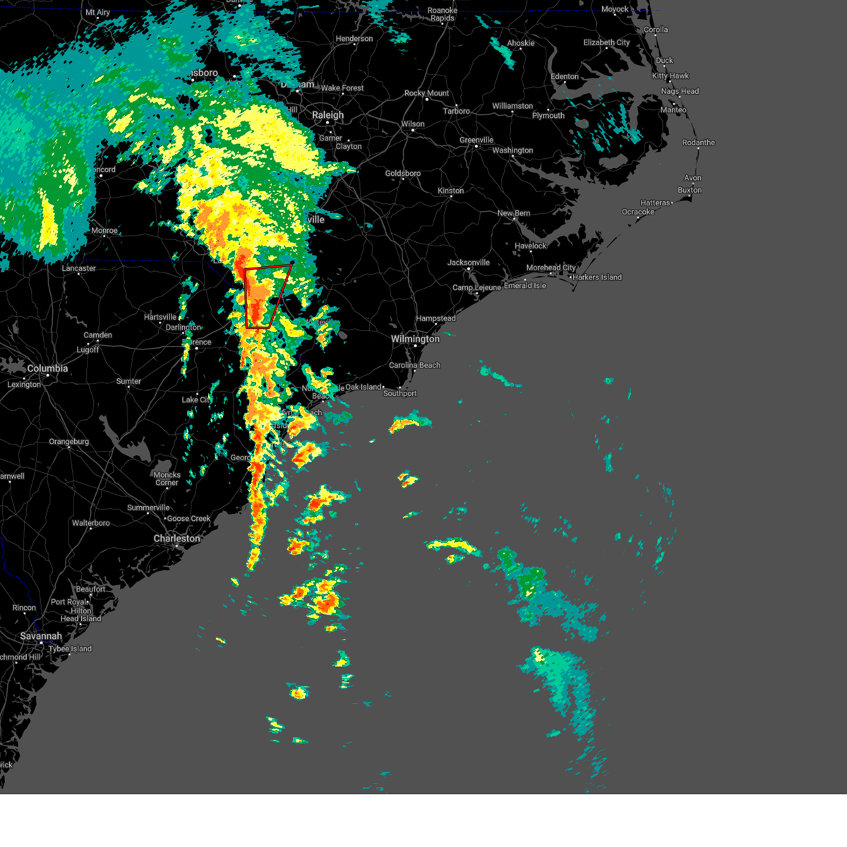
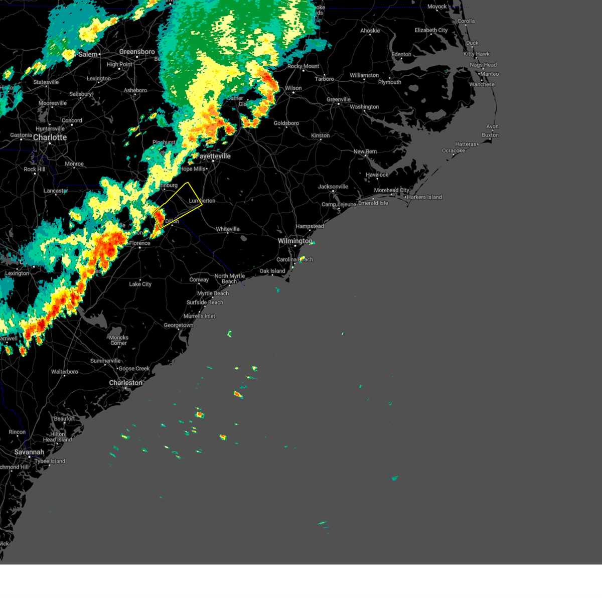
Hail Map for Maxton, NC
The Maxton, NC area has had 2 reports of on-the-ground hail by trained spotters, and has been under severe weather warnings 42 times during the past 12 months. Doppler radar has detected hail at or near Maxton, NC on 52 occasions, including 2 occasions during the past year.
| Name: | Maxton, NC |
| Where Located: | 82.8 miles SSW of Raleigh, NC |
| Map: | Google Map for Maxton, NC |
| Population: | 2426 |
| Housing Units: | 1117 |
| More Info: | Search Google for Maxton, NC |
2
The Top Recent Hail Date for Maxton, NC is Wednesday, June 25, 2025 (4th out of 52)

Hail and Wind Damage Spotted near Maxton, NC
| Date / Time | Report Details |
|---|---|
| 6/25/2025 6:14 PM EDT | The storm which prompted the warning has weakened below severe limits, and no longer poses an immediate threat to life or property. therefore, the warning will be allowed to expire. however, heavy rain is still possible with this thunderstorm. a severe thunderstorm watch remains in effect until midnight edt for central north carolina. to report severe weather, contact your nearest law enforcement agency. they will relay your report to the national weather service raleigh. |
| 6/25/2025 5:13 PM EDT |
 At 512 pm edt, severe thunderstorms were located along a line extending from near mccoll to elrod, moving southwest at 15 mph (radar indicated). Hazards include 60 mph wind gusts and quarter size hail. Minor hail damage to vehicles is possible. expect wind damage to trees and power lines. Locations impacted include, bennettsville, fairmont, maxton, mccoll, rowland, clio, hamer, raemon, south of the border, purvis, elrod, mcdonald, tatum, and raynham. At 512 pm edt, severe thunderstorms were located along a line extending from near mccoll to elrod, moving southwest at 15 mph (radar indicated). Hazards include 60 mph wind gusts and quarter size hail. Minor hail damage to vehicles is possible. expect wind damage to trees and power lines. Locations impacted include, bennettsville, fairmont, maxton, mccoll, rowland, clio, hamer, raemon, south of the border, purvis, elrod, mcdonald, tatum, and raynham.
|
| 6/25/2025 5:13 PM EDT | Svrrah the national weather service in raleigh has issued a * severe thunderstorm warning for, scotland county in central north carolina, * until 615 pm edt. * at 513 pm edt, a severe thunderstorm was located 7 miles north of laurinburg, moving south at 25 mph (radar indicated). Hazards include 60 mph wind gusts. expect damage to roofs, siding, and trees |
| 6/25/2025 5:08 PM EDT | At 507 pm edt, a severe thunderstorm was located 9 miles north of laurinburg, moving south at 15 mph (emergency management reported multiple trees down). Hazards include 60 mph wind gusts and quarter size hail. Hail damage to vehicles is expected. expect wind damage to roofs, siding, and trees. Locations impacted include, laurinburg, maxton, hoffman, wagram, gibson, east laurinburg, laurel hill, camp mackall, and sandhills game land. |
| 6/25/2025 4:52 PM EDT |
 Svrilm the national weather service in wilmington has issued a * severe thunderstorm warning for, western robeson county in southeastern north carolina, northern dillon county in northeastern south carolina, northeastern marlboro county in northeastern south carolina, * until 545 pm edt. * at 451 pm edt, severe thunderstorms were located along a line extending from 8 miles southeast of hoffman to near elrod, moving south at 15 mph (radar indicated). Hazards include 60 mph wind gusts and quarter size hail. Minor hail damage to vehicles is possible. Expect wind damage to trees and power lines. Svrilm the national weather service in wilmington has issued a * severe thunderstorm warning for, western robeson county in southeastern north carolina, northern dillon county in northeastern south carolina, northeastern marlboro county in northeastern south carolina, * until 545 pm edt. * at 451 pm edt, severe thunderstorms were located along a line extending from 8 miles southeast of hoffman to near elrod, moving south at 15 mph (radar indicated). Hazards include 60 mph wind gusts and quarter size hail. Minor hail damage to vehicles is possible. Expect wind damage to trees and power lines.
|
| 6/25/2025 4:32 PM EDT |
 At 432 pm edt, severe thunderstorms were located along a line extending from near elizabethtown to near laurinburg, moving southwest at 25 mph (radar indicated). Hazards include 60 mph wind gusts and quarter size hail. Minor hail damage to vehicles is possible. expect wind damage to trees and power lines. locations impacted include, lumberton, elizabethtown, red springs, pembroke, fairmont, maxton, st. Pauls, bladenboro, rowland, bladen community college, ammon, butters, hestertown, buie, robeson community college, wakulla, white oak, elrod, smiths, and howellsville. At 432 pm edt, severe thunderstorms were located along a line extending from near elizabethtown to near laurinburg, moving southwest at 25 mph (radar indicated). Hazards include 60 mph wind gusts and quarter size hail. Minor hail damage to vehicles is possible. expect wind damage to trees and power lines. locations impacted include, lumberton, elizabethtown, red springs, pembroke, fairmont, maxton, st. Pauls, bladenboro, rowland, bladen community college, ammon, butters, hestertown, buie, robeson community college, wakulla, white oak, elrod, smiths, and howellsville.
|
| 6/25/2025 4:24 PM EDT |
 Svrrah the national weather service in raleigh has issued a * severe thunderstorm warning for, scotland county in central north carolina, southeastern richmond county in central north carolina, * until 515 pm edt. * at 423 pm edt, a severe thunderstorm was located over laurinburg, and is nearly stationary (radar indicated). Hazards include 60 mph wind gusts and penny size hail. expect damage to roofs, siding, and trees Svrrah the national weather service in raleigh has issued a * severe thunderstorm warning for, scotland county in central north carolina, southeastern richmond county in central north carolina, * until 515 pm edt. * at 423 pm edt, a severe thunderstorm was located over laurinburg, and is nearly stationary (radar indicated). Hazards include 60 mph wind gusts and penny size hail. expect damage to roofs, siding, and trees
|
| 6/25/2025 4:16 PM EDT | At 416 pm edt, severe thunderstorms were located along a line extending from 8 miles southeast of ammon to near wakulla, moving southwest at 20 mph. a recent public report indicated quarter size hail was falling in red springs, nc (radar indicated). Hazards include 60 mph wind gusts and quarter size hail. Minor hail damage to vehicles is possible. expect wind damage to trees and power lines. locations impacted include, lumberton, elizabethtown, red springs, pembroke, fairmont, maxton, st. Pauls, bladenboro, rowland, rex, ammon, hestertown, shannon, white oak, carvers, smiths, howellsville, raemon, lisbon, and elkton. |
| 6/25/2025 4:01 PM EDT |
 At 400 pm edt, severe thunderstorms were located along a line extending from garland to near jerome to red springs, moving south at 20 mph (radar indicated). Hazards include 60 mph wind gusts. Expect wind damage to trees and power lines. locations impacted include, lumberton, elizabethtown, red springs, pembroke, fairmont, maxton, st. Pauls, bladenboro, rowland, rex, ammon, hestertown, shannon, white oak, carvers, smiths, howellsville, raemon, lisbon, and elkton. At 400 pm edt, severe thunderstorms were located along a line extending from garland to near jerome to red springs, moving south at 20 mph (radar indicated). Hazards include 60 mph wind gusts. Expect wind damage to trees and power lines. locations impacted include, lumberton, elizabethtown, red springs, pembroke, fairmont, maxton, st. Pauls, bladenboro, rowland, rex, ammon, hestertown, shannon, white oak, carvers, smiths, howellsville, raemon, lisbon, and elkton.
|
| 6/25/2025 3:41 PM EDT |
 Svrilm the national weather service in wilmington has issued a * severe thunderstorm warning for, robeson county in southeastern north carolina, bladen county in southeastern north carolina, * until 500 pm edt. * at 340 pm edt, severe thunderstorms were located along a line extending from 11 miles northwest of harrells to antioch, moving south at 25 mph (radar indicated). Hazards include 60 mph wind gusts. expect wind damage to trees and power lines Svrilm the national weather service in wilmington has issued a * severe thunderstorm warning for, robeson county in southeastern north carolina, bladen county in southeastern north carolina, * until 500 pm edt. * at 340 pm edt, severe thunderstorms were located along a line extending from 11 miles northwest of harrells to antioch, moving south at 25 mph (radar indicated). Hazards include 60 mph wind gusts. expect wind damage to trees and power lines
|
| 5/13/2025 3:37 PM EDT |
 The storm which prompted the warning has weakened below severe limits, and no longer poses an immediate threat to life or property. therefore, the warning will be allowed to expire. The storm which prompted the warning has weakened below severe limits, and no longer poses an immediate threat to life or property. therefore, the warning will be allowed to expire.
|
| 5/13/2025 2:59 PM EDT |
 the severe thunderstorm warning has been cancelled and is no longer in effect the severe thunderstorm warning has been cancelled and is no longer in effect
|
| 5/13/2025 2:59 PM EDT |
 At 258 pm edt, a severe thunderstorm was located near hamlet, or near rockingham, moving east at 35 mph (radar indicated). Hazards include quarter size hail. Damage to vehicles is expected. Locations impacted include, laurinburg, rockingham, hamlet, maxton, hoffman, ellerbe, dobbins heights, wagram, gibson, and east laurinburg. At 258 pm edt, a severe thunderstorm was located near hamlet, or near rockingham, moving east at 35 mph (radar indicated). Hazards include quarter size hail. Damage to vehicles is expected. Locations impacted include, laurinburg, rockingham, hamlet, maxton, hoffman, ellerbe, dobbins heights, wagram, gibson, and east laurinburg.
|
| 5/13/2025 2:46 PM EDT |
 Svrrah the national weather service in raleigh has issued a * severe thunderstorm warning for, scotland county in central north carolina, southeastern anson county in central north carolina, richmond county in central north carolina, * until 345 pm edt. * at 246 pm edt, a severe thunderstorm was located near wallace, or 8 miles north of cheraw, moving east at 30 mph (radar indicated). Hazards include quarter size hail. damage to vehicles is expected Svrrah the national weather service in raleigh has issued a * severe thunderstorm warning for, scotland county in central north carolina, southeastern anson county in central north carolina, richmond county in central north carolina, * until 345 pm edt. * at 246 pm edt, a severe thunderstorm was located near wallace, or 8 miles north of cheraw, moving east at 30 mph (radar indicated). Hazards include quarter size hail. damage to vehicles is expected
|
| 5/13/2025 2:45 PM EDT |
 Svrrah the national weather service in raleigh has issued a * severe thunderstorm warning for, scotland county in central north carolina, southeastern anson county in central north carolina, richmond county in central north carolina, * until 345 pm edt. * at 244 pm edt, a severe thunderstorm was located near wallace, or 7 miles north of cheraw, moving east at 30 mph (radar indicated). Hazards include quarter size hail. damage to vehicles is expected Svrrah the national weather service in raleigh has issued a * severe thunderstorm warning for, scotland county in central north carolina, southeastern anson county in central north carolina, richmond county in central north carolina, * until 345 pm edt. * at 244 pm edt, a severe thunderstorm was located near wallace, or 7 miles north of cheraw, moving east at 30 mph (radar indicated). Hazards include quarter size hail. damage to vehicles is expected
|
| 5/8/2025 9:48 PM EDT |
 Svrrah the national weather service in raleigh has issued a * severe thunderstorm warning for, southeastern moore county in central north carolina, scotland county in central north carolina, harnett county in central north carolina, eastern richmond county in central north carolina, cumberland county in central north carolina, lee county in central north carolina, southwestern wake county in central north carolina, southwestern johnston county in central north carolina, hoke county in central north carolina, eastern chatham county in central north carolina, * until 1045 pm edt. * at 947 pm edt, severe thunderstorms were located along a line extending from pittsboro to near sanford to near southern pines to 7 miles northeast of rockingham, moving east at 35 mph (radar indicated). Hazards include 60 mph wind gusts. expect damage to roofs, siding, and trees Svrrah the national weather service in raleigh has issued a * severe thunderstorm warning for, southeastern moore county in central north carolina, scotland county in central north carolina, harnett county in central north carolina, eastern richmond county in central north carolina, cumberland county in central north carolina, lee county in central north carolina, southwestern wake county in central north carolina, southwestern johnston county in central north carolina, hoke county in central north carolina, eastern chatham county in central north carolina, * until 1045 pm edt. * at 947 pm edt, severe thunderstorms were located along a line extending from pittsboro to near sanford to near southern pines to 7 miles northeast of rockingham, moving east at 35 mph (radar indicated). Hazards include 60 mph wind gusts. expect damage to roofs, siding, and trees
|
| 5/2/2025 6:01 PM EDT | The storm which prompted the warning is moving out of the area. therefore, the warning has been allowed to expire. however, small hail and gusty winds are still possible with this thunderstorm. |
| 5/2/2025 5:54 PM EDT | At 554 pm edt, a severe thunderstorm was located near maxton, or near laurinburg, moving east at 10 mph (radar indicated). Hazards include 60 mph wind gusts and penny size hail. Expect damage to roofs, siding, and trees. Locations impacted include, laurinburg, maxton, gibson, and east laurinburg. |
| 5/2/2025 5:32 PM EDT | At 532 pm edt, a severe thunderstorm was located near laurinburg, moving east at 15 mph (radar indicated). Hazards include 60 mph wind gusts and penny size hail. Expect damage to roofs, siding, and trees. Locations impacted include, laurinburg, maxton, gibson, and east laurinburg. |
| 5/2/2025 5:21 PM EDT | Svrrah the national weather service in raleigh has issued a * severe thunderstorm warning for, southern scotland county in central north carolina, * until 600 pm edt. * at 521 pm edt, a severe thunderstorm was located over mccoll, or near laurinburg, moving east at 15 mph (radar indicated). Hazards include 60 mph wind gusts and penny size hail. expect damage to roofs, siding, and trees |
| 4/7/2025 2:42 PM EDT |
 A severe thunderstorm warning still remains in effect for portions of robeson and bladen counties. a severe thunderstorm watch remains in effect until 1000 pm edt for southeastern north carolina, and northeastern south carolina. please send your reports of hail and/or wind damage, including trees or large limbs downed, by calling the national weather service office in wilmington at 1-800-697-3901. A severe thunderstorm warning still remains in effect for portions of robeson and bladen counties. a severe thunderstorm watch remains in effect until 1000 pm edt for southeastern north carolina, and northeastern south carolina. please send your reports of hail and/or wind damage, including trees or large limbs downed, by calling the national weather service office in wilmington at 1-800-697-3901.
|
| 4/7/2025 2:17 PM EDT |
 Svrilm the national weather service in wilmington has issued a * severe thunderstorm warning for, northern robeson county in southeastern north carolina, northwestern bladen county in southeastern north carolina, * until 245 pm edt. * at 217 pm edt, severe thunderstorms were located along a line extending from raeford to near antioch to near raemon, moving east at 65 mph (radar indicated). Hazards include 60 mph wind gusts. expect wind damage to trees and power lines Svrilm the national weather service in wilmington has issued a * severe thunderstorm warning for, northern robeson county in southeastern north carolina, northwestern bladen county in southeastern north carolina, * until 245 pm edt. * at 217 pm edt, severe thunderstorms were located along a line extending from raeford to near antioch to near raemon, moving east at 65 mph (radar indicated). Hazards include 60 mph wind gusts. expect wind damage to trees and power lines
|
| 4/7/2025 2:16 PM EDT |
 Svrrah the national weather service in raleigh has issued a * severe thunderstorm warning for, southeastern scotland county in central north carolina, cumberland county in central north carolina, hoke county in central north carolina, * until 300 pm edt. * at 216 pm edt, severe thunderstorms were located along a line extending from 9 miles southeast of aberdeen to near raeford to wakulla to near raemon, moving east at 55 mph (radar indicated). Hazards include 60 mph wind gusts. expect damage to roofs, siding, and trees Svrrah the national weather service in raleigh has issued a * severe thunderstorm warning for, southeastern scotland county in central north carolina, cumberland county in central north carolina, hoke county in central north carolina, * until 300 pm edt. * at 216 pm edt, severe thunderstorms were located along a line extending from 9 miles southeast of aberdeen to near raeford to wakulla to near raemon, moving east at 55 mph (radar indicated). Hazards include 60 mph wind gusts. expect damage to roofs, siding, and trees
|
| 3/5/2025 11:35 AM EST |
 the severe thunderstorm warning has been cancelled and is no longer in effect the severe thunderstorm warning has been cancelled and is no longer in effect
|
| 3/5/2025 11:35 AM EST |
 At 1135 am est, severe thunderstorms were located along a line extending from 7 miles northeast of sanford to 10 miles southwest of raeford, moving east at 25 mph (radar indicated). Hazards include 60 mph wind gusts. Expect damage to roofs, siding, and trees. Locations impacted include, vass, aberdeen, broadway, laurinburg, cameron, southern pines, sanford, anderson creek, fort liberty and timberlake. At 1135 am est, severe thunderstorms were located along a line extending from 7 miles northeast of sanford to 10 miles southwest of raeford, moving east at 25 mph (radar indicated). Hazards include 60 mph wind gusts. Expect damage to roofs, siding, and trees. Locations impacted include, vass, aberdeen, broadway, laurinburg, cameron, southern pines, sanford, anderson creek, fort liberty and timberlake.
|
| 3/5/2025 10:58 AM EST |
 Svrrah the national weather service in raleigh has issued a * severe thunderstorm warning for, central moore county in central north carolina, scotland county in central north carolina, harnett county in central north carolina, eastern richmond county in central north carolina, northwestern cumberland county in central north carolina, lee county in central north carolina, hoke county in central north carolina, * until noon est. * at 1058 am est, severe thunderstorms were located along a line extending from near pittsboro to near hoffman, moving northeast at 60 mph (radar indicated). Hazards include 60 mph wind gusts. expect damage to roofs, siding, and trees Svrrah the national weather service in raleigh has issued a * severe thunderstorm warning for, central moore county in central north carolina, scotland county in central north carolina, harnett county in central north carolina, eastern richmond county in central north carolina, northwestern cumberland county in central north carolina, lee county in central north carolina, hoke county in central north carolina, * until noon est. * at 1058 am est, severe thunderstorms were located along a line extending from near pittsboro to near hoffman, moving northeast at 60 mph (radar indicated). Hazards include 60 mph wind gusts. expect damage to roofs, siding, and trees
|
| 2/16/2025 9:16 AM EST |
 At 915 am est, severe thunderstorms were located along a line extending from near shannon to florence, moving east at 55 mph (public reported trees down in the city of darlington, sc). Hazards include 60 mph wind gusts. Expect wind damage to trees and power lines. locations impacted include, florence, lumberton, marion, dillon, red springs, pembroke, maxton, timmonsville, st. Pauls, latta, pamplico, rowland, quinby, clio, sellers, blue brick, rex, hamer, brownsville, and shannon. At 915 am est, severe thunderstorms were located along a line extending from near shannon to florence, moving east at 55 mph (public reported trees down in the city of darlington, sc). Hazards include 60 mph wind gusts. Expect wind damage to trees and power lines. locations impacted include, florence, lumberton, marion, dillon, red springs, pembroke, maxton, timmonsville, st. Pauls, latta, pamplico, rowland, quinby, clio, sellers, blue brick, rex, hamer, brownsville, and shannon.
|
| 2/16/2025 9:01 AM EST |
 At 901 am est, severe thunderstorms were located along a line extending from 10 miles northeast of sanford to 8 miles northwest of pope afb to 7 miles northwest of wakulla, moving northeast at 90 mph (radar indicated). Hazards include 60 mph wind gusts. Expect damage to roofs, siding, and trees. Locations impacted include, aberdeen, cameron, falcon, carthage, southern pines, east rockingham, dunn, sanford, anderson creek, and fort liberty. At 901 am est, severe thunderstorms were located along a line extending from 10 miles northeast of sanford to 8 miles northwest of pope afb to 7 miles northwest of wakulla, moving northeast at 90 mph (radar indicated). Hazards include 60 mph wind gusts. Expect damage to roofs, siding, and trees. Locations impacted include, aberdeen, cameron, falcon, carthage, southern pines, east rockingham, dunn, sanford, anderson creek, and fort liberty.
|
| 2/16/2025 8:58 AM EST |
 Svrilm the national weather service in wilmington has issued a * severe thunderstorm warning for, robeson county in southeastern north carolina, central florence county in northeastern south carolina, dillon county in northeastern south carolina, eastern darlington county in northeastern south carolina, northwestern marion county in northeastern south carolina, eastern marlboro county in northeastern south carolina, * until 1000 am est. * at 858 am est, severe thunderstorms were located along a line extending from near maxton to near lamar, moving east at 55 mph (radar indicated). Hazards include 60 mph wind gusts. expect wind damage to trees and power lines Svrilm the national weather service in wilmington has issued a * severe thunderstorm warning for, robeson county in southeastern north carolina, central florence county in northeastern south carolina, dillon county in northeastern south carolina, eastern darlington county in northeastern south carolina, northwestern marion county in northeastern south carolina, eastern marlboro county in northeastern south carolina, * until 1000 am est. * at 858 am est, severe thunderstorms were located along a line extending from near maxton to near lamar, moving east at 55 mph (radar indicated). Hazards include 60 mph wind gusts. expect wind damage to trees and power lines
|
| 2/16/2025 8:45 AM EST |
 At 845 am est, severe thunderstorms were located along a line extending from 7 miles northwest of laurinburg to near elliott, moving east at 45 mph (radar indicated). Hazards include 60 mph wind gusts. Expect wind damage to trees and power lines. Locations impacted include, florence, bennettsville, hartsville, dillon, darlington, red springs, pembroke, maxton, timmonsville, mccoll, latta, rowland, lamar, quinby, clio, sellers, blue brick, hamer, brownsville, and darlington raceway. At 845 am est, severe thunderstorms were located along a line extending from 7 miles northwest of laurinburg to near elliott, moving east at 45 mph (radar indicated). Hazards include 60 mph wind gusts. Expect wind damage to trees and power lines. Locations impacted include, florence, bennettsville, hartsville, dillon, darlington, red springs, pembroke, maxton, timmonsville, mccoll, latta, rowland, lamar, quinby, clio, sellers, blue brick, hamer, brownsville, and darlington raceway.
|
| 2/16/2025 8:31 AM EST |
 Svrrah the national weather service in raleigh has issued a * severe thunderstorm warning for, central moore county in central north carolina, scotland county in central north carolina, northwestern sampson county in central north carolina, harnett county in central north carolina, eastern richmond county in central north carolina, cumberland county in central north carolina, lee county in central north carolina, southwestern wake county in central north carolina, southwestern johnston county in central north carolina, hoke county in central north carolina, southeastern chatham county in central north carolina, * until 915 am est. * at 831 am est, severe thunderstorms were located along a line extending from 7 miles north of carthage to near pinehurst to near wallace, moving east at 75 mph (radar indicated). Hazards include 60 mph wind gusts. expect damage to roofs, siding, and trees Svrrah the national weather service in raleigh has issued a * severe thunderstorm warning for, central moore county in central north carolina, scotland county in central north carolina, northwestern sampson county in central north carolina, harnett county in central north carolina, eastern richmond county in central north carolina, cumberland county in central north carolina, lee county in central north carolina, southwestern wake county in central north carolina, southwestern johnston county in central north carolina, hoke county in central north carolina, southeastern chatham county in central north carolina, * until 915 am est. * at 831 am est, severe thunderstorms were located along a line extending from 7 miles north of carthage to near pinehurst to near wallace, moving east at 75 mph (radar indicated). Hazards include 60 mph wind gusts. expect damage to roofs, siding, and trees
|
| 2/16/2025 8:19 AM EST |
 At 819 am est, severe thunderstorms were located along a line extending from 8 miles east of biscoe to 13 miles northwest of hoffman to 6 miles east of carolina sandhills wildlife refuge, moving east at 75 mph (radar indicated). Hazards include 60 mph wind gusts. Expect damage to roofs, siding, and trees. Locations impacted include, blewett falls lake, aberdeen, white store, covington, pekin, biscoe, carthage, southern pines, east rockingham, and morven. At 819 am est, severe thunderstorms were located along a line extending from 8 miles east of biscoe to 13 miles northwest of hoffman to 6 miles east of carolina sandhills wildlife refuge, moving east at 75 mph (radar indicated). Hazards include 60 mph wind gusts. Expect damage to roofs, siding, and trees. Locations impacted include, blewett falls lake, aberdeen, white store, covington, pekin, biscoe, carthage, southern pines, east rockingham, and morven.
|
| 2/16/2025 8:06 AM EST |
 Svrilm the national weather service in wilmington has issued a * severe thunderstorm warning for, northwestern robeson county in southeastern north carolina, northwestern florence county in northeastern south carolina, dillon county in northeastern south carolina, darlington county in northeastern south carolina, northwestern marion county in northeastern south carolina, marlboro county in northeastern south carolina, * until 900 am est. * at 805 am est, severe thunderstorms were located along a line extending from 6 miles north of chesterfield to 7 miles southeast of elgin, moving east at 65 mph (radar indicated). Hazards include 60 mph wind gusts. expect wind damage to trees and power lines Svrilm the national weather service in wilmington has issued a * severe thunderstorm warning for, northwestern robeson county in southeastern north carolina, northwestern florence county in northeastern south carolina, dillon county in northeastern south carolina, darlington county in northeastern south carolina, northwestern marion county in northeastern south carolina, marlboro county in northeastern south carolina, * until 900 am est. * at 805 am est, severe thunderstorms were located along a line extending from 6 miles north of chesterfield to 7 miles southeast of elgin, moving east at 65 mph (radar indicated). Hazards include 60 mph wind gusts. expect wind damage to trees and power lines
|
| 2/16/2025 7:51 AM EST |
 Svrrah the national weather service in raleigh has issued a * severe thunderstorm warning for, moore county in central north carolina, scotland county in central north carolina, anson county in central north carolina, montgomery county in central north carolina, richmond county in central north carolina, southeastern stanly county in central north carolina, northwestern hoke county in central north carolina, * until 830 am est. * at 751 am est, severe thunderstorms were located along a line extending from near albemarle to 6 miles northeast of marshville to near westville, moving east at 70 mph (radar indicated). Hazards include 60 mph wind gusts. expect damage to roofs, siding, and trees Svrrah the national weather service in raleigh has issued a * severe thunderstorm warning for, moore county in central north carolina, scotland county in central north carolina, anson county in central north carolina, montgomery county in central north carolina, richmond county in central north carolina, southeastern stanly county in central north carolina, northwestern hoke county in central north carolina, * until 830 am est. * at 751 am est, severe thunderstorms were located along a line extending from near albemarle to 6 miles northeast of marshville to near westville, moving east at 70 mph (radar indicated). Hazards include 60 mph wind gusts. expect damage to roofs, siding, and trees
|
| 12/29/2024 11:24 AM EST |
 the severe thunderstorm warning has been cancelled and is no longer in effect the severe thunderstorm warning has been cancelled and is no longer in effect
|
| 12/29/2024 11:24 AM EST |
 At 1124 am est, severe thunderstorms were located along a line extending from carthage to 6 miles east of southern pines to near maxton, moving northeast at 55 mph (radar indicated). Hazards include 60 mph wind gusts. Expect damage to roofs, siding, and trees. Locations impacted include, laurinburg, southern pines, raeford, carthage, fort liberty, pinehurst, aberdeen, maxton, antioch, and pope afb. At 1124 am est, severe thunderstorms were located along a line extending from carthage to 6 miles east of southern pines to near maxton, moving northeast at 55 mph (radar indicated). Hazards include 60 mph wind gusts. Expect damage to roofs, siding, and trees. Locations impacted include, laurinburg, southern pines, raeford, carthage, fort liberty, pinehurst, aberdeen, maxton, antioch, and pope afb.
|
| 12/29/2024 10:57 AM EST |
 Svrrah the national weather service in raleigh has issued a * severe thunderstorm warning for, moore county in central north carolina, scotland county in central north carolina, southwestern harnett county in central north carolina, southeastern montgomery county in central north carolina, eastern richmond county in central north carolina, northwestern cumberland county in central north carolina, southwestern lee county in central north carolina, hoke county in central north carolina, * until 1145 am est. * at 1057 am est, severe thunderstorms were located along a line extending from near biscoe to near hoffman to 7 miles southeast of hamlet, moving east at 40 mph (radar indicated). Hazards include 60 mph wind gusts. expect damage to roofs, siding, and trees Svrrah the national weather service in raleigh has issued a * severe thunderstorm warning for, moore county in central north carolina, scotland county in central north carolina, southwestern harnett county in central north carolina, southeastern montgomery county in central north carolina, eastern richmond county in central north carolina, northwestern cumberland county in central north carolina, southwestern lee county in central north carolina, hoke county in central north carolina, * until 1145 am est. * at 1057 am est, severe thunderstorms were located along a line extending from near biscoe to near hoffman to 7 miles southeast of hamlet, moving east at 40 mph (radar indicated). Hazards include 60 mph wind gusts. expect damage to roofs, siding, and trees
|
| 9/27/2024 9:28 AM EDT |
 The storm which prompted the warning has weakened below severe limits, and no longer appears capable of producing a tornado. therefore, the warning will be allowed to expire. a tornado watch remains in effect until 600 pm edt for southeastern north carolina, and northeastern south carolina. please send your reports of hail and/or wind damage, including trees or large limbs downed, by calling the national weather service office in wilmington at 1-800-697-3901. The storm which prompted the warning has weakened below severe limits, and no longer appears capable of producing a tornado. therefore, the warning will be allowed to expire. a tornado watch remains in effect until 600 pm edt for southeastern north carolina, and northeastern south carolina. please send your reports of hail and/or wind damage, including trees or large limbs downed, by calling the national weather service office in wilmington at 1-800-697-3901.
|
| 9/27/2024 8:56 AM EDT |
 Torilm the national weather service in wilmington has issued a * tornado warning for, central robeson county in southeastern north carolina, east central dillon county in northeastern south carolina, * until 930 am edt. * at 856 am edt, a severe thunderstorm capable of producing a tornado was located near kemper, or 8 miles east of dillon, moving north at 55 mph (radar indicated rotation). Hazards include tornado. Flying debris will be dangerous to those caught without shelter. mobile homes will be damaged or destroyed. damage to roofs, windows, and vehicles will occur. tree damage is likely. this dangerous storm will be near, fairmont around 905 am edt. pembroke and elrod around 915 am edt. buie around 920 am edt. Other locations impacted by this tornadic thunderstorm include raynham, mcdonald, and southeastern regional medical center. Torilm the national weather service in wilmington has issued a * tornado warning for, central robeson county in southeastern north carolina, east central dillon county in northeastern south carolina, * until 930 am edt. * at 856 am edt, a severe thunderstorm capable of producing a tornado was located near kemper, or 8 miles east of dillon, moving north at 55 mph (radar indicated rotation). Hazards include tornado. Flying debris will be dangerous to those caught without shelter. mobile homes will be damaged or destroyed. damage to roofs, windows, and vehicles will occur. tree damage is likely. this dangerous storm will be near, fairmont around 905 am edt. pembroke and elrod around 915 am edt. buie around 920 am edt. Other locations impacted by this tornadic thunderstorm include raynham, mcdonald, and southeastern regional medical center.
|
| 8/3/2024 6:32 PM EDT |
 Svrilm the national weather service in wilmington has issued a * severe thunderstorm warning for, northwestern robeson county in southeastern north carolina, northwestern dillon county in northeastern south carolina, east central marlboro county in northeastern south carolina, * until 715 pm edt. * at 632 pm edt, a severe thunderstorm was located over minturn, or 8 miles northwest of dillon, moving northeast at 35 mph (radar indicated). Hazards include 60 mph wind gusts. expect wind damage to trees and power lines Svrilm the national weather service in wilmington has issued a * severe thunderstorm warning for, northwestern robeson county in southeastern north carolina, northwestern dillon county in northeastern south carolina, east central marlboro county in northeastern south carolina, * until 715 pm edt. * at 632 pm edt, a severe thunderstorm was located over minturn, or 8 miles northwest of dillon, moving northeast at 35 mph (radar indicated). Hazards include 60 mph wind gusts. expect wind damage to trees and power lines
|
| 8/3/2024 6:13 PM EDT |
 the severe thunderstorm warning has been cancelled and is no longer in effect the severe thunderstorm warning has been cancelled and is no longer in effect
|
| 8/3/2024 5:34 PM EDT |
 Svrrah the national weather service in raleigh has issued a * severe thunderstorm warning for, eastern moore county in central north carolina, scotland county in central north carolina, southwestern harnett county in central north carolina, northeastern richmond county in central north carolina, hoke county in central north carolina, * until 630 pm edt. * at 533 pm edt, a severe thunderstorm was located near hoffman, or 8 miles southwest of southern pines, moving northeast at 25 mph (radar indicated). Hazards include 60 mph wind gusts. expect damage to roofs, siding, and trees Svrrah the national weather service in raleigh has issued a * severe thunderstorm warning for, eastern moore county in central north carolina, scotland county in central north carolina, southwestern harnett county in central north carolina, northeastern richmond county in central north carolina, hoke county in central north carolina, * until 630 pm edt. * at 533 pm edt, a severe thunderstorm was located near hoffman, or 8 miles southwest of southern pines, moving northeast at 25 mph (radar indicated). Hazards include 60 mph wind gusts. expect damage to roofs, siding, and trees
|
| 7/18/2024 6:25 PM EDT |
 the severe thunderstorm warning has been cancelled and is no longer in effect the severe thunderstorm warning has been cancelled and is no longer in effect
|
| 7/18/2024 6:05 PM EDT |
 Svrilm the national weather service in wilmington has issued a * severe thunderstorm warning for, northwestern robeson county in southeastern north carolina, northwestern dillon county in northeastern south carolina, east central marlboro county in northeastern south carolina, * until 645 pm edt. * at 605 pm edt, a severe thunderstorm was located over clio, or 10 miles east of bennettsville, moving east at 15 mph (radar indicated). Hazards include 60 mph wind gusts and quarter size hail. Minor hail damage to vehicles is possible. Expect wind damage to trees and power lines. Svrilm the national weather service in wilmington has issued a * severe thunderstorm warning for, northwestern robeson county in southeastern north carolina, northwestern dillon county in northeastern south carolina, east central marlboro county in northeastern south carolina, * until 645 pm edt. * at 605 pm edt, a severe thunderstorm was located over clio, or 10 miles east of bennettsville, moving east at 15 mph (radar indicated). Hazards include 60 mph wind gusts and quarter size hail. Minor hail damage to vehicles is possible. Expect wind damage to trees and power lines.
|
| 5/10/2024 7:31 PM EDT |
 The storms which prompted the warning have moved out of the area. therefore, the warning has been allowed to expire. however, gusty winds and heavy rain are still possible with these thunderstorms. a severe thunderstorm watch remains in effect until 900 pm edt for central north carolina. The storms which prompted the warning have moved out of the area. therefore, the warning has been allowed to expire. however, gusty winds and heavy rain are still possible with these thunderstorms. a severe thunderstorm watch remains in effect until 900 pm edt for central north carolina.
|
| 5/10/2024 7:07 PM EDT |
 At 707 pm edt, severe thunderstorms were located along a line extending from 8 miles southeast of hoffman to wallace, moving east at 50 mph (radar indicated). Hazards include 60 mph wind gusts and quarter size hail. Hail damage to vehicles is expected. expect wind damage to roofs, siding, and trees. Locations impacted include, laurinburg, rockingham, hamlet, maxton, hoffman, antioch, dobbins heights, wagram, gibson, and east laurinburg. At 707 pm edt, severe thunderstorms were located along a line extending from 8 miles southeast of hoffman to wallace, moving east at 50 mph (radar indicated). Hazards include 60 mph wind gusts and quarter size hail. Hail damage to vehicles is expected. expect wind damage to roofs, siding, and trees. Locations impacted include, laurinburg, rockingham, hamlet, maxton, hoffman, antioch, dobbins heights, wagram, gibson, and east laurinburg.
|
| 5/10/2024 7:07 PM EDT |
 the severe thunderstorm warning has been cancelled and is no longer in effect the severe thunderstorm warning has been cancelled and is no longer in effect
|
| 5/10/2024 6:52 PM EDT |
 Svrrah the national weather service in raleigh has issued a * severe thunderstorm warning for, scotland county in central north carolina, southeastern anson county in central north carolina, richmond county in central north carolina, southern hoke county in central north carolina, * until 730 pm edt. * at 652 pm edt, severe thunderstorms were located along a line extending from near hoffman to near chesterfield, moving east at 50 mph (radar indicated). Hazards include 60 mph wind gusts and quarter size hail. Hail damage to vehicles is expected. Expect wind damage to roofs, siding, and trees. Svrrah the national weather service in raleigh has issued a * severe thunderstorm warning for, scotland county in central north carolina, southeastern anson county in central north carolina, richmond county in central north carolina, southern hoke county in central north carolina, * until 730 pm edt. * at 652 pm edt, severe thunderstorms were located along a line extending from near hoffman to near chesterfield, moving east at 50 mph (radar indicated). Hazards include 60 mph wind gusts and quarter size hail. Hail damage to vehicles is expected. Expect wind damage to roofs, siding, and trees.
|
| 5/8/2024 6:00 PM EDT |
 the severe thunderstorm warning has been cancelled and is no longer in effect the severe thunderstorm warning has been cancelled and is no longer in effect
|
| 5/8/2024 6:00 PM EDT |
 Svrilm the national weather service in wilmington has issued a * severe thunderstorm warning for, central robeson county in southeastern north carolina, * until 645 pm edt. * at 558 pm edt, a severe thunderstorm was located over buie, or 7 miles south of red springs, moving east at 30 mph. another severe storm was located near butters, moving east at 35 mph (radar indicated). Hazards include 60 mph wind gusts and quarter size hail. Minor hail damage to vehicles is possible. Expect wind damage to trees and power lines. Svrilm the national weather service in wilmington has issued a * severe thunderstorm warning for, central robeson county in southeastern north carolina, * until 645 pm edt. * at 558 pm edt, a severe thunderstorm was located over buie, or 7 miles south of red springs, moving east at 30 mph. another severe storm was located near butters, moving east at 35 mph (radar indicated). Hazards include 60 mph wind gusts and quarter size hail. Minor hail damage to vehicles is possible. Expect wind damage to trees and power lines.
|
| 5/8/2024 6:00 PM EDT |
 At 600 pm edt, severe thunderstorms were located from near hoffman to near hamlet to near wallace, moving east at 45 mph (radar indicated). Hazards include 60 mph wind gusts and quarter size hail. Hail damage to vehicles is expected. expect wind damage to roofs, siding, and trees. Locations impacted include, laurinburg, rockingham, hamlet, maxton, hoffman, ellerbe, dobbins heights, wagram, gibson, and east laurinburg. At 600 pm edt, severe thunderstorms were located from near hoffman to near hamlet to near wallace, moving east at 45 mph (radar indicated). Hazards include 60 mph wind gusts and quarter size hail. Hail damage to vehicles is expected. expect wind damage to roofs, siding, and trees. Locations impacted include, laurinburg, rockingham, hamlet, maxton, hoffman, ellerbe, dobbins heights, wagram, gibson, and east laurinburg.
|
| 5/8/2024 5:49 PM EDT |
 Svrrah the national weather service in raleigh has issued a * severe thunderstorm warning for, south central moore county in central north carolina, scotland county in central north carolina, southeastern anson county in central north carolina, richmond county in central north carolina, western hoke county in central north carolina, * until 630 pm edt. * at 548 pm edt, a severe thunderstorm was located 13 miles south of biscoe to rockingham to near cheraw municipal airport, moving southeast at 45 mph (law enforcement). Hazards include 70 mph wind gusts and quarter size hail. Hail damage to vehicles is expected. expect considerable tree damage. Wind damage is also likely to mobile homes, roofs, and outbuildings. Svrrah the national weather service in raleigh has issued a * severe thunderstorm warning for, south central moore county in central north carolina, scotland county in central north carolina, southeastern anson county in central north carolina, richmond county in central north carolina, western hoke county in central north carolina, * until 630 pm edt. * at 548 pm edt, a severe thunderstorm was located 13 miles south of biscoe to rockingham to near cheraw municipal airport, moving southeast at 45 mph (law enforcement). Hazards include 70 mph wind gusts and quarter size hail. Hail damage to vehicles is expected. expect considerable tree damage. Wind damage is also likely to mobile homes, roofs, and outbuildings.
|
| 5/8/2024 5:25 PM EDT | Trees down across old baker road in robeson county NC, 6.9 miles NW of Maxton, NC |
| 4/20/2024 6:22 PM EDT |
 Svrilm the national weather service in wilmington has issued a * severe thunderstorm warning for, robeson county in southeastern north carolina, northwestern bladen county in southeastern north carolina, northern dillon county in northeastern south carolina, east central marlboro county in northeastern south carolina, * until 715 pm edt. * at 622 pm edt, a severe thunderstorm was located over prospect, or near red springs, moving east at 30 mph (radar indicated). Hazards include 60 mph wind gusts and quarter size hail. Minor hail damage to vehicles is possible. Expect wind damage to trees and power lines. Svrilm the national weather service in wilmington has issued a * severe thunderstorm warning for, robeson county in southeastern north carolina, northwestern bladen county in southeastern north carolina, northern dillon county in northeastern south carolina, east central marlboro county in northeastern south carolina, * until 715 pm edt. * at 622 pm edt, a severe thunderstorm was located over prospect, or near red springs, moving east at 30 mph (radar indicated). Hazards include 60 mph wind gusts and quarter size hail. Minor hail damage to vehicles is possible. Expect wind damage to trees and power lines.
|
| 4/20/2024 5:01 PM EDT |
 At 458 pm edt, severe thunderstorms were located along a line extending from near ammon to near buie, moving southeast at 30 mph (public recently reported golf ball size hail in prospect). Hazards include golf ball size hail and 60 mph wind gusts. People and animals outdoors will be injured. expect hail damage to roofs, siding, windows, and vehicles. expect wind damage to trees and power lines. locations impacted include, lumberton, elizabethtown, red springs, pembroke, fairmont, maxton, st. Pauls, bladenboro, rex, bladen community college, ammon, butters, hestertown, shannon, buie, robeson community college, wakulla, white oak, smiths, and howellsville. At 458 pm edt, severe thunderstorms were located along a line extending from near ammon to near buie, moving southeast at 30 mph (public recently reported golf ball size hail in prospect). Hazards include golf ball size hail and 60 mph wind gusts. People and animals outdoors will be injured. expect hail damage to roofs, siding, windows, and vehicles. expect wind damage to trees and power lines. locations impacted include, lumberton, elizabethtown, red springs, pembroke, fairmont, maxton, st. Pauls, bladenboro, rex, bladen community college, ammon, butters, hestertown, shannon, buie, robeson community college, wakulla, white oak, smiths, and howellsville.
|
| 4/20/2024 4:40 PM EDT |
 At 438 pm edt, severe thunderstorms were located along a line extending from near jerome to near wakulla, moving southeast at 30 mph (radar indicated). Hazards include ping pong ball size hail and 60 mph wind gusts. People and animals outdoors will be injured. expect hail damage to roofs, siding, windows, and vehicles. expect wind damage to trees and power lines. locations impacted include, lumberton, elizabethtown, red springs, pembroke, fairmont, maxton, st. Pauls, bladenboro, rowland, rex, bladen community college, ammon, butters, hestertown, shannon, buie, robeson community college, wakulla, white oak, and elrod. At 438 pm edt, severe thunderstorms were located along a line extending from near jerome to near wakulla, moving southeast at 30 mph (radar indicated). Hazards include ping pong ball size hail and 60 mph wind gusts. People and animals outdoors will be injured. expect hail damage to roofs, siding, windows, and vehicles. expect wind damage to trees and power lines. locations impacted include, lumberton, elizabethtown, red springs, pembroke, fairmont, maxton, st. Pauls, bladenboro, rowland, rex, bladen community college, ammon, butters, hestertown, shannon, buie, robeson community college, wakulla, white oak, and elrod.
|
| 4/20/2024 4:39 PM EDT | Ping Pong Ball sized hail reported 2.8 miles SSW of Maxton, NC, ping pong ball sized hail reported at county line store |
| 4/20/2024 4:39 PM EDT | Ping Pong Ball sized hail reported 2.5 miles SSW of Maxton, NC, ping pong ball sized hail reported at county line store on nc-71. |
| 4/20/2024 4:37 PM EDT |
 The storm which prompted the warning will move out of the area. therefore, the warning will be allowed to expire. however, small hail and gusty winds are still possible with this thunderstorm. The storm which prompted the warning will move out of the area. therefore, the warning will be allowed to expire. however, small hail and gusty winds are still possible with this thunderstorm.
|
| 4/20/2024 4:30 PM EDT |
 At 430 pm edt, a severe thunderstorm was located near laurinburg, moving southeast at 30 mph (radar indicated). Hazards include ping pong ball size hail and 60 mph wind gusts. People and animals outdoors will be injured. expect hail damage to roofs, siding, windows, and vehicles. expect wind damage to roofs, siding, and trees. Locations impacted include, laurinburg, maxton, wagram, and east laurinburg. At 430 pm edt, a severe thunderstorm was located near laurinburg, moving southeast at 30 mph (radar indicated). Hazards include ping pong ball size hail and 60 mph wind gusts. People and animals outdoors will be injured. expect hail damage to roofs, siding, windows, and vehicles. expect wind damage to roofs, siding, and trees. Locations impacted include, laurinburg, maxton, wagram, and east laurinburg.
|
| 4/20/2024 4:18 PM EDT |
 the severe thunderstorm warning has been cancelled and is no longer in effect the severe thunderstorm warning has been cancelled and is no longer in effect
|
| 4/20/2024 4:18 PM EDT |
 At 417 pm edt, a severe thunderstorm was located near laurinburg, moving southeast at 25 mph (radar indicated). Hazards include 60 mph wind gusts and quarter size hail. Hail damage to vehicles is expected. expect wind damage to roofs, siding, and trees. Locations impacted include, laurinburg, maxton, wagram, east laurinburg, and sandhills game land. At 417 pm edt, a severe thunderstorm was located near laurinburg, moving southeast at 25 mph (radar indicated). Hazards include 60 mph wind gusts and quarter size hail. Hail damage to vehicles is expected. expect wind damage to roofs, siding, and trees. Locations impacted include, laurinburg, maxton, wagram, east laurinburg, and sandhills game land.
|
| 4/20/2024 4:12 PM EDT |
 Svrilm the national weather service in wilmington has issued a * severe thunderstorm warning for, robeson county in southeastern north carolina, northwestern bladen county in southeastern north carolina, * until 515 pm edt. * at 411 pm edt, severe thunderstorms were located along a line extending from 7 miles south of fayetteville to 7 miles northwest of laurinburg, moving southeast at 40 mph (radar indicated). Hazards include 60 mph wind gusts and quarter size hail. Minor hail damage to vehicles is possible. Expect wind damage to trees and power lines. Svrilm the national weather service in wilmington has issued a * severe thunderstorm warning for, robeson county in southeastern north carolina, northwestern bladen county in southeastern north carolina, * until 515 pm edt. * at 411 pm edt, severe thunderstorms were located along a line extending from 7 miles south of fayetteville to 7 miles northwest of laurinburg, moving southeast at 40 mph (radar indicated). Hazards include 60 mph wind gusts and quarter size hail. Minor hail damage to vehicles is possible. Expect wind damage to trees and power lines.
|
| 4/20/2024 4:04 PM EDT |
 At 404 pm edt, a severe thunderstorm was located near hamlet, or 9 miles east of rockingham, moving southeast at 25 mph (radar indicated). Hazards include 60 mph wind gusts and quarter size hail. Hail damage to vehicles is expected. expect wind damage to roofs, siding, and trees. Locations impacted include, laurinburg, maxton, wagram, gibson, east laurinburg, laurel hill, and sandhills game land. At 404 pm edt, a severe thunderstorm was located near hamlet, or 9 miles east of rockingham, moving southeast at 25 mph (radar indicated). Hazards include 60 mph wind gusts and quarter size hail. Hail damage to vehicles is expected. expect wind damage to roofs, siding, and trees. Locations impacted include, laurinburg, maxton, wagram, gibson, east laurinburg, laurel hill, and sandhills game land.
|
| 4/20/2024 3:50 PM EDT |
 Svrrah the national weather service in raleigh has issued a * severe thunderstorm warning for, scotland county in central north carolina, southeastern richmond county in central north carolina, south central hoke county in central north carolina, * until 445 pm edt. * at 350 pm edt, a severe thunderstorm was located near hamlet, or near rockingham, moving southeast at 25 mph (radar indicated). Hazards include 60 mph wind gusts and quarter size hail. Hail damage to vehicles is expected. Expect wind damage to roofs, siding, and trees. Svrrah the national weather service in raleigh has issued a * severe thunderstorm warning for, scotland county in central north carolina, southeastern richmond county in central north carolina, south central hoke county in central north carolina, * until 445 pm edt. * at 350 pm edt, a severe thunderstorm was located near hamlet, or near rockingham, moving southeast at 25 mph (radar indicated). Hazards include 60 mph wind gusts and quarter size hail. Hail damage to vehicles is expected. Expect wind damage to roofs, siding, and trees.
|
| 4/12/2024 6:18 PM EDT |
 Svrilm the national weather service in wilmington has issued a * severe thunderstorm warning for, northern bladen county in southeastern north carolina, central robeson county in southeastern north carolina, * until 715 pm edt. * at 617 pm edt, a severe thunderstorm was located over prospect, or near red springs, moving east at 40 mph (radar indicated). Hazards include 60 mph wind gusts and quarter size hail. Minor hail damage to vehicles is possible. Expect wind damage to trees and power lines. Svrilm the national weather service in wilmington has issued a * severe thunderstorm warning for, northern bladen county in southeastern north carolina, central robeson county in southeastern north carolina, * until 715 pm edt. * at 617 pm edt, a severe thunderstorm was located over prospect, or near red springs, moving east at 40 mph (radar indicated). Hazards include 60 mph wind gusts and quarter size hail. Minor hail damage to vehicles is possible. Expect wind damage to trees and power lines.
|
| 4/12/2024 6:09 PM EDT |
 the severe thunderstorm warning has been cancelled and is no longer in effect the severe thunderstorm warning has been cancelled and is no longer in effect
|
| 4/12/2024 6:09 PM EDT |
 At 608 pm edt, severe thunderstorms were located along a line extending from 7 miles north of pope afb to 7 miles west of raeford to 7 miles north of laurinburg, moving east at 35 mph (radar indicated). Hazards include 60 mph wind gusts. pea-sized hail. Expect damage to roofs, siding, and trees. Locations impacted include, fayetteville, laurinburg, raeford, fort liberty, dunn, maxton, godwin, pope afb, antioch, and jerome. At 608 pm edt, severe thunderstorms were located along a line extending from 7 miles north of pope afb to 7 miles west of raeford to 7 miles north of laurinburg, moving east at 35 mph (radar indicated). Hazards include 60 mph wind gusts. pea-sized hail. Expect damage to roofs, siding, and trees. Locations impacted include, fayetteville, laurinburg, raeford, fort liberty, dunn, maxton, godwin, pope afb, antioch, and jerome.
|
| 4/12/2024 5:45 PM EDT |
 Svrrah the national weather service in raleigh has issued a * severe thunderstorm warning for, southeastern moore county in central north carolina, scotland county in central north carolina, southern harnett county in central north carolina, eastern richmond county in central north carolina, cumberland county in central north carolina, hoke county in central north carolina, * until 645 pm edt. * at 545 pm edt, severe thunderstorms were located along a line extending from near carthage to near hoffman to near rockingham, moving east at 50 mph (radar indicated). Hazards include 60 mph wind gusts. expect damage to roofs, siding, and trees Svrrah the national weather service in raleigh has issued a * severe thunderstorm warning for, southeastern moore county in central north carolina, scotland county in central north carolina, southern harnett county in central north carolina, eastern richmond county in central north carolina, cumberland county in central north carolina, hoke county in central north carolina, * until 645 pm edt. * at 545 pm edt, severe thunderstorms were located along a line extending from near carthage to near hoffman to near rockingham, moving east at 50 mph (radar indicated). Hazards include 60 mph wind gusts. expect damage to roofs, siding, and trees
|
| 1/9/2024 5:38 PM EST |
 At 536 pm est, severe thunderstorms were located along a line extending from prospect to near andrews, moving northeast at 70 mph (radar indicated). Hazards include 60 mph wind gusts. Expect wind damage to trees and power lines. Locations impacted include, marion, dillon, mullins, red springs, pembroke, andrews, maxton, johnsonville, latta, pamplico, rowland, hemingway, sellers, rhems, blue brick, hamer, nesmith, shannon, rains, and morrisville. At 536 pm est, severe thunderstorms were located along a line extending from prospect to near andrews, moving northeast at 70 mph (radar indicated). Hazards include 60 mph wind gusts. Expect wind damage to trees and power lines. Locations impacted include, marion, dillon, mullins, red springs, pembroke, andrews, maxton, johnsonville, latta, pamplico, rowland, hemingway, sellers, rhems, blue brick, hamer, nesmith, shannon, rains, and morrisville.
|
| 1/9/2024 5:29 PM EST |
 At 528 pm est, severe thunderstorms were located along a line extending from near sanford to near little rock, moving northeast at 55 mph (radar indicated). Hazards include 60 mph wind gusts. expect damage to roofs, siding, and trees At 528 pm est, severe thunderstorms were located along a line extending from near sanford to near little rock, moving northeast at 55 mph (radar indicated). Hazards include 60 mph wind gusts. expect damage to roofs, siding, and trees
|
| 1/9/2024 4:59 PM EST |
 At 457 pm est, severe thunderstorms were located along a line extending from 8 miles southeast of hamlet to near gourdin, moving east at 55 mph (emergency management reported many trees down around darlington). Hazards include 60 mph wind gusts. expect wind damage to trees and power lines At 457 pm est, severe thunderstorms were located along a line extending from 8 miles southeast of hamlet to near gourdin, moving east at 55 mph (emergency management reported many trees down around darlington). Hazards include 60 mph wind gusts. expect wind damage to trees and power lines
|
| 1/9/2024 4:38 PM EST |
 At 438 pm est, severe thunderstorms were located along a line extending from 12 miles north of rockingham to floyd, moving northeast at 45 mph (radar indicated). Hazards include 60 mph wind gusts. expect damage to roofs, siding, and trees At 438 pm est, severe thunderstorms were located along a line extending from 12 miles north of rockingham to floyd, moving northeast at 45 mph (radar indicated). Hazards include 60 mph wind gusts. expect damage to roofs, siding, and trees
|
| 8/15/2023 5:26 PM EDT |
 The severe thunderstorm warning for central robeson county will expire at 530 pm edt, the storm which prompted the warning has weakened below severe limits, and has exited the warned area. therefore, the warning will be allowed to expire. however, gusty winds are still possible with this thunderstorm. remember, a severe thunderstorm warning still remains in effect for southwestern robeson county near rowland until 5:45 pm edt. The severe thunderstorm warning for central robeson county will expire at 530 pm edt, the storm which prompted the warning has weakened below severe limits, and has exited the warned area. therefore, the warning will be allowed to expire. however, gusty winds are still possible with this thunderstorm. remember, a severe thunderstorm warning still remains in effect for southwestern robeson county near rowland until 5:45 pm edt.
|
| 8/15/2023 5:11 PM EDT |
 At 511 pm edt, a severe thunderstorm was located over elrod, or 11 miles west of lumberton, moving northeast at 30 mph (radar indicated). Hazards include 60 mph wind gusts and quarter size hail. Minor hail damage to vehicles is possible. expect wind damage to trees and power lines. locations impacted include, lumberton, red springs, pembroke, maxton, rowland, raemon, hestertown, buie, robeson community college, wakulla, purvis, prospect, elrod, shannon, mcdonald, raynham, and southeastern regional medical center. hail threat, radar indicated max hail size, 1. 00 in wind threat, radar indicated max wind gust, 60 mph. At 511 pm edt, a severe thunderstorm was located over elrod, or 11 miles west of lumberton, moving northeast at 30 mph (radar indicated). Hazards include 60 mph wind gusts and quarter size hail. Minor hail damage to vehicles is possible. expect wind damage to trees and power lines. locations impacted include, lumberton, red springs, pembroke, maxton, rowland, raemon, hestertown, buie, robeson community college, wakulla, purvis, prospect, elrod, shannon, mcdonald, raynham, and southeastern regional medical center. hail threat, radar indicated max hail size, 1. 00 in wind threat, radar indicated max wind gust, 60 mph.
|
| 8/15/2023 4:59 PM EDT |
 At 459 pm edt, a severe thunderstorm was located over purvis, or 12 miles north of dillon, moving northeast at 30 mph (radar indicated). Hazards include 60 mph wind gusts and quarter size hail. Minor hail damage to vehicles is possible. Expect wind damage to trees and power lines. At 459 pm edt, a severe thunderstorm was located over purvis, or 12 miles north of dillon, moving northeast at 30 mph (radar indicated). Hazards include 60 mph wind gusts and quarter size hail. Minor hail damage to vehicles is possible. Expect wind damage to trees and power lines.
|
| 8/7/2023 7:41 PM EDT |
 At 741 pm edt, a severe thunderstorm was located over elrod, or 13 miles southwest of red springs, moving southeast at 45 mph (radar indicated). Hazards include 60 mph wind gusts and penny size hail. expect wind damage to trees and power lines At 741 pm edt, a severe thunderstorm was located over elrod, or 13 miles southwest of red springs, moving southeast at 45 mph (radar indicated). Hazards include 60 mph wind gusts and penny size hail. expect wind damage to trees and power lines
|
| 8/7/2023 7:37 PM EDT |
 The severe thunderstorm warning for northern robeson, northwestern florence, northwestern dillon, darlington and marlboro counties will expire at 745 pm edt, the storm which prompted the warning has begun to move out of the area. therefore, the warning will be allowed to expire. however, gusty winds are still possible with this thunderstorm and a new severe thunderstorm warning will be issued for portions of the area. a severe thunderstorm watch remains in effect until midnight edt for southeastern north carolina, and northeastern south carolina. to report severe weather, contact your nearest law enforcement agency. they will relay your report to the national weather service wilmington. The severe thunderstorm warning for northern robeson, northwestern florence, northwestern dillon, darlington and marlboro counties will expire at 745 pm edt, the storm which prompted the warning has begun to move out of the area. therefore, the warning will be allowed to expire. however, gusty winds are still possible with this thunderstorm and a new severe thunderstorm warning will be issued for portions of the area. a severe thunderstorm watch remains in effect until midnight edt for southeastern north carolina, and northeastern south carolina. to report severe weather, contact your nearest law enforcement agency. they will relay your report to the national weather service wilmington.
|
| 8/7/2023 7:27 PM EDT |
 At 726 pm edt, a severe thunderstorm was located near mccoll, or 9 miles south of laurinburg, moving southeast at 45 mph (trained weather spotters). Hazards include 60 mph wind gusts and penny size hail. Expect wind damage to trees and power lines. locations impacted include, bennettsville, hartsville, darlington, red springs, pembroke, maxton, mccoll, st. pauls, rowland, lamar, quinby, clio, rex, hamer, brownsville, darlington raceway, swift creek, shannon, chavistown, and floyd. hail threat, radar indicated max hail size, 0. 75 in wind threat, observed max wind gust, 60 mph. At 726 pm edt, a severe thunderstorm was located near mccoll, or 9 miles south of laurinburg, moving southeast at 45 mph (trained weather spotters). Hazards include 60 mph wind gusts and penny size hail. Expect wind damage to trees and power lines. locations impacted include, bennettsville, hartsville, darlington, red springs, pembroke, maxton, mccoll, st. pauls, rowland, lamar, quinby, clio, rex, hamer, brownsville, darlington raceway, swift creek, shannon, chavistown, and floyd. hail threat, radar indicated max hail size, 0. 75 in wind threat, observed max wind gust, 60 mph.
|
| 8/7/2023 7:27 PM EDT |
 At 726 pm edt, severe thunderstorms were located along a line extending from angier to near fayetteville to near wakulla, moving east at 45 mph (radar indicated). Hazards include 70 mph wind gusts. Expect considerable tree damage. damage is likely to mobile homes, roofs, and outbuildings. Locations impacted include, fayetteville, laurinburg, raeford, lillington, fort liberty, dunn, angier, benson, maxton and godwin. At 726 pm edt, severe thunderstorms were located along a line extending from angier to near fayetteville to near wakulla, moving east at 45 mph (radar indicated). Hazards include 70 mph wind gusts. Expect considerable tree damage. damage is likely to mobile homes, roofs, and outbuildings. Locations impacted include, fayetteville, laurinburg, raeford, lillington, fort liberty, dunn, angier, benson, maxton and godwin.
|
| 8/7/2023 7:27 PM EDT |
 At 726 pm edt, a severe thunderstorm was located near mccoll, or 9 miles south of laurinburg, moving southeast at 45 mph (trained weather spotters). Hazards include 60 mph wind gusts and penny size hail. Expect wind damage to trees and power lines. locations impacted include, bennettsville, hartsville, darlington, red springs, pembroke, maxton, mccoll, st. pauls, rowland, lamar, quinby, clio, rex, hamer, brownsville, darlington raceway, swift creek, shannon, chavistown, and floyd. hail threat, radar indicated max hail size, 0. 75 in wind threat, observed max wind gust, 60 mph. At 726 pm edt, a severe thunderstorm was located near mccoll, or 9 miles south of laurinburg, moving southeast at 45 mph (trained weather spotters). Hazards include 60 mph wind gusts and penny size hail. Expect wind damage to trees and power lines. locations impacted include, bennettsville, hartsville, darlington, red springs, pembroke, maxton, mccoll, st. pauls, rowland, lamar, quinby, clio, rex, hamer, brownsville, darlington raceway, swift creek, shannon, chavistown, and floyd. hail threat, radar indicated max hail size, 0. 75 in wind threat, observed max wind gust, 60 mph.
|
| 8/7/2023 7:12 PM EDT |
 The severe thunderstorm warning for southeastern moore, scotland, southern anson, western harnett, richmond, lee and central hoke counties will expire at 715 pm edt, the storms which prompted the warning have moved out of the area. therefore, this particular warning will be allowed to expire. however gusty winds are still possible with these thunderstorms and additional severe thunderstorm warnings remain in effect to the east. The severe thunderstorm warning for southeastern moore, scotland, southern anson, western harnett, richmond, lee and central hoke counties will expire at 715 pm edt, the storms which prompted the warning have moved out of the area. therefore, this particular warning will be allowed to expire. however gusty winds are still possible with these thunderstorms and additional severe thunderstorm warnings remain in effect to the east.
|
| 8/7/2023 7:10 PM EDT |
 At 710 pm edt, a severe thunderstorm was located near chavistown, or 7 miles north of bennettsville, moving southeast at 45 mph (radar indicated). Hazards include 60 mph wind gusts and penny size hail. Expect wind damage to trees and power lines. locations impacted include, bennettsville, hartsville, darlington, red springs, pembroke, maxton, mccoll, st. pauls, rowland, lamar, quinby, clio, rex, hamer, brownsville, darlington raceway, swift creek, shannon, chavistown, and floyd. hail threat, radar indicated max hail size, 0. 75 in wind threat, radar indicated max wind gust, 60 mph. At 710 pm edt, a severe thunderstorm was located near chavistown, or 7 miles north of bennettsville, moving southeast at 45 mph (radar indicated). Hazards include 60 mph wind gusts and penny size hail. Expect wind damage to trees and power lines. locations impacted include, bennettsville, hartsville, darlington, red springs, pembroke, maxton, mccoll, st. pauls, rowland, lamar, quinby, clio, rex, hamer, brownsville, darlington raceway, swift creek, shannon, chavistown, and floyd. hail threat, radar indicated max hail size, 0. 75 in wind threat, radar indicated max wind gust, 60 mph.
|
| 8/7/2023 7:00 PM EDT |
 At 700 pm edt, severe thunderstorms were located along a line extending from near sanford to near raeford to near hamlet, moving east at 45 mph (radar indicated). Hazards include 70 mph wind gusts. Expect considerable tree damage. damage is likely to mobile homes, roofs, and outbuildings. Locations impacted include, sanford, laurinburg, southern pines, rockingham, wadesboro, pinehurst, hamlet, aberdeen, maxton and hoffman. At 700 pm edt, severe thunderstorms were located along a line extending from near sanford to near raeford to near hamlet, moving east at 45 mph (radar indicated). Hazards include 70 mph wind gusts. Expect considerable tree damage. damage is likely to mobile homes, roofs, and outbuildings. Locations impacted include, sanford, laurinburg, southern pines, rockingham, wadesboro, pinehurst, hamlet, aberdeen, maxton and hoffman.
|
| 8/7/2023 6:59 PM EDT |
 At 658 pm edt, severe thunderstorms were located along a line extending from near sanford to 6 miles north of raeford to near hamlet, moving east at 55 mph (radar indicated). Hazards include 70 mph wind gusts. Expect considerable tree damage. Damage is likely to mobile homes, roofs, and outbuildings. At 658 pm edt, severe thunderstorms were located along a line extending from near sanford to 6 miles north of raeford to near hamlet, moving east at 55 mph (radar indicated). Hazards include 70 mph wind gusts. Expect considerable tree damage. Damage is likely to mobile homes, roofs, and outbuildings.
|
| 8/7/2023 6:47 PM EDT |
 At 645 pm edt, severe thunderstorms were located along a line extending from near goldston to near aberdeen to 8 miles north of wallace, moving east at 55 mph (radar indicated). Hazards include 70 mph wind gusts. Expect considerable tree damage. damage is likely to mobile homes, roofs, and outbuildings. Locations impacted include, sanford, laurinburg, southern pines, rockingham, wadesboro, carthage, pinehurst, hamlet, aberdeen and maxton. At 645 pm edt, severe thunderstorms were located along a line extending from near goldston to near aberdeen to 8 miles north of wallace, moving east at 55 mph (radar indicated). Hazards include 70 mph wind gusts. Expect considerable tree damage. damage is likely to mobile homes, roofs, and outbuildings. Locations impacted include, sanford, laurinburg, southern pines, rockingham, wadesboro, carthage, pinehurst, hamlet, aberdeen and maxton.
|
| 8/7/2023 6:43 PM EDT |
 At 643 pm edt, a severe thunderstorm was located near wadesboro, moving southeast at 45 mph (radar indicated). Hazards include 60 mph wind gusts and penny size hail. expect wind damage to trees and power lines At 643 pm edt, a severe thunderstorm was located near wadesboro, moving southeast at 45 mph (radar indicated). Hazards include 60 mph wind gusts and penny size hail. expect wind damage to trees and power lines
|
| 8/7/2023 6:21 PM EDT |
 At 620 pm edt, severe thunderstorms were located along a line extending from near seagrove to 7 miles northwest of rockingham to near pageland, moving east at 55 mph (radar indicated). Hazards include 70 mph wind gusts. Expect considerable tree damage. Damage is likely to mobile homes, roofs, and outbuildings. At 620 pm edt, severe thunderstorms were located along a line extending from near seagrove to 7 miles northwest of rockingham to near pageland, moving east at 55 mph (radar indicated). Hazards include 70 mph wind gusts. Expect considerable tree damage. Damage is likely to mobile homes, roofs, and outbuildings.
|
| 7/31/2023 3:34 PM EDT |
 At 333 pm edt, a severe thunderstorm was located near laurinburg, moving southeast at 30 mph (radar indicated). Hazards include 60 mph wind gusts. Expect damage to roofs, siding, and trees. locations impacted include, laurinburg, maxton, wagram, gibson, east laurinburg, laurel hill, camp mackall and sandhills game land. hail threat, radar indicated max hail size, <. 75 in wind threat, radar indicated max wind gust, 60 mph. At 333 pm edt, a severe thunderstorm was located near laurinburg, moving southeast at 30 mph (radar indicated). Hazards include 60 mph wind gusts. Expect damage to roofs, siding, and trees. locations impacted include, laurinburg, maxton, wagram, gibson, east laurinburg, laurel hill, camp mackall and sandhills game land. hail threat, radar indicated max hail size, <. 75 in wind threat, radar indicated max wind gust, 60 mph.
|
| 7/31/2023 3:18 PM EDT |
 At 317 pm edt, a severe thunderstorm was located near hoffman, or 9 miles east of rockingham, moving southeast at 20 mph (radar indicated). Hazards include 60 mph wind gusts. Expect damage to roofs, siding, and trees. locations impacted include, laurinburg, rockingham, hamlet, maxton, hoffman, dobbins heights, wagram, gibson, east laurinburg and laurel hill. hail threat, radar indicated max hail size, <. 75 in wind threat, radar indicated max wind gust, 60 mph. At 317 pm edt, a severe thunderstorm was located near hoffman, or 9 miles east of rockingham, moving southeast at 20 mph (radar indicated). Hazards include 60 mph wind gusts. Expect damage to roofs, siding, and trees. locations impacted include, laurinburg, rockingham, hamlet, maxton, hoffman, dobbins heights, wagram, gibson, east laurinburg and laurel hill. hail threat, radar indicated max hail size, <. 75 in wind threat, radar indicated max wind gust, 60 mph.
|
| 7/31/2023 2:57 PM EDT |
 At 256 pm edt, a severe thunderstorm was located near hoffman, or 9 miles northeast of rockingham, moving southeast at 20 mph (radar indicated). Hazards include 60 mph wind gusts. expect damage to roofs, siding, and trees At 256 pm edt, a severe thunderstorm was located near hoffman, or 9 miles northeast of rockingham, moving southeast at 20 mph (radar indicated). Hazards include 60 mph wind gusts. expect damage to roofs, siding, and trees
|
| 6/27/2023 12:29 AM EDT |
 At 1229 am edt, a severe thunderstorm was located over rex, or 9 miles east of red springs, moving northeast at 45 mph (radar indicated). Hazards include 60 mph wind gusts. Expect wind damage to trees and power lines. locations impacted include, red springs, pembroke, maxton, st. pauls, buie, wakulla, rex, prospect, shannon, parkton, rennert and lumber bridge. hail threat, radar indicated max hail size, <. 75 in wind threat, radar indicated max wind gust, 60 mph. At 1229 am edt, a severe thunderstorm was located over rex, or 9 miles east of red springs, moving northeast at 45 mph (radar indicated). Hazards include 60 mph wind gusts. Expect wind damage to trees and power lines. locations impacted include, red springs, pembroke, maxton, st. pauls, buie, wakulla, rex, prospect, shannon, parkton, rennert and lumber bridge. hail threat, radar indicated max hail size, <. 75 in wind threat, radar indicated max wind gust, 60 mph.
|
| 6/27/2023 12:16 AM EDT |
 At 1216 am edt, a severe thunderstorm was located over red springs, moving northeast at 45 mph (radar indicated). Hazards include 60 mph wind gusts and penny size hail. expect wind damage to trees and power lines At 1216 am edt, a severe thunderstorm was located over red springs, moving northeast at 45 mph (radar indicated). Hazards include 60 mph wind gusts and penny size hail. expect wind damage to trees and power lines
|
| 4/22/2023 4:58 PM EDT |
 At 458 pm edt, severe thunderstorms were located along a line extending from near lillington to 6 miles east of pope afb to 7 miles southwest of fayetteville to near shannon to near mccoll, moving east at 35 mph (radar indicated). Hazards include 60 mph wind gusts and nickel size hail. Expect damage to roofs, siding, and trees. locations impacted include, fayetteville, laurinburg, raeford, lillington, fort bragg, dunn, maxton, godwin, pope afb and antioch. hail threat, radar indicated max hail size, 0. 88 in wind threat, radar indicated max wind gust, 60 mph. At 458 pm edt, severe thunderstorms were located along a line extending from near lillington to 6 miles east of pope afb to 7 miles southwest of fayetteville to near shannon to near mccoll, moving east at 35 mph (radar indicated). Hazards include 60 mph wind gusts and nickel size hail. Expect damage to roofs, siding, and trees. locations impacted include, fayetteville, laurinburg, raeford, lillington, fort bragg, dunn, maxton, godwin, pope afb and antioch. hail threat, radar indicated max hail size, 0. 88 in wind threat, radar indicated max wind gust, 60 mph.
|
| 4/22/2023 4:46 PM EDT |
 At 446 pm edt, severe thunderstorms were located along a line extending from near lillington to near pope afb to 8 miles east of raeford to near antioch to mccoll, moving east at 35 mph (radar indicated). Hazards include 60 mph wind gusts and nickel size hail. Expect damage to roofs, siding, and trees. locations impacted include, fayetteville, laurinburg, raeford, lillington, fort bragg, dunn, maxton, godwin, pope afb and antioch. hail threat, radar indicated max hail size, 0. 88 in wind threat, radar indicated max wind gust, 60 mph. At 446 pm edt, severe thunderstorms were located along a line extending from near lillington to near pope afb to 8 miles east of raeford to near antioch to mccoll, moving east at 35 mph (radar indicated). Hazards include 60 mph wind gusts and nickel size hail. Expect damage to roofs, siding, and trees. locations impacted include, fayetteville, laurinburg, raeford, lillington, fort bragg, dunn, maxton, godwin, pope afb and antioch. hail threat, radar indicated max hail size, 0. 88 in wind threat, radar indicated max wind gust, 60 mph.
|
| 4/22/2023 4:37 PM EDT |
 At 437 pm edt, severe thunderstorms were located along a line extending from 7 miles west of lillington to near pope afb to near raeford to near wakulla to near mccoll, moving east at 35 mph (radar indicated). Hazards include 60 mph wind gusts and nickel size hail. Expect damage to roofs, siding, and trees. locations impacted include, fayetteville, laurinburg, raeford, lillington, fort bragg, dunn, maxton, godwin, pope afb and antioch. hail threat, radar indicated max hail size, 0. 88 in wind threat, radar indicated max wind gust, 60 mph. At 437 pm edt, severe thunderstorms were located along a line extending from 7 miles west of lillington to near pope afb to near raeford to near wakulla to near mccoll, moving east at 35 mph (radar indicated). Hazards include 60 mph wind gusts and nickel size hail. Expect damage to roofs, siding, and trees. locations impacted include, fayetteville, laurinburg, raeford, lillington, fort bragg, dunn, maxton, godwin, pope afb and antioch. hail threat, radar indicated max hail size, 0. 88 in wind threat, radar indicated max wind gust, 60 mph.
|
| 4/22/2023 4:29 PM EDT |
 At 428 pm edt, severe thunderstorms were located along a line extending from 6 miles northeast of laurinburg to near mccoll, moving east at 30 mph (radar indicated). Hazards include 60 mph wind gusts and penny size hail. Expect damage to roofs, siding, and trees. locations impacted include, laurinburg, raeford, maxton, wagram, gibson, east laurinburg, laurel hill and bowmore. hail threat, radar indicated max hail size, 0. 75 in wind threat, radar indicated max wind gust, 60 mph. At 428 pm edt, severe thunderstorms were located along a line extending from 6 miles northeast of laurinburg to near mccoll, moving east at 30 mph (radar indicated). Hazards include 60 mph wind gusts and penny size hail. Expect damage to roofs, siding, and trees. locations impacted include, laurinburg, raeford, maxton, wagram, gibson, east laurinburg, laurel hill and bowmore. hail threat, radar indicated max hail size, 0. 75 in wind threat, radar indicated max wind gust, 60 mph.
|
| 4/22/2023 4:26 PM EDT |
 At 425 pm edt, severe thunderstorms were located along a line extending from 9 miles southeast of sanford to 7 miles west of pope afb to raeford to near laurinburg to near bennettsville, moving east at 35 mph (radar indicated). Hazards include 60 mph wind gusts and nickel size hail. expect damage to roofs, siding, and trees At 425 pm edt, severe thunderstorms were located along a line extending from 9 miles southeast of sanford to 7 miles west of pope afb to raeford to near laurinburg to near bennettsville, moving east at 35 mph (radar indicated). Hazards include 60 mph wind gusts and nickel size hail. expect damage to roofs, siding, and trees
|
| 4/22/2023 4:12 PM EDT |
 At 412 pm edt, severe thunderstorms were located along a line extending from 7 miles northwest of laurinburg to chavistown, moving east at 20 mph (radar indicated). Hazards include 60 mph wind gusts and quarter size hail. Hail damage to vehicles is expected. expect wind damage to roofs, siding, and trees. locations impacted include, laurinburg, raeford, maxton, wagram, gibson, east laurinburg, laurel hill and bowmore. hail threat, radar indicated max hail size, 1. 00 in wind threat, radar indicated max wind gust, 60 mph. At 412 pm edt, severe thunderstorms were located along a line extending from 7 miles northwest of laurinburg to chavistown, moving east at 20 mph (radar indicated). Hazards include 60 mph wind gusts and quarter size hail. Hail damage to vehicles is expected. expect wind damage to roofs, siding, and trees. locations impacted include, laurinburg, raeford, maxton, wagram, gibson, east laurinburg, laurel hill and bowmore. hail threat, radar indicated max hail size, 1. 00 in wind threat, radar indicated max wind gust, 60 mph.
|
| 4/22/2023 3:55 PM EDT |
 At 355 pm edt, severe thunderstorms were located along a line extending from 6 miles south of hamlet to near cheraw, moving east at 20 mph (radar indicated). Hazards include 60 mph wind gusts and quarter size hail. Hail damage to vehicles is expected. Expect wind damage to roofs, siding, and trees. At 355 pm edt, severe thunderstorms were located along a line extending from 6 miles south of hamlet to near cheraw, moving east at 20 mph (radar indicated). Hazards include 60 mph wind gusts and quarter size hail. Hail damage to vehicles is expected. Expect wind damage to roofs, siding, and trees.
|
| 8/3/2022 5:57 PM EDT |
 The severe thunderstorm warning for southeastern scotland and south central hoke counties will expire at 600 pm edt, the storm which prompted the warning has weakened below severe limits, and no longer poses an immediate threat to life or property. therefore, the warning will be allowed to expire. The severe thunderstorm warning for southeastern scotland and south central hoke counties will expire at 600 pm edt, the storm which prompted the warning has weakened below severe limits, and no longer poses an immediate threat to life or property. therefore, the warning will be allowed to expire.
|
| 8/3/2022 5:55 PM EDT |
 At 553 pm edt, a severe thunderstorm was located over maxton, or 7 miles east of laurinburg, and is nearly stationary (radar indicated). Hazards include 60 mph wind gusts and quarter size hail. Minor hail damage to vehicles is possible. expect wind damage to trees and power lines. locations impacted include, red springs, maxton, wakulla and prospect. hail threat, radar indicated max hail size, 1. 00 in wind threat, radar indicated max wind gust, 60 mph. At 553 pm edt, a severe thunderstorm was located over maxton, or 7 miles east of laurinburg, and is nearly stationary (radar indicated). Hazards include 60 mph wind gusts and quarter size hail. Minor hail damage to vehicles is possible. expect wind damage to trees and power lines. locations impacted include, red springs, maxton, wakulla and prospect. hail threat, radar indicated max hail size, 1. 00 in wind threat, radar indicated max wind gust, 60 mph.
|
| 8/3/2022 5:43 PM EDT | Tree reported down across nc-130 near the queheel fire department. time estimated by rada in robeson county NC, 0.8 miles WSW of Maxton, NC |
| 8/3/2022 5:43 PM EDT |
 At 543 pm edt, a severe thunderstorm was located near maxton, or 7 miles east of laurinburg, moving north at 10 mph (radar indicated). Hazards include 60 mph wind gusts and quarter size hail. Hail damage to vehicles is expected. expect wind damage to roofs, siding, and trees. locations impacted include, laurinburg, maxton, wagram, east laurinburg and bowmore. hail threat, radar indicated max hail size, 1. 00 in wind threat, radar indicated max wind gust, 60 mph. At 543 pm edt, a severe thunderstorm was located near maxton, or 7 miles east of laurinburg, moving north at 10 mph (radar indicated). Hazards include 60 mph wind gusts and quarter size hail. Hail damage to vehicles is expected. expect wind damage to roofs, siding, and trees. locations impacted include, laurinburg, maxton, wagram, east laurinburg and bowmore. hail threat, radar indicated max hail size, 1. 00 in wind threat, radar indicated max wind gust, 60 mph.
|
| 8/3/2022 5:36 PM EDT | Multiple trees down and power outages just west of maxton. time estimated by rada in robeson county NC, 0.5 miles SE of Maxton, NC |
| 8/3/2022 5:33 PM EDT |
 At 532 pm edt, a severe thunderstorm was located over maxton, or near laurinburg, and is nearly stationary (radar indicated). Hazards include 60 mph wind gusts and quarter size hail. Minor hail damage to vehicles is possible. Expect wind damage to trees and power lines. At 532 pm edt, a severe thunderstorm was located over maxton, or near laurinburg, and is nearly stationary (radar indicated). Hazards include 60 mph wind gusts and quarter size hail. Minor hail damage to vehicles is possible. Expect wind damage to trees and power lines.
|
| 8/3/2022 5:33 PM EDT |
 At 532 pm edt, a severe thunderstorm was located over maxton, or 7 miles east of laurinburg, moving north at 10 mph (radar indicated). Hazards include 60 mph wind gusts and quarter size hail. Hail damage to vehicles is expected. Expect wind damage to roofs, siding, and trees. At 532 pm edt, a severe thunderstorm was located over maxton, or 7 miles east of laurinburg, moving north at 10 mph (radar indicated). Hazards include 60 mph wind gusts and quarter size hail. Hail damage to vehicles is expected. Expect wind damage to roofs, siding, and trees.
|
| 6/17/2022 7:29 PM EDT |
 At 729 pm edt, severe thunderstorms were located along a line extending from red springs to near laurinburg to near cheraw state park, moving east at 45 mph (emergency management). Hazards include 70 mph wind gusts and nickel size hail. Expect considerable tree damage. damage is likely to mobile homes, roofs, and outbuildings. locations impacted include, laurinburg, rockingham, hamlet, maxton, hoffman, dobbins heights, wagram, gibson, east laurinburg and mcfarlan. thunderstorm damage threat, considerable hail threat, radar indicated max hail size, 0. 88 in wind threat, radar indicated max wind gust, 70 mph. At 729 pm edt, severe thunderstorms were located along a line extending from red springs to near laurinburg to near cheraw state park, moving east at 45 mph (emergency management). Hazards include 70 mph wind gusts and nickel size hail. Expect considerable tree damage. damage is likely to mobile homes, roofs, and outbuildings. locations impacted include, laurinburg, rockingham, hamlet, maxton, hoffman, dobbins heights, wagram, gibson, east laurinburg and mcfarlan. thunderstorm damage threat, considerable hail threat, radar indicated max hail size, 0. 88 in wind threat, radar indicated max wind gust, 70 mph.
|
| 6/17/2022 7:24 PM EDT |
 At 724 pm edt, severe thunderstorms were located along a line extending from near fayetteville to 8 miles northeast of chavistown, moving southeast at 40 mph (radar indicated). Hazards include 60 mph wind gusts. expect wind damage to trees and power lines At 724 pm edt, severe thunderstorms were located along a line extending from near fayetteville to 8 miles northeast of chavistown, moving southeast at 40 mph (radar indicated). Hazards include 60 mph wind gusts. expect wind damage to trees and power lines
|
| 6/17/2022 7:19 PM EDT |
 At 718 pm edt, severe thunderstorms were located along a line extending from 7 miles west of antioch to near laurinburg to cheraw municipal airport, moving southeast at 35 mph (emergency management). Hazards include 60 mph wind gusts and nickel size hail. Expect damage to roofs, siding, and trees. locations impacted include, laurinburg, rockingham, hamlet, maxton, hoffman, dobbins heights, wagram, gibson, morven and east laurinburg. hail threat, radar indicated max hail size, 0. 88 in wind threat, radar indicated max wind gust, 60 mph. At 718 pm edt, severe thunderstorms were located along a line extending from 7 miles west of antioch to near laurinburg to cheraw municipal airport, moving southeast at 35 mph (emergency management). Hazards include 60 mph wind gusts and nickel size hail. Expect damage to roofs, siding, and trees. locations impacted include, laurinburg, rockingham, hamlet, maxton, hoffman, dobbins heights, wagram, gibson, morven and east laurinburg. hail threat, radar indicated max hail size, 0. 88 in wind threat, radar indicated max wind gust, 60 mph.
|
| 6/17/2022 7:11 PM EDT |
 At 710 pm edt, severe thunderstorms were located along a line extending from 9 miles west of raeford to near hamlet to near chesterfield, moving southeast at 50 mph (emergency management. at 709 pm, emergency management reported power lines down in rockingham). Hazards include 60 mph wind gusts and nickel size hail. Expect damage to roofs, siding, and trees. locations impacted include, laurinburg, rockingham, wadesboro, hamlet, maxton, hoffman, pinebluff, ellerbe, foxfire and dobbins heights. hail threat, radar indicated max hail size, 0. 88 in wind threat, radar indicated max wind gust, 60 mph. At 710 pm edt, severe thunderstorms were located along a line extending from 9 miles west of raeford to near hamlet to near chesterfield, moving southeast at 50 mph (emergency management. at 709 pm, emergency management reported power lines down in rockingham). Hazards include 60 mph wind gusts and nickel size hail. Expect damage to roofs, siding, and trees. locations impacted include, laurinburg, rockingham, wadesboro, hamlet, maxton, hoffman, pinebluff, ellerbe, foxfire and dobbins heights. hail threat, radar indicated max hail size, 0. 88 in wind threat, radar indicated max wind gust, 60 mph.
|
| 6/17/2022 7:07 PM EDT |
 At 707 pm edt, severe thunderstorms were located along a line extending from 9 miles southeast of hoffman to near hamlet to near chesterfield, moving southeast at 40 mph (radar indicated). Hazards include 60 mph wind gusts and nickel size hail. Expect damage to roofs, siding, and trees. locations impacted include, laurinburg, rockingham, wadesboro, hamlet, maxton, hoffman, pinebluff, ellerbe, foxfire and dobbins heights. hail threat, radar indicated max hail size, 0. 88 in wind threat, radar indicated max wind gust, 60 mph. At 707 pm edt, severe thunderstorms were located along a line extending from 9 miles southeast of hoffman to near hamlet to near chesterfield, moving southeast at 40 mph (radar indicated). Hazards include 60 mph wind gusts and nickel size hail. Expect damage to roofs, siding, and trees. locations impacted include, laurinburg, rockingham, wadesboro, hamlet, maxton, hoffman, pinebluff, ellerbe, foxfire and dobbins heights. hail threat, radar indicated max hail size, 0. 88 in wind threat, radar indicated max wind gust, 60 mph.
|
| 6/17/2022 6:54 PM EDT |
 At 654 pm edt, severe thunderstorms were located along a line extending from near hoffman to near rockingham to near chesterfield, moving east at 45 mph (radar indicated). Hazards include 60 mph wind gusts and nickel size hail. expect damage to roofs, siding, and trees At 654 pm edt, severe thunderstorms were located along a line extending from near hoffman to near rockingham to near chesterfield, moving east at 45 mph (radar indicated). Hazards include 60 mph wind gusts and nickel size hail. expect damage to roofs, siding, and trees
|
| 6/16/2022 7:09 PM EDT |
 At 708 pm edt, a severe thunderstorm was located near laurinburg, moving south at 25 mph (radar indicated). Hazards include 60 mph wind gusts and quarter size hail. Hail damage to vehicles is expected. expect wind damage to roofs, siding, and trees. locations impacted include, laurinburg, maxton, wagram, east laurinburg, laurel hill and sandhills game land. hail threat, radar indicated max hail size, 1. 00 in wind threat, radar indicated max wind gust, 60 mph. At 708 pm edt, a severe thunderstorm was located near laurinburg, moving south at 25 mph (radar indicated). Hazards include 60 mph wind gusts and quarter size hail. Hail damage to vehicles is expected. expect wind damage to roofs, siding, and trees. locations impacted include, laurinburg, maxton, wagram, east laurinburg, laurel hill and sandhills game land. hail threat, radar indicated max hail size, 1. 00 in wind threat, radar indicated max wind gust, 60 mph.
|
| 6/16/2022 6:43 PM EDT |
 At 641 pm edt, a severe thunderstorm was located near hoffman, or 12 miles north of laurinburg, moving south at 20 mph (radar indicated). Hazards include 60 mph wind gusts and nickel size hail. expect damage to roofs, siding, and trees At 641 pm edt, a severe thunderstorm was located near hoffman, or 12 miles north of laurinburg, moving south at 20 mph (radar indicated). Hazards include 60 mph wind gusts and nickel size hail. expect damage to roofs, siding, and trees
|
| 5/23/2022 2:32 PM EDT |
 At 231 pm edt, severe thunderstorms were located along a line extending from 13 miles south of biscoe to near hamlet to near cheraw state park, moving northeast at 35 mph (radar indicated). Hazards include 60 mph wind gusts. expect damage to roofs, siding, and trees At 231 pm edt, severe thunderstorms were located along a line extending from 13 miles south of biscoe to near hamlet to near cheraw state park, moving northeast at 35 mph (radar indicated). Hazards include 60 mph wind gusts. expect damage to roofs, siding, and trees
|
| 5/21/2022 3:31 PM EDT |
 At 330 pm edt, severe thunderstorms were located along a line extending from near chavistown to near maxton, moving north at 25 mph (radar indicated). Hazards include 60 mph wind gusts and quarter size hail. Hail damage to vehicles is expected. expect wind damage to roofs, siding, and trees. locations impacted include, laurinburg, rockingham, hamlet, maxton, dobbins heights, wagram, gibson, east laurinburg, diggs and laurel hill. hail threat, radar indicated max hail size, 1. 00 in wind threat, radar indicated max wind gust, 60 mph. At 330 pm edt, severe thunderstorms were located along a line extending from near chavistown to near maxton, moving north at 25 mph (radar indicated). Hazards include 60 mph wind gusts and quarter size hail. Hail damage to vehicles is expected. expect wind damage to roofs, siding, and trees. locations impacted include, laurinburg, rockingham, hamlet, maxton, dobbins heights, wagram, gibson, east laurinburg, diggs and laurel hill. hail threat, radar indicated max hail size, 1. 00 in wind threat, radar indicated max wind gust, 60 mph.
|
| 5/21/2022 3:22 PM EDT |
 At 322 pm edt, severe thunderstorms were located along a line extending from near chavistown to maxton, moving north at 25 mph (radar indicated). Hazards include 60 mph wind gusts and nickel size hail. expect damage to roofs, siding, and trees At 322 pm edt, severe thunderstorms were located along a line extending from near chavistown to maxton, moving north at 25 mph (radar indicated). Hazards include 60 mph wind gusts and nickel size hail. expect damage to roofs, siding, and trees
|
| 5/6/2022 7:51 PM EDT |
 The severe thunderstorm warning for robeson and north central dillon counties will expire at 800 pm edt, the storm which prompted the warning has weakened below severe limits, and no longer poses an immediate threat to life or property. therefore, the warning will be allowed to expire. a severe thunderstorm watch remains in effect until 1000 pm edt for northeastern south carolina. a severe thunderstorm watch also remains in effect until 1000 pm edt for southeastern north carolina, and northeastern south carolina. The severe thunderstorm warning for robeson and north central dillon counties will expire at 800 pm edt, the storm which prompted the warning has weakened below severe limits, and no longer poses an immediate threat to life or property. therefore, the warning will be allowed to expire. a severe thunderstorm watch remains in effect until 1000 pm edt for northeastern south carolina. a severe thunderstorm watch also remains in effect until 1000 pm edt for southeastern north carolina, and northeastern south carolina.
|
| 5/6/2022 7:27 PM EDT |
 At 727 pm edt, a severe thunderstorm was located over pembroke, or 7 miles south of red springs, moving northeast at 55 mph (radar indicated). Hazards include 70 mph wind gusts and half dollar size hail. Minor hail damage to vehicles is possible. expect considerable tree damage. wind damage is also likely to mobile homes, roofs, and outbuildings. locations impacted include, lumberton, red springs, pembroke, maxton, st. pauls, rowland, rex, hestertown, shannon, buie, robeson community college, wakulla, elrod, smiths, howellsville, raemon, tolarsville, barker ten mile, purvis and prospect. thunderstorm damage threat, considerable hail threat, radar indicated max hail size, 1. 25 in wind threat, radar indicated max wind gust, 70 mph. At 727 pm edt, a severe thunderstorm was located over pembroke, or 7 miles south of red springs, moving northeast at 55 mph (radar indicated). Hazards include 70 mph wind gusts and half dollar size hail. Minor hail damage to vehicles is possible. expect considerable tree damage. wind damage is also likely to mobile homes, roofs, and outbuildings. locations impacted include, lumberton, red springs, pembroke, maxton, st. pauls, rowland, rex, hestertown, shannon, buie, robeson community college, wakulla, elrod, smiths, howellsville, raemon, tolarsville, barker ten mile, purvis and prospect. thunderstorm damage threat, considerable hail threat, radar indicated max hail size, 1. 25 in wind threat, radar indicated max wind gust, 70 mph.
|
| 5/6/2022 7:12 PM EDT |
 At 712 pm edt, a severe thunderstorm was located near clio, or 12 miles east of bennettsville, moving northeast at 50 mph (radar indicated). Hazards include 70 mph wind gusts and half dollar size hail. Minor hail damage to vehicles is possible. expect considerable tree damage. Wind damage is also likely to mobile homes, roofs, and outbuildings. At 712 pm edt, a severe thunderstorm was located near clio, or 12 miles east of bennettsville, moving northeast at 50 mph (radar indicated). Hazards include 70 mph wind gusts and half dollar size hail. Minor hail damage to vehicles is possible. expect considerable tree damage. Wind damage is also likely to mobile homes, roofs, and outbuildings.
|
| 5/6/2022 7:01 PM EDT |
 At 701 pm edt, a severe thunderstorm was located over dunbar, or 8 miles southeast of bennettsville, moving northeast at 45 mph (radar indicated). Hazards include 70 mph wind gusts and half dollar size hail. Minor hail damage to vehicles is possible. expect considerable tree damage. wind damage is also likely to mobile homes, roofs, and outbuildings. locations impacted include, bennettsville, fairmont, maxton, mccoll, rowland, clio, raemon, hamer, south of the border, bingham, purvis, dunbar, little rock, minturn, elrod, brownsville, blenheim, mcdonald, tatum and raynham. thunderstorm damage threat, considerable hail threat, radar indicated max hail size, 1. 25 in wind threat, radar indicated max wind gust, 70 mph. At 701 pm edt, a severe thunderstorm was located over dunbar, or 8 miles southeast of bennettsville, moving northeast at 45 mph (radar indicated). Hazards include 70 mph wind gusts and half dollar size hail. Minor hail damage to vehicles is possible. expect considerable tree damage. wind damage is also likely to mobile homes, roofs, and outbuildings. locations impacted include, bennettsville, fairmont, maxton, mccoll, rowland, clio, raemon, hamer, south of the border, bingham, purvis, dunbar, little rock, minturn, elrod, brownsville, blenheim, mcdonald, tatum and raynham. thunderstorm damage threat, considerable hail threat, radar indicated max hail size, 1. 25 in wind threat, radar indicated max wind gust, 70 mph.
|
| 5/6/2022 6:35 PM EDT |
 At 634 pm edt, a severe thunderstorm was located over dovesville, or 9 miles north of darlington, moving northeast at 45 mph (radar indicated). Hazards include 70 mph wind gusts and half dollar size hail. Minor hail damage to vehicles is possible. expect considerable tree damage. Wind damage is also likely to mobile homes, roofs, and outbuildings. At 634 pm edt, a severe thunderstorm was located over dovesville, or 9 miles north of darlington, moving northeast at 45 mph (radar indicated). Hazards include 70 mph wind gusts and half dollar size hail. Minor hail damage to vehicles is possible. expect considerable tree damage. Wind damage is also likely to mobile homes, roofs, and outbuildings.
|
| 4/26/2022 4:37 PM EDT |
 The severe thunderstorm warning for scotland, cumberland and hoke counties will expire at 445 pm edt, the storms which prompted the warning have moved out of the area. therefore, the warning will be allowed to expire. The severe thunderstorm warning for scotland, cumberland and hoke counties will expire at 445 pm edt, the storms which prompted the warning have moved out of the area. therefore, the warning will be allowed to expire.
|
| 4/26/2022 3:46 PM EDT |
 At 346 pm edt, severe thunderstorms were located along a line extending from near aberdeen to 6 miles east of chavistown, moving east at 35 mph (radar indicated). Hazards include 60 mph wind gusts and quarter size hail. Hail damage to vehicles is expected. expect wind damage to roofs, siding, and trees. severe thunderstorms will be near, raeford around 405 pm edt. maxton around 420 pm edt. other locations impacted by these severe thunderstorms include wade, laurel hill, hope mills, vander and cedar creek. hail threat, radar indicated max hail size, 1. 00 in wind threat, radar indicated max wind gust, 60 mph. At 346 pm edt, severe thunderstorms were located along a line extending from near aberdeen to 6 miles east of chavistown, moving east at 35 mph (radar indicated). Hazards include 60 mph wind gusts and quarter size hail. Hail damage to vehicles is expected. expect wind damage to roofs, siding, and trees. severe thunderstorms will be near, raeford around 405 pm edt. maxton around 420 pm edt. other locations impacted by these severe thunderstorms include wade, laurel hill, hope mills, vander and cedar creek. hail threat, radar indicated max hail size, 1. 00 in wind threat, radar indicated max wind gust, 60 mph.
|
| 1/3/2022 7:07 AM EST |
 The severe thunderstorm warning for robeson, western bladen, western columbus, eastern georgetown, southeastern dillon, horry and eastern marion counties will expire at 715 am est, the storms which prompted the warning have moved out of the area. therefore, the warning will be allowed to expire. however gusty winds are still possible with these thunderstorms. a tornado watch remains in effect until 1100 am est for southeastern north carolina, and northeastern south carolina. remember, a severe thunderstorm warning still remains in effect for portions of central and eastern bladen, eastern columbus, and extreme northeastern horry county. The severe thunderstorm warning for robeson, western bladen, western columbus, eastern georgetown, southeastern dillon, horry and eastern marion counties will expire at 715 am est, the storms which prompted the warning have moved out of the area. therefore, the warning will be allowed to expire. however gusty winds are still possible with these thunderstorms. a tornado watch remains in effect until 1100 am est for southeastern north carolina, and northeastern south carolina. remember, a severe thunderstorm warning still remains in effect for portions of central and eastern bladen, eastern columbus, and extreme northeastern horry county.
|
| 1/3/2022 6:41 AM EST |
 At 640 am est, severe thunderstorms were located along a line extending from near rowland to near plantersville, moving east at 40 mph (radar indicated). Hazards include 60 mph wind gusts. Expect wind damage to trees and power lines. locations impacted include, myrtle beach, lumberton, conway, georgetown, debordieu colony, mullins, surfside beach, red springs, pawleys island, murrells inlet, garden city, north myrtle beach airport, myrtle beach airport, yawkey south island, winyah bay entrance, socastee, red hill, horry, pembroke and fairmont. hail threat, radar indicated max hail size, <. 75 in wind threat, observed max wind gust, 60 mph. At 640 am est, severe thunderstorms were located along a line extending from near rowland to near plantersville, moving east at 40 mph (radar indicated). Hazards include 60 mph wind gusts. Expect wind damage to trees and power lines. locations impacted include, myrtle beach, lumberton, conway, georgetown, debordieu colony, mullins, surfside beach, red springs, pawleys island, murrells inlet, garden city, north myrtle beach airport, myrtle beach airport, yawkey south island, winyah bay entrance, socastee, red hill, horry, pembroke and fairmont. hail threat, radar indicated max hail size, <. 75 in wind threat, observed max wind gust, 60 mph.
|
| 1/3/2022 6:16 AM EST |
 At 615 am est, severe thunderstorms were located along a line extending from near minturn to near warsaw, moving east at 40 mph (radar indicated). Hazards include 60 mph wind gusts. Expect wind damage to trees and power lines. locations impacted include, myrtle beach, lumberton, conway, georgetown, marion, dillon, debordieu colony, mullins, surfside beach, red springs, pawleys island, murrells inlet, garden city, north myrtle beach airport, myrtle beach airport, yawkey south island, winyah bay entrance, socastee, red hill and horry. hail threat, radar indicated max hail size, <. 75 in wind threat, radar indicated max wind gust, 60 mph. At 615 am est, severe thunderstorms were located along a line extending from near minturn to near warsaw, moving east at 40 mph (radar indicated). Hazards include 60 mph wind gusts. Expect wind damage to trees and power lines. locations impacted include, myrtle beach, lumberton, conway, georgetown, marion, dillon, debordieu colony, mullins, surfside beach, red springs, pawleys island, murrells inlet, garden city, north myrtle beach airport, myrtle beach airport, yawkey south island, winyah bay entrance, socastee, red hill and horry. hail threat, radar indicated max hail size, <. 75 in wind threat, radar indicated max wind gust, 60 mph.
|
| 1/3/2022 6:00 AM EST |
 At 559 am est, severe thunderstorms were located along a line extending from 10 miles northwest of hoffman to near dunbar, moving northeast at 45 mph (radar indicated). Hazards include 60 mph wind gusts. expect damage to roofs, siding, and trees At 559 am est, severe thunderstorms were located along a line extending from 10 miles northwest of hoffman to near dunbar, moving northeast at 45 mph (radar indicated). Hazards include 60 mph wind gusts. expect damage to roofs, siding, and trees
|
| 1/3/2022 5:48 AM EST |
 At 548 am est, severe thunderstorms were located along a line extending from near mont clare to near trio, moving east at 40 mph (radar indicated). Hazards include 60 mph wind gusts. expect wind damage to trees and power lines At 548 am est, severe thunderstorms were located along a line extending from near mont clare to near trio, moving east at 40 mph (radar indicated). Hazards include 60 mph wind gusts. expect wind damage to trees and power lines
|
| 8/19/2021 10:08 PM EDT |
 At 1007 pm edt, severe thunderstorms were located along a line extending from 11 miles south of sanford to 8 miles west of antioch, moving east at 30 mph (radar indicated). Hazards include 60 mph wind gusts. Expect damage to roofs, siding, and trees. locations impacted include, laurinburg, raeford, fort bragg, maxton, antioch, pope afb, spring lake, wagram, east laurinburg and rockfish. hail threat, radar indicated max hail size, <. 75 in wind threat, radar indicated max wind gust, 60 mph. At 1007 pm edt, severe thunderstorms were located along a line extending from 11 miles south of sanford to 8 miles west of antioch, moving east at 30 mph (radar indicated). Hazards include 60 mph wind gusts. Expect damage to roofs, siding, and trees. locations impacted include, laurinburg, raeford, fort bragg, maxton, antioch, pope afb, spring lake, wagram, east laurinburg and rockfish. hail threat, radar indicated max hail size, <. 75 in wind threat, radar indicated max wind gust, 60 mph.
|
| 8/19/2021 9:49 PM EDT |
 At 948 pm edt, severe thunderstorms were located along a line extending from 7 miles southeast of carthage to 7 miles north of laurinburg, moving east at 30 mph (radar indicated). Hazards include 60 mph wind gusts. Expect damage to roofs, siding, and trees. locations impacted include, laurinburg, southern pines, raeford, fort bragg, pinehurst, aberdeen, maxton, pope afb, antioch and spring lake. hail threat, radar indicated max hail size, <. 75 in wind threat, radar indicated max wind gust, 60 mph. At 948 pm edt, severe thunderstorms were located along a line extending from 7 miles southeast of carthage to 7 miles north of laurinburg, moving east at 30 mph (radar indicated). Hazards include 60 mph wind gusts. Expect damage to roofs, siding, and trees. locations impacted include, laurinburg, southern pines, raeford, fort bragg, pinehurst, aberdeen, maxton, pope afb, antioch and spring lake. hail threat, radar indicated max hail size, <. 75 in wind threat, radar indicated max wind gust, 60 mph.
|
| 8/19/2021 9:27 PM EDT |
 At 927 pm edt, severe thunderstorms were located along a line extending from near pinehurst to 6 miles southeast of hamlet, moving east at 30 mph (radar indicated). Hazards include 60 mph wind gusts. expect damage to roofs, siding, and trees At 927 pm edt, severe thunderstorms were located along a line extending from near pinehurst to 6 miles southeast of hamlet, moving east at 30 mph (radar indicated). Hazards include 60 mph wind gusts. expect damage to roofs, siding, and trees
|
| 8/1/2021 3:57 PM EDT |
 The severe thunderstorm warning for scotland, southeastern richmond and southwestern hoke counties will expire at 400 pm edt, the storm which prompted the warning has weakened below severe limits, and no longer poses an immediate threat to life or property. therefore, the warning will be allowed to expire. however gusty winds are still possible with this thunderstorm. a severe thunderstorm watch remains in effect until 800 pm edt for central north carolina. The severe thunderstorm warning for scotland, southeastern richmond and southwestern hoke counties will expire at 400 pm edt, the storm which prompted the warning has weakened below severe limits, and no longer poses an immediate threat to life or property. therefore, the warning will be allowed to expire. however gusty winds are still possible with this thunderstorm. a severe thunderstorm watch remains in effect until 800 pm edt for central north carolina.
|
| 8/1/2021 3:46 PM EDT |
 At 346 pm edt, a severe thunderstorm was located near laurinburg, moving east at 35 mph (radar indicated). Hazards include 60 mph wind gusts and quarter size hail. Hail damage to vehicles is expected. expect wind damage to roofs, siding, and trees. Locations impacted include, laurinburg, hamlet, maxton, dobbins heights, wagram, gibson, east laurinburg, laurel hill, bowmore and sandhills game land. At 346 pm edt, a severe thunderstorm was located near laurinburg, moving east at 35 mph (radar indicated). Hazards include 60 mph wind gusts and quarter size hail. Hail damage to vehicles is expected. expect wind damage to roofs, siding, and trees. Locations impacted include, laurinburg, hamlet, maxton, dobbins heights, wagram, gibson, east laurinburg, laurel hill, bowmore and sandhills game land.
|
| 8/1/2021 3:28 PM EDT |
 At 328 pm edt, a severe thunderstorm was located near hamlet, or 8 miles southeast of rockingham, moving southeast at 40 mph (radar indicated). Hazards include 60 mph wind gusts and quarter size hail. Hail damage to vehicles is expected. expect wind damage to roofs, siding, and trees. Locations impacted include, laurinburg, rockingham, raeford, hamlet, maxton, hoffman, dobbins heights, wagram, gibson and east laurinburg. At 328 pm edt, a severe thunderstorm was located near hamlet, or 8 miles southeast of rockingham, moving southeast at 40 mph (radar indicated). Hazards include 60 mph wind gusts and quarter size hail. Hail damage to vehicles is expected. expect wind damage to roofs, siding, and trees. Locations impacted include, laurinburg, rockingham, raeford, hamlet, maxton, hoffman, dobbins heights, wagram, gibson and east laurinburg.
|
| 8/1/2021 3:18 PM EDT |
 At 318 pm edt, a severe thunderstorm was located near rockingham, moving southeast at 40 mph (radar indicated). Hazards include 60 mph wind gusts and quarter size hail. Hail damage to vehicles is expected. Expect wind damage to roofs, siding, and trees. At 318 pm edt, a severe thunderstorm was located near rockingham, moving southeast at 40 mph (radar indicated). Hazards include 60 mph wind gusts and quarter size hail. Hail damage to vehicles is expected. Expect wind damage to roofs, siding, and trees.
|
| 7/1/2021 8:58 PM EDT |
 At 857 pm edt, severe thunderstorms were located along a line extending from 7 miles south of sanford to near raeford, moving northeast at 55 mph (radar indicated). Hazards include 60 mph wind gusts and quarter size hail. Hail damage to vehicles is expected. expect wind damage to roofs, siding, and trees. Locations impacted include, sanford, laurinburg, southern pines, raeford, carthage, pinehurst, aberdeen, maxton, antioch and whispering pines. At 857 pm edt, severe thunderstorms were located along a line extending from 7 miles south of sanford to near raeford, moving northeast at 55 mph (radar indicated). Hazards include 60 mph wind gusts and quarter size hail. Hail damage to vehicles is expected. expect wind damage to roofs, siding, and trees. Locations impacted include, sanford, laurinburg, southern pines, raeford, carthage, pinehurst, aberdeen, maxton, antioch and whispering pines.
|
| 7/1/2021 8:40 PM EDT |
 At 839 pm edt, severe thunderstorms were located along a line extending from near southern pines to laurinburg, moving northeast at 55 mph (radar indicated). Hazards include 60 mph wind gusts and quarter size hail. Hail damage to vehicles is expected. Expect wind damage to roofs, siding, and trees. At 839 pm edt, severe thunderstorms were located along a line extending from near southern pines to laurinburg, moving northeast at 55 mph (radar indicated). Hazards include 60 mph wind gusts and quarter size hail. Hail damage to vehicles is expected. Expect wind damage to roofs, siding, and trees.
|
| 5/4/2021 6:55 PM EDT |
 The severe thunderstorm warning for northwestern robeson county will expire at 700 pm edt, the storms which prompted the warning have weakened below severe limits, and no longer pose an immediate threat to life or property. therefore, the warning will be allowed to expire. however gusty winds are still possible with these thunderstorms. a severe thunderstorm watch remains in effect until 900 pm edt for southeastern north carolina. The severe thunderstorm warning for northwestern robeson county will expire at 700 pm edt, the storms which prompted the warning have weakened below severe limits, and no longer pose an immediate threat to life or property. therefore, the warning will be allowed to expire. however gusty winds are still possible with these thunderstorms. a severe thunderstorm watch remains in effect until 900 pm edt for southeastern north carolina.
|
| 5/4/2021 6:45 PM EDT |
 At 645 pm edt, severe thunderstorms were located along a line extending from 10 miles west of pope afb to near elrod, moving northeast at 40 mph (radar indicated). Hazards include 60 mph wind gusts. Expect wind damage to trees and power lines. Locations impacted include, red springs, pembroke, maxton, rex, raemon, shannon, buie, wakulla, purvis, prospect, elrod, parkton, rennert and lumber bridge. At 645 pm edt, severe thunderstorms were located along a line extending from 10 miles west of pope afb to near elrod, moving northeast at 40 mph (radar indicated). Hazards include 60 mph wind gusts. Expect wind damage to trees and power lines. Locations impacted include, red springs, pembroke, maxton, rex, raemon, shannon, buie, wakulla, purvis, prospect, elrod, parkton, rennert and lumber bridge.
|
| 5/4/2021 6:30 PM EDT |
 At 630 pm edt, severe thunderstorms were located along a line extending from near aberdeen to near south of the border, moving northeast at 40 mph (radar indicated). Hazards include 60 mph wind gusts. expect wind damage to trees and power lines At 630 pm edt, severe thunderstorms were located along a line extending from near aberdeen to near south of the border, moving northeast at 40 mph (radar indicated). Hazards include 60 mph wind gusts. expect wind damage to trees and power lines
|
| 5/4/2021 6:27 PM EDT |
 The severe thunderstorm warning for scotland, southeastern anson and southeastern richmond counties will expire at 630 pm edt, the storm which prompted the warning has moved out of the area. therefore, the warning will be allowed to expire. however gusty winds are still possible with this thunderstorm. a severe thunderstorm watch remains in effect until 900 pm edt for central north carolina. to report severe weather, contact your nearest law enforcement agency. they will relay your report to the national weather service raleigh. The severe thunderstorm warning for scotland, southeastern anson and southeastern richmond counties will expire at 630 pm edt, the storm which prompted the warning has moved out of the area. therefore, the warning will be allowed to expire. however gusty winds are still possible with this thunderstorm. a severe thunderstorm watch remains in effect until 900 pm edt for central north carolina. to report severe weather, contact your nearest law enforcement agency. they will relay your report to the national weather service raleigh.
|
| 5/4/2021 6:13 PM EDT |
 At 612 pm edt, a severe thunderstorm was located near mccoll, or near laurinburg, moving east at 55 mph (radar indicated). Hazards include 70 mph wind gusts and penny size hail. Expect considerable tree damage. damage is likely to mobile homes, roofs, and outbuildings. Locations impacted include, bennettsville, pembroke, maxton, mccoll, rowland, clio, raemon, wallace, wakulla, chavistown, purvis, prospect, dunbar, minturn, elrod, gibson, blenheim, mcdonald, tatum and raynham. At 612 pm edt, a severe thunderstorm was located near mccoll, or near laurinburg, moving east at 55 mph (radar indicated). Hazards include 70 mph wind gusts and penny size hail. Expect considerable tree damage. damage is likely to mobile homes, roofs, and outbuildings. Locations impacted include, bennettsville, pembroke, maxton, mccoll, rowland, clio, raemon, wallace, wakulla, chavistown, purvis, prospect, dunbar, minturn, elrod, gibson, blenheim, mcdonald, tatum and raynham.
|
| 5/4/2021 6:08 PM EDT |
 At 608 pm edt, a severe thunderstorm was located 8 miles south of hoffman, or 11 miles east of rockingham, moving northeast at 55 mph (radar indicated). Hazards include 60 mph wind gusts. Expect damage to roofs, siding, and trees. Locations impacted include, laurinburg, rockingham, hamlet, maxton, hoffman, dobbins heights, wagram, gibson, morven and east laurinburg. At 608 pm edt, a severe thunderstorm was located 8 miles south of hoffman, or 11 miles east of rockingham, moving northeast at 55 mph (radar indicated). Hazards include 60 mph wind gusts. Expect damage to roofs, siding, and trees. Locations impacted include, laurinburg, rockingham, hamlet, maxton, hoffman, dobbins heights, wagram, gibson, morven and east laurinburg.
|
| 5/4/2021 5:57 PM EDT |
 The national weather service in wilmington has issued a * severe thunderstorm warning for. northwestern robeson county in southeastern north carolina. northwestern dillon county in northeastern south carolina. northeastern darlington county in northeastern south carolina. Marlboro county in northeastern south carolina. The national weather service in wilmington has issued a * severe thunderstorm warning for. northwestern robeson county in southeastern north carolina. northwestern dillon county in northeastern south carolina. northeastern darlington county in northeastern south carolina. Marlboro county in northeastern south carolina.
|
| 5/4/2021 5:57 PM EDT |
 At 557 pm edt, a severe thunderstorm was located near bennettsville, moving east at 55 mph (radar indicated). Hazards include 70 mph wind gusts and penny size hail. Expect considerable tree damage. Damage is likely to mobile homes, roofs, and outbuildings. At 557 pm edt, a severe thunderstorm was located near bennettsville, moving east at 55 mph (radar indicated). Hazards include 70 mph wind gusts and penny size hail. Expect considerable tree damage. Damage is likely to mobile homes, roofs, and outbuildings.
|
| 5/4/2021 5:37 PM EDT |
 At 537 pm edt, a severe thunderstorm was located near cheraw municipal airport, or 7 miles west of cheraw, moving northeast at 40 mph (radar indicated). Hazards include 60 mph wind gusts and penny size hail. expect damage to roofs, siding, and trees At 537 pm edt, a severe thunderstorm was located near cheraw municipal airport, or 7 miles west of cheraw, moving northeast at 40 mph (radar indicated). Hazards include 60 mph wind gusts and penny size hail. expect damage to roofs, siding, and trees
|
| 7/24/2020 6:11 PM EDT |
 At 611 pm edt, a severe thunderstorm was located 8 miles northeast of laurinburg, moving east at 10 mph (radar indicated). Hazards include 60 mph wind gusts. Expect damage to roofs, siding, and trees. Locations impacted include, laurinburg, maxton, wagram and east laurinburg. At 611 pm edt, a severe thunderstorm was located 8 miles northeast of laurinburg, moving east at 10 mph (radar indicated). Hazards include 60 mph wind gusts. Expect damage to roofs, siding, and trees. Locations impacted include, laurinburg, maxton, wagram and east laurinburg.
|
| 7/24/2020 5:47 PM EDT |
 At 546 pm edt, a severe thunderstorm was located 5 miles north of laurinburg, movement nearly stationary (radar indicated). Hazards include 60 mph wind gusts. expect damage to roofs, siding, and trees At 546 pm edt, a severe thunderstorm was located 5 miles north of laurinburg, movement nearly stationary (radar indicated). Hazards include 60 mph wind gusts. expect damage to roofs, siding, and trees
|
| 5/22/2020 6:16 PM EDT |
 At 615 pm edt, severe thunderstorms were located along a line extending from rex to near pembroke to near south of the border, moving east at 55 mph (radar indicated). Hazards include 60 mph wind gusts and penny size hail. Expect wind damage to trees and power lines. locations impacted include, lumberton, dillon, red springs, pembroke, fairmont, maxton, st. Pauls, rowland, rex, hamer, south of the border, hestertown, shannon, buie, robeson community college, wakulla, minturn, elrod, smiths and howellsville. At 615 pm edt, severe thunderstorms were located along a line extending from rex to near pembroke to near south of the border, moving east at 55 mph (radar indicated). Hazards include 60 mph wind gusts and penny size hail. Expect wind damage to trees and power lines. locations impacted include, lumberton, dillon, red springs, pembroke, fairmont, maxton, st. Pauls, rowland, rex, hamer, south of the border, hestertown, shannon, buie, robeson community college, wakulla, minturn, elrod, smiths and howellsville.
|
| 5/22/2020 5:53 PM EDT |
 At 552 pm edt, severe thunderstorms were located along a line extending from 9 miles northwest of pinehurst to 8 miles west of raeford to near mccoll, moving east at 55 mph (radar indicated). Hazards include 60 mph wind gusts and penny size hail. Expect damage to roofs, siding, and trees. Locations impacted include, fayetteville, sanford, laurinburg, southern pines, raeford, carthage, fort bragg, pinehurst, aberdeen and maxton. At 552 pm edt, severe thunderstorms were located along a line extending from 9 miles northwest of pinehurst to 8 miles west of raeford to near mccoll, moving east at 55 mph (radar indicated). Hazards include 60 mph wind gusts and penny size hail. Expect damage to roofs, siding, and trees. Locations impacted include, fayetteville, sanford, laurinburg, southern pines, raeford, carthage, fort bragg, pinehurst, aberdeen and maxton.
|
| 5/22/2020 5:38 PM EDT |
 At 538 pm edt, severe thunderstorms were located along a line extending from 7 miles southeast of biscoe to near hoffman to near bennettsville, moving east at 55 mph (radar indicated). Hazards include 60 mph wind gusts and penny size hail. Expect damage to roofs, siding, and trees. Locations impacted include, fayetteville, sanford, laurinburg, southern pines, rockingham, raeford, carthage, fort bragg, pinehurst and hamlet. At 538 pm edt, severe thunderstorms were located along a line extending from 7 miles southeast of biscoe to near hoffman to near bennettsville, moving east at 55 mph (radar indicated). Hazards include 60 mph wind gusts and penny size hail. Expect damage to roofs, siding, and trees. Locations impacted include, fayetteville, sanford, laurinburg, southern pines, rockingham, raeford, carthage, fort bragg, pinehurst and hamlet.
|
| 5/22/2020 5:36 PM EDT |
 At 536 pm edt, severe thunderstorms were located along a line extending from 8 miles northwest of hoffman to near chavistown, moving east at 50 mph (radar indicated). Hazards include 60 mph wind gusts and nickel size hail. expect wind damage to trees and power lines At 536 pm edt, severe thunderstorms were located along a line extending from 8 miles northwest of hoffman to near chavistown, moving east at 50 mph (radar indicated). Hazards include 60 mph wind gusts and nickel size hail. expect wind damage to trees and power lines
|
| 5/22/2020 5:27 PM EDT |
 At 527 pm edt, severe thunderstorms were located along a line extending from troy to 11 miles north of rockingham to near wallace, moving east at 45 mph (radar indicated). Hazards include 60 mph wind gusts and penny size hail. expect damage to roofs, siding, and trees At 527 pm edt, severe thunderstorms were located along a line extending from troy to 11 miles north of rockingham to near wallace, moving east at 45 mph (radar indicated). Hazards include 60 mph wind gusts and penny size hail. expect damage to roofs, siding, and trees
|
| 5/5/2020 9:07 PM EDT |
 The severe thunderstorm warning for robeson, central dillon and east central marlboro counties will expire at 915 pm edt, the storm which prompted the warning has moved out of the area. therefore, the warning will be allowed to expire. however heavy rain is still possible with this thunderstorm. a severe thunderstorm watch remains in effect until 1100 pm edt for southeastern north carolina, and northeastern south carolina. remember, a severe thunderstorm warning still remains in effect for southeast robeson county through 9:30pm. The severe thunderstorm warning for robeson, central dillon and east central marlboro counties will expire at 915 pm edt, the storm which prompted the warning has moved out of the area. therefore, the warning will be allowed to expire. however heavy rain is still possible with this thunderstorm. a severe thunderstorm watch remains in effect until 1100 pm edt for southeastern north carolina, and northeastern south carolina. remember, a severe thunderstorm warning still remains in effect for southeast robeson county through 9:30pm.
|
| 5/5/2020 8:43 PM EDT |
 At 843 pm edt, a severe thunderstorm was located over raemon, or 13 miles southeast of laurinburg, moving east at 35 mph (radar indicated). Hazards include 60 mph wind gusts and quarter size hail. Minor hail damage to vehicles is possible. expect wind damage to trees and power lines. Locations impacted include, lumberton, dillon, red springs, pembroke, fairmont, maxton, rowland, clio, rex, hamer, south of the border, shannon, buie, wakulla, minturn, elrod, raemon, barnesville, purvis and prospect. At 843 pm edt, a severe thunderstorm was located over raemon, or 13 miles southeast of laurinburg, moving east at 35 mph (radar indicated). Hazards include 60 mph wind gusts and quarter size hail. Minor hail damage to vehicles is possible. expect wind damage to trees and power lines. Locations impacted include, lumberton, dillon, red springs, pembroke, fairmont, maxton, rowland, clio, rex, hamer, south of the border, shannon, buie, wakulla, minturn, elrod, raemon, barnesville, purvis and prospect.
|
| 5/5/2020 8:18 PM EDT |
 At 817 pm edt, a severe thunderstorm was located over mccoll, or near bennettsville, moving east at 40 mph (radar indicated). Hazards include 60 mph wind gusts and quarter size hail. Minor hail damage to vehicles is possible. Expect wind damage to trees and power lines. At 817 pm edt, a severe thunderstorm was located over mccoll, or near bennettsville, moving east at 40 mph (radar indicated). Hazards include 60 mph wind gusts and quarter size hail. Minor hail damage to vehicles is possible. Expect wind damage to trees and power lines.
|
| 4/13/2020 7:35 AM EDT |
 At 734 am edt, severe thunderstorms were located along a line extending from 7 miles south of sanford to 7 miles north of raeford to near laurinburg, moving northeast at 60 mph (radar indicated). Hazards include 60 mph wind gusts. Expect damage to roofs, siding, and trees. Locations impacted include, fayetteville, sanford, laurinburg, raeford, lillington, fort bragg, dunn, angier, maxton and godwin. At 734 am edt, severe thunderstorms were located along a line extending from 7 miles south of sanford to 7 miles north of raeford to near laurinburg, moving northeast at 60 mph (radar indicated). Hazards include 60 mph wind gusts. Expect damage to roofs, siding, and trees. Locations impacted include, fayetteville, sanford, laurinburg, raeford, lillington, fort bragg, dunn, angier, maxton and godwin.
|
| 4/13/2020 7:32 AM EDT |
 At 732 am edt, a severe thunderstorm was located near minturn, or 11 miles north of dillon, moving northeast at 90 mph (radar indicated). Hazards include 60 mph wind gusts. expect wind damage to trees and power lines At 732 am edt, a severe thunderstorm was located near minturn, or 11 miles north of dillon, moving northeast at 90 mph (radar indicated). Hazards include 60 mph wind gusts. expect wind damage to trees and power lines
|
| 4/13/2020 7:10 AM EDT |
 At 710 am edt, severe thunderstorms were located along a line extending from near pinehurst to 9 miles south of hoffman to 8 miles southwest of bennettsville, moving northeast at 55 mph (radar indicated). Hazards include 60 mph wind gusts. Expect damage to roofs, siding, and trees. Locations impacted include, fayetteville, sanford, laurinburg, southern pines, rockingham, raeford, lillington, carthage, fort bragg and pinehurst. At 710 am edt, severe thunderstorms were located along a line extending from near pinehurst to 9 miles south of hoffman to 8 miles southwest of bennettsville, moving northeast at 55 mph (radar indicated). Hazards include 60 mph wind gusts. Expect damage to roofs, siding, and trees. Locations impacted include, fayetteville, sanford, laurinburg, southern pines, rockingham, raeford, lillington, carthage, fort bragg and pinehurst.
|
| 4/13/2020 6:58 AM EDT |
 At 657 am edt, severe thunderstorms were located along a line extending from 12 miles east of seagrove to near pinehurst to near rockingham, moving northeast at 60 mph (radar indicated). Hazards include 60 mph wind gusts. expect damage to roofs, siding, and trees At 657 am edt, severe thunderstorms were located along a line extending from 12 miles east of seagrove to near pinehurst to near rockingham, moving northeast at 60 mph (radar indicated). Hazards include 60 mph wind gusts. expect damage to roofs, siding, and trees
|
| 2/6/2020 5:52 PM EST |
 The severe thunderstorm warning for northwestern robeson, western dillon, northeastern darlington and eastern marlboro counties will expire at 600 pm est, the storms which prompted the warning have weakened below severe limits, and no longer pose an immediate threat to life or property. therefore, the warning will be allowed to expire. however gusty winds are still possible with these thunderstorms. a tornado watch remains in effect until 100 am est for southeastern north carolina, and northeastern south carolina. The severe thunderstorm warning for northwestern robeson, western dillon, northeastern darlington and eastern marlboro counties will expire at 600 pm est, the storms which prompted the warning have weakened below severe limits, and no longer pose an immediate threat to life or property. therefore, the warning will be allowed to expire. however gusty winds are still possible with these thunderstorms. a tornado watch remains in effect until 100 am est for southeastern north carolina, and northeastern south carolina.
|
| 2/6/2020 5:28 PM EST |
 At 528 pm est, a severe thunderstorm was located over laurinburg, moving northeast at 55 mph (radar indicated). Hazards include 60 mph wind gusts and penny size hail. expect damage to roofs, siding, and trees At 528 pm est, a severe thunderstorm was located over laurinburg, moving northeast at 55 mph (radar indicated). Hazards include 60 mph wind gusts and penny size hail. expect damage to roofs, siding, and trees
|
| 2/6/2020 5:26 PM EST |
 At 525 pm est, severe thunderstorms were located along a line extending from near laurinburg to near timmonsville, moving east at 35 mph (radar indicated). Hazards include 60 mph wind gusts and quarter size hail. Minor hail damage to vehicles is possible. Expect wind damage to trees and power lines. At 525 pm est, severe thunderstorms were located along a line extending from near laurinburg to near timmonsville, moving east at 35 mph (radar indicated). Hazards include 60 mph wind gusts and quarter size hail. Minor hail damage to vehicles is possible. Expect wind damage to trees and power lines.
|
| 2/6/2020 5:26 PM EST |
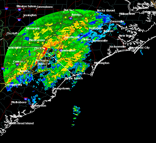 At 525 pm est, severe thunderstorms were located along a line extending from near laurinburg to near timmonsville, moving east at 35 mph (radar indicated). Hazards include 60 mph wind gusts and quarter size hail. Minor hail damage to vehicles is possible. Expect wind damage to trees and power lines. At 525 pm est, severe thunderstorms were located along a line extending from near laurinburg to near timmonsville, moving east at 35 mph (radar indicated). Hazards include 60 mph wind gusts and quarter size hail. Minor hail damage to vehicles is possible. Expect wind damage to trees and power lines.
|
| 1/12/2020 1:13 AM EST |
 The severe thunderstorm warning for robeson, northwestern bladen, dillon and southeastern marlboro counties will expire at 115 am est, the storms which prompted the warning have moved out of the area. therefore, the warning will be allowed to expire. however gusty winds are still possible with these thunderstorms. a severe thunderstorm watch remains in effect until 200 am est for southeastern north carolina, and northeastern south carolina. remember, a severe thunderstorm warning still remains in effect for robeson and northwest bladen counties until 2 am. remember, a tornado warning still remains in effect for central robeson county until 1:30 am. The severe thunderstorm warning for robeson, northwestern bladen, dillon and southeastern marlboro counties will expire at 115 am est, the storms which prompted the warning have moved out of the area. therefore, the warning will be allowed to expire. however gusty winds are still possible with these thunderstorms. a severe thunderstorm watch remains in effect until 200 am est for southeastern north carolina, and northeastern south carolina. remember, a severe thunderstorm warning still remains in effect for robeson and northwest bladen counties until 2 am. remember, a tornado warning still remains in effect for central robeson county until 1:30 am.
|
| 1/12/2020 1:13 AM EST |
 The severe thunderstorm warning for robeson. northwestern bladen. dillon and southeastern marlboro counties will expire at 115 am est. the storms which prompted the warning have moved out of the area. therefore, the warning will be allowed to expire. However gusty winds are still possible with these thunderstorms. The severe thunderstorm warning for robeson. northwestern bladen. dillon and southeastern marlboro counties will expire at 115 am est. the storms which prompted the warning have moved out of the area. therefore, the warning will be allowed to expire. However gusty winds are still possible with these thunderstorms.
|
| 1/12/2020 12:28 AM EST |
 At 1228 am est, severe thunderstorms were located along a line extending from 8 miles north of raeford to 7 miles northwest of brownsville, moving northeast at 75 mph (radar indicated). Hazards include 60 mph wind gusts. expect wind damage to trees and power lines At 1228 am est, severe thunderstorms were located along a line extending from 8 miles north of raeford to 7 miles northwest of brownsville, moving northeast at 75 mph (radar indicated). Hazards include 60 mph wind gusts. expect wind damage to trees and power lines
|
| 1/12/2020 12:18 AM EST |
 At 1218 am est, severe thunderstorms were located along a line extending from near hoffman to near clio, moving northeast at 65 mph (radar indicated). Hazards include 60 mph wind gusts. expect damage to roofs, siding, and trees At 1218 am est, severe thunderstorms were located along a line extending from near hoffman to near clio, moving northeast at 65 mph (radar indicated). Hazards include 60 mph wind gusts. expect damage to roofs, siding, and trees
|
| 1/11/2020 11:39 PM EST |
 At 1138 pm est, severe thunderstorms were located along a line extending from fort bragg to 7 miles northeast of mulberry, moving east at 45 mph (radar indicated). Hazards include 60 mph wind gusts. expect wind damage to trees and power lines At 1138 pm est, severe thunderstorms were located along a line extending from fort bragg to 7 miles northeast of mulberry, moving east at 45 mph (radar indicated). Hazards include 60 mph wind gusts. expect wind damage to trees and power lines
|
| 1/11/2020 11:38 PM EST |
 At 1138 pm est, severe thunderstorms were located along a line extending from near sanford to laurinburg to near bennettsville, moving east at 55 mph (radar indicated). Hazards include 60 mph wind gusts. Expect damage to roofs, siding, and trees. Locations impacted include, sanford, laurinburg, southern pines, raeford, carthage, pinehurst, aberdeen, maxton, antioch and whispering pines. At 1138 pm est, severe thunderstorms were located along a line extending from near sanford to laurinburg to near bennettsville, moving east at 55 mph (radar indicated). Hazards include 60 mph wind gusts. Expect damage to roofs, siding, and trees. Locations impacted include, sanford, laurinburg, southern pines, raeford, carthage, pinehurst, aberdeen, maxton, antioch and whispering pines.
|
| 1/11/2020 11:09 PM EST |
 At 1107 pm est, a line of showers and isolated thunderstorms with damaging winds to 60 mph. the line was moving east at 55 mph into the robbins, carthage, laurinburg and raeford areas (radar indicated). Hazards include 60 mph wind gusts. expect damage to roofs, siding, and trees At 1107 pm est, a line of showers and isolated thunderstorms with damaging winds to 60 mph. the line was moving east at 55 mph into the robbins, carthage, laurinburg and raeford areas (radar indicated). Hazards include 60 mph wind gusts. expect damage to roofs, siding, and trees
|
| 10/31/2019 8:46 PM EDT |
 At 846 pm edt, severe thunderstorms were located along a line extending from near raleigh to near fuquay-varina to 10 miles west of pope afb, moving east at 45 mph (radar indicated). Hazards include 60 mph wind gusts. Expect damage to roofs, siding, and trees. locations impacted include, fayetteville, sanford, laurinburg, southern pines, raeford, lillington, fort bragg, pinehurst, dunn and aberdeen. A tornado watch remains in effect until 1100 pm edt for central north carolina. At 846 pm edt, severe thunderstorms were located along a line extending from near raleigh to near fuquay-varina to 10 miles west of pope afb, moving east at 45 mph (radar indicated). Hazards include 60 mph wind gusts. Expect damage to roofs, siding, and trees. locations impacted include, fayetteville, sanford, laurinburg, southern pines, raeford, lillington, fort bragg, pinehurst, dunn and aberdeen. A tornado watch remains in effect until 1100 pm edt for central north carolina.
|
| 10/31/2019 7:39 PM EDT |
 The national weather service in raleigh has issued a * severe thunderstorm warning for. central moore county in central north carolina. scotland county in central north carolina. harnett county in central north carolina. Eastern richmond county in central north carolina. The national weather service in raleigh has issued a * severe thunderstorm warning for. central moore county in central north carolina. scotland county in central north carolina. harnett county in central north carolina. Eastern richmond county in central north carolina.
|
| 7/19/2019 10:55 PM EDT | Utility company reports small power outage in maxton due to damage to equipment from fallen trees/limbs in robeson county NC, 0.8 miles WNW of Maxton, NC |
| 7/19/2019 10:53 PM EDT |
 At 1053 pm edt, a severe thunderstorm was located over maxton, or 7 miles southeast of laurinburg, moving southeast at 5 mph (radar indicated). Hazards include 60 mph wind gusts and quarter size hail. Minor hail damage to vehicles is possible. Expect wind damage to trees and power lines. At 1053 pm edt, a severe thunderstorm was located over maxton, or 7 miles southeast of laurinburg, moving southeast at 5 mph (radar indicated). Hazards include 60 mph wind gusts and quarter size hail. Minor hail damage to vehicles is possible. Expect wind damage to trees and power lines.
|
| 7/19/2019 10:07 PM EDT |
 At 1007 pm edt, a severe thunderstorm was located near laurinburg, moving northeast at 10 mph (radar indicated). Hazards include 60 mph wind gusts. Expect damage to roofs, siding, and trees. Locations impacted include, laurinburg, gibson, east laurinburg, laurel hill and sandhills game land. At 1007 pm edt, a severe thunderstorm was located near laurinburg, moving northeast at 10 mph (radar indicated). Hazards include 60 mph wind gusts. Expect damage to roofs, siding, and trees. Locations impacted include, laurinburg, gibson, east laurinburg, laurel hill and sandhills game land.
|
| 7/19/2019 9:48 PM EDT |
 At 948 pm edt, a severe thunderstorm was located near mccoll, or near laurinburg, moving northeast at 10 mph (radar indicated). Hazards include 60 mph wind gusts. expect damage to roofs, siding, and trees At 948 pm edt, a severe thunderstorm was located near mccoll, or near laurinburg, moving northeast at 10 mph (radar indicated). Hazards include 60 mph wind gusts. expect damage to roofs, siding, and trees
|
| 7/4/2019 4:19 PM EDT |
 At 419 pm edt, a severe thunderstorm was located near south of the border, or 8 miles east of dillon, moving north at 30 mph (radar indicated). Hazards include 60 mph wind gusts and quarter size hail. Minor hail damage to vehicles is possible. Expect wind damage to trees and power lines. At 419 pm edt, a severe thunderstorm was located near south of the border, or 8 miles east of dillon, moving north at 30 mph (radar indicated). Hazards include 60 mph wind gusts and quarter size hail. Minor hail damage to vehicles is possible. Expect wind damage to trees and power lines.
|
| 6/22/2019 6:21 PM EDT |
 At 620 pm edt, a severe thunderstorm was located over elrod, or 12 miles south of red springs, moving east at 40 mph (radar indicated). Hazards include 70 mph wind gusts. Expect considerable tree damage. damage is likely to mobile homes, roofs, and outbuildings. Locations impacted include, laurinburg, maxton and east laurinburg. At 620 pm edt, a severe thunderstorm was located over elrod, or 12 miles south of red springs, moving east at 40 mph (radar indicated). Hazards include 70 mph wind gusts. Expect considerable tree damage. damage is likely to mobile homes, roofs, and outbuildings. Locations impacted include, laurinburg, maxton and east laurinburg.
|
| 6/22/2019 6:14 PM EDT |
 At 614 pm edt, severe thunderstorms were located along a line extending from raemon to brownsville, moving southeast at 60 mph (public). Hazards include 60 mph wind gusts and quarter size hail. Minor hail damage to vehicles is possible. Expect wind damage to trees and power lines. At 614 pm edt, severe thunderstorms were located along a line extending from raemon to brownsville, moving southeast at 60 mph (public). Hazards include 60 mph wind gusts and quarter size hail. Minor hail damage to vehicles is possible. Expect wind damage to trees and power lines.
|
| 6/22/2019 6:07 PM EDT |
 At 606 pm edt, a severe thunderstorm was located over maxton, or near laurinburg, moving east at 45 mph (radar indicated). Hazards include 70 mph wind gusts. Expect considerable tree damage. damage is likely to mobile homes, roofs, and outbuildings. Locations impacted include, laurinburg, maxton, gibson, east laurinburg and laurel hill. At 606 pm edt, a severe thunderstorm was located over maxton, or near laurinburg, moving east at 45 mph (radar indicated). Hazards include 70 mph wind gusts. Expect considerable tree damage. damage is likely to mobile homes, roofs, and outbuildings. Locations impacted include, laurinburg, maxton, gibson, east laurinburg and laurel hill.
|
| 6/22/2019 5:38 PM EDT |
 At 537 pm edt, a severe thunderstorm was located near hamlet, or near rockingham, moving east at 45 mph (radar indicated). Hazards include 70 mph wind gusts. Expect considerable tree damage. Damage is likely to mobile homes, roofs, and outbuildings. At 537 pm edt, a severe thunderstorm was located near hamlet, or near rockingham, moving east at 45 mph (radar indicated). Hazards include 70 mph wind gusts. Expect considerable tree damage. Damage is likely to mobile homes, roofs, and outbuildings.
|
| 6/5/2019 3:14 PM EDT |
 A severe thunderstorm warning remains in effect until 400 pm edt for central moore. scotland. southwestern harnett. southwestern lee and hoke counties. at 313 pm edt, a severe thunderstorm was located near southern pines, moving northeast at 20 mph. hazard. 60 mph wind gusts and quarter size hail. A severe thunderstorm warning remains in effect until 400 pm edt for central moore. scotland. southwestern harnett. southwestern lee and hoke counties. at 313 pm edt, a severe thunderstorm was located near southern pines, moving northeast at 20 mph. hazard. 60 mph wind gusts and quarter size hail.
|
| 6/5/2019 2:58 PM EDT |
 At 257 pm edt, a severe thunderstorm was located over aberdeen, or near southern pines, moving northeast at 25 mph (radar indicated). Hazards include 60 mph wind gusts and quarter size hail. Hail damage to vehicles is expected. Expect wind damage to roofs, siding, and trees. At 257 pm edt, a severe thunderstorm was located over aberdeen, or near southern pines, moving northeast at 25 mph (radar indicated). Hazards include 60 mph wind gusts and quarter size hail. Hail damage to vehicles is expected. Expect wind damage to roofs, siding, and trees.
|
| 5/31/2019 7:43 PM EDT |
 At 743 pm edt, a severe thunderstorm was located 10 miles north of dillon, moving east at 40 mph (radar indicated). Hazards include 60 mph wind gusts and quarter size hail. Minor hail damage to vehicles is possible. expect wind damage to trees and powerlines. Locations impacted include, pembroke, maxton, rowland, buie, raemon, hamer, south of the border and purvis. At 743 pm edt, a severe thunderstorm was located 10 miles north of dillon, moving east at 40 mph (radar indicated). Hazards include 60 mph wind gusts and quarter size hail. Minor hail damage to vehicles is possible. expect wind damage to trees and powerlines. Locations impacted include, pembroke, maxton, rowland, buie, raemon, hamer, south of the border and purvis.
|
| 5/31/2019 7:28 PM EDT |
 At 728 pm edt, a severe thunderstorm was located 7 miles east of bennettsville, moving east at 35 mph (radar indicated). Hazards include 60 mph wind gusts and quarter size hail. Minor hail damage to vehicles is possible. Expect wind damage to trees and powerlines. At 728 pm edt, a severe thunderstorm was located 7 miles east of bennettsville, moving east at 35 mph (radar indicated). Hazards include 60 mph wind gusts and quarter size hail. Minor hail damage to vehicles is possible. Expect wind damage to trees and powerlines.
|
| 5/31/2019 2:27 PM EDT |
 At 225 pm edt, a severe thunderstorm was located near pembroke to rural portions of western robeson county and extreme northern dillon county. this thunderstorm was moving east at 30 mph (radar indicated). Hazards include 60 mph wind gusts and penny size hail. frequent cloud to ground lightning is also expected. Expect wind damage to trees and power lines. Locations impacted include, lumberton, pembroke, smiths, howellsville, raemon, hestertown, barker ten mile, purvis, prospect, tolarsville, mcdonald, and raynham. At 225 pm edt, a severe thunderstorm was located near pembroke to rural portions of western robeson county and extreme northern dillon county. this thunderstorm was moving east at 30 mph (radar indicated). Hazards include 60 mph wind gusts and penny size hail. frequent cloud to ground lightning is also expected. Expect wind damage to trees and power lines. Locations impacted include, lumberton, pembroke, smiths, howellsville, raemon, hestertown, barker ten mile, purvis, prospect, tolarsville, mcdonald, and raynham.
|
| 5/31/2019 2:03 PM EDT |
 At 203 pm edt, a severe thunderstorm was located over raemon, or 9 miles south of laurinburg, moving east at 35 mph (radar indicated). Hazards include 60 mph wind gusts and penny size hail. expect wind damage to trees and power lines At 203 pm edt, a severe thunderstorm was located over raemon, or 9 miles south of laurinburg, moving east at 35 mph (radar indicated). Hazards include 60 mph wind gusts and penny size hail. expect wind damage to trees and power lines
|
| 4/19/2019 3:40 PM EDT |
 At 340 pm edt, a severe thunderstorm was located over mccoll, or 7 miles northeast of bennettsville, moving north at 35 mph (radar indicated). Hazards include 60 mph wind gusts. expect damage to roofs, siding, and trees At 340 pm edt, a severe thunderstorm was located over mccoll, or 7 miles northeast of bennettsville, moving north at 35 mph (radar indicated). Hazards include 60 mph wind gusts. expect damage to roofs, siding, and trees
|
| 4/19/2019 3:39 PM EDT |
 At 339 pm edt, severe thunderstorms were located along a line extending from 7 miles west of laurinburg to rains, moving northeast at 65 mph (radar indicated). Hazards include 70 mph wind gusts. Expect considerable tree damage. Damage is likely to mobile homes, roofs, and outbuildings. At 339 pm edt, severe thunderstorms were located along a line extending from 7 miles west of laurinburg to rains, moving northeast at 65 mph (radar indicated). Hazards include 70 mph wind gusts. Expect considerable tree damage. Damage is likely to mobile homes, roofs, and outbuildings.
|
| 2/12/2019 7:08 PM EST |
 At 707 pm est, severe thunderstorms were located along a line extending from 7 miles south of aberdeen to 7 miles northeast of laurinburg to mccoll, moving northeast at 50 mph (radar indicated). Hazards include 60 mph wind gusts. Expect damage to roofs, siding, and trees. Locations impacted include, laurinburg, raeford, maxton, antioch, wagram, east laurinburg, silver city, rockfish, bowmore and ashley heights. At 707 pm est, severe thunderstorms were located along a line extending from 7 miles south of aberdeen to 7 miles northeast of laurinburg to mccoll, moving northeast at 50 mph (radar indicated). Hazards include 60 mph wind gusts. Expect damage to roofs, siding, and trees. Locations impacted include, laurinburg, raeford, maxton, antioch, wagram, east laurinburg, silver city, rockfish, bowmore and ashley heights.
|
| 2/12/2019 6:58 PM EST |
 At 657 pm est, severe thunderstorms were located along a line extending from near hoffman to near laurinburg to near bennettsville, moving northeast at 60 mph (radar indicated). Hazards include 60 mph wind gusts. Expect damage to roofs, siding, and trees. Locations impacted include, laurinburg, raeford, maxton, antioch, wagram, gibson, east laurinburg, laurel hill, rockfish and ashley heights. At 657 pm est, severe thunderstorms were located along a line extending from near hoffman to near laurinburg to near bennettsville, moving northeast at 60 mph (radar indicated). Hazards include 60 mph wind gusts. Expect damage to roofs, siding, and trees. Locations impacted include, laurinburg, raeford, maxton, antioch, wagram, gibson, east laurinburg, laurel hill, rockfish and ashley heights.
|
| 2/12/2019 6:42 PM EST |
 At 642 pm est, severe thunderstorms were located along a line extending from near hamlet to chavistown to 6 miles north of dovesville, moving northeast at 50 mph (radar indicated). Hazards include 60 mph wind gusts. expect damage to roofs, siding, and trees At 642 pm est, severe thunderstorms were located along a line extending from near hamlet to chavistown to 6 miles north of dovesville, moving northeast at 50 mph (radar indicated). Hazards include 60 mph wind gusts. expect damage to roofs, siding, and trees
|
| 10/11/2018 4:57 PM EDT |
 At 455 pm edt, a line of damaging winds mixing south along the western side of michael were moving along a line extending from 8 miles west of cary through 11 miles southeast of pittsboro to 6 miles northeast of hamlet, moving east at 45 mph. this line of winds have a history of producing extensive wind damage to structures (emergency management). Hazards include 60 mph wind gusts. expect damage to roofs, siding, and trees At 455 pm edt, a line of damaging winds mixing south along the western side of michael were moving along a line extending from 8 miles west of cary through 11 miles southeast of pittsboro to 6 miles northeast of hamlet, moving east at 45 mph. this line of winds have a history of producing extensive wind damage to structures (emergency management). Hazards include 60 mph wind gusts. expect damage to roofs, siding, and trees
|
| 9/16/2018 6:34 PM EDT |
 At 634 pm edt, a severe thunderstorm capable of producing a tornado was located near laurinburg, moving north at 35 mph (radar indicated rotation). Hazards include tornado. Flying debris will be dangerous to those caught without shelter. mobile homes will be damaged or destroyed. damage to roofs, windows, and vehicles will occur. tree damage is likely. Locations impacted include, laurinburg, maxton, wagram, east laurinburg and sandhills game land. At 634 pm edt, a severe thunderstorm capable of producing a tornado was located near laurinburg, moving north at 35 mph (radar indicated rotation). Hazards include tornado. Flying debris will be dangerous to those caught without shelter. mobile homes will be damaged or destroyed. damage to roofs, windows, and vehicles will occur. tree damage is likely. Locations impacted include, laurinburg, maxton, wagram, east laurinburg and sandhills game land.
|
| 9/16/2018 6:27 PM EDT |
 The tornado warning for west central robeson and north central dillon counties will expire at 630 pm edt. the storm which prompted the warning has moved out of the area. therefore, the warning will be allowed to expire. a tornado watch remains in effect until 1100 pm edt for southeastern north carolina. and northeastern south carolina. A tornado watch. The tornado warning for west central robeson and north central dillon counties will expire at 630 pm edt. the storm which prompted the warning has moved out of the area. therefore, the warning will be allowed to expire. a tornado watch remains in effect until 1100 pm edt for southeastern north carolina. and northeastern south carolina. A tornado watch.
|
| 9/16/2018 6:19 PM EDT |
 At 616 pm edt, a severe thunderstorm capable of producing a tornado was located over raemon, or 11 miles southeast of laurinburg, moving north at 35 mph (radar indicated rotation). Hazards include tornado. Flying debris will be dangerous to those caught without shelter. mobile homes will be damaged or destroyed. damage to roofs, windows, and vehicles will occur. Tree damage is likely. At 616 pm edt, a severe thunderstorm capable of producing a tornado was located over raemon, or 11 miles southeast of laurinburg, moving north at 35 mph (radar indicated rotation). Hazards include tornado. Flying debris will be dangerous to those caught without shelter. mobile homes will be damaged or destroyed. damage to roofs, windows, and vehicles will occur. Tree damage is likely.
|
| 9/16/2018 5:58 PM EDT |
 At 558 pm edt, a severe thunderstorm capable of producing a tornado was located over hamer, or near dillon, moving north at 35 mph (radar indicated rotation). Hazards include tornado. expect damage to mobile homes, roofs, and vehicles At 558 pm edt, a severe thunderstorm capable of producing a tornado was located over hamer, or near dillon, moving north at 35 mph (radar indicated rotation). Hazards include tornado. expect damage to mobile homes, roofs, and vehicles
|
| 9/16/2018 5:58 PM EDT |
 The national weather service in wilmington has issued a * tornado warning for. west central robeson county in southeastern north carolina. north central dillon county in northeastern south carolina. until 630 pm edt. At 558 pm edt, a severe thunderstorm capable of producing a tornado. The national weather service in wilmington has issued a * tornado warning for. west central robeson county in southeastern north carolina. north central dillon county in northeastern south carolina. until 630 pm edt. At 558 pm edt, a severe thunderstorm capable of producing a tornado.
|
| 9/16/2018 3:58 PM EDT |
 The national weather service in raleigh has issued a * tornado warning for. scotland county in central north carolina. Until 445 pm edt * at 356 pm edt, a severe thunderstorm with a history of producing a tornado a tornado was located near maxton, or near laurinburg,. The national weather service in raleigh has issued a * tornado warning for. scotland county in central north carolina. Until 445 pm edt * at 356 pm edt, a severe thunderstorm with a history of producing a tornado a tornado was located near maxton, or near laurinburg,.
|
| 9/16/2018 3:52 PM EDT |
 At 352 pm edt, a confirmed tornado was located over maxton, or near laurinburg, moving north at 40 mph (law enforcement confirmed tornado touchdown in a farm field west of rowland, nc). Hazards include damaging tornado. Flying debris will be dangerous to those caught without shelter. mobile homes will be damaged or destroyed. damage to roofs, windows, and vehicles will occur. tree damage is likely. Locations impacted include, laurinburg, maxton, wagram and east laurinburg. At 352 pm edt, a confirmed tornado was located over maxton, or near laurinburg, moving north at 40 mph (law enforcement confirmed tornado touchdown in a farm field west of rowland, nc). Hazards include damaging tornado. Flying debris will be dangerous to those caught without shelter. mobile homes will be damaged or destroyed. damage to roofs, windows, and vehicles will occur. tree damage is likely. Locations impacted include, laurinburg, maxton, wagram and east laurinburg.
|
| 9/16/2018 3:39 PM EDT |
 At 338 pm edt, a severe thunderstorm capable of producing a tornado was located over raemon, or 10 miles southeast of laurinburg, moving north at 40 mph. this storm will soon cross the robeson and scotland county line (radar indicated rotation). Hazards include tornado. Flying debris will be dangerous to those caught without shelter. mobile homes will be damaged or destroyed. damage to roofs, windows, and vehicles will occur. tree damage is likely. Locations impacted include, laurinburg, maxton, wagram, east laurinburg and laurel hill. At 338 pm edt, a severe thunderstorm capable of producing a tornado was located over raemon, or 10 miles southeast of laurinburg, moving north at 40 mph. this storm will soon cross the robeson and scotland county line (radar indicated rotation). Hazards include tornado. Flying debris will be dangerous to those caught without shelter. mobile homes will be damaged or destroyed. damage to roofs, windows, and vehicles will occur. tree damage is likely. Locations impacted include, laurinburg, maxton, wagram, east laurinburg and laurel hill.
|
| 9/16/2018 3:35 PM EDT |
 At 334 pm edt, a severe thunderstorm capable of producing a tornado was located near raemon, or 12 miles north of dillon, moving north at 25 mph (radar indicated rotation). Hazards include tornado. Expect damage to mobile homes, roofs, and vehicles. locations impacted include, maxton, rowland and raemon. this includes interstate 74 mile marker 191 and near mile marker 192. a second tornadic thunderstorm has moved into southern dillon county near floydale. This storm also has a tornado warning on it. At 334 pm edt, a severe thunderstorm capable of producing a tornado was located near raemon, or 12 miles north of dillon, moving north at 25 mph (radar indicated rotation). Hazards include tornado. Expect damage to mobile homes, roofs, and vehicles. locations impacted include, maxton, rowland and raemon. this includes interstate 74 mile marker 191 and near mile marker 192. a second tornadic thunderstorm has moved into southern dillon county near floydale. This storm also has a tornado warning on it.
|
| 9/16/2018 3:22 PM EDT |
 At 320 pm edt, a severe thunderstorm capable of producing a tornado was located near south of the border, or 7 miles north of dillon, moving north at 40 mph (radar indicated rotation). Hazards include tornado. Flying debris will be dangerous to those caught without shelter. mobile homes will be damaged or destroyed. damage to roofs, windows, and vehicles will occur. Tree damage is likely. At 320 pm edt, a severe thunderstorm capable of producing a tornado was located near south of the border, or 7 miles north of dillon, moving north at 40 mph (radar indicated rotation). Hazards include tornado. Flying debris will be dangerous to those caught without shelter. mobile homes will be damaged or destroyed. damage to roofs, windows, and vehicles will occur. Tree damage is likely.
|
| 9/16/2018 3:15 PM EDT |
 At 315 pm edt, a severe thunderstorm capable of producing a tornado was located over hamer, or near dillon, moving north at 20 mph (radar indicated rotation). Hazards include tornado. expect damage to mobile homes, roofs, and vehicles At 315 pm edt, a severe thunderstorm capable of producing a tornado was located over hamer, or near dillon, moving north at 20 mph (radar indicated rotation). Hazards include tornado. expect damage to mobile homes, roofs, and vehicles
|
| 9/16/2018 12:56 PM EDT |
 The tornado warning for west central robeson and north central dillon counties will expire at 100 pm edt, the storm which prompted the warning has moved out of the area. therefore, the warning will be allowed to expire. a tornado watch remains in effect until 500 pm edt for southeastern north carolina, and northeastern south carolina. The tornado warning for west central robeson and north central dillon counties will expire at 100 pm edt, the storm which prompted the warning has moved out of the area. therefore, the warning will be allowed to expire. a tornado watch remains in effect until 500 pm edt for southeastern north carolina, and northeastern south carolina.
|
| 9/16/2018 12:48 PM EDT |
 At 1247 pm edt, a severe thunderstorm capable of producing a tornado was located near raemon, or 12 miles north of dillon, moving north at 35 mph (radar indicated rotation). Hazards include tornado. Flying debris will be dangerous to those caught without shelter. mobile homes will be damaged or destroyed. damage to roofs, windows, and vehicles will occur. tree damage is likely. locations impacted include, maxton and raemon. This includes interstate 74 mile marker 191 and near mile marker 192. At 1247 pm edt, a severe thunderstorm capable of producing a tornado was located near raemon, or 12 miles north of dillon, moving north at 35 mph (radar indicated rotation). Hazards include tornado. Flying debris will be dangerous to those caught without shelter. mobile homes will be damaged or destroyed. damage to roofs, windows, and vehicles will occur. tree damage is likely. locations impacted include, maxton and raemon. This includes interstate 74 mile marker 191 and near mile marker 192.
|
| 9/16/2018 12:37 PM EDT |
 At 1237 pm edt, a severe thunderstorm capable of producing a tornado was located over hamer, or near dillon, moving north at 45 mph (radar indicated rotation). Hazards include tornado. Flying debris will be dangerous to those caught without shelter. mobile homes will be damaged or destroyed. damage to roofs, windows, and vehicles will occur. tree damage is likely. locations impacted include, dillon, maxton, raemon, hamer, south of the border, little rock and minturn. this includes the following highways, interstate 74 near mile marker 191, and between mile markers 192 and 193. Interstate 95 in south carolina between mile markers 192 and 198. At 1237 pm edt, a severe thunderstorm capable of producing a tornado was located over hamer, or near dillon, moving north at 45 mph (radar indicated rotation). Hazards include tornado. Flying debris will be dangerous to those caught without shelter. mobile homes will be damaged or destroyed. damage to roofs, windows, and vehicles will occur. tree damage is likely. locations impacted include, dillon, maxton, raemon, hamer, south of the border, little rock and minturn. this includes the following highways, interstate 74 near mile marker 191, and between mile markers 192 and 193. Interstate 95 in south carolina between mile markers 192 and 198.
|
| 9/16/2018 12:25 PM EDT |
 At 1225 pm edt, a severe thunderstorm capable of producing a tornado was located near floydale, or near dillon, moving north at 35 mph (radar indicated rotation). Hazards include tornado. Flying debris will be dangerous to those caught without shelter. mobile homes will be damaged or destroyed. damage to roofs, windows, and vehicles will occur. Tree damage is likely. At 1225 pm edt, a severe thunderstorm capable of producing a tornado was located near floydale, or near dillon, moving north at 35 mph (radar indicated rotation). Hazards include tornado. Flying debris will be dangerous to those caught without shelter. mobile homes will be damaged or destroyed. damage to roofs, windows, and vehicles will occur. Tree damage is likely.
|
| 8/8/2018 8:27 PM EDT |
 At 827 pm edt, severe thunderstorms were located along a line extending from hoffman to near hamlet, moving east at 25 mph (radar indicated). Hazards include 60 mph wind gusts. Expect damage to roofs, siding, and trees. Locations impacted include, laurinburg, rockingham, raeford, hamlet, maxton, hoffman, ellerbe, dobbins heights, wagram and gibson. At 827 pm edt, severe thunderstorms were located along a line extending from hoffman to near hamlet, moving east at 25 mph (radar indicated). Hazards include 60 mph wind gusts. Expect damage to roofs, siding, and trees. Locations impacted include, laurinburg, rockingham, raeford, hamlet, maxton, hoffman, ellerbe, dobbins heights, wagram and gibson.
|
| 8/8/2018 7:51 PM EDT |
 At 750 pm edt, severe thunderstorms were located along a line extending from 13 miles south of biscoe to 7 miles northwest of chesterfield, moving east at 25 mph (radar indicated). Hazards include 60 mph wind gusts. expect damage to roofs, siding, and trees At 750 pm edt, severe thunderstorms were located along a line extending from 13 miles south of biscoe to 7 miles northwest of chesterfield, moving east at 25 mph (radar indicated). Hazards include 60 mph wind gusts. expect damage to roofs, siding, and trees
|
| 7/27/2018 6:17 PM EDT |
 At 616 pm edt, a severe thunderstorm was located near bingham, or 12 miles southeast of bennettsville, moving northeast at 30 mph (radar indicated). Hazards include 60 mph wind gusts and quarter size hail. Minor hail damage to vehicles is possible. Expect wind damage to trees and power lines. At 616 pm edt, a severe thunderstorm was located near bingham, or 12 miles southeast of bennettsville, moving northeast at 30 mph (radar indicated). Hazards include 60 mph wind gusts and quarter size hail. Minor hail damage to vehicles is possible. Expect wind damage to trees and power lines.
|
| 6/25/2018 9:39 PM EDT |
 At 938 pm edt, severe thunderstorms were located along a line extending from near raeford to 7 miles northeast of laurinburg to 7 miles south of cheraw, moving southeast at 30 mph. this storm has a history of producing wind damage in the form of downed trees and powerlines (radar indicated). Hazards include 60 mph wind gusts and penny size hail. Expect damage to roofs, siding, and trees. Locations impacted include, laurinburg, raeford, maxton, antioch, wagram, gibson, east laurinburg, laurel hill, rockfish and ashley heights. At 938 pm edt, severe thunderstorms were located along a line extending from near raeford to 7 miles northeast of laurinburg to 7 miles south of cheraw, moving southeast at 30 mph. this storm has a history of producing wind damage in the form of downed trees and powerlines (radar indicated). Hazards include 60 mph wind gusts and penny size hail. Expect damage to roofs, siding, and trees. Locations impacted include, laurinburg, raeford, maxton, antioch, wagram, gibson, east laurinburg, laurel hill, rockfish and ashley heights.
|
| 6/25/2018 9:27 PM EDT |
 At 926 pm edt, severe thunderstorms were located along a line extending from 7 miles southeast of aberdeen to 8 miles southeast of hoffman to near cheraw, moving southeast at 30 mph (radar indicated). Hazards include 60 mph wind gusts and penny size hail. Expect damage to roofs, siding, and trees. Locations impacted include, laurinburg, rockingham, raeford, hamlet, maxton, hoffman, antioch, dobbins heights, wagram and gibson. At 926 pm edt, severe thunderstorms were located along a line extending from 7 miles southeast of aberdeen to 8 miles southeast of hoffman to near cheraw, moving southeast at 30 mph (radar indicated). Hazards include 60 mph wind gusts and penny size hail. Expect damage to roofs, siding, and trees. Locations impacted include, laurinburg, rockingham, raeford, hamlet, maxton, hoffman, antioch, dobbins heights, wagram and gibson.
|
| 6/25/2018 8:57 PM EDT |
 At 856 pm edt, severe thunderstorms were located along a line extending from near pinehurst to 7 miles northwest of hoffman to 8 miles southwest of wadesboro, moving southeast at 35 mph. this storm has a history of producing wind damage (radar indicated). Hazards include 60 mph wind gusts and penny size hail. expect damage to roofs, siding, and trees At 856 pm edt, severe thunderstorms were located along a line extending from near pinehurst to 7 miles northwest of hoffman to 8 miles southwest of wadesboro, moving southeast at 35 mph. this storm has a history of producing wind damage (radar indicated). Hazards include 60 mph wind gusts and penny size hail. expect damage to roofs, siding, and trees
|
| 6/25/2018 5:55 PM EDT |
 The severe thunderstorm warning for southeastern scotland and south central hoke counties will expire at 600 pm edt, the storm which prompted the warning has weakened below severe limits, and has exited the warned area. therefore, the warning will be allowed to expire. a severe thunderstorm watch remains in effect until 1000 pm edt for central north carolina. The severe thunderstorm warning for southeastern scotland and south central hoke counties will expire at 600 pm edt, the storm which prompted the warning has weakened below severe limits, and has exited the warned area. therefore, the warning will be allowed to expire. a severe thunderstorm watch remains in effect until 1000 pm edt for central north carolina.
|
| 6/25/2018 5:50 PM EDT |
 At 549 pm edt, a severe thunderstorm was located over pembroke, or 9 miles west of lumberton, moving east at 15 mph (radar indicated). Hazards include 60 mph wind gusts and quarter size hail. Minor hail damage to vehicles is possible. expect wind damage to trees and power lines. locations impacted include, red springs, pembroke, maxton, buie, wakulla, raemon, purvis, prospect, elrod, mcdonald and raynham. this includes the following highways, interstate 74 near mile marker 191, between mile markers 208 and 203, and between mile markers 192 and 200. Interstate 95 in north carolina between mile markers 8 and 11. At 549 pm edt, a severe thunderstorm was located over pembroke, or 9 miles west of lumberton, moving east at 15 mph (radar indicated). Hazards include 60 mph wind gusts and quarter size hail. Minor hail damage to vehicles is possible. expect wind damage to trees and power lines. locations impacted include, red springs, pembroke, maxton, buie, wakulla, raemon, purvis, prospect, elrod, mcdonald and raynham. this includes the following highways, interstate 74 near mile marker 191, between mile markers 208 and 203, and between mile markers 192 and 200. Interstate 95 in north carolina between mile markers 8 and 11.
|
| 6/25/2018 5:37 PM EDT |
 At 537 pm edt, a severe thunderstorm was located near wakulla, or 7 miles west of red springs, moving southeast at 20 mph (radar indicated). Hazards include 60 mph wind gusts and quarter size hail. Hail damage to vehicles is expected. expect wind damage to roofs, siding, and trees. Locations impacted include, laurinburg, maxton, east laurinburg and laurel hill. At 537 pm edt, a severe thunderstorm was located near wakulla, or 7 miles west of red springs, moving southeast at 20 mph (radar indicated). Hazards include 60 mph wind gusts and quarter size hail. Hail damage to vehicles is expected. expect wind damage to roofs, siding, and trees. Locations impacted include, laurinburg, maxton, east laurinburg and laurel hill.
|
| 6/25/2018 5:30 PM EDT |
 At 530 pm edt, a severe thunderstorm was located near pembroke, or 9 miles southwest of red springs, moving east at 15 mph (radar indicated). Hazards include 60 mph wind gusts and quarter size hail. Minor hail damage to vehicles is possible. expect wind damage to trees and power lines. locations impacted include, red springs, pembroke, maxton, buie, wakulla, raemon, purvis, prospect, elrod, mcdonald and raynham. this includes the following highways, interstate 74 near mile marker 191, between mile markers 208 and 203, and between mile markers 192 and 200. Interstate 95 in north carolina between mile markers 8 and 11. At 530 pm edt, a severe thunderstorm was located near pembroke, or 9 miles southwest of red springs, moving east at 15 mph (radar indicated). Hazards include 60 mph wind gusts and quarter size hail. Minor hail damage to vehicles is possible. expect wind damage to trees and power lines. locations impacted include, red springs, pembroke, maxton, buie, wakulla, raemon, purvis, prospect, elrod, mcdonald and raynham. this includes the following highways, interstate 74 near mile marker 191, between mile markers 208 and 203, and between mile markers 192 and 200. Interstate 95 in north carolina between mile markers 8 and 11.
|
| 6/25/2018 5:17 PM EDT |
 At 517 pm edt, a severe thunderstorm was located 7 miles north of laurinburg, moving southeast at 20 mph (radar indicated). Hazards include 60 mph wind gusts and quarter size hail. Hail damage to vehicles is expected. Expect wind damage to roofs, siding, and trees. At 517 pm edt, a severe thunderstorm was located 7 miles north of laurinburg, moving southeast at 20 mph (radar indicated). Hazards include 60 mph wind gusts and quarter size hail. Hail damage to vehicles is expected. Expect wind damage to roofs, siding, and trees.
|
| 6/25/2018 5:15 PM EDT |
 At 515 pm edt, a severe thunderstorm was located over maxton, or 9 miles southeast of laurinburg, moving east at 15 mph (radar indicated). Hazards include 60 mph wind gusts and quarter size hail. Minor hail damage to vehicles is possible. Expect wind damage to trees and power lines. At 515 pm edt, a severe thunderstorm was located over maxton, or 9 miles southeast of laurinburg, moving east at 15 mph (radar indicated). Hazards include 60 mph wind gusts and quarter size hail. Minor hail damage to vehicles is possible. Expect wind damage to trees and power lines.
|
| 6/24/2018 5:02 PM EDT | Mulitple trees down in red hill on wild plum d in robeson county NC, 3.5 miles SW of Maxton, NC |
| 6/24/2018 4:34 PM EDT |
 At 433 pm edt, severe thunderstorms were located along a line extending from near maxton to near mccoll, moving east at 30 mph (radar indicated). Hazards include 60 mph wind gusts. Expect damage to roofs, siding, and trees. Locations impacted include, laurinburg, maxton and east laurinburg. At 433 pm edt, severe thunderstorms were located along a line extending from near maxton to near mccoll, moving east at 30 mph (radar indicated). Hazards include 60 mph wind gusts. Expect damage to roofs, siding, and trees. Locations impacted include, laurinburg, maxton and east laurinburg.
|
| 6/24/2018 4:34 PM EDT |
 At 434 pm edt, a severe thunderstorm was located over wakulla, or near red springs, moving east at 20 mph (radar indicated). Hazards include 60 mph wind gusts and quarter size hail. Minor hail damage to vehicles is possible. Expect wind damage to trees and power lines. At 434 pm edt, a severe thunderstorm was located over wakulla, or near red springs, moving east at 20 mph (radar indicated). Hazards include 60 mph wind gusts and quarter size hail. Minor hail damage to vehicles is possible. Expect wind damage to trees and power lines.
|
| 6/24/2018 4:21 PM EDT |
 At 420 pm edt, severe thunderstorms were located along a line extending from near laurinburg to 6 miles northwest of mccoll, moving east at 30 mph (radar indicated). Hazards include 60 mph wind gusts. expect damage to roofs, siding, and trees At 420 pm edt, severe thunderstorms were located along a line extending from near laurinburg to 6 miles northwest of mccoll, moving east at 30 mph (radar indicated). Hazards include 60 mph wind gusts. expect damage to roofs, siding, and trees
|
| 4/15/2018 8:31 PM EDT |
 At 830 pm edt, severe thunderstorms were located along a line extending from near sanford to near prospect, moving northeast at 80 mph (radar indicated). Hazards include 60 mph wind gusts. expect damage to roofs, siding, and trees At 830 pm edt, severe thunderstorms were located along a line extending from near sanford to near prospect, moving northeast at 80 mph (radar indicated). Hazards include 60 mph wind gusts. expect damage to roofs, siding, and trees
|
| 4/15/2018 5:38 PM EDT |
 At 538 pm edt, a severe thunderstorm was located near hoffman, or 10 miles south of southern pines, moving north at 20 mph (radar indicated). Hazards include 60 mph wind gusts and quarter size hail. Hail damage to vehicles is expected. expect wind damage to roofs, siding, and trees. locations impacted include, laurinburg, southern pines, raeford, carthage, pinehurst, aberdeen, maxton, antioch, whispering pines and pinebluff. A tornado watch remains in effect until 1100 pm edt for central north carolina. At 538 pm edt, a severe thunderstorm was located near hoffman, or 10 miles south of southern pines, moving north at 20 mph (radar indicated). Hazards include 60 mph wind gusts and quarter size hail. Hail damage to vehicles is expected. expect wind damage to roofs, siding, and trees. locations impacted include, laurinburg, southern pines, raeford, carthage, pinehurst, aberdeen, maxton, antioch, whispering pines and pinebluff. A tornado watch remains in effect until 1100 pm edt for central north carolina.
|
| 4/15/2018 4:55 PM EDT |
 At 453 pm edt, a line of severe thunderstorms were approaching from the south. these storms were located near mccoll, or near bennettsville, moving north at 45 mph (radar indicated). Hazards include 60 mph wind gusts and quarter size hail. Hail damage to vehicles is expected. Expect wind damage to roofs, siding, and trees. At 453 pm edt, a line of severe thunderstorms were approaching from the south. these storms were located near mccoll, or near bennettsville, moving north at 45 mph (radar indicated). Hazards include 60 mph wind gusts and quarter size hail. Hail damage to vehicles is expected. Expect wind damage to roofs, siding, and trees.
|
| 9/1/2017 5:57 PM EDT |
 At 557 pm edt, a severe thunderstorm capable of producing a tornado was located near maxton, or near laurinburg, moving east at 30 mph (radar indicated rotation). Hazards include tornado. Flying debris will be dangerous to those caught without shelter. mobile homes will be damaged or destroyed. damage to roofs, windows, and vehicles will occur. Tree damage is likely. At 557 pm edt, a severe thunderstorm capable of producing a tornado was located near maxton, or near laurinburg, moving east at 30 mph (radar indicated rotation). Hazards include tornado. Flying debris will be dangerous to those caught without shelter. mobile homes will be damaged or destroyed. damage to roofs, windows, and vehicles will occur. Tree damage is likely.
|
| 9/1/2017 5:56 PM EDT |
 At 552 pm edt, a severe thunderstorm capable of producing a tornado was located 5 miles northwest of maxton, or 7 miles northeast of laurinburg, moving northeast at 35 mph (radar indicated rotation). Hazards include tornado and quarter size hail. expect damage to mobile homes, roofs, and vehicles At 552 pm edt, a severe thunderstorm capable of producing a tornado was located 5 miles northwest of maxton, or 7 miles northeast of laurinburg, moving northeast at 35 mph (radar indicated rotation). Hazards include tornado and quarter size hail. expect damage to mobile homes, roofs, and vehicles
|
| 9/1/2017 5:48 PM EDT |
 At 548 pm edt, a severe thunderstorm capable of producing a tornado was located near laurinburg, moving east at 25 mph (radar indicated rotation). Hazards include tornado and ping pong ball size hail. Flying debris will be dangerous to those caught without shelter. mobile homes will be damaged or destroyed. damage to roofs, windows, and vehicles will occur. tree damage is likely. Locations impacted include, laurinburg, maxton, antioch, wagram and east laurinburg. At 548 pm edt, a severe thunderstorm capable of producing a tornado was located near laurinburg, moving east at 25 mph (radar indicated rotation). Hazards include tornado and ping pong ball size hail. Flying debris will be dangerous to those caught without shelter. mobile homes will be damaged or destroyed. damage to roofs, windows, and vehicles will occur. tree damage is likely. Locations impacted include, laurinburg, maxton, antioch, wagram and east laurinburg.
|
| 9/1/2017 5:24 PM EDT |
 At 524 pm edt, a severe thunderstorm capable of producing a tornado was located over laurinburg, moving east at 30 mph (radar indicated rotation). Hazards include tornado and ping pong ball size hail. Flying debris will be dangerous to those caught without shelter. mobile homes will be damaged or destroyed. damage to roofs, windows, and vehicles will occur. Tree damage is likely. At 524 pm edt, a severe thunderstorm capable of producing a tornado was located over laurinburg, moving east at 30 mph (radar indicated rotation). Hazards include tornado and ping pong ball size hail. Flying debris will be dangerous to those caught without shelter. mobile homes will be damaged or destroyed. damage to roofs, windows, and vehicles will occur. Tree damage is likely.
|
| 9/1/2017 5:16 PM EDT |
 At 516 pm edt, a severe thunderstorm was located near laurinburg, moving east at 30 mph (radar indicated). Hazards include 60 mph wind gusts. expect damage to roofs, siding, and trees At 516 pm edt, a severe thunderstorm was located near laurinburg, moving east at 30 mph (radar indicated). Hazards include 60 mph wind gusts. expect damage to roofs, siding, and trees
|
| 8/23/2017 7:21 PM EDT |
 The severe thunderstorm warning for robeson and dillon counties will expire at 730 pm edt, the storms which prompted the warning have moved out of the warned area. therefore, the warning will be allowed to expire. another severe thunderstorm warning is in effect until 845 pm just downstream of this expiring warning. The severe thunderstorm warning for robeson and dillon counties will expire at 730 pm edt, the storms which prompted the warning have moved out of the warned area. therefore, the warning will be allowed to expire. another severe thunderstorm warning is in effect until 845 pm just downstream of this expiring warning.
|
| 8/23/2017 6:57 PM EDT |
 At 656 pm edt, severe thunderstorms were located along a line extending from south of the border to near latta, moving east at 30 mph (radar indicated). Hazards include 60 mph wind gusts and quarter size hail. Minor hail damage to vehicles is possible. expect wind damage to trees and power lines. locations impacted include, lumberton, dillon, red springs, pembroke, fairmont, maxton, latta, rowland, lake view, fork, hamer, south of the border, hestertown, shannon, buie, robeson community college, wakulla, minturn, elrod and raemon. this includes the following highways, interstate 74 between mile markers 191 and 214. interstate 95 in south carolina between mile markers 176 and 198. interstate 95 in north carolina between mile markers 1 and 25. Us route 74 between mile markers 365 and 373. At 656 pm edt, severe thunderstorms were located along a line extending from south of the border to near latta, moving east at 30 mph (radar indicated). Hazards include 60 mph wind gusts and quarter size hail. Minor hail damage to vehicles is possible. expect wind damage to trees and power lines. locations impacted include, lumberton, dillon, red springs, pembroke, fairmont, maxton, latta, rowland, lake view, fork, hamer, south of the border, hestertown, shannon, buie, robeson community college, wakulla, minturn, elrod and raemon. this includes the following highways, interstate 74 between mile markers 191 and 214. interstate 95 in south carolina between mile markers 176 and 198. interstate 95 in north carolina between mile markers 1 and 25. Us route 74 between mile markers 365 and 373.
|
| 8/23/2017 6:34 PM EDT |
 At 633 pm edt, severe thunderstorms were located along a line extending from minturn to near brownsville, moving southeast at 30 mph (radar indicated). Hazards include 60 mph wind gusts and quarter size hail. Minor hail damage to vehicles is possible. Expect wind damage to trees and power lines. At 633 pm edt, severe thunderstorms were located along a line extending from minturn to near brownsville, moving southeast at 30 mph (radar indicated). Hazards include 60 mph wind gusts and quarter size hail. Minor hail damage to vehicles is possible. Expect wind damage to trees and power lines.
|
| 7/23/2017 5:41 PM EDT |
 At 541 pm edt, severe thunderstorms were located along a line extending from 6 miles east of raeford to near mccoll to 6 miles southwest of rockingham, moving southeast at 5 mph (radar indicated). Hazards include 60 mph wind gusts and quarter size hail. Hail damage to vehicles is expected. expect wind damage to roofs, siding, and trees. Locations impacted include, laurinburg, rockingham, raeford, hamlet, antioch, dobbins heights, wagram, gibson, east laurinburg and diggs. At 541 pm edt, severe thunderstorms were located along a line extending from 6 miles east of raeford to near mccoll to 6 miles southwest of rockingham, moving southeast at 5 mph (radar indicated). Hazards include 60 mph wind gusts and quarter size hail. Hail damage to vehicles is expected. expect wind damage to roofs, siding, and trees. Locations impacted include, laurinburg, rockingham, raeford, hamlet, antioch, dobbins heights, wagram, gibson, east laurinburg and diggs.
|
| 7/23/2017 5:15 PM EDT |
 At 514 pm edt, severe thunderstorms were located along a line extending from near raeford to 7 miles west of laurinburg to near rockingham, moving south at 5 mph (radar indicated). Hazards include 60 mph wind gusts and quarter size hail. Hail damage to vehicles is expected. expect wind damage to roofs, siding, and trees. Locations impacted include, laurinburg, rockingham, raeford, hamlet, hoffman, antioch, dobbins heights, wagram, gibson and east laurinburg. At 514 pm edt, severe thunderstorms were located along a line extending from near raeford to 7 miles west of laurinburg to near rockingham, moving south at 5 mph (radar indicated). Hazards include 60 mph wind gusts and quarter size hail. Hail damage to vehicles is expected. expect wind damage to roofs, siding, and trees. Locations impacted include, laurinburg, rockingham, raeford, hamlet, hoffman, antioch, dobbins heights, wagram, gibson and east laurinburg.
|
| 7/23/2017 4:57 PM EDT |
 At 457 pm edt, severe thunderstorms were located along a line extending from near raeford to 6 miles north of laurinburg to near rockingham, and are nearly stationary (radar indicated). Hazards include 60 mph wind gusts and quarter size hail. Hail damage to vehicles is expected. Expect wind damage to roofs, siding, and trees. At 457 pm edt, severe thunderstorms were located along a line extending from near raeford to 6 miles north of laurinburg to near rockingham, and are nearly stationary (radar indicated). Hazards include 60 mph wind gusts and quarter size hail. Hail damage to vehicles is expected. Expect wind damage to roofs, siding, and trees.
|
| 7/23/2017 4:21 PM EDT |
 At 420 pm edt, severe thunderstorms were located along a line extending from 6 miles southeast of aberdeen to 6 miles east of hamlet, and are nearly stationary (radar indicated). Hazards include 60 mph wind gusts and quarter size hail. Hail damage to vehicles is expected. expect wind damage to roofs, siding, and trees. Locations impacted include, laurinburg, rockingham, raeford, hamlet, dobbins heights, wagram, gibson and diggs. At 420 pm edt, severe thunderstorms were located along a line extending from 6 miles southeast of aberdeen to 6 miles east of hamlet, and are nearly stationary (radar indicated). Hazards include 60 mph wind gusts and quarter size hail. Hail damage to vehicles is expected. expect wind damage to roofs, siding, and trees. Locations impacted include, laurinburg, rockingham, raeford, hamlet, dobbins heights, wagram, gibson and diggs.
|
| 7/23/2017 3:55 PM EDT |
 At 355 pm edt, severe thunderstorms were located along a line extending from 6 miles east of aberdeen to 6 miles south of hoffman, and are nearly stationary (radar indicated). Hazards include 60 mph wind gusts and penny size hail. expect damage to roofs, siding, and trees At 355 pm edt, severe thunderstorms were located along a line extending from 6 miles east of aberdeen to 6 miles south of hoffman, and are nearly stationary (radar indicated). Hazards include 60 mph wind gusts and penny size hail. expect damage to roofs, siding, and trees
|
| 5/24/2017 4:25 PM EDT |
 At 425 pm edt, a severe thunderstorm was located near hamlet, or 10 miles west of laurinburg, moving north at 50 mph (radar indicated). Hazards include 60 mph wind gusts and penny size hail. Expect damage to roofs, siding, and trees. locations impacted include, laurinburg, rockingham, wadesboro, raeford, hamlet, maxton, ansonville, hoffman, antioch and polkton. A tornado watch remains in effect until midnight edt for central north carolina. At 425 pm edt, a severe thunderstorm was located near hamlet, or 10 miles west of laurinburg, moving north at 50 mph (radar indicated). Hazards include 60 mph wind gusts and penny size hail. Expect damage to roofs, siding, and trees. locations impacted include, laurinburg, rockingham, wadesboro, raeford, hamlet, maxton, ansonville, hoffman, antioch and polkton. A tornado watch remains in effect until midnight edt for central north carolina.
|
| 5/24/2017 4:10 PM EDT |
 At 409 pm edt, a severe thunderstorm was located near cheraw, moving north at 45 mph (radar indicated). Hazards include 60 mph wind gusts. expect damage to siding and trees At 409 pm edt, a severe thunderstorm was located near cheraw, moving north at 45 mph (radar indicated). Hazards include 60 mph wind gusts. expect damage to siding and trees
|
| 4/3/2017 6:16 PM EDT |
 At 615 pm edt, severe thunderstorms were located along a line extending from southern pines to near laurinburg, moving east at 45 mph (radar indicated). Hazards include 60 mph wind gusts. Expect minor damage to roofs, siding, and trees. Locations impacted include, laurinburg, southern pines, pinehurst, aberdeen, maxton, wagram, east laurinburg, ashley heights and bowmore. At 615 pm edt, severe thunderstorms were located along a line extending from southern pines to near laurinburg, moving east at 45 mph (radar indicated). Hazards include 60 mph wind gusts. Expect minor damage to roofs, siding, and trees. Locations impacted include, laurinburg, southern pines, pinehurst, aberdeen, maxton, wagram, east laurinburg, ashley heights and bowmore.
|
| 4/3/2017 5:59 PM EDT |
 At 559 pm edt, severe thunderstorms were located along a line extending from 6 miles west of pinehurst to 7 miles west of laurinburg, moving east at 45 mph (radar indicated). Hazards include 60 mph wind gusts. Expect minor damage to roofs, siding, and trees. Locations impacted include, laurinburg, southern pines, pinehurst, aberdeen, maxton, hoffman, pinebluff, foxfire, wagram and gibson. At 559 pm edt, severe thunderstorms were located along a line extending from 6 miles west of pinehurst to 7 miles west of laurinburg, moving east at 45 mph (radar indicated). Hazards include 60 mph wind gusts. Expect minor damage to roofs, siding, and trees. Locations impacted include, laurinburg, southern pines, pinehurst, aberdeen, maxton, hoffman, pinebluff, foxfire, wagram and gibson.
|
| 4/3/2017 5:44 PM EDT |
 At 544 pm edt, severe thunderstorms were located along a line extending from 13 miles south of biscoe to 6 miles north of wallace, moving east at 40 mph (radar indicated). Hazards include 60 mph wind gusts. expect damage to roofs, siding, and trees At 544 pm edt, severe thunderstorms were located along a line extending from 13 miles south of biscoe to 6 miles north of wallace, moving east at 40 mph (radar indicated). Hazards include 60 mph wind gusts. expect damage to roofs, siding, and trees
|
| 3/21/2017 11:58 PM EDT |
 At 1158 pm edt, a severe thunderstorm was located over bingham, or 8 miles west of dillon, moving east at 25 mph (radar indicated). Hazards include 60 mph wind gusts and quarter size hail. Hail damage to vehicles is expected. Expect wind damage to roofs, siding, and trees. At 1158 pm edt, a severe thunderstorm was located over bingham, or 8 miles west of dillon, moving east at 25 mph (radar indicated). Hazards include 60 mph wind gusts and quarter size hail. Hail damage to vehicles is expected. Expect wind damage to roofs, siding, and trees.
|
| 3/18/2017 6:22 PM EDT | Report of damage to roof on mobile home. time estimated by rada in robeson county NC, 0.4 miles SSW of Maxton, NC |
| 3/18/2017 6:21 PM EDT |
 At 620 pm edt, a severe thunderstorm was located over maxton, or near laurinburg, moving east at 55 mph (radar indicated). Hazards include 60 mph wind gusts and quarter size hail. Hail damage to vehicles is expected. Expect wind damage to roofs, siding, and trees. At 620 pm edt, a severe thunderstorm was located over maxton, or near laurinburg, moving east at 55 mph (radar indicated). Hazards include 60 mph wind gusts and quarter size hail. Hail damage to vehicles is expected. Expect wind damage to roofs, siding, and trees.
|
| 7/19/2016 10:11 PM EDT |
 At 1011 pm edt, a severe thunderstorm was located near antioch, or near raeford, moving southeast at 15 mph (radar indicated). Hazards include 60 mph wind gusts. Expect damage to roofs. siding. and trees. Locations impacted include, laurinburg, raeford, maxton, antioch, wagram, east laurinburg, bowmore and silver city. At 1011 pm edt, a severe thunderstorm was located near antioch, or near raeford, moving southeast at 15 mph (radar indicated). Hazards include 60 mph wind gusts. Expect damage to roofs. siding. and trees. Locations impacted include, laurinburg, raeford, maxton, antioch, wagram, east laurinburg, bowmore and silver city.
|
| 7/19/2016 9:50 PM EDT |
 At 949 pm edt, a severe thunderstorm was located over hestertown, or near lumberton, moving south at 20 mph (trained weather spotters). Hazards include 60 mph wind gusts and penny size hail. Expect damage to roofs. siding. and trees. locations impacted include, lumberton, dillon, red springs, pembroke, fairmont, maxton, st. Pauls, chadbourn, latta, rowland, fair bluff, lake view, boardman, kemper, howellsville, tolarsville, little rock, hamer, wakulla and elrod. At 949 pm edt, a severe thunderstorm was located over hestertown, or near lumberton, moving south at 20 mph (trained weather spotters). Hazards include 60 mph wind gusts and penny size hail. Expect damage to roofs. siding. and trees. locations impacted include, lumberton, dillon, red springs, pembroke, fairmont, maxton, st. Pauls, chadbourn, latta, rowland, fair bluff, lake view, boardman, kemper, howellsville, tolarsville, little rock, hamer, wakulla and elrod.
|
| 7/19/2016 9:44 PM EDT |
 At 944 pm edt, severe thunderstorms were located along a line extending from 7 miles west of raeford to near rex, moving south at 10 mph (radar indicated). Hazards include 60 mph wind gusts. Expect damage to roofs. siding. And trees. At 944 pm edt, severe thunderstorms were located along a line extending from 7 miles west of raeford to near rex, moving south at 10 mph (radar indicated). Hazards include 60 mph wind gusts. Expect damage to roofs. siding. And trees.
|
| 7/19/2016 8:56 PM EDT |
 At 856 pm edt, a severe thunderstorm was located over howellsville, or near lumberton, moving south at 25 mph (radar indicated). Hazards include 60 mph wind gusts and quarter size hail. Hail damage to vehicles is expected. Expect wind damage to roofs, siding, and trees. At 856 pm edt, a severe thunderstorm was located over howellsville, or near lumberton, moving south at 25 mph (radar indicated). Hazards include 60 mph wind gusts and quarter size hail. Hail damage to vehicles is expected. Expect wind damage to roofs, siding, and trees.
|
| 7/16/2016 9:13 PM EDT |
 At 913 pm edt, a severe thunderstorm was located over maxton, or 7 miles southeast of laurinburg, moving east at 25 mph (radar indicated). Hazards include 60 mph wind gusts. Expect damage to roofs. siding. and trees. locations impacted include, lumberton, dillon, red springs, pembroke, fairmont, maxton, st. Pauls, rowland, lake view, bingham, little rock, minturn, hamer, wakulla, rex, elrod, raemon, purvis, buie and robeson community college. At 913 pm edt, a severe thunderstorm was located over maxton, or 7 miles southeast of laurinburg, moving east at 25 mph (radar indicated). Hazards include 60 mph wind gusts. Expect damage to roofs. siding. and trees. locations impacted include, lumberton, dillon, red springs, pembroke, fairmont, maxton, st. Pauls, rowland, lake view, bingham, little rock, minturn, hamer, wakulla, rex, elrod, raemon, purvis, buie and robeson community college.
|
| 7/16/2016 8:50 PM EDT |
 At 850 pm edt, a severe thunderstorm was located over mccoll, or near laurinburg, moving east at 25 mph (radar indicated). Hazards include 60 mph wind gusts. Expect damage to roofs. siding. And trees. At 850 pm edt, a severe thunderstorm was located over mccoll, or near laurinburg, moving east at 25 mph (radar indicated). Hazards include 60 mph wind gusts. Expect damage to roofs. siding. And trees.
|
| 7/16/2016 8:42 PM EDT |
 At 842 pm edt, severe thunderstorms were located along a line extending from near southern pines to 7 miles west of raeford to clio, moving east at 25 mph (radar indicated). Hazards include 60 mph wind gusts. Expect damage to roofs. siding. And trees. At 842 pm edt, severe thunderstorms were located along a line extending from near southern pines to 7 miles west of raeford to clio, moving east at 25 mph (radar indicated). Hazards include 60 mph wind gusts. Expect damage to roofs. siding. And trees.
|
| 7/16/2016 8:25 PM EDT |
 At 825 pm edt, severe thunderstorms were located along a line extending from near pinehurst to near hoffman to 7 miles southeast of hamlet, moving east at 20 mph (radar indicated). Hazards include 60 mph wind gusts. Expect damage to roofs. siding. and trees. Locations impacted include, laurinburg, southern pines, rockingham, raeford, carthage, pinehurst, hamlet, aberdeen, maxton and hoffman. At 825 pm edt, severe thunderstorms were located along a line extending from near pinehurst to near hoffman to 7 miles southeast of hamlet, moving east at 20 mph (radar indicated). Hazards include 60 mph wind gusts. Expect damage to roofs. siding. and trees. Locations impacted include, laurinburg, southern pines, rockingham, raeford, carthage, pinehurst, hamlet, aberdeen, maxton and hoffman.
|
| 7/16/2016 8:17 PM EDT |
 At 816 pm edt, severe thunderstorms were located along a line extending from 10 miles northwest of carthage to 7 miles northwest of pinehurst to near hamlet, moving east at 25 mph (radar indicated). Hazards include 60 mph wind gusts. Expect damage to roofs. siding. and trees. Locations impacted include, laurinburg, southern pines, rockingham, raeford, carthage, pinehurst, hamlet, aberdeen, maxton and hoffman. At 816 pm edt, severe thunderstorms were located along a line extending from 10 miles northwest of carthage to 7 miles northwest of pinehurst to near hamlet, moving east at 25 mph (radar indicated). Hazards include 60 mph wind gusts. Expect damage to roofs. siding. and trees. Locations impacted include, laurinburg, southern pines, rockingham, raeford, carthage, pinehurst, hamlet, aberdeen, maxton and hoffman.
|
| 7/16/2016 7:45 PM EDT |
 At 743 pm edt, severe thunderstorms were located along a line extending from near seagrove to 6 miles southeast of biscoe to 10 miles northwest of wallace, moving east at 25 mph (radar indicated). Hazards include 60 mph wind gusts. Expect damage to roofs. siding. And trees. At 743 pm edt, severe thunderstorms were located along a line extending from near seagrove to 6 miles southeast of biscoe to 10 miles northwest of wallace, moving east at 25 mph (radar indicated). Hazards include 60 mph wind gusts. Expect damage to roofs. siding. And trees.
|
| 7/11/2016 3:20 PM EDT |
 At 319 pm edt, a severe thunderstorm was located near rowland, or 8 miles north of dillon, moving east at 25 mph (radar indicated). Hazards include 60 mph wind gusts and quarter size hail. Hail damage to vehicles is expected. expect wind damage to roofs, siding, and trees. Locations impacted include, lumberton, red springs, pembroke, fairmont, maxton, rowland, raemon, purvis, bingham, buie, robeson community college, shannon, little rock, minturn, south of the border, hamer, hestertown, wakulla, prospect and elrod. At 319 pm edt, a severe thunderstorm was located near rowland, or 8 miles north of dillon, moving east at 25 mph (radar indicated). Hazards include 60 mph wind gusts and quarter size hail. Hail damage to vehicles is expected. expect wind damage to roofs, siding, and trees. Locations impacted include, lumberton, red springs, pembroke, fairmont, maxton, rowland, raemon, purvis, bingham, buie, robeson community college, shannon, little rock, minturn, south of the border, hamer, hestertown, wakulla, prospect and elrod.
|
| 7/11/2016 3:10 PM EDT | Multiple trees down in the town in maxto in robeson county NC, 0.4 miles SSW of Maxton, NC |
| 7/11/2016 3:07 PM EDT |
 At 307 pm edt, a severe thunderstorm was located over minturn, or 8 miles northwest of dillon, moving east at 25 mph (radar indicated). Hazards include 60 mph wind gusts and quarter size hail. Hail damage to vehicles is expected. Expect wind damage to roofs, siding, and trees. At 307 pm edt, a severe thunderstorm was located over minturn, or 8 miles northwest of dillon, moving east at 25 mph (radar indicated). Hazards include 60 mph wind gusts and quarter size hail. Hail damage to vehicles is expected. Expect wind damage to roofs, siding, and trees.
|
| 7/8/2016 11:19 PM EDT |
 At 1118 pm edt, a severe thunderstorm was located near hestertown, or near lumberton, moving east at 50 mph (emergency management has reported trees down with this activity). Hazards include 60 mph wind gusts and quarter size hail. Hail damage to vehicles is expected. expect wind damage to roofs, siding, and trees. locations impacted include, lumberton, bennettsville, dillon, red springs, pembroke, fairmont, maxton, mccoll, st. Pauls, latta, rowland, fair bluff, lake view, clio, boardman, howellsville, tolarsville, minturn, hamer and wakulla. At 1118 pm edt, a severe thunderstorm was located near hestertown, or near lumberton, moving east at 50 mph (emergency management has reported trees down with this activity). Hazards include 60 mph wind gusts and quarter size hail. Hail damage to vehicles is expected. expect wind damage to roofs, siding, and trees. locations impacted include, lumberton, bennettsville, dillon, red springs, pembroke, fairmont, maxton, mccoll, st. Pauls, latta, rowland, fair bluff, lake view, clio, boardman, howellsville, tolarsville, minturn, hamer and wakulla.
|
| 7/8/2016 10:40 PM EDT |
 The severe thunderstorm warning for central harnett, hoke, cumberland and scotland counties will expire at 1045 pm edt, the storms which prompted the warning have moved out of the area. therefore the warning will be allowed to expire. however gusty winds and heavy rain are still possible with these thunderstorms. a severe thunderstorm watch remains in effect until midnight edt for central north carolina. remember, a severe thunderstorm warning still remains in effect for cumberland county until 1115 pm. The severe thunderstorm warning for central harnett, hoke, cumberland and scotland counties will expire at 1045 pm edt, the storms which prompted the warning have moved out of the area. therefore the warning will be allowed to expire. however gusty winds and heavy rain are still possible with these thunderstorms. a severe thunderstorm watch remains in effect until midnight edt for central north carolina. remember, a severe thunderstorm warning still remains in effect for cumberland county until 1115 pm.
|
| 7/8/2016 10:35 PM EDT |
 At 1034 pm edt, a severe thunderstorm was located near clio, or near bennettsville, moving east, southeast at 40 mph (radar indicated). Hazards include 60 mph wind gusts and quarter size hail. Hail damage to vehicles is expected. Expect wind damage to roofs, siding, and trees. At 1034 pm edt, a severe thunderstorm was located near clio, or near bennettsville, moving east, southeast at 40 mph (radar indicated). Hazards include 60 mph wind gusts and quarter size hail. Hail damage to vehicles is expected. Expect wind damage to roofs, siding, and trees.
|
| 7/8/2016 10:23 PM EDT |
 At 1022 pm edt, severe thunderstorms were located along a line extending from angier to near hoffman, moving east at 35 mph (radar indicated). Hazards include 60 mph wind gusts. Expect damage to roofs. siding. and trees. locations impacted include, fayetteville, laurinburg, raeford, lillington, fort bragg, dunn, benson, maxton, godwin and pope afb. A severe thunderstorm watch remains in effect until midnight edt for central north carolina. At 1022 pm edt, severe thunderstorms were located along a line extending from angier to near hoffman, moving east at 35 mph (radar indicated). Hazards include 60 mph wind gusts. Expect damage to roofs. siding. and trees. locations impacted include, fayetteville, laurinburg, raeford, lillington, fort bragg, dunn, benson, maxton, godwin and pope afb. A severe thunderstorm watch remains in effect until midnight edt for central north carolina.
|
| 7/8/2016 9:26 PM EDT |
 At 925 pm edt, severe thunderstorms were located along a line extending from near goldston to near ansonville, moving southeast at 35 mph (radar indicated). Hazards include 60 mph wind gusts and quarter size hail. Hail damage to vehicles is expected. Expect wind damage to roofs, siding, and trees. At 925 pm edt, severe thunderstorms were located along a line extending from near goldston to near ansonville, moving southeast at 35 mph (radar indicated). Hazards include 60 mph wind gusts and quarter size hail. Hail damage to vehicles is expected. Expect wind damage to roofs, siding, and trees.
|
| 7/5/2016 7:40 PM EDT |
 At 739 pm edt, severe thunderstorms were located along a line extending from near shannon to raemon, moving east at 25 mph (radar indicated). Hazards include 60 mph wind gusts and penny size hail. Expect damage to roofs. siding. and trees. locations impacted include, dillon, red springs, pembroke, maxton, st. Pauls, rowland, raemon, purvis, buie, shannon, south of the border, hamer, wakulla, prospect, rex, elrod, parkton, rennert, lumber bridge and raynham. At 739 pm edt, severe thunderstorms were located along a line extending from near shannon to raemon, moving east at 25 mph (radar indicated). Hazards include 60 mph wind gusts and penny size hail. Expect damage to roofs. siding. and trees. locations impacted include, dillon, red springs, pembroke, maxton, st. Pauls, rowland, raemon, purvis, buie, shannon, south of the border, hamer, wakulla, prospect, rex, elrod, parkton, rennert, lumber bridge and raynham.
|
| 7/5/2016 7:25 PM EDT |
 At 724 pm edt, severe thunderstorms were located along a line extending from antioch to near raemon, moving east at 25 mph (radar indicated). Hazards include 60 mph wind gusts and penny size hail. Expect damage to roofs. siding. And trees. At 724 pm edt, severe thunderstorms were located along a line extending from antioch to near raemon, moving east at 25 mph (radar indicated). Hazards include 60 mph wind gusts and penny size hail. Expect damage to roofs. siding. And trees.
|
| 7/3/2016 1:52 PM EDT |
 At 152 pm edt, a severe thunderstorm was located over hamlet, or near rockingham, moving east at 20 mph (radar indicated). Hazards include 60 mph wind gusts and quarter size hail. Hail damage to vehicles is expected. expect wind damage to roofs, siding, and trees. Locations impacted include, laurinburg, rockingham, hamlet, maxton, hoffman, ellerbe, dobbins heights, wagram, gibson and lilesville. At 152 pm edt, a severe thunderstorm was located over hamlet, or near rockingham, moving east at 20 mph (radar indicated). Hazards include 60 mph wind gusts and quarter size hail. Hail damage to vehicles is expected. expect wind damage to roofs, siding, and trees. Locations impacted include, laurinburg, rockingham, hamlet, maxton, hoffman, ellerbe, dobbins heights, wagram, gibson and lilesville.
|
| 7/3/2016 1:29 PM EDT |
 At 129 pm edt, a severe thunderstorm was located near rockingham, moving east at 20 mph (radar indicated). Hazards include 60 mph wind gusts and quarter size hail. Hail damage to vehicles is expected. Expect wind damage to roofs, siding, and trees. At 129 pm edt, a severe thunderstorm was located near rockingham, moving east at 20 mph (radar indicated). Hazards include 60 mph wind gusts and quarter size hail. Hail damage to vehicles is expected. Expect wind damage to roofs, siding, and trees.
|
| 6/24/2016 3:54 PM EDT |
 At 354 pm edt, a severe thunderstorm was located near laurinburg, moving east at 25 mph (radar indicated). Hazards include 60 mph wind gusts and nickel size hail. Expect damage to roofs. siding. and trees. Locations impacted include, laurinburg, maxton, gibson, east laurinburg and laurel hill. At 354 pm edt, a severe thunderstorm was located near laurinburg, moving east at 25 mph (radar indicated). Hazards include 60 mph wind gusts and nickel size hail. Expect damage to roofs. siding. and trees. Locations impacted include, laurinburg, maxton, gibson, east laurinburg and laurel hill.
|
| 6/24/2016 3:45 PM EDT |
 At 344 pm edt, a severe thunderstorm was located near mccoll, or near laurinburg, moving east at 20 mph (radar indicated). Hazards include 60 mph wind gusts and nickel size hail. Expect damage to roofs. siding. and trees. Locations impacted include, laurinburg, maxton, gibson, east laurinburg and laurel hill. At 344 pm edt, a severe thunderstorm was located near mccoll, or near laurinburg, moving east at 20 mph (radar indicated). Hazards include 60 mph wind gusts and nickel size hail. Expect damage to roofs. siding. and trees. Locations impacted include, laurinburg, maxton, gibson, east laurinburg and laurel hill.
|
| 6/24/2016 3:32 PM EDT |
 At 332 pm edt, a severe thunderstorm was located 8 miles northwest of mccoll, or 9 miles west of laurinburg, moving east at 20 mph (radar indicated). Hazards include 60 mph wind gusts and quarter size hail. Expect wind damage to roofs. siding. And trees. At 332 pm edt, a severe thunderstorm was located 8 miles northwest of mccoll, or 9 miles west of laurinburg, moving east at 20 mph (radar indicated). Hazards include 60 mph wind gusts and quarter size hail. Expect wind damage to roofs. siding. And trees.
|
| 6/14/2016 6:17 PM EDT |
 A severe thunderstorm warning remains in effect until 630 pm edt for west central robeson. northern marlboro and northwestern dillon counties. at 616 pm edt. a severe thunderstorm was located near clio. or 10 miles south of laurinburg. moving east at 25 mph. hazard. 60 mph wind gusts and quarter size hail. A severe thunderstorm warning remains in effect until 630 pm edt for west central robeson. northern marlboro and northwestern dillon counties. at 616 pm edt. a severe thunderstorm was located near clio. or 10 miles south of laurinburg. moving east at 25 mph. hazard. 60 mph wind gusts and quarter size hail.
|
| 6/14/2016 6:17 PM EDT |
 At 619 pm edt, a severe thunderstorm was located near bennettsville, moving east at 10 mph (radar indicated). Hazards include 60 mph wind gusts and quarter size hail. Hail damage to vehicles is expected. expect wind damage to roofs, siding, and trees. Locations impacted include, bennettsville, clio, minturn, hamer, dunbar, south of the border, little rock and marlboro park hospital. At 619 pm edt, a severe thunderstorm was located near bennettsville, moving east at 10 mph (radar indicated). Hazards include 60 mph wind gusts and quarter size hail. Hail damage to vehicles is expected. expect wind damage to roofs, siding, and trees. Locations impacted include, bennettsville, clio, minturn, hamer, dunbar, south of the border, little rock and marlboro park hospital.
|
| 6/14/2016 5:33 PM EDT |
 At 533 pm edt, a severe thunderstorm was located over chavistown, or near cheraw, moving east at 25 mph (radar indicated). Hazards include 60 mph wind gusts and quarter size hail. Hail damage to vehicles is expected. Expect wind damage to roofs, siding, and trees. At 533 pm edt, a severe thunderstorm was located over chavistown, or near cheraw, moving east at 25 mph (radar indicated). Hazards include 60 mph wind gusts and quarter size hail. Hail damage to vehicles is expected. Expect wind damage to roofs, siding, and trees.
|
| 6/14/2016 11:33 AM EDT | At 533 pm edt, a severe thunderstorm was located over chavistown, or near cheraw, moving east at 25 mph (radar indicated). Hazards include 60 mph wind gusts and quarter size hail. Hail damage to vehicles is expected. Expect wind damage to roofs, siding, and trees. |
| 6/14/2016 11:33 AM EDT | At 533 pm edt, a severe thunderstorm was located over chavistown, or near cheraw, moving east at 25 mph (radar indicated). Hazards include 60 mph wind gusts and quarter size hail. Hail damage to vehicles is expected. Expect wind damage to roofs, siding, and trees. |
| 6/5/2016 8:01 PM EDT |
 At 800 pm edt, a severe thunderstorm was located 8 miles west of antioch, or 9 miles southwest of raeford, moving northeast at 30 mph (radar indicated). Hazards include 60 mph wind gusts. Expect damage to roofs. siding. and trees. Locations impacted include, raeford, antioch, wagram, rockfish, bowmore, silver city and sandhills game land. At 800 pm edt, a severe thunderstorm was located 8 miles west of antioch, or 9 miles southwest of raeford, moving northeast at 30 mph (radar indicated). Hazards include 60 mph wind gusts. Expect damage to roofs. siding. and trees. Locations impacted include, raeford, antioch, wagram, rockfish, bowmore, silver city and sandhills game land.
|
| 6/5/2016 7:52 PM EDT |
 At 752 pm edt, a severe thunderstorm was located near laurinburg, moving northeast at 35 mph (radar indicated). Hazards include 60 mph wind gusts. Expect damage to roofs. siding. And trees. At 752 pm edt, a severe thunderstorm was located near laurinburg, moving northeast at 35 mph (radar indicated). Hazards include 60 mph wind gusts. Expect damage to roofs. siding. And trees.
|
| 5/2/2016 8:20 PM EDT | A few large trees reported down on oxedine rd and university r in robeson county NC, 7.4 miles WNW of Maxton, NC |
| 2/24/2016 5:41 PM EST |
 The severe thunderstorm warning for central robeson, northwestern marion, dillon and central florence counties will expire at 545 pm est, the line of storms which prompted the warning have weakened below severe limits, and no longer poses an immediate threat to life or property. therefore the warning will be allowed to expire. The severe thunderstorm warning for central robeson, northwestern marion, dillon and central florence counties will expire at 545 pm est, the line of storms which prompted the warning have weakened below severe limits, and no longer poses an immediate threat to life or property. therefore the warning will be allowed to expire.
|
| 2/24/2016 5:26 PM EST |
 At 525 pm est, doppler radar indicated a line of severe thunderstorms capable of producing large hail up to ping pong ball size and damaging winds in excess of 60 mph. these storms were located along a line extending from near ammon to near galivants ferry, moving east at 60 mph. locations impacted include, marion, dillon, lake city, red springs, pembroke, st. pauls, latta, pamplico, rowland, sellers, new hope, smithboro, blue brick, little rock, fork, hamer, wakulla, rex, elrod and oak grove. this includes the following highways, interstate 74 between mile markers 211 and 209, near mile marker 210, and between mile markers 193 and 200. interstate 95 in south carolina between mile markers 179 and 198. interstate 95 in north carolina between mile markers 1 and 17, and between mile markers 24 and 38. At 525 pm est, doppler radar indicated a line of severe thunderstorms capable of producing large hail up to ping pong ball size and damaging winds in excess of 60 mph. these storms were located along a line extending from near ammon to near galivants ferry, moving east at 60 mph. locations impacted include, marion, dillon, lake city, red springs, pembroke, st. pauls, latta, pamplico, rowland, sellers, new hope, smithboro, blue brick, little rock, fork, hamer, wakulla, rex, elrod and oak grove. this includes the following highways, interstate 74 between mile markers 211 and 209, near mile marker 210, and between mile markers 193 and 200. interstate 95 in south carolina between mile markers 179 and 198. interstate 95 in north carolina between mile markers 1 and 17, and between mile markers 24 and 38.
|
| 2/24/2016 5:00 PM EST |
 At 459 pm est, doppler radar indicated a line of severe thunderstorms capable of producing large hail up to ping pong ball size and damaging winds in excess of 60 mph. these storms were located along a line extending from near barker ten mile to hannah, moving east at 65 mph. locations impacted include, florence, marion, dillon, lake city, red springs, pembroke, maxton, st. pauls, latta, pamplico, rowland, quinby, sellers, hebron, new hope, smithboro, blue brick, minturn, hamer and wakulla. this includes the following highways, interstate 74 near mile marker 191, between mile markers 211 and 209, and between mile markers 210 and 200. interstate 95 in south carolina between mile markers 172 and 198. interstate 95 in north carolina between mile markers 1 and 17, and between mile markers 24 and 38. At 459 pm est, doppler radar indicated a line of severe thunderstorms capable of producing large hail up to ping pong ball size and damaging winds in excess of 60 mph. these storms were located along a line extending from near barker ten mile to hannah, moving east at 65 mph. locations impacted include, florence, marion, dillon, lake city, red springs, pembroke, maxton, st. pauls, latta, pamplico, rowland, quinby, sellers, hebron, new hope, smithboro, blue brick, minturn, hamer and wakulla. this includes the following highways, interstate 74 near mile marker 191, between mile markers 211 and 209, and between mile markers 210 and 200. interstate 95 in south carolina between mile markers 172 and 198. interstate 95 in north carolina between mile markers 1 and 17, and between mile markers 24 and 38.
|
| 2/24/2016 4:55 PM EST | Trailer turned over between roland and maxton someone possibly pinned under it in robeson county NC, 6.5 miles N of Maxton, NC |
| 2/24/2016 4:55 PM EST |
 At 454 pm est, doppler radar indicated a severe thunderstorm capable of producing a tornado. this dangerous storm was located over prospect, or near red springs, moving northeast at 60 mph. locations impacted include, red springs, pembroke, maxton, st. pauls, raemon, purvis, tolarsville, buie, shannon, wakulla, prospect, rex, elrod, parkton, rennert and lumber bridge. this includes the following highways, interstate 74 near mile marker 191, near mile marker 205, between mile markers 204 and 203, and between mile markers 192 and 200. interstate 95 in north carolina between mile markers 23 and 38. At 454 pm est, doppler radar indicated a severe thunderstorm capable of producing a tornado. this dangerous storm was located over prospect, or near red springs, moving northeast at 60 mph. locations impacted include, red springs, pembroke, maxton, st. pauls, raemon, purvis, tolarsville, buie, shannon, wakulla, prospect, rex, elrod, parkton, rennert and lumber bridge. this includes the following highways, interstate 74 near mile marker 191, near mile marker 205, between mile markers 204 and 203, and between mile markers 192 and 200. interstate 95 in north carolina between mile markers 23 and 38.
|
| 2/24/2016 4:42 PM EST |
 At 442 pm est, doppler radar indicated a severe thunderstorm capable of producing a tornado. this dangerous storm was located near minturn, or 10 miles north of dillon, and moving northeast at 60 mph. At 442 pm est, doppler radar indicated a severe thunderstorm capable of producing a tornado. this dangerous storm was located near minturn, or 10 miles north of dillon, and moving northeast at 60 mph.
|
| 2/24/2016 4:40 PM EST |
 At 439 pm est, doppler radar indicated a line of severe thunderstorms capable of producing quarter size hail and damaging winds in excess of 60 mph. these storms were located along a line extending from raemon to hebron, and moving east at 55 mph. At 439 pm est, doppler radar indicated a line of severe thunderstorms capable of producing quarter size hail and damaging winds in excess of 60 mph. these storms were located along a line extending from raemon to hebron, and moving east at 55 mph.
|
| 2/24/2016 4:21 PM EST |
 At 420 pm est, doppler radar indicated a severe thunderstorm capable of producing damaging winds in excess of 60 mph. this storm was located over dunbar, or 10 miles southeast of bennettsville, moving northeast at 70 mph. locations impacted include, florence, dillon, darlington, pembroke, fairmont, maxton, timmonsville, mccoll, latta, rowland, quinby, clio, bingham, little rock, minturn, hamer, elrod, oak grove, raemon and florence darlington technical college main campus. this includes the following highways, interstate 20 between mile markers 135 and 141. interstate 74 near mile marker 191, between mile markers 208 and 209, and between mile markers 210 and 200. interstate 95 in south carolina between mile markers 150 and 198. interstate 95 in north carolina between mile markers 1 and 13. us route 74 between mile markers 367 and 370. At 420 pm est, doppler radar indicated a severe thunderstorm capable of producing damaging winds in excess of 60 mph. this storm was located over dunbar, or 10 miles southeast of bennettsville, moving northeast at 70 mph. locations impacted include, florence, dillon, darlington, pembroke, fairmont, maxton, timmonsville, mccoll, latta, rowland, quinby, clio, bingham, little rock, minturn, hamer, elrod, oak grove, raemon and florence darlington technical college main campus. this includes the following highways, interstate 20 between mile markers 135 and 141. interstate 74 near mile marker 191, between mile markers 208 and 209, and between mile markers 210 and 200. interstate 95 in south carolina between mile markers 150 and 198. interstate 95 in north carolina between mile markers 1 and 13. us route 74 between mile markers 367 and 370.
|
| 2/24/2016 4:05 PM EST |
 At 405 pm est, doppler radar indicated a severe thunderstorm capable of producing damaging winds in excess of 60 mph. this storm was located over florence darlington technical college main campus, or near darlington, and moving northeast at 70 mph. At 405 pm est, doppler radar indicated a severe thunderstorm capable of producing damaging winds in excess of 60 mph. this storm was located over florence darlington technical college main campus, or near darlington, and moving northeast at 70 mph.
|
| 6/30/2015 7:23 PM EDT |
 At 722 pm edt, doppler radar indicated a severe thunderstorm capable of producing penny size hail and damaging winds in excess of 60 mph. this storm was located over purvis, or 12 miles northeast of dillon, moving east at 40 mph. locations impacted include, lumberton, dillon, red springs, pembroke, fairmont, maxton, st. pauls, latta, rowland, lake view, kemper, bingham, howellsville, little rock, minturn, fork, hamer, wakulla, rex and elrod. this includes the following highways, interstate 74 between mile markers 191 and 214. interstate 95 in south carolina between mile markers 176 and 198. interstate 95 in north carolina between mile markers 1 and 38. us route 74 between mile markers 365 and 372. At 722 pm edt, doppler radar indicated a severe thunderstorm capable of producing penny size hail and damaging winds in excess of 60 mph. this storm was located over purvis, or 12 miles northeast of dillon, moving east at 40 mph. locations impacted include, lumberton, dillon, red springs, pembroke, fairmont, maxton, st. pauls, latta, rowland, lake view, kemper, bingham, howellsville, little rock, minturn, fork, hamer, wakulla, rex and elrod. this includes the following highways, interstate 74 between mile markers 191 and 214. interstate 95 in south carolina between mile markers 176 and 198. interstate 95 in north carolina between mile markers 1 and 38. us route 74 between mile markers 365 and 372.
|
| 6/30/2015 6:55 PM EDT |
 At 655 pm edt, doppler radar indicated a severe thunderstorm capable of producing quarter size hail and damaging winds in excess of 60 mph. this storm was located near raemon, or 7 miles south of laurinburg, and moving east at 35 mph. At 655 pm edt, doppler radar indicated a severe thunderstorm capable of producing quarter size hail and damaging winds in excess of 60 mph. this storm was located near raemon, or 7 miles south of laurinburg, and moving east at 35 mph.
|
| 6/30/2015 6:52 PM EDT |
 At 650 pm edt, .doppler radar continued to indicate a line of severe thunderstorms capable of producing damaging winds in in excess of 58 mph. these storms were located along a line extending from 6 miles southwest of sanford to 10 miles northwest of pope army airfield to near laurinburg, moving east at 30 mph. locations impacted include, fayetteville, sanford, laurinburg, southern pines, raeford, fort bragg, pinehurst, aberdeen, maxton and pope army airfield. At 650 pm edt, .doppler radar continued to indicate a line of severe thunderstorms capable of producing damaging winds in in excess of 58 mph. these storms were located along a line extending from 6 miles southwest of sanford to 10 miles northwest of pope army airfield to near laurinburg, moving east at 30 mph. locations impacted include, fayetteville, sanford, laurinburg, southern pines, raeford, fort bragg, pinehurst, aberdeen, maxton and pope army airfield.
|
| 6/30/2015 6:39 PM EDT |
 At 638 pm edt, doppler radar continued to indicate a line of severe thunderstorms capable of producing damaging winds in excess of 58 mph. these storms were located along a line extending from near carthage to 6 miles east of southern pines to 7 miles southeast of hamlet, moving east at 25 mph. locations impacted include, fayetteville, sanford, laurinburg, southern pines, raeford, carthage, fort bragg, pinehurst, hamlet and aberdeen. At 638 pm edt, doppler radar continued to indicate a line of severe thunderstorms capable of producing damaging winds in excess of 58 mph. these storms were located along a line extending from near carthage to 6 miles east of southern pines to 7 miles southeast of hamlet, moving east at 25 mph. locations impacted include, fayetteville, sanford, laurinburg, southern pines, raeford, carthage, fort bragg, pinehurst, hamlet and aberdeen.
|
| 6/30/2015 6:07 PM EDT |
 At 607 pm edt, doppler radar indicated a line of severe thunderstorms capable of producing damaging winds in excess of 58 mph. these storms were located along a line extending from 12 miles east of seagrove to pinehurst to 7 miles north of wallace, and moving east at 30 mph. At 607 pm edt, doppler radar indicated a line of severe thunderstorms capable of producing damaging winds in excess of 58 mph. these storms were located along a line extending from 12 miles east of seagrove to pinehurst to 7 miles north of wallace, and moving east at 30 mph.
|
| 6/26/2015 9:50 PM EDT | At 949 pm edt, doppler radar continued to indicate a cluster of severe thunderstorms capable of producing damaging winds in excess of 58 mph. these storms were located along a line extending from 13 miles south of biscoe to 6 miles east of hoffman to near antioch, moving northeast at 20 mph. locations impacted include, laurinburg, rockingham, raeford, hamlet, maxton, hoffman, antioch, ellerbe, dobbins heights and wagram. |
| 6/26/2015 9:25 PM EDT | At 925 pm edt, doppler radar indicated a severe thunderstorm capable of producing quarter size hail and damaging winds in excess of 60 mph. this storm was located over tobermory, or 13 miles northeast of lumberton, moving southeast at 20 mph. in addition, trees have been reported down near red springs with this storm. locations impacted include, lumberton, red springs, pembroke, maxton, st. pauls, howellsville, tolarsville, buie, robeson community college, shannon, tobermory, hestertown, jerome, wakulla, prospect, rex, duart, barker ten mile, smiths and parkton. this includes the following highways, interstate 74 between mile markers 191 and 207, near mile marker 206, near mile marker 201, and between mile markers 209 and 214. interstate 95 in north carolina between mile markers 11 and 38. us route 74 between mile markers 365 and 368. |
| 6/26/2015 9:11 PM EDT | At 911 pm edt, doppler radar indicated a severe thunderstorm capable of producing quarter size hail and damaging winds in excess of 60 mph. this storm was located over st. pauls, or 12 miles east of red springs, moving southeast at 20 mph. locations impacted include, lumberton, red springs, pembroke, maxton, st. pauls, howellsville, tolarsville, buie, robeson community college, shannon, tobermory, hestertown, jerome, wakulla, prospect, rex, duart, barker ten mile, smiths and parkton. this includes the following highways, interstate 74 between mile markers 191 and 207, near mile marker 206, near mile marker 201, and between mile markers 209 and 214. interstate 95 in north carolina between mile markers 11 and 38. us route 74 between mile markers 365 and 368. |
| 6/26/2015 9:09 PM EDT | At 908 pm edt, doppler radar continued to indicate a cluster of severe thunderstorms capable of producing damaging winds in excess of 58 mph. these storms were located along a line extending from 7 miles east of ansonville to 6 miles northeast of hamlet to near laurinburg, moving northeast at 20 mph. locations impacted include, laurinburg, rockingham, wadesboro, raeford, hamlet, maxton, ansonville, hoffman, antioch and polkton. |
| 6/26/2015 8:57 PM EDT | At 856 pm edt, doppler radar indicated a severe thunderstorm capable of producing quarter size hail and damaging winds in excess of 60 mph. this storm was located over rex, or 8 miles east of red springs, and moving southeast at 20 mph. |
| 6/26/2015 8:53 PM EDT | At 852 pm edt, doppler radar indicated a line of severe thunderstorms capable of producing quarter size hail and damaging winds in excess of 58 mph. these storms were located along a line extending from 7 miles northwest of rockingham to 6 miles northeast of hamlet, and moving northeast at 20 mph. |
| 6/19/2015 8:42 PM EDT |
 At 842 pm edt, doppler radar indicated a severe thunderstorm capable of producing quarter size hail and damaging winds in excess of 60 mph. this storm was located over raemon, or 9 miles southeast of laurinburg, and moving east at 20 mph. At 842 pm edt, doppler radar indicated a severe thunderstorm capable of producing quarter size hail and damaging winds in excess of 60 mph. this storm was located over raemon, or 9 miles southeast of laurinburg, and moving east at 20 mph.
|
| 6/19/2015 7:31 PM EDT |
 At 731 pm edt, doppler radar indicated a severe thunderstorm capable of producing quarter size hail and damaging winds in excess of 60 mph. this storm was located over wakulla, or near red springs, moving east at 20 mph. locations impacted include, red springs, maxton, st. pauls, howellsville, buie, robeson community college, shannon, wakulla, prospect, rex, barker ten mile, parkton, rennert and lumber bridge. this includes the following highways, interstate 74 near mile marker 191, and between mile markers 192 and 193, and near mile marker 194. interstate 95 in north carolina between mile markers 22 and 33. At 731 pm edt, doppler radar indicated a severe thunderstorm capable of producing quarter size hail and damaging winds in excess of 60 mph. this storm was located over wakulla, or near red springs, moving east at 20 mph. locations impacted include, red springs, maxton, st. pauls, howellsville, buie, robeson community college, shannon, wakulla, prospect, rex, barker ten mile, parkton, rennert and lumber bridge. this includes the following highways, interstate 74 near mile marker 191, and between mile markers 192 and 193, and near mile marker 194. interstate 95 in north carolina between mile markers 22 and 33.
|
| 6/19/2015 7:30 PM EDT |
 At 729 pm edt, doppler radar continued to indicate a severe thunderstorm capable of producing quarter size hail and damaging winds in excess of 58 mph. this storm was located near maxton, or near laurinburg, moving east at 15 mph. locations impacted include, laurinburg, raeford, maxton, antioch, wagram, east laurinburg, rockfish, bowmore, silver city and laurel hill. At 729 pm edt, doppler radar continued to indicate a severe thunderstorm capable of producing quarter size hail and damaging winds in excess of 58 mph. this storm was located near maxton, or near laurinburg, moving east at 15 mph. locations impacted include, laurinburg, raeford, maxton, antioch, wagram, east laurinburg, rockfish, bowmore, silver city and laurel hill.
|
| 6/19/2015 7:12 PM EDT |
 At 712 pm edt, doppler radar indicated a severe thunderstorm capable of producing quarter size hail and damaging winds in excess of 60 mph. this storm was located near laurinburg, and moving east at 20 mph. At 712 pm edt, doppler radar indicated a severe thunderstorm capable of producing quarter size hail and damaging winds in excess of 60 mph. this storm was located near laurinburg, and moving east at 20 mph.
|
| 6/19/2015 7:00 PM EDT |
 At 700 pm edt, doppler radar indicated a severe thunderstorm capable of producing quarter size hail and damaging winds in excess of 58 mph. this storm was located near laurinburg, and moving east at 20 mph. At 700 pm edt, doppler radar indicated a severe thunderstorm capable of producing quarter size hail and damaging winds in excess of 58 mph. this storm was located near laurinburg, and moving east at 20 mph.
|
| 4/19/2015 7:59 PM EDT | At 718 pm edt, doppler radar indicated a line of severe thunderstorms capable of producing damaging winds in excess of 60 mph. these storms were located along a line extending from near bennettsville to kingsburg, and moving northeast at 50 mph. |
| 4/19/2015 7:59 PM EDT | A severe thunderstorm warning remains in effect until 845 pm edt for robeson. northwestern columbus. northeastern marion. southeastern dillon. southeastern florence and northwestern horry counties. at 757 pm edt. Doppler radar indicated a line of severe thunderstorms capable of producing damaging winds in excess of 60. |
| 4/19/2015 7:19 PM EDT | The national weather service in wilmington nc has issued a * severe thunderstorm warning for. robeson county in southeastern north carolina. northwestern columbus county in southeastern north carolina. marion county in northeastern south carolina. Dillon county in northeastern south carolina. |
| 4/19/2015 7:19 PM EDT | At 718 pm edt, doppler radar indicated a line of severe thunderstorms capable of producing damaging winds in excess of 60 mph. these storms were located along a line extending from near bennettsville to kingsburg, and moving northeast at 50 mph. |
| 7/5/2012 5:10 PM EDT | Report of large tree blocking roadway on montford rd near hwy 13 in robeson county NC, 1.7 miles N of Maxton, NC |
| 6/23/2012 4:15 PM EDT | Kmeb peak wind of 51 kts at 2015 in scotland county NC, 3.9 miles SSE of Maxton, NC |
| 1/1/0001 12:00 AM | Roof blown off building. numerous trees and powerlines down across maxto in robeson county NC, 0.4 miles SSW of Maxton, NC |
| 1/1/0001 12:00 AM | Trees down on highway in robeson county NC, 0.4 miles SSW of Maxton, NC |
Hail Maps for Maxton, NC

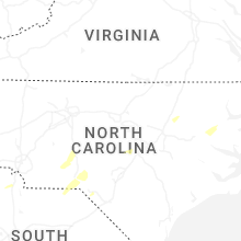


Connect with Interactive Hail Maps