

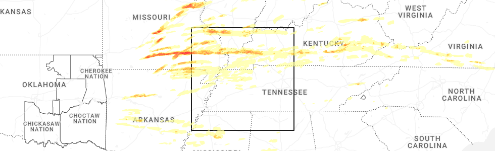
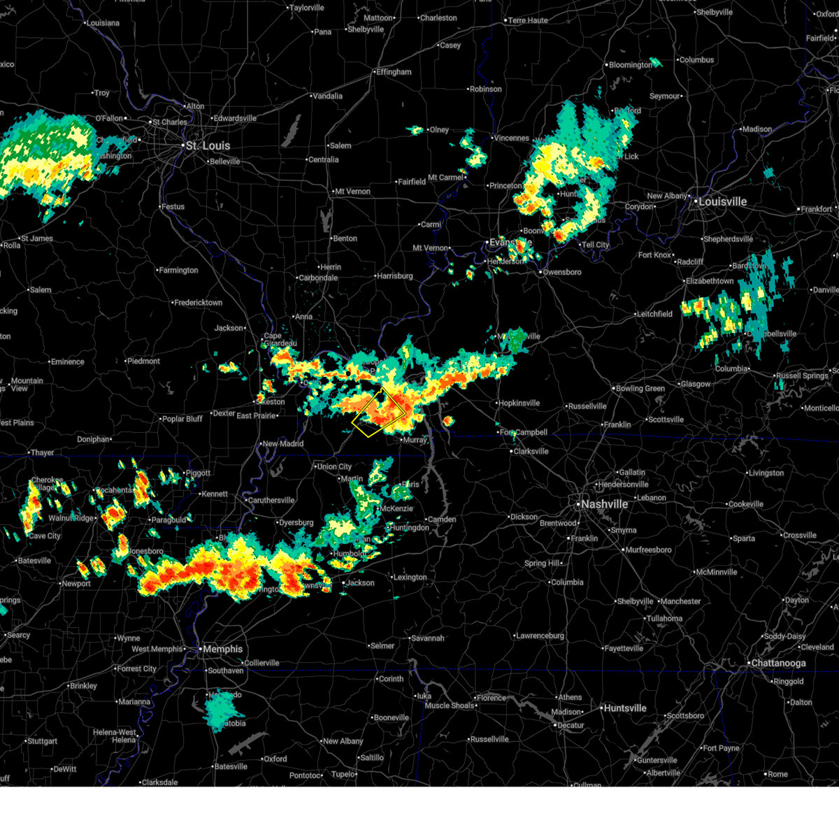
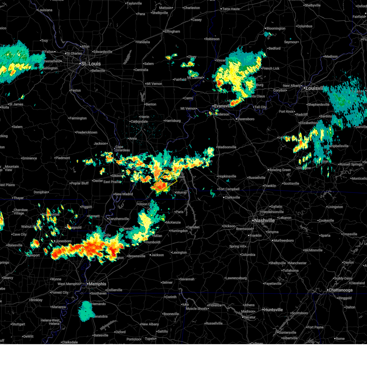
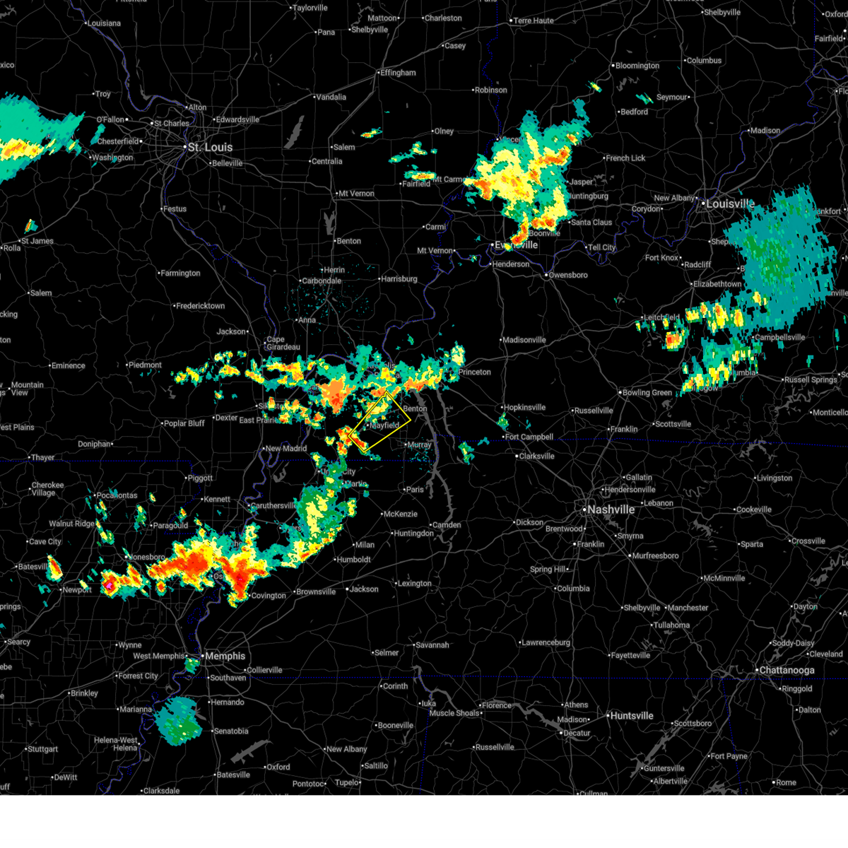
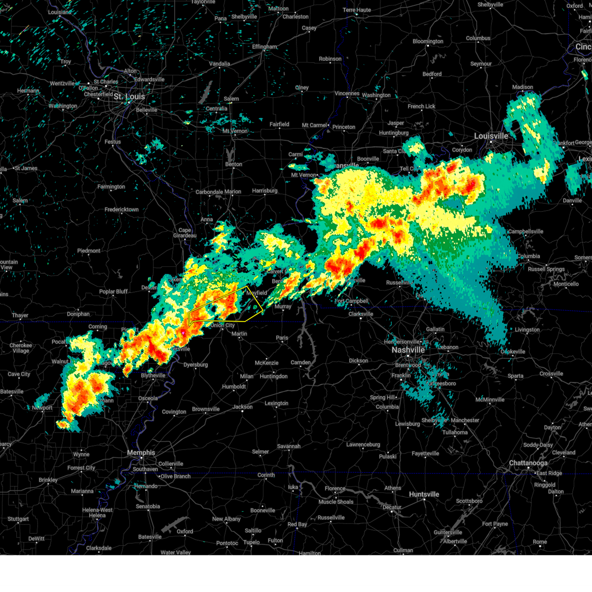
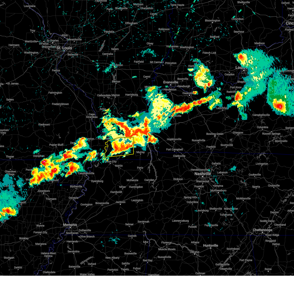
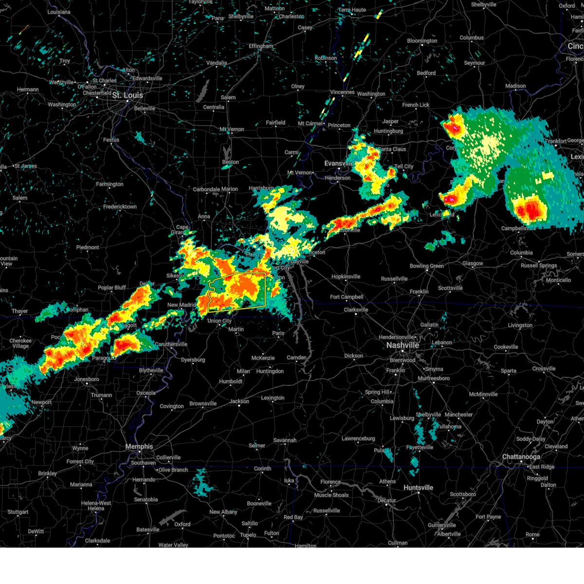
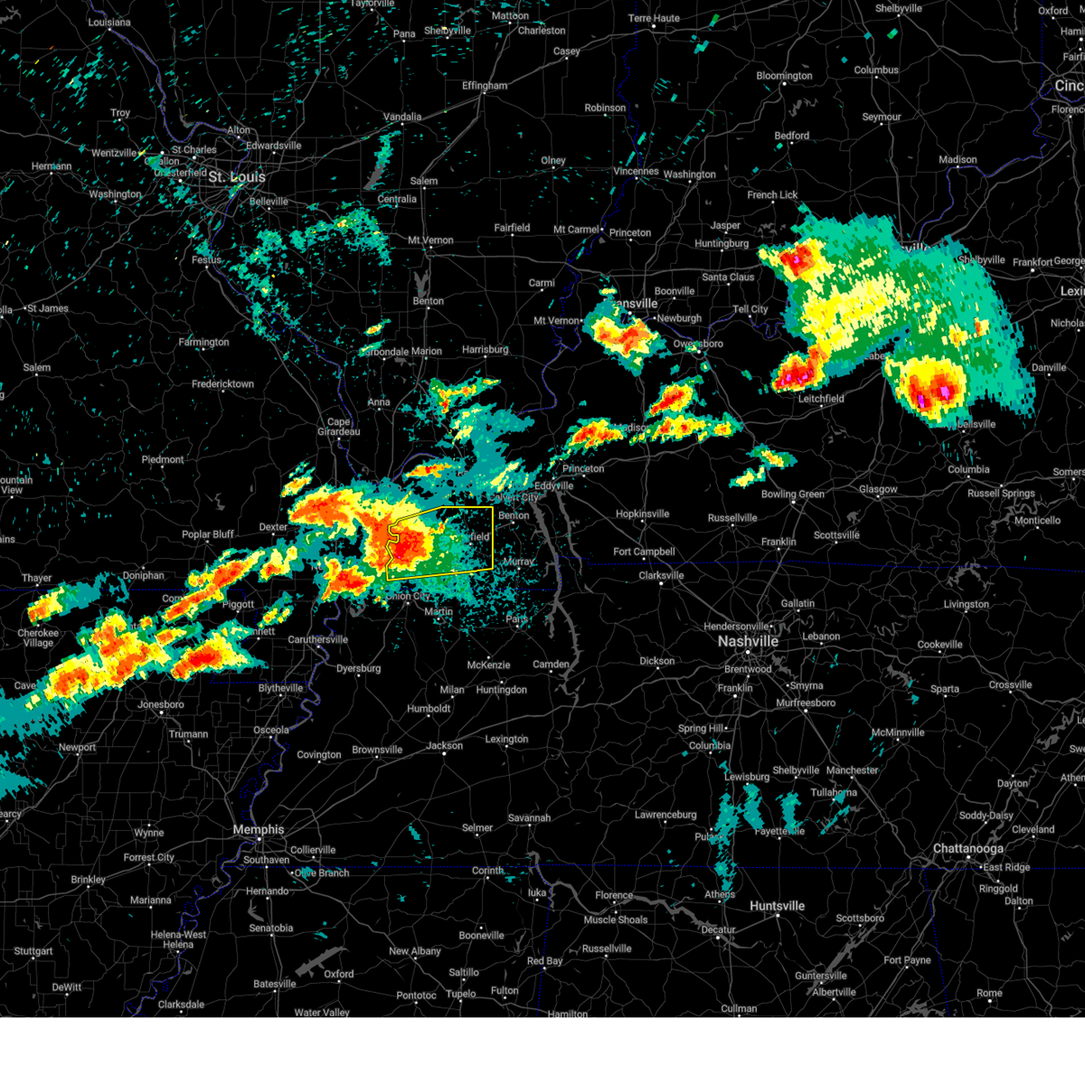
Hail Map for Mayfield, KY
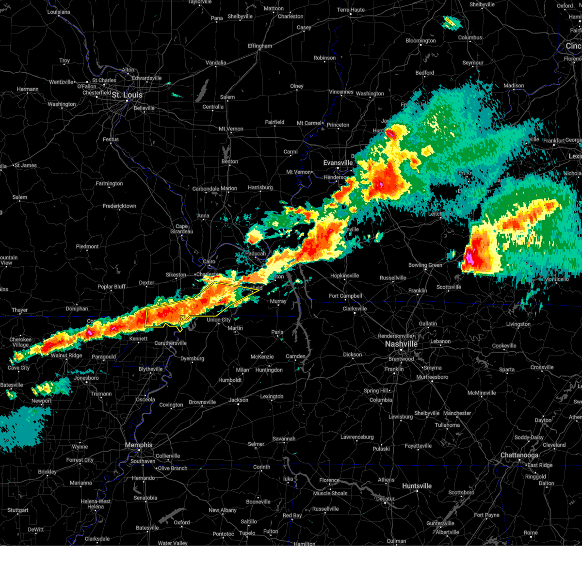
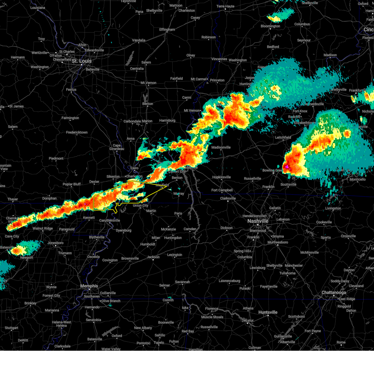
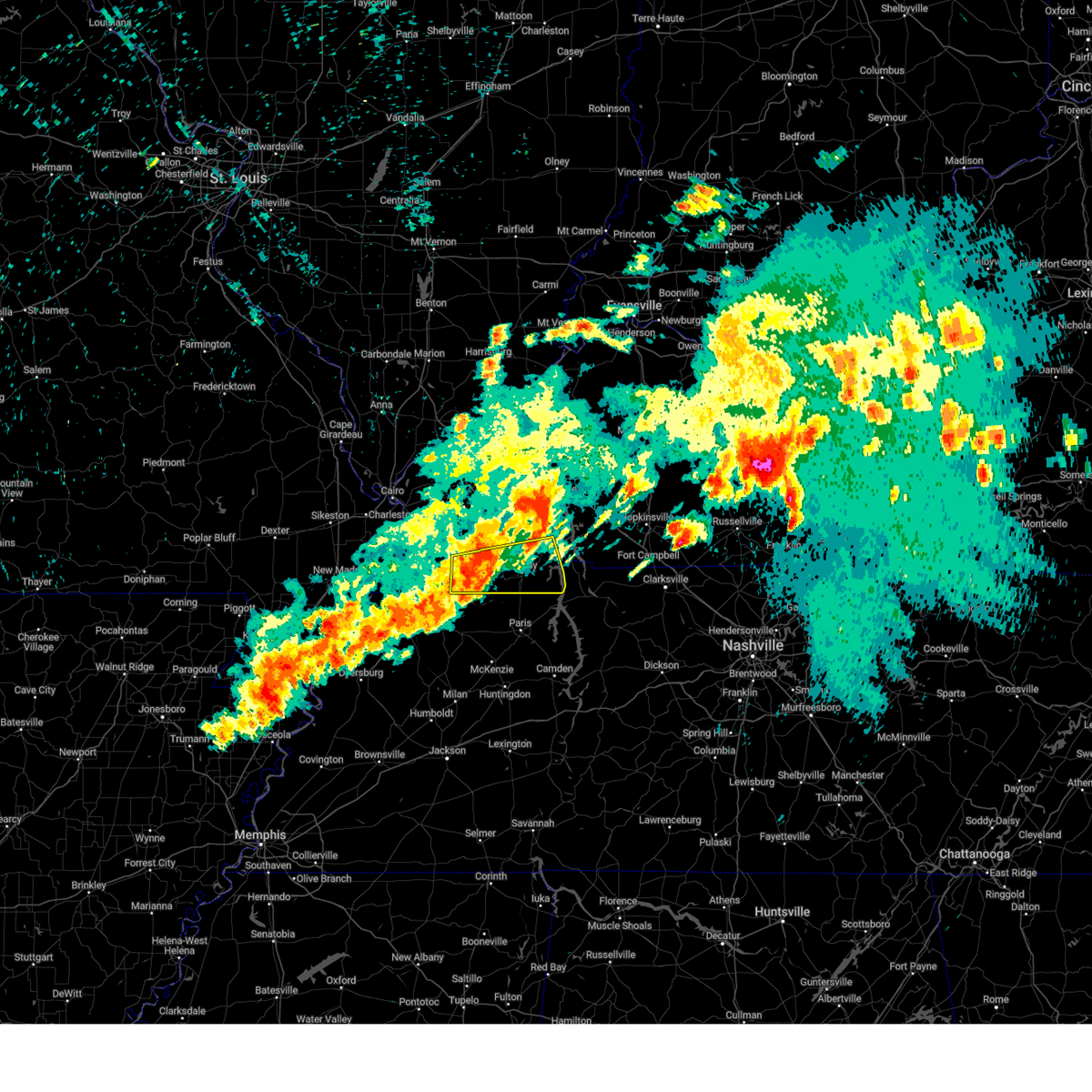
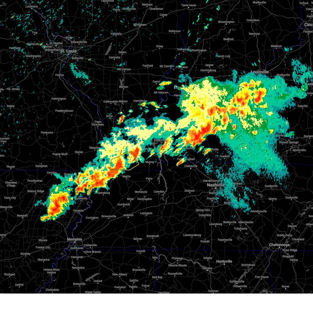
The Mayfield, KY area has had 11 reports of on-the-ground hail by trained spotters, and has been under severe weather warnings 35 times during the past 12 months. Doppler radar has detected hail at or near Mayfield, KY on 68 occasions, including 6 occasions during the past year.
| Name: | Mayfield, KY |
| Where Located: | 42.3 miles N of Mc Kenzie, TN |
| Map: | Google Map for Mayfield, KY |
| Population: | 10024 |
| Housing Units: | 4739 |
| More Info: | Search Google for Mayfield, KY |
4
The Top Recent Hail Date for Mayfield, KY is Friday, May 16, 2025 (6th out of 68)
Hail and Wind Damage Spotted near Mayfield, KY
| Date / Time | Report Details |
|---|---|
| 6/19/2025 12:38 AM CDT |
 The storm which prompted the warning has weakened below severe limits, and no longer poses an immediate threat to life or property. therefore, the warning will be allowed to expire. however, gusty winds are still possible with this thunderstorm. The storm which prompted the warning has weakened below severe limits, and no longer poses an immediate threat to life or property. therefore, the warning will be allowed to expire. however, gusty winds are still possible with this thunderstorm.
|
| 6/19/2025 12:17 AM CDT |
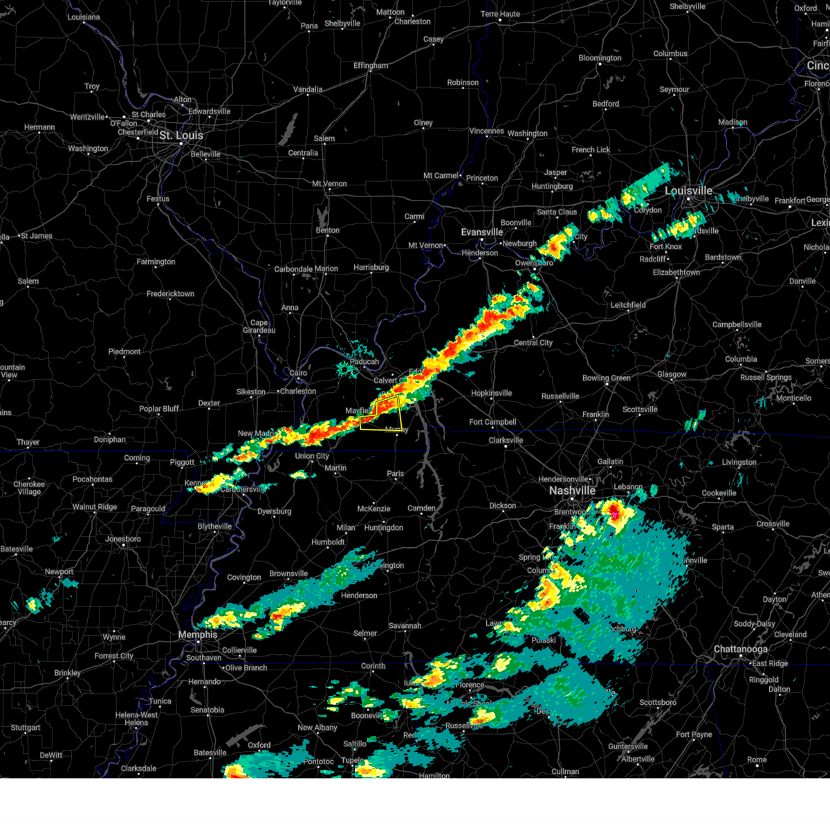
 At 1216 am cdt, a severe thunderstorm was located over mayfield, moving northeast at 30 mph (radar indicated). Hazards include 60 mph wind gusts and quarter size hail. Hail damage to vehicles is expected. expect wind damage to roofs, siding, and trees. locations impacted include, mayfield, benton, sedalia, brewers, and symsonia. This includes interstate 69 in kentucky between mile markers 19 and 42. At 1216 am cdt, a severe thunderstorm was located over mayfield, moving northeast at 30 mph (radar indicated). Hazards include 60 mph wind gusts and quarter size hail. Hail damage to vehicles is expected. expect wind damage to roofs, siding, and trees. locations impacted include, mayfield, benton, sedalia, brewers, and symsonia. This includes interstate 69 in kentucky between mile markers 19 and 42.
|
| 6/19/2025 12:01 AM CDT |
 Svrpah the national weather service in paducah has issued a * severe thunderstorm warning for, northwestern calloway county in western kentucky, southwestern marshall county in western kentucky, central graves county in western kentucky, * until 1245 am cdt. * at 1201 am cdt, a severe thunderstorm was located near sedalia, or near mayfield, moving northeast at 30 mph (radar indicated). Hazards include 60 mph wind gusts and quarter size hail. Hail damage to vehicles is expected. Expect wind damage to roofs, siding, and trees. Svrpah the national weather service in paducah has issued a * severe thunderstorm warning for, northwestern calloway county in western kentucky, southwestern marshall county in western kentucky, central graves county in western kentucky, * until 1245 am cdt. * at 1201 am cdt, a severe thunderstorm was located near sedalia, or near mayfield, moving northeast at 30 mph (radar indicated). Hazards include 60 mph wind gusts and quarter size hail. Hail damage to vehicles is expected. Expect wind damage to roofs, siding, and trees.
|
| 6/18/2025 6:36 PM CDT | Quarter sized hail reported 1.1 miles W of Mayfield, KY, picture of quarter size hail in mayfield relayed through nws chat. |
| 6/18/2025 6:24 PM CDT | Svrpah the national weather service in paducah has issued a * severe thunderstorm warning for, northwestern calloway county in western kentucky, southwestern marshall county in western kentucky, east central graves county in western kentucky, * until 715 pm cdt. * at 624 pm cdt, a severe thunderstorm was located near mayfield, moving east at 35 mph (radar indicated). Hazards include ping pong ball size hail and 60 mph wind gusts. People and animals outdoors will be injured. expect hail damage to roofs, siding, windows, and vehicles. Expect wind damage to roofs, siding, and trees. |
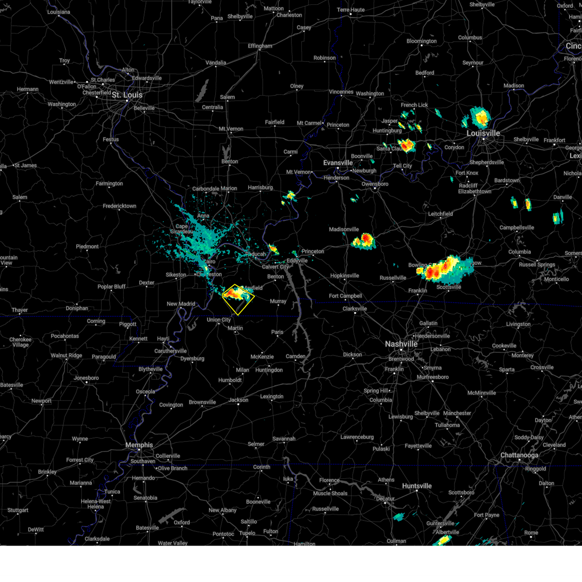
| 5/16/2025 8:52 PM CDT | At 851 pm cdt, severe thunderstorms were located along a line extending from near benton to near sedalia to near latham, moving east at 50 mph (radar indicated). Hazards include 70 mph wind gusts and quarter size hail. trees and power lines were reported down in mayfield around 845 pm. Hail damage to vehicles is expected. expect considerable tree damage. wind damage is also likely to mobile homes, roofs, and outbuildings. locations impacted include, murray, mayfield, benton, golden pond visitors center, energy lake campground, turkey bay, land between the lakes area, wranglers campground, lynnville, sedalia, wingo, hardin, hazel, water valley, new concord, kirksey, brewers, aurora, and harris grove. This includes interstate 69 in kentucky between mile markers 20 and 22, and between mile markers 24 and 44. |
| 5/16/2025 8:52 PM CDT | the severe thunderstorm warning has been cancelled and is no longer in effect |
| 5/16/2025 8:49 PM CDT | Trees and power lines down in the city of mayfiel in graves county KY, 0.6 miles WSW of Mayfield, KY |
| 5/16/2025 8:46 PM CDT | Quarter sized hail reported 10.3 miles N of Mayfield, KY, report from mping: quarter (1.00 in.). |
| 5/16/2025 8:44 PM CDT | Svrpah the national weather service in paducah has issued a * severe thunderstorm warning for, southeastern fulton county in western kentucky, calloway county in western kentucky, southern marshall county in western kentucky, southeastern hickman county in western kentucky, southwestern trigg county in western kentucky, graves county in western kentucky, * until 930 pm cdt. * at 844 pm cdt, severe thunderstorms were located along a line extending from 11 miles south of reidland to near mayfield to south fulton, moving east at 50 mph (radar indicated). Hazards include 60 mph wind gusts and quarter size hail. Hail damage to vehicles is expected. Expect wind damage to roofs, siding, and trees. |
| 5/16/2025 8:17 PM CDT |
 At 817 pm cdt, severe thunderstorms were located along a line extending from 10 miles northwest of mayfield to dorena to 6 miles southeast of portageville, moving east at 50 mph (radar indicated). Hazards include 60 mph wind gusts and penny size hail. Expect damage to roofs, siding, and trees. locations impacted include, mayfield, portageville, new madrid, hickman, clinton, lilbourn, hunter-dawson state historic site, towosahgy state historic site, big oak tree state park, gideon, marston, howardville, risco, cayce, dorena, fulgham, arlington, columbus, tallapoosa, and catron. this includes the following highways, interstate 69 in kentucky between mile markers 17 and 26. Interstate 55 between mile markers 33 and 50. At 817 pm cdt, severe thunderstorms were located along a line extending from 10 miles northwest of mayfield to dorena to 6 miles southeast of portageville, moving east at 50 mph (radar indicated). Hazards include 60 mph wind gusts and penny size hail. Expect damage to roofs, siding, and trees. locations impacted include, mayfield, portageville, new madrid, hickman, clinton, lilbourn, hunter-dawson state historic site, towosahgy state historic site, big oak tree state park, gideon, marston, howardville, risco, cayce, dorena, fulgham, arlington, columbus, tallapoosa, and catron. this includes the following highways, interstate 69 in kentucky between mile markers 17 and 26. Interstate 55 between mile markers 33 and 50.
|
| 5/16/2025 8:17 PM CDT |
 the severe thunderstorm warning has been cancelled and is no longer in effect the severe thunderstorm warning has been cancelled and is no longer in effect
|
| 5/16/2025 7:55 PM CDT |
 Svrpah the national weather service in paducah has issued a * severe thunderstorm warning for, fulton county in western kentucky, southern carlisle county in western kentucky, hickman county in western kentucky, central graves county in western kentucky, southern mississippi county in southeastern missouri, new madrid county in southeastern missouri, southeastern stoddard county in southeastern missouri, * until 845 pm cdt. * at 755 pm cdt, severe thunderstorms were located along a line extending from 8 miles southwest of bardwell to new madrid to near wardell, moving east at 50 mph (radar indicated). Hazards include 60 mph wind gusts and penny size hail. expect damage to roofs, siding, and trees Svrpah the national weather service in paducah has issued a * severe thunderstorm warning for, fulton county in western kentucky, southern carlisle county in western kentucky, hickman county in western kentucky, central graves county in western kentucky, southern mississippi county in southeastern missouri, new madrid county in southeastern missouri, southeastern stoddard county in southeastern missouri, * until 845 pm cdt. * at 755 pm cdt, severe thunderstorms were located along a line extending from 8 miles southwest of bardwell to new madrid to near wardell, moving east at 50 mph (radar indicated). Hazards include 60 mph wind gusts and penny size hail. expect damage to roofs, siding, and trees
|
| 5/16/2025 7:48 PM CDT | Svrpah the national weather service in paducah has issued a * severe thunderstorm warning for, southeastern livingston county in western kentucky, marshall county in western kentucky, carlisle county in western kentucky, northeastern hickman county in western kentucky, west central trigg county in western kentucky, southeastern ballard county in western kentucky, southern mccracken county in western kentucky, northern graves county in western kentucky, southwestern lyon county in western kentucky, * until 830 pm cdt. * at 747 pm cdt, a severe thunderstorm was located near bardwell, moving east at 65 mph (radar indicated). Hazards include 60 mph wind gusts. expect damage to roofs, siding, and trees |
| 5/16/2025 8:13 AM CDT |
 Svrpah the national weather service in paducah has issued a * severe thunderstorm warning for, calloway county in western kentucky, southeastern marshall county in western kentucky, southwestern trigg county in western kentucky, southern graves county in western kentucky, * until 900 am cdt. * at 813 am cdt, a severe thunderstorm was located near sedalia, or 10 miles south of mayfield, moving east at 60 mph (radar indicated). Hazards include 60 mph wind gusts and quarter size hail. Hail damage to vehicles is expected. Expect wind damage to roofs, siding, and trees. Svrpah the national weather service in paducah has issued a * severe thunderstorm warning for, calloway county in western kentucky, southeastern marshall county in western kentucky, southwestern trigg county in western kentucky, southern graves county in western kentucky, * until 900 am cdt. * at 813 am cdt, a severe thunderstorm was located near sedalia, or 10 miles south of mayfield, moving east at 60 mph (radar indicated). Hazards include 60 mph wind gusts and quarter size hail. Hail damage to vehicles is expected. Expect wind damage to roofs, siding, and trees.
|
| 5/16/2025 8:08 AM CDT | At 807 am cdt, a severe thunderstorm was located near mayfield, moving east at 60 mph (radar indicated). Hazards include quarter size hail. Damage to vehicles is expected. locations impacted include, mayfield, fulton, fulgham, sedalia, wingo, water valley, and fancy farm. This includes interstate 69 in kentucky between mile markers 1 and 22. |
| 5/16/2025 8:08 AM CDT | the severe thunderstorm warning has been cancelled and is no longer in effect |
| 5/16/2025 7:52 AM CDT |
 At 751 am cdt, a severe thunderstorm was located over clinton, moving east at 60 mph (radar indicated). Hazards include quarter size hail. Damage to vehicles is expected. locations impacted include, mayfield, fulton, hickman, clinton, cayce, fulgham, sedalia, wingo, water valley, and fancy farm. This includes interstate 69 in kentucky between mile markers 1 and 22. At 751 am cdt, a severe thunderstorm was located over clinton, moving east at 60 mph (radar indicated). Hazards include quarter size hail. Damage to vehicles is expected. locations impacted include, mayfield, fulton, hickman, clinton, cayce, fulgham, sedalia, wingo, water valley, and fancy farm. This includes interstate 69 in kentucky between mile markers 1 and 22.
|
| 5/16/2025 7:52 AM CDT |
 the severe thunderstorm warning has been cancelled and is no longer in effect the severe thunderstorm warning has been cancelled and is no longer in effect
|
| 5/16/2025 7:35 AM CDT |
 Svrpah the national weather service in paducah has issued a * severe thunderstorm warning for, fulton county in western kentucky, southeastern carlisle county in western kentucky, hickman county in western kentucky, southwestern graves county in western kentucky, southeastern mississippi county in southeastern missouri, east central new madrid county in southeastern missouri, * until 815 am cdt. * at 734 am cdt, a severe thunderstorm was located near clayton, or near hickman, moving east at 60 mph (radar indicated). Hazards include quarter size hail. damage to vehicles is expected Svrpah the national weather service in paducah has issued a * severe thunderstorm warning for, fulton county in western kentucky, southeastern carlisle county in western kentucky, hickman county in western kentucky, southwestern graves county in western kentucky, southeastern mississippi county in southeastern missouri, east central new madrid county in southeastern missouri, * until 815 am cdt. * at 734 am cdt, a severe thunderstorm was located near clayton, or near hickman, moving east at 60 mph (radar indicated). Hazards include quarter size hail. damage to vehicles is expected
|
| 5/16/2025 6:28 AM CDT |
 The storm which prompted the warning has weakened below severe limits, and no longer poses an immediate threat to life or property. therefore, the warning will be allowed to expire. however, gusty winds and heavy rain are still possible with this thunderstorm. a severe thunderstorm watch remains in effect until 900 am cdt for western kentucky, and southeastern missouri. The storm which prompted the warning has weakened below severe limits, and no longer poses an immediate threat to life or property. therefore, the warning will be allowed to expire. however, gusty winds and heavy rain are still possible with this thunderstorm. a severe thunderstorm watch remains in effect until 900 am cdt for western kentucky, and southeastern missouri.
|
| 5/16/2025 6:11 AM CDT |
 At 611 am cdt, a severe thunderstorm was located near mayfield, moving east at 60 mph. a second near-severe storm was located between clinton and cayce (radar indicated). Hazards include 60 mph wind gusts and quarter size hail. Hail damage to vehicles is expected. expect wind damage to roofs, siding, and trees. locations impacted include, mayfield, hickman, clinton, bardwell, fulgham, sedalia, wingo, arlington, columbus, lowes, fancy farm, and symsonia. This includes interstate 69 in kentucky between mile markers 8 and 33. At 611 am cdt, a severe thunderstorm was located near mayfield, moving east at 60 mph. a second near-severe storm was located between clinton and cayce (radar indicated). Hazards include 60 mph wind gusts and quarter size hail. Hail damage to vehicles is expected. expect wind damage to roofs, siding, and trees. locations impacted include, mayfield, hickman, clinton, bardwell, fulgham, sedalia, wingo, arlington, columbus, lowes, fancy farm, and symsonia. This includes interstate 69 in kentucky between mile markers 8 and 33.
|
| 5/16/2025 5:52 AM CDT |
 Svrpah the national weather service in paducah has issued a * severe thunderstorm warning for, central fulton county in western kentucky, carlisle county in western kentucky, hickman county in western kentucky, graves county in western kentucky, * until 630 am cdt. * at 552 am cdt, a severe thunderstorm was located over clinton, moving east at 60 mph (radar indicated). Hazards include 60 mph wind gusts and half dollar size hail. Hail damage to vehicles is expected. Expect wind damage to roofs, siding, and trees. Svrpah the national weather service in paducah has issued a * severe thunderstorm warning for, central fulton county in western kentucky, carlisle county in western kentucky, hickman county in western kentucky, graves county in western kentucky, * until 630 am cdt. * at 552 am cdt, a severe thunderstorm was located over clinton, moving east at 60 mph (radar indicated). Hazards include 60 mph wind gusts and half dollar size hail. Hail damage to vehicles is expected. Expect wind damage to roofs, siding, and trees.
|
| 4/2/2025 8:51 PM CDT | At 851 pm cdt, severe thunderstorms were located along a line extending from joy to near calvert city to near latham, moving northeast at 60 mph (radar indicated). Hazards include 70 mph wind gusts. Expect considerable tree damage. damage is likely to mobile homes, roofs, and outbuildings. locations impacted include, kirksey, burna, murray, hazel, ledbetter, hillman ferry campground, reidland, aurora, smithland, kuttawa, lynnville, sedalia, hardin, salem, demumbers bay campground, harris grove, new concord, hamletsburg, benton, and mayfield. this includes the following highways, interstate 24 in kentucky between mile markers 12 and 39. Interstate 69 in kentucky between mile markers 21 and 51. |
| 4/2/2025 8:50 PM CDT | Torpah the national weather service in paducah has issued a * tornado warning for, northwestern calloway county in western kentucky, marshall county in western kentucky, west central trigg county in western kentucky, southeastern graves county in western kentucky, southwestern lyon county in western kentucky, * until 930 pm cdt. * at 849 pm cdt, a severe thunderstorm capable of producing a tornado was located near sedalia, or 9 miles south of mayfield, moving northeast at 65 mph (radar indicated rotation). Hazards include tornado. Flying debris will be dangerous to those caught without shelter. mobile homes will be damaged or destroyed. damage to roofs, windows, and vehicles will occur. tree damage is likely. this dangerous storm will be near, sedalia and mayfield around 855 pm cdt. benton around 905 pm cdt. land between the lakes area, birmingham ferry recreation area, and hillman ferry campground around 915 pm cdt. demumbers bay campground around 920 pm cdt. other locations impacted by this tornadic thunderstorm include hardin, kirksey, and brewers. This includes interstate 69 in kentucky between mile markers 31 and 47. |
| 4/2/2025 8:32 PM CDT | Svrpah the national weather service in paducah has issued a * severe thunderstorm warning for, southeastern massac county in southern illinois, southeastern pope county in southern illinois, calloway county in western kentucky, southwestern crittenden county in western kentucky, livingston county in western kentucky, marshall county in western kentucky, west central trigg county in western kentucky, southeastern mccracken county in western kentucky, graves county in western kentucky, western lyon county in western kentucky, * until 915 pm cdt. * at 832 pm cdt, severe thunderstorms were located along a line extending from 6 miles north of brookport to 7 miles west of lynnville, moving northeast at 90 mph (radar indicated). Hazards include 70 mph wind gusts. Expect considerable tree damage. Damage is likely to mobile homes, roofs, and outbuildings. |
| 4/2/2025 7:41 PM CDT | Svrpah the national weather service in paducah has issued a * severe thunderstorm warning for, southeastern fulton county in western kentucky, southeastern hickman county in western kentucky, southern graves county in western kentucky, * until 830 pm cdt. * at 741 pm cdt, a severe thunderstorm was located near martin, moving north at 55 mph (radar indicated). Hazards include ping pong ball size hail and 60 mph wind gusts. People and animals outdoors will be injured. expect hail damage to roofs, siding, windows, and vehicles. Expect wind damage to roofs, siding, and trees. |
| 3/30/2025 8:13 PM CDT | Quarter sized hail reported 0.2 miles S of Mayfield, KY |
| 3/30/2025 8:12 PM CDT | Svrpah the national weather service in paducah has issued a * severe thunderstorm warning for, northwestern calloway county in western kentucky, southwestern marshall county in western kentucky, northeastern graves county in western kentucky, * until 830 pm cdt. * at 811 pm cdt, a severe thunderstorm was located over mayfield, moving east at 30 mph (radar indicated). Hazards include 60 mph wind gusts and quarter size hail. Hail damage to vehicles is expected. Expect wind damage to roofs, siding, and trees. |
| 3/30/2025 8:00 PM CDT | At 800 pm cdt, a severe thunderstorm was located near mayfield, moving east at 35 mph (radar indicated). Hazards include 60 mph wind gusts and quarter size hail. Hail damage to vehicles is expected. expect wind damage to roofs, siding, and trees. locations impacted include, sedalia, mayfield, ledbetter, symsonia, reidland, wingo, lowes, and paducah. this includes the following highways, interstate 24 in kentucky between mile markers 10 and 17. Interstate 69 in kentucky between mile markers 13 and 34. |
| 3/30/2025 8:00 PM CDT | the severe thunderstorm warning has been cancelled and is no longer in effect |
| 3/30/2025 7:36 PM CDT | Svrpah the national weather service in paducah has issued a * severe thunderstorm warning for, southwestern livingston county in western kentucky, eastern carlisle county in western kentucky, northeastern hickman county in western kentucky, southeastern ballard county in western kentucky, southeastern mccracken county in western kentucky, graves county in western kentucky, * until 815 pm cdt. * at 736 pm cdt, a severe thunderstorm was located 7 miles northeast of clinton, moving east at 35 mph (radar indicated). Hazards include 60 mph wind gusts and quarter size hail. Hail damage to vehicles is expected. Expect wind damage to roofs, siding, and trees. |
| 3/23/2025 6:49 PM CDT |
 At 648 pm cdt, a severe thunderstorm was located 8 miles northwest of murray, moving east at 45 mph (radar indicated). Hazards include 60 mph wind gusts and quarter size hail. Hail damage to vehicles is expected. expect wind damage to roofs, siding, and trees. locations impacted include, kirksey, mayfield, and murray. This includes interstate 69 in kentucky near mile marker 34. At 648 pm cdt, a severe thunderstorm was located 8 miles northwest of murray, moving east at 45 mph (radar indicated). Hazards include 60 mph wind gusts and quarter size hail. Hail damage to vehicles is expected. expect wind damage to roofs, siding, and trees. locations impacted include, kirksey, mayfield, and murray. This includes interstate 69 in kentucky near mile marker 34.
|
| 3/23/2025 6:49 PM CDT |
 the severe thunderstorm warning has been cancelled and is no longer in effect the severe thunderstorm warning has been cancelled and is no longer in effect
|
| 3/23/2025 6:38 PM CDT |
 The storm which prompted the warning is soon to move out of the area. therefore, the warning will be allowed to expire. a tornado watch remains in effect until 1100 pm cdt for western kentucky. The storm which prompted the warning is soon to move out of the area. therefore, the warning will be allowed to expire. a tornado watch remains in effect until 1100 pm cdt for western kentucky.
|
| 3/23/2025 6:35 PM CDT |
 Svrpah the national weather service in paducah has issued a * severe thunderstorm warning for, northwestern calloway county in western kentucky, southwestern marshall county in western kentucky, east central graves county in western kentucky, * until 700 pm cdt. * at 634 pm cdt, a severe thunderstorm was located 7 miles east of mayfield, moving east at 45 mph (radar indicated). Hazards include 60 mph wind gusts and quarter size hail. Hail damage to vehicles is expected. Expect wind damage to roofs, siding, and trees. Svrpah the national weather service in paducah has issued a * severe thunderstorm warning for, northwestern calloway county in western kentucky, southwestern marshall county in western kentucky, east central graves county in western kentucky, * until 700 pm cdt. * at 634 pm cdt, a severe thunderstorm was located 7 miles east of mayfield, moving east at 45 mph (radar indicated). Hazards include 60 mph wind gusts and quarter size hail. Hail damage to vehicles is expected. Expect wind damage to roofs, siding, and trees.
|
| 3/23/2025 6:28 PM CDT | At 628 pm cdt, a severe thunderstorm was located over mayfield, moving east at 45 mph (radar indicated). Hazards include 60 mph wind gusts and quarter size hail. Hail damage to vehicles is expected. expect wind damage to roofs, siding, and trees. locations impacted include, mayfield. This includes interstate 69 in kentucky between mile markers 22 and 33. |
| 3/23/2025 6:11 PM CDT | Svrpah the national weather service in paducah has issued a * severe thunderstorm warning for, northern graves county in western kentucky, * until 645 pm cdt. * at 610 pm cdt, a severe thunderstorm was located 7 miles north of mayfield, moving east at 50 mph. this storm produced nickel sized hail as it moved near fancy farm at 608 pm (radar indicated). Hazards include 60 mph wind gusts and quarter size hail. Hail damage to vehicles is expected. Expect wind damage to roofs, siding, and trees. |
| 8/17/2024 5:09 PM CDT |
 Svrpah the national weather service in paducah has issued a * severe thunderstorm warning for, southeastern carlisle county in western kentucky, northeastern hickman county in western kentucky, southwestern graves county in western kentucky, * until 545 pm cdt. * at 509 pm cdt, a severe thunderstorm was located near fulgham, or 7 miles northeast of clinton, moving southeast at 30 mph (radar indicated). Hazards include 60 mph wind gusts and penny size hail. expect damage to roofs, siding, and trees Svrpah the national weather service in paducah has issued a * severe thunderstorm warning for, southeastern carlisle county in western kentucky, northeastern hickman county in western kentucky, southwestern graves county in western kentucky, * until 545 pm cdt. * at 509 pm cdt, a severe thunderstorm was located near fulgham, or 7 miles northeast of clinton, moving southeast at 30 mph (radar indicated). Hazards include 60 mph wind gusts and penny size hail. expect damage to roofs, siding, and trees
|
| 5/26/2024 9:59 PM CDT |
 The storms which prompted the warning have weakened below severe limits, and have exited the warned area. therefore, the warning will be allowed to expire. The storms which prompted the warning have weakened below severe limits, and have exited the warned area. therefore, the warning will be allowed to expire.
|
| 5/26/2024 9:14 PM CDT |
 Svrpah the national weather service in paducah has issued a * severe thunderstorm warning for, fulton county in western kentucky, northwestern calloway county in western kentucky, southwestern livingston county in western kentucky, marshall county in western kentucky, southeastern carlisle county in western kentucky, hickman county in western kentucky, graves county in western kentucky, southeastern mississippi county in southeastern missouri, southeastern stoddard county in southeastern missouri, * until 1000 pm cdt. * at 914 pm cdt, severe thunderstorms were located along a line extending from near marion to near lone oak to near farrenburg, moving southeast at 50 mph (radar indicated). Hazards include 60 mph wind gusts and quarter size hail. Hail damage to vehicles is expected. Expect wind damage to roofs, siding, and trees. Svrpah the national weather service in paducah has issued a * severe thunderstorm warning for, fulton county in western kentucky, northwestern calloway county in western kentucky, southwestern livingston county in western kentucky, marshall county in western kentucky, southeastern carlisle county in western kentucky, hickman county in western kentucky, graves county in western kentucky, southeastern mississippi county in southeastern missouri, southeastern stoddard county in southeastern missouri, * until 1000 pm cdt. * at 914 pm cdt, severe thunderstorms were located along a line extending from near marion to near lone oak to near farrenburg, moving southeast at 50 mph (radar indicated). Hazards include 60 mph wind gusts and quarter size hail. Hail damage to vehicles is expected. Expect wind damage to roofs, siding, and trees.
|
| 5/26/2024 8:28 AM CDT |
 the tornado warning has been cancelled and is no longer in effect the tornado warning has been cancelled and is no longer in effect
|
| 5/26/2024 8:20 AM CDT | People trapped in home. possible tornad in graves county KY, 5.7 miles NNW of Mayfield, KY |
| 5/26/2024 8:20 AM CDT |
 Svrpah the national weather service in paducah has issued a * severe thunderstorm warning for, eastern massac county in southern illinois, southern pope county in southern illinois, calloway county in western kentucky, crittenden county in western kentucky, livingston county in western kentucky, caldwell county in western kentucky, marshall county in western kentucky, trigg county in western kentucky, southeastern mccracken county in western kentucky, graves county in western kentucky, lyon county in western kentucky, * until 900 am cdt. * at 819 am cdt, severe thunderstorms were located along a line extending from 8 miles southwest of golconda to near reidland to near latham, moving east at 70 mph (radar indicated). Hazards include 70 mph wind gusts. Expect considerable tree damage. Damage is likely to mobile homes, roofs, and outbuildings. Svrpah the national weather service in paducah has issued a * severe thunderstorm warning for, eastern massac county in southern illinois, southern pope county in southern illinois, calloway county in western kentucky, crittenden county in western kentucky, livingston county in western kentucky, caldwell county in western kentucky, marshall county in western kentucky, trigg county in western kentucky, southeastern mccracken county in western kentucky, graves county in western kentucky, lyon county in western kentucky, * until 900 am cdt. * at 819 am cdt, severe thunderstorms were located along a line extending from 8 miles southwest of golconda to near reidland to near latham, moving east at 70 mph (radar indicated). Hazards include 70 mph wind gusts. Expect considerable tree damage. Damage is likely to mobile homes, roofs, and outbuildings.
|
| 5/26/2024 8:17 AM CDT |
 Torpah the national weather service in paducah has issued a * tornado warning for, northwestern calloway county in western kentucky, southwestern marshall county in western kentucky, central graves county in western kentucky, * until 845 am cdt. * at 817 am cdt, a tornado producing storm was located near mayfield, moving east at 50 mph (radar confirmed tornado). Hazards include damaging tornado. Flying debris will be dangerous to those caught without shelter. mobile homes will be damaged or destroyed. damage to roofs, windows, and vehicles will occur. tree damage is likely. this tornadic storm will be near, mayfield around 825 am cdt. other locations impacted by this tornadic thunderstorm include kirksey, brewers, and wingo. This includes interstate 69 in kentucky between mile markers 13 and 40. Torpah the national weather service in paducah has issued a * tornado warning for, northwestern calloway county in western kentucky, southwestern marshall county in western kentucky, central graves county in western kentucky, * until 845 am cdt. * at 817 am cdt, a tornado producing storm was located near mayfield, moving east at 50 mph (radar confirmed tornado). Hazards include damaging tornado. Flying debris will be dangerous to those caught without shelter. mobile homes will be damaged or destroyed. damage to roofs, windows, and vehicles will occur. tree damage is likely. this tornadic storm will be near, mayfield around 825 am cdt. other locations impacted by this tornadic thunderstorm include kirksey, brewers, and wingo. This includes interstate 69 in kentucky between mile markers 13 and 40.
|
| 5/26/2024 8:13 AM CDT |
 the tornado warning has been cancelled and is no longer in effect the tornado warning has been cancelled and is no longer in effect
|
| 5/26/2024 8:13 AM CDT |
 At 813 am cdt, a confirmed tornado was located 7 miles west of mayfield, moving northeast at 60 mph (radar confirmed tornado). Hazards include damaging tornado. Flying debris will be dangerous to those caught without shelter. mobile homes will be damaged or destroyed. damage to roofs, windows, and vehicles will occur. tree damage is likely. this tornado will be near, or just north of mayfield around 820 am cdt. other locations impacted by this tornadic thunderstorm include fancy farm. This includes interstate 69 in kentucky between mile markers 23 and 29. At 813 am cdt, a confirmed tornado was located 7 miles west of mayfield, moving northeast at 60 mph (radar confirmed tornado). Hazards include damaging tornado. Flying debris will be dangerous to those caught without shelter. mobile homes will be damaged or destroyed. damage to roofs, windows, and vehicles will occur. tree damage is likely. this tornado will be near, or just north of mayfield around 820 am cdt. other locations impacted by this tornadic thunderstorm include fancy farm. This includes interstate 69 in kentucky between mile markers 23 and 29.
|
| 5/26/2024 8:08 AM CDT |
 Torpah the national weather service in paducah has issued a * tornado warning for, northeastern hickman county in western kentucky, northern graves county in western kentucky, * until 845 am cdt. * at 808 am cdt, a severe thunderstorm capable of producing a tornado was located near fulgham, or 8 miles east of clinton, moving northeast at 60 mph (radar indicated rotation). Hazards include tornado. Flying debris will be dangerous to those caught without shelter. mobile homes will be damaged or destroyed. damage to roofs, windows, and vehicles will occur. tree damage is likely. this dangerous storm will be near, or just north of mayfield around 815 am cdt. other locations impacted by this tornadic thunderstorm include fancy farm. This includes interstate 69 in kentucky between mile markers 23 and 29. Torpah the national weather service in paducah has issued a * tornado warning for, northeastern hickman county in western kentucky, northern graves county in western kentucky, * until 845 am cdt. * at 808 am cdt, a severe thunderstorm capable of producing a tornado was located near fulgham, or 8 miles east of clinton, moving northeast at 60 mph (radar indicated rotation). Hazards include tornado. Flying debris will be dangerous to those caught without shelter. mobile homes will be damaged or destroyed. damage to roofs, windows, and vehicles will occur. tree damage is likely. this dangerous storm will be near, or just north of mayfield around 815 am cdt. other locations impacted by this tornadic thunderstorm include fancy farm. This includes interstate 69 in kentucky between mile markers 23 and 29.
|
| 5/26/2024 8:02 AM CDT |
 At 802 am cdt, severe thunderstorms were located along a line extending from 6 miles east of anna to 6 miles northeast of la center to 6 miles south of bardwell to near hickman, moving northeast at 75 mph (radar indicated). Hazards include 70 mph wind gusts and penny size hail. Expect considerable tree damage. damage is likely to mobile homes, roofs, and outbuildings. locations impacted include, paducah, mayfield, metropolis, anna, fulton, hickman, jonesboro, vienna, clinton, la center, bardwell, wickliffe, lone oak, reidland, cobden, goreville, brookport, mounds, dongola, and barlow. this includes the following highways, interstate 24 in kentucky between mile markers 1 and 16. interstate 24 in illinois between mile markers 1 and 38. interstate 57 in illinois between mile markers 5 and 43. Interstate 69 in kentucky between mile markers 1 and 28. At 802 am cdt, severe thunderstorms were located along a line extending from 6 miles east of anna to 6 miles northeast of la center to 6 miles south of bardwell to near hickman, moving northeast at 75 mph (radar indicated). Hazards include 70 mph wind gusts and penny size hail. Expect considerable tree damage. damage is likely to mobile homes, roofs, and outbuildings. locations impacted include, paducah, mayfield, metropolis, anna, fulton, hickman, jonesboro, vienna, clinton, la center, bardwell, wickliffe, lone oak, reidland, cobden, goreville, brookport, mounds, dongola, and barlow. this includes the following highways, interstate 24 in kentucky between mile markers 1 and 16. interstate 24 in illinois between mile markers 1 and 38. interstate 57 in illinois between mile markers 5 and 43. Interstate 69 in kentucky between mile markers 1 and 28.
|
| 5/26/2024 8:02 AM CDT |
 the severe thunderstorm warning has been cancelled and is no longer in effect the severe thunderstorm warning has been cancelled and is no longer in effect
|
| 5/26/2024 7:42 AM CDT |
 Svrpah the national weather service in paducah has issued a * severe thunderstorm warning for, union county in southern illinois, pulaski county in southern illinois, southern pope county in southern illinois, johnson county in southern illinois, alexander county in southern illinois, massac county in southern illinois, south central williamson county in southern illinois, ballard county in western kentucky, mccracken county in western kentucky, fulton county in western kentucky, southwestern livingston county in western kentucky, carlisle county in western kentucky, hickman county in western kentucky, graves county in western kentucky, mississippi county in southeastern missouri, southeastern new madrid county in southeastern missouri, east central cape girardeau county in southeastern missouri, * until 830 am cdt. * at 741 am cdt, severe thunderstorms were located along a line extending from near cape girardeau to near cairo to near big oak tree state park to near tiptonville, moving northeast at 75 mph (radar indicated). Hazards include 70 mph wind gusts and penny size hail. Expect considerable tree damage. Damage is likely to mobile homes, roofs, and outbuildings. Svrpah the national weather service in paducah has issued a * severe thunderstorm warning for, union county in southern illinois, pulaski county in southern illinois, southern pope county in southern illinois, johnson county in southern illinois, alexander county in southern illinois, massac county in southern illinois, south central williamson county in southern illinois, ballard county in western kentucky, mccracken county in western kentucky, fulton county in western kentucky, southwestern livingston county in western kentucky, carlisle county in western kentucky, hickman county in western kentucky, graves county in western kentucky, mississippi county in southeastern missouri, southeastern new madrid county in southeastern missouri, east central cape girardeau county in southeastern missouri, * until 830 am cdt. * at 741 am cdt, severe thunderstorms were located along a line extending from near cape girardeau to near cairo to near big oak tree state park to near tiptonville, moving northeast at 75 mph (radar indicated). Hazards include 70 mph wind gusts and penny size hail. Expect considerable tree damage. Damage is likely to mobile homes, roofs, and outbuildings.
|
| 5/8/2024 11:36 PM CDT |
 Svrpah the national weather service in paducah has issued a * severe thunderstorm warning for, calloway county in western kentucky, marshall county in western kentucky, graves county in western kentucky, * until 1215 am cdt. * at 1136 pm cdt, severe thunderstorms were located along a line extending from 10 miles southeast of lovelaceville to near mayfield to 8 miles southwest of sedalia, moving northeast at 45 mph (radar indicated). Hazards include 60 mph wind gusts and penny size hail. expect damage to roofs, siding, and trees Svrpah the national weather service in paducah has issued a * severe thunderstorm warning for, calloway county in western kentucky, marshall county in western kentucky, graves county in western kentucky, * until 1215 am cdt. * at 1136 pm cdt, severe thunderstorms were located along a line extending from 10 miles southeast of lovelaceville to near mayfield to 8 miles southwest of sedalia, moving northeast at 45 mph (radar indicated). Hazards include 60 mph wind gusts and penny size hail. expect damage to roofs, siding, and trees
|
| 5/8/2024 10:46 PM CDT |
 the tornado warning has been cancelled and is no longer in effect the tornado warning has been cancelled and is no longer in effect
|
| 5/8/2024 10:43 PM CDT |
 At 1042 pm cdt, a severe thunderstorm capable of producing a tornado was located over mayfield, moving east at 25 mph (radar indicated rotation). Hazards include tornado and half dollar size hail. Flying debris will be dangerous to those caught without shelter. mobile homes will be damaged or destroyed. damage to roofs, windows, and vehicles will occur. tree damage is likely. this dangerous storm will be near, mayfield around 1050 pm cdt. This includes interstate 69 in kentucky between mile markers 18 and 33. At 1042 pm cdt, a severe thunderstorm capable of producing a tornado was located over mayfield, moving east at 25 mph (radar indicated rotation). Hazards include tornado and half dollar size hail. Flying debris will be dangerous to those caught without shelter. mobile homes will be damaged or destroyed. damage to roofs, windows, and vehicles will occur. tree damage is likely. this dangerous storm will be near, mayfield around 1050 pm cdt. This includes interstate 69 in kentucky between mile markers 18 and 33.
|
| 5/8/2024 10:32 PM CDT |
 Torpah the national weather service in paducah has issued a * tornado warning for, central graves county in western kentucky, * until 1115 pm cdt. * at 1032 pm cdt, a severe thunderstorm capable of producing a tornado was located 7 miles west of mayfield, moving east at 20 mph (radar indicated rotation). Hazards include tornado and half dollar size hail. Flying debris will be dangerous to those caught without shelter. mobile homes will be damaged or destroyed. damage to roofs, windows, and vehicles will occur. tree damage is likely. this dangerous storm will be near, mayfield around 1040 pm cdt. other locations impacted by this tornadic thunderstorm include fancy farm. This includes interstate 69 in kentucky between mile markers 18 and 33. Torpah the national weather service in paducah has issued a * tornado warning for, central graves county in western kentucky, * until 1115 pm cdt. * at 1032 pm cdt, a severe thunderstorm capable of producing a tornado was located 7 miles west of mayfield, moving east at 20 mph (radar indicated rotation). Hazards include tornado and half dollar size hail. Flying debris will be dangerous to those caught without shelter. mobile homes will be damaged or destroyed. damage to roofs, windows, and vehicles will occur. tree damage is likely. this dangerous storm will be near, mayfield around 1040 pm cdt. other locations impacted by this tornadic thunderstorm include fancy farm. This includes interstate 69 in kentucky between mile markers 18 and 33.
|
| 5/8/2024 10:20 PM CDT |
 Torpah the national weather service in paducah has issued a * tornado warning for, southeastern carlisle county in western kentucky, northeastern hickman county in western kentucky, northern graves county in western kentucky, * until 1100 pm cdt. * at 1019 pm cdt, a severe thunderstorm capable of producing a tornado was located 8 miles west of mayfield, moving east northeast at 25 mph (radar indicated rotation). Hazards include tornado and ping pong ball size hail. Flying debris will be dangerous to those caught without shelter. mobile homes will be damaged or destroyed. damage to roofs, windows, and vehicles will occur. tree damage is likely. this dangerous storm will be near, 5 miles north of mayfield around 1025 pm cdt. other locations impacted by this tornadic thunderstorm include fancy farm. This includes interstate 69 in kentucky between mile markers 22 and 34. Torpah the national weather service in paducah has issued a * tornado warning for, southeastern carlisle county in western kentucky, northeastern hickman county in western kentucky, northern graves county in western kentucky, * until 1100 pm cdt. * at 1019 pm cdt, a severe thunderstorm capable of producing a tornado was located 8 miles west of mayfield, moving east northeast at 25 mph (radar indicated rotation). Hazards include tornado and ping pong ball size hail. Flying debris will be dangerous to those caught without shelter. mobile homes will be damaged or destroyed. damage to roofs, windows, and vehicles will occur. tree damage is likely. this dangerous storm will be near, 5 miles north of mayfield around 1025 pm cdt. other locations impacted by this tornadic thunderstorm include fancy farm. This includes interstate 69 in kentucky between mile markers 22 and 34.
|
| 5/8/2024 9:58 PM CDT |
 Svrpah the national weather service in paducah has issued a * severe thunderstorm warning for, southeastern carlisle county in western kentucky, northeastern hickman county in western kentucky, central graves county in western kentucky, * until 1045 pm cdt. * at 958 pm cdt, a severe thunderstorm was located near fulgham, or 8 miles northeast of clinton, moving northeast at 30 mph (radar indicated). Hazards include ping pong ball size hail and 60 mph wind gusts. People and animals outdoors will be injured. expect hail damage to roofs, siding, windows, and vehicles. Expect wind damage to roofs, siding, and trees. Svrpah the national weather service in paducah has issued a * severe thunderstorm warning for, southeastern carlisle county in western kentucky, northeastern hickman county in western kentucky, central graves county in western kentucky, * until 1045 pm cdt. * at 958 pm cdt, a severe thunderstorm was located near fulgham, or 8 miles northeast of clinton, moving northeast at 30 mph (radar indicated). Hazards include ping pong ball size hail and 60 mph wind gusts. People and animals outdoors will be injured. expect hail damage to roofs, siding, windows, and vehicles. Expect wind damage to roofs, siding, and trees.
|
| 5/8/2024 2:56 PM CDT |
 At 256 pm cdt, a severe thunderstorm was located near fulton, moving northeast at 35 mph (radar indicated). Hazards include 60 mph wind gusts and quarter size hail. Hail damage to vehicles is expected. expect wind damage to roofs, siding, and trees. locations impacted include, mayfield, fulton, lynnville, sedalia, wingo, water valley, and dukedom. This includes interstate 69 in kentucky between mile markers 1 and 23. At 256 pm cdt, a severe thunderstorm was located near fulton, moving northeast at 35 mph (radar indicated). Hazards include 60 mph wind gusts and quarter size hail. Hail damage to vehicles is expected. expect wind damage to roofs, siding, and trees. locations impacted include, mayfield, fulton, lynnville, sedalia, wingo, water valley, and dukedom. This includes interstate 69 in kentucky between mile markers 1 and 23.
|
| 5/8/2024 2:36 PM CDT |
 Svrpah the national weather service in paducah has issued a * severe thunderstorm warning for, southeastern fulton county in western kentucky, southeastern hickman county in western kentucky, southern graves county in western kentucky, * until 315 pm cdt. * at 235 pm cdt, a severe thunderstorm was located near union city, moving northeast at 40 mph (radar indicated). Hazards include 60 mph wind gusts and quarter size hail. Hail damage to vehicles is expected. Expect wind damage to roofs, siding, and trees. Svrpah the national weather service in paducah has issued a * severe thunderstorm warning for, southeastern fulton county in western kentucky, southeastern hickman county in western kentucky, southern graves county in western kentucky, * until 315 pm cdt. * at 235 pm cdt, a severe thunderstorm was located near union city, moving northeast at 40 mph (radar indicated). Hazards include 60 mph wind gusts and quarter size hail. Hail damage to vehicles is expected. Expect wind damage to roofs, siding, and trees.
|
| 3/14/2024 8:55 PM CDT | Trees and power lines down across the county... including in the folsomdale... hickory... and viola areas. time estimated by rada in graves county KY, 7.1 miles S of Mayfield, KY |
| 3/14/2024 8:29 PM CDT |
 Svrpah the national weather service in paducah has issued a * severe thunderstorm warning for, massac county in southern illinois, pope county in southern illinois, southeastern johnson county in southern illinois, fulton county in western kentucky, eastern carlisle county in western kentucky, hickman county in western kentucky, southeastern ballard county in western kentucky, mccracken county in western kentucky, graves county in western kentucky, * until 915 pm cdt. * at 829 pm cdt, severe thunderstorms were located along a line extending from near vienna to bardwell to near clayton, moving east at 45 mph (radar indicated). Hazards include 60 mph wind gusts. expect damage to roofs, siding, and trees Svrpah the national weather service in paducah has issued a * severe thunderstorm warning for, massac county in southern illinois, pope county in southern illinois, southeastern johnson county in southern illinois, fulton county in western kentucky, eastern carlisle county in western kentucky, hickman county in western kentucky, southeastern ballard county in western kentucky, mccracken county in western kentucky, graves county in western kentucky, * until 915 pm cdt. * at 829 pm cdt, severe thunderstorms were located along a line extending from near vienna to bardwell to near clayton, moving east at 45 mph (radar indicated). Hazards include 60 mph wind gusts. expect damage to roofs, siding, and trees
|
| 3/6/2024 9:05 AM CST |
 Torpah the national weather service in paducah has issued a * this is a test message. tornado warning for, henderson county in northwestern kentucky, caldwell county in western kentucky, marshall county in western kentucky, trigg county in western kentucky, ballard county in western kentucky, mccracken county in western kentucky, hopkins county in northwestern kentucky, lyon county in western kentucky, fulton county in western kentucky, calloway county in western kentucky, daviess county in northwestern kentucky, muhlenberg county in south central kentucky, crittenden county in western kentucky, livingston county in western kentucky, christian county in south central kentucky, carlisle county in western kentucky, hickman county in western kentucky, mclean county in northwestern kentucky, todd county in south central kentucky, union county in northwestern kentucky, webster county in northwestern kentucky, graves county in western kentucky, * this is a test message. until 915 am cst. * this is a test message. this is a test tornado warning message. there is no severe weather occurring at this time. this test warning message is part of the annual kentucky tornado drill. if this were an actual severe weather event, you would be given information about the hazard. the national weather service, kentucky emergency management agency and the kentucky weather preparedness committee encourages the use of this time to activate and review your severe weather safety plans. repeating, this has been a test tornado warning message for the 2024 kentucky tornado drill. this concludes the test (test radar indicated rotation). Hazards include test tornado. There are no impacts. this is a test tornado warning. this is a test message. Locations include, all counties in western kentucky. Torpah the national weather service in paducah has issued a * this is a test message. tornado warning for, henderson county in northwestern kentucky, caldwell county in western kentucky, marshall county in western kentucky, trigg county in western kentucky, ballard county in western kentucky, mccracken county in western kentucky, hopkins county in northwestern kentucky, lyon county in western kentucky, fulton county in western kentucky, calloway county in western kentucky, daviess county in northwestern kentucky, muhlenberg county in south central kentucky, crittenden county in western kentucky, livingston county in western kentucky, christian county in south central kentucky, carlisle county in western kentucky, hickman county in western kentucky, mclean county in northwestern kentucky, todd county in south central kentucky, union county in northwestern kentucky, webster county in northwestern kentucky, graves county in western kentucky, * this is a test message. until 915 am cst. * this is a test message. this is a test tornado warning message. there is no severe weather occurring at this time. this test warning message is part of the annual kentucky tornado drill. if this were an actual severe weather event, you would be given information about the hazard. the national weather service, kentucky emergency management agency and the kentucky weather preparedness committee encourages the use of this time to activate and review your severe weather safety plans. repeating, this has been a test tornado warning message for the 2024 kentucky tornado drill. this concludes the test (test radar indicated rotation). Hazards include test tornado. There are no impacts. this is a test tornado warning. this is a test message. Locations include, all counties in western kentucky.
|
| 12/9/2023 10:11 AM CST |
 The severe thunderstorm warning for southern graves county will expire at 1015 am cst, the storm which prompted the warning has weakened below severe limits, and no longer poses an immediate threat to life or property. therefore, the warning will be allowed to expire. however small hail is still possible with this thunderstorm. The severe thunderstorm warning for southern graves county will expire at 1015 am cst, the storm which prompted the warning has weakened below severe limits, and no longer poses an immediate threat to life or property. therefore, the warning will be allowed to expire. however small hail is still possible with this thunderstorm.
|
| 12/9/2023 9:59 AM CST |
 At 959 am cst, a severe thunderstorm was located near sedalia, or 10 miles south of mayfield, moving northeast at 50 mph (radar indicated). Hazards include quarter size hail. Damage to vehicles is expected. locations impacted include, mayfield, sedalia, lynnville, and wingo. this includes interstate 69 in kentucky between mile markers 10 and 16, and between mile markers 29 and 33. hail threat, radar indicated max hail size, 1. 00 in wind threat, radar indicated max wind gust, <50 mph. At 959 am cst, a severe thunderstorm was located near sedalia, or 10 miles south of mayfield, moving northeast at 50 mph (radar indicated). Hazards include quarter size hail. Damage to vehicles is expected. locations impacted include, mayfield, sedalia, lynnville, and wingo. this includes interstate 69 in kentucky between mile markers 10 and 16, and between mile markers 29 and 33. hail threat, radar indicated max hail size, 1. 00 in wind threat, radar indicated max wind gust, <50 mph.
|
| 12/9/2023 9:49 AM CST |
 At 949 am cst, a severe thunderstorm was located over fulton, moving northeast at 55 mph (radar indicated). Hazards include quarter size hail. damage to vehicles is expected At 949 am cst, a severe thunderstorm was located over fulton, moving northeast at 55 mph (radar indicated). Hazards include quarter size hail. damage to vehicles is expected
|
| 8/26/2023 4:20 PM CDT |
 The severe thunderstorm warning for southwestern calloway and southern graves counties will expire at 430 pm cdt, the storm which prompted the warning has moved out of the area. therefore, the warning will be allowed to expire. The severe thunderstorm warning for southwestern calloway and southern graves counties will expire at 430 pm cdt, the storm which prompted the warning has moved out of the area. therefore, the warning will be allowed to expire.
|
| 8/26/2023 4:00 PM CDT |
 At 400 pm cdt, a severe thunderstorm was located over sedalia, or 9 miles south of mayfield, moving southeast at 30 mph (radar indicated). Hazards include 60 mph wind gusts. expect damage to roofs, siding, and trees At 400 pm cdt, a severe thunderstorm was located over sedalia, or 9 miles south of mayfield, moving southeast at 30 mph (radar indicated). Hazards include 60 mph wind gusts. expect damage to roofs, siding, and trees
|
| 7/24/2023 3:09 PM CDT |
 The severe thunderstorm warning for carlisle, northeastern hickman, southeastern ballard, south central mccracken and graves counties will expire at 315 pm cdt, the storms which prompted the warning have weakened below severe limits, and no longer pose an immediate threat to life or property. therefore, the warning will be allowed to expire. however small hail and gusty winds are still possible with these thunderstorms. The severe thunderstorm warning for carlisle, northeastern hickman, southeastern ballard, south central mccracken and graves counties will expire at 315 pm cdt, the storms which prompted the warning have weakened below severe limits, and no longer pose an immediate threat to life or property. therefore, the warning will be allowed to expire. however small hail and gusty winds are still possible with these thunderstorms.
|
| 7/24/2023 2:49 PM CDT |
 At 249 pm cdt, severe thunderstorms were located along a line extending from near lovelaceville to near bardwell, moving southeast at 35 mph (radar indicated). Hazards include 60 mph wind gusts and quarter size hail. Hail damage to vehicles is expected. Expect wind damage to roofs, siding, and trees. At 249 pm cdt, severe thunderstorms were located along a line extending from near lovelaceville to near bardwell, moving southeast at 35 mph (radar indicated). Hazards include 60 mph wind gusts and quarter size hail. Hail damage to vehicles is expected. Expect wind damage to roofs, siding, and trees.
|
| 7/19/2023 8:11 AM CDT |
 The severe thunderstorm warning for southeastern carlisle, hickman and west central graves counties will expire at 815 am cdt, the storms which prompted the warning have weakened below severe limits, and no longer pose an immediate threat to life or property. therefore, the warning will be allowed to expire. however gusty winds are still possible with these thunderstorms. a severe thunderstorm watch remains in effect until 1000 am cdt for western kentucky, and southeastern missouri. The severe thunderstorm warning for southeastern carlisle, hickman and west central graves counties will expire at 815 am cdt, the storms which prompted the warning have weakened below severe limits, and no longer pose an immediate threat to life or property. therefore, the warning will be allowed to expire. however gusty winds are still possible with these thunderstorms. a severe thunderstorm watch remains in effect until 1000 am cdt for western kentucky, and southeastern missouri.
|
| 7/19/2023 8:05 AM CDT |
 At 805 am cdt, severe thunderstorms were located along a line extending from 10 miles north of fulgham to near clinton, moving southeast at 15 mph (radar indicated). Hazards include 60 mph wind gusts and penny size hail. Expect damage to roofs, siding, and trees. locations impacted include, mayfield, clinton, fulgham, wingo, columbus and fancy farm. this includes interstate 69 in kentucky between mile markers 8 and 22. hail threat, radar indicated max hail size, 0. 75 in wind threat, radar indicated max wind gust, 60 mph. At 805 am cdt, severe thunderstorms were located along a line extending from 10 miles north of fulgham to near clinton, moving southeast at 15 mph (radar indicated). Hazards include 60 mph wind gusts and penny size hail. Expect damage to roofs, siding, and trees. locations impacted include, mayfield, clinton, fulgham, wingo, columbus and fancy farm. this includes interstate 69 in kentucky between mile markers 8 and 22. hail threat, radar indicated max hail size, 0. 75 in wind threat, radar indicated max wind gust, 60 mph.
|
| 7/19/2023 7:50 AM CDT |
 At 749 am cdt, severe thunderstorms were located along a line extending from 6 miles northwest of mayfield to 6 miles northwest of clinton, moving southeast at 45 mph (radar indicated). Hazards include 60 mph wind gusts. Expect damage to roofs, siding, and trees. locations impacted include, mayfield, clinton, fulgham, wingo, columbus and fancy farm. this includes interstate 69 in kentucky between mile markers 8 and 31. hail threat, radar indicated max hail size, <. 75 in wind threat, radar indicated max wind gust, 60 mph. At 749 am cdt, severe thunderstorms were located along a line extending from 6 miles northwest of mayfield to 6 miles northwest of clinton, moving southeast at 45 mph (radar indicated). Hazards include 60 mph wind gusts. Expect damage to roofs, siding, and trees. locations impacted include, mayfield, clinton, fulgham, wingo, columbus and fancy farm. this includes interstate 69 in kentucky between mile markers 8 and 31. hail threat, radar indicated max hail size, <. 75 in wind threat, radar indicated max wind gust, 60 mph.
|
| 7/19/2023 7:37 AM CDT |
 At 736 am cdt, severe thunderstorms were located along a line extending from 6 miles southwest of lovelaceville to near anniston, moving southeast at 35 mph (radar indicated). Hazards include 60 mph wind gusts. expect damage to roofs, siding, and trees At 736 am cdt, severe thunderstorms were located along a line extending from 6 miles southwest of lovelaceville to near anniston, moving southeast at 35 mph (radar indicated). Hazards include 60 mph wind gusts. expect damage to roofs, siding, and trees
|
| 7/19/2023 4:33 AM CDT |
 At 433 am cdt, a severe thunderstorm was located near sedalia, or near mayfield, moving southeast at 25 mph (radar indicated). Hazards include 60 mph wind gusts and quarter size hail. Hail damage to vehicles is expected. expect wind damage to roofs, siding, and trees. locations impacted include, murray, mayfield, lynnville, sedalia, hazel, harris grove and crossland. this includes interstate 69 in kentucky between mile markers 18 and 21. hail threat, radar indicated max hail size, 1. 00 in wind threat, radar indicated max wind gust, 60 mph. At 433 am cdt, a severe thunderstorm was located near sedalia, or near mayfield, moving southeast at 25 mph (radar indicated). Hazards include 60 mph wind gusts and quarter size hail. Hail damage to vehicles is expected. expect wind damage to roofs, siding, and trees. locations impacted include, murray, mayfield, lynnville, sedalia, hazel, harris grove and crossland. this includes interstate 69 in kentucky between mile markers 18 and 21. hail threat, radar indicated max hail size, 1. 00 in wind threat, radar indicated max wind gust, 60 mph.
|
| 7/19/2023 4:16 AM CDT |
 At 416 am cdt, a severe thunderstorm was located over mayfield, moving southeast at 30 mph (radar indicated). Hazards include 60 mph wind gusts and quarter size hail. Hail damage to vehicles is expected. Expect wind damage to roofs, siding, and trees. At 416 am cdt, a severe thunderstorm was located over mayfield, moving southeast at 30 mph (radar indicated). Hazards include 60 mph wind gusts and quarter size hail. Hail damage to vehicles is expected. Expect wind damage to roofs, siding, and trees.
|
| 7/19/2023 3:10 AM CDT |
 At 310 am cdt, a severe thunderstorm was located over mayfield, moving southeast at 30 mph (radar indicated). Hazards include 60 mph wind gusts and quarter size hail. Hail damage to vehicles is expected. expect wind damage to roofs, siding, and trees. locations impacted include, mayfield, sedalia, lynnville and fancy farm. this includes interstate 69 in kentucky between mile markers 16 and 33. hail threat, radar indicated max hail size, 1. 00 in wind threat, radar indicated max wind gust, 60 mph. At 310 am cdt, a severe thunderstorm was located over mayfield, moving southeast at 30 mph (radar indicated). Hazards include 60 mph wind gusts and quarter size hail. Hail damage to vehicles is expected. expect wind damage to roofs, siding, and trees. locations impacted include, mayfield, sedalia, lynnville and fancy farm. this includes interstate 69 in kentucky between mile markers 16 and 33. hail threat, radar indicated max hail size, 1. 00 in wind threat, radar indicated max wind gust, 60 mph.
|
| 7/19/2023 2:47 AM CDT |
 At 246 am cdt, a severe thunderstorm was located 7 miles northwest of mayfield, moving southeast at 35 mph (radar indicated). Hazards include 60 mph wind gusts and quarter size hail. Hail damage to vehicles is expected. Expect wind damage to roofs, siding, and trees. At 246 am cdt, a severe thunderstorm was located 7 miles northwest of mayfield, moving southeast at 35 mph (radar indicated). Hazards include 60 mph wind gusts and quarter size hail. Hail damage to vehicles is expected. Expect wind damage to roofs, siding, and trees.
|
| 7/19/2023 1:19 AM CDT |
 At 119 am cdt, a severe thunderstorm was located near sedalia, or 7 miles southwest of mayfield, moving east at 25 mph (radar indicated). Hazards include 60 mph wind gusts and quarter size hail. Hail damage to vehicles is expected. Expect wind damage to roofs, siding, and trees. At 119 am cdt, a severe thunderstorm was located near sedalia, or 7 miles southwest of mayfield, moving east at 25 mph (radar indicated). Hazards include 60 mph wind gusts and quarter size hail. Hail damage to vehicles is expected. Expect wind damage to roofs, siding, and trees.
|
| 7/18/2023 1:35 PM CDT | Awos station km25 mayfield k in graves county KY, 4.5 miles WSW of Mayfield, KY |
| 7/18/2023 1:32 PM CDT |
 At 132 pm cdt, severe thunderstorms were located along a line extending from near mayfield to south fulton, moving east at 55 mph (radar indicated). Hazards include 60 mph wind gusts. Expect damage to roofs, siding, and trees. locations impacted include, mayfield, fulton, reidland, lynnville, sedalia, wingo, water valley, dukedom and symsonia. this includes interstate 69 in kentucky between mile markers 1 and 33. hail threat, radar indicated max hail size, <. 75 in wind threat, radar indicated max wind gust, 60 mph. At 132 pm cdt, severe thunderstorms were located along a line extending from near mayfield to south fulton, moving east at 55 mph (radar indicated). Hazards include 60 mph wind gusts. Expect damage to roofs, siding, and trees. locations impacted include, mayfield, fulton, reidland, lynnville, sedalia, wingo, water valley, dukedom and symsonia. this includes interstate 69 in kentucky between mile markers 1 and 33. hail threat, radar indicated max hail size, <. 75 in wind threat, radar indicated max wind gust, 60 mph.
|
| 7/18/2023 1:08 PM CDT |
 At 107 pm cdt, severe thunderstorms were located along a line extending from 7 miles southeast of bardwell to near clayton, moving east at 50 mph (radar indicated). Hazards include 60 mph wind gusts. expect damage to roofs, siding, and trees At 107 pm cdt, severe thunderstorms were located along a line extending from 7 miles southeast of bardwell to near clayton, moving east at 50 mph (radar indicated). Hazards include 60 mph wind gusts. expect damage to roofs, siding, and trees
|
| 7/17/2023 8:16 PM CDT |
 At 816 pm cdt, a severe thunderstorm was located 7 miles west of mayfield, moving east at 35 mph (radar indicated). Hazards include 60 mph wind gusts and penny size hail. Expect damage to roofs, siding, and trees. locations impacted include, mayfield, fulgham, wingo and fancy farm. this includes interstate 69 in kentucky between mile markers 10 and 28. hail threat, radar indicated max hail size, 0. 75 in wind threat, radar indicated max wind gust, 60 mph. At 816 pm cdt, a severe thunderstorm was located 7 miles west of mayfield, moving east at 35 mph (radar indicated). Hazards include 60 mph wind gusts and penny size hail. Expect damage to roofs, siding, and trees. locations impacted include, mayfield, fulgham, wingo and fancy farm. this includes interstate 69 in kentucky between mile markers 10 and 28. hail threat, radar indicated max hail size, 0. 75 in wind threat, radar indicated max wind gust, 60 mph.
|
| 7/17/2023 8:05 PM CDT |
 At 805 pm cdt, a severe thunderstorm was located near fulgham, or near clinton, moving east at 35 mph (radar indicated). Hazards include 60 mph wind gusts and penny size hail. expect damage to roofs, siding, and trees At 805 pm cdt, a severe thunderstorm was located near fulgham, or near clinton, moving east at 35 mph (radar indicated). Hazards include 60 mph wind gusts and penny size hail. expect damage to roofs, siding, and trees
|
| 7/17/2023 8:02 PM CDT | Large tree dow in graves county KY, 8.4 miles ESE of Mayfield, KY |
| 7/1/2023 9:39 PM CDT |
 At 939 pm cdt, severe thunderstorms were located along a line extending from near west paducah to near mayfield, moving northeast at 45 mph (radar indicated). Hazards include 60 mph wind gusts. Expect damage to roofs, siding, and trees. locations impacted include, paducah, mayfield, metropolis, benton, calvert city, lone oak, reidland, brookport, barkley regional airport, west paducah and symsonia. this includes the following highways, interstate 24 in kentucky between mile markers 1 and 29. interstate 24 in illinois between mile markers 31 and 38. interstate 69 in kentucky between mile markers 20 and 51. hail threat, radar indicated max hail size, <. 75 in wind threat, radar indicated max wind gust, 60 mph. At 939 pm cdt, severe thunderstorms were located along a line extending from near west paducah to near mayfield, moving northeast at 45 mph (radar indicated). Hazards include 60 mph wind gusts. Expect damage to roofs, siding, and trees. locations impacted include, paducah, mayfield, metropolis, benton, calvert city, lone oak, reidland, brookport, barkley regional airport, west paducah and symsonia. this includes the following highways, interstate 24 in kentucky between mile markers 1 and 29. interstate 24 in illinois between mile markers 31 and 38. interstate 69 in kentucky between mile markers 20 and 51. hail threat, radar indicated max hail size, <. 75 in wind threat, radar indicated max wind gust, 60 mph.
|
| 7/1/2023 9:32 PM CDT |
 At 932 pm cdt, severe thunderstorms were located along a line extending from near la center to 8 miles west of mayfield, moving northeast at 45 mph (nws forecasters. wind estimated at 60 mph as it passed through barkley airport at 929 pm). Hazards include 60 mph wind gusts. Expect damage to roofs, siding, and trees. locations impacted include, paducah, mayfield, metropolis, benton, calvert city, la center, reidland, lone oak, brookport, barkley regional airport, west paducah, lovelaceville, kevil, lowes, fancy farm, blandville and symsonia. this includes the following highways, interstate 24 in kentucky between mile markers 1 and 29. interstate 24 in illinois between mile markers 30 and 38. interstate 69 in kentucky between mile markers 20 and 51. hail threat, radar indicated max hail size, <. 75 in wind threat, radar indicated max wind gust, 60 mph. At 932 pm cdt, severe thunderstorms were located along a line extending from near la center to 8 miles west of mayfield, moving northeast at 45 mph (nws forecasters. wind estimated at 60 mph as it passed through barkley airport at 929 pm). Hazards include 60 mph wind gusts. Expect damage to roofs, siding, and trees. locations impacted include, paducah, mayfield, metropolis, benton, calvert city, la center, reidland, lone oak, brookport, barkley regional airport, west paducah, lovelaceville, kevil, lowes, fancy farm, blandville and symsonia. this includes the following highways, interstate 24 in kentucky between mile markers 1 and 29. interstate 24 in illinois between mile markers 30 and 38. interstate 69 in kentucky between mile markers 20 and 51. hail threat, radar indicated max hail size, <. 75 in wind threat, radar indicated max wind gust, 60 mph.
|
| 7/1/2023 9:28 PM CDT |
 At 928 pm cdt, severe thunderstorms were located along a line extending from near la center to 8 miles west of mayfield, moving northeast at 45 mph (radar indicated). Hazards include 60 mph wind gusts. expect damage to roofs, siding, and trees At 928 pm cdt, severe thunderstorms were located along a line extending from near la center to 8 miles west of mayfield, moving northeast at 45 mph (radar indicated). Hazards include 60 mph wind gusts. expect damage to roofs, siding, and trees
|
| 7/1/2023 6:44 PM CDT | A few trees down near viola and on tim roa in graves county KY, 6.4 miles S of Mayfield, KY |
| 7/1/2023 6:31 PM CDT |
 At 631 pm cdt, a severe thunderstorm was located near clinton, moving northeast at 50 mph (radar indicated). Hazards include 60 mph wind gusts and penny size hail. expect damage to roofs, siding, and trees At 631 pm cdt, a severe thunderstorm was located near clinton, moving northeast at 50 mph (radar indicated). Hazards include 60 mph wind gusts and penny size hail. expect damage to roofs, siding, and trees
|
| 6/25/2023 8:58 PM CDT |
 At 856 pm cdt, a severe thunderstorm was located near fulgham, or 10 miles east of clinton, moving east at 40 mph (trained weather spotters. at 855 pm cdt...half dollar size hail was reported in the clinton area). Hazards include golf ball size hail and 60 mph wind gusts. People and animals outdoors will be injured. expect hail damage to roofs, siding, windows, and vehicles. expect wind damage to roofs, siding, and trees. locations impacted include, mayfield, fulton, clinton, lynnville, fulgham, sedalia, wingo, water valley, kirksey, crossland, brewers, dukedom and harris grove. this includes interstate 69 in kentucky between mile markers 1 and 27. thunderstorm damage threat, considerable hail threat, radar indicated max hail size, 1. 75 in wind threat, radar indicated max wind gust, 60 mph. At 856 pm cdt, a severe thunderstorm was located near fulgham, or 10 miles east of clinton, moving east at 40 mph (trained weather spotters. at 855 pm cdt...half dollar size hail was reported in the clinton area). Hazards include golf ball size hail and 60 mph wind gusts. People and animals outdoors will be injured. expect hail damage to roofs, siding, windows, and vehicles. expect wind damage to roofs, siding, and trees. locations impacted include, mayfield, fulton, clinton, lynnville, fulgham, sedalia, wingo, water valley, kirksey, crossland, brewers, dukedom and harris grove. this includes interstate 69 in kentucky between mile markers 1 and 27. thunderstorm damage threat, considerable hail threat, radar indicated max hail size, 1. 75 in wind threat, radar indicated max wind gust, 60 mph.
|
| 6/25/2023 8:51 PM CDT |
 At 851 pm cdt, a severe thunderstorm was located over fulgham, or near clinton, moving east at 40 mph (radar indicated). Hazards include golf ball size hail and 60 mph wind gusts. People and animals outdoors will be injured. expect hail damage to roofs, siding, windows, and vehicles. expect wind damage to roofs, siding, and trees. locations impacted include, mayfield, fulton, clinton, lynnville, fulgham, sedalia, wingo, water valley, kirksey, crossland, brewers, dukedom and harris grove. this includes interstate 69 in kentucky between mile markers 1 and 27. thunderstorm damage threat, considerable hail threat, radar indicated max hail size, 1. 75 in wind threat, radar indicated max wind gust, 60 mph. At 851 pm cdt, a severe thunderstorm was located over fulgham, or near clinton, moving east at 40 mph (radar indicated). Hazards include golf ball size hail and 60 mph wind gusts. People and animals outdoors will be injured. expect hail damage to roofs, siding, windows, and vehicles. expect wind damage to roofs, siding, and trees. locations impacted include, mayfield, fulton, clinton, lynnville, fulgham, sedalia, wingo, water valley, kirksey, crossland, brewers, dukedom and harris grove. this includes interstate 69 in kentucky between mile markers 1 and 27. thunderstorm damage threat, considerable hail threat, radar indicated max hail size, 1. 75 in wind threat, radar indicated max wind gust, 60 mph.
|
| 6/25/2023 8:43 PM CDT |
 At 843 pm cdt, a severe thunderstorm was located over clinton, moving east at 45 mph (radar indicated). Hazards include ping pong ball size hail and 60 mph wind gusts. People and animals outdoors will be injured. expect hail damage to roofs, siding, windows, and vehicles. Expect wind damage to roofs, siding, and trees. At 843 pm cdt, a severe thunderstorm was located over clinton, moving east at 45 mph (radar indicated). Hazards include ping pong ball size hail and 60 mph wind gusts. People and animals outdoors will be injured. expect hail damage to roofs, siding, windows, and vehicles. Expect wind damage to roofs, siding, and trees.
|
| 5/8/2023 11:36 PM CDT | Trees down in mayfiel in graves county KY, 1.1 miles W of Mayfield, KY |
| 5/8/2023 11:19 PM CDT |
 At 1118 pm cdt, severe thunderstorms were located along a line extending from near lovelaceville to 7 miles north of fulgham to near troy, moving east at 40 mph (radar indicated). Hazards include 60 mph wind gusts and penny size hail. expect damage to roofs, siding, and trees At 1118 pm cdt, severe thunderstorms were located along a line extending from near lovelaceville to 7 miles north of fulgham to near troy, moving east at 40 mph (radar indicated). Hazards include 60 mph wind gusts and penny size hail. expect damage to roofs, siding, and trees
|
| 4/5/2023 1:35 PM CDT |
 At 135 pm cdt, severe thunderstorms were located along a line extending from near metropolis to 9 miles southeast of lovelaceville to near south fulton, moving northeast at 55 mph (radar indicated). Hazards include 60 mph wind gusts. expect damage to roofs, siding, and trees At 135 pm cdt, severe thunderstorms were located along a line extending from near metropolis to 9 miles southeast of lovelaceville to near south fulton, moving northeast at 55 mph (radar indicated). Hazards include 60 mph wind gusts. expect damage to roofs, siding, and trees
|
| 3/3/2023 11:04 AM CST |
 At 1103 am cst, severe thunderstorms were located from near kevil to just west of mayfield to near cuba, kentucky, moving northeast at 65 mph. multiple reports of wind gusts of 60 to 75 mph have been received with this line (trained weather spotters). Hazards include 70 mph wind gusts. Expect considerable tree damage. damage is likely to mobile homes, roofs, and outbuildings. locations impacted include, paducah, murray, mayfield, metropolis, benton, la center, wickliffe, reidland, lone oak, brookport, barlow, barkley regional airport, lynnville, sedalia, lovelaceville, west paducah, wingo, hardin, hazel and kevil. this includes the following highways, interstate 24 in kentucky between mile markers 1 and 24. interstate 24 in illinois between mile markers 31 and 38. interstate 69 in kentucky between mile markers 9 and 49. thunderstorm damage threat, considerable hail threat, radar indicated max hail size, <. 75 in wind threat, radar indicated max wind gust, 70 mph. At 1103 am cst, severe thunderstorms were located from near kevil to just west of mayfield to near cuba, kentucky, moving northeast at 65 mph. multiple reports of wind gusts of 60 to 75 mph have been received with this line (trained weather spotters). Hazards include 70 mph wind gusts. Expect considerable tree damage. damage is likely to mobile homes, roofs, and outbuildings. locations impacted include, paducah, murray, mayfield, metropolis, benton, la center, wickliffe, reidland, lone oak, brookport, barlow, barkley regional airport, lynnville, sedalia, lovelaceville, west paducah, wingo, hardin, hazel and kevil. this includes the following highways, interstate 24 in kentucky between mile markers 1 and 24. interstate 24 in illinois between mile markers 31 and 38. interstate 69 in kentucky between mile markers 9 and 49. thunderstorm damage threat, considerable hail threat, radar indicated max hail size, <. 75 in wind threat, radar indicated max wind gust, 70 mph.
|
| 3/3/2023 11:00 AM CST | Mesonet station pryb mayfield ky 6 s in graves county KY, 4.7 miles ENE of Mayfield, KY |
| 3/3/2023 10:44 AM CST |
 At 1044 am cst, severe thunderstorms were located along a line extending from wickliffe to fulton, moving east at 60 mph (trained weather spotters. mesonet reported a 74 mph wind gust at fulton). Hazards include 70 mph wind gusts. Expect considerable tree damage. Damage is likely to mobile homes, roofs, and outbuildings. At 1044 am cst, severe thunderstorms were located along a line extending from wickliffe to fulton, moving east at 60 mph (trained weather spotters. mesonet reported a 74 mph wind gust at fulton). Hazards include 70 mph wind gusts. Expect considerable tree damage. Damage is likely to mobile homes, roofs, and outbuildings.
|
| 3/3/2023 9:50 AM CST |
 The severe thunderstorm warning for graves county will expire at 1000 am cst, the storms which prompted the warning have weakened below severe limits, and no longer pose an immediate threat to life or property. therefore, the warning will be allowed to expire. a tornado watch remains in effect until 100 pm cst for western kentucky. The severe thunderstorm warning for graves county will expire at 1000 am cst, the storms which prompted the warning have weakened below severe limits, and no longer pose an immediate threat to life or property. therefore, the warning will be allowed to expire. a tornado watch remains in effect until 100 pm cst for western kentucky.
|
| 3/3/2023 9:35 AM CST |
 At 935 am cst, severe thunderstorms were located along a line extending from fancy farm to water valley, moving northeast at 60 mph (radar indicated). Hazards include 60 mph wind gusts. Expect damage to roofs, siding, and trees. locations impacted include, mayfield, sedalia, wingo, water valley, dukedom, fancy farm and symsonia. This includes interstate 69 in kentucky between mile markers 9 and 33. At 935 am cst, severe thunderstorms were located along a line extending from fancy farm to water valley, moving northeast at 60 mph (radar indicated). Hazards include 60 mph wind gusts. Expect damage to roofs, siding, and trees. locations impacted include, mayfield, sedalia, wingo, water valley, dukedom, fancy farm and symsonia. This includes interstate 69 in kentucky between mile markers 9 and 33.
|
| 3/3/2023 9:26 AM CST | At 926 am cst, a severe thunderstorm was located over fulton, moving northeast at 55 mph (radar indicated). Hazards include 60 mph wind gusts. expect damage to roofs, siding, and trees |
| 3/3/2023 6:13 AM CST |
 The severe thunderstorm warning for central graves county will expire at 615 am cst, the storm which prompted the warning has moved out of the area. therefore, the warning will be allowed to expire. The severe thunderstorm warning for central graves county will expire at 615 am cst, the storm which prompted the warning has moved out of the area. therefore, the warning will be allowed to expire.
|
| 3/3/2023 5:49 AM CST |
 At 548 am cst, a severe thunderstorm was located near wingo, moving northeast at 55 mph (radar indicated). Hazards include 60 mph wind gusts. Expect damage to roofs, siding, and trees. locations impacted include, mayfield, sedalia, wingo and water valley. This includes interstate 69 in kentucky between mile markers 9 and 33. At 548 am cst, a severe thunderstorm was located near wingo, moving northeast at 55 mph (radar indicated). Hazards include 60 mph wind gusts. Expect damage to roofs, siding, and trees. locations impacted include, mayfield, sedalia, wingo and water valley. This includes interstate 69 in kentucky between mile markers 9 and 33.
|
| 3/3/2023 5:40 AM CST |
 At 540 am cst, a severe thunderstorm was located near fulgham, or 9 miles northeast of fulton, moving northeast at 55 mph (radar indicated). Hazards include 60 mph wind gusts. expect damage to roofs, siding, and trees At 540 am cst, a severe thunderstorm was located near fulgham, or 9 miles northeast of fulton, moving northeast at 55 mph (radar indicated). Hazards include 60 mph wind gusts. expect damage to roofs, siding, and trees
|
| 2/22/2023 3:55 PM CST | Power outages along old dukedom roa in graves county KY, 3.4 miles NNE of Mayfield, KY |
| 2/22/2023 3:52 PM CST | Estimated 60 mph wind gusts reported from retired nws employe in graves county KY, 3.7 miles S of Mayfield, KY |
| 2/22/2023 3:29 PM CST |
 At 329 pm cst, severe thunderstorms were located along a line extending from 7 miles southeast of karnak to near clinton, moving east at 50 mph (radar indicated). Hazards include 60 mph wind gusts. Expect damage to roofs, siding, and trees. severe thunderstorms will be near, metropolis and new columbia around 340 pm cst. other locations in the path of these severe thunderstorms include mayfield. this includes the following highways, interstate 24 in kentucky between mile markers 1 and 17. interstate 24 in illinois between mile markers 24 and 38. interstate 69 in kentucky between mile markers 17 and 34. hail threat, radar indicated max hail size, <. 75 in wind threat, radar indicated max wind gust, 60 mph. At 329 pm cst, severe thunderstorms were located along a line extending from 7 miles southeast of karnak to near clinton, moving east at 50 mph (radar indicated). Hazards include 60 mph wind gusts. Expect damage to roofs, siding, and trees. severe thunderstorms will be near, metropolis and new columbia around 340 pm cst. other locations in the path of these severe thunderstorms include mayfield. this includes the following highways, interstate 24 in kentucky between mile markers 1 and 17. interstate 24 in illinois between mile markers 24 and 38. interstate 69 in kentucky between mile markers 17 and 34. hail threat, radar indicated max hail size, <. 75 in wind threat, radar indicated max wind gust, 60 mph.
|
| 7/17/2022 10:23 PM CDT |
 At 1023 pm cdt, severe thunderstorms were located along a line extending from near dixon springs to near ledbetter to 6 miles northwest of mayfield to near clinton to near cayce, moving east at 30 mph (radar indicated). Hazards include 60 mph wind gusts and penny size hail. Expect damage to roofs, siding, and trees. locations impacted include, reidland, ledbetter and mayfield. this includes the following highways, interstate 24 in kentucky between mile markers 1 and 16. interstate 24 in illinois between mile markers 25 and 38. interstate 69 in kentucky between mile markers 16 and 33. hail threat, radar indicated max hail size, 0. 75 in wind threat, radar indicated max wind gust, 60 mph. At 1023 pm cdt, severe thunderstorms were located along a line extending from near dixon springs to near ledbetter to 6 miles northwest of mayfield to near clinton to near cayce, moving east at 30 mph (radar indicated). Hazards include 60 mph wind gusts and penny size hail. Expect damage to roofs, siding, and trees. locations impacted include, reidland, ledbetter and mayfield. this includes the following highways, interstate 24 in kentucky between mile markers 1 and 16. interstate 24 in illinois between mile markers 25 and 38. interstate 69 in kentucky between mile markers 16 and 33. hail threat, radar indicated max hail size, 0. 75 in wind threat, radar indicated max wind gust, 60 mph.
|
| 7/17/2022 9:47 PM CDT |
 At 947 pm cdt, severe thunderstorms were located along a line extending from near karnak to near barkley regional airport to near bardwell to near anniston to near big oak tree state park, moving southeast at 45 mph (radar indicated). Hazards include 70 mph wind gusts and penny size hail. Expect considerable tree damage. damage is likely to mobile homes, roofs, and outbuildings. severe thunderstorms will be near, bardwell, barkley regional airport, west paducah and lovelaceville around 955 pm cdt. paducah and lone oak around 1000 pm cdt. other locations in the path of these severe thunderstorms include metropolis, clinton, mayfield, brookport, reidland and ledbetter. this includes the following highways, interstate 24 in kentucky between mile markers 1 and 16. interstate 24 in illinois between mile markers 24 and 38. interstate 69 in kentucky between mile markers 16 and 33. thunderstorm damage threat, considerable hail threat, radar indicated max hail size, 0. 75 in wind threat, radar indicated max wind gust, 70 mph. At 947 pm cdt, severe thunderstorms were located along a line extending from near karnak to near barkley regional airport to near bardwell to near anniston to near big oak tree state park, moving southeast at 45 mph (radar indicated). Hazards include 70 mph wind gusts and penny size hail. Expect considerable tree damage. damage is likely to mobile homes, roofs, and outbuildings. severe thunderstorms will be near, bardwell, barkley regional airport, west paducah and lovelaceville around 955 pm cdt. paducah and lone oak around 1000 pm cdt. other locations in the path of these severe thunderstorms include metropolis, clinton, mayfield, brookport, reidland and ledbetter. this includes the following highways, interstate 24 in kentucky between mile markers 1 and 16. interstate 24 in illinois between mile markers 24 and 38. interstate 69 in kentucky between mile markers 16 and 33. thunderstorm damage threat, considerable hail threat, radar indicated max hail size, 0. 75 in wind threat, radar indicated max wind gust, 70 mph.
|
| 7/9/2022 12:06 AM CDT |
 At 1206 am cdt, a severe thunderstorm was located near sedalia, or near mayfield, moving east at 40 mph (radar indicated). Hazards include 60 mph wind gusts. Expect damage to roofs, siding, and trees. this severe thunderstorm will be near, murray around 1225 am cdt. this includes interstate 69 in kentucky between mile markers 27 and 30. hail threat, radar indicated max hail size, <. 75 in wind threat, radar indicated max wind gust, 60 mph. At 1206 am cdt, a severe thunderstorm was located near sedalia, or near mayfield, moving east at 40 mph (radar indicated). Hazards include 60 mph wind gusts. Expect damage to roofs, siding, and trees. this severe thunderstorm will be near, murray around 1225 am cdt. this includes interstate 69 in kentucky between mile markers 27 and 30. hail threat, radar indicated max hail size, <. 75 in wind threat, radar indicated max wind gust, 60 mph.
|
| 7/8/2022 11:55 PM CDT | Trees down and corn flattened. time estimated by rada in graves county KY, 5.3 miles ESE of Mayfield, KY |
| 5/2/2022 11:26 PM CDT |
 At 1125 pm cdt, severe thunderstorms were located along a line extending from 8 miles southeast of lovelaceville to near mayfield to near sedalia to near martin, moving northeast at 55 mph (radar indicated). Hazards include 60 mph wind gusts. Expect damage to roofs, siding, and trees. severe thunderstorms will be near, mayfield and sedalia around 1130 pm cdt. lynnville around 1145 pm cdt. other locations in the path of these severe thunderstorms include benton and murray. this includes interstate 69 in kentucky between mile markers 14 and 44. hail threat, radar indicated max hail size, <. 75 in wind threat, radar indicated max wind gust, 60 mph. At 1125 pm cdt, severe thunderstorms were located along a line extending from 8 miles southeast of lovelaceville to near mayfield to near sedalia to near martin, moving northeast at 55 mph (radar indicated). Hazards include 60 mph wind gusts. Expect damage to roofs, siding, and trees. severe thunderstorms will be near, mayfield and sedalia around 1130 pm cdt. lynnville around 1145 pm cdt. other locations in the path of these severe thunderstorms include benton and murray. this includes interstate 69 in kentucky between mile markers 14 and 44. hail threat, radar indicated max hail size, <. 75 in wind threat, radar indicated max wind gust, 60 mph.
|
| 4/13/2022 5:02 PM CDT | Trees dow in graves county KY, 4.6 miles SW of Mayfield, KY |
| 4/13/2022 4:38 PM CDT | Measured 68.8 mph wind mesone in graves county KY, 6.6 miles NNW of Mayfield, KY |
| 4/13/2022 4:31 PM CDT | Possible tornado damage... trees dow in graves county KY, 2.3 miles SSW of Mayfield, KY |
| 4/13/2022 4:27 PM CDT |
 At 427 pm cdt, a severe thunderstorm capable of producing a tornado was located near mayfield, moving northeast at 50 mph (radar indicated rotation). Hazards include tornado. Flying debris will be dangerous to those caught without shelter. mobile homes will be damaged or destroyed. damage to roofs, windows, and vehicles will occur. tree damage is likely. this dangerous storm will be near, benton around 440 pm cdt. other locations in the path of this tornadic thunderstorm include calvert city. this includes the following highways, interstate 24 in kentucky between mile markers 22 and 29. Interstate 69 in kentucky between mile markers 24 and 51. At 427 pm cdt, a severe thunderstorm capable of producing a tornado was located near mayfield, moving northeast at 50 mph (radar indicated rotation). Hazards include tornado. Flying debris will be dangerous to those caught without shelter. mobile homes will be damaged or destroyed. damage to roofs, windows, and vehicles will occur. tree damage is likely. this dangerous storm will be near, benton around 440 pm cdt. other locations in the path of this tornadic thunderstorm include calvert city. this includes the following highways, interstate 24 in kentucky between mile markers 22 and 29. Interstate 69 in kentucky between mile markers 24 and 51.
|
| 4/13/2022 4:22 PM CDT | Corrected time for previous tstm wnd dmg report from 3 se hickory. trees dow in graves county KY, 4.6 miles SW of Mayfield, KY |
| 4/13/2022 4:17 PM CDT |
 At 416 pm cdt, severe thunderstorms were located along a line extending from 6 miles south of lovelaceville to near sedalia to near sharon, moving east at 60 mph (radar indicated). Hazards include 60 mph wind gusts and nickel size hail. Expect damage to roofs, siding, and trees. locations impacted include, murray, mayfield, benton, lynnville, sedalia, wingo, hardin, hazel, water valley, lowes, new concord, fancy farm, kirksey, brewers, aurora, harris grove and symsonia. This includes interstate 69 in kentucky between mile markers 7 and 48. At 416 pm cdt, severe thunderstorms were located along a line extending from 6 miles south of lovelaceville to near sedalia to near sharon, moving east at 60 mph (radar indicated). Hazards include 60 mph wind gusts and nickel size hail. Expect damage to roofs, siding, and trees. locations impacted include, murray, mayfield, benton, lynnville, sedalia, wingo, hardin, hazel, water valley, lowes, new concord, fancy farm, kirksey, brewers, aurora, harris grove and symsonia. This includes interstate 69 in kentucky between mile markers 7 and 48.
|
| 4/13/2022 4:15 PM CDT |
 At 414 pm cdt, a severe thunderstorm capable of producing a tornado was located near sedalia, or 9 miles southwest of mayfield, moving northeast at 80 mph (radar indicated rotation). Hazards include tornado. Flying debris will be dangerous to those caught without shelter. mobile homes will be damaged or destroyed. damage to roofs, windows, and vehicles will occur. tree damage is likely. this dangerous storm will be near, mayfield around 420 pm cdt. This includes interstate 69 in kentucky between mile markers 9 and 33. At 414 pm cdt, a severe thunderstorm capable of producing a tornado was located near sedalia, or 9 miles southwest of mayfield, moving northeast at 80 mph (radar indicated rotation). Hazards include tornado. Flying debris will be dangerous to those caught without shelter. mobile homes will be damaged or destroyed. damage to roofs, windows, and vehicles will occur. tree damage is likely. this dangerous storm will be near, mayfield around 420 pm cdt. This includes interstate 69 in kentucky between mile markers 9 and 33.
|
| 4/13/2022 4:06 PM CDT |
 At 405 pm cdt, severe thunderstorms were located along a line extending from near bardwell to near fulgham to kenton, moving east at 60 mph (radar indicated). Hazards include 60 mph wind gusts and nickel size hail. Expect damage to roofs, siding, and trees. locations impacted include, fulgham, mayfield, sedalia, lynnville and murray. This includes interstate 69 in kentucky between mile markers 1 and 48. At 405 pm cdt, severe thunderstorms were located along a line extending from near bardwell to near fulgham to kenton, moving east at 60 mph (radar indicated). Hazards include 60 mph wind gusts and nickel size hail. Expect damage to roofs, siding, and trees. locations impacted include, fulgham, mayfield, sedalia, lynnville and murray. This includes interstate 69 in kentucky between mile markers 1 and 48.
|
| 4/13/2022 4:04 PM CDT |
 At 404 pm cdt, a severe thunderstorm capable of producing a tornado was located near fulton, moving northeast at 70 mph (radar indicated rotation). Hazards include tornado. Flying debris will be dangerous to those caught without shelter. mobile homes will be damaged or destroyed. damage to roofs, windows, and vehicles will occur. tree damage is likely. this dangerous storm will be near, sedalia around 415 pm cdt. mayfield around 420 pm cdt. This includes interstate 69 in kentucky between mile markers 1 and 33. At 404 pm cdt, a severe thunderstorm capable of producing a tornado was located near fulton, moving northeast at 70 mph (radar indicated rotation). Hazards include tornado. Flying debris will be dangerous to those caught without shelter. mobile homes will be damaged or destroyed. damage to roofs, windows, and vehicles will occur. tree damage is likely. this dangerous storm will be near, sedalia around 415 pm cdt. mayfield around 420 pm cdt. This includes interstate 69 in kentucky between mile markers 1 and 33.
|
| 4/13/2022 3:49 PM CDT |
 At 349 pm cdt, severe thunderstorms were located along a line extending from near towosahgy state historic site to near hickman to near newbern, moving east at 60 mph (radar indicated). Hazards include 60 mph wind gusts and nickel size hail. Expect damage to roofs, siding, and trees. severe thunderstorms will be near, cayce around 355 pm cdt. clinton around 400 pm cdt. fulton, bardwell and fulgham around 405 pm cdt. other locations in the path of these severe thunderstorms include mayfield, sedalia, lynnville and murray. This includes interstate 69 in kentucky between mile markers 1 and 48. At 349 pm cdt, severe thunderstorms were located along a line extending from near towosahgy state historic site to near hickman to near newbern, moving east at 60 mph (radar indicated). Hazards include 60 mph wind gusts and nickel size hail. Expect damage to roofs, siding, and trees. severe thunderstorms will be near, cayce around 355 pm cdt. clinton around 400 pm cdt. fulton, bardwell and fulgham around 405 pm cdt. other locations in the path of these severe thunderstorms include mayfield, sedalia, lynnville and murray. This includes interstate 69 in kentucky between mile markers 1 and 48.
|
| 3/30/2022 5:39 PM CDT |
 The severe thunderstorm warning for northeastern pulaski, massac, southern pope, southeastern fulton, hickman, carlisle, mccracken, ballard and western graves counties will expire at 545 pm cdt, the storms which prompted the warning have moved out of the area. therefore, the warning will be allowed to expire. a tornado watch remains in effect until 1000 pm cdt for southern illinois, and western kentucky. The severe thunderstorm warning for northeastern pulaski, massac, southern pope, southeastern fulton, hickman, carlisle, mccracken, ballard and western graves counties will expire at 545 pm cdt, the storms which prompted the warning have moved out of the area. therefore, the warning will be allowed to expire. a tornado watch remains in effect until 1000 pm cdt for southern illinois, and western kentucky.
|
| 3/30/2022 5:30 PM CDT |
 At 530 pm cdt, severe thunderstorms were located along a line extending from near dixon springs to 8 miles southwest of reidland to near lynnville, moving northeast at 55 mph (radar indicated). Hazards include 60 mph wind gusts. Expect damage to roofs, siding, and trees. severe thunderstorms will be near, reidland around 540 pm cdt. calvert city and ledbetter around 545 pm cdt. murray around 550 pm cdt. other locations in the path of these severe thunderstorms include benton and salem. this includes the following highways, interstate 24 in kentucky between mile markers 13 and 33. Interstate 69 in kentucky between mile markers 24 and 51. At 530 pm cdt, severe thunderstorms were located along a line extending from near dixon springs to 8 miles southwest of reidland to near lynnville, moving northeast at 55 mph (radar indicated). Hazards include 60 mph wind gusts. Expect damage to roofs, siding, and trees. severe thunderstorms will be near, reidland around 540 pm cdt. calvert city and ledbetter around 545 pm cdt. murray around 550 pm cdt. other locations in the path of these severe thunderstorms include benton and salem. this includes the following highways, interstate 24 in kentucky between mile markers 13 and 33. Interstate 69 in kentucky between mile markers 24 and 51.
|
| 3/30/2022 4:58 PM CDT |
 At 458 pm cdt, severe thunderstorms were located along a line extending from 6 miles west of karnak to near union city, moving northeast at 45 mph (radar indicated). Hazards include 60 mph wind gusts. Expect damage to roofs, siding, and trees. severe thunderstorms will be near, karnak around 505 pm cdt. clinton around 515 pm cdt. other locations in the path of these severe thunderstorms include fulgham and mayfield. this includes the following highways, interstate 24 in kentucky between mile markers 1 and 12. interstate 24 in illinois between mile markers 24 and 38. Interstate 69 in kentucky between mile markers 1 and 23. At 458 pm cdt, severe thunderstorms were located along a line extending from 6 miles west of karnak to near union city, moving northeast at 45 mph (radar indicated). Hazards include 60 mph wind gusts. Expect damage to roofs, siding, and trees. severe thunderstorms will be near, karnak around 505 pm cdt. clinton around 515 pm cdt. other locations in the path of these severe thunderstorms include fulgham and mayfield. this includes the following highways, interstate 24 in kentucky between mile markers 1 and 12. interstate 24 in illinois between mile markers 24 and 38. Interstate 69 in kentucky between mile markers 1 and 23.
|
| 3/30/2022 4:48 PM CDT |
 At 447 pm cdt, severe thunderstorms were located along a line extending from 8 miles north of mayfield to near palmersville, moving northeast at 60 mph (radar indicated). Hazards include 70 mph wind gusts. Expect considerable tree damage. damage is likely to mobile homes, roofs, and outbuildings. severe thunderstorms will be near, paducah around 455 pm cdt. reidland around 500 pm cdt. ledbetter around 505 pm cdt. other locations in the path of these severe thunderstorms include murray, salem, burna, benton and joy. this includes the following highways, interstate 24 in kentucky between mile markers 13 and 33. Interstate 69 in kentucky between mile markers 24 and 51. At 447 pm cdt, severe thunderstorms were located along a line extending from 8 miles north of mayfield to near palmersville, moving northeast at 60 mph (radar indicated). Hazards include 70 mph wind gusts. Expect considerable tree damage. damage is likely to mobile homes, roofs, and outbuildings. severe thunderstorms will be near, paducah around 455 pm cdt. reidland around 500 pm cdt. ledbetter around 505 pm cdt. other locations in the path of these severe thunderstorms include murray, salem, burna, benton and joy. this includes the following highways, interstate 24 in kentucky between mile markers 13 and 33. Interstate 69 in kentucky between mile markers 24 and 51.
|
| 2/22/2022 6:57 AM CST | At 657 am cst, a severe thunderstorm capable of producing a tornado was located over mayfield, moving northeast at 50 mph (radar indicated rotation). Hazards include tornado. Flying debris will be dangerous to those caught without shelter. mobile homes will be damaged or destroyed. damage to roofs, windows, and vehicles will occur. tree damage is likely. this tornadic thunderstorm will remain over mainly rural areas of northeastern graves county. This includes interstate 69 in kentucky between mile markers 21 and 33. |
| 2/22/2022 6:47 AM CST |
 At 647 am cst, a severe thunderstorm capable of producing a tornado was located over fulgham, or 9 miles east of clinton, moving northeast at 45 mph (radar indicated rotation). Hazards include tornado. Flying debris will be dangerous to those caught without shelter. mobile homes will be damaged or destroyed. damage to roofs, windows, and vehicles will occur. tree damage is likely. this dangerous storm will be near, mayfield around 705 am cst. This includes interstate 69 in kentucky between mile markers 16 and 33. At 647 am cst, a severe thunderstorm capable of producing a tornado was located over fulgham, or 9 miles east of clinton, moving northeast at 45 mph (radar indicated rotation). Hazards include tornado. Flying debris will be dangerous to those caught without shelter. mobile homes will be damaged or destroyed. damage to roofs, windows, and vehicles will occur. tree damage is likely. this dangerous storm will be near, mayfield around 705 am cst. This includes interstate 69 in kentucky between mile markers 16 and 33.
|
| 12/10/2021 9:24 PM CST | Mesonet station pryb mayfield ky 6 s in graves county KY, 4.7 miles ENE of Mayfield, KY |
| 12/6/2021 3:30 AM CST | Report from mping: trees uprooted or snapped; roof blown of in graves county KY, 10.3 miles N of Mayfield, KY |
| 10/15/2021 2:28 PM CDT |
 At 227 pm cdt, a severe thunderstorm was located over mayfield, moving east at 30 mph (radar indicated). Hazards include 60 mph wind gusts and penny size hail. Expect damage to roofs, siding, and trees. this severe thunderstorm will remain over mainly rural areas of northeastern graves county. This includes interstate 69 in kentucky between mile markers 21 and 33. At 227 pm cdt, a severe thunderstorm was located over mayfield, moving east at 30 mph (radar indicated). Hazards include 60 mph wind gusts and penny size hail. Expect damage to roofs, siding, and trees. this severe thunderstorm will remain over mainly rural areas of northeastern graves county. This includes interstate 69 in kentucky between mile markers 21 and 33.
|
| 5/4/2021 4:12 AM CDT |
 The severe thunderstorm warning for eastern fulton, hickman, carlisle and graves counties will expire at 415 am cdt, the storm which prompted the warning has moved out of the area. therefore, the warning will be allowed to expire. a severe thunderstorm watch remains in effect until 800 am cdt for western kentucky, and southeastern missouri. The severe thunderstorm warning for eastern fulton, hickman, carlisle and graves counties will expire at 415 am cdt, the storm which prompted the warning has moved out of the area. therefore, the warning will be allowed to expire. a severe thunderstorm watch remains in effect until 800 am cdt for western kentucky, and southeastern missouri.
|
| 5/4/2021 3:35 AM CDT |
 At 332 am cdt, an area of severe thunderstorms was located from near bardwell south through clinton and cayce, moving east at 45 mph (radar indicated). Hazards include 60 mph wind gusts and quarter size hail. Hail damage to vehicles is expected. Expect wind damage to roofs, siding, and trees. At 332 am cdt, an area of severe thunderstorms was located from near bardwell south through clinton and cayce, moving east at 45 mph (radar indicated). Hazards include 60 mph wind gusts and quarter size hail. Hail damage to vehicles is expected. Expect wind damage to roofs, siding, and trees.
|
| 5/4/2021 2:42 AM CDT |
 The severe thunderstorm warning for fulton, hickman, carlisle, graves, mississippi and east central new madrid counties will expire at 245 am cdt, the storms which prompted the warning have weakened below severe limits, and no longer pose an immediate threat to life or property. therefore, the warning will be allowed to expire. however small hail and gusty winds are still possible with these thunderstorms. a severe thunderstorm watch remains in effect until 800 am cdt for western kentucky, and southeastern missouri. The severe thunderstorm warning for fulton, hickman, carlisle, graves, mississippi and east central new madrid counties will expire at 245 am cdt, the storms which prompted the warning have weakened below severe limits, and no longer pose an immediate threat to life or property. therefore, the warning will be allowed to expire. however small hail and gusty winds are still possible with these thunderstorms. a severe thunderstorm watch remains in effect until 800 am cdt for western kentucky, and southeastern missouri.
|
| 5/4/2021 2:20 AM CDT |
 At 220 am cdt, strong to severe thunderstorms were located along a line extending from just north of new madrid to near clinton and mayfield, moving northeast at 55 mph. quarter inch hail was reported in east prairie mo at 2:20am (radar indicated). Hazards include 60 mph wind gusts and quarter size hail. Hail damage to vehicles is expected. expect wind damage to roofs, siding, and trees. Locations impacted include, mayfield, east prairie, new madrid, fulton, hickman, clinton, bardwell, towosahgy state historic site, big oak tree state park, hunter-dawson state historic site, marston, howardville, wyatt, anniston, cayce, dorena, fulgham, sedalia, farrenburg and wingo. At 220 am cdt, strong to severe thunderstorms were located along a line extending from just north of new madrid to near clinton and mayfield, moving northeast at 55 mph. quarter inch hail was reported in east prairie mo at 2:20am (radar indicated). Hazards include 60 mph wind gusts and quarter size hail. Hail damage to vehicles is expected. expect wind damage to roofs, siding, and trees. Locations impacted include, mayfield, east prairie, new madrid, fulton, hickman, clinton, bardwell, towosahgy state historic site, big oak tree state park, hunter-dawson state historic site, marston, howardville, wyatt, anniston, cayce, dorena, fulgham, sedalia, farrenburg and wingo.
|
| 5/4/2021 2:20 AM CDT |
 At 201 am cdt, severe thunderstorms were located along a line extending from near sedalia to lilbourn, moving northeast at 60 mph (radar indicated). Hazards include 60 mph wind gusts and quarter size hail. Hail damage to vehicles is expected. Expect wind damage to roofs, siding, and trees. At 201 am cdt, severe thunderstorms were located along a line extending from near sedalia to lilbourn, moving northeast at 60 mph (radar indicated). Hazards include 60 mph wind gusts and quarter size hail. Hail damage to vehicles is expected. Expect wind damage to roofs, siding, and trees.
|
| 5/4/2021 2:02 AM CDT |
 At 201 am cdt, severe thunderstorms were located along a line extending from near sedalia to lilbourn, moving northeast at 60 mph (radar indicated). Hazards include 60 mph wind gusts and quarter size hail. Hail damage to vehicles is expected. Expect wind damage to roofs, siding, and trees. At 201 am cdt, severe thunderstorms were located along a line extending from near sedalia to lilbourn, moving northeast at 60 mph (radar indicated). Hazards include 60 mph wind gusts and quarter size hail. Hail damage to vehicles is expected. Expect wind damage to roofs, siding, and trees.
|
| 8/27/2020 8:12 PM CDT |
 The severe thunderstorm warning for central graves county will expire at 815 pm cdt, the storm which prompted the warning has weakened below severe limits, and no longer poses an immediate threat to life or property. therefore, the warning will be allowed to expire. The severe thunderstorm warning for central graves county will expire at 815 pm cdt, the storm which prompted the warning has weakened below severe limits, and no longer poses an immediate threat to life or property. therefore, the warning will be allowed to expire.
|
| 8/27/2020 8:02 PM CDT | Trees down. some trees blocking roads. report relayed to law enforcement from road departmen in graves county KY, 6.9 miles ESE of Mayfield, KY |
| 8/27/2020 7:55 PM CDT | Trees down. some trees blocking roads. report relayed to law enforcement from road departmen in graves county KY, 1.7 miles E of Mayfield, KY |
| 8/27/2020 7:53 PM CDT |
 At 753 pm cdt, a severe thunderstorm was located near sedalia, or near mayfield, moving northwest at 45 mph (radar indicated). Hazards include 60 mph wind gusts. Expect damage to roofs, siding, and trees. Locations impacted include, mayfield, sedalia, wingo and fancy farm. At 753 pm cdt, a severe thunderstorm was located near sedalia, or near mayfield, moving northwest at 45 mph (radar indicated). Hazards include 60 mph wind gusts. Expect damage to roofs, siding, and trees. Locations impacted include, mayfield, sedalia, wingo and fancy farm.
|
| 8/27/2020 7:34 PM CDT |
 At 734 pm cdt, a severe thunderstorm was located near lynnville, or 12 miles southwest of murray, moving northwest at 45 mph (radar indicated). Hazards include 60 mph wind gusts. expect damage to roofs, siding, and trees At 734 pm cdt, a severe thunderstorm was located near lynnville, or 12 miles southwest of murray, moving northwest at 45 mph (radar indicated). Hazards include 60 mph wind gusts. expect damage to roofs, siding, and trees
|
| 5/3/2020 3:09 PM CDT |
 At 308 pm cdt, severe thunderstorms were located along a line extending from 10 miles southwest of reidland to 7 miles northeast of mayfield to 10 miles south of benton to near murray to 7 miles north of paris, moving east at 55 mph (radar indicated. this line of storms will bring 60 to 70 mph winds to the murray, kentucky area). Hazards include 70 mph wind gusts. Expect considerable tree damage. damage is likely to mobile homes, roofs, and outbuildings. Locations impacted include, murray, mayfield, hardin, hazel, kirksey, harris grove, brewers and crossland. At 308 pm cdt, severe thunderstorms were located along a line extending from 10 miles southwest of reidland to 7 miles northeast of mayfield to 10 miles south of benton to near murray to 7 miles north of paris, moving east at 55 mph (radar indicated. this line of storms will bring 60 to 70 mph winds to the murray, kentucky area). Hazards include 70 mph wind gusts. Expect considerable tree damage. damage is likely to mobile homes, roofs, and outbuildings. Locations impacted include, murray, mayfield, hardin, hazel, kirksey, harris grove, brewers and crossland.
|
| 5/3/2020 3:00 PM CDT |
 At 258 pm cdt, severe thunderstorms were located along a line extending from near lovelaceville to 12 miles north of sedalia to near mayfield to near lynnville to near cottage grove, moving east at 70 mph (trained weather spotters. 64 mph winds measured in western graves county at the kentucky mesonet site). Hazards include 70 mph wind gusts and penny size hail. Expect considerable tree damage. damage is likely to mobile homes, roofs, and outbuildings. Locations impacted include, murray, mayfield, lynnville, sedalia, wingo, hardin, hazel, water valley, lowes, fancy farm, kirksey, brewers, dukedom, harris grove and crossland. At 258 pm cdt, severe thunderstorms were located along a line extending from near lovelaceville to 12 miles north of sedalia to near mayfield to near lynnville to near cottage grove, moving east at 70 mph (trained weather spotters. 64 mph winds measured in western graves county at the kentucky mesonet site). Hazards include 70 mph wind gusts and penny size hail. Expect considerable tree damage. damage is likely to mobile homes, roofs, and outbuildings. Locations impacted include, murray, mayfield, lynnville, sedalia, wingo, hardin, hazel, water valley, lowes, fancy farm, kirksey, brewers, dukedom, harris grove and crossland.
|
| 5/3/2020 2:52 PM CDT | Report from mping: trees uprooted or snapped; roof blown off. (radar estimated time in graves county KY, 4.7 miles NE of Mayfield, KY |
| 5/3/2020 2:51 PM CDT | Report from mping: 3-inch tree limbs broken; power poles broken (radar estimated time in graves county KY, 5.1 miles NE of Mayfield, KY |
| 5/3/2020 2:50 PM CDT | Ky mesonet observatio in graves county KY, 5.6 miles NE of Mayfield, KY |
| 5/3/2020 2:29 PM CDT |
 At 228 pm cdt, severe thunderstorms were located along a line extending from 6 miles south of horseshoe lake conservation area to wyatt to 8 miles northeast of towosahgy state historic site to near clinton to near union city, moving east at 55 mph (radar indicated). Hazards include 70 mph wind gusts and penny size hail. Expect considerable tree damage. Damage is likely to mobile homes, roofs, and outbuildings. At 228 pm cdt, severe thunderstorms were located along a line extending from 6 miles south of horseshoe lake conservation area to wyatt to 8 miles northeast of towosahgy state historic site to near clinton to near union city, moving east at 55 mph (radar indicated). Hazards include 70 mph wind gusts and penny size hail. Expect considerable tree damage. Damage is likely to mobile homes, roofs, and outbuildings.
|
| 4/8/2020 9:21 PM CDT |
 The severe thunderstorm warning for northeastern carlisle and northern graves counties will expire at 930 pm cdt, the storm which prompted the warning has weakened below severe limits, and no longer poses an immediate threat to life or property. therefore, the warning will be allowed to expire. a tornado watch remains in effect until midnight cdt for western kentucky. The severe thunderstorm warning for northeastern carlisle and northern graves counties will expire at 930 pm cdt, the storm which prompted the warning has weakened below severe limits, and no longer poses an immediate threat to life or property. therefore, the warning will be allowed to expire. a tornado watch remains in effect until midnight cdt for western kentucky.
|
| 4/8/2020 8:46 PM CDT |
 At 846 pm cdt, a severe thunderstorm was located near lovelaceville, or 10 miles east of bardwell, moving southeast at 25 mph (radar indicated). Hazards include quarter size hail. damage to vehicles is expected At 846 pm cdt, a severe thunderstorm was located near lovelaceville, or 10 miles east of bardwell, moving southeast at 25 mph (radar indicated). Hazards include quarter size hail. damage to vehicles is expected
|
| 4/8/2020 7:43 PM CDT | Quarter sized hail reported 2.8 miles NNW of Mayfield, KY, report from mping: quarter (1.00 in.). |
| 4/8/2020 7:42 PM CDT |
 At 742 pm cdt, severe thunderstorms were located along a line extending from 6 miles south of reidland to near mayfield to 8 miles northeast of fulgham, moving east southeast at 40 mph (radar indicated). Hazards include 60 mph wind gusts and penny size hail. Expect damage to roofs, siding, and trees. Locations impacted include, mayfield, sedalia, kirksey, fancy farm and brewers. At 742 pm cdt, severe thunderstorms were located along a line extending from 6 miles south of reidland to near mayfield to 8 miles northeast of fulgham, moving east southeast at 40 mph (radar indicated). Hazards include 60 mph wind gusts and penny size hail. Expect damage to roofs, siding, and trees. Locations impacted include, mayfield, sedalia, kirksey, fancy farm and brewers.
|
| 4/8/2020 7:23 PM CDT |
 At 722 pm cdt, severe thunderstorms were located along a line extending from near lovelaceville to 10 miles northwest of mayfield to 6 miles northeast of clinton, moving east southeast at 40 mph (radar indicated). Hazards include 60 mph wind gusts and quarter size hail. Hail damage to vehicles is expected. Expect wind damage to roofs, siding, and trees. At 722 pm cdt, severe thunderstorms were located along a line extending from near lovelaceville to 10 miles northwest of mayfield to 6 miles northeast of clinton, moving east southeast at 40 mph (radar indicated). Hazards include 60 mph wind gusts and quarter size hail. Hail damage to vehicles is expected. Expect wind damage to roofs, siding, and trees.
|
| 3/28/2020 7:46 PM CDT |
 At 745 pm cdt, severe thunderstorms were located along a line extending from near paducah to 6 miles southeast of bardwell, moving east at 50 mph (radar indicated). Hazards include 60 mph wind gusts and quarter size hail. Hail damage to vehicles is expected. Expect wind damage to roofs, siding, and trees. At 745 pm cdt, severe thunderstorms were located along a line extending from near paducah to 6 miles southeast of bardwell, moving east at 50 mph (radar indicated). Hazards include 60 mph wind gusts and quarter size hail. Hail damage to vehicles is expected. Expect wind damage to roofs, siding, and trees.
|
| 3/3/2020 12:13 AM CST |
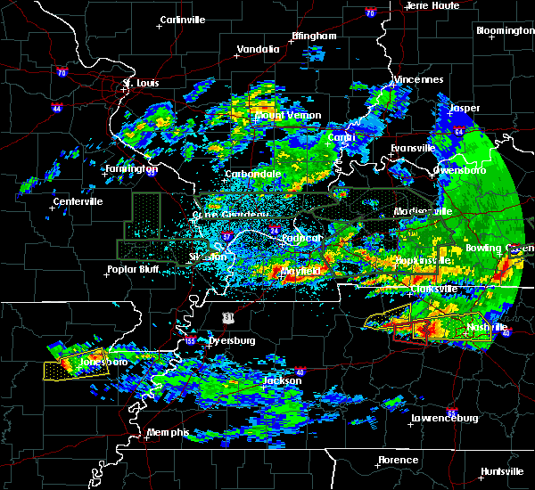 The national weather service in paducah has issued a * severe thunderstorm warning for. northwestern calloway county in western kentucky. southwestern marshall county in western kentucky. central graves county in western kentucky. Until 1245 am cst. The national weather service in paducah has issued a * severe thunderstorm warning for. northwestern calloway county in western kentucky. southwestern marshall county in western kentucky. central graves county in western kentucky. Until 1245 am cst.
|
| 3/2/2020 9:32 PM CST |
 At 932 pm cst, severe thunderstorms were located along a line extending from 6 miles southeast of karnak to near bardwell to near wyatt, moving east at 45 mph (radar indicated). Hazards include 60 mph wind gusts and quarter size hail. Hail damage to vehicles is expected. Expect wind damage to roofs, siding, and trees. At 932 pm cst, severe thunderstorms were located along a line extending from 6 miles southeast of karnak to near bardwell to near wyatt, moving east at 45 mph (radar indicated). Hazards include 60 mph wind gusts and quarter size hail. Hail damage to vehicles is expected. Expect wind damage to roofs, siding, and trees.
|
| 7/17/2019 9:07 PM CDT |
 The severe thunderstorm warning for western marshall, southeastern mccracken and northern graves counties will expire at 915 pm cdt, the storm which prompted the warning continues moving out of the area. therefore, the warning will be allowed to expire. The severe thunderstorm warning for western marshall, southeastern mccracken and northern graves counties will expire at 915 pm cdt, the storm which prompted the warning continues moving out of the area. therefore, the warning will be allowed to expire.
|
| 7/17/2019 8:26 PM CDT |
 At 826 pm cdt, a severe thunderstorm was located 7 miles south of lone oak, moving east at 30 mph (radar indicated). Hazards include 60 mph wind gusts. expect damage to roofs, siding, and trees At 826 pm cdt, a severe thunderstorm was located 7 miles south of lone oak, moving east at 30 mph (radar indicated). Hazards include 60 mph wind gusts. expect damage to roofs, siding, and trees
|
| 6/26/2019 7:25 PM CDT | Large tree limbs down and minor shingle damage. time estimate in graves county KY, 2.5 miles NW of Mayfield, KY |
| 6/23/2019 4:51 PM CDT |
 At 450 pm cdt, severe thunderstorms were located along a line extending from 6 miles northeast of vienna to near metropolis to near lone oak to near mayfield to near fulgham, moving east at 40 mph (radar indicated). Hazards include 70 mph wind gusts and quarter size hail. Hail damage to vehicles is expected. expect considerable tree damage. wind damage is also likely to mobile homes, roofs, and outbuildings. Locations impacted include, paducah, murray, mayfield, metropolis, benton, calvert city, vienna, reidland, lone oak, rosiclare, brookport, salem, golconda, barkley regional airport, burna, ledbetter, sedalia, new columbia, dixon springs and joy. At 450 pm cdt, severe thunderstorms were located along a line extending from 6 miles northeast of vienna to near metropolis to near lone oak to near mayfield to near fulgham, moving east at 40 mph (radar indicated). Hazards include 70 mph wind gusts and quarter size hail. Hail damage to vehicles is expected. expect considerable tree damage. wind damage is also likely to mobile homes, roofs, and outbuildings. Locations impacted include, paducah, murray, mayfield, metropolis, benton, calvert city, vienna, reidland, lone oak, rosiclare, brookport, salem, golconda, barkley regional airport, burna, ledbetter, sedalia, new columbia, dixon springs and joy.
|
| 6/23/2019 4:48 PM CDT | Tree damage with a semi truck overturned near pilgrims pride. metal outbuilding with damage. time estimate in graves county KY, 5.7 miles S of Mayfield, KY |
| 6/23/2019 4:45 PM CDT | Numerous tree large limbs and trees down in hickory and viol in graves county KY, 5.7 miles S of Mayfield, KY |
| 6/23/2019 4:37 PM CDT |
 At 436 pm cdt, severe thunderstorms were located along a line extending from near vienna to 7 miles west of metropolis to near lovelaceville to near fulgham, moving east at 40 mph (radar indicated). Hazards include 60 mph wind gusts and half dollar size hail. Hail damage to vehicles is expected. Expect wind damage to roofs, siding, and trees. At 436 pm cdt, severe thunderstorms were located along a line extending from near vienna to 7 miles west of metropolis to near lovelaceville to near fulgham, moving east at 40 mph (radar indicated). Hazards include 60 mph wind gusts and half dollar size hail. Hail damage to vehicles is expected. Expect wind damage to roofs, siding, and trees.
|
| 6/23/2019 1:16 PM CDT |
 At 116 pm cdt, a severe thunderstorm was located near murray, moving northeast at 30 mph (radar indicated). Hazards include 60 mph wind gusts and quarter size hail. Hail damage to vehicles is expected. Expect wind damage to roofs, siding, and trees. At 116 pm cdt, a severe thunderstorm was located near murray, moving northeast at 30 mph (radar indicated). Hazards include 60 mph wind gusts and quarter size hail. Hail damage to vehicles is expected. Expect wind damage to roofs, siding, and trees.
|
| 6/21/2019 5:51 PM CDT |
 At 549 pm cdt, severe thunderstorms were located along a line extending from 6 miles south of marion to near benton to near sedalia to near troy, moving east at 60 mph (spotters, automated weather observation sites, and emergency management have been reporting extensive tree damage, winds 60 to 70 mph, and power outages with this line of storms). Hazards include 70 mph wind gusts and quarter size hail. Hail damage to vehicles is expected. expect considerable tree damage. Wind damage is also likely to mobile homes, roofs, and outbuildings. At 549 pm cdt, severe thunderstorms were located along a line extending from 6 miles south of marion to near benton to near sedalia to near troy, moving east at 60 mph (spotters, automated weather observation sites, and emergency management have been reporting extensive tree damage, winds 60 to 70 mph, and power outages with this line of storms). Hazards include 70 mph wind gusts and quarter size hail. Hail damage to vehicles is expected. expect considerable tree damage. Wind damage is also likely to mobile homes, roofs, and outbuildings.
|
| 6/21/2019 5:39 PM CDT | Damage to the front of the catfish house. windows blown out of cars. time estimate in graves county KY, 4.7 miles NE of Mayfield, KY |
| 6/21/2019 5:07 PM CDT |
 At 506 pm cdt, severe thunderstorms were located along a line extending from near dixon springs to 6 miles northeast of bardwell to near east prairie to malden, moving east at 60 mph (radar indicated). Hazards include 70 mph wind gusts and nickel size hail. Expect considerable tree damage. Damage is likely to mobile homes, roofs, and outbuildings. At 506 pm cdt, severe thunderstorms were located along a line extending from near dixon springs to 6 miles northeast of bardwell to near east prairie to malden, moving east at 60 mph (radar indicated). Hazards include 70 mph wind gusts and nickel size hail. Expect considerable tree damage. Damage is likely to mobile homes, roofs, and outbuildings.
|
| 6/19/2019 4:04 PM CDT |
 At 404 pm cdt, a severe thunderstorm was located over sedalia, or near mayfield, moving east at 35 mph (radar indicated). Hazards include 60 mph wind gusts and penny size hail. expect damage to roofs, siding, and trees At 404 pm cdt, a severe thunderstorm was located over sedalia, or near mayfield, moving east at 35 mph (radar indicated). Hazards include 60 mph wind gusts and penny size hail. expect damage to roofs, siding, and trees
|
| 3/14/2019 11:37 AM CDT |
 The tornado warning for east central hickman and northern graves counties will expire at 1145 am cdt, the storm which prompted the warning has moved out of the area. there are other non severe thunderstorms that we are monitoring. therefore, the warning will be allowed to expire. a tornado watch remains in effect until 400 pm cdt for western kentucky. The tornado warning for east central hickman and northern graves counties will expire at 1145 am cdt, the storm which prompted the warning has moved out of the area. there are other non severe thunderstorms that we are monitoring. therefore, the warning will be allowed to expire. a tornado watch remains in effect until 400 pm cdt for western kentucky.
|
| 3/14/2019 11:13 AM CDT |
 At 1112 am cdt, a severe thunderstorm capable of producing a tornado was located over fulgham, or near clinton, moving northeast at 55 mph (radar indicated rotation). Hazards include tornado. Flying debris will be dangerous to those caught without shelter. mobile homes will be damaged or destroyed. damage to roofs, windows, and vehicles will occur. tree damage is likely. this dangerous storm will be near, mayfield around 1130 am cdt. Other locations impacted by this tornadic thunderstorm include fancy farm. At 1112 am cdt, a severe thunderstorm capable of producing a tornado was located over fulgham, or near clinton, moving northeast at 55 mph (radar indicated rotation). Hazards include tornado. Flying debris will be dangerous to those caught without shelter. mobile homes will be damaged or destroyed. damage to roofs, windows, and vehicles will occur. tree damage is likely. this dangerous storm will be near, mayfield around 1130 am cdt. Other locations impacted by this tornadic thunderstorm include fancy farm.
|
| 3/14/2019 10:46 AM CDT |
 At 1046 am cdt, a severe thunderstorm was located 7 miles northwest of mayfield, moving northeast at 60 mph (radar indicated). Hazards include 60 mph wind gusts. Expect damage to roofs, siding, and trees. locations impacted include, mayfield, clinton, fulgham and fancy farm. A tornado watch remains in effect until 400 pm cdt for western kentucky. At 1046 am cdt, a severe thunderstorm was located 7 miles northwest of mayfield, moving northeast at 60 mph (radar indicated). Hazards include 60 mph wind gusts. Expect damage to roofs, siding, and trees. locations impacted include, mayfield, clinton, fulgham and fancy farm. A tornado watch remains in effect until 400 pm cdt for western kentucky.
|
| 3/14/2019 10:33 AM CDT |
 At 1033 am cdt, a severe thunderstorm was located near clinton, moving northeast at 60 mph (radar indicated). Hazards include 70 mph wind gusts. Expect considerable tree damage. Damage is likely to mobile homes, roofs, and outbuildings. At 1033 am cdt, a severe thunderstorm was located near clinton, moving northeast at 60 mph (radar indicated). Hazards include 70 mph wind gusts. Expect considerable tree damage. Damage is likely to mobile homes, roofs, and outbuildings.
|
| 2/7/2019 1:09 AM CST |
 At 109 am cst, a severe thunderstorm was located near mayfield, moving east at 55 mph (radar indicated). Hazards include 60 mph wind gusts. expect damage to roofs, siding, and trees At 109 am cst, a severe thunderstorm was located near mayfield, moving east at 55 mph (radar indicated). Hazards include 60 mph wind gusts. expect damage to roofs, siding, and trees
|
| 7/15/2018 12:42 PM CDT | Roof damage to a save-a-lot in mayfield. time estimated from rada in graves county KY, 0.2 miles S of Mayfield, KY |
| 7/15/2018 12:38 PM CDT |
 At 1238 pm cdt, a severe thunderstorm was located over lynnville, or 12 miles south of mayfield, moving east at 35 mph (radar indicated). Hazards include 60 mph wind gusts and quarter size hail. Hail damage to vehicles is expected. Expect wind damage to roofs, siding, and trees. At 1238 pm cdt, a severe thunderstorm was located over lynnville, or 12 miles south of mayfield, moving east at 35 mph (radar indicated). Hazards include 60 mph wind gusts and quarter size hail. Hail damage to vehicles is expected. Expect wind damage to roofs, siding, and trees.
|
| 6/28/2018 8:50 PM CDT | Several reports of large tree limbs and trees down along with power outages in graves county KY, 8 miles ESE of Mayfield, KY |
| 6/28/2018 8:35 PM CDT |
 At 835 pm cdt, severe thunderstorms were located along a line extending from near providence to near cadiz to 9 miles northeast of murray to near fulgham, moving south to southeast at 60 mph (radar indicated). Hazards include 60 mph wind gusts. Expect damage to roofs, siding, and trees. Locations impacted include, madisonville, murray, mayfield, princeton, benton, providence, dawson springs, calvert city, cadiz, eddyville, land between the lakes area, sebree, earlington, nortonville, mortons gap, dixon, olney, creswell, sedalia and lynnville. At 835 pm cdt, severe thunderstorms were located along a line extending from near providence to near cadiz to 9 miles northeast of murray to near fulgham, moving south to southeast at 60 mph (radar indicated). Hazards include 60 mph wind gusts. Expect damage to roofs, siding, and trees. Locations impacted include, madisonville, murray, mayfield, princeton, benton, providence, dawson springs, calvert city, cadiz, eddyville, land between the lakes area, sebree, earlington, nortonville, mortons gap, dixon, olney, creswell, sedalia and lynnville.
|
| 6/28/2018 8:05 PM CDT |
 At 805 pm cdt, severe thunderstorms were located along a line extending from near uniontown to near salem to brookport, moving south at 60 mph (radar indicated). Hazards include 70 mph wind gusts and nickel size hail. Expect considerable tree damage. Damage is likely to mobile homes, roofs, and outbuildings. At 805 pm cdt, severe thunderstorms were located along a line extending from near uniontown to near salem to brookport, moving south at 60 mph (radar indicated). Hazards include 70 mph wind gusts and nickel size hail. Expect considerable tree damage. Damage is likely to mobile homes, roofs, and outbuildings.
|
| 4/3/2018 7:42 PM CDT |
 At 741 pm cdt, a confirmed tornado was located over mayfield, moving northeast at 40 mph (radar confirmed tornado). Hazards include damaging tornado. Flying debris will be dangerous to those caught without shelter. mobile homes will be damaged or destroyed. damage to roofs, windows, and vehicles will occur. tree damage is likely. Locations impacted include, mayfield and sedalia. At 741 pm cdt, a confirmed tornado was located over mayfield, moving northeast at 40 mph (radar confirmed tornado). Hazards include damaging tornado. Flying debris will be dangerous to those caught without shelter. mobile homes will be damaged or destroyed. damage to roofs, windows, and vehicles will occur. tree damage is likely. Locations impacted include, mayfield and sedalia.
|
| 4/3/2018 7:36 PM CDT |
 At 736 pm cdt, a severe thunderstorm capable of producing a tornado was located near mayfield, moving northeast at 40 mph (radar indicated rotation). Hazards include tornado. Flying debris will be dangerous to those caught without shelter. mobile homes will be damaged or destroyed. damage to roofs, windows, and vehicles will occur. Tree damage is likely. At 736 pm cdt, a severe thunderstorm capable of producing a tornado was located near mayfield, moving northeast at 40 mph (radar indicated rotation). Hazards include tornado. Flying debris will be dangerous to those caught without shelter. mobile homes will be damaged or destroyed. damage to roofs, windows, and vehicles will occur. Tree damage is likely.
|
| 5/27/2017 7:06 PM CDT |
 At 705 pm cdt, severe thunderstorms were located along a line extending from 7 miles northeast of marion to near energy to near murray, moving east at 65 mph (radar indicated. 65 to 70 mph winds were reported in lynnville kentucky in graves county with these storms). Hazards include 70 mph wind gusts and nickel size hail. Expect considerable tree damage. damage is likely to mobile homes, roofs, and outbuildings. Locations impacted include, murray, mayfield, lynnville, sedalia, wingo, hazel, water valley, new concord, dukedom, kirksey, harris grove and crossland. At 705 pm cdt, severe thunderstorms were located along a line extending from 7 miles northeast of marion to near energy to near murray, moving east at 65 mph (radar indicated. 65 to 70 mph winds were reported in lynnville kentucky in graves county with these storms). Hazards include 70 mph wind gusts and nickel size hail. Expect considerable tree damage. damage is likely to mobile homes, roofs, and outbuildings. Locations impacted include, murray, mayfield, lynnville, sedalia, wingo, hazel, water valley, new concord, dukedom, kirksey, harris grove and crossland.
|
| 5/27/2017 6:53 PM CDT |
 At 652 pm cdt, severe thunderstorms were located along a line extending from 7 miles northwest of marion to 8 miles east of benton to near sedalia, moving east at 65 mph (radar indicated). Hazards include 70 mph wind gusts and nickel size hail. Expect considerable tree damage. damage is likely to mobile homes, roofs, and outbuildings. Locations impacted include, murray, mayfield, benton, calvert city, salem, golconda, burna, lynnville, sedalia, joy, ledbetter, wingo, hardin, hazel, grand rivers, smithland, water valley, carrsville, lowes and fancy farm. At 652 pm cdt, severe thunderstorms were located along a line extending from 7 miles northwest of marion to 8 miles east of benton to near sedalia, moving east at 65 mph (radar indicated). Hazards include 70 mph wind gusts and nickel size hail. Expect considerable tree damage. damage is likely to mobile homes, roofs, and outbuildings. Locations impacted include, murray, mayfield, benton, calvert city, salem, golconda, burna, lynnville, sedalia, joy, ledbetter, wingo, hardin, hazel, grand rivers, smithland, water valley, carrsville, lowes and fancy farm.
|
| 5/27/2017 6:10 PM CDT |
 At 608 pm cdt, severe thunderstorms were located along a line extending from goreville to near barlow to near east prairie, moving east at 65 mph. these are very dangerous storms (law enforcement. structural damage has been reported in stoddard county with 80 mph winds reported near sikeston missouri). Hazards include 80 mph wind gusts and nickel size hail. Flying debris will be dangerous to those caught without shelter. mobile homes will be heavily damaged. expect considerable damage to roofs, windows, and vehicles. Extensive tree damage and power outages are likely. At 608 pm cdt, severe thunderstorms were located along a line extending from goreville to near barlow to near east prairie, moving east at 65 mph. these are very dangerous storms (law enforcement. structural damage has been reported in stoddard county with 80 mph winds reported near sikeston missouri). Hazards include 80 mph wind gusts and nickel size hail. Flying debris will be dangerous to those caught without shelter. mobile homes will be heavily damaged. expect considerable damage to roofs, windows, and vehicles. Extensive tree damage and power outages are likely.
|
| 4/26/2017 7:37 PM CDT | Storm damage reported in graves county KY, 0.2 miles S of Mayfield, KY |
| 4/26/2017 7:28 PM CDT | Trees uprooted and limbs down along highway 45 between mayfield and wing in graves county KY, 5.3 miles N of Mayfield, KY |
| 4/26/2017 7:24 PM CDT |
 At 723 pm cdt, a severe thunderstorm capable of producing a tornado was located near fulgham, or 8 miles southwest of mayfield, moving east at 55 mph (radar indicated rotation). Hazards include tornado. Flying debris will be dangerous to those caught without shelter. mobile homes will be damaged or destroyed. damage to roofs, windows, and vehicles will occur. Tree damage is likely. At 723 pm cdt, a severe thunderstorm capable of producing a tornado was located near fulgham, or 8 miles southwest of mayfield, moving east at 55 mph (radar indicated rotation). Hazards include tornado. Flying debris will be dangerous to those caught without shelter. mobile homes will be damaged or destroyed. damage to roofs, windows, and vehicles will occur. Tree damage is likely.
|
| 4/26/2017 7:11 PM CDT |
 At 710 pm cdt, severe thunderstorms were located along a line extending from near wyatt to near clinton, moving northeast at 65 mph (radar indicated). Hazards include 60 mph wind gusts and quarter size hail. Hail damage to vehicles is expected. Expect wind damage to roofs, siding, and trees. At 710 pm cdt, severe thunderstorms were located along a line extending from near wyatt to near clinton, moving northeast at 65 mph (radar indicated). Hazards include 60 mph wind gusts and quarter size hail. Hail damage to vehicles is expected. Expect wind damage to roofs, siding, and trees.
|
| 3/27/2017 12:58 PM CDT |
 At 1258 pm cdt, a severe thunderstorm was located over sedalia, or 9 miles south of mayfield, moving northeast at 25 mph (radar indicated). Hazards include ping pong ball size hail and 60 mph wind gusts. People and animals outdoors will be injured. expect hail damage to roofs, siding, windows, and vehicles. expect wind damage to roofs, siding, and trees. Locations impacted include, murray, mayfield, lynnville, sedalia, dukedom, kirksey and harris grove. At 1258 pm cdt, a severe thunderstorm was located over sedalia, or 9 miles south of mayfield, moving northeast at 25 mph (radar indicated). Hazards include ping pong ball size hail and 60 mph wind gusts. People and animals outdoors will be injured. expect hail damage to roofs, siding, windows, and vehicles. expect wind damage to roofs, siding, and trees. Locations impacted include, murray, mayfield, lynnville, sedalia, dukedom, kirksey and harris grove.
|
| 3/27/2017 12:47 PM CDT |
 At 1247 pm cdt, a severe thunderstorm was located near lynnville, or 12 miles east of fulton, moving northeast at 25 mph (radar indicated). Hazards include 60 mph wind gusts and quarter size hail. Hail damage to vehicles is expected. Expect wind damage to roofs, siding, and trees. At 1247 pm cdt, a severe thunderstorm was located near lynnville, or 12 miles east of fulton, moving northeast at 25 mph (radar indicated). Hazards include 60 mph wind gusts and quarter size hail. Hail damage to vehicles is expected. Expect wind damage to roofs, siding, and trees.
|
| 3/20/2017 4:40 PM CDT |
 At 440 pm cdt, a severe thunderstorm was located 7 miles northwest of mayfield, moving southeast at 40 mph (radar indicated). Hazards include quarter size hail. damage to vehicles is expected At 440 pm cdt, a severe thunderstorm was located 7 miles northwest of mayfield, moving southeast at 40 mph (radar indicated). Hazards include quarter size hail. damage to vehicles is expected
|
| 3/20/2017 4:17 PM CDT |
 At 416 pm cdt, a severe thunderstorm was located near lovelaceville, or 10 miles southwest of lone oak, moving southeast at 40 mph (radar indicated). Hazards include quarter size hail. damage to vehicles is expected At 416 pm cdt, a severe thunderstorm was located near lovelaceville, or 10 miles southwest of lone oak, moving southeast at 40 mph (radar indicated). Hazards include quarter size hail. damage to vehicles is expected
|
| 3/9/2017 7:23 PM CST |
 At 723 pm cst, a severe thunderstorm was located over mayfield, moving northeast at 50 mph (radar indicated). Hazards include 60 mph wind gusts and quarter size hail. Hail damage to vehicles is expected. Expect wind damage to roofs, siding, and trees. At 723 pm cst, a severe thunderstorm was located over mayfield, moving northeast at 50 mph (radar indicated). Hazards include 60 mph wind gusts and quarter size hail. Hail damage to vehicles is expected. Expect wind damage to roofs, siding, and trees.
|
| 3/9/2017 7:22 PM CST | Quarter sized hail reported 0.8 miles NE of Mayfield, KY |
| 3/1/2017 5:25 AM CST | Measured at ky mesonet site in graves county KY, 6.1 miles NE of Mayfield, KY |
| 3/1/2017 5:09 AM CST |
 At 508 am cst, severe thunderstorms were located along a line extending from bardwell to near cayce, moving east at 80 mph (radar indicated). Hazards include 70 mph wind gusts and penny size hail. Expect considerable tree damage. damage is likely to mobile homes, roofs, and outbuildings. locations impacted include, mayfield, fulton, clinton, bardwell, cayce, lynnville, fulgham, sedalia, wingo, arlington, water valley, lowes, fancy farm, dukedom and symsonia. a tornado watch remains in effect until 800 am cst for western kentucky. A tornado watch also remains in effect until 800 am cst for western kentucky. At 508 am cst, severe thunderstorms were located along a line extending from bardwell to near cayce, moving east at 80 mph (radar indicated). Hazards include 70 mph wind gusts and penny size hail. Expect considerable tree damage. damage is likely to mobile homes, roofs, and outbuildings. locations impacted include, mayfield, fulton, clinton, bardwell, cayce, lynnville, fulgham, sedalia, wingo, arlington, water valley, lowes, fancy farm, dukedom and symsonia. a tornado watch remains in effect until 800 am cst for western kentucky. A tornado watch also remains in effect until 800 am cst for western kentucky.
|
| 3/1/2017 4:53 AM CST |
 At 453 am cst, severe thunderstorms were located along a line extending from near charleston to near clayton, moving east at 70 mph (radar indicated). Hazards include 60 mph wind gusts and penny size hail. expect damage to roofs, siding, and trees At 453 am cst, severe thunderstorms were located along a line extending from near charleston to near clayton, moving east at 70 mph (radar indicated). Hazards include 60 mph wind gusts and penny size hail. expect damage to roofs, siding, and trees
|
| 2/28/2017 10:45 PM CST | Large tree limbs down in the communit in graves county KY, 0.2 miles S of Mayfield, KY |
| 2/28/2017 10:12 PM CST |
 At 1011 pm cst, severe thunderstorms were located along a line extending from near mayfield to near latham, moving northeast at 75 mph. pea size hail was already reported in mayfield at 1013 pm cst (radar indicated). Hazards include 70 mph wind gusts and quarter size hail. Hail damage to vehicles is expected. expect considerable tree damage. Wind damage is also likely to mobile homes, roofs, and outbuildings. At 1011 pm cst, severe thunderstorms were located along a line extending from near mayfield to near latham, moving northeast at 75 mph. pea size hail was already reported in mayfield at 1013 pm cst (radar indicated). Hazards include 70 mph wind gusts and quarter size hail. Hail damage to vehicles is expected. expect considerable tree damage. Wind damage is also likely to mobile homes, roofs, and outbuildings.
|
| 7/8/2016 6:25 PM CDT | Power lines down and stop lights out in mayfield in graves county KY, 0.2 miles S of Mayfield, KY |
| 7/6/2016 2:04 PM CDT | Reports of numerous trees down north of mayfiel in graves county KY, 6.4 miles S of Mayfield, KY |
| 7/6/2016 2:04 PM CDT |
 At 203 pm cdt, severe thunderstorms were located along a line extending from joy to near benton to near palmersville, moving east at 55 mph (trained weather spotters). Hazards include 70 mph wind gusts and penny size hail. Expect considerable tree damage. damage is likely to mobile homes, roofs, and outbuildings. Locations impacted include, paducah, mayfield, calvert city, reidland, golconda, lynnville, sedalia, woodlawn-oakdale, burna, joy, ledbetter, wingo, smithland, hamletsburg and symsonia. At 203 pm cdt, severe thunderstorms were located along a line extending from joy to near benton to near palmersville, moving east at 55 mph (trained weather spotters). Hazards include 70 mph wind gusts and penny size hail. Expect considerable tree damage. damage is likely to mobile homes, roofs, and outbuildings. Locations impacted include, paducah, mayfield, calvert city, reidland, golconda, lynnville, sedalia, woodlawn-oakdale, burna, joy, ledbetter, wingo, smithland, hamletsburg and symsonia.
|
| 7/6/2016 1:59 PM CDT | At least 50 mph winds with power outage in graves county KY, 0.6 miles WSW of Mayfield, KY |
| 7/6/2016 1:55 PM CDT | . in graves county KY, 1 miles SSW of Mayfield, KY |
| 7/6/2016 1:45 PM CDT |
 At 144 pm cdt, severe thunderstorms were located along a line extending from dixon springs to 7 miles southeast of lovelaceville to south fulton, moving east at 60 mph (trained weather spotters). Hazards include 70 mph wind gusts and penny size hail. Expect considerable tree damage. damage is likely to mobile homes, roofs, and outbuildings. Locations impacted include, paducah, mayfield, metropolis, calvert city, fulton, reidland, lone oak, brookport, golconda, west paducah, woodlawn-oakdale, joy, fulgham, hendron, massac, lynnville, sedalia, burna, ledbetter and wingo. At 144 pm cdt, severe thunderstorms were located along a line extending from dixon springs to 7 miles southeast of lovelaceville to south fulton, moving east at 60 mph (trained weather spotters). Hazards include 70 mph wind gusts and penny size hail. Expect considerable tree damage. damage is likely to mobile homes, roofs, and outbuildings. Locations impacted include, paducah, mayfield, metropolis, calvert city, fulton, reidland, lone oak, brookport, golconda, west paducah, woodlawn-oakdale, joy, fulgham, hendron, massac, lynnville, sedalia, burna, ledbetter and wingo.
|
| 7/6/2016 1:28 PM CDT |
 At 127 pm cdt, severe thunderstorms were located along a line extending from near vienna to near wickliffe to near hickman, moving east at 55 mph (trained weather spotters). Hazards include 60 mph wind gusts and nickel size hail. Expect damage to roofs. siding. And trees. At 127 pm cdt, severe thunderstorms were located along a line extending from near vienna to near wickliffe to near hickman, moving east at 55 mph (trained weather spotters). Hazards include 60 mph wind gusts and nickel size hail. Expect damage to roofs. siding. And trees.
|
| 5/10/2016 2:57 PM CDT |
 At 256 pm cdt, a severe thunderstorm was located near mayfield, moving east at 40 mph (radar indicated). Hazards include 60 mph wind gusts and quarter size hail. Hail damage to vehicles is expected. Expect wind damage to roofs, siding, and trees. At 256 pm cdt, a severe thunderstorm was located near mayfield, moving east at 40 mph (radar indicated). Hazards include 60 mph wind gusts and quarter size hail. Hail damage to vehicles is expected. Expect wind damage to roofs, siding, and trees.
|
| 5/10/2016 2:50 PM CDT | Collapsed building on hwy 121 north in graves county. likely tornado damag in graves county KY, 1.1 miles SSE of Mayfield, KY |
| 5/10/2016 2:46 PM CDT |
 At 245 pm cdt, a severe thunderstorm capable of producing a tornado was located near mayfield, moving northeast at 50 mph (radar indicated rotation). Hazards include tornado and quarter size hail. Flying debris will be dangerous to those caught without shelter. mobile homes will be damaged or destroyed. damage to roofs, windows, and vehicles will occur. tree damage is likely. This tornadic thunderstorm will remain over mainly rural areas of central graves county, including the following locations: symsonia, fancy farm and wingo. At 245 pm cdt, a severe thunderstorm capable of producing a tornado was located near mayfield, moving northeast at 50 mph (radar indicated rotation). Hazards include tornado and quarter size hail. Flying debris will be dangerous to those caught without shelter. mobile homes will be damaged or destroyed. damage to roofs, windows, and vehicles will occur. tree damage is likely. This tornadic thunderstorm will remain over mainly rural areas of central graves county, including the following locations: symsonia, fancy farm and wingo.
|
| 5/10/2016 2:42 PM CDT |
 At 241 pm cdt, a severe thunderstorm was located 8 miles north of mayfield, moving northeast at 50 mph (radar indicated). Hazards include 60 mph wind gusts and quarter size hail. Hail damage to vehicles is expected. expect wind damage to roofs, siding, and trees. Locations impacted include, symsonia, lowes and fancy farm. At 241 pm cdt, a severe thunderstorm was located 8 miles north of mayfield, moving northeast at 50 mph (radar indicated). Hazards include 60 mph wind gusts and quarter size hail. Hail damage to vehicles is expected. expect wind damage to roofs, siding, and trees. Locations impacted include, symsonia, lowes and fancy farm.
|
| 5/10/2016 2:28 PM CDT |
 At 228 pm cdt, a severe thunderstorm was located 10 miles west of mayfield, moving northeast at 50 mph (radar indicated). Hazards include 60 mph wind gusts and quarter size hail. Hail damage to vehicles is expected. Expect wind damage to roofs, siding, and trees. At 228 pm cdt, a severe thunderstorm was located 10 miles west of mayfield, moving northeast at 50 mph (radar indicated). Hazards include 60 mph wind gusts and quarter size hail. Hail damage to vehicles is expected. Expect wind damage to roofs, siding, and trees.
|
| 4/27/2016 4:10 PM CDT | 2 trees down in graves county KY, 0.2 miles S of Mayfield, KY |
| 12/23/2015 3:24 PM CST | Quarter sized hail reported 0.2 miles S of Mayfield, KY, quarter size hail reported. |
| 12/23/2015 3:15 PM CST | The national weather service in paducah has issued a * severe thunderstorm warning for. marshall county in western kentucky. graves county in western kentucky. northern calloway county in western kentucky. Until 345 pm cst. |
| 12/23/2015 2:55 PM CST | At 254 pm cst, severe thunderstorms were located along a line extending from near west paducah to 8 miles north of fulgham to near hickman, moving northeast at 65 mph (radar indicated). Hazards include 70 mph wind gusts and quarter size hail. Hail damage to vehicles is expected. expect considerable tree damage. wind damage is also likely to mobile homes, roofs and outbuildings. locations impacted include, mayfield, fulton, hickman, clinton, bardwell, wickliffe, fulgham, lovelaceville, lynnville, sedalia, cayce, wingo, kevil, arlington, water valley, columbus, boundurant, lowes, fancy farm and symsonia. A tornado watch remains in effect until 500 pm cst for western kentucky and southeastern missouri. |
| 12/23/2015 2:55 PM CST | At 254 pm cst, severe thunderstorms were located along a line extending from near west paducah to 8 miles north of fulgham to near hickman, moving northeast at 65 mph (radar indicated). Hazards include 70 mph wind gusts and quarter size hail. Hail damage to vehicles is expected. expect considerable tree damage. wind damage is also likely to mobile homes, roofs and outbuildings. locations impacted include, mayfield, fulton, hickman, clinton, bardwell, wickliffe, fulgham, lovelaceville, lynnville, sedalia, cayce, wingo, kevil, arlington, water valley, columbus, boundurant, lowes, fancy farm and symsonia. A tornado watch remains in effect until 500 pm cst for western kentucky and southeastern missouri. |
| 12/23/2015 2:24 PM CST | The national weather service in paducah has issued a * severe thunderstorm warning for. graves county in western kentucky. fulton county in western kentucky. carlisle county in western kentucky. Hickman county in western kentucky. |
| 12/23/2015 2:24 PM CST | The national weather service in paducah has issued a * severe thunderstorm warning for. graves county in western kentucky. fulton county in western kentucky. carlisle county in western kentucky. Hickman county in western kentucky. |
| 6/26/2015 2:57 PM CDT | At 256 pm cdt, a severe thunderstorm was located 9 miles north of fulgham, or 11 miles southeast of bardwell, moving east at 30 mph (radar indicated). Hazards include 60 mph wind gusts and quarter size hail. Hail damage to vehicles is expected. Expect wind damage to roofs, siding and trees. |
| 6/26/2015 1:35 PM CDT |
 The severe thunderstorm warning for west central graves and southeastern carlisle counties will expire at 145 pm cdt, the storm which prompted the warning has weakened below severe limits, and no longer pose an immediate threat to life or property. therefore the warning will be allowed to expire. a severe thunderstorm watch remains in effect until 800 pm cdt for western kentucky. The severe thunderstorm warning for west central graves and southeastern carlisle counties will expire at 145 pm cdt, the storm which prompted the warning has weakened below severe limits, and no longer pose an immediate threat to life or property. therefore the warning will be allowed to expire. a severe thunderstorm watch remains in effect until 800 pm cdt for western kentucky.
|
| 6/26/2015 1:08 PM CDT |
 At 107 pm cdt, a severe thunderstorm was located 10 miles east of bardwell, moving east at 20 mph (radar indicated). Hazards include 60 mph wind gusts and nickel size hail. Expect damage to roofs. Siding and trees. At 107 pm cdt, a severe thunderstorm was located 10 miles east of bardwell, moving east at 20 mph (radar indicated). Hazards include 60 mph wind gusts and nickel size hail. Expect damage to roofs. Siding and trees.
|
| 6/7/2014 4:00 PM CDT | Damage reported on south side of community extending from near ingersol rand road eastward to cuba road. em is going to the scen in graves county KY, 0.2 miles S of Mayfield, KY |
| 6/7/2014 3:35 PM CDT | Time adjusted. em reported straight-line winds with 5 mile length damage path across south side of mayfield. widespread downed trees and power lines. a few homes with d in graves county KY, 0.2 miles S of Mayfield, KY |
| 10/14/2012 6:45 AM CDT | Several metal businesses have parts of their roofs gone. the scoreboard at high school football field has damage and is partially blown over. several trees and power li in graves county KY, 0.2 miles S of Mayfield, KY |
| 9/6/2012 7:10 PM CDT | Storm damage reported in graves county KY, 0.2 miles S of Mayfield, KY |
| 5/31/2012 4:44 PM CDT | Trees down with estimated wind gust 60 to 65 mph. dime to marble size hail reporte in graves county KY, 1.9 miles N of Mayfield, KY |
| 5/5/2012 10:53 PM CDT | Quarter sized hail reported 0.2 miles S of Mayfield, KY |
| 5/5/2012 10:46 PM CDT | Quarter sized hail reported 8 miles ESE of Mayfield, KY |
| 1/1/0001 12:00 AM | Old barn pushed over and partially on ky 301. received via wpsd local 6. time estimate in graves county KY, 3.2 miles SW of Mayfield, KY |
| 1/1/0001 12:00 AM | Old barn pushed over and partially on ky 301. received via wpsd local 6. time estimate in graves county KY, 3.2 miles SW of Mayfield, KY |
| 1/1/0001 12:00 AM | Large tree branch fell on home. damage unknown at this tim in graves county KY, 0.2 miles S of Mayfield, KY |
| 1/1/0001 12:00 AM | Reported by jackson purchase energy...over 6400 customers without power in 6 counties across the kentucky purchase are in graves county KY, 0.2 miles S of Mayfield, KY |
| 1/1/0001 12:00 AM | Quarter sized hail reported 0.2 miles S of Mayfield, KY |
| 1/1/0001 12:00 AM | Quarter sized hail reported 3.2 miles N of Mayfield, KY |
| 1/1/0001 12:00 AM | Late report. winds estimated 60 to 70 mp in graves county KY, 0.2 miles S of Mayfield, KY |
| 1/1/0001 12:00 AM | Quarter sized hail reported 5.7 miles S of Mayfield, KY, torrential rain reported with the storm. |
Hail Maps for Mayfield, KY


Connect with Interactive Hail Maps