

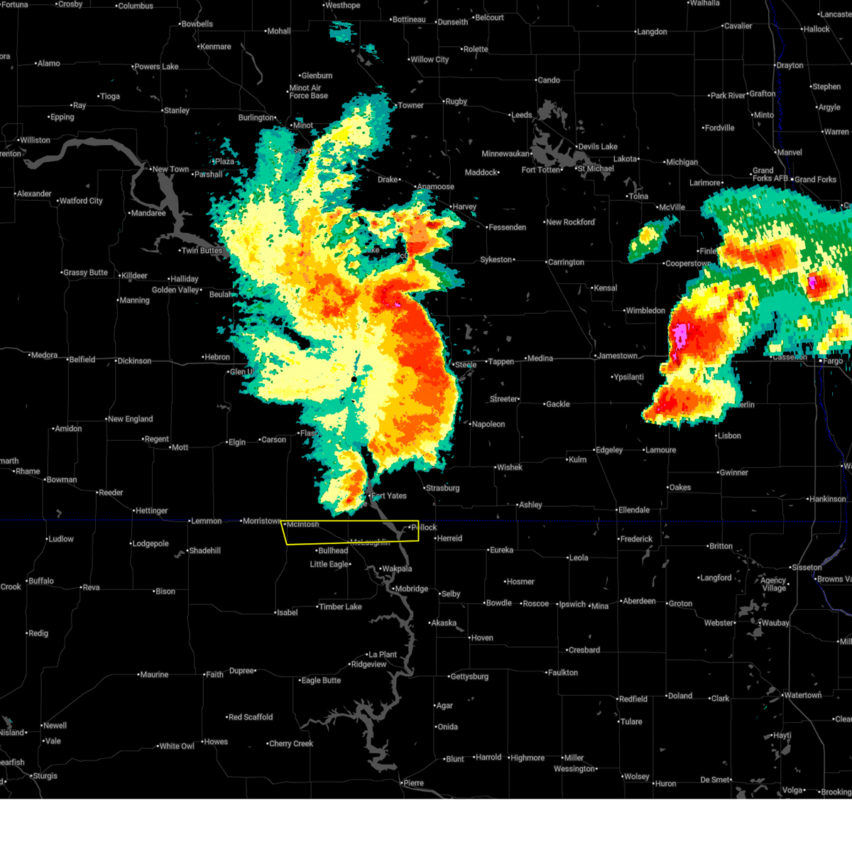
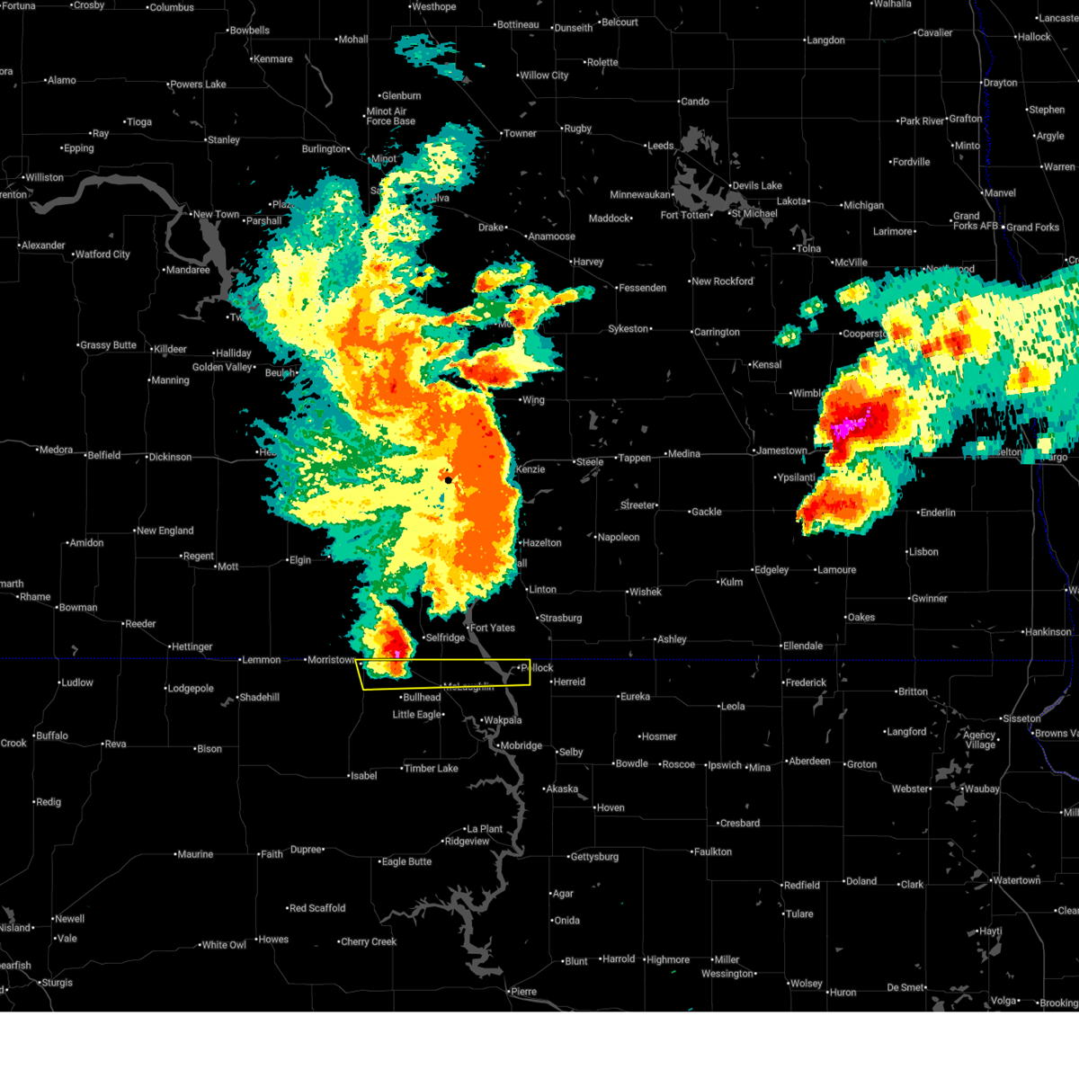
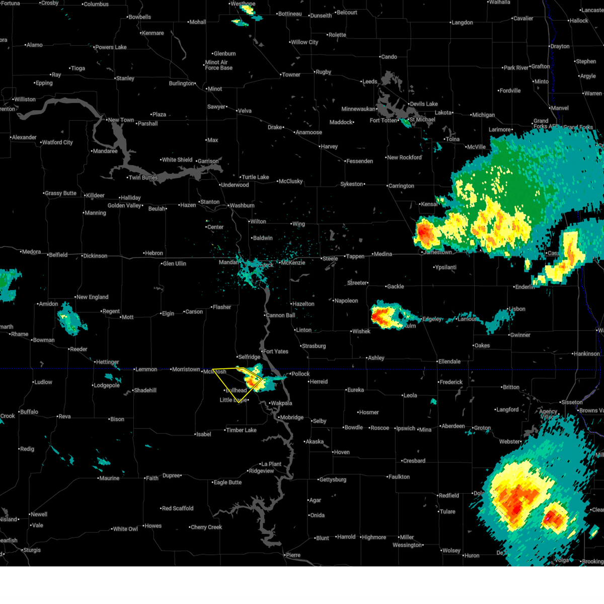
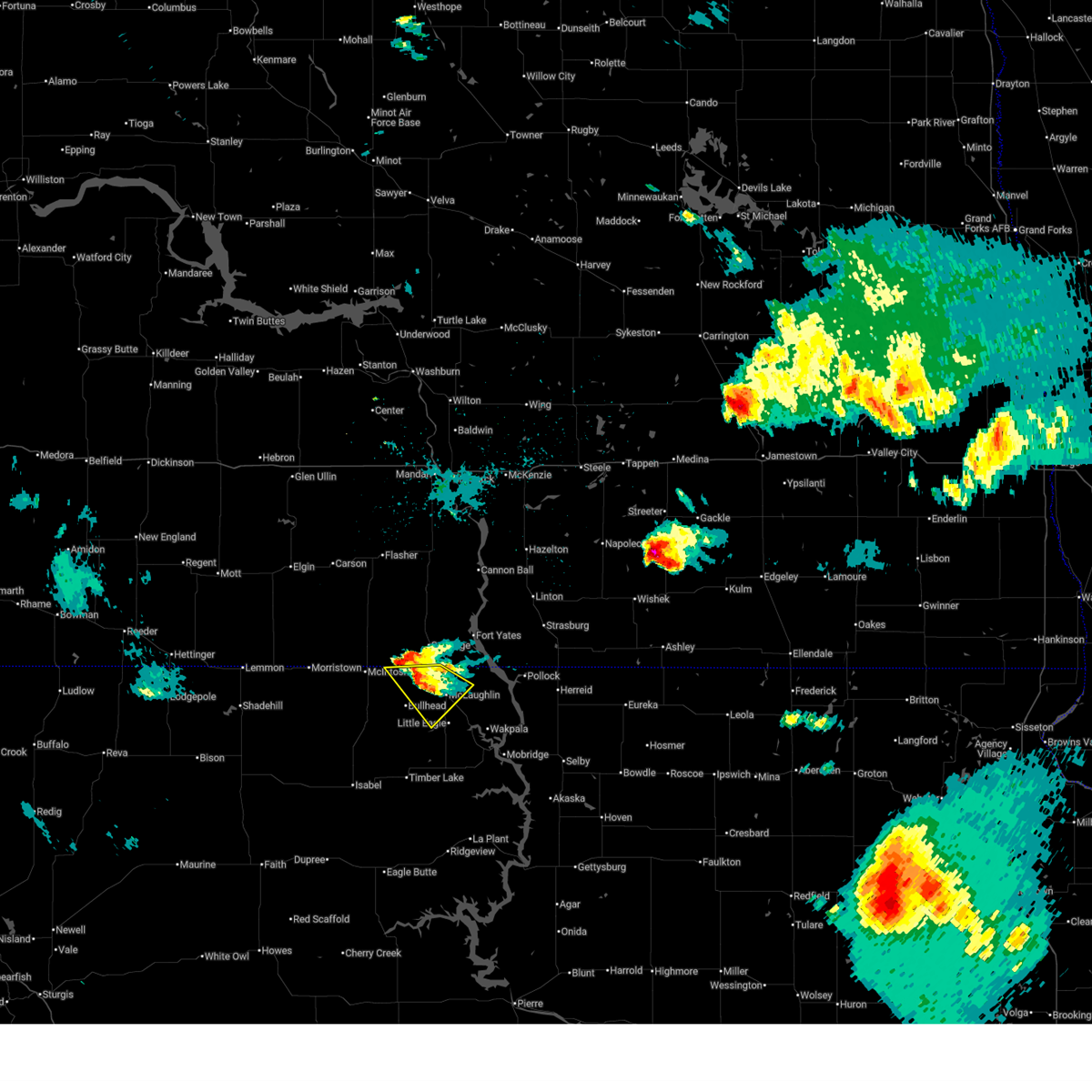
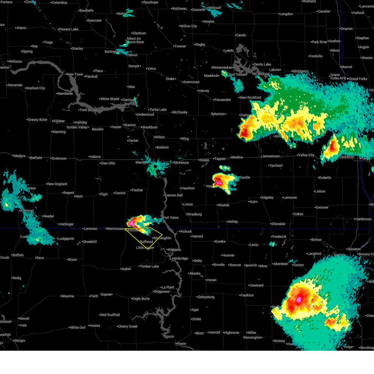
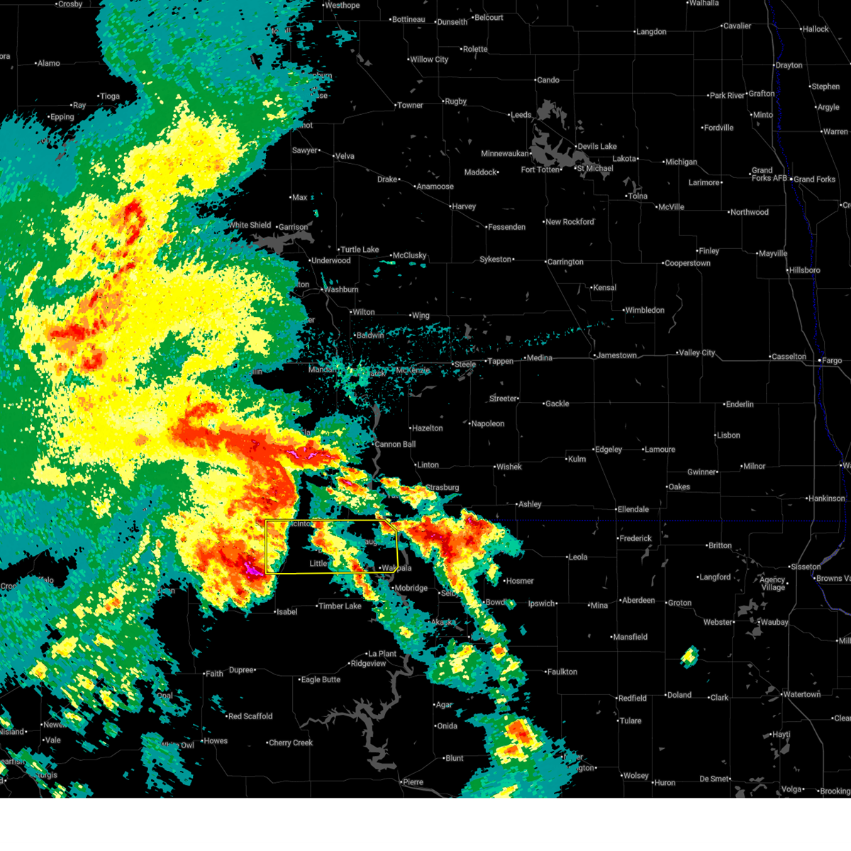
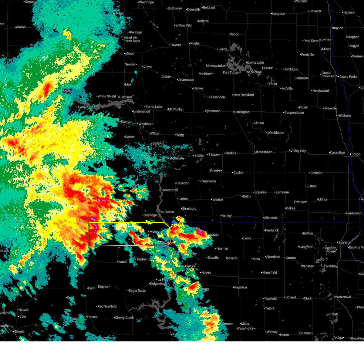
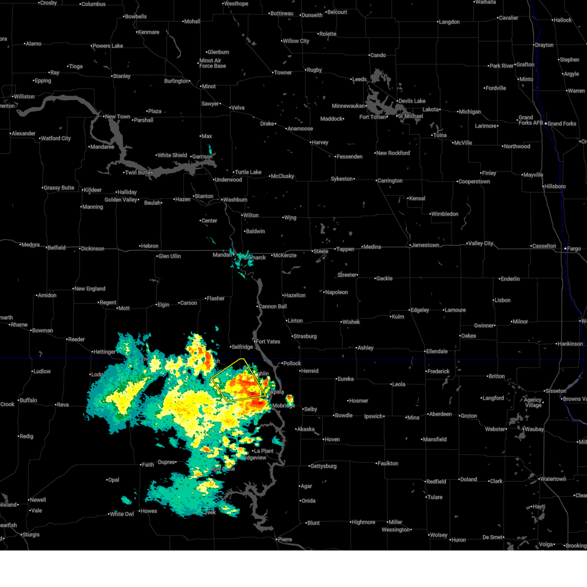
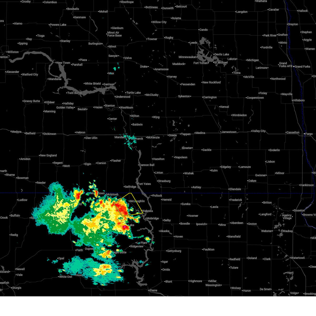
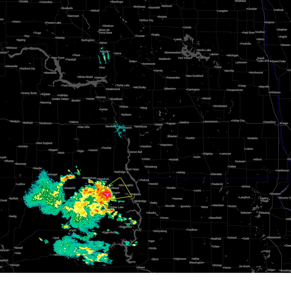
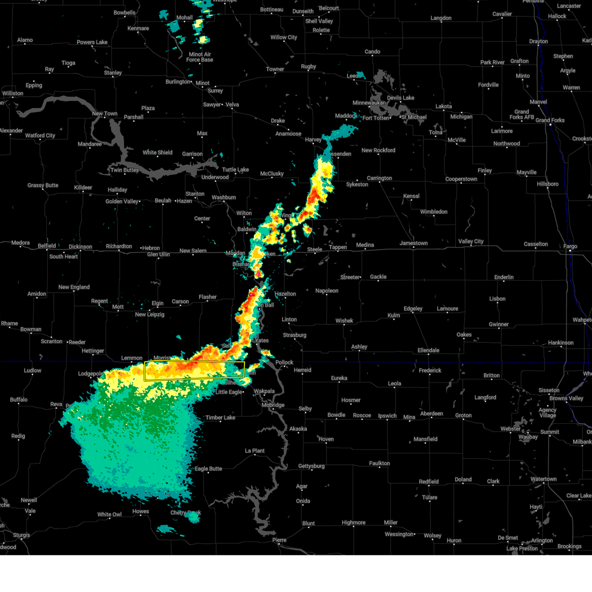
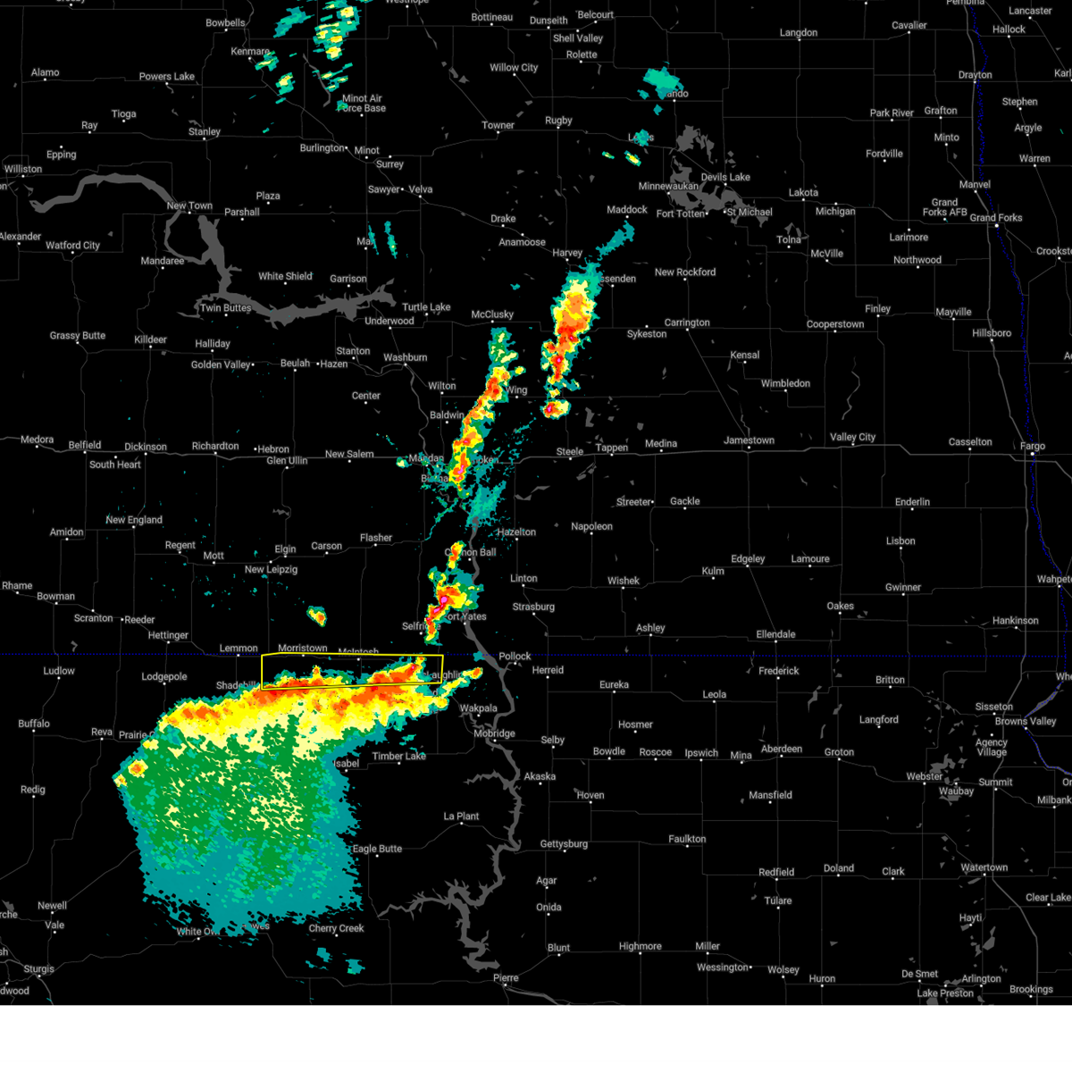
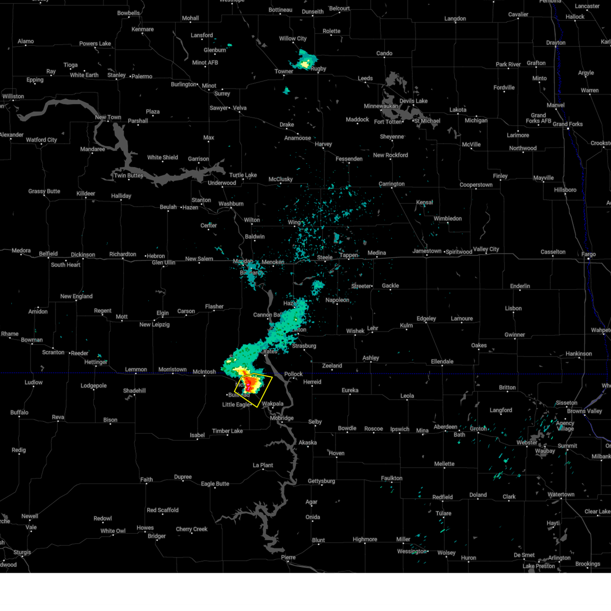
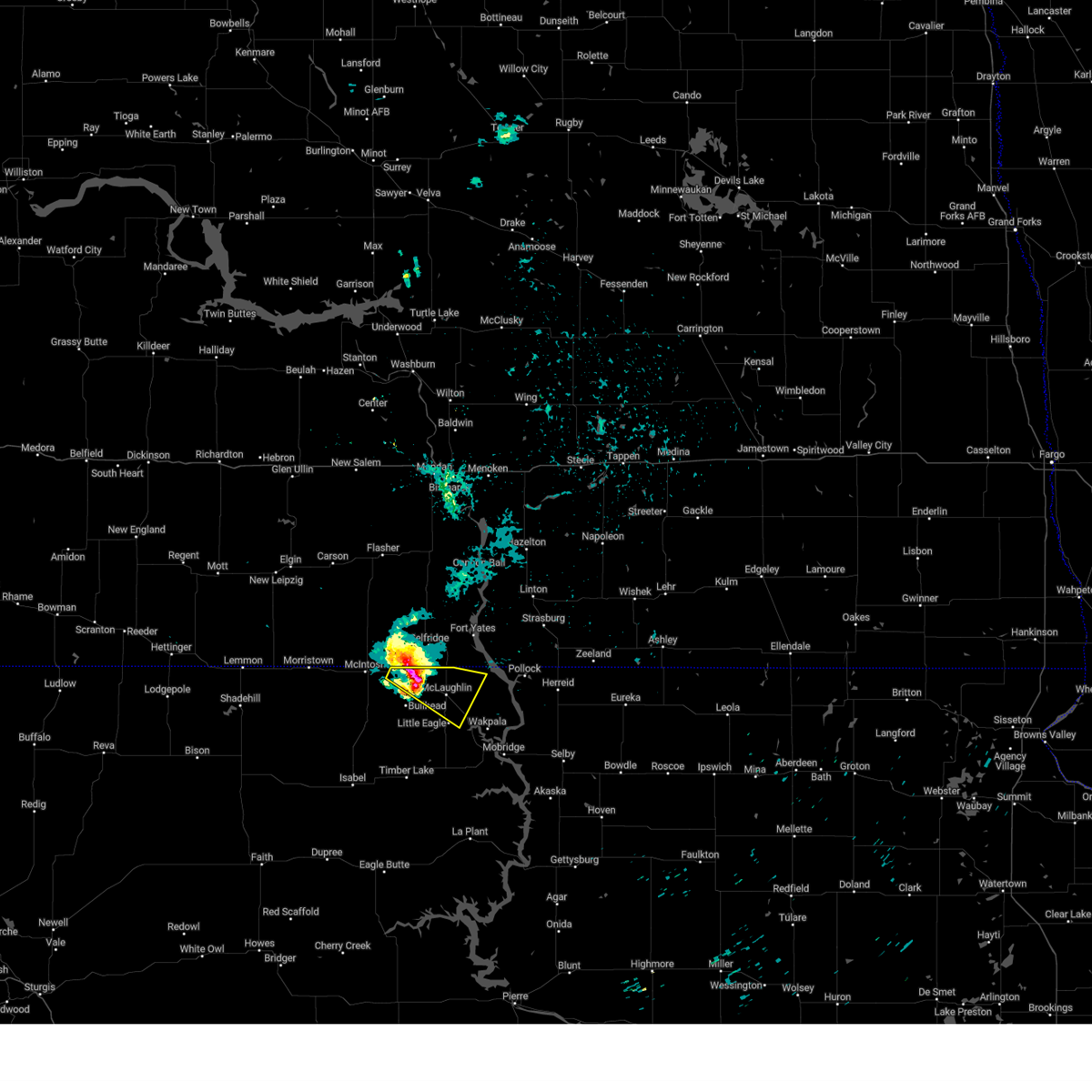
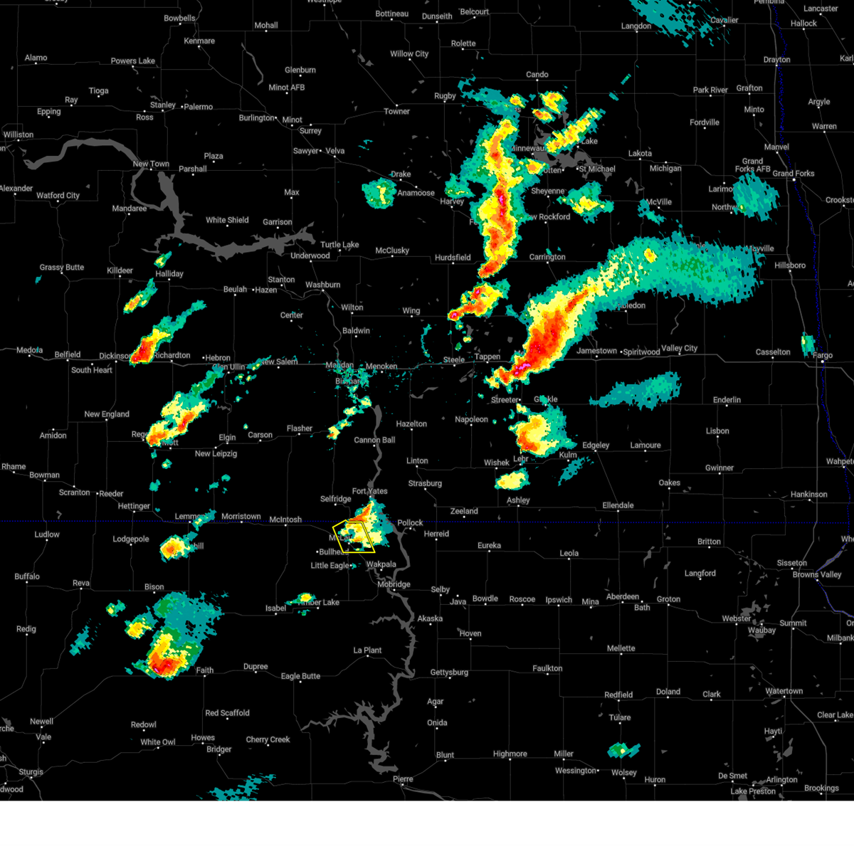
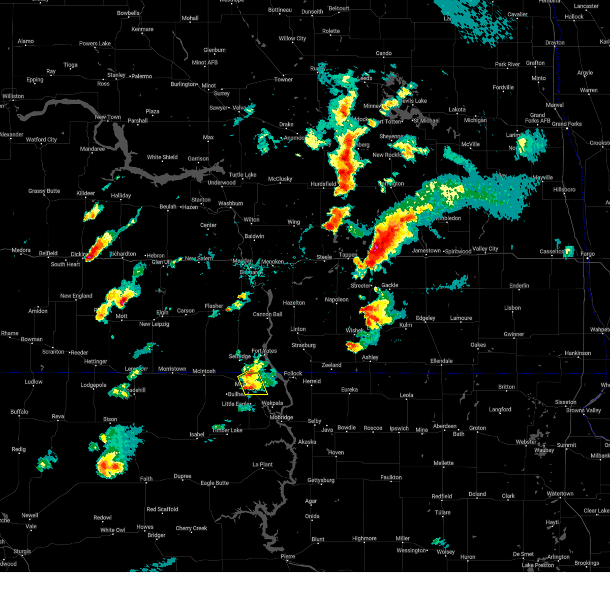
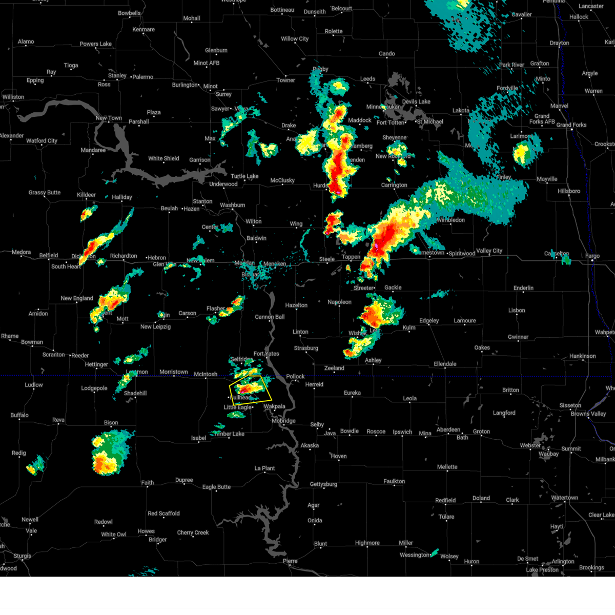
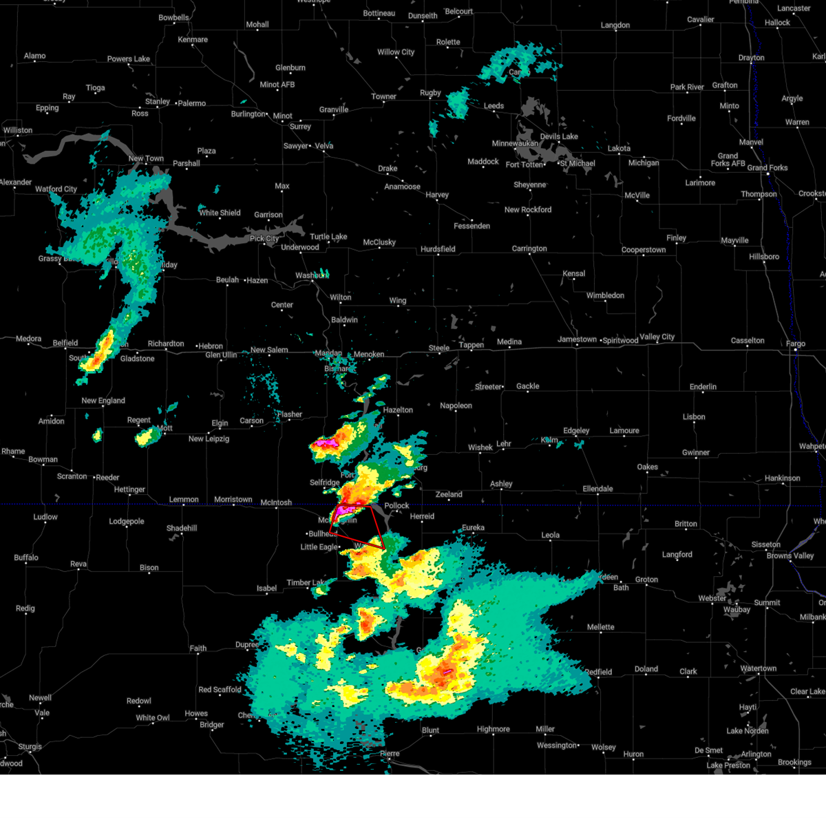
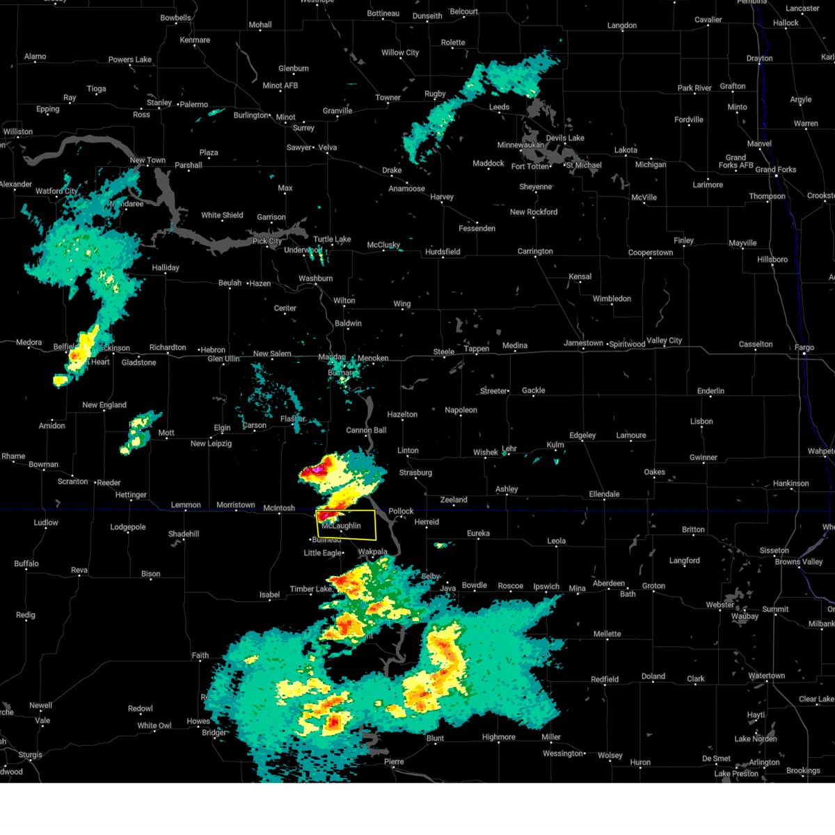
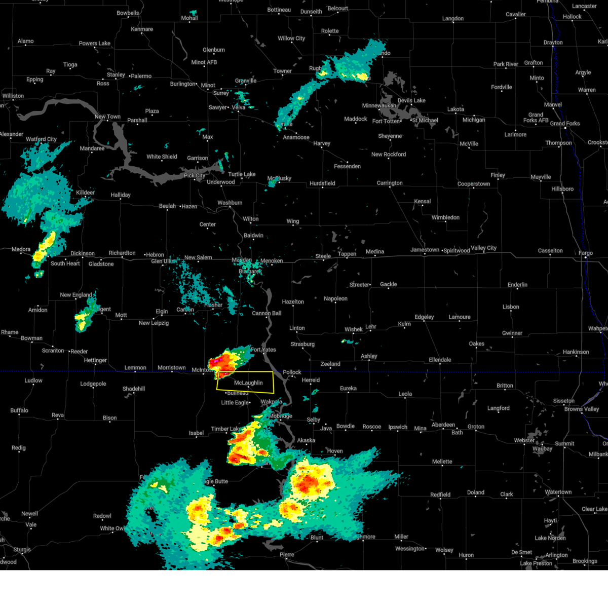
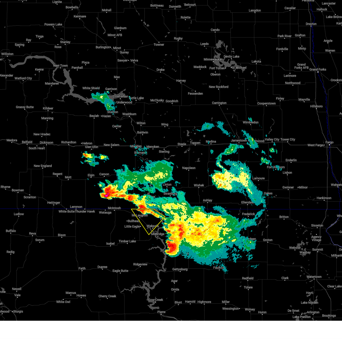
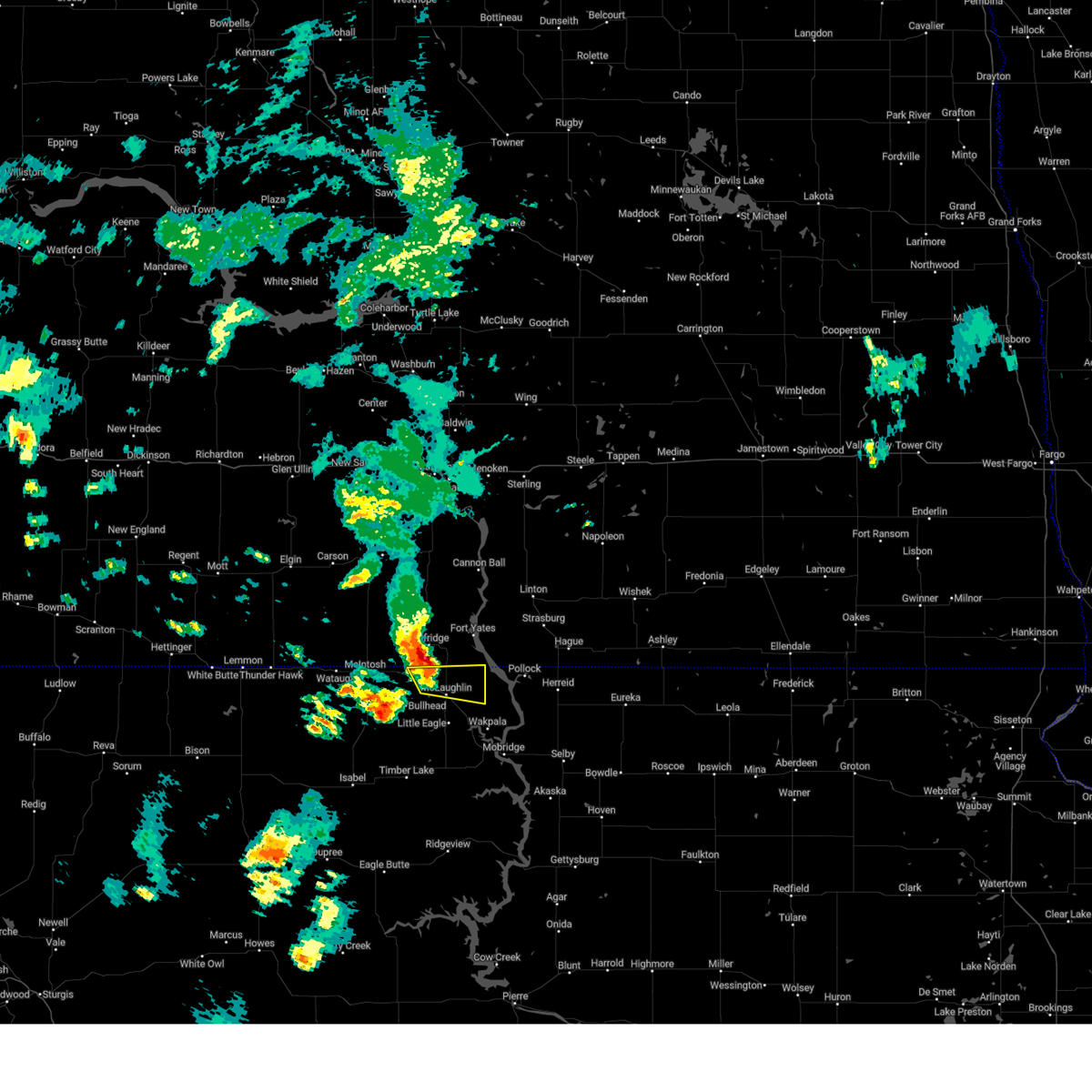
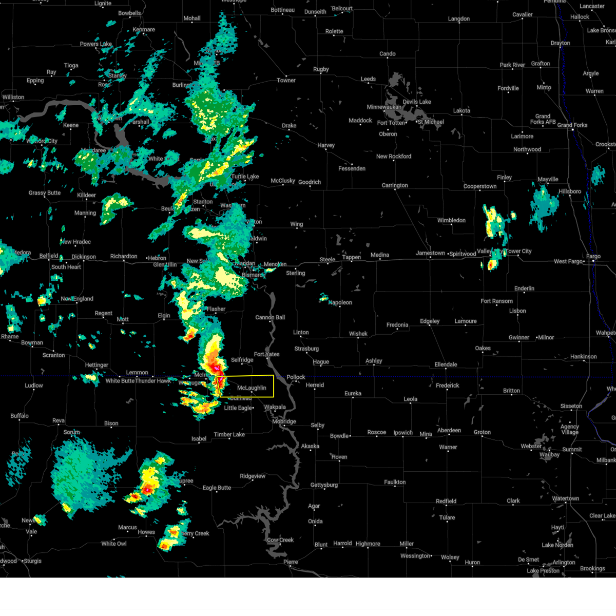
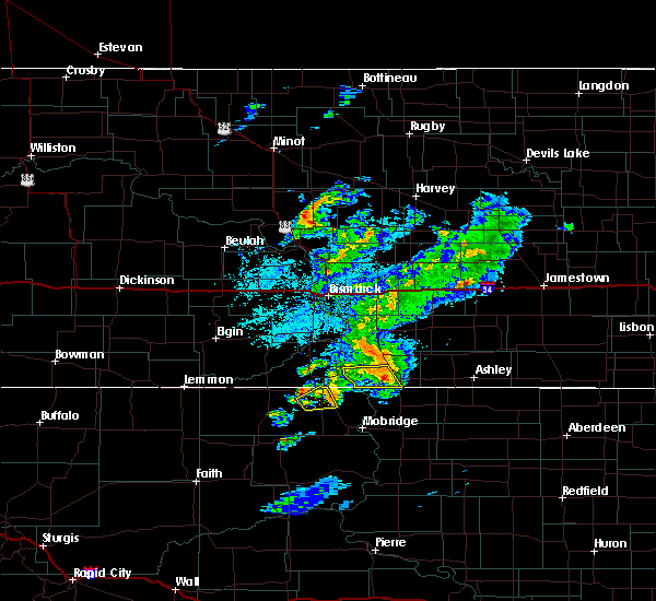
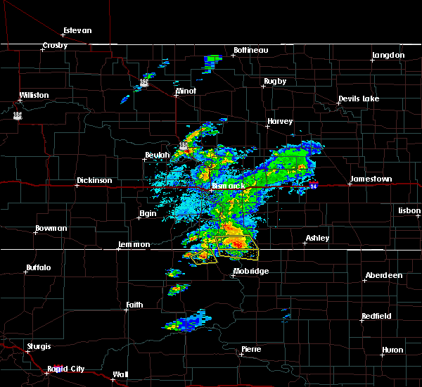
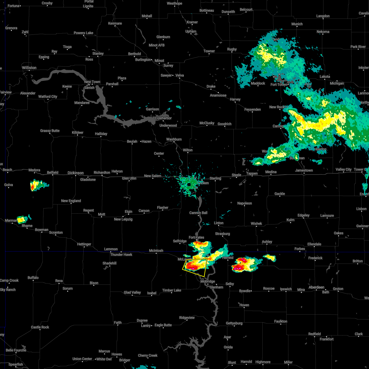
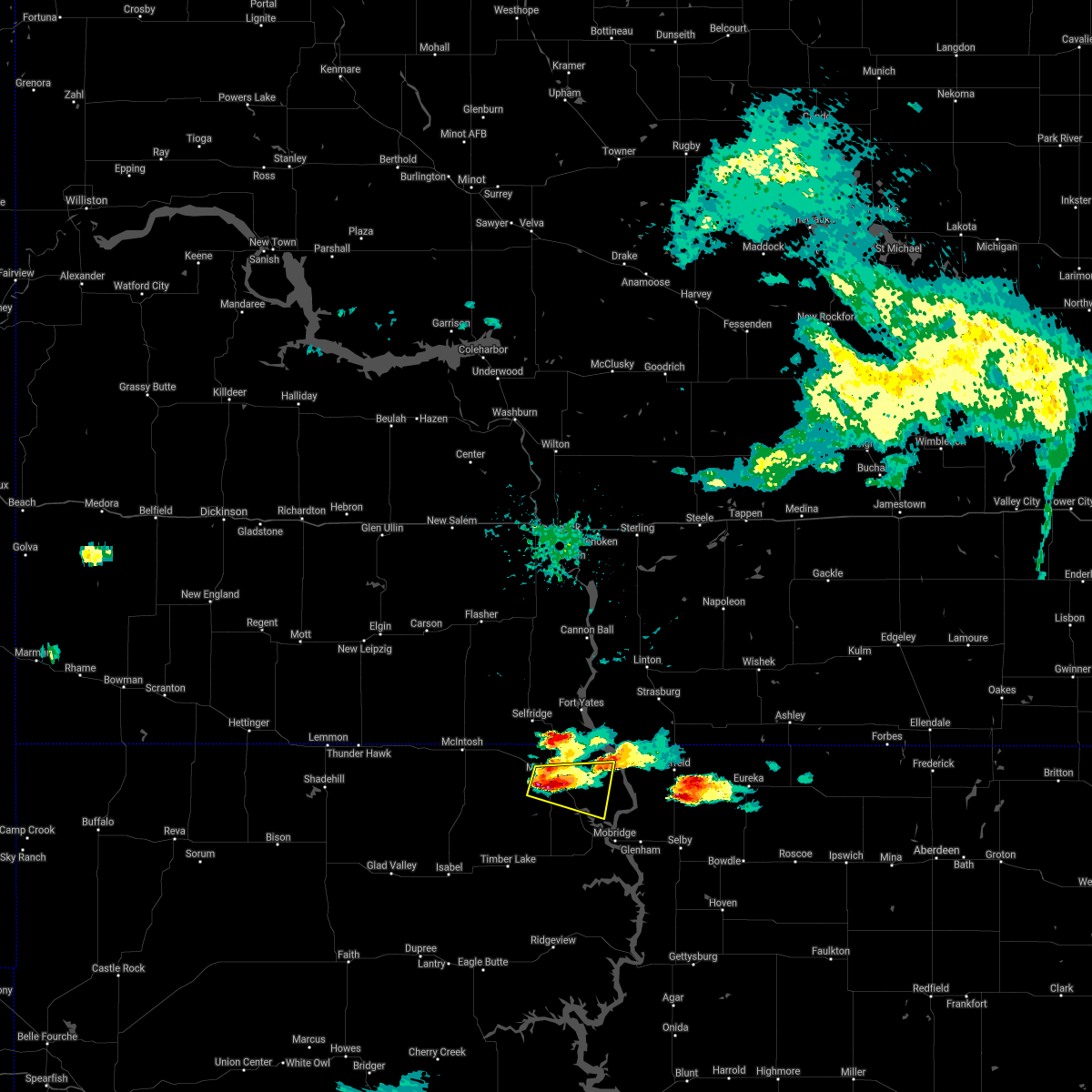
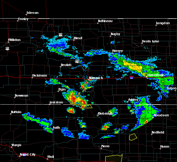
Hail Map for McLaughlin, SD
The McLaughlin, SD area has had 13 reports of on-the-ground hail by trained spotters, and has been under severe weather warnings 20 times during the past 12 months. Doppler radar has detected hail at or near McLaughlin, SD on 47 occasions.
| Name: | McLaughlin, SD |
| Where Located: | 68.4 miles S of Bismarck, ND |
| Map: | Google Map for McLaughlin, SD |
| Population: | 663 |
| Housing Units: | 270 |
| More Info: | Search Google for McLaughlin, SD |
1
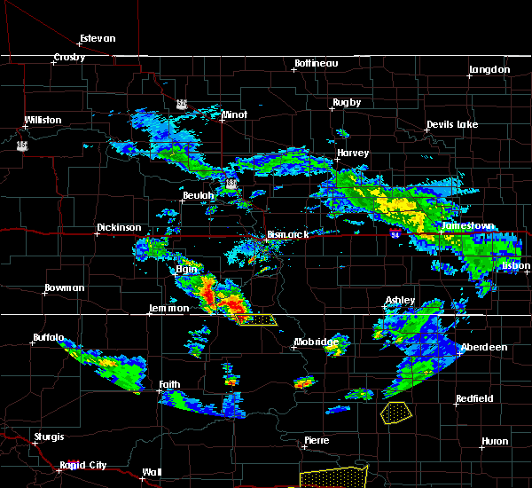
The Top Recent Hail Date for McLaughlin, SD is Sunday, July 30, 2023 (14th out of 47)

Hail and Wind Damage Spotted near McLaughlin, SD
| Date / Time | Report Details |
|---|---|
| 6/20/2025 8:50 PM MDT |
 the severe thunderstorm warning has been cancelled and is no longer in effect the severe thunderstorm warning has been cancelled and is no longer in effect
|
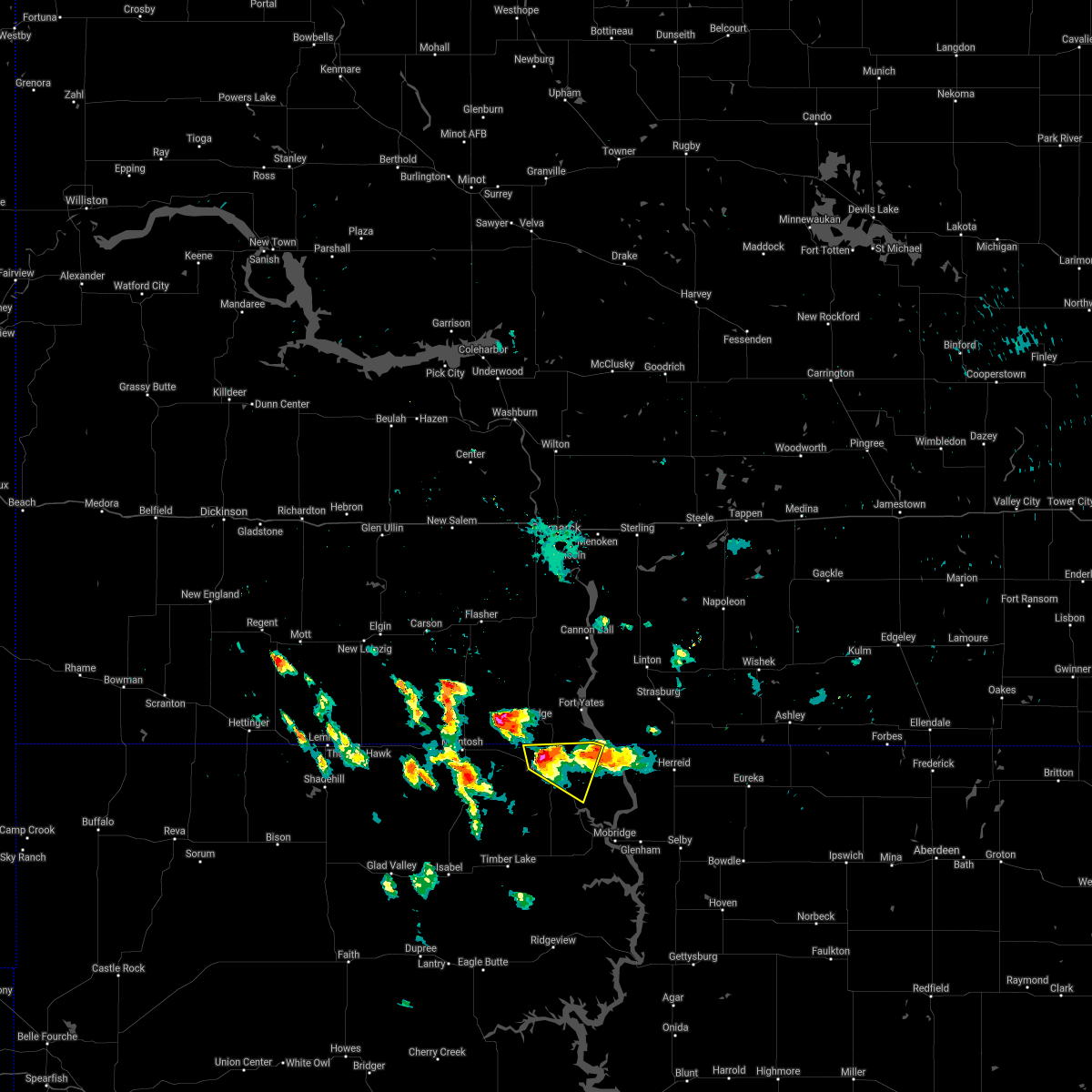
| 6/20/2025 8:35 PM MDT | Mesonet station 205 mclaughlin (sddot in corson county SD, 5.3 miles ESE of McLaughlin, SD |
| 6/20/2025 8:32 PM MDT | Trained spotter estimates 60 miles per hour west of mclaughlin. time estimated based on rada in corson county SD, 5.1 miles ESE of McLaughlin, SD |
| 6/20/2025 8:31 PM MDT |
 Svrabr the national weather service in aberdeen has issued a * severe thunderstorm warning for, northeastern corson county in north central south dakota, northwestern campbell county in north central south dakota, * until 1015 pm cdt/915 pm mdt/. * at 930 pm cdt/830 pm mdt/, a severe thunderstorm was located over walker, or 8 miles north of bullhead, moving east at 55 mph (radar indicated). Hazards include 60 mph wind gusts and quarter size hail. Hail damage to vehicles is expected. expect wind damage to roofs, siding, and trees. This severe thunderstorm will remain over mainly rural areas of northeastern corson and northwestern campbell counties, including the following locations, southern standing rock nation. Svrabr the national weather service in aberdeen has issued a * severe thunderstorm warning for, northeastern corson county in north central south dakota, northwestern campbell county in north central south dakota, * until 1015 pm cdt/915 pm mdt/. * at 930 pm cdt/830 pm mdt/, a severe thunderstorm was located over walker, or 8 miles north of bullhead, moving east at 55 mph (radar indicated). Hazards include 60 mph wind gusts and quarter size hail. Hail damage to vehicles is expected. expect wind damage to roofs, siding, and trees. This severe thunderstorm will remain over mainly rural areas of northeastern corson and northwestern campbell counties, including the following locations, southern standing rock nation.
|
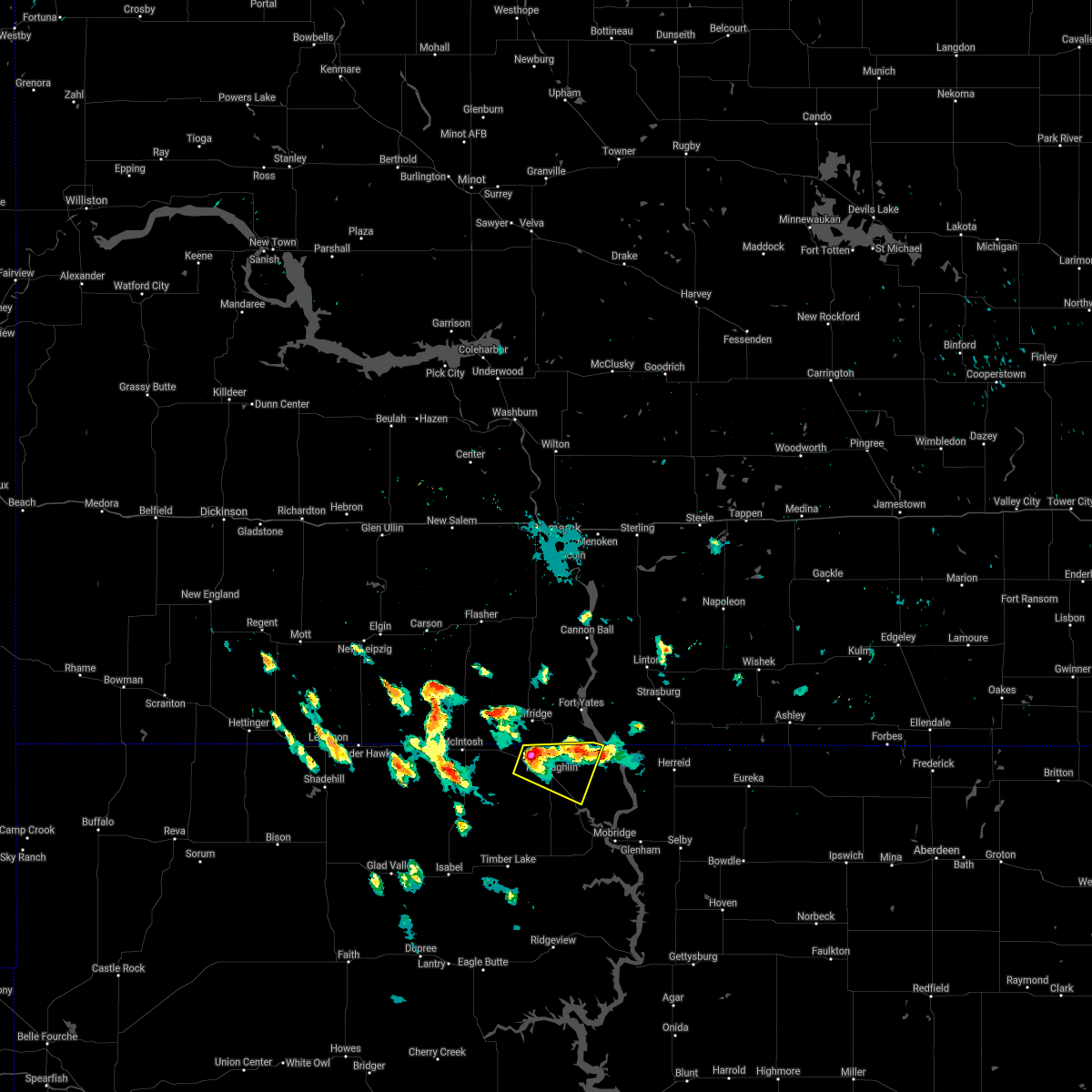
| 6/19/2025 10:18 PM MDT |
 the severe thunderstorm warning has been cancelled and is no longer in effect the severe thunderstorm warning has been cancelled and is no longer in effect
|
| 6/19/2025 9:59 PM MDT |
 At 959 pm mdt, a severe thunderstorm was located near walker, or 10 miles northeast of bullhead, moving southeast at 30 mph (radar indicated). Hazards include 60 mph wind gusts and quarter size hail. Hail damage to vehicles is expected. expect wind damage to roofs, siding, and trees. Locations impacted include, mclaughlin. At 959 pm mdt, a severe thunderstorm was located near walker, or 10 miles northeast of bullhead, moving southeast at 30 mph (radar indicated). Hazards include 60 mph wind gusts and quarter size hail. Hail damage to vehicles is expected. expect wind damage to roofs, siding, and trees. Locations impacted include, mclaughlin.
|
| 6/19/2025 9:41 PM MDT |
 Svrabr the national weather service in aberdeen has issued a * severe thunderstorm warning for, northeastern corson county in north central south dakota, * until 1030 pm mdt. * at 940 pm mdt, a severe thunderstorm was located near walker, or 14 miles north of bullhead, moving southeast at 30 mph (radar indicated). Hazards include ping pong ball size hail and 60 mph wind gusts. People and animals outdoors will be injured. expect hail damage to roofs, siding, windows, and vehicles. expect wind damage to roofs, siding, and trees. this severe thunderstorm will be near, walker around 945 pm mdt. Other locations in the path of this severe thunderstorm include mclaughlin. Svrabr the national weather service in aberdeen has issued a * severe thunderstorm warning for, northeastern corson county in north central south dakota, * until 1030 pm mdt. * at 940 pm mdt, a severe thunderstorm was located near walker, or 14 miles north of bullhead, moving southeast at 30 mph (radar indicated). Hazards include ping pong ball size hail and 60 mph wind gusts. People and animals outdoors will be injured. expect hail damage to roofs, siding, windows, and vehicles. expect wind damage to roofs, siding, and trees. this severe thunderstorm will be near, walker around 945 pm mdt. Other locations in the path of this severe thunderstorm include mclaughlin.
|
| 6/16/2025 3:01 AM CDT |
 Svrabr the national weather service in aberdeen has issued a * severe thunderstorm warning for, eastern corson county in north central south dakota, campbell county in north central south dakota, north central potter county in north central south dakota, walworth county in north central south dakota, * until 345 am cdt/245 am mdt/. * at 300 am cdt/200 am mdt/, severe thunderstorms were located along a line extending from 7 miles northeast of fort yates to trail city, moving east at 50 mph (radar indicated). Hazards include 60 mph wind gusts and penny size hail. Expect damage to roofs, siding, and trees. severe thunderstorms will be near, wakpala, kenel, indian memorial rec area, and grand river casino around 205 am mdt. mobridge, pollock, indian creek rec area, and revheim bay rec area around 310 am cdt. glenham and new everets resort around 320 am cdt. Other locations in the path of these severe thunderstorms include herreid, mound city, selby and lake hiddenwood rec area. Svrabr the national weather service in aberdeen has issued a * severe thunderstorm warning for, eastern corson county in north central south dakota, campbell county in north central south dakota, north central potter county in north central south dakota, walworth county in north central south dakota, * until 345 am cdt/245 am mdt/. * at 300 am cdt/200 am mdt/, severe thunderstorms were located along a line extending from 7 miles northeast of fort yates to trail city, moving east at 50 mph (radar indicated). Hazards include 60 mph wind gusts and penny size hail. Expect damage to roofs, siding, and trees. severe thunderstorms will be near, wakpala, kenel, indian memorial rec area, and grand river casino around 205 am mdt. mobridge, pollock, indian creek rec area, and revheim bay rec area around 310 am cdt. glenham and new everets resort around 320 am cdt. Other locations in the path of these severe thunderstorms include herreid, mound city, selby and lake hiddenwood rec area.
|
| 6/16/2025 1:21 AM MDT |
 At 120 am mdt, a severe thunderstorm was located 8 miles northeast of black horse, or 9 miles west of bullhead, moving east at 45 mph (radar indicated). Hazards include 70 mph wind gusts and penny size hail. Expect considerable tree damage. damage is likely to mobile homes, roofs, and outbuildings. Locations impacted include, bullhead, mclaughlin and kenel. At 120 am mdt, a severe thunderstorm was located 8 miles northeast of black horse, or 9 miles west of bullhead, moving east at 45 mph (radar indicated). Hazards include 70 mph wind gusts and penny size hail. Expect considerable tree damage. damage is likely to mobile homes, roofs, and outbuildings. Locations impacted include, bullhead, mclaughlin and kenel.
|
| 6/16/2025 12:58 AM MDT |
 Svrabr the national weather service in aberdeen has issued a * severe thunderstorm warning for, corson county in north central south dakota, * until 200 am mdt. * at 1258 am mdt, a severe thunderstorm was located 10 miles southwest of watauga, or 26 miles west of bullhead, moving east at 45 mph. this is a destructive storm for bullhead (radar indicated). Hazards include 80 mph wind gusts and penny size hail. Flying debris will be dangerous to those caught without shelter. mobile homes will be heavily damaged. expect considerable damage to roofs, windows, and vehicles. extensive tree damage and power outages are likely. this severe thunderstorm will be near, black horse around 110 am mdt. Other locations in the path of this severe thunderstorm include bullhead, mclaughlin and mahto. Svrabr the national weather service in aberdeen has issued a * severe thunderstorm warning for, corson county in north central south dakota, * until 200 am mdt. * at 1258 am mdt, a severe thunderstorm was located 10 miles southwest of watauga, or 26 miles west of bullhead, moving east at 45 mph. this is a destructive storm for bullhead (radar indicated). Hazards include 80 mph wind gusts and penny size hail. Flying debris will be dangerous to those caught without shelter. mobile homes will be heavily damaged. expect considerable damage to roofs, windows, and vehicles. extensive tree damage and power outages are likely. this severe thunderstorm will be near, black horse around 110 am mdt. Other locations in the path of this severe thunderstorm include bullhead, mclaughlin and mahto.
|
| 6/15/2025 3:33 AM MDT |
 The storm which prompted the warning has weakened below severe limits, and has exited the warned area. therefore, the warning has been allowed to expire. however, gusty winds and heavy rain are still possible with this thunderstorm. The storm which prompted the warning has weakened below severe limits, and has exited the warned area. therefore, the warning has been allowed to expire. however, gusty winds and heavy rain are still possible with this thunderstorm.
|
| 6/15/2025 3:06 AM MDT |
 At 306 am mdt, a severe thunderstorm was located over little eagle, moving east at 25 mph (radar indicated). Hazards include 60 mph wind gusts and quarter size hail. Hail damage to vehicles is expected. expect wind damage to roofs, siding, and trees. Locations impacted include, little eagle, mahto and wakpala. At 306 am mdt, a severe thunderstorm was located over little eagle, moving east at 25 mph (radar indicated). Hazards include 60 mph wind gusts and quarter size hail. Hail damage to vehicles is expected. expect wind damage to roofs, siding, and trees. Locations impacted include, little eagle, mahto and wakpala.
|
| 6/15/2025 2:45 AM MDT |
 Svrabr the national weather service in aberdeen has issued a * severe thunderstorm warning for, eastern corson county in north central south dakota, * until 330 am mdt. * at 244 am mdt, a severe thunderstorm was located near bullhead, moving northeast at 25 mph (radar indicated). Hazards include 60 mph wind gusts and half dollar size hail. Hail damage to vehicles is expected. expect wind damage to roofs, siding, and trees. this severe thunderstorm will be near, mclaughlin and little eagle around 300 am mdt. Other locations in the path of this severe thunderstorm include mahto. Svrabr the national weather service in aberdeen has issued a * severe thunderstorm warning for, eastern corson county in north central south dakota, * until 330 am mdt. * at 244 am mdt, a severe thunderstorm was located near bullhead, moving northeast at 25 mph (radar indicated). Hazards include 60 mph wind gusts and half dollar size hail. Hail damage to vehicles is expected. expect wind damage to roofs, siding, and trees. this severe thunderstorm will be near, mclaughlin and little eagle around 300 am mdt. Other locations in the path of this severe thunderstorm include mahto.
|
| 5/5/2025 7:41 PM MDT |
 the severe thunderstorm warning has been cancelled and is no longer in effect the severe thunderstorm warning has been cancelled and is no longer in effect
|
| 5/5/2025 7:13 PM MDT |
 Svrabr the national weather service in aberdeen has issued a * severe thunderstorm warning for, northwestern corson county in north central south dakota, * until 800 pm mdt. * at 713 pm mdt, severe thunderstorms were located along a line extending from 9 miles south of thunder hawk to 8 miles northwest of mclaughlin, moving north at 45 mph (radar indicated). Hazards include 60 mph wind gusts. Expect damage to roofs, siding, and trees. Severe thunderstorms will be near, mcintosh, morristown, watauga, keldron, and thunder hawk around 720 pm mdt. Svrabr the national weather service in aberdeen has issued a * severe thunderstorm warning for, northwestern corson county in north central south dakota, * until 800 pm mdt. * at 713 pm mdt, severe thunderstorms were located along a line extending from 9 miles south of thunder hawk to 8 miles northwest of mclaughlin, moving north at 45 mph (radar indicated). Hazards include 60 mph wind gusts. Expect damage to roofs, siding, and trees. Severe thunderstorms will be near, mcintosh, morristown, watauga, keldron, and thunder hawk around 720 pm mdt.
|
| 8/28/2024 5:36 PM MDT |
 At 536 pm mdt, a severe thunderstorm was located near mclaughlin, moving east at 30 mph (radar indicated). Hazards include two inch hail and 60 mph wind gusts. People and animals outdoors will be injured. expect hail damage to roofs, siding, windows, and vehicles. expect wind damage to roofs, siding, and trees. This severe thunderstorm will remain over mainly rural areas of northeastern corson county. At 536 pm mdt, a severe thunderstorm was located near mclaughlin, moving east at 30 mph (radar indicated). Hazards include two inch hail and 60 mph wind gusts. People and animals outdoors will be injured. expect hail damage to roofs, siding, windows, and vehicles. expect wind damage to roofs, siding, and trees. This severe thunderstorm will remain over mainly rural areas of northeastern corson county.
|
| 8/28/2024 5:20 PM MDT |
 Svrabr the national weather service in aberdeen has issued a * severe thunderstorm warning for, northeastern corson county in north central south dakota, * until 600 pm mdt. * at 519 pm mdt, a severe thunderstorm was located near mclaughlin, moving northeast at 15 mph (radar indicated). Hazards include ping pong ball size hail and 60 mph wind gusts. People and animals outdoors will be injured. expect hail damage to roofs, siding, windows, and vehicles. expect wind damage to roofs, siding, and trees. This severe thunderstorm will be near, mclaughlin around 525 pm mdt. Svrabr the national weather service in aberdeen has issued a * severe thunderstorm warning for, northeastern corson county in north central south dakota, * until 600 pm mdt. * at 519 pm mdt, a severe thunderstorm was located near mclaughlin, moving northeast at 15 mph (radar indicated). Hazards include ping pong ball size hail and 60 mph wind gusts. People and animals outdoors will be injured. expect hail damage to roofs, siding, windows, and vehicles. expect wind damage to roofs, siding, and trees. This severe thunderstorm will be near, mclaughlin around 525 pm mdt.
|
| 7/29/2024 4:38 AM MDT |
 The storm which prompted the warning has weakened below severe limits, and no longer poses an immediate threat to life or property. therefore, the warning will be allowed to expire. however, gusty winds are still possible with this thunderstorm. The storm which prompted the warning has weakened below severe limits, and no longer poses an immediate threat to life or property. therefore, the warning will be allowed to expire. however, gusty winds are still possible with this thunderstorm.
|
| 7/29/2024 4:25 AM MDT |
 At 425 am mdt, a severe thunderstorm was located near mclaughlin, moving east at 35 mph (radar indicated). Hazards include 60 mph wind gusts and half dollar size hail. Hail damage to vehicles is expected. expect wind damage to roofs, siding, and trees. Locations impacted include, mahto. At 425 am mdt, a severe thunderstorm was located near mclaughlin, moving east at 35 mph (radar indicated). Hazards include 60 mph wind gusts and half dollar size hail. Hail damage to vehicles is expected. expect wind damage to roofs, siding, and trees. Locations impacted include, mahto.
|
| 7/29/2024 4:19 AM MDT | Mesonet station 205 mclaughlin (sddot in corson county SD, 5.3 miles ESE of McLaughlin, SD |
| 7/29/2024 4:05 AM MDT |
 At 404 am mdt, a severe thunderstorm was located near walker, or 10 miles north of bullhead, moving east at 35 mph (radar indicated). Hazards include ping pong ball size hail and 60 mph wind gusts. People and animals outdoors will be injured. expect hail damage to roofs, siding, windows, and vehicles. expect wind damage to roofs, siding, and trees. this severe storm will be near, mclaughlin around 415 am mdt. Other locations in the path of this severe thunderstorm include mahto. At 404 am mdt, a severe thunderstorm was located near walker, or 10 miles north of bullhead, moving east at 35 mph (radar indicated). Hazards include ping pong ball size hail and 60 mph wind gusts. People and animals outdoors will be injured. expect hail damage to roofs, siding, windows, and vehicles. expect wind damage to roofs, siding, and trees. this severe storm will be near, mclaughlin around 415 am mdt. Other locations in the path of this severe thunderstorm include mahto.
|
| 7/29/2024 3:58 AM MDT |
 Svrabr the national weather service in aberdeen has issued a * severe thunderstorm warning for, northeastern corson county in north central south dakota, * until 445 am mdt. * at 358 am mdt, a severe thunderstorm was located over walker, or 11 miles north of bullhead, moving southeast at 35 mph (radar indicated). Hazards include 60 mph wind gusts and quarter size hail. Hail damage to vehicles is expected. expect wind damage to roofs, siding, and trees. this severe thunderstorm will be near, mclaughlin around 415 am mdt. Other locations in the path of this severe thunderstorm include mahto. Svrabr the national weather service in aberdeen has issued a * severe thunderstorm warning for, northeastern corson county in north central south dakota, * until 445 am mdt. * at 358 am mdt, a severe thunderstorm was located over walker, or 11 miles north of bullhead, moving southeast at 35 mph (radar indicated). Hazards include 60 mph wind gusts and quarter size hail. Hail damage to vehicles is expected. expect wind damage to roofs, siding, and trees. this severe thunderstorm will be near, mclaughlin around 415 am mdt. Other locations in the path of this severe thunderstorm include mahto.
|
| 7/13/2024 10:30 PM MDT |
 Svrabr the national weather service in aberdeen has issued a * severe thunderstorm warning for, corson county in north central south dakota, northwestern dewey county in north central south dakota, * until 1130 pm mdt. * at 1029 pm mdt, severe thunderstorms were located along a line extending from thunder hawk to near maurine, moving east at 70 mph (radar indicated). Hazards include 60 mph wind gusts. Expect damage to roofs, siding, and trees. severe thunderstorms will be near, morristown and keldron around 1035 pm mdt. watauga and shambo ranch around 1040 pm mdt. Other locations in the path of these severe thunderstorms include mcintosh, klein ranch, black horse, isabel, walker, bullhead, firesteel, bear creek, lantry, green grass, eagle butte, mclaughlin, timber lake, little eagle, spring lake and little moreau rec area. Svrabr the national weather service in aberdeen has issued a * severe thunderstorm warning for, corson county in north central south dakota, northwestern dewey county in north central south dakota, * until 1130 pm mdt. * at 1029 pm mdt, severe thunderstorms were located along a line extending from thunder hawk to near maurine, moving east at 70 mph (radar indicated). Hazards include 60 mph wind gusts. Expect damage to roofs, siding, and trees. severe thunderstorms will be near, morristown and keldron around 1035 pm mdt. watauga and shambo ranch around 1040 pm mdt. Other locations in the path of these severe thunderstorms include mcintosh, klein ranch, black horse, isabel, walker, bullhead, firesteel, bear creek, lantry, green grass, eagle butte, mclaughlin, timber lake, little eagle, spring lake and little moreau rec area.
|
| 6/17/2024 11:09 PM MDT |
 Svrabr the national weather service in aberdeen has issued a * severe thunderstorm warning for, eastern corson county in north central south dakota, northwestern campbell county in north central south dakota, * until 1245 am cdt/1145 pm mdt/. * at 1208 am cdt/1108 pm mdt/, a severe thunderstorm was located near little eagle, moving northeast at 50 mph. another severe thunderstorm was near mahto, moving northeast at 50 mph (radar indicated). Hazards include quarter size hail. Damage to vehicles is expected. this severe thunderstorm will be near, mahto around 1115 pm mdt. kenel around 1125 pm mdt. Other locations in the path of this severe thunderstorm include pollock. Svrabr the national weather service in aberdeen has issued a * severe thunderstorm warning for, eastern corson county in north central south dakota, northwestern campbell county in north central south dakota, * until 1245 am cdt/1145 pm mdt/. * at 1208 am cdt/1108 pm mdt/, a severe thunderstorm was located near little eagle, moving northeast at 50 mph. another severe thunderstorm was near mahto, moving northeast at 50 mph (radar indicated). Hazards include quarter size hail. Damage to vehicles is expected. this severe thunderstorm will be near, mahto around 1115 pm mdt. kenel around 1125 pm mdt. Other locations in the path of this severe thunderstorm include pollock.
|
| 6/2/2024 4:55 PM MDT |
 the severe thunderstorm warning has been cancelled and is no longer in effect the severe thunderstorm warning has been cancelled and is no longer in effect
|
| 6/2/2024 4:21 PM MDT |
 Svrabr the national weather service in aberdeen has issued a * severe thunderstorm warning for, northeastern corson county in north central south dakota, * until 515 pm mdt. * at 421 pm mdt, a severe thunderstorm was located near little eagle, moving east at 15 mph (radar indicated). Hazards include 60 mph wind gusts and quarter size hail. Hail damage to vehicles is expected. expect wind damage to roofs, siding, and trees. this severe thunderstorm will be near, little eagle around 425 pm mdt. mclaughlin around 430 pm mdt. Mahto around 435 pm mdt. Svrabr the national weather service in aberdeen has issued a * severe thunderstorm warning for, northeastern corson county in north central south dakota, * until 515 pm mdt. * at 421 pm mdt, a severe thunderstorm was located near little eagle, moving east at 15 mph (radar indicated). Hazards include 60 mph wind gusts and quarter size hail. Hail damage to vehicles is expected. expect wind damage to roofs, siding, and trees. this severe thunderstorm will be near, little eagle around 425 pm mdt. mclaughlin around 430 pm mdt. Mahto around 435 pm mdt.
|
| 6/2/2024 3:11 PM MDT |
 the severe thunderstorm warning has been cancelled and is no longer in effect the severe thunderstorm warning has been cancelled and is no longer in effect
|
| 6/2/2024 3:03 PM MDT |
 At 303 pm mdt, a severe thunderstorm was located over mclaughlin, moving east at 15 mph (radar indicated). Hazards include 60 mph wind gusts and quarter size hail. Hail damage to vehicles is expected. expect wind damage to roofs, siding, and trees. This severe thunderstorm will remain over mainly rural areas of northeastern corson county. At 303 pm mdt, a severe thunderstorm was located over mclaughlin, moving east at 15 mph (radar indicated). Hazards include 60 mph wind gusts and quarter size hail. Hail damage to vehicles is expected. expect wind damage to roofs, siding, and trees. This severe thunderstorm will remain over mainly rural areas of northeastern corson county.
|
| 6/2/2024 2:44 PM MDT |
 Svrabr the national weather service in aberdeen has issued a * severe thunderstorm warning for, northeastern corson county in north central south dakota, * until 345 pm mdt. * at 243 pm mdt, a severe thunderstorm was located near mclaughlin, moving east at 15 mph (radar indicated). Hazards include 60 mph wind gusts and half dollar size hail. Hail damage to vehicles is expected. expect wind damage to roofs, siding, and trees. This severe thunderstorm will be near, mclaughlin around 250 pm mdt. Svrabr the national weather service in aberdeen has issued a * severe thunderstorm warning for, northeastern corson county in north central south dakota, * until 345 pm mdt. * at 243 pm mdt, a severe thunderstorm was located near mclaughlin, moving east at 15 mph (radar indicated). Hazards include 60 mph wind gusts and half dollar size hail. Hail damage to vehicles is expected. expect wind damage to roofs, siding, and trees. This severe thunderstorm will be near, mclaughlin around 250 pm mdt.
|
| 5/19/2024 6:37 PM MDT |
 Torabr the national weather service in aberdeen has issued a * tornado warning for, northeastern corson county in north central south dakota, * until 700 pm mdt. * at 637 pm mdt, a severe thunderstorm capable of producing a tornado was located near mclaughlin, moving east at 25 mph (radar indicated rotation). Hazards include tornado and golf ball size hail. Flying debris will be dangerous to those caught without shelter. mobile homes will be damaged or destroyed. damage to roofs, windows, and vehicles will occur. tree damage is likely. This dangerous storm will be near, mahto around 640 pm mdt. Torabr the national weather service in aberdeen has issued a * tornado warning for, northeastern corson county in north central south dakota, * until 700 pm mdt. * at 637 pm mdt, a severe thunderstorm capable of producing a tornado was located near mclaughlin, moving east at 25 mph (radar indicated rotation). Hazards include tornado and golf ball size hail. Flying debris will be dangerous to those caught without shelter. mobile homes will be damaged or destroyed. damage to roofs, windows, and vehicles will occur. tree damage is likely. This dangerous storm will be near, mahto around 640 pm mdt.
|
| 5/19/2024 6:15 PM MDT | Half Dollar sized hail reported 6.5 miles SE of McLaughlin, SD, 50 to 60 mph winds. |
| 5/19/2024 6:13 PM MDT |
 At 612 pm mdt, a severe thunderstorm was located near mclaughlin, moving east at 30 mph (radar indicated). Hazards include ping pong ball size hail and 60 mph wind gusts. People and animals outdoors will be injured. expect hail damage to roofs, siding, windows, and vehicles. expect wind damage to roofs, siding, and trees. Locations impacted include, mclaughlin. At 612 pm mdt, a severe thunderstorm was located near mclaughlin, moving east at 30 mph (radar indicated). Hazards include ping pong ball size hail and 60 mph wind gusts. People and animals outdoors will be injured. expect hail damage to roofs, siding, windows, and vehicles. expect wind damage to roofs, siding, and trees. Locations impacted include, mclaughlin.
|
| 5/19/2024 5:57 PM MDT |
 Svrabr the national weather service in aberdeen has issued a * severe thunderstorm warning for, northeastern corson county in north central south dakota, * until 645 pm mdt. * at 556 pm mdt, a severe thunderstorm was located near walker, or 9 miles northeast of bullhead, moving east at 35 mph (radar indicated). Hazards include 60 mph wind gusts and quarter size hail. Hail damage to vehicles is expected. expect wind damage to roofs, siding, and trees. This severe thunderstorm will be near, mclaughlin around 610 pm mdt. Svrabr the national weather service in aberdeen has issued a * severe thunderstorm warning for, northeastern corson county in north central south dakota, * until 645 pm mdt. * at 556 pm mdt, a severe thunderstorm was located near walker, or 9 miles northeast of bullhead, moving east at 35 mph (radar indicated). Hazards include 60 mph wind gusts and quarter size hail. Hail damage to vehicles is expected. expect wind damage to roofs, siding, and trees. This severe thunderstorm will be near, mclaughlin around 610 pm mdt.
|
| 9/4/2023 9:16 PM MDT |
 At 916 pm mdt, a severe thunderstorm was located over mahto, or 8 miles east of mclaughlin, moving north at 45 mph (radar indicated). Hazards include 60 mph wind gusts and quarter size hail. Hail damage to vehicles is expected. expect wind damage to roofs, siding, and trees. this severe thunderstorm will remain over mainly rural areas of northeastern corson county, including the following locations, eastern standing rock nation. hail threat, radar indicated max hail size, 1. 00 in wind threat, radar indicated max wind gust, 60 mph. At 916 pm mdt, a severe thunderstorm was located over mahto, or 8 miles east of mclaughlin, moving north at 45 mph (radar indicated). Hazards include 60 mph wind gusts and quarter size hail. Hail damage to vehicles is expected. expect wind damage to roofs, siding, and trees. this severe thunderstorm will remain over mainly rural areas of northeastern corson county, including the following locations, eastern standing rock nation. hail threat, radar indicated max hail size, 1. 00 in wind threat, radar indicated max wind gust, 60 mph.
|
| 7/30/2023 8:58 AM MDT |
 At 958 am cdt/858 am mdt/, a severe thunderstorm was located near wakpala, moving southeast at 50 mph (radar indicated). Hazards include 60 mph wind gusts and half dollar size hail. Hail damage to vehicles is expected. expect wind damage to roofs, siding, and trees. this severe thunderstorm will be near, mobridge around 1005 am cdt. revheim bay rec area and indian creek rec area around 1010 am cdt. glenham around 1015 am cdt. other locations in the path of this severe thunderstorm include new everets resort, akaska, swan creek rec area and lowry. hail threat, radar indicated max hail size, 1. 25 in wind threat, radar indicated max wind gust, 60 mph. At 958 am cdt/858 am mdt/, a severe thunderstorm was located near wakpala, moving southeast at 50 mph (radar indicated). Hazards include 60 mph wind gusts and half dollar size hail. Hail damage to vehicles is expected. expect wind damage to roofs, siding, and trees. this severe thunderstorm will be near, mobridge around 1005 am cdt. revheim bay rec area and indian creek rec area around 1010 am cdt. glenham around 1015 am cdt. other locations in the path of this severe thunderstorm include new everets resort, akaska, swan creek rec area and lowry. hail threat, radar indicated max hail size, 1. 25 in wind threat, radar indicated max wind gust, 60 mph.
|
| 7/30/2023 8:28 AM MDT |
 At 928 am cdt/828 am mdt/, a severe thunderstorm was located near mclaughlin, moving southeast at 35 mph (radar indicated). Hazards include ping pong ball size hail and 60 mph wind gusts. People and animals outdoors will be injured. expect hail damage to roofs, siding, windows, and vehicles. expect wind damage to roofs, siding, and trees. locations impacted include, mahto and wakpala. hail threat, radar indicated max hail size, 1. 50 in wind threat, radar indicated max wind gust, 60 mph. At 928 am cdt/828 am mdt/, a severe thunderstorm was located near mclaughlin, moving southeast at 35 mph (radar indicated). Hazards include ping pong ball size hail and 60 mph wind gusts. People and animals outdoors will be injured. expect hail damage to roofs, siding, windows, and vehicles. expect wind damage to roofs, siding, and trees. locations impacted include, mahto and wakpala. hail threat, radar indicated max hail size, 1. 50 in wind threat, radar indicated max wind gust, 60 mph.
|
| 7/30/2023 8:13 AM MDT |
 At 912 am cdt/812 am mdt/, a severe thunderstorm was located 7 miles southeast of selfridge, or 10 miles north of mclaughlin, moving southeast at 35 mph (radar indicated). Hazards include 60 mph wind gusts and quarter size hail. Hail damage to vehicles is expected. expect wind damage to roofs, siding, and trees. this severe thunderstorm will be near, mclaughlin around 825 am mdt. other locations in the path of this severe thunderstorm include mahto, kenel and wakpala. hail threat, radar indicated max hail size, 1. 00 in wind threat, radar indicated max wind gust, 60 mph. At 912 am cdt/812 am mdt/, a severe thunderstorm was located 7 miles southeast of selfridge, or 10 miles north of mclaughlin, moving southeast at 35 mph (radar indicated). Hazards include 60 mph wind gusts and quarter size hail. Hail damage to vehicles is expected. expect wind damage to roofs, siding, and trees. this severe thunderstorm will be near, mclaughlin around 825 am mdt. other locations in the path of this severe thunderstorm include mahto, kenel and wakpala. hail threat, radar indicated max hail size, 1. 00 in wind threat, radar indicated max wind gust, 60 mph.
|
| 7/30/2023 7:22 AM MDT |
 At 821 am cdt/721 am mdt/, a severe thunderstorm was located near mclaughlin, moving east at 35 mph (radar indicated). Hazards include 60 mph wind gusts and quarter size hail. Hail damage to vehicles is expected. expect wind damage to roofs, siding, and trees. locations impacted include, mahto and wakpala. hail threat, radar indicated max hail size, 1. 00 in wind threat, radar indicated max wind gust, 60 mph. At 821 am cdt/721 am mdt/, a severe thunderstorm was located near mclaughlin, moving east at 35 mph (radar indicated). Hazards include 60 mph wind gusts and quarter size hail. Hail damage to vehicles is expected. expect wind damage to roofs, siding, and trees. locations impacted include, mahto and wakpala. hail threat, radar indicated max hail size, 1. 00 in wind threat, radar indicated max wind gust, 60 mph.
|
| 7/30/2023 7:05 AM MDT |
 At 805 am cdt/705 am mdt/, a severe thunderstorm was located near selfridge, or 10 miles north of mclaughlin, moving southeast at 40 mph (radar indicated). Hazards include 60 mph wind gusts and quarter size hail. Hail damage to vehicles is expected. expect wind damage to roofs, siding, and trees. this severe thunderstorm will be near, mclaughlin around 715 am mdt. other locations in the path of this severe thunderstorm include mahto, kenel and wakpala. hail threat, radar indicated max hail size, 1. 00 in wind threat, radar indicated max wind gust, 60 mph. At 805 am cdt/705 am mdt/, a severe thunderstorm was located near selfridge, or 10 miles north of mclaughlin, moving southeast at 40 mph (radar indicated). Hazards include 60 mph wind gusts and quarter size hail. Hail damage to vehicles is expected. expect wind damage to roofs, siding, and trees. this severe thunderstorm will be near, mclaughlin around 715 am mdt. other locations in the path of this severe thunderstorm include mahto, kenel and wakpala. hail threat, radar indicated max hail size, 1. 00 in wind threat, radar indicated max wind gust, 60 mph.
|
| 6/21/2023 9:08 PM MDT |
 At 907 pm mdt, a severe thunderstorm was located 7 miles north of mclaughlin, moving east at 30 mph (radar indicated). Hazards include 60 mph wind gusts. Expect damage to roofs, siding, and trees. this severe thunderstorm will remain over mainly rural areas of northeastern corson county, including the following locations, eastern standing rock nation. hail threat, radar indicated max hail size, <. 75 in wind threat, radar indicated max wind gust, 60 mph. At 907 pm mdt, a severe thunderstorm was located 7 miles north of mclaughlin, moving east at 30 mph (radar indicated). Hazards include 60 mph wind gusts. Expect damage to roofs, siding, and trees. this severe thunderstorm will remain over mainly rural areas of northeastern corson county, including the following locations, eastern standing rock nation. hail threat, radar indicated max hail size, <. 75 in wind threat, radar indicated max wind gust, 60 mph.
|
| 6/21/2023 8:46 PM MDT |
 At 846 pm mdt, a severe thunderstorm was located near walker, or 10 miles north of bullhead, moving east at 30 mph (radar indicated). Hazards include 60 mph wind gusts and penny size hail. Expect damage to roofs, siding, and trees. this severe thunderstorm will be near, mclaughlin around 905 pm mdt. hail threat, radar indicated max hail size, 0. 75 in wind threat, radar indicated max wind gust, 60 mph. At 846 pm mdt, a severe thunderstorm was located near walker, or 10 miles north of bullhead, moving east at 30 mph (radar indicated). Hazards include 60 mph wind gusts and penny size hail. Expect damage to roofs, siding, and trees. this severe thunderstorm will be near, mclaughlin around 905 pm mdt. hail threat, radar indicated max hail size, 0. 75 in wind threat, radar indicated max wind gust, 60 mph.
|
| 6/20/2023 4:58 PM MDT |
 The severe thunderstorm warning for eastern corson county will expire at 500 pm mdt, the storm which prompted the warning has weakened below severe limits, and no longer poses an immediate threat to life or property. therefore, the warning will be allowed to expire. however gusty winds are still possible with this thunderstorm. a severe thunderstorm watch remains in effect until 1000 pm mdt for north central south dakota. The severe thunderstorm warning for eastern corson county will expire at 500 pm mdt, the storm which prompted the warning has weakened below severe limits, and no longer poses an immediate threat to life or property. therefore, the warning will be allowed to expire. however gusty winds are still possible with this thunderstorm. a severe thunderstorm watch remains in effect until 1000 pm mdt for north central south dakota.
|
| 6/20/2023 4:48 PM MDT |
 At 448 pm mdt, a severe thunderstorm was located near mclaughlin, moving north at 30 mph (radar indicated). Hazards include 60 mph wind gusts and quarter size hail. Hail damage to vehicles is expected. expect wind damage to roofs, siding, and trees. this severe thunderstorm will remain over mainly rural areas of eastern corson county, including the following locations, southern standing rock nation. hail threat, radar indicated max hail size, 1. 00 in wind threat, radar indicated max wind gust, 60 mph. At 448 pm mdt, a severe thunderstorm was located near mclaughlin, moving north at 30 mph (radar indicated). Hazards include 60 mph wind gusts and quarter size hail. Hail damage to vehicles is expected. expect wind damage to roofs, siding, and trees. this severe thunderstorm will remain over mainly rural areas of eastern corson county, including the following locations, southern standing rock nation. hail threat, radar indicated max hail size, 1. 00 in wind threat, radar indicated max wind gust, 60 mph.
|
| 6/20/2023 4:24 PM MDT | Storm damage reported in corson county SD, 6.3 miles ENE of McLaughlin, SD |
| 6/20/2023 4:23 PM MDT |
 At 422 pm mdt, a severe thunderstorm was located near little eagle, moving north at 30 mph (trained weather spotters. at 520 pm cdt, a 62 mph wind gust was reported 6 miles west southwest of mclaughlin). Hazards include 60 mph wind gusts and quarter size hail. Hail damage to vehicles is expected. expect wind damage to roofs, siding, and trees. this severe thunderstorm will be near, mclaughlin around 440 pm mdt. hail threat, radar indicated max hail size, 1. 00 in wind threat, observed max wind gust, 60 mph. At 422 pm mdt, a severe thunderstorm was located near little eagle, moving north at 30 mph (trained weather spotters. at 520 pm cdt, a 62 mph wind gust was reported 6 miles west southwest of mclaughlin). Hazards include 60 mph wind gusts and quarter size hail. Hail damage to vehicles is expected. expect wind damage to roofs, siding, and trees. this severe thunderstorm will be near, mclaughlin around 440 pm mdt. hail threat, radar indicated max hail size, 1. 00 in wind threat, observed max wind gust, 60 mph.
|
| 6/20/2023 4:19 PM MDT | Storm damage reported in corson county SD, 6.3 miles ENE of McLaughlin, SD |
| 6/29/2022 8:05 PM MDT |
 At 805 pm mdt, a severe thunderstorm was located near mahto, or 8 miles east of mclaughlin, moving east at 45 mph (radar indicated). Hazards include 60 mph wind gusts. Expect damage to roofs, siding, and trees. locations impacted include, mclaughlin, walker, kenel and eastern standing rock nation. hail threat, radar indicated max hail size, <. 75 in wind threat, radar indicated max wind gust, 60 mph. At 805 pm mdt, a severe thunderstorm was located near mahto, or 8 miles east of mclaughlin, moving east at 45 mph (radar indicated). Hazards include 60 mph wind gusts. Expect damage to roofs, siding, and trees. locations impacted include, mclaughlin, walker, kenel and eastern standing rock nation. hail threat, radar indicated max hail size, <. 75 in wind threat, radar indicated max wind gust, 60 mph.
|
| 6/29/2022 7:46 PM MDT |
 At 746 pm mdt, a severe thunderstorm was located near mclaughlin, moving east at 45 mph (radar indicated). Hazards include 60 mph wind gusts. Expect damage to roofs, siding, and trees. locations impacted include, mclaughlin and kenel. hail threat, radar indicated max hail size, <. 75 in wind threat, radar indicated max wind gust, 60 mph. At 746 pm mdt, a severe thunderstorm was located near mclaughlin, moving east at 45 mph (radar indicated). Hazards include 60 mph wind gusts. Expect damage to roofs, siding, and trees. locations impacted include, mclaughlin and kenel. hail threat, radar indicated max hail size, <. 75 in wind threat, radar indicated max wind gust, 60 mph.
|
| 6/29/2022 7:27 PM MDT |
 At 727 pm mdt, a severe thunderstorm was located near bullhead, or 18 miles west of mclaughlin, moving east at 45 mph (trained weather spotters). Hazards include 60 mph wind gusts. Expect damage to roofs, siding, and trees. this severe thunderstorm will be near, bullhead around 735 pm mdt. other locations in the path of this severe thunderstorm include mclaughlin, mahto and kenel. hail threat, radar indicated max hail size, <. 75 in wind threat, observed max wind gust, 60 mph. At 727 pm mdt, a severe thunderstorm was located near bullhead, or 18 miles west of mclaughlin, moving east at 45 mph (trained weather spotters). Hazards include 60 mph wind gusts. Expect damage to roofs, siding, and trees. this severe thunderstorm will be near, bullhead around 735 pm mdt. other locations in the path of this severe thunderstorm include mclaughlin, mahto and kenel. hail threat, radar indicated max hail size, <. 75 in wind threat, observed max wind gust, 60 mph.
|
| 8/26/2021 4:20 AM MDT |
 At 420 am mdt, a severe thunderstorm was located near mahto, or 7 miles southeast of mclaughlin, moving east at 45 mph (radar indicated). Hazards include 60 mph wind gusts and penny size hail. Expect damage to roofs, siding, and trees. locations impacted include, mclaughlin, wakpala, indian memorial rec area, mahto, little eagle, bullhead, grand river casino, kenel, spring lake and southeastern standing rock nation. hail threat, radar indicated max hail size, 0. 75 in wind threat, radar indicated max wind gust, 60 mph. At 420 am mdt, a severe thunderstorm was located near mahto, or 7 miles southeast of mclaughlin, moving east at 45 mph (radar indicated). Hazards include 60 mph wind gusts and penny size hail. Expect damage to roofs, siding, and trees. locations impacted include, mclaughlin, wakpala, indian memorial rec area, mahto, little eagle, bullhead, grand river casino, kenel, spring lake and southeastern standing rock nation. hail threat, radar indicated max hail size, 0. 75 in wind threat, radar indicated max wind gust, 60 mph.
|
| 8/26/2021 4:02 AM MDT |
 At 401 am mdt, a severe thunderstorm was located near bullhead, or 12 miles southwest of mclaughlin, moving east at 45 mph (radar indicated). Hazards include 60 mph wind gusts and quarter size hail. Hail damage to vehicles is expected. expect wind damage to roofs, siding, and trees. locations impacted include, mclaughlin, little eagle, mahto and wakpala. hail threat, radar indicated max hail size, 1. 00 in wind threat, radar indicated max wind gust, 60 mph. At 401 am mdt, a severe thunderstorm was located near bullhead, or 12 miles southwest of mclaughlin, moving east at 45 mph (radar indicated). Hazards include 60 mph wind gusts and quarter size hail. Hail damage to vehicles is expected. expect wind damage to roofs, siding, and trees. locations impacted include, mclaughlin, little eagle, mahto and wakpala. hail threat, radar indicated max hail size, 1. 00 in wind threat, radar indicated max wind gust, 60 mph.
|
| 8/26/2021 3:44 AM MDT |
 At 344 am mdt, a severe thunderstorm was located near black horse, or 24 miles west of mclaughlin, moving east at 45 mph (radar indicated). Hazards include 60 mph wind gusts and half dollar size hail. Hail damage to vehicles is expected. expect wind damage to roofs, siding, and trees. this severe thunderstorm will be near, bullhead around 400 am mdt. other locations in the path of this severe thunderstorm include mclaughlin, little eagle, mahto and wakpala. hail threat, radar indicated max hail size, 1. 25 in wind threat, radar indicated max wind gust, 60 mph. At 344 am mdt, a severe thunderstorm was located near black horse, or 24 miles west of mclaughlin, moving east at 45 mph (radar indicated). Hazards include 60 mph wind gusts and half dollar size hail. Hail damage to vehicles is expected. expect wind damage to roofs, siding, and trees. this severe thunderstorm will be near, bullhead around 400 am mdt. other locations in the path of this severe thunderstorm include mclaughlin, little eagle, mahto and wakpala. hail threat, radar indicated max hail size, 1. 25 in wind threat, radar indicated max wind gust, 60 mph.
|
| 8/23/2021 8:54 PM MDT |
 At 853 pm mdt, a severe thunderstorm was located over spring lake, or 23 miles south of mclaughlin, moving east at 45 mph (radar indicated). Hazards include 70 mph wind gusts and quarter size hail. Hail damage to vehicles is expected. expect considerable tree damage. wind damage is also likely to mobile homes, roofs, and outbuildings. Locations impacted include, mclaughlin, timber lake, spring lake, trail city, mahto, little eagle and glencross. At 853 pm mdt, a severe thunderstorm was located over spring lake, or 23 miles south of mclaughlin, moving east at 45 mph (radar indicated). Hazards include 70 mph wind gusts and quarter size hail. Hail damage to vehicles is expected. expect considerable tree damage. wind damage is also likely to mobile homes, roofs, and outbuildings. Locations impacted include, mclaughlin, timber lake, spring lake, trail city, mahto, little eagle and glencross.
|
| 8/23/2021 8:35 PM MDT |
 At 834 pm mdt, a severe thunderstorm was located near little eagle, or 12 miles southwest of mclaughlin, moving east at 55 mph (radar indicated). Hazards include 70 mph wind gusts and quarter size hail. Hail damage to vehicles is expected. expect considerable tree damage. wind damage is also likely to mobile homes, roofs, and outbuildings. Locations impacted include, mclaughlin, timber lake, isabel, firesteel, trail city, mahto, little eagle, bullhead, black horse, spring lake, klein ranch, glencross and southeastern standing rock nation. At 834 pm mdt, a severe thunderstorm was located near little eagle, or 12 miles southwest of mclaughlin, moving east at 55 mph (radar indicated). Hazards include 70 mph wind gusts and quarter size hail. Hail damage to vehicles is expected. expect considerable tree damage. wind damage is also likely to mobile homes, roofs, and outbuildings. Locations impacted include, mclaughlin, timber lake, isabel, firesteel, trail city, mahto, little eagle, bullhead, black horse, spring lake, klein ranch, glencross and southeastern standing rock nation.
|
| 8/23/2021 8:13 PM MDT |
 At 813 pm mdt, a severe thunderstorm was located 8 miles southeast of klein ranch, or 26 miles southwest of mclaughlin, moving east at 45 mph (radar indicated). Hazards include 60 mph wind gusts and quarter size hail. Hail damage to vehicles is expected. Expect wind damage to roofs, siding, and trees. At 813 pm mdt, a severe thunderstorm was located 8 miles southeast of klein ranch, or 26 miles southwest of mclaughlin, moving east at 45 mph (radar indicated). Hazards include 60 mph wind gusts and quarter size hail. Hail damage to vehicles is expected. Expect wind damage to roofs, siding, and trees.
|
| 7/26/2021 3:15 AM MDT |
 At 315 am mdt, a severe thunderstorm was located north of mclaughlin, moving east at 25 mph (radar indicated). Hazards include quarter size hail. Damage to vehicles is expected. Locations impacted include, mahto. At 315 am mdt, a severe thunderstorm was located north of mclaughlin, moving east at 25 mph (radar indicated). Hazards include quarter size hail. Damage to vehicles is expected. Locations impacted include, mahto.
|
| 7/26/2021 3:05 AM MDT |
 At 304 am mdt, a severe thunderstorm was located near mclaughlin, moving southeast at 25 mph (radar indicated). Hazards include half dollar size hail. Damage to vehicles is expected. this severe thunderstorm will be near, mclaughlin around 320 am mdt. Other locations in the path of this severe thunderstorm include mahto. At 304 am mdt, a severe thunderstorm was located near mclaughlin, moving southeast at 25 mph (radar indicated). Hazards include half dollar size hail. Damage to vehicles is expected. this severe thunderstorm will be near, mclaughlin around 320 am mdt. Other locations in the path of this severe thunderstorm include mahto.
|
| 7/23/2021 8:16 PM MDT | Mesonet station 205 mclaughlin (sddot in corson county SD, 5.3 miles ESE of McLaughlin, SD |
| 6/11/2021 12:31 AM MDT |
 At 1231 am mdt, severe thunderstorms were located along a line extending from 8 miles north of mclaughlin to near parade, moving east at 30 mph (radar indicated). Hazards include 60 mph wind gusts and penny size hail. Expect damage to roofs, siding, and trees. Locations impacted include, ridgeview. At 1231 am mdt, severe thunderstorms were located along a line extending from 8 miles north of mclaughlin to near parade, moving east at 30 mph (radar indicated). Hazards include 60 mph wind gusts and penny size hail. Expect damage to roofs, siding, and trees. Locations impacted include, ridgeview.
|
| 6/11/2021 12:02 AM MDT |
 At 1201 am mdt, severe thunderstorms were located along a line extending from walker to bear creek, moving east at 30 mph (radar indicated). Hazards include 60 mph wind gusts and penny size hail. Expect damage to roofs, siding, and trees. severe thunderstorms will be near, walker around 1205 am mdt. eagle butte and south eagle butte around 1220 am mdt. Other locations in the path of these severe thunderstorms include mclaughlin and parade. At 1201 am mdt, severe thunderstorms were located along a line extending from walker to bear creek, moving east at 30 mph (radar indicated). Hazards include 60 mph wind gusts and penny size hail. Expect damage to roofs, siding, and trees. severe thunderstorms will be near, walker around 1205 am mdt. eagle butte and south eagle butte around 1220 am mdt. Other locations in the path of these severe thunderstorms include mclaughlin and parade.
|
| 8/11/2020 11:43 PM MDT |
 At 1243 am cdt/1143 pm mdt/, severe thunderstorms were located along a line extending from 7 miles south of fort yates to lake oahe to near blackfoot to near swiftbird day school, moving east at 45 mph (radar indicated). Hazards include 70 mph wind gusts. Expect considerable tree damage. Damage is likely to mobile homes, roofs, and outbuildings. At 1243 am cdt/1143 pm mdt/, severe thunderstorms were located along a line extending from 7 miles south of fort yates to lake oahe to near blackfoot to near swiftbird day school, moving east at 45 mph (radar indicated). Hazards include 70 mph wind gusts. Expect considerable tree damage. Damage is likely to mobile homes, roofs, and outbuildings.
|
| 8/11/2020 11:40 PM MDT | Mesonet station mhts2 mclaughlin 2 se (sd mesonet in corson county SD, 1.8 miles NW of McLaughlin, SD |
| 8/11/2020 11:29 PM MDT | Mesonet station 205 mclaughlin (sddot in corson county SD, 5.3 miles ESE of McLaughlin, SD |
| 7/31/2020 4:44 PM MDT | Mesonet station 205 mclaughlin (sddot in corson county SD, 5.3 miles ESE of McLaughlin, SD |
| 7/25/2020 6:51 PM MDT |
 The severe thunderstorm warning for northeastern corson county will expire at 700 pm mdt, the storm which prompted the warning has weakened below severe limits, and no longer poses an immediate threat to life or property. therefore, the warning will be allowed to expire. however small hail and gusty winds are still possible with this thunderstorm. The severe thunderstorm warning for northeastern corson county will expire at 700 pm mdt, the storm which prompted the warning has weakened below severe limits, and no longer poses an immediate threat to life or property. therefore, the warning will be allowed to expire. however small hail and gusty winds are still possible with this thunderstorm.
|
| 7/25/2020 6:37 PM MDT |
 At 637 pm mdt, a severe thunderstorm was located near mclaughlin, moving northeast at 30 mph (radar indicated). Hazards include 60 mph wind gusts and quarter size hail. Hail damage to vehicles is expected. expect wind damage to roofs, siding, and trees. Locations impacted include, mclaughlin and mahto. At 637 pm mdt, a severe thunderstorm was located near mclaughlin, moving northeast at 30 mph (radar indicated). Hazards include 60 mph wind gusts and quarter size hail. Hail damage to vehicles is expected. expect wind damage to roofs, siding, and trees. Locations impacted include, mclaughlin and mahto.
|
| 7/25/2020 6:18 PM MDT |
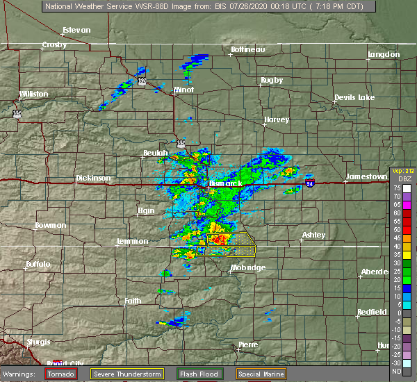 At 617 pm mdt, a severe thunderstorm was located over bullhead, or 11 miles west of mclaughlin, moving northeast at 30 mph (radar indicated). Hazards include 60 mph wind gusts and quarter size hail. Hail damage to vehicles is expected. Expect wind damage to roofs, siding, and trees. At 617 pm mdt, a severe thunderstorm was located over bullhead, or 11 miles west of mclaughlin, moving northeast at 30 mph (radar indicated). Hazards include 60 mph wind gusts and quarter size hail. Hail damage to vehicles is expected. Expect wind damage to roofs, siding, and trees.
|
| 7/25/2020 6:00 PM MDT | Mesonet station 205 mclaughlin (sddot in corson county SD, 5.3 miles ESE of McLaughlin, SD |
| 7/25/2020 5:57 PM MDT |
 At 657 pm cdt/557 pm mdt/, a severe thunderstorm was located 7 miles north of mclaughlin, moving east at 50 mph (radar indicated). Hazards include 60 mph wind gusts and nickel size hail. expect damage to roofs, siding, and trees At 657 pm cdt/557 pm mdt/, a severe thunderstorm was located 7 miles north of mclaughlin, moving east at 50 mph (radar indicated). Hazards include 60 mph wind gusts and nickel size hail. expect damage to roofs, siding, and trees
|
| 7/25/2020 5:44 PM MDT | Mesonet station 205 mclaughlin (sddot in corson county SD, 5.3 miles ESE of McLaughlin, SD |
| 7/24/2020 6:10 PM MDT |
 The severe thunderstorm warning for eastern corson and central campbell counties will expire at 715 pm cdt/615 pm mdt/, the storm which prompted the warning has weakened below severe limits, and no longer poses an immediate threat to life or property. therefore, the warning will be allowed to expire. a severe thunderstorm watch remains in effect until 1000 pm cdt/900 pm mdt/ for north central south dakota. The severe thunderstorm warning for eastern corson and central campbell counties will expire at 715 pm cdt/615 pm mdt/, the storm which prompted the warning has weakened below severe limits, and no longer poses an immediate threat to life or property. therefore, the warning will be allowed to expire. a severe thunderstorm watch remains in effect until 1000 pm cdt/900 pm mdt/ for north central south dakota.
|
| 7/24/2020 5:53 PM MDT |
 At 652 pm cdt/552 pm mdt/, a severe thunderstorm was located near kenel, or 15 miles north of mobridge, moving east at 40 mph (radar indicated). Hazards include 60 mph wind gusts and quarter size hail. Hail damage to vehicles is expected. expect wind damage to roofs, siding, and trees. Locations impacted include, mclaughlin, herreid, wakpala, pollock, mound city, mahto and kenel. At 652 pm cdt/552 pm mdt/, a severe thunderstorm was located near kenel, or 15 miles north of mobridge, moving east at 40 mph (radar indicated). Hazards include 60 mph wind gusts and quarter size hail. Hail damage to vehicles is expected. expect wind damage to roofs, siding, and trees. Locations impacted include, mclaughlin, herreid, wakpala, pollock, mound city, mahto and kenel.
|
| 7/24/2020 5:32 PM MDT |
 At 631 pm cdt/531 pm mdt/, a severe thunderstorm was located near little eagle, or 10 miles south of mclaughlin, moving northeast at 45 mph (radar indicated). Hazards include 60 mph wind gusts and quarter size hail. Hail damage to vehicles is expected. Expect wind damage to roofs, siding, and trees. At 631 pm cdt/531 pm mdt/, a severe thunderstorm was located near little eagle, or 10 miles south of mclaughlin, moving northeast at 45 mph (radar indicated). Hazards include 60 mph wind gusts and quarter size hail. Hail damage to vehicles is expected. Expect wind damage to roofs, siding, and trees.
|
| 7/10/2020 6:45 PM MDT | Quarter sized hail reported 10.2 miles W of McLaughlin, SD, between pea and quarter. |
| 7/4/2020 2:19 AM MDT | Storm damage reported in corson county SD, 5.3 miles ESE of McLaughlin, SD |
| 6/16/2020 9:09 PM MDT |
 At 908 pm mdt, a severe thunderstorm was located near glad valley, or 20 miles north of dupree, moving northeast at 50 mph (radar indicated). Hazards include 70 mph wind gusts and penny size hail. Expect considerable tree damage. Damage is likely to mobile homes, roofs, and outbuildings. At 908 pm mdt, a severe thunderstorm was located near glad valley, or 20 miles north of dupree, moving northeast at 50 mph (radar indicated). Hazards include 70 mph wind gusts and penny size hail. Expect considerable tree damage. Damage is likely to mobile homes, roofs, and outbuildings.
|
| 6/6/2020 9:35 PM MDT |
 At 935 pm mdt, severe thunderstorms were located along a line extending from 10 miles northeast of mcintosh to near little eagle to near lake oahe, moving north at 70 mph (radar indicated). Hazards include 60 mph wind gusts. Expect damage to roofs, siding, and trees. Locations impacted include, mclaughlin, timber lake, wakpala, mcintosh, watauga, trail city, mahto, swiftbird, black horse, laplant, kenel, tiospaye topa school, swiftbird day school, grand river casino, northern lake oahe, white horse, bullhead, little eagle, walker and blackfoot. At 935 pm mdt, severe thunderstorms were located along a line extending from 10 miles northeast of mcintosh to near little eagle to near lake oahe, moving north at 70 mph (radar indicated). Hazards include 60 mph wind gusts. Expect damage to roofs, siding, and trees. Locations impacted include, mclaughlin, timber lake, wakpala, mcintosh, watauga, trail city, mahto, swiftbird, black horse, laplant, kenel, tiospaye topa school, swiftbird day school, grand river casino, northern lake oahe, white horse, bullhead, little eagle, walker and blackfoot.
|
| 6/6/2020 9:12 PM MDT |
 At 912 pm mdt, severe thunderstorms were located along a line extending from 7 miles east of glad valley to near green grass to lake oahe, moving north at 70 mph (radar indicated). Hazards include 70 mph wind gusts and nickel size hail. Expect considerable tree damage. Damage is likely to mobile homes, roofs, and outbuildings. At 912 pm mdt, severe thunderstorms were located along a line extending from 7 miles east of glad valley to near green grass to lake oahe, moving north at 70 mph (radar indicated). Hazards include 70 mph wind gusts and nickel size hail. Expect considerable tree damage. Damage is likely to mobile homes, roofs, and outbuildings.
|
| 9/30/2019 12:21 AM MDT |
 At 1207 am mdt, a severe thunderstorm was located over little eagle, or 10 miles south of mclaughlin, moving northeast at 45 mph (radar indicated). Hazards include quarter size hail. Damage to vehicles is expected. Locations impacted include, mclaughlin, bullhead and little eagle. At 1207 am mdt, a severe thunderstorm was located over little eagle, or 10 miles south of mclaughlin, moving northeast at 45 mph (radar indicated). Hazards include quarter size hail. Damage to vehicles is expected. Locations impacted include, mclaughlin, bullhead and little eagle.
|
| 9/30/2019 12:07 AM MDT |
 At 1207 am mdt, a severe thunderstorm was located over little eagle, or 10 miles south of mclaughlin, moving northeast at 45 mph (radar indicated). Hazards include quarter size hail. Damage to vehicles is expected. Locations impacted include, mclaughlin, bullhead and little eagle. At 1207 am mdt, a severe thunderstorm was located over little eagle, or 10 miles south of mclaughlin, moving northeast at 45 mph (radar indicated). Hazards include quarter size hail. Damage to vehicles is expected. Locations impacted include, mclaughlin, bullhead and little eagle.
|
| 9/29/2019 11:43 PM MDT |
 At 1143 pm mdt, a severe thunderstorm was located 9 miles northwest of timber lake, or 25 miles southwest of mclaughlin, moving northeast at 40 mph (radar indicated). Hazards include quarter size hail. damage to vehicles is expected At 1143 pm mdt, a severe thunderstorm was located 9 miles northwest of timber lake, or 25 miles southwest of mclaughlin, moving northeast at 40 mph (radar indicated). Hazards include quarter size hail. damage to vehicles is expected
|
| 7/19/2019 4:57 AM MDT |
 The severe thunderstorm warning for southeastern corson and north central dewey counties will expire at 500 am mdt, the storm which prompted the warning has weakened below severe limits, and no longer poses an immediate threat to life or property. therefore, the warning will be allowed to expire. The severe thunderstorm warning for southeastern corson and north central dewey counties will expire at 500 am mdt, the storm which prompted the warning has weakened below severe limits, and no longer poses an immediate threat to life or property. therefore, the warning will be allowed to expire.
|
| 7/19/2019 4:16 AM MDT |
 At 415 am mdt, a severe thunderstorm was located 9 miles northwest of spring lake, or 17 miles southwest of mclaughlin, moving east at 35 mph (radar indicated). Hazards include 60 mph wind gusts and quarter size hail. Hail damage to vehicles is expected. Expect wind damage to roofs, siding, and trees. At 415 am mdt, a severe thunderstorm was located 9 miles northwest of spring lake, or 17 miles southwest of mclaughlin, moving east at 35 mph (radar indicated). Hazards include 60 mph wind gusts and quarter size hail. Hail damage to vehicles is expected. Expect wind damage to roofs, siding, and trees.
|
| 7/16/2019 8:31 PM MDT | Quarter sized hail reported 6.6 miles ENE of McLaughlin, SD, hailed for about 15 minutes. |
| 7/16/2019 8:31 PM MDT |
 At 831 pm mdt, a severe thunderstorm was located over little eagle, or near mclaughlin, moving southeast at 25 mph (radar indicated). Hazards include two inch hail and 60 mph wind gusts. People and animals outdoors will be injured. expect hail damage to roofs, siding, windows, and vehicles. expect wind damage to roofs, siding, and trees. Locations impacted include, mclaughlin, mahto and little eagle. At 831 pm mdt, a severe thunderstorm was located over little eagle, or near mclaughlin, moving southeast at 25 mph (radar indicated). Hazards include two inch hail and 60 mph wind gusts. People and animals outdoors will be injured. expect hail damage to roofs, siding, windows, and vehicles. expect wind damage to roofs, siding, and trees. Locations impacted include, mclaughlin, mahto and little eagle.
|
| 7/16/2019 8:09 PM MDT |
 At 809 pm mdt, a severe thunderstorm was located near mclaughlin, moving southeast at 30 mph (radar indicated). Hazards include two inch hail and 60 mph wind gusts. People and animals outdoors will be injured. expect hail damage to roofs, siding, windows, and vehicles. Expect wind damage to roofs, siding, and trees. At 809 pm mdt, a severe thunderstorm was located near mclaughlin, moving southeast at 30 mph (radar indicated). Hazards include two inch hail and 60 mph wind gusts. People and animals outdoors will be injured. expect hail damage to roofs, siding, windows, and vehicles. Expect wind damage to roofs, siding, and trees.
|
| 7/16/2019 5:01 PM MDT |
 At 459 pm mdt, a severe thunderstorm was located over mahto, or 9 miles southeast of mclaughlin, moving east at 25 mph (public. at 542 pm cdt, golf ball size hail was reported 6 miles west southwest of mclaughlin). Hazards include golf ball size hail and 60 mph wind gusts. People and animals outdoors will be injured. expect hail damage to roofs, siding, windows, and vehicles. Expect wind damage to roofs, siding, and trees. At 459 pm mdt, a severe thunderstorm was located over mahto, or 9 miles southeast of mclaughlin, moving east at 25 mph (public. at 542 pm cdt, golf ball size hail was reported 6 miles west southwest of mclaughlin). Hazards include golf ball size hail and 60 mph wind gusts. People and animals outdoors will be injured. expect hail damage to roofs, siding, windows, and vehicles. Expect wind damage to roofs, siding, and trees.
|
| 7/16/2019 4:48 PM MDT |
 At 448 pm mdt, a severe thunderstorm was located near mahto, or near mclaughlin, moving east at 25 mph (radar indicated). Hazards include ping pong ball size hail and 60 mph wind gusts. People and animals outdoors will be injured. expect hail damage to roofs, siding, windows, and vehicles. expect wind damage to roofs, siding, and trees. Locations impacted include, mclaughlin, wakpala, kenel and mahto. At 448 pm mdt, a severe thunderstorm was located near mahto, or near mclaughlin, moving east at 25 mph (radar indicated). Hazards include ping pong ball size hail and 60 mph wind gusts. People and animals outdoors will be injured. expect hail damage to roofs, siding, windows, and vehicles. expect wind damage to roofs, siding, and trees. Locations impacted include, mclaughlin, wakpala, kenel and mahto.
|
| 7/16/2019 4:42 PM MDT | Golf Ball sized hail reported 6.6 miles ENE of McLaughlin, SD, strong winds that took down lots of small tree branches were also observed. |
| 7/16/2019 4:34 PM MDT |
 At 434 pm mdt, a severe thunderstorm was located near mclaughlin, moving east at 25 mph (radar indicated). Hazards include ping pong ball size hail and 60 mph wind gusts. People and animals outdoors will be injured. expect hail damage to roofs, siding, windows, and vehicles. Expect wind damage to roofs, siding, and trees. At 434 pm mdt, a severe thunderstorm was located near mclaughlin, moving east at 25 mph (radar indicated). Hazards include ping pong ball size hail and 60 mph wind gusts. People and animals outdoors will be injured. expect hail damage to roofs, siding, windows, and vehicles. Expect wind damage to roofs, siding, and trees.
|
| 8/23/2018 6:54 PM MDT |
 The severe thunderstorm warning for northeastern corson county will expire at 700 pm mdt, the storm which prompted the warning has weakened below severe limits, and no longer poses an immediate threat to life or property. therefore, the warning will be allowed to expire. however small hail and heavy rain are still possible with this thunderstorm. The severe thunderstorm warning for northeastern corson county will expire at 700 pm mdt, the storm which prompted the warning has weakened below severe limits, and no longer poses an immediate threat to life or property. therefore, the warning will be allowed to expire. however small hail and heavy rain are still possible with this thunderstorm.
|
| 8/23/2018 6:28 PM MDT |
 At 628 pm mdt, a severe thunderstorm was located near walker, or 10 miles south of selfridge, moving east at 25 mph (radar indicated). Hazards include 60 mph wind gusts and quarter size hail. Hail damage to vehicles is expected. expect wind damage to roofs, siding, and trees. Locations impacted include, mclaughlin and walker. At 628 pm mdt, a severe thunderstorm was located near walker, or 10 miles south of selfridge, moving east at 25 mph (radar indicated). Hazards include 60 mph wind gusts and quarter size hail. Hail damage to vehicles is expected. expect wind damage to roofs, siding, and trees. Locations impacted include, mclaughlin and walker.
|
| 8/23/2018 6:13 PM MDT |
 At 612 pm mdt, a severe thunderstorm was located over walker, or 11 miles southwest of selfridge, moving east at 25 mph (radar indicated). Hazards include 60 mph wind gusts and half dollar size hail. Hail damage to vehicles is expected. Expect wind damage to roofs, siding, and trees. At 612 pm mdt, a severe thunderstorm was located over walker, or 11 miles southwest of selfridge, moving east at 25 mph (radar indicated). Hazards include 60 mph wind gusts and half dollar size hail. Hail damage to vehicles is expected. Expect wind damage to roofs, siding, and trees.
|
| 7/19/2018 7:32 PM MDT |
 At 732 pm mdt, a severe thunderstorm was located near little eagle, or near mclaughlin, moving southeast at 30 mph (radar indicated). Hazards include 60 mph wind gusts and quarter size hail. Hail damage to vehicles is expected. expect wind damage to roofs, siding, and trees. Locations impacted include, mclaughlin, spring lake and little eagle. At 732 pm mdt, a severe thunderstorm was located near little eagle, or near mclaughlin, moving southeast at 30 mph (radar indicated). Hazards include 60 mph wind gusts and quarter size hail. Hail damage to vehicles is expected. expect wind damage to roofs, siding, and trees. Locations impacted include, mclaughlin, spring lake and little eagle.
|
| 7/19/2018 7:30 PM MDT | Storm damage reported in corson county SD, 5.3 miles ESE of McLaughlin, SD |
| 7/19/2018 7:24 PM MDT | Storm damage reported in corson county SD, 5.3 miles ESE of McLaughlin, SD |
| 7/19/2018 7:23 PM MDT | Tipped over an empty semi trailer. estimated winds of 60 mph. radar estimated tim in corson county SD, 5.8 miles ESE of McLaughlin, SD |
| 7/19/2018 7:09 PM MDT |
 At 709 pm mdt, a severe thunderstorm was located near walker, or 8 miles northwest of mclaughlin, moving southeast at 30 mph (radar indicated). Hazards include 60 mph wind gusts and quarter size hail. Hail damage to vehicles is expected. Expect wind damage to roofs, siding, and trees. At 709 pm mdt, a severe thunderstorm was located near walker, or 8 miles northwest of mclaughlin, moving southeast at 30 mph (radar indicated). Hazards include 60 mph wind gusts and quarter size hail. Hail damage to vehicles is expected. Expect wind damage to roofs, siding, and trees.
|
| 7/4/2018 12:42 AM MDT |
 At 141 am cdt/1241 am mdt/, severe thunderstorms were located along a line extending from near spring lake to near agar, moving east at 40 mph (public). Hazards include 70 mph wind gusts and quarter size hail. Hail damage to vehicles is expected. expect considerable tree damage. Wind damage is also likely to mobile homes, roofs, and outbuildings. At 141 am cdt/1241 am mdt/, severe thunderstorms were located along a line extending from near spring lake to near agar, moving east at 40 mph (public). Hazards include 70 mph wind gusts and quarter size hail. Hail damage to vehicles is expected. expect considerable tree damage. Wind damage is also likely to mobile homes, roofs, and outbuildings.
|
| 7/4/2018 12:07 AM MDT |
 At 107 am cdt/1207 am mdt/, a severe thunderstorm was located near mahto, or 8 miles southeast of mclaughlin, moving east at 30 mph (radar indicated). Hazards include 60 mph wind gusts and half dollar size hail. Hail damage to vehicles is expected. Expect wind damage to roofs, siding, and trees. At 107 am cdt/1207 am mdt/, a severe thunderstorm was located near mahto, or 8 miles southeast of mclaughlin, moving east at 30 mph (radar indicated). Hazards include 60 mph wind gusts and half dollar size hail. Hail damage to vehicles is expected. Expect wind damage to roofs, siding, and trees.
|
| 7/3/2018 11:52 PM MDT |
 At 1152 pm mdt, a severe thunderstorm was located over mclaughlin, moving east at 20 mph (radar indicated). Hazards include 60 mph wind gusts and half dollar size hail. Hail damage to vehicles is expected. expect wind damage to roofs, siding, and trees. Locations impacted include, mclaughlin, mahto and little eagle. At 1152 pm mdt, a severe thunderstorm was located over mclaughlin, moving east at 20 mph (radar indicated). Hazards include 60 mph wind gusts and half dollar size hail. Hail damage to vehicles is expected. expect wind damage to roofs, siding, and trees. Locations impacted include, mclaughlin, mahto and little eagle.
|
| 7/3/2018 11:25 PM MDT |
 At 1125 pm mdt, a severe thunderstorm was located near mclaughlin, moving northeast at 30 mph (radar indicated). Hazards include 60 mph wind gusts and half dollar size hail. Hail damage to vehicles is expected. Expect wind damage to roofs, siding, and trees. At 1125 pm mdt, a severe thunderstorm was located near mclaughlin, moving northeast at 30 mph (radar indicated). Hazards include 60 mph wind gusts and half dollar size hail. Hail damage to vehicles is expected. Expect wind damage to roofs, siding, and trees.
|
| 6/5/2018 9:04 PM MDT |
 At 904 pm mdt, a severe thunderstorm was located near black horse, or 21 miles west of mclaughlin, moving east at 50 mph (radar indicated). Hazards include 60 mph wind gusts and quarter size hail. Hail damage to vehicles is expected. Expect wind damage to roofs, siding, and trees. At 904 pm mdt, a severe thunderstorm was located near black horse, or 21 miles west of mclaughlin, moving east at 50 mph (radar indicated). Hazards include 60 mph wind gusts and quarter size hail. Hail damage to vehicles is expected. Expect wind damage to roofs, siding, and trees.
|
| 6/1/2018 6:11 PM MDT |
 The severe thunderstorm warning for northeastern corson county will expire at 615 pm mdt, the storm which prompted the warning has weakened below severe limits, and has exited the warned area. therefore, the warning will be allowed to expire. however gusty winds are still possible with this thunderstorm. a severe thunderstorm watch remains in effect until 900 pm mdt for north central south dakota. to report severe weather, contact your nearest law enforcement agency. they will relay your report to the national weather service aberdeen. The severe thunderstorm warning for northeastern corson county will expire at 615 pm mdt, the storm which prompted the warning has weakened below severe limits, and has exited the warned area. therefore, the warning will be allowed to expire. however gusty winds are still possible with this thunderstorm. a severe thunderstorm watch remains in effect until 900 pm mdt for north central south dakota. to report severe weather, contact your nearest law enforcement agency. they will relay your report to the national weather service aberdeen.
|
| 6/1/2018 5:54 PM MDT |
 At 553 pm mdt, a severe thunderstorm was located near mahto, or 9 miles east of mclaughlin, moving northeast at 30 mph (public. at 535 pm mdt, quarter size hail and 70 mph winds were reported 3 miles north-northeast of little eagle). Hazards include 70 mph wind gusts and quarter size hail. Hail damage to vehicles is expected. expect considerable tree damage. wind damage is also likely to mobile homes, roofs, and outbuildings. Locations impacted include, mclaughlin, mahto and little eagle. At 553 pm mdt, a severe thunderstorm was located near mahto, or 9 miles east of mclaughlin, moving northeast at 30 mph (public. at 535 pm mdt, quarter size hail and 70 mph winds were reported 3 miles north-northeast of little eagle). Hazards include 70 mph wind gusts and quarter size hail. Hail damage to vehicles is expected. expect considerable tree damage. wind damage is also likely to mobile homes, roofs, and outbuildings. Locations impacted include, mclaughlin, mahto and little eagle.
|
| 6/1/2018 5:28 PM MDT |
 At 527 pm mdt, a severe thunderstorm was located over little eagle, or 8 miles south of mclaughlin, moving north at 35 mph (radar indicated). Hazards include ping pong ball size hail and 60 mph wind gusts. People and animals outdoors will be injured. expect hail damage to roofs, siding, windows, and vehicles. Expect wind damage to roofs, siding, and trees. At 527 pm mdt, a severe thunderstorm was located over little eagle, or 8 miles south of mclaughlin, moving north at 35 mph (radar indicated). Hazards include ping pong ball size hail and 60 mph wind gusts. People and animals outdoors will be injured. expect hail damage to roofs, siding, windows, and vehicles. Expect wind damage to roofs, siding, and trees.
|
| 6/1/2018 5:21 PM MDT |
 At 519 pm mdt, a severe thunderstorm was located over little eagle, or 10 miles south of mclaughlin, moving north at 35 mph (radar indicated. at 502 pm mdt, ping-pong size hail was reported 4 miles north of glencross). Hazards include golf ball size hail and 60 mph wind gusts. People and animals outdoors will be injured. expect hail damage to roofs, siding, windows, and vehicles. expect wind damage to roofs, siding, and trees. Locations impacted include, mclaughlin, mahto, little eagle and spring lake. At 519 pm mdt, a severe thunderstorm was located over little eagle, or 10 miles south of mclaughlin, moving north at 35 mph (radar indicated. at 502 pm mdt, ping-pong size hail was reported 4 miles north of glencross). Hazards include golf ball size hail and 60 mph wind gusts. People and animals outdoors will be injured. expect hail damage to roofs, siding, windows, and vehicles. expect wind damage to roofs, siding, and trees. Locations impacted include, mclaughlin, mahto, little eagle and spring lake.
|
| 6/1/2018 4:58 PM MDT |
 At 458 pm mdt, a severe thunderstorm was located near little eagle, or 14 miles south of mclaughlin, moving north at 30 mph (radar indicated). Hazards include tennis ball size hail and 60 mph wind gusts. People and animals outdoors will be injured. expect hail damage to roofs, siding, windows, and vehicles. expect wind damage to roofs, siding, and trees. Locations impacted include, mclaughlin, spring lake, mahto, glencross and little eagle. At 458 pm mdt, a severe thunderstorm was located near little eagle, or 14 miles south of mclaughlin, moving north at 30 mph (radar indicated). Hazards include tennis ball size hail and 60 mph wind gusts. People and animals outdoors will be injured. expect hail damage to roofs, siding, windows, and vehicles. expect wind damage to roofs, siding, and trees. Locations impacted include, mclaughlin, spring lake, mahto, glencross and little eagle.
|
| 6/1/2018 4:52 PM MDT |
 At 451 pm mdt, a severe thunderstorm was located near little eagle, or 14 miles south of mclaughlin, moving north at 35 mph (radar indicated). Hazards include golf ball size hail and 60 mph wind gusts. People and animals outdoors will be injured. expect hail damage to roofs, siding, windows, and vehicles. expect wind damage to roofs, siding, and trees. Locations impacted include, mclaughlin, spring lake, mahto, glencross and little eagle. At 451 pm mdt, a severe thunderstorm was located near little eagle, or 14 miles south of mclaughlin, moving north at 35 mph (radar indicated). Hazards include golf ball size hail and 60 mph wind gusts. People and animals outdoors will be injured. expect hail damage to roofs, siding, windows, and vehicles. expect wind damage to roofs, siding, and trees. Locations impacted include, mclaughlin, spring lake, mahto, glencross and little eagle.
|
| 6/1/2018 4:44 PM MDT |
 At 444 pm mdt, a severe thunderstorm was located near spring lake, or 19 miles south of mclaughlin, moving north at 35 mph (radar indicated). Hazards include 60 mph wind gusts and half dollar size hail. Hail damage to vehicles is expected. Expect wind damage to roofs, siding, and trees. At 444 pm mdt, a severe thunderstorm was located near spring lake, or 19 miles south of mclaughlin, moving north at 35 mph (radar indicated). Hazards include 60 mph wind gusts and half dollar size hail. Hail damage to vehicles is expected. Expect wind damage to roofs, siding, and trees.
|
| 5/17/2018 4:42 PM MDT |
 At 441 pm mdt, a severe thunderstorm was located near little eagle, or near mclaughlin, moving northeast at 20 mph (public. at 440 pm mdt, half-dollar size hail was reported in little eagle). Hazards include half dollar size hail. Damage to vehicles is expected. Locations impacted include, mclaughlin, wakpala, mahto and little eagle. At 441 pm mdt, a severe thunderstorm was located near little eagle, or near mclaughlin, moving northeast at 20 mph (public. at 440 pm mdt, half-dollar size hail was reported in little eagle). Hazards include half dollar size hail. Damage to vehicles is expected. Locations impacted include, mclaughlin, wakpala, mahto and little eagle.
|
| 5/17/2018 4:34 PM MDT |
 At 433 pm mdt, a severe thunderstorm was located over little eagle, or near mclaughlin, moving northeast at 20 mph (radar indicated). Hazards include 60 mph wind gusts and quarter size hail. Hail damage to vehicles is expected. Expect wind damage to roofs, siding, and trees. At 433 pm mdt, a severe thunderstorm was located over little eagle, or near mclaughlin, moving northeast at 20 mph (radar indicated). Hazards include 60 mph wind gusts and quarter size hail. Hail damage to vehicles is expected. Expect wind damage to roofs, siding, and trees.
|
| 8/12/2017 7:40 PM MDT |
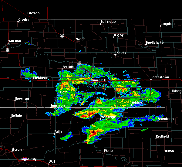 The severe thunderstorm warning for northeastern corson county will expire at 745 pm mdt, the storm which prompted the warning has moved out of the area. therefore the warning will be allowed to expire. however small hail is still possible with this thunderstorm. The severe thunderstorm warning for northeastern corson county will expire at 745 pm mdt, the storm which prompted the warning has moved out of the area. therefore the warning will be allowed to expire. however small hail is still possible with this thunderstorm.
|
| 8/12/2017 7:13 PM MDT |
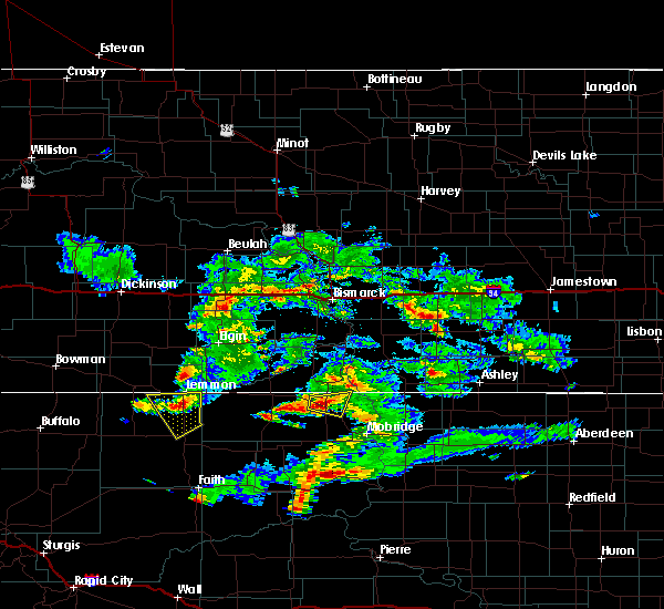 At 712 pm mdt, a severe thunderstorm was located over mclaughlin, moving southeast at 25 mph (radar indicated). Hazards include 60 mph wind gusts and quarter size hail. Hail damage to vehicles is expected. expect wind damage to roofs, siding, and trees. Locations impacted include, mclaughlin and mahto. At 712 pm mdt, a severe thunderstorm was located over mclaughlin, moving southeast at 25 mph (radar indicated). Hazards include 60 mph wind gusts and quarter size hail. Hail damage to vehicles is expected. expect wind damage to roofs, siding, and trees. Locations impacted include, mclaughlin and mahto.
|
| 8/12/2017 6:54 PM MDT |
 At 653 pm mdt, a severe thunderstorm was located near walker, or 8 miles northwest of mclaughlin, moving east at 20 mph (radar indicated). Hazards include ping pong ball size hail and 60 mph wind gusts. People and animals outdoors will be injured. expect hail damage to roofs, siding, windows, and vehicles. Expect wind damage to roofs, siding, and trees. At 653 pm mdt, a severe thunderstorm was located near walker, or 8 miles northwest of mclaughlin, moving east at 20 mph (radar indicated). Hazards include ping pong ball size hail and 60 mph wind gusts. People and animals outdoors will be injured. expect hail damage to roofs, siding, windows, and vehicles. Expect wind damage to roofs, siding, and trees.
|
| 8/12/2017 6:46 PM MDT |
 At 645 pm mdt, a severe thunderstorm was located near walker, or 9 miles west of mclaughlin, moving southeast at 25 mph (radar indicated). Hazards include ping pong ball size hail and 60 mph wind gusts. People and animals outdoors will be injured. expect hail damage to roofs, siding, windows, and vehicles. expect wind damage to roofs, siding, and trees. Locations impacted include, mclaughlin, walker and bullhead. At 645 pm mdt, a severe thunderstorm was located near walker, or 9 miles west of mclaughlin, moving southeast at 25 mph (radar indicated). Hazards include ping pong ball size hail and 60 mph wind gusts. People and animals outdoors will be injured. expect hail damage to roofs, siding, windows, and vehicles. expect wind damage to roofs, siding, and trees. Locations impacted include, mclaughlin, walker and bullhead.
|
| 8/12/2017 6:33 PM MDT |
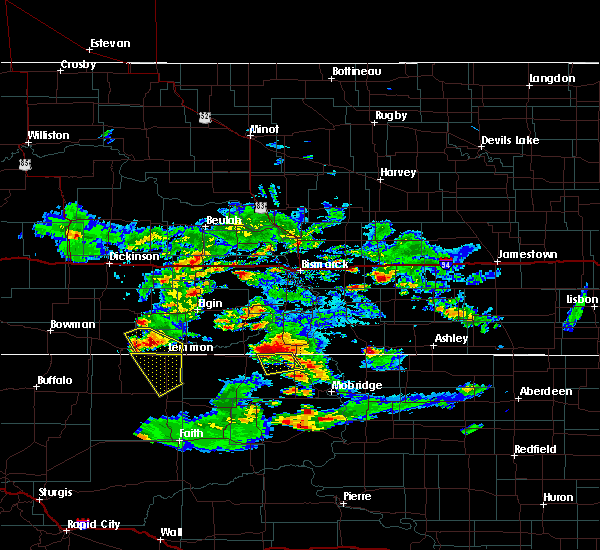 At 633 pm mdt, a severe thunderstorm was located over walker, or 11 miles southwest of selfridge, moving southeast at 30 mph (radar indicated). Hazards include 60 mph wind gusts and quarter size hail. Hail damage to vehicles is expected. expect wind damage to roofs, siding, and trees. Locations impacted include, mclaughlin, walker and bullhead. At 633 pm mdt, a severe thunderstorm was located over walker, or 11 miles southwest of selfridge, moving southeast at 30 mph (radar indicated). Hazards include 60 mph wind gusts and quarter size hail. Hail damage to vehicles is expected. expect wind damage to roofs, siding, and trees. Locations impacted include, mclaughlin, walker and bullhead.
|
| 8/12/2017 6:14 PM MDT |
 At 613 pm mdt, a severe thunderstorm was located 7 miles north of walker, or 9 miles west of selfridge, moving southeast at 30 mph (radar indicated). Hazards include golf ball size hail and 60 mph wind gusts. People and animals outdoors will be injured. expect hail damage to roofs, siding, windows, and vehicles. Expect wind damage to roofs, siding, and trees. At 613 pm mdt, a severe thunderstorm was located 7 miles north of walker, or 9 miles west of selfridge, moving southeast at 30 mph (radar indicated). Hazards include golf ball size hail and 60 mph wind gusts. People and animals outdoors will be injured. expect hail damage to roofs, siding, windows, and vehicles. Expect wind damage to roofs, siding, and trees.
|
| 7/21/2017 7:09 PM MDT |
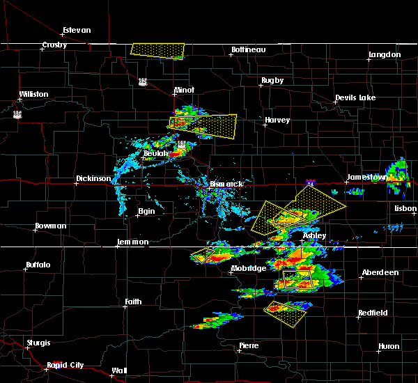 The severe thunderstorm warning for northeastern corson county will expire at 715 pm mdt, the storm which prompted the warning has weakened below severe limits, and has exited the warned area. therefore, the warning will be allowed to expire. however gusty winds are still possible with additional thunderstorms in the area. a severe thunderstorm watch remains in effect until 1000 pm mdt for north central south dakota. The severe thunderstorm warning for northeastern corson county will expire at 715 pm mdt, the storm which prompted the warning has weakened below severe limits, and has exited the warned area. therefore, the warning will be allowed to expire. however gusty winds are still possible with additional thunderstorms in the area. a severe thunderstorm watch remains in effect until 1000 pm mdt for north central south dakota.
|
| 7/21/2017 7:01 PM MDT |
 At 701 pm mdt, a severe thunderstorm was located over mclaughlin, moving southeast at 30 mph (radar indicated). Hazards include 60 mph wind gusts and nickel size hail. Expect damage to roofs, siding, and trees. Locations impacted include, mclaughlin. At 701 pm mdt, a severe thunderstorm was located over mclaughlin, moving southeast at 30 mph (radar indicated). Hazards include 60 mph wind gusts and nickel size hail. Expect damage to roofs, siding, and trees. Locations impacted include, mclaughlin.
|
| 7/21/2017 6:50 PM MDT | Time estimated via rada in corson county SD, 5.3 miles ESE of McLaughlin, SD |
| 7/21/2017 6:47 PM MDT |
 At 647 pm mdt, a severe thunderstorm was located near mclaughlin, moving southeast at 40 mph (radar indicated). Hazards include 60 mph wind gusts and nickel size hail. Expect damage to roofs, siding, and trees. Locations impacted include, mclaughlin. At 647 pm mdt, a severe thunderstorm was located near mclaughlin, moving southeast at 40 mph (radar indicated). Hazards include 60 mph wind gusts and nickel size hail. Expect damage to roofs, siding, and trees. Locations impacted include, mclaughlin.
|
| 7/21/2017 6:31 PM MDT |
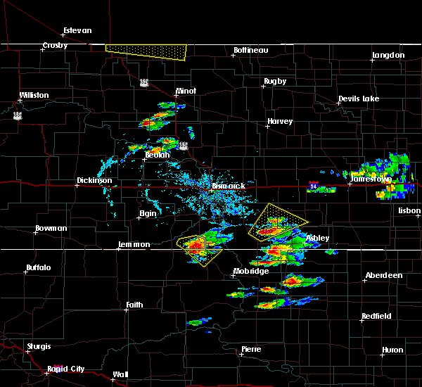 At 631 pm mdt, a severe thunderstorm was located near selfridge, moving southeast at 25 mph (radar indicated). Hazards include 60 mph wind gusts and quarter size hail. Hail damage to vehicles is expected. Expect wind damage to roofs, siding, and trees. At 631 pm mdt, a severe thunderstorm was located near selfridge, moving southeast at 25 mph (radar indicated). Hazards include 60 mph wind gusts and quarter size hail. Hail damage to vehicles is expected. Expect wind damage to roofs, siding, and trees.
|
| 7/20/2017 9:09 PM MDT |
 The severe thunderstorm warning for eastern corson and northwestern dewey counties will expire at 915 pm mdt, the storms which prompted the warning have moved out of the area. therefore the warning will be allowed to expire. remember, a severe thunderstorm warning still remains in effect for eastern corson and dewey counties until 945 pm mdt. The severe thunderstorm warning for eastern corson and northwestern dewey counties will expire at 915 pm mdt, the storms which prompted the warning have moved out of the area. therefore the warning will be allowed to expire. remember, a severe thunderstorm warning still remains in effect for eastern corson and dewey counties until 945 pm mdt.
|
| 7/20/2017 8:50 PM MDT |
 At 848 pm mdt, severe thunderstorms were located along a line extending from near kenel to trail city to 6 miles east of green grass, moving southeast at 40 mph (trained weather spotters. at 845 pm mdt, a 63 mph gust was reported in mahto). Hazards include 70 mph wind gusts and nickel size hail. Expect considerable tree damage. damage is likely to mobile homes, roofs, and outbuildings. Locations impacted include, mclaughlin, timber lake, little moreau rec area, spring lake, trail city, white horse, mahto, green grass, little eagle, kenel and glencross. At 848 pm mdt, severe thunderstorms were located along a line extending from near kenel to trail city to 6 miles east of green grass, moving southeast at 40 mph (trained weather spotters. at 845 pm mdt, a 63 mph gust was reported in mahto). Hazards include 70 mph wind gusts and nickel size hail. Expect considerable tree damage. damage is likely to mobile homes, roofs, and outbuildings. Locations impacted include, mclaughlin, timber lake, little moreau rec area, spring lake, trail city, white horse, mahto, green grass, little eagle, kenel and glencross.
|
| 7/20/2017 8:29 PM MDT |
 At 827 pm mdt, severe thunderstorms were located along a line extending from near mclaughlin to 8 miles southwest of little moreau rec area, moving southeast at 40 mph (trained weather spotters. at 800 pm mdt, a 60 to 70 mph wind gust was reported 4 miles northwest of isabel. a 66 mph gust was also reported 11 miles south of bullhead at 806 pm mdt). Hazards include 70 mph wind gusts and nickel size hail. Expect considerable tree damage. damage is likely to mobile homes, roofs, and outbuildings. Locations impacted include, mclaughlin, timber lake, firesteel, little moreau rec area, trail city, white horse, mahto, bullhead, green grass, little eagle, kenel, spring lake and glencross. At 827 pm mdt, severe thunderstorms were located along a line extending from near mclaughlin to 8 miles southwest of little moreau rec area, moving southeast at 40 mph (trained weather spotters. at 800 pm mdt, a 60 to 70 mph wind gust was reported 4 miles northwest of isabel. a 66 mph gust was also reported 11 miles south of bullhead at 806 pm mdt). Hazards include 70 mph wind gusts and nickel size hail. Expect considerable tree damage. damage is likely to mobile homes, roofs, and outbuildings. Locations impacted include, mclaughlin, timber lake, firesteel, little moreau rec area, trail city, white horse, mahto, bullhead, green grass, little eagle, kenel, spring lake and glencross.
|
| 7/20/2017 8:13 PM MDT |
 At 813 pm mdt, severe thunderstorms were located along a line extending from near bullhead to near isabel, moving east at 30 mph (radar indicated. at 805 pm mdt, a 60 to 70 mph wind was reported 4 miles northwest of isabel). Hazards include 70 mph wind gusts and nickel size hail. Expect considerable tree damage. Damage is likely to mobile homes, roofs, and outbuildings. At 813 pm mdt, severe thunderstorms were located along a line extending from near bullhead to near isabel, moving east at 30 mph (radar indicated. at 805 pm mdt, a 60 to 70 mph wind was reported 4 miles northwest of isabel). Hazards include 70 mph wind gusts and nickel size hail. Expect considerable tree damage. Damage is likely to mobile homes, roofs, and outbuildings.
|
| 7/19/2017 8:10 AM MDT |
 The severe thunderstorm warning for eastern corson, central campbell and northwestern walworth counties will expire at 915 am cdt/815 am mdt/, the storm which prompted the warning has moved out of the area. therefore the warning will be allowed to expire. The severe thunderstorm warning for eastern corson, central campbell and northwestern walworth counties will expire at 915 am cdt/815 am mdt/, the storm which prompted the warning has moved out of the area. therefore the warning will be allowed to expire.
|
| 7/19/2017 7:39 AM MDT |
 At 836 am cdt/736 am mdt/, a severe thunderstorm was located near wakpala, or 14 miles east of mclaughlin, moving east at 45 mph (radar indicated. at 730 am mdt, a 59 mph wind gust was reported near mahto). Hazards include ping pong ball size hail and 60 mph wind gusts. People and animals outdoors will be injured. expect hail damage to roofs, siding, windows, and vehicles. expect wind damage to roofs, siding, and trees. Locations impacted include, mobridge, mclaughlin, herreid, wakpala, pollock, glenham, mound city, new everets resort, mahto, little eagle, indian creek rec area, kenel, indian memorial rec area, revheim bay rec area and grand river casino. At 836 am cdt/736 am mdt/, a severe thunderstorm was located near wakpala, or 14 miles east of mclaughlin, moving east at 45 mph (radar indicated. at 730 am mdt, a 59 mph wind gust was reported near mahto). Hazards include ping pong ball size hail and 60 mph wind gusts. People and animals outdoors will be injured. expect hail damage to roofs, siding, windows, and vehicles. expect wind damage to roofs, siding, and trees. Locations impacted include, mobridge, mclaughlin, herreid, wakpala, pollock, glenham, mound city, new everets resort, mahto, little eagle, indian creek rec area, kenel, indian memorial rec area, revheim bay rec area and grand river casino.
|
| 7/19/2017 7:18 AM MDT |
 At 818 am cdt/718 am mdt/, a severe thunderstorm was located over mclaughlin, moving east at 40 mph (radar indicated). Hazards include 60 mph wind gusts and half dollar size hail. Hail damage to vehicles is expected. Expect wind damage to roofs, siding, and trees. At 818 am cdt/718 am mdt/, a severe thunderstorm was located over mclaughlin, moving east at 40 mph (radar indicated). Hazards include 60 mph wind gusts and half dollar size hail. Hail damage to vehicles is expected. Expect wind damage to roofs, siding, and trees.
|
| 8/15/2016 6:55 PM MDT |
 At 755 pm cdt/655 pm mdt/, a severe thunderstorm was located near mclaughlin, moving east at 25 mph (radar indicated). Hazards include 60 mph wind gusts and quarter size hail. Hail damage to vehicles is expected. expect wind damage to roofs, siding, and trees. this severe thunderstorm will be near, mahto around 710 pm mdt. wakpala around 725 pm mdt. Kenel around 735 pm mdt. At 755 pm cdt/655 pm mdt/, a severe thunderstorm was located near mclaughlin, moving east at 25 mph (radar indicated). Hazards include 60 mph wind gusts and quarter size hail. Hail damage to vehicles is expected. expect wind damage to roofs, siding, and trees. this severe thunderstorm will be near, mahto around 710 pm mdt. wakpala around 725 pm mdt. Kenel around 735 pm mdt.
|
| 8/9/2016 10:55 PM MDT |
 At 1154 pm cdt/1054 pm mdt/, severe thunderstorms were located along a line extending from 8 miles south of fort yates to near mahto to near trail city, moving east at 45 mph (mesonet observations near trail city measured 62 mph. also 68 mph winds were reported at mclaughlin). Hazards include two inch hail and 70 mph wind gusts. People and animals outdoors will be injured. expect hail damage to roofs, siding, windows, and vehicles. expect considerable tree damage. wind damage is also likely to mobile homes, roofs, and outbuildings. these severe storms will be near, wakpala around 1100 pm mdt. kenel around 1110 pm mdt. blackfoot around 1115 pm mdt. Pollock and new everets resort around 1220 am cdt. At 1154 pm cdt/1054 pm mdt/, severe thunderstorms were located along a line extending from 8 miles south of fort yates to near mahto to near trail city, moving east at 45 mph (mesonet observations near trail city measured 62 mph. also 68 mph winds were reported at mclaughlin). Hazards include two inch hail and 70 mph wind gusts. People and animals outdoors will be injured. expect hail damage to roofs, siding, windows, and vehicles. expect considerable tree damage. wind damage is also likely to mobile homes, roofs, and outbuildings. these severe storms will be near, wakpala around 1100 pm mdt. kenel around 1110 pm mdt. blackfoot around 1115 pm mdt. Pollock and new everets resort around 1220 am cdt.
|
| 8/9/2016 10:45 PM MDT | Measured at mclaughlin rwi in corson county SD, 5.3 miles ESE of McLaughlin, SD |
| 8/9/2016 10:43 PM MDT |
 At 1143 pm cdt/1043 pm mdt/, severe thunderstorms were located along a line extending from near selfridge to near little eagle to near glencross, moving east at 35 mph (radar indicated). Hazards include two inch hail and 70 mph wind gusts. People and animals outdoors will be injured. expect hail damage to roofs, siding, windows, and vehicles. expect considerable tree damage. wind damage is also likely to mobile homes, roofs, and outbuildings. severe thunderstorms will be near, mahto and trail city around 1055 pm mdt. wakpala around 1105 pm mdt. blackfoot, indian creek rec area and revheim bay rec area around 1125 pm mdt. Pollock and new everets resort around 1230 am cdt. At 1143 pm cdt/1043 pm mdt/, severe thunderstorms were located along a line extending from near selfridge to near little eagle to near glencross, moving east at 35 mph (radar indicated). Hazards include two inch hail and 70 mph wind gusts. People and animals outdoors will be injured. expect hail damage to roofs, siding, windows, and vehicles. expect considerable tree damage. wind damage is also likely to mobile homes, roofs, and outbuildings. severe thunderstorms will be near, mahto and trail city around 1055 pm mdt. wakpala around 1105 pm mdt. blackfoot, indian creek rec area and revheim bay rec area around 1125 pm mdt. Pollock and new everets resort around 1230 am cdt.
|
| 8/9/2016 10:40 PM MDT | Measured at mclaughlin rwi in corson county SD, 5.3 miles ESE of McLaughlin, SD |
| 8/9/2016 10:30 PM MDT |
 At 1030 pm mdt, a severe thunderstorm was located 7 miles west of little eagle, or 9 miles southwest of mclaughlin, moving east at 40 mph (radar indicated). Hazards include golf ball size hail and 70 mph wind gusts. People and animals outdoors will be injured. expect hail damage to roofs, siding, windows, and vehicles. expect considerable tree damage. wind damage is also likely to mobile homes, roofs, and outbuildings. this severe storm will be near, little eagle around 1040 pm mdt. Mahto around 1045 pm mdt. At 1030 pm mdt, a severe thunderstorm was located 7 miles west of little eagle, or 9 miles southwest of mclaughlin, moving east at 40 mph (radar indicated). Hazards include golf ball size hail and 70 mph wind gusts. People and animals outdoors will be injured. expect hail damage to roofs, siding, windows, and vehicles. expect considerable tree damage. wind damage is also likely to mobile homes, roofs, and outbuildings. this severe storm will be near, little eagle around 1040 pm mdt. Mahto around 1045 pm mdt.
|
| 8/9/2016 9:45 PM MDT |
 At 945 pm mdt, a severe thunderstorm was located near watauga, or 31 miles east of lemmon, moving east at 45 mph (radar indicated). Hazards include golf ball size hail and 70 mph wind gusts. People and animals outdoors will be injured. expect hail damage to roofs, siding, windows, and vehicles. expect considerable tree damage. wind damage is also likely to mobile homes, roofs, and outbuildings. this severe thunderstorm will be near, mcintosh and black horse around 955 pm mdt. walker around 1010 pm mdt. bullhead around 1015 pm mdt. mclaughlin around 1030 pm mdt. Mahto around 1040 pm mdt. At 945 pm mdt, a severe thunderstorm was located near watauga, or 31 miles east of lemmon, moving east at 45 mph (radar indicated). Hazards include golf ball size hail and 70 mph wind gusts. People and animals outdoors will be injured. expect hail damage to roofs, siding, windows, and vehicles. expect considerable tree damage. wind damage is also likely to mobile homes, roofs, and outbuildings. this severe thunderstorm will be near, mcintosh and black horse around 955 pm mdt. walker around 1010 pm mdt. bullhead around 1015 pm mdt. mclaughlin around 1030 pm mdt. Mahto around 1040 pm mdt.
|
| 7/16/2016 10:01 PM CDT |
 At 1001 pm cdt/901 pm mdt/, a severe thunderstorm was located near lowry, or 10 miles southeast of selby, moving east at 60 mph (trained weather spotters). Hazards include 70 mph wind gusts and quarter size hail. Hail damage to vehicles is expected. expect considerable tree damage. wind damage is also likely to mobile homes, roofs, and outbuildings. This severe storm will be near, bowdle around 1010 pm cdt. At 1001 pm cdt/901 pm mdt/, a severe thunderstorm was located near lowry, or 10 miles southeast of selby, moving east at 60 mph (trained weather spotters). Hazards include 70 mph wind gusts and quarter size hail. Hail damage to vehicles is expected. expect considerable tree damage. wind damage is also likely to mobile homes, roofs, and outbuildings. This severe storm will be near, bowdle around 1010 pm cdt.
|
| 7/16/2016 9:50 PM CDT |
 At 950 pm cdt/850 pm mdt/, a severe thunderstorm was located near swan creek rec area, or 13 miles southwest of selby, moving east at 50 mph (radar indicated). Hazards include 70 mph wind gusts and quarter size hail. Hail damage to vehicles is expected. expect considerable tree damage. wind damage is also likely to mobile homes, roofs, and outbuildings. this severe thunderstorm will be near, lowry around 1000 pm cdt. Bowdle around 1010 pm cdt. At 950 pm cdt/850 pm mdt/, a severe thunderstorm was located near swan creek rec area, or 13 miles southwest of selby, moving east at 50 mph (radar indicated). Hazards include 70 mph wind gusts and quarter size hail. Hail damage to vehicles is expected. expect considerable tree damage. wind damage is also likely to mobile homes, roofs, and outbuildings. this severe thunderstorm will be near, lowry around 1000 pm cdt. Bowdle around 1010 pm cdt.
|
| 7/16/2016 7:50 PM MDT |
 At 750 pm mdt, a severe thunderstorm was located 7 miles northwest of isabel, or 29 miles north of dupree, moving east at 50 mph (radar indicated). Hazards include 70 mph wind gusts. Expect considerable tree damage. damage is likely to mobile homes, roofs, and outbuildings. this severe thunderstorm will be near, firesteel around 800 pm mdt. timber lake around 805 pm mdt. spring lake and glencross around 815 pm mdt. Trail city around 820 pm mdt. At 750 pm mdt, a severe thunderstorm was located 7 miles northwest of isabel, or 29 miles north of dupree, moving east at 50 mph (radar indicated). Hazards include 70 mph wind gusts. Expect considerable tree damage. damage is likely to mobile homes, roofs, and outbuildings. this severe thunderstorm will be near, firesteel around 800 pm mdt. timber lake around 805 pm mdt. spring lake and glencross around 815 pm mdt. Trail city around 820 pm mdt.
|
| 7/10/2016 9:02 PM MDT |
 At 1001 pm cdt/901 pm mdt/, a severe thunderstorm was located 8 miles south of pollock, or 17 miles north of mobridge, moving east at 40 mph (radar indicated). Hazards include 70 mph wind gusts and quarter size hail. Hail damage to vehicles is expected. expect considerable tree damage. wind damage is also likely to mobile homes, roofs, and outbuildings. this severe storm will be near, herreid around 1015 pm cdt. Mound city around 1020 pm cdt. At 1001 pm cdt/901 pm mdt/, a severe thunderstorm was located 8 miles south of pollock, or 17 miles north of mobridge, moving east at 40 mph (radar indicated). Hazards include 70 mph wind gusts and quarter size hail. Hail damage to vehicles is expected. expect considerable tree damage. wind damage is also likely to mobile homes, roofs, and outbuildings. this severe storm will be near, herreid around 1015 pm cdt. Mound city around 1020 pm cdt.
|
| 7/10/2016 8:42 PM MDT |
 At 942 pm cdt/842 pm mdt/, a severe thunderstorm was located near mahto, or 11 miles east of mclaughlin, moving east at 40 mph (radar indicated). Hazards include 70 mph wind gusts and quarter size hail. Hail damage to vehicles is expected. expect considerable tree damage. wind damage is also likely to mobile homes, roofs, and outbuildings. this severe thunderstorm will be near, kenel around 850 pm mdt. herreid around 1015 pm cdt. Mound city around 1020 pm cdt. At 942 pm cdt/842 pm mdt/, a severe thunderstorm was located near mahto, or 11 miles east of mclaughlin, moving east at 40 mph (radar indicated). Hazards include 70 mph wind gusts and quarter size hail. Hail damage to vehicles is expected. expect considerable tree damage. wind damage is also likely to mobile homes, roofs, and outbuildings. this severe thunderstorm will be near, kenel around 850 pm mdt. herreid around 1015 pm cdt. Mound city around 1020 pm cdt.
|
| 7/10/2016 8:39 PM MDT | Storm damage reported in corson county SD, 5.3 miles ESE of McLaughlin, SD |
| 7/9/2016 8:30 PM MDT | Storm damage reported in corson county SD, 0.4 miles N of McLaughlin, SD |
| 7/9/2016 8:15 PM MDT |
 At 914 pm cdt/814 pm mdt/, severe thunderstorms were located along a line extending from near selfridge to near ridgeview, moving east at 55 mph (radar indicated). Hazards include 60 mph wind gusts. Expect damage to roofs. siding. and trees. severe thunderstorms will be near, laplant around 825 pm mdt. tiospaye topa school around 830 pm mdt. swiftbird day school around 940 pm cdt. swiftbird around 945 pm cdt. whitlocks bay rec area around 950 pm cdt. Gettysburg around 1005 pm cdt. At 914 pm cdt/814 pm mdt/, severe thunderstorms were located along a line extending from near selfridge to near ridgeview, moving east at 55 mph (radar indicated). Hazards include 60 mph wind gusts. Expect damage to roofs. siding. and trees. severe thunderstorms will be near, laplant around 825 pm mdt. tiospaye topa school around 830 pm mdt. swiftbird day school around 940 pm cdt. swiftbird around 945 pm cdt. whitlocks bay rec area around 950 pm cdt. Gettysburg around 1005 pm cdt.
|
| 7/9/2016 8:10 PM MDT | Storm damage reported in corson county SD, 5.3 miles ESE of McLaughlin, SD |
| 6/21/2016 9:47 PM MDT |
 At 1046 pm cdt/946 pm mdt/, a severe thunderstorm was located near mclaughlin, moving southeast at 55 mph (radar indicated). Hazards include 60 mph wind gusts and quarter size hail. Hail damage to vehicles is expected. expect wind damage to roofs, siding, and trees. this severe storm will be near, mahto around 1000 pm mdt. Kenel around 1005 pm mdt. At 1046 pm cdt/946 pm mdt/, a severe thunderstorm was located near mclaughlin, moving southeast at 55 mph (radar indicated). Hazards include 60 mph wind gusts and quarter size hail. Hail damage to vehicles is expected. expect wind damage to roofs, siding, and trees. this severe storm will be near, mahto around 1000 pm mdt. Kenel around 1005 pm mdt.
|
| 6/21/2016 9:24 PM MDT |
 At 1023 pm cdt/923 pm mdt/, a severe thunderstorm was located 8 miles northeast of mcintosh, or 14 miles west of selfridge, moving southeast at 55 mph (radar indicated). Hazards include 60 mph wind gusts and quarter size hail. Hail damage to vehicles is expected. expect wind damage to roofs, siding, and trees. this severe thunderstorm will be near, walker around 935 pm mdt. mclaughlin around 950 pm mdt. mahto around 1000 pm mdt. Kenel around 1005 pm mdt. At 1023 pm cdt/923 pm mdt/, a severe thunderstorm was located 8 miles northeast of mcintosh, or 14 miles west of selfridge, moving southeast at 55 mph (radar indicated). Hazards include 60 mph wind gusts and quarter size hail. Hail damage to vehicles is expected. expect wind damage to roofs, siding, and trees. this severe thunderstorm will be near, walker around 935 pm mdt. mclaughlin around 950 pm mdt. mahto around 1000 pm mdt. Kenel around 1005 pm mdt.
|
| 7/27/2015 7:45 PM MDT |
 At 745 pm mdt, severe thunderstorms were located along a line extending from lemmon to 9 miles southwest of shambo ranch to near thunder butte to 8 miles northwest of cherry creek, moving northeast at 55 mph (radar indicated). Hazards include 60 mph wind gusts and nickel size hail. Expect damage to roofs. siding and trees. severe thunderstorms will be near, shambo ranch and thunder hawk around 755 pm mdt. keldron around 800 pm mdt. morristown around 805 pm mdt. firesteel around 810 pm mdt. little moreau rec area around 815 pm mdt. timber lake, klein ranch and black horse around 820 pm mdt. glencross around 825 pm mdt. Spring lake around 830 pm mdt. At 745 pm mdt, severe thunderstorms were located along a line extending from lemmon to 9 miles southwest of shambo ranch to near thunder butte to 8 miles northwest of cherry creek, moving northeast at 55 mph (radar indicated). Hazards include 60 mph wind gusts and nickel size hail. Expect damage to roofs. siding and trees. severe thunderstorms will be near, shambo ranch and thunder hawk around 755 pm mdt. keldron around 800 pm mdt. morristown around 805 pm mdt. firesteel around 810 pm mdt. little moreau rec area around 815 pm mdt. timber lake, klein ranch and black horse around 820 pm mdt. glencross around 825 pm mdt. Spring lake around 830 pm mdt.
|
| 7/23/2015 6:20 PM MDT |
 At 719 pm cdt /619 pm mdt/, severe thunderstorms were located along a line extending from lake oahe to 6 miles southwest of kenel to near mahto, moving east at 20 mph (radar indicated). Hazards include 60 mph wind gusts and quarter size hail. Hail damage to vehicles is expected. expect wind damage to roofs, siding and trees. severe thunderstorms will be near, kenel around 635 pm mdt. wakpala around 640 pm mdt. Pollock around 645 pm mdt. At 719 pm cdt /619 pm mdt/, severe thunderstorms were located along a line extending from lake oahe to 6 miles southwest of kenel to near mahto, moving east at 20 mph (radar indicated). Hazards include 60 mph wind gusts and quarter size hail. Hail damage to vehicles is expected. expect wind damage to roofs, siding and trees. severe thunderstorms will be near, kenel around 635 pm mdt. wakpala around 640 pm mdt. Pollock around 645 pm mdt.
|
| 7/23/2015 6:10 PM MDT | 60 to 70 mph winds. small hai in corson county SD, 12.9 miles WSW of McLaughlin, SD |
| 7/23/2015 5:47 PM MDT | Quarter sized hail reported 9 miles SE of McLaughlin, SD, hail has persisted for 15 minutes. most hail pea to dime sized with a few to quarter sized. peak winds estimated at 60 mph. |
| 6/22/2015 12:15 AM MDT |
 At 114 am cdt /1214 am mdt/, a severe thunderstorm was located near little eagle, or 9 miles southwest of mclaughlin, moving east at 55 mph (radar indicated). Hazards include 70 mph wind gusts. Expect considerable tree damage. damage is likely to mobile homes, roofs and outbuildings. this severe thunderstorm will be near, mahto around 1225 am mdt. Wakpala around 1235 am mdt. At 114 am cdt /1214 am mdt/, a severe thunderstorm was located near little eagle, or 9 miles southwest of mclaughlin, moving east at 55 mph (radar indicated). Hazards include 70 mph wind gusts. Expect considerable tree damage. damage is likely to mobile homes, roofs and outbuildings. this severe thunderstorm will be near, mahto around 1225 am mdt. Wakpala around 1235 am mdt.
|
| 7/22/2012 6:46 PM MDT | Quarter sized hail reported 31.3 miles NE of McLaughlin, SD, quarter hail. |
| 7/22/2012 5:34 PM MDT | Half Dollar sized hail reported 5.3 miles N of McLaughlin, SD, hail quarter to half dollar size.. |
| 1/1/0001 12:00 AM | Quarter sized hail reported 11.5 miles NE of McLaughlin, SD, at least quarter sized hail. hail drifting on front porch. |
| 1/1/0001 12:00 AM | Quarter sized hail reported 13.4 miles ENE of McLaughlin, SD |
| 1/1/0001 12:00 AM | Quarter sized hail reported 7.9 miles S of McLaughlin, SD, quarter to nickel hail. |
| 1/1/0001 12:00 AM | Quarter sized hail reported 20.8 miles N of McLaughlin, SD, also had estimated 40 to 45 mph winds |
| 1/1/0001 12:00 AM | Storm damage reported in corson county SD, 2.5 miles N of McLaughlin, SD |
| 1/1/0001 12:00 AM | Storm damage reported in corson county SD, 1.1 miles N of McLaughlin, SD |
| 1/1/0001 12:00 AM | Storm damage reported in corson county SD, 1.5 miles NW of McLaughlin, SD |
| 1/1/0001 12:00 AM | Storm damage reported in corson county SD, 3.2 miles NW of McLaughlin, SD |
| 1/1/0001 12:00 AM | Ping Pong Ball sized hail reported 0.4 miles N of McLaughlin, SD |
| 1/1/0001 12:00 AM | Golf Ball sized hail reported 17.4 miles NNW of McLaughlin, SD |
Hail Maps for McLaughlin, SD


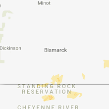


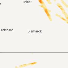


Connect with Interactive Hail Maps