

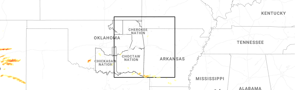
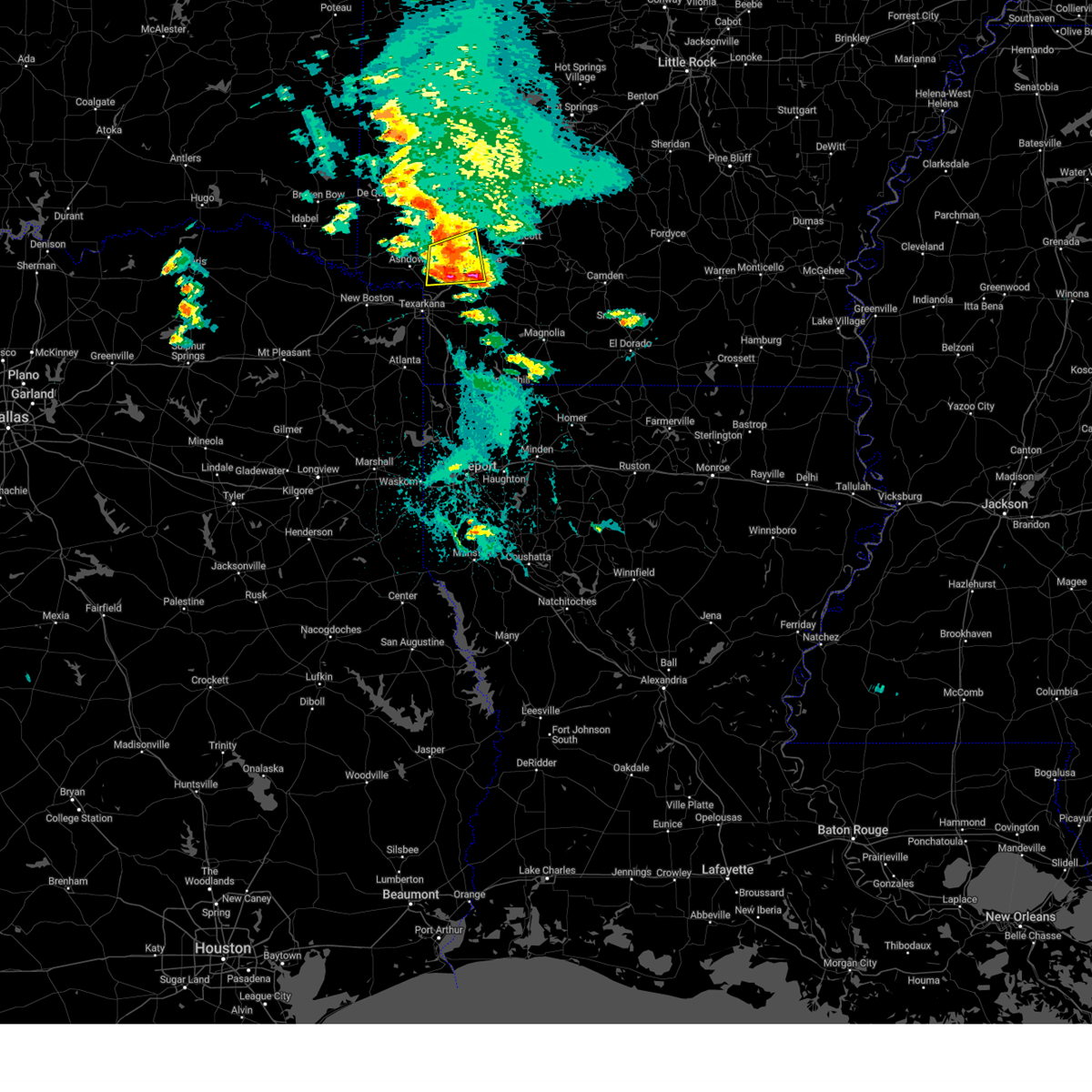
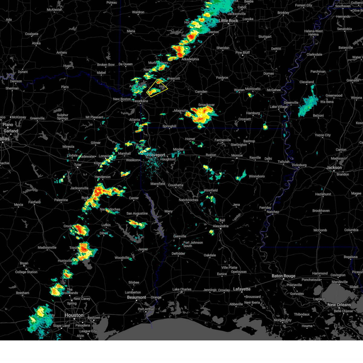
Hail Map for McNab, AR
The McNab, AR area has had 0 reports of on-the-ground hail by trained spotters, and has been under severe weather warnings 27 times during the past 12 months. Doppler radar has detected hail at or near McNab, AR on 50 occasions, including 3 occasions during the past year.
| Name: | McNab, AR |
| Where Located: | 19.7 miles S of Nashville, AR |
| Map: | Google Map for McNab, AR |
| Population: | 68 |
| Housing Units: | 33 |
| More Info: | Search Google for McNab, AR |
2
The Top Recent Hail Date for McNab, AR is Saturday, April 26, 2025 (18th out of 50)
Hail and Wind Damage Spotted near McNab, AR
| Date / Time | Report Details |
|---|---|
| 6/7/2025 11:43 PM CDT |
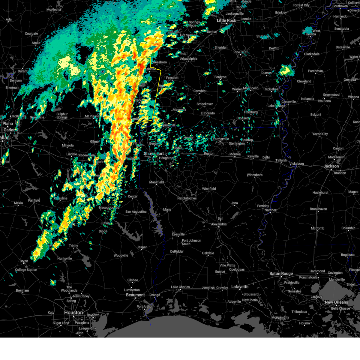
 Svrshv the national weather service in shreveport has issued a * severe thunderstorm warning for, southeastern little river county in southwestern arkansas, central hempstead county in southwestern arkansas, northern miller county in southwestern arkansas, southeastern sevier county in southwestern arkansas, southeastern howard county in southwestern arkansas, east central bowie county in northeastern texas, * until 1230 am cdt. * at 1142 pm cdt, a severe thunderstorm was located near wilton, or near ashdown, moving southeast at 30 mph (radar indicated). Hazards include 60 mph wind gusts and quarter size hail. Hail damage to vehicles is expected. Expect wind damage to roofs, siding, and trees. Svrshv the national weather service in shreveport has issued a * severe thunderstorm warning for, southeastern little river county in southwestern arkansas, central hempstead county in southwestern arkansas, northern miller county in southwestern arkansas, southeastern sevier county in southwestern arkansas, southeastern howard county in southwestern arkansas, east central bowie county in northeastern texas, * until 1230 am cdt. * at 1142 pm cdt, a severe thunderstorm was located near wilton, or near ashdown, moving southeast at 30 mph (radar indicated). Hazards include 60 mph wind gusts and quarter size hail. Hail damage to vehicles is expected. Expect wind damage to roofs, siding, and trees.
|
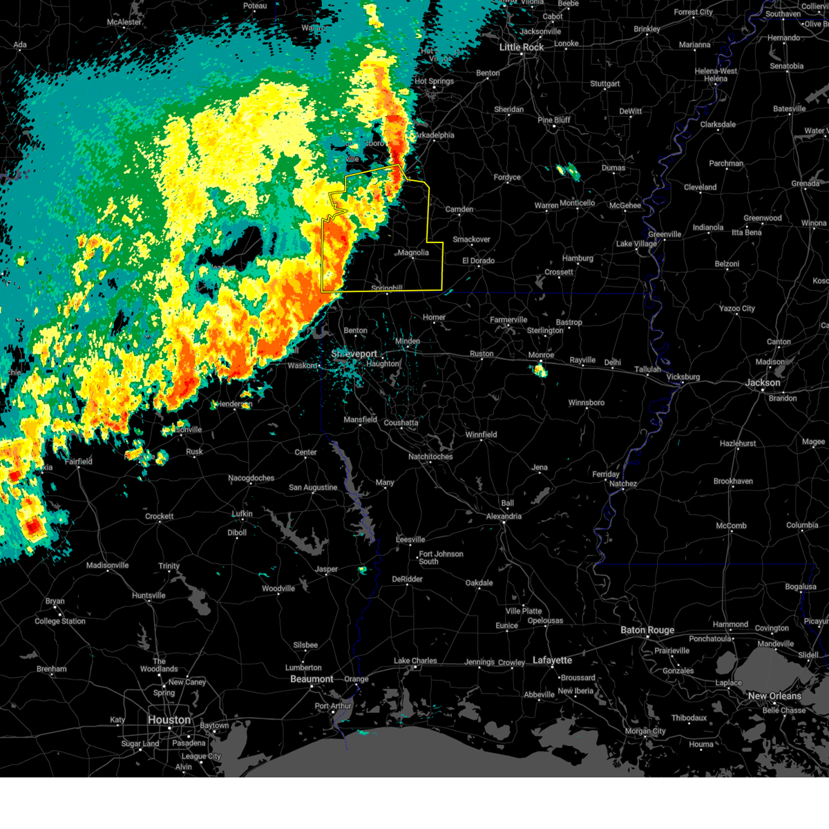
| 5/25/2025 5:49 PM CDT | Svrshv the national weather service in shreveport has issued a * severe thunderstorm warning for, hempstead county in southwestern arkansas, southeastern howard county in southwestern arkansas, northwestern nevada county in southwestern arkansas, * until 645 pm cdt. * at 548 pm cdt, a severe thunderstorm was located near saratoga, or 12 miles south of mineral springs, moving northeast at 30 mph (radar indicated). Hazards include 60 mph wind gusts and quarter size hail. Hail damage to vehicles is expected. Expect wind damage to roofs, siding, and trees. |
| 4/30/2025 3:44 PM CDT |
 Svrshv the national weather service in shreveport has issued a * severe thunderstorm warning for, columbia county in southwestern arkansas, hempstead county in southwestern arkansas, lafayette county in southwestern arkansas, miller county in southwestern arkansas, nevada county in southwestern arkansas, * until 445 pm cdt. * at 344 pm cdt, severe thunderstorms were located along a line from near fulton to near smithland, or along a line from 9 miles west of hope to 19 miles northeast of marshall, moving east at 40 mph (radar indicated). Hazards include 60 mph wind gusts and small hail. expect damage to roofs, siding, and trees Svrshv the national weather service in shreveport has issued a * severe thunderstorm warning for, columbia county in southwestern arkansas, hempstead county in southwestern arkansas, lafayette county in southwestern arkansas, miller county in southwestern arkansas, nevada county in southwestern arkansas, * until 445 pm cdt. * at 344 pm cdt, severe thunderstorms were located along a line from near fulton to near smithland, or along a line from 9 miles west of hope to 19 miles northeast of marshall, moving east at 40 mph (radar indicated). Hazards include 60 mph wind gusts and small hail. expect damage to roofs, siding, and trees
|
| 4/30/2025 2:45 PM CDT |
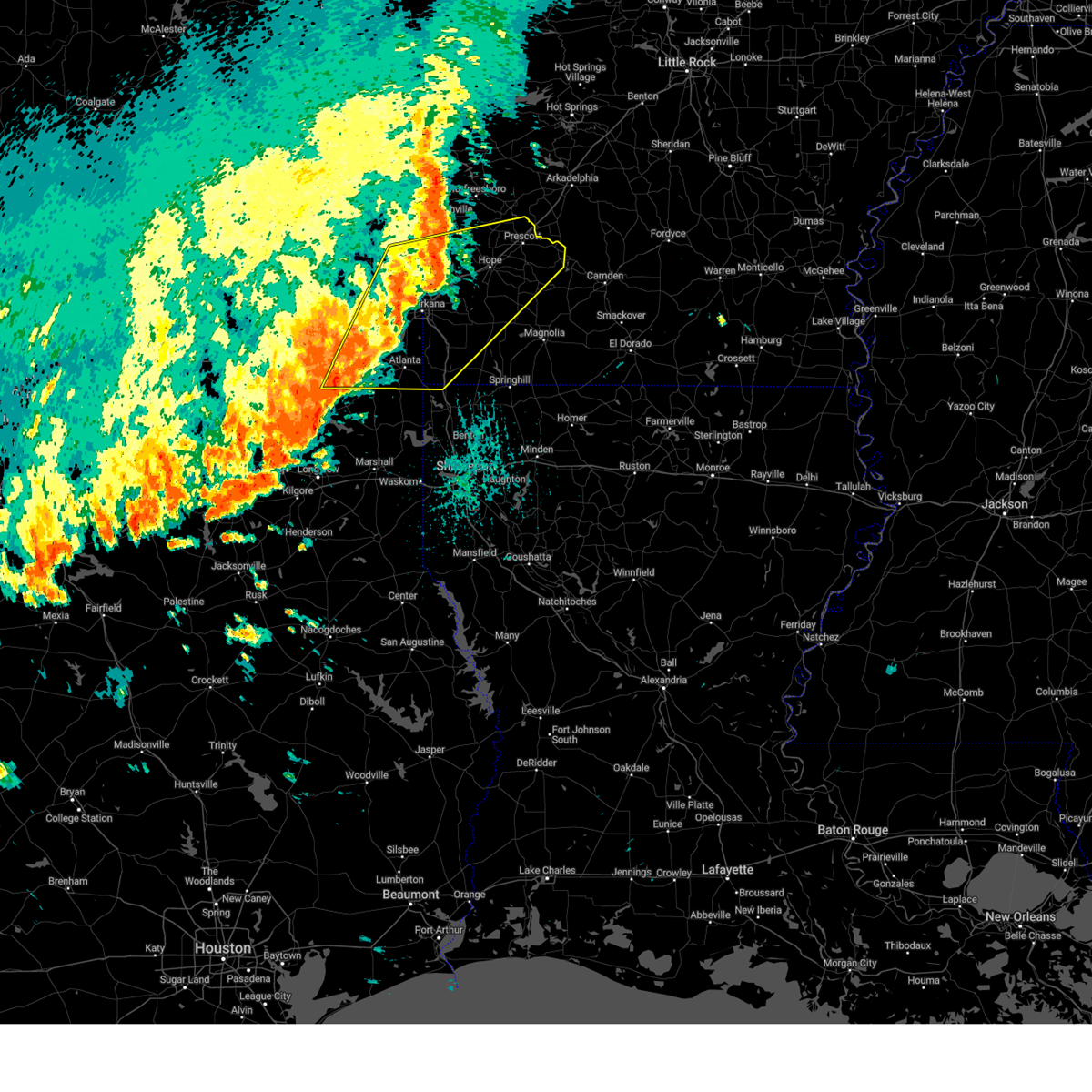 Svrshv the national weather service in shreveport has issued a * severe thunderstorm warning for, hempstead county in southwestern arkansas, southeastern howard county in southwestern arkansas, northern lafayette county in southwestern arkansas, little river county in southwestern arkansas, miller county in southwestern arkansas, nevada county in southwestern arkansas, southeastern sevier county in southwestern arkansas, northwestern caddo parish in northwestern louisiana, southeastern bowie county in northeastern texas, cass county in northeastern texas, east central morris county in northeastern texas, * until 345 pm cdt. * at 245 pm cdt, severe thunderstorms were located along a line from near ben lomond to 6 miles east of hughes springs, or along a line from 9 miles north of ashdown to 22 miles west of atlanta, moving east at 40 mph (radar indicated). Hazards include 60 mph wind gusts and small hail. expect damage to roofs, siding, and trees Svrshv the national weather service in shreveport has issued a * severe thunderstorm warning for, hempstead county in southwestern arkansas, southeastern howard county in southwestern arkansas, northern lafayette county in southwestern arkansas, little river county in southwestern arkansas, miller county in southwestern arkansas, nevada county in southwestern arkansas, southeastern sevier county in southwestern arkansas, northwestern caddo parish in northwestern louisiana, southeastern bowie county in northeastern texas, cass county in northeastern texas, east central morris county in northeastern texas, * until 345 pm cdt. * at 245 pm cdt, severe thunderstorms were located along a line from near ben lomond to 6 miles east of hughes springs, or along a line from 9 miles north of ashdown to 22 miles west of atlanta, moving east at 40 mph (radar indicated). Hazards include 60 mph wind gusts and small hail. expect damage to roofs, siding, and trees
|
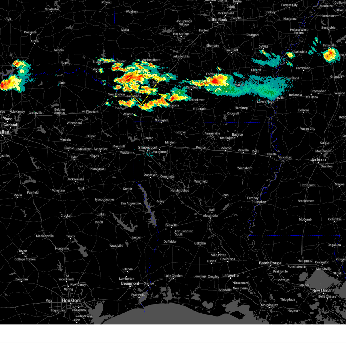
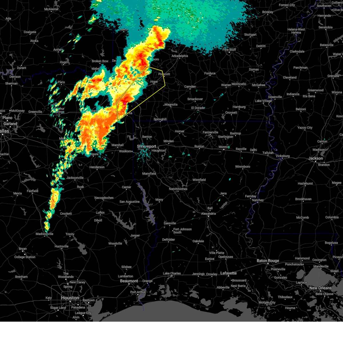
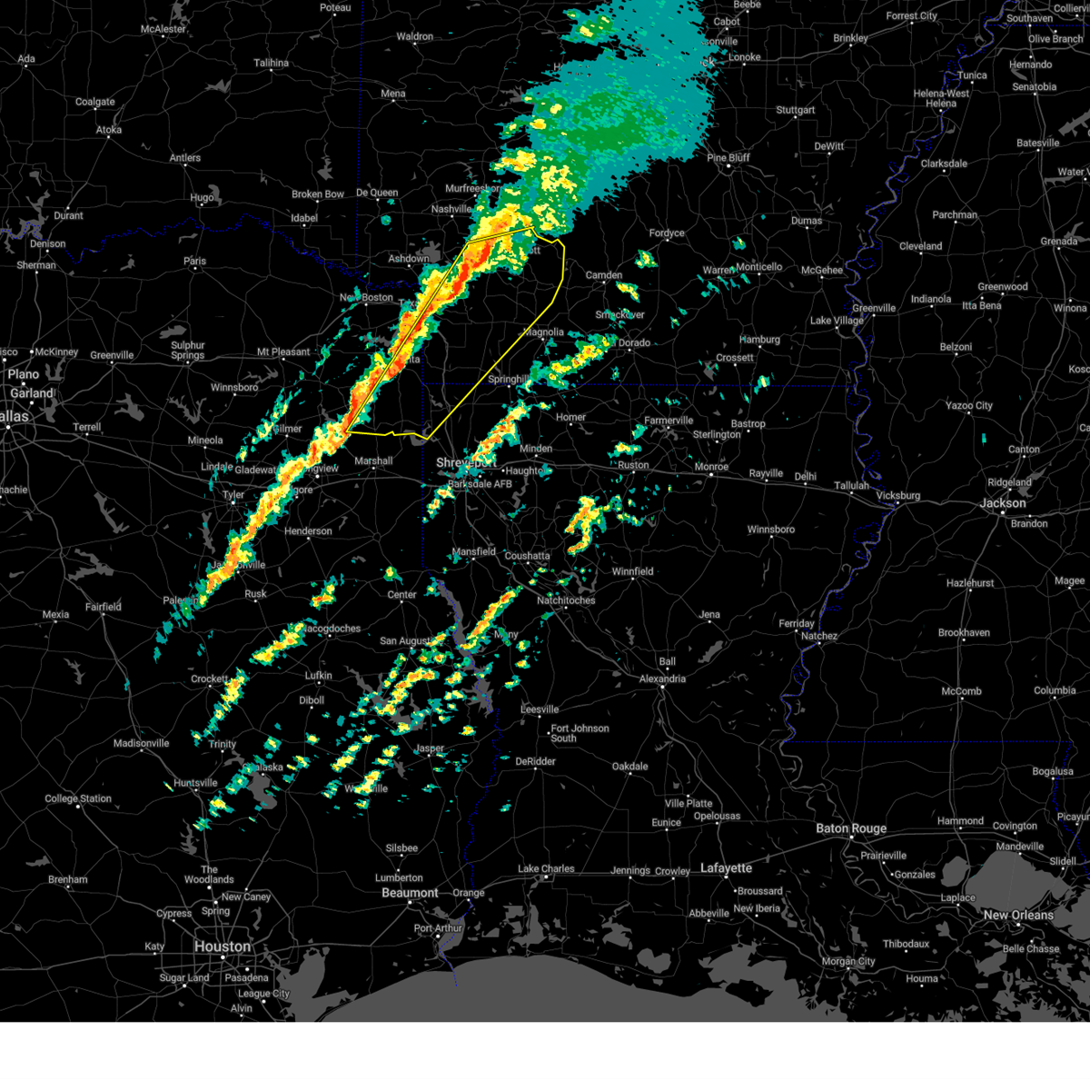
| 4/26/2025 7:30 PM CDT |
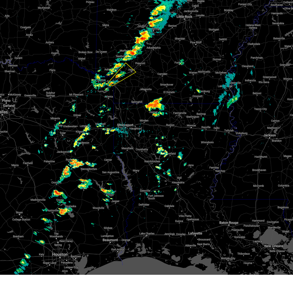
 At 730 pm cdt, severe thunderstorms were located along a line extending from near tollette to 7 miles southwest of washington to near fulton, moving east at 25 mph (radar indicated). Hazards include 60 mph wind gusts and quarter size hail. Hail damage to vehicles is expected. expect wind damage to roofs, siding, and trees. Locations impacted include, fulton, bright star, saratoga, mcnab, millwood, tollette, red bluff, ozan, and washington. At 730 pm cdt, severe thunderstorms were located along a line extending from near tollette to 7 miles southwest of washington to near fulton, moving east at 25 mph (radar indicated). Hazards include 60 mph wind gusts and quarter size hail. Hail damage to vehicles is expected. expect wind damage to roofs, siding, and trees. Locations impacted include, fulton, bright star, saratoga, mcnab, millwood, tollette, red bluff, ozan, and washington.
|
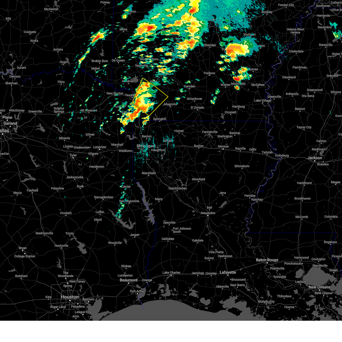
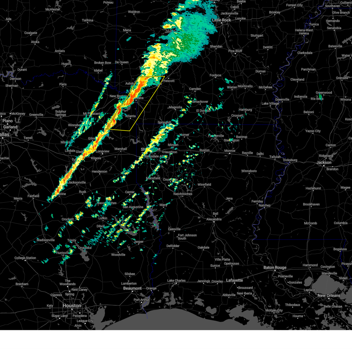
| 4/26/2025 6:59 PM CDT |
 Svrshv the national weather service in shreveport has issued a * severe thunderstorm warning for, southeastern little river county in southwestern arkansas, central hempstead county in southwestern arkansas, north central miller county in southwestern arkansas, southeastern sevier county in southwestern arkansas, southeastern howard county in southwestern arkansas, * until 800 pm cdt. * at 658 pm cdt, a severe thunderstorm was located near ashdown, moving east at 25 mph (radar indicated. quarter size hail was reported in ashdown with this storm). Hazards include 60 mph wind gusts and half dollar size hail. Hail damage to vehicles is expected. Expect wind damage to roofs, siding, and trees. Svrshv the national weather service in shreveport has issued a * severe thunderstorm warning for, southeastern little river county in southwestern arkansas, central hempstead county in southwestern arkansas, north central miller county in southwestern arkansas, southeastern sevier county in southwestern arkansas, southeastern howard county in southwestern arkansas, * until 800 pm cdt. * at 658 pm cdt, a severe thunderstorm was located near ashdown, moving east at 25 mph (radar indicated. quarter size hail was reported in ashdown with this storm). Hazards include 60 mph wind gusts and half dollar size hail. Hail damage to vehicles is expected. Expect wind damage to roofs, siding, and trees.
|
| 4/20/2025 5:49 PM CDT |
 the severe thunderstorm warning has been cancelled and is no longer in effect the severe thunderstorm warning has been cancelled and is no longer in effect
|
| 4/20/2025 5:36 PM CDT |
 At 536 pm cdt, a severe thunderstorm was located near fulton, or 8 miles west of hope, moving northeast at 45 mph (radar indicated). Hazards include 60 mph wind gusts. Expect damage to roofs, siding, and trees. Locations impacted include, perrytown, oakhaven, mcnab, washington, and hope. At 536 pm cdt, a severe thunderstorm was located near fulton, or 8 miles west of hope, moving northeast at 45 mph (radar indicated). Hazards include 60 mph wind gusts. Expect damage to roofs, siding, and trees. Locations impacted include, perrytown, oakhaven, mcnab, washington, and hope.
|
| 4/20/2025 5:36 PM CDT |
 the severe thunderstorm warning has been cancelled and is no longer in effect the severe thunderstorm warning has been cancelled and is no longer in effect
|
| 4/20/2025 5:28 PM CDT |
 At 528 pm cdt, a severe thunderstorm was located over fulton, or 14 miles northeast of texarkana, moving northeast at 35 mph (radar indicated). Hazards include 60 mph wind gusts. Expect damage to roofs, siding, and trees. Locations impacted include, fulton, perrytown, oakhaven, mcnab, washington, and hope. At 528 pm cdt, a severe thunderstorm was located over fulton, or 14 miles northeast of texarkana, moving northeast at 35 mph (radar indicated). Hazards include 60 mph wind gusts. Expect damage to roofs, siding, and trees. Locations impacted include, fulton, perrytown, oakhaven, mcnab, washington, and hope.
|
| 4/20/2025 5:18 PM CDT |
 At 518 pm cdt, a severe thunderstorm was located near mandeville, or 8 miles northeast of texarkana, moving northeast at 35 mph (radar indicated). Hazards include 60 mph wind gusts. Expect damage to roofs, siding, and trees. Locations impacted include, fulton, mcnab, homan, oakhaven, washington, hope, and perrytown. At 518 pm cdt, a severe thunderstorm was located near mandeville, or 8 miles northeast of texarkana, moving northeast at 35 mph (radar indicated). Hazards include 60 mph wind gusts. Expect damage to roofs, siding, and trees. Locations impacted include, fulton, mcnab, homan, oakhaven, washington, hope, and perrytown.
|
| 4/20/2025 5:12 PM CDT |
 At 512 pm cdt, a severe thunderstorm was located over mandeville, or near texarkana, moving northeast at 35 mph (radar indicated). Hazards include 60 mph wind gusts. Expect damage to roofs, siding, and trees. Locations impacted include, fulton, mcnab, texarkana, mandeville, homan, oakhaven, red bluff, washington, hope, and perrytown. At 512 pm cdt, a severe thunderstorm was located over mandeville, or near texarkana, moving northeast at 35 mph (radar indicated). Hazards include 60 mph wind gusts. Expect damage to roofs, siding, and trees. Locations impacted include, fulton, mcnab, texarkana, mandeville, homan, oakhaven, red bluff, washington, hope, and perrytown.
|
| 4/20/2025 5:12 PM CDT |
 the severe thunderstorm warning has been cancelled and is no longer in effect the severe thunderstorm warning has been cancelled and is no longer in effect
|
| 4/20/2025 5:02 PM CDT |
 Svrshv the national weather service in shreveport has issued a * severe thunderstorm warning for, southeastern little river county in southwestern arkansas, central hempstead county in southwestern arkansas, northwestern miller county in southwestern arkansas, east central bowie county in northeastern texas, * until 600 pm cdt. * at 501 pm cdt, a severe thunderstorm was located over texarkana, moving northeast at 35 mph (radar indicated). Hazards include 60 mph wind gusts. expect damage to roofs, siding, and trees Svrshv the national weather service in shreveport has issued a * severe thunderstorm warning for, southeastern little river county in southwestern arkansas, central hempstead county in southwestern arkansas, northwestern miller county in southwestern arkansas, east central bowie county in northeastern texas, * until 600 pm cdt. * at 501 pm cdt, a severe thunderstorm was located over texarkana, moving northeast at 35 mph (radar indicated). Hazards include 60 mph wind gusts. expect damage to roofs, siding, and trees
|
| 4/5/2025 8:57 AM CDT |
 Svrshv the national weather service in shreveport has issued a * severe thunderstorm warning for, southeastern little river county in southwestern arkansas, central hempstead county in southwestern arkansas, miller county in southwestern arkansas, southeastern sevier county in southwestern arkansas, northwestern lafayette county in southwestern arkansas, southeastern howard county in southwestern arkansas, northeastern cass county in northeastern texas, southeastern bowie county in northeastern texas, * until 945 am cdt. * at 856 am cdt, severe thunderstorms were located along a line extending from near dierks to near queen city, moving northeast at 35 mph (radar indicated). Hazards include 60 mph wind gusts and quarter size hail. Hail damage to vehicles is expected. Expect wind damage to roofs, siding, and trees. Svrshv the national weather service in shreveport has issued a * severe thunderstorm warning for, southeastern little river county in southwestern arkansas, central hempstead county in southwestern arkansas, miller county in southwestern arkansas, southeastern sevier county in southwestern arkansas, northwestern lafayette county in southwestern arkansas, southeastern howard county in southwestern arkansas, northeastern cass county in northeastern texas, southeastern bowie county in northeastern texas, * until 945 am cdt. * at 856 am cdt, severe thunderstorms were located along a line extending from near dierks to near queen city, moving northeast at 35 mph (radar indicated). Hazards include 60 mph wind gusts and quarter size hail. Hail damage to vehicles is expected. Expect wind damage to roofs, siding, and trees.
|
| 4/4/2025 7:53 PM CDT |
 Svrshv the national weather service in shreveport has issued a * severe thunderstorm warning for, southeastern little river county in southwestern arkansas, hempstead county in southwestern arkansas, northern miller county in southwestern arkansas, southeastern sevier county in southwestern arkansas, north central lafayette county in southwestern arkansas, southeastern howard county in southwestern arkansas, northern nevada county in southwestern arkansas, * until 900 pm cdt. * at 752 pm cdt, a severe thunderstorm was located near fulton, or 13 miles northeast of texarkana, moving northeast at 35 mph (radar indicated). Hazards include 60 mph wind gusts and half dollar size hail. Hail damage to vehicles is expected. Expect wind damage to roofs, siding, and trees. Svrshv the national weather service in shreveport has issued a * severe thunderstorm warning for, southeastern little river county in southwestern arkansas, hempstead county in southwestern arkansas, northern miller county in southwestern arkansas, southeastern sevier county in southwestern arkansas, north central lafayette county in southwestern arkansas, southeastern howard county in southwestern arkansas, northern nevada county in southwestern arkansas, * until 900 pm cdt. * at 752 pm cdt, a severe thunderstorm was located near fulton, or 13 miles northeast of texarkana, moving northeast at 35 mph (radar indicated). Hazards include 60 mph wind gusts and half dollar size hail. Hail damage to vehicles is expected. Expect wind damage to roofs, siding, and trees.
|
| 4/4/2025 7:44 PM CDT |
 At 743 pm cdt, a severe thunderstorm was located over washington, or near hope, moving northeast at 35 mph (radar indicated). Hazards include 70 mph wind gusts and half dollar size hail. Hail damage to vehicles is expected. expect considerable tree damage. wind damage is also likely to mobile homes, roofs, and outbuildings. Locations impacted include, fulton, bright star, mandeville, nash, washington, domino, mcnab, red lick, tollette, genoa, oakhaven, ogden, ozan, blevins, saratoga, mccaskill, mount pleasant, sutton, emmet, and perrytown. At 743 pm cdt, a severe thunderstorm was located over washington, or near hope, moving northeast at 35 mph (radar indicated). Hazards include 70 mph wind gusts and half dollar size hail. Hail damage to vehicles is expected. expect considerable tree damage. wind damage is also likely to mobile homes, roofs, and outbuildings. Locations impacted include, fulton, bright star, mandeville, nash, washington, domino, mcnab, red lick, tollette, genoa, oakhaven, ogden, ozan, blevins, saratoga, mccaskill, mount pleasant, sutton, emmet, and perrytown.
|
| 4/4/2025 6:55 PM CDT |
 Svrshv the national weather service in shreveport has issued a * severe thunderstorm warning for, southeastern little river county in southwestern arkansas, hempstead county in southwestern arkansas, northern miller county in southwestern arkansas, north central lafayette county in southwestern arkansas, southeastern howard county in southwestern arkansas, northwestern nevada county in southwestern arkansas, northeastern cass county in northeastern texas, southeastern bowie county in northeastern texas, * until 800 pm cdt. * at 655 pm cdt, a severe thunderstorm was located over texarkana, moving northeast at 35 mph (radar indicated). Hazards include 60 mph wind gusts and half dollar size hail. Hail damage to vehicles is expected. Expect wind damage to roofs, siding, and trees. Svrshv the national weather service in shreveport has issued a * severe thunderstorm warning for, southeastern little river county in southwestern arkansas, hempstead county in southwestern arkansas, northern miller county in southwestern arkansas, north central lafayette county in southwestern arkansas, southeastern howard county in southwestern arkansas, northwestern nevada county in southwestern arkansas, northeastern cass county in northeastern texas, southeastern bowie county in northeastern texas, * until 800 pm cdt. * at 655 pm cdt, a severe thunderstorm was located over texarkana, moving northeast at 35 mph (radar indicated). Hazards include 60 mph wind gusts and half dollar size hail. Hail damage to vehicles is expected. Expect wind damage to roofs, siding, and trees.
|
| 4/3/2025 4:46 PM CDT | At 445 pm cdt, a severe thunderstorm was located over garland, or 8 miles west of lewisville, moving northeast at 50 mph (radar indicated). Hazards include 60 mph wind gusts and half dollar size hail. Hail damage to vehicles is expected. expect wind damage to roofs, siding, and trees. Locations impacted include, fulton, stamps, mckamie, canfield, mount pleasant, buckner, fouke, mandeville, falcon, mcnab, hervey, spirit lake, homan, genoa, garland, piney grove, mars hill, patmos, lewisville, and texarkana. |
| 4/3/2025 4:16 PM CDT |
 Svrshv the national weather service in shreveport has issued a * severe thunderstorm warning for, southeastern little river county in southwestern arkansas, southern hempstead county in southwestern arkansas, miller county in southwestern arkansas, lafayette county in southwestern arkansas, southwestern nevada county in southwestern arkansas, northwestern columbia county in southwestern arkansas, * until 500 pm cdt. * at 416 pm cdt, a severe thunderstorm was located over genoa, or 7 miles southeast of texarkana, moving northeast at 50 mph (radar indicated). Hazards include 60 mph wind gusts and quarter size hail. Hail damage to vehicles is expected. Expect wind damage to roofs, siding, and trees. Svrshv the national weather service in shreveport has issued a * severe thunderstorm warning for, southeastern little river county in southwestern arkansas, southern hempstead county in southwestern arkansas, miller county in southwestern arkansas, lafayette county in southwestern arkansas, southwestern nevada county in southwestern arkansas, northwestern columbia county in southwestern arkansas, * until 500 pm cdt. * at 416 pm cdt, a severe thunderstorm was located over genoa, or 7 miles southeast of texarkana, moving northeast at 50 mph (radar indicated). Hazards include 60 mph wind gusts and quarter size hail. Hail damage to vehicles is expected. Expect wind damage to roofs, siding, and trees.
|
| 4/2/2025 6:30 PM CDT | Svrshv the national weather service in shreveport has issued a * severe thunderstorm warning for, southeastern little river county in southwestern arkansas, southern hempstead county in southwestern arkansas, northern miller county in southwestern arkansas, northern lafayette county in southwestern arkansas, southwestern nevada county in southwestern arkansas, east central bowie county in northeastern texas, * until 715 pm cdt. * at 630 pm cdt, severe thunderstorms were located along a line extending from mandeville to near genoa to near fouke, moving northeast at 45 mph (radar indicated). Hazards include 60 mph wind gusts and quarter size hail. Hail damage to vehicles is expected. Expect wind damage to roofs, siding, and trees. |
| 3/28/2025 5:34 PM CDT |
 Torshv the national weather service in shreveport has issued a * tornado warning for, southwestern hempstead county in southwestern arkansas, southeastern howard county in southwestern arkansas, southeastern little river county in southwestern arkansas, north central miller county in southwestern arkansas, * until 600 pm cdt. * at 534 pm cdt, a severe thunderstorm capable of producing a tornado was located near fulton, or 15 miles east of ashdown, moving north at 35 mph (radar indicated rotation). Hazards include tornado. Flying debris will be dangerous to those caught without shelter. mobile homes will be damaged or destroyed. damage to roofs, windows and vehicles will occur. Tree damage is likely. Torshv the national weather service in shreveport has issued a * tornado warning for, southwestern hempstead county in southwestern arkansas, southeastern howard county in southwestern arkansas, southeastern little river county in southwestern arkansas, north central miller county in southwestern arkansas, * until 600 pm cdt. * at 534 pm cdt, a severe thunderstorm capable of producing a tornado was located near fulton, or 15 miles east of ashdown, moving north at 35 mph (radar indicated rotation). Hazards include tornado. Flying debris will be dangerous to those caught without shelter. mobile homes will be damaged or destroyed. damage to roofs, windows and vehicles will occur. Tree damage is likely.
|
| 3/4/2025 8:28 AM CST |
 Svrshv the national weather service in shreveport has issued a * severe thunderstorm warning for, hempstead county in southwestern arkansas, southeastern howard county in southwestern arkansas, lafayette county in southwestern arkansas, southeastern little river county in southwestern arkansas, miller county in southwestern arkansas, western nevada county in southwestern arkansas, southeastern sevier county in southwestern arkansas, northwestern bossier parish in northwestern louisiana, northwestern caddo parish in northwestern louisiana, southeastern cass county in northeastern texas, northern marion county in northeastern texas, * until 915 am cst. * at 828 am cst, severe thunderstorms were located along a line from near wilton to over lodi, or along a line from near ashdown to 20 miles south of atlanta, moving northeast at 65 mph (radar indicated). Hazards include 70 mph wind gusts and small hail. Expect considerable tree damage. Damage is likely to mobile homes, roofs, and outbuildings. Svrshv the national weather service in shreveport has issued a * severe thunderstorm warning for, hempstead county in southwestern arkansas, southeastern howard county in southwestern arkansas, lafayette county in southwestern arkansas, southeastern little river county in southwestern arkansas, miller county in southwestern arkansas, western nevada county in southwestern arkansas, southeastern sevier county in southwestern arkansas, northwestern bossier parish in northwestern louisiana, northwestern caddo parish in northwestern louisiana, southeastern cass county in northeastern texas, northern marion county in northeastern texas, * until 915 am cst. * at 828 am cst, severe thunderstorms were located along a line from near wilton to over lodi, or along a line from near ashdown to 20 miles south of atlanta, moving northeast at 65 mph (radar indicated). Hazards include 70 mph wind gusts and small hail. Expect considerable tree damage. Damage is likely to mobile homes, roofs, and outbuildings.
|
| 1/5/2025 10:25 AM CST |
 Svrshv the national weather service in shreveport has issued a * severe thunderstorm warning for, northwestern columbia county in southwestern arkansas, southern hempstead county in southwestern arkansas, lafayette county in southwestern arkansas, southeastern little river county in southwestern arkansas, miller county in southwestern arkansas, nevada county in southwestern arkansas, northwestern bossier parish in northwestern louisiana, northwestern caddo parish in northwestern louisiana, eastern bowie county in northeastern texas, eastern cass county in northeastern texas, marion county in northeastern texas, * until 1130 am cst. * at 1025 am cst, severe thunderstorms were located along a line from near perrytown to over harleton, or along a line from 6 miles north of hope to 14 miles northwest of marshall, moving east at 40 mph (radar indicated). Hazards include 60 mph wind gusts and small hail. expect damage to roofs, siding, and trees Svrshv the national weather service in shreveport has issued a * severe thunderstorm warning for, northwestern columbia county in southwestern arkansas, southern hempstead county in southwestern arkansas, lafayette county in southwestern arkansas, southeastern little river county in southwestern arkansas, miller county in southwestern arkansas, nevada county in southwestern arkansas, northwestern bossier parish in northwestern louisiana, northwestern caddo parish in northwestern louisiana, eastern bowie county in northeastern texas, eastern cass county in northeastern texas, marion county in northeastern texas, * until 1130 am cst. * at 1025 am cst, severe thunderstorms were located along a line from near perrytown to over harleton, or along a line from 6 miles north of hope to 14 miles northwest of marshall, moving east at 40 mph (radar indicated). Hazards include 60 mph wind gusts and small hail. expect damage to roofs, siding, and trees
|
| 1/5/2025 9:55 AM CST |
 Svrshv the national weather service in shreveport has issued a * severe thunderstorm warning for, southeastern little river county in southwestern arkansas, central hempstead county in southwestern arkansas, northern miller county in southwestern arkansas, southeastern sevier county in southwestern arkansas, southeastern howard county in southwestern arkansas, cass county in northeastern texas, southeastern bowie county in northeastern texas, * until 1045 am cst. * at 954 am cst, severe thunderstorms were located along a line extending from near tollette to near redwater to near hughes springs, moving northeast at 45 mph (radar indicated). Hazards include 60 mph wind gusts. expect damage to roofs, siding, and trees Svrshv the national weather service in shreveport has issued a * severe thunderstorm warning for, southeastern little river county in southwestern arkansas, central hempstead county in southwestern arkansas, northern miller county in southwestern arkansas, southeastern sevier county in southwestern arkansas, southeastern howard county in southwestern arkansas, cass county in northeastern texas, southeastern bowie county in northeastern texas, * until 1045 am cst. * at 954 am cst, severe thunderstorms were located along a line extending from near tollette to near redwater to near hughes springs, moving northeast at 45 mph (radar indicated). Hazards include 60 mph wind gusts. expect damage to roofs, siding, and trees
|
| 8/18/2024 10:09 PM CDT |
 At 1008 pm cdt, a severe thunderstorm was located over nashville, moving south at 25 mph (radar indicated). Hazards include 60 mph wind gusts and quarter size hail. Hail damage to vehicles is expected. expect wind damage to roofs, siding, and trees. Locations impacted include, nashville, mineral springs, tollette, washington, saratoga, ozan, mcnab, oakhaven, and bright star. At 1008 pm cdt, a severe thunderstorm was located over nashville, moving south at 25 mph (radar indicated). Hazards include 60 mph wind gusts and quarter size hail. Hail damage to vehicles is expected. expect wind damage to roofs, siding, and trees. Locations impacted include, nashville, mineral springs, tollette, washington, saratoga, ozan, mcnab, oakhaven, and bright star.
|
| 8/18/2024 9:54 PM CDT |
 Svrshv the national weather service in shreveport has issued a * severe thunderstorm warning for, central hempstead county in southwestern arkansas, southeastern howard county in southwestern arkansas, * until 1030 pm cdt. * at 953 pm cdt, a severe thunderstorm was located over corinth, or near nashville, moving south at 25 mph (radar indicated). Hazards include 60 mph wind gusts and quarter size hail. Hail damage to vehicles is expected. Expect wind damage to roofs, siding, and trees. Svrshv the national weather service in shreveport has issued a * severe thunderstorm warning for, central hempstead county in southwestern arkansas, southeastern howard county in southwestern arkansas, * until 1030 pm cdt. * at 953 pm cdt, a severe thunderstorm was located over corinth, or near nashville, moving south at 25 mph (radar indicated). Hazards include 60 mph wind gusts and quarter size hail. Hail damage to vehicles is expected. Expect wind damage to roofs, siding, and trees.
|
| 6/26/2024 12:03 PM CDT |
 Svrshv the national weather service in shreveport has issued a * severe thunderstorm warning for, southwestern hempstead county in southwestern arkansas, lafayette county in southwestern arkansas, southeastern little river county in southwestern arkansas, miller county in southwestern arkansas, northwestern caddo parish in northwestern louisiana, northwestern bossier parish in northwestern louisiana, marion county in northeastern texas, franklin county in northeastern texas, southeastern bowie county in northeastern texas, upshur county in northeastern texas, titus county in northeastern texas, cass county in northeastern texas, northern harrison county in northeastern texas, eastern wood county in northeastern texas, morris county in northeastern texas, camp county in northeastern texas, north central gregg county in northeastern texas, * until 100 pm cdt. * at 1202 pm cdt, severe thunderstorms were located along a line extending from near fulton to 9 miles north of queen city to near rocky branch to near mount vernon, moving south at 45 mph (radar indicated). Hazards include 70 mph wind gusts and penny size hail. Expect considerable tree damage. Damage is likely to mobile homes, roofs, and outbuildings. Svrshv the national weather service in shreveport has issued a * severe thunderstorm warning for, southwestern hempstead county in southwestern arkansas, lafayette county in southwestern arkansas, southeastern little river county in southwestern arkansas, miller county in southwestern arkansas, northwestern caddo parish in northwestern louisiana, northwestern bossier parish in northwestern louisiana, marion county in northeastern texas, franklin county in northeastern texas, southeastern bowie county in northeastern texas, upshur county in northeastern texas, titus county in northeastern texas, cass county in northeastern texas, northern harrison county in northeastern texas, eastern wood county in northeastern texas, morris county in northeastern texas, camp county in northeastern texas, north central gregg county in northeastern texas, * until 100 pm cdt. * at 1202 pm cdt, severe thunderstorms were located along a line extending from near fulton to 9 miles north of queen city to near rocky branch to near mount vernon, moving south at 45 mph (radar indicated). Hazards include 70 mph wind gusts and penny size hail. Expect considerable tree damage. Damage is likely to mobile homes, roofs, and outbuildings.
|
| 6/3/2024 4:52 PM CDT |
 Svrshv the national weather service in shreveport has issued a * severe thunderstorm warning for, southeastern little river county in southwestern arkansas, hempstead county in southwestern arkansas, miller county in southwestern arkansas, lafayette county in southwestern arkansas, southeastern howard county in southwestern arkansas, nevada county in southwestern arkansas, northern columbia county in southwestern arkansas, northeastern cass county in northeastern texas, southeastern bowie county in northeastern texas, * until 545 pm cdt. * at 450 pm cdt, severe thunderstorms were located along a line extending from near prescott to 6 miles southeast of redwater, moving southeast at 35 mph (radar indicated. numerous trees and power lines have been reported downed by these storms in little river and mccurtain counties). Hazards include 60 mph wind gusts and nickel size hail. expect damage to roofs, siding, and trees Svrshv the national weather service in shreveport has issued a * severe thunderstorm warning for, southeastern little river county in southwestern arkansas, hempstead county in southwestern arkansas, miller county in southwestern arkansas, lafayette county in southwestern arkansas, southeastern howard county in southwestern arkansas, nevada county in southwestern arkansas, northern columbia county in southwestern arkansas, northeastern cass county in northeastern texas, southeastern bowie county in northeastern texas, * until 545 pm cdt. * at 450 pm cdt, severe thunderstorms were located along a line extending from near prescott to 6 miles southeast of redwater, moving southeast at 35 mph (radar indicated. numerous trees and power lines have been reported downed by these storms in little river and mccurtain counties). Hazards include 60 mph wind gusts and nickel size hail. expect damage to roofs, siding, and trees
|
| 5/23/2024 8:01 AM CDT |
 the severe thunderstorm warning has been cancelled and is no longer in effect the severe thunderstorm warning has been cancelled and is no longer in effect
|
| 5/23/2024 8:01 AM CDT |
 At 800 am cdt, severe thunderstorms were located along a line extending from near richwoods to near bluff city to 7 miles southwest of bodcaw, moving east at 55 mph (radar indicated). Hazards include 60 mph wind gusts and penny size hail. Expect damage to roofs, siding, and trees. Locations impacted include, hope, ashdown, prescott, emmet, blevins, perrytown, rosston, tollette, fulton, washington, ogden, willisville, bodcaw, bluff city, saratoga, white oak lake state park, mccaskill, ozan, cale, and mcnab. At 800 am cdt, severe thunderstorms were located along a line extending from near richwoods to near bluff city to 7 miles southwest of bodcaw, moving east at 55 mph (radar indicated). Hazards include 60 mph wind gusts and penny size hail. Expect damage to roofs, siding, and trees. Locations impacted include, hope, ashdown, prescott, emmet, blevins, perrytown, rosston, tollette, fulton, washington, ogden, willisville, bodcaw, bluff city, saratoga, white oak lake state park, mccaskill, ozan, cale, and mcnab.
|
| 5/23/2024 7:17 AM CDT |
 Svrshv the national weather service in shreveport has issued a * severe thunderstorm warning for, southeastern little river county in southwestern arkansas, hempstead county in southwestern arkansas, northern miller county in southwestern arkansas, northeastern lafayette county in southwestern arkansas, southeastern howard county in southwestern arkansas, nevada county in southwestern arkansas, northwestern columbia county in southwestern arkansas, east central bowie county in northeastern texas, * until 815 am cdt. * at 717 am cdt, severe thunderstorms were located along a line extending from murfreesboro to washington to near red lick, moving southeast at 45 mph (radar indicated). Hazards include 60 mph wind gusts and penny size hail. expect damage to roofs, siding, and trees Svrshv the national weather service in shreveport has issued a * severe thunderstorm warning for, southeastern little river county in southwestern arkansas, hempstead county in southwestern arkansas, northern miller county in southwestern arkansas, northeastern lafayette county in southwestern arkansas, southeastern howard county in southwestern arkansas, nevada county in southwestern arkansas, northwestern columbia county in southwestern arkansas, east central bowie county in northeastern texas, * until 815 am cdt. * at 717 am cdt, severe thunderstorms were located along a line extending from murfreesboro to washington to near red lick, moving southeast at 45 mph (radar indicated). Hazards include 60 mph wind gusts and penny size hail. expect damage to roofs, siding, and trees
|
| 5/8/2024 10:28 PM CDT |
 At 1028 pm cdt, a severe thunderstorm was located over ashdown, moving east at 50 mph (radar indicated). Hazards include 60 mph wind gusts and quarter size hail. Hail damage to vehicles is expected. expect wind damage to roofs, siding, and trees. Locations impacted include, texarkana, ashdown, red lick, wilton, fulton, ogden, mandeville, richmond, leary, mcnab, bright star, millwood, hervey, arden, red bank, homan, pine prairie, and red bluff. At 1028 pm cdt, a severe thunderstorm was located over ashdown, moving east at 50 mph (radar indicated). Hazards include 60 mph wind gusts and quarter size hail. Hail damage to vehicles is expected. expect wind damage to roofs, siding, and trees. Locations impacted include, texarkana, ashdown, red lick, wilton, fulton, ogden, mandeville, richmond, leary, mcnab, bright star, millwood, hervey, arden, red bank, homan, pine prairie, and red bluff.
|
| 5/8/2024 10:09 PM CDT |
 Svrshv the national weather service in shreveport has issued a * severe thunderstorm warning for, little river county in southwestern arkansas, southwestern hempstead county in southwestern arkansas, northern miller county in southwestern arkansas, southeastern howard county in southwestern arkansas, northeastern bowie county in northeastern texas, * until 1100 pm cdt. * at 1008 pm cdt, a severe thunderstorm was located 8 miles south of foreman, moving east at 50 mph (radar indicated). Hazards include 60 mph wind gusts and quarter size hail. Hail damage to vehicles is expected. Expect wind damage to roofs, siding, and trees. Svrshv the national weather service in shreveport has issued a * severe thunderstorm warning for, little river county in southwestern arkansas, southwestern hempstead county in southwestern arkansas, northern miller county in southwestern arkansas, southeastern howard county in southwestern arkansas, northeastern bowie county in northeastern texas, * until 1100 pm cdt. * at 1008 pm cdt, a severe thunderstorm was located 8 miles south of foreman, moving east at 50 mph (radar indicated). Hazards include 60 mph wind gusts and quarter size hail. Hail damage to vehicles is expected. Expect wind damage to roofs, siding, and trees.
|
| 4/26/2024 6:23 PM CDT |
 Svrshv the national weather service in shreveport has issued a * severe thunderstorm warning for, southeastern little river county in southwestern arkansas, hempstead county in southwestern arkansas, miller county in southwestern arkansas, lafayette county in southwestern arkansas, southwestern nevada county in southwestern arkansas, northwestern columbia county in southwestern arkansas, northeastern cass county in northeastern texas, southeastern bowie county in northeastern texas, * until 715 pm cdt. * at 622 pm cdt, severe thunderstorms were located along a line extending from hooks to near redwater to queen city to near atlanta, moving east at 55 mph (radar indicated). Hazards include 70 mph wind gusts and quarter size hail. Hail damage to vehicles is expected. expect considerable tree damage. Wind damage is also likely to mobile homes, roofs, and outbuildings. Svrshv the national weather service in shreveport has issued a * severe thunderstorm warning for, southeastern little river county in southwestern arkansas, hempstead county in southwestern arkansas, miller county in southwestern arkansas, lafayette county in southwestern arkansas, southwestern nevada county in southwestern arkansas, northwestern columbia county in southwestern arkansas, northeastern cass county in northeastern texas, southeastern bowie county in northeastern texas, * until 715 pm cdt. * at 622 pm cdt, severe thunderstorms were located along a line extending from hooks to near redwater to queen city to near atlanta, moving east at 55 mph (radar indicated). Hazards include 70 mph wind gusts and quarter size hail. Hail damage to vehicles is expected. expect considerable tree damage. Wind damage is also likely to mobile homes, roofs, and outbuildings.
|
| 4/26/2024 5:31 PM CDT |
 the severe thunderstorm warning has been cancelled and is no longer in effect the severe thunderstorm warning has been cancelled and is no longer in effect
|
| 4/26/2024 5:31 PM CDT |
 At 531 pm cdt, a severe thunderstorm was located near fulton, or 10 miles west of hope, moving northeast at 55 mph (radar indicated). Hazards include 60 mph wind gusts and quarter size hail. Hail damage to vehicles is expected. expect wind damage to roofs, siding, and trees. Locations impacted include, hope, perrytown, rosston, fulton, washington, bodcaw, mcnab, patmos, oakhaven, sutton, millwood, hervey, homan, and red bluff. At 531 pm cdt, a severe thunderstorm was located near fulton, or 10 miles west of hope, moving northeast at 55 mph (radar indicated). Hazards include 60 mph wind gusts and quarter size hail. Hail damage to vehicles is expected. expect wind damage to roofs, siding, and trees. Locations impacted include, hope, perrytown, rosston, fulton, washington, bodcaw, mcnab, patmos, oakhaven, sutton, millwood, hervey, homan, and red bluff.
|
| 4/26/2024 5:11 PM CDT |
 Svrshv the national weather service in shreveport has issued a * severe thunderstorm warning for, southeastern little river county in southwestern arkansas, southern hempstead county in southwestern arkansas, northern miller county in southwestern arkansas, west central nevada county in southwestern arkansas, east central bowie county in northeastern texas, * until 600 pm cdt. * at 511 pm cdt, a severe thunderstorm was located near texarkana, moving northeast at 55 mph (radar indicated). Hazards include 60 mph wind gusts and quarter size hail. Hail damage to vehicles is expected. Expect wind damage to roofs, siding, and trees. Svrshv the national weather service in shreveport has issued a * severe thunderstorm warning for, southeastern little river county in southwestern arkansas, southern hempstead county in southwestern arkansas, northern miller county in southwestern arkansas, west central nevada county in southwestern arkansas, east central bowie county in northeastern texas, * until 600 pm cdt. * at 511 pm cdt, a severe thunderstorm was located near texarkana, moving northeast at 55 mph (radar indicated). Hazards include 60 mph wind gusts and quarter size hail. Hail damage to vehicles is expected. Expect wind damage to roofs, siding, and trees.
|
| 4/8/2024 7:12 PM CDT |
 Svrshv the national weather service in shreveport has issued a * severe thunderstorm warning for, eastern little river county in southwestern arkansas, central hempstead county in southwestern arkansas, southeastern howard county in southwestern arkansas, * until 800 pm cdt. * at 712 pm cdt, a severe thunderstorm was located near washington, or 11 miles northwest of hope, moving northeast at 25 mph (radar indicated). Hazards include 60 mph wind gusts and quarter size hail. Hail damage to vehicles is expected. Expect wind damage to roofs, siding, and trees. Svrshv the national weather service in shreveport has issued a * severe thunderstorm warning for, eastern little river county in southwestern arkansas, central hempstead county in southwestern arkansas, southeastern howard county in southwestern arkansas, * until 800 pm cdt. * at 712 pm cdt, a severe thunderstorm was located near washington, or 11 miles northwest of hope, moving northeast at 25 mph (radar indicated). Hazards include 60 mph wind gusts and quarter size hail. Hail damage to vehicles is expected. Expect wind damage to roofs, siding, and trees.
|
| 7/16/2023 2:44 PM CDT |
 At 242 pm cdt, severe thunderstorms were located along a line extending from 7 miles north of fulton to near lewisville to near welcome, moving east at 30 mph (radar indicated). Hazards include 60 mph wind gusts and penny size hail. expect damage to roofs, siding, and trees At 242 pm cdt, severe thunderstorms were located along a line extending from 7 miles north of fulton to near lewisville to near welcome, moving east at 30 mph (radar indicated). Hazards include 60 mph wind gusts and penny size hail. expect damage to roofs, siding, and trees
|
| 7/16/2023 2:34 PM CDT |
 At 233 pm cdt, severe thunderstorms were located along a line extending from near washington to 7 miles north of lewisville to near cullen, moving east at 40 mph (radar indicated). Hazards include 60 mph wind gusts and penny size hail. Expect damage to roofs, siding, and trees. locations impacted include, hope, stamps, waldo, lewisville, mineral springs, bradley, taylor, emmet, buckner, perrytown, garland, tollette, fulton, washington, bodcaw, bussey, smithland, saratoga, canfield and macedonia. hail threat, radar indicated max hail size, 0. 75 in wind threat, radar indicated max wind gust, 60 mph. At 233 pm cdt, severe thunderstorms were located along a line extending from near washington to 7 miles north of lewisville to near cullen, moving east at 40 mph (radar indicated). Hazards include 60 mph wind gusts and penny size hail. Expect damage to roofs, siding, and trees. locations impacted include, hope, stamps, waldo, lewisville, mineral springs, bradley, taylor, emmet, buckner, perrytown, garland, tollette, fulton, washington, bodcaw, bussey, smithland, saratoga, canfield and macedonia. hail threat, radar indicated max hail size, 0. 75 in wind threat, radar indicated max wind gust, 60 mph.
|
| 7/16/2023 1:49 PM CDT |
 At 148 pm cdt, severe thunderstorms were located along a line extending from 6 miles east of horatio to near ogden to near ravanna, moving east at 40 mph (radar indicated). Hazards include 60 mph wind gusts and penny size hail. expect damage to roofs, siding, and trees At 148 pm cdt, severe thunderstorms were located along a line extending from 6 miles east of horatio to near ogden to near ravanna, moving east at 40 mph (radar indicated). Hazards include 60 mph wind gusts and penny size hail. expect damage to roofs, siding, and trees
|
| 7/2/2023 1:43 PM CDT |
 At 142 pm cdt, a severe thunderstorm was located over red lick, or near wake village, moving east at 25 mph (radar indicated). Hazards include 60 mph wind gusts and quarter size hail. Hail damage to vehicles is expected. Expect wind damage to roofs, siding, and trees. At 142 pm cdt, a severe thunderstorm was located over red lick, or near wake village, moving east at 25 mph (radar indicated). Hazards include 60 mph wind gusts and quarter size hail. Hail damage to vehicles is expected. Expect wind damage to roofs, siding, and trees.
|
| 6/26/2023 5:29 AM CDT |
 At 529 am cdt, severe thunderstorms were located along a line extending from 6 miles north of fulton to ogden to 7 miles northwest of new boston, moving southeast at 25 mph (radar indicated). Hazards include 70 mph wind gusts and quarter size hail. Hail damage to vehicles is expected. expect considerable tree damage. Wind damage is also likely to mobile homes, roofs, and outbuildings. At 529 am cdt, severe thunderstorms were located along a line extending from 6 miles north of fulton to ogden to 7 miles northwest of new boston, moving southeast at 25 mph (radar indicated). Hazards include 70 mph wind gusts and quarter size hail. Hail damage to vehicles is expected. expect considerable tree damage. Wind damage is also likely to mobile homes, roofs, and outbuildings.
|
| 6/18/2023 1:21 AM CDT |
 At 121 am cdt, severe thunderstorms were located along a line extending from near dierks to 6 miles northwest of mineral springs to richmond, moving east at 50 mph (radar indicated). Hazards include 70 mph wind gusts and nickel size hail. Expect considerable tree damage. Damage is likely to mobile homes, roofs, and outbuildings. At 121 am cdt, severe thunderstorms were located along a line extending from near dierks to 6 miles northwest of mineral springs to richmond, moving east at 50 mph (radar indicated). Hazards include 70 mph wind gusts and nickel size hail. Expect considerable tree damage. Damage is likely to mobile homes, roofs, and outbuildings.
|
| 6/18/2023 1:21 AM CDT |
 At 121 am cdt, severe thunderstorms were located along a line extending from near umpire to mineral springs to richmond, moving east at 70 mph (radar indicated). Hazards include 70 mph wind gusts and quarter size hail. Hail damage to vehicles is expected. expect considerable tree damage. wind damage is also likely to mobile homes, roofs, and outbuildings. locations impacted include, de queen, ashdown, nashville, mineral springs, dierks, horatio, foreman, umpire, lockesburg, wilton, tollette, winthrop, ogden, gillham, ben lomond, corinth, arkinda, center point, saratoga and athens. thunderstorm damage threat, considerable hail threat, radar indicated max hail size, 1. 00 in wind threat, radar indicated max wind gust, 70 mph. At 121 am cdt, severe thunderstorms were located along a line extending from near umpire to mineral springs to richmond, moving east at 70 mph (radar indicated). Hazards include 70 mph wind gusts and quarter size hail. Hail damage to vehicles is expected. expect considerable tree damage. wind damage is also likely to mobile homes, roofs, and outbuildings. locations impacted include, de queen, ashdown, nashville, mineral springs, dierks, horatio, foreman, umpire, lockesburg, wilton, tollette, winthrop, ogden, gillham, ben lomond, corinth, arkinda, center point, saratoga and athens. thunderstorm damage threat, considerable hail threat, radar indicated max hail size, 1. 00 in wind threat, radar indicated max wind gust, 70 mph.
|
| 6/18/2023 12:49 AM CDT |
 At 1249 am cdt, severe thunderstorms were located along a line extending from 13 miles west of gillham to 13 miles northwest of de kalb, moving east at 50 mph (radar indicated). Hazards include 70 mph wind gusts and nickel size hail. Expect considerable tree damage. Damage is likely to mobile homes, roofs, and outbuildings. At 1249 am cdt, severe thunderstorms were located along a line extending from 13 miles west of gillham to 13 miles northwest of de kalb, moving east at 50 mph (radar indicated). Hazards include 70 mph wind gusts and nickel size hail. Expect considerable tree damage. Damage is likely to mobile homes, roofs, and outbuildings.
|
| 6/17/2023 10:12 PM CDT |
 At 1011 pm cdt, a severe thunderstorm was located near saratoga, or 10 miles south of mineral springs, moving east at 35 mph (radar indicated). Hazards include ping pong ball size hail and 60 mph wind gusts. People and animals outdoors will be injured. expect hail damage to roofs, siding, windows, and vehicles. Expect wind damage to roofs, siding, and trees. At 1011 pm cdt, a severe thunderstorm was located near saratoga, or 10 miles south of mineral springs, moving east at 35 mph (radar indicated). Hazards include ping pong ball size hail and 60 mph wind gusts. People and animals outdoors will be injured. expect hail damage to roofs, siding, windows, and vehicles. Expect wind damage to roofs, siding, and trees.
|
| 6/13/2023 8:09 AM CDT |
 At 808 am cdt, a severe thunderstorm was located near mandeville, or near texarkana, moving east at 35 mph (radar indicated). Hazards include 60 mph wind gusts and half dollar size hail. Hail damage to vehicles is expected. expect wind damage to roofs, siding, and trees. locations impacted include, texarkana, wake village, nash, garland, fulton, ogden, mandeville, genoa, mount pleasant, mcnab, hervey, spirit lake, homan and red bluff. hail threat, radar indicated max hail size, 1. 25 in wind threat, radar indicated max wind gust, 60 mph. At 808 am cdt, a severe thunderstorm was located near mandeville, or near texarkana, moving east at 35 mph (radar indicated). Hazards include 60 mph wind gusts and half dollar size hail. Hail damage to vehicles is expected. expect wind damage to roofs, siding, and trees. locations impacted include, texarkana, wake village, nash, garland, fulton, ogden, mandeville, genoa, mount pleasant, mcnab, hervey, spirit lake, homan and red bluff. hail threat, radar indicated max hail size, 1. 25 in wind threat, radar indicated max wind gust, 60 mph.
|
| 6/13/2023 7:41 AM CDT |
 At 741 am cdt, a severe thunderstorm was located near hooks, or 8 miles northeast of new boston, moving east at 35 mph (radar indicated). Hazards include 60 mph wind gusts and half dollar size hail. Hail damage to vehicles is expected. Expect wind damage to roofs, siding, and trees. At 741 am cdt, a severe thunderstorm was located near hooks, or 8 miles northeast of new boston, moving east at 35 mph (radar indicated). Hazards include 60 mph wind gusts and half dollar size hail. Hail damage to vehicles is expected. Expect wind damage to roofs, siding, and trees.
|
| 4/20/2023 7:26 PM CDT |
 At 726 pm cdt, severe thunderstorms were located along a line extending from near ogden to wake village to 6 miles southeast of redwater, moving east at 25 mph (radar indicated). Hazards include 60 mph wind gusts and quarter size hail. Hail damage to vehicles is expected. Expect wind damage to roofs, siding, and trees. At 726 pm cdt, severe thunderstorms were located along a line extending from near ogden to wake village to 6 miles southeast of redwater, moving east at 25 mph (radar indicated). Hazards include 60 mph wind gusts and quarter size hail. Hail damage to vehicles is expected. Expect wind damage to roofs, siding, and trees.
|
| 4/20/2023 6:42 PM CDT |
 At 641 pm cdt, severe thunderstorms were located along a line extending from 6 miles west of richmond to near hooks to near maud, moving east at 35 mph (radar indicated). Hazards include 70 mph wind gusts and quarter size hail. Hail damage to vehicles is expected. expect considerable tree damage. Wind damage is also likely to mobile homes, roofs, and outbuildings. At 641 pm cdt, severe thunderstorms were located along a line extending from 6 miles west of richmond to near hooks to near maud, moving east at 35 mph (radar indicated). Hazards include 70 mph wind gusts and quarter size hail. Hail damage to vehicles is expected. expect considerable tree damage. Wind damage is also likely to mobile homes, roofs, and outbuildings.
|
| 3/24/2023 3:28 PM CDT |
 At 328 pm cdt, severe thunderstorms were located along a line extending from 6 miles southwest of crater of diamonds state park to near fulton, moving northeast at 35 mph (radar indicated). Hazards include 60 mph wind gusts and penny size hail. expect damage to roofs, siding, and trees At 328 pm cdt, severe thunderstorms were located along a line extending from 6 miles southwest of crater of diamonds state park to near fulton, moving northeast at 35 mph (radar indicated). Hazards include 60 mph wind gusts and penny size hail. expect damage to roofs, siding, and trees
|
| 3/12/2023 12:09 AM CDT |
 At 1108 pm cst, a severe thunderstorm was located near saratoga, or 10 miles southeast of mineral springs, moving southeast at 35 mph (radar indicated). Hazards include 60 mph wind gusts and quarter size hail. Hail damage to vehicles is expected. expect wind damage to roofs, siding, and trees. locations impacted include, hope, blevins, fulton, washington, mccaskill, ozan, mcnab, oakhaven and bright star. hail threat, radar indicated max hail size, 1. 00 in wind threat, radar indicated max wind gust, 60 mph. At 1108 pm cst, a severe thunderstorm was located near saratoga, or 10 miles southeast of mineral springs, moving southeast at 35 mph (radar indicated). Hazards include 60 mph wind gusts and quarter size hail. Hail damage to vehicles is expected. expect wind damage to roofs, siding, and trees. locations impacted include, hope, blevins, fulton, washington, mccaskill, ozan, mcnab, oakhaven and bright star. hail threat, radar indicated max hail size, 1. 00 in wind threat, radar indicated max wind gust, 60 mph.
|
| 3/11/2023 11:43 PM CDT |
 At 1043 pm cst, a severe thunderstorm was located near ben lomond, or near mineral springs, moving east at 35 mph (radar indicated). Hazards include 60 mph wind gusts and quarter size hail. Hail damage to vehicles is expected. expect wind damage to roofs, siding, and trees. locations impacted include, hope, nashville, mineral springs, blevins, tollette, fulton, washington, ben lomond, saratoga, center point, oak grove, mccaskill, ozan, mcnab, oakhaven, bright star, silver ridge and browntown. hail threat, radar indicated max hail size, 1. 00 in wind threat, radar indicated max wind gust, 60 mph. At 1043 pm cst, a severe thunderstorm was located near ben lomond, or near mineral springs, moving east at 35 mph (radar indicated). Hazards include 60 mph wind gusts and quarter size hail. Hail damage to vehicles is expected. expect wind damage to roofs, siding, and trees. locations impacted include, hope, nashville, mineral springs, blevins, tollette, fulton, washington, ben lomond, saratoga, center point, oak grove, mccaskill, ozan, mcnab, oakhaven, bright star, silver ridge and browntown. hail threat, radar indicated max hail size, 1. 00 in wind threat, radar indicated max wind gust, 60 mph.
|
| 3/11/2023 11:28 PM CDT |
 At 1027 pm cst, a severe thunderstorm was located over lockesburg, or 8 miles east of horatio, moving east at 35 mph (radar indicated). Hazards include 60 mph wind gusts and half dollar size hail. Hail damage to vehicles is expected. Expect wind damage to roofs, siding, and trees. At 1027 pm cst, a severe thunderstorm was located over lockesburg, or 8 miles east of horatio, moving east at 35 mph (radar indicated). Hazards include 60 mph wind gusts and half dollar size hail. Hail damage to vehicles is expected. Expect wind damage to roofs, siding, and trees.
|
| 3/2/2023 10:43 PM CST |
 At 1043 pm cst, severe thunderstorms were located along a line extending from near crater of diamonds state park to near fulton to near genoa, moving east at 40 mph (radar indicated). Hazards include 60 mph wind gusts and penny size hail. expect damage to roofs, siding, and trees At 1043 pm cst, severe thunderstorms were located along a line extending from near crater of diamonds state park to near fulton to near genoa, moving east at 40 mph (radar indicated). Hazards include 60 mph wind gusts and penny size hail. expect damage to roofs, siding, and trees
|
| 3/2/2023 10:18 PM CST |
 At 1018 pm cst, severe thunderstorms were located along a line extending from near umpire to near center point to 6 miles northeast of ashdown to near wake village, moving east at 35 mph (radar indicated. numerous trees and power lines have been downed across mccurtain county oklahoma from these storms). Hazards include 70 mph wind gusts and penny size hail. Expect considerable tree damage. damage is likely to mobile homes, roofs, and outbuildings. Locations impacted include, texarkana, wake village, ashdown, nashville, mineral springs, dierks, umpire, nash, hooks, redwater, red lick, lockesburg, wilton, blevins, tollette, fulton, washington, ogden, ben lomond and corinth. At 1018 pm cst, severe thunderstorms were located along a line extending from near umpire to near center point to 6 miles northeast of ashdown to near wake village, moving east at 35 mph (radar indicated. numerous trees and power lines have been downed across mccurtain county oklahoma from these storms). Hazards include 70 mph wind gusts and penny size hail. Expect considerable tree damage. damage is likely to mobile homes, roofs, and outbuildings. Locations impacted include, texarkana, wake village, ashdown, nashville, mineral springs, dierks, umpire, nash, hooks, redwater, red lick, lockesburg, wilton, blevins, tollette, fulton, washington, ogden, ben lomond and corinth.
|
| 3/2/2023 9:43 PM CST |
 At 943 pm cst, severe thunderstorms were located along a line extending from near de queen to near horatio to 6 miles west of richmond to 6 miles south of new boston, moving east at 45 mph (radar indicated. numerous trees and power lines have been downed with these storms across mccurtain county oklahoma. roof damage has been reported as well). Hazards include 70 mph wind gusts and penny size hail. Expect considerable tree damage. Damage is likely to mobile homes, roofs, and outbuildings. At 943 pm cst, severe thunderstorms were located along a line extending from near de queen to near horatio to 6 miles west of richmond to 6 miles south of new boston, moving east at 45 mph (radar indicated. numerous trees and power lines have been downed with these storms across mccurtain county oklahoma. roof damage has been reported as well). Hazards include 70 mph wind gusts and penny size hail. Expect considerable tree damage. Damage is likely to mobile homes, roofs, and outbuildings.
|
| 11/4/2022 8:40 PM CDT |
 At 840 pm cdt, severe thunderstorms were located along a line extending from near mandeville to near fouke to atlanta, moving northeast at 55 mph (radar indicated). Hazards include 70 mph wind gusts and quarter size hail. Hail damage to vehicles is expected. expect considerable tree damage. Wind damage is also likely to mobile homes, roofs, and outbuildings. At 840 pm cdt, severe thunderstorms were located along a line extending from near mandeville to near fouke to atlanta, moving northeast at 55 mph (radar indicated). Hazards include 70 mph wind gusts and quarter size hail. Hail damage to vehicles is expected. expect considerable tree damage. Wind damage is also likely to mobile homes, roofs, and outbuildings.
|
| 6/26/2022 7:20 PM CDT |
 At 718 pm cdt, severe thunderstorms were located along a line extending from 7 miles south of hope to 6 miles north of garland to genoa to near texarkana, moving south at 20 mph (radar indicated). Hazards include 60 mph wind gusts. Expect damage to roofs, siding, and trees. locations impacted include, texarkana, wake village, nash, red lick, garland, fulton, ogden, mandeville, genoa, leary, mount pleasant, mcnab, patmos, pleasant hill, hervey, homan and piney grove. hail threat, radar indicated max hail size, <. 75 in wind threat, radar indicated max wind gust, 60 mph. At 718 pm cdt, severe thunderstorms were located along a line extending from 7 miles south of hope to 6 miles north of garland to genoa to near texarkana, moving south at 20 mph (radar indicated). Hazards include 60 mph wind gusts. Expect damage to roofs, siding, and trees. locations impacted include, texarkana, wake village, nash, red lick, garland, fulton, ogden, mandeville, genoa, leary, mount pleasant, mcnab, patmos, pleasant hill, hervey, homan and piney grove. hail threat, radar indicated max hail size, <. 75 in wind threat, radar indicated max wind gust, 60 mph.
|
| 6/26/2022 6:47 PM CDT |
 At 646 pm cdt, severe thunderstorms were located along a line extending from near hope to near fulton to near ogden to near red lick, moving south at 20 mph (radar indicated). Hazards include 60 mph wind gusts. expect damage to roofs, siding, and trees At 646 pm cdt, severe thunderstorms were located along a line extending from near hope to near fulton to near ogden to near red lick, moving south at 20 mph (radar indicated). Hazards include 60 mph wind gusts. expect damage to roofs, siding, and trees
|
| 5/21/2022 9:59 PM CDT |
 At 959 pm cdt, severe thunderstorms were located along a line extending from near crater of diamonds state park to near ogden, moving east at 15 mph (radar indicated. multiple trees and power lines have been downed across howard county with these storms). Hazards include 60 mph wind gusts and quarter size hail. Hail damage to vehicles is expected. Expect wind damage to roofs, siding, and trees. At 959 pm cdt, severe thunderstorms were located along a line extending from near crater of diamonds state park to near ogden, moving east at 15 mph (radar indicated. multiple trees and power lines have been downed across howard county with these storms). Hazards include 60 mph wind gusts and quarter size hail. Hail damage to vehicles is expected. Expect wind damage to roofs, siding, and trees.
|
| 5/21/2022 9:31 PM CDT |
 At 931 pm cdt, severe thunderstorms were located along a line extending from murfreesboro to near nashville to near ogden, moving east at 15 mph (radar indicated. shortly after 845 pm, trees and power lines were downed by these storms near and northeast of the center point community in howard county). Hazards include 60 mph wind gusts and quarter size hail. Hail damage to vehicles is expected. expect wind damage to roofs, siding, and trees. locations impacted include, ashdown, nashville, mineral springs, blevins, tollette, washington, saratoga, mccaskill, ozan, mcnab, bright star, millwood and red bluff. hail threat, radar indicated max hail size, 1. 00 in wind threat, radar indicated max wind gust, 60 mph. At 931 pm cdt, severe thunderstorms were located along a line extending from murfreesboro to near nashville to near ogden, moving east at 15 mph (radar indicated. shortly after 845 pm, trees and power lines were downed by these storms near and northeast of the center point community in howard county). Hazards include 60 mph wind gusts and quarter size hail. Hail damage to vehicles is expected. expect wind damage to roofs, siding, and trees. locations impacted include, ashdown, nashville, mineral springs, blevins, tollette, washington, saratoga, mccaskill, ozan, mcnab, bright star, millwood and red bluff. hail threat, radar indicated max hail size, 1. 00 in wind threat, radar indicated max wind gust, 60 mph.
|
| 5/21/2022 8:58 PM CDT |
 At 858 pm cdt, severe thunderstorms were located along a line extending from near corinth to near mineral springs to near wilton, moving east at 20 mph (radar indicated). Hazards include 60 mph wind gusts and quarter size hail. Hail damage to vehicles is expected. Expect wind damage to roofs, siding, and trees. At 858 pm cdt, severe thunderstorms were located along a line extending from near corinth to near mineral springs to near wilton, moving east at 20 mph (radar indicated). Hazards include 60 mph wind gusts and quarter size hail. Hail damage to vehicles is expected. Expect wind damage to roofs, siding, and trees.
|
| 4/13/2022 1:59 PM CDT |
 At 158 pm cdt, severe thunderstorms were located along a line extending from near winthrop to 10 miles west of maud, moving northeast at 40 mph (radar indicated). Hazards include 60 mph wind gusts and quarter size hail. Hail damage to vehicles is expected. Expect wind damage to roofs, siding, and trees. At 158 pm cdt, severe thunderstorms were located along a line extending from near winthrop to 10 miles west of maud, moving northeast at 40 mph (radar indicated). Hazards include 60 mph wind gusts and quarter size hail. Hail damage to vehicles is expected. Expect wind damage to roofs, siding, and trees.
|
| 4/13/2022 11:13 AM CDT |
 At 1113 am cdt, a severe thunderstorm was located near ogden, or 7 miles north of texarkana, moving east at 50 mph (radar indicated). Hazards include 60 mph wind gusts and nickel size hail. expect damage to roofs, siding, and trees At 1113 am cdt, a severe thunderstorm was located near ogden, or 7 miles north of texarkana, moving east at 50 mph (radar indicated). Hazards include 60 mph wind gusts and nickel size hail. expect damage to roofs, siding, and trees
|
| 4/13/2022 11:01 AM CDT |
 At 1101 am cdt, a severe thunderstorm was located near saratoga, or 9 miles east of ashdown, and is nearly stationary (radar indicated). Hazards include 60 mph wind gusts and nickel size hail. Expect damage to roofs, siding, and trees. Locations impacted include, texarkana, ashdown, new boston, foreman, hooks, de kalb, red lick, wilton, fulton, ogden, richmond, leary, mcnab, almont, wallace, millwood, arden, red bank, homan and pine prairie. At 1101 am cdt, a severe thunderstorm was located near saratoga, or 9 miles east of ashdown, and is nearly stationary (radar indicated). Hazards include 60 mph wind gusts and nickel size hail. Expect damage to roofs, siding, and trees. Locations impacted include, texarkana, ashdown, new boston, foreman, hooks, de kalb, red lick, wilton, fulton, ogden, richmond, leary, mcnab, almont, wallace, millwood, arden, red bank, homan and pine prairie.
|
| 4/13/2022 10:33 AM CDT |
 At 1032 am cdt, a severe thunderstorm was located near new boston, moving east at 40 mph (radar indicated). Hazards include 60 mph wind gusts and nickel size hail. expect damage to roofs, siding, and trees At 1032 am cdt, a severe thunderstorm was located near new boston, moving east at 40 mph (radar indicated). Hazards include 60 mph wind gusts and nickel size hail. expect damage to roofs, siding, and trees
|
| 4/12/2022 9:18 PM CDT |
 At 917 pm cdt, severe thunderstorms were located along a line extending from near dalby springs to near marshall, moving northeast at 65 mph (radar indicated). Hazards include 60 mph wind gusts and penny size hail. expect damage to roofs, siding, and trees At 917 pm cdt, severe thunderstorms were located along a line extending from near dalby springs to near marshall, moving northeast at 65 mph (radar indicated). Hazards include 60 mph wind gusts and penny size hail. expect damage to roofs, siding, and trees
|
| 4/5/2022 1:49 AM CDT |
 At 148 am cdt, severe thunderstorms were located along a line extending from near washington to near hope to 10 miles northwest of lewisville to near garland to fouke to near brightstar to near bivins, moving east at 40 mph (radar indicated). Hazards include 60 mph wind gusts and quarter size hail. Hail damage to vehicles is expected. expect wind damage to roofs, siding, and trees. locations impacted include, texarkana, hope, atlanta, fouke, perrytown, garland, fulton, washington, bivins, ravanna, genoa, brightstar, bloomburg, mcnab, patmos, oakhaven, hervey, spirit lake, fort lynn and piney grove. hail threat, radar indicated max hail size, 1. 00 in wind threat, radar indicated max wind gust, 60 mph. At 148 am cdt, severe thunderstorms were located along a line extending from near washington to near hope to 10 miles northwest of lewisville to near garland to fouke to near brightstar to near bivins, moving east at 40 mph (radar indicated). Hazards include 60 mph wind gusts and quarter size hail. Hail damage to vehicles is expected. expect wind damage to roofs, siding, and trees. locations impacted include, texarkana, hope, atlanta, fouke, perrytown, garland, fulton, washington, bivins, ravanna, genoa, brightstar, bloomburg, mcnab, patmos, oakhaven, hervey, spirit lake, fort lynn and piney grove. hail threat, radar indicated max hail size, 1. 00 in wind threat, radar indicated max wind gust, 60 mph.
|
| 4/5/2022 1:07 AM CDT |
 At 106 am cdt, severe thunderstorms were located along a line extending from ashdown to near ogden to nash to near redwater to 9 miles south of maud to 8 miles northwest of linden to near hughes springs, moving east at 40 mph (radar indicated). Hazards include 60 mph wind gusts and quarter size hail. Hail damage to vehicles is expected. Expect wind damage to roofs, siding, and trees. At 106 am cdt, severe thunderstorms were located along a line extending from ashdown to near ogden to nash to near redwater to 9 miles south of maud to 8 miles northwest of linden to near hughes springs, moving east at 40 mph (radar indicated). Hazards include 60 mph wind gusts and quarter size hail. Hail damage to vehicles is expected. Expect wind damage to roofs, siding, and trees.
|
| 4/4/2022 11:36 PM CDT |
 At 1136 pm cdt, a severe thunderstorm was located over fulton, or 13 miles west of hope, moving northeast at 55 mph (radar indicated). Hazards include 60 mph wind gusts and quarter size hail. Hail damage to vehicles is expected. Expect wind damage to roofs, siding, and trees. At 1136 pm cdt, a severe thunderstorm was located over fulton, or 13 miles west of hope, moving northeast at 55 mph (radar indicated). Hazards include 60 mph wind gusts and quarter size hail. Hail damage to vehicles is expected. Expect wind damage to roofs, siding, and trees.
|
| 3/22/2022 12:01 AM CDT |
 At 1200 am cdt, severe thunderstorms were located along a line extending from near fulton to near ravanna, moving east at 40 mph (radar indicated). Hazards include 70 mph wind gusts and nickel size hail. Expect considerable tree damage. damage is likely to mobile homes, roofs, and outbuildings. Locations impacted include, texarkana, hope, prescott, stamps, lewisville, fouke, bradley, emmet, perrytown, rodessa, garland, ida, fulton, washington, mandeville, genoa, canfield, mcnab, patmos and oakhaven. At 1200 am cdt, severe thunderstorms were located along a line extending from near fulton to near ravanna, moving east at 40 mph (radar indicated). Hazards include 70 mph wind gusts and nickel size hail. Expect considerable tree damage. damage is likely to mobile homes, roofs, and outbuildings. Locations impacted include, texarkana, hope, prescott, stamps, lewisville, fouke, bradley, emmet, perrytown, rodessa, garland, ida, fulton, washington, mandeville, genoa, canfield, mcnab, patmos and oakhaven.
|
| 3/21/2022 11:15 PM CDT |
 At 1115 pm cdt, severe thunderstorms were located along a line extending from near richmond to 6 miles south of linden, moving east at 40 mph (radar indicated). Hazards include 70 mph wind gusts and nickel size hail. Expect considerable tree damage. Damage is likely to mobile homes, roofs, and outbuildings. At 1115 pm cdt, severe thunderstorms were located along a line extending from near richmond to 6 miles south of linden, moving east at 40 mph (radar indicated). Hazards include 70 mph wind gusts and nickel size hail. Expect considerable tree damage. Damage is likely to mobile homes, roofs, and outbuildings.
|
| 12/10/2021 10:58 PM CST |
 At 1058 pm cst, a severe thunderstorm was located near mandeville, or 9 miles northeast of texarkana, moving east at 55 mph (radar indicated). Hazards include 60 mph wind gusts and quarter size hail. Hail damage to vehicles is expected. Expect wind damage to roofs, siding, and trees. At 1058 pm cst, a severe thunderstorm was located near mandeville, or 9 miles northeast of texarkana, moving east at 55 mph (radar indicated). Hazards include 60 mph wind gusts and quarter size hail. Hail damage to vehicles is expected. Expect wind damage to roofs, siding, and trees.
|
| 5/9/2021 4:59 PM CDT |
 The national weather service in shreveport has issued a * severe thunderstorm warning for. central hempstead county in southwestern arkansas. southwestern nevada county in southwestern arkansas. until 545 pm cdt. At 459 pm cdt, a severe thunderstorm was located near fulton, or 11. The national weather service in shreveport has issued a * severe thunderstorm warning for. central hempstead county in southwestern arkansas. southwestern nevada county in southwestern arkansas. until 545 pm cdt. At 459 pm cdt, a severe thunderstorm was located near fulton, or 11.
|
| 5/4/2021 1:04 AM CDT |
 At 104 am cdt, severe thunderstorms were located along a line extending from 7 miles north of corinth to 6 miles east of nashville to near washington to near genoa, moving east at 60 mph (radar indicated. trees and power lines have been downed across sevier and bowie counties with these storms). Hazards include 60 mph wind gusts and penny size hail. Expect damage to roofs, siding, and trees. Locations impacted include, texarkana, hope, nashville, mineral springs, dierks, blevins, perrytown, tollette, fulton, washington, corinth, center point, genoa, saratoga, mandeville, mccaskill, ozan, mcnab, patmos and oakhaven. At 104 am cdt, severe thunderstorms were located along a line extending from 7 miles north of corinth to 6 miles east of nashville to near washington to near genoa, moving east at 60 mph (radar indicated. trees and power lines have been downed across sevier and bowie counties with these storms). Hazards include 60 mph wind gusts and penny size hail. Expect damage to roofs, siding, and trees. Locations impacted include, texarkana, hope, nashville, mineral springs, dierks, blevins, perrytown, tollette, fulton, washington, corinth, center point, genoa, saratoga, mandeville, mccaskill, ozan, mcnab, patmos and oakhaven.
|
| 5/4/2021 12:34 AM CDT |
 At 1233 am cdt, severe thunderstorms were located along a line extending from near horatio to near richmond to redwater, moving northeast at 60 mph (radar indicated. trees have been downed across franklin, titus, and bowie counties with these storms). Hazards include 60 mph wind gusts. expect damage to roofs, siding, and trees At 1233 am cdt, severe thunderstorms were located along a line extending from near horatio to near richmond to redwater, moving northeast at 60 mph (radar indicated. trees have been downed across franklin, titus, and bowie counties with these storms). Hazards include 60 mph wind gusts. expect damage to roofs, siding, and trees
|
| 4/24/2021 1:43 AM CDT |
 At 143 am cdt, severe thunderstorms were located along a line extending from near gillham to 6 miles west of ben lomond to hooks, moving east at 45 mph (radar indicated). Hazards include 60 mph wind gusts. expect damage to roofs, siding, and trees At 143 am cdt, severe thunderstorms were located along a line extending from near gillham to 6 miles west of ben lomond to hooks, moving east at 45 mph (radar indicated). Hazards include 60 mph wind gusts. expect damage to roofs, siding, and trees
|
| 4/9/2021 11:50 PM CDT |
 At 1150 pm cdt, a severe thunderstorm capable of producing a tornado was located over fulton, or 14 miles west of hope, moving east at 60 mph (radar indicated rotation). Hazards include tornado and ping pong ball size hail. Flying debris will be dangerous to those caught without shelter. mobile homes will be damaged or destroyed. damage to roofs, windows, and vehicles will occur. tree damage is likely. this dangerous storm will be near, hope and perrytown around 1205 am cdt. emmet around 1210 am cdt. bodcaw around 1215 am cdt. rosston around 1220 am cdt. willisville around 1225 am cdt. white oak lake state park around 1235 am cdt. Other locations impacted by this tornadic thunderstorm include mount moriah, young, mcnab, sutton, cale, morris, oakhaven, waterloo, laneburg and reader. At 1150 pm cdt, a severe thunderstorm capable of producing a tornado was located over fulton, or 14 miles west of hope, moving east at 60 mph (radar indicated rotation). Hazards include tornado and ping pong ball size hail. Flying debris will be dangerous to those caught without shelter. mobile homes will be damaged or destroyed. damage to roofs, windows, and vehicles will occur. tree damage is likely. this dangerous storm will be near, hope and perrytown around 1205 am cdt. emmet around 1210 am cdt. bodcaw around 1215 am cdt. rosston around 1220 am cdt. willisville around 1225 am cdt. white oak lake state park around 1235 am cdt. Other locations impacted by this tornadic thunderstorm include mount moriah, young, mcnab, sutton, cale, morris, oakhaven, waterloo, laneburg and reader.
|
| 4/9/2021 11:40 PM CDT |
 At 1140 pm cdt, a severe thunderstorm capable of producing a tornado was located near ogden, or 8 miles east of ashdown, moving east at 85 mph (radar indicated rotation). Hazards include tornado and ping pong ball size hail. Flying debris will be dangerous to those caught without shelter. mobile homes will be damaged or destroyed. damage to roofs, windows, and vehicles will occur. tree damage is likely. this dangerous storm will be near, fulton around 1145 pm cdt. washington around 1150 pm cdt. hope around 1155 pm cdt. emmet and perrytown around 1200 am cdt. bluff city and white oak lake state park around 1215 am cdt. Other locations impacted by this tornadic thunderstorm include bright star, young, sutton, cale, waterloo, mount moriah, mcnab, millwood, morris and oakhaven. At 1140 pm cdt, a severe thunderstorm capable of producing a tornado was located near ogden, or 8 miles east of ashdown, moving east at 85 mph (radar indicated rotation). Hazards include tornado and ping pong ball size hail. Flying debris will be dangerous to those caught without shelter. mobile homes will be damaged or destroyed. damage to roofs, windows, and vehicles will occur. tree damage is likely. this dangerous storm will be near, fulton around 1145 pm cdt. washington around 1150 pm cdt. hope around 1155 pm cdt. emmet and perrytown around 1200 am cdt. bluff city and white oak lake state park around 1215 am cdt. Other locations impacted by this tornadic thunderstorm include bright star, young, sutton, cale, waterloo, mount moriah, mcnab, millwood, morris and oakhaven.
|
| 4/9/2021 11:18 PM CDT |
 At 1118 pm cdt, severe thunderstorms were located along a line extending from near dierks to 6 miles southeast of lockesburg to near wilton to near de kalb to near us 259 and i 30 intersection, moving east at 55 mph (radar indicated). Hazards include 70 mph wind gusts and half dollar size hail. Hail damage to vehicles is expected. expect considerable tree damage. Wind damage is also likely to mobile homes, roofs, and outbuildings. At 1118 pm cdt, severe thunderstorms were located along a line extending from near dierks to 6 miles southeast of lockesburg to near wilton to near de kalb to near us 259 and i 30 intersection, moving east at 55 mph (radar indicated). Hazards include 70 mph wind gusts and half dollar size hail. Hail damage to vehicles is expected. expect considerable tree damage. Wind damage is also likely to mobile homes, roofs, and outbuildings.
|
| 4/9/2021 12:28 PM CDT |
 At 1228 pm cdt, a severe thunderstorm was located near fulton, or 15 miles west of hope, moving northeast at 40 mph (radar indicated). Hazards include 60 mph wind gusts and quarter size hail. Hail damage to vehicles is expected. Expect wind damage to roofs, siding, and trees. At 1228 pm cdt, a severe thunderstorm was located near fulton, or 15 miles west of hope, moving northeast at 40 mph (radar indicated). Hazards include 60 mph wind gusts and quarter size hail. Hail damage to vehicles is expected. Expect wind damage to roofs, siding, and trees.
|
| 3/17/2021 8:15 AM CDT |
 At 814 am cdt, severe thunderstorms were located along a line extending from near murfreesboro to texarkana, moving northeast at 55 mph (radar indicated). Hazards include 70 mph wind gusts and quarter size hail. Hail damage to vehicles is expected. expect considerable tree damage. wind damage is also likely to mobile homes, roofs, and outbuildings. Locations impacted include, texarkana, wake village, ashdown, nashville, mineral springs, nash, hooks, redwater, maud, red lick, fouke, wilton, blevins, tollette, fulton, washington, ogden, ben lomond, corinth and mandeville. At 814 am cdt, severe thunderstorms were located along a line extending from near murfreesboro to texarkana, moving northeast at 55 mph (radar indicated). Hazards include 70 mph wind gusts and quarter size hail. Hail damage to vehicles is expected. expect considerable tree damage. wind damage is also likely to mobile homes, roofs, and outbuildings. Locations impacted include, texarkana, wake village, ashdown, nashville, mineral springs, nash, hooks, redwater, maud, red lick, fouke, wilton, blevins, tollette, fulton, washington, ogden, ben lomond, corinth and mandeville.
|
| 3/17/2021 7:36 AM CDT |
 At 736 am cdt, severe thunderstorms were located along a line extending from near wilton to 6 miles east of naples, moving northeast at 55 mph (radar indicated). Hazards include 70 mph wind gusts and quarter size hail. Hail damage to vehicles is expected. expect considerable tree damage. Wind damage is also likely to mobile homes, roofs, and outbuildings. At 736 am cdt, severe thunderstorms were located along a line extending from near wilton to 6 miles east of naples, moving northeast at 55 mph (radar indicated). Hazards include 70 mph wind gusts and quarter size hail. Hail damage to vehicles is expected. expect considerable tree damage. Wind damage is also likely to mobile homes, roofs, and outbuildings.
|
| 8/29/2020 11:26 PM CDT |
 At 1125 pm cdt, severe thunderstorms were located along a line extending from near hooks to near texarkana to 8 miles south of fulton, moving south at 30 mph (radar indicated. numerous trees have been downed near horatio with these storms). Hazards include 60 mph wind gusts. Expect damage to roofs, siding, and trees. Locations impacted include, texarkana, wake village, ashdown, foreman, nash, hooks, redwater, maud, red lick, wilton, fulton, ogden, mandeville, genoa, richmond, leary, mcnab, bright star, arden and red bank. At 1125 pm cdt, severe thunderstorms were located along a line extending from near hooks to near texarkana to 8 miles south of fulton, moving south at 30 mph (radar indicated. numerous trees have been downed near horatio with these storms). Hazards include 60 mph wind gusts. Expect damage to roofs, siding, and trees. Locations impacted include, texarkana, wake village, ashdown, foreman, nash, hooks, redwater, maud, red lick, wilton, fulton, ogden, mandeville, genoa, richmond, leary, mcnab, bright star, arden and red bank.
|
| 8/29/2020 10:52 PM CDT |
 At 1052 pm cdt, severe thunderstorms were located along a line extending from near horatio to near ben lomond to near fulton to emmet, moving south at 35 mph (radar indicated. numerous trees have been downed across portions of howard and sevier counties with these storms). Hazards include 60 mph wind gusts. expect damage to roofs, siding, and trees At 1052 pm cdt, severe thunderstorms were located along a line extending from near horatio to near ben lomond to near fulton to emmet, moving south at 35 mph (radar indicated. numerous trees have been downed across portions of howard and sevier counties with these storms). Hazards include 60 mph wind gusts. expect damage to roofs, siding, and trees
|
| 6/6/2020 1:12 AM CDT |
 At 112 am cdt, a severe thunderstorm was located near tollette, or 7 miles east of mineral springs, moving southwest at 30 mph (radar indicated). Hazards include 60 mph wind gusts and quarter size hail. Hail damage to vehicles is expected. expect wind damage to roofs, siding, and trees. Locations impacted include, nashville, mineral springs, blevins, tollette, washington, saratoga, center point, mccaskill, ozan, mcnab and bright star. At 112 am cdt, a severe thunderstorm was located near tollette, or 7 miles east of mineral springs, moving southwest at 30 mph (radar indicated). Hazards include 60 mph wind gusts and quarter size hail. Hail damage to vehicles is expected. expect wind damage to roofs, siding, and trees. Locations impacted include, nashville, mineral springs, blevins, tollette, washington, saratoga, center point, mccaskill, ozan, mcnab and bright star.
|
| 6/6/2020 12:50 AM CDT |
 At 1250 am cdt, a severe thunderstorm was located near blevins, or 10 miles southeast of murfreesboro, moving southwest at 30 mph (radar indicated). Hazards include golf ball size hail and 60 mph wind gusts. People and animals outdoors will be injured. expect hail damage to roofs, siding, windows, and vehicles. expect wind damage to roofs, siding, and trees. Locations impacted include, nashville, mineral springs, blevins, tollette, washington, saratoga, center point, mccaskill, ozan, mcnab and bright star. At 1250 am cdt, a severe thunderstorm was located near blevins, or 10 miles southeast of murfreesboro, moving southwest at 30 mph (radar indicated). Hazards include golf ball size hail and 60 mph wind gusts. People and animals outdoors will be injured. expect hail damage to roofs, siding, windows, and vehicles. expect wind damage to roofs, siding, and trees. Locations impacted include, nashville, mineral springs, blevins, tollette, washington, saratoga, center point, mccaskill, ozan, mcnab and bright star.
|
| 6/6/2020 12:32 AM CDT |
 At 1231 am cdt, a severe thunderstorm was located near okolona, or 14 miles north of prescott, moving southwest at 30 mph (radar indicated). Hazards include 60 mph wind gusts and quarter size hail. Hail damage to vehicles is expected. Expect wind damage to roofs, siding, and trees. At 1231 am cdt, a severe thunderstorm was located near okolona, or 14 miles north of prescott, moving southwest at 30 mph (radar indicated). Hazards include 60 mph wind gusts and quarter size hail. Hail damage to vehicles is expected. Expect wind damage to roofs, siding, and trees.
|
| 5/25/2020 6:05 PM CDT |
 At 604 pm cdt, a severe thunderstorm was located 8 miles southwest of hope, moving north at 50 mph (radar indicated). Hazards include 60 mph wind gusts and penny size hail. Expect damage to roofs, siding, and trees. Locations impacted include, hope, nashville, mineral springs, emmet, blevins, perrytown, tollette, fulton, washington, ben lomond, saratoga, mccaskill, ozan, mcnab, patmos, oakhaven, bright star, millwood, hervey and homan. At 604 pm cdt, a severe thunderstorm was located 8 miles southwest of hope, moving north at 50 mph (radar indicated). Hazards include 60 mph wind gusts and penny size hail. Expect damage to roofs, siding, and trees. Locations impacted include, hope, nashville, mineral springs, emmet, blevins, perrytown, tollette, fulton, washington, ben lomond, saratoga, mccaskill, ozan, mcnab, patmos, oakhaven, bright star, millwood, hervey and homan.
|
| 5/25/2020 5:47 PM CDT |
 At 547 pm cdt, a severe thunderstorm was located near lewisville, moving north at 50 mph (radar indicated). Hazards include 60 mph wind gusts and penny size hail. expect damage to roofs, siding, and trees At 547 pm cdt, a severe thunderstorm was located near lewisville, moving north at 50 mph (radar indicated). Hazards include 60 mph wind gusts and penny size hail. expect damage to roofs, siding, and trees
|
| 5/25/2020 4:19 PM CDT |
 At 419 pm cdt, a severe thunderstorm was located near lockesburg, or 10 miles east of horatio, moving north at 60 mph (radar indicated). Hazards include 60 mph wind gusts and penny size hail. Expect damage to roofs, siding, and trees. Locations impacted include, ashdown, mineral springs, dierks, horatio, lockesburg, wilton, tollette, winthrop, ogden, ben lomond, center point, saratoga, richmond, oak grove, mcnab, bright star, silver ridge, geneva, central and arden. At 419 pm cdt, a severe thunderstorm was located near lockesburg, or 10 miles east of horatio, moving north at 60 mph (radar indicated). Hazards include 60 mph wind gusts and penny size hail. Expect damage to roofs, siding, and trees. Locations impacted include, ashdown, mineral springs, dierks, horatio, lockesburg, wilton, tollette, winthrop, ogden, ben lomond, center point, saratoga, richmond, oak grove, mcnab, bright star, silver ridge, geneva, central and arden.
|
| 5/25/2020 4:07 PM CDT |
 At 406 pm cdt, a severe thunderstorm was located near wilton, or near ashdown, moving north at 60 mph (radar indicated). Hazards include 60 mph wind gusts and penny size hail. Expect damage to roofs, siding, and trees. Locations impacted include, texarkana, wake village, ashdown, mineral springs, dierks, horatio, nash, red lick, lockesburg, wilton, tollette, winthrop, ogden, ben lomond, mandeville, center point, saratoga, richmond, oak grove and mcnab. At 406 pm cdt, a severe thunderstorm was located near wilton, or near ashdown, moving north at 60 mph (radar indicated). Hazards include 60 mph wind gusts and penny size hail. Expect damage to roofs, siding, and trees. Locations impacted include, texarkana, wake village, ashdown, mineral springs, dierks, horatio, nash, red lick, lockesburg, wilton, tollette, winthrop, ogden, ben lomond, mandeville, center point, saratoga, richmond, oak grove and mcnab.
|
| 5/25/2020 3:42 PM CDT |
 At 341 pm cdt, a severe thunderstorm was located over genoa, or near texarkana, moving north at 60 mph (radar indicated). Hazards include 60 mph wind gusts and penny size hail. expect damage to roofs, siding, and trees At 341 pm cdt, a severe thunderstorm was located over genoa, or near texarkana, moving north at 60 mph (radar indicated). Hazards include 60 mph wind gusts and penny size hail. expect damage to roofs, siding, and trees
|
| 5/8/2020 5:03 AM CDT |
 At 501 am cdt, severe thunderstorms were located along a line extending from near murfreesboro to 7 miles east of fulton to near garland to near fouke, moving east at 60 mph (radar indicated). Hazards include 60 mph wind gusts and quarter size hail. Hail damage to vehicles is expected. expect wind damage to roofs, siding, and trees. Locations impacted include, texarkana, magnolia, hope, prescott, stamps, waldo, lewisville, mcneil, fouke, taylor, emmet, blevins, buckner, perrytown, rosston, garland, fulton, washington, willisville and bodcaw. At 501 am cdt, severe thunderstorms were located along a line extending from near murfreesboro to 7 miles east of fulton to near garland to near fouke, moving east at 60 mph (radar indicated). Hazards include 60 mph wind gusts and quarter size hail. Hail damage to vehicles is expected. expect wind damage to roofs, siding, and trees. Locations impacted include, texarkana, magnolia, hope, prescott, stamps, waldo, lewisville, mcneil, fouke, taylor, emmet, blevins, buckner, perrytown, rosston, garland, fulton, washington, willisville and bodcaw.
|
| 5/8/2020 4:37 AM CDT |
 At 436 am cdt, severe thunderstorms were located along a line extending from near umpire to near ben lomond to near ogden to near redwater, moving east at 75 mph (radar indicated). Hazards include 60 mph wind gusts and quarter size hail. Hail damage to vehicles is expected. Expect wind damage to roofs, siding, and trees. At 436 am cdt, severe thunderstorms were located along a line extending from near umpire to near ben lomond to near ogden to near redwater, moving east at 75 mph (radar indicated). Hazards include 60 mph wind gusts and quarter size hail. Hail damage to vehicles is expected. Expect wind damage to roofs, siding, and trees.
|
| 5/8/2020 4:27 AM CDT |
 At 426 am cdt, severe thunderstorms were located along a line extending from 6 miles southwest of athens to near richmond to new boston to 6 miles east of dalby springs, moving southeast at 70 mph (radar indicated). Hazards include 60 mph wind gusts and quarter size hail. Hail damage to vehicles is expected. expect wind damage to roofs, siding, and trees. Locations impacted include, texarkana, de queen, atlanta, wake village, ashdown, nashville, new boston, mineral springs, dierks, horatio, foreman, umpire, nash, hooks, linden, de kalb, queen city, redwater, maud and red lick. At 426 am cdt, severe thunderstorms were located along a line extending from 6 miles southwest of athens to near richmond to new boston to 6 miles east of dalby springs, moving southeast at 70 mph (radar indicated). Hazards include 60 mph wind gusts and quarter size hail. Hail damage to vehicles is expected. expect wind damage to roofs, siding, and trees. Locations impacted include, texarkana, de queen, atlanta, wake village, ashdown, nashville, new boston, mineral springs, dierks, horatio, foreman, umpire, nash, hooks, linden, de kalb, queen city, redwater, maud and red lick.
|
| 5/8/2020 4:05 AM CDT |
 At 404 am cdt, severe thunderstorms were located along a line extending from 8 miles west of vandervoort to 11 miles west of arkinda to 8 miles northeast of boxelder, moving southeast at 70 mph (radar indicated). Hazards include 60 mph wind gusts and quarter size hail. Hail damage to vehicles is expected. Expect wind damage to roofs, siding, and trees. At 404 am cdt, severe thunderstorms were located along a line extending from 8 miles west of vandervoort to 11 miles west of arkinda to 8 miles northeast of boxelder, moving southeast at 70 mph (radar indicated). Hazards include 60 mph wind gusts and quarter size hail. Hail damage to vehicles is expected. Expect wind damage to roofs, siding, and trees.
|
| 5/5/2020 5:56 AM CDT |
 At 556 am cdt, a severe thunderstorm was located near lockesburg, or 7 miles east of horatio, moving east at 40 mph (radar indicated). Hazards include 60 mph wind gusts and quarter size hail. Hail damage to vehicles is expected. Expect wind damage to roofs, siding, and trees. At 556 am cdt, a severe thunderstorm was located near lockesburg, or 7 miles east of horatio, moving east at 40 mph (radar indicated). Hazards include 60 mph wind gusts and quarter size hail. Hail damage to vehicles is expected. Expect wind damage to roofs, siding, and trees.
|
| 4/28/2020 11:25 PM CDT |
 At 1124 pm cdt, severe thunderstorms were located along a line extending from near blevins to near hope to 6 miles southwest of fulton to near new boston to near boxelder to near bogata, moving south at 40 mph (radar indicated). Hazards include 70 mph wind gusts and quarter size hail. Hail damage to vehicles is expected. expect considerable tree damage. wind damage is also likely to mobile homes, roofs, and outbuildings. Locations impacted include, texarkana, wake village, ashdown, nashville, new boston, clarksville, mineral springs, foreman, boxelder, nash, hooks, de kalb, bogata, redwater, maud, red lick, wilton, blevins, tollette and fulton. At 1124 pm cdt, severe thunderstorms were located along a line extending from near blevins to near hope to 6 miles southwest of fulton to near new boston to near boxelder to near bogata, moving south at 40 mph (radar indicated). Hazards include 70 mph wind gusts and quarter size hail. Hail damage to vehicles is expected. expect considerable tree damage. wind damage is also likely to mobile homes, roofs, and outbuildings. Locations impacted include, texarkana, wake village, ashdown, nashville, new boston, clarksville, mineral springs, foreman, boxelder, nash, hooks, de kalb, bogata, redwater, maud, red lick, wilton, blevins, tollette and fulton.
|
| 4/28/2020 11:22 PM CDT |
 At 1121 pm cdt, severe thunderstorms were located along a line extending from near blevins to near hope to near ogden, moving southeast at 50 mph (radar indicated). Hazards include 70 mph wind gusts and quarter size hail. Hail damage to vehicles is expected. expect considerable tree damage. Wind damage is also likely to mobile homes, roofs, and outbuildings. At 1121 pm cdt, severe thunderstorms were located along a line extending from near blevins to near hope to near ogden, moving southeast at 50 mph (radar indicated). Hazards include 70 mph wind gusts and quarter size hail. Hail damage to vehicles is expected. expect considerable tree damage. Wind damage is also likely to mobile homes, roofs, and outbuildings.
|
| 4/28/2020 11:01 PM CDT |
 At 1100 pm cdt, severe thunderstorms were located along a line extending from near corinth to near ben lomond to near foreman to 12 miles south of idabel to near bagwell, moving southeast at 45 mph (radar indicated). Hazards include 70 mph wind gusts and quarter size hail. Hail damage to vehicles is expected. expect considerable tree damage. Wind damage is also likely to mobile homes, roofs, and outbuildings. At 1100 pm cdt, severe thunderstorms were located along a line extending from near corinth to near ben lomond to near foreman to 12 miles south of idabel to near bagwell, moving southeast at 45 mph (radar indicated). Hazards include 70 mph wind gusts and quarter size hail. Hail damage to vehicles is expected. expect considerable tree damage. Wind damage is also likely to mobile homes, roofs, and outbuildings.
|
| 4/28/2020 11:01 PM CDT |
 The national weather service in shreveport has issued a * severe thunderstorm warning for. little river county in southwestern arkansas. central hempstead county in southwestern arkansas. northwestern miller county in southwestern arkansas. Southeastern sevier county in southwestern arkansas. The national weather service in shreveport has issued a * severe thunderstorm warning for. little river county in southwestern arkansas. central hempstead county in southwestern arkansas. northwestern miller county in southwestern arkansas. Southeastern sevier county in southwestern arkansas.
|
| 4/28/2020 10:25 AM CDT |
 At 1024 am cdt, severe thunderstorms were located along a line extending from corinth to 8 miles southeast of saratoga to near fulton, moving east at 30 mph (radar indicated). Hazards include quarter size hail. Damage to vehicles is expected. Locations impacted include, nashville, corinth, ozan, mcnab and muddy fork. At 1024 am cdt, severe thunderstorms were located along a line extending from corinth to 8 miles southeast of saratoga to near fulton, moving east at 30 mph (radar indicated). Hazards include quarter size hail. Damage to vehicles is expected. Locations impacted include, nashville, corinth, ozan, mcnab and muddy fork.
|
| 4/28/2020 9:49 AM CDT |
 At 949 am cdt, severe thunderstorms were located along a line extending from near lockesburg to ashdown to near richmond, moving east at 30 mph (radar indicated). Hazards include quarter size hail. Damage to vehicles is expected. Locations impacted include, ashdown, nashville, mineral springs, dierks, tollette, ben lomond, corinth, saratoga, center point, oak grove, ozan, mcnab, bright star, silver ridge, muddy fork, lebanon, millwood, provo, browntown and red bluff. At 949 am cdt, severe thunderstorms were located along a line extending from near lockesburg to ashdown to near richmond, moving east at 30 mph (radar indicated). Hazards include quarter size hail. Damage to vehicles is expected. Locations impacted include, ashdown, nashville, mineral springs, dierks, tollette, ben lomond, corinth, saratoga, center point, oak grove, ozan, mcnab, bright star, silver ridge, muddy fork, lebanon, millwood, provo, browntown and red bluff.
|
| 4/28/2020 9:31 AM CDT |
 At 931 am cdt, severe thunderstorms were located along a line extending from near de queen to near richmond to near new boston, moving east at 30 mph (radar indicated). Hazards include quarter size hail. damage to vehicles is expected At 931 am cdt, severe thunderstorms were located along a line extending from near de queen to near richmond to near new boston, moving east at 30 mph (radar indicated). Hazards include quarter size hail. damage to vehicles is expected
|
| 4/22/2020 9:22 PM CDT |
 At 921 pm cdt, severe thunderstorms were located along a line extending from near horatio to winthrop to near arkinda, moving east at 40 mph (radar indicated). Hazards include 70 mph wind gusts and quarter size hail. Hail damage to vehicles is expected. expect considerable tree damage. Wind damage is also likely to mobile homes, roofs, and outbuildings. At 921 pm cdt, severe thunderstorms were located along a line extending from near horatio to winthrop to near arkinda, moving east at 40 mph (radar indicated). Hazards include 70 mph wind gusts and quarter size hail. Hail damage to vehicles is expected. expect considerable tree damage. Wind damage is also likely to mobile homes, roofs, and outbuildings.
|
| 10/21/2019 3:35 AM CDT |
 At 335 am cdt, severe thunderstorms were located along a line extending from near okolona to near washington to 6 miles northeast of mandeville, moving east at 40 mph (radar indicated). Hazards include 60 mph wind gusts. Expect damage to roofs, siding, and trees. Locations impacted include, hope, prescott, emmet, blevins, perrytown, rosston, fulton, washington, ogden, bodcaw, mccaskill, ozan, cale, mcnab, patmos, oakhaven, sutton, boughton, mount moriah and hervey. At 335 am cdt, severe thunderstorms were located along a line extending from near okolona to near washington to 6 miles northeast of mandeville, moving east at 40 mph (radar indicated). Hazards include 60 mph wind gusts. Expect damage to roofs, siding, and trees. Locations impacted include, hope, prescott, emmet, blevins, perrytown, rosston, fulton, washington, ogden, bodcaw, mccaskill, ozan, cale, mcnab, patmos, oakhaven, sutton, boughton, mount moriah and hervey.
|
| 10/21/2019 2:39 AM CDT |
 At 239 am cdt, severe thunderstorms were located along a line extending from 7 miles northeast of dierks to near ben lomond to near foreman, moving east at 50 mph (radar indicated). Hazards include 60 mph wind gusts. expect damage to roofs, siding, and trees At 239 am cdt, severe thunderstorms were located along a line extending from 7 miles northeast of dierks to near ben lomond to near foreman, moving east at 50 mph (radar indicated). Hazards include 60 mph wind gusts. expect damage to roofs, siding, and trees
|
| 5/18/2019 11:18 PM CDT |
 At 1118 pm cdt, a severe thunderstorm was located near saratoga, or 11 miles east of ashdown, moving northeast at 40 mph (radar indicated). Hazards include 60 mph wind gusts and quarter size hail. Hail damage to vehicles is expected. Expect wind damage to roofs, siding, and trees. At 1118 pm cdt, a severe thunderstorm was located near saratoga, or 11 miles east of ashdown, moving northeast at 40 mph (radar indicated). Hazards include 60 mph wind gusts and quarter size hail. Hail damage to vehicles is expected. Expect wind damage to roofs, siding, and trees.
|
| 3/14/2019 3:38 AM CDT |
 The severe thunderstorm warning for southeastern little river, west central hempstead, northwestern miller, southeastern howard, northeastern cass and southeastern bowie counties will expire at 345 am cdt, the storms which prompted the warning have weakened below severe limits, and have exited the warned area. therefore, the warning will be allowed to expire. a severe thunderstorm watch remains in effect until 700 am cdt for southwestern arkansas, and northeastern texas. The severe thunderstorm warning for southeastern little river, west central hempstead, northwestern miller, southeastern howard, northeastern cass and southeastern bowie counties will expire at 345 am cdt, the storms which prompted the warning have weakened below severe limits, and have exited the warned area. therefore, the warning will be allowed to expire. a severe thunderstorm watch remains in effect until 700 am cdt for southwestern arkansas, and northeastern texas.
|
| 3/14/2019 3:17 AM CDT |
 At 317 am cdt, severe thunderstorms were located along a line extending from near tollette to near linden, moving east at 40 mph (radar indicated). Hazards include 60 mph wind gusts and penny size hail. Expect damage to roofs, siding, and trees. Locations impacted include, texarkana, atlanta, wake village, nash, queen city, redwater, maud, red lick, tollette, fulton, ogden, washington, saratoga, mandeville, leary, douglassville, domino, mcnab, bright star and red hill. At 317 am cdt, severe thunderstorms were located along a line extending from near tollette to near linden, moving east at 40 mph (radar indicated). Hazards include 60 mph wind gusts and penny size hail. Expect damage to roofs, siding, and trees. Locations impacted include, texarkana, atlanta, wake village, nash, queen city, redwater, maud, red lick, tollette, fulton, ogden, washington, saratoga, mandeville, leary, douglassville, domino, mcnab, bright star and red hill.
|
| 3/14/2019 3:01 AM CDT |
 At 301 am cdt, severe thunderstorms were located along a line extending from near saratoga to near hughes springs, moving east at 40 mph (radar indicated). Hazards include 60 mph wind gusts and penny size hail. Expect damage to roofs, siding, and trees. Locations impacted include, texarkana, atlanta, wake village, ashdown, new boston, nash, hooks, queen city, redwater, maud, red lick, wilton, tollette, fulton, ogden, washington, mandeville, saratoga, richmond and leary. At 301 am cdt, severe thunderstorms were located along a line extending from near saratoga to near hughes springs, moving east at 40 mph (radar indicated). Hazards include 60 mph wind gusts and penny size hail. Expect damage to roofs, siding, and trees. Locations impacted include, texarkana, atlanta, wake village, ashdown, new boston, nash, hooks, queen city, redwater, maud, red lick, wilton, tollette, fulton, ogden, washington, mandeville, saratoga, richmond and leary.
|
| 3/14/2019 2:41 AM CDT |
 At 241 am cdt, severe thunderstorms were located along a line extending from near ben lomond to near daingerfield, moving east at 40 mph (radar indicated). Hazards include 60 mph wind gusts and penny size hail. expect damage to roofs, siding, and trees At 241 am cdt, severe thunderstorms were located along a line extending from near ben lomond to near daingerfield, moving east at 40 mph (radar indicated). Hazards include 60 mph wind gusts and penny size hail. expect damage to roofs, siding, and trees
|
| 3/9/2019 11:26 AM CST |
 The severe thunderstorm warning for southeastern little river, hempstead, miller, lafayette and nevada counties, northwestern webster, northwestern caddo, northwestern bossier parishes in northwestern louisiana and east central bowie counties will expire at 1130 am cst, the storm which prompted the warning has moved out of the area. therefore, the warning will be allowed to expire. a tornado watch remains in effect until 300 pm cst for southwestern arkansas, and northwestern louisiana. a severe thunderstorm watch remains in effect until 300 pm cst for southwestern arkansas, and northeastern texas. The severe thunderstorm warning for southeastern little river, hempstead, miller, lafayette and nevada counties, northwestern webster, northwestern caddo, northwestern bossier parishes in northwestern louisiana and east central bowie counties will expire at 1130 am cst, the storm which prompted the warning has moved out of the area. therefore, the warning will be allowed to expire. a tornado watch remains in effect until 300 pm cst for southwestern arkansas, and northwestern louisiana. a severe thunderstorm watch remains in effect until 300 pm cst for southwestern arkansas, and northeastern texas.
|
| 3/9/2019 11:05 AM CST |
 At 1102 am cst, a line of strong to severe thunderstorms continued to move to the east near 50 mph across the interstate 30 corridor of southwest arkansas and the extreme northwest corner of louisiana (radar indicated). Hazards include 60 mph wind gusts and quarter size hail. Hail damage to vehicles is expected. expect wind damage to roofs, siding, and trees. Locations impacted include, texarkana, hope, prescott, stamps, lewisville, vivian, plain dealing, fouke, bradley, emmet, hosston, blevins, buckner, perrytown, rodessa, rosston, garland, ida, fulton and washington. At 1102 am cst, a line of strong to severe thunderstorms continued to move to the east near 50 mph across the interstate 30 corridor of southwest arkansas and the extreme northwest corner of louisiana (radar indicated). Hazards include 60 mph wind gusts and quarter size hail. Hail damage to vehicles is expected. expect wind damage to roofs, siding, and trees. Locations impacted include, texarkana, hope, prescott, stamps, lewisville, vivian, plain dealing, fouke, bradley, emmet, hosston, blevins, buckner, perrytown, rodessa, rosston, garland, ida, fulton and washington.
|
| 3/9/2019 10:24 AM CST |
 At 1023 am cst, a severe thunderstorm was located over fulton, or 11 miles southwest of hope, moving east at 95 mph (radar indicated). Hazards include 60 mph wind gusts and quarter size hail. Hail damage to vehicles is expected. Expect wind damage to roofs, siding, and trees. At 1023 am cst, a severe thunderstorm was located over fulton, or 11 miles southwest of hope, moving east at 95 mph (radar indicated). Hazards include 60 mph wind gusts and quarter size hail. Hail damage to vehicles is expected. Expect wind damage to roofs, siding, and trees.
|
| 12/1/2018 1:12 AM CST |
 At 111 am cst, severe thunderstorms were located along a line extending from near mineral springs to near tollette to 7 miles southwest of washington to near fulton to near mandeville, moving northeast at 70 mph (radar indicated). Hazards include 60 mph wind gusts and penny size hail. Expect damage to roofs, siding, and trees. Locations impacted include, hope, nashville, mineral springs, blevins, tollette, fulton, washington, ogden, ben lomond, saratoga, mccaskill, ozan, mcnab, oakhaven, bright star, millwood, browntown and red bluff. At 111 am cst, severe thunderstorms were located along a line extending from near mineral springs to near tollette to 7 miles southwest of washington to near fulton to near mandeville, moving northeast at 70 mph (radar indicated). Hazards include 60 mph wind gusts and penny size hail. Expect damage to roofs, siding, and trees. Locations impacted include, hope, nashville, mineral springs, blevins, tollette, fulton, washington, ogden, ben lomond, saratoga, mccaskill, ozan, mcnab, oakhaven, bright star, millwood, browntown and red bluff.
|
| 12/1/2018 12:55 AM CST |
 At 1254 am cst, severe thunderstorms were located along a line extending from near wilton to near ashdown to ogden to near red lick to near redwater, moving northeast at 70 mph (radar indicated). Hazards include 60 mph wind gusts and penny size hail. expect damage to roofs, siding, and trees At 1254 am cst, severe thunderstorms were located along a line extending from near wilton to near ashdown to ogden to near red lick to near redwater, moving northeast at 70 mph (radar indicated). Hazards include 60 mph wind gusts and penny size hail. expect damage to roofs, siding, and trees
|
| 9/5/2017 3:28 PM CDT |
 At 327 pm cdt, a severe thunderstorm was located near saratoga, or 11 miles south of mineral springs, moving southwest at 30 mph (radar indicated). Hazards include 60 mph wind gusts and quarter size hail. Hail damage to vehicles is expected. expect wind damage to roofs, siding, and trees. Locations impacted include, washington, mccaskill, ozan and mcnab. At 327 pm cdt, a severe thunderstorm was located near saratoga, or 11 miles south of mineral springs, moving southwest at 30 mph (radar indicated). Hazards include 60 mph wind gusts and quarter size hail. Hail damage to vehicles is expected. expect wind damage to roofs, siding, and trees. Locations impacted include, washington, mccaskill, ozan and mcnab.
|
| 9/5/2017 3:08 PM CDT |
 At 308 pm cdt, a severe thunderstorm was located near washington, or 8 miles southeast of nashville, moving south at 10 mph (radar indicated). Hazards include 60 mph wind gusts and quarter size hail. Hail damage to vehicles is expected. expect wind damage to roofs, siding, and trees. Locations impacted include, washington, mccaskill, ozan and mcnab. At 308 pm cdt, a severe thunderstorm was located near washington, or 8 miles southeast of nashville, moving south at 10 mph (radar indicated). Hazards include 60 mph wind gusts and quarter size hail. Hail damage to vehicles is expected. expect wind damage to roofs, siding, and trees. Locations impacted include, washington, mccaskill, ozan and mcnab.
|
| 9/5/2017 2:49 PM CDT |
 At 248 pm cdt, a severe thunderstorm was located near nashville, moving southeast at 25 mph (radar indicated). Hazards include 60 mph wind gusts and quarter size hail. Hail damage to vehicles is expected. Expect wind damage to roofs, siding, and trees. At 248 pm cdt, a severe thunderstorm was located near nashville, moving southeast at 25 mph (radar indicated). Hazards include 60 mph wind gusts and quarter size hail. Hail damage to vehicles is expected. Expect wind damage to roofs, siding, and trees.
|
| 7/1/2017 3:37 PM CDT |
 At 337 pm cdt, severe thunderstorms were located along a line extending from near richmond to ogden to 6 miles east of genoa to near canfield, moving northeast at 90 mph (radar indicated). Hazards include 60 mph wind gusts and quarter size hail. Hail damage to vehicles is expected. Expect wind damage to roofs, siding, and trees. At 337 pm cdt, severe thunderstorms were located along a line extending from near richmond to ogden to 6 miles east of genoa to near canfield, moving northeast at 90 mph (radar indicated). Hazards include 60 mph wind gusts and quarter size hail. Hail damage to vehicles is expected. Expect wind damage to roofs, siding, and trees.
|
| 5/28/2017 2:26 AM CDT |
 At 226 am cdt, severe thunderstorms were located along a line extending from 14 miles northeast of corinth to near washington to near ogden, moving east at 50 mph (radar indicated). Hazards include 60 mph wind gusts. Expect damage to roofs, siding, and trees. Locations impacted include, texarkana, hope, ashdown, nashville, prescott, mineral springs, dierks, emmet, wilton, blevins, perrytown, rosston, tollette, fulton, ogden, washington, willisville, ben lomond, bodcaw and bluff city. At 226 am cdt, severe thunderstorms were located along a line extending from 14 miles northeast of corinth to near washington to near ogden, moving east at 50 mph (radar indicated). Hazards include 60 mph wind gusts. Expect damage to roofs, siding, and trees. Locations impacted include, texarkana, hope, ashdown, nashville, prescott, mineral springs, dierks, emmet, wilton, blevins, perrytown, rosston, tollette, fulton, ogden, washington, willisville, ben lomond, bodcaw and bluff city.
|
| 5/28/2017 2:05 AM CDT |
 At 205 am cdt, severe thunderstorms were located along a line extending from near umpire to near mineral springs to richmond, moving east at 50 mph (radar indicated). Hazards include 60 mph wind gusts. expect damage to roofs, siding, and trees At 205 am cdt, severe thunderstorms were located along a line extending from near umpire to near mineral springs to richmond, moving east at 50 mph (radar indicated). Hazards include 60 mph wind gusts. expect damage to roofs, siding, and trees
|
| 7/30/2016 4:34 PM CDT |
 At 433 pm cdt, a severe thunderstorm was located near fulton, or 14 miles west of hope, moving northeast at 10 mph (radar indicated). Hazards include 60 mph wind gusts and quarter size hail. Hail damage to vehicles is expected. expect wind damage to roofs, siding, and trees. Locations impacted include, hope, tollette, fulton, washington, saratoga, mcnab and bright star. At 433 pm cdt, a severe thunderstorm was located near fulton, or 14 miles west of hope, moving northeast at 10 mph (radar indicated). Hazards include 60 mph wind gusts and quarter size hail. Hail damage to vehicles is expected. expect wind damage to roofs, siding, and trees. Locations impacted include, hope, tollette, fulton, washington, saratoga, mcnab and bright star.
|
| 7/30/2016 4:13 PM CDT |
 At 413 pm cdt, a severe thunderstorm was located near fulton, or 13 miles east of ashdown, moving northeast at 10 mph (radar indicated). Hazards include 60 mph wind gusts and quarter size hail. Hail damage to vehicles is expected. Expect wind damage to roofs, siding, and trees. At 413 pm cdt, a severe thunderstorm was located near fulton, or 13 miles east of ashdown, moving northeast at 10 mph (radar indicated). Hazards include 60 mph wind gusts and quarter size hail. Hail damage to vehicles is expected. Expect wind damage to roofs, siding, and trees.
|
| 7/14/2016 5:31 PM CDT |
 At 531 pm cdt, severe thunderstorms were located along a line extending from crater of diamonds state park to 6 miles southwest of saratoga, moving east southeast at 30 mph. numerous trees have been downed near nashville and over sevier county (radar indicated). Hazards include 60 mph wind gusts and penny size hail. Expect damage to roofs. siding. And trees. At 531 pm cdt, severe thunderstorms were located along a line extending from crater of diamonds state park to 6 miles southwest of saratoga, moving east southeast at 30 mph. numerous trees have been downed near nashville and over sevier county (radar indicated). Hazards include 60 mph wind gusts and penny size hail. Expect damage to roofs. siding. And trees.
|
| 5/9/2016 11:22 PM CDT |
 At 1119 pm cdt, a severe thunderstorm was located near mandeville, just east of texarkana, moving east at 30 mph. another severe thunderstorm was noted just north of maud and northwest of redwater also moving to the east at 30 mph (radar indicated). Hazards include 60 mph wind gusts and nickel size hail. Expect damage to roofs. siding. and trees. locations impacted include, texarkana, wake village, nash, hooks, redwater, maud, red lick, garland, tollette, fulton, ogden, saratoga, mandeville, genoa, leary, mcnab, ferguson, pleasant hill, bright star and homan. A tornado watch remains in effect until 200 am cdt for southwestern arkansas, and northeastern texas. At 1119 pm cdt, a severe thunderstorm was located near mandeville, just east of texarkana, moving east at 30 mph. another severe thunderstorm was noted just north of maud and northwest of redwater also moving to the east at 30 mph (radar indicated). Hazards include 60 mph wind gusts and nickel size hail. Expect damage to roofs. siding. and trees. locations impacted include, texarkana, wake village, nash, hooks, redwater, maud, red lick, garland, tollette, fulton, ogden, saratoga, mandeville, genoa, leary, mcnab, ferguson, pleasant hill, bright star and homan. A tornado watch remains in effect until 200 am cdt for southwestern arkansas, and northeastern texas.
|
| 5/9/2016 11:03 PM CDT |
 At 1059 pm cdt, a severe thunderstorm was located over texarkana, moving east at 40 mph. this is a very dangerous storm (trained weather spotters. reported strong and damaging winds near 80 mph near nash texas. a trained spotter also reported an 18 wheeler blown onto side just south of leary texas). Hazards include 80 mph wind gusts and quarter size hail moving toward texarkana. Flying debris will be dangerous to those caught without shelter. mobile homes will be heavily damaged. expect considerable damage to roofs, windows, and vehicles. extensive tree damage and power outages are likely. locations impacted include, texarkana, wake village, ashdown, new boston, nash, hooks, redwater, maud, red lick, wilton, garland, tollette, fulton, ogden, richmond, saratoga, mandeville, genoa, leary and mcnab. A tornado watch remains in effect until 200 am cdt for southwestern arkansas, and northeastern texas. At 1059 pm cdt, a severe thunderstorm was located over texarkana, moving east at 40 mph. this is a very dangerous storm (trained weather spotters. reported strong and damaging winds near 80 mph near nash texas. a trained spotter also reported an 18 wheeler blown onto side just south of leary texas). Hazards include 80 mph wind gusts and quarter size hail moving toward texarkana. Flying debris will be dangerous to those caught without shelter. mobile homes will be heavily damaged. expect considerable damage to roofs, windows, and vehicles. extensive tree damage and power outages are likely. locations impacted include, texarkana, wake village, ashdown, new boston, nash, hooks, redwater, maud, red lick, wilton, garland, tollette, fulton, ogden, richmond, saratoga, mandeville, genoa, leary and mcnab. A tornado watch remains in effect until 200 am cdt for southwestern arkansas, and northeastern texas.
|
| 5/9/2016 10:37 PM CDT |
 At 1035 pm cdt, a severe thunderstorm was located near new boston, moving east at 30 mph (radar indicated). Hazards include 70 mph wind gusts and quarter size hail. Hail damage to vehicles is expected. expect considerable tree damage. Wind damage is also likely to mobile homes, roofs, and outbuildings. At 1035 pm cdt, a severe thunderstorm was located near new boston, moving east at 30 mph (radar indicated). Hazards include 70 mph wind gusts and quarter size hail. Hail damage to vehicles is expected. expect considerable tree damage. Wind damage is also likely to mobile homes, roofs, and outbuildings.
|
| 4/29/2016 11:15 PM CDT |
 At 1113 pm cdt, severe thunderstorms were located along a line extending from 6 miles west of dierks to near center point to near mineral springs to near ben lomond to near wilton to ashdown to near richmond, moving east at 60 mph (radar indicated). Hazards include 70 mph wind gusts and quarter size hail. Hail damage to vehicles is expected. expect considerable tree damage. Wind damage is also likely to mobile homes, roofs, and outbuildings. At 1113 pm cdt, severe thunderstorms were located along a line extending from 6 miles west of dierks to near center point to near mineral springs to near ben lomond to near wilton to ashdown to near richmond, moving east at 60 mph (radar indicated). Hazards include 70 mph wind gusts and quarter size hail. Hail damage to vehicles is expected. expect considerable tree damage. Wind damage is also likely to mobile homes, roofs, and outbuildings.
|
| 4/11/2016 12:02 PM CDT |
 At 1202 pm cdt, a severe thunderstorm was located over mandeville, or over texarkana, moving northeast at 45 mph (radar indicated). Hazards include 60 mph wind gusts and quarter size hail. Hail damage to vehicles is expected. Expect wind damage to roofs, siding, and trees. At 1202 pm cdt, a severe thunderstorm was located over mandeville, or over texarkana, moving northeast at 45 mph (radar indicated). Hazards include 60 mph wind gusts and quarter size hail. Hail damage to vehicles is expected. Expect wind damage to roofs, siding, and trees.
|
| 3/13/2016 7:30 PM CDT |
 The national weather service in shreveport has issued a * tornado warning for. west central nevada county in southwestern arkansas. central hempstead county in southwestern arkansas. until 815 pm cdt * at 730 pm cdt. A severe thunderstorm capable of producing a tornado. The national weather service in shreveport has issued a * tornado warning for. west central nevada county in southwestern arkansas. central hempstead county in southwestern arkansas. until 815 pm cdt * at 730 pm cdt. A severe thunderstorm capable of producing a tornado.
|
| 12/27/2015 5:29 PM CST |
 At 528 pm cst, severe thunderstorms were located along a line extending from near arkinda to near richmond to near wake village to near queen city, moving northeast at 35 mph (radar indicated). Hazards include 70 mph wind gusts and quarter size hail. Hail damage to vehicles is expected. expect considerable tree damage. Wind damage is also likely to mobile homes, roofs, and outbuildings. At 528 pm cst, severe thunderstorms were located along a line extending from near arkinda to near richmond to near wake village to near queen city, moving northeast at 35 mph (radar indicated). Hazards include 70 mph wind gusts and quarter size hail. Hail damage to vehicles is expected. expect considerable tree damage. Wind damage is also likely to mobile homes, roofs, and outbuildings.
|
| 7/4/2015 3:30 AM CDT |
 At 329 am cdt, a severe thunderstorm was located over washington, or 8 miles north of hope, moving east at 30 mph (radar indicated). Hazards include 60 mph wind gusts and penny size hail. Expect damage to roofs. Siding and trees. At 329 am cdt, a severe thunderstorm was located over washington, or 8 miles north of hope, moving east at 30 mph (radar indicated). Hazards include 60 mph wind gusts and penny size hail. Expect damage to roofs. Siding and trees.
|
| 6/18/2015 5:55 PM CDT | At 554 pm cdt, a severe thunderstorm was located 10 miles southwest of maud, or 14 miles south of new boston, and was moving east near 40 mph. 45 mph wind gust was reported at the texarkana airport with the passage of this storm (radar indicated). Hazards include 60 mph wind gusts. Expect damage to roofs. siding and trees. Locations impacted include, texarkana, hope, wake village, nash, red lick, emmet, blevins, perrytown, fulton, washington, ogden, mandeville, mccaskill, ozan, mcnab, oakhaven, bright star, homan, pine prairie and millwood. |
| 6/18/2015 5:55 PM CDT | At 554 pm cdt, a severe thunderstorm was located 10 miles southwest of maud, or 14 miles south of new boston, and was moving east near 40 mph. 45 mph wind gust was reported at the texarkana airport with the passage of this storm (radar indicated). Hazards include 60 mph wind gusts. Expect damage to roofs. siding and trees. Locations impacted include, texarkana, hope, wake village, nash, red lick, emmet, blevins, perrytown, fulton, washington, ogden, mandeville, mccaskill, ozan, mcnab, oakhaven, bright star, homan, pine prairie and millwood. |
| 6/18/2015 5:35 PM CDT | At 534 pm cdt, a severe thunderstorm was located near ogden, or just west of texarkana, moving northeast at 35 mph (radar indicated). Hazards include 60 mph wind gusts. Expect damage to roofs. Siding and trees. |
| 6/18/2015 5:35 PM CDT | At 534 pm cdt, a severe thunderstorm was located near ogden, or just west of texarkana, moving northeast at 35 mph (radar indicated). Hazards include 60 mph wind gusts. Expect damage to roofs. Siding and trees. |
| 6/17/2015 2:45 PM CDT |
 At 245 pm cdt, a severe thunderstorm was located over fulton, or 14 miles west of hope, and is nearly stationary (radar indicated). Hazards include 60 mph wind gusts. Expect damage to roofs. siding and trees. Locations impacted include, texarkana, hope, garland, fulton, ogden, mandeville, genoa, mcnab, patmos, homan, millwood, hervey and red bluff. At 245 pm cdt, a severe thunderstorm was located over fulton, or 14 miles west of hope, and is nearly stationary (radar indicated). Hazards include 60 mph wind gusts. Expect damage to roofs. siding and trees. Locations impacted include, texarkana, hope, garland, fulton, ogden, mandeville, genoa, mcnab, patmos, homan, millwood, hervey and red bluff.
|
| 6/17/2015 2:15 PM CDT |
 At 214 pm cdt, a severe thunderstorm was located over fouke, or 15 miles southeast of texarkana, moving north at 55 mph (radar indicated). Hazards include 60 mph wind gusts. Expect damage to roofs. Siding and trees. At 214 pm cdt, a severe thunderstorm was located over fouke, or 15 miles southeast of texarkana, moving north at 55 mph (radar indicated). Hazards include 60 mph wind gusts. Expect damage to roofs. Siding and trees.
|
| 5/25/2015 7:00 PM CDT | At 659 pm cdt, severe thunderstorms were located along a line extending from near blevins to hope to near brightstar, moving east at 55 mph (radar indicated). Hazards include 60 mph wind gusts and quarter size hail. Hail damage to vehicles is expected. expect wind damage to roofs, siding and trees. locations impacted include, texarkana, hope, prescott, stamps, waldo, lewisville, queen city, fouke, emmet, blevins, buckner, perrytown, rosston, garland, fulton, washington, willisville, bodcaw, bluff city and canfield. a tornado watch remains in effect until 1000 pm cdt for southwestern arkansas and northeastern texas. A tornado watch also remains in effect until 200 am cdt for southwestern arkansas. |
| 5/25/2015 7:00 PM CDT | At 659 pm cdt, severe thunderstorms were located along a line extending from near blevins to hope to near brightstar, moving east at 55 mph (radar indicated). Hazards include 60 mph wind gusts and quarter size hail. Hail damage to vehicles is expected. expect wind damage to roofs, siding and trees. locations impacted include, texarkana, hope, prescott, stamps, waldo, lewisville, queen city, fouke, emmet, blevins, buckner, perrytown, rosston, garland, fulton, washington, willisville, bodcaw, bluff city and canfield. a tornado watch remains in effect until 1000 pm cdt for southwestern arkansas and northeastern texas. A tornado watch also remains in effect until 200 am cdt for southwestern arkansas. |
| 5/25/2015 6:20 PM CDT | At 619 pm cdt, severe thunderstorms were located along a line extending from near wilton to near red lick to near linden, moving east at 55 mph (radar indicated). Hazards include 60 mph wind gusts and quarter size hail. Hail damage to vehicles is expected. Expect wind damage to roofs, siding and trees. |
| 5/25/2015 6:20 PM CDT | At 619 pm cdt, severe thunderstorms were located along a line extending from near wilton to near red lick to near linden, moving east at 55 mph (radar indicated). Hazards include 60 mph wind gusts and quarter size hail. Hail damage to vehicles is expected. Expect wind damage to roofs, siding and trees. |
| 5/11/2015 2:11 AM CDT | At 210 am cdt, severe thunderstorms were located along a line extending from near crater of diamonds state park to near washington to 9 miles southwest of hope to near garland to 7 miles east of ida, moving east at 45 mph (radar indicated). Hazards include 60 mph wind gusts. Expect damage to roofs. siding and trees. locations impacted include, hope, lewisville, fouke, bradley, blevins, perrytown, garland, fulton, washington, canfield, mccaskill, ozan, mcnab, patmos, oakhaven, canale, piney grove, kiblah, pleasant valley and spirit lake. a tornado watch remains in effect until 500 am cdt for southwestern arkansas. Possible. |
| 5/11/2015 1:42 AM CDT | At 142 am cdt, severe thunderstorms were located along a line extending from near ben lomond to near saratoga to near mandeville to near bivins, moving east at 45 mph (radar indicated). Hazards include 60 mph wind gusts. Expect damage to roofs. Siding and trees. |
| 5/11/2015 1:42 AM CDT | At 142 am cdt, severe thunderstorms were located along a line extending from near ben lomond to near saratoga to near mandeville to near bivins, moving east at 45 mph (radar indicated). Hazards include 60 mph wind gusts. Expect damage to roofs. Siding and trees. |
| 5/11/2015 1:23 AM CDT | At 122 am cdt, severe thunderstorms were located along a line extending from richmond to nash to near redwater to 7 miles west of queen city to linden, moving east at 35 mph (radar indicated). Hazards include 60 mph wind gusts. Expect damage to roofs. siding and trees. locations impacted include, texarkana, atlanta, wake village, ashdown, new boston, lewisville, nash, hooks, linden, queen city, redwater, maud, red lick, fouke, garland, fulton, ogden, richmond, brightstar and mandeville. a tornado watch remains in effect until 500 am cdt for southwestern arkansas and northeastern texas. Possible. |
| 5/11/2015 1:23 AM CDT | At 122 am cdt, severe thunderstorms were located along a line extending from richmond to nash to near redwater to 7 miles west of queen city to linden, moving east at 35 mph (radar indicated). Hazards include 60 mph wind gusts. Expect damage to roofs. siding and trees. locations impacted include, texarkana, atlanta, wake village, ashdown, new boston, lewisville, nash, hooks, linden, queen city, redwater, maud, red lick, fouke, garland, fulton, ogden, richmond, brightstar and mandeville. a tornado watch remains in effect until 500 am cdt for southwestern arkansas and northeastern texas. Possible. |
| 5/11/2015 12:53 AM CDT | At 1252 am cdt, severe thunderstorms were located along a line extending from near de kalb to near new boston to 6 miles southwest of maud to 10 miles east of naples to near hughes springs, moving east at 55 mph (radar indicated). Hazards include 60 mph wind gusts. Expect damage to roofs. Siding and trees. |
| 5/11/2015 12:53 AM CDT | At 1252 am cdt, severe thunderstorms were located along a line extending from near de kalb to near new boston to 6 miles southwest of maud to 10 miles east of naples to near hughes springs, moving east at 55 mph (radar indicated). Hazards include 60 mph wind gusts. Expect damage to roofs. Siding and trees. |
| 5/11/2015 12:53 AM CDT | At 1252 am cdt, severe thunderstorms were located along a line extending from near de kalb to near new boston to 6 miles southwest of maud to 10 miles east of naples to near hughes springs, moving east at 55 mph (radar indicated). Hazards include 60 mph wind gusts. Expect damage to roofs. Siding and trees. |
| 5/11/2015 12:13 AM CDT | At 1213 am cdt, a severe thunderstorm was located near ogden, or 8 miles southeast of ashdown, moving northeast at 30 mph (radar indicated). Hazards include 60 mph wind gusts and penny size hail. Expect damage to roofs. siding and trees. locations impacted include, ashdown, mineral springs, tollette, ogden, saratoga, ozan, mcnab, pine prairie, millwood, red bluff and bright star. a tornado watch remains in effect until 500 am cdt for southwestern arkansas and northeastern texas. 0. 75in. |
| 5/11/2015 12:13 AM CDT | At 1213 am cdt, a severe thunderstorm was located near ogden, or 8 miles southeast of ashdown, moving northeast at 30 mph (radar indicated). Hazards include 60 mph wind gusts and penny size hail. Expect damage to roofs. siding and trees. locations impacted include, ashdown, mineral springs, tollette, ogden, saratoga, ozan, mcnab, pine prairie, millwood, red bluff and bright star. a tornado watch remains in effect until 500 am cdt for southwestern arkansas and northeastern texas. 0. 75in. |
| 5/10/2015 11:46 PM CDT | At 1145 pm cdt, a severe thunderstorm was located over texarkana, moving northeast at 40 mph (radar indicated). Hazards include 60 mph wind gusts and penny size hail. Expect damage to roofs. Siding and trees. |
| 5/10/2015 11:46 PM CDT | At 1145 pm cdt, a severe thunderstorm was located over texarkana, moving northeast at 40 mph (radar indicated). Hazards include 60 mph wind gusts and penny size hail. Expect damage to roofs. Siding and trees. |
| 5/10/2015 10:29 PM CDT | At 1028 pm cdt, a severe thunderstorm was located near ashdown, moving northeast at 30 mph (radar indicated). Hazards include 60 mph wind gusts and nickel size hail. Expect damage to roofs. siding and trees. locations impacted include, ashdown, wilton, ben lomond, saratoga, mcnab, browntown, millwood, red bluff and bright star. a tornado watch remains in effect until midnight cdt for southwestern arkansas. Possible. |
| 5/10/2015 10:06 PM CDT | At 1005 pm cdt, a severe thunderstorm was located near red lick, or 7 miles northwest of texarkana, moving northeast at 30 mph (radar indicated). Hazards include 60 mph wind gusts and nickel size hail. Expect damage to roofs. Siding and trees. |
| 5/10/2015 10:06 PM CDT | At 1005 pm cdt, a severe thunderstorm was located near red lick, or 7 miles northwest of texarkana, moving northeast at 30 mph (radar indicated). Hazards include 60 mph wind gusts and nickel size hail. Expect damage to roofs. Siding and trees. |
| 5/9/2015 7:25 PM CDT | At 725 pm cdt, a severe thunderstorm capable of producing a tornado was located 5 miles southwest of fulton, or 12 miles northeast of texarkana, moving northeast at 30 mph (radar indicated rotation). Hazards include tornado. Flying debris will be dangerous to those caught without shelter. mobile homes will be damaged or destroyed. damage to roofs, windows and vehicles will occur. tree damage is likely. this dangerous storm will be near, fulton around 735 pm cdt. hope and washington around 800 pm cdt. perrytown around 805 pm cdt. other locations impacted by this tornadic thunderstorm include mcnab, red bluff, homan, oakhaven, millwood and ozan. Radar indicated. |
| 4/26/2015 6:21 PM CDT | The severe thunderstorm warning for southern hempstead county will expire at 630 pm cdt, the storm which prompted the warning has weakened below severe limits, and no longer pose an immediate threat to life or property. therefore the warning will be allowed to expire. |
| 4/26/2015 6:05 PM CDT | At 605 pm cdt, a severe thunderstorm was located near fulton, or 9 miles west of hope, moving northeast at 25 mph (radar indicated). Hazards include 60 mph wind gusts and quarter size hail. Hail damage to vehicles is expected. expect wind damage to roofs, siding and trees. locations impacted include, hope, fulton and mcnab. 1. 00in. |
| 4/26/2015 5:39 PM CDT | At 538 pm cdt, a severe thunderstorm was located near fulton, or 10 miles northeast of texarkana, moving northeast at 20 mph (radar indicated). Hazards include 60 mph wind gusts and quarter size hail. Hail damage to vehicles is expected. Expect wind damage to roofs, siding and trees. |
| 4/24/2015 7:55 PM CDT | At 754 pm cdt, severe thunderstorms were located along a line extending from near fulton to 6 miles southeast of wake village, moving east at 45 mph (radar indicated). Hazards include 60 mph wind gusts and quarter size hail. Hail damage to vehicles is expected. Expect wind damage to roofs, siding and trees. |
| 4/9/2015 4:34 PM CDT | The national weather service in shreveport has issued a * severe thunderstorm warning for. southeastern little river county in southwestern arkansas. southwestern hempstead county in southwestern arkansas. northeastern bowie county in northeastern texas. Until 500 pm cdt. |
| 4/9/2015 4:34 PM CDT | The national weather service in shreveport has issued a * severe thunderstorm warning for. southeastern little river county in southwestern arkansas. southwestern hempstead county in southwestern arkansas. northeastern bowie county in northeastern texas. Until 500 pm cdt. |
| 4/9/2015 4:32 PM CDT | The national weather service in shreveport has issued a * severe thunderstorm warning for. northwestern miller county in southwestern arkansas. southeastern little river county in southwestern arkansas. southeastern howard county in southwestern arkansas. Northwestern hempstead county in southwestern arkansas. |
| 4/9/2015 4:32 PM CDT | The national weather service in shreveport has issued a * severe thunderstorm warning for. northwestern miller county in southwestern arkansas. southeastern little river county in southwestern arkansas. southeastern howard county in southwestern arkansas. Northwestern hempstead county in southwestern arkansas. |
| 1/1/0001 12:00 AM | 10 trees down north of fulton in hempstead county AR, 1.9 miles NW of McNab, AR |
Hail Maps for McNab, AR
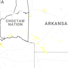

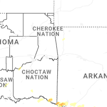


Connect with Interactive Hail Maps