

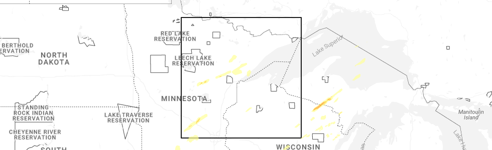
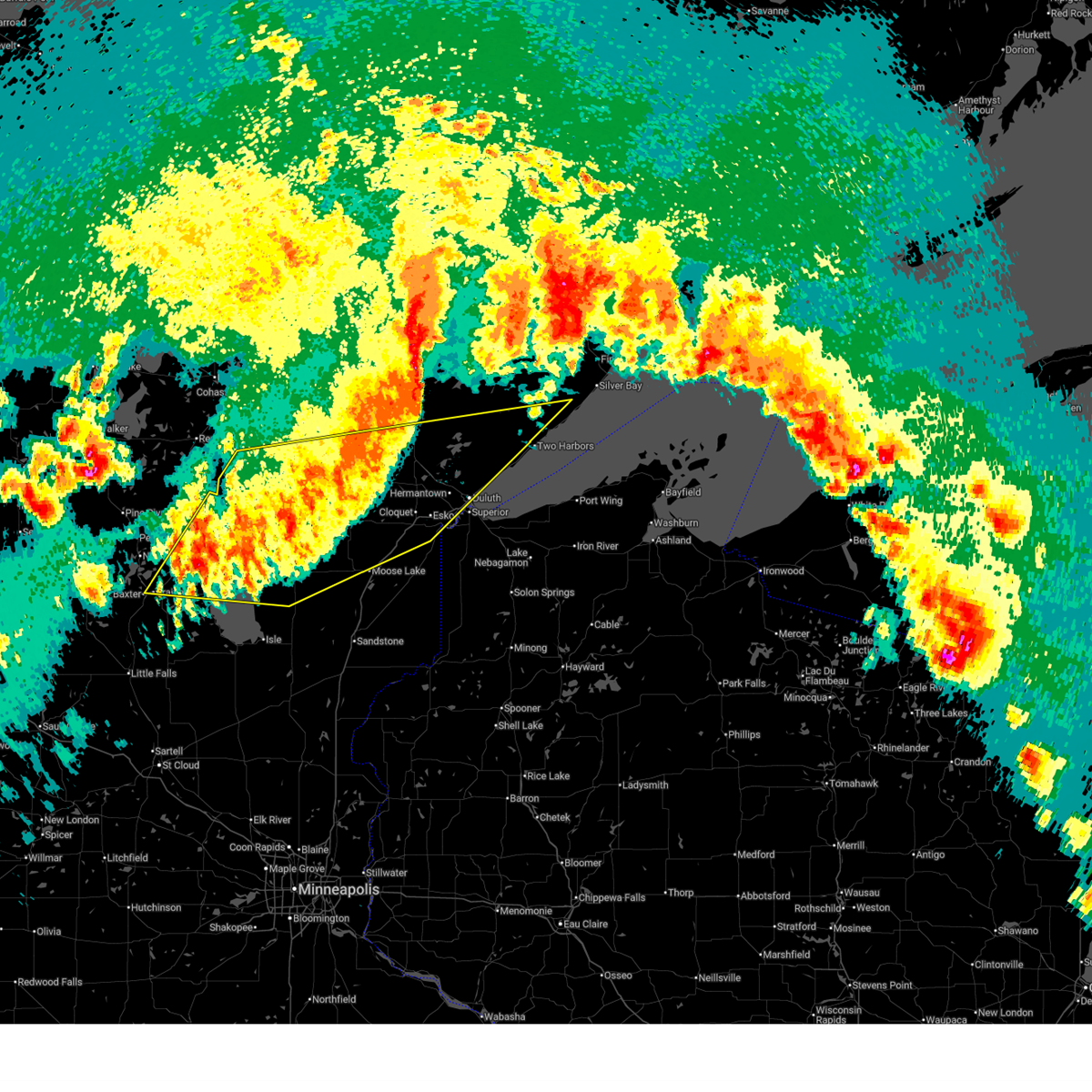
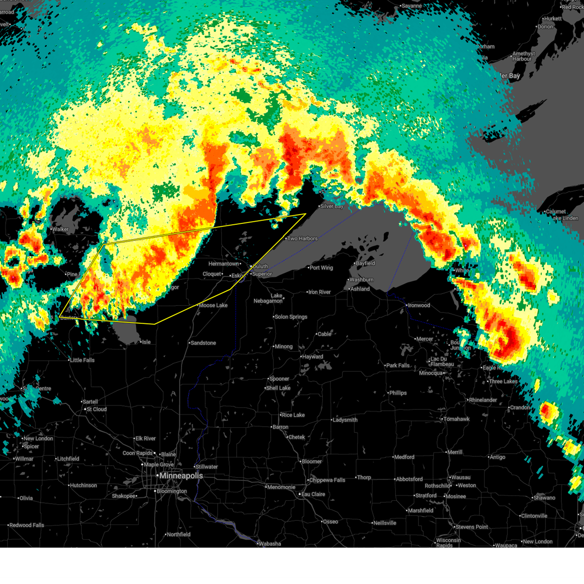
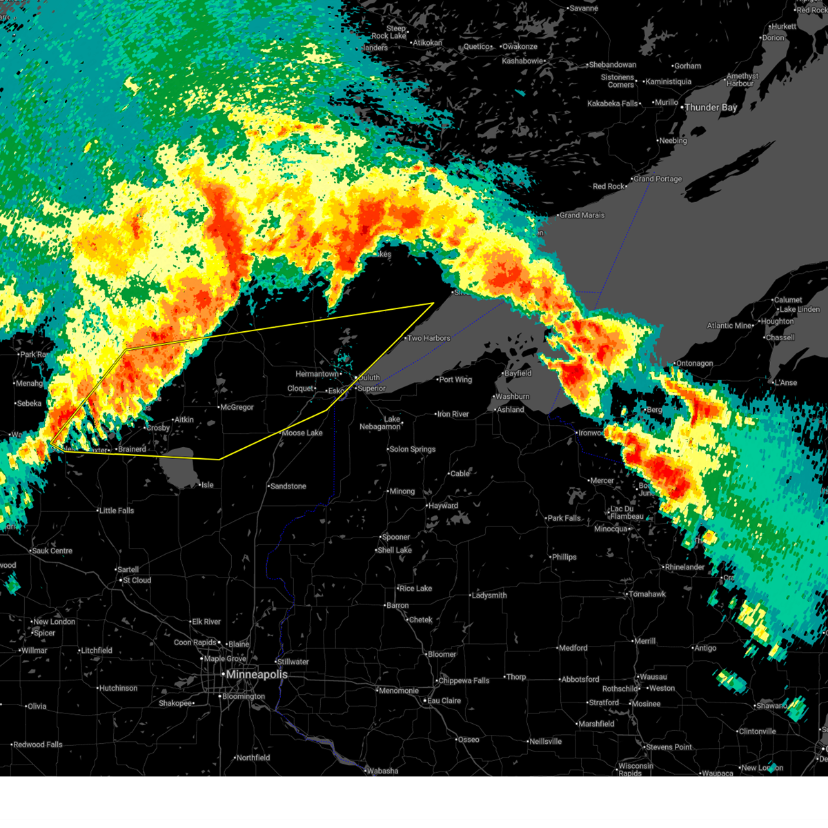
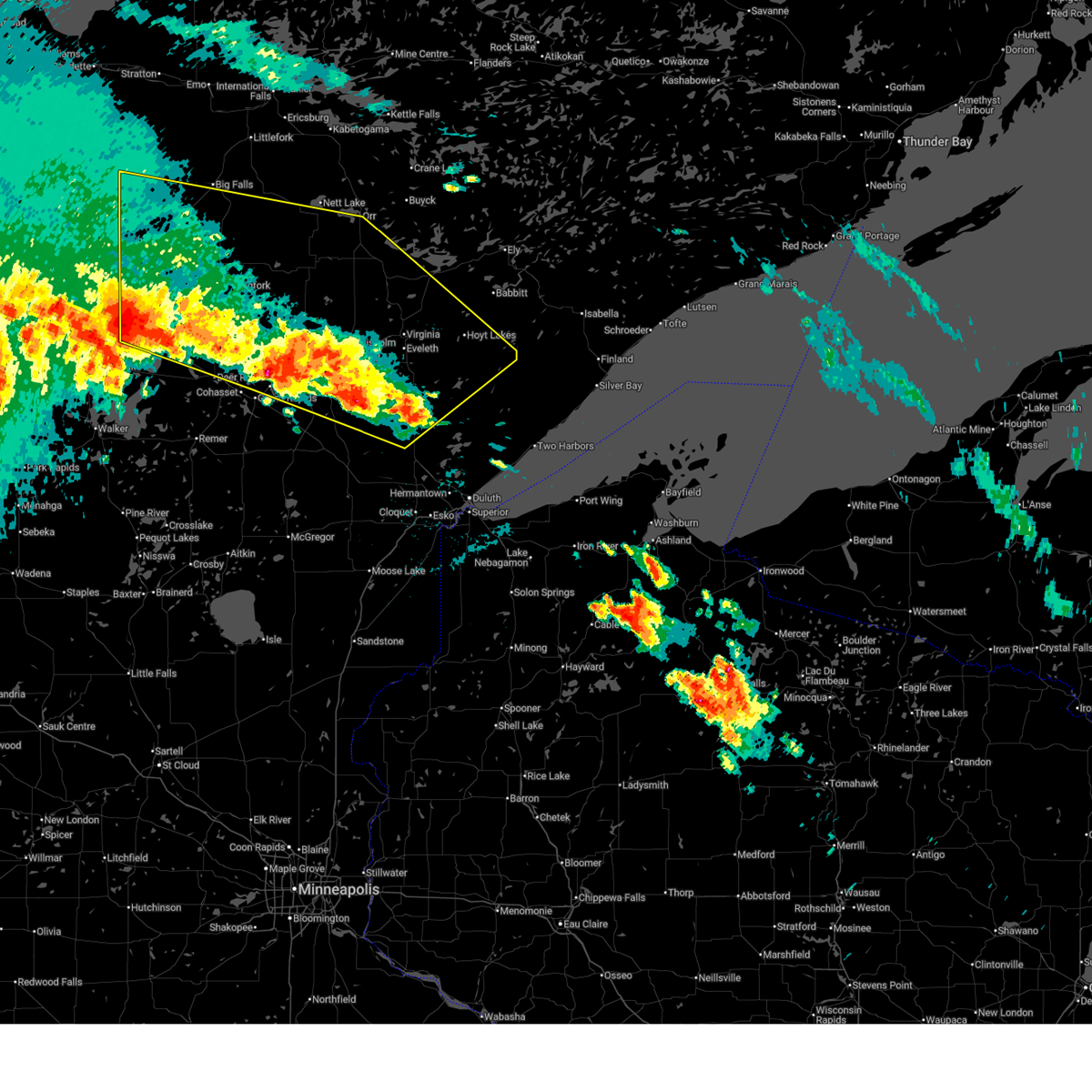
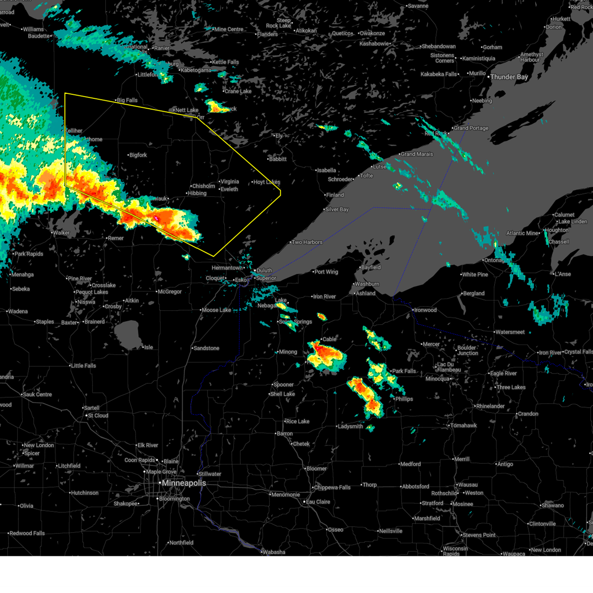
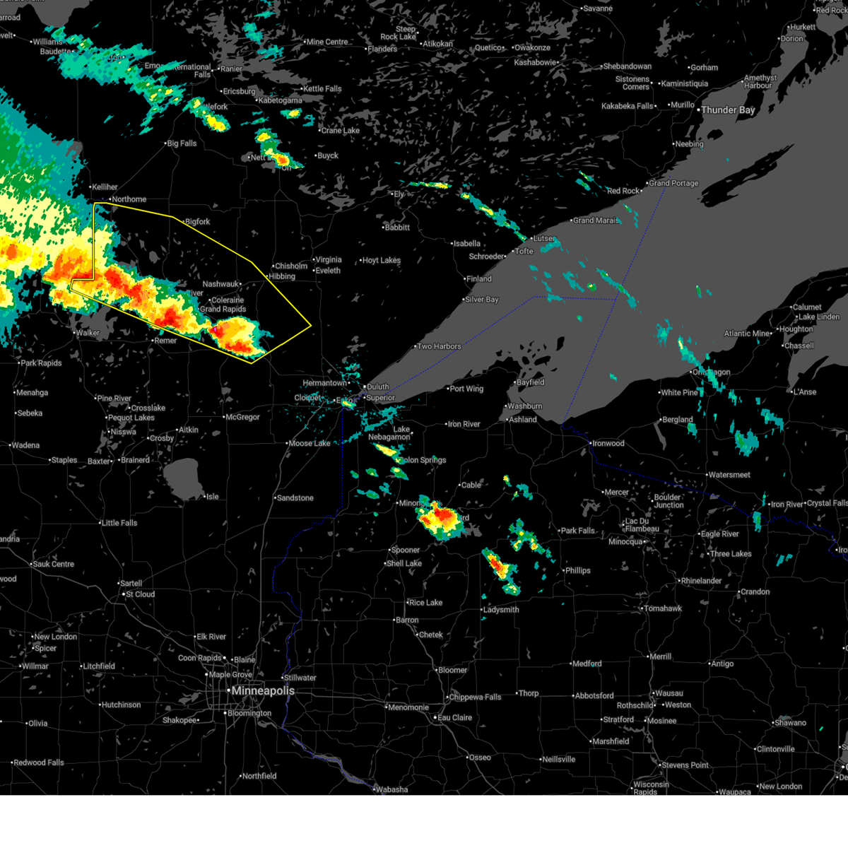
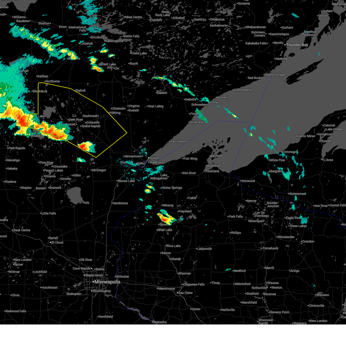
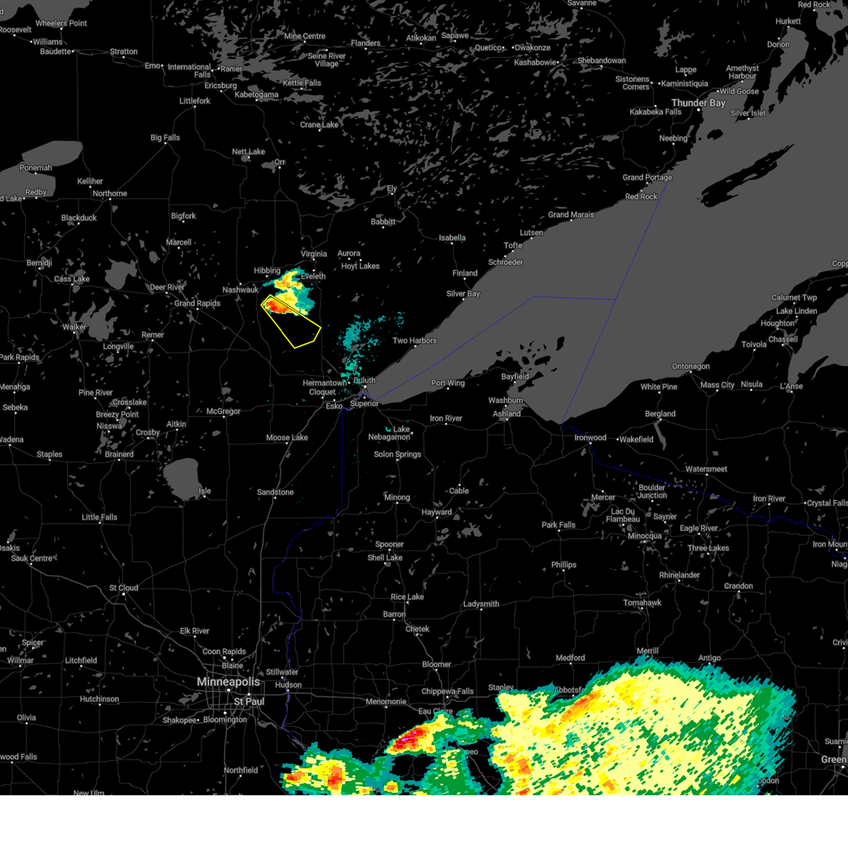
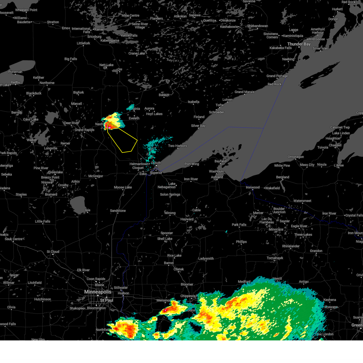
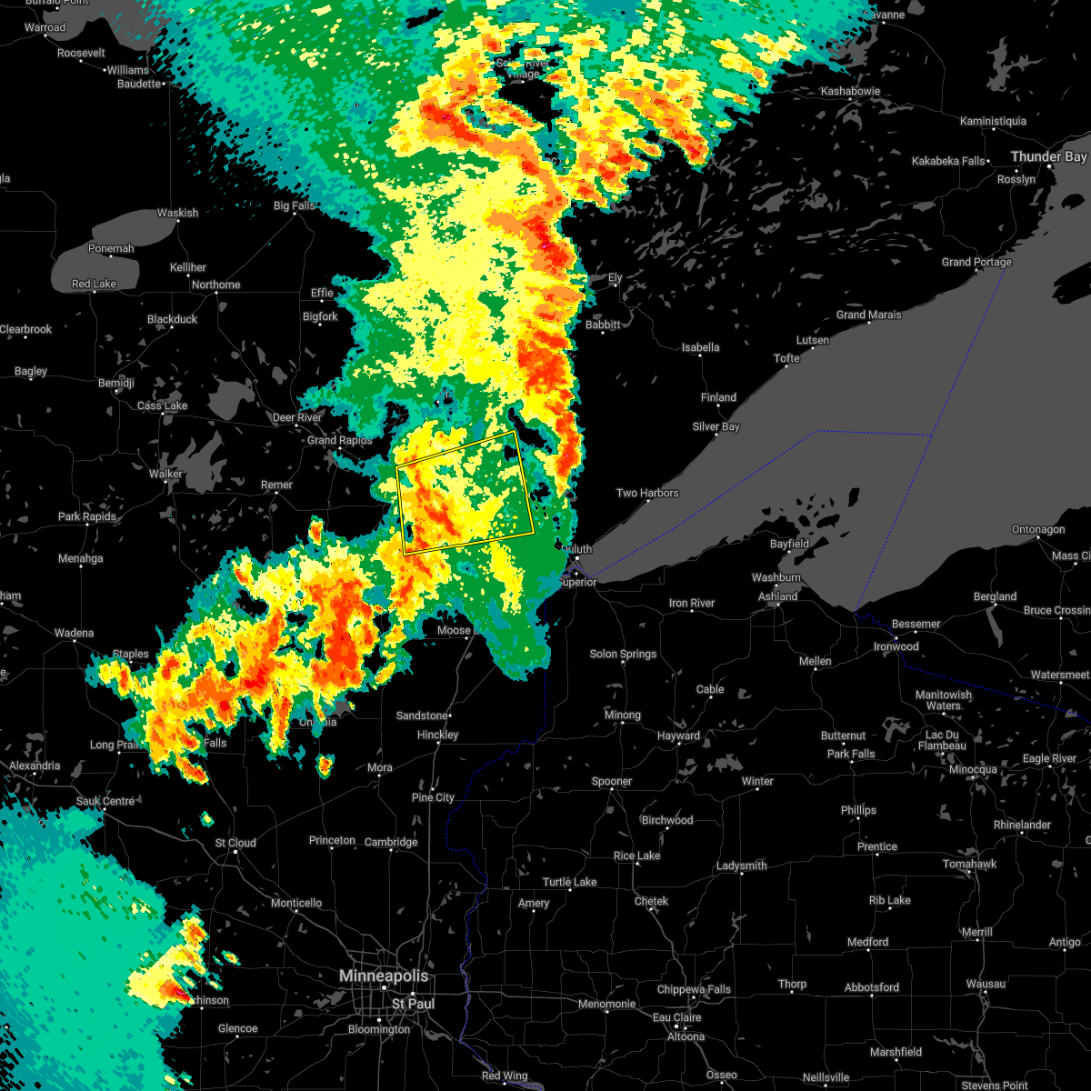
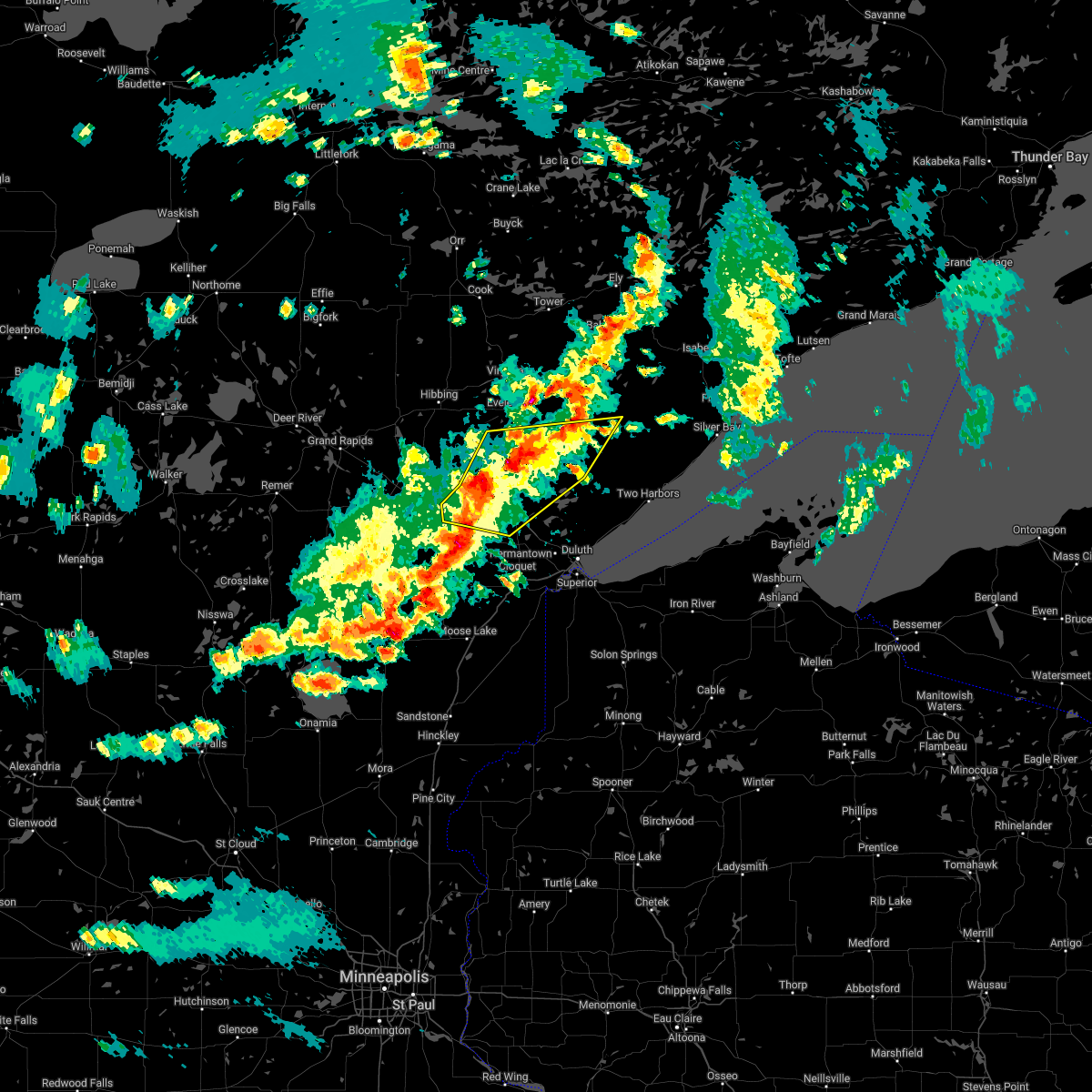
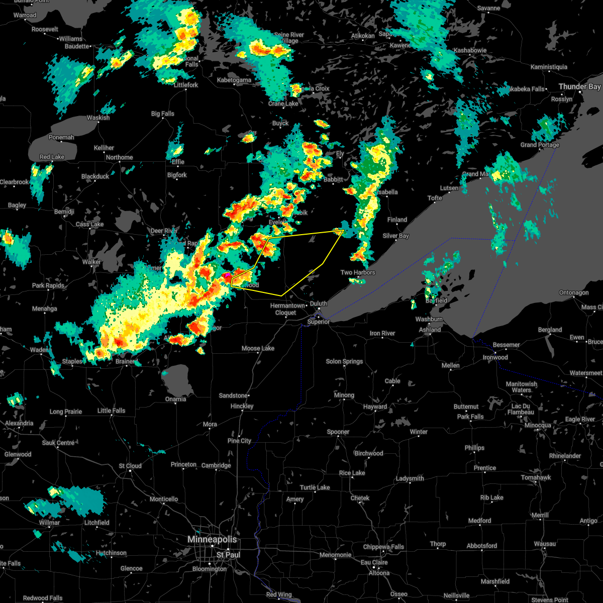
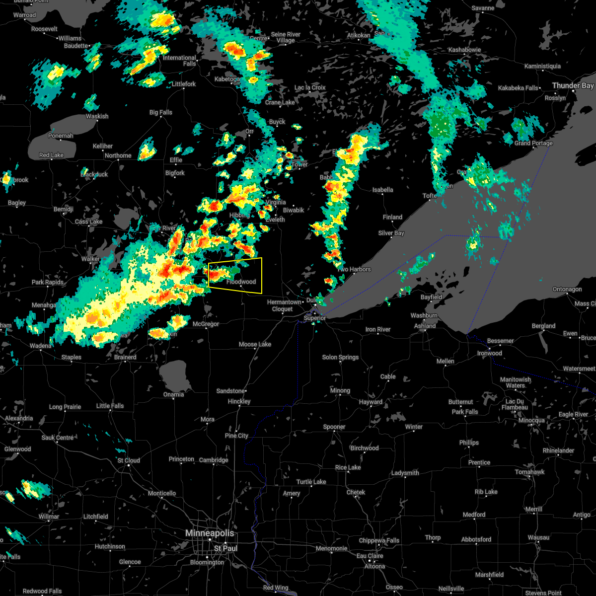
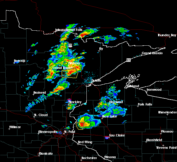
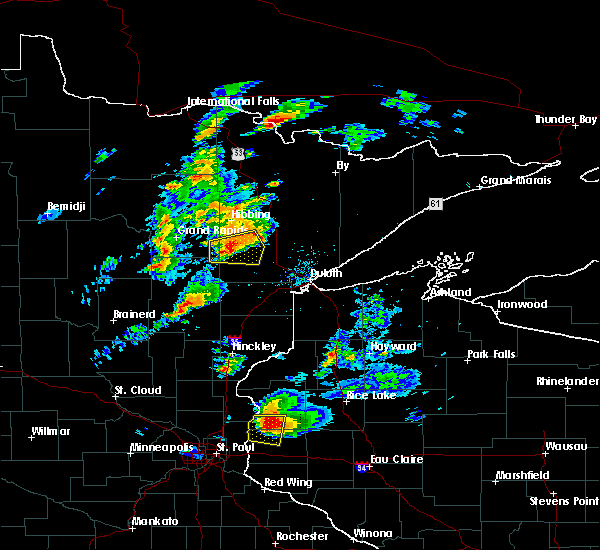
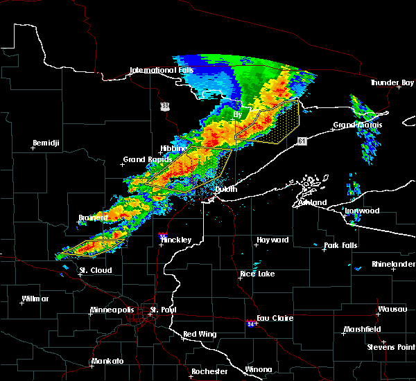
Hail Map for Meadowlands, MN
The Meadowlands, MN area has had 8 reports of on-the-ground hail by trained spotters, and has been under severe weather warnings 15 times during the past 12 months. Doppler radar has detected hail at or near Meadowlands, MN on 32 occasions, including 1 occasion during the past year.
| Name: | Meadowlands, MN |
| Where Located: | 35.8 miles WNW of Duluth, MN |
| Map: | Google Map for Meadowlands, MN |
| Population: | 134 |
| Housing Units: | 78 |
| More Info: | Search Google for Meadowlands, MN |
0
The Top Recent Hail Date for Meadowlands, MN is Monday, April 28, 2025 (30th out of 32)
Hail and Wind Damage Spotted near Meadowlands, MN
| Date / Time | Report Details |
|---|---|
| 6/23/2025 3:45 AM CDT |
 the severe thunderstorm warning has been cancelled and is no longer in effect the severe thunderstorm warning has been cancelled and is no longer in effect
|
| 6/23/2025 3:45 AM CDT |
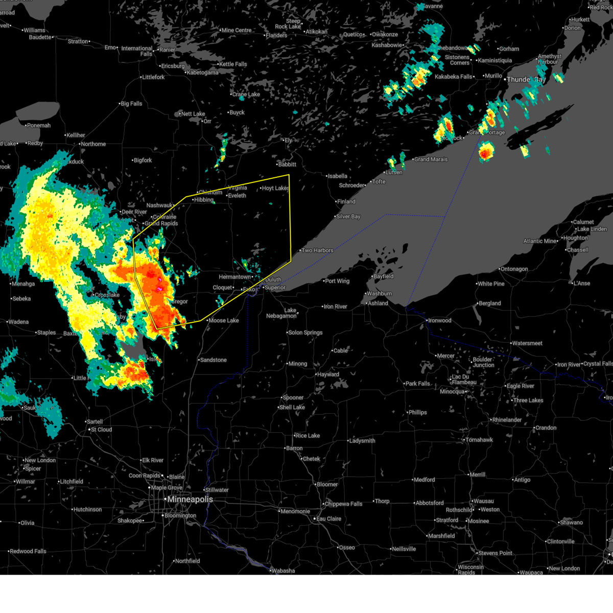
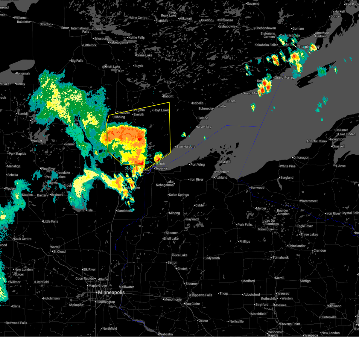 At 344 am cdt, severe thunderstorms were located along a line extending from near cherry to 9 miles southeast of eveleth to 6 miles south of whiteface reservoir to hermantown, moving northeast at 65 mph (radar indicated). Hazards include 60 mph wind gusts and quarter size hail. Hail damage to vehicles is expected. expect wind damage to roofs, siding, and trees. Locations impacted include, duluth, hibbing, hermantown, virginia, chisholm, eveleth, proctor, mountain iron, hoyt lakes, gilbert, aurora, babbitt, buhl, biwabik, cherry, floodwood, cotton, toivola, brookston, and meadowlands. At 344 am cdt, severe thunderstorms were located along a line extending from near cherry to 9 miles southeast of eveleth to 6 miles south of whiteface reservoir to hermantown, moving northeast at 65 mph (radar indicated). Hazards include 60 mph wind gusts and quarter size hail. Hail damage to vehicles is expected. expect wind damage to roofs, siding, and trees. Locations impacted include, duluth, hibbing, hermantown, virginia, chisholm, eveleth, proctor, mountain iron, hoyt lakes, gilbert, aurora, babbitt, buhl, biwabik, cherry, floodwood, cotton, toivola, brookston, and meadowlands.
|
| 6/23/2025 3:30 AM CDT |
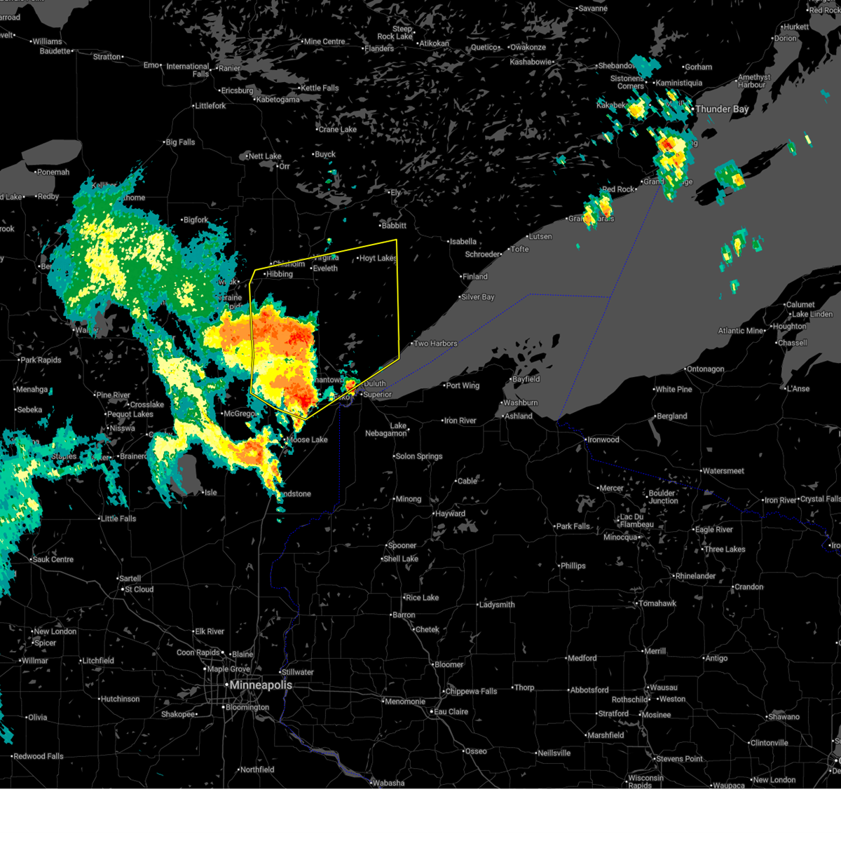 At 330 am cdt, severe thunderstorms were located along a line extending from 12 miles northeast of swan river to near toivola to near canyon to near mahtowa, moving northeast at 65 mph (radar indicated). Hazards include 60 mph wind gusts and nickel size hail. Expect damage to roofs, siding, and trees. Locations impacted include, hibbing, cloquet, hermantown, scanlon, carlton, cotton, thomson, pike lake near duluth, saginaw, fond du lac band cloquet area, island lake, boulder lake, duluth, proctor, cherry, whiteface reservoir, city of rice lake, eveleth, mountain iron, gilbert, virginia, hoyt lakes, fairbanks, wolf lake, aurora, babbitt, biwabik, brimson, mcquade harbor and french river. At 330 am cdt, severe thunderstorms were located along a line extending from 12 miles northeast of swan river to near toivola to near canyon to near mahtowa, moving northeast at 65 mph (radar indicated). Hazards include 60 mph wind gusts and nickel size hail. Expect damage to roofs, siding, and trees. Locations impacted include, hibbing, cloquet, hermantown, scanlon, carlton, cotton, thomson, pike lake near duluth, saginaw, fond du lac band cloquet area, island lake, boulder lake, duluth, proctor, cherry, whiteface reservoir, city of rice lake, eveleth, mountain iron, gilbert, virginia, hoyt lakes, fairbanks, wolf lake, aurora, babbitt, biwabik, brimson, mcquade harbor and french river.
|
| 6/23/2025 3:30 AM CDT |
 the severe thunderstorm warning has been cancelled and is no longer in effect the severe thunderstorm warning has been cancelled and is no longer in effect
|
| 6/23/2025 3:02 AM CDT |
 Svrdlh the national weather service in duluth mn has issued a * severe thunderstorm warning for, southeastern itasca county in north central minnesota, northeastern aitkin county in east central minnesota, southern st. louis county in northeastern minnesota, carlton county in northeastern minnesota, * until 400 am cdt. * at 301 am cdt, severe thunderstorms were located along a line extending from near hill city to jacobson to near cromwell to 8 miles west of kettle river, moving northeast at 55 mph (radar indicated. wind gusts to 62 mph have been observerd with this storm in aitkin county). Hazards include 70 mph wind gusts and quarter size hail. Hail damage to vehicles is expected. expect considerable tree damage. wind damage is also likely to mobile homes, roofs, and outbuildings. severe thunderstorms will be near, swan river, cromwell, kettle river, jacobson, and savanna portage state park around 305 am cdt. floodwood, warba, fond du lac band sawyer area, and fond du lac band brookston area around 310 am cdt. cloquet, mahtowa, brookston, meadowlands, and fond du lac band cloquet area around 320 am cdt. Other locations in the path of these severe thunderstorms include toivola, scanlon, carlton, saginaw, hibbing, hermantown, thomson, canyon, pike lake near duluth, jay cooke state park, proctor, cotton, island lake, duluth, city of rice lake and boulder lake. Svrdlh the national weather service in duluth mn has issued a * severe thunderstorm warning for, southeastern itasca county in north central minnesota, northeastern aitkin county in east central minnesota, southern st. louis county in northeastern minnesota, carlton county in northeastern minnesota, * until 400 am cdt. * at 301 am cdt, severe thunderstorms were located along a line extending from near hill city to jacobson to near cromwell to 8 miles west of kettle river, moving northeast at 55 mph (radar indicated. wind gusts to 62 mph have been observerd with this storm in aitkin county). Hazards include 70 mph wind gusts and quarter size hail. Hail damage to vehicles is expected. expect considerable tree damage. wind damage is also likely to mobile homes, roofs, and outbuildings. severe thunderstorms will be near, swan river, cromwell, kettle river, jacobson, and savanna portage state park around 305 am cdt. floodwood, warba, fond du lac band sawyer area, and fond du lac band brookston area around 310 am cdt. cloquet, mahtowa, brookston, meadowlands, and fond du lac band cloquet area around 320 am cdt. Other locations in the path of these severe thunderstorms include toivola, scanlon, carlton, saginaw, hibbing, hermantown, thomson, canyon, pike lake near duluth, jay cooke state park, proctor, cotton, island lake, duluth, city of rice lake and boulder lake.
|
| 6/21/2025 2:40 AM CDT |
 the severe thunderstorm warning has been cancelled and is no longer in effect the severe thunderstorm warning has been cancelled and is no longer in effect
|
| 6/21/2025 2:40 AM CDT |
 At 240 am cdt, severe thunderstorms were located along a line extending from cotton to near cromwell to near upper south long lake, moving east at 55 mph (radar indicated). Hazards include 70 mph wind gusts and penny size hail. Expect considerable tree damage. damage is likely to mobile homes, roofs, and outbuildings. Locations impacted include, duluth, superior, brainerd, cloquet, big sandy lake, mille lacs lake, hermantown, baxter, proctor, crosby, aitkin, scanlon, carlton, hill city, mahtowa, barnum, ironton, deerwood, floodwood, and wrenshall. At 240 am cdt, severe thunderstorms were located along a line extending from cotton to near cromwell to near upper south long lake, moving east at 55 mph (radar indicated). Hazards include 70 mph wind gusts and penny size hail. Expect considerable tree damage. damage is likely to mobile homes, roofs, and outbuildings. Locations impacted include, duluth, superior, brainerd, cloquet, big sandy lake, mille lacs lake, hermantown, baxter, proctor, crosby, aitkin, scanlon, carlton, hill city, mahtowa, barnum, ironton, deerwood, floodwood, and wrenshall.
|
| 6/21/2025 2:30 AM CDT |
 At 230 am cdt, severe thunderstorms were located along a line extending from 6 miles west of cotton to near tamarack to near brainerd, moving east at 55 mph (radar indicated). Hazards include 70 mph wind gusts and penny size hail. Expect considerable tree damage. damage is likely to mobile homes, roofs, and outbuildings. Locations impacted include, mille lacs lake, mcgregor, tamarack, mille lacs band east lake area, fond du lac band brookston area, cromwell, brookston, canyon, fond du lac band sawyer area, malmo, cloquet, saginaw, fond du lac band cloquet area, island lake, boulder lake, hermantown, mahtowa, kettle river, pike lake near duluth, duluth, scanlon, carlton, barnum, thomson, city of rice lake, jay cooke state park, proctor, moose lake, wrenshall and superior. At 230 am cdt, severe thunderstorms were located along a line extending from 6 miles west of cotton to near tamarack to near brainerd, moving east at 55 mph (radar indicated). Hazards include 70 mph wind gusts and penny size hail. Expect considerable tree damage. damage is likely to mobile homes, roofs, and outbuildings. Locations impacted include, mille lacs lake, mcgregor, tamarack, mille lacs band east lake area, fond du lac band brookston area, cromwell, brookston, canyon, fond du lac band sawyer area, malmo, cloquet, saginaw, fond du lac band cloquet area, island lake, boulder lake, hermantown, mahtowa, kettle river, pike lake near duluth, duluth, scanlon, carlton, barnum, thomson, city of rice lake, jay cooke state park, proctor, moose lake, wrenshall and superior.
|
| 6/21/2025 1:59 AM CDT |
 Svrdlh the national weather service in duluth mn has issued a * severe thunderstorm warning for, southeastern itasca county in north central minnesota, aitkin county in east central minnesota, southern cass county in north central minnesota, northern pine county in east central minnesota, southern st. louis county in northeastern minnesota, carlton county in northeastern minnesota, crow wing county in east central minnesota, southwestern lake county in northeastern minnesota, * until 300 am cdt. * at 159 am cdt, severe thunderstorms were located along a line extending from near pengilly to 6 miles south of swatara to near staples airport, moving east at 55 mph (radar indicated). Hazards include 70 mph wind gusts and penny size hail. Expect considerable tree damage. damage is likely to mobile homes, roofs, and outbuildings. severe thunderstorms will be near, breezy point, pequot lakes, crosslake, nisswa, gull lake, jacobson, and merrifield around 205 am cdt. brainerd, baxter, crosby, ironton, cuyuna, palisade, and cuyuna country state park around 210 am cdt. big sandy lake, deerwood, libby, and savanna portage state park around 215 am cdt. Other locations in the path of these severe thunderstorms include aitkin, floodwood, mcgregor, meadowlands, upper south long lake, tamarack, mille lacs lake, garrison, mille lacs band east lake area, fond du lac band brookston area, cromwell, brookston, canyon and fond du lac band sawyer area. Svrdlh the national weather service in duluth mn has issued a * severe thunderstorm warning for, southeastern itasca county in north central minnesota, aitkin county in east central minnesota, southern cass county in north central minnesota, northern pine county in east central minnesota, southern st. louis county in northeastern minnesota, carlton county in northeastern minnesota, crow wing county in east central minnesota, southwestern lake county in northeastern minnesota, * until 300 am cdt. * at 159 am cdt, severe thunderstorms were located along a line extending from near pengilly to 6 miles south of swatara to near staples airport, moving east at 55 mph (radar indicated). Hazards include 70 mph wind gusts and penny size hail. Expect considerable tree damage. damage is likely to mobile homes, roofs, and outbuildings. severe thunderstorms will be near, breezy point, pequot lakes, crosslake, nisswa, gull lake, jacobson, and merrifield around 205 am cdt. brainerd, baxter, crosby, ironton, cuyuna, palisade, and cuyuna country state park around 210 am cdt. big sandy lake, deerwood, libby, and savanna portage state park around 215 am cdt. Other locations in the path of these severe thunderstorms include aitkin, floodwood, mcgregor, meadowlands, upper south long lake, tamarack, mille lacs lake, garrison, mille lacs band east lake area, fond du lac band brookston area, cromwell, brookston, canyon and fond du lac band sawyer area.
|
| 6/21/2025 12:26 AM CDT | Quarter sized hail reported 9.9 miles SSE of Meadowlands, MN |
| 6/21/2025 12:22 AM CDT |
 At 1221 am cdt, severe thunderstorms were located along a line extending from 6 miles northeast of inger to 8 miles north of hill annex mine state park to 7 miles north of toivola, moving northeast at 45 mph (radar indicated). Hazards include tennis ball size hail and 70 mph wind gusts. People and animals outdoors will be injured. expect hail damage to roofs, siding, windows, and vehicles. expect considerable tree damage. wind damage is also likely to mobile homes, roofs, and outbuildings. Locations impacted include, hibbing, keewatin, nashwauk, marcell, chisholm, cherry, bigfork, scenic state park, mountain iron, buhl, eveleth, effie, virginia, gilbert, mccarthy beach state park, biwabik, togo, cook and meadow brook. At 1221 am cdt, severe thunderstorms were located along a line extending from 6 miles northeast of inger to 8 miles north of hill annex mine state park to 7 miles north of toivola, moving northeast at 45 mph (radar indicated). Hazards include tennis ball size hail and 70 mph wind gusts. People and animals outdoors will be injured. expect hail damage to roofs, siding, windows, and vehicles. expect considerable tree damage. wind damage is also likely to mobile homes, roofs, and outbuildings. Locations impacted include, hibbing, keewatin, nashwauk, marcell, chisholm, cherry, bigfork, scenic state park, mountain iron, buhl, eveleth, effie, virginia, gilbert, mccarthy beach state park, biwabik, togo, cook and meadow brook.
|
| 6/21/2025 12:04 AM CDT |
 Svrdlh the national weather service in duluth mn has issued a * severe thunderstorm warning for, itasca county in north central minnesota, northeastern cass county in north central minnesota, southern koochiching county in north central minnesota, southern st. louis county in northeastern minnesota, * until 100 am cdt. * at 1204 am cdt, severe thunderstorms were located along a line extending from near inger to near coleraine to 8 miles northeast of swan river, moving northeast at 45 mph (radar indicated). Hazards include golf ball size hail and 60 mph wind gusts. People and animals outdoors will be injured. expect hail damage to roofs, siding, windows, and vehicles. expect wind damage to roofs, siding, and trees. severe thunderstorms will be near, hibbing, nashwauk, taconite, inger, hill annex mine state park, and pengilly around 1210 am cdt. keewatin and marcell around 1215 am cdt. Other locations in the path of these severe thunderstorms include chisholm, cherry, bigfork, scenic state park, mountain iron, buhl, virginia, eveleth, gilbert, effie, mccarthy beach state park and togo. Svrdlh the national weather service in duluth mn has issued a * severe thunderstorm warning for, itasca county in north central minnesota, northeastern cass county in north central minnesota, southern koochiching county in north central minnesota, southern st. louis county in northeastern minnesota, * until 100 am cdt. * at 1204 am cdt, severe thunderstorms were located along a line extending from near inger to near coleraine to 8 miles northeast of swan river, moving northeast at 45 mph (radar indicated). Hazards include golf ball size hail and 60 mph wind gusts. People and animals outdoors will be injured. expect hail damage to roofs, siding, windows, and vehicles. expect wind damage to roofs, siding, and trees. severe thunderstorms will be near, hibbing, nashwauk, taconite, inger, hill annex mine state park, and pengilly around 1210 am cdt. keewatin and marcell around 1215 am cdt. Other locations in the path of these severe thunderstorms include chisholm, cherry, bigfork, scenic state park, mountain iron, buhl, virginia, eveleth, gilbert, effie, mccarthy beach state park and togo.
|
| 6/20/2025 11:57 PM CDT |
 the severe thunderstorm warning has been cancelled and is no longer in effect the severe thunderstorm warning has been cancelled and is no longer in effect
|
| 6/20/2025 11:57 PM CDT |
 At 1157 pm cdt, severe thunderstorms were located along a line extending from ball club to grand rapids to near warba, moving northeast at 30 mph (radar indicated). Hazards include golf ball size hail and 60 mph wind gusts. People and animals outdoors will be injured. expect hail damage to roofs, siding, windows, and vehicles. expect wind damage to roofs, siding, and trees. Locations impacted include, hibbing, grand rapids, cohasset, coleraine, keewatin, nashwauk, deer river, swan river, marcell, bigfork, taconite, warba, toivola, meadowlands, bena, squaw lake, zemple, alvwood, pengilly, and lake winnibigoshish. At 1157 pm cdt, severe thunderstorms were located along a line extending from ball club to grand rapids to near warba, moving northeast at 30 mph (radar indicated). Hazards include golf ball size hail and 60 mph wind gusts. People and animals outdoors will be injured. expect hail damage to roofs, siding, windows, and vehicles. expect wind damage to roofs, siding, and trees. Locations impacted include, hibbing, grand rapids, cohasset, coleraine, keewatin, nashwauk, deer river, swan river, marcell, bigfork, taconite, warba, toivola, meadowlands, bena, squaw lake, zemple, alvwood, pengilly, and lake winnibigoshish.
|
| 6/20/2025 11:44 PM CDT |
 At 1144 pm cdt, severe thunderstorms were located along a line extending from near ball club to near pokegama dam to near jacobson, moving northeast at 30 mph (radar indicated). Hazards include 60 mph wind gusts and quarter size hail. Hail damage to vehicles is expected. expect wind damage to roofs, siding, and trees. Locations impacted include, grand rapids, cohasset, coleraine, deer river, warba, zemple, ball club, pokegama dam, days high landing, gunn, swan river, taconite, nashwauk, hill annex mine state park, pengilly, hibbing and keewatin. At 1144 pm cdt, severe thunderstorms were located along a line extending from near ball club to near pokegama dam to near jacobson, moving northeast at 30 mph (radar indicated). Hazards include 60 mph wind gusts and quarter size hail. Hail damage to vehicles is expected. expect wind damage to roofs, siding, and trees. Locations impacted include, grand rapids, cohasset, coleraine, deer river, warba, zemple, ball club, pokegama dam, days high landing, gunn, swan river, taconite, nashwauk, hill annex mine state park, pengilly, hibbing and keewatin.
|
| 6/20/2025 11:24 PM CDT |
 Svrdlh the national weather service in duluth mn has issued a * severe thunderstorm warning for, itasca county in north central minnesota, northeastern aitkin county in east central minnesota, northern cass county in north central minnesota, southwestern st. louis county in northeastern minnesota, * until 1230 am cdt. * at 1123 pm cdt, severe thunderstorms were located along a line extending from near boy river to 6 miles northeast of remer to near hill city, moving northeast at 30 mph (radar indicated). Hazards include 60 mph wind gusts and quarter size hail. Hail damage to vehicles is expected. expect wind damage to roofs, siding, and trees. severe thunderstorms will be near, cohasset and federal dam around 1130 pm cdt. days high landing, schoolcraft state park, and pokegama lake around 1135 pm cdt. grand rapids and ball club around 1140 pm cdt. Other locations in the path of these severe thunderstorms include coleraine, warba, zemple, pokegama dam, gunn, deer river, swan river, taconite, hill annex mine state park, nashwauk and pengilly. Svrdlh the national weather service in duluth mn has issued a * severe thunderstorm warning for, itasca county in north central minnesota, northeastern aitkin county in east central minnesota, northern cass county in north central minnesota, southwestern st. louis county in northeastern minnesota, * until 1230 am cdt. * at 1123 pm cdt, severe thunderstorms were located along a line extending from near boy river to 6 miles northeast of remer to near hill city, moving northeast at 30 mph (radar indicated). Hazards include 60 mph wind gusts and quarter size hail. Hail damage to vehicles is expected. expect wind damage to roofs, siding, and trees. severe thunderstorms will be near, cohasset and federal dam around 1130 pm cdt. days high landing, schoolcraft state park, and pokegama lake around 1135 pm cdt. grand rapids and ball club around 1140 pm cdt. Other locations in the path of these severe thunderstorms include coleraine, warba, zemple, pokegama dam, gunn, deer river, swan river, taconite, hill annex mine state park, nashwauk and pengilly.
|
| 9/19/2024 5:05 PM CDT | Multiple trees down along the highway via photo from social medi in st. louis county MN, 12.5 miles W of Meadowlands, MN |
| 7/31/2024 5:24 PM CDT | Report from mping of 1-inch tree limbs broken and shingles blown of in st. louis county MN, 9.9 miles SSE of Meadowlands, MN |
| 6/13/2024 2:00 AM CDT |
 the severe thunderstorm warning has been cancelled and is no longer in effect the severe thunderstorm warning has been cancelled and is no longer in effect
|
| 6/13/2024 1:57 AM CDT |
 At 157 am cdt, a severe thunderstorm was located over toivola, or 16 miles south of hibbing, moving southeast at 40 mph (radar indicated). Hazards include quarter size hail. Damage to vehicles is expected. Locations impacted include, hibbing, toivola, meadowlands, elmer, kelsey, nichols lake, and payne. At 157 am cdt, a severe thunderstorm was located over toivola, or 16 miles south of hibbing, moving southeast at 40 mph (radar indicated). Hazards include quarter size hail. Damage to vehicles is expected. Locations impacted include, hibbing, toivola, meadowlands, elmer, kelsey, nichols lake, and payne.
|
| 6/13/2024 1:41 AM CDT |
 the severe thunderstorm warning has been cancelled and is no longer in effect the severe thunderstorm warning has been cancelled and is no longer in effect
|
| 6/13/2024 1:41 AM CDT |
 At 141 am cdt, a severe thunderstorm was located 10 miles south of hibbing, moving southeast at 40 mph (radar indicated). Hazards include quarter size hail. Damage to vehicles is expected. Locations impacted include, toivola and meadowlands. At 141 am cdt, a severe thunderstorm was located 10 miles south of hibbing, moving southeast at 40 mph (radar indicated). Hazards include quarter size hail. Damage to vehicles is expected. Locations impacted include, toivola and meadowlands.
|
| 6/13/2024 1:25 AM CDT |
 Svrdlh the national weather service in duluth mn has issued a * severe thunderstorm warning for, east central itasca county in north central minnesota, southwestern st. louis county in northeastern minnesota, * until 215 am cdt. * at 124 am cdt, a severe thunderstorm was located over pengilly, or 12 miles west of hibbing, moving southeast at 40 mph (radar indicated). Hazards include ping pong ball size hail. People and animals outdoors will be injured. expect damage to roofs, siding, windows, and vehicles. this severe thunderstorm will be near, hibbing and nashwauk around 130 am cdt. Other locations in the path of this severe thunderstorm include toivola and meadowlands. Svrdlh the national weather service in duluth mn has issued a * severe thunderstorm warning for, east central itasca county in north central minnesota, southwestern st. louis county in northeastern minnesota, * until 215 am cdt. * at 124 am cdt, a severe thunderstorm was located over pengilly, or 12 miles west of hibbing, moving southeast at 40 mph (radar indicated). Hazards include ping pong ball size hail. People and animals outdoors will be injured. expect damage to roofs, siding, windows, and vehicles. this severe thunderstorm will be near, hibbing and nashwauk around 130 am cdt. Other locations in the path of this severe thunderstorm include toivola and meadowlands.
|
| 6/12/2024 6:30 PM CDT |
 At 629 pm cdt, a severe thunderstorm was located near tamarack, or 11 miles east of big sandy lake, moving east at 55 mph (radar indicated). Hazards include ping pong ball size hail and 60 mph wind gusts. People and animals outdoors will be injured. expect hail damage to roofs, siding, windows, and vehicles. expect wind damage to roofs, siding, and trees. Locations impacted include, cromwell and fond du lac band sawyer area. At 629 pm cdt, a severe thunderstorm was located near tamarack, or 11 miles east of big sandy lake, moving east at 55 mph (radar indicated). Hazards include ping pong ball size hail and 60 mph wind gusts. People and animals outdoors will be injured. expect hail damage to roofs, siding, windows, and vehicles. expect wind damage to roofs, siding, and trees. Locations impacted include, cromwell and fond du lac band sawyer area.
|
| 6/12/2024 6:03 PM CDT |
 Svrdlh the national weather service in duluth mn has issued a * severe thunderstorm warning for, southeastern itasca county in north central minnesota, northeastern aitkin county in east central minnesota, southern st. louis county in northeastern minnesota, northern carlton county in northeastern minnesota, * until 645 pm cdt. * at 602 pm cdt, severe thunderstorms were located along a line extending from near hibbing to near floodwood to near big sandy lake, moving east at 70 mph (radar indicated). Hazards include ping pong ball size hail and 60 mph wind gusts. People and animals outdoors will be injured. expect hail damage to roofs, siding, windows, and vehicles. expect wind damage to roofs, siding, and trees. severe thunderstorms will be near, floodwood, meadowlands, and fond du lac band brookston area around 610 pm cdt. cotton, brookston, and canyon around 615 pm cdt. fond du lac band sawyer area around 620 pm cdt. Other locations in the path of these severe thunderstorms include cloquet, pike lake near duluth, saginaw, boulder lake, island lake, whiteface reservoir, fond du lac band cloquet area, duluth, hermantown, scanlon, city of rice lake, proctor and wolf lake. Svrdlh the national weather service in duluth mn has issued a * severe thunderstorm warning for, southeastern itasca county in north central minnesota, northeastern aitkin county in east central minnesota, southern st. louis county in northeastern minnesota, northern carlton county in northeastern minnesota, * until 645 pm cdt. * at 602 pm cdt, severe thunderstorms were located along a line extending from near hibbing to near floodwood to near big sandy lake, moving east at 70 mph (radar indicated). Hazards include ping pong ball size hail and 60 mph wind gusts. People and animals outdoors will be injured. expect hail damage to roofs, siding, windows, and vehicles. expect wind damage to roofs, siding, and trees. severe thunderstorms will be near, floodwood, meadowlands, and fond du lac band brookston area around 610 pm cdt. cotton, brookston, and canyon around 615 pm cdt. fond du lac band sawyer area around 620 pm cdt. Other locations in the path of these severe thunderstorms include cloquet, pike lake near duluth, saginaw, boulder lake, island lake, whiteface reservoir, fond du lac band cloquet area, duluth, hermantown, scanlon, city of rice lake, proctor and wolf lake.
|
| 5/10/2024 5:16 PM CDT | Large tree down with a picture of where it clipped a house damaging the roof and gutters. also posted a video of frothy lake as the storm passed. from faceboo in st. louis county MN, 9.2 miles W of Meadowlands, MN |
| 7/19/2023 6:19 PM CDT |
 At 618 pm cdt, a severe thunderstorm capable of producing a tornado was located 7 miles southeast of pengilly, or 9 miles southwest of hibbing, moving southeast at 35 mph (radar indicated rotation). Hazards include tornado and quarter size hail. Flying debris will be dangerous to those caught without shelter. mobile homes will be damaged or destroyed. damage to roofs, windows, and vehicles will occur. tree damage is likely. this dangerous storm will be near, toivola around 645 pm cdt. meadowlands around 655 pm cdt. Other locations impacted by this tornadic thunderstorm include swan lake, elmer, hart lake, silica and little swan. At 618 pm cdt, a severe thunderstorm capable of producing a tornado was located 7 miles southeast of pengilly, or 9 miles southwest of hibbing, moving southeast at 35 mph (radar indicated rotation). Hazards include tornado and quarter size hail. Flying debris will be dangerous to those caught without shelter. mobile homes will be damaged or destroyed. damage to roofs, windows, and vehicles will occur. tree damage is likely. this dangerous storm will be near, toivola around 645 pm cdt. meadowlands around 655 pm cdt. Other locations impacted by this tornadic thunderstorm include swan lake, elmer, hart lake, silica and little swan.
|
| 7/19/2023 6:09 PM CDT |
 At 608 pm cdt, a severe thunderstorm capable of producing a tornado was located over pengilly, or 11 miles southwest of hibbing, moving southeast at 30 mph (radar indicated rotation). Hazards include tornado and ping pong ball size hail. Flying debris will be dangerous to those caught without shelter. mobile homes will be damaged or destroyed. damage to roofs, windows, and vehicles will occur. tree damage is likely. this dangerous storm will be near, toivola around 650 pm cdt. meadowlands around 700 pm cdt. Other locations impacted by this tornadic thunderstorm include hart lake, calumet, kelly lake, floodwood lake, swan lake, elmer, silica, zim, little swan and hill annex mine state park. At 608 pm cdt, a severe thunderstorm capable of producing a tornado was located over pengilly, or 11 miles southwest of hibbing, moving southeast at 30 mph (radar indicated rotation). Hazards include tornado and ping pong ball size hail. Flying debris will be dangerous to those caught without shelter. mobile homes will be damaged or destroyed. damage to roofs, windows, and vehicles will occur. tree damage is likely. this dangerous storm will be near, toivola around 650 pm cdt. meadowlands around 700 pm cdt. Other locations impacted by this tornadic thunderstorm include hart lake, calumet, kelly lake, floodwood lake, swan lake, elmer, silica, zim, little swan and hill annex mine state park.
|
| 8/28/2022 11:09 PM CDT | At 1109 pm cdt, a severe thunderstorm was located 7 miles east of toivola, or 20 miles southeast of hibbing, moving east at 20 mph (radar indicated). Hazards include 60 mph wind gusts and nickel size hail. expect damage to roofs, siding, and trees |
| 6/25/2022 12:51 AM CDT |
 The severe thunderstorm warning for east central aitkin, southern st. louis and northern carlton counties will expire at 100 am cdt, the storms which prompted the warning have weakened below severe limits, and no longer pose an immediate threat to life or property. therefore, the warning will be allowed to expire. however gusty winds to 40 mph are still possible with these thunderstorms. a severe thunderstorm watch remains in effect until 300 am cdt for northeastern and east central minnesota. The severe thunderstorm warning for east central aitkin, southern st. louis and northern carlton counties will expire at 100 am cdt, the storms which prompted the warning have weakened below severe limits, and no longer pose an immediate threat to life or property. therefore, the warning will be allowed to expire. however gusty winds to 40 mph are still possible with these thunderstorms. a severe thunderstorm watch remains in effect until 300 am cdt for northeastern and east central minnesota.
|
| 6/25/2022 12:42 AM CDT |
 At 1241 am cdt, severe thunderstorms were located along a line extending from 6 miles northwest of mountain iron, to 9 miles northwest of cotton, to near meadowlands, to near floodwood, to near tamarack, moving east at 45 mph (radar indicated). Hazards include 60 mph wind gusts. Expect damage to roofs, siding, and trees. these severe storms will be near, mountain iron around 1245 am cdt. virginia, eveleth and cotton around 1250 am cdt. gilbert and canyon around 1255 am cdt. brookston and fond du lac band sawyer area around 100 am cdt. biwabik and fond du lac band brookston area around 105 am cdt. cloquet, aurora, mahtowa, embarrass, saginaw and whiteface reservoir around 110 am cdt. hoyt lakes, fond du lac band cloquet area, island lake and boulder lake around 115 am cdt. scanlon, carlton and pike lake near duluth around 120 am cdt. other locations impacted by these severe thunderstorms include comstock lake, franklin, gowan, iron junction, grand lake, kinney, fredenberg, kelsey, wright and fish lake. hail threat, radar indicated max hail size, <. 75 in wind threat, radar indicated max wind gust, 60 mph. At 1241 am cdt, severe thunderstorms were located along a line extending from 6 miles northwest of mountain iron, to 9 miles northwest of cotton, to near meadowlands, to near floodwood, to near tamarack, moving east at 45 mph (radar indicated). Hazards include 60 mph wind gusts. Expect damage to roofs, siding, and trees. these severe storms will be near, mountain iron around 1245 am cdt. virginia, eveleth and cotton around 1250 am cdt. gilbert and canyon around 1255 am cdt. brookston and fond du lac band sawyer area around 100 am cdt. biwabik and fond du lac band brookston area around 105 am cdt. cloquet, aurora, mahtowa, embarrass, saginaw and whiteface reservoir around 110 am cdt. hoyt lakes, fond du lac band cloquet area, island lake and boulder lake around 115 am cdt. scanlon, carlton and pike lake near duluth around 120 am cdt. other locations impacted by these severe thunderstorms include comstock lake, franklin, gowan, iron junction, grand lake, kinney, fredenberg, kelsey, wright and fish lake. hail threat, radar indicated max hail size, <. 75 in wind threat, radar indicated max wind gust, 60 mph.
|
| 6/25/2022 12:25 AM CDT |
 At 1225 am cdt, severe thunderstorms were located along a line extending from 10 miles north of chisholm, to 8 miles southeast of hibbing, to 9 miles southwest of toivola, to 9 miles northeast of libby, to near big sandy lake, moving east at 50 mph (radar indicated). Hazards include 60 mph wind gusts and penny size hail. Expect damage to roofs, siding, and trees. these severe storms will be near, toivola around 1230 am cdt. meadowlands around 1235 am cdt. buhl and floodwood around 1240 am cdt. mountain iron around 1245 am cdt. virginia, eveleth, cotton and cromwell around 1250 am cdt. gilbert, brookston and canyon around 1255 am cdt. biwabik, fond du lac band brookston area and fond du lac band sawyer area around 100 am cdt. cloquet, aurora, mahtowa, saginaw and pike lake near duluth around 105 am cdt. other locations impacted by these severe thunderstorms include franklin, buck lake, side lake, kinney, swan lake, fish lake, silica, little swan, leonidas and west two rivers reservoir. hail threat, radar indicated max hail size, 0. 75 in wind threat, radar indicated max wind gust, 60 mph. At 1225 am cdt, severe thunderstorms were located along a line extending from 10 miles north of chisholm, to 8 miles southeast of hibbing, to 9 miles southwest of toivola, to 9 miles northeast of libby, to near big sandy lake, moving east at 50 mph (radar indicated). Hazards include 60 mph wind gusts and penny size hail. Expect damage to roofs, siding, and trees. these severe storms will be near, toivola around 1230 am cdt. meadowlands around 1235 am cdt. buhl and floodwood around 1240 am cdt. mountain iron around 1245 am cdt. virginia, eveleth, cotton and cromwell around 1250 am cdt. gilbert, brookston and canyon around 1255 am cdt. biwabik, fond du lac band brookston area and fond du lac band sawyer area around 100 am cdt. cloquet, aurora, mahtowa, saginaw and pike lake near duluth around 105 am cdt. other locations impacted by these severe thunderstorms include franklin, buck lake, side lake, kinney, swan lake, fish lake, silica, little swan, leonidas and west two rivers reservoir. hail threat, radar indicated max hail size, 0. 75 in wind threat, radar indicated max wind gust, 60 mph.
|
| 6/25/2022 12:12 AM CDT |
 At 1212 am cdt, severe thunderstorms were located along a line extending from 10 miles south of togo, to near pengilly, to near swan river, to 6 miles south of jacobson, to 6 miles north of palisade, moving east at 50 mph (radar indicated). Hazards include 70 mph wind gusts and quarter size hail. Hail damage to vehicles is expected. expect considerable tree damage. wind damage is also likely to mobile homes, roofs, and outbuildings. these severe storms will be near, hibbing around 1220 am cdt. Other locations in the path of these severe thunderstorms include floodwood, toivola, tamarack, buhl, meadowlands, mountain iron, virginia, eveleth, cotton, cromwell, gilbert, brookston, canyon, fond du lac band brookston area, cloquet, fond du lac band sawyer area, biwabik and saginaw. At 1212 am cdt, severe thunderstorms were located along a line extending from 10 miles south of togo, to near pengilly, to near swan river, to 6 miles south of jacobson, to 6 miles north of palisade, moving east at 50 mph (radar indicated). Hazards include 70 mph wind gusts and quarter size hail. Hail damage to vehicles is expected. expect considerable tree damage. wind damage is also likely to mobile homes, roofs, and outbuildings. these severe storms will be near, hibbing around 1220 am cdt. Other locations in the path of these severe thunderstorms include floodwood, toivola, tamarack, buhl, meadowlands, mountain iron, virginia, eveleth, cotton, cromwell, gilbert, brookston, canyon, fond du lac band brookston area, cloquet, fond du lac band sawyer area, biwabik and saginaw.
|
| 6/25/2022 12:02 AM CDT |
 At 1202 am cdt, severe thunderstorms were located along a line extending from 12 miles southwest of togo, to pengilly, to near warba, to 7 miles southeast of hill city, to near swatara, moving east at 50 mph (radar indicated). Hazards include 70 mph wind gusts and quarter size hail. Hail damage to vehicles is expected. expect considerable tree damage. wind damage is also likely to mobile homes, roofs, and outbuildings. severe thunderstorms will be near, pengilly around 1205 am cdt. keewatin, nashwauk, swan river, warba and jacobson around 1210 am cdt. hibbing and libby around 1220 am cdt. Other locations in the path of these severe thunderstorms include big sandy lake, toivola, floodwood, tamarack, buhl, meadowlands and mountain iron. At 1202 am cdt, severe thunderstorms were located along a line extending from 12 miles southwest of togo, to pengilly, to near warba, to 7 miles southeast of hill city, to near swatara, moving east at 50 mph (radar indicated). Hazards include 70 mph wind gusts and quarter size hail. Hail damage to vehicles is expected. expect considerable tree damage. wind damage is also likely to mobile homes, roofs, and outbuildings. severe thunderstorms will be near, pengilly around 1205 am cdt. keewatin, nashwauk, swan river, warba and jacobson around 1210 am cdt. hibbing and libby around 1220 am cdt. Other locations in the path of these severe thunderstorms include big sandy lake, toivola, floodwood, tamarack, buhl, meadowlands and mountain iron.
|
| 6/20/2022 11:06 PM CDT |
 The severe thunderstorm warning for southwestern st. louis county will expire at 1115 pm cdt, the storm which prompted the warning has weakened below severe limits, and no longer poses an immediate threat to life or property. therefore, the warning will be allowed to expire. however gusty winds are still possible with this thunderstorm. a severe thunderstorm watch remains in effect until 100 am cdt for northeastern minnesota. The severe thunderstorm warning for southwestern st. louis county will expire at 1115 pm cdt, the storm which prompted the warning has weakened below severe limits, and no longer poses an immediate threat to life or property. therefore, the warning will be allowed to expire. however gusty winds are still possible with this thunderstorm. a severe thunderstorm watch remains in effect until 100 am cdt for northeastern minnesota.
|
| 6/20/2022 10:54 PM CDT |
 At 1054 pm cdt, a severe thunderstorm was located near meadowlands, or 21 miles northwest of cloquet, moving east at 45 mph (radar indicated). Hazards include 60 mph wind gusts and nickel size hail. Expect damage to roofs, siding, and trees. locations impacted include, brookston, meadowlands, canyon, fond du lac band brookston area, alborn, culver, elmer, gowan, twig, payne, burnett, prosit, and nichols lake. hail threat, radar indicated max hail size, 0. 88 in wind threat, radar indicated max wind gust, 60 mph. At 1054 pm cdt, a severe thunderstorm was located near meadowlands, or 21 miles northwest of cloquet, moving east at 45 mph (radar indicated). Hazards include 60 mph wind gusts and nickel size hail. Expect damage to roofs, siding, and trees. locations impacted include, brookston, meadowlands, canyon, fond du lac band brookston area, alborn, culver, elmer, gowan, twig, payne, burnett, prosit, and nichols lake. hail threat, radar indicated max hail size, 0. 88 in wind threat, radar indicated max wind gust, 60 mph.
|
| 6/20/2022 10:44 PM CDT |
 At 1043 pm cdt, a severe thunderstorm was located near floodwood, or 24 miles northeast of big sandy lake, moving east at 45 mph (radar indicated). Hazards include 60 mph wind gusts and nickel size hail. Expect damage to roofs, siding, and trees. locations impacted include, floodwood, cotton, toivola, brookston, meadowlands, canyon, fond du lac band brookston area, goodland, alborn, culver, elmer, kelsey, wawina, gowan, twig, payne, burnett, island, prosit, and nichols lake. hail threat, radar indicated max hail size, 0. 88 in wind threat, radar indicated max wind gust, 60 mph. At 1043 pm cdt, a severe thunderstorm was located near floodwood, or 24 miles northeast of big sandy lake, moving east at 45 mph (radar indicated). Hazards include 60 mph wind gusts and nickel size hail. Expect damage to roofs, siding, and trees. locations impacted include, floodwood, cotton, toivola, brookston, meadowlands, canyon, fond du lac band brookston area, goodland, alborn, culver, elmer, kelsey, wawina, gowan, twig, payne, burnett, island, prosit, and nichols lake. hail threat, radar indicated max hail size, 0. 88 in wind threat, radar indicated max wind gust, 60 mph.
|
| 6/20/2022 10:23 PM CDT |
 At 1023 pm cdt, a severe thunderstorm was located near jacobson, or 12 miles north of big sandy lake, moving east at 45 mph (radar indicated). Hazards include 60 mph wind gusts and nickel size hail. expect damage to roofs, siding, and trees At 1023 pm cdt, a severe thunderstorm was located near jacobson, or 12 miles north of big sandy lake, moving east at 45 mph (radar indicated). Hazards include 60 mph wind gusts and nickel size hail. expect damage to roofs, siding, and trees
|
| 6/20/2022 9:57 PM CDT | Tops of numerous poplar trees broke in st. louis county MN, 0.9 miles N of Meadowlands, MN |
| 5/30/2022 6:20 AM CDT |
 At 620 am cdt, severe thunderstorms were located along a line extending from near warba, to 6 miles southeast of floodwood, to 9 miles northwest of dairyland, moving east at 55 mph (radar indicated). Hazards include 60 mph wind gusts and penny size hail. Expect damage to roofs, siding, and trees. locations impacted include, superior, hibbing, cloquet, hermantown, proctor, coleraine, hawthorne, keewatin, scanlon, nashwauk, carlton, swan river, mahtowa, poplar, floodwood, cotton, wrenshall, oliver, taconite, and cromwell. hail threat, radar indicated max hail size, 0. 75 in wind threat, radar indicated max wind gust, 60 mph. At 620 am cdt, severe thunderstorms were located along a line extending from near warba, to 6 miles southeast of floodwood, to 9 miles northwest of dairyland, moving east at 55 mph (radar indicated). Hazards include 60 mph wind gusts and penny size hail. Expect damage to roofs, siding, and trees. locations impacted include, superior, hibbing, cloquet, hermantown, proctor, coleraine, hawthorne, keewatin, scanlon, nashwauk, carlton, swan river, mahtowa, poplar, floodwood, cotton, wrenshall, oliver, taconite, and cromwell. hail threat, radar indicated max hail size, 0. 75 in wind threat, radar indicated max wind gust, 60 mph.
|
| 5/30/2022 6:03 AM CDT |
 At 603 am cdt, severe thunderstorms were located along a line extending from near hill city, to 6 miles northwest of cromwell, to near duxbury, moving east at 55 mph (radar indicated). Hazards include 60 mph wind gusts and penny size hail. Expect damage to roofs, siding, and trees. locations impacted include, fond du lac band sawyer area, swan river, fond du lac band brookston area, cloquet, fond du lac band cloquet area, scanlon, carlton, floodwood, wrenshall, thomson, superior, proctor, oliver and meadowlands. hail threat, radar indicated max hail size, 0. 75 in wind threat, radar indicated max wind gust, 60 mph. At 603 am cdt, severe thunderstorms were located along a line extending from near hill city, to 6 miles northwest of cromwell, to near duxbury, moving east at 55 mph (radar indicated). Hazards include 60 mph wind gusts and penny size hail. Expect damage to roofs, siding, and trees. locations impacted include, fond du lac band sawyer area, swan river, fond du lac band brookston area, cloquet, fond du lac band cloquet area, scanlon, carlton, floodwood, wrenshall, thomson, superior, proctor, oliver and meadowlands. hail threat, radar indicated max hail size, 0. 75 in wind threat, radar indicated max wind gust, 60 mph.
|
| 5/30/2022 5:49 AM CDT |
 At 548 am cdt, severe thunderstorms were located along a line extending from swatara, to near tamarack, to 6 miles west of mille lacs band lena lake area, moving northeast at 55 mph (radar indicated). Hazards include 60 mph wind gusts and penny size hail. Expect damage to roofs, siding, and trees. severe thunderstorms will be near, tamarack around 555 am cdt. duxbury around 600 am cdt. cromwell and cloverton around 605 am cdt. other locations in the path of these severe thunderstorms include floodwood, warba, gunn, taconite, foxboro, keewatin, nashwauk, meadowlands and pengilly. hail threat, radar indicated max hail size, 0. 75 in wind threat, radar indicated max wind gust, 60 mph. At 548 am cdt, severe thunderstorms were located along a line extending from swatara, to near tamarack, to 6 miles west of mille lacs band lena lake area, moving northeast at 55 mph (radar indicated). Hazards include 60 mph wind gusts and penny size hail. Expect damage to roofs, siding, and trees. severe thunderstorms will be near, tamarack around 555 am cdt. duxbury around 600 am cdt. cromwell and cloverton around 605 am cdt. other locations in the path of these severe thunderstorms include floodwood, warba, gunn, taconite, foxboro, keewatin, nashwauk, meadowlands and pengilly. hail threat, radar indicated max hail size, 0. 75 in wind threat, radar indicated max wind gust, 60 mph.
|
| 5/18/2022 3:55 PM CDT | Tree damage and power outages were reported in the eastern part of meadowland townshi in st. louis county MN, 6.8 miles W of Meadowlands, MN |
| 5/18/2022 3:47 PM CDT |
 At 347 pm cdt, severe thunderstorms were located along a line extending from 7 miles southwest of whiteface reservoir, to near canyon, to near meadowlands, moving east at 30 mph (radar indicated). Hazards include 60 mph wind gusts and quarter size hail. Hail damage to vehicles is expected. expect wind damage to roofs, siding, and trees. locations impacted include, whiteface reservoir, boulder lake, wolf lake and island lake. hail threat, radar indicated max hail size, 1. 00 in wind threat, radar indicated max wind gust, 60 mph. At 347 pm cdt, severe thunderstorms were located along a line extending from 7 miles southwest of whiteface reservoir, to near canyon, to near meadowlands, moving east at 30 mph (radar indicated). Hazards include 60 mph wind gusts and quarter size hail. Hail damage to vehicles is expected. expect wind damage to roofs, siding, and trees. locations impacted include, whiteface reservoir, boulder lake, wolf lake and island lake. hail threat, radar indicated max hail size, 1. 00 in wind threat, radar indicated max wind gust, 60 mph.
|
| 5/18/2022 3:39 PM CDT |
 At 339 pm cdt, severe thunderstorms were located along a line extending from near meadowlands, to 6 miles southeast of floodwood, to 7 miles northeast of tamarack, moving east at 55 mph (radar indicated). Hazards include 70 mph wind gusts and quarter size hail. Hail damage to vehicles is expected. expect considerable tree damage. wind damage is also likely to mobile homes, roofs, and outbuildings. severe thunderstorms will be near, meadowlands around 345 pm cdt. brookston around 350 pm cdt. cotton, fond du lac band sawyer area and canyon around 355 pm cdt. other locations in the path of these severe thunderstorms include saginaw, fond du lac band brookston area, cloquet, hermantown, scanlon, carlton, boulder lake, pike lake near duluth, fond du lac band cloquet area, proctor, wrenshall, thomson, city of rice lake and island lake. thunderstorm damage threat, considerable hail threat, radar indicated max hail size, 1. 00 in wind threat, radar indicated max wind gust, 70 mph. At 339 pm cdt, severe thunderstorms were located along a line extending from near meadowlands, to 6 miles southeast of floodwood, to 7 miles northeast of tamarack, moving east at 55 mph (radar indicated). Hazards include 70 mph wind gusts and quarter size hail. Hail damage to vehicles is expected. expect considerable tree damage. wind damage is also likely to mobile homes, roofs, and outbuildings. severe thunderstorms will be near, meadowlands around 345 pm cdt. brookston around 350 pm cdt. cotton, fond du lac band sawyer area and canyon around 355 pm cdt. other locations in the path of these severe thunderstorms include saginaw, fond du lac band brookston area, cloquet, hermantown, scanlon, carlton, boulder lake, pike lake near duluth, fond du lac band cloquet area, proctor, wrenshall, thomson, city of rice lake and island lake. thunderstorm damage threat, considerable hail threat, radar indicated max hail size, 1. 00 in wind threat, radar indicated max wind gust, 70 mph.
|
| 5/18/2022 3:13 PM CDT |
 At 313 pm cdt, severe thunderstorms were located along a line extending from 6 miles northwest of cotton, to meadowlands, to 6 miles northwest of floodwood, moving east at 30 mph (radar indicated). Hazards include 60 mph wind gusts and quarter size hail. Hail damage to vehicles is expected. expect wind damage to roofs, siding, and trees. severe thunderstorms will be near, cotton around 325 pm cdt. other locations in the path of these severe thunderstorms include canyon, boulder lake and whiteface reservoir. hail threat, radar indicated max hail size, 1. 00 in wind threat, radar indicated max wind gust, 60 mph. At 313 pm cdt, severe thunderstorms were located along a line extending from 6 miles northwest of cotton, to meadowlands, to 6 miles northwest of floodwood, moving east at 30 mph (radar indicated). Hazards include 60 mph wind gusts and quarter size hail. Hail damage to vehicles is expected. expect wind damage to roofs, siding, and trees. severe thunderstorms will be near, cotton around 325 pm cdt. other locations in the path of these severe thunderstorms include canyon, boulder lake and whiteface reservoir. hail threat, radar indicated max hail size, 1. 00 in wind threat, radar indicated max wind gust, 60 mph.
|
| 5/18/2022 2:51 PM CDT |
 At 250 pm cdt, a severe thunderstorm was located near jacobson, or 18 miles north of big sandy lake, moving east at 30 mph (radar indicated). Hazards include 60 mph wind gusts and quarter size hail. Hail damage to vehicles is expected. Expect wind damage to roofs, siding, and trees. At 250 pm cdt, a severe thunderstorm was located near jacobson, or 18 miles north of big sandy lake, moving east at 30 mph (radar indicated). Hazards include 60 mph wind gusts and quarter size hail. Hail damage to vehicles is expected. Expect wind damage to roofs, siding, and trees.
|
| 5/12/2022 3:45 PM CDT |
 At 345 pm cdt, severe thunderstorms were located along a line extending from near cotton, to near crosslake, moving northeast at 40 mph (radar indicated). Hazards include 60 mph wind gusts and quarter size hail. Hail damage to vehicles is expected. expect wind damage to roofs, siding, and trees. locations impacted include, cotton, emily, outing, swatara and hill city. hail threat, radar indicated max hail size, 1. 00 in wind threat, radar indicated max wind gust, 60 mph. At 345 pm cdt, severe thunderstorms were located along a line extending from near cotton, to near crosslake, moving northeast at 40 mph (radar indicated). Hazards include 60 mph wind gusts and quarter size hail. Hail damage to vehicles is expected. expect wind damage to roofs, siding, and trees. locations impacted include, cotton, emily, outing, swatara and hill city. hail threat, radar indicated max hail size, 1. 00 in wind threat, radar indicated max wind gust, 60 mph.
|
| 5/12/2022 3:19 PM CDT |
 At 318 pm cdt, severe thunderstorms were located along a line extending from near meadowlands, to 7 miles northeast of leader, moving northeast at 40 mph (radar indicated). Hazards include 60 mph wind gusts and quarter size hail. Hail damage to vehicles is expected. expect wind damage to roofs, siding, and trees. severe thunderstorms will be near, meadowlands around 325 pm cdt. pequot lakes, nisswa and pine river around 335 pm cdt. other locations in the path of these severe thunderstorms include canyon, breezy point, crosslake, cotton, fifty lakes, emily and outing. hail threat, radar indicated max hail size, 1. 00 in wind threat, radar indicated max wind gust, 60 mph. At 318 pm cdt, severe thunderstorms were located along a line extending from near meadowlands, to 7 miles northeast of leader, moving northeast at 40 mph (radar indicated). Hazards include 60 mph wind gusts and quarter size hail. Hail damage to vehicles is expected. expect wind damage to roofs, siding, and trees. severe thunderstorms will be near, meadowlands around 325 pm cdt. pequot lakes, nisswa and pine river around 335 pm cdt. other locations in the path of these severe thunderstorms include canyon, breezy point, crosslake, cotton, fifty lakes, emily and outing. hail threat, radar indicated max hail size, 1. 00 in wind threat, radar indicated max wind gust, 60 mph.
|
| 7/18/2020 7:36 PM CDT | Two trees down on powerline in st. louis county MN, 13.2 miles WSW of Meadowlands, MN |
| 7/18/2020 7:35 PM CDT | Quarter sized hail reported 14.5 miles WSW of Meadowlands, MN, hail estimated up to quarter size. |
| 7/18/2020 7:35 PM CDT | Quarter sized hail reported 18.4 miles WSW of Meadowlands, MN |
| 7/18/2020 7:33 PM CDT | Golf Ball sized hail reported 13.8 miles WSW of Meadowlands, MN |
| 7/18/2020 7:30 PM CDT | Tea Cup sized hail reported 15.8 miles W of Meadowlands, MN, largest hail stone. time estimated off radar. report via social media. |
| 7/18/2020 7:25 PM CDT | Golf Ball sized hail reported 15.8 miles W of Meadowlands, MN, time estimated off radar... report via social media. |
| 7/18/2020 7:09 PM CDT | Hen Egg sized hail reported 6.6 miles SSE of Meadowlands, MN, hail varied from pea size up to two inches in diameter. standing water due to heavy rainfall. time estimated from radar. |
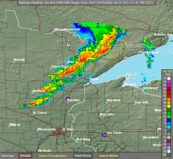
| 7/18/2020 7:09 PM CDT |
 At 707 pm cdt, a severe thunderstorm was located over meadowlands, or 23 miles south of hibbing, moving east at 45 mph (trained weather spotters). Hazards include at 705 pm cdt, a trained spotter reported quarter size hail 20 miles north of floodwood. ping pong ball size hail and 60 mph wind gusts. People and animals outdoors will be injured. expect hail damage to roofs, siding, windows, and vehicles. expect wind damage to roofs, siding, and trees. Locations impacted include, toivola, meadowlands, elmer, kelsey, floodwood lake, and island. At 707 pm cdt, a severe thunderstorm was located over meadowlands, or 23 miles south of hibbing, moving east at 45 mph (trained weather spotters). Hazards include at 705 pm cdt, a trained spotter reported quarter size hail 20 miles north of floodwood. ping pong ball size hail and 60 mph wind gusts. People and animals outdoors will be injured. expect hail damage to roofs, siding, windows, and vehicles. expect wind damage to roofs, siding, and trees. Locations impacted include, toivola, meadowlands, elmer, kelsey, floodwood lake, and island.
|
| 7/18/2020 7:09 PM CDT |
 At 707 pm cdt, a severe thunderstorm was located near meadowlands, or 20 miles southeast of hibbing, moving east at 45 mph. trained spotters reported one inch diameter hail with this storm at 705 pm cdt (trained weather spotters). Hazards include two inch hail and 60 mph wind gusts. People and animals outdoors will be injured. expect hail damage to roofs, siding, windows, and vehicles. Expect wind damage to roofs, siding, and trees. At 707 pm cdt, a severe thunderstorm was located near meadowlands, or 20 miles southeast of hibbing, moving east at 45 mph. trained spotters reported one inch diameter hail with this storm at 705 pm cdt (trained weather spotters). Hazards include two inch hail and 60 mph wind gusts. People and animals outdoors will be injured. expect hail damage to roofs, siding, windows, and vehicles. Expect wind damage to roofs, siding, and trees.
|
| 7/18/2020 6:59 PM CDT |
 At 659 pm cdt, a severe thunderstorm was located 7 miles southwest of toivola, or 22 miles south of hibbing, moving east at 45 mph (radar indicated). Hazards include ping pong ball size hail and 60 mph wind gusts. People and animals outdoors will be injured. expect hail damage to roofs, siding, windows, and vehicles. expect wind damage to roofs, siding, and trees. Locations impacted include, toivola, meadowlands, goodland, elmer, kelsey, wawina, floodwood lake, and island. At 659 pm cdt, a severe thunderstorm was located 7 miles southwest of toivola, or 22 miles south of hibbing, moving east at 45 mph (radar indicated). Hazards include ping pong ball size hail and 60 mph wind gusts. People and animals outdoors will be injured. expect hail damage to roofs, siding, windows, and vehicles. expect wind damage to roofs, siding, and trees. Locations impacted include, toivola, meadowlands, goodland, elmer, kelsey, wawina, floodwood lake, and island.
|
| 7/18/2020 6:45 PM CDT |
 At 645 pm cdt, a severe thunderstorm was located near swan river, or 21 miles southeast of grand rapids, moving east at 45 mph (radar indicated). Hazards include ping pong ball size hail and 60 mph wind gusts. People and animals outdoors will be injured. expect hail damage to roofs, siding, windows, and vehicles. expect wind damage to roofs, siding, and trees. Locations impacted include, swan river, warba, toivola, meadowlands, jacobson, goodland, elmer, kelsey, wawina, floodwood lake, and island. At 645 pm cdt, a severe thunderstorm was located near swan river, or 21 miles southeast of grand rapids, moving east at 45 mph (radar indicated). Hazards include ping pong ball size hail and 60 mph wind gusts. People and animals outdoors will be injured. expect hail damage to roofs, siding, windows, and vehicles. expect wind damage to roofs, siding, and trees. Locations impacted include, swan river, warba, toivola, meadowlands, jacobson, goodland, elmer, kelsey, wawina, floodwood lake, and island.
|
| 7/18/2020 6:33 PM CDT |
 At 632 pm cdt, a severe thunderstorm was located near jacobson, or 15 miles southeast of grand rapids, moving east at 45 mph (radar indicated). Hazards include ping pong ball size hail and 60 mph wind gusts. People and animals outdoors will be injured. expect hail damage to roofs, siding, windows, and vehicles. Expect wind damage to roofs, siding, and trees. At 632 pm cdt, a severe thunderstorm was located near jacobson, or 15 miles southeast of grand rapids, moving east at 45 mph (radar indicated). Hazards include ping pong ball size hail and 60 mph wind gusts. People and animals outdoors will be injured. expect hail damage to roofs, siding, windows, and vehicles. Expect wind damage to roofs, siding, and trees.
|
| 7/13/2020 11:45 PM CDT |
 At 1145 pm cdt, severe thunderstorms were located along a line extending from near hoyt lakes, to near canyon, to 6 miles east of floodwood, moving east at 65 mph (radar indicated). Hazards include 60 mph wind gusts and quarter size hail. Hail damage to vehicles is expected. expect wind damage to roofs, siding, and trees. these severe storms will be near, whiteface reservoir around 1150 pm cdt. boulder lake around 1155 pm cdt. fairbanks, island lake and fond du lac reservation around 1200 am cdt. Other locations impacted by these severe thunderstorms include comstock lake, kelsey, burnett, payne, shaw, prosit, nichols lake, culver, murphy lake and melrude. At 1145 pm cdt, severe thunderstorms were located along a line extending from near hoyt lakes, to near canyon, to 6 miles east of floodwood, moving east at 65 mph (radar indicated). Hazards include 60 mph wind gusts and quarter size hail. Hail damage to vehicles is expected. expect wind damage to roofs, siding, and trees. these severe storms will be near, whiteface reservoir around 1150 pm cdt. boulder lake around 1155 pm cdt. fairbanks, island lake and fond du lac reservation around 1200 am cdt. Other locations impacted by these severe thunderstorms include comstock lake, kelsey, burnett, payne, shaw, prosit, nichols lake, culver, murphy lake and melrude.
|
| 7/13/2020 11:31 PM CDT |
 At 1131 pm cdt, severe thunderstorms were located along a line extending from gilbert, to near meadowlands, to 6 miles west of floodwood, moving east at 45 mph (radar indicated). Hazards include 60 mph wind gusts and quarter size hail. Hail damage to vehicles is expected. expect wind damage to roofs, siding, and trees. these severe storms will be near, eveleth and gilbert around 1135 pm cdt. cotton and canyon around 1145 pm cdt. whiteface reservoir around 1155 pm cdt. brookston and boulder lake around 1205 am cdt. fairbanks, island lake and fond du lac reservation around 1210 am cdt. Other locations impacted by these severe thunderstorms include comstock lake, esquagama lake, kelsey, burnett, payne, shaw, elmer, island, prosit and nichols lake. At 1131 pm cdt, severe thunderstorms were located along a line extending from gilbert, to near meadowlands, to 6 miles west of floodwood, moving east at 45 mph (radar indicated). Hazards include 60 mph wind gusts and quarter size hail. Hail damage to vehicles is expected. expect wind damage to roofs, siding, and trees. these severe storms will be near, eveleth and gilbert around 1135 pm cdt. cotton and canyon around 1145 pm cdt. whiteface reservoir around 1155 pm cdt. brookston and boulder lake around 1205 am cdt. fairbanks, island lake and fond du lac reservation around 1210 am cdt. Other locations impacted by these severe thunderstorms include comstock lake, esquagama lake, kelsey, burnett, payne, shaw, elmer, island, prosit and nichols lake.
|
| 7/13/2020 11:25 PM CDT |
 At 1124 pm cdt, severe thunderstorms were located along a line extending from eveleth, to near toivola, to 6 miles southeast of jacobson, moving east at 45 mph (radar indicated). Hazards include 60 mph wind gusts and quarter size hail. Hail damage to vehicles is expected. expect wind damage to roofs, siding, and trees. these severe storms will be near, virginia, eveleth, gilbert and meadowlands around 1130 pm cdt. cotton and canyon around 1145 pm cdt. whiteface reservoir around 1155 pm cdt. brookston and boulder lake around 1205 am cdt. fairbanks, island lake and fond du lac reservation around 1210 am cdt. Other locations impacted by these severe thunderstorms include comstock lake, iron junction, kelsey, shaw, elmer, little swan, prosit, nichols lake, leonidas and murphy lake. At 1124 pm cdt, severe thunderstorms were located along a line extending from eveleth, to near toivola, to 6 miles southeast of jacobson, moving east at 45 mph (radar indicated). Hazards include 60 mph wind gusts and quarter size hail. Hail damage to vehicles is expected. expect wind damage to roofs, siding, and trees. these severe storms will be near, virginia, eveleth, gilbert and meadowlands around 1130 pm cdt. cotton and canyon around 1145 pm cdt. whiteface reservoir around 1155 pm cdt. brookston and boulder lake around 1205 am cdt. fairbanks, island lake and fond du lac reservation around 1210 am cdt. Other locations impacted by these severe thunderstorms include comstock lake, iron junction, kelsey, shaw, elmer, little swan, prosit, nichols lake, leonidas and murphy lake.
|
| 7/13/2020 11:10 PM CDT |
 At 1110 pm cdt, severe thunderstorms were located along a line extending from near buhl, to near toivola, to near jacobson, moving east at 45 mph (radar indicated). Hazards include 60 mph wind gusts and quarter size hail. Hail damage to vehicles is expected. expect wind damage to roofs, siding, and trees. severe thunderstorms will be near, buhl, cherry and toivola around 1115 pm cdt. virginia and eveleth around 1120 pm cdt. meadowlands around 1125 pm cdt. gilbert around 1130 pm cdt. floodwood around 1135 pm cdt. cotton and canyon around 1140 pm cdt. whiteface reservoir around 1150 pm cdt. brookston, fairbanks, boulder lake and island lake around 1200 am cdt. Other locations impacted by these severe thunderstorms include comstock lake, iron junction, kinney, kelsey, shaw, elmer, silica, little swan, prosit and nichols lake. At 1110 pm cdt, severe thunderstorms were located along a line extending from near buhl, to near toivola, to near jacobson, moving east at 45 mph (radar indicated). Hazards include 60 mph wind gusts and quarter size hail. Hail damage to vehicles is expected. expect wind damage to roofs, siding, and trees. severe thunderstorms will be near, buhl, cherry and toivola around 1115 pm cdt. virginia and eveleth around 1120 pm cdt. meadowlands around 1125 pm cdt. gilbert around 1130 pm cdt. floodwood around 1135 pm cdt. cotton and canyon around 1140 pm cdt. whiteface reservoir around 1150 pm cdt. brookston, fairbanks, boulder lake and island lake around 1200 am cdt. Other locations impacted by these severe thunderstorms include comstock lake, iron junction, kinney, kelsey, shaw, elmer, silica, little swan, prosit and nichols lake.
|
| 7/13/2020 11:02 PM CDT |
 At 1102 pm cdt, severe thunderstorms were located along a line extending from near chisholm, to 8 miles northeast of swan river, to near jacobson, moving east at 45 mph (radar indicated). Hazards include 60 mph wind gusts and quarter size hail. Hail damage to vehicles is expected. expect wind damage to roofs, siding, and trees. these severe storms will be near, chisholm around 1105 pm cdt. buhl around 1110 pm cdt. cherry around 1115 pm cdt. floodwood and toivola around 1120 pm cdt. virginia and eveleth around 1125 pm cdt. gilbert and meadowlands around 1130 pm cdt. cotton around 1140 pm cdt. Other locations impacted by these severe thunderstorms include buck lake, iron junction, blackberry, kinney, calumet, kelsey, swan lake, bovey, elmer and silica. At 1102 pm cdt, severe thunderstorms were located along a line extending from near chisholm, to 8 miles northeast of swan river, to near jacobson, moving east at 45 mph (radar indicated). Hazards include 60 mph wind gusts and quarter size hail. Hail damage to vehicles is expected. expect wind damage to roofs, siding, and trees. these severe storms will be near, chisholm around 1105 pm cdt. buhl around 1110 pm cdt. cherry around 1115 pm cdt. floodwood and toivola around 1120 pm cdt. virginia and eveleth around 1125 pm cdt. gilbert and meadowlands around 1130 pm cdt. cotton around 1140 pm cdt. Other locations impacted by these severe thunderstorms include buck lake, iron junction, blackberry, kinney, calumet, kelsey, swan lake, bovey, elmer and silica.
|
| 7/13/2020 10:50 PM CDT |
 At 1050 pm cdt, severe thunderstorms were located along a line extending from near keewatin, to near warba, to near jacobson, moving east at 45 mph (radar indicated). Hazards include 60 mph wind gusts and quarter size hail. Hail damage to vehicles is expected. expect wind damage to roofs, siding, and trees. these severe storms will be near, hibbing and keewatin around 1055 pm cdt. chisholm around 1100 pm cdt. buhl around 1110 pm cdt. cherry and toivola around 1115 pm cdt. floodwood around 1120 pm cdt. virginia and eveleth around 1125 pm cdt. gilbert, cotton and meadowlands around 1130 pm cdt. Other locations impacted by these severe thunderstorms include buck lake, iron junction, blackberry, kinney, calumet, kelsey, swan lake, bovey, elmer and silica. At 1050 pm cdt, severe thunderstorms were located along a line extending from near keewatin, to near warba, to near jacobson, moving east at 45 mph (radar indicated). Hazards include 60 mph wind gusts and quarter size hail. Hail damage to vehicles is expected. expect wind damage to roofs, siding, and trees. these severe storms will be near, hibbing and keewatin around 1055 pm cdt. chisholm around 1100 pm cdt. buhl around 1110 pm cdt. cherry and toivola around 1115 pm cdt. floodwood around 1120 pm cdt. virginia and eveleth around 1125 pm cdt. gilbert, cotton and meadowlands around 1130 pm cdt. Other locations impacted by these severe thunderstorms include buck lake, iron junction, blackberry, kinney, calumet, kelsey, swan lake, bovey, elmer and silica.
|
| 7/13/2020 10:35 PM CDT |
 At 1035 pm cdt, severe thunderstorms were located along a line extending from 8 miles northwest of nashwauk, to near gunn, to near hill city, moving east at 45 mph (radar indicated). Hazards include 60 mph wind gusts and quarter size hail. Hail damage to vehicles is expected. expect wind damage to roofs, siding, and trees. severe thunderstorms will be near, hibbing, keewatin, nashwauk and warba around 1050 pm cdt. jacobson around 1055 pm cdt. chisholm and swan river around 1100 pm cdt. buhl around 1110 pm cdt. eveleth, cherry, floodwood, toivola and meadowlands around 1115 pm cdt. Other locations impacted by these severe thunderstorms include buck lake, iron junction, blackberry, kinney, calumet, kelsey, swan lake, bovey, elmer and silica. At 1035 pm cdt, severe thunderstorms were located along a line extending from 8 miles northwest of nashwauk, to near gunn, to near hill city, moving east at 45 mph (radar indicated). Hazards include 60 mph wind gusts and quarter size hail. Hail damage to vehicles is expected. expect wind damage to roofs, siding, and trees. severe thunderstorms will be near, hibbing, keewatin, nashwauk and warba around 1050 pm cdt. jacobson around 1055 pm cdt. chisholm and swan river around 1100 pm cdt. buhl around 1110 pm cdt. eveleth, cherry, floodwood, toivola and meadowlands around 1115 pm cdt. Other locations impacted by these severe thunderstorms include buck lake, iron junction, blackberry, kinney, calumet, kelsey, swan lake, bovey, elmer and silica.
|
| 8/5/2019 8:57 AM CDT |
 At 857 am cdt, a severe thunderstorm was located near toivola, or 20 miles southeast of hibbing, moving east at 45 mph (radar indicated). Hazards include 60 mph wind gusts and penny size hail. expect damage to roofs, siding, and trees At 857 am cdt, a severe thunderstorm was located near toivola, or 20 miles southeast of hibbing, moving east at 45 mph (radar indicated). Hazards include 60 mph wind gusts and penny size hail. expect damage to roofs, siding, and trees
|
| 8/5/2019 8:32 AM CDT |
 At 832 am cdt, severe thunderstorms were located along a line extending from 6 miles northwest of keewatin, to 6 miles south of hibbing, to 8 miles northeast of swan river, moving east at 35 mph (radar indicated). Hazards include 60 mph wind gusts and penny size hail. Expect damage to roofs, siding, and trees. Locations impacted include, hibbing, virginia, chisholm, eveleth, mountain iron, gilbert, keewatin, buhl, nashwauk, cherry, swan river, cotton, taconite, warba, toivola, meadowlands, pengilly, jacobson, makinen, and marble. At 832 am cdt, severe thunderstorms were located along a line extending from 6 miles northwest of keewatin, to 6 miles south of hibbing, to 8 miles northeast of swan river, moving east at 35 mph (radar indicated). Hazards include 60 mph wind gusts and penny size hail. Expect damage to roofs, siding, and trees. Locations impacted include, hibbing, virginia, chisholm, eveleth, mountain iron, gilbert, keewatin, buhl, nashwauk, cherry, swan river, cotton, taconite, warba, toivola, meadowlands, pengilly, jacobson, makinen, and marble.
|
| 8/5/2019 8:22 AM CDT |
 At 822 am cdt, severe thunderstorms were located along a line extending from near nashwauk, to near pengilly, to near swan river, moving east at 40 mph (radar indicated). Hazards include 60 mph wind gusts and penny size hail. expect damage to roofs, siding, and trees At 822 am cdt, severe thunderstorms were located along a line extending from near nashwauk, to near pengilly, to near swan river, moving east at 40 mph (radar indicated). Hazards include 60 mph wind gusts and penny size hail. expect damage to roofs, siding, and trees
|
| 8/5/2019 8:13 AM CDT |
 At 813 am cdt, severe thunderstorms were located along a line extending from near taconite, to near pengilly, to near swan river, moving northeast at 40 mph (radar indicated). Hazards include 60 mph wind gusts and penny size hail. Expect damage to roofs, siding, and trees. Locations impacted include, hibbing, grand rapids, chisholm, cohasset, coleraine, keewatin, buhl, nashwauk, deer river, swan river, hill city, taconite, warba, toivola, meadowlands, zemple, pokegama dam, gunn, pengilly, and jacobson. At 813 am cdt, severe thunderstorms were located along a line extending from near taconite, to near pengilly, to near swan river, moving northeast at 40 mph (radar indicated). Hazards include 60 mph wind gusts and penny size hail. Expect damage to roofs, siding, and trees. Locations impacted include, hibbing, grand rapids, chisholm, cohasset, coleraine, keewatin, buhl, nashwauk, deer river, swan river, hill city, taconite, warba, toivola, meadowlands, zemple, pokegama dam, gunn, pengilly, and jacobson.
|
| 8/5/2019 7:57 AM CDT |
 At 753 am cdt, severe thunderstorms were located along a line extending from near cohasset, to near gunn, to near hill city, moving east at 50 mph (radar indicated). Hazards include 60 mph wind gusts and penny size hail. expect damage to roofs, siding, and trees At 753 am cdt, severe thunderstorms were located along a line extending from near cohasset, to near gunn, to near hill city, moving east at 50 mph (radar indicated). Hazards include 60 mph wind gusts and penny size hail. expect damage to roofs, siding, and trees
|
| 8/5/2019 7:53 AM CDT |
 At 753 am cdt, severe thunderstorms were located along a line extending from near cohasset, to near gunn, to near hill city, moving east at 50 mph (radar indicated). Hazards include 60 mph wind gusts and penny size hail. expect damage to roofs, siding, and trees At 753 am cdt, severe thunderstorms were located along a line extending from near cohasset, to near gunn, to near hill city, moving east at 50 mph (radar indicated). Hazards include 60 mph wind gusts and penny size hail. expect damage to roofs, siding, and trees
|
| 7/15/2019 4:37 PM CDT |
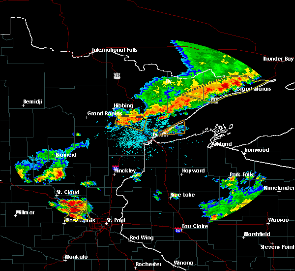 At 437 pm cdt, a severe thunderstorm was located near cotton, or 26 miles southeast of hibbing, moving east at 50 mph (radar indicated). Hazards include 60 mph wind gusts and penny size hail. Expect damage to roofs, siding, and trees. Locations impacted include, cotton, meadowlands, canyon, elmer, kelsey, nichols lake, payne, shaw, and taft. At 437 pm cdt, a severe thunderstorm was located near cotton, or 26 miles southeast of hibbing, moving east at 50 mph (radar indicated). Hazards include 60 mph wind gusts and penny size hail. Expect damage to roofs, siding, and trees. Locations impacted include, cotton, meadowlands, canyon, elmer, kelsey, nichols lake, payne, shaw, and taft.
|
| 7/15/2019 4:26 PM CDT |
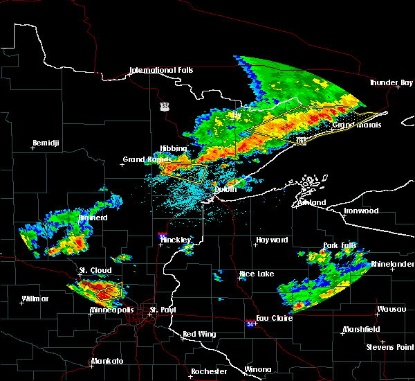 At 426 pm cdt, a severe thunderstorm was located over toivola, or 18 miles southeast of hibbing, moving east at 50 mph (radar indicated). Hazards include 60 mph wind gusts and quarter size hail. Hail damage to vehicles is expected. Expect wind damage to roofs, siding, and trees. At 426 pm cdt, a severe thunderstorm was located over toivola, or 18 miles southeast of hibbing, moving east at 50 mph (radar indicated). Hazards include 60 mph wind gusts and quarter size hail. Hail damage to vehicles is expected. Expect wind damage to roofs, siding, and trees.
|
| 6/30/2019 3:18 AM CDT |
 At 318 am cdt, severe thunderstorms were located along a line extending from cherry, to 6 miles north of toivola, to 8 miles northeast of swan river, to near jacobson, moving southeast at 50 mph (radar indicated). Hazards include ping pong ball size hail and 60 mph wind gusts. People and animals outdoors will be injured. expect hail damage to roofs, siding, windows, and vehicles. expect wind damage to roofs, siding, and trees. Locations impacted include, hibbing, grand rapids, chisholm, eveleth, mountain iron, cohasset, coleraine, keewatin, buhl, nashwauk, cherry, swan river, cotton, taconite, warba, toivola, meadowlands, pokegama dam, gunn, and pengilly. At 318 am cdt, severe thunderstorms were located along a line extending from cherry, to 6 miles north of toivola, to 8 miles northeast of swan river, to near jacobson, moving southeast at 50 mph (radar indicated). Hazards include ping pong ball size hail and 60 mph wind gusts. People and animals outdoors will be injured. expect hail damage to roofs, siding, windows, and vehicles. expect wind damage to roofs, siding, and trees. Locations impacted include, hibbing, grand rapids, chisholm, eveleth, mountain iron, cohasset, coleraine, keewatin, buhl, nashwauk, cherry, swan river, cotton, taconite, warba, toivola, meadowlands, pokegama dam, gunn, and pengilly.
|
| 6/30/2019 2:57 AM CDT |
 At 257 am cdt, severe thunderstorms were located along a line extending from near chisholm, to near keewatin, to near taconite, to near grand rapids, moving southeast at 45 mph (radar indicated). Hazards include ping pong ball size hail and 60 mph wind gusts. People and animals outdoors will be injured. expect hail damage to roofs, siding, windows, and vehicles. expect wind damage to roofs, siding, and trees. Locations impacted include, hibbing, grand rapids, chisholm, eveleth, mountain iron, cohasset, coleraine, keewatin, buhl, nashwauk, deer river, cherry, swan river, cotton, taconite, warba, toivola, meadowlands, zemple, and pengilly. At 257 am cdt, severe thunderstorms were located along a line extending from near chisholm, to near keewatin, to near taconite, to near grand rapids, moving southeast at 45 mph (radar indicated). Hazards include ping pong ball size hail and 60 mph wind gusts. People and animals outdoors will be injured. expect hail damage to roofs, siding, windows, and vehicles. expect wind damage to roofs, siding, and trees. Locations impacted include, hibbing, grand rapids, chisholm, eveleth, mountain iron, cohasset, coleraine, keewatin, buhl, nashwauk, deer river, cherry, swan river, cotton, taconite, warba, toivola, meadowlands, zemple, and pengilly.
|
| 6/30/2019 2:39 AM CDT |
 The national weather service in duluth mn has issued a * severe thunderstorm warning for. eastern itasca county in north central minnesota. northeastern aitkin county in east central minnesota. northeastern cass county in north central minnesota. southwestern st. Louis county in northeastern minnesota. The national weather service in duluth mn has issued a * severe thunderstorm warning for. eastern itasca county in north central minnesota. northeastern aitkin county in east central minnesota. northeastern cass county in north central minnesota. southwestern st. Louis county in northeastern minnesota.
|
| 9/15/2018 1:01 AM CDT |
 At 101 am cdt, severe thunderstorms were located along a line extending from near toivola, to near meadowlands, to 6 miles south of floodwood, moving east at 40 mph (radar indicated). Hazards include 70 mph wind gusts and quarter size hail. Hail damage to vehicles is expected. expect considerable tree damage. Wind damage is also likely to mobile homes, roofs, and outbuildings. At 101 am cdt, severe thunderstorms were located along a line extending from near toivola, to near meadowlands, to 6 miles south of floodwood, moving east at 40 mph (radar indicated). Hazards include 70 mph wind gusts and quarter size hail. Hail damage to vehicles is expected. expect considerable tree damage. Wind damage is also likely to mobile homes, roofs, and outbuildings.
|
| 8/31/2018 8:02 PM CDT |
 At 802 pm cdt, dangerous severe thunderstorms were located along a line extending from near toivola, to near brookston, to 7 miles southwest of cloquet, moving east-northeast at 60 mph. these are very dangerous storms with a history of producing widespread wind damage across aitkin county between 7 and 8 pm (radar indicated). Hazards include 90 mph wind gusts and penny size hail. You are in a life-threatening situation. flying debris may be deadly to those caught without shelter. mobile homes will be heavily damaged or destroyed. homes and businesses will have substantial roof and window damage. Expect extensive tree damage and power outages. At 802 pm cdt, dangerous severe thunderstorms were located along a line extending from near toivola, to near brookston, to 7 miles southwest of cloquet, moving east-northeast at 60 mph. these are very dangerous storms with a history of producing widespread wind damage across aitkin county between 7 and 8 pm (radar indicated). Hazards include 90 mph wind gusts and penny size hail. You are in a life-threatening situation. flying debris may be deadly to those caught without shelter. mobile homes will be heavily damaged or destroyed. homes and businesses will have substantial roof and window damage. Expect extensive tree damage and power outages.
|
| 7/12/2018 1:49 AM CDT |
 At 149 am cdt, severe thunderstorms were located along a line extending from 11 miles south of hibbing, to near toivola, to 7 miles southeast of jacobson, to 7 miles northwest of libby, moving east at 30 mph (radar indicated). Hazards include 60 mph wind gusts. Expect damage to roofs, siding, and trees. Locations impacted include, hibbing, big sandy lake, swan river, hill city, floodwood, cotton, warba, toivola, meadowlands, tamarack, libby, canyon, swatara, jacobson, fond du lac reservation, hart lake, goodland, alborn, culver, and ball bluff. At 149 am cdt, severe thunderstorms were located along a line extending from 11 miles south of hibbing, to near toivola, to 7 miles southeast of jacobson, to 7 miles northwest of libby, moving east at 30 mph (radar indicated). Hazards include 60 mph wind gusts. Expect damage to roofs, siding, and trees. Locations impacted include, hibbing, big sandy lake, swan river, hill city, floodwood, cotton, warba, toivola, meadowlands, tamarack, libby, canyon, swatara, jacobson, fond du lac reservation, hart lake, goodland, alborn, culver, and ball bluff.
|
| 7/12/2018 1:27 AM CDT |
 At 126 am cdt, severe thunderstorms were located along a line extending from near pengilly, to 7 miles east of warba, to near swan river, to near swatara, moving east at 35 mph (radar indicated). Hazards include 60 mph wind gusts. expect damage to roofs, siding, and trees At 126 am cdt, severe thunderstorms were located along a line extending from near pengilly, to 7 miles east of warba, to near swan river, to near swatara, moving east at 35 mph (radar indicated). Hazards include 60 mph wind gusts. expect damage to roofs, siding, and trees
|
| 6/30/2018 3:00 AM CDT |
 At 259 am cdt, severe thunderstorms were located along a line extending from near meadowlands, to 6 miles southwest of fond du lac reservation, to near askov, moving east at 45 mph (radar indicated). Hazards include 60 mph wind gusts and quarter size hail. Hail damage to vehicles is expected. expect wind damage to roofs, siding, and trees. severe thunderstorms will be near, cloquet around 310 am cdt. scanlon, fond du lac reservation and canyon around 315 am cdt. carlton, wrenshall and thomson around 320 am cdt. hermantown, proctor and oliver around 330 am cdt. boulder lake, cloverton and island lake around 335 am cdt. duluth and superior around 340 am cdt. dairyland, wisconsin point and south range around 345 am cdt. Other locations impacted by these severe thunderstorms include cody, billings park, gary new duluth, duquette, fish lake, moose junction, amnicon lake, banning state park, spirit valley, and jay cooke state park. At 259 am cdt, severe thunderstorms were located along a line extending from near meadowlands, to 6 miles southwest of fond du lac reservation, to near askov, moving east at 45 mph (radar indicated). Hazards include 60 mph wind gusts and quarter size hail. Hail damage to vehicles is expected. expect wind damage to roofs, siding, and trees. severe thunderstorms will be near, cloquet around 310 am cdt. scanlon, fond du lac reservation and canyon around 315 am cdt. carlton, wrenshall and thomson around 320 am cdt. hermantown, proctor and oliver around 330 am cdt. boulder lake, cloverton and island lake around 335 am cdt. duluth and superior around 340 am cdt. dairyland, wisconsin point and south range around 345 am cdt. Other locations impacted by these severe thunderstorms include cody, billings park, gary new duluth, duquette, fish lake, moose junction, amnicon lake, banning state park, spirit valley, and jay cooke state park.
|
| 6/29/2018 6:51 AM CDT |
 At 651 am cdt, severe thunderstorms were located along a line extending from 13 miles north of nashwauk, to near coleraine, to 6 miles south of days high landing, moving east at 70 mph (radar indicated). Hazards include 70 mph wind gusts. Expect considerable tree damage. damage is likely to mobile homes, roofs, and outbuildings. Locations impacted include, hibbing, grand rapids, virginia, chisholm, eveleth, mountain iron, cohasset, coleraine, gilbert, aurora, keewatin, buhl, nashwauk, biwabik, deer river, cherry, swan river, taconite, warba, and toivola. At 651 am cdt, severe thunderstorms were located along a line extending from 13 miles north of nashwauk, to near coleraine, to 6 miles south of days high landing, moving east at 70 mph (radar indicated). Hazards include 70 mph wind gusts. Expect considerable tree damage. damage is likely to mobile homes, roofs, and outbuildings. Locations impacted include, hibbing, grand rapids, virginia, chisholm, eveleth, mountain iron, cohasset, coleraine, gilbert, aurora, keewatin, buhl, nashwauk, biwabik, deer river, cherry, swan river, taconite, warba, and toivola.
|
| 6/29/2018 6:39 AM CDT |
 At 639 am cdt, severe thunderstorms were located along a line extending from near marcell, to near deer river, to near boy river, moving east at 65 mph (radar indicated). Hazards include 70 mph wind gusts. Expect considerable tree damage. damage is likely to mobile homes, roofs, and outbuildings. Locations impacted include, hibbing, grand rapids, virginia, chisholm, eveleth, mountain iron, cohasset, coleraine, gilbert, aurora, keewatin, buhl, nashwauk, biwabik, deer river, cherry, swan river, hill city, floodwood, and remer. At 639 am cdt, severe thunderstorms were located along a line extending from near marcell, to near deer river, to near boy river, moving east at 65 mph (radar indicated). Hazards include 70 mph wind gusts. Expect considerable tree damage. damage is likely to mobile homes, roofs, and outbuildings. Locations impacted include, hibbing, grand rapids, virginia, chisholm, eveleth, mountain iron, cohasset, coleraine, gilbert, aurora, keewatin, buhl, nashwauk, biwabik, deer river, cherry, swan river, hill city, floodwood, and remer.
|
| 6/29/2018 6:22 AM CDT |
 At 621 am cdt, severe thunderstorms were located along a line extending from near oslund, to near bena, to near walker, moving east at 70 mph (radar indicated. storm spotters northwest of bemidji reported numerous trees down with these storms). Hazards include 70 mph wind gusts. Expect considerable tree damage. Damage is likely to mobile homes, roofs, and outbuildings. At 621 am cdt, severe thunderstorms were located along a line extending from near oslund, to near bena, to near walker, moving east at 70 mph (radar indicated. storm spotters northwest of bemidji reported numerous trees down with these storms). Hazards include 70 mph wind gusts. Expect considerable tree damage. Damage is likely to mobile homes, roofs, and outbuildings.
|
| 5/29/2018 6:24 PM CDT |
 At 624 pm cdt, severe thunderstorms were located along a line extending from near hibbing, to near meadowlands, moving northeast at 50 mph (radar indicated). Hazards include 60 mph wind gusts. expect damage to roofs, siding, and trees At 624 pm cdt, severe thunderstorms were located along a line extending from near hibbing, to near meadowlands, moving northeast at 50 mph (radar indicated). Hazards include 60 mph wind gusts. expect damage to roofs, siding, and trees
|
| 7/21/2017 7:14 PM CDT |
 At 714 pm cdt, a severe thunderstorm was located near libby, or near big sandy lake, moving east at 50 mph (radar indicated). Hazards include 70 mph wind gusts and quarter size hail. Hail damage to vehicles is expected. expect considerable tree damage. wind damage is also likely to mobile homes, roofs, and outbuildings. this severe thunderstorm will be near, tamarack around 725 pm cdt. cromwell around 740 pm cdt. cloquet and mahtowa around 755 pm cdt. Other locations impacted by this severe thunderstorm include gowan, grand lake, ball bluff, sheshebee, wright, savanna portage state park, burnett, wawina, sawyer, and island. At 714 pm cdt, a severe thunderstorm was located near libby, or near big sandy lake, moving east at 50 mph (radar indicated). Hazards include 70 mph wind gusts and quarter size hail. Hail damage to vehicles is expected. expect considerable tree damage. wind damage is also likely to mobile homes, roofs, and outbuildings. this severe thunderstorm will be near, tamarack around 725 pm cdt. cromwell around 740 pm cdt. cloquet and mahtowa around 755 pm cdt. Other locations impacted by this severe thunderstorm include gowan, grand lake, ball bluff, sheshebee, wright, savanna portage state park, burnett, wawina, sawyer, and island.
|
| 7/21/2017 6:34 PM CDT |
 At 632 pm cdt, a severe thunderstorm was located near meadowlands, or 25 miles southeast of hibbing, moving southeast at 45 mph. wind damage has been reported 1 mile southeast of toivola, and near zim (radar indicated). Hazards include 70 mph wind gusts and penny size hail. Expect considerable tree damage. Damage is likely to mobile homes, roofs, and outbuildings. At 632 pm cdt, a severe thunderstorm was located near meadowlands, or 25 miles southeast of hibbing, moving southeast at 45 mph. wind damage has been reported 1 mile southeast of toivola, and near zim (radar indicated). Hazards include 70 mph wind gusts and penny size hail. Expect considerable tree damage. Damage is likely to mobile homes, roofs, and outbuildings.
|
| 7/6/2017 5:17 AM CDT |
 At 515 am cdt, severe thunderstorms were located along a line extending from near toivola, to near cloquet, to near bruno, moving east at 50 mph (radar indicated). Hazards include 70 mph wind gusts and quarter size hail. Hail damage to vehicles is expected. expect considerable tree damage. wind damage is also likely to mobile homes, roofs, and outbuildings. Locations impacted include, duluth, superior, cloquet, hermantown, proctor, scanlon, carlton, mahtowa, barnum, floodwood, cotton, willow river, wrenshall, oliver, cromwell, holyoke, kettle river, toivola, thomson, and brookston. At 515 am cdt, severe thunderstorms were located along a line extending from near toivola, to near cloquet, to near bruno, moving east at 50 mph (radar indicated). Hazards include 70 mph wind gusts and quarter size hail. Hail damage to vehicles is expected. expect considerable tree damage. wind damage is also likely to mobile homes, roofs, and outbuildings. Locations impacted include, duluth, superior, cloquet, hermantown, proctor, scanlon, carlton, mahtowa, barnum, floodwood, cotton, willow river, wrenshall, oliver, cromwell, holyoke, kettle river, toivola, thomson, and brookston.
|
| 7/6/2017 5:02 AM CDT |
 At 502 am cdt, severe thunderstorms were located along a line extending from 8 miles west of toivola, to 6 miles north of cromwell, to 6 miles west of willow river, moving east at 50 mph (radar indicated). Hazards include 70 mph wind gusts and quarter size hail. Hail damage to vehicles is expected. expect considerable tree damage. wind damage is also likely to mobile homes, roofs, and outbuildings. locations impacted include, duluth, superior, cloquet, hermantown, proctor, scanlon, carlton, swan river, mahtowa, barnum, floodwood, cotton, willow river, wrenshall, oliver, cromwell, holyoke, warba, kettle river, and toivola. This also includes interstate 35 between barnum and duluth and state highway 61 between duluth and two harbors. At 502 am cdt, severe thunderstorms were located along a line extending from 8 miles west of toivola, to 6 miles north of cromwell, to 6 miles west of willow river, moving east at 50 mph (radar indicated). Hazards include 70 mph wind gusts and quarter size hail. Hail damage to vehicles is expected. expect considerable tree damage. wind damage is also likely to mobile homes, roofs, and outbuildings. locations impacted include, duluth, superior, cloquet, hermantown, proctor, scanlon, carlton, swan river, mahtowa, barnum, floodwood, cotton, willow river, wrenshall, oliver, cromwell, holyoke, warba, kettle river, and toivola. This also includes interstate 35 between barnum and duluth and state highway 61 between duluth and two harbors.
|
| 7/6/2017 4:44 AM CDT |
 At 443 am cdt, severe thunderstorms were located along a line extending from near warba, to 6 miles north of tamarack, to 6 miles north of mcgrath, moving east at 50 mph (radar indicated). Hazards include 70 mph wind gusts and quarter size hail. Hail damage to vehicles is expected. expect considerable tree damage. Wind damage is also likely to mobile homes, roofs, and outbuildings. At 443 am cdt, severe thunderstorms were located along a line extending from near warba, to 6 miles north of tamarack, to 6 miles north of mcgrath, moving east at 50 mph (radar indicated). Hazards include 70 mph wind gusts and quarter size hail. Hail damage to vehicles is expected. expect considerable tree damage. Wind damage is also likely to mobile homes, roofs, and outbuildings.
|
| 6/10/2017 4:06 AM CDT |
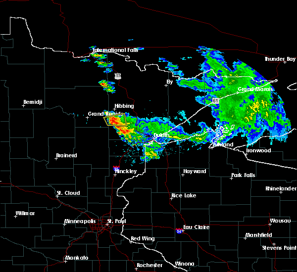 At 406 am cdt, a severe thunderstorm was located 9 miles west of toivola, or 16 miles south of hibbing, moving east at 45 mph (radar indicated). Hazards include half dollar size hail. Damage to vehicles is expected. this severe storm will be near, toivola and meadowlands around 415 am cdt. Other locations impacted by this severe thunderstorm include elmer, floodwood lake, and little swan. At 406 am cdt, a severe thunderstorm was located 9 miles west of toivola, or 16 miles south of hibbing, moving east at 45 mph (radar indicated). Hazards include half dollar size hail. Damage to vehicles is expected. this severe storm will be near, toivola and meadowlands around 415 am cdt. Other locations impacted by this severe thunderstorm include elmer, floodwood lake, and little swan.
|
| 6/10/2017 3:47 AM CDT |
 At 347 am cdt, a severe thunderstorm was located over warba, or 12 miles southeast of grand rapids, moving east at 45 mph (radar indicated). Hazards include half dollar size hail. Damage to vehicles is expected. this severe thunderstorm will be near, swan river around 355 am cdt. toivola and meadowlands around 415 am cdt. Other locations impacted by this severe thunderstorm include blackberry, floodwood lake, wawina, goodland, elmer, silica, and little swan. At 347 am cdt, a severe thunderstorm was located over warba, or 12 miles southeast of grand rapids, moving east at 45 mph (radar indicated). Hazards include half dollar size hail. Damage to vehicles is expected. this severe thunderstorm will be near, swan river around 355 am cdt. toivola and meadowlands around 415 am cdt. Other locations impacted by this severe thunderstorm include blackberry, floodwood lake, wawina, goodland, elmer, silica, and little swan.
|
| 9/6/2016 1:23 AM CDT |
 At 122 am cdt, severe thunderstorms were located along a line extending from 8 miles northwest of cotton, to meadowlands, moving northeast at 50 mph (radar indicated). Hazards include 60 mph wind gusts and half dollar size hail. Expect damage to trees. and possibly powerlines and possibly outbuildings and roofs. these severe storms will be near, cotton around 135 am cdt. Other locations impacted by these severe thunderstorms include prosit, nichols lake, payne, murphy lake and kelsey. At 122 am cdt, severe thunderstorms were located along a line extending from 8 miles northwest of cotton, to meadowlands, moving northeast at 50 mph (radar indicated). Hazards include 60 mph wind gusts and half dollar size hail. Expect damage to trees. and possibly powerlines and possibly outbuildings and roofs. these severe storms will be near, cotton around 135 am cdt. Other locations impacted by these severe thunderstorms include prosit, nichols lake, payne, murphy lake and kelsey.
|
| 9/6/2016 1:06 AM CDT |
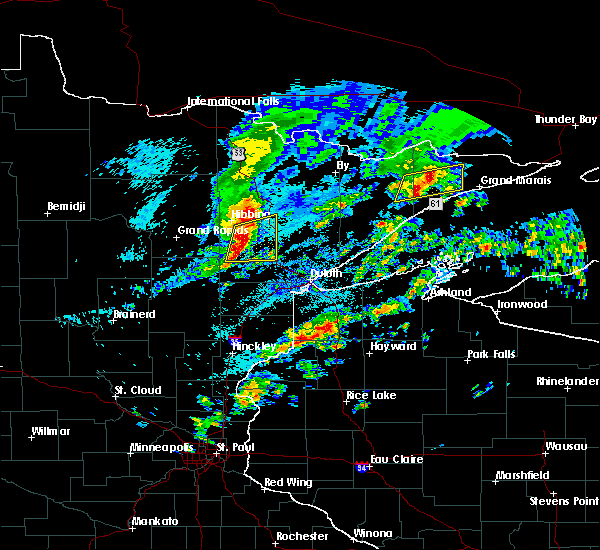 At 105 am cdt, the strongest portion of a line of severe thunderstorms was located 8 miles southwest of toivola, or 23 miles south of hibbing, moving east at 50 mph (radar indicated). Hazards include 70 mph wind gusts and half dollar size hail. Expect wind damage to trees. powerlines and possibly outbuildings and roofs. hail damage to vehicles is also possible. this severe storm will be near, toivola and meadowlands around 115 am cdt. cotton and canyon around 130 am cdt. Other locations impacted by this severe thunderstorm include prosit, elmer, murphy lake, iron junction, kelsey, zim, nichols lake, payne and little swan. At 105 am cdt, the strongest portion of a line of severe thunderstorms was located 8 miles southwest of toivola, or 23 miles south of hibbing, moving east at 50 mph (radar indicated). Hazards include 70 mph wind gusts and half dollar size hail. Expect wind damage to trees. powerlines and possibly outbuildings and roofs. hail damage to vehicles is also possible. this severe storm will be near, toivola and meadowlands around 115 am cdt. cotton and canyon around 130 am cdt. Other locations impacted by this severe thunderstorm include prosit, elmer, murphy lake, iron junction, kelsey, zim, nichols lake, payne and little swan.
|
| 9/6/2016 12:56 AM CDT |
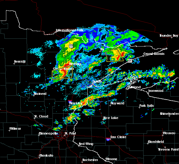 At 1254 am cdt, severe thunderstorms were located along a line extending from pengilly, to jacobson, moving east at 50 mph (radar indicated). Hazards include 70 mph wind gusts and quarter size hail. Expect damage to trees. powerlines and possibly outbuildings and roofs. hail damage to vehicles is also possible. severe thunderstorms will be near, hibbing around 115 am cdt. cherry and meadowlands around 120 am cdt. eveleth and canyon around 130 am cdt. gilbert and cotton around 135 am cdt. Other locations impacted by these severe thunderstorms include prosit, elmer, iron junction, kelsey, nichols lake, payne, hart lake, island, silica and wawina. At 1254 am cdt, severe thunderstorms were located along a line extending from pengilly, to jacobson, moving east at 50 mph (radar indicated). Hazards include 70 mph wind gusts and quarter size hail. Expect damage to trees. powerlines and possibly outbuildings and roofs. hail damage to vehicles is also possible. severe thunderstorms will be near, hibbing around 115 am cdt. cherry and meadowlands around 120 am cdt. eveleth and canyon around 130 am cdt. gilbert and cotton around 135 am cdt. Other locations impacted by these severe thunderstorms include prosit, elmer, iron junction, kelsey, nichols lake, payne, hart lake, island, silica and wawina.
|
| 7/21/2016 3:21 AM CDT |
 At 319 am cdt, severe thunderstorms were located along a line extending from 6 miles west of whiteface reservoir, to near wrenshall, moving east at 55 mph (radar indicated). Hazards include 70 mph wind gusts and half dollar size hail. Hail damage to vehicles is expected. expect considerable tree damage. wind damage is also likely to mobile homes, roofs, and outbuildings. these severe storms will be near, whiteface reservoir around 330 am cdt. oliver and duluth around 335 am cdt. fairbanks, wolf lake and wisconsin point around 340 am cdt. superior, south range and brimson around 345 am cdt. Other locations impacted by these severe thunderstorms include prosit, billings park, lakewood twp, chester park, morley hts/parkview, alborn, east hillside, gowan, taft and congdon park. At 319 am cdt, severe thunderstorms were located along a line extending from 6 miles west of whiteface reservoir, to near wrenshall, moving east at 55 mph (radar indicated). Hazards include 70 mph wind gusts and half dollar size hail. Hail damage to vehicles is expected. expect considerable tree damage. wind damage is also likely to mobile homes, roofs, and outbuildings. these severe storms will be near, whiteface reservoir around 330 am cdt. oliver and duluth around 335 am cdt. fairbanks, wolf lake and wisconsin point around 340 am cdt. superior, south range and brimson around 345 am cdt. Other locations impacted by these severe thunderstorms include prosit, billings park, lakewood twp, chester park, morley hts/parkview, alborn, east hillside, gowan, taft and congdon park.
|
| 7/21/2016 3:10 AM CDT | Lots of large trees down along highway 53 south of canyon. time estimated by rada in st. louis county MN, 12.7 miles WNW of Meadowlands, MN |
| 7/21/2016 3:05 AM CDT | Larger than 10 inch diameter popple tree downed with power lines wrapped in it along the west side of aerie lake. many 8 to 10 inch diameter popple trees downed along h in st. louis county MN, 7.3 miles NW of Meadowlands, MN |
| 7/21/2016 3:00 AM CDT |
 At 257 am cdt, severe thunderstorms were located along a line extending from near cherry, to near cromwell, moving east at 45 mph (radar indicated). Hazards include 60 mph wind gusts. Expect damage to roofs. siding. and trees. severe thunderstorms will be near, eveleth around 315 am cdt. cloquet around 325 am cdt. scanlon and carlton around 330 am cdt. wrenshall and thomson around 335 am cdt. whiteface reservoir around 340 am cdt. duluth, proctor and oliver around 345 am cdt. superior and wolf lake around 350 am cdt. Other locations impacted by these severe thunderstorms include prosit, billings park, lakewood twp, chester park, morley hts/parkview, alborn, east hillside, gowan, taft and congdon park. At 257 am cdt, severe thunderstorms were located along a line extending from near cherry, to near cromwell, moving east at 45 mph (radar indicated). Hazards include 60 mph wind gusts. Expect damage to roofs. siding. and trees. severe thunderstorms will be near, eveleth around 315 am cdt. cloquet around 325 am cdt. scanlon and carlton around 330 am cdt. wrenshall and thomson around 335 am cdt. whiteface reservoir around 340 am cdt. duluth, proctor and oliver around 345 am cdt. superior and wolf lake around 350 am cdt. Other locations impacted by these severe thunderstorms include prosit, billings park, lakewood twp, chester park, morley hts/parkview, alborn, east hillside, gowan, taft and congdon park.
|
| 7/21/2016 2:46 AM CDT |
 At 245 am cdt, severe thunderstorms were located along a line extending from near togo, to 6 miles east of big sandy lake, moving east at 60 mph. these are very dangerous storms (trained weather spotters). Hazards include 80 mph wind gusts and quarter size hail. Flying debris will be dangerous to those caught without shelter. mobile homes will be heavily damaged. expect considerable damage to roofs, windows, and vehicles. extensive tree damage and power outages are likely. these severe storms will be near, meadow brook around 250 am cdt. floodwood around 255 am cdt. cook around 300 am cdt. Other locations impacted by these severe thunderstorms include side lake, angora, celina, savanna portage state park, perch lake, split hand lake, hart lake, island, gowan and ball bluff. At 245 am cdt, severe thunderstorms were located along a line extending from near togo, to 6 miles east of big sandy lake, moving east at 60 mph. these are very dangerous storms (trained weather spotters). Hazards include 80 mph wind gusts and quarter size hail. Flying debris will be dangerous to those caught without shelter. mobile homes will be heavily damaged. expect considerable damage to roofs, windows, and vehicles. extensive tree damage and power outages are likely. these severe storms will be near, meadow brook around 250 am cdt. floodwood around 255 am cdt. cook around 300 am cdt. Other locations impacted by these severe thunderstorms include side lake, angora, celina, savanna portage state park, perch lake, split hand lake, hart lake, island, gowan and ball bluff.
|
| 7/21/2016 2:36 AM CDT |
 At 235 am cdt, severe thunderstorms were located along a line extending from near togo, to libby, moving east at 55 mph. these are very dangerous storms (trained weather spotters reported numerous trees down and winds of 70 mph or greater). Hazards include 80 mph wind gusts and quarter size hail. Flying debris will be dangerous to those caught without shelter. mobile homes will be heavily damaged. expect considerable damage to roofs, windows, and vehicles. extensive tree damage and power outages are likely. these severe storms will be near, togo around 240 am cdt. meadow brook around 250 am cdt. floodwood around 255 am cdt. cook around 300 am cdt. Other locations impacted by these severe thunderstorms include savanna portage state park, perch lake, deer lake northern itasca county, scenic state park, hart lake, gowan, bowstring, ball bluff, little swan and leetonia. At 235 am cdt, severe thunderstorms were located along a line extending from near togo, to libby, moving east at 55 mph. these are very dangerous storms (trained weather spotters reported numerous trees down and winds of 70 mph or greater). Hazards include 80 mph wind gusts and quarter size hail. Flying debris will be dangerous to those caught without shelter. mobile homes will be heavily damaged. expect considerable damage to roofs, windows, and vehicles. extensive tree damage and power outages are likely. these severe storms will be near, togo around 240 am cdt. meadow brook around 250 am cdt. floodwood around 255 am cdt. cook around 300 am cdt. Other locations impacted by these severe thunderstorms include savanna portage state park, perch lake, deer lake northern itasca county, scenic state park, hart lake, gowan, bowstring, ball bluff, little swan and leetonia.
|
| 7/21/2016 2:23 AM CDT |
 At 221 am cdt, severe thunderstorms were located along a line extending from 7 miles southeast of effie, to 7 miles southeast of swatara, moving east at 60 mph. these are very dangerous storms (trained weather spotters reported winds to 70 mph and many downed trees as these storms moved through). Hazards include 80 mph wind gusts and quarter size hail. Flying debris will be dangerous to those caught without shelter. mobile homes will be heavily damaged. expect considerable damage to roofs, windows, and vehicles. extensive tree damage and power outages are likely. these severe storms will be near, grand rapids around 230 am cdt. togo around 235 am cdt. meadow brook around 245 am cdt. floodwood around 255 am cdt. cook around 300 am cdt. Other locations impacted by these severe thunderstorms include savanna portage state park, perch lake, washburn lake, deer lake northern itasca county, scenic state park, wirt, hart lake, gowan, bowstring and ball bluff. At 221 am cdt, severe thunderstorms were located along a line extending from 7 miles southeast of effie, to 7 miles southeast of swatara, moving east at 60 mph. these are very dangerous storms (trained weather spotters reported winds to 70 mph and many downed trees as these storms moved through). Hazards include 80 mph wind gusts and quarter size hail. Flying debris will be dangerous to those caught without shelter. mobile homes will be heavily damaged. expect considerable damage to roofs, windows, and vehicles. extensive tree damage and power outages are likely. these severe storms will be near, grand rapids around 230 am cdt. togo around 235 am cdt. meadow brook around 245 am cdt. floodwood around 255 am cdt. cook around 300 am cdt. Other locations impacted by these severe thunderstorms include savanna portage state park, perch lake, washburn lake, deer lake northern itasca county, scenic state park, wirt, hart lake, gowan, bowstring and ball bluff.
|
| 7/21/2016 2:01 AM CDT |
 At 158 am cdt, severe thunderstorms were located along a line extending from 10 miles northeast of oslund, to near outing, moving east at 60 mph (emergency management. spotters reported winds up to 70 mph at moondance jam). Hazards include 70 mph wind gusts and quarter size hail. Hail damage to vehicles is expected. expect considerable tree damage. wind damage is also likely to mobile homes, roofs, and outbuildings. severe thunderstorms will be near, bigfork around 210 am cdt. effie and grand rapids around 215 am cdt. togo around 235 am cdt. floodwood around 250 am cdt. cook around 255 am cdt. mountain iron around 300 am cdt. Other locations impacted by these severe thunderstorms include savanna portage state park, perch lake, cut foot sioux lake, washburn lake, deer lake northern itasca county, scenic state park, wirt, hart lake, gowan and bowstring. At 158 am cdt, severe thunderstorms were located along a line extending from 10 miles northeast of oslund, to near outing, moving east at 60 mph (emergency management. spotters reported winds up to 70 mph at moondance jam). Hazards include 70 mph wind gusts and quarter size hail. Hail damage to vehicles is expected. expect considerable tree damage. wind damage is also likely to mobile homes, roofs, and outbuildings. severe thunderstorms will be near, bigfork around 210 am cdt. effie and grand rapids around 215 am cdt. togo around 235 am cdt. floodwood around 250 am cdt. cook around 255 am cdt. mountain iron around 300 am cdt. Other locations impacted by these severe thunderstorms include savanna portage state park, perch lake, cut foot sioux lake, washburn lake, deer lake northern itasca county, scenic state park, wirt, hart lake, gowan and bowstring.
|
| 7/5/2016 7:08 PM CDT |
 At 707 pm cdt, a severe thunderstorm was located near canyon, or 23 miles north of cloquet, moving east at 50 mph (radar indicated). Hazards include 60 mph wind gusts and penny size hail. Expect damage to roofs. siding. and trees. locations impacted include, cotton, meadowlands, canyon, island lake, boulder lake, fredenberg, alborn, culver, elmer, kelsey, prosit, comstock lake, nichols lake, payne, fish lake, melrude, taft, shaw, wild rice lake and twig. this also includes u. s. Highway 53 between cotton and twig. At 707 pm cdt, a severe thunderstorm was located near canyon, or 23 miles north of cloquet, moving east at 50 mph (radar indicated). Hazards include 60 mph wind gusts and penny size hail. Expect damage to roofs. siding. and trees. locations impacted include, cotton, meadowlands, canyon, island lake, boulder lake, fredenberg, alborn, culver, elmer, kelsey, prosit, comstock lake, nichols lake, payne, fish lake, melrude, taft, shaw, wild rice lake and twig. this also includes u. s. Highway 53 between cotton and twig.
|
| 7/5/2016 6:56 PM CDT | 14 to 16 inch diameter maple tree split just above the trunk and knocked ove in st. louis county MN, 6.6 miles SSE of Meadowlands, MN |
| 7/5/2016 6:55 PM CDT |
 At 655 pm cdt, a severe thunderstorm was located over meadowlands, or 23 miles south of hibbing, moving east at 50 mph (radar indicated). Hazards include 60 mph wind gusts and penny size hail. Expect damage to roofs. siding. And trees. At 655 pm cdt, a severe thunderstorm was located over meadowlands, or 23 miles south of hibbing, moving east at 50 mph (radar indicated). Hazards include 60 mph wind gusts and penny size hail. Expect damage to roofs. siding. And trees.
|
| 6/25/2016 3:43 PM CDT |
 At 342 pm cdt, a severe thunderstorm was located 9 miles east of swan river, or 22 miles south of hibbing, moving northeast at 40 mph (radar indicated). Hazards include 60 mph wind gusts and half dollar size hail. Hail damage to vehicles is expected. expect wind damage to roofs, siding, and trees. locations impacted include, hibbing, cotton, toivola, meadowlands, elmer, kelsey, silica, floodwood lake, payne and island. A tornado watch remains in effect until 900 pm cdt for northeastern minnesota. At 342 pm cdt, a severe thunderstorm was located 9 miles east of swan river, or 22 miles south of hibbing, moving northeast at 40 mph (radar indicated). Hazards include 60 mph wind gusts and half dollar size hail. Hail damage to vehicles is expected. expect wind damage to roofs, siding, and trees. locations impacted include, hibbing, cotton, toivola, meadowlands, elmer, kelsey, silica, floodwood lake, payne and island. A tornado watch remains in effect until 900 pm cdt for northeastern minnesota.
|
| 6/25/2016 3:31 PM CDT |
 At 331 pm cdt, severe thunderstorms were located along a line extending from near grand rapids to near floodwood, moving northeast at 45 mph (radar indicated). Hazards include 60 mph wind gusts and quarter size hail. Hail damage to vehicles is expected. expect wind damage to roofs, siding, and trees. locations impacted include, hibbing, grand rapids, cohasset, coleraine, nashwauk, swan river, hill city, floodwood, cotton, taconite, warba, toivola, meadowlands, pengilly, jacobson, pokegama dam, swatara, gunn, blackberry and bovey. A tornado watch remains in effect until 900 pm cdt for northeastern minnesota. At 331 pm cdt, severe thunderstorms were located along a line extending from near grand rapids to near floodwood, moving northeast at 45 mph (radar indicated). Hazards include 60 mph wind gusts and quarter size hail. Hail damage to vehicles is expected. expect wind damage to roofs, siding, and trees. locations impacted include, hibbing, grand rapids, cohasset, coleraine, nashwauk, swan river, hill city, floodwood, cotton, taconite, warba, toivola, meadowlands, pengilly, jacobson, pokegama dam, swatara, gunn, blackberry and bovey. A tornado watch remains in effect until 900 pm cdt for northeastern minnesota.
|
| 6/25/2016 3:16 PM CDT |
 At 315 pm cdt, severe thunderstorms were located along a line extending from near hill city to 8 miles southwest of floodwood, moving northeast at 45 mph (radar indicated). Hazards include 60 mph wind gusts and half dollar size hail. Hail damage to vehicles is expected. Expect wind damage to roofs, siding, and trees. At 315 pm cdt, severe thunderstorms were located along a line extending from near hill city to 8 miles southwest of floodwood, moving northeast at 45 mph (radar indicated). Hazards include 60 mph wind gusts and half dollar size hail. Hail damage to vehicles is expected. Expect wind damage to roofs, siding, and trees.
|
| 6/19/2016 8:45 PM CDT |
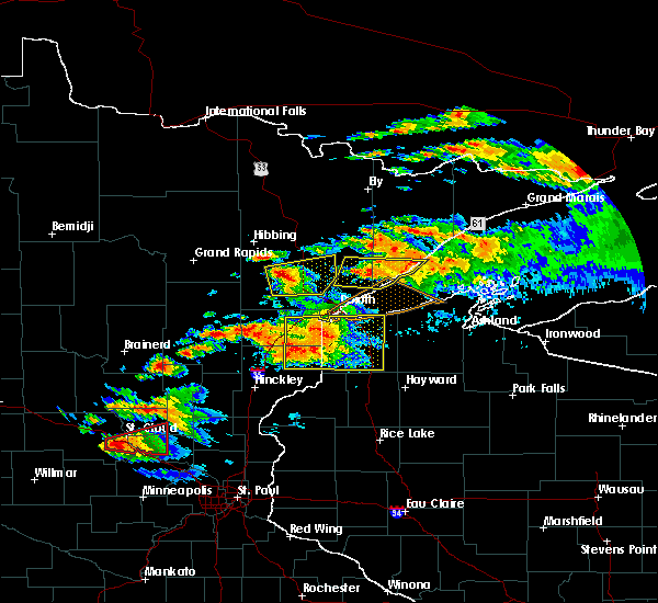 At 845 pm cdt, a severe thunderstorm was located near canyon, or 22 miles north of cloquet, moving east at 65 mph (radar indicated. at 838 pm cdt...quarter size hail was reported in meadowlands). Hazards include ping pong ball size hail and 60 mph wind gusts. People and animals outdoors will be injured. expect hail damage to roofs, siding, windows, and vehicles. expect wind damage to roofs, siding, and trees. Locations impacted include, cotton, toivola, meadowlands, canyon, boulder lake, island lake, alborn, culver, elmer, kelsey, prosit, comstock lake, nichols lake, payne, fish lake, taft and shaw. At 845 pm cdt, a severe thunderstorm was located near canyon, or 22 miles north of cloquet, moving east at 65 mph (radar indicated. at 838 pm cdt...quarter size hail was reported in meadowlands). Hazards include ping pong ball size hail and 60 mph wind gusts. People and animals outdoors will be injured. expect hail damage to roofs, siding, windows, and vehicles. expect wind damage to roofs, siding, and trees. Locations impacted include, cotton, toivola, meadowlands, canyon, boulder lake, island lake, alborn, culver, elmer, kelsey, prosit, comstock lake, nichols lake, payne, fish lake, taft and shaw.
|
| 6/19/2016 8:38 PM CDT | Half Dollar sized hail reported 0.2 miles NW of Meadowlands, MN, largest hail was half dollar sized with some quarters. |
| 6/19/2016 8:32 PM CDT |
 At 831 pm cdt, a severe thunderstorm was located near meadowlands, or 22 miles northwest of cloquet, moving east at 65 mph (radar indicated). Hazards include ping pong ball size hail and 60 mph wind gusts. People and animals outdoors will be injured. expect hail damage to roofs, siding, windows, and vehicles. Expect wind damage to roofs, siding, and trees. At 831 pm cdt, a severe thunderstorm was located near meadowlands, or 22 miles northwest of cloquet, moving east at 65 mph (radar indicated). Hazards include ping pong ball size hail and 60 mph wind gusts. People and animals outdoors will be injured. expect hail damage to roofs, siding, windows, and vehicles. Expect wind damage to roofs, siding, and trees.
|
| 6/19/2016 7:40 PM CDT |
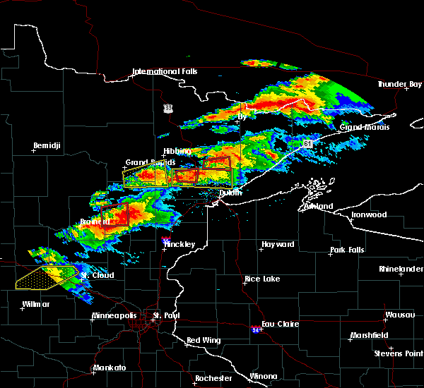 At 739 pm cdt, a severe thunderstorm was located near meadowlands, or 23 miles north of cloquet, moving east at 45 mph. a second severe thunderstorm was located 8 miles south of cotton, also moving east at 45 mph (radar indicated). Hazards include 70 mph wind gusts and half dollar size hail. Hail damage to vehicles is expected. expect considerable tree damage. Wind damage is also likely to mobile homes, roofs, and outbuildings. At 739 pm cdt, a severe thunderstorm was located near meadowlands, or 23 miles north of cloquet, moving east at 45 mph. a second severe thunderstorm was located 8 miles south of cotton, also moving east at 45 mph (radar indicated). Hazards include 70 mph wind gusts and half dollar size hail. Hail damage to vehicles is expected. expect considerable tree damage. Wind damage is also likely to mobile homes, roofs, and outbuildings.
|
| 6/19/2016 7:31 PM CDT |
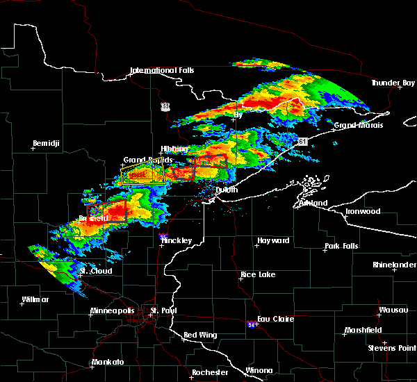 At 730 pm cdt, a severe thunderstorm capable of producing a tornado was located near canyon, or 24 miles north of cloquet, moving east at 45 mph (radar indicated rotation). Hazards include tornado and golf ball size hail. Flying debris will be dangerous to those caught without shelter. mobile homes will be damaged or destroyed. damage to roofs, windows, and vehicles will occur. tree damage is likely. Locations impacted include, cotton, meadowlands, canyon, kelsey, nichols lake and payne. At 730 pm cdt, a severe thunderstorm capable of producing a tornado was located near canyon, or 24 miles north of cloquet, moving east at 45 mph (radar indicated rotation). Hazards include tornado and golf ball size hail. Flying debris will be dangerous to those caught without shelter. mobile homes will be damaged or destroyed. damage to roofs, windows, and vehicles will occur. tree damage is likely. Locations impacted include, cotton, meadowlands, canyon, kelsey, nichols lake and payne.
|
| 6/19/2016 7:17 PM CDT |
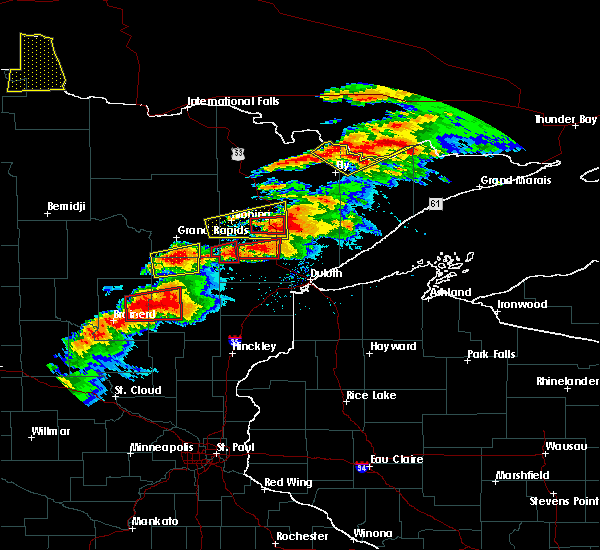 At 717 pm cdt, a severe thunderstorm capable of producing a tornado was located over meadowlands, or 24 miles south of hibbing, moving east at 40 mph (radar indicated rotation). Hazards include tornado and golf ball size hail. Flying debris will be dangerous to those caught without shelter. mobile homes will be damaged or destroyed. damage to roofs, windows, and vehicles will occur. tree damage is likely. locations impacted include, cotton, meadowlands, canyon, elmer, kelsey, nichols lake and payne. This storm has a history of producing tornadoes in the wawina area. At 717 pm cdt, a severe thunderstorm capable of producing a tornado was located over meadowlands, or 24 miles south of hibbing, moving east at 40 mph (radar indicated rotation). Hazards include tornado and golf ball size hail. Flying debris will be dangerous to those caught without shelter. mobile homes will be damaged or destroyed. damage to roofs, windows, and vehicles will occur. tree damage is likely. locations impacted include, cotton, meadowlands, canyon, elmer, kelsey, nichols lake and payne. This storm has a history of producing tornadoes in the wawina area.
|
| 6/19/2016 7:06 PM CDT |
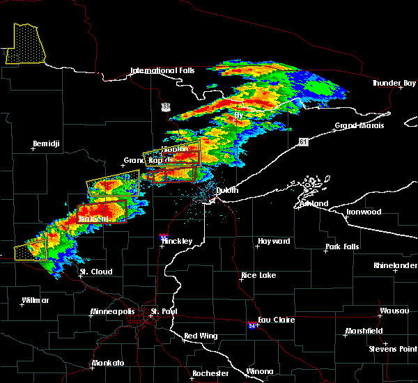 At 706 pm cdt, a confirmed tornado was located 9 miles north of floodwood, or 23 miles south of hibbing, moving east at 35 mph. this is a particularly dangerous situation (radar confirmed tornado). Hazards include damaging tornado. You are in a life-threatening situation. flying debris may be deadly to those caught without shelter. mobile homes will be destroyed. Considerable damage to homes, businesses, and vehicles is likely and complete destruction is possible. At 706 pm cdt, a confirmed tornado was located 9 miles north of floodwood, or 23 miles south of hibbing, moving east at 35 mph. this is a particularly dangerous situation (radar confirmed tornado). Hazards include damaging tornado. You are in a life-threatening situation. flying debris may be deadly to those caught without shelter. mobile homes will be destroyed. Considerable damage to homes, businesses, and vehicles is likely and complete destruction is possible.
|
| 6/10/2016 4:36 AM CDT |
 The severe thunderstorm warning for southwestern st. louis county will expire at 445 am cdt, the storm which prompted the warning has weakened below severe limits, and no longer poses an immediate threat to life or property. therefore the warning will be allowed to expire. The severe thunderstorm warning for southwestern st. louis county will expire at 445 am cdt, the storm which prompted the warning has weakened below severe limits, and no longer poses an immediate threat to life or property. therefore the warning will be allowed to expire.
|
| 6/10/2016 4:25 AM CDT |
 At 425 am cdt, a severe thunderstorm was located over meadowlands, or 23 miles southeast of hibbing, moving northeast at 15 mph (radar indicated). Hazards include 60 mph wind gusts and quarter size hail. Hail damage to vehicles is expected. expect wind damage to roofs, siding, and trees. Locations impacted include, meadowlands, elmer, kelsey, nichols lake and payne. At 425 am cdt, a severe thunderstorm was located over meadowlands, or 23 miles southeast of hibbing, moving northeast at 15 mph (radar indicated). Hazards include 60 mph wind gusts and quarter size hail. Hail damage to vehicles is expected. expect wind damage to roofs, siding, and trees. Locations impacted include, meadowlands, elmer, kelsey, nichols lake and payne.
|
| 6/10/2016 4:15 AM CDT |
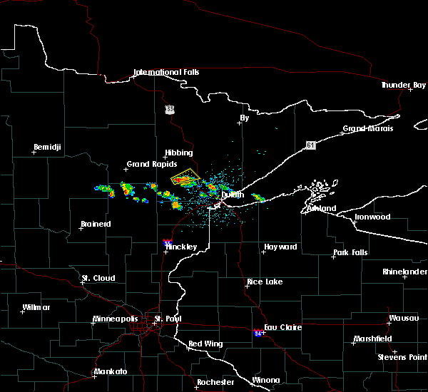 At 415 am cdt, a severe thunderstorm was located over meadowlands, or 23 miles south of hibbing, moving northeast at 20 mph (radar indicated). Hazards include 60 mph wind gusts and quarter size hail. Hail damage to vehicles is expected. Expect wind damage to roofs, siding, and trees. At 415 am cdt, a severe thunderstorm was located over meadowlands, or 23 miles south of hibbing, moving northeast at 20 mph (radar indicated). Hazards include 60 mph wind gusts and quarter size hail. Hail damage to vehicles is expected. Expect wind damage to roofs, siding, and trees.
|
| 7/5/2015 9:15 PM CDT |
 At 914 pm cdt, severe thunderstorms were located along a line extending from near biwabik to 8 miles west of whiteface reservoir to near cotton to 6 miles north of floodwood to near jacobson, moving southeast at 45 mph (radar indicated). Hazards include 70 mph wind gusts and quarter size hail. Hail damage to vehicles is expected. expect considerable tree damage. wind damage is also likely to mobile homes, roofs and outbuildings. these severe storms will be near, aurora and cotton around 920 pm cdt. canyon around 925 pm cdt. whiteface reservoir around 930 pm cdt. brookston around 935 pm cdt. fairbanks and boulder lake around 940 pm cdt. wolf lake, island lake and brimson around 945 pm cdt. Other locations impacted by these severe thunderstorms include prosit, markham, pequaywam lake, kelsey, nichols lake, alborn, island, gowan, fish lake and taft. At 914 pm cdt, severe thunderstorms were located along a line extending from near biwabik to 8 miles west of whiteface reservoir to near cotton to 6 miles north of floodwood to near jacobson, moving southeast at 45 mph (radar indicated). Hazards include 70 mph wind gusts and quarter size hail. Hail damage to vehicles is expected. expect considerable tree damage. wind damage is also likely to mobile homes, roofs and outbuildings. these severe storms will be near, aurora and cotton around 920 pm cdt. canyon around 925 pm cdt. whiteface reservoir around 930 pm cdt. brookston around 935 pm cdt. fairbanks and boulder lake around 940 pm cdt. wolf lake, island lake and brimson around 945 pm cdt. Other locations impacted by these severe thunderstorms include prosit, markham, pequaywam lake, kelsey, nichols lake, alborn, island, gowan, fish lake and taft.
|
| 7/5/2015 8:57 PM CDT |
 At 857 pm cdt, severe thunderstorms were located along a line extending from virginia to 8 miles northwest of cotton to near swan river to 7 miles west of jacobson, moving east at 40 mph (radar indicated). Hazards include 70 mph wind gusts and quarter size hail. Hail damage to vehicles is expected. expect considerable tree damage. wind damage is also likely to mobile homes, roofs and outbuildings. severe thunderstorms will be near, virginia and eveleth around 900 pm cdt. gilbert around 905 pm cdt. biwabik and cotton around 910 pm cdt. aurora around 915 pm cdt. meadowlands around 925 pm cdt. boulder lake and whiteface reservoir around 930 pm cdt. floodwood around 935 pm cdt. fairbanks around 940 pm cdt. Other locations impacted by these severe thunderstorms include prosit, markham, pequaywam lake, kelsey, nichols lake, alborn, island, seven beaver lake, gowan and fish lake. At 857 pm cdt, severe thunderstorms were located along a line extending from virginia to 8 miles northwest of cotton to near swan river to 7 miles west of jacobson, moving east at 40 mph (radar indicated). Hazards include 70 mph wind gusts and quarter size hail. Hail damage to vehicles is expected. expect considerable tree damage. wind damage is also likely to mobile homes, roofs and outbuildings. severe thunderstorms will be near, virginia and eveleth around 900 pm cdt. gilbert around 905 pm cdt. biwabik and cotton around 910 pm cdt. aurora around 915 pm cdt. meadowlands around 925 pm cdt. boulder lake and whiteface reservoir around 930 pm cdt. floodwood around 935 pm cdt. fairbanks around 940 pm cdt. Other locations impacted by these severe thunderstorms include prosit, markham, pequaywam lake, kelsey, nichols lake, alborn, island, seven beaver lake, gowan and fish lake.
|
| 7/2/2012 8:40 PM CDT | Storm damage reported in st. louis county MN, 5.4 miles S of Meadowlands, MN |
Hail Maps for Meadowlands, MN


Connect with Interactive Hail Maps