

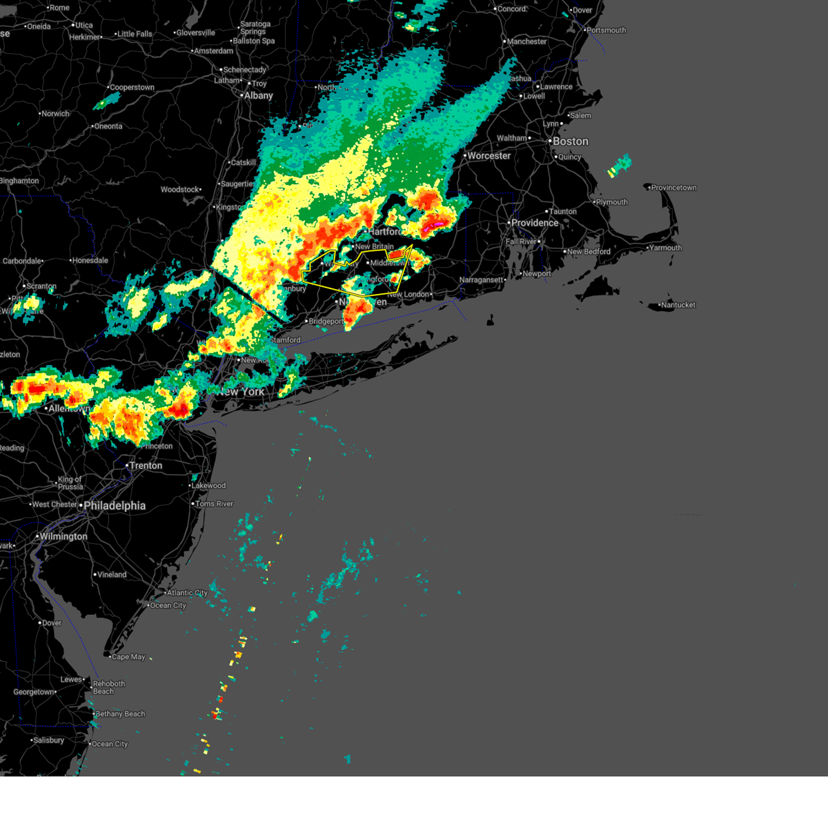
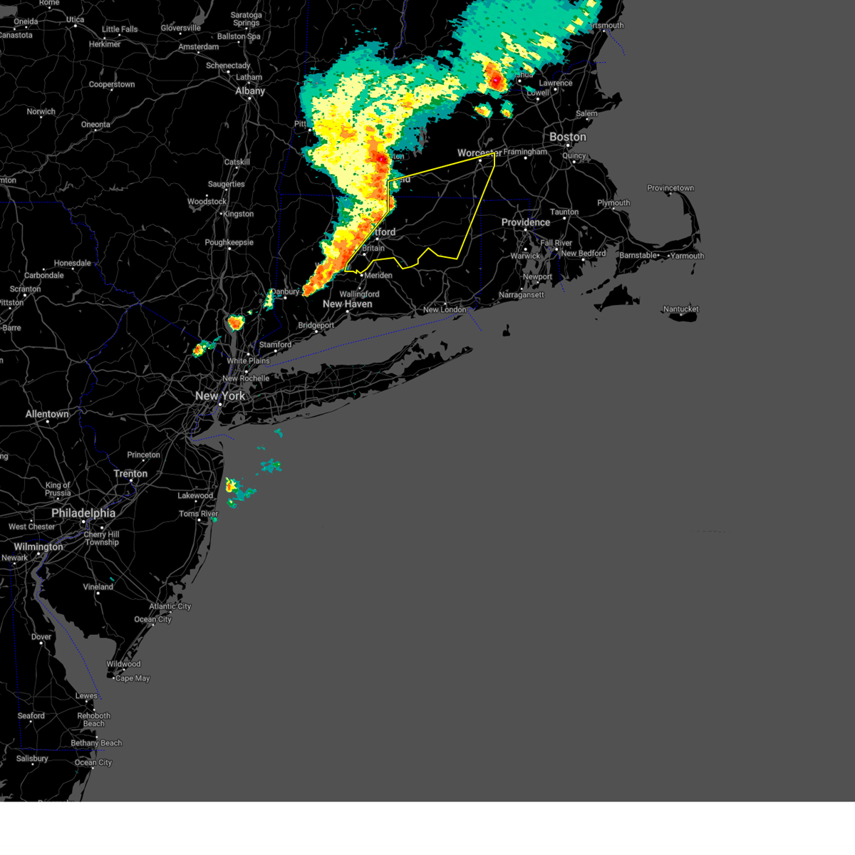
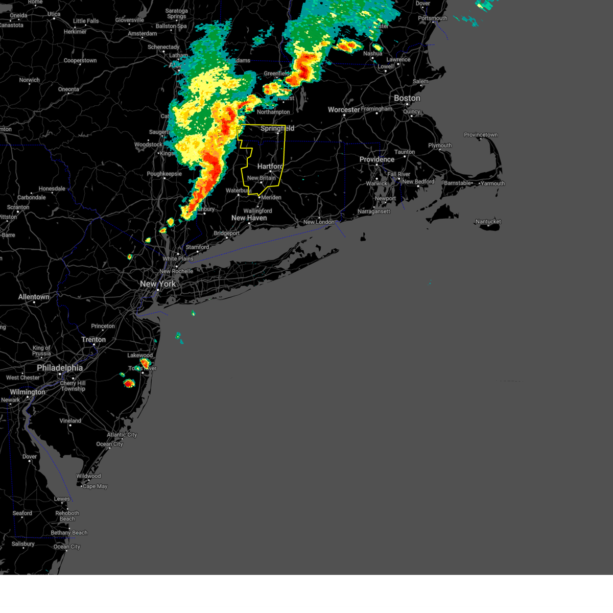
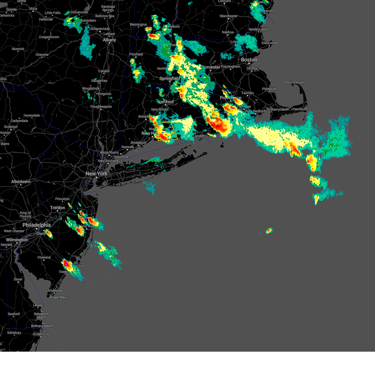
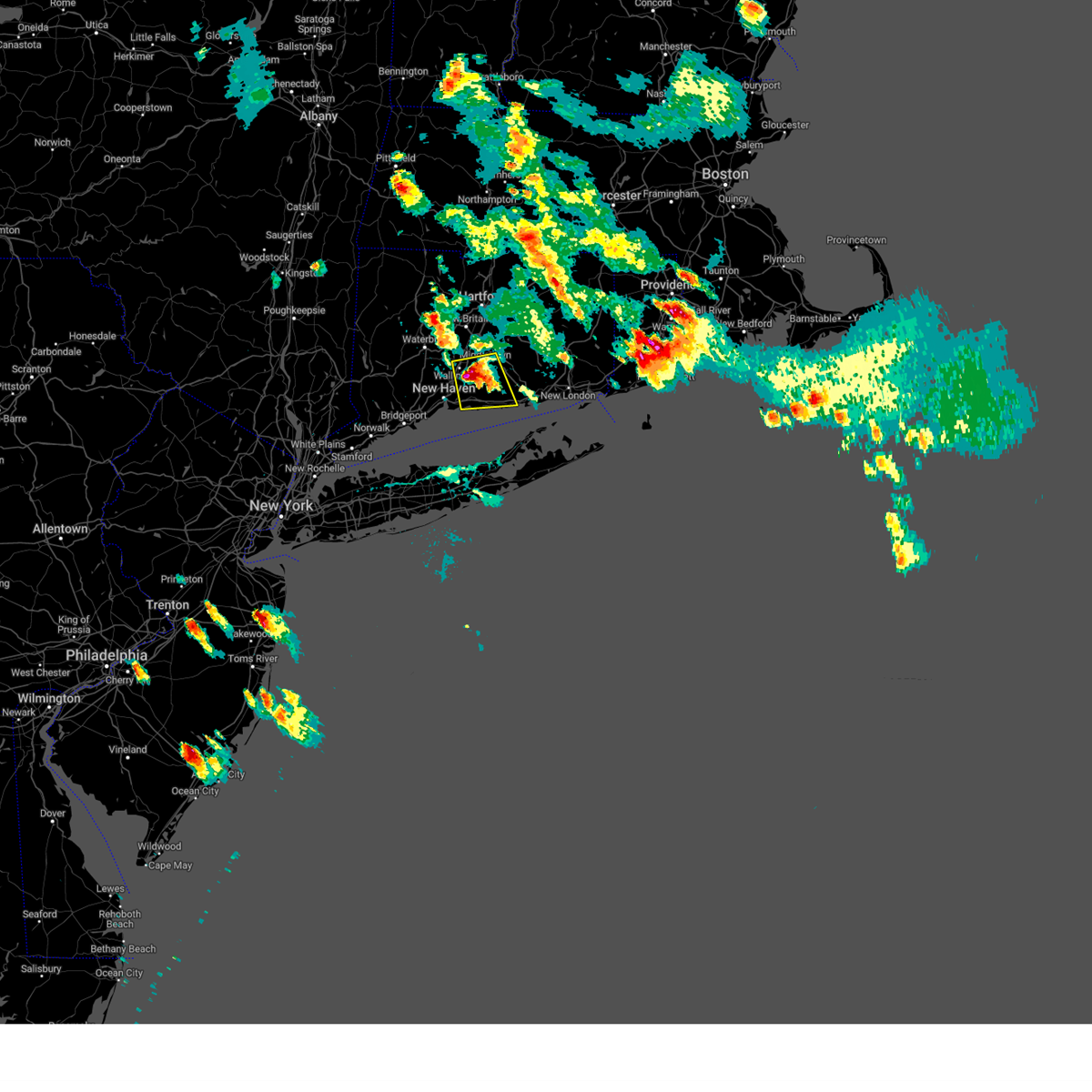
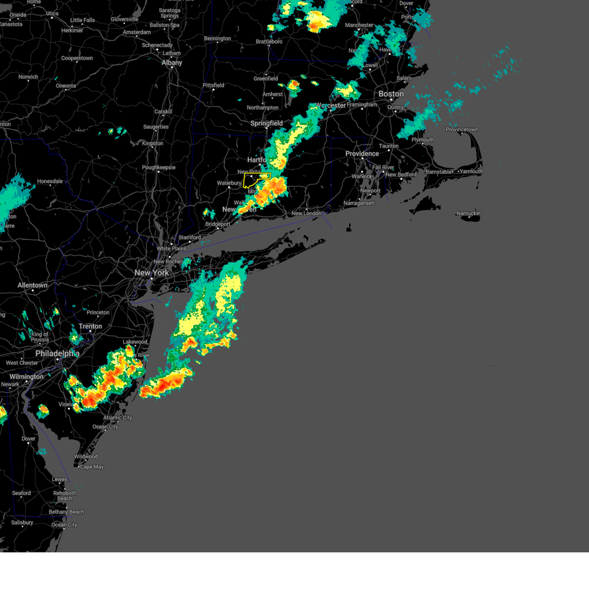
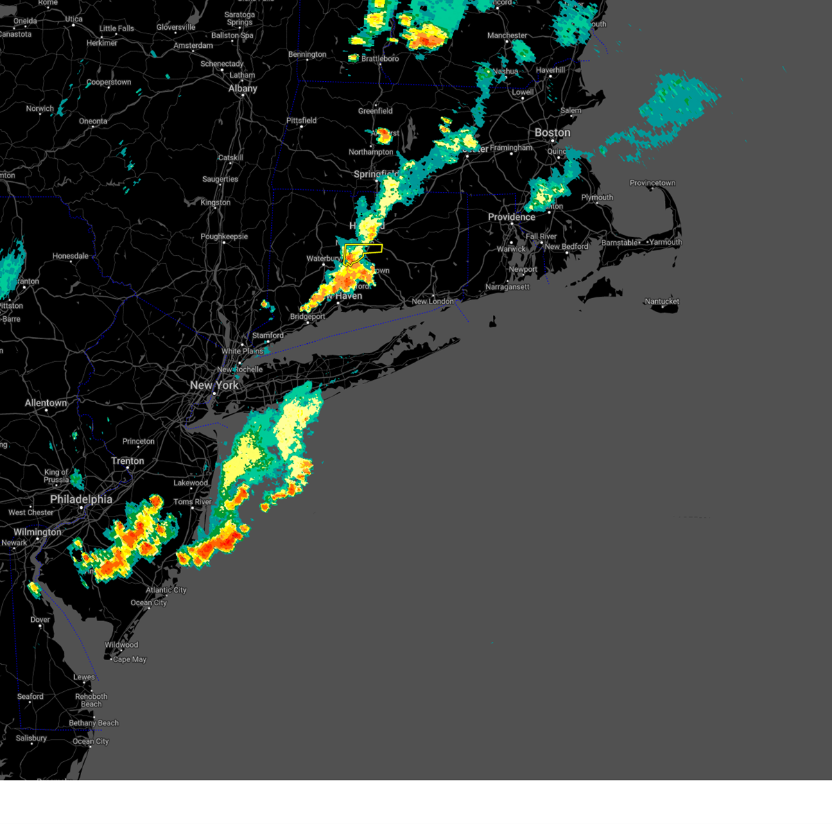
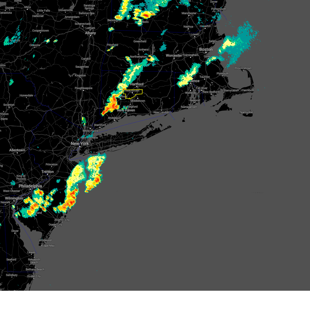
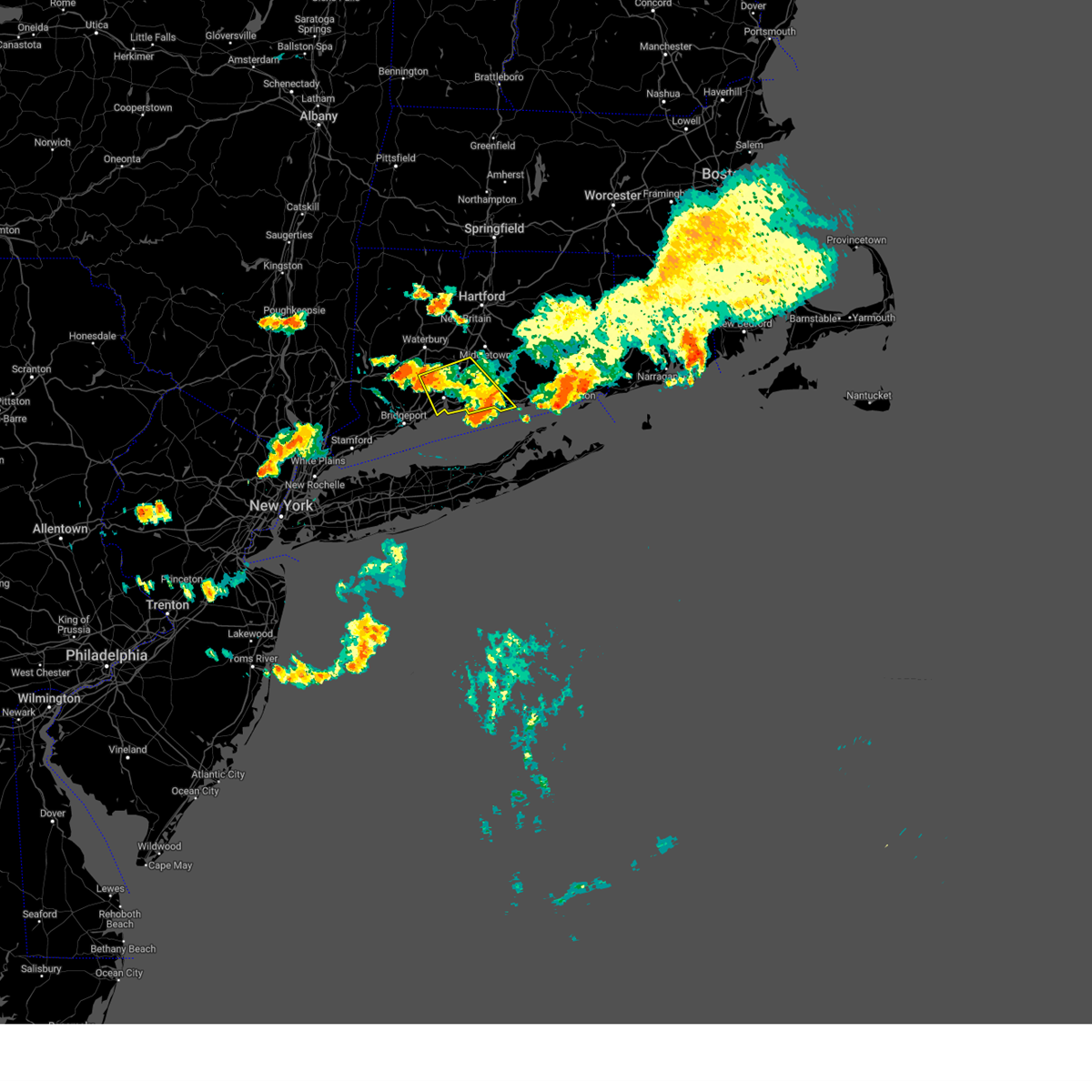
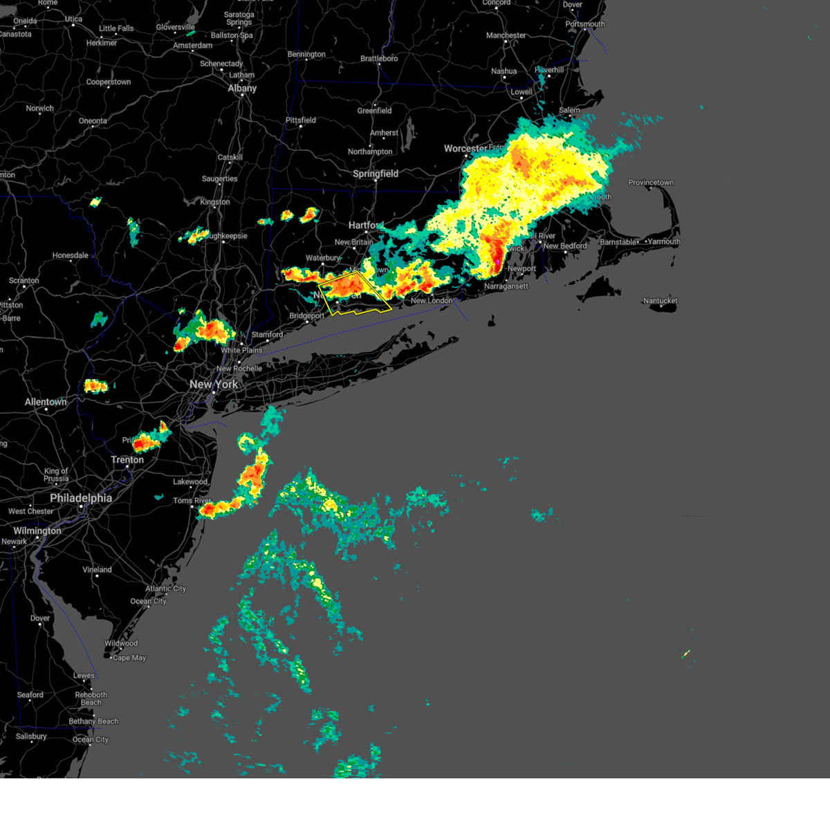
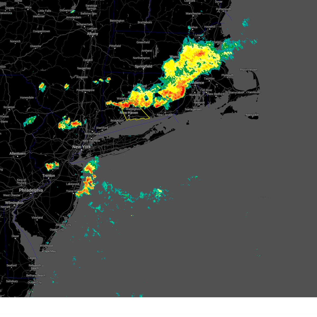
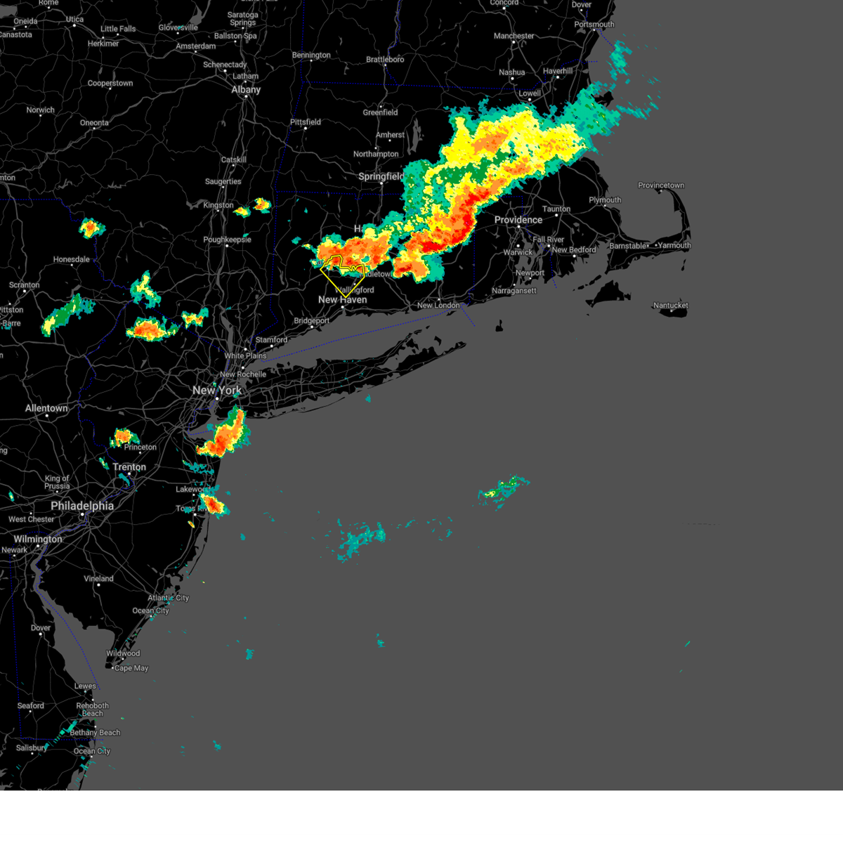
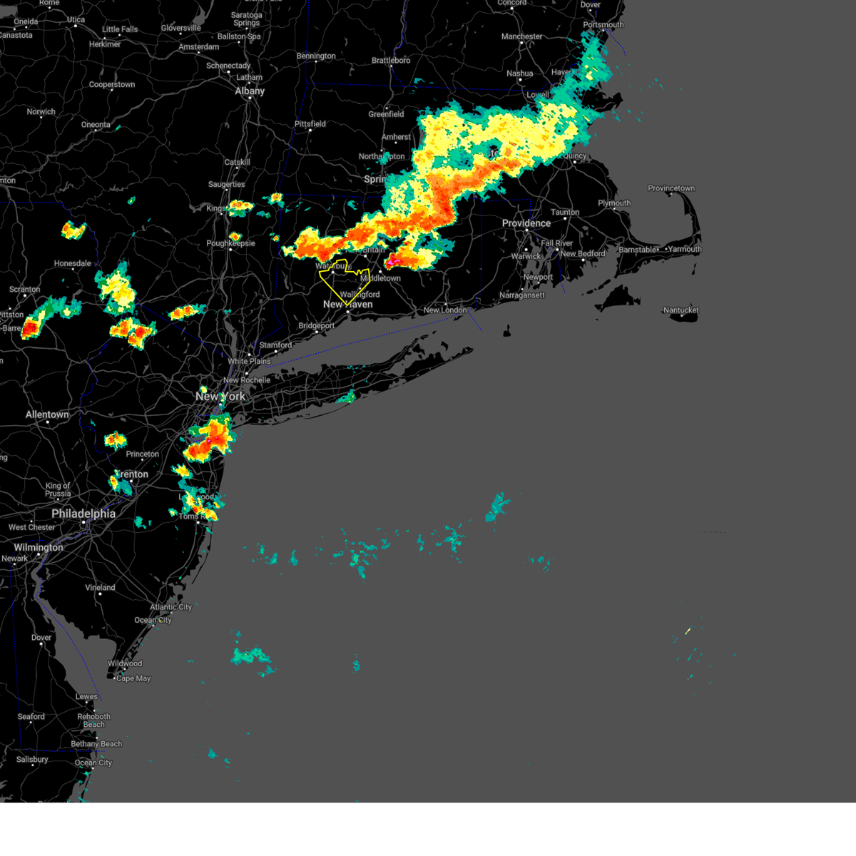
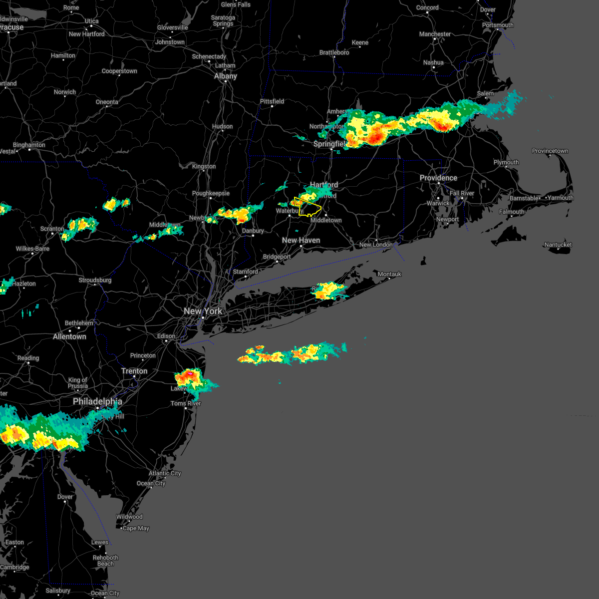
Hail Map for Meriden, CT
The Meriden, CT area has had 1 report of on-the-ground hail by trained spotters, and has been under severe weather warnings 14 times during the past 12 months. Doppler radar has detected hail at or near Meriden, CT on 20 occasions, including 2 occasions during the past year.
| Name: | Meriden, CT |
| Where Located: | 74.7 miles WSW of Providence, RI |
| Map: | Google Map for Meriden, CT |
| Population: | 60868 |
| Housing Units: | 25892 |
| More Info: | Search Google for Meriden, CT |
3
The Top Recent Hail Date for Meriden, CT is Monday, August 26, 2024 (5th out of 20)

Hail and Wind Damage Spotted near Meriden, CT
| Date / Time | Report Details |
|---|---|
| 7/3/2025 6:24 PM EDT |
 Svrokx the national weather service in upton ny has issued a * severe thunderstorm warning for, northwestern new london county in southern connecticut, middlesex county in southern connecticut, central new haven county in southern connecticut, * until 715 pm edt. * at 624 pm edt, severe thunderstorms were located along a line extending from terryville to oakville to middlebury to near southbury, moving east at 40 mph (radar indicated). Hazards include 60 mph wind gusts and quarter size hail. Minor hail damage to vehicles is possible. expect wind damage to trees and power lines. severe thunderstorms will be near, waterbury and naugatuck around 630 pm edt. meriden and hamden around 635 pm edt. wallingford and north haven around 640 pm edt. middletown and north branford around 645 pm edt. guilford and durham around 650 pm edt. haddam and killingworth around 655 pm edt. east hampton around 700 pm edt. North madison around 705 pm edt. Svrokx the national weather service in upton ny has issued a * severe thunderstorm warning for, northwestern new london county in southern connecticut, middlesex county in southern connecticut, central new haven county in southern connecticut, * until 715 pm edt. * at 624 pm edt, severe thunderstorms were located along a line extending from terryville to oakville to middlebury to near southbury, moving east at 40 mph (radar indicated). Hazards include 60 mph wind gusts and quarter size hail. Minor hail damage to vehicles is possible. expect wind damage to trees and power lines. severe thunderstorms will be near, waterbury and naugatuck around 630 pm edt. meriden and hamden around 635 pm edt. wallingford and north haven around 640 pm edt. middletown and north branford around 645 pm edt. guilford and durham around 650 pm edt. haddam and killingworth around 655 pm edt. east hampton around 700 pm edt. North madison around 705 pm edt.
|
| 7/1/2025 7:13 PM EDT | The storm which prompted the warning has moved out of the area. therefore, the warning will be allowed to expire. |
| 7/1/2025 6:25 PM EDT | Svrbox the national weather service in boston/norton has issued a * severe thunderstorm warning for, southwestern tolland county in northern connecticut, southern hartford county in northern connecticut, * until 715 pm edt. * at 625 pm edt, a severe thunderstorm was located over berlin, or over new britain, moving northeast at 20 mph (radar indicated). Hazards include 60 mph wind gusts and quarter size hail. Hail damage to vehicles is expected. Expect wind damage to trees and power lines. |
| 5/3/2025 4:07 PM EDT |
 Svrbox the national weather service in boston/norton has issued a * severe thunderstorm warning for, windham county in northern connecticut, tolland county in northern connecticut, central hartford county in northern connecticut, southwestern worcester county in central massachusetts, southeastern hampden county in western massachusetts, * until 445 pm edt. * at 406 pm edt, severe thunderstorms were located along a line extending from near chicopee to near somers to near southington, moving northeast at 65 mph (radar indicated). Hazards include 60 mph wind gusts and penny size hail. expect damage to trees and power lines Svrbox the national weather service in boston/norton has issued a * severe thunderstorm warning for, windham county in northern connecticut, tolland county in northern connecticut, central hartford county in northern connecticut, southwestern worcester county in central massachusetts, southeastern hampden county in western massachusetts, * until 445 pm edt. * at 406 pm edt, severe thunderstorms were located along a line extending from near chicopee to near somers to near southington, moving northeast at 65 mph (radar indicated). Hazards include 60 mph wind gusts and penny size hail. expect damage to trees and power lines
|
| 5/3/2025 3:21 PM EDT |
 Svrbox the national weather service in boston/norton has issued a * severe thunderstorm warning for, hartford county in northern connecticut, southwestern hampden county in western massachusetts, * until 415 pm edt. * at 320 pm edt, severe thunderstorms were located along a line extending from near norfolk to near litchfield to 6 miles west of ridgefield, moving east at 45 mph (radar indicated). Hazards include 60 mph wind gusts and nickel size hail. expect damage to trees and power lines Svrbox the national weather service in boston/norton has issued a * severe thunderstorm warning for, hartford county in northern connecticut, southwestern hampden county in western massachusetts, * until 415 pm edt. * at 320 pm edt, severe thunderstorms were located along a line extending from near norfolk to near litchfield to 6 miles west of ridgefield, moving east at 45 mph (radar indicated). Hazards include 60 mph wind gusts and nickel size hail. expect damage to trees and power lines
|
| 8/26/2024 3:57 PM EDT |
 The storm which prompted the warning has weakened below severe limits, and has exited the warned area. therefore, the warning will be allowed to expire. however, small hail is still possible with this thunderstorm. a severe thunderstorm watch remains in effect until 700 pm edt for southern connecticut. The storm which prompted the warning has weakened below severe limits, and has exited the warned area. therefore, the warning will be allowed to expire. however, small hail is still possible with this thunderstorm. a severe thunderstorm watch remains in effect until 700 pm edt for southern connecticut.
|
| 8/26/2024 3:27 PM EDT |
 At 326 pm edt, a severe thunderstorm was located near durham, moving southeast at 15 mph (public). Hazards include ping pong ball size hail and 60 mph wind gusts. People and animals outdoors will be injured. expect hail damage to roofs, siding, windows, and vehicles. expect wind damage to trees and power lines. this severe storm will be near, guilford and durham around 330 pm edt. north madison around 335 pm edt. clinton around 350 pm edt. Westbrook around 410 pm edt. At 326 pm edt, a severe thunderstorm was located near durham, moving southeast at 15 mph (public). Hazards include ping pong ball size hail and 60 mph wind gusts. People and animals outdoors will be injured. expect hail damage to roofs, siding, windows, and vehicles. expect wind damage to trees and power lines. this severe storm will be near, guilford and durham around 330 pm edt. north madison around 335 pm edt. clinton around 350 pm edt. Westbrook around 410 pm edt.
|
| 8/26/2024 3:20 PM EDT |
 the severe thunderstorm warning has been cancelled and is no longer in effect the severe thunderstorm warning has been cancelled and is no longer in effect
|
| 8/26/2024 3:06 PM EDT |
 At 306 pm edt, a severe thunderstorm was located over new britain, moving south at 20 mph (radar indicated). Hazards include 60 mph wind gusts and quarter size hail. Hail damage to vehicles is expected. expect wind damage to trees and power lines. Locations impacted include, hartford, new britain, west hartford, bristol, southington, glastonbury, newington, wethersfield, farmington, berlin, rocky hill, and plainville. At 306 pm edt, a severe thunderstorm was located over new britain, moving south at 20 mph (radar indicated). Hazards include 60 mph wind gusts and quarter size hail. Hail damage to vehicles is expected. expect wind damage to trees and power lines. Locations impacted include, hartford, new britain, west hartford, bristol, southington, glastonbury, newington, wethersfield, farmington, berlin, rocky hill, and plainville.
|
| 8/26/2024 3:03 PM EDT |
 Svrokx the national weather service in upton ny has issued a * severe thunderstorm warning for, middlesex county in southern connecticut, eastern new haven county in southern connecticut, * until 400 pm edt. * at 303 pm edt, a severe thunderstorm was located over middlefield, or near meriden, moving south at 15 mph (radar indicated). Hazards include 60 mph wind gusts and quarter size hail. Minor hail damage to vehicles is possible. expect wind damage to trees and power lines. this severe thunderstorm will be near, middletown and wallingford around 310 pm edt. killingworth around 320 pm edt. North madison around 340 pm edt. Svrokx the national weather service in upton ny has issued a * severe thunderstorm warning for, middlesex county in southern connecticut, eastern new haven county in southern connecticut, * until 400 pm edt. * at 303 pm edt, a severe thunderstorm was located over middlefield, or near meriden, moving south at 15 mph (radar indicated). Hazards include 60 mph wind gusts and quarter size hail. Minor hail damage to vehicles is possible. expect wind damage to trees and power lines. this severe thunderstorm will be near, middletown and wallingford around 310 pm edt. killingworth around 320 pm edt. North madison around 340 pm edt.
|
| 8/26/2024 2:48 PM EDT |
 Svrbox the national weather service in boston/norton has issued a * severe thunderstorm warning for, southwestern hartford county in northern connecticut, * until 330 pm edt. * at 248 pm edt, a severe thunderstorm was located over avon, or over farmington, moving south at 20 mph (radar indicated). Hazards include 60 mph wind gusts and quarter size hail. Hail damage to vehicles is expected. Expect wind damage to trees and power lines. Svrbox the national weather service in boston/norton has issued a * severe thunderstorm warning for, southwestern hartford county in northern connecticut, * until 330 pm edt. * at 248 pm edt, a severe thunderstorm was located over avon, or over farmington, moving south at 20 mph (radar indicated). Hazards include 60 mph wind gusts and quarter size hail. Hail damage to vehicles is expected. Expect wind damage to trees and power lines.
|
| 7/17/2024 9:48 PM EDT |
 the severe thunderstorm warning has been cancelled and is no longer in effect the severe thunderstorm warning has been cancelled and is no longer in effect
|
| 7/17/2024 9:16 PM EDT |
 Svrokx the national weather service in upton ny has issued a * severe thunderstorm warning for, central fairfield county in southern connecticut, central new haven county in southern connecticut, * until 1000 pm edt. * at 916 pm edt, a severe thunderstorm was located over newtown, moving northeast at 40 mph (radar indicated). Hazards include 60 mph wind gusts and quarter size hail. Minor hail damage to vehicles is possible. expect wind damage to trees and power lines. this severe thunderstorm will be near, shelton and southbury around 920 pm edt. naugatuck and seymour around 925 pm edt. bethany around 930 pm edt. waterbury and prospect around 935 pm edt. hamden and cheshire around 940 pm edt. Meriden and wallingford around 945 pm edt. Svrokx the national weather service in upton ny has issued a * severe thunderstorm warning for, central fairfield county in southern connecticut, central new haven county in southern connecticut, * until 1000 pm edt. * at 916 pm edt, a severe thunderstorm was located over newtown, moving northeast at 40 mph (radar indicated). Hazards include 60 mph wind gusts and quarter size hail. Minor hail damage to vehicles is possible. expect wind damage to trees and power lines. this severe thunderstorm will be near, shelton and southbury around 920 pm edt. naugatuck and seymour around 925 pm edt. bethany around 930 pm edt. waterbury and prospect around 935 pm edt. hamden and cheshire around 940 pm edt. Meriden and wallingford around 945 pm edt.
|
| 7/17/2024 5:05 PM EDT |
 Svrokx the national weather service in upton ny has issued a * severe thunderstorm warning for, fairfield county in southern connecticut, central new haven county in southern connecticut, * until 545 pm edt. * at 504 pm edt, severe thunderstorms were located along a line extending from southbury to near monroe to near weston, moving east at 30 mph (radar indicated). Hazards include 60 mph wind gusts. Expect damage to trees and power lines. severe thunderstorms will be near, bridgeport and shelton around 510 pm edt. milford and naugatuck around 515 pm edt. new haven and prospect around 520 pm edt. hamden and cheshire around 525 pm edt. North haven around 530 pm edt. Svrokx the national weather service in upton ny has issued a * severe thunderstorm warning for, fairfield county in southern connecticut, central new haven county in southern connecticut, * until 545 pm edt. * at 504 pm edt, severe thunderstorms were located along a line extending from southbury to near monroe to near weston, moving east at 30 mph (radar indicated). Hazards include 60 mph wind gusts. Expect damage to trees and power lines. severe thunderstorms will be near, bridgeport and shelton around 510 pm edt. milford and naugatuck around 515 pm edt. new haven and prospect around 520 pm edt. hamden and cheshire around 525 pm edt. North haven around 530 pm edt.
|
| 6/30/2024 1:35 PM EDT |
 The storms which prompted the warning have moved out of the area. therefore, the warning will be allowed to expire. however gusty winds are still possible across southern hartford county. a severe thunderstorm watch remains in effect until 700 pm edt for northern connecticut, and western massachusetts. to report severe weather, contact your nearest law enforcement agency. they will relay your report to the national weather service boston/norton. The storms which prompted the warning have moved out of the area. therefore, the warning will be allowed to expire. however gusty winds are still possible across southern hartford county. a severe thunderstorm watch remains in effect until 700 pm edt for northern connecticut, and western massachusetts. to report severe weather, contact your nearest law enforcement agency. they will relay your report to the national weather service boston/norton.
|
| 6/30/2024 1:26 PM EDT |
 At 126 pm edt, severe thunderstorms were located along a line extending from suffield to hartford to near southington, moving east at 40 mph (radar indicated). Hazards include 60 mph wind gusts and quarter size hail. Hail damage to vehicles is expected. expect wind damage to roofs, siding, and trees. Locations impacted include, hartford, new britain, west hartford, bristol, enfield, southington, newington, windsor, agawam, wethersfield, farmington, simsbury, bloomfield, berlin, rocky hill, avon, plainville, longmeadow, suffield, and windsor locks. At 126 pm edt, severe thunderstorms were located along a line extending from suffield to hartford to near southington, moving east at 40 mph (radar indicated). Hazards include 60 mph wind gusts and quarter size hail. Hail damage to vehicles is expected. expect wind damage to roofs, siding, and trees. Locations impacted include, hartford, new britain, west hartford, bristol, enfield, southington, newington, windsor, agawam, wethersfield, farmington, simsbury, bloomfield, berlin, rocky hill, avon, plainville, longmeadow, suffield, and windsor locks.
|
| 6/30/2024 1:17 PM EDT |
 At 117 pm edt, severe thunderstorms were located along a line extending from near agawam to near thomaston, moving east at 45 mph (radar indicated). Hazards include 60 mph wind gusts and nickel size hail. Expect damage to roofs, siding, and trees. Locations impacted include, hartford, new britain, west hartford, bristol, enfield, southington, newington, windsor, agawam, wethersfield, farmington, simsbury, bloomfield, berlin, rocky hill, avon, plainville, longmeadow, suffield, and windsor locks. At 117 pm edt, severe thunderstorms were located along a line extending from near agawam to near thomaston, moving east at 45 mph (radar indicated). Hazards include 60 mph wind gusts and nickel size hail. Expect damage to roofs, siding, and trees. Locations impacted include, hartford, new britain, west hartford, bristol, enfield, southington, newington, windsor, agawam, wethersfield, farmington, simsbury, bloomfield, berlin, rocky hill, avon, plainville, longmeadow, suffield, and windsor locks.
|
| 6/30/2024 12:39 PM EDT |
 Svrbox the national weather service in boston/norton has issued a * severe thunderstorm warning for, hartford county in northern connecticut, southwestern hampden county in western massachusetts, * until 145 pm edt. * at 1238 pm edt, severe thunderstorms were located along a line extending from near norfolk to near dover plains, moving east at 45 mph (radar indicated). Hazards include 60 mph wind gusts and penny size hail. expect damage to roofs, siding, and trees Svrbox the national weather service in boston/norton has issued a * severe thunderstorm warning for, hartford county in northern connecticut, southwestern hampden county in western massachusetts, * until 145 pm edt. * at 1238 pm edt, severe thunderstorms were located along a line extending from near norfolk to near dover plains, moving east at 45 mph (radar indicated). Hazards include 60 mph wind gusts and penny size hail. expect damage to roofs, siding, and trees
|
| 6/26/2024 9:42 PM EDT |
 Svrokx the national weather service in upton ny has issued a * severe thunderstorm warning for, western new london county in southern connecticut, central fairfield county in southern connecticut, middlesex county in southern connecticut, new haven county in southern connecticut, * until 1030 pm edt. * at 942 pm edt, severe thunderstorms were located along a line extending from terryville to bethany to milford, moving east at 45 mph (radar indicated). Hazards include 60 mph wind gusts. Expect damage to trees and power lines. severe thunderstorms will be near, new haven and meriden around 950 pm edt. middletown and guilford around 955 pm edt. cromwell and portland around 1000 pm edt. haddam and killingworth around 1005 pm edt. clinton and east hampton around 1010 pm edt. Colchester and east haddam around 1015 pm edt. Svrokx the national weather service in upton ny has issued a * severe thunderstorm warning for, western new london county in southern connecticut, central fairfield county in southern connecticut, middlesex county in southern connecticut, new haven county in southern connecticut, * until 1030 pm edt. * at 942 pm edt, severe thunderstorms were located along a line extending from terryville to bethany to milford, moving east at 45 mph (radar indicated). Hazards include 60 mph wind gusts. Expect damage to trees and power lines. severe thunderstorms will be near, new haven and meriden around 950 pm edt. middletown and guilford around 955 pm edt. cromwell and portland around 1000 pm edt. haddam and killingworth around 1005 pm edt. clinton and east hampton around 1010 pm edt. Colchester and east haddam around 1015 pm edt.
|
| 6/26/2024 9:32 PM EDT |
 Svrbox the national weather service in boston/norton has issued a * severe thunderstorm warning for, hartford county in northern connecticut, southwestern hampden county in western massachusetts, * until 1030 pm edt. * at 931 pm edt, severe thunderstorms were located along a line extending from near millerton to near litchfield to near shelton, moving northeast at 45 mph (radar indicated). Hazards include 70 mph wind gusts. Expect considerable tree damage. Damage is likely to mobile homes, roofs, and outbuildings. Svrbox the national weather service in boston/norton has issued a * severe thunderstorm warning for, hartford county in northern connecticut, southwestern hampden county in western massachusetts, * until 1030 pm edt. * at 931 pm edt, severe thunderstorms were located along a line extending from near millerton to near litchfield to near shelton, moving northeast at 45 mph (radar indicated). Hazards include 70 mph wind gusts. Expect considerable tree damage. Damage is likely to mobile homes, roofs, and outbuildings.
|
| 6/26/2024 9:07 PM EDT |
 Svrokx the national weather service in upton ny has issued a * severe thunderstorm warning for, fairfield county in southern connecticut, central middlesex county in southern connecticut, new haven county in southern connecticut, northern westchester county in southeastern new york, eastern putnam county in southeastern new york, * until 945 pm edt. * at 907 pm edt, severe thunderstorms were located along a line extending from near dover plains to near ridgefield to near darien, moving east at 45 mph (radar indicated). Hazards include 60 mph wind gusts. Expect damage to trees and power lines. severe thunderstorms will be near, stamford and norwalk around 910 pm edt. southbury and fairfield around 915 pm edt. bridgeport and shelton around 920 pm edt. stratford and seymour around 925 pm edt. milford and naugatuck around 930 pm edt. new haven and waterbury around 935 pm edt. Prospect around 940 pm edt. Svrokx the national weather service in upton ny has issued a * severe thunderstorm warning for, fairfield county in southern connecticut, central middlesex county in southern connecticut, new haven county in southern connecticut, northern westchester county in southeastern new york, eastern putnam county in southeastern new york, * until 945 pm edt. * at 907 pm edt, severe thunderstorms were located along a line extending from near dover plains to near ridgefield to near darien, moving east at 45 mph (radar indicated). Hazards include 60 mph wind gusts. Expect damage to trees and power lines. severe thunderstorms will be near, stamford and norwalk around 910 pm edt. southbury and fairfield around 915 pm edt. bridgeport and shelton around 920 pm edt. stratford and seymour around 925 pm edt. milford and naugatuck around 930 pm edt. new haven and waterbury around 935 pm edt. Prospect around 940 pm edt.
|
| 6/23/2024 8:38 PM EDT |
 The storm which prompted the warning has moved out of the area. therefore, the warning will be allowed to expire. The storm which prompted the warning has moved out of the area. therefore, the warning will be allowed to expire.
|
| 6/23/2024 8:28 PM EDT |
 Svrokx the national weather service in upton ny has issued a * severe thunderstorm warning for, central new london county in southern connecticut, middlesex county in southern connecticut, northeastern new haven county in southern connecticut, * until 915 pm edt. * at 827 pm edt, severe thunderstorms were located along a line extending from near berlin to near north branford, moving east at 40 mph (radar indicated). Hazards include 60 mph wind gusts. expect damage to trees and power lines Svrokx the national weather service in upton ny has issued a * severe thunderstorm warning for, central new london county in southern connecticut, middlesex county in southern connecticut, northeastern new haven county in southern connecticut, * until 915 pm edt. * at 827 pm edt, severe thunderstorms were located along a line extending from near berlin to near north branford, moving east at 40 mph (radar indicated). Hazards include 60 mph wind gusts. expect damage to trees and power lines
|
| 6/23/2024 8:23 PM EDT |
 At 823 pm edt, a severe thunderstorm was located over berlin, or near meriden, moving east at 45 mph (radar indicated). Hazards include 60 mph wind gusts. Expect damage to roofs, siding, and trees. Locations impacted include, new britain, southington, glastonbury, newington, wethersfield, berlin, rocky hill, and plainville. At 823 pm edt, a severe thunderstorm was located over berlin, or near meriden, moving east at 45 mph (radar indicated). Hazards include 60 mph wind gusts. Expect damage to roofs, siding, and trees. Locations impacted include, new britain, southington, glastonbury, newington, wethersfield, berlin, rocky hill, and plainville.
|
| 6/23/2024 8:10 PM EDT | Many reports of trees and wires down across town. unconfirmed reports of trees down on at least 2 homes. time estimated from rada in hartford county CT, 6 miles SE of Meriden, CT |
| 6/23/2024 8:08 PM EDT |
 the severe thunderstorm warning has been cancelled and is no longer in effect the severe thunderstorm warning has been cancelled and is no longer in effect
|
| 6/23/2024 8:08 PM EDT |
 At 807 pm edt, severe thunderstorms were located along a line extending from wolcott to near hamden, moving east at 55 mph (radar indicated. widespread wind damage has also been reported). Hazards include 60 mph wind gusts. Expect damage to trees and power lines. these severe storms will be near, waterbury and meriden around 810 pm edt. middletown and guilford around 815 pm edt. Cromwell and portland around 820 pm edt. At 807 pm edt, severe thunderstorms were located along a line extending from wolcott to near hamden, moving east at 55 mph (radar indicated. widespread wind damage has also been reported). Hazards include 60 mph wind gusts. Expect damage to trees and power lines. these severe storms will be near, waterbury and meriden around 810 pm edt. middletown and guilford around 815 pm edt. Cromwell and portland around 820 pm edt.
|
| 6/23/2024 7:57 PM EDT |
 At 756 pm edt, severe thunderstorms were located along a line extending from near middlebury to near derby, moving east at 55 mph (radar indicated). Hazards include 60 mph wind gusts. Expect damage to trees and power lines. these severe storms will be near, new haven and waterbury around 800 pm edt. wallingford and north haven around 805 pm edt. meriden and north branford around 810 pm edt. middletown and guilford around 815 pm edt. portland and haddam around 820 pm edt. Lake pocotopaug--east hampton around 825 pm edt. At 756 pm edt, severe thunderstorms were located along a line extending from near middlebury to near derby, moving east at 55 mph (radar indicated). Hazards include 60 mph wind gusts. Expect damage to trees and power lines. these severe storms will be near, new haven and waterbury around 800 pm edt. wallingford and north haven around 805 pm edt. meriden and north branford around 810 pm edt. middletown and guilford around 815 pm edt. portland and haddam around 820 pm edt. Lake pocotopaug--east hampton around 825 pm edt.
|
| 6/23/2024 7:53 PM EDT |
 Svrbox the national weather service in boston/norton has issued a * severe thunderstorm warning for, southern hartford county in northern connecticut, * until 845 pm edt. * at 753 pm edt, a severe thunderstorm was located over woodbury center, or near southbury, moving east at 45 mph (radar indicated). Hazards include 60 mph wind gusts. expect damage to roofs, siding, and trees Svrbox the national weather service in boston/norton has issued a * severe thunderstorm warning for, southern hartford county in northern connecticut, * until 845 pm edt. * at 753 pm edt, a severe thunderstorm was located over woodbury center, or near southbury, moving east at 45 mph (radar indicated). Hazards include 60 mph wind gusts. expect damage to roofs, siding, and trees
|
| 6/23/2024 7:40 PM EDT |
 Svrokx the national weather service in upton ny has issued a * severe thunderstorm warning for, central fairfield county in southern connecticut, northern middlesex county in southern connecticut, new haven county in southern connecticut, * until 830 pm edt. * at 740 pm edt, severe thunderstorms were located along a line extending from new milford to near redding, moving east at 55 mph (radar indicated). Hazards include 60 mph wind gusts. Expect damage to trees and power lines. severe thunderstorms will be near, southbury and newtown around 745 pm edt. shelton and trumbull around 750 pm edt. waterbury and naugatuck around 755 pm edt. new haven and hamden around 800 pm edt. meriden and wallingford around 805 pm edt. north branford around 810 pm edt. middletown and guilford around 815 pm edt. Portland and haddam around 820 pm edt. Svrokx the national weather service in upton ny has issued a * severe thunderstorm warning for, central fairfield county in southern connecticut, northern middlesex county in southern connecticut, new haven county in southern connecticut, * until 830 pm edt. * at 740 pm edt, severe thunderstorms were located along a line extending from new milford to near redding, moving east at 55 mph (radar indicated). Hazards include 60 mph wind gusts. Expect damage to trees and power lines. severe thunderstorms will be near, southbury and newtown around 745 pm edt. shelton and trumbull around 750 pm edt. waterbury and naugatuck around 755 pm edt. new haven and hamden around 800 pm edt. meriden and wallingford around 805 pm edt. north branford around 810 pm edt. middletown and guilford around 815 pm edt. Portland and haddam around 820 pm edt.
|
| 6/22/2024 5:48 PM EDT |
 The storm which prompted the warning has moved out of the area. therefore, the warning has been allowed to expire. however, strong and potentially damaging winds and hail are still possible with another thunderstorm that is moving in from the northwest over the next hoour. remember, a severe thunderstorm warning still remains in effect for southern new haven until 6:45 pm. The storm which prompted the warning has moved out of the area. therefore, the warning has been allowed to expire. however, strong and potentially damaging winds and hail are still possible with another thunderstorm that is moving in from the northwest over the next hoour. remember, a severe thunderstorm warning still remains in effect for southern new haven until 6:45 pm.
|
| 6/22/2024 5:19 PM EDT |
 At 519 pm edt, a severe thunderstorm was located over north branford, or 7 miles south of wallingford, moving southeast at 25 mph (radar indicated). Hazards include 60 mph wind gusts and quarter size hail. Minor hail damage to vehicles is possible. expect wind damage to trees and power lines. This severe storm will be near, guilford and branford around 525 pm edt. At 519 pm edt, a severe thunderstorm was located over north branford, or 7 miles south of wallingford, moving southeast at 25 mph (radar indicated). Hazards include 60 mph wind gusts and quarter size hail. Minor hail damage to vehicles is possible. expect wind damage to trees and power lines. This severe storm will be near, guilford and branford around 525 pm edt.
|
| 6/22/2024 4:53 PM EDT |
 Svrokx the national weather service in upton ny has issued a * severe thunderstorm warning for, southern middlesex county in southern connecticut, new haven county in southern connecticut, * until 545 pm edt. * at 453 pm edt, a severe thunderstorm was located over wolcott, moving southeast at 25 mph (radar indicated). Hazards include ping pong ball size hail and 60 mph wind gusts. People and animals outdoors will be injured. expect hail damage to roofs, siding, windows, and vehicles. expect wind damage to trees and power lines. this severe thunderstorm will be near, waterbury and naugatuck around 500 pm edt. hamden and bethany around 510 pm edt. wallingford around 515 pm edt. north haven around 520 pm edt. North branford around 530 pm edt. Svrokx the national weather service in upton ny has issued a * severe thunderstorm warning for, southern middlesex county in southern connecticut, new haven county in southern connecticut, * until 545 pm edt. * at 453 pm edt, a severe thunderstorm was located over wolcott, moving southeast at 25 mph (radar indicated). Hazards include ping pong ball size hail and 60 mph wind gusts. People and animals outdoors will be injured. expect hail damage to roofs, siding, windows, and vehicles. expect wind damage to trees and power lines. this severe thunderstorm will be near, waterbury and naugatuck around 500 pm edt. hamden and bethany around 510 pm edt. wallingford around 515 pm edt. north haven around 520 pm edt. North branford around 530 pm edt.
|
| 6/22/2024 4:30 PM EDT |
 At 430 pm edt, a severe thunderstorm was located near prospect, or near waterbury, moving southeast at 25 mph (radar indicated). Hazards include 60 mph wind gusts and quarter size hail. Minor hail damage to vehicles is possible. expect wind damage to trees and power lines. this severe storm will be near, meriden and hamden around 435 pm edt. wallingford around 440 pm edt. North haven around 445 pm edt. At 430 pm edt, a severe thunderstorm was located near prospect, or near waterbury, moving southeast at 25 mph (radar indicated). Hazards include 60 mph wind gusts and quarter size hail. Minor hail damage to vehicles is possible. expect wind damage to trees and power lines. this severe storm will be near, meriden and hamden around 435 pm edt. wallingford around 440 pm edt. North haven around 445 pm edt.
|
| 6/22/2024 4:07 PM EDT |
 Svrokx the national weather service in upton ny has issued a * severe thunderstorm warning for, northwestern new haven county in southern connecticut, * until 500 pm edt. * at 407 pm edt, a severe thunderstorm was located over oakville, or near waterbury, moving southeast at 25 mph (radar indicated). Hazards include ping pong ball size hail. People and animals outdoors will be injured. expect damage to roofs, siding, windows, and vehicles. this severe thunderstorm will be near, waterbury and wolcott around 415 pm edt. naugatuck and cheshire around 420 pm edt. hamden and bethany around 435 pm edt. meriden and wallingford around 440 pm edt. North haven around 445 pm edt. Svrokx the national weather service in upton ny has issued a * severe thunderstorm warning for, northwestern new haven county in southern connecticut, * until 500 pm edt. * at 407 pm edt, a severe thunderstorm was located over oakville, or near waterbury, moving southeast at 25 mph (radar indicated). Hazards include ping pong ball size hail. People and animals outdoors will be injured. expect damage to roofs, siding, windows, and vehicles. this severe thunderstorm will be near, waterbury and wolcott around 415 pm edt. naugatuck and cheshire around 420 pm edt. hamden and bethany around 435 pm edt. meriden and wallingford around 440 pm edt. North haven around 445 pm edt.
|
| 5/23/2024 9:12 AM EDT |
 The storm which prompted the warning has weakened below severe limits, and no longer poses an immediate threat to life or property. therefore, the warning will be allowed to expire. however, small hail, gusty winds and heavy rain are still possible with this thunderstorm. The storm which prompted the warning has weakened below severe limits, and no longer poses an immediate threat to life or property. therefore, the warning will be allowed to expire. however, small hail, gusty winds and heavy rain are still possible with this thunderstorm.
|
| 5/23/2024 8:39 AM EDT |
 Svrokx the national weather service in upton ny has issued a * severe thunderstorm warning for, central fairfield county in southern connecticut, new haven county in southern connecticut, eastern putnam county in southeastern new york, * until 915 am edt. * at 839 am edt, a severe thunderstorm was located over brookfield, or near newtown, moving northeast at 30 mph (radar indicated). Hazards include 60 mph wind gusts and quarter size hail. Minor hail damage to vehicles is possible. expect wind damage to trees and power lines. this severe thunderstorm will be near, southbury and newtown around 845 am edt. middlebury around 850 am edt. Waterbury and naugatuck around 900 am edt. Svrokx the national weather service in upton ny has issued a * severe thunderstorm warning for, central fairfield county in southern connecticut, new haven county in southern connecticut, eastern putnam county in southeastern new york, * until 915 am edt. * at 839 am edt, a severe thunderstorm was located over brookfield, or near newtown, moving northeast at 30 mph (radar indicated). Hazards include 60 mph wind gusts and quarter size hail. Minor hail damage to vehicles is possible. expect wind damage to trees and power lines. this severe thunderstorm will be near, southbury and newtown around 845 am edt. middlebury around 850 am edt. Waterbury and naugatuck around 900 am edt.
|
| 9/13/2023 8:36 AM EDT |
 At 836 am edt, severe thunderstorms were located along a line extending from near canton to plainville to near southington, moving northeast at 35 mph (radar indicated). Hazards include 60 mph wind gusts. expect damage to roofs, siding, and trees At 836 am edt, severe thunderstorms were located along a line extending from near canton to plainville to near southington, moving northeast at 35 mph (radar indicated). Hazards include 60 mph wind gusts. expect damage to roofs, siding, and trees
|
| 9/8/2023 9:55 PM EDT |
 The severe thunderstorm warning for northwestern tolland, central hartford and south central hampden counties will expire at 1000 pm edt, the storm which prompted the warning has weakened below severe limits, and no longer poses an immediate threat to life or property. therefore, the warning will be allowed to expire. however small hail, gusty winds and heavy rain are still possible with this thunderstorm. a severe thunderstorm watch remains in effect until 1100 pm edt for northern connecticut, and western massachusetts. The severe thunderstorm warning for northwestern tolland, central hartford and south central hampden counties will expire at 1000 pm edt, the storm which prompted the warning has weakened below severe limits, and no longer poses an immediate threat to life or property. therefore, the warning will be allowed to expire. however small hail, gusty winds and heavy rain are still possible with this thunderstorm. a severe thunderstorm watch remains in effect until 1100 pm edt for northern connecticut, and western massachusetts.
|
| 9/8/2023 9:38 PM EDT |
 At 937 pm edt, a severe thunderstorm was located near ellington, or near enfield, moving northeast at 50 mph (radar indicated). Hazards include 60 mph wind gusts, quarter size hail, and heavy rain in excess of 1 inch . Hail damage to vehicles is expected. expect wind damage to roofs, siding, and trees. locations impacted include, springfield, hartford, new britain, west hartford, bristol, manchester, east hartford, enfield, southington, glastonbury, newington, vernon, windsor, wethersfield, south windsor, farmington, simsbury, bloomfield, berlin, and rocky hill. hail threat, radar indicated max hail size, 1. 00 in wind threat, radar indicated max wind gust, 60 mph. At 937 pm edt, a severe thunderstorm was located near ellington, or near enfield, moving northeast at 50 mph (radar indicated). Hazards include 60 mph wind gusts, quarter size hail, and heavy rain in excess of 1 inch . Hail damage to vehicles is expected. expect wind damage to roofs, siding, and trees. locations impacted include, springfield, hartford, new britain, west hartford, bristol, manchester, east hartford, enfield, southington, glastonbury, newington, vernon, windsor, wethersfield, south windsor, farmington, simsbury, bloomfield, berlin, and rocky hill. hail threat, radar indicated max hail size, 1. 00 in wind threat, radar indicated max wind gust, 60 mph.
|
| 9/8/2023 9:19 PM EDT |
 At 919 pm edt, a severe thunderstorm was located over enfield, moving northeast at 20 mph (radar indicated). Hazards include 60 mph wind gusts and quarter size hail. Hail damage to vehicles is expected. expect wind damage to roofs, siding, and trees. locations impacted include, springfield, hartford, new britain, west hartford, bristol, manchester, chicopee, east hartford, enfield, southington, glastonbury, newington, vernon, windsor, agawam, west springfield, wethersfield, south windsor, farmington, and simsbury. hail threat, radar indicated max hail size, 1. 00 in wind threat, radar indicated max wind gust, 60 mph. At 919 pm edt, a severe thunderstorm was located over enfield, moving northeast at 20 mph (radar indicated). Hazards include 60 mph wind gusts and quarter size hail. Hail damage to vehicles is expected. expect wind damage to roofs, siding, and trees. locations impacted include, springfield, hartford, new britain, west hartford, bristol, manchester, chicopee, east hartford, enfield, southington, glastonbury, newington, vernon, windsor, agawam, west springfield, wethersfield, south windsor, farmington, and simsbury. hail threat, radar indicated max hail size, 1. 00 in wind threat, radar indicated max wind gust, 60 mph.
|
| 9/8/2023 8:56 PM EDT |
 At 856 pm edt, a severe thunderstorm was located over farmington, moving northeast at 30 mph (radar indicated). Hazards include 60 mph wind gusts and quarter size hail. Hail damage to vehicles is expected. Expect wind damage to roofs, siding, and trees. At 856 pm edt, a severe thunderstorm was located over farmington, moving northeast at 30 mph (radar indicated). Hazards include 60 mph wind gusts and quarter size hail. Hail damage to vehicles is expected. Expect wind damage to roofs, siding, and trees.
|
| 9/8/2023 5:46 PM EDT |
 At 545 pm edt, severe thunderstorms were located along a line extending from near west hartford to new britain to meriden, moving northeast at 45 mph (radar indicated). Hazards include 60 mph wind gusts and quarter size hail. Hail damage to vehicles is expected. expect wind damage to roofs, siding, and trees. locations impacted include, hartford, new britain, west hartford, bristol, manchester, east hartford, southington, glastonbury, newington, vernon, windsor, wethersfield, south windsor, farmington, simsbury, bloomfield, berlin, rocky hill, avon, and plainville. hail threat, radar indicated max hail size, 1. 00 in wind threat, radar indicated max wind gust, 60 mph. At 545 pm edt, severe thunderstorms were located along a line extending from near west hartford to new britain to meriden, moving northeast at 45 mph (radar indicated). Hazards include 60 mph wind gusts and quarter size hail. Hail damage to vehicles is expected. expect wind damage to roofs, siding, and trees. locations impacted include, hartford, new britain, west hartford, bristol, manchester, east hartford, southington, glastonbury, newington, vernon, windsor, wethersfield, south windsor, farmington, simsbury, bloomfield, berlin, rocky hill, avon, and plainville. hail threat, radar indicated max hail size, 1. 00 in wind threat, radar indicated max wind gust, 60 mph.
|
| 9/8/2023 5:14 PM EDT |
 At 514 pm edt, severe thunderstorms were located along a line extending from near northwest harwinton to near oakville to naugatuck, moving east at 30 mph (radar indicated). Hazards include 60 mph wind gusts and quarter size hail. Hail damage to vehicles is expected. Expect wind damage to roofs, siding, and trees. At 514 pm edt, severe thunderstorms were located along a line extending from near northwest harwinton to near oakville to naugatuck, moving east at 30 mph (radar indicated). Hazards include 60 mph wind gusts and quarter size hail. Hail damage to vehicles is expected. Expect wind damage to roofs, siding, and trees.
|
| 8/18/2023 6:49 AM EDT |
 At 649 am edt, a severe thunderstorm was located over meriden, moving east at 30 mph (radar indicated). Hazards include 60 mph wind gusts and nickel size hail. expect damage to roofs, siding, and trees At 649 am edt, a severe thunderstorm was located over meriden, moving east at 30 mph (radar indicated). Hazards include 60 mph wind gusts and nickel size hail. expect damage to roofs, siding, and trees
|
| 7/27/2023 6:07 PM EDT |
 At 607 pm edt, severe thunderstorms were located along a line extending from thomaston to woodbury center to near bethel, moving east at 45 mph (radar indicated). Hazards include 60 mph wind gusts. Expect damage to trees and power lines. these severe storms will be near, waterbury and naugatuck around 610 pm edt. shelton and trumbull around 615 pm edt. meriden and wallingford around 620 pm edt. middletown and north haven around 625 pm edt. hail threat, radar indicated max hail size, <. 75 in wind threat, radar indicated max wind gust, 60 mph. At 607 pm edt, severe thunderstorms were located along a line extending from thomaston to woodbury center to near bethel, moving east at 45 mph (radar indicated). Hazards include 60 mph wind gusts. Expect damage to trees and power lines. these severe storms will be near, waterbury and naugatuck around 610 pm edt. shelton and trumbull around 615 pm edt. meriden and wallingford around 620 pm edt. middletown and north haven around 625 pm edt. hail threat, radar indicated max hail size, <. 75 in wind threat, radar indicated max wind gust, 60 mph.
|
| 7/27/2023 5:36 PM EDT |
 At 533 pm edt, a severe thunderstorm was located over ashford, or 8 miles north of mansfield, moving east at 40 mph (trained weather spotters have reported pockets of wind damage west hartford, simsbury and south windsor). Hazards include 60 mph wind gusts and half dollar size hail. Expect wind damage to trees and power lines. minor hail damage to vehicles is possible. locations impacted include, hartford, west hartford, manchester, east hartford, enfield, glastonbury, newington, vernon, windsor, wethersfield, mansfield, south windsor, windham, plainfield, bloomfield, berlin, rocky hill, willimantic, killingly and webster hail threat, radar indicated max hail size, 1. 25 in wind threat, radar indicated max wind gust, 60 mph. At 533 pm edt, a severe thunderstorm was located over ashford, or 8 miles north of mansfield, moving east at 40 mph (trained weather spotters have reported pockets of wind damage west hartford, simsbury and south windsor). Hazards include 60 mph wind gusts and half dollar size hail. Expect wind damage to trees and power lines. minor hail damage to vehicles is possible. locations impacted include, hartford, west hartford, manchester, east hartford, enfield, glastonbury, newington, vernon, windsor, wethersfield, mansfield, south windsor, windham, plainfield, bloomfield, berlin, rocky hill, willimantic, killingly and webster hail threat, radar indicated max hail size, 1. 25 in wind threat, radar indicated max wind gust, 60 mph.
|
| 7/27/2023 5:34 PM EDT |
 At 534 pm edt, severe thunderstorms were located along a line extending from near dover plains to near wingdale to near fahnestock state park, moving east at 45 mph (radar indicated). Hazards include 60 mph wind gusts and penny size hail. Expect damage to trees and power lines. severe thunderstorms will be near, lake carmel and sherman around 540 pm edt. brewster and new fairfield around 545 pm edt. danbury and brookfield around 550 pm edt. southbury and newtown around 555 pm edt. middlebury around 600 pm edt. waterbury and wolcott around 605 pm edt. hail threat, radar indicated max hail size, 0. 75 in wind threat, radar indicated max wind gust, 60 mph. At 534 pm edt, severe thunderstorms were located along a line extending from near dover plains to near wingdale to near fahnestock state park, moving east at 45 mph (radar indicated). Hazards include 60 mph wind gusts and penny size hail. Expect damage to trees and power lines. severe thunderstorms will be near, lake carmel and sherman around 540 pm edt. brewster and new fairfield around 545 pm edt. danbury and brookfield around 550 pm edt. southbury and newtown around 555 pm edt. middlebury around 600 pm edt. waterbury and wolcott around 605 pm edt. hail threat, radar indicated max hail size, 0. 75 in wind threat, radar indicated max wind gust, 60 mph.
|
| 7/27/2023 5:22 PM EDT |
 At 521 pm edt, a severe thunderstorm was located over east windsor, or near vernon, moving east at 40 mph (radar indicated). Hazards include 60 mph wind gusts and penny size hail. expect damage to trees and power lines At 521 pm edt, a severe thunderstorm was located over east windsor, or near vernon, moving east at 40 mph (radar indicated). Hazards include 60 mph wind gusts and penny size hail. expect damage to trees and power lines
|
| 7/25/2023 5:25 PM EDT | Trees and wires down across road near east street at kensington road. relayed by amateur radi in hartford county CT, 4.2 miles SSE of Meriden, CT |
| 7/21/2023 7:03 PM EDT |
 At 703 pm edt, severe thunderstorms were located along a line extending from near durham to new haven to near stratford, moving east at 20 mph (radar indicated). Hazards include 60 mph wind gusts and quarter size hail. Minor hail damage to vehicles is possible. expect wind damage to trees and power lines. severe thunderstorms will be near, guilford and durham around 710 pm edt. branford and killingworth around 715 pm edt. north madison around 725 pm edt. westbrook around 740 pm edt. clinton and old saybrook around 745 pm edt. hail threat, radar indicated max hail size, 1. 00 in wind threat, radar indicated max wind gust, 60 mph. At 703 pm edt, severe thunderstorms were located along a line extending from near durham to new haven to near stratford, moving east at 20 mph (radar indicated). Hazards include 60 mph wind gusts and quarter size hail. Minor hail damage to vehicles is possible. expect wind damage to trees and power lines. severe thunderstorms will be near, guilford and durham around 710 pm edt. branford and killingworth around 715 pm edt. north madison around 725 pm edt. westbrook around 740 pm edt. clinton and old saybrook around 745 pm edt. hail threat, radar indicated max hail size, 1. 00 in wind threat, radar indicated max wind gust, 60 mph.
|
| 6/2/2023 4:23 PM EDT |
 At 422 pm edt, a severe thunderstorm was located over portland, or over middletown, moving southeast at 15 mph (radar indicated). Hazards include 60 mph wind gusts and quarter size hail. Minor hail damage to vehicles is possible. expect wind damage to trees and power lines. this severe thunderstorm will be near, killingworth around 430 pm edt. haddam and lake pocotopaug--east hampton around 450 pm edt. east haddam around 455 pm edt. chester around 505 pm edt. north lyme around 525 pm edt. east lyme and old lyme around 530 pm edt. hail threat, radar indicated max hail size, 1. 00 in wind threat, radar indicated max wind gust, 60 mph. At 422 pm edt, a severe thunderstorm was located over portland, or over middletown, moving southeast at 15 mph (radar indicated). Hazards include 60 mph wind gusts and quarter size hail. Minor hail damage to vehicles is possible. expect wind damage to trees and power lines. this severe thunderstorm will be near, killingworth around 430 pm edt. haddam and lake pocotopaug--east hampton around 450 pm edt. east haddam around 455 pm edt. chester around 505 pm edt. north lyme around 525 pm edt. east lyme and old lyme around 530 pm edt. hail threat, radar indicated max hail size, 1. 00 in wind threat, radar indicated max wind gust, 60 mph.
|
| 8/23/2022 5:27 PM EDT | The severe thunderstorm warning for northwestern new haven county will expire at 530 pm edt, the storm which prompted the warning has weakened below severe limits, and no longer poses an immediate threat to life or property. therefore, the warning will be allowed to expire. however heavy rain is still possible with this thunderstorm. |
| 8/23/2022 5:04 PM EDT | At 504 pm edt, a severe thunderstorm was located over wolcott, moving northeast at 15 mph (radar indicated). Hazards include 60 mph wind gusts and quarter size hail. Minor hail damage to vehicles is possible. expect wind damage to trees and power lines. this severe storm will be near, cheshire around 510 pm edt. Meriden around 555 pm edt. |
| 8/23/2022 4:29 PM EDT | At 428 pm edt, a severe thunderstorm was located over middlebury, or near waterbury, moving east at 15 mph (radar indicated). Hazards include 60 mph wind gusts and quarter size hail. Minor hail damage to vehicles is possible. expect wind damage to trees and power lines. this severe thunderstorm will be near, naugatuck around 440 pm edt. prospect around 450 pm edt. waterbury around 500 pm edt. cheshire around 510 pm edt. wolcott around 525 pm edt. Meriden around 530 pm edt. |
| 7/21/2022 3:10 PM EDT |
 At 310 pm edt, a severe thunderstorm was located over new britain, moving east at 30 mph (radar indicated). Hazards include 60 mph wind gusts and quarter size hail. Expect wind damage to trees and power lines. minor hail damage to vehicles is possible. Locations impacted include, hartford, new britain, west hartford, bristol, manchester, east hartford, southington, glastonbury, newington, windsor, wethersfield, south windsor, farmington, simsbury, bloomfield, berlin, rocky hill, avon, plainville and east windsor. At 310 pm edt, a severe thunderstorm was located over new britain, moving east at 30 mph (radar indicated). Hazards include 60 mph wind gusts and quarter size hail. Expect wind damage to trees and power lines. minor hail damage to vehicles is possible. Locations impacted include, hartford, new britain, west hartford, bristol, manchester, east hartford, southington, glastonbury, newington, windsor, wethersfield, south windsor, farmington, simsbury, bloomfield, berlin, rocky hill, avon, plainville and east windsor.
|
| 7/21/2022 2:58 PM EDT | Tree down on long bottom roa in hartford county CT, 6 miles SE of Meriden, CT |
| 7/21/2022 2:58 PM EDT | Tree down on long bottom roa in hartford county CT, 6 miles SE of Meriden, CT |
| 7/21/2022 2:58 PM EDT | Tree down on long bottom roa in hartford county CT, 6 miles SE of Meriden, CT |
| 7/21/2022 2:58 PM EDT | Tree down on long bottom roa in hartford county CT, 6 miles SE of Meriden, CT |
| 7/21/2022 2:47 PM EDT |
 At 246 pm edt, severe thunderstorms were located along a line extending from burlington to terryville to woodbury center, moving east at 30 mph (radar indicated). Hazards include 60 mph wind gusts and quarter size hail. Expect wind damage to trees and power lines. minor hail damage to vehicles is possible. Locations impacted include, hartford, new britain, west hartford, bristol, manchester, east hartford, southington, glastonbury, newington, windsor, wethersfield, south windsor, farmington, simsbury, bloomfield, berlin, rocky hill, avon, plainville and east windsor. At 246 pm edt, severe thunderstorms were located along a line extending from burlington to terryville to woodbury center, moving east at 30 mph (radar indicated). Hazards include 60 mph wind gusts and quarter size hail. Expect wind damage to trees and power lines. minor hail damage to vehicles is possible. Locations impacted include, hartford, new britain, west hartford, bristol, manchester, east hartford, southington, glastonbury, newington, windsor, wethersfield, south windsor, farmington, simsbury, bloomfield, berlin, rocky hill, avon, plainville and east windsor.
|
| 7/21/2022 2:34 PM EDT |
 At 234 pm edt, a severe thunderstorm was located over middlebury, or near waterbury, moving northeast at 30 mph (radar indicated). Hazards include 60 mph wind gusts and quarter size hail. Minor hail damage to vehicles is possible. expect wind damage to trees and power lines. this severe thunderstorm will be near, prospect around 240 pm edt. waterbury and cheshire around 245 pm edt. wolcott around 250 pm edt. meriden around 300 pm edt. hail threat, radar indicated max hail size, 1. 00 in wind threat, radar indicated max wind gust, 60 mph. At 234 pm edt, a severe thunderstorm was located over middlebury, or near waterbury, moving northeast at 30 mph (radar indicated). Hazards include 60 mph wind gusts and quarter size hail. Minor hail damage to vehicles is possible. expect wind damage to trees and power lines. this severe thunderstorm will be near, prospect around 240 pm edt. waterbury and cheshire around 245 pm edt. wolcott around 250 pm edt. meriden around 300 pm edt. hail threat, radar indicated max hail size, 1. 00 in wind threat, radar indicated max wind gust, 60 mph.
|
| 7/21/2022 2:30 PM EDT |
 At 230 pm edt, severe thunderstorms were located along a line extending from near northwest harwinton to thomaston to near woodbury center, moving east at 30 mph (radar indicated). Hazards include 60 mph wind gusts and quarter size hail. Expect wind damage to trees and power lines. Minor hail damage to vehicles is possible. At 230 pm edt, severe thunderstorms were located along a line extending from near northwest harwinton to thomaston to near woodbury center, moving east at 30 mph (radar indicated). Hazards include 60 mph wind gusts and quarter size hail. Expect wind damage to trees and power lines. Minor hail damage to vehicles is possible.
|
| 7/2/2022 6:08 PM EDT |
 The severe thunderstorm warning for southwestern hartford county will expire at 615 pm edt, the storm which prompted the warning has weakened below severe limits, and no longer poses an immediate threat to life or property. therefore, the warning will be allowed to expire. however heavy rain is still possible with this thunderstorm. a severe thunderstorm watch remains in effect until 900 pm edt for northern connecticut. The severe thunderstorm warning for southwestern hartford county will expire at 615 pm edt, the storm which prompted the warning has weakened below severe limits, and no longer poses an immediate threat to life or property. therefore, the warning will be allowed to expire. however heavy rain is still possible with this thunderstorm. a severe thunderstorm watch remains in effect until 900 pm edt for northern connecticut.
|
| 7/2/2022 6:02 PM EDT |
 At 601 pm edt, a severe thunderstorm was located near southington, moving southeast at 40 mph (radar indicated). Hazards include 60 mph wind gusts. Expect damage to trees and power lines. locations impacted include, new britain, bristol, southington, berlin and plainville. hail threat, radar indicated max hail size, 0. 75 in wind threat, radar indicated max wind gust, 60 mph. At 601 pm edt, a severe thunderstorm was located near southington, moving southeast at 40 mph (radar indicated). Hazards include 60 mph wind gusts. Expect damage to trees and power lines. locations impacted include, new britain, bristol, southington, berlin and plainville. hail threat, radar indicated max hail size, 0. 75 in wind threat, radar indicated max wind gust, 60 mph.
|
| 7/2/2022 5:39 PM EDT |
 At 536 pm edt, a severe thunderstorm was located near thomaston, or 9 miles northwest of wolcott, moving southeast at 40 mph (radar indicated). Hazards include 60 mph wind gusts and nickel size hail. expect damage to trees and power lines At 536 pm edt, a severe thunderstorm was located near thomaston, or 9 miles northwest of wolcott, moving southeast at 40 mph (radar indicated). Hazards include 60 mph wind gusts and nickel size hail. expect damage to trees and power lines
|
| 5/16/2022 6:10 PM EDT |
 At 610 pm edt, a severe thunderstorm was located over east granby, or near windsor, moving northeast at 45 mph (radar indicated). Hazards include 60 mph wind gusts. Expect damage to trees and power lines. locations impacted include, hartford, new britain, west hartford, bristol, manchester, east hartford, enfield, southington, westfield, glastonbury, newington, windsor, agawam, west springfield, wethersfield, south windsor, farmington, simsbury, bloomfield and berlin. hail threat, radar indicated max hail size, <. 75 in wind threat, radar indicated max wind gust, 60 mph. At 610 pm edt, a severe thunderstorm was located over east granby, or near windsor, moving northeast at 45 mph (radar indicated). Hazards include 60 mph wind gusts. Expect damage to trees and power lines. locations impacted include, hartford, new britain, west hartford, bristol, manchester, east hartford, enfield, southington, westfield, glastonbury, newington, windsor, agawam, west springfield, wethersfield, south windsor, farmington, simsbury, bloomfield and berlin. hail threat, radar indicated max hail size, <. 75 in wind threat, radar indicated max wind gust, 60 mph.
|
| 5/16/2022 5:46 PM EDT |
 At 546 pm edt, a severe thunderstorm was located over new hartford center, or 7 miles northeast of torrington, moving northeast at 45 mph (radar indicated). Hazards include 60 mph wind gusts. Expect damage to trees and power lines. locations impacted include, hartford, new britain, west hartford, bristol, manchester, east hartford, enfield, southington, westfield, glastonbury, newington, windsor, northampton, agawam, west springfield, wethersfield, south windsor, farmington, simsbury and bloomfield. hail threat, radar indicated max hail size, <. 75 in wind threat, radar indicated max wind gust, 60 mph. At 546 pm edt, a severe thunderstorm was located over new hartford center, or 7 miles northeast of torrington, moving northeast at 45 mph (radar indicated). Hazards include 60 mph wind gusts. Expect damage to trees and power lines. locations impacted include, hartford, new britain, west hartford, bristol, manchester, east hartford, enfield, southington, westfield, glastonbury, newington, windsor, northampton, agawam, west springfield, wethersfield, south windsor, farmington, simsbury and bloomfield. hail threat, radar indicated max hail size, <. 75 in wind threat, radar indicated max wind gust, 60 mph.
|
| 5/16/2022 5:35 PM EDT |
 At 534 pm edt, a severe thunderstorm was located over torrington, moving northeast at 45 mph (radar indicated). Hazards include 60 mph wind gusts. expect damage to trees and power lines At 534 pm edt, a severe thunderstorm was located over torrington, moving northeast at 45 mph (radar indicated). Hazards include 60 mph wind gusts. expect damage to trees and power lines
|
| 3/7/2022 10:24 PM EST |
 The severe thunderstorm warning for tolland and eastern hartford counties will expire at 1030 pm est, the storms which prompted the warning have moved out of the area. therefore, the warning will be allowed to expire. The severe thunderstorm warning for tolland and eastern hartford counties will expire at 1030 pm est, the storms which prompted the warning have moved out of the area. therefore, the warning will be allowed to expire.
|
| 3/7/2022 10:05 PM EST |
 At 1005 pm est, severe thunderstorms were located along a line extending from near somers to near north haven, moving east at 60 mph (radar indicated). Hazards include 60 mph wind gusts. Expect damage to trees and power lines. locations impacted include, hartford, new britain, west hartford, manchester, east hartford, enfield, southington, glastonbury, newington, vernon, windsor, wethersfield, mansfield, south windsor, windham, berlin, rocky hill, willimantic, east longmeadow and ellington. hail threat, radar indicated max hail size, <. 75 in wind threat, radar indicated max wind gust, 60 mph. At 1005 pm est, severe thunderstorms were located along a line extending from near somers to near north haven, moving east at 60 mph (radar indicated). Hazards include 60 mph wind gusts. Expect damage to trees and power lines. locations impacted include, hartford, new britain, west hartford, manchester, east hartford, enfield, southington, glastonbury, newington, vernon, windsor, wethersfield, mansfield, south windsor, windham, berlin, rocky hill, willimantic, east longmeadow and ellington. hail threat, radar indicated max hail size, <. 75 in wind threat, radar indicated max wind gust, 60 mph.
|
| 3/7/2022 9:35 PM EST |
 At 934 pm est, severe thunderstorms were located along a line extending from hartland to near brookfield, moving east at 60 mph (radar indicated). Hazards include 60 mph wind gusts. expect damage to trees and power lines At 934 pm est, severe thunderstorms were located along a line extending from hartland to near brookfield, moving east at 60 mph (radar indicated). Hazards include 60 mph wind gusts. expect damage to trees and power lines
|
| 12/11/2021 10:50 PM EST |
 The severe thunderstorm warning for tolland and hartford counties will expire at 1100 pm est, the storms which prompted the warning have weakened below severe limits, and no longer pose an immediate threat to life or property. therefore, the warning will be allowed to expire. however gusty winds are still possible. a wind advisory is in effect until 5 am sunday. The severe thunderstorm warning for tolland and hartford counties will expire at 1100 pm est, the storms which prompted the warning have weakened below severe limits, and no longer pose an immediate threat to life or property. therefore, the warning will be allowed to expire. however gusty winds are still possible. a wind advisory is in effect until 5 am sunday.
|
| 12/11/2021 10:21 PM EST |
 At 1021 pm est, a line of intense showers capable of producing damaging winds extended from near hartland to near woodbury center, moving east at 60 mph (radar indicated). Hazards include 60 mph wind gusts. expect damage to trees and power lines At 1021 pm est, a line of intense showers capable of producing damaging winds extended from near hartland to near woodbury center, moving east at 60 mph (radar indicated). Hazards include 60 mph wind gusts. expect damage to trees and power lines
|
| 7/6/2021 5:54 PM EDT |
 The severe thunderstorm warning for western windham, tolland and southeastern hartford counties will expire at 600 pm edt, the storms which prompted the warning have moved out of the area. therefore, the warning will be allowed to expire. however small hail, gusty winds and heavy rain are still possible with these thunderstorms. a severe thunderstorm watch remains in effect until 800 pm edt for northern connecticut. The severe thunderstorm warning for western windham, tolland and southeastern hartford counties will expire at 600 pm edt, the storms which prompted the warning have moved out of the area. therefore, the warning will be allowed to expire. however small hail, gusty winds and heavy rain are still possible with these thunderstorms. a severe thunderstorm watch remains in effect until 800 pm edt for northern connecticut.
|
| 7/6/2021 5:39 PM EDT |
 At 538 pm edt, severe thunderstorms were located along a line extending from near stafford to hartford to newington to near meriden, moving east at 30 mph (trained weather spotters. trees and power lines were downed in ellington from these severe storms). Hazards include 60 mph wind gusts and quarter size hail. Expect wind damage to trees and power lines. minor hail damage to vehicles is possible. Locations impacted include, hartford, new britain, west hartford, manchester, east hartford, southington, glastonbury, newington, vernon, windsor, wethersfield, mansfield, south windsor, farmington, windham, bloomfield, berlin, rocky hill, willimantic and plainville. At 538 pm edt, severe thunderstorms were located along a line extending from near stafford to hartford to newington to near meriden, moving east at 30 mph (trained weather spotters. trees and power lines were downed in ellington from these severe storms). Hazards include 60 mph wind gusts and quarter size hail. Expect wind damage to trees and power lines. minor hail damage to vehicles is possible. Locations impacted include, hartford, new britain, west hartford, manchester, east hartford, southington, glastonbury, newington, vernon, windsor, wethersfield, mansfield, south windsor, farmington, windham, bloomfield, berlin, rocky hill, willimantic and plainville.
|
| 7/6/2021 5:33 PM EDT |
 At 532 pm edt, severe thunderstorms were located along a line extending from near union to east hartford to newington to near meriden, moving east at 35 mph (radar indicated). Hazards include 60 mph wind gusts and quarter size hail. Expect wind damage to trees and power lines. minor hail damage to vehicles is possible. Locations impacted include, hartford, new britain, west hartford, bristol, manchester, east hartford, enfield, southington, glastonbury, newington, vernon, windsor, wethersfield, mansfield, south windsor, farmington, windham, simsbury, bloomfield and berlin. At 532 pm edt, severe thunderstorms were located along a line extending from near union to east hartford to newington to near meriden, moving east at 35 mph (radar indicated). Hazards include 60 mph wind gusts and quarter size hail. Expect wind damage to trees and power lines. minor hail damage to vehicles is possible. Locations impacted include, hartford, new britain, west hartford, bristol, manchester, east hartford, enfield, southington, glastonbury, newington, vernon, windsor, wethersfield, mansfield, south windsor, farmington, windham, simsbury, bloomfield and berlin.
|
| 7/6/2021 5:00 PM EDT |
 At 459 pm edt, severe thunderstorms were located along a line extending from near granby to near burlington to bristol, moving east at 30 mph (radar indicated). Hazards include 60 mph wind gusts and nickel size hail. expect damage to trees and power lines At 459 pm edt, severe thunderstorms were located along a line extending from near granby to near burlington to bristol, moving east at 30 mph (radar indicated). Hazards include 60 mph wind gusts and nickel size hail. expect damage to trees and power lines
|
| 6/30/2021 8:14 PM EDT |
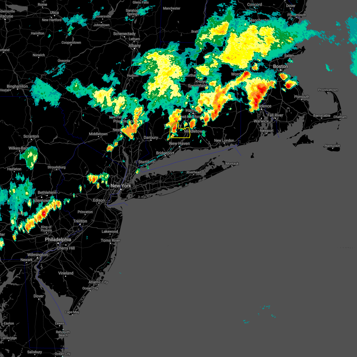 At 814 pm edt, a severe thunderstorm was located over prospect, or over naugatuck, moving east at 40 mph (radar indicated). Hazards include 60 mph wind gusts and penny size hail. Expect damage to trees and power lines. this severe storm will be near, hamden and cheshire around 820 pm edt. wallingford around 825 pm edt. Meriden and durham around 835 pm edt. At 814 pm edt, a severe thunderstorm was located over prospect, or over naugatuck, moving east at 40 mph (radar indicated). Hazards include 60 mph wind gusts and penny size hail. Expect damage to trees and power lines. this severe storm will be near, hamden and cheshire around 820 pm edt. wallingford around 825 pm edt. Meriden and durham around 835 pm edt.
|
| 6/30/2021 7:52 PM EDT |
 At 751 pm edt, a severe thunderstorm was located over southbury, moving east at 40 mph (radar indicated). Hazards include 60 mph wind gusts and penny size hail. Expect damage to trees and power lines. this severe thunderstorm will be near, naugatuck and middlebury around 805 pm edt. prospect and beacon falls around 810 pm edt. hamden and cheshire around 815 pm edt. wallingford around 825 pm edt. Meriden and durham around 830 pm edt. At 751 pm edt, a severe thunderstorm was located over southbury, moving east at 40 mph (radar indicated). Hazards include 60 mph wind gusts and penny size hail. Expect damage to trees and power lines. this severe thunderstorm will be near, naugatuck and middlebury around 805 pm edt. prospect and beacon falls around 810 pm edt. hamden and cheshire around 815 pm edt. wallingford around 825 pm edt. Meriden and durham around 830 pm edt.
|
| 6/9/2021 5:11 PM EDT |
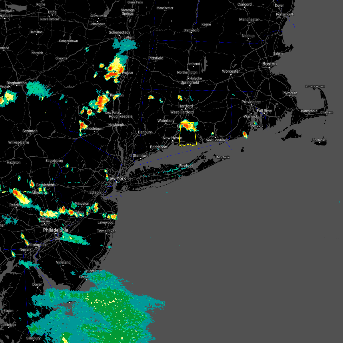 At 510 pm edt, a severe thunderstorm was located over durham, moving south at 20 mph (radar indicated). Hazards include 60 mph wind gusts and nickel size hail. Expect damage to trees and power lines. this severe thunderstorm will be near, durham around 515 pm edt. guilford, north branford and killingworth around 525 pm edt. westbrook and north madison around 540 pm edt. Clinton around 550 pm edt. At 510 pm edt, a severe thunderstorm was located over durham, moving south at 20 mph (radar indicated). Hazards include 60 mph wind gusts and nickel size hail. Expect damage to trees and power lines. this severe thunderstorm will be near, durham around 515 pm edt. guilford, north branford and killingworth around 525 pm edt. westbrook and north madison around 540 pm edt. Clinton around 550 pm edt.
|
| 5/26/2021 7:40 PM EDT |
 At 740 pm edt, severe thunderstorms were located along a line extending from canton to litchfield, moving east at 35 mph (radar indicated). Hazards include 60 mph wind gusts. expect damage to trees and power lines At 740 pm edt, severe thunderstorms were located along a line extending from canton to litchfield, moving east at 35 mph (radar indicated). Hazards include 60 mph wind gusts. expect damage to trees and power lines
|
| 4/21/2021 3:51 PM EDT |
 The severe thunderstorm warning for southern fairfield, new haven and northern middlesex counties will expire at 400 pm edt, the storms which prompted the warning have weakened below severe limits, and no longer pose an immediate threat to life or property. therefore, the warning will be allowed to expire. however gusty winds are still possible with these thunderstorms. The severe thunderstorm warning for southern fairfield, new haven and northern middlesex counties will expire at 400 pm edt, the storms which prompted the warning have weakened below severe limits, and no longer pose an immediate threat to life or property. therefore, the warning will be allowed to expire. however gusty winds are still possible with these thunderstorms.
|
| 4/21/2021 3:28 PM EDT |
 At 327 pm edt, severe thunderstorms were located along a line extending from oakville to 7 miles south of westport, moving east at 40 mph (radar indicated). Hazards include 60 mph wind gusts and penny size hail. Expect damage to trees and power lines. Locations impacted include, bridgeport, new haven, waterbury, meriden, milford, middletown, wallingford, shelton, naugatuck, guilford, southbury, wolcott, durham, newtown and fairfield. At 327 pm edt, severe thunderstorms were located along a line extending from oakville to 7 miles south of westport, moving east at 40 mph (radar indicated). Hazards include 60 mph wind gusts and penny size hail. Expect damage to trees and power lines. Locations impacted include, bridgeport, new haven, waterbury, meriden, milford, middletown, wallingford, shelton, naugatuck, guilford, southbury, wolcott, durham, newtown and fairfield.
|
| 4/21/2021 2:53 PM EDT |
 At 253 pm edt, severe thunderstorms were located along a line extending from gaylordsville to port washington, moving east at 40 mph (radar indicated). Hazards include 60 mph wind gusts and penny size hail. expect damage to trees and power lines At 253 pm edt, severe thunderstorms were located along a line extending from gaylordsville to port washington, moving east at 40 mph (radar indicated). Hazards include 60 mph wind gusts and penny size hail. expect damage to trees and power lines
|
| 11/15/2020 9:41 PM EST |
 At 940 pm est, severe thunderstorms were located along a line extending from wethersfield to near branford, moving east at 60 mph (radar indicated). Hazards include 60 mph wind gusts. Expect damage to trees and power lines. severe thunderstorms will be near, east hampton and cromwell around 945 pm est. clinton and north madison around 955 pm est. old saybrook and westbrook around 1000 pm est. chester and old lyme around 1005 pm est. lyme and north lyme around 1010 pm est. waterford and east lyme around 1015 pm est. new london and groton around 1020 pm est. ledyard center around 1025 pm est. Ledyard around 1030 pm est. At 940 pm est, severe thunderstorms were located along a line extending from wethersfield to near branford, moving east at 60 mph (radar indicated). Hazards include 60 mph wind gusts. Expect damage to trees and power lines. severe thunderstorms will be near, east hampton and cromwell around 945 pm est. clinton and north madison around 955 pm est. old saybrook and westbrook around 1000 pm est. chester and old lyme around 1005 pm est. lyme and north lyme around 1010 pm est. waterford and east lyme around 1015 pm est. new london and groton around 1020 pm est. ledyard center around 1025 pm est. Ledyard around 1030 pm est.
|
| 11/15/2020 9:24 PM EST |
 At 924 pm est, severe thunderstorms were located along a line extending from near southington to near gilgo state park, moving east at 50 mph (radar indicated). Hazards include 60 mph wind gusts. Expect damage to trees and power lines. these severe storms will be near, wallingford and wolcott around 930 pm est. meriden and middletown around 935 pm est. sayville and cromwell around 940 pm est. patchogue and portland around 945 pm est. shirley and mastic around 955 pm est. Center moriches around 1000 pm est. At 924 pm est, severe thunderstorms were located along a line extending from near southington to near gilgo state park, moving east at 50 mph (radar indicated). Hazards include 60 mph wind gusts. Expect damage to trees and power lines. these severe storms will be near, wallingford and wolcott around 930 pm est. meriden and middletown around 935 pm est. sayville and cromwell around 940 pm est. patchogue and portland around 945 pm est. shirley and mastic around 955 pm est. Center moriches around 1000 pm est.
|
| 11/15/2020 9:17 PM EST |
 At 915 pm est, severe thunderstorms were located along a line extending from near sandisfield to near weston, moving east at 35 mph (radar indicated. reports from trained spotters also indicate downed trees in burlington and west hartford, ct). Hazards include 60 mph wind gusts. Expect damage to trees and power lines. Locations impacted include, hartford, new britain, west hartford, bristol, manchester, east hartford, enfield, southington, glastonbury, newington, vernon, windsor, wethersfield, mansfield, south windsor, farmington, simsbury, bloomfield, berlin and rocky hill. At 915 pm est, severe thunderstorms were located along a line extending from near sandisfield to near weston, moving east at 35 mph (radar indicated. reports from trained spotters also indicate downed trees in burlington and west hartford, ct). Hazards include 60 mph wind gusts. Expect damage to trees and power lines. Locations impacted include, hartford, new britain, west hartford, bristol, manchester, east hartford, enfield, southington, glastonbury, newington, vernon, windsor, wethersfield, mansfield, south windsor, farmington, simsbury, bloomfield, berlin and rocky hill.
|
| 11/15/2020 8:52 PM EST |
 At 852 pm est, severe thunderstorms were located along a line extending from near ashley falls to bedford, moving east at 35 mph (radar indicated). Hazards include 60 mph wind gusts. expect damage to trees and power lines At 852 pm est, severe thunderstorms were located along a line extending from near ashley falls to bedford, moving east at 35 mph (radar indicated). Hazards include 60 mph wind gusts. expect damage to trees and power lines
|
| 11/15/2020 8:41 PM EST |
 At 840 pm est, severe thunderstorms were located along a line extending from lake carmel to near sandy hook, moving east at 70 mph (radar indicated). Hazards include 60 mph wind gusts. Expect damage to trees and power lines. severe thunderstorms will be near, brewster around 845 pm est. danbury and bethel around 850 pm est. long beach and newtown around 855 pm est. freeport and jones beach around 900 pm est. massapequa and southbury around 905 pm est. waterbury and lindenhurst around 910 pm est. islip and brentwood around 915 pm est. ronkonkoma and sayville around 920 pm est. patchogue and holbrook around 925 pm est. shirley and medford around 930 pm est. manorville and center moriches around 935 pm est. Calverton around 940 pm est. At 840 pm est, severe thunderstorms were located along a line extending from lake carmel to near sandy hook, moving east at 70 mph (radar indicated). Hazards include 60 mph wind gusts. Expect damage to trees and power lines. severe thunderstorms will be near, brewster around 845 pm est. danbury and bethel around 850 pm est. long beach and newtown around 855 pm est. freeport and jones beach around 900 pm est. massapequa and southbury around 905 pm est. waterbury and lindenhurst around 910 pm est. islip and brentwood around 915 pm est. ronkonkoma and sayville around 920 pm est. patchogue and holbrook around 925 pm est. shirley and medford around 930 pm est. manorville and center moriches around 935 pm est. Calverton around 940 pm est.
|
| 10/7/2020 6:04 PM EDT |
 At 603 pm edt, severe thunderstorms were located along a line extending from near portland to near newtown, moving east at 45 mph (radar indicated). Hazards include 60 mph wind gusts. Expect damage to trees and power lines. these severe storms will be near, durham and killingworth around 610 pm edt. bridgeport around 615 pm edt. shelton and stratford around 620 pm edt. orange around 625 pm edt. new haven and milford around 630 pm edt. Branford and north brandford around 640 pm edt. At 603 pm edt, severe thunderstorms were located along a line extending from near portland to near newtown, moving east at 45 mph (radar indicated). Hazards include 60 mph wind gusts. Expect damage to trees and power lines. these severe storms will be near, durham and killingworth around 610 pm edt. bridgeport around 615 pm edt. shelton and stratford around 620 pm edt. orange around 625 pm edt. new haven and milford around 630 pm edt. Branford and north brandford around 640 pm edt.
|
| 10/7/2020 5:30 PM EDT |
 At 529 pm edt, severe thunderstorms were located along a line extending from near wolcott to lake carmel, moving east at 45 mph (radar indicated). Hazards include 60 mph wind gusts. Expect damage to trees and power lines. severe thunderstorms will be near, waterbury and wolcott around 535 pm edt. cheshire around 540 pm edt. meriden and brookfield around 545 pm edt. danbury and middletown around 550 pm edt. newtown and hartford around 555 pm edt. durham and redding around 600 pm edt. monroe around 605 pm edt. bridgeport and trumbull around 610 pm edt. New haven and milford around 615 pm edt. At 529 pm edt, severe thunderstorms were located along a line extending from near wolcott to lake carmel, moving east at 45 mph (radar indicated). Hazards include 60 mph wind gusts. Expect damage to trees and power lines. severe thunderstorms will be near, waterbury and wolcott around 535 pm edt. cheshire around 540 pm edt. meriden and brookfield around 545 pm edt. danbury and middletown around 550 pm edt. newtown and hartford around 555 pm edt. durham and redding around 600 pm edt. monroe around 605 pm edt. bridgeport and trumbull around 610 pm edt. New haven and milford around 615 pm edt.
|
| 8/27/2020 5:09 PM EDT |
 The severe thunderstorm warning for southwestern new london, new haven, middlesex and central suffolk counties will expire at 515 pm edt, the storms which prompted the warning have weakened below severe limits, and have exited the warned area. therefore, the warning will be allowed to expire. however gusty winds and heavy rain are still possible with these thunderstorms. a tornado watch remains in effect until 800 pm edt for southern connecticut, and southeastern new york. The severe thunderstorm warning for southwestern new london, new haven, middlesex and central suffolk counties will expire at 515 pm edt, the storms which prompted the warning have weakened below severe limits, and have exited the warned area. therefore, the warning will be allowed to expire. however gusty winds and heavy rain are still possible with these thunderstorms. a tornado watch remains in effect until 800 pm edt for southern connecticut, and southeastern new york.
|
| 8/27/2020 4:32 PM EDT |
 At 432 pm edt, severe thunderstorms were located along a line extending from near old saybrook to 10 miles north of rocky point, moving southeast at 50 mph (radar indicated). Hazards include 70 mph wind gusts and quarter size hail. Minor hail damage to vehicles is possible. expect considerable tree damage. wind damage is also likely to mobile homes, roofs, and outbuildings. these severe storms will be near, greenport around 440 pm edt. wading river and shelter island around 445 pm edt. sag harbor and calverton around 450 pm edt. riverhead and manorville around 455 pm edt. Westhampton and center moriches around 500 pm edt. At 432 pm edt, severe thunderstorms were located along a line extending from near old saybrook to 10 miles north of rocky point, moving southeast at 50 mph (radar indicated). Hazards include 70 mph wind gusts and quarter size hail. Minor hail damage to vehicles is possible. expect considerable tree damage. wind damage is also likely to mobile homes, roofs, and outbuildings. these severe storms will be near, greenport around 440 pm edt. wading river and shelter island around 445 pm edt. sag harbor and calverton around 450 pm edt. riverhead and manorville around 455 pm edt. Westhampton and center moriches around 500 pm edt.
|
| 8/27/2020 4:11 PM EDT |
 At 411 pm edt, severe thunderstorms were located along a line extending from near east haddam to near orange, moving southeast at 50 mph (radar indicated). Hazards include 70 mph wind gusts and quarter size hail. Minor hail damage to vehicles is possible. expect considerable tree damage. wind damage is also likely to mobile homes, roofs, and outbuildings. severe thunderstorms will be near, chester and killingworth around 415 pm edt. clinton and old saybrook around 420 pm edt. westbrook around 425 pm edt. southold and greenport around 440 pm edt. wading river and shelter island around 445 pm edt. riverhead and sag harbor around 450 pm edt. westhampton and bridgehampton around 455 pm edt. Mastic beach around 500 pm edt. At 411 pm edt, severe thunderstorms were located along a line extending from near east haddam to near orange, moving southeast at 50 mph (radar indicated). Hazards include 70 mph wind gusts and quarter size hail. Minor hail damage to vehicles is possible. expect considerable tree damage. wind damage is also likely to mobile homes, roofs, and outbuildings. severe thunderstorms will be near, chester and killingworth around 415 pm edt. clinton and old saybrook around 420 pm edt. westbrook around 425 pm edt. southold and greenport around 440 pm edt. wading river and shelter island around 445 pm edt. riverhead and sag harbor around 450 pm edt. westhampton and bridgehampton around 455 pm edt. Mastic beach around 500 pm edt.
|
| 8/27/2020 3:50 PM EDT |
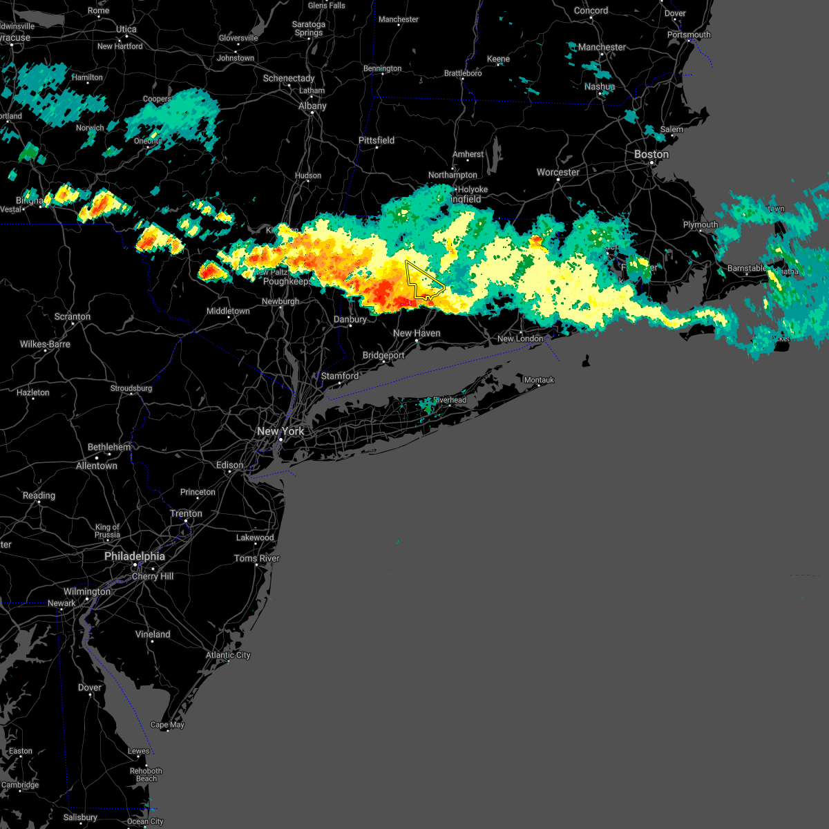 The severe thunderstorm warning for southwestern hartford county will expire at 400 pm edt, the storm which prompted the warning has moved out of the area. therefore, the warning will be allowed to expire. however gusty winds are still possible with this thunderstorm. a tornado watch remains in effect until 800 pm edt for northern connecticut. The severe thunderstorm warning for southwestern hartford county will expire at 400 pm edt, the storm which prompted the warning has moved out of the area. therefore, the warning will be allowed to expire. however gusty winds are still possible with this thunderstorm. a tornado watch remains in effect until 800 pm edt for northern connecticut.
|
| 8/27/2020 3:45 PM EDT |
 At 344 pm edt, severe thunderstorms were located along a line extending from near hartford to near thomaston, moving southeast at 65 mph (radar indicated). Hazards include 70 mph wind gusts and quarter size hail. Minor hail damage to vehicles is possible. expect considerable tree damage. wind damage is also likely to mobile homes, roofs, and outbuildings. these severe storms will be near, hartford and cromwell around 350 pm edt. naugatuck and east hampton around 355 pm edt. cheshire around 400 pm edt. meriden and middletown around 405 pm edt. guilford and durham around 410 pm edt. killingworth and north madison around 415 pm edt. clinton and chester around 420 pm edt. Old saybrook and westbrook around 425 pm edt. At 344 pm edt, severe thunderstorms were located along a line extending from near hartford to near thomaston, moving southeast at 65 mph (radar indicated). Hazards include 70 mph wind gusts and quarter size hail. Minor hail damage to vehicles is possible. expect considerable tree damage. wind damage is also likely to mobile homes, roofs, and outbuildings. these severe storms will be near, hartford and cromwell around 350 pm edt. naugatuck and east hampton around 355 pm edt. cheshire around 400 pm edt. meriden and middletown around 405 pm edt. guilford and durham around 410 pm edt. killingworth and north madison around 415 pm edt. clinton and chester around 420 pm edt. Old saybrook and westbrook around 425 pm edt.
|
| 8/27/2020 3:19 PM EDT |
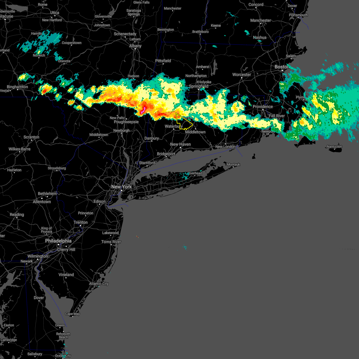 At 319 pm edt, a severe thunderstorm was located near litchfield, or 10 miles northeast of new milford, moving southeast at 45 mph (radar indicated). Hazards include 60 mph wind gusts and nickel size hail. expect damage to trees and power lines At 319 pm edt, a severe thunderstorm was located near litchfield, or 10 miles northeast of new milford, moving southeast at 45 mph (radar indicated). Hazards include 60 mph wind gusts and nickel size hail. expect damage to trees and power lines
|
| 8/27/2020 3:17 PM EDT |
 At 316 pm edt, severe thunderstorms were located along a line extending from near litchfield to near amenia, moving southeast at 65 mph (radar indicated). Hazards include 60 mph wind gusts and quarter size hail. Minor hail damage to vehicles is possible. expect wind damage to trees and power lines. severe thunderstorms will be near, meriden around 340 pm edt. middletown and hartford around 345 pm edt. waterbury and naugatuck around 350 pm edt. wolcott and east hampton around 355 pm edt. chester and hamden around 400 pm edt. wallingford and old saybrook around 405 pm edt. guilford and old lyme around 410 pm edt. Clinton and north madison around 415 pm edt. At 316 pm edt, severe thunderstorms were located along a line extending from near litchfield to near amenia, moving southeast at 65 mph (radar indicated). Hazards include 60 mph wind gusts and quarter size hail. Minor hail damage to vehicles is possible. expect wind damage to trees and power lines. severe thunderstorms will be near, meriden around 340 pm edt. middletown and hartford around 345 pm edt. waterbury and naugatuck around 350 pm edt. wolcott and east hampton around 355 pm edt. chester and hamden around 400 pm edt. wallingford and old saybrook around 405 pm edt. guilford and old lyme around 410 pm edt. Clinton and north madison around 415 pm edt.
|
| 7/23/2020 9:43 PM EDT |
 At 942 pm edt, severe thunderstorms were located along a line extending from near seymour to near milford, moving northeast at 30 mph (radar indicated). Hazards include 60 mph wind gusts and quarter size hail. Minor hail damage to vehicles is possible. Expect wind damage to trees and power lines. At 942 pm edt, severe thunderstorms were located along a line extending from near seymour to near milford, moving northeast at 30 mph (radar indicated). Hazards include 60 mph wind gusts and quarter size hail. Minor hail damage to vehicles is possible. Expect wind damage to trees and power lines.
|
| 7/23/2020 9:04 PM EDT |
 At 904 pm edt, a severe thunderstorm was located over prospect, or near naugatuck, moving southeast at 20 mph (radar indicated). Hazards include 60 mph wind gusts and quarter size hail. Minor hail damage to vehicles is possible. Expect wind damage to trees and power lines. At 904 pm edt, a severe thunderstorm was located over prospect, or near naugatuck, moving southeast at 20 mph (radar indicated). Hazards include 60 mph wind gusts and quarter size hail. Minor hail damage to vehicles is possible. Expect wind damage to trees and power lines.
|
| 6/28/2020 5:13 PM EDT |
 At 513 pm edt, a severe thunderstorm was located near shelton, moving northeast at 25 mph (radar indicated). Hazards include 60 mph wind gusts and quarter size hail. Minor hail damage to vehicles is possible. expect wind damage to trees and power lines. this severe thunderstorm will be near, derby around 520 pm edt. seymour and orange around 530 pm edt. new haven around 540 pm edt. bethany around 545 pm edt. hamden and branford around 555 pm edt. Wallingford and guilford around 600 pm edt. At 513 pm edt, a severe thunderstorm was located near shelton, moving northeast at 25 mph (radar indicated). Hazards include 60 mph wind gusts and quarter size hail. Minor hail damage to vehicles is possible. expect wind damage to trees and power lines. this severe thunderstorm will be near, derby around 520 pm edt. seymour and orange around 530 pm edt. new haven around 540 pm edt. bethany around 545 pm edt. hamden and branford around 555 pm edt. Wallingford and guilford around 600 pm edt.
|
| 6/28/2020 5:04 PM EDT |
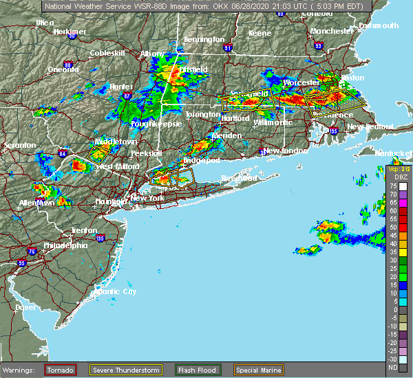 At 504 pm edt, a severe thunderstorm was located over bethany, or near new haven, moving east at 10 mph (radar indicated). Hazards include 60 mph wind gusts and quarter size hail. Minor hail damage to vehicles is possible. expect wind damage to trees and power lines. this severe thunderstorm will be near, new haven around 510 pm edt. Wallingford and hamden around 545 pm edt. At 504 pm edt, a severe thunderstorm was located over bethany, or near new haven, moving east at 10 mph (radar indicated). Hazards include 60 mph wind gusts and quarter size hail. Minor hail damage to vehicles is possible. expect wind damage to trees and power lines. this severe thunderstorm will be near, new haven around 510 pm edt. Wallingford and hamden around 545 pm edt.
|
| 6/3/2020 8:56 PM EDT |
 At 855 pm edt, severe thunderstorms were located along a line extending from norwich--new london to chester, moving southeast at 35 mph (radar indicated). Hazards include 60 mph wind gusts and quarter size hail. Minor hail damage to vehicles is possible. expect wind damage to trees and power lines. Locations impacted include, middletown, norwich, colchester, east hampton, groton, durham, salem, chester, hartford, waterford, east lyme, ledyard, cromwell, griswold and portland. At 855 pm edt, severe thunderstorms were located along a line extending from norwich--new london to chester, moving southeast at 35 mph (radar indicated). Hazards include 60 mph wind gusts and quarter size hail. Minor hail damage to vehicles is possible. expect wind damage to trees and power lines. Locations impacted include, middletown, norwich, colchester, east hampton, groton, durham, salem, chester, hartford, waterford, east lyme, ledyard, cromwell, griswold and portland.
|
| 6/3/2020 8:29 PM EDT |
 At 828 pm edt, severe thunderstorms were located along a line extending from near bozrah to middlefield, moving east at 35 mph (radar indicated). Hazards include 60 mph wind gusts and quarter size hail. Minor hail damage to vehicles is possible. Expect wind damage to trees and power lines. At 828 pm edt, severe thunderstorms were located along a line extending from near bozrah to middlefield, moving east at 35 mph (radar indicated). Hazards include 60 mph wind gusts and quarter size hail. Minor hail damage to vehicles is possible. Expect wind damage to trees and power lines.
|
| 5/15/2020 9:14 PM EDT |
 At 914 pm edt, a severe thunderstorm was located over new britain, moving east at 35 mph (radar indicated). Hazards include 60 mph wind gusts. expect damage to trees and power lines At 914 pm edt, a severe thunderstorm was located over new britain, moving east at 35 mph (radar indicated). Hazards include 60 mph wind gusts. expect damage to trees and power lines
|
| 5/15/2020 9:08 PM EDT |
 At 907 pm edt, a severe thunderstorm was located over woodbury center, or near southbury, moving east at 45 mph (radar indicated). Hazards include 60 mph wind gusts. Expect damage to trees and power lines. this severe thunderstorm will be near, waterbury and naugatuck around 920 pm edt. wolcott and prospect around 925 pm edt. cheshire and bethany around 930 pm edt. hamden and north haven around 935 pm edt. wallingford and middlefield around 940 pm edt. guilford and north branford around 945 pm edt. durham and killingworth around 950 pm edt. Clinton and chester around 1000 pm edt. At 907 pm edt, a severe thunderstorm was located over woodbury center, or near southbury, moving east at 45 mph (radar indicated). Hazards include 60 mph wind gusts. Expect damage to trees and power lines. this severe thunderstorm will be near, waterbury and naugatuck around 920 pm edt. wolcott and prospect around 925 pm edt. cheshire and bethany around 930 pm edt. hamden and north haven around 935 pm edt. wallingford and middlefield around 940 pm edt. guilford and north branford around 945 pm edt. durham and killingworth around 950 pm edt. Clinton and chester around 1000 pm edt.
|
| 5/15/2020 8:59 PM EDT |
 At 844 pm edt, severe thunderstorms were located along a line extending from east longmeadow to near east granby to burlington, moving east at 40 mph (radar indicated). Hazards include 60 mph wind gusts. Expect damage to trees and power lines. Locations impacted include, springfield, hartford, new britain, west hartford, bristol, manchester, east hartford, enfield, southington, glastonbury, newington, vernon, windsor, agawam, wethersfield, mansfield, south windsor, farmington, windham and simsbury. At 844 pm edt, severe thunderstorms were located along a line extending from east longmeadow to near east granby to burlington, moving east at 40 mph (radar indicated). Hazards include 60 mph wind gusts. Expect damage to trees and power lines. Locations impacted include, springfield, hartford, new britain, west hartford, bristol, manchester, east hartford, enfield, southington, glastonbury, newington, vernon, windsor, agawam, wethersfield, mansfield, south windsor, farmington, windham and simsbury.
|
| 5/15/2020 8:44 PM EDT |
 At 844 pm edt, severe thunderstorms were located along a line extending from east longmeadow to near east granby to burlington, moving east at 40 mph (radar indicated). Hazards include 60 mph wind gusts. Expect damage to trees and power lines. Locations impacted include, springfield, hartford, new britain, west hartford, bristol, manchester, east hartford, enfield, southington, glastonbury, newington, vernon, windsor, agawam, wethersfield, mansfield, south windsor, farmington, windham and simsbury. At 844 pm edt, severe thunderstorms were located along a line extending from east longmeadow to near east granby to burlington, moving east at 40 mph (radar indicated). Hazards include 60 mph wind gusts. Expect damage to trees and power lines. Locations impacted include, springfield, hartford, new britain, west hartford, bristol, manchester, east hartford, enfield, southington, glastonbury, newington, vernon, windsor, agawam, wethersfield, mansfield, south windsor, farmington, windham and simsbury.
|
| 5/15/2020 8:32 PM EDT |
 At 832 pm edt, severe thunderstorms were located along a line extending from agawam to near granby to northwest harwinton, moving east at 40 mph (at 820 pm trained spotters in agawam, ma reported trees and wires down). Hazards include 60 mph wind gusts. Expect damage to trees and power lines. Locations impacted include, springfield, hartford, new britain, west hartford, bristol, manchester, east hartford, enfield, southington, westfield, glastonbury, newington, vernon, windsor, agawam, west springfield, wethersfield, mansfield, south windsor and farmington. At 832 pm edt, severe thunderstorms were located along a line extending from agawam to near granby to northwest harwinton, moving east at 40 mph (at 820 pm trained spotters in agawam, ma reported trees and wires down). Hazards include 60 mph wind gusts. Expect damage to trees and power lines. Locations impacted include, springfield, hartford, new britain, west hartford, bristol, manchester, east hartford, enfield, southington, westfield, glastonbury, newington, vernon, windsor, agawam, west springfield, wethersfield, mansfield, south windsor and farmington.
|
| 5/15/2020 8:15 PM EDT |
 At 814 pm edt, severe thunderstorms were located along a line extending from near westfield to near hartland to near litchfield, moving southeast at 35 mph (radar indicated). Hazards include 60 mph wind gusts. expect damage to trees and power lines At 814 pm edt, severe thunderstorms were located along a line extending from near westfield to near hartland to near litchfield, moving southeast at 35 mph (radar indicated). Hazards include 60 mph wind gusts. expect damage to trees and power lines
|
| 4/21/2020 3:59 PM EDT |
 At 359 pm edt, severe thunderstorms were located along a line extending from near vernon to north brandford, moving northeast at 45 mph (radar indicated). Hazards include 60 mph wind gusts. Expect damage to trees and power lines. these severe storms will be near, clinton around 410 pm edt. chester and haddam around 420 pm edt. East hampton and east haddam around 425 pm edt. At 359 pm edt, severe thunderstorms were located along a line extending from near vernon to north brandford, moving northeast at 45 mph (radar indicated). Hazards include 60 mph wind gusts. Expect damage to trees and power lines. these severe storms will be near, clinton around 410 pm edt. chester and haddam around 420 pm edt. East hampton and east haddam around 425 pm edt.
|
| 4/21/2020 3:25 PM EDT |
 At 324 pm edt, severe thunderstorms were located along a line extending from bristol to near bridgeport, moving northeast at 45 mph (radar indicated). Hazards include 60 mph wind gusts and quarter size hail. Minor hail damage to vehicles is possible. expect wind damage to trees and power lines. severe thunderstorms will be near, orange around 340 pm edt. new haven around 345 pm edt. branford and north branford around 355 pm edt. north branford around 400 pm edt. guilford and north madison around 405 pm edt. clinton and killingworth around 410 pm edt. Chester and haddam around 415 pm edt. At 324 pm edt, severe thunderstorms were located along a line extending from bristol to near bridgeport, moving northeast at 45 mph (radar indicated). Hazards include 60 mph wind gusts and quarter size hail. Minor hail damage to vehicles is possible. expect wind damage to trees and power lines. severe thunderstorms will be near, orange around 340 pm edt. new haven around 345 pm edt. branford and north branford around 355 pm edt. north branford around 400 pm edt. guilford and north madison around 405 pm edt. clinton and killingworth around 410 pm edt. Chester and haddam around 415 pm edt.
|
| 9/4/2019 6:23 PM EDT |
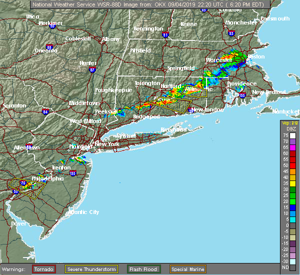 At 622 pm edt, a severe thunderstorm was located near east hampton, moving east at 40 mph (radar indicated). Hazards include 60 mph wind gusts. Expect damage to trees and power lines. This severe thunderstorm will remain over mainly rural areas of southwestern new london, north central new haven and central middlesex counties. At 622 pm edt, a severe thunderstorm was located near east hampton, moving east at 40 mph (radar indicated). Hazards include 60 mph wind gusts. Expect damage to trees and power lines. This severe thunderstorm will remain over mainly rural areas of southwestern new london, north central new haven and central middlesex counties.
|
| 9/4/2019 6:06 PM EDT | A large tree limb reported down on south broad street near south broad terrace in new haven county CT, 1.8 miles N of Meriden, CT |
| 9/4/2019 6:04 PM EDT |
 At 603 pm edt, a severe thunderstorm was located over middletown, moving east at 40 mph (radar indicated). Hazards include 60 mph wind gusts and penny size hail. Expect damage to trees and power lines. this severe thunderstorm will be near, east hampton around 610 pm edt. haddam and lake pocotopaug--east hampton around 615 pm edt. chester and east haddam around 620 pm edt. lyme and north lyme around 625 pm edt. Salem and waterford around 630 pm edt. At 603 pm edt, a severe thunderstorm was located over middletown, moving east at 40 mph (radar indicated). Hazards include 60 mph wind gusts and penny size hail. Expect damage to trees and power lines. this severe thunderstorm will be near, east hampton around 610 pm edt. haddam and lake pocotopaug--east hampton around 615 pm edt. chester and east haddam around 620 pm edt. lyme and north lyme around 625 pm edt. Salem and waterford around 630 pm edt.
|
| 8/7/2019 8:37 PM EDT |
 At 836 pm edt, a severe thunderstorm was located over west hartford, moving northeast at 25 mph (radar indicated). Hazards include 60 mph wind gusts and penny size hail. Expect damage to trees and power lines. Locations impacted include, hartford, new britain, west hartford, manchester, east hartford, enfield, glastonbury, newington, vernon, windsor, wethersfield, mansfield, south windsor, farmington, simsbury, bloomfield, berlin, rocky hill, avon and plainville. At 836 pm edt, a severe thunderstorm was located over west hartford, moving northeast at 25 mph (radar indicated). Hazards include 60 mph wind gusts and penny size hail. Expect damage to trees and power lines. Locations impacted include, hartford, new britain, west hartford, manchester, east hartford, enfield, glastonbury, newington, vernon, windsor, wethersfield, mansfield, south windsor, farmington, simsbury, bloomfield, berlin, rocky hill, avon and plainville.
|
| 8/7/2019 8:30 PM EDT |
 At 829 pm edt, a severe thunderstorm was located over west hartford, moving northeast at 25 mph (radar indicated). Hazards include 60 mph wind gusts and penny size hail. expect damage to trees and power lines At 829 pm edt, a severe thunderstorm was located over west hartford, moving northeast at 25 mph (radar indicated). Hazards include 60 mph wind gusts and penny size hail. expect damage to trees and power lines
|
| 8/3/2019 6:15 PM EDT |
 At 615 pm edt, severe thunderstorms were located along a line extending from 6 miles west of thomaston to new milford, moving southeast at 15 mph (radar indicated). Hazards include 60 mph wind gusts and quarter size hail. Minor hail damage to vehicles is possible. expect wind damage to trees and power lines. severe thunderstorms will be near, brookfield around 625 pm edt. danbury around 635 pm edt. newtown and bethel around 650 pm edt. waterbury and southbury around 655 pm edt. Naugatuck and cheshire around 700 pm edt. At 615 pm edt, severe thunderstorms were located along a line extending from 6 miles west of thomaston to new milford, moving southeast at 15 mph (radar indicated). Hazards include 60 mph wind gusts and quarter size hail. Minor hail damage to vehicles is possible. expect wind damage to trees and power lines. severe thunderstorms will be near, brookfield around 625 pm edt. danbury around 635 pm edt. newtown and bethel around 650 pm edt. waterbury and southbury around 655 pm edt. Naugatuck and cheshire around 700 pm edt.
|
| 7/22/2019 5:35 PM EDT |
 The severe thunderstorm warning for central fairfield, new haven and middlesex counties will expire at 545 pm edt, the storms which prompted the warning are weakening as the move out of the warned area. therefore, the warning will be allowed to expire. a severe thunderstorm watch remains in effect until 1000 pm edt for southern connecticut. The severe thunderstorm warning for central fairfield, new haven and middlesex counties will expire at 545 pm edt, the storms which prompted the warning are weakening as the move out of the warned area. therefore, the warning will be allowed to expire. a severe thunderstorm watch remains in effect until 1000 pm edt for southern connecticut.
|
| 7/22/2019 4:43 PM EDT |
 At 443 pm edt, severe thunderstorms were located along a line extending from near new preston to near monroe to wilton, moving east at 35 mph (radar indicated). Hazards include 60 mph wind gusts. Expect damage to trees and power lines. severe thunderstorms will be near, monroe around 450 pm edt. shelton around 455 pm edt. bridgeport and milford around 500 pm edt. waterbury and orange around 505 pm edt. cheshire and bethany around 510 pm edt. new haven and wolcott around 515 pm edt. branford around 520 pm edt. north haven around 525 pm edt. meriden and middletown around 530 pm edt. guilford around 535 pm edt. cromwell and killingworth around 540 pm edt. Clinton and east hampton around 545 pm edt. At 443 pm edt, severe thunderstorms were located along a line extending from near new preston to near monroe to wilton, moving east at 35 mph (radar indicated). Hazards include 60 mph wind gusts. Expect damage to trees and power lines. severe thunderstorms will be near, monroe around 450 pm edt. shelton around 455 pm edt. bridgeport and milford around 500 pm edt. waterbury and orange around 505 pm edt. cheshire and bethany around 510 pm edt. new haven and wolcott around 515 pm edt. branford around 520 pm edt. north haven around 525 pm edt. meriden and middletown around 530 pm edt. guilford around 535 pm edt. cromwell and killingworth around 540 pm edt. Clinton and east hampton around 545 pm edt.
|
| 7/17/2019 4:28 PM EDT |
 The severe thunderstorm warning for northwestern new london, northeastern new haven and middlesex counties will expire at 430 pm edt, the storm which prompted the warning has weakened below severe limits, and no longer poses an immediate threat to life or property. therefore, the warning will be allowed to expire. a severe thunderstorm watch remains in effect until 1000 pm edt for southern connecticut. The severe thunderstorm warning for northwestern new london, northeastern new haven and middlesex counties will expire at 430 pm edt, the storm which prompted the warning has weakened below severe limits, and no longer poses an immediate threat to life or property. therefore, the warning will be allowed to expire. a severe thunderstorm watch remains in effect until 1000 pm edt for southern connecticut.
|
| 7/17/2019 4:04 PM EDT |
 At 403 pm edt, a severe thunderstorm was located over middlefield, or near middletown, moving northeast at 30 mph (radar indicated). Hazards include 60 mph wind gusts. Expect damage to trees and power lines. this severe storm will be near, killingworth around 410 pm edt. cromwell around 415 pm edt. east hampton and portland around 425 pm edt. Colchester and east haddam around 430 pm edt. At 403 pm edt, a severe thunderstorm was located over middlefield, or near middletown, moving northeast at 30 mph (radar indicated). Hazards include 60 mph wind gusts. Expect damage to trees and power lines. this severe storm will be near, killingworth around 410 pm edt. cromwell around 415 pm edt. east hampton and portland around 425 pm edt. Colchester and east haddam around 430 pm edt.
|
| 7/17/2019 3:45 PM EDT |
 At 344 pm edt, a severe thunderstorm was located over prospect, or near naugatuck, moving northeast at 30 mph. another severe thunderstorm was located farther east (radar indicated). Hazards include 60 mph wind gusts. Expect damage to trees and power lines. this severe thunderstorm will be near, wallingford around 355 pm edt. north branford around 400 pm edt. durham and middlefield around 405 pm edt. meriden around 410 pm edt. middletown around 415 pm edt. cromwell around 425 pm edt. East hampton and portland around 430 pm edt. At 344 pm edt, a severe thunderstorm was located over prospect, or near naugatuck, moving northeast at 30 mph. another severe thunderstorm was located farther east (radar indicated). Hazards include 60 mph wind gusts. Expect damage to trees and power lines. this severe thunderstorm will be near, wallingford around 355 pm edt. north branford around 400 pm edt. durham and middlefield around 405 pm edt. meriden around 410 pm edt. middletown around 415 pm edt. cromwell around 425 pm edt. East hampton and portland around 430 pm edt.
|
| 6/30/2019 3:45 PM EDT |
 At 345 pm edt, severe thunderstorms were located along a line extending from near middlefield to near east haddam, moving south at 20 mph (radar indicated). Hazards include 60 mph wind gusts and quarter size hail. Minor hail damage to vehicles is possible. expect wind damage to trees and power lines. severe thunderstorms will be near, east haddam and haddam around 350 pm edt. wallingford around 355 pm edt. durham and chester around 400 pm edt. north lyme around 405 pm edt. guilford and killingworth around 410 pm edt. north branford around 415 pm edt. old saybrook and north haven around 420 pm edt. Clinton and branford around 430 pm edt. At 345 pm edt, severe thunderstorms were located along a line extending from near middlefield to near east haddam, moving south at 20 mph (radar indicated). Hazards include 60 mph wind gusts and quarter size hail. Minor hail damage to vehicles is possible. expect wind damage to trees and power lines. severe thunderstorms will be near, east haddam and haddam around 350 pm edt. wallingford around 355 pm edt. durham and chester around 400 pm edt. north lyme around 405 pm edt. guilford and killingworth around 410 pm edt. north branford around 415 pm edt. old saybrook and north haven around 420 pm edt. Clinton and branford around 430 pm edt.
|
| 9/6/2018 4:30 PM EDT | Trees and wires down closing 4 roads including marion ave at sunnyside drive in hartford county CT, 6 miles SE of Meriden, CT |
| 8/8/2018 6:18 PM EDT |
 At 617 pm edt, a severe thunderstorm was located over monroe, or near newtown, moving east at 10 mph (radar indicated). Hazards include 60 mph wind gusts and quarter size hail. Minor hail damage to vehicles is possible. expect wind damage to trees and power lines. this severe storm will be near, monroe around 640 pm edt. Milford and shelton around 645 pm edt. At 617 pm edt, a severe thunderstorm was located over monroe, or near newtown, moving east at 10 mph (radar indicated). Hazards include 60 mph wind gusts and quarter size hail. Minor hail damage to vehicles is possible. expect wind damage to trees and power lines. this severe storm will be near, monroe around 640 pm edt. Milford and shelton around 645 pm edt.
|
| 8/8/2018 6:00 PM EDT |
 At 559 pm edt, a severe thunderstorm was located near redding, or near newtown, moving east at 10 mph. another severe thunderstorm was located just east of waterbury (radar indicated). Hazards include 60 mph wind gusts and quarter size hail. Minor hail damage to vehicles is possible. expect wind damage to trees and power lines. this severe thunderstorm will be near, bridgeport around 605 pm edt. trumbull around 625 pm edt. monroe around 640 pm edt. Milford and shelton around 645 pm edt. At 559 pm edt, a severe thunderstorm was located near redding, or near newtown, moving east at 10 mph. another severe thunderstorm was located just east of waterbury (radar indicated). Hazards include 60 mph wind gusts and quarter size hail. Minor hail damage to vehicles is possible. expect wind damage to trees and power lines. this severe thunderstorm will be near, bridgeport around 605 pm edt. trumbull around 625 pm edt. monroe around 640 pm edt. Milford and shelton around 645 pm edt.
|
| 7/28/2018 4:47 PM EDT |
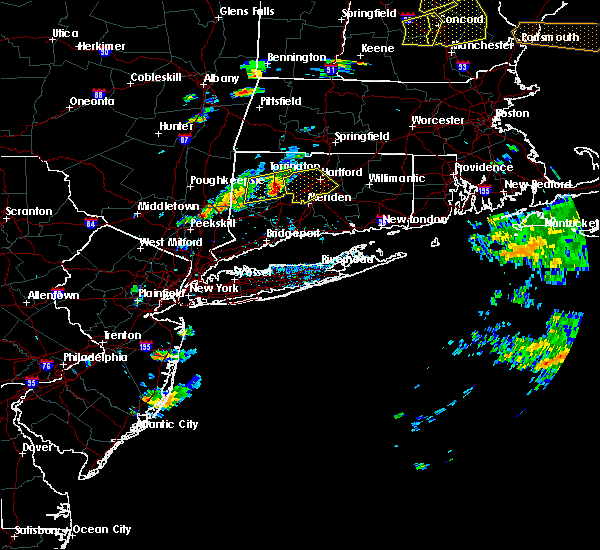 At 447 pm edt, severe thunderstorms were located along a line extending from northwest harwinton to near terryville to near oakville, moving east at 25 mph (radar indicated). Hazards include 60 mph wind gusts and penny size hail. Expect damage to trees and power lines. severe thunderstorms will be near, wolcott and plainville around 505 pm edt. farmington and burlington around 510 pm edt. bristol and canton around 515 pm edt. new britain, southington and avon around 525 pm edt. hartford, west hartford, meriden, east hartford, middletown, newington, wethersfield, hartford, simsbury and bloomfield around 530 pm edt. Other locations impacted by these severe thunderstorms include allentown, pequabuck and terryville station. At 447 pm edt, severe thunderstorms were located along a line extending from northwest harwinton to near terryville to near oakville, moving east at 25 mph (radar indicated). Hazards include 60 mph wind gusts and penny size hail. Expect damage to trees and power lines. severe thunderstorms will be near, wolcott and plainville around 505 pm edt. farmington and burlington around 510 pm edt. bristol and canton around 515 pm edt. new britain, southington and avon around 525 pm edt. hartford, west hartford, meriden, east hartford, middletown, newington, wethersfield, hartford, simsbury and bloomfield around 530 pm edt. Other locations impacted by these severe thunderstorms include allentown, pequabuck and terryville station.
|
| 7/28/2018 3:32 PM EDT |
 At 331 pm edt, a severe thunderstorm was located over pawling, moving east at 35 mph (radar indicated). Hazards include 60 mph wind gusts and half dollar size hail. Minor hail damage to vehicles is possible. expect wind damage to trees and power lines. This severe thunderstorm will be near, sherman and new fairfield around 345 pm edt. At 331 pm edt, a severe thunderstorm was located over pawling, moving east at 35 mph (radar indicated). Hazards include 60 mph wind gusts and half dollar size hail. Minor hail damage to vehicles is possible. expect wind damage to trees and power lines. This severe thunderstorm will be near, sherman and new fairfield around 345 pm edt.
|
| 7/17/2018 2:41 PM EDT |
 At 240 pm edt, a severe thunderstorm was located over plainville, or near southington, moving east at 25 mph (radar indicated). Hazards include 60 mph wind gusts and quarter size hail. Hail damage to vehicles is possible. Expect damage to trees and power lines. At 240 pm edt, a severe thunderstorm was located over plainville, or near southington, moving east at 25 mph (radar indicated). Hazards include 60 mph wind gusts and quarter size hail. Hail damage to vehicles is possible. Expect damage to trees and power lines.
|
| 5/15/2018 5:24 PM EDT |
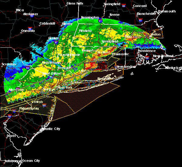 At 507 pm edt, a severe thunderstorm capable of producing a tornado was located over bethany, or near naugatuck, moving east at 65 mph (radar indicated rotation). Hazards include tornado and quarter size hail. Flying debris will be dangerous to those caught without shelter. mobile homes will be damaged or destroyed. damage to roofs, windows, and vehicles will occur. tree damage is likely. this dangerous storm will be near, wallingford around 510 pm edt. branford and north haven around 515 pm edt. guilford and durham around 520 pm edt. north madison around 525 pm edt. Chester and east haddam around 530 pm edt. At 507 pm edt, a severe thunderstorm capable of producing a tornado was located over bethany, or near naugatuck, moving east at 65 mph (radar indicated rotation). Hazards include tornado and quarter size hail. Flying debris will be dangerous to those caught without shelter. mobile homes will be damaged or destroyed. damage to roofs, windows, and vehicles will occur. tree damage is likely. this dangerous storm will be near, wallingford around 510 pm edt. branford and north haven around 515 pm edt. guilford and durham around 520 pm edt. north madison around 525 pm edt. Chester and east haddam around 530 pm edt.
|
| 5/15/2018 5:23 PM EDT | Tree down into a house on marion avenue... large tree down on south end road in plantsville section in hartford county CT, 6 miles SE of Meriden, CT |
| 5/15/2018 5:23 PM EDT | Tree down into a house on marion avenue... large tree down on south end road in plantsville section in hartford county CT, 6 miles SE of Meriden, CT |
| 5/15/2018 5:19 PM EDT |
 At 516 pm edt, severe thunderstorms were located along a line extending from near tolland to plainville to near hamden to stamford to kearny to near white house station, moving east at 50 mph (trained weather spotters and automated surface observations, with numerous reports of wind damage). Hazards include 70 mph wind gusts and nickel size hail. Expect considerable tree damage. damage is likely to mobile homes, roofs, and outbuildings. Locations impacted include, newark, jersey city, jamaica, yonkers, paterson, bridgeport, new haven, elizabeth, stamford, flatbush, waterbury, norwalk, danbury, new rochelle and flushing. At 516 pm edt, severe thunderstorms were located along a line extending from near tolland to plainville to near hamden to stamford to kearny to near white house station, moving east at 50 mph (trained weather spotters and automated surface observations, with numerous reports of wind damage). Hazards include 70 mph wind gusts and nickel size hail. Expect considerable tree damage. damage is likely to mobile homes, roofs, and outbuildings. Locations impacted include, newark, jersey city, jamaica, yonkers, paterson, bridgeport, new haven, elizabeth, stamford, flatbush, waterbury, norwalk, danbury, new rochelle and flushing.
|
| 5/15/2018 5:07 PM EDT |
 The national weather service in upton ny has issued a * tornado warning for. central new haven county in southern connecticut. middlesex county in southern connecticut. until 530 pm edt. At 507 pm edt, a severe thunderstorm capable of producing a tornado. The national weather service in upton ny has issued a * tornado warning for. central new haven county in southern connecticut. middlesex county in southern connecticut. until 530 pm edt. At 507 pm edt, a severe thunderstorm capable of producing a tornado.
|
| 5/15/2018 4:57 PM EDT |
 At 457 pm edt, a severe squall line capable of producing both tornadoes and extensive straight line wind damage was located near southbury, moving east at 60 mph (radar indicated rotation). Hazards include tornado. Flying debris will be dangerous to those caught without shelter. mobile homes will be damaged or destroyed. damage to roofs, windows, and vehicles will occur. tree damage is likely. these dangerous storms will be near, prospect and bethany around 505 pm edt. hamden and cheshire around 510 pm edt. Wallingford and north haven around 515 pm edt. At 457 pm edt, a severe squall line capable of producing both tornadoes and extensive straight line wind damage was located near southbury, moving east at 60 mph (radar indicated rotation). Hazards include tornado. Flying debris will be dangerous to those caught without shelter. mobile homes will be damaged or destroyed. damage to roofs, windows, and vehicles will occur. tree damage is likely. these dangerous storms will be near, prospect and bethany around 505 pm edt. hamden and cheshire around 510 pm edt. Wallingford and north haven around 515 pm edt.
|
| 5/15/2018 4:51 PM EDT |
 At 448 pm edt, severe thunderstorms were located along a line extending from near windsor locks to sherman to danbury to near pomona to boonton to near bloomsbury, moving east at 45 mph (mesonet observations and trained weather spotters. the new york state mesonet site at beacon reported winds of 78 mph at 420 pm). Hazards include 70 mph wind gusts and quarter size hail. Minor hail damage to vehicles is possible. expect considerable tree damage. Wind damage is also likely to mobile homes, roofs, and outbuildings. At 448 pm edt, severe thunderstorms were located along a line extending from near windsor locks to sherman to danbury to near pomona to boonton to near bloomsbury, moving east at 45 mph (mesonet observations and trained weather spotters. the new york state mesonet site at beacon reported winds of 78 mph at 420 pm). Hazards include 70 mph wind gusts and quarter size hail. Minor hail damage to vehicles is possible. expect considerable tree damage. Wind damage is also likely to mobile homes, roofs, and outbuildings.
|
| 5/15/2018 4:43 PM EDT |
 At 442 pm edt, a severe thunderstorm capable of producing a tornado was located over new fairfield, or near danbury, moving east at 55 mph (radar indicated rotation). Hazards include tornado. Flying debris will be dangerous to those caught without shelter. mobile homes will be damaged or destroyed. damage to roofs, windows, and vehicles will occur. tree damage is likely. this dangerous storm will be near, southbury and seymour around 500 pm edt. waterbury and naugatuck around 505 pm edt. hamden and cheshire around 510 pm edt. Meriden and wallingford around 515 pm edt. At 442 pm edt, a severe thunderstorm capable of producing a tornado was located over new fairfield, or near danbury, moving east at 55 mph (radar indicated rotation). Hazards include tornado. Flying debris will be dangerous to those caught without shelter. mobile homes will be damaged or destroyed. damage to roofs, windows, and vehicles will occur. tree damage is likely. this dangerous storm will be near, southbury and seymour around 500 pm edt. waterbury and naugatuck around 505 pm edt. hamden and cheshire around 510 pm edt. Meriden and wallingford around 515 pm edt.
|
| 5/15/2018 4:23 PM EDT |
 At 422 pm edt, a severe thunderstorm was located over enfield, moving east at 40 mph (radar indicated). Hazards include two inch hail and 60 mph wind gusts. People and animals outdoors will be injured. expect hail damage to roofs, windows, siding, and vehicles. expect damage to trees and power lines. locations impacted include, hartford, new britain, west hartford, meriden, bristol, manchester, east hartford, enfield, southington, glastonbury, newington, vernon, windsor, wethersfield, mansfield, south windsor, farmington, windham, wolcott and colchester. A tornado watch remains in effect until 900 pm edt for northern connecticut, and western and central massachusetts. At 422 pm edt, a severe thunderstorm was located over enfield, moving east at 40 mph (radar indicated). Hazards include two inch hail and 60 mph wind gusts. People and animals outdoors will be injured. expect hail damage to roofs, windows, siding, and vehicles. expect damage to trees and power lines. locations impacted include, hartford, new britain, west hartford, meriden, bristol, manchester, east hartford, enfield, southington, glastonbury, newington, vernon, windsor, wethersfield, mansfield, south windsor, farmington, windham, wolcott and colchester. A tornado watch remains in effect until 900 pm edt for northern connecticut, and western and central massachusetts.
|
| 5/15/2018 3:46 PM EDT |
 At 345 pm edt, a severe thunderstorm was located near hartland, or 14 miles northeast of torrington, moving east at 40 mph (radar indicated). Hazards include up to ping pong ball size hail and 60 mph wind gusts. People and animals outdoors will be injured. expect hail damage to roofs, siding, windows, and vehicles. Expect damage to trees and power lines. At 345 pm edt, a severe thunderstorm was located near hartland, or 14 miles northeast of torrington, moving east at 40 mph (radar indicated). Hazards include up to ping pong ball size hail and 60 mph wind gusts. People and animals outdoors will be injured. expect hail damage to roofs, siding, windows, and vehicles. Expect damage to trees and power lines.
|
| 9/5/2017 8:25 PM EDT |
 The severe thunderstorm warning for north central new haven county will expire at 830 pm edt, the storm which prompted the warning has weakened below severe limits, and has exited the warned area. therefore, the warning will be allowed to expire. The severe thunderstorm warning for north central new haven county will expire at 830 pm edt, the storm which prompted the warning has weakened below severe limits, and has exited the warned area. therefore, the warning will be allowed to expire.
|
| 9/5/2017 8:07 PM EDT |
 At 806 pm edt, a severe thunderstorm was located over waterbury, moving northeast at 30 mph (radar indicated). Hazards include 60 mph wind gusts and penny size hail. expect damage to trees and power lines At 806 pm edt, a severe thunderstorm was located over waterbury, moving northeast at 30 mph (radar indicated). Hazards include 60 mph wind gusts and penny size hail. expect damage to trees and power lines
|
| 9/5/2017 7:32 PM EDT |
 At 731 pm edt, a severe thunderstorm was located over brookfield, or near newtown, moving northeast at 30 mph (radar indicated). Hazards include 60 mph wind gusts and quarter size hail. Minor hail damage to vehicles is possible. expect wind damage to trees and power lines. this severe thunderstorm will be near, newtown around 740 pm edt. southbury around 800 pm edt. naugatuck and middlebury around 805 pm edt. prospect and beacon falls around 810 pm edt. waterbury around 815 pm edt. cheshire around 820 pm edt. wolcott around 825 pm edt. Meriden and southington around 830 pm edt. At 731 pm edt, a severe thunderstorm was located over brookfield, or near newtown, moving northeast at 30 mph (radar indicated). Hazards include 60 mph wind gusts and quarter size hail. Minor hail damage to vehicles is possible. expect wind damage to trees and power lines. this severe thunderstorm will be near, newtown around 740 pm edt. southbury around 800 pm edt. naugatuck and middlebury around 805 pm edt. prospect and beacon falls around 810 pm edt. waterbury around 815 pm edt. cheshire around 820 pm edt. wolcott around 825 pm edt. Meriden and southington around 830 pm edt.
|
| 9/5/2017 6:31 PM EDT |
 At 631 pm edt, a severe thunderstorm was located over bristol, moving northeast at 30 mph (radar indicated). Hazards include 60 mph wind gusts and penny size hail. expect damage to trees and power lines At 631 pm edt, a severe thunderstorm was located over bristol, moving northeast at 30 mph (radar indicated). Hazards include 60 mph wind gusts and penny size hail. expect damage to trees and power lines
|
| 8/23/2017 12:13 AM EDT |
 At 1213 am edt, a severe thunderstorm was located over wolcott, moving east at 45 mph (radar indicated). Hazards include 60 mph wind gusts. expect damage to trees and power lines At 1213 am edt, a severe thunderstorm was located over wolcott, moving east at 45 mph (radar indicated). Hazards include 60 mph wind gusts. expect damage to trees and power lines
|
| 7/13/2017 4:59 PM EDT |
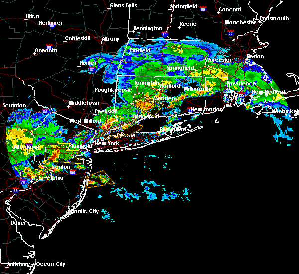 At 436 pm edt, a severe thunderstorm was located near oakville, or near waterbury, moving southeast at 30 mph (radar indicated). Hazards include 60 mph wind gusts. Expect damage to roofs, siding, and trees. this severe thunderstorm will be near, waterbury and middlebury around 445 pm edt. naugatuck around 450 pm edt. cheshire and prospect around 455 pm edt. beacon falls and bethany around 500 pm edt. hamden around 505 pm edt. wallingford around 510 pm edt. north haven around 520 pm edt. durham and branford around 525 pm edt. Guilford and killingworth around 530 pm edt. At 436 pm edt, a severe thunderstorm was located near oakville, or near waterbury, moving southeast at 30 mph (radar indicated). Hazards include 60 mph wind gusts. Expect damage to roofs, siding, and trees. this severe thunderstorm will be near, waterbury and middlebury around 445 pm edt. naugatuck around 450 pm edt. cheshire and prospect around 455 pm edt. beacon falls and bethany around 500 pm edt. hamden around 505 pm edt. wallingford around 510 pm edt. north haven around 520 pm edt. durham and branford around 525 pm edt. Guilford and killingworth around 530 pm edt.
|
| 7/13/2017 4:36 PM EDT |
 At 436 pm edt, a severe thunderstorm was located near oakville, or near waterbury, moving southeast at 30 mph (radar indicated). Hazards include 60 mph wind gusts. Expect damage to roofs, siding, and trees. this severe thunderstorm will be near, waterbury and middlebury around 445 pm edt. naugatuck around 450 pm edt. cheshire and prospect around 455 pm edt. beacon falls and bethany around 500 pm edt. hamden around 505 pm edt. wallingford around 510 pm edt. north haven around 520 pm edt. durham and branford around 525 pm edt. Guilford and killingworth around 530 pm edt. At 436 pm edt, a severe thunderstorm was located near oakville, or near waterbury, moving southeast at 30 mph (radar indicated). Hazards include 60 mph wind gusts. Expect damage to roofs, siding, and trees. this severe thunderstorm will be near, waterbury and middlebury around 445 pm edt. naugatuck around 450 pm edt. cheshire and prospect around 455 pm edt. beacon falls and bethany around 500 pm edt. hamden around 505 pm edt. wallingford around 510 pm edt. north haven around 520 pm edt. durham and branford around 525 pm edt. Guilford and killingworth around 530 pm edt.
|
| 6/30/2017 6:56 PM EDT |
 At 656 pm edt, a severe thunderstorm was located over cheshire, or near meriden, moving east at 35 mph (radar indicated). Hazards include 60 mph wind gusts. Expect damage to roofs, siding, and trees. this severe storm will be near, wallingford around 700 pm edt. meriden around 705 pm edt. middletown and guilford around 710 pm edt. Killingworth around 715 pm edt. At 656 pm edt, a severe thunderstorm was located over cheshire, or near meriden, moving east at 35 mph (radar indicated). Hazards include 60 mph wind gusts. Expect damage to roofs, siding, and trees. this severe storm will be near, wallingford around 700 pm edt. meriden around 705 pm edt. middletown and guilford around 710 pm edt. Killingworth around 715 pm edt.
|
| 6/30/2017 6:38 PM EDT |
 At 637 pm edt, a severe thunderstorm was located over naugatuck, moving east at 40 mph (radar indicated). Hazards include 60 mph wind gusts. Expect damage to roofs, siding, and trees. this severe thunderstorm will be near, cheshire and prospect around 645 pm edt. hamden around 650 pm edt. wallingford around 655 pm edt. north haven and middlefield around 700 pm edt. guilford and durham around 705 pm edt. killingworth around 710 pm edt. Clinton and north madison around 715 pm edt. At 637 pm edt, a severe thunderstorm was located over naugatuck, moving east at 40 mph (radar indicated). Hazards include 60 mph wind gusts. Expect damage to roofs, siding, and trees. this severe thunderstorm will be near, cheshire and prospect around 645 pm edt. hamden around 650 pm edt. wallingford around 655 pm edt. north haven and middlefield around 700 pm edt. guilford and durham around 705 pm edt. killingworth around 710 pm edt. Clinton and north madison around 715 pm edt.
|
| 8/14/2016 1:08 AM EDT |
 The severe thunderstorm warning for northern middlesex and central new haven counties will expire at 115 am edt, the storm which prompted the warning has weakened below severe limits, and no longer pose an immediate threat to life or property. therefore, the warning will be allowed to expire. The severe thunderstorm warning for northern middlesex and central new haven counties will expire at 115 am edt, the storm which prompted the warning has weakened below severe limits, and no longer pose an immediate threat to life or property. therefore, the warning will be allowed to expire.
|
| 8/14/2016 12:59 AM EDT |
 At 1259 am edt, a severe thunderstorm was located over middlefield, or near middletown, moving east at 40 mph (radar indicated). Hazards include 60 mph wind gusts. Expect damage to roofs. siding. and trees. this severe storm will be near, cromwell around 105 am edt. east hampton, portland, east haddam, haddam and lake pocotopaug--east hampton around 115 am edt. Other locations impacted by this severe thunderstorm include moodus, higganum, east haven and madison. At 1259 am edt, a severe thunderstorm was located over middlefield, or near middletown, moving east at 40 mph (radar indicated). Hazards include 60 mph wind gusts. Expect damage to roofs. siding. and trees. this severe storm will be near, cromwell around 105 am edt. east hampton, portland, east haddam, haddam and lake pocotopaug--east hampton around 115 am edt. Other locations impacted by this severe thunderstorm include moodus, higganum, east haven and madison.
|
| 8/14/2016 12:45 AM EDT | Tree and wires down on marguerite and north mani streets in hartford county CT, 6 miles SE of Meriden, CT |
| 8/14/2016 12:36 AM EDT |
 At 1236 am edt, a severe thunderstorm was located over naugatuck, moving east at 35 mph (radar indicated). Hazards include 60 mph wind gusts. Expect damage to roofs. siding. and trees. this severe thunderstorm will be near, prospect and bethany around 1240 am edt. hamden and cheshire around 1245 am edt. wolcott around 1250 am edt. wallingford around 1255 am edt. meriden, durham, hartford and middlefield around 105 am edt. middletown and berlin around 110 am edt. east hampton, cromwell and portland around 115 am edt. Other locations impacted by this severe thunderstorm include oxford, moodus, higganum, ansonia, easton, east haven and madison. At 1236 am edt, a severe thunderstorm was located over naugatuck, moving east at 35 mph (radar indicated). Hazards include 60 mph wind gusts. Expect damage to roofs. siding. and trees. this severe thunderstorm will be near, prospect and bethany around 1240 am edt. hamden and cheshire around 1245 am edt. wolcott around 1250 am edt. wallingford around 1255 am edt. meriden, durham, hartford and middlefield around 105 am edt. middletown and berlin around 110 am edt. east hampton, cromwell and portland around 115 am edt. Other locations impacted by this severe thunderstorm include oxford, moodus, higganum, ansonia, easton, east haven and madison.
|
| 8/11/2016 7:45 PM EDT |
 At 744 pm edt, severe thunderstorms were located along a line extending from near east hampton to meriden, and are nearly stationary (radar indicated). Hazards include 60 mph wind gusts and quarter size hail. Hail damage to vehicles is expected. expect wind damage to roofs, siding, and trees. severe thunderstorms will be near, wallingford and haddam around 755 pm edt. east haddam around 805 pm edt. guilford, durham, chester and north branford around 830 pm edt. Other locations impacted by these severe thunderstorms include moodus, higganum and madison. At 744 pm edt, severe thunderstorms were located along a line extending from near east hampton to meriden, and are nearly stationary (radar indicated). Hazards include 60 mph wind gusts and quarter size hail. Hail damage to vehicles is expected. expect wind damage to roofs, siding, and trees. severe thunderstorms will be near, wallingford and haddam around 755 pm edt. east haddam around 805 pm edt. guilford, durham, chester and north branford around 830 pm edt. Other locations impacted by these severe thunderstorms include moodus, higganum and madison.
|
| 8/11/2016 7:37 PM EDT |
 At 736 pm edt, severe thunderstorms were located along a line extending from east hampton to meriden, moving southeast at 5 mph (radar indicated). Hazards include 60 mph wind gusts and quarter size hail. Hail damage to vehicles is possible. expect wind damage to roofs, siding, and trees. these severe storms will be near, east hampton and marlborough around 740 pm edt. durham, east haddam, haddam and lake pocotopaug--east hampton around 745 pm edt. Other locations impacted by these severe thunderstorms include moodus and higganum. At 736 pm edt, severe thunderstorms were located along a line extending from east hampton to meriden, moving southeast at 5 mph (radar indicated). Hazards include 60 mph wind gusts and quarter size hail. Hail damage to vehicles is possible. expect wind damage to roofs, siding, and trees. these severe storms will be near, east hampton and marlborough around 740 pm edt. durham, east haddam, haddam and lake pocotopaug--east hampton around 745 pm edt. Other locations impacted by these severe thunderstorms include moodus and higganum.
|
| 8/11/2016 6:53 PM EDT |
 At 653 pm edt, severe thunderstorms were located along a line extending from near lake pocotopaug--east hampton to near meriden, moving southeast at 5 mph (radar indicated). Hazards include 60 mph wind gusts and quarter size hail. Hail damage to vehicles is expected. expect wind damage to roofs, siding, and trees. severe thunderstorms will be near, east hampton, cromwell, portland and marlborough around 700 pm edt. middletown and hartford around 705 pm edt. wallingford around 720 pm edt. middlefield around 730 pm edt. durham, east haddam, haddam and lake pocotopaug--east hampton around 745 pm edt. Other locations impacted by these severe thunderstorms include moodus and higganum. At 653 pm edt, severe thunderstorms were located along a line extending from near lake pocotopaug--east hampton to near meriden, moving southeast at 5 mph (radar indicated). Hazards include 60 mph wind gusts and quarter size hail. Hail damage to vehicles is expected. expect wind damage to roofs, siding, and trees. severe thunderstorms will be near, east hampton, cromwell, portland and marlborough around 700 pm edt. middletown and hartford around 705 pm edt. wallingford around 720 pm edt. middlefield around 730 pm edt. durham, east haddam, haddam and lake pocotopaug--east hampton around 745 pm edt. Other locations impacted by these severe thunderstorms include moodus and higganum.
|
| 4/1/2016 7:22 PM EDT |
 At 721 pm edt, doppler radar indicated a severe thunderstorm capable of producing quarter size hail and damaging winds in excess of 60 mph. this storm was located over cheshire, or near wallingford, and moving northeast at 70 mph. * this severe thunderstorm will be near, meriden, guilford, durham, hartford and middlefield around 730 pm edt. middletown and berlin around 735 pm edt. east hampton, rocky hill, cromwell, portland, haddam and lake pocotopaug--east hampton around 740 pm edt. east haddam and marlborough around 745 pm edt. colchester around 750 pm edt. other locations impacted by this severe thunderstorm include higganum and moodus. At 721 pm edt, doppler radar indicated a severe thunderstorm capable of producing quarter size hail and damaging winds in excess of 60 mph. this storm was located over cheshire, or near wallingford, and moving northeast at 70 mph. * this severe thunderstorm will be near, meriden, guilford, durham, hartford and middlefield around 730 pm edt. middletown and berlin around 735 pm edt. east hampton, rocky hill, cromwell, portland, haddam and lake pocotopaug--east hampton around 740 pm edt. east haddam and marlborough around 745 pm edt. colchester around 750 pm edt. other locations impacted by this severe thunderstorm include higganum and moodus.
|
| 2/25/2016 1:29 AM EST |
 At 128 am est, doppler radar indicated a line of severe thunderstorms capable of producing damaging winds in excess of 60 mph. these storms were located along a line extending from manchester to 10 miles south of branford, and moving northeast at 65 mph. * severe thunderstorms will be near, north brandford around 140 am est. clinton and north madison around 145 am est. westbrook and killingworth around 150 am est. chester around 155 am est. east haddam, haddam, lake pocotopaug--east hampton and north lyme around 200 am est. colchester, salem and bozrah around 210 am est. lebanon around 215 am est. other locations impacted by these severe thunderstorms include east haven, saybrook manor, millington, west haven, deep river, essex, madison, moodus, higganum and franklin. At 128 am est, doppler radar indicated a line of severe thunderstorms capable of producing damaging winds in excess of 60 mph. these storms were located along a line extending from manchester to 10 miles south of branford, and moving northeast at 65 mph. * severe thunderstorms will be near, north brandford around 140 am est. clinton and north madison around 145 am est. westbrook and killingworth around 150 am est. chester around 155 am est. east haddam, haddam, lake pocotopaug--east hampton and north lyme around 200 am est. colchester, salem and bozrah around 210 am est. lebanon around 215 am est. other locations impacted by these severe thunderstorms include east haven, saybrook manor, millington, west haven, deep river, essex, madison, moodus, higganum and franklin.
|
| 2/25/2016 12:58 AM EST |
 At 1258 am est, doppler radar indicated a severe thunderstorm capable of producing destructive winds in excess of 70 mph. this storm was located over east windsor, or near south windsor, and was moving northeast at 45 mph. At 1258 am est, doppler radar indicated a severe thunderstorm capable of producing destructive winds in excess of 70 mph. this storm was located over east windsor, or near south windsor, and was moving northeast at 45 mph.
|
| 2/25/2016 12:38 AM EST |
 At 1238 am est, doppler radar indicated a line of severe thunderstorms capable of producing damaging winds in excess of 60 mph. these storms were located along a line extending from cheshire to near stratford, and moving northeast at 50 mph. * severe thunderstorms will be near, wolcott around 1245 am est. branford and woodbridge around 1250 am est. hamden, north haven and bethany around 1255 am est. wallingford, guilford, durham and north branford around 100 am est. meriden, middletown, hartford and middlefield around 105 am est. berlin and cromwell around 110 am est. portland around 115 am est. other locations impacted by these severe thunderstorms include east haven, ansonia, west haven, woodmont, oxford and madison. At 1238 am est, doppler radar indicated a line of severe thunderstorms capable of producing damaging winds in excess of 60 mph. these storms were located along a line extending from cheshire to near stratford, and moving northeast at 50 mph. * severe thunderstorms will be near, wolcott around 1245 am est. branford and woodbridge around 1250 am est. hamden, north haven and bethany around 1255 am est. wallingford, guilford, durham and north branford around 100 am est. meriden, middletown, hartford and middlefield around 105 am est. berlin and cromwell around 110 am est. portland around 115 am est. other locations impacted by these severe thunderstorms include east haven, ansonia, west haven, woodmont, oxford and madison.
|
| 2/25/2016 12:25 AM EST |
 At 1225 am est, doppler radar indicated a line of severe thunderstorms capable of producing destructive winds in excess of 70 mph. these storms were located along a line extending from canton to portland, and was moving northeast at 45 mph. At 1225 am est, doppler radar indicated a line of severe thunderstorms capable of producing destructive winds in excess of 70 mph. these storms were located along a line extending from canton to portland, and was moving northeast at 45 mph.
|
| 6/23/2015 4:43 PM EDT | Large trees down and utility poles down on russell road off rte 10 in hartford county CT, 6 miles SE of Meriden, CT |
| 6/23/2015 4:35 PM EDT | Large tree down blocking road on mayflower lane in new haven county CT, 0.4 miles SSW of Meriden, CT |
| 6/23/2015 4:32 PM EDT |
 At 432 pm edt, doppler radar indicated an area of severe thunderstorms capable of producing damaging winds in excess of 60 mph. this storm was located over wallingford, and moving east at 55 mph. penny size hail may also accompany the damaging winds. At 432 pm edt, doppler radar indicated an area of severe thunderstorms capable of producing damaging winds in excess of 60 mph. this storm was located over wallingford, and moving east at 55 mph. penny size hail may also accompany the damaging winds.
|
| 6/23/2015 4:21 PM EDT |
 At 420 pm edt, doppler radar indicated a line of severe thunderstorms capable of producing damaging winds in excess of 60 mph. these storms were located along a line extending from near woodbury center to beacon falls to orange, and was moving east at 60 mph. * some locations impacted include, hartford, new britain, west hartford, bristol, manchester, east hartford, southington, glastonbury, newington, wethersfield, mansfield, farmington, windham, berlin, rocky hill, avon, willimantic, plainville, coventry and hebron. At 420 pm edt, doppler radar indicated a line of severe thunderstorms capable of producing damaging winds in excess of 60 mph. these storms were located along a line extending from near woodbury center to beacon falls to orange, and was moving east at 60 mph. * some locations impacted include, hartford, new britain, west hartford, bristol, manchester, east hartford, southington, glastonbury, newington, wethersfield, mansfield, farmington, windham, berlin, rocky hill, avon, willimantic, plainville, coventry and hebron.
|
| 7/3/2014 8:45 PM EDT | Trees and wires dow in hartford county CT, 6 miles SE of Meriden, CT |
| 8/28/2013 4:45 PM EDT | Trees down on i-69 in new haven county CT, 0.4 miles SSW of Meriden, CT |
| 8/10/2012 1:08 PM EDT | Several trees down on maple and high street... and clark and russell road in hartford county CT, 6 miles SE of Meriden, CT |
| 8/10/2012 1:08 PM EDT | Several trees down on maple and high street... and clark and russellville road in hartford county CT, 6 miles SE of Meriden, CT |
| 7/1/2012 3:30 PM EDT | Quarter sized hail reported 0.4 miles SSW of Meriden, CT |
Hail Maps for Meriden, CT


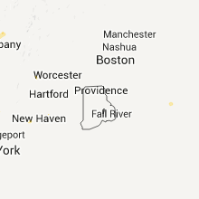


Connect with Interactive Hail Maps