

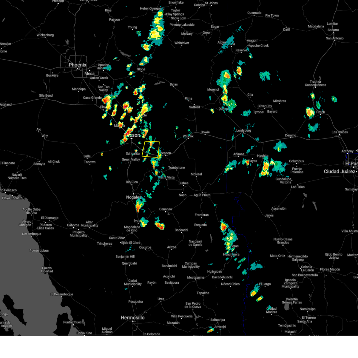
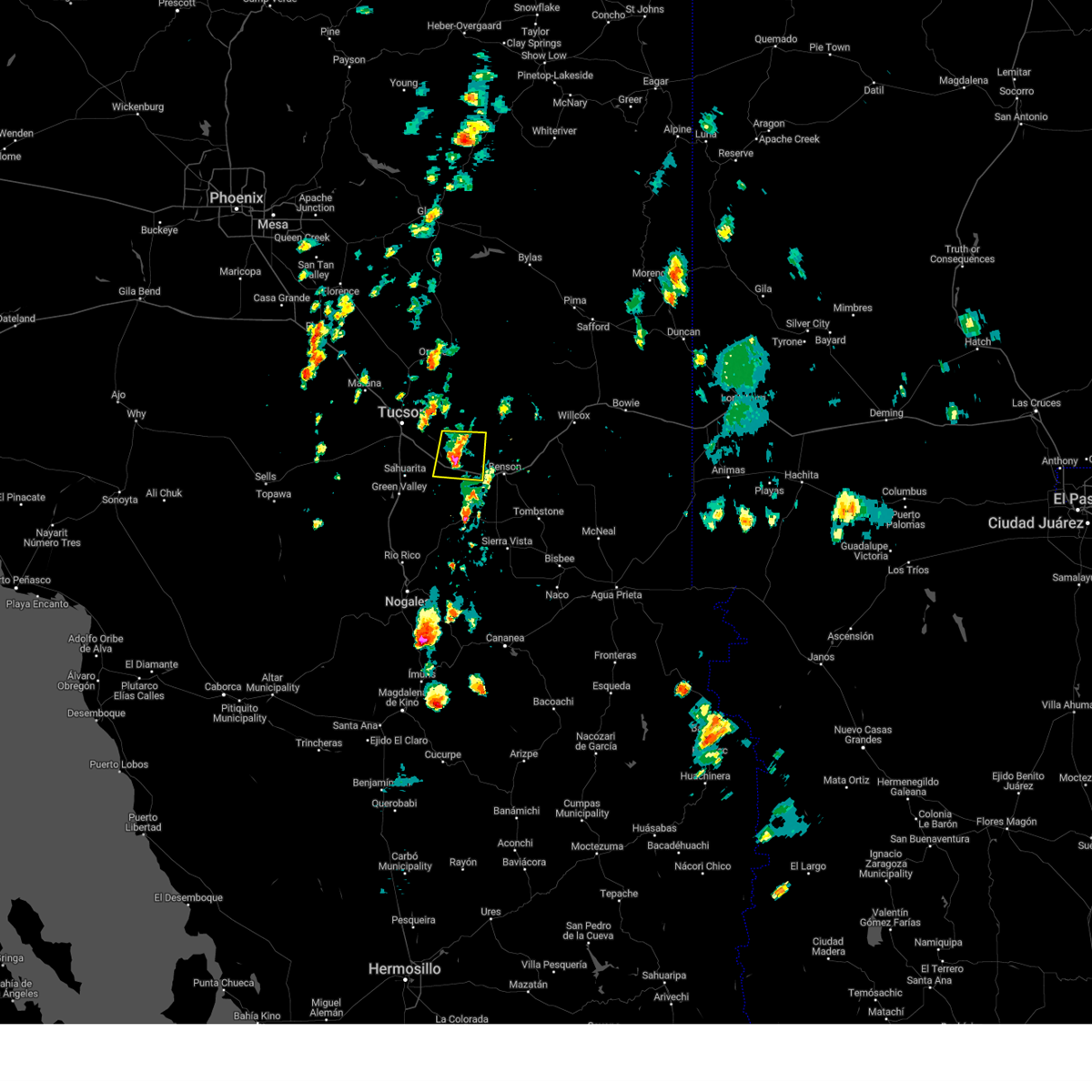
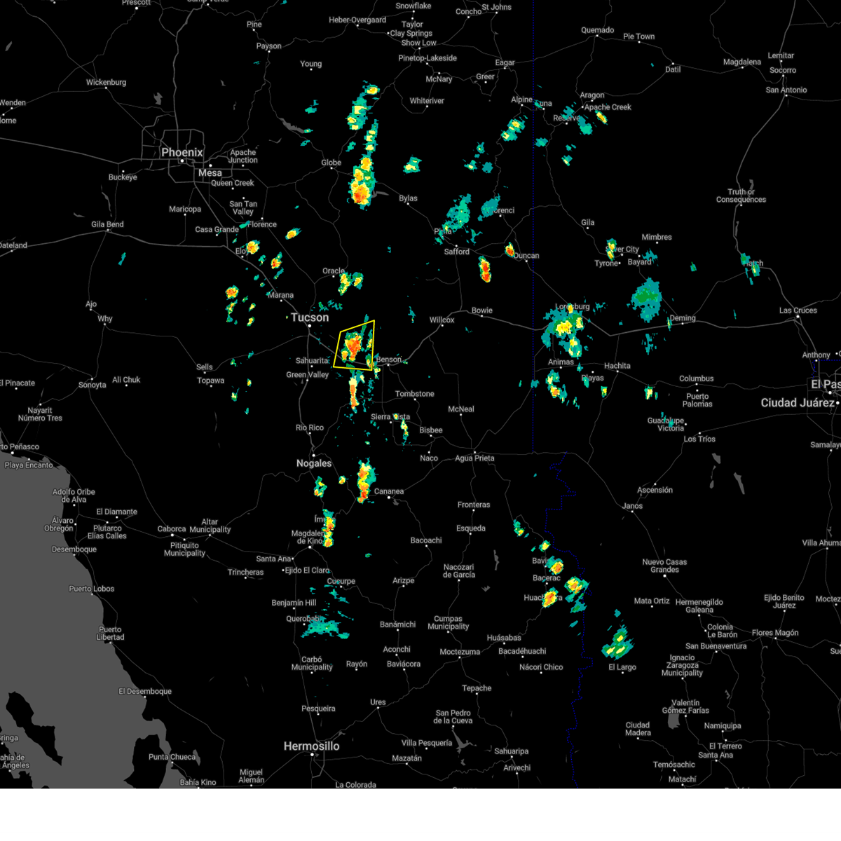
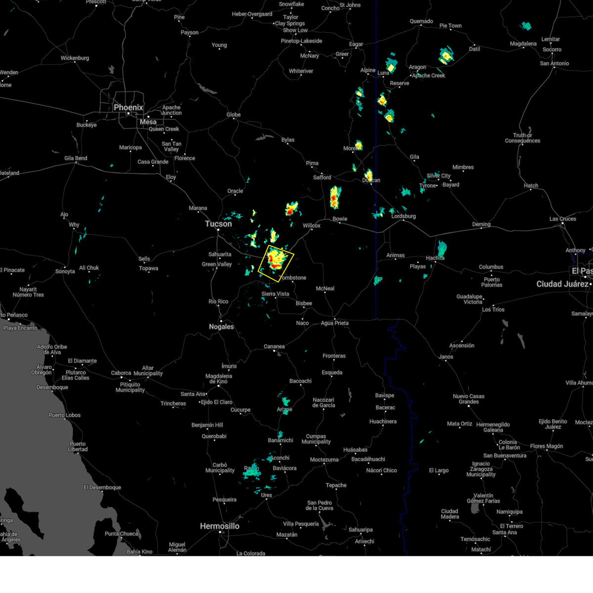
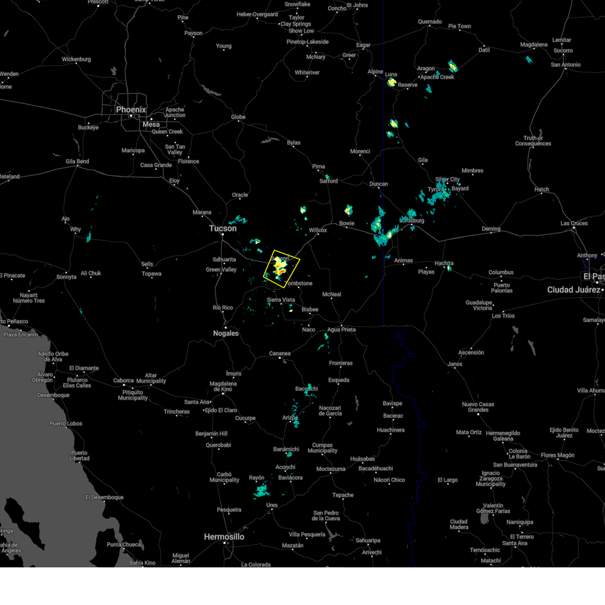
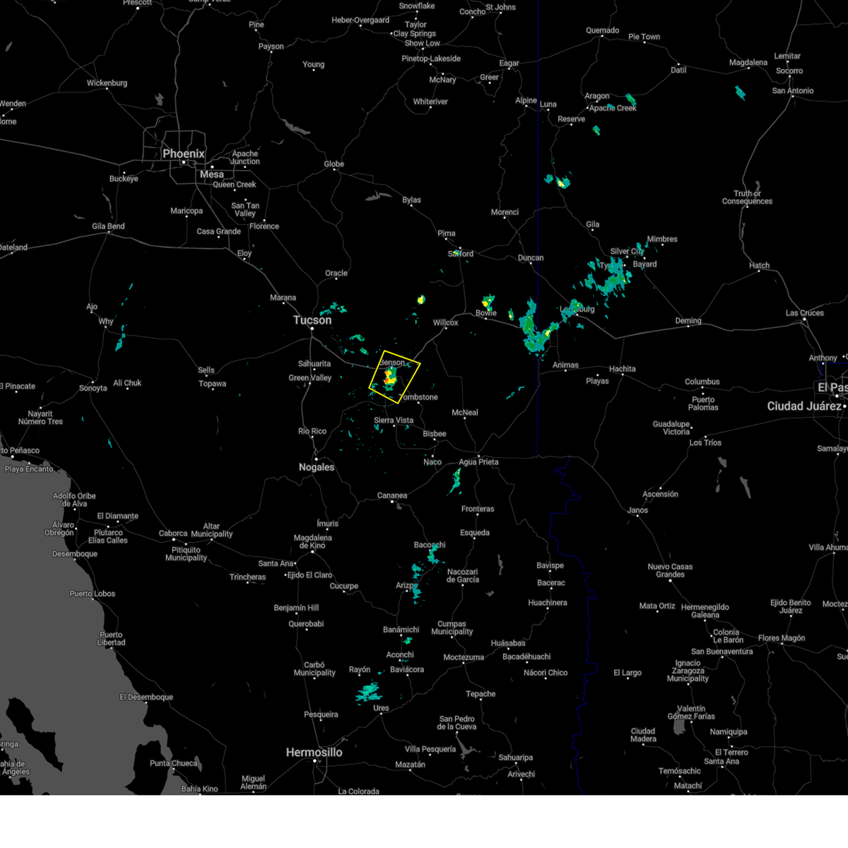
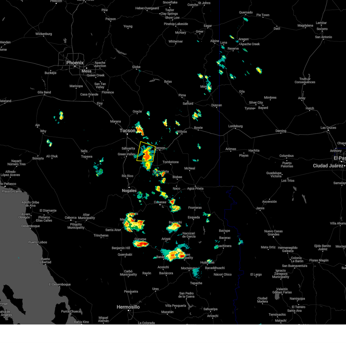
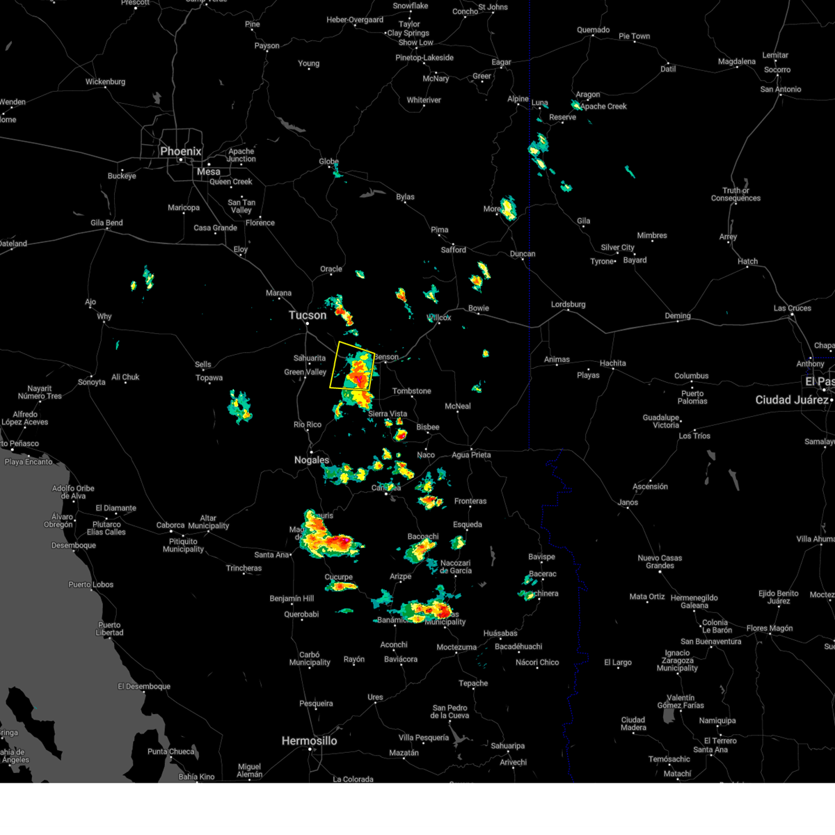
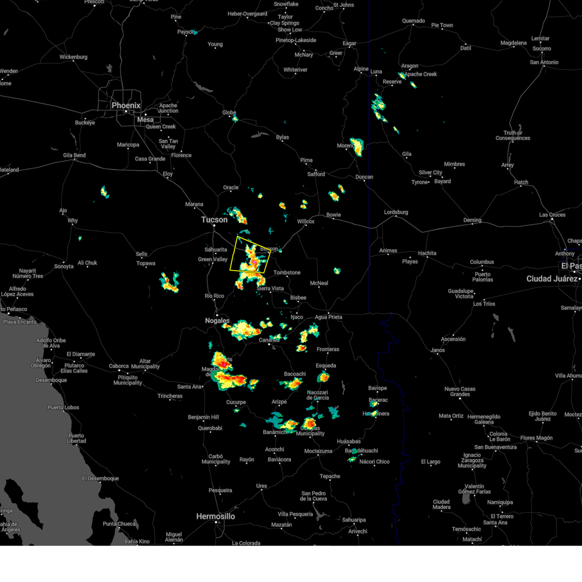
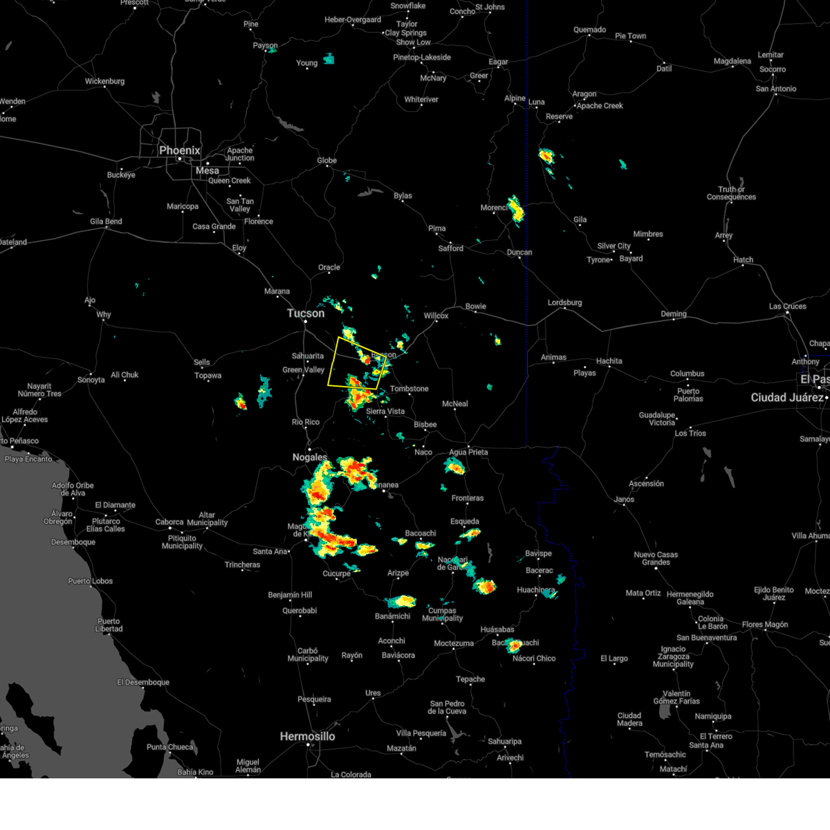
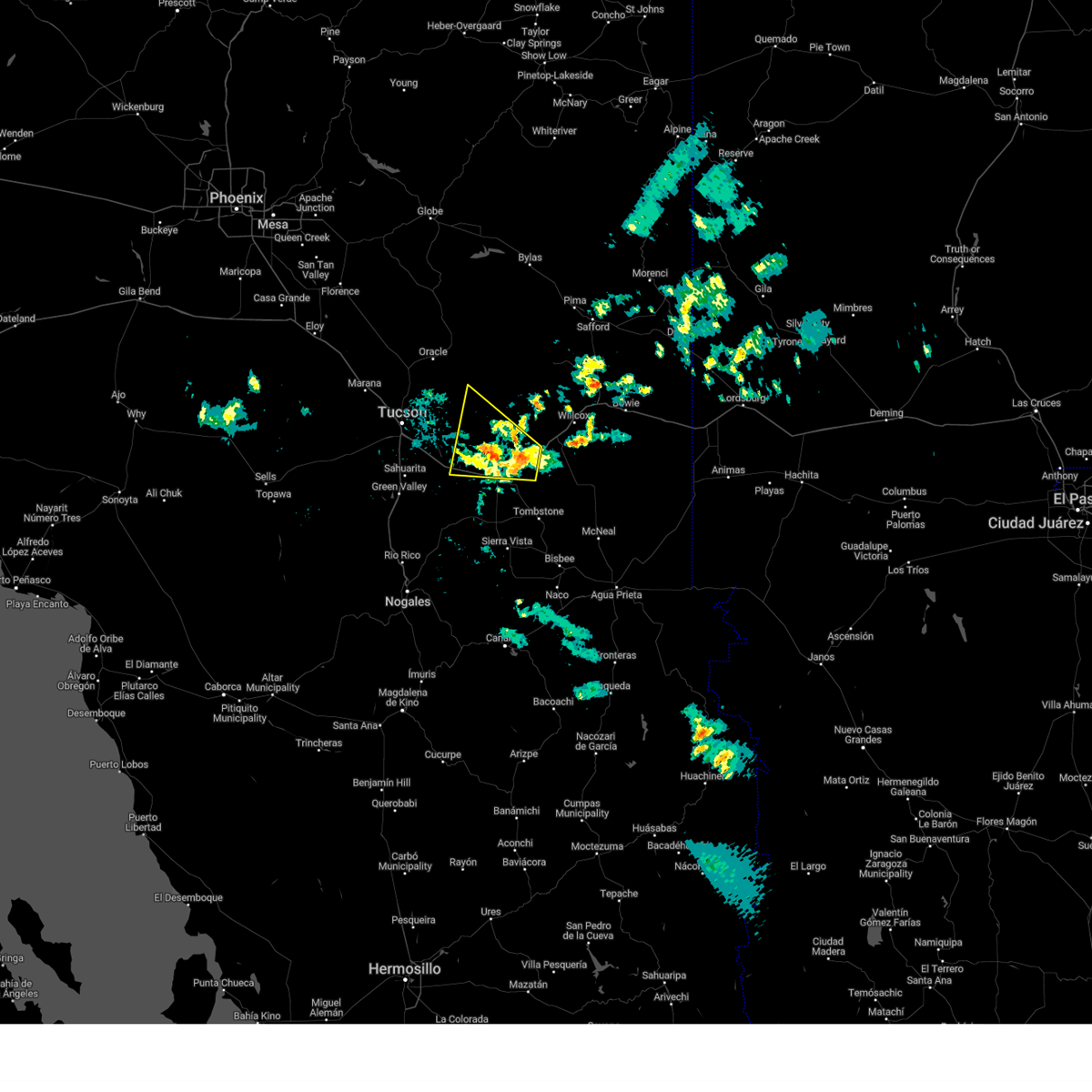
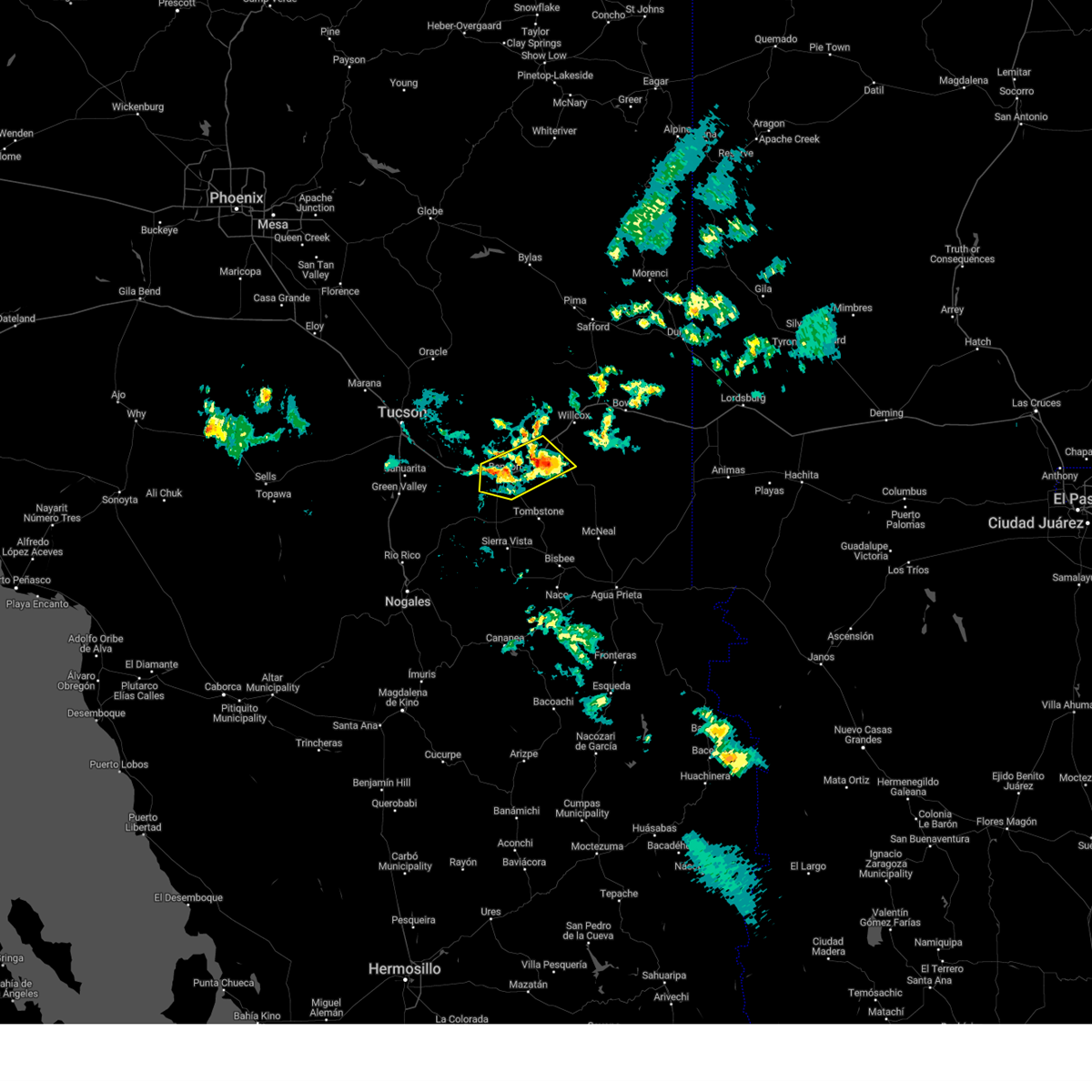
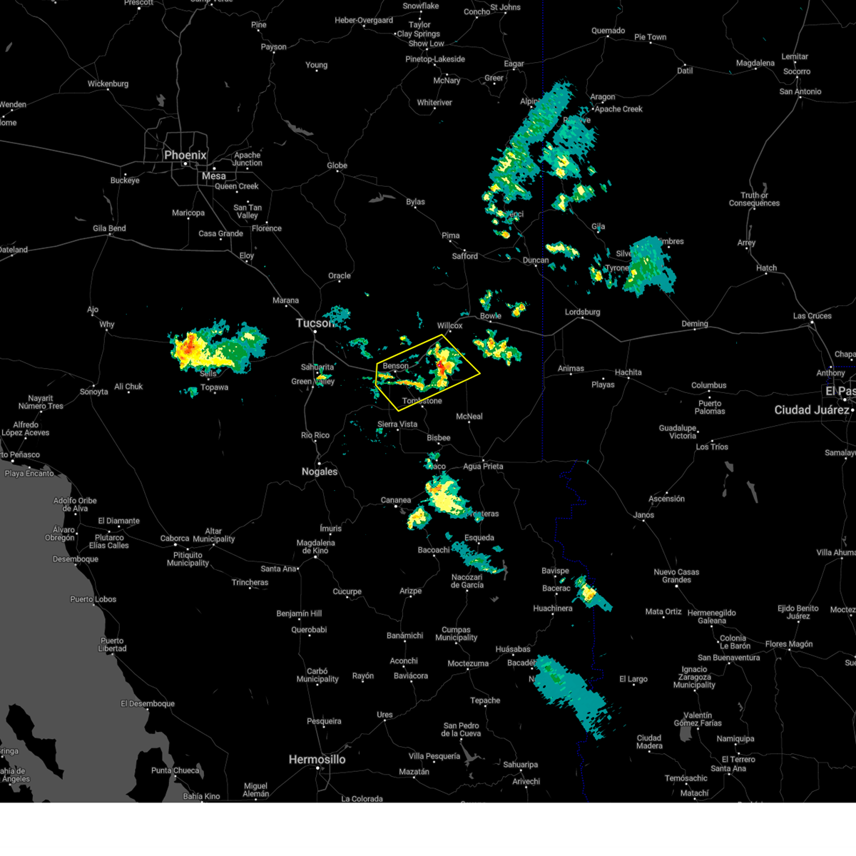
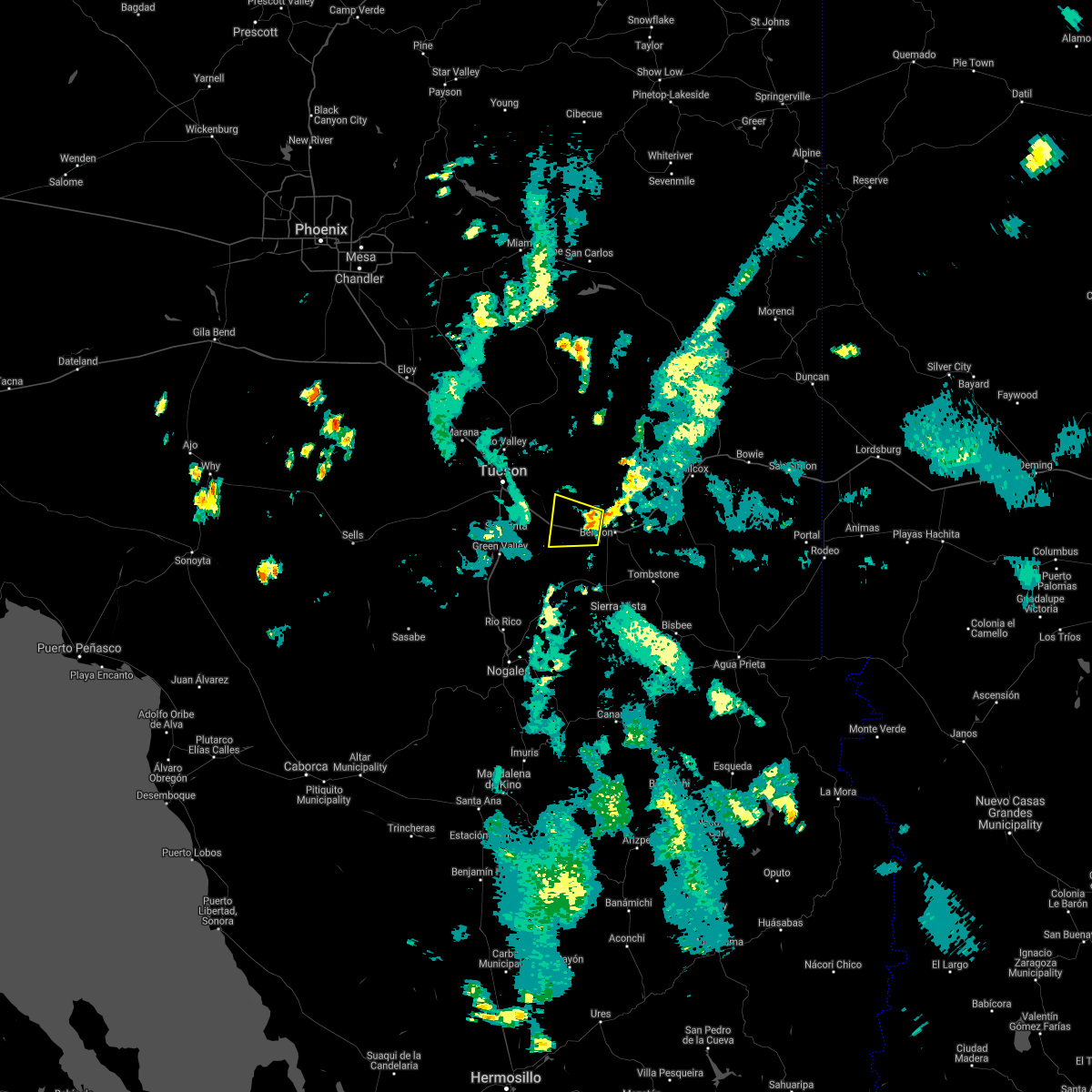
Hail Map for Mescal, AZ
The Mescal, AZ area has had 0 reports of on-the-ground hail by trained spotters, and has been under severe weather warnings 26 times during the past 12 months. Doppler radar has detected hail at or near Mescal, AZ on 66 occasions, including 6 occasions during the past year.
| Name: | Mescal, AZ |
| Where Located: | 35.8 miles ESE of Tucson, AZ |
| Map: | Google Map for Mescal, AZ |
| Population: | 1812 |
| Housing Units: | 853 |
| More Info: | Search Google for Mescal, AZ |
1
The Top Recent Hail Date for Mescal, AZ is Monday, July 15, 2024 (8th out of 66)

Hail and Wind Damage Spotted near Mescal, AZ
| Date / Time | Report Details |
|---|---|
| 8/23/2024 4:04 PM MST |
 the severe thunderstorm warning has been cancelled and is no longer in effect the severe thunderstorm warning has been cancelled and is no longer in effect
|
| 8/23/2024 3:26 PM MST |
 Svrtwc the national weather service in tucson has issued a * severe thunderstorm warning for, east central pima county in southeastern arizona, west central cochise county in southeastern arizona, * until 415 pm mst. * at 326 pm mst, a severe thunderstorm was located near vail, or 17 miles southeast of davis-monthan air force base, moving northeast at 10 mph (radar indicated). Hazards include 60 mph wind gusts and penny size hail. expect damage to roofs, siding, and trees Svrtwc the national weather service in tucson has issued a * severe thunderstorm warning for, east central pima county in southeastern arizona, west central cochise county in southeastern arizona, * until 415 pm mst. * at 326 pm mst, a severe thunderstorm was located near vail, or 17 miles southeast of davis-monthan air force base, moving northeast at 10 mph (radar indicated). Hazards include 60 mph wind gusts and penny size hail. expect damage to roofs, siding, and trees
|
| 8/23/2024 2:41 PM MST |
 Svrtwc the national weather service in tucson has issued a * severe thunderstorm warning for, east central pima county in southeastern arizona, west central cochise county in southeastern arizona, * until 330 pm mst. * at 240 pm mst, a severe thunderstorm was located 5 miles northeast of vail, or 17 miles east of davis-monthan air force base, moving north at 10 mph (radar indicated). Hazards include 60 mph wind gusts and nickel size hail. expect damage to roofs, siding, and trees Svrtwc the national weather service in tucson has issued a * severe thunderstorm warning for, east central pima county in southeastern arizona, west central cochise county in southeastern arizona, * until 330 pm mst. * at 240 pm mst, a severe thunderstorm was located 5 miles northeast of vail, or 17 miles east of davis-monthan air force base, moving north at 10 mph (radar indicated). Hazards include 60 mph wind gusts and nickel size hail. expect damage to roofs, siding, and trees
|
| 8/23/2024 12:28 PM MST |
 The storm which prompted the warning has weakened below severe limits, and no longer poses an immediate threat to life or property. therefore, the warning will be allowed to expire. however, gusty winds and heavy rain are still possible with this thunderstorm. The storm which prompted the warning has weakened below severe limits, and no longer poses an immediate threat to life or property. therefore, the warning will be allowed to expire. however, gusty winds and heavy rain are still possible with this thunderstorm.
|
| 8/23/2024 12:03 PM MST |
 At 1203 pm mst, a severe thunderstorm was located over st. david, or near benson, moving northeast at 25 mph (radar indicated). Hazards include 60 mph wind gusts and quarter size hail. Hail damage to vehicles is expected. expect wind damage to roofs, siding, and trees. locations impacted include, benson, st. david, kartchner caverns state park, and mescal. this includes the following highways, interstate 10 between mile markers 298 and 316. route 80 between mile markers 293 and 307. route 82 near mile marker 58. Route 90 between mile markers 290 and 303. At 1203 pm mst, a severe thunderstorm was located over st. david, or near benson, moving northeast at 25 mph (radar indicated). Hazards include 60 mph wind gusts and quarter size hail. Hail damage to vehicles is expected. expect wind damage to roofs, siding, and trees. locations impacted include, benson, st. david, kartchner caverns state park, and mescal. this includes the following highways, interstate 10 between mile markers 298 and 316. route 80 between mile markers 293 and 307. route 82 near mile marker 58. Route 90 between mile markers 290 and 303.
|
| 8/23/2024 11:46 AM MST |
 Svrtwc the national weather service in tucson has issued a * severe thunderstorm warning for, east central pima county in southeastern arizona, west central cochise county in southeastern arizona, * until 1230 pm mst. * at 1146 am mst, a severe thunderstorm was located near kartchner caverns state park, or near benson, moving northeast at 10 mph (radar indicated). Hazards include 60 mph wind gusts and quarter size hail. Hail damage to vehicles is expected. Expect wind damage to roofs, siding, and trees. Svrtwc the national weather service in tucson has issued a * severe thunderstorm warning for, east central pima county in southeastern arizona, west central cochise county in southeastern arizona, * until 1230 pm mst. * at 1146 am mst, a severe thunderstorm was located near kartchner caverns state park, or near benson, moving northeast at 10 mph (radar indicated). Hazards include 60 mph wind gusts and quarter size hail. Hail damage to vehicles is expected. Expect wind damage to roofs, siding, and trees.
|
| 8/19/2024 4:14 PM MST |
 The storms which prompted the warning have weakened below severe limits, and no longer pose an immediate threat to life or property. therefore, the warning will be allowed to expire. The storms which prompted the warning have weakened below severe limits, and no longer pose an immediate threat to life or property. therefore, the warning will be allowed to expire.
|
| 8/19/2024 3:56 PM MST |
 At 356 pm mst, severe thunderstorms were located along a line extending from 5 miles east of vail to 7 miles northeast of sonoita, moving west at 15 mph (radar indicated). Hazards include 60 mph wind gusts and quarter size hail. Hail damage to vehicles is expected. expect wind damage to roofs, siding, and trees. locations impacted include, vail and mescal. this includes the following highways, interstate 10 between mile markers 280 and 299. Route 83 between mile markers 41 and 58. At 356 pm mst, severe thunderstorms were located along a line extending from 5 miles east of vail to 7 miles northeast of sonoita, moving west at 15 mph (radar indicated). Hazards include 60 mph wind gusts and quarter size hail. Hail damage to vehicles is expected. expect wind damage to roofs, siding, and trees. locations impacted include, vail and mescal. this includes the following highways, interstate 10 between mile markers 280 and 299. Route 83 between mile markers 41 and 58.
|
| 8/19/2024 3:42 PM MST |
 At 342 pm mst, severe thunderstorms were located along a line extending from 8 miles east of vail to 9 miles northeast of sonoita, moving west at 10 mph (radar indicated). Hazards include 60 mph wind gusts and quarter size hail. Hail damage to vehicles is expected. expect wind damage to roofs, siding, and trees. locations impacted include, benson, vail, kartchner caverns state park, and mescal. this includes the following highways, interstate 10 between mile markers 280 and 306. route 80 between mile markers 293 and 294. route 83 between mile markers 41 and 58. Route 90 between mile markers 290 and 302. At 342 pm mst, severe thunderstorms were located along a line extending from 8 miles east of vail to 9 miles northeast of sonoita, moving west at 10 mph (radar indicated). Hazards include 60 mph wind gusts and quarter size hail. Hail damage to vehicles is expected. expect wind damage to roofs, siding, and trees. locations impacted include, benson, vail, kartchner caverns state park, and mescal. this includes the following highways, interstate 10 between mile markers 280 and 306. route 80 between mile markers 293 and 294. route 83 between mile markers 41 and 58. Route 90 between mile markers 290 and 302.
|
| 8/19/2024 3:23 PM MST |
 Svrtwc the national weather service in tucson has issued a * severe thunderstorm warning for, east central pima county in southeastern arizona, west central cochise county in southeastern arizona, * until 415 pm mst. * at 322 pm mst, severe thunderstorms were located along a line extending from 11 miles east of vail to 10 miles west of kartchner caverns state park, moving west at 10 to 15 mph (radar indicated). Hazards include 60 mph wind gusts and penny size hail. expect damage to roofs, siding, and trees Svrtwc the national weather service in tucson has issued a * severe thunderstorm warning for, east central pima county in southeastern arizona, west central cochise county in southeastern arizona, * until 415 pm mst. * at 322 pm mst, severe thunderstorms were located along a line extending from 11 miles east of vail to 10 miles west of kartchner caverns state park, moving west at 10 to 15 mph (radar indicated). Hazards include 60 mph wind gusts and penny size hail. expect damage to roofs, siding, and trees
|
| 8/16/2024 8:43 PM MST |
 Svrtwc the national weather service in tucson has issued a * severe thunderstorm warning for, east central pima county in southeastern arizona, west central cochise county in southeastern arizona, * until 930 pm mst. * at 843 pm mst, a severe thunderstorm was located 9 miles northeast of benson, moving west at 25 mph (radar indicated). Hazards include 60 mph wind gusts and quarter size hail. Hail damage to vehicles is expected. Expect wind damage to roofs, siding, and trees. Svrtwc the national weather service in tucson has issued a * severe thunderstorm warning for, east central pima county in southeastern arizona, west central cochise county in southeastern arizona, * until 930 pm mst. * at 843 pm mst, a severe thunderstorm was located 9 miles northeast of benson, moving west at 25 mph (radar indicated). Hazards include 60 mph wind gusts and quarter size hail. Hail damage to vehicles is expected. Expect wind damage to roofs, siding, and trees.
|
| 8/16/2024 8:23 PM MST |
 At 823 pm mst, a severe thunderstorm was located 7 miles south of dragoon, or 15 miles east of benson, moving northwest at 10 mph (radar indicated). Hazards include 60 mph wind gusts and quarter size hail. Hail damage to vehicles is expected. expect wind damage to roofs, siding, and trees. locations impacted include, benson, st. david, dragoon, kartchner caverns state park, pearce-sunsites, mescal, and texas canyon. this includes the following highways, interstate 10 between mile markers 297 and 328. route 80 between mile markers 293 and 305. route 90 between mile markers 290 and 298. Route 191 between mile markers 53 and 58. At 823 pm mst, a severe thunderstorm was located 7 miles south of dragoon, or 15 miles east of benson, moving northwest at 10 mph (radar indicated). Hazards include 60 mph wind gusts and quarter size hail. Hail damage to vehicles is expected. expect wind damage to roofs, siding, and trees. locations impacted include, benson, st. david, dragoon, kartchner caverns state park, pearce-sunsites, mescal, and texas canyon. this includes the following highways, interstate 10 between mile markers 297 and 328. route 80 between mile markers 293 and 305. route 90 between mile markers 290 and 298. Route 191 between mile markers 53 and 58.
|
| 8/16/2024 7:55 PM MST |
 Svrtwc the national weather service in tucson has issued a * severe thunderstorm warning for, northwestern cochise county in southeastern arizona, * until 845 pm mst. * at 755 pm mst, a severe thunderstorm was located 8 miles southwest of pearce-sunsites, or 19 miles east of benson, moving northwest at 10 mph (radar indicated). Hazards include 60 mph wind gusts and quarter size hail. Hail damage to vehicles is expected. Expect wind damage to roofs, siding, and trees. Svrtwc the national weather service in tucson has issued a * severe thunderstorm warning for, northwestern cochise county in southeastern arizona, * until 845 pm mst. * at 755 pm mst, a severe thunderstorm was located 8 miles southwest of pearce-sunsites, or 19 miles east of benson, moving northwest at 10 mph (radar indicated). Hazards include 60 mph wind gusts and quarter size hail. Hail damage to vehicles is expected. Expect wind damage to roofs, siding, and trees.
|
| 7/25/2024 5:58 PM MST |
 the severe thunderstorm warning has been cancelled and is no longer in effect the severe thunderstorm warning has been cancelled and is no longer in effect
|
| 7/25/2024 5:25 PM MST |
 Svrtwc the national weather service in tucson has issued a * severe thunderstorm warning for, east central pima county in southeastern arizona, west central cochise county in southeastern arizona, * until 615 pm mst. * at 525 pm mst, a severe thunderstorm was located 7 miles north of benson, moving southwest at 5 mph (radar indicated). Hazards include 60 mph wind gusts and quarter size hail. Hail damage to vehicles is expected. Expect wind damage to roofs, siding, and trees. Svrtwc the national weather service in tucson has issued a * severe thunderstorm warning for, east central pima county in southeastern arizona, west central cochise county in southeastern arizona, * until 615 pm mst. * at 525 pm mst, a severe thunderstorm was located 7 miles north of benson, moving southwest at 5 mph (radar indicated). Hazards include 60 mph wind gusts and quarter size hail. Hail damage to vehicles is expected. Expect wind damage to roofs, siding, and trees.
|
| 7/21/2024 5:23 PM MST |
 Svrtwc the national weather service in tucson has issued a * severe thunderstorm warning for, east central pima county in southeastern arizona, west central cochise county in southeastern arizona, * until 600 pm mst. * at 522 pm mst, an area of severe thunderstorms was located from near east tucson down to i-10 and eastward to benson, moving south at 15 mph (radar indicated). Hazards include 60 mph wind gusts. expect damage to roofs, siding, and trees Svrtwc the national weather service in tucson has issued a * severe thunderstorm warning for, east central pima county in southeastern arizona, west central cochise county in southeastern arizona, * until 600 pm mst. * at 522 pm mst, an area of severe thunderstorms was located from near east tucson down to i-10 and eastward to benson, moving south at 15 mph (radar indicated). Hazards include 60 mph wind gusts. expect damage to roofs, siding, and trees
|
| 7/20/2024 5:25 PM MST |
 The storms which prompted the warning east of tucson have weakened below severe limits. therefore, the warning will be allowed to expire. however, gusty winds and heavy rain are still possible with these thunderstorms. The storms which prompted the warning east of tucson have weakened below severe limits. therefore, the warning will be allowed to expire. however, gusty winds and heavy rain are still possible with these thunderstorms.
|
| 7/20/2024 4:43 PM MST |
 Svrtwc the national weather service in tucson has issued a * severe thunderstorm warning for, northeastern pima county in southeastern arizona, northwestern cochise county in southeastern arizona, * until 530 pm mst. * at 442 pm mst, severe thunderstorms were located along a line extending from 10 miles northeast of saguaro national park east to 6 miles northwest of kartchner caverns state park, moving west at 10 mph (radar indicated). Hazards include 60 mph wind gusts and penny size hail. expect damage to roofs, siding, and trees Svrtwc the national weather service in tucson has issued a * severe thunderstorm warning for, northeastern pima county in southeastern arizona, northwestern cochise county in southeastern arizona, * until 530 pm mst. * at 442 pm mst, severe thunderstorms were located along a line extending from 10 miles northeast of saguaro national park east to 6 miles northwest of kartchner caverns state park, moving west at 10 mph (radar indicated). Hazards include 60 mph wind gusts and penny size hail. expect damage to roofs, siding, and trees
|
| 7/20/2024 4:29 PM MST |
 At 428 pm mst, severe thunderstorms were located along a line extending from 10 miles east of vail to near st. david, moving west at 15 mph (radar indicated). Hazards include 60 mph wind gusts. Expect damage to roofs, siding, and trees. locations impacted include, benson, st. david, kartchner caverns state park, mescal, and vail. this includes the following highways, interstate 10 between mile markers 284 and 312. route 80 between mile markers 293 and 307. Route 90 between mile markers 290 and 305. At 428 pm mst, severe thunderstorms were located along a line extending from 10 miles east of vail to near st. david, moving west at 15 mph (radar indicated). Hazards include 60 mph wind gusts. Expect damage to roofs, siding, and trees. locations impacted include, benson, st. david, kartchner caverns state park, mescal, and vail. this includes the following highways, interstate 10 between mile markers 284 and 312. route 80 between mile markers 293 and 307. Route 90 between mile markers 290 and 305.
|
| 7/20/2024 3:55 PM MST |
 Svrtwc the national weather service in tucson has issued a * severe thunderstorm warning for, east central pima county in southeastern arizona, west central cochise county in southeastern arizona, * until 445 pm mst. * at 355 pm mst, severe thunderstorms were located along a line extending from 11 miles northwest of benson to near st. david, moving west at 15 mph (radar indicated). Hazards include 60 mph wind gusts. expect damage to roofs, siding, and trees Svrtwc the national weather service in tucson has issued a * severe thunderstorm warning for, east central pima county in southeastern arizona, west central cochise county in southeastern arizona, * until 445 pm mst. * at 355 pm mst, severe thunderstorms were located along a line extending from 11 miles northwest of benson to near st. david, moving west at 15 mph (radar indicated). Hazards include 60 mph wind gusts. expect damage to roofs, siding, and trees
|
| 7/15/2024 6:12 PM MST |
 The storm which prompted the warning near i-10 between vail and benson has weakened below severe limits. therefore, the warning will be allowed to expire. however, gusty winds are still possible with this thunderstorm along with patchy blowing dust. The storm which prompted the warning near i-10 between vail and benson has weakened below severe limits. therefore, the warning will be allowed to expire. however, gusty winds are still possible with this thunderstorm along with patchy blowing dust.
|
| 7/15/2024 5:29 PM MST |
 Svrtwc the national weather service in tucson has issued a * severe thunderstorm warning for, east central pima county in southeastern arizona, western cochise county in southeastern arizona, * until 615 pm mst. * at 528 pm mst, a severe thunderstorm was located 5 miles west of benson near i-10, moving west at 15 mph (radar indicated). Hazards include 60 mph wind gusts and penny size hail. expect damage to roofs, siding, and trees Svrtwc the national weather service in tucson has issued a * severe thunderstorm warning for, east central pima county in southeastern arizona, western cochise county in southeastern arizona, * until 615 pm mst. * at 528 pm mst, a severe thunderstorm was located 5 miles west of benson near i-10, moving west at 15 mph (radar indicated). Hazards include 60 mph wind gusts and penny size hail. expect damage to roofs, siding, and trees
|
| 7/14/2024 4:36 PM MST |
 The storm which prompted the warning has moved out of the area. therefore, the warning will be allowed to expire. however, small hail and gusty winds are still possible with this thunderstorm. The storm which prompted the warning has moved out of the area. therefore, the warning will be allowed to expire. however, small hail and gusty winds are still possible with this thunderstorm.
|
| 7/14/2024 4:03 PM MST |
 Svrtwc the national weather service in tucson has issued a * severe thunderstorm warning for, far southeast pima county in southeastern arizona, west central cochise county in southeastern arizona, * until 445 pm mst. * at 402 pm mst, a severe thunderstorm was located 9 miles west of dragoon, or 10 miles northeast of benson, moving northwest at 15 mph (radar indicated). Hazards include 60 mph wind gusts and quarter size hail. Hail damage to vehicles is expected. Expect wind damage to roofs, siding, and trees. Svrtwc the national weather service in tucson has issued a * severe thunderstorm warning for, far southeast pima county in southeastern arizona, west central cochise county in southeastern arizona, * until 445 pm mst. * at 402 pm mst, a severe thunderstorm was located 9 miles west of dragoon, or 10 miles northeast of benson, moving northwest at 15 mph (radar indicated). Hazards include 60 mph wind gusts and quarter size hail. Hail damage to vehicles is expected. Expect wind damage to roofs, siding, and trees.
|
| 7/10/2024 4:44 PM MST |
 Svrtwc the national weather service in tucson has issued a * severe thunderstorm warning for, east central pima county in southeastern arizona, west central cochise county in southeastern arizona, * until 530 pm mst. * at 443 pm mst, a severe thunderstorm was located near and west of benson, moving southwest at 10 mph (radar indicated). Hazards include 60 mph wind gusts and penny size hail. expect damage to roofs, siding, and trees Svrtwc the national weather service in tucson has issued a * severe thunderstorm warning for, east central pima county in southeastern arizona, west central cochise county in southeastern arizona, * until 530 pm mst. * at 443 pm mst, a severe thunderstorm was located near and west of benson, moving southwest at 10 mph (radar indicated). Hazards include 60 mph wind gusts and penny size hail. expect damage to roofs, siding, and trees
|
| 7/10/2024 4:02 PM MST |
 Svrtwc the national weather service in tucson has issued a * severe thunderstorm warning for, east central pima county in southeastern arizona, west central cochise county in southeastern arizona, * until 445 pm mst. * at 402 pm mst, a severe thunderstorm was located over benson, moving south at 10 mph (radar indicated). Hazards include 60 mph wind gusts and quarter size hail. Hail damage to vehicles is expected. Expect wind damage to roofs, siding, and trees. Svrtwc the national weather service in tucson has issued a * severe thunderstorm warning for, east central pima county in southeastern arizona, west central cochise county in southeastern arizona, * until 445 pm mst. * at 402 pm mst, a severe thunderstorm was located over benson, moving south at 10 mph (radar indicated). Hazards include 60 mph wind gusts and quarter size hail. Hail damage to vehicles is expected. Expect wind damage to roofs, siding, and trees.
|
| 9/13/2023 1:14 PM MST |
 At 113 pm mst, a severe thunderstorm was located near kartchner caverns state park, or 9 miles southwest of benson, moving east at 10 mph (radar indicated). Hazards include 60 mph wind gusts and penny size hail. expect damage to roofs, siding, and trees At 113 pm mst, a severe thunderstorm was located near kartchner caverns state park, or 9 miles southwest of benson, moving east at 10 mph (radar indicated). Hazards include 60 mph wind gusts and penny size hail. expect damage to roofs, siding, and trees
|
| 9/12/2023 1:52 PM MST |
 At 151 pm mst, a severe thunderstorm was located 7 miles north of elgin, or 18 miles southwest of benson, moving east at 10 mph (radar indicated). Hazards include 60 mph wind gusts and quarter size hail. Hail damage to vehicles is expected. expect wind damage to roofs, siding, and trees. locations impacted include, elgin. hail threat, radar indicated max hail size, 1. 00 in wind threat, radar indicated max wind gust, 60 mph. At 151 pm mst, a severe thunderstorm was located 7 miles north of elgin, or 18 miles southwest of benson, moving east at 10 mph (radar indicated). Hazards include 60 mph wind gusts and quarter size hail. Hail damage to vehicles is expected. expect wind damage to roofs, siding, and trees. locations impacted include, elgin. hail threat, radar indicated max hail size, 1. 00 in wind threat, radar indicated max wind gust, 60 mph.
|
| 9/12/2023 1:36 PM MST |
 At 135 pm mst, a severe thunderstorm was located near sonoita, or 21 miles southwest of benson, moving east at 10 mph (radar indicated). Hazards include 60 mph wind gusts and quarter size hail. Hail damage to vehicles is expected. Expect wind damage to roofs, siding, and trees. At 135 pm mst, a severe thunderstorm was located near sonoita, or 21 miles southwest of benson, moving east at 10 mph (radar indicated). Hazards include 60 mph wind gusts and quarter size hail. Hail damage to vehicles is expected. Expect wind damage to roofs, siding, and trees.
|
| 8/21/2023 6:28 PM MST |
 At 627 pm mst, severe thunderstorms were located along a line extending from near kartchner caverns state park to sonoita to near patagonia, moving northwest at 35 mph (radar indicated). Hazards include 60 mph wind gusts and quarter size hail. Hail damage to vehicles is expected. expect wind damage to roofs, siding, and trees. locations impacted include, benson, whetstone, patagonia, sonoita, elgin and kartchner caverns state park. hail threat, radar indicated max hail size, 1. 00 in wind threat, radar indicated max wind gust, 60 mph. At 627 pm mst, severe thunderstorms were located along a line extending from near kartchner caverns state park to sonoita to near patagonia, moving northwest at 35 mph (radar indicated). Hazards include 60 mph wind gusts and quarter size hail. Hail damage to vehicles is expected. expect wind damage to roofs, siding, and trees. locations impacted include, benson, whetstone, patagonia, sonoita, elgin and kartchner caverns state park. hail threat, radar indicated max hail size, 1. 00 in wind threat, radar indicated max wind gust, 60 mph.
|
| 8/21/2023 6:26 PM MST |
 At 624 pm mst, severe thunderstorms were located along a line extending from near kartchner caverns state park to 6 miles west of sonoita, moving northwest at 30 mph (radar indicated). Hazards include 60 mph wind gusts with the leading gust front and quarter size hail. these storms have a history of producing 60 mph wind gusts. Hail damage to vehicles is expected. Expect wind damage to roofs, siding, and trees. At 624 pm mst, severe thunderstorms were located along a line extending from near kartchner caverns state park to 6 miles west of sonoita, moving northwest at 30 mph (radar indicated). Hazards include 60 mph wind gusts with the leading gust front and quarter size hail. these storms have a history of producing 60 mph wind gusts. Hail damage to vehicles is expected. Expect wind damage to roofs, siding, and trees.
|
| 8/21/2023 5:53 PM MST |
 At 553 pm mst, severe thunderstorms were located along a line extending from 7 miles east of whetstone to near fort huachuca to near parker canyon lake, moving northwest at 35 mph (radar indicated). Hazards include 60 mph wind gusts and quarter size hail. Hail damage to vehicles is expected. Expect wind damage to roofs, siding, and trees. At 553 pm mst, severe thunderstorms were located along a line extending from 7 miles east of whetstone to near fort huachuca to near parker canyon lake, moving northwest at 35 mph (radar indicated). Hazards include 60 mph wind gusts and quarter size hail. Hail damage to vehicles is expected. Expect wind damage to roofs, siding, and trees.
|
| 8/18/2023 4:31 PM MST |
 At 431 pm mst, a severe thunderstorm was located near kartchner caverns state park, or 7 miles southwest of benson, moving northwest at 20 mph (radar indicated). Hazards include 60 mph wind gusts and nickel size hail. expect damage to roofs, siding, and trees At 431 pm mst, a severe thunderstorm was located near kartchner caverns state park, or 7 miles southwest of benson, moving northwest at 20 mph (radar indicated). Hazards include 60 mph wind gusts and nickel size hail. expect damage to roofs, siding, and trees
|
| 7/28/2023 6:03 PM MST |
 At 603 pm mst, a severe thunderstorm was located 11 miles northwest of kartchner caverns state park, or 12 miles west of benson, moving southwest at 10 mph (radar indicated). Hazards include 60 mph wind gusts and quarter size hail. Hail damage to vehicles is expected. Expect wind damage to roofs, siding, and trees. At 603 pm mst, a severe thunderstorm was located 11 miles northwest of kartchner caverns state park, or 12 miles west of benson, moving southwest at 10 mph (radar indicated). Hazards include 60 mph wind gusts and quarter size hail. Hail damage to vehicles is expected. Expect wind damage to roofs, siding, and trees.
|
| 7/27/2023 7:07 PM MST |
 The severe thunderstorm warning for east central pima and west central cochise counties will expire at 715 pm mst, the storm now between benson and vail which prompted the warning has weakened below severe limits. therefore, the warning will be allowed to expire. The severe thunderstorm warning for east central pima and west central cochise counties will expire at 715 pm mst, the storm now between benson and vail which prompted the warning has weakened below severe limits. therefore, the warning will be allowed to expire.
|
| 7/27/2023 6:41 PM MST |
 At 640 pm mst, a severe thunderstorm was located near benson, moving west at 10 to 15 mph (radar indicated). Hazards include 60 mph wind gusts and nickel size hail. Expect damage to roofs, siding, and trees. locations impacted include, benson, vail, st. david, kartchner caverns state park and mescal. hail threat, radar indicated max hail size, 0. 88 in wind threat, radar indicated max wind gust, 60 mph. At 640 pm mst, a severe thunderstorm was located near benson, moving west at 10 to 15 mph (radar indicated). Hazards include 60 mph wind gusts and nickel size hail. Expect damage to roofs, siding, and trees. locations impacted include, benson, vail, st. david, kartchner caverns state park and mescal. hail threat, radar indicated max hail size, 0. 88 in wind threat, radar indicated max wind gust, 60 mph.
|
| 7/27/2023 6:16 PM MST |
 At 615 pm mst, a severe thunderstorm was located over benson, moving west at 15 to 20 mph (radar indicated). Hazards include 70 mph wind gusts and quarter size hail. Hail damage to vehicles is expected. expect considerable tree damage. Wind damage is also likely to mobile homes, roofs, and outbuildings. At 615 pm mst, a severe thunderstorm was located over benson, moving west at 15 to 20 mph (radar indicated). Hazards include 70 mph wind gusts and quarter size hail. Hail damage to vehicles is expected. expect considerable tree damage. Wind damage is also likely to mobile homes, roofs, and outbuildings.
|
| 7/26/2023 5:58 PM MST |
 At 558 pm mst, a severe thunderstorm was located 7 miles west of benson, moving north at 10 mph (radar indicated). Hazards include 60 mph wind gusts and quarter size hail. Hail damage to vehicles is expected. Expect wind damage to roofs, siding, and trees. At 558 pm mst, a severe thunderstorm was located 7 miles west of benson, moving north at 10 mph (radar indicated). Hazards include 60 mph wind gusts and quarter size hail. Hail damage to vehicles is expected. Expect wind damage to roofs, siding, and trees.
|
| 7/26/2023 5:42 PM MST |
 At 541 pm mst, a severe thunderstorm was located 10 miles northwest of kartchner caverns state park, or 12 miles west of benson, moving north at 10 mph (radar indicated). Hazards include 60 mph wind gusts and quarter size hail. Hail damage to vehicles is expected. expect wind damage to roofs, siding, and trees. this severe thunderstorm will remain over mainly remote areas of eastern pima, west central cochise and northeastern santa cruz counties. hail threat, radar indicated max hail size, 1. 00 in wind threat, radar indicated max wind gust, 60 mph. At 541 pm mst, a severe thunderstorm was located 10 miles northwest of kartchner caverns state park, or 12 miles west of benson, moving north at 10 mph (radar indicated). Hazards include 60 mph wind gusts and quarter size hail. Hail damage to vehicles is expected. expect wind damage to roofs, siding, and trees. this severe thunderstorm will remain over mainly remote areas of eastern pima, west central cochise and northeastern santa cruz counties. hail threat, radar indicated max hail size, 1. 00 in wind threat, radar indicated max wind gust, 60 mph.
|
| 7/26/2023 5:18 PM MST |
 At 517 pm mst, a severe thunderstorm was located 8 miles north of elgin, or 17 miles southwest of benson, moving north at 10 mph (radar indicated). Hazards include 60 mph wind gusts and quarter size hail. Hail damage to vehicles is expected. Expect wind damage to roofs, siding, and trees. At 517 pm mst, a severe thunderstorm was located 8 miles north of elgin, or 17 miles southwest of benson, moving north at 10 mph (radar indicated). Hazards include 60 mph wind gusts and quarter size hail. Hail damage to vehicles is expected. Expect wind damage to roofs, siding, and trees.
|
| 7/21/2023 6:29 PM MST |
 At 627 pm mst, a severe thunderstorm was located 9 miles southeast of saguaro national park east, or 15 miles northwest of benson, moving west at 10 mph (radar indicated). Hazards include 60 mph wind gusts. expect damage to roofs, siding, and trees At 627 pm mst, a severe thunderstorm was located 9 miles southeast of saguaro national park east, or 15 miles northwest of benson, moving west at 10 mph (radar indicated). Hazards include 60 mph wind gusts. expect damage to roofs, siding, and trees
|
| 7/21/2023 6:11 PM MST |
 At 608 pm mst, severe thunderstorms were located along a line extending from 11 miles northwest of benson to just west of huachuca city, moving west at 10 mph (radar indicated). Hazards include 60 mph wind gusts. Expect damage to roofs, siding, and trees. locations impacted include, vail, sonoita, elgin, kartchner caverns state park, corona de tucson, fort huachuca and mescal. hail threat, radar indicated max hail size, <. 75 in wind threat, radar indicated max wind gust, 60 mph. At 608 pm mst, severe thunderstorms were located along a line extending from 11 miles northwest of benson to just west of huachuca city, moving west at 10 mph (radar indicated). Hazards include 60 mph wind gusts. Expect damage to roofs, siding, and trees. locations impacted include, vail, sonoita, elgin, kartchner caverns state park, corona de tucson, fort huachuca and mescal. hail threat, radar indicated max hail size, <. 75 in wind threat, radar indicated max wind gust, 60 mph.
|
| 7/21/2023 5:50 PM MST |
 At 550 pm mst, severe thunderstorms were located along a line extending from 10 miles northwest of benson to near huachuca city, moving west at 10 mph (radar indicated). Hazards include 60 mph wind gusts. expect damage to roofs, siding, and trees At 550 pm mst, severe thunderstorms were located along a line extending from 10 miles northwest of benson to near huachuca city, moving west at 10 mph (radar indicated). Hazards include 60 mph wind gusts. expect damage to roofs, siding, and trees
|
| 9/12/2022 2:12 PM MST |
 The severe thunderstorm warning for east central pima and west central cochise counties will expire at 215 pm mst, the storm which prompted the warning near and northwest of benson has weakened below severe limits. therefore, the warning will be allowed to expire. however gusty winds and heavy rain are still possible with this thunderstorm with a flash flood warning in effect near the southern rincon mountains. The severe thunderstorm warning for east central pima and west central cochise counties will expire at 215 pm mst, the storm which prompted the warning near and northwest of benson has weakened below severe limits. therefore, the warning will be allowed to expire. however gusty winds and heavy rain are still possible with this thunderstorm with a flash flood warning in effect near the southern rincon mountains.
|
| 9/12/2022 1:32 PM MST |
 At 132 pm mst, a severe thunderstorm was located 11 miles northwest of benson with another developing over benson, moving north at 10 mph (radar indicated). Hazards include 60 mph wind gusts and quarter size hail. Hail damage to vehicles is expected. Expect wind damage to roofs, siding, and trees. At 132 pm mst, a severe thunderstorm was located 11 miles northwest of benson with another developing over benson, moving north at 10 mph (radar indicated). Hazards include 60 mph wind gusts and quarter size hail. Hail damage to vehicles is expected. Expect wind damage to roofs, siding, and trees.
|
| 8/22/2022 6:24 PM MST | The severe thunderstorm warning for eastern pima and west central cochise counties will expire at 630 pm mst, the storm which prompted the warning has weakened below severe limits, and has exited the warned area. therefore, the warning will be allowed to expire. however heavy rain is still possible with this thunderstorm. |
| 8/22/2022 6:08 PM MST | At 607 pm mst, a severe thunderstorm was located 7 miles southeast of st. david, or 13 miles southeast of benson, moving southeast at 20 mph (radar indicated). Hazards include 60 mph wind gusts and quarter size hail. Hail damage to vehicles is expected. expect wind damage to roofs, siding, and trees. locations impacted include, benson, st. david, kartchner caverns state park and mescal. hail threat, radar indicated max hail size, 1. 00 in wind threat, radar indicated max wind gust, 60 mph. |
| 8/22/2022 5:42 PM MST | At 542 pm mst, a severe thunderstorm was located near st. david, or near benson, moving south at 5 mph (radar indicated). Hazards include 60 mph wind gusts and quarter size hail. Hail damage to vehicles is expected. Expect wind damage to roofs, siding, and trees. |
| 8/16/2022 6:33 PM MST |
 At 632 pm mst, a severe thunderstorm was located 11 miles east of vail, or 11 miles west of benson, moving west at 5 mph (radar indicated). Hazards include 60 mph wind gusts and quarter size hail. Hail damage to vehicles is expected. expect wind damage to roofs, siding, and trees. this severe thunderstorm will remain over mainly remote areas of east central pima and western cochise counties. hail threat, radar indicated max hail size, 1. 00 in wind threat, radar indicated max wind gust, 60 mph. At 632 pm mst, a severe thunderstorm was located 11 miles east of vail, or 11 miles west of benson, moving west at 5 mph (radar indicated). Hazards include 60 mph wind gusts and quarter size hail. Hail damage to vehicles is expected. expect wind damage to roofs, siding, and trees. this severe thunderstorm will remain over mainly remote areas of east central pima and western cochise counties. hail threat, radar indicated max hail size, 1. 00 in wind threat, radar indicated max wind gust, 60 mph.
|
| 8/16/2022 6:14 PM MST |
 At 613 pm mst, a severe thunderstorm was located 9 miles west of benson, moving west at 5 mph (radar indicated). Hazards include 60 mph wind gusts, quarter size hail and brief heavy rain. Hail damage to vehicles is expected. Expect wind damage to roofs, siding, and trees. At 613 pm mst, a severe thunderstorm was located 9 miles west of benson, moving west at 5 mph (radar indicated). Hazards include 60 mph wind gusts, quarter size hail and brief heavy rain. Hail damage to vehicles is expected. Expect wind damage to roofs, siding, and trees.
|
| 8/7/2022 8:26 PM MST |
 The severe thunderstorm warning for west central cochise county will expire at 830 pm mst, the storm which prompted the warning has moved out of the area. therefore, the warning will be allowed to expire. however gusty winds and heavy rain are still possible with this thunderstorm. The severe thunderstorm warning for west central cochise county will expire at 830 pm mst, the storm which prompted the warning has moved out of the area. therefore, the warning will be allowed to expire. however gusty winds and heavy rain are still possible with this thunderstorm.
|
| 8/7/2022 7:59 PM MST |
 At 758 pm mst, a severe thunderstorm was located over kartchner caverns state park, or 7 miles south of benson, moving southwest at 10 mph (radar indicated). Hazards include 60 mph wind gusts and quarter size hail. Hail damage to vehicles is expected. expect wind damage to roofs, siding, and trees. locations impacted include, benson, whetstone, st. david, kartchner caverns state park, mescal and fairbank. hail threat, radar indicated max hail size, 1. 00 in wind threat, radar indicated max wind gust, 60 mph. At 758 pm mst, a severe thunderstorm was located over kartchner caverns state park, or 7 miles south of benson, moving southwest at 10 mph (radar indicated). Hazards include 60 mph wind gusts and quarter size hail. Hail damage to vehicles is expected. expect wind damage to roofs, siding, and trees. locations impacted include, benson, whetstone, st. david, kartchner caverns state park, mescal and fairbank. hail threat, radar indicated max hail size, 1. 00 in wind threat, radar indicated max wind gust, 60 mph.
|
| 8/7/2022 7:32 PM MST |
 At 732 pm mst, a severe thunderstorm was located near kartchner caverns state park, or near benson, moving southwest at 25 mph (radar indicated). Hazards include 60 mph wind gusts and quarter size hail. Hail damage to vehicles is expected. Expect wind damage to roofs, siding, and trees. At 732 pm mst, a severe thunderstorm was located near kartchner caverns state park, or near benson, moving southwest at 25 mph (radar indicated). Hazards include 60 mph wind gusts and quarter size hail. Hail damage to vehicles is expected. Expect wind damage to roofs, siding, and trees.
|
| 8/6/2022 8:41 PM MST |
 The severe thunderstorm warning for northwestern cochise county will expire at 845 pm mst, the storm which prompted the warning has weakened below severe limits, and no longer poses an immediate threat to life or property. therefore, the warning will be allowed to expire. however gusty winds and heavy rain are still possible with this thunderstorm. to report severe weather, contact your nearest law enforcement agency. they will relay your report to the national weather service tucson. The severe thunderstorm warning for northwestern cochise county will expire at 845 pm mst, the storm which prompted the warning has weakened below severe limits, and no longer poses an immediate threat to life or property. therefore, the warning will be allowed to expire. however gusty winds and heavy rain are still possible with this thunderstorm. to report severe weather, contact your nearest law enforcement agency. they will relay your report to the national weather service tucson.
|
| 8/6/2022 8:16 PM MST |
 At 816 pm mst, a severe thunderstorm was located near dragoon, or 12 miles northeast of benson, moving west at 30 mph (radar indicated). Hazards include 60 mph wind gusts. Expect damage to roofs, siding, and trees. locations impacted include, benson, st. david, dragoon, texas canyon and cascabel. hail threat, radar indicated max hail size, <. 75 in wind threat, radar indicated max wind gust, 60 mph. At 816 pm mst, a severe thunderstorm was located near dragoon, or 12 miles northeast of benson, moving west at 30 mph (radar indicated). Hazards include 60 mph wind gusts. Expect damage to roofs, siding, and trees. locations impacted include, benson, st. david, dragoon, texas canyon and cascabel. hail threat, radar indicated max hail size, <. 75 in wind threat, radar indicated max wind gust, 60 mph.
|
| 8/6/2022 8:00 PM MST |
 At 759 pm mst, a cluster of severe thunderstorms were located over dragoon, or 17 miles southwest of willcox, moving west at 25 mph (radar indicated). Hazards include 60 mph wind gusts and quarter size hail. Hail damage to vehicles is expected. Expect wind damage to roofs, siding, and trees. At 759 pm mst, a cluster of severe thunderstorms were located over dragoon, or 17 miles southwest of willcox, moving west at 25 mph (radar indicated). Hazards include 60 mph wind gusts and quarter size hail. Hail damage to vehicles is expected. Expect wind damage to roofs, siding, and trees.
|
| 9/5/2021 2:45 PM MST |
 At 244 pm mst, a severe thunderstorm was located 7 miles southeast of vail over interstate 10, or 15 miles west of benson, moving southwest at 15 mph (radar indicated). Hazards include 70 mph wind gusts and quarter size hail. Hail damage to vehicles is expected. expect considerable tree damage. wind damage is also likely to mobile homes, roofs, and outbuildings. locations impacted include, vail and corona de tucson. thunderstorm damage threat, considerable hail threat, radar indicated max hail size, 1. 00 in wind threat, radar indicated max wind gust, 70 mph. At 244 pm mst, a severe thunderstorm was located 7 miles southeast of vail over interstate 10, or 15 miles west of benson, moving southwest at 15 mph (radar indicated). Hazards include 70 mph wind gusts and quarter size hail. Hail damage to vehicles is expected. expect considerable tree damage. wind damage is also likely to mobile homes, roofs, and outbuildings. locations impacted include, vail and corona de tucson. thunderstorm damage threat, considerable hail threat, radar indicated max hail size, 1. 00 in wind threat, radar indicated max wind gust, 70 mph.
|
| 9/5/2021 2:31 PM MST |
 At 231 pm mst, a severe thunderstorm was located 9 miles east of vail, or 13 miles west of benson, moving southwest at 15 mph (radar indicated). Hazards include 60 mph wind gusts and penny size hail. expect damage to roofs, siding, and trees At 231 pm mst, a severe thunderstorm was located 9 miles east of vail, or 13 miles west of benson, moving southwest at 15 mph (radar indicated). Hazards include 60 mph wind gusts and penny size hail. expect damage to roofs, siding, and trees
|
| 8/26/2021 3:23 PM MST |
 The severe thunderstorm warning for east central pima and west central cochise counties will expire at 330 pm mst, the storm which prompted the warning has weakened below severe limits, and no longer poses an immediate threat to life or property. therefore, the warning will be allowed to expire. The severe thunderstorm warning for east central pima and west central cochise counties will expire at 330 pm mst, the storm which prompted the warning has weakened below severe limits, and no longer poses an immediate threat to life or property. therefore, the warning will be allowed to expire.
|
| 8/26/2021 3:01 PM MST |
 At 301 pm mst, a severe thunderstorm was located 10 miles east of vail, or 13 miles northwest of benson, and is nearly stationary (radar indicated). Hazards include 60 mph wind gusts and quarter size hail. Hail damage to vehicles is expected. expect wind damage to roofs, siding, and trees. locations impacted include, saguaro national park east and mescal. hail threat, radar indicated max hail size, 1. 00 in wind threat, radar indicated max wind gust, 60 mph. At 301 pm mst, a severe thunderstorm was located 10 miles east of vail, or 13 miles northwest of benson, and is nearly stationary (radar indicated). Hazards include 60 mph wind gusts and quarter size hail. Hail damage to vehicles is expected. expect wind damage to roofs, siding, and trees. locations impacted include, saguaro national park east and mescal. hail threat, radar indicated max hail size, 1. 00 in wind threat, radar indicated max wind gust, 60 mph.
|
| 8/26/2021 2:46 PM MST |
 At 245 pm mst, a severe thunderstorm was located 10 miles east of vail, or 13 miles northwest of benson, moving northeast at 10 mph (radar indicated). Hazards include 60 mph wind gusts and quarter size hail. Hail damage to vehicles is expected. Expect wind damage to roofs, siding, and trees. At 245 pm mst, a severe thunderstorm was located 10 miles east of vail, or 13 miles northwest of benson, moving northeast at 10 mph (radar indicated). Hazards include 60 mph wind gusts and quarter size hail. Hail damage to vehicles is expected. Expect wind damage to roofs, siding, and trees.
|
| 8/13/2021 7:22 PM MST |
 The severe thunderstorm warning for east central pima, west central cochise and northeastern santa cruz counties will expire at 730 pm mst, the storm which prompted the warning has weakened below severe limits, and has exited the warned area. therefore, the warning will be allowed to expire. however gusty winds and heavy rain are still possible with this thunderstorm. a severe thunderstorm watch remains in effect until 300 am mst for southeastern arizona. to report severe weather, contact your nearest law enforcement agency. they will relay your report to the national weather service tucson. The severe thunderstorm warning for east central pima, west central cochise and northeastern santa cruz counties will expire at 730 pm mst, the storm which prompted the warning has weakened below severe limits, and has exited the warned area. therefore, the warning will be allowed to expire. however gusty winds and heavy rain are still possible with this thunderstorm. a severe thunderstorm watch remains in effect until 300 am mst for southeastern arizona. to report severe weather, contact your nearest law enforcement agency. they will relay your report to the national weather service tucson.
|
| 8/13/2021 7:02 PM MST |
 At 702 pm mst, a severe thunderstorm was located 8 miles west of benson, moving southwest at 20 mph (radar indicated). Hazards include 70 mph wind gusts and penny size hail. Expect considerable tree damage. damage is likely to mobile homes, roofs, and outbuildings. locations impacted include, benson, vail, st. david, kartchner caverns state park and mescal. thunderstorm damage threat, considerable hail threat, radar indicated max hail size, 0. 75 in wind threat, radar indicated max wind gust, 70 mph. At 702 pm mst, a severe thunderstorm was located 8 miles west of benson, moving southwest at 20 mph (radar indicated). Hazards include 70 mph wind gusts and penny size hail. Expect considerable tree damage. damage is likely to mobile homes, roofs, and outbuildings. locations impacted include, benson, vail, st. david, kartchner caverns state park and mescal. thunderstorm damage threat, considerable hail threat, radar indicated max hail size, 0. 75 in wind threat, radar indicated max wind gust, 70 mph.
|
| 8/13/2021 6:54 PM MST |
 At 654 pm mst, a severe thunderstorm was located near benson, moving southwest at 25 mph (radar indicated). Hazards include 60 mph wind gusts and penny size hail. Expect damage to roofs, siding, and trees. locations impacted include, benson, vail, st. david, kartchner caverns state park and mescal. hail threat, radar indicated max hail size, 0. 75 in wind threat, radar indicated max wind gust, 60 mph. At 654 pm mst, a severe thunderstorm was located near benson, moving southwest at 25 mph (radar indicated). Hazards include 60 mph wind gusts and penny size hail. Expect damage to roofs, siding, and trees. locations impacted include, benson, vail, st. david, kartchner caverns state park and mescal. hail threat, radar indicated max hail size, 0. 75 in wind threat, radar indicated max wind gust, 60 mph.
|
| 8/13/2021 6:40 PM MST |
 At 640 pm mst, a severe thunderstorm was located over benson, moving southwest at 20 mph (radar indicated). Hazards include 60 mph wind gusts and penny size hail. expect damage to roofs, siding, and trees At 640 pm mst, a severe thunderstorm was located over benson, moving southwest at 20 mph (radar indicated). Hazards include 60 mph wind gusts and penny size hail. expect damage to roofs, siding, and trees
|
| 8/10/2021 5:23 PM MST |
 The severe thunderstorm warning for east central pima and northeastern santa cruz counties will expire at 530 pm mst, the storm which prompted the warning has weakened below severe limits, and no longer poses an immediate threat to life or property. therefore, the warning will be allowed to expire. however heavy rain is still possible with this thunderstorm. The severe thunderstorm warning for east central pima and northeastern santa cruz counties will expire at 530 pm mst, the storm which prompted the warning has weakened below severe limits, and no longer poses an immediate threat to life or property. therefore, the warning will be allowed to expire. however heavy rain is still possible with this thunderstorm.
|
| 8/10/2021 5:03 PM MST |
 At 503 pm mst, a severe thunderstorm was located 7 miles southeast of corona de tucson, or 18 miles east of sahuarita, moving north at 10 mph (radar indicated). Hazards include 60 mph wind gusts and penny size hail. expect damage to roofs, siding, and trees At 503 pm mst, a severe thunderstorm was located 7 miles southeast of corona de tucson, or 18 miles east of sahuarita, moving north at 10 mph (radar indicated). Hazards include 60 mph wind gusts and penny size hail. expect damage to roofs, siding, and trees
|
| 7/18/2021 8:22 PM MST |
 The severe thunderstorm warning for east central pima county will expire at 830 pm mst, the storm which prompted the warning has weakened below severe limits, and no longer poses an immediate threat to life or property. therefore, the warning will be allowed to expire. however heavy rain is still possible with this thunderstorm. The severe thunderstorm warning for east central pima county will expire at 830 pm mst, the storm which prompted the warning has weakened below severe limits, and no longer poses an immediate threat to life or property. therefore, the warning will be allowed to expire. however heavy rain is still possible with this thunderstorm.
|
| 7/18/2021 8:11 PM MST |
 At 810 pm mst, a severe thunderstorm was located 8 miles southeast of vail, or 14 miles west of benson, moving north at 15 mph (radar indicated). Hazards include 60 mph wind gusts and quarter size hail. Hail damage to vehicles is expected. expect wind damage to roofs, siding, and trees. locations impacted include, vail and corona de tucson. This includes route 83 between mile markers 39 and 58. At 810 pm mst, a severe thunderstorm was located 8 miles southeast of vail, or 14 miles west of benson, moving north at 15 mph (radar indicated). Hazards include 60 mph wind gusts and quarter size hail. Hail damage to vehicles is expected. expect wind damage to roofs, siding, and trees. locations impacted include, vail and corona de tucson. This includes route 83 between mile markers 39 and 58.
|
| 7/18/2021 7:41 PM MST |
 The severe thunderstorm warning for east central pima and west central cochise counties will expire at 745 pm mst, the storm which prompted the warning has weakened below severe limits, and no longer poses an immediate threat to life or property. therefore, the warning will be allowed to expire. however heavy rain is still possible with this thunderstorm. The severe thunderstorm warning for east central pima and west central cochise counties will expire at 745 pm mst, the storm which prompted the warning has weakened below severe limits, and no longer poses an immediate threat to life or property. therefore, the warning will be allowed to expire. however heavy rain is still possible with this thunderstorm.
|
| 7/18/2021 7:29 PM MST |
 At 729 pm mst, a severe thunderstorm was located 9 miles west of kartchner caverns state park, or 14 miles southwest of benson, moving north at 15 mph (radar indicated). Hazards include 60 mph wind gusts and quarter size hail. Hail damage to vehicles is expected. Expect wind damage to roofs, siding, and trees. At 729 pm mst, a severe thunderstorm was located 9 miles west of kartchner caverns state park, or 14 miles southwest of benson, moving north at 15 mph (radar indicated). Hazards include 60 mph wind gusts and quarter size hail. Hail damage to vehicles is expected. Expect wind damage to roofs, siding, and trees.
|
| 7/18/2021 7:28 PM MST |
 At 728 pm mst, a severe thunderstorm was located 8 miles northeast of vail, or 16 miles northwest of benson, moving west at 15 mph (radar indicated). Hazards include 60 mph wind gusts and quarter size hail. Hail damage to vehicles is expected. expect wind damage to roofs, siding, and trees. locations impacted include, vail, saguaro national park east and mescal. this includes the following highways, interstate 10 between mile markers 278 and 297. Route 83 near mile marker 58. At 728 pm mst, a severe thunderstorm was located 8 miles northeast of vail, or 16 miles northwest of benson, moving west at 15 mph (radar indicated). Hazards include 60 mph wind gusts and quarter size hail. Hail damage to vehicles is expected. expect wind damage to roofs, siding, and trees. locations impacted include, vail, saguaro national park east and mescal. this includes the following highways, interstate 10 between mile markers 278 and 297. Route 83 near mile marker 58.
|
| 7/18/2021 7:07 PM MST |
 At 707 pm mst, a severe thunderstorm was located 11 miles northwest of benson, moving west at 15 mph (radar indicated). Hazards include 60 mph wind gusts and quarter size hail. Hail damage to vehicles is expected. Expect wind damage to roofs, siding, and trees. At 707 pm mst, a severe thunderstorm was located 11 miles northwest of benson, moving west at 15 mph (radar indicated). Hazards include 60 mph wind gusts and quarter size hail. Hail damage to vehicles is expected. Expect wind damage to roofs, siding, and trees.
|
| 7/12/2021 7:49 PM MST |
 At 747 pm mst, a cluster of severe thunderstorms was located just west through northwest of benson, moving west at 15 mph (radar indicated). Hazards include 60 mph wind gusts and quarter size hail. Hail damage to vehicles is expected. Expect wind damage to roofs, siding, and trees. At 747 pm mst, a cluster of severe thunderstorms was located just west through northwest of benson, moving west at 15 mph (radar indicated). Hazards include 60 mph wind gusts and quarter size hail. Hail damage to vehicles is expected. Expect wind damage to roofs, siding, and trees.
|
| 7/12/2021 7:21 PM MST |
 At 720 pm mst, a severe thunderstorm was located 7 miles northwest of kartchner caverns state park, or 10 miles southwest of benson, moving southwest at 15 mph (radar indicated). Hazards include 60 mph wind gusts and quarter size hail. Hail damage to vehicles is expected. expect wind damage to roofs, siding, and trees. locations impacted include, benson and kartchner caverns state park. this includes the following highways, interstate 10 between mile markers 299 and 301. Route 90 between mile markers 293 and 297. At 720 pm mst, a severe thunderstorm was located 7 miles northwest of kartchner caverns state park, or 10 miles southwest of benson, moving southwest at 15 mph (radar indicated). Hazards include 60 mph wind gusts and quarter size hail. Hail damage to vehicles is expected. expect wind damage to roofs, siding, and trees. locations impacted include, benson and kartchner caverns state park. this includes the following highways, interstate 10 between mile markers 299 and 301. Route 90 between mile markers 293 and 297.
|
| 7/12/2021 7:09 PM MST |
 At 709 pm mst, a severe thunderstorm was located near kartchner caverns state park, or 7 miles southwest of benson, moving west at 20 mph (radar indicated). Hazards include 60 mph wind gusts and quarter size hail. Hail damage to vehicles is expected. Expect wind damage to roofs, siding, and trees. At 709 pm mst, a severe thunderstorm was located near kartchner caverns state park, or 7 miles southwest of benson, moving west at 20 mph (radar indicated). Hazards include 60 mph wind gusts and quarter size hail. Hail damage to vehicles is expected. Expect wind damage to roofs, siding, and trees.
|
| 7/10/2021 8:25 PM MST |
 The severe thunderstorm warning for east central pima and western cochise counties will expire at 830 pm mst, the storm which prompted the warning has moved out of the area. therefore, the warning will be allowed to expire. however heavy rain is still possible with this thunderstorm. a severe thunderstorm watch remains in effect until midnight mst for southeastern arizona. The severe thunderstorm warning for east central pima and western cochise counties will expire at 830 pm mst, the storm which prompted the warning has moved out of the area. therefore, the warning will be allowed to expire. however heavy rain is still possible with this thunderstorm. a severe thunderstorm watch remains in effect until midnight mst for southeastern arizona.
|
| 7/10/2021 7:35 PM MST |
 At 735 pm mst, a severe thunderstorm was located near saguaro national park east, or 16 miles east of davis-monthan air force base, moving southwest at 20 mph (radar indicated). Hazards include 60 mph wind gusts and quarter size hail. Hail damage to vehicles is expected. Expect wind damage to roofs, siding, and trees. At 735 pm mst, a severe thunderstorm was located near saguaro national park east, or 16 miles east of davis-monthan air force base, moving southwest at 20 mph (radar indicated). Hazards include 60 mph wind gusts and quarter size hail. Hail damage to vehicles is expected. Expect wind damage to roofs, siding, and trees.
|
| 7/3/2021 2:22 PM MST |
 The severe thunderstorm warning for east central pima and west central cochise counties will expire at 230 pm mst, the storm which prompted the warning has moved out of the area. therefore, the warning will be allowed to expire. however gusty winds and heavy rain are still possible with this thunderstorm. The severe thunderstorm warning for east central pima and west central cochise counties will expire at 230 pm mst, the storm which prompted the warning has moved out of the area. therefore, the warning will be allowed to expire. however gusty winds and heavy rain are still possible with this thunderstorm.
|
| 7/3/2021 2:11 PM MST |
 At 211 pm mst, a severe thunderstorm was located over kartchner caverns state park, or 9 miles southwest of benson, moving west at 10 mph (radar indicated). Hazards include 60 mph wind gusts. Expect damage to roofs, siding, and trees. locations impacted include, benson, kartchner caverns state park and mescal. this includes the following highways, interstate 10 between mile markers 293 and 303. Route 90 between mile markers 290 and 295. At 211 pm mst, a severe thunderstorm was located over kartchner caverns state park, or 9 miles southwest of benson, moving west at 10 mph (radar indicated). Hazards include 60 mph wind gusts. Expect damage to roofs, siding, and trees. locations impacted include, benson, kartchner caverns state park and mescal. this includes the following highways, interstate 10 between mile markers 293 and 303. Route 90 between mile markers 290 and 295.
|
| 7/3/2021 1:50 PM MST |
 At 148 pm mst, a severe thunderstorm was located over kartchner caverns state park, or 8 miles south of benson, moving west at 10 mph. weak rotation is being observed with this storm. a brief weak landspout tornado is possible (radar indicated). Hazards include 60 mph wind gusts. expect damage to roofs, siding, and trees At 148 pm mst, a severe thunderstorm was located over kartchner caverns state park, or 8 miles south of benson, moving west at 10 mph. weak rotation is being observed with this storm. a brief weak landspout tornado is possible (radar indicated). Hazards include 60 mph wind gusts. expect damage to roofs, siding, and trees
|
| 7/2/2021 6:44 PM MST |
 At 643 pm mst, a severe thunderstorm was located 9 miles east of vail, moving west at 5 mph (radar indicated). Hazards include 60 mph wind gusts and penny size hail. Expect damage to roofs, siding, and trees. locations impacted include, vail and saguaro national park east. this includes the following highways, interstate 10 between mile markers 283 and 297. Route 83 between mile markers 51 and 57. At 643 pm mst, a severe thunderstorm was located 9 miles east of vail, moving west at 5 mph (radar indicated). Hazards include 60 mph wind gusts and penny size hail. Expect damage to roofs, siding, and trees. locations impacted include, vail and saguaro national park east. this includes the following highways, interstate 10 between mile markers 283 and 297. Route 83 between mile markers 51 and 57.
|
| 7/2/2021 6:16 PM MST |
 At 616 pm mst, a severe thunderstorm was located 9 miles west of benson, moving west at 5 mph (radar indicated). Hazards include 60 mph wind gusts and quarter size hail. Hail damage to vehicles is expected. Expect wind damage to roofs, siding, and trees. At 616 pm mst, a severe thunderstorm was located 9 miles west of benson, moving west at 5 mph (radar indicated). Hazards include 60 mph wind gusts and quarter size hail. Hail damage to vehicles is expected. Expect wind damage to roofs, siding, and trees.
|
| 7/2/2021 5:58 PM MST |
 At 557 pm mst, a severe thunderstorm was located near benson, and is nearly stationary (radar indicated). Hazards include 60 mph wind gusts and quarter size hail. Hail damage to vehicles is expected. expect wind damage to roofs, siding, and trees. locations impacted include, benson and mescal. this includes the following highways, interstate 10 between mile markers 291 and 303. Route 90 between mile markers 290 and 291. At 557 pm mst, a severe thunderstorm was located near benson, and is nearly stationary (radar indicated). Hazards include 60 mph wind gusts and quarter size hail. Hail damage to vehicles is expected. expect wind damage to roofs, siding, and trees. locations impacted include, benson and mescal. this includes the following highways, interstate 10 between mile markers 291 and 303. Route 90 between mile markers 290 and 291.
|
| 7/2/2021 5:35 PM MST |
 At 534 pm mst, a severe thunderstorm was located near benson, and is nearly stationary (radar indicated). Hazards include 60 mph wind gusts and quarter size hail. Hail damage to vehicles is expected. Expect wind damage to roofs, siding, and trees. At 534 pm mst, a severe thunderstorm was located near benson, and is nearly stationary (radar indicated). Hazards include 60 mph wind gusts and quarter size hail. Hail damage to vehicles is expected. Expect wind damage to roofs, siding, and trees.
|
| 9/8/2020 10:28 PM MST |
 At 1027 pm mst, a severe thunderstorm was located near st. david, or 11 miles southeast of benson, moving southeast at 15 mph (radar indicated). Hazards include 60 mph wind gusts. expect damage to roofs, siding, and trees At 1027 pm mst, a severe thunderstorm was located near st. david, or 11 miles southeast of benson, moving southeast at 15 mph (radar indicated). Hazards include 60 mph wind gusts. expect damage to roofs, siding, and trees
|
| 9/8/2020 9:20 PM MST |
 At 919 pm mst, a severe thunderstorm was located near and northwest of benson, moving southeast at 20 mph (radar indicated). Hazards include 60 mph wind gusts and nickel size hail. Expect damage to roofs, siding, and trees. locations impacted include, benson and mescal. this includes the following highways, interstate 10 between mile markers 285 and 319. route 80 between mile markers 293 and 297. Route 90 between mile markers 290 and 295. At 919 pm mst, a severe thunderstorm was located near and northwest of benson, moving southeast at 20 mph (radar indicated). Hazards include 60 mph wind gusts and nickel size hail. Expect damage to roofs, siding, and trees. locations impacted include, benson and mescal. this includes the following highways, interstate 10 between mile markers 285 and 319. route 80 between mile markers 293 and 297. Route 90 between mile markers 290 and 295.
|
| 9/8/2020 9:02 PM MST |
 At 901 pm mst, a severe thunderstorm was located 9 miles northwest of benson, moving southeast at 20 mph (radar indicated). Hazards include 60 mph wind gusts and quarter size hail. Hail damage to vehicles is expected. Expect wind damage to roofs, siding, and trees. At 901 pm mst, a severe thunderstorm was located 9 miles northwest of benson, moving southeast at 20 mph (radar indicated). Hazards include 60 mph wind gusts and quarter size hail. Hail damage to vehicles is expected. Expect wind damage to roofs, siding, and trees.
|
| 8/15/2020 4:40 PM MST |
 At 440 pm mst, a severe thunderstorm was located near benson, moving west at 5 mph (radar indicated). Hazards include 60 mph wind gusts and penny size hail. Expect damage to roofs, siding, and trees. locations impacted include, benson, st. david and kartchner caverns state park. this includes the following highways, interstate 10 between mile markers 299 and 316. route 80 between mile markers 293 and 307. Route 90 between mile markers 290 and 302. At 440 pm mst, a severe thunderstorm was located near benson, moving west at 5 mph (radar indicated). Hazards include 60 mph wind gusts and penny size hail. Expect damage to roofs, siding, and trees. locations impacted include, benson, st. david and kartchner caverns state park. this includes the following highways, interstate 10 between mile markers 299 and 316. route 80 between mile markers 293 and 307. Route 90 between mile markers 290 and 302.
|
| 8/15/2020 4:20 PM MST |
 At 420 pm mst, a severe thunderstorm was located near benson, moving southwest at 10 mph (radar indicated). Hazards include 60 mph wind gusts and penny size hail. expect damage to roofs, siding, and trees At 420 pm mst, a severe thunderstorm was located near benson, moving southwest at 10 mph (radar indicated). Hazards include 60 mph wind gusts and penny size hail. expect damage to roofs, siding, and trees
|
| 7/11/2020 6:37 PM MST |
 At 635 pm mst, a severe thunderstorm was located 8 miles northwest of benson, moving west at 15 mph (radar indicated). Hazards include 60 mph wind gusts, small hail and blowing dust ahead of the storm. expect damage to roofs, siding, and trees At 635 pm mst, a severe thunderstorm was located 8 miles northwest of benson, moving west at 15 mph (radar indicated). Hazards include 60 mph wind gusts, small hail and blowing dust ahead of the storm. expect damage to roofs, siding, and trees
|
| 11/29/2019 8:54 AM MST |
 The severe thunderstorm warning for east central pima, northwestern cochise and northeastern santa cruz counties will expire at 900 am mst, the storms which prompted the warning have weakened below severe limits. The severe thunderstorm warning for east central pima, northwestern cochise and northeastern santa cruz counties will expire at 900 am mst, the storms which prompted the warning have weakened below severe limits.
|
| 11/29/2019 8:13 AM MST |
 At 812 am mst, strong to severe thunderstorms were located along a line extending from 16 miles north of benson to i-10 between vail and benson, to 6 miles northeast of elgin, moving east at 35 mph (radar indicated). Hazards include 60 mph wind gusts. expect damage to roofs, siding, and trees At 812 am mst, strong to severe thunderstorms were located along a line extending from 16 miles north of benson to i-10 between vail and benson, to 6 miles northeast of elgin, moving east at 35 mph (radar indicated). Hazards include 60 mph wind gusts. expect damage to roofs, siding, and trees
|
| 8/3/2019 2:56 PM MST |
 The severe thunderstorm warning for east central pima and west central cochise counties will expire at 300 pm mst, the storm which prompted the warning has weakened below severe limits, and no longer poses an immediate threat to life or property. therefore, the warning will be allowed to expire. The severe thunderstorm warning for east central pima and west central cochise counties will expire at 300 pm mst, the storm which prompted the warning has weakened below severe limits, and no longer poses an immediate threat to life or property. therefore, the warning will be allowed to expire.
|
| 8/3/2019 2:38 PM MST |
 At 238 pm mst, a severe thunderstorm was located near kartchner caverns state park, or 8 miles southwest of benson, moving northwest at 5 mph (radar indicated). Hazards include 60 mph wind gusts and quarter size hail. Hail damage to vehicles is expected. expect wind damage to roofs, siding, and trees. locations impacted include, benson, kartchner caverns state park and mescal. this includes the following highways, interstate 10 between mile markers 287 and 301. Route 90 between mile markers 292 and 297. At 238 pm mst, a severe thunderstorm was located near kartchner caverns state park, or 8 miles southwest of benson, moving northwest at 5 mph (radar indicated). Hazards include 60 mph wind gusts and quarter size hail. Hail damage to vehicles is expected. expect wind damage to roofs, siding, and trees. locations impacted include, benson, kartchner caverns state park and mescal. this includes the following highways, interstate 10 between mile markers 287 and 301. Route 90 between mile markers 292 and 297.
|
| 8/3/2019 2:17 PM MST |
 At 216 pm mst, a severe thunderstorm was located near kartchner caverns state park, or 8 miles southwest of benson, moving northwest at 5 mph (radar indicated). Hazards include 60 mph wind gusts and quarter size hail. Hail damage to vehicles is expected. Expect wind damage to roofs, siding, and trees. At 216 pm mst, a severe thunderstorm was located near kartchner caverns state park, or 8 miles southwest of benson, moving northwest at 5 mph (radar indicated). Hazards include 60 mph wind gusts and quarter size hail. Hail damage to vehicles is expected. Expect wind damage to roofs, siding, and trees.
|
| 7/25/2019 4:07 PM MST |
 At 333 pm mst, a severe thunderstorm was located 10 miles northwest of benson, moving west at 15 mph (radar indicated). Hazards include 60 mph wind gusts and penny size hail along with heavy rain. expect damage to roofs, siding, and trees At 333 pm mst, a severe thunderstorm was located 10 miles northwest of benson, moving west at 15 mph (radar indicated). Hazards include 60 mph wind gusts and penny size hail along with heavy rain. expect damage to roofs, siding, and trees
|
| 7/25/2019 3:34 PM MST |
 At 333 pm mst, a severe thunderstorm was located 10 miles northwest of benson, moving west at 15 mph (radar indicated). Hazards include 60 mph wind gusts and penny size hail along with heavy rain. expect damage to roofs, siding, and trees At 333 pm mst, a severe thunderstorm was located 10 miles northwest of benson, moving west at 15 mph (radar indicated). Hazards include 60 mph wind gusts and penny size hail along with heavy rain. expect damage to roofs, siding, and trees
|
| 7/30/2018 6:03 PM MST |
 At 600 pm mst, an area of severe thunderstorms was located near and along i-10 in the benson and texas canyon areas, moving southwest at 15 mph (radar indicated). Hazards include 60 mph wind gusts and quarter size hail. Hail damage to vehicles is expected. expect wind damage to roofs, siding, and trees. locations impacted include, benson, i-10 and texas canyon, mescal, dragoon. this includes the following highways, interstate 10 between mile markers 284 and 323. route 80 between mile markers 293 and 304. route 83 between mile markers 53 and 56. Route 90 between mile markers 290 and 297. At 600 pm mst, an area of severe thunderstorms was located near and along i-10 in the benson and texas canyon areas, moving southwest at 15 mph (radar indicated). Hazards include 60 mph wind gusts and quarter size hail. Hail damage to vehicles is expected. expect wind damage to roofs, siding, and trees. locations impacted include, benson, i-10 and texas canyon, mescal, dragoon. this includes the following highways, interstate 10 between mile markers 284 and 323. route 80 between mile markers 293 and 304. route 83 between mile markers 53 and 56. Route 90 between mile markers 290 and 297.
|
| 7/30/2018 5:36 PM MST |
 At 534 pm mst, severe thunderstorms were located along a line extending from 20 miles east of tucson to near benson to 20 miles southwest of willcox, moving southwest at 15 mph (radar indicated). Hazards include 60 mph wind gusts and quarter size hail. Hail damage to vehicles is expected. Expect wind damage to roofs, siding, and trees. At 534 pm mst, severe thunderstorms were located along a line extending from 20 miles east of tucson to near benson to 20 miles southwest of willcox, moving southwest at 15 mph (radar indicated). Hazards include 60 mph wind gusts and quarter size hail. Hail damage to vehicles is expected. Expect wind damage to roofs, siding, and trees.
|
| 6/16/2018 6:21 PM MST |
 The severe thunderstorm warning for western cochise county will expire at 630 pm mst, the storm which prompted the warning has weakened below severe limits, and no longer poses an immediate threat to life or property. therefore, the warning will be allowed to expire. The severe thunderstorm warning for western cochise county will expire at 630 pm mst, the storm which prompted the warning has weakened below severe limits, and no longer poses an immediate threat to life or property. therefore, the warning will be allowed to expire.
|
| 6/16/2018 5:48 PM MST |
 At 548 pm mst, a severe thunderstorm was located near benson, or 29 miles north of sierra vista, moving northeast at 10 mph (radar indicated). Hazards include 60 mph wind gusts and quarter size hail. Hail damage to vehicles is expected. Expect wind damage to roofs, siding, and trees. At 548 pm mst, a severe thunderstorm was located near benson, or 29 miles north of sierra vista, moving northeast at 10 mph (radar indicated). Hazards include 60 mph wind gusts and quarter size hail. Hail damage to vehicles is expected. Expect wind damage to roofs, siding, and trees.
|
| 8/12/2017 7:15 PM MST |
 At 715 pm mst, a severe thunderstorm was located over benson, or 28 miles north of sierra vista, moving southeast at 15 mph (radar indicated). Hazards include 60 mph wind gusts and nickel size hail. Expect damage to roofs, siding, and trees. locations impacted include, benson, mescal, saint david and st. David. At 715 pm mst, a severe thunderstorm was located over benson, or 28 miles north of sierra vista, moving southeast at 15 mph (radar indicated). Hazards include 60 mph wind gusts and nickel size hail. Expect damage to roofs, siding, and trees. locations impacted include, benson, mescal, saint david and st. David.
|
| 8/12/2017 6:50 PM MST |
 At 650 pm mst, a severe thunderstorm was located near benson, or 32 miles north of sierra vista, moving southeast at 15 mph (radar indicated). Hazards include 60 mph wind gusts and nickel size hail. expect damage to roofs, siding, and trees At 650 pm mst, a severe thunderstorm was located near benson, or 32 miles north of sierra vista, moving southeast at 15 mph (radar indicated). Hazards include 60 mph wind gusts and nickel size hail. expect damage to roofs, siding, and trees
|
| 7/13/2017 7:42 PM MST |
 The severe thunderstorm warning for east central pima, west central cochise and northeastern santa cruz counties will expire at 745 pm mst, the storms which prompted the warning have weakened below severe limits, and no longer poses an immediate threat to life or property. therefore the warning will be allowed to expire. however gusty winds to 50 mph, blowing dust and heavy rain are still possible with these thunderstorms. The severe thunderstorm warning for east central pima, west central cochise and northeastern santa cruz counties will expire at 745 pm mst, the storms which prompted the warning have weakened below severe limits, and no longer poses an immediate threat to life or property. therefore the warning will be allowed to expire. however gusty winds to 50 mph, blowing dust and heavy rain are still possible with these thunderstorms.
|
| 7/13/2017 7:08 PM MST |
 At 707 pm mst, a severe thunderstorm was located 17 miles southwest of benson, moving west at 15 mph (radar indicated). Hazards include 60 mph wind gusts and nickel size hail. Expect damage to roofs, siding, and trees. Locations impacted include, benson, kartchner caverns state park, sonoita, corona de tucson, vail and elgin. At 707 pm mst, a severe thunderstorm was located 17 miles southwest of benson, moving west at 15 mph (radar indicated). Hazards include 60 mph wind gusts and nickel size hail. Expect damage to roofs, siding, and trees. Locations impacted include, benson, kartchner caverns state park, sonoita, corona de tucson, vail and elgin.
|
| 7/13/2017 6:43 PM MST |
 At 641 pm mst, a severe thunderstorm was located 10 miles southwest of benson, moving west at 15 mph (radar indicated. at 610 pm mst nickel size hail was reported near mescal). Hazards include 60 mph wind gusts and nickel size hail. expect damage to roofs, siding, and trees At 641 pm mst, a severe thunderstorm was located 10 miles southwest of benson, moving west at 15 mph (radar indicated. at 610 pm mst nickel size hail was reported near mescal). Hazards include 60 mph wind gusts and nickel size hail. expect damage to roofs, siding, and trees
|
| 7/13/2017 6:27 PM MST |
 At 627 pm mst, severe thunderstorms were located along a line extending from near benson to 10 miles northeast of huachuca city, moving southwest at 20 mph (radar indicated). Hazards include 60 mph wind gusts. Expect damage to roofs, siding, and trees. locations impacted include, sierra vista, benson, huachuca city, kartchner caverns state park, fairbank, fort huachuca, saint david, mescal, whetstone and st. David. At 627 pm mst, severe thunderstorms were located along a line extending from near benson to 10 miles northeast of huachuca city, moving southwest at 20 mph (radar indicated). Hazards include 60 mph wind gusts. Expect damage to roofs, siding, and trees. locations impacted include, sierra vista, benson, huachuca city, kartchner caverns state park, fairbank, fort huachuca, saint david, mescal, whetstone and st. David.
|
| 7/13/2017 6:00 PM MST |
 At 558 pm mst, severe thunderstorms were located along a line extending from 10 miles northeast of benson to 17 miles northeast of huachuca city, moving southwest at 20 mph. these storms will also impact portions of interstate 10 between benson and highway 191 (radar indicated). Hazards include 60 mph wind gusts. expect damage to roofs, siding, and trees At 558 pm mst, severe thunderstorms were located along a line extending from 10 miles northeast of benson to 17 miles northeast of huachuca city, moving southwest at 20 mph. these storms will also impact portions of interstate 10 between benson and highway 191 (radar indicated). Hazards include 60 mph wind gusts. expect damage to roofs, siding, and trees
|
| 7/13/2017 5:50 PM MST |
 At 550 pm mst, a severe thunderstorm was located 10 miles west of benson, and is nearly stationary (radar indicated). Hazards include 60 mph wind gusts and quarter size hail. Hail damage to vehicles is expected. expect wind damage to roofs, siding, and trees. Locations impacted include, benson and mescal. At 550 pm mst, a severe thunderstorm was located 10 miles west of benson, and is nearly stationary (radar indicated). Hazards include 60 mph wind gusts and quarter size hail. Hail damage to vehicles is expected. expect wind damage to roofs, siding, and trees. Locations impacted include, benson and mescal.
|
| 7/13/2017 5:25 PM MST |
 At 524 pm mst, a severe thunderstorm was located 8 miles west of benson, and is nearly stationary (radar indicated). Hazards include 60 mph wind gusts and quarter size hail. Hail damage to vehicles is expected. Expect wind damage to roofs, siding, and trees. At 524 pm mst, a severe thunderstorm was located 8 miles west of benson, and is nearly stationary (radar indicated). Hazards include 60 mph wind gusts and quarter size hail. Hail damage to vehicles is expected. Expect wind damage to roofs, siding, and trees.
|
| 7/13/2017 5:07 PM MST |
 At 506 pm mst, a severe thunderstorm was located just west of benson, and is nearly stationary (radar indicated). Hazards include 60 mph wind gusts. Expect damage to roofs, siding, and trees. Locations impacted include, benson, kartchner caverns state park and mescal. At 506 pm mst, a severe thunderstorm was located just west of benson, and is nearly stationary (radar indicated). Hazards include 60 mph wind gusts. Expect damage to roofs, siding, and trees. Locations impacted include, benson, kartchner caverns state park and mescal.
|
| 7/13/2017 4:44 PM MST |
 At 444 pm mst, a severe thunderstorm was located near benson, moving south at 5 mph (radar indicated). Hazards include 60 mph wind gusts and nickel size hail. expect damage to roofs, siding, and trees At 444 pm mst, a severe thunderstorm was located near benson, moving south at 5 mph (radar indicated). Hazards include 60 mph wind gusts and nickel size hail. expect damage to roofs, siding, and trees
|
| 9/29/2016 4:25 PM MST |
 The severe thunderstorm warning for northwestern cochise county will expire at 430 pm mst, the storm which prompted the warning has weakened below severe limits, and no longer poses an immediate threat to life or property. therefore the warning will be allowed to expire. The severe thunderstorm warning for northwestern cochise county will expire at 430 pm mst, the storm which prompted the warning has weakened below severe limits, and no longer poses an immediate threat to life or property. therefore the warning will be allowed to expire.
|
| 9/29/2016 4:09 PM MST |
 At 406 pm mst, doppler radar indicated a cluster of severe thunderstorms capable of producing damaging winds in excess of 60 mph. these storms were located 13 miles northeast of benson, but also extended west and east toward the pima county border and east toward cochise and pearce. these storms were moving north at 10 to 15 mph. penny size hail may also accompany the damaging winds. locations impacted include, benson, cochise, st. david, saint david, kartchner caverns state park, dragoon, muleshoe ranch preserve, cascabel, mescal, i-10 and texas canyon and whetstone. At 406 pm mst, doppler radar indicated a cluster of severe thunderstorms capable of producing damaging winds in excess of 60 mph. these storms were located 13 miles northeast of benson, but also extended west and east toward the pima county border and east toward cochise and pearce. these storms were moving north at 10 to 15 mph. penny size hail may also accompany the damaging winds. locations impacted include, benson, cochise, st. david, saint david, kartchner caverns state park, dragoon, muleshoe ranch preserve, cascabel, mescal, i-10 and texas canyon and whetstone.
|
| 9/29/2016 3:39 PM MST |
 At 338 pm mst, doppler radar indicated a cluster of severe thunderstorms capable of producing damaging winds in excess of 60 mph. these storms were located 11 miles east of benson, or 24 miles southwest of willcox, and moving north at 15 mph. penny size hail may also accompany the damaging winds. At 338 pm mst, doppler radar indicated a cluster of severe thunderstorms capable of producing damaging winds in excess of 60 mph. these storms were located 11 miles east of benson, or 24 miles southwest of willcox, and moving north at 15 mph. penny size hail may also accompany the damaging winds.
|
| 9/11/2016 4:42 PM MST |
 The severe thunderstorm warning for northwestern cochise county will expire at 445 pm mst. the storm north of benson which prompted the warning has weakened below severe limits. and no longer poses an immediate threat. therefore the warning will be allowed to expire. However gusty winds to 45 mph and heavy rain are still possible with this thunderstorm. The severe thunderstorm warning for northwestern cochise county will expire at 445 pm mst. the storm north of benson which prompted the warning has weakened below severe limits. and no longer poses an immediate threat. therefore the warning will be allowed to expire. However gusty winds to 45 mph and heavy rain are still possible with this thunderstorm.
|
| 9/11/2016 4:29 PM MST |
 At 428 pm mst, doppler radar indicated a severe thunderstorm capable of producing quarter size hail and damaging winds in excess of 60 mph. this storm was located 5 miles north of benson, or 30 miles southwest of willcox, moving east at 5 mph. locations impacted include, benson and mescal. At 428 pm mst, doppler radar indicated a severe thunderstorm capable of producing quarter size hail and damaging winds in excess of 60 mph. this storm was located 5 miles north of benson, or 30 miles southwest of willcox, moving east at 5 mph. locations impacted include, benson and mescal.
|
| 9/11/2016 3:57 PM MST |
 At 356 pm mst, doppler radar indicated a severe thunderstorm capable of producing quarter size hail and damaging winds in excess of 60 mph. this storm was located 12 miles northwest of benson, or 33 miles west of willcox, and moving northeast at 5 mph. At 356 pm mst, doppler radar indicated a severe thunderstorm capable of producing quarter size hail and damaging winds in excess of 60 mph. this storm was located 12 miles northwest of benson, or 33 miles west of willcox, and moving northeast at 5 mph.
|
| 7/30/2016 6:36 PM MST |
 The severe thunderstorm warning for northwestern cochise and east central pima counties will expire at 645 pm mst, the storm which prompted the warning has weakened below severe limits, and no longer poses an immediate threat to life or property. therefore the warning will be allowed to expire. The severe thunderstorm warning for northwestern cochise and east central pima counties will expire at 645 pm mst, the storm which prompted the warning has weakened below severe limits, and no longer poses an immediate threat to life or property. therefore the warning will be allowed to expire.
|
| 7/30/2016 6:13 PM MST |
 At 609 pm mst, doppler radar continued to indicate a line of severe thunderstorms capable of producing quarter size hail and damaging winds in excess of 60 mph. this line of storms was located from muleshoe ranch preserve to cascabel to just north of mescal and benson and were moving west at 15 to 20 mph. these storms are just now interacting with the east side of the rincon mountains. locations impacted include, benson, muleshoe ranch preserve, cascabel, mescal, redington and st. david. At 609 pm mst, doppler radar continued to indicate a line of severe thunderstorms capable of producing quarter size hail and damaging winds in excess of 60 mph. this line of storms was located from muleshoe ranch preserve to cascabel to just north of mescal and benson and were moving west at 15 to 20 mph. these storms are just now interacting with the east side of the rincon mountains. locations impacted include, benson, muleshoe ranch preserve, cascabel, mescal, redington and st. david.
|
| 7/30/2016 5:43 PM MST |
 At 542 pm mst, doppler radar indicated a cluster of severe thunderstorms capable of producing quarter size hail and damaging winds in excess of 60 mph. this storm was located near benson, or 30 miles southwest of willcox, and moving west at 20 mph. At 542 pm mst, doppler radar indicated a cluster of severe thunderstorms capable of producing quarter size hail and damaging winds in excess of 60 mph. this storm was located near benson, or 30 miles southwest of willcox, and moving west at 20 mph.
|
| 7/27/2016 3:25 PM MST |
 At 324 pm mst, doppler radar indicated a severe thunderstorm capable of producing quarter size hail and damaging winds in excess of 60 mph. this storm was located over benson, or 28 miles north of sierra vista, moving southwest at 10 mph. locations impacted include, benson, saint david, kartchner caverns state park, st. david, mescal and whetstone. At 324 pm mst, doppler radar indicated a severe thunderstorm capable of producing quarter size hail and damaging winds in excess of 60 mph. this storm was located over benson, or 28 miles north of sierra vista, moving southwest at 10 mph. locations impacted include, benson, saint david, kartchner caverns state park, st. david, mescal and whetstone.
|
| 7/27/2016 3:04 PM MST |
 At 303 pm mst, doppler radar indicated a severe thunderstorm capable of producing quarter size hail and damaging winds in excess of 65 mph. this storm was located near benson and i-10, or 29 miles southwest of willcox, and moving southwest at 10 mph. At 303 pm mst, doppler radar indicated a severe thunderstorm capable of producing quarter size hail and damaging winds in excess of 65 mph. this storm was located near benson and i-10, or 29 miles southwest of willcox, and moving southwest at 10 mph.
|
| 7/19/2016 6:28 PM MST |
 At 622 pm mst, doppler radar indicated a cluster of severe thunderstorms that continue to be capable of producing damaging winds in excess of 60 mph. the wind speed reported from fort huachuca indicated sustained winds of 29 mph with gusts to 32 mph. the strongest winds with these storms likely have occurred north of the sierra vista area, near huachuca city and whetsone. these storms were located near huachuca city, or 8 miles north of sierra vista, moving northwest at 15 mph. locations impacted include, sierra vista, benson, huachuca city, sierra vista southeast, tombstone, nicksville, fort huachuca, charleston, hereford, fairbank, kartchner caverns state park and whetstone. At 622 pm mst, doppler radar indicated a cluster of severe thunderstorms that continue to be capable of producing damaging winds in excess of 60 mph. the wind speed reported from fort huachuca indicated sustained winds of 29 mph with gusts to 32 mph. the strongest winds with these storms likely have occurred north of the sierra vista area, near huachuca city and whetsone. these storms were located near huachuca city, or 8 miles north of sierra vista, moving northwest at 15 mph. locations impacted include, sierra vista, benson, huachuca city, sierra vista southeast, tombstone, nicksville, fort huachuca, charleston, hereford, fairbank, kartchner caverns state park and whetstone.
|
| 7/19/2016 5:58 PM MST |
 At 557 pm mst, doppler radar indicated a cluster of severe thunderstorms capable of producing damaging winds in excess of 60 mph. these storms were located near sierra vista, and moving northwest at 15 mph. At 557 pm mst, doppler radar indicated a cluster of severe thunderstorms capable of producing damaging winds in excess of 60 mph. these storms were located near sierra vista, and moving northwest at 15 mph.
|
| 10/20/2015 11:49 PM MST |
 At 1148 pm mst, doppler radar indicated a severe thunderstorm capable of producing quarter to one inch size hail. this storm was located between kartchner caverns state park and whetstone moving north at 25 mph. At 1148 pm mst, doppler radar indicated a severe thunderstorm capable of producing quarter to one inch size hail. this storm was located between kartchner caverns state park and whetstone moving north at 25 mph.
|
| 8/24/2015 8:42 PM MST |
 At 841 pm mst, doppler radar indicated a severe thunderstorm capable of producing damaging winds in excess of 60 mph. this storm was located near benson, and moving northeast at 5 mph. At 841 pm mst, doppler radar indicated a severe thunderstorm capable of producing damaging winds in excess of 60 mph. this storm was located near benson, and moving northeast at 5 mph.
|
| 8/1/2015 12:59 PM MST |
 At 1258 pm mst, doppler radar indicated a severe thunderstorm capable of producing quarter size hail and damaging winds in excess of 60 mph. this storm was located over mescal, moving north at 15 mph. locations impacted include, benson, mescal and kartchner caverns state park. At 1258 pm mst, doppler radar indicated a severe thunderstorm capable of producing quarter size hail and damaging winds in excess of 60 mph. this storm was located over mescal, moving north at 15 mph. locations impacted include, benson, mescal and kartchner caverns state park.
|
| 8/1/2015 12:38 PM MST |
 At 1237 pm mst, doppler radar indicated a severe thunderstorm capable of producing quarter size hail and destructive winds in excess of 70 mph. this storm was located near mescal, and moving north at 15 mph. At 1237 pm mst, doppler radar indicated a severe thunderstorm capable of producing quarter size hail and destructive winds in excess of 70 mph. this storm was located near mescal, and moving north at 15 mph.
|
Hail Maps for Mescal, AZ


Connect with Interactive Hail Maps