

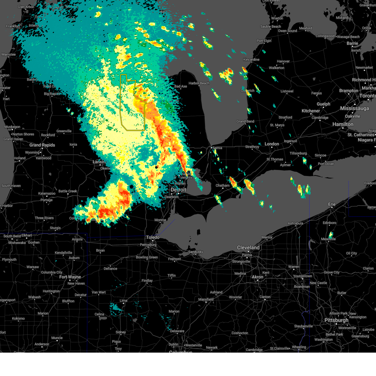
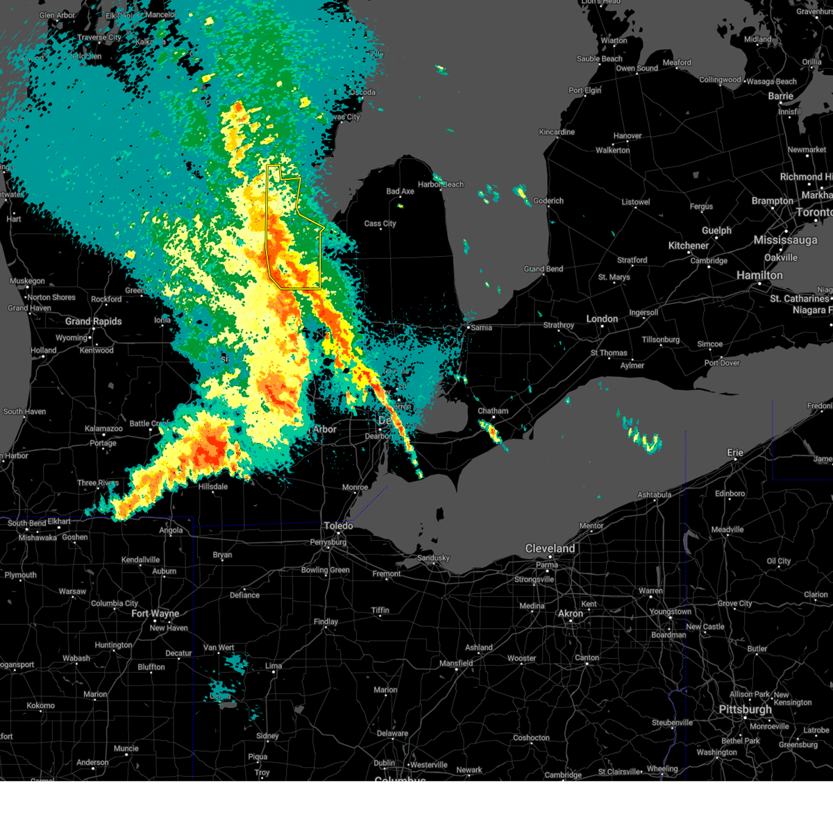
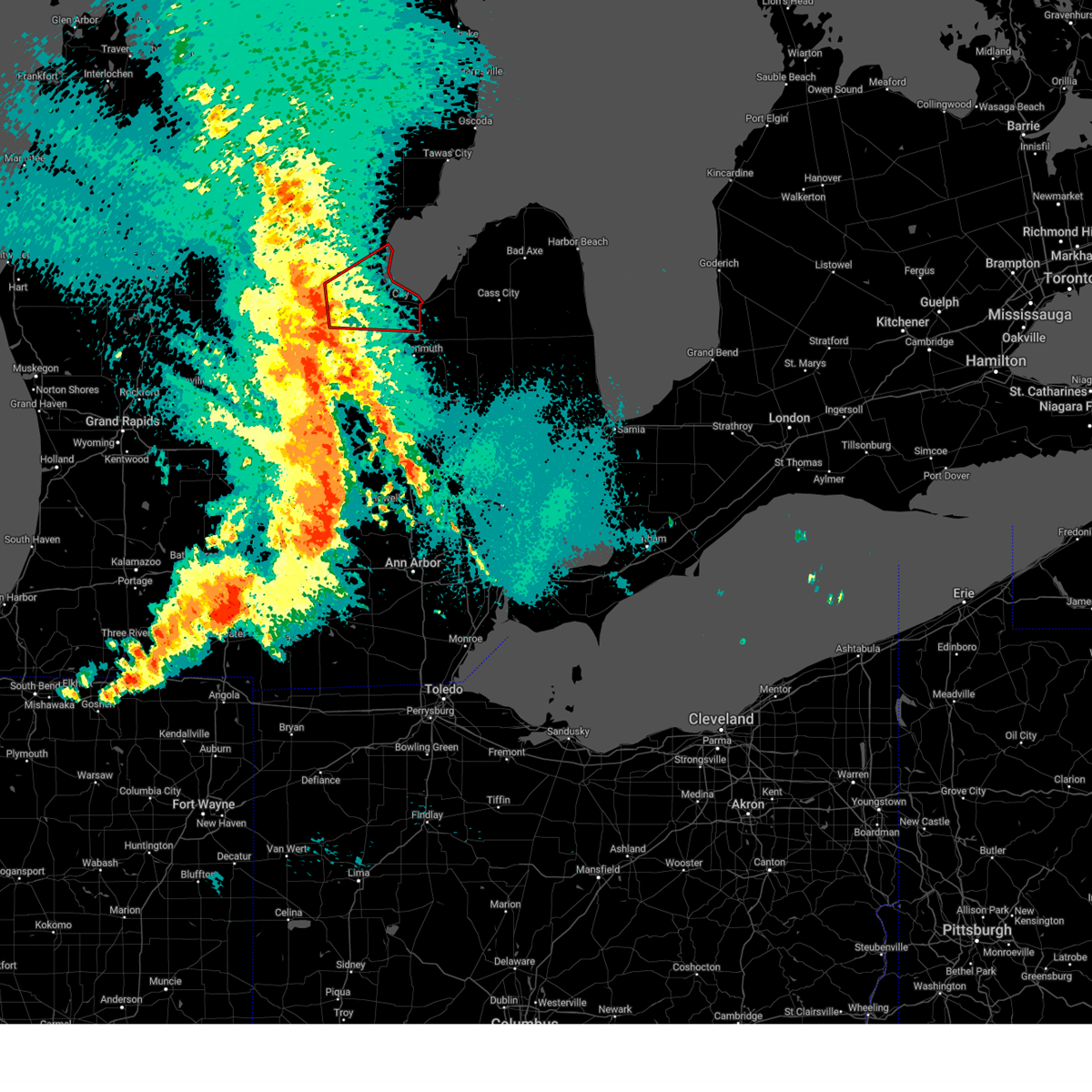
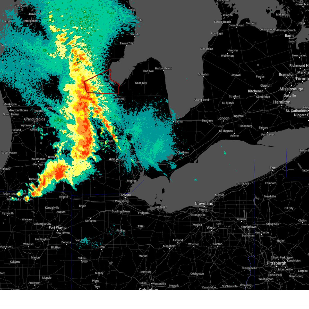
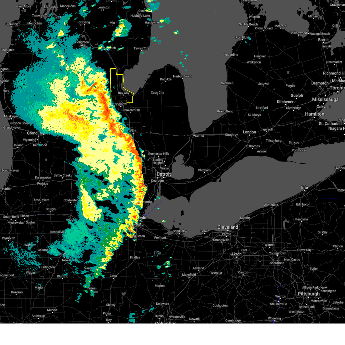
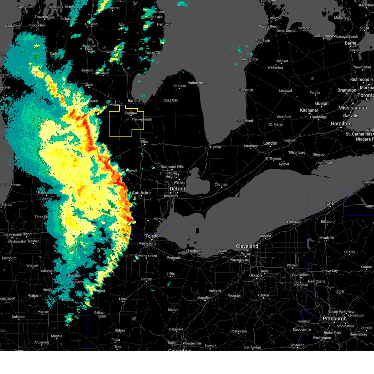
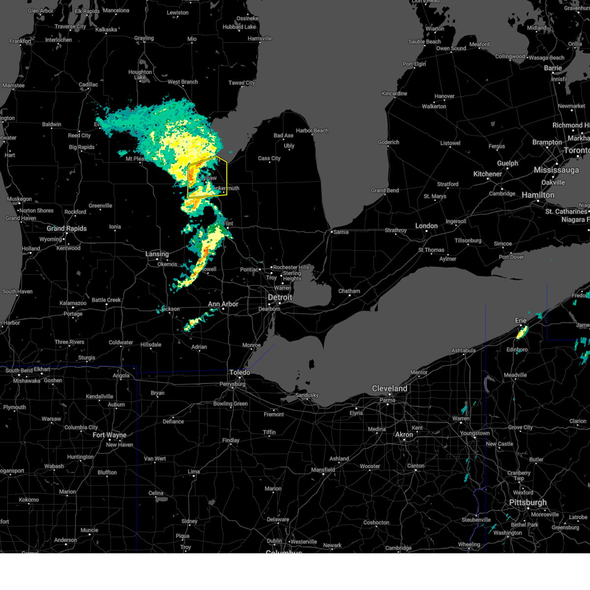
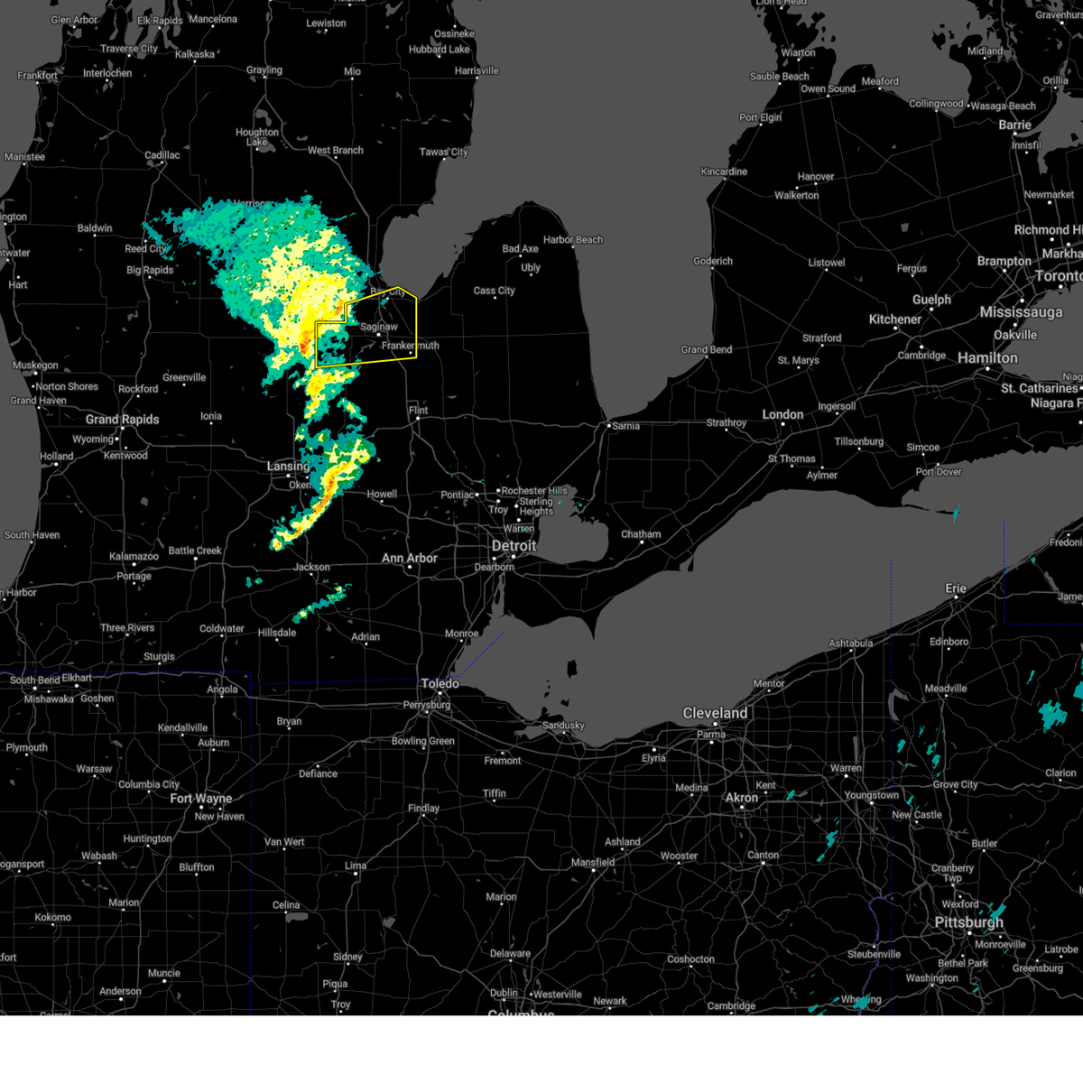
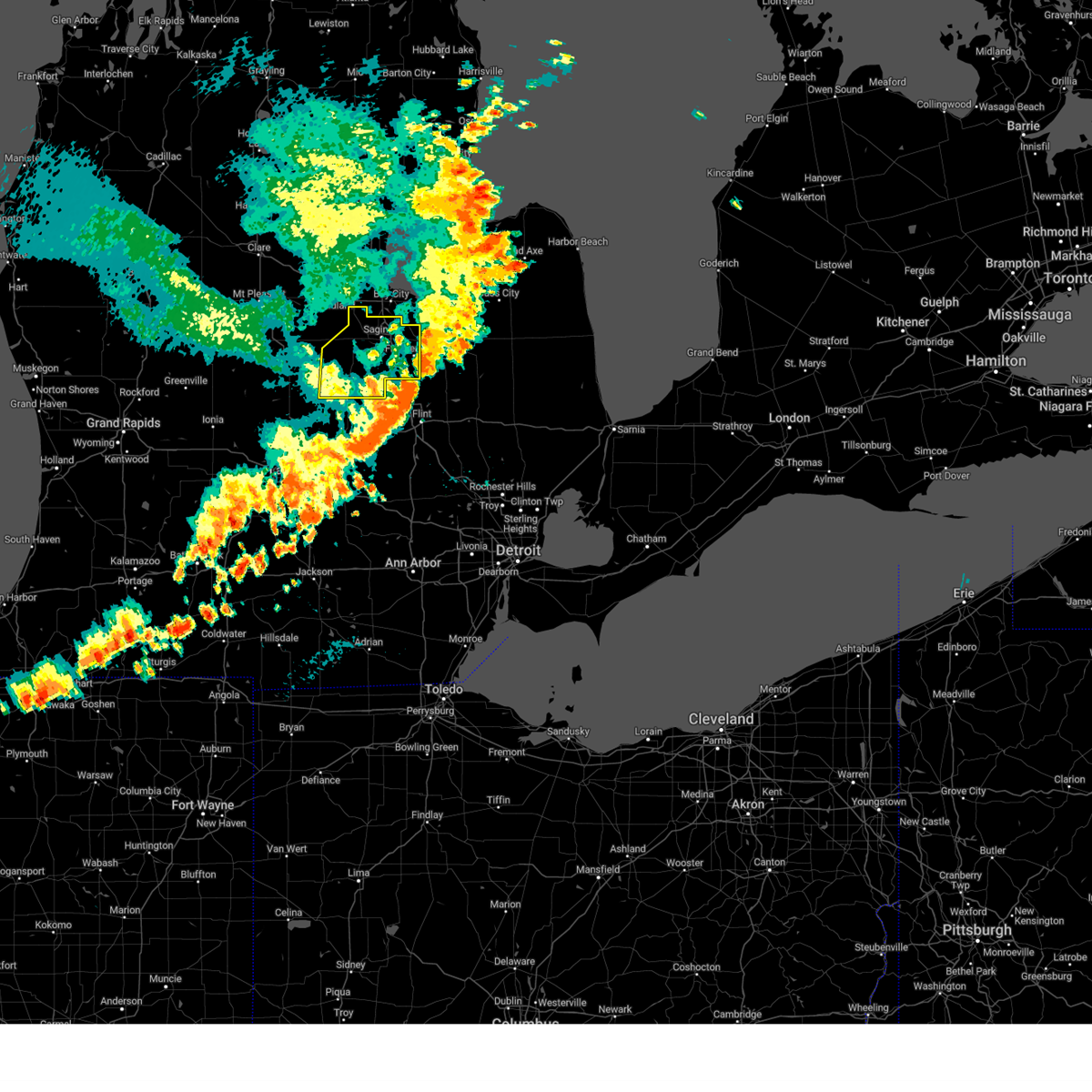
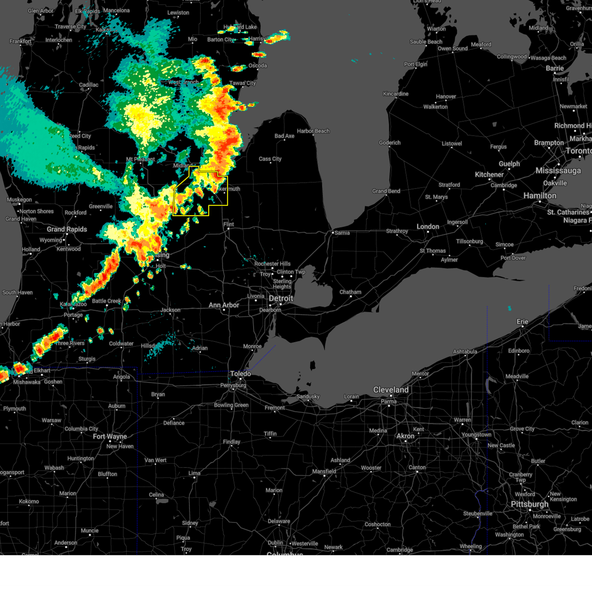
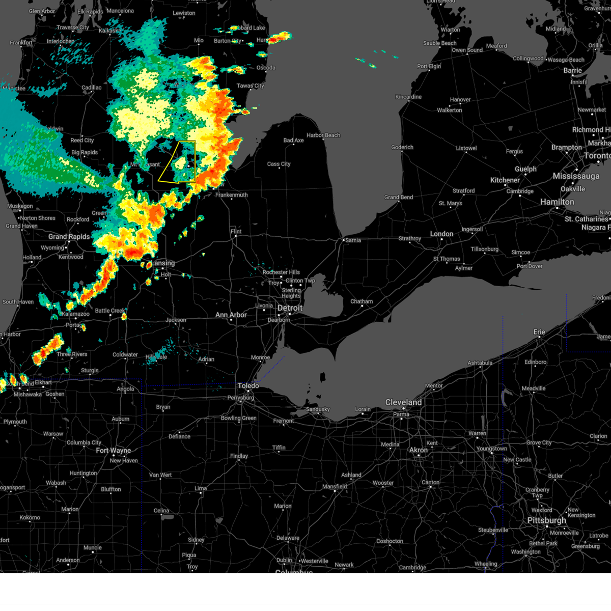
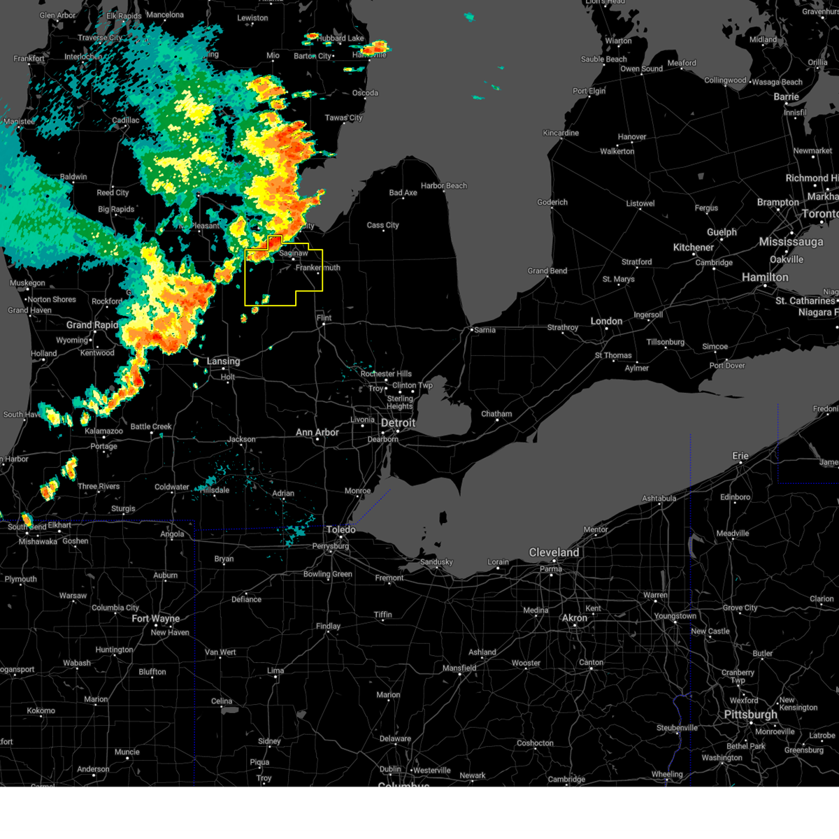
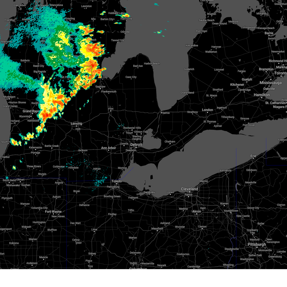
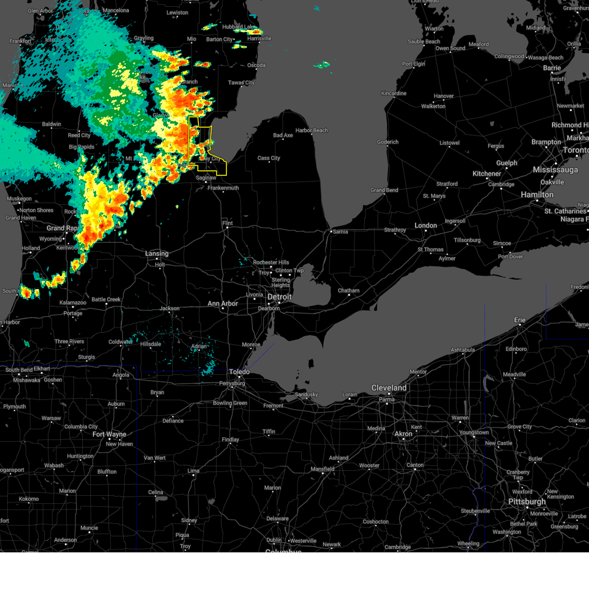
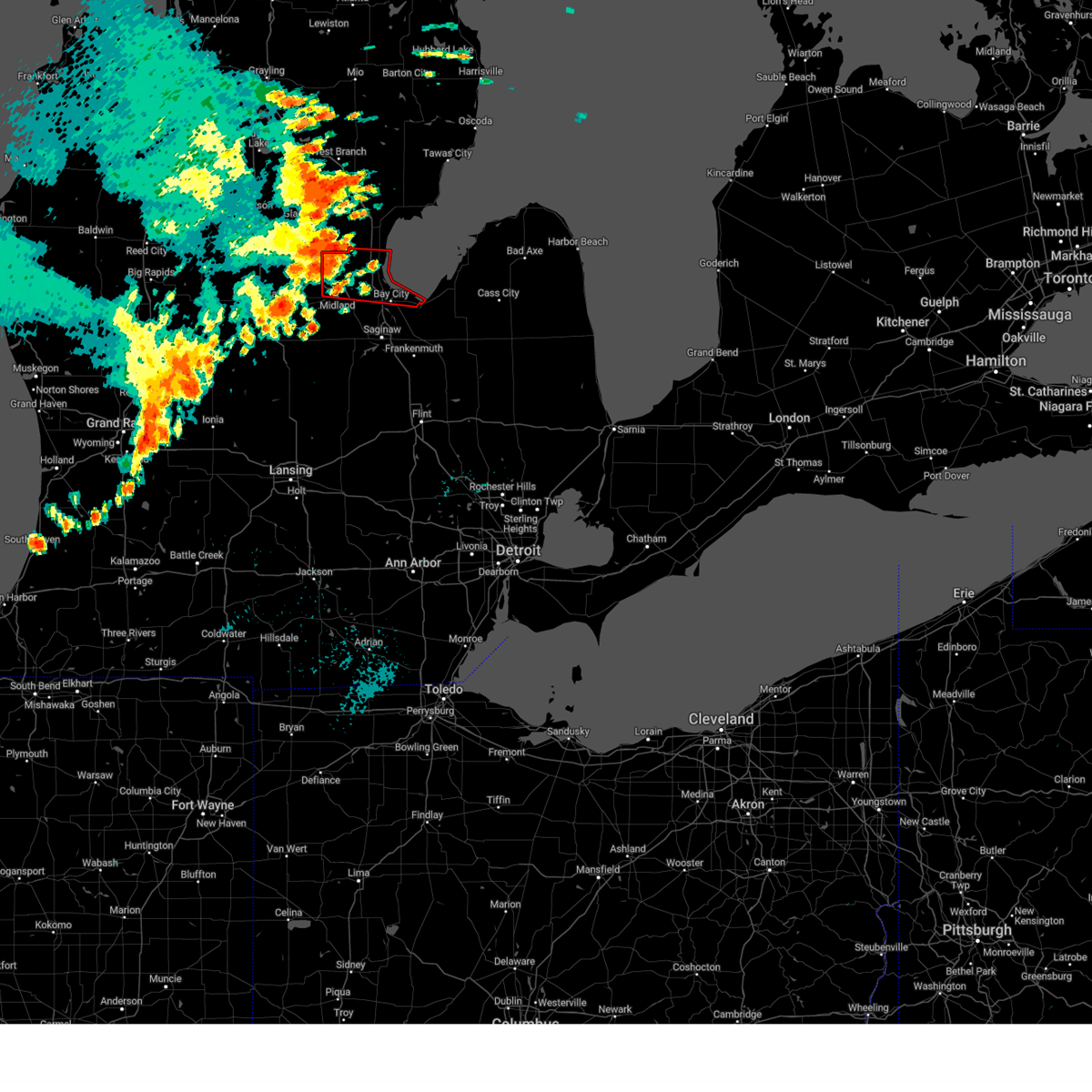
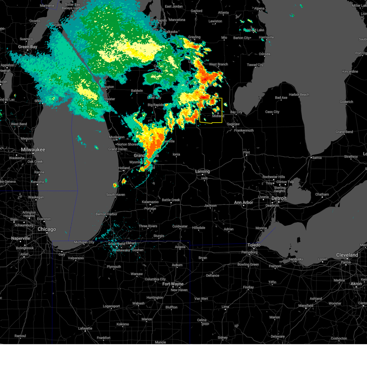
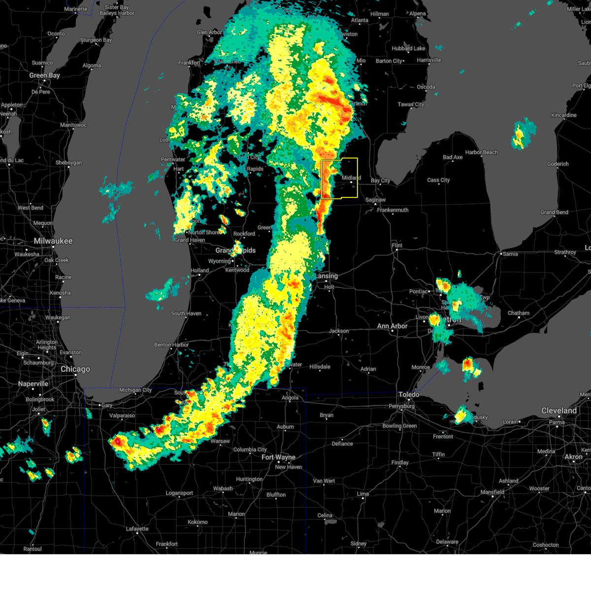
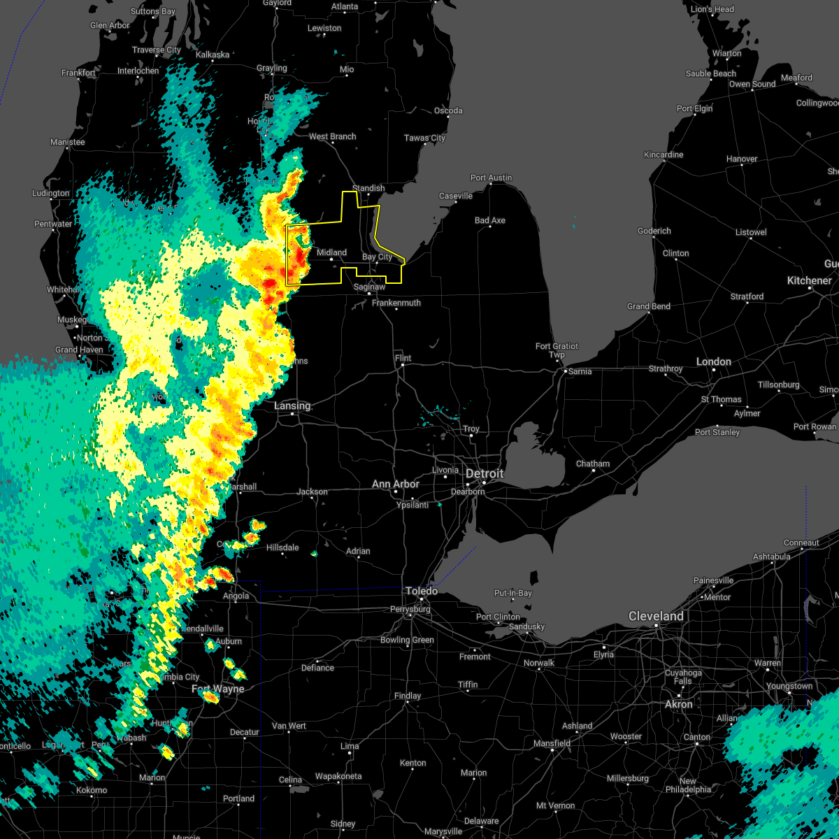
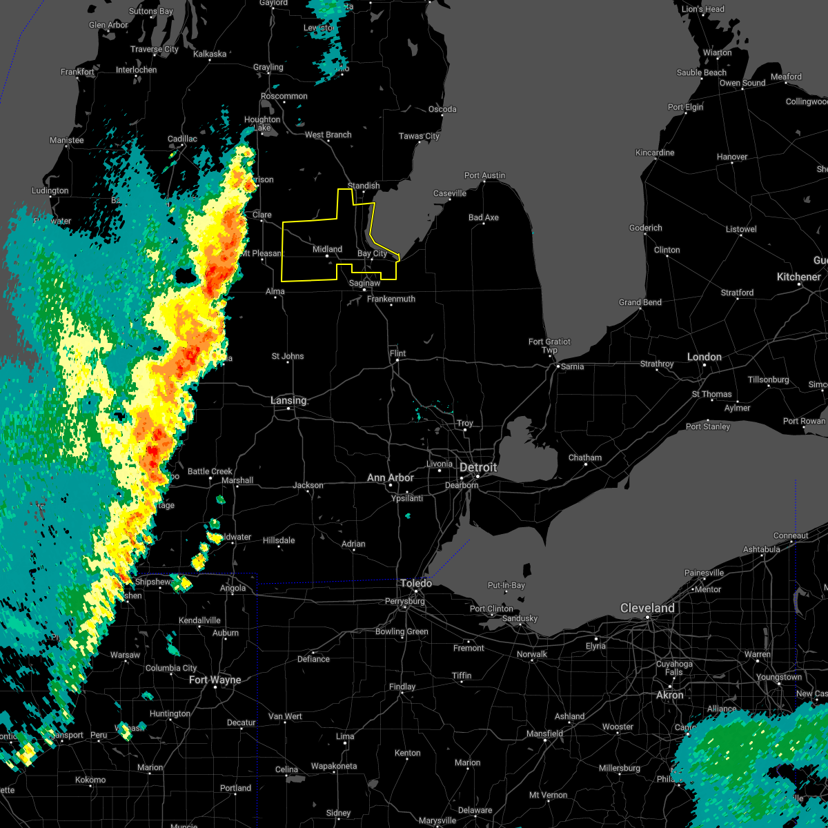
Hail Map for Midland, MI
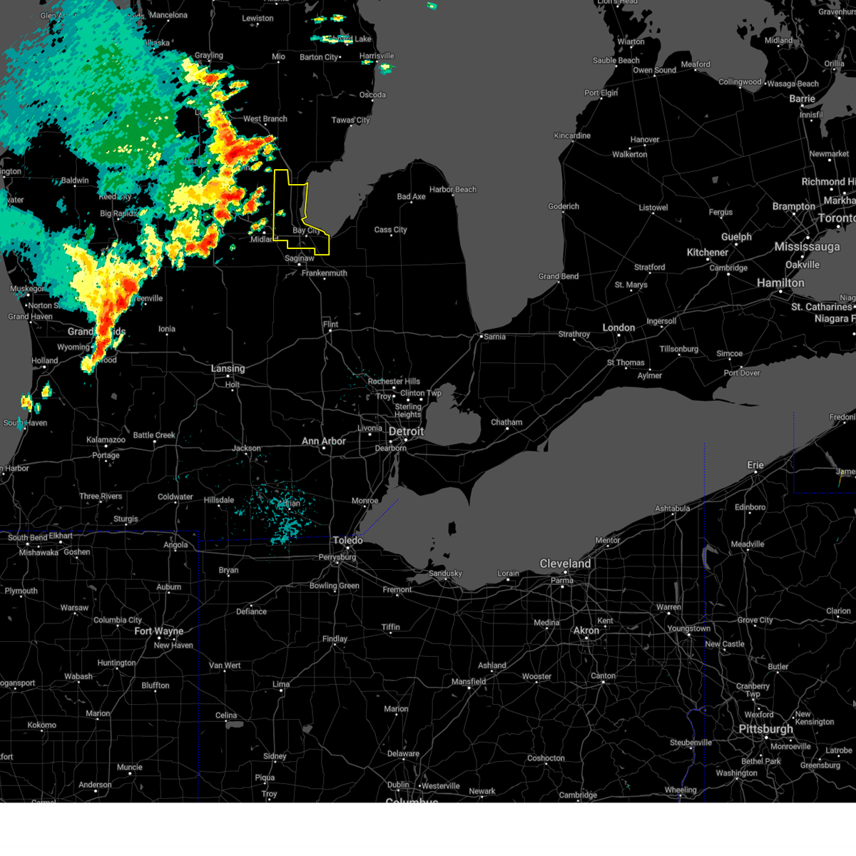
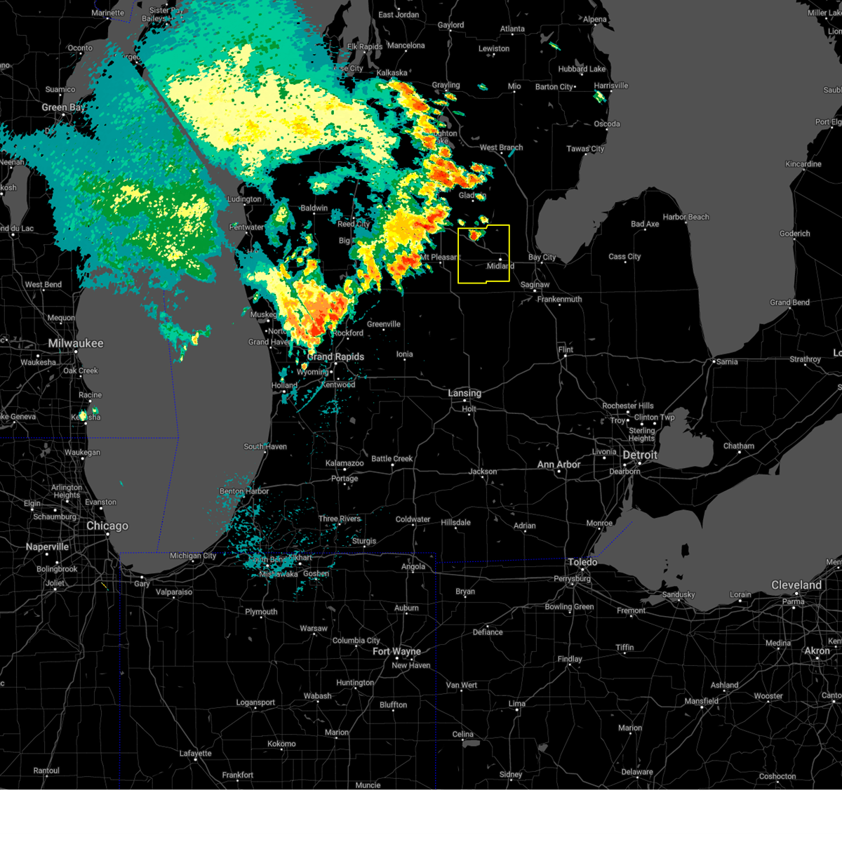
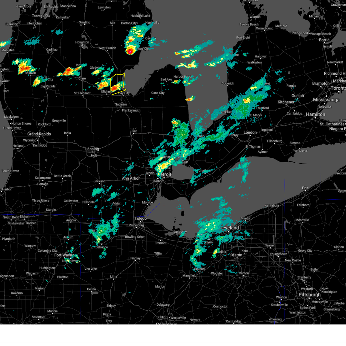
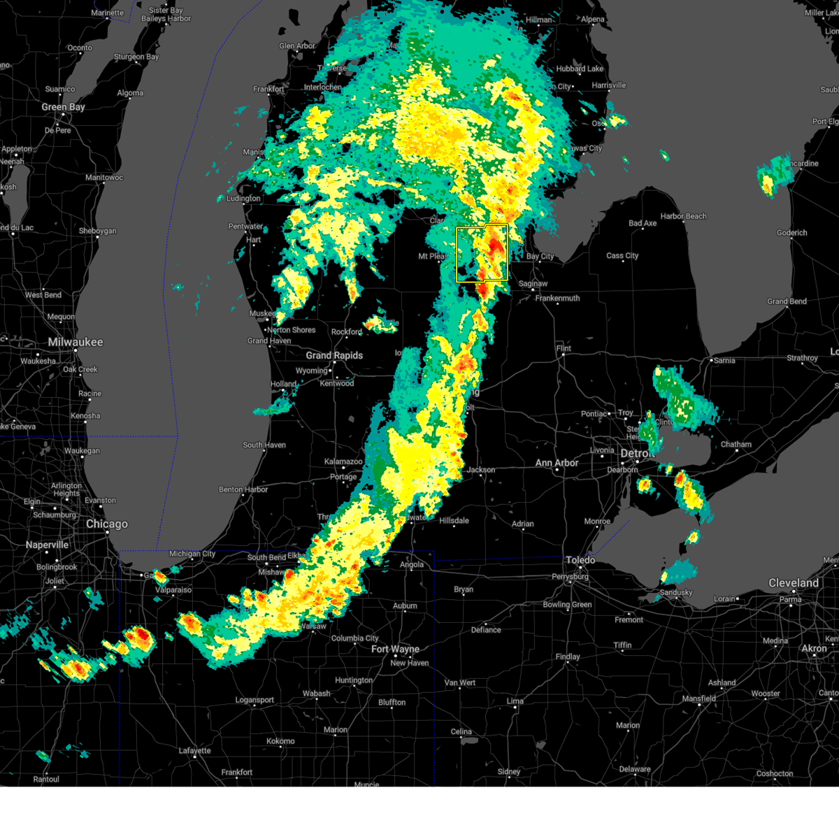
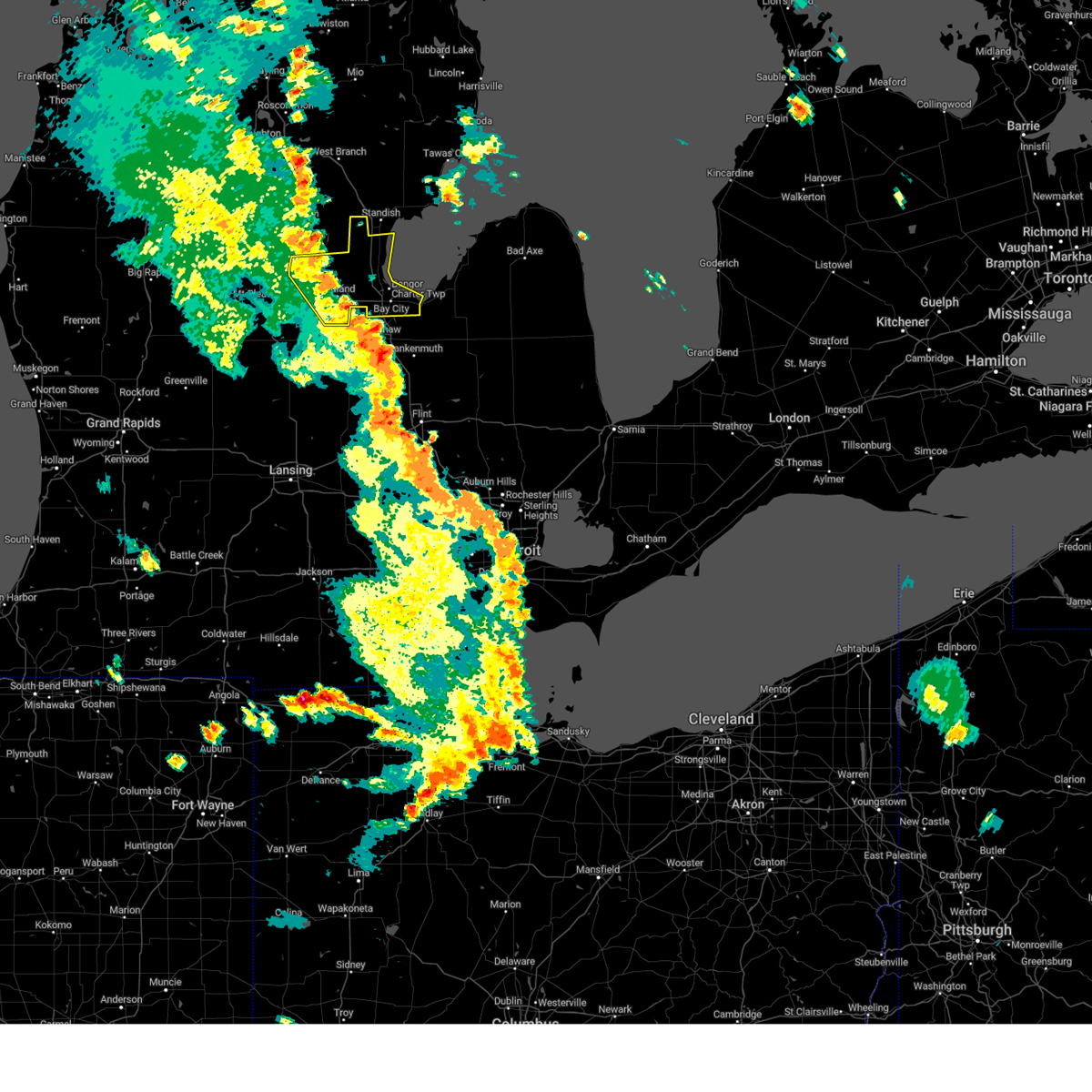
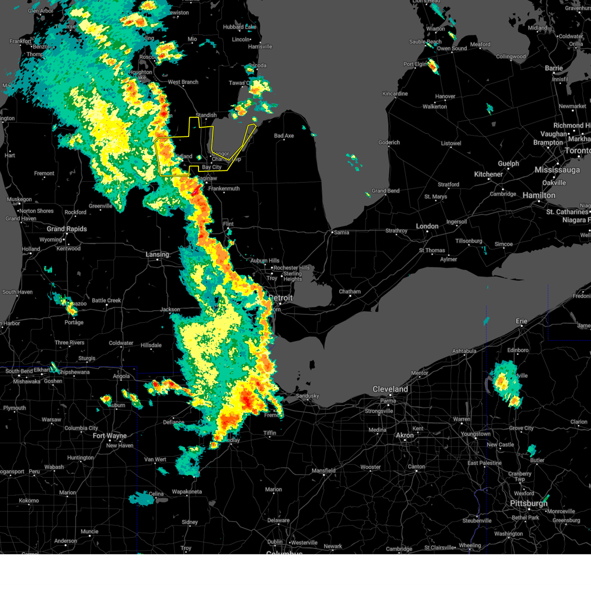
The Midland, MI area has had 20 reports of on-the-ground hail by trained spotters, and has been under severe weather warnings 30 times during the past 12 months. Doppler radar has detected hail at or near Midland, MI on 35 occasions, including 1 occasion during the past year.
| Name: | Midland, MI |
| Where Located: | 51.6 miles NNW of Flint, MI |
| Map: | Google Map for Midland, MI |
| Population: | 41863 |
| Housing Units: | 18578 |
| More Info: | Search Google for Midland, MI |
0
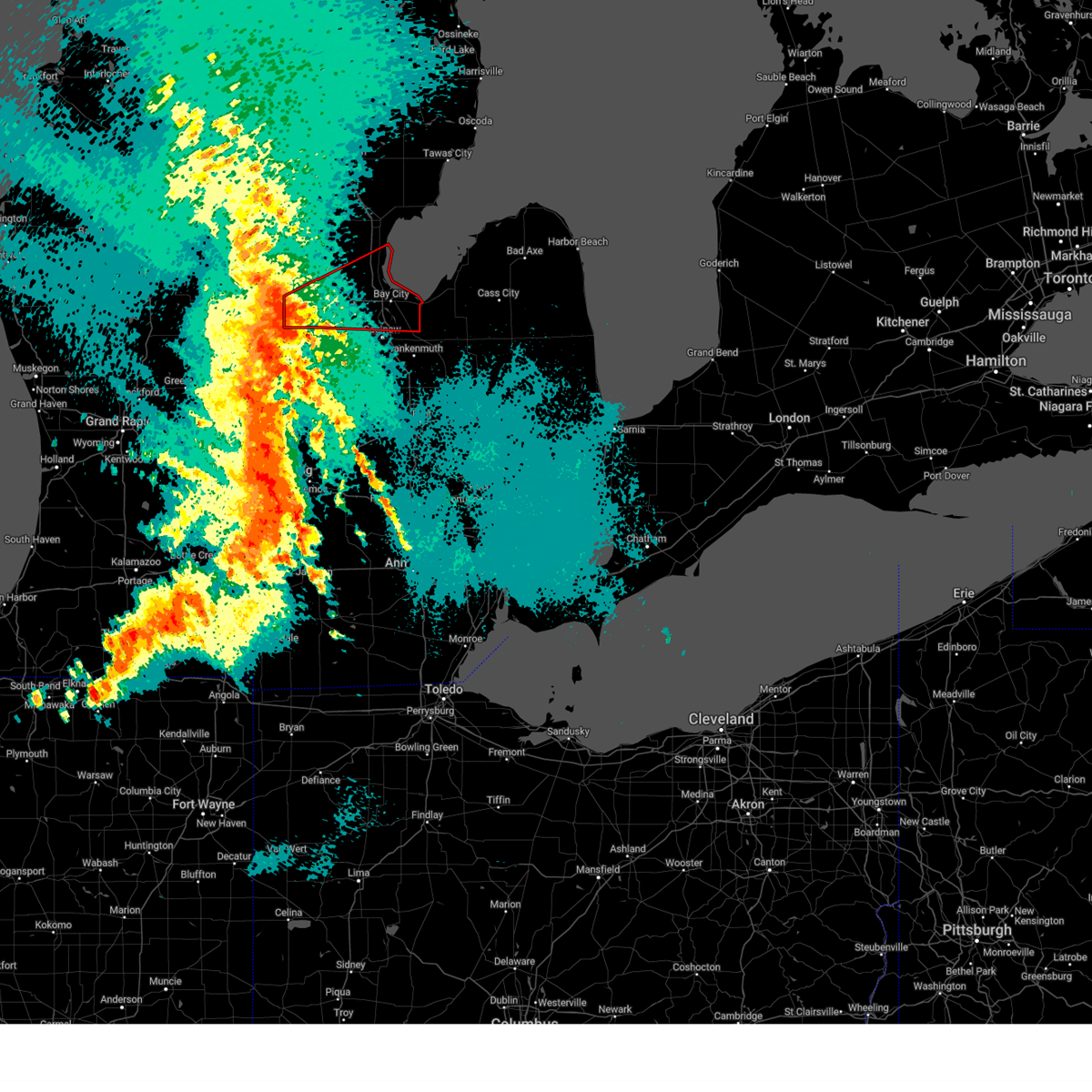
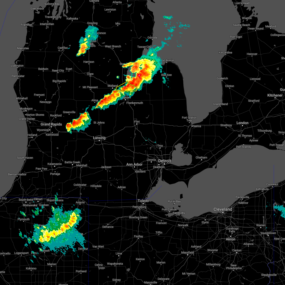
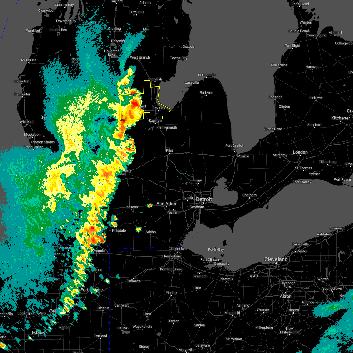
The Top Recent Hail Date for Midland, MI is Tuesday, August 27, 2024 (34th out of 35)

Hail and Wind Damage Spotted near Midland, MI
| Date / Time | Report Details |
|---|---|
| 5/16/2025 12:46 AM EDT |
 The storms which prompted the warning have moved out of the area. therefore, the warning has been allowed to expire. a tornado watch remains in effect until 500 am edt for southeastern michigan. The storms which prompted the warning have moved out of the area. therefore, the warning has been allowed to expire. a tornado watch remains in effect until 500 am edt for southeastern michigan.
|
| 5/16/2025 12:22 AM EDT |
 At 1222 am edt, severe thunderstorms were located along a line extending from near rhodes to near zilwaukee to near clio, moving east at 40 mph (radar indicated). Hazards include 60 mph wind gusts. Expect damage to roofs, siding, and trees. these severe storms will be near, bay city, pinconning, essexville, and munger around 1230 am edt. Other locations impacted by these severe thunderstorms include mount forest, carrollton, garfield, arthur, burt, crump, buena vista township, gera, willard, and indiantown. At 1222 am edt, severe thunderstorms were located along a line extending from near rhodes to near zilwaukee to near clio, moving east at 40 mph (radar indicated). Hazards include 60 mph wind gusts. Expect damage to roofs, siding, and trees. these severe storms will be near, bay city, pinconning, essexville, and munger around 1230 am edt. Other locations impacted by these severe thunderstorms include mount forest, carrollton, garfield, arthur, burt, crump, buena vista township, gera, willard, and indiantown.
|
| 5/16/2025 12:22 AM EDT |
 the severe thunderstorm warning has been cancelled and is no longer in effect the severe thunderstorm warning has been cancelled and is no longer in effect
|
| 5/16/2025 12:04 AM EDT |
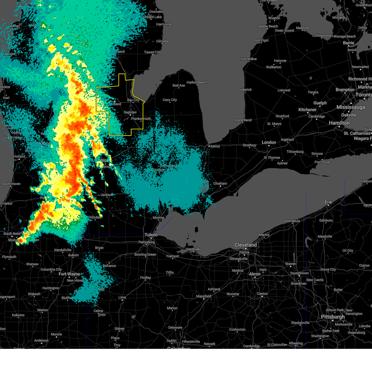
 At 1202 am edt, a severe thunderstorm capable of producing a tornado was located near midland, moving east at 55 mph. there is also a circulation south of freeland (radar indicated rotation). Hazards include tornado. Flying debris will be dangerous to those caught without shelter. mobile homes will be damaged or destroyed. damage to roofs, windows, and vehicles will occur. tree damage is likely. this dangerous storm will be near, auburn and kawkawlin around 1210 am edt. bay city around 1215 am edt. essexville around 1220 am edt. Other locations impacted by this tornadic thunderstorm include laporte, carrollton, crump, poseyville, willard, bay city state recreation area, indiantown, and buena vista township. At 1202 am edt, a severe thunderstorm capable of producing a tornado was located near midland, moving east at 55 mph. there is also a circulation south of freeland (radar indicated rotation). Hazards include tornado. Flying debris will be dangerous to those caught without shelter. mobile homes will be damaged or destroyed. damage to roofs, windows, and vehicles will occur. tree damage is likely. this dangerous storm will be near, auburn and kawkawlin around 1210 am edt. bay city around 1215 am edt. essexville around 1220 am edt. Other locations impacted by this tornadic thunderstorm include laporte, carrollton, crump, poseyville, willard, bay city state recreation area, indiantown, and buena vista township.
|
| 5/16/2025 12:02 AM EDT | Report of trees and wires down in midland county MI, 1.4 miles NW of Midland, MI |
| 5/15/2025 11:52 PM EDT |
 At 1152 pm edt, severe thunderstorms were located along a line extending from near gladwin to near merrill to near elsie, moving east at 40 mph (radar indicated). Hazards include 60 mph wind gusts. Expect damage to roofs, siding, and trees. these severe storms will be near, midland, st. charles, sanford, edenville, and marion springs around 1155 pm edt. chesaning, freeland, and oakley around 1200 am edt. auburn around 1205 am edt. saginaw around 1210 am edt. zilwaukee and bridgeport around 1215 am edt. bay city, kawkawlin, bentley, and linwood around 1220 am edt. birch run, pinconning, essexville, and munger around 1225 am edt. frankenmuth around 1230 am edt. Other locations impacted by these severe thunderstorms include carrollton, garfield, arthur, fenmore, crump, buena vista township, gera, indiantown, bombay, and hemlock. At 1152 pm edt, severe thunderstorms were located along a line extending from near gladwin to near merrill to near elsie, moving east at 40 mph (radar indicated). Hazards include 60 mph wind gusts. Expect damage to roofs, siding, and trees. these severe storms will be near, midland, st. charles, sanford, edenville, and marion springs around 1155 pm edt. chesaning, freeland, and oakley around 1200 am edt. auburn around 1205 am edt. saginaw around 1210 am edt. zilwaukee and bridgeport around 1215 am edt. bay city, kawkawlin, bentley, and linwood around 1220 am edt. birch run, pinconning, essexville, and munger around 1225 am edt. frankenmuth around 1230 am edt. Other locations impacted by these severe thunderstorms include carrollton, garfield, arthur, fenmore, crump, buena vista township, gera, indiantown, bombay, and hemlock.
|
| 5/15/2025 11:50 PM EDT |
 At 1149 pm edt, a severe thunderstorm capable of producing a tornado was located 8 miles south of sanford, moving northeast at 45 mph (radar indicated rotation). Hazards include tornado. Flying debris will be dangerous to those caught without shelter. mobile homes will be damaged or destroyed. damage to roofs, windows, and vehicles will occur. tree damage is likely. this dangerous storm will be near, midland around 1155 pm edt. auburn around 1205 am edt. kawkawlin and linwood around 1215 am edt. Other locations impacted by this tornadic thunderstorm include laporte, averill, carrollton, gordonville, bombay, porter township, crump, poseyville, willard, and bay city state recreation area. At 1149 pm edt, a severe thunderstorm capable of producing a tornado was located 8 miles south of sanford, moving northeast at 45 mph (radar indicated rotation). Hazards include tornado. Flying debris will be dangerous to those caught without shelter. mobile homes will be damaged or destroyed. damage to roofs, windows, and vehicles will occur. tree damage is likely. this dangerous storm will be near, midland around 1155 pm edt. auburn around 1205 am edt. kawkawlin and linwood around 1215 am edt. Other locations impacted by this tornadic thunderstorm include laporte, averill, carrollton, gordonville, bombay, porter township, crump, poseyville, willard, and bay city state recreation area.
|
| 5/15/2025 11:46 PM EDT | Report of trees and wires down in midland county MI, 9.8 miles ENE of Midland, MI |
| 5/15/2025 11:41 PM EDT |
 Tordtx the national weather service in detroit/pontiac has issued a * tornado warning for, bay county in southeastern michigan, northern saginaw county in southeastern michigan, midland county in southeastern michigan, * until 1245 am edt. * at 1140 pm edt, a severe thunderstorm capable of producing a tornado was located near pleasant valley, or 11 miles southwest of sanford, moving east at 55 mph (radar indicated rotation). Hazards include tornado. Flying debris will be dangerous to those caught without shelter. mobile homes will be damaged or destroyed. damage to roofs, windows, and vehicles will occur. tree damage is likely. this dangerous storm will be near, midland around 1150 pm edt. freeland around 1155 pm edt. bay city around 1205 am edt. zilwaukee around 1210 am edt. munger around 1215 am edt. other locations impacted by this tornadic thunderstorm include laporte, averill, carrollton, gordonville, porter township, crump, poseyville, willard, bay city state recreation area, and indiantown. this includes the following highways, i-75 between mile markers 152 and 179. i-675 between mile markers 5 and 7. Us-10 between mile markers 114 and 139. Tordtx the national weather service in detroit/pontiac has issued a * tornado warning for, bay county in southeastern michigan, northern saginaw county in southeastern michigan, midland county in southeastern michigan, * until 1245 am edt. * at 1140 pm edt, a severe thunderstorm capable of producing a tornado was located near pleasant valley, or 11 miles southwest of sanford, moving east at 55 mph (radar indicated rotation). Hazards include tornado. Flying debris will be dangerous to those caught without shelter. mobile homes will be damaged or destroyed. damage to roofs, windows, and vehicles will occur. tree damage is likely. this dangerous storm will be near, midland around 1150 pm edt. freeland around 1155 pm edt. bay city around 1205 am edt. zilwaukee around 1210 am edt. munger around 1215 am edt. other locations impacted by this tornadic thunderstorm include laporte, averill, carrollton, gordonville, porter township, crump, poseyville, willard, bay city state recreation area, and indiantown. this includes the following highways, i-75 between mile markers 152 and 179. i-675 between mile markers 5 and 7. Us-10 between mile markers 114 and 139.
|
| 5/15/2025 11:27 PM EDT |
 Svrdtx the national weather service in detroit/pontiac has issued a * severe thunderstorm warning for, bay county in southeastern michigan, saginaw county in southeastern michigan, midland county in southeastern michigan, * until 1245 am edt. * at 1126 pm edt, severe thunderstorms were located along a line extending from 7 miles southwest of harrison to near pleasant valley to 7 miles northwest of st. johns, moving east at 40 mph (radar indicated). Hazards include 60 mph wind gusts. Expect damage to roofs, siding, and trees. severe thunderstorms will be near, oil city and pleasant valley around 1130 pm edt. coleman around 1135 pm edt. merrill around 1140 pm edt. sanford and marion springs around 1145 pm edt. midland and edenville around 1150 pm edt. chesaning, st. charles, freeland, and oakley around 1155 pm edt. saginaw and auburn around 1205 am edt. zilwaukee and bridgeport around 1210 am edt. Other locations impacted by these severe thunderstorms include carrollton, garfield, arthur, fenmore, crump, buena vista township, gera, indiantown, bombay, and hemlock. Svrdtx the national weather service in detroit/pontiac has issued a * severe thunderstorm warning for, bay county in southeastern michigan, saginaw county in southeastern michigan, midland county in southeastern michigan, * until 1245 am edt. * at 1126 pm edt, severe thunderstorms were located along a line extending from 7 miles southwest of harrison to near pleasant valley to 7 miles northwest of st. johns, moving east at 40 mph (radar indicated). Hazards include 60 mph wind gusts. Expect damage to roofs, siding, and trees. severe thunderstorms will be near, oil city and pleasant valley around 1130 pm edt. coleman around 1135 pm edt. merrill around 1140 pm edt. sanford and marion springs around 1145 pm edt. midland and edenville around 1150 pm edt. chesaning, st. charles, freeland, and oakley around 1155 pm edt. saginaw and auburn around 1205 am edt. zilwaukee and bridgeport around 1210 am edt. Other locations impacted by these severe thunderstorms include carrollton, garfield, arthur, fenmore, crump, buena vista township, gera, indiantown, bombay, and hemlock.
|
| 4/2/2025 8:06 PM EDT | Svrdtx the national weather service in detroit/pontiac has issued a * severe thunderstorm warning for, southern bay county in southeastern michigan, northern saginaw county in southeastern michigan, * until 830 pm edt. * at 805 pm edt, a severe thunderstorm was located 7 miles south of freeland, moving northeast at 85 mph (radar indicated). Hazards include quarter size hail. Damage to vehicles is expected. this severe thunderstorm will be near, zilwaukee, freeland, and saginaw around 810 pm edt. essexville and bay city around 815 pm edt. Other locations impacted by this severe thunderstorm include nelson, swan creek, shiawassee national wildlife refuge, carrollton, garfield, arthur, hemlock, buena vista township, indiantown, and shields. |
| 3/30/2025 7:24 PM EDT |
 the severe thunderstorm warning has been cancelled and is no longer in effect the severe thunderstorm warning has been cancelled and is no longer in effect
|
| 3/30/2025 7:19 PM EDT |
 At 719 pm edt, severe thunderstorms were located along a line extending from near auburn to near saginaw to near montrose, moving northeast at 55 mph (radar indicated). Hazards include 70 mph wind gusts and penny size hail. Expect considerable tree damage. damage is likely to mobile homes, roofs, and outbuildings. these severe storms will be near, bridgeport, zilwaukee, birch run, and saginaw around 725 pm edt. frankenmuth around 730 pm edt. other locations impacted by these severe thunderstorms include swan creek, shiawassee national wildlife refuge, carrollton, fosters, arthur, burt, buena vista township, gera, layton corners, and indiantown. this includes the following highways, i-75 between mile markers 134 and 156. I-675 between mile markers 1 and 7. At 719 pm edt, severe thunderstorms were located along a line extending from near auburn to near saginaw to near montrose, moving northeast at 55 mph (radar indicated). Hazards include 70 mph wind gusts and penny size hail. Expect considerable tree damage. damage is likely to mobile homes, roofs, and outbuildings. these severe storms will be near, bridgeport, zilwaukee, birch run, and saginaw around 725 pm edt. frankenmuth around 730 pm edt. other locations impacted by these severe thunderstorms include swan creek, shiawassee national wildlife refuge, carrollton, fosters, arthur, burt, buena vista township, gera, layton corners, and indiantown. this includes the following highways, i-75 between mile markers 134 and 156. I-675 between mile markers 1 and 7.
|
| 3/30/2025 7:10 PM EDT | At 710 pm edt, severe thunderstorms were located along a line extending from near sanford to near midland to near merrill, moving northeast at 75 mph (radar indicated). Hazards include 70 mph wind gusts and penny size hail. Expect considerable tree damage. damage is likely to mobile homes, roofs, and outbuildings. these severe storms will be near, edenville and midland around 715 pm edt. other locations impacted by these severe thunderstorms include laporte, averill, gordonville, bombay, poseyville, hope, and north bradley. This includes us-10 between mile markers 104 and 127. |
| 3/30/2025 7:09 PM EDT |
 At 708 pm edt, severe thunderstorms were located along a line extending from 7 miles north of merrill to near st. charles to near chesaning, moving northeast at 55 mph (radar indicated). Hazards include 70 mph wind gusts and penny size hail. Expect considerable tree damage. damage is likely to mobile homes, roofs, and outbuildings. these severe storms will be near, freeland and st. charles around 715 pm edt. bridgeport and saginaw around 720 pm edt. zilwaukee and birch run around 725 pm edt. frankenmuth around 730 pm edt. other locations impacted by these severe thunderstorms include brant, nelson, carrollton, garfield, arthur, burt, buena vista township, gera, layton corners, and indiantown. this includes the following highways, i-75 between mile markers 134 and 156. I-675 between mile markers 1 and 7. At 708 pm edt, severe thunderstorms were located along a line extending from 7 miles north of merrill to near st. charles to near chesaning, moving northeast at 55 mph (radar indicated). Hazards include 70 mph wind gusts and penny size hail. Expect considerable tree damage. damage is likely to mobile homes, roofs, and outbuildings. these severe storms will be near, freeland and st. charles around 715 pm edt. bridgeport and saginaw around 720 pm edt. zilwaukee and birch run around 725 pm edt. frankenmuth around 730 pm edt. other locations impacted by these severe thunderstorms include brant, nelson, carrollton, garfield, arthur, burt, buena vista township, gera, layton corners, and indiantown. this includes the following highways, i-75 between mile markers 134 and 156. I-675 between mile markers 1 and 7.
|
| 3/30/2025 7:08 PM EDT |
 Svrdtx the national weather service in detroit/pontiac has issued a * severe thunderstorm warning for, bay county in southeastern michigan, * until 800 pm edt. * at 708 pm edt, severe thunderstorms were located along a line extending from near sanford to 6 miles south of midland to near st. charles, moving northeast at 65 mph (radar indicated). Hazards include 70 mph wind gusts and penny size hail. Expect considerable tree damage. damage is likely to mobile homes, roofs, and outbuildings. severe thunderstorms will be near, midland and auburn around 715 pm edt. bay city around 720 pm edt. essexville, kawkawlin, and linwood around 725 pm edt. bentley and pinconning around 730 pm edt. other locations impacted by these severe thunderstorms include mount forest, crump, willard, and bay city state recreation area. this includes the following highways, i-75 between mile markers 157 and 185. Us-10 between mile markers 128 and 139. Svrdtx the national weather service in detroit/pontiac has issued a * severe thunderstorm warning for, bay county in southeastern michigan, * until 800 pm edt. * at 708 pm edt, severe thunderstorms were located along a line extending from near sanford to 6 miles south of midland to near st. charles, moving northeast at 65 mph (radar indicated). Hazards include 70 mph wind gusts and penny size hail. Expect considerable tree damage. damage is likely to mobile homes, roofs, and outbuildings. severe thunderstorms will be near, midland and auburn around 715 pm edt. bay city around 720 pm edt. essexville, kawkawlin, and linwood around 725 pm edt. bentley and pinconning around 730 pm edt. other locations impacted by these severe thunderstorms include mount forest, crump, willard, and bay city state recreation area. this includes the following highways, i-75 between mile markers 157 and 185. Us-10 between mile markers 128 and 139.
|
| 3/30/2025 6:49 PM EDT | Svrdtx the national weather service in detroit/pontiac has issued a * severe thunderstorm warning for, midland county in southeastern michigan, * until 745 pm edt. * at 648 pm edt, severe thunderstorms were located along a line extending from near shepherd to ithaca to 7 miles west of elsie, moving northeast at 65 mph (radar indicated). Hazards include 70 mph wind gusts and penny size hail. Expect considerable tree damage. damage is likely to mobile homes, roofs, and outbuildings. severe thunderstorms will be near, oil city and pleasant valley around 655 pm edt. sanford and midland around 705 pm edt. edenville around 710 pm edt. other locations impacted by these severe thunderstorms include laporte, averill, gordonville, bombay, porter township, poseyville, hope, and north bradley. This includes us-10 between mile markers 102 and 127. |
| 3/30/2025 6:42 PM EDT |
 Svrdtx the national weather service in detroit/pontiac has issued a * severe thunderstorm warning for, saginaw county in southeastern michigan, * until 745 pm edt. * at 641 pm edt, severe thunderstorms were located along a line extending from near alma to 11 miles west of elsie to 6 miles west of st. johns, moving northeast at 55 mph (radar indicated). Hazards include 70 mph wind gusts and penny size hail. Expect considerable tree damage. damage is likely to mobile homes, roofs, and outbuildings. severe thunderstorms will be near, marion springs around 655 pm edt. merrill around 700 pm edt. st. charles around 705 pm edt. oakley, freeland, and chesaning around 710 pm edt. saginaw around 715 pm edt. bridgeport and zilwaukee around 720 pm edt. frankenmuth around 735 pm edt. other locations impacted by these severe thunderstorms include brant, nelson, carrollton, garfield, arthur, fenmore, burt, buena vista township, gera, and layton corners. this includes the following highways, i-75 between mile markers 134 and 156. I-675 between mile markers 1 and 7. Svrdtx the national weather service in detroit/pontiac has issued a * severe thunderstorm warning for, saginaw county in southeastern michigan, * until 745 pm edt. * at 641 pm edt, severe thunderstorms were located along a line extending from near alma to 11 miles west of elsie to 6 miles west of st. johns, moving northeast at 55 mph (radar indicated). Hazards include 70 mph wind gusts and penny size hail. Expect considerable tree damage. damage is likely to mobile homes, roofs, and outbuildings. severe thunderstorms will be near, marion springs around 655 pm edt. merrill around 700 pm edt. st. charles around 705 pm edt. oakley, freeland, and chesaning around 710 pm edt. saginaw around 715 pm edt. bridgeport and zilwaukee around 720 pm edt. frankenmuth around 735 pm edt. other locations impacted by these severe thunderstorms include brant, nelson, carrollton, garfield, arthur, fenmore, burt, buena vista township, gera, and layton corners. this includes the following highways, i-75 between mile markers 134 and 156. I-675 between mile markers 1 and 7.
|
| 11/10/2024 6:33 PM EST |
 At 632 pm est, a severe thunderstorm was located near freeland, moving northeast at 50 mph (radar indicated). Hazards include 60 mph wind gusts. Expect damage to roofs, siding, and trees. this severe storm will be near, bay city and zilwaukee around 640 pm est. essexville and munger around 645 pm est. other locations impacted by this severe thunderstorm include swan creek, shiawassee national wildlife refuge, carrollton, garfield, fosters, arthur, buena vista township, gera, indiantown, and shields. this includes the following highways, i-75 between mile markers 141 and 163. i-675 between mile markers 1 and 7. Us-10 between mile markers 135 and 139. At 632 pm est, a severe thunderstorm was located near freeland, moving northeast at 50 mph (radar indicated). Hazards include 60 mph wind gusts. Expect damage to roofs, siding, and trees. this severe storm will be near, bay city and zilwaukee around 640 pm est. essexville and munger around 645 pm est. other locations impacted by this severe thunderstorm include swan creek, shiawassee national wildlife refuge, carrollton, garfield, fosters, arthur, buena vista township, gera, indiantown, and shields. this includes the following highways, i-75 between mile markers 141 and 163. i-675 between mile markers 1 and 7. Us-10 between mile markers 135 and 139.
|
| 11/10/2024 6:08 PM EST |
 Svrdtx the national weather service in detroit/pontiac has issued a * severe thunderstorm warning for, southern bay county in southeastern michigan, saginaw county in southeastern michigan, * until 715 pm est. * at 607 pm est, a severe thunderstorm was located near breckenridge, or 9 miles east of ithaca, moving east at 50 mph (radar indicated). Hazards include 60 mph wind gusts. Expect damage to roofs, siding, and trees. this severe thunderstorm will be near, merrill around 615 pm est. saginaw around 630 pm est. zilwaukee around 635 pm est. munger around 645 pm est. other locations impacted by this severe thunderstorm include nelson, swan creek, shiawassee national wildlife refuge, carrollton, garfield, fosters, arthur, hemlock, buena vista township, and gera. this includes the following highways, i-75 between mile markers 140 and 163. i-675 between mile markers 1 and 7. Us-10 between mile markers 135 and 139. Svrdtx the national weather service in detroit/pontiac has issued a * severe thunderstorm warning for, southern bay county in southeastern michigan, saginaw county in southeastern michigan, * until 715 pm est. * at 607 pm est, a severe thunderstorm was located near breckenridge, or 9 miles east of ithaca, moving east at 50 mph (radar indicated). Hazards include 60 mph wind gusts. Expect damage to roofs, siding, and trees. this severe thunderstorm will be near, merrill around 615 pm est. saginaw around 630 pm est. zilwaukee around 635 pm est. munger around 645 pm est. other locations impacted by this severe thunderstorm include nelson, swan creek, shiawassee national wildlife refuge, carrollton, garfield, fosters, arthur, hemlock, buena vista township, and gera. this includes the following highways, i-75 between mile markers 140 and 163. i-675 between mile markers 1 and 7. Us-10 between mile markers 135 and 139.
|
| 8/27/2024 4:53 PM EDT |
 the severe thunderstorm warning has been cancelled and is no longer in effect the severe thunderstorm warning has been cancelled and is no longer in effect
|
| 8/27/2024 4:29 PM EDT |
 At 429 pm edt, severe thunderstorms were located along a line extending from near munger to near henderson, moving east at 40 mph (radar indicated). Hazards include 60 mph wind gusts and penny size hail. Expect damage to roofs, siding, and trees. these severe storms will be near, frankenmuth, chesaning, oakley, and bridgeport around 435 pm edt. birch run around 440 pm edt. other locations impacted by these severe thunderstorms include brant, nelson, carrollton, garfield, arthur, fenmore, burt, buena vista township, gera, and layton corners. this includes the following highways, i-75 between mile markers 134 and 156. I-675 between mile markers 1 and 7. At 429 pm edt, severe thunderstorms were located along a line extending from near munger to near henderson, moving east at 40 mph (radar indicated). Hazards include 60 mph wind gusts and penny size hail. Expect damage to roofs, siding, and trees. these severe storms will be near, frankenmuth, chesaning, oakley, and bridgeport around 435 pm edt. birch run around 440 pm edt. other locations impacted by these severe thunderstorms include brant, nelson, carrollton, garfield, arthur, fenmore, burt, buena vista township, gera, and layton corners. this includes the following highways, i-75 between mile markers 134 and 156. I-675 between mile markers 1 and 7.
|
| 8/27/2024 4:18 PM EDT |
 The storms which prompted the warning have moved out of the area. therefore, the warning has been allowed to expire. a severe thunderstorm watch remains in effect until 900 pm edt for southeastern michigan. The storms which prompted the warning have moved out of the area. therefore, the warning has been allowed to expire. a severe thunderstorm watch remains in effect until 900 pm edt for southeastern michigan.
|
| 8/27/2024 4:10 PM EDT |
 At 410 pm edt, a severe thunderstorm was located near freeland, moving east at 30 mph (radar indicated). Hazards include 70 mph wind gusts and penny size hail. Expect considerable tree damage. damage is likely to mobile homes, roofs, and outbuildings. this severe storm will be near, saginaw and zilwaukee around 415 pm edt. bridgeport around 425 pm edt. other locations impacted by this severe thunderstorm include brant, nelson, carrollton, garfield, arthur, fenmore, burt, buena vista township, gera, and layton corners. this includes the following highways, i-75 between mile markers 134 and 156. I-675 between mile markers 1 and 7. At 410 pm edt, a severe thunderstorm was located near freeland, moving east at 30 mph (radar indicated). Hazards include 70 mph wind gusts and penny size hail. Expect considerable tree damage. damage is likely to mobile homes, roofs, and outbuildings. this severe storm will be near, saginaw and zilwaukee around 415 pm edt. bridgeport around 425 pm edt. other locations impacted by this severe thunderstorm include brant, nelson, carrollton, garfield, arthur, fenmore, burt, buena vista township, gera, and layton corners. this includes the following highways, i-75 between mile markers 134 and 156. I-675 between mile markers 1 and 7.
|
| 8/27/2024 3:59 PM EDT |
 At 359 pm edt, severe thunderstorms were located along a line extending from near rhodes to near midland to near merrill, moving east at 45 mph (radar indicated). Hazards include 60 mph wind gusts and penny size hail. Expect damage to roofs, siding, and trees. these severe storms will be near, midland around 405 pm edt. other locations impacted by these severe thunderstorms include laporte, averill, gordonville, bombay, porter township, poseyville, and hope. This includes us-10 between mile markers 113 and 127. At 359 pm edt, severe thunderstorms were located along a line extending from near rhodes to near midland to near merrill, moving east at 45 mph (radar indicated). Hazards include 60 mph wind gusts and penny size hail. Expect damage to roofs, siding, and trees. these severe storms will be near, midland around 405 pm edt. other locations impacted by these severe thunderstorms include laporte, averill, gordonville, bombay, porter township, poseyville, and hope. This includes us-10 between mile markers 113 and 127.
|
| 8/27/2024 3:59 PM EDT |
 At 358 pm edt, severe thunderstorms were located along a line extending from near sterling to near linwood to near freeland, moving east at 45 mph (radar indicated). Hazards include 60 mph wind gusts and penny size hail. Expect damage to roofs, siding, and trees. these severe storms will be near, bay city, pinconning, kawkawlin, essexville, and linwood around 405 pm edt. munger around 415 pm edt. other locations impacted by these severe thunderstorms include mount forest, crump, willard, and bay city state recreation area. this includes the following highways, i-75 between mile markers 157 and 185. Us-10 between mile markers 128 and 139. At 358 pm edt, severe thunderstorms were located along a line extending from near sterling to near linwood to near freeland, moving east at 45 mph (radar indicated). Hazards include 60 mph wind gusts and penny size hail. Expect damage to roofs, siding, and trees. these severe storms will be near, bay city, pinconning, kawkawlin, essexville, and linwood around 405 pm edt. munger around 415 pm edt. other locations impacted by these severe thunderstorms include mount forest, crump, willard, and bay city state recreation area. this includes the following highways, i-75 between mile markers 157 and 185. Us-10 between mile markers 128 and 139.
|
| 8/27/2024 3:55 PM EDT |
 the tornado warning has been cancelled and is no longer in effect the tornado warning has been cancelled and is no longer in effect
|
| 8/27/2024 3:54 PM EDT | Trees down near us 10 business loop and eastman r in midland county MI, 1.4 miles NW of Midland, MI |
| 8/27/2024 3:53 PM EDT |
 Svrdtx the national weather service in detroit/pontiac has issued a * severe thunderstorm warning for, saginaw county in southeastern michigan, * until 530 pm edt. * at 353 pm edt, a severe thunderstorm was located over merrill, or 11 miles southwest of freeland, moving east at 30 mph (radar indicated). Hazards include 60 mph wind gusts and penny size hail. Expect damage to roofs, siding, and trees. this severe thunderstorm will be near, saginaw around 420 pm edt. bridgeport around 430 pm edt. frankenmuth and birch run around 445 pm edt. other locations impacted by this severe thunderstorm include brant, nelson, carrollton, garfield, arthur, fenmore, burt, buena vista township, gera, and layton corners. this includes the following highways, i-75 between mile markers 134 and 156. I-675 between mile markers 1 and 7. Svrdtx the national weather service in detroit/pontiac has issued a * severe thunderstorm warning for, saginaw county in southeastern michigan, * until 530 pm edt. * at 353 pm edt, a severe thunderstorm was located over merrill, or 11 miles southwest of freeland, moving east at 30 mph (radar indicated). Hazards include 60 mph wind gusts and penny size hail. Expect damage to roofs, siding, and trees. this severe thunderstorm will be near, saginaw around 420 pm edt. bridgeport around 430 pm edt. frankenmuth and birch run around 445 pm edt. other locations impacted by this severe thunderstorm include brant, nelson, carrollton, garfield, arthur, fenmore, burt, buena vista township, gera, and layton corners. this includes the following highways, i-75 between mile markers 134 and 156. I-675 between mile markers 1 and 7.
|
| 8/27/2024 3:45 PM EDT |
 Tordtx the national weather service in detroit/pontiac has issued a * tornado warning for, southern bay county in southeastern michigan, northeastern midland county in southeastern michigan, * until 430 pm edt. * at 345 pm edt, a severe thunderstorm capable of producing a tornado was located 7 miles north of midland, moving east at 40 mph (radar indicated rotation). Hazards include tornado. Flying debris will be dangerous to those caught without shelter. mobile homes will be damaged or destroyed. damage to roofs, windows, and vehicles will occur. tree damage is likely. this dangerous storm will be near, linwood around 400 pm edt. kawkawlin around 405 pm edt. other locations impacted by this tornadic thunderstorm include averill, crump, bombay, willard, hope, and bay city state recreation area. this includes the following highways, i-75 between mile markers 162 and 180. Us-10 between mile markers 117 and 128, and between mile markers 135 and 139. Tordtx the national weather service in detroit/pontiac has issued a * tornado warning for, southern bay county in southeastern michigan, northeastern midland county in southeastern michigan, * until 430 pm edt. * at 345 pm edt, a severe thunderstorm capable of producing a tornado was located 7 miles north of midland, moving east at 40 mph (radar indicated rotation). Hazards include tornado. Flying debris will be dangerous to those caught without shelter. mobile homes will be damaged or destroyed. damage to roofs, windows, and vehicles will occur. tree damage is likely. this dangerous storm will be near, linwood around 400 pm edt. kawkawlin around 405 pm edt. other locations impacted by this tornadic thunderstorm include averill, crump, bombay, willard, hope, and bay city state recreation area. this includes the following highways, i-75 between mile markers 162 and 180. Us-10 between mile markers 117 and 128, and between mile markers 135 and 139.
|
| 8/27/2024 3:35 PM EDT |
 At 334 pm edt, severe thunderstorms were located along a line extending from near coleman to near oil city to near shepherd, moving east at 40 mph (radar indicated). Hazards include 60 mph wind gusts and penny size hail. Expect damage to roofs, siding, and trees. these severe storms will be near, edenville, oil city, and pleasant valley around 340 pm edt. sanford around 345 pm edt. midland around 350 pm edt. other locations impacted by these severe thunderstorms include laporte, averill, gordonville, bombay, porter township, poseyville, hope, and north bradley. This includes us-10 between mile markers 102 and 127. At 334 pm edt, severe thunderstorms were located along a line extending from near coleman to near oil city to near shepherd, moving east at 40 mph (radar indicated). Hazards include 60 mph wind gusts and penny size hail. Expect damage to roofs, siding, and trees. these severe storms will be near, edenville, oil city, and pleasant valley around 340 pm edt. sanford around 345 pm edt. midland around 350 pm edt. other locations impacted by these severe thunderstorms include laporte, averill, gordonville, bombay, porter township, poseyville, hope, and north bradley. This includes us-10 between mile markers 102 and 127.
|
| 8/27/2024 3:33 PM EDT |
 Svrdtx the national weather service in detroit/pontiac has issued a * severe thunderstorm warning for, bay county in southeastern michigan, * until 500 pm edt. * at 332 pm edt, a severe thunderstorm was located near beaverton, or near coleman, moving east at 45 mph (radar indicated). Hazards include 60 mph wind gusts and penny size hail. Expect damage to roofs, siding, and trees. this severe thunderstorm will be near, pinconning around 405 pm edt. other locations impacted by this severe thunderstorm include mount forest, crump, willard, and bay city state recreation area. this includes the following highways, i-75 between mile markers 157 and 185. Us-10 between mile markers 128 and 139. Svrdtx the national weather service in detroit/pontiac has issued a * severe thunderstorm warning for, bay county in southeastern michigan, * until 500 pm edt. * at 332 pm edt, a severe thunderstorm was located near beaverton, or near coleman, moving east at 45 mph (radar indicated). Hazards include 60 mph wind gusts and penny size hail. Expect damage to roofs, siding, and trees. this severe thunderstorm will be near, pinconning around 405 pm edt. other locations impacted by this severe thunderstorm include mount forest, crump, willard, and bay city state recreation area. this includes the following highways, i-75 between mile markers 157 and 185. Us-10 between mile markers 128 and 139.
|
| 8/27/2024 3:18 PM EDT |
 Svrdtx the national weather service in detroit/pontiac has issued a * severe thunderstorm warning for, midland county in southeastern michigan, * until 415 pm edt. * at 317 pm edt, a severe thunderstorm was located over farwell, or near clare, moving east at 45 mph (radar indicated). Hazards include 60 mph wind gusts and penny size hail. Expect damage to roofs, siding, and trees. this severe thunderstorm will be near, coleman around 330 pm edt. edenville around 345 pm edt. other locations impacted by this severe thunderstorm include laporte, averill, gordonville, bombay, porter township, poseyville, hope, and north bradley. This includes us-10 between mile markers 102 and 127. Svrdtx the national weather service in detroit/pontiac has issued a * severe thunderstorm warning for, midland county in southeastern michigan, * until 415 pm edt. * at 317 pm edt, a severe thunderstorm was located over farwell, or near clare, moving east at 45 mph (radar indicated). Hazards include 60 mph wind gusts and penny size hail. Expect damage to roofs, siding, and trees. this severe thunderstorm will be near, coleman around 330 pm edt. edenville around 345 pm edt. other locations impacted by this severe thunderstorm include laporte, averill, gordonville, bombay, porter township, poseyville, hope, and north bradley. This includes us-10 between mile markers 102 and 127.
|
| 7/5/2024 2:40 PM EDT |
 Svrdtx the national weather service in detroit/pontiac has issued a * severe thunderstorm warning for, northwestern bay county in southeastern michigan, * until 345 pm edt. * at 240 pm edt, a severe thunderstorm was located near linwood, or near auburn, moving northeast at 20 mph (radar indicated). Hazards include 60 mph wind gusts and quarter size hail. Hail damage to vehicles is expected. expect wind damage to roofs, siding, and trees. this severe thunderstorm will be near, linwood around 250 pm edt. pinconning around 315 pm edt. other locations impacted by this severe thunderstorm include crump, willard, and bay city state recreation area. This includes i-75 between mile markers 167 and 185. Svrdtx the national weather service in detroit/pontiac has issued a * severe thunderstorm warning for, northwestern bay county in southeastern michigan, * until 345 pm edt. * at 240 pm edt, a severe thunderstorm was located near linwood, or near auburn, moving northeast at 20 mph (radar indicated). Hazards include 60 mph wind gusts and quarter size hail. Hail damage to vehicles is expected. expect wind damage to roofs, siding, and trees. this severe thunderstorm will be near, linwood around 250 pm edt. pinconning around 315 pm edt. other locations impacted by this severe thunderstorm include crump, willard, and bay city state recreation area. This includes i-75 between mile markers 167 and 185.
|
| 5/20/2024 9:16 PM EDT |
 The storms which prompted the warning have weakened below severe limits, and no longer pose an immediate threat to life or property. therefore, the warning has been allowed to expire. however, gusty winds to 40 to 50 mph will still be possible locally until this line of storms exits the region. The storms which prompted the warning have weakened below severe limits, and no longer pose an immediate threat to life or property. therefore, the warning has been allowed to expire. however, gusty winds to 40 to 50 mph will still be possible locally until this line of storms exits the region.
|
| 5/20/2024 8:46 PM EDT |
 At 846 pm edt, severe thunderstorms were located along a line extending from gladwin to near oil city to breckenridge, moving northeast at 40 mph (radar indicated). Hazards include 60 mph wind gusts. Expect damage to roofs, siding, and trees. these severe storms will be near, sanford and edenville around 850 pm edt. midland around 855 pm edt. Other locations impacted by these severe thunderstorms include laporte, averill, gordonville, bombay, porter township, poseyville, hope, and north bradley. At 846 pm edt, severe thunderstorms were located along a line extending from gladwin to near oil city to breckenridge, moving northeast at 40 mph (radar indicated). Hazards include 60 mph wind gusts. Expect damage to roofs, siding, and trees. these severe storms will be near, sanford and edenville around 850 pm edt. midland around 855 pm edt. Other locations impacted by these severe thunderstorms include laporte, averill, gordonville, bombay, porter township, poseyville, hope, and north bradley.
|
| 5/20/2024 8:22 PM EDT |
 Svrdtx the national weather service in detroit/pontiac has issued a * severe thunderstorm warning for, midland county in southeastern michigan, * until 915 pm edt. * at 822 pm edt, severe thunderstorms were located along a line extending from near clare to shepherd to 6 miles west of ithaca, moving northeast at 40 mph (radar indicated). Hazards include 60 mph wind gusts. Expect damage to roofs, siding, and trees. severe thunderstorms will be near, coleman and oil city around 825 pm edt. pleasant valley around 830 pm edt. edenville around 845 pm edt. sanford around 850 pm edt. midland around 855 pm edt. Other locations impacted by these severe thunderstorms include laporte, averill, gordonville, bombay, porter township, poseyville, hope, and north bradley. Svrdtx the national weather service in detroit/pontiac has issued a * severe thunderstorm warning for, midland county in southeastern michigan, * until 915 pm edt. * at 822 pm edt, severe thunderstorms were located along a line extending from near clare to shepherd to 6 miles west of ithaca, moving northeast at 40 mph (radar indicated). Hazards include 60 mph wind gusts. Expect damage to roofs, siding, and trees. severe thunderstorms will be near, coleman and oil city around 825 pm edt. pleasant valley around 830 pm edt. edenville around 845 pm edt. sanford around 850 pm edt. midland around 855 pm edt. Other locations impacted by these severe thunderstorms include laporte, averill, gordonville, bombay, porter township, poseyville, hope, and north bradley.
|
| 7/14/2023 5:20 PM EDT | Quarter sized hail reported 11.4 miles SW of Midland, MI |
| 6/25/2023 7:36 PM EDT |
 The severe thunderstorm warning for bay and northeastern midland counties will expire at 745 pm edt, the storms which prompted the warning have moved out of the area. therefore, the warning will be allowed to expire. however gusty winds are still possible with these thunderstorms. a severe thunderstorm watch remains in effect until 1100 pm edt for southeastern michigan. The severe thunderstorm warning for bay and northeastern midland counties will expire at 745 pm edt, the storms which prompted the warning have moved out of the area. therefore, the warning will be allowed to expire. however gusty winds are still possible with these thunderstorms. a severe thunderstorm watch remains in effect until 1100 pm edt for southeastern michigan.
|
| 6/25/2023 7:25 PM EDT |
 The severe thunderstorm warning for eastern saginaw county will expire at 730 pm edt, the storms which prompted the warning have moved out of the area. therefore, the warning will be allowed to expire. however gusty winds are still possible with these thunderstorms. a severe thunderstorm watch remains in effect until 1100 pm edt for southeastern michigan. The severe thunderstorm warning for eastern saginaw county will expire at 730 pm edt, the storms which prompted the warning have moved out of the area. therefore, the warning will be allowed to expire. however gusty winds are still possible with these thunderstorms. a severe thunderstorm watch remains in effect until 1100 pm edt for southeastern michigan.
|
| 6/25/2023 7:12 PM EDT |
 At 712 pm edt, severe thunderstorms were located along a line extending from near edenville to near auburn to saginaw, moving northeast at 30 mph (radar indicated). Hazards include 60 mph wind gusts. Expect damage to roofs, siding, and trees. these severe storms will be near, kawkawlin around 730 pm edt. bay city, essexville, bentley and linwood around 735 pm edt. pinconning around 745 pm edt. other locations impacted by these severe thunderstorms include mount forest, crump, bombay, willard, hope and bay city state recreation area. hail threat, radar indicated max hail size, <. 75 in wind threat, radar indicated max wind gust, 60 mph. At 712 pm edt, severe thunderstorms were located along a line extending from near edenville to near auburn to saginaw, moving northeast at 30 mph (radar indicated). Hazards include 60 mph wind gusts. Expect damage to roofs, siding, and trees. these severe storms will be near, kawkawlin around 730 pm edt. bay city, essexville, bentley and linwood around 735 pm edt. pinconning around 745 pm edt. other locations impacted by these severe thunderstorms include mount forest, crump, bombay, willard, hope and bay city state recreation area. hail threat, radar indicated max hail size, <. 75 in wind threat, radar indicated max wind gust, 60 mph.
|
| 6/25/2023 7:05 PM EDT |
 At 704 pm edt, severe thunderstorms were located along a line extending from near auburn to near zilwaukee to near bridgeport, moving northeast at 35 mph (radar indicated). Hazards include 60 mph wind gusts. Expect damage to roofs, siding, and trees. these severe storms will be near, bay city, kawkawlin and essexville around 715 pm edt. other locations impacted by these severe thunderstorms include swan creek, shiawassee national wildlife refuge, carrollton, fosters, arthur, burt, buena vista township, gera, bay city state recreation area and indiantown. hail threat, radar indicated max hail size, <. 75 in wind threat, radar indicated max wind gust, 60 mph. At 704 pm edt, severe thunderstorms were located along a line extending from near auburn to near zilwaukee to near bridgeport, moving northeast at 35 mph (radar indicated). Hazards include 60 mph wind gusts. Expect damage to roofs, siding, and trees. these severe storms will be near, bay city, kawkawlin and essexville around 715 pm edt. other locations impacted by these severe thunderstorms include swan creek, shiawassee national wildlife refuge, carrollton, fosters, arthur, burt, buena vista township, gera, bay city state recreation area and indiantown. hail threat, radar indicated max hail size, <. 75 in wind threat, radar indicated max wind gust, 60 mph.
|
| 6/25/2023 6:53 PM EDT |
 At 652 pm edt, severe thunderstorms were located along a line extending from near edenville to near auburn to saginaw, moving northeast at 45 mph (radar indicated). Hazards include 60 mph wind gusts. Expect damage to roofs, siding, and trees. these severe storms will be near, kawkawlin around 705 pm edt. bay city, essexville, bentley and linwood around 710 pm edt. pinconning around 715 pm edt. other locations impacted by these severe thunderstorms include mount forest, laporte, averill, gordonville, bombay, crump, poseyville, willard, hope and bay city state recreation area. hail threat, radar indicated max hail size, <. 75 in wind threat, radar indicated max wind gust, 60 mph. At 652 pm edt, severe thunderstorms were located along a line extending from near edenville to near auburn to saginaw, moving northeast at 45 mph (radar indicated). Hazards include 60 mph wind gusts. Expect damage to roofs, siding, and trees. these severe storms will be near, kawkawlin around 705 pm edt. bay city, essexville, bentley and linwood around 710 pm edt. pinconning around 715 pm edt. other locations impacted by these severe thunderstorms include mount forest, laporte, averill, gordonville, bombay, crump, poseyville, willard, hope and bay city state recreation area. hail threat, radar indicated max hail size, <. 75 in wind threat, radar indicated max wind gust, 60 mph.
|
| 6/25/2023 6:45 PM EDT |
 At 645 pm edt, severe thunderstorms were located along a line extending from near freeland to 7 miles west of saginaw to 7 miles southwest of bridgeport, moving northeast at 35 mph (radar indicated). Hazards include 60 mph wind gusts and quarter size hail. Hail damage to vehicles is expected. expect wind damage to roofs, siding, and trees. these severe storms will be near, freeland around 650 pm edt. zilwaukee and bridgeport around 700 pm edt. saginaw around 705 pm edt. bay city and essexville around 715 pm edt. kawkawlin around 720 pm edt. other locations impacted by these severe thunderstorms include brant, nelson, carrollton, garfield, arthur, burt, buena vista township, gera, layton corners and indiantown. hail threat, radar indicated max hail size, 1. 00 in wind threat, radar indicated max wind gust, 60 mph. At 645 pm edt, severe thunderstorms were located along a line extending from near freeland to 7 miles west of saginaw to 7 miles southwest of bridgeport, moving northeast at 35 mph (radar indicated). Hazards include 60 mph wind gusts and quarter size hail. Hail damage to vehicles is expected. expect wind damage to roofs, siding, and trees. these severe storms will be near, freeland around 650 pm edt. zilwaukee and bridgeport around 700 pm edt. saginaw around 705 pm edt. bay city and essexville around 715 pm edt. kawkawlin around 720 pm edt. other locations impacted by these severe thunderstorms include brant, nelson, carrollton, garfield, arthur, burt, buena vista township, gera, layton corners and indiantown. hail threat, radar indicated max hail size, 1. 00 in wind threat, radar indicated max wind gust, 60 mph.
|
| 6/25/2023 6:45 PM EDT |
 At 645 pm edt, severe thunderstorms were located along a line extending from edenville to near freeland to near saginaw, moving northeast at 45 mph (radar indicated). Hazards include 60 mph wind gusts. Expect damage to roofs, siding, and trees. these severe storms will be near, auburn around 655 pm edt. bay city and kawkawlin around 705 pm edt. essexville, bentley and linwood around 710 pm edt. pinconning around 715 pm edt. other locations impacted by these severe thunderstorms include mount forest, laporte, averill, gordonville, bombay, porter township, crump, poseyville, willard and hope. hail threat, radar indicated max hail size, <. 75 in wind threat, radar indicated max wind gust, 60 mph. At 645 pm edt, severe thunderstorms were located along a line extending from edenville to near freeland to near saginaw, moving northeast at 45 mph (radar indicated). Hazards include 60 mph wind gusts. Expect damage to roofs, siding, and trees. these severe storms will be near, auburn around 655 pm edt. bay city and kawkawlin around 705 pm edt. essexville, bentley and linwood around 710 pm edt. pinconning around 715 pm edt. other locations impacted by these severe thunderstorms include mount forest, laporte, averill, gordonville, bombay, porter township, crump, poseyville, willard and hope. hail threat, radar indicated max hail size, <. 75 in wind threat, radar indicated max wind gust, 60 mph.
|
| 6/25/2023 6:40 PM EDT |
 At 639 pm edt, severe thunderstorms were located along a line extending from near edenville to 6 miles west of freeland to near st. charles, moving northeast at 45 mph (radar indicated). Hazards include 60 mph wind gusts. Expect damage to roofs, siding, and trees. severe thunderstorms will be near, freeland around 645 pm edt. auburn around 655 pm edt. bay city, kawkawlin, essexville and linwood around 705 pm edt. bentley around 710 pm edt. pinconning and quanicassee around 715 pm edt. other locations impacted by these severe thunderstorms include mount forest, crump, poseyville, willard, laporte, averill, gordonville, bombay, porter township and bay park. hail threat, radar indicated max hail size, <. 75 in wind threat, radar indicated max wind gust, 60 mph. At 639 pm edt, severe thunderstorms were located along a line extending from near edenville to 6 miles west of freeland to near st. charles, moving northeast at 45 mph (radar indicated). Hazards include 60 mph wind gusts. Expect damage to roofs, siding, and trees. severe thunderstorms will be near, freeland around 645 pm edt. auburn around 655 pm edt. bay city, kawkawlin, essexville and linwood around 705 pm edt. bentley around 710 pm edt. pinconning and quanicassee around 715 pm edt. other locations impacted by these severe thunderstorms include mount forest, crump, poseyville, willard, laporte, averill, gordonville, bombay, porter township and bay park. hail threat, radar indicated max hail size, <. 75 in wind threat, radar indicated max wind gust, 60 mph.
|
| 6/25/2023 6:24 PM EDT |
 At 624 pm edt, severe thunderstorms were located along a line extending from near merrill to near st. charles to near chesaning, moving northeast at 35 mph (radar indicated). Hazards include 60 mph wind gusts. Expect damage to roofs, siding, and trees. severe thunderstorms will be near, st. charles and merrill around 630 pm edt. freeland around 650 pm edt. bridgeport around 655 pm edt. zilwaukee around 700 pm edt. saginaw around 705 pm edt. bay city, kawkawlin and essexville around 715 pm edt. other locations impacted by these severe thunderstorms include brant, nelson, carrollton, garfield, arthur, fenmore, burt, buena vista township, gera and layton corners. hail threat, radar indicated max hail size, <. 75 in wind threat, radar indicated max wind gust, 60 mph. At 624 pm edt, severe thunderstorms were located along a line extending from near merrill to near st. charles to near chesaning, moving northeast at 35 mph (radar indicated). Hazards include 60 mph wind gusts. Expect damage to roofs, siding, and trees. severe thunderstorms will be near, st. charles and merrill around 630 pm edt. freeland around 650 pm edt. bridgeport around 655 pm edt. zilwaukee around 700 pm edt. saginaw around 705 pm edt. bay city, kawkawlin and essexville around 715 pm edt. other locations impacted by these severe thunderstorms include brant, nelson, carrollton, garfield, arthur, fenmore, burt, buena vista township, gera and layton corners. hail threat, radar indicated max hail size, <. 75 in wind threat, radar indicated max wind gust, 60 mph.
|
| 4/5/2023 9:00 AM EDT |
 At 859 am edt, severe thunderstorms were located along a line extending from near bay city to near munger to near reese, moving northeast at 70 mph (radar indicated). Hazards include 60 mph wind gusts and quarter size hail. Hail damage to vehicles is expected. expect wind damage to roofs, siding, and trees. these severe thunderstorms will remain over mainly rural areas of southern bay, northeastern saginaw and southeastern midland counties, including the following locations, laporte, carrollton, arthur, buena vista township, gera, poseyville, willard, bay city state recreation area, indiantown and shields. hail threat, radar indicated max hail size, 1. 00 in wind threat, radar indicated max wind gust, 60 mph. At 859 am edt, severe thunderstorms were located along a line extending from near bay city to near munger to near reese, moving northeast at 70 mph (radar indicated). Hazards include 60 mph wind gusts and quarter size hail. Hail damage to vehicles is expected. expect wind damage to roofs, siding, and trees. these severe thunderstorms will remain over mainly rural areas of southern bay, northeastern saginaw and southeastern midland counties, including the following locations, laporte, carrollton, arthur, buena vista township, gera, poseyville, willard, bay city state recreation area, indiantown and shields. hail threat, radar indicated max hail size, 1. 00 in wind threat, radar indicated max wind gust, 60 mph.
|
| 4/5/2023 8:45 AM EDT |
 At 844 am edt, severe thunderstorms were located along a line extending from near freeland to near st. charles to near montrose, moving northeast at 70 mph (radar indicated). Hazards include 60 mph wind gusts and quarter size hail. Hail damage to vehicles is expected. expect wind damage to roofs, siding, and trees. these severe storms will be near, bridgeport around 850 am edt. saginaw, auburn and zilwaukee around 855 am edt. bay city, kawkawlin, essexville, munger and linwood around 900 am edt. other locations impacted by these severe thunderstorms include brant, nelson, carrollton, garfield, arthur, fenmore, burt, buena vista township, gera and poseyville. hail threat, radar indicated max hail size, 1. 00 in wind threat, radar indicated max wind gust, 60 mph. At 844 am edt, severe thunderstorms were located along a line extending from near freeland to near st. charles to near montrose, moving northeast at 70 mph (radar indicated). Hazards include 60 mph wind gusts and quarter size hail. Hail damage to vehicles is expected. expect wind damage to roofs, siding, and trees. these severe storms will be near, bridgeport around 850 am edt. saginaw, auburn and zilwaukee around 855 am edt. bay city, kawkawlin, essexville, munger and linwood around 900 am edt. other locations impacted by these severe thunderstorms include brant, nelson, carrollton, garfield, arthur, fenmore, burt, buena vista township, gera and poseyville. hail threat, radar indicated max hail size, 1. 00 in wind threat, radar indicated max wind gust, 60 mph.
|
| 4/5/2023 8:31 AM EDT |
 At 830 am edt, a severe thunderstorm was located near oakley, or near chesaning, moving northeast at 70 mph (radar indicated). Hazards include quarter size hail. Damage to vehicles is expected. this severe thunderstorm will be near, chesaning around 835 am edt. st. charles around 840 am edt. bridgeport around 850 am edt. saginaw and zilwaukee around 855 am edt. munger around 900 am edt. other locations impacted by this severe thunderstorm include brant, nelson, carrollton, garfield, arthur, fenmore, burt, buena vista township, gera and poseyville. hail threat, radar indicated max hail size, 1. 00 in wind threat, radar indicated max wind gust, <50 mph. At 830 am edt, a severe thunderstorm was located near oakley, or near chesaning, moving northeast at 70 mph (radar indicated). Hazards include quarter size hail. Damage to vehicles is expected. this severe thunderstorm will be near, chesaning around 835 am edt. st. charles around 840 am edt. bridgeport around 850 am edt. saginaw and zilwaukee around 855 am edt. munger around 900 am edt. other locations impacted by this severe thunderstorm include brant, nelson, carrollton, garfield, arthur, fenmore, burt, buena vista township, gera and poseyville. hail threat, radar indicated max hail size, 1. 00 in wind threat, radar indicated max wind gust, <50 mph.
|
| 9/21/2022 9:29 AM EDT |
 At 929 am edt, a severe thunderstorm was located over bay city, moving east at 45 mph (radar indicated). Hazards include 60 mph wind gusts and quarter size hail. Hail damage to vehicles is expected. expect wind damage to roofs, siding, and trees. this severe thunderstorm will remain over mainly rural areas of southern bay county, including the following locations, bay city state recreation area. hail threat, radar indicated max hail size, 1. 00 in wind threat, radar indicated max wind gust, 60 mph. At 929 am edt, a severe thunderstorm was located over bay city, moving east at 45 mph (radar indicated). Hazards include 60 mph wind gusts and quarter size hail. Hail damage to vehicles is expected. expect wind damage to roofs, siding, and trees. this severe thunderstorm will remain over mainly rural areas of southern bay county, including the following locations, bay city state recreation area. hail threat, radar indicated max hail size, 1. 00 in wind threat, radar indicated max wind gust, 60 mph.
|
| 9/21/2022 9:24 AM EDT |
 At 923 am edt, severe thunderstorms were located along a line extending from near freeland to merrill to ithaca, moving east at 50 mph (radar indicated). Hazards include 60 mph wind gusts and quarter size hail. Hail damage to vehicles is expected. expect wind damage to roofs, siding, and trees. severe thunderstorms will be near, freeland around 930 am edt. saginaw, st. charles, zilwaukee and bridgeport around 940 am edt. marion springs around 945 am edt. frankenmuth, chesaning and oakley around 955 am edt. birch run around 1000 am edt. other locations impacted by these severe thunderstorms include brant, nelson, carrollton, garfield, arthur, fenmore, burt, buena vista township, gera and poseyville. hail threat, radar indicated max hail size, 1. 00 in wind threat, radar indicated max wind gust, 60 mph. At 923 am edt, severe thunderstorms were located along a line extending from near freeland to merrill to ithaca, moving east at 50 mph (radar indicated). Hazards include 60 mph wind gusts and quarter size hail. Hail damage to vehicles is expected. expect wind damage to roofs, siding, and trees. severe thunderstorms will be near, freeland around 930 am edt. saginaw, st. charles, zilwaukee and bridgeport around 940 am edt. marion springs around 945 am edt. frankenmuth, chesaning and oakley around 955 am edt. birch run around 1000 am edt. other locations impacted by these severe thunderstorms include brant, nelson, carrollton, garfield, arthur, fenmore, burt, buena vista township, gera and poseyville. hail threat, radar indicated max hail size, 1. 00 in wind threat, radar indicated max wind gust, 60 mph.
|
| 9/21/2022 9:11 AM EDT |
 At 911 am edt, a severe thunderstorm was located near linwood, or 9 miles north of auburn, moving east at 20 mph (radar indicated). Hazards include 60 mph wind gusts and quarter size hail. Hail damage to vehicles is expected. expect wind damage to roofs, siding, and trees. this severe thunderstorm will be near, linwood around 920 am edt. kawkawlin around 925 am edt. bay city around 935 am edt. essexville around 945 am edt. other locations impacted by this severe thunderstorm include mount forest, crump, willard and bay city state recreation area. hail threat, radar indicated max hail size, 1. 00 in wind threat, radar indicated max wind gust, 60 mph. At 911 am edt, a severe thunderstorm was located near linwood, or 9 miles north of auburn, moving east at 20 mph (radar indicated). Hazards include 60 mph wind gusts and quarter size hail. Hail damage to vehicles is expected. expect wind damage to roofs, siding, and trees. this severe thunderstorm will be near, linwood around 920 am edt. kawkawlin around 925 am edt. bay city around 935 am edt. essexville around 945 am edt. other locations impacted by this severe thunderstorm include mount forest, crump, willard and bay city state recreation area. hail threat, radar indicated max hail size, 1. 00 in wind threat, radar indicated max wind gust, 60 mph.
|
| 8/29/2022 5:07 PM EDT |
 At 506 pm edt, severe thunderstorms were located along a line extending from near zilwaukee to near new lothrop to near morrice, moving east at 55 mph (radar indicated). Hazards include 70 mph wind gusts. Expect considerable tree damage. damage is likely to mobile homes, roofs, and outbuildings. these severe storms will be near, zilwaukee and montrose around 510 pm edt. flushing and swartz creek around 515 pm edt. flint, clio, mount morris, byron, gaines and beecher around 520 pm edt. burton around 525 pm edt. fenton and linden around 530 pm edt. lake fenton around 535 pm edt. other locations impacted by these severe thunderstorms include brant, nelson, carrollton, garfield, arthur, rankin, fenmore, burt, buena vista township and gera. thunderstorm damage threat, considerable hail threat, radar indicated max hail size, <. 75 in wind threat, radar indicated max wind gust, 70 mph. At 506 pm edt, severe thunderstorms were located along a line extending from near zilwaukee to near new lothrop to near morrice, moving east at 55 mph (radar indicated). Hazards include 70 mph wind gusts. Expect considerable tree damage. damage is likely to mobile homes, roofs, and outbuildings. these severe storms will be near, zilwaukee and montrose around 510 pm edt. flushing and swartz creek around 515 pm edt. flint, clio, mount morris, byron, gaines and beecher around 520 pm edt. burton around 525 pm edt. fenton and linden around 530 pm edt. lake fenton around 535 pm edt. other locations impacted by these severe thunderstorms include brant, nelson, carrollton, garfield, arthur, rankin, fenmore, burt, buena vista township and gera. thunderstorm damage threat, considerable hail threat, radar indicated max hail size, <. 75 in wind threat, radar indicated max wind gust, 70 mph.
|
| 8/29/2022 5:03 PM EDT |
 At 503 pm edt, severe thunderstorms were located along a line extending from pinconning to near essexville to near zilwaukee, moving east at 55 mph (radar indicated). Hazards include 60 mph wind gusts. Expect damage to roofs, siding, and trees. these severe storms will be near, munger around 515 pm edt. other locations impacted by these severe thunderstorms include mount forest, laporte, averill, gordonville, bombay, porter township, crump, poseyville, willard and hope. hail threat, radar indicated max hail size, <. 75 in wind threat, radar indicated max wind gust, 60 mph. At 503 pm edt, severe thunderstorms were located along a line extending from pinconning to near essexville to near zilwaukee, moving east at 55 mph (radar indicated). Hazards include 60 mph wind gusts. Expect damage to roofs, siding, and trees. these severe storms will be near, munger around 515 pm edt. other locations impacted by these severe thunderstorms include mount forest, laporte, averill, gordonville, bombay, porter township, crump, poseyville, willard and hope. hail threat, radar indicated max hail size, <. 75 in wind threat, radar indicated max wind gust, 60 mph.
|
| 8/29/2022 4:49 PM EDT |
 At 448 pm edt, severe thunderstorms were located along a line extending from near merrill to near henderson to near east lansing, moving east at 55 mph (radar indicated). Hazards include 70 mph wind gusts. Expect considerable tree damage. damage is likely to mobile homes, roofs, and outbuildings. these severe storms will be near, owosso, corunna, oakley and henderson around 455 pm edt. freeland around 500 pm edt. perry, new lothrop, morrice and lennon around 505 pm edt. zilwaukee and montrose around 510 pm edt. saginaw, flushing, swartz creek, bancroft and bridgeport around 515 pm edt. clio, mount morris, byron, gaines and beecher around 520 pm edt. flint around 525 pm edt. burton and linden around 530 pm edt. other locations impacted by these severe thunderstorms include brant, nelson, carrollton, garfield, arthur, rankin, fenmore, burt, buena vista township and gera. thunderstorm damage threat, considerable hail threat, radar indicated max hail size, <. 75 in wind threat, radar indicated max wind gust, 70 mph. At 448 pm edt, severe thunderstorms were located along a line extending from near merrill to near henderson to near east lansing, moving east at 55 mph (radar indicated). Hazards include 70 mph wind gusts. Expect considerable tree damage. damage is likely to mobile homes, roofs, and outbuildings. these severe storms will be near, owosso, corunna, oakley and henderson around 455 pm edt. freeland around 500 pm edt. perry, new lothrop, morrice and lennon around 505 pm edt. zilwaukee and montrose around 510 pm edt. saginaw, flushing, swartz creek, bancroft and bridgeport around 515 pm edt. clio, mount morris, byron, gaines and beecher around 520 pm edt. flint around 525 pm edt. burton and linden around 530 pm edt. other locations impacted by these severe thunderstorms include brant, nelson, carrollton, garfield, arthur, rankin, fenmore, burt, buena vista township and gera. thunderstorm damage threat, considerable hail threat, radar indicated max hail size, <. 75 in wind threat, radar indicated max wind gust, 70 mph.
|
| 8/29/2022 4:43 PM EDT |
 At 442 pm edt, severe thunderstorms were located along a line extending from 6 miles southwest of rhodes to midland to near merrill, moving east at 50 mph (radar indicated). Hazards include 70 mph wind gusts. Expect considerable tree damage. damage is likely to mobile homes, roofs, and outbuildings. these severe storms will be near, auburn and bentley around 450 pm edt. bay city, pinconning, kawkawlin and linwood around 500 pm edt. essexville around 505 pm edt. munger around 515 pm edt. other locations impacted by these severe thunderstorms include mount forest, laporte, averill, gordonville, bombay, porter township, crump, poseyville, willard and hope. thunderstorm damage threat, considerable hail threat, radar indicated max hail size, <. 75 in wind threat, radar indicated max wind gust, 70 mph. At 442 pm edt, severe thunderstorms were located along a line extending from 6 miles southwest of rhodes to midland to near merrill, moving east at 50 mph (radar indicated). Hazards include 70 mph wind gusts. Expect considerable tree damage. damage is likely to mobile homes, roofs, and outbuildings. these severe storms will be near, auburn and bentley around 450 pm edt. bay city, pinconning, kawkawlin and linwood around 500 pm edt. essexville around 505 pm edt. munger around 515 pm edt. other locations impacted by these severe thunderstorms include mount forest, laporte, averill, gordonville, bombay, porter township, crump, poseyville, willard and hope. thunderstorm damage threat, considerable hail threat, radar indicated max hail size, <. 75 in wind threat, radar indicated max wind gust, 70 mph.
|
| 8/29/2022 4:32 PM EDT |
 At 431 pm edt, severe thunderstorms were located along a line extending from near breckenridge to near st. johns to grand ledge, moving east at 55 mph (radar indicated). Hazards include 60 mph wind gusts. Expect damage to roofs, siding, and trees. severe thunderstorms will be near, merrill around 440 pm edt. owosso, freeland, oakley and henderson around 450 pm edt. laingsburg and corunna around 455 pm edt. new lothrop around 500 pm edt. saginaw, perry, zilwaukee, montrose, morrice, lennon and bridgeport around 505 pm edt. flushing and swartz creek around 510 pm edt. clio, mount morris, bancroft and beecher around 515 pm edt. flint, byron and gaines around 520 pm edt. other locations impacted by these severe thunderstorms include brant, nelson, carrollton, garfield, arthur, rankin, fenmore, burt, buena vista township and gera. hail threat, radar indicated max hail size, <. 75 in wind threat, radar indicated max wind gust, 60 mph. At 431 pm edt, severe thunderstorms were located along a line extending from near breckenridge to near st. johns to grand ledge, moving east at 55 mph (radar indicated). Hazards include 60 mph wind gusts. Expect damage to roofs, siding, and trees. severe thunderstorms will be near, merrill around 440 pm edt. owosso, freeland, oakley and henderson around 450 pm edt. laingsburg and corunna around 455 pm edt. new lothrop around 500 pm edt. saginaw, perry, zilwaukee, montrose, morrice, lennon and bridgeport around 505 pm edt. flushing and swartz creek around 510 pm edt. clio, mount morris, bancroft and beecher around 515 pm edt. flint, byron and gaines around 520 pm edt. other locations impacted by these severe thunderstorms include brant, nelson, carrollton, garfield, arthur, rankin, fenmore, burt, buena vista township and gera. hail threat, radar indicated max hail size, <. 75 in wind threat, radar indicated max wind gust, 60 mph.
|
| 8/29/2022 4:31 PM EDT | Multiple large trees and power lines down across midland county. dispatch received numerous reports at the intersection of 9 mile rd and stewart r in midland county MI, 9.7 miles ENE of Midland, MI |
| 8/29/2022 4:27 PM EDT |
 At 427 pm edt, severe thunderstorms were located along a line extending from near beaverton to near sanford to near pleasant valley, moving east at 50 mph (radar indicated). Hazards include 60 mph wind gusts. Expect damage to roofs, siding, and trees. these severe storms will be near, sanford and edenville around 430 pm edt. midland and auburn around 445 pm edt. bay city, pinconning, kawkawlin and linwood around 455 pm edt. essexville around 500 pm edt. munger around 510 pm edt. other locations impacted by these severe thunderstorms include mount forest, laporte, averill, gordonville, bombay, porter township, crump, poseyville, willard and hope. hail threat, radar indicated max hail size, <. 75 in wind threat, radar indicated max wind gust, 60 mph. At 427 pm edt, severe thunderstorms were located along a line extending from near beaverton to near sanford to near pleasant valley, moving east at 50 mph (radar indicated). Hazards include 60 mph wind gusts. Expect damage to roofs, siding, and trees. these severe storms will be near, sanford and edenville around 430 pm edt. midland and auburn around 445 pm edt. bay city, pinconning, kawkawlin and linwood around 455 pm edt. essexville around 500 pm edt. munger around 510 pm edt. other locations impacted by these severe thunderstorms include mount forest, laporte, averill, gordonville, bombay, porter township, crump, poseyville, willard and hope. hail threat, radar indicated max hail size, <. 75 in wind threat, radar indicated max wind gust, 60 mph.
|
| 8/29/2022 4:02 PM EDT |
 At 401 pm edt, severe thunderstorms were located along a line extending from harrison to near rosebush to near edmore, moving east at 45 mph (radar indicated). Hazards include 60 mph wind gusts. Expect damage to roofs, siding, and trees. severe thunderstorms will be near, coleman around 420 pm edt. pleasant valley around 425 pm edt. sanford and edenville around 435 pm edt. bentley around 445 pm edt. auburn around 455 pm edt. kawkawlin and linwood around 500 pm edt. bay city and essexville around 505 pm edt. munger around 515 pm edt. other locations impacted by these severe thunderstorms include mount forest, laporte, averill, gordonville, bombay, porter township, crump, poseyville, willard and hope. hail threat, radar indicated max hail size, <. 75 in wind threat, radar indicated max wind gust, 60 mph. At 401 pm edt, severe thunderstorms were located along a line extending from harrison to near rosebush to near edmore, moving east at 45 mph (radar indicated). Hazards include 60 mph wind gusts. Expect damage to roofs, siding, and trees. severe thunderstorms will be near, coleman around 420 pm edt. pleasant valley around 425 pm edt. sanford and edenville around 435 pm edt. bentley around 445 pm edt. auburn around 455 pm edt. kawkawlin and linwood around 500 pm edt. bay city and essexville around 505 pm edt. munger around 515 pm edt. other locations impacted by these severe thunderstorms include mount forest, laporte, averill, gordonville, bombay, porter township, crump, poseyville, willard and hope. hail threat, radar indicated max hail size, <. 75 in wind threat, radar indicated max wind gust, 60 mph.
|
| 7/20/2022 1:27 PM EDT |
 At 127 pm edt, a severe thunderstorm was located near freeland, moving northeast at 45 mph (radar indicated). Hazards include 60 mph wind gusts and penny size hail. Expect damage to roofs, siding, and trees. this severe storm will be near, zilwaukee around 130 pm edt. bay city and kawkawlin around 140 pm edt. essexville and munger around 145 pm edt. Other locations impacted by this severe thunderstorm include brant, swan creek, shiawassee national wildlife refuge, carrollton, garfield, arthur, buena vista township, gera, bay city state recreation area and indiantown. At 127 pm edt, a severe thunderstorm was located near freeland, moving northeast at 45 mph (radar indicated). Hazards include 60 mph wind gusts and penny size hail. Expect damage to roofs, siding, and trees. this severe storm will be near, zilwaukee around 130 pm edt. bay city and kawkawlin around 140 pm edt. essexville and munger around 145 pm edt. Other locations impacted by this severe thunderstorm include brant, swan creek, shiawassee national wildlife refuge, carrollton, garfield, arthur, buena vista township, gera, bay city state recreation area and indiantown.
|
| 7/20/2022 1:06 PM EDT |
 At 106 pm edt, a severe thunderstorm was located near marion springs, or 10 miles west of st. charles, moving northeast at 40 mph (radar indicated). Hazards include 60 mph wind gusts and penny size hail. Expect damage to roofs, siding, and trees. this severe thunderstorm will be near, merrill around 115 pm edt. st. charles around 120 pm edt. bridgeport around 140 pm edt. saginaw and zilwaukee around 145 pm edt. bay city, essexville and munger around 155 pm edt. Other locations impacted by this severe thunderstorm include brant, nelson, carrollton, garfield, arthur, buena vista township, gera, indiantown, swan creek and shiawassee national wildlife refuge. At 106 pm edt, a severe thunderstorm was located near marion springs, or 10 miles west of st. charles, moving northeast at 40 mph (radar indicated). Hazards include 60 mph wind gusts and penny size hail. Expect damage to roofs, siding, and trees. this severe thunderstorm will be near, merrill around 115 pm edt. st. charles around 120 pm edt. bridgeport around 140 pm edt. saginaw and zilwaukee around 145 pm edt. bay city, essexville and munger around 155 pm edt. Other locations impacted by this severe thunderstorm include brant, nelson, carrollton, garfield, arthur, buena vista township, gera, indiantown, swan creek and shiawassee national wildlife refuge.
|
| 6/16/2022 4:12 AM EDT |
 At 412 am edt, severe thunderstorms were located along a line extending from near midland to near laingsburg, moving east at 55 mph (radar indicated). Hazards include 60 mph wind gusts and quarter size hail. Hail damage to vehicles is expected. expect wind damage to roofs, siding, and trees. these severe storms will be near, midland and auburn around 415 am edt. bay city and kawkawlin around 425 am edt. other locations impacted by these severe thunderstorms include brant, nelson, carrollton, garfield, arthur, burt, buena vista township, gera, layton corners and willard. hail threat, radar indicated max hail size, 1. 00 in wind threat, radar indicated max wind gust, 60 mph. At 412 am edt, severe thunderstorms were located along a line extending from near midland to near laingsburg, moving east at 55 mph (radar indicated). Hazards include 60 mph wind gusts and quarter size hail. Hail damage to vehicles is expected. expect wind damage to roofs, siding, and trees. these severe storms will be near, midland and auburn around 415 am edt. bay city and kawkawlin around 425 am edt. other locations impacted by these severe thunderstorms include brant, nelson, carrollton, garfield, arthur, burt, buena vista township, gera, layton corners and willard. hail threat, radar indicated max hail size, 1. 00 in wind threat, radar indicated max wind gust, 60 mph.
|
| 6/16/2022 3:49 AM EDT |
 At 349 am edt, severe thunderstorms were located along a line extending from near oil city to near dewitt, moving east at 55 mph (radar indicated). Hazards include 60 mph wind gusts and quarter size hail. Hail damage to vehicles is expected. expect wind damage to roofs, siding, and trees. severe thunderstorms will be near, sanford around 400 am edt. midland around 410 am edt. auburn around 415 am edt. kawkawlin around 420 am edt. bay city and essexville around 425 am edt. other locations impacted by these severe thunderstorms include brant, nelson, carrollton, garfield, arthur, fenmore, burt, buena vista township, gera and poseyville. hail threat, radar indicated max hail size, 1. 00 in wind threat, radar indicated max wind gust, 60 mph. At 349 am edt, severe thunderstorms were located along a line extending from near oil city to near dewitt, moving east at 55 mph (radar indicated). Hazards include 60 mph wind gusts and quarter size hail. Hail damage to vehicles is expected. expect wind damage to roofs, siding, and trees. severe thunderstorms will be near, sanford around 400 am edt. midland around 410 am edt. auburn around 415 am edt. kawkawlin around 420 am edt. bay city and essexville around 425 am edt. other locations impacted by these severe thunderstorms include brant, nelson, carrollton, garfield, arthur, fenmore, burt, buena vista township, gera and poseyville. hail threat, radar indicated max hail size, 1. 00 in wind threat, radar indicated max wind gust, 60 mph.
|
| 9/12/2021 7:58 PM EDT |
 At 757 pm edt, a severe thunderstorm was located over merrill, or 10 miles northwest of st. charles, moving east at 50 mph (radar indicated). Hazards include 60 mph wind gusts and quarter size hail. Hail damage to vehicles is expected. expect wind damage to roofs, siding, and trees. this severe storm will be near, st. charles around 810 pm edt. saginaw and bridgeport around 820 pm edt. birch run around 830 pm edt. frankenmuth around 835 pm edt. other locations impacted by this severe thunderstorm include brant, nelson, carrollton, garfield, arthur, fenmore, burt, gera, buena vista township and layton corners. hail threat, radar indicated max hail size, 1. 00 in wind threat, radar indicated max wind gust, 60 mph. At 757 pm edt, a severe thunderstorm was located over merrill, or 10 miles northwest of st. charles, moving east at 50 mph (radar indicated). Hazards include 60 mph wind gusts and quarter size hail. Hail damage to vehicles is expected. expect wind damage to roofs, siding, and trees. this severe storm will be near, st. charles around 810 pm edt. saginaw and bridgeport around 820 pm edt. birch run around 830 pm edt. frankenmuth around 835 pm edt. other locations impacted by this severe thunderstorm include brant, nelson, carrollton, garfield, arthur, fenmore, burt, gera, buena vista township and layton corners. hail threat, radar indicated max hail size, 1. 00 in wind threat, radar indicated max wind gust, 60 mph.
|
| 9/12/2021 7:37 PM EDT |
 At 737 pm edt, a severe thunderstorm was located over alma, moving east at 50 mph (radar indicated). Hazards include 60 mph wind gusts and quarter size hail. Hail damage to vehicles is expected. expect wind damage to roofs, siding, and trees. this severe thunderstorm will be near, merrill around 800 pm edt. st. charles around 810 pm edt. bridgeport around 820 pm edt. saginaw around 825 pm edt. birch run around 830 pm edt. frankenmuth around 835 pm edt. other locations impacted by this severe thunderstorm include brant, nelson, carrollton, garfield, arthur, fenmore, burt, gera, buena vista township and poseyville. hail threat, radar indicated max hail size, 1. 00 in wind threat, radar indicated max wind gust, 60 mph. At 737 pm edt, a severe thunderstorm was located over alma, moving east at 50 mph (radar indicated). Hazards include 60 mph wind gusts and quarter size hail. Hail damage to vehicles is expected. expect wind damage to roofs, siding, and trees. this severe thunderstorm will be near, merrill around 800 pm edt. st. charles around 810 pm edt. bridgeport around 820 pm edt. saginaw around 825 pm edt. birch run around 830 pm edt. frankenmuth around 835 pm edt. other locations impacted by this severe thunderstorm include brant, nelson, carrollton, garfield, arthur, fenmore, burt, gera, buena vista township and poseyville. hail threat, radar indicated max hail size, 1. 00 in wind threat, radar indicated max wind gust, 60 mph.
|
| 9/12/2021 5:07 PM EDT |
 At 507 pm edt, a severe thunderstorm was located over breckenridge, or 7 miles northeast of ithaca, moving east at 65 mph (radar indicated). Hazards include ping pong ball size hail and 60 mph wind gusts. People and animals outdoors will be injured. expect hail damage to roofs, siding, windows, and vehicles. expect wind damage to roofs, siding, and trees. this severe storm will be near, marion springs around 520 pm edt. st. charles around 525 pm edt. chesaning around 530 pm edt. birch run around 545 pm edt. other locations impacted by this severe thunderstorm include brant, nelson, carrollton, garfield, arthur, fenmore, burt, gera, buena vista township and poseyville. people attending frankenmuth auto fest should seek safe shelter immediately! hail threat, radar indicated max hail size, 1. 50 in wind threat, radar indicated max wind gust, 60 mph. At 507 pm edt, a severe thunderstorm was located over breckenridge, or 7 miles northeast of ithaca, moving east at 65 mph (radar indicated). Hazards include ping pong ball size hail and 60 mph wind gusts. People and animals outdoors will be injured. expect hail damage to roofs, siding, windows, and vehicles. expect wind damage to roofs, siding, and trees. this severe storm will be near, marion springs around 520 pm edt. st. charles around 525 pm edt. chesaning around 530 pm edt. birch run around 545 pm edt. other locations impacted by this severe thunderstorm include brant, nelson, carrollton, garfield, arthur, fenmore, burt, gera, buena vista township and poseyville. people attending frankenmuth auto fest should seek safe shelter immediately! hail threat, radar indicated max hail size, 1. 50 in wind threat, radar indicated max wind gust, 60 mph.
|
| 9/12/2021 4:57 PM EDT |
 The national weather service in detroit/pontiac has issued a * severe thunderstorm warning for. southern bay county in southeastern michigan. saginaw county in southeastern michigan. southern midland county in southeastern michigan. Until 615 pm edt. The national weather service in detroit/pontiac has issued a * severe thunderstorm warning for. southern bay county in southeastern michigan. saginaw county in southeastern michigan. southern midland county in southeastern michigan. Until 615 pm edt.
|
| 9/7/2021 4:00 PM EDT |
 At 359 pm edt, severe thunderstorms were located along a line extending from bay city to near marion springs to 6 miles northwest of elsie, moving east at 40 mph (radar indicated). Hazards include 60 mph wind gusts and quarter size hail. Hail damage to vehicles is expected. expect wind damage to roofs, siding, and trees. these severe storms will be near, saginaw, bay city and zilwaukee around 405 pm edt. munger around 410 pm edt. oakley around 425 pm edt. chesaning around 430 pm edt. bridgeport around 435 pm edt. birch run around 445 pm edt. frankenmuth around 450 pm edt. Other locations impacted by these severe thunderstorms include brant, nelson, carrollton, garfield, arthur, fenmore, burt, gera, buena vista township and poseyville. At 359 pm edt, severe thunderstorms were located along a line extending from bay city to near marion springs to 6 miles northwest of elsie, moving east at 40 mph (radar indicated). Hazards include 60 mph wind gusts and quarter size hail. Hail damage to vehicles is expected. expect wind damage to roofs, siding, and trees. these severe storms will be near, saginaw, bay city and zilwaukee around 405 pm edt. munger around 410 pm edt. oakley around 425 pm edt. chesaning around 430 pm edt. bridgeport around 435 pm edt. birch run around 445 pm edt. frankenmuth around 450 pm edt. Other locations impacted by these severe thunderstorms include brant, nelson, carrollton, garfield, arthur, fenmore, burt, gera, buena vista township and poseyville.
|
| 9/7/2021 3:56 PM EDT |
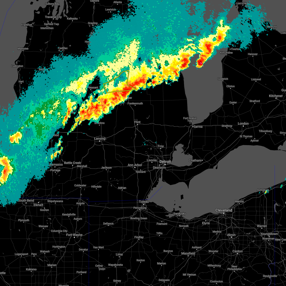 The severe thunderstorm warning for bay and southeastern midland counties will expire at 400 pm edt, the storms which prompted the warning have moved out of the area. therefore, the warning will be allowed to expire. however small hail, gusty winds and heavy rain are still possible with these thunderstorms. a severe thunderstorm watch remains in effect until 700 pm edt for southeastern michigan. remember, a severe thunderstorm warning still remains in effect for southern bay county and saginaw county. The severe thunderstorm warning for bay and southeastern midland counties will expire at 400 pm edt, the storms which prompted the warning have moved out of the area. therefore, the warning will be allowed to expire. however small hail, gusty winds and heavy rain are still possible with these thunderstorms. a severe thunderstorm watch remains in effect until 700 pm edt for southeastern michigan. remember, a severe thunderstorm warning still remains in effect for southern bay county and saginaw county.
|
| 9/7/2021 3:39 PM EDT |
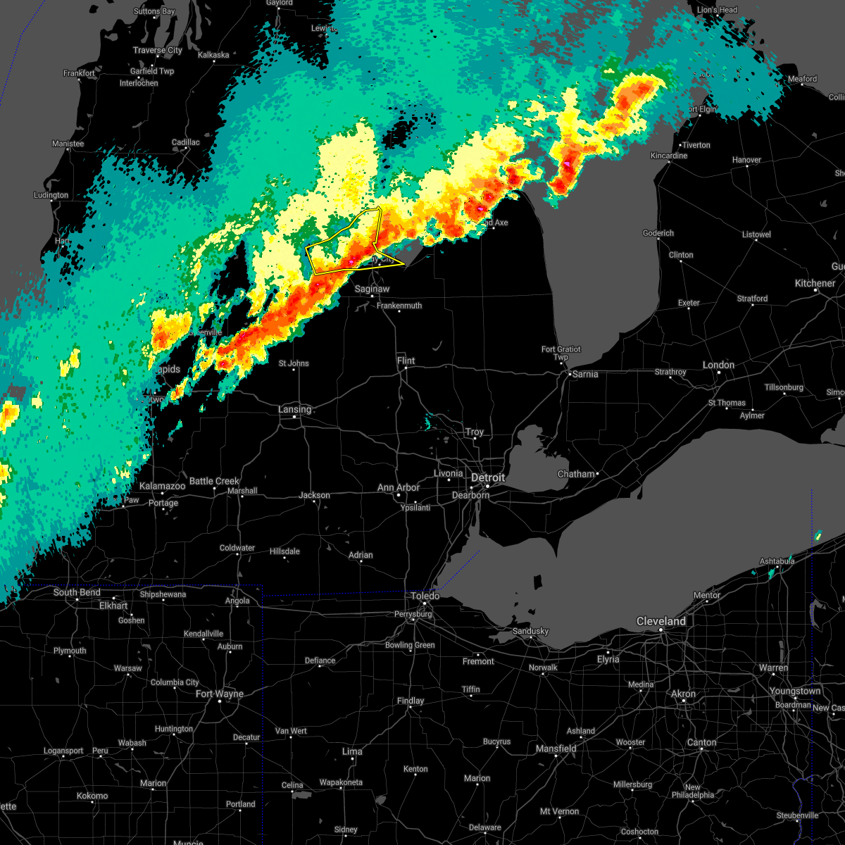 At 339 pm edt, severe thunderstorms were located along a line extending from 8 miles northeast of linwood to near auburn, moving east at 45 mph (radar indicated). Hazards include ping pong ball size hail and 60 mph wind gusts. People and animals outdoors will be injured. expect hail damage to roofs, siding, windows, and vehicles. expect wind damage to roofs, siding, and trees. these severe storms will be near, bay city and linwood around 355 pm edt. essexville around 400 pm edt. other locations impacted by these severe thunderstorms include averill, crump, gordonville, bombay, willard and bay city state recreation area. hail threat, radar indicated max hail size, 1. 50 in wind threat, radar indicated max wind gust, 60 mph. At 339 pm edt, severe thunderstorms were located along a line extending from 8 miles northeast of linwood to near auburn, moving east at 45 mph (radar indicated). Hazards include ping pong ball size hail and 60 mph wind gusts. People and animals outdoors will be injured. expect hail damage to roofs, siding, windows, and vehicles. expect wind damage to roofs, siding, and trees. these severe storms will be near, bay city and linwood around 355 pm edt. essexville around 400 pm edt. other locations impacted by these severe thunderstorms include averill, crump, gordonville, bombay, willard and bay city state recreation area. hail threat, radar indicated max hail size, 1. 50 in wind threat, radar indicated max wind gust, 60 mph.
|
| 9/7/2021 3:36 PM EDT |
 At 336 pm edt, severe thunderstorms were located along a line extending from 6 miles southeast of pinconning to near midland, moving east at 35 mph (radar indicated). Hazards include golf ball size hail and 60 mph wind gusts. People and animals outdoors will be injured. expect hail damage to roofs, siding, windows, and vehicles. expect wind damage to roofs, siding, and trees. these severe storms will be near, kawkawlin around 355 pm edt. bay city around 400 pm edt. essexville around 405 pm edt. other locations impacted by these severe thunderstorms include mount forest, averill, gordonville, bombay, crump, willard, hope and bay city state recreation area. thunderstorm damage threat, considerable hail threat, radar indicated max hail size, 1. 75 in wind threat, radar indicated max wind gust, 60 mph. At 336 pm edt, severe thunderstorms were located along a line extending from 6 miles southeast of pinconning to near midland, moving east at 35 mph (radar indicated). Hazards include golf ball size hail and 60 mph wind gusts. People and animals outdoors will be injured. expect hail damage to roofs, siding, windows, and vehicles. expect wind damage to roofs, siding, and trees. these severe storms will be near, kawkawlin around 355 pm edt. bay city around 400 pm edt. essexville around 405 pm edt. other locations impacted by these severe thunderstorms include mount forest, averill, gordonville, bombay, crump, willard, hope and bay city state recreation area. thunderstorm damage threat, considerable hail threat, radar indicated max hail size, 1. 75 in wind threat, radar indicated max wind gust, 60 mph.
|
| 9/7/2021 3:31 PM EDT | Quarter sized hail reported 1.4 miles NW of Midland, MI, relayed via social media images. |
| 9/7/2021 3:31 PM EDT | Several large tree branches down... some across road. relayed via social media photo in midland county MI, 1.1 miles S of Midland, MI |
| 9/7/2021 3:30 PM EDT |
 At 329 pm edt, severe thunderstorms were located along a line extending from near breckenridge to near ithaca to near carson city, moving east at 35 mph (radar indicated). Hazards include 60 mph wind gusts and quarter size hail. Hail damage to vehicles is expected. expect wind damage to roofs, siding, and trees. severe thunderstorms will be near, merrill around 340 pm edt. freeland around 350 pm edt. midland around 355 pm edt. marion springs around 400 pm edt. zilwaukee around 410 pm edt. saginaw and st. charles around 415 pm edt. oakley and munger around 425 pm edt. chesaning and bridgeport around 430 pm edt. other locations impacted by these severe thunderstorms include brant, nelson, carrollton, garfield, arthur, fenmore, burt, gera, buena vista township and poseyville. hail threat, radar indicated max hail size, 1. 00 in wind threat, radar indicated max wind gust, 60 mph. At 329 pm edt, severe thunderstorms were located along a line extending from near breckenridge to near ithaca to near carson city, moving east at 35 mph (radar indicated). Hazards include 60 mph wind gusts and quarter size hail. Hail damage to vehicles is expected. expect wind damage to roofs, siding, and trees. severe thunderstorms will be near, merrill around 340 pm edt. freeland around 350 pm edt. midland around 355 pm edt. marion springs around 400 pm edt. zilwaukee around 410 pm edt. saginaw and st. charles around 415 pm edt. oakley and munger around 425 pm edt. chesaning and bridgeport around 430 pm edt. other locations impacted by these severe thunderstorms include brant, nelson, carrollton, garfield, arthur, fenmore, burt, gera, buena vista township and poseyville. hail threat, radar indicated max hail size, 1. 00 in wind threat, radar indicated max wind gust, 60 mph.
|
| 9/7/2021 3:19 PM EDT |
 At 319 pm edt, a severe thunderstorm capable of producing a tornado was located near auburn, moving east at 55 mph (radar indicated rotation). Hazards include tornado and golf ball size hail. Flying debris will be dangerous to those caught without shelter. mobile homes will be damaged or destroyed. damage to roofs, windows, and vehicles will occur. tree damage is likely. this dangerous storm will be near, kawkawlin and linwood around 330 pm edt. Other locations impacted by this tornadic thunderstorm include crump, willard and bay city state recreation area. At 319 pm edt, a severe thunderstorm capable of producing a tornado was located near auburn, moving east at 55 mph (radar indicated rotation). Hazards include tornado and golf ball size hail. Flying debris will be dangerous to those caught without shelter. mobile homes will be damaged or destroyed. damage to roofs, windows, and vehicles will occur. tree damage is likely. this dangerous storm will be near, kawkawlin and linwood around 330 pm edt. Other locations impacted by this tornadic thunderstorm include crump, willard and bay city state recreation area.
|
| 9/7/2021 3:18 PM EDT | Quarter sized hail reported 3.6 miles SSW of Midland, MI, several reports of quarter sized hail from amateur radio. |
| 9/7/2021 3:15 PM EDT | Dispatch reports numerous trees and power lines down in larkin townshi in midland county MI, 6 miles S of Midland, MI |
| 9/7/2021 3:15 PM EDT |
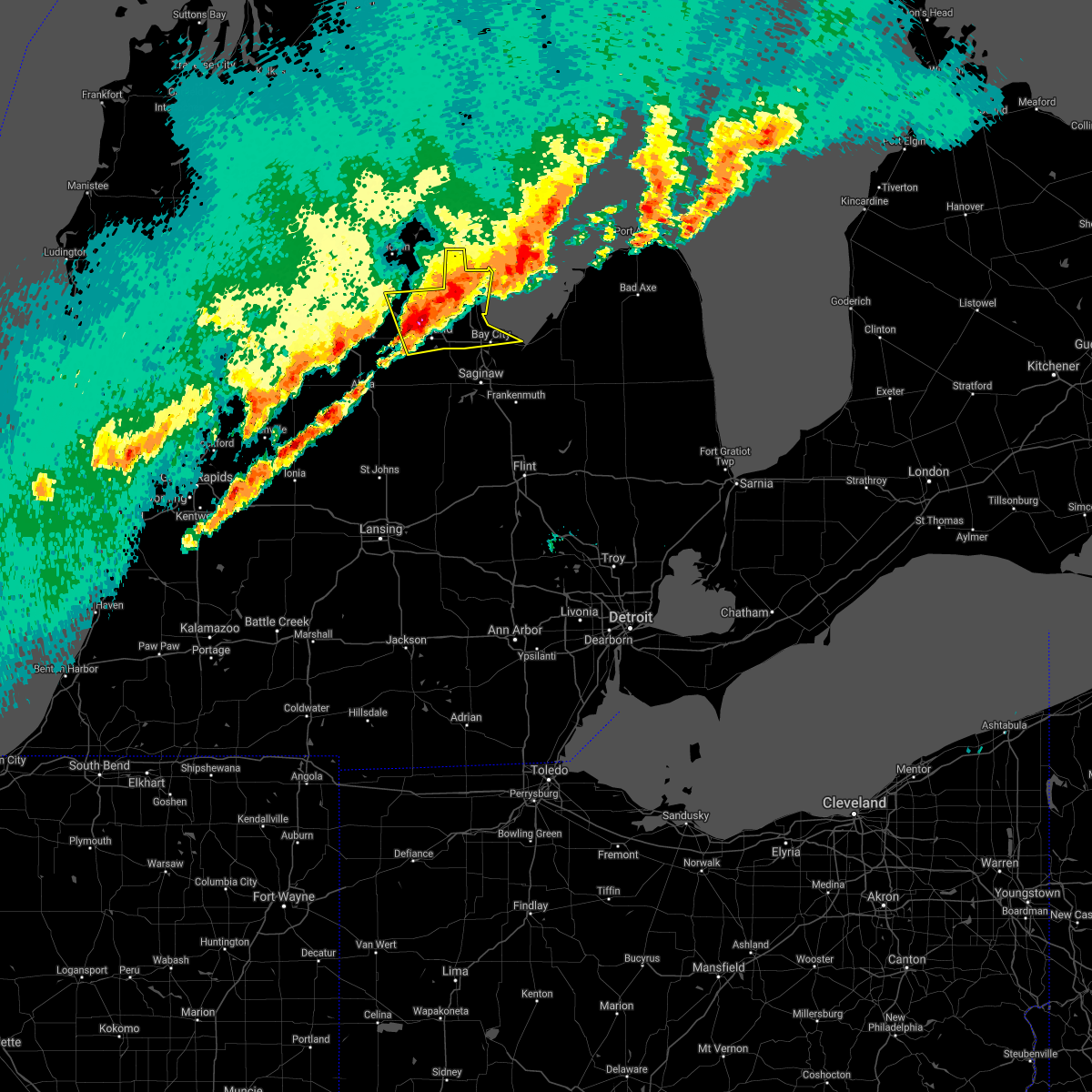 At 315 pm edt, a severe thunderstorm was located near midland, moving northeast at 45 mph (radar indicated). Hazards include golf ball size hail and 60 mph wind gusts. People and animals outdoors will be injured. expect hail damage to roofs, siding, windows, and vehicles. expect wind damage to roofs, siding, and trees. this severe storm will be near, auburn around 325 pm edt. kawkawlin around 330 pm edt. linwood around 335 pm edt. pinconning around 340 pm edt. Other locations impacted by this severe thunderstorm include mount forest, averill, gordonville, bombay, crump, willard, hope and bay city state recreation area. At 315 pm edt, a severe thunderstorm was located near midland, moving northeast at 45 mph (radar indicated). Hazards include golf ball size hail and 60 mph wind gusts. People and animals outdoors will be injured. expect hail damage to roofs, siding, windows, and vehicles. expect wind damage to roofs, siding, and trees. this severe storm will be near, auburn around 325 pm edt. kawkawlin around 330 pm edt. linwood around 335 pm edt. pinconning around 340 pm edt. Other locations impacted by this severe thunderstorm include mount forest, averill, gordonville, bombay, crump, willard, hope and bay city state recreation area.
|
| 9/7/2021 3:13 PM EDT |
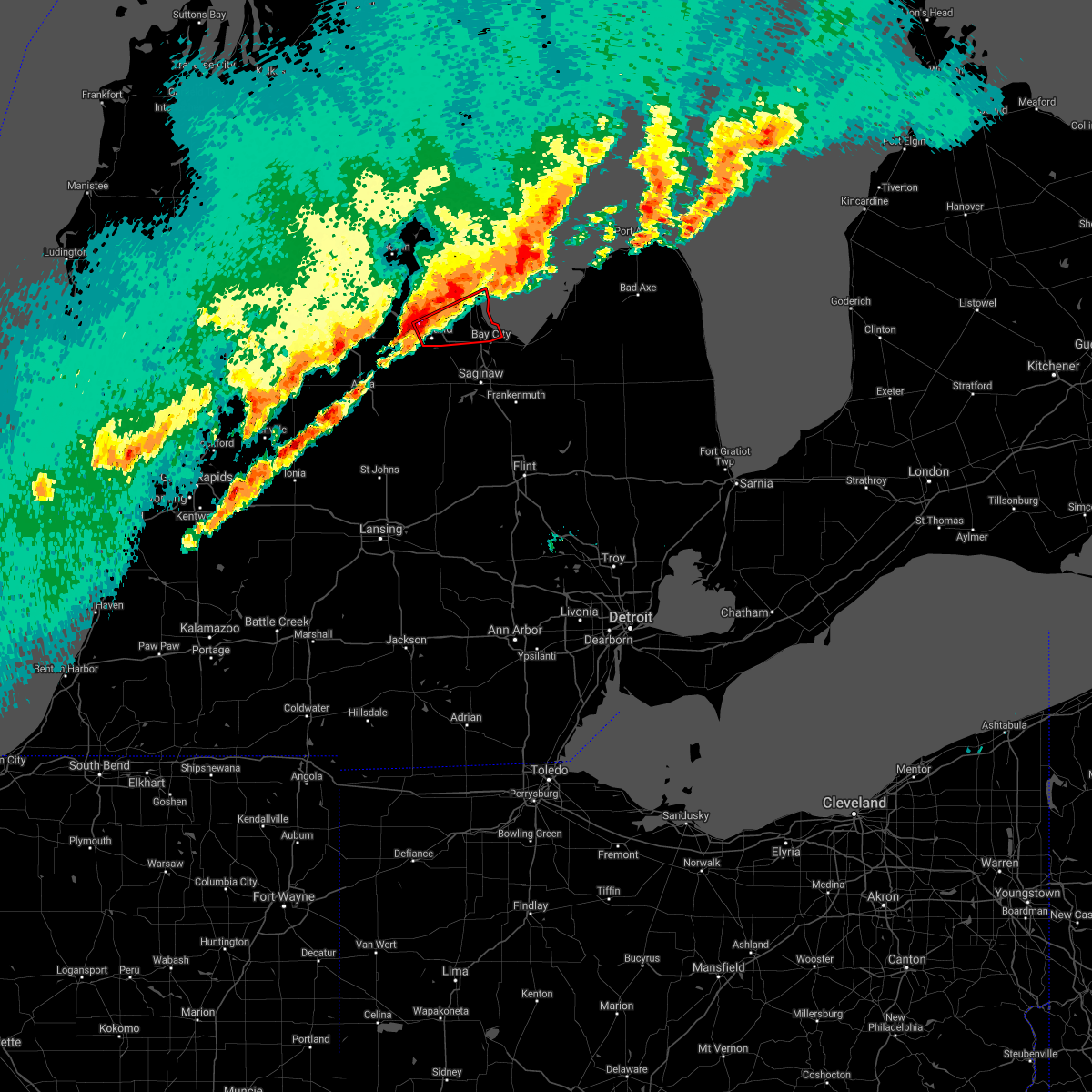 At 313 pm edt, a severe thunderstorm capable of producing a tornado was located over midland, moving northeast at 35 mph (radar indicated rotation). Hazards include tornado and golf ball size hail. Flying debris will be dangerous to those caught without shelter. mobile homes will be damaged or destroyed. damage to roofs, windows, and vehicles will occur. tree damage is likely. this dangerous storm will be near, auburn around 325 pm edt. kawkawlin and linwood around 335 pm edt. Other locations impacted by this tornadic thunderstorm include averill, crump, willard and bay city state recreation area. At 313 pm edt, a severe thunderstorm capable of producing a tornado was located over midland, moving northeast at 35 mph (radar indicated rotation). Hazards include tornado and golf ball size hail. Flying debris will be dangerous to those caught without shelter. mobile homes will be damaged or destroyed. damage to roofs, windows, and vehicles will occur. tree damage is likely. this dangerous storm will be near, auburn around 325 pm edt. kawkawlin and linwood around 335 pm edt. Other locations impacted by this tornadic thunderstorm include averill, crump, willard and bay city state recreation area.
|
| 9/7/2021 3:07 PM EDT |
 At 307 pm edt, a severe thunderstorm capable of producing a tornado was located near sanford, moving east at 55 mph (radar indicated rotation). Hazards include tornado and ping pong ball size hail. Flying debris will be dangerous to those caught without shelter. mobile homes will be damaged or destroyed. damage to roofs, windows, and vehicles will occur. tree damage is likely. this dangerous storm will be near, auburn around 320 pm edt. bay city, kawkawlin and linwood around 330 pm edt. other locations impacted by this tornadic thunderstorm include averill, gordonville, crump, poseyville, willard, bay city state recreation area and bombay. this includes the following highways, i-75 between mile markers 163 and 178. Us-10 between mile markers 113 and 139. At 307 pm edt, a severe thunderstorm capable of producing a tornado was located near sanford, moving east at 55 mph (radar indicated rotation). Hazards include tornado and ping pong ball size hail. Flying debris will be dangerous to those caught without shelter. mobile homes will be damaged or destroyed. damage to roofs, windows, and vehicles will occur. tree damage is likely. this dangerous storm will be near, auburn around 320 pm edt. bay city, kawkawlin and linwood around 330 pm edt. other locations impacted by this tornadic thunderstorm include averill, gordonville, crump, poseyville, willard, bay city state recreation area and bombay. this includes the following highways, i-75 between mile markers 163 and 178. Us-10 between mile markers 113 and 139.
|
| 9/7/2021 3:02 PM EDT |
 At 302 pm edt, a severe thunderstorm was located near sanford, moving east at 45 mph (radar indicated). Hazards include ping pong ball size hail and 60 mph wind gusts. People and animals outdoors will be injured. expect hail damage to roofs, siding, windows, and vehicles. expect wind damage to roofs, siding, and trees. this severe storm will be near, sanford around 310 pm edt. midland around 320 pm edt. auburn around 325 pm edt. kawkawlin and linwood around 335 pm edt. bay city around 340 pm edt. Other locations impacted by this severe thunderstorm include laporte, mount forest, averill, gordonville, bombay, porter township, crump, poseyville, willard and hope. At 302 pm edt, a severe thunderstorm was located near sanford, moving east at 45 mph (radar indicated). Hazards include ping pong ball size hail and 60 mph wind gusts. People and animals outdoors will be injured. expect hail damage to roofs, siding, windows, and vehicles. expect wind damage to roofs, siding, and trees. this severe storm will be near, sanford around 310 pm edt. midland around 320 pm edt. auburn around 325 pm edt. kawkawlin and linwood around 335 pm edt. bay city around 340 pm edt. Other locations impacted by this severe thunderstorm include laporte, mount forest, averill, gordonville, bombay, porter township, crump, poseyville, willard and hope.
|
| 9/7/2021 2:54 PM EDT |
 At 254 pm edt, a severe thunderstorm was located over oil city, or 8 miles west of sanford, moving northeast at 45 mph (radar indicated). Hazards include 60 mph wind gusts and quarter size hail. Hail damage to vehicles is expected. expect wind damage to roofs, siding, and trees. this severe thunderstorm will be near, sanford around 305 pm edt. edenville around 310 pm edt. linwood around 330 pm edt. pinconning around 335 pm edt. other locations impacted by this severe thunderstorm include laporte, mount forest, averill, gordonville, bombay, porter township, crump, poseyville, willard and hope. hail threat, radar indicated max hail size, 1. 00 in wind threat, radar indicated max wind gust, 60 mph. At 254 pm edt, a severe thunderstorm was located over oil city, or 8 miles west of sanford, moving northeast at 45 mph (radar indicated). Hazards include 60 mph wind gusts and quarter size hail. Hail damage to vehicles is expected. expect wind damage to roofs, siding, and trees. this severe thunderstorm will be near, sanford around 305 pm edt. edenville around 310 pm edt. linwood around 330 pm edt. pinconning around 335 pm edt. other locations impacted by this severe thunderstorm include laporte, mount forest, averill, gordonville, bombay, porter township, crump, poseyville, willard and hope. hail threat, radar indicated max hail size, 1. 00 in wind threat, radar indicated max wind gust, 60 mph.
|
| 8/29/2021 4:58 PM EDT |
 At 457 pm edt, severe thunderstorms were located along a line extending from near saginaw to oakley to near laingsburg, moving northeast at 35 mph (radar indicated). Hazards include 60 mph wind gusts. Expect damage to roofs, siding, and trees. these severe storms will be near, saginaw, zilwaukee and bridgeport around 505 pm edt. morrice around 510 pm edt. corunna around 525 pm edt. durand around 530 pm edt. birch run around 535 pm edt. new lothrop and lennon around 540 pm edt. frankenmuth around 545 pm edt. other locations impacted by these severe thunderstorms include brant, nelson, carrollton, garfield, arthur, fenmore, burt, gera, buena vista township and layton corners. people attending huntington event park should seek safe shelter immediately! hail threat, radar indicated max hail size, <. 75 in wind threat, radar indicated max wind gust, 60 mph. At 457 pm edt, severe thunderstorms were located along a line extending from near saginaw to oakley to near laingsburg, moving northeast at 35 mph (radar indicated). Hazards include 60 mph wind gusts. Expect damage to roofs, siding, and trees. these severe storms will be near, saginaw, zilwaukee and bridgeport around 505 pm edt. morrice around 510 pm edt. corunna around 525 pm edt. durand around 530 pm edt. birch run around 535 pm edt. new lothrop and lennon around 540 pm edt. frankenmuth around 545 pm edt. other locations impacted by these severe thunderstorms include brant, nelson, carrollton, garfield, arthur, fenmore, burt, gera, buena vista township and layton corners. people attending huntington event park should seek safe shelter immediately! hail threat, radar indicated max hail size, <. 75 in wind threat, radar indicated max wind gust, 60 mph.
|
| 8/29/2021 4:43 PM EDT |
 At 442 pm edt, severe thunderstorms were located along a line extending from 6 miles north of st. charles to elsie to near dewitt, moving east at 35 mph (radar indicated). Hazards include 60 mph wind gusts. Expect damage to roofs, siding, and trees. these severe storms will be near, zilwaukee, oakley, henderson and bridgeport around 500 pm edt. saginaw and chesaning around 505 pm edt. perry and morrice around 510 pm edt. owosso, frankenmuth and new lothrop around 515 pm edt. corunna and bancroft around 520 pm edt. durand around 530 pm edt. birch run and lennon around 535 pm edt. other locations impacted by these severe thunderstorms include brant, nelson, carrollton, garfield, arthur, fenmore, burt, gera, buena vista township and layton corners. people attending huntington event park should seek safe shelter immediately! hail threat, radar indicated max hail size, <. 75 in wind threat, radar indicated max wind gust, 60 mph. At 442 pm edt, severe thunderstorms were located along a line extending from 6 miles north of st. charles to elsie to near dewitt, moving east at 35 mph (radar indicated). Hazards include 60 mph wind gusts. Expect damage to roofs, siding, and trees. these severe storms will be near, zilwaukee, oakley, henderson and bridgeport around 500 pm edt. saginaw and chesaning around 505 pm edt. perry and morrice around 510 pm edt. owosso, frankenmuth and new lothrop around 515 pm edt. corunna and bancroft around 520 pm edt. durand around 530 pm edt. birch run and lennon around 535 pm edt. other locations impacted by these severe thunderstorms include brant, nelson, carrollton, garfield, arthur, fenmore, burt, gera, buena vista township and layton corners. people attending huntington event park should seek safe shelter immediately! hail threat, radar indicated max hail size, <. 75 in wind threat, radar indicated max wind gust, 60 mph.
|
| 8/29/2021 4:30 PM EDT |
 At 430 pm edt, severe thunderstorms were located along a line extending from near merrill to 9 miles north of st. johns to 7 miles northwest of dewitt, moving east at 35 mph (radar indicated). Hazards include 60 mph wind gusts. Expect damage to roofs, siding, and trees. severe thunderstorms will be near, merrill around 435 pm edt. marion springs around 455 pm edt. laingsburg around 500 pm edt. zilwaukee, oakley and bridgeport around 505 pm edt. saginaw, chesaning and st. charles around 510 pm edt. owosso around 515 pm edt. corunna and henderson around 520 pm edt. new lothrop and lennon around 535 pm edt. other locations impacted by these severe thunderstorms include brant, nelson, carrollton, garfield, arthur, fenmore, burt, gera, buena vista township and layton corners. people attending huntington event park should seek safe shelter immediately! hail threat, radar indicated max hail size, <. 75 in wind threat, radar indicated max wind gust, 60 mph. At 430 pm edt, severe thunderstorms were located along a line extending from near merrill to 9 miles north of st. johns to 7 miles northwest of dewitt, moving east at 35 mph (radar indicated). Hazards include 60 mph wind gusts. Expect damage to roofs, siding, and trees. severe thunderstorms will be near, merrill around 435 pm edt. marion springs around 455 pm edt. laingsburg around 500 pm edt. zilwaukee, oakley and bridgeport around 505 pm edt. saginaw, chesaning and st. charles around 510 pm edt. owosso around 515 pm edt. corunna and henderson around 520 pm edt. new lothrop and lennon around 535 pm edt. other locations impacted by these severe thunderstorms include brant, nelson, carrollton, garfield, arthur, fenmore, burt, gera, buena vista township and layton corners. people attending huntington event park should seek safe shelter immediately! hail threat, radar indicated max hail size, <. 75 in wind threat, radar indicated max wind gust, 60 mph.
|
| 8/29/2021 2:54 AM EDT |
 The severe thunderstorm warning for western bay and east central midland counties will expire at 300 am edt, the storm which prompted the warning has weakened below severe limits, and no longer poses an immediate threat to life or property. therefore, the warning will be allowed to expire. The severe thunderstorm warning for western bay and east central midland counties will expire at 300 am edt, the storm which prompted the warning has weakened below severe limits, and no longer poses an immediate threat to life or property. therefore, the warning will be allowed to expire.
|
| 8/29/2021 2:38 AM EDT |
 At 237 am edt, a severe thunderstorm was located near auburn, moving northeast at 10 mph (radar indicated). Hazards include 60 mph wind gusts. Expect damage to roofs, siding, and trees. this severe storm will be near, auburn around 250 am edt. bay city, kawkawlin and linwood around 315 am edt. other locations impacted by this severe thunderstorm include crump, willard and bay city state recreation area. hail threat, radar indicated max hail size, <. 75 in wind threat, radar indicated max wind gust, 60 mph. At 237 am edt, a severe thunderstorm was located near auburn, moving northeast at 10 mph (radar indicated). Hazards include 60 mph wind gusts. Expect damage to roofs, siding, and trees. this severe storm will be near, auburn around 250 am edt. bay city, kawkawlin and linwood around 315 am edt. other locations impacted by this severe thunderstorm include crump, willard and bay city state recreation area. hail threat, radar indicated max hail size, <. 75 in wind threat, radar indicated max wind gust, 60 mph.
|
| 8/29/2021 2:16 AM EDT |
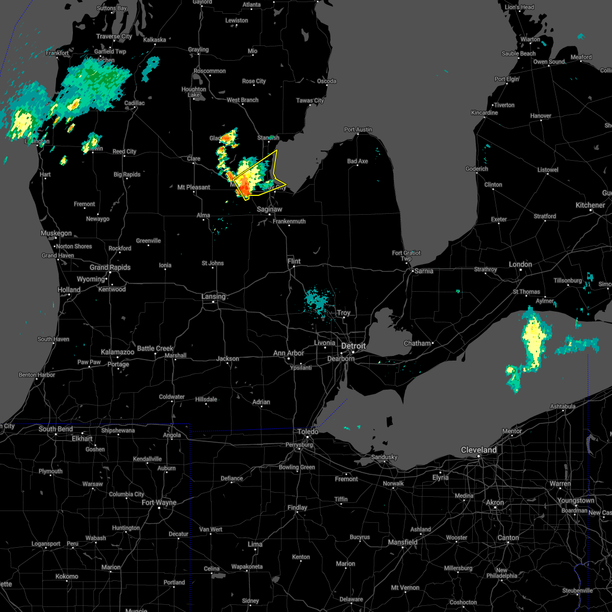 At 215 am edt, a severe thunderstorm was located over midland, moving northeast at 30 mph (radar indicated). Hazards include 60 mph wind gusts and penny size hail. Expect damage to roofs, siding, and trees. this severe thunderstorm will be near, auburn around 225 am edt. kawkawlin and linwood around 240 am edt. pinconning around 255 am edt. other locations impacted by this severe thunderstorm include crump, willard and bay city state recreation area. hail threat, radar indicated max hail size, 0. 75 in wind threat, radar indicated max wind gust, 60 mph. At 215 am edt, a severe thunderstorm was located over midland, moving northeast at 30 mph (radar indicated). Hazards include 60 mph wind gusts and penny size hail. Expect damage to roofs, siding, and trees. this severe thunderstorm will be near, auburn around 225 am edt. kawkawlin and linwood around 240 am edt. pinconning around 255 am edt. other locations impacted by this severe thunderstorm include crump, willard and bay city state recreation area. hail threat, radar indicated max hail size, 0. 75 in wind threat, radar indicated max wind gust, 60 mph.
|
| 8/28/2021 6:26 PM EDT |
 At 626 pm edt, severe thunderstorms were located along a line extending from near zilwaukee to near saginaw to near marion springs, moving east at 25 mph (radar indicated). Hazards include 60 mph wind gusts. Expect damage to roofs, siding, and trees. these severe storms will be near, zilwaukee around 630 pm edt. saginaw and bridgeport around 635 pm edt. frankenmuth around 700 pm edt. birch run around 730 pm edt. other locations impacted by these severe thunderstorms include brant, nelson, carrollton, garfield, arthur, burt, gera, buena vista township, indiantown and swan creek. hail threat, radar indicated max hail size, <. 75 in wind threat, radar indicated max wind gust, 60 mph. At 626 pm edt, severe thunderstorms were located along a line extending from near zilwaukee to near saginaw to near marion springs, moving east at 25 mph (radar indicated). Hazards include 60 mph wind gusts. Expect damage to roofs, siding, and trees. these severe storms will be near, zilwaukee around 630 pm edt. saginaw and bridgeport around 635 pm edt. frankenmuth around 700 pm edt. birch run around 730 pm edt. other locations impacted by these severe thunderstorms include brant, nelson, carrollton, garfield, arthur, burt, gera, buena vista township, indiantown and swan creek. hail threat, radar indicated max hail size, <. 75 in wind threat, radar indicated max wind gust, 60 mph.
|
| 8/28/2021 5:52 PM EDT |
 At 551 pm edt, a severe thunderstorm was located over merrill, or 13 miles northwest of st. charles, moving east at 25 mph (radar indicated). Hazards include 60 mph wind gusts. Expect damage to roofs, siding, and trees. this severe thunderstorm will be near, merrill around 555 pm edt. st. charles around 615 pm edt. zilwaukee around 640 pm edt. saginaw and bridgeport around 645 pm edt. frankenmuth around 700 pm edt. other locations impacted by this severe thunderstorm include brant, nelson, carrollton, garfield, arthur, burt, gera, buena vista township, indiantown and swan creek. hail threat, radar indicated max hail size, <. 75 in wind threat, radar indicated max wind gust, 60 mph. At 551 pm edt, a severe thunderstorm was located over merrill, or 13 miles northwest of st. charles, moving east at 25 mph (radar indicated). Hazards include 60 mph wind gusts. Expect damage to roofs, siding, and trees. this severe thunderstorm will be near, merrill around 555 pm edt. st. charles around 615 pm edt. zilwaukee around 640 pm edt. saginaw and bridgeport around 645 pm edt. frankenmuth around 700 pm edt. other locations impacted by this severe thunderstorm include brant, nelson, carrollton, garfield, arthur, burt, gera, buena vista township, indiantown and swan creek. hail threat, radar indicated max hail size, <. 75 in wind threat, radar indicated max wind gust, 60 mph.
|
| 8/24/2021 7:12 PM EDT |
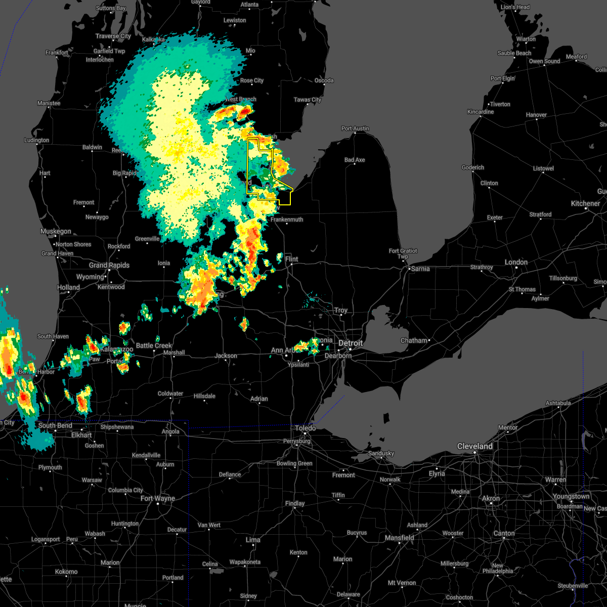 The severe thunderstorm warning for bay county will expire at 715 pm edt, the storms which prompted the warning have weakened below severe limits, and is exiting the warned area. therefore, the warning will be allowed to expire. The severe thunderstorm warning for bay county will expire at 715 pm edt, the storms which prompted the warning have weakened below severe limits, and is exiting the warned area. therefore, the warning will be allowed to expire.
|
| 8/24/2021 6:53 PM EDT |
 The severe thunderstorm warning for midland county will expire at 700 pm edt, the storms which prompted the warning have moved out of the area. therefore, the warning will be allowed to expire. to report severe weather, contact your nearest law enforcement agency. they will relay your report to the national weather service detroit/pontiac. The severe thunderstorm warning for midland county will expire at 700 pm edt, the storms which prompted the warning have moved out of the area. therefore, the warning will be allowed to expire. to report severe weather, contact your nearest law enforcement agency. they will relay your report to the national weather service detroit/pontiac.
|
| 8/24/2021 6:52 PM EDT |
 At 652 pm edt, severe thunderstorms were located along a line extending from near freeland to 8 miles north of st. charles to near elsie, moving east at 35 mph (radar indicated). Hazards include 60 mph wind gusts. Expect damage to roofs, siding, and trees. severe thunderstorms will be near, freeland around 655 pm edt. saginaw, chesaning, zilwaukee and bridgeport around 710 pm edt. birch run around 735 pm edt. frankenmuth around 740 pm edt. other locations impacted by these severe thunderstorms include brant, nelson, carrollton, garfield, arthur, fenmore, burt, gera, buena vista township and layton corners. hail threat, radar indicated max hail size, <. 75 in wind threat, radar indicated max wind gust, 60 mph. At 652 pm edt, severe thunderstorms were located along a line extending from near freeland to 8 miles north of st. charles to near elsie, moving east at 35 mph (radar indicated). Hazards include 60 mph wind gusts. Expect damage to roofs, siding, and trees. severe thunderstorms will be near, freeland around 655 pm edt. saginaw, chesaning, zilwaukee and bridgeport around 710 pm edt. birch run around 735 pm edt. frankenmuth around 740 pm edt. other locations impacted by these severe thunderstorms include brant, nelson, carrollton, garfield, arthur, fenmore, burt, gera, buena vista township and layton corners. hail threat, radar indicated max hail size, <. 75 in wind threat, radar indicated max wind gust, 60 mph.
|
| 8/24/2021 6:47 PM EDT |
 At 647 pm edt, severe thunderstorms were located along a line extending from near bentley to near linwood to 6 miles west of saginaw, moving east at 40 mph (radar indicated). Hazards include 60 mph wind gusts. Expect damage to roofs, siding, and trees. severe thunderstorms will be near, linwood around 650 pm edt. bay city and kawkawlin around 655 pm edt. essexville around 700 pm edt. other locations impacted by these severe thunderstorms include mount forest, crump, willard and bay city state recreation area. hail threat, radar indicated max hail size, <. 75 in wind threat, radar indicated max wind gust, 60 mph. At 647 pm edt, severe thunderstorms were located along a line extending from near bentley to near linwood to 6 miles west of saginaw, moving east at 40 mph (radar indicated). Hazards include 60 mph wind gusts. Expect damage to roofs, siding, and trees. severe thunderstorms will be near, linwood around 650 pm edt. bay city and kawkawlin around 655 pm edt. essexville around 700 pm edt. other locations impacted by these severe thunderstorms include mount forest, crump, willard and bay city state recreation area. hail threat, radar indicated max hail size, <. 75 in wind threat, radar indicated max wind gust, 60 mph.
|
| 8/24/2021 6:46 PM EDT | Dispatch reports multiple trees and wires down in the city of midland in midland county MI, 0.9 miles N of Midland, MI |
| 8/24/2021 6:24 PM EDT | Tree down near intersection of m20 and n geneva rd in midland county MI, 6.2 miles ENE of Midland, MI |
| 8/24/2021 6:21 PM EDT |
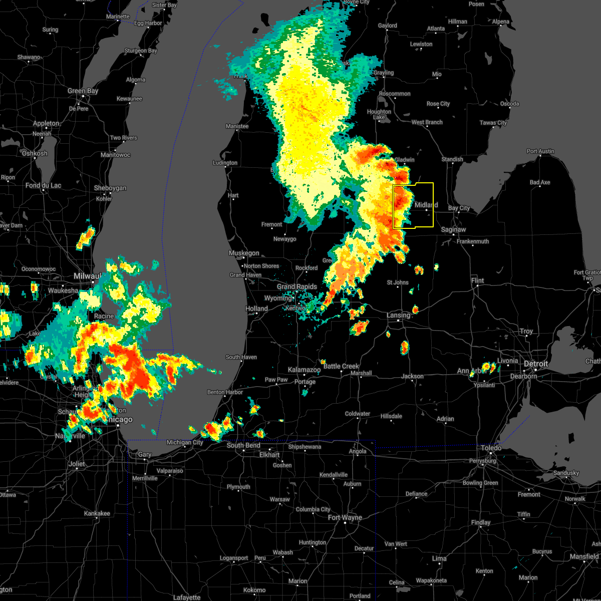 At 621 pm edt, severe thunderstorms were located along a line extending from near edenville to sanford to near breckenridge, moving east at 45 mph (radar indicated). Hazards include 60 mph wind gusts and penny size hail. Expect damage to roofs, siding, and trees. these severe storms will be near, sanford and edenville around 625 pm edt. midland around 650 pm edt. other locations impacted by these severe thunderstorms include laporte, averill, gordonville, bombay, porter township, poseyville, hope and north bradley. hail threat, radar indicated max hail size, 0. 75 in wind threat, radar indicated max wind gust, 60 mph. At 621 pm edt, severe thunderstorms were located along a line extending from near edenville to sanford to near breckenridge, moving east at 45 mph (radar indicated). Hazards include 60 mph wind gusts and penny size hail. Expect damage to roofs, siding, and trees. these severe storms will be near, sanford and edenville around 625 pm edt. midland around 650 pm edt. other locations impacted by these severe thunderstorms include laporte, averill, gordonville, bombay, porter township, poseyville, hope and north bradley. hail threat, radar indicated max hail size, 0. 75 in wind threat, radar indicated max wind gust, 60 mph.
|
| 8/24/2021 6:07 PM EDT |
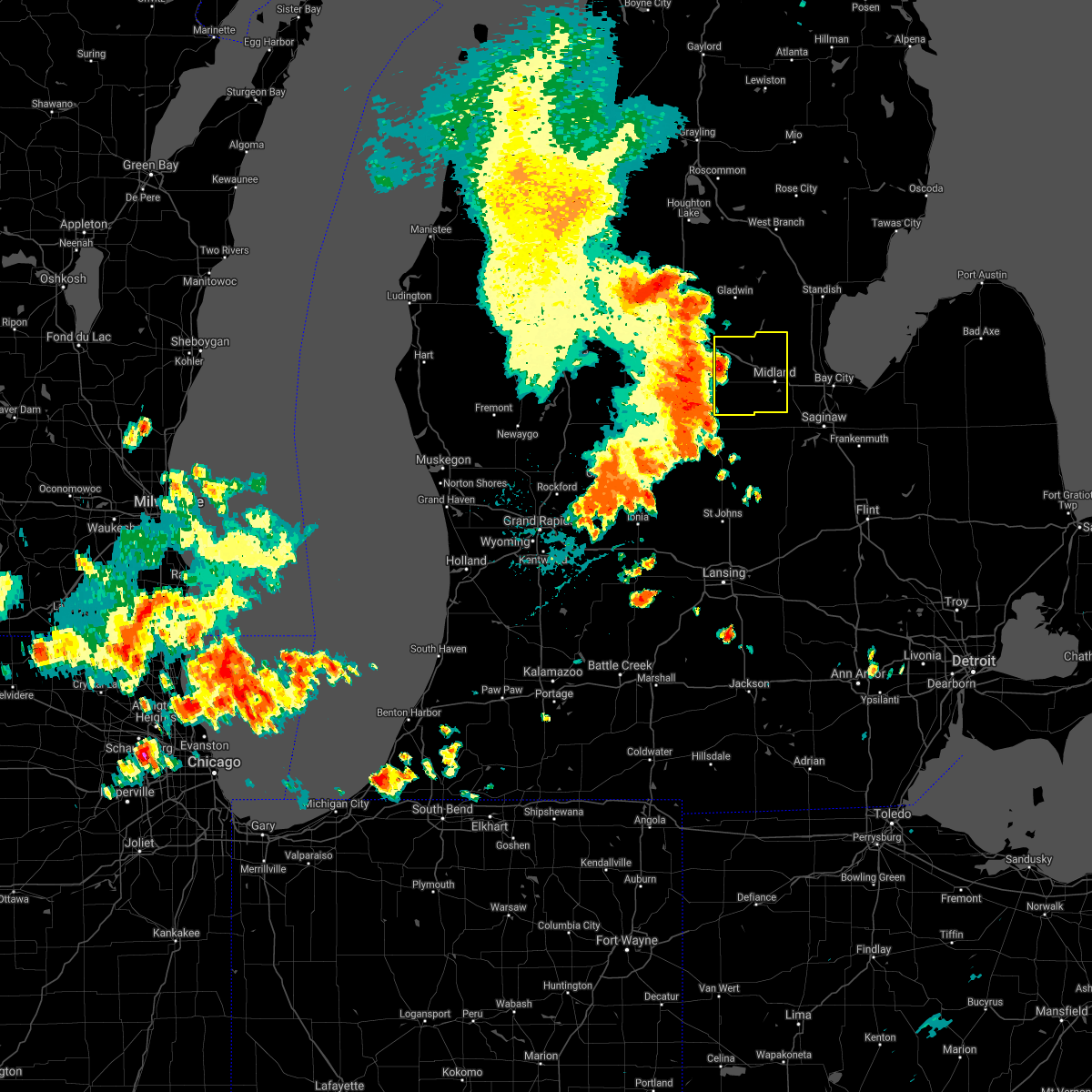 At 607 pm edt, severe thunderstorms were located along a line extending from near clare to near oil city to 6 miles west of ithaca, moving east at 35 mph (radar indicated). Hazards include 60 mph wind gusts and penny size hail. Expect damage to roofs, siding, and trees. severe thunderstorms will be near, oil city and pleasant valley around 615 pm edt. sanford around 630 pm edt. edenville around 635 pm edt. midland around 650 pm edt. other locations impacted by these severe thunderstorms include laporte, averill, gordonville, bombay, porter township, poseyville, hope and north bradley. hail threat, radar indicated max hail size, 0. 75 in wind threat, radar indicated max wind gust, 60 mph. At 607 pm edt, severe thunderstorms were located along a line extending from near clare to near oil city to 6 miles west of ithaca, moving east at 35 mph (radar indicated). Hazards include 60 mph wind gusts and penny size hail. Expect damage to roofs, siding, and trees. severe thunderstorms will be near, oil city and pleasant valley around 615 pm edt. sanford around 630 pm edt. edenville around 635 pm edt. midland around 650 pm edt. other locations impacted by these severe thunderstorms include laporte, averill, gordonville, bombay, porter township, poseyville, hope and north bradley. hail threat, radar indicated max hail size, 0. 75 in wind threat, radar indicated max wind gust, 60 mph.
|
| 8/11/2021 12:28 AM EDT |
 At 1227 am edt, severe thunderstorms were located along a line extending from bentley to near linwood to near birch run, moving northeast at 55 mph (radar indicated). Hazards include 60 mph wind gusts. Expect damage to roofs, siding, and trees. these severe thunderstorms will remain over mainly rural areas of bay, saginaw and eastern midland counties, including the following locations, mount forest, carrollton, garfield, arthur, burt, crump, gera, buena vista township, layton corners and willard. hail threat, radar indicated max hail size, <. 75 in wind threat, radar indicated max wind gust, 60 mph. At 1227 am edt, severe thunderstorms were located along a line extending from bentley to near linwood to near birch run, moving northeast at 55 mph (radar indicated). Hazards include 60 mph wind gusts. Expect damage to roofs, siding, and trees. these severe thunderstorms will remain over mainly rural areas of bay, saginaw and eastern midland counties, including the following locations, mount forest, carrollton, garfield, arthur, burt, crump, gera, buena vista township, layton corners and willard. hail threat, radar indicated max hail size, <. 75 in wind threat, radar indicated max wind gust, 60 mph.
|
| 8/11/2021 12:12 AM EDT |
 At 1211 am edt, severe thunderstorms were located along a line extending from near winegars to near midland to chesaning, moving east at 50 mph (radar indicated). Hazards include 60 mph wind gusts. Expect damage to roofs, siding, and trees. these severe storms will be near, auburn around 1215 am edt. kawkawlin and linwood around 1220 am edt. bentley around 1225 am edt. birch run around 1230 am edt. frankenmuth around 1235 am edt. other locations impacted by these severe thunderstorms include carrollton, garfield, arthur, fenmore, crump, gera, buena vista township, indiantown, bombay and hemlock. hail threat, radar indicated max hail size, <. 75 in wind threat, radar indicated max wind gust, 60 mph. At 1211 am edt, severe thunderstorms were located along a line extending from near winegars to near midland to chesaning, moving east at 50 mph (radar indicated). Hazards include 60 mph wind gusts. Expect damage to roofs, siding, and trees. these severe storms will be near, auburn around 1215 am edt. kawkawlin and linwood around 1220 am edt. bentley around 1225 am edt. birch run around 1230 am edt. frankenmuth around 1235 am edt. other locations impacted by these severe thunderstorms include carrollton, garfield, arthur, fenmore, crump, gera, buena vista township, indiantown, bombay and hemlock. hail threat, radar indicated max hail size, <. 75 in wind threat, radar indicated max wind gust, 60 mph.
|
| 8/10/2021 11:43 PM EDT |
 At 1142 pm edt, severe thunderstorms were located along a line extending from near rosebush to near shepherd to near st. johns, moving northeast at 55 mph (radar indicated). Hazards include 60 mph wind gusts. Expect damage to roofs, siding, and trees. severe thunderstorms will be near, oil city around 1150 pm edt. coleman around 1155 pm edt. sanford around 1200 am edt. marion springs around 1205 am edt. midland, edenville and oakley around 1210 am edt. chesaning and st. charles around 1215 am edt. kawkawlin, bentley and linwood around 1225 am edt. pinconning around 1230 am edt. other locations impacted by these severe thunderstorms include carrollton, garfield, arthur, fenmore, crump, gera, buena vista township, indiantown, bombay and hemlock. hail threat, radar indicated max hail size, <. 75 in wind threat, radar indicated max wind gust, 60 mph. At 1142 pm edt, severe thunderstorms were located along a line extending from near rosebush to near shepherd to near st. johns, moving northeast at 55 mph (radar indicated). Hazards include 60 mph wind gusts. Expect damage to roofs, siding, and trees. severe thunderstorms will be near, oil city around 1150 pm edt. coleman around 1155 pm edt. sanford around 1200 am edt. marion springs around 1205 am edt. midland, edenville and oakley around 1210 am edt. chesaning and st. charles around 1215 am edt. kawkawlin, bentley and linwood around 1225 am edt. pinconning around 1230 am edt. other locations impacted by these severe thunderstorms include carrollton, garfield, arthur, fenmore, crump, gera, buena vista township, indiantown, bombay and hemlock. hail threat, radar indicated max hail size, <. 75 in wind threat, radar indicated max wind gust, 60 mph.
|
| 7/24/2021 4:36 PM EDT | Large tree limb snapped reported via social media phot in midland county MI, 3.9 miles WNW of Midland, MI |
| 7/24/2021 4:36 PM EDT |
 At 435 pm edt, severe thunderstorms were located along a line extending from near essexville to auburn to near merrill, moving east at 35 mph (radar indicated). Hazards include 60 mph wind gusts and penny size hail. Expect damage to roofs, siding, and trees. Locations impacted include, saginaw, midland, bay city, auburn, freeland, kawkawlin, essexville, zilwaukee, merrill, bridgeport, munger, carrollton, nelson, swan creek, garfield, arthur, gera, buena vista township, indiantown and hemlock. At 435 pm edt, severe thunderstorms were located along a line extending from near essexville to auburn to near merrill, moving east at 35 mph (radar indicated). Hazards include 60 mph wind gusts and penny size hail. Expect damage to roofs, siding, and trees. Locations impacted include, saginaw, midland, bay city, auburn, freeland, kawkawlin, essexville, zilwaukee, merrill, bridgeport, munger, carrollton, nelson, swan creek, garfield, arthur, gera, buena vista township, indiantown and hemlock.
|
| 7/24/2021 4:25 PM EDT | Reports of several trees and powerlines down in midland county MI, 1.1 miles NNW of Midland, MI |
| 7/24/2021 4:21 PM EDT |
 At 420 pm edt, severe thunderstorms were located along a line extending from near pinconning to near midland to near pleasant valley, moving east at 35 mph (radar indicated). Hazards include 60 mph wind gusts and penny size hail. Expect damage to roofs, siding, and trees. Locations impacted include, saginaw, midland, bay city, auburn, sanford, freeland, kawkawlin, essexville, zilwaukee, merrill, bridgeport, pleasant valley, munger, carrollton, nelson, swan creek, garfield, arthur, gera and buena vista township. At 420 pm edt, severe thunderstorms were located along a line extending from near pinconning to near midland to near pleasant valley, moving east at 35 mph (radar indicated). Hazards include 60 mph wind gusts and penny size hail. Expect damage to roofs, siding, and trees. Locations impacted include, saginaw, midland, bay city, auburn, sanford, freeland, kawkawlin, essexville, zilwaukee, merrill, bridgeport, pleasant valley, munger, carrollton, nelson, swan creek, garfield, arthur, gera and buena vista township.
|
| 7/24/2021 4:07 PM EDT | Reports of several trees and powerlines down in larkin twp in midland county MI, 3.2 miles S of Midland, MI |
| 7/24/2021 4:03 PM EDT | Multiple reports of down trees and power lines down in midland county MI, 10.2 miles S of Midland, MI |
| 7/24/2021 4:03 PM EDT |
 At 402 pm edt, severe thunderstorms were located along a line extending from near rhodes to 6 miles southwest of mount pleasant, moving east-southeast at 35 mph (radar indicated). Hazards include 60 mph wind gusts and penny size hail. expect damage to roofs, siding, and trees At 402 pm edt, severe thunderstorms were located along a line extending from near rhodes to 6 miles southwest of mount pleasant, moving east-southeast at 35 mph (radar indicated). Hazards include 60 mph wind gusts and penny size hail. expect damage to roofs, siding, and trees
|
| 6/26/2021 4:45 PM EDT |
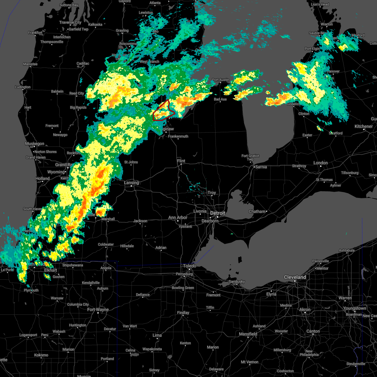 At 444 pm edt, a severe thunderstorm capable of producing a tornado was located over auburn, moving northeast at 35 mph (radar indicated rotation). Hazards include tornado. Flying debris will be dangerous to those caught without shelter. mobile homes will be damaged or destroyed. damage to roofs, windows, and vehicles will occur. tree damage is likely. this dangerous storm will be near, bay city and kawkawlin around 500 pm edt. Other locations in the path of this tornadic thunderstorm include linwood. At 444 pm edt, a severe thunderstorm capable of producing a tornado was located over auburn, moving northeast at 35 mph (radar indicated rotation). Hazards include tornado. Flying debris will be dangerous to those caught without shelter. mobile homes will be damaged or destroyed. damage to roofs, windows, and vehicles will occur. tree damage is likely. this dangerous storm will be near, bay city and kawkawlin around 500 pm edt. Other locations in the path of this tornadic thunderstorm include linwood.
|
| 6/12/2021 8:34 PM EDT | Midland county central dispatch reported several trees down near e shaffer rd and n waldo r in midland county MI, 8.6 miles SSW of Midland, MI |
| 6/12/2021 8:20 PM EDT |
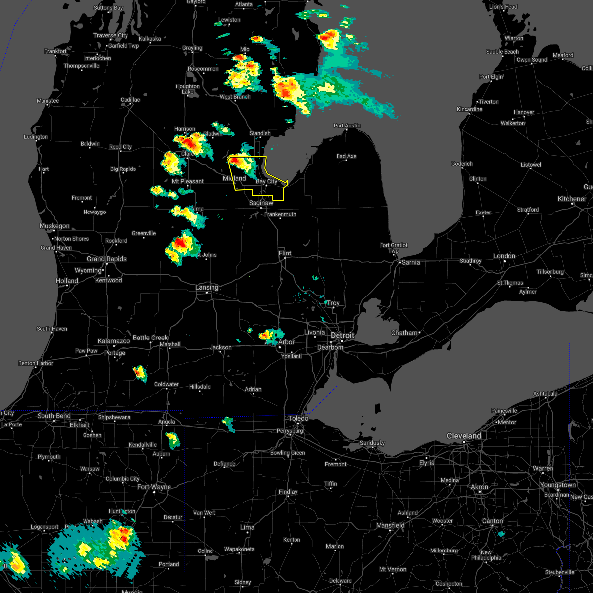 At 820 pm edt, a severe thunderstorm was located 8 miles north of midland, moving southeast at 30 mph (radar indicated). Hazards include 60 mph wind gusts and quarter size hail. Hail damage to vehicles is expected. expect wind damage to roofs, siding, and trees. this severe storm will be near, midland around 840 pm edt. auburn and kawkawlin around 845 pm edt. bay city around 855 pm edt. munger around 915 pm edt. Other locations impacted by this severe thunderstorm include crump, bombay, willard and bay city state recreation area. At 820 pm edt, a severe thunderstorm was located 8 miles north of midland, moving southeast at 30 mph (radar indicated). Hazards include 60 mph wind gusts and quarter size hail. Hail damage to vehicles is expected. expect wind damage to roofs, siding, and trees. this severe storm will be near, midland around 840 pm edt. auburn and kawkawlin around 845 pm edt. bay city around 855 pm edt. munger around 915 pm edt. Other locations impacted by this severe thunderstorm include crump, bombay, willard and bay city state recreation area.
|
| 6/12/2021 8:03 PM EDT |
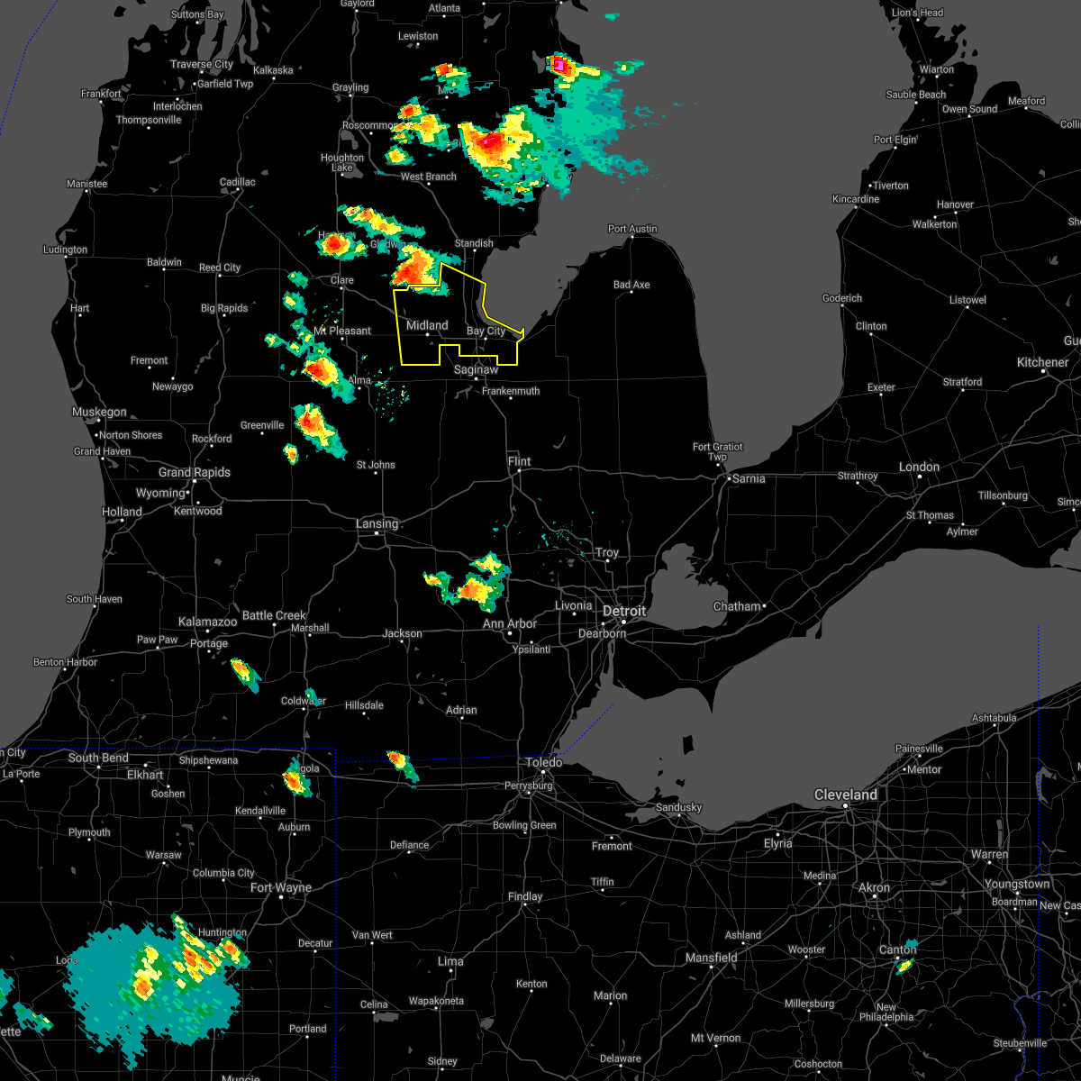 At 802 pm edt, a severe thunderstorm was located near edenville, or 11 miles northeast of sanford, moving southeast at 35 mph (radar indicated). Hazards include 60 mph wind gusts and quarter size hail. Hail damage to vehicles is expected. expect wind damage to roofs, siding, and trees. this severe thunderstorm will be near, midland and auburn around 835 pm edt. kawkawlin around 840 pm edt. bay city around 845 pm edt. essexville around 850 pm edt. munger around 900 pm edt. Other locations impacted by this severe thunderstorm include laporte, mount forest, averill, gordonville, bombay, crump, poseyville, willard, hope and bay city state recreation area. At 802 pm edt, a severe thunderstorm was located near edenville, or 11 miles northeast of sanford, moving southeast at 35 mph (radar indicated). Hazards include 60 mph wind gusts and quarter size hail. Hail damage to vehicles is expected. expect wind damage to roofs, siding, and trees. this severe thunderstorm will be near, midland and auburn around 835 pm edt. kawkawlin around 840 pm edt. bay city around 845 pm edt. essexville around 850 pm edt. munger around 900 pm edt. Other locations impacted by this severe thunderstorm include laporte, mount forest, averill, gordonville, bombay, crump, poseyville, willard, hope and bay city state recreation area.
|
| 10/23/2020 1:04 PM EDT |
 At 103 pm edt, severe thunderstorms were located along a line extending from 6 miles east of merrill to near marion springs, moving northeast at 40 mph (radar indicated). Hazards include 60 mph wind gusts and quarter size hail. Hail damage to vehicles is expected. expect wind damage to roofs, siding, and trees. these severe storms will be near, freeland around 110 pm edt. st. charles around 120 pm edt. saginaw and zilwaukee around 125 pm edt. bridgeport around 135 pm edt. birch run around 140 pm edt. frankenmuth around 150 pm edt. Other locations impacted by these severe thunderstorms include brant, nelson, carrollton, garfield, arthur, fenmore, burt, gera, buena vista township and layton corners. At 103 pm edt, severe thunderstorms were located along a line extending from 6 miles east of merrill to near marion springs, moving northeast at 40 mph (radar indicated). Hazards include 60 mph wind gusts and quarter size hail. Hail damage to vehicles is expected. expect wind damage to roofs, siding, and trees. these severe storms will be near, freeland around 110 pm edt. st. charles around 120 pm edt. saginaw and zilwaukee around 125 pm edt. bridgeport around 135 pm edt. birch run around 140 pm edt. frankenmuth around 150 pm edt. Other locations impacted by these severe thunderstorms include brant, nelson, carrollton, garfield, arthur, fenmore, burt, gera, buena vista township and layton corners.
|
| 10/23/2020 12:44 PM EDT |
 At 1244 pm edt, severe thunderstorms were located along a line extending from near merrill to near st. johns, moving northeast at 50 mph (radar indicated). Hazards include 60 mph wind gusts. Expect damage to roofs, siding, and trees. severe thunderstorms will be near, merrill around 1250 pm edt. freeland around 1255 pm edt. marion springs around 100 pm edt. oakley around 105 pm edt. chesaning around 110 pm edt. st. charles around 115 pm edt. bridgeport around 125 pm edt. saginaw and zilwaukee around 130 pm edt. Other locations impacted by these severe thunderstorms include brant, nelson, carrollton, garfield, arthur, fenmore, burt, gera, buena vista township and layton corners. At 1244 pm edt, severe thunderstorms were located along a line extending from near merrill to near st. johns, moving northeast at 50 mph (radar indicated). Hazards include 60 mph wind gusts. Expect damage to roofs, siding, and trees. severe thunderstorms will be near, merrill around 1250 pm edt. freeland around 1255 pm edt. marion springs around 100 pm edt. oakley around 105 pm edt. chesaning around 110 pm edt. st. charles around 115 pm edt. bridgeport around 125 pm edt. saginaw and zilwaukee around 130 pm edt. Other locations impacted by these severe thunderstorms include brant, nelson, carrollton, garfield, arthur, fenmore, burt, gera, buena vista township and layton corners.
|
| 7/19/2020 9:28 AM EDT |
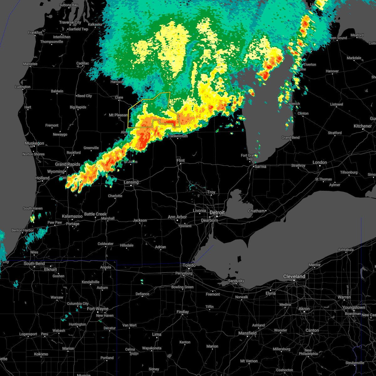 The severe thunderstorm warning for bay and midland counties will expire at 930 am edt, the storms which prompted the warning are along the southern borders of bay and midland counties and should move south of the counties around 930 am. therefore, the warning will be allowed to expire. however gusty winds and heavy rain will still linger a little past 930 am across the far southern areas of bay and midland counties. The severe thunderstorm warning for bay and midland counties will expire at 930 am edt, the storms which prompted the warning are along the southern borders of bay and midland counties and should move south of the counties around 930 am. therefore, the warning will be allowed to expire. however gusty winds and heavy rain will still linger a little past 930 am across the far southern areas of bay and midland counties.
|
| 7/19/2020 9:19 AM EDT |
 At 919 am edt, severe thunderstorms were located along a line extending from near essexville to near freeland to near ithaca, moving southeast at 50 mph (radar indicated). Hazards include 60 mph wind gusts. Expect damage to roofs, siding, and trees. these severe storms will be near, saginaw and zilwaukee around 925 am edt. bridgeport around 930 am edt. frankenmuth and oakley around 940 am edt. birch run around 945 am edt. Other locations impacted by these severe thunderstorms include brant, nelson, carrollton, garfield, arthur, fenmore, burt, gera, buena vista township and layton corners. At 919 am edt, severe thunderstorms were located along a line extending from near essexville to near freeland to near ithaca, moving southeast at 50 mph (radar indicated). Hazards include 60 mph wind gusts. Expect damage to roofs, siding, and trees. these severe storms will be near, saginaw and zilwaukee around 925 am edt. bridgeport around 930 am edt. frankenmuth and oakley around 940 am edt. birch run around 945 am edt. Other locations impacted by these severe thunderstorms include brant, nelson, carrollton, garfield, arthur, fenmore, burt, gera, buena vista township and layton corners.
|
| 7/19/2020 9:07 AM EDT |
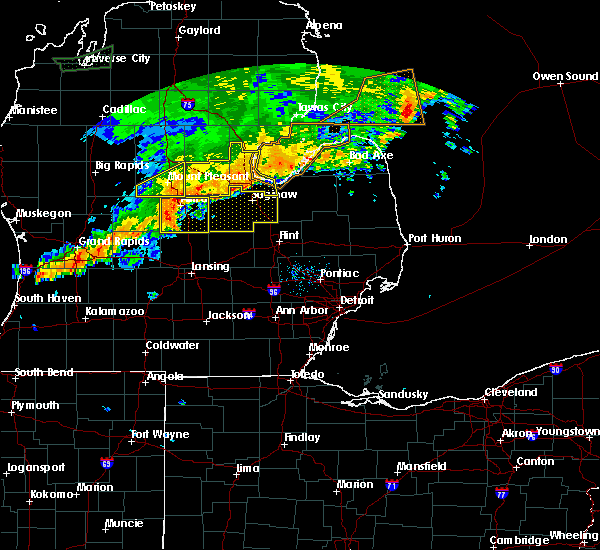 At 907 am edt, severe thunderstorms were located along a line extending from 13 miles northwest of sebewaing to near bay city to near pleasant valley, moving east at 50 mph (radar indicated). Hazards include 60 mph wind gusts. Expect damage to roofs, siding, and trees. these severe storms will be near, essexville around 915 am edt. munger around 920 am edt. Other locations impacted by these severe thunderstorms include laporte, averill, gordonville, bombay, porter township, crump, poseyville, willard, hope and bay city state recreation area. At 907 am edt, severe thunderstorms were located along a line extending from 13 miles northwest of sebewaing to near bay city to near pleasant valley, moving east at 50 mph (radar indicated). Hazards include 60 mph wind gusts. Expect damage to roofs, siding, and trees. these severe storms will be near, essexville around 915 am edt. munger around 920 am edt. Other locations impacted by these severe thunderstorms include laporte, averill, gordonville, bombay, porter township, crump, poseyville, willard, hope and bay city state recreation area.
|
| 7/19/2020 9:03 AM EDT |
 At 902 am edt, a severe thunderstorm was located near midland, moving east at 35 mph (radar indicated). Hazards include 60 mph wind gusts. Expect damage to roofs, siding, and trees. this severe thunderstorm will be near, freeland around 915 am edt. zilwaukee around 935 am edt. saginaw and bridgeport around 940 am edt. frankenmuth around 1000 am edt. Additional thunderstorms will likely develop over southern saginaw county around 10 am. At 902 am edt, a severe thunderstorm was located near midland, moving east at 35 mph (radar indicated). Hazards include 60 mph wind gusts. Expect damage to roofs, siding, and trees. this severe thunderstorm will be near, freeland around 915 am edt. zilwaukee around 935 am edt. saginaw and bridgeport around 940 am edt. frankenmuth around 1000 am edt. Additional thunderstorms will likely develop over southern saginaw county around 10 am.
|
| 7/19/2020 9:01 AM EDT | Numerous trees down throughout the city. time estimated by rada in midland county MI, 1.4 miles NW of Midland, MI |
| 7/19/2020 8:55 AM EDT | Numerous wires down. time estimated by rada in midland county MI, 4.3 miles ENE of Midland, MI |
| 7/19/2020 8:49 AM EDT |
 At 849 am edt, severe thunderstorms were located along a line extending from near standish to near sanford to oil city, moving east at 50 mph (radar indicated). Hazards include 60 mph wind gusts. Expect damage to roofs, siding, and trees. these severe storms will be near, pinconning around 855 am edt. linwood around 910 am edt. kawkawlin around 915 am edt. auburn around 920 am edt. bay city around 930 am edt. essexville around 935 am edt. munger around 940 am edt. Other locations impacted by these severe thunderstorms include laporte, mount forest, averill, gordonville, bombay, porter township, crump, poseyville, willard and hope. At 849 am edt, severe thunderstorms were located along a line extending from near standish to near sanford to oil city, moving east at 50 mph (radar indicated). Hazards include 60 mph wind gusts. Expect damage to roofs, siding, and trees. these severe storms will be near, pinconning around 855 am edt. linwood around 910 am edt. kawkawlin around 915 am edt. auburn around 920 am edt. bay city around 930 am edt. essexville around 935 am edt. munger around 940 am edt. Other locations impacted by these severe thunderstorms include laporte, mount forest, averill, gordonville, bombay, porter township, crump, poseyville, willard and hope.
|
| 7/19/2020 8:34 AM EDT |
 At 834 am edt, severe thunderstorms were located along a line extending from 6 miles south of bowmanville to near rosebush, moving southeast at 45 mph (radar indicated). Hazards include 60 mph wind gusts. Expect damage to roofs, siding, and trees. severe thunderstorms will be near, bentley around 845 am edt. oil city around 850 am edt. pleasant valley around 855 am edt. pinconning around 900 am edt. Other locations impacted by these severe thunderstorms include laporte, mount forest, averill, gordonville, bombay, porter township, crump, poseyville, willard and hope. At 834 am edt, severe thunderstorms were located along a line extending from 6 miles south of bowmanville to near rosebush, moving southeast at 45 mph (radar indicated). Hazards include 60 mph wind gusts. Expect damage to roofs, siding, and trees. severe thunderstorms will be near, bentley around 845 am edt. oil city around 850 am edt. pleasant valley around 855 am edt. pinconning around 900 am edt. Other locations impacted by these severe thunderstorms include laporte, mount forest, averill, gordonville, bombay, porter township, crump, poseyville, willard and hope.
|
| 6/10/2020 1:42 PM EDT |
 The severe thunderstorm warning for bay, saginaw and midland counties will expire at 145 pm edt, the storms which prompted the warning have weakened below severe limits, and no longer pose an immediate threat to life or property. therefore, the warning will be allowed to expire. however gusty winds and heavy rain are still possible with these strong thunderstorms. a severe thunderstorm watch remains in effect until 800 pm edt for southeastern michigan. The severe thunderstorm warning for bay, saginaw and midland counties will expire at 145 pm edt, the storms which prompted the warning have weakened below severe limits, and no longer pose an immediate threat to life or property. therefore, the warning will be allowed to expire. however gusty winds and heavy rain are still possible with these strong thunderstorms. a severe thunderstorm watch remains in effect until 800 pm edt for southeastern michigan.
|
| 6/10/2020 1:35 PM EDT |
 At 134 pm edt, severe thunderstorms were located along a line extending from near sanford to 6 miles northwest of merrill to near marion springs, moving northeast at 60 mph (radar indicated). Hazards include 70 mph wind gusts and quarter size hail. Hail damage to vehicles is expected. expect considerable tree damage. wind damage is also likely to mobile homes, roofs, and outbuildings. these severe storms will be near, sanford and edenville around 140 pm edt. midland, st. charles and merrill around 150 pm edt. freeland, bentley and linwood around 200 pm edt. saginaw and zilwaukee around 205 pm edt. auburn and pinconning around 210 pm edt. bay city, kawkawlin and essexville around 215 pm edt. Other locations impacted by these severe thunderstorms include carrollton, garfield, arthur, fenmore, crump, gera, buena vista township, indiantown, bombay and hemlock. At 134 pm edt, severe thunderstorms were located along a line extending from near sanford to 6 miles northwest of merrill to near marion springs, moving northeast at 60 mph (radar indicated). Hazards include 70 mph wind gusts and quarter size hail. Hail damage to vehicles is expected. expect considerable tree damage. wind damage is also likely to mobile homes, roofs, and outbuildings. these severe storms will be near, sanford and edenville around 140 pm edt. midland, st. charles and merrill around 150 pm edt. freeland, bentley and linwood around 200 pm edt. saginaw and zilwaukee around 205 pm edt. auburn and pinconning around 210 pm edt. bay city, kawkawlin and essexville around 215 pm edt. Other locations impacted by these severe thunderstorms include carrollton, garfield, arthur, fenmore, crump, gera, buena vista township, indiantown, bombay and hemlock.
|
| 6/10/2020 1:21 PM EDT |
 At 119 pm edt, severe thunderstorms were located along a line extending from near winegars to near linwood to near zilwaukee, moving northeast at 55 mph. another severe thunderstorm was located near mount pleasant, also moving northeast at 55 mph (radar indicated). Hazards include 70 mph wind gusts and quarter size hail. Hail damage to vehicles is expected. expect considerable tree damage. wind damage is also likely to mobile homes, roofs, and outbuildings. these severe storms will be near, pinconning, bentley, coleman, and edenville around 130 pm edt. Other locations impacted by these severe thunderstorms include carrollton, garfield, arthur, fenmore, crump, gera, buena vista township, indiantown, bombay, edenville and hemlock. At 119 pm edt, severe thunderstorms were located along a line extending from near winegars to near linwood to near zilwaukee, moving northeast at 55 mph. another severe thunderstorm was located near mount pleasant, also moving northeast at 55 mph (radar indicated). Hazards include 70 mph wind gusts and quarter size hail. Hail damage to vehicles is expected. expect considerable tree damage. wind damage is also likely to mobile homes, roofs, and outbuildings. these severe storms will be near, pinconning, bentley, coleman, and edenville around 130 pm edt. Other locations impacted by these severe thunderstorms include carrollton, garfield, arthur, fenmore, crump, gera, buena vista township, indiantown, bombay, edenville and hemlock.
|
| 6/10/2020 1:14 PM EDT | Spotter reported 8 inch diameter tree blown down and numerous small branches dow in midland county MI, 1.9 miles NNW of Midland, MI |
| 6/10/2020 1:13 PM EDT |
 At 112 pm edt, severe thunderstorms were located along a line extending from near edenville to 6 miles northeast of midland to near saginaw, moving northeast at 60 mph (radar indicated). Hazards include 60 mph wind gusts and quarter size hail. Hail damage to vehicles is expected. expect wind damage to roofs, siding, and trees. these severe storms will be near, linwood around 120 pm edt. munger around 125 pm edt. pinconning, essexville and bentley around 130 pm edt. Other locations impacted by these severe thunderstorms include carrollton, garfield, arthur, fenmore, crump, gera, buena vista township, indiantown, bombay and hemlock. At 112 pm edt, severe thunderstorms were located along a line extending from near edenville to 6 miles northeast of midland to near saginaw, moving northeast at 60 mph (radar indicated). Hazards include 60 mph wind gusts and quarter size hail. Hail damage to vehicles is expected. expect wind damage to roofs, siding, and trees. these severe storms will be near, linwood around 120 pm edt. munger around 125 pm edt. pinconning, essexville and bentley around 130 pm edt. Other locations impacted by these severe thunderstorms include carrollton, garfield, arthur, fenmore, crump, gera, buena vista township, indiantown, bombay and hemlock.
|
| 6/10/2020 12:59 PM EDT |
 At 1240 pm edt, severe thunderstorms were located along a line extending from near mount pleasant to near st. louis to near elsie, moving northeast at 50 mph (radar indicated). Hazards include 60 mph wind gusts and quarter size hail. Hail damage to vehicles is expected. expect wind damage to roofs, siding, and trees. severe thunderstorms will be near, pleasant valley around 1245 pm edt. merrill around 1250 pm edt. oakley and marion springs around 1255 pm edt. chesaning and coleman around 100 pm edt. st. charles and freeland around 105 pm edt. midland and edenville around 110 pm edt. auburn around 115 pm edt. bridgeport around 120 pm edt. Other locations impacted by these severe thunderstorms include carrollton, garfield, arthur, fenmore, crump, gera, buena vista township, indiantown, bombay and hemlock. At 1240 pm edt, severe thunderstorms were located along a line extending from near mount pleasant to near st. louis to near elsie, moving northeast at 50 mph (radar indicated). Hazards include 60 mph wind gusts and quarter size hail. Hail damage to vehicles is expected. expect wind damage to roofs, siding, and trees. severe thunderstorms will be near, pleasant valley around 1245 pm edt. merrill around 1250 pm edt. oakley and marion springs around 1255 pm edt. chesaning and coleman around 100 pm edt. st. charles and freeland around 105 pm edt. midland and edenville around 110 pm edt. auburn around 115 pm edt. bridgeport around 120 pm edt. Other locations impacted by these severe thunderstorms include carrollton, garfield, arthur, fenmore, crump, gera, buena vista township, indiantown, bombay and hemlock.
|
| 6/10/2020 12:41 PM EDT |
 At 1240 pm edt, severe thunderstorms were located along a line extending from near mount pleasant to near st. louis to near elsie, moving northeast at 50 mph (radar indicated). Hazards include 60 mph wind gusts and quarter size hail. Hail damage to vehicles is expected. expect wind damage to roofs, siding, and trees. severe thunderstorms will be near, pleasant valley around 1245 pm edt. merrill around 1250 pm edt. oakley and marion springs around 1255 pm edt. chesaning and coleman around 100 pm edt. st. charles and freeland around 105 pm edt. midland and edenville around 110 pm edt. auburn around 115 pm edt. bridgeport around 120 pm edt. Other locations impacted by these severe thunderstorms include carrollton, garfield, arthur, fenmore, crump, gera, buena vista township, indiantown, bombay and hemlock. At 1240 pm edt, severe thunderstorms were located along a line extending from near mount pleasant to near st. louis to near elsie, moving northeast at 50 mph (radar indicated). Hazards include 60 mph wind gusts and quarter size hail. Hail damage to vehicles is expected. expect wind damage to roofs, siding, and trees. severe thunderstorms will be near, pleasant valley around 1245 pm edt. merrill around 1250 pm edt. oakley and marion springs around 1255 pm edt. chesaning and coleman around 100 pm edt. st. charles and freeland around 105 pm edt. midland and edenville around 110 pm edt. auburn around 115 pm edt. bridgeport around 120 pm edt. Other locations impacted by these severe thunderstorms include carrollton, garfield, arthur, fenmore, crump, gera, buena vista township, indiantown, bombay and hemlock.
|
| 4/7/2020 9:44 PM EDT |
 At 944 pm edt, a severe thunderstorm was located over auburn, moving east at 55 mph (radar indicated). Hazards include quarter size hail. Damage to vehicles is expected. this severe storm will be near, bay city, kawkawlin and zilwaukee around 950 pm edt. essexville around 955 pm edt. munger around 1000 pm edt. Other locations impacted by this severe thunderstorm include bay city state recreation area, indiantown and carrollton. At 944 pm edt, a severe thunderstorm was located over auburn, moving east at 55 mph (radar indicated). Hazards include quarter size hail. Damage to vehicles is expected. this severe storm will be near, bay city, kawkawlin and zilwaukee around 950 pm edt. essexville around 955 pm edt. munger around 1000 pm edt. Other locations impacted by this severe thunderstorm include bay city state recreation area, indiantown and carrollton.
|
| 4/7/2020 9:42 PM EDT | Quarter sized hail reported 4.2 miles NNW of Midland, MI, near the intersection of salzburg and s saginaw road. |
| 4/7/2020 9:37 PM EDT | Ping Pong Ball sized hail reported 6.8 miles NNW of Midland, MI, half dollar to ping pong ball size hail. |
| 4/7/2020 9:36 PM EDT | Quarter sized hail reported 1.4 miles NW of Midland, MI |
| 4/7/2020 9:31 PM EDT |
 At 931 pm edt, a severe thunderstorm was located near midland, moving east at 60 mph (radar indicated). Hazards include ping pong ball size hail. People and animals outdoors will be injured. expect damage to roofs, siding, windows, and vehicles. this severe thunderstorm will be near, freeland around 935 pm edt. auburn around 940 pm edt. zilwaukee around 945 pm edt. bay city and kawkawlin around 950 pm edt. essexville and munger around 955 pm edt. Other locations impacted by this severe thunderstorm include willard, bay city state recreation area, indiantown and carrollton. At 931 pm edt, a severe thunderstorm was located near midland, moving east at 60 mph (radar indicated). Hazards include ping pong ball size hail. People and animals outdoors will be injured. expect damage to roofs, siding, windows, and vehicles. this severe thunderstorm will be near, freeland around 935 pm edt. auburn around 940 pm edt. zilwaukee around 945 pm edt. bay city and kawkawlin around 950 pm edt. essexville and munger around 955 pm edt. Other locations impacted by this severe thunderstorm include willard, bay city state recreation area, indiantown and carrollton.
|
| 4/7/2020 9:29 PM EDT | Ping Pong Ball sized hail reported 10.5 miles ENE of Midland, MI, near the intersection of w stewart road and s 8 mile road. |
| 4/7/2020 9:29 PM EDT | Hen Egg sized hail reported 7 miles ENE of Midland, MI, 1.75 to 2.00 inch hail 2 miles south of m-20 on s meridian road |
| 4/7/2020 9:29 PM EDT | Hen Egg sized hail reported 3.9 miles NE of Midland, MI, photo shared via social media near the intersection of east miller road and south woodcock road. |
| 4/7/2020 9:29 PM EDT |
 At 929 pm edt, a severe thunderstorm was located near midland, moving east at 60 mph (radar indicated). Hazards include ping pong ball size hail. People and animals outdoors will be injured. expect damage to roofs, siding, windows, and vehicles. This severe thunderstorm will remain over mainly rural areas of southeastern midland county, including the following locations, laporte, porter township, gordonville and poseyville. At 929 pm edt, a severe thunderstorm was located near midland, moving east at 60 mph (radar indicated). Hazards include ping pong ball size hail. People and animals outdoors will be injured. expect damage to roofs, siding, windows, and vehicles. This severe thunderstorm will remain over mainly rural areas of southeastern midland county, including the following locations, laporte, porter township, gordonville and poseyville.
|
| 4/7/2020 9:21 PM EDT |
 At 921 pm edt, a severe thunderstorm was located near pleasant valley, or 10 miles south of sanford, moving east at 60 mph (radar indicated). Hazards include quarter size hail. Damage to vehicles is expected. this severe storm will be near, midland around 935 pm edt. Other locations impacted by this severe thunderstorm include laporte, porter township, gordonville and poseyville. At 921 pm edt, a severe thunderstorm was located near pleasant valley, or 10 miles south of sanford, moving east at 60 mph (radar indicated). Hazards include quarter size hail. Damage to vehicles is expected. this severe storm will be near, midland around 935 pm edt. Other locations impacted by this severe thunderstorm include laporte, porter township, gordonville and poseyville.
|
| 4/7/2020 9:12 PM EDT |
 At 911 pm edt, a severe thunderstorm was located over shepherd, or 7 miles southeast of mount pleasant, moving east at 60 mph (radar indicated). Hazards include quarter size hail. Damage to vehicles is expected. this severe thunderstorm will be near, oil city around 915 pm edt. midland around 935 pm edt. Other locations impacted by this severe thunderstorm include laporte, porter township, gordonville and poseyville. At 911 pm edt, a severe thunderstorm was located over shepherd, or 7 miles southeast of mount pleasant, moving east at 60 mph (radar indicated). Hazards include quarter size hail. Damage to vehicles is expected. this severe thunderstorm will be near, oil city around 915 pm edt. midland around 935 pm edt. Other locations impacted by this severe thunderstorm include laporte, porter township, gordonville and poseyville.
|
| 4/7/2020 7:46 PM EDT |
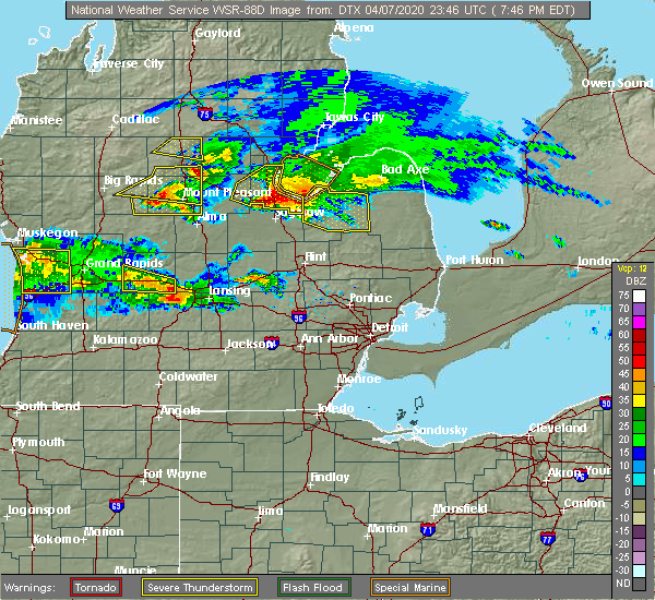 At 745 pm edt, severe thunderstorms were located along a line extending from 6 miles north of quanicassee to near essexville to auburn, moving southeast at 55 mph (radar indicated). Hazards include quarter size hail. Damage to vehicles is expected. these severe storms will be near, munger around 750 pm edt. Other locations impacted by these severe thunderstorms include bay city state recreation area. At 745 pm edt, severe thunderstorms were located along a line extending from 6 miles north of quanicassee to near essexville to auburn, moving southeast at 55 mph (radar indicated). Hazards include quarter size hail. Damage to vehicles is expected. these severe storms will be near, munger around 750 pm edt. Other locations impacted by these severe thunderstorms include bay city state recreation area.
|
| 4/7/2020 7:35 PM EDT |
 At 735 pm edt, severe thunderstorms were located along a line extending from 10 miles southeast of pinconning to near linwood to near midland, moving east at 60 mph (radar indicated). Hazards include ping pong ball size hail. People and animals outdoors will be injured. expect damage to roofs, siding, windows, and vehicles. these severe storms will be near, linwood around 745 pm edt. bay city around 750 pm edt. essexville around 755 pm edt. munger around 800 pm edt. Other locations impacted by these severe thunderstorms include crump, bombay, willard and bay city state recreation area. At 735 pm edt, severe thunderstorms were located along a line extending from 10 miles southeast of pinconning to near linwood to near midland, moving east at 60 mph (radar indicated). Hazards include ping pong ball size hail. People and animals outdoors will be injured. expect damage to roofs, siding, windows, and vehicles. these severe storms will be near, linwood around 745 pm edt. bay city around 750 pm edt. essexville around 755 pm edt. munger around 800 pm edt. Other locations impacted by these severe thunderstorms include crump, bombay, willard and bay city state recreation area.
|
| 4/7/2020 7:29 PM EDT |
 At 729 pm edt, severe thunderstorms were located along a line extending from near pinconning to near linwood to near sanford, moving east at 60 mph (radar indicated). Hazards include quarter size hail. Damage to vehicles is expected. these severe storms will be near, linwood around 735 pm edt. kawkawlin around 745 pm edt. bay city and essexville around 750 pm edt. munger around 800 pm edt. Other locations impacted by these severe thunderstorms include averill, crump, bombay, willard, hope and bay city state recreation area. At 729 pm edt, severe thunderstorms were located along a line extending from near pinconning to near linwood to near sanford, moving east at 60 mph (radar indicated). Hazards include quarter size hail. Damage to vehicles is expected. these severe storms will be near, linwood around 735 pm edt. kawkawlin around 745 pm edt. bay city and essexville around 750 pm edt. munger around 800 pm edt. Other locations impacted by these severe thunderstorms include averill, crump, bombay, willard, hope and bay city state recreation area.
|
| 4/7/2020 7:19 PM EDT |
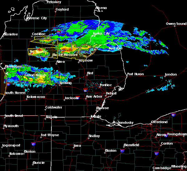 At 718 pm edt, severe thunderstorms were located along a line extending from near bentley to near rhodes to near edenville, moving southeast at 60 mph (radar indicated). Hazards include quarter size hail. Damage to vehicles is expected. these severe storms will be near, pinconning around 725 pm edt. bay city, kawkawlin and linwood around 745 pm edt. Other locations impacted by these severe thunderstorms include mount forest, averill, bombay, crump, willard, hope, bay city state recreation area and north bradley. At 718 pm edt, severe thunderstorms were located along a line extending from near bentley to near rhodes to near edenville, moving southeast at 60 mph (radar indicated). Hazards include quarter size hail. Damage to vehicles is expected. these severe storms will be near, pinconning around 725 pm edt. bay city, kawkawlin and linwood around 745 pm edt. Other locations impacted by these severe thunderstorms include mount forest, averill, bombay, crump, willard, hope, bay city state recreation area and north bradley.
|
| 4/7/2020 7:06 PM EDT |
 At 705 pm edt, severe thunderstorms were located along a line extending from winegars to near beaverton to near clare, moving southeast at 60 mph (radar indicated). Hazards include quarter size hail. Damage to vehicles is expected. severe thunderstorms will be near, bentley around 715 pm edt. pinconning, sanford and edenville around 725 pm edt. auburn around 740 pm edt. kawkawlin and linwood around 745 pm edt. bay city and essexville around 750 pm edt. Other locations impacted by these severe thunderstorms include mount forest, averill, bombay, crump, willard, hope, bay city state recreation area and north bradley. At 705 pm edt, severe thunderstorms were located along a line extending from winegars to near beaverton to near clare, moving southeast at 60 mph (radar indicated). Hazards include quarter size hail. Damage to vehicles is expected. severe thunderstorms will be near, bentley around 715 pm edt. pinconning, sanford and edenville around 725 pm edt. auburn around 740 pm edt. kawkawlin and linwood around 745 pm edt. bay city and essexville around 750 pm edt. Other locations impacted by these severe thunderstorms include mount forest, averill, bombay, crump, willard, hope, bay city state recreation area and north bradley.
|
| 9/10/2019 7:58 PM EDT |
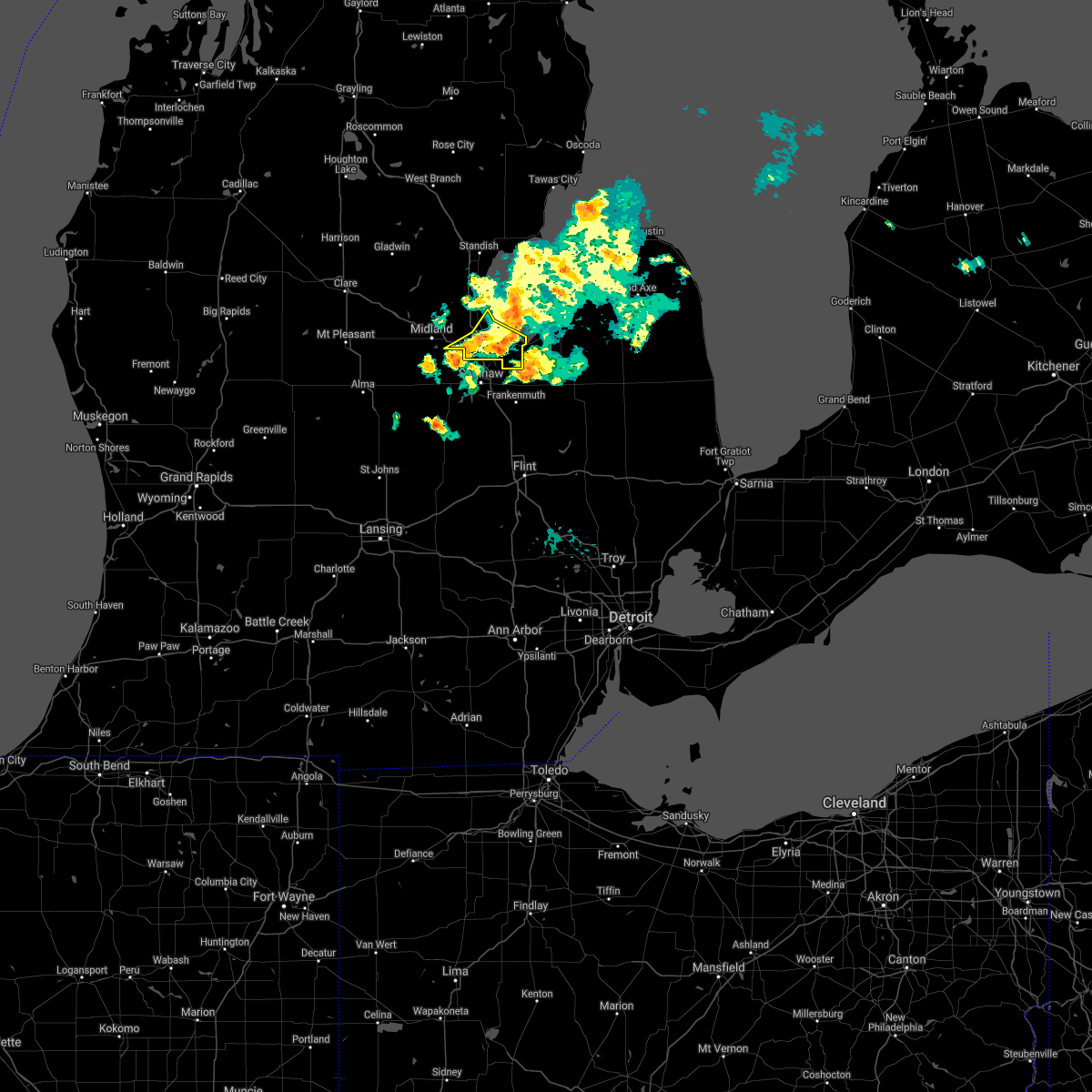 At 757 pm edt, severe thunderstorms were located along a line extending from 13 miles south of au gres to near munger to near zilwaukee, moving southeast at 40 mph (radar indicated). Hazards include 60 mph wind gusts and quarter size hail. Hail damage to vehicles is expected. expect wind damage to roofs, siding, and trees. These severe thunderstorms will remain over mainly rural areas of southern bay county, including the following locations, bay city state recreation area. At 757 pm edt, severe thunderstorms were located along a line extending from 13 miles south of au gres to near munger to near zilwaukee, moving southeast at 40 mph (radar indicated). Hazards include 60 mph wind gusts and quarter size hail. Hail damage to vehicles is expected. expect wind damage to roofs, siding, and trees. These severe thunderstorms will remain over mainly rural areas of southern bay county, including the following locations, bay city state recreation area.
|
| 9/10/2019 7:38 PM EDT |
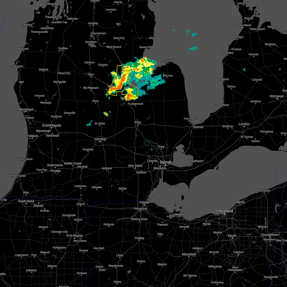 At 738 pm edt, severe thunderstorms were located along a line extending from near pinconning to kawkawlin to near midland, moving east at 40 mph (radar indicated). Hazards include 60 mph wind gusts and quarter size hail. Hail damage to vehicles is expected. expect wind damage to roofs, siding, and trees. these severe storms will be near, bay city and kawkawlin around 745 pm edt. auburn and essexville around 750 pm edt. munger around 800 pm edt. Other locations impacted by these severe thunderstorms include mount forest, crump, gordonville, poseyville, willard and bay city state recreation area. At 738 pm edt, severe thunderstorms were located along a line extending from near pinconning to kawkawlin to near midland, moving east at 40 mph (radar indicated). Hazards include 60 mph wind gusts and quarter size hail. Hail damage to vehicles is expected. expect wind damage to roofs, siding, and trees. these severe storms will be near, bay city and kawkawlin around 745 pm edt. auburn and essexville around 750 pm edt. munger around 800 pm edt. Other locations impacted by these severe thunderstorms include mount forest, crump, gordonville, poseyville, willard and bay city state recreation area.
|
| 9/10/2019 7:29 PM EDT | Trees and wires down on 1000 block of w wheeler st. time estimated via rada in midland county MI, 0.7 miles SW of Midland, MI |
| 9/10/2019 7:29 PM EDT | Trees and wires downed at haley and bayliss. time estimated via rada in midland county MI, 1.8 miles WNW of Midland, MI |
| 9/10/2019 7:29 PM EDT | Trees and wires downed at currie pkwy and isabella. time estimated via rada in midland county MI, 1.9 miles NNE of Midland, MI |
| 9/10/2019 7:29 PM EDT | Large tree downed at swede and haley rd. time estimated via rada in midland county MI, 2.2 miles WNW of Midland, MI |
| 9/10/2019 7:28 PM EDT |
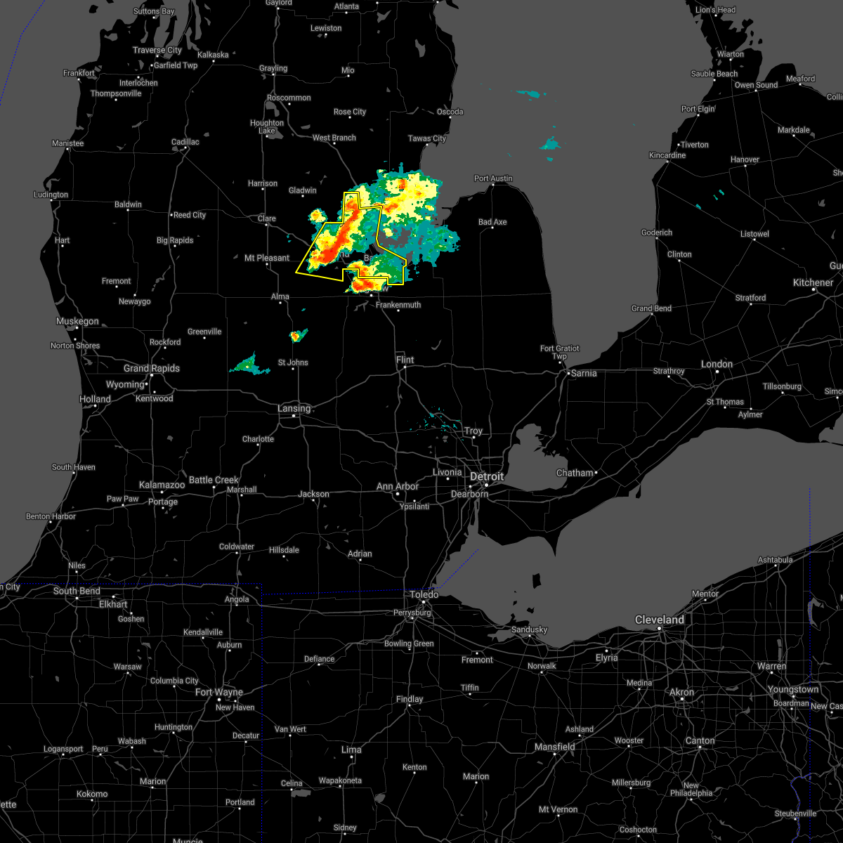 At 728 pm edt, severe thunderstorms were located along a line extending from near bentley to 6 miles north of auburn to 6 miles south of sanford, moving east at 40 mph (radar indicated). Hazards include 60 mph wind gusts and quarter size hail. Hail damage to vehicles is expected. expect wind damage to roofs, siding, and trees. severe thunderstorms will be near, auburn, pinconning and linwood around 735 pm edt. kawkawlin around 740 pm edt. bay city around 745 pm edt. essexville around 750 pm edt. munger around 800 pm edt. Other locations impacted by these severe thunderstorms include mount forest, averill, gordonville, bombay, crump, poseyville, willard, hope and bay city state recreation area. At 728 pm edt, severe thunderstorms were located along a line extending from near bentley to 6 miles north of auburn to 6 miles south of sanford, moving east at 40 mph (radar indicated). Hazards include 60 mph wind gusts and quarter size hail. Hail damage to vehicles is expected. expect wind damage to roofs, siding, and trees. severe thunderstorms will be near, auburn, pinconning and linwood around 735 pm edt. kawkawlin around 740 pm edt. bay city around 745 pm edt. essexville around 750 pm edt. munger around 800 pm edt. Other locations impacted by these severe thunderstorms include mount forest, averill, gordonville, bombay, crump, poseyville, willard, hope and bay city state recreation area.
|
| 9/10/2019 7:23 PM EDT |
 At 723 pm edt, a severe thunderstorm capable of producing a tornado was located near freeland, moving east at 35 mph (radar indicated rotation). Hazards include tornado and quarter size hail. Flying debris will be dangerous to those caught without shelter. mobile homes will be damaged or destroyed. damage to roofs, windows, and vehicles will occur. tree damage is likely. this dangerous storm will be near, saginaw around 740 pm edt. Other locations impacted by this tornadic thunderstorm include swan creek, shiawassee national wildlife refuge, shields and hemlock. At 723 pm edt, a severe thunderstorm capable of producing a tornado was located near freeland, moving east at 35 mph (radar indicated rotation). Hazards include tornado and quarter size hail. Flying debris will be dangerous to those caught without shelter. mobile homes will be damaged or destroyed. damage to roofs, windows, and vehicles will occur. tree damage is likely. this dangerous storm will be near, saginaw around 740 pm edt. Other locations impacted by this tornadic thunderstorm include swan creek, shiawassee national wildlife refuge, shields and hemlock.
|
| 9/10/2019 7:22 PM EDT |
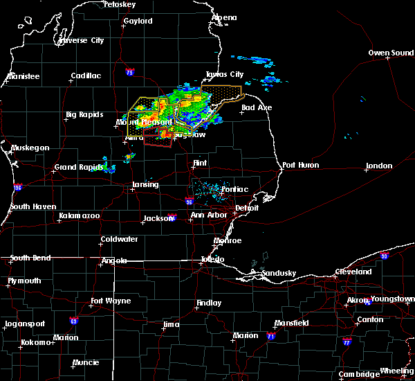 The tornado warning for southeastern midland county will expire at 730 pm edt, the tornado threat has diminished and the tornado warning will be allowed to expire. however, large hail and damaging winds remain likely and a severe thunderstorm warning remains in effect for the area. a severe thunderstorm watch remains in effect until 1100 pm edt for southeastern michigan. remember, a severe thunderstorm warning still remains in effect for midland county. The tornado warning for southeastern midland county will expire at 730 pm edt, the tornado threat has diminished and the tornado warning will be allowed to expire. however, large hail and damaging winds remain likely and a severe thunderstorm warning remains in effect for the area. a severe thunderstorm watch remains in effect until 1100 pm edt for southeastern michigan. remember, a severe thunderstorm warning still remains in effect for midland county.
|
| 9/10/2019 7:17 PM EDT |
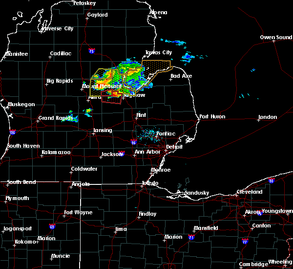 At 717 pm edt, a severe thunderstorm was located over sanford, moving east at 55 mph (radar indicated). Hazards include 60 mph wind gusts and quarter size hail. Hail damage to vehicles is expected. expect wind damage to roofs, siding, and trees. this severe storm will be near, midland and auburn around 730 pm edt. Other locations impacted by this severe thunderstorm include laporte, mount forest, averill, gordonville, bombay, porter township, crump, poseyville, willard and hope. At 717 pm edt, a severe thunderstorm was located over sanford, moving east at 55 mph (radar indicated). Hazards include 60 mph wind gusts and quarter size hail. Hail damage to vehicles is expected. expect wind damage to roofs, siding, and trees. this severe storm will be near, midland and auburn around 730 pm edt. Other locations impacted by this severe thunderstorm include laporte, mount forest, averill, gordonville, bombay, porter township, crump, poseyville, willard and hope.
|
| 9/10/2019 7:13 PM EDT |
 At 712 pm edt, a severe thunderstorm capable of producing a tornado was located near merrill, or 8 miles southwest of freeland, moving east at 35 mph (radar indicated rotation). Hazards include tornado and quarter size hail. Flying debris will be dangerous to those caught without shelter. mobile homes will be damaged or destroyed. damage to roofs, windows, and vehicles will occur. tree damage is likely. this dangerous storm will be near, freeland around 720 pm edt. Other locations impacted by this tornadic thunderstorm include swan creek, shiawassee national wildlife refuge, garfield, shields and hemlock. At 712 pm edt, a severe thunderstorm capable of producing a tornado was located near merrill, or 8 miles southwest of freeland, moving east at 35 mph (radar indicated rotation). Hazards include tornado and quarter size hail. Flying debris will be dangerous to those caught without shelter. mobile homes will be damaged or destroyed. damage to roofs, windows, and vehicles will occur. tree damage is likely. this dangerous storm will be near, freeland around 720 pm edt. Other locations impacted by this tornadic thunderstorm include swan creek, shiawassee national wildlife refuge, garfield, shields and hemlock.
|
| 9/10/2019 7:09 PM EDT |
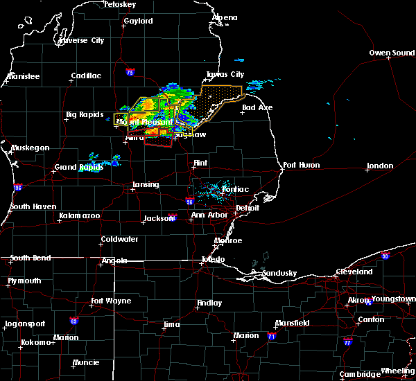 At 651 pm edt, a severe thunderstorm capable of producing a tornado was located just east of pleasant valley, or 11 miles northeast of alma, moving east at 35 mph (radar indicated rotation). Hazards include tornado and quarter size hail. Flying debris will be dangerous to those caught without shelter. mobile homes will be damaged or destroyed. damage to roofs, windows, and vehicles will occur. tree damage is likely. this dangerous storm will be near, freeland around 720 pm edt. midland around 725 pm edt. Other locations impacted by this tornadic thunderstorm include laporte, porter township, gordonville and poseyville. At 651 pm edt, a severe thunderstorm capable of producing a tornado was located just east of pleasant valley, or 11 miles northeast of alma, moving east at 35 mph (radar indicated rotation). Hazards include tornado and quarter size hail. Flying debris will be dangerous to those caught without shelter. mobile homes will be damaged or destroyed. damage to roofs, windows, and vehicles will occur. tree damage is likely. this dangerous storm will be near, freeland around 720 pm edt. midland around 725 pm edt. Other locations impacted by this tornadic thunderstorm include laporte, porter township, gordonville and poseyville.
|
| 9/10/2019 7:04 PM EDT |
 At 704 pm edt, a severe thunderstorm was located near coleman, moving east at 40 mph (radar indicated). Hazards include 60 mph wind gusts and quarter size hail. Hail damage to vehicles is expected. expect wind damage to roofs, siding, and trees. this severe storm will be near, sanford around 720 pm edt. midland around 730 pm edt. Other locations impacted by this severe thunderstorm include laporte, mount forest, averill, gordonville, bombay, porter township, crump, poseyville, willard and hope. At 704 pm edt, a severe thunderstorm was located near coleman, moving east at 40 mph (radar indicated). Hazards include 60 mph wind gusts and quarter size hail. Hail damage to vehicles is expected. expect wind damage to roofs, siding, and trees. this severe storm will be near, sanford around 720 pm edt. midland around 730 pm edt. Other locations impacted by this severe thunderstorm include laporte, mount forest, averill, gordonville, bombay, porter township, crump, poseyville, willard and hope.
|
| 9/10/2019 7:00 PM EDT |
 The national weather service in detroit/pontiac has issued a * tornado warning for. northwestern saginaw county in southeastern michigan. until 745 pm edt. At 659 pm edt, a severe thunderstorm capable of producing a tornado was located near merrill, or 13 miles southwest of midland, moving. The national weather service in detroit/pontiac has issued a * tornado warning for. northwestern saginaw county in southeastern michigan. until 745 pm edt. At 659 pm edt, a severe thunderstorm capable of producing a tornado was located near merrill, or 13 miles southwest of midland, moving.
|
| 9/10/2019 6:51 PM EDT |
 At 651 pm edt, a severe thunderstorm capable of producing a tornado was located just east of pleasant valley, or 11 miles northeast of alma, moving east at 35 mph (radar indicated rotation). Hazards include tornado and quarter size hail. Flying debris will be dangerous to those caught without shelter. mobile homes will be damaged or destroyed. damage to roofs, windows, and vehicles will occur. tree damage is likely. this dangerous storm will be near, freeland around 720 pm edt. midland around 725 pm edt. Other locations impacted by this tornadic thunderstorm include laporte, porter township, gordonville and poseyville. At 651 pm edt, a severe thunderstorm capable of producing a tornado was located just east of pleasant valley, or 11 miles northeast of alma, moving east at 35 mph (radar indicated rotation). Hazards include tornado and quarter size hail. Flying debris will be dangerous to those caught without shelter. mobile homes will be damaged or destroyed. damage to roofs, windows, and vehicles will occur. tree damage is likely. this dangerous storm will be near, freeland around 720 pm edt. midland around 725 pm edt. Other locations impacted by this tornadic thunderstorm include laporte, porter township, gordonville and poseyville.
|
| 9/10/2019 6:49 PM EDT |
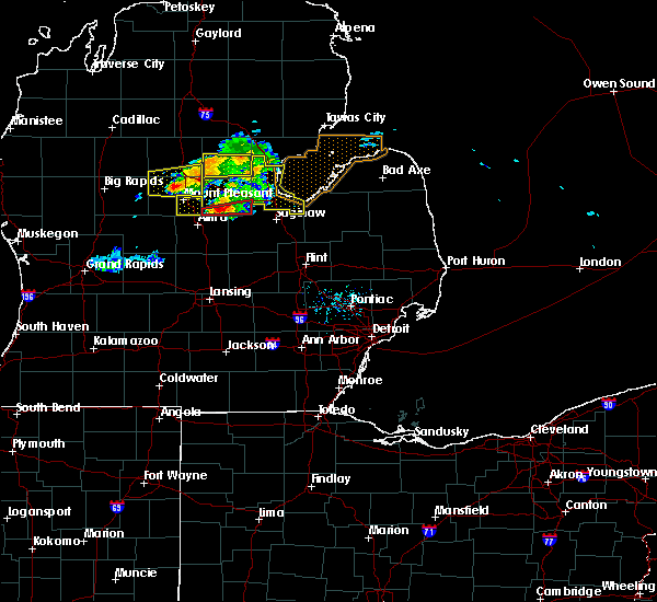 At 648 pm edt, a severe thunderstorm was located near midland, moving east at 45 mph (radar indicated). Hazards include 60 mph wind gusts and quarter size hail. Hail damage to vehicles is expected. expect wind damage to roofs, siding, and trees. this severe storm will be near, midland around 700 pm edt. auburn around 705 pm edt. bay city and kawkawlin around 715 pm edt. essexville around 720 pm edt. munger around 725 pm edt. Other locations impacted by this severe thunderstorm include laporte, mount forest, averill, gordonville, bombay, porter township, crump, poseyville, willard and hope. At 648 pm edt, a severe thunderstorm was located near midland, moving east at 45 mph (radar indicated). Hazards include 60 mph wind gusts and quarter size hail. Hail damage to vehicles is expected. expect wind damage to roofs, siding, and trees. this severe storm will be near, midland around 700 pm edt. auburn around 705 pm edt. bay city and kawkawlin around 715 pm edt. essexville around 720 pm edt. munger around 725 pm edt. Other locations impacted by this severe thunderstorm include laporte, mount forest, averill, gordonville, bombay, porter township, crump, poseyville, willard and hope.
|
| 9/10/2019 6:42 PM EDT |
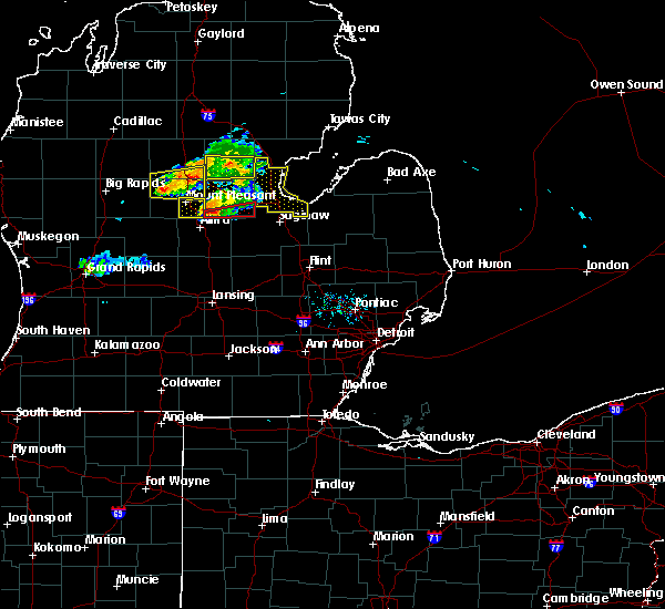 At 642 pm edt, a severe thunderstorm capable of producing a tornado was located over pleasant valley, or 8 miles northeast of alma, moving east at 40 mph (radar indicated rotation). Hazards include tornado. Flying debris will be dangerous to those caught without shelter. mobile homes will be damaged or destroyed. damage to roofs, windows, and vehicles will occur. tree damage is likely. this dangerous storm will be near, midland and freeland around 715 pm edt. Other locations impacted by this tornadic thunderstorm include laporte, porter township, gordonville and poseyville. At 642 pm edt, a severe thunderstorm capable of producing a tornado was located over pleasant valley, or 8 miles northeast of alma, moving east at 40 mph (radar indicated rotation). Hazards include tornado. Flying debris will be dangerous to those caught without shelter. mobile homes will be damaged or destroyed. damage to roofs, windows, and vehicles will occur. tree damage is likely. this dangerous storm will be near, midland and freeland around 715 pm edt. Other locations impacted by this tornadic thunderstorm include laporte, porter township, gordonville and poseyville.
|
| 9/10/2019 6:32 PM EDT |
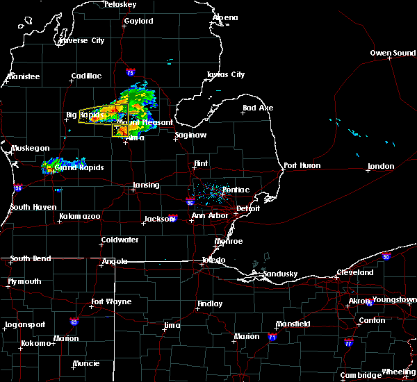 At 630 pm edt, a severe thunderstorm was located over pleasant valley, or 9 miles north of alma, moving east at 45 mph (radar indicated). Hazards include 60 mph wind gusts and quarter size hail. Hail damage to vehicles is expected. expect wind damage to roofs, siding, and trees. this severe thunderstorm will be near, midland around 705 pm edt. auburn around 710 pm edt. kawkawlin around 715 pm edt. bay city around 720 pm edt. essexville and munger around 725 pm edt. Other locations impacted by this severe thunderstorm include laporte, mount forest, averill, gordonville, bombay, porter township, crump, poseyville, willard and hope. At 630 pm edt, a severe thunderstorm was located over pleasant valley, or 9 miles north of alma, moving east at 45 mph (radar indicated). Hazards include 60 mph wind gusts and quarter size hail. Hail damage to vehicles is expected. expect wind damage to roofs, siding, and trees. this severe thunderstorm will be near, midland around 705 pm edt. auburn around 710 pm edt. kawkawlin around 715 pm edt. bay city around 720 pm edt. essexville and munger around 725 pm edt. Other locations impacted by this severe thunderstorm include laporte, mount forest, averill, gordonville, bombay, porter township, crump, poseyville, willard and hope.
|
| 5/31/2019 11:22 PM EDT |
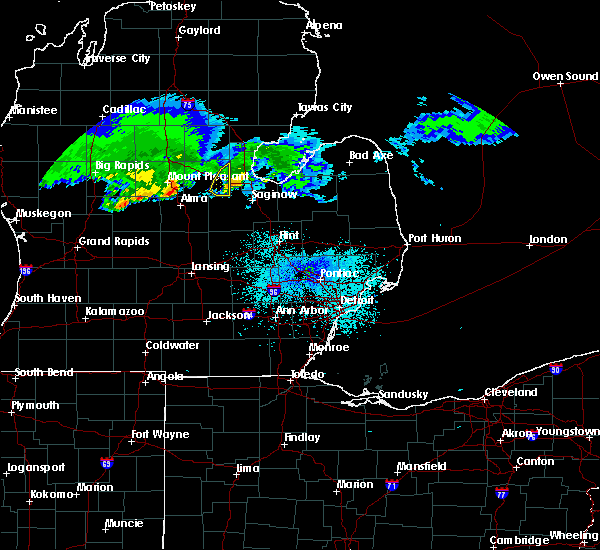 The severe thunderstorm warning for southeastern midland county will expire at 1130 pm edt, the storm which prompted the warning has moved out of the area. therefore, the warning will be allowed to expire. however gusty winds are still possible with another storm moving into midland county. The severe thunderstorm warning for southeastern midland county will expire at 1130 pm edt, the storm which prompted the warning has moved out of the area. therefore, the warning will be allowed to expire. however gusty winds are still possible with another storm moving into midland county.
|
| 5/31/2019 11:13 PM EDT |
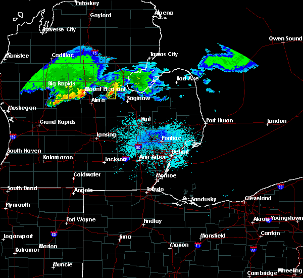 At 1113 pm edt, a severe thunderstorm was located near midland, moving southeast at 45 mph (radar indicated). Hazards include 60 mph wind gusts and penny size hail. Expect damage to roofs, siding, and trees. Locations impacted include, midland, poseyville and laporte. At 1113 pm edt, a severe thunderstorm was located near midland, moving southeast at 45 mph (radar indicated). Hazards include 60 mph wind gusts and penny size hail. Expect damage to roofs, siding, and trees. Locations impacted include, midland, poseyville and laporte.
|
| 5/31/2019 11:00 PM EDT |
 At 1100 pm edt, a severe thunderstorm was located over midland, moving southeast at 50 mph (radar indicated). Hazards include 60 mph wind gusts and penny size hail. Expect damage to roofs, siding, and trees. This severe thunderstorm will remain over mainly rural areas of eastern midland county, including the following locations, laporte, averill, gordonville, poseyville, bombay and hope. At 1100 pm edt, a severe thunderstorm was located over midland, moving southeast at 50 mph (radar indicated). Hazards include 60 mph wind gusts and penny size hail. Expect damage to roofs, siding, and trees. This severe thunderstorm will remain over mainly rural areas of eastern midland county, including the following locations, laporte, averill, gordonville, poseyville, bombay and hope.
|
| 5/31/2019 10:46 PM EDT |
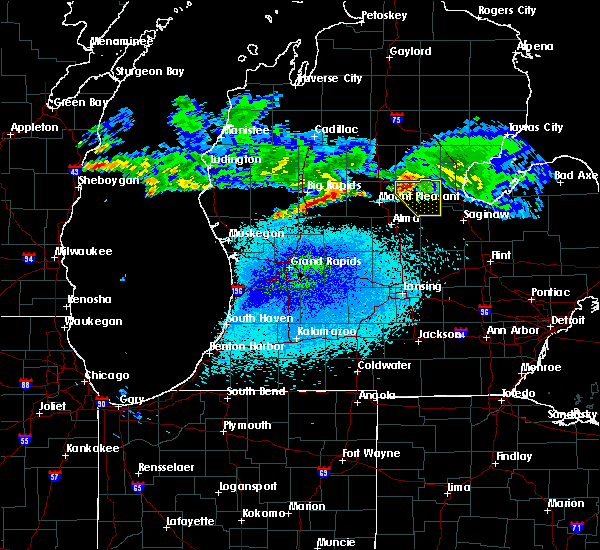 At 1045 pm edt, a severe thunderstorm was located near sanford, moving southeast at 50 mph (radar indicated). Hazards include 60 mph wind gusts and penny size hail. Expect damage to roofs, siding, and trees. this severe thunderstorm will be near, sanford around 1050 pm edt. midland around 1105 pm edt. Other locations impacted by this severe thunderstorm include laporte, averill, gordonville, bombay, poseyville, hope and north bradley. At 1045 pm edt, a severe thunderstorm was located near sanford, moving southeast at 50 mph (radar indicated). Hazards include 60 mph wind gusts and penny size hail. Expect damage to roofs, siding, and trees. this severe thunderstorm will be near, sanford around 1050 pm edt. midland around 1105 pm edt. Other locations impacted by this severe thunderstorm include laporte, averill, gordonville, bombay, poseyville, hope and north bradley.
|
| 9/25/2018 7:15 PM EDT |
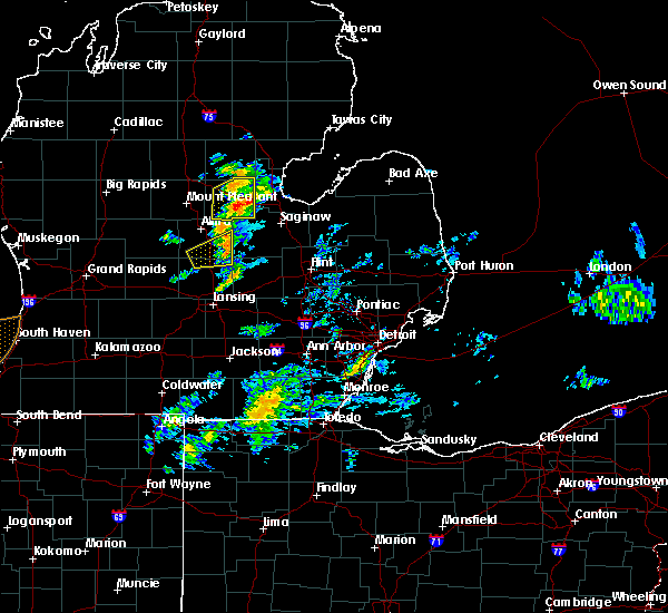 At 715 pm edt, a severe thunderstorm capable of producing a tornado was located near midland, moving northeast at 30 mph (radar indicated rotation). Hazards include tornado. Flying debris will be dangerous to those caught without shelter. mobile homes will be damaged or destroyed. damage to roofs, windows, and vehicles will occur. tree damage is likely. this dangerous storm will be near, midland around 730 pm edt. Other locations impacted by this tornadic thunderstorm include gordonville, poseyville and laporte. At 715 pm edt, a severe thunderstorm capable of producing a tornado was located near midland, moving northeast at 30 mph (radar indicated rotation). Hazards include tornado. Flying debris will be dangerous to those caught without shelter. mobile homes will be damaged or destroyed. damage to roofs, windows, and vehicles will occur. tree damage is likely. this dangerous storm will be near, midland around 730 pm edt. Other locations impacted by this tornadic thunderstorm include gordonville, poseyville and laporte.
|
| 9/25/2018 7:04 PM EDT |
 At 703 pm edt, a severe thunderstorm was located 7 miles southwest of midland, moving northeast at 40 mph (radar indicated). Hazards include 60 mph wind gusts and penny size hail. Expect damage to roofs, siding, and trees. this severe storm will be near, midland around 715 pm edt. Other locations impacted by this severe thunderstorm include laporte, averill, gordonville, bombay, porter township, poseyville, hope and north bradley. At 703 pm edt, a severe thunderstorm was located 7 miles southwest of midland, moving northeast at 40 mph (radar indicated). Hazards include 60 mph wind gusts and penny size hail. Expect damage to roofs, siding, and trees. this severe storm will be near, midland around 715 pm edt. Other locations impacted by this severe thunderstorm include laporte, averill, gordonville, bombay, porter township, poseyville, hope and north bradley.
|
| 9/25/2018 6:49 PM EDT |
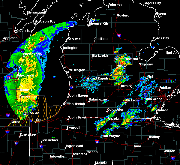 At 648 pm edt, a severe thunderstorm was located near pleasant valley, or 11 miles northeast of alma, moving northeast at 35 mph (radar indicated). Hazards include 60 mph wind gusts and penny size hail. Expect damage to roofs, siding, and trees. this severe thunderstorm will be near, midland around 725 pm edt. Other locations impacted by this severe thunderstorm include laporte, averill, gordonville, bombay, porter township, poseyville, hope and north bradley. At 648 pm edt, a severe thunderstorm was located near pleasant valley, or 11 miles northeast of alma, moving northeast at 35 mph (radar indicated). Hazards include 60 mph wind gusts and penny size hail. Expect damage to roofs, siding, and trees. this severe thunderstorm will be near, midland around 725 pm edt. Other locations impacted by this severe thunderstorm include laporte, averill, gordonville, bombay, porter township, poseyville, hope and north bradley.
|
| 9/5/2018 7:15 PM EDT |
 At 715 pm edt, severe thunderstorms were located along a line extending from 9 miles northeast of breckenridge to near merrill to near marion springs, moving east at 45 mph (radar indicated). Hazards include 60 mph wind gusts. Expect damage to roofs, siding, and trees. these severe storms will be near, st. charles and freeland around 725 pm edt. auburn around 735 pm edt. saginaw, zilwaukee and bridgeport around 740 pm edt. bay city around 745 pm edt. essexville and munger around 750 pm edt. frankenmuth around 755 pm edt. Other locations impacted by these severe thunderstorms include nelson, carrollton, garfield, arthur, gera, buena vista township, poseyville, indiantown, laporte and swan creek. At 715 pm edt, severe thunderstorms were located along a line extending from 9 miles northeast of breckenridge to near merrill to near marion springs, moving east at 45 mph (radar indicated). Hazards include 60 mph wind gusts. Expect damage to roofs, siding, and trees. these severe storms will be near, st. charles and freeland around 725 pm edt. auburn around 735 pm edt. saginaw, zilwaukee and bridgeport around 740 pm edt. bay city around 745 pm edt. essexville and munger around 750 pm edt. frankenmuth around 755 pm edt. Other locations impacted by these severe thunderstorms include nelson, carrollton, garfield, arthur, gera, buena vista township, poseyville, indiantown, laporte and swan creek.
|
| 9/5/2018 6:58 PM EDT |
 At 658 pm edt, severe thunderstorms were located along a line extending from near st. louis to near ithaca, moving east at 45 mph (radar indicated). Hazards include 60 mph wind gusts. Expect damage to roofs, siding, and trees. severe thunderstorms will be near, merrill around 715 pm edt. st. charles around 725 pm edt. freeland around 730 pm edt. auburn around 735 pm edt. zilwaukee and bridgeport around 740 pm edt. saginaw and bay city around 745 pm edt. essexville and munger around 750 pm edt. Other locations impacted by these severe thunderstorms include nelson, carrollton, garfield, arthur, gera, buena vista township, poseyville, indiantown, laporte and swan creek. At 658 pm edt, severe thunderstorms were located along a line extending from near st. louis to near ithaca, moving east at 45 mph (radar indicated). Hazards include 60 mph wind gusts. Expect damage to roofs, siding, and trees. severe thunderstorms will be near, merrill around 715 pm edt. st. charles around 725 pm edt. freeland around 730 pm edt. auburn around 735 pm edt. zilwaukee and bridgeport around 740 pm edt. saginaw and bay city around 745 pm edt. essexville and munger around 750 pm edt. Other locations impacted by these severe thunderstorms include nelson, carrollton, garfield, arthur, gera, buena vista township, poseyville, indiantown, laporte and swan creek.
|
| 8/28/2018 9:16 PM EDT |
 At 915 pm edt, severe thunderstorms were located along a line extending from 8 miles east of pinconning to near saginaw to near elsie, moving northeast at 50 mph (radar indicated). Hazards include 70 mph wind gusts. Expect considerable tree damage. damage is likely to mobile homes, roofs, and outbuildings. these severe storms will be near, zilwaukee and bridgeport around 920 pm edt. chesaning and munger around 930 pm edt. birch run around 950 pm edt. frankenmuth around 955 pm edt. Other locations impacted by these severe thunderstorms include brant, nelson, carrollton, garfield, arthur, fenmore, burt, crump, gera and buena vista township. At 915 pm edt, severe thunderstorms were located along a line extending from 8 miles east of pinconning to near saginaw to near elsie, moving northeast at 50 mph (radar indicated). Hazards include 70 mph wind gusts. Expect considerable tree damage. damage is likely to mobile homes, roofs, and outbuildings. these severe storms will be near, zilwaukee and bridgeport around 920 pm edt. chesaning and munger around 930 pm edt. birch run around 950 pm edt. frankenmuth around 955 pm edt. Other locations impacted by these severe thunderstorms include brant, nelson, carrollton, garfield, arthur, fenmore, burt, crump, gera and buena vista township.
|
| 8/28/2018 9:00 PM EDT | Numerous trees and power lines down across midland count in midland county MI, 5.5 miles SSE of Midland, MI |
| 8/28/2018 8:58 PM EDT |
 At 856 pm edt, severe thunderstorms were located along a line extending from near midland to near marion springs to 8 miles west of st. johns, moving northeast at 45 mph (radar indicated). Hazards include 60 mph wind gusts. Expect damage to roofs, siding, and trees. these severe storms will be near, midland and st. charles around 905 pm edt. auburn around 910 pm edt. kawkawlin around 915 pm edt. linwood around 920 pm edt. saginaw, pinconning and zilwaukee around 925 pm edt. bay city, essexville, oakley and munger around 935 pm edt. chesaning around 940 pm edt. Other locations impacted by these severe thunderstorms include carrollton, garfield, arthur, fenmore, crump, gera, buena vista township, indiantown, bombay and hemlock. At 856 pm edt, severe thunderstorms were located along a line extending from near midland to near marion springs to 8 miles west of st. johns, moving northeast at 45 mph (radar indicated). Hazards include 60 mph wind gusts. Expect damage to roofs, siding, and trees. these severe storms will be near, midland and st. charles around 905 pm edt. auburn around 910 pm edt. kawkawlin around 915 pm edt. linwood around 920 pm edt. saginaw, pinconning and zilwaukee around 925 pm edt. bay city, essexville, oakley and munger around 935 pm edt. chesaning around 940 pm edt. Other locations impacted by these severe thunderstorms include carrollton, garfield, arthur, fenmore, crump, gera, buena vista township, indiantown, bombay and hemlock.
|
| 8/28/2018 8:41 PM EDT |
 At 840 pm edt, severe thunderstorms were located along a line extending from near pleasant valley to near ithaca to portland, moving northeast at 45 mph (radar indicated). Hazards include 60 mph wind gusts. Expect damage to roofs, siding, and trees. severe thunderstorms will be near, sanford and marion springs around 850 pm edt. midland and merrill around 900 pm edt. auburn and st. charles around 905 pm edt. kawkawlin and linwood around 915 pm edt. bridgeport around 920 pm edt. saginaw, pinconning and zilwaukee around 925 pm edt. bay city around 930 pm edt. essexville, oakley and munger around 935 pm edt. Other locations impacted by these severe thunderstorms include carrollton, garfield, arthur, fenmore, crump, gera, buena vista township, indiantown, bombay and hemlock. At 840 pm edt, severe thunderstorms were located along a line extending from near pleasant valley to near ithaca to portland, moving northeast at 45 mph (radar indicated). Hazards include 60 mph wind gusts. Expect damage to roofs, siding, and trees. severe thunderstorms will be near, sanford and marion springs around 850 pm edt. midland and merrill around 900 pm edt. auburn and st. charles around 905 pm edt. kawkawlin and linwood around 915 pm edt. bridgeport around 920 pm edt. saginaw, pinconning and zilwaukee around 925 pm edt. bay city around 930 pm edt. essexville, oakley and munger around 935 pm edt. Other locations impacted by these severe thunderstorms include carrollton, garfield, arthur, fenmore, crump, gera, buena vista township, indiantown, bombay and hemlock.
|
| 7/16/2018 2:37 PM EDT |
 At 235 pm edt, severe thunderstorms were located along a line extending from quanicassee to near zilwaukee to near midland, moving east at 25 mph (radar indicated). Hazards include 60 mph wind gusts and penny size hail. Expect damage to roofs, siding, and trees. severe thunderstorms will be near, zilwaukee around 240 pm edt. saginaw around 245 pm edt. freeland and munger around 255 pm edt. bridgeport around 330 pm edt. frankenmuth around 345 pm edt. Other locations impacted by these severe thunderstorms include brant, nelson, carrollton, garfield, arthur, fenmore, burt, gera, buena vista township and poseyville. At 235 pm edt, severe thunderstorms were located along a line extending from quanicassee to near zilwaukee to near midland, moving east at 25 mph (radar indicated). Hazards include 60 mph wind gusts and penny size hail. Expect damage to roofs, siding, and trees. severe thunderstorms will be near, zilwaukee around 240 pm edt. saginaw around 245 pm edt. freeland and munger around 255 pm edt. bridgeport around 330 pm edt. frankenmuth around 345 pm edt. Other locations impacted by these severe thunderstorms include brant, nelson, carrollton, garfield, arthur, fenmore, burt, gera, buena vista township and poseyville.
|
| 5/27/2018 4:25 PM EDT |
 At 425 pm edt, a severe thunderstorm was located near oil city, or 8 miles southwest of sanford, moving east at 25 mph (radar indicated). Hazards include 60 mph wind gusts and quarter size hail. Hail damage to vehicles is expected. expect wind damage to roofs, siding, and trees. this severe storm will be near, sanford around 435 pm edt. midland around 505 pm edt. Other locations impacted by this severe thunderstorm include laporte, averill, gordonville, bombay, porter township, poseyville, hope and north bradley. At 425 pm edt, a severe thunderstorm was located near oil city, or 8 miles southwest of sanford, moving east at 25 mph (radar indicated). Hazards include 60 mph wind gusts and quarter size hail. Hail damage to vehicles is expected. expect wind damage to roofs, siding, and trees. this severe storm will be near, sanford around 435 pm edt. midland around 505 pm edt. Other locations impacted by this severe thunderstorm include laporte, averill, gordonville, bombay, porter township, poseyville, hope and north bradley.
|
| 5/27/2018 4:13 PM EDT |
 At 410 pm edt, a severe thunderstorm was located near oil city, or near mount pleasant, moving east at 25 mph (radar indicated). Hazards include 60 mph wind gusts and quarter size hail. Hail damage to vehicles is expected. expect wind damage to roofs, siding, and trees. this severe thunderstorm will be near, oil city around 420 pm edt. pleasant valley around 425 pm edt. sanford around 440 pm edt. midland around 510 pm edt. Other locations impacted by this severe thunderstorm include laporte, averill, gordonville, bombay, porter township, poseyville, hope and north bradley. At 410 pm edt, a severe thunderstorm was located near oil city, or near mount pleasant, moving east at 25 mph (radar indicated). Hazards include 60 mph wind gusts and quarter size hail. Hail damage to vehicles is expected. expect wind damage to roofs, siding, and trees. this severe thunderstorm will be near, oil city around 420 pm edt. pleasant valley around 425 pm edt. sanford around 440 pm edt. midland around 510 pm edt. Other locations impacted by this severe thunderstorm include laporte, averill, gordonville, bombay, porter township, poseyville, hope and north bradley.
|
| 5/26/2018 8:51 PM EDT |
 At 851 pm edt, a severe thunderstorm was located over freeland, moving southeast at 20 mph (radar indicated). Hazards include 60 mph wind gusts and quarter size hail. Hail damage to vehicles is expected. expect wind damage to roofs, siding, and trees. this severe storm will be near, auburn and freeland around 855 pm edt. zilwaukee around 925 pm edt. saginaw and bridgeport around 930 pm edt. Other locations impacted by this severe thunderstorm include laporte, carrollton, gordonville, arthur, gera, buena vista township, poseyville, willard, indiantown and shields. At 851 pm edt, a severe thunderstorm was located over freeland, moving southeast at 20 mph (radar indicated). Hazards include 60 mph wind gusts and quarter size hail. Hail damage to vehicles is expected. expect wind damage to roofs, siding, and trees. this severe storm will be near, auburn and freeland around 855 pm edt. zilwaukee around 925 pm edt. saginaw and bridgeport around 930 pm edt. Other locations impacted by this severe thunderstorm include laporte, carrollton, gordonville, arthur, gera, buena vista township, poseyville, willard, indiantown and shields.
|
| 5/26/2018 8:35 PM EDT |
 At 835 pm edt, a severe thunderstorm was located near midland, moving south at 10 mph (radar indicated). Hazards include 60 mph wind gusts and quarter size hail. Hail damage to vehicles is expected. expect wind damage to roofs, siding, and trees. this severe storm will be near, freeland around 855 pm edt. Other locations impacted by this severe thunderstorm include laporte, carrollton, gordonville, arthur, gera, buena vista township, poseyville, willard, indiantown and shields. At 835 pm edt, a severe thunderstorm was located near midland, moving south at 10 mph (radar indicated). Hazards include 60 mph wind gusts and quarter size hail. Hail damage to vehicles is expected. expect wind damage to roofs, siding, and trees. this severe storm will be near, freeland around 855 pm edt. Other locations impacted by this severe thunderstorm include laporte, carrollton, gordonville, arthur, gera, buena vista township, poseyville, willard, indiantown and shields.
|
| 5/26/2018 8:27 PM EDT | Large tree down over the road near e sugnet rd and swede ave in midland. additional report of numerous trees down throughout the cit in midland county MI, 2.1 miles W of Midland, MI |
| 5/26/2018 8:25 PM EDT |
 At 824 pm edt, a severe thunderstorm was located over midland, moving south at 10 mph (radar indicated). Hazards include 60 mph wind gusts and quarter size hail. Hail damage to vehicles is expected. expect wind damage to roofs, siding, and trees. this severe thunderstorm will be near, auburn around 830 pm edt. freeland around 855 pm edt. Other locations impacted by this severe thunderstorm include laporte, carrollton, gordonville, arthur, gera, buena vista township, poseyville, willard, indiantown and shields. At 824 pm edt, a severe thunderstorm was located over midland, moving south at 10 mph (radar indicated). Hazards include 60 mph wind gusts and quarter size hail. Hail damage to vehicles is expected. expect wind damage to roofs, siding, and trees. this severe thunderstorm will be near, auburn around 830 pm edt. freeland around 855 pm edt. Other locations impacted by this severe thunderstorm include laporte, carrollton, gordonville, arthur, gera, buena vista township, poseyville, willard, indiantown and shields.
|
| 5/26/2018 8:22 PM EDT |
 At 821 pm ed#, a severe thunderstorm was located over midland, moving south at 10 mph (radar indicated). Hazards include 60 mph wind gusts and quarter size hail. Hail damage to vehicles is expected. expect wind damage to roofs, siding, and trees. this severe thunderstorm will be near, auburn around 830 pm edt. freeland around 855 pm edt. Other locations impacted by this severe thunderstorm include laporte, carrollton, gordonville, arthur, gera, buena vista township, poseyville, willard, indiantown and shields. At 821 pm ed#, a severe thunderstorm was located over midland, moving south at 10 mph (radar indicated). Hazards include 60 mph wind gusts and quarter size hail. Hail damage to vehicles is expected. expect wind damage to roofs, siding, and trees. this severe thunderstorm will be near, auburn around 830 pm edt. freeland around 855 pm edt. Other locations impacted by this severe thunderstorm include laporte, carrollton, gordonville, arthur, gera, buena vista township, poseyville, willard, indiantown and shields.
|
| 5/26/2018 8:20 PM EDT |
 The national weather service in detroit/pontiac has issued a * severe thunderstorm warning for. southern bay county in southeastern michigan. northern saginaw county in southeastern michigan. southeastern midland county in southeastern michigan. Until 915 pm edt. The national weather service in detroit/pontiac has issued a * severe thunderstorm warning for. southern bay county in southeastern michigan. northern saginaw county in southeastern michigan. southeastern midland county in southeastern michigan. Until 915 pm edt.
|
| 9/4/2017 2:54 PM EDT |
 The severe thunderstorm warning for bay county will expire at 300 pm edt, the storm which prompted the warning has moved out of the area. therefore the warning will be allowed to expire. however another thunderstorm was developing over northeast midland county and could potentially become severe as it moves into northern bay county after 3 pm. time, mot, loc 1852z 268deg 1162kt 4391 8234. The severe thunderstorm warning for bay county will expire at 300 pm edt, the storm which prompted the warning has moved out of the area. therefore the warning will be allowed to expire. however another thunderstorm was developing over northeast midland county and could potentially become severe as it moves into northern bay county after 3 pm. time, mot, loc 1852z 268deg 1162kt 4391 8234.
|
| 9/4/2017 2:28 PM EDT |
 At 227 pm edt, a severe thunderstorm was located over pinconning, moving east at 65 mph (radar indicated). Hazards include 60 mph wind gusts and penny size hail. Expect damage to roofs, siding, and trees. This severe thunderstorm will also move into saginaw bay by 245 pm, but additional storms may quickly develop over northern bay county. At 227 pm edt, a severe thunderstorm was located over pinconning, moving east at 65 mph (radar indicated). Hazards include 60 mph wind gusts and penny size hail. Expect damage to roofs, siding, and trees. This severe thunderstorm will also move into saginaw bay by 245 pm, but additional storms may quickly develop over northern bay county.
|
| 9/4/2017 2:16 PM EDT |
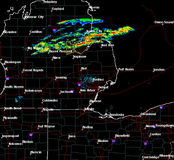 At 214 pm edt, a severe thunderstorm was located near pinconning, moving east at 65 mph (radar indicated). Hazards include 60 mph wind gusts and penny size hail. Expect damage to roofs, siding, and trees. This severe thunderstorm will move into saginaw bay by 230 pm, but additional storms may develop over bay county. At 214 pm edt, a severe thunderstorm was located near pinconning, moving east at 65 mph (radar indicated). Hazards include 60 mph wind gusts and penny size hail. Expect damage to roofs, siding, and trees. This severe thunderstorm will move into saginaw bay by 230 pm, but additional storms may develop over bay county.
|
| 9/4/2017 2:07 PM EDT |
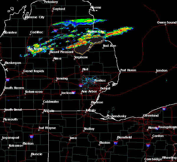 At 207 pm edt, a severe thunderstorm was located near pinconning, moving east at 85 mph (radar indicated). Hazards include 60 mph wind gusts and penny size hail. Expect damage to roofs, siding, and trees. This severe thunderstorm will remain over mainly rural areas of bay county, including the following locations: auburn, pinconning, linwood, kawkawlin, bentley, mount forest, crump, willard and bay city state recreation area. At 207 pm edt, a severe thunderstorm was located near pinconning, moving east at 85 mph (radar indicated). Hazards include 60 mph wind gusts and penny size hail. Expect damage to roofs, siding, and trees. This severe thunderstorm will remain over mainly rural areas of bay county, including the following locations: auburn, pinconning, linwood, kawkawlin, bentley, mount forest, crump, willard and bay city state recreation area.
|
| 8/3/2017 7:15 PM EDT | Tree down on prince rd between hope and stark in midland county MI, 1.4 miles NW of Midland, MI |
| 7/13/2017 3:49 AM EDT |
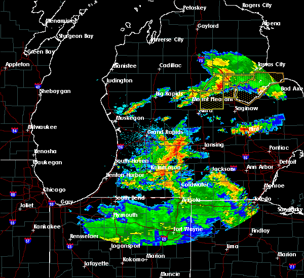 At 349 am edt, severe thunderstorms were located along a line extending from near edenville to near coleman to near lake isabella, moving southeast at 25 mph (radar indicated). Hazards include 60 mph wind gusts and quarter size hail. Hail damage to vehicles is expected. expect wind damage to roofs, siding, and trees. these severe storms will be near, edenville around 355 am edt. sanford around 410 am edt. midland around 430 am edt. Other locations impacted by these severe thunderstorms include sanford, midland, coleman, oil city, pleasant valley, edenville, poseyville, laporte, averill and gordonville. At 349 am edt, severe thunderstorms were located along a line extending from near edenville to near coleman to near lake isabella, moving southeast at 25 mph (radar indicated). Hazards include 60 mph wind gusts and quarter size hail. Hail damage to vehicles is expected. expect wind damage to roofs, siding, and trees. these severe storms will be near, edenville around 355 am edt. sanford around 410 am edt. midland around 430 am edt. Other locations impacted by these severe thunderstorms include sanford, midland, coleman, oil city, pleasant valley, edenville, poseyville, laporte, averill and gordonville.
|
| 7/13/2017 3:33 AM EDT |
 At 333 am edt, severe thunderstorms were located along a line extending from beaverton to near coleman to 10 miles west of farwell, moving east at 35 mph (radar indicated). Hazards include 60 mph wind gusts and quarter size hail. Hail damage to vehicles is expected. expect wind damage to roofs, siding, and trees. these severe storms will be near, edenville around 350 am edt. coleman around 415 am edt. sanford around 435 am edt. Other locations impacted by these severe thunderstorms include sanford, midland, coleman, oil city, pleasant valley, edenville, poseyville, laporte, averill and gordonville. At 333 am edt, severe thunderstorms were located along a line extending from beaverton to near coleman to 10 miles west of farwell, moving east at 35 mph (radar indicated). Hazards include 60 mph wind gusts and quarter size hail. Hail damage to vehicles is expected. expect wind damage to roofs, siding, and trees. these severe storms will be near, edenville around 350 am edt. coleman around 415 am edt. sanford around 435 am edt. Other locations impacted by these severe thunderstorms include sanford, midland, coleman, oil city, pleasant valley, edenville, poseyville, laporte, averill and gordonville.
|
| 7/13/2017 3:21 AM EDT |
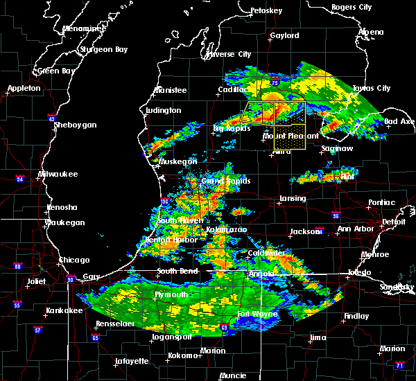 At 321 am edt, severe thunderstorms were located along a line extending from near skeels to 6 miles northeast of clare to near farwell, moving southeast at 30 mph (radar indicated). Hazards include 60 mph wind gusts and quarter size hail. Hail damage to vehicles is expected. expect wind damage to roofs, siding, and trees. severe thunderstorms will be near, coleman around 335 am edt. edenville around 345 am edt. sanford around 355 am edt. oil city around 405 am edt. pleasant valley around 415 am edt. midland around 420 am edt. Other locations impacted by these severe thunderstorms include sanford, midland, coleman, oil city, pleasant valley, edenville, poseyville, laporte, averill and gordonville. At 321 am edt, severe thunderstorms were located along a line extending from near skeels to 6 miles northeast of clare to near farwell, moving southeast at 30 mph (radar indicated). Hazards include 60 mph wind gusts and quarter size hail. Hail damage to vehicles is expected. expect wind damage to roofs, siding, and trees. severe thunderstorms will be near, coleman around 335 am edt. edenville around 345 am edt. sanford around 355 am edt. oil city around 405 am edt. pleasant valley around 415 am edt. midland around 420 am edt. Other locations impacted by these severe thunderstorms include sanford, midland, coleman, oil city, pleasant valley, edenville, poseyville, laporte, averill and gordonville.
|
| 6/14/2017 11:15 PM EDT |
 At 1115 pm edt, a severe thunderstorm was located near oil city, or 7 miles southwest of sanford, moving east at 15 mph (radar indicated). Hazards include 60 mph wind gusts and quarter size hail. Hail damage to vehicles is expected. expect wind damage to roofs, siding, and trees. Locations impacted include, midland, coleman, sanford, edenville, oil city, pleasant valley, hope, poseyville, laporte, averill, gordonville, bombay, porter township and north bradley. At 1115 pm edt, a severe thunderstorm was located near oil city, or 7 miles southwest of sanford, moving east at 15 mph (radar indicated). Hazards include 60 mph wind gusts and quarter size hail. Hail damage to vehicles is expected. expect wind damage to roofs, siding, and trees. Locations impacted include, midland, coleman, sanford, edenville, oil city, pleasant valley, hope, poseyville, laporte, averill, gordonville, bombay, porter township and north bradley.
|
| 6/14/2017 11:01 PM EDT |
 At 1101 pm edt, a severe thunderstorm was located near oil city, or near coleman, moving east at 20 mph (radar indicated). Hazards include 60 mph wind gusts and quarter size hail. Hail damage to vehicles is expected. expect wind damage to roofs, siding, and trees. this severe thunderstorm will be near, coleman around 1115 pm edt. sanford around 1140 pm edt. edenville around 1145 pm edt. Other locations impacted by this severe thunderstorm include sanford, midland, coleman, oil city, pleasant valley, edenville, poseyville, laporte, averill and gordonville. At 1101 pm edt, a severe thunderstorm was located near oil city, or near coleman, moving east at 20 mph (radar indicated). Hazards include 60 mph wind gusts and quarter size hail. Hail damage to vehicles is expected. expect wind damage to roofs, siding, and trees. this severe thunderstorm will be near, coleman around 1115 pm edt. sanford around 1140 pm edt. edenville around 1145 pm edt. Other locations impacted by this severe thunderstorm include sanford, midland, coleman, oil city, pleasant valley, edenville, poseyville, laporte, averill and gordonville.
|
| 8/20/2016 4:35 PM EDT |
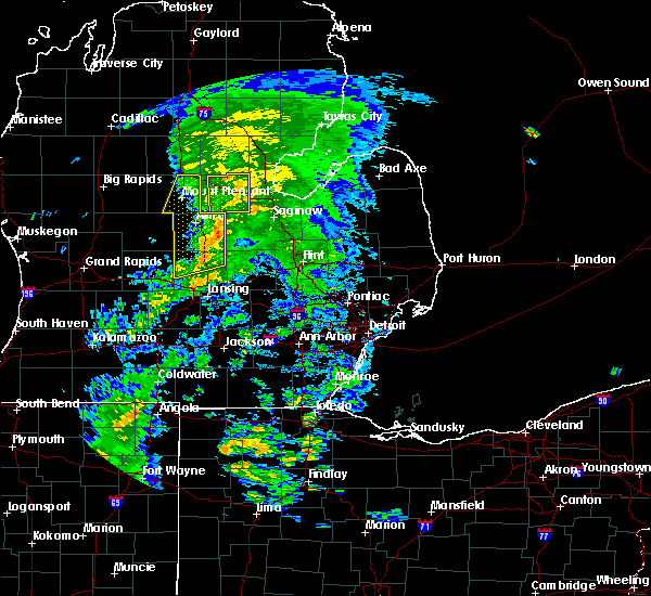 At 433 pm edt, a severe thunderstorm was located near sanford, moving northeast at 40 mph (radar indicated). Hazards include 60 mph wind gusts. Expect damage to roofs. siding. and trees. This severe storm will be near, hope around 440 pm edt. At 433 pm edt, a severe thunderstorm was located near sanford, moving northeast at 40 mph (radar indicated). Hazards include 60 mph wind gusts. Expect damage to roofs. siding. and trees. This severe storm will be near, hope around 440 pm edt.
|
| 8/20/2016 4:22 PM EDT |
 At 421 pm edt, a severe thunderstorm was located near sanford, moving northeast at 40 mph (radar indicated). Hazards include 60 mph wind gusts. Expect damage to roofs. siding. and trees. this severe storm will be near, sanford around 430 pm edt. edenville around 440 pm edt. Other locations impacted by this severe thunderstorm include sanford, coleman, midland, edenville, poseyville, north bradley, laporte, gordonville, hope and averill. At 421 pm edt, a severe thunderstorm was located near sanford, moving northeast at 40 mph (radar indicated). Hazards include 60 mph wind gusts. Expect damage to roofs. siding. and trees. this severe storm will be near, sanford around 430 pm edt. edenville around 440 pm edt. Other locations impacted by this severe thunderstorm include sanford, coleman, midland, edenville, poseyville, north bradley, laporte, gordonville, hope and averill.
|
| 8/20/2016 4:10 PM EDT |
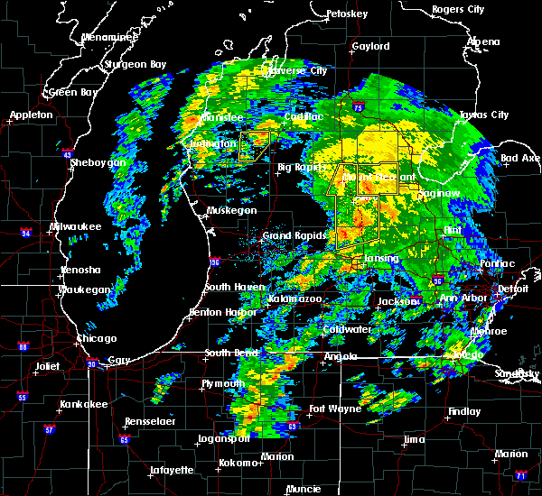 At 409 pm edt, a severe thunderstorm was located near oil city, or 9 miles southwest of sanford, moving northeast at 50 mph (radar indicated). Hazards include 60 mph wind gusts. Expect damage to roofs. siding. and trees. this severe storm will be near, sanford around 420 pm edt. edenville around 430 pm edt. Other locations impacted by this severe thunderstorm include sanford, coleman, midland, oil city, pleasant valley, edenville, poseyville, north bradley, laporte and gordonville. At 409 pm edt, a severe thunderstorm was located near oil city, or 9 miles southwest of sanford, moving northeast at 50 mph (radar indicated). Hazards include 60 mph wind gusts. Expect damage to roofs. siding. and trees. this severe storm will be near, sanford around 420 pm edt. edenville around 430 pm edt. Other locations impacted by this severe thunderstorm include sanford, coleman, midland, oil city, pleasant valley, edenville, poseyville, north bradley, laporte and gordonville.
|
| 8/20/2016 3:58 PM EDT |
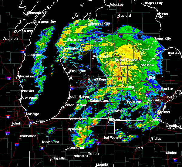 At 358 pm edt, a severe thunderstorm was located over st. louis, or near alma, moving northeast at 50 mph (radar indicated). Hazards include 60 mph wind gusts. Expect damage to roofs. siding. and trees. this severe thunderstorm will be near, oil city around 410 pm edt. sanford around 425 pm edt. edenville around 430 pm edt. Other locations impacted by this severe thunderstorm include sanford, coleman, midland, oil city, pleasant valley, edenville, poseyville, north bradley, laporte and gordonville. At 358 pm edt, a severe thunderstorm was located over st. louis, or near alma, moving northeast at 50 mph (radar indicated). Hazards include 60 mph wind gusts. Expect damage to roofs. siding. and trees. this severe thunderstorm will be near, oil city around 410 pm edt. sanford around 425 pm edt. edenville around 430 pm edt. Other locations impacted by this severe thunderstorm include sanford, coleman, midland, oil city, pleasant valley, edenville, poseyville, north bradley, laporte and gordonville.
|
| 7/8/2016 3:56 PM EDT | The severe thunderstorm warning for northern midland county will expire at 400 pm edt, the storms which prompted the warning have weakened below severe limits, and no longer pose an immediate threat to life or property. therefore, the warning will be allowed to expire. however, heavy rain is still possible with these thunderstorms. a severe thunderstorm watch remains in effect until 800 pm edt for southeastern michigan. |
| 7/8/2016 3:47 PM EDT |
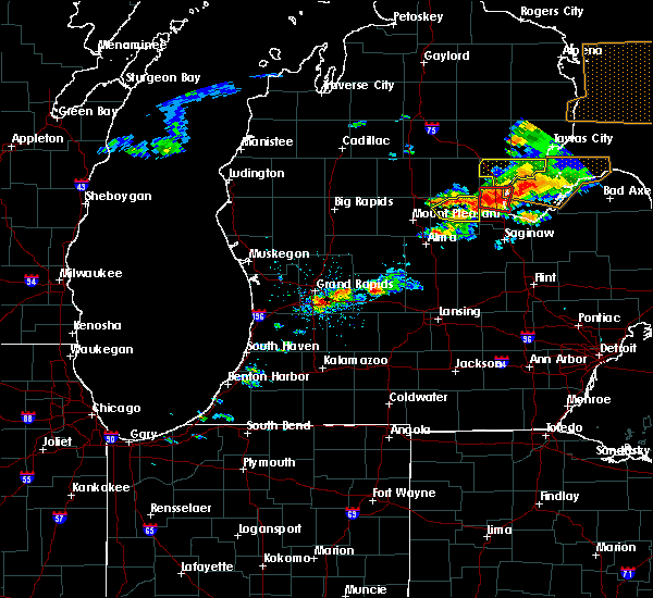 At 347 pm edt, severe thunderstorms were located along a line extending from 8 miles south of rhodes to near sanford, moving east at 35 mph (radar indicated). Hazards include 60 mph wind gusts and quarter size hail. Hail damage to vehicles is expected. expect wind damage to roofs, siding, and trees. these severe storms will be near, midland around 400 pm edt. Other locations impacted by these severe thunderstorms include sanford, midland, edenville, north bradley, hope, averill and bombay. At 347 pm edt, severe thunderstorms were located along a line extending from 8 miles south of rhodes to near sanford, moving east at 35 mph (radar indicated). Hazards include 60 mph wind gusts and quarter size hail. Hail damage to vehicles is expected. expect wind damage to roofs, siding, and trees. these severe storms will be near, midland around 400 pm edt. Other locations impacted by these severe thunderstorms include sanford, midland, edenville, north bradley, hope, averill and bombay.
|
| 7/8/2016 3:31 PM EDT |
 At 331 pm edt, severe thunderstorms were located along a line extending from near rhodes to sanford to pleasant valley, moving east at 40 mph (radar indicated). Hazards include 60 mph wind gusts and quarter size hail. Hail damage to vehicles is expected. expect wind damage to roofs, siding, and trees. these severe storms will be near, midland around 350 pm edt. Other locations impacted by these severe thunderstorms include sanford, midland, oil city, pleasant valley, edenville, poseyville, laporte, north bradley, gordonville and porter township. At 331 pm edt, severe thunderstorms were located along a line extending from near rhodes to sanford to pleasant valley, moving east at 40 mph (radar indicated). Hazards include 60 mph wind gusts and quarter size hail. Hail damage to vehicles is expected. expect wind damage to roofs, siding, and trees. these severe storms will be near, midland around 350 pm edt. Other locations impacted by these severe thunderstorms include sanford, midland, oil city, pleasant valley, edenville, poseyville, laporte, north bradley, gordonville and porter township.
|
| 7/8/2016 3:14 PM EDT |
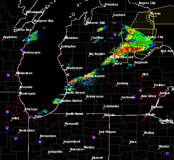 At 313 pm edt, severe thunderstorms were located along a line extending from near edenville to near oil city to near shepherd, moving east at 40 mph (radar indicated). Hazards include 60 mph wind gusts and quarter size hail. Hail damage to vehicles is expected. expect wind damage to roofs, siding, and trees. these severe storms will be near, edenville around 320 pm edt. sanford around 330 pm edt. Midland around 350 pm edt. At 313 pm edt, severe thunderstorms were located along a line extending from near edenville to near oil city to near shepherd, moving east at 40 mph (radar indicated). Hazards include 60 mph wind gusts and quarter size hail. Hail damage to vehicles is expected. expect wind damage to roofs, siding, and trees. these severe storms will be near, edenville around 320 pm edt. sanford around 330 pm edt. Midland around 350 pm edt.
|
| 7/8/2016 3:02 PM EDT |
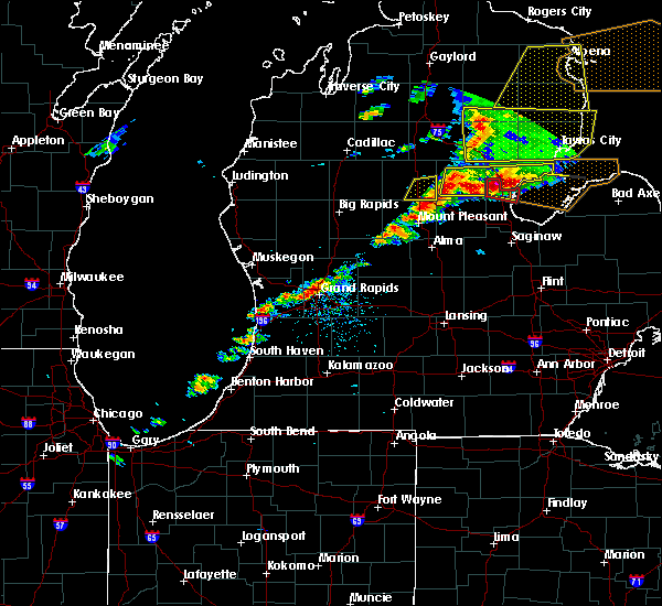 At 301 pm edt, severe thunderstorms were located along a line extending from near beaverton to near coleman to mount pleasant to 6 miles northeast of edmore, moving east at 40 mph (radar indicated). Hazards include 60 mph wind gusts and quarter size hail. Hail damage to vehicles is expected. expect wind damage to roofs, siding, and trees. severe thunderstorms will be near, coleman around 305 pm edt. oil city around 315 pm edt. edenville around 320 pm edt. sanford around 325 pm edt. pleasant valley around 330 pm edt. Midland around 350 pm edt. At 301 pm edt, severe thunderstorms were located along a line extending from near beaverton to near coleman to mount pleasant to 6 miles northeast of edmore, moving east at 40 mph (radar indicated). Hazards include 60 mph wind gusts and quarter size hail. Hail damage to vehicles is expected. expect wind damage to roofs, siding, and trees. severe thunderstorms will be near, coleman around 305 pm edt. oil city around 315 pm edt. edenville around 320 pm edt. sanford around 325 pm edt. pleasant valley around 330 pm edt. Midland around 350 pm edt.
|
| 3/31/2016 5:49 PM EDT |
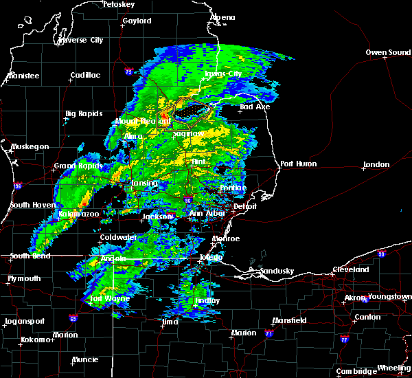 At 548 pm edt, a severe thunderstorm was located near auburn, moving northeast at 55 mph (radar indicated). Hazards include 60 mph wind gusts. Expect damage to roofs. siding and trees. this severe storm will be near, bay city around 555 pm edt. Other locations impacted by this severe thunderstorm include willard, bay city state recreation area and crump. At 548 pm edt, a severe thunderstorm was located near auburn, moving northeast at 55 mph (radar indicated). Hazards include 60 mph wind gusts. Expect damage to roofs. siding and trees. this severe storm will be near, bay city around 555 pm edt. Other locations impacted by this severe thunderstorm include willard, bay city state recreation area and crump.
|
| 3/31/2016 5:39 PM EDT | Trees and wires downed in midland county MI, 1.4 miles NW of Midland, MI |
| 3/31/2016 5:31 PM EDT |
 At 531 pm edt, a severe thunderstorm was located 7 miles southwest of midland, moving northeast at 55 mph (radar indicated). Hazards include 60 mph wind gusts. Expect damage to roofs. siding and trees. this severe thunderstorm will be near, midland around 540 pm edt. auburn around 545 pm edt. kawkawlin and linwood around 555 pm edt. Other locations impacted by this severe thunderstorm include poseyville, crump, laporte, gordonville, willard, averill, bombay and bay city state recreation area. At 531 pm edt, a severe thunderstorm was located 7 miles southwest of midland, moving northeast at 55 mph (radar indicated). Hazards include 60 mph wind gusts. Expect damage to roofs. siding and trees. this severe thunderstorm will be near, midland around 540 pm edt. auburn around 545 pm edt. kawkawlin and linwood around 555 pm edt. Other locations impacted by this severe thunderstorm include poseyville, crump, laporte, gordonville, willard, averill, bombay and bay city state recreation area.
|
| 12/14/2015 2:23 PM EST |
 At 221 pm est, a line of showers with damaging wind extended from nester township to near kawkawlin to frankenmuth, moving northeast at 45 mph (radar indicated). Hazards include 60 mph wind gusts. Expect damage to roofs. siding and trees. the line will be near, pinconning around 235 pm est. Other locations impacted by these severe thunderstorms include gera, crump, willard, arthur, buena vista township, bombay, indiantown, carrollton, bay city state recreation area and mount forest. At 221 pm est, a line of showers with damaging wind extended from nester township to near kawkawlin to frankenmuth, moving northeast at 45 mph (radar indicated). Hazards include 60 mph wind gusts. Expect damage to roofs. siding and trees. the line will be near, pinconning around 235 pm est. Other locations impacted by these severe thunderstorms include gera, crump, willard, arthur, buena vista township, bombay, indiantown, carrollton, bay city state recreation area and mount forest.
|
| 12/14/2015 2:09 PM EST | Tree in roadway at hancock and jay in midland in midland county MI, 3.7 miles WNW of Midland, MI |
| 12/14/2015 2:03 PM EST | Tree in road at tittabawassee river rd and lambert rd in midland county MI, 3.1 miles ENE of Midland, MI |
| 12/14/2015 1:53 PM EST |
 At 149 pm est, a line of showers with damaging wind extended from 8 miles north of farwell to near merrill to near henderson, moving northeast at 45 mph (radar indicated). Hazards include 60 mph wind gusts. Expect damage to roofs. siding and trees. the line of showers with damaging wind will be near, freeland around 210 pm est. midland around 215 pm est. auburn and bridgeport around 220 pm est. bay city and kawkawlin around 225 pm est. linwood around 235 pm est. munger around 240 pm est. Other locations impacted by these severe thunderstorms include burt, poseyville, laporte, north bradley, nelson, gordonville, arthur, buena vista township, shiawassee national wildlife refuge and brant. At 149 pm est, a line of showers with damaging wind extended from 8 miles north of farwell to near merrill to near henderson, moving northeast at 45 mph (radar indicated). Hazards include 60 mph wind gusts. Expect damage to roofs. siding and trees. the line of showers with damaging wind will be near, freeland around 210 pm est. midland around 215 pm est. auburn and bridgeport around 220 pm est. bay city and kawkawlin around 225 pm est. linwood around 235 pm est. munger around 240 pm est. Other locations impacted by these severe thunderstorms include burt, poseyville, laporte, north bradley, nelson, gordonville, arthur, buena vista township, shiawassee national wildlife refuge and brant.
|
| 12/14/2015 1:51 PM EST | Tree in roadway at 10 mile and gordonville rds in midland county MI, 10.9 miles ENE of Midland, MI |
| 12/14/2015 1:40 PM EST |
 At 139 pm est, severe thunderstorms were located along a line extending from near marion to near marion springs to near fowlerville, moving northeast at 40 mph (radar indicated). Hazards include 60 mph wind gusts. Expect damage to roofs. siding and trees. severe thunderstorms will be near, merrill around 150 pm est. freeland around 205 pm est. midland around 215 pm est. auburn around 220 pm est. bay city and kawkawlin around 225 pm est. linwood around 230 pm est. Other locations impacted by these severe thunderstorms include burt, poseyville, laporte, north bradley, nelson, gordonville, arthur, buena vista township, shiawassee national wildlife refuge and brant. At 139 pm est, severe thunderstorms were located along a line extending from near marion to near marion springs to near fowlerville, moving northeast at 40 mph (radar indicated). Hazards include 60 mph wind gusts. Expect damage to roofs. siding and trees. severe thunderstorms will be near, merrill around 150 pm est. freeland around 205 pm est. midland around 215 pm est. auburn around 220 pm est. bay city and kawkawlin around 225 pm est. linwood around 230 pm est. Other locations impacted by these severe thunderstorms include burt, poseyville, laporte, north bradley, nelson, gordonville, arthur, buena vista township, shiawassee national wildlife refuge and brant.
|
| 9/8/2015 4:36 PM EDT | Tree downed on east stewart road in midland county MI, 5.4 miles NE of Midland, MI |
| 9/8/2015 4:26 PM EDT |
 The severe thunderstorm warning for bay and midland counties will expire at 430 pm edt, the storms which prompted the warning have weakened just below severe limits, and no longer pose an immediate threat to life or property. therefore the warning will be allowed to expire. however gusty winds to 50 mph and very heavy rain remain possible with these thunderstorms. The severe thunderstorm warning for bay and midland counties will expire at 430 pm edt, the storms which prompted the warning have weakened just below severe limits, and no longer pose an immediate threat to life or property. therefore the warning will be allowed to expire. however gusty winds to 50 mph and very heavy rain remain possible with these thunderstorms.
|
| 9/8/2015 4:12 PM EDT |
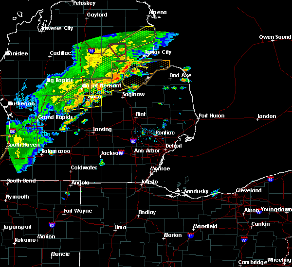 At 412 pm edt, severe thunderstorms were located along a line extending from sanford to 7 miles west of midland to 6 miles north of merrill, moving northeast at 40 mph (radar indicated). Hazards include 60 mph wind gusts. Expect damage to roofs. siding and trees. These severe thunderstorms will near midland around 420 pm. At 412 pm edt, severe thunderstorms were located along a line extending from sanford to 7 miles west of midland to 6 miles north of merrill, moving northeast at 40 mph (radar indicated). Hazards include 60 mph wind gusts. Expect damage to roofs. siding and trees. These severe thunderstorms will near midland around 420 pm.
|
| 9/8/2015 3:53 PM EDT |
 At 353 pm edt, a severe thunderstorm was located near sanford, moving east at 45 mph (radar indicated). Hazards include 60 mph wind gusts. Expect damage to roofs. siding and trees. this severe storm will be near, sanford around 400 pm edt. linwood around 425 pm edt. pinconning around 430 pm edt. Other locations impacted by this severe thunderstorm include poseyville, crump, laporte, north bradley, willard, gordonville, hope, averill, porter township and bombay. At 353 pm edt, a severe thunderstorm was located near sanford, moving east at 45 mph (radar indicated). Hazards include 60 mph wind gusts. Expect damage to roofs. siding and trees. this severe storm will be near, sanford around 400 pm edt. linwood around 425 pm edt. pinconning around 430 pm edt. Other locations impacted by this severe thunderstorm include poseyville, crump, laporte, north bradley, willard, gordonville, hope, averill, porter township and bombay.
|
| 9/8/2015 3:37 PM EDT |
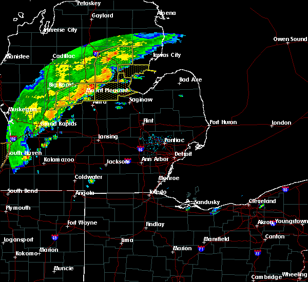 At 337 pm edt, severe thunderstorms were located along a line extending from near wooden shoe village to near oil city, moving northeast at 45 mph (radar indicated). Hazards include 60 mph wind gusts. Expect damage to roofs. siding and trees. severe thunderstorms will be near, bentley around 340 pm edt. sanford and edenville around 400 pm edt. pinconning around 430 pm edt. Other locations impacted by these severe thunderstorms include poseyville, crump, laporte, north bradley, willard, gordonville, hope, averill, porter township and bombay. At 337 pm edt, severe thunderstorms were located along a line extending from near wooden shoe village to near oil city, moving northeast at 45 mph (radar indicated). Hazards include 60 mph wind gusts. Expect damage to roofs. siding and trees. severe thunderstorms will be near, bentley around 340 pm edt. sanford and edenville around 400 pm edt. pinconning around 430 pm edt. Other locations impacted by these severe thunderstorms include poseyville, crump, laporte, north bradley, willard, gordonville, hope, averill, porter township and bombay.
|
| 9/3/2015 11:22 AM EDT |
 At 1122 am edt, severe thunderstorms were located along a line extending from near quanicassee to near chesaning, moving east at 25 mph (radar indicated). Hazards include 60 mph wind gusts. Expect damage to roofs. siding and trees. these severe storms will be near, birch run around 1200 pm edt. Other locations impacted by these severe thunderstorms include burt, garfield, nelson, arthur, buena vista township, fenmore, indiantown, shiawassee national wildlife refuge, bay city state recreation area and brant. At 1122 am edt, severe thunderstorms were located along a line extending from near quanicassee to near chesaning, moving east at 25 mph (radar indicated). Hazards include 60 mph wind gusts. Expect damage to roofs. siding and trees. these severe storms will be near, birch run around 1200 pm edt. Other locations impacted by these severe thunderstorms include burt, garfield, nelson, arthur, buena vista township, fenmore, indiantown, shiawassee national wildlife refuge, bay city state recreation area and brant.
|
| 9/3/2015 11:08 AM EDT |
 At 1107 am edt, severe thunderstorms were located along a line extending from near essexville to near oakley, moving east at 25 mph (radar indicated). Hazards include 60 mph wind gusts. Expect damage to roofs. siding and trees. severe thunderstorms will be near, birch run around 1200 pm edt. Other locations impacted by these severe thunderstorms include burt, garfield, nelson, arthur, buena vista township, fenmore, indiantown, shiawassee national wildlife refuge, bay city state recreation area and brant. At 1107 am edt, severe thunderstorms were located along a line extending from near essexville to near oakley, moving east at 25 mph (radar indicated). Hazards include 60 mph wind gusts. Expect damage to roofs. siding and trees. severe thunderstorms will be near, birch run around 1200 pm edt. Other locations impacted by these severe thunderstorms include burt, garfield, nelson, arthur, buena vista township, fenmore, indiantown, shiawassee national wildlife refuge, bay city state recreation area and brant.
|
| 8/14/2015 6:06 PM EDT |
 At 606 pm edt, a severe thunderstorm was located over zilwaukee, or near saginaw, moving southeast at 20 mph (radar indicated). Hazards include 60 mph wind gusts and quarter size hail. Hail damage to vehicles is expected. expect wind damage to roofs, siding and trees. this severe thunderstorm will be near, saginaw around 610 pm edt. bridgeport around 620 pm edt. frankenmuth around 650 pm edt. Other locations impacted by this severe thunderstorm include burt, shields, garfield, gera, arthur, buena vista township, indiantown, fosters, carrollton and shiawassee national wildlife refuge. At 606 pm edt, a severe thunderstorm was located over zilwaukee, or near saginaw, moving southeast at 20 mph (radar indicated). Hazards include 60 mph wind gusts and quarter size hail. Hail damage to vehicles is expected. expect wind damage to roofs, siding and trees. this severe thunderstorm will be near, saginaw around 610 pm edt. bridgeport around 620 pm edt. frankenmuth around 650 pm edt. Other locations impacted by this severe thunderstorm include burt, shields, garfield, gera, arthur, buena vista township, indiantown, fosters, carrollton and shiawassee national wildlife refuge.
|
| 8/14/2015 5:59 PM EDT |
 At 558 pm edt, a severe thunderstorm was located over bentley, or 7 miles southwest of sterling, moving southeast at 15 mph (radar indicated). Hazards include quarter size hail. Damage to vehicles is expected. this severe storm will be near, pinconning around 650 pm edt. Other locations impacted by this severe thunderstorm include crump, willard, bay city state recreation area and mount forest. At 558 pm edt, a severe thunderstorm was located over bentley, or 7 miles southwest of sterling, moving southeast at 15 mph (radar indicated). Hazards include quarter size hail. Damage to vehicles is expected. this severe storm will be near, pinconning around 650 pm edt. Other locations impacted by this severe thunderstorm include crump, willard, bay city state recreation area and mount forest.
|
| 8/14/2015 5:45 PM EDT |
 At 545 pm edt, a severe thunderstorm was located near auburn, moving southeast at 10 mph (radar indicated). Hazards include quarter size hail. Damage to vehicles is expected. this severe storm will be near, bay city around 555 pm edt. essexville around 610 pm edt. munger around 650 pm edt. Other locations impacted by this severe thunderstorm include crump, willard, bay city state recreation area and mount forest. At 545 pm edt, a severe thunderstorm was located near auburn, moving southeast at 10 mph (radar indicated). Hazards include quarter size hail. Damage to vehicles is expected. this severe storm will be near, bay city around 555 pm edt. essexville around 610 pm edt. munger around 650 pm edt. Other locations impacted by this severe thunderstorm include crump, willard, bay city state recreation area and mount forest.
|
| 8/14/2015 5:27 PM EDT |
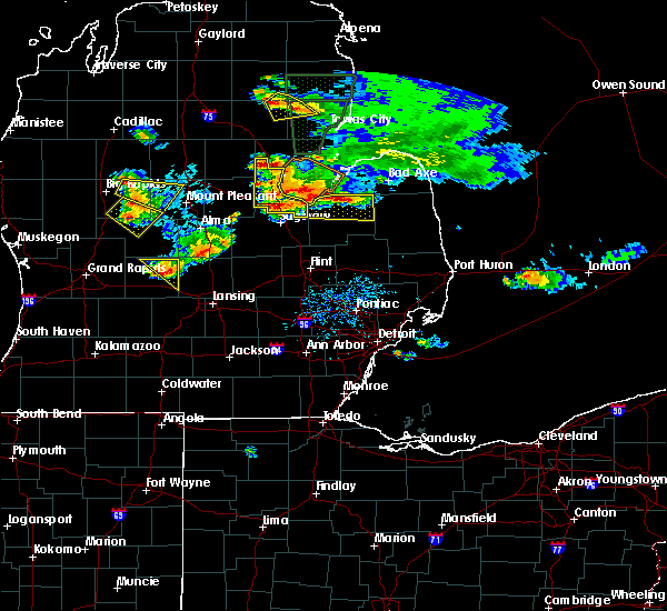 At 527 pm edt, a severe thunderstorm was located over bentley, or near sterling, moving east at 30 mph (radar indicated). Hazards include quarter size hail. damage to vehicles is expected At 527 pm edt, a severe thunderstorm was located over bentley, or near sterling, moving east at 30 mph (radar indicated). Hazards include quarter size hail. damage to vehicles is expected
|
| 8/2/2015 8:10 PM EDT |
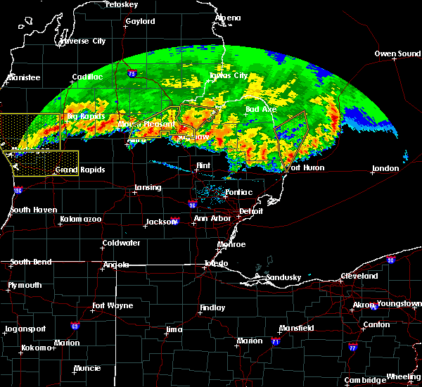 The severe thunderstorm warning for bay and midland counties will expire at 815 pm edt, the storms which prompted the warning have weakened below severe limits, and exited the warned area. therefore the warning will be allowed to expire. however heavy rain is still possible with these thunderstorms. a severe thunderstorm watch remains in effect until 200 am edt for southeastern michigan. The severe thunderstorm warning for bay and midland counties will expire at 815 pm edt, the storms which prompted the warning have weakened below severe limits, and exited the warned area. therefore the warning will be allowed to expire. however heavy rain is still possible with these thunderstorms. a severe thunderstorm watch remains in effect until 200 am edt for southeastern michigan.
|
| 8/2/2015 7:58 PM EDT |
 At 758 pm edt, severe thunderstorms were located along a line extending from near au gres to 6 miles southeast of pinconning to near midland, moving east at 60 mph (radar indicated). Hazards include 60 mph wind gusts. Expect damage to roofs. siding and trees. these severe storms will be near, bay city, kawkawlin and essexville around 815 pm edt. Other locations impacted by these severe thunderstorms include poseyville, crump, laporte, willard, gordonville, averill, porter township, bombay and bay city state recreation area. At 758 pm edt, severe thunderstorms were located along a line extending from near au gres to 6 miles southeast of pinconning to near midland, moving east at 60 mph (radar indicated). Hazards include 60 mph wind gusts. Expect damage to roofs. siding and trees. these severe storms will be near, bay city, kawkawlin and essexville around 815 pm edt. Other locations impacted by these severe thunderstorms include poseyville, crump, laporte, willard, gordonville, averill, porter township, bombay and bay city state recreation area.
|
| 8/2/2015 7:51 PM EDT | Wires down in midland county MI, 1.4 miles NW of Midland, MI |
| 8/2/2015 7:45 PM EDT |
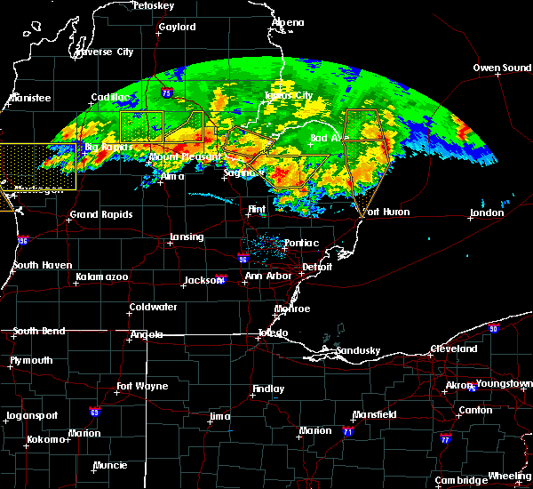 At 745 pm edt, severe thunderstorms were located along a line extending from near sterling to 7 miles south of rhodes to near oil city, moving east at 60 mph (radar indicated). Hazards include 60 mph wind gusts. Expect damage to roofs. siding and trees. severe thunderstorms will be near, pinconning and linwood around 755 pm edt. midland around 805 pm edt. auburn around 810 pm edt. bay city, kawkawlin and essexville around 815 pm edt. Other locations impacted by these severe thunderstorms include poseyville, crump, laporte, north bradley, willard, gordonville, hope, averill, porter township and bombay. At 745 pm edt, severe thunderstorms were located along a line extending from near sterling to 7 miles south of rhodes to near oil city, moving east at 60 mph (radar indicated). Hazards include 60 mph wind gusts. Expect damage to roofs. siding and trees. severe thunderstorms will be near, pinconning and linwood around 755 pm edt. midland around 805 pm edt. auburn around 810 pm edt. bay city, kawkawlin and essexville around 815 pm edt. Other locations impacted by these severe thunderstorms include poseyville, crump, laporte, north bradley, willard, gordonville, hope, averill, porter township and bombay.
|
| 6/22/2015 9:01 PM EDT |
 At 900 pm edt, severe thunderstorms were located along a line extending from near essexville to near merrill, moving east at 40 mph (radar indicated). Hazards include 60 mph wind gusts and penny size hail. Expect damage to roofs. siding and trees. severe thunderstorms will be near, saginaw, zilwaukee and bridgeport around 930 pm edt. frankenmuth and munger around 945 pm edt. Other locations impacted by these severe thunderstorms include burt, garfield, nelson, arthur, buena vista township, fenmore, indiantown, shiawassee national wildlife refuge, bay city state recreation area and brant. At 900 pm edt, severe thunderstorms were located along a line extending from near essexville to near merrill, moving east at 40 mph (radar indicated). Hazards include 60 mph wind gusts and penny size hail. Expect damage to roofs. siding and trees. severe thunderstorms will be near, saginaw, zilwaukee and bridgeport around 930 pm edt. frankenmuth and munger around 945 pm edt. Other locations impacted by these severe thunderstorms include burt, garfield, nelson, arthur, buena vista township, fenmore, indiantown, shiawassee national wildlife refuge, bay city state recreation area and brant.
|
| 6/18/2015 6:38 PM EDT | At 638 pm edt, severe thunderstorms were located along a line extending from 11 miles west of sebewaing to near auburn, moving southeast at 30 mph (radar indicated). Hazards include 60 mph wind gusts and penny size hail. Expect damage to roofs. siding and trees. these severe storms will be near, bay city around 655 pm edt. Other locations impacted by these severe thunderstorms include willard, bay city state recreation area and crump. |
| 6/18/2015 6:22 PM EDT | At 621 pm edt, severe thunderstorms were located along a line extending from 7 miles east of pinconning to near midland, moving southeast at 30 mph (radar indicated). Hazards include 60 mph wind gusts and quarter size hail. Hail damage to vehicles is expected. expect wind damage to roofs, siding and trees. these severe storms will be near, auburn around 640 pm edt. Other locations impacted by these severe thunderstorms include averill, crump, bombay, willard, bay city state recreation area and mount forest. |
| 6/18/2015 6:09 PM EDT | At 609 pm edt, severe thunderstorms were located along a line extending from near pinconning to sanford, moving east at 35 mph (radar indicated). Hazards include 60 mph wind gusts and quarter size hail. Hail damage to vehicles is expected. expect wind damage to roofs, siding and trees. these severe storms will be near, pinconning around 615 pm edt. midland around 630 pm edt. auburn around 640 pm edt. bay city and kawkawlin around 650 pm edt. essexville around 655 pm edt. Other locations impacted by these severe thunderstorms include crump, willard, hope, averill, bombay, bay city state recreation area, mount forest and north bradley. |
| 6/18/2015 5:53 PM EDT | At 552 pm edt, severe thunderstorms were located along a line extending from near bentley to near oil city, moving southeast at 30 mph (radar indicated). Hazards include 60 mph wind gusts and quarter size hail. Hail damage to vehicles is expected. expect wind damage to roofs, siding and trees. severe thunderstorms will be near, bentley around 600 pm edt. pinconning around 610 pm edt. sanford around 615 pm edt. midland around 635 pm edt. Other locations impacted by these severe thunderstorms include crump, north bradley, willard, hope, averill, bombay, bay city state recreation area and mount forest. |
| 7/27/2014 4:25 PM EDT | Ping Pong Ball sized hail reported 11.1 miles E of Midland, MI, at m-20 and 11 mile |
| 7/27/2014 2:30 PM EDT | Tea Cup sized hail reported 4.1 miles W of Midland, MI, relayed via shave project |
| 7/27/2014 2:30 PM EDT | Golf Ball sized hail reported 1.4 miles NW of Midland, MI, lots of 1.5 inch hail...a few to 1.75 inches. relayed via facebook with pictures. |
| 7/27/2014 2:21 PM EDT | Tennis Ball sized hail reported 5.2 miles WSW of Midland, MI, relayed via shave report. |
| 11/17/2013 4:30 PM EST | Dispatch reports multiple trees down throughout midland county. time estimated from radar in midland county MI, 1.4 miles NW of Midland, MI |
| 11/17/2013 4:30 PM EST | Public reports kohls sign blown down and damage to gas station awning. report via facebook. time estimated from rada in midland county MI, 1.9 miles SSW of Midland, MI |
| 7/19/2013 10:22 PM EDT | Trees downed in the city of midland in midland county MI, 1.4 miles NW of Midland, MI |
| 7/19/2013 2:14 PM EDT | Kikw awos reported wind gus in midland county MI, 1.9 miles SSE of Midland, MI |
| 6/17/2013 2:45 PM EDT | Trees and wires down. relayed from facebook. radar estimated tim in midland county MI, 7.6 miles NNE of Midland, MI |
| 5/3/2012 4:54 PM EDT | Quarter sized hail reported 8 miles S of Midland, MI |
| 5/3/2012 4:25 PM EDT | Quarter sized hail reported 14.5 miles S of Midland, MI, relayed via nws detroit |
| 1/1/0001 12:00 AM | Numerous trees and powerlines down in the cit in midland county MI, 1.4 miles NW of Midland, MI |
| 1/1/0001 12:00 AM | Trees in bay county MI, 8.7 miles WSW of Midland, MI |
| 1/1/0001 12:00 AM | Quarter sized hail reported 1.4 miles NW of Midland, MI, hail went through a two pane glass skylight |
| 1/1/0001 12:00 AM | Half Dollar sized hail reported 11.2 miles SSW of Midland, MI, reported at carter rd and prevo rd |
| 1/1/0001 12:00 AM | Trees uprooted with measured 71 mph wind in midland county MI, 6.7 miles SSW of Midland, MI |
| 1/1/0001 12:00 AM | Six inch diameter limbs down and several trees in midland county MI, 2.6 miles W of Midland, MI |
| 1/1/0001 12:00 AM | Quarter sized hail reported 1.4 miles NW of Midland, MI |
| 1/1/0001 12:00 AM | Storm damage reported in midland county MI, 1.4 miles NW of Midland, MI |
| 1/1/0001 12:00 AM | Quarter sized hail reported 3.2 miles NNE of Midland, MI |
| 1/1/0001 12:00 AM | Quarter sized hail reported 12.8 miles SSW of Midland, MI |
Hail Maps for Midland, MI


Connect with Interactive Hail Maps