

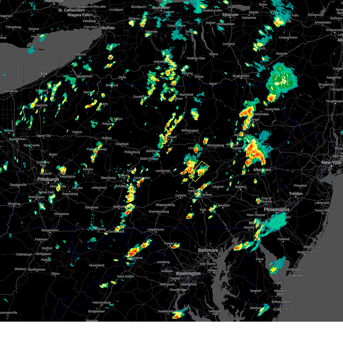
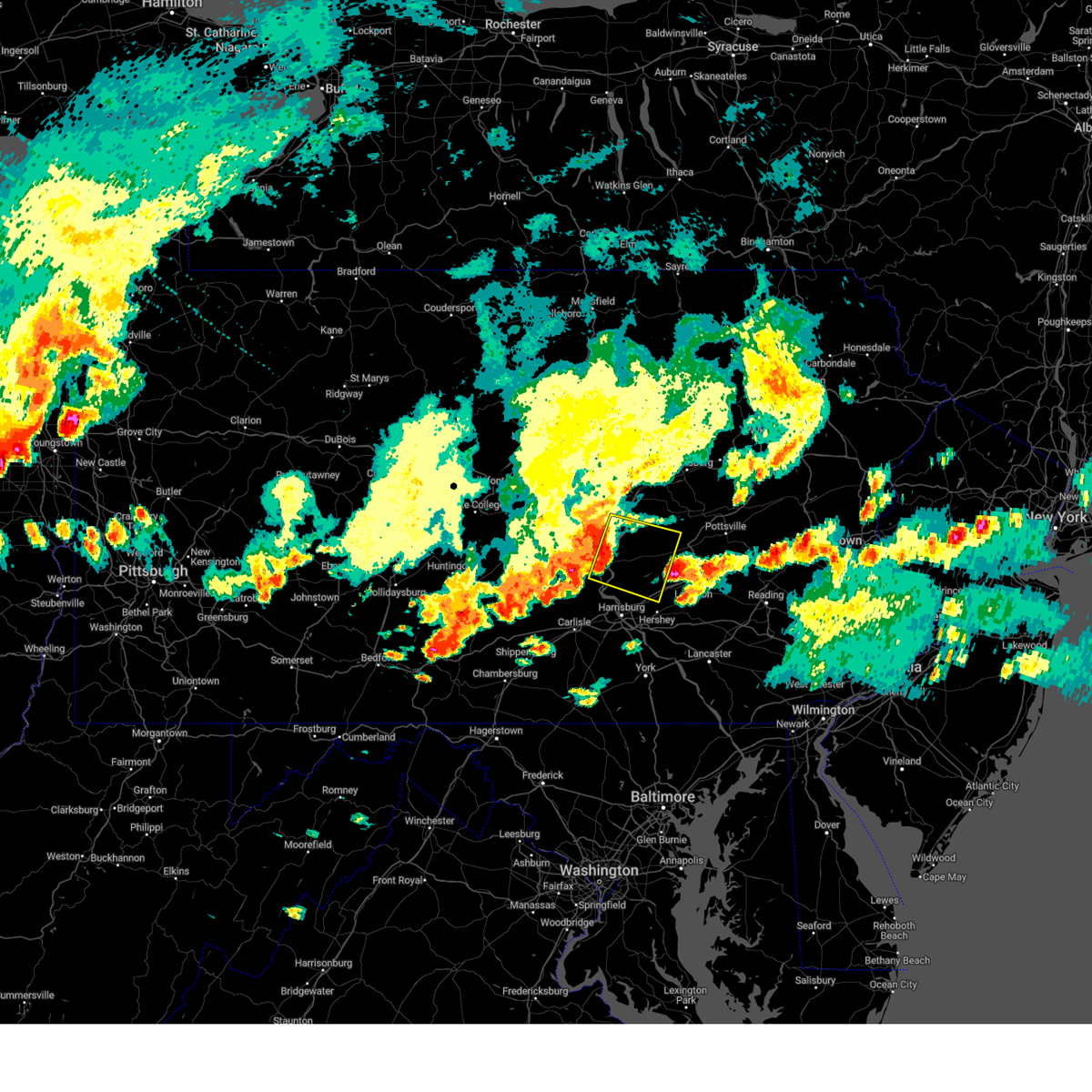
Hail Map for Millersburg, PA
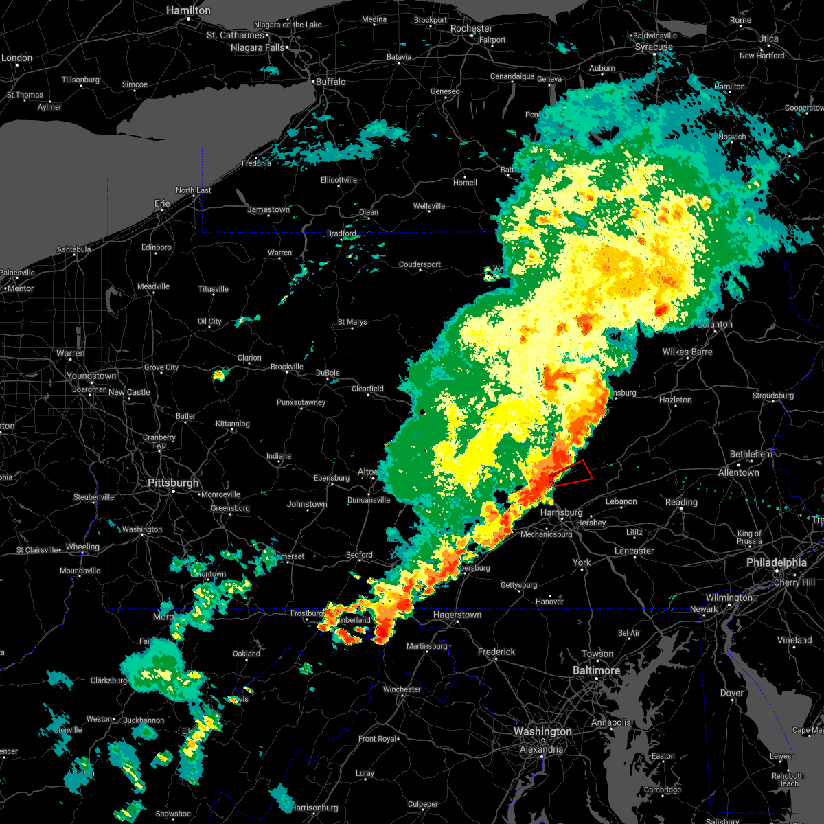
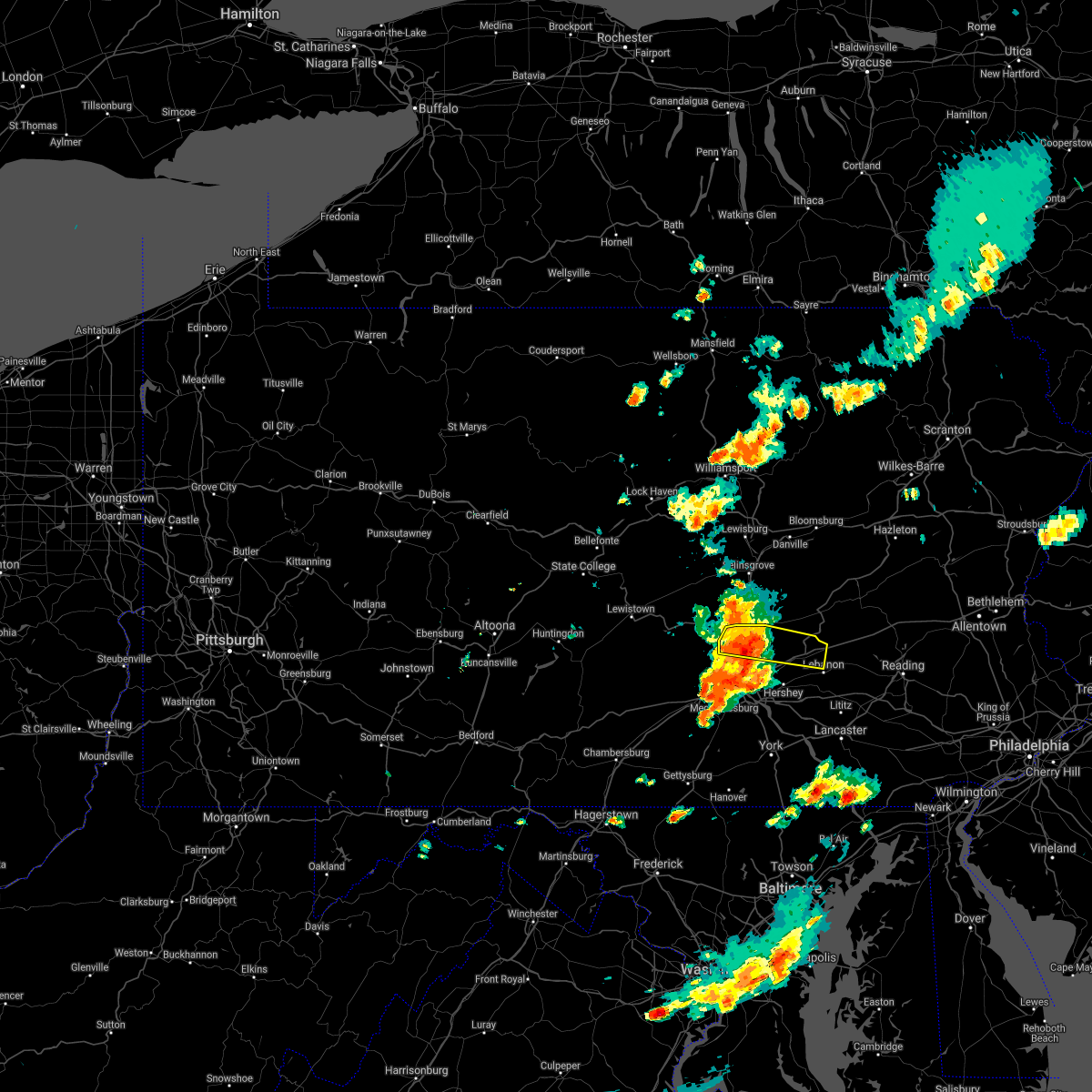
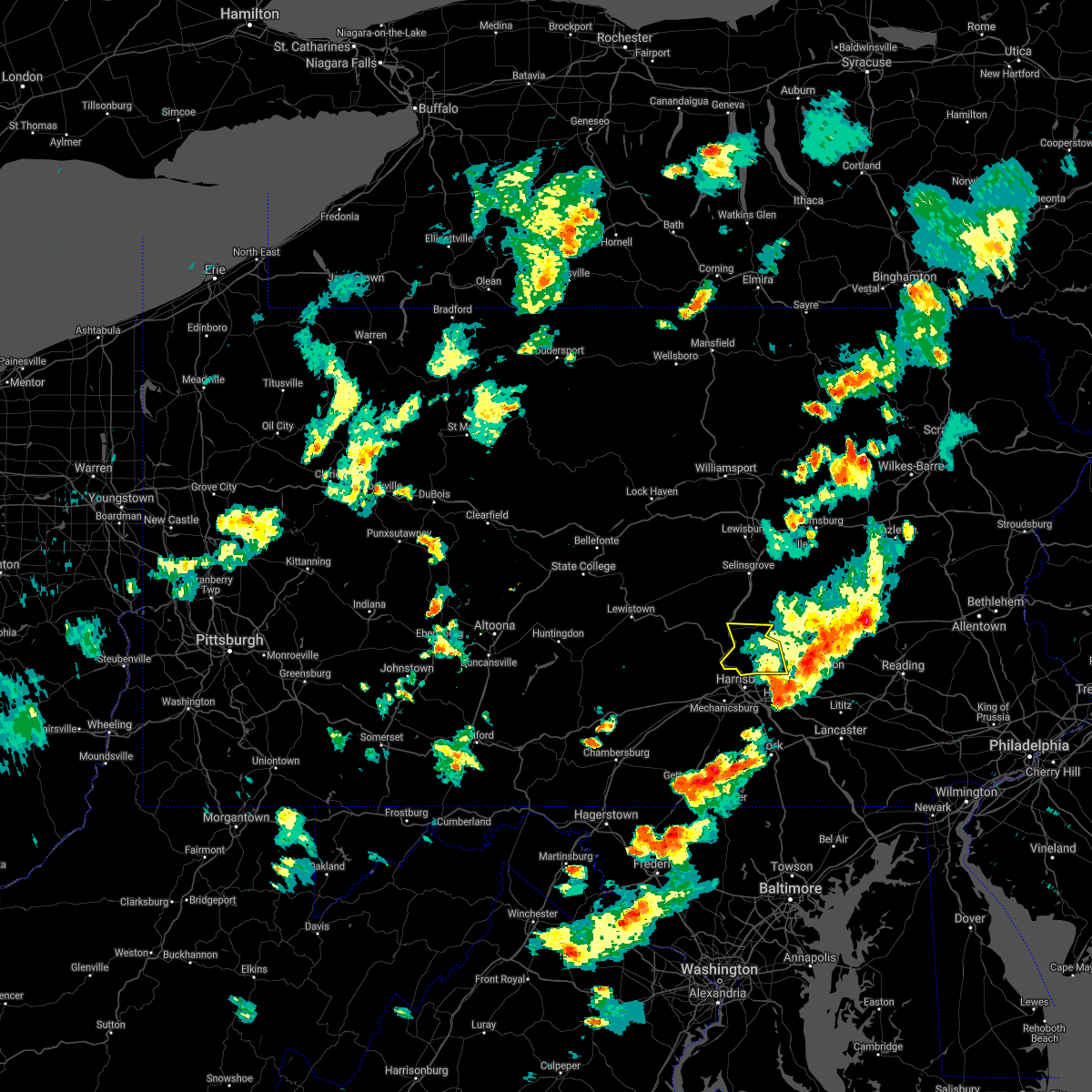
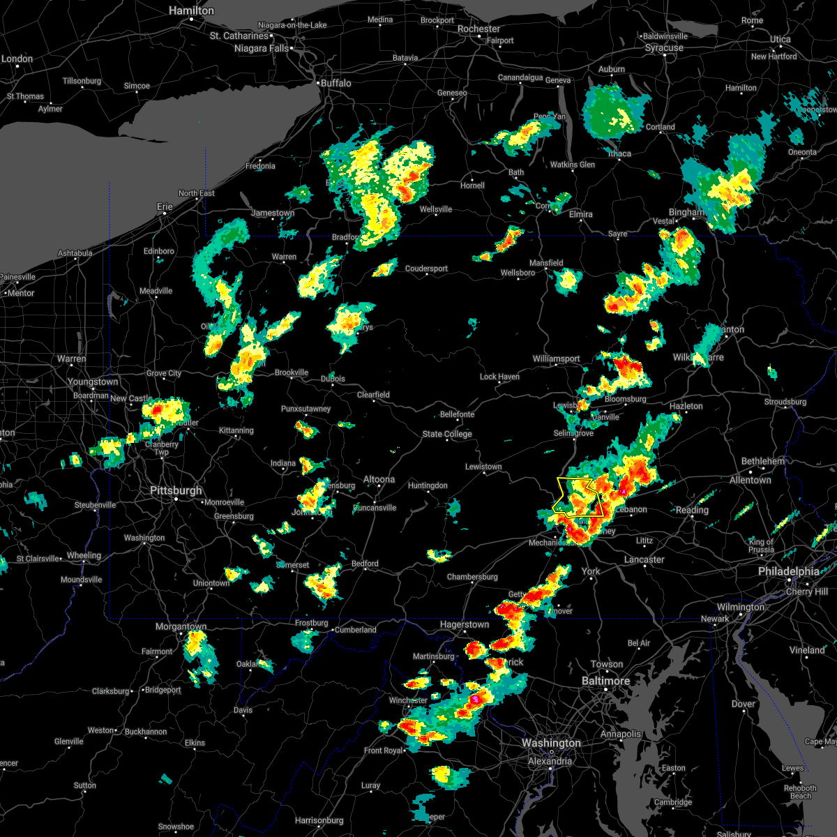
The Millersburg, PA area has had 1 report of on-the-ground hail by trained spotters, and has been under severe weather warnings 7 times during the past 12 months. Doppler radar has detected hail at or near Millersburg, PA on 45 occasions, including 1 occasion during the past year.
| Name: | Millersburg, PA |
| Where Located: | 50.7 miles ESE of State College, PA |
| Map: | Google Map for Millersburg, PA |
| Population: | 2557 |
| Housing Units: | 1361 |
| More Info: | Search Google for Millersburg, PA |
0
The Top Recent Hail Date for Millersburg, PA is Tuesday, August 6, 2024 (30th out of 45)

Hail and Wind Damage Spotted near Millersburg, PA
| Date / Time | Report Details |
|---|---|
| 4/29/2025 7:50 PM EDT | Svrctp the national weather service in state college pa has issued a * severe thunderstorm warning for, columbia county in central pennsylvania, northern dauphin county in south central pennsylvania, northwestern lebanon county in south central pennsylvania, southern northumberland county in central pennsylvania, schuylkill county in central pennsylvania, sullivan county in north central pennsylvania, * until 845 pm edt. * at 750 pm edt, severe thunderstorms were located along a line extending from ralston to near hughesville to mooresburg to selinsgrove to new buffalo, moving east at 65 mph (radar indicated). Hazards include 60 mph wind gusts. expect damage to roofs, siding, and trees |
| 8/18/2024 2:56 PM EDT | Trees down blocking portions of 4th stree in dauphin county PA, 0.8 miles NNE of Millersburg, PA |
| 8/18/2024 2:55 PM EDT |
 The storm which prompted the warning has weakened below severe limits, and no longer poses an immediate threat to life or property. therefore, the warning will be allowed to expire. a severe thunderstorm watch remains in effect until 1000 pm edt for south central and central pennsylvania. The storm which prompted the warning has weakened below severe limits, and no longer poses an immediate threat to life or property. therefore, the warning will be allowed to expire. a severe thunderstorm watch remains in effect until 1000 pm edt for south central and central pennsylvania.
|
| 8/18/2024 2:31 PM EDT |
 the severe thunderstorm warning has been cancelled and is no longer in effect the severe thunderstorm warning has been cancelled and is no longer in effect
|
| 8/18/2024 2:31 PM EDT |
 At 231 pm edt, a severe thunderstorm was located over millersburg, moving northeast at 20 mph (radar indicated). Hazards include 60 mph wind gusts and quarter size hail. Hail damage to vehicles is expected. expect wind damage to roofs, siding, and trees. Locations impacted include, millersburg, elizabethville, klingerstown, leck kill, urban, rebuck, gratz, dalmatia, berrysburg, pillow, and enders. At 231 pm edt, a severe thunderstorm was located over millersburg, moving northeast at 20 mph (radar indicated). Hazards include 60 mph wind gusts and quarter size hail. Hail damage to vehicles is expected. expect wind damage to roofs, siding, and trees. Locations impacted include, millersburg, elizabethville, klingerstown, leck kill, urban, rebuck, gratz, dalmatia, berrysburg, pillow, and enders.
|
| 8/18/2024 2:14 PM EDT | Corrects previous tstm wnd dmg report from 1 ssw millersburg. trees down blocking portions of 4th stree in dauphin county PA, 0.8 miles NNE of Millersburg, PA |
| 8/18/2024 2:09 PM EDT |
 Svrctp the national weather service in state college pa has issued a * severe thunderstorm warning for, northwestern dauphin county in south central pennsylvania, southwestern northumberland county in central pennsylvania, northeastern perry county in south central pennsylvania, southeastern snyder county in central pennsylvania, * until 300 pm edt. * at 208 pm edt, a severe thunderstorm was located over millersburg, moving northeast at 25 mph (radar indicated). Hazards include 60 mph wind gusts and quarter size hail. Hail damage to vehicles is expected. Expect wind damage to roofs, siding, and trees. Svrctp the national weather service in state college pa has issued a * severe thunderstorm warning for, northwestern dauphin county in south central pennsylvania, southwestern northumberland county in central pennsylvania, northeastern perry county in south central pennsylvania, southeastern snyder county in central pennsylvania, * until 300 pm edt. * at 208 pm edt, a severe thunderstorm was located over millersburg, moving northeast at 25 mph (radar indicated). Hazards include 60 mph wind gusts and quarter size hail. Hail damage to vehicles is expected. Expect wind damage to roofs, siding, and trees.
|
| 8/6/2024 6:05 PM EDT | Trees down blocking roadwa in perry county PA, 2.8 miles SE of Millersburg, PA |
| 8/6/2024 5:57 PM EDT |
 The storm which prompted the warning has weakened below severe limits, and no longer poses an immediate threat to life or property. therefore, the warning will be allowed to expire. however, gusty winds and heavy rain are still possible with this thunderstorm. a severe thunderstorm watch remains in effect until 700 pm edt for south central and central pennsylvania. to report severe weather, contact your nearest law enforcement agency. they will relay your report to the national weather service state college pa. The storm which prompted the warning has weakened below severe limits, and no longer poses an immediate threat to life or property. therefore, the warning will be allowed to expire. however, gusty winds and heavy rain are still possible with this thunderstorm. a severe thunderstorm watch remains in effect until 700 pm edt for south central and central pennsylvania. to report severe weather, contact your nearest law enforcement agency. they will relay your report to the national weather service state college pa.
|
| 8/6/2024 5:23 PM EDT |
 Svrctp the national weather service in state college pa has issued a * severe thunderstorm warning for, northern dauphin county in south central pennsylvania, northeastern juniata county in central pennsylvania, northwestern lebanon county in south central pennsylvania, southwestern northumberland county in central pennsylvania, northeastern perry county in south central pennsylvania, southwestern schuylkill county in central pennsylvania, southeastern snyder county in central pennsylvania, * until 600 pm edt. * at 520 pm edt, a severe thunderstorm was located over millersburg, moving east at 30 mph (radar indicated). Hazards include 60 mph wind gusts and quarter size hail. Hail damage to vehicles is expected. Expect wind damage to roofs, siding, and trees. Svrctp the national weather service in state college pa has issued a * severe thunderstorm warning for, northern dauphin county in south central pennsylvania, northeastern juniata county in central pennsylvania, northwestern lebanon county in south central pennsylvania, southwestern northumberland county in central pennsylvania, northeastern perry county in south central pennsylvania, southwestern schuylkill county in central pennsylvania, southeastern snyder county in central pennsylvania, * until 600 pm edt. * at 520 pm edt, a severe thunderstorm was located over millersburg, moving east at 30 mph (radar indicated). Hazards include 60 mph wind gusts and quarter size hail. Hail damage to vehicles is expected. Expect wind damage to roofs, siding, and trees.
|
| 8/6/2024 5:22 PM EDT | Trees dow in dauphin county PA, 0.3 miles E of Millersburg, PA |
| 8/6/2024 5:15 PM EDT | Corrects previous tstm wnd dmg report from liverpool. trees down blocking roadwa in perry county PA, 2.8 miles SE of Millersburg, PA |
| 6/29/2024 5:47 PM EDT |
 the severe thunderstorm warning has been cancelled and is no longer in effect the severe thunderstorm warning has been cancelled and is no longer in effect
|
| 6/29/2024 5:47 PM EDT |
 At 547 pm edt, severe thunderstorms were located along a line extending from rebuck to elizabethville to new bloomfield, moving east at 35 mph (radar indicated). Hazards include 60 mph wind gusts. Expect damage to roofs, siding, and trees. Locations impacted include, shamokin, selinsgrove, millersburg, fairview-ferndale, trevorton, lykens, newport, duncannon, elizabethville, new bloomfield, kreamer, and port trevorton. At 547 pm edt, severe thunderstorms were located along a line extending from rebuck to elizabethville to new bloomfield, moving east at 35 mph (radar indicated). Hazards include 60 mph wind gusts. Expect damage to roofs, siding, and trees. Locations impacted include, shamokin, selinsgrove, millersburg, fairview-ferndale, trevorton, lykens, newport, duncannon, elizabethville, new bloomfield, kreamer, and port trevorton.
|
| 6/29/2024 5:45 PM EDT | Large tree and wires dow in dauphin county PA, 4.9 miles W of Millersburg, PA |
| 6/29/2024 5:39 PM EDT | Multiple trees and wires down on route 25 in the rising sun road and shaffer road corrido in dauphin county PA, 1 miles SW of Millersburg, PA |
| 6/29/2024 5:38 PM EDT | Tree down onto savidge roa in dauphin county PA, 5.3 miles WSW of Millersburg, PA |
| 6/29/2024 5:33 PM EDT |
 At 533 pm edt, severe thunderstorms were located along a line extending from selinsgrove to millersburg to loysville, moving east at 35 mph (radar indicated). Hazards include 60 mph wind gusts. Expect damage to roofs, siding, and trees. Locations impacted include, shamokin, selinsgrove, millersburg, fairview-ferndale, trevorton, lykens, newport, duncannon, elizabethville, middleburg, new bloomfield, and kreamer. At 533 pm edt, severe thunderstorms were located along a line extending from selinsgrove to millersburg to loysville, moving east at 35 mph (radar indicated). Hazards include 60 mph wind gusts. Expect damage to roofs, siding, and trees. Locations impacted include, shamokin, selinsgrove, millersburg, fairview-ferndale, trevorton, lykens, newport, duncannon, elizabethville, middleburg, new bloomfield, and kreamer.
|
| 6/29/2024 5:14 PM EDT |
 Svrctp the national weather service in state college pa has issued a * severe thunderstorm warning for, northwestern dauphin county in south central pennsylvania, juniata county in central pennsylvania, southwestern northumberland county in central pennsylvania, central perry county in south central pennsylvania, west central schuylkill county in central pennsylvania, snyder county in central pennsylvania, * until 600 pm edt. * at 514 pm edt, severe thunderstorms were located along a line extending from paxtonville to near mexico to east waterford, moving east at 35 mph (radar indicated). Hazards include 60 mph wind gusts. expect damage to roofs, siding, and trees Svrctp the national weather service in state college pa has issued a * severe thunderstorm warning for, northwestern dauphin county in south central pennsylvania, juniata county in central pennsylvania, southwestern northumberland county in central pennsylvania, central perry county in south central pennsylvania, west central schuylkill county in central pennsylvania, snyder county in central pennsylvania, * until 600 pm edt. * at 514 pm edt, severe thunderstorms were located along a line extending from paxtonville to near mexico to east waterford, moving east at 35 mph (radar indicated). Hazards include 60 mph wind gusts. expect damage to roofs, siding, and trees
|
| 6/26/2024 11:10 PM EDT |
 The storms which prompted the warning have weakened below severe limits, and have exited the warned area. therefore, the warning will be allowed to expire. The storms which prompted the warning have weakened below severe limits, and have exited the warned area. therefore, the warning will be allowed to expire.
|
| 6/26/2024 10:44 PM EDT |
 the severe thunderstorm warning has been cancelled and is no longer in effect the severe thunderstorm warning has been cancelled and is no longer in effect
|
| 6/26/2024 10:44 PM EDT |
 At 1044 pm edt, severe thunderstorms were located along a line extending from near millersburg to shermansdale to shippensburg, moving east at 45 mph (radar indicated). Hazards include 60 mph wind gusts. Expect damage to roofs, siding, and trees. locations impacted include, harrisburg, carlisle, mechanicsburg, enola, shippensburg, plainfield, schlusser, boiling springs, wormleysburg, millersburg, marysville, and mount holly springs. this includes the following interstates, the pennsylvania turnpike from mile markers 188 to 232. Interstate 81 from mile markers 22 to 66. At 1044 pm edt, severe thunderstorms were located along a line extending from near millersburg to shermansdale to shippensburg, moving east at 45 mph (radar indicated). Hazards include 60 mph wind gusts. Expect damage to roofs, siding, and trees. locations impacted include, harrisburg, carlisle, mechanicsburg, enola, shippensburg, plainfield, schlusser, boiling springs, wormleysburg, millersburg, marysville, and mount holly springs. this includes the following interstates, the pennsylvania turnpike from mile markers 188 to 232. Interstate 81 from mile markers 22 to 66.
|
| 6/26/2024 10:30 PM EDT |
 Svrctp the national weather service in state college pa has issued a * severe thunderstorm warning for, cumberland county in south central pennsylvania, northwestern dauphin county in south central pennsylvania, northeastern franklin county in south central pennsylvania, central juniata county in central pennsylvania, perry county in south central pennsylvania, * until 1115 pm edt. * at 1030 pm edt, severe thunderstorms were located along a line extending from mcalisterville to colonel denning state park to upper strasburg, moving east at 50 mph (radar indicated). Hazards include 60 mph wind gusts. expect damage to roofs, siding, and trees Svrctp the national weather service in state college pa has issued a * severe thunderstorm warning for, cumberland county in south central pennsylvania, northwestern dauphin county in south central pennsylvania, northeastern franklin county in south central pennsylvania, central juniata county in central pennsylvania, perry county in south central pennsylvania, * until 1115 pm edt. * at 1030 pm edt, severe thunderstorms were located along a line extending from mcalisterville to colonel denning state park to upper strasburg, moving east at 50 mph (radar indicated). Hazards include 60 mph wind gusts. expect damage to roofs, siding, and trees
|
| 9/7/2023 3:33 PM EDT |
 At 333 pm edt, a severe thunderstorm was located over fort indiantown gap, moving north at 25 mph (radar indicated). Hazards include 60 mph wind gusts and quarter size hail. Hail damage to vehicles is expected. Expect wind damage to roofs, siding, and trees. At 333 pm edt, a severe thunderstorm was located over fort indiantown gap, moving north at 25 mph (radar indicated). Hazards include 60 mph wind gusts and quarter size hail. Hail damage to vehicles is expected. Expect wind damage to roofs, siding, and trees.
|
| 9/7/2023 2:32 PM EDT |
 At 232 pm edt, a severe thunderstorm was located over port trevorton, moving northeast at 30 mph (radar indicated). Hazards include 60 mph wind gusts and quarter size hail. Hail damage to vehicles is expected. Expect wind damage to roofs, siding, and trees. At 232 pm edt, a severe thunderstorm was located over port trevorton, moving northeast at 30 mph (radar indicated). Hazards include 60 mph wind gusts and quarter size hail. Hail damage to vehicles is expected. Expect wind damage to roofs, siding, and trees.
|
| 9/7/2023 2:19 PM EDT |
 At 219 pm edt, a severe thunderstorm was located over newport, moving northeast at 20 mph (radar indicated). Hazards include 60 mph wind gusts and quarter size hail. Hail damage to vehicles is expected. expect wind damage to roofs, siding, and trees. locations impacted include, millersburg, new buffalo and halifax. hail threat, radar indicated max hail size, 1. 00 in wind threat, radar indicated max wind gust, 60 mph. At 219 pm edt, a severe thunderstorm was located over newport, moving northeast at 20 mph (radar indicated). Hazards include 60 mph wind gusts and quarter size hail. Hail damage to vehicles is expected. expect wind damage to roofs, siding, and trees. locations impacted include, millersburg, new buffalo and halifax. hail threat, radar indicated max hail size, 1. 00 in wind threat, radar indicated max wind gust, 60 mph.
|
| 9/7/2023 1:48 PM EDT |
 At 147 pm edt, a severe thunderstorm was located over new bloomfield, moving northeast at 20 mph (radar indicated). Hazards include 60 mph wind gusts and quarter size hail. Hail damage to vehicles is expected. Expect wind damage to roofs, siding, and trees. At 147 pm edt, a severe thunderstorm was located over new bloomfield, moving northeast at 20 mph (radar indicated). Hazards include 60 mph wind gusts and quarter size hail. Hail damage to vehicles is expected. Expect wind damage to roofs, siding, and trees.
|
| 7/17/2023 7:19 PM EDT |
 At 719 pm edt, a severe thunderstorm was located over millersburg, moving northeast at 30 mph (radar indicated). Hazards include 60 mph wind gusts and penny size hail. expect damage to roofs, siding, and trees At 719 pm edt, a severe thunderstorm was located over millersburg, moving northeast at 30 mph (radar indicated). Hazards include 60 mph wind gusts and penny size hail. expect damage to roofs, siding, and trees
|
| 7/9/2023 11:08 AM EDT |
 At 1106 am edt, a severe thunderstorm was located over meiserville, moving northeast at 15 mph. other storms were forming to the northeast and southwest of this storm. storms have a history of producing wind damage (radar indicated). Hazards include 60 mph wind gusts and penny size hail. Expect damage to roofs, siding, and trees. locations impacted include, millersburg, lykens, newport, elizabethville, port trevorton, meiserville, urban, liverpool, wiconisco, gratz, millerstown and dalmatia. hail threat, radar indicated max hail size, 0. 75 in wind threat, radar indicated max wind gust, 60 mph. At 1106 am edt, a severe thunderstorm was located over meiserville, moving northeast at 15 mph. other storms were forming to the northeast and southwest of this storm. storms have a history of producing wind damage (radar indicated). Hazards include 60 mph wind gusts and penny size hail. Expect damage to roofs, siding, and trees. locations impacted include, millersburg, lykens, newport, elizabethville, port trevorton, meiserville, urban, liverpool, wiconisco, gratz, millerstown and dalmatia. hail threat, radar indicated max hail size, 0. 75 in wind threat, radar indicated max wind gust, 60 mph.
|
| 7/9/2023 10:48 AM EDT | Trees down across route 147 near the vf in dauphin county PA, 1.6 miles SSE of Millersburg, PA |
| 7/9/2023 10:39 AM EDT |
 At 1038 am edt, a severe thunderstorm was located over millersburg, moving northeast at 15 mph. other storms were forming to the north and south of this storm (radar indicated). Hazards include 60 mph wind gusts and penny size hail. expect damage to roofs, siding, and trees At 1038 am edt, a severe thunderstorm was located over millersburg, moving northeast at 15 mph. other storms were forming to the north and south of this storm (radar indicated). Hazards include 60 mph wind gusts and penny size hail. expect damage to roofs, siding, and trees
|
| 7/7/2023 6:42 PM EDT |
 At 642 pm edt, a severe thunderstorm was located over lykens, moving southeast at 20 mph (radar indicated). Hazards include 60 mph wind gusts and quarter size hail. Hail damage to vehicles is expected. expect wind damage to roofs, siding, and trees. locations impacted include, millersburg, lykens, elizabethville, williamstown, fort indiantown gap, penn national race course, dehart dam, wiconisco, gratz and enders. this includes interstate 81 between mile markers 80 and 85, and from mile markers 92 to 96. hail threat, radar indicated max hail size, 1. 00 in wind threat, radar indicated max wind gust, 60 mph. At 642 pm edt, a severe thunderstorm was located over lykens, moving southeast at 20 mph (radar indicated). Hazards include 60 mph wind gusts and quarter size hail. Hail damage to vehicles is expected. expect wind damage to roofs, siding, and trees. locations impacted include, millersburg, lykens, elizabethville, williamstown, fort indiantown gap, penn national race course, dehart dam, wiconisco, gratz and enders. this includes interstate 81 between mile markers 80 and 85, and from mile markers 92 to 96. hail threat, radar indicated max hail size, 1. 00 in wind threat, radar indicated max wind gust, 60 mph.
|
| 7/7/2023 6:21 PM EDT |
 At 620 pm edt, a severe thunderstorm was located over elizabethville, moving southeast at 20 mph (radar indicated). Hazards include 60 mph wind gusts and quarter size hail. Hail damage to vehicles is expected. Expect wind damage to roofs, siding, and trees. At 620 pm edt, a severe thunderstorm was located over elizabethville, moving southeast at 20 mph (radar indicated). Hazards include 60 mph wind gusts and quarter size hail. Hail damage to vehicles is expected. Expect wind damage to roofs, siding, and trees.
|
| 7/2/2023 3:57 PM EDT | Reports of multiple trees down in upper paxton and mifflin townships. time estimated by rada in dauphin county PA, 6.1 miles WSW of Millersburg, PA |
| 7/2/2023 3:50 PM EDT | Photos of tree with a snapped trunk. time estimated by rada in perry county PA, 2.8 miles SE of Millersburg, PA |
| 7/2/2023 3:43 PM EDT |
 At 342 pm edt, a severe thunderstorm capable of producing a tornado was located over millersburg, moving east at 25 mph (radar indicated rotation). Hazards include tornado. Flying debris will be dangerous to those caught without shelter. mobile homes will be damaged or destroyed. damage to roofs, windows, and vehicles will occur. tree damage is likely. this dangerous storm will be near, elizabethville around 400 pm edt. Other locations impacted by this tornadic thunderstorm include berrysburg, liverpool and enders. At 342 pm edt, a severe thunderstorm capable of producing a tornado was located over millersburg, moving east at 25 mph (radar indicated rotation). Hazards include tornado. Flying debris will be dangerous to those caught without shelter. mobile homes will be damaged or destroyed. damage to roofs, windows, and vehicles will occur. tree damage is likely. this dangerous storm will be near, elizabethville around 400 pm edt. Other locations impacted by this tornadic thunderstorm include berrysburg, liverpool and enders.
|
| 6/27/2023 2:03 PM EDT |
 At 202 pm edt, severe thunderstorms were located along a line extending from millersburg to near new buffalo to paxtang, moving east northeast at 20 mph (radar indicated). Hazards include 60 mph wind gusts and quarter size hail. Hail damage to vehicles is expected. Expect wind damage to roofs, siding, and trees. At 202 pm edt, severe thunderstorms were located along a line extending from millersburg to near new buffalo to paxtang, moving east northeast at 20 mph (radar indicated). Hazards include 60 mph wind gusts and quarter size hail. Hail damage to vehicles is expected. Expect wind damage to roofs, siding, and trees.
|
| 6/3/2023 5:58 PM EDT |
 At 557 pm edt, a severe thunderstorm was located near richfield, moving south at 30 mph (radar indicated). Hazards include ping pong ball size hail and 60 mph wind gusts. People and animals outdoors will be injured. expect hail damage to roofs, siding, windows, and vehicles. Expect wind damage to roofs, siding, and trees. At 557 pm edt, a severe thunderstorm was located near richfield, moving south at 30 mph (radar indicated). Hazards include ping pong ball size hail and 60 mph wind gusts. People and animals outdoors will be injured. expect hail damage to roofs, siding, windows, and vehicles. Expect wind damage to roofs, siding, and trees.
|
| 6/3/2023 5:41 PM EDT |
 At 539 pm edt, a severe thunderstorm was located over meiserville, moving south at 30 mph. this storm has a history of producing large hail. other storms were nearby (radar indicated). Hazards include 60 mph wind gusts and quarter size hail. Hail damage to vehicles is expected. expect wind damage to roofs, siding, and trees. locations impacted include, sunbury, milton, lewisburg, selinsgrove, northumberland, winfield, millersburg, shamokin dam, newport, duncannon, elizabethville and linntown. hail threat, radar indicated max hail size, 1. 00 in wind threat, radar indicated max wind gust, 60 mph. At 539 pm edt, a severe thunderstorm was located over meiserville, moving south at 30 mph. this storm has a history of producing large hail. other storms were nearby (radar indicated). Hazards include 60 mph wind gusts and quarter size hail. Hail damage to vehicles is expected. expect wind damage to roofs, siding, and trees. locations impacted include, sunbury, milton, lewisburg, selinsgrove, northumberland, winfield, millersburg, shamokin dam, newport, duncannon, elizabethville and linntown. hail threat, radar indicated max hail size, 1. 00 in wind threat, radar indicated max wind gust, 60 mph.
|
| 6/3/2023 5:23 PM EDT |
 At 522 pm edt, a severe thunderstorm was located over kreamer, moving south at 30 mph. other storms continue to develop nearby (radar indicated). Hazards include 60 mph wind gusts and quarter size hail. Hail damage to vehicles is expected. Expect wind damage to roofs, siding, and trees. At 522 pm edt, a severe thunderstorm was located over kreamer, moving south at 30 mph. other storms continue to develop nearby (radar indicated). Hazards include 60 mph wind gusts and quarter size hail. Hail damage to vehicles is expected. Expect wind damage to roofs, siding, and trees.
|
| 6/3/2023 3:45 PM EDT |
 At 344 pm edt, a severe thunderstorm was located over fremont, moving south at 35 mph (radar indicated). Hazards include 60 mph wind gusts and quarter size hail. Hail damage to vehicles is expected. expect wind damage to roofs, siding, and trees. locations impacted include, lewisburg, selinsgrove, mifflinburg, winfield, millersburg, duncannon, elizabethville, linntown, middleburg, kreamer, port trevorton and penns creek. hail threat, radar indicated max hail size, 1. 00 in wind threat, radar indicated max wind gust, 60 mph. At 344 pm edt, a severe thunderstorm was located over fremont, moving south at 35 mph (radar indicated). Hazards include 60 mph wind gusts and quarter size hail. Hail damage to vehicles is expected. expect wind damage to roofs, siding, and trees. locations impacted include, lewisburg, selinsgrove, mifflinburg, winfield, millersburg, duncannon, elizabethville, linntown, middleburg, kreamer, port trevorton and penns creek. hail threat, radar indicated max hail size, 1. 00 in wind threat, radar indicated max wind gust, 60 mph.
|
| 6/3/2023 3:29 PM EDT |
 At 328 pm edt, a severe thunderstorm was located over penns creek, moving south at 35 mph (radar indicated). Hazards include 60 mph wind gusts and quarter size hail. Hail damage to vehicles is expected. Expect wind damage to roofs, siding, and trees. At 328 pm edt, a severe thunderstorm was located over penns creek, moving south at 35 mph (radar indicated). Hazards include 60 mph wind gusts and quarter size hail. Hail damage to vehicles is expected. Expect wind damage to roofs, siding, and trees.
|
| 3/31/2022 5:34 PM EDT |
 At 534 pm edt, severe thunderstorms were located along a line extending from port trevorton to near meiserville to millersburg to duncannon, moving northeast at 35 mph (radar indicated). Hazards include 60 mph wind gusts and nickel size hail. expect damage to roofs, siding, and trees At 534 pm edt, severe thunderstorms were located along a line extending from port trevorton to near meiserville to millersburg to duncannon, moving northeast at 35 mph (radar indicated). Hazards include 60 mph wind gusts and nickel size hail. expect damage to roofs, siding, and trees
|
| 3/7/2022 7:00 PM EST |
 At 700 pm est, severe thunderstorms were located along a line extending from meiserville to plainfield, moving east at 55 mph (radar indicated). Hazards include 60 mph wind gusts. expect damage to roofs, siding, and trees At 700 pm est, severe thunderstorms were located along a line extending from meiserville to plainfield, moving east at 55 mph (radar indicated). Hazards include 60 mph wind gusts. expect damage to roofs, siding, and trees
|
| 8/18/2021 5:31 PM EDT |
 At 530 pm edt, a severe thunderstorm was located over marysville, moving northeast at 30 mph (radar indicated). Hazards include 60 mph wind gusts. expect damage to roofs, siding, and trees At 530 pm edt, a severe thunderstorm was located over marysville, moving northeast at 30 mph (radar indicated). Hazards include 60 mph wind gusts. expect damage to roofs, siding, and trees
|
| 8/18/2021 3:56 PM EDT |
 At 355 pm edt, a severe thunderstorm was located near millersburg, moving north at 35 mph (radar indicated). Hazards include 60 mph wind gusts. Expect damage to roofs, siding, and trees. this severe thunderstorm will be near, meiserville, port trevorton and mount pleasant mills around 410 pm edt. kreamer, fremont and middleburg around 420 pm edt. selinsgrove, sunbury, hummels wharf, shamokin dam, kratzerville and winfield around 430 pm edt. Other locations impacted by this severe thunderstorm include seven points, liverpool, new berlin, freeburg, dalmatia, herndon, halifax, pillow and selinsgrove airport. At 355 pm edt, a severe thunderstorm was located near millersburg, moving north at 35 mph (radar indicated). Hazards include 60 mph wind gusts. Expect damage to roofs, siding, and trees. this severe thunderstorm will be near, meiserville, port trevorton and mount pleasant mills around 410 pm edt. kreamer, fremont and middleburg around 420 pm edt. selinsgrove, sunbury, hummels wharf, shamokin dam, kratzerville and winfield around 430 pm edt. Other locations impacted by this severe thunderstorm include seven points, liverpool, new berlin, freeburg, dalmatia, herndon, halifax, pillow and selinsgrove airport.
|
| 8/13/2021 3:43 PM EDT |
 At 342 pm edt, a severe thunderstorm was located near millersburg, moving northeast at 25 mph (radar indicated). Hazards include 60 mph wind gusts and penny size hail. expect damage to roofs, siding, and trees At 342 pm edt, a severe thunderstorm was located near millersburg, moving northeast at 25 mph (radar indicated). Hazards include 60 mph wind gusts and penny size hail. expect damage to roofs, siding, and trees
|
| 8/11/2021 4:47 PM EDT |
 At 446 pm edt, severe thunderstorms were located along a line extending from fremont to duncannon, moving east at 25 mph (radar indicated). Hazards include 60 mph wind gusts. expect damage to roofs, siding, and trees At 446 pm edt, severe thunderstorms were located along a line extending from fremont to duncannon, moving east at 25 mph (radar indicated). Hazards include 60 mph wind gusts. expect damage to roofs, siding, and trees
|
| 7/17/2021 6:39 PM EDT |
 The severe thunderstorm warning for northumberland, northwestern dauphin, northeastern juniata, montour, southeastern lycoming, western columbia, north central cumberland, southeastern sullivan and eastern perry counties will expire at 645 pm edt, the storms which prompted the warning have weakened below severe limits, and have exited the warned area. therefore, the warning will be allowed to expire. however heavy rain is still possible with these thunderstorms. a severe thunderstorm warning remains in effect for eastern lycoming, northern columbia, and eastern sullivan counties until 715 pm. a severe thunderstorm watch remains in effect until 1100 pm edt for central, south central and north central pennsylvania. to report severe weather, contact your nearest law enforcement agency. they will relay your report to the national weather service state college pa. The severe thunderstorm warning for northumberland, northwestern dauphin, northeastern juniata, montour, southeastern lycoming, western columbia, north central cumberland, southeastern sullivan and eastern perry counties will expire at 645 pm edt, the storms which prompted the warning have weakened below severe limits, and have exited the warned area. therefore, the warning will be allowed to expire. however heavy rain is still possible with these thunderstorms. a severe thunderstorm warning remains in effect for eastern lycoming, northern columbia, and eastern sullivan counties until 715 pm. a severe thunderstorm watch remains in effect until 1100 pm edt for central, south central and north central pennsylvania. to report severe weather, contact your nearest law enforcement agency. they will relay your report to the national weather service state college pa.
|
| 7/17/2021 6:03 PM EDT |
 At 602 pm edt, severe thunderstorms were located along a line extending from exchange to near millersburg to near carlisle, moving northeast at 30 mph (radar indicated). Hazards include 60 mph wind gusts and quarter size hail. Hail damage to vehicles is expected. expect wind damage to roofs, siding, and trees. locations impacted include, bloomsburg, sunbury, shamokin, milton, lewisburg, danville, northumberland, plainfield, schlusser, millersburg, marysville, muncy, watsontown, elysburg, fairview-ferndale, hughesville, riverside, trevorton, lykens and shamokin dam. for those driving on interstate 80, this includes areas between the lewisburg-williamsport and bloomsburg-light street exits, specifically from mile markers 211 to 234. this includes the following interstates, the pennsylvania turnpike from mile markers 214 to 219. Interstate 180 from mile markers 1 to 13. At 602 pm edt, severe thunderstorms were located along a line extending from exchange to near millersburg to near carlisle, moving northeast at 30 mph (radar indicated). Hazards include 60 mph wind gusts and quarter size hail. Hail damage to vehicles is expected. expect wind damage to roofs, siding, and trees. locations impacted include, bloomsburg, sunbury, shamokin, milton, lewisburg, danville, northumberland, plainfield, schlusser, millersburg, marysville, muncy, watsontown, elysburg, fairview-ferndale, hughesville, riverside, trevorton, lykens and shamokin dam. for those driving on interstate 80, this includes areas between the lewisburg-williamsport and bloomsburg-light street exits, specifically from mile markers 211 to 234. this includes the following interstates, the pennsylvania turnpike from mile markers 214 to 219. Interstate 180 from mile markers 1 to 13.
|
| 7/17/2021 5:44 PM EDT |
 At 543 pm edt, severe thunderstorms were located along a line extending from near milton to near new buffalo to near newville, moving northeast at 30 mph (radar indicated). Hazards include 60 mph wind gusts and quarter size hail. Hail damage to vehicles is expected. Expect wind damage to roofs, siding, and trees. At 543 pm edt, severe thunderstorms were located along a line extending from near milton to near new buffalo to near newville, moving northeast at 30 mph (radar indicated). Hazards include 60 mph wind gusts and quarter size hail. Hail damage to vehicles is expected. Expect wind damage to roofs, siding, and trees.
|
| 7/12/2021 3:55 PM EDT |
 At 355 pm edt, a severe thunderstorm was located near duncannon, moving east at 25 mph (radar indicated). Hazards include 60 mph wind gusts. Expect damage to roofs, siding, and trees. this severe thunderstorm will be near, new buffalo and millersburg around 400 pm edt. marysville and rockville around 410 pm edt. linglestown and paxtonia around 420 pm edt. dehart dam, penn national race course and skyline view around 430 pm edt. other locations impacted by this severe thunderstorm include enders, dauphin and halifax. This includes interstate 81 from mile markers 71 to 81. At 355 pm edt, a severe thunderstorm was located near duncannon, moving east at 25 mph (radar indicated). Hazards include 60 mph wind gusts. Expect damage to roofs, siding, and trees. this severe thunderstorm will be near, new buffalo and millersburg around 400 pm edt. marysville and rockville around 410 pm edt. linglestown and paxtonia around 420 pm edt. dehart dam, penn national race course and skyline view around 430 pm edt. other locations impacted by this severe thunderstorm include enders, dauphin and halifax. This includes interstate 81 from mile markers 71 to 81.
|
| 7/11/2021 8:52 PM EDT |
 At 852 pm edt, severe thunderstorms capable of producing both tornadoes and extensive straight line wind damage were located over millersburg, moving northeast at 35 mph (radar indicated rotation). Hazards include tornado. Flying debris will be dangerous to those caught without shelter. mobile homes will be damaged or destroyed. damage to roofs, windows, and vehicles will occur. tree damage is likely. these dangerous storms will be near, elizabethville around 900 pm edt. lykens around 910 pm edt. Other locations impacted by this tornadic thunderstorm include enders, gratz, wiconisco and halifax. At 852 pm edt, severe thunderstorms capable of producing both tornadoes and extensive straight line wind damage were located over millersburg, moving northeast at 35 mph (radar indicated rotation). Hazards include tornado. Flying debris will be dangerous to those caught without shelter. mobile homes will be damaged or destroyed. damage to roofs, windows, and vehicles will occur. tree damage is likely. these dangerous storms will be near, elizabethville around 900 pm edt. lykens around 910 pm edt. Other locations impacted by this tornadic thunderstorm include enders, gratz, wiconisco and halifax.
|
| 7/11/2021 8:44 PM EDT |
 At 844 pm edt, severe thunderstorms were located along a line extending from near millersburg to near new buffalo to near shippensburg, moving east at 20 mph (radar indicated). Hazards include 60 mph wind gusts. expect damage to roofs, siding, and trees At 844 pm edt, severe thunderstorms were located along a line extending from near millersburg to near new buffalo to near shippensburg, moving east at 20 mph (radar indicated). Hazards include 60 mph wind gusts. expect damage to roofs, siding, and trees
|
| 7/9/2021 4:46 PM EDT |
 At 444 pm edt, a severe thunderstorm was located near new buffalo, moving east southeast at 30 mph (radar indicated). Hazards include 60 mph wind gusts. Expect damage to roofs, siding, and trees. locations impacted include, millersburg, sand hill, elizabethville, fredericksburg, new buffalo, harper tavern, lickdale, fort indiantown gap, penn national race course, dehart dam, jonestown, halifax, enders and ono. this includes the following interstates, interstate 78 from mile markers 0 to 7. Interstate 81 from mile markers 82 to 96. At 444 pm edt, a severe thunderstorm was located near new buffalo, moving east southeast at 30 mph (radar indicated). Hazards include 60 mph wind gusts. Expect damage to roofs, siding, and trees. locations impacted include, millersburg, sand hill, elizabethville, fredericksburg, new buffalo, harper tavern, lickdale, fort indiantown gap, penn national race course, dehart dam, jonestown, halifax, enders and ono. this includes the following interstates, interstate 78 from mile markers 0 to 7. Interstate 81 from mile markers 82 to 96.
|
| 7/9/2021 4:16 PM EDT |
 At 415 pm edt, a severe thunderstorm was located near millersburg, moving east at 30 mph (radar indicated). Hazards include 60 mph wind gusts. expect damage to roofs, siding, and trees At 415 pm edt, a severe thunderstorm was located near millersburg, moving east at 30 mph (radar indicated). Hazards include 60 mph wind gusts. expect damage to roofs, siding, and trees
|
| 5/26/2021 8:29 PM EDT |
 At 829 pm edt, a severe thunderstorm was located near millersburg, moving east at 45 mph (radar indicated). Hazards include 60 mph wind gusts. expect damage to trees, roofs, and siding At 829 pm edt, a severe thunderstorm was located near millersburg, moving east at 45 mph (radar indicated). Hazards include 60 mph wind gusts. expect damage to trees, roofs, and siding
|
| 5/26/2021 3:52 PM EDT |
 The severe thunderstorm warning for central dauphin county will expire at 400 pm edt, the storms which prompted the warning have moved out of the area. therefore, the warning will be allowed to expire. a severe thunderstorm watch remains in effect until 800 pm edt for south central pennsylvania. to report severe weather, contact your nearest law enforcement agency. they will relay your report to the national weather service state college pa. The severe thunderstorm warning for central dauphin county will expire at 400 pm edt, the storms which prompted the warning have moved out of the area. therefore, the warning will be allowed to expire. a severe thunderstorm watch remains in effect until 800 pm edt for south central pennsylvania. to report severe weather, contact your nearest law enforcement agency. they will relay your report to the national weather service state college pa.
|
| 5/26/2021 3:33 PM EDT |
 At 333 pm edt, severe thunderstorms were located along a line extending from williamstown to near lykens to near penn national race course to near skyline view, moving east at 45 mph (radar indicated). Hazards include 60 mph wind gusts and penny size hail. Expect damage to trees, roofs, and siding. locations impacted include, linglestown, skyline view, millersburg, duncannon, elizabethville, rockville, penn national race course, dehart dam, halifax, dauphin and enders. This includes interstate 81 from mile markers 75 to 81. At 333 pm edt, severe thunderstorms were located along a line extending from williamstown to near lykens to near penn national race course to near skyline view, moving east at 45 mph (radar indicated). Hazards include 60 mph wind gusts and penny size hail. Expect damage to trees, roofs, and siding. locations impacted include, linglestown, skyline view, millersburg, duncannon, elizabethville, rockville, penn national race course, dehart dam, halifax, dauphin and enders. This includes interstate 81 from mile markers 75 to 81.
|
| 5/26/2021 3:14 PM EDT |
 At 312 pm edt, a severe thunderstorm was located near leck kill, moving east at 30 mph (emergency management reported multiple trees down in washington township and damage to a barn). Hazards include 60 mph wind gusts. Expect damage to trees, roofs, and siding. locations impacted include, millersburg, pine grove, lykens, tremont, elizabethville, williamstown, tower city, donaldson, wiconisco, hegins, gratz, ravine, muir, berrysburg and orwin. This includes interstate 81 from mile markers 96 to 110. At 312 pm edt, a severe thunderstorm was located near leck kill, moving east at 30 mph (emergency management reported multiple trees down in washington township and damage to a barn). Hazards include 60 mph wind gusts. Expect damage to trees, roofs, and siding. locations impacted include, millersburg, pine grove, lykens, tremont, elizabethville, williamstown, tower city, donaldson, wiconisco, hegins, gratz, ravine, muir, berrysburg and orwin. This includes interstate 81 from mile markers 96 to 110.
|
| 5/26/2021 3:09 PM EDT |
 At 308 pm edt, severe thunderstorms were located along a line extending from millersburg to near new buffalo to near duncannon to near wertzville, moving east at 45 mph (radar indicated). Hazards include 60 mph wind gusts and penny size hail. expect damage to trees, roofs, and siding At 308 pm edt, severe thunderstorms were located along a line extending from millersburg to near new buffalo to near duncannon to near wertzville, moving east at 45 mph (radar indicated). Hazards include 60 mph wind gusts and penny size hail. expect damage to trees, roofs, and siding
|
| 5/26/2021 3:03 PM EDT |
 At 302 pm edt, a severe thunderstorm was located over leck kill, moving east at 30 mph (radar indicated). Hazards include 60 mph wind gusts. Expect damage to trees, roofs, and siding. locations impacted include, millersburg, pine grove, lykens, tremont, elizabethville, williamstown, tower city, donaldson, klingerstown, beurys lake, wiconisco, hegins, gratz, ravine, muir, berrysburg, orwin, pillow, pitman and schuykill county airport. This includes interstate 81 from mile markers 96 to 113. At 302 pm edt, a severe thunderstorm was located over leck kill, moving east at 30 mph (radar indicated). Hazards include 60 mph wind gusts. Expect damage to trees, roofs, and siding. locations impacted include, millersburg, pine grove, lykens, tremont, elizabethville, williamstown, tower city, donaldson, klingerstown, beurys lake, wiconisco, hegins, gratz, ravine, muir, berrysburg, orwin, pillow, pitman and schuykill county airport. This includes interstate 81 from mile markers 96 to 113.
|
| 5/26/2021 2:33 PM EDT |
 At 232 pm edt, a severe thunderstorm was located near meiserville, moving east at 30 mph (radar indicated). Hazards include 60 mph wind gusts. expect damage to trees, roofs, and siding At 232 pm edt, a severe thunderstorm was located near meiserville, moving east at 30 mph (radar indicated). Hazards include 60 mph wind gusts. expect damage to trees, roofs, and siding
|
| 7/8/2020 6:54 PM EDT |
 At 654 pm edt, a severe thunderstorm was located over mount pleasant mills, moving south at 20 mph (radar indicated). Hazards include 60 mph wind gusts and quarter size hail. Hail damage to vehicles is expected. Expect wind damage to trees, roofs, and siding. At 654 pm edt, a severe thunderstorm was located over mount pleasant mills, moving south at 20 mph (radar indicated). Hazards include 60 mph wind gusts and quarter size hail. Hail damage to vehicles is expected. Expect wind damage to trees, roofs, and siding.
|
| 6/4/2020 7:41 PM EDT |
 At 740 pm edt, severe thunderstorms were located along a line extending from near mcalisterville to near wertzville, moving northeast at 35 mph (radar indicated). Hazards include 60 mph wind gusts. expect damage to trees, roofs, and siding At 740 pm edt, severe thunderstorms were located along a line extending from near mcalisterville to near wertzville, moving northeast at 35 mph (radar indicated). Hazards include 60 mph wind gusts. expect damage to trees, roofs, and siding
|
| 6/4/2020 4:59 PM EDT |
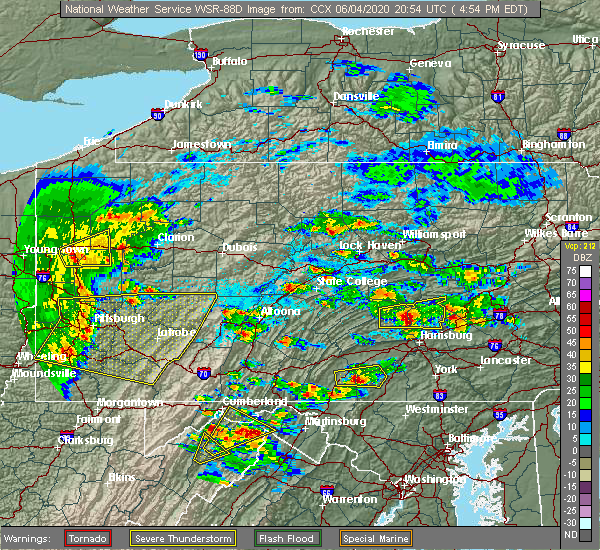 At 458 pm edt, a severe thunderstorm capable of producing a tornado was located over new buffalo, moving east at 30 mph (radar indicated rotation). Hazards include tornado. Tree damage will occur. damage to roofs, windows, and vehicles is likely. flying debris will be dangerous to those caught without shelter. mobile homes will be damaged or destroyed. this dangerous storm will be near, linglestown, dehart dam and skyline view around 510 pm edt. harper tavern, lickdale, fort indiantown gap and penn national race course around 520 pm edt. fredericksburg and cleona around 530 pm edt. other locations impacted by this tornadic thunderstorm include enders, ono, halifax, dauphin and jonestown. this includes the following interstates, interstate 78 from mile markers 0 to 5. Interstate 81 from mile markers 77 to 97. At 458 pm edt, a severe thunderstorm capable of producing a tornado was located over new buffalo, moving east at 30 mph (radar indicated rotation). Hazards include tornado. Tree damage will occur. damage to roofs, windows, and vehicles is likely. flying debris will be dangerous to those caught without shelter. mobile homes will be damaged or destroyed. this dangerous storm will be near, linglestown, dehart dam and skyline view around 510 pm edt. harper tavern, lickdale, fort indiantown gap and penn national race course around 520 pm edt. fredericksburg and cleona around 530 pm edt. other locations impacted by this tornadic thunderstorm include enders, ono, halifax, dauphin and jonestown. this includes the following interstates, interstate 78 from mile markers 0 to 5. Interstate 81 from mile markers 77 to 97.
|
| 6/4/2020 4:35 PM EDT |
 At 435 pm edt, a severe thunderstorm was located over newport, moving east at 35 mph (radar indicated). Hazards include 70 mph wind gusts and quarter size hail. Hail damage to vehicles is expected. expect considerable tree damage. Wind damage is also likely to mobile homes, roofs, and outbuildings. At 435 pm edt, a severe thunderstorm was located over newport, moving east at 35 mph (radar indicated). Hazards include 70 mph wind gusts and quarter size hail. Hail damage to vehicles is expected. expect considerable tree damage. Wind damage is also likely to mobile homes, roofs, and outbuildings.
|
| 6/3/2020 6:37 PM EDT |
 The severe thunderstorm warning for southwestern northumberland, dauphin, northeastern juniata, southeastern snyder, northeastern perry and southwestern lebanon counties will expire at 645 pm edt, the storm which prompted the warning has moved out of the area. therefore, the warning will be allowed to expire. a severe thunderstorm watch remains in effect until 1000 pm edt for south central and central pennsylvania. to report severe weather, contact your nearest law enforcement agency. they will relay your report to the national weather service state college pa. The severe thunderstorm warning for southwestern northumberland, dauphin, northeastern juniata, southeastern snyder, northeastern perry and southwestern lebanon counties will expire at 645 pm edt, the storm which prompted the warning has moved out of the area. therefore, the warning will be allowed to expire. a severe thunderstorm watch remains in effect until 1000 pm edt for south central and central pennsylvania. to report severe weather, contact your nearest law enforcement agency. they will relay your report to the national weather service state college pa.
|
| 6/3/2020 5:48 PM EDT |
 At 548 pm edt, a severe thunderstorm was located over meiserville, moving southeast at 40 mph (radar indicated). Hazards include 60 mph wind gusts and quarter size hail. Hail damage to vehicles is expected. expect wind damage to trees, roofs, and siding. this severe thunderstorm will be near, port trevorton around 550 pm edt. elizabethville and millersburg around 600 pm edt. dehart dam around 610 pm edt. penn national race course, harper tavern, skyline view and fort indiantown gap around 620 pm edt. other locations impacted by this severe thunderstorm include enders, liverpool, mount gretna, dalmatia, berrysburg, halifax, hershey park, penn state college of medicine and ono. this includes the following interstates, the pennsylvania turnpike from mile markers 251 to 264. interstate 81 from mile markers 70 to 86. This includes the following covid-19 test sites, colonial park harrisburg urgent care, eastside campus, and hershey medical center. At 548 pm edt, a severe thunderstorm was located over meiserville, moving southeast at 40 mph (radar indicated). Hazards include 60 mph wind gusts and quarter size hail. Hail damage to vehicles is expected. expect wind damage to trees, roofs, and siding. this severe thunderstorm will be near, port trevorton around 550 pm edt. elizabethville and millersburg around 600 pm edt. dehart dam around 610 pm edt. penn national race course, harper tavern, skyline view and fort indiantown gap around 620 pm edt. other locations impacted by this severe thunderstorm include enders, liverpool, mount gretna, dalmatia, berrysburg, halifax, hershey park, penn state college of medicine and ono. this includes the following interstates, the pennsylvania turnpike from mile markers 251 to 264. interstate 81 from mile markers 70 to 86. This includes the following covid-19 test sites, colonial park harrisburg urgent care, eastside campus, and hershey medical center.
|
| 6/3/2020 11:11 AM EDT |
 At 1109 am edt, severe thunderstorms were located along a line extending from near myerstown to penbrook to near plainfield, moving southeast at 75 mph (radar indicated). Hazards include 70 mph wind gusts and nickel size hail. Expect considerable tree damage. damage is likely to mobile homes, roofs, and outbuildings. these severe storms will be near, steelton, myerstown, lebanon, lawnton, rutherford, bressler-enhaut-oberlin, richland, highspire, newmanstown and avon around 1110 am edt. middletown, hershey, hummelstown, lawn, royalton, campbelltown and boiling springs around 1120 am edt. this includes the following interstates, the pennsylvania turnpike between mile markers 212 and 238, and from mile markers 247 to 264. interstate 78 from mile markers 0 to 7. interstate 81 from mile markers 40 to 95. interstate 83 from mile markers 41 to 50. Interstate 283 from mile markers 0 to 2. At 1109 am edt, severe thunderstorms were located along a line extending from near myerstown to penbrook to near plainfield, moving southeast at 75 mph (radar indicated). Hazards include 70 mph wind gusts and nickel size hail. Expect considerable tree damage. damage is likely to mobile homes, roofs, and outbuildings. these severe storms will be near, steelton, myerstown, lebanon, lawnton, rutherford, bressler-enhaut-oberlin, richland, highspire, newmanstown and avon around 1110 am edt. middletown, hershey, hummelstown, lawn, royalton, campbelltown and boiling springs around 1120 am edt. this includes the following interstates, the pennsylvania turnpike between mile markers 212 and 238, and from mile markers 247 to 264. interstate 78 from mile markers 0 to 7. interstate 81 from mile markers 40 to 95. interstate 83 from mile markers 41 to 50. Interstate 283 from mile markers 0 to 2.
|
| 6/3/2020 10:36 AM EDT |
 At 1034 am edt, severe thunderstorms were located along a line extending from mcclure to near juniata terrace to huntingdon, moving east southeast at 70 mph (radar indicated). Hazards include 70 mph wind gusts and nickel size hail. Expect considerable tree damage. damage is likely to mobile homes, roofs, and outbuildings. severe thunderstorms will be near, walnut, richfield, spruce hill, mcalisterville and mcclure around 1040 am edt. perulack, east waterford, ickesburg, blacklog, millersburg, mexico, honey grove and new bloomfield around 1050 am edt. colonel denning state park, duncannon, lykens, dehart dam, elizabethville, bloserville, fort indiantown gap, new buffalo, loysville and newport around 1100 am edt. carlisle, progress, harrisburg, colonial park, linglestown, enola, lemoyne, steelton, new cumberland and camp hill around 1110 am edt. This includes the following covid-19 test sites, central pennsylvania clinic, colonial park harrisburg urgent care, eastside campus, family practice enola, geisinger holy spirit , geisinger holy spirit jennifer court, geisinger lewistown hospital, good samaritan hospital, hershey medical center, lebanon va medical center, medexpress urgent care, mount nittany health, quicklab huntingdon, rite aid, upmc carlisle outpatient surgery center, upmc pinnacle, and wellspan health. At 1034 am edt, severe thunderstorms were located along a line extending from mcclure to near juniata terrace to huntingdon, moving east southeast at 70 mph (radar indicated). Hazards include 70 mph wind gusts and nickel size hail. Expect considerable tree damage. damage is likely to mobile homes, roofs, and outbuildings. severe thunderstorms will be near, walnut, richfield, spruce hill, mcalisterville and mcclure around 1040 am edt. perulack, east waterford, ickesburg, blacklog, millersburg, mexico, honey grove and new bloomfield around 1050 am edt. colonel denning state park, duncannon, lykens, dehart dam, elizabethville, bloserville, fort indiantown gap, new buffalo, loysville and newport around 1100 am edt. carlisle, progress, harrisburg, colonial park, linglestown, enola, lemoyne, steelton, new cumberland and camp hill around 1110 am edt. This includes the following covid-19 test sites, central pennsylvania clinic, colonial park harrisburg urgent care, eastside campus, family practice enola, geisinger holy spirit , geisinger holy spirit jennifer court, geisinger lewistown hospital, good samaritan hospital, hershey medical center, lebanon va medical center, medexpress urgent care, mount nittany health, quicklab huntingdon, rite aid, upmc carlisle outpatient surgery center, upmc pinnacle, and wellspan health.
|
| 10/31/2019 7:08 PM EDT |
 At 706 pm edt, severe thunderstorms were located along a line extending from 7 miles northwest of millersburg to newport to near duncannon to pine grove furnace to near mont alto, moving northeast at 65 mph (radar indicated). Hazards include 70 mph wind gusts. Expect considerable tree damage. Damage is likely to mobile homes, roofs, and outbuildings. At 706 pm edt, severe thunderstorms were located along a line extending from 7 miles northwest of millersburg to newport to near duncannon to pine grove furnace to near mont alto, moving northeast at 65 mph (radar indicated). Hazards include 70 mph wind gusts. Expect considerable tree damage. Damage is likely to mobile homes, roofs, and outbuildings.
|
| 7/6/2019 5:34 PM EDT |
 At 533 pm edt, severe thunderstorms were located along a line extending from near urban to near duncannon to mount holly springs to near emmitsburg, moving east at 30 mph (radar indicated). Hazards include 60 mph wind gusts and quarter size hail. Hail damage to vehicles is expected. Expect wind damage to trees, roofs, and siding. At 533 pm edt, severe thunderstorms were located along a line extending from near urban to near duncannon to mount holly springs to near emmitsburg, moving east at 30 mph (radar indicated). Hazards include 60 mph wind gusts and quarter size hail. Hail damage to vehicles is expected. Expect wind damage to trees, roofs, and siding.
|
| 6/29/2019 7:18 PM EDT |
 At 717 pm edt, severe thunderstorms were located along a line extending from near myerstown to lickdale to fort indiantown gap, moving southeast at 45 mph (radar indicated). Hazards include 60 mph wind gusts. Expect damage to trees, roofs, and siding. locations impacted include, linglestown, skyline view, millersburg, lykens, elizabethville, williamstown, harper tavern, lickdale, fort indiantown gap, penn national race course, dehart dam, wiconisco, halifax, gratz, berrysburg and enders. This includes interstate 81 from mile markers 76 to 96. At 717 pm edt, severe thunderstorms were located along a line extending from near myerstown to lickdale to fort indiantown gap, moving southeast at 45 mph (radar indicated). Hazards include 60 mph wind gusts. Expect damage to trees, roofs, and siding. locations impacted include, linglestown, skyline view, millersburg, lykens, elizabethville, williamstown, harper tavern, lickdale, fort indiantown gap, penn national race course, dehart dam, wiconisco, halifax, gratz, berrysburg and enders. This includes interstate 81 from mile markers 76 to 96.
|
| 6/29/2019 6:45 PM EDT |
 At 644 pm edt, severe thunderstorms were located along a line extending from leck kill to near urban to port trevorton, moving southeast at 45 mph (radar indicated). Hazards include 60 mph wind gusts and penny size hail. expect damage to trees, roofs, and siding At 644 pm edt, severe thunderstorms were located along a line extending from leck kill to near urban to port trevorton, moving southeast at 45 mph (radar indicated). Hazards include 60 mph wind gusts and penny size hail. expect damage to trees, roofs, and siding
|
| 4/26/2019 3:45 PM EDT |
 At 345 pm edt, severe thunderstorms were located along a line extending from near richfield to new buffalo to hogestown, moving northeast at 30 mph (radar indicated). Hazards include 60 mph wind gusts. expect damage to trees, roofs, and siding At 345 pm edt, severe thunderstorms were located along a line extending from near richfield to new buffalo to hogestown, moving northeast at 30 mph (radar indicated). Hazards include 60 mph wind gusts. expect damage to trees, roofs, and siding
|
| 4/19/2019 9:11 PM EDT |
 At 911 pm edt, a severe thunderstorm was located near duncannon, moving northeast at 45 mph (radar indicated). Hazards include 60 mph wind gusts. Expect damage to roofs, siding, and trees. this severe thunderstorm will be near, new buffalo around 920 pm edt. millersburg around 930 pm edt. Other locations impacted by this severe thunderstorm include liverpool, berrysburg, halifax, pillow, enders and dauphin. At 911 pm edt, a severe thunderstorm was located near duncannon, moving northeast at 45 mph (radar indicated). Hazards include 60 mph wind gusts. Expect damage to roofs, siding, and trees. this severe thunderstorm will be near, new buffalo around 920 pm edt. millersburg around 930 pm edt. Other locations impacted by this severe thunderstorm include liverpool, berrysburg, halifax, pillow, enders and dauphin.
|
| 4/15/2019 12:56 AM EDT | Roof off church along with trees and wires dow in dauphin county PA, 0.3 miles E of Millersburg, PA |
| 4/15/2019 12:37 AM EDT | Numerous trees down. roof blown off a warehouse. church heavily damage in dauphin county PA, 0.3 miles E of Millersburg, PA |
| 10/2/2018 9:06 PM EDT |
 At 905 pm edt, severe thunderstorms were located along a line extending from near donaldson to near lickdale to 6 miles southwest of dehart dam, moving southeast at 45 mph (radar indicated). Hazards include 60 mph wind gusts and penny size hail. Expect damage to roofs, siding, and trees. locations impacted include, pottsville, schuylkill haven, minersville, st. clair, orwigsburg, valley view, millersburg, pine grove, port carbon, lykens, tremont, elizabethville, williamstown, fredericksburg, tower city, new philadelphia, friedensburg, port trevorton, marlin and renningers. this includes the following interstates, interstate 78 from mile markers 0 to 8. interstate 81 from mile markers 80 to 115. A tornado watch remains in effect until 1100 pm edt for south central and central pennsylvania. At 905 pm edt, severe thunderstorms were located along a line extending from near donaldson to near lickdale to 6 miles southwest of dehart dam, moving southeast at 45 mph (radar indicated). Hazards include 60 mph wind gusts and penny size hail. Expect damage to roofs, siding, and trees. locations impacted include, pottsville, schuylkill haven, minersville, st. clair, orwigsburg, valley view, millersburg, pine grove, port carbon, lykens, tremont, elizabethville, williamstown, fredericksburg, tower city, new philadelphia, friedensburg, port trevorton, marlin and renningers. this includes the following interstates, interstate 78 from mile markers 0 to 8. interstate 81 from mile markers 80 to 115. A tornado watch remains in effect until 1100 pm edt for south central and central pennsylvania.
|
| 10/2/2018 8:48 PM EDT |
 At 846 pm edt, severe thunderstorms were located along a line extending from fairview to near klingerstown to millersburg, moving east at 70 mph (radar indicated). Hazards include 60 mph wind gusts and penny size hail. Expect damage to roofs, siding, and trees. locations impacted include, pottsville, tamaqua, mount carmel, schuylkill haven, shenandoah, minersville, mahanoy city, frackville, st. clair, ashland, orwigsburg, valley view, millersburg, mcadoo, pine grove, fairview-ferndale, port carbon, trevorton, lykens and tremont. this includes the following interstates, interstate 78 from mile markers 0 to 8. interstate 81 from mile markers 80 to 139. A tornado watch remains in effect until 1100 pm edt for central and south central pennsylvania. At 846 pm edt, severe thunderstorms were located along a line extending from fairview to near klingerstown to millersburg, moving east at 70 mph (radar indicated). Hazards include 60 mph wind gusts and penny size hail. Expect damage to roofs, siding, and trees. locations impacted include, pottsville, tamaqua, mount carmel, schuylkill haven, shenandoah, minersville, mahanoy city, frackville, st. clair, ashland, orwigsburg, valley view, millersburg, mcadoo, pine grove, fairview-ferndale, port carbon, trevorton, lykens and tremont. this includes the following interstates, interstate 78 from mile markers 0 to 8. interstate 81 from mile markers 80 to 139. A tornado watch remains in effect until 1100 pm edt for central and south central pennsylvania.
|
| 10/2/2018 8:38 PM EDT |
 At 837 pm edt, severe thunderstorms were located along a line extending from mcadoo to heckscherville to near rebuck to meiserville to near mcalisterville, moving east at 95 mph (radar indicated). Hazards include 60 mph wind gusts and penny size hail. expect damage to roofs, siding, and trees At 837 pm edt, severe thunderstorms were located along a line extending from mcadoo to heckscherville to near rebuck to meiserville to near mcalisterville, moving east at 95 mph (radar indicated). Hazards include 60 mph wind gusts and penny size hail. expect damage to roofs, siding, and trees
|
| 5/15/2018 3:14 PM EDT |
 At 314 pm edt, severe thunderstorms were located along a line extending from near rock glen to kulpmont to near richfield to near honey grove, moving east at 50 mph (radar indicated). Hazards include two inch hail and 70 mph wind gusts. People and animals outdoors will be injured. expect hail damage to roofs, siding, windows, and vehicles. expect considerable tree damage. Wind damage is also likely to mobile homes, roofs, and outbuildings. At 314 pm edt, severe thunderstorms were located along a line extending from near rock glen to kulpmont to near richfield to near honey grove, moving east at 50 mph (radar indicated). Hazards include two inch hail and 70 mph wind gusts. People and animals outdoors will be injured. expect hail damage to roofs, siding, windows, and vehicles. expect considerable tree damage. Wind damage is also likely to mobile homes, roofs, and outbuildings.
|
| 5/10/2018 4:56 PM EDT |
 At 454 pm edt, severe thunderstorms were located along a line extending from near meiserville to near new buffalo to newport to near ickesburg, moving east at 40 mph (radar indicated). Hazards include 70 mph wind gusts and nickel size hail. Expect considerable tree damage. Damage is likely to mobile homes, roofs, and outbuildings. At 454 pm edt, severe thunderstorms were located along a line extending from near meiserville to near new buffalo to newport to near ickesburg, moving east at 40 mph (radar indicated). Hazards include 70 mph wind gusts and nickel size hail. Expect considerable tree damage. Damage is likely to mobile homes, roofs, and outbuildings.
|
| 8/22/2017 7:25 PM EDT | Trees down on shippen dam road and route 14 in dauphin county PA, 0.3 miles E of Millersburg, PA |
| 8/22/2017 7:23 PM EDT |
 At 722 pm edt, a severe thunderstorm was located over millersburg, moving east at 35 mph (radar indicated). Hazards include 70 mph wind gusts. Expect considerable tree damage. damage is likely to mobile homes, roofs, and outbuildings. this severe thunderstorm will be near, elizabethville around 730 pm edt. lykens and dehart dam around 740 pm edt. williamstown and fort indiantown gap around 750 pm edt. tower city around 800 pm edt. other locations impacted by this severe thunderstorm include gordon, gratz, ravine, wiconisco, halifax, enders, newtown, muir, orwin and hegins. This includes interstate 81 from mile markers 92 to 117. At 722 pm edt, a severe thunderstorm was located over millersburg, moving east at 35 mph (radar indicated). Hazards include 70 mph wind gusts. Expect considerable tree damage. damage is likely to mobile homes, roofs, and outbuildings. this severe thunderstorm will be near, elizabethville around 730 pm edt. lykens and dehart dam around 740 pm edt. williamstown and fort indiantown gap around 750 pm edt. tower city around 800 pm edt. other locations impacted by this severe thunderstorm include gordon, gratz, ravine, wiconisco, halifax, enders, newtown, muir, orwin and hegins. This includes interstate 81 from mile markers 92 to 117.
|
| 8/22/2017 7:22 PM EDT | Trees down in dauphin county PA, 0.3 miles E of Millersburg, PA |
| 8/22/2017 7:15 PM EDT | Multiple trees down in perry county PA, 2.8 miles SE of Millersburg, PA |
| 8/19/2017 7:14 PM EDT |
 At 713 pm edt, severe thunderstorms were located along a line extending from forest hill to near newport to shermansdale to newville, moving east at 40 mph (radar indicated). Hazards include 60 mph wind gusts and penny size hail. Expect damage to trees and power lines. severe thunderstorms will be near, millersburg around 720 pm edt. lewisburg, harrisburg, milton, montandon, rockville, marysville and new columbia around 730 pm edt. steelton, linglestown, northumberland, progress, sunbury, colonial park, paxtang, bressler-enhaut-oberlin, penbrook and lawnton around 740 pm edt. middletown, hummelstown, hershey, royalton, penn national race course, highspire, skyline view, riverside, stonington and valley green around 750 pm edt. other locations impacted by these severe thunderstorms include three mile island, dauphin, marion heights, seven points, goldsboro, mcewensville, herndon, edgewood, gratz and turbotville. for those driving on interstate 80, this includes areas between the lewisburg-williamsport and danville exits, specifically from mile markers 211 to 216. this includes the following interstates, the pennsylvania turnpike from mile markers 246 to 258. interstate 81 from mile markers 66 to 81. interstate 83 from mile markers 43 to 50. interstate 180 from mile markers 1 to 8. Interstate 283 from mile markers 0 to 2. At 713 pm edt, severe thunderstorms were located along a line extending from forest hill to near newport to shermansdale to newville, moving east at 40 mph (radar indicated). Hazards include 60 mph wind gusts and penny size hail. Expect damage to trees and power lines. severe thunderstorms will be near, millersburg around 720 pm edt. lewisburg, harrisburg, milton, montandon, rockville, marysville and new columbia around 730 pm edt. steelton, linglestown, northumberland, progress, sunbury, colonial park, paxtang, bressler-enhaut-oberlin, penbrook and lawnton around 740 pm edt. middletown, hummelstown, hershey, royalton, penn national race course, highspire, skyline view, riverside, stonington and valley green around 750 pm edt. other locations impacted by these severe thunderstorms include three mile island, dauphin, marion heights, seven points, goldsboro, mcewensville, herndon, edgewood, gratz and turbotville. for those driving on interstate 80, this includes areas between the lewisburg-williamsport and danville exits, specifically from mile markers 211 to 216. this includes the following interstates, the pennsylvania turnpike from mile markers 246 to 258. interstate 81 from mile markers 66 to 81. interstate 83 from mile markers 43 to 50. interstate 180 from mile markers 1 to 8. Interstate 283 from mile markers 0 to 2.
|
| 8/12/2017 3:52 PM EDT |
 At 352 pm edt, a severe thunderstorm was located near millersburg, moving east at 25 mph (radar indicated). Hazards include 60 mph wind gusts and quarter size hail. Hail damage to vehicles is possible. expect wind damage to trees and power lines. Locations impacted include, lykens, williamstown, elizabethville, penn national race course, dehart dam, new buffalo, millersburg, gratz, wiconisco and halifax. At 352 pm edt, a severe thunderstorm was located near millersburg, moving east at 25 mph (radar indicated). Hazards include 60 mph wind gusts and quarter size hail. Hail damage to vehicles is possible. expect wind damage to trees and power lines. Locations impacted include, lykens, williamstown, elizabethville, penn national race course, dehart dam, new buffalo, millersburg, gratz, wiconisco and halifax.
|
| 8/12/2017 3:35 PM EDT |
 At 334 pm edt, a severe thunderstorm capable of producing a tornado was located near millersburg, moving east at 30 mph (radar indicated rotation. this storm has a history of causing wind damage). Hazards include tornado and quarter size hail. Flying debris will be dangerous to those caught without shelter. mobile homes will be damaged or destroyed. damage to roofs, windows, and vehicles will occur. tree damage is likely. this dangerous storm will be near, millersburg around 340 pm edt. elizabethville around 400 pm edt. lykens and dehart dam around 410 pm edt. williamstown and fort indiantown gap around 420 pm edt. other locations impacted by this tornadic thunderstorm include enders, ono, wiconisco, berrysburg, gratz and jonestown. this includes the following interstates, interstate 78 from mile markers 0 to 6. Interstate 81 from mile markers 84 to 96. At 334 pm edt, a severe thunderstorm capable of producing a tornado was located near millersburg, moving east at 30 mph (radar indicated rotation. this storm has a history of causing wind damage). Hazards include tornado and quarter size hail. Flying debris will be dangerous to those caught without shelter. mobile homes will be damaged or destroyed. damage to roofs, windows, and vehicles will occur. tree damage is likely. this dangerous storm will be near, millersburg around 340 pm edt. elizabethville around 400 pm edt. lykens and dehart dam around 410 pm edt. williamstown and fort indiantown gap around 420 pm edt. other locations impacted by this tornadic thunderstorm include enders, ono, wiconisco, berrysburg, gratz and jonestown. this includes the following interstates, interstate 78 from mile markers 0 to 6. Interstate 81 from mile markers 84 to 96.
|
| 8/12/2017 3:30 PM EDT | Trees down in perry county PA, 2.8 miles SE of Millersburg, PA |
| 8/12/2017 3:24 PM EDT |
 At 323 pm edt, a severe thunderstorm was located near richfield, moving east at 25 mph (radar indicated). Hazards include 60 mph wind gusts and quarter size hail. Hail damage to vehicles is possible. Expect wind damage to trees and power lines. At 323 pm edt, a severe thunderstorm was located near richfield, moving east at 25 mph (radar indicated). Hazards include 60 mph wind gusts and quarter size hail. Hail damage to vehicles is possible. Expect wind damage to trees and power lines.
|
| 8/4/2017 10:13 PM EDT |
 At 1012 pm edt, a severe thunderstorm was located near valley green, moving northeast at 35 mph (radar indicated). Hazards include 60 mph wind gusts and quarter size hail. Hail damage to vehicles is possible. Expect wind damage to trees and power lines. At 1012 pm edt, a severe thunderstorm was located near valley green, moving northeast at 35 mph (radar indicated). Hazards include 60 mph wind gusts and quarter size hail. Hail damage to vehicles is possible. Expect wind damage to trees and power lines.
|
| 8/4/2017 9:16 PM EDT |
 At 915 pm edt, severe thunderstorms were located along a line extending from mainville to locustdale to near pine grove to highspire, moving east at 25 mph (radar indicated). Hazards include 60 mph wind gusts and quarter size hail. Hail damage to vehicles is possible. expect wind damage to trees and power lines. locations impacted include, cornwall, tamaqua, st. Clair, myerstown, minersville, palmyra, mahanoy city, colonial park, annville and harrisburg. At 915 pm edt, severe thunderstorms were located along a line extending from mainville to locustdale to near pine grove to highspire, moving east at 25 mph (radar indicated). Hazards include 60 mph wind gusts and quarter size hail. Hail damage to vehicles is possible. expect wind damage to trees and power lines. locations impacted include, cornwall, tamaqua, st. Clair, myerstown, minersville, palmyra, mahanoy city, colonial park, annville and harrisburg.
|
| 8/4/2017 8:12 PM EDT |
 At 811 pm edt, severe thunderstorms were located along a line extending from paxtonville to near elizabethville to near new buffalo to near mount holly springs, moving northeast at 30 mph (radar indicated). Hazards include 60 mph wind gusts and quarter size hail. Hail damage to vehicles is possible. Expect wind damage to trees and power lines. At 811 pm edt, severe thunderstorms were located along a line extending from paxtonville to near elizabethville to near new buffalo to near mount holly springs, moving northeast at 30 mph (radar indicated). Hazards include 60 mph wind gusts and quarter size hail. Hail damage to vehicles is possible. Expect wind damage to trees and power lines.
|
| 7/22/2017 6:17 PM EDT |
 At 617 pm edt, severe thunderstorms were located along a line extending from near port trevorton to new buffalo, moving east at 20 mph (radar indicated). Hazards include 60 mph wind gusts. Expect damage to trees and power lines. Locations impacted include, palmyra, annville, hershey, linglestown, harper tavern, skyline view, beurys lake, lykens, valley view and urban. At 617 pm edt, severe thunderstorms were located along a line extending from near port trevorton to new buffalo, moving east at 20 mph (radar indicated). Hazards include 60 mph wind gusts. Expect damage to trees and power lines. Locations impacted include, palmyra, annville, hershey, linglestown, harper tavern, skyline view, beurys lake, lykens, valley view and urban.
|
| 7/22/2017 6:07 PM EDT |
 At 607 pm edt, severe thunderstorms were located along a line extending from port trevorton to near new buffalo, moving east at 20 mph (radar indicated). Hazards include 60 mph wind gusts. expect damage to trees and power lines At 607 pm edt, severe thunderstorms were located along a line extending from port trevorton to near new buffalo, moving east at 20 mph (radar indicated). Hazards include 60 mph wind gusts. expect damage to trees and power lines
|
| 7/1/2017 2:42 PM EDT |
 At 241 pm edt, a severe thunderstorm was located near elizabethville, moving east at 40 mph (radar indicated). Hazards include torrential rain and 60 mph wind gusts and quarter size hail. Hail damage to vehicles is possible. Expect wind damage to trees and power lines. At 241 pm edt, a severe thunderstorm was located near elizabethville, moving east at 40 mph (radar indicated). Hazards include torrential rain and 60 mph wind gusts and quarter size hail. Hail damage to vehicles is possible. Expect wind damage to trees and power lines.
|
| 6/19/2017 12:19 PM EDT |
 At 1218 pm edt, a severe thunderstorm was located near elizabethville, moving northeast at 45 mph (radar indicated). Hazards include 60 mph wind gusts. expect damage to trees and power lines At 1218 pm edt, a severe thunderstorm was located near elizabethville, moving northeast at 45 mph (radar indicated). Hazards include 60 mph wind gusts. expect damage to trees and power lines
|
| 7/25/2016 6:09 PM EDT |
 At 609 pm edt, a severe thunderstorm was located over duncannon, moving east at 40 mph (radar indicated). Hazards include 60 mph wind gusts and penny size hail. Expect damage to roofs. siding. And trees. At 609 pm edt, a severe thunderstorm was located over duncannon, moving east at 40 mph (radar indicated). Hazards include 60 mph wind gusts and penny size hail. Expect damage to roofs. siding. And trees.
|
| 10/9/2015 2:50 PM EDT |
 At 249 pm edt, doppler radar indicated a line of severe thunderstorms capable of producing damaging winds around 60 mph. these storms were located along a line extending from near trevorton to near duncannon, and moving east at 50 mph. At 249 pm edt, doppler radar indicated a line of severe thunderstorms capable of producing damaging winds around 60 mph. these storms were located along a line extending from near trevorton to near duncannon, and moving east at 50 mph.
|
| 8/20/2015 5:52 PM EDT |
 At 551 pm edt, doppler radar indicated a severe thunderstorm capable of producing damaging winds in excess of 60 mph. this storm was located near newport, moving east at 30 mph. locations impacted include, meiserville, millersburg, mount pleasant mills, newport, port trevorton, richfield, liverpool and millerstown. At 551 pm edt, doppler radar indicated a severe thunderstorm capable of producing damaging winds in excess of 60 mph. this storm was located near newport, moving east at 30 mph. locations impacted include, meiserville, millersburg, mount pleasant mills, newport, port trevorton, richfield, liverpool and millerstown.
|
| 8/20/2015 5:19 PM EDT |
 At 518 pm edt, doppler radar indicated a severe thunderstorm capable of producing damaging winds around 60 mph. this storm was located near mexico, and moving east at 20 mph. At 518 pm edt, doppler radar indicated a severe thunderstorm capable of producing damaging winds around 60 mph. this storm was located near mexico, and moving east at 20 mph.
|
| 8/4/2015 12:55 AM EDT |
 At 1254 am edt, doppler radar indicated a severe thunderstorm capable of producing quarter size hail and damaging winds in excess of 60 mph. this storm was located over elizabethville, moving east at 40 mph. locations impacted include, dehart dam, duncannon, elizabethville, lykens, millersburg, new buffalo, penn national race course, williamstown, berrysburg, enders, gratz, halifax, liverpool, pillow and wiconisco. At 1254 am edt, doppler radar indicated a severe thunderstorm capable of producing quarter size hail and damaging winds in excess of 60 mph. this storm was located over elizabethville, moving east at 40 mph. locations impacted include, dehart dam, duncannon, elizabethville, lykens, millersburg, new buffalo, penn national race course, williamstown, berrysburg, enders, gratz, halifax, liverpool, pillow and wiconisco.
|
| 8/4/2015 12:25 AM EDT |
 At 1225 am edt, doppler radar indicated a severe thunderstorm capable of producing quarter size hail and damaging winds around 60 mph. this storm was located near newport, and moving east at 35 mph. At 1225 am edt, doppler radar indicated a severe thunderstorm capable of producing quarter size hail and damaging winds around 60 mph. this storm was located near newport, and moving east at 35 mph.
|
| 7/9/2015 6:01 PM EDT |
 At 601 pm edt, doppler radar indicated a line of severe thunderstorms capable of producing damaging winds around 60 mph. these storms were located along a line extending from near locustdale to near tower city to near elizabethville, and moving east at 35 mph. At 601 pm edt, doppler radar indicated a line of severe thunderstorms capable of producing damaging winds around 60 mph. these storms were located along a line extending from near locustdale to near tower city to near elizabethville, and moving east at 35 mph.
|
| 6/23/2015 2:05 PM EDT |
 At 204 pm edt, doppler radar indicated a severe thunderstorm capable of producing quarter size hail and damaging winds in excess of 60 mph. this storm was located near port trevorton, moving east at 30 mph. locations impacted include, shamokin, elizabethville, fairview-ferndale, klingerstown, leck kill, lykens, meiserville, millersburg, port trevorton, rebuck, tower city, trevorton, urban, williamstown, berrysburg, dalmatia, edgewood, gratz, hegins and herndon. At 204 pm edt, doppler radar indicated a severe thunderstorm capable of producing quarter size hail and damaging winds in excess of 60 mph. this storm was located near port trevorton, moving east at 30 mph. locations impacted include, shamokin, elizabethville, fairview-ferndale, klingerstown, leck kill, lykens, meiserville, millersburg, port trevorton, rebuck, tower city, trevorton, urban, williamstown, berrysburg, dalmatia, edgewood, gratz, hegins and herndon.
|
| 6/23/2015 1:37 PM EDT |
 At 137 pm edt, doppler radar indicated a severe thunderstorm capable of producing quarter size hail and damaging winds around 60 mph. this storm was located over richfield, and moving east at 35 mph. At 137 pm edt, doppler radar indicated a severe thunderstorm capable of producing quarter size hail and damaging winds around 60 mph. this storm was located over richfield, and moving east at 35 mph.
|
| 6/12/2015 9:18 PM EDT |
 At 916 pm edt, doppler radar indicated a line of severe thunderstorms capable of producing damaging winds around 60 mph. these storms were located along a line extending from near meiserville to near new bloomfield to near bloserville, and moving east at 35 mph. At 916 pm edt, doppler radar indicated a line of severe thunderstorms capable of producing damaging winds around 60 mph. these storms were located along a line extending from near meiserville to near new bloomfield to near bloserville, and moving east at 35 mph.
|
| 6/11/2015 5:00 PM EDT | Trees down in dauphin county PA, 0.3 miles E of Millersburg, PA |
| 6/8/2015 4:18 PM EDT |
 At 418 pm edt, doppler radar indicated a line of severe thunderstorms capable of producing damaging winds of 60 to 70 mph. these storms were located along a line extending from near millersburg to near fannettsburg, and moving east at 30 mph. At 418 pm edt, doppler radar indicated a line of severe thunderstorms capable of producing damaging winds of 60 to 70 mph. these storms were located along a line extending from near millersburg to near fannettsburg, and moving east at 30 mph.
|
| 6/8/2015 4:00 PM EDT |
 At 359 pm edt, doppler radar indicated a line of severe thunderstorms capable of producing tornadoes. these dangerous storms were located along a line extending from near elizabethville to near millersburg to near newport, moving east at 25 mph. locations impacted include, dehart dam, elizabethville, lykens, millersburg, new buffalo, newport, williamstown, berrysburg, enders, gratz, halifax, liverpool, millerstown, pillow and wiconisco. At 359 pm edt, doppler radar indicated a line of severe thunderstorms capable of producing tornadoes. these dangerous storms were located along a line extending from near elizabethville to near millersburg to near newport, moving east at 25 mph. locations impacted include, dehart dam, elizabethville, lykens, millersburg, new buffalo, newport, williamstown, berrysburg, enders, gratz, halifax, liverpool, millerstown, pillow and wiconisco.
|
| 6/8/2015 3:30 PM EDT |
 At 330 pm edt, doppler radar indicated a severe thunderstorm capable of producing a tornado. this dangerous storm was located near millersburg, and moving east at 35 mph. * this dangerous storm will be near, elizabethville around 350 pm edt. dehart dam and lykens around 400 pm edt. williamstown around 410 pm edt. other locations impacted by this tornadic thunderstorm include berrysburg, enders, gratz, halifax, liverpool, millerstown, pillow and wiconisco. At 330 pm edt, doppler radar indicated a severe thunderstorm capable of producing a tornado. this dangerous storm was located near millersburg, and moving east at 35 mph. * this dangerous storm will be near, elizabethville around 350 pm edt. dehart dam and lykens around 400 pm edt. williamstown around 410 pm edt. other locations impacted by this tornadic thunderstorm include berrysburg, enders, gratz, halifax, liverpool, millerstown, pillow and wiconisco.
|
| 4/20/2015 8:54 PM EDT | At 853 pm edt, doppler radar indicated a severe thunderstorm capable of producing quarter size hail and damaging winds around 60 mph. this storm was located near bloserville, and moving northeast at 30 mph. |
| 5/15/2014 6:58 PM EDT | Large street down blocking huggins roa in perry county PA, 3.4 miles NE of Millersburg, PA |
| 6/25/2013 10:42 PM EDT | Tree and wires reported down in upper paxton tw in dauphin county PA, 1.4 miles SSE of Millersburg, PA |
| 6/25/2013 8:45 PM EDT | Tree and wires reported down in upper paxton tw in dauphin county PA, 1.4 miles SSE of Millersburg, PA |
| 5/4/2012 6:25 PM EDT | Large limbs downed in dauphin county PA, 0.3 miles E of Millersburg, PA |
| 5/4/2012 6:22 PM EDT | Quarter sized hail reported 0.3 miles E of Millersburg, PA |
Hail Maps for Millersburg, PA


Connect with Interactive Hail Maps