

Hail Map for Milo, IA
The Milo, IA area has had 4 reports of on-the-ground hail by trained spotters, and has been under severe weather warnings 37 times during the past 12 months. Doppler radar has detected hail at or near Milo, IA on 66 occasions, including 3 occasions during the past year.
| Name: | Milo, IA |
| Where Located: | 22.7 miles SSE of Des Moines, IA |
| Map: | Google Map for Milo, IA |
| Population: | 775 |
| Housing Units: | 327 |
| More Info: | Search Google for Milo, IA |
3
The Top Recent Hail Date for Milo, IA is Thursday, October 3, 2024 (4th out of 66)

Hail and Wind Damage Spotted near Milo, IA
| Date / Time | Report Details |
|---|---|
| 5/19/2025 4:42 PM CDT |
 The storm which prompted the warning has weakened below severe limits, and no longer poses an immediate threat to life or property. therefore, the warning will be allowed to expire. however, small hail is still possible with this thunderstorm. a severe thunderstorm watch remains in effect until 1000 pm cdt for south central iowa. The storm which prompted the warning has weakened below severe limits, and no longer poses an immediate threat to life or property. therefore, the warning will be allowed to expire. however, small hail is still possible with this thunderstorm. a severe thunderstorm watch remains in effect until 1000 pm cdt for south central iowa.
|
| 5/19/2025 4:35 PM CDT |
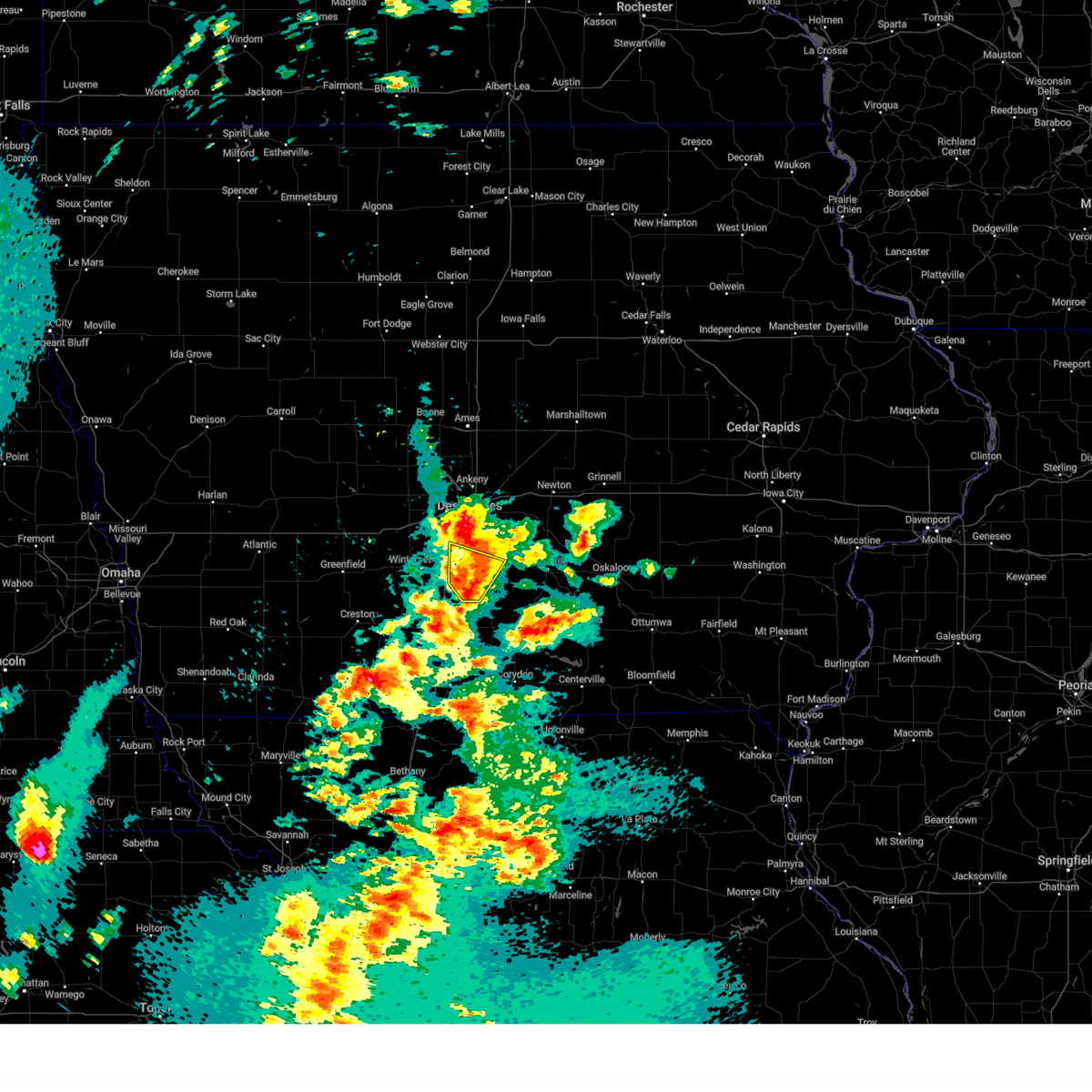
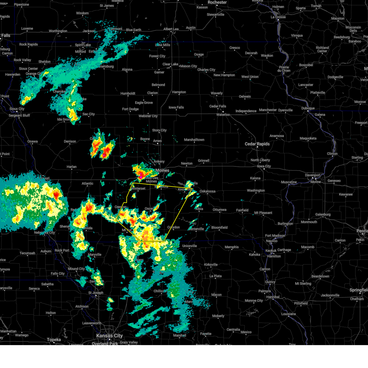
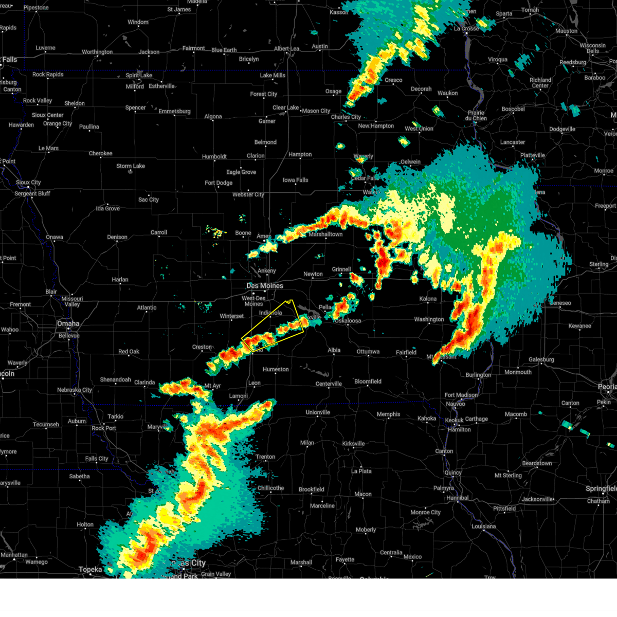
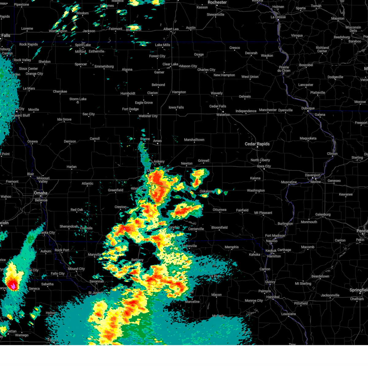 At 434 pm cdt, a severe thunderstorm was located over indianola, moving north at 50 mph (radar indicated). Hazards include quarter size hail. Damage to vehicles is expected. locations impacted include, indianola, milo, martensdale, st. Marys, ackworth, spring hill, lake ahquabi state park, and otter creek county park. At 434 pm cdt, a severe thunderstorm was located over indianola, moving north at 50 mph (radar indicated). Hazards include quarter size hail. Damage to vehicles is expected. locations impacted include, indianola, milo, martensdale, st. Marys, ackworth, spring hill, lake ahquabi state park, and otter creek county park.
|
| 5/19/2025 4:35 PM CDT |
 the severe thunderstorm warning has been cancelled and is no longer in effect the severe thunderstorm warning has been cancelled and is no longer in effect
|
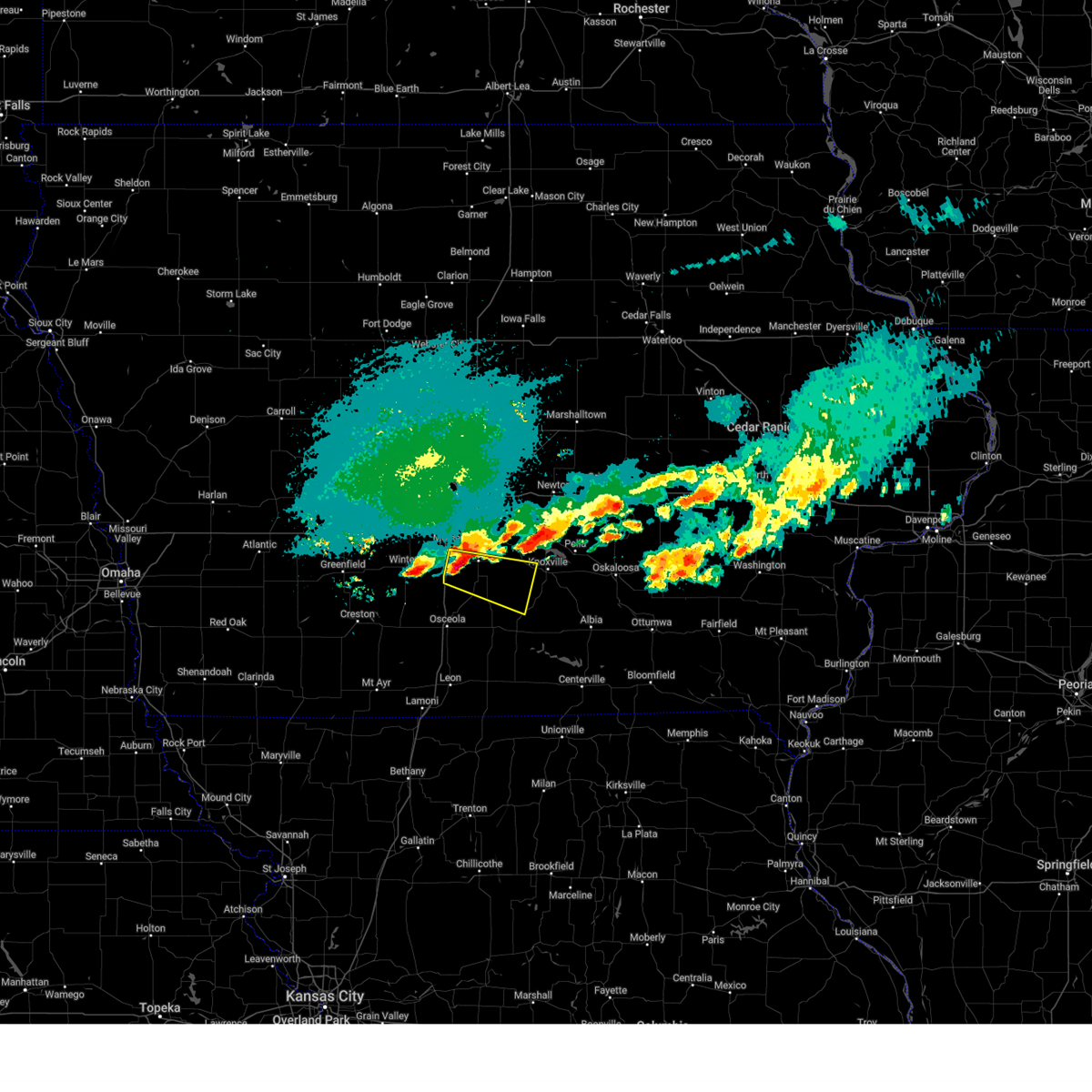
| 5/19/2025 4:24 PM CDT | At 424 pm cdt, a severe thunderstorm was located near st. marys, or 12 miles southwest of indianola, moving north at 50 mph (trained weather spotters). Hazards include quarter size hail. Damage to vehicles is expected. locations impacted include, indianola, avenue of the saints event center, milo, st. charles, new virginia, martensdale, st. marys, ackworth, bevington, spring hill, lake ahquabi state park, and otter creek county park. This includes interstate 35 between mile markers 40 and 60, and near mile marker 63. |
| 5/19/2025 4:15 PM CDT | Svrdmx the national weather service in des moines has issued a * severe thunderstorm warning for, southeastern madison county in south central iowa, northeastern clarke county in south central iowa, southern warren county in south central iowa, * until 445 pm cdt. * at 415 pm cdt, a severe thunderstorm was located near new virginia, or 7 miles north of osceola, moving north at 50 mph (radar indicated). Hazards include quarter size hail. damage to vehicles is expected |
| 3/14/2025 6:07 PM CDT |
 The storms which prompted the warning have moved out of the area. therefore, the warning will be allowed to expire. however, gusty winds are still possible with these thunderstorms. a severe thunderstorm watch remains in effect until 1000 pm cdt for south central iowa. a severe thunderstorm warning remains in effect for the far northern of the are. The storms which prompted the warning have moved out of the area. therefore, the warning will be allowed to expire. however, gusty winds are still possible with these thunderstorms. a severe thunderstorm watch remains in effect until 1000 pm cdt for south central iowa. a severe thunderstorm warning remains in effect for the far northern of the are.
|
| 3/14/2025 5:44 PM CDT |
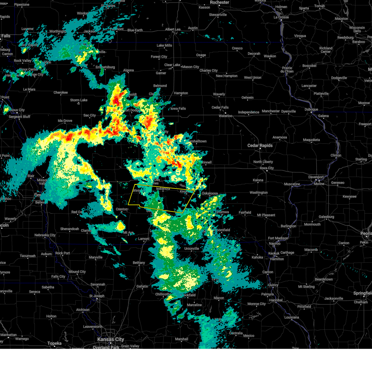
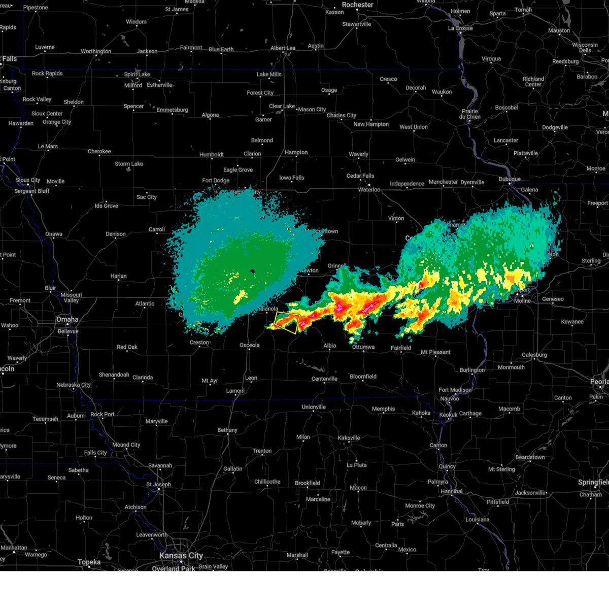
 Svrdmx the national weather service in des moines has issued a * severe thunderstorm warning for, northern lucas county in south central iowa, madison county in south central iowa, southern marion county in south central iowa, northern clarke county in south central iowa, warren county in south central iowa, * until 615 pm cdt. * at 544 pm cdt, severe thunderstorms were located along a line extending from 5 miles southwest of earlham to knoxville municipal airport, moving north at 65 mph (radar indicated). Hazards include 60 mph wind gusts and quarter size hail. Hail damage to vehicles is expected. Expect wind damage to roofs, siding, and trees. Svrdmx the national weather service in des moines has issued a * severe thunderstorm warning for, northern lucas county in south central iowa, madison county in south central iowa, southern marion county in south central iowa, northern clarke county in south central iowa, warren county in south central iowa, * until 615 pm cdt. * at 544 pm cdt, severe thunderstorms were located along a line extending from 5 miles southwest of earlham to knoxville municipal airport, moving north at 65 mph (radar indicated). Hazards include 60 mph wind gusts and quarter size hail. Hail damage to vehicles is expected. Expect wind damage to roofs, siding, and trees.
|
| 3/14/2025 5:26 PM CDT |
 At 526 pm cdt, severe thunderstorms were located along a line extending from 4 miles west of macksburg to near new virginia to near chariton, moving north at 60 mph (radar indicated). Hazards include 70 mph wind gusts and quarter size hail. Hail damage to vehicles is expected. expect considerable tree damage. wind damage is also likely to mobile homes, roofs, and outbuildings. locations impacted include, lacona, truro, red haw lake state park, lake ahquabi state park, sandyville, spring hill, melcher-dallas, thayer, martensdale, creston municipal airport, otter creek county park, ackworth, murray, lorimor, osceola, arispe, williamson, humeston, macksburg, and pleasantville. This includes interstate 35 between mile markers 21 and 61. At 526 pm cdt, severe thunderstorms were located along a line extending from 4 miles west of macksburg to near new virginia to near chariton, moving north at 60 mph (radar indicated). Hazards include 70 mph wind gusts and quarter size hail. Hail damage to vehicles is expected. expect considerable tree damage. wind damage is also likely to mobile homes, roofs, and outbuildings. locations impacted include, lacona, truro, red haw lake state park, lake ahquabi state park, sandyville, spring hill, melcher-dallas, thayer, martensdale, creston municipal airport, otter creek county park, ackworth, murray, lorimor, osceola, arispe, williamson, humeston, macksburg, and pleasantville. This includes interstate 35 between mile markers 21 and 61.
|
| 3/14/2025 5:01 PM CDT |
 Svrdmx the national weather service in des moines has issued a * severe thunderstorm warning for, lucas county in south central iowa, decatur county in south central iowa, madison county in south central iowa, southern marion county in south central iowa, union county in south central iowa, western wayne county in south central iowa, northeastern ringgold county in south central iowa, clarke county in south central iowa, warren county in south central iowa, * until 545 pm cdt. * at 500 pm cdt, severe thunderstorms were located along a line extending from 4 miles southwest of macksburg to 4 miles west of woodburn to near lineville, moving north at 65 mph (radar indicated). Hazards include 70 mph wind gusts and nickel size hail. Expect considerable tree damage. Damage is likely to mobile homes, roofs, and outbuildings. Svrdmx the national weather service in des moines has issued a * severe thunderstorm warning for, lucas county in south central iowa, decatur county in south central iowa, madison county in south central iowa, southern marion county in south central iowa, union county in south central iowa, western wayne county in south central iowa, northeastern ringgold county in south central iowa, clarke county in south central iowa, warren county in south central iowa, * until 545 pm cdt. * at 500 pm cdt, severe thunderstorms were located along a line extending from 4 miles southwest of macksburg to 4 miles west of woodburn to near lineville, moving north at 65 mph (radar indicated). Hazards include 70 mph wind gusts and nickel size hail. Expect considerable tree damage. Damage is likely to mobile homes, roofs, and outbuildings.
|
| 10/30/2024 2:16 PM CDT |
 the severe thunderstorm warning has been cancelled and is no longer in effect the severe thunderstorm warning has been cancelled and is no longer in effect
|
| 10/30/2024 1:49 PM CDT |
 Svrdmx the national weather service in des moines has issued a * severe thunderstorm warning for, polk county in central iowa, madison county in south central iowa, central dallas county in central iowa, warren county in south central iowa, * until 230 pm cdt. * at 148 pm cdt, severe thunderstorms were located along a line extending from near dallas center to near de soto to 5 miles northeast of macksburg, moving east at 50 mph (radar indicated). Hazards include 60 mph wind gusts and quarter size hail. Hail damage to vehicles is expected. Expect wind damage to roofs, siding, and trees. Svrdmx the national weather service in des moines has issued a * severe thunderstorm warning for, polk county in central iowa, madison county in south central iowa, central dallas county in central iowa, warren county in south central iowa, * until 230 pm cdt. * at 148 pm cdt, severe thunderstorms were located along a line extending from near dallas center to near de soto to 5 miles northeast of macksburg, moving east at 50 mph (radar indicated). Hazards include 60 mph wind gusts and quarter size hail. Hail damage to vehicles is expected. Expect wind damage to roofs, siding, and trees.
|
| 10/24/2024 9:21 PM CDT |
 The storm which prompted the warning has weakened below severe limits, and no longer poses an immediate threat to life or property. therefore, the warning will be allowed to expire. however, small hail is still possible with this thunderstorm. The storm which prompted the warning has weakened below severe limits, and no longer poses an immediate threat to life or property. therefore, the warning will be allowed to expire. however, small hail is still possible with this thunderstorm.
|
| 10/24/2024 8:43 PM CDT |
 Svrdmx the national weather service in des moines has issued a * severe thunderstorm warning for, northwestern lucas county in south central iowa, southeastern madison county in south central iowa, western marion county in south central iowa, northeastern clarke county in south central iowa, warren county in south central iowa, * until 930 pm cdt. * at 843 pm cdt, a severe thunderstorm was located over new virginia, or 10 miles north of osceola, moving northeast at 50 mph (radar indicated). Hazards include quarter size hail. damage to vehicles is expected Svrdmx the national weather service in des moines has issued a * severe thunderstorm warning for, northwestern lucas county in south central iowa, southeastern madison county in south central iowa, western marion county in south central iowa, northeastern clarke county in south central iowa, warren county in south central iowa, * until 930 pm cdt. * at 843 pm cdt, a severe thunderstorm was located over new virginia, or 10 miles north of osceola, moving northeast at 50 mph (radar indicated). Hazards include quarter size hail. damage to vehicles is expected
|
| 10/4/2024 2:38 AM CDT |
 The storm which prompted the warning has moved out of the area. therefore, the warning will be allowed to expire. remember, a severe thunderstorm warning still remains in effect for portions of south central marion county. The storm which prompted the warning has moved out of the area. therefore, the warning will be allowed to expire. remember, a severe thunderstorm warning still remains in effect for portions of south central marion county.
|
| 10/4/2024 2:22 AM CDT |
 the severe thunderstorm warning has been cancelled and is no longer in effect the severe thunderstorm warning has been cancelled and is no longer in effect
|
| 10/4/2024 2:22 AM CDT |
 At 222 am cdt, a severe thunderstorm was located near milo, or 13 miles southeast of indianola, moving east at 35 mph (radar indicated). Hazards include ping pong ball size hail. People and animals outdoors will be injured. expect damage to roofs, siding, windows, and vehicles. Locations impacted include, melcher-dallas and milo. At 222 am cdt, a severe thunderstorm was located near milo, or 13 miles southeast of indianola, moving east at 35 mph (radar indicated). Hazards include ping pong ball size hail. People and animals outdoors will be injured. expect damage to roofs, siding, windows, and vehicles. Locations impacted include, melcher-dallas and milo.
|
| 10/4/2024 2:05 AM CDT |
 At 205 am cdt, a severe thunderstorm was located over lake ahquabi state park, or near indianola, moving east at 30 mph (radar indicated). Hazards include two inch hail. People and animals outdoors will be injured. expect damage to roofs, siding, windows, and vehicles. Locations impacted include, indianola, melcher-dallas, milo, lacona, ackworth, lake ahquabi state park, and otter creek county park. At 205 am cdt, a severe thunderstorm was located over lake ahquabi state park, or near indianola, moving east at 30 mph (radar indicated). Hazards include two inch hail. People and animals outdoors will be injured. expect damage to roofs, siding, windows, and vehicles. Locations impacted include, indianola, melcher-dallas, milo, lacona, ackworth, lake ahquabi state park, and otter creek county park.
|
| 10/4/2024 1:53 AM CDT |
 Svrdmx the national weather service in des moines has issued a * severe thunderstorm warning for, north central lucas county in south central iowa, southwestern marion county in south central iowa, southern warren county in south central iowa, * until 245 am cdt. * at 152 am cdt, a severe thunderstorm was located near lake ahquabi state park, or 5 miles southwest of indianola, moving east at 35 mph (radar indicated). Hazards include half dollar size hail. damage to vehicles is expected Svrdmx the national weather service in des moines has issued a * severe thunderstorm warning for, north central lucas county in south central iowa, southwestern marion county in south central iowa, southern warren county in south central iowa, * until 245 am cdt. * at 152 am cdt, a severe thunderstorm was located near lake ahquabi state park, or 5 miles southwest of indianola, moving east at 35 mph (radar indicated). Hazards include half dollar size hail. damage to vehicles is expected
|
| 7/31/2024 9:13 PM CDT |
 The storms which prompted the warning have weakened. therefore, the warning will be allowed to expire. a severe thunderstorm watch remains in effect until 100 am cdt for central and south central iowa. The storms which prompted the warning have weakened. therefore, the warning will be allowed to expire. a severe thunderstorm watch remains in effect until 100 am cdt for central and south central iowa.
|
| 7/31/2024 9:02 PM CDT |
 the severe thunderstorm warning has been cancelled and is no longer in effect the severe thunderstorm warning has been cancelled and is no longer in effect
|
| 7/31/2024 9:02 PM CDT |
 At 902 pm cdt, severe thunderstorms were located along a line extending from monroe to 5 miles northwest of marysville, moving northeast at 50 mph (radar indicated). Hazards include 60 mph wind gusts. Expect damage to roofs, siding, and trees. Locations impacted include, pella, knoxville, monroe, pleasantville, knoxville raceway, lake red rock, milo, hartford, harvey, ackworth, swan, sandyville, pella municipal airport, knoxville municipal airport, and elk rock state park. At 902 pm cdt, severe thunderstorms were located along a line extending from monroe to 5 miles northwest of marysville, moving northeast at 50 mph (radar indicated). Hazards include 60 mph wind gusts. Expect damage to roofs, siding, and trees. Locations impacted include, pella, knoxville, monroe, pleasantville, knoxville raceway, lake red rock, milo, hartford, harvey, ackworth, swan, sandyville, pella municipal airport, knoxville municipal airport, and elk rock state park.
|
| 7/31/2024 8:56 PM CDT |
 the severe thunderstorm warning has been cancelled and is no longer in effect the severe thunderstorm warning has been cancelled and is no longer in effect
|
| 7/31/2024 8:56 PM CDT |
 At 855 pm cdt, severe thunderstorms were located along a line extending from ames to near mingo to near elk rock state park, moving northeast at 40 mph (radar indicated). Hazards include 60 mph wind gusts. Expect damage to roofs, siding, and trees. locations impacted include, des moines, newton, indianola, pella, norwalk, pleasant hill, knoxville, carlisle, colfax, monroe, pleasantville, prairie city, southridge mall, iowa speedway, knoxville raceway, lake red rock, milo, hartford, runnells, and cumming. This includes interstate 80 between mile markers 159 and 173. At 855 pm cdt, severe thunderstorms were located along a line extending from ames to near mingo to near elk rock state park, moving northeast at 40 mph (radar indicated). Hazards include 60 mph wind gusts. Expect damage to roofs, siding, and trees. locations impacted include, des moines, newton, indianola, pella, norwalk, pleasant hill, knoxville, carlisle, colfax, monroe, pleasantville, prairie city, southridge mall, iowa speedway, knoxville raceway, lake red rock, milo, hartford, runnells, and cumming. This includes interstate 80 between mile markers 159 and 173.
|
| 7/31/2024 8:50 PM CDT |
 At 850 pm cdt, severe thunderstorms were located along a line extending from iowa state center to near valeria to 4 miles east of pleasantville, moving northeast at 40 mph (radar indicated). Hazards include 60 mph wind gusts. Expect damage to roofs, siding, and trees. locations impacted include, des moines, ames, west des moines, ankeny, urbandale, johnston, clive, newton, indianola, altoona, waukee, boone, pella, norwalk, pleasant hill, grimes, knoxville, nevada, windsor heights, and carlisle. this includes the following highways, interstate 35 between mile markers 68 and 72, and between mile markers 87 and 125. interstate 80 between mile markers 121 and 173. Interstate 235 between mile markers 1 and 14. At 850 pm cdt, severe thunderstorms were located along a line extending from iowa state center to near valeria to 4 miles east of pleasantville, moving northeast at 40 mph (radar indicated). Hazards include 60 mph wind gusts. Expect damage to roofs, siding, and trees. locations impacted include, des moines, ames, west des moines, ankeny, urbandale, johnston, clive, newton, indianola, altoona, waukee, boone, pella, norwalk, pleasant hill, grimes, knoxville, nevada, windsor heights, and carlisle. this includes the following highways, interstate 35 between mile markers 68 and 72, and between mile markers 87 and 125. interstate 80 between mile markers 121 and 173. Interstate 235 between mile markers 1 and 14.
|
| 7/31/2024 8:50 PM CDT |
 the severe thunderstorm warning has been cancelled and is no longer in effect the severe thunderstorm warning has been cancelled and is no longer in effect
|
| 7/31/2024 8:33 PM CDT |
 At 831 pm cdt, severe thunderstorms were located along a line extending from sheldahl to ankeny regional airport to near pleasant hill to hartford, moving northeast at 45 mph (radar indicated). Hazards include 65 mph wind gusts. the des moines airport gusted to 66 mph. Expect damage to roofs, siding, and trees. locations impacted include, des moines, ames, west des moines, ankeny, urbandale, johnston, clive, indianola, altoona, waukee, norwalk, pleasant hill, grimes, nevada, adel, windsor heights, carlisle, bondurant, polk city, and huxley. this includes the following highways, interstate 35 between mile markers 43 and 72, and between mile markers 87 and 111. interstate 80 between mile markers 108 and 149. Interstate 235 between mile markers 1 and 14. At 831 pm cdt, severe thunderstorms were located along a line extending from sheldahl to ankeny regional airport to near pleasant hill to hartford, moving northeast at 45 mph (radar indicated). Hazards include 65 mph wind gusts. the des moines airport gusted to 66 mph. Expect damage to roofs, siding, and trees. locations impacted include, des moines, ames, west des moines, ankeny, urbandale, johnston, clive, indianola, altoona, waukee, norwalk, pleasant hill, grimes, nevada, adel, windsor heights, carlisle, bondurant, polk city, and huxley. this includes the following highways, interstate 35 between mile markers 43 and 72, and between mile markers 87 and 111. interstate 80 between mile markers 108 and 149. Interstate 235 between mile markers 1 and 14.
|
| 7/31/2024 8:33 PM CDT |
 the severe thunderstorm warning has been cancelled and is no longer in effect the severe thunderstorm warning has been cancelled and is no longer in effect
|
| 7/31/2024 8:27 PM CDT |
 Svrdmx the national weather service in des moines has issued a * severe thunderstorm warning for, polk county in central iowa, story county in central iowa, southwestern hardin county in central iowa, southwestern marshall county in central iowa, northeastern madison county in south central iowa, marion county in south central iowa, jasper county in central iowa, southern boone county in central iowa, dallas county in central iowa, warren county in south central iowa, * until 915 pm cdt. * at 825 pm cdt, severe thunderstorms were located along a line extending from 4 miles north of woodward to near margo frankel woods state park to milo, moving northeast at 40 mph (radar indicated). Hazards include 65 mph wind gusts. the des moines airport gusted to 66 mph. expect damage to roofs, siding, and trees Svrdmx the national weather service in des moines has issued a * severe thunderstorm warning for, polk county in central iowa, story county in central iowa, southwestern hardin county in central iowa, southwestern marshall county in central iowa, northeastern madison county in south central iowa, marion county in south central iowa, jasper county in central iowa, southern boone county in central iowa, dallas county in central iowa, warren county in south central iowa, * until 915 pm cdt. * at 825 pm cdt, severe thunderstorms were located along a line extending from 4 miles north of woodward to near margo frankel woods state park to milo, moving northeast at 40 mph (radar indicated). Hazards include 65 mph wind gusts. the des moines airport gusted to 66 mph. expect damage to roofs, siding, and trees
|
| 7/31/2024 8:15 PM CDT |
 At 814 pm cdt, severe thunderstorms were located along a line extending from near woodward to near urbandale to southridge mall to near spring hill, moving northeast at 40 mph (radar indicated). Hazards include 60 mph wind gusts and penny size hail. Expect damage to roofs, siding, and trees. locations impacted include, des moines, ames, west des moines, ankeny, urbandale, johnston, clive, indianola, altoona, waukee, norwalk, pleasant hill, grimes, nevada, winterset, adel, windsor heights, carlisle, bondurant, and polk city. this includes the following highways, interstate 35 between mile markers 43 and 72, and between mile markers 87 and 111. interstate 80 between mile markers 99 and 149. Interstate 235 between mile markers 1 and 14. At 814 pm cdt, severe thunderstorms were located along a line extending from near woodward to near urbandale to southridge mall to near spring hill, moving northeast at 40 mph (radar indicated). Hazards include 60 mph wind gusts and penny size hail. Expect damage to roofs, siding, and trees. locations impacted include, des moines, ames, west des moines, ankeny, urbandale, johnston, clive, indianola, altoona, waukee, norwalk, pleasant hill, grimes, nevada, winterset, adel, windsor heights, carlisle, bondurant, and polk city. this includes the following highways, interstate 35 between mile markers 43 and 72, and between mile markers 87 and 111. interstate 80 between mile markers 99 and 149. Interstate 235 between mile markers 1 and 14.
|
| 7/31/2024 8:15 PM CDT |
 the severe thunderstorm warning has been cancelled and is no longer in effect the severe thunderstorm warning has been cancelled and is no longer in effect
|
| 7/31/2024 7:54 PM CDT |
 Svrdmx the national weather service in des moines has issued a * severe thunderstorm warning for, polk county in central iowa, southwestern story county in central iowa, madison county in south central iowa, southeastern guthrie county in west central iowa, southeastern boone county in central iowa, eastern adair county in southwestern iowa, dallas county in central iowa, warren county in south central iowa, * until 845 pm cdt. * at 754 pm cdt, severe thunderstorms were located along a line extending from 6 miles west of minburn to near de soto to 4 miles southeast of badger creek state park to near st. charles, moving northeast at 50 mph (radar indicated). Hazards include 60 mph wind gusts and penny size hail. expect damage to roofs, siding, and trees Svrdmx the national weather service in des moines has issued a * severe thunderstorm warning for, polk county in central iowa, southwestern story county in central iowa, madison county in south central iowa, southeastern guthrie county in west central iowa, southeastern boone county in central iowa, eastern adair county in southwestern iowa, dallas county in central iowa, warren county in south central iowa, * until 845 pm cdt. * at 754 pm cdt, severe thunderstorms were located along a line extending from 6 miles west of minburn to near de soto to 4 miles southeast of badger creek state park to near st. charles, moving northeast at 50 mph (radar indicated). Hazards include 60 mph wind gusts and penny size hail. expect damage to roofs, siding, and trees
|
| 7/30/2024 10:35 AM CDT |
 the severe thunderstorm warning has been cancelled and is no longer in effect the severe thunderstorm warning has been cancelled and is no longer in effect
|
| 7/30/2024 10:35 AM CDT |
 At 1035 am cdt, severe thunderstorms were located along a line extending from near lynnville to near bussey to williamson, moving southeast at 35 mph (radar indicated). Hazards include 60 mph wind gusts and penny size hail. Expect damage to roofs, siding, and trees. Locations impacted include, pella, knoxville, melcher-dallas, knoxville raceway, lake red rock, sully, milo, new virginia, lynnville, lacona, harvey, lucas, leighton, williamson, searsboro, pella municipal airport, otter creek county park, knoxville municipal airport, elk rock state park, and chariton municipal airport. At 1035 am cdt, severe thunderstorms were located along a line extending from near lynnville to near bussey to williamson, moving southeast at 35 mph (radar indicated). Hazards include 60 mph wind gusts and penny size hail. Expect damage to roofs, siding, and trees. Locations impacted include, pella, knoxville, melcher-dallas, knoxville raceway, lake red rock, sully, milo, new virginia, lynnville, lacona, harvey, lucas, leighton, williamson, searsboro, pella municipal airport, otter creek county park, knoxville municipal airport, elk rock state park, and chariton municipal airport.
|
| 7/30/2024 10:19 AM CDT |
 At 1019 am cdt, severe thunderstorms were located along a line extending from near sully to harvey to near lacona, moving east at 40 mph (radar indicated). Hazards include 60 mph wind gusts and penny size hail. Expect damage to roofs, siding, and trees. locations impacted include, newton, indianola, pella, knoxville, carlisle, colfax, monroe, pleasantville, prairie city, melcher-dallas, iowa speedway, knoxville raceway, avenue of the saints event center, lake red rock, sully, milo, hartford, st. charles, runnells, and new virginia. this includes the following highways, interstate 35 between mile markers 45 and 59. Interstate 80 between mile markers 153 and 174. At 1019 am cdt, severe thunderstorms were located along a line extending from near sully to harvey to near lacona, moving east at 40 mph (radar indicated). Hazards include 60 mph wind gusts and penny size hail. Expect damage to roofs, siding, and trees. locations impacted include, newton, indianola, pella, knoxville, carlisle, colfax, monroe, pleasantville, prairie city, melcher-dallas, iowa speedway, knoxville raceway, avenue of the saints event center, lake red rock, sully, milo, hartford, st. charles, runnells, and new virginia. this includes the following highways, interstate 35 between mile markers 45 and 59. Interstate 80 between mile markers 153 and 174.
|
| 7/30/2024 9:44 AM CDT |
 Svrdmx the national weather service in des moines has issued a * severe thunderstorm warning for, northern lucas county in south central iowa, western poweshiek county in central iowa, eastern polk county in central iowa, east central madison county in south central iowa, marion county in south central iowa, northwestern mahaska county in south central iowa, jasper county in central iowa, northeastern clarke county in south central iowa, warren county in south central iowa, * until 1045 am cdt. * at 943 am cdt, severe thunderstorms were located along a line extending from near maxwell to near pleasant hill to patterson, moving southeast at 45 mph (radar indicated). Hazards include 60 mph wind gusts and penny size hail. expect damage to roofs, siding, and trees Svrdmx the national weather service in des moines has issued a * severe thunderstorm warning for, northern lucas county in south central iowa, western poweshiek county in central iowa, eastern polk county in central iowa, east central madison county in south central iowa, marion county in south central iowa, northwestern mahaska county in south central iowa, jasper county in central iowa, northeastern clarke county in south central iowa, warren county in south central iowa, * until 1045 am cdt. * at 943 am cdt, severe thunderstorms were located along a line extending from near maxwell to near pleasant hill to patterson, moving southeast at 45 mph (radar indicated). Hazards include 60 mph wind gusts and penny size hail. expect damage to roofs, siding, and trees
|
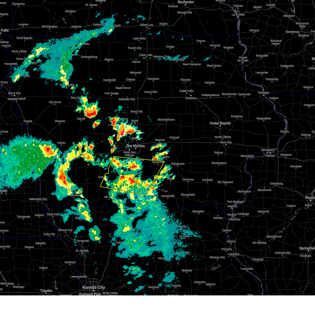
| 7/30/2024 3:27 AM CDT | At 327 am cdt, severe thunderstorms were located along a line extending from near monroe to near knoxville raceway to near melcher-dallas to near lucas, moving southeast at 40 mph (radar indicated). Hazards include 60 mph wind gusts. Expect damage to roofs, siding, and trees. Locations impacted include, knoxville, chariton, monroe, melcher-dallas, lake red rock, knoxville raceway, williamson, reasnor, pella, russell, pella municipal airport, harvey, marysville, lovilia, bussey, hamilton, melrose and leighton. |
| 7/30/2024 3:05 AM CDT | Svrdmx the national weather service in des moines has issued a * severe thunderstorm warning for, lucas county in south central iowa, western monroe county in south central iowa, southeastern polk county in central iowa, marion county in south central iowa, western mahaska county in south central iowa, southern jasper county in central iowa, northeastern clarke county in south central iowa, warren county in south central iowa, * until 345 am cdt. * at 304 am cdt, severe thunderstorms were located along a line extending from near valeria to runnells to near milo to 5 miles east of new virginia, moving southeast at 40 mph (radar indicated). Hazards include 60 mph wind gusts. Expect damage to roofs, siding, and trees. severe thunderstorms will be near, colfax, pleasantville, prairie city, milo, lacona, swan, sandyville and prairie city krohn airport around 310 am cdt. monroe, melcher-dallas, lake red rock and lucas around 315 am cdt. knoxville, knoxville raceway, reasnor, elk rock state park, chariton municipal airport and knoxville municipal airport around 320 am cdt. Other locations in the path of these severe thunderstorms include chariton, williamson, pella, red haw lake state park, russell and pella municipal airport. |
| 7/2/2024 3:41 PM CDT |
 Svrdmx the national weather service in des moines has issued a * severe thunderstorm warning for, marion county in south central iowa, southeastern jasper county in central iowa, eastern warren county in south central iowa, * until 430 pm cdt. * at 341 pm cdt, a severe thunderstorm was located over milo, or 9 miles southeast of indianola, moving east at 35 mph (radar indicated). Hazards include 60 mph wind gusts and quarter size hail. Hail damage to vehicles is expected. Expect wind damage to roofs, siding, and trees. Svrdmx the national weather service in des moines has issued a * severe thunderstorm warning for, marion county in south central iowa, southeastern jasper county in central iowa, eastern warren county in south central iowa, * until 430 pm cdt. * at 341 pm cdt, a severe thunderstorm was located over milo, or 9 miles southeast of indianola, moving east at 35 mph (radar indicated). Hazards include 60 mph wind gusts and quarter size hail. Hail damage to vehicles is expected. Expect wind damage to roofs, siding, and trees.
|
| 6/25/2024 10:41 PM CDT |
 Svrdmx the national weather service in des moines has issued a * severe thunderstorm warning for, southern polk county in central iowa, northeastern madison county in south central iowa, northwestern marion county in south central iowa, warren county in south central iowa, * until 1100 pm cdt. * at 1041 pm cdt, severe thunderstorms were located along a line extending from pleasant hill to near spring hill to st. charles, moving southeast at 50 mph (radar indicated). Hazards include 60 mph wind gusts and penny size hail. expect damage to roofs, siding, and trees Svrdmx the national weather service in des moines has issued a * severe thunderstorm warning for, southern polk county in central iowa, northeastern madison county in south central iowa, northwestern marion county in south central iowa, warren county in south central iowa, * until 1100 pm cdt. * at 1041 pm cdt, severe thunderstorms were located along a line extending from pleasant hill to near spring hill to st. charles, moving southeast at 50 mph (radar indicated). Hazards include 60 mph wind gusts and penny size hail. expect damage to roofs, siding, and trees
|
| 6/25/2024 6:35 PM CDT |
 Svrdmx the national weather service in des moines has issued a * severe thunderstorm warning for, marion county in south central iowa, south central jasper county in central iowa, eastern warren county in south central iowa, * until 715 pm cdt. * at 635 pm cdt, severe thunderstorms were located along a line extending from near monroe to swan to near carlisle, moving south at 10 mph (radar indicated). Hazards include 60 mph wind gusts and quarter size hail. Hail damage to vehicles is expected. Expect wind damage to roofs, siding, and trees. Svrdmx the national weather service in des moines has issued a * severe thunderstorm warning for, marion county in south central iowa, south central jasper county in central iowa, eastern warren county in south central iowa, * until 715 pm cdt. * at 635 pm cdt, severe thunderstorms were located along a line extending from near monroe to swan to near carlisle, moving south at 10 mph (radar indicated). Hazards include 60 mph wind gusts and quarter size hail. Hail damage to vehicles is expected. Expect wind damage to roofs, siding, and trees.
|
| 5/24/2024 5:22 AM CDT |
 At 522 am cdt, severe thunderstorms were located along a line extending from prairie city to elk rock state park to near knoxville to 4 miles east of williamson, moving east at 60 mph (radar indicated). Hazards include 70 mph wind gusts and quarter size hail. Hail damage to vehicles is expected. expect considerable tree damage. wind damage is also likely to mobile homes, roofs, and outbuildings. locations impacted include, des moines, newton, pella, pleasant hill, knoxville, carlisle, monroe, pleasantville, prairie city, melcher-dallas, iowa speedway, knoxville raceway, lake red rock, sully, milo, hartford, kellogg, lovilia, runnells, and bussey. This includes interstate 80 between mile markers 165 and 174. At 522 am cdt, severe thunderstorms were located along a line extending from prairie city to elk rock state park to near knoxville to 4 miles east of williamson, moving east at 60 mph (radar indicated). Hazards include 70 mph wind gusts and quarter size hail. Hail damage to vehicles is expected. expect considerable tree damage. wind damage is also likely to mobile homes, roofs, and outbuildings. locations impacted include, des moines, newton, pella, pleasant hill, knoxville, carlisle, monroe, pleasantville, prairie city, melcher-dallas, iowa speedway, knoxville raceway, lake red rock, sully, milo, hartford, kellogg, lovilia, runnells, and bussey. This includes interstate 80 between mile markers 165 and 174.
|
| 5/24/2024 4:56 AM CDT |
 Svrdmx the national weather service in des moines has issued a * severe thunderstorm warning for, northern lucas county in south central iowa, northwestern monroe county in south central iowa, southeastern polk county in central iowa, marion county in south central iowa, western mahaska county in south central iowa, southern jasper county in central iowa, northeastern clarke county in south central iowa, warren county in south central iowa, * until 545 am cdt. * at 455 am cdt, severe thunderstorms were located along a line extending from norwalk to near ackworth to near otter creek county park to woodburn, moving east at 60 mph (radar indicated). Hazards include 70 mph wind gusts and penny size hail. Expect considerable tree damage. damage is likely to mobile homes, roofs and outbuildings. severe thunderstorms will be near, des moines, pleasant hill, carlisle, southridge mall, milo, hartford, lacona and lucas around 500 am cdt. pleasantville, melcher-dallas, runnells and swan around 505 am cdt. knoxville, lake red rock, knoxville raceway, williamson and knoxville municipal airport around 510 am cdt. monroe, prairie city and elk rock state park around 515 am cdt. other locations in the path of these severe thunderstorms include pella, harvey, prairie city krohn airport, pella municipal airport, newton, reasnor, marysville, iowa speedway, sully, lovilia, bussey, leighton, hamilton, newton municipal airport, kellogg and lynnville. This includes interstate 80 between mile markers 165 and 175. Svrdmx the national weather service in des moines has issued a * severe thunderstorm warning for, northern lucas county in south central iowa, northwestern monroe county in south central iowa, southeastern polk county in central iowa, marion county in south central iowa, western mahaska county in south central iowa, southern jasper county in central iowa, northeastern clarke county in south central iowa, warren county in south central iowa, * until 545 am cdt. * at 455 am cdt, severe thunderstorms were located along a line extending from norwalk to near ackworth to near otter creek county park to woodburn, moving east at 60 mph (radar indicated). Hazards include 70 mph wind gusts and penny size hail. Expect considerable tree damage. damage is likely to mobile homes, roofs and outbuildings. severe thunderstorms will be near, des moines, pleasant hill, carlisle, southridge mall, milo, hartford, lacona and lucas around 500 am cdt. pleasantville, melcher-dallas, runnells and swan around 505 am cdt. knoxville, lake red rock, knoxville raceway, williamson and knoxville municipal airport around 510 am cdt. monroe, prairie city and elk rock state park around 515 am cdt. other locations in the path of these severe thunderstorms include pella, harvey, prairie city krohn airport, pella municipal airport, newton, reasnor, marysville, iowa speedway, sully, lovilia, bussey, leighton, hamilton, newton municipal airport, kellogg and lynnville. This includes interstate 80 between mile markers 165 and 175.
|
| 5/24/2024 4:41 AM CDT |
 At 441 am cdt, a severe thunderstorm was located over st. marys, or 9 miles west of indianola, moving east at 55 mph (law enforcement). Hazards include 70 mph wind gusts and penny size hail. Expect considerable tree damage. damage is likely to mobile homes, roofs, and outbuildings. locations impacted include, des moines, indianola, norwalk, winterset, osceola, carlisle, lakeside casino, avenue of the saints event center, afton, milo, murray, st. charles, new virginia, truro, martensdale, lorimor, cumming, lucas, woodburn, and patterson. This includes interstate 35 between mile markers 30 and 66. At 441 am cdt, a severe thunderstorm was located over st. marys, or 9 miles west of indianola, moving east at 55 mph (law enforcement). Hazards include 70 mph wind gusts and penny size hail. Expect considerable tree damage. damage is likely to mobile homes, roofs, and outbuildings. locations impacted include, des moines, indianola, norwalk, winterset, osceola, carlisle, lakeside casino, avenue of the saints event center, afton, milo, murray, st. charles, new virginia, truro, martensdale, lorimor, cumming, lucas, woodburn, and patterson. This includes interstate 35 between mile markers 30 and 66.
|
| 5/24/2024 4:21 AM CDT |
 Svrdmx the national weather service in des moines has issued a * severe thunderstorm warning for, northwestern lucas county in south central iowa, madison county in south central iowa, union county in south central iowa, clarke county in south central iowa, eastern adair county in southwestern iowa, warren county in south central iowa, * until 500 am cdt. * at 421 am cdt, a severe thunderstorm was located 5 miles northeast of macksburg, or 7 miles southwest of winterset, moving east at 55 mph (law enforcement). Hazards include 70 mph wind gusts and penny size hail. Expect considerable tree damage. Damage is likely to mobile homes, roofs, and outbuildings. Svrdmx the national weather service in des moines has issued a * severe thunderstorm warning for, northwestern lucas county in south central iowa, madison county in south central iowa, union county in south central iowa, clarke county in south central iowa, eastern adair county in southwestern iowa, warren county in south central iowa, * until 500 am cdt. * at 421 am cdt, a severe thunderstorm was located 5 miles northeast of macksburg, or 7 miles southwest of winterset, moving east at 55 mph (law enforcement). Hazards include 70 mph wind gusts and penny size hail. Expect considerable tree damage. Damage is likely to mobile homes, roofs, and outbuildings.
|
| 5/24/2024 3:57 AM CDT |
 At 357 am cdt, a severe thunderstorm was located over milo, or 6 miles southeast of indianola, moving northeast at 35 mph (trained weather spotters). Hazards include 60 mph wind gusts and quarter size hail. Hail damage to vehicles is expected. expect wind damage to roofs, siding, and trees. Locations impacted include, indianola, carlisle, pleasantville, milo, hartford, ackworth, swan, sandyville, lake ahquabi state park, and otter creek county park. At 357 am cdt, a severe thunderstorm was located over milo, or 6 miles southeast of indianola, moving northeast at 35 mph (trained weather spotters). Hazards include 60 mph wind gusts and quarter size hail. Hail damage to vehicles is expected. expect wind damage to roofs, siding, and trees. Locations impacted include, indianola, carlisle, pleasantville, milo, hartford, ackworth, swan, sandyville, lake ahquabi state park, and otter creek county park.
|
| 5/24/2024 3:57 AM CDT |
 the severe thunderstorm warning has been cancelled and is no longer in effect the severe thunderstorm warning has been cancelled and is no longer in effect
|
| 5/24/2024 3:44 AM CDT |
 Svrdmx the national weather service in des moines has issued a * severe thunderstorm warning for, northwestern lucas county in south central iowa, northwestern marion county in south central iowa, northeastern clarke county in south central iowa, eastern warren county in south central iowa, * until 430 am cdt. * at 344 am cdt, a severe thunderstorm was located near otter creek county park, or 11 miles south of indianola, moving northeast at 40 mph (trained weather spotters reported golf ball sized hail near osceola). Hazards include golf ball size hail and 60 mph wind gusts. People and animals outdoors will be injured. expect hail damage to roofs, siding, windows, and vehicles. Expect wind damage to roofs, siding, and trees. Svrdmx the national weather service in des moines has issued a * severe thunderstorm warning for, northwestern lucas county in south central iowa, northwestern marion county in south central iowa, northeastern clarke county in south central iowa, eastern warren county in south central iowa, * until 430 am cdt. * at 344 am cdt, a severe thunderstorm was located near otter creek county park, or 11 miles south of indianola, moving northeast at 40 mph (trained weather spotters reported golf ball sized hail near osceola). Hazards include golf ball size hail and 60 mph wind gusts. People and animals outdoors will be injured. expect hail damage to roofs, siding, windows, and vehicles. Expect wind damage to roofs, siding, and trees.
|
| 5/21/2024 5:20 PM CDT |
 At 520 pm cdt, severe thunderstorms were located along a line extending from near aplington to near kellogg, moving northeast at 65 mph (trained weather spotters). Hazards include 70 mph wind gusts and quarter size hail. Hail damage to vehicles is expected. expect considerable tree damage. wind damage is also likely to mobile homes, roofs, and outbuildings. locations impacted include, marshalltown, newton, grundy center, mitchellville, colfax, monroe, pleasantville, prairie city, state center, conrad, baxter, iowa speedway, rock creek lake, lake red rock, le grand, melbourne, sully, milo, hartford, and kellogg. This includes interstate 80 between mile markers 150 and 180. At 520 pm cdt, severe thunderstorms were located along a line extending from near aplington to near kellogg, moving northeast at 65 mph (trained weather spotters). Hazards include 70 mph wind gusts and quarter size hail. Hail damage to vehicles is expected. expect considerable tree damage. wind damage is also likely to mobile homes, roofs, and outbuildings. locations impacted include, marshalltown, newton, grundy center, mitchellville, colfax, monroe, pleasantville, prairie city, state center, conrad, baxter, iowa speedway, rock creek lake, lake red rock, le grand, melbourne, sully, milo, hartford, and kellogg. This includes interstate 80 between mile markers 150 and 180.
|
| 5/21/2024 5:12 PM CDT |
 At 511 pm cdt, severe thunderstorms were located along a line extending from near steamboat rock to reasnor, moving northeast at 65 mph (trained weather spotters). Hazards include 70 mph wind gusts and quarter size hail. Hail damage to vehicles is expected. expect considerable tree damage. wind damage is also likely to mobile homes, roofs, and outbuildings. locations impacted include, marshalltown, newton, altoona, pleasant hill, nevada, grundy center, carlisle, bondurant, mitchellville, colfax, monroe, pleasantville, prairie city, state center, conrad, baxter, adventureland amusement park, iowa speedway, prairie meadows, and rock creek lake. This includes interstate 80 between mile markers 141 and 180. At 511 pm cdt, severe thunderstorms were located along a line extending from near steamboat rock to reasnor, moving northeast at 65 mph (trained weather spotters). Hazards include 70 mph wind gusts and quarter size hail. Hail damage to vehicles is expected. expect considerable tree damage. wind damage is also likely to mobile homes, roofs, and outbuildings. locations impacted include, marshalltown, newton, altoona, pleasant hill, nevada, grundy center, carlisle, bondurant, mitchellville, colfax, monroe, pleasantville, prairie city, state center, conrad, baxter, adventureland amusement park, iowa speedway, prairie meadows, and rock creek lake. This includes interstate 80 between mile markers 141 and 180.
|
| 5/21/2024 4:51 PM CDT |
 At 451 pm cdt, severe thunderstorms were located along a line extending from near mccallsburg to milo, moving northeast at 60 mph (radar indicated). Hazards include 60 mph wind gusts and quarter size hail. Hail damage to vehicles is expected. expect wind damage to roofs, siding, and trees. locations impacted include, des moines, ames, west des moines, ankeny, urbandale, johnston, clive, indianola, altoona, norwalk, pleasant hill, nevada, windsor heights, carlisle, bondurant, story city, polk city, huxley, saylorville, and mitchellville. this includes the following highways, interstate 35 between mile markers 87 and 126. interstate 80 between mile markers 130 and 149. Interstate 235 between mile markers 3 and 14. At 451 pm cdt, severe thunderstorms were located along a line extending from near mccallsburg to milo, moving northeast at 60 mph (radar indicated). Hazards include 60 mph wind gusts and quarter size hail. Hail damage to vehicles is expected. expect wind damage to roofs, siding, and trees. locations impacted include, des moines, ames, west des moines, ankeny, urbandale, johnston, clive, indianola, altoona, norwalk, pleasant hill, nevada, windsor heights, carlisle, bondurant, story city, polk city, huxley, saylorville, and mitchellville. this includes the following highways, interstate 35 between mile markers 87 and 126. interstate 80 between mile markers 130 and 149. Interstate 235 between mile markers 3 and 14.
|
| 5/21/2024 4:51 PM CDT |
 the severe thunderstorm warning has been cancelled and is no longer in effect the severe thunderstorm warning has been cancelled and is no longer in effect
|
| 5/21/2024 4:43 PM CDT |
 Svrdmx the national weather service in des moines has issued a * severe thunderstorm warning for, eastern polk county in central iowa, eastern story county in central iowa, marshall county in central iowa, southeastern hardin county in central iowa, northwestern marion county in south central iowa, southwestern grundy county in central iowa, jasper county in central iowa, eastern warren county in south central iowa, * until 530 pm cdt. * at 443 pm cdt, severe thunderstorms were located along a line extending from near roland to milo, moving northeast at 65 mph (radar indicated). Hazards include 60 mph wind gusts and quarter size hail. Hail damage to vehicles is expected. Expect wind damage to roofs, siding, and trees. Svrdmx the national weather service in des moines has issued a * severe thunderstorm warning for, eastern polk county in central iowa, eastern story county in central iowa, marshall county in central iowa, southeastern hardin county in central iowa, northwestern marion county in south central iowa, southwestern grundy county in central iowa, jasper county in central iowa, eastern warren county in south central iowa, * until 530 pm cdt. * at 443 pm cdt, severe thunderstorms were located along a line extending from near roland to milo, moving northeast at 65 mph (radar indicated). Hazards include 60 mph wind gusts and quarter size hail. Hail damage to vehicles is expected. Expect wind damage to roofs, siding, and trees.
|
| 5/21/2024 4:11 PM CDT |
 Svrdmx the national weather service in des moines has issued a * severe thunderstorm warning for, northwestern lucas county in south central iowa, polk county in central iowa, northwestern decatur county in south central iowa, story county in central iowa, eastern madison county in south central iowa, eastern union county in south central iowa, southeastern boone county in central iowa, clarke county in south central iowa, eastern dallas county in central iowa, warren county in south central iowa, * until 515 pm cdt. * at 410 pm cdt, severe thunderstorms were located along a line extending from 4 miles west of granger to near grand river, moving northeast at 60 mph (radar indicated). Hazards include 60 mph wind gusts and quarter size hail. Hail damage to vehicles is expected. Expect wind damage to roofs, siding, and trees. Svrdmx the national weather service in des moines has issued a * severe thunderstorm warning for, northwestern lucas county in south central iowa, polk county in central iowa, northwestern decatur county in south central iowa, story county in central iowa, eastern madison county in south central iowa, eastern union county in south central iowa, southeastern boone county in central iowa, clarke county in south central iowa, eastern dallas county in central iowa, warren county in south central iowa, * until 515 pm cdt. * at 410 pm cdt, severe thunderstorms were located along a line extending from 4 miles west of granger to near grand river, moving northeast at 60 mph (radar indicated). Hazards include 60 mph wind gusts and quarter size hail. Hail damage to vehicles is expected. Expect wind damage to roofs, siding, and trees.
|
| 5/21/2024 9:42 AM CDT |
 The storms which prompted the warning have moved out of the area. therefore, the warning will be allowed to expire. a severe thunderstorm watch remains in effect until 100 pm cdt for central and south central iowa. The storms which prompted the warning have moved out of the area. therefore, the warning will be allowed to expire. a severe thunderstorm watch remains in effect until 100 pm cdt for central and south central iowa.
|
| 5/21/2024 9:31 AM CDT |
 the severe thunderstorm warning has been cancelled and is no longer in effect the severe thunderstorm warning has been cancelled and is no longer in effect
|
| 5/21/2024 9:31 AM CDT |
 At 931 am cdt, severe thunderstorms were located along a line extending from near pleasant hill to swan to 6 miles south of pleasantville, moving east at 45 mph (trained weather spotters). Hazards include 60 mph wind gusts and quarter size hail. Hail damage to vehicles is expected. expect wind damage to roofs, siding, and trees. locations impacted include, des moines, ankeny, johnston, indianola, altoona, pleasant hill, carlisle, bondurant, polk city, saylorville, mitchellville, southridge mall, saylorville lake, adventureland amusement park, iowa events center, prairie meadows, iowa state fairgrounds, principal park, drake stadium and knapp center, and big creek lake. this includes the following highways, interstate 35 between mile markers 87 and 99. interstate 80 between mile markers 132 and 147. Interstate 235 between mile markers 6 and 14. At 931 am cdt, severe thunderstorms were located along a line extending from near pleasant hill to swan to 6 miles south of pleasantville, moving east at 45 mph (trained weather spotters). Hazards include 60 mph wind gusts and quarter size hail. Hail damage to vehicles is expected. expect wind damage to roofs, siding, and trees. locations impacted include, des moines, ankeny, johnston, indianola, altoona, pleasant hill, carlisle, bondurant, polk city, saylorville, mitchellville, southridge mall, saylorville lake, adventureland amusement park, iowa events center, prairie meadows, iowa state fairgrounds, principal park, drake stadium and knapp center, and big creek lake. this includes the following highways, interstate 35 between mile markers 87 and 99. interstate 80 between mile markers 132 and 147. Interstate 235 between mile markers 6 and 14.
|
| 5/21/2024 9:26 AM CDT |
 Svrdmx the national weather service in des moines has issued a * severe thunderstorm warning for, western poweshiek county in central iowa, polk county in central iowa, southeastern story county in central iowa, marshall county in central iowa, marion county in south central iowa, northwestern mahaska county in south central iowa, jasper county in central iowa, eastern warren county in south central iowa, * until 1030 am cdt. * at 925 am cdt, severe thunderstorms were located along a line extending from elkhart to 4 miles east of pleasant hill to near milo, moving northeast at 45 mph (radar indicated). Hazards include 60 mph wind gusts and quarter size hail. Hail damage to vehicles is expected. Expect wind damage to roofs, siding, and trees. Svrdmx the national weather service in des moines has issued a * severe thunderstorm warning for, western poweshiek county in central iowa, polk county in central iowa, southeastern story county in central iowa, marshall county in central iowa, marion county in south central iowa, northwestern mahaska county in south central iowa, jasper county in central iowa, eastern warren county in south central iowa, * until 1030 am cdt. * at 925 am cdt, severe thunderstorms were located along a line extending from elkhart to 4 miles east of pleasant hill to near milo, moving northeast at 45 mph (radar indicated). Hazards include 60 mph wind gusts and quarter size hail. Hail damage to vehicles is expected. Expect wind damage to roofs, siding, and trees.
|
| 5/21/2024 9:14 AM CDT |
 At 913 am cdt, severe thunderstorms were located along a line extending from des moines int'l airport to 5 miles northwest of ackworth to near otter creek county park, moving east at 45 mph (trained weather spotters). Hazards include 60 mph wind gusts and quarter size hail. Hail damage to vehicles is expected. expect wind damage to roofs, siding, and trees. locations impacted include, des moines, west des moines, ankeny, urbandale, johnston, clive, indianola, altoona, waukee, norwalk, pleasant hill, grimes, windsor heights, carlisle, bondurant, polk city, saylorville, mitchellville, dallas center, and granger. this includes the following highways, interstate 35 between mile markers 47 and 72, and between mile markers 87 and 99. interstate 80 between mile markers 115 and 147. Interstate 235 between mile markers 1 and 14. At 913 am cdt, severe thunderstorms were located along a line extending from des moines int'l airport to 5 miles northwest of ackworth to near otter creek county park, moving east at 45 mph (trained weather spotters). Hazards include 60 mph wind gusts and quarter size hail. Hail damage to vehicles is expected. expect wind damage to roofs, siding, and trees. locations impacted include, des moines, west des moines, ankeny, urbandale, johnston, clive, indianola, altoona, waukee, norwalk, pleasant hill, grimes, windsor heights, carlisle, bondurant, polk city, saylorville, mitchellville, dallas center, and granger. this includes the following highways, interstate 35 between mile markers 47 and 72, and between mile markers 87 and 99. interstate 80 between mile markers 115 and 147. Interstate 235 between mile markers 1 and 14.
|
| 5/21/2024 9:03 AM CDT |
 At 903 am cdt, severe thunderstorms were located along a line extending from near jordan creek town center to spring hill to 4 miles southeast of st. marys, moving east at 45 mph (radar indicated). Hazards include 70 mph wind gusts and quarter size hail. Hail damage to vehicles is expected. expect considerable tree damage. wind damage is also likely to mobile homes, roofs, and outbuildings. locations impacted include, des moines, west des moines, ankeny, urbandale, johnston, clive, indianola, altoona, waukee, norwalk, pleasant hill, grimes, adel, windsor heights, carlisle, bondurant, polk city, saylorville, mitchellville, and dallas center. this includes the following highways, interstate 35 between mile markers 47 and 72, and between mile markers 87 and 99. interstate 80 between mile markers 110 and 147. Interstate 235 between mile markers 1 and 14. At 903 am cdt, severe thunderstorms were located along a line extending from near jordan creek town center to spring hill to 4 miles southeast of st. marys, moving east at 45 mph (radar indicated). Hazards include 70 mph wind gusts and quarter size hail. Hail damage to vehicles is expected. expect considerable tree damage. wind damage is also likely to mobile homes, roofs, and outbuildings. locations impacted include, des moines, west des moines, ankeny, urbandale, johnston, clive, indianola, altoona, waukee, norwalk, pleasant hill, grimes, adel, windsor heights, carlisle, bondurant, polk city, saylorville, mitchellville, and dallas center. this includes the following highways, interstate 35 between mile markers 47 and 72, and between mile markers 87 and 99. interstate 80 between mile markers 110 and 147. Interstate 235 between mile markers 1 and 14.
|
| 5/21/2024 8:41 AM CDT |
 Svrdmx the national weather service in des moines has issued a * severe thunderstorm warning for, polk county in central iowa, madison county in south central iowa, southern dallas county in central iowa, warren county in south central iowa, * until 945 am cdt. * at 841 am cdt, severe thunderstorms were located along a line extending from earlham to 4 miles northeast of winterset-madison county airport to near east peru, moving east at 45 mph (emergency management). Hazards include 70 mph wind gusts and quarter size hail. Hail damage to vehicles is expected. expect considerable tree damage. Wind damage is also likely to mobile homes, roofs, and outbuildings. Svrdmx the national weather service in des moines has issued a * severe thunderstorm warning for, polk county in central iowa, madison county in south central iowa, southern dallas county in central iowa, warren county in south central iowa, * until 945 am cdt. * at 841 am cdt, severe thunderstorms were located along a line extending from earlham to 4 miles northeast of winterset-madison county airport to near east peru, moving east at 45 mph (emergency management). Hazards include 70 mph wind gusts and quarter size hail. Hail damage to vehicles is expected. expect considerable tree damage. Wind damage is also likely to mobile homes, roofs, and outbuildings.
|
| 5/20/2024 2:01 AM CDT |
 the severe thunderstorm warning has been cancelled and is no longer in effect the severe thunderstorm warning has been cancelled and is no longer in effect
|
| 5/20/2024 2:01 AM CDT |
 At 200 am cdt, severe thunderstorms were located along a line extending from pleasantville to 5 miles northwest of marysville to 4 miles southwest of blakesburg, moving northeast at 50 mph (radar indicated). Hazards include 60 mph wind gusts and penny size hail. Expect damage to roofs, siding, and trees. Locations impacted include, knoxville, centerville, albia, pleasantville, melcher-dallas, lake sundown, rathbun lake, knoxville raceway, lake red rock, milo, hartford, moravia, moulton, lovilia, mystic, bussey, lacona, harvey, williamson, and hamilton. At 200 am cdt, severe thunderstorms were located along a line extending from pleasantville to 5 miles northwest of marysville to 4 miles southwest of blakesburg, moving northeast at 50 mph (radar indicated). Hazards include 60 mph wind gusts and penny size hail. Expect damage to roofs, siding, and trees. Locations impacted include, knoxville, centerville, albia, pleasantville, melcher-dallas, lake sundown, rathbun lake, knoxville raceway, lake red rock, milo, hartford, moravia, moulton, lovilia, mystic, bussey, lacona, harvey, williamson, and hamilton.
|
| 5/20/2024 1:36 AM CDT |
 Svrdmx the national weather service in des moines has issued a * severe thunderstorm warning for, lucas county in south central iowa, monroe county in south central iowa, marion county in south central iowa, eastern wayne county in south central iowa, appanoose county in south central iowa, northeastern clarke county in south central iowa, eastern warren county in south central iowa, * until 230 am cdt. * at 136 am cdt, severe thunderstorms were located along a line extending from 6 miles south of otter creek county park to red haw lake state park to near cincinnati, moving northeast at 30 mph (radar indicated). Hazards include 60 mph wind gusts and penny size hail. expect damage to roofs, siding, and trees Svrdmx the national weather service in des moines has issued a * severe thunderstorm warning for, lucas county in south central iowa, monroe county in south central iowa, marion county in south central iowa, eastern wayne county in south central iowa, appanoose county in south central iowa, northeastern clarke county in south central iowa, eastern warren county in south central iowa, * until 230 am cdt. * at 136 am cdt, severe thunderstorms were located along a line extending from 6 miles south of otter creek county park to red haw lake state park to near cincinnati, moving northeast at 30 mph (radar indicated). Hazards include 60 mph wind gusts and penny size hail. expect damage to roofs, siding, and trees
|
| 5/7/2024 1:26 AM CDT |
 Svrdmx the national weather service in des moines has issued a * severe thunderstorm warning for, lucas county in south central iowa, western poweshiek county in central iowa, monroe county in south central iowa, southeastern polk county in central iowa, davis county in southeastern iowa, marion county in south central iowa, wapello county in southeastern iowa, wayne county in south central iowa, mahaska county in south central iowa, appanoose county in south central iowa, jasper county in central iowa, eastern warren county in south central iowa, * until 230 am cdt. * at 126 am cdt, severe thunderstorms were located along a line extending from near runnells to 5 miles northeast of russell to 5 miles south of seymour, moving east at 50 mph (radar indicated). Hazards include 60 mph wind gusts and penny size hail. expect damage to roofs, siding, and trees Svrdmx the national weather service in des moines has issued a * severe thunderstorm warning for, lucas county in south central iowa, western poweshiek county in central iowa, monroe county in south central iowa, southeastern polk county in central iowa, davis county in southeastern iowa, marion county in south central iowa, wapello county in southeastern iowa, wayne county in south central iowa, mahaska county in south central iowa, appanoose county in south central iowa, jasper county in central iowa, eastern warren county in south central iowa, * until 230 am cdt. * at 126 am cdt, severe thunderstorms were located along a line extending from near runnells to 5 miles northeast of russell to 5 miles south of seymour, moving east at 50 mph (radar indicated). Hazards include 60 mph wind gusts and penny size hail. expect damage to roofs, siding, and trees
|
| 5/7/2024 1:17 AM CDT |
 the tornado warning has been cancelled and is no longer in effect the tornado warning has been cancelled and is no longer in effect
|
| 5/7/2024 1:17 AM CDT |
 At 116 am cdt, a severe thunderstorm capable of producing a tornado was located over milo, or 7 miles southeast of indianola, moving northeast at 50 mph (radar indicated rotation). Hazards include tornado. Flying debris will be dangerous to those caught without shelter. mobile homes will be damaged or destroyed. damage to roofs, windows, and vehicles will occur. tree damage is likely. this dangerous storm will be near, ackworth and sandyville around 120 am cdt. Other locations impacted by this tornadic thunderstorm include ackworth, sandyville, and milo. At 116 am cdt, a severe thunderstorm capable of producing a tornado was located over milo, or 7 miles southeast of indianola, moving northeast at 50 mph (radar indicated rotation). Hazards include tornado. Flying debris will be dangerous to those caught without shelter. mobile homes will be damaged or destroyed. damage to roofs, windows, and vehicles will occur. tree damage is likely. this dangerous storm will be near, ackworth and sandyville around 120 am cdt. Other locations impacted by this tornadic thunderstorm include ackworth, sandyville, and milo.
|
| 5/7/2024 1:04 AM CDT |
 the tornado warning has been cancelled and is no longer in effect the tornado warning has been cancelled and is no longer in effect
|
| 5/7/2024 1:04 AM CDT |
 At 103 am cdt, a severe thunderstorm capable of producing a tornado was located 5 miles south of otter creek county park, or 13 miles south of indianola, moving northeast at 50 mph (radar indicated rotation). Hazards include tornado. Flying debris will be dangerous to those caught without shelter. mobile homes will be damaged or destroyed. damage to roofs, windows, and vehicles will occur. tree damage is likely. this dangerous storm will be near, milo and otter creek county park around 110 am cdt. ackworth and sandyville around 115 am cdt. Other locations impacted by this tornadic thunderstorm include otter creek county park, ackworth, milo, lake ahquabi state park, and sandyville. At 103 am cdt, a severe thunderstorm capable of producing a tornado was located 5 miles south of otter creek county park, or 13 miles south of indianola, moving northeast at 50 mph (radar indicated rotation). Hazards include tornado. Flying debris will be dangerous to those caught without shelter. mobile homes will be damaged or destroyed. damage to roofs, windows, and vehicles will occur. tree damage is likely. this dangerous storm will be near, milo and otter creek county park around 110 am cdt. ackworth and sandyville around 115 am cdt. Other locations impacted by this tornadic thunderstorm include otter creek county park, ackworth, milo, lake ahquabi state park, and sandyville.
|
| 5/7/2024 12:47 AM CDT |
 Tordmx the national weather service in des moines has issued a * tornado warning for, northwestern lucas county in south central iowa, northeastern decatur county in south central iowa, eastern clarke county in south central iowa, warren county in south central iowa, * until 130 am cdt. * at 1246 am cdt, a severe thunderstorm capable of producing a tornado was located 5 miles southwest of woodburn, or 5 miles southeast of osceola, moving northeast at 50 mph (radar indicated rotation). Hazards include tornado. Flying debris will be dangerous to those caught without shelter. mobile homes will be damaged or destroyed. damage to roofs, windows, and vehicles will occur. tree damage is likely. this dangerous storm will be near, woodburn around 1250 am cdt. otter creek county park around 105 am cdt. milo around 110 am cdt. indianola and ackworth around 115 am cdt. sandyville around 120 am cdt. other locations impacted by this tornadic thunderstorm include new virginia, garden grove, lake ahquabi state park, sandyville, spring hill, otter creek county park, ackworth, le roy, milo, and woodburn. This includes interstate 35 between mile markers 32 and 39. Tordmx the national weather service in des moines has issued a * tornado warning for, northwestern lucas county in south central iowa, northeastern decatur county in south central iowa, eastern clarke county in south central iowa, warren county in south central iowa, * until 130 am cdt. * at 1246 am cdt, a severe thunderstorm capable of producing a tornado was located 5 miles southwest of woodburn, or 5 miles southeast of osceola, moving northeast at 50 mph (radar indicated rotation). Hazards include tornado. Flying debris will be dangerous to those caught without shelter. mobile homes will be damaged or destroyed. damage to roofs, windows, and vehicles will occur. tree damage is likely. this dangerous storm will be near, woodburn around 1250 am cdt. otter creek county park around 105 am cdt. milo around 110 am cdt. indianola and ackworth around 115 am cdt. sandyville around 120 am cdt. other locations impacted by this tornadic thunderstorm include new virginia, garden grove, lake ahquabi state park, sandyville, spring hill, otter creek county park, ackworth, le roy, milo, and woodburn. This includes interstate 35 between mile markers 32 and 39.
|
| 4/30/2024 6:23 PM CDT |
 Svrdmx the national weather service in des moines has issued a * severe thunderstorm warning for, northern lucas county in south central iowa, southeastern madison county in south central iowa, western marion county in south central iowa, northern clarke county in south central iowa, warren county in south central iowa, * until 730 pm cdt. * at 623 pm cdt, a severe thunderstorm was located near st. marys, or 10 miles southwest of indianola, moving east at 35 mph (radar indicated). Hazards include golf ball size hail and 60 mph wind gusts. People and animals outdoors will be injured. expect hail damage to roofs, siding, windows, and vehicles. Expect wind damage to roofs, siding, and trees. Svrdmx the national weather service in des moines has issued a * severe thunderstorm warning for, northern lucas county in south central iowa, southeastern madison county in south central iowa, western marion county in south central iowa, northern clarke county in south central iowa, warren county in south central iowa, * until 730 pm cdt. * at 623 pm cdt, a severe thunderstorm was located near st. marys, or 10 miles southwest of indianola, moving east at 35 mph (radar indicated). Hazards include golf ball size hail and 60 mph wind gusts. People and animals outdoors will be injured. expect hail damage to roofs, siding, windows, and vehicles. Expect wind damage to roofs, siding, and trees.
|
| 4/30/2024 5:49 PM CDT |
 Svrdmx the national weather service in des moines has issued a * severe thunderstorm warning for, northwestern lucas county in south central iowa, southern madison county in south central iowa, northeastern union county in south central iowa, northern clarke county in south central iowa, warren county in south central iowa, * until 630 pm cdt. * at 548 pm cdt, a severe thunderstorm was located near east peru, or 11 miles south of winterset, moving east at 50 mph (radar indicated). Hazards include golf ball size hail and 60 mph wind gusts. People and animals outdoors will be injured. expect hail damage to roofs, siding, windows, and vehicles. Expect wind damage to roofs, siding, and trees. Svrdmx the national weather service in des moines has issued a * severe thunderstorm warning for, northwestern lucas county in south central iowa, southern madison county in south central iowa, northeastern union county in south central iowa, northern clarke county in south central iowa, warren county in south central iowa, * until 630 pm cdt. * at 548 pm cdt, a severe thunderstorm was located near east peru, or 11 miles south of winterset, moving east at 50 mph (radar indicated). Hazards include golf ball size hail and 60 mph wind gusts. People and animals outdoors will be injured. expect hail damage to roofs, siding, windows, and vehicles. Expect wind damage to roofs, siding, and trees.
|
| 4/26/2024 9:23 PM CDT |
 The storm which prompted the warning has moved out of the area. therefore, the warning will be allowed to expire. a tornado watch remains in effect until midnight cdt for south central iowa. The storm which prompted the warning has moved out of the area. therefore, the warning will be allowed to expire. a tornado watch remains in effect until midnight cdt for south central iowa.
|
| 4/26/2024 9:09 PM CDT |
 the tornado warning has been cancelled and is no longer in effect the tornado warning has been cancelled and is no longer in effect
|
| 4/26/2024 9:09 PM CDT |
 At 908 pm cdt, a severe thunderstorm capable of producing a tornado was located over milo, or 8 miles southeast of indianola, moving northeast at 40 mph (radar indicated rotation). Hazards include tornado and quarter size hail. Flying debris will be dangerous to those caught without shelter. mobile homes will be damaged or destroyed. damage to roofs, windows, and vehicles will occur. tree damage is likely. This tornadic thunderstorm will remain over mainly rural areas of northwestern lucas, west central marion and southeastern warren counties, including the following locations, otter creek county park, ackworth, milo, and lake ahquabi state park. At 908 pm cdt, a severe thunderstorm capable of producing a tornado was located over milo, or 8 miles southeast of indianola, moving northeast at 40 mph (radar indicated rotation). Hazards include tornado and quarter size hail. Flying debris will be dangerous to those caught without shelter. mobile homes will be damaged or destroyed. damage to roofs, windows, and vehicles will occur. tree damage is likely. This tornadic thunderstorm will remain over mainly rural areas of northwestern lucas, west central marion and southeastern warren counties, including the following locations, otter creek county park, ackworth, milo, and lake ahquabi state park.
|
| 4/26/2024 8:59 PM CDT |
 At 859 pm cdt, a severe thunderstorm capable of producing a tornado was located near otter creek county park, or 11 miles south of indianola, moving northeast at 40 mph (radar indicated rotation). Hazards include tornado and half dollar size hail. Flying debris will be dangerous to those caught without shelter. mobile homes will be damaged or destroyed. damage to roofs, windows, and vehicles will occur. tree damage is likely. this dangerous storm will be near, milo and otter creek county park around 905 pm cdt. ackworth around 915 pm cdt. other locations impacted by this tornadic thunderstorm include new virginia, otter creek county park, ackworth, milo, and lake ahquabi state park. This includes interstate 35 between mile markers 38 and 40. At 859 pm cdt, a severe thunderstorm capable of producing a tornado was located near otter creek county park, or 11 miles south of indianola, moving northeast at 40 mph (radar indicated rotation). Hazards include tornado and half dollar size hail. Flying debris will be dangerous to those caught without shelter. mobile homes will be damaged or destroyed. damage to roofs, windows, and vehicles will occur. tree damage is likely. this dangerous storm will be near, milo and otter creek county park around 905 pm cdt. ackworth around 915 pm cdt. other locations impacted by this tornadic thunderstorm include new virginia, otter creek county park, ackworth, milo, and lake ahquabi state park. This includes interstate 35 between mile markers 38 and 40.
|
| 4/26/2024 8:40 PM CDT |
 Tordmx the national weather service in des moines has issued a * tornado warning for, northwestern lucas county in south central iowa, west central marion county in south central iowa, northeastern clarke county in south central iowa, southeastern warren county in south central iowa, * until 930 pm cdt. * at 839 pm cdt, a severe thunderstorm capable of producing a tornado was located over osceola, moving northeast at 40 mph (radar indicated rotation). Hazards include tornado. Flying debris will be dangerous to those caught without shelter. mobile homes will be damaged or destroyed. damage to roofs, windows, and vehicles will occur. tree damage is likely. this dangerous storm will be near, otter creek county park around 900 pm cdt. milo around 905 pm cdt. ackworth around 915 pm cdt. other locations impacted by this tornadic thunderstorm include new virginia, otter creek county park, ackworth, milo, and lake ahquabi state park. This includes interstate 35 between mile markers 38 and 40. Tordmx the national weather service in des moines has issued a * tornado warning for, northwestern lucas county in south central iowa, west central marion county in south central iowa, northeastern clarke county in south central iowa, southeastern warren county in south central iowa, * until 930 pm cdt. * at 839 pm cdt, a severe thunderstorm capable of producing a tornado was located over osceola, moving northeast at 40 mph (radar indicated rotation). Hazards include tornado. Flying debris will be dangerous to those caught without shelter. mobile homes will be damaged or destroyed. damage to roofs, windows, and vehicles will occur. tree damage is likely. this dangerous storm will be near, otter creek county park around 900 pm cdt. milo around 905 pm cdt. ackworth around 915 pm cdt. other locations impacted by this tornadic thunderstorm include new virginia, otter creek county park, ackworth, milo, and lake ahquabi state park. This includes interstate 35 between mile markers 38 and 40.
|
| 6/30/2023 7:25 AM CDT |
 At 724 am cdt, severe thunderstorms were located along a line extending from macksburg to lamoni, moving east at 50 mph (law enforcement). Hazards include 70 mph wind gusts and quarter size hail. Hail damage to vehicles is expected. expect considerable tree damage. wind damage is also likely to mobile homes, roofs, and outbuildings. these severe storms will be near, davis city around 730 am cdt. other locations in the path of these severe thunderstorms include leon, decatur city, pleasanton, nine eagles state park, east peru, truro, st. charles, st. marys, clio, allerton, indianola, corydon, lake ahquabi state park and otter creek county park. this includes interstate 35 between mile markers 1 and 52. thunderstorm damage threat, considerable hail threat, radar indicated max hail size, 1. 00 in wind threat, observed max wind gust, 70 mph. At 724 am cdt, severe thunderstorms were located along a line extending from macksburg to lamoni, moving east at 50 mph (law enforcement). Hazards include 70 mph wind gusts and quarter size hail. Hail damage to vehicles is expected. expect considerable tree damage. wind damage is also likely to mobile homes, roofs, and outbuildings. these severe storms will be near, davis city around 730 am cdt. other locations in the path of these severe thunderstorms include leon, decatur city, pleasanton, nine eagles state park, east peru, truro, st. charles, st. marys, clio, allerton, indianola, corydon, lake ahquabi state park and otter creek county park. this includes interstate 35 between mile markers 1 and 52. thunderstorm damage threat, considerable hail threat, radar indicated max hail size, 1. 00 in wind threat, observed max wind gust, 70 mph.
|
| 6/30/2023 7:10 AM CDT |
 At 709 am cdt, severe thunderstorms were located along a line extending from macksburg to lamoni, moving east at 50 mph (law enforcement). Hazards include 70 mph wind gusts and quarter size hail. Hail damage to vehicles is expected. expect considerable tree damage. wind damage is also likely to mobile homes, roofs, and outbuildings. these severe storms will be near, davis city around 715 am cdt. leon, decatur city, pleasanton and nine eagles state park around 720 am cdt. other locations in the path of these severe thunderstorms include east peru, truro, avenue of the saints event center, st. charles, bevington, st. marys, clio, allerton, indianola, corydon, lake ahquabi state park and otter creek county park. this includes interstate 35 between mile markers 1 and 56. thunderstorm damage threat, considerable hail threat, radar indicated max hail size, 1. 00 in wind threat, observed max wind gust, 70 mph. At 709 am cdt, severe thunderstorms were located along a line extending from macksburg to lamoni, moving east at 50 mph (law enforcement). Hazards include 70 mph wind gusts and quarter size hail. Hail damage to vehicles is expected. expect considerable tree damage. wind damage is also likely to mobile homes, roofs, and outbuildings. these severe storms will be near, davis city around 715 am cdt. leon, decatur city, pleasanton and nine eagles state park around 720 am cdt. other locations in the path of these severe thunderstorms include east peru, truro, avenue of the saints event center, st. charles, bevington, st. marys, clio, allerton, indianola, corydon, lake ahquabi state park and otter creek county park. this includes interstate 35 between mile markers 1 and 56. thunderstorm damage threat, considerable hail threat, radar indicated max hail size, 1. 00 in wind threat, observed max wind gust, 70 mph.
|
| 6/30/2023 7:04 AM CDT |
 At 703 am cdt, severe thunderstorms were located along a line extending from near macksburg to near lamoni, moving east at 50 mph (law enforcement). Hazards include 60 mph wind gusts and quarter size hail. Hail damage to vehicles is expected. expect wind damage to roofs, siding, and trees. severe thunderstorms will be near, lamoni municipal airport around 710 am cdt. lorimor, davis city, decatur city and nine eagles state park around 715 am cdt. leon and pleasanton around 720 am cdt. other locations in the path of these severe thunderstorms include truro, east peru, avenue of the saints event center, st. charles, new virginia, st. marys, bevington, clio, allerton and lake ahquabi state park. this includes interstate 35 between mile markers 1 and 56. hail threat, radar indicated max hail size, 1. 00 in wind threat, observed max wind gust, 60 mph. At 703 am cdt, severe thunderstorms were located along a line extending from near macksburg to near lamoni, moving east at 50 mph (law enforcement). Hazards include 60 mph wind gusts and quarter size hail. Hail damage to vehicles is expected. expect wind damage to roofs, siding, and trees. severe thunderstorms will be near, lamoni municipal airport around 710 am cdt. lorimor, davis city, decatur city and nine eagles state park around 715 am cdt. leon and pleasanton around 720 am cdt. other locations in the path of these severe thunderstorms include truro, east peru, avenue of the saints event center, st. charles, new virginia, st. marys, bevington, clio, allerton and lake ahquabi state park. this includes interstate 35 between mile markers 1 and 56. hail threat, radar indicated max hail size, 1. 00 in wind threat, observed max wind gust, 60 mph.
|
| 6/24/2023 2:39 PM CDT |
 At 238 pm cdt, a severe thunderstorm was located near sandyville, or 7 miles east of indianola, moving northeast at 30 mph (public. at 230 pm, quarter size hail was reported in indianola). Hazards include 60 mph wind gusts and quarter size hail. Hail damage to vehicles is expected. expect wind damage to roofs, siding, and trees. locations impacted include, pleasantville and swan. hail threat, observed max hail size, 1. 00 in wind threat, radar indicated max wind gust, 60 mph. At 238 pm cdt, a severe thunderstorm was located near sandyville, or 7 miles east of indianola, moving northeast at 30 mph (public. at 230 pm, quarter size hail was reported in indianola). Hazards include 60 mph wind gusts and quarter size hail. Hail damage to vehicles is expected. expect wind damage to roofs, siding, and trees. locations impacted include, pleasantville and swan. hail threat, observed max hail size, 1. 00 in wind threat, radar indicated max wind gust, 60 mph.
|
| 6/24/2023 2:26 PM CDT |
 At 226 pm cdt, a severe thunderstorm was located over indianola, moving northeast at 30 mph (radar indicated). Hazards include 60 mph wind gusts and quarter size hail. Hail damage to vehicles is expected. expect wind damage to roofs, siding, and trees. this severe thunderstorm will be near, milo around 230 pm cdt. ackworth around 235 pm cdt. sandyville around 240 pm cdt. hartford around 245 pm cdt. other locations in the path of this severe thunderstorm include pleasantville and swan. hail threat, radar indicated max hail size, 1. 00 in wind threat, radar indicated max wind gust, 60 mph. At 226 pm cdt, a severe thunderstorm was located over indianola, moving northeast at 30 mph (radar indicated). Hazards include 60 mph wind gusts and quarter size hail. Hail damage to vehicles is expected. expect wind damage to roofs, siding, and trees. this severe thunderstorm will be near, milo around 230 pm cdt. ackworth around 235 pm cdt. sandyville around 240 pm cdt. hartford around 245 pm cdt. other locations in the path of this severe thunderstorm include pleasantville and swan. hail threat, radar indicated max hail size, 1. 00 in wind threat, radar indicated max wind gust, 60 mph.
|
| 5/13/2023 1:02 PM CDT |
 At 102 pm cdt, a severe thunderstorm capable of producing a tornado was located over sandyville, or 9 miles east of indianola, moving northeast at 15 mph (radar indicated rotation). Hazards include tornado and quarter size hail. Flying debris will be dangerous to those caught without shelter. mobile homes will be damaged or destroyed. damage to roofs, windows, and vehicles will occur. Tree damage is likely. At 102 pm cdt, a severe thunderstorm capable of producing a tornado was located over sandyville, or 9 miles east of indianola, moving northeast at 15 mph (radar indicated rotation). Hazards include tornado and quarter size hail. Flying debris will be dangerous to those caught without shelter. mobile homes will be damaged or destroyed. damage to roofs, windows, and vehicles will occur. Tree damage is likely.
|
| 4/19/2023 10:41 PM CDT |
 At 1040 pm cdt, severe thunderstorms were located along a line extending from martensdale to near lake ahquabi state park to 5 miles northwest of lucas, moving north at 35 mph (radar indicated). Hazards include 60 mph wind gusts and quarter size hail. Hail damage to vehicles is expected. expect wind damage to roofs, siding, and trees. severe thunderstorms will be near, martensdale and lake ahquabi state park around 1045 pm cdt. indianola and spring hill around 1050 pm cdt. norwalk and cumming around 1055 pm cdt. des moines int`l airport around 1100 pm cdt. other locations in the path of these severe thunderstorms include west des moines, carlisle, principal park, iowa events center, drake stadium and knapp center, southridge mall, milo, pleasant hill, ackworth, des moines, ankeny, iowa state fairgrounds, sandyville, margo frankel woods state park, weh-weh-neh-kee state park, saylorville and pleasantville. this includes the following highways, interstate 35 between mile markers 54 and 63, and between mile markers 87 and 89. interstate 80 between mile markers 134 and 140. interstate 235 between mile markers 5 and 14. hail threat, radar indicated max hail size, 1. 00 in wind threat, radar indicated max wind gust, 60 mph. At 1040 pm cdt, severe thunderstorms were located along a line extending from martensdale to near lake ahquabi state park to 5 miles northwest of lucas, moving north at 35 mph (radar indicated). Hazards include 60 mph wind gusts and quarter size hail. Hail damage to vehicles is expected. expect wind damage to roofs, siding, and trees. severe thunderstorms will be near, martensdale and lake ahquabi state park around 1045 pm cdt. indianola and spring hill around 1050 pm cdt. norwalk and cumming around 1055 pm cdt. des moines int`l airport around 1100 pm cdt. other locations in the path of these severe thunderstorms include west des moines, carlisle, principal park, iowa events center, drake stadium and knapp center, southridge mall, milo, pleasant hill, ackworth, des moines, ankeny, iowa state fairgrounds, sandyville, margo frankel woods state park, weh-weh-neh-kee state park, saylorville and pleasantville. this includes the following highways, interstate 35 between mile markers 54 and 63, and between mile markers 87 and 89. interstate 80 between mile markers 134 and 140. interstate 235 between mile markers 5 and 14. hail threat, radar indicated max hail size, 1. 00 in wind threat, radar indicated max wind gust, 60 mph.
|
| 4/4/2023 6:48 PM CDT |
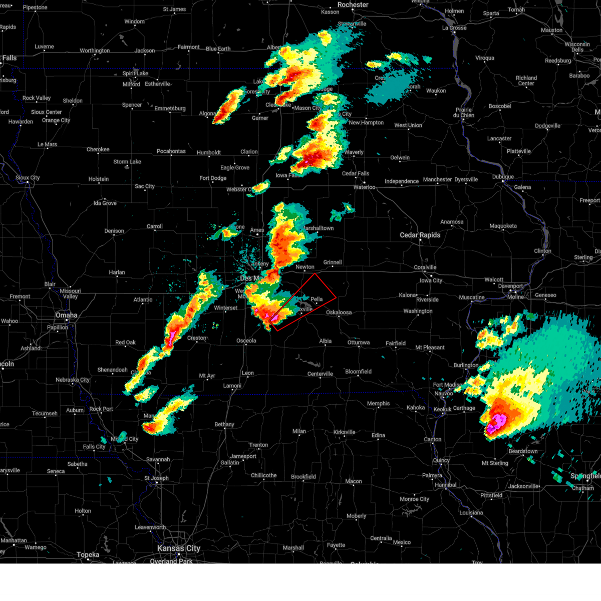 At 648 pm cdt, a severe thunderstorm capable of producing a tornado was located near lacona, or 12 miles southeast of indianola, moving northeast at 55 mph (radar indicated rotation). Hazards include tornado and ping pong ball size hail. Flying debris will be dangerous to those caught without shelter. mobile homes will be damaged or destroyed. damage to roofs, windows, and vehicles will occur. tree damage is likely. this dangerous storm will be near, melcher-dallas around 655 pm cdt. pleasantville around 700 pm cdt. knoxville, knoxville raceway and knoxville municipal airport around 705 pm cdt. other locations in the path of this tornadic thunderstorm include lake red rock, elk rock state park, monroe, pella municipal airport, pella, reasnor and sully. This includes interstate 80 near mile marker 171. At 648 pm cdt, a severe thunderstorm capable of producing a tornado was located near lacona, or 12 miles southeast of indianola, moving northeast at 55 mph (radar indicated rotation). Hazards include tornado and ping pong ball size hail. Flying debris will be dangerous to those caught without shelter. mobile homes will be damaged or destroyed. damage to roofs, windows, and vehicles will occur. tree damage is likely. this dangerous storm will be near, melcher-dallas around 655 pm cdt. pleasantville around 700 pm cdt. knoxville, knoxville raceway and knoxville municipal airport around 705 pm cdt. other locations in the path of this tornadic thunderstorm include lake red rock, elk rock state park, monroe, pella municipal airport, pella, reasnor and sully. This includes interstate 80 near mile marker 171.
|
| 4/4/2023 6:32 PM CDT |
 At 632 pm cdt, a severe thunderstorm was located near lake ahquabi state park, or 9 miles south of indianola, moving northeast at 60 mph (trained weather spotters). Hazards include two inch hail and 60 mph wind gusts. People and animals outdoors will be injured. expect hail damage to roofs, siding, windows, and vehicles. expect wind damage to roofs, siding, and trees. this severe storm will be near, otter creek county park and lake ahquabi state park around 635 pm cdt. other locations in the path of this severe thunderstorm include indianola, milo, ackworth and sandyville. this includes interstate 35 between mile markers 48 and 60. thunderstorm damage threat, considerable hail threat, observed max hail size, 2. 00 in wind threat, radar indicated max wind gust, 60 mph. At 632 pm cdt, a severe thunderstorm was located near lake ahquabi state park, or 9 miles south of indianola, moving northeast at 60 mph (trained weather spotters). Hazards include two inch hail and 60 mph wind gusts. People and animals outdoors will be injured. expect hail damage to roofs, siding, windows, and vehicles. expect wind damage to roofs, siding, and trees. this severe storm will be near, otter creek county park and lake ahquabi state park around 635 pm cdt. other locations in the path of this severe thunderstorm include indianola, milo, ackworth and sandyville. this includes interstate 35 between mile markers 48 and 60. thunderstorm damage threat, considerable hail threat, observed max hail size, 2. 00 in wind threat, radar indicated max wind gust, 60 mph.
|
| 4/4/2023 6:15 PM CDT |
 At 614 pm cdt, a severe thunderstorm was located over murray, or 6 miles west of osceola, moving northeast at 60 mph (radar indicated). Hazards include two inch hail and 60 mph wind gusts. People and animals outdoors will be injured. expect hail damage to roofs, siding, windows, and vehicles. expect wind damage to roofs, siding, and trees. this severe storm will be near, new virginia and truro around 625 pm cdt. other locations in the path of this severe thunderstorm include otter creek county park, lake ahquabi state park, indianola, milo, ackworth and sandyville. this includes interstate 35 between mile markers 32 and 60. thunderstorm damage threat, considerable hail threat, radar indicated max hail size, 2. 00 in wind threat, radar indicated max wind gust, 60 mph. At 614 pm cdt, a severe thunderstorm was located over murray, or 6 miles west of osceola, moving northeast at 60 mph (radar indicated). Hazards include two inch hail and 60 mph wind gusts. People and animals outdoors will be injured. expect hail damage to roofs, siding, windows, and vehicles. expect wind damage to roofs, siding, and trees. this severe storm will be near, new virginia and truro around 625 pm cdt. other locations in the path of this severe thunderstorm include otter creek county park, lake ahquabi state park, indianola, milo, ackworth and sandyville. this includes interstate 35 between mile markers 32 and 60. thunderstorm damage threat, considerable hail threat, radar indicated max hail size, 2. 00 in wind threat, radar indicated max wind gust, 60 mph.
|
| 4/4/2023 6:10 PM CDT |
 At 609 pm cdt, a severe thunderstorm was located over murray roadside rest area, or 10 miles west of osceola, moving northeast at 60 mph (radar indicated). Hazards include 60 mph wind gusts and half dollar size hail. Hail damage to vehicles is expected. expect wind damage to roofs, siding, and trees. this severe thunderstorm will be near, osceola and lakeside casino around 620 pm cdt. new virginia and truro around 625 pm cdt. other locations in the path of this severe thunderstorm include otter creek county park, lake ahquabi state park, indianola, milo, ackworth and sandyville. this includes interstate 35 between mile markers 30 and 60. hail threat, radar indicated max hail size, 1. 25 in wind threat, radar indicated max wind gust, 60 mph. At 609 pm cdt, a severe thunderstorm was located over murray roadside rest area, or 10 miles west of osceola, moving northeast at 60 mph (radar indicated). Hazards include 60 mph wind gusts and half dollar size hail. Hail damage to vehicles is expected. expect wind damage to roofs, siding, and trees. this severe thunderstorm will be near, osceola and lakeside casino around 620 pm cdt. new virginia and truro around 625 pm cdt. other locations in the path of this severe thunderstorm include otter creek county park, lake ahquabi state park, indianola, milo, ackworth and sandyville. this includes interstate 35 between mile markers 30 and 60. hail threat, radar indicated max hail size, 1. 25 in wind threat, radar indicated max wind gust, 60 mph.
|
| 8/29/2022 7:35 AM CDT | At 735 am cdt, a severe thunderstorm was located just south of indianola, moving east at 30 mph (radar indicated). Hazards include half dollar size hail. Damage to vehicles is expected. this severe thunderstorm will be near, milo and ackworth around 745 am cdt. sandyville around 750 am cdt. pleasantville around 800 am cdt. melcher-dallas around 805 am cdt. other locations impacted by this severe thunderstorm include otter creek county park, ackworth, lacona, milo, lake ahquabi state park and sandyville. hail threat, radar indicated max hail size, 1. 25 in wind threat, radar indicated max wind gust, <50 mph. |
| 6/25/2022 7:32 AM CDT |
 At 732 am cdt, a severe thunderstorm was located over indianola, moving east at 45 mph (trained weather spotters). Hazards include golf ball size hail. People and animals outdoors will be injured. expect damage to roofs, siding, windows, and vehicles. this severe storm will be near, milo and ackworth around 740 am cdt. other locations in the path of this severe thunderstorm include sandyville, pleasantville, knoxville, lake red rock, knoxville raceway, knoxville municipal airport and elk rock state park. thunderstorm damage threat, considerable hail threat, radar indicated max hail size, 1. 75 in wind threat, radar indicated max wind gust, <50 mph. At 732 am cdt, a severe thunderstorm was located over indianola, moving east at 45 mph (trained weather spotters). Hazards include golf ball size hail. People and animals outdoors will be injured. expect damage to roofs, siding, windows, and vehicles. this severe storm will be near, milo and ackworth around 740 am cdt. other locations in the path of this severe thunderstorm include sandyville, pleasantville, knoxville, lake red rock, knoxville raceway, knoxville municipal airport and elk rock state park. thunderstorm damage threat, considerable hail threat, radar indicated max hail size, 1. 75 in wind threat, radar indicated max wind gust, <50 mph.
|
| 6/25/2022 7:23 AM CDT |
 At 722 am cdt, a severe thunderstorm was located near indianola, moving east at 55 mph (radar indicated). Hazards include ping pong ball size hail. People and animals outdoors will be injured. expect damage to roofs, siding, windows, and vehicles. this severe thunderstorm will be near, indianola around 730 am cdt. ackworth around 735 am cdt. milo and sandyville around 740 am cdt. other locations in the path of this severe thunderstorm include pleasantville, knoxville, knoxville raceway, lake red rock, knoxville municipal airport and elk rock state park. hail threat, radar indicated max hail size, 1. 50 in wind threat, radar indicated max wind gust, <50 mph. At 722 am cdt, a severe thunderstorm was located near indianola, moving east at 55 mph (radar indicated). Hazards include ping pong ball size hail. People and animals outdoors will be injured. expect damage to roofs, siding, windows, and vehicles. this severe thunderstorm will be near, indianola around 730 am cdt. ackworth around 735 am cdt. milo and sandyville around 740 am cdt. other locations in the path of this severe thunderstorm include pleasantville, knoxville, knoxville raceway, lake red rock, knoxville municipal airport and elk rock state park. hail threat, radar indicated max hail size, 1. 50 in wind threat, radar indicated max wind gust, <50 mph.
|
| 6/6/2022 1:46 PM CDT |
 At 145 pm cdt, severe thunderstorms were located along a line extending from near indianola to 8 miles west of melcher-dallas to 6 miles southwest of osceola, moving southeast at 35 mph (radar indicated). Hazards include 60 mph wind gusts. Expect damage to roofs, siding, and trees. severe thunderstorms will be near, milo, lacona and sandyville around 150 pm cdt. pleasantville, melcher-dallas and williamson around 200 pm cdt. garden grove around 205 pm cdt. other locations in the path of these severe thunderstorms include le roy, knoxville, knoxville raceway, humeston, derby, knoxville municipal airport, lovilia, corydon, allerton, bussey, harvey, hamilton, marysville and millerton. this includes interstate 35 between mile markers 27 and 35. hail threat, radar indicated max hail size, <. 75 in wind threat, radar indicated max wind gust, 60 mph. At 145 pm cdt, severe thunderstorms were located along a line extending from near indianola to 8 miles west of melcher-dallas to 6 miles southwest of osceola, moving southeast at 35 mph (radar indicated). Hazards include 60 mph wind gusts. Expect damage to roofs, siding, and trees. severe thunderstorms will be near, milo, lacona and sandyville around 150 pm cdt. pleasantville, melcher-dallas and williamson around 200 pm cdt. garden grove around 205 pm cdt. other locations in the path of these severe thunderstorms include le roy, knoxville, knoxville raceway, humeston, derby, knoxville municipal airport, lovilia, corydon, allerton, bussey, harvey, hamilton, marysville and millerton. this includes interstate 35 between mile markers 27 and 35. hail threat, radar indicated max hail size, <. 75 in wind threat, radar indicated max wind gust, 60 mph.
|
| 4/23/2022 7:46 PM CDT |
 At 745 pm cdt, severe thunderstorms were located along a line extending from near ankeny to near carlisle to 11 miles south of indianola, moving northeast at 60 mph (broadcast media). Hazards include 60 mph wind gusts. expect damage to roofs, siding, and trees At 745 pm cdt, severe thunderstorms were located along a line extending from near ankeny to near carlisle to 11 miles south of indianola, moving northeast at 60 mph (broadcast media). Hazards include 60 mph wind gusts. expect damage to roofs, siding, and trees
|
| 4/23/2022 7:37 PM CDT |
 At 736 pm cdt, severe thunderstorms were located along a line extending from johnston to near norwalk to 8 miles southeast of avenue of the saints event center, moving east at 70 mph (public). Hazards include 60 mph wind gusts. Expect damage to roofs, siding, and trees. Locations impacted include, des moines, west des moines, ankeny, urbandale, johnston, clive, indianola, altoona, waukee, norwalk, pleasant hill, grimes, windsor heights, carlisle, bondurant, saylorville, mitchellville, southridge mall, jordan creek town center and adventureland amusement park. At 736 pm cdt, severe thunderstorms were located along a line extending from johnston to near norwalk to 8 miles southeast of avenue of the saints event center, moving east at 70 mph (public). Hazards include 60 mph wind gusts. Expect damage to roofs, siding, and trees. Locations impacted include, des moines, west des moines, ankeny, urbandale, johnston, clive, indianola, altoona, waukee, norwalk, pleasant hill, grimes, windsor heights, carlisle, bondurant, saylorville, mitchellville, southridge mall, jordan creek town center and adventureland amusement park.
|
| 4/23/2022 7:26 PM CDT |
 At 726 pm cdt, severe thunderstorms were located along a line extending from near waukee to near avenue of the saints event center to near lakeside casino, moving northeast at 70 mph (public). Hazards include 60 mph wind gusts. Expect damage to roofs, siding, and trees. Locations impacted include, des moines, west des moines, ankeny, urbandale, johnston, clive, indianola, altoona, waukee, norwalk, pleasant hill, grimes, winterset, windsor heights, carlisle, bondurant, saylorville, mitchellville, van meter and adventureland amusement park. At 726 pm cdt, severe thunderstorms were located along a line extending from near waukee to near avenue of the saints event center to near lakeside casino, moving northeast at 70 mph (public). Hazards include 60 mph wind gusts. Expect damage to roofs, siding, and trees. Locations impacted include, des moines, west des moines, ankeny, urbandale, johnston, clive, indianola, altoona, waukee, norwalk, pleasant hill, grimes, winterset, windsor heights, carlisle, bondurant, saylorville, mitchellville, van meter and adventureland amusement park.
|
| 4/23/2022 7:14 PM CDT |
 At 713 pm cdt, severe thunderstorms were located along a line extending from near earlham to 10 miles south of winterset to 7 miles northeast of sun valley lake, moving northeast at 70 mph (radar indicated). Hazards include 60 mph wind gusts. expect damage to roofs, siding, and trees At 713 pm cdt, severe thunderstorms were located along a line extending from near earlham to 10 miles south of winterset to 7 miles northeast of sun valley lake, moving northeast at 70 mph (radar indicated). Hazards include 60 mph wind gusts. expect damage to roofs, siding, and trees
|
| 12/15/2021 6:24 PM CST |
 At 623 pm cst, severe thunderstorms were located along a line extending from slater to near new virginia, moving east at 75 mph (radar indicated). Hazards include 70 mph wind gusts. Expect considerable tree damage. damage is likely to mobile homes, roofs, and outbuildings. severe thunderstorms will be near, melcher-dallas around 640 pm cst. other locations in the path of these severe thunderstorms include baxter and rock creek lake. this includes the following highways, interstate 35 between mile markers 39 and 72, and between mile markers 87 and 101. interstate 80 between mile markers 118 and 189. interstate 235 between mile markers 1 and 14. thunderstorm damage threat, considerable hail threat, radar indicated max hail size, <. 75 in wind threat, radar indicated max wind gust, 70 mph. At 623 pm cst, severe thunderstorms were located along a line extending from slater to near new virginia, moving east at 75 mph (radar indicated). Hazards include 70 mph wind gusts. Expect considerable tree damage. damage is likely to mobile homes, roofs, and outbuildings. severe thunderstorms will be near, melcher-dallas around 640 pm cst. other locations in the path of these severe thunderstorms include baxter and rock creek lake. this includes the following highways, interstate 35 between mile markers 39 and 72, and between mile markers 87 and 101. interstate 80 between mile markers 118 and 189. interstate 235 between mile markers 1 and 14. thunderstorm damage threat, considerable hail threat, radar indicated max hail size, <. 75 in wind threat, radar indicated max wind gust, 70 mph.
|
| 12/15/2021 6:19 PM CST |
 At 619 pm cst, severe thunderstorms were located along a line extending from 12 miles north of state center to near baxter to near carlisle, moving east at 80 mph. these are destructive storms for central iowa (radar indicated). Hazards include 80 mph wind gusts. Flying debris will be dangerous to those caught without shelter. mobile homes will be heavily damaged. expect considerable damage to roofs, windows, and vehicles. extensive tree damage and power outages are likely. Locations impacted include, des moines, west des moines, ankeny, urbandale, johnston, clive, indianola, altoona, waukee, norwalk, pleasant hill, grimes, winterset, adel, windsor heights, carlisle, bondurant, polk city, huxley and saylorville. At 619 pm cst, severe thunderstorms were located along a line extending from 12 miles north of state center to near baxter to near carlisle, moving east at 80 mph. these are destructive storms for central iowa (radar indicated). Hazards include 80 mph wind gusts. Flying debris will be dangerous to those caught without shelter. mobile homes will be heavily damaged. expect considerable damage to roofs, windows, and vehicles. extensive tree damage and power outages are likely. Locations impacted include, des moines, west des moines, ankeny, urbandale, johnston, clive, indianola, altoona, waukee, norwalk, pleasant hill, grimes, winterset, adel, windsor heights, carlisle, bondurant, polk city, huxley and saylorville.
|
| 12/15/2021 5:55 PM CST |
 At 554 pm cst, severe thunderstorms were located along a line extending from near boone to grimes to near winterset, moving east at 80 mph. dallas county emergency management confirmed 80 mph winds moving through the county. these are destructive storms for central iowa (emergency management). Hazards include 80 mph wind gusts. Flying debris will be dangerous to those caught without shelter. mobile homes will be heavily damaged. expect considerable damage to roofs, windows, and vehicles. extensive tree damage and power outages are likely. Locations impacted include, des moines, west des moines, ankeny, urbandale, johnston, clive, indianola, altoona, waukee, norwalk, pleasant hill, grimes, perry, winterset, adel, greenfield, windsor heights, carlisle, bondurant and polk city. At 554 pm cst, severe thunderstorms were located along a line extending from near boone to grimes to near winterset, moving east at 80 mph. dallas county emergency management confirmed 80 mph winds moving through the county. these are destructive storms for central iowa (emergency management). Hazards include 80 mph wind gusts. Flying debris will be dangerous to those caught without shelter. mobile homes will be heavily damaged. expect considerable damage to roofs, windows, and vehicles. extensive tree damage and power outages are likely. Locations impacted include, des moines, west des moines, ankeny, urbandale, johnston, clive, indianola, altoona, waukee, norwalk, pleasant hill, grimes, perry, winterset, adel, greenfield, windsor heights, carlisle, bondurant and polk city.
|
| 12/15/2021 5:40 PM CST |
 At 539 pm cst, severe thunderstorms were located along a line extending from 6 miles northwest of perry to 10 miles southwest of winterset, moving east at 65 mph. these are destructive storms for central iowa (radar indicated). Hazards include 80 mph wind gusts. Flying debris will be dangerous to those caught without shelter. mobile homes will be heavily damaged. expect considerable damage to roofs, windows, and vehicles. extensive tree damage and power outages are likely. Locations impacted include, des moines, west des moines, ankeny, urbandale, johnston, clive, indianola, altoona, waukee, norwalk, pleasant hill, grimes, perry, winterset, adel, greenfield, guthrie center, windsor heights, carlisle and bondurant. At 539 pm cst, severe thunderstorms were located along a line extending from 6 miles northwest of perry to 10 miles southwest of winterset, moving east at 65 mph. these are destructive storms for central iowa (radar indicated). Hazards include 80 mph wind gusts. Flying debris will be dangerous to those caught without shelter. mobile homes will be heavily damaged. expect considerable damage to roofs, windows, and vehicles. extensive tree damage and power outages are likely. Locations impacted include, des moines, west des moines, ankeny, urbandale, johnston, clive, indianola, altoona, waukee, norwalk, pleasant hill, grimes, perry, winterset, adel, greenfield, guthrie center, windsor heights, carlisle and bondurant.
|
| 12/15/2021 5:10 PM CST |
 At 509 pm cst, severe thunderstorms were located along a line extending from near coon rapids to 8 miles north of lake icaria, moving east at 80 mph. these are destructive storms for central iowa (radar indicated). Hazards include 80 mph wind gusts. Flying debris will be dangerous to those caught without shelter. mobile homes will be heavily damaged. expect considerable damage to roofs, windows, and vehicles. Extensive tree damage and power outages are likely. At 509 pm cst, severe thunderstorms were located along a line extending from near coon rapids to 8 miles north of lake icaria, moving east at 80 mph. these are destructive storms for central iowa (radar indicated). Hazards include 80 mph wind gusts. Flying debris will be dangerous to those caught without shelter. mobile homes will be heavily damaged. expect considerable damage to roofs, windows, and vehicles. Extensive tree damage and power outages are likely.
|
| 9/20/2021 5:10 PM CDT |
 The severe thunderstorm warning for northwestern lucas, southwestern marion, northeastern clarke and southeastern warren counties will expire at 515 pm cdt, the storm which prompted the warning has moved out of the area. therefore, the warning will be allowed to expire. a severe thunderstorm watch remains in effect until 1000 pm cdt for south central iowa. remember, a severe thunderstorm warning still remains in effect for for portions of southwest marion and southeast warren counties until 545 pm cdt. The severe thunderstorm warning for northwestern lucas, southwestern marion, northeastern clarke and southeastern warren counties will expire at 515 pm cdt, the storm which prompted the warning has moved out of the area. therefore, the warning will be allowed to expire. a severe thunderstorm watch remains in effect until 1000 pm cdt for south central iowa. remember, a severe thunderstorm warning still remains in effect for for portions of southwest marion and southeast warren counties until 545 pm cdt.
|
| 9/20/2021 4:55 PM CDT |
 At 454 pm cdt, a severe thunderstorm was located near melcher-dallas, or 13 miles north of chariton, moving east at 30 mph (radar indicated). Hazards include 60 mph wind gusts and nickel size hail. Expect damage to roofs, siding, and trees. locations impacted include, indianola, melcher-dallas, milo, lacona, ackworth, sandyville, lake ahquabi state park and otter creek county park. hail threat, radar indicated max hail size, 0. 88 in wind threat, radar indicated max wind gust, 60 mph. At 454 pm cdt, a severe thunderstorm was located near melcher-dallas, or 13 miles north of chariton, moving east at 30 mph (radar indicated). Hazards include 60 mph wind gusts and nickel size hail. Expect damage to roofs, siding, and trees. locations impacted include, indianola, melcher-dallas, milo, lacona, ackworth, sandyville, lake ahquabi state park and otter creek county park. hail threat, radar indicated max hail size, 0. 88 in wind threat, radar indicated max wind gust, 60 mph.
|
| 9/20/2021 4:44 PM CDT |
 At 443 pm cdt, a severe thunderstorm was located 12 miles west of melcher-dallas, or 13 miles southeast of indianola, moving east at 30 mph (radar indicated). Hazards include 60 mph wind gusts and nickel size hail. Expect damage to roofs, siding, and trees. locations impacted include, indianola, melcher-dallas, milo, new virginia, lacona, ackworth, sandyville, lake ahquabi state park and otter creek county park. hail threat, radar indicated max hail size, 0. 88 in wind threat, radar indicated max wind gust, 60 mph. At 443 pm cdt, a severe thunderstorm was located 12 miles west of melcher-dallas, or 13 miles southeast of indianola, moving east at 30 mph (radar indicated). Hazards include 60 mph wind gusts and nickel size hail. Expect damage to roofs, siding, and trees. locations impacted include, indianola, melcher-dallas, milo, new virginia, lacona, ackworth, sandyville, lake ahquabi state park and otter creek county park. hail threat, radar indicated max hail size, 0. 88 in wind threat, radar indicated max wind gust, 60 mph.
|
| 9/20/2021 4:23 PM CDT |
 At 423 pm cdt, a severe thunderstorm was located 9 miles southeast of avenue of the saints event center, or 12 miles southwest of indianola, moving east at 30 mph (radar indicated). Hazards include 60 mph wind gusts and quarter size hail. Hail damage to vehicles is expected. Expect wind damage to roofs, siding, and trees. At 423 pm cdt, a severe thunderstorm was located 9 miles southeast of avenue of the saints event center, or 12 miles southwest of indianola, moving east at 30 mph (radar indicated). Hazards include 60 mph wind gusts and quarter size hail. Hail damage to vehicles is expected. Expect wind damage to roofs, siding, and trees.
|
| 8/31/2021 12:19 AM CDT |
 At 1219 am cdt, severe thunderstorms were located along a line extending from 6 miles northeast of baxter to near indianola, moving southeast at 35 mph (radar indicated). Hazards include 60 mph wind gusts and quarter size hail. Hail damage to vehicles is expected. expect wind damage to roofs, siding, and trees. locations impacted include, rock creek lake. hail threat, radar indicated max hail size, 1. 00 in wind threat, radar indicated max wind gust, 60 mph. At 1219 am cdt, severe thunderstorms were located along a line extending from 6 miles northeast of baxter to near indianola, moving southeast at 35 mph (radar indicated). Hazards include 60 mph wind gusts and quarter size hail. Hail damage to vehicles is expected. expect wind damage to roofs, siding, and trees. locations impacted include, rock creek lake. hail threat, radar indicated max hail size, 1. 00 in wind threat, radar indicated max wind gust, 60 mph.
|
| 8/30/2021 11:54 PM CDT |
 At 1153 pm cdt, severe thunderstorms were located along a line extending from near state center to near norwalk, moving southeast at 50 mph (radar indicated). Hazards include 60 mph wind gusts and quarter size hail. Hail damage to vehicles is expected. expect wind damage to roofs, siding, and trees. severe thunderstorms will be near, baxter around 1200 am cdt. indianola around 1205 am cdt. other locations in the path of these severe thunderstorms include rock creek lake. this includes the following highways, interstate 35 between mile markers 59 and 69, and between mile markers 87 and 89. interstate 80 between mile markers 135 and 177. interstate 235 between mile markers 4 and 14. hail threat, radar indicated max hail size, 1. 00 in wind threat, radar indicated max wind gust, 60 mph. At 1153 pm cdt, severe thunderstorms were located along a line extending from near state center to near norwalk, moving southeast at 50 mph (radar indicated). Hazards include 60 mph wind gusts and quarter size hail. Hail damage to vehicles is expected. expect wind damage to roofs, siding, and trees. severe thunderstorms will be near, baxter around 1200 am cdt. indianola around 1205 am cdt. other locations in the path of these severe thunderstorms include rock creek lake. this includes the following highways, interstate 35 between mile markers 59 and 69, and between mile markers 87 and 89. interstate 80 between mile markers 135 and 177. interstate 235 between mile markers 4 and 14. hail threat, radar indicated max hail size, 1. 00 in wind threat, radar indicated max wind gust, 60 mph.
|
| 6/22/2021 6:36 PM CDT |
 At 635 pm cdt, a severe thunderstorm was located 9 miles southeast of indianola, moving southeast at 30 mph (emergency management). Hazards include ping pong ball size hail and 60 mph wind gusts. People and animals outdoors will be injured. expect hail damage to roofs, siding, windows, and vehicles. expect wind damage to roofs, siding, and trees. Locations impacted include, milo, ackworth, sandyville, otter creek county park and lake ahquabi state park. At 635 pm cdt, a severe thunderstorm was located 9 miles southeast of indianola, moving southeast at 30 mph (emergency management). Hazards include ping pong ball size hail and 60 mph wind gusts. People and animals outdoors will be injured. expect hail damage to roofs, siding, windows, and vehicles. expect wind damage to roofs, siding, and trees. Locations impacted include, milo, ackworth, sandyville, otter creek county park and lake ahquabi state park.
|
| 6/22/2021 6:30 PM CDT |
 At 629 pm cdt, a severe thunderstorm was located 9 miles southeast of indianola, moving southeast at 45 mph (radar indicated). Hazards include ping pong ball size hail and 60 mph wind gusts. People and animals outdoors will be injured. expect hail damage to roofs, siding, windows, and vehicles. Expect wind damage to roofs, siding, and trees. At 629 pm cdt, a severe thunderstorm was located 9 miles southeast of indianola, moving southeast at 45 mph (radar indicated). Hazards include ping pong ball size hail and 60 mph wind gusts. People and animals outdoors will be injured. expect hail damage to roofs, siding, windows, and vehicles. Expect wind damage to roofs, siding, and trees.
|
| 6/22/2021 6:23 PM CDT |
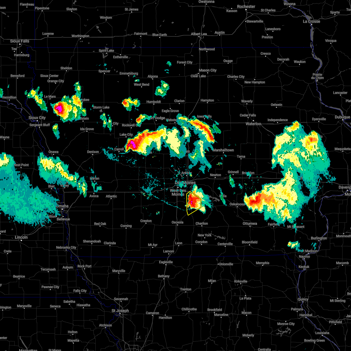 At 622 pm cdt, a severe thunderstorm was located near indianola, moving southeast at 45 mph (at 620 pm, emergency management reported ping pong ball size hail in indianola). Hazards include ping pong ball size hail and 60 mph wind gusts. People and animals outdoors will be injured. expect hail damage to roofs, siding, windows, and vehicles. expect wind damage to roofs, siding, and trees. This severe thunderstorm will remain over mainly rural areas of eastern warren county, including the following locations, otter creek county park, ackworth, milo, lake ahquabi state park and sandyville. At 622 pm cdt, a severe thunderstorm was located near indianola, moving southeast at 45 mph (at 620 pm, emergency management reported ping pong ball size hail in indianola). Hazards include ping pong ball size hail and 60 mph wind gusts. People and animals outdoors will be injured. expect hail damage to roofs, siding, windows, and vehicles. expect wind damage to roofs, siding, and trees. This severe thunderstorm will remain over mainly rural areas of eastern warren county, including the following locations, otter creek county park, ackworth, milo, lake ahquabi state park and sandyville.
|
| 6/22/2021 6:11 PM CDT |
 At 611 pm cdt, a severe thunderstorm was located near indianola, moving southeast at 35 mph (radar indicated. the public has reported quarter size hail south of norwalk). Hazards include 60 mph wind gusts and quarter size hail. Hail damage to vehicles is expected. expect wind damage to roofs, siding, and trees. This severe storm will be near, indianola around 615 pm cdt. At 611 pm cdt, a severe thunderstorm was located near indianola, moving southeast at 35 mph (radar indicated. the public has reported quarter size hail south of norwalk). Hazards include 60 mph wind gusts and quarter size hail. Hail damage to vehicles is expected. expect wind damage to roofs, siding, and trees. This severe storm will be near, indianola around 615 pm cdt.
|
| 6/22/2021 5:58 PM CDT |
 The national weather service in des moines has issued a * severe thunderstorm warning for. south central polk county in central iowa. warren county in south central iowa. until 645 pm cdt. At 558 pm cdt, a severe thunderstorm was located over norwalk,. The national weather service in des moines has issued a * severe thunderstorm warning for. south central polk county in central iowa. warren county in south central iowa. until 645 pm cdt. At 558 pm cdt, a severe thunderstorm was located over norwalk,.
|
| 8/10/2020 11:12 AM CDT |
 At 1112 am cdt, severe thunderstorms were located along a line extending from 6 miles northwest of pleasantville to near leon, moving east at 50 mph (radar indicated). Hazards include 70 mph wind gusts. Expect considerable tree damage. damage is likely to mobile homes, roofs, and outbuildings. locations impacted include, west des moines, indianola, norwalk, knoxville, osceola, chariton, pleasantville, melcher-dallas, lakeside casino, knoxville raceway, avenue of the saints event center, lake red rock, milo, hartford, murray, st. charles, russell, new virginia, truro and martensdale. This includes interstate 35 between mile markers 25 and 66. At 1112 am cdt, severe thunderstorms were located along a line extending from 6 miles northwest of pleasantville to near leon, moving east at 50 mph (radar indicated). Hazards include 70 mph wind gusts. Expect considerable tree damage. damage is likely to mobile homes, roofs, and outbuildings. locations impacted include, west des moines, indianola, norwalk, knoxville, osceola, chariton, pleasantville, melcher-dallas, lakeside casino, knoxville raceway, avenue of the saints event center, lake red rock, milo, hartford, murray, st. charles, russell, new virginia, truro and martensdale. This includes interstate 35 between mile markers 25 and 66.
|
| 8/10/2020 10:51 AM CDT |
 At 1050 am cdt, severe thunderstorms were located along a line extending from norwalk to near sun valley lake, moving east at 50 mph (radar indicated). Hazards include 60 mph wind gusts. expect damage to roofs, siding, and trees At 1050 am cdt, severe thunderstorms were located along a line extending from norwalk to near sun valley lake, moving east at 50 mph (radar indicated). Hazards include 60 mph wind gusts. expect damage to roofs, siding, and trees
|
| 7/14/2020 9:25 PM CDT |
 At 925 pm cdt, a severe thunderstorm was located near melcher-dallas, or 11 miles west of knoxville, moving southeast at 15 mph (radar indicated). Hazards include golf ball size hail and 60 mph wind gusts. People and animals outdoors will be injured. expect hail damage to roofs, siding, windows, and vehicles. expect wind damage to roofs, siding, and trees. Locations impacted include, melcher-dallas, milo, lacona and sandyville. At 925 pm cdt, a severe thunderstorm was located near melcher-dallas, or 11 miles west of knoxville, moving southeast at 15 mph (radar indicated). Hazards include golf ball size hail and 60 mph wind gusts. People and animals outdoors will be injured. expect hail damage to roofs, siding, windows, and vehicles. expect wind damage to roofs, siding, and trees. Locations impacted include, melcher-dallas, milo, lacona and sandyville.
|
| 7/14/2020 9:15 PM CDT |
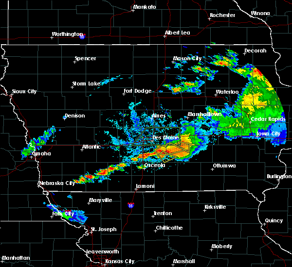 At 915 pm cdt, a severe thunderstorm was located 7 miles northwest of melcher-dallas, or 12 miles southeast of indianola, moving southeast at 15 mph (radar indicated). Hazards include 60 mph wind gusts and quarter size hail. Hail damage to vehicles is expected. expect wind damage to roofs, siding, and trees. Locations impacted include, melcher-dallas, milo, lacona and sandyville. At 915 pm cdt, a severe thunderstorm was located 7 miles northwest of melcher-dallas, or 12 miles southeast of indianola, moving southeast at 15 mph (radar indicated). Hazards include 60 mph wind gusts and quarter size hail. Hail damage to vehicles is expected. expect wind damage to roofs, siding, and trees. Locations impacted include, melcher-dallas, milo, lacona and sandyville.
|
| 7/14/2020 9:09 PM CDT |
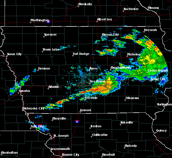 At 909 pm cdt, a severe thunderstorm was located 8 miles southwest of pleasantville, or 10 miles southeast of indianola, moving southeast at 15 mph (radar indicated). Hazards include 60 mph wind gusts and penny size hail. expect damage to roofs, siding, and trees At 909 pm cdt, a severe thunderstorm was located 8 miles southwest of pleasantville, or 10 miles southeast of indianola, moving southeast at 15 mph (radar indicated). Hazards include 60 mph wind gusts and penny size hail. expect damage to roofs, siding, and trees
|
| 7/14/2020 8:58 PM CDT | Iowa dot reported downed trees near/just west of sandyville along highway 92. time estimated from rada in warren county IA, 6 miles SSW of Milo, IA |
| 7/11/2020 7:40 PM CDT |
 At 739 pm cdt, a severe thunderstorm was located 7 miles southwest of pleasantville, or 9 miles east of indianola, moving southeast at 45 mph (radar indicated). Hazards include 60 mph wind gusts and quarter size hail. Hail damage to vehicles is expected. expect wind damage to roofs, siding, and trees. Locations impacted include, melcher-dallas, milo, lacona, ackworth and sandyville. At 739 pm cdt, a severe thunderstorm was located 7 miles southwest of pleasantville, or 9 miles east of indianola, moving southeast at 45 mph (radar indicated). Hazards include 60 mph wind gusts and quarter size hail. Hail damage to vehicles is expected. expect wind damage to roofs, siding, and trees. Locations impacted include, melcher-dallas, milo, lacona, ackworth and sandyville.
|
| 7/11/2020 7:31 PM CDT |
 At 731 pm cdt, a severe thunderstorm was located near indianola, moving southeast at 45 mph (radar indicated). Hazards include 60 mph wind gusts and quarter size hail. Hail damage to vehicles is expected. Expect wind damage to roofs, siding, and trees. At 731 pm cdt, a severe thunderstorm was located near indianola, moving southeast at 45 mph (radar indicated). Hazards include 60 mph wind gusts and quarter size hail. Hail damage to vehicles is expected. Expect wind damage to roofs, siding, and trees.
|
| 6/5/2020 5:07 AM CDT |
 At 506 am cdt, severe thunderstorms were located along a line extending from near mitchellville to near indianola to 6 miles south of winterset, moving southeast at 45 mph (radar indicated). Hazards include 60 mph wind gusts and quarter size hail. Hail damage to vehicles is expected. Expect wind damage to roofs, siding, and trees. At 506 am cdt, severe thunderstorms were located along a line extending from near mitchellville to near indianola to 6 miles south of winterset, moving southeast at 45 mph (radar indicated). Hazards include 60 mph wind gusts and quarter size hail. Hail damage to vehicles is expected. Expect wind damage to roofs, siding, and trees.
|
| 5/14/2020 5:45 PM CDT |
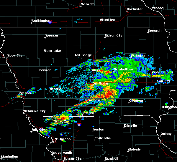 At 545 pm cdt, a severe thunderstorm was located near melcher-dallas, or 11 miles southwest of knoxville, moving east at 40 mph (trained weather spotters). Hazards include 60 mph wind gusts and quarter size hail. Hail damage to vehicles is expected. expect wind damage to roofs, siding, and trees. Locations impacted include, melcher-dallas, milo and lacona. At 545 pm cdt, a severe thunderstorm was located near melcher-dallas, or 11 miles southwest of knoxville, moving east at 40 mph (trained weather spotters). Hazards include 60 mph wind gusts and quarter size hail. Hail damage to vehicles is expected. expect wind damage to roofs, siding, and trees. Locations impacted include, melcher-dallas, milo and lacona.
|
| 5/14/2020 5:29 PM CDT |
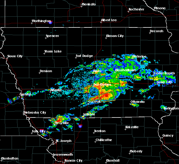 At 529 pm cdt, a severe thunderstorm was located 10 miles south of indianola, moving east at 40 mph (trained weather spotters). Hazards include 60 mph wind gusts and quarter size hail. Hail damage to vehicles is expected. Expect wind damage to roofs, siding, and trees. At 529 pm cdt, a severe thunderstorm was located 10 miles south of indianola, moving east at 40 mph (trained weather spotters). Hazards include 60 mph wind gusts and quarter size hail. Hail damage to vehicles is expected. Expect wind damage to roofs, siding, and trees.
|
| 5/14/2020 5:14 PM CDT |
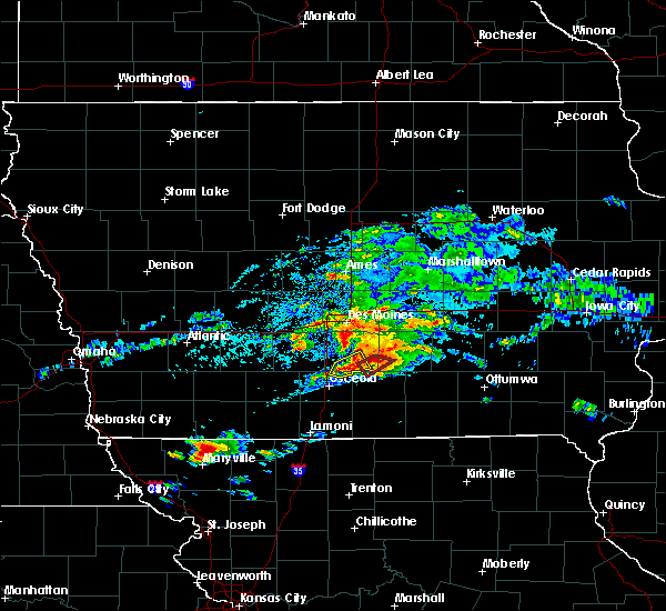 At 514 pm cdt, a severe thunderstorm was located near melcher-dallas, or 12 miles north of chariton, moving northeast at 30 mph (radar indicated). Hazards include 60 mph wind gusts and quarter size hail. Hail damage to vehicles is expected. Expect wind damage to roofs, siding, and trees. At 514 pm cdt, a severe thunderstorm was located near melcher-dallas, or 12 miles north of chariton, moving northeast at 30 mph (radar indicated). Hazards include 60 mph wind gusts and quarter size hail. Hail damage to vehicles is expected. Expect wind damage to roofs, siding, and trees.
|
| 5/14/2020 5:00 PM CDT | Quarter sized hail reported 0.1 miles SW of Milo, IA |
| 5/14/2020 4:46 PM CDT |
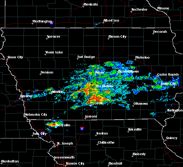 At 446 pm cdt, a severe thunderstorm capable of producing a tornado was located 13 miles south of indianola, moving northeast at 35 mph (radar indicated rotation). Hazards include tornado and golf ball size hail. Flying debris will be dangerous to those caught without shelter. mobile homes will be damaged or destroyed. damage to roofs, windows, and vehicles will occur. tree damage is likely. this dangerous storm will be near, melcher-dallas around 510 pm cdt. Other locations impacted by this tornadic thunderstorm include otter creek county park, lacona, milo and sandyville. At 446 pm cdt, a severe thunderstorm capable of producing a tornado was located 13 miles south of indianola, moving northeast at 35 mph (radar indicated rotation). Hazards include tornado and golf ball size hail. Flying debris will be dangerous to those caught without shelter. mobile homes will be damaged or destroyed. damage to roofs, windows, and vehicles will occur. tree damage is likely. this dangerous storm will be near, melcher-dallas around 510 pm cdt. Other locations impacted by this tornadic thunderstorm include otter creek county park, lacona, milo and sandyville.
|
| 3/19/2020 6:56 PM CDT |
 At 656 pm cdt, a severe thunderstorm was located near indianola, moving east at 35 mph (radar indicated). Hazards include half dollar size hail. Damage to vehicles is expected. Locations impacted include, indianola, pleasantville, milo, ackworth, sandyville and lake ahquabi state park. At 656 pm cdt, a severe thunderstorm was located near indianola, moving east at 35 mph (radar indicated). Hazards include half dollar size hail. Damage to vehicles is expected. Locations impacted include, indianola, pleasantville, milo, ackworth, sandyville and lake ahquabi state park.
|
| 3/19/2020 6:47 PM CDT |
 At 646 pm cdt, a severe thunderstorm was located 7 miles east of avenue of the saints event center, or 8 miles southwest of indianola, moving east at 35 mph (radar indicated). Hazards include half dollar size hail. damage to vehicles is expected At 646 pm cdt, a severe thunderstorm was located 7 miles east of avenue of the saints event center, or 8 miles southwest of indianola, moving east at 35 mph (radar indicated). Hazards include half dollar size hail. damage to vehicles is expected
|
| 8/20/2019 5:59 AM CDT |
 The national weather service in des moines has issued a * tornado warning for. eastern lucas county in south central iowa. southwestern marion county in south central iowa. southeastern warren county in south central iowa. Until 615 am cdt. The national weather service in des moines has issued a * tornado warning for. eastern lucas county in south central iowa. southwestern marion county in south central iowa. southeastern warren county in south central iowa. Until 615 am cdt.
|
| 8/20/2019 5:55 AM CDT |
 The national weather service in des moines has issued a * severe thunderstorm warning for. monroe county in south central iowa. poweshiek county in central iowa. lucas county in south central iowa. Marion county in south central iowa. The national weather service in des moines has issued a * severe thunderstorm warning for. monroe county in south central iowa. poweshiek county in central iowa. lucas county in south central iowa. Marion county in south central iowa.
|
| 7/20/2019 7:24 PM CDT |
 At 723 pm cdt, a severe thunderstorm was located near indianola, moving southeast at 35 mph (radar indicated). Hazards include 60 mph wind gusts and quarter size hail. Hail damage to vehicles is expected. Expect wind damage to roofs, siding, and trees. At 723 pm cdt, a severe thunderstorm was located near indianola, moving southeast at 35 mph (radar indicated). Hazards include 60 mph wind gusts and quarter size hail. Hail damage to vehicles is expected. Expect wind damage to roofs, siding, and trees.
|
| 7/20/2019 5:29 PM CDT |
 At 529 pm cdt, severe thunderstorms were located along a line extending from baxter to near indianola, moving east at 55 mph (radar indicated). Hazards include 60 mph wind gusts and quarter size hail. Hail damage to vehicles is expected. Expect wind damage to roofs, siding, and trees. At 529 pm cdt, severe thunderstorms were located along a line extending from baxter to near indianola, moving east at 55 mph (radar indicated). Hazards include 60 mph wind gusts and quarter size hail. Hail damage to vehicles is expected. Expect wind damage to roofs, siding, and trees.
|
| 5/27/2019 6:49 AM CDT |
 At 649 am cdt, severe thunderstorms were located along a line extending from johnston to 8 miles west of melcher-dallas, moving northeast at 80 mph (radar indicated). Hazards include 60 mph wind gusts. expect damage to roofs, siding, and trees At 649 am cdt, severe thunderstorms were located along a line extending from johnston to 8 miles west of melcher-dallas, moving northeast at 80 mph (radar indicated). Hazards include 60 mph wind gusts. expect damage to roofs, siding, and trees
|
| 10/8/2018 8:23 PM CDT |
 The tornado warning for southeastern warren county will expire at 830 pm cdt, the storm which prompted the warning has weakened below severe limits, and no longer appears capable of producing a tornado. therefore, the warning will be allowed to expire. however heavy rain is still possible with this thunderstorm. a tornado watch remains in effect until 1000 pm cdt for south central iowa. The tornado warning for southeastern warren county will expire at 830 pm cdt, the storm which prompted the warning has weakened below severe limits, and no longer appears capable of producing a tornado. therefore, the warning will be allowed to expire. however heavy rain is still possible with this thunderstorm. a tornado watch remains in effect until 1000 pm cdt for south central iowa.
|
| 10/8/2018 8:10 PM CDT |
 At 810 pm cdt, a severe thunderstorm capable of producing a tornado was located 10 miles south of indianola, moving northeast at 35 mph (radar indicated rotation). Hazards include tornado. Flying debris will be dangerous to those caught without shelter. mobile homes will be damaged or destroyed. damage to roofs, windows, and vehicles will occur. tree damage is likely. this dangerous storm will be near, indianola around 830 pm cdt. Other locations impacted by this tornadic thunderstorm include otter creek county park, ackworth, milo, sandyville and lake ahquabi state park. At 810 pm cdt, a severe thunderstorm capable of producing a tornado was located 10 miles south of indianola, moving northeast at 35 mph (radar indicated rotation). Hazards include tornado. Flying debris will be dangerous to those caught without shelter. mobile homes will be damaged or destroyed. damage to roofs, windows, and vehicles will occur. tree damage is likely. this dangerous storm will be near, indianola around 830 pm cdt. Other locations impacted by this tornadic thunderstorm include otter creek county park, ackworth, milo, sandyville and lake ahquabi state park.
|
| 10/8/2018 7:59 PM CDT |
 At 759 pm cdt, a tornado producing storm was located 12 miles northeast of osceola, moving northeast at 35 mph (radar confirmed tornado). Hazards include damaging tornado. Flying debris will be dangerous to those caught without shelter. mobile homes will be damaged or destroyed. damage to roofs, windows, and vehicles will occur. tree damage is likely. this tornadic storm will be near, indianola around 825 pm cdt. Other locations impacted by this tornadic thunderstorm include otter creek county park, ackworth, milo, sandyville and lake ahquabi state park. At 759 pm cdt, a tornado producing storm was located 12 miles northeast of osceola, moving northeast at 35 mph (radar confirmed tornado). Hazards include damaging tornado. Flying debris will be dangerous to those caught without shelter. mobile homes will be damaged or destroyed. damage to roofs, windows, and vehicles will occur. tree damage is likely. this tornadic storm will be near, indianola around 825 pm cdt. Other locations impacted by this tornadic thunderstorm include otter creek county park, ackworth, milo, sandyville and lake ahquabi state park.
|
| 6/30/2018 9:58 PM CDT |
 At 958 pm cdt, severe thunderstorms were located along a line extending from 6 miles north of mitchellville to near prairie city to 6 miles west of pleasantville, moving east at 30 mph (radar indicated). Hazards include 60 mph wind gusts. expect damage to roofs, siding, and trees At 958 pm cdt, severe thunderstorms were located along a line extending from 6 miles north of mitchellville to near prairie city to 6 miles west of pleasantville, moving east at 30 mph (radar indicated). Hazards include 60 mph wind gusts. expect damage to roofs, siding, and trees
|
| 6/30/2018 9:34 PM CDT |
 At 934 pm cdt, severe thunderstorms were located along a line extending from des moines int`l airport to near indianola to 13 miles northeast of osceola, moving east at 30 mph (law enforcement). Hazards include 60 mph wind gusts. Expect damage to roofs, siding, and trees. locations impacted include, des moines, west des moines, indianola, norwalk, carlisle, southridge mall, des moines int`l airport, milo, hartford, runnells, martensdale, cumming, st. marys, ackworth, spring hill, bevington, sandyville, lake ahquabi state park and otter creek county park. People attending confirmed-- storm clean up should seek safe shelter immediately! this includes interstate 35 between mile markers 50 and 53, and between mile markers 55 and 68. At 934 pm cdt, severe thunderstorms were located along a line extending from des moines int`l airport to near indianola to 13 miles northeast of osceola, moving east at 30 mph (law enforcement). Hazards include 60 mph wind gusts. Expect damage to roofs, siding, and trees. locations impacted include, des moines, west des moines, indianola, norwalk, carlisle, southridge mall, des moines int`l airport, milo, hartford, runnells, martensdale, cumming, st. marys, ackworth, spring hill, bevington, sandyville, lake ahquabi state park and otter creek county park. People attending confirmed-- storm clean up should seek safe shelter immediately! this includes interstate 35 between mile markers 50 and 53, and between mile markers 55 and 68.
|
| 6/30/2018 9:11 PM CDT |
 At 910 pm cdt, severe thunderstorms were located along a line extending from near van meter to near avenue of the saints event center to 8 miles north of lakeside casino, moving east at 50 mph. a tree was reported in winterset and roof damage to a home with this storm (law enforcement). Hazards include 60 mph wind gusts. expect damage to roofs, siding, and trees At 910 pm cdt, severe thunderstorms were located along a line extending from near van meter to near avenue of the saints event center to 8 miles north of lakeside casino, moving east at 50 mph. a tree was reported in winterset and roof damage to a home with this storm (law enforcement). Hazards include 60 mph wind gusts. expect damage to roofs, siding, and trees
|
| 6/28/2018 12:28 PM CDT |
 At 1227 pm cdt, severe thunderstorms were located along a line extending from 6 miles southeast of carlisle to 6 miles west of melcher-dallas to 8 miles northwest of chariton, moving east at 55 mph. these are very dangerous storms (radar indicated. a measured gusts of 68 mph was reported in indianola at 1215pm. stronger winds are possible). Hazards include 80 mph wind gusts and nickel size hail. Flying debris will be dangerous to those caught without shelter. mobile homes will be heavily damaged. expect considerable damage to roofs, windows, and vehicles. extensive tree damage and power outages are likely. locations impacted include, des moines, west des moines, indianola, norwalk, knoxville, carlisle, monroe, pleasantville, melcher-dallas, knoxville raceway, avenue of the saints event center, lake red rock, milo, hartford, martensdale, lacona, cumming, williamson, st. marys and ackworth. This includes interstate 35 between mile markers 50 and 60, and between mile markers 63 and 64. At 1227 pm cdt, severe thunderstorms were located along a line extending from 6 miles southeast of carlisle to 6 miles west of melcher-dallas to 8 miles northwest of chariton, moving east at 55 mph. these are very dangerous storms (radar indicated. a measured gusts of 68 mph was reported in indianola at 1215pm. stronger winds are possible). Hazards include 80 mph wind gusts and nickel size hail. Flying debris will be dangerous to those caught without shelter. mobile homes will be heavily damaged. expect considerable damage to roofs, windows, and vehicles. extensive tree damage and power outages are likely. locations impacted include, des moines, west des moines, indianola, norwalk, knoxville, carlisle, monroe, pleasantville, melcher-dallas, knoxville raceway, avenue of the saints event center, lake red rock, milo, hartford, martensdale, lacona, cumming, williamson, st. marys and ackworth. This includes interstate 35 between mile markers 50 and 60, and between mile markers 63 and 64.
|
| 6/28/2018 12:12 PM CDT |
 At 1212 pm cdt, a severe thunderstorm was located near indianola, moving east at 60 mph (trained weather spotters. these storms have produced wind damage in the warned counties). Hazards include 70 mph wind gusts and nickel size hail. Expect considerable tree damage. Damage is likely to mobile homes, roofs, and outbuildings. At 1212 pm cdt, a severe thunderstorm was located near indianola, moving east at 60 mph (trained weather spotters. these storms have produced wind damage in the warned counties). Hazards include 70 mph wind gusts and nickel size hail. Expect considerable tree damage. Damage is likely to mobile homes, roofs, and outbuildings.
|
| 6/6/2018 7:36 PM CDT |
 At 736 pm cdt, severe thunderstorms were located along a line extending from 7 miles west of melcher-dallas to avenue of the saints event center to 8 miles southeast of stuart, moving south at 15 mph (radar indicated). Hazards include 60 mph wind gusts and penny size hail. Expect damage to roofs, siding, and trees. locations impacted include, indianola, norwalk, winterset, earlham, avenue of the saints event center, milo, st. charles, new virginia, truro, martensdale, lacona, patterson, st. marys, east peru, macksburg, ackworth, bevington, spring hill, sandyville and lake ahquabi state park. this includes the following highways, interstate 35 between mile markers 43 and 64. Interstate 80 between mile markers 97 and 99. At 736 pm cdt, severe thunderstorms were located along a line extending from 7 miles west of melcher-dallas to avenue of the saints event center to 8 miles southeast of stuart, moving south at 15 mph (radar indicated). Hazards include 60 mph wind gusts and penny size hail. Expect damage to roofs, siding, and trees. locations impacted include, indianola, norwalk, winterset, earlham, avenue of the saints event center, milo, st. charles, new virginia, truro, martensdale, lacona, patterson, st. marys, east peru, macksburg, ackworth, bevington, spring hill, sandyville and lake ahquabi state park. this includes the following highways, interstate 35 between mile markers 43 and 64. Interstate 80 between mile markers 97 and 99.
|
| 6/6/2018 7:02 PM CDT |
 At 702 pm cdt, severe thunderstorms were located along a line extending from near pleasantville to 7 miles southwest of norwalk to near earlham, moving south at 25 mph (radar indicated). Hazards include 60 mph wind gusts and quarter size hail. Hail damage to vehicles is expected. expect wind damage to roofs, siding, and trees. locations impacted include, des moines, west des moines, urbandale, clive, indianola, altoona, waukee, norwalk, pleasant hill, winterset, adel, windsor heights, carlisle, earlham, de soto, van meter, iowa state fairgrounds, des moines int`l airport, valley west mall and avenue of the saints event center. people attending sa-- principal charity classic should seek safe shelter immediately! this includes the following highways, interstate 35 between mile markers 43 and 72. interstate 80 between mile markers 97 and 126. Interstate 235 between mile markers 1 and 12. At 702 pm cdt, severe thunderstorms were located along a line extending from near pleasantville to 7 miles southwest of norwalk to near earlham, moving south at 25 mph (radar indicated). Hazards include 60 mph wind gusts and quarter size hail. Hail damage to vehicles is expected. expect wind damage to roofs, siding, and trees. locations impacted include, des moines, west des moines, urbandale, clive, indianola, altoona, waukee, norwalk, pleasant hill, winterset, adel, windsor heights, carlisle, earlham, de soto, van meter, iowa state fairgrounds, des moines int`l airport, valley west mall and avenue of the saints event center. people attending sa-- principal charity classic should seek safe shelter immediately! this includes the following highways, interstate 35 between mile markers 43 and 72. interstate 80 between mile markers 97 and 126. Interstate 235 between mile markers 1 and 12.
|
| 6/6/2018 6:39 PM CDT |
 At 639 pm cdt, severe thunderstorms were located along a line extending from near pleasant hill to west des moines to 7 miles west of adel, moving south at 20 mph (radar indicated). Hazards include 60 mph wind gusts and quarter size hail. Hail damage to vehicles is expected. Expect wind damage to roofs, siding, and trees. At 639 pm cdt, severe thunderstorms were located along a line extending from near pleasant hill to west des moines to 7 miles west of adel, moving south at 20 mph (radar indicated). Hazards include 60 mph wind gusts and quarter size hail. Hail damage to vehicles is expected. Expect wind damage to roofs, siding, and trees.
|
| 5/12/2018 4:06 AM CDT |
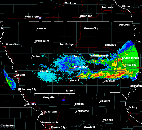 A severe thunderstorm warning remains in effect until 430 am cdt for southwestern marion and southeastern warren counties. at 405 am cdt, a severe thunderstorm was located 8 miles west of melcher-dallas, or 11 miles southeast of indianola, moving east at 40 mph. hazard. Quarter size hail. A severe thunderstorm warning remains in effect until 430 am cdt for southwestern marion and southeastern warren counties. at 405 am cdt, a severe thunderstorm was located 8 miles west of melcher-dallas, or 11 miles southeast of indianola, moving east at 40 mph. hazard. Quarter size hail.
|
| 5/12/2018 3:39 AM CDT |
 At 339 am cdt, a severe thunderstorm was located near indianola, moving east at 35 mph (radar indicated). Hazards include quarter size hail. damage to vehicles is expected At 339 am cdt, a severe thunderstorm was located near indianola, moving east at 35 mph (radar indicated). Hazards include quarter size hail. damage to vehicles is expected
|
| 6/28/2017 1:44 PM CDT |
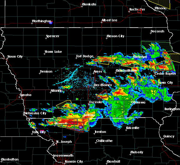 At 644 pm cdt, a confirmed tornado was located 9 miles southeast of indianola, moving northeast at 30 mph (weather spotters confirmed tornado). Hazards include damaging tornado and quarter size hail. Flying debris will be dangerous to those caught without shelter. mobile homes will be damaged or destroyed. damage to roofs, windows, and vehicles will occur. tree damage is likely. the tornado will be near, pleasantville around 710 pm cdt. Other locations impacted by this tornadic thunderstorm include sandyville and milo. At 644 pm cdt, a confirmed tornado was located 9 miles southeast of indianola, moving northeast at 30 mph (weather spotters confirmed tornado). Hazards include damaging tornado and quarter size hail. Flying debris will be dangerous to those caught without shelter. mobile homes will be damaged or destroyed. damage to roofs, windows, and vehicles will occur. tree damage is likely. the tornado will be near, pleasantville around 710 pm cdt. Other locations impacted by this tornadic thunderstorm include sandyville and milo.
|
| 6/28/2017 1:31 PM CDT |
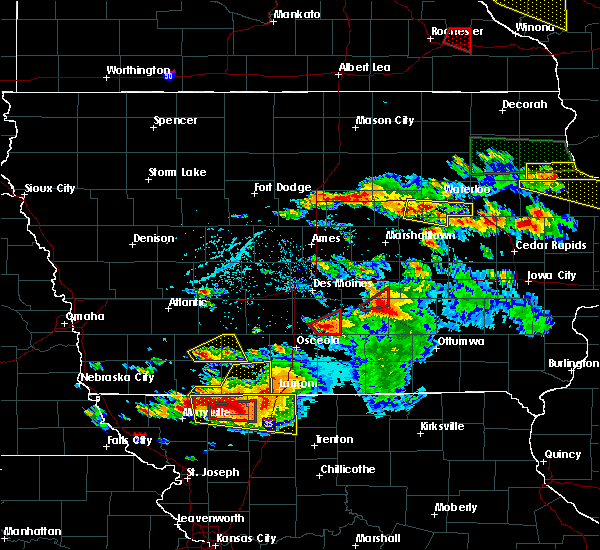 At 631 pm cdt, a severe thunderstorm capable of producing a tornado was located 8 miles south of indianola, moving east at 35 mph (radar indicated rotation). Hazards include tornado and quarter size hail. Flying debris will be dangerous to those caught without shelter. mobile homes will be damaged or destroyed. damage to roofs, windows, and vehicles will occur. tree damage is likely. Locations impacted include, milo, lacona, sandyville and otter creek county park. At 631 pm cdt, a severe thunderstorm capable of producing a tornado was located 8 miles south of indianola, moving east at 35 mph (radar indicated rotation). Hazards include tornado and quarter size hail. Flying debris will be dangerous to those caught without shelter. mobile homes will be damaged or destroyed. damage to roofs, windows, and vehicles will occur. tree damage is likely. Locations impacted include, milo, lacona, sandyville and otter creek county park.
|
| 6/28/2017 1:18 PM CDT |
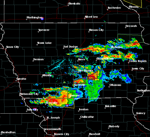 At 618 pm cdt, a severe thunderstorm capable of producing a tornado was located 9 miles southeast of avenue of the saints event center, or 12 miles southwest of indianola, moving east at 35 mph (radar indicated rotation. at 617pm...trained spotters reported a funnel cloud 5 south southeast of new virginia). Hazards include tornado. Flying debris will be dangerous to those caught without shelter. mobile homes will be damaged or destroyed. damage to roofs, windows, and vehicles will occur. tree damage is likely. this tornadic thunderstorm will remain over mainly rural areas of southern warren county, including the following locations: otter creek county park, new virginia, lacona, milo, lake ahquabi state park and sandyville. This includes interstate 35 between mile markers 47 and 48. At 618 pm cdt, a severe thunderstorm capable of producing a tornado was located 9 miles southeast of avenue of the saints event center, or 12 miles southwest of indianola, moving east at 35 mph (radar indicated rotation. at 617pm...trained spotters reported a funnel cloud 5 south southeast of new virginia). Hazards include tornado. Flying debris will be dangerous to those caught without shelter. mobile homes will be damaged or destroyed. damage to roofs, windows, and vehicles will occur. tree damage is likely. this tornadic thunderstorm will remain over mainly rural areas of southern warren county, including the following locations: otter creek county park, new virginia, lacona, milo, lake ahquabi state park and sandyville. This includes interstate 35 between mile markers 47 and 48.
|
| 6/28/2017 12:55 PM CDT |
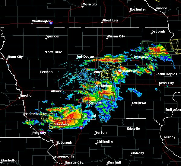 At 555 pm cdt, a severe thunderstorm capable of producing a tornado was located near pleasantville, or 11 miles west of knoxville, moving east at 30 mph (radar indicated rotation). Hazards include tornado. Flying debris will be dangerous to those caught without shelter. mobile homes will be damaged or destroyed. damage to roofs, windows, and vehicles will occur. tree damage is likely. this dangerous storm will be near, pleasantville around 600 pm cdt. melcher-dallas around 610 pm cdt. lake red rock around 615 pm cdt. knoxville and knoxville raceway around 620 pm cdt. Other locations impacted by this tornadic thunderstorm include sandyville, knoxville municipal airport and milo. At 555 pm cdt, a severe thunderstorm capable of producing a tornado was located near pleasantville, or 11 miles west of knoxville, moving east at 30 mph (radar indicated rotation). Hazards include tornado. Flying debris will be dangerous to those caught without shelter. mobile homes will be damaged or destroyed. damage to roofs, windows, and vehicles will occur. tree damage is likely. this dangerous storm will be near, pleasantville around 600 pm cdt. melcher-dallas around 610 pm cdt. lake red rock around 615 pm cdt. knoxville and knoxville raceway around 620 pm cdt. Other locations impacted by this tornadic thunderstorm include sandyville, knoxville municipal airport and milo.
|
| 6/15/2017 8:52 PM CDT |
 At 852 pm cdt, a severe thunderstorm was located 13 miles southeast of avenue of the saints event center, or 13 miles south of indianola, moving east at 30 mph (radar indicated). Hazards include golf ball size hail and 60 mph wind gusts. People and animals outdoors will be injured. expect hail damage to roofs, siding, windows, and vehicles. expect wind damage to roofs, siding, and trees. locations impacted include, milo, new virginia, lacona and otter creek county park. This includes interstate 35 between mile markers 42 and 44. At 852 pm cdt, a severe thunderstorm was located 13 miles southeast of avenue of the saints event center, or 13 miles south of indianola, moving east at 30 mph (radar indicated). Hazards include golf ball size hail and 60 mph wind gusts. People and animals outdoors will be injured. expect hail damage to roofs, siding, windows, and vehicles. expect wind damage to roofs, siding, and trees. locations impacted include, milo, new virginia, lacona and otter creek county park. This includes interstate 35 between mile markers 42 and 44.
|
| 6/15/2017 8:43 PM CDT |
 At 841 pm cdt, a severe thunderstorm was located 8 miles northeast of lakeside casino, or 8 miles northeast of osceola, moving east at 30 mph (trained weather spotters. at 8:40pm, trained weather spotters located 6 miles northeast of murray reported 60mph wind gusts and ping pong sized hail). Hazards include tennis ball size hail and 60 mph wind gusts. People and animals outdoors will be injured. expect hail damage to roofs, siding, windows, and vehicles. Expect wind damage to roofs, siding, and trees. At 841 pm cdt, a severe thunderstorm was located 8 miles northeast of lakeside casino, or 8 miles northeast of osceola, moving east at 30 mph (trained weather spotters. at 8:40pm, trained weather spotters located 6 miles northeast of murray reported 60mph wind gusts and ping pong sized hail). Hazards include tennis ball size hail and 60 mph wind gusts. People and animals outdoors will be injured. expect hail damage to roofs, siding, windows, and vehicles. Expect wind damage to roofs, siding, and trees.
|
| 5/17/2017 4:27 PM CDT |
 At 427 pm cdt, severe thunderstorms were located along a line extending from near carlisle to near knoxville to near lake sundown, moving northeast at 65 mph (radar indicated). Hazards include 60 mph wind gusts and nickel size hail. expect damage to roofs, siding, and trees At 427 pm cdt, severe thunderstorms were located along a line extending from near carlisle to near knoxville to near lake sundown, moving northeast at 65 mph (radar indicated). Hazards include 60 mph wind gusts and nickel size hail. expect damage to roofs, siding, and trees
|
| 5/17/2017 4:05 PM CDT |
 At 404 pm cdt, severe thunderstorms were located along a line extending from 8 miles southwest of indianola to 7 miles southeast of corydon, moving northeast at 65 mph (radar indicated). Hazards include 60 mph wind gusts. Expect damage to roofs, siding, and trees. locations impacted include, indianola, chariton, corydon, milo, hartford, russell, allerton, humeston, new virginia, lacona, lucas, garden grove, woodburn, williamson, derby, promise city, ackworth, clio, swan and sandyville. this includes interstate 35 between mile markers 41 and 45. A tornado watch remains in effect until 700 pm cdt for south central and central iowa. At 404 pm cdt, severe thunderstorms were located along a line extending from 8 miles southwest of indianola to 7 miles southeast of corydon, moving northeast at 65 mph (radar indicated). Hazards include 60 mph wind gusts. Expect damage to roofs, siding, and trees. locations impacted include, indianola, chariton, corydon, milo, hartford, russell, allerton, humeston, new virginia, lacona, lucas, garden grove, woodburn, williamson, derby, promise city, ackworth, clio, swan and sandyville. this includes interstate 35 between mile markers 41 and 45. A tornado watch remains in effect until 700 pm cdt for south central and central iowa.
|
| 5/17/2017 3:47 PM CDT |
 At 347 pm cdt, a severe thunderstorm was located 8 miles south of osceola, moving northeast at 65 mph (radar indicated). Hazards include 60 mph wind gusts. expect damage to roofs, siding, and trees At 347 pm cdt, a severe thunderstorm was located 8 miles south of osceola, moving northeast at 65 mph (radar indicated). Hazards include 60 mph wind gusts. expect damage to roofs, siding, and trees
|
| 4/15/2017 7:56 PM CDT |
 The severe thunderstorm warning for northwestern marion and southeastern warren counties will expire at 800 pm cdt, the storm which prompted the warning has weakened below severe limits, and no longer poses an immediate threat to life or property. therefore the warning will be allowed to expire. however heavy rain is still possible with this thunderstorm. a severe thunderstorm watch remains in effect until 1100 pm cdt for central and south central iowa. The severe thunderstorm warning for northwestern marion and southeastern warren counties will expire at 800 pm cdt, the storm which prompted the warning has weakened below severe limits, and no longer poses an immediate threat to life or property. therefore the warning will be allowed to expire. however heavy rain is still possible with this thunderstorm. a severe thunderstorm watch remains in effect until 1100 pm cdt for central and south central iowa.
|
| 4/15/2017 7:30 PM CDT | Quarter sized hail reported 0.1 miles SW of Milo, IA, report via social media. |
| 4/15/2017 7:28 PM CDT |
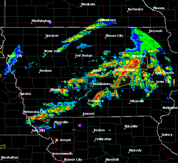 At 728 pm cdt, a severe thunderstorm was located 9 miles northwest of melcher-dallas, or 10 miles southeast of indianola, moving northeast at 40 mph (trained weather spotters). Hazards include quarter size hail. Damage to vehicles is expected. Locations impacted include, knoxville, pleasantville, lake red rock, milo and sandyville. At 728 pm cdt, a severe thunderstorm was located 9 miles northwest of melcher-dallas, or 10 miles southeast of indianola, moving northeast at 40 mph (trained weather spotters). Hazards include quarter size hail. Damage to vehicles is expected. Locations impacted include, knoxville, pleasantville, lake red rock, milo and sandyville.
|
| 4/15/2017 7:26 PM CDT | Quarter sized hail reported 0.1 miles SW of Milo, IA, in the town of milo. |
| 4/15/2017 7:21 PM CDT |
 At 721 pm cdt, a severe thunderstorm was located 8 miles southeast of indianola, moving east at 40 mph (radar indicated). Hazards include quarter size hail. Damage to vehicles is expected. Locations impacted include, knoxville, pleasantville, lake red rock, milo, sandyville and otter creek county park. At 721 pm cdt, a severe thunderstorm was located 8 miles southeast of indianola, moving east at 40 mph (radar indicated). Hazards include quarter size hail. Damage to vehicles is expected. Locations impacted include, knoxville, pleasantville, lake red rock, milo, sandyville and otter creek county park.
|
| 4/15/2017 7:20 PM CDT | Quarter sized hail reported 2.4 miles ENE of Milo, IA, 180th and tripoli. |
| 4/15/2017 7:07 PM CDT |
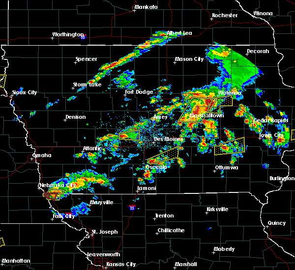 At 707 pm cdt, a severe thunderstorm was located 9 miles south of indianola, moving northeast at 40 mph (radar indicated). Hazards include quarter size hail. damage to vehicles is expected At 707 pm cdt, a severe thunderstorm was located 9 miles south of indianola, moving northeast at 40 mph (radar indicated). Hazards include quarter size hail. damage to vehicles is expected
|
| 4/15/2017 5:51 PM CDT |
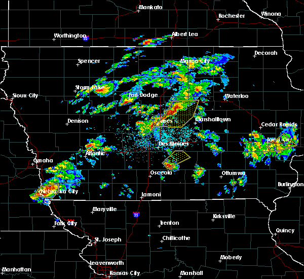 At 551 pm cdt, a severe thunderstorm was located 8 miles west of melcher-dallas, or 11 miles southeast of indianola, moving northeast at 35 mph (radar indicated). Hazards include quarter size hail. Damage to vehicles is expected. Locations impacted include, knoxville, pleasantville, lake red rock, milo, swan, sandyville and elk rock state park. At 551 pm cdt, a severe thunderstorm was located 8 miles west of melcher-dallas, or 11 miles southeast of indianola, moving northeast at 35 mph (radar indicated). Hazards include quarter size hail. Damage to vehicles is expected. Locations impacted include, knoxville, pleasantville, lake red rock, milo, swan, sandyville and elk rock state park.
|
| 4/15/2017 5:33 PM CDT |
 At 533 pm cdt, a severe thunderstorm was located 14 miles south of indianola, moving northeast at 40 mph (radar indicated). Hazards include half dollar size hail. damage to vehicles is expected At 533 pm cdt, a severe thunderstorm was located 14 miles south of indianola, moving northeast at 40 mph (radar indicated). Hazards include half dollar size hail. damage to vehicles is expected
|
| 4/10/2017 12:00 AM CDT |
 At 1159 pm cdt, a severe thunderstorm was located 10 miles northeast of osceola, moving northeast at 50 mph (radar indicated). Hazards include quarter size hail. damage to vehicles is expected At 1159 pm cdt, a severe thunderstorm was located 10 miles northeast of osceola, moving northeast at 50 mph (radar indicated). Hazards include quarter size hail. damage to vehicles is expected
|
| 3/6/2017 7:27 PM CST |
 At 726 pm cst, a severe thunderstorm capable of producing a tornado was located 7 miles northwest of melcher-dallas, or 11 miles southeast of indianola, moving northeast at 60 mph (radar indicated rotation). Hazards include tornado and quarter size hail. Flying debris will be dangerous to those caught without shelter. mobile homes will be damaged or destroyed. damage to roofs, windows, and vehicles will occur. tree damage is likely. this dangerous storm will be near, pleasantville around 735 pm cst. knoxville, knoxville raceway and lake red rock around 740 pm cst. Other locations impacted by this tornadic thunderstorm include elk rock state park, milo and knoxville municipal airport. At 726 pm cst, a severe thunderstorm capable of producing a tornado was located 7 miles northwest of melcher-dallas, or 11 miles southeast of indianola, moving northeast at 60 mph (radar indicated rotation). Hazards include tornado and quarter size hail. Flying debris will be dangerous to those caught without shelter. mobile homes will be damaged or destroyed. damage to roofs, windows, and vehicles will occur. tree damage is likely. this dangerous storm will be near, pleasantville around 735 pm cst. knoxville, knoxville raceway and lake red rock around 740 pm cst. Other locations impacted by this tornadic thunderstorm include elk rock state park, milo and knoxville municipal airport.
|
| 3/6/2017 7:21 PM CST |
 At 720 pm cst, a severe thunderstorm capable of producing a tornado was located 10 miles west of melcher-dallas, or 10 miles southeast of indianola, moving east at 55 mph (radar indicated rotation). Hazards include tornado and quarter size hail. Flying debris will be dangerous to those caught without shelter. mobile homes will be damaged or destroyed. damage to roofs, windows, and vehicles will occur. tree damage is likely. this dangerous storm will be near, melcher-dallas around 730 pm cst. knoxville, knoxville raceway and lake red rock around 740 pm cst. Other locations impacted by this tornadic thunderstorm include elk rock state park, lacona, milo and knoxville municipal airport. At 720 pm cst, a severe thunderstorm capable of producing a tornado was located 10 miles west of melcher-dallas, or 10 miles southeast of indianola, moving east at 55 mph (radar indicated rotation). Hazards include tornado and quarter size hail. Flying debris will be dangerous to those caught without shelter. mobile homes will be damaged or destroyed. damage to roofs, windows, and vehicles will occur. tree damage is likely. this dangerous storm will be near, melcher-dallas around 730 pm cst. knoxville, knoxville raceway and lake red rock around 740 pm cst. Other locations impacted by this tornadic thunderstorm include elk rock state park, lacona, milo and knoxville municipal airport.
|
| 3/6/2017 7:12 PM CST |
 At 712 pm cst, a severe thunderstorm was located over indianola, moving east at 55 mph (radar indicated). Hazards include 60 mph wind gusts and quarter size hail. Hail damage to vehicles is expected. Expect wind damage to roofs, siding, and trees. At 712 pm cst, a severe thunderstorm was located over indianola, moving east at 55 mph (radar indicated). Hazards include 60 mph wind gusts and quarter size hail. Hail damage to vehicles is expected. Expect wind damage to roofs, siding, and trees.
|
| 3/6/2017 6:55 PM CST |
 At 653 pm cst, severe thunderstorms were located along a line extending from near roland to 9 miles north of lakeside casino, moving east at 75 mph (radar indicated. at 6:45pm 67 mph wind was reported at the ames airport. 50-60 mph wind was observed at 6:41pm at the national weather service office in north johnston). Hazards include 60 mph wind gusts and quarter size hail. Hail damage to vehicles is expected. expect wind damage to roofs, siding, and trees. locations impacted include, des moines, ames, west des moines, ankeny, urbandale, johnston, clive, indianola, altoona, waukee, boone, norwalk, pleasant hill, grimes, perry, nevada, winterset, adel, windsor heights and carlisle. this includes the following highways, interstate 35 between mile markers 44 and 72, and between mile markers 87 and 126. interstate 80 between mile markers 99 and 149. interstate 235 between mile markers 1 and 14. A tornado watch remains in effect until 1000 pm cst for central, south central and southwestern iowa. At 653 pm cst, severe thunderstorms were located along a line extending from near roland to 9 miles north of lakeside casino, moving east at 75 mph (radar indicated. at 6:45pm 67 mph wind was reported at the ames airport. 50-60 mph wind was observed at 6:41pm at the national weather service office in north johnston). Hazards include 60 mph wind gusts and quarter size hail. Hail damage to vehicles is expected. expect wind damage to roofs, siding, and trees. locations impacted include, des moines, ames, west des moines, ankeny, urbandale, johnston, clive, indianola, altoona, waukee, boone, norwalk, pleasant hill, grimes, perry, nevada, winterset, adel, windsor heights and carlisle. this includes the following highways, interstate 35 between mile markers 44 and 72, and between mile markers 87 and 126. interstate 80 between mile markers 99 and 149. interstate 235 between mile markers 1 and 14. A tornado watch remains in effect until 1000 pm cst for central, south central and southwestern iowa.
|
| 3/6/2017 6:30 PM CST |
 At 629 pm cst, severe thunderstorms were located along a line extending from 9 miles north of boone to 7 miles northeast of green valley lake, moving east at 40 mph (radar indicated). Hazards include 60 mph wind gusts and quarter size hail. Hail damage to vehicles is expected. Expect wind damage to roofs, siding, and trees. At 629 pm cst, severe thunderstorms were located along a line extending from 9 miles north of boone to 7 miles northeast of green valley lake, moving east at 40 mph (radar indicated). Hazards include 60 mph wind gusts and quarter size hail. Hail damage to vehicles is expected. Expect wind damage to roofs, siding, and trees.
|
| 8/11/2016 9:59 PM CDT |
 At 958 pm cdt, severe thunderstorms were located along a line extending from monroe to near melcher-dallas to 6 miles north of chariton to 10 miles northwest of corydon, moving east at 35 mph (radar indicated). Hazards include 60 mph wind gusts. Expect damage to roofs. siding. And trees. At 958 pm cdt, severe thunderstorms were located along a line extending from monroe to near melcher-dallas to 6 miles north of chariton to 10 miles northwest of corydon, moving east at 35 mph (radar indicated). Hazards include 60 mph wind gusts. Expect damage to roofs. siding. And trees.
|
| 8/11/2016 9:34 PM CDT |
 At 932 pm cdt, severe thunderstorms were located along a line extending from near carlisle to 10 miles south of indianola to near lakeside casino, moving east at 35 mph (trained weather spotters. at 923pm...a 63 mph gust was reported 2 miles west of murray). Hazards include 60 mph wind gusts. Expect damage to roofs. siding. and trees. locations impacted include, des moines, indianola, norwalk, osceola, carlisle, monroe, pleasantville, melcher-dallas, lakeside casino, avenue of the saints event center, lake red rock, milo, hartford, murray, st. Charles, new virginia, truro, martensdale, lacona and lorimor. At 932 pm cdt, severe thunderstorms were located along a line extending from near carlisle to 10 miles south of indianola to near lakeside casino, moving east at 35 mph (trained weather spotters. at 923pm...a 63 mph gust was reported 2 miles west of murray). Hazards include 60 mph wind gusts. Expect damage to roofs. siding. and trees. locations impacted include, des moines, indianola, norwalk, osceola, carlisle, monroe, pleasantville, melcher-dallas, lakeside casino, avenue of the saints event center, lake red rock, milo, hartford, murray, st. Charles, new virginia, truro, martensdale, lacona and lorimor.
|
| 8/11/2016 9:20 PM CDT |
 At 920 pm cdt, a severe thunderstorm was located near avenue of the saints event center, or 9 miles southwest of indianola, moving east at 50 mph (radar indicated). Hazards include 60 mph wind gusts. Expect damage to roofs. siding. And trees. At 920 pm cdt, a severe thunderstorm was located near avenue of the saints event center, or 9 miles southwest of indianola, moving east at 50 mph (radar indicated). Hazards include 60 mph wind gusts. Expect damage to roofs. siding. And trees.
|
| 7/19/2016 2:20 PM CDT |
 At 220 pm cdt, severe thunderstorms were located along a line extending from 7 miles east of chariton to corydon to near leon, moving southeast at 50 mph (radar indicated). Hazards include 70 mph wind gusts and quarter size hail. Hail damage to vehicles is expected. expect considerable tree damage. wind damage is also likely to mobile homes, roofs, and outbuildings. Locations impacted include, osceola, chariton, leon, lamoni, sun valley lake, lakeside casino, milo, russell, humeston, lacona, grand river, van wert, lucas, garden grove, davis city, woodburn, decatur city, williamson, weldon and derby. At 220 pm cdt, severe thunderstorms were located along a line extending from 7 miles east of chariton to corydon to near leon, moving southeast at 50 mph (radar indicated). Hazards include 70 mph wind gusts and quarter size hail. Hail damage to vehicles is expected. expect considerable tree damage. wind damage is also likely to mobile homes, roofs, and outbuildings. Locations impacted include, osceola, chariton, leon, lamoni, sun valley lake, lakeside casino, milo, russell, humeston, lacona, grand river, van wert, lucas, garden grove, davis city, woodburn, decatur city, williamson, weldon and derby.
|
| 7/19/2016 2:03 PM CDT |
 At 202 pm cdt, severe thunderstorms were located along a line extending from 9 miles northwest of chariton to 14 miles southeast of osceola to near sun valley lake, moving southeast at 25 mph (public. at 155pm...60 mph winds and penny sized hail was reported about 9 miles southeast of new virginia). Hazards include 60 mph wind gusts and penny size hail. Expect damage to roofs. siding. and trees. Locations impacted include, osceola, chariton, leon, lamoni, sun valley lake, lakeside casino, milo, russell, humeston, lacona, grand river, van wert, lucas, garden grove, davis city, woodburn, decatur city, williamson, weldon and derby. At 202 pm cdt, severe thunderstorms were located along a line extending from 9 miles northwest of chariton to 14 miles southeast of osceola to near sun valley lake, moving southeast at 25 mph (public. at 155pm...60 mph winds and penny sized hail was reported about 9 miles southeast of new virginia). Hazards include 60 mph wind gusts and penny size hail. Expect damage to roofs. siding. and trees. Locations impacted include, osceola, chariton, leon, lamoni, sun valley lake, lakeside casino, milo, russell, humeston, lacona, grand river, van wert, lucas, garden grove, davis city, woodburn, decatur city, williamson, weldon and derby.
|
| 7/19/2016 1:48 PM CDT |
 At 148 pm cdt, severe thunderstorms were located along a line extending from 12 miles south of indianola to near osceola to sun valley lake, moving southeast at 35 mph (radar indicated). Hazards include 60 mph wind gusts and quarter size hail. Hail damage to vehicles is expected. Expect wind damage to roofs, siding, and trees. At 148 pm cdt, severe thunderstorms were located along a line extending from 12 miles south of indianola to near osceola to sun valley lake, moving southeast at 35 mph (radar indicated). Hazards include 60 mph wind gusts and quarter size hail. Hail damage to vehicles is expected. Expect wind damage to roofs, siding, and trees.
|
| 11/11/2015 3:58 PM CST | The severe thunderstorm warning for western story, polk, northern warren, eastern boone and northeastern dallas counties will expire at 400 pm cst, the storms which prompted the warning have moved out of the area. therefore the warning will be allowed to expire. however gusty winds are still possible with these thunderstorms. a tornado watch remains in effect until 600 pm cst for south central iowa. |
| 11/11/2015 3:23 PM CST |
 At 323 pm cst, a severe thunderstorm was located 6 miles west of melcher-dallas, or 13 miles southeast of indianola, moving northeast at 50 mph (radar indicated). Hazards include 60 mph wind gusts. Expect damage to roofs. siding and trees. locations impacted include, chariton, milo, russell, lacona, lucas, williamson, lake ahquabi state park, chariton municipal airport, red haw lake state park and otter creek county park. A tornado watch remains in effect until 600 pm cst for south central iowa. At 323 pm cst, a severe thunderstorm was located 6 miles west of melcher-dallas, or 13 miles southeast of indianola, moving northeast at 50 mph (radar indicated). Hazards include 60 mph wind gusts. Expect damage to roofs. siding and trees. locations impacted include, chariton, milo, russell, lacona, lucas, williamson, lake ahquabi state park, chariton municipal airport, red haw lake state park and otter creek county park. A tornado watch remains in effect until 600 pm cst for south central iowa.
|
| 11/11/2015 3:07 PM CST |
 At 307 pm cst, severe thunderstorms were located along a line extending from 6 miles northwest of perry to 12 miles northeast of osceola, moving northeast at 45 mph (radar indicated). Hazards include 60 mph wind gusts. Expect damage to roofs. Siding and trees. At 307 pm cst, severe thunderstorms were located along a line extending from 6 miles northwest of perry to 12 miles northeast of osceola, moving northeast at 45 mph (radar indicated). Hazards include 60 mph wind gusts. Expect damage to roofs. Siding and trees.
|
| 11/11/2015 2:55 PM CST |
 At 255 pm cst, a severe thunderstorm was located over osceola, moving northeast at 50 mph (radar indicated). Hazards include 60 mph wind gusts. Expect damage to roofs. Siding and trees. At 255 pm cst, a severe thunderstorm was located over osceola, moving northeast at 50 mph (radar indicated). Hazards include 60 mph wind gusts. Expect damage to roofs. Siding and trees.
|
| 9/18/2015 11:24 AM CDT |
 The severe thunderstorm warning for southwestern marion, northwestern lucas and southeastern warren counties will expire at 1130 am cdt, the storm which prompted the warning has weakened below severe limits, and no longer pose an immediate threat to life or property. therefore the warning will be allowed to expire. however heavy rain is still possible with this thunderstorm. The severe thunderstorm warning for southwestern marion, northwestern lucas and southeastern warren counties will expire at 1130 am cdt, the storm which prompted the warning has weakened below severe limits, and no longer pose an immediate threat to life or property. therefore the warning will be allowed to expire. however heavy rain is still possible with this thunderstorm.
|
| 9/18/2015 11:10 AM CDT |
 At 1110 am cdt, a severe thunderstorm was located 11 miles west of melcher-dallas, or 12 miles northwest of chariton, moving northeast at 25 mph (radar indicated). Hazards include quarter size hail. Damage to vehicles is expected. Locations impacted include, milo, lacona and lucas. At 1110 am cdt, a severe thunderstorm was located 11 miles west of melcher-dallas, or 12 miles northwest of chariton, moving northeast at 25 mph (radar indicated). Hazards include quarter size hail. Damage to vehicles is expected. Locations impacted include, milo, lacona and lucas.
|
| 9/18/2015 10:51 AM CDT |
 At 1051 am cdt, a severe thunderstorm was located 12 miles west of chariton, moving northeast at 25 mph (radar indicated). Hazards include quarter size hail. damage to vehicles is expected At 1051 am cdt, a severe thunderstorm was located 12 miles west of chariton, moving northeast at 25 mph (radar indicated). Hazards include quarter size hail. damage to vehicles is expected
|
| 8/2/2015 6:21 PM CDT |
 At 621 pm cdt, severe thunderstorms were located along a line extending from 4 miles north of melcher-dallas to 7 miles northeast of lakeside casino, moving southeast at 35 mph (radar indicated). Hazards include 60 mph wind gusts and quarter size hail. Hail damage to vehicles is expected. expect wind damage to roofs, siding and trees. locations impacted include, indianola, osceola, avenue of the saints event center, milo, st. charles, new virginia, truro, lacona, st. marys, ackworth, sandyville, otter creek county park and lake ahquabi state park. This includes interstate 35 between mile markers 35 and 55. At 621 pm cdt, severe thunderstorms were located along a line extending from 4 miles north of melcher-dallas to 7 miles northeast of lakeside casino, moving southeast at 35 mph (radar indicated). Hazards include 60 mph wind gusts and quarter size hail. Hail damage to vehicles is expected. expect wind damage to roofs, siding and trees. locations impacted include, indianola, osceola, avenue of the saints event center, milo, st. charles, new virginia, truro, lacona, st. marys, ackworth, sandyville, otter creek county park and lake ahquabi state park. This includes interstate 35 between mile markers 35 and 55.
|
| 8/2/2015 6:00 PM CDT |
 At 559 pm cdt, severe thunderstorms were located along a line extending from 6 miles east of indianola to 6 miles southwest of avenue of the saints event center, moving southeast at 40 mph (radar indicated). Hazards include 60 mph wind gusts and quarter size hail. Hail damage to vehicles is expected. Expect wind damage to roofs, siding and trees. At 559 pm cdt, severe thunderstorms were located along a line extending from 6 miles east of indianola to 6 miles southwest of avenue of the saints event center, moving southeast at 40 mph (radar indicated). Hazards include 60 mph wind gusts and quarter size hail. Hail damage to vehicles is expected. Expect wind damage to roofs, siding and trees.
|
| 7/28/2015 8:39 PM CDT |
 At 839 pm cdt, a severe thunderstorm was located 6 miles northwest of melcher-dallas, or 12 miles southeast of indianola, moving southeast at 40 mph (radar indicated). Hazards include 60 mph wind gusts. Expect damage to roofs. siding and trees. Locations impacted include, indianola, pleasantville, milo, lacona, ackworth, sandyville, otter creek county park and lake ahquabi state park. At 839 pm cdt, a severe thunderstorm was located 6 miles northwest of melcher-dallas, or 12 miles southeast of indianola, moving southeast at 40 mph (radar indicated). Hazards include 60 mph wind gusts. Expect damage to roofs. siding and trees. Locations impacted include, indianola, pleasantville, milo, lacona, ackworth, sandyville, otter creek county park and lake ahquabi state park.
|
| 7/28/2015 8:28 PM CDT |
 At 828 pm cdt, a severe thunderstorm was located 7 miles west of pleasantville, or 7 miles east of indianola, moving southeast at 35 mph (radar indicated). Hazards include 60 mph wind gusts. Expect damage to roofs. siding and trees. locations impacted include, des moines, indianola, norwalk, carlisle, pleasantville, milo, hartford, martensdale, lacona, ackworth, swan, spring hill, sandyville, otter creek county park and lake ahquabi state park. This includes interstate 35 between mile markers 59 and 60. At 828 pm cdt, a severe thunderstorm was located 7 miles west of pleasantville, or 7 miles east of indianola, moving southeast at 35 mph (radar indicated). Hazards include 60 mph wind gusts. Expect damage to roofs. siding and trees. locations impacted include, des moines, indianola, norwalk, carlisle, pleasantville, milo, hartford, martensdale, lacona, ackworth, swan, spring hill, sandyville, otter creek county park and lake ahquabi state park. This includes interstate 35 between mile markers 59 and 60.
|
| 7/28/2015 8:10 PM CDT |
 At 810 pm cdt, a severe thunderstorm was located 5 miles south of southridge mall, or 6 miles north of indianola, moving southeast at 35 mph (radar indicated). Hazards include 60 mph wind gusts. Expect damage to roofs. Siding and trees. At 810 pm cdt, a severe thunderstorm was located 5 miles south of southridge mall, or 6 miles north of indianola, moving southeast at 35 mph (radar indicated). Hazards include 60 mph wind gusts. Expect damage to roofs. Siding and trees.
|
| 7/28/2015 5:37 PM CDT |
 At 537 pm cdt, a severe thunderstorm was located near knoxville raceway, or near knoxville, moving southeast at 25 mph (radar indicated). Hazards include 60 mph wind gusts. Expect damage to roofs. siding and trees. Locations impacted include, pella, knoxville, monroe, pleasantville, melcher-dallas, knoxville raceway, lake red rock, milo, hartford, bussey, harvey, hamilton, ackworth, swan, marysville, sandyville, knoxville municipal airport, elk rock state park and pella municipal airport. At 537 pm cdt, a severe thunderstorm was located near knoxville raceway, or near knoxville, moving southeast at 25 mph (radar indicated). Hazards include 60 mph wind gusts. Expect damage to roofs. siding and trees. Locations impacted include, pella, knoxville, monroe, pleasantville, melcher-dallas, knoxville raceway, lake red rock, milo, hartford, bussey, harvey, hamilton, ackworth, swan, marysville, sandyville, knoxville municipal airport, elk rock state park and pella municipal airport.
|
| 7/28/2015 5:24 PM CDT |
 At 524 pm cdt, a severe thunderstorm was located over pleasantville, or 10 miles northwest of knoxville, moving east at 20 mph (radar indicated). Hazards include 60 mph wind gusts. Expect damage to roofs. Siding and trees. At 524 pm cdt, a severe thunderstorm was located over pleasantville, or 10 miles northwest of knoxville, moving east at 20 mph (radar indicated). Hazards include 60 mph wind gusts. Expect damage to roofs. Siding and trees.
|
| 6/24/2015 9:24 PM CDT |
 At 924 pm cdt, severe thunderstorms were located along a line extending from 4 miles east of melcher-dallas to 4 miles northwest of chariton to 6 miles southwest of osceola, moving southeast at 35 mph (radar indicated). Hazards include 60 mph wind gusts and quarter size hail. Hail damage to vehicles is expected. expect wind damage to roofs, siding and trees. locations impacted include, knoxville, osceola, chariton, pleasantville, melcher-dallas, knoxville raceway, lakeside casino, lake red rock, murray, russell, lacona, harvey, lucas, woodburn, williamson, hamilton, derby, melrose, marysville and chariton municipal airport. this includes interstate 35 between mile markers 25 and 39. A tornado watch remains in effect until 200 am cdt for south central iowa. At 924 pm cdt, severe thunderstorms were located along a line extending from 4 miles east of melcher-dallas to 4 miles northwest of chariton to 6 miles southwest of osceola, moving southeast at 35 mph (radar indicated). Hazards include 60 mph wind gusts and quarter size hail. Hail damage to vehicles is expected. expect wind damage to roofs, siding and trees. locations impacted include, knoxville, osceola, chariton, pleasantville, melcher-dallas, knoxville raceway, lakeside casino, lake red rock, murray, russell, lacona, harvey, lucas, woodburn, williamson, hamilton, derby, melrose, marysville and chariton municipal airport. this includes interstate 35 between mile markers 25 and 39. A tornado watch remains in effect until 200 am cdt for south central iowa.
|
| 6/24/2015 9:10 PM CDT |
 At 909 pm cdt, severe thunderstorms were located along a line extending from 4 miles northwest of melcher-dallas to 12 miles northwest of chariton to 9 miles west of lakeside casino, moving southeast at 35 mph (radar indicated). Hazards include 60 mph wind gusts and quarter size hail. Hail damage to vehicles is expected. Expect wind damage to roofs, siding and trees. At 909 pm cdt, severe thunderstorms were located along a line extending from 4 miles northwest of melcher-dallas to 12 miles northwest of chariton to 9 miles west of lakeside casino, moving southeast at 35 mph (radar indicated). Hazards include 60 mph wind gusts and quarter size hail. Hail damage to vehicles is expected. Expect wind damage to roofs, siding and trees.
|
| 6/10/2015 8:25 PM CDT |
 The severe thunderstorm warning for warren county will expire at 830 pm cdt, the storm which prompted the warning has weakened below severe limits, and no longer pose an immediate threat to life or property. therefore the warning will be allowed to expire. however gusty winds are still possible with this thunderstorm. to report severe weather, contact your nearest law enforcement agency. they will relay your report to the national weather service des moines. The severe thunderstorm warning for warren county will expire at 830 pm cdt, the storm which prompted the warning has weakened below severe limits, and no longer pose an immediate threat to life or property. therefore the warning will be allowed to expire. however gusty winds are still possible with this thunderstorm. to report severe weather, contact your nearest law enforcement agency. they will relay your report to the national weather service des moines.
|
| 6/10/2015 7:57 PM CDT |
 At 757 pm cdt, a severe thunderstorm was located near indianola, moving east at 20 mph (radar indicated). Hazards include 60 mph wind gusts and quarter size hail. Hail damage to vehicles is expected. expect wind damage to roofs, siding and trees. locations impacted include, indianola, milo, hartford, new virginia, martensdale, lacona, st. marys, ackworth, bevington, sandyville, lake ahquabi state park and otter creek county park. This includes interstate 35 between mile markers 52 and 57. At 757 pm cdt, a severe thunderstorm was located near indianola, moving east at 20 mph (radar indicated). Hazards include 60 mph wind gusts and quarter size hail. Hail damage to vehicles is expected. expect wind damage to roofs, siding and trees. locations impacted include, indianola, milo, hartford, new virginia, martensdale, lacona, st. marys, ackworth, bevington, sandyville, lake ahquabi state park and otter creek county park. This includes interstate 35 between mile markers 52 and 57.
|
| 6/10/2015 7:37 PM CDT |
 At 737 pm cdt, a severe thunderstorm was located 6 miles east of avenue of the saints event center, or 7 miles southwest of indianola, moving east at 20 mph (radar indicated). Hazards include 60 mph wind gusts and quarter size hail. Hail damage to vehicles is expected. Expect wind damage to roofs, siding and trees. At 737 pm cdt, a severe thunderstorm was located 6 miles east of avenue of the saints event center, or 7 miles southwest of indianola, moving east at 20 mph (radar indicated). Hazards include 60 mph wind gusts and quarter size hail. Hail damage to vehicles is expected. Expect wind damage to roofs, siding and trees.
|
Hail Maps for Milo, IA
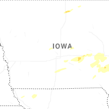


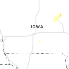


Connect with Interactive Hail Maps