

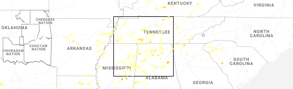
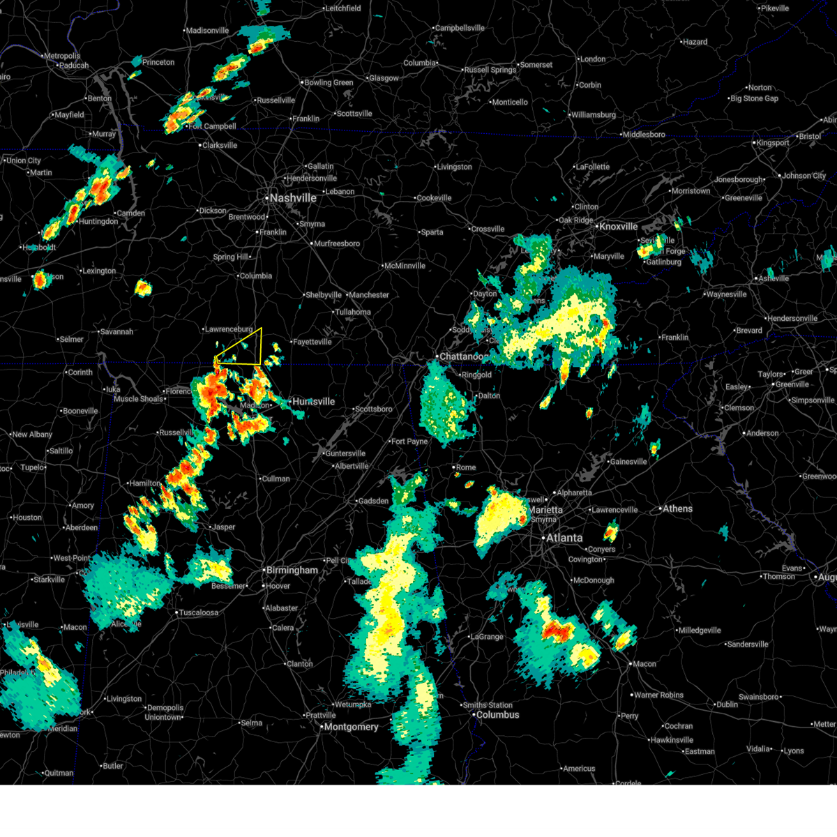
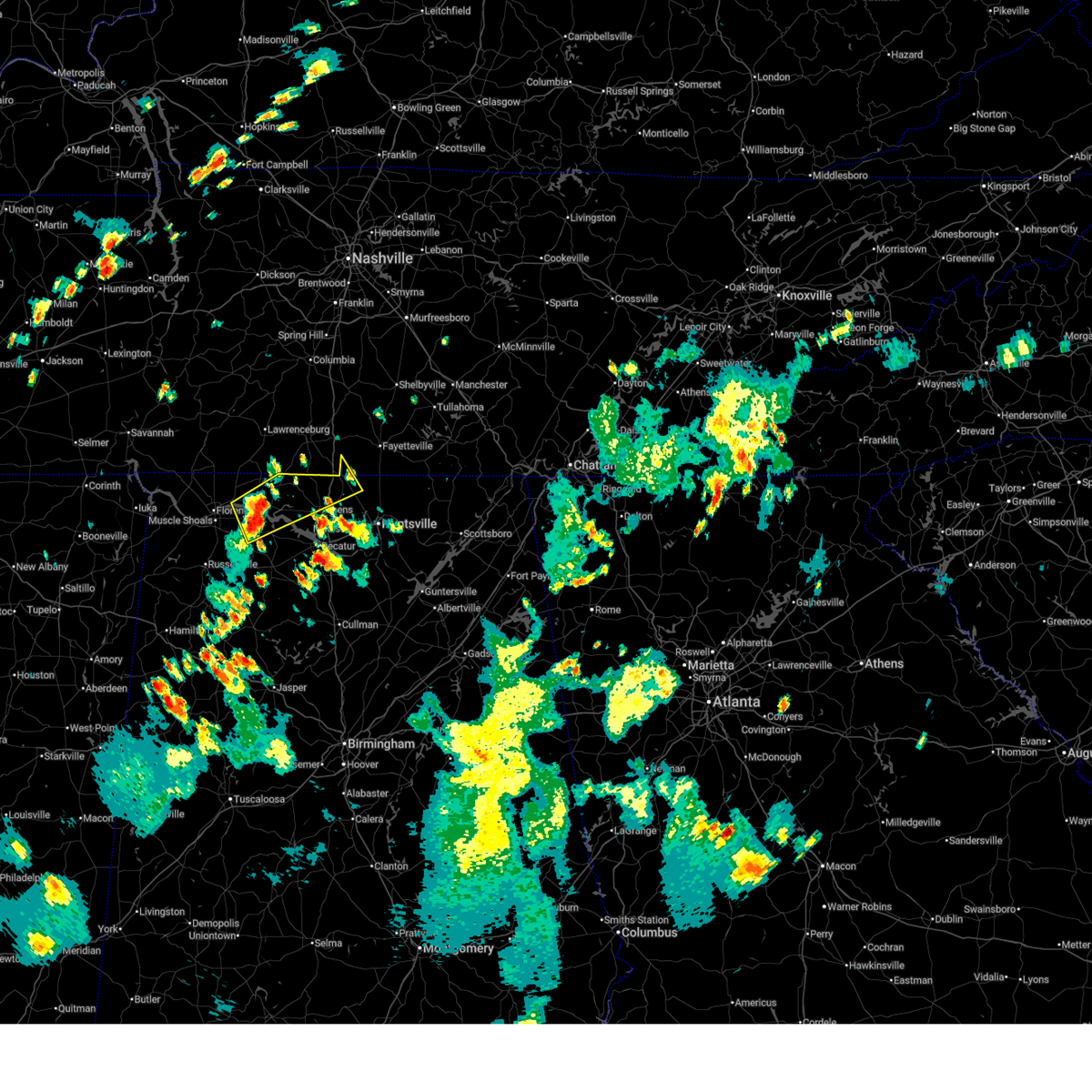
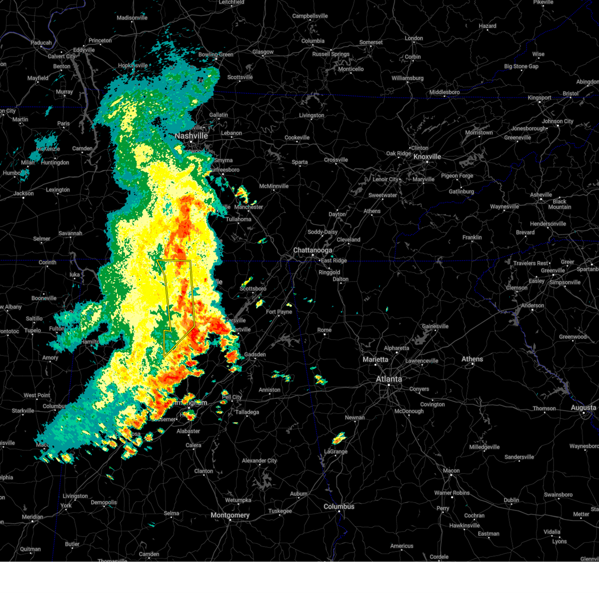
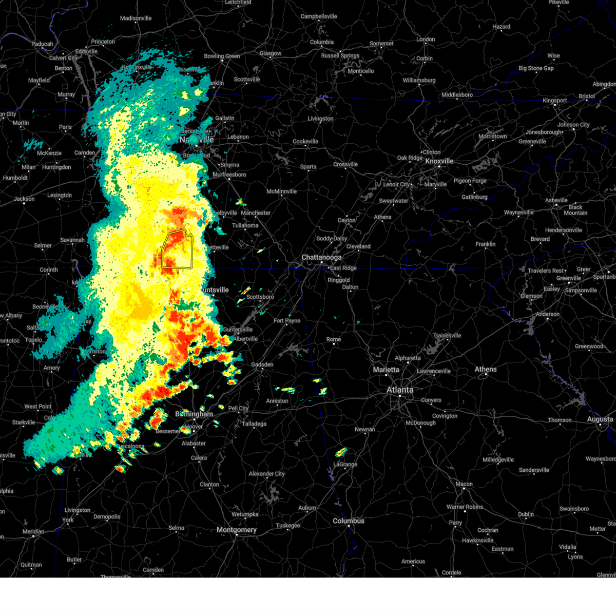
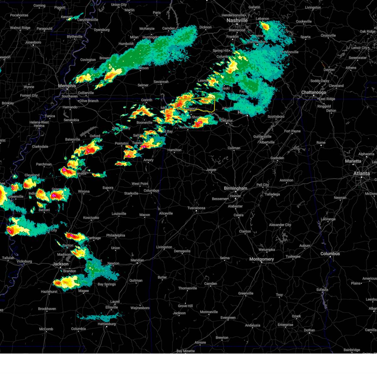
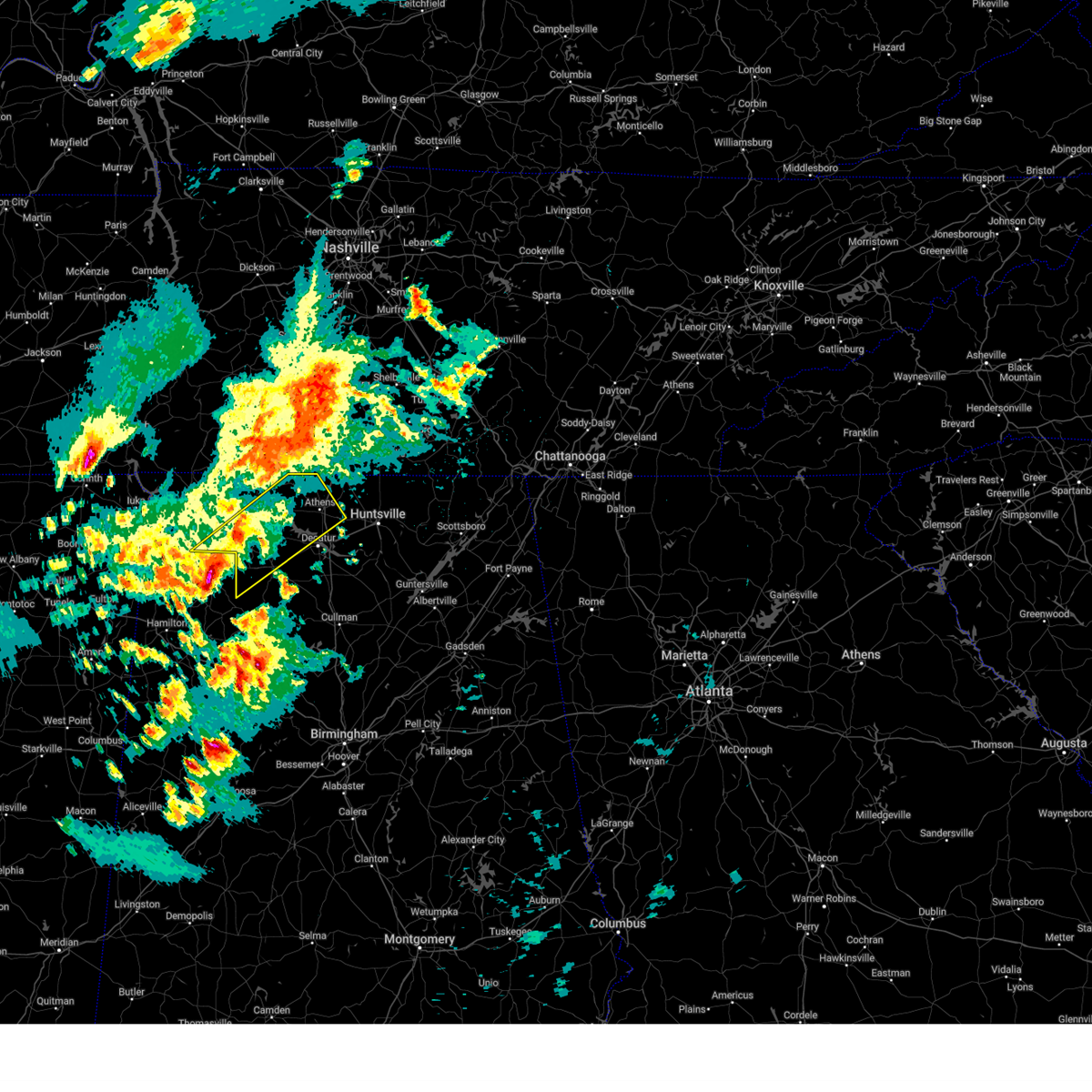
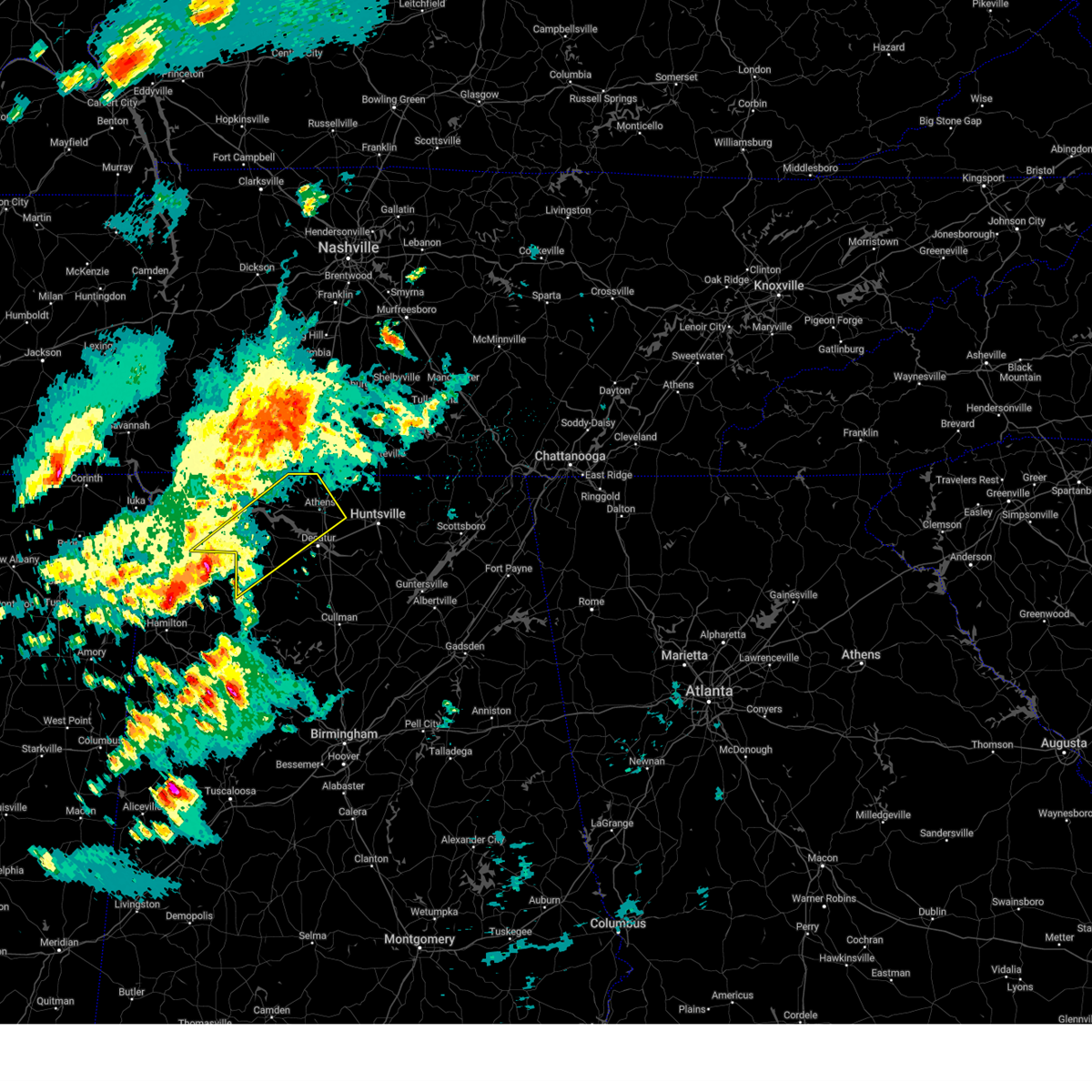
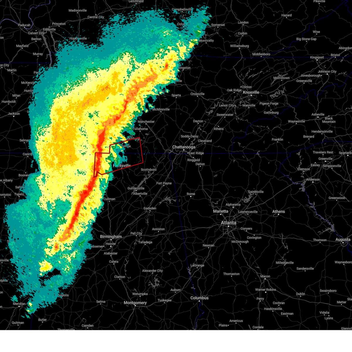
Hail Map for Minor Hill, TN
The Minor Hill, TN area has had 3 reports of on-the-ground hail by trained spotters, and has been under severe weather warnings 71 times during the past 12 months. Doppler radar has detected hail at or near Minor Hill, TN on 64 occasions, including 3 occasions during the past year.
| Name: | Minor Hill, TN |
| Where Located: | 33.3 miles ENE of Florence, AL |
| Map: | Google Map for Minor Hill, TN |
| Population: | 537 |
| Housing Units: | 247 |
| More Info: | Search Google for Minor Hill, TN |
1
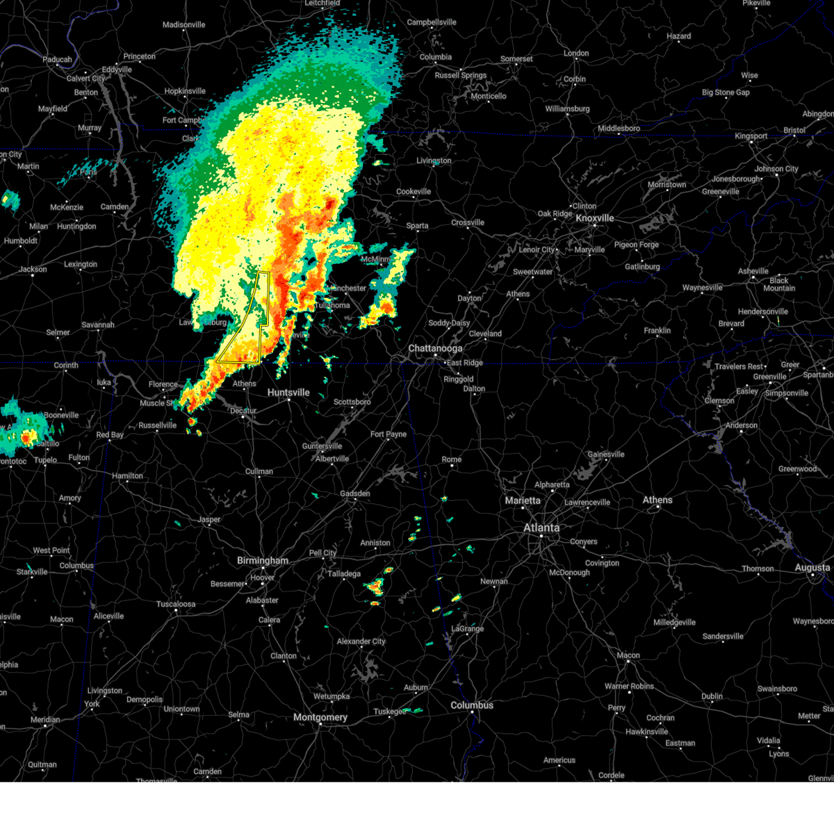
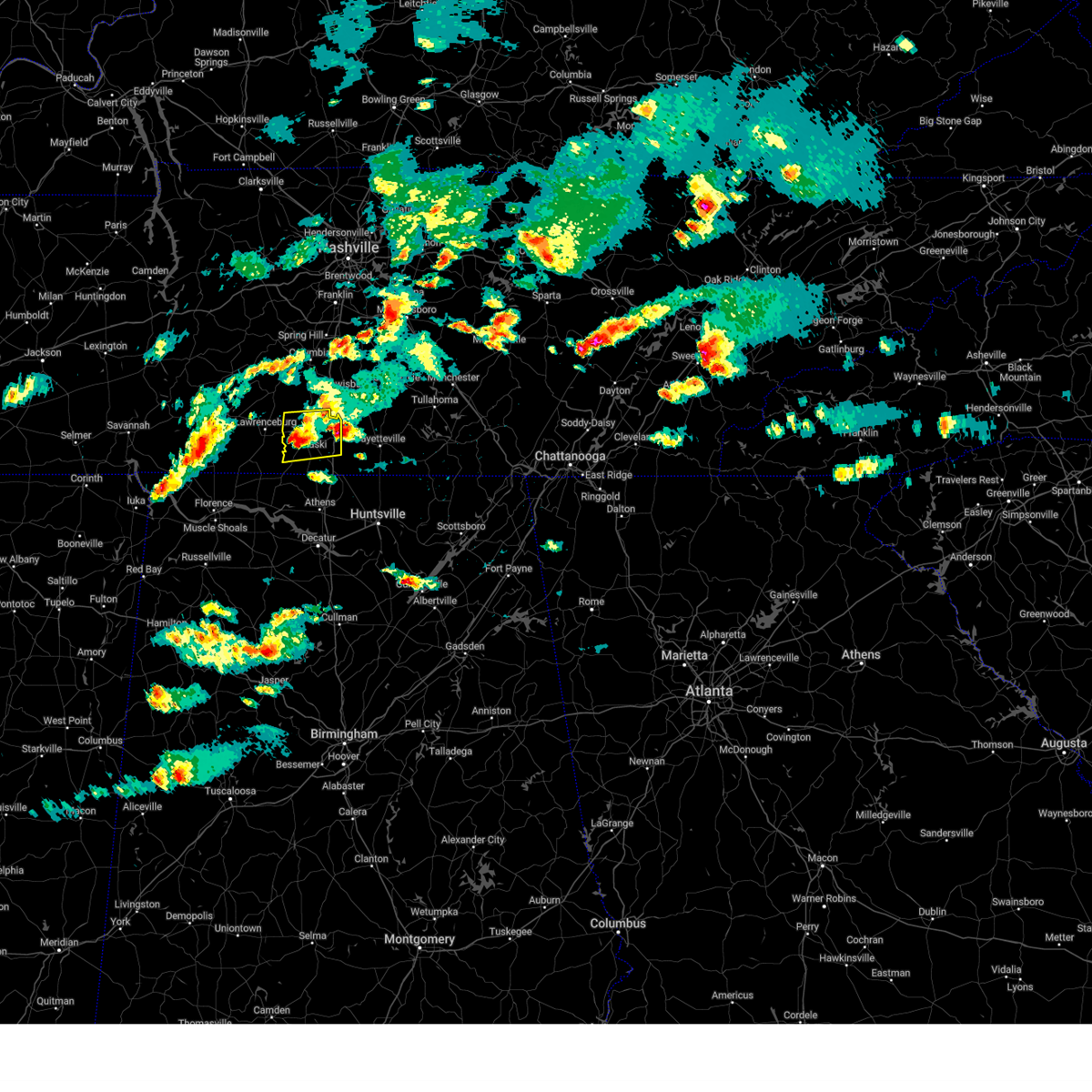
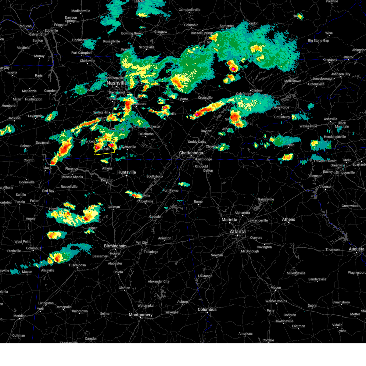
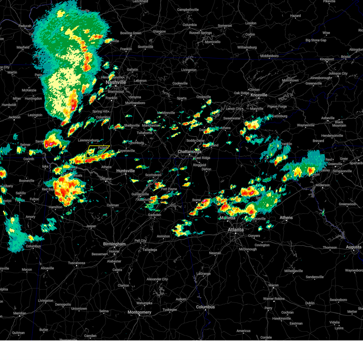
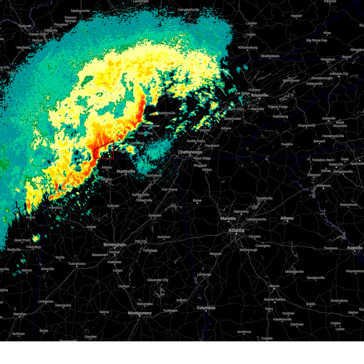
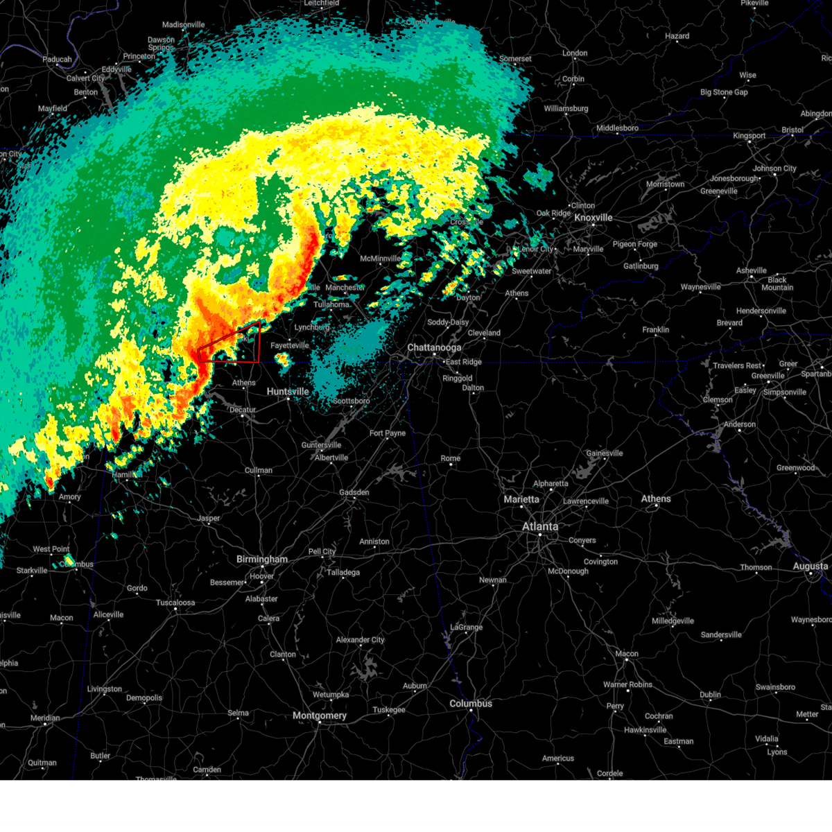
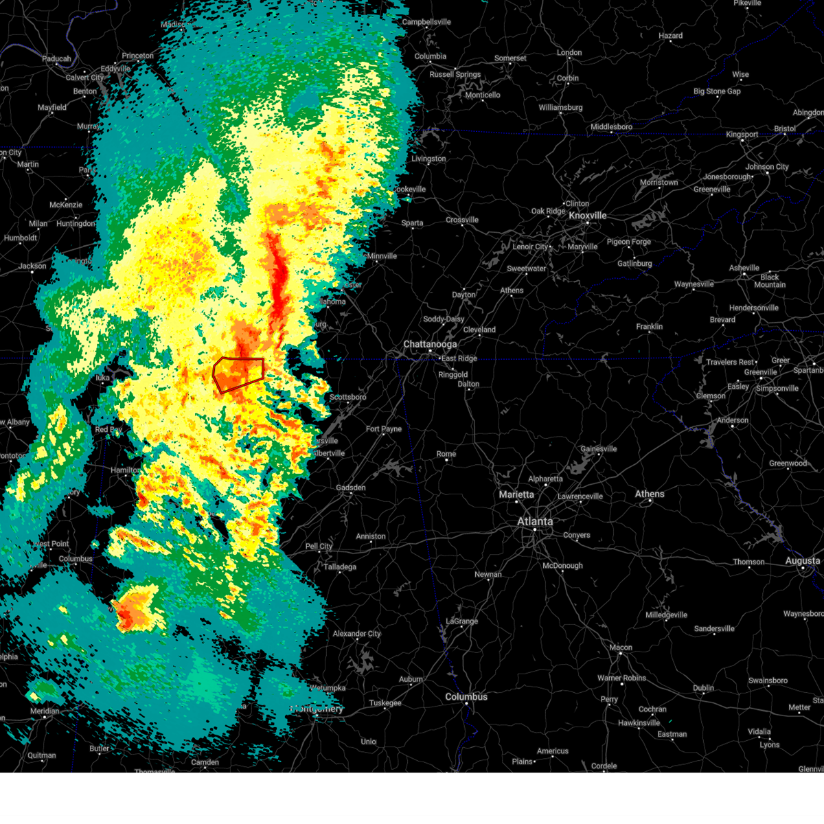
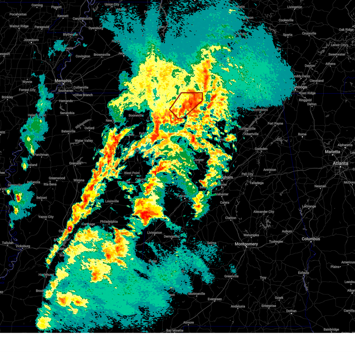
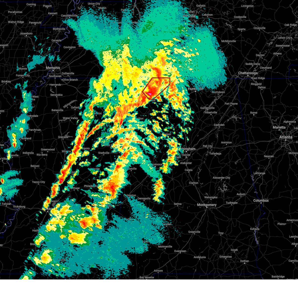
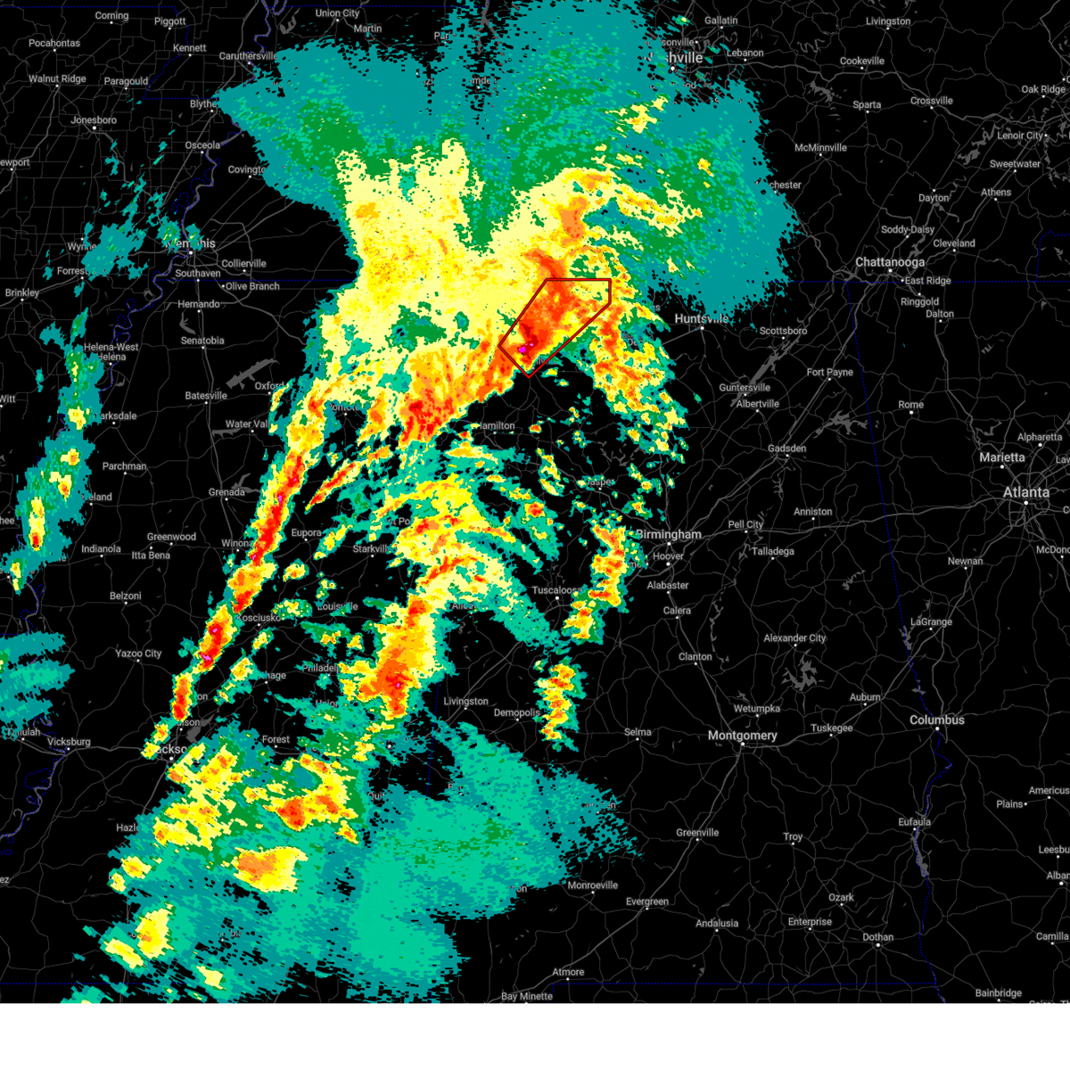
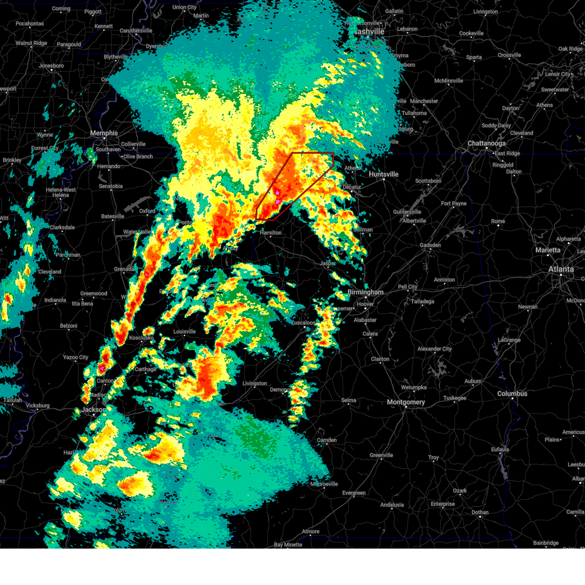
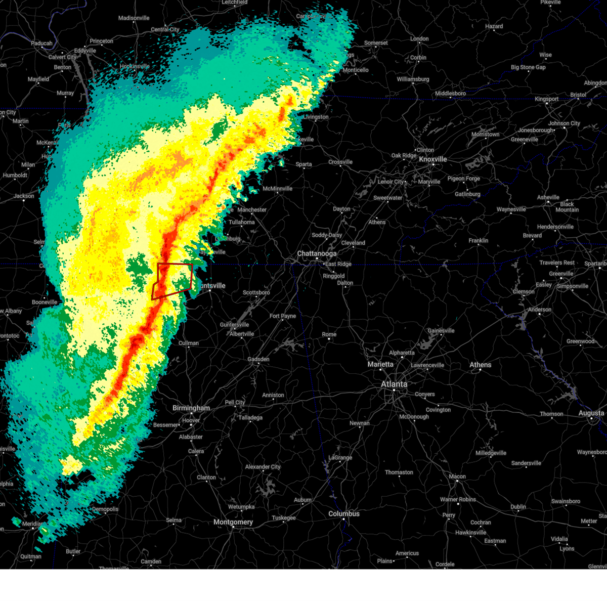
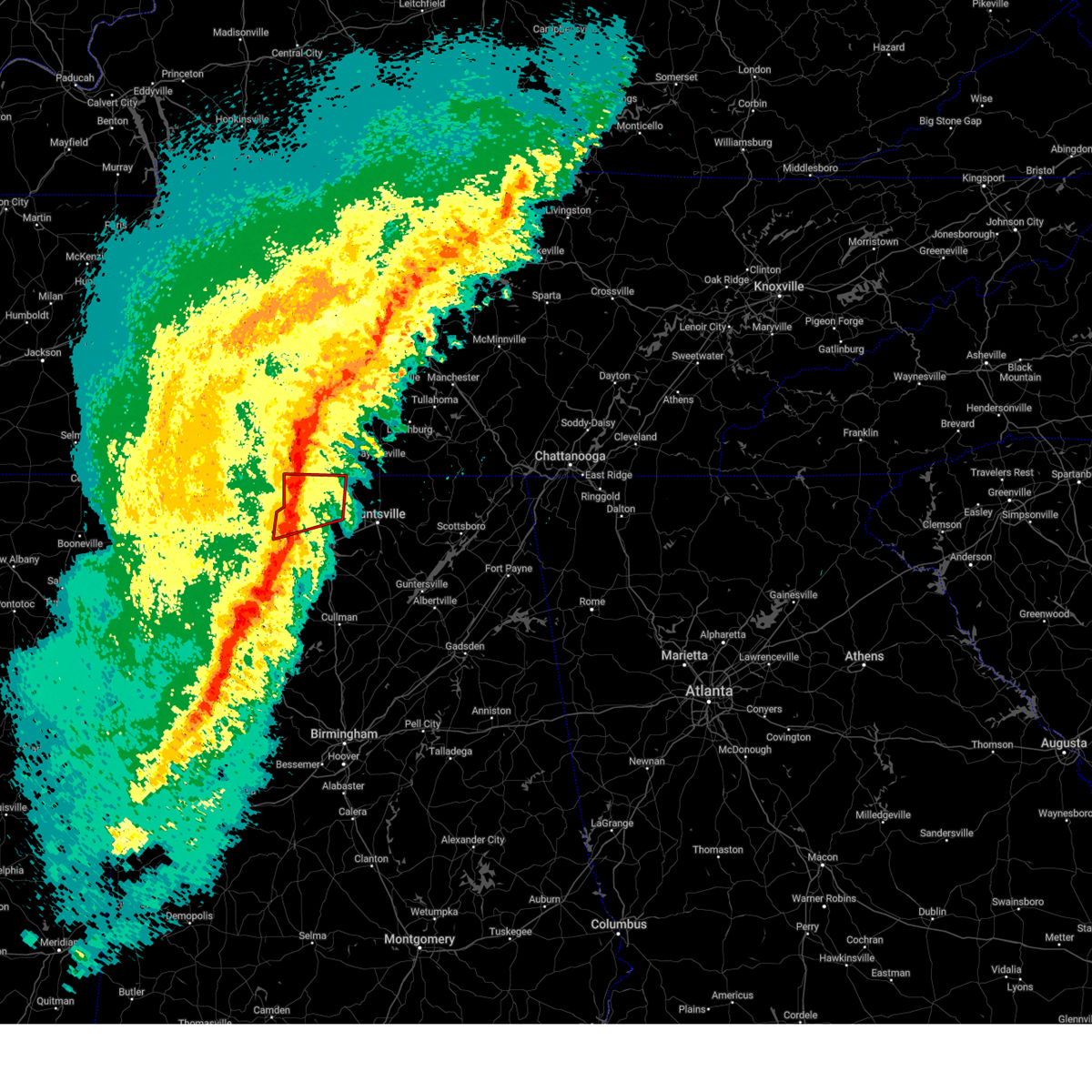
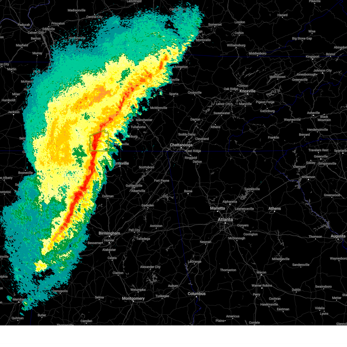
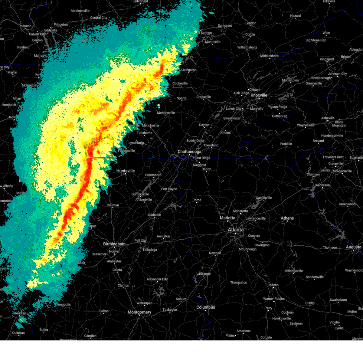
The Top Recent Hail Date for Minor Hill, TN is Friday, May 2, 2025 (4th out of 64)
Hail and Wind Damage Spotted near Minor Hill, TN
| Date / Time | Report Details |
|---|---|
| 6/22/2025 4:48 PM CDT |
 At 448 pm cdt, a severe thunderstorm was located near athens, moving west at 10 mph (radar indicated). Hazards include 60 mph wind gusts and penny size hail. Expect damage to roofs, siding, and trees. Locations impacted include, athens, ardmore, harvest, elkmont, lester, cartwright, french mill, mt rozell, ripley, and cairo. At 448 pm cdt, a severe thunderstorm was located near athens, moving west at 10 mph (radar indicated). Hazards include 60 mph wind gusts and penny size hail. Expect damage to roofs, siding, and trees. Locations impacted include, athens, ardmore, harvest, elkmont, lester, cartwright, french mill, mt rozell, ripley, and cairo.
|
| 6/22/2025 4:31 PM CDT |
 Svrhun the national weather service in huntsville alabama has issued a * severe thunderstorm warning for, northwestern madison county in north central alabama, northeastern limestone county in north central alabama, * until 515 pm cdt. * at 430 pm cdt, a severe thunderstorm was located near athens, moving west at 10 mph (radar indicated). Hazards include 60 mph wind gusts and penny size hail. expect damage to roofs, siding, and trees Svrhun the national weather service in huntsville alabama has issued a * severe thunderstorm warning for, northwestern madison county in north central alabama, northeastern limestone county in north central alabama, * until 515 pm cdt. * at 430 pm cdt, a severe thunderstorm was located near athens, moving west at 10 mph (radar indicated). Hazards include 60 mph wind gusts and penny size hail. expect damage to roofs, siding, and trees
|
| 6/18/2025 5:58 PM CDT | The storm which prompted the warning has moved out of the area. therefore, the warning will be allowed to expire. however, gusty winds are still possible with this thunderstorm. remember, a severe thunderstorm warning still remains in effect for portions of limestone, madison, and lincoln counties until 7 pm. |
| 6/18/2025 5:56 PM CDT | Svrhun the national weather service in huntsville alabama has issued a * severe thunderstorm warning for, northern madison county in north central alabama, limestone county in north central alabama, northeastern lawrence county in northwestern alabama, southwestern lincoln county in middle tennessee, * until 700 pm cdt. * at 555 pm cdt, a severe thunderstorm was located over athens, moving northeast at 30 mph (radar indicated). Hazards include 60 mph wind gusts and quarter size hail. Hail damage to vehicles is expected. Expect wind damage to roofs, siding, and trees. |
| 6/18/2025 5:44 PM CDT |
 At 544 pm cdt, a severe thunderstorm was located 10 miles northwest of athens, moving northeast at 30 mph (radar indicated). Hazards include 60 mph wind gusts and quarter size hail. Hail damage to vehicles is expected. expect wind damage to roofs, siding, and trees. Locations impacted include, athens, rogersville, ardmore, harvest, elkmont, anderson, lester, good springs, cartwright, and coxey. At 544 pm cdt, a severe thunderstorm was located 10 miles northwest of athens, moving northeast at 30 mph (radar indicated). Hazards include 60 mph wind gusts and quarter size hail. Hail damage to vehicles is expected. expect wind damage to roofs, siding, and trees. Locations impacted include, athens, rogersville, ardmore, harvest, elkmont, anderson, lester, good springs, cartwright, and coxey.
|
| 6/18/2025 5:44 PM CDT |
 the severe thunderstorm warning has been cancelled and is no longer in effect the severe thunderstorm warning has been cancelled and is no longer in effect
|
| 6/18/2025 5:38 PM CDT |
 Svrohx the national weather service in nashville has issued a * severe thunderstorm warning for, southern giles county in middle tennessee, * until 615 pm cdt. * at 538 pm cdt, a severe thunderstorm was located 11 miles east of lexington, or 16 miles southwest of pulaski, moving northeast at 35 mph (radar indicated). Hazards include 60 mph wind gusts. expect damage to roofs, siding, and trees Svrohx the national weather service in nashville has issued a * severe thunderstorm warning for, southern giles county in middle tennessee, * until 615 pm cdt. * at 538 pm cdt, a severe thunderstorm was located 11 miles east of lexington, or 16 miles southwest of pulaski, moving northeast at 35 mph (radar indicated). Hazards include 60 mph wind gusts. expect damage to roofs, siding, and trees
|
| 6/18/2025 5:20 PM CDT |
 Svrhun the national weather service in huntsville alabama has issued a * severe thunderstorm warning for, northwestern madison county in north central alabama, northern limestone county in north central alabama, southeastern lauderdale county in northwestern alabama, east central colbert county in northwestern alabama, northern lawrence county in northwestern alabama, southwestern lincoln county in middle tennessee, * until 600 pm cdt. * at 519 pm cdt, a severe thunderstorm was located over rogersville, or 18 miles east of muscle shoals, moving northeast at 30 mph (radar indicated). Hazards include 60 mph wind gusts and quarter size hail. Hail damage to vehicles is expected. Expect wind damage to roofs, siding, and trees. Svrhun the national weather service in huntsville alabama has issued a * severe thunderstorm warning for, northwestern madison county in north central alabama, northern limestone county in north central alabama, southeastern lauderdale county in northwestern alabama, east central colbert county in northwestern alabama, northern lawrence county in northwestern alabama, southwestern lincoln county in middle tennessee, * until 600 pm cdt. * at 519 pm cdt, a severe thunderstorm was located over rogersville, or 18 miles east of muscle shoals, moving northeast at 30 mph (radar indicated). Hazards include 60 mph wind gusts and quarter size hail. Hail damage to vehicles is expected. Expect wind damage to roofs, siding, and trees.
|
| 6/7/2025 2:09 PM CDT |
 The storms which prompted the warning have weakened below severe limits, and have exited the warned area. therefore, the warning will be allowed to expire. a severe thunderstorm watch remains in effect until 600 pm cdt for north central, northeastern and northwestern alabama, and middle tennessee. The storms which prompted the warning have weakened below severe limits, and have exited the warned area. therefore, the warning will be allowed to expire. a severe thunderstorm watch remains in effect until 600 pm cdt for north central, northeastern and northwestern alabama, and middle tennessee.
|
| 6/7/2025 2:06 PM CDT |
 At 206 pm cdt, a severe thunderstorm was located near ardmore, or 12 miles southeast of pulaski, moving east at 55 mph (radar indicated). Hazards include 60 mph wind gusts and penny size hail. Expect damage to roofs, siding, and trees. locations impacted include, pulaski, ardmore, elkton, minor hill, goodspring, frankewing, and prospect. This includes interstate 65 between mile markers 1 and 22. At 206 pm cdt, a severe thunderstorm was located near ardmore, or 12 miles southeast of pulaski, moving east at 55 mph (radar indicated). Hazards include 60 mph wind gusts and penny size hail. Expect damage to roofs, siding, and trees. locations impacted include, pulaski, ardmore, elkton, minor hill, goodspring, frankewing, and prospect. This includes interstate 65 between mile markers 1 and 22.
|
| 6/7/2025 2:06 PM CDT |
 the severe thunderstorm warning has been cancelled and is no longer in effect the severe thunderstorm warning has been cancelled and is no longer in effect
|
| 6/7/2025 2:04 PM CDT |
 At 204 pm cdt, severe thunderstorms were located along a line extending from near tanner to 7 miles southwest of falkville to near camp mcdowell, moving east at 45 mph (radar indicated). Hazards include 60 mph wind gusts. Expect damage to roofs, siding, and trees. Locations impacted include, decatur, madison, athens, hartselle, priceville, trinity, falkville, ardmore, tanner, and huntsville international airport. At 204 pm cdt, severe thunderstorms were located along a line extending from near tanner to 7 miles southwest of falkville to near camp mcdowell, moving east at 45 mph (radar indicated). Hazards include 60 mph wind gusts. Expect damage to roofs, siding, and trees. Locations impacted include, decatur, madison, athens, hartselle, priceville, trinity, falkville, ardmore, tanner, and huntsville international airport.
|
| 6/7/2025 2:04 PM CDT |
 the severe thunderstorm warning has been cancelled and is no longer in effect the severe thunderstorm warning has been cancelled and is no longer in effect
|
| 6/7/2025 1:53 PM CDT |
 At 153 pm cdt, a severe thunderstorm was located 11 miles east of lexington, or 14 miles southwest of pulaski, moving east at 50 mph (radar indicated). Hazards include 60 mph wind gusts and penny size hail. Expect damage to roofs, siding, and trees. locations impacted include, lawrenceburg, pulaski, loretto, ardmore, elkton, minor hill, goodspring, leoma, frankewing, and prospect. This includes interstate 65 between mile markers 1 and 22. At 153 pm cdt, a severe thunderstorm was located 11 miles east of lexington, or 14 miles southwest of pulaski, moving east at 50 mph (radar indicated). Hazards include 60 mph wind gusts and penny size hail. Expect damage to roofs, siding, and trees. locations impacted include, lawrenceburg, pulaski, loretto, ardmore, elkton, minor hill, goodspring, leoma, frankewing, and prospect. This includes interstate 65 between mile markers 1 and 22.
|
| 6/7/2025 1:36 PM CDT |
 Svrohx the national weather service in nashville has issued a * severe thunderstorm warning for, southern lawrence county in middle tennessee, giles county in middle tennessee, * until 230 pm cdt. * at 136 pm cdt, a severe thunderstorm was located near lexington, or 15 miles northeast of florence, moving east at 45 mph (radar indicated). Hazards include 60 mph wind gusts and penny size hail. expect damage to roofs, siding, and trees Svrohx the national weather service in nashville has issued a * severe thunderstorm warning for, southern lawrence county in middle tennessee, giles county in middle tennessee, * until 230 pm cdt. * at 136 pm cdt, a severe thunderstorm was located near lexington, or 15 miles northeast of florence, moving east at 45 mph (radar indicated). Hazards include 60 mph wind gusts and penny size hail. expect damage to roofs, siding, and trees
|
| 6/6/2025 3:15 PM CDT | the severe thunderstorm warning has been cancelled and is no longer in effect |
| 6/6/2025 2:52 PM CDT | At 251 pm cdt, a severe thunderstorm was located 8 miles east of rogersville, or 11 miles northwest of athens, moving east at 25 mph (public. at 245 pm wind damage and power outages were reported in the athens area). Hazards include 60 mph wind gusts and quarter size hail. Hail damage to vehicles is expected. expect wind damage to roofs, siding, and trees. Locations impacted include, athens, rogersville, elkmont, anderson, good springs, cartwright, coxey, oliver, mt rozell, and ripley. |
| 6/6/2025 2:52 PM CDT | the severe thunderstorm warning has been cancelled and is no longer in effect |
| 6/6/2025 2:26 PM CDT |
 Svrhun the national weather service in huntsville alabama has issued a * severe thunderstorm warning for, northern limestone county in north central alabama, southeastern lauderdale county in northwestern alabama, north central lawrence county in northwestern alabama, * until 330 pm cdt. * at 225 pm cdt, a severe thunderstorm was located over rogersville, or 19 miles east of muscle shoals, moving east at 25 mph (radar indicated). Hazards include 60 mph wind gusts and quarter size hail. Hail damage to vehicles is expected. Expect wind damage to roofs, siding, and trees. Svrhun the national weather service in huntsville alabama has issued a * severe thunderstorm warning for, northern limestone county in north central alabama, southeastern lauderdale county in northwestern alabama, north central lawrence county in northwestern alabama, * until 330 pm cdt. * at 225 pm cdt, a severe thunderstorm was located over rogersville, or 19 miles east of muscle shoals, moving east at 25 mph (radar indicated). Hazards include 60 mph wind gusts and quarter size hail. Hail damage to vehicles is expected. Expect wind damage to roofs, siding, and trees.
|
| 5/25/2025 3:40 PM CDT |
 The storms which prompted the warning have moved out of the area. therefore, the warning will be allowed to expire. The storms which prompted the warning have moved out of the area. therefore, the warning will be allowed to expire.
|
| 5/25/2025 3:30 PM CDT |
 the severe thunderstorm warning has been cancelled and is no longer in effect the severe thunderstorm warning has been cancelled and is no longer in effect
|
| 5/25/2025 3:30 PM CDT |
 At 329 pm cdt, severe thunderstorms were located along a line extending from 13 miles southeast of spring hill to 9 miles south of lewisburg to 7 miles southeast of pulaski, moving east at 45 mph (radar indicated). Hazards include 60 mph wind gusts. Expect damage to roofs, siding, and trees. locations impacted include, lewisburg, pulaski, ardmore, cornersville, elkton, minor hill, frankewing, and prospect. This includes interstate 65 between mile markers 1 and 34. At 329 pm cdt, severe thunderstorms were located along a line extending from 13 miles southeast of spring hill to 9 miles south of lewisburg to 7 miles southeast of pulaski, moving east at 45 mph (radar indicated). Hazards include 60 mph wind gusts. Expect damage to roofs, siding, and trees. locations impacted include, lewisburg, pulaski, ardmore, cornersville, elkton, minor hill, frankewing, and prospect. This includes interstate 65 between mile markers 1 and 34.
|
| 5/25/2025 3:10 PM CDT |
 the severe thunderstorm warning has been cancelled and is no longer in effect the severe thunderstorm warning has been cancelled and is no longer in effect
|
| 5/25/2025 3:10 PM CDT |
 At 309 pm cdt, severe thunderstorms were located along a line extending from near columbia to 10 miles north of pulaski to near st. florian, moving east at 45 mph (radar indicated). Hazards include 60 mph wind gusts. Expect damage to roofs, siding, and trees. locations impacted include, columbia, lewisburg, lawrenceburg, pulaski, mount pleasant, loretto, ardmore, cornersville, st. joseph, elkton, minor hill, ethridge, lynnville, culleoka, i-65 east of columbia, goodspring, leoma, frankewing, and prospect. This includes interstate 65 between mile markers 1 and 46. At 309 pm cdt, severe thunderstorms were located along a line extending from near columbia to 10 miles north of pulaski to near st. florian, moving east at 45 mph (radar indicated). Hazards include 60 mph wind gusts. Expect damage to roofs, siding, and trees. locations impacted include, columbia, lewisburg, lawrenceburg, pulaski, mount pleasant, loretto, ardmore, cornersville, st. joseph, elkton, minor hill, ethridge, lynnville, culleoka, i-65 east of columbia, goodspring, leoma, frankewing, and prospect. This includes interstate 65 between mile markers 1 and 46.
|
| 5/25/2025 2:57 PM CDT |
 Svrohx the national weather service in nashville has issued a * severe thunderstorm warning for, southeastern wayne county in middle tennessee, western marshall county in middle tennessee, lawrence county in middle tennessee, southern maury county in middle tennessee, giles county in middle tennessee, * until 345 pm cdt. * at 256 pm cdt, severe thunderstorms were located along a line extending from 6 miles southeast of summertown to near underwood-petersville, moving east at 45 mph (radar indicated). Hazards include 60 mph wind gusts. expect damage to roofs, siding, and trees Svrohx the national weather service in nashville has issued a * severe thunderstorm warning for, southeastern wayne county in middle tennessee, western marshall county in middle tennessee, lawrence county in middle tennessee, southern maury county in middle tennessee, giles county in middle tennessee, * until 345 pm cdt. * at 256 pm cdt, severe thunderstorms were located along a line extending from 6 miles southeast of summertown to near underwood-petersville, moving east at 45 mph (radar indicated). Hazards include 60 mph wind gusts. expect damage to roofs, siding, and trees
|
| 5/8/2025 6:02 PM CDT |
 the severe thunderstorm warning has been cancelled and is no longer in effect the severe thunderstorm warning has been cancelled and is no longer in effect
|
| 5/8/2025 5:50 PM CDT |
 Svrohx the national weather service in nashville has issued a * severe thunderstorm warning for, giles county in middle tennessee, * until 630 pm cdt. * at 550 pm cdt, severe thunderstorms were located along a line extending from near pulaski to 12 miles southwest of petersburg, moving east at 30 mph (radar indicated). Hazards include 60 mph wind gusts and quarter size hail. Hail damage to vehicles is expected. Expect wind damage to roofs, siding, and trees. Svrohx the national weather service in nashville has issued a * severe thunderstorm warning for, giles county in middle tennessee, * until 630 pm cdt. * at 550 pm cdt, severe thunderstorms were located along a line extending from near pulaski to 12 miles southwest of petersburg, moving east at 30 mph (radar indicated). Hazards include 60 mph wind gusts and quarter size hail. Hail damage to vehicles is expected. Expect wind damage to roofs, siding, and trees.
|
| 5/2/2025 3:55 PM CDT | The storm which prompted the warning has moved out of the area. therefore, the warning will be allowed to expire. a severe thunderstorm watch remains in effect until 500 pm cdt for north central and northwestern alabama, and middle tennessee. a severe thunderstorm watch also remains in effect until 800 pm cdt for north central and northeastern alabama. |
| 5/2/2025 3:35 PM CDT | the severe thunderstorm warning has been cancelled and is no longer in effect |
| 5/2/2025 3:35 PM CDT | At 335 pm cdt, a severe thunderstorm was located near courtland, or 18 miles north of moulton, moving northeast at 50 mph (radar indicated). Hazards include 60 mph wind gusts and quarter size hail. Hail damage to vehicles is expected. expect wind damage to roofs, siding, and trees. Locations impacted include, good springs, cartwright, coxey, trinity, ne smith, north courtland, hatton, lester, red bank, and leggtown. |
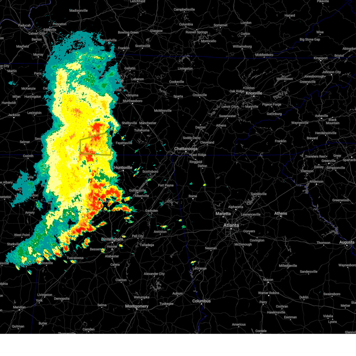
| 5/2/2025 3:04 PM CDT |
 Svrhun the national weather service in huntsville alabama has issued a * severe thunderstorm warning for, central limestone county in north central alabama, southeastern lauderdale county in northwestern alabama, southeastern colbert county in northwestern alabama, northeastern franklin county in northwestern alabama, northwestern morgan county in north central alabama, northern lawrence county in northwestern alabama, * until 400 pm cdt. * at 304 pm cdt, a severe thunderstorm was located over littleville, or near russellville, moving northeast at 50 mph (radar indicated). Hazards include 60 mph wind gusts and quarter size hail. Hail damage to vehicles is expected. Expect wind damage to roofs, siding, and trees. Svrhun the national weather service in huntsville alabama has issued a * severe thunderstorm warning for, central limestone county in north central alabama, southeastern lauderdale county in northwestern alabama, southeastern colbert county in northwestern alabama, northeastern franklin county in northwestern alabama, northwestern morgan county in north central alabama, northern lawrence county in northwestern alabama, * until 400 pm cdt. * at 304 pm cdt, a severe thunderstorm was located over littleville, or near russellville, moving northeast at 50 mph (radar indicated). Hazards include 60 mph wind gusts and quarter size hail. Hail damage to vehicles is expected. Expect wind damage to roofs, siding, and trees.
|
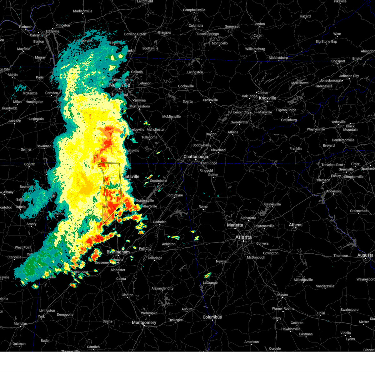
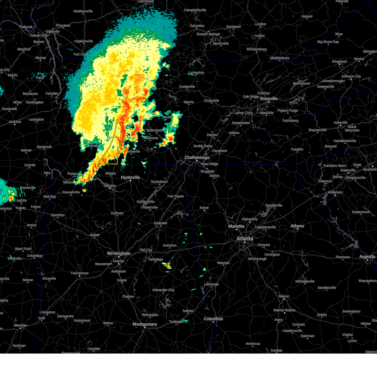
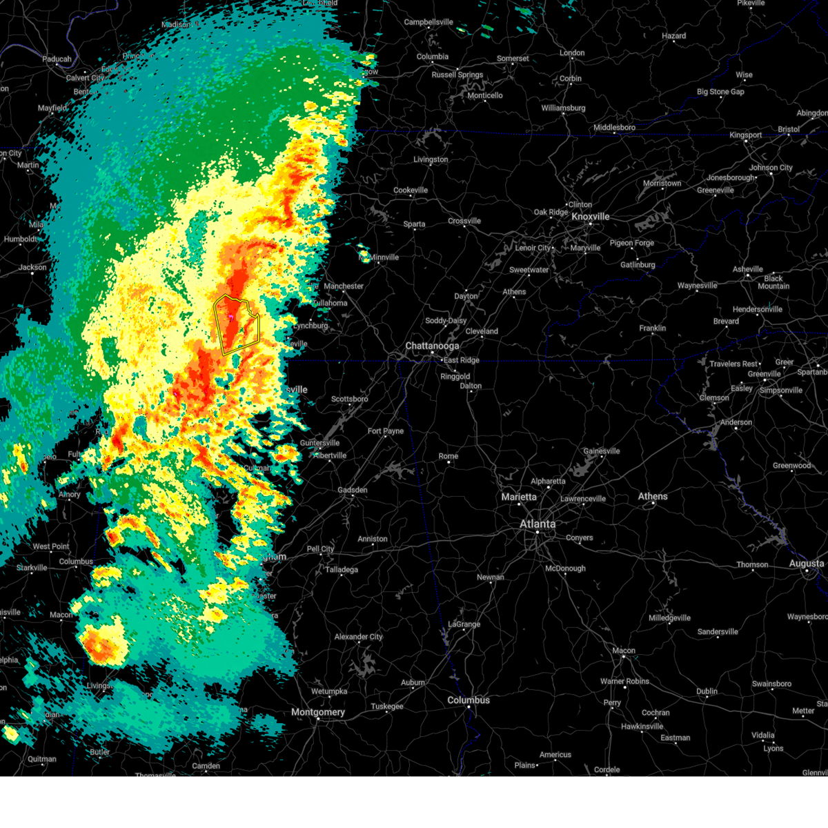
| 5/2/2025 12:57 PM CDT | At 1257 pm cdt, a severe thunderstorm was located near loretto, or 10 miles south of lawrenceburg, moving northeast at 20 mph (radar indicated). Hazards include 60 mph wind gusts and half dollar size hail. Hail damage to vehicles is expected. expect wind damage to roofs, siding, and trees. locations impacted include, lawrenceburg, loretto, ethridge, goodspring, leoma, minor hill, st. joseph, pulaski, and iron city. This includes interstate 65 between mile markers 20 and 22. |
| 5/2/2025 12:51 PM CDT | Half Dollar sized hail reported 1 miles SSW of Minor Hill, TN, photo of half-dollar size hail received from minor hill. |
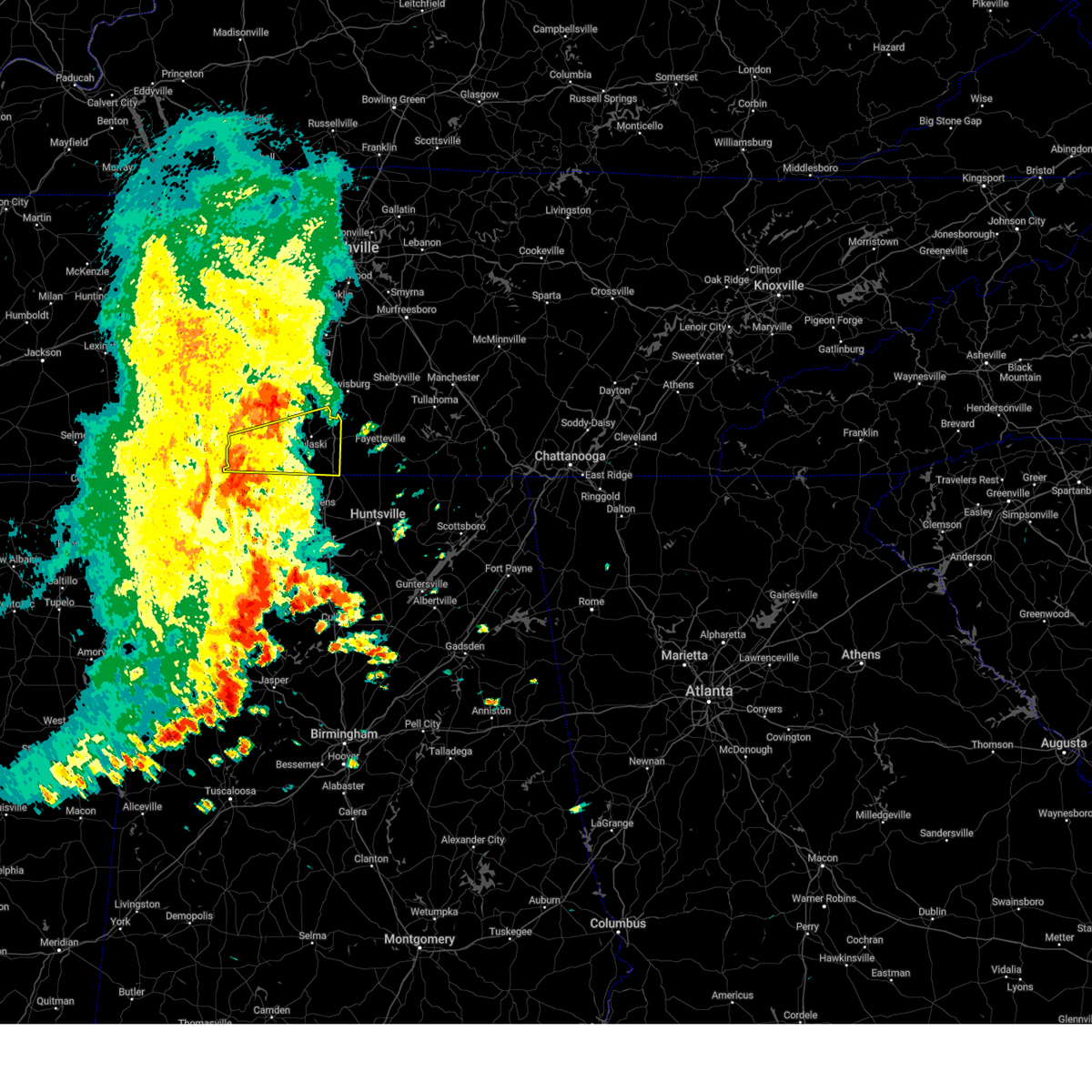
| 5/2/2025 12:44 PM CDT |
 Svrohx the national weather service in nashville has issued a * severe thunderstorm warning for, southern lawrence county in middle tennessee, giles county in middle tennessee, * until 130 pm cdt. * at 1244 pm cdt, a severe thunderstorm was located near loretto, or 14 miles south of lawrenceburg, moving northeast at 20 mph (radar indicated). Hazards include 60 mph wind gusts and quarter size hail. Hail damage to vehicles is expected. Expect wind damage to roofs, siding, and trees. Svrohx the national weather service in nashville has issued a * severe thunderstorm warning for, southern lawrence county in middle tennessee, giles county in middle tennessee, * until 130 pm cdt. * at 1244 pm cdt, a severe thunderstorm was located near loretto, or 14 miles south of lawrenceburg, moving northeast at 20 mph (radar indicated). Hazards include 60 mph wind gusts and quarter size hail. Hail damage to vehicles is expected. Expect wind damage to roofs, siding, and trees.
|
| 5/2/2025 12:12 PM CDT |
 Svrohx the national weather service in nashville has issued a * severe thunderstorm warning for, southeastern lawrence county in middle tennessee, southern giles county in middle tennessee, * until 1245 pm cdt. * at 1212 pm cdt, a severe thunderstorm was located near lexington, or 19 miles south of lawrenceburg, moving northeast at 20 mph (radar indicated). Hazards include 60 mph wind gusts and quarter size hail. Hail damage to vehicles is expected. Expect wind damage to roofs, siding, and trees. Svrohx the national weather service in nashville has issued a * severe thunderstorm warning for, southeastern lawrence county in middle tennessee, southern giles county in middle tennessee, * until 1245 pm cdt. * at 1212 pm cdt, a severe thunderstorm was located near lexington, or 19 miles south of lawrenceburg, moving northeast at 20 mph (radar indicated). Hazards include 60 mph wind gusts and quarter size hail. Hail damage to vehicles is expected. Expect wind damage to roofs, siding, and trees.
|
| 4/10/2025 5:47 PM CDT | At 547 pm cdt, severe thunderstorms were located along a line extending from near columbia to near rogersville, moving southeast at 35 mph (emergency management). Hazards include 60 mph wind gusts. Expect damage to roofs, siding, and trees. locations impacted include, ethridge, mount pleasant, culleoka, minor hill, i-65 east of columbia, elkton, pulaski, goodspring, columbia, lynnville, frankewing, ardmore, cornersville, prospect, lewisburg, lawrenceburg, and spring hill. This includes interstate 65 between mile markers 1 and 50. |
| 4/10/2025 5:47 PM CDT | the severe thunderstorm warning has been cancelled and is no longer in effect |
| 4/10/2025 5:26 PM CDT |
 the severe thunderstorm warning has been cancelled and is no longer in effect the severe thunderstorm warning has been cancelled and is no longer in effect
|
| 4/10/2025 5:26 PM CDT |
 At 525 pm cdt, severe thunderstorms were located along a line extending from 8 miles northwest of mount pleasant to near lexington, moving southeast at 35 mph (radar indicated). Hazards include 60 mph wind gusts. Expect damage to roofs, siding, and trees. locations impacted include, gordonsburg, henryville, culleoka, st. joseph, pulaski, goodspring, leoma, lynnville, frankewing, hampshire, williamsport, loretto, ethridge, mount pleasant, minor hill, cypress inn, collinwood, i-65 east of columbia, elkton, and lawrenceburg. This includes interstate 65 between mile markers 1 and 52. At 525 pm cdt, severe thunderstorms were located along a line extending from 8 miles northwest of mount pleasant to near lexington, moving southeast at 35 mph (radar indicated). Hazards include 60 mph wind gusts. Expect damage to roofs, siding, and trees. locations impacted include, gordonsburg, henryville, culleoka, st. joseph, pulaski, goodspring, leoma, lynnville, frankewing, hampshire, williamsport, loretto, ethridge, mount pleasant, minor hill, cypress inn, collinwood, i-65 east of columbia, elkton, and lawrenceburg. This includes interstate 65 between mile markers 1 and 52.
|
| 4/10/2025 5:11 PM CDT |
 Svrohx the national weather service in nashville has issued a * severe thunderstorm warning for, lewis county in middle tennessee, eastern wayne county in middle tennessee, western marshall county in middle tennessee, lawrence county in middle tennessee, maury county in middle tennessee, giles county in middle tennessee, southern hickman county in middle tennessee, * until 600 pm cdt. * at 511 pm cdt, severe thunderstorms were located along a line extending from 6 miles southeast of centerville to 8 miles southwest of loretto, moving southeast at 35 mph (radar indicated). Hazards include 60 mph wind gusts. expect damage to roofs, siding, and trees Svrohx the national weather service in nashville has issued a * severe thunderstorm warning for, lewis county in middle tennessee, eastern wayne county in middle tennessee, western marshall county in middle tennessee, lawrence county in middle tennessee, maury county in middle tennessee, giles county in middle tennessee, southern hickman county in middle tennessee, * until 600 pm cdt. * at 511 pm cdt, severe thunderstorms were located along a line extending from 6 miles southeast of centerville to 8 miles southwest of loretto, moving southeast at 35 mph (radar indicated). Hazards include 60 mph wind gusts. expect damage to roofs, siding, and trees
|
| 4/5/2025 11:19 PM CDT |
 At 1119 pm cdt, a confirmed tornado was located 11 miles northeast of rogersville, or 13 miles northwest of athens, moving east at 40 mph (emergency management confirmed tornado). Hazards include damaging tornado and quarter size hail. Flying debris will be dangerous to those caught without shelter. mobile homes will be damaged or destroyed. damage to roofs, windows, and vehicles will occur. tree damage is likely. this tornado will be near, ardmore around 1135 pm cdt. Other locations impacted by this tornadic thunderstorm include good springs, cartwright, lester, cairo, holland gin, mt rozell, leggtown, and elkmont. At 1119 pm cdt, a confirmed tornado was located 11 miles northeast of rogersville, or 13 miles northwest of athens, moving east at 40 mph (emergency management confirmed tornado). Hazards include damaging tornado and quarter size hail. Flying debris will be dangerous to those caught without shelter. mobile homes will be damaged or destroyed. damage to roofs, windows, and vehicles will occur. tree damage is likely. this tornado will be near, ardmore around 1135 pm cdt. Other locations impacted by this tornadic thunderstorm include good springs, cartwright, lester, cairo, holland gin, mt rozell, leggtown, and elkmont.
|
| 4/5/2025 11:16 PM CDT |
 the tornado warning has been cancelled and is no longer in effect the tornado warning has been cancelled and is no longer in effect
|
| 4/5/2025 11:16 PM CDT |
 At 1116 pm cdt, a severe thunderstorm capable of producing a tornado was located 12 miles southwest of pulaski, moving east at 30 mph (radar indicated rotation). Hazards include tornado. Flying debris will be dangerous to those caught without shelter. mobile homes will be damaged or destroyed. damage to roofs, windows, and vehicles will occur. tree damage is likely. this dangerous storm will be near, pulaski around 1130 pm cdt. other locations impacted by this tornadic thunderstorm include ardmore, prospect, goodspring, elkton, frankewing, and minor hill. This includes interstate 65 between mile markers 1 and 18. At 1116 pm cdt, a severe thunderstorm capable of producing a tornado was located 12 miles southwest of pulaski, moving east at 30 mph (radar indicated rotation). Hazards include tornado. Flying debris will be dangerous to those caught without shelter. mobile homes will be damaged or destroyed. damage to roofs, windows, and vehicles will occur. tree damage is likely. this dangerous storm will be near, pulaski around 1130 pm cdt. other locations impacted by this tornadic thunderstorm include ardmore, prospect, goodspring, elkton, frankewing, and minor hill. This includes interstate 65 between mile markers 1 and 18.
|
| 4/5/2025 11:15 PM CDT |
 At 1114 pm cdt, a severe thunderstorm capable of producing a tornado was located 9 miles northeast of rogersville, or 14 miles northwest of athens, moving east at 40 mph (radar indicated rotation). Hazards include tornado and quarter size hail. Flying debris will be dangerous to those caught without shelter. mobile homes will be damaged or destroyed. damage to roofs, windows, and vehicles will occur. tree damage is likely. this dangerous storm will be near, ardmore around 1135 pm cdt. Other locations impacted by this tornadic thunderstorm include good springs, cartwright, lester, cairo, holland gin, mt rozell, leggtown, and elkmont. At 1114 pm cdt, a severe thunderstorm capable of producing a tornado was located 9 miles northeast of rogersville, or 14 miles northwest of athens, moving east at 40 mph (radar indicated rotation). Hazards include tornado and quarter size hail. Flying debris will be dangerous to those caught without shelter. mobile homes will be damaged or destroyed. damage to roofs, windows, and vehicles will occur. tree damage is likely. this dangerous storm will be near, ardmore around 1135 pm cdt. Other locations impacted by this tornadic thunderstorm include good springs, cartwright, lester, cairo, holland gin, mt rozell, leggtown, and elkmont.
|
| 4/5/2025 11:15 PM CDT |
 the tornado warning has been cancelled and is no longer in effect the tornado warning has been cancelled and is no longer in effect
|
| 4/5/2025 11:07 PM CDT |
 Torohx the national weather service in nashville has issued a * tornado warning for, southeastern lawrence county in middle tennessee, southern giles county in middle tennessee, * until 1145 pm cdt. * at 1107 pm cdt, a severe thunderstorm capable of producing a tornado was located 8 miles northeast of lexington, or 15 miles south of lawrenceburg, moving east at 30 mph (radar indicated rotation). Hazards include tornado. Flying debris will be dangerous to those caught without shelter. mobile homes will be damaged or destroyed. damage to roofs, windows, and vehicles will occur. tree damage is likely. this dangerous storm will be near, pulaski around 1130 pm cdt. other locations impacted by this tornadic thunderstorm include ardmore, prospect, goodspring, elkton, frankewing, and minor hill. This includes interstate 65 between mile markers 1 and 18. Torohx the national weather service in nashville has issued a * tornado warning for, southeastern lawrence county in middle tennessee, southern giles county in middle tennessee, * until 1145 pm cdt. * at 1107 pm cdt, a severe thunderstorm capable of producing a tornado was located 8 miles northeast of lexington, or 15 miles south of lawrenceburg, moving east at 30 mph (radar indicated rotation). Hazards include tornado. Flying debris will be dangerous to those caught without shelter. mobile homes will be damaged or destroyed. damage to roofs, windows, and vehicles will occur. tree damage is likely. this dangerous storm will be near, pulaski around 1130 pm cdt. other locations impacted by this tornadic thunderstorm include ardmore, prospect, goodspring, elkton, frankewing, and minor hill. This includes interstate 65 between mile markers 1 and 18.
|
| 3/31/2025 2:41 AM CDT |
 At 241 am cdt, a severe thunderstorm was located near pulaski, moving east at 40 mph (radar indicated). Hazards include 60 mph wind gusts. Expect damage to roofs, siding, and trees. locations impacted include, goodspring, frankewing, minor hill, ardmore, prospect, elkton, and pulaski. This includes interstate 65 between mile markers 1 and 20. At 241 am cdt, a severe thunderstorm was located near pulaski, moving east at 40 mph (radar indicated). Hazards include 60 mph wind gusts. Expect damage to roofs, siding, and trees. locations impacted include, goodspring, frankewing, minor hill, ardmore, prospect, elkton, and pulaski. This includes interstate 65 between mile markers 1 and 20.
|
| 3/31/2025 2:41 AM CDT |
 the severe thunderstorm warning has been cancelled and is no longer in effect the severe thunderstorm warning has been cancelled and is no longer in effect
|
| 3/31/2025 2:26 AM CDT | Svrohx the national weather service in nashville has issued a * severe thunderstorm warning for, southeastern lawrence county in middle tennessee, giles county in middle tennessee, * until 315 am cdt. * at 225 am cdt, a severe thunderstorm was located 10 miles east of loretto, or 11 miles south of lawrenceburg, moving east at 40 mph (radar indicated). Hazards include 60 mph wind gusts. expect damage to roofs, siding, and trees |
| 3/23/2025 7:22 PM CDT | The storm which prompted the warning has weakened below severe limits, and no longer poses an immediate threat to life or property. therefore, the warning will be allowed to expire. however, small hail and gusty winds are still possible with this thunderstorm. a severe thunderstorm watch remains in effect until midnight cdt for north central and northwestern alabama. |
| 3/23/2025 7:11 PM CDT | At 710 pm cdt, a severe thunderstorm was located near st. florian, or near florence, moving east at 40 mph (radar indicated). Hazards include 60 mph wind gusts and quarter size hail. Hail damage to vehicles is expected. expect wind damage to roofs, siding, and trees. Locations impacted include, green hill, oliver, florence, anderson, lexington, center star, killen, zip city, kingtown, and underwood-petersville. |
| 3/23/2025 6:48 PM CDT |
 Svrhun the national weather service in huntsville alabama has issued a * severe thunderstorm warning for, lauderdale county in northwestern alabama, * until 730 pm cdt. * at 648 pm cdt, a severe thunderstorm was located 8 miles west of underwood-petersville, or 11 miles west of florence, moving east at 40 mph (radar indicated). Hazards include 60 mph wind gusts and quarter size hail. Hail damage to vehicles is expected. Expect wind damage to roofs, siding, and trees. Svrhun the national weather service in huntsville alabama has issued a * severe thunderstorm warning for, lauderdale county in northwestern alabama, * until 730 pm cdt. * at 648 pm cdt, a severe thunderstorm was located 8 miles west of underwood-petersville, or 11 miles west of florence, moving east at 40 mph (radar indicated). Hazards include 60 mph wind gusts and quarter size hail. Hail damage to vehicles is expected. Expect wind damage to roofs, siding, and trees.
|
| 3/15/2025 3:23 PM CDT |
 The tornadic thunderstorm which prompted the warning has weakened. therefore, the warning will be allowed to expire. a tornado watch remains in effect until 800 pm cdt for north central and northwestern alabama. a tornado watch also remains in effect until 900 pm cdt for middle tennessee. The tornadic thunderstorm which prompted the warning has weakened. therefore, the warning will be allowed to expire. a tornado watch remains in effect until 800 pm cdt for north central and northwestern alabama. a tornado watch also remains in effect until 900 pm cdt for middle tennessee.
|
| 3/15/2025 3:12 PM CDT |
 At 312 pm cdt, a severe thunderstorm capable of producing a tornado was located 8 miles northwest of athens, moving northeast at 40 mph (radar indicated rotation). Hazards include tornado. Flying debris will be dangerous to those caught without shelter. mobile homes will be damaged or destroyed. damage to roofs, windows, and vehicles will occur. tree damage is likely. this dangerous storm will be near, ardmore around 325 pm cdt. Other locations impacted by this tornadic thunderstorm include good springs, cartwright, coxey, cairo, holland gin, mt rozell, leggtown, elkmont, and ripley. At 312 pm cdt, a severe thunderstorm capable of producing a tornado was located 8 miles northwest of athens, moving northeast at 40 mph (radar indicated rotation). Hazards include tornado. Flying debris will be dangerous to those caught without shelter. mobile homes will be damaged or destroyed. damage to roofs, windows, and vehicles will occur. tree damage is likely. this dangerous storm will be near, ardmore around 325 pm cdt. Other locations impacted by this tornadic thunderstorm include good springs, cartwright, coxey, cairo, holland gin, mt rozell, leggtown, elkmont, and ripley.
|
| 3/15/2025 3:06 PM CDT |
 The storm which prompted the warning has moved out of the area. therefore, the warning will be allowed to expire. a tornado watch remains in effect until 900 pm cdt for middle tennessee. to report severe weather, contact your nearest law enforcement agency. they will relay your report to the national weather service nashville. The storm which prompted the warning has moved out of the area. therefore, the warning will be allowed to expire. a tornado watch remains in effect until 900 pm cdt for middle tennessee. to report severe weather, contact your nearest law enforcement agency. they will relay your report to the national weather service nashville.
|
| 3/15/2025 3:06 PM CDT |
 Torhun the national weather service in huntsville alabama has issued a * tornado warning for, northern limestone county in north central alabama, * until 330 pm cdt. * at 306 pm cdt, a severe thunderstorm capable of producing a tornado was located 9 miles northwest of athens, moving northeast at 35 mph (radar indicated rotation). Hazards include tornado. Flying debris will be dangerous to those caught without shelter. mobile homes will be damaged or destroyed. damage to roofs, windows, and vehicles will occur. tree damage is likely. this dangerous storm will be near, athens around 310 pm cdt. Other locations impacted by this tornadic thunderstorm include good springs, cartwright, coxey, cairo, holland gin, mt rozell, leggtown, elkmont, and ripley. Torhun the national weather service in huntsville alabama has issued a * tornado warning for, northern limestone county in north central alabama, * until 330 pm cdt. * at 306 pm cdt, a severe thunderstorm capable of producing a tornado was located 9 miles northwest of athens, moving northeast at 35 mph (radar indicated rotation). Hazards include tornado. Flying debris will be dangerous to those caught without shelter. mobile homes will be damaged or destroyed. damage to roofs, windows, and vehicles will occur. tree damage is likely. this dangerous storm will be near, athens around 310 pm cdt. Other locations impacted by this tornadic thunderstorm include good springs, cartwright, coxey, cairo, holland gin, mt rozell, leggtown, elkmont, and ripley.
|
| 3/15/2025 2:52 PM CDT |
 the severe thunderstorm warning has been cancelled and is no longer in effect the severe thunderstorm warning has been cancelled and is no longer in effect
|
| 3/15/2025 2:52 PM CDT |
 At 252 pm cdt, a severe thunderstorm was located near pulaski, moving northeast at 55 mph (radar indicated). Hazards include 60 mph wind gusts and penny size hail. Expect damage to roofs, siding, and trees. locations impacted include, goodspring, lynnville, frankewing, and pulaski. This includes interstate 65 between mile markers 9 and 22. At 252 pm cdt, a severe thunderstorm was located near pulaski, moving northeast at 55 mph (radar indicated). Hazards include 60 mph wind gusts and penny size hail. Expect damage to roofs, siding, and trees. locations impacted include, goodspring, lynnville, frankewing, and pulaski. This includes interstate 65 between mile markers 9 and 22.
|
| 3/15/2025 2:46 PM CDT |
 the tornado warning has been cancelled and is no longer in effect the tornado warning has been cancelled and is no longer in effect
|
| 3/15/2025 2:28 PM CDT |
 the tornado warning has been cancelled and is no longer in effect the tornado warning has been cancelled and is no longer in effect
|
| 3/15/2025 2:28 PM CDT |
 At 226 pm cdt, a severe thunderstorm capable of producing a tornado was located near littleville, or near tuscumbia, moving northeast at 50 mph (radar indicated rotation. ema reported baseball sized hail). Hazards include tornado and baseball size hail. Flying debris will be dangerous to those caught without shelter. mobile homes will be damaged or destroyed. damage to roofs, windows, and vehicles will occur. tree damage is likely. this dangerous storm will be near, muscle shoals and leighton around 230 pm cdt. lexington around 255 pm cdt. Other locations impacted by this tornadic thunderstorm include green hill, northwest alabama regional airport, new bethel, anderson, center star, pride landing, zip city, kingtown, whitehead, and ford city. At 226 pm cdt, a severe thunderstorm capable of producing a tornado was located near littleville, or near tuscumbia, moving northeast at 50 mph (radar indicated rotation. ema reported baseball sized hail). Hazards include tornado and baseball size hail. Flying debris will be dangerous to those caught without shelter. mobile homes will be damaged or destroyed. damage to roofs, windows, and vehicles will occur. tree damage is likely. this dangerous storm will be near, muscle shoals and leighton around 230 pm cdt. lexington around 255 pm cdt. Other locations impacted by this tornadic thunderstorm include green hill, northwest alabama regional airport, new bethel, anderson, center star, pride landing, zip city, kingtown, whitehead, and ford city.
|
| 3/15/2025 2:26 PM CDT |
 Svrohx the national weather service in nashville has issued a * severe thunderstorm warning for, southern lawrence county in middle tennessee, giles county in middle tennessee, * until 315 pm cdt. * at 225 pm cdt, a severe thunderstorm was located over loretto, or 13 miles south of lawrenceburg, moving northeast at 55 mph (radar indicated). Hazards include 60 mph wind gusts and quarter size hail. Hail damage to vehicles is expected. Expect wind damage to roofs, siding, and trees. Svrohx the national weather service in nashville has issued a * severe thunderstorm warning for, southern lawrence county in middle tennessee, giles county in middle tennessee, * until 315 pm cdt. * at 225 pm cdt, a severe thunderstorm was located over loretto, or 13 miles south of lawrenceburg, moving northeast at 55 mph (radar indicated). Hazards include 60 mph wind gusts and quarter size hail. Hail damage to vehicles is expected. Expect wind damage to roofs, siding, and trees.
|
| 3/15/2025 2:19 PM CDT |
 At 219 pm cdt, a severe thunderstorm capable of producing a tornado was located over littleville, or near russellville, moving northeast at 55 mph (radar indicated rotation). Hazards include tornado and ping pong ball size hail. Flying debris will be dangerous to those caught without shelter. mobile homes will be damaged or destroyed. damage to roofs, windows, and vehicles will occur. tree damage is likely. this dangerous storm will be near, littleville around 225 pm cdt. leighton around 230 pm cdt. rogersville around 245 pm cdt. Other locations impacted by this tornadic thunderstorm include green hill, posey loop, northwest alabama regional airport, new bethel, anderson, red rock, center star, pride landing, zip city, and kingtown. At 219 pm cdt, a severe thunderstorm capable of producing a tornado was located over littleville, or near russellville, moving northeast at 55 mph (radar indicated rotation). Hazards include tornado and ping pong ball size hail. Flying debris will be dangerous to those caught without shelter. mobile homes will be damaged or destroyed. damage to roofs, windows, and vehicles will occur. tree damage is likely. this dangerous storm will be near, littleville around 225 pm cdt. leighton around 230 pm cdt. rogersville around 245 pm cdt. Other locations impacted by this tornadic thunderstorm include green hill, posey loop, northwest alabama regional airport, new bethel, anderson, red rock, center star, pride landing, zip city, and kingtown.
|
| 3/15/2025 2:08 PM CDT |
 Torhun the national weather service in huntsville alabama has issued a * tornado warning for, lauderdale county in northwestern alabama, colbert county in northwestern alabama, northwestern franklin county in northwestern alabama, northwestern lawrence county in northwestern alabama, * until 315 pm cdt. * at 207 pm cdt, a severe thunderstorm capable of producing a tornado was located over belgreen, or near russellville, moving northeast at 50 mph (radar indicated rotation). Hazards include tornado and ping pong ball size hail. Flying debris will be dangerous to those caught without shelter. mobile homes will be damaged or destroyed. damage to roofs, windows, and vehicles will occur. tree damage is likely. this dangerous storm will be near, russellville and littleville around 215 pm cdt. muscle shoals and leighton around 230 pm cdt. lexington around 255 pm cdt. Other locations impacted by this tornadic thunderstorm include posey loop, northwest alabama regional airport, atwood, oakland, rockwood, red rock, pride landing, zip city, dempsey, and ford city. Torhun the national weather service in huntsville alabama has issued a * tornado warning for, lauderdale county in northwestern alabama, colbert county in northwestern alabama, northwestern franklin county in northwestern alabama, northwestern lawrence county in northwestern alabama, * until 315 pm cdt. * at 207 pm cdt, a severe thunderstorm capable of producing a tornado was located over belgreen, or near russellville, moving northeast at 50 mph (radar indicated rotation). Hazards include tornado and ping pong ball size hail. Flying debris will be dangerous to those caught without shelter. mobile homes will be damaged or destroyed. damage to roofs, windows, and vehicles will occur. tree damage is likely. this dangerous storm will be near, russellville and littleville around 215 pm cdt. muscle shoals and leighton around 230 pm cdt. lexington around 255 pm cdt. Other locations impacted by this tornadic thunderstorm include posey loop, northwest alabama regional airport, atwood, oakland, rockwood, red rock, pride landing, zip city, dempsey, and ford city.
|
| 3/15/2025 4:05 AM CDT |
 At 405 am cdt, a severe thunderstorm was located near russellville, moving northeast at 55 mph (radar indicated). Hazards include 60 mph wind gusts and quarter size hail. Hail damage to vehicles is expected. expect wind damage to roofs, siding, and trees. Locations impacted include, good springs, mt hope, cartwright, french mill, coxey, trinity, littleville, la grange, ne smith, and north courtland. At 405 am cdt, a severe thunderstorm was located near russellville, moving northeast at 55 mph (radar indicated). Hazards include 60 mph wind gusts and quarter size hail. Hail damage to vehicles is expected. expect wind damage to roofs, siding, and trees. Locations impacted include, good springs, mt hope, cartwright, french mill, coxey, trinity, littleville, la grange, ne smith, and north courtland.
|
| 3/15/2025 3:49 AM CDT |
 Svrhun the national weather service in huntsville alabama has issued a * severe thunderstorm warning for, limestone county in north central alabama, southeastern lauderdale county in northwestern alabama, southeastern colbert county in northwestern alabama, northwestern morgan county in north central alabama, lawrence county in northwestern alabama, * until 445 am cdt. * at 349 am cdt, a severe thunderstorm was located near russellville, moving northeast at 60 mph (radar indicated). Hazards include 60 mph wind gusts and quarter size hail. Hail damage to vehicles is expected. Expect wind damage to roofs, siding, and trees. Svrhun the national weather service in huntsville alabama has issued a * severe thunderstorm warning for, limestone county in north central alabama, southeastern lauderdale county in northwestern alabama, southeastern colbert county in northwestern alabama, northwestern morgan county in north central alabama, lawrence county in northwestern alabama, * until 445 am cdt. * at 349 am cdt, a severe thunderstorm was located near russellville, moving northeast at 60 mph (radar indicated). Hazards include 60 mph wind gusts and quarter size hail. Hail damage to vehicles is expected. Expect wind damage to roofs, siding, and trees.
|
| 2/15/2025 11:59 PM CST |
 Torhun the national weather service in huntsville alabama has issued a * tornado warning for, northwestern jackson county in northeastern alabama, northern madison county in north central alabama, limestone county in north central alabama, east central lawrence county in northwestern alabama, southeastern moore county in middle tennessee, lincoln county in middle tennessee, southwestern franklin county in middle tennessee, * until 1245 am cst. * at 1159 pm cst, a severe thunderstorm capable of producing a tornado was located 8 miles northwest of athens, moving east at 60 mph. a funnel cloud has been spotted west of elkmont by spotters (radar indicated rotation). Hazards include tornado. Flying debris will be dangerous to those caught without shelter. mobile homes will be damaged or destroyed. damage to roofs, windows, and vehicles will occur. tree damage is likely. this dangerous storm will be near, ardmore around 1205 am cst. huntland around 1240 am cst. Other locations impacted by this tornadic thunderstorm include cartwright, french mill, elkwood, elora, hurdlow, maxwell, larkin, smithland, francisco, and beans creek. Torhun the national weather service in huntsville alabama has issued a * tornado warning for, northwestern jackson county in northeastern alabama, northern madison county in north central alabama, limestone county in north central alabama, east central lawrence county in northwestern alabama, southeastern moore county in middle tennessee, lincoln county in middle tennessee, southwestern franklin county in middle tennessee, * until 1245 am cst. * at 1159 pm cst, a severe thunderstorm capable of producing a tornado was located 8 miles northwest of athens, moving east at 60 mph. a funnel cloud has been spotted west of elkmont by spotters (radar indicated rotation). Hazards include tornado. Flying debris will be dangerous to those caught without shelter. mobile homes will be damaged or destroyed. damage to roofs, windows, and vehicles will occur. tree damage is likely. this dangerous storm will be near, ardmore around 1205 am cst. huntland around 1240 am cst. Other locations impacted by this tornadic thunderstorm include cartwright, french mill, elkwood, elora, hurdlow, maxwell, larkin, smithland, francisco, and beans creek.
|
| 2/15/2025 11:54 PM CST |
 At 1152 pm cst, severe thunderstorms capable of producing tornadoes were located along a line extending from 14 miles south of pulaski to 8 miles east of courtland, moving east at 55 mph. the best area of circulation is moving towards the elkmont area (radar indicated rotation). Hazards include tornado and quarter size hail. Flying debris will be dangerous to those caught without shelter. mobile homes will be damaged or destroyed. damage to roofs, windows, and vehicles will occur. tree damage is likely. these dangerous storms will be near, athens around 1155 pm cst. tanner around 1200 am cst. ardmore around 1205 am cst. Other locations impacted by these tornadic storms include good springs, cartwright, lester, french mill, coxey, cairo, holland gin, mt rozell, leggtown, and elkmont. At 1152 pm cst, severe thunderstorms capable of producing tornadoes were located along a line extending from 14 miles south of pulaski to 8 miles east of courtland, moving east at 55 mph. the best area of circulation is moving towards the elkmont area (radar indicated rotation). Hazards include tornado and quarter size hail. Flying debris will be dangerous to those caught without shelter. mobile homes will be damaged or destroyed. damage to roofs, windows, and vehicles will occur. tree damage is likely. these dangerous storms will be near, athens around 1155 pm cst. tanner around 1200 am cst. ardmore around 1205 am cst. Other locations impacted by these tornadic storms include good springs, cartwright, lester, french mill, coxey, cairo, holland gin, mt rozell, leggtown, and elkmont.
|
| 2/15/2025 11:54 PM CST |
 the tornado warning has been cancelled and is no longer in effect the tornado warning has been cancelled and is no longer in effect
|
| 2/15/2025 11:52 PM CST |
 the severe thunderstorm warning has been cancelled and is no longer in effect the severe thunderstorm warning has been cancelled and is no longer in effect
|
| 2/15/2025 11:52 PM CST |
 At 1151 pm cst, a severe thunderstorm was located near pulaski, moving east at 55 mph (radar indicated). Hazards include 60 mph wind gusts. Expect damage to roofs, siding, and trees. locations impacted include, pulaski, ardmore, elkton, minor hill, goodspring, frankewing, and prospect. This includes interstate 65 between mile markers 1 and 22. At 1151 pm cst, a severe thunderstorm was located near pulaski, moving east at 55 mph (radar indicated). Hazards include 60 mph wind gusts. Expect damage to roofs, siding, and trees. locations impacted include, pulaski, ardmore, elkton, minor hill, goodspring, frankewing, and prospect. This includes interstate 65 between mile markers 1 and 22.
|
| 2/15/2025 11:43 PM CST |
 Svrohx the national weather service in nashville has issued a * severe thunderstorm warning for, southeastern lawrence county in middle tennessee, giles county in middle tennessee, * until 1215 am cst. * at 1142 pm cst, a severe thunderstorm was located 11 miles southeast of lawrenceburg, moving east at 50 mph (radar indicated). Hazards include 60 mph wind gusts. expect damage to roofs, siding, and trees Svrohx the national weather service in nashville has issued a * severe thunderstorm warning for, southeastern lawrence county in middle tennessee, giles county in middle tennessee, * until 1215 am cst. * at 1142 pm cst, a severe thunderstorm was located 11 miles southeast of lawrenceburg, moving east at 50 mph (radar indicated). Hazards include 60 mph wind gusts. expect damage to roofs, siding, and trees
|
| 7/17/2024 2:00 PM CDT | Several trees down north of five points including a large tree blocking richardson roa in lawrence county TN, 6.2 miles ESE of Minor Hill, TN |
| 5/27/2024 1:09 AM CDT |
 the severe thunderstorm warning has been cancelled and is no longer in effect the severe thunderstorm warning has been cancelled and is no longer in effect
|
| 5/27/2024 1:09 AM CDT |
 At 109 am cdt, a severe thunderstorm was located 8 miles west of athens, moving east at 35 mph (radar indicated). Hazards include 60 mph wind gusts and quarter size hail. Hail damage to vehicles is expected. expect wind damage to roofs, siding, and trees. Locations impacted include, huntsville, madison, athens, meridianville, moores mill, redstone arsenal, hazel green, rogersville, ardmore, and harvest. At 109 am cdt, a severe thunderstorm was located 8 miles west of athens, moving east at 35 mph (radar indicated). Hazards include 60 mph wind gusts and quarter size hail. Hail damage to vehicles is expected. expect wind damage to roofs, siding, and trees. Locations impacted include, huntsville, madison, athens, meridianville, moores mill, redstone arsenal, hazel green, rogersville, ardmore, and harvest.
|
| 5/27/2024 12:46 AM CDT |
 Svrhun the national weather service in huntsville alabama has issued a * severe thunderstorm warning for, northwestern madison county in north central alabama, limestone county in north central alabama, southeastern lauderdale county in northwestern alabama, northeastern lawrence county in northwestern alabama, southwestern lincoln county in middle tennessee, * until 130 am cdt. * at 1245 am cdt, a severe thunderstorm was located near town creek, or 15 miles east of muscle shoals, moving east at 35 mph (radar indicated). Hazards include 60 mph wind gusts and quarter size hail. Hail damage to vehicles is expected. Expect wind damage to roofs, siding, and trees. Svrhun the national weather service in huntsville alabama has issued a * severe thunderstorm warning for, northwestern madison county in north central alabama, limestone county in north central alabama, southeastern lauderdale county in northwestern alabama, northeastern lawrence county in northwestern alabama, southwestern lincoln county in middle tennessee, * until 130 am cdt. * at 1245 am cdt, a severe thunderstorm was located near town creek, or 15 miles east of muscle shoals, moving east at 35 mph (radar indicated). Hazards include 60 mph wind gusts and quarter size hail. Hail damage to vehicles is expected. Expect wind damage to roofs, siding, and trees.
|
| 5/14/2024 4:26 PM CDT |
 Svrohx the national weather service in nashville has issued a * severe thunderstorm warning for, east central lewis county in middle tennessee, southwestern marshall county in middle tennessee, eastern lawrence county in middle tennessee, southern maury county in middle tennessee, giles county in middle tennessee, * until 500 pm cdt. * at 426 pm cdt, severe thunderstorms were located along a line extending from near summertown to near pulaski to 10 miles east of lexington, moving east at 45 mph (radar indicated). Hazards include 60 mph wind gusts and penny size hail. expect damage to roofs, siding, and trees Svrohx the national weather service in nashville has issued a * severe thunderstorm warning for, east central lewis county in middle tennessee, southwestern marshall county in middle tennessee, eastern lawrence county in middle tennessee, southern maury county in middle tennessee, giles county in middle tennessee, * until 500 pm cdt. * at 426 pm cdt, severe thunderstorms were located along a line extending from near summertown to near pulaski to 10 miles east of lexington, moving east at 45 mph (radar indicated). Hazards include 60 mph wind gusts and penny size hail. expect damage to roofs, siding, and trees
|
| 5/9/2024 3:33 AM CDT |
 At 333 am cdt, severe thunderstorms were located along a line extending from 11 miles southwest of lewisburg to 6 miles south of pulaski, moving southeast at 50 mph (radar indicated). Hazards include 60 mph wind gusts. Expect damage to roofs, siding, and trees. locations impacted include, pulaski, petersburg, ardmore, cornersville, elkton, lynnville, goodspring, frankewing, and prospect. This includes interstate 65 between mile markers 1 and 28. At 333 am cdt, severe thunderstorms were located along a line extending from 11 miles southwest of lewisburg to 6 miles south of pulaski, moving southeast at 50 mph (radar indicated). Hazards include 60 mph wind gusts. Expect damage to roofs, siding, and trees. locations impacted include, pulaski, petersburg, ardmore, cornersville, elkton, lynnville, goodspring, frankewing, and prospect. This includes interstate 65 between mile markers 1 and 28.
|
| 5/9/2024 3:33 AM CDT |
 the severe thunderstorm warning has been cancelled and is no longer in effect the severe thunderstorm warning has been cancelled and is no longer in effect
|
| 5/9/2024 3:20 AM CDT |
 Svrohx the national weather service in nashville has issued a * severe thunderstorm warning for, southern marshall county in middle tennessee, east central lawrence county in middle tennessee, giles county in middle tennessee, * until 345 am cdt. * at 320 am cdt, severe thunderstorms were located along a line extending from 14 miles southwest of lewisburg to 8 miles southwest of pulaski, moving southeast at 60 mph (radar indicated). Hazards include 60 mph wind gusts. expect damage to roofs, siding, and trees Svrohx the national weather service in nashville has issued a * severe thunderstorm warning for, southern marshall county in middle tennessee, east central lawrence county in middle tennessee, giles county in middle tennessee, * until 345 am cdt. * at 320 am cdt, severe thunderstorms were located along a line extending from 14 miles southwest of lewisburg to 8 miles southwest of pulaski, moving southeast at 60 mph (radar indicated). Hazards include 60 mph wind gusts. expect damage to roofs, siding, and trees
|
| 5/8/2024 9:43 PM CDT |
 Svrohx the national weather service in nashville has issued a * severe thunderstorm warning for, southern giles county in middle tennessee, * until 1015 pm cdt. * at 943 pm cdt, a severe thunderstorm was located 10 miles south of pulaski, moving east at 35 mph (radar indicated). Hazards include 60 mph wind gusts and quarter size hail. Hail damage to vehicles is expected. Expect wind damage to roofs, siding, and trees. Svrohx the national weather service in nashville has issued a * severe thunderstorm warning for, southern giles county in middle tennessee, * until 1015 pm cdt. * at 943 pm cdt, a severe thunderstorm was located 10 miles south of pulaski, moving east at 35 mph (radar indicated). Hazards include 60 mph wind gusts and quarter size hail. Hail damage to vehicles is expected. Expect wind damage to roofs, siding, and trees.
|
| 5/8/2024 8:04 PM CDT |
 Torhun the national weather service in huntsville alabama has issued a * tornado warning for, northwestern limestone county in north central alabama, southeastern lauderdale county in northwestern alabama, northeastern lawrence county in northwestern alabama, * until 845 pm cdt. * at 804 pm cdt, a severe thunderstorm capable of producing a tornado was located near courtland, or 17 miles north of moulton, moving northeast at 25 mph (radar indicated rotation). Hazards include tornado and ping pong ball size hail. Flying debris will be dangerous to those caught without shelter. mobile homes will be damaged or destroyed. damage to roofs, windows, and vehicles will occur. tree damage is likely. this dangerous storm will be near, rogersville around 810 pm cdt. Other locations impacted by this tornadic thunderstorm include good springs, cartwright, coxey, oliver, cairo, mt rozell, red bank, anderson, north courtland, and ripley. Torhun the national weather service in huntsville alabama has issued a * tornado warning for, northwestern limestone county in north central alabama, southeastern lauderdale county in northwestern alabama, northeastern lawrence county in northwestern alabama, * until 845 pm cdt. * at 804 pm cdt, a severe thunderstorm capable of producing a tornado was located near courtland, or 17 miles north of moulton, moving northeast at 25 mph (radar indicated rotation). Hazards include tornado and ping pong ball size hail. Flying debris will be dangerous to those caught without shelter. mobile homes will be damaged or destroyed. damage to roofs, windows, and vehicles will occur. tree damage is likely. this dangerous storm will be near, rogersville around 810 pm cdt. Other locations impacted by this tornadic thunderstorm include good springs, cartwright, coxey, oliver, cairo, mt rozell, red bank, anderson, north courtland, and ripley.
|
| 5/8/2024 7:46 PM CDT |
 At 744 pm cdt, a severe thunderstorm was located 7 miles southeast of pulaski, moving east at 40 mph (radar indicated). Hazards include 60 mph wind gusts and quarter size hail. Hail damage to vehicles is expected. expect wind damage to roofs, siding, and trees. locations impacted include, pulaski, ardmore, elkton, goodspring, frankewing, and prospect. This includes interstate 65 between mile markers 1 and 17. At 744 pm cdt, a severe thunderstorm was located 7 miles southeast of pulaski, moving east at 40 mph (radar indicated). Hazards include 60 mph wind gusts and quarter size hail. Hail damage to vehicles is expected. expect wind damage to roofs, siding, and trees. locations impacted include, pulaski, ardmore, elkton, goodspring, frankewing, and prospect. This includes interstate 65 between mile markers 1 and 17.
|
| 5/8/2024 7:46 PM CDT |
 the severe thunderstorm warning has been cancelled and is no longer in effect the severe thunderstorm warning has been cancelled and is no longer in effect
|
| 5/8/2024 7:29 PM CDT |
 Svrohx the national weather service in nashville has issued a * severe thunderstorm warning for, southeastern marshall county in middle tennessee, southeastern lawrence county in middle tennessee, southern giles county in middle tennessee, * until 815 pm cdt. * at 728 pm cdt, a severe thunderstorm was located 10 miles southwest of pulaski, moving east at 40 mph (radar indicated). Hazards include 60 mph wind gusts and quarter size hail. Hail damage to vehicles is expected. Expect wind damage to roofs, siding, and trees. Svrohx the national weather service in nashville has issued a * severe thunderstorm warning for, southeastern marshall county in middle tennessee, southeastern lawrence county in middle tennessee, southern giles county in middle tennessee, * until 815 pm cdt. * at 728 pm cdt, a severe thunderstorm was located 10 miles southwest of pulaski, moving east at 40 mph (radar indicated). Hazards include 60 mph wind gusts and quarter size hail. Hail damage to vehicles is expected. Expect wind damage to roofs, siding, and trees.
|
| 12/9/2023 7:28 PM CST |
 The severe thunderstorm warning for southeastern lawrence and southern giles counties will expire at 730 pm cst, the storm which prompted the warning has moved out of the area. therefore, the warning will be allowed to expire. however, gusty winds are still possible with this thunderstorm. a tornado watch remains in effect until 900 pm cst for middle tennessee. a tornado watch also remains in effect until 1100 pm cst for middle tennessee. The severe thunderstorm warning for southeastern lawrence and southern giles counties will expire at 730 pm cst, the storm which prompted the warning has moved out of the area. therefore, the warning will be allowed to expire. however, gusty winds are still possible with this thunderstorm. a tornado watch remains in effect until 900 pm cst for middle tennessee. a tornado watch also remains in effect until 1100 pm cst for middle tennessee.
|
| 12/9/2023 7:03 PM CST |
 At 702 pm cst, a severe thunderstorm was located 7 miles southeast of pulaski, moving east at 55 mph (radar indicated). Hazards include 60 mph wind gusts and penny size hail. Expect damage to roofs, siding, and trees. locations impacted include, pulaski, ardmore, elkton, minor hill, goodspring, frankewing, and prospect. This includes interstate 65 between mile markers 1 and 20. At 702 pm cst, a severe thunderstorm was located 7 miles southeast of pulaski, moving east at 55 mph (radar indicated). Hazards include 60 mph wind gusts and penny size hail. Expect damage to roofs, siding, and trees. locations impacted include, pulaski, ardmore, elkton, minor hill, goodspring, frankewing, and prospect. This includes interstate 65 between mile markers 1 and 20.
|
| 12/9/2023 6:57 PM CST |
 The tornado warning for northeastern lauderdale county will expire at 700 pm cst, the storm which prompted the warning has weakened below severe limits, and has exited the warned area. therefore, the warning will be allowed to expire. a tornado watch remains in effect until 1100 pm cst for north central and northwestern alabama. The tornado warning for northeastern lauderdale county will expire at 700 pm cst, the storm which prompted the warning has weakened below severe limits, and has exited the warned area. therefore, the warning will be allowed to expire. a tornado watch remains in effect until 1100 pm cst for north central and northwestern alabama.
|
| 12/9/2023 6:43 PM CST |
 At 643 pm cst, a severe thunderstorm was located 8 miles northeast of lexington, or 14 miles south of lawrenceburg, moving east at 55 mph (radar indicated). Hazards include 60 mph wind gusts and penny size hail. expect damage to roofs, siding, and trees At 643 pm cst, a severe thunderstorm was located 8 miles northeast of lexington, or 14 miles south of lawrenceburg, moving east at 55 mph (radar indicated). Hazards include 60 mph wind gusts and penny size hail. expect damage to roofs, siding, and trees
|
| 12/9/2023 6:40 PM CST |
 At 639 pm cst, a severe thunderstorm capable of producing a tornado was located near lexington, or 17 miles east of florence, moving east at 35 mph (radar indicated rotation). Hazards include tornado and quarter size hail. Flying debris will be dangerous to those caught without shelter. mobile homes will be damaged or destroyed. damage to roofs, windows, and vehicles will occur. tree damage is likely. this dangerous storm will be near, lexington around 645 pm cst. Other locations impacted by this tornadic thunderstorm include kingtown and anderson. At 639 pm cst, a severe thunderstorm capable of producing a tornado was located near lexington, or 17 miles east of florence, moving east at 35 mph (radar indicated rotation). Hazards include tornado and quarter size hail. Flying debris will be dangerous to those caught without shelter. mobile homes will be damaged or destroyed. damage to roofs, windows, and vehicles will occur. tree damage is likely. this dangerous storm will be near, lexington around 645 pm cst. Other locations impacted by this tornadic thunderstorm include kingtown and anderson.
|
| 12/9/2023 6:28 PM CST |
 At 628 pm cst, a severe thunderstorm capable of producing a tornado was located near killen, or 10 miles northeast of florence, moving northeast at 45 mph (radar indicated rotation). Hazards include tornado and quarter size hail. Flying debris will be dangerous to those caught without shelter. mobile homes will be damaged or destroyed. damage to roofs, windows, and vehicles will occur. tree damage is likely. this dangerous storm will be near, lexington around 635 pm cst. Other locations impacted by this tornadic thunderstorm include green hill, center star, kingtown, and anderson. At 628 pm cst, a severe thunderstorm capable of producing a tornado was located near killen, or 10 miles northeast of florence, moving northeast at 45 mph (radar indicated rotation). Hazards include tornado and quarter size hail. Flying debris will be dangerous to those caught without shelter. mobile homes will be damaged or destroyed. damage to roofs, windows, and vehicles will occur. tree damage is likely. this dangerous storm will be near, lexington around 635 pm cst. Other locations impacted by this tornadic thunderstorm include green hill, center star, kingtown, and anderson.
|
| 8/9/2023 3:40 PM CDT |
 The severe thunderstorm warning for giles county will expire at 345 pm cdt, the storms which prompted the warning have moved out of the area. therefore, the warning will be allowed to expire. a severe thunderstorm watch remains in effect until 800 pm cdt for middle tennessee. The severe thunderstorm warning for giles county will expire at 345 pm cdt, the storms which prompted the warning have moved out of the area. therefore, the warning will be allowed to expire. a severe thunderstorm watch remains in effect until 800 pm cdt for middle tennessee.
|
| 8/9/2023 3:24 PM CDT |
 At 322 pm cdt, severe thunderstorms were located along a line extending from 7 miles north of pulaski to 14 miles west of ardmore, moving east at 60 mph (radar indicated. some wind damage and power outages have already occurred in lawrence county). Hazards include 70 mph wind gusts. Expect considerable tree damage. Damage is likely to mobile homes, roofs, and outbuildings. At 322 pm cdt, severe thunderstorms were located along a line extending from 7 miles north of pulaski to 14 miles west of ardmore, moving east at 60 mph (radar indicated. some wind damage and power outages have already occurred in lawrence county). Hazards include 70 mph wind gusts. Expect considerable tree damage. Damage is likely to mobile homes, roofs, and outbuildings.
|
| 8/9/2023 3:14 PM CDT |
 At 313 pm cdt, severe thunderstorms were located along a line extending from 7 miles southeast of summertown to 6 miles northeast of lexington, moving east at 60 mph (radar indicated). Hazards include 70 mph wind gusts. Expect considerable tree damage. damage is likely to mobile homes, roofs, and outbuildings. locations impacted include, lawrenceburg, pulaski, minor hill, ethridge, lynnville, goodspring and prospect. thunderstorm damage threat, considerable hail threat, radar indicated max hail size, <. 75 in wind threat, radar indicated max wind gust, 70 mph. At 313 pm cdt, severe thunderstorms were located along a line extending from 7 miles southeast of summertown to 6 miles northeast of lexington, moving east at 60 mph (radar indicated). Hazards include 70 mph wind gusts. Expect considerable tree damage. damage is likely to mobile homes, roofs, and outbuildings. locations impacted include, lawrenceburg, pulaski, minor hill, ethridge, lynnville, goodspring and prospect. thunderstorm damage threat, considerable hail threat, radar indicated max hail size, <. 75 in wind threat, radar indicated max wind gust, 70 mph.
|
| 8/9/2023 3:00 PM CDT |
 At 300 pm cdt, severe thunderstorms were located along a line extending from 10 miles northwest of lawrenceburg to 7 miles southwest of loretto, moving east at 50 mph (radar indicated). Hazards include 70 mph wind gusts. Expect considerable tree damage. damage is likely to mobile homes, roofs, and outbuildings. locations impacted include, lawrenceburg, pulaski, loretto, st. joseph, minor hill, ethridge, lynnville, henryville, goodspring, leoma, westpoint, prospect and iron city. thunderstorm damage threat, considerable hail threat, radar indicated max hail size, <. 75 in wind threat, radar indicated max wind gust, 70 mph. At 300 pm cdt, severe thunderstorms were located along a line extending from 10 miles northwest of lawrenceburg to 7 miles southwest of loretto, moving east at 50 mph (radar indicated). Hazards include 70 mph wind gusts. Expect considerable tree damage. damage is likely to mobile homes, roofs, and outbuildings. locations impacted include, lawrenceburg, pulaski, loretto, st. joseph, minor hill, ethridge, lynnville, henryville, goodspring, leoma, westpoint, prospect and iron city. thunderstorm damage threat, considerable hail threat, radar indicated max hail size, <. 75 in wind threat, radar indicated max wind gust, 70 mph.
|
| 8/9/2023 2:42 PM CDT |
 At 241 pm cdt, severe thunderstorms were located along a line extending from waynesboro to cypress inn, moving east at 50 mph (radar indicated). Hazards include 70 mph wind gusts. Expect considerable tree damage. Damage is likely to mobile homes, roofs, and outbuildings. At 241 pm cdt, severe thunderstorms were located along a line extending from waynesboro to cypress inn, moving east at 50 mph (radar indicated). Hazards include 70 mph wind gusts. Expect considerable tree damage. Damage is likely to mobile homes, roofs, and outbuildings.
|
| 8/7/2023 10:38 AM CDT |
 At 1037 am cdt, severe thunderstorms were located along a line extending from 8 miles east of centerville to 8 miles northwest of loretto, moving east at 50 mph (radar indicated). Hazards include 60 mph wind gusts and penny size hail. Expect damage to roofs, siding, and trees. locations impacted include, franklin, columbia, lawrenceburg, pulaski, hohenwald, centerville, spring hill, mount pleasant, thompson`s station, loretto, summertown, st. joseph, elkton, minor hill, ethridge, lynnville, gordonsburg, kimmins, henryville and culleoka. this includes the following highways, interstate 65 between mile markers 1 and 22, and between mile markers 36 and 66. interstate 840 between mile markers 10 and 37. hail threat, radar indicated max hail size, 0. 75 in wind threat, radar indicated max wind gust, 60 mph. At 1037 am cdt, severe thunderstorms were located along a line extending from 8 miles east of centerville to 8 miles northwest of loretto, moving east at 50 mph (radar indicated). Hazards include 60 mph wind gusts and penny size hail. Expect damage to roofs, siding, and trees. locations impacted include, franklin, columbia, lawrenceburg, pulaski, hohenwald, centerville, spring hill, mount pleasant, thompson`s station, loretto, summertown, st. joseph, elkton, minor hill, ethridge, lynnville, gordonsburg, kimmins, henryville and culleoka. this includes the following highways, interstate 65 between mile markers 1 and 22, and between mile markers 36 and 66. interstate 840 between mile markers 10 and 37. hail threat, radar indicated max hail size, 0. 75 in wind threat, radar indicated max wind gust, 60 mph.
|
| 8/7/2023 10:28 AM CDT |
 At 1027 am cdt, severe thunderstorms were located along a line extending from near centerville to 7 miles south of collinwood, moving east at 50 mph (radar indicated). Hazards include 60 mph wind gusts and penny size hail. expect damage to roofs, siding, and trees At 1027 am cdt, severe thunderstorms were located along a line extending from near centerville to 7 miles south of collinwood, moving east at 50 mph (radar indicated). Hazards include 60 mph wind gusts and penny size hail. expect damage to roofs, siding, and trees
|
| 8/5/2023 8:13 PM CDT |
 At 813 pm cdt, a severe thunderstorm was located 9 miles south of pulaski, moving east at 30 mph (radar indicated). Hazards include 60 mph wind gusts. Expect damage to roofs, siding, and trees. locations impacted include, ardmore, elkton, minor hill, goodspring and prospect. this includes interstate 65 between mile markers 1 and 10. hail threat, radar indicated max hail size, <. 75 in wind threat, radar indicated max wind gust, 60 mph. At 813 pm cdt, a severe thunderstorm was located 9 miles south of pulaski, moving east at 30 mph (radar indicated). Hazards include 60 mph wind gusts. Expect damage to roofs, siding, and trees. locations impacted include, ardmore, elkton, minor hill, goodspring and prospect. this includes interstate 65 between mile markers 1 and 10. hail threat, radar indicated max hail size, <. 75 in wind threat, radar indicated max wind gust, 60 mph.
|
| 8/5/2023 7:57 PM CDT |
 At 757 pm cdt, a severe thunderstorm was located 11 miles northeast of lexington, or 13 miles southeast of lawrenceburg, moving east at 30 mph (radar indicated). Hazards include 60 mph wind gusts. expect damage to roofs, siding, and trees At 757 pm cdt, a severe thunderstorm was located 11 miles northeast of lexington, or 13 miles southeast of lawrenceburg, moving east at 30 mph (radar indicated). Hazards include 60 mph wind gusts. expect damage to roofs, siding, and trees
|
| 8/5/2023 7:49 PM CDT |
 At 749 pm cdt, a severe thunderstorm was located 10 miles northeast of lexington, or 15 miles southwest of pulaski, moving east at 55 mph (radar indicated). Hazards include 60 mph wind gusts and penny size hail. Expect damage to roofs, siding, and trees. locations impacted include, loretto, st. joseph, minor hill and leoma. hail threat, radar indicated max hail size, 0. 75 in wind threat, radar indicated max wind gust, 60 mph. At 749 pm cdt, a severe thunderstorm was located 10 miles northeast of lexington, or 15 miles southwest of pulaski, moving east at 55 mph (radar indicated). Hazards include 60 mph wind gusts and penny size hail. Expect damage to roofs, siding, and trees. locations impacted include, loretto, st. joseph, minor hill and leoma. hail threat, radar indicated max hail size, 0. 75 in wind threat, radar indicated max wind gust, 60 mph.
|
| 8/5/2023 7:25 PM CDT |
 At 724 pm cdt, a severe thunderstorm was located 8 miles west of loretto, or 16 miles north of florence, moving east at 55 mph (radar indicated). Hazards include 60 mph wind gusts and quarter size hail. Hail damage to vehicles is expected. Expect wind damage to roofs, siding, and trees. At 724 pm cdt, a severe thunderstorm was located 8 miles west of loretto, or 16 miles north of florence, moving east at 55 mph (radar indicated). Hazards include 60 mph wind gusts and quarter size hail. Hail damage to vehicles is expected. Expect wind damage to roofs, siding, and trees.
|
| 7/20/2023 3:06 PM CDT |
 The severe thunderstorm warning for southern giles county will expire at 315 pm cdt, the storm which prompted the warning has weakened below severe limits, and no longer poses an immediate threat to life or property. therefore, the warning will be allowed to expire. however gusty winds and heavy rain are still possible with this thunderstorm. a severe thunderstorm watch remains in effect until 700 pm cdt for middle tennessee. The severe thunderstorm warning for southern giles county will expire at 315 pm cdt, the storm which prompted the warning has weakened below severe limits, and no longer poses an immediate threat to life or property. therefore, the warning will be allowed to expire. however gusty winds and heavy rain are still possible with this thunderstorm. a severe thunderstorm watch remains in effect until 700 pm cdt for middle tennessee.
|
| 7/20/2023 2:52 PM CDT |
 At 252 pm cdt, a severe thunderstorm was located near pulaski, moving southeast at 35 mph (radar indicated). Hazards include 60 mph wind gusts and nickel size hail. expect damage to roofs, siding, and trees At 252 pm cdt, a severe thunderstorm was located near pulaski, moving southeast at 35 mph (radar indicated). Hazards include 60 mph wind gusts and nickel size hail. expect damage to roofs, siding, and trees
|
| 7/18/2023 4:56 PM CDT |
 At 456 pm cdt, severe thunderstorms were located along a line extending from 7 miles south of murfreesboro to 13 miles west of ardmore, moving southeast at 50 mph (radar indicated). Hazards include 60 mph wind gusts and penny size hail. expect damage to roofs, siding, and trees At 456 pm cdt, severe thunderstorms were located along a line extending from 7 miles south of murfreesboro to 13 miles west of ardmore, moving southeast at 50 mph (radar indicated). Hazards include 60 mph wind gusts and penny size hail. expect damage to roofs, siding, and trees
|
| 7/18/2023 4:40 PM CDT |
 At 439 pm cdt, severe thunderstorms were located along a line extending from 8 miles northeast of pulaski to near loretto, moving southeast at 50 mph (radar indicated). Hazards include 60 mph wind gusts and penny size hail. Expect damage to roofs, siding, and trees. locations impacted include, lawrenceburg, pulaski, waynesboro, loretto, collinwood, clifton, ardmore, st. joseph, elkton, minor hill, ethridge, lynnville, cypress inn, lutts, goodspring, leoma, westpoint, frankewing, iron city and prospect. this includes interstate 65 between mile markers 1 and 22. hail threat, radar indicated max hail size, 0. 75 in wind threat, radar indicated max wind gust, 60 mph. At 439 pm cdt, severe thunderstorms were located along a line extending from 8 miles northeast of pulaski to near loretto, moving southeast at 50 mph (radar indicated). Hazards include 60 mph wind gusts and penny size hail. Expect damage to roofs, siding, and trees. locations impacted include, lawrenceburg, pulaski, waynesboro, loretto, collinwood, clifton, ardmore, st. joseph, elkton, minor hill, ethridge, lynnville, cypress inn, lutts, goodspring, leoma, westpoint, frankewing, iron city and prospect. this includes interstate 65 between mile markers 1 and 22. hail threat, radar indicated max hail size, 0. 75 in wind threat, radar indicated max wind gust, 60 mph.
|
| 7/18/2023 4:26 PM CDT |
 At 426 pm cdt, severe thunderstorms were located along a line extending from 11 miles southeast of mount pleasant to 7 miles east of collinwood, moving southeast at 60 mph (radar indicated). Hazards include 60 mph wind gusts and penny size hail. Expect damage to roofs, siding, and trees. locations impacted include, lawrenceburg, pulaski, waynesboro, mount pleasant, loretto, collinwood, summertown, clifton, ardmore, st. joseph, elkton, minor hill, ethridge, lynnville, henryville, cypress inn, lutts, goodspring, leoma and westpoint. this includes interstate 65 between mile markers 1 and 22. hail threat, radar indicated max hail size, 0. 75 in wind threat, radar indicated max wind gust, 60 mph. At 426 pm cdt, severe thunderstorms were located along a line extending from 11 miles southeast of mount pleasant to 7 miles east of collinwood, moving southeast at 60 mph (radar indicated). Hazards include 60 mph wind gusts and penny size hail. Expect damage to roofs, siding, and trees. locations impacted include, lawrenceburg, pulaski, waynesboro, mount pleasant, loretto, collinwood, summertown, clifton, ardmore, st. joseph, elkton, minor hill, ethridge, lynnville, henryville, cypress inn, lutts, goodspring, leoma and westpoint. this includes interstate 65 between mile markers 1 and 22. hail threat, radar indicated max hail size, 0. 75 in wind threat, radar indicated max wind gust, 60 mph.
|
| 7/18/2023 3:52 PM CDT |
 At 352 pm cdt, severe thunderstorms were located along a line extending from 6 miles east of centerville to 6 miles southwest of linden, moving southeast at 60 mph (radar indicated). Hazards include 60 mph wind gusts and penny size hail. expect damage to roofs, siding, and trees At 352 pm cdt, severe thunderstorms were located along a line extending from 6 miles east of centerville to 6 miles southwest of linden, moving southeast at 60 mph (radar indicated). Hazards include 60 mph wind gusts and penny size hail. expect damage to roofs, siding, and trees
|
| 7/1/2023 1:59 PM CDT |
 At 159 pm cdt, severe thunderstorms were located along a line extending from 12 miles north of rogersville to near lexington to tuscumbia, moving east at 35 mph (radar indicated). Hazards include 60 mph wind gusts and quarter size hail. Hail damage to vehicles is expected. Expect wind damage to roofs, siding, and trees. At 159 pm cdt, severe thunderstorms were located along a line extending from 12 miles north of rogersville to near lexington to tuscumbia, moving east at 35 mph (radar indicated). Hazards include 60 mph wind gusts and quarter size hail. Hail damage to vehicles is expected. Expect wind damage to roofs, siding, and trees.
|
| 6/29/2023 4:28 PM CDT |
 At 428 pm cdt, a severe thunderstorm was located near killen, or 10 miles northeast of florence, moving south at 10 mph (radar indicated). Hazards include 60 mph wind gusts and quarter size hail. Hail damage to vehicles is expected. Expect wind damage to roofs, siding, and trees. At 428 pm cdt, a severe thunderstorm was located near killen, or 10 miles northeast of florence, moving south at 10 mph (radar indicated). Hazards include 60 mph wind gusts and quarter size hail. Hail damage to vehicles is expected. Expect wind damage to roofs, siding, and trees.
|
| 6/29/2023 3:57 PM CDT |
 At 356 pm cdt, a severe thunderstorm was located 9 miles west of lawrenceburg, moving southeast at 30 mph (radar indicated). Hazards include 60 mph wind gusts and quarter size hail. Hail damage to vehicles is expected. Expect wind damage to roofs, siding, and trees. At 356 pm cdt, a severe thunderstorm was located 9 miles west of lawrenceburg, moving southeast at 30 mph (radar indicated). Hazards include 60 mph wind gusts and quarter size hail. Hail damage to vehicles is expected. Expect wind damage to roofs, siding, and trees.
|
| 6/29/2023 3:15 PM CDT |
 At 315 pm cdt, a severe thunderstorm was located over lawrenceburg, moving southeast at 30 mph (radar indicated). Hazards include 60 mph wind gusts and quarter size hail. Hail damage to vehicles is expected. Expect wind damage to roofs, siding, and trees. At 315 pm cdt, a severe thunderstorm was located over lawrenceburg, moving southeast at 30 mph (radar indicated). Hazards include 60 mph wind gusts and quarter size hail. Hail damage to vehicles is expected. Expect wind damage to roofs, siding, and trees.
|
| 6/15/2023 4:51 PM CDT |
 The severe thunderstorm warning for southeastern lawrence and southwestern giles counties will expire at 500 pm cdt, the storm which prompted the warning has weakened below severe limits, and no longer poses an immediate threat to life or property. therefore, the warning will be allowed to expire. however heavy rain is still possible with this thunderstorm. The severe thunderstorm warning for southeastern lawrence and southwestern giles counties will expire at 500 pm cdt, the storm which prompted the warning has weakened below severe limits, and no longer poses an immediate threat to life or property. therefore, the warning will be allowed to expire. however heavy rain is still possible with this thunderstorm.
|
| 6/15/2023 4:37 PM CDT |
 At 436 pm cdt, a severe thunderstorm was located 9 miles southeast of lawrenceburg, moving southeast at 20 mph (radar indicated). Hazards include 60 mph wind gusts and penny size hail. Expect damage to roofs, siding, and trees. locations impacted include, pulaski, minor hill and goodspring. hail threat, radar indicated max hail size, 0. 75 in wind threat, radar indicated max wind gust, 60 mph. At 436 pm cdt, a severe thunderstorm was located 9 miles southeast of lawrenceburg, moving southeast at 20 mph (radar indicated). Hazards include 60 mph wind gusts and penny size hail. Expect damage to roofs, siding, and trees. locations impacted include, pulaski, minor hill and goodspring. hail threat, radar indicated max hail size, 0. 75 in wind threat, radar indicated max wind gust, 60 mph.
|
| 6/15/2023 4:24 PM CDT |
 At 424 pm cdt, a severe thunderstorm was located near lawrenceburg, moving southeast at 20 mph (radar indicated). Hazards include 60 mph wind gusts and quarter size hail. Hail damage to vehicles is expected. Expect wind damage to roofs, siding, and trees. At 424 pm cdt, a severe thunderstorm was located near lawrenceburg, moving southeast at 20 mph (radar indicated). Hazards include 60 mph wind gusts and quarter size hail. Hail damage to vehicles is expected. Expect wind damage to roofs, siding, and trees.
|
| 6/11/2023 8:21 PM CDT |
 The severe thunderstorm warning for southeastern lawrence and southern giles counties will expire at 830 pm cdt, the storms which prompted the warning have moved out of the area. therefore, the warning will be allowed to expire. a severe thunderstorm watch remains in effect until 1000 pm cdt for middle tennessee. The severe thunderstorm warning for southeastern lawrence and southern giles counties will expire at 830 pm cdt, the storms which prompted the warning have moved out of the area. therefore, the warning will be allowed to expire. a severe thunderstorm watch remains in effect until 1000 pm cdt for middle tennessee.
|
| 6/11/2023 8:11 PM CDT |
 At 810 pm cdt, severe thunderstorms were located along a line extending from 7 miles west of lynchburg to 12 miles east of lexington, moving east at 40 mph (radar indicated). Hazards include 60 mph wind gusts and penny size hail. Expect damage to roofs, siding, and trees. locations impacted include, pulaski, ardmore, elkton, minor hill, goodspring, frankewing and prospect. this includes interstate 65 between mile markers 1 and 22. hail threat, radar indicated max hail size, 0. 75 in wind threat, radar indicated max wind gust, 60 mph. At 810 pm cdt, severe thunderstorms were located along a line extending from 7 miles west of lynchburg to 12 miles east of lexington, moving east at 40 mph (radar indicated). Hazards include 60 mph wind gusts and penny size hail. Expect damage to roofs, siding, and trees. locations impacted include, pulaski, ardmore, elkton, minor hill, goodspring, frankewing and prospect. this includes interstate 65 between mile markers 1 and 22. hail threat, radar indicated max hail size, 0. 75 in wind threat, radar indicated max wind gust, 60 mph.
|
| 6/11/2023 7:55 PM CDT | Tree fell through hom in giles county TN, 1 miles SSW of Minor Hill, TN |
| 6/11/2023 7:55 PM CDT |
 At 755 pm cdt, severe thunderstorms were located along a line extending from petersburg to 7 miles east of loretto, moving east at 40 mph (radar indicated). Hazards include 60 mph wind gusts and nickel size hail. expect damage to roofs, siding, and trees At 755 pm cdt, severe thunderstorms were located along a line extending from petersburg to 7 miles east of loretto, moving east at 40 mph (radar indicated). Hazards include 60 mph wind gusts and nickel size hail. expect damage to roofs, siding, and trees
|
| 6/11/2023 7:46 PM CDT |
 At 746 pm cdt, a severe thunderstorm was located near loretto, or 8 miles south of lawrenceburg, moving southeast at 50 mph (radar indicated). Hazards include 60 mph wind gusts and nickel size hail. Expect damage to roofs, siding, and trees. locations impacted include, lawrenceburg, loretto, ardmore, st. joseph, elkton, minor hill, goodspring, leoma, westpoint and prospect. This includes interstate 65 between mile markers 1 and 8. At 746 pm cdt, a severe thunderstorm was located near loretto, or 8 miles south of lawrenceburg, moving southeast at 50 mph (radar indicated). Hazards include 60 mph wind gusts and nickel size hail. Expect damage to roofs, siding, and trees. locations impacted include, lawrenceburg, loretto, ardmore, st. joseph, elkton, minor hill, goodspring, leoma, westpoint and prospect. This includes interstate 65 between mile markers 1 and 8.
|
| 6/11/2023 7:34 PM CDT |
 At 734 pm cdt, a severe thunderstorm was located near loretto, or 9 miles southwest of lawrenceburg, moving southeast at 50 mph (radar indicated). Hazards include 60 mph wind gusts and nickel size hail. expect damage to roofs, siding, and trees At 734 pm cdt, a severe thunderstorm was located near loretto, or 9 miles southwest of lawrenceburg, moving southeast at 50 mph (radar indicated). Hazards include 60 mph wind gusts and nickel size hail. expect damage to roofs, siding, and trees
|
| 5/18/2023 4:40 PM CDT |
 At 439 pm cdt, a severe thunderstorm was located 9 miles northwest of athens, moving northwest at 10 mph (radar indicated). Hazards include 60 mph wind gusts and quarter size hail. Hail damage to vehicles is expected. expect wind damage to roofs, siding, and trees. locations impacted include, leggtown, good springs, cartwright, cairo and mt rozell. hail threat, radar indicated max hail size, 1. 00 in wind threat, radar indicated max wind gust, 60 mph. At 439 pm cdt, a severe thunderstorm was located 9 miles northwest of athens, moving northwest at 10 mph (radar indicated). Hazards include 60 mph wind gusts and quarter size hail. Hail damage to vehicles is expected. expect wind damage to roofs, siding, and trees. locations impacted include, leggtown, good springs, cartwright, cairo and mt rozell. hail threat, radar indicated max hail size, 1. 00 in wind threat, radar indicated max wind gust, 60 mph.
|
| 5/18/2023 4:30 PM CDT |
 At 430 pm cdt, a severe thunderstorm was located 8 miles west of athens, moving northwest at 10 mph (radar indicated). Hazards include 60 mph wind gusts and quarter size hail. Hail damage to vehicles is expected. Expect wind damage to roofs, siding, and trees. At 430 pm cdt, a severe thunderstorm was located 8 miles west of athens, moving northwest at 10 mph (radar indicated). Hazards include 60 mph wind gusts and quarter size hail. Hail damage to vehicles is expected. Expect wind damage to roofs, siding, and trees.
|
| 5/16/2023 5:41 PM CDT |
 At 541 pm cdt, a severe thunderstorm was located near lexington, moving east at 30 mph (radar indicated). Hazards include 60 mph wind gusts and quarter size hail. Hail damage to vehicles is expected. Expect wind damage to roofs, siding, and trees. At 541 pm cdt, a severe thunderstorm was located near lexington, moving east at 30 mph (radar indicated). Hazards include 60 mph wind gusts and quarter size hail. Hail damage to vehicles is expected. Expect wind damage to roofs, siding, and trees.
|
| 3/24/2023 11:25 PM CDT |
 At 1124 pm cdt, a severe thunderstorm was located 11 miles south of pulaski, moving northeast at 65 mph (radar indicated). Hazards include 70 mph wind gusts. Expect considerable tree damage. Damage is likely to mobile homes, roofs, and outbuildings. At 1124 pm cdt, a severe thunderstorm was located 11 miles south of pulaski, moving northeast at 65 mph (radar indicated). Hazards include 70 mph wind gusts. Expect considerable tree damage. Damage is likely to mobile homes, roofs, and outbuildings.
|
| 3/24/2023 11:08 PM CDT |
 At 1107 pm cdt, severe thunderstorms were located along a line extending from near lexington to near rogersville to near leighton, moving east at 55 mph (radar indicated). Hazards include 70 mph wind gusts and half dollar size hail. Hail damage to vehicles is expected. expect considerable tree damage. wind damage is also likely to mobile homes, roofs, and outbuildings. Locations impacted include, florence, muscle shoals, tuscumbia, rogersville, killen, town creek, littleville, lexington, leighton and courtland. At 1107 pm cdt, severe thunderstorms were located along a line extending from near lexington to near rogersville to near leighton, moving east at 55 mph (radar indicated). Hazards include 70 mph wind gusts and half dollar size hail. Hail damage to vehicles is expected. expect considerable tree damage. wind damage is also likely to mobile homes, roofs, and outbuildings. Locations impacted include, florence, muscle shoals, tuscumbia, rogersville, killen, town creek, littleville, lexington, leighton and courtland.
|
| 3/24/2023 11:02 PM CDT |
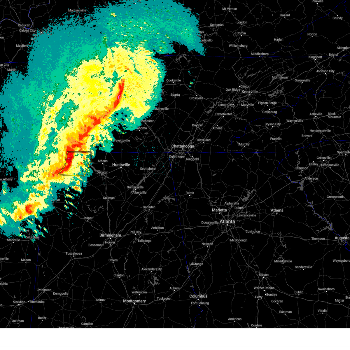 At 1101 pm cdt, severe thunderstorms were located along a line extending from near lexington to leighton to near littleville, moving east at 60 mph (radar indicated). Hazards include 60 mph wind gusts and half dollar size hail. Hail damage to vehicles is expected. expect wind damage to roofs, siding, and trees. Locations impacted include, florence, muscle shoals, sheffield, tuscumbia, rogersville, killen, town creek, littleville, lexington and leighton. At 1101 pm cdt, severe thunderstorms were located along a line extending from near lexington to leighton to near littleville, moving east at 60 mph (radar indicated). Hazards include 60 mph wind gusts and half dollar size hail. Hail damage to vehicles is expected. expect wind damage to roofs, siding, and trees. Locations impacted include, florence, muscle shoals, sheffield, tuscumbia, rogersville, killen, town creek, littleville, lexington and leighton.
|
| 3/24/2023 10:58 PM CDT |
 At 1058 pm cdt, a severe thunderstorm capable of producing a tornado was located near st. florian, or near florence, moving east at 60 mph (radar indicated rotation). Hazards include tornado and half dollar size hail. Flying debris will be dangerous to those caught without shelter. mobile homes will be damaged or destroyed. damage to roofs, windows, and vehicles will occur. Tree damage is likely. At 1058 pm cdt, a severe thunderstorm capable of producing a tornado was located near st. florian, or near florence, moving east at 60 mph (radar indicated rotation). Hazards include tornado and half dollar size hail. Flying debris will be dangerous to those caught without shelter. mobile homes will be damaged or destroyed. damage to roofs, windows, and vehicles will occur. Tree damage is likely.
|
| 3/24/2023 10:51 PM CDT |
 At 1050 pm cdt, severe thunderstorms were located along a line extending from near underwood-petersville to tuscumbia to crooked oak, moving east at 60 mph (radar indicated). Hazards include 60 mph wind gusts and half dollar size hail. Hail damage to vehicles is expected. expect wind damage to roofs, siding, and trees. Locations impacted include, florence, muscle shoals, russellville, sheffield, tuscumbia, rogersville, killen, town creek, littleville and lexington. At 1050 pm cdt, severe thunderstorms were located along a line extending from near underwood-petersville to tuscumbia to crooked oak, moving east at 60 mph (radar indicated). Hazards include 60 mph wind gusts and half dollar size hail. Hail damage to vehicles is expected. expect wind damage to roofs, siding, and trees. Locations impacted include, florence, muscle shoals, russellville, sheffield, tuscumbia, rogersville, killen, town creek, littleville and lexington.
|
| 3/24/2023 10:41 PM CDT |
 At 1040 pm cdt, severe thunderstorms were located along a line extending from underwood-petersville to barton to 6 miles northeast of red bay, moving east at 55 mph (radar indicated). Hazards include 60 mph wind gusts and half dollar size hail. Hail damage to vehicles is expected. Expect wind damage to roofs, siding, and trees. At 1040 pm cdt, severe thunderstorms were located along a line extending from underwood-petersville to barton to 6 miles northeast of red bay, moving east at 55 mph (radar indicated). Hazards include 60 mph wind gusts and half dollar size hail. Hail damage to vehicles is expected. Expect wind damage to roofs, siding, and trees.
|
| 3/3/2023 11:09 AM CST |
 At 1108 am cst, a severe thunderstorm was located 7 miles east of pulaski, moving northeast at 60 mph (radar indicated). Hazards include 70 mph wind gusts. Expect considerable tree damage. damage is likely to mobile homes, roofs, and outbuildings. locations impacted include, lewisburg, pulaski, ardmore, cornersville, elkton, lynnville, belfast, goodspring, frankewing, culleoka, prospect and farmington. this includes interstate 65 between mile markers 1 and 44. thunderstorm damage threat, considerable hail threat, radar indicated max hail size, <. 75 in wind threat, radar indicated max wind gust, 70 mph. At 1108 am cst, a severe thunderstorm was located 7 miles east of pulaski, moving northeast at 60 mph (radar indicated). Hazards include 70 mph wind gusts. Expect considerable tree damage. damage is likely to mobile homes, roofs, and outbuildings. locations impacted include, lewisburg, pulaski, ardmore, cornersville, elkton, lynnville, belfast, goodspring, frankewing, culleoka, prospect and farmington. this includes interstate 65 between mile markers 1 and 44. thunderstorm damage threat, considerable hail threat, radar indicated max hail size, <. 75 in wind threat, radar indicated max wind gust, 70 mph.
|
| 3/3/2023 10:55 AM CST |
 At 1055 am cst, a severe thunderstorm was located 10 miles southwest of pulaski, moving northeast at 60 mph (radar indicated). Hazards include 70 mph wind gusts. Expect considerable tree damage. Damage is likely to mobile homes, roofs, and outbuildings. At 1055 am cst, a severe thunderstorm was located 10 miles southwest of pulaski, moving northeast at 60 mph (radar indicated). Hazards include 70 mph wind gusts. Expect considerable tree damage. Damage is likely to mobile homes, roofs, and outbuildings.
|
| 3/1/2023 9:21 PM CST |
 The severe thunderstorm warning for limestone, southeastern lauderdale, northwestern morgan and northern lawrence counties will expire at 930 pm cst, the storms which prompted the warning have weakened below severe limits, and no longer pose an immediate threat to life or property. therefore, the warning will be allowed to expire. however small hail, gusty winds and heavy rain are still possible with these thunderstorms. a tornado watch remains in effect until 200 am cst for north central and northwestern alabama, and middle tennessee. The severe thunderstorm warning for limestone, southeastern lauderdale, northwestern morgan and northern lawrence counties will expire at 930 pm cst, the storms which prompted the warning have weakened below severe limits, and no longer pose an immediate threat to life or property. therefore, the warning will be allowed to expire. however small hail, gusty winds and heavy rain are still possible with these thunderstorms. a tornado watch remains in effect until 200 am cst for north central and northwestern alabama, and middle tennessee.
|
| 3/1/2023 9:10 PM CST |
 At 910 pm cst, severe thunderstorms were located along a line extending from 10 miles east of lexington to courtland to 7 miles south of town creek, moving east at 40 mph (radar indicated). Hazards include 60 mph wind gusts. Expect damage to roofs, siding, and trees. locations impacted include, decatur, athens, trinity, rogersville, ardmore, town creek, courtland, tanner, north courtland and hillsboro. hail threat, radar indicated max hail size, <. 75 in wind threat, radar indicated max wind gust, 60 mph. At 910 pm cst, severe thunderstorms were located along a line extending from 10 miles east of lexington to courtland to 7 miles south of town creek, moving east at 40 mph (radar indicated). Hazards include 60 mph wind gusts. Expect damage to roofs, siding, and trees. locations impacted include, decatur, athens, trinity, rogersville, ardmore, town creek, courtland, tanner, north courtland and hillsboro. hail threat, radar indicated max hail size, <. 75 in wind threat, radar indicated max wind gust, 60 mph.
|
| 3/1/2023 8:54 PM CST |
 At 854 pm cst, severe thunderstorms were located along a line extending from near lexington to leighton to near littleville, moving east at 40 mph (radar indicated). Hazards include 60 mph wind gusts. expect damage to roofs, siding, and trees At 854 pm cst, severe thunderstorms were located along a line extending from near lexington to leighton to near littleville, moving east at 40 mph (radar indicated). Hazards include 60 mph wind gusts. expect damage to roofs, siding, and trees
|
| 3/1/2023 8:42 PM CST |
 At 842 pm cst, severe thunderstorms were located along a line extending from near loretto to near killen to near leighton, moving east at 45 mph (radar indicated). Hazards include 60 mph wind gusts and quarter size hail. Hail damage to vehicles is expected. expect wind damage to roofs, siding, and trees. locations impacted include, florence, muscle shoals, tuscumbia, rogersville, killen, town creek, lexington, leighton, st. Florian and anderson. At 842 pm cst, severe thunderstorms were located along a line extending from near loretto to near killen to near leighton, moving east at 45 mph (radar indicated). Hazards include 60 mph wind gusts and quarter size hail. Hail damage to vehicles is expected. expect wind damage to roofs, siding, and trees. locations impacted include, florence, muscle shoals, tuscumbia, rogersville, killen, town creek, lexington, leighton, st. Florian and anderson.
|
| 3/1/2023 8:28 PM CST |
 At 827 pm cst, severe thunderstorms were located along a line extending from st. florian to florence to tuscumbia, moving east at 45 mph (radar indicated). Hazards include 60 mph wind gusts and quarter size hail. Hail damage to vehicles is expected. Expect wind damage to roofs, siding, and trees. At 827 pm cst, severe thunderstorms were located along a line extending from st. florian to florence to tuscumbia, moving east at 45 mph (radar indicated). Hazards include 60 mph wind gusts and quarter size hail. Hail damage to vehicles is expected. Expect wind damage to roofs, siding, and trees.
|
| 2/16/2023 5:21 PM CST |
 At 520 pm cst, a severe thunderstorm was located 8 miles south of pulaski, moving east at 45 mph (radar indicated). Hazards include 60 mph wind gusts and quarter size hail. Hail damage to vehicles is expected. expect wind damage to roofs, siding, and trees. locations impacted include, pulaski, ardmore, elkton, minor hill, goodspring and prospect. this includes interstate 65 between mile markers 1 and 13. hail threat, radar indicated max hail size, 1. 00 in wind threat, radar indicated max wind gust, 60 mph. At 520 pm cst, a severe thunderstorm was located 8 miles south of pulaski, moving east at 45 mph (radar indicated). Hazards include 60 mph wind gusts and quarter size hail. Hail damage to vehicles is expected. expect wind damage to roofs, siding, and trees. locations impacted include, pulaski, ardmore, elkton, minor hill, goodspring and prospect. this includes interstate 65 between mile markers 1 and 13. hail threat, radar indicated max hail size, 1. 00 in wind threat, radar indicated max wind gust, 60 mph.
|
| 2/16/2023 5:01 PM CST |
 At 500 pm cst, a severe thunderstorm was located near lexington, or 15 miles south of lawrenceburg, moving east at 45 mph (radar indicated). Hazards include 60 mph wind gusts and quarter size hail. Hail damage to vehicles is expected. Expect wind damage to roofs, siding, and trees. At 500 pm cst, a severe thunderstorm was located near lexington, or 15 miles south of lawrenceburg, moving east at 45 mph (radar indicated). Hazards include 60 mph wind gusts and quarter size hail. Hail damage to vehicles is expected. Expect wind damage to roofs, siding, and trees.
|
| 11/29/2022 2:07 PM CST |
 The severe thunderstorm warning for northwestern limestone, southeastern lauderdale and northeastern lawrence counties will expire at 215 pm cst, the storm which prompted the warning has weakened below severe limits, and no longer poses an immediate threat to life or property. therefore, the warning will be allowed to expire. however gusty winds are still possible with this thunderstorm. to report severe weather, contact your nearest law enforcement agency. they will relay your report to the national weather service huntsville alabama. The severe thunderstorm warning for northwestern limestone, southeastern lauderdale and northeastern lawrence counties will expire at 215 pm cst, the storm which prompted the warning has weakened below severe limits, and no longer poses an immediate threat to life or property. therefore, the warning will be allowed to expire. however gusty winds are still possible with this thunderstorm. to report severe weather, contact your nearest law enforcement agency. they will relay your report to the national weather service huntsville alabama.
|
| 11/29/2022 1:51 PM CST |
 At 151 pm cst, a severe thunderstorm was located near rogersville, or 16 miles east of muscle shoals, moving east at 45 mph (radar indicated). Hazards include 60 mph wind gusts and quarter size hail. Hail damage to vehicles is expected. Expect wind damage to roofs, siding, and trees. At 151 pm cst, a severe thunderstorm was located near rogersville, or 16 miles east of muscle shoals, moving east at 45 mph (radar indicated). Hazards include 60 mph wind gusts and quarter size hail. Hail damage to vehicles is expected. Expect wind damage to roofs, siding, and trees.
|
| 7/12/2022 10:54 PM CDT |
 At 1053 pm cdt, severe thunderstorms were located along a line extending from collinwood to lynnville, moving southeast at 10 mph (radar indicated). Hazards include 60 mph wind gusts and quarter size hail. Hail damage to vehicles is expected. Expect wind damage to roofs, siding, and trees. At 1053 pm cdt, severe thunderstorms were located along a line extending from collinwood to lynnville, moving southeast at 10 mph (radar indicated). Hazards include 60 mph wind gusts and quarter size hail. Hail damage to vehicles is expected. Expect wind damage to roofs, siding, and trees.
|
| 5/25/2022 5:11 PM CDT |
 At 511 pm cdt, severe thunderstorms were located along a line extending from near hohenwald to near lawrenceburg to 9 miles northeast of lexington, moving northeast at 50 mph (radar indicated). Hazards include 60 mph wind gusts. expect damage to roofs, siding, and trees At 511 pm cdt, severe thunderstorms were located along a line extending from near hohenwald to near lawrenceburg to 9 miles northeast of lexington, moving northeast at 50 mph (radar indicated). Hazards include 60 mph wind gusts. expect damage to roofs, siding, and trees
|
| 5/25/2022 5:03 PM CDT |
 At 502 pm cdt, severe thunderstorms were located along a line extending from 9 miles south of hohenwald to near loretto, moving northeast at 45 mph (radar indicated). Hazards include 60 mph wind gusts. Expect damage to roofs, siding, and trees. locations impacted include, lawrenceburg, hohenwald, loretto, st. joseph, minor hill, ethridge, henryville, goodspring, leoma and westpoint. hail threat, radar indicated max hail size, <. 75 in wind threat, radar indicated max wind gust, 60 mph. At 502 pm cdt, severe thunderstorms were located along a line extending from 9 miles south of hohenwald to near loretto, moving northeast at 45 mph (radar indicated). Hazards include 60 mph wind gusts. Expect damage to roofs, siding, and trees. locations impacted include, lawrenceburg, hohenwald, loretto, st. joseph, minor hill, ethridge, henryville, goodspring, leoma and westpoint. hail threat, radar indicated max hail size, <. 75 in wind threat, radar indicated max wind gust, 60 mph.
|
| 5/25/2022 4:48 PM CDT |
 At 448 pm cdt, severe thunderstorms were located along a line extending from near waynesboro to near loretto, moving northeast at 45 mph (radar indicated). Hazards include 60 mph wind gusts. expect damage to roofs, siding, and trees At 448 pm cdt, severe thunderstorms were located along a line extending from near waynesboro to near loretto, moving northeast at 45 mph (radar indicated). Hazards include 60 mph wind gusts. expect damage to roofs, siding, and trees
|
| 5/21/2022 6:52 PM CDT |
 The severe thunderstorm warning for southeastern lawrence and southern giles counties will expire at 700 pm cdt, the storm which prompted the warning has weakened below severe limits, and no longer poses an immediate threat to life or property. therefore, the warning will be allowed to expire. however gusty winds are still possible with this thunderstorm. The severe thunderstorm warning for southeastern lawrence and southern giles counties will expire at 700 pm cdt, the storm which prompted the warning has weakened below severe limits, and no longer poses an immediate threat to life or property. therefore, the warning will be allowed to expire. however gusty winds are still possible with this thunderstorm.
|
| 5/21/2022 6:44 PM CDT |
 At 644 pm cdt, severe thunderstorms were located along a line extending from 14 miles west of ardmore to 8 miles east of rogersville, moving east at 30 mph (radar indicated). Hazards include 60 mph wind gusts and quarter size hail. Hail damage to vehicles is expected. Expect wind damage to roofs, siding, and trees. At 644 pm cdt, severe thunderstorms were located along a line extending from 14 miles west of ardmore to 8 miles east of rogersville, moving east at 30 mph (radar indicated). Hazards include 60 mph wind gusts and quarter size hail. Hail damage to vehicles is expected. Expect wind damage to roofs, siding, and trees.
|
| 5/21/2022 6:23 PM CDT |
 At 623 pm cdt, a severe thunderstorm was located near lexington, or 18 miles south of lawrenceburg, moving northeast at 20 mph (radar indicated). Hazards include 60 mph wind gusts and quarter size hail. Hail damage to vehicles is expected. Expect wind damage to roofs, siding, and trees. At 623 pm cdt, a severe thunderstorm was located near lexington, or 18 miles south of lawrenceburg, moving northeast at 20 mph (radar indicated). Hazards include 60 mph wind gusts and quarter size hail. Hail damage to vehicles is expected. Expect wind damage to roofs, siding, and trees.
|
| 4/13/2022 8:22 PM CDT |
 At 822 pm cdt, severe thunderstorms were located along a line extending from 6 miles northeast of ardmore to near athens to 7 miles west of tanner to 6 miles southeast of courtland, moving east at 55 mph (radar indicated). Hazards include 60 mph wind gusts. Expect damage to roofs, siding, and trees. locations impacted include, huntsville, decatur, madison, athens, hartselle, redstone arsenal, meridianville, moores mill, hazel green and priceville. hail threat, radar indicated max hail size, <. 75 in wind threat, radar indicated max wind gust, 60 mph. At 822 pm cdt, severe thunderstorms were located along a line extending from 6 miles northeast of ardmore to near athens to 7 miles west of tanner to 6 miles southeast of courtland, moving east at 55 mph (radar indicated). Hazards include 60 mph wind gusts. Expect damage to roofs, siding, and trees. locations impacted include, huntsville, decatur, madison, athens, hartselle, redstone arsenal, meridianville, moores mill, hazel green and priceville. hail threat, radar indicated max hail size, <. 75 in wind threat, radar indicated max wind gust, 60 mph.
|
| 4/13/2022 8:17 PM CDT |
 At 816 pm cdt, severe thunderstorms were located along a line extending from 11 miles east of pulaski to 8 miles southwest of ardmore to 9 miles north of trinity to 6 miles northwest of moulton, moving east at 50 mph (radar indicated). Hazards include 60 mph wind gusts and penny size hail. Expect damage to roofs, siding, and trees. locations impacted include, moulton, rogersville, courtland, north courtland, hillsboro, anderson, lester, good springs, coxey and oliver. hail threat, radar indicated max hail size, 0. 75 in wind threat, radar indicated max wind gust, 60 mph. At 816 pm cdt, severe thunderstorms were located along a line extending from 11 miles east of pulaski to 8 miles southwest of ardmore to 9 miles north of trinity to 6 miles northwest of moulton, moving east at 50 mph (radar indicated). Hazards include 60 mph wind gusts and penny size hail. Expect damage to roofs, siding, and trees. locations impacted include, moulton, rogersville, courtland, north courtland, hillsboro, anderson, lester, good springs, coxey and oliver. hail threat, radar indicated max hail size, 0. 75 in wind threat, radar indicated max wind gust, 60 mph.
|
| 4/13/2022 8:16 PM CDT |
 At 815 pm cdt, severe thunderstorms were located along a line extending from 9 miles south of murfreesboro to near ardmore, moving east at 60 mph (radar indicated). Hazards include 70 mph wind gusts. Expect considerable tree damage. damage is likely to mobile homes, roofs, and outbuildings. locations impacted include, shelbyville, lewisburg, manchester, pulaski, tullahoma, chapel hill, ardmore, cornersville, wartrace, eagleville, elkton, bell buckle, normandy, beechgrove, raus, fosterville, rover, belfast, frankewing and bradyville. this includes the following highways, interstate 65 between mile markers 1 and 25. interstate 24 between mile markers 87 and 111. thunderstorm damage threat, considerable hail threat, radar indicated max hail size, <. 75 in wind threat, radar indicated max wind gust, 70 mph. At 815 pm cdt, severe thunderstorms were located along a line extending from 9 miles south of murfreesboro to near ardmore, moving east at 60 mph (radar indicated). Hazards include 70 mph wind gusts. Expect considerable tree damage. damage is likely to mobile homes, roofs, and outbuildings. locations impacted include, shelbyville, lewisburg, manchester, pulaski, tullahoma, chapel hill, ardmore, cornersville, wartrace, eagleville, elkton, bell buckle, normandy, beechgrove, raus, fosterville, rover, belfast, frankewing and bradyville. this includes the following highways, interstate 65 between mile markers 1 and 25. interstate 24 between mile markers 87 and 111. thunderstorm damage threat, considerable hail threat, radar indicated max hail size, <. 75 in wind threat, radar indicated max wind gust, 70 mph.
|
| 4/13/2022 8:09 PM CDT |
 At 808 pm cdt, severe thunderstorms were located along a line extending from 6 miles southeast of pulaski to 9 miles northwest of athens to near courtland to 9 miles west of moulton, moving east at 45 mph (radar indicated). Hazards include 60 mph wind gusts and penny size hail. Expect damage to roofs, siding, and trees. locations impacted include, moulton, trinity, rogersville, town creek, lexington, leighton, courtland, north courtland, hillsboro and anderson. hail threat, radar indicated max hail size, 0. 75 in wind threat, radar indicated max wind gust, 60 mph. At 808 pm cdt, severe thunderstorms were located along a line extending from 6 miles southeast of pulaski to 9 miles northwest of athens to near courtland to 9 miles west of moulton, moving east at 45 mph (radar indicated). Hazards include 60 mph wind gusts and penny size hail. Expect damage to roofs, siding, and trees. locations impacted include, moulton, trinity, rogersville, town creek, lexington, leighton, courtland, north courtland, hillsboro and anderson. hail threat, radar indicated max hail size, 0. 75 in wind threat, radar indicated max wind gust, 60 mph.
|
| 4/13/2022 8:02 PM CDT |
 At 802 pm cdt, severe thunderstorms were located along a line extending from 14 miles southwest of pulaski to rogersville to town creek to 6 miles east of littleville, moving east at 40 mph (radar indicated). Hazards include 60 mph wind gusts. expect damage to roofs, siding, and trees At 802 pm cdt, severe thunderstorms were located along a line extending from 14 miles southwest of pulaski to rogersville to town creek to 6 miles east of littleville, moving east at 40 mph (radar indicated). Hazards include 60 mph wind gusts. expect damage to roofs, siding, and trees
|
| 4/13/2022 7:54 PM CDT |
 At 753 pm cdt, severe thunderstorms were located along a line extending from 7 miles east of spring hill to 13 miles east of lexington, moving east at 60 mph (radar indicated). Hazards include 70 mph wind gusts. Expect considerable tree damage. Damage is likely to mobile homes, roofs, and outbuildings. At 753 pm cdt, severe thunderstorms were located along a line extending from 7 miles east of spring hill to 13 miles east of lexington, moving east at 60 mph (radar indicated). Hazards include 70 mph wind gusts. Expect considerable tree damage. Damage is likely to mobile homes, roofs, and outbuildings.
|
| 4/13/2022 7:47 PM CDT |
 At 745 pm cdt, severe thunderstorms were located along a line extending from near spring hill to 8 miles southwest of pulaski, moving east at 65 mph (radar indicated). Hazards include 70 mph wind gusts. Expect considerable tree damage. damage is likely to mobile homes, roofs, and outbuildings. locations impacted include, columbia, lewisburg, lawrenceburg, pulaski, spring hill, mount pleasant, loretto, chapel hill, ardmore, cornersville, elkton, minor hill, ethridge, lynnville, culleoka, i-65 east of columbia, goodspring, leoma, frankewing and williamsport. this includes interstate 65 between mile markers 1 and 51. thunderstorm damage threat, considerable hail threat, radar indicated max hail size, <. 75 in wind threat, radar indicated max wind gust, 70 mph. At 745 pm cdt, severe thunderstorms were located along a line extending from near spring hill to 8 miles southwest of pulaski, moving east at 65 mph (radar indicated). Hazards include 70 mph wind gusts. Expect considerable tree damage. damage is likely to mobile homes, roofs, and outbuildings. locations impacted include, columbia, lewisburg, lawrenceburg, pulaski, spring hill, mount pleasant, loretto, chapel hill, ardmore, cornersville, elkton, minor hill, ethridge, lynnville, culleoka, i-65 east of columbia, goodspring, leoma, frankewing and williamsport. this includes interstate 65 between mile markers 1 and 51. thunderstorm damage threat, considerable hail threat, radar indicated max hail size, <. 75 in wind threat, radar indicated max wind gust, 70 mph.
|
| 4/13/2022 7:46 PM CDT |
 At 746 pm cdt, severe thunderstorms were located along a line extending from 7 miles southeast of lawrenceburg to near lexington to near leighton to near russellville, moving east at 45 mph (radar indicated). Hazards include 60 mph wind gusts and penny size hail. Expect damage to roofs, siding, and trees. locations impacted include, florence, muscle shoals, russellville, sheffield, tuscumbia, moulton, trinity, rogersville, killen and town creek. hail threat, radar indicated max hail size, 0. 75 in wind threat, radar indicated max wind gust, 60 mph. At 746 pm cdt, severe thunderstorms were located along a line extending from 7 miles southeast of lawrenceburg to near lexington to near leighton to near russellville, moving east at 45 mph (radar indicated). Hazards include 60 mph wind gusts and penny size hail. Expect damage to roofs, siding, and trees. locations impacted include, florence, muscle shoals, russellville, sheffield, tuscumbia, moulton, trinity, rogersville, killen and town creek. hail threat, radar indicated max hail size, 0. 75 in wind threat, radar indicated max wind gust, 60 mph.
|
| 4/13/2022 7:28 PM CDT |
 At 727 pm cdt, severe thunderstorms were located along a line extending from 7 miles northwest of loretto to near underwood-petersville to 6 miles west of tuscumbia to 10 miles northwest of belgreen, moving east at 45 mph (radar indicated). Hazards include 60 mph wind gusts and penny size hail. expect damage to roofs, siding, and trees At 727 pm cdt, severe thunderstorms were located along a line extending from 7 miles northwest of loretto to near underwood-petersville to 6 miles west of tuscumbia to 10 miles northwest of belgreen, moving east at 45 mph (radar indicated). Hazards include 60 mph wind gusts and penny size hail. expect damage to roofs, siding, and trees
|
| 4/13/2022 7:19 PM CDT |
 At 718 pm cdt, severe thunderstorms were located along a line extending from 9 miles southeast of centerville to 9 miles west of loretto, moving east at 65 mph (radar indicated). Hazards include 70 mph wind gusts. Expect considerable tree damage. Damage is likely to mobile homes, roofs, and outbuildings. At 718 pm cdt, severe thunderstorms were located along a line extending from 9 miles southeast of centerville to 9 miles west of loretto, moving east at 65 mph (radar indicated). Hazards include 70 mph wind gusts. Expect considerable tree damage. Damage is likely to mobile homes, roofs, and outbuildings.
|
| 4/13/2022 7:05 PM CDT |
 At 705 pm cdt, severe thunderstorms were located along a line extending from collinwood to 10 miles southeast of walnut grove to 6 miles east of iuka to near midway, moving east at 55 mph (radar indicated). Hazards include 60 mph wind gusts and quarter size hail. Hail damage to vehicles is expected. expect wind damage to roofs, siding, and trees. locations impacted include, florence, muscle shoals, sheffield, tuscumbia, rogersville, killen, town creek, cherokee, lexington and leighton. hail threat, radar indicated max hail size, 1. 00 in wind threat, radar indicated max wind gust, 60 mph. At 705 pm cdt, severe thunderstorms were located along a line extending from collinwood to 10 miles southeast of walnut grove to 6 miles east of iuka to near midway, moving east at 55 mph (radar indicated). Hazards include 60 mph wind gusts and quarter size hail. Hail damage to vehicles is expected. expect wind damage to roofs, siding, and trees. locations impacted include, florence, muscle shoals, sheffield, tuscumbia, rogersville, killen, town creek, cherokee, lexington and leighton. hail threat, radar indicated max hail size, 1. 00 in wind threat, radar indicated max wind gust, 60 mph.
|
| 4/13/2022 6:36 PM CDT |
 At 635 pm cdt, severe thunderstorms were located along a line extending from 6 miles southwest of adamsville to 6 miles northeast of corinth to glen to near hinkle, moving east at 70 mph (radar indicated). Hazards include 60 mph wind gusts and quarter size hail. Hail damage to vehicles is expected. Expect wind damage to roofs, siding, and trees. At 635 pm cdt, severe thunderstorms were located along a line extending from 6 miles southwest of adamsville to 6 miles northeast of corinth to glen to near hinkle, moving east at 70 mph (radar indicated). Hazards include 60 mph wind gusts and quarter size hail. Hail damage to vehicles is expected. Expect wind damage to roofs, siding, and trees.
|
| 3/30/2022 9:27 PM CDT |
 At 926 pm cdt, severe thunderstorms were located along a line extending from pulaski to near poplar springs, moving northeast at 55 mph (radar indicated). Hazards include 60 mph wind gusts. expect damage to roofs, siding, and trees At 926 pm cdt, severe thunderstorms were located along a line extending from pulaski to near poplar springs, moving northeast at 55 mph (radar indicated). Hazards include 60 mph wind gusts. expect damage to roofs, siding, and trees
|
| 3/22/2022 6:01 PM CDT |
 At 601 pm cdt, a severe thunderstorm was located near pulaski, moving north at 60 mph (radar indicated). Hazards include 60 mph wind gusts. Expect damage to roofs, siding, and trees. locations impacted include, lawrenceburg, pulaski, summertown, ardmore, elkton, ethridge, lynnville, goodspring, frankewing and prospect. this includes interstate 65 between mile markers 1 and 22. hail threat, radar indicated max hail size, <. 75 in wind threat, radar indicated max wind gust, 60 mph. At 601 pm cdt, a severe thunderstorm was located near pulaski, moving north at 60 mph (radar indicated). Hazards include 60 mph wind gusts. Expect damage to roofs, siding, and trees. locations impacted include, lawrenceburg, pulaski, summertown, ardmore, elkton, ethridge, lynnville, goodspring, frankewing and prospect. this includes interstate 65 between mile markers 1 and 22. hail threat, radar indicated max hail size, <. 75 in wind threat, radar indicated max wind gust, 60 mph.
|
| 3/22/2022 5:45 PM CDT |
 At 544 pm cdt, a severe thunderstorm was located 10 miles east of lexington, or 16 miles southwest of pulaski, moving north at 60 mph (radar indicated). Hazards include 60 mph wind gusts. expect damage to roofs, siding, and trees At 544 pm cdt, a severe thunderstorm was located 10 miles east of lexington, or 16 miles southwest of pulaski, moving north at 60 mph (radar indicated). Hazards include 60 mph wind gusts. expect damage to roofs, siding, and trees
|
| 2/22/2022 6:13 PM CST |
 The severe thunderstorm warning for southeastern lawrence and central giles counties will expire at 615 pm cst, the storm which prompted the warning has weakened below severe limits, and no longer poses an immediate threat to life or property. therefore, the warning will be allowed to expire. however gusty winds and heavy rain are still possible with this thunderstorm. The severe thunderstorm warning for southeastern lawrence and central giles counties will expire at 615 pm cst, the storm which prompted the warning has weakened below severe limits, and no longer poses an immediate threat to life or property. therefore, the warning will be allowed to expire. however gusty winds and heavy rain are still possible with this thunderstorm.
|
| 2/22/2022 5:57 PM CST |
 At 556 pm cst, a severe thunderstorm was located 8 miles south of lawrenceburg, moving east at 50 mph (radar indicated). Hazards include 60 mph wind gusts and quarter size hail. Hail damage to vehicles is expected. expect wind damage to roofs, siding, and trees. locations impacted include, lawrenceburg, pulaski, loretto, goodspring and leoma. hail threat, observed max hail size, 1. 00 in wind threat, radar indicated max wind gust, 60 mph. At 556 pm cst, a severe thunderstorm was located 8 miles south of lawrenceburg, moving east at 50 mph (radar indicated). Hazards include 60 mph wind gusts and quarter size hail. Hail damage to vehicles is expected. expect wind damage to roofs, siding, and trees. locations impacted include, lawrenceburg, pulaski, loretto, goodspring and leoma. hail threat, observed max hail size, 1. 00 in wind threat, radar indicated max wind gust, 60 mph.
|
| 2/22/2022 5:40 PM CST |
 At 540 pm cst, a severe thunderstorm was located near loretto, or 16 miles southwest of lawrenceburg, moving east at 55 mph (radar indicated). Hazards include 60 mph wind gusts and quarter size hail. Hail damage to vehicles is expected. Expect wind damage to roofs, siding, and trees. At 540 pm cst, a severe thunderstorm was located near loretto, or 16 miles southwest of lawrenceburg, moving east at 55 mph (radar indicated). Hazards include 60 mph wind gusts and quarter size hail. Hail damage to vehicles is expected. Expect wind damage to roofs, siding, and trees.
|
| 1/1/2022 5:05 PM CST |
 The severe thunderstorm warning for northern limestone county will expire at 515 pm cst, the storm which prompted the warning has weakened below severe limits, and has exited the warned area. therefore, the warning will be allowed to expire. a tornado watch remains in effect until 700 pm cst for north central and northwestern alabama, and middle tennessee. The severe thunderstorm warning for northern limestone county will expire at 515 pm cst, the storm which prompted the warning has weakened below severe limits, and has exited the warned area. therefore, the warning will be allowed to expire. a tornado watch remains in effect until 700 pm cst for north central and northwestern alabama, and middle tennessee.
|
| 1/1/2022 4:43 PM CST |
 At 443 pm cst, a severe thunderstorm was located 10 miles northeast of rogersville, or 11 miles northwest of athens, moving east at 45 mph (radar indicated). Hazards include 60 mph wind gusts. Expect damage to roofs, siding, and trees. locations impacted include, ardmore, elkmont, lester, good springs, cartwright, cairo, holland gin, mt rozell and leggtown. hail threat, radar indicated max hail size, <. 75 in wind threat, radar indicated max wind gust, 60 mph. At 443 pm cst, a severe thunderstorm was located 10 miles northeast of rogersville, or 11 miles northwest of athens, moving east at 45 mph (radar indicated). Hazards include 60 mph wind gusts. Expect damage to roofs, siding, and trees. locations impacted include, ardmore, elkmont, lester, good springs, cartwright, cairo, holland gin, mt rozell and leggtown. hail threat, radar indicated max hail size, <. 75 in wind threat, radar indicated max wind gust, 60 mph.
|
| 1/1/2022 4:27 PM CST |
 At 426 pm cst, a severe thunderstorm was located near rogersville, or 17 miles east of florence, moving east at 50 mph (radar indicated). Hazards include 60 mph wind gusts. expect damage to roofs, siding, and trees At 426 pm cst, a severe thunderstorm was located near rogersville, or 17 miles east of florence, moving east at 50 mph (radar indicated). Hazards include 60 mph wind gusts. expect damage to roofs, siding, and trees
|
| 1/1/2022 4:11 PM CST |
 At 411 pm cst, a severe thunderstorm was located 14 miles south of pulaski, moving east at 40 mph (radar indicated). Hazards include 60 mph wind gusts. expect damage to roofs, siding, and trees At 411 pm cst, a severe thunderstorm was located 14 miles south of pulaski, moving east at 40 mph (radar indicated). Hazards include 60 mph wind gusts. expect damage to roofs, siding, and trees
|
| 12/11/2021 5:50 AM CST |
 At 550 am cst, severe thunderstorms were located along a line extending from lexington to near russellville to 8 miles southeast of red bay, moving east at 35 mph (radar indicated). Hazards include 60 mph wind gusts. expect damage to roofs, siding, and trees At 550 am cst, severe thunderstorms were located along a line extending from lexington to near russellville to 8 miles southeast of red bay, moving east at 35 mph (radar indicated). Hazards include 60 mph wind gusts. expect damage to roofs, siding, and trees
|
| 12/11/2021 5:38 AM CST |
 At 537 am cst, severe thunderstorms were located along a line extending from 6 miles north of st. florian to near red bay, moving southeast at 20 mph (radar indicated). Hazards include 60 mph wind gusts. Expect damage to roofs, siding, and trees. locations impacted include, florence, muscle shoals, russellville, sheffield, tuscumbia, red bay, killen, littleville, lexington and leighton. hail threat, radar indicated max hail size, <. 75 in wind threat, radar indicated max wind gust, 60 mph. At 537 am cst, severe thunderstorms were located along a line extending from 6 miles north of st. florian to near red bay, moving southeast at 20 mph (radar indicated). Hazards include 60 mph wind gusts. Expect damage to roofs, siding, and trees. locations impacted include, florence, muscle shoals, russellville, sheffield, tuscumbia, red bay, killen, littleville, lexington and leighton. hail threat, radar indicated max hail size, <. 75 in wind threat, radar indicated max wind gust, 60 mph.
|
| 12/11/2021 5:27 AM CST |
 At 527 am cst, severe thunderstorms were located along a line extending from 7 miles north of st. florian to near red bay, moving southeast at 20 mph (radar indicated). Hazards include 70 mph wind gusts. Expect considerable tree damage. Damage is likely to mobile homes, roofs, and outbuildings. At 527 am cst, severe thunderstorms were located along a line extending from 7 miles north of st. florian to near red bay, moving southeast at 20 mph (radar indicated). Hazards include 70 mph wind gusts. Expect considerable tree damage. Damage is likely to mobile homes, roofs, and outbuildings.
|
| 12/6/2021 7:03 AM CST |
 At 702 am cst, severe thunderstorms were located along a line extending from 9 miles west of lewisburg to 7 miles northeast of lexington, moving east at 50 mph (radar indicated). Hazards include 60 mph wind gusts. Expect damage to roofs, siding, and trees. locations impacted include, pulaski, loretto, ardmore, st. joseph, elkton, minor hill, lynnville, goodspring, leoma, frankewing and prospect. This includes interstate 65 between mile markers 1 and 22. At 702 am cst, severe thunderstorms were located along a line extending from 9 miles west of lewisburg to 7 miles northeast of lexington, moving east at 50 mph (radar indicated). Hazards include 60 mph wind gusts. Expect damage to roofs, siding, and trees. locations impacted include, pulaski, loretto, ardmore, st. joseph, elkton, minor hill, lynnville, goodspring, leoma, frankewing and prospect. This includes interstate 65 between mile markers 1 and 22.
|
| 12/6/2021 6:32 AM CST |
 At 632 am cst, severe thunderstorms were located along a line extending from near summertown to collinwood, moving east at 50 mph (radar indicated). Hazards include 60 mph wind gusts. expect damage to roofs, siding, and trees At 632 am cst, severe thunderstorms were located along a line extending from near summertown to collinwood, moving east at 50 mph (radar indicated). Hazards include 60 mph wind gusts. expect damage to roofs, siding, and trees
|
| 6/3/2021 3:10 AM CDT |
 The severe thunderstorm warning for southeastern lauderdale, northwestern limestone and north central lawrence counties will expire at 315 am cdt, the storm which prompted the warning has weakened below severe limits, and no longer poses an immediate threat to life or property. therefore, the warning will be allowed to expire. however heavy rain is still possible with this thunderstorm. The severe thunderstorm warning for southeastern lauderdale, northwestern limestone and north central lawrence counties will expire at 315 am cdt, the storm which prompted the warning has weakened below severe limits, and no longer poses an immediate threat to life or property. therefore, the warning will be allowed to expire. however heavy rain is still possible with this thunderstorm.
|
| 6/3/2021 2:51 AM CDT |
 At 250 am cdt, a severe thunderstorm was located near rogersville, or 17 miles northwest of athens, moving northeast at 40 mph (radar indicated). Hazards include 60 mph wind gusts and quarter size hail. Hail damage to vehicles is expected. expect wind damage to roofs, siding, and trees. Locations impacted include, rogersville, anderson, lester, good springs, cartwright, coxey, oliver, mt rozell, ripley and kingtown. At 250 am cdt, a severe thunderstorm was located near rogersville, or 17 miles northwest of athens, moving northeast at 40 mph (radar indicated). Hazards include 60 mph wind gusts and quarter size hail. Hail damage to vehicles is expected. expect wind damage to roofs, siding, and trees. Locations impacted include, rogersville, anderson, lester, good springs, cartwright, coxey, oliver, mt rozell, ripley and kingtown.
|
| 6/3/2021 2:37 AM CDT |
 At 237 am cdt, a severe thunderstorm was located near rogersville, or 16 miles east of muscle shoals, moving east at 40 mph (radar indicated). Hazards include 60 mph wind gusts and quarter size hail. Hail damage to vehicles is expected. Expect wind damage to roofs, siding, and trees. At 237 am cdt, a severe thunderstorm was located near rogersville, or 16 miles east of muscle shoals, moving east at 40 mph (radar indicated). Hazards include 60 mph wind gusts and quarter size hail. Hail damage to vehicles is expected. Expect wind damage to roofs, siding, and trees.
|
| 5/6/2021 6:07 PM CDT |
 At 606 pm cdt, severe thunderstorms were located along a line extending from 8 miles northwest of athens to near courtland to near phil campbell to 8 miles north of weston, moving southeast at 45 mph (emergency management and doppler radar). Hazards include 60 mph wind gusts. Expect damage to roofs, siding, and trees. Locations impacted include, northwestern huntsville, decatur, madison, athens, hartselle, russellville, moulton, meridianville, moores mill and hazel green. At 606 pm cdt, severe thunderstorms were located along a line extending from 8 miles northwest of athens to near courtland to near phil campbell to 8 miles north of weston, moving southeast at 45 mph (emergency management and doppler radar). Hazards include 60 mph wind gusts. Expect damage to roofs, siding, and trees. Locations impacted include, northwestern huntsville, decatur, madison, athens, hartselle, russellville, moulton, meridianville, moores mill and hazel green.
|
| 5/6/2021 6:02 PM CDT |
 At 601 pm cdt, severe thunderstorms were located along a line extending from 14 miles south of nolensville to 13 miles northeast of rogersville, moving east at 50 mph (radar indicated). Hazards include 60 mph wind gusts. Expect damage to roofs, siding, and trees. locations impacted include, shelbyville, lewisburg, pulaski, chapel hill, ardmore, cornersville, eagleville, elkton, minor hill, bell buckle, lynnville, christiana, fosterville, rover, belfast, goodspring, deason, frankewing, rockvale and prospect. this includes the following highways, interstate 65 between mile markers 1 and 39. Interstate 24 between mile markers 86 and 91. At 601 pm cdt, severe thunderstorms were located along a line extending from 14 miles south of nolensville to 13 miles northeast of rogersville, moving east at 50 mph (radar indicated). Hazards include 60 mph wind gusts. Expect damage to roofs, siding, and trees. locations impacted include, shelbyville, lewisburg, pulaski, chapel hill, ardmore, cornersville, eagleville, elkton, minor hill, bell buckle, lynnville, christiana, fosterville, rover, belfast, goodspring, deason, frankewing, rockvale and prospect. this includes the following highways, interstate 65 between mile markers 1 and 39. Interstate 24 between mile markers 86 and 91.
|
| 5/6/2021 5:45 PM CDT |
 At 545 pm cdt, severe thunderstorms were located along a line extending from near thompson`s station to near lexington, moving east at 50 mph (radar indicated). Hazards include 60 mph wind gusts. expect damage to roofs, siding, and trees At 545 pm cdt, severe thunderstorms were located along a line extending from near thompson`s station to near lexington, moving east at 50 mph (radar indicated). Hazards include 60 mph wind gusts. expect damage to roofs, siding, and trees
|
| 5/6/2021 5:32 PM CDT |
 At 531 pm cdt, severe thunderstorms were located along a line extending from near thompson`s station to 6 miles east of mount pleasant to near loretto, moving east at 60 mph (radar indicated). Hazards include 60 mph wind gusts. Expect damage to roofs, siding, and trees. locations impacted include, columbia, lewisburg, lawrenceburg, pulaski, spring hill, mount pleasant, thompson`s station, loretto, summertown, chapel hill, cornersville, st. Joseph, minor hill, ethridge, lynnville, henryville, culleoka, goodspring, leoma and williamsport. At 531 pm cdt, severe thunderstorms were located along a line extending from near thompson`s station to 6 miles east of mount pleasant to near loretto, moving east at 60 mph (radar indicated). Hazards include 60 mph wind gusts. Expect damage to roofs, siding, and trees. locations impacted include, columbia, lewisburg, lawrenceburg, pulaski, spring hill, mount pleasant, thompson`s station, loretto, summertown, chapel hill, cornersville, st. Joseph, minor hill, ethridge, lynnville, henryville, culleoka, goodspring, leoma and williamsport.
|
| 5/6/2021 5:31 PM CDT |
 At 529 pm cdt, severe thunderstorms were located along a line extending from near loretto to near underwood-petersville to 7 miles east of tishomingo state park to near sandy springs, moving southeast at 45 mph (radar indicated). Hazards include 60 mph wind gusts and nickel size hail. expect damage to roofs, siding, and trees At 529 pm cdt, severe thunderstorms were located along a line extending from near loretto to near underwood-petersville to 7 miles east of tishomingo state park to near sandy springs, moving southeast at 45 mph (radar indicated). Hazards include 60 mph wind gusts and nickel size hail. expect damage to roofs, siding, and trees
|
| 5/6/2021 5:05 PM CDT |
 At 505 pm cdt, severe thunderstorms were located along a line extending from 10 miles northeast of centerville to near hohenwald to 8 miles southwest of collinwood, moving east at 60 mph (radar indicated). Hazards include 60 mph wind gusts. expect damage to roofs, siding, and trees At 505 pm cdt, severe thunderstorms were located along a line extending from 10 miles northeast of centerville to near hohenwald to 8 miles southwest of collinwood, moving east at 60 mph (radar indicated). Hazards include 60 mph wind gusts. expect damage to roofs, siding, and trees
|
| 3/28/2021 2:22 AM CDT |
 At 221 am cdt, severe thunderstorms were located along a line extending from 8 miles west of shelbyville to 8 miles west of ardmore, moving east at 35 mph (radar indicated). Hazards include 60 mph wind gusts. Expect damage to roofs, siding, and trees. locations impacted include, shelbyville, lewisburg, pulaski, ardmore, wartrace, elkton, minor hill, belfast, frankewing and prospect. This includes interstate 65 between mile markers 1 and 21. At 221 am cdt, severe thunderstorms were located along a line extending from 8 miles west of shelbyville to 8 miles west of ardmore, moving east at 35 mph (radar indicated). Hazards include 60 mph wind gusts. Expect damage to roofs, siding, and trees. locations impacted include, shelbyville, lewisburg, pulaski, ardmore, wartrace, elkton, minor hill, belfast, frankewing and prospect. This includes interstate 65 between mile markers 1 and 21.
|
| 3/28/2021 1:54 AM CDT |
 At 153 am cdt, severe thunderstorms were located along a line extending from near lewisburg to 6 miles northeast of lexington, moving east at 35 mph (radar indicated). Hazards include 60 mph wind gusts. expect damage to roofs, siding, and trees At 153 am cdt, severe thunderstorms were located along a line extending from near lewisburg to 6 miles northeast of lexington, moving east at 35 mph (radar indicated). Hazards include 60 mph wind gusts. expect damage to roofs, siding, and trees
|
| 3/16/2021 2:59 AM CDT |
 At 259 am cdt, a severe thunderstorm was located near lexington, or 19 miles south of lawrenceburg, moving east at 35 mph (radar indicated). Hazards include 60 mph wind gusts and quarter size hail. Hail damage to vehicles is expected. expect wind damage to roofs, siding, and trees. Locations impacted include, lexington and anderson. At 259 am cdt, a severe thunderstorm was located near lexington, or 19 miles south of lawrenceburg, moving east at 35 mph (radar indicated). Hazards include 60 mph wind gusts and quarter size hail. Hail damage to vehicles is expected. expect wind damage to roofs, siding, and trees. Locations impacted include, lexington and anderson.
|
| 3/16/2021 2:39 AM CDT |
 At 239 am cdt, a severe thunderstorm was located 7 miles southwest of loretto, or 15 miles northeast of florence, moving east at 45 mph (radar indicated). Hazards include 60 mph wind gusts and quarter size hail. Hail damage to vehicles is expected. expect wind damage to roofs, siding, and trees. Locations impacted include, lexington, anderson and green hill. At 239 am cdt, a severe thunderstorm was located 7 miles southwest of loretto, or 15 miles northeast of florence, moving east at 45 mph (radar indicated). Hazards include 60 mph wind gusts and quarter size hail. Hail damage to vehicles is expected. expect wind damage to roofs, siding, and trees. Locations impacted include, lexington, anderson and green hill.
|
| 3/16/2021 2:25 AM CDT |
 At 225 am cdt, a severe thunderstorm was located 11 miles northwest of underwood-petersville, or 14 miles northwest of florence, moving east at 40 mph (radar indicated). Hazards include 60 mph wind gusts and quarter size hail. Hail damage to vehicles is expected. Expect wind damage to roofs, siding, and trees. At 225 am cdt, a severe thunderstorm was located 11 miles northwest of underwood-petersville, or 14 miles northwest of florence, moving east at 40 mph (radar indicated). Hazards include 60 mph wind gusts and quarter size hail. Hail damage to vehicles is expected. Expect wind damage to roofs, siding, and trees.
|
| 8/28/2020 3:46 PM CDT |
 At 345 pm cdt, a severe thunderstorm was located near killen, or 8 miles east of florence, moving northeast at 45 mph (radar indicated). Hazards include 60 mph wind gusts. expect damage to roofs, siding, and trees At 345 pm cdt, a severe thunderstorm was located near killen, or 8 miles east of florence, moving northeast at 45 mph (radar indicated). Hazards include 60 mph wind gusts. expect damage to roofs, siding, and trees
|
| 7/5/2020 5:40 PM CDT |
 At 540 pm cdt, a severe thunderstorm was located 7 miles south of pulaski, moving northwest at 15 mph (radar indicated). Hazards include 60 mph wind gusts. expect damage to roofs, siding, and trees At 540 pm cdt, a severe thunderstorm was located 7 miles south of pulaski, moving northwest at 15 mph (radar indicated). Hazards include 60 mph wind gusts. expect damage to roofs, siding, and trees
|
| 5/4/2020 9:27 PM CDT |
 The severe thunderstorm warning for southern giles county will expire at 930 pm cdt, the storms which prompted the warning have moved out of the area. therefore, the warning will be allowed to expire. a severe thunderstorm watch remains in effect until midnight cdt for middle tennessee. The severe thunderstorm warning for southern giles county will expire at 930 pm cdt, the storms which prompted the warning have moved out of the area. therefore, the warning will be allowed to expire. a severe thunderstorm watch remains in effect until midnight cdt for middle tennessee.
|
| 5/4/2020 9:16 PM CDT |
 At 915 pm cdt, severe thunderstorms were located along a line extending from 12 miles west of fayetteville to 7 miles northwest of ardmore, moving southeast at 55 mph (radar indicated). Hazards include 60 mph wind gusts and penny size hail. Expect damage to roofs, siding, and trees. locations impacted include, pulaski, ardmore, elkton, goodspring, frankewing and prospect. This includes interstate 65 between mile markers 1 and 22. At 915 pm cdt, severe thunderstorms were located along a line extending from 12 miles west of fayetteville to 7 miles northwest of ardmore, moving southeast at 55 mph (radar indicated). Hazards include 60 mph wind gusts and penny size hail. Expect damage to roofs, siding, and trees. locations impacted include, pulaski, ardmore, elkton, goodspring, frankewing and prospect. This includes interstate 65 between mile markers 1 and 22.
|
| 5/4/2020 9:13 PM CDT |
 At 913 pm cdt, severe thunderstorms were located along a line extending from near petersburg to 7 miles northwest of ardmore, moving east at 50 mph (radar indicated). Hazards include 60 mph wind gusts and penny size hail. Expect damage to roofs, siding, and trees. locations impacted include, lewisburg, pulaski, ardmore, cornersville, elkton, lynnville, goodspring, frankewing and prospect. This includes interstate 65 between mile markers 1 and 33. At 913 pm cdt, severe thunderstorms were located along a line extending from near petersburg to 7 miles northwest of ardmore, moving east at 50 mph (radar indicated). Hazards include 60 mph wind gusts and penny size hail. Expect damage to roofs, siding, and trees. locations impacted include, lewisburg, pulaski, ardmore, cornersville, elkton, lynnville, goodspring, frankewing and prospect. This includes interstate 65 between mile markers 1 and 33.
|
| 5/4/2020 9:00 PM CDT |
 At 900 pm cdt, severe thunderstorms were located along a line extending from 11 miles west of lewisburg to 9 miles southwest of pulaski, moving east at 60 mph (radar indicated). Hazards include 70 mph wind gusts and quarter size hail. Hail damage to vehicles is expected. expect considerable tree damage. wind damage is also likely to mobile homes, roofs, and outbuildings. locations impacted include, lewisburg, lawrenceburg, pulaski, ardmore, cornersville, elkton, ethridge, lynnville, culleoka, goodspring, leoma, frankewing and prospect. This includes interstate 65 between mile markers 1 and 32. At 900 pm cdt, severe thunderstorms were located along a line extending from 11 miles west of lewisburg to 9 miles southwest of pulaski, moving east at 60 mph (radar indicated). Hazards include 70 mph wind gusts and quarter size hail. Hail damage to vehicles is expected. expect considerable tree damage. wind damage is also likely to mobile homes, roofs, and outbuildings. locations impacted include, lewisburg, lawrenceburg, pulaski, ardmore, cornersville, elkton, ethridge, lynnville, culleoka, goodspring, leoma, frankewing and prospect. This includes interstate 65 between mile markers 1 and 32.
|
| 5/4/2020 8:36 PM CDT |
 At 836 pm cdt, severe thunderstorms were located along a line extending from near summertown to 10 miles northwest of loretto, moving east at 60 mph (radar indicated). Hazards include 60 mph wind gusts and half dollar size hail. Hail damage to vehicles is expected. Expect wind damage to roofs, siding, and trees. At 836 pm cdt, severe thunderstorms were located along a line extending from near summertown to 10 miles northwest of loretto, moving east at 60 mph (radar indicated). Hazards include 60 mph wind gusts and half dollar size hail. Hail damage to vehicles is expected. Expect wind damage to roofs, siding, and trees.
|
| 5/4/2020 8:24 PM CDT |
 At 823 pm cdt, severe thunderstorms were located along a line extending from 6 miles southeast of waynesboro to 8 miles east of walnut grove, moving southeast at 65 mph (radar indicated). Hazards include 60 mph wind gusts and quarter size hail. Hail damage to vehicles is expected. Expect wind damage to roofs, siding, and trees. At 823 pm cdt, severe thunderstorms were located along a line extending from 6 miles southeast of waynesboro to 8 miles east of walnut grove, moving southeast at 65 mph (radar indicated). Hazards include 60 mph wind gusts and quarter size hail. Hail damage to vehicles is expected. Expect wind damage to roofs, siding, and trees.
|
| 5/3/2020 5:36 PM CDT |
 At 535 pm cdt, severe thunderstorms were located along a line extending from 7 miles north of sewanee to near new market to near madison, moving southeast at 65 mph. this storm continues to produce widespread wind damage (radar indicated). Hazards include 70 mph wind gusts. Expect considerable tree damage. damage is likely to mobile homes, roofs, and outbuildings. Locations impacted include, huntsville, decatur, madison, athens, scottsboro, winchester, fayetteville, bridgeport, moores mill and meridianville. At 535 pm cdt, severe thunderstorms were located along a line extending from 7 miles north of sewanee to near new market to near madison, moving southeast at 65 mph. this storm continues to produce widespread wind damage (radar indicated). Hazards include 70 mph wind gusts. Expect considerable tree damage. damage is likely to mobile homes, roofs, and outbuildings. Locations impacted include, huntsville, decatur, madison, athens, scottsboro, winchester, fayetteville, bridgeport, moores mill and meridianville.
|
| 5/3/2020 5:23 PM CDT |
 At 522 pm cdt, severe thunderstorms were located along a line extending from near tullahoma to hazel green to near athens, moving southeast at 65 mph. this storm has a history of producing wind damage, most recently in northern limestone and madison county (radar indicated). Hazards include 70 mph wind gusts. Expect considerable tree damage. damage is likely to mobile homes, roofs, and outbuildings. Locations impacted include, huntsville, decatur, madison, athens, scottsboro, winchester, fayetteville, bridgeport, moores mill and meridianville. At 522 pm cdt, severe thunderstorms were located along a line extending from near tullahoma to hazel green to near athens, moving southeast at 65 mph. this storm has a history of producing wind damage, most recently in northern limestone and madison county (radar indicated). Hazards include 70 mph wind gusts. Expect considerable tree damage. damage is likely to mobile homes, roofs, and outbuildings. Locations impacted include, huntsville, decatur, madison, athens, scottsboro, winchester, fayetteville, bridgeport, moores mill and meridianville.
|
| 5/3/2020 5:00 PM CDT |
 At 500 pm cdt, severe thunderstorms were located along a line extending from 6 miles northwest of pulaski to 6 miles northeast of lexington to near underwood-petersville, moving southeast at 35 mph (radar indicated). Hazards include 60 mph wind gusts and penny size hail. Expect damage to roofs, siding, and trees. locations impacted include, lawrenceburg, pulaski, loretto, elkton, minor hill, goodspring, leoma, frankewing and prospect. pulaski covid-19 mobile testing site will also be impacted. This includes interstate 65 between mile markers 1 and 16. At 500 pm cdt, severe thunderstorms were located along a line extending from 6 miles northwest of pulaski to 6 miles northeast of lexington to near underwood-petersville, moving southeast at 35 mph (radar indicated). Hazards include 60 mph wind gusts and penny size hail. Expect damage to roofs, siding, and trees. locations impacted include, lawrenceburg, pulaski, loretto, elkton, minor hill, goodspring, leoma, frankewing and prospect. pulaski covid-19 mobile testing site will also be impacted. This includes interstate 65 between mile markers 1 and 16.
|
| 5/3/2020 4:35 PM CDT |
 At 435 pm cdt, severe thunderstorms were located along a line extending from near summertown to 8 miles west of lawrenceburg to 7 miles southwest of collinwood, moving southeast at 35 mph (radar indicated). Hazards include 60 mph wind gusts and penny size hail. expect damage to roofs, siding, and trees At 435 pm cdt, severe thunderstorms were located along a line extending from near summertown to 8 miles west of lawrenceburg to 7 miles southwest of collinwood, moving southeast at 35 mph (radar indicated). Hazards include 60 mph wind gusts and penny size hail. expect damage to roofs, siding, and trees
|
| 4/8/2020 5:56 PM CDT |
 At 556 pm cdt, a severe thunderstorm was located 10 miles south of pulaski, moving southeast at 30 mph (radar indicated). Hazards include 60 mph wind gusts and quarter size hail. Hail damage to vehicles is expected. Expect wind damage to roofs, siding, and trees. At 556 pm cdt, a severe thunderstorm was located 10 miles south of pulaski, moving southeast at 30 mph (radar indicated). Hazards include 60 mph wind gusts and quarter size hail. Hail damage to vehicles is expected. Expect wind damage to roofs, siding, and trees.
|
| 4/8/2020 5:52 PM CDT |
 At 552 pm cdt, a severe thunderstorm was located 11 miles south of pulaski, moving east at 25 mph (radar indicated). Hazards include 60 mph wind gusts and quarter size hail. Hail damage to vehicles is expected. expect wind damage to roofs, siding, and trees. locations impacted include, elkton, minor hill, goodspring and prospect. This includes interstate 65 between mile markers 5 and 7. At 552 pm cdt, a severe thunderstorm was located 11 miles south of pulaski, moving east at 25 mph (radar indicated). Hazards include 60 mph wind gusts and quarter size hail. Hail damage to vehicles is expected. expect wind damage to roofs, siding, and trees. locations impacted include, elkton, minor hill, goodspring and prospect. This includes interstate 65 between mile markers 5 and 7.
|
| 4/8/2020 5:34 PM CDT | Report of a 12" diameter tree down on union hill church. also multiple reports of trees down in this area. time estimated via rada in lawrence county TN, 7 miles SE of Minor Hill, TN |
| 4/8/2020 5:34 PM CDT | Report of a 12" diameter tree down on union hill church. also multiple reports of trees down in this area. time estimated via rada in lawrence county TN, 7 miles SE of Minor Hill, TN |
| 4/8/2020 5:27 PM CDT |
 At 526 pm cdt, a severe thunderstorm was located 9 miles east of loretto, or 10 miles south of lawrenceburg, moving east at 25 mph (radar indicated). Hazards include 60 mph wind gusts and half dollar size hail. Hail damage to vehicles is expected. Expect wind damage to roofs, siding, and trees. At 526 pm cdt, a severe thunderstorm was located 9 miles east of loretto, or 10 miles south of lawrenceburg, moving east at 25 mph (radar indicated). Hazards include 60 mph wind gusts and half dollar size hail. Hail damage to vehicles is expected. Expect wind damage to roofs, siding, and trees.
|
| 4/8/2020 5:14 PM CDT |
 At 514 pm cdt, a severe thunderstorm was located over lawrenceburg, moving east at 25 mph (radar indicated). Hazards include 60 mph wind gusts and quarter size hail. Hail damage to vehicles is expected. expect wind damage to roofs, siding, and trees. Locations impacted include, lawrenceburg, leoma and goodspring. At 514 pm cdt, a severe thunderstorm was located over lawrenceburg, moving east at 25 mph (radar indicated). Hazards include 60 mph wind gusts and quarter size hail. Hail damage to vehicles is expected. expect wind damage to roofs, siding, and trees. Locations impacted include, lawrenceburg, leoma and goodspring.
|
| 4/8/2020 5:06 PM CDT |
 At 505 pm cdt, a severe thunderstorm was located near lawrenceburg, moving east at 25 mph (radar indicated). Hazards include 60 mph wind gusts and quarter size hail. Hail damage to vehicles is expected. expect wind damage to roofs, siding, and trees. Locations impacted include, lawrenceburg, ethridge, goodspring and leoma. At 505 pm cdt, a severe thunderstorm was located near lawrenceburg, moving east at 25 mph (radar indicated). Hazards include 60 mph wind gusts and quarter size hail. Hail damage to vehicles is expected. expect wind damage to roofs, siding, and trees. Locations impacted include, lawrenceburg, ethridge, goodspring and leoma.
|
| 4/8/2020 4:58 PM CDT |
 At 458 pm cdt, a severe thunderstorm was located 7 miles west of lawrenceburg, moving east at 25 mph (trained weather spotters). Hazards include golf ball size hail and 60 mph wind gusts. People and animals outdoors will be injured. expect hail damage to roofs, siding, windows, and vehicles. expect wind damage to roofs, siding, and trees. Locations impacted include, lawrenceburg, ethridge, goodspring and leoma. At 458 pm cdt, a severe thunderstorm was located 7 miles west of lawrenceburg, moving east at 25 mph (trained weather spotters). Hazards include golf ball size hail and 60 mph wind gusts. People and animals outdoors will be injured. expect hail damage to roofs, siding, windows, and vehicles. expect wind damage to roofs, siding, and trees. Locations impacted include, lawrenceburg, ethridge, goodspring and leoma.
|
| 4/8/2020 4:54 PM CDT |
 At 454 pm cdt, a severe thunderstorm was located 9 miles west of lawrenceburg, moving east at 25 mph (radar indicated). Hazards include 60 mph wind gusts and quarter size hail. Hail damage to vehicles is expected. Expect wind damage to roofs, siding, and trees. At 454 pm cdt, a severe thunderstorm was located 9 miles west of lawrenceburg, moving east at 25 mph (radar indicated). Hazards include 60 mph wind gusts and quarter size hail. Hail damage to vehicles is expected. Expect wind damage to roofs, siding, and trees.
|
| 3/29/2020 1:22 AM CDT |
 The severe thunderstorm warning for southeastern lawrence and southern giles counties will expire at 130 am cdt, the storm which prompted the warning has weakened below severe limits, and has exited the warned area. therefore, the warning will be allowed to expire. a tornado watch remains in effect until 400 am cdt for middle tennessee. The severe thunderstorm warning for southeastern lawrence and southern giles counties will expire at 130 am cdt, the storm which prompted the warning has weakened below severe limits, and has exited the warned area. therefore, the warning will be allowed to expire. a tornado watch remains in effect until 400 am cdt for middle tennessee.
|
| 3/29/2020 1:09 AM CDT |
 At 108 am cdt, a severe thunderstorm was located 7 miles southwest of pulaski, moving northeast at 75 mph (radar indicated). Hazards include 60 mph wind gusts and penny size hail. Expect damage to roofs, siding, and trees. locations impacted include, pulaski, elkton, minor hill and goodspring. This includes interstate 65 between mile markers 6 and 10. At 108 am cdt, a severe thunderstorm was located 7 miles southwest of pulaski, moving northeast at 75 mph (radar indicated). Hazards include 60 mph wind gusts and penny size hail. Expect damage to roofs, siding, and trees. locations impacted include, pulaski, elkton, minor hill and goodspring. This includes interstate 65 between mile markers 6 and 10.
|
| 3/29/2020 1:08 AM CDT |
 The severe thunderstorm warning for northeastern lauderdale county will expire at 115 am cdt, the storm which prompted the warning has moved out of the area. therefore, the warning will be allowed to expire. a tornado watch remains in effect until 400 am cdt for north central and northwestern alabama. The severe thunderstorm warning for northeastern lauderdale county will expire at 115 am cdt, the storm which prompted the warning has moved out of the area. therefore, the warning will be allowed to expire. a tornado watch remains in effect until 400 am cdt for north central and northwestern alabama.
|
| 3/29/2020 12:53 AM CDT |
 At 1252 am cdt, a severe thunderstorm was located near killen, or 12 miles northeast of florence, moving northeast at 60 mph (radar indicated). Hazards include 60 mph wind gusts and quarter size hail. Hail damage to vehicles is expected. expect wind damage to roofs, siding, and trees. locations impacted include, killen, lexington, st. Florian, green hill, center star, zip city and kingtown. At 1252 am cdt, a severe thunderstorm was located near killen, or 12 miles northeast of florence, moving northeast at 60 mph (radar indicated). Hazards include 60 mph wind gusts and quarter size hail. Hail damage to vehicles is expected. expect wind damage to roofs, siding, and trees. locations impacted include, killen, lexington, st. Florian, green hill, center star, zip city and kingtown.
|
| 3/29/2020 12:52 AM CDT |
 At 1252 am cdt, a severe thunderstorm was located near lexington, or 16 miles northeast of florence, moving northeast at 65 mph (radar indicated). Hazards include 60 mph wind gusts and nickel size hail. expect damage to roofs, siding, and trees At 1252 am cdt, a severe thunderstorm was located near lexington, or 16 miles northeast of florence, moving northeast at 65 mph (radar indicated). Hazards include 60 mph wind gusts and nickel size hail. expect damage to roofs, siding, and trees
|
| 3/29/2020 12:45 AM CDT |
 At 1244 am cdt, a severe thunderstorm was located over underwood-petersville, or near florence, moving northeast at 60 mph (radar indicated). Hazards include 60 mph wind gusts and quarter size hail. Hail damage to vehicles is expected. Expect wind damage to roofs, siding, and trees. At 1244 am cdt, a severe thunderstorm was located over underwood-petersville, or near florence, moving northeast at 60 mph (radar indicated). Hazards include 60 mph wind gusts and quarter size hail. Hail damage to vehicles is expected. Expect wind damage to roofs, siding, and trees.
|
| 3/22/2020 11:57 PM CDT |
 The severe thunderstorm warning for eastern lauderdale county will expire at midnight cdt, the storm which prompted the warning has weakened below severe limits, and no longer poses an immediate threat to life or property. therefore, the warning will be allowed to expire. to report severe weather, contact your nearest law enforcement agency. they will relay your report to the national weather service huntsville alabama. The severe thunderstorm warning for eastern lauderdale county will expire at midnight cdt, the storm which prompted the warning has weakened below severe limits, and no longer poses an immediate threat to life or property. therefore, the warning will be allowed to expire. to report severe weather, contact your nearest law enforcement agency. they will relay your report to the national weather service huntsville alabama.
|
| 3/22/2020 11:44 PM CDT |
 At 1143 pm cdt, a severe thunderstorm was located over st. florian, or 7 miles northeast of florence, moving northeast at 60 mph (radar indicated). Hazards include 60 mph wind gusts. Expect damage to roofs, siding, and trees. locations impacted include, florence, killen, lexington, st. Florian, underwood-petersville, anderson, green hill, center star, zip city and kingtown. At 1143 pm cdt, a severe thunderstorm was located over st. florian, or 7 miles northeast of florence, moving northeast at 60 mph (radar indicated). Hazards include 60 mph wind gusts. Expect damage to roofs, siding, and trees. locations impacted include, florence, killen, lexington, st. Florian, underwood-petersville, anderson, green hill, center star, zip city and kingtown.
|
| 3/22/2020 11:31 PM CDT |
 At 1131 pm cdt, a severe thunderstorm was located near sheffield, moving northeast at 55 mph (radar indicated). Hazards include 60 mph wind gusts and quarter size hail. Hail damage to vehicles is expected. expect wind damage to roofs, siding, and trees. locations impacted include, florence, muscle shoals, sheffield, tuscumbia, killen, lexington, st. Florian, underwood-petersville, anderson and green hill. At 1131 pm cdt, a severe thunderstorm was located near sheffield, moving northeast at 55 mph (radar indicated). Hazards include 60 mph wind gusts and quarter size hail. Hail damage to vehicles is expected. expect wind damage to roofs, siding, and trees. locations impacted include, florence, muscle shoals, sheffield, tuscumbia, killen, lexington, st. Florian, underwood-petersville, anderson and green hill.
|
| 3/22/2020 11:26 PM CDT |
 At 1126 pm cdt, a severe thunderstorm was located 7 miles east of cherokee, or 7 miles west of sheffield, moving northeast at 55 mph (radar indicated). Hazards include 60 mph wind gusts and quarter size hail. Hail damage to vehicles is expected. Expect wind damage to roofs, siding, and trees. At 1126 pm cdt, a severe thunderstorm was located 7 miles east of cherokee, or 7 miles west of sheffield, moving northeast at 55 mph (radar indicated). Hazards include 60 mph wind gusts and quarter size hail. Hail damage to vehicles is expected. Expect wind damage to roofs, siding, and trees.
|
| 2/5/2020 6:26 PM CST |
 At 625 pm cst, severe thunderstorms were located along a line extending from 8 miles west of lewisburg to 11 miles west of ardmore, moving east at 65 mph (radar indicated). Hazards include 60 mph wind gusts. expect damage to roofs, siding, and trees At 625 pm cst, severe thunderstorms were located along a line extending from 8 miles west of lewisburg to 11 miles west of ardmore, moving east at 65 mph (radar indicated). Hazards include 60 mph wind gusts. expect damage to roofs, siding, and trees
|
| 2/5/2020 6:10 PM CST |
 At 609 pm cst, a severe thunderstorm was located 10 miles southwest of pulaski, moving east at 60 mph (radar indicated). Hazards include 60 mph wind gusts. Expect damage to roofs, siding, and trees. locations impacted include, lawrenceburg, pulaski, loretto, ardmore, st. joseph, elkton, minor hill, goodspring, leoma, frankewing and prospect. This includes interstate 65 between mile markers 1 and 22. At 609 pm cst, a severe thunderstorm was located 10 miles southwest of pulaski, moving east at 60 mph (radar indicated). Hazards include 60 mph wind gusts. Expect damage to roofs, siding, and trees. locations impacted include, lawrenceburg, pulaski, loretto, ardmore, st. joseph, elkton, minor hill, goodspring, leoma, frankewing and prospect. This includes interstate 65 between mile markers 1 and 22.
|
| 2/5/2020 5:50 PM CST |
 At 549 pm cst, a severe thunderstorm was located 7 miles west of loretto, or 18 miles southwest of lawrenceburg, moving east at 60 mph (radar indicated). Hazards include 60 mph wind gusts. expect damage to roofs, siding, and trees At 549 pm cst, a severe thunderstorm was located 7 miles west of loretto, or 18 miles southwest of lawrenceburg, moving east at 60 mph (radar indicated). Hazards include 60 mph wind gusts. expect damage to roofs, siding, and trees
|
| 1/11/2020 9:28 AM CST |
 At 928 am cst, severe thunderstorms were located along a line extending from near thompson`s station to 12 miles east of lexington, moving northeast at 35 mph (radar indicated). Hazards include 70 mph wind gusts. Expect considerable tree damage. damage is likely to mobile homes, roofs, and outbuildings. locations impacted include, columbia, lewisburg, pulaski, spring hill, thompson`s station, chapel hill, cornersville, minor hill, lynnville, culleoka, i-65 east of columbia, goodspring and prospect. this includes the following highways, interstate 65 between mile markers 15 and 61. Interstate 840 between mile markers 27 and 37. At 928 am cst, severe thunderstorms were located along a line extending from near thompson`s station to 12 miles east of lexington, moving northeast at 35 mph (radar indicated). Hazards include 70 mph wind gusts. Expect considerable tree damage. damage is likely to mobile homes, roofs, and outbuildings. locations impacted include, columbia, lewisburg, pulaski, spring hill, thompson`s station, chapel hill, cornersville, minor hill, lynnville, culleoka, i-65 east of columbia, goodspring and prospect. this includes the following highways, interstate 65 between mile markers 15 and 61. Interstate 840 between mile markers 27 and 37.
|
| 1/11/2020 9:11 AM CST |
 At 910 am cst, severe thunderstorms were located along a line extending from near columbia to near lexington, moving northeast at 60 mph (radar indicated). Hazards include 70 mph wind gusts. Expect considerable tree damage. Damage is likely to mobile homes, roofs, and outbuildings. At 910 am cst, severe thunderstorms were located along a line extending from near columbia to near lexington, moving northeast at 60 mph (radar indicated). Hazards include 70 mph wind gusts. Expect considerable tree damage. Damage is likely to mobile homes, roofs, and outbuildings.
|
| 1/11/2020 9:02 AM CST |
 At 901 am cst, severe thunderstorms were located along a line extending from near mount pleasant to near summertown to 8 miles northeast of lawrenceburg to near loretto, moving northeast at 60 mph (radar indicated). Hazards include 70 mph wind gusts. Expect considerable tree damage. damage is likely to mobile homes, roofs, and outbuildings. locations impacted include, columbia, lawrenceburg, pulaski, spring hill, mount pleasant, loretto, summertown, st. joseph, minor hill, ethridge, lynnville, henryville, culleoka, i-65 east of columbia, goodspring, leoma and hampshire. This includes interstate 65 between mile markers 38 and 47. At 901 am cst, severe thunderstorms were located along a line extending from near mount pleasant to near summertown to 8 miles northeast of lawrenceburg to near loretto, moving northeast at 60 mph (radar indicated). Hazards include 70 mph wind gusts. Expect considerable tree damage. damage is likely to mobile homes, roofs, and outbuildings. locations impacted include, columbia, lawrenceburg, pulaski, spring hill, mount pleasant, loretto, summertown, st. joseph, minor hill, ethridge, lynnville, henryville, culleoka, i-65 east of columbia, goodspring, leoma and hampshire. This includes interstate 65 between mile markers 38 and 47.
|
| 1/11/2020 8:51 AM CST |
 At 851 am cst, severe thunderstorms were located along a line extending from near summertown to 16 miles southwest of mount pleasant to lawrenceburg to near loretto, moving northeast at 70 mph (radar indicated). Hazards include 70 mph wind gusts. Expect considerable tree damage. damage is likely to mobile homes, roofs, and outbuildings. locations impacted include, columbia, lawrenceburg, pulaski, spring hill, mount pleasant, loretto, summertown, st. joseph, minor hill, ethridge, lynnville, henryville, culleoka, i-65 east of columbia, goodspring, leoma, westpoint, iron city and hampshire. This includes interstate 65 between mile markers 38 and 47. At 851 am cst, severe thunderstorms were located along a line extending from near summertown to 16 miles southwest of mount pleasant to lawrenceburg to near loretto, moving northeast at 70 mph (radar indicated). Hazards include 70 mph wind gusts. Expect considerable tree damage. damage is likely to mobile homes, roofs, and outbuildings. locations impacted include, columbia, lawrenceburg, pulaski, spring hill, mount pleasant, loretto, summertown, st. joseph, minor hill, ethridge, lynnville, henryville, culleoka, i-65 east of columbia, goodspring, leoma, westpoint, iron city and hampshire. This includes interstate 65 between mile markers 38 and 47.
|
| 1/11/2020 8:42 AM CST |
 At 840 am cst, severe thunderstorms were located along a line extending from 10 miles northwest of mount pleasant to near summertown to 8 miles southwest of loretto, moving northeast at 60 mph (radar indicated). Hazards include 60 mph wind gusts. expect damage to roofs, siding, and trees At 840 am cst, severe thunderstorms were located along a line extending from 10 miles northwest of mount pleasant to near summertown to 8 miles southwest of loretto, moving northeast at 60 mph (radar indicated). Hazards include 60 mph wind gusts. expect damage to roofs, siding, and trees
|
| 1/11/2020 8:38 AM CST |
 At 838 am cst, severe thunderstorms were located along a line extending from near loretto to near littleville, moving east at 25 mph (radar indicated). Hazards include 60 mph wind gusts. Expect damage to roofs, siding, and trees. Locations impacted include, florence, muscle shoals, sheffield, tuscumbia, rogersville, killen, town creek, littleville, lexington and leighton. At 838 am cst, severe thunderstorms were located along a line extending from near loretto to near littleville, moving east at 25 mph (radar indicated). Hazards include 60 mph wind gusts. Expect damage to roofs, siding, and trees. Locations impacted include, florence, muscle shoals, sheffield, tuscumbia, rogersville, killen, town creek, littleville, lexington and leighton.
|
| 1/11/2020 8:07 AM CST |
 At 807 am cst, severe thunderstorms were located along a line extending from 10 miles north of underwood-petersville to 8 miles northwest of belgreen, moving east at 30 mph (radar indicated). Hazards include 60 mph wind gusts. expect damage to roofs, siding, and trees At 807 am cst, severe thunderstorms were located along a line extending from 10 miles north of underwood-petersville to 8 miles northwest of belgreen, moving east at 30 mph (radar indicated). Hazards include 60 mph wind gusts. expect damage to roofs, siding, and trees
|
| 12/16/2019 5:36 PM CST |
 The severe thunderstorm warning for eastern lauderdale, northwestern limestone and lawrence counties will expire at 545 pm cst, the storms which prompted the warning have moved out of the area. therefore, the warning will be allowed to expire. a tornado watch remains in effect until 1100 pm cst for north central and northwestern alabama, and middle tennessee. The severe thunderstorm warning for eastern lauderdale, northwestern limestone and lawrence counties will expire at 545 pm cst, the storms which prompted the warning have moved out of the area. therefore, the warning will be allowed to expire. a tornado watch remains in effect until 1100 pm cst for north central and northwestern alabama, and middle tennessee.
|
| 12/16/2019 5:34 PM CST |
 At 532 pm cst, severe thunderstorms were located along a line extending from 12 miles southeast of mount pleasant to 15 miles northwest of ardmore, moving east at 55 mph (radar indicated. tree damage has been reported in lawrenceburg with this line of storms). Hazards include 60 mph wind gusts and penny size hail. Expect damage to roofs, siding, and trees. locations impacted include, pulaski, ardmore, cornersville, elkton, minor hill, lynnville, goodspring, frankewing, culleoka and prospect. This includes interstate 65 between mile markers 1 and 36. At 532 pm cst, severe thunderstorms were located along a line extending from 12 miles southeast of mount pleasant to 15 miles northwest of ardmore, moving east at 55 mph (radar indicated. tree damage has been reported in lawrenceburg with this line of storms). Hazards include 60 mph wind gusts and penny size hail. Expect damage to roofs, siding, and trees. locations impacted include, pulaski, ardmore, cornersville, elkton, minor hill, lynnville, goodspring, frankewing, culleoka and prospect. This includes interstate 65 between mile markers 1 and 36.
|
| 12/16/2019 5:25 PM CST |
 At 524 pm cst, severe thunderstorms were located along a line extending from near lawrenceburg to near courtland to 10 miles east of russellville, moving east at 55 mph (radar indicated). Hazards include 60 mph wind gusts. Expect damage to roofs, siding, and trees. Locations impacted include, moulton, rogersville, town creek, lexington, courtland, north courtland, hillsboro, anderson, lester and good springs. At 524 pm cst, severe thunderstorms were located along a line extending from near lawrenceburg to near courtland to 10 miles east of russellville, moving east at 55 mph (radar indicated). Hazards include 60 mph wind gusts. Expect damage to roofs, siding, and trees. Locations impacted include, moulton, rogersville, town creek, lexington, courtland, north courtland, hillsboro, anderson, lester and good springs.
|
| 12/16/2019 5:15 PM CST |
 At 514 pm cst, severe thunderstorms were located along a line extending from near summertown to 6 miles northeast of lawrenceburg to 11 miles northeast of loretto to near lexington, moving northeast at 40 mph (radar indicated). Hazards include 60 mph wind gusts and penny size hail. expect damage to roofs, siding, and trees At 514 pm cst, severe thunderstorms were located along a line extending from near summertown to 6 miles northeast of lawrenceburg to 11 miles northeast of loretto to near lexington, moving northeast at 40 mph (radar indicated). Hazards include 60 mph wind gusts and penny size hail. expect damage to roofs, siding, and trees
|
| 12/16/2019 5:13 PM CST |
 At 513 pm cst, severe thunderstorms were located along a line extending from lexington to 6 miles east of rogersville to near moulton, moving east at 30 mph (radar indicated). Hazards include 60 mph wind gusts. expect damage to roofs, siding, and trees At 513 pm cst, severe thunderstorms were located along a line extending from lexington to 6 miles east of rogersville to near moulton, moving east at 30 mph (radar indicated). Hazards include 60 mph wind gusts. expect damage to roofs, siding, and trees
|
| 12/16/2019 5:10 PM CST |
 At 510 pm cst, a line of severe thunderstorms was extending from near loretto to 8 miles south of town creek to near phil campbell, moving east at 55 mph. this line of storms has a history of producing damaging winds and confirmed tornadoes (radar indicated). Hazards include 60 mph wind gusts. Expect damage to roofs, siding, and trees. Locations impacted include, florence, muscle shoals, russellville, sheffield, tuscumbia, moulton, rogersville, phil campbell, killen and town creek. At 510 pm cst, a line of severe thunderstorms was extending from near loretto to 8 miles south of town creek to near phil campbell, moving east at 55 mph. this line of storms has a history of producing damaging winds and confirmed tornadoes (radar indicated). Hazards include 60 mph wind gusts. Expect damage to roofs, siding, and trees. Locations impacted include, florence, muscle shoals, russellville, sheffield, tuscumbia, moulton, rogersville, phil campbell, killen and town creek.
|
| 12/16/2019 4:52 PM CST |
 At 451 pm cst, a line of severe thunderstorms extending from 8 miles south of collinwood to russellville to 10 miles southeast of red bay is moving east at 55 mph. this line of storms has a history of producing damaging winds and confirmed tornadoes (radar indicated). Hazards include 60 mph wind gusts. expect damage to roofs, siding, and trees At 451 pm cst, a line of severe thunderstorms extending from 8 miles south of collinwood to russellville to 10 miles southeast of red bay is moving east at 55 mph. this line of storms has a history of producing damaging winds and confirmed tornadoes (radar indicated). Hazards include 60 mph wind gusts. expect damage to roofs, siding, and trees
|
| 11/22/2019 10:26 PM CST |
 At 1025 pm cst, a severe thunderstorm was located near rogersville, or 17 miles east of muscle shoals, moving northeast at 60 mph. this storm has a history of producing dime to quarter size hail (radar indicated). Hazards include 60 mph wind gusts and quarter size hail. Hail damage to vehicles is expected. Expect wind damage to roofs, siding, and trees. At 1025 pm cst, a severe thunderstorm was located near rogersville, or 17 miles east of muscle shoals, moving northeast at 60 mph. this storm has a history of producing dime to quarter size hail (radar indicated). Hazards include 60 mph wind gusts and quarter size hail. Hail damage to vehicles is expected. Expect wind damage to roofs, siding, and trees.
|
| 8/7/2019 12:40 AM CDT |
 At 1239 am cdt, severe thunderstorms were located along a line extending from 9 miles northwest of underwood-petersville to near loretto to 6 miles northwest of lawrenceburg, moving southeast at 35 mph (radar indicated). Hazards include 60 mph wind gusts. expect damage to roofs, siding, and trees At 1239 am cdt, severe thunderstorms were located along a line extending from 9 miles northwest of underwood-petersville to near loretto to 6 miles northwest of lawrenceburg, moving southeast at 35 mph (radar indicated). Hazards include 60 mph wind gusts. expect damage to roofs, siding, and trees
|
| 6/21/2019 9:02 PM CDT |
 At 902 pm cdt, severe thunderstorms were located along a line extending from near petersburg to 7 miles northeast of cherokee, moving south at 40 mph (radar indicated). Hazards include 70 mph wind gusts. Expect considerable tree damage. damage is likely to mobile homes, roofs, and outbuildings. locations impacted include, lewisburg, lawrenceburg, pulaski, loretto, collinwood, ardmore, cornersville, st. joseph, elkton, minor hill, lynnville, cypress inn, belfast, goodspring, leoma, westpoint, frankewing, iron city, prospect and farmington. This includes interstate 65 between mile markers 1 and 32. At 902 pm cdt, severe thunderstorms were located along a line extending from near petersburg to 7 miles northeast of cherokee, moving south at 40 mph (radar indicated). Hazards include 70 mph wind gusts. Expect considerable tree damage. damage is likely to mobile homes, roofs, and outbuildings. locations impacted include, lewisburg, lawrenceburg, pulaski, loretto, collinwood, ardmore, cornersville, st. joseph, elkton, minor hill, lynnville, cypress inn, belfast, goodspring, leoma, westpoint, frankewing, iron city, prospect and farmington. This includes interstate 65 between mile markers 1 and 32.
|
| 6/21/2019 8:39 PM CDT |
 At 838 pm cdt, severe thunderstorms were located along a line extending from chapel hill to walnut grove, moving south at 40 mph (radar indicated). Hazards include 70 mph wind gusts. Expect considerable tree damage. Damage is likely to mobile homes, roofs, and outbuildings. At 838 pm cdt, severe thunderstorms were located along a line extending from chapel hill to walnut grove, moving south at 40 mph (radar indicated). Hazards include 70 mph wind gusts. Expect considerable tree damage. Damage is likely to mobile homes, roofs, and outbuildings.
|
| 6/20/2019 3:19 AM CDT |
 At 318 am cdt, severe thunderstorms were located along a line extending from lewisburg to near mooresville, moving northeast at 45 mph. several downed trees and power lines have been reported with this activity (radar indicated). Hazards include 60 mph wind gusts. Expect damage to roofs, siding, and trees. Locations impacted include, huntsville, madison, athens, fayetteville, redstone arsenal, meridianville, moores mill, hazel green, ardmore and petersburg. At 318 am cdt, severe thunderstorms were located along a line extending from lewisburg to near mooresville, moving northeast at 45 mph. several downed trees and power lines have been reported with this activity (radar indicated). Hazards include 60 mph wind gusts. Expect damage to roofs, siding, and trees. Locations impacted include, huntsville, madison, athens, fayetteville, redstone arsenal, meridianville, moores mill, hazel green, ardmore and petersburg.
|
| 6/20/2019 2:44 AM CDT |
 At 244 am cdt, severe thunderstorms were located along a line extending from 12 miles southwest of pulaski to 8 miles northeast of inmanfield, moving northeast at 45 mph (radar indicated). Hazards include 60 mph wind gusts. expect damage to roofs, siding, and trees At 244 am cdt, severe thunderstorms were located along a line extending from 12 miles southwest of pulaski to 8 miles northeast of inmanfield, moving northeast at 45 mph (radar indicated). Hazards include 60 mph wind gusts. expect damage to roofs, siding, and trees
|
| 6/20/2019 2:03 AM CDT |
 At 202 am cdt, severe thunderstorms were located along a line extending from 9 miles north of underwood-petersville to near haleyville, moving east at 50 mph (radar indicated). Hazards include 60 mph wind gusts. expect damage to roofs, siding, and trees At 202 am cdt, severe thunderstorms were located along a line extending from 9 miles north of underwood-petersville to near haleyville, moving east at 50 mph (radar indicated). Hazards include 60 mph wind gusts. expect damage to roofs, siding, and trees
|
| 4/14/2019 2:47 AM CDT |
 At 246 am cdt, a severe thunderstorm capable of producing a tornado was located 10 miles west of ardmore, or near prospect, moving northeast at 40 mph (radar indicated rotation). Hazards include tornado. Flying debris will be dangerous to those caught without shelter. mobile homes will be damaged or destroyed. damage to roofs, windows, and vehicles will occur. tree damage is likely. this tornadic thunderstorm will remain over mainly rural areas of southeastern giles county, including the following locations, elkton, frankewing and prospect. This includes interstate 65 between mile markers 2 and 20. At 246 am cdt, a severe thunderstorm capable of producing a tornado was located 10 miles west of ardmore, or near prospect, moving northeast at 40 mph (radar indicated rotation). Hazards include tornado. Flying debris will be dangerous to those caught without shelter. mobile homes will be damaged or destroyed. damage to roofs, windows, and vehicles will occur. tree damage is likely. this tornadic thunderstorm will remain over mainly rural areas of southeastern giles county, including the following locations, elkton, frankewing and prospect. This includes interstate 65 between mile markers 2 and 20.
|
| 4/14/2019 2:30 AM CDT |
 At 230 am cdt, severe thunderstorms were located along a line extending from 13 miles northeast of rogersville to 9 miles west of tanner, moving northeast at 30 mph (radar indicated). Hazards include 60 mph wind gusts. Expect damage to roofs, siding, and trees. locations impacted include, athens, ardmore, tanner, elkmont, lester, good springs, cartwright, french mill, coxey and mt rozell. a tornado watch remains in effect until 300 am cdt for north central, northeastern and northwestern alabama. A tornado watch also remains in effect until 900 am cdt for middle tennessee. At 230 am cdt, severe thunderstorms were located along a line extending from 13 miles northeast of rogersville to 9 miles west of tanner, moving northeast at 30 mph (radar indicated). Hazards include 60 mph wind gusts. Expect damage to roofs, siding, and trees. locations impacted include, athens, ardmore, tanner, elkmont, lester, good springs, cartwright, french mill, coxey and mt rozell. a tornado watch remains in effect until 300 am cdt for north central, northeastern and northwestern alabama. A tornado watch also remains in effect until 900 am cdt for middle tennessee.
|
| 4/13/2019 8:55 PM CDT |
 At 854 pm cdt, a severe thunderstorm was located 5 miles southwest of pulaski, moving north at 50 mph (radar indicated). Hazards include 60 mph wind gusts and quarter size hail. Hail damage to vehicles is expected. expect wind damage to roofs, siding, and trees. Locations impacted include, pulaski, minor hill, lynnville and goodspring. At 854 pm cdt, a severe thunderstorm was located 5 miles southwest of pulaski, moving north at 50 mph (radar indicated). Hazards include 60 mph wind gusts and quarter size hail. Hail damage to vehicles is expected. expect wind damage to roofs, siding, and trees. Locations impacted include, pulaski, minor hill, lynnville and goodspring.
|
| 4/13/2019 8:44 PM CDT |
 At 843 pm cdt, a severe thunderstorm was located near minor hill, or 15 miles northwest of athens, alabama, moving north at 50 mph (radar indicated. at 837 pm...ping pong ball size hail was reported in limestone county, alabama with this storm). Hazards include 60 mph wind gusts and quarter size hail. Hail damage to vehicles is expected. Expect wind damage to roofs, siding, and trees. At 843 pm cdt, a severe thunderstorm was located near minor hill, or 15 miles northwest of athens, alabama, moving north at 50 mph (radar indicated. at 837 pm...ping pong ball size hail was reported in limestone county, alabama with this storm). Hazards include 60 mph wind gusts and quarter size hail. Hail damage to vehicles is expected. Expect wind damage to roofs, siding, and trees.
|
| 4/13/2019 8:14 PM CDT |
 At 813 pm cdt, a severe thunderstorm was located near courtland, or 13 miles west of decatur, moving north at 45 mph (radar indicated). Hazards include 60 mph wind gusts and quarter size hail. Hail damage to vehicles is expected. Expect wind damage to roofs, siding, and trees. At 813 pm cdt, a severe thunderstorm was located near courtland, or 13 miles west of decatur, moving north at 45 mph (radar indicated). Hazards include 60 mph wind gusts and quarter size hail. Hail damage to vehicles is expected. Expect wind damage to roofs, siding, and trees.
|
| 3/9/2019 7:18 PM CDT |
 At 618 pm cst, a severe thunderstorm capable of producing a tornado was located near lexington, or 15 miles northeast of florence, moving east at 50 mph (radar indicated rotation). Hazards include tornado. Flying debris will be dangerous to those caught without shelter. mobile homes will be damaged or destroyed. damage to roofs, windows, and vehicles will occur. tree damage is likely. Locations impacted include, lexington, anderson, lester, green hill, good springs and mt rozell. At 618 pm cst, a severe thunderstorm capable of producing a tornado was located near lexington, or 15 miles northeast of florence, moving east at 50 mph (radar indicated rotation). Hazards include tornado. Flying debris will be dangerous to those caught without shelter. mobile homes will be damaged or destroyed. damage to roofs, windows, and vehicles will occur. tree damage is likely. Locations impacted include, lexington, anderson, lester, green hill, good springs and mt rozell.
|
| 3/9/2019 7:13 PM CDT |
 At 612 pm cst, a severe thunderstorm capable of producing a tornado was located near killen, or 12 miles northeast of florence, moving east at 50 mph (radar indicated rotation). Hazards include tornado. Flying debris will be dangerous to those caught without shelter. mobile homes will be damaged or destroyed. damage to roofs, windows, and vehicles will occur. Tree damage is likely. At 612 pm cst, a severe thunderstorm capable of producing a tornado was located near killen, or 12 miles northeast of florence, moving east at 50 mph (radar indicated rotation). Hazards include tornado. Flying debris will be dangerous to those caught without shelter. mobile homes will be damaged or destroyed. damage to roofs, windows, and vehicles will occur. Tree damage is likely.
|
| 12/31/2018 2:45 PM CST | Tree down on highway 11 just north of minor hill. time estimated via rada in giles county TN, 1.8 miles SSW of Minor Hill, TN |
| 12/31/2018 2:32 PM CST |
 At 231 pm cst, severe thunderstorms were located along a line extending from thompson`s station to 9 miles southwest of pulaski, moving east at 55 mph (radar indicated). Hazards include 60 mph wind gusts. expect damage to roofs, siding, and trees At 231 pm cst, severe thunderstorms were located along a line extending from thompson`s station to 9 miles southwest of pulaski, moving east at 55 mph (radar indicated). Hazards include 60 mph wind gusts. expect damage to roofs, siding, and trees
|
| 12/31/2018 2:27 PM CST |
 At 226 pm cst, severe thunderstorms were located along a line extending from 6 miles south of fairview to 11 miles southeast of lawrenceburg, moving east at 45 mph (radar indicated). Hazards include 60 mph wind gusts. Expect damage to roofs, siding, and trees. Locations impacted include, franklin, columbia, lawrenceburg, pulaski, spring hill, mount pleasant, thompson`s station, loretto, minor hill, ethridge, lynnville, culleoka, i-65 east of columbia, santa fe, goodspring, leoma and leipers fork. At 226 pm cst, severe thunderstorms were located along a line extending from 6 miles south of fairview to 11 miles southeast of lawrenceburg, moving east at 45 mph (radar indicated). Hazards include 60 mph wind gusts. Expect damage to roofs, siding, and trees. Locations impacted include, franklin, columbia, lawrenceburg, pulaski, spring hill, mount pleasant, thompson`s station, loretto, minor hill, ethridge, lynnville, culleoka, i-65 east of columbia, santa fe, goodspring, leoma and leipers fork.
|
| 12/31/2018 2:06 PM CST |
 At 206 pm cst, severe thunderstorms were located along a line extending from 14 miles southwest of fairview to loretto, moving east at 45 mph (radar indicated). Hazards include 60 mph wind gusts. expect damage to roofs, siding, and trees At 206 pm cst, severe thunderstorms were located along a line extending from 14 miles southwest of fairview to loretto, moving east at 45 mph (radar indicated). Hazards include 60 mph wind gusts. expect damage to roofs, siding, and trees
|
| 11/6/2018 12:44 AM CST |
 At 1243 am cst, severe thunderstorms were located along a line extending from 10 miles east of loretto to near town creek, moving east at 60 mph (radar indicated). Hazards include 60 mph wind gusts. Expect damage to roofs, siding, and trees. locations impacted include, rogersville, town creek, lexington, courtland, north courtland, anderson, lester, good springs, coxey and oliver. A tornado watch remains in effect until 600 am cst for north central and northwestern alabama, and middle tennessee. At 1243 am cst, severe thunderstorms were located along a line extending from 10 miles east of loretto to near town creek, moving east at 60 mph (radar indicated). Hazards include 60 mph wind gusts. Expect damage to roofs, siding, and trees. locations impacted include, rogersville, town creek, lexington, courtland, north courtland, anderson, lester, good springs, coxey and oliver. A tornado watch remains in effect until 600 am cst for north central and northwestern alabama, and middle tennessee.
|
| 11/6/2018 12:26 AM CST |
 At 1226 am cst, severe thunderstorms were located along a line extending from 7 miles southwest of loretto to near littleville, moving east at 60 mph (radar indicated). Hazards include 60 mph wind gusts. expect damage to roofs, siding, and trees At 1226 am cst, severe thunderstorms were located along a line extending from 7 miles southwest of loretto to near littleville, moving east at 60 mph (radar indicated). Hazards include 60 mph wind gusts. expect damage to roofs, siding, and trees
|
| 11/6/2018 12:20 AM CST |
 At 1220 am cst, a severe thunderstorm capable of producing a tornado was located 7 miles southeast of pulaski, moving northeast at 55 mph (radar indicated rotation). Hazards include tornado. Flying debris will be dangerous to those caught without shelter. mobile homes will be damaged or destroyed. damage to roofs, windows, and vehicles will occur. tree damage is likely. locations impacted include, pulaski, ardmore, elkton, goodspring, prospect and frankewing. This includes interstate 65 between mile markers 1 and 22. At 1220 am cst, a severe thunderstorm capable of producing a tornado was located 7 miles southeast of pulaski, moving northeast at 55 mph (radar indicated rotation). Hazards include tornado. Flying debris will be dangerous to those caught without shelter. mobile homes will be damaged or destroyed. damage to roofs, windows, and vehicles will occur. tree damage is likely. locations impacted include, pulaski, ardmore, elkton, goodspring, prospect and frankewing. This includes interstate 65 between mile markers 1 and 22.
|
| 11/6/2018 12:10 AM CST |
 At 1209 am cst, a confirmed tornado was located 10 miles south of pulaski, moving east at 40 mph (radar confirmed tornado). Hazards include damaging tornado. Flying debris will be dangerous to those caught without shelter. mobile homes will be damaged or destroyed. damage to roofs, windows, and vehicles will occur. tree damage is likely. locations impacted include, pulaski, ardmore, elkton, minor hill, goodspring, frankewing and prospect. This includes interstate 65 between mile markers 1 and 22. At 1209 am cst, a confirmed tornado was located 10 miles south of pulaski, moving east at 40 mph (radar confirmed tornado). Hazards include damaging tornado. Flying debris will be dangerous to those caught without shelter. mobile homes will be damaged or destroyed. damage to roofs, windows, and vehicles will occur. tree damage is likely. locations impacted include, pulaski, ardmore, elkton, minor hill, goodspring, frankewing and prospect. This includes interstate 65 between mile markers 1 and 22.
|
| 11/6/2018 12:01 AM CST |
 At 1201 am cst, a severe thunderstorm capable of producing a tornado was located 12 miles southwest of pulaski, moving northeast at 55 mph (radar indicated rotation). Hazards include tornado. Flying debris will be dangerous to those caught without shelter. mobile homes will be damaged or destroyed. damage to roofs, windows, and vehicles will occur. tree damage is likely. this tornadic thunderstorm will remain over mainly rural areas of southeastern lawrence and giles counties, including the following locations, ardmore, goodspring, prospect, elkton, frankewing and minor hill. This includes interstate 65 between mile markers 1 and 22. At 1201 am cst, a severe thunderstorm capable of producing a tornado was located 12 miles southwest of pulaski, moving northeast at 55 mph (radar indicated rotation). Hazards include tornado. Flying debris will be dangerous to those caught without shelter. mobile homes will be damaged or destroyed. damage to roofs, windows, and vehicles will occur. tree damage is likely. this tornadic thunderstorm will remain over mainly rural areas of southeastern lawrence and giles counties, including the following locations, ardmore, goodspring, prospect, elkton, frankewing and minor hill. This includes interstate 65 between mile markers 1 and 22.
|
| 11/5/2018 11:55 PM CST |
 At 1155 pm cst, a severe thunderstorm capable of producing a tornado was located near lexington, or 17 miles south of lawrenceburg, moving east at 45 mph (radar indicated rotation). Hazards include tornado. Flying debris will be dangerous to those caught without shelter. mobile homes will be damaged or destroyed. damage to roofs, windows, and vehicles will occur. Tree damage is likely. At 1155 pm cst, a severe thunderstorm capable of producing a tornado was located near lexington, or 17 miles south of lawrenceburg, moving east at 45 mph (radar indicated rotation). Hazards include tornado. Flying debris will be dangerous to those caught without shelter. mobile homes will be damaged or destroyed. damage to roofs, windows, and vehicles will occur. Tree damage is likely.
|
| 11/5/2018 11:50 PM CST | Power lines down at 123 hood hollow road in southern lawrence county in lawrence county TN, 6.6 miles E of Minor Hill, TN |
| 11/5/2018 11:23 PM CST |
 At 1121 pm cst, a severe thunderstorm was located over underwood-petersville, or 7 miles north of florence, moving east at 60 mph (radar indicated). Hazards include 60 mph wind gusts. expect damage to roofs, siding, and trees At 1121 pm cst, a severe thunderstorm was located over underwood-petersville, or 7 miles north of florence, moving east at 60 mph (radar indicated). Hazards include 60 mph wind gusts. expect damage to roofs, siding, and trees
|
| 7/5/2018 4:20 PM CDT |
 At 420 pm cdt, a severe thunderstorm was located 7 miles south of lawrenceburg, moving west at 35 mph (emergency management. at 417 pm cdt, trees were reportedly blown down in pulaski with this storm). Hazards include 60 mph wind gusts. Expect damage to roofs, siding, and trees. Locations impacted include, lawrenceburg, loretto, ethridge and leoma. At 420 pm cdt, a severe thunderstorm was located 7 miles south of lawrenceburg, moving west at 35 mph (emergency management. at 417 pm cdt, trees were reportedly blown down in pulaski with this storm). Hazards include 60 mph wind gusts. Expect damage to roofs, siding, and trees. Locations impacted include, lawrenceburg, loretto, ethridge and leoma.
|
| 7/5/2018 4:10 PM CDT |
 At 410 pm cdt, a severe thunderstorm was located 7 miles west of pulaski, moving west at 25 mph (radar indicated). Hazards include 60 mph wind gusts. Expect damage to roofs, siding, and trees. Locations impacted include, lawrenceburg, pulaski, loretto, ethridge, goodspring and leoma. At 410 pm cdt, a severe thunderstorm was located 7 miles west of pulaski, moving west at 25 mph (radar indicated). Hazards include 60 mph wind gusts. Expect damage to roofs, siding, and trees. Locations impacted include, lawrenceburg, pulaski, loretto, ethridge, goodspring and leoma.
|
| 7/5/2018 3:55 PM CDT |
 At 355 pm cdt, a severe thunderstorm was located over pulaski, moving west at 30 mph (radar indicated). Hazards include 60 mph wind gusts. expect damage to roofs, siding, and trees At 355 pm cdt, a severe thunderstorm was located over pulaski, moving west at 30 mph (radar indicated). Hazards include 60 mph wind gusts. expect damage to roofs, siding, and trees
|
| 6/28/2018 3:06 PM CDT |
 The severe thunderstorm warning for southwestern madison, eastern lauderdale, limestone, northern morgan and northeastern lawrence counties will expire at 315 pm cdt, remember, a severe thunderstorm warning is still in effect for parts of limestone, morgan and lawrence counties. a severe thunderstorm watch remains in effect until 700 pm cdt for north central, northeastern and northwestern alabama, and middle tennessee. The severe thunderstorm warning for southwestern madison, eastern lauderdale, limestone, northern morgan and northeastern lawrence counties will expire at 315 pm cdt, remember, a severe thunderstorm warning is still in effect for parts of limestone, morgan and lawrence counties. a severe thunderstorm watch remains in effect until 700 pm cdt for north central, northeastern and northwestern alabama, and middle tennessee.
|
| 6/28/2018 2:24 PM CDT |
 At 224 pm cdt, a severe thunderstorm was located near rogersville, or 17 miles west of athens, moving southeast at 55 mph (radar indicated). Hazards include 60 mph wind gusts and nickel size hail. expect damage to roofs, siding, and trees At 224 pm cdt, a severe thunderstorm was located near rogersville, or 17 miles west of athens, moving southeast at 55 mph (radar indicated). Hazards include 60 mph wind gusts and nickel size hail. expect damage to roofs, siding, and trees
|
| 6/28/2018 2:00 PM CDT |
 At 159 pm cdt, severe thunderstorms were located along a line extending from near madison, alabama to near lawrenceburg, moving southeast at 40 mph (radar indicated). Hazards include 60 mph wind gusts and nickel size hail. Expect damage to roofs, siding, and trees. locations impacted include, lawrenceburg, pulaski, loretto, ardmore, st. joseph, elkton, minor hill, ethridge, goodspring, leoma, westpoint, frankewing and prospect. This includes interstate 65 between mile markers 1 and 21. At 159 pm cdt, severe thunderstorms were located along a line extending from near madison, alabama to near lawrenceburg, moving southeast at 40 mph (radar indicated). Hazards include 60 mph wind gusts and nickel size hail. Expect damage to roofs, siding, and trees. locations impacted include, lawrenceburg, pulaski, loretto, ardmore, st. joseph, elkton, minor hill, ethridge, goodspring, leoma, westpoint, frankewing and prospect. This includes interstate 65 between mile markers 1 and 21.
|
| 6/28/2018 1:40 PM CDT |
 At 139 pm cdt, severe thunderstorms were located along a line extending from fayetteville to ardmore to loretto, moving southeast at 55 mph (emergency management. at 140 pm cdt, numerous reports of trees and power lines down have been received across lawrence and giles counties with these storms). Hazards include 70 mph wind gusts and penny size hail. Expect considerable tree damage. damage is likely to mobile homes, roofs, and outbuildings. locations impacted include, lewisburg, lawrenceburg, pulaski, loretto, ardmore, cornersville, st. joseph, elkton, minor hill, ethridge, lynnville, belfast, goodspring, leoma, westpoint, frankewing and prospect. This includes interstate 65 between mile markers 1 and 33. At 139 pm cdt, severe thunderstorms were located along a line extending from fayetteville to ardmore to loretto, moving southeast at 55 mph (emergency management. at 140 pm cdt, numerous reports of trees and power lines down have been received across lawrence and giles counties with these storms). Hazards include 70 mph wind gusts and penny size hail. Expect considerable tree damage. damage is likely to mobile homes, roofs, and outbuildings. locations impacted include, lewisburg, lawrenceburg, pulaski, loretto, ardmore, cornersville, st. joseph, elkton, minor hill, ethridge, lynnville, belfast, goodspring, leoma, westpoint, frankewing and prospect. This includes interstate 65 between mile markers 1 and 33.
|
| 6/28/2018 1:33 PM CDT |
 At 132 pm cdt, severe thunderstorms were located along a line extending from near petersburg to ardmore to near loretto, moving southeast at 55 mph (emergency management. at 125 pm cdt, numerous trees and pwoer lines were reporteldy blown down across lawrence county with these storms). Hazards include 70 mph wind gusts and penny size hail. Expect considerable tree damage. damage is likely to mobile homes, roofs, and outbuildings. locations impacted include, lewisburg, lawrenceburg, pulaski, loretto, ardmore, cornersville, st. joseph, elkton, minor hill, ethridge, lynnville, belfast, goodspring, leoma, westpoint, frankewing and prospect. This includes interstate 65 between mile markers 1 and 33. At 132 pm cdt, severe thunderstorms were located along a line extending from near petersburg to ardmore to near loretto, moving southeast at 55 mph (emergency management. at 125 pm cdt, numerous trees and pwoer lines were reporteldy blown down across lawrence county with these storms). Hazards include 70 mph wind gusts and penny size hail. Expect considerable tree damage. damage is likely to mobile homes, roofs, and outbuildings. locations impacted include, lewisburg, lawrenceburg, pulaski, loretto, ardmore, cornersville, st. joseph, elkton, minor hill, ethridge, lynnville, belfast, goodspring, leoma, westpoint, frankewing and prospect. This includes interstate 65 between mile markers 1 and 33.
|
| 6/28/2018 1:27 PM CDT | Trees down in anthony hil in giles county TN, 7.2 miles SSW of Minor Hill, TN |
| 6/28/2018 1:24 PM CDT |
 At 123 pm cdt, severe thunderstorms were located along a line extending from near lewisburg to pulaski to lawrenceburg, moving southeast at 55 mph (emergency management. at 120 pm, numerous trees and power lines were blown down across lawrence county with these storms). Hazards include 70 mph wind gusts. Expect considerable tree damage. damage is likely to mobile homes, roofs, and outbuildings. locations impacted include, columbia, lewisburg, lawrenceburg, pulaski, hohenwald, spring hill, mount pleasant, loretto, summertown, ardmore, cornersville, st. joseph, elkton, minor hill, ethridge, lynnville, gordonsburg, henryville, culleoka and belfast. This includes interstate 65 between mile markers 1 and 48. At 123 pm cdt, severe thunderstorms were located along a line extending from near lewisburg to pulaski to lawrenceburg, moving southeast at 55 mph (emergency management. at 120 pm, numerous trees and power lines were blown down across lawrence county with these storms). Hazards include 70 mph wind gusts. Expect considerable tree damage. damage is likely to mobile homes, roofs, and outbuildings. locations impacted include, columbia, lewisburg, lawrenceburg, pulaski, hohenwald, spring hill, mount pleasant, loretto, summertown, ardmore, cornersville, st. joseph, elkton, minor hill, ethridge, lynnville, gordonsburg, henryville, culleoka and belfast. This includes interstate 65 between mile markers 1 and 48.
|
| 6/28/2018 1:09 PM CDT |
 At 107 pm cdt, severe thunderstorms were located along a line extending from culleoka to near ethridge, moving southeast at 50 mph (emergency management. at 105 pm cdt, numerous trees were blown down with these storms across hickman and maury counties). Hazards include 70 mph wind gusts. Expect considerable tree damage. Damage is likely to mobile homes, roofs, and outbuildings. At 107 pm cdt, severe thunderstorms were located along a line extending from culleoka to near ethridge, moving southeast at 50 mph (emergency management. at 105 pm cdt, numerous trees were blown down with these storms across hickman and maury counties). Hazards include 70 mph wind gusts. Expect considerable tree damage. Damage is likely to mobile homes, roofs, and outbuildings.
|
| 6/23/2018 11:30 AM CDT |
 At 1130 am cdt, a severe thunderstorm was located near pulaski, moving east at 50 mph (radar indicated). Hazards include 60 mph wind gusts and penny size hail. Expect damage to roofs, siding, and trees. locations impacted include, lewisburg, pulaski, ardmore, cornersville, elkton, minor hill, lynnville, belfast, goodspring, frankewing and prospect. This includes interstate 65 between mile markers 1 and 32. At 1130 am cdt, a severe thunderstorm was located near pulaski, moving east at 50 mph (radar indicated). Hazards include 60 mph wind gusts and penny size hail. Expect damage to roofs, siding, and trees. locations impacted include, lewisburg, pulaski, ardmore, cornersville, elkton, minor hill, lynnville, belfast, goodspring, frankewing and prospect. This includes interstate 65 between mile markers 1 and 32.
|
| 6/23/2018 11:14 AM CDT | Several large trees down in the minor hill area. time is estimated via rada in giles county TN, 0.4 miles SE of Minor Hill, TN |
| 6/23/2018 11:10 AM CDT |
 At 1110 am cdt, a severe thunderstorm was located near lawrenceburg, moving east at 50 mph (radar indicated). Hazards include 60 mph wind gusts and penny size hail. expect damage to roofs, siding, and trees At 1110 am cdt, a severe thunderstorm was located near lawrenceburg, moving east at 50 mph (radar indicated). Hazards include 60 mph wind gusts and penny size hail. expect damage to roofs, siding, and trees
|
| 6/22/2018 12:58 PM CDT |
 The national weather service in nashville has issued a * severe thunderstorm warning for. southeastern marshall county in middle tennessee. central giles county in middle tennessee. until 130 pm cdt. At 1257 pm cdt, a severe thunderstorm was located over pulaski,. The national weather service in nashville has issued a * severe thunderstorm warning for. southeastern marshall county in middle tennessee. central giles county in middle tennessee. until 130 pm cdt. At 1257 pm cdt, a severe thunderstorm was located over pulaski,.
|
| 5/30/2018 6:09 PM CDT |
 The severe thunderstorm warning for northeastern lauderdale and northwestern limestone counties will expire at 615 pm cdt, the storm which prompted the warning has weakened below severe limits, and no longer poses an immediate threat to life or property. therefore, the warning will be allowed to expire. however gusty winds and heavy rain are still possible with this thunderstorm. The severe thunderstorm warning for northeastern lauderdale and northwestern limestone counties will expire at 615 pm cdt, the storm which prompted the warning has weakened below severe limits, and no longer poses an immediate threat to life or property. therefore, the warning will be allowed to expire. however gusty winds and heavy rain are still possible with this thunderstorm.
|
| 5/30/2018 5:57 PM CDT |
 At 557 pm cdt, a severe thunderstorm was located over lexington, or 18 miles south of lawrenceburg, moving east at 30 mph (radar indicated). Hazards include 60 mph wind gusts. Expect damage to roofs, siding, and trees. Locations impacted include, lexington, anderson, lester, good springs, kingtown, whitehead, cairo, mt rozell and elgin. At 557 pm cdt, a severe thunderstorm was located over lexington, or 18 miles south of lawrenceburg, moving east at 30 mph (radar indicated). Hazards include 60 mph wind gusts. Expect damage to roofs, siding, and trees. Locations impacted include, lexington, anderson, lester, good springs, kingtown, whitehead, cairo, mt rozell and elgin.
|
| 5/30/2018 5:28 PM CDT |
 At 527 pm cdt, a severe thunderstorm was located near st. florian, or 11 miles north of florence, moving east at 30 mph (radar indicated). Hazards include 60 mph wind gusts and penny size hail. expect damage to roofs, siding, and trees At 527 pm cdt, a severe thunderstorm was located near st. florian, or 11 miles north of florence, moving east at 30 mph (radar indicated). Hazards include 60 mph wind gusts and penny size hail. expect damage to roofs, siding, and trees
|
| 4/3/2018 10:29 PM CDT |
 At 1028 pm cdt, severe thunderstorms were located along a line extending from 6 miles southeast of pulaski to 8 miles southeast of moulton, moving east at 50 mph (radar indicated). Hazards include 60 mph wind gusts and penny size hail. Expect damage to roofs, siding, and trees. Locations impacted include, decatur, athens, hartselle, moulton, trinity, ardmore, tanner, hillsboro, elkmont and lester. At 1028 pm cdt, severe thunderstorms were located along a line extending from 6 miles southeast of pulaski to 8 miles southeast of moulton, moving east at 50 mph (radar indicated). Hazards include 60 mph wind gusts and penny size hail. Expect damage to roofs, siding, and trees. Locations impacted include, decatur, athens, hartselle, moulton, trinity, ardmore, tanner, hillsboro, elkmont and lester.
|
| 4/3/2018 10:05 PM CDT |
 At 1003 pm cdt, severe thunderstorms were located along a line extending from near lexington to 3 miles east of phil campbell, moving east at 50 mph (emergency management. there have been numerous reports of downed trees and power lines across the shoals region. at 946 pm cdt, the muscle shoals airport reported a 62 mph wind gust with these storms). Hazards include 60 mph wind gusts. Expect damage to roofs, siding, and trees. Locations impacted include, moulton, rogersville, phil campbell, killen, town creek, lexington, leighton, courtland, north courtland and anderson. At 1003 pm cdt, severe thunderstorms were located along a line extending from near lexington to 3 miles east of phil campbell, moving east at 50 mph (emergency management. there have been numerous reports of downed trees and power lines across the shoals region. at 946 pm cdt, the muscle shoals airport reported a 62 mph wind gust with these storms). Hazards include 60 mph wind gusts. Expect damage to roofs, siding, and trees. Locations impacted include, moulton, rogersville, phil campbell, killen, town creek, lexington, leighton, courtland, north courtland and anderson.
|
| 4/3/2018 9:53 PM CDT |
 At 952 pm cdt, severe thunderstorms were located along a line extending from 6 miles southwest of loretto to near needmore, moving east at 50 mph (emergency management. at 946 pm cdt, a 62 mph gust was reported at the muscle shoals airport. at 949 pm cdt, trees were reported down in waterloo). Hazards include 60 mph wind gusts and penny size hail. Expect damage to roofs, siding, and trees. Locations impacted include, florence, muscle shoals, russellville, sheffield, tuscumbia, moulton, rogersville, phil campbell, killen and town creek. At 952 pm cdt, severe thunderstorms were located along a line extending from 6 miles southwest of loretto to near needmore, moving east at 50 mph (emergency management. at 946 pm cdt, a 62 mph gust was reported at the muscle shoals airport. at 949 pm cdt, trees were reported down in waterloo). Hazards include 60 mph wind gusts and penny size hail. Expect damage to roofs, siding, and trees. Locations impacted include, florence, muscle shoals, russellville, sheffield, tuscumbia, moulton, rogersville, phil campbell, killen and town creek.
|
| 4/3/2018 9:32 PM CDT |
 At 931 pm cdt, severe thunderstorms were located along a line extending from threet to near hodges, moving east at 50 mph (radar indicated). Hazards include 60 mph wind gusts and penny size hail. Expect damage to roofs, siding, and trees. Locations impacted include, florence, muscle shoals, russellville, sheffield, tuscumbia, moulton, rogersville, phil campbell, killen and town creek. At 931 pm cdt, severe thunderstorms were located along a line extending from threet to near hodges, moving east at 50 mph (radar indicated). Hazards include 60 mph wind gusts and penny size hail. Expect damage to roofs, siding, and trees. Locations impacted include, florence, muscle shoals, russellville, sheffield, tuscumbia, moulton, rogersville, phil campbell, killen and town creek.
|
| 4/3/2018 9:24 PM CDT |
 At 923 pm cdt, severe thunderstorms were located along a line extending from 11 miles east of walnut grove to 8 miles northwest of hackleburg, moving east at 50 mph (radar indicated. at 8:45pm trees were reported down on powerlines in booneville with these storms). Hazards include 60 mph wind gusts and penny size hail. expect damage to roofs, siding, and trees At 923 pm cdt, severe thunderstorms were located along a line extending from 11 miles east of walnut grove to 8 miles northwest of hackleburg, moving east at 50 mph (radar indicated. at 8:45pm trees were reported down on powerlines in booneville with these storms). Hazards include 60 mph wind gusts and penny size hail. expect damage to roofs, siding, and trees
|
| 3/19/2018 6:21 PM CDT | Quarter sized hail reported 6.9 miles WNW of Minor Hill, TN, tspotter report and photo of quarter size hail on bethel prospect road in prospect |
| 3/19/2018 6:18 PM CDT |
 At 617 pm cdt, a severe thunderstorm was located 10 miles west of ardmore, or 11 miles south of pulaski, moving east at 60 mph (radar indicated). Hazards include 60 mph wind gusts and quarter size hail. Hail damage to vehicles is expected. expect wind damage to roofs, siding, and trees. locations impacted include, ardmore, elkton, minor hill and prospect. this includes interstate 65 between mile markers 1 and 10. A tornado watch remains in effect until 1100 pm cdt for middle tennessee. At 617 pm cdt, a severe thunderstorm was located 10 miles west of ardmore, or 11 miles south of pulaski, moving east at 60 mph (radar indicated). Hazards include 60 mph wind gusts and quarter size hail. Hail damage to vehicles is expected. expect wind damage to roofs, siding, and trees. locations impacted include, ardmore, elkton, minor hill and prospect. this includes interstate 65 between mile markers 1 and 10. A tornado watch remains in effect until 1100 pm cdt for middle tennessee.
|
| 3/19/2018 6:14 PM CDT |
 At 613 pm cdt, a severe thunderstorm capable of producing a tornado was located 11 miles east of lexington, or 16 miles southwest of pulaski, moving east at 45 mph (radar indicated rotation). Hazards include tornado and quarter size hail. Flying debris will be dangerous to those caught without shelter. mobile homes will be damaged or destroyed. damage to roofs, windows, and vehicles will occur. tree damage is likely. this dangerous storm will be near, ardmore around 630 pm cdt. Other locations impacted by this tornadic thunderstorm include leggtown, good springs, lester, elkmont and holland gin. At 613 pm cdt, a severe thunderstorm capable of producing a tornado was located 11 miles east of lexington, or 16 miles southwest of pulaski, moving east at 45 mph (radar indicated rotation). Hazards include tornado and quarter size hail. Flying debris will be dangerous to those caught without shelter. mobile homes will be damaged or destroyed. damage to roofs, windows, and vehicles will occur. tree damage is likely. this dangerous storm will be near, ardmore around 630 pm cdt. Other locations impacted by this tornadic thunderstorm include leggtown, good springs, lester, elkmont and holland gin.
|
| 3/19/2018 6:06 PM CDT |
 At 605 pm cdt, a severe thunderstorm was located 8 miles east of lexington, or 17 miles southwest of pulaski, moving east at 60 mph (radar indicated). Hazards include 60 mph wind gusts and quarter size hail. Hail damage to vehicles is expected. Expect wind damage to roofs, siding, and trees. At 605 pm cdt, a severe thunderstorm was located 8 miles east of lexington, or 17 miles southwest of pulaski, moving east at 60 mph (radar indicated). Hazards include 60 mph wind gusts and quarter size hail. Hail damage to vehicles is expected. Expect wind damage to roofs, siding, and trees.
|
| 2/25/2018 12:37 AM CST |
 At 1235 am cst, a severe thunderstorm was located over pulaski, moving east at 35 mph (radar indicated). Hazards include 60 mph wind gusts. Expect damage to roofs, siding, and trees. Locations impacted include, pulaski, ardmore, elkton, minor hill, goodspring, frankewing and prospect. At 1235 am cst, a severe thunderstorm was located over pulaski, moving east at 35 mph (radar indicated). Hazards include 60 mph wind gusts. Expect damage to roofs, siding, and trees. Locations impacted include, pulaski, ardmore, elkton, minor hill, goodspring, frankewing and prospect.
|
| 2/25/2018 12:16 AM CST |
 At 1215 am cst, a severe thunderstorm was located 8 miles southeast of lawrenceburg, moving east at 40 mph (radar indicated). Hazards include 60 mph wind gusts. expect damage to roofs, siding, and trees At 1215 am cst, a severe thunderstorm was located 8 miles southeast of lawrenceburg, moving east at 40 mph (radar indicated). Hazards include 60 mph wind gusts. expect damage to roofs, siding, and trees
|
| 2/25/2018 12:01 AM CST |
 At 1200 am cst, severe thunderstorms were located along a line extending from near lexington to tremont, moving east at 60 mph (radar indicated). Hazards include 60 mph wind gusts. Expect damage to roofs, siding, and trees. Locations impacted include, florence, muscle shoals, russellville, sheffield, tuscumbia, red bay, rogersville, killen, town creek and littleville. At 1200 am cst, severe thunderstorms were located along a line extending from near lexington to tremont, moving east at 60 mph (radar indicated). Hazards include 60 mph wind gusts. Expect damage to roofs, siding, and trees. Locations impacted include, florence, muscle shoals, russellville, sheffield, tuscumbia, red bay, rogersville, killen, town creek and littleville.
|
| 2/24/2018 11:36 PM CST |
 At 1135 pm cst, severe thunderstorms were located along a line extending from 6 miles northwest of underwood-petersville to near evergreen, moving northeast at 55 mph (radar indicated). Hazards include 60 mph wind gusts. expect damage to roofs, siding, and trees At 1135 pm cst, severe thunderstorms were located along a line extending from 6 miles northwest of underwood-petersville to near evergreen, moving northeast at 55 mph (radar indicated). Hazards include 60 mph wind gusts. expect damage to roofs, siding, and trees
|
| 11/18/2017 5:23 PM CST |
 At 522 pm cst, severe thunderstorms were located along a line extending from 11 miles east of lexington to near rogersville, moving east at 55 mph (radar indicated). Hazards include 60 mph wind gusts. expect damage to roofs, siding, and trees At 522 pm cst, severe thunderstorms were located along a line extending from 11 miles east of lexington to near rogersville, moving east at 55 mph (radar indicated). Hazards include 60 mph wind gusts. expect damage to roofs, siding, and trees
|
| 11/18/2017 5:07 PM CST |
 At 506 pm cst, severe thunderstorms were located along a line extending from near lexington to near leighton, moving east at 55 mph (radar indicated). Hazards include 60 mph wind gusts. expect damage to roofs, siding, and trees At 506 pm cst, severe thunderstorms were located along a line extending from near lexington to near leighton, moving east at 55 mph (radar indicated). Hazards include 60 mph wind gusts. expect damage to roofs, siding, and trees
|
| 7/5/2017 1:48 PM CDT |
 At 147 pm cdt, severe thunderstorms were located along a line extending from 7 miles northwest of hazel green to near ardmore to 13 miles northwest of athens, moving northeast at 25 mph (radar indicated). Hazards include 60 mph wind gusts and penny size hail. expect damage to roofs, siding, and trees At 147 pm cdt, severe thunderstorms were located along a line extending from 7 miles northwest of hazel green to near ardmore to 13 miles northwest of athens, moving northeast at 25 mph (radar indicated). Hazards include 60 mph wind gusts and penny size hail. expect damage to roofs, siding, and trees
|
| 4/30/2017 2:20 PM CDT |
 At 220 pm cdt, severe thunderstorms were located along a line extending from 8 miles south of pulaski to near tanner, moving northeast at 50 mph (radar indicated). Hazards include 70 mph wind gusts. Expect considerable tree damage. damage is likely to mobile homes, roofs, and outbuildings. locations impacted include, madison, athens, tanner, elkmont, lester, mooresville, cartwright, belle mina, french mill and holland gin. a tornado watch remains in effect until 700 pm cdt for north central and northwestern alabama. A tornado watch also remains in effect until 700 pm cdt for north central and northeastern alabama, and middle tennessee. At 220 pm cdt, severe thunderstorms were located along a line extending from 8 miles south of pulaski to near tanner, moving northeast at 50 mph (radar indicated). Hazards include 70 mph wind gusts. Expect considerable tree damage. damage is likely to mobile homes, roofs, and outbuildings. locations impacted include, madison, athens, tanner, elkmont, lester, mooresville, cartwright, belle mina, french mill and holland gin. a tornado watch remains in effect until 700 pm cdt for north central and northwestern alabama. A tornado watch also remains in effect until 700 pm cdt for north central and northeastern alabama, and middle tennessee.
|
| 4/30/2017 2:08 PM CDT |
 At 208 pm cdt, a severe thunderstorm capable of producing a tornado was located 11 miles northwest of athens, moving northeast at 50 mph (radar indicated rotation). Hazards include tornado. Flying debris will be dangerous to those caught without shelter. mobile homes will be damaged or destroyed. damage to roofs, windows, and vehicles will occur. tree damage is likely. Locations impacted include, lester, good springs, cartwright, cairo, mt rozell and leggtown. At 208 pm cdt, a severe thunderstorm capable of producing a tornado was located 11 miles northwest of athens, moving northeast at 50 mph (radar indicated rotation). Hazards include tornado. Flying debris will be dangerous to those caught without shelter. mobile homes will be damaged or destroyed. damage to roofs, windows, and vehicles will occur. tree damage is likely. Locations impacted include, lester, good springs, cartwright, cairo, mt rozell and leggtown.
|
| 4/30/2017 2:05 PM CDT |
 At 205 pm cdt, severe thunderstorms were located along a line extending from 10 miles northeast of rogersville to near trinity, moving northeast at 50 mph (radar indicated). Hazards include 70 mph wind gusts. Expect considerable tree damage. damage is likely to mobile homes, roofs, and outbuildings. locations impacted include, decatur, madison, athens, trinity, rogersville, tanner, hillsboro, elkmont, anderson and lester. a tornado watch remains in effect until 700 pm cdt for north central and northwestern alabama. A tornado watch also remains in effect until 700 pm cdt for north central and northeastern alabama, and middle tennessee. At 205 pm cdt, severe thunderstorms were located along a line extending from 10 miles northeast of rogersville to near trinity, moving northeast at 50 mph (radar indicated). Hazards include 70 mph wind gusts. Expect considerable tree damage. damage is likely to mobile homes, roofs, and outbuildings. locations impacted include, decatur, madison, athens, trinity, rogersville, tanner, hillsboro, elkmont, anderson and lester. a tornado watch remains in effect until 700 pm cdt for north central and northwestern alabama. A tornado watch also remains in effect until 700 pm cdt for north central and northeastern alabama, and middle tennessee.
|
| 4/30/2017 1:56 PM CDT |
 At 156 pm cdt, a severe thunderstorm capable of producing a tornado was located near rogersville, or 14 miles west of athens, moving northeast at 50 mph (radar indicated rotation). Hazards include tornado. Flying debris will be dangerous to those caught without shelter. mobile homes will be damaged or destroyed. damage to roofs, windows, and vehicles will occur. tree damage is likely. This tornadic thunderstorm will remain over mainly rural areas of east central lauderdale and northwestern limestone counties, including the following locations: good springs, cartwright, coxey, oliver and mt rozell. At 156 pm cdt, a severe thunderstorm capable of producing a tornado was located near rogersville, or 14 miles west of athens, moving northeast at 50 mph (radar indicated rotation). Hazards include tornado. Flying debris will be dangerous to those caught without shelter. mobile homes will be damaged or destroyed. damage to roofs, windows, and vehicles will occur. tree damage is likely. This tornadic thunderstorm will remain over mainly rural areas of east central lauderdale and northwestern limestone counties, including the following locations: good springs, cartwright, coxey, oliver and mt rozell.
|
| 4/30/2017 1:38 PM CDT |
 At 138 pm cdt, severe thunderstorms were located along a line extending from near town creek to near brushy lake, moving northeast at 50 mph (radar indicated). Hazards include 70 mph wind gusts. Expect considerable tree damage. Damage is likely to mobile homes, roofs, and outbuildings. At 138 pm cdt, severe thunderstorms were located along a line extending from near town creek to near brushy lake, moving northeast at 50 mph (radar indicated). Hazards include 70 mph wind gusts. Expect considerable tree damage. Damage is likely to mobile homes, roofs, and outbuildings.
|
| 4/30/2017 1:28 PM CDT |
 At 128 pm cdt, severe thunderstorms were located along a line extending from 9 miles southwest of loretto to near leighton, moving northeast at 60 mph (radar indicated). Hazards include 70 mph wind gusts. Expect considerable tree damage. Damage is likely to mobile homes, roofs, and outbuildings. At 128 pm cdt, severe thunderstorms were located along a line extending from 9 miles southwest of loretto to near leighton, moving northeast at 60 mph (radar indicated). Hazards include 70 mph wind gusts. Expect considerable tree damage. Damage is likely to mobile homes, roofs, and outbuildings.
|
| 4/26/2017 11:50 PM CDT |
 At 1149 pm cdt, a severe thunderstorm was located near killen, or near florence, moving northeast at 60 mph (radar indicated). Hazards include 60 mph wind gusts and penny size hail. Expect damage to roofs, siding, and trees. locations impacted include, florence, muscle shoals, sheffield, tuscumbia, killen, littleville, lexington, leighton, st. Florian and underwood-petersville. At 1149 pm cdt, a severe thunderstorm was located near killen, or near florence, moving northeast at 60 mph (radar indicated). Hazards include 60 mph wind gusts and penny size hail. Expect damage to roofs, siding, and trees. locations impacted include, florence, muscle shoals, sheffield, tuscumbia, killen, littleville, lexington, leighton, st. Florian and underwood-petersville.
|
| 4/26/2017 11:37 PM CDT |
 At 1137 pm cdt, a severe thunderstorm was located over tuscumbia, moving northeast at 70 mph (radar indicated). Hazards include 60 mph wind gusts and penny size hail. expect damage to roofs, siding, and trees At 1137 pm cdt, a severe thunderstorm was located over tuscumbia, moving northeast at 70 mph (radar indicated). Hazards include 60 mph wind gusts and penny size hail. expect damage to roofs, siding, and trees
|
| 4/22/2017 4:17 PM CDT | Two trees blown over...including one large rootball. time estimated based on rada in giles county TN, 6.5 miles W of Minor Hill, TN |
| 4/22/2017 4:11 PM CDT |
 At 411 pm cdt, a tornado producing storm was located near pulaski, moving east at 40 mph (radar confirmed tornado). Hazards include damaging tornado and quarter size hail. Flying debris will be dangerous to those caught without shelter. mobile homes will be damaged or destroyed. damage to roofs, windows, and vehicles will occur. tree damage is likely. This tornadic thunderstorm will remain over mainly rural areas of southern giles county, including the following locations: ardmore, goodspring, prospect, elkton, frankewing and minor hill. At 411 pm cdt, a tornado producing storm was located near pulaski, moving east at 40 mph (radar confirmed tornado). Hazards include damaging tornado and quarter size hail. Flying debris will be dangerous to those caught without shelter. mobile homes will be damaged or destroyed. damage to roofs, windows, and vehicles will occur. tree damage is likely. This tornadic thunderstorm will remain over mainly rural areas of southern giles county, including the following locations: ardmore, goodspring, prospect, elkton, frankewing and minor hill.
|
| 4/22/2017 4:02 PM CDT |
 At 402 pm cdt, a severe thunderstorm capable of producing a tornado was located 8 miles southwest of pulaski, moving east at 40 mph (radar indicated rotation). Hazards include tornado and quarter size hail. Flying debris will be dangerous to those caught without shelter. mobile homes will be damaged or destroyed. damage to roofs, windows, and vehicles will occur. tree damage is likely. Locations impacted include, pulaski, elkton, minor hill, goodspring and prospect. At 402 pm cdt, a severe thunderstorm capable of producing a tornado was located 8 miles southwest of pulaski, moving east at 40 mph (radar indicated rotation). Hazards include tornado and quarter size hail. Flying debris will be dangerous to those caught without shelter. mobile homes will be damaged or destroyed. damage to roofs, windows, and vehicles will occur. tree damage is likely. Locations impacted include, pulaski, elkton, minor hill, goodspring and prospect.
|
| 4/22/2017 3:52 PM CDT |
 At 352 pm cdt, a severe thunderstorm capable of producing a tornado was located 10 miles east of loretto, or 11 miles southeast of lawrenceburg, moving east at 40 mph (radar indicated rotation). Hazards include tornado and quarter size hail. Flying debris will be dangerous to those caught without shelter. mobile homes will be damaged or destroyed. damage to roofs, windows, and vehicles will occur. tree damage is likely. This tornadic thunderstorm will remain over mainly rural areas of southeastern lawrence and southern giles counties, including the following locations: goodspring, prospect, leoma, minor hill and elkton. At 352 pm cdt, a severe thunderstorm capable of producing a tornado was located 10 miles east of loretto, or 11 miles southeast of lawrenceburg, moving east at 40 mph (radar indicated rotation). Hazards include tornado and quarter size hail. Flying debris will be dangerous to those caught without shelter. mobile homes will be damaged or destroyed. damage to roofs, windows, and vehicles will occur. tree damage is likely. This tornadic thunderstorm will remain over mainly rural areas of southeastern lawrence and southern giles counties, including the following locations: goodspring, prospect, leoma, minor hill and elkton.
|
| 4/22/2017 3:40 PM CDT |
 At 339 pm cdt, a severe thunderstorm was located over lawrenceburg, moving east at 40 mph (radar indicated). Hazards include 60 mph wind gusts and quarter size hail. Hail damage to vehicles is expected. Expect wind damage to roofs, siding, and trees. At 339 pm cdt, a severe thunderstorm was located over lawrenceburg, moving east at 40 mph (radar indicated). Hazards include 60 mph wind gusts and quarter size hail. Hail damage to vehicles is expected. Expect wind damage to roofs, siding, and trees.
|
| 3/27/2017 9:23 PM CDT |
 The severe thunderstorm warning for lauderdale and northern colbert counties will expire at 930 pm cdt, the storms which prompted the warning have moved out of the area. therefore, the warning will be allowed to expire. The severe thunderstorm warning for lauderdale and northern colbert counties will expire at 930 pm cdt, the storms which prompted the warning have moved out of the area. therefore, the warning will be allowed to expire.
|
| 3/27/2017 9:22 PM CDT |
 At 922 pm cdt, severe thunderstorms were located along a line extending from 12 miles east of lexington to near rogersville to near town creek, moving east at 40 mph (radar indicated). Hazards include 60 mph wind gusts and quarter size hail. Hail damage to vehicles is expected. Expect wind damage to roofs, siding, and trees. At 922 pm cdt, severe thunderstorms were located along a line extending from 12 miles east of lexington to near rogersville to near town creek, moving east at 40 mph (radar indicated). Hazards include 60 mph wind gusts and quarter size hail. Hail damage to vehicles is expected. Expect wind damage to roofs, siding, and trees.
|
| 3/27/2017 8:54 PM CDT |
 At 854 pm cdt, severe thunderstorms were located along a line extending from near lexington to near underwood-petersville to 9 miles north of cherokee, moving southeast at 15 mph (radar indicated). Hazards include 60 mph wind gusts and quarter size hail. Hail damage to vehicles is expected. expect wind damage to roofs, siding, and trees. locations impacted include, florence, rogersville, killen, lexington, st. Florian, underwood-petersville, anderson, waterloo, wright and riverton. At 854 pm cdt, severe thunderstorms were located along a line extending from near lexington to near underwood-petersville to 9 miles north of cherokee, moving southeast at 15 mph (radar indicated). Hazards include 60 mph wind gusts and quarter size hail. Hail damage to vehicles is expected. expect wind damage to roofs, siding, and trees. locations impacted include, florence, rogersville, killen, lexington, st. Florian, underwood-petersville, anderson, waterloo, wright and riverton.
|
| 3/27/2017 8:31 PM CDT |
 At 831 pm cdt, severe thunderstorms were located along a line extending from 6 miles southwest of loretto to 8 miles northwest of underwood-petersville to near j p coleman state park, moving southeast at 15 mph (radar indicated). Hazards include 60 mph wind gusts and quarter size hail. Hail damage to vehicles is expected. Expect wind damage to roofs, siding, and trees. At 831 pm cdt, severe thunderstorms were located along a line extending from 6 miles southwest of loretto to 8 miles northwest of underwood-petersville to near j p coleman state park, moving southeast at 15 mph (radar indicated). Hazards include 60 mph wind gusts and quarter size hail. Hail damage to vehicles is expected. Expect wind damage to roofs, siding, and trees.
|
| 3/27/2017 8:31 PM CDT |
 At 831 pm cdt, a severe thunderstorm was located 8 miles southeast of pulaski, moving east at 45 mph (radar indicated). Hazards include 60 mph wind gusts and nickel size hail. Expect damage to roofs, siding, and trees. locations impacted include, lawrenceburg, pulaski, loretto, ardmore, st. Joseph, elkton, minor hill, goodspring, leoma, westpoint, frankewing, prospect and iron city. At 831 pm cdt, a severe thunderstorm was located 8 miles southeast of pulaski, moving east at 45 mph (radar indicated). Hazards include 60 mph wind gusts and nickel size hail. Expect damage to roofs, siding, and trees. locations impacted include, lawrenceburg, pulaski, loretto, ardmore, st. Joseph, elkton, minor hill, goodspring, leoma, westpoint, frankewing, prospect and iron city.
|
| 3/27/2017 7:58 PM CDT |
 At 756 pm cdt, a severe thunderstorm was located near loretto, or 7 miles south of lawrenceburg, moving east at 45 mph (radar indicated). Hazards include 60 mph wind gusts and quarter size hail. Hail damage to vehicles is expected. Expect wind damage to roofs, siding, and trees. At 756 pm cdt, a severe thunderstorm was located near loretto, or 7 miles south of lawrenceburg, moving east at 45 mph (radar indicated). Hazards include 60 mph wind gusts and quarter size hail. Hail damage to vehicles is expected. Expect wind damage to roofs, siding, and trees.
|
| 3/27/2017 3:58 PM CDT |
 At 358 pm cdt, a severe thunderstorm was located 7 miles east of pulaski, moving northeast at 45 mph (radar indicated). Hazards include 60 mph wind gusts and quarter size hail. Hail damage to vehicles is expected. expect wind damage to roofs, siding, and trees. Locations impacted include, pulaski, ardmore, cornersville, elkton, goodspring, frankewing and prospect. At 358 pm cdt, a severe thunderstorm was located 7 miles east of pulaski, moving northeast at 45 mph (radar indicated). Hazards include 60 mph wind gusts and quarter size hail. Hail damage to vehicles is expected. expect wind damage to roofs, siding, and trees. Locations impacted include, pulaski, ardmore, cornersville, elkton, goodspring, frankewing and prospect.
|
| 3/27/2017 3:39 PM CDT |
 At 339 pm cdt, a severe thunderstorm was located 9 miles southwest of pulaski, moving northeast at 45 mph (radar indicated). Hazards include 60 mph wind gusts and quarter size hail. Hail damage to vehicles is expected. Expect wind damage to roofs, siding, and trees. At 339 pm cdt, a severe thunderstorm was located 9 miles southwest of pulaski, moving northeast at 45 mph (radar indicated). Hazards include 60 mph wind gusts and quarter size hail. Hail damage to vehicles is expected. Expect wind damage to roofs, siding, and trees.
|
| 3/21/2017 4:17 PM CDT |
 At 416 pm cdt, a severe thunderstorm was located near lawrenceburg, moving east at 55 mph (radar indicated). Hazards include 60 mph wind gusts and half dollar size hail. Hail damage to vehicles is expected. expect wind damage to roofs, siding, and trees. Locations impacted include, lawrenceburg, pulaski, loretto, minor hill, ethridge, goodspring and leoma. At 416 pm cdt, a severe thunderstorm was located near lawrenceburg, moving east at 55 mph (radar indicated). Hazards include 60 mph wind gusts and half dollar size hail. Hail damage to vehicles is expected. expect wind damage to roofs, siding, and trees. Locations impacted include, lawrenceburg, pulaski, loretto, minor hill, ethridge, goodspring and leoma.
|
| 3/21/2017 3:58 PM CDT |
 At 358 pm cdt, a severe thunderstorm was located over waynesboro, moving east at 45 mph (radar indicated). Hazards include 60 mph wind gusts and half dollar size hail. Hail damage to vehicles is expected. Expect wind damage to roofs, siding, and trees. At 358 pm cdt, a severe thunderstorm was located over waynesboro, moving east at 45 mph (radar indicated). Hazards include 60 mph wind gusts and half dollar size hail. Hail damage to vehicles is expected. Expect wind damage to roofs, siding, and trees.
|
| 3/10/2017 12:39 AM CST |
 The severe thunderstorm warning for northwestern madison, lauderdale, limestone, colbert and northern lawrence counties will expire at 1245 am cst, the storms which prompted the warning have weakened below severe limits, and no longer pose an immediate threat to life or property. therefore, the warning will be allowed to expire. a severe thunderstorm warning remains in effect for eastern madison county, al. a severe thunderstorm watch remains in effect until 400 am cst for north central, northeastern and northwestern alabama, and middle tennessee. The severe thunderstorm warning for northwestern madison, lauderdale, limestone, colbert and northern lawrence counties will expire at 1245 am cst, the storms which prompted the warning have weakened below severe limits, and no longer pose an immediate threat to life or property. therefore, the warning will be allowed to expire. a severe thunderstorm warning remains in effect for eastern madison county, al. a severe thunderstorm watch remains in effect until 400 am cst for north central, northeastern and northwestern alabama, and middle tennessee.
|
| 3/10/2017 12:00 AM CST |
 At 1159 pm cst, severe thunderstorms were located along a line extending from near tanner to near cherokee, moving south-southeast at 40 mph (radar indicated). Hazards include 60 mph wind gusts and quarter size hail. Hail damage to vehicles is expected. expect wind damage to roofs, siding, and trees. Locations impacted include, northwestern huntsville, madison, florence, athens, muscle shoals, sheffield, tuscumbia, j p coleman state park, meridianville and hazel green. At 1159 pm cst, severe thunderstorms were located along a line extending from near tanner to near cherokee, moving south-southeast at 40 mph (radar indicated). Hazards include 60 mph wind gusts and quarter size hail. Hail damage to vehicles is expected. expect wind damage to roofs, siding, and trees. Locations impacted include, northwestern huntsville, madison, florence, athens, muscle shoals, sheffield, tuscumbia, j p coleman state park, meridianville and hazel green.
|
| 3/9/2017 11:50 PM CST |
 At 1149 pm cst, severe thunderstorms were located along a line extending from near ardmore to 8 miles southeast of walnut grove, moving southwest at 85 mph (radar indicated). Hazards include 60 mph wind gusts and quarter size hail. Hail damage to vehicles is expected. Expect wind damage to roofs, siding, and trees. At 1149 pm cst, severe thunderstorms were located along a line extending from near ardmore to 8 miles southeast of walnut grove, moving southwest at 85 mph (radar indicated). Hazards include 60 mph wind gusts and quarter size hail. Hail damage to vehicles is expected. Expect wind damage to roofs, siding, and trees.
|
| 3/9/2017 11:35 PM CST |
 At 1135 pm cst, a severe thunderstorm was located near walnut grove, or 14 miles northeast of j p coleman state park, moving east at 50 mph (radar indicated). Hazards include 60 mph wind gusts. expect damage to roofs, siding, and trees At 1135 pm cst, a severe thunderstorm was located near walnut grove, or 14 miles northeast of j p coleman state park, moving east at 50 mph (radar indicated). Hazards include 60 mph wind gusts. expect damage to roofs, siding, and trees
|
| 3/1/2017 12:01 PM CST |
 At 1200 pm cst, severe thunderstorms were located along a line extending from 6 miles southwest of shelbyville to near petersburg to 7 miles northeast of lexington, moving east at 65 mph (radar indicated). Hazards include 60 mph wind gusts and quarter size hail. Hail damage to vehicles is expected. expect wind damage to roofs, siding, and trees. Locations impacted include, pulaski, ardmore, elkton, minor hill, goodspring, frankewing and prospect. At 1200 pm cst, severe thunderstorms were located along a line extending from 6 miles southwest of shelbyville to near petersburg to 7 miles northeast of lexington, moving east at 65 mph (radar indicated). Hazards include 60 mph wind gusts and quarter size hail. Hail damage to vehicles is expected. expect wind damage to roofs, siding, and trees. Locations impacted include, pulaski, ardmore, elkton, minor hill, goodspring, frankewing and prospect.
|
| 3/1/2017 11:48 AM CST |
 At 1148 am cst, severe thunderstorms were located along a line extending from near lewisburg to 9 miles northeast of pulaski to near loretto, moving northeast at 40 mph (radar indicated). Hazards include 60 mph wind gusts and quarter size hail. Hail damage to vehicles is expected. expect wind damage to roofs, siding, and trees. locations impacted include, lawrenceburg, pulaski, loretto, ardmore, cornersville, st. Joseph, elkton, minor hill, goodspring, leoma, frankewing and prospect. At 1148 am cst, severe thunderstorms were located along a line extending from near lewisburg to 9 miles northeast of pulaski to near loretto, moving northeast at 40 mph (radar indicated). Hazards include 60 mph wind gusts and quarter size hail. Hail damage to vehicles is expected. expect wind damage to roofs, siding, and trees. locations impacted include, lawrenceburg, pulaski, loretto, ardmore, cornersville, st. Joseph, elkton, minor hill, goodspring, leoma, frankewing and prospect.
|
| 3/1/2017 11:27 AM CST |
 At 1127 am cst, severe thunderstorms were located along a line extending from 13 miles west of lewisburg to 7 miles west of pulaski to 11 miles west of loretto, moving east at 65 mph (radar indicated). Hazards include 60 mph wind gusts and penny size hail. expect damage to roofs, siding, and trees At 1127 am cst, severe thunderstorms were located along a line extending from 13 miles west of lewisburg to 7 miles west of pulaski to 11 miles west of loretto, moving east at 65 mph (radar indicated). Hazards include 60 mph wind gusts and penny size hail. expect damage to roofs, siding, and trees
|
| 12/28/2016 6:08 PM CST |
 The severe thunderstorm warning for northeastern lauderdale county will expire at 615 pm cst, the storm which prompted the warning has weakened below severe limits, and has exited lauderdale county. therefore, the warning will be allowed to expire. The severe thunderstorm warning for northeastern lauderdale county will expire at 615 pm cst, the storm which prompted the warning has weakened below severe limits, and has exited lauderdale county. therefore, the warning will be allowed to expire.
|
| 12/28/2016 5:57 PM CST |
 At 556 pm cst, a severe thunderstorm was located near lexington, or 19 miles south of lawrenceburg, moving east at 40 mph (radar indicated). Hazards include 60 mph wind gusts and quarter size hail. Hail damage to vehicles is expected. expect wind damage to roofs, siding, and trees. Locations impacted include, lexington and anderson. At 556 pm cst, a severe thunderstorm was located near lexington, or 19 miles south of lawrenceburg, moving east at 40 mph (radar indicated). Hazards include 60 mph wind gusts and quarter size hail. Hail damage to vehicles is expected. expect wind damage to roofs, siding, and trees. Locations impacted include, lexington and anderson.
|
| 12/28/2016 5:49 PM CST |
 At 548 pm cst, a severe thunderstorm was located over lexington, or 18 miles south of lawrenceburg, moving east at 40 mph (radar indicated). Hazards include 60 mph wind gusts and quarter size hail. Hail damage to vehicles is expected. expect wind damage to roofs, siding, and trees. Locations impacted include, lexington, anderson, green hill, kingtown and whitehead. At 548 pm cst, a severe thunderstorm was located over lexington, or 18 miles south of lawrenceburg, moving east at 40 mph (radar indicated). Hazards include 60 mph wind gusts and quarter size hail. Hail damage to vehicles is expected. expect wind damage to roofs, siding, and trees. Locations impacted include, lexington, anderson, green hill, kingtown and whitehead.
|
| 12/28/2016 5:39 PM CST |
 At 539 pm cst, a severe thunderstorm was located 7 miles southwest of loretto tennessee, or 16 miles northeast of florence, moving east at 40 mph (radar indicated). Hazards include quarter size hail. damage to vehicles is expected At 539 pm cst, a severe thunderstorm was located 7 miles southwest of loretto tennessee, or 16 miles northeast of florence, moving east at 40 mph (radar indicated). Hazards include quarter size hail. damage to vehicles is expected
|
| 12/18/2016 12:08 AM CST |
 At 1208 am cst, a severe thunderstorm was located near st. florian, or 10 miles northeast of florence, moving east at 35 mph (radar indicated). Hazards include 60 mph wind gusts. expect damage to roofs, siding, and trees At 1208 am cst, a severe thunderstorm was located near st. florian, or 10 miles northeast of florence, moving east at 35 mph (radar indicated). Hazards include 60 mph wind gusts. expect damage to roofs, siding, and trees
|
| 6/15/2016 5:36 PM CDT |
 At 535 pm cdt, severe thunderstorms were located along a line extending from 10 miles west of petersburg to 10 miles southeast of lawrenceburg, moving south at 40 mph (radar indicated). Hazards include 60 mph wind gusts. Expect damage to roofs. siding. And trees. At 535 pm cdt, severe thunderstorms were located along a line extending from 10 miles west of petersburg to 10 miles southeast of lawrenceburg, moving south at 40 mph (radar indicated). Hazards include 60 mph wind gusts. Expect damage to roofs. siding. And trees.
|
| 4/30/2016 4:01 PM CDT |
 At 401 pm cdt, a severe thunderstorm was located 9 miles northwest of moulton, moving northeast at 35 mph (radar indicated). Hazards include 60 mph wind gusts and quarter size hail. Hail damage to vehicles is expected. Expect wind damage to roofs, siding, and trees. At 401 pm cdt, a severe thunderstorm was located 9 miles northwest of moulton, moving northeast at 35 mph (radar indicated). Hazards include 60 mph wind gusts and quarter size hail. Hail damage to vehicles is expected. Expect wind damage to roofs, siding, and trees.
|
| 3/31/2016 8:12 PM CDT |
 At 812 pm cdt, a severe thunderstorm was located 11 miles southwest of pulaski, moving east at 35 mph (radar indicated). Hazards include 60 mph wind gusts. Expect damage to roofs. siding. And trees. At 812 pm cdt, a severe thunderstorm was located 11 miles southwest of pulaski, moving east at 35 mph (radar indicated). Hazards include 60 mph wind gusts. Expect damage to roofs. siding. And trees.
|
| 3/31/2016 8:04 PM CDT |
 At 803 pm cdt, a severe thunderstorm capable of producing a tornado was located 13 miles east of lexington, or 13 miles southwest of pulaski, moving east at 40 mph (radar indicated rotation). Hazards include tornado. Flying debris will be dangerous to those caught without shelter. mobile homes will be damaged or destroyed. damage to roofs, windows, and vehicles will occur. tree damage is likely. Locations impacted include, minor hill. At 803 pm cdt, a severe thunderstorm capable of producing a tornado was located 13 miles east of lexington, or 13 miles southwest of pulaski, moving east at 40 mph (radar indicated rotation). Hazards include tornado. Flying debris will be dangerous to those caught without shelter. mobile homes will be damaged or destroyed. damage to roofs, windows, and vehicles will occur. tree damage is likely. Locations impacted include, minor hill.
|
| 3/31/2016 7:46 PM CDT |
 At 746 pm cdt, a severe thunderstorm capable of producing a tornado was located near lexington, or 15 miles south of lawrenceburg, moving east at 40 mph (radar indicated rotation). Hazards include tornado. Flying debris will be dangerous to those caught without shelter. mobile homes will be damaged or destroyed. damage to roofs, windows, and vehicles will occur. tree damage is likely. This tornadic thunderstorm will remain over mainly rural areas of southwestern giles and southeastern lawrence counties, including the following locations: goodspring and minor hill. At 746 pm cdt, a severe thunderstorm capable of producing a tornado was located near lexington, or 15 miles south of lawrenceburg, moving east at 40 mph (radar indicated rotation). Hazards include tornado. Flying debris will be dangerous to those caught without shelter. mobile homes will be damaged or destroyed. damage to roofs, windows, and vehicles will occur. tree damage is likely. This tornadic thunderstorm will remain over mainly rural areas of southwestern giles and southeastern lawrence counties, including the following locations: goodspring and minor hill.
|
| 3/31/2016 7:44 PM CDT |
 At 743 pm cdt, a severe thunderstorm was located near lexington, or 16 miles south of lawrenceburg, moving east at 40 mph (radar indicated). Hazards include 60 mph wind gusts. Expect damage to roofs. siding. And trees. At 743 pm cdt, a severe thunderstorm was located near lexington, or 16 miles south of lawrenceburg, moving east at 40 mph (radar indicated). Hazards include 60 mph wind gusts. Expect damage to roofs. siding. And trees.
|
| 3/31/2016 7:25 PM CDT |
 At 724 pm cdt, a severe thunderstorm capable of producing a tornado was located 10 miles west of ardmore, along the tennessee alabama state line, moving east at 10 mph (radar indicated rotation). Hazards include tornado. Flying debris will be dangerous to those caught without shelter. mobile homes will be damaged or destroyed. damage to roofs, windows, and vehicles will occur. tree damage is likely. Locations impacted include, ardmore, harvest, elkmont, holland gin, cash point, toney, blanche, leggtown, taft and coldwater. At 724 pm cdt, a severe thunderstorm capable of producing a tornado was located 10 miles west of ardmore, along the tennessee alabama state line, moving east at 10 mph (radar indicated rotation). Hazards include tornado. Flying debris will be dangerous to those caught without shelter. mobile homes will be damaged or destroyed. damage to roofs, windows, and vehicles will occur. tree damage is likely. Locations impacted include, ardmore, harvest, elkmont, holland gin, cash point, toney, blanche, leggtown, taft and coldwater.
|
| 3/31/2016 7:08 PM CDT |
 At 707 pm cdt, severe thunderstorms capable of producing a tornado were located along a line extending from near fayetteville to 7 miles northwest of hazel green, moving east at 60 mph (radar indicated rotation). Hazards include tornado and quarter size hail. Flying debris will be dangerous to those caught without shelter. mobile homes will be damaged or destroyed. damage to roofs, windows, and vehicles will occur. tree damage is likely. These tornadic storms will impact southeastern giles county, including the following locations: elkton, prospect, frankewing and ardmore. At 707 pm cdt, severe thunderstorms capable of producing a tornado were located along a line extending from near fayetteville to 7 miles northwest of hazel green, moving east at 60 mph (radar indicated rotation). Hazards include tornado and quarter size hail. Flying debris will be dangerous to those caught without shelter. mobile homes will be damaged or destroyed. damage to roofs, windows, and vehicles will occur. tree damage is likely. These tornadic storms will impact southeastern giles county, including the following locations: elkton, prospect, frankewing and ardmore.
|
| 3/31/2016 6:52 PM CDT |
 At 651 pm cdt, severe thunderstorms capable of producing tornadoes were located along a line extending from 10 miles east of pulaski to near ardmore, moving east at 50 mph (radar indicated rotation). Hazards include tornado. Flying debris will be dangerous to those caught without shelter. mobile homes will be damaged or destroyed. damage to roofs, windows, and vehicles will occur. tree damage is likely. These tornadic storms will remain over mainly rural areas of southeastern giles county, including the following locations: elkton, prospect, frankewing and ardmore. At 651 pm cdt, severe thunderstorms capable of producing tornadoes were located along a line extending from 10 miles east of pulaski to near ardmore, moving east at 50 mph (radar indicated rotation). Hazards include tornado. Flying debris will be dangerous to those caught without shelter. mobile homes will be damaged or destroyed. damage to roofs, windows, and vehicles will occur. tree damage is likely. These tornadic storms will remain over mainly rural areas of southeastern giles county, including the following locations: elkton, prospect, frankewing and ardmore.
|
| 3/31/2016 6:47 PM CDT |
 At 647 pm cdt, severe thunderstorms capable of producing a tornado were located along a line extending from 6 miles west of petersburg to 7 miles west of ardmore, moving east at 50 mph (radar indicated rotation). Hazards include tornado. Flying debris will be dangerous to those caught without shelter. mobile homes will be damaged or destroyed. damage to roofs, windows, and vehicles will occur. tree damage is likely. these dangerous storms will be near, petersburg around 655 pm cdt. Other locations impacted by these tornadic storms include elkton, frankewing, prospect, minor hill and ardmore. At 647 pm cdt, severe thunderstorms capable of producing a tornado were located along a line extending from 6 miles west of petersburg to 7 miles west of ardmore, moving east at 50 mph (radar indicated rotation). Hazards include tornado. Flying debris will be dangerous to those caught without shelter. mobile homes will be damaged or destroyed. damage to roofs, windows, and vehicles will occur. tree damage is likely. these dangerous storms will be near, petersburg around 655 pm cdt. Other locations impacted by these tornadic storms include elkton, frankewing, prospect, minor hill and ardmore.
|
| 3/31/2016 6:30 PM CDT | Trees blocking blooming grove road and appleton road in lawrence county TN, 3.9 miles ENE of Minor Hill, TN |
| 3/31/2016 6:28 PM CDT |
 At 626 pm cdt, a severe thunderstorm capable of producing a tornado was located near pulaski, moving east at 35 mph. a second severe thunderstorm with a possible tornado was near minor hill, also moving east at 35 mph (radar indicated rotation). Hazards include tornado. Flying debris will be dangerous to those caught without shelter. mobile homes will be damaged or destroyed. damage to roofs, windows, and vehicles will occur. tree damage is likely. Locations impacted include, pulaski, ardmore, elkton, minor hill, goodspring, prospect and frankewing. At 626 pm cdt, a severe thunderstorm capable of producing a tornado was located near pulaski, moving east at 35 mph. a second severe thunderstorm with a possible tornado was near minor hill, also moving east at 35 mph (radar indicated rotation). Hazards include tornado. Flying debris will be dangerous to those caught without shelter. mobile homes will be damaged or destroyed. damage to roofs, windows, and vehicles will occur. tree damage is likely. Locations impacted include, pulaski, ardmore, elkton, minor hill, goodspring, prospect and frankewing.
|
| 3/31/2016 6:14 PM CDT |
 At 614 pm cdt, a severe thunderstorm capable of producing a tornado was located 11 miles southwest of pulaski, moving east at 35 mph (radar indicated rotation). Hazards include tornado. Flying debris will be dangerous to those caught without shelter. mobile homes will be damaged or destroyed. damage to roofs, windows, and vehicles will occur. tree damage is likely. This tornadic thunderstorm will remain over mainly rural areas of southern giles and southeastern lawrence counties, including the following locations: elkton, prospect, frankewing, minor hill, ardmore and goodspring. At 614 pm cdt, a severe thunderstorm capable of producing a tornado was located 11 miles southwest of pulaski, moving east at 35 mph (radar indicated rotation). Hazards include tornado. Flying debris will be dangerous to those caught without shelter. mobile homes will be damaged or destroyed. damage to roofs, windows, and vehicles will occur. tree damage is likely. This tornadic thunderstorm will remain over mainly rural areas of southern giles and southeastern lawrence counties, including the following locations: elkton, prospect, frankewing, minor hill, ardmore and goodspring.
|
| 3/31/2016 6:01 PM CDT |
 At 600 pm cdt, a severe thunderstorm capable of producing a tornado was located near loretto, or 12 miles south of lawrenceburg, moving east at 40 mph (radar indicated rotation). Hazards include tornado and quarter size hail. Flying debris will be dangerous to those caught without shelter. mobile homes will be damaged or destroyed. damage to roofs, windows, and vehicles will occur. tree damage is likely. Locations impacted include, pulaski, elkton, minor hill, prospect, leoma and goodspring. At 600 pm cdt, a severe thunderstorm capable of producing a tornado was located near loretto, or 12 miles south of lawrenceburg, moving east at 40 mph (radar indicated rotation). Hazards include tornado and quarter size hail. Flying debris will be dangerous to those caught without shelter. mobile homes will be damaged or destroyed. damage to roofs, windows, and vehicles will occur. tree damage is likely. Locations impacted include, pulaski, elkton, minor hill, prospect, leoma and goodspring.
|
| 3/31/2016 5:44 PM CDT |
 At 544 pm cdt, a severe thunderstorm capable of producing a tornado was located near loretto, or 16 miles southwest of lawrenceburg, moving east at 45 mph (radar indicated rotation). Hazards include tornado and quarter size hail. Flying debris will be dangerous to those caught without shelter. mobile homes will be damaged or destroyed. damage to roofs, windows, and vehicles will occur. tree damage is likely. this tornadic thunderstorm will remain over mainly rural areas of southern giles and southern lawrence counties, including the following locations: minor hill, leoma, goodspring, westpoint, prospect, st. Joseph and elkton. At 544 pm cdt, a severe thunderstorm capable of producing a tornado was located near loretto, or 16 miles southwest of lawrenceburg, moving east at 45 mph (radar indicated rotation). Hazards include tornado and quarter size hail. Flying debris will be dangerous to those caught without shelter. mobile homes will be damaged or destroyed. damage to roofs, windows, and vehicles will occur. tree damage is likely. this tornadic thunderstorm will remain over mainly rural areas of southern giles and southern lawrence counties, including the following locations: minor hill, leoma, goodspring, westpoint, prospect, st. Joseph and elkton.
|
| 8/22/2015 4:11 PM CDT |
 At 409 pm cdt, a severe thunderstorm was located 7 miles east of rogersville, or 10 miles west of athens, moving northeast at 20 mph (trained weather spotters. at 345 pm...power poles were reported near rogersville in laurderdale county). Hazards include 60 mph wind gusts and quarter size hail. Hail damage to vehicles is expected. expect wind damage to roofs, siding and trees. Locations impacted include, athens, ardmore, elkmont, holland gin, coxey, leggtown, good springs, cairo, mt rozell and cartwright. At 409 pm cdt, a severe thunderstorm was located 7 miles east of rogersville, or 10 miles west of athens, moving northeast at 20 mph (trained weather spotters. at 345 pm...power poles were reported near rogersville in laurderdale county). Hazards include 60 mph wind gusts and quarter size hail. Hail damage to vehicles is expected. expect wind damage to roofs, siding and trees. Locations impacted include, athens, ardmore, elkmont, holland gin, coxey, leggtown, good springs, cairo, mt rozell and cartwright.
|
| 8/22/2015 3:54 PM CDT |
 At 354 pm cdt, a severe thunderstorm was located near rogersville, or 13 miles west of athens, moving northeast at 20 mph (radar indicated). Hazards include 60 mph wind gusts and quarter size hail. Hail damage to vehicles is expected. Expect wind damage to roofs, siding and trees. At 354 pm cdt, a severe thunderstorm was located near rogersville, or 13 miles west of athens, moving northeast at 20 mph (radar indicated). Hazards include 60 mph wind gusts and quarter size hail. Hail damage to vehicles is expected. Expect wind damage to roofs, siding and trees.
|
| 7/20/2015 6:05 PM CDT |
 At 604 pm cdt, a severe thunderstorm was located near lexington, or 18 miles east of florence, moving east at 15 mph (radar indicated). Hazards include 60 mph wind gusts and penny size hail. Expect damage to roofs. siding and trees. Locations impacted include, rogersville, lexington, anderson, oliver, coxey, good springs, kingtown, cairo, mt rozell and whitehead. At 604 pm cdt, a severe thunderstorm was located near lexington, or 18 miles east of florence, moving east at 15 mph (radar indicated). Hazards include 60 mph wind gusts and penny size hail. Expect damage to roofs. siding and trees. Locations impacted include, rogersville, lexington, anderson, oliver, coxey, good springs, kingtown, cairo, mt rozell and whitehead.
|
| 7/20/2015 5:44 PM CDT |
 At 544 pm cdt, a severe thunderstorm was located near lexington, , moving southeast at 20 mph (radar indicated). Hazards include 60 mph wind gusts and penny size hail. Expect damage to roofs. Siding and trees. At 544 pm cdt, a severe thunderstorm was located near lexington, , moving southeast at 20 mph (radar indicated). Hazards include 60 mph wind gusts and penny size hail. Expect damage to roofs. Siding and trees.
|
| 6/8/2015 3:12 PM CDT | The severe thunderstorm warning for northeastern lauderdale county will expire at 315 pm cdt, the storm which prompted the warning has weakened below severe limits, and no longer pose an immediate threat to life or property. therefore the warning will be allowed to expire. around 249 pm several large trees were down along with some powerlines, just north of the city of florence. |
| 6/8/2015 2:52 PM CDT |
 At 252 pm cdt, a severe thunderstorm was located near killen, or 12 miles northeast of florence, moving northeast at 40 mph (radar indicated). Hazards include 60 mph wind gusts. Expect damage to roofs. Siding and trees. At 252 pm cdt, a severe thunderstorm was located near killen, or 12 miles northeast of florence, moving northeast at 40 mph (radar indicated). Hazards include 60 mph wind gusts. Expect damage to roofs. Siding and trees.
|
| 3/31/2012 4:10 PM CDT | Wind damage to carports and some roof damage in minor hil in giles county TN, 0.4 miles SE of Minor Hill, TN |
| 3/31/2012 4:08 PM CDT | Ping Pong Ball sized hail reported 0.4 miles SE of Minor Hill, TN, 1.4 inch hail reported in minor hill |
| 1/1/0001 12:00 AM | A tree was blown near minor hil in giles county TN, 3 miles S of Minor Hill, TN |
| 1/1/0001 12:00 AM | Several trees were blown dow in giles county TN, 0.4 miles SE of Minor Hill, TN |
Hail Maps for Minor Hill, TN


Connect with Interactive Hail Maps