

Hail Map for Mocksville, NC
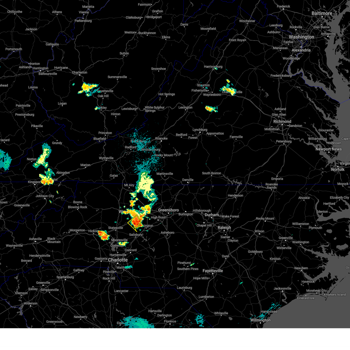
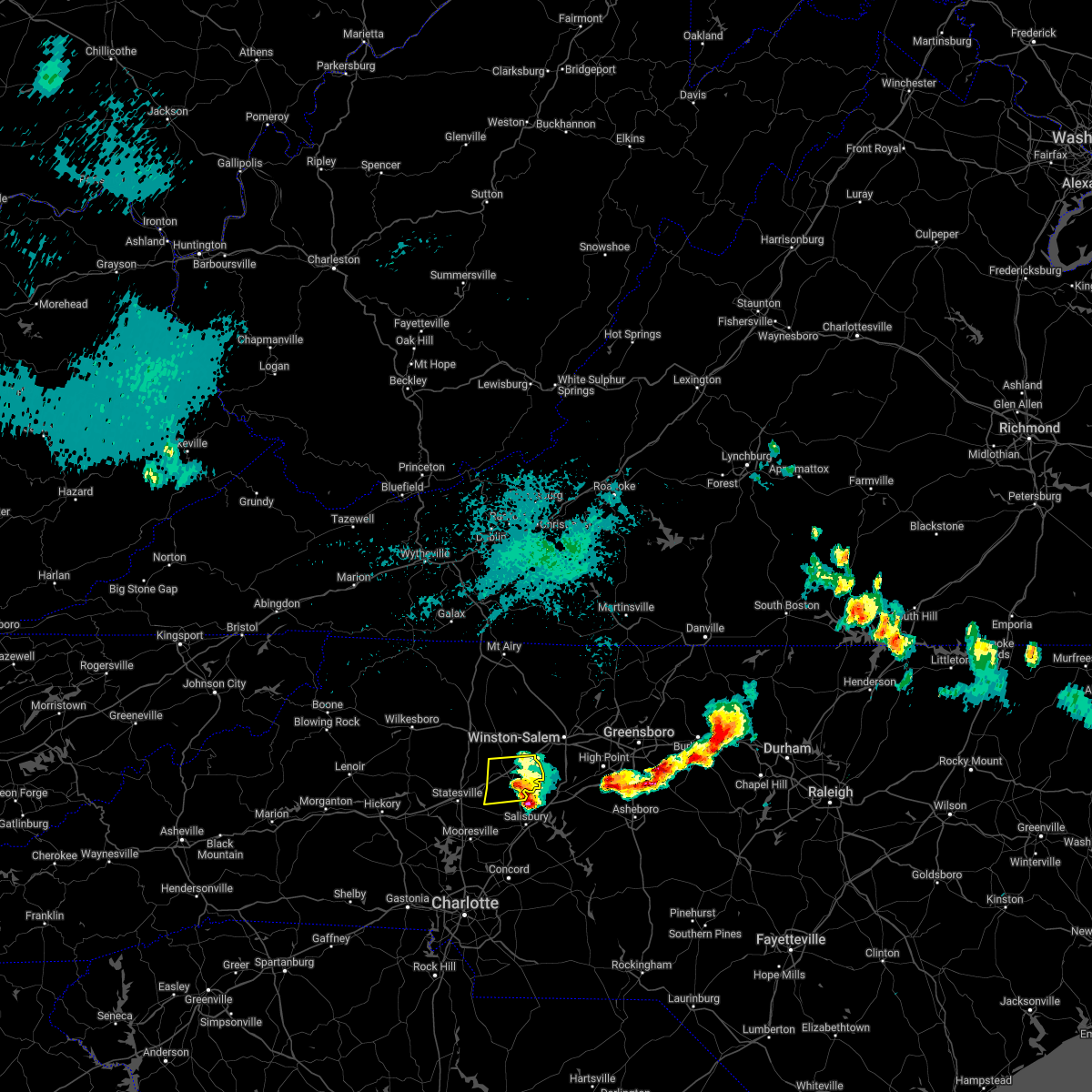
The Mocksville, NC area has had 19 reports of on-the-ground hail by trained spotters, and has been under severe weather warnings 20 times during the past 12 months. Doppler radar has detected hail at or near Mocksville, NC on 39 occasions, including 2 occasions during the past year.
| Name: | Mocksville, NC |
| Where Located: | 49.5 miles NNE of Charlotte, NC |
| Map: | Google Map for Mocksville, NC |
| Population: | 5051 |
| Housing Units: | 2218 |
| More Info: | Search Google for Mocksville, NC |
1
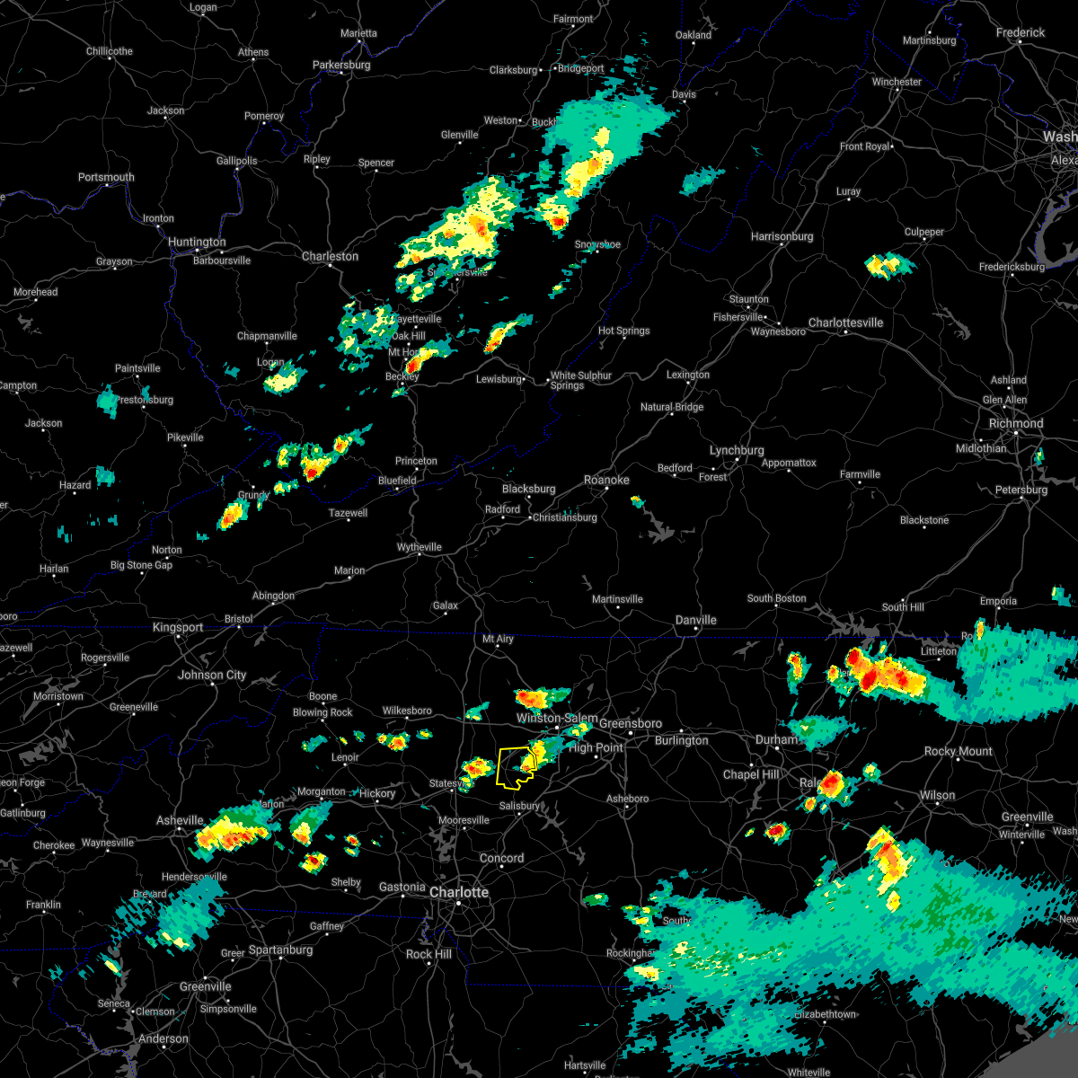
The Top Recent Hail Date for Mocksville, NC is Saturday, June 28, 2025 (10th out of 39)
Hail and Wind Damage Spotted near Mocksville, NC
| Date / Time | Report Details |
|---|---|
| 6/28/2025 4:50 PM EDT |
 The storm which prompted the warning has weakened below severe limits, and has exited the warned area. therefore, the warning will be allowed to expire. however, heavy rain is still possible with this thunderstorm. to report severe weather to the national weather service greenville-spartanburg, call toll free, 1, 800, 2 6 7, 8 1 0 1, or post on our facebook page, or post it to x using hashtag nwsgsp. your message should describe the event and the specific location where it occurred. The storm which prompted the warning has weakened below severe limits, and has exited the warned area. therefore, the warning will be allowed to expire. however, heavy rain is still possible with this thunderstorm. to report severe weather to the national weather service greenville-spartanburg, call toll free, 1, 800, 2 6 7, 8 1 0 1, or post on our facebook page, or post it to x using hashtag nwsgsp. your message should describe the event and the specific location where it occurred.
|
| 6/28/2025 4:24 PM EDT | 911 communications center reports numerous trees and power lines down across the mocksville are in davie county NC, 0.7 miles NW of Mocksville, NC |
| 6/28/2025 4:20 PM EDT |
 Svrgsp the national weather service in greenville-spartanburg has issued a * severe thunderstorm warning for, davie county in the piedmont of north carolina, * until 500 pm edt. * at 420 pm edt, a severe thunderstorm was located over mocksville, and is nearly stationary (radar indicated). Hazards include 60 mph wind gusts and quarter size hail. Minor hail damage to vehicles is expected. Expect wind damage to trees and power lines. Svrgsp the national weather service in greenville-spartanburg has issued a * severe thunderstorm warning for, davie county in the piedmont of north carolina, * until 500 pm edt. * at 420 pm edt, a severe thunderstorm was located over mocksville, and is nearly stationary (radar indicated). Hazards include 60 mph wind gusts and quarter size hail. Minor hail damage to vehicles is expected. Expect wind damage to trees and power lines.
|
| 6/19/2025 3:24 PM EDT |
 The storm which prompted the warning has moved out of the area. therefore, the warning will be allowed to expire. however, gusty winds are still possible with this thunderstorm or any additional storms that develop this afternoon. The storm which prompted the warning has moved out of the area. therefore, the warning will be allowed to expire. however, gusty winds are still possible with this thunderstorm or any additional storms that develop this afternoon.
|
| 6/19/2025 3:02 PM EDT |
 the severe thunderstorm warning has been cancelled and is no longer in effect the severe thunderstorm warning has been cancelled and is no longer in effect
|
| 6/19/2025 3:02 PM EDT |
 At 302 pm edt, a severe thunderstorm was located 12 miles south of ronda, or near love valley, moving east at 25 mph (radar indicated). Hazards include 60 mph wind gusts and penny size hail. Expect damage to trees and power lines. Locations impacted include, bermuda run, harmony, love valley, advance, olin, sheffield, union grove, and farmington. At 302 pm edt, a severe thunderstorm was located 12 miles south of ronda, or near love valley, moving east at 25 mph (radar indicated). Hazards include 60 mph wind gusts and penny size hail. Expect damage to trees and power lines. Locations impacted include, bermuda run, harmony, love valley, advance, olin, sheffield, union grove, and farmington.
|
| 6/19/2025 2:34 PM EDT |
 Svrgsp the national weather service in greenville-spartanburg has issued a * severe thunderstorm warning for, northern davie county in the piedmont of north carolina, northeastern alexander county in the piedmont of north carolina, northern iredell county in the piedmont of north carolina, * until 330 pm edt. * at 234 pm edt, a severe thunderstorm was located 5 miles southeast of boomer, moving east at 30 mph (radar indicated). Hazards include 60 mph wind gusts and penny size hail. expect damage to trees and power lines Svrgsp the national weather service in greenville-spartanburg has issued a * severe thunderstorm warning for, northern davie county in the piedmont of north carolina, northeastern alexander county in the piedmont of north carolina, northern iredell county in the piedmont of north carolina, * until 330 pm edt. * at 234 pm edt, a severe thunderstorm was located 5 miles southeast of boomer, moving east at 30 mph (radar indicated). Hazards include 60 mph wind gusts and penny size hail. expect damage to trees and power lines
|
| 5/4/2025 1:39 AM EDT |
 The storms which prompted the warning have weakened below severe limits, and have exited the warned area. therefore, the warning will be allowed to expire. to report severe weather to the national weather service greenville-spartanburg, call toll free, 1, 800, 2 6 7, 8 1 0 1, or post on our facebook page, or tweet it using hashtag nwsgsp. your message should describe the event and the specific location where it occurred. The storms which prompted the warning have weakened below severe limits, and have exited the warned area. therefore, the warning will be allowed to expire. to report severe weather to the national weather service greenville-spartanburg, call toll free, 1, 800, 2 6 7, 8 1 0 1, or post on our facebook page, or tweet it using hashtag nwsgsp. your message should describe the event and the specific location where it occurred.
|
| 5/4/2025 1:21 AM EDT |
 the severe thunderstorm warning has been cancelled and is no longer in effect the severe thunderstorm warning has been cancelled and is no longer in effect
|
| 5/4/2025 1:21 AM EDT |
 At 120 am edt, severe thunderstorms were located along a line extending from 9 miles southwest of mocksville to near kannapolis, moving northeast at 35 mph (radar indicated). Hazards include 60 mph wind gusts. Expect damage to trees and power lines. Locations impacted include, fork church, advance, piedmont research station, faith, spencer, cooleemee, cleveland, landis, salisbury, and china grove. At 120 am edt, severe thunderstorms were located along a line extending from 9 miles southwest of mocksville to near kannapolis, moving northeast at 35 mph (radar indicated). Hazards include 60 mph wind gusts. Expect damage to trees and power lines. Locations impacted include, fork church, advance, piedmont research station, faith, spencer, cooleemee, cleveland, landis, salisbury, and china grove.
|
| 5/4/2025 1:05 AM EDT |
 Svrgsp the national weather service in greenville-spartanburg has issued a * severe thunderstorm warning for, northwestern cabarrus county in the piedmont of north carolina, southeastern davie county in the piedmont of north carolina, southeastern iredell county in the piedmont of north carolina, north central mecklenburg county in the piedmont of north carolina, rowan county in the piedmont of north carolina, * until 145 am edt. * at 105 am edt, severe thunderstorms were located along a line extending from 10 miles southeast of statesville to 5 miles east of huntersville, moving northeast at 35 mph (radar indicated). Hazards include 60 mph wind gusts. expect damage to trees and power lines Svrgsp the national weather service in greenville-spartanburg has issued a * severe thunderstorm warning for, northwestern cabarrus county in the piedmont of north carolina, southeastern davie county in the piedmont of north carolina, southeastern iredell county in the piedmont of north carolina, north central mecklenburg county in the piedmont of north carolina, rowan county in the piedmont of north carolina, * until 145 am edt. * at 105 am edt, severe thunderstorms were located along a line extending from 10 miles southeast of statesville to 5 miles east of huntersville, moving northeast at 35 mph (radar indicated). Hazards include 60 mph wind gusts. expect damage to trees and power lines
|
| 3/5/2025 7:59 AM EST |
 Svrgsp the national weather service in greenville-spartanburg has issued a * severe thunderstorm warning for, davie county in the piedmont of north carolina, southeastern iredell county in the piedmont of north carolina, rowan county in the piedmont of north carolina, * until 830 am est. * at 758 am est, severe thunderstorms were located along a line extending from 3 miles north of mocksville to 9 miles northwest of kannapolis, moving northeast at 45 mph (radar indicated). Hazards include 60 mph wind gusts. expect damage to trees and power lines Svrgsp the national weather service in greenville-spartanburg has issued a * severe thunderstorm warning for, davie county in the piedmont of north carolina, southeastern iredell county in the piedmont of north carolina, rowan county in the piedmont of north carolina, * until 830 am est. * at 758 am est, severe thunderstorms were located along a line extending from 3 miles north of mocksville to 9 miles northwest of kannapolis, moving northeast at 45 mph (radar indicated). Hazards include 60 mph wind gusts. expect damage to trees and power lines
|
| 12/29/2024 10:25 AM EST |
 the severe thunderstorm warning has been cancelled and is no longer in effect the severe thunderstorm warning has been cancelled and is no longer in effect
|
| 12/29/2024 10:25 AM EST |
 At 1025 am est, severe thunderstorms were located along a line extending from near yadkinville to near mocksville, moving northeast at 50 mph (radar indicated). Hazards include 60 mph wind gusts. Expect damage to trees and power lines. Locations impacted include, mocksville, bermuda run, sheffield, advance, and farmington. At 1025 am est, severe thunderstorms were located along a line extending from near yadkinville to near mocksville, moving northeast at 50 mph (radar indicated). Hazards include 60 mph wind gusts. Expect damage to trees and power lines. Locations impacted include, mocksville, bermuda run, sheffield, advance, and farmington.
|
| 12/29/2024 10:15 AM EST |
 the severe thunderstorm warning has been cancelled and is no longer in effect the severe thunderstorm warning has been cancelled and is no longer in effect
|
| 12/29/2024 10:15 AM EST |
 At 1014 am est, severe thunderstorms were located along a line extending from 3 miles northeast of elkin to 7 miles northwest of lexington to 7 miles west of badin lake, moving northeast at 60 mph (radar indicated). Hazards include 60 mph wind gusts. Expect damage to trees and power lines. Locations impacted include, mocksville, bermuda run, cooleemee, harmony, high rock lake, fork church, advance, sheffield, farmington, and woodleaf. At 1014 am est, severe thunderstorms were located along a line extending from 3 miles northeast of elkin to 7 miles northwest of lexington to 7 miles west of badin lake, moving northeast at 60 mph (radar indicated). Hazards include 60 mph wind gusts. Expect damage to trees and power lines. Locations impacted include, mocksville, bermuda run, cooleemee, harmony, high rock lake, fork church, advance, sheffield, farmington, and woodleaf.
|
| 12/29/2024 9:50 AM EST |
 Svrgsp the national weather service in greenville-spartanburg has issued a * severe thunderstorm warning for, northeastern cabarrus county in the piedmont of north carolina, davie county in the piedmont of north carolina, northeastern iredell county in the piedmont of north carolina, rowan county in the piedmont of north carolina, * until 1045 am est. * at 950 am est, severe thunderstorms were located along a line extending from 9 miles southeast of wilkesboro to 7 miles southwest of salisbury to 14 miles southeast of downtown concord, moving northeast at 65 mph (radar indicated). Hazards include 60 mph wind gusts. expect damage to trees and power lines Svrgsp the national weather service in greenville-spartanburg has issued a * severe thunderstorm warning for, northeastern cabarrus county in the piedmont of north carolina, davie county in the piedmont of north carolina, northeastern iredell county in the piedmont of north carolina, rowan county in the piedmont of north carolina, * until 1045 am est. * at 950 am est, severe thunderstorms were located along a line extending from 9 miles southeast of wilkesboro to 7 miles southwest of salisbury to 14 miles southeast of downtown concord, moving northeast at 65 mph (radar indicated). Hazards include 60 mph wind gusts. expect damage to trees and power lines
|
| 8/19/2024 4:45 PM EDT |
 The storms which prompted the warning have weakened below severe limits, and no longer pose an immediate threat to life or property. therefore, the warning has been allowed to expire. however, gusty winds and heavy rain are still possible with these thunderstorms. to report severe weather to the national weather service greenville-spartanburg, call toll free, 1, 800, 2 6 7, 8 1 0 1, or post on our facebook page, or tweet it using hashtag nwsgsp. your message should describe the event and the specific location where it occurred. The storms which prompted the warning have weakened below severe limits, and no longer pose an immediate threat to life or property. therefore, the warning has been allowed to expire. however, gusty winds and heavy rain are still possible with these thunderstorms. to report severe weather to the national weather service greenville-spartanburg, call toll free, 1, 800, 2 6 7, 8 1 0 1, or post on our facebook page, or tweet it using hashtag nwsgsp. your message should describe the event and the specific location where it occurred.
|
| 8/19/2024 4:07 PM EDT |
 Svrgsp the national weather service in greenville-spartanburg has issued a * severe thunderstorm warning for, northeastern catawba county in the piedmont of north carolina, southwestern davie county in the piedmont of north carolina, southeastern alexander county in the piedmont of north carolina, central iredell county in the piedmont of north carolina, northwestern rowan county in the piedmont of north carolina, * until 445 pm edt. * at 406 pm edt, severe thunderstorms were located along a line extending from 4 miles east of taylorsville to 4 miles north of statesville to 7 miles southwest of mocksville, moving south at 20 mph (radar indicated). Hazards include 60 mph wind gusts and nickel size hail. expect damage to trees and power lines Svrgsp the national weather service in greenville-spartanburg has issued a * severe thunderstorm warning for, northeastern catawba county in the piedmont of north carolina, southwestern davie county in the piedmont of north carolina, southeastern alexander county in the piedmont of north carolina, central iredell county in the piedmont of north carolina, northwestern rowan county in the piedmont of north carolina, * until 445 pm edt. * at 406 pm edt, severe thunderstorms were located along a line extending from 4 miles east of taylorsville to 4 miles north of statesville to 7 miles southwest of mocksville, moving south at 20 mph (radar indicated). Hazards include 60 mph wind gusts and nickel size hail. expect damage to trees and power lines
|
| 8/19/2024 3:53 PM EDT | Tree and power lines fell on a vehicle on dyson rd and trapped occupant. time estimate in davie county NC, 7.6 miles SE of Mocksville, NC |
| 8/18/2024 5:07 PM EDT |
 Svrgsp the national weather service in greenville-spartanburg has issued a * severe thunderstorm warning for, davie county in the piedmont of north carolina, northern iredell county in the piedmont of north carolina, * until 600 pm edt. * at 507 pm edt, a severe thunderstorm was located 13 miles south of ronda, or 5 miles northeast of love valley, moving east at 20 mph (radar indicated). Hazards include 60 mph wind gusts and quarter size hail. Minor hail damage to vehicles is expected. Expect wind damage to trees and power lines. Svrgsp the national weather service in greenville-spartanburg has issued a * severe thunderstorm warning for, davie county in the piedmont of north carolina, northern iredell county in the piedmont of north carolina, * until 600 pm edt. * at 507 pm edt, a severe thunderstorm was located 13 miles south of ronda, or 5 miles northeast of love valley, moving east at 20 mph (radar indicated). Hazards include 60 mph wind gusts and quarter size hail. Minor hail damage to vehicles is expected. Expect wind damage to trees and power lines.
|
| 7/30/2024 8:35 PM EDT |
 Svrgsp the national weather service in greenville-spartanburg has issued a * severe thunderstorm warning for, northwestern cabarrus county in the piedmont of north carolina, southeastern catawba county in the piedmont of north carolina, southwestern davie county in the piedmont of north carolina, southeastern lincoln county in the piedmont of north carolina, central iredell county in the piedmont of north carolina, northwestern mecklenburg county in the piedmont of north carolina, western rowan county in the piedmont of north carolina, * until 915 pm edt. * at 835 pm edt, a severe thunderstorm was located near statesville, moving east at 30 mph (radar indicated). Hazards include 60 mph wind gusts. expect damage to trees and power lines Svrgsp the national weather service in greenville-spartanburg has issued a * severe thunderstorm warning for, northwestern cabarrus county in the piedmont of north carolina, southeastern catawba county in the piedmont of north carolina, southwestern davie county in the piedmont of north carolina, southeastern lincoln county in the piedmont of north carolina, central iredell county in the piedmont of north carolina, northwestern mecklenburg county in the piedmont of north carolina, western rowan county in the piedmont of north carolina, * until 915 pm edt. * at 835 pm edt, a severe thunderstorm was located near statesville, moving east at 30 mph (radar indicated). Hazards include 60 mph wind gusts. expect damage to trees and power lines
|
| 5/26/2024 9:29 PM EDT |
 The storms which prompted the warning have weakened below severe limits, and no longer pose an immediate threat to life or property. therefore, the warning will be allowed to expire. however, gusty winds and heavy rain are still possible with these thunderstorms. a severe thunderstorm watch remains in effect until 1100 pm edt for the piedmont of north carolina. The storms which prompted the warning have weakened below severe limits, and no longer pose an immediate threat to life or property. therefore, the warning will be allowed to expire. however, gusty winds and heavy rain are still possible with these thunderstorms. a severe thunderstorm watch remains in effect until 1100 pm edt for the piedmont of north carolina.
|
| 5/26/2024 8:59 PM EDT |
 the severe thunderstorm warning has been cancelled and is no longer in effect the severe thunderstorm warning has been cancelled and is no longer in effect
|
| 5/26/2024 8:59 PM EDT |
 At 859 pm edt, severe thunderstorms were located along a line extending from near mocksville to 10 miles east of newton, moving east at 40 mph (radar indicated). Hazards include 60 mph wind gusts. Expect damage to trees and power lines. Locations impacted include, statesville, mocksville, china grove, troutman, bermuda run, claremont, cooleemee, cleveland, catawba, and harmony. At 859 pm edt, severe thunderstorms were located along a line extending from near mocksville to 10 miles east of newton, moving east at 40 mph (radar indicated). Hazards include 60 mph wind gusts. Expect damage to trees and power lines. Locations impacted include, statesville, mocksville, china grove, troutman, bermuda run, claremont, cooleemee, cleveland, catawba, and harmony.
|
| 5/26/2024 8:37 PM EDT |
 Svrgsp the national weather service in greenville-spartanburg has issued a * severe thunderstorm warning for, northeastern catawba county in the piedmont of north carolina, davie county in the piedmont of north carolina, alexander county in the piedmont of north carolina, iredell county in the piedmont of north carolina, southeastern caldwell county in western north carolina, western rowan county in the piedmont of north carolina, * until 930 pm edt. * at 837 pm edt, a severe thunderstorm was located 9 miles east of taylorsville, or near stony point, moving east at 40 mph (radar indicated). Hazards include 60 mph wind gusts and penny size hail. expect damage to trees and power lines Svrgsp the national weather service in greenville-spartanburg has issued a * severe thunderstorm warning for, northeastern catawba county in the piedmont of north carolina, davie county in the piedmont of north carolina, alexander county in the piedmont of north carolina, iredell county in the piedmont of north carolina, southeastern caldwell county in western north carolina, western rowan county in the piedmont of north carolina, * until 930 pm edt. * at 837 pm edt, a severe thunderstorm was located 9 miles east of taylorsville, or near stony point, moving east at 40 mph (radar indicated). Hazards include 60 mph wind gusts and penny size hail. expect damage to trees and power lines
|
| 5/6/2024 10:46 PM EDT |
 The storm which prompted the warning has weakened below severe limits, and no longer poses an immediate threat to life or property. therefore, the warning has been allowed to expire. however, heavy rain is still possible with this thunderstorm. to report severe weather to the national weather service greenville-spartanburg, call toll free, 1, 800, 2 6 7, 8 1 0 1, or post on our facebook page, or tweet it using hashtag nwsgsp. your message should describe the event and the specific location where it occurred. The storm which prompted the warning has weakened below severe limits, and no longer poses an immediate threat to life or property. therefore, the warning has been allowed to expire. however, heavy rain is still possible with this thunderstorm. to report severe weather to the national weather service greenville-spartanburg, call toll free, 1, 800, 2 6 7, 8 1 0 1, or post on our facebook page, or tweet it using hashtag nwsgsp. your message should describe the event and the specific location where it occurred.
|
| 5/6/2024 9:48 PM EDT |
 Svrgsp the national weather service in greenville-spartanburg has issued a * severe thunderstorm warning for, western davie county in the piedmont of north carolina, northeastern iredell county in the piedmont of north carolina, northwestern rowan county in the piedmont of north carolina, * until 1045 pm edt. * at 947 pm edt, a severe thunderstorm was located 5 miles north of statesville, moving east at 10 mph (radar indicated). Hazards include 60 mph wind gusts and quarter size hail. Minor hail damage to vehicles is expected. Expect wind damage to trees and power lines. Svrgsp the national weather service in greenville-spartanburg has issued a * severe thunderstorm warning for, western davie county in the piedmont of north carolina, northeastern iredell county in the piedmont of north carolina, northwestern rowan county in the piedmont of north carolina, * until 1045 pm edt. * at 947 pm edt, a severe thunderstorm was located 5 miles north of statesville, moving east at 10 mph (radar indicated). Hazards include 60 mph wind gusts and quarter size hail. Minor hail damage to vehicles is expected. Expect wind damage to trees and power lines.
|
| 4/11/2024 8:26 PM EDT |
 At 826 pm edt, a severe thunderstorm was located 6 miles northwest of salisbury, or 4 miles south of cooleemee, moving northeast at 45 mph (radar indicated). Hazards include 60 mph wind gusts. Expect damage to trees and power lines. Locations impacted include, salisbury, mocksville, spencer, bermuda run, cooleemee, fork church, advance, piedmont research station, farmington, and woodleaf. At 826 pm edt, a severe thunderstorm was located 6 miles northwest of salisbury, or 4 miles south of cooleemee, moving northeast at 45 mph (radar indicated). Hazards include 60 mph wind gusts. Expect damage to trees and power lines. Locations impacted include, salisbury, mocksville, spencer, bermuda run, cooleemee, fork church, advance, piedmont research station, farmington, and woodleaf.
|
| 4/11/2024 8:07 PM EDT |
 Svrgsp the national weather service in greenville-spartanburg has issued a * severe thunderstorm warning for, davie county in the piedmont of north carolina, rowan county in the piedmont of north carolina, * until 845 pm edt. * at 806 pm edt, a severe thunderstorm was located 4 miles south of mocksville, or near cooleemee, moving northeast at 45 mph (radar indicated). Hazards include 60 mph wind gusts. expect damage to trees and power lines Svrgsp the national weather service in greenville-spartanburg has issued a * severe thunderstorm warning for, davie county in the piedmont of north carolina, rowan county in the piedmont of north carolina, * until 845 pm edt. * at 806 pm edt, a severe thunderstorm was located 4 miles south of mocksville, or near cooleemee, moving northeast at 45 mph (radar indicated). Hazards include 60 mph wind gusts. expect damage to trees and power lines
|
| 4/11/2024 7:54 PM EDT |
 At 754 pm edt, a severe thunderstorm was located 6 miles northwest of mocksville, or 5 miles south of courtney, moving northeast at 45 mph (radar indicated). Hazards include 60 mph wind gusts and penny size hail. Expect damage to trees and power lines. Locations impacted include, harmony, turnersburg, sheffield, farmington, cool springs, mocksville, bermuda run, and statesville. At 754 pm edt, a severe thunderstorm was located 6 miles northwest of mocksville, or 5 miles south of courtney, moving northeast at 45 mph (radar indicated). Hazards include 60 mph wind gusts and penny size hail. Expect damage to trees and power lines. Locations impacted include, harmony, turnersburg, sheffield, farmington, cool springs, mocksville, bermuda run, and statesville.
|
| 4/11/2024 7:40 PM EDT |
 the severe thunderstorm warning has been cancelled and is no longer in effect the severe thunderstorm warning has been cancelled and is no longer in effect
|
| 4/11/2024 7:40 PM EDT |
 At 740 pm edt, a severe thunderstorm was located 9 miles northeast of statesville, or 6 miles south of harmony, moving northeast at 40 mph (radar indicated). Hazards include 60 mph wind gusts and penny size hail. Expect damage to trees and power lines. Locations impacted include, statesville, troutman, harmony, lake norman state park, turnersburg, olin, cool springs, sheffield, union grove, and farmington. At 740 pm edt, a severe thunderstorm was located 9 miles northeast of statesville, or 6 miles south of harmony, moving northeast at 40 mph (radar indicated). Hazards include 60 mph wind gusts and penny size hail. Expect damage to trees and power lines. Locations impacted include, statesville, troutman, harmony, lake norman state park, turnersburg, olin, cool springs, sheffield, union grove, and farmington.
|
| 4/11/2024 7:20 PM EDT |
 Svrgsp the national weather service in greenville-spartanburg has issued a * severe thunderstorm warning for, eastern catawba county in the piedmont of north carolina, davie county in the piedmont of north carolina, iredell county in the piedmont of north carolina, northwestern rowan county in the piedmont of north carolina, * until 815 pm edt. * at 720 pm edt, a severe thunderstorm was located 5 miles southwest of statesville, or near troutman, moving northeast at 35 mph (radar indicated). Hazards include 60 mph wind gusts and penny size hail. expect damage to trees and power lines Svrgsp the national weather service in greenville-spartanburg has issued a * severe thunderstorm warning for, eastern catawba county in the piedmont of north carolina, davie county in the piedmont of north carolina, iredell county in the piedmont of north carolina, northwestern rowan county in the piedmont of north carolina, * until 815 pm edt. * at 720 pm edt, a severe thunderstorm was located 5 miles southwest of statesville, or near troutman, moving northeast at 35 mph (radar indicated). Hazards include 60 mph wind gusts and penny size hail. expect damage to trees and power lines
|
| 1/9/2024 1:37 PM EST |
 At 137 pm est, severe thunderstorms were located along a line extending from 5 miles east of mocksville to 11 miles east of uptown charlotte, moving northeast at 65 mph (radar indicated). Hazards include 70 mph wind gusts. Expect considerable tree damage. damage is likely to mobile homes, roofs, and outbuildings. locations impacted include, kannapolis, downtown concord, salisbury, mocksville, east charlotte, west concord, mint hill, pineville, harrisburg, and china grove. thunderstorm damage threat, considerable hail threat, radar indicated max hail size, <. 75 in wind threat, radar indicated max wind gust, 70 mph. At 137 pm est, severe thunderstorms were located along a line extending from 5 miles east of mocksville to 11 miles east of uptown charlotte, moving northeast at 65 mph (radar indicated). Hazards include 70 mph wind gusts. Expect considerable tree damage. damage is likely to mobile homes, roofs, and outbuildings. locations impacted include, kannapolis, downtown concord, salisbury, mocksville, east charlotte, west concord, mint hill, pineville, harrisburg, and china grove. thunderstorm damage threat, considerable hail threat, radar indicated max hail size, <. 75 in wind threat, radar indicated max wind gust, 70 mph.
|
| 1/9/2024 1:28 PM EST |
 At 128 pm est, severe thunderstorms were located along a line extending from 7 miles northeast of mocksville to 7 miles southeast of uptown charlotte, moving northeast at 85 mph (radar indicated). Hazards include 60 mph wind gusts. Expect damage to trees and power lines. locations impacted include, kannapolis, downtown concord, salisbury, mocksville, northeast charlotte, east charlotte, west concord, mint hill, pineville, and harrisburg. hail threat, radar indicated max hail size, <. 75 in wind threat, radar indicated max wind gust, 60 mph. At 128 pm est, severe thunderstorms were located along a line extending from 7 miles northeast of mocksville to 7 miles southeast of uptown charlotte, moving northeast at 85 mph (radar indicated). Hazards include 60 mph wind gusts. Expect damage to trees and power lines. locations impacted include, kannapolis, downtown concord, salisbury, mocksville, northeast charlotte, east charlotte, west concord, mint hill, pineville, and harrisburg. hail threat, radar indicated max hail size, <. 75 in wind threat, radar indicated max wind gust, 60 mph.
|
| 1/9/2024 1:10 PM EST |
 At 110 pm est, severe thunderstorms were located along a line extending from 8 miles southeast of statesville to 3 miles southwest of rock hill, moving northeast at 85 mph (radar indicated). Hazards include 60 mph wind gusts. expect damage to trees and power lines At 110 pm est, severe thunderstorms were located along a line extending from 8 miles southeast of statesville to 3 miles southwest of rock hill, moving northeast at 85 mph (radar indicated). Hazards include 60 mph wind gusts. expect damage to trees and power lines
|
| 8/26/2023 8:53 PM EDT |
 At 853 pm edt, a severe thunderstorm was located 5 miles southeast of mocksville, moving southeast at 25 mph (radar indicated). Hazards include 60 mph wind gusts and penny size hail. Expect damage to trees and power lines. locations impacted include, mocksville, bermuda run, fork church and advance. hail threat, radar indicated max hail size, 0. 75 in wind threat, radar indicated max wind gust, 60 mph. At 853 pm edt, a severe thunderstorm was located 5 miles southeast of mocksville, moving southeast at 25 mph (radar indicated). Hazards include 60 mph wind gusts and penny size hail. Expect damage to trees and power lines. locations impacted include, mocksville, bermuda run, fork church and advance. hail threat, radar indicated max hail size, 0. 75 in wind threat, radar indicated max wind gust, 60 mph.
|
| 8/26/2023 8:39 PM EDT |
 At 839 pm edt, a severe thunderstorm was located 6 miles northeast of mocksville, or near bermuda run, moving southeast at 15 mph (radar indicated). Hazards include 60 mph wind gusts and penny size hail. expect damage to trees and power lines At 839 pm edt, a severe thunderstorm was located 6 miles northeast of mocksville, or near bermuda run, moving southeast at 15 mph (radar indicated). Hazards include 60 mph wind gusts and penny size hail. expect damage to trees and power lines
|
| 8/15/2023 2:50 PM EDT |
 The severe thunderstorm warning for central davie county will expire at 300 pm edt, the storm which prompted the warning has moved out of the area. therefore, the warning will be allowed to expire. a severe thunderstorm watch remains in effect until 900 pm edt for the piedmont of north carolina. The severe thunderstorm warning for central davie county will expire at 300 pm edt, the storm which prompted the warning has moved out of the area. therefore, the warning will be allowed to expire. a severe thunderstorm watch remains in effect until 900 pm edt for the piedmont of north carolina.
|
| 8/15/2023 2:33 PM EDT |
 At 233 pm edt, a severe thunderstorm was located 8 miles east of mocksville, or 5 miles south of bermuda run, moving east at 45 mph (radar indicated). Hazards include 60 mph wind gusts and half dollar size hail. Minor hail damage to vehicles is expected. expect wind damage to trees and power lines. locations impacted include, mocksville, bermuda run, fork church, advance and farmington. hail threat, radar indicated max hail size, 1. 25 in wind threat, radar indicated max wind gust, 60 mph. At 233 pm edt, a severe thunderstorm was located 8 miles east of mocksville, or 5 miles south of bermuda run, moving east at 45 mph (radar indicated). Hazards include 60 mph wind gusts and half dollar size hail. Minor hail damage to vehicles is expected. expect wind damage to trees and power lines. locations impacted include, mocksville, bermuda run, fork church, advance and farmington. hail threat, radar indicated max hail size, 1. 25 in wind threat, radar indicated max wind gust, 60 mph.
|
| 8/15/2023 2:26 PM EDT |
 At 226 pm edt, a severe thunderstorm was located near mocksville, moving east at 45 mph (radar indicated). Hazards include 60 mph wind gusts and quarter size hail. Minor hail damage to vehicles is expected. expect wind damage to trees and power lines. locations impacted include, mocksville, bermuda run, fork church, advance, farmington and sheffield. hail threat, radar indicated max hail size, 1. 00 in wind threat, radar indicated max wind gust, 60 mph. At 226 pm edt, a severe thunderstorm was located near mocksville, moving east at 45 mph (radar indicated). Hazards include 60 mph wind gusts and quarter size hail. Minor hail damage to vehicles is expected. expect wind damage to trees and power lines. locations impacted include, mocksville, bermuda run, fork church, advance, farmington and sheffield. hail threat, radar indicated max hail size, 1. 00 in wind threat, radar indicated max wind gust, 60 mph.
|
| 8/15/2023 2:25 PM EDT | Duke energy reports trees down on powerlines near the intersection of milling rd and sain r in davie county NC, 3.5 miles WSW of Mocksville, NC |
| 8/15/2023 2:20 PM EDT | Trees and power lines down in davie count in davie county NC, 1.3 miles NNW of Mocksville, NC |
| 8/15/2023 2:10 PM EDT |
 At 209 pm edt, a severe thunderstorm was located 7 miles west of mocksville, moving east at 45 mph (radar indicated). Hazards include 60 mph wind gusts and quarter size hail. Minor hail damage to vehicles is expected. Expect wind damage to trees and power lines. At 209 pm edt, a severe thunderstorm was located 7 miles west of mocksville, moving east at 45 mph (radar indicated). Hazards include 60 mph wind gusts and quarter size hail. Minor hail damage to vehicles is expected. Expect wind damage to trees and power lines.
|
| 8/14/2023 3:45 PM EDT | Tree down on car near sheffiel in davie county NC, 7.6 miles SE of Mocksville, NC |
| 8/7/2023 5:43 PM EDT |
 At 542 pm edt, severe thunderstorms were located along a line extending from 10 miles southwest of winston-salem to 6 miles south of lexington to 10 miles west of albemarle, moving east at 45 mph (radar indicated). Hazards include 70 mph wind gusts and penny size hail. Expect considerable tree damage. damage is likely to mobile homes, roofs, and outbuildings. Locations impacted include, huntersville, kannapolis, downtown concord, salisbury, mocksville, northeast charlotte, west concord, harrisburg, china grove and spencer. At 542 pm edt, severe thunderstorms were located along a line extending from 10 miles southwest of winston-salem to 6 miles south of lexington to 10 miles west of albemarle, moving east at 45 mph (radar indicated). Hazards include 70 mph wind gusts and penny size hail. Expect considerable tree damage. damage is likely to mobile homes, roofs, and outbuildings. Locations impacted include, huntersville, kannapolis, downtown concord, salisbury, mocksville, northeast charlotte, west concord, harrisburg, china grove and spencer.
|
| 8/7/2023 5:22 PM EDT | Report of numerous trees down across davie county. time estimated from rada in davie county NC, 0.7 miles NW of Mocksville, NC |
| 8/7/2023 5:20 PM EDT |
 At 519 pm edt, severe thunderstorms were located along a line extending from 8 miles south of yadkinville to 3 miles south of mocksville to 4 miles west of salisbury to 3 miles south of downtown concord, moving east at 45 mph (radar indicated). Hazards include 70 mph wind gusts and penny size hail. Expect considerable tree damage. Damage is likely to mobile homes, roofs, and outbuildings. At 519 pm edt, severe thunderstorms were located along a line extending from 8 miles south of yadkinville to 3 miles south of mocksville to 4 miles west of salisbury to 3 miles south of downtown concord, moving east at 45 mph (radar indicated). Hazards include 70 mph wind gusts and penny size hail. Expect considerable tree damage. Damage is likely to mobile homes, roofs, and outbuildings.
|
| 8/7/2023 4:52 PM EDT |
 At 451 pm edt, severe thunderstorms were located along a line extending from 6 miles northwest of statesville to 12 miles southeast of newton to 7 miles southeast of lincolnton, moving east at 50 mph (radar indicated). Hazards include 70 mph wind gusts and quarter size hail. Minor hail damage to vehicles is expected. expect considerable tree damage. Wind damage is also likely to mobile homes, roofs, and outbuildings. At 451 pm edt, severe thunderstorms were located along a line extending from 6 miles northwest of statesville to 12 miles southeast of newton to 7 miles southeast of lincolnton, moving east at 50 mph (radar indicated). Hazards include 70 mph wind gusts and quarter size hail. Minor hail damage to vehicles is expected. expect considerable tree damage. Wind damage is also likely to mobile homes, roofs, and outbuildings.
|
| 7/29/2023 7:36 PM EDT | Tree down on danner rd. time estimated from rada in davie county NC, 4.1 miles SSE of Mocksville, NC |
| 7/29/2023 7:23 PM EDT |
 At 723 pm edt, severe thunderstorms were located along a line extending from eastern wilkes county to near winston-salem, moving south at 25 mph (radar indicated). Hazards include 60 mph wind gusts and nickel size hail. expect damage to trees and power lines At 723 pm edt, severe thunderstorms were located along a line extending from eastern wilkes county to near winston-salem, moving south at 25 mph (radar indicated). Hazards include 60 mph wind gusts and nickel size hail. expect damage to trees and power lines
|
| 7/15/2023 5:52 PM EDT |
 The severe thunderstorm warning for western davie, northeastern iredell and northwestern rowan counties will expire at 600 pm edt, the storm which prompted the warning has weakened below severe limits, and no longer poses an immediate threat to life or property. therefore, the warning will be allowed to expire. The severe thunderstorm warning for western davie, northeastern iredell and northwestern rowan counties will expire at 600 pm edt, the storm which prompted the warning has weakened below severe limits, and no longer poses an immediate threat to life or property. therefore, the warning will be allowed to expire.
|
| 7/15/2023 5:40 PM EDT | Tree downed along junction r in davie county NC, 3.6 miles NNE of Mocksville, NC |
| 7/15/2023 5:35 PM EDT |
 At 535 pm edt, a severe thunderstorm was located 6 miles west of mocksville, or 6 miles southeast of harmony, moving north at 30 mph (radar indicated). Hazards include 60 mph wind gusts and penny size hail. Expect damage to trees and power lines. locations impacted include, mocksville, harmony, sheffield, cool springs, cleveland, woodleaf, turnersburg and statesville. hail threat, radar indicated max hail size, 0. 75 in wind threat, radar indicated max wind gust, 60 mph. At 535 pm edt, a severe thunderstorm was located 6 miles west of mocksville, or 6 miles southeast of harmony, moving north at 30 mph (radar indicated). Hazards include 60 mph wind gusts and penny size hail. Expect damage to trees and power lines. locations impacted include, mocksville, harmony, sheffield, cool springs, cleveland, woodleaf, turnersburg and statesville. hail threat, radar indicated max hail size, 0. 75 in wind threat, radar indicated max wind gust, 60 mph.
|
| 7/15/2023 5:16 PM EDT |
 At 515 pm edt, a severe thunderstorm was located 9 miles east of statesville, or near cleveland, moving north at 30 mph (radar indicated). Hazards include 60 mph wind gusts. expect damage to trees and power lines At 515 pm edt, a severe thunderstorm was located 9 miles east of statesville, or near cleveland, moving north at 30 mph (radar indicated). Hazards include 60 mph wind gusts. expect damage to trees and power lines
|
| 7/9/2023 11:19 AM EDT |
 At 1119 am edt, a severe thunderstorm was located 8 miles northwest of lexington, moving east at 30 mph (radar indicated). Hazards include 60 mph wind gusts and nickel size hail. Expect damage to trees and power lines. locations impacted include, advance, fork church and bermuda run. hail threat, radar indicated max hail size, 0. 88 in wind threat, radar indicated max wind gust, 60 mph. At 1119 am edt, a severe thunderstorm was located 8 miles northwest of lexington, moving east at 30 mph (radar indicated). Hazards include 60 mph wind gusts and nickel size hail. Expect damage to trees and power lines. locations impacted include, advance, fork church and bermuda run. hail threat, radar indicated max hail size, 0. 88 in wind threat, radar indicated max wind gust, 60 mph.
|
| 7/9/2023 11:12 AM EDT |
 At 1112 am edt, a severe thunderstorm was located 6 miles east of mocksville, moving east at 30 mph (radar indicated). Hazards include 60 mph wind gusts and nickel size hail. expect damage to trees and power lines At 1112 am edt, a severe thunderstorm was located 6 miles east of mocksville, moving east at 30 mph (radar indicated). Hazards include 60 mph wind gusts and nickel size hail. expect damage to trees and power lines
|
| 6/26/2023 6:56 PM EDT |
 The severe thunderstorm warning for davie county will expire at 700 pm edt, the storm which prompted the warning has moved out of the area. therefore, the warning will be allowed to expire. a severe thunderstorm watch remains in effect until 1100 pm edt for the piedmont of north carolina. The severe thunderstorm warning for davie county will expire at 700 pm edt, the storm which prompted the warning has moved out of the area. therefore, the warning will be allowed to expire. a severe thunderstorm watch remains in effect until 1100 pm edt for the piedmont of north carolina.
|
| 6/26/2023 6:35 PM EDT | Ping Pong Ball sized hail reported 1.7 miles W of Mocksville, NC |
| 6/26/2023 6:29 PM EDT | Hen Egg sized hail reported 1.7 miles ENE of Mocksville, NC, social media picture of 2 inch hail off hwy 64 in mocksville. |
| 6/26/2023 6:29 PM EDT | Half Dollar sized hail reported 4.6 miles ESE of Mocksville, NC |
| 6/26/2023 6:25 PM EDT | Multiple trees down across liberty church r in davie county NC, 7 miles SE of Mocksville, NC |
| 6/26/2023 6:18 PM EDT | Quarter sized hail reported 6.7 miles ESE of Mocksville, NC |
| 6/26/2023 6:13 PM EDT |
 At 613 pm edt, a severe thunderstorm was located 8 miles northwest of mocksville, or 5 miles east of harmony, moving southeast at 25 mph (trained weather spotters). Hazards include 60 mph wind gusts and half dollar size hail. Minor hail damage to vehicles is expected. Expect wind damage to trees and power lines. At 613 pm edt, a severe thunderstorm was located 8 miles northwest of mocksville, or 5 miles east of harmony, moving southeast at 25 mph (trained weather spotters). Hazards include 60 mph wind gusts and half dollar size hail. Minor hail damage to vehicles is expected. Expect wind damage to trees and power lines.
|
| 6/3/2023 8:11 PM EDT | Multiple trees down. time estimate in davie county NC, 5.7 miles NE of Mocksville, NC |
| 6/3/2023 8:06 PM EDT |
 The severe thunderstorm warning for central davie county will expire at 815 pm edt, the storm which prompted the warning has weakened below severe limits, and no longer poses an immediate threat to life or property. therefore, the warning will be allowed to expire. however, small hail and gusty winds are still possible with this thunderstorm. The severe thunderstorm warning for central davie county will expire at 815 pm edt, the storm which prompted the warning has weakened below severe limits, and no longer poses an immediate threat to life or property. therefore, the warning will be allowed to expire. however, small hail and gusty winds are still possible with this thunderstorm.
|
| 6/3/2023 7:50 PM EDT |
 At 750 pm edt, a severe thunderstorm was located near mocksville, moving southwest at 15 mph (radar indicated). Hazards include 60 mph wind gusts and quarter size hail. Minor hail damage to vehicles is expected. expect wind damage to trees and power lines. locations impacted include, mocksville, cooleemee and fork church. hail threat, radar indicated max hail size, 1. 00 in wind threat, radar indicated max wind gust, 60 mph. At 750 pm edt, a severe thunderstorm was located near mocksville, moving southwest at 15 mph (radar indicated). Hazards include 60 mph wind gusts and quarter size hail. Minor hail damage to vehicles is expected. expect wind damage to trees and power lines. locations impacted include, mocksville, cooleemee and fork church. hail threat, radar indicated max hail size, 1. 00 in wind threat, radar indicated max wind gust, 60 mph.
|
| 6/3/2023 7:32 PM EDT |
 At 732 pm edt, a severe thunderstorm was located 7 miles east of mocksville, or 5 miles south of bermuda run, moving southwest at 15 mph (radar indicated). Hazards include 60 mph wind gusts and quarter size hail. Minor hail damage to vehicles is expected. Expect wind damage to trees and power lines. At 732 pm edt, a severe thunderstorm was located 7 miles east of mocksville, or 5 miles south of bermuda run, moving southwest at 15 mph (radar indicated). Hazards include 60 mph wind gusts and quarter size hail. Minor hail damage to vehicles is expected. Expect wind damage to trees and power lines.
|
| 4/6/2023 4:51 PM EDT |
 At 450 pm edt, a severe thunderstorm was located 8 miles east of taylorsville, or near love valley, moving east at 40 mph (trained weather spotters). Hazards include 60 mph wind gusts and quarter size hail. Minor hail damage to vehicles is expected. Expect wind damage to trees and power lines. At 450 pm edt, a severe thunderstorm was located 8 miles east of taylorsville, or near love valley, moving east at 40 mph (trained weather spotters). Hazards include 60 mph wind gusts and quarter size hail. Minor hail damage to vehicles is expected. Expect wind damage to trees and power lines.
|
| 1/12/2023 6:18 PM EST |
 At 618 pm est, severe thunderstorms were located along a line extending from 13 miles east of taylorsville to 6 miles southwest of statesville to 13 miles northwest of huntersville, moving northeast at 65 mph (radar indicated). Hazards include 60 mph wind gusts and quarter size hail. Minor hail damage to vehicles is expected. Expect wind damage to trees and power lines. At 618 pm est, severe thunderstorms were located along a line extending from 13 miles east of taylorsville to 6 miles southwest of statesville to 13 miles northwest of huntersville, moving northeast at 65 mph (radar indicated). Hazards include 60 mph wind gusts and quarter size hail. Minor hail damage to vehicles is expected. Expect wind damage to trees and power lines.
|
| 8/6/2022 5:54 PM EDT |
 The severe thunderstorm warning for davie, northeastern iredell and north central rowan counties will expire at 600 pm edt, the storm which prompted the warning has weakened below severe limits, and no longer poses an immediate threat to life or property. therefore, the warning will be allowed to expire. however gusty winds and heavy rain are still possible with this thunderstorm. The severe thunderstorm warning for davie, northeastern iredell and north central rowan counties will expire at 600 pm edt, the storm which prompted the warning has weakened below severe limits, and no longer poses an immediate threat to life or property. therefore, the warning will be allowed to expire. however gusty winds and heavy rain are still possible with this thunderstorm.
|
| 8/6/2022 5:36 PM EDT |
 At 536 pm edt, a severe thunderstorm was located near mocksville, moving northwest at 15 mph (radar indicated). Hazards include 60 mph wind gusts and penny size hail. Expect damage to trees and power lines. locations impacted include, mocksville, cooleemee, harmony, fork church, sheffield, farmington, woodleaf, turnersburg, olin and cool springs. hail threat, radar indicated max hail size, 0. 75 in wind threat, radar indicated max wind gust, 60 mph. At 536 pm edt, a severe thunderstorm was located near mocksville, moving northwest at 15 mph (radar indicated). Hazards include 60 mph wind gusts and penny size hail. Expect damage to trees and power lines. locations impacted include, mocksville, cooleemee, harmony, fork church, sheffield, farmington, woodleaf, turnersburg, olin and cool springs. hail threat, radar indicated max hail size, 0. 75 in wind threat, radar indicated max wind gust, 60 mph.
|
| 8/6/2022 5:20 PM EDT |
 At 520 pm edt, a severe thunderstorm was located near mocksville, moving northwest at 10 mph (radar indicated). Hazards include 60 mph wind gusts and penny size hail. expect damage to trees and power lines At 520 pm edt, a severe thunderstorm was located near mocksville, moving northwest at 10 mph (radar indicated). Hazards include 60 mph wind gusts and penny size hail. expect damage to trees and power lines
|
| 7/23/2022 10:52 PM EDT |
 The severe thunderstorm warning for eastern catawba, davie, iredell and rowan counties will expire at 1100 pm edt, the storms which prompted the warning have weakened below severe limits, and no longer pose an immediate threat to life or property. therefore, the warning will be allowed to expire. however gusty winds to 35 mph are still possible with the lingering thunderstorm outflows. The severe thunderstorm warning for eastern catawba, davie, iredell and rowan counties will expire at 1100 pm edt, the storms which prompted the warning have weakened below severe limits, and no longer pose an immediate threat to life or property. therefore, the warning will be allowed to expire. however gusty winds to 35 mph are still possible with the lingering thunderstorm outflows.
|
| 7/23/2022 10:31 PM EDT |
 At 1031 pm edt, severe thunderstorms were located along a line extending from 7 miles northwest of lexington to 11 miles west of salisbury to 10 miles southwest of statesville, moving south at 30 mph (radar indicated). Hazards include 60 mph wind gusts. Expect damage to trees and power lines. locations impacted include, salisbury, statesville, mocksville, mooresville, china grove, spencer, landis, enochville, granite quarry and rockwell. hail threat, radar indicated max hail size, <. 75 in wind threat, radar indicated max wind gust, 60 mph. At 1031 pm edt, severe thunderstorms were located along a line extending from 7 miles northwest of lexington to 11 miles west of salisbury to 10 miles southwest of statesville, moving south at 30 mph (radar indicated). Hazards include 60 mph wind gusts. Expect damage to trees and power lines. locations impacted include, salisbury, statesville, mocksville, mooresville, china grove, spencer, landis, enochville, granite quarry and rockwell. hail threat, radar indicated max hail size, <. 75 in wind threat, radar indicated max wind gust, 60 mph.
|
| 7/23/2022 10:21 PM EDT |
 At 1021 pm edt, severe thunderstorms were located along a line extending from 8 miles south of east bend to 6 miles north of statesville, moving southeast at 15 mph (radar indicated). Hazards include 60 mph wind gusts and quarter size hail. Minor hail damage to vehicles is expected. expect wind damage to trees and power lines. locations impacted include, statesville, mocksville, troutman, bermuda run, cooleemee, harmony, love valley, fork church, advance and turnersburg. hail threat, radar indicated max hail size, 1. 00 in wind threat, radar indicated max wind gust, 60 mph. At 1021 pm edt, severe thunderstorms were located along a line extending from 8 miles south of east bend to 6 miles north of statesville, moving southeast at 15 mph (radar indicated). Hazards include 60 mph wind gusts and quarter size hail. Minor hail damage to vehicles is expected. expect wind damage to trees and power lines. locations impacted include, statesville, mocksville, troutman, bermuda run, cooleemee, harmony, love valley, fork church, advance and turnersburg. hail threat, radar indicated max hail size, 1. 00 in wind threat, radar indicated max wind gust, 60 mph.
|
| 7/23/2022 10:11 PM EDT |
 At 1011 pm edt, severe thunderstorms were located along a line extending from 10 miles southwest of winston-salem to 11 miles southwest of mocksville to 8 miles west of statesville, moving south at 35 mph (radar indicated). Hazards include 60 mph wind gusts and penny size hail. expect damage to trees and power lines At 1011 pm edt, severe thunderstorms were located along a line extending from 10 miles southwest of winston-salem to 11 miles southwest of mocksville to 8 miles west of statesville, moving south at 35 mph (radar indicated). Hazards include 60 mph wind gusts and penny size hail. expect damage to trees and power lines
|
| 7/23/2022 9:58 PM EDT | Multiple trees blown down in northwest part of the count in davie county NC, 6.4 miles SSE of Mocksville, NC |
| 7/23/2022 9:43 PM EDT |
 At 943 pm edt, severe thunderstorms were located along a line extending from 4 miles west of east bend to 12 miles northeast of taylorsville, moving southeast at 20 mph (radar indicated). Hazards include 60 mph wind gusts and quarter size hail. Minor hail damage to vehicles is expected. Expect wind damage to trees and power lines. At 943 pm edt, severe thunderstorms were located along a line extending from 4 miles west of east bend to 12 miles northeast of taylorsville, moving southeast at 20 mph (radar indicated). Hazards include 60 mph wind gusts and quarter size hail. Minor hail damage to vehicles is expected. Expect wind damage to trees and power lines.
|
| 7/5/2022 6:40 PM EDT | Numerous trees reported down in mocksvill in davie county NC, 0.7 miles NW of Mocksville, NC |
| 7/5/2022 6:26 PM EDT |
 At 626 pm edt, severe thunderstorms were located along a line extending from 8 miles northeast of mocksville to 5 miles southwest of boomer, moving southeast at 35 mph (radar indicated). Hazards include 60 mph wind gusts and quarter size hail. Minor hail damage to vehicles is expected. expect wind damage to trees and power lines. locations impacted include, mocksville, taylorsville, bermuda run, stony point, harmony, love valley, hiddenite, advance, little river in alexander county and turnersburg. hail threat, radar indicated max hail size, 1. 00 in wind threat, radar indicated max wind gust, 60 mph. At 626 pm edt, severe thunderstorms were located along a line extending from 8 miles northeast of mocksville to 5 miles southwest of boomer, moving southeast at 35 mph (radar indicated). Hazards include 60 mph wind gusts and quarter size hail. Minor hail damage to vehicles is expected. expect wind damage to trees and power lines. locations impacted include, mocksville, taylorsville, bermuda run, stony point, harmony, love valley, hiddenite, advance, little river in alexander county and turnersburg. hail threat, radar indicated max hail size, 1. 00 in wind threat, radar indicated max wind gust, 60 mph.
|
| 7/5/2022 5:51 PM EDT |
 At 550 pm edt, severe thunderstorms were located along a line extending from near east bend to 7 miles southeast of deep gap, moving south at 15 mph (radar indicated). Hazards include 60 mph wind gusts and quarter size hail. Minor hail damage to vehicles is expected. Expect wind damage to trees and power lines. At 550 pm edt, severe thunderstorms were located along a line extending from near east bend to 7 miles southeast of deep gap, moving south at 15 mph (radar indicated). Hazards include 60 mph wind gusts and quarter size hail. Minor hail damage to vehicles is expected. Expect wind damage to trees and power lines.
|
| 6/17/2022 4:58 PM EDT |
 At 458 pm edt, a severe thunderstorm was located 6 miles southwest of mocksville, moving southeast at 30 mph (radar indicated). Hazards include 60 mph wind gusts and quarter size hail. Minor hail damage to vehicles is expected. Expect wind damage to trees and power lines. At 458 pm edt, a severe thunderstorm was located 6 miles southwest of mocksville, moving southeast at 30 mph (radar indicated). Hazards include 60 mph wind gusts and quarter size hail. Minor hail damage to vehicles is expected. Expect wind damage to trees and power lines.
|
| 6/16/2022 4:54 PM EDT |
 At 454 pm edt, a severe thunderstorm was located 11 miles southwest of yadkinville, or near harmony, moving southeast at 25 mph (radar indicated). Hazards include 60 mph wind gusts and quarter size hail. Minor hail damage to vehicles is expected. Expect wind damage to trees and power lines. At 454 pm edt, a severe thunderstorm was located 11 miles southwest of yadkinville, or near harmony, moving southeast at 25 mph (radar indicated). Hazards include 60 mph wind gusts and quarter size hail. Minor hail damage to vehicles is expected. Expect wind damage to trees and power lines.
|
| 6/16/2022 2:48 PM EDT |
 At 248 pm edt, a severe thunderstorm was located 4 miles east of statesville, moving southeast at 15 mph (radar indicated). Hazards include 60 mph wind gusts and quarter size hail. Minor hail damage to vehicles is expected. expect wind damage to trees and power lines. locations impacted include, statesville, troutman, turnersburg, olin, scotts, cool springs, cleveland, cooleemee and stony point. hail threat, radar indicated max hail size, 1. 00 in wind threat, radar indicated max wind gust, 60 mph. At 248 pm edt, a severe thunderstorm was located 4 miles east of statesville, moving southeast at 15 mph (radar indicated). Hazards include 60 mph wind gusts and quarter size hail. Minor hail damage to vehicles is expected. expect wind damage to trees and power lines. locations impacted include, statesville, troutman, turnersburg, olin, scotts, cool springs, cleveland, cooleemee and stony point. hail threat, radar indicated max hail size, 1. 00 in wind threat, radar indicated max wind gust, 60 mph.
|
| 6/16/2022 2:32 PM EDT |
 At 232 pm edt, a severe thunderstorm was located near statesville, moving southeast at 15 mph (radar indicated). Hazards include 60 mph wind gusts and quarter size hail. Minor hail damage to vehicles is expected. Expect wind damage to trees and power lines. At 232 pm edt, a severe thunderstorm was located near statesville, moving southeast at 15 mph (radar indicated). Hazards include 60 mph wind gusts and quarter size hail. Minor hail damage to vehicles is expected. Expect wind damage to trees and power lines.
|
| 5/26/2022 9:41 PM EDT |
 The severe thunderstorm warning for cabarrus, davie, southeastern iredell, mecklenburg, rowan and northeastern york counties will expire at 945 pm edt, the storms which prompted the warning have weakened below severe limits, and no longer pose an immediate threat to life or property. therefore, the warning will be allowed to expire. a severe thunderstorm watch remains in effect until 1000 pm edt for the piedmont of north carolina, and upstate south carolina. The severe thunderstorm warning for cabarrus, davie, southeastern iredell, mecklenburg, rowan and northeastern york counties will expire at 945 pm edt, the storms which prompted the warning have weakened below severe limits, and no longer pose an immediate threat to life or property. therefore, the warning will be allowed to expire. a severe thunderstorm watch remains in effect until 1000 pm edt for the piedmont of north carolina, and upstate south carolina.
|
| 5/26/2022 9:17 PM EDT |
 At 916 pm edt, severe thunderstorms were located along a line extending from near east bend to near mocksville to 8 miles northwest of kannapolis to 10 miles northwest of indian land, moving northeast at 35 mph (radar indicated). Hazards include 60 mph wind gusts and quarter size hail. Minor hail damage to vehicles is expected. expect wind damage to trees and power lines. locations impacted include, uptown charlotte, huntersville, kannapolis, downtown concord, salisbury, mocksville, central charlotte, northeast charlotte, southwest charlotte and east charlotte. hail threat, radar indicated max hail size, 1. 00 in wind threat, radar indicated max wind gust, 60 mph. At 916 pm edt, severe thunderstorms were located along a line extending from near east bend to near mocksville to 8 miles northwest of kannapolis to 10 miles northwest of indian land, moving northeast at 35 mph (radar indicated). Hazards include 60 mph wind gusts and quarter size hail. Minor hail damage to vehicles is expected. expect wind damage to trees and power lines. locations impacted include, uptown charlotte, huntersville, kannapolis, downtown concord, salisbury, mocksville, central charlotte, northeast charlotte, southwest charlotte and east charlotte. hail threat, radar indicated max hail size, 1. 00 in wind threat, radar indicated max wind gust, 60 mph.
|
| 5/26/2022 8:45 PM EDT |
 At 845 pm edt, severe thunderstorms were located along a line extending from 6 miles south of yadkinville to 7 miles west of mocksville to 9 miles north of huntersville to 11 miles southwest of uptown charlotte, moving northeast at 30 mph (radar indicated). Hazards include 60 mph wind gusts and quarter size hail. Minor hail damage to vehicles is expected. Expect wind damage to trees and power lines. At 845 pm edt, severe thunderstorms were located along a line extending from 6 miles south of yadkinville to 7 miles west of mocksville to 9 miles north of huntersville to 11 miles southwest of uptown charlotte, moving northeast at 30 mph (radar indicated). Hazards include 60 mph wind gusts and quarter size hail. Minor hail damage to vehicles is expected. Expect wind damage to trees and power lines.
|
| 5/21/2022 4:33 PM EDT |
 At 433 pm edt, a severe thunderstorm was located 6 miles north of salisbury, or 5 miles southeast of cooleemee, moving northeast at 20 mph (radar indicated). Hazards include 60 mph wind gusts and quarter size hail. Minor hail damage to vehicles is expected. expect wind damage to trees and power lines. locations impacted include, cooleemee, piedmont research station, woodleaf and salisbury. hail threat, radar indicated max hail size, 1. 00 in wind threat, radar indicated max wind gust, 60 mph. At 433 pm edt, a severe thunderstorm was located 6 miles north of salisbury, or 5 miles southeast of cooleemee, moving northeast at 20 mph (radar indicated). Hazards include 60 mph wind gusts and quarter size hail. Minor hail damage to vehicles is expected. expect wind damage to trees and power lines. locations impacted include, cooleemee, piedmont research station, woodleaf and salisbury. hail threat, radar indicated max hail size, 1. 00 in wind threat, radar indicated max wind gust, 60 mph.
|
| 5/21/2022 4:13 PM EDT |
 At 412 pm edt, a severe thunderstorm was located 4 miles west of salisbury, moving northeast at 20 mph (radar indicated). Hazards include 60 mph wind gusts and quarter size hail. Minor hail damage to vehicles is expected. Expect wind damage to trees and power lines. At 412 pm edt, a severe thunderstorm was located 4 miles west of salisbury, moving northeast at 20 mph (radar indicated). Hazards include 60 mph wind gusts and quarter size hail. Minor hail damage to vehicles is expected. Expect wind damage to trees and power lines.
|
| 5/19/2022 10:35 PM EDT |
 The severe thunderstorm warning for davie and northwestern rowan counties will expire at 1045 pm edt, the storm which prompted the warning has weakened below severe limits, and has exited the warned area. therefore, the warning will be allowed to expire. The severe thunderstorm warning for davie and northwestern rowan counties will expire at 1045 pm edt, the storm which prompted the warning has weakened below severe limits, and has exited the warned area. therefore, the warning will be allowed to expire.
|
| 5/19/2022 10:16 PM EDT |
 At 1016 pm edt, a severe thunderstorm was located 4 miles west of mocksville, moving east at 15 mph (radar indicated). Hazards include 60 mph wind gusts and quarter size hail. Minor hail damage to vehicles is expected. expect wind damage to trees and power lines. locations impacted include, mocksville, bermuda run, cooleemee, fork church, advance, sheffield and farmington. hail threat, radar indicated max hail size, 1. 00 in wind threat, radar indicated max wind gust, 60 mph. At 1016 pm edt, a severe thunderstorm was located 4 miles west of mocksville, moving east at 15 mph (radar indicated). Hazards include 60 mph wind gusts and quarter size hail. Minor hail damage to vehicles is expected. expect wind damage to trees and power lines. locations impacted include, mocksville, bermuda run, cooleemee, fork church, advance, sheffield and farmington. hail threat, radar indicated max hail size, 1. 00 in wind threat, radar indicated max wind gust, 60 mph.
|
| 5/19/2022 10:10 PM EDT | Half Dollar sized hail reported 6.5 miles ENE of Mocksville, NC, half dollar size hail near cool springs. |
| 5/19/2022 10:01 PM EDT |
 At 1001 pm edt, a severe thunderstorm was located 8 miles west of mocksville, or 6 miles southeast of harmony, moving east at 20 mph (radar indicated). Hazards include 60 mph wind gusts and quarter size hail. Minor hail damage to vehicles is expected. Expect wind damage to trees and power lines. At 1001 pm edt, a severe thunderstorm was located 8 miles west of mocksville, or 6 miles southeast of harmony, moving east at 20 mph (radar indicated). Hazards include 60 mph wind gusts and quarter size hail. Minor hail damage to vehicles is expected. Expect wind damage to trees and power lines.
|
| 5/6/2022 3:06 PM EDT |
 The severe thunderstorm warning for southeastern davie and western rowan counties will expire at 315 pm edt, the storm which prompted the warning has moved out of the area. therefore, the warning will be allowed to expire on schedule. a tornado watch remains in effect until 800 pm edt for the piedmont of north carolina. The severe thunderstorm warning for southeastern davie and western rowan counties will expire at 315 pm edt, the storm which prompted the warning has moved out of the area. therefore, the warning will be allowed to expire on schedule. a tornado watch remains in effect until 800 pm edt for the piedmont of north carolina.
|
| 5/6/2022 2:54 PM EDT |
 At 254 pm edt, a severe thunderstorm was located near salisbury, moving northeast at 30 mph (radar indicated). Hazards include 60 mph wind gusts and quarter size hail. Minor hail damage to vehicles is expected. expect wind damage to trees and power lines. locations impacted include, cooleemee, fork church, piedmont research station, woodleaf, mocksville and salisbury. hail threat, radar indicated max hail size, 1. 00 in wind threat, radar indicated max wind gust, 60 mph. At 254 pm edt, a severe thunderstorm was located near salisbury, moving northeast at 30 mph (radar indicated). Hazards include 60 mph wind gusts and quarter size hail. Minor hail damage to vehicles is expected. expect wind damage to trees and power lines. locations impacted include, cooleemee, fork church, piedmont research station, woodleaf, mocksville and salisbury. hail threat, radar indicated max hail size, 1. 00 in wind threat, radar indicated max wind gust, 60 mph.
|
| 5/6/2022 2:47 PM EDT |
 At 246 pm edt, a severe thunderstorm was located 9 miles west of salisbury, or 5 miles northwest of china grove, moving northeast at 30 mph (radar indicated). Hazards include 60 mph wind gusts and quarter size hail. Minor hail damage to vehicles is expected. expect wind damage to trees and power lines. locations impacted include, mocksville, cooleemee, cleveland, fork church, mount ulla, piedmont research station, woodleaf and salisbury. hail threat, radar indicated max hail size, 1. 00 in wind threat, radar indicated max wind gust, 60 mph. At 246 pm edt, a severe thunderstorm was located 9 miles west of salisbury, or 5 miles northwest of china grove, moving northeast at 30 mph (radar indicated). Hazards include 60 mph wind gusts and quarter size hail. Minor hail damage to vehicles is expected. expect wind damage to trees and power lines. locations impacted include, mocksville, cooleemee, cleveland, fork church, mount ulla, piedmont research station, woodleaf and salisbury. hail threat, radar indicated max hail size, 1. 00 in wind threat, radar indicated max wind gust, 60 mph.
|
| 5/6/2022 2:36 PM EDT |
 At 236 pm edt, a severe thunderstorm was located 11 miles northwest of kannapolis, or 5 miles northeast of mooresville, moving northeast at 30 mph (radar indicated). Hazards include 60 mph wind gusts and quarter size hail. Minor hail damage to vehicles is expected. Expect wind damage to trees and power lines. At 236 pm edt, a severe thunderstorm was located 11 miles northwest of kannapolis, or 5 miles northeast of mooresville, moving northeast at 30 mph (radar indicated). Hazards include 60 mph wind gusts and quarter size hail. Minor hail damage to vehicles is expected. Expect wind damage to trees and power lines.
|
| 9/8/2021 6:51 PM EDT |
 The severe thunderstorm warning for central davie county will expire at 700 pm edt, the storm which prompted the warning has weakened below severe limits, and is exiting the warned area. therefore, the warning will be allowed to expire. to report severe weather to the national weather service greenville-spartanburg, call toll free, 1, 800, 2 6 7, 8 1 0 1, or post on our facebook page, or tweet it using hashtag nwsgsp. your message should describe the event and the specific location where it occurred. The severe thunderstorm warning for central davie county will expire at 700 pm edt, the storm which prompted the warning has weakened below severe limits, and is exiting the warned area. therefore, the warning will be allowed to expire. to report severe weather to the national weather service greenville-spartanburg, call toll free, 1, 800, 2 6 7, 8 1 0 1, or post on our facebook page, or tweet it using hashtag nwsgsp. your message should describe the event and the specific location where it occurred.
|
| 9/8/2021 6:28 PM EDT |
 At 628 pm edt, a severe thunderstorm was located near mocksville, moving east at 25 mph (radar indicated). Hazards include 60 mph wind gusts and quarter size hail. Minor hail damage to vehicles is expected. Expect wind damage to trees and power lines. At 628 pm edt, a severe thunderstorm was located near mocksville, moving east at 25 mph (radar indicated). Hazards include 60 mph wind gusts and quarter size hail. Minor hail damage to vehicles is expected. Expect wind damage to trees and power lines.
|
| 8/14/2021 4:33 PM EDT |
 At 433 pm edt, a severe thunderstorm was located 8 miles northeast of statesville, or 5 miles southwest of harmony, and is nearly stationary (radar indicated). Hazards include 60 mph wind gusts and quarter size hail. Minor hail damage to vehicles is expected. Expect wind damage to trees and power lines. At 433 pm edt, a severe thunderstorm was located 8 miles northeast of statesville, or 5 miles southwest of harmony, and is nearly stationary (radar indicated). Hazards include 60 mph wind gusts and quarter size hail. Minor hail damage to vehicles is expected. Expect wind damage to trees and power lines.
|
| 8/14/2021 4:14 PM EDT |
 At 414 pm edt, a severe thunderstorm was located 11 miles southwest of yadkinville, or near harmony, and is nearly stationary (radar indicated). Hazards include 60 mph wind gusts and quarter size hail. Minor hail damage to vehicles is expected. expect wind damage to trees and power lines. locations impacted include, mocksville, bermuda run, cooleemee, harmony, turnersburg, olin, sheffield, farmington, woodleaf and cool springs. hail threat, radar indicated max hail size, 1. 00 in wind threat, radar indicated max wind gust, 60 mph. At 414 pm edt, a severe thunderstorm was located 11 miles southwest of yadkinville, or near harmony, and is nearly stationary (radar indicated). Hazards include 60 mph wind gusts and quarter size hail. Minor hail damage to vehicles is expected. expect wind damage to trees and power lines. locations impacted include, mocksville, bermuda run, cooleemee, harmony, turnersburg, olin, sheffield, farmington, woodleaf and cool springs. hail threat, radar indicated max hail size, 1. 00 in wind threat, radar indicated max wind gust, 60 mph.
|
| 8/14/2021 4:00 PM EDT |
 At 400 pm edt, a severe thunderstorm was located 8 miles south of yadkinville, or 4 miles south of lone hickory, and is nearly stationary (radar indicated). Hazards include 60 mph wind gusts and quarter size hail. Minor hail damage to vehicles is expected. Expect wind damage to trees and power lines. At 400 pm edt, a severe thunderstorm was located 8 miles south of yadkinville, or 4 miles south of lone hickory, and is nearly stationary (radar indicated). Hazards include 60 mph wind gusts and quarter size hail. Minor hail damage to vehicles is expected. Expect wind damage to trees and power lines.
|
| 8/13/2021 11:56 PM EDT |
 The severe thunderstorm warning for eastern davie and western rowan counties will expire at midnight edt, the storm which prompted the warning has weakened below severe limits, and no longer poses an immediate threat to life or property. therefore, the warning will be allowed to expire. however, additional thunderstorms are redeveloping to the southwest of the area, and these may pose a threat of hail, gusty winds, and heavy rainfall over the next hour. The severe thunderstorm warning for eastern davie and western rowan counties will expire at midnight edt, the storm which prompted the warning has weakened below severe limits, and no longer poses an immediate threat to life or property. therefore, the warning will be allowed to expire. however, additional thunderstorms are redeveloping to the southwest of the area, and these may pose a threat of hail, gusty winds, and heavy rainfall over the next hour.
|
| 8/13/2021 11:37 PM EDT |
 At 1136 pm edt, a severe thunderstorm was located 5 miles northwest of salisbury, moving northeast at 15 mph (radar indicated). Hazards include 60 mph wind gusts and quarter size hail. Minor hail damage to vehicles is expected. expect wind damage to trees and power lines. locations impacted include, salisbury, mocksville, spencer, bermuda run, cooleemee, cleveland, fork church, advance, piedmont research station and woodleaf. hail threat, radar indicated max hail size, 1. 00 in wind threat, radar indicated max wind gust, 60 mph. At 1136 pm edt, a severe thunderstorm was located 5 miles northwest of salisbury, moving northeast at 15 mph (radar indicated). Hazards include 60 mph wind gusts and quarter size hail. Minor hail damage to vehicles is expected. expect wind damage to trees and power lines. locations impacted include, salisbury, mocksville, spencer, bermuda run, cooleemee, cleveland, fork church, advance, piedmont research station and woodleaf. hail threat, radar indicated max hail size, 1. 00 in wind threat, radar indicated max wind gust, 60 mph.
|
| 8/13/2021 11:15 PM EDT |
 At 1115 pm edt, a severe thunderstorm was located 7 miles west of salisbury, or 6 miles southeast of cleveland, moving northeast at 35 mph (radar indicated). Hazards include 60 mph wind gusts and quarter size hail. Minor hail damage to vehicles is expected. Expect wind damage to trees and power lines. At 1115 pm edt, a severe thunderstorm was located 7 miles west of salisbury, or 6 miles southeast of cleveland, moving northeast at 35 mph (radar indicated). Hazards include 60 mph wind gusts and quarter size hail. Minor hail damage to vehicles is expected. Expect wind damage to trees and power lines.
|
| 8/1/2021 5:38 AM EDT |
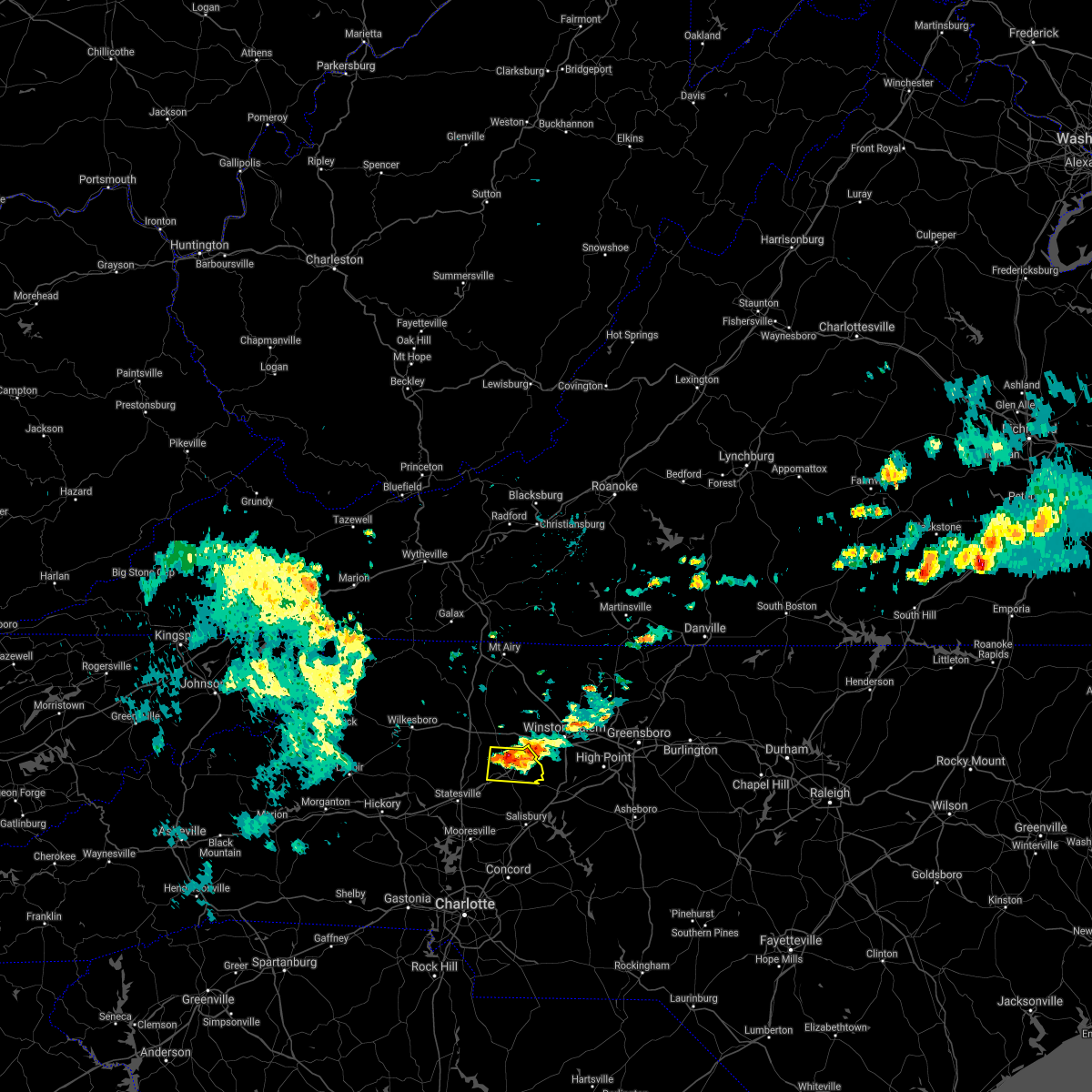 At 537 am edt, a severe thunderstorm was located 6 miles north of mocksville, or 6 miles south of huntsville, moving east at 25 mph (radar indicated). Hazards include 60 mph wind gusts and quarter size hail. Minor hail damage to vehicles is expected. expect wind damage to trees and power lines. Locations impacted include, mocksville, bermuda run, sheffield, fork church, advance and farmington. At 537 am edt, a severe thunderstorm was located 6 miles north of mocksville, or 6 miles south of huntsville, moving east at 25 mph (radar indicated). Hazards include 60 mph wind gusts and quarter size hail. Minor hail damage to vehicles is expected. expect wind damage to trees and power lines. Locations impacted include, mocksville, bermuda run, sheffield, fork church, advance and farmington.
|
| 8/1/2021 5:14 AM EDT |
 At 514 am edt, a severe thunderstorm was located 10 miles southwest of yadkinville, or near harmony, moving east at 25 mph (radar indicated). Hazards include 60 mph wind gusts and quarter size hail. Minor hail damage to vehicles is expected. Expect wind damage to trees and power lines. At 514 am edt, a severe thunderstorm was located 10 miles southwest of yadkinville, or near harmony, moving east at 25 mph (radar indicated). Hazards include 60 mph wind gusts and quarter size hail. Minor hail damage to vehicles is expected. Expect wind damage to trees and power lines.
|
| 7/9/2021 1:59 PM EDT | 911 call center reported trees down on junction r in davie county NC, 4.1 miles NNE of Mocksville, NC |
| 7/9/2021 1:59 PM EDT |
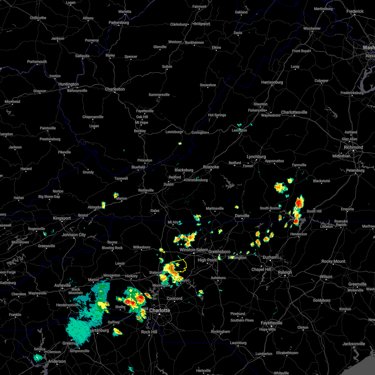 At 159 pm edt, a severe thunderstorm was located over mocksville, moving east at 25 mph (radar indicated). Hazards include 60 mph wind gusts and quarter size hail. Minor hail damage to vehicles is expected. Expect wind damage to trees and power lines. At 159 pm edt, a severe thunderstorm was located over mocksville, moving east at 25 mph (radar indicated). Hazards include 60 mph wind gusts and quarter size hail. Minor hail damage to vehicles is expected. Expect wind damage to trees and power lines.
|
| 3/27/2021 1:56 PM EDT |
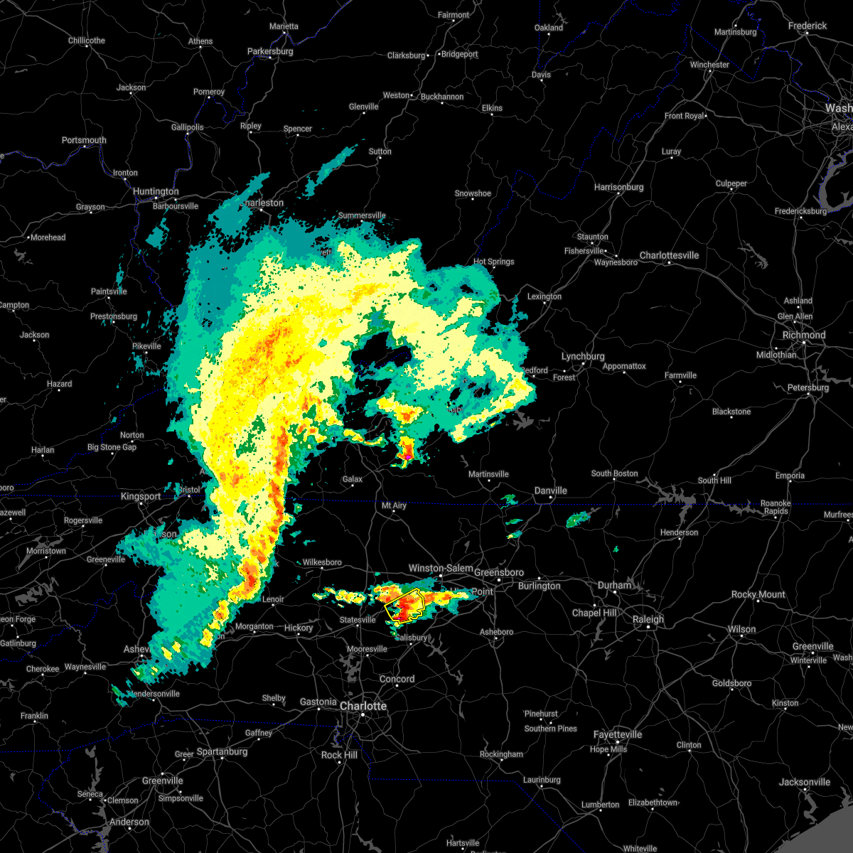 A severe thunderstorm warning remains in effect until 215 pm edt for central davie county. at 155 pm edt, a severe thunderstorm was located 5 miles northeast of mocksville, or 4 miles south of bermuda run, moving northeast at 45 mph. hazard. 60 mph wind gusts and quarter size hail. A severe thunderstorm warning remains in effect until 215 pm edt for central davie county. at 155 pm edt, a severe thunderstorm was located 5 miles northeast of mocksville, or 4 miles south of bermuda run, moving northeast at 45 mph. hazard. 60 mph wind gusts and quarter size hail.
|
| 3/27/2021 1:52 PM EDT | Half Dollar sized hail reported 2.3 miles E of Mocksville, NC, half dollar size hail. |
| 3/27/2021 1:45 PM EDT | At least 2 trees blown down in western davie county. also had reports of pea sized hail near cool springs and in mocksvill in davie county NC, 3.4 miles E of Mocksville, NC |
| 3/27/2021 1:32 PM EDT |
 At 131 pm edt, a severe thunderstorm was located 7 miles northeast of statesville, moving northeast at 45 mph (radar indicated). Hazards include 60 mph wind gusts and quarter size hail. Minor hail damage to vehicles is expected. Expect wind damage to trees and power lines. At 131 pm edt, a severe thunderstorm was located 7 miles northeast of statesville, moving northeast at 45 mph (radar indicated). Hazards include 60 mph wind gusts and quarter size hail. Minor hail damage to vehicles is expected. Expect wind damage to trees and power lines.
|
| 7/28/2020 3:36 PM EDT |
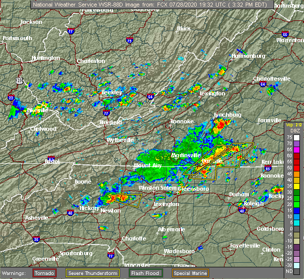 At 335 pm edt, a severe thunderstorm was located 7 miles northwest of mocksville, or 6 miles east of harmony, moving east at 15 mph (radar indicated). Hazards include 60 mph wind gusts. Expect damage to trees and power lines. Locations impacted include, mocksville, harmony, olin, sheffield, union grove, farmington and turnersburg. At 335 pm edt, a severe thunderstorm was located 7 miles northwest of mocksville, or 6 miles east of harmony, moving east at 15 mph (radar indicated). Hazards include 60 mph wind gusts. Expect damage to trees and power lines. Locations impacted include, mocksville, harmony, olin, sheffield, union grove, farmington and turnersburg.
|
| 7/28/2020 3:09 PM EDT |
 At 308 pm edt, a severe thunderstorm was located 12 miles southwest of yadkinville, or near harmony, moving east at 15 mph (radar indicated). Hazards include 60 mph wind gusts. expect damage to trees and power lines At 308 pm edt, a severe thunderstorm was located 12 miles southwest of yadkinville, or near harmony, moving east at 15 mph (radar indicated). Hazards include 60 mph wind gusts. expect damage to trees and power lines
|
| 7/23/2020 4:14 PM EDT |
 At 413 pm edt, a severe thunderstorm was located 9 miles west of mocksville, or 8 miles southeast of harmony, moving northeast at 25 mph (radar indicated). Hazards include 60 mph wind gusts and quarter size hail. Minor hail damage to vehicles is expected. expect wind damage to trees and power lines. Locations impacted include, mocksville, bermuda run, cooleemee, cleveland, fork church, advance, turnersburg, sheffield, farmington and woodleaf. At 413 pm edt, a severe thunderstorm was located 9 miles west of mocksville, or 8 miles southeast of harmony, moving northeast at 25 mph (radar indicated). Hazards include 60 mph wind gusts and quarter size hail. Minor hail damage to vehicles is expected. expect wind damage to trees and power lines. Locations impacted include, mocksville, bermuda run, cooleemee, cleveland, fork church, advance, turnersburg, sheffield, farmington and woodleaf.
|
| 7/23/2020 3:58 PM EDT |
 At 358 pm edt, a severe thunderstorm was located 6 miles east of statesville, moving northeast at 30 mph (radar indicated). Hazards include 60 mph wind gusts and quarter size hail. Minor hail damage to vehicles is expected. Expect wind damage to trees and power lines. At 358 pm edt, a severe thunderstorm was located 6 miles east of statesville, moving northeast at 30 mph (radar indicated). Hazards include 60 mph wind gusts and quarter size hail. Minor hail damage to vehicles is expected. Expect wind damage to trees and power lines.
|
| 7/20/2020 4:17 PM EDT |
 At 417 pm edt, severe thunderstorms were located along a line extending from 14 miles southwest of yadkinville to 9 miles northwest of statesville, moving southeast at 20 mph (radar indicated). Hazards include 60 mph wind gusts and penny size hail. Expect damage to trees and power lines. Locations impacted include, statesville, stony point, harmony, turnersburg, olin, sheffield, union grove, scotts and cool springs. At 417 pm edt, severe thunderstorms were located along a line extending from 14 miles southwest of yadkinville to 9 miles northwest of statesville, moving southeast at 20 mph (radar indicated). Hazards include 60 mph wind gusts and penny size hail. Expect damage to trees and power lines. Locations impacted include, statesville, stony point, harmony, turnersburg, olin, sheffield, union grove, scotts and cool springs.
|
| 7/20/2020 4:02 PM EDT |
 The national weather service in greenville-spartanburg has issued a * severe thunderstorm warning for. northwestern davie county in the piedmont of north carolina. southeastern alexander county in the piedmont of north carolina. northern iredell county in the piedmont of north carolina. Until 445 pm edt. The national weather service in greenville-spartanburg has issued a * severe thunderstorm warning for. northwestern davie county in the piedmont of north carolina. southeastern alexander county in the piedmont of north carolina. northern iredell county in the piedmont of north carolina. Until 445 pm edt.
|
| 7/19/2020 7:00 PM EDT |
 At 659 pm edt, a severe thunderstorm was located 5 miles west of mocksville, moving east at 10 mph (radar indicated). Hazards include 60 mph wind gusts and quarter size hail. Minor hail damage to vehicles is expected. expect wind damage to trees and power lines. Locations impacted include, mocksville, cooleemee, woodleaf and cool springs. At 659 pm edt, a severe thunderstorm was located 5 miles west of mocksville, moving east at 10 mph (radar indicated). Hazards include 60 mph wind gusts and quarter size hail. Minor hail damage to vehicles is expected. expect wind damage to trees and power lines. Locations impacted include, mocksville, cooleemee, woodleaf and cool springs.
|
| 7/19/2020 6:35 PM EDT |
 At 635 pm edt, a severe thunderstorm was located 9 miles southwest of mocksville, or 7 miles north of cleveland, moving east at 10 mph (radar indicated). Hazards include 60 mph wind gusts and quarter size hail. Minor hail damage to vehicles is expected. Expect wind damage to trees and power lines. At 635 pm edt, a severe thunderstorm was located 9 miles southwest of mocksville, or 7 miles north of cleveland, moving east at 10 mph (radar indicated). Hazards include 60 mph wind gusts and quarter size hail. Minor hail damage to vehicles is expected. Expect wind damage to trees and power lines.
|
| 7/17/2020 4:21 PM EDT |
 The severe thunderstorm warning for southwestern davie county will expire at 430 pm edt, the storm which prompted the warning has weakened below severe limits, and no longer poses an immediate threat to life or property. therefore the warning will be allowed to expire. however gusty winds and heavy rain are still possible with this thunderstorm. if you observed large hail or wind damage, please report it to the national weather service greenville-spartanburg by calling toll free, 1, 800, 2 6 7, 8 1 0 1, or by posting on our facebook page, or tweet it using hashtag nwsgsp. your message should describe the event and the specific location where it occurred. The severe thunderstorm warning for southwestern davie county will expire at 430 pm edt, the storm which prompted the warning has weakened below severe limits, and no longer poses an immediate threat to life or property. therefore the warning will be allowed to expire. however gusty winds and heavy rain are still possible with this thunderstorm. if you observed large hail or wind damage, please report it to the national weather service greenville-spartanburg by calling toll free, 1, 800, 2 6 7, 8 1 0 1, or by posting on our facebook page, or tweet it using hashtag nwsgsp. your message should describe the event and the specific location where it occurred.
|
| 7/17/2020 4:14 PM EDT |
 At 413 pm edt, a severe thunderstorm was located near mocksville, moving southeast at 5 mph (radar indicated). Hazards include 60 mph wind gusts and quarter size hail. Minor hail damage to vehicles is expected. expect wind damage to trees and power lines. Locations impacted include, mocksville, cooleemee and sheffield. At 413 pm edt, a severe thunderstorm was located near mocksville, moving southeast at 5 mph (radar indicated). Hazards include 60 mph wind gusts and quarter size hail. Minor hail damage to vehicles is expected. expect wind damage to trees and power lines. Locations impacted include, mocksville, cooleemee and sheffield.
|
| 7/17/2020 4:01 PM EDT |
 The national weather service in greenville-spartanburg has issued a * severe thunderstorm warning for. southwestern davie county in the piedmont of north carolina. until 430 pm edt. At 401 pm edt, a severe thunderstorm was located near mocksville, moving southeast at 5 mph. The national weather service in greenville-spartanburg has issued a * severe thunderstorm warning for. southwestern davie county in the piedmont of north carolina. until 430 pm edt. At 401 pm edt, a severe thunderstorm was located near mocksville, moving southeast at 5 mph.
|
| 7/16/2020 3:38 PM EDT |
 At 337 pm edt, a severe thunderstorm was located 4 miles southwest of mocksville, moving south at 15 mph (radar indicated). Hazards include 60 mph wind gusts and quarter size hail. Minor hail damage to vehicles is expected. Expect wind damage to trees and power lines. At 337 pm edt, a severe thunderstorm was located 4 miles southwest of mocksville, moving south at 15 mph (radar indicated). Hazards include 60 mph wind gusts and quarter size hail. Minor hail damage to vehicles is expected. Expect wind damage to trees and power lines.
|
| 4/13/2020 5:51 AM EDT |
 The severe thunderstorm warning for cabarrus, central davie, mecklenburg, rowan, union, chester and southeastern york counties will expire at 600 am edt, the storms which prompted the warning have moved out of the area. therefore the warning will be allowed to expire. a tornado watch remains in effect until 800 am edt for the piedmont of north carolina, and upstate south carolina. if you observed large hail or wind damage, please report it to the national weather service greenville-spartanburg by calling toll free, 1, 800, 2 6 7, 8 1 0 1, or by posting on our facebook page, or tweet it using hashtag nwsgsp. your message should describe the event and the specific location where it occurred. remember, a severe thunderstorm warning still remains in effect for central and eastern union county in north carolina until 630 am edt. The severe thunderstorm warning for cabarrus, central davie, mecklenburg, rowan, union, chester and southeastern york counties will expire at 600 am edt, the storms which prompted the warning have moved out of the area. therefore the warning will be allowed to expire. a tornado watch remains in effect until 800 am edt for the piedmont of north carolina, and upstate south carolina. if you observed large hail or wind damage, please report it to the national weather service greenville-spartanburg by calling toll free, 1, 800, 2 6 7, 8 1 0 1, or by posting on our facebook page, or tweet it using hashtag nwsgsp. your message should describe the event and the specific location where it occurred. remember, a severe thunderstorm warning still remains in effect for central and eastern union county in north carolina until 630 am edt.
|
| 4/13/2020 5:10 AM EDT |
 At 509 am edt, severe thunderstorms were located along a line extending from 5 miles east of mocksville to 9 miles southeast of chester, moving northeast at 60 mph (radar indicated). Hazards include 60 mph wind gusts. expect damage to trees and power lines At 509 am edt, severe thunderstorms were located along a line extending from 5 miles east of mocksville to 9 miles southeast of chester, moving northeast at 60 mph (radar indicated). Hazards include 60 mph wind gusts. expect damage to trees and power lines
|
| 4/13/2020 4:52 AM EDT |
 At 450 am edt, a line of strong to severe thunderstorms was located along a line extending from 9 miles west of mocksville to 5 miles northeast of york, moving northeast at 70 mph (radar indicated). Hazards include 60 mph wind gusts. Expect damage to trees and power lines. Locations impacted include, charlotte, huntersville, kannapolis, concord, salisbury, and mocksville. At 450 am edt, a line of strong to severe thunderstorms was located along a line extending from 9 miles west of mocksville to 5 miles northeast of york, moving northeast at 70 mph (radar indicated). Hazards include 60 mph wind gusts. Expect damage to trees and power lines. Locations impacted include, charlotte, huntersville, kannapolis, concord, salisbury, and mocksville.
|
| 4/13/2020 4:13 AM EDT |
 At 411 am edt, strong to severe thunderstorms were located along a line extending from 11 miles southeast of wilkesboro to 7 miles southeast of shelby, moving northeast at 70 mph. scattered pockets of wind damage will occur across the north carolina piedmont early this morning, including portions of the charlotte metropolitan area (radar indicated). Hazards include 60 mph wind gusts. expect damage to trees and power lines At 411 am edt, strong to severe thunderstorms were located along a line extending from 11 miles southeast of wilkesboro to 7 miles southeast of shelby, moving northeast at 70 mph. scattered pockets of wind damage will occur across the north carolina piedmont early this morning, including portions of the charlotte metropolitan area (radar indicated). Hazards include 60 mph wind gusts. expect damage to trees and power lines
|
| 2/6/2020 11:01 AM EST |
 A severe thunderstorm warning remains in effect until 1130 am est for central davie and north central rowan counties. at 1100 am est, a severe thunderstorm was located 6 miles northeast of mocksville, or 4 miles west of bermuda run, moving northeast at 50 mph. hazard. 60 mph wind gusts. A severe thunderstorm warning remains in effect until 1130 am est for central davie and north central rowan counties. at 1100 am est, a severe thunderstorm was located 6 miles northeast of mocksville, or 4 miles west of bermuda run, moving northeast at 50 mph. hazard. 60 mph wind gusts.
|
| 2/6/2020 10:43 AM EST |
 At 1042 am est, a severe thunderstorm was located 9 miles northeast of statesville, or 7 miles south of harmony, moving northeast at 50 mph (radar indicated). Hazards include 60 mph wind gusts. expect damage to trees and power lines At 1042 am est, a severe thunderstorm was located 9 miles northeast of statesville, or 7 miles south of harmony, moving northeast at 50 mph (radar indicated). Hazards include 60 mph wind gusts. expect damage to trees and power lines
|
| 1/11/2020 10:22 PM EST |
 At 1021 pm est, severe thunderstorms were located along a line extending from 3 miles west of yadkinville to 5 miles east of statesville to 5 miles west of gastonia, moving northeast at 25 mph (radar indicated). Hazards include 60 mph wind gusts. Expect damage to trees and power lines. locations impacted include, uptown charlotte, huntersville, kannapolis, mocksville, central charlotte, northeast charlotte, east charlotte, northwest charlotte, west concord and cornelius. A tornado watch remains in effect until midnight est for the piedmont of north carolina. At 1021 pm est, severe thunderstorms were located along a line extending from 3 miles west of yadkinville to 5 miles east of statesville to 5 miles west of gastonia, moving northeast at 25 mph (radar indicated). Hazards include 60 mph wind gusts. Expect damage to trees and power lines. locations impacted include, uptown charlotte, huntersville, kannapolis, mocksville, central charlotte, northeast charlotte, east charlotte, northwest charlotte, west concord and cornelius. A tornado watch remains in effect until midnight est for the piedmont of north carolina.
|
| 1/11/2020 10:19 PM EST |
 At 1019 pm est, severe thunderstorms were located along a line extending from 11 miles west of winston-salem to 9 miles east of uptown charlotte, moving northeast at 40 mph (radar indicated). Hazards include 60 mph wind gusts. expect damage to trees and power lines At 1019 pm est, severe thunderstorms were located along a line extending from 11 miles west of winston-salem to 9 miles east of uptown charlotte, moving northeast at 40 mph (radar indicated). Hazards include 60 mph wind gusts. expect damage to trees and power lines
|
| 1/11/2020 9:41 PM EST |
 At 941 pm est, severe thunderstorms were located along a line extending from 12 miles northeast of taylorsville to 9 miles east of newton to 8 miles northeast of gaffney, moving northeast at 25 mph (radar indicated). Hazards include 60 mph wind gusts. expect damage to trees and power lines At 941 pm est, severe thunderstorms were located along a line extending from 12 miles northeast of taylorsville to 9 miles east of newton to 8 miles northeast of gaffney, moving northeast at 25 mph (radar indicated). Hazards include 60 mph wind gusts. expect damage to trees and power lines
|
| 10/31/2019 5:35 PM EDT |
 At 534 pm edt, severe thunderstorms were located along a line extending from 6 miles south of mocksville to 8 miles northeast of uptown charlotte to 7 miles north of indian land, moving northeast at 50 mph (radar indicated). Hazards include 60 mph wind gusts. expect damage to trees and power lines At 534 pm edt, severe thunderstorms were located along a line extending from 6 miles south of mocksville to 8 miles northeast of uptown charlotte to 7 miles north of indian land, moving northeast at 50 mph (radar indicated). Hazards include 60 mph wind gusts. expect damage to trees and power lines
|
| 8/19/2019 7:21 PM EDT |
 The severe thunderstorm warning for davie and northeastern iredell counties will expire at 730 pm edt, the storm which prompted the warning has weakened below severe limits, and no longer poses an immediate threat to life or property. therefore the warning will be allowed to expire. however gusty winds and heavy rain are still possible with this thunderstorm. The severe thunderstorm warning for davie and northeastern iredell counties will expire at 730 pm edt, the storm which prompted the warning has weakened below severe limits, and no longer poses an immediate threat to life or property. therefore the warning will be allowed to expire. however gusty winds and heavy rain are still possible with this thunderstorm.
|
| 8/19/2019 7:00 PM EDT | Quarter sized hail reported 7.6 miles SE of Mocksville, NC, hail up to the size of quarters. |
| 8/19/2019 7:00 PM EDT | 2 trees known to be down from the storm near sheffield. one small tree down from this storm toward farmingto in davie county NC, 7.6 miles SE of Mocksville, NC |
| 8/19/2019 6:40 PM EDT |
 At 639 pm edt, a severe thunderstorm was located 5 miles north of mocksville, moving southwest at 5 mph (radar indicated). Hazards include 60 mph wind gusts and quarter size hail. Minor hail damage to vehicles is expected. Expect wind damage to trees and power lines. At 639 pm edt, a severe thunderstorm was located 5 miles north of mocksville, moving southwest at 5 mph (radar indicated). Hazards include 60 mph wind gusts and quarter size hail. Minor hail damage to vehicles is expected. Expect wind damage to trees and power lines.
|
| 8/13/2019 4:38 PM EDT |
 The severe thunderstorm warning for davie, east central iredell and northwestern rowan counties will expire at 445 pm edt, the storm which prompted the warning has weakened below severe limits, and no longer poses an immediate threat to life or property. therefore the warning will be allowed to expire. however gusty winds are still possible with this thunderstorm. a severe thunderstorm watch remains in effect until 700 pm edt for the piedmont of north carolina. if you observed large hail or wind damage, please report it to the national weather service greenville-spartanburg by calling toll free, 1, 800, 2 6 7, 8 1 0 1, or by posting on our facebook page, or tweet it using hashtag nwsgsp. your message should describe the event and the specific location where it occurred. The severe thunderstorm warning for davie, east central iredell and northwestern rowan counties will expire at 445 pm edt, the storm which prompted the warning has weakened below severe limits, and no longer poses an immediate threat to life or property. therefore the warning will be allowed to expire. however gusty winds are still possible with this thunderstorm. a severe thunderstorm watch remains in effect until 700 pm edt for the piedmont of north carolina. if you observed large hail or wind damage, please report it to the national weather service greenville-spartanburg by calling toll free, 1, 800, 2 6 7, 8 1 0 1, or by posting on our facebook page, or tweet it using hashtag nwsgsp. your message should describe the event and the specific location where it occurred.
|
| 8/13/2019 4:23 PM EDT |
 At 403 pm edt, severe thunderstorms were located along a line extending from 7 miles southwest of yadkinville to 6 miles west of statesville, moving east at 35 mph (radar indicated). Hazards include 60 mph wind gusts. expect damage to trees and power lines At 403 pm edt, severe thunderstorms were located along a line extending from 7 miles southwest of yadkinville to 6 miles west of statesville, moving east at 35 mph (radar indicated). Hazards include 60 mph wind gusts. expect damage to trees and power lines
|
| 8/13/2019 4:20 PM EDT | 911 call center reported lines down and power outages in parts of mocksvill in davie county NC, 0.7 miles NW of Mocksville, NC |
| 8/13/2019 4:03 PM EDT |
 The national weather service in greenville-spartanburg has issued a * severe thunderstorm warning for. davie county in the piedmont of north carolina. northern iredell county in the piedmont of north carolina. western rowan county in the piedmont of north carolina. Until 445 pm edt. The national weather service in greenville-spartanburg has issued a * severe thunderstorm warning for. davie county in the piedmont of north carolina. northern iredell county in the piedmont of north carolina. western rowan county in the piedmont of north carolina. Until 445 pm edt.
|
| 7/22/2019 7:09 PM EDT |
 At 708 pm edt, a severe thunderstorm was located 4 miles east of mocksville, moving east at 20 mph (radar indicated). Hazards include 60 mph wind gusts. Expect damage to trees and power lines. Locations impacted include, mocksville, bermuda run, fork church and advance. At 708 pm edt, a severe thunderstorm was located 4 miles east of mocksville, moving east at 20 mph (radar indicated). Hazards include 60 mph wind gusts. Expect damage to trees and power lines. Locations impacted include, mocksville, bermuda run, fork church and advance.
|
| 7/22/2019 6:54 PM EDT |
 At 652 pm edt, severe thunderstorms were located along a line extending from 8 miles south of east bend to 8 miles east of mocksville to 9 miles east of statesville, moving east at 30 mph (radar indicated). Hazards include 60 mph wind gusts. Expect damage to trees and power lines. Locations impacted include, mocksville, bermuda run, cooleemee, cleveland, fork church, advance, farmington and woodleaf. At 652 pm edt, severe thunderstorms were located along a line extending from 8 miles south of east bend to 8 miles east of mocksville to 9 miles east of statesville, moving east at 30 mph (radar indicated). Hazards include 60 mph wind gusts. Expect damage to trees and power lines. Locations impacted include, mocksville, bermuda run, cooleemee, cleveland, fork church, advance, farmington and woodleaf.
|
| 7/22/2019 6:28 PM EDT |
 At 626 pm edt, severe thunderstorms were located along a line extending from 7 miles south of yadkinville to 6 miles west of mocksville to 7 miles south of statesville, moving east at 30 mph (radar indicated). Hazards include 60 mph wind gusts. Expect damage to trees and power lines. Locations impacted include, statesville, mocksville, troutman, bermuda run, cooleemee, cleveland, harmony, lake norman state park, fork church and advance. At 626 pm edt, severe thunderstorms were located along a line extending from 7 miles south of yadkinville to 6 miles west of mocksville to 7 miles south of statesville, moving east at 30 mph (radar indicated). Hazards include 60 mph wind gusts. Expect damage to trees and power lines. Locations impacted include, statesville, mocksville, troutman, bermuda run, cooleemee, cleveland, harmony, lake norman state park, fork church and advance.
|
| 7/22/2019 6:12 PM EDT |
 At 611 pm edt, severe thunderstorms were located along a line extending from 13 miles southwest of yadkinville to 5 miles northeast of statesville to 10 miles east of newton, moving east at 30 mph (radar indicated). Hazards include 60 mph wind gusts. expect damage to trees and power lines At 611 pm edt, severe thunderstorms were located along a line extending from 13 miles southwest of yadkinville to 5 miles northeast of statesville to 10 miles east of newton, moving east at 30 mph (radar indicated). Hazards include 60 mph wind gusts. expect damage to trees and power lines
|
| 7/20/2019 2:38 PM EDT |
 At 238 pm edt, a severe thunderstorm was located 4 miles southwest of mocksville, moving south at 5 mph (radar indicated). Hazards include 60 mph wind gusts and up to nickel size hail. Expect damage to trees and power lines. Locations impacted include, mocksville, cooleemee, harmony, woodleaf, cool springs, sheffield, turnersburg and statesville. At 238 pm edt, a severe thunderstorm was located 4 miles southwest of mocksville, moving south at 5 mph (radar indicated). Hazards include 60 mph wind gusts and up to nickel size hail. Expect damage to trees and power lines. Locations impacted include, mocksville, cooleemee, harmony, woodleaf, cool springs, sheffield, turnersburg and statesville.
|
| 7/20/2019 2:12 PM EDT |
 At 212 pm edt, a severe thunderstorm was located 4 miles west of mocksville, moving south at 5 mph (radar indicated). Hazards include 60 mph wind gusts and penny size hail. expect damage to trees and power lines At 212 pm edt, a severe thunderstorm was located 4 miles west of mocksville, moving south at 5 mph (radar indicated). Hazards include 60 mph wind gusts and penny size hail. expect damage to trees and power lines
|
| 6/24/2019 10:03 PM EDT |
 At 1003 pm edt, severe thunderstorms were located along a line extending from 12 miles southwest of winston-salem to 5 miles southeast of mocksville to 12 miles south of lexington to near downtown concord to 16 miles southwest of albemarle to 11 miles southwest of monroe to 13 miles south of lancaster, moving east at 40 mph (radar indicated). Hazards include 60 mph wind gusts. Expect damage to trees and power lines. Locations impacted include, rock hill, kannapolis, downtown concord, monroe, salisbury, mocksville, central charlotte, south charlotte, southwest charlotte and east charlotte. At 1003 pm edt, severe thunderstorms were located along a line extending from 12 miles southwest of winston-salem to 5 miles southeast of mocksville to 12 miles south of lexington to near downtown concord to 16 miles southwest of albemarle to 11 miles southwest of monroe to 13 miles south of lancaster, moving east at 40 mph (radar indicated). Hazards include 60 mph wind gusts. Expect damage to trees and power lines. Locations impacted include, rock hill, kannapolis, downtown concord, monroe, salisbury, mocksville, central charlotte, south charlotte, southwest charlotte and east charlotte.
|
| 6/24/2019 9:48 PM EDT |
 At 948 pm edt, severe thunderstorms were located along a line extending from 7 miles south of yadkinville to 7 miles southwest of mocksville to 4 miles east of salisbury to 6 miles east of huntersville to 14 miles north of monroe to 8 miles south of indian land to 14 miles southwest of lancaster, moving east at 25 mph (radar indicated). Hazards include 60 mph wind gusts. Expect damage to trees and power lines. Locations impacted include, rock hill, uptown charlotte, huntersville, kannapolis, downtown concord, monroe, salisbury, chester, mocksville and central charlotte. At 948 pm edt, severe thunderstorms were located along a line extending from 7 miles south of yadkinville to 7 miles southwest of mocksville to 4 miles east of salisbury to 6 miles east of huntersville to 14 miles north of monroe to 8 miles south of indian land to 14 miles southwest of lancaster, moving east at 25 mph (radar indicated). Hazards include 60 mph wind gusts. Expect damage to trees and power lines. Locations impacted include, rock hill, uptown charlotte, huntersville, kannapolis, downtown concord, monroe, salisbury, chester, mocksville and central charlotte.
|
| 6/24/2019 9:27 PM EDT |
 At 927 pm edt, severe thunderstorms were located along a line extending from 6 miles south of yadkinville to 4 miles north of statesville to 8 miles north of kannapolis to near huntersville to 7 miles northeast of indian land to 4 miles southwest of rock hill to 11 miles north of winnsboro, moving east at 40 mph (radar indicated). Hazards include 70 mph wind gusts. Expect considerable tree damage. Damage is likely to mobile homes, roofs, and outbuildings. At 927 pm edt, severe thunderstorms were located along a line extending from 6 miles south of yadkinville to 4 miles north of statesville to 8 miles north of kannapolis to near huntersville to 7 miles northeast of indian land to 4 miles southwest of rock hill to 11 miles north of winnsboro, moving east at 40 mph (radar indicated). Hazards include 70 mph wind gusts. Expect considerable tree damage. Damage is likely to mobile homes, roofs, and outbuildings.
|
| 6/24/2019 9:16 PM EDT |
 At 916 pm edt, severe thunderstorms were located along a line extending from 15 miles east of taylorsville to 7 miles northwest of statesville to 14 miles northwest of kannapolis to 5 miles west of huntersville to 6 miles southwest of uptown charlotte to 7 miles south of york to 6 miles south of chester, moving northeast at 70 mph (radar indicated). Hazards include 70 mph wind gusts. Expect considerable tree damage. damage is likely to mobile homes, roofs, and outbuildings. Locations impacted include, gastonia, rock hill, uptown charlotte, huntersville, statesville, lincolnton, york, chester, mocksville and central charlotte. At 916 pm edt, severe thunderstorms were located along a line extending from 15 miles east of taylorsville to 7 miles northwest of statesville to 14 miles northwest of kannapolis to 5 miles west of huntersville to 6 miles southwest of uptown charlotte to 7 miles south of york to 6 miles south of chester, moving northeast at 70 mph (radar indicated). Hazards include 70 mph wind gusts. Expect considerable tree damage. damage is likely to mobile homes, roofs, and outbuildings. Locations impacted include, gastonia, rock hill, uptown charlotte, huntersville, statesville, lincolnton, york, chester, mocksville and central charlotte.
|
| 6/24/2019 9:00 PM EDT |
 At 859 pm edt, severe thunderstorms were located along a line extending from 4 miles southeast of taylorsville to 10 miles southwest of statesville to 7 miles southeast of lincolnton to 8 miles southeast of gastonia to 7 miles southwest of york to 16 miles southeast of union, moving northeast at 50 mph (radar indicated). Hazards include 70 mph wind gusts. Expect considerable tree damage. Damage is likely to mobile homes, roofs, and outbuildings. At 859 pm edt, severe thunderstorms were located along a line extending from 4 miles southeast of taylorsville to 10 miles southwest of statesville to 7 miles southeast of lincolnton to 8 miles southeast of gastonia to 7 miles southwest of york to 16 miles southeast of union, moving northeast at 50 mph (radar indicated). Hazards include 70 mph wind gusts. Expect considerable tree damage. Damage is likely to mobile homes, roofs, and outbuildings.
|
| 4/15/2019 12:36 AM EDT |
 At 1235 am edt, a severe thunderstorm capable of producing a tornado was located 8 miles south of mocksville, or near cooleemee, moving northeast at 45 mph (radar indicated rotation). Hazards include tornado. Flying debris will be dangerous to those caught without shelter. mobile homes will be damaged or destroyed. damage to roofs, windows, and vehicles will occur. tree damage is likely. This dangerous storm will remain over mainly rural areas of central davie and northwestern rowan counties, including the following locations, woodleaf and fork church. At 1235 am edt, a severe thunderstorm capable of producing a tornado was located 8 miles south of mocksville, or near cooleemee, moving northeast at 45 mph (radar indicated rotation). Hazards include tornado. Flying debris will be dangerous to those caught without shelter. mobile homes will be damaged or destroyed. damage to roofs, windows, and vehicles will occur. tree damage is likely. This dangerous storm will remain over mainly rural areas of central davie and northwestern rowan counties, including the following locations, woodleaf and fork church.
|
| 4/15/2019 12:26 AM EDT |
 At 1226 am edt, a severe thunderstorm capable of producing a tornado was located 11 miles northwest of kannapolis, or 6 miles south of cleveland, moving northeast at 55 mph (radar indicated rotation). Hazards include tornado. Flying debris will be dangerous to those caught without shelter. mobile homes will be damaged or destroyed. damage to roofs, windows, and vehicles will occur. tree damage is likely. this dangerous storm will be near, cleveland around 1230 am edt. salisbury and cooleemee around 1240 am edt. Other locations impacted by this dangerous storm include fork church, piedmont research station, mount ulla and woodleaf. At 1226 am edt, a severe thunderstorm capable of producing a tornado was located 11 miles northwest of kannapolis, or 6 miles south of cleveland, moving northeast at 55 mph (radar indicated rotation). Hazards include tornado. Flying debris will be dangerous to those caught without shelter. mobile homes will be damaged or destroyed. damage to roofs, windows, and vehicles will occur. tree damage is likely. this dangerous storm will be near, cleveland around 1230 am edt. salisbury and cooleemee around 1240 am edt. Other locations impacted by this dangerous storm include fork church, piedmont research station, mount ulla and woodleaf.
|
| 4/15/2019 12:15 AM EDT |
 At 1215 am edt, a severe thunderstorm capable of producing a tornado was located 12 miles south of statesville, or near mooresville, moving northeast at 50 mph (radar indicated rotation). Hazards include tornado. Flying debris will be dangerous to those caught without shelter. mobile homes will be damaged or destroyed. damage to roofs, windows, and vehicles will occur. tree damage is likely. this dangerous storm will be near, cleveland around 1230 am edt. salisbury and cooleemee around 1240 am edt. Other locations impacted by this dangerous thunderstorm include fork church, piedmont research station, mount ulla, woodleaf and doolie. At 1215 am edt, a severe thunderstorm capable of producing a tornado was located 12 miles south of statesville, or near mooresville, moving northeast at 50 mph (radar indicated rotation). Hazards include tornado. Flying debris will be dangerous to those caught without shelter. mobile homes will be damaged or destroyed. damage to roofs, windows, and vehicles will occur. tree damage is likely. this dangerous storm will be near, cleveland around 1230 am edt. salisbury and cooleemee around 1240 am edt. Other locations impacted by this dangerous thunderstorm include fork church, piedmont research station, mount ulla, woodleaf and doolie.
|
| 8/30/2018 10:45 PM EDT |
 At 1044 pm edt, a severe thunderstorm was located 6 miles north of salisbury, or 4 miles southeast of cooleemee, moving northeast at 15 mph. another strong thunderstorm was located near faith, also moving northeast at 10 mph (radar indicated). Hazards include 60 mph wind gusts and quarter size hail. Minor hail damage to vehicles is expected. expect wind damage to trees and power lines. Locations impacted include, salisbury, china grove, spencer, granite quarry, rockwell, cooleemee, cleveland, faith, gold hill and piedmont research station. At 1044 pm edt, a severe thunderstorm was located 6 miles north of salisbury, or 4 miles southeast of cooleemee, moving northeast at 15 mph. another strong thunderstorm was located near faith, also moving northeast at 10 mph (radar indicated). Hazards include 60 mph wind gusts and quarter size hail. Minor hail damage to vehicles is expected. expect wind damage to trees and power lines. Locations impacted include, salisbury, china grove, spencer, granite quarry, rockwell, cooleemee, cleveland, faith, gold hill and piedmont research station.
|
| 8/30/2018 10:30 PM EDT |
 At 1029 pm edt, a severe thunderstorm was located 4 miles northwest of salisbury, moving northeast at 10 mph. other thunderstorms within the warned area near rockwell may also become severe (radar indicated). Hazards include 60 mph wind gusts and quarter size hail. Minor hail damage to vehicles is expected. Expect wind damage to trees and power lines. At 1029 pm edt, a severe thunderstorm was located 4 miles northwest of salisbury, moving northeast at 10 mph. other thunderstorms within the warned area near rockwell may also become severe (radar indicated). Hazards include 60 mph wind gusts and quarter size hail. Minor hail damage to vehicles is expected. Expect wind damage to trees and power lines.
|
| 8/21/2018 4:30 PM EDT |
 At 429 pm edt, severe thunderstorms were located along a line extending from 8 miles southwest of yadkinville to 9 miles southwest of mocksville, moving east at 30 mph (radar indicated). Hazards include 60 mph wind gusts. expect damage to trees and power lines At 429 pm edt, severe thunderstorms were located along a line extending from 8 miles southwest of yadkinville to 9 miles southwest of mocksville, moving east at 30 mph (radar indicated). Hazards include 60 mph wind gusts. expect damage to trees and power lines
|
| 6/25/2018 7:00 PM EDT |
 At 700 pm edt, severe thunderstorms were located along a line extending from 8 miles south of winston-salem to 5 miles southwest of kannapolis, moving east at 30 mph (radar indicated). Hazards include 60 mph wind gusts and quarter size hail. Minor hail damage to vehicles is expected. expect wind damage to trees and power lines. Locations impacted include, kannapolis, downtown concord, salisbury, mocksville, west concord, china grove, spencer, landis, enochville and granite quarry. At 700 pm edt, severe thunderstorms were located along a line extending from 8 miles south of winston-salem to 5 miles southwest of kannapolis, moving east at 30 mph (radar indicated). Hazards include 60 mph wind gusts and quarter size hail. Minor hail damage to vehicles is expected. expect wind damage to trees and power lines. Locations impacted include, kannapolis, downtown concord, salisbury, mocksville, west concord, china grove, spencer, landis, enochville and granite quarry.
|
| 6/25/2018 6:43 PM EDT |
 At 643 pm edt, severe thunderstorms were located along a line extending from 9 miles northeast of mocksville to 3 miles northeast of huntersville, moving east at 30 mph (radar indicated). Hazards include 60 mph wind gusts and quarter size hail. Minor hail damage to vehicles is expected. Expect wind damage to trees and power lines. At 643 pm edt, severe thunderstorms were located along a line extending from 9 miles northeast of mocksville to 3 miles northeast of huntersville, moving east at 30 mph (radar indicated). Hazards include 60 mph wind gusts and quarter size hail. Minor hail damage to vehicles is expected. Expect wind damage to trees and power lines.
|
| 6/25/2018 6:24 PM EDT |
 At 623 pm edt, severe thunderstorms were located along a line extending from near winston-salem to 10 miles west of huntersville, moving east at 50 mph (radar indicated). Hazards include 60 mph wind gusts and quarter size hail. Minor hail damage to vehicles is expected. expect wind damage to trees and power lines. Locations impacted include, huntersville, statesville, lincolnton, mocksville, cornelius, mooresville, davidson, china grove, maiden and landis. At 623 pm edt, severe thunderstorms were located along a line extending from near winston-salem to 10 miles west of huntersville, moving east at 50 mph (radar indicated). Hazards include 60 mph wind gusts and quarter size hail. Minor hail damage to vehicles is expected. expect wind damage to trees and power lines. Locations impacted include, huntersville, statesville, lincolnton, mocksville, cornelius, mooresville, davidson, china grove, maiden and landis.
|
| 6/25/2018 5:57 PM EDT |
 The national weather service in greenville-spartanburg has issued a * severe thunderstorm warning for. northwestern cabarrus county in the piedmont of north carolina. catawba county in the piedmont of north carolina. davie county in the piedmont of north carolina. Alexander county in the piedmont of north carolina. The national weather service in greenville-spartanburg has issued a * severe thunderstorm warning for. northwestern cabarrus county in the piedmont of north carolina. catawba county in the piedmont of north carolina. davie county in the piedmont of north carolina. Alexander county in the piedmont of north carolina.
|
| 6/11/2018 6:27 PM EDT |
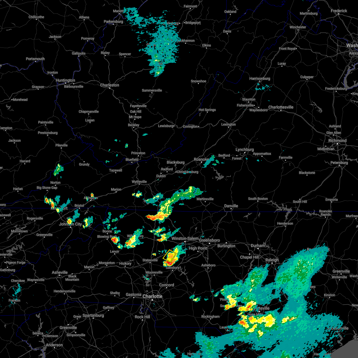 At 607 pm edt, a severe thunderstorm was located near mocksville, or near cooleemee, moving south at 25 mph (radar indicated). Hazards include 60 mph wind gusts and quarter size hail. Minor hail damage to vehicles is expected. expect wind damage to trees and power lines. Locations impacted include, mocksville, cooleemee and fork church. At 607 pm edt, a severe thunderstorm was located near mocksville, or near cooleemee, moving south at 25 mph (radar indicated). Hazards include 60 mph wind gusts and quarter size hail. Minor hail damage to vehicles is expected. expect wind damage to trees and power lines. Locations impacted include, mocksville, cooleemee and fork church.
|
| 6/11/2018 6:07 PM EDT |
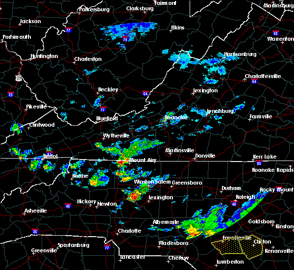 At 607 pm edt, a severe thunderstorm was located near mocksville, or near cooleemee, moving south at 25 mph (radar indicated). Hazards include 60 mph wind gusts and quarter size hail. Minor hail damage to vehicles is expected. expect wind damage to trees and power lines. Locations impacted include, mocksville, cooleemee and fork church. At 607 pm edt, a severe thunderstorm was located near mocksville, or near cooleemee, moving south at 25 mph (radar indicated). Hazards include 60 mph wind gusts and quarter size hail. Minor hail damage to vehicles is expected. expect wind damage to trees and power lines. Locations impacted include, mocksville, cooleemee and fork church.
|
| 6/11/2018 6:00 PM EDT | Several trees down in the mocksville area and one report of a tree down in the farmington area. time obtained from radar dat in davie county NC, 0.7 miles NW of Mocksville, NC |
| 6/11/2018 5:54 PM EDT |
 At 554 pm edt, a severe thunderstorm was located near mocksville, moving south at 20 mph (radar indicated). Hazards include 60 mph wind gusts and penny size hail. Expect damage to trees and power lines. Locations impacted include, mocksville, cooleemee, fork church, advance, farmington and bermuda run. At 554 pm edt, a severe thunderstorm was located near mocksville, moving south at 20 mph (radar indicated). Hazards include 60 mph wind gusts and penny size hail. Expect damage to trees and power lines. Locations impacted include, mocksville, cooleemee, fork church, advance, farmington and bermuda run.
|
| 6/11/2018 5:30 PM EDT |
 At 529 pm edt, a severe thunderstorm was located 10 miles southeast of yadkinville, or near huntsville, moving south at 25 mph (radar indicated). Hazards include 60 mph wind gusts and half dollar size hail. Minor hail damage to vehicles is expected. Expect wind damage to trees and power lines. At 529 pm edt, a severe thunderstorm was located 10 miles southeast of yadkinville, or near huntsville, moving south at 25 mph (radar indicated). Hazards include 60 mph wind gusts and half dollar size hail. Minor hail damage to vehicles is expected. Expect wind damage to trees and power lines.
|
| 6/1/2018 5:52 PM EDT |
 At 552 pm edt, a severe thunderstorm was located 6 miles south of mocksville, or near cooleemee, moving east at 25 mph (radar indicated). Hazards include 60 mph wind gusts. Expect damage to trees and power lines. Locations impacted include, salisbury, mocksville, spencer, granite quarry, cooleemee, cleveland, fork church, piedmont research station and woodleaf. At 552 pm edt, a severe thunderstorm was located 6 miles south of mocksville, or near cooleemee, moving east at 25 mph (radar indicated). Hazards include 60 mph wind gusts. Expect damage to trees and power lines. Locations impacted include, salisbury, mocksville, spencer, granite quarry, cooleemee, cleveland, fork church, piedmont research station and woodleaf.
|
| 6/1/2018 5:24 PM EDT |
 The national weather service in greenville-spartanburg has issued a * severe thunderstorm warning for. southern davie county in the piedmont of north carolina. northeastern iredell county in the piedmont of north carolina. western rowan county in the piedmont of north carolina. Until 630 pm edt. The national weather service in greenville-spartanburg has issued a * severe thunderstorm warning for. southern davie county in the piedmont of north carolina. northeastern iredell county in the piedmont of north carolina. western rowan county in the piedmont of north carolina. Until 630 pm edt.
|
| 5/10/2018 5:58 PM EDT |
 The severe thunderstorm warning for central davie, northeastern iredell and rowan counties will expire at 600 pm edt, the storm which prompted the warning has weakened below severe limits, and no longer poses an immediate threat to life or property. therefore the warning will be allowed to expire. however gusty winds and heavy rain are still possible with this thunderstorm. a severe thunderstorm watch remains in effect until 1000 pm edt for the piedmont of north carolina. The severe thunderstorm warning for central davie, northeastern iredell and rowan counties will expire at 600 pm edt, the storm which prompted the warning has weakened below severe limits, and no longer poses an immediate threat to life or property. therefore the warning will be allowed to expire. however gusty winds and heavy rain are still possible with this thunderstorm. a severe thunderstorm watch remains in effect until 1000 pm edt for the piedmont of north carolina.
|
| 5/10/2018 5:43 PM EDT |
 At 543 pm edt, a severe thunderstorm was located 6 miles northwest of salisbury, or near cooleemee, moving east at 30 mph (radar indicated). Hazards include 60 mph wind gusts and quarter size hail. Minor hail damage to vehicles is expected. expect wind damage to trees and power lines. Locations impacted include, salisbury, statesville, mocksville, spencer, granite quarry, rockwell, cooleemee, cleveland, faith and harmony. At 543 pm edt, a severe thunderstorm was located 6 miles northwest of salisbury, or near cooleemee, moving east at 30 mph (radar indicated). Hazards include 60 mph wind gusts and quarter size hail. Minor hail damage to vehicles is expected. expect wind damage to trees and power lines. Locations impacted include, salisbury, statesville, mocksville, spencer, granite quarry, rockwell, cooleemee, cleveland, faith and harmony.
|
| 5/10/2018 5:15 PM EDT |
 At 514 pm edt, a severe thunderstorm was located 4 miles east of statesville, moving east at 30 mph (radar indicated). Hazards include 60 mph wind gusts and quarter size hail. Minor hail damage to vehicles is expected. Expect wind damage to trees and power lines. At 514 pm edt, a severe thunderstorm was located 4 miles east of statesville, moving east at 30 mph (radar indicated). Hazards include 60 mph wind gusts and quarter size hail. Minor hail damage to vehicles is expected. Expect wind damage to trees and power lines.
|
| 4/15/2018 4:26 PM EDT |
 The severe thunderstorm warning for davie county will expire at 430 pm edt, the storm which prompted the warning has moved out of the area. therefore the warning will be allowed to expire. a tornado watch remains in effect until 700 pm edt for the piedmont of north carolina. The severe thunderstorm warning for davie county will expire at 430 pm edt, the storm which prompted the warning has moved out of the area. therefore the warning will be allowed to expire. a tornado watch remains in effect until 700 pm edt for the piedmont of north carolina.
|
| 4/15/2018 4:22 PM EDT |
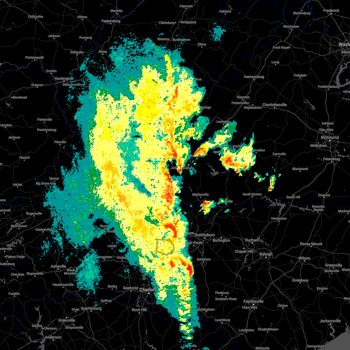 At 422 pm edt, a severe thunderstorm was located 5 miles southeast of east bend, or over enon, moving northeast at 55 mph (radar indicated). Hazards include 60 mph wind gusts and quarter size hail. Minor hail damage to vehicles is expected. expect wind damage to trees and power lines. locations impacted include, mocksville, bermuda run, sheffield, fork church, advance and farmington. A tornado watch remains in effect until 700 pm edt for the piedmont of north carolina. At 422 pm edt, a severe thunderstorm was located 5 miles southeast of east bend, or over enon, moving northeast at 55 mph (radar indicated). Hazards include 60 mph wind gusts and quarter size hail. Minor hail damage to vehicles is expected. expect wind damage to trees and power lines. locations impacted include, mocksville, bermuda run, sheffield, fork church, advance and farmington. A tornado watch remains in effect until 700 pm edt for the piedmont of north carolina.
|
| 4/15/2018 3:55 PM EDT |
 At 354 pm edt, a severe thunderstorm was located 9 miles east of statesville, or 6 miles north of cleveland, moving northeast at 55 mph (radar indicated). Hazards include 60 mph wind gusts and quarter size hail. Minor hail damage to vehicles is expected. Expect wind damage to trees and power lines. At 354 pm edt, a severe thunderstorm was located 9 miles east of statesville, or 6 miles north of cleveland, moving northeast at 55 mph (radar indicated). Hazards include 60 mph wind gusts and quarter size hail. Minor hail damage to vehicles is expected. Expect wind damage to trees and power lines.
|
| 10/23/2017 5:40 PM EDT |
 At 540 pm edt, a severe thunderstorm was located near mocksville, moving northeast at 40 mph (radar indicated). Hazards include 60 mph wind gusts. Expect damage to trees and power lines. locations impacted include, cooleemee, cleveland, piedmont research station and woodleaf. A tornado watch remains in effect until 900 pm edt for the piedmont of north carolina. At 540 pm edt, a severe thunderstorm was located near mocksville, moving northeast at 40 mph (radar indicated). Hazards include 60 mph wind gusts. Expect damage to trees and power lines. locations impacted include, cooleemee, cleveland, piedmont research station and woodleaf. A tornado watch remains in effect until 900 pm edt for the piedmont of north carolina.
|
| 10/23/2017 5:36 PM EDT |
 At 536 pm edt, a severe thunderstorm was located near mocksville, moving northeast at 35 mph (radar indicated). Hazards include 60 mph wind gusts. expect damage to trees and power lines At 536 pm edt, a severe thunderstorm was located near mocksville, moving northeast at 35 mph (radar indicated). Hazards include 60 mph wind gusts. expect damage to trees and power lines
|
| 10/23/2017 5:24 PM EDT | A couple trees down near county line rd and hwy 90 in davie county NC, 5.7 miles ENE of Mocksville, NC |
| 10/23/2017 5:14 PM EDT |
 At 514 pm edt, a severe thunderstorm was located 7 miles southeast of statesville, or 5 miles west of cleveland, moving northeast at 40 mph (radar indicated). Hazards include 60 mph wind gusts. expect damage to trees and power lines At 514 pm edt, a severe thunderstorm was located 7 miles southeast of statesville, or 5 miles west of cleveland, moving northeast at 40 mph (radar indicated). Hazards include 60 mph wind gusts. expect damage to trees and power lines
|
| 9/1/2017 6:49 PM EDT |
 At 648 pm edt, a severe thunderstorm was located near huntersville, moving northeast at 50 mph (radar indicated). Hazards include 60 mph wind gusts and quarter size hail. Minor hail damage to vehicles is expected. Expect wind damage to trees and power lines. At 648 pm edt, a severe thunderstorm was located near huntersville, moving northeast at 50 mph (radar indicated). Hazards include 60 mph wind gusts and quarter size hail. Minor hail damage to vehicles is expected. Expect wind damage to trees and power lines.
|
| 9/1/2017 5:54 PM EDT |
 The severe thunderstorm warning for southeastern catawba, western davie, eastern iredell and northwestern rowan counties will expire at 600 pm edt, the storms which prompted the warning have weakened below severe limits, and no longer pose an immediate threat to life or property. therefore the warning will be allowed to expire. however gusty winds and heavy rain are still possible with these thunderstorms. a tornado watch remains in effect until 1000 pm edt for the piedmont of north carolina. if you observed large hail or wind damage, please report it to the national weather service greenville-spartanburg by calling toll free, 1, 800, 2 6 7, 8 1 0 1, or by posting on our facebook page, or tweet it using hashtag nwsgsp. your message should describe the event and the specific location where it occurred. The severe thunderstorm warning for southeastern catawba, western davie, eastern iredell and northwestern rowan counties will expire at 600 pm edt, the storms which prompted the warning have weakened below severe limits, and no longer pose an immediate threat to life or property. therefore the warning will be allowed to expire. however gusty winds and heavy rain are still possible with these thunderstorms. a tornado watch remains in effect until 1000 pm edt for the piedmont of north carolina. if you observed large hail or wind damage, please report it to the national weather service greenville-spartanburg by calling toll free, 1, 800, 2 6 7, 8 1 0 1, or by posting on our facebook page, or tweet it using hashtag nwsgsp. your message should describe the event and the specific location where it occurred.
|
| 9/1/2017 5:45 PM EDT |
 At 544 pm edt, severe thunderstorms were located along a line extending from 13 miles southwest of yadkinville, to 3 miles east of statesville, to 14 miles north of huntersville, moving east at 30 mph (radar indicated). Hazards include 60 mph wind gusts and quarter size hail. Minor hail damage to vehicles is expected. expect wind damage to trees and power lines. locations impacted include, statesville, mooresville, troutman, cleveland, lake norman, lake norman state park, sherrills ford, mount ulla, turnersburg and cool springs. A tornado watch remains in effect until 1000 pm edt for the piedmont of north carolina. At 544 pm edt, severe thunderstorms were located along a line extending from 13 miles southwest of yadkinville, to 3 miles east of statesville, to 14 miles north of huntersville, moving east at 30 mph (radar indicated). Hazards include 60 mph wind gusts and quarter size hail. Minor hail damage to vehicles is expected. expect wind damage to trees and power lines. locations impacted include, statesville, mooresville, troutman, cleveland, lake norman, lake norman state park, sherrills ford, mount ulla, turnersburg and cool springs. A tornado watch remains in effect until 1000 pm edt for the piedmont of north carolina.
|
| 9/1/2017 5:30 PM EDT |
 At 530 pm edt, severe thunderstorms were located along a line extending from 12 miles east of taylorsville to 4 miles southwest of statesville to 11 miles southeast of newton, moving east at 25 mph (radar indicated). Hazards include 60 mph wind gusts and quarter size hail. Minor hail damage to vehicles is expected. expect wind damage to trees and power lines. locations impacted include, statesville, mooresville, troutman, cleveland, harmony, lake norman, lake norman state park, sherrills ford, mount ulla and bandys. A tornado watch remains in effect until 1000 pm edt for the piedmont of north carolina. At 530 pm edt, severe thunderstorms were located along a line extending from 12 miles east of taylorsville to 4 miles southwest of statesville to 11 miles southeast of newton, moving east at 25 mph (radar indicated). Hazards include 60 mph wind gusts and quarter size hail. Minor hail damage to vehicles is expected. expect wind damage to trees and power lines. locations impacted include, statesville, mooresville, troutman, cleveland, harmony, lake norman, lake norman state park, sherrills ford, mount ulla and bandys. A tornado watch remains in effect until 1000 pm edt for the piedmont of north carolina.
|
| 9/1/2017 5:16 PM EDT |
 At 516 pm edt, severe thunderstorms were located along a line extending from 6 miles east of taylorsville to 9 miles west of statesville to 8 miles southeast of newton, moving east at 30 mph (radar indicated). Hazards include 60 mph wind gusts and quarter size hail. Minor hail damage to vehicles is expected. Expect wind damage to trees and power lines. At 516 pm edt, severe thunderstorms were located along a line extending from 6 miles east of taylorsville to 9 miles west of statesville to 8 miles southeast of newton, moving east at 30 mph (radar indicated). Hazards include 60 mph wind gusts and quarter size hail. Minor hail damage to vehicles is expected. Expect wind damage to trees and power lines.
|
| 7/28/2017 5:42 PM EDT |
 At 542 pm edt, severe thunderstorms were located along a line extending from 9 miles southeast of yadkinville to 9 miles west of lexington to 8 miles east of kannapolis, moving east at 25 mph (radar indicated). Hazards include 70 mph wind gusts. Expect considerable tree damage. damage is likely to mobile homes, roofs, and outbuildings. Locations impacted include, salisbury, mocksville, china grove, spencer, granite quarry, rockwell, bermuda run, cooleemee, faith and fork church. At 542 pm edt, severe thunderstorms were located along a line extending from 9 miles southeast of yadkinville to 9 miles west of lexington to 8 miles east of kannapolis, moving east at 25 mph (radar indicated). Hazards include 70 mph wind gusts. Expect considerable tree damage. damage is likely to mobile homes, roofs, and outbuildings. Locations impacted include, salisbury, mocksville, china grove, spencer, granite quarry, rockwell, bermuda run, cooleemee, faith and fork church.
|
| 7/28/2017 5:28 PM EDT |
 At 528 pm edt, severe thunderstorms were located along a line extending from 6 miles south of yadkinville to 7 miles south of mocksville to 3 miles east of kannapolis, moving east at 25 mph (radar indicated). Hazards include 70 mph wind gusts. Expect considerable tree damage. damage is likely to mobile homes, roofs, and outbuildings. Locations impacted include, salisbury, mocksville, china grove, spencer, landis, enochville, granite quarry, rockwell, bermuda run and cooleemee. At 528 pm edt, severe thunderstorms were located along a line extending from 6 miles south of yadkinville to 7 miles south of mocksville to 3 miles east of kannapolis, moving east at 25 mph (radar indicated). Hazards include 70 mph wind gusts. Expect considerable tree damage. damage is likely to mobile homes, roofs, and outbuildings. Locations impacted include, salisbury, mocksville, china grove, spencer, landis, enochville, granite quarry, rockwell, bermuda run and cooleemee.
|
| 7/28/2017 5:12 PM EDT |
 At 511 pm edt, severe thunderstorms were located along a line extending from 9 miles southwest of yadkinville to 9 miles southwest of mocksville to 3 miles west of kannapolis, moving east at 25 mph (radar indicated). Hazards include 70 mph wind gusts. Expect considerable tree damage. Damage is likely to mobile homes, roofs, and outbuildings. At 511 pm edt, severe thunderstorms were located along a line extending from 9 miles southwest of yadkinville to 9 miles southwest of mocksville to 3 miles west of kannapolis, moving east at 25 mph (radar indicated). Hazards include 70 mph wind gusts. Expect considerable tree damage. Damage is likely to mobile homes, roofs, and outbuildings.
|
| 7/22/2017 6:34 PM EDT |
 At 634 pm edt, a severe thunderstorm was located 5 miles north of mocksville, moving southeast at 20 mph (radar indicated). Hazards include 60 mph wind gusts and penny size hail. expect damage to trees and power lines At 634 pm edt, a severe thunderstorm was located 5 miles north of mocksville, moving southeast at 20 mph (radar indicated). Hazards include 60 mph wind gusts and penny size hail. expect damage to trees and power lines
|
| 7/1/2017 2:45 PM EDT |
 At 245 pm edt, a severe thunderstorm was located near mocksville, moving southeast at 25 mph (radar indicated). Hazards include 60 mph wind gusts and nickel size hail. Expect damage to trees and power lines. Locations impacted include, mocksville, fork church, advance and farmington. At 245 pm edt, a severe thunderstorm was located near mocksville, moving southeast at 25 mph (radar indicated). Hazards include 60 mph wind gusts and nickel size hail. Expect damage to trees and power lines. Locations impacted include, mocksville, fork church, advance and farmington.
|
| 7/1/2017 2:32 PM EDT |
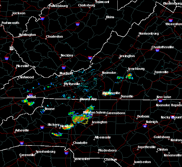 At 231 pm edt, severe thunderstorms were located along a line extending from 6 miles south of yadkinville to 10 miles west of mocksville, moving east at 30 mph (radar indicated). Hazards include 60 mph wind gusts. Expect damage to trees and power lines. Locations impacted include, harmony and sheffield. At 231 pm edt, severe thunderstorms were located along a line extending from 6 miles south of yadkinville to 10 miles west of mocksville, moving east at 30 mph (radar indicated). Hazards include 60 mph wind gusts. Expect damage to trees and power lines. Locations impacted include, harmony and sheffield.
|
| 7/1/2017 2:28 PM EDT | 6-8 trees down on powerlines on liberty church rd near sheffield. time estimated from rada in davie county NC, 6.1 miles SSE of Mocksville, NC |
| 7/1/2017 2:23 PM EDT |
 The national weather service in greenville-spartanburg has issued a * severe thunderstorm warning for. davie county in the piedmont of north carolina. Until 300 pm edt * at 223 pm edt, a severe thunderstorm was located near mocksville, moving southeast at 30 mph. The national weather service in greenville-spartanburg has issued a * severe thunderstorm warning for. davie county in the piedmont of north carolina. Until 300 pm edt * at 223 pm edt, a severe thunderstorm was located near mocksville, moving southeast at 30 mph.
|
| 7/1/2017 2:05 PM EDT |
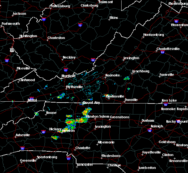 At 203 pm edt, a severe thunderstorm was located 10 miles northeast of taylorsville, or near love valley, moving east at 25 mph (radar indicated). Hazards include 60 mph wind gusts and quarter size hail. Minor hail damage to vehicles is expected. expect wind damage to trees and power lines. Locations impacted include, harmony, love valley, sheffield, union grove, olin and vashti. At 203 pm edt, a severe thunderstorm was located 10 miles northeast of taylorsville, or near love valley, moving east at 25 mph (radar indicated). Hazards include 60 mph wind gusts and quarter size hail. Minor hail damage to vehicles is expected. expect wind damage to trees and power lines. Locations impacted include, harmony, love valley, sheffield, union grove, olin and vashti.
|
| 7/1/2017 1:44 PM EDT |
 At 144 pm edt, a severe thunderstorm was located 6 miles northeast of taylorsville, moving east at 30 mph (radar indicated). Hazards include 60 mph wind gusts and quarter size hail. Minor hail damage to vehicles is expected. Expect wind damage to trees and power lines. At 144 pm edt, a severe thunderstorm was located 6 miles northeast of taylorsville, moving east at 30 mph (radar indicated). Hazards include 60 mph wind gusts and quarter size hail. Minor hail damage to vehicles is expected. Expect wind damage to trees and power lines.
|
| 6/13/2017 4:30 PM EDT |
 At 429 pm edt, a severe thunderstorm was located 5 miles northeast of mocksville, or 4 miles southwest of bermuda run, moving southeast at 15 mph. many other strong to severe storms were located within the warned area. the severe storms will move across the area near mocksville and southeast of turnersburg through 445 pm (radar indicated). Hazards include 60 mph wind gusts and quarter size hail. Minor hail damage to vehicles is expected. expect wind damage to trees and power lines. Locations impacted include, mocksville, bermuda run, cooleemee, turnersburg, sheffield, farmington, harmony, cool springs and advance. At 429 pm edt, a severe thunderstorm was located 5 miles northeast of mocksville, or 4 miles southwest of bermuda run, moving southeast at 15 mph. many other strong to severe storms were located within the warned area. the severe storms will move across the area near mocksville and southeast of turnersburg through 445 pm (radar indicated). Hazards include 60 mph wind gusts and quarter size hail. Minor hail damage to vehicles is expected. expect wind damage to trees and power lines. Locations impacted include, mocksville, bermuda run, cooleemee, turnersburg, sheffield, farmington, harmony, cool springs and advance.
|
| 6/13/2017 4:08 PM EDT |
 At 407 pm edt, a severe thunderstorm was located 9 miles south of yadkinville, or 4 miles south of lone hickory, moving southeast at 10 mph. other severe storms were developing in the warned area, especially over iredell county near turnersburg and over davie county west of mocksville (radar indicated). Hazards include 60 mph wind gusts and quarter size hail. Minor hail damage to vehicles is expected. Expect wind damage to trees and power lines. At 407 pm edt, a severe thunderstorm was located 9 miles south of yadkinville, or 4 miles south of lone hickory, moving southeast at 10 mph. other severe storms were developing in the warned area, especially over iredell county near turnersburg and over davie county west of mocksville (radar indicated). Hazards include 60 mph wind gusts and quarter size hail. Minor hail damage to vehicles is expected. Expect wind damage to trees and power lines.
|
| 5/28/2017 2:57 AM EDT |
 At 257 am edt, severe thunderstorms were located along a line extending from 10 miles northeast of mocksville to 8 miles south of salisbury to near downtown concord, moving east at 40 mph (radar indicated). Hazards include 60 mph wind gusts. Expect damage to trees and power lines. Locations impacted include, kannapolis, downtown concord, salisbury, mocksville, china grove, spencer, landis, granite quarry, rockwell and mt pleasant. At 257 am edt, severe thunderstorms were located along a line extending from 10 miles northeast of mocksville to 8 miles south of salisbury to near downtown concord, moving east at 40 mph (radar indicated). Hazards include 60 mph wind gusts. Expect damage to trees and power lines. Locations impacted include, kannapolis, downtown concord, salisbury, mocksville, china grove, spencer, landis, granite quarry, rockwell and mt pleasant.
|
| 5/28/2017 2:38 AM EDT |
 At 238 am edt, severe thunderstorms were located along a line extending from 6 miles south of yadkinville to 6 miles southwest of uptown charlotte, moving east at 40 mph (radar indicated). Hazards include 60 mph wind gusts. Expect damage to trees and power lines. Locations impacted include, kannapolis, downtown concord, salisbury, mocksville, west concord, harrisburg, china grove, spencer, landis and enochville. At 238 am edt, severe thunderstorms were located along a line extending from 6 miles south of yadkinville to 6 miles southwest of uptown charlotte, moving east at 40 mph (radar indicated). Hazards include 60 mph wind gusts. Expect damage to trees and power lines. Locations impacted include, kannapolis, downtown concord, salisbury, mocksville, west concord, harrisburg, china grove, spencer, landis and enochville.
|
| 5/28/2017 2:05 AM EDT |
 At 204 am edt, severe thunderstorms were located along a line extending from 10 miles southeast of wilkesboro to 9 miles southwest of gastonia, moving east at 40 mph (radar indicated). Hazards include 60 mph wind gusts. expect damage to trees and power lines At 204 am edt, severe thunderstorms were located along a line extending from 10 miles southeast of wilkesboro to 9 miles southwest of gastonia, moving east at 40 mph (radar indicated). Hazards include 60 mph wind gusts. expect damage to trees and power lines
|
| 5/27/2017 11:21 PM EDT |
 The severe thunderstorm warning for davie county will expire at 1130 pm edt, the storms which prompted the warning have weakened below severe limits, and have exited the warned area. therefore the warning will be allowed to expire. however gusty winds and heavy rain are still possible with these thunderstorms. a severe thunderstorm watch remains in effect until 200 am edt for the piedmont of north carolina. The severe thunderstorm warning for davie county will expire at 1130 pm edt, the storms which prompted the warning have weakened below severe limits, and have exited the warned area. therefore the warning will be allowed to expire. however gusty winds and heavy rain are still possible with these thunderstorms. a severe thunderstorm watch remains in effect until 200 am edt for the piedmont of north carolina.
|
| 5/27/2017 11:09 PM EDT |
 At 1108 pm edt, severe thunderstorms were located along a line extending from 5 miles north of greensboro to near mocksville, moving east at 30 mph (radar indicated). Hazards include 60 mph wind gusts and quarter size hail. Minor hail damage to vehicles is expected. expect wind damage to trees and power lines. Locations impacted include, mocksville, bermuda run, cooleemee, fork church, advance, sheffield and farmington. At 1108 pm edt, severe thunderstorms were located along a line extending from 5 miles north of greensboro to near mocksville, moving east at 30 mph (radar indicated). Hazards include 60 mph wind gusts and quarter size hail. Minor hail damage to vehicles is expected. expect wind damage to trees and power lines. Locations impacted include, mocksville, bermuda run, cooleemee, fork church, advance, sheffield and farmington.
|
| 5/27/2017 10:42 PM EDT |
 At 1042 pm edt, severe thunderstorms were located along a line extending from 6 miles southeast of walnut cove to 12 miles northeast of statesville, moving east at 30 mph (radar indicated). Hazards include 60 mph wind gusts and quarter size hail. Minor hail damage to vehicles is expected. expect wind damage to trees and power lines. Locations impacted include, mocksville, bermuda run, cooleemee, harmony, fork church, advance, sheffield, union grove, farmington and olin. At 1042 pm edt, severe thunderstorms were located along a line extending from 6 miles southeast of walnut cove to 12 miles northeast of statesville, moving east at 30 mph (radar indicated). Hazards include 60 mph wind gusts and quarter size hail. Minor hail damage to vehicles is expected. expect wind damage to trees and power lines. Locations impacted include, mocksville, bermuda run, cooleemee, harmony, fork church, advance, sheffield, union grove, farmington and olin.
|
| 5/27/2017 10:17 PM EDT |
 At 1017 pm edt, severe thunderstorms were located along a line extending from 7 miles west of walnut cove to 12 miles northeast of taylorsville, moving east at 30 mph (radar indicated). Hazards include 60 mph wind gusts and quarter size hail. Minor hail damage to vehicles is expected. Expect wind damage to trees and power lines. At 1017 pm edt, severe thunderstorms were located along a line extending from 7 miles west of walnut cove to 12 miles northeast of taylorsville, moving east at 30 mph (radar indicated). Hazards include 60 mph wind gusts and quarter size hail. Minor hail damage to vehicles is expected. Expect wind damage to trees and power lines.
|
| 5/24/2017 4:14 PM EDT | Numerous trees down and structural damage to homes on four corners rd. off hwy 801. possible tornado damag in davie county NC, 9.5 miles SSE of Mocksville, NC |
| 5/24/2017 4:12 PM EDT |
 At 412 pm edt, a severe thunderstorm capable of producing a tornado was located 8 miles northwest of mocksville, or 6 miles east of harmony, moving northeast at 20 mph (radar indicated rotation). Hazards include tornado. Flying debris will be dangerous to those caught without shelter. mobile homes will be damaged or destroyed. damage to roofs, windows, and vehicles will occur. tree damage is likely. This dangerous thunderstorm will remain over mainly rural areas of northern davie and northeastern iredell counties, including the following locations: farmington and sheffield. At 412 pm edt, a severe thunderstorm capable of producing a tornado was located 8 miles northwest of mocksville, or 6 miles east of harmony, moving northeast at 20 mph (radar indicated rotation). Hazards include tornado. Flying debris will be dangerous to those caught without shelter. mobile homes will be damaged or destroyed. damage to roofs, windows, and vehicles will occur. tree damage is likely. This dangerous thunderstorm will remain over mainly rural areas of northern davie and northeastern iredell counties, including the following locations: farmington and sheffield.
|
| 5/24/2017 4:02 PM EDT |
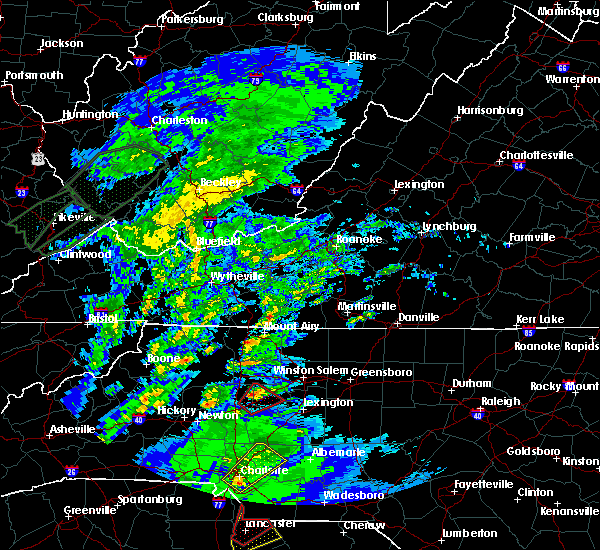 At 340 pm edt, a severe thunderstorm capable of producing a tornado was located 6 miles east of statesville, moving northeast at 55 mph (radar indicated rotation). Hazards include tornado. Flying debris will be dangerous to those caught without shelter. mobile homes will be damaged or destroyed. damage to roofs, windows, and vehicles will occur. tree damage is likely. this dangerous storm will be near, mocksville around 400 pm edt. Other locations impacted by this dangerous thunderstorm include sheffield, fork church and cool springs. At 340 pm edt, a severe thunderstorm capable of producing a tornado was located 6 miles east of statesville, moving northeast at 55 mph (radar indicated rotation). Hazards include tornado. Flying debris will be dangerous to those caught without shelter. mobile homes will be damaged or destroyed. damage to roofs, windows, and vehicles will occur. tree damage is likely. this dangerous storm will be near, mocksville around 400 pm edt. Other locations impacted by this dangerous thunderstorm include sheffield, fork church and cool springs.
|
| 5/24/2017 3:41 PM EDT |
 At 340 pm edt, a severe thunderstorm capable of producing a tornado was located 6 miles east of statesville, moving northeast at 55 mph (radar indicated rotation). Hazards include tornado. Flying debris will be dangerous to those caught without shelter. mobile homes will be damaged or destroyed. damage to roofs, windows, and vehicles will occur. tree damage is likely. this dangerous storm will be near, mocksville around 400 pm edt. Other locations impacted by this dangerous thunderstorm include sheffield, fork church and cool springs. At 340 pm edt, a severe thunderstorm capable of producing a tornado was located 6 miles east of statesville, moving northeast at 55 mph (radar indicated rotation). Hazards include tornado. Flying debris will be dangerous to those caught without shelter. mobile homes will be damaged or destroyed. damage to roofs, windows, and vehicles will occur. tree damage is likely. this dangerous storm will be near, mocksville around 400 pm edt. Other locations impacted by this dangerous thunderstorm include sheffield, fork church and cool springs.
|
| 5/19/2017 4:27 PM EDT |
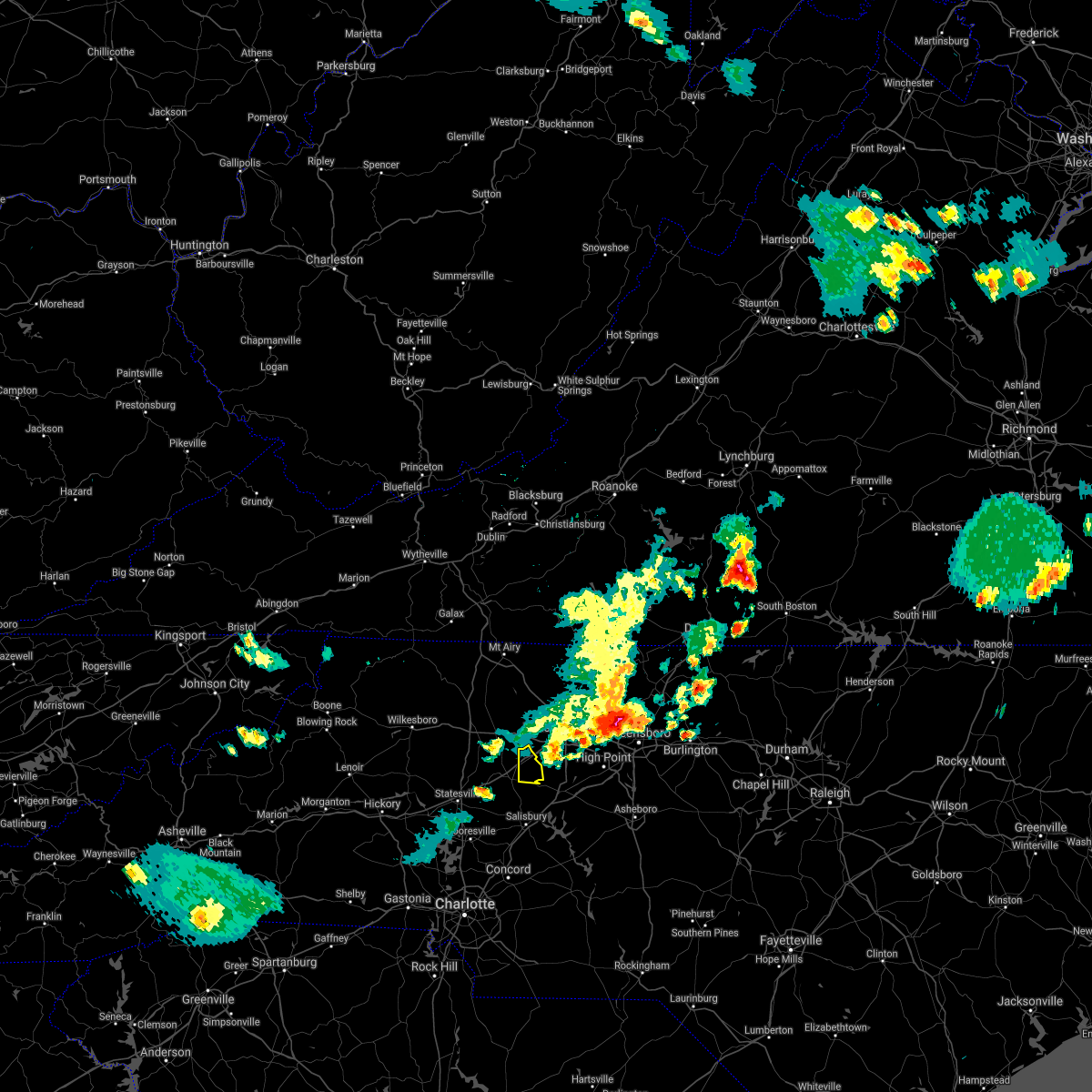 The severe thunderstorm warning for northeastern davie county will expire at 430 pm edt, the storm which prompted the warning has moved out of the area. therefore the warning will be allowed to expire. The severe thunderstorm warning for northeastern davie county will expire at 430 pm edt, the storm which prompted the warning has moved out of the area. therefore the warning will be allowed to expire.
|
| 5/19/2017 4:15 PM EDT |
 At 415 pm edt, a severe thunderstorm was located 7 miles northeast of mocksville, or near bermuda run, moving east at 30 mph (radar indicated). Hazards include 60 mph wind gusts and quarter size hail. Minor hail damage to vehicles is expected. expect wind damage to trees and power lines. Locations impacted include, bermuda run, fork church, advance and farmington. At 415 pm edt, a severe thunderstorm was located 7 miles northeast of mocksville, or near bermuda run, moving east at 30 mph (radar indicated). Hazards include 60 mph wind gusts and quarter size hail. Minor hail damage to vehicles is expected. expect wind damage to trees and power lines. Locations impacted include, bermuda run, fork church, advance and farmington.
|
| 5/19/2017 4:03 PM EDT |
 The national weather service in greenville-spartanburg has issued a * severe thunderstorm warning for. northeastern davie county in the piedmont of north carolina. Until 430 pm edt * at 403 pm edt, a severe thunderstorm was located 8 miles northeast of mocksville, or near bermuda run, moving east at 40 mph. The national weather service in greenville-spartanburg has issued a * severe thunderstorm warning for. northeastern davie county in the piedmont of north carolina. Until 430 pm edt * at 403 pm edt, a severe thunderstorm was located 8 miles northeast of mocksville, or near bermuda run, moving east at 40 mph.
|
| 3/1/2017 5:56 PM EST | Peak wind gust from pws near crossroads of junction rd and david county rd. dime size hai in davie county NC, 4.7 miles NNE of Mocksville, NC |
| 3/1/2017 5:55 PM EST |
 At 554 pm est, a severe thunderstorm was located 6 miles southwest of mocksville, or near cooleemee, moving east at 50 mph (radar indicated). Hazards include 60 mph wind gusts and quarter size hail. Hail damage to vehicles is expected. expect wind damage to roofs, siding and trees. Locations impacted include, spencer, cooleemee, cleveland, fork church, advance, piedmont research station, woodleaf, mocksville, salisbury and high rock lake. At 554 pm est, a severe thunderstorm was located 6 miles southwest of mocksville, or near cooleemee, moving east at 50 mph (radar indicated). Hazards include 60 mph wind gusts and quarter size hail. Hail damage to vehicles is expected. expect wind damage to roofs, siding and trees. Locations impacted include, spencer, cooleemee, cleveland, fork church, advance, piedmont research station, woodleaf, mocksville, salisbury and high rock lake.
|
| 3/1/2017 5:40 PM EST |
 At 540 pm est, a severe thunderstorm was located near statesville, moving east at 50 mph (radar indicated). Hazards include 60 mph wind gusts and half dollar size hail. Hail damage to vehicles is expected. Expect wind damage to roofs, siding and trees. At 540 pm est, a severe thunderstorm was located near statesville, moving east at 50 mph (radar indicated). Hazards include 60 mph wind gusts and half dollar size hail. Hail damage to vehicles is expected. Expect wind damage to roofs, siding and trees.
|
| 11/30/2016 7:25 PM EST |
 The severe thunderstorm warning for rowan, union, eastern cabarrus and davie counties will expire at 730 pm est, the storms which prompted the warning have moved out of the area. therefore the warning will be allowed to expire. The severe thunderstorm warning for rowan, union, eastern cabarrus and davie counties will expire at 730 pm est, the storms which prompted the warning have moved out of the area. therefore the warning will be allowed to expire.
|
| 11/30/2016 7:11 PM EST |
 At 711 pm est, severe thunderstorms were located along a line extending from 9 miles northeast of mocksville to 9 miles southeast of monroe, moving northeast at 30 mph (radar indicated). Hazards include 60 mph wind gusts. Expect damage to roofs. siding and trees. Locations impacted include, monroe, salisbury, mocksville, unionville, wingate, spencer, marshville, granite quarry, rockwell and mt pleasant. At 711 pm est, severe thunderstorms were located along a line extending from 9 miles northeast of mocksville to 9 miles southeast of monroe, moving northeast at 30 mph (radar indicated). Hazards include 60 mph wind gusts. Expect damage to roofs. siding and trees. Locations impacted include, monroe, salisbury, mocksville, unionville, wingate, spencer, marshville, granite quarry, rockwell and mt pleasant.
|
| 11/30/2016 6:56 PM EST |
 At 656 pm est, severe thunderstorms were located along a line extending from 5 miles northeast of mocksville to 12 miles south of monroe, moving northeast at 60 mph (radar indicated). Hazards include 60 mph wind gusts. Expect damage to roofs. Siding and trees. At 656 pm est, severe thunderstorms were located along a line extending from 5 miles northeast of mocksville to 12 miles south of monroe, moving northeast at 60 mph (radar indicated). Hazards include 60 mph wind gusts. Expect damage to roofs. Siding and trees.
|
| 11/30/2016 6:40 PM EST |
 At 639 pm est, severe thunderstorms were located along a line extending from 9 miles southeast of yadkinville to 7 miles southeast of statesville to 10 miles north of huntersville to 10 miles southeast of uptown charlotte to 13 miles south of lancaster, moving east at 25 mph (radar indicated). Hazards include 60 mph wind gusts. Expect damage to roofs. siding and trees. Locations impacted include, uptown charlotte, huntersville, kannapolis, downtown concord, monroe, salisbury, statesville, mocksville, central charlotte and south charlotte. At 639 pm est, severe thunderstorms were located along a line extending from 9 miles southeast of yadkinville to 7 miles southeast of statesville to 10 miles north of huntersville to 10 miles southeast of uptown charlotte to 13 miles south of lancaster, moving east at 25 mph (radar indicated). Hazards include 60 mph wind gusts. Expect damage to roofs. siding and trees. Locations impacted include, uptown charlotte, huntersville, kannapolis, downtown concord, monroe, salisbury, statesville, mocksville, central charlotte and south charlotte.
|
| 11/30/2016 6:13 PM EST |
 At 613 pm est, severe thunderstorms were located along a line extending from 6 miles north of mocksville to 9 miles southwest of statesville to 10 miles northeast of lincolnton to 9 miles north of winnsboro, moving east at 35 mph (radar indicated). Hazards include 60 mph wind gusts. Expect damage to roofs. Siding and trees. At 613 pm est, severe thunderstorms were located along a line extending from 6 miles north of mocksville to 9 miles southwest of statesville to 10 miles northeast of lincolnton to 9 miles north of winnsboro, moving east at 35 mph (radar indicated). Hazards include 60 mph wind gusts. Expect damage to roofs. Siding and trees.
|
| 9/28/2016 3:58 PM EDT |
 At 358 pm edt, a severe thunderstorm was located near mocksville, moving northeast at 25 mph (radar indicated). Hazards include 60 mph wind gusts and quarter size hail. Hail damage to vehicles is expected. expect wind damage to roofs, siding and trees. Locations impacted include, mocksville, bermuda run, cooleemee, fork church and advance. At 358 pm edt, a severe thunderstorm was located near mocksville, moving northeast at 25 mph (radar indicated). Hazards include 60 mph wind gusts and quarter size hail. Hail damage to vehicles is expected. expect wind damage to roofs, siding and trees. Locations impacted include, mocksville, bermuda run, cooleemee, fork church and advance.
|
| 9/28/2016 3:46 PM EDT |
 A severe thunderstorm warning remains in effect until 445 pm edt for northwestern rowan and davie counties. at 345 pm edt. a severe thunderstorm was located 6 miles southwest of mocksville. or near cooleemee. moving northeast at 10 mph. hazard. 60 mph wind gusts and quarter size hail. source. Radar indicated. A severe thunderstorm warning remains in effect until 445 pm edt for northwestern rowan and davie counties. at 345 pm edt. a severe thunderstorm was located 6 miles southwest of mocksville. or near cooleemee. moving northeast at 10 mph. hazard. 60 mph wind gusts and quarter size hail. source. Radar indicated.
|
| 9/28/2016 3:26 PM EDT |
 At 326 pm edt, a severe thunderstorm was located 7 miles southwest of mocksville, or 7 miles west of cooleemee, moving northeast at 25 mph (radar indicated). Hazards include 60 mph wind gusts and quarter size hail. Hail damage to vehicles is expected. Expect wind damage to roofs, siding and trees. At 326 pm edt, a severe thunderstorm was located 7 miles southwest of mocksville, or 7 miles west of cooleemee, moving northeast at 25 mph (radar indicated). Hazards include 60 mph wind gusts and quarter size hail. Hail damage to vehicles is expected. Expect wind damage to roofs, siding and trees.
|
| 8/27/2016 3:46 PM EDT |
 At 345 pm edt, a severe thunderstorm was located 7 miles southeast of statesville, or 5 miles east of troutman, moving west at 25 mph (radar indicated). Hazards include 60 mph wind gusts. Expect damage to roofs. siding and trees. Locations impacted include, statesville, mocksville, troutman, bermuda run, cooleemee, cleveland, harmony, lake norman state park, woodleaf and sheffield. At 345 pm edt, a severe thunderstorm was located 7 miles southeast of statesville, or 5 miles east of troutman, moving west at 25 mph (radar indicated). Hazards include 60 mph wind gusts. Expect damage to roofs. siding and trees. Locations impacted include, statesville, mocksville, troutman, bermuda run, cooleemee, cleveland, harmony, lake norman state park, woodleaf and sheffield.
|
| 8/27/2016 3:24 PM EDT |
 At 323 pm edt, a severe thunderstorm was located 10 miles southwest of mocksville, or near cleveland, moving west at 15 mph (radar indicated). Hazards include 60 mph wind gusts. Expect damage to roofs. Siding and trees. At 323 pm edt, a severe thunderstorm was located 10 miles southwest of mocksville, or near cleveland, moving west at 15 mph (radar indicated). Hazards include 60 mph wind gusts. Expect damage to roofs. Siding and trees.
|
| 7/8/2016 7:56 PM EDT |
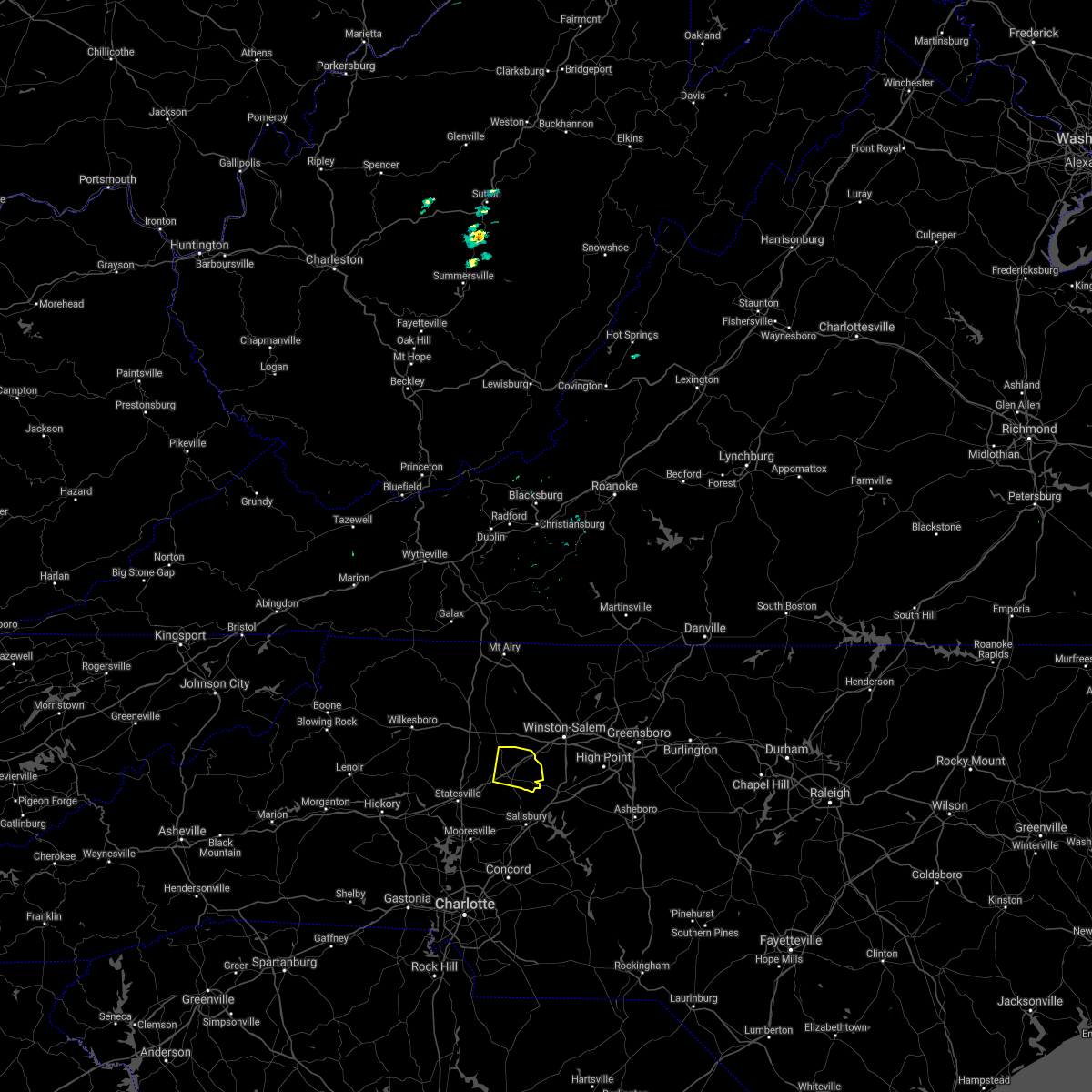 The severe thunderstorm warning for davie county will expire at 800 pm edt, the storm which prompted the warning has moved out of the area. therefore the warning will be allowed to expire. however small hail and gusty winds are still possible with this thunderstorm. a severe thunderstorm watch remains in effect until midnight edt for the piedmont of north carolina. The severe thunderstorm warning for davie county will expire at 800 pm edt, the storm which prompted the warning has moved out of the area. therefore the warning will be allowed to expire. however small hail and gusty winds are still possible with this thunderstorm. a severe thunderstorm watch remains in effect until midnight edt for the piedmont of north carolina.
|
| 7/8/2016 7:41 PM EDT |
 At 741 pm edt, a severe thunderstorm was located 4 miles north of mocksville, moving east at 40 mph (radar indicated). Hazards include 60 mph wind gusts and penny size hail. Expect damage to roofs. siding and trees. Locations impacted include, mocksville, bermuda run, farmington, fork church and advance. At 741 pm edt, a severe thunderstorm was located 4 miles north of mocksville, moving east at 40 mph (radar indicated). Hazards include 60 mph wind gusts and penny size hail. Expect damage to roofs. siding and trees. Locations impacted include, mocksville, bermuda run, farmington, fork church and advance.
|
| 7/8/2016 7:14 PM EDT |
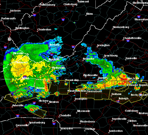 At 714 pm edt, a severe thunderstorm was located 14 miles southwest of yadkinville, or 6 miles east of love valley, moving east at 35 mph (radar indicated). Hazards include 60 mph wind gusts and quarter size hail. Hail damage to vehicles is expected. Expect wind damage to roofs, siding and trees. At 714 pm edt, a severe thunderstorm was located 14 miles southwest of yadkinville, or 6 miles east of love valley, moving east at 35 mph (radar indicated). Hazards include 60 mph wind gusts and quarter size hail. Hail damage to vehicles is expected. Expect wind damage to roofs, siding and trees.
|
| 6/15/2016 4:45 PM EDT |
 At 444 pm edt, a severe thunderstorm was located 10 miles north of kannapolis, or 6 miles south of cleveland, moving northeast at 20 mph (radar indicated). Hazards include 60 mph wind gusts and quarter size hail. Hail damage to vehicles is expected. Expect wind damage to roofs, siding and trees. At 444 pm edt, a severe thunderstorm was located 10 miles north of kannapolis, or 6 miles south of cleveland, moving northeast at 20 mph (radar indicated). Hazards include 60 mph wind gusts and quarter size hail. Hail damage to vehicles is expected. Expect wind damage to roofs, siding and trees.
|
| 5/2/2016 6:40 PM EDT | Quarter sized hail reported 6 miles N of Mocksville, NC, up to quarter sized hail nw of cooleemee. |
| 5/2/2016 6:36 PM EDT |
 At 636 pm edt, a severe thunderstorm was located 6 miles southwest of mocksville, or near cooleemee, moving east at 25 mph (radar indicated). Hazards include 60 mph wind gusts and quarter size hail. Hail damage to vehicles is expected. expect wind damage to roofs, siding and trees. Locations impacted include, mocksville, cooleemee, cleveland, advance, fork church, woodleaf and bermuda run. At 636 pm edt, a severe thunderstorm was located 6 miles southwest of mocksville, or near cooleemee, moving east at 25 mph (radar indicated). Hazards include 60 mph wind gusts and quarter size hail. Hail damage to vehicles is expected. expect wind damage to roofs, siding and trees. Locations impacted include, mocksville, cooleemee, cleveland, advance, fork church, woodleaf and bermuda run.
|
| 5/2/2016 6:11 PM EDT |
 At 611 pm edt, a severe thunderstorm was located 6 miles northeast of statesville, moving east at 30 mph (radar indicated). Hazards include 60 mph wind gusts and quarter size hail. Hail damage to vehicles is expected. Expect wind damage to roofs, siding and trees. At 611 pm edt, a severe thunderstorm was located 6 miles northeast of statesville, moving east at 30 mph (radar indicated). Hazards include 60 mph wind gusts and quarter size hail. Hail damage to vehicles is expected. Expect wind damage to roofs, siding and trees.
|
| 4/28/2016 5:20 PM EDT | Quarter sized hail reported 2.8 miles E of Mocksville, NC, observed near intersection of us 64 and i-40 |
| 4/28/2016 5:12 PM EDT |
 At 512 pm edt, a severe thunderstorm was located near mocksville, moving east at 25 mph (radar indicated). Hazards include 60 mph wind gusts and quarter size hail. Hail damage to vehicles is expected. Expect wind damage to roofs, siding and trees. At 512 pm edt, a severe thunderstorm was located near mocksville, moving east at 25 mph (radar indicated). Hazards include 60 mph wind gusts and quarter size hail. Hail damage to vehicles is expected. Expect wind damage to roofs, siding and trees.
|
| 4/28/2016 4:45 PM EDT |
 At 444 pm edt, a severe thunderstorm was located 10 miles northeast of statesville, or near harmony, moving southeast at 35 mph (radar indicated). Hazards include 60 mph wind gusts and half dollar size hail. Hail damage to vehicles is expected. expect wind damage to roofs, siding and trees. Locations impacted include, mocksville, cooleemee, harmony, turnersburg, olin, cool springs, sheffield and woodleaf. At 444 pm edt, a severe thunderstorm was located 10 miles northeast of statesville, or near harmony, moving southeast at 35 mph (radar indicated). Hazards include 60 mph wind gusts and half dollar size hail. Hail damage to vehicles is expected. expect wind damage to roofs, siding and trees. Locations impacted include, mocksville, cooleemee, harmony, turnersburg, olin, cool springs, sheffield and woodleaf.
|
| 4/28/2016 4:24 PM EDT |
 At 424 pm edt, a severe thunderstorm was located 9 miles north of statesville, or 6 miles southeast of love valley, moving east at 20 mph (radar indicated). Hazards include 60 mph wind gusts and quarter size hail. Hail damage to vehicles is expected. Expect wind damage to roofs, siding and trees. At 424 pm edt, a severe thunderstorm was located 9 miles north of statesville, or 6 miles southeast of love valley, moving east at 20 mph (radar indicated). Hazards include 60 mph wind gusts and quarter size hail. Hail damage to vehicles is expected. Expect wind damage to roofs, siding and trees.
|
| 2/24/2016 1:14 PM EST |
 At 113 pm est, doppler radar indicated a line of severe thunderstorms with a history of producing hurricane force winds in excess of 70 mph, along with numerous downed trees. these storms were located along a line extending from 8 miles northeast of mocksville to 5 miles southeast of salisbury to near downtown concord to 6 miles north of lancaster, and moving northeast at 80 mph. * locations in the warning include, kannapolis, downtown concord, monroe, salisbury, mocksville, west concord, matthews, mint hill, indian trail and weddington. At 113 pm est, doppler radar indicated a line of severe thunderstorms with a history of producing hurricane force winds in excess of 70 mph, along with numerous downed trees. these storms were located along a line extending from 8 miles northeast of mocksville to 5 miles southeast of salisbury to near downtown concord to 6 miles north of lancaster, and moving northeast at 80 mph. * locations in the warning include, kannapolis, downtown concord, monroe, salisbury, mocksville, west concord, matthews, mint hill, indian trail and weddington.
|
| 2/24/2016 1:03 PM EST |
 At 102 pm est, doppler radar indicated a line of severe thunderstorms with a history of producing hurricane force winds in excess of 70 mph, along with downing numerous trees. these storms were located along a line extending from 8 miles northeast of mocksville to 6 miles northeast of kannapolis to 11 miles east of rock hill, moving northeast at 85 mph. locations impacted include, uptown charlotte, huntersville, kannapolis, downtown concord, monroe, salisbury, mocksville, central charlotte, south charlotte and southwest charlotte. a tornado watch remains in effect until 700 pm est for central north carolina and central south carolina. At 102 pm est, doppler radar indicated a line of severe thunderstorms with a history of producing hurricane force winds in excess of 70 mph, along with downing numerous trees. these storms were located along a line extending from 8 miles northeast of mocksville to 6 miles northeast of kannapolis to 11 miles east of rock hill, moving northeast at 85 mph. locations impacted include, uptown charlotte, huntersville, kannapolis, downtown concord, monroe, salisbury, mocksville, central charlotte, south charlotte and southwest charlotte. a tornado watch remains in effect until 700 pm est for central north carolina and central south carolina.
|
| 2/24/2016 12:58 PM EST |
 At 1257 pm est, doppler radar indicated a severe thunderstorm capable of producing damaging winds in excess of 60 mph. this storm was located 8 miles north of mocksville, or 4 miles south of huntsville, moving northeast at 55 mph. locations impacted include, mocksville, bermuda run, sheffield and farmington. a tornado watch remains in effect until 700 pm est for central north carolina. At 1257 pm est, doppler radar indicated a severe thunderstorm capable of producing damaging winds in excess of 60 mph. this storm was located 8 miles north of mocksville, or 4 miles south of huntsville, moving northeast at 55 mph. locations impacted include, mocksville, bermuda run, sheffield and farmington. a tornado watch remains in effect until 700 pm est for central north carolina.
|
| 2/24/2016 12:55 PM EST | 3 power poles dow in davie county NC, 4 miles ESE of Mocksville, NC |
| 2/24/2016 12:55 PM EST | Many trees down with some across roads and powerlines from just outside of mocksville to farmingto in davie county NC, 2.4 miles WSW of Mocksville, NC |
| 2/24/2016 12:55 PM EST |
 At 1255 pm est, doppler radar indicated a line of severe thunderstorms capable of producing damaging winds in excess of 60 mph. these storms were located along a line extending from 4 miles southeast of mocksville to near downtown concord to 7 miles southeast of rock hill, moving northeast at 70 mph. locations impacted include, rock hill, uptown charlotte, huntersville, kannapolis, downtown concord, monroe, salisbury, york, chester and mocksville. a tornado watch remains in effect until 700 pm est for central north carolina and central south carolina. At 1255 pm est, doppler radar indicated a line of severe thunderstorms capable of producing damaging winds in excess of 60 mph. these storms were located along a line extending from 4 miles southeast of mocksville to near downtown concord to 7 miles southeast of rock hill, moving northeast at 70 mph. locations impacted include, rock hill, uptown charlotte, huntersville, kannapolis, downtown concord, monroe, salisbury, york, chester and mocksville. a tornado watch remains in effect until 700 pm est for central north carolina and central south carolina.
|
| 2/24/2016 12:50 PM EST | Tree down on carpor in davie county NC, 5.4 miles SE of Mocksville, NC |
| 2/24/2016 12:44 PM EST |
 At 1244 pm est, doppler radar indicated a severe thunderstorm capable of producing damaging winds in excess of 60 mph. this storm was located 6 miles west of mocksville, and moving northeast at 50 mph. * locations in the warning include, mocksville, bermuda run, sheffield, cool springs, farmington and turnersburg. At 1244 pm est, doppler radar indicated a severe thunderstorm capable of producing damaging winds in excess of 60 mph. this storm was located 6 miles west of mocksville, and moving northeast at 50 mph. * locations in the warning include, mocksville, bermuda run, sheffield, cool springs, farmington and turnersburg.
|
| 2/24/2016 12:35 PM EST |
 At 1234 pm est, doppler radar indicated a line of severe thunderstorms with a history of producing damaging winds in excess of 60 mph. these storms were located along a line extending from near yadkinville to 6 miles southeast of statesville, moving northeast at 50 mph. locations impacted include, statesville, mocksville, cornelius, mooresville, davidson, troutman, bermuda run, cooleemee, cleveland and harmony. a tornado watch remains in effect until 700 pm est for central north carolina. At 1234 pm est, doppler radar indicated a line of severe thunderstorms with a history of producing damaging winds in excess of 60 mph. these storms were located along a line extending from near yadkinville to 6 miles southeast of statesville, moving northeast at 50 mph. locations impacted include, statesville, mocksville, cornelius, mooresville, davidson, troutman, bermuda run, cooleemee, cleveland and harmony. a tornado watch remains in effect until 700 pm est for central north carolina.
|
| 2/24/2016 12:13 PM EST |
 At 1212 pm est, doppler radar indicated a line of severe thunderstorms capable of producing damaging winds in excess of 60 mph. these storms were located along a line extending from 8 miles east of gastonia to 15 miles west of winnsboro, and moving northeast at 85 mph. * locations in the warning include, rock hill, uptown charlotte, huntersville, kannapolis, downtown concord, monroe, salisbury, york, chester and mocksville. At 1212 pm est, doppler radar indicated a line of severe thunderstorms capable of producing damaging winds in excess of 60 mph. these storms were located along a line extending from 8 miles east of gastonia to 15 miles west of winnsboro, and moving northeast at 85 mph. * locations in the warning include, rock hill, uptown charlotte, huntersville, kannapolis, downtown concord, monroe, salisbury, york, chester and mocksville.
|
| 2/24/2016 11:51 AM EST |
 At 1150 am est, doppler radar indicated a line of severe thunderstorms with a history of producing damaging winds in excess of 60 mph. these storms were located along a line extending from 6 miles southeast of newton to 10 miles southwest of gastonia, and moving northeast at 75 mph. * locations in the warning include, gastonia, statesville, lincolnton, mocksville, cornelius, mooresville, davidson, bessemer city, south gastonia and dallas. At 1150 am est, doppler radar indicated a line of severe thunderstorms with a history of producing damaging winds in excess of 60 mph. these storms were located along a line extending from 6 miles southeast of newton to 10 miles southwest of gastonia, and moving northeast at 75 mph. * locations in the warning include, gastonia, statesville, lincolnton, mocksville, cornelius, mooresville, davidson, bessemer city, south gastonia and dallas.
|
| 8/19/2015 6:02 PM EDT |
 At 601 pm edt, doppler radar indicated a severe thunderstorm capable of producing quarter size hail and damaging winds in excess of 60 mph. this storm was located near mocksville, moving northeast at 10 mph. locations impacted include, mocksville, bermuda run, fork church, advance and farmington. At 601 pm edt, doppler radar indicated a severe thunderstorm capable of producing quarter size hail and damaging winds in excess of 60 mph. this storm was located near mocksville, moving northeast at 10 mph. locations impacted include, mocksville, bermuda run, fork church, advance and farmington.
|
| 8/19/2015 5:39 PM EDT |
 At 538 pm edt, doppler radar indicated a severe thunderstorm capable of producing quarter size hail and damaging winds in excess of 60 mph. this storm was located near mocksville, or near cooleemee, and moving northeast at 10 mph. * locations in the warning include, mocksville, bermuda run, cooleemee, fork church, advance and farmington. At 538 pm edt, doppler radar indicated a severe thunderstorm capable of producing quarter size hail and damaging winds in excess of 60 mph. this storm was located near mocksville, or near cooleemee, and moving northeast at 10 mph. * locations in the warning include, mocksville, bermuda run, cooleemee, fork church, advance and farmington.
|
| 8/19/2015 3:49 PM EDT |
 At 348 pm edt, doppler radar indicated a severe thunderstorm capable of producing damaging winds in excess of 60 mph. this storm was located 10 miles east of statesville, or near cleveland, moving southeast at 15 mph. locations impacted include, cooleemee, cleveland, cool springs, woodleaf, mocksville and statesville. At 348 pm edt, doppler radar indicated a severe thunderstorm capable of producing damaging winds in excess of 60 mph. this storm was located 10 miles east of statesville, or near cleveland, moving southeast at 15 mph. locations impacted include, cooleemee, cleveland, cool springs, woodleaf, mocksville and statesville.
|
| 8/19/2015 3:32 PM EDT |
 At 332 pm edt, doppler radar indicated a severe thunderstorm capable of producing quarter size hail and damaging winds in excess of 60 mph. this storm was located 7 miles east of statesville, or 5 miles northwest of cleveland, moving southeast at 15 mph. locations impacted include, statesville, cooleemee, cleveland, turnersburg, cool springs, mount ulla, woodleaf, mocksville and olin. At 332 pm edt, doppler radar indicated a severe thunderstorm capable of producing quarter size hail and damaging winds in excess of 60 mph. this storm was located 7 miles east of statesville, or 5 miles northwest of cleveland, moving southeast at 15 mph. locations impacted include, statesville, cooleemee, cleveland, turnersburg, cool springs, mount ulla, woodleaf, mocksville and olin.
|
| 8/19/2015 2:59 PM EDT |
 At 259 pm edt, doppler radar indicated a severe thunderstorm capable of producing quarter size hail and damaging winds in excess of 60 mph. this storm was located 4 miles north of statesville, and moving southeast at 15 mph. * locations in the warning include, statesville, cooleemee, cleveland, turnersburg, olin, cool springs, scotts, mount ulla, woodleaf and mocksville. At 259 pm edt, doppler radar indicated a severe thunderstorm capable of producing quarter size hail and damaging winds in excess of 60 mph. this storm was located 4 miles north of statesville, and moving southeast at 15 mph. * locations in the warning include, statesville, cooleemee, cleveland, turnersburg, olin, cool springs, scotts, mount ulla, woodleaf and mocksville.
|
| 6/27/2015 4:42 PM EDT | The severe thunderstorm warning for davie county will expire at 445 pm edt, the storm which prompted the warning has weakened below severe limits, and no longer poses an immediate threat to life or property. therefore the warning will be allowed to expire. however small. |
| 6/27/2015 4:27 PM EDT |
 At 427 pm edt, doppler radar indicated a severe thunderstorm capable of producing quarter size hail and damaging winds in excess of 60 mph. this storm was located 6 miles north of mocksville, or 6 miles southeast of courtney, moving east at 20 mph. locations impacted include, mocksville, bermuda run, cooleemee, advance, farmington, sheffield and fork church. At 427 pm edt, doppler radar indicated a severe thunderstorm capable of producing quarter size hail and damaging winds in excess of 60 mph. this storm was located 6 miles north of mocksville, or 6 miles southeast of courtney, moving east at 20 mph. locations impacted include, mocksville, bermuda run, cooleemee, advance, farmington, sheffield and fork church.
|
| 6/27/2015 3:54 PM EDT |
 At 353 pm edt, doppler radar indicated a severe thunderstorm capable of producing quarter size hail and damaging winds in excess of 60 mph. this storm was located 10 miles southwest of yadkinville, or 4 miles north of harmony, and moving east at 20 mph. At 353 pm edt, doppler radar indicated a severe thunderstorm capable of producing quarter size hail and damaging winds in excess of 60 mph. this storm was located 10 miles southwest of yadkinville, or 4 miles north of harmony, and moving east at 20 mph.
|
| 6/26/2015 5:00 PM EDT | At 500 pm edt, doppler radar indicated a severe thunderstorm capable of producing quarter size hail and damaging winds in excess of 60 mph. this storm was located 7 miles northeast of mocksville, or near bermuda run, and moving southeast at 20 mph. |
| 6/19/2015 5:41 PM EDT | The severe thunderstorm warning for central rowan and eastern davie counties will expire at 545 pm edt, the storm which prompted the warning has moved out of the area. therefore the warning will be allowed to expire. however, a severe thunderstorm warning still remains in effect for southeastern rowan county for a different storm. |
| 6/19/2015 5:18 PM EDT |
 At 518 pm edt, doppler radar indicated a severe thunderstorm capable of producing quarter size hail and damaging winds in excess of 60 mph. this storm was located 6 miles east of mocksville, moving east at 35 mph. locations impacted include, salisbury, mocksville, spencer, granite quarry, rockwell, bermuda run, cooleemee, faith, high rock lake and gold hill. At 518 pm edt, doppler radar indicated a severe thunderstorm capable of producing quarter size hail and damaging winds in excess of 60 mph. this storm was located 6 miles east of mocksville, moving east at 35 mph. locations impacted include, salisbury, mocksville, spencer, granite quarry, rockwell, bermuda run, cooleemee, faith, high rock lake and gold hill.
|
| 6/19/2015 5:03 PM EDT |
 At 503 pm edt, doppler radar indicated a severe thunderstorm capable of producing quarter size hail and damaging winds in excess of 60 mph. this storm was located 4 miles southwest of mocksville, or near cooleemee, and moving east at 35 mph. At 503 pm edt, doppler radar indicated a severe thunderstorm capable of producing quarter size hail and damaging winds in excess of 60 mph. this storm was located 4 miles southwest of mocksville, or near cooleemee, and moving east at 35 mph.
|
| 6/2/2015 7:42 PM EDT | At 741 pm edt, doppler radar indicated a severe thunderstorm capable of producing quarter size hail and damaging winds in excess of 60 mph. this storm was located 7 miles northeast of mocksville, or near bermuda run, moving northeast at 25 mph. locations impacted include, bermuda run, fork church, advance, and farmington. |
| 6/2/2015 7:35 PM EDT | One tree fell on power lines along cornatzer road. they had a little pea sized hail but it was very brie in davie county NC, 5.3 miles WSW of Mocksville, NC |
| 6/2/2015 7:29 PM EDT | At 728 pm edt, doppler radar indicated a severe thunderstorm capable of producing large damaging hail up to golf ball size and damaging winds in excess of 60 mph. this storm was located near mocksville, and moving northeast at 30 mph. |
| 6/2/2015 7:23 PM EDT | At 721 pm edt, doppler radar indicated a severe thunderstorm capable of producing half dollar size hail and damaging winds in excess of 60 mph. this storm was located over mocksville, moving northeast at 25 mph. another severe thunderstorm was located over farmington, also moving northeast at 25 mph. locations impacted include, mocksville, bermuda run, sheffield and farmington. |
| 6/2/2015 7:20 PM EDT | Many trees down in mocksville with a few on house in davie county NC, 0.7 miles NW of Mocksville, NC |
| 6/2/2015 7:12 PM EDT | At 711 pm edt, doppler radar indicated a new severe thunderstorm capable of producing quarter size hail and damaging winds in excess of 60 mph. this storm was located three miles west of mocksville, moving northeast at 30 mph. locations impacted include, mocksville, bermuda run, harmony, sheffield, farmington and cool springs. |
| 6/2/2015 6:51 PM EDT | At 651 pm edt, doppler radar indicated a severe thunderstorm capable of producing quarter size hail and damaging winds in excess of 60 mph. this storm was located 7 miles northeast of statesville, or 6 miles south of harmony, moving northeast at 25 mph. locations impacted include, mocksville, bermuda run, harmony, turnersburg, olin, cool springs, farmington, sheffield and statesville. |
| 6/2/2015 6:36 PM EDT | At 636 pm edt, doppler radar indicated a severe thunderstorm capable of producing quarter size hail and damaging winds in excess of 60 mph. this storm was located over statesville, and moving northeast at 25 mph. |
| 8/18/2014 4:45 PM EDT | Tree down in roadway on farmington road in davie county NC, 6.2 miles SSW of Mocksville, NC |
| 6/17/2014 7:25 PM EDT | Center vfd responded to two separate calls of trees dow in davie county NC, 4.5 miles E of Mocksville, NC |
| 6/17/2014 6:56 PM EDT | A bradford pear tree was pushed over by the wind on a nearby road from the spotte in davie county NC, 5.6 miles W of Mocksville, NC |
| 6/17/2014 6:56 PM EDT | Golf Ball sized hail reported 5.1 miles W of Mocksville, NC, lots of hail covering much of the ground with hailstones as large of golf balls. strong wind gust but no damage at spotters residence. |
| 8/22/2013 8:20 PM EDT | Multiple trees and power lines down on main church road near hwy 158. time estimated from rada in davie county NC, 2 miles SW of Mocksville, NC |
| 8/22/2013 8:17 PM EDT | Multiple trees down on cana raod near angell road. time estimated from rada in davie county NC, 4.4 miles S of Mocksville, NC |
| 6/13/2013 4:05 PM EDT | Quarter sized hail reported 7.6 miles SE of Mocksville, NC, up to 1 inch hail in sheffield. |
| 9/2/2012 5:52 PM EDT | Multiple trees and power lines down on liberty church road near us hwy 60 in davie county NC, 2.4 miles SSE of Mocksville, NC |
| 6/12/2012 8:56 PM EDT | 2 trees down and part of a barn blown down on edwards road near mocksvill in davie county NC, 0.7 miles NW of Mocksville, NC |
| 3/25/2012 4:55 AM EDT | Quarter sized hail reported 6.7 miles N of Mocksville, NC, relative of nws employee reported hail up to quarter sized. |
| 3/24/2012 4:42 PM EDT | Quarter sized hail reported 2.8 miles W of Mocksville, NC, the raleigh weather office relaying another quarter sized hail report 2 miles east of mocksville along highway 64 and reported by a storm chaser. |
| 3/24/2012 4:40 PM EDT | Quarter sized hail reported 0.7 miles NW of Mocksville, NC, the raleigh weather office relayed a report of quarter sized hail which started in mocksville at 440 pm and was continuing during the call. |
| 3/2/2012 11:30 AM EST | Ping Pong Ball sized hail reported 0.7 miles NW of Mocksville, NC |
| 1/1/0001 12:00 AM | At least one large tree down in the davie academy road area along with several other large branches. this location is just south of interstate 4 in davie county NC, 4.7 miles ENE of Mocksville, NC |
| 1/1/0001 12:00 AM | County comms reports numerous trees down in the mocksville city limit in davie county NC, 0.7 miles NW of Mocksville, NC |
| 1/1/0001 12:00 AM | Multiple powerlines dow in davie county NC, 0.7 miles NW of Mocksville, NC |
| 1/1/0001 12:00 AM | Numerous trees down across mocksville. power ou in davie county NC, 0.7 miles NW of Mocksville, NC |
| 1/1/0001 12:00 AM | Multiple trees down on deadmon road and at the intersection of us hwy 64e and state hwy 80 in davie county NC, 4 miles W of Mocksville, NC |
| 5/23/2011 5:20 PM EDT | Tennis Ball sized hail reported 1.2 miles ENE of Mocksville, NC, raleigh weather office relayed report of tennie ball sized hail just off interstate 40 west of mocksville. |
| 5/23/2011 5:20 PM EDT | Golf Ball sized hail reported 0.7 miles NW of Mocksville, NC, a few hail stones may have been larger |
| 1/1/0001 12:00 AM | Half Dollar sized hail reported 5.3 miles ESE of Mocksville, NC, half dollar sized hail. |
| 1/1/0001 12:00 AM | Quarter sized hail reported 6.1 miles ESE of Mocksville, NC, nickel to quarter sized hail falling in sheffield. |
| 1/1/0001 12:00 AM | Tree down at davie academy and hwy 6 in davie county NC, 7.6 miles SE of Mocksville, NC |
| 1/1/0001 12:00 AM | Several tree limbs down in yard and down the stree in davie county NC, 1.7 miles SSW of Mocksville, NC |
| 1/1/0001 12:00 AM | Tree down on north main s in davie county NC, 0.7 miles NW of Mocksville, NC |
Hail Maps for Mocksville, NC


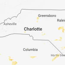


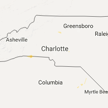


Connect with Interactive Hail Maps