

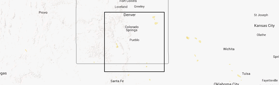
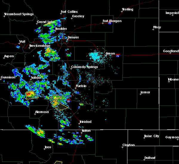
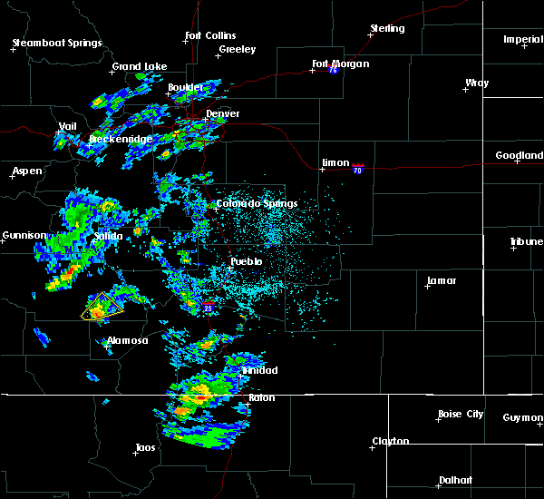
Hail Map for Moffat, CO
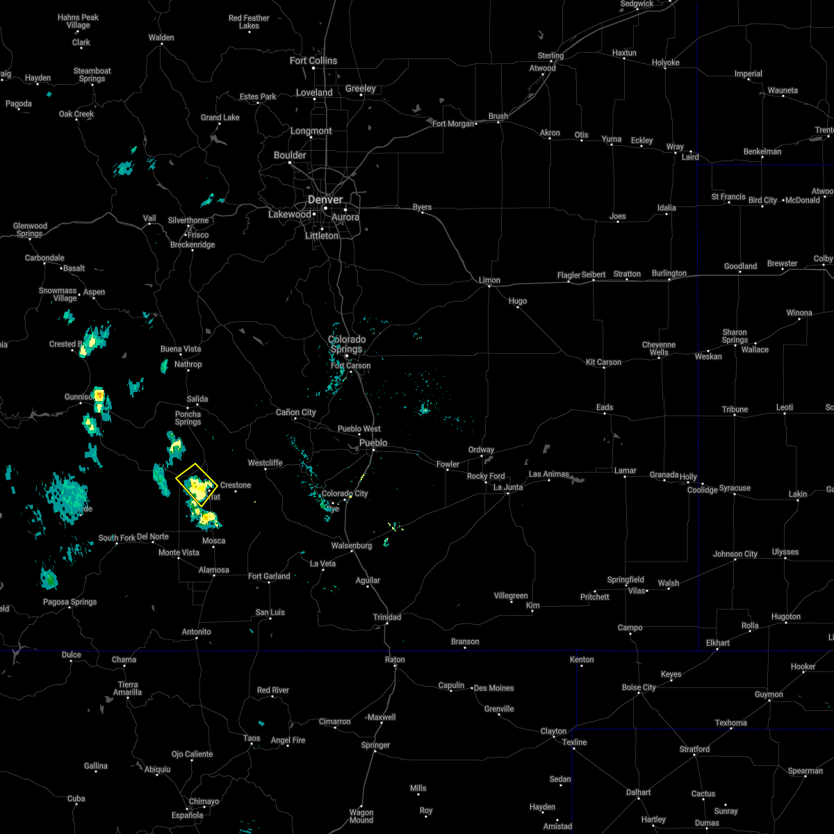
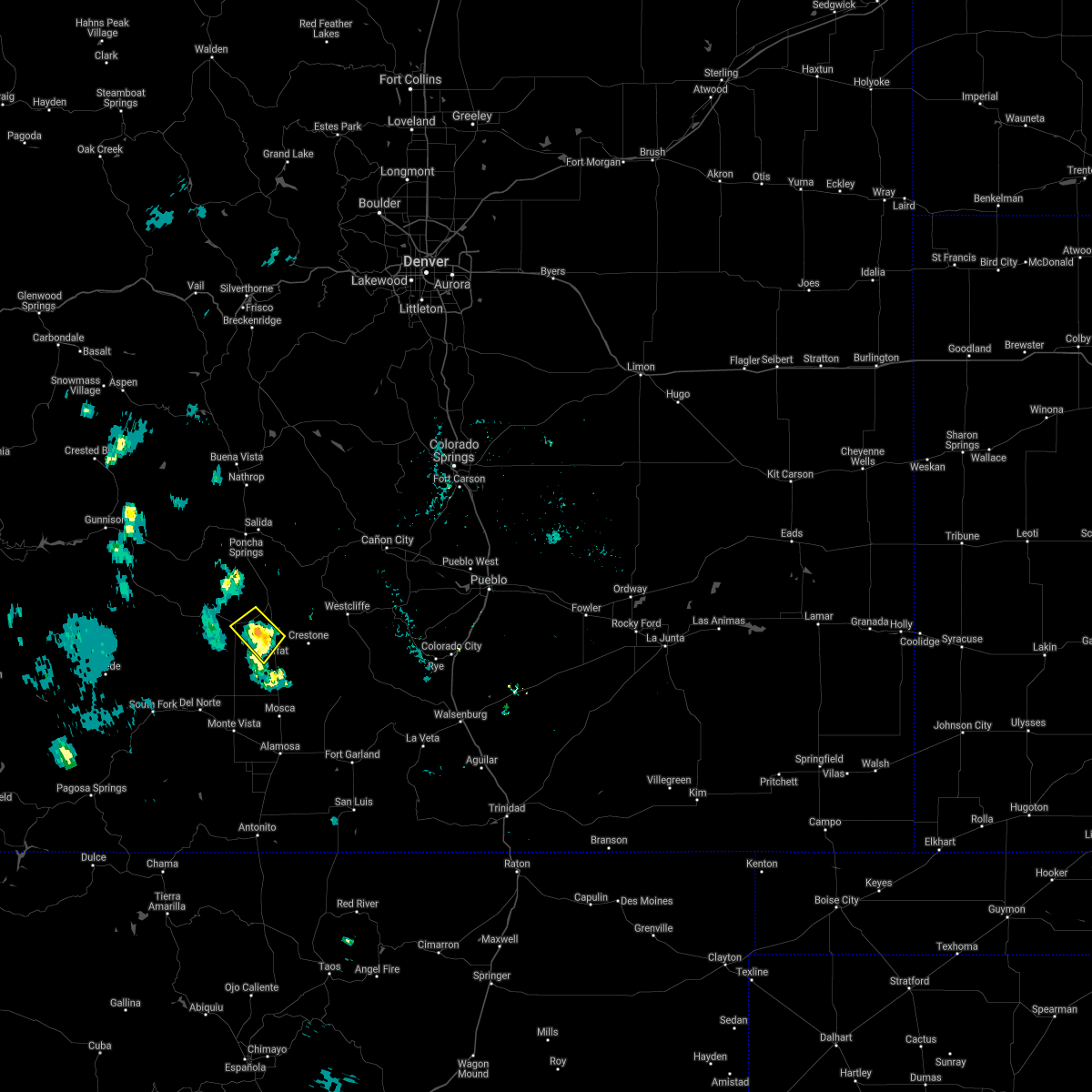
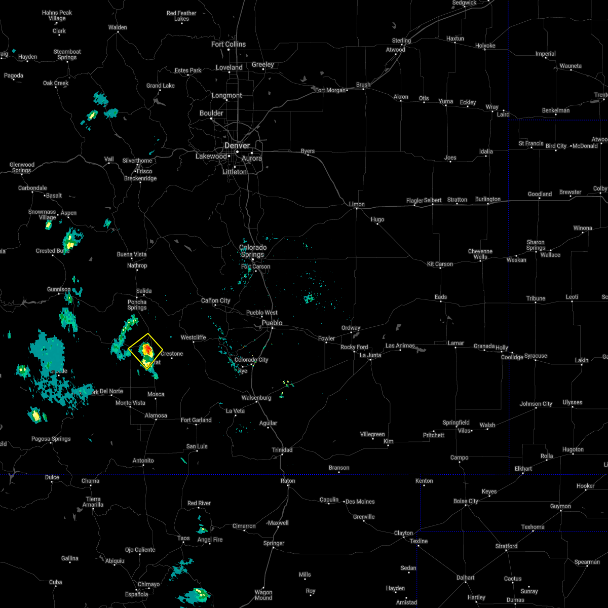
The Moffat, CO area has had 0 reports of on-the-ground hail by trained spotters, and has been under severe weather warnings 0 times during the past 12 months. Doppler radar has detected hail at or near Moffat, CO on 8 occasions.
| Name: | Moffat, CO |
| Where Located: | 72.7 miles WSW of Pueblo, CO |
| Map: | Google Map for Moffat, CO |
| Population: | 116 |
| Housing Units: | 70 |
| More Info: | Search Google for Moffat, CO |
5
The Top Recent Hail Date for Moffat, CO is Friday, August 17, 2012 (1st out of 8)
Hail and Wind Damage Spotted near Moffat, CO
| Date / Time | Report Details |
|---|---|
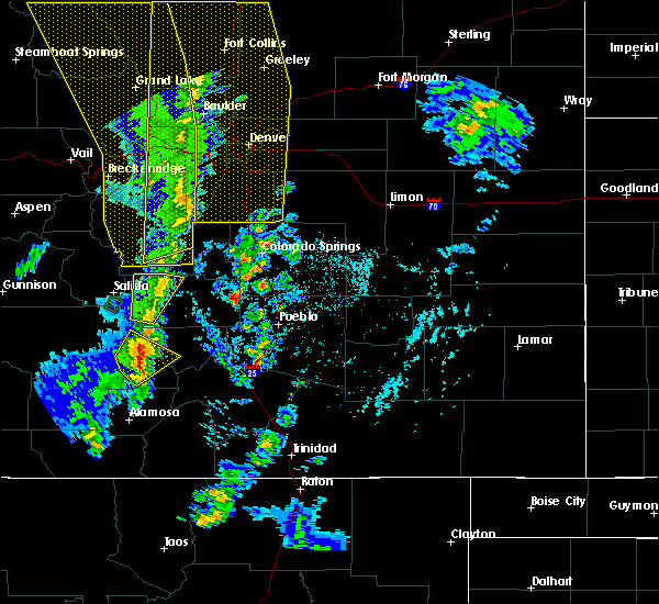
| 6/4/2021 6:37 PM MDT |
 The severe thunderstorm warning for central saguache county will expire at 645 pm mdt, the storm which prompted the warning has weakened below severe limits, and no longer poses an immediate threat to life or property. therefore, the warning will be allowed to expire. however gusty winds are still possible with this thunderstorm. The severe thunderstorm warning for central saguache county will expire at 645 pm mdt, the storm which prompted the warning has weakened below severe limits, and no longer poses an immediate threat to life or property. therefore, the warning will be allowed to expire. however gusty winds are still possible with this thunderstorm.
|
| 6/4/2021 6:30 PM MDT |
 At 630 pm mdt, a severe thunderstorm was located near moffat, or 19 miles southwest of hayden pass burn scar, and is nearly stationary (radar indicated). Hazards include 60 mph wind gusts and penny size hail. Expect damage to roofs, siding, and trees. Locations impacted include, saguache and moffat. At 630 pm mdt, a severe thunderstorm was located near moffat, or 19 miles southwest of hayden pass burn scar, and is nearly stationary (radar indicated). Hazards include 60 mph wind gusts and penny size hail. Expect damage to roofs, siding, and trees. Locations impacted include, saguache and moffat.
|
| 6/4/2021 6:14 PM MDT |
 At 614 pm mdt, a severe thunderstorm was located near moffat, or 18 miles southwest of hayden pass burn scar, and is nearly stationary (radar indicated). Hazards include 60 mph wind gusts and quarter size hail. Hail damage to vehicles is expected. Expect wind damage to roofs, siding, and trees. At 614 pm mdt, a severe thunderstorm was located near moffat, or 18 miles southwest of hayden pass burn scar, and is nearly stationary (radar indicated). Hazards include 60 mph wind gusts and quarter size hail. Hail damage to vehicles is expected. Expect wind damage to roofs, siding, and trees.
|
| 8/3/2020 3:55 PM MDT |
 The severe thunderstorm warning for east central saguache county will expire at 400 pm mdt, the storm which prompted the warning has weakened below severe limits, and no longer poses an immediate threat to life or property. therefore, the warning will be allowed to expire. however small hail and heavy rain are still possible with this thunderstorm. The severe thunderstorm warning for east central saguache county will expire at 400 pm mdt, the storm which prompted the warning has weakened below severe limits, and no longer poses an immediate threat to life or property. therefore, the warning will be allowed to expire. however small hail and heavy rain are still possible with this thunderstorm.
|
| 8/3/2020 3:45 PM MDT |
 At 344 pm mdt, a severe thunderstorm was located near saguache, or 24 miles southwest of hayden pass burn scar, moving south at 10 mph (radar indicated). Hazards include 60 mph wind gusts and quarter size hail. Hail damage to vehicles is expected. expect wind damage to roofs, siding, and trees. Locations impacted include, moffat. At 344 pm mdt, a severe thunderstorm was located near saguache, or 24 miles southwest of hayden pass burn scar, moving south at 10 mph (radar indicated). Hazards include 60 mph wind gusts and quarter size hail. Hail damage to vehicles is expected. expect wind damage to roofs, siding, and trees. Locations impacted include, moffat.
|
| 8/3/2020 3:38 PM MDT |
 At 337 pm mdt, a severe thunderstorm was located near saguache, or 23 miles southwest of hayden pass burn scar, moving south at 15 mph (radar indicated). Hazards include 60 mph wind gusts and half dollar size hail. Hail damage to vehicles is expected. expect wind damage to roofs, siding, and trees. Locations impacted include, moffat. At 337 pm mdt, a severe thunderstorm was located near saguache, or 23 miles southwest of hayden pass burn scar, moving south at 15 mph (radar indicated). Hazards include 60 mph wind gusts and half dollar size hail. Hail damage to vehicles is expected. expect wind damage to roofs, siding, and trees. Locations impacted include, moffat.
|
| 8/3/2020 3:27 PM MDT |
 At 326 pm mdt, a severe thunderstorm was located near saguache, or 21 miles southwest of hayden pass burn scar, moving south at 10 mph (radar indicated). Hazards include ping pong ball size hail and 60 mph wind gusts. People and animals outdoors will be injured. expect hail damage to roofs, siding, windows, and vehicles. expect wind damage to roofs, siding, and trees. Locations impacted include, moffat. At 326 pm mdt, a severe thunderstorm was located near saguache, or 21 miles southwest of hayden pass burn scar, moving south at 10 mph (radar indicated). Hazards include ping pong ball size hail and 60 mph wind gusts. People and animals outdoors will be injured. expect hail damage to roofs, siding, windows, and vehicles. expect wind damage to roofs, siding, and trees. Locations impacted include, moffat.
|
| 8/3/2020 3:15 PM MDT |
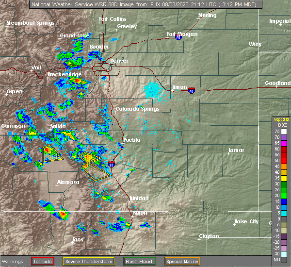 At 314 pm mdt, a severe thunderstorm was located near saguache, or 19 miles southwest of hayden pass burn scar, moving south at 10 mph (radar indicated). Hazards include 60 mph wind gusts and quarter size hail. Hail damage to vehicles is expected. Expect wind damage to roofs, siding, and trees. At 314 pm mdt, a severe thunderstorm was located near saguache, or 19 miles southwest of hayden pass burn scar, moving south at 10 mph (radar indicated). Hazards include 60 mph wind gusts and quarter size hail. Hail damage to vehicles is expected. Expect wind damage to roofs, siding, and trees.
|
| 6/6/2020 3:12 PM MDT |
 At 312 pm mdt, a severe thunderstorm was located over crestone, or 20 miles south of hayden pass burn scar, moving northeast at 55 mph (radar indicated). Hazards include 60 mph wind gusts and quarter size hail. Hail damage to vehicles is expected. expect wind damage to roofs, siding, and trees. Locations impacted include, crestone, moffat, crestone peak and great sand dunes. At 312 pm mdt, a severe thunderstorm was located over crestone, or 20 miles south of hayden pass burn scar, moving northeast at 55 mph (radar indicated). Hazards include 60 mph wind gusts and quarter size hail. Hail damage to vehicles is expected. expect wind damage to roofs, siding, and trees. Locations impacted include, crestone, moffat, crestone peak and great sand dunes.
|
| 6/6/2020 2:59 PM MDT |
 At 259 pm mdt, a severe thunderstorm was located 8 miles south of moffat, or 28 miles north of alamosa, moving northeast at 55 mph (radar indicated). Hazards include 60 mph wind gusts and quarter size hail. Hail damage to vehicles is expected. Expect wind damage to roofs, siding, and trees. At 259 pm mdt, a severe thunderstorm was located 8 miles south of moffat, or 28 miles north of alamosa, moving northeast at 55 mph (radar indicated). Hazards include 60 mph wind gusts and quarter size hail. Hail damage to vehicles is expected. Expect wind damage to roofs, siding, and trees.
|
| 6/2/2019 1:28 PM MDT |
 At 127 pm mdt, a severe thunderstorm was located 8 miles northwest of hooper, or 25 miles north of alamosa, moving northeast at 25 mph (radar indicated). Hazards include 60 mph wind gusts and quarter size hail. Hail damage to vehicles is expected. expect wind damage to roofs, siding, and trees. Locations impacted include, areas northeast of center and north of hooper. At 127 pm mdt, a severe thunderstorm was located 8 miles northwest of hooper, or 25 miles north of alamosa, moving northeast at 25 mph (radar indicated). Hazards include 60 mph wind gusts and quarter size hail. Hail damage to vehicles is expected. expect wind damage to roofs, siding, and trees. Locations impacted include, areas northeast of center and north of hooper.
|
| 6/2/2019 1:15 PM MDT |
 At 115 pm mdt, a severe thunderstorm was located near center, or 23 miles northwest of alamosa, moving northeast at 15 mph (radar indicated). Hazards include 60 mph wind gusts and quarter size hail. Hail damage to vehicles is expected. Expect wind damage to roofs, siding, and trees. At 115 pm mdt, a severe thunderstorm was located near center, or 23 miles northwest of alamosa, moving northeast at 15 mph (radar indicated). Hazards include 60 mph wind gusts and quarter size hail. Hail damage to vehicles is expected. Expect wind damage to roofs, siding, and trees.
|
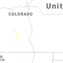
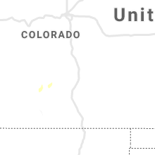
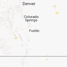
Hail Maps for Moffat, CO


Connect with Interactive Hail Maps