

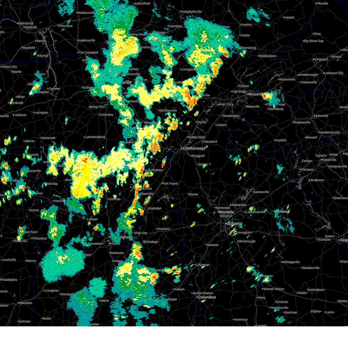
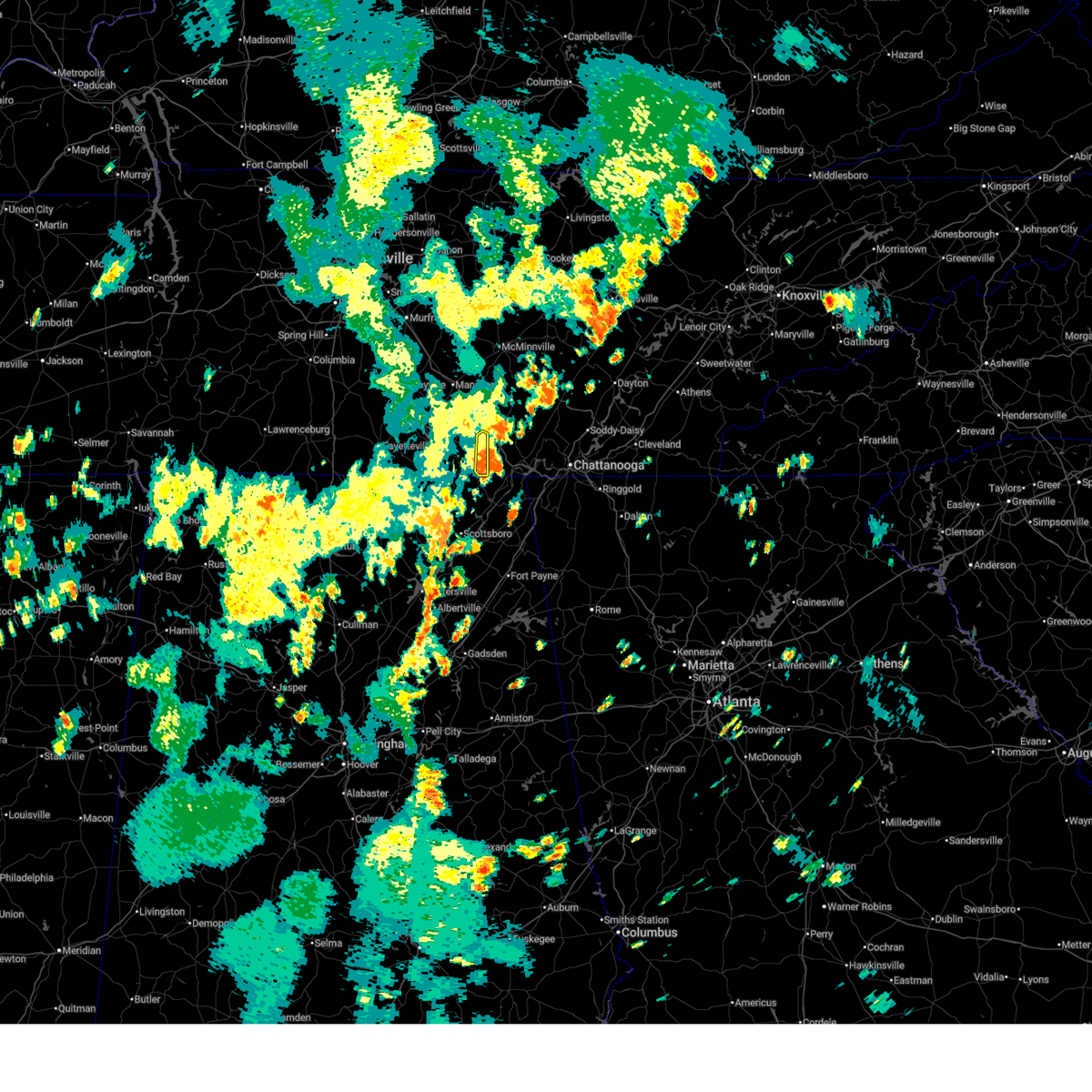
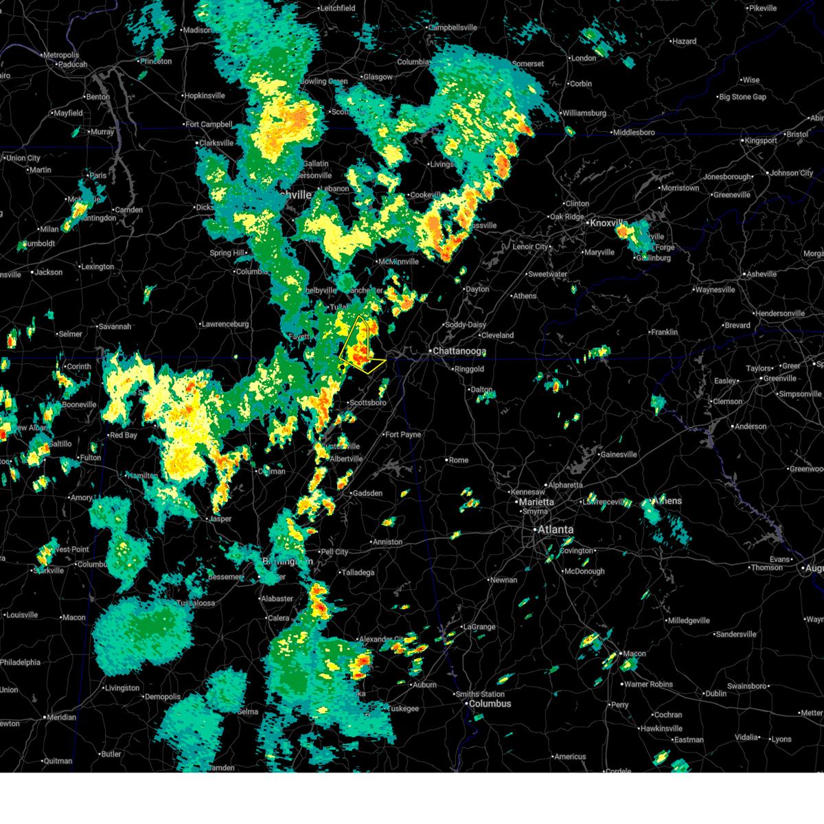
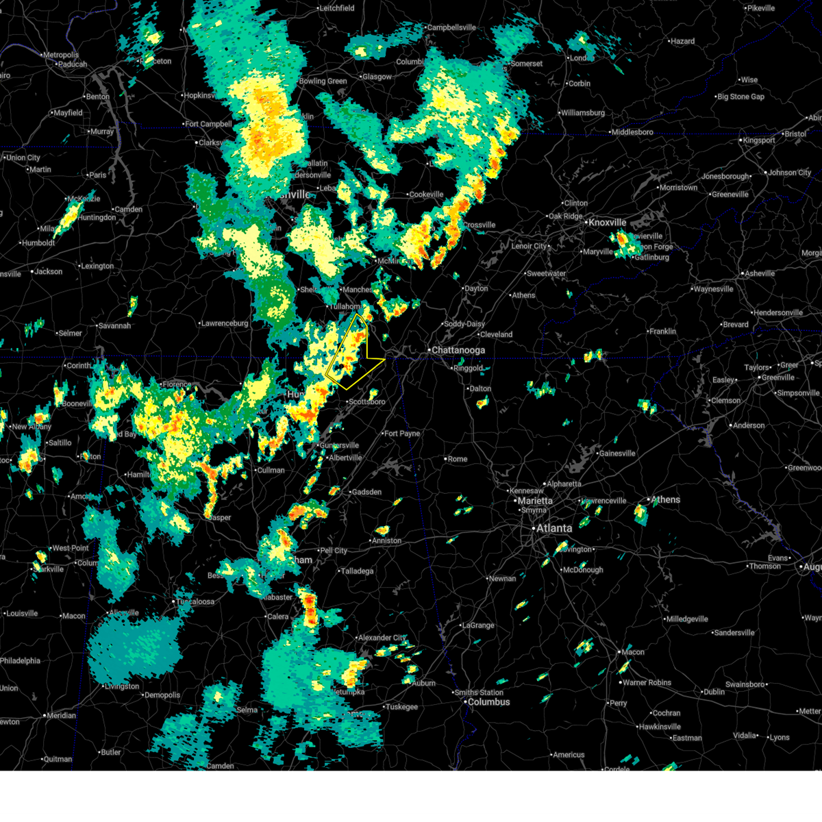
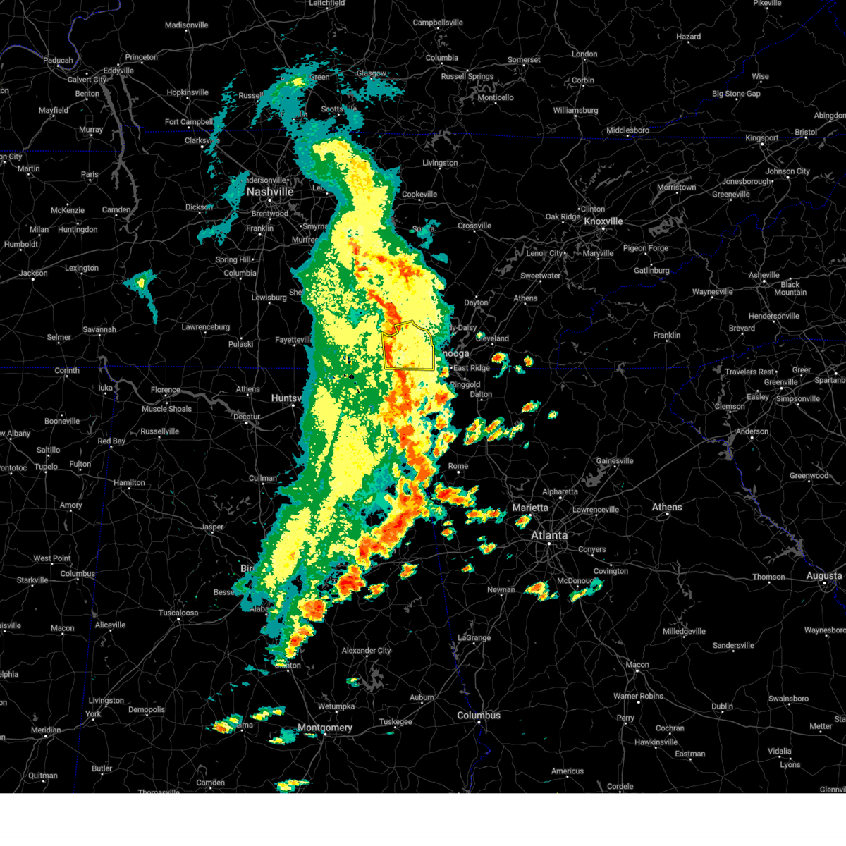
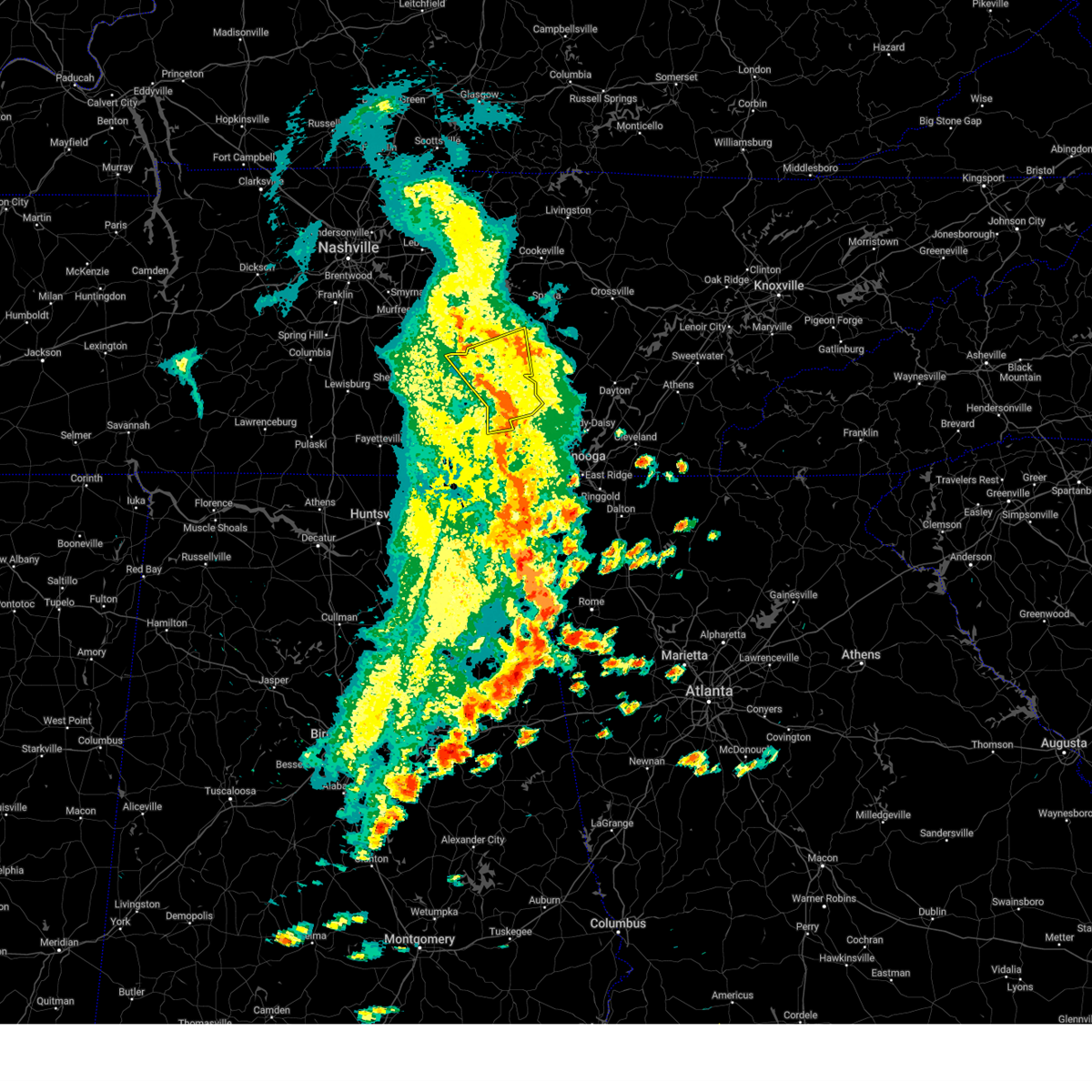
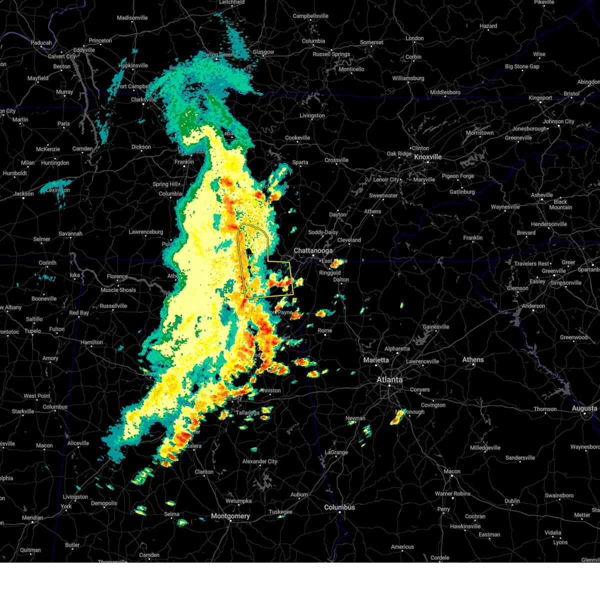
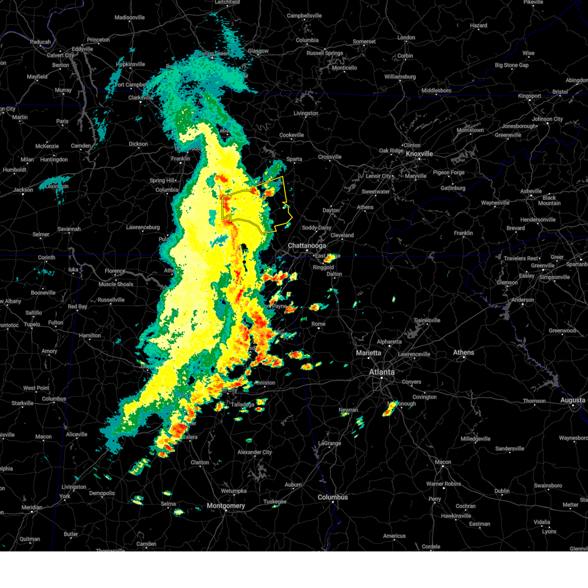
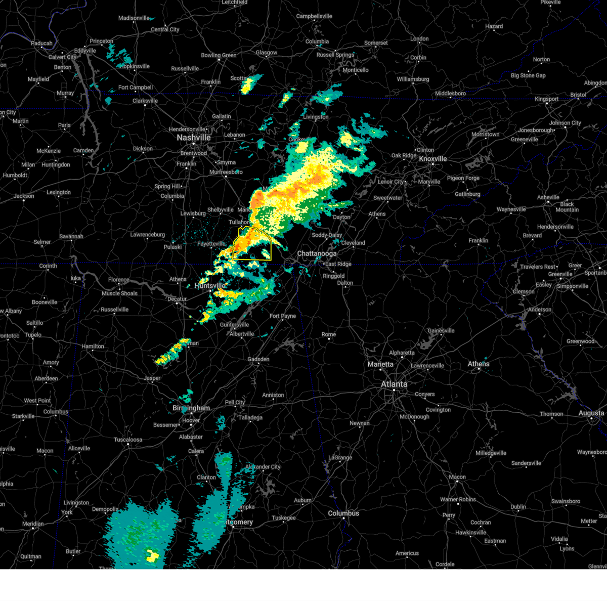
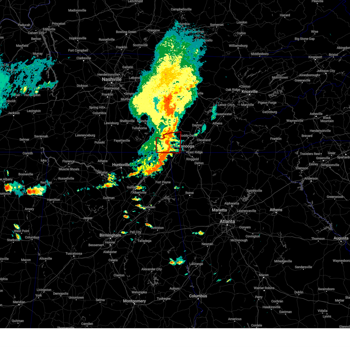
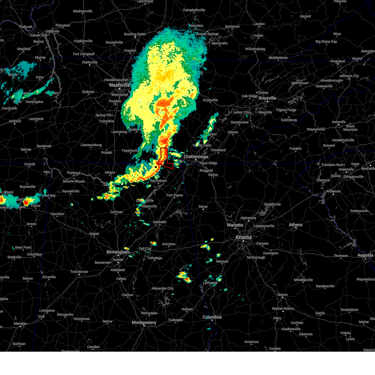
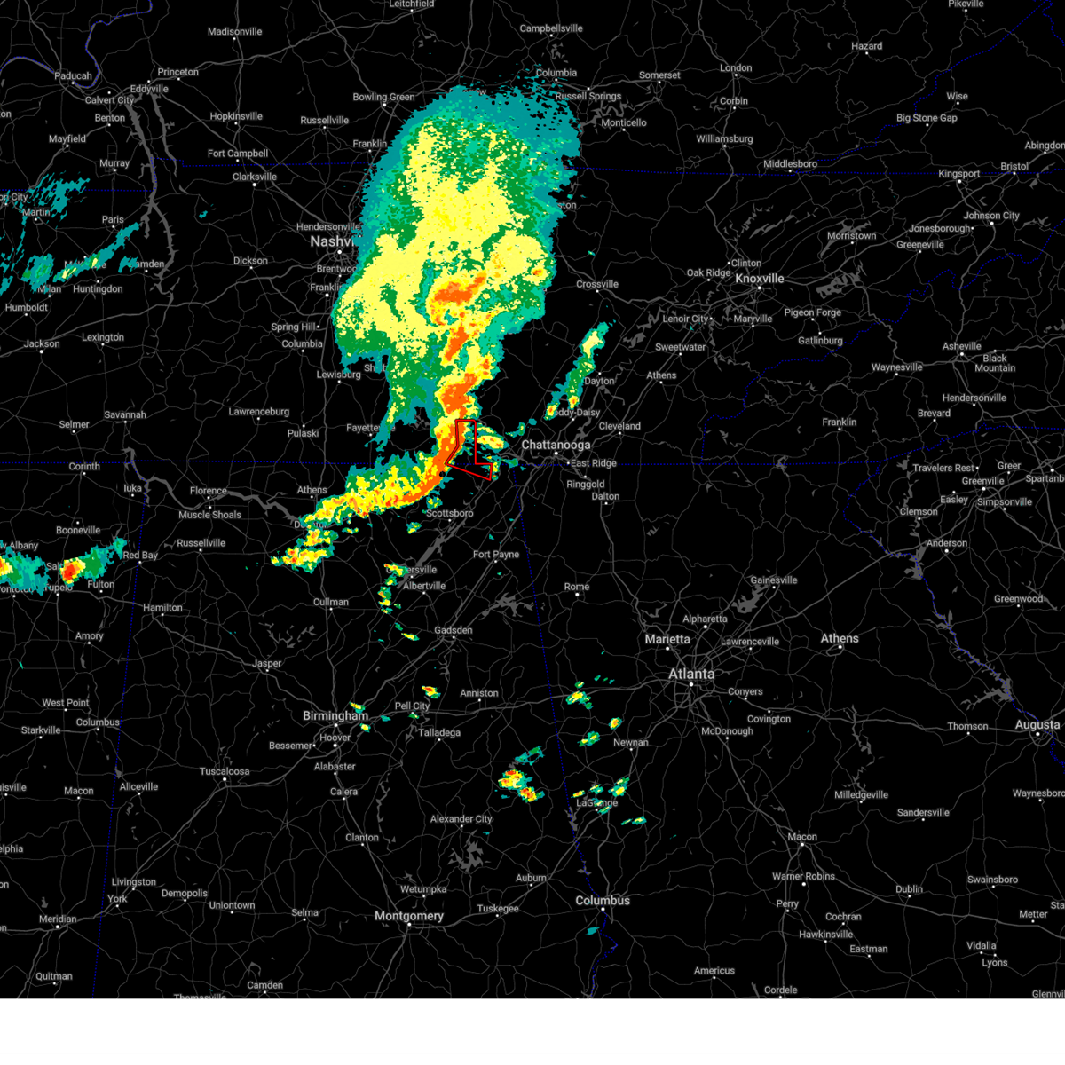
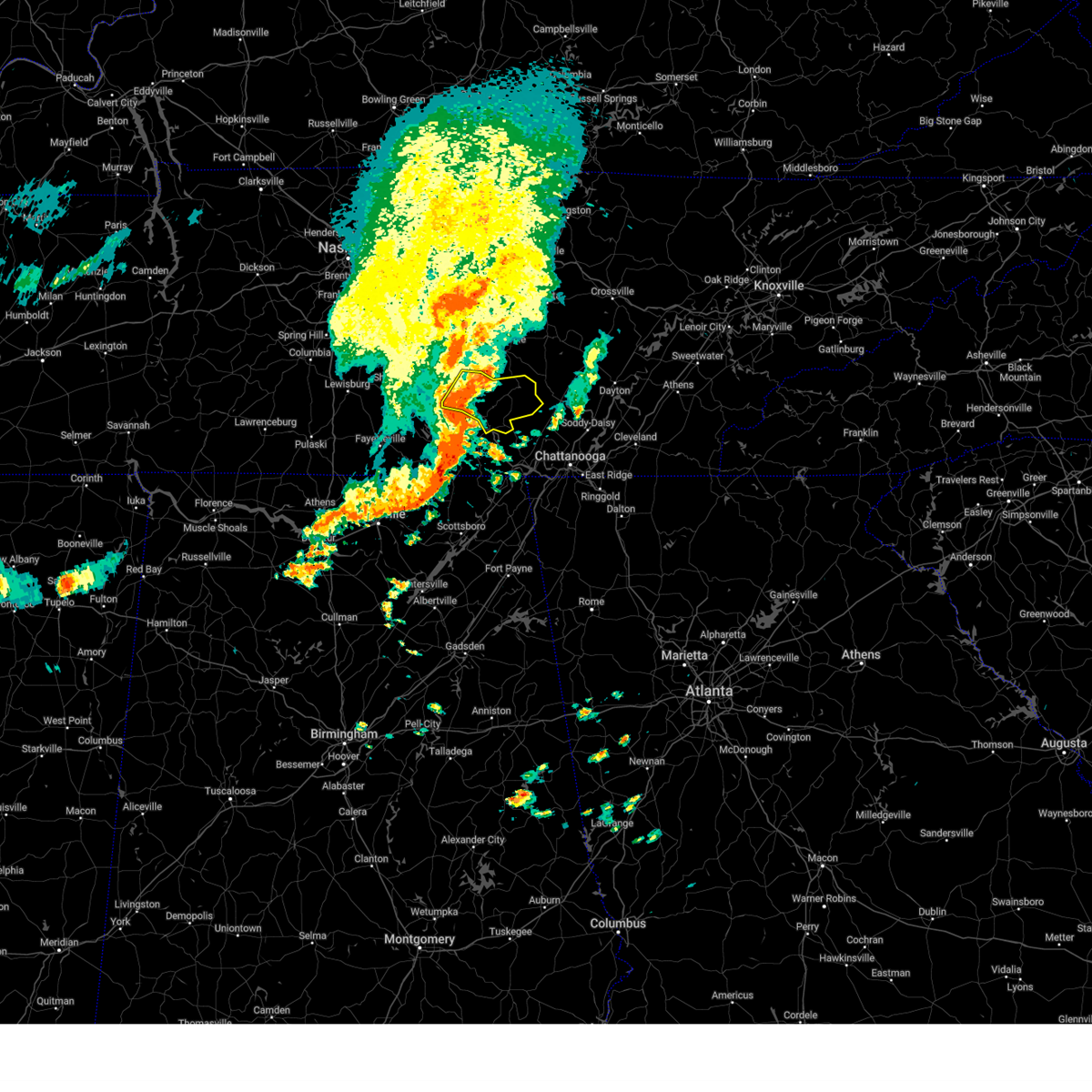
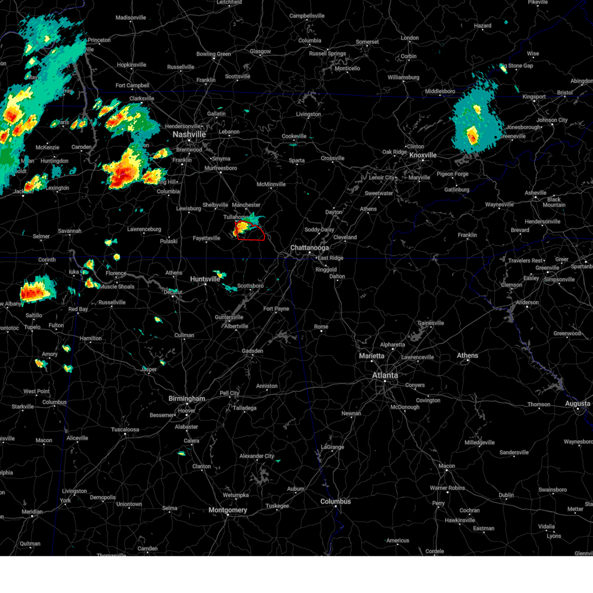
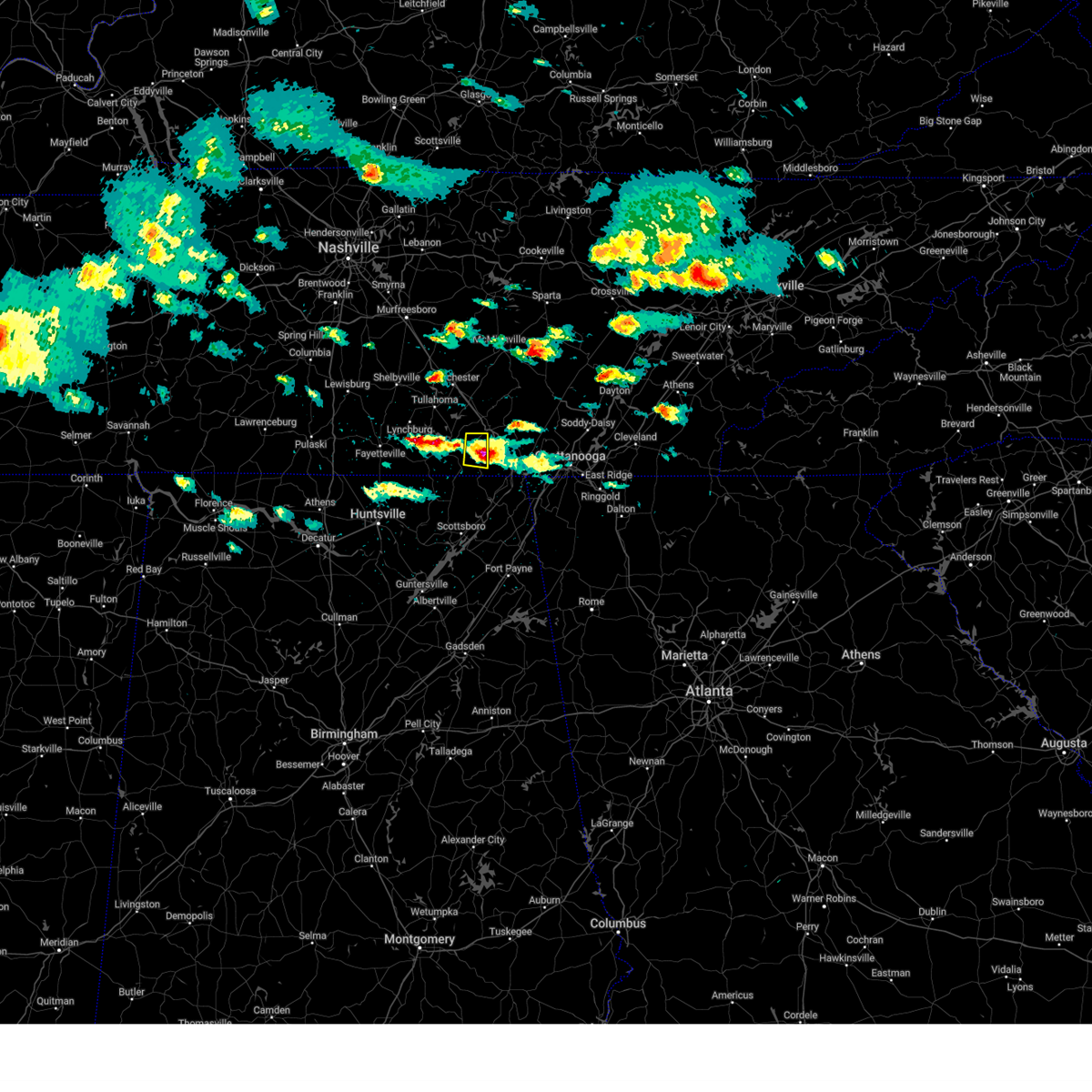
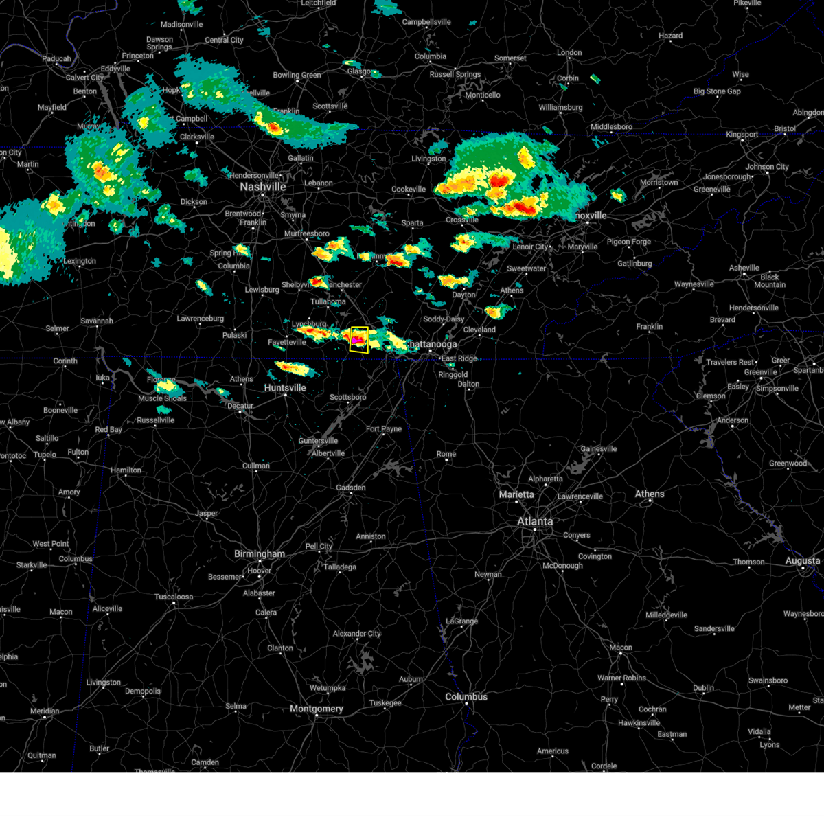
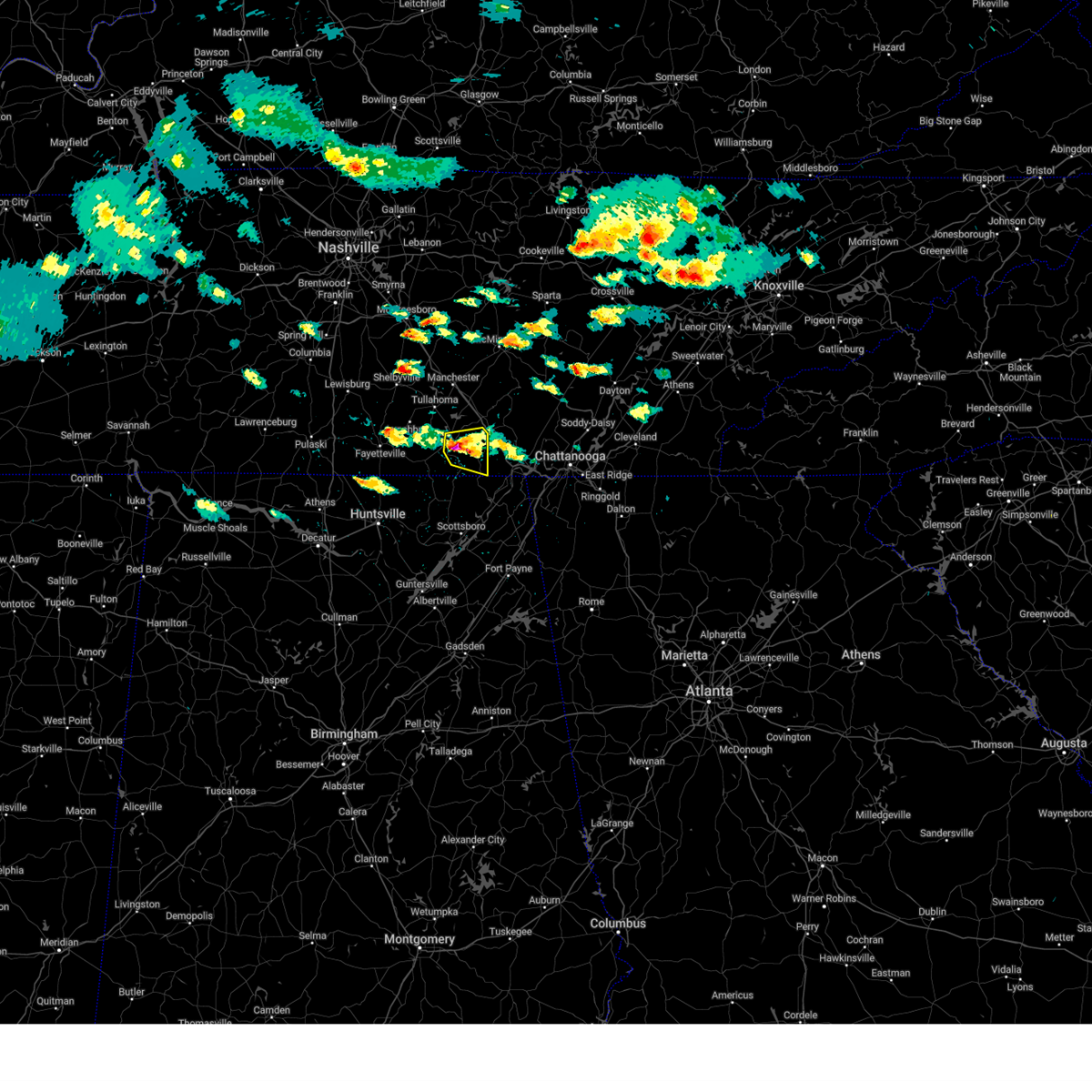
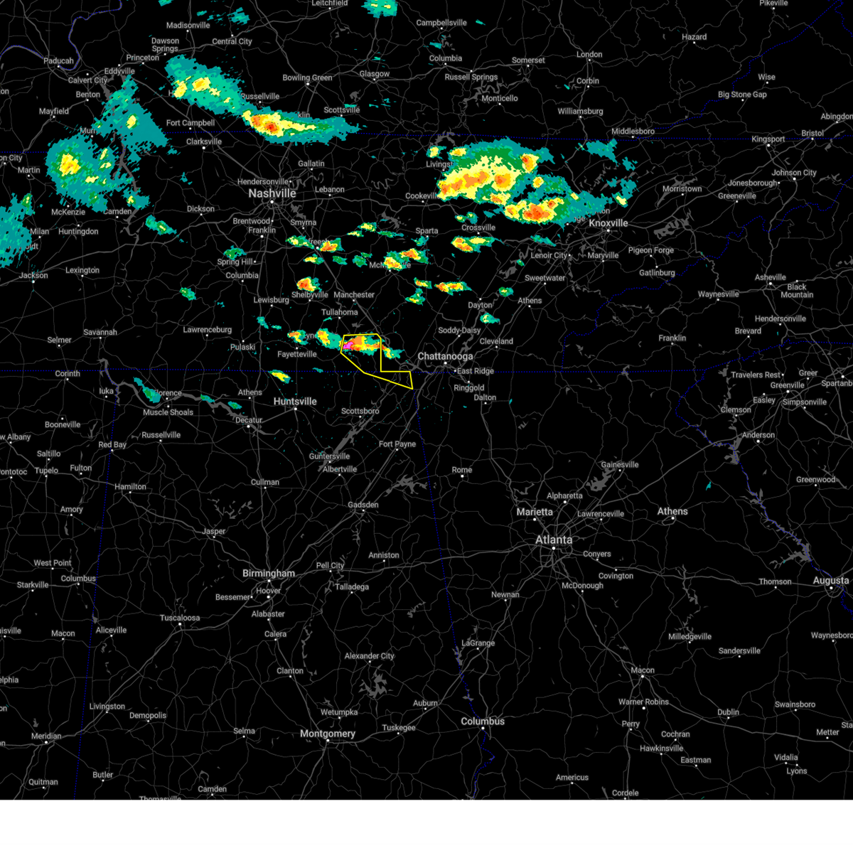
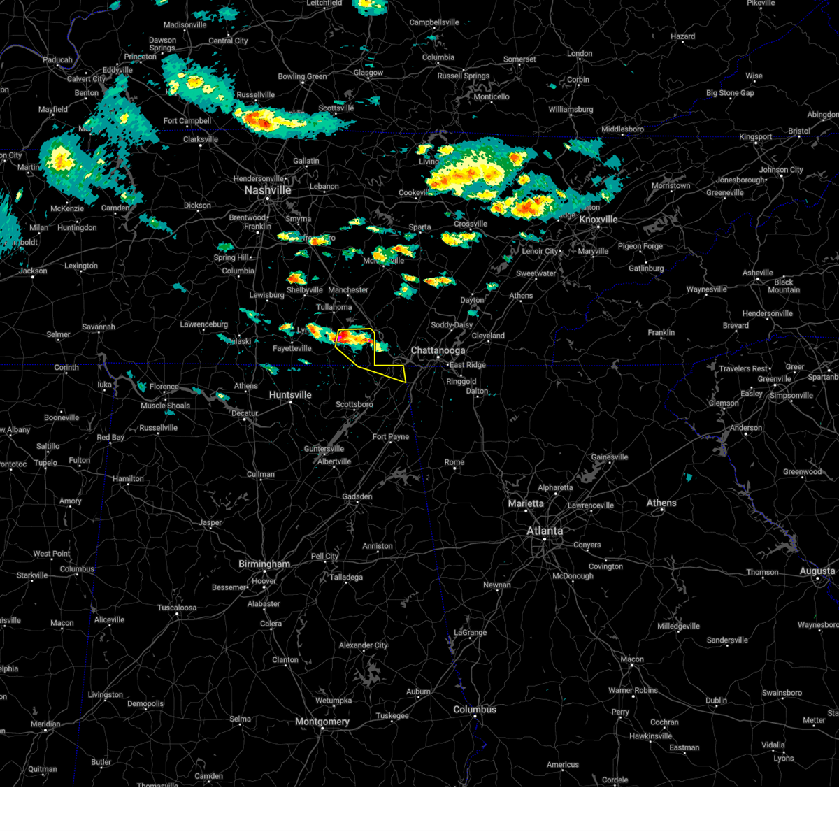
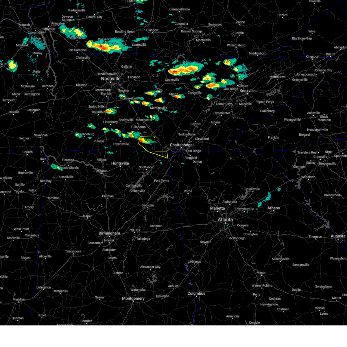
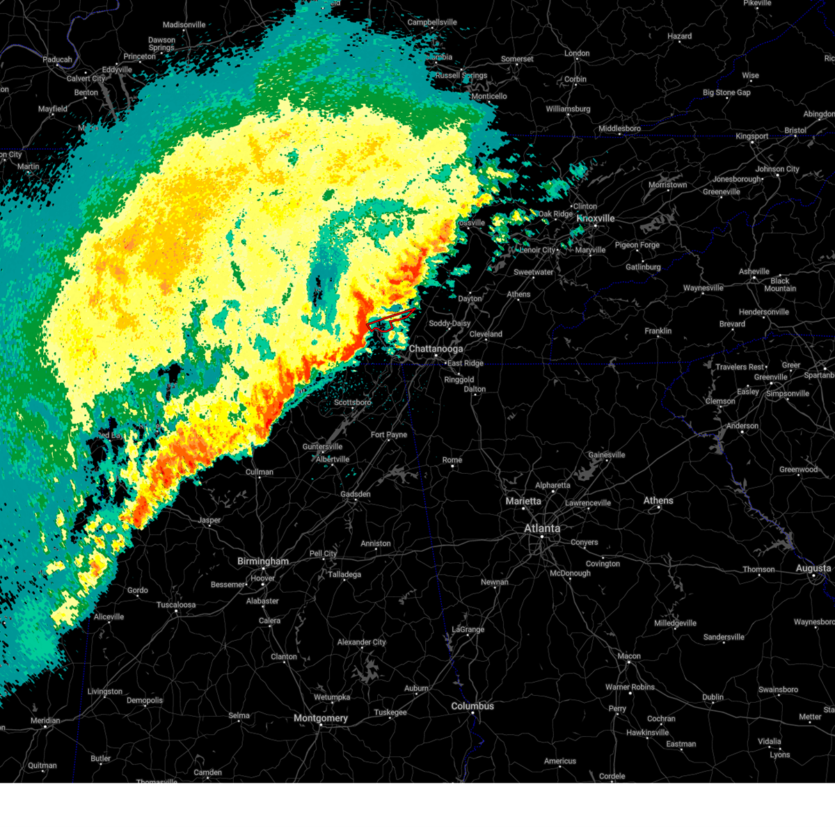
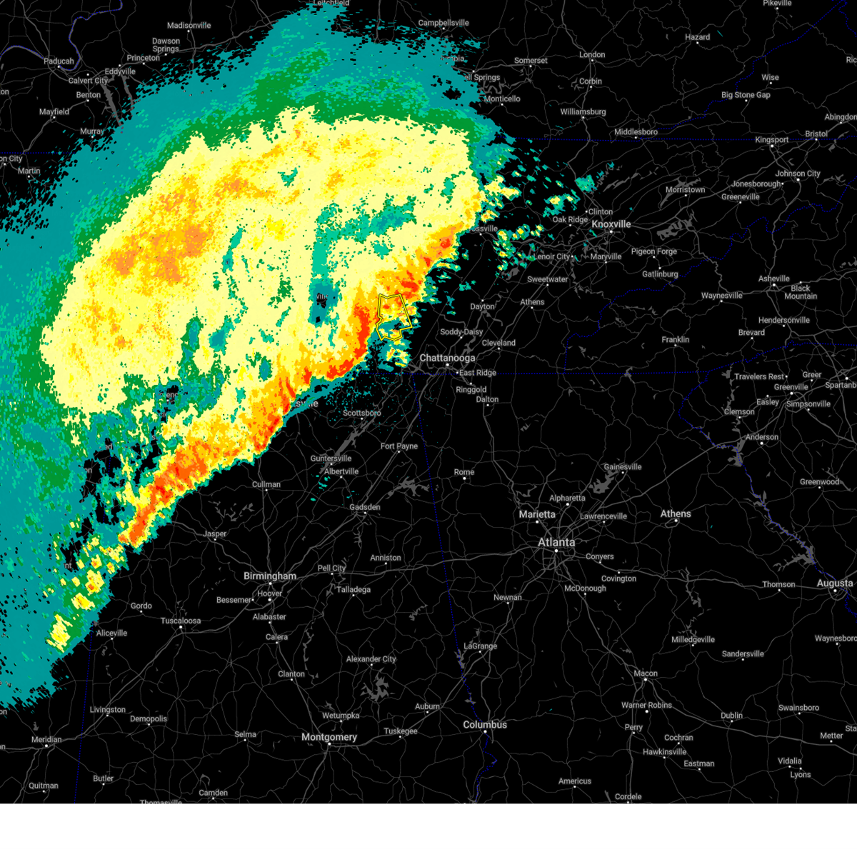
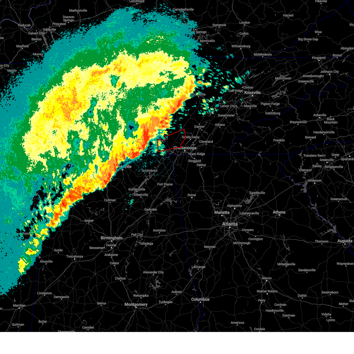
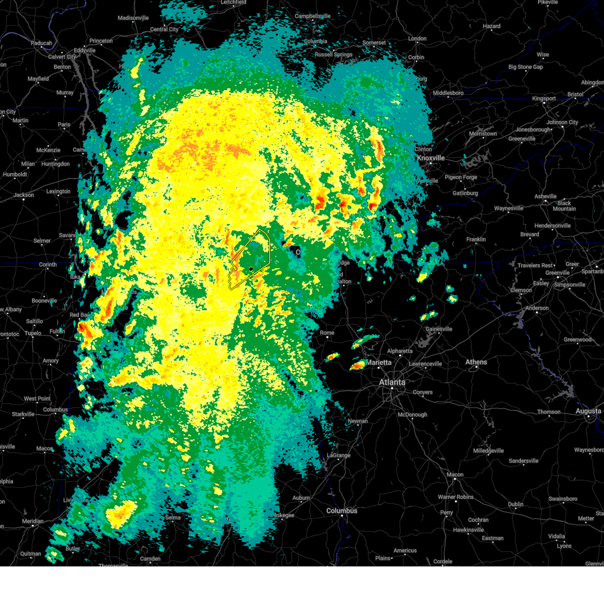
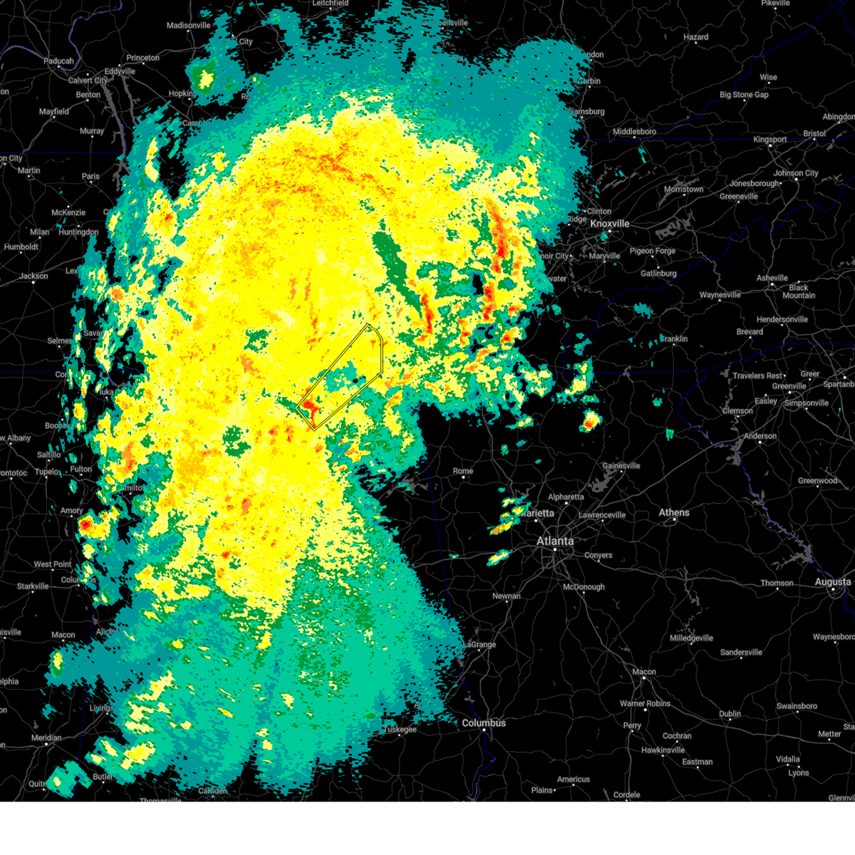
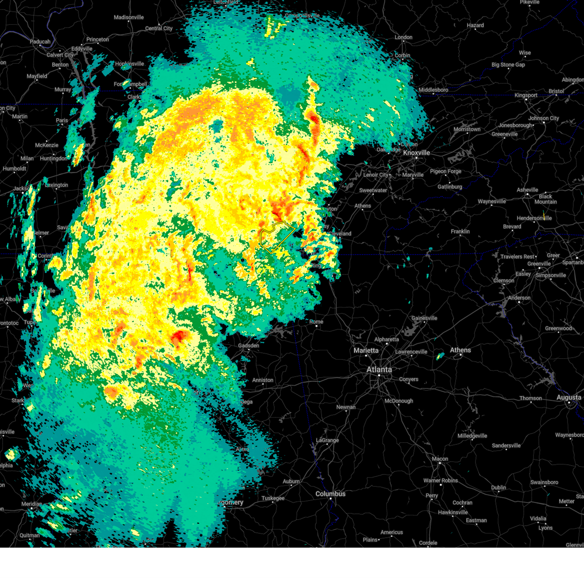
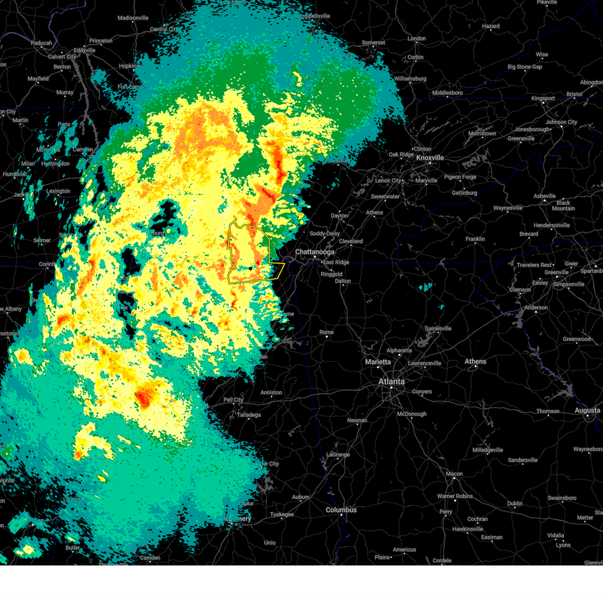
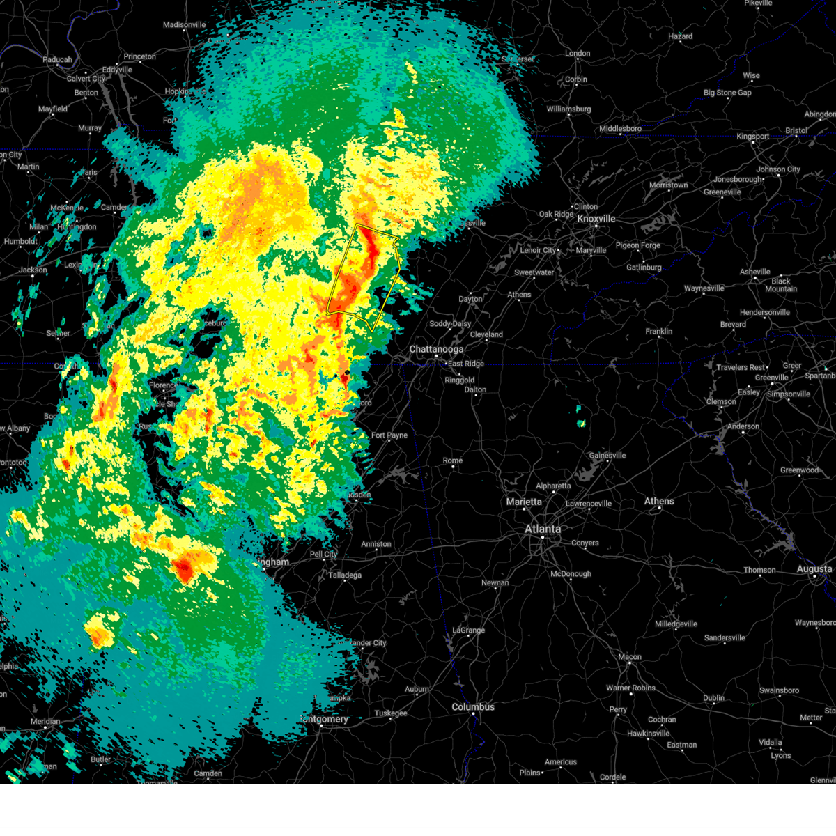
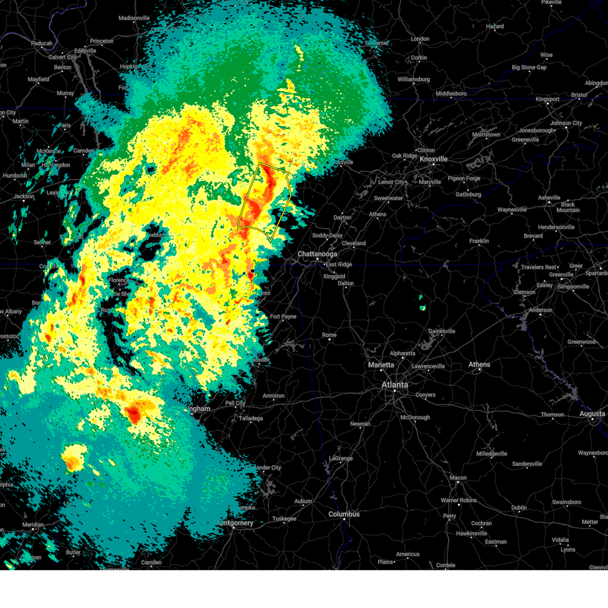
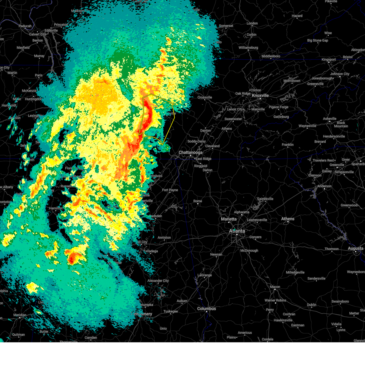
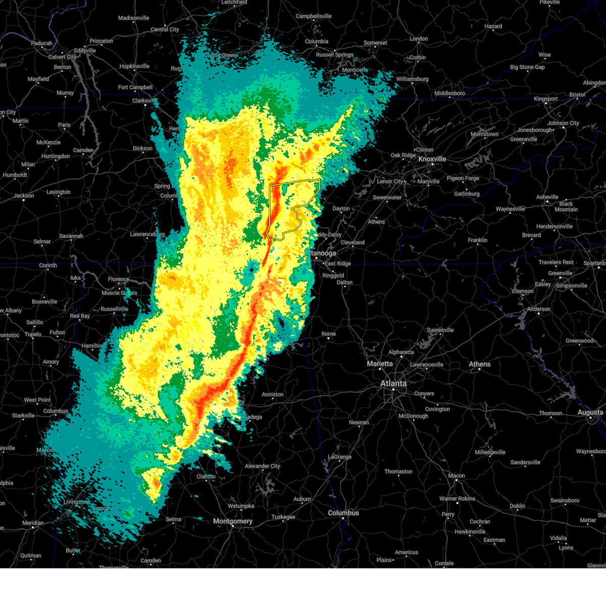
Hail Map for Monteagle, TN
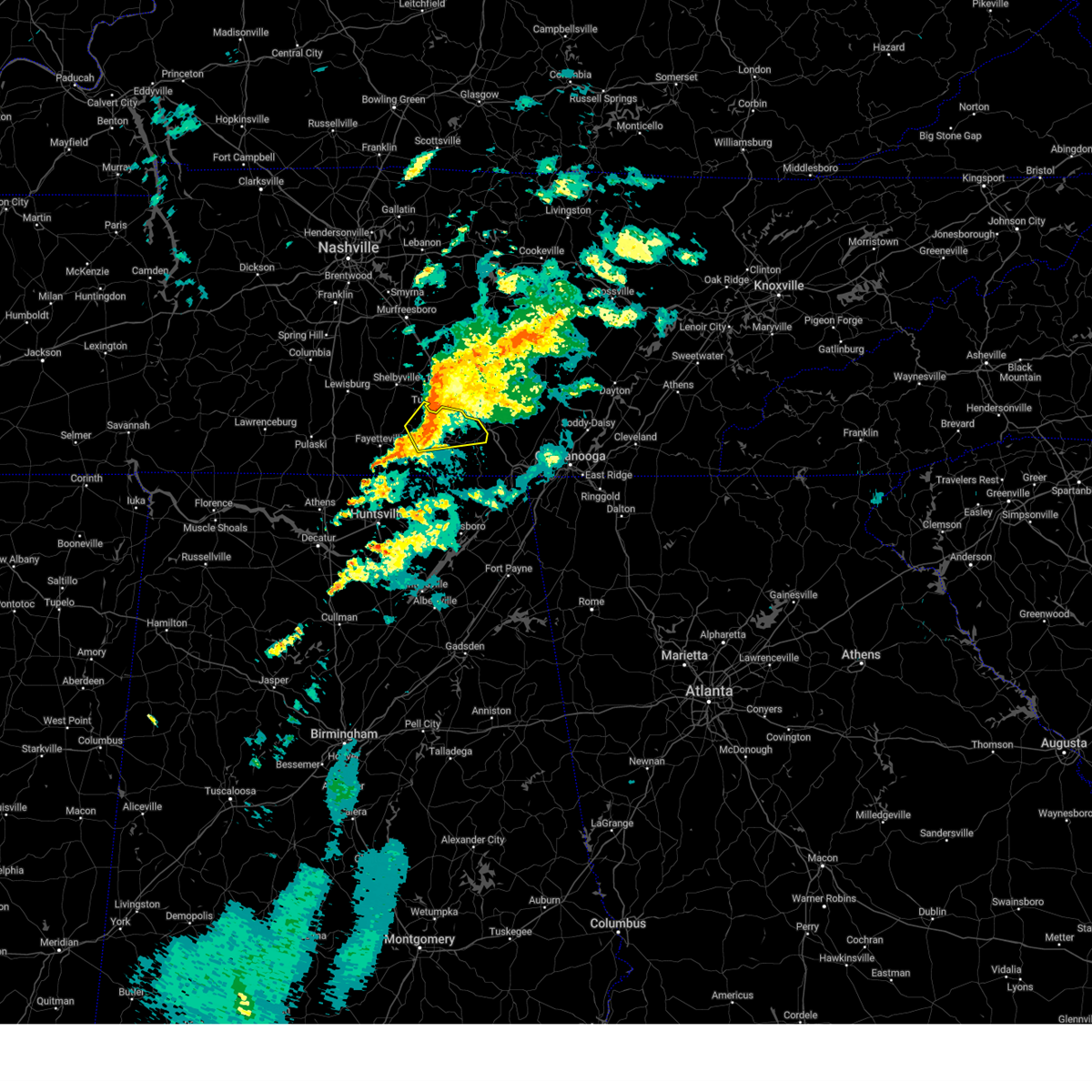
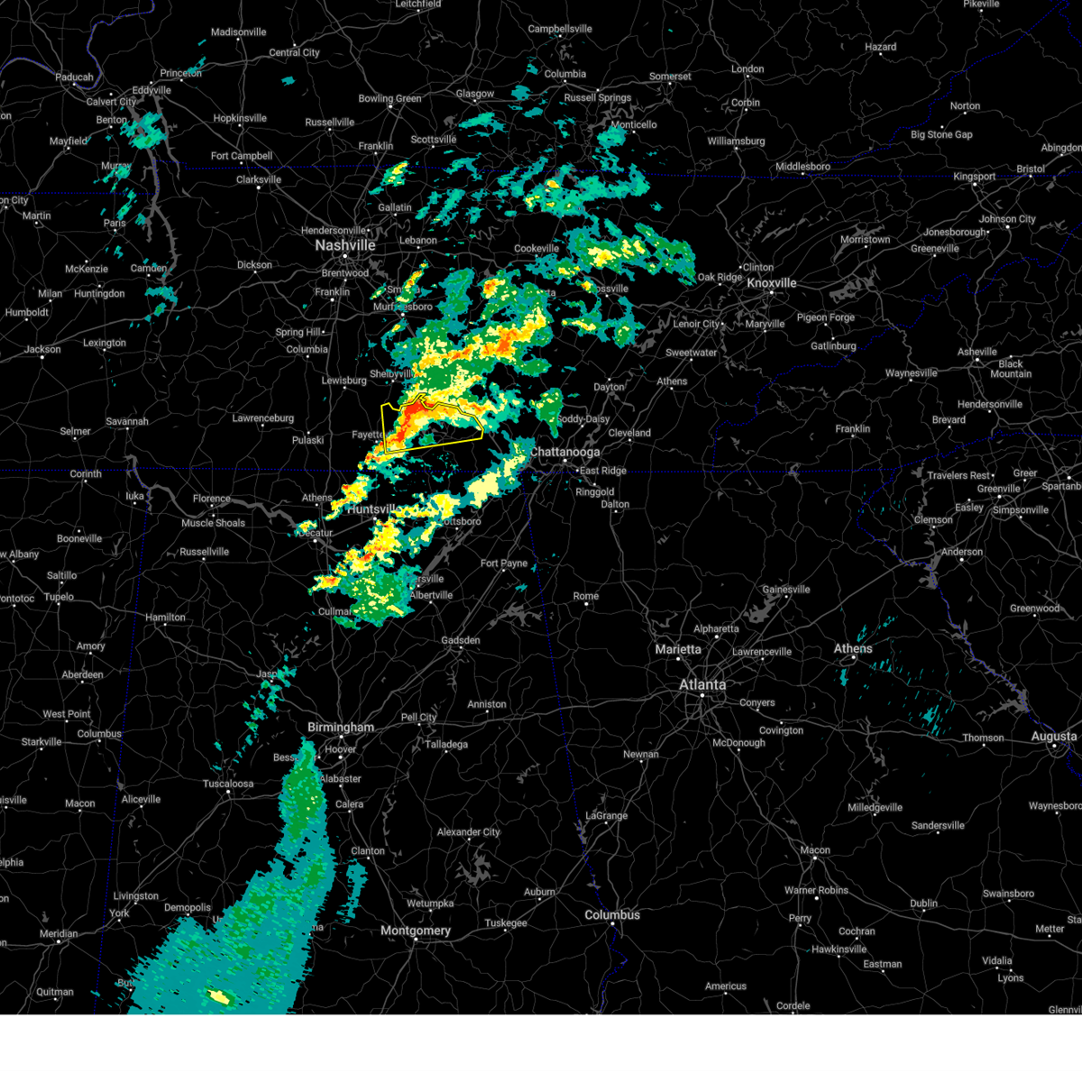
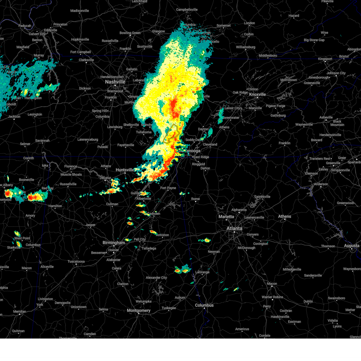
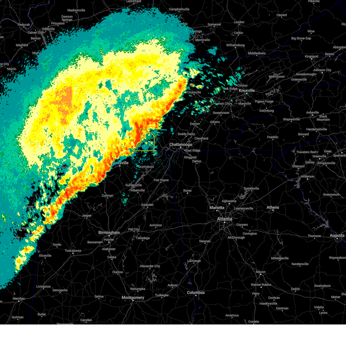
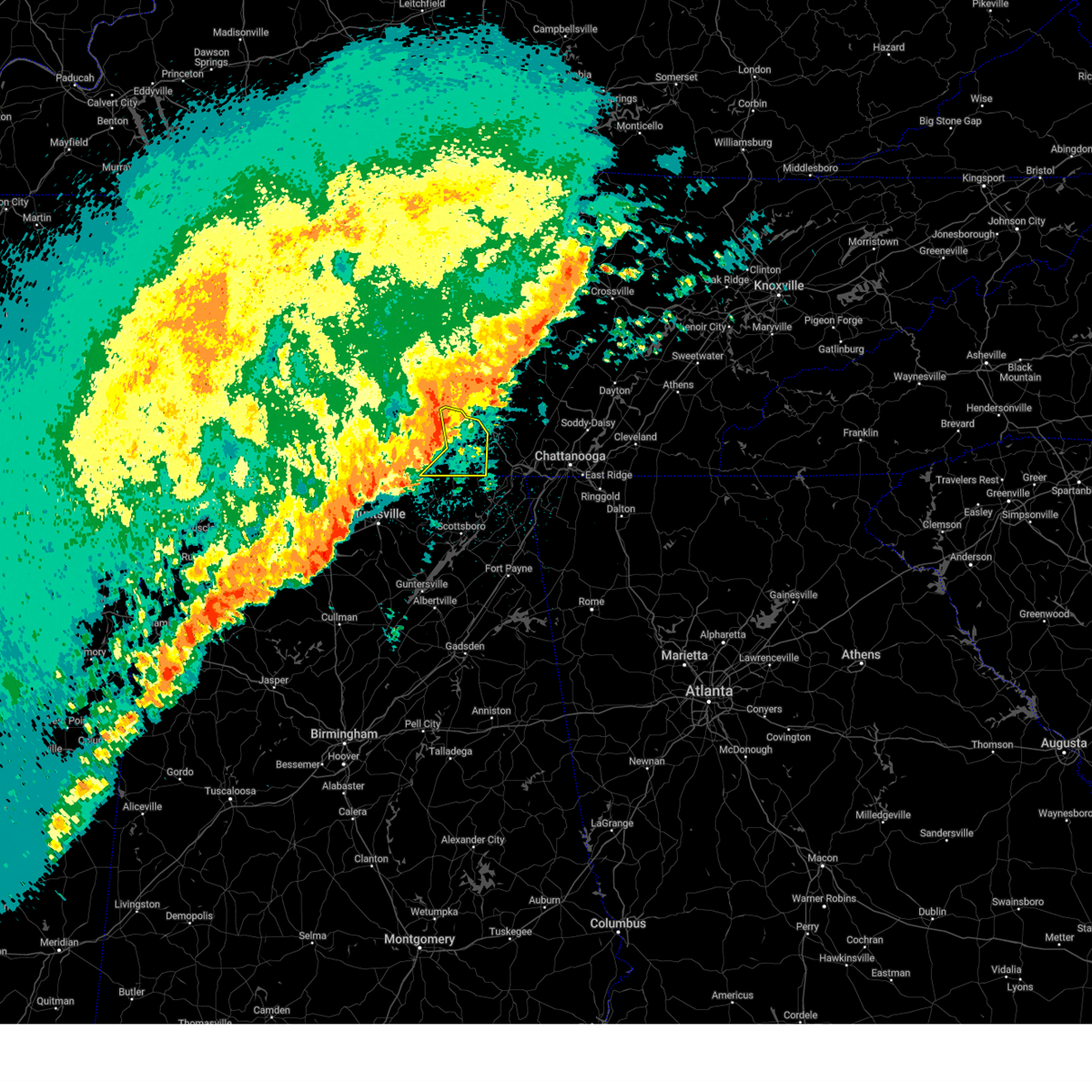
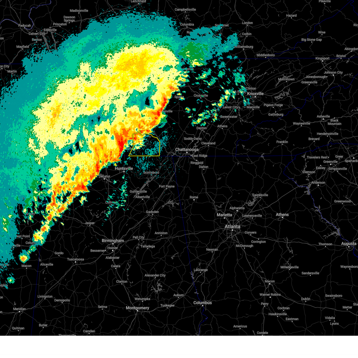
The Monteagle, TN area has had 0 reports of on-the-ground hail by trained spotters, and has been under severe weather warnings 135 times during the past 12 months. Doppler radar has detected hail at or near Monteagle, TN on 52 occasions, including 9 occasions during the past year.
| Name: | Monteagle, TN |
| Where Located: | 32.8 miles WNW of Chattanooga, TN |
| Map: | Google Map for Monteagle, TN |
| Population: | 1192 |
| Housing Units: | 761 |
| More Info: | Search Google for Monteagle, TN |
3
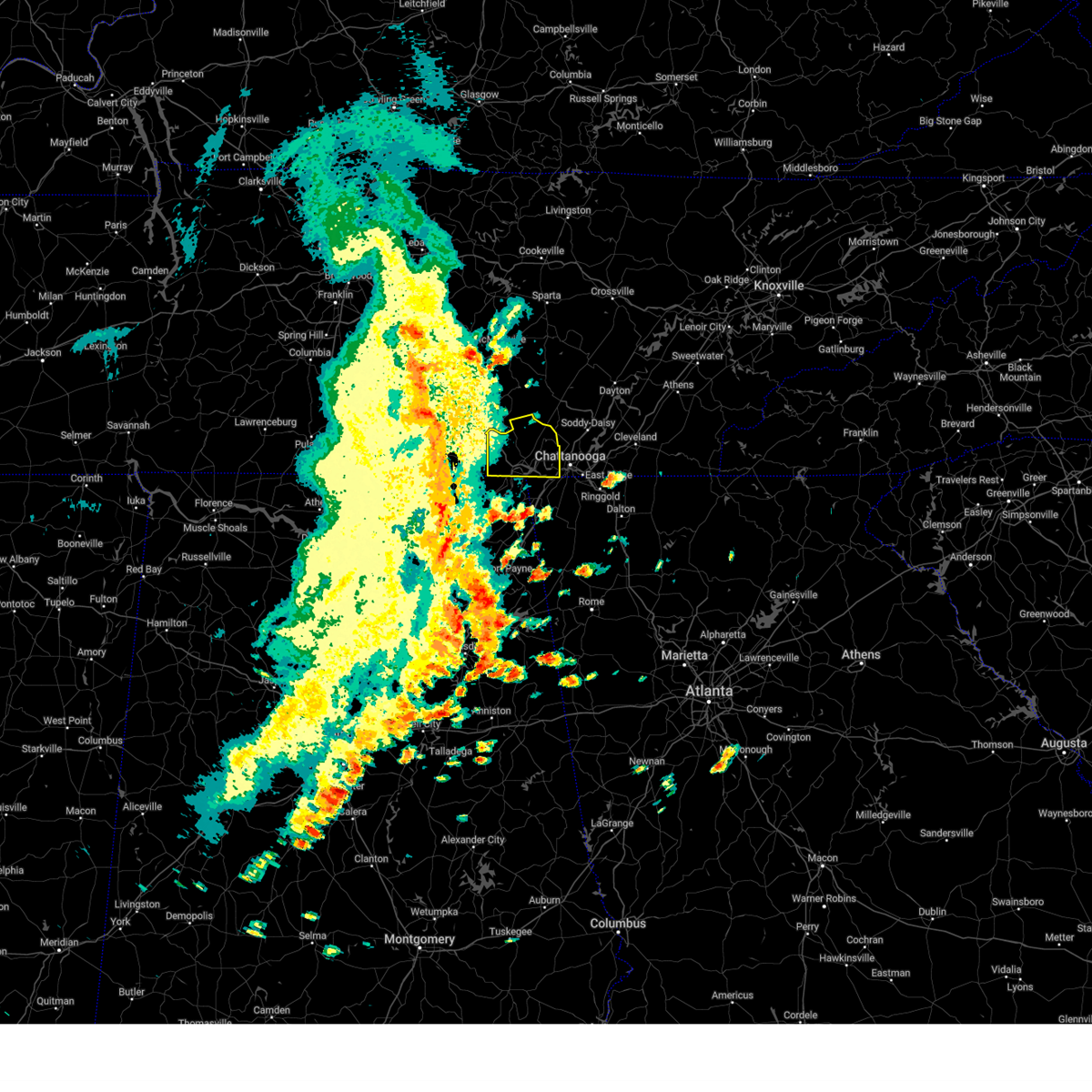
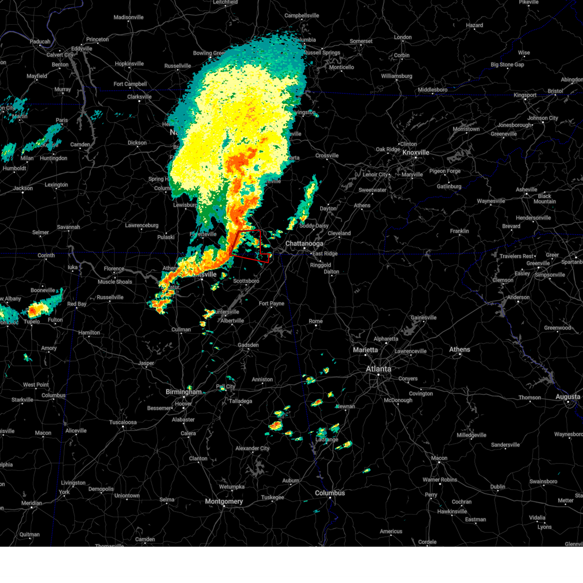
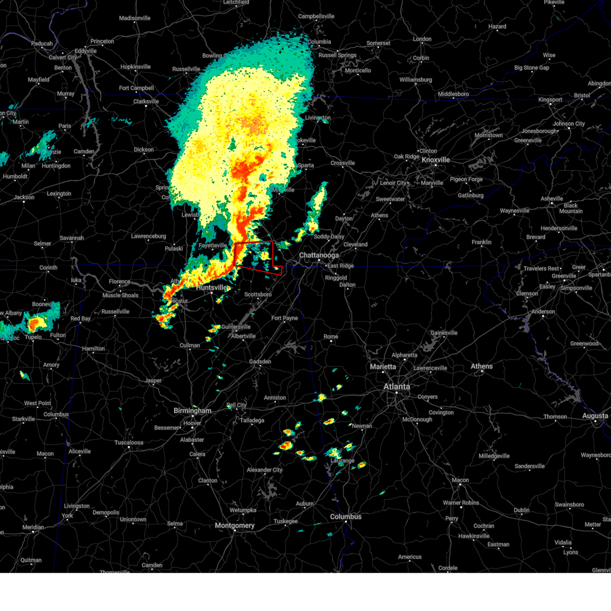
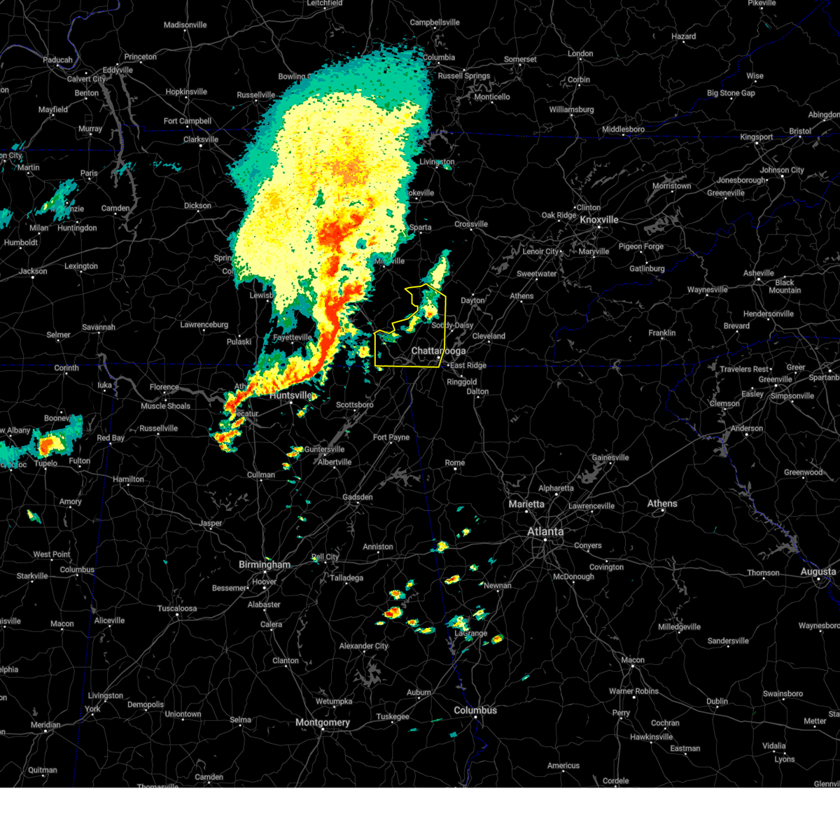
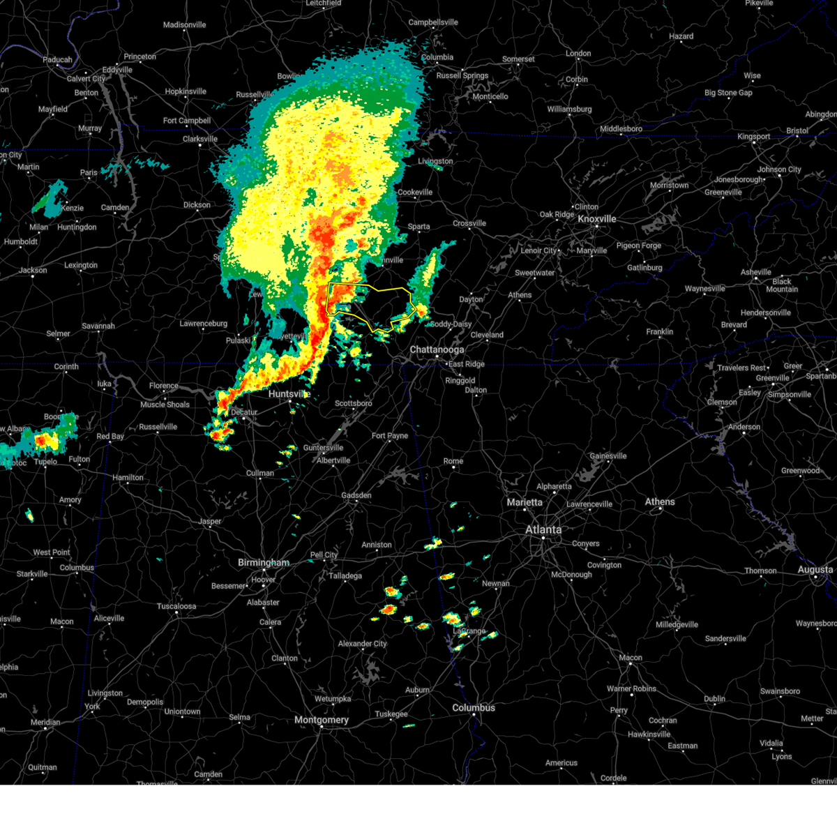
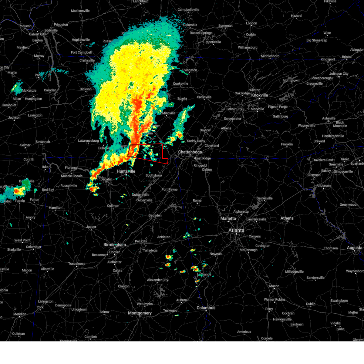
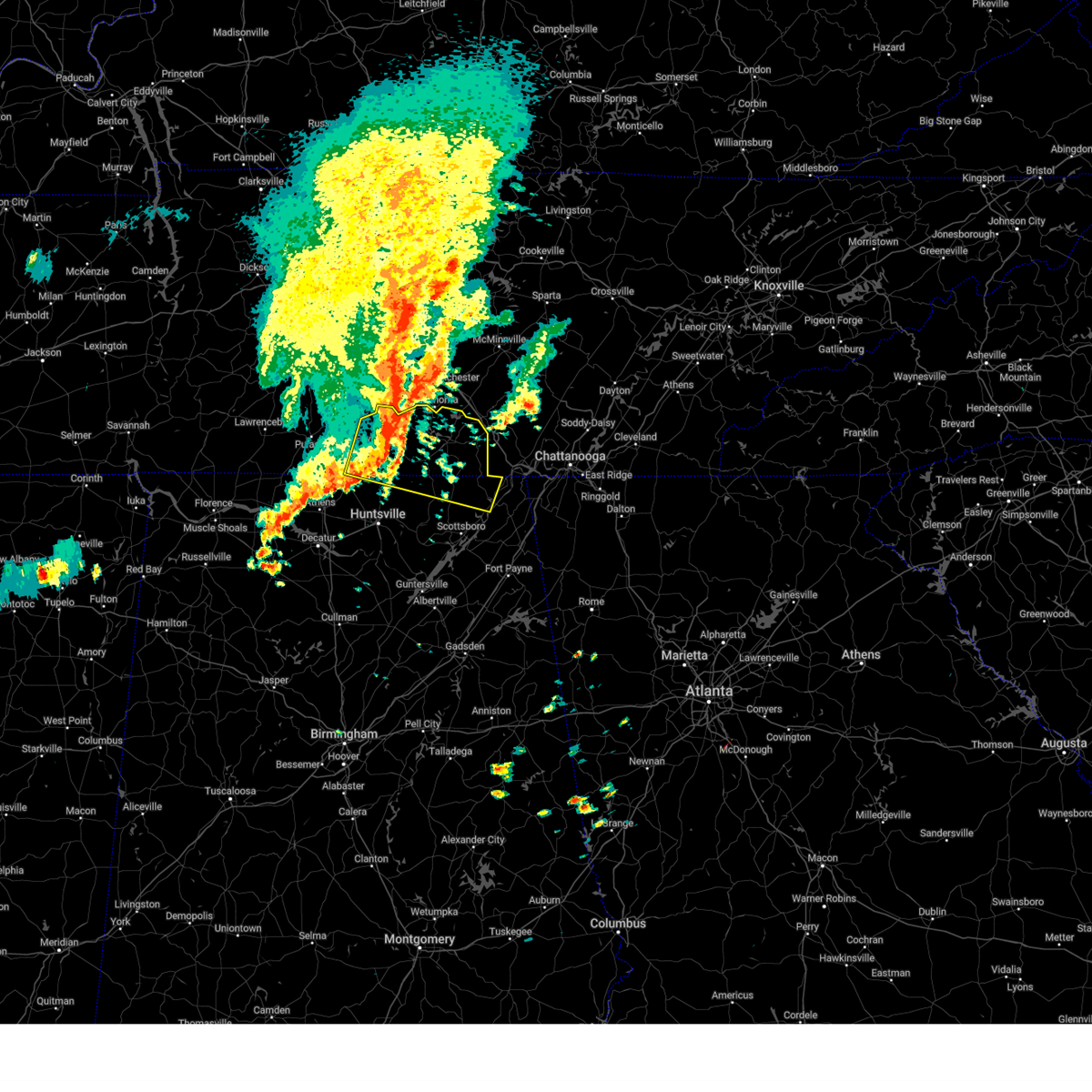
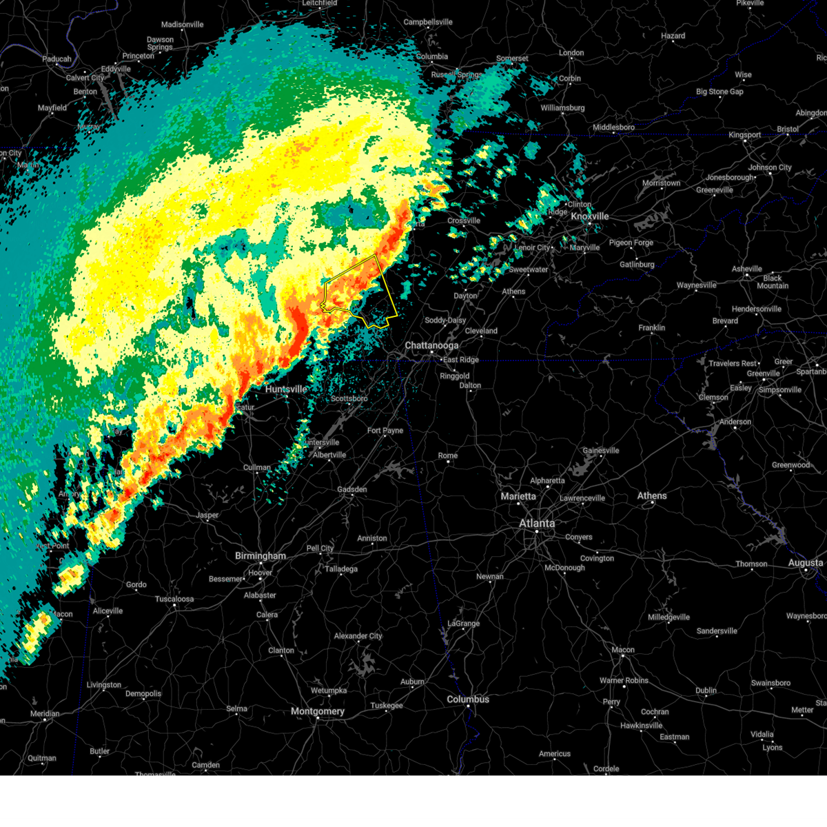
The Top Recent Hail Date for Monteagle, TN is Friday, June 6, 2025 (5th out of 52)
Hail and Wind Damage Spotted near Monteagle, TN
| Date / Time | Report Details |
|---|---|
| 6/26/2025 7:51 PM CDT |
 The storm which prompted the warning has weakened below severe limits, and no longer poses an immediate threat to life or property. therefore, the warning will be allowed to expire. however, gusty winds and heavy rain are still possible with this thunderstorm. The storm which prompted the warning has weakened below severe limits, and no longer poses an immediate threat to life or property. therefore, the warning will be allowed to expire. however, gusty winds and heavy rain are still possible with this thunderstorm.
|
| 6/26/2025 7:08 PM CDT |
 Svrhun the national weather service in huntsville alabama has issued a * severe thunderstorm warning for, southeastern franklin county in middle tennessee, * until 800 pm cdt. * at 707 pm cdt, a severe thunderstorm was located 9 miles west of south pittsburg, or 11 miles northwest of bridgeport, moving northwest at 5 mph (radar indicated). Hazards include 60 mph wind gusts and quarter size hail. Hail damage to vehicles is expected. Expect wind damage to roofs, siding, and trees. Svrhun the national weather service in huntsville alabama has issued a * severe thunderstorm warning for, southeastern franklin county in middle tennessee, * until 800 pm cdt. * at 707 pm cdt, a severe thunderstorm was located 9 miles west of south pittsburg, or 11 miles northwest of bridgeport, moving northwest at 5 mph (radar indicated). Hazards include 60 mph wind gusts and quarter size hail. Hail damage to vehicles is expected. Expect wind damage to roofs, siding, and trees.
|
| 6/13/2025 5:01 PM CDT |
 the severe thunderstorm warning has been cancelled and is no longer in effect the severe thunderstorm warning has been cancelled and is no longer in effect
|
| 6/13/2025 4:55 PM CDT |
 At 455 pm cdt, a severe thunderstorm was located 8 miles northwest of south pittsburg, or 12 miles northwest of bridgeport, moving northeast at 20 mph (radar indicated). Hazards include 60 mph wind gusts. Expect damage to roofs, siding, and trees. locations impacted include, sewanee, anderson, st. Andrews, and sherwood. At 455 pm cdt, a severe thunderstorm was located 8 miles northwest of south pittsburg, or 12 miles northwest of bridgeport, moving northeast at 20 mph (radar indicated). Hazards include 60 mph wind gusts. Expect damage to roofs, siding, and trees. locations impacted include, sewanee, anderson, st. Andrews, and sherwood.
|
| 6/13/2025 4:55 PM CDT |
 the severe thunderstorm warning has been cancelled and is no longer in effect the severe thunderstorm warning has been cancelled and is no longer in effect
|
| 6/13/2025 4:41 PM CDT |
 At 441 pm cdt, a severe thunderstorm was located 10 miles southeast of cowan, or 12 miles northwest of bridgeport, moving northeast at 25 mph (radar indicated). Hazards include 60 mph wind gusts and penny size hail. Expect damage to roofs, siding, and trees. locations impacted include, stevenson, cowan, sewanee, anderson, bass, russell cave national monument, alto, st. Andrews, and sherwood. At 441 pm cdt, a severe thunderstorm was located 10 miles southeast of cowan, or 12 miles northwest of bridgeport, moving northeast at 25 mph (radar indicated). Hazards include 60 mph wind gusts and penny size hail. Expect damage to roofs, siding, and trees. locations impacted include, stevenson, cowan, sewanee, anderson, bass, russell cave national monument, alto, st. Andrews, and sherwood.
|
| 6/13/2025 4:29 PM CDT |
 Svrhun the national weather service in huntsville alabama has issued a * severe thunderstorm warning for, northwestern jackson county in northeastern alabama, eastern franklin county in middle tennessee, * until 515 pm cdt. * at 429 pm cdt, a severe thunderstorm was located 11 miles northeast of skyline, or 17 miles south of winchester, moving northeast at 20 mph (radar indicated). Hazards include 60 mph wind gusts and penny size hail. expect damage to roofs, siding, and trees Svrhun the national weather service in huntsville alabama has issued a * severe thunderstorm warning for, northwestern jackson county in northeastern alabama, eastern franklin county in middle tennessee, * until 515 pm cdt. * at 429 pm cdt, a severe thunderstorm was located 11 miles northeast of skyline, or 17 miles south of winchester, moving northeast at 20 mph (radar indicated). Hazards include 60 mph wind gusts and penny size hail. expect damage to roofs, siding, and trees
|
| 6/7/2025 3:28 PM CDT |
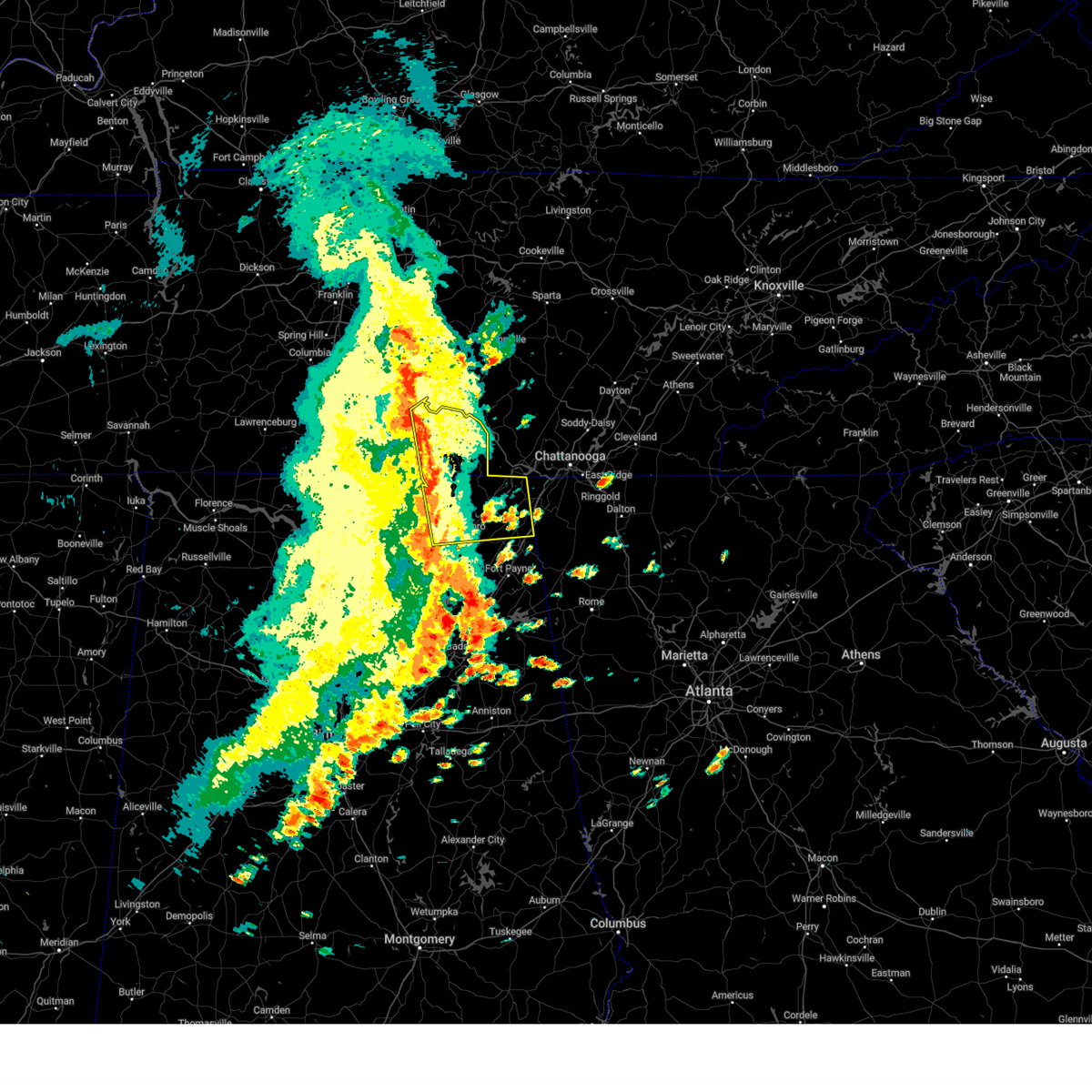
 At 428 pm edt/328 pm cdt/, severe thunderstorms were located along a line extending from near tracy city to near bridgeport, moving east at 45 mph (radar indicated). Hazards include 70 mph wind gusts. Expect considerable tree damage. damage is likely to mobile homes, roofs, and outbuildings. Locations impacted include, chattanooga, jasper, south pittsburg, whitwell, kimball, monteagle, powells crossroads, orme, martin springs, and fiery gizzard state park. At 428 pm edt/328 pm cdt/, severe thunderstorms were located along a line extending from near tracy city to near bridgeport, moving east at 45 mph (radar indicated). Hazards include 70 mph wind gusts. Expect considerable tree damage. damage is likely to mobile homes, roofs, and outbuildings. Locations impacted include, chattanooga, jasper, south pittsburg, whitwell, kimball, monteagle, powells crossroads, orme, martin springs, and fiery gizzard state park.
|
| 6/7/2025 3:26 PM CDT |
 At 326 pm cdt, severe thunderstorms were located along a line extending from 11 miles northeast of manchester to 11 miles north of tracy city to near gruetli-laager, moving east at 55 mph (radar indicated). Hazards include 60 mph wind gusts and penny size hail. Expect damage to roofs, siding, and trees. locations impacted include, mcminnville, gruetli-laager, tracy city, monteagle, altamont, coalmont, morrison, palmer, beersheba springs, viola, summitville, and fiery gizzard state park. This includes interstate 24 between mile markers 134 and 136. At 326 pm cdt, severe thunderstorms were located along a line extending from 11 miles northeast of manchester to 11 miles north of tracy city to near gruetli-laager, moving east at 55 mph (radar indicated). Hazards include 60 mph wind gusts and penny size hail. Expect damage to roofs, siding, and trees. locations impacted include, mcminnville, gruetli-laager, tracy city, monteagle, altamont, coalmont, morrison, palmer, beersheba springs, viola, summitville, and fiery gizzard state park. This includes interstate 24 between mile markers 134 and 136.
|
| 6/7/2025 3:21 PM CDT | Facebook photo received of a large tree down at the intersection of bud pattie road and summertown road. time is radar estimate in grundy county TN, 3.2 miles WSW of Monteagle, TN |
| 6/7/2025 3:11 PM CDT |
 At 311 pm cdt, severe thunderstorms were located along a line extending from 14 miles south of woodbury to manchester to 8 miles northeast of estill springs, moving east at 45 mph (radar indicated). Hazards include 60 mph wind gusts and penny size hail. Expect damage to roofs, siding, and trees. locations impacted include, mcminnville, manchester, gruetli-laager, tracy city, monteagle, altamont, coalmont, morrison, palmer, beersheba springs, viola, summitville, hillsboro, pelham, arnold afb, and fiery gizzard state park. This includes interstate 24 between mile markers 100 and 136. At 311 pm cdt, severe thunderstorms were located along a line extending from 14 miles south of woodbury to manchester to 8 miles northeast of estill springs, moving east at 45 mph (radar indicated). Hazards include 60 mph wind gusts and penny size hail. Expect damage to roofs, siding, and trees. locations impacted include, mcminnville, manchester, gruetli-laager, tracy city, monteagle, altamont, coalmont, morrison, palmer, beersheba springs, viola, summitville, hillsboro, pelham, arnold afb, and fiery gizzard state park. This includes interstate 24 between mile markers 100 and 136.
|
| 6/7/2025 3:11 PM CDT |
 the severe thunderstorm warning has been cancelled and is no longer in effect the severe thunderstorm warning has been cancelled and is no longer in effect
|
| 6/7/2025 3:06 PM CDT |
 the severe thunderstorm warning has been cancelled and is no longer in effect the severe thunderstorm warning has been cancelled and is no longer in effect
|
| 6/7/2025 3:06 PM CDT |
 At 305 pm cdt, severe thunderstorms were located along a line extending from near estill springs to section, moving east at 50 mph (emergency management). Hazards include 60 mph wind gusts. Expect damage to roofs, siding, and trees. Locations impacted include, scottsboro, winchester, bridgeport, decherd, henagar, estill springs, stevenson, cowan, hollywood, and skyline. At 305 pm cdt, severe thunderstorms were located along a line extending from near estill springs to section, moving east at 50 mph (emergency management). Hazards include 60 mph wind gusts. Expect damage to roofs, siding, and trees. Locations impacted include, scottsboro, winchester, bridgeport, decherd, henagar, estill springs, stevenson, cowan, hollywood, and skyline.
|
| 6/7/2025 2:58 PM CDT |
 Svrohx the national weather service in nashville has issued a * severe thunderstorm warning for, warren county in middle tennessee, coffee county in middle tennessee, southeastern bedford county in middle tennessee, grundy county in middle tennessee, * until 400 pm cdt. * at 258 pm cdt, severe thunderstorms were located along a line extending from 11 miles northeast of shelbyville to tullahoma, moving east at 40 mph (radar indicated). Hazards include 60 mph wind gusts and penny size hail. expect damage to roofs, siding, and trees Svrohx the national weather service in nashville has issued a * severe thunderstorm warning for, warren county in middle tennessee, coffee county in middle tennessee, southeastern bedford county in middle tennessee, grundy county in middle tennessee, * until 400 pm cdt. * at 258 pm cdt, severe thunderstorms were located along a line extending from 11 miles northeast of shelbyville to tullahoma, moving east at 40 mph (radar indicated). Hazards include 60 mph wind gusts and penny size hail. expect damage to roofs, siding, and trees
|
| 6/7/2025 2:55 PM CDT |
 Svrmrx the national weather service in morristown has issued a * severe thunderstorm warning for, marion county in east tennessee, southwestern hamilton county in east tennessee, * until 445 pm edt/345 pm cdt/. * at 355 pm edt/255 pm cdt/, severe thunderstorms were located along a line extending from near estill springs to 10 miles southeast of huntland to near scottsboro, moving east at 50 mph (radar indicated). Hazards include 60 mph wind gusts. expect damage to roofs, siding, and trees Svrmrx the national weather service in morristown has issued a * severe thunderstorm warning for, marion county in east tennessee, southwestern hamilton county in east tennessee, * until 445 pm edt/345 pm cdt/. * at 355 pm edt/255 pm cdt/, severe thunderstorms were located along a line extending from near estill springs to 10 miles southeast of huntland to near scottsboro, moving east at 50 mph (radar indicated). Hazards include 60 mph wind gusts. expect damage to roofs, siding, and trees
|
| 6/7/2025 2:51 PM CDT |
 Svrhun the national weather service in huntsville alabama has issued a * severe thunderstorm warning for, jackson county in northeastern alabama, northeastern dekalb county in northeastern alabama, eastern moore county in middle tennessee, franklin county in middle tennessee, * until 345 pm cdt. * at 250 pm cdt, severe thunderstorms were located along a line extending from near lynchburg to 6 miles east of woodville, moving east at 50 mph (radar indicated). Hazards include 60 mph wind gusts. expect damage to roofs, siding, and trees Svrhun the national weather service in huntsville alabama has issued a * severe thunderstorm warning for, jackson county in northeastern alabama, northeastern dekalb county in northeastern alabama, eastern moore county in middle tennessee, franklin county in middle tennessee, * until 345 pm cdt. * at 250 pm cdt, severe thunderstorms were located along a line extending from near lynchburg to 6 miles east of woodville, moving east at 50 mph (radar indicated). Hazards include 60 mph wind gusts. expect damage to roofs, siding, and trees
|
| 6/6/2025 4:06 PM CDT | the severe thunderstorm warning has been cancelled and is no longer in effect |
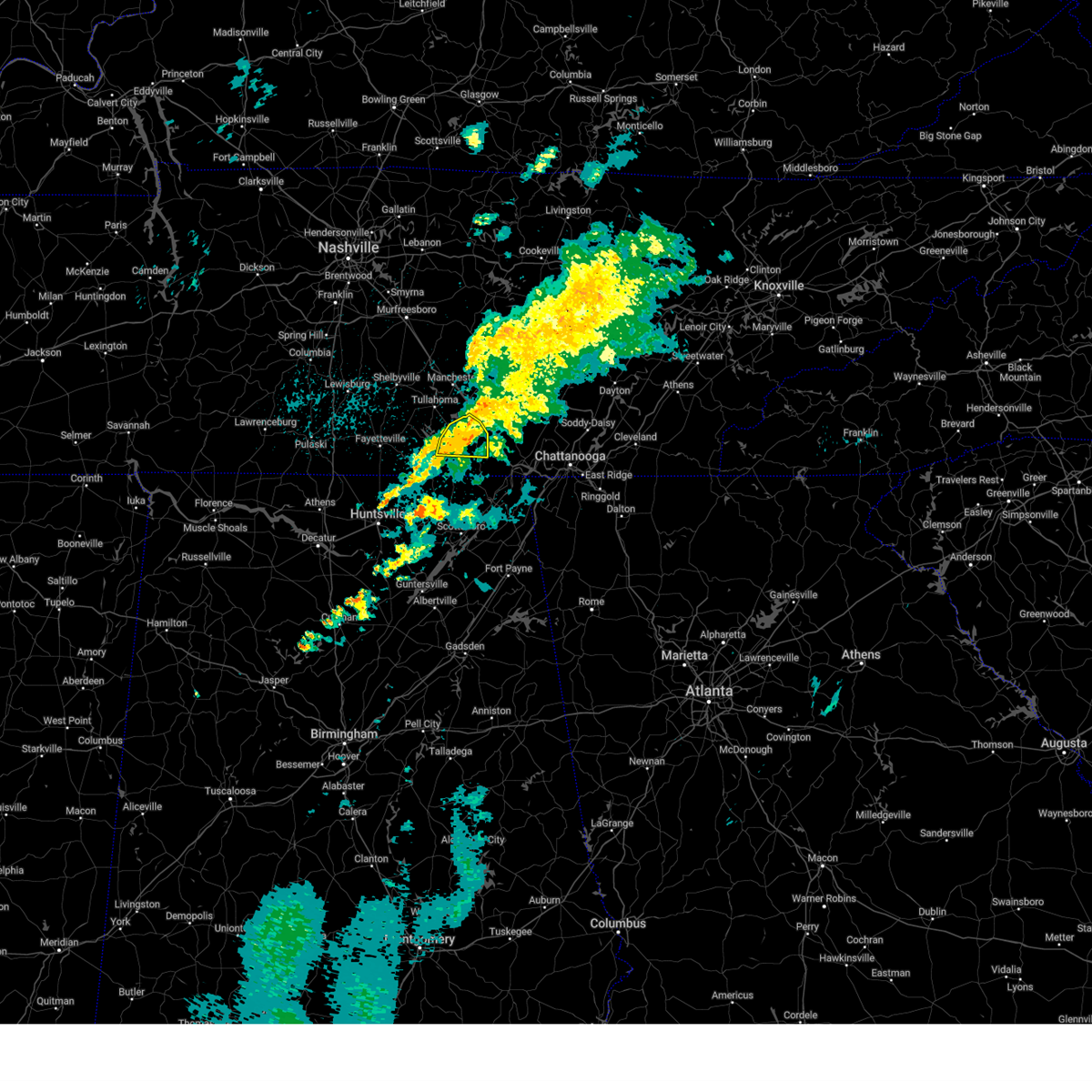
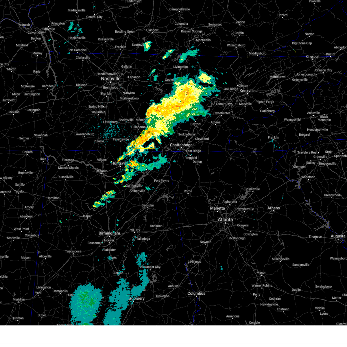
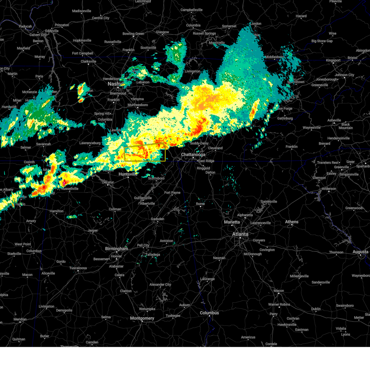
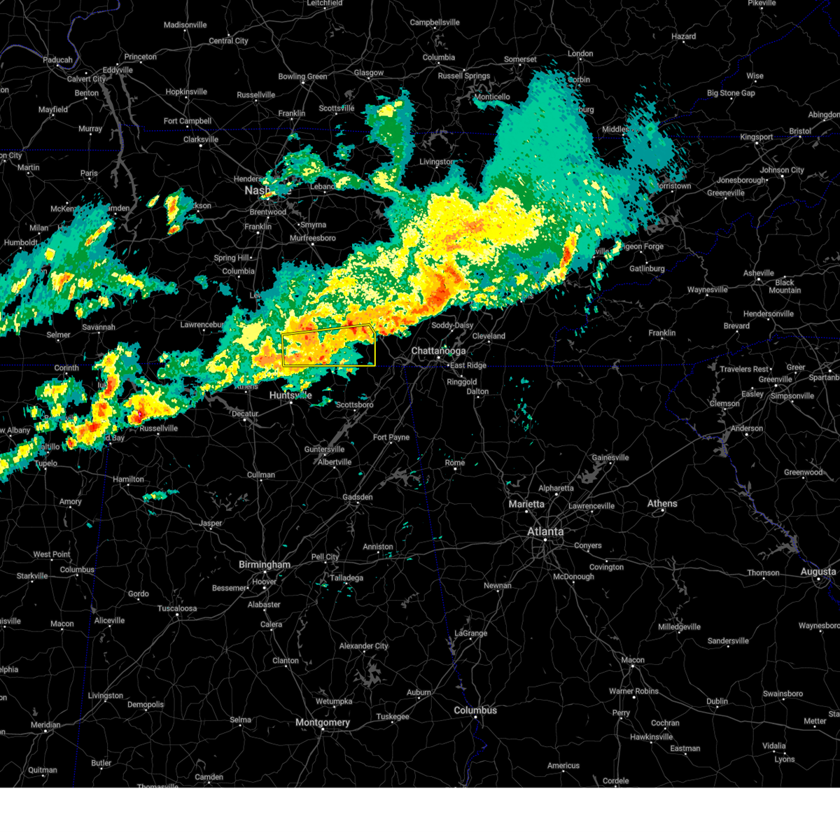
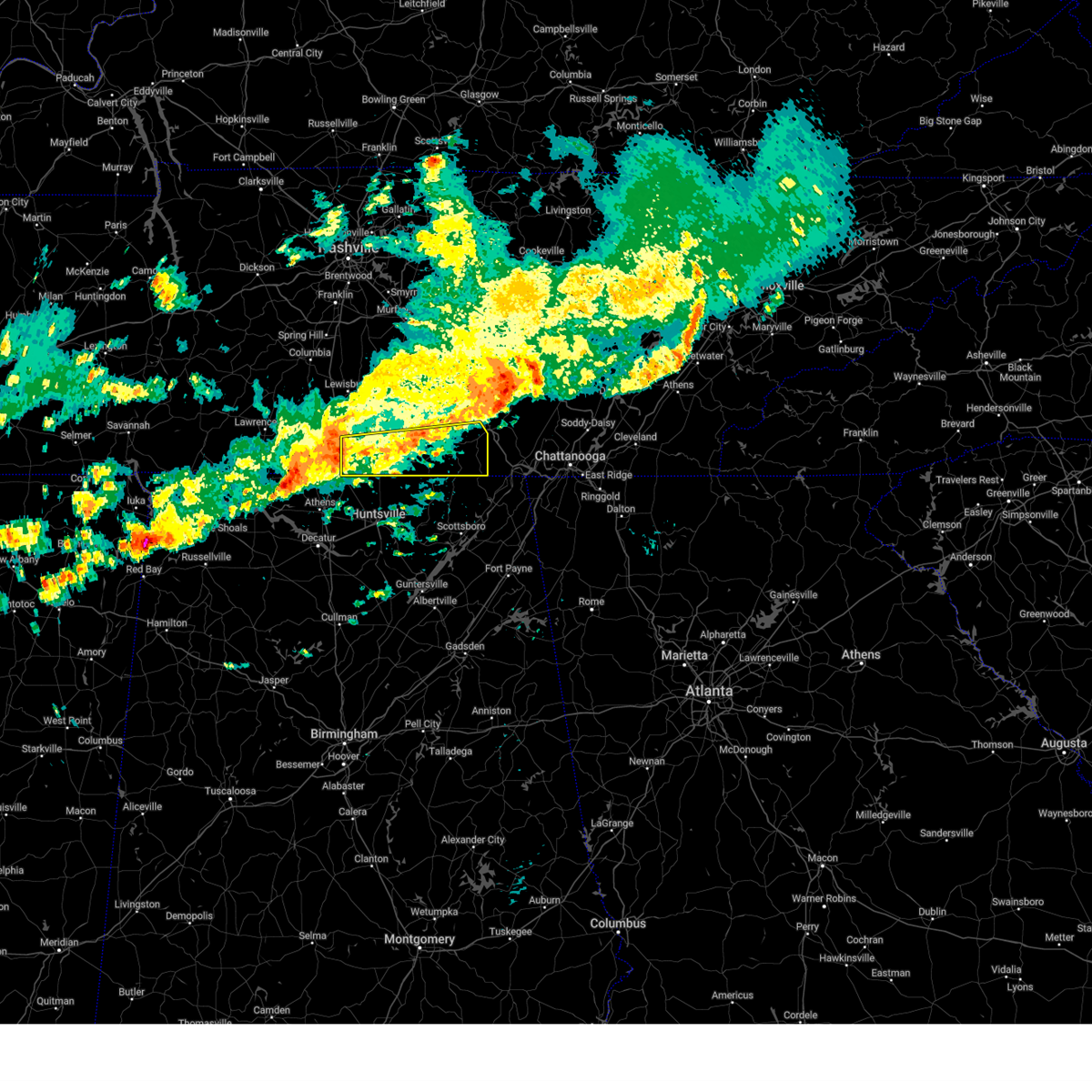
| 6/6/2025 4:06 PM CDT | At 406 pm cdt, a severe thunderstorm was located near gruetli-laager, or 19 miles west of dunlap, moving northeast at 35 mph (radar indicated). Hazards include 60 mph wind gusts and quarter size hail. Hail damage to vehicles is expected. expect wind damage to roofs, siding, and trees. Locations impacted include, gruetli-laager, tracy city, monteagle, altamont, coalmont, palmer, and beersheba springs. |
| 6/6/2025 4:02 PM CDT | the severe thunderstorm warning has been cancelled and is no longer in effect |
| 6/6/2025 3:46 PM CDT | Svrohx the national weather service in nashville has issued a * severe thunderstorm warning for, southeastern coffee county in middle tennessee, grundy county in middle tennessee, * until 430 pm cdt. * at 346 pm cdt, a severe thunderstorm was located over monteagle, or 12 miles east of winchester, moving northeast at 35 mph (radar indicated). Hazards include 60 mph wind gusts and quarter size hail. Hail damage to vehicles is expected. Expect wind damage to roofs, siding, and trees. |
| 6/6/2025 3:44 PM CDT | Svrhun the national weather service in huntsville alabama has issued a * severe thunderstorm warning for, northeastern franklin county in middle tennessee, * until 415 pm cdt. * at 344 pm cdt, a severe thunderstorm was located over monteagle, or 13 miles east of winchester, moving northeast at 25 mph (radar indicated). Hazards include 60 mph wind gusts and quarter size hail. Hail damage to vehicles is expected. Expect wind damage to roofs, siding, and trees. |
| 5/27/2025 9:54 PM CDT |
 the severe thunderstorm warning has been cancelled and is no longer in effect the severe thunderstorm warning has been cancelled and is no longer in effect
|
| 5/27/2025 9:38 PM CDT |
 At 936 pm cdt, a severe thunderstorm was located over cowan, or near winchester, moving east at 15 mph (radar indicated). Hazards include 60 mph wind gusts. Expect damage to roofs, siding, and trees. locations impacted include, decherd, alto, sewanee, st. Andrews, winchester, cowan, belvidere, woods reservoir, and tims ford lake. At 936 pm cdt, a severe thunderstorm was located over cowan, or near winchester, moving east at 15 mph (radar indicated). Hazards include 60 mph wind gusts. Expect damage to roofs, siding, and trees. locations impacted include, decherd, alto, sewanee, st. Andrews, winchester, cowan, belvidere, woods reservoir, and tims ford lake.
|
| 5/27/2025 9:30 PM CDT |
 At 928 pm cdt, severe thunderstorms were located along a line extending from 8 miles northwest of monteagle to decherd to near cowan to huntland, moving east at 15 mph (radar indicated). Hazards include 60 mph wind gusts. Expect damage to roofs, siding, and trees. locations impacted include, lexie crossroads, estill springs, harmony, huntland, maxwell, sewanee, st. Andrews, sherwood, beans creek, and decherd. At 928 pm cdt, severe thunderstorms were located along a line extending from 8 miles northwest of monteagle to decherd to near cowan to huntland, moving east at 15 mph (radar indicated). Hazards include 60 mph wind gusts. Expect damage to roofs, siding, and trees. locations impacted include, lexie crossroads, estill springs, harmony, huntland, maxwell, sewanee, st. Andrews, sherwood, beans creek, and decherd.
|
| 5/27/2025 9:12 PM CDT |
 Svrhun the national weather service in huntsville alabama has issued a * severe thunderstorm warning for, franklin county in middle tennessee, * until 1015 pm cdt. * at 911 pm cdt, severe thunderstorms were located along a line extending from 8 miles north of decherd to near estill springs to near winchester to near huntland, moving east at 15 mph (radar indicated). Hazards include 60 mph wind gusts. expect damage to roofs, siding, and trees Svrhun the national weather service in huntsville alabama has issued a * severe thunderstorm warning for, franklin county in middle tennessee, * until 1015 pm cdt. * at 911 pm cdt, severe thunderstorms were located along a line extending from 8 miles north of decherd to near estill springs to near winchester to near huntland, moving east at 15 mph (radar indicated). Hazards include 60 mph wind gusts. expect damage to roofs, siding, and trees
|
| 5/27/2025 9:01 PM CDT |
 At 900 pm cdt, a severe thunderstorm was located over tims ford lake, or near winchester, moving east at 20 mph (radar indicated). Hazards include 60 mph wind gusts. Expect damage to roofs, siding, and trees. locations impacted include, lexie crossroads, estill springs, harmony, hurdlow, sewanee, st. Andrews, marble hill, tims ford lake, decherd, and woods reservoir. At 900 pm cdt, a severe thunderstorm was located over tims ford lake, or near winchester, moving east at 20 mph (radar indicated). Hazards include 60 mph wind gusts. Expect damage to roofs, siding, and trees. locations impacted include, lexie crossroads, estill springs, harmony, hurdlow, sewanee, st. Andrews, marble hill, tims ford lake, decherd, and woods reservoir.
|
| 5/27/2025 8:44 PM CDT |
 At 844 pm cdt, a severe thunderstorm was located over tims ford lake, or 7 miles northwest of winchester, moving east at 25 mph (radar indicated). Hazards include 60 mph wind gusts. Expect damage to roofs, siding, and trees. locations impacted include, lexie crossroads, estill springs, harmony, hurdlow, lois, lynchburg, sewanee, st. Andrews, marble hill, and tims ford lake. At 844 pm cdt, a severe thunderstorm was located over tims ford lake, or 7 miles northwest of winchester, moving east at 25 mph (radar indicated). Hazards include 60 mph wind gusts. Expect damage to roofs, siding, and trees. locations impacted include, lexie crossroads, estill springs, harmony, hurdlow, lois, lynchburg, sewanee, st. Andrews, marble hill, and tims ford lake.
|
| 5/27/2025 8:44 PM CDT |
 the severe thunderstorm warning has been cancelled and is no longer in effect the severe thunderstorm warning has been cancelled and is no longer in effect
|
| 5/27/2025 8:20 PM CDT |
 Svrhun the national weather service in huntsville alabama has issued a * severe thunderstorm warning for, moore county in middle tennessee, northeastern lincoln county in middle tennessee, northern franklin county in middle tennessee, * until 915 pm cdt. * at 819 pm cdt, a severe thunderstorm was located over lynchburg, moving east at 10 mph (radar indicated). Hazards include 60 mph wind gusts. expect damage to roofs, siding, and trees Svrhun the national weather service in huntsville alabama has issued a * severe thunderstorm warning for, moore county in middle tennessee, northeastern lincoln county in middle tennessee, northern franklin county in middle tennessee, * until 915 pm cdt. * at 819 pm cdt, a severe thunderstorm was located over lynchburg, moving east at 10 mph (radar indicated). Hazards include 60 mph wind gusts. expect damage to roofs, siding, and trees
|
| 5/25/2025 4:58 PM CDT |
 The storm which prompted the warning has moved out of the area. therefore, the warning will be allowed to expire. a severe thunderstorm watch remains in effect until 1100 pm cdt for middle tennessee. The storm which prompted the warning has moved out of the area. therefore, the warning will be allowed to expire. a severe thunderstorm watch remains in effect until 1100 pm cdt for middle tennessee.
|
| 5/25/2025 4:57 PM CDT |
 The tornado threat has diminished and the tornado warning has been cancelled. however, damaging winds remain likely and a severe thunderstorm warning remains in effect for the area. a severe thunderstorm watch remains in effect until midnight edt/1100 pm cdt/ for east tennessee. The tornado threat has diminished and the tornado warning has been cancelled. however, damaging winds remain likely and a severe thunderstorm warning remains in effect for the area. a severe thunderstorm watch remains in effect until midnight edt/1100 pm cdt/ for east tennessee.
|
| 5/25/2025 4:50 PM CDT | At 450 pm cdt, a severe thunderstorm was located near gruetli-laager, or 11 miles west of dunlap, moving east at 45 mph (radar indicated). Hazards include 60 mph wind gusts. Expect damage to roofs, siding, and trees. Locations impacted include, gruetli-laager, tracy city, monteagle, coalmont, palmer, beersheba springs, and fiery gizzard state park. |
| 5/25/2025 4:38 PM CDT | the severe thunderstorm warning has been cancelled and is no longer in effect |
| 5/25/2025 4:38 PM CDT | At 437 pm cdt, a severe thunderstorm was located near tracy city, or 19 miles southeast of manchester, moving east at 45 mph (radar indicated). Hazards include 60 mph wind gusts. Expect damage to roofs, siding, and trees. locations impacted include, gruetli-laager, tracy city, monteagle, altamont, coalmont, palmer, beersheba springs, pelham, and fiery gizzard state park. This includes interstate 24 between mile markers 128 and 134. |
| 5/25/2025 4:34 PM CDT |
 the tornado warning has been cancelled and is no longer in effect the tornado warning has been cancelled and is no longer in effect
|
| 5/25/2025 4:27 PM CDT |
 At 426 pm cdt, a severe thunderstorm capable of producing a tornado was located near sewanee, or 12 miles east of winchester, moving east at 50 mph (radar indicated rotation). Hazards include tornado. Flying debris will be dangerous to those caught without shelter. mobile homes will be damaged or destroyed. damage to roofs, windows, and vehicles will occur. tree damage is likely. this tornadic thunderstorm will remain over mainly rural areas of north central jackson and southeastern franklin counties, including the following locations, st. Andrews, anderson, sherwood, and russell cave national monument. At 426 pm cdt, a severe thunderstorm capable of producing a tornado was located near sewanee, or 12 miles east of winchester, moving east at 50 mph (radar indicated rotation). Hazards include tornado. Flying debris will be dangerous to those caught without shelter. mobile homes will be damaged or destroyed. damage to roofs, windows, and vehicles will occur. tree damage is likely. this tornadic thunderstorm will remain over mainly rural areas of north central jackson and southeastern franklin counties, including the following locations, st. Andrews, anderson, sherwood, and russell cave national monument.
|
| 5/25/2025 4:22 PM CDT |
 Tormrx the national weather service in morristown has issued a * tornado warning for, southwestern sequatchie county in east tennessee, marion county in east tennessee, southwestern hamilton county in east tennessee, * until 600 pm edt/500 pm cdt/. * at 522 pm edt/422 pm cdt/, a severe thunderstorm capable of producing a tornado was located near sewanee, or 7 miles northeast of winchester, moving east at 45 mph (radar indicated rotation). Hazards include tornado. Flying debris will be dangerous to those caught without shelter. mobile homes will be damaged or destroyed. damage to roofs, windows, and vehicles will occur. tree damage is likely. this dangerous storm will be near, monteagle around 425 pm cdt. whitwell around 450 pm cdt. Other locations impacted by this tornadic thunderstorm include martin springs, cartwright, fiery gizzard state park, griffith creek, haletown (guild), chimneys state park, hicks gap state park, lone oak, sequatchie cave, and foster falls state park. Tormrx the national weather service in morristown has issued a * tornado warning for, southwestern sequatchie county in east tennessee, marion county in east tennessee, southwestern hamilton county in east tennessee, * until 600 pm edt/500 pm cdt/. * at 522 pm edt/422 pm cdt/, a severe thunderstorm capable of producing a tornado was located near sewanee, or 7 miles northeast of winchester, moving east at 45 mph (radar indicated rotation). Hazards include tornado. Flying debris will be dangerous to those caught without shelter. mobile homes will be damaged or destroyed. damage to roofs, windows, and vehicles will occur. tree damage is likely. this dangerous storm will be near, monteagle around 425 pm cdt. whitwell around 450 pm cdt. Other locations impacted by this tornadic thunderstorm include martin springs, cartwright, fiery gizzard state park, griffith creek, haletown (guild), chimneys state park, hicks gap state park, lone oak, sequatchie cave, and foster falls state park.
|
| 5/25/2025 4:22 PM CDT |
 Svrhun the national weather service in huntsville alabama has issued a * severe thunderstorm warning for, northeastern marshall county in northeastern alabama, jackson county in northeastern alabama, central madison county in north central alabama, dekalb county in northeastern alabama, franklin county in middle tennessee, * until 530 pm cdt. * at 422 pm cdt, a severe thunderstorm was located near cowan, or 8 miles southeast of winchester, moving east at 45 mph (radar indicated). Hazards include 65 mph wind gusts. expect damage to roofs, siding, and trees Svrhun the national weather service in huntsville alabama has issued a * severe thunderstorm warning for, northeastern marshall county in northeastern alabama, jackson county in northeastern alabama, central madison county in north central alabama, dekalb county in northeastern alabama, franklin county in middle tennessee, * until 530 pm cdt. * at 422 pm cdt, a severe thunderstorm was located near cowan, or 8 miles southeast of winchester, moving east at 45 mph (radar indicated). Hazards include 65 mph wind gusts. expect damage to roofs, siding, and trees
|
| 5/25/2025 4:20 PM CDT |
 At 419 pm cdt, a severe thunderstorm was located near winchester, moving east at 45 mph (emergency management). Hazards include 70 mph wind gusts and penny size hail. this line of storms has a history of producing numerous damaging wind reports across much of lincoln and moore counties. Expect considerable tree damage. damage is likely to mobile homes, roofs, and outbuildings. locations impacted include, jericho, huntland, elora, maxwell, st. Andrews, larkin, francisco, tims ford lake, beans creek, and woods reservoir. At 419 pm cdt, a severe thunderstorm was located near winchester, moving east at 45 mph (emergency management). Hazards include 70 mph wind gusts and penny size hail. this line of storms has a history of producing numerous damaging wind reports across much of lincoln and moore counties. Expect considerable tree damage. damage is likely to mobile homes, roofs, and outbuildings. locations impacted include, jericho, huntland, elora, maxwell, st. Andrews, larkin, francisco, tims ford lake, beans creek, and woods reservoir.
|
| 5/25/2025 4:18 PM CDT |
 At 418 pm cdt, a severe thunderstorm was located near winchester, moving east at 45 mph (law enforcement). Hazards include 70 mph wind gusts and penny size hail. Expect considerable tree damage. damage is likely to mobile homes, roofs, and outbuildings. locations impacted include, jericho, huntland, elora, maxwell, st. Andrews, larkin, francisco, tims ford lake, beans creek, and woods reservoir. At 418 pm cdt, a severe thunderstorm was located near winchester, moving east at 45 mph (law enforcement). Hazards include 70 mph wind gusts and penny size hail. Expect considerable tree damage. damage is likely to mobile homes, roofs, and outbuildings. locations impacted include, jericho, huntland, elora, maxwell, st. Andrews, larkin, francisco, tims ford lake, beans creek, and woods reservoir.
|
| 5/25/2025 4:18 PM CDT |
 At 417 pm cdt, a severe thunderstorm was located over manchester, moving east at 45 mph (radar indicated). Hazards include 60 mph wind gusts. Expect damage to roofs, siding, and trees. locations impacted include, manchester, gruetli-laager, tracy city, monteagle, altamont, coalmont, palmer, beersheba springs, hillsboro, pelham, arnold afb, and fiery gizzard state park. This includes interstate 24 between mile markers 111 and 135. At 417 pm cdt, a severe thunderstorm was located over manchester, moving east at 45 mph (radar indicated). Hazards include 60 mph wind gusts. Expect damage to roofs, siding, and trees. locations impacted include, manchester, gruetli-laager, tracy city, monteagle, altamont, coalmont, palmer, beersheba springs, hillsboro, pelham, arnold afb, and fiery gizzard state park. This includes interstate 24 between mile markers 111 and 135.
|
| 5/25/2025 4:15 PM CDT |
 At 415 pm cdt, a severe thunderstorm capable of producing a tornado was located near cowan, or near winchester, moving east at 45 mph (radar indicated rotation). Hazards include tornado. Flying debris will be dangerous to those caught without shelter. mobile homes will be damaged or destroyed. damage to roofs, windows, and vehicles will occur. tree damage is likely. this dangerous storm will be near, cowan around 420 pm cdt. sewanee around 425 pm cdt. other locations impacted by this tornadic thunderstorm include bass, st. Andrews, anderson, jericho, sherwood, and russell cave national monument. At 415 pm cdt, a severe thunderstorm capable of producing a tornado was located near cowan, or near winchester, moving east at 45 mph (radar indicated rotation). Hazards include tornado. Flying debris will be dangerous to those caught without shelter. mobile homes will be damaged or destroyed. damage to roofs, windows, and vehicles will occur. tree damage is likely. this dangerous storm will be near, cowan around 420 pm cdt. sewanee around 425 pm cdt. other locations impacted by this tornadic thunderstorm include bass, st. Andrews, anderson, jericho, sherwood, and russell cave national monument.
|
| 5/25/2025 4:08 PM CDT |
 At 408 pm cdt, a severe thunderstorm capable of producing a tornado was located near winchester, moving east at 50 mph (radar indicated rotation). Hazards include tornado. Flying debris will be dangerous to those caught without shelter. mobile homes will be damaged or destroyed. damage to roofs, windows, and vehicles will occur. tree damage is likely. this dangerous storm will be near, winchester and cowan around 415 pm cdt. sewanee around 425 pm cdt. other locations impacted by this tornadic thunderstorm include lexie crossroads, bass, beans creek, harmony, jericho, russell cave national monument, maxwell, st. Andrews, anderson, and belvidere. At 408 pm cdt, a severe thunderstorm capable of producing a tornado was located near winchester, moving east at 50 mph (radar indicated rotation). Hazards include tornado. Flying debris will be dangerous to those caught without shelter. mobile homes will be damaged or destroyed. damage to roofs, windows, and vehicles will occur. tree damage is likely. this dangerous storm will be near, winchester and cowan around 415 pm cdt. sewanee around 425 pm cdt. other locations impacted by this tornadic thunderstorm include lexie crossroads, bass, beans creek, harmony, jericho, russell cave national monument, maxwell, st. Andrews, anderson, and belvidere.
|
| 5/25/2025 4:08 PM CDT |
 the tornado warning has been cancelled and is no longer in effect the tornado warning has been cancelled and is no longer in effect
|
| 5/25/2025 4:06 PM CDT |
 Svrmrx the national weather service in morristown has issued a * severe thunderstorm warning for, sequatchie county in east tennessee, southwestern bledsoe county in east tennessee, marion county in east tennessee, southwestern hamilton county in east tennessee, * until 600 pm edt/500 pm cdt/. * at 505 pm edt/405 pm cdt/, severe thunderstorms were located along a line extending from 9 miles east of shelbyville to tims ford lake to near huntland to near new market, moving east at 55 mph (radar indicated). Hazards include 70 mph wind gusts and penny size hail. Expect considerable tree damage. Damage is likely to mobile homes, roofs, and outbuildings. Svrmrx the national weather service in morristown has issued a * severe thunderstorm warning for, sequatchie county in east tennessee, southwestern bledsoe county in east tennessee, marion county in east tennessee, southwestern hamilton county in east tennessee, * until 600 pm edt/500 pm cdt/. * at 505 pm edt/405 pm cdt/, severe thunderstorms were located along a line extending from 9 miles east of shelbyville to tims ford lake to near huntland to near new market, moving east at 55 mph (radar indicated). Hazards include 70 mph wind gusts and penny size hail. Expect considerable tree damage. Damage is likely to mobile homes, roofs, and outbuildings.
|
| 5/25/2025 4:05 PM CDT |
 Svrohx the national weather service in nashville has issued a * severe thunderstorm warning for, coffee county in middle tennessee, grundy county in middle tennessee, * until 500 pm cdt. * at 404 pm cdt, a severe thunderstorm was located near tullahoma, or 9 miles west of manchester, moving east at 45 mph (radar indicated). Hazards include 60 mph wind gusts. expect damage to roofs, siding, and trees Svrohx the national weather service in nashville has issued a * severe thunderstorm warning for, coffee county in middle tennessee, grundy county in middle tennessee, * until 500 pm cdt. * at 404 pm cdt, a severe thunderstorm was located near tullahoma, or 9 miles west of manchester, moving east at 45 mph (radar indicated). Hazards include 60 mph wind gusts. expect damage to roofs, siding, and trees
|
| 5/25/2025 4:05 PM CDT |
 At 404 pm cdt, a severe thunderstorm was located 7 miles south of lynchburg, moving east at 45 mph (law enforcement). Hazards include 70 mph wind gusts and penny size hail. 911 call center reported power poles down in petersburg at 350 pm cdt. Expect considerable tree damage. damage is likely to mobile homes, roofs, and outbuildings. locations impacted include, jericho, huntland, elora, hurdlow, lynchburg, maxwell, st. Andrews, larkin, smithland, and francisco. At 404 pm cdt, a severe thunderstorm was located 7 miles south of lynchburg, moving east at 45 mph (law enforcement). Hazards include 70 mph wind gusts and penny size hail. 911 call center reported power poles down in petersburg at 350 pm cdt. Expect considerable tree damage. damage is likely to mobile homes, roofs, and outbuildings. locations impacted include, jericho, huntland, elora, hurdlow, lynchburg, maxwell, st. Andrews, larkin, smithland, and francisco.
|
| 5/25/2025 4:03 PM CDT |
 At 403 pm cdt, a severe thunderstorm capable of producing a tornado was located near huntland, or 10 miles west of winchester, moving east at 50 mph (radar indicated rotation). Hazards include tornado. Flying debris will be dangerous to those caught without shelter. mobile homes will be damaged or destroyed. damage to roofs, windows, and vehicles will occur. tree damage is likely. this dangerous storm will be near, winchester around 410 pm cdt. cowan around 415 pm cdt. sewanee around 425 pm cdt. other locations impacted by this tornadic thunderstorm include lexie crossroads, bass, harmony, jericho, russell cave national monument, elora, hurdlow, maxwell, st. Andrews, and anderson. At 403 pm cdt, a severe thunderstorm capable of producing a tornado was located near huntland, or 10 miles west of winchester, moving east at 50 mph (radar indicated rotation). Hazards include tornado. Flying debris will be dangerous to those caught without shelter. mobile homes will be damaged or destroyed. damage to roofs, windows, and vehicles will occur. tree damage is likely. this dangerous storm will be near, winchester around 410 pm cdt. cowan around 415 pm cdt. sewanee around 425 pm cdt. other locations impacted by this tornadic thunderstorm include lexie crossroads, bass, harmony, jericho, russell cave national monument, elora, hurdlow, maxwell, st. Andrews, and anderson.
|
| 5/25/2025 3:54 PM CDT |
 Torhun the national weather service in huntsville alabama has issued a * tornado warning for, north central jackson county in northeastern alabama, southeastern moore county in middle tennessee, southeastern lincoln county in middle tennessee, franklin county in middle tennessee, * until 445 pm cdt. * at 354 pm cdt, a severe thunderstorm capable of producing a tornado was located 9 miles east of fayetteville, moving east at 50 mph (radar indicated rotation). Hazards include tornado. Flying debris will be dangerous to those caught without shelter. mobile homes will be damaged or destroyed. damage to roofs, windows, and vehicles will occur. tree damage is likely. this dangerous storm will be near, winchester around 410 pm cdt. cowan around 415 pm cdt. sewanee around 425 pm cdt. other locations impacted by this tornadic thunderstorm include lexie crossroads, bass, mulberry, harmony, jericho, russell cave national monument, elora, hurdlow, maxwell, and st. Andrews. Torhun the national weather service in huntsville alabama has issued a * tornado warning for, north central jackson county in northeastern alabama, southeastern moore county in middle tennessee, southeastern lincoln county in middle tennessee, franklin county in middle tennessee, * until 445 pm cdt. * at 354 pm cdt, a severe thunderstorm capable of producing a tornado was located 9 miles east of fayetteville, moving east at 50 mph (radar indicated rotation). Hazards include tornado. Flying debris will be dangerous to those caught without shelter. mobile homes will be damaged or destroyed. damage to roofs, windows, and vehicles will occur. tree damage is likely. this dangerous storm will be near, winchester around 410 pm cdt. cowan around 415 pm cdt. sewanee around 425 pm cdt. other locations impacted by this tornadic thunderstorm include lexie crossroads, bass, mulberry, harmony, jericho, russell cave national monument, elora, hurdlow, maxwell, and st. Andrews.
|
| 5/25/2025 3:45 PM CDT |
 Svrhun the national weather service in huntsville alabama has issued a * severe thunderstorm warning for, northwestern jackson county in northeastern alabama, northeastern madison county in north central alabama, moore county in middle tennessee, lincoln county in middle tennessee, franklin county in middle tennessee, * until 445 pm cdt. * at 345 pm cdt, a severe thunderstorm was located near fayetteville, moving east at 45 mph (radar indicated). Hazards include 70 mph wind gusts and penny size hail. Expect considerable tree damage. Damage is likely to mobile homes, roofs, and outbuildings. Svrhun the national weather service in huntsville alabama has issued a * severe thunderstorm warning for, northwestern jackson county in northeastern alabama, northeastern madison county in north central alabama, moore county in middle tennessee, lincoln county in middle tennessee, franklin county in middle tennessee, * until 445 pm cdt. * at 345 pm cdt, a severe thunderstorm was located near fayetteville, moving east at 45 mph (radar indicated). Hazards include 70 mph wind gusts and penny size hail. Expect considerable tree damage. Damage is likely to mobile homes, roofs, and outbuildings.
|
| 5/20/2025 4:50 PM CDT | The storm which prompted the warning has moved out of the area. therefore the warning will be allowed to expire. a tornado watch remains in effect until 1000 pm cdt for middle tennessee. to report severe weather, contact your nearest law enforcement agency. they will relay your report to the national weather service nashville. |
| 5/20/2025 4:13 PM CDT | At 413 pm cdt, a severe thunderstorm was located near monteagle, or 17 miles northeast of winchester, moving east at 35 mph (radar indicated). Hazards include 60 mph wind gusts and quarter size hail. Hail damage to vehicles is expected. expect wind damage to roofs, siding, and trees. this severe storm will be near, tracy city and monteagle around 420 pm cdt. Other locations impacted by this severe thunderstorm include pelham, coalmont, and palmer. |
| 5/20/2025 4:13 PM CDT | the severe thunderstorm warning has been cancelled and is no longer in effect |
| 5/20/2025 4:12 PM CDT | the tornado warning has been cancelled and is no longer in effect |
| 5/20/2025 3:59 PM CDT |
 Svrmrx the national weather service in morristown has issued a * severe thunderstorm warning for, west central sequatchie county in east tennessee, northern marion county in east tennessee, * until 500 pm cdt. * at 359 pm cdt, a severe thunderstorm was located near sewanee, or 9 miles northeast of winchester, moving east at 30 mph (radar indicated). Hazards include 60 mph wind gusts and quarter size hail. Hail damage to vehicles is expected. Expect wind damage to roofs, siding, and trees. Svrmrx the national weather service in morristown has issued a * severe thunderstorm warning for, west central sequatchie county in east tennessee, northern marion county in east tennessee, * until 500 pm cdt. * at 359 pm cdt, a severe thunderstorm was located near sewanee, or 9 miles northeast of winchester, moving east at 30 mph (radar indicated). Hazards include 60 mph wind gusts and quarter size hail. Hail damage to vehicles is expected. Expect wind damage to roofs, siding, and trees.
|
| 5/20/2025 3:58 PM CDT |
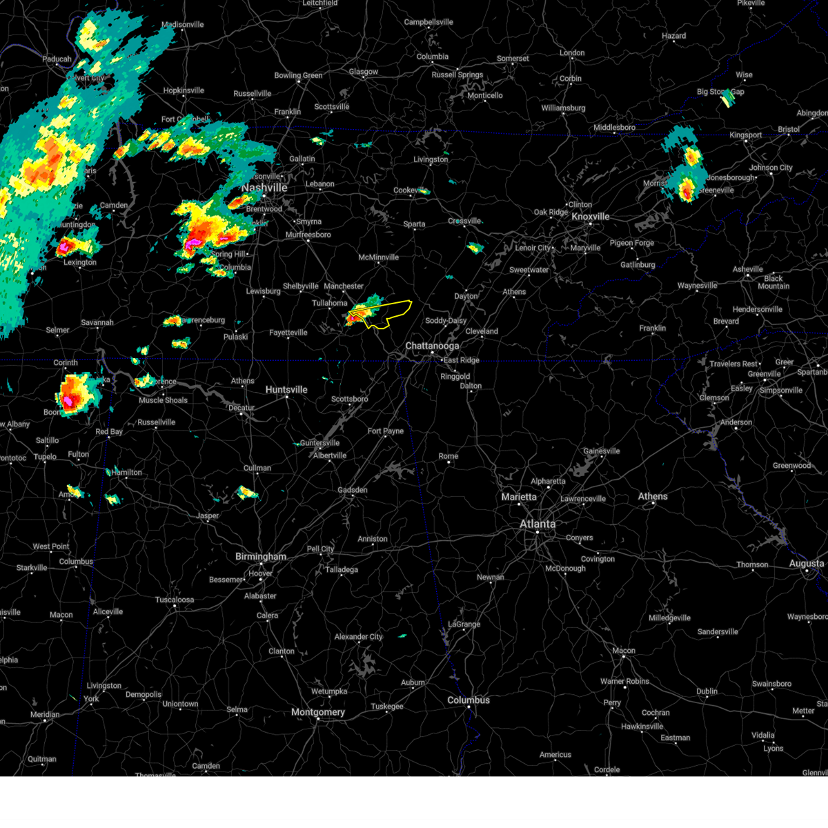 Svrohx the national weather service in nashville has issued a * severe thunderstorm warning for, southeastern coffee county in middle tennessee, southern grundy county in middle tennessee, * until 500 pm cdt. * at 358 pm cdt, a severe thunderstorm was located near sewanee, or 7 miles northeast of winchester, moving east at 30 mph (radar indicated). Hazards include 60 mph wind gusts and quarter size hail. Hail damage to vehicles is expected. expect wind damage to roofs, siding, and trees. this severe thunderstorm will be near, monteagle around 405 pm cdt. tracy city around 415 pm cdt. Other locations impacted by this severe thunderstorm include pelham, coalmont, and palmer. Svrohx the national weather service in nashville has issued a * severe thunderstorm warning for, southeastern coffee county in middle tennessee, southern grundy county in middle tennessee, * until 500 pm cdt. * at 358 pm cdt, a severe thunderstorm was located near sewanee, or 7 miles northeast of winchester, moving east at 30 mph (radar indicated). Hazards include 60 mph wind gusts and quarter size hail. Hail damage to vehicles is expected. expect wind damage to roofs, siding, and trees. this severe thunderstorm will be near, monteagle around 405 pm cdt. tracy city around 415 pm cdt. Other locations impacted by this severe thunderstorm include pelham, coalmont, and palmer.
|
| 5/20/2025 3:57 PM CDT |
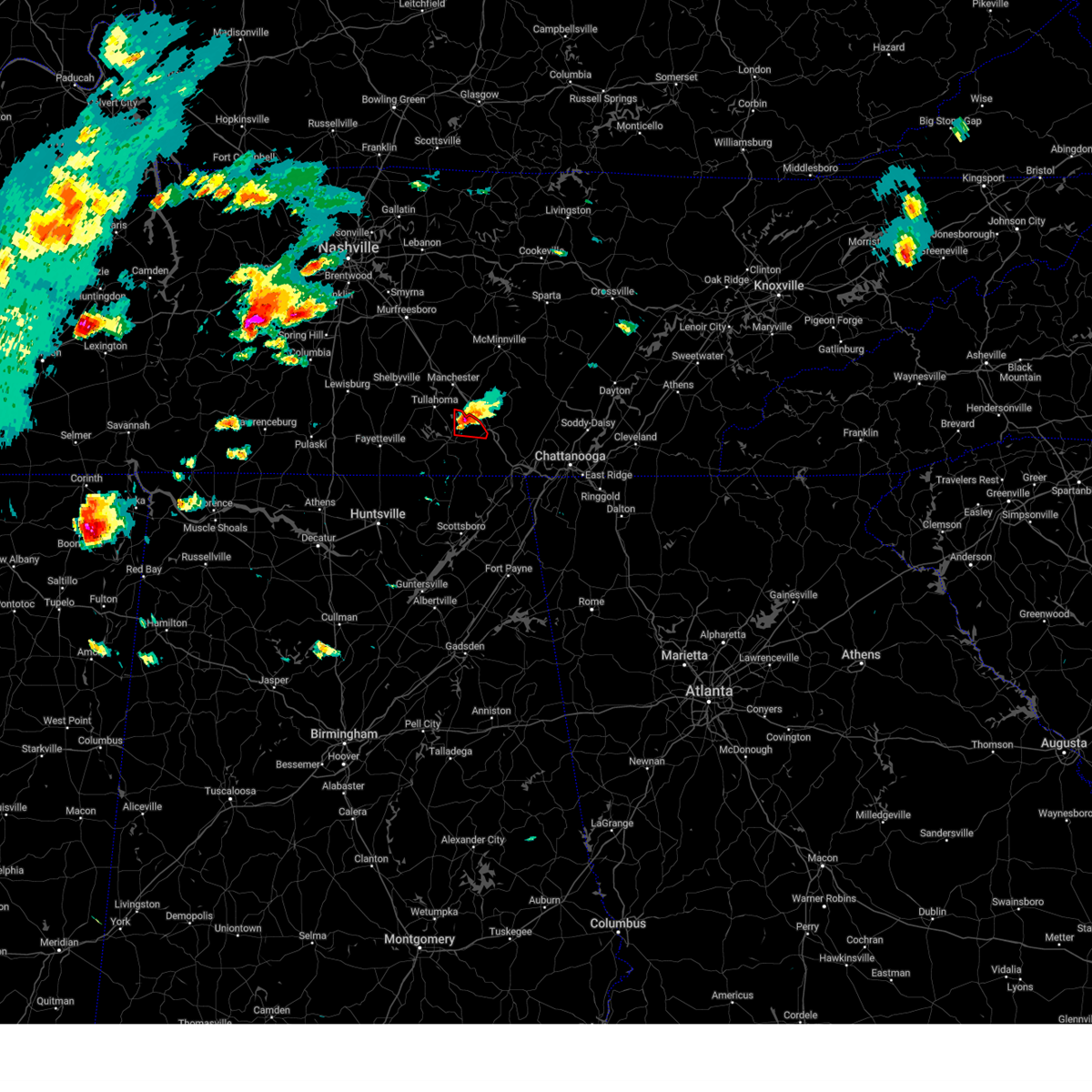 At 356 pm cdt, a severe thunderstorm capable of producing a tornado was located near decherd, or 8 miles northeast of winchester, moving east at 35 mph (radar indicated rotation). Hazards include tornado and half dollar size hail. Flying debris will be dangerous to those caught without shelter. mobile homes will be damaged or destroyed. damage to roofs, windows, and vehicles will occur. tree damage is likely. this dangerous storm will be near, sewanee around 400 pm cdt. other locations impacted by this tornadic thunderstorm include alto, st. Andrews, woods reservoir, and arnold afb. At 356 pm cdt, a severe thunderstorm capable of producing a tornado was located near decherd, or 8 miles northeast of winchester, moving east at 35 mph (radar indicated rotation). Hazards include tornado and half dollar size hail. Flying debris will be dangerous to those caught without shelter. mobile homes will be damaged or destroyed. damage to roofs, windows, and vehicles will occur. tree damage is likely. this dangerous storm will be near, sewanee around 400 pm cdt. other locations impacted by this tornadic thunderstorm include alto, st. Andrews, woods reservoir, and arnold afb.
|
| 5/20/2025 3:37 PM CDT |
 Torhun the national weather service in huntsville alabama has issued a * tornado warning for, northeastern franklin county in middle tennessee, * until 430 pm cdt. * at 337 pm cdt, a severe thunderstorm capable of producing a tornado was located over tims ford lake, or near winchester, moving east at 35 mph (radar indicated rotation). Hazards include tornado and half dollar size hail. Flying debris will be dangerous to those caught without shelter. mobile homes will be damaged or destroyed. damage to roofs, windows, and vehicles will occur. tree damage is likely. this dangerous storm will be near, winchester, estill springs, tims ford lake, and decherd around 345 pm cdt. sewanee around 400 pm cdt. other locations impacted by this tornadic thunderstorm include alto, st. Andrews, woods reservoir, and arnold afb. Torhun the national weather service in huntsville alabama has issued a * tornado warning for, northeastern franklin county in middle tennessee, * until 430 pm cdt. * at 337 pm cdt, a severe thunderstorm capable of producing a tornado was located over tims ford lake, or near winchester, moving east at 35 mph (radar indicated rotation). Hazards include tornado and half dollar size hail. Flying debris will be dangerous to those caught without shelter. mobile homes will be damaged or destroyed. damage to roofs, windows, and vehicles will occur. tree damage is likely. this dangerous storm will be near, winchester, estill springs, tims ford lake, and decherd around 345 pm cdt. sewanee around 400 pm cdt. other locations impacted by this tornadic thunderstorm include alto, st. Andrews, woods reservoir, and arnold afb.
|
| 5/2/2025 4:45 PM CDT | the severe thunderstorm warning has been cancelled and is no longer in effect |
| 5/2/2025 4:22 PM CDT | Svrmrx the national weather service in morristown has issued a * severe thunderstorm warning for, marion county in east tennessee, * until 515 pm cdt. * at 422 pm cdt, a severe thunderstorm was located 8 miles northwest of south pittsburg, or 11 miles northwest of bridgeport, moving northeast at 30 mph (radar indicated). Hazards include 60 mph wind gusts and penny size hail. expect damage to roofs, siding, and trees |
| 5/2/2025 3:07 PM CDT |
 Svrhun the national weather service in huntsville alabama has issued a * severe thunderstorm warning for, northeastern franklin county in middle tennessee, * until 345 pm cdt. * at 307 pm cdt, a severe thunderstorm was located over estill springs, or near winchester, moving northeast at 35 mph (radar indicated). Hazards include 60 mph wind gusts and quarter size hail. Hail damage to vehicles is expected. Expect wind damage to roofs, siding, and trees. Svrhun the national weather service in huntsville alabama has issued a * severe thunderstorm warning for, northeastern franklin county in middle tennessee, * until 345 pm cdt. * at 307 pm cdt, a severe thunderstorm was located over estill springs, or near winchester, moving northeast at 35 mph (radar indicated). Hazards include 60 mph wind gusts and quarter size hail. Hail damage to vehicles is expected. Expect wind damage to roofs, siding, and trees.
|
| 4/23/2025 3:59 PM CDT |
 the severe thunderstorm warning has been cancelled and is no longer in effect the severe thunderstorm warning has been cancelled and is no longer in effect
|
| 4/23/2025 3:46 PM CDT |
 Svrhun the national weather service in huntsville alabama has issued a * severe thunderstorm warning for, eastern franklin county in middle tennessee, * until 445 pm cdt. * at 345 pm cdt, a severe thunderstorm was located near cowan, or near winchester, moving northeast at 15 mph (radar indicated). Hazards include 60 mph wind gusts and quarter size hail. Hail damage to vehicles is expected. Expect wind damage to roofs, siding, and trees. Svrhun the national weather service in huntsville alabama has issued a * severe thunderstorm warning for, eastern franklin county in middle tennessee, * until 445 pm cdt. * at 345 pm cdt, a severe thunderstorm was located near cowan, or near winchester, moving northeast at 15 mph (radar indicated). Hazards include 60 mph wind gusts and quarter size hail. Hail damage to vehicles is expected. Expect wind damage to roofs, siding, and trees.
|
| 4/10/2025 3:51 PM CDT |
 the severe thunderstorm warning has been cancelled and is no longer in effect the severe thunderstorm warning has been cancelled and is no longer in effect
|
| 4/10/2025 3:43 PM CDT |
 Svrhun the national weather service in huntsville alabama has issued a * severe thunderstorm warning for, southeastern franklin county in middle tennessee, * until 415 pm cdt. * at 342 pm cdt, a severe thunderstorm was located near cowan, or 11 miles southeast of winchester, moving east at 35 mph. at 3:32 pm, franklin county ema reported large hail in winchester, tn (emergency management). Hazards include ping pong ball size hail and 60 mph wind gusts. People and animals outdoors will be injured. expect hail damage to roofs, siding, windows, and vehicles. Expect wind damage to roofs, siding, and trees. Svrhun the national weather service in huntsville alabama has issued a * severe thunderstorm warning for, southeastern franklin county in middle tennessee, * until 415 pm cdt. * at 342 pm cdt, a severe thunderstorm was located near cowan, or 11 miles southeast of winchester, moving east at 35 mph. at 3:32 pm, franklin county ema reported large hail in winchester, tn (emergency management). Hazards include ping pong ball size hail and 60 mph wind gusts. People and animals outdoors will be injured. expect hail damage to roofs, siding, windows, and vehicles. Expect wind damage to roofs, siding, and trees.
|
| 4/10/2025 3:35 PM CDT |
 At 335 pm cdt, a severe thunderstorm was located over cowan, or near winchester, moving east at 25 mph (radar indicated). Hazards include ping pong ball size hail and 60 mph wind gusts. People and animals outdoors will be injured. expect hail damage to roofs, siding, windows, and vehicles. expect wind damage to roofs, siding, and trees. locations impacted include, sewanee, st. Andrews, winchester, cowan, decherd, and sherwood. At 335 pm cdt, a severe thunderstorm was located over cowan, or near winchester, moving east at 25 mph (radar indicated). Hazards include ping pong ball size hail and 60 mph wind gusts. People and animals outdoors will be injured. expect hail damage to roofs, siding, windows, and vehicles. expect wind damage to roofs, siding, and trees. locations impacted include, sewanee, st. Andrews, winchester, cowan, decherd, and sherwood.
|
| 4/10/2025 3:35 PM CDT |
 the severe thunderstorm warning has been cancelled and is no longer in effect the severe thunderstorm warning has been cancelled and is no longer in effect
|
| 4/10/2025 3:22 PM CDT |
 At 321 pm cdt, a severe thunderstorm was located over winchester, moving east at 25 mph (radar indicated). Hazards include ping pong ball size hail and 60 mph wind gusts. People and animals outdoors will be injured. expect hail damage to roofs, siding, windows, and vehicles. expect wind damage to roofs, siding, and trees. locations impacted include, bridgeport, decherd, long island, russell cave national monument, sewanee, st. Andrews, winchester, cowan, anderson, and belvidere. At 321 pm cdt, a severe thunderstorm was located over winchester, moving east at 25 mph (radar indicated). Hazards include ping pong ball size hail and 60 mph wind gusts. People and animals outdoors will be injured. expect hail damage to roofs, siding, windows, and vehicles. expect wind damage to roofs, siding, and trees. locations impacted include, bridgeport, decherd, long island, russell cave national monument, sewanee, st. Andrews, winchester, cowan, anderson, and belvidere.
|
| 4/10/2025 3:16 PM CDT |
 At 315 pm cdt, a severe thunderstorm was located near winchester, moving east at 25 mph (radar indicated). Hazards include 60 mph wind gusts and quarter size hail. Hail damage to vehicles is expected. expect wind damage to roofs, siding, and trees. locations impacted include, bridgeport, decherd, long island, russell cave national monument, sewanee, st. Andrews, winchester, cowan, anderson, and belvidere. At 315 pm cdt, a severe thunderstorm was located near winchester, moving east at 25 mph (radar indicated). Hazards include 60 mph wind gusts and quarter size hail. Hail damage to vehicles is expected. expect wind damage to roofs, siding, and trees. locations impacted include, bridgeport, decherd, long island, russell cave national monument, sewanee, st. Andrews, winchester, cowan, anderson, and belvidere.
|
| 4/10/2025 2:52 PM CDT |
 Svrhun the national weather service in huntsville alabama has issued a * severe thunderstorm warning for, northeastern jackson county in northeastern alabama, southeastern franklin county in middle tennessee, * until 345 pm cdt. * at 250 pm cdt, a severe thunderstorm was located near winchester, moving east at 25 mph (radar indicated). Hazards include 60 mph wind gusts and quarter size hail. Hail damage to vehicles is expected. Expect wind damage to roofs, siding, and trees. Svrhun the national weather service in huntsville alabama has issued a * severe thunderstorm warning for, northeastern jackson county in northeastern alabama, southeastern franklin county in middle tennessee, * until 345 pm cdt. * at 250 pm cdt, a severe thunderstorm was located near winchester, moving east at 25 mph (radar indicated). Hazards include 60 mph wind gusts and quarter size hail. Hail damage to vehicles is expected. Expect wind damage to roofs, siding, and trees.
|
| 4/6/2025 1:08 AM CDT |
 the tornado warning has been cancelled and is no longer in effect the tornado warning has been cancelled and is no longer in effect
|
| 4/6/2025 1:01 AM CDT |
 At 101 am cdt, severe thunderstorms were located along a line extending from tracy city to 8 miles south of sewanee to 10 miles south of cowan, moving east at 35 mph (radar indicated). Hazards include 60 mph wind gusts. Expect damage to roofs, siding, and trees. locations impacted include, sewanee, st. Andrews, anderson, and sherwood. At 101 am cdt, severe thunderstorms were located along a line extending from tracy city to 8 miles south of sewanee to 10 miles south of cowan, moving east at 35 mph (radar indicated). Hazards include 60 mph wind gusts. Expect damage to roofs, siding, and trees. locations impacted include, sewanee, st. Andrews, anderson, and sherwood.
|
| 4/6/2025 1:00 AM CDT |
 the tornado warning has been cancelled and is no longer in effect the tornado warning has been cancelled and is no longer in effect
|
| 4/6/2025 12:56 AM CDT |
 At 1256 am cdt, severe thunderstorms were located along a line extending from 11 miles south of mcminnville to near monteagle, moving northeast at 50 mph (radar indicated). Hazards include 60 mph wind gusts and penny size hail. Expect damage to roofs, siding, and trees. locations impacted include, coalmont, pelham, tracy city, monteagle, altamont, gruetli-laager, beersheba springs, and fiery gizzard state park. This includes interstate 24 between mile markers 128 and 134. At 1256 am cdt, severe thunderstorms were located along a line extending from 11 miles south of mcminnville to near monteagle, moving northeast at 50 mph (radar indicated). Hazards include 60 mph wind gusts and penny size hail. Expect damage to roofs, siding, and trees. locations impacted include, coalmont, pelham, tracy city, monteagle, altamont, gruetli-laager, beersheba springs, and fiery gizzard state park. This includes interstate 24 between mile markers 128 and 134.
|
| 4/6/2025 12:56 AM CDT |
 the severe thunderstorm warning has been cancelled and is no longer in effect the severe thunderstorm warning has been cancelled and is no longer in effect
|
| 4/6/2025 12:53 AM CDT |
 Torohx the national weather service in nashville has issued a * tornado warning for, southern grundy county in middle tennessee, * until 130 am cdt. * at 1253 am cdt, a severe thunderstorm capable of producing a tornado was located over monteagle, or 17 miles northwest of jasper, moving east at 55 mph (radar indicated rotation). Hazards include tornado. Flying debris will be dangerous to those caught without shelter. mobile homes will be damaged or destroyed. damage to roofs, windows, and vehicles will occur. tree damage is likely. this dangerous storm will be near, tracy city around 100 am cdt. other locations impacted by this tornadic thunderstorm include palmer, coalmont, and fiery gizzard state park. This includes interstate 24 between mile markers 130 and 134. Torohx the national weather service in nashville has issued a * tornado warning for, southern grundy county in middle tennessee, * until 130 am cdt. * at 1253 am cdt, a severe thunderstorm capable of producing a tornado was located over monteagle, or 17 miles northwest of jasper, moving east at 55 mph (radar indicated rotation). Hazards include tornado. Flying debris will be dangerous to those caught without shelter. mobile homes will be damaged or destroyed. damage to roofs, windows, and vehicles will occur. tree damage is likely. this dangerous storm will be near, tracy city around 100 am cdt. other locations impacted by this tornadic thunderstorm include palmer, coalmont, and fiery gizzard state park. This includes interstate 24 between mile markers 130 and 134.
|
| 4/6/2025 12:52 AM CDT |
 Tormrx the national weather service in morristown has issued a * tornado warning for, southern sequatchie county in east tennessee, marion county in east tennessee, * until 130 am cdt. * at 1251 am cdt, a severe thunderstorm capable of producing a tornado was located near sewanee, or 9 miles east of winchester, moving east at 35 mph (radar indicated rotation). Hazards include tornado. Flying debris will be dangerous to those caught without shelter. mobile homes will be damaged or destroyed. damage to roofs, windows, and vehicles will occur. tree damage is likely. this dangerous storm will be near, monteagle around 1255 am cdt. whitwell around 125 am cdt. Other locations impacted by this tornadic thunderstorm include martin springs, cartwright, lone oak, fiery gizzard state park, sequatchie cave, foster falls state park, griffith creek, chimneys state park, powells crossroads, and north chickamauga creek gorge. Tormrx the national weather service in morristown has issued a * tornado warning for, southern sequatchie county in east tennessee, marion county in east tennessee, * until 130 am cdt. * at 1251 am cdt, a severe thunderstorm capable of producing a tornado was located near sewanee, or 9 miles east of winchester, moving east at 35 mph (radar indicated rotation). Hazards include tornado. Flying debris will be dangerous to those caught without shelter. mobile homes will be damaged or destroyed. damage to roofs, windows, and vehicles will occur. tree damage is likely. this dangerous storm will be near, monteagle around 1255 am cdt. whitwell around 125 am cdt. Other locations impacted by this tornadic thunderstorm include martin springs, cartwright, lone oak, fiery gizzard state park, sequatchie cave, foster falls state park, griffith creek, chimneys state park, powells crossroads, and north chickamauga creek gorge.
|
| 4/6/2025 12:51 AM CDT |
 Torhun the national weather service in huntsville alabama has issued a * tornado warning for, southeastern franklin county in middle tennessee, * until 115 am cdt. * at 1251 am cdt, a severe thunderstorm capable of producing a tornado was located near sewanee, or 11 miles east of winchester, moving east at 45 mph (radar indicated rotation). Hazards include tornado and quarter size hail. Flying debris will be dangerous to those caught without shelter. mobile homes will be damaged or destroyed. damage to roofs, windows, and vehicles will occur. tree damage is likely. this tornadic thunderstorm will remain over mainly rural areas of southeastern franklin county, including the following locations, st. Andrews and sherwood. Torhun the national weather service in huntsville alabama has issued a * tornado warning for, southeastern franklin county in middle tennessee, * until 115 am cdt. * at 1251 am cdt, a severe thunderstorm capable of producing a tornado was located near sewanee, or 11 miles east of winchester, moving east at 45 mph (radar indicated rotation). Hazards include tornado and quarter size hail. Flying debris will be dangerous to those caught without shelter. mobile homes will be damaged or destroyed. damage to roofs, windows, and vehicles will occur. tree damage is likely. this tornadic thunderstorm will remain over mainly rural areas of southeastern franklin county, including the following locations, st. Andrews and sherwood.
|
| 4/6/2025 12:44 AM CDT |
 At 1244 am cdt, severe thunderstorms were located along a line extending from near estill springs to near cowan to 7 miles southeast of huntland, moving east at 45 mph (radar indicated). Hazards include 60 mph wind gusts. Expect damage to roofs, siding, and trees. locations impacted include, estill springs, decherd, woods reservoir, arnold afb, alto, sewanee, st. Andrews, winchester, cowan, and anderson. At 1244 am cdt, severe thunderstorms were located along a line extending from near estill springs to near cowan to 7 miles southeast of huntland, moving east at 45 mph (radar indicated). Hazards include 60 mph wind gusts. Expect damage to roofs, siding, and trees. locations impacted include, estill springs, decherd, woods reservoir, arnold afb, alto, sewanee, st. Andrews, winchester, cowan, and anderson.
|
| 4/6/2025 12:44 AM CDT |
 the severe thunderstorm warning has been cancelled and is no longer in effect the severe thunderstorm warning has been cancelled and is no longer in effect
|
| 4/6/2025 12:44 AM CDT |
 At 1244 am cdt, severe thunderstorms were located along a line extending from near manchester to near cowan, moving east at 55 mph (radar indicated). Hazards include 60 mph wind gusts and penny size hail. Expect damage to roofs, siding, and trees. locations impacted include, monteagle, altamont, coalmont, hillsboro, pelham, tracy city, viola, gruetli-laager, manchester, beersheba springs, arnold afb, mcminnville, fiery gizzard state park, and woods reservoir. This includes interstate 24 between mile markers 112 and 135. At 1244 am cdt, severe thunderstorms were located along a line extending from near manchester to near cowan, moving east at 55 mph (radar indicated). Hazards include 60 mph wind gusts and penny size hail. Expect damage to roofs, siding, and trees. locations impacted include, monteagle, altamont, coalmont, hillsboro, pelham, tracy city, viola, gruetli-laager, manchester, beersheba springs, arnold afb, mcminnville, fiery gizzard state park, and woods reservoir. This includes interstate 24 between mile markers 112 and 135.
|
| 4/6/2025 12:24 AM CDT |
 At 1223 am cdt, severe thunderstorms were located along a line extending from near tullahoma to near tims ford lake to 6 miles west of huntland, moving east at 40 mph (radar indicated). Hazards include 60 mph wind gusts. Expect damage to roofs, siding, and trees. locations impacted include, huntland, elora, hurdlow, lynchburg, maxwell, st. Andrews, smithland, tims ford lake, beans creek, and woods reservoir. At 1223 am cdt, severe thunderstorms were located along a line extending from near tullahoma to near tims ford lake to 6 miles west of huntland, moving east at 40 mph (radar indicated). Hazards include 60 mph wind gusts. Expect damage to roofs, siding, and trees. locations impacted include, huntland, elora, hurdlow, lynchburg, maxwell, st. Andrews, smithland, tims ford lake, beans creek, and woods reservoir.
|
| 4/6/2025 12:24 AM CDT |
 Svrohx the national weather service in nashville has issued a * severe thunderstorm warning for, southwestern warren county in middle tennessee, coffee county in middle tennessee, grundy county in middle tennessee, * until 115 am cdt. * at 1224 am cdt, severe thunderstorms were located along a line extending from near tullahoma to near huntland, moving northeast at 50 mph (radar indicated). Hazards include 60 mph wind gusts and penny size hail. expect damage to roofs, siding, and trees Svrohx the national weather service in nashville has issued a * severe thunderstorm warning for, southwestern warren county in middle tennessee, coffee county in middle tennessee, grundy county in middle tennessee, * until 115 am cdt. * at 1224 am cdt, severe thunderstorms were located along a line extending from near tullahoma to near huntland, moving northeast at 50 mph (radar indicated). Hazards include 60 mph wind gusts and penny size hail. expect damage to roofs, siding, and trees
|
| 4/6/2025 12:16 AM CDT |
 Svrhun the national weather service in huntsville alabama has issued a * severe thunderstorm warning for, moore county in middle tennessee, eastern lincoln county in middle tennessee, franklin county in middle tennessee, * until 115 am cdt. * at 1215 am cdt, severe thunderstorms were located along a line extending from near lynchburg to 8 miles northwest of huntland to 8 miles north of new market, moving east at 40 mph (radar indicated). Hazards include 60 mph wind gusts. expect damage to roofs, siding, and trees Svrhun the national weather service in huntsville alabama has issued a * severe thunderstorm warning for, moore county in middle tennessee, eastern lincoln county in middle tennessee, franklin county in middle tennessee, * until 115 am cdt. * at 1215 am cdt, severe thunderstorms were located along a line extending from near lynchburg to 8 miles northwest of huntland to 8 miles north of new market, moving east at 40 mph (radar indicated). Hazards include 60 mph wind gusts. expect damage to roofs, siding, and trees
|
| 3/31/2025 3:31 AM CDT |
 the severe thunderstorm warning has been cancelled and is no longer in effect the severe thunderstorm warning has been cancelled and is no longer in effect
|
| 3/31/2025 3:22 AM CDT |
 At 321 am cdt, a severe thunderstorm was located near huntland, or 10 miles south of lynchburg, moving east at 60 mph (radar indicated). Hazards include 60 mph wind gusts and penny size hail. Expect damage to roofs, siding, and trees. locations impacted include, huntland, elora, hurdlow, maxwell, mimosa, st. Andrews, smithland, tims ford lake, beans creek, and alto. At 321 am cdt, a severe thunderstorm was located near huntland, or 10 miles south of lynchburg, moving east at 60 mph (radar indicated). Hazards include 60 mph wind gusts and penny size hail. Expect damage to roofs, siding, and trees. locations impacted include, huntland, elora, hurdlow, maxwell, mimosa, st. Andrews, smithland, tims ford lake, beans creek, and alto.
|
| 3/31/2025 2:56 AM CDT |
 Svrhun the national weather service in huntsville alabama has issued a * severe thunderstorm warning for, southeastern moore county in middle tennessee, lincoln county in middle tennessee, franklin county in middle tennessee, * until 345 am cdt. * at 256 am cdt, a severe thunderstorm was located 8 miles northeast of ardmore, or 12 miles west of fayetteville, moving east at 60 mph (radar indicated). Hazards include 60 mph wind gusts and penny size hail. expect damage to roofs, siding, and trees Svrhun the national weather service in huntsville alabama has issued a * severe thunderstorm warning for, southeastern moore county in middle tennessee, lincoln county in middle tennessee, franklin county in middle tennessee, * until 345 am cdt. * at 256 am cdt, a severe thunderstorm was located 8 miles northeast of ardmore, or 12 miles west of fayetteville, moving east at 60 mph (radar indicated). Hazards include 60 mph wind gusts and penny size hail. expect damage to roofs, siding, and trees
|
| 3/31/2025 1:46 AM CDT | Svrohx the national weather service in nashville has issued a * severe thunderstorm warning for, van buren county in middle tennessee, southern warren county in middle tennessee, southeastern coffee county in middle tennessee, grundy county in middle tennessee, * until 245 am cdt. * at 146 am cdt, severe thunderstorms were located along a line extending from near spencer to 16 miles west of pikeville to near manchester to near tullahoma, moving southeast at 35 mph (radar indicated). Hazards include 60 mph wind gusts and penny size hail. expect damage to roofs, siding, and trees |
| 3/15/2025 6:37 PM CDT |
 At 636 pm cdt, a severe thunderstorm was located 7 miles west of skyline, or 15 miles east of moores mill, moving northeast at 55 mph (radar indicated). Hazards include 60 mph wind gusts and quarter size hail. Hail damage to vehicles is expected. expect wind damage to roofs, siding, and trees. locations impacted include, princeton, jericho, estillfork, hytop, sewanee, st. Andrews, anderson, sherwood, larkin, and francisco. At 636 pm cdt, a severe thunderstorm was located 7 miles west of skyline, or 15 miles east of moores mill, moving northeast at 55 mph (radar indicated). Hazards include 60 mph wind gusts and quarter size hail. Hail damage to vehicles is expected. expect wind damage to roofs, siding, and trees. locations impacted include, princeton, jericho, estillfork, hytop, sewanee, st. Andrews, anderson, sherwood, larkin, and francisco.
|
| 3/15/2025 6:37 PM CDT |
 the severe thunderstorm warning has been cancelled and is no longer in effect the severe thunderstorm warning has been cancelled and is no longer in effect
|
| 3/15/2025 6:25 PM CDT | At 625 pm cdt, a severe thunderstorm was located 8 miles east of new market, or 13 miles east of moores mill, moving northeast at 50 mph (radar indicated). Hazards include 60 mph wind gusts and quarter size hail. Hail damage to vehicles is expected. expect wind damage to roofs, siding, and trees. locations impacted include, princeton, jericho, estillfork, maxwell, hytop, sewanee, st. Andrews, anderson, sherwood, and larkin. |
| 3/15/2025 6:12 PM CDT |
 Svrhun the national weather service in huntsville alabama has issued a * severe thunderstorm warning for, northwestern jackson county in northeastern alabama, eastern madison county in north central alabama, franklin county in middle tennessee, * until 715 pm cdt. * at 612 pm cdt, a severe thunderstorm was located near gurley, or 9 miles southeast of moores mill, moving northeast at 55 mph (radar indicated). Hazards include 60 mph wind gusts and quarter size hail. Hail damage to vehicles is expected. Expect wind damage to roofs, siding, and trees. Svrhun the national weather service in huntsville alabama has issued a * severe thunderstorm warning for, northwestern jackson county in northeastern alabama, eastern madison county in north central alabama, franklin county in middle tennessee, * until 715 pm cdt. * at 612 pm cdt, a severe thunderstorm was located near gurley, or 9 miles southeast of moores mill, moving northeast at 55 mph (radar indicated). Hazards include 60 mph wind gusts and quarter size hail. Hail damage to vehicles is expected. Expect wind damage to roofs, siding, and trees.
|
| 3/15/2025 5:37 PM CDT | Svrmrx the national weather service in morristown has issued a * severe thunderstorm warning for, sequatchie county in east tennessee, central marion county in east tennessee, * until 630 pm cdt. * at 537 pm cdt, a severe thunderstorm was located near kimball, or 7 miles west of jasper, moving northeast at 45 mph (radar indicated). Hazards include 60 mph wind gusts. expect damage to roofs, siding, and trees |
| 3/15/2025 5:12 PM CDT |
 the severe thunderstorm warning has been cancelled and is no longer in effect the severe thunderstorm warning has been cancelled and is no longer in effect
|
| 3/15/2025 4:49 PM CDT | Svrmrx the national weather service in morristown has issued a * severe thunderstorm warning for, central marion county in east tennessee, * until 530 pm cdt. * at 449 pm cdt, a severe thunderstorm was located 7 miles southeast of monteagle, or 10 miles northwest of jasper, moving northeast at 60 mph (radar indicated). Hazards include 60 mph wind gusts. expect damage to roofs, siding, and trees |
| 3/15/2025 4:45 PM CDT | The storms which prompted the warning have weakened below severe limits, and no longer pose an immediate threat to life or property. therefore, the warning has been allowed to expire. a tornado watch remains in effect until 800 pm cdt for north central and northeastern alabama. a tornado watch also remains in effect until 900 pm cdt for middle tennessee. |
| 3/15/2025 4:24 PM CDT |
 At 424 pm cdt, severe thunderstorms were located along a line extending from 6 miles northeast of estill springs to cowan to 7 miles northeast of skyline, moving north at 45 mph (radar indicated). Hazards include 60 mph wind gusts. Expect damage to roofs, siding, and trees. locations impacted include, jericho, huntland, hurdlow, maxwell, st. Andrews, larkin, bridgeport, francisco, tims ford lake, and beans creek. At 424 pm cdt, severe thunderstorms were located along a line extending from 6 miles northeast of estill springs to cowan to 7 miles northeast of skyline, moving north at 45 mph (radar indicated). Hazards include 60 mph wind gusts. Expect damage to roofs, siding, and trees. locations impacted include, jericho, huntland, hurdlow, maxwell, st. Andrews, larkin, bridgeport, francisco, tims ford lake, and beans creek.
|
| 3/15/2025 4:24 PM CDT |
 the severe thunderstorm warning has been cancelled and is no longer in effect the severe thunderstorm warning has been cancelled and is no longer in effect
|
| 3/15/2025 4:10 PM CDT |
 At 409 pm cdt, severe thunderstorms were located along a line extending from 6 miles west of smithville to near mcminnville to 9 miles east of manchester, moving east at 55 mph (radar indicated). Hazards include 60 mph wind gusts and penny size hail. Expect damage to roofs, siding, and trees. locations impacted include, morrison, centertown, tullahoma, summitville, woodbury, mcminnville, hillsboro, pelham, manchester, viola, altamont, monteagle, and arnold afb. This includes interstate 24 between mile markers 104 and 133. At 409 pm cdt, severe thunderstorms were located along a line extending from 6 miles west of smithville to near mcminnville to 9 miles east of manchester, moving east at 55 mph (radar indicated). Hazards include 60 mph wind gusts and penny size hail. Expect damage to roofs, siding, and trees. locations impacted include, morrison, centertown, tullahoma, summitville, woodbury, mcminnville, hillsboro, pelham, manchester, viola, altamont, monteagle, and arnold afb. This includes interstate 24 between mile markers 104 and 133.
|
| 3/15/2025 4:10 PM CDT |
 the severe thunderstorm warning has been cancelled and is no longer in effect the severe thunderstorm warning has been cancelled and is no longer in effect
|
| 3/15/2025 3:55 PM CDT |
 At 355 pm cdt, severe thunderstorms were located along a line extending from 10 miles south of watertown to 7 miles southeast of woodbury to near manchester, moving east at 55 mph (radar indicated). Hazards include 60 mph wind gusts and penny size hail. Expect damage to roofs, siding, and trees. locations impacted include, morrison, centertown, tullahoma, beechgrove, raus, summitville, auburntown, woodbury, mcminnville, hillsboro, pelham, manchester, bradyville, normandy, milton, viola, readyville, liberty, altamont, and monteagle. This includes interstate 24 between mile markers 95 and 133. At 355 pm cdt, severe thunderstorms were located along a line extending from 10 miles south of watertown to 7 miles southeast of woodbury to near manchester, moving east at 55 mph (radar indicated). Hazards include 60 mph wind gusts and penny size hail. Expect damage to roofs, siding, and trees. locations impacted include, morrison, centertown, tullahoma, beechgrove, raus, summitville, auburntown, woodbury, mcminnville, hillsboro, pelham, manchester, bradyville, normandy, milton, viola, readyville, liberty, altamont, and monteagle. This includes interstate 24 between mile markers 95 and 133.
|
| 3/15/2025 3:48 PM CDT | Svrhun the national weather service in huntsville alabama has issued a * severe thunderstorm warning for, northern jackson county in northeastern alabama, northern madison county in north central alabama, moore county in middle tennessee, eastern lincoln county in middle tennessee, franklin county in middle tennessee, * until 445 pm cdt. * at 347 pm cdt, severe thunderstorms were located along a line extending from lynchburg to 7 miles north of new market to near alabama a and m university, moving east at 45 mph (radar indicated). Hazards include 60 mph wind gusts. expect damage to roofs, siding, and trees |
| 3/15/2025 3:38 PM CDT | Svrohx the national weather service in nashville has issued a * severe thunderstorm warning for, southern de kalb county in middle tennessee, eastern rutherford county in middle tennessee, warren county in middle tennessee, coffee county in middle tennessee, southeastern wilson county in middle tennessee, eastern bedford county in middle tennessee, western grundy county in middle tennessee, cannon county in middle tennessee, * until 430 pm cdt. * at 338 pm cdt, severe thunderstorms were located along a line extending from murfreesboro to 15 miles northeast of shelbyville to near lynchburg, moving east at 55 mph (radar indicated). Hazards include 60 mph wind gusts and penny size hail. expect damage to roofs, siding, and trees |
| 2/16/2025 1:26 AM CST | The tornadic thunderstorm which prompted the warning has moved out of the warned area. therefore, the warning will be allowed to expire. a tornado watch remains in effect until 600 am cst for northeastern alabama, and middle tennessee. |
| 2/16/2025 1:21 AM CST |
 the severe thunderstorm warning has been cancelled and is no longer in effect the severe thunderstorm warning has been cancelled and is no longer in effect
|
| 2/16/2025 1:21 AM CST |
 At 121 am cst, severe thunderstorms were located along a line extending from near mcminnville to 7 miles northwest of tracy city, moving northeast at 55 mph (radar indicated). Hazards include 60 mph wind gusts. Expect damage to roofs, siding, and trees. locations impacted include, mcminnville, spencer, gruetli-laager, tracy city, monteagle, altamont, coalmont, palmer, beersheba springs, viola, fall creek falls state park, pelham, and fiery gizzard state park. This includes interstate 24 between mile markers 128 and 135. At 121 am cst, severe thunderstorms were located along a line extending from near mcminnville to 7 miles northwest of tracy city, moving northeast at 55 mph (radar indicated). Hazards include 60 mph wind gusts. Expect damage to roofs, siding, and trees. locations impacted include, mcminnville, spencer, gruetli-laager, tracy city, monteagle, altamont, coalmont, palmer, beersheba springs, viola, fall creek falls state park, pelham, and fiery gizzard state park. This includes interstate 24 between mile markers 128 and 135.
|
| 2/16/2025 1:19 AM CST |
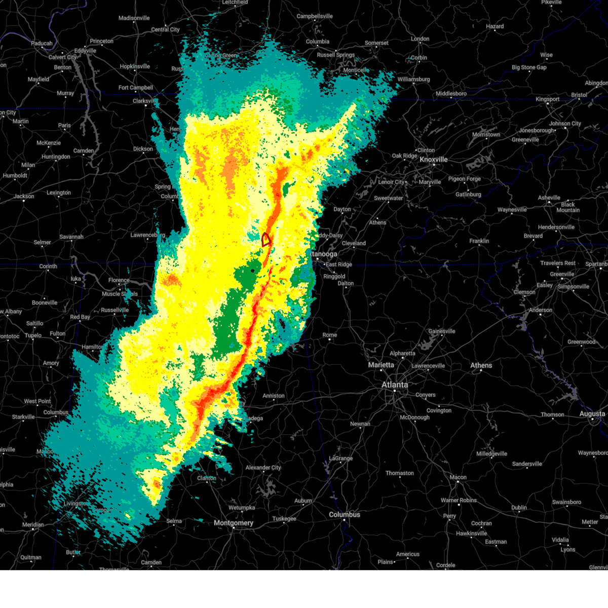 At 119 am cst, a severe thunderstorm capable of producing a tornado was located over sewanee, or 11 miles east of winchester, moving east at 45 mph (radar indicated rotation). Hazards include tornado. Flying debris will be dangerous to those caught without shelter. mobile homes will be damaged or destroyed. damage to roofs, windows, and vehicles will occur. tree damage is likely. this tornadic thunderstorm will remain over mainly rural areas of east central franklin county, including the following locations, st. Andrews and alto. At 119 am cst, a severe thunderstorm capable of producing a tornado was located over sewanee, or 11 miles east of winchester, moving east at 45 mph (radar indicated rotation). Hazards include tornado. Flying debris will be dangerous to those caught without shelter. mobile homes will be damaged or destroyed. damage to roofs, windows, and vehicles will occur. tree damage is likely. this tornadic thunderstorm will remain over mainly rural areas of east central franklin county, including the following locations, st. Andrews and alto.
|
| 2/16/2025 1:17 AM CST |
 the severe thunderstorm warning has been cancelled and is no longer in effect the severe thunderstorm warning has been cancelled and is no longer in effect
|
| 2/16/2025 1:17 AM CST |
 At 117 am cst, severe thunderstorms were located along a line extending from 10 miles southeast of mcminnville to bridgeport to near fyffe to near ashville, moving east at 75 mph (radar indicated). Hazards include 70 mph wind gusts and quarter size hail. Hail damage to vehicles is expected. expect considerable tree damage. wind damage is also likely to mobile homes, roofs, and outbuildings. Locations impacted include, albertville, scottsboro, fort payne, boaz, guntersville, rainsville, bridgeport, henagar, stevenson, and crossville. At 117 am cst, severe thunderstorms were located along a line extending from 10 miles southeast of mcminnville to bridgeport to near fyffe to near ashville, moving east at 75 mph (radar indicated). Hazards include 70 mph wind gusts and quarter size hail. Hail damage to vehicles is expected. expect considerable tree damage. wind damage is also likely to mobile homes, roofs, and outbuildings. Locations impacted include, albertville, scottsboro, fort payne, boaz, guntersville, rainsville, bridgeport, henagar, stevenson, and crossville.
|
| 2/16/2025 1:11 AM CST |
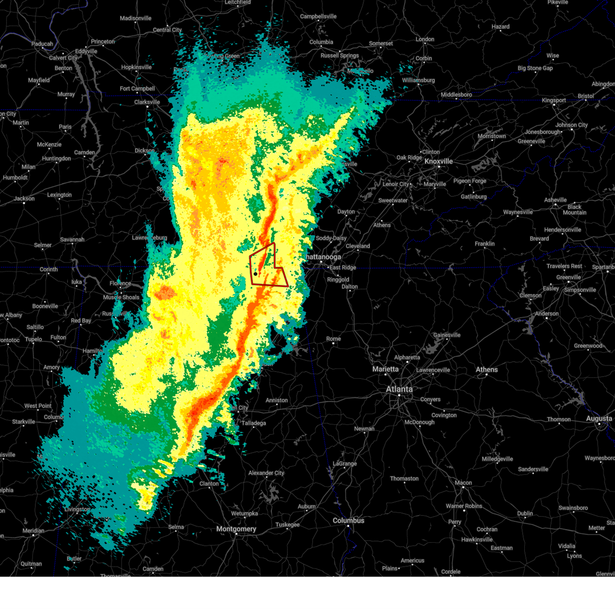 At 110 am cst, a severe thunderstorm capable of producing a tornado was located near skyline, or 17 miles north of scottsboro, moving east at 40 mph (radar indicated rotation). Hazards include tornado. Flying debris will be dangerous to those caught without shelter. mobile homes will be damaged or destroyed. damage to roofs, windows, and vehicles will occur. tree damage is likely. locations impacted include, stevenson, cowan, skyline, sewanee, anderson, hytop, bass, jericho, russell cave national monument, and st. Andrews. At 110 am cst, a severe thunderstorm capable of producing a tornado was located near skyline, or 17 miles north of scottsboro, moving east at 40 mph (radar indicated rotation). Hazards include tornado. Flying debris will be dangerous to those caught without shelter. mobile homes will be damaged or destroyed. damage to roofs, windows, and vehicles will occur. tree damage is likely. locations impacted include, stevenson, cowan, skyline, sewanee, anderson, hytop, bass, jericho, russell cave national monument, and st. Andrews.
|
| 2/16/2025 1:07 AM CST |
 Svrohx the national weather service in nashville has issued a * severe thunderstorm warning for, van buren county in middle tennessee, warren county in middle tennessee, eastern coffee county in middle tennessee, grundy county in middle tennessee, * until 145 am cst. * at 107 am cst, severe thunderstorms were located along a line extending from 6 miles west of mcminnville to 6 miles northeast of decherd, moving northeast at 50 mph (radar indicated). Hazards include 60 mph wind gusts. expect damage to roofs, siding, and trees Svrohx the national weather service in nashville has issued a * severe thunderstorm warning for, van buren county in middle tennessee, warren county in middle tennessee, eastern coffee county in middle tennessee, grundy county in middle tennessee, * until 145 am cst. * at 107 am cst, severe thunderstorms were located along a line extending from 6 miles west of mcminnville to 6 miles northeast of decherd, moving northeast at 50 mph (radar indicated). Hazards include 60 mph wind gusts. expect damage to roofs, siding, and trees
|
| 2/16/2025 1:07 AM CST |
 At 106 am cst, a severe thunderstorm capable of producing a tornado was located over decherd, or near winchester, moving east at 40 mph (radar indicated rotation). Hazards include tornado. Flying debris will be dangerous to those caught without shelter. mobile homes will be damaged or destroyed. damage to roofs, windows, and vehicles will occur. tree damage is likely. this dangerous storm will be near, decherd and sewanee around 110 am cst. other locations impacted by this tornadic thunderstorm include alto, st. Andrews, woods reservoir, and arnold afb. At 106 am cst, a severe thunderstorm capable of producing a tornado was located over decherd, or near winchester, moving east at 40 mph (radar indicated rotation). Hazards include tornado. Flying debris will be dangerous to those caught without shelter. mobile homes will be damaged or destroyed. damage to roofs, windows, and vehicles will occur. tree damage is likely. this dangerous storm will be near, decherd and sewanee around 110 am cst. other locations impacted by this tornadic thunderstorm include alto, st. Andrews, woods reservoir, and arnold afb.
|
| 2/16/2025 1:05 AM CST |
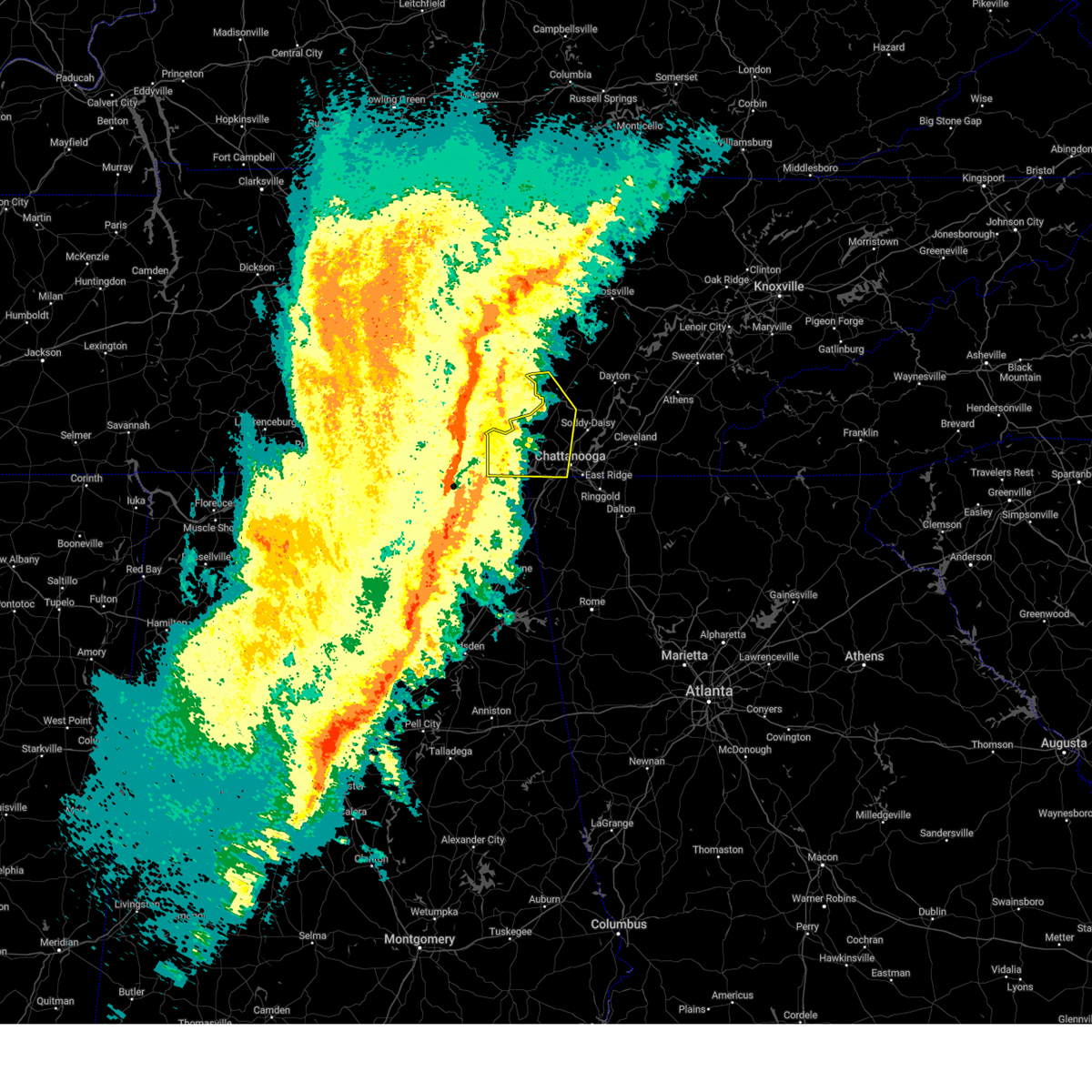 Svrmrx the national weather service in morristown has issued a * severe thunderstorm warning for, sequatchie county in east tennessee, marion county in east tennessee, southwestern hamilton county in east tennessee, * until 245 am est/145 am cst/. * at 204 am est/104 am cst/, severe thunderstorms were located along a line extending from near manchester to winchester to 6 miles northeast of skyline, moving northeast at 60 mph (radar indicated). Hazards include 60 mph wind gusts and quarter size hail. Hail damage to vehicles is expected. Expect wind damage to roofs, siding, and trees. Svrmrx the national weather service in morristown has issued a * severe thunderstorm warning for, sequatchie county in east tennessee, marion county in east tennessee, southwestern hamilton county in east tennessee, * until 245 am est/145 am cst/. * at 204 am est/104 am cst/, severe thunderstorms were located along a line extending from near manchester to winchester to 6 miles northeast of skyline, moving northeast at 60 mph (radar indicated). Hazards include 60 mph wind gusts and quarter size hail. Hail damage to vehicles is expected. Expect wind damage to roofs, siding, and trees.
|
| 2/16/2025 1:04 AM CST |
 At 103 am cst, severe thunderstorms were located along a line extending from 9 miles southwest of mcminnville to 7 miles northeast of skyline to 6 miles south of grant to near dallas, moving east at 70 mph. multiple areas of rotation are present within this line. this line of storms has a history of producing confirmed winds of 65-75 mph (radar indicated). Hazards include 70 mph wind gusts and quarter size hail. Hail damage to vehicles is expected. expect considerable tree damage. wind damage is also likely to mobile homes, roofs, and outbuildings. Locations impacted include, albertville, scottsboro, fort payne, boaz, winchester, guntersville, arab, rainsville, bridgeport, and decherd. At 103 am cst, severe thunderstorms were located along a line extending from 9 miles southwest of mcminnville to 7 miles northeast of skyline to 6 miles south of grant to near dallas, moving east at 70 mph. multiple areas of rotation are present within this line. this line of storms has a history of producing confirmed winds of 65-75 mph (radar indicated). Hazards include 70 mph wind gusts and quarter size hail. Hail damage to vehicles is expected. expect considerable tree damage. wind damage is also likely to mobile homes, roofs, and outbuildings. Locations impacted include, albertville, scottsboro, fort payne, boaz, winchester, guntersville, arab, rainsville, bridgeport, and decherd.
|
| 2/16/2025 1:04 AM CST |
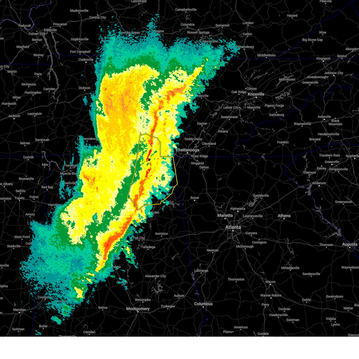 the severe thunderstorm warning has been cancelled and is no longer in effect the severe thunderstorm warning has been cancelled and is no longer in effect
|
| 2/16/2025 12:58 AM CST |
 the tornado warning has been cancelled and is no longer in effect the tornado warning has been cancelled and is no longer in effect
|
| 2/16/2025 12:58 AM CST |
 At 1257 am cst, a severe thunderstorm capable of producing a tornado was located 8 miles northwest of skyline, or 15 miles east of moores mill, moving east at 55 mph (radar indicated rotation). Hazards include tornado. Flying debris will be dangerous to those caught without shelter. mobile homes will be damaged or destroyed. damage to roofs, windows, and vehicles will occur. tree damage is likely. Locations impacted include, stevenson, cowan, huntland, skyline, sewanee, anderson, hytop, bass, princeton, and jericho. At 1257 am cst, a severe thunderstorm capable of producing a tornado was located 8 miles northwest of skyline, or 15 miles east of moores mill, moving east at 55 mph (radar indicated rotation). Hazards include tornado. Flying debris will be dangerous to those caught without shelter. mobile homes will be damaged or destroyed. damage to roofs, windows, and vehicles will occur. tree damage is likely. Locations impacted include, stevenson, cowan, huntland, skyline, sewanee, anderson, hytop, bass, princeton, and jericho.
|
| 2/16/2025 12:53 AM CST |
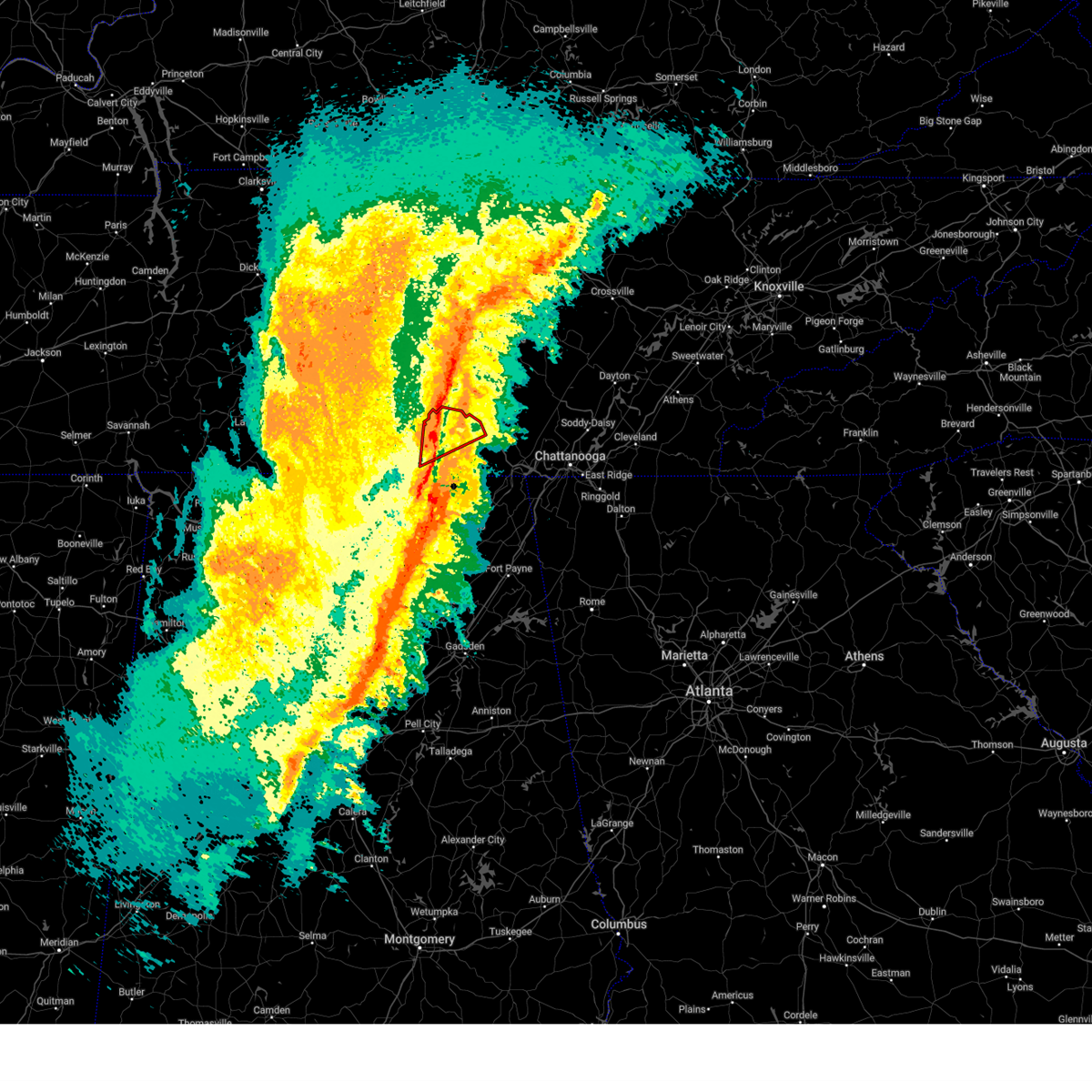 At 1252 am cst, a severe thunderstorm capable of producing a tornado was located near tims ford lake, or near winchester, moving northeast at 60 mph (radar indicated rotation). Hazards include tornado. Flying debris will be dangerous to those caught without shelter. mobile homes will be damaged or destroyed. damage to roofs, windows, and vehicles will occur. tree damage is likely. this dangerous storm will be near, winchester, decherd, estill springs, and tims ford lake around 100 am cst. sewanee around 105 am cst. other locations impacted by this tornadic thunderstorm include lexie crossroads, woods reservoir, harmony, arnold afb, alto, maxwell, st. Andrews, and belvidere. At 1252 am cst, a severe thunderstorm capable of producing a tornado was located near tims ford lake, or near winchester, moving northeast at 60 mph (radar indicated rotation). Hazards include tornado. Flying debris will be dangerous to those caught without shelter. mobile homes will be damaged or destroyed. damage to roofs, windows, and vehicles will occur. tree damage is likely. this dangerous storm will be near, winchester, decherd, estill springs, and tims ford lake around 100 am cst. sewanee around 105 am cst. other locations impacted by this tornadic thunderstorm include lexie crossroads, woods reservoir, harmony, arnold afb, alto, maxwell, st. Andrews, and belvidere.
|
| 2/16/2025 12:53 AM CST |
 the tornado warning has been cancelled and is no longer in effect the tornado warning has been cancelled and is no longer in effect
|
| 2/16/2025 12:49 AM CST |
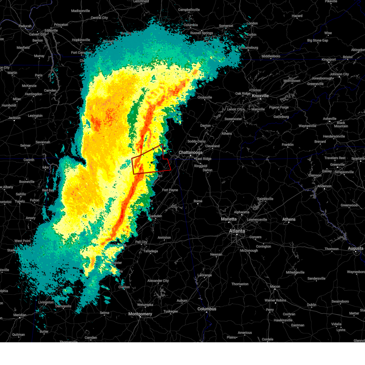 At 1249 am cst, a severe thunderstorm capable of producing a tornado was located near new market, or near moores mill, moving northeast at 35 mph (radar indicated rotation). Hazards include tornado. Flying debris will be dangerous to those caught without shelter. mobile homes will be damaged or destroyed. damage to roofs, windows, and vehicles will occur. tree damage is likely. This tornadic thunderstorm will remain over mainly rural areas of northern jackson, northeastern madison, southeastern lincoln and southern franklin counties, including the following locations, bass, maysville, princeton, plevna, jericho, russell cave national monument, elora, estillfork, fackler, and hytop. At 1249 am cst, a severe thunderstorm capable of producing a tornado was located near new market, or near moores mill, moving northeast at 35 mph (radar indicated rotation). Hazards include tornado. Flying debris will be dangerous to those caught without shelter. mobile homes will be damaged or destroyed. damage to roofs, windows, and vehicles will occur. tree damage is likely. This tornadic thunderstorm will remain over mainly rural areas of northern jackson, northeastern madison, southeastern lincoln and southern franklin counties, including the following locations, bass, maysville, princeton, plevna, jericho, russell cave national monument, elora, estillfork, fackler, and hytop.
|
| 2/16/2025 12:45 AM CST |
 Svrhun the national weather service in huntsville alabama has issued a * severe thunderstorm warning for, marshall county in northeastern alabama, jackson county in northeastern alabama, madison county in north central alabama, dekalb county in northeastern alabama, cullman county in north central alabama, southeastern morgan county in north central alabama, moore county in middle tennessee, eastern lincoln county in middle tennessee, franklin county in middle tennessee, * until 145 am cst. * at 1243 am cst, severe thunderstorms were located along a line extending from 11 miles northwest of manchester to near new market to near morgan city to near arkadelphia, moving east at 75 mph. multiple areas of rotation are present within this line. this line of storms has a history of producing confirmed winds of 65-75 mph (radar indicated). Hazards include 70 mph wind gusts and quarter size hail. Hail damage to vehicles is expected. expect considerable tree damage. Wind damage is also likely to mobile homes, roofs, and outbuildings. Svrhun the national weather service in huntsville alabama has issued a * severe thunderstorm warning for, marshall county in northeastern alabama, jackson county in northeastern alabama, madison county in north central alabama, dekalb county in northeastern alabama, cullman county in north central alabama, southeastern morgan county in north central alabama, moore county in middle tennessee, eastern lincoln county in middle tennessee, franklin county in middle tennessee, * until 145 am cst. * at 1243 am cst, severe thunderstorms were located along a line extending from 11 miles northwest of manchester to near new market to near morgan city to near arkadelphia, moving east at 75 mph. multiple areas of rotation are present within this line. this line of storms has a history of producing confirmed winds of 65-75 mph (radar indicated). Hazards include 70 mph wind gusts and quarter size hail. Hail damage to vehicles is expected. expect considerable tree damage. Wind damage is also likely to mobile homes, roofs, and outbuildings.
|
| 2/16/2025 12:44 AM CST |
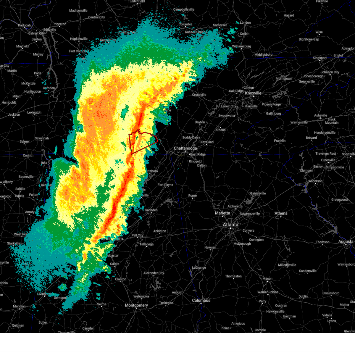 Torhun the national weather service in huntsville alabama has issued a * tornado warning for, moore county in middle tennessee, southeastern lincoln county in middle tennessee, central franklin county in middle tennessee, * until 130 am cst. * at 1243 am cst, a severe thunderstorm capable of producing a tornado was located 7 miles northwest of huntland, or 10 miles south of lynchburg, moving east at 60 mph (radar indicated rotation). Hazards include tornado. Flying debris will be dangerous to those caught without shelter. mobile homes will be damaged or destroyed. damage to roofs, windows, and vehicles will occur. tree damage is likely. this dangerous storm will be near, tims ford lake around 1250 am cst. winchester, decherd, and estill springs around 1255 am cst. sewanee around 105 am cst. other locations impacted by this tornadic thunderstorm include lexie crossroads, harmony, hurdlow, lois, maxwell, st. Andrews, marble hill, smithland, woods reservoir, and arnold afb. Torhun the national weather service in huntsville alabama has issued a * tornado warning for, moore county in middle tennessee, southeastern lincoln county in middle tennessee, central franklin county in middle tennessee, * until 130 am cst. * at 1243 am cst, a severe thunderstorm capable of producing a tornado was located 7 miles northwest of huntland, or 10 miles south of lynchburg, moving east at 60 mph (radar indicated rotation). Hazards include tornado. Flying debris will be dangerous to those caught without shelter. mobile homes will be damaged or destroyed. damage to roofs, windows, and vehicles will occur. tree damage is likely. this dangerous storm will be near, tims ford lake around 1250 am cst. winchester, decherd, and estill springs around 1255 am cst. sewanee around 105 am cst. other locations impacted by this tornadic thunderstorm include lexie crossroads, harmony, hurdlow, lois, maxwell, st. Andrews, marble hill, smithland, woods reservoir, and arnold afb.
|
| 2/16/2025 12:40 AM CST |
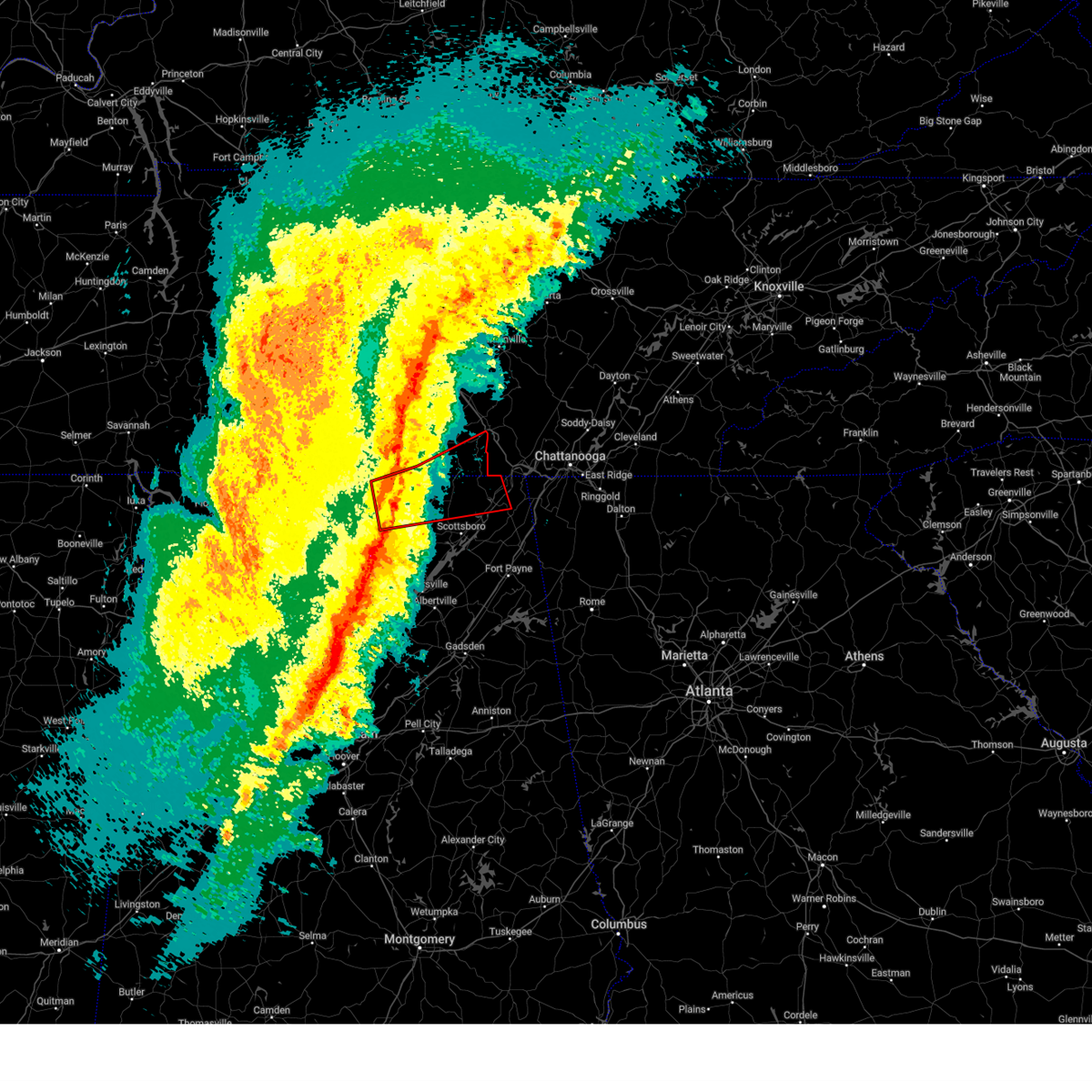 Torhun the national weather service in huntsville alabama has issued a * tornado warning for, northern jackson county in northeastern alabama, northeastern madison county in north central alabama, southeastern lincoln county in middle tennessee, southern franklin county in middle tennessee, * until 130 am cst. * at 1239 am cst, a severe thunderstorm capable of producing a tornado was located near moores mill, moving northeast at 50 mph (radar indicated rotation). Hazards include tornado. Flying debris will be dangerous to those caught without shelter. mobile homes will be damaged or destroyed. damage to roofs, windows, and vehicles will occur. tree damage is likely. this dangerous storm will be near, new market around 1245 am cst. Other locations impacted by this tornadic thunderstorm include bass, maysville, princeton, plevna, jericho, russell cave national monument, elora, estillfork, fackler, and hytop. Torhun the national weather service in huntsville alabama has issued a * tornado warning for, northern jackson county in northeastern alabama, northeastern madison county in north central alabama, southeastern lincoln county in middle tennessee, southern franklin county in middle tennessee, * until 130 am cst. * at 1239 am cst, a severe thunderstorm capable of producing a tornado was located near moores mill, moving northeast at 50 mph (radar indicated rotation). Hazards include tornado. Flying debris will be dangerous to those caught without shelter. mobile homes will be damaged or destroyed. damage to roofs, windows, and vehicles will occur. tree damage is likely. this dangerous storm will be near, new market around 1245 am cst. Other locations impacted by this tornadic thunderstorm include bass, maysville, princeton, plevna, jericho, russell cave national monument, elora, estillfork, fackler, and hytop.
|
| 7/30/2024 5:25 PM CDT |
 At 625 pm edt/525 pm cdt/, severe thunderstorms were located along a line extending from near harrison to near jasper to near decherd, moving south at 35 mph (radar indicated). Hazards include 60 mph wind gusts. Expect damage to roofs, siding, and trees. locations impacted include, chattanooga, jasper, signal mountain, south pittsburg, walden, kimball, monteagle, ridgeside, harrison, and red bank. This includes interstate 75 in tennessee between mile markers 1 and 6. At 625 pm edt/525 pm cdt/, severe thunderstorms were located along a line extending from near harrison to near jasper to near decherd, moving south at 35 mph (radar indicated). Hazards include 60 mph wind gusts. Expect damage to roofs, siding, and trees. locations impacted include, chattanooga, jasper, signal mountain, south pittsburg, walden, kimball, monteagle, ridgeside, harrison, and red bank. This includes interstate 75 in tennessee between mile markers 1 and 6.
|
| 7/30/2024 5:25 PM CDT |
 the severe thunderstorm warning has been cancelled and is no longer in effect the severe thunderstorm warning has been cancelled and is no longer in effect
|
| 7/30/2024 5:06 PM CDT |
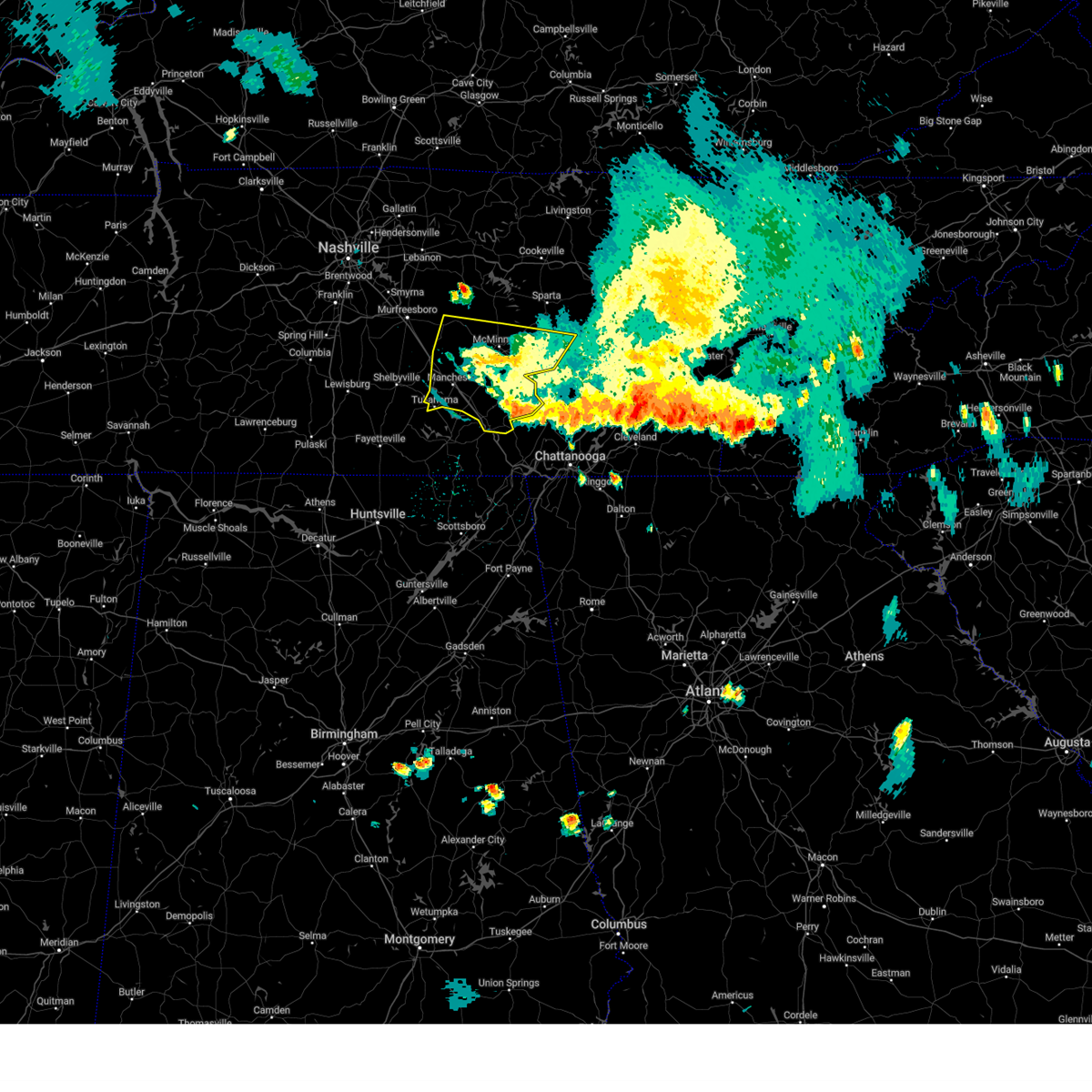 The storms which prompted the warning have weakened below severe limits, and no longer pose an immediate threat to life or property. therefore, the warning will be allowed to expire. a severe thunderstorm watch remains in effect until 800 pm cdt for middle tennessee. to report severe weather, contact your nearest law enforcement agency. they will relay your report to the national weather service nashville. The storms which prompted the warning have weakened below severe limits, and no longer pose an immediate threat to life or property. therefore, the warning will be allowed to expire. a severe thunderstorm watch remains in effect until 800 pm cdt for middle tennessee. to report severe weather, contact your nearest law enforcement agency. they will relay your report to the national weather service nashville.
|
| 7/30/2024 4:49 PM CDT |
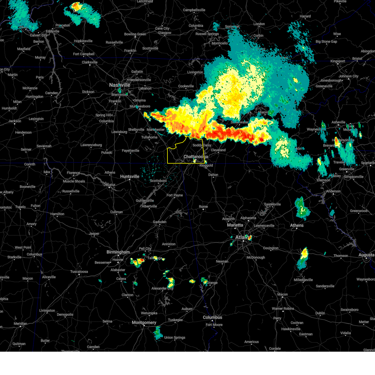 Svrmrx the national weather service in morristown has issued a * severe thunderstorm warning for, sequatchie county in east tennessee, marion county in east tennessee, western hamilton county in east tennessee, * until 645 pm edt/545 pm cdt/. * at 549 pm edt/449 pm cdt/, severe thunderstorms were located along a line extending from 7 miles north of soddy-daisy to near gruetli-laager to 8 miles north of manchester, moving south at 35 mph (radar indicated). Hazards include 60 mph wind gusts. expect damage to roofs, siding, and trees Svrmrx the national weather service in morristown has issued a * severe thunderstorm warning for, sequatchie county in east tennessee, marion county in east tennessee, western hamilton county in east tennessee, * until 645 pm edt/545 pm cdt/. * at 549 pm edt/449 pm cdt/, severe thunderstorms were located along a line extending from 7 miles north of soddy-daisy to near gruetli-laager to 8 miles north of manchester, moving south at 35 mph (radar indicated). Hazards include 60 mph wind gusts. expect damage to roofs, siding, and trees
|
| 7/30/2024 4:37 PM CDT |
 the severe thunderstorm warning has been cancelled and is no longer in effect the severe thunderstorm warning has been cancelled and is no longer in effect
|
| 7/30/2024 4:37 PM CDT |
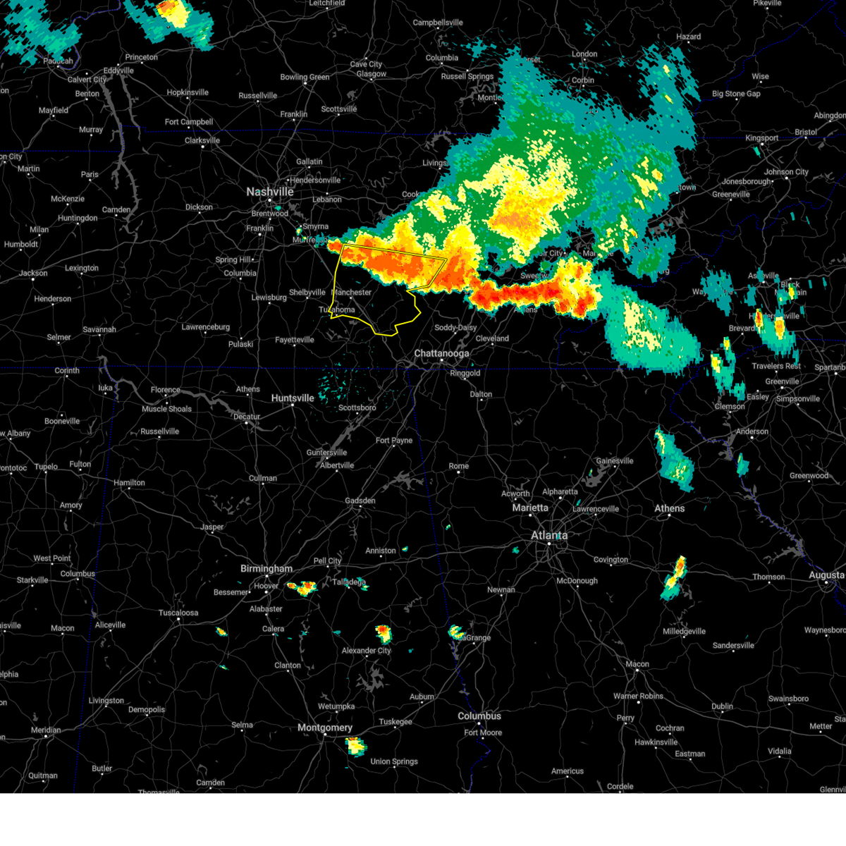 At 437 pm cdt, severe thunderstorms were located along a line extending from bell buckle to fall creek falls, moving southeast at 40 mph (radar indicated). Hazards include 60 mph wind gusts and quarter size hail. Hail damage to vehicles is expected. expect wind damage to roofs, siding, and trees. locations impacted include, mcminnville, manchester, woodbury, spencer, tullahoma, gruetli-laager, tracy city, monteagle, altamont, coalmont, morrison, palmer, beersheba springs, centertown, viola, summitville, fall creek falls state park, hillsboro, pelham, and bradyville. This includes interstate 24 between mile markers 101 and 136. At 437 pm cdt, severe thunderstorms were located along a line extending from bell buckle to fall creek falls, moving southeast at 40 mph (radar indicated). Hazards include 60 mph wind gusts and quarter size hail. Hail damage to vehicles is expected. expect wind damage to roofs, siding, and trees. locations impacted include, mcminnville, manchester, woodbury, spencer, tullahoma, gruetli-laager, tracy city, monteagle, altamont, coalmont, morrison, palmer, beersheba springs, centertown, viola, summitville, fall creek falls state park, hillsboro, pelham, and bradyville. This includes interstate 24 between mile markers 101 and 136.
|
| 7/30/2024 4:10 PM CDT |
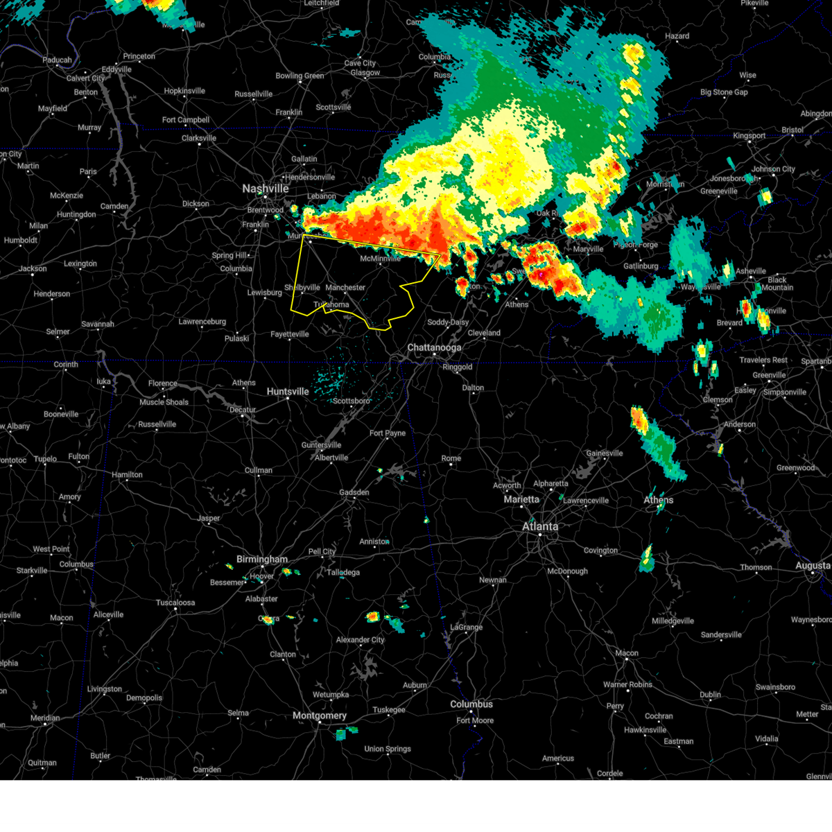 Svrohx the national weather service in nashville has issued a * severe thunderstorm warning for, southeastern rutherford county in middle tennessee, van buren county in middle tennessee, warren county in middle tennessee, coffee county in middle tennessee, bedford county in middle tennessee, grundy county in middle tennessee, cannon county in middle tennessee, * until 515 pm cdt. * at 409 pm cdt, severe thunderstorms were located along a line extending from murfreesboro to spencer, moving south at 30 mph (radar indicated). Hazards include 60 mph wind gusts and quarter size hail. Hail damage to vehicles is expected. Expect wind damage to roofs, siding, and trees. Svrohx the national weather service in nashville has issued a * severe thunderstorm warning for, southeastern rutherford county in middle tennessee, van buren county in middle tennessee, warren county in middle tennessee, coffee county in middle tennessee, bedford county in middle tennessee, grundy county in middle tennessee, cannon county in middle tennessee, * until 515 pm cdt. * at 409 pm cdt, severe thunderstorms were located along a line extending from murfreesboro to spencer, moving south at 30 mph (radar indicated). Hazards include 60 mph wind gusts and quarter size hail. Hail damage to vehicles is expected. Expect wind damage to roofs, siding, and trees.
|
| 7/29/2024 3:31 PM CDT |
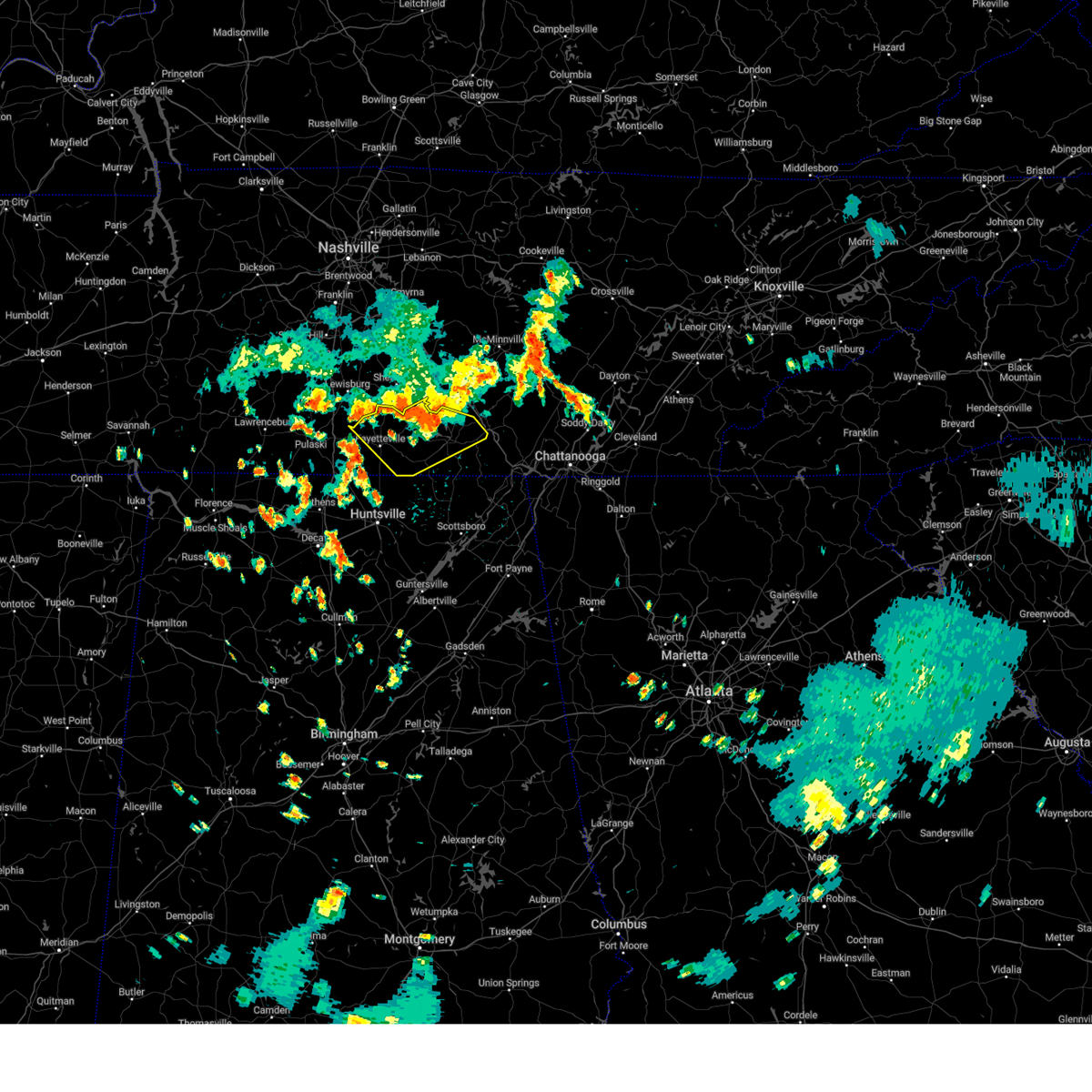 At 330 pm cdt, a severe thunderstorm was located near lynchburg, moving southeast at 30 mph (radar indicated). Hazards include ping pong ball size hail and 60 mph wind gusts. People and animals outdoors will be injured. expect hail damage to roofs, siding, windows, and vehicles. expect wind damage to roofs, siding, and trees. Locations impacted include, winchester, fayetteville, lynchburg, decherd, estill springs, cowan, huntland, petersburg, tims ford lake, and sewanee. At 330 pm cdt, a severe thunderstorm was located near lynchburg, moving southeast at 30 mph (radar indicated). Hazards include ping pong ball size hail and 60 mph wind gusts. People and animals outdoors will be injured. expect hail damage to roofs, siding, windows, and vehicles. expect wind damage to roofs, siding, and trees. Locations impacted include, winchester, fayetteville, lynchburg, decherd, estill springs, cowan, huntland, petersburg, tims ford lake, and sewanee.
|
| 7/29/2024 3:16 PM CDT |
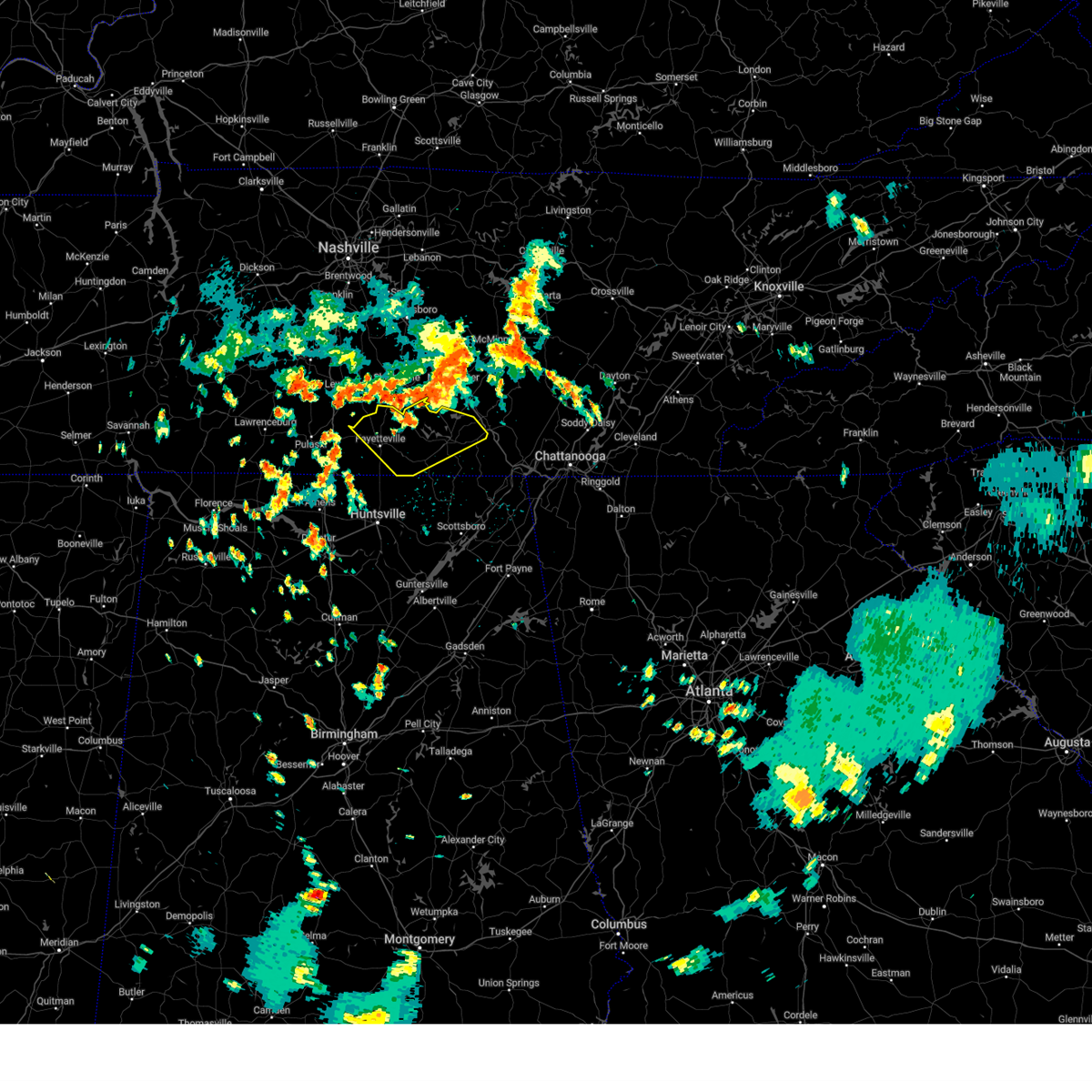 Svrhun the national weather service in huntsville alabama has issued a * severe thunderstorm warning for, moore county in middle tennessee, lincoln county in middle tennessee, franklin county in middle tennessee, * until 345 pm cdt. * at 316 pm cdt, a severe thunderstorm was located near shelbyville, moving southeast at 30 mph (radar indicated). Hazards include 60 mph wind gusts and quarter size hail. Hail damage to vehicles is expected. Expect wind damage to roofs, siding, and trees. Svrhun the national weather service in huntsville alabama has issued a * severe thunderstorm warning for, moore county in middle tennessee, lincoln county in middle tennessee, franklin county in middle tennessee, * until 345 pm cdt. * at 316 pm cdt, a severe thunderstorm was located near shelbyville, moving southeast at 30 mph (radar indicated). Hazards include 60 mph wind gusts and quarter size hail. Hail damage to vehicles is expected. Expect wind damage to roofs, siding, and trees.
|
| 7/21/2024 6:29 PM CDT |
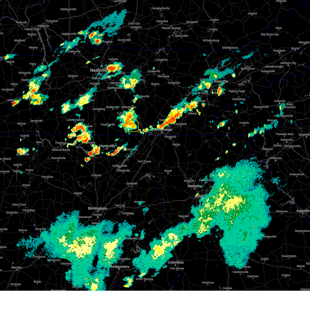 The storm which prompted the warning has weakened below severe limits, and has exited the warned area. therefore, the warning will be allowed to expire. The storm which prompted the warning has weakened below severe limits, and has exited the warned area. therefore, the warning will be allowed to expire.
|
| 7/21/2024 6:19 PM CDT |
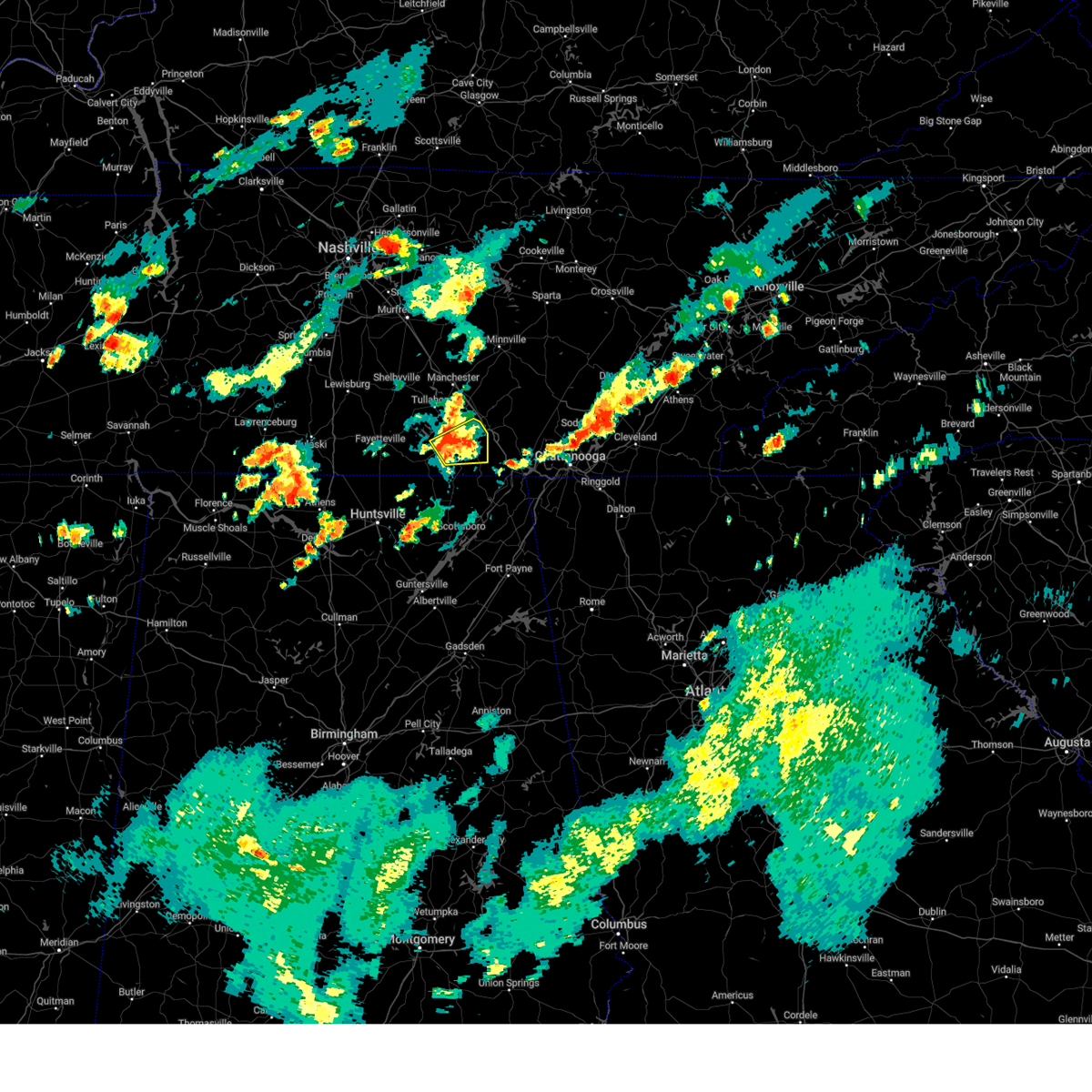 At 618 pm cdt, a severe thunderstorm was located over sewanee, or 8 miles east of winchester, moving northeast at 15 mph (radar indicated). Hazards include 60 mph wind gusts. Expect damage to roofs, siding, and trees. locations impacted include, winchester, decherd, cowan, sewanee, tims ford lake, alto, st. Andrews, belvidere, and sherwood. At 618 pm cdt, a severe thunderstorm was located over sewanee, or 8 miles east of winchester, moving northeast at 15 mph (radar indicated). Hazards include 60 mph wind gusts. Expect damage to roofs, siding, and trees. locations impacted include, winchester, decherd, cowan, sewanee, tims ford lake, alto, st. Andrews, belvidere, and sherwood.
|
| 7/21/2024 5:48 PM CDT |
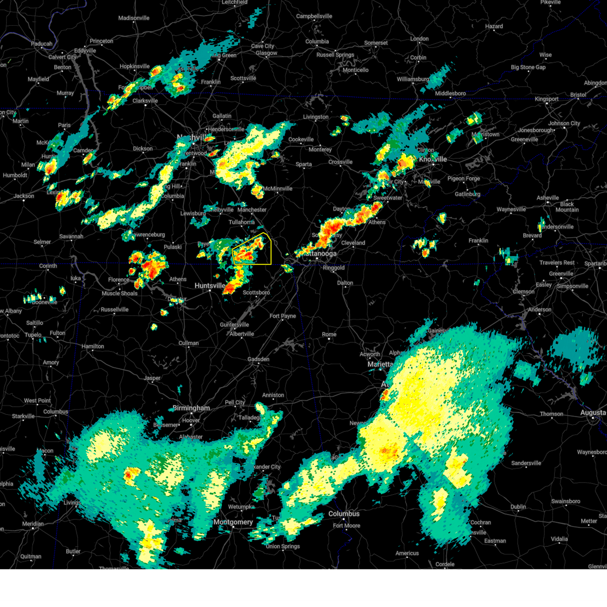 Svrhun the national weather service in huntsville alabama has issued a * severe thunderstorm warning for, franklin county in middle tennessee, * until 630 pm cdt. * at 547 pm cdt, a severe thunderstorm was located near cowan, or near winchester, moving east at 25 mph (radar indicated). Hazards include 60 mph wind gusts. expect damage to roofs, siding, and trees Svrhun the national weather service in huntsville alabama has issued a * severe thunderstorm warning for, franklin county in middle tennessee, * until 630 pm cdt. * at 547 pm cdt, a severe thunderstorm was located near cowan, or near winchester, moving east at 25 mph (radar indicated). Hazards include 60 mph wind gusts. expect damage to roofs, siding, and trees
|
| 5/27/2024 3:15 AM CDT |
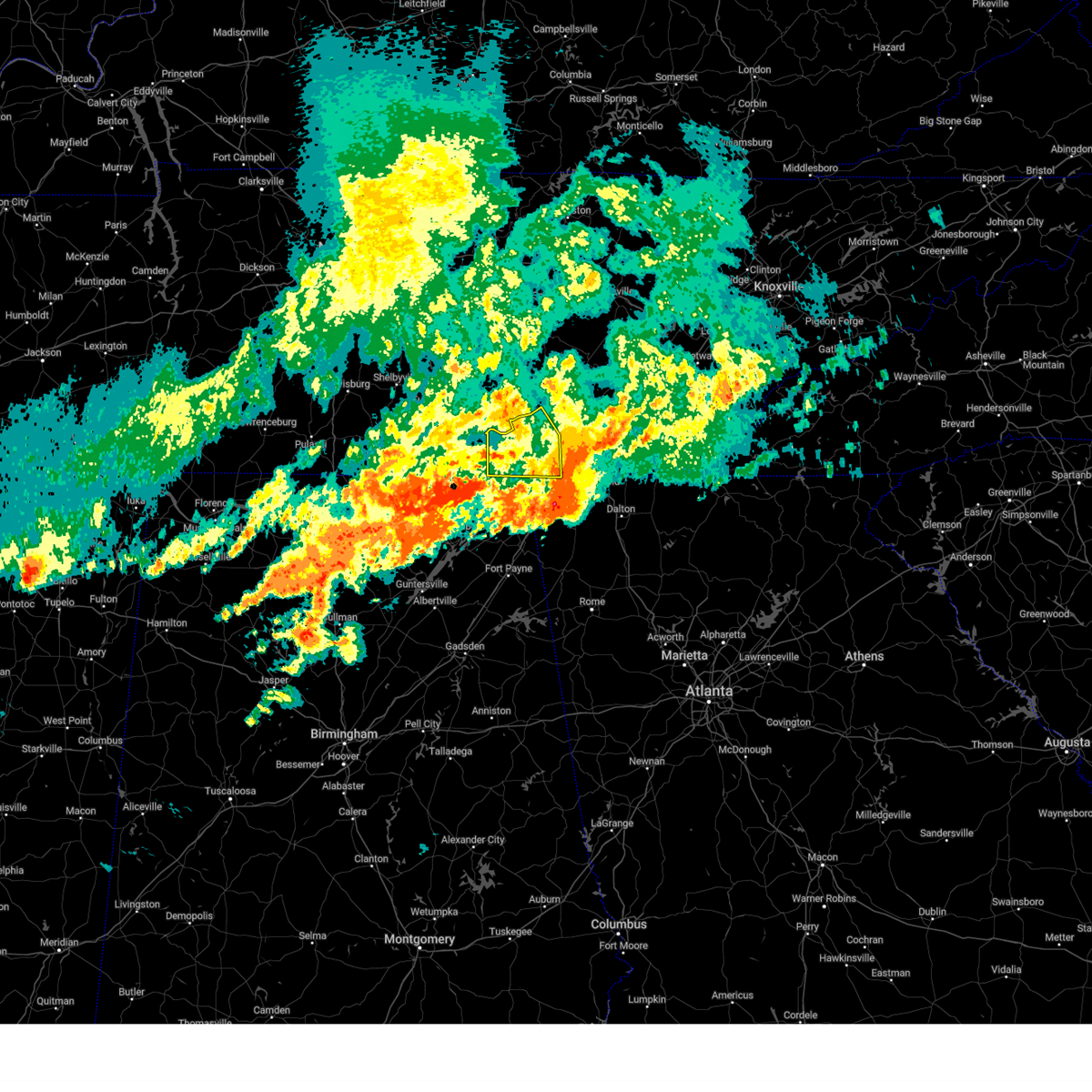 the severe thunderstorm warning has been cancelled and is no longer in effect the severe thunderstorm warning has been cancelled and is no longer in effect
|
| 5/27/2024 2:26 AM CDT |
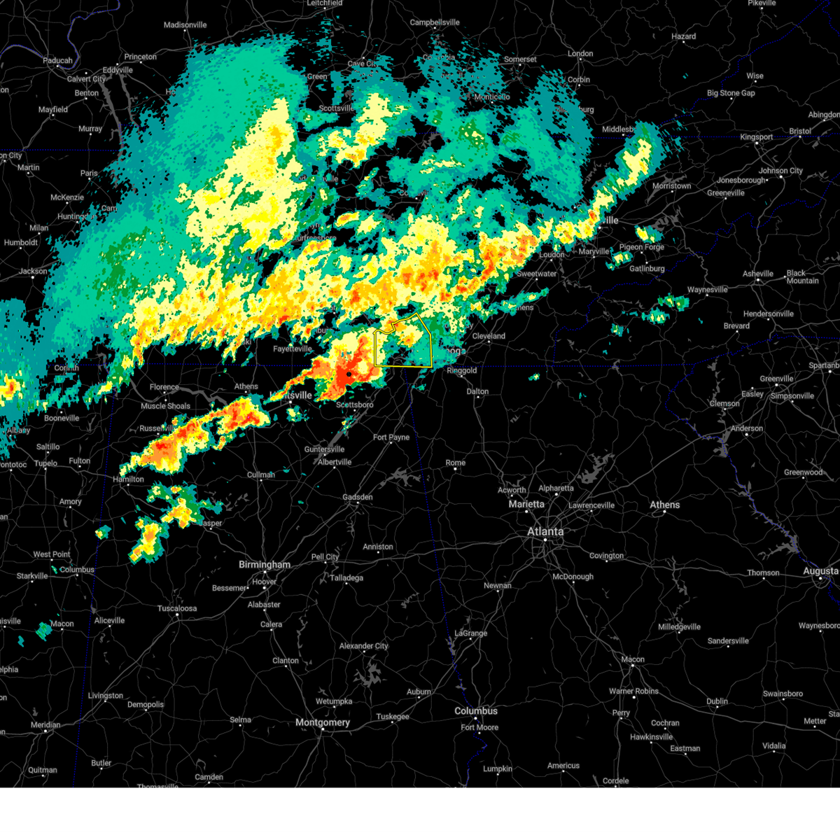 Svrmrx the national weather service in morristown has issued a * severe thunderstorm warning for, southwestern sequatchie county in east tennessee, marion county in east tennessee, southwestern hamilton county in east tennessee, * until 430 am edt/330 am cdt/. * at 325 am edt/225 am cdt/, a severe thunderstorm was located 9 miles north of skyline, or 17 miles south of winchester, moving northeast at 40 mph (radar indicated). Hazards include 60 mph wind gusts and quarter size hail. Hail damage to vehicles is expected. Expect wind damage to roofs, siding, and trees. Svrmrx the national weather service in morristown has issued a * severe thunderstorm warning for, southwestern sequatchie county in east tennessee, marion county in east tennessee, southwestern hamilton county in east tennessee, * until 430 am edt/330 am cdt/. * at 325 am edt/225 am cdt/, a severe thunderstorm was located 9 miles north of skyline, or 17 miles south of winchester, moving northeast at 40 mph (radar indicated). Hazards include 60 mph wind gusts and quarter size hail. Hail damage to vehicles is expected. Expect wind damage to roofs, siding, and trees.
|
| 5/25/2024 6:39 AM CDT |
 At 638 am cdt, severe thunderstorms were located along a line extending from estill springs to 6 miles west of grant, moving east at 45 mph (radar indicated). Hazards include 60 mph wind gusts and nickel size hail. Expect damage to roofs, siding, and trees. Locations impacted include, scottsboro, winchester, rainsville, decherd, estill springs, stevenson, sylvania, cowan, fyffe, and hollywood. At 638 am cdt, severe thunderstorms were located along a line extending from estill springs to 6 miles west of grant, moving east at 45 mph (radar indicated). Hazards include 60 mph wind gusts and nickel size hail. Expect damage to roofs, siding, and trees. Locations impacted include, scottsboro, winchester, rainsville, decherd, estill springs, stevenson, sylvania, cowan, fyffe, and hollywood.
|
| 5/25/2024 6:39 AM CDT |
 the severe thunderstorm warning has been cancelled and is no longer in effect the severe thunderstorm warning has been cancelled and is no longer in effect
|
| 5/25/2024 6:20 AM CDT |
 At 620 am cdt, severe thunderstorms were located along a line extending from lynchburg to near morgan city, moving southeast at 50 mph (radar indicated). Hazards include 60 mph wind gusts and nickel size hail. Expect damage to roofs, siding, and trees. Locations impacted include, huntsville, scottsboro, winchester, fayetteville, rainsville, moores mill, meridianville, lynchburg, redstone arsenal, and hazel green. At 620 am cdt, severe thunderstorms were located along a line extending from lynchburg to near morgan city, moving southeast at 50 mph (radar indicated). Hazards include 60 mph wind gusts and nickel size hail. Expect damage to roofs, siding, and trees. Locations impacted include, huntsville, scottsboro, winchester, fayetteville, rainsville, moores mill, meridianville, lynchburg, redstone arsenal, and hazel green.
|
| 5/25/2024 6:14 AM CDT |
 the severe thunderstorm warning has been cancelled and is no longer in effect the severe thunderstorm warning has been cancelled and is no longer in effect
|
| 5/25/2024 6:14 AM CDT |
 At 614 am cdt, severe thunderstorms were located along a line extending from near lynchburg to near morgan city, moving southeast at 45 mph (radar indicated). Hazards include 70 mph wind gusts and nickel size hail. Expect considerable tree damage. damage is likely to mobile homes, roofs, and outbuildings. Locations impacted include, huntsville, madison, scottsboro, winchester, fayetteville, rainsville, moores mill, meridianville, lynchburg, and redstone arsenal. At 614 am cdt, severe thunderstorms were located along a line extending from near lynchburg to near morgan city, moving southeast at 45 mph (radar indicated). Hazards include 70 mph wind gusts and nickel size hail. Expect considerable tree damage. damage is likely to mobile homes, roofs, and outbuildings. Locations impacted include, huntsville, madison, scottsboro, winchester, fayetteville, rainsville, moores mill, meridianville, lynchburg, and redstone arsenal.
|
| 5/25/2024 6:00 AM CDT |
 At 600 am cdt, severe thunderstorms were located along a line extending from near petersburg to triana, moving southeast at 50 mph (radar indicated). Hazards include 70 mph wind gusts and nickel size hail. Expect considerable tree damage. damage is likely to mobile homes, roofs, and outbuildings. Locations impacted include, huntsville, madison, athens, scottsboro, winchester, fayetteville, rainsville, moores mill, meridianville, and lynchburg. At 600 am cdt, severe thunderstorms were located along a line extending from near petersburg to triana, moving southeast at 50 mph (radar indicated). Hazards include 70 mph wind gusts and nickel size hail. Expect considerable tree damage. damage is likely to mobile homes, roofs, and outbuildings. Locations impacted include, huntsville, madison, athens, scottsboro, winchester, fayetteville, rainsville, moores mill, meridianville, and lynchburg.
|
| 5/25/2024 5:53 AM CDT |
 Svrhun the national weather service in huntsville alabama has issued a * severe thunderstorm warning for, northeastern marshall county in northeastern alabama, jackson county in northeastern alabama, madison county in north central alabama, limestone county in north central alabama, central dekalb county in northeastern alabama, moore county in middle tennessee, lincoln county in middle tennessee, franklin county in middle tennessee, * until 700 am cdt. * at 553 am cdt, severe thunderstorms were located along a line extending from petersburg to near huntsville international airport, moving southeast at 50 mph (radar indicated). Hazards include 60 mph wind gusts and nickel size hail. expect damage to roofs, siding, and trees Svrhun the national weather service in huntsville alabama has issued a * severe thunderstorm warning for, northeastern marshall county in northeastern alabama, jackson county in northeastern alabama, madison county in north central alabama, limestone county in north central alabama, central dekalb county in northeastern alabama, moore county in middle tennessee, lincoln county in middle tennessee, franklin county in middle tennessee, * until 700 am cdt. * at 553 am cdt, severe thunderstorms were located along a line extending from petersburg to near huntsville international airport, moving southeast at 50 mph (radar indicated). Hazards include 60 mph wind gusts and nickel size hail. expect damage to roofs, siding, and trees
|
| 5/14/2024 5:55 PM CDT |
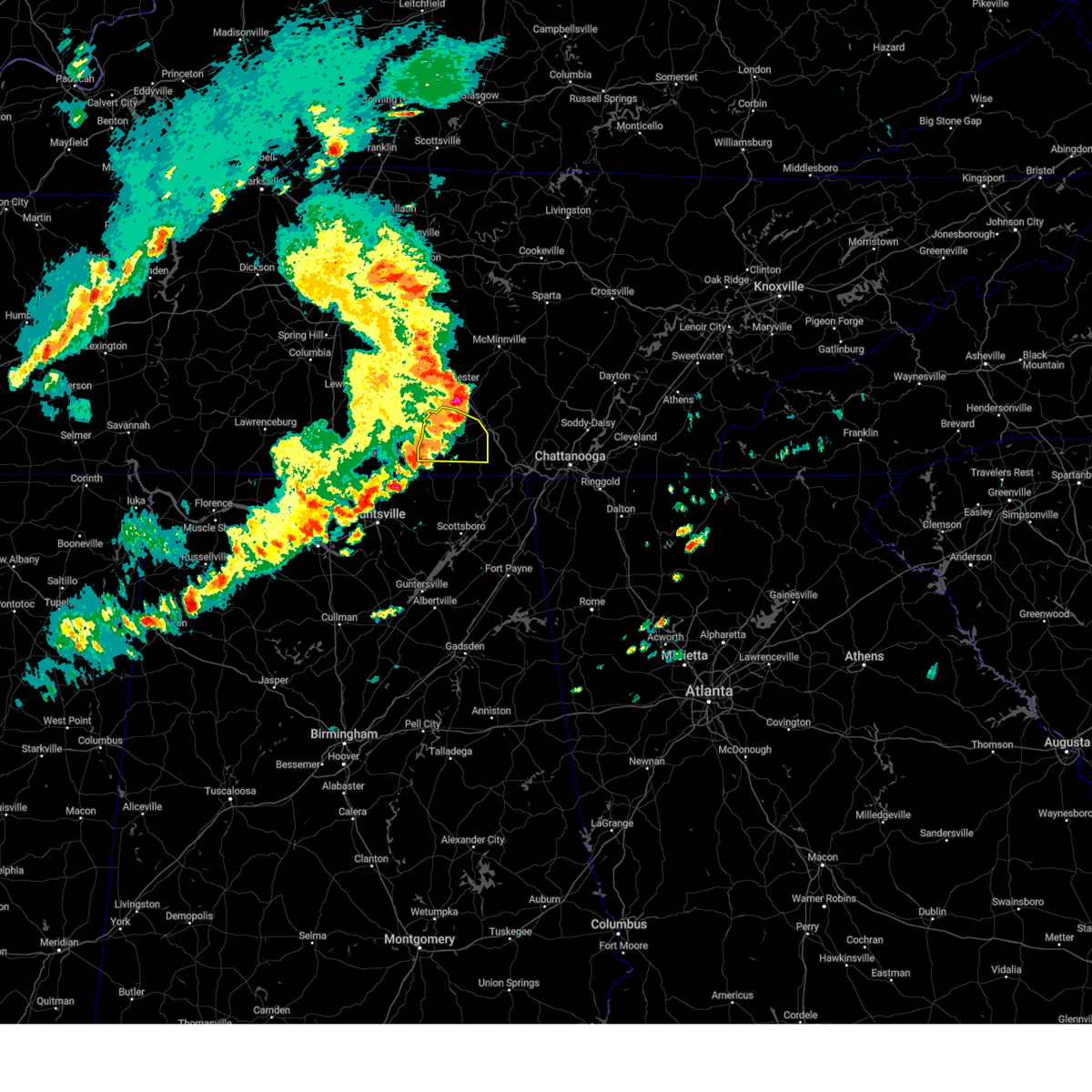 The storms which prompted the warning have weakened below severe limits, and no longer pose an immediate threat to life or property. therefore, the warning will be allowed to expire. however, gusty winds are still possible with these thunderstorms. a severe thunderstorm watch remains in effect until 800 pm cdt for north central alabama, and middle tennessee. The storms which prompted the warning have weakened below severe limits, and no longer pose an immediate threat to life or property. therefore, the warning will be allowed to expire. however, gusty winds are still possible with these thunderstorms. a severe thunderstorm watch remains in effect until 800 pm cdt for north central alabama, and middle tennessee.
|
| 5/14/2024 5:54 PM CDT |
 At 553 pm cdt, severe thunderstorms were located along a line extending from 7 miles south of manchester to near decherd to 7 miles southwest of cowan, moving east at 50 mph (emergency management). Hazards include 60 mph wind gusts. Expect damage to roofs, siding, and trees. Locations impacted include, winchester, decherd, estill springs, cowan, huntland, sewanee, tims ford lake, lexie crossroads, harmony, and maxwell. At 553 pm cdt, severe thunderstorms were located along a line extending from 7 miles south of manchester to near decherd to 7 miles southwest of cowan, moving east at 50 mph (emergency management). Hazards include 60 mph wind gusts. Expect damage to roofs, siding, and trees. Locations impacted include, winchester, decherd, estill springs, cowan, huntland, sewanee, tims ford lake, lexie crossroads, harmony, and maxwell.
|
| 5/14/2024 5:54 PM CDT |
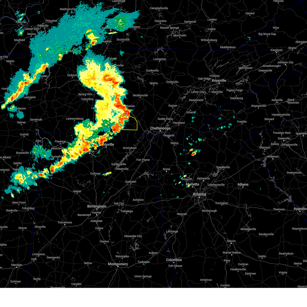 the severe thunderstorm warning has been cancelled and is no longer in effect the severe thunderstorm warning has been cancelled and is no longer in effect
|
| 5/14/2024 5:30 PM CDT |
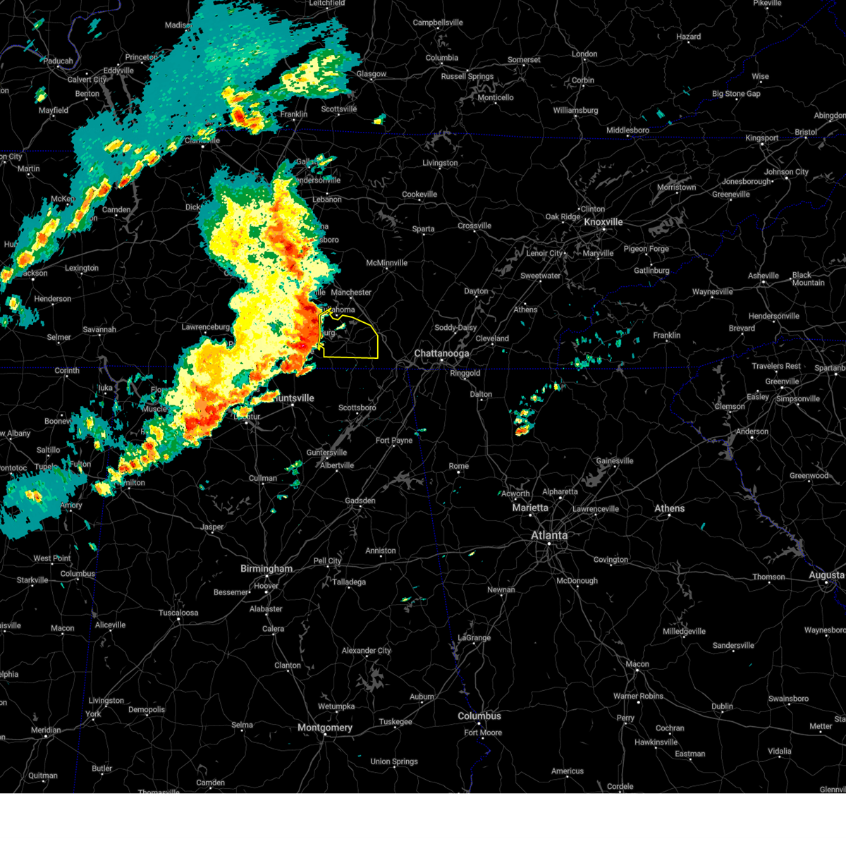 Svrhun the national weather service in huntsville alabama has issued a * severe thunderstorm warning for, eastern moore county in middle tennessee, franklin county in middle tennessee, * until 600 pm cdt. * at 529 pm cdt, severe thunderstorms were located along a line extending from 6 miles west of tullahoma to near tims ford lake to near huntland, moving east at 50 mph (emergency management. at 525 pm wind damage was reported in moore county). Hazards include 60 mph wind gusts. expect damage to roofs, siding, and trees Svrhun the national weather service in huntsville alabama has issued a * severe thunderstorm warning for, eastern moore county in middle tennessee, franklin county in middle tennessee, * until 600 pm cdt. * at 529 pm cdt, severe thunderstorms were located along a line extending from 6 miles west of tullahoma to near tims ford lake to near huntland, moving east at 50 mph (emergency management. at 525 pm wind damage was reported in moore county). Hazards include 60 mph wind gusts. expect damage to roofs, siding, and trees
|
| 5/9/2024 4:32 AM CDT |
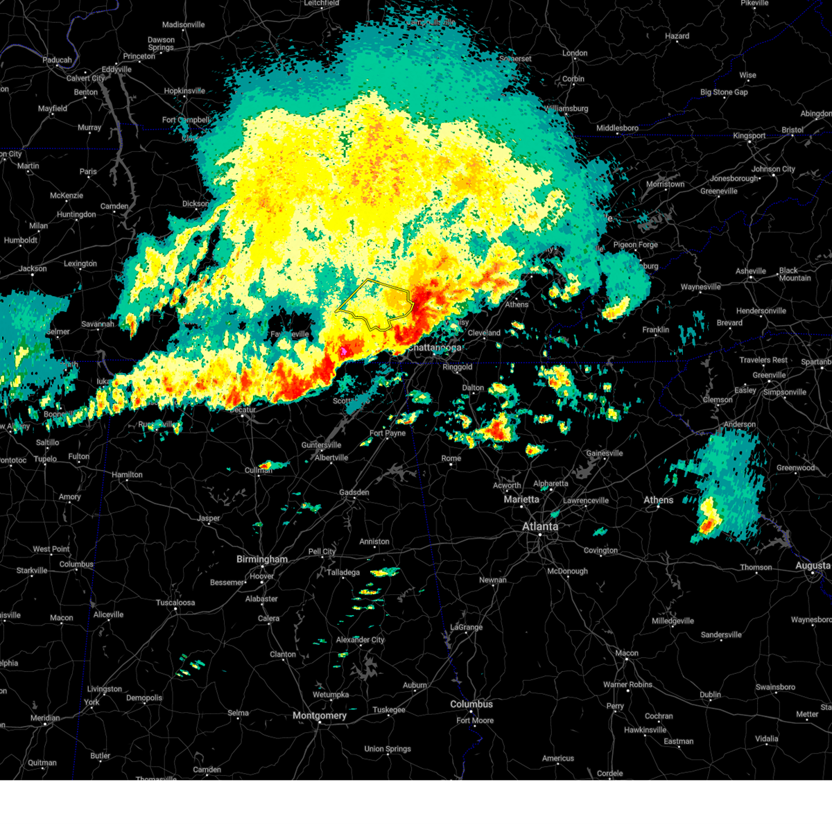 the severe thunderstorm warning has been cancelled and is no longer in effect the severe thunderstorm warning has been cancelled and is no longer in effect
|
| 5/9/2024 4:11 AM CDT |
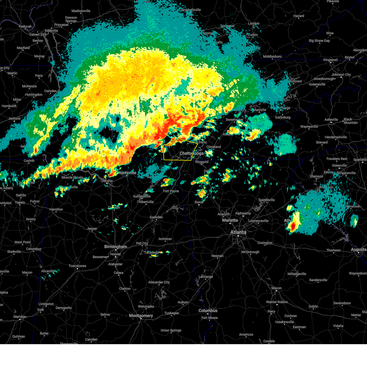 Svrmrx the national weather service in morristown has issued a * severe thunderstorm warning for, southern sequatchie county in east tennessee, marion county in east tennessee, southwestern hamilton county in east tennessee, * until 600 am edt/500 am cdt/. * at 510 am edt/410 am cdt/, severe thunderstorms were located along a line extending from 6 miles west of gruetli-laager to near sewanee to 6 miles southwest of tims ford lake to near new market, moving east at 55 mph (radar indicated). Hazards include 70 mph wind gusts and half dollar size hail. Hail damage to vehicles is expected. expect considerable tree damage. Wind damage is also likely to mobile homes, roofs, and outbuildings. Svrmrx the national weather service in morristown has issued a * severe thunderstorm warning for, southern sequatchie county in east tennessee, marion county in east tennessee, southwestern hamilton county in east tennessee, * until 600 am edt/500 am cdt/. * at 510 am edt/410 am cdt/, severe thunderstorms were located along a line extending from 6 miles west of gruetli-laager to near sewanee to 6 miles southwest of tims ford lake to near new market, moving east at 55 mph (radar indicated). Hazards include 70 mph wind gusts and half dollar size hail. Hail damage to vehicles is expected. expect considerable tree damage. Wind damage is also likely to mobile homes, roofs, and outbuildings.
|
| 5/9/2024 4:06 AM CDT |
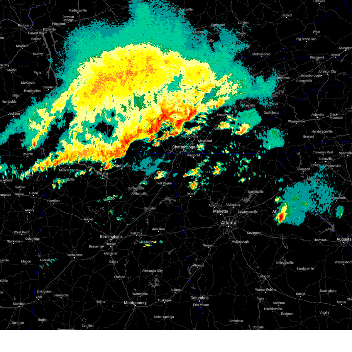 Svrohx the national weather service in nashville has issued a * severe thunderstorm warning for, south central warren county in middle tennessee, southeastern coffee county in middle tennessee, grundy county in middle tennessee, * until 445 am cdt. * at 406 am cdt, a severe thunderstorm was located 9 miles north of monteagle, or 14 miles southeast of manchester, moving east at 60 mph (radar indicated). Hazards include 60 mph wind gusts and quarter size hail. Hail damage to vehicles is expected. Expect wind damage to roofs, siding, and trees. Svrohx the national weather service in nashville has issued a * severe thunderstorm warning for, south central warren county in middle tennessee, southeastern coffee county in middle tennessee, grundy county in middle tennessee, * until 445 am cdt. * at 406 am cdt, a severe thunderstorm was located 9 miles north of monteagle, or 14 miles southeast of manchester, moving east at 60 mph (radar indicated). Hazards include 60 mph wind gusts and quarter size hail. Hail damage to vehicles is expected. Expect wind damage to roofs, siding, and trees.
|
| 5/8/2024 8:09 PM CDT |
 Svrhun the national weather service in huntsville alabama has issued a * severe thunderstorm warning for, northwestern jackson county in northeastern alabama, southeastern franklin county in middle tennessee, * until 900 pm cdt. * at 808 pm cdt, a severe thunderstorm was located 8 miles north of skyline, or 17 miles south of winchester, moving northeast at 40 mph (radar indicated). Hazards include 60 mph wind gusts and quarter size hail. Hail damage to vehicles is expected. Expect wind damage to roofs, siding, and trees. Svrhun the national weather service in huntsville alabama has issued a * severe thunderstorm warning for, northwestern jackson county in northeastern alabama, southeastern franklin county in middle tennessee, * until 900 pm cdt. * at 808 pm cdt, a severe thunderstorm was located 8 miles north of skyline, or 17 miles south of winchester, moving northeast at 40 mph (radar indicated). Hazards include 60 mph wind gusts and quarter size hail. Hail damage to vehicles is expected. Expect wind damage to roofs, siding, and trees.
|
| 5/7/2024 7:29 PM CDT |
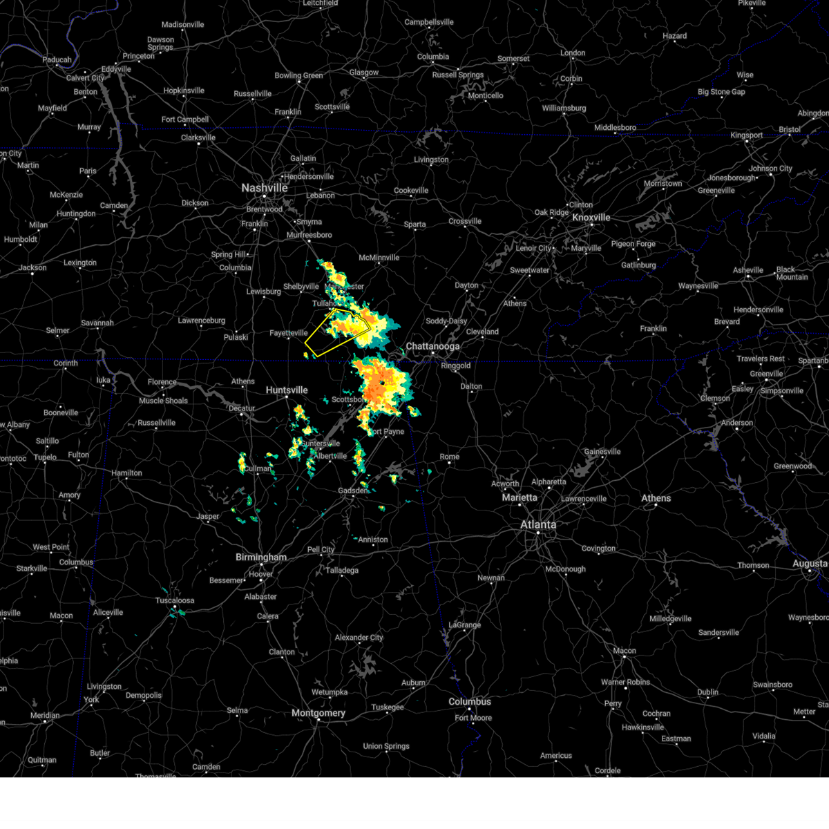 The storm which prompted the warning has weakened below severe limits, and has exited the warned area. therefore, the warning will be allowed to expire. The storm which prompted the warning has weakened below severe limits, and has exited the warned area. therefore, the warning will be allowed to expire.
|
| 5/7/2024 6:52 PM CDT |
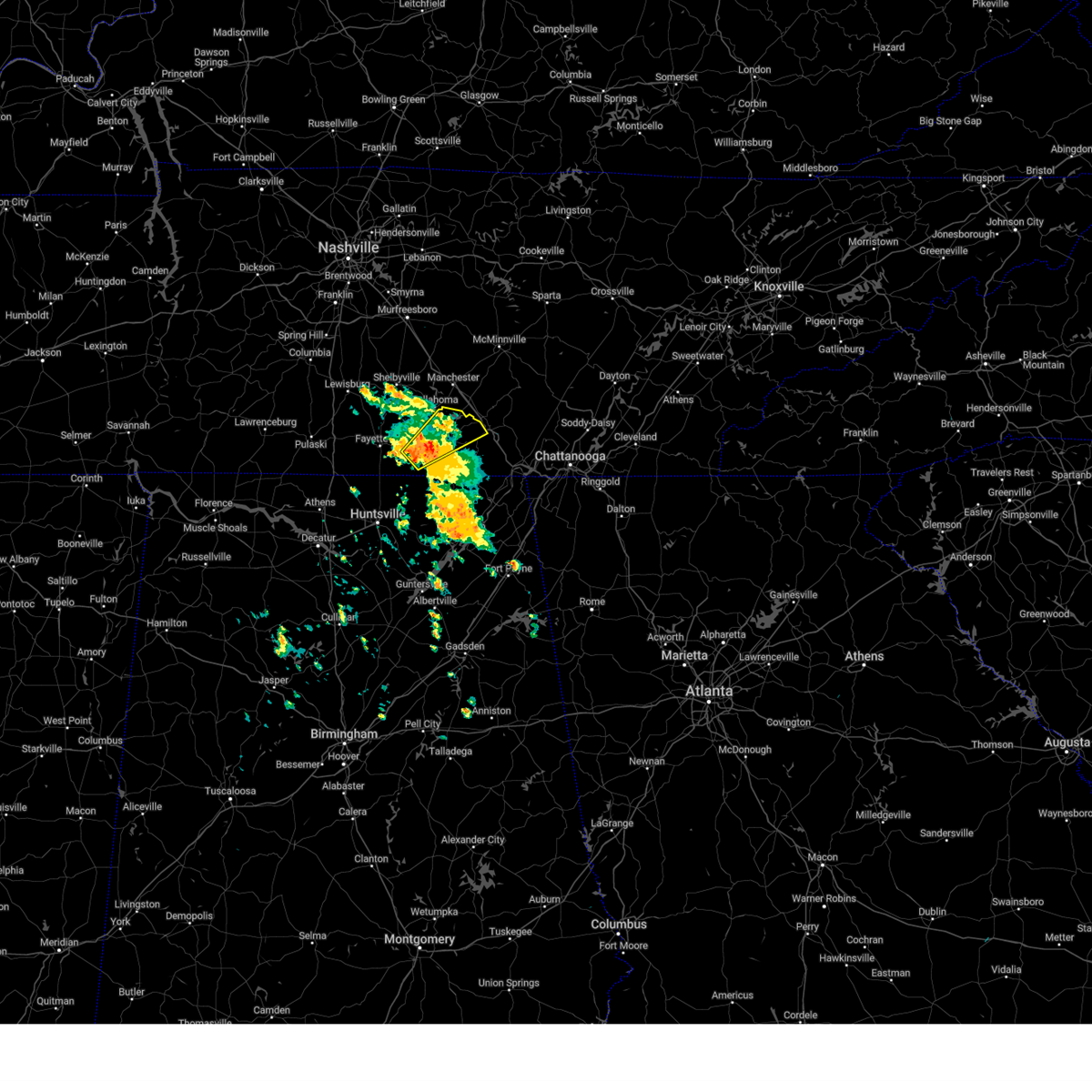 Svrhun the national weather service in huntsville alabama has issued a * severe thunderstorm warning for, southeastern moore county in middle tennessee, east central lincoln county in middle tennessee, central franklin county in middle tennessee, * until 730 pm cdt. * at 651 pm cdt, a severe thunderstorm was located near huntland, or 13 miles south of lynchburg, moving northeast at 35 mph (radar indicated). Hazards include 60 mph wind gusts and quarter size hail. Hail damage to vehicles is expected. Expect wind damage to roofs, siding, and trees. Svrhun the national weather service in huntsville alabama has issued a * severe thunderstorm warning for, southeastern moore county in middle tennessee, east central lincoln county in middle tennessee, central franklin county in middle tennessee, * until 730 pm cdt. * at 651 pm cdt, a severe thunderstorm was located near huntland, or 13 miles south of lynchburg, moving northeast at 35 mph (radar indicated). Hazards include 60 mph wind gusts and quarter size hail. Hail damage to vehicles is expected. Expect wind damage to roofs, siding, and trees.
|
| 3/15/2024 5:27 AM CDT |
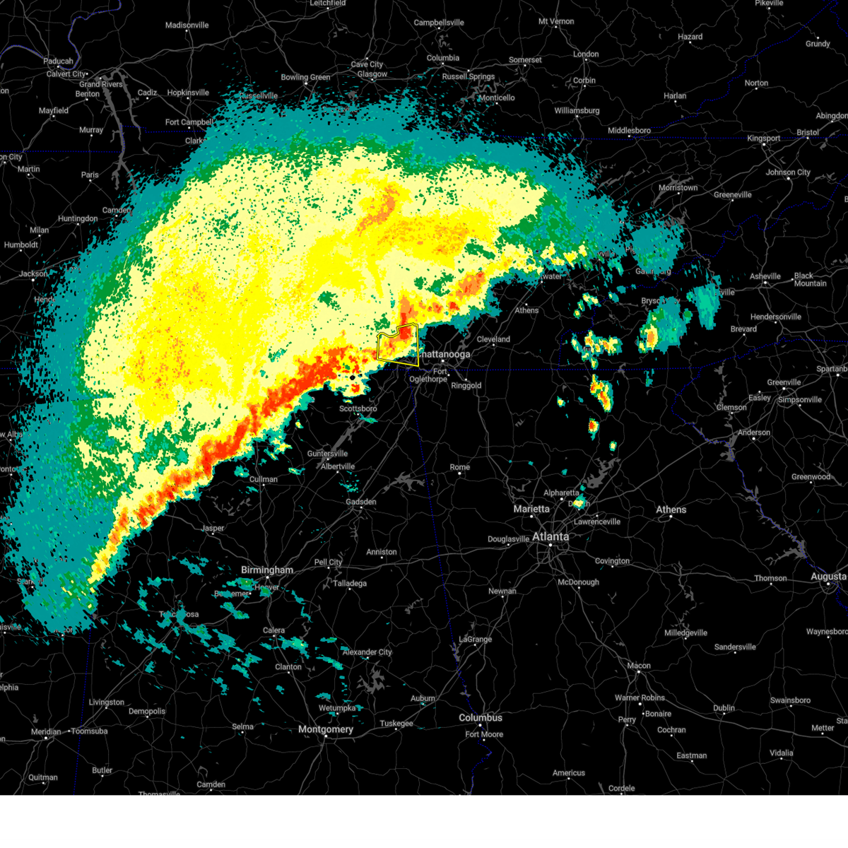 The storm which prompted the warning has weakened below severe limits, and no longer poses an immediate threat to life or property. therefore, the warning will be allowed to expire. however, gusty winds are still possible with this thunderstorm. The storm which prompted the warning has weakened below severe limits, and no longer poses an immediate threat to life or property. therefore, the warning will be allowed to expire. however, gusty winds are still possible with this thunderstorm.
|
| 3/15/2024 5:12 AM CDT |
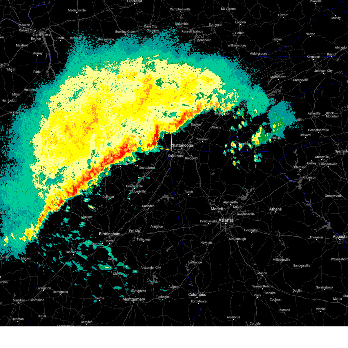 At 512 am cdt, a severe thunderstorm was located near tracy city, or 8 miles northwest of jasper, moving east at 50 mph (radar indicated). Hazards include 60 mph wind gusts. Expect damage to roofs, siding, and trees. Locations impacted include, jasper, south pittsburg, whitwell, kimball, monteagle, martin springs, fiery gizzard state park, griffith creek, haletown (guild), and chimneys state park. At 512 am cdt, a severe thunderstorm was located near tracy city, or 8 miles northwest of jasper, moving east at 50 mph (radar indicated). Hazards include 60 mph wind gusts. Expect damage to roofs, siding, and trees. Locations impacted include, jasper, south pittsburg, whitwell, kimball, monteagle, martin springs, fiery gizzard state park, griffith creek, haletown (guild), and chimneys state park.
|
| 3/15/2024 4:58 AM CDT |
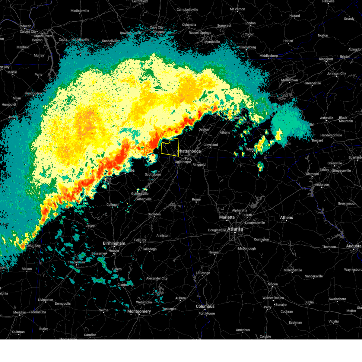 Svrmrx the national weather service in morristown has issued a * severe thunderstorm warning for, central marion county in east tennessee, * until 530 am cdt. * at 458 am cdt, a severe thunderstorm was located over sewanee, or 10 miles east of winchester, moving east at 50 mph (radar indicated). Hazards include 60 mph wind gusts. expect damage to roofs, siding, and trees Svrmrx the national weather service in morristown has issued a * severe thunderstorm warning for, central marion county in east tennessee, * until 530 am cdt. * at 458 am cdt, a severe thunderstorm was located over sewanee, or 10 miles east of winchester, moving east at 50 mph (radar indicated). Hazards include 60 mph wind gusts. expect damage to roofs, siding, and trees
|
| 3/15/2024 4:57 AM CDT |
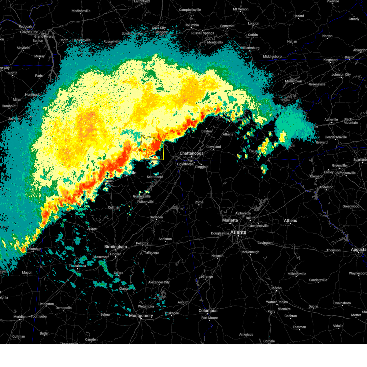 The storm which prompted the warning will be allowed to expire. however, gusty winds are still possible with this thunderstorm. a severe thunderstorm watch remains in effect until 1000 am cdt for north central and northeastern alabama. remember, a tornado warning still remains in effect for east central franklin county tn until 515 am. The storm which prompted the warning will be allowed to expire. however, gusty winds are still possible with this thunderstorm. a severe thunderstorm watch remains in effect until 1000 am cdt for north central and northeastern alabama. remember, a tornado warning still remains in effect for east central franklin county tn until 515 am.
|
| 3/15/2024 4:35 AM CDT |
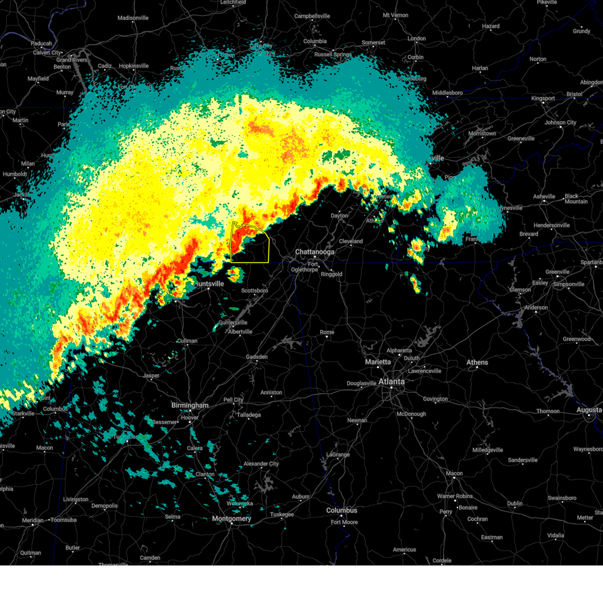 Svrhun the national weather service in huntsville alabama has issued a * severe thunderstorm warning for, eastern moore county in middle tennessee, franklin county in middle tennessee, * until 500 am cdt. * at 434 am cdt, a severe thunderstorm was located near tims ford lake, or near winchester, moving east at 45 mph (radar indicated). Hazards include 60 mph wind gusts and quarter size hail. Hail damage to vehicles is expected. Expect wind damage to roofs, siding, and trees. Svrhun the national weather service in huntsville alabama has issued a * severe thunderstorm warning for, eastern moore county in middle tennessee, franklin county in middle tennessee, * until 500 am cdt. * at 434 am cdt, a severe thunderstorm was located near tims ford lake, or near winchester, moving east at 45 mph (radar indicated). Hazards include 60 mph wind gusts and quarter size hail. Hail damage to vehicles is expected. Expect wind damage to roofs, siding, and trees.
|
| 2/28/2024 10:44 AM CST |
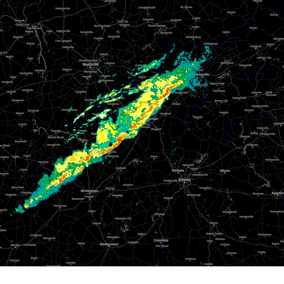 The storms which prompted the warning have weakened below severe limits, and have exited the warned area. therefore, the warning will be allowed to expire. however, gusty winds are still possible with these thunderstorms. The storms which prompted the warning have weakened below severe limits, and have exited the warned area. therefore, the warning will be allowed to expire. however, gusty winds are still possible with these thunderstorms.
|
| 2/28/2024 9:58 AM CST |
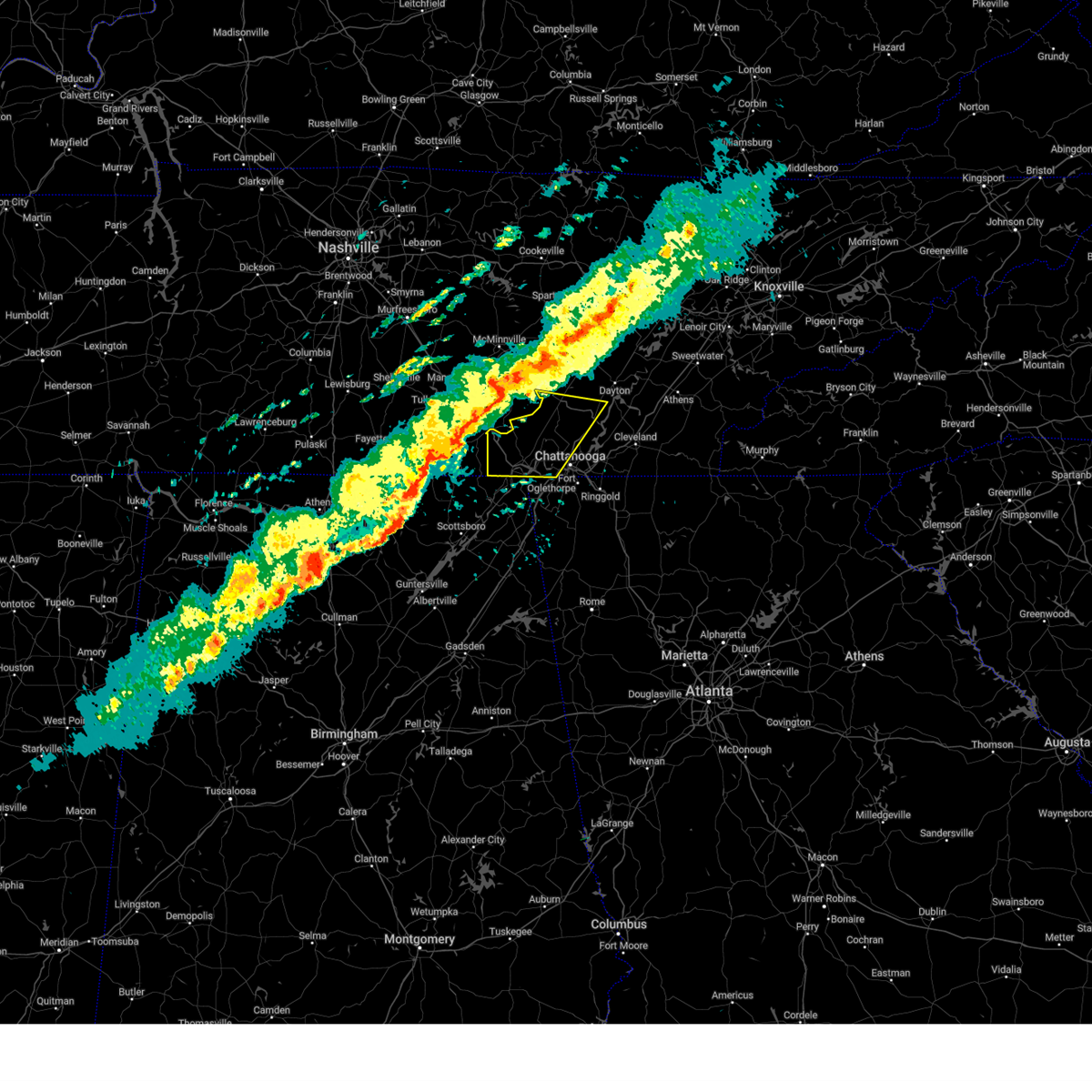 Svrmrx the national weather service in morristown has issued a * severe thunderstorm warning for, sequatchie county in east tennessee, south central bledsoe county in east tennessee, marion county in east tennessee, central hamilton county in east tennessee, * until 1145 am est/1045 am cst/. * at 1057 am est/957 am cst/, severe thunderstorms were located along a line extending from 7 miles north of monteagle to near huntland to 6 miles southeast of huntsville, moving east at 40 mph (radar indicated). Hazards include 60 mph wind gusts and penny size hail. expect damage to roofs, siding, and trees Svrmrx the national weather service in morristown has issued a * severe thunderstorm warning for, sequatchie county in east tennessee, south central bledsoe county in east tennessee, marion county in east tennessee, central hamilton county in east tennessee, * until 1145 am est/1045 am cst/. * at 1057 am est/957 am cst/, severe thunderstorms were located along a line extending from 7 miles north of monteagle to near huntland to 6 miles southeast of huntsville, moving east at 40 mph (radar indicated). Hazards include 60 mph wind gusts and penny size hail. expect damage to roofs, siding, and trees
|
| 8/15/2023 12:51 AM CDT |
 The severe thunderstorm warning for northwestern jackson, northeastern madison, southeastern lincoln and franklin counties will expire at 100 am cdt, the storms which prompted the warning have weakened below severe limits, and no longer pose an immediate threat to life or property. therefore, the warning will be allowed to expire. however, gusty winds and heavy rain are still possible with these thunderstorms. a severe thunderstorm watch remains in effect until 200 am cdt for north central and northeastern alabama and middle tennessee. The severe thunderstorm warning for northwestern jackson, northeastern madison, southeastern lincoln and franklin counties will expire at 100 am cdt, the storms which prompted the warning have weakened below severe limits, and no longer pose an immediate threat to life or property. therefore, the warning will be allowed to expire. however, gusty winds and heavy rain are still possible with these thunderstorms. a severe thunderstorm watch remains in effect until 200 am cdt for north central and northeastern alabama and middle tennessee.
|
| 8/15/2023 12:35 AM CDT |
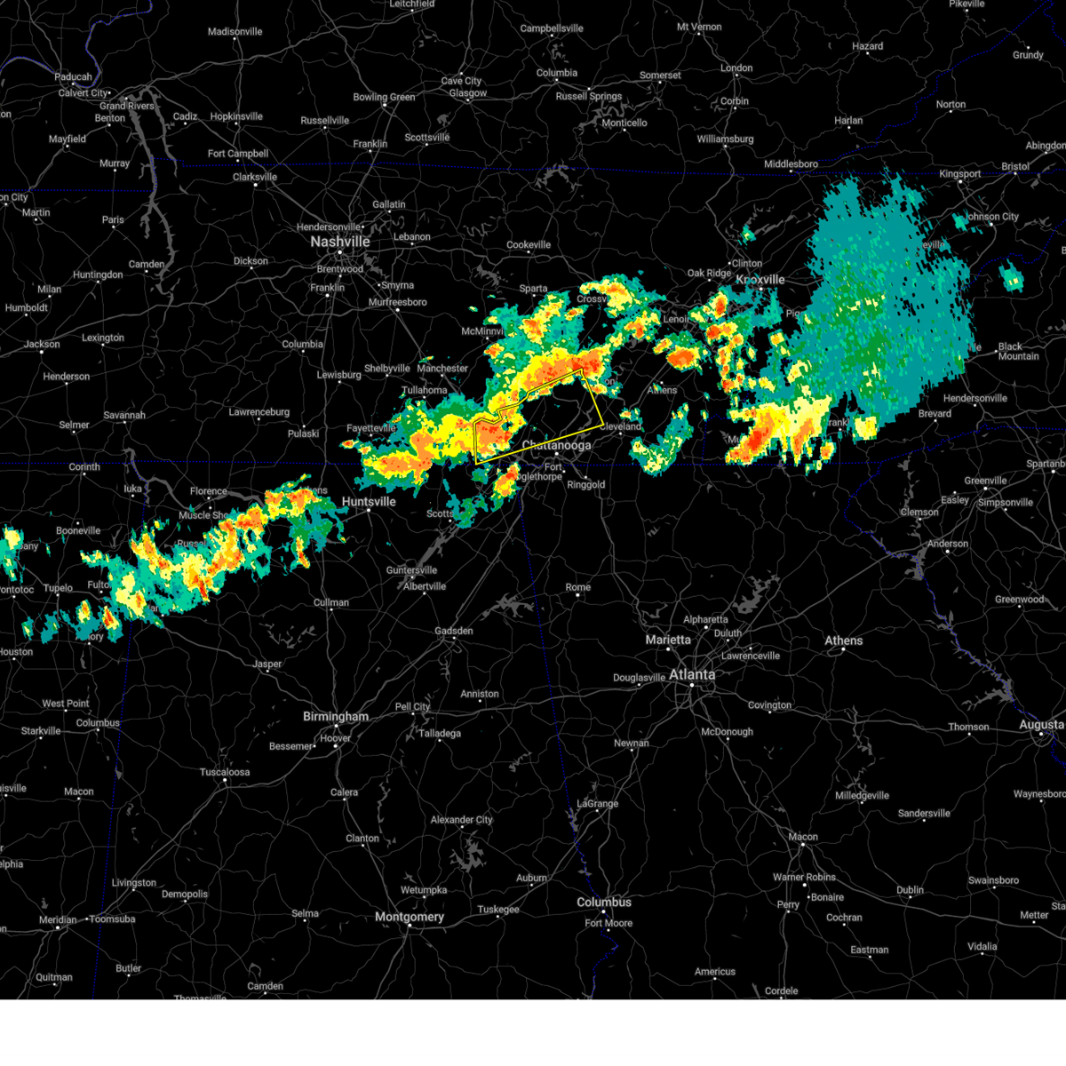 At 134 am edt/1234 am cdt/, a severe thunderstorm was located near whitwell, or 7 miles north of jasper, moving east at 45 mph (radar indicated). Hazards include 60 mph wind gusts and nickel size hail. expect damage to roofs, siding, and trees At 134 am edt/1234 am cdt/, a severe thunderstorm was located near whitwell, or 7 miles north of jasper, moving east at 45 mph (radar indicated). Hazards include 60 mph wind gusts and nickel size hail. expect damage to roofs, siding, and trees
|
| 8/15/2023 12:33 AM CDT |
 At 1232 am cdt, severe thunderstorms were located along a line extending from tracy city to near new market, moving east at 35 mph (radar indicated). Hazards include 60 mph wind gusts and nickel size hail. Expect damage to roofs, siding, and trees. locations impacted include, winchester, hazel green, decherd, cowan, huntland, sewanee, new market, anderson, lincoln and hytop. hail threat, radar indicated max hail size, 0. 88 in wind threat, radar indicated max wind gust, 60 mph. At 1232 am cdt, severe thunderstorms were located along a line extending from tracy city to near new market, moving east at 35 mph (radar indicated). Hazards include 60 mph wind gusts and nickel size hail. Expect damage to roofs, siding, and trees. locations impacted include, winchester, hazel green, decherd, cowan, huntland, sewanee, new market, anderson, lincoln and hytop. hail threat, radar indicated max hail size, 0. 88 in wind threat, radar indicated max wind gust, 60 mph.
|
| 8/15/2023 12:12 AM CDT |
 At 1211 am cdt, severe thunderstorms were located along a line extending from near winchester to harvest, moving east at 30 mph (radar indicated). Hazards include 60 mph wind gusts and nickel size hail. expect damage to roofs, siding, and trees At 1211 am cdt, severe thunderstorms were located along a line extending from near winchester to harvest, moving east at 30 mph (radar indicated). Hazards include 60 mph wind gusts and nickel size hail. expect damage to roofs, siding, and trees
|
| 8/13/2023 5:05 PM CDT |
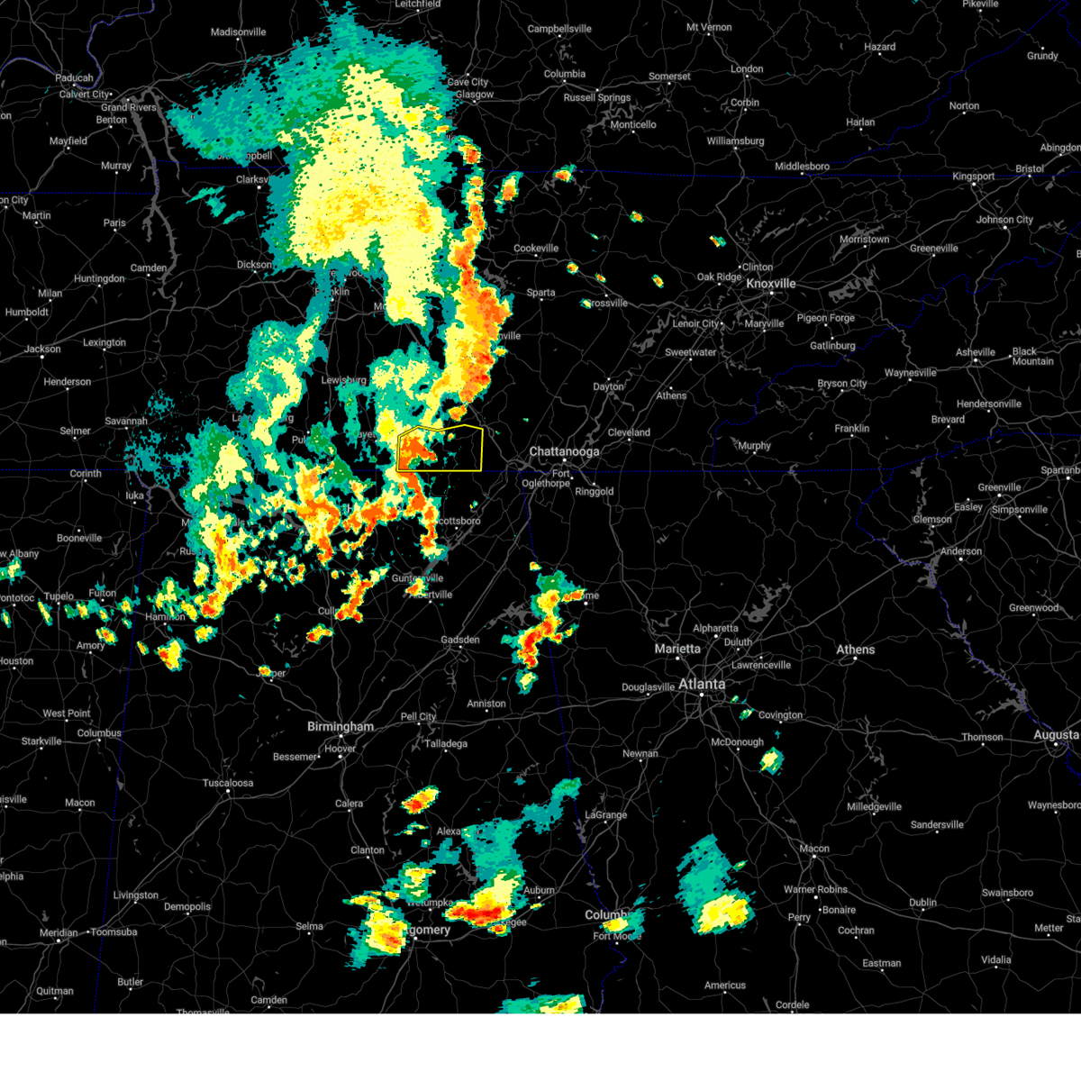 At 504 pm cdt, a severe thunderstorm was located over huntland, or 13 miles southwest of winchester, moving east at 30 mph (radar indicated). Hazards include 60 mph wind gusts. Expect damage to roofs, siding, and trees. locations impacted include, winchester, decherd, cowan, huntland, sewanee, tims ford lake, anderson, lexie crossroads, harmony and hurdlow. hail threat, radar indicated max hail size, <. 75 in wind threat, radar indicated max wind gust, 60 mph. At 504 pm cdt, a severe thunderstorm was located over huntland, or 13 miles southwest of winchester, moving east at 30 mph (radar indicated). Hazards include 60 mph wind gusts. Expect damage to roofs, siding, and trees. locations impacted include, winchester, decherd, cowan, huntland, sewanee, tims ford lake, anderson, lexie crossroads, harmony and hurdlow. hail threat, radar indicated max hail size, <. 75 in wind threat, radar indicated max wind gust, 60 mph.
|
| 8/13/2023 4:41 PM CDT |
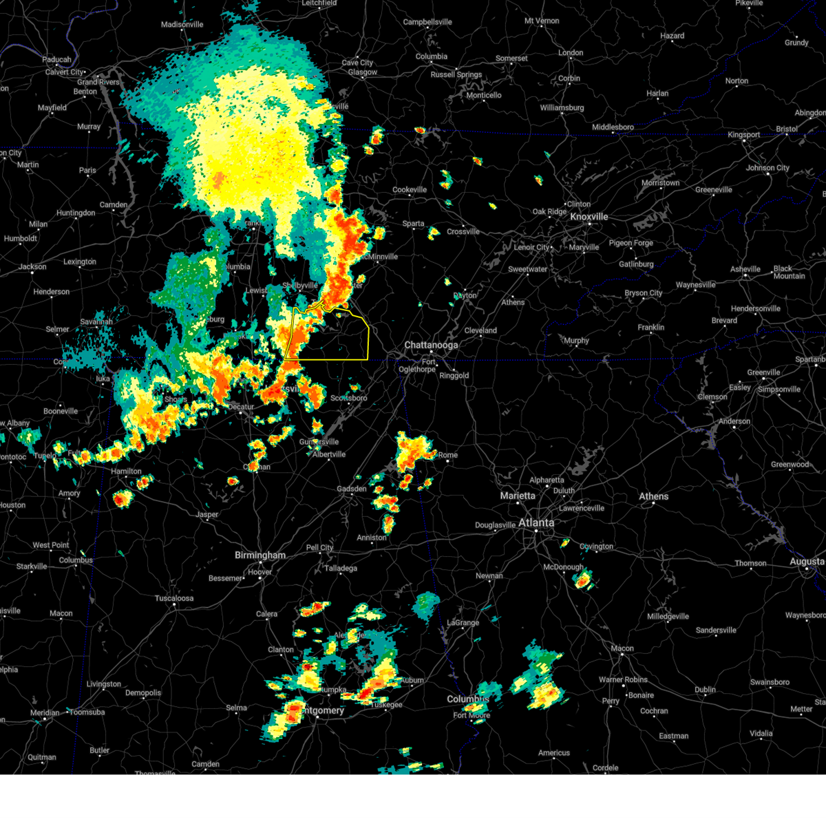 At 440 pm cdt, severe thunderstorms were located along a line extending from near tullahoma to near huntland to elora, moving east at 30 mph (radar indicated). Hazards include 60 mph wind gusts. expect damage to roofs, siding, and trees At 440 pm cdt, severe thunderstorms were located along a line extending from near tullahoma to near huntland to elora, moving east at 30 mph (radar indicated). Hazards include 60 mph wind gusts. expect damage to roofs, siding, and trees
|
| 8/12/2023 1:57 PM CDT |
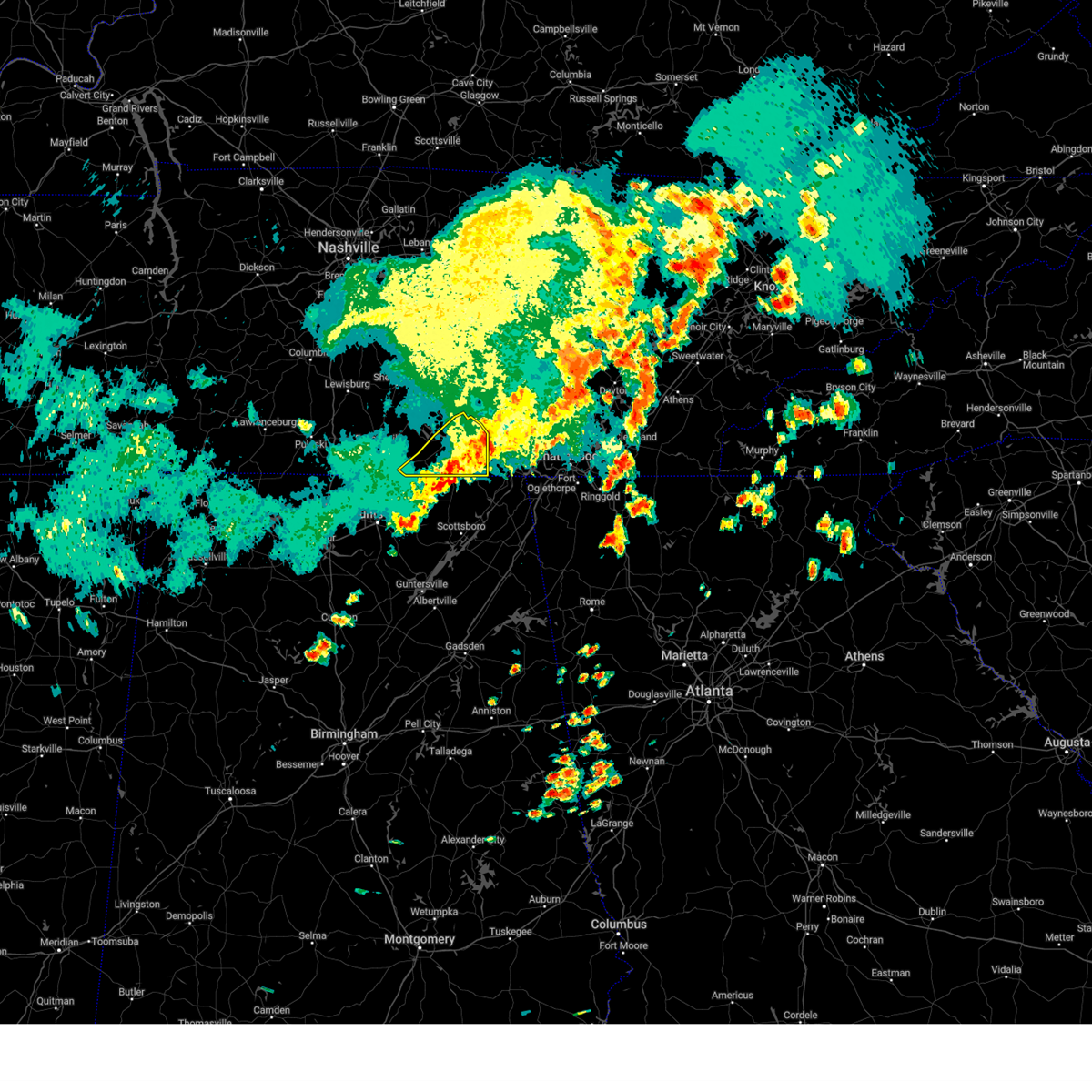 The severe thunderstorm warning for southeastern lincoln and franklin counties will expire at 200 pm cdt, the storms which prompted the warning have moved out of the area. therefore, the warning will be allowed to expire. a severe thunderstorm watch remains in effect until 600 pm cdt for north central and northeastern alabama, and middle tennessee. remember, a severe thunderstorm warning still remains in effect for southeastern franklin county until 2:30 pm cdt!. The severe thunderstorm warning for southeastern lincoln and franklin counties will expire at 200 pm cdt, the storms which prompted the warning have moved out of the area. therefore, the warning will be allowed to expire. a severe thunderstorm watch remains in effect until 600 pm cdt for north central and northeastern alabama, and middle tennessee. remember, a severe thunderstorm warning still remains in effect for southeastern franklin county until 2:30 pm cdt!.
|
| 8/12/2023 1:45 PM CDT |
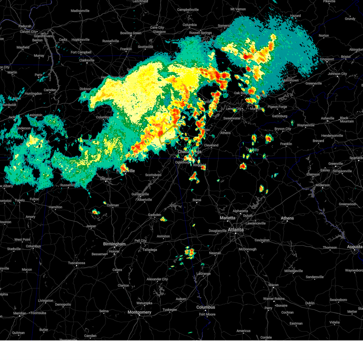 At 144 pm cdt, severe thunderstorms were located along a line extending from 6 miles southwest of pikeville to near tracy city, moving east at 45 mph (radar indicated). Hazards include 60 mph wind gusts. Expect damage to roofs, siding, and trees. locations impacted include, gruetli-laager, tracy city, monteagle, altamont, coalmont, palmer, beersheba springs, pelham and fiery gizzard state park. this includes interstate 24 between mile markers 128 and 134. hail threat, radar indicated max hail size, <. 75 in wind threat, radar indicated max wind gust, 60 mph. At 144 pm cdt, severe thunderstorms were located along a line extending from 6 miles southwest of pikeville to near tracy city, moving east at 45 mph (radar indicated). Hazards include 60 mph wind gusts. Expect damage to roofs, siding, and trees. locations impacted include, gruetli-laager, tracy city, monteagle, altamont, coalmont, palmer, beersheba springs, pelham and fiery gizzard state park. this includes interstate 24 between mile markers 128 and 134. hail threat, radar indicated max hail size, <. 75 in wind threat, radar indicated max wind gust, 60 mph.
|
| 8/12/2023 1:41 PM CDT |
 At 141 pm cdt, severe thunderstorms were located along a line extending from near monteagle to near cowan to near huntland, moving east at 50 mph (radar indicated). Hazards include 60 mph wind gusts and penny size hail. Expect damage to roofs, siding, and trees. locations impacted include, winchester, decherd, estill springs, cowan, huntland, sewanee, tims ford lake, anderson, lexie crossroads and elora. hail threat, radar indicated max hail size, 0. 75 in wind threat, radar indicated max wind gust, 60 mph. At 141 pm cdt, severe thunderstorms were located along a line extending from near monteagle to near cowan to near huntland, moving east at 50 mph (radar indicated). Hazards include 60 mph wind gusts and penny size hail. Expect damage to roofs, siding, and trees. locations impacted include, winchester, decherd, estill springs, cowan, huntland, sewanee, tims ford lake, anderson, lexie crossroads and elora. hail threat, radar indicated max hail size, 0. 75 in wind threat, radar indicated max wind gust, 60 mph.
|
| 8/12/2023 1:35 PM CDT |
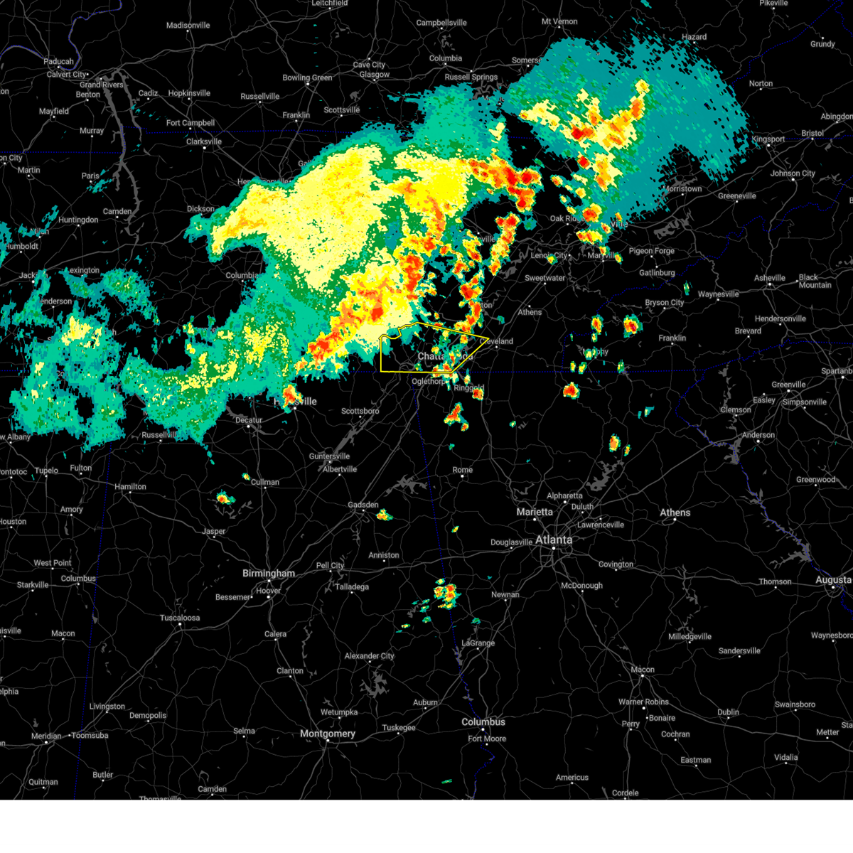 At 233 pm edt/133 pm cdt/, severe thunderstorms were located along a line extending from near gruetli-laager to sewanee to 6 miles south of huntland, moving southeast at 40 mph (radar indicated). Hazards include 70 mph wind gusts. Expect considerable tree damage. Damage is likely to mobile homes, roofs, and outbuildings. At 233 pm edt/133 pm cdt/, severe thunderstorms were located along a line extending from near gruetli-laager to sewanee to 6 miles south of huntland, moving southeast at 40 mph (radar indicated). Hazards include 70 mph wind gusts. Expect considerable tree damage. Damage is likely to mobile homes, roofs, and outbuildings.
|
| 8/12/2023 1:25 PM CDT |
 At 124 pm cdt, severe thunderstorms were located along a line extending from near estill springs to near tims ford lake to 9 miles north of new market, moving southeast at 25 mph (radar indicated). Hazards include 70 mph wind gusts and penny size hail. Expect considerable tree damage. damage is likely to mobile homes, roofs, and outbuildings. locations impacted include, winchester, fayetteville, decherd, estill springs, cowan, huntland, tims ford lake, sewanee, anderson and hurdlow. thunderstorm damage threat, considerable hail threat, radar indicated max hail size, 0. 75 in wind threat, radar indicated max wind gust, 70 mph. At 124 pm cdt, severe thunderstorms were located along a line extending from near estill springs to near tims ford lake to 9 miles north of new market, moving southeast at 25 mph (radar indicated). Hazards include 70 mph wind gusts and penny size hail. Expect considerable tree damage. damage is likely to mobile homes, roofs, and outbuildings. locations impacted include, winchester, fayetteville, decherd, estill springs, cowan, huntland, tims ford lake, sewanee, anderson and hurdlow. thunderstorm damage threat, considerable hail threat, radar indicated max hail size, 0. 75 in wind threat, radar indicated max wind gust, 70 mph.
|
| 8/12/2023 1:10 PM CDT |
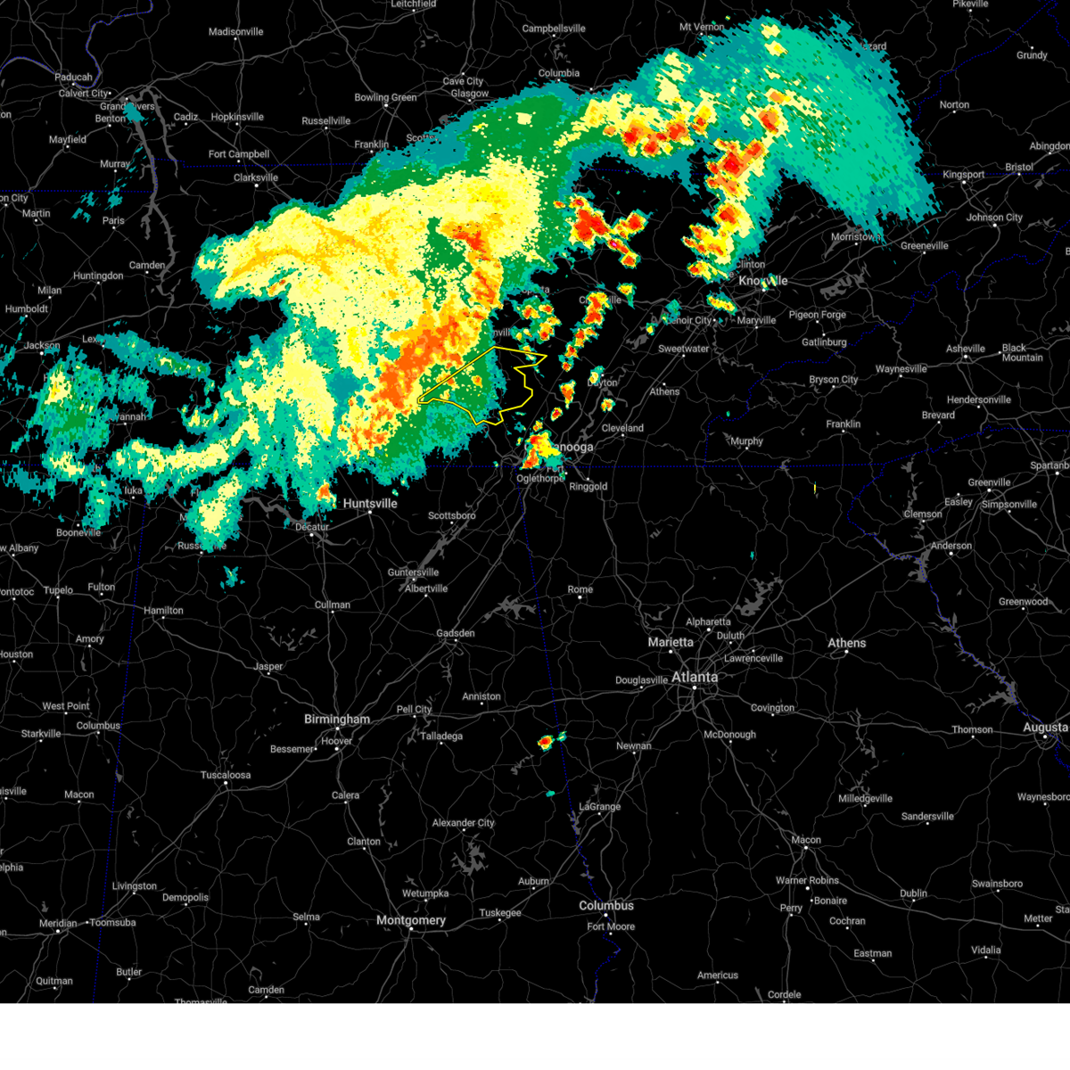 At 109 pm cdt, severe thunderstorms were located along a line extending from mcminnville to near tullahoma, moving east at 55 mph (radar indicated). Hazards include 60 mph wind gusts. expect damage to roofs, siding, and trees At 109 pm cdt, severe thunderstorms were located along a line extending from mcminnville to near tullahoma, moving east at 55 mph (radar indicated). Hazards include 60 mph wind gusts. expect damage to roofs, siding, and trees
|
| 8/12/2023 1:10 PM CDT |
 At 110 pm cdt, severe thunderstorms were located along a line extending from tullahoma to near tims ford lake to near fayetteville, moving southeast at 30 mph (radar indicated). Hazards include 60 mph wind gusts and penny size hail. expect damage to roofs, siding, and trees At 110 pm cdt, severe thunderstorms were located along a line extending from tullahoma to near tims ford lake to near fayetteville, moving southeast at 30 mph (radar indicated). Hazards include 60 mph wind gusts and penny size hail. expect damage to roofs, siding, and trees
|
| 8/12/2023 1:04 PM CDT |
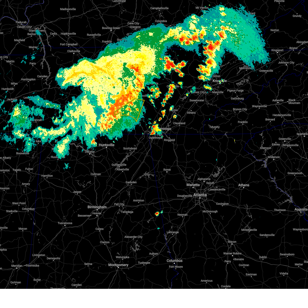 At 104 pm cdt, severe thunderstorms were located along a line extending from near mcminnville to near lynchburg, moving east at 50 mph (radar indicated). Hazards include 60 mph wind gusts. Expect damage to roofs, siding, and trees. locations impacted include, mcminnville, manchester, tullahoma, monteagle, altamont, morrison, normandy, viola, raus, summitville, hillsboro, pelham and arnold afb. this includes interstate 24 between mile markers 106 and 131. hail threat, radar indicated max hail size, <. 75 in wind threat, radar indicated max wind gust, 60 mph. At 104 pm cdt, severe thunderstorms were located along a line extending from near mcminnville to near lynchburg, moving east at 50 mph (radar indicated). Hazards include 60 mph wind gusts. Expect damage to roofs, siding, and trees. locations impacted include, mcminnville, manchester, tullahoma, monteagle, altamont, morrison, normandy, viola, raus, summitville, hillsboro, pelham and arnold afb. this includes interstate 24 between mile markers 106 and 131. hail threat, radar indicated max hail size, <. 75 in wind threat, radar indicated max wind gust, 60 mph.
|
| 8/12/2023 12:51 PM CDT |
 At 1250 pm cdt, severe thunderstorms were located along a line extending from centertown to petersburg, moving east at 50 mph (radar indicated). Hazards include 60 mph wind gusts. Expect damage to roofs, siding, and trees. locations impacted include, shelbyville, mcminnville, manchester, tullahoma, monteagle, altamont, morrison, wartrace, normandy, viola, beechgrove, raus, summitville, hillsboro, pelham and arnold afb. this includes interstate 24 between mile markers 97 and 131. hail threat, radar indicated max hail size, <. 75 in wind threat, radar indicated max wind gust, 60 mph. At 1250 pm cdt, severe thunderstorms were located along a line extending from centertown to petersburg, moving east at 50 mph (radar indicated). Hazards include 60 mph wind gusts. Expect damage to roofs, siding, and trees. locations impacted include, shelbyville, mcminnville, manchester, tullahoma, monteagle, altamont, morrison, wartrace, normandy, viola, beechgrove, raus, summitville, hillsboro, pelham and arnold afb. this includes interstate 24 between mile markers 97 and 131. hail threat, radar indicated max hail size, <. 75 in wind threat, radar indicated max wind gust, 60 mph.
|
| 8/12/2023 12:29 PM CDT |
 At 1228 pm cdt, severe thunderstorms were located along a line extending from murfreesboro to near lewisburg, moving east at 50 mph (radar indicated). Hazards include 60 mph wind gusts. expect damage to roofs, siding, and trees At 1228 pm cdt, severe thunderstorms were located along a line extending from murfreesboro to near lewisburg, moving east at 50 mph (radar indicated). Hazards include 60 mph wind gusts. expect damage to roofs, siding, and trees
|
| 8/10/2023 3:18 AM CDT |
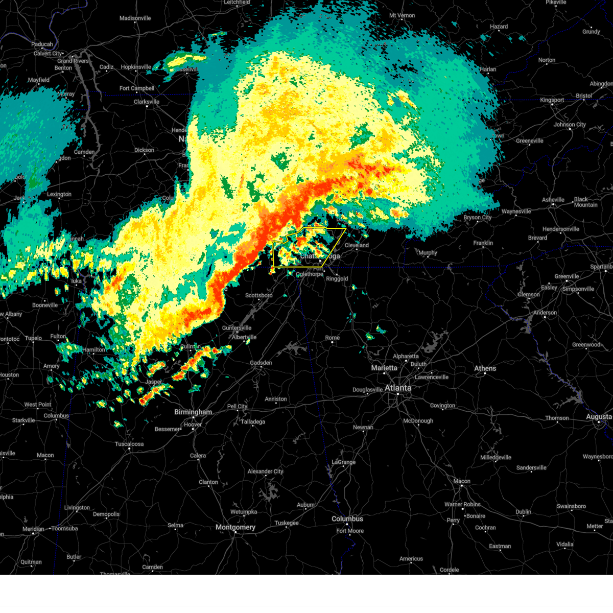 At 417 am edt/317 am cdt/, severe thunderstorms were located along a line extending from near monteagle to near cowan to 11 miles north of skyline, moving east at 60 mph (radar indicated). Hazards include 60 mph wind gusts. expect damage to roofs, siding, and trees At 417 am edt/317 am cdt/, severe thunderstorms were located along a line extending from near monteagle to near cowan to 11 miles north of skyline, moving east at 60 mph (radar indicated). Hazards include 60 mph wind gusts. expect damage to roofs, siding, and trees
|
| 7/20/2023 3:33 PM CDT |
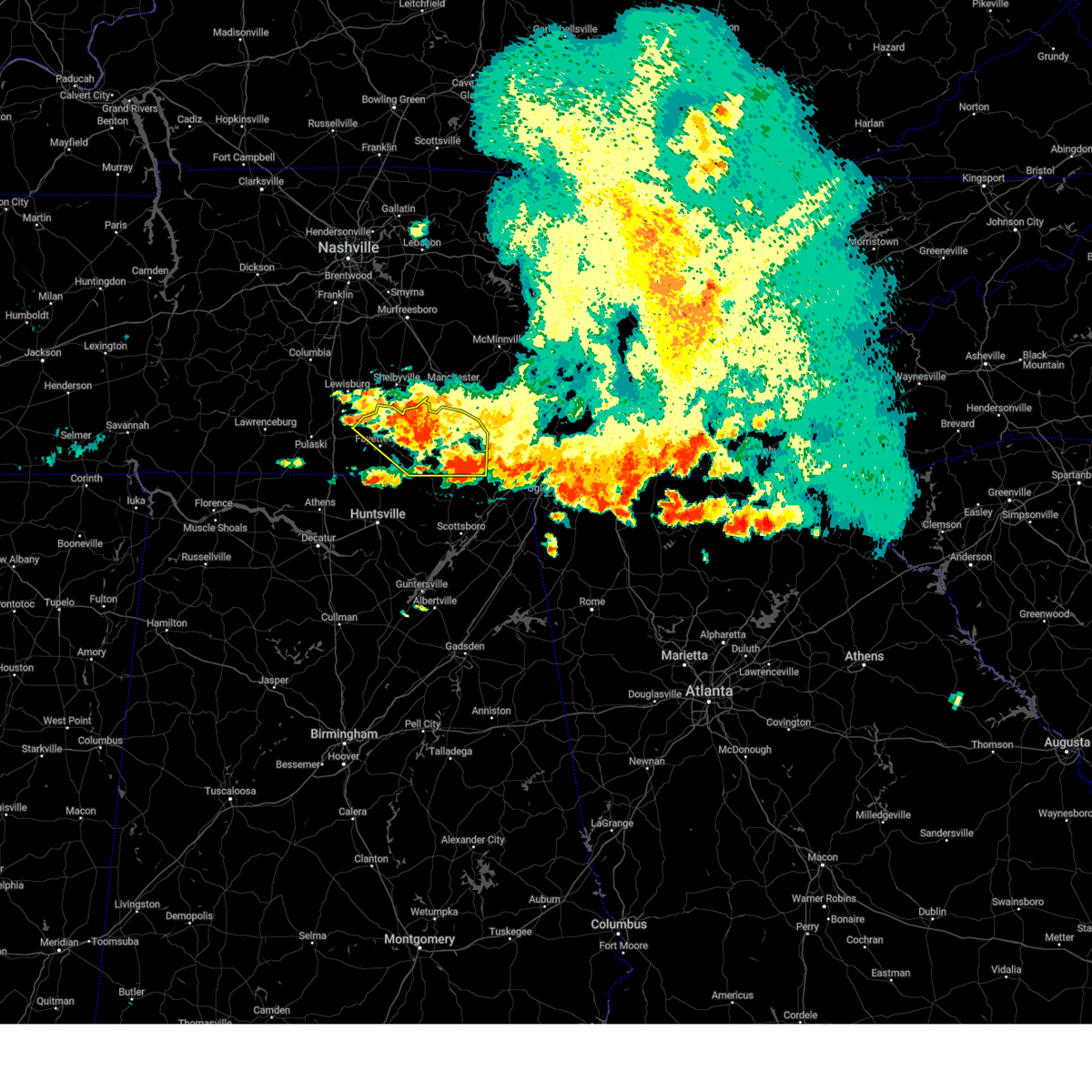 At 332 pm cdt, severe thunderstorms were located along a line extending from 7 miles south of tracy city to near fayetteville, moving southeast at 35 mph (radar indicated). Hazards include 60 mph wind gusts and penny size hail. Expect damage to roofs, siding, and trees. locations impacted include, winchester, fayetteville, lynchburg, decherd, estill springs, cowan, huntland, petersburg, tims ford lake and sewanee. hail threat, radar indicated max hail size, 0. 75 in wind threat, observed max wind gust, 60 mph. At 332 pm cdt, severe thunderstorms were located along a line extending from 7 miles south of tracy city to near fayetteville, moving southeast at 35 mph (radar indicated). Hazards include 60 mph wind gusts and penny size hail. Expect damage to roofs, siding, and trees. locations impacted include, winchester, fayetteville, lynchburg, decherd, estill springs, cowan, huntland, petersburg, tims ford lake and sewanee. hail threat, radar indicated max hail size, 0. 75 in wind threat, observed max wind gust, 60 mph.
|
| 7/20/2023 3:08 PM CDT |
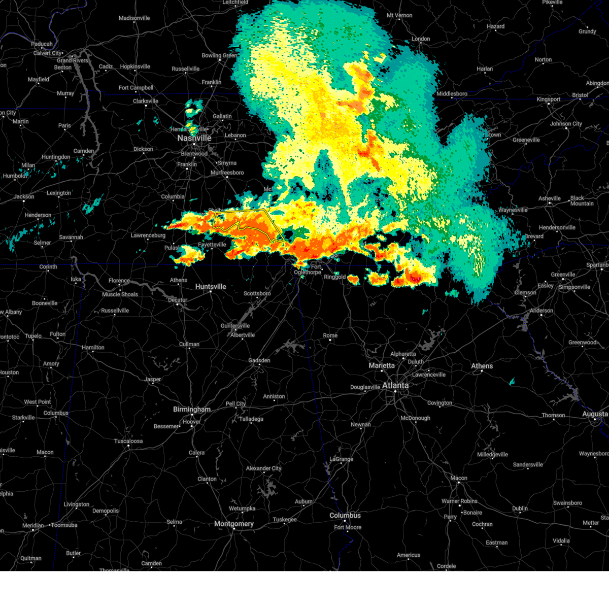 The severe thunderstorm warning for southern coffee, southeastern bedford and southwestern grundy counties will expire at 315 pm cdt, the storm which prompted the warning has weakened below severe limits, and no longer poses an immediate threat to life or property. therefore, the warning will be allowed to expire. however gusty winds and heavy rain are still possible with this thunderstorm. a severe thunderstorm watch remains in effect until 700 pm cdt for middle tennessee. The severe thunderstorm warning for southern coffee, southeastern bedford and southwestern grundy counties will expire at 315 pm cdt, the storm which prompted the warning has weakened below severe limits, and no longer poses an immediate threat to life or property. therefore, the warning will be allowed to expire. however gusty winds and heavy rain are still possible with this thunderstorm. a severe thunderstorm watch remains in effect until 700 pm cdt for middle tennessee.
|
| 7/20/2023 2:58 PM CDT |
 At 257 pm cdt, severe thunderstorms were located along a line extending from near sewanee to 10 miles southwest of lewisburg, moving southeast at 35 mph. prolonged heavy rainfall may also lead to localized flooding (radar indicated). Hazards include 60 mph wind gusts and penny size hail. expect damage to roofs, siding, and trees At 257 pm cdt, severe thunderstorms were located along a line extending from near sewanee to 10 miles southwest of lewisburg, moving southeast at 35 mph. prolonged heavy rainfall may also lead to localized flooding (radar indicated). Hazards include 60 mph wind gusts and penny size hail. expect damage to roofs, siding, and trees
|
| 7/20/2023 2:51 PM CDT |
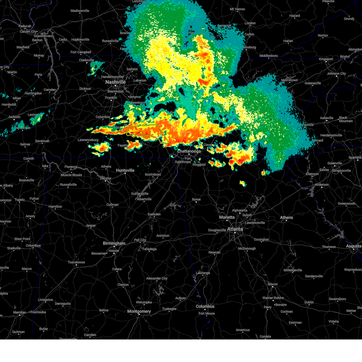 At 250 pm cdt, a severe thunderstorm was located near manchester, moving southeast at 35 mph (radar indicated). Hazards include 60 mph wind gusts and nickel size hail. Expect damage to roofs, siding, and trees. locations impacted include, shelbyville, manchester, tullahoma, tracy city, monteagle, normandy, hillsboro, pelham, raus, arnold afb and fiery gizzard state park. this includes interstate 24 between mile markers 108 and 134. hail threat, radar indicated max hail size, 0. 88 in wind threat, radar indicated max wind gust, 60 mph. At 250 pm cdt, a severe thunderstorm was located near manchester, moving southeast at 35 mph (radar indicated). Hazards include 60 mph wind gusts and nickel size hail. Expect damage to roofs, siding, and trees. locations impacted include, shelbyville, manchester, tullahoma, tracy city, monteagle, normandy, hillsboro, pelham, raus, arnold afb and fiery gizzard state park. this includes interstate 24 between mile markers 108 and 134. hail threat, radar indicated max hail size, 0. 88 in wind threat, radar indicated max wind gust, 60 mph.
|
| 7/20/2023 2:46 PM CDT |
 At 346 pm edt/246 pm cdt/, severe thunderstorms were located along a line extending from near dunlap to 8 miles northeast of whitwell to 6 miles east of tracy city to near monteagle, moving southeast at 55 mph (radar indicated). Hazards include 60 mph wind gusts. Expect damage to roofs, siding, and trees. locations impacted include, chattanooga, dunlap, jasper, soddy-daisy, signal mountain, walden, lakesite, whitwell, kimball and monteagle. hail threat, radar indicated max hail size, <. 75 in wind threat, radar indicated max wind gust, 60 mph. At 346 pm edt/246 pm cdt/, severe thunderstorms were located along a line extending from near dunlap to 8 miles northeast of whitwell to 6 miles east of tracy city to near monteagle, moving southeast at 55 mph (radar indicated). Hazards include 60 mph wind gusts. Expect damage to roofs, siding, and trees. locations impacted include, chattanooga, dunlap, jasper, soddy-daisy, signal mountain, walden, lakesite, whitwell, kimball and monteagle. hail threat, radar indicated max hail size, <. 75 in wind threat, radar indicated max wind gust, 60 mph.
|
| 7/20/2023 2:42 PM CDT |
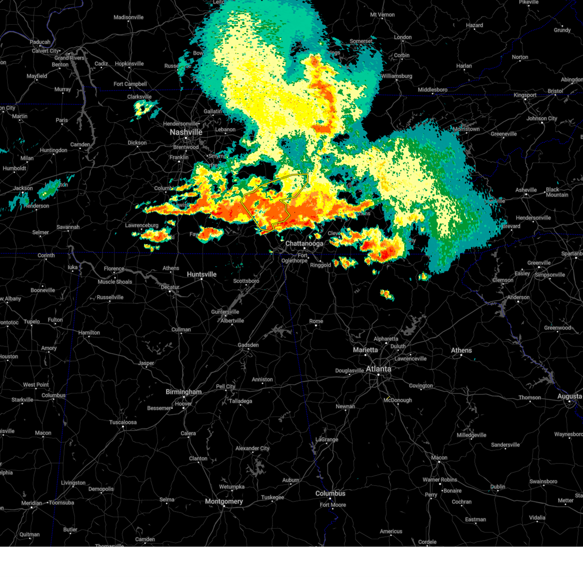 The severe thunderstorm warning for eastern coffee, van buren, southern warren and grundy counties will expire at 245 pm cdt, the storms which prompted the warning have weakened below severe limits, and no longer pose an immediate threat to life or property. therefore, the warning will be allowed to expire. however gusty winds and heavy rain are still possible with these thunderstorms. a severe thunderstorm watch remains in effect until 700 pm cdt for middle tennessee. The severe thunderstorm warning for eastern coffee, van buren, southern warren and grundy counties will expire at 245 pm cdt, the storms which prompted the warning have weakened below severe limits, and no longer pose an immediate threat to life or property. therefore, the warning will be allowed to expire. however gusty winds and heavy rain are still possible with these thunderstorms. a severe thunderstorm watch remains in effect until 700 pm cdt for middle tennessee.
|
| 7/20/2023 2:35 PM CDT |
 At 335 pm edt/235 pm cdt/, severe thunderstorms were located along a line extending from 13 miles north of dunlap to near gruetli-laager to 10 miles northwest of monteagle, moving southeast at 45 mph (radar indicated). Hazards include 70 mph wind gusts. Expect considerable tree damage. damage is likely to mobile homes, roofs, and outbuildings. locations impacted include, chattanooga, dunlap, jasper, soddy-daisy, signal mountain, walden, lakesite, whitwell, kimball and monteagle. thunderstorm damage threat, considerable hail threat, radar indicated max hail size, <. 75 in wind threat, radar indicated max wind gust, 70 mph. At 335 pm edt/235 pm cdt/, severe thunderstorms were located along a line extending from 13 miles north of dunlap to near gruetli-laager to 10 miles northwest of monteagle, moving southeast at 45 mph (radar indicated). Hazards include 70 mph wind gusts. Expect considerable tree damage. damage is likely to mobile homes, roofs, and outbuildings. locations impacted include, chattanooga, dunlap, jasper, soddy-daisy, signal mountain, walden, lakesite, whitwell, kimball and monteagle. thunderstorm damage threat, considerable hail threat, radar indicated max hail size, <. 75 in wind threat, radar indicated max wind gust, 70 mph.
|
| 7/20/2023 2:30 PM CDT |
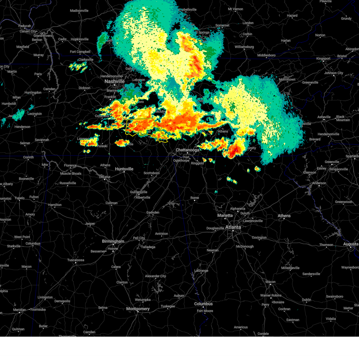 At 229 pm cdt, a severe thunderstorm was located over manchester, moving southeast at 50 mph (radar indicated). Hazards include 60 mph wind gusts and quarter size hail. Hail damage to vehicles is expected. Expect wind damage to roofs, siding, and trees. At 229 pm cdt, a severe thunderstorm was located over manchester, moving southeast at 50 mph (radar indicated). Hazards include 60 mph wind gusts and quarter size hail. Hail damage to vehicles is expected. Expect wind damage to roofs, siding, and trees.
|
| 7/20/2023 2:23 PM CDT |
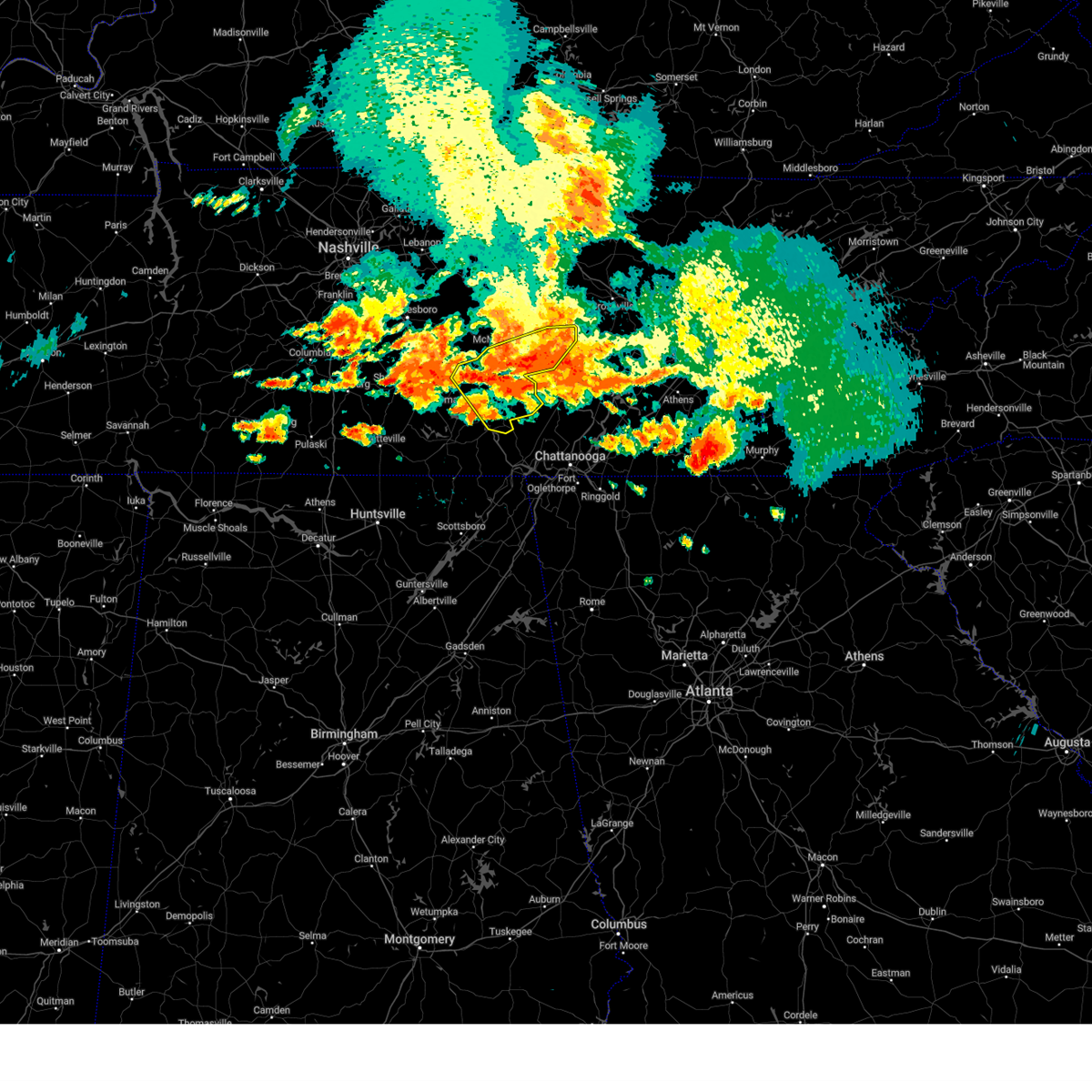 At 222 pm cdt, severe thunderstorms were located along a line extending from near spencer to 12 miles east of manchester, moving southeast at 50 mph (radar indicated). Hazards include 60 mph wind gusts and nickel size hail. Expect damage to roofs, siding, and trees. locations impacted include, mcminnville, manchester, spencer, gruetli-laager, tracy city, monteagle, altamont, coalmont, morrison, palmer, beersheba springs, viola, summitville, fall creek falls state park, hillsboro, pelham and fiery gizzard state park. this includes interstate 24 between mile markers 127 and 128. hail threat, radar indicated max hail size, 0. 88 in wind threat, radar indicated max wind gust, 60 mph. At 222 pm cdt, severe thunderstorms were located along a line extending from near spencer to 12 miles east of manchester, moving southeast at 50 mph (radar indicated). Hazards include 60 mph wind gusts and nickel size hail. Expect damage to roofs, siding, and trees. locations impacted include, mcminnville, manchester, spencer, gruetli-laager, tracy city, monteagle, altamont, coalmont, morrison, palmer, beersheba springs, viola, summitville, fall creek falls state park, hillsboro, pelham and fiery gizzard state park. this includes interstate 24 between mile markers 127 and 128. hail threat, radar indicated max hail size, 0. 88 in wind threat, radar indicated max wind gust, 60 mph.
|
| 7/20/2023 2:18 PM CDT |
 At 318 pm edt/218 pm cdt/, severe thunderstorms were located along a line extending from 7 miles southwest of spencer to 10 miles southeast of mcminnville to 15 miles northwest of gruetli-laager to near manchester, moving southeast at 50 mph (radar indicated). Hazards include 60 mph wind gusts and penny size hail. expect damage to roofs, siding, and trees At 318 pm edt/218 pm cdt/, severe thunderstorms were located along a line extending from 7 miles southwest of spencer to 10 miles southeast of mcminnville to 15 miles northwest of gruetli-laager to near manchester, moving southeast at 50 mph (radar indicated). Hazards include 60 mph wind gusts and penny size hail. expect damage to roofs, siding, and trees
|
| 7/20/2023 2:17 PM CDT |
 At 217 pm cdt, severe thunderstorms were located along a line extending from 6 miles northwest of spencer to 9 miles northeast of manchester, moving southeast at 45 mph (radar indicated). Hazards include 60 mph wind gusts and nickel size hail. Expect damage to roofs, siding, and trees. locations impacted include, mcminnville, manchester, sparta, spencer, gruetli-laager, tracy city, monteagle, altamont, coalmont, morrison, palmer, doyle, beersheba springs, centertown, viola, virgin falls state natural area, rock island state park, summitville, fall creek falls state park and hillsboro. hail threat, radar indicated max hail size, 0. 88 in wind threat, radar indicated max wind gust, 60 mph. At 217 pm cdt, severe thunderstorms were located along a line extending from 6 miles northwest of spencer to 9 miles northeast of manchester, moving southeast at 45 mph (radar indicated). Hazards include 60 mph wind gusts and nickel size hail. Expect damage to roofs, siding, and trees. locations impacted include, mcminnville, manchester, sparta, spencer, gruetli-laager, tracy city, monteagle, altamont, coalmont, morrison, palmer, doyle, beersheba springs, centertown, viola, virgin falls state natural area, rock island state park, summitville, fall creek falls state park and hillsboro. hail threat, radar indicated max hail size, 0. 88 in wind threat, radar indicated max wind gust, 60 mph.
|
| 7/20/2023 2:11 PM CDT |
 At 211 pm cdt, severe thunderstorms were located along a line extending from 9 miles northwest of spencer to 9 miles northeast of manchester, moving southeast at 45 mph (radar indicated). Hazards include 70 mph wind gusts and quarter size hail. Hail damage to vehicles is expected. expect considerable tree damage. Wind damage is also likely to mobile homes, roofs, and outbuildings. At 211 pm cdt, severe thunderstorms were located along a line extending from 9 miles northwest of spencer to 9 miles northeast of manchester, moving southeast at 45 mph (radar indicated). Hazards include 70 mph wind gusts and quarter size hail. Hail damage to vehicles is expected. expect considerable tree damage. Wind damage is also likely to mobile homes, roofs, and outbuildings.
|
| 7/20/2023 2:00 PM CDT |
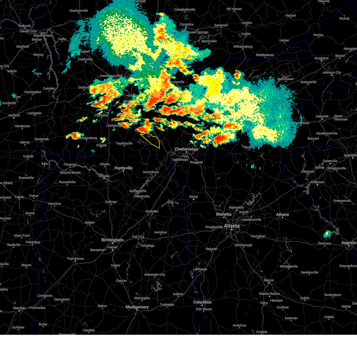 At 200 pm cdt, a severe thunderstorm was located near tullahoma, or 7 miles south of manchester, moving east at 30 mph (radar indicated). Hazards include 60 mph wind gusts and quarter size hail. Hail damage to vehicles is expected. expect wind damage to roofs, siding, and trees. locations impacted include, decherd, estill springs, cowan, sewanee, woods reservoir, arnold afb, alto and st. andrews. hail threat, radar indicated max hail size, 1. 00 in wind threat, radar indicated max wind gust, 60 mph. At 200 pm cdt, a severe thunderstorm was located near tullahoma, or 7 miles south of manchester, moving east at 30 mph (radar indicated). Hazards include 60 mph wind gusts and quarter size hail. Hail damage to vehicles is expected. expect wind damage to roofs, siding, and trees. locations impacted include, decherd, estill springs, cowan, sewanee, woods reservoir, arnold afb, alto and st. andrews. hail threat, radar indicated max hail size, 1. 00 in wind threat, radar indicated max wind gust, 60 mph.
|
| 7/20/2023 1:58 PM CDT |
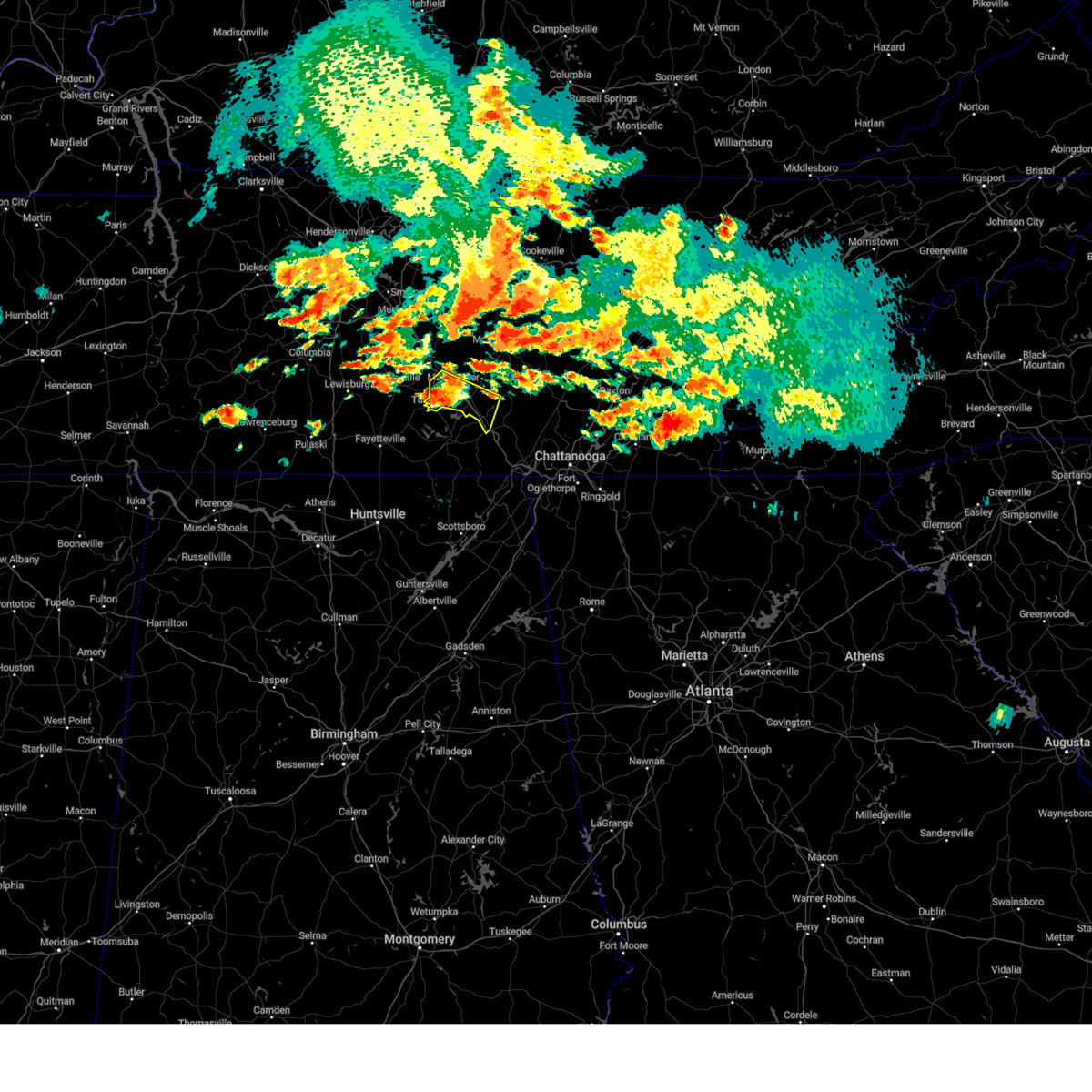 At 157 pm cdt, a severe thunderstorm was located near manchester, moving east at 40 mph (radar indicated). Hazards include 60 mph wind gusts and quarter size hail. Hail damage to vehicles is expected. expect wind damage to roofs, siding, and trees. locations impacted include, manchester, tullahoma, monteagle, altamont, hillsboro, pelham, arnold afb and woods reservoir. this includes interstate 24 between mile markers 105 and 134. hail threat, radar indicated max hail size, 1. 00 in wind threat, radar indicated max wind gust, 60 mph. At 157 pm cdt, a severe thunderstorm was located near manchester, moving east at 40 mph (radar indicated). Hazards include 60 mph wind gusts and quarter size hail. Hail damage to vehicles is expected. expect wind damage to roofs, siding, and trees. locations impacted include, manchester, tullahoma, monteagle, altamont, hillsboro, pelham, arnold afb and woods reservoir. this includes interstate 24 between mile markers 105 and 134. hail threat, radar indicated max hail size, 1. 00 in wind threat, radar indicated max wind gust, 60 mph.
|
| 7/20/2023 1:44 PM CDT |
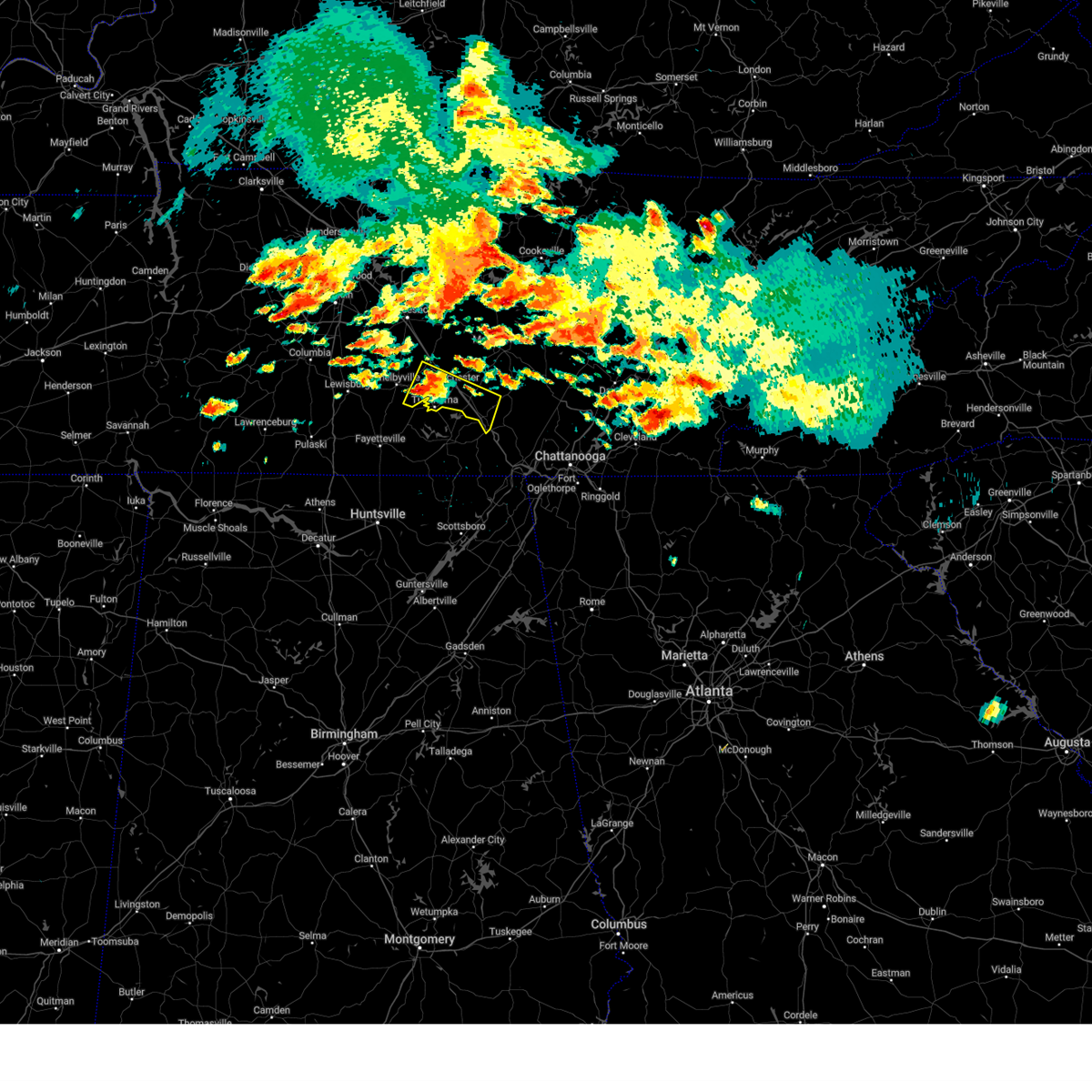 At 144 pm cdt, a severe thunderstorm was located near tullahoma, or 9 miles east of shelbyville, moving east at 40 mph (radar indicated). Hazards include 60 mph wind gusts and quarter size hail. Hail damage to vehicles is expected. Expect wind damage to roofs, siding, and trees. At 144 pm cdt, a severe thunderstorm was located near tullahoma, or 9 miles east of shelbyville, moving east at 40 mph (radar indicated). Hazards include 60 mph wind gusts and quarter size hail. Hail damage to vehicles is expected. Expect wind damage to roofs, siding, and trees.
|
| 7/20/2023 1:40 PM CDT |
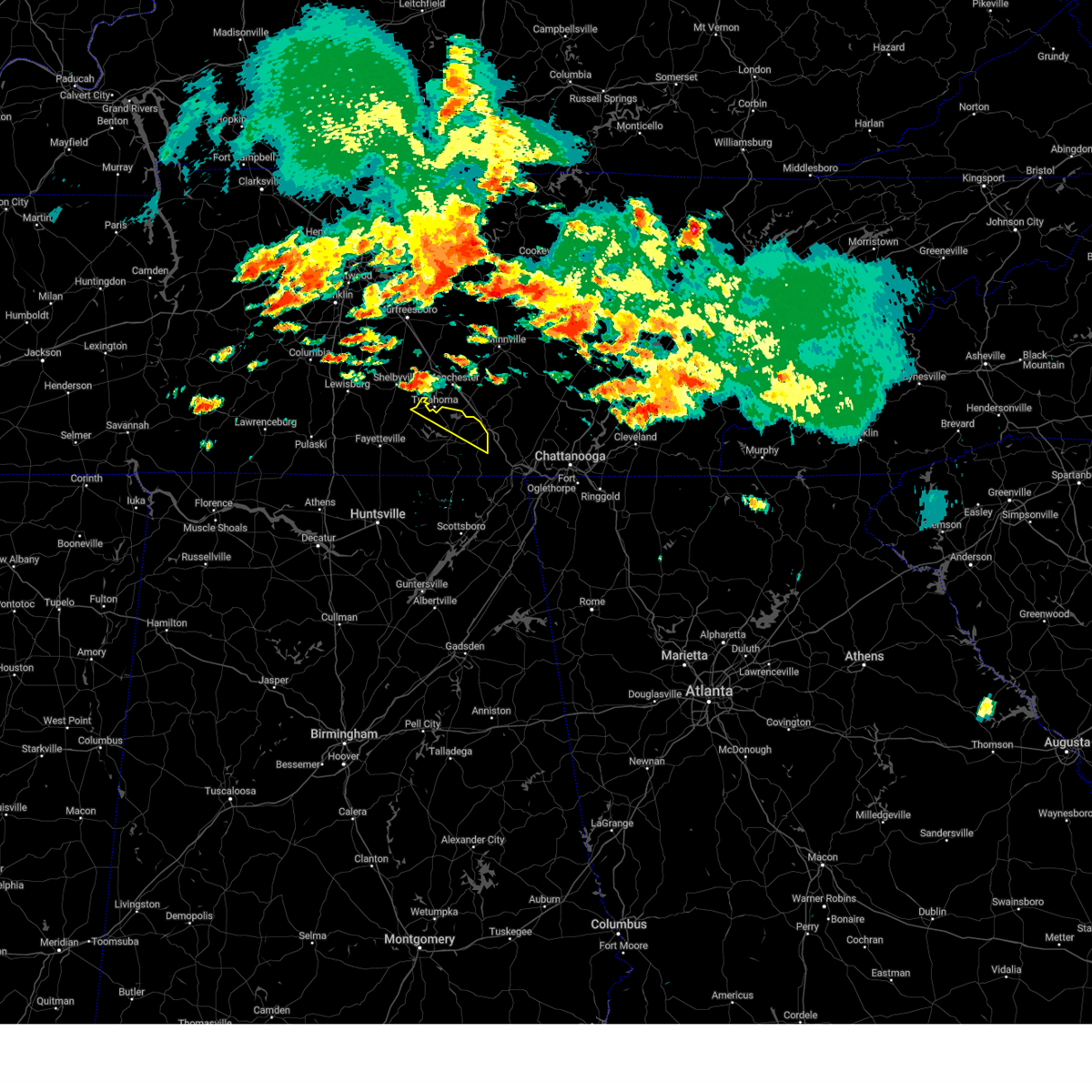 At 140 pm cdt, a severe thunderstorm was located near tullahoma, or 8 miles southeast of shelbyville, moving east at 30 mph (radar indicated). Hazards include 60 mph wind gusts and half dollar size hail. Hail damage to vehicles is expected. Expect wind damage to roofs, siding, and trees. At 140 pm cdt, a severe thunderstorm was located near tullahoma, or 8 miles southeast of shelbyville, moving east at 30 mph (radar indicated). Hazards include 60 mph wind gusts and half dollar size hail. Hail damage to vehicles is expected. Expect wind damage to roofs, siding, and trees.
|
| 7/18/2023 5:51 PM CDT |
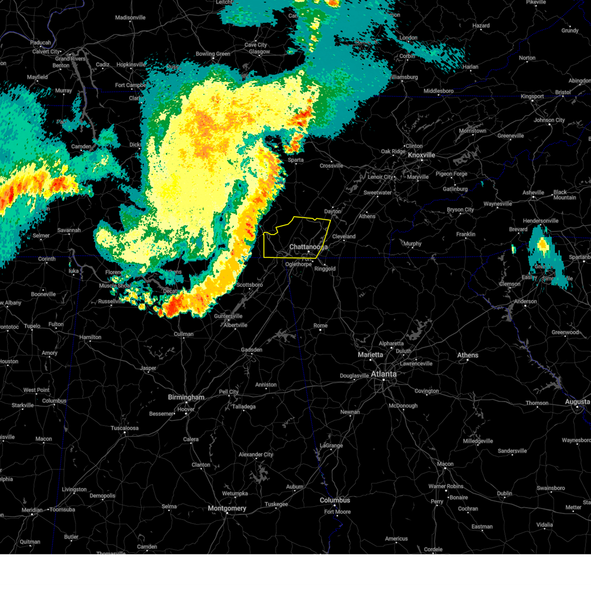 At 649 pm edt/549 pm cdt/, severe thunderstorms were located along a line extending from 11 miles east of manchester to near cowan to 9 miles northeast of gurley, moving east at 45 mph (radar indicated). Hazards include 60 mph wind gusts. expect damage to roofs, siding, and trees At 649 pm edt/549 pm cdt/, severe thunderstorms were located along a line extending from 11 miles east of manchester to near cowan to 9 miles northeast of gurley, moving east at 45 mph (radar indicated). Hazards include 60 mph wind gusts. expect damage to roofs, siding, and trees
|
| 7/18/2023 4:56 PM CDT |
 At 456 pm cdt, severe thunderstorms were located along a line extending from 7 miles south of murfreesboro to 13 miles west of ardmore, moving southeast at 50 mph (radar indicated). Hazards include 60 mph wind gusts and penny size hail. expect damage to roofs, siding, and trees At 456 pm cdt, severe thunderstorms were located along a line extending from 7 miles south of murfreesboro to 13 miles west of ardmore, moving southeast at 50 mph (radar indicated). Hazards include 60 mph wind gusts and penny size hail. expect damage to roofs, siding, and trees
|
| 7/1/2023 2:21 PM CDT |
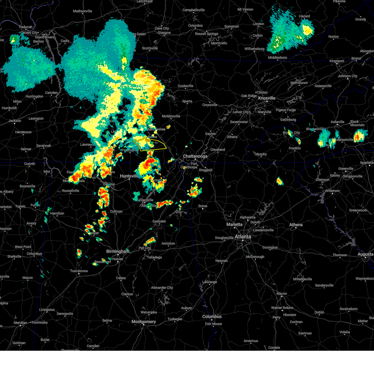 The severe thunderstorm warning for moore and northern franklin counties will expire at 230 pm cdt, the storm which prompted the warning has weakened below severe limits and no longer poses an immediate threat to life or property. therefore, the warning will be allowed to expire. gusty winds are still possible with this thunderstorm. a severe thunderstorm watch remains in effect until 800 pm cdt for north central and northeastern alabama, and middle tennessee. The severe thunderstorm warning for moore and northern franklin counties will expire at 230 pm cdt, the storm which prompted the warning has weakened below severe limits and no longer poses an immediate threat to life or property. therefore, the warning will be allowed to expire. gusty winds are still possible with this thunderstorm. a severe thunderstorm watch remains in effect until 800 pm cdt for north central and northeastern alabama, and middle tennessee.
|
| 7/1/2023 2:02 PM CDT |
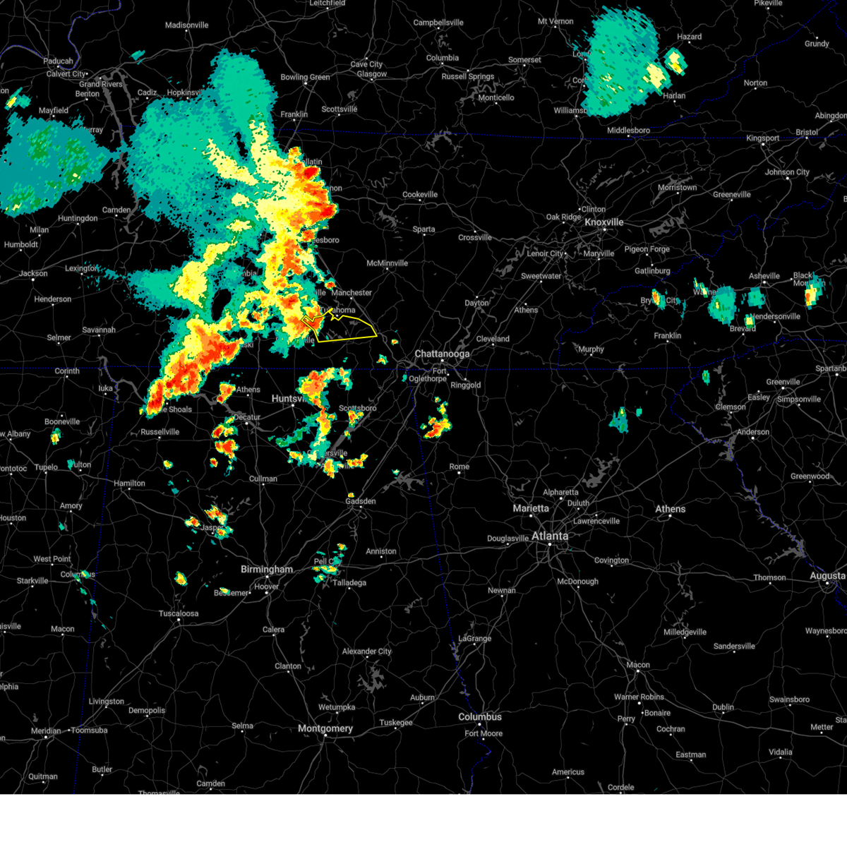 At 201 pm cdt, a severe thunderstorm was located near tullahoma, or near lynchburg moving east at 30 mph (radar indicated). Hazards include 60 mph wind gusts and quarter size hail. Hail damage to vehicles is expected. expect wind damage to roofs, siding, and trees. Locations impacted include, winchester, lynchburg, decherd, estill springs, tims ford lake, sewanee, woods reservoir, arnold afb, lois and alto. At 201 pm cdt, a severe thunderstorm was located near tullahoma, or near lynchburg moving east at 30 mph (radar indicated). Hazards include 60 mph wind gusts and quarter size hail. Hail damage to vehicles is expected. expect wind damage to roofs, siding, and trees. Locations impacted include, winchester, lynchburg, decherd, estill springs, tims ford lake, sewanee, woods reservoir, arnold afb, lois and alto.
|
| 7/1/2023 1:35 PM CDT |
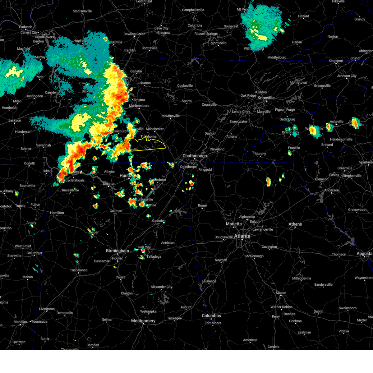 At 135 pm cdt, a severe thunderstorm was located 7 miles west of lynchburg, moving east at 30 mph (radar indicated). Hazards include 60 mph wind gusts and quarter size hail. Hail damage to vehicles is expected. Expect wind damage to roofs, siding, and trees. At 135 pm cdt, a severe thunderstorm was located 7 miles west of lynchburg, moving east at 30 mph (radar indicated). Hazards include 60 mph wind gusts and quarter size hail. Hail damage to vehicles is expected. Expect wind damage to roofs, siding, and trees.
|
| 6/25/2023 3:08 PM CDT |
 The severe thunderstorm warning for north central jackson and franklin counties will expire at 315 pm cdt, the storm which prompted the warning has weakened below severe limits, and no longer poses an immediate threat to life or property. therefore, the warning will be allowed to expire. however heavy rain is still possible with this thunderstorm. a severe thunderstorm watch remains in effect until 600 pm cdt for north central and northeastern alabama, and middle tennessee. The severe thunderstorm warning for north central jackson and franklin counties will expire at 315 pm cdt, the storm which prompted the warning has weakened below severe limits, and no longer poses an immediate threat to life or property. therefore, the warning will be allowed to expire. however heavy rain is still possible with this thunderstorm. a severe thunderstorm watch remains in effect until 600 pm cdt for north central and northeastern alabama, and middle tennessee.
|
| 6/25/2023 2:53 PM CDT |
 At 253 pm cdt, severe thunderstorms were located along a line extending from decherd to near cowan to 10 miles west of south pittsburg, moving northeast at 30 mph (radar indicated). Hazards include 60 mph wind gusts and quarter size hail. Hail damage to vehicles is expected. expect wind damage to roofs, siding, and trees. locations impacted include, winchester, bridgeport, decherd, estill springs, cowan, sewanee, tims ford lake, anderson, bass and russell cave national monument. hail threat, radar indicated max hail size, 1. 00 in wind threat, radar indicated max wind gust, 60 mph. At 253 pm cdt, severe thunderstorms were located along a line extending from decherd to near cowan to 10 miles west of south pittsburg, moving northeast at 30 mph (radar indicated). Hazards include 60 mph wind gusts and quarter size hail. Hail damage to vehicles is expected. expect wind damage to roofs, siding, and trees. locations impacted include, winchester, bridgeport, decherd, estill springs, cowan, sewanee, tims ford lake, anderson, bass and russell cave national monument. hail threat, radar indicated max hail size, 1. 00 in wind threat, radar indicated max wind gust, 60 mph.
|
| 6/25/2023 2:44 PM CDT |
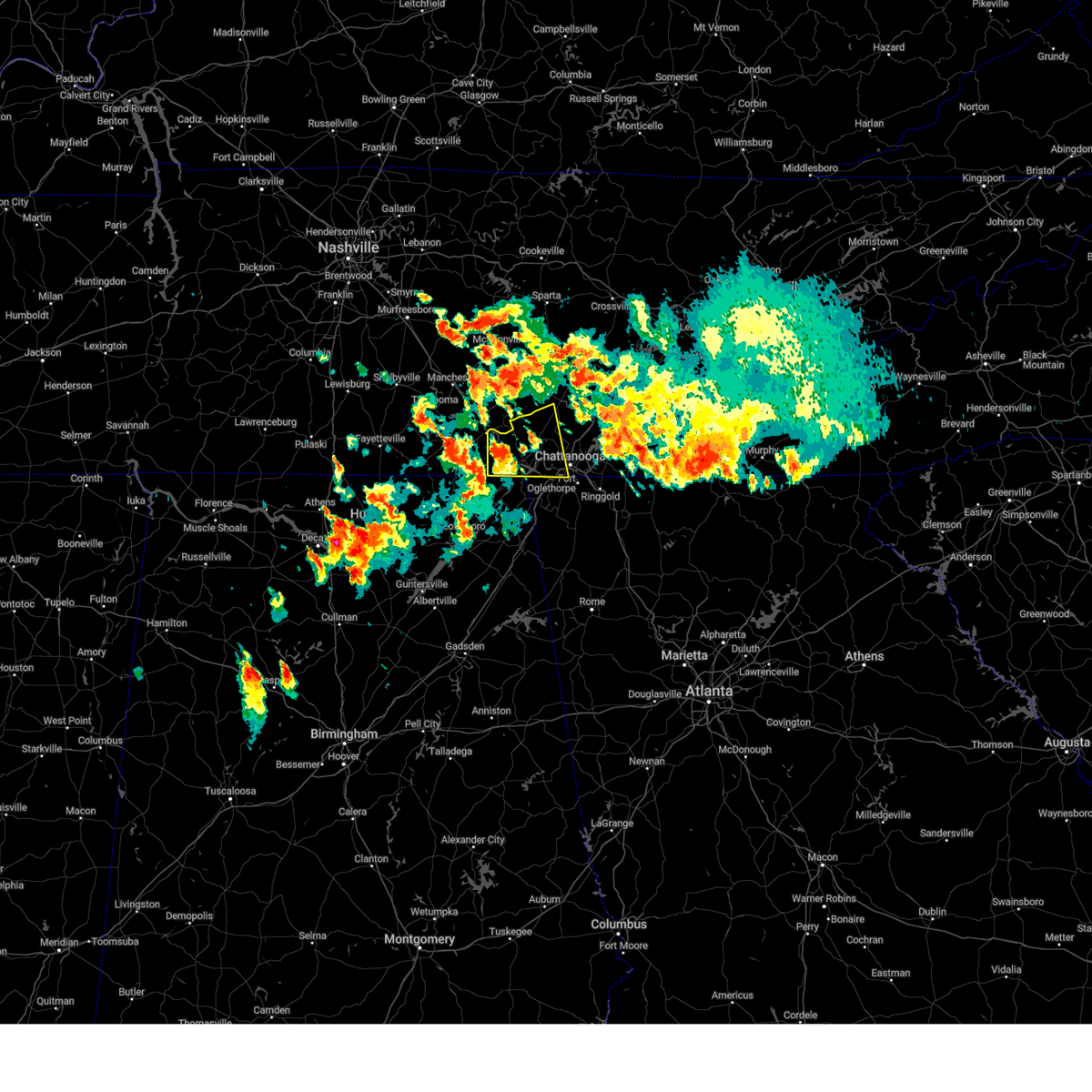 At 344 pm edt/244 pm cdt/, a severe thunderstorm was located 9 miles west of south pittsburg, or 10 miles northwest of bridgeport, moving east at 30 mph (radar indicated). Hazards include 60 mph wind gusts and quarter size hail. Hail damage to vehicles is expected. Expect wind damage to roofs, siding, and trees. At 344 pm edt/244 pm cdt/, a severe thunderstorm was located 9 miles west of south pittsburg, or 10 miles northwest of bridgeport, moving east at 30 mph (radar indicated). Hazards include 60 mph wind gusts and quarter size hail. Hail damage to vehicles is expected. Expect wind damage to roofs, siding, and trees.
|
| 6/25/2023 2:34 PM CDT |
 At 234 pm cdt, severe thunderstorms were located along a line extending from near winchester to 7 miles south of cowan to 10 miles northeast of skyline, moving northeast at 30 mph (radar indicated). Hazards include 60 mph wind gusts and quarter size hail. Hail damage to vehicles is expected. Expect wind damage to roofs, siding, and trees. At 234 pm cdt, severe thunderstorms were located along a line extending from near winchester to 7 miles south of cowan to 10 miles northeast of skyline, moving northeast at 30 mph (radar indicated). Hazards include 60 mph wind gusts and quarter size hail. Hail damage to vehicles is expected. Expect wind damage to roofs, siding, and trees.
|
| 6/25/2023 2:28 PM CDT |
 At 228 pm cdt, a severe thunderstorm was located 11 miles south of cowan, or 13 miles south of winchester, moving northeast at 20 mph (radar indicated). Hazards include 60 mph wind gusts and quarter size hail. Hail damage to vehicles is expected. expect wind damage to roofs, siding, and trees. locations impacted include, bridgeport, cowan, sewanee, anderson, hytop, bass, jericho, russell cave national monument, st. andrews and sherwood. hail threat, radar indicated max hail size, 1. 00 in wind threat, radar indicated max wind gust, 60 mph. At 228 pm cdt, a severe thunderstorm was located 11 miles south of cowan, or 13 miles south of winchester, moving northeast at 20 mph (radar indicated). Hazards include 60 mph wind gusts and quarter size hail. Hail damage to vehicles is expected. expect wind damage to roofs, siding, and trees. locations impacted include, bridgeport, cowan, sewanee, anderson, hytop, bass, jericho, russell cave national monument, st. andrews and sherwood. hail threat, radar indicated max hail size, 1. 00 in wind threat, radar indicated max wind gust, 60 mph.
|
| 6/25/2023 2:16 PM CDT |
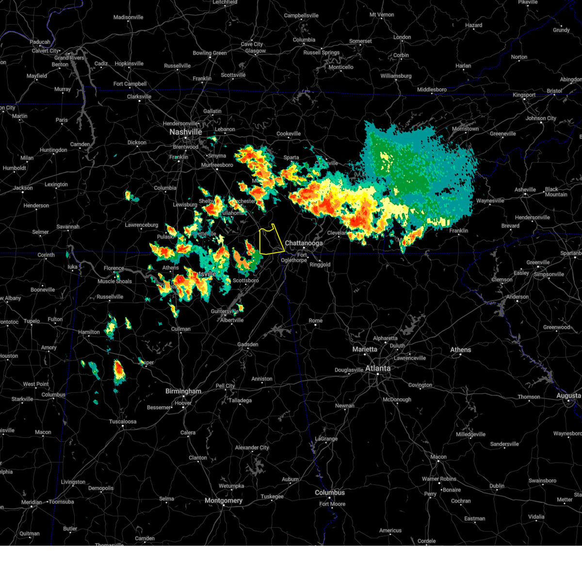 At 216 pm cdt, a severe thunderstorm was located near cowan, or 11 miles southeast of winchester, moving east at 20 mph (radar indicated). Hazards include 60 mph wind gusts and quarter size hail. Hail damage to vehicles is expected. Expect wind damage to roofs, siding, and trees. At 216 pm cdt, a severe thunderstorm was located near cowan, or 11 miles southeast of winchester, moving east at 20 mph (radar indicated). Hazards include 60 mph wind gusts and quarter size hail. Hail damage to vehicles is expected. Expect wind damage to roofs, siding, and trees.
|
| 6/25/2023 2:04 PM CDT |
 At 204 pm cdt, a severe thunderstorm was located 9 miles southeast of huntland, or 17 miles south of winchester, moving northeast at 20 mph (radar indicated). Hazards include 60 mph wind gusts and half dollar size hail. Hail damage to vehicles is expected. Expect wind damage to roofs, siding, and trees. At 204 pm cdt, a severe thunderstorm was located 9 miles southeast of huntland, or 17 miles south of winchester, moving northeast at 20 mph (radar indicated). Hazards include 60 mph wind gusts and half dollar size hail. Hail damage to vehicles is expected. Expect wind damage to roofs, siding, and trees.
|
| 5/7/2023 8:19 PM CDT |
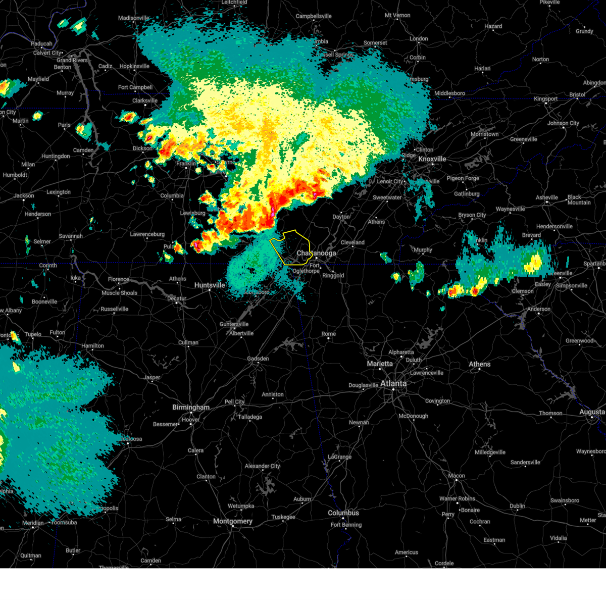 At 819 pm cdt, a severe thunderstorm was located near tracy city, or 19 miles northwest of jasper, moving southeast at 35 mph (radar indicated). Hazards include 60 mph wind gusts. expect damage to roofs, siding, and trees At 819 pm cdt, a severe thunderstorm was located near tracy city, or 19 miles northwest of jasper, moving southeast at 35 mph (radar indicated). Hazards include 60 mph wind gusts. expect damage to roofs, siding, and trees
|
| 3/25/2023 1:06 AM CDT |
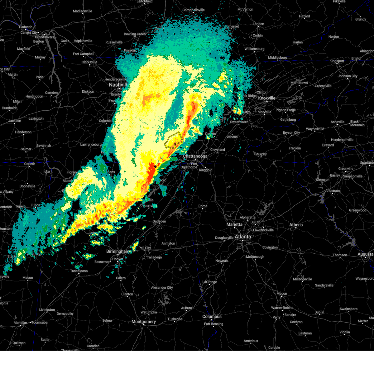 The severe thunderstorm warning for central grundy county will expire at 115 am cdt, the storm which prompted the warning has weakened below severe limits, and has exited the warned area. therefore, the warning will be allowed to expire. a tornado watch remains in effect until 300 am cdt for middle tennessee. The severe thunderstorm warning for central grundy county will expire at 115 am cdt, the storm which prompted the warning has weakened below severe limits, and has exited the warned area. therefore, the warning will be allowed to expire. a tornado watch remains in effect until 300 am cdt for middle tennessee.
|
| 3/25/2023 12:58 AM CDT |
 At 1257 am cdt, severe thunderstorms were located along a line extending from near sewanee to 6 miles north of skyline to near woodville, moving east at 55 mph (radar indicated). Hazards include 60 mph wind gusts. Expect damage to roofs, siding, and trees. locations impacted include, southern huntsville, scottsboro, winchester, bridgeport, decherd, stevenson, cowan, owens cross roads, hollywood and skyline. hail threat, radar indicated max hail size, <. 75 in wind threat, radar indicated max wind gust, 60 mph. At 1257 am cdt, severe thunderstorms were located along a line extending from near sewanee to 6 miles north of skyline to near woodville, moving east at 55 mph (radar indicated). Hazards include 60 mph wind gusts. Expect damage to roofs, siding, and trees. locations impacted include, southern huntsville, scottsboro, winchester, bridgeport, decherd, stevenson, cowan, owens cross roads, hollywood and skyline. hail threat, radar indicated max hail size, <. 75 in wind threat, radar indicated max wind gust, 60 mph.
|
| 3/25/2023 12:55 AM CDT |
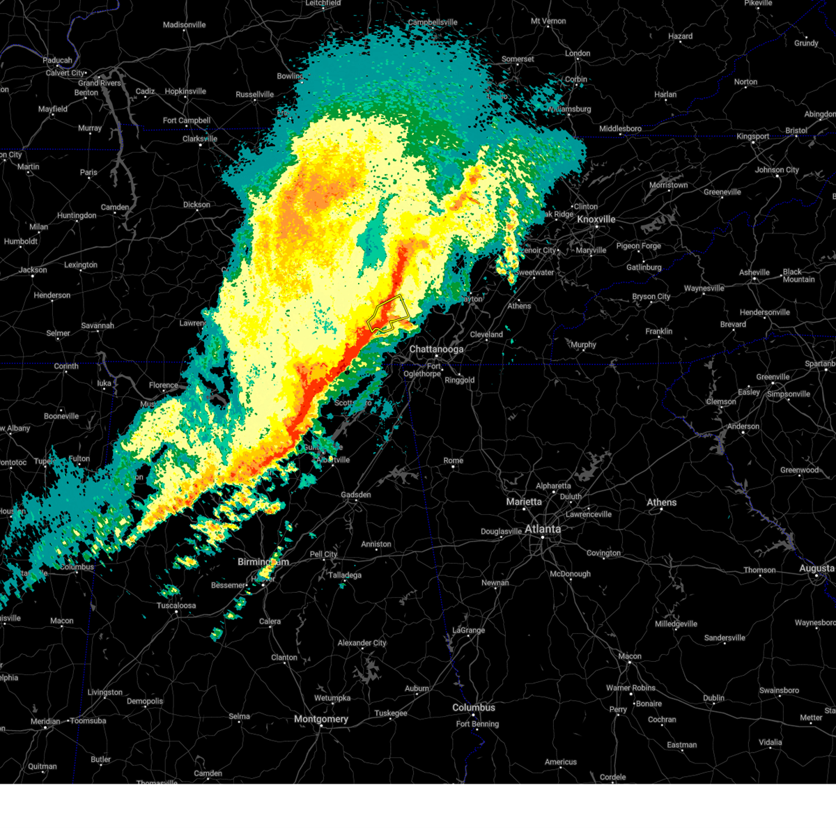 At 1254 am cdt, a severe thunderstorm was located near tracy city, or 19 miles southeast of manchester, moving east at 40 mph (radar indicated). Hazards include 60 mph wind gusts. Expect damage to roofs, siding, and trees. locations impacted include, gruetli-laager, tracy city, monteagle, altamont, coalmont, palmer, beersheba springs, pelham and fiery gizzard state park. this includes interstate 24 between mile markers 128 and 134. hail threat, radar indicated max hail size, <. 75 in wind threat, radar indicated max wind gust, 60 mph. At 1254 am cdt, a severe thunderstorm was located near tracy city, or 19 miles southeast of manchester, moving east at 40 mph (radar indicated). Hazards include 60 mph wind gusts. Expect damage to roofs, siding, and trees. locations impacted include, gruetli-laager, tracy city, monteagle, altamont, coalmont, palmer, beersheba springs, pelham and fiery gizzard state park. this includes interstate 24 between mile markers 128 and 134. hail threat, radar indicated max hail size, <. 75 in wind threat, radar indicated max wind gust, 60 mph.
|
| 3/25/2023 12:50 AM CDT |
 At 1249 am cdt, a severe thunderstorm was located over cowan, or near winchester, moving northeast at 40 mph (radar indicated). Hazards include 60 mph wind gusts. expect damage to roofs, siding, and trees At 1249 am cdt, a severe thunderstorm was located over cowan, or near winchester, moving northeast at 40 mph (radar indicated). Hazards include 60 mph wind gusts. expect damage to roofs, siding, and trees
|
| 3/25/2023 12:42 AM CDT |
 At 1242 am cdt, a severe thunderstorm capable of producing a tornado was located near monteagle, or 13 miles northeast of winchester, moving east at 50 mph (radar indicated rotation). Hazards include tornado and quarter size hail. Flying debris will be dangerous to those caught without shelter. mobile homes will be damaged or destroyed. damage to roofs, windows, and vehicles will occur. tree damage is likely. locations impacted include, sewanee, alto, st. Andrews and woods reservoir. At 1242 am cdt, a severe thunderstorm capable of producing a tornado was located near monteagle, or 13 miles northeast of winchester, moving east at 50 mph (radar indicated rotation). Hazards include tornado and quarter size hail. Flying debris will be dangerous to those caught without shelter. mobile homes will be damaged or destroyed. damage to roofs, windows, and vehicles will occur. tree damage is likely. locations impacted include, sewanee, alto, st. Andrews and woods reservoir.
|
| 3/25/2023 12:41 AM CDT |
 At 1240 am cdt, severe thunderstorms were located along a line extending from monteagle to near winchester to new market to huntsville, moving east at 40 mph (radar indicated). Hazards include 60 mph wind gusts. expect damage to roofs, siding, and trees At 1240 am cdt, severe thunderstorms were located along a line extending from monteagle to near winchester to new market to huntsville, moving east at 40 mph (radar indicated). Hazards include 60 mph wind gusts. expect damage to roofs, siding, and trees
|
| 3/25/2023 12:41 AM CDT |
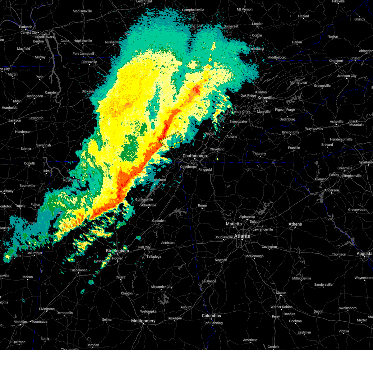 At 1241 am cdt, a severe thunderstorm was located near monteagle, or 13 miles northeast of winchester, moving east at 40 mph (radar indicated). Hazards include 70 mph wind gusts and penny size hail. Expect considerable tree damage. Damage is likely to mobile homes, roofs, and outbuildings. At 1241 am cdt, a severe thunderstorm was located near monteagle, or 13 miles northeast of winchester, moving east at 40 mph (radar indicated). Hazards include 70 mph wind gusts and penny size hail. Expect considerable tree damage. Damage is likely to mobile homes, roofs, and outbuildings.
|
| 3/25/2023 12:41 AM CDT |
 At 1240 am cdt, severe thunderstorms were located along a line extending from monteagle to near winchester to new market to huntsville, moving east at 40 mph (radar indicated). Hazards include 60 mph wind gusts. expect damage to roofs, siding, and trees At 1240 am cdt, severe thunderstorms were located along a line extending from monteagle to near winchester to new market to huntsville, moving east at 40 mph (radar indicated). Hazards include 60 mph wind gusts. expect damage to roofs, siding, and trees
|
| 3/25/2023 12:31 AM CDT |
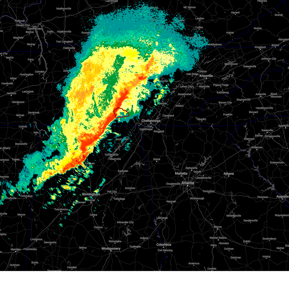 At 1231 am cdt, a severe thunderstorm capable of producing a tornado was located over decherd, or near winchester, moving east at 50 mph (radar indicated rotation). Hazards include tornado and quarter size hail. Flying debris will be dangerous to those caught without shelter. mobile homes will be damaged or destroyed. damage to roofs, windows, and vehicles will occur. tree damage is likely. locations impacted include, winchester, decherd, estill springs, cowan, tims ford lake, sewanee, woods reservoir, arnold afb, alto and st. Andrews. At 1231 am cdt, a severe thunderstorm capable of producing a tornado was located over decherd, or near winchester, moving east at 50 mph (radar indicated rotation). Hazards include tornado and quarter size hail. Flying debris will be dangerous to those caught without shelter. mobile homes will be damaged or destroyed. damage to roofs, windows, and vehicles will occur. tree damage is likely. locations impacted include, winchester, decherd, estill springs, cowan, tims ford lake, sewanee, woods reservoir, arnold afb, alto and st. Andrews.
|
| 3/25/2023 12:22 AM CDT |
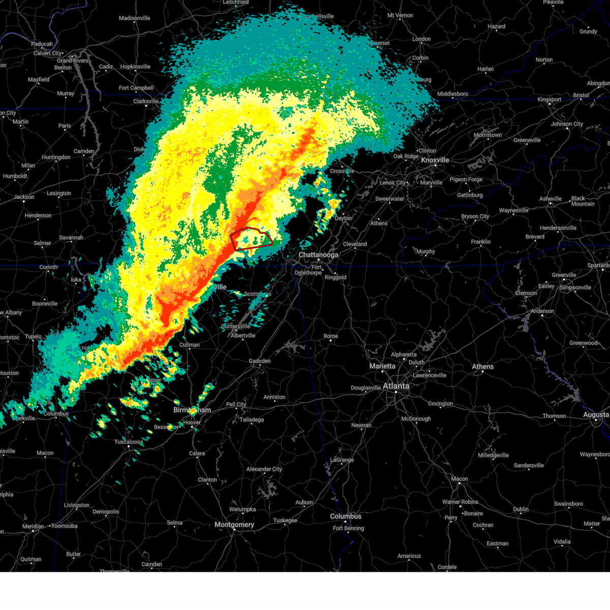 At 1222 am cdt, a severe thunderstorm capable of producing a tornado was located over tims ford lake, or 7 miles northwest of winchester, moving east at 50 mph (radar indicated rotation). Hazards include tornado and quarter size hail. Flying debris will be dangerous to those caught without shelter. mobile homes will be damaged or destroyed. damage to roofs, windows, and vehicles will occur. Tree damage is likely. At 1222 am cdt, a severe thunderstorm capable of producing a tornado was located over tims ford lake, or 7 miles northwest of winchester, moving east at 50 mph (radar indicated rotation). Hazards include tornado and quarter size hail. Flying debris will be dangerous to those caught without shelter. mobile homes will be damaged or destroyed. damage to roofs, windows, and vehicles will occur. Tree damage is likely.
|
| 3/3/2023 12:18 PM CST |
 At 1217 pm cst, severe thunderstorms were located along a line extending from near cowan to 7 miles north of skyline, moving northeast at 60 mph. khtx radar has measured wind speeds 70-80 mph. these are tornado like wind speeds. these are destructive storms for eastern franklin county tn and northern jackson county (radar indicated). Hazards include 80 mph wind gusts. Flying debris will be dangerous to those caught without shelter. mobile homes will be heavily damaged. expect considerable damage to roofs, windows, and vehicles. Extensive tree damage and power outages are likely. At 1217 pm cst, severe thunderstorms were located along a line extending from near cowan to 7 miles north of skyline, moving northeast at 60 mph. khtx radar has measured wind speeds 70-80 mph. these are tornado like wind speeds. these are destructive storms for eastern franklin county tn and northern jackson county (radar indicated). Hazards include 80 mph wind gusts. Flying debris will be dangerous to those caught without shelter. mobile homes will be heavily damaged. expect considerable damage to roofs, windows, and vehicles. Extensive tree damage and power outages are likely.
|
| 3/3/2023 12:10 PM CST |
 At 1209 pm cst, severe thunderstorms were located along a line extending from 8 miles northwest of mcminnville to near decherd, moving northeast at 70 mph (radar indicated). Hazards include 70 mph wind gusts. Expect considerable tree damage. damage is likely to mobile homes, roofs, and outbuildings. locations impacted include, winchester, decherd, estill springs, stevenson, cowan, skyline, sewanee, tims ford lake, anderson and hytop. thunderstorm damage threat, considerable hail threat, radar indicated max hail size, <. 75 in wind threat, radar indicated max wind gust, 70 mph. At 1209 pm cst, severe thunderstorms were located along a line extending from 8 miles northwest of mcminnville to near decherd, moving northeast at 70 mph (radar indicated). Hazards include 70 mph wind gusts. Expect considerable tree damage. damage is likely to mobile homes, roofs, and outbuildings. locations impacted include, winchester, decherd, estill springs, stevenson, cowan, skyline, sewanee, tims ford lake, anderson and hytop. thunderstorm damage threat, considerable hail threat, radar indicated max hail size, <. 75 in wind threat, radar indicated max wind gust, 70 mph.
|
| 3/3/2023 12:06 PM CST |
 At 1205 pm cst, a severe thunderstorm was located near cowan, or 7 miles south of winchester, moving northeast at 40 mph (radar indicated). Hazards include 70 mph wind gusts. Expect considerable tree damage. Damage is likely to mobile homes, roofs, and outbuildings. At 1205 pm cst, a severe thunderstorm was located near cowan, or 7 miles south of winchester, moving northeast at 40 mph (radar indicated). Hazards include 70 mph wind gusts. Expect considerable tree damage. Damage is likely to mobile homes, roofs, and outbuildings.
|
| 3/3/2023 11:57 AM CST |
 At 1157 am cst, severe thunderstorms were located along a line extending from 12 miles north of manchester to 6 miles south of tims ford lake, moving northeast at 55 mph (radar indicated). Hazards include 70 mph wind gusts. Expect considerable tree damage. damage is likely to mobile homes, roofs, and outbuildings. locations impacted include, huntsville, winchester, lynchburg, moores mill, decherd, estill springs, stevenson, cowan, huntland and skyline. thunderstorm damage threat, considerable hail threat, radar indicated max hail size, <. 75 in wind threat, radar indicated max wind gust, 70 mph. At 1157 am cst, severe thunderstorms were located along a line extending from 12 miles north of manchester to 6 miles south of tims ford lake, moving northeast at 55 mph (radar indicated). Hazards include 70 mph wind gusts. Expect considerable tree damage. damage is likely to mobile homes, roofs, and outbuildings. locations impacted include, huntsville, winchester, lynchburg, moores mill, decherd, estill springs, stevenson, cowan, huntland and skyline. thunderstorm damage threat, considerable hail threat, radar indicated max hail size, <. 75 in wind threat, radar indicated max wind gust, 70 mph.
|
| 3/3/2023 11:33 AM CST |
 At 1131 am cst, severe thunderstorms were located along a line extending from 7 miles northwest of lynchburg to meridianville, moving northeast at 70 mph. huntsville airport has recorded a wind gusts of 69 mph and wind damage has been reported with this line of storms (radar indicated). Hazards include 70 mph wind gusts. Expect considerable tree damage. damage is likely to mobile homes, roofs, and outbuildings. locations impacted include, northern huntsville, madison, winchester, fayetteville, moores mill, meridianville, lynchburg, hazel green, decherd and estill springs. thunderstorm damage threat, considerable hail threat, radar indicated max hail size, <. 75 in wind threat, radar indicated max wind gust, 70 mph. At 1131 am cst, severe thunderstorms were located along a line extending from 7 miles northwest of lynchburg to meridianville, moving northeast at 70 mph. huntsville airport has recorded a wind gusts of 69 mph and wind damage has been reported with this line of storms (radar indicated). Hazards include 70 mph wind gusts. Expect considerable tree damage. damage is likely to mobile homes, roofs, and outbuildings. locations impacted include, northern huntsville, madison, winchester, fayetteville, moores mill, meridianville, lynchburg, hazel green, decherd and estill springs. thunderstorm damage threat, considerable hail threat, radar indicated max hail size, <. 75 in wind threat, radar indicated max wind gust, 70 mph.
|
| 3/3/2023 11:25 AM CST |
 At 1123 am cst, severe thunderstorms were located along a line extending from near petersburg to near madison, moving northeast at 100 mph (radar indicated). Hazards include 70 mph wind gusts. Expect considerable tree damage. Damage is likely to mobile homes, roofs, and outbuildings. At 1123 am cst, severe thunderstorms were located along a line extending from near petersburg to near madison, moving northeast at 100 mph (radar indicated). Hazards include 70 mph wind gusts. Expect considerable tree damage. Damage is likely to mobile homes, roofs, and outbuildings.
|
| 1/12/2023 10:05 AM CST |
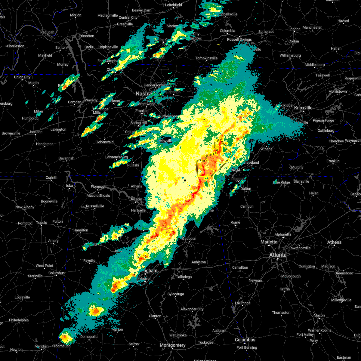 At 1004 am cst, severe thunderstorms were located along a line extending from near tracy city to south pittsburg, moving northeast at 65 mph (radar indicated). Hazards include 60 mph wind gusts. Expect damage to roofs, siding, and trees. locations impacted include, dunlap, jasper, south pittsburg, whitwell, kimball, monteagle, powells crossroads, orme, martin springs and cartwright. hail threat, radar indicated max hail size, <. 75 in wind threat, radar indicated max wind gust, 60 mph. At 1004 am cst, severe thunderstorms were located along a line extending from near tracy city to south pittsburg, moving northeast at 65 mph (radar indicated). Hazards include 60 mph wind gusts. Expect damage to roofs, siding, and trees. locations impacted include, dunlap, jasper, south pittsburg, whitwell, kimball, monteagle, powells crossroads, orme, martin springs and cartwright. hail threat, radar indicated max hail size, <. 75 in wind threat, radar indicated max wind gust, 60 mph.
|
| 1/12/2023 9:52 AM CST |
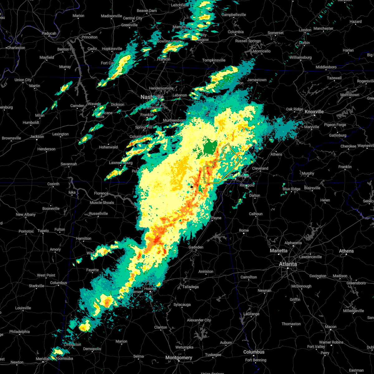 At 951 am cst, severe thunderstorms were located along a line extending from near sewanee to 7 miles west of stevenson, moving northeast at 70 mph (radar indicated). Hazards include 60 mph wind gusts. expect damage to roofs, siding, and trees At 951 am cst, severe thunderstorms were located along a line extending from near sewanee to 7 miles west of stevenson, moving northeast at 70 mph (radar indicated). Hazards include 60 mph wind gusts. expect damage to roofs, siding, and trees
|
| 7/9/2022 4:58 AM CDT |
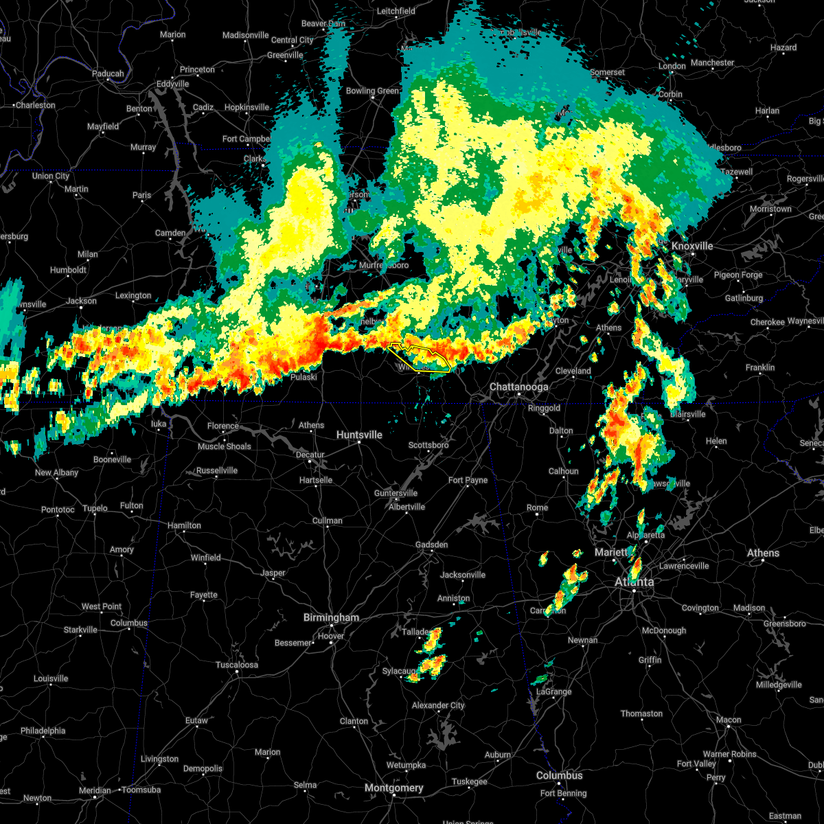 The severe thunderstorm warning for northeastern moore and northern franklin counties will expire at 500 am cdt, the storms which prompted the warning have weakened below severe limits, and no longer pose an immediate threat to life or property. therefore, the warning will be allowed to expire. however gusty winds are still possible with these thunderstorms. The severe thunderstorm warning for northeastern moore and northern franklin counties will expire at 500 am cdt, the storms which prompted the warning have weakened below severe limits, and no longer pose an immediate threat to life or property. therefore, the warning will be allowed to expire. however gusty winds are still possible with these thunderstorms.
|
| 7/9/2022 4:33 AM CDT |
 At 433 am cdt, severe thunderstorms were located along a line extending from near lynchburg to 8 miles northeast of estill springs, moving southeast at 20 mph (radar indicated). Hazards include 60 mph wind gusts. expect damage to roofs, siding, and trees At 433 am cdt, severe thunderstorms were located along a line extending from near lynchburg to 8 miles northeast of estill springs, moving southeast at 20 mph (radar indicated). Hazards include 60 mph wind gusts. expect damage to roofs, siding, and trees
|
| 6/6/2022 3:41 PM CDT |
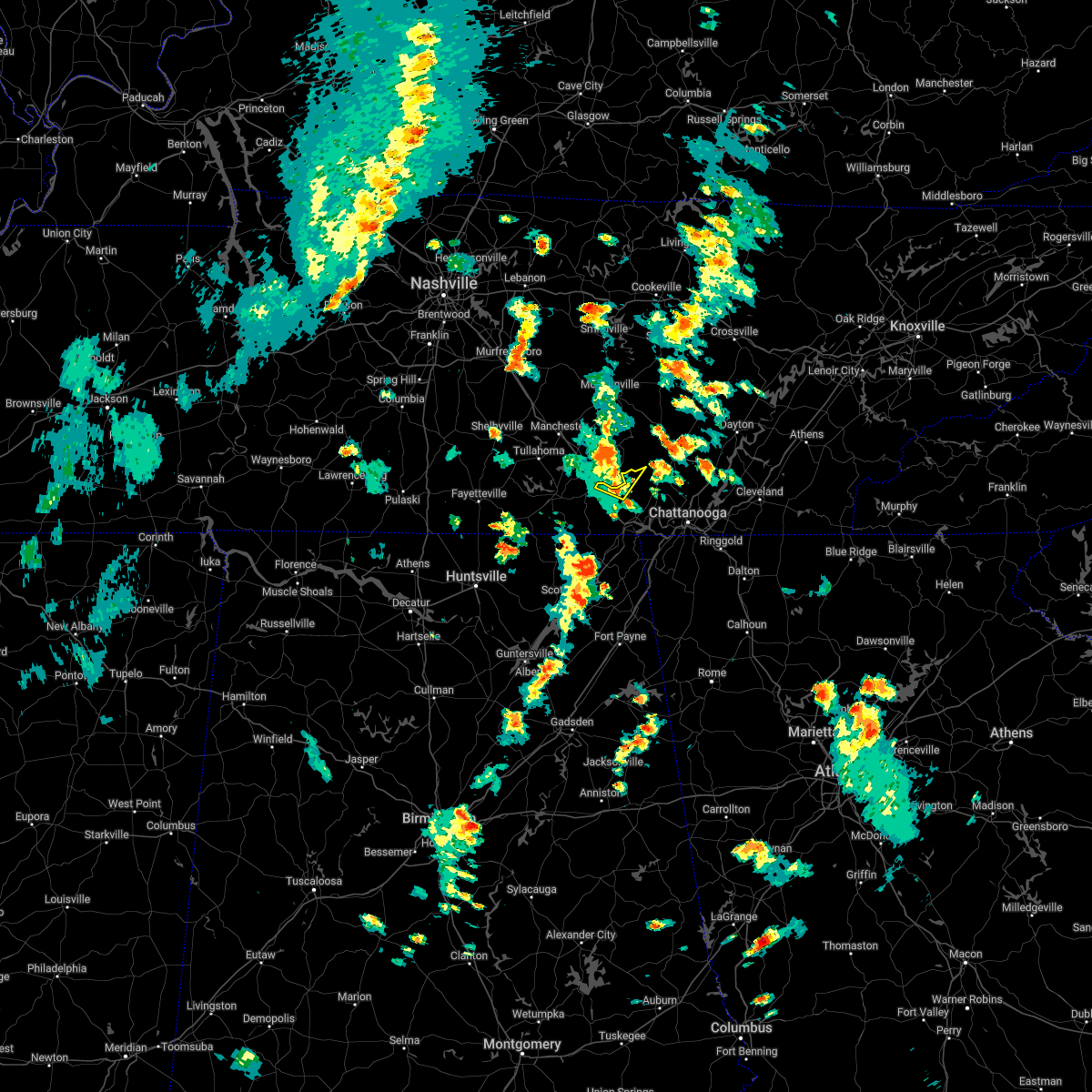 At 341 pm cdt, a severe thunderstorm was located over tracy city, or 16 miles north of jasper, moving northeast at 35 mph (radar indicated). Hazards include 60 mph wind gusts and penny size hail. Expect damage to roofs, siding, and trees. locations impacted include, monteagle, fiery gizzard state park and foster falls state park. hail threat, radar indicated max hail size, 0. 75 in wind threat, radar indicated max wind gust, 60 mph. At 341 pm cdt, a severe thunderstorm was located over tracy city, or 16 miles north of jasper, moving northeast at 35 mph (radar indicated). Hazards include 60 mph wind gusts and penny size hail. Expect damage to roofs, siding, and trees. locations impacted include, monteagle, fiery gizzard state park and foster falls state park. hail threat, radar indicated max hail size, 0. 75 in wind threat, radar indicated max wind gust, 60 mph.
|
| 6/6/2022 3:30 PM CDT |
 At 329 pm cdt, a severe thunderstorm was located near tracy city, or 12 miles northwest of jasper, moving northeast at 35 mph (radar indicated). Hazards include 60 mph wind gusts and penny size hail. expect damage to roofs, siding, and trees At 329 pm cdt, a severe thunderstorm was located near tracy city, or 12 miles northwest of jasper, moving northeast at 35 mph (radar indicated). Hazards include 60 mph wind gusts and penny size hail. expect damage to roofs, siding, and trees
|
| 6/6/2022 3:28 PM CDT |
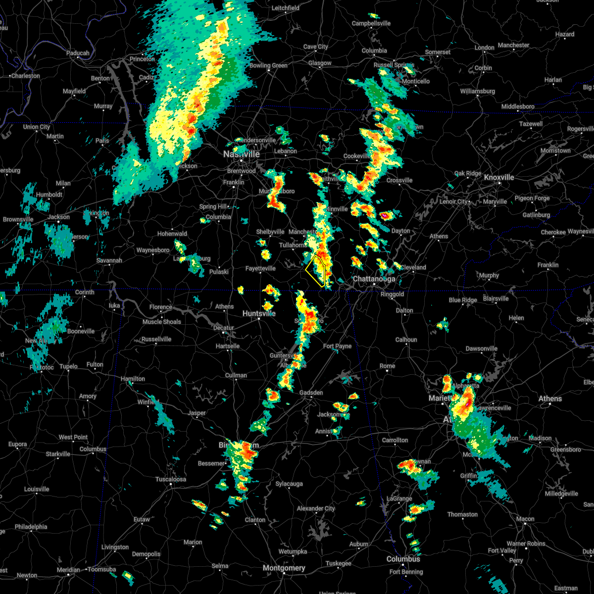 The severe thunderstorm warning for northeastern franklin county will expire at 330 pm cdt, the storm which prompted the warning has weakened below severe limits, and has exited the warned area. therefore, the warning will be allowed to expire. to report severe weather, contact your nearest law enforcement agency. they will relay your report to the national weather service huntsville alabama. The severe thunderstorm warning for northeastern franklin county will expire at 330 pm cdt, the storm which prompted the warning has weakened below severe limits, and has exited the warned area. therefore, the warning will be allowed to expire. to report severe weather, contact your nearest law enforcement agency. they will relay your report to the national weather service huntsville alabama.
|
| 6/6/2022 3:15 PM CDT |
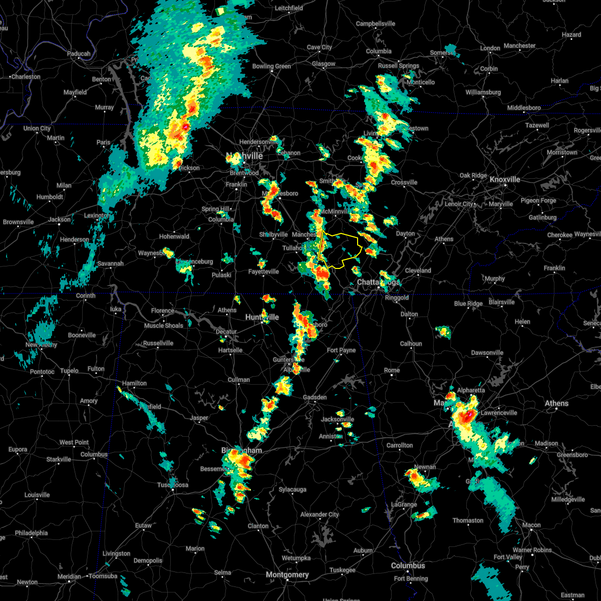 At 314 pm cdt, a severe thunderstorm was located near monteagle, or 12 miles east of winchester, moving northeast at 30 mph (radar indicated). Hazards include 60 mph wind gusts. expect damage to roofs, siding, and trees At 314 pm cdt, a severe thunderstorm was located near monteagle, or 12 miles east of winchester, moving northeast at 30 mph (radar indicated). Hazards include 60 mph wind gusts. expect damage to roofs, siding, and trees
|
| 6/6/2022 3:14 PM CDT |
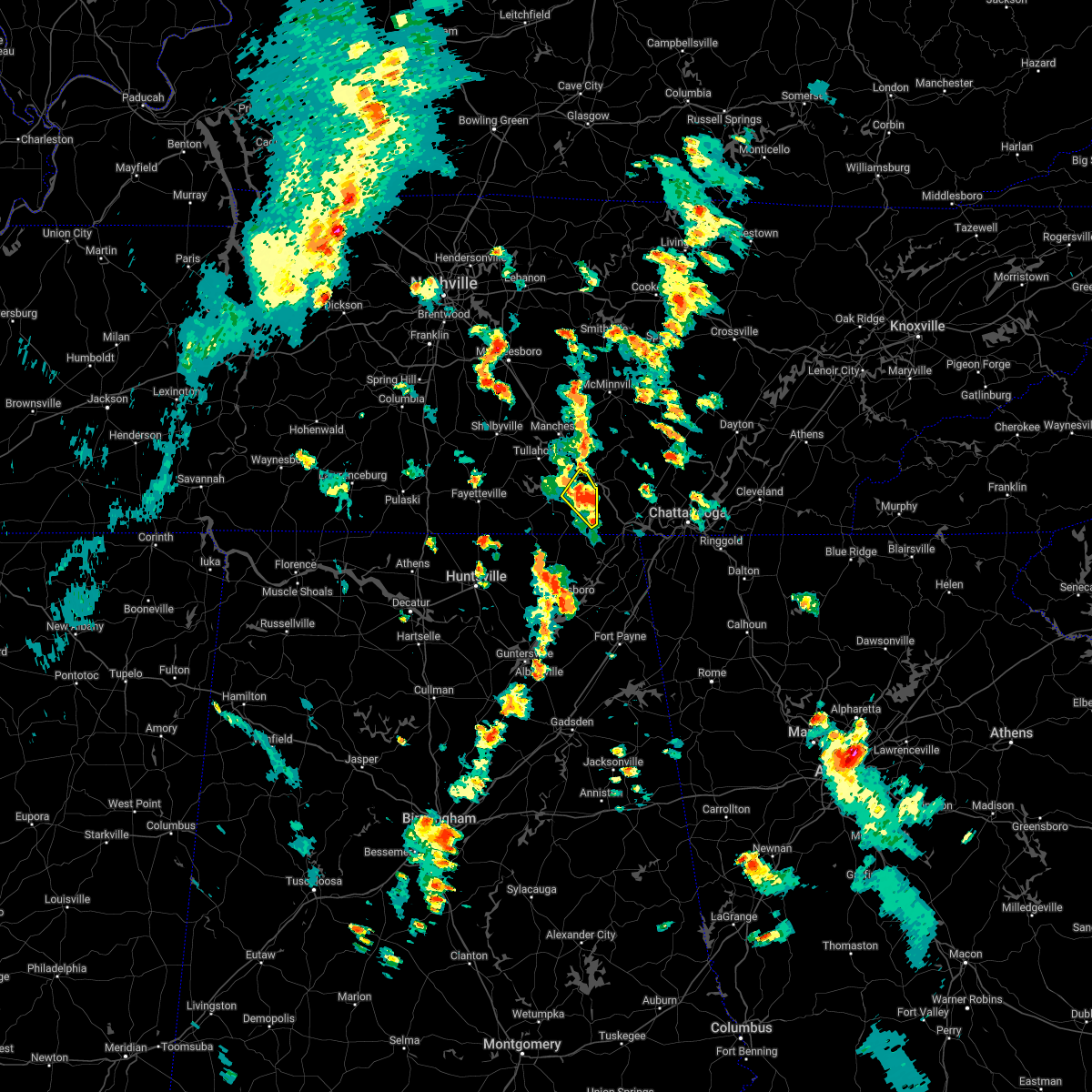 At 314 pm cdt, a severe thunderstorm was located over sewanee, or 11 miles east of winchester, moving northeast at 25 mph (radar indicated). Hazards include 60 mph wind gusts. Expect damage to roofs, siding, and trees. locations impacted include, winchester, cowan, sewanee, alto, st. andrews and sherwood. hail threat, radar indicated max hail size, <. 75 in wind threat, radar indicated max wind gust, 60 mph. At 314 pm cdt, a severe thunderstorm was located over sewanee, or 11 miles east of winchester, moving northeast at 25 mph (radar indicated). Hazards include 60 mph wind gusts. Expect damage to roofs, siding, and trees. locations impacted include, winchester, cowan, sewanee, alto, st. andrews and sherwood. hail threat, radar indicated max hail size, <. 75 in wind threat, radar indicated max wind gust, 60 mph.
|
| 6/6/2022 3:08 PM CDT |
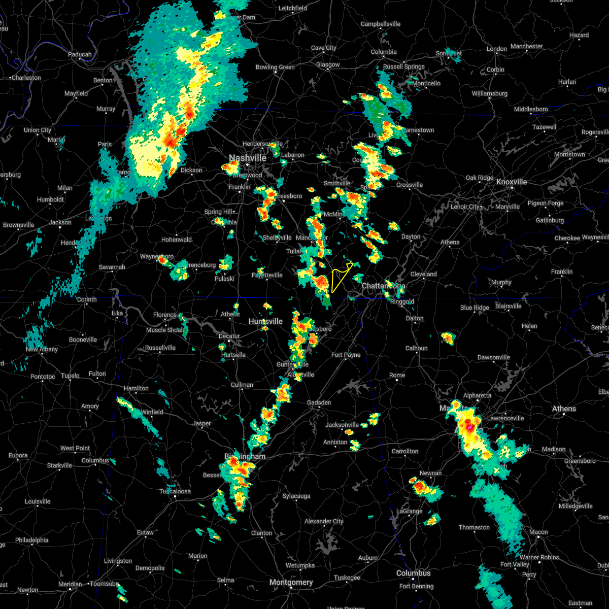 At 308 pm cdt, a severe thunderstorm was located over sewanee, or 9 miles east of winchester, moving northeast at 35 mph (radar indicated). Hazards include 60 mph wind gusts and penny size hail. expect damage to roofs, siding, and trees At 308 pm cdt, a severe thunderstorm was located over sewanee, or 9 miles east of winchester, moving northeast at 35 mph (radar indicated). Hazards include 60 mph wind gusts and penny size hail. expect damage to roofs, siding, and trees
|
| 6/6/2022 3:00 PM CDT |
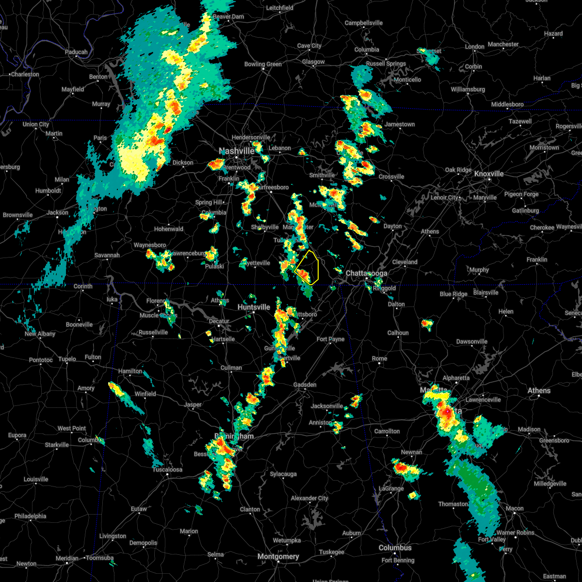 At 300 pm cdt, a severe thunderstorm was located near cowan, or 9 miles southeast of winchester, moving northeast at 25 mph (radar indicated). Hazards include 60 mph wind gusts and penny size hail. expect damage to roofs, siding, and trees At 300 pm cdt, a severe thunderstorm was located near cowan, or 9 miles southeast of winchester, moving northeast at 25 mph (radar indicated). Hazards include 60 mph wind gusts and penny size hail. expect damage to roofs, siding, and trees
|
| 4/13/2022 9:14 PM CDT |
 At 914 pm cdt, severe thunderstorms were located along a line extending from near monterey to gruetli-laager, moving east at 65 mph (radar indicated). Hazards include 60 mph wind gusts. Expect damage to roofs, siding, and trees. locations impacted include, crossville, sparta, spencer, fairfield glade, gruetli-laager, tracy city, monteagle, altamont, coalmont, palmer, pleasant hill, doyle, beersheba springs, cumberland mountain state park, virgin falls state natural area, lake tansi, fall creek falls state park, indian rock lake and fiery gizzard state park. this includes the following highways, interstate 40 between mile markers 320 and 326. interstate 24 between mile markers 134 and 136. hail threat, radar indicated max hail size, <. 75 in wind threat, radar indicated max wind gust, 60 mph. At 914 pm cdt, severe thunderstorms were located along a line extending from near monterey to gruetli-laager, moving east at 65 mph (radar indicated). Hazards include 60 mph wind gusts. Expect damage to roofs, siding, and trees. locations impacted include, crossville, sparta, spencer, fairfield glade, gruetli-laager, tracy city, monteagle, altamont, coalmont, palmer, pleasant hill, doyle, beersheba springs, cumberland mountain state park, virgin falls state natural area, lake tansi, fall creek falls state park, indian rock lake and fiery gizzard state park. this includes the following highways, interstate 40 between mile markers 320 and 326. interstate 24 between mile markers 134 and 136. hail threat, radar indicated max hail size, <. 75 in wind threat, radar indicated max wind gust, 60 mph.
|
| 4/13/2022 9:06 PM CDT |
 At 1005 pm edt/905 pm cdt/, severe thunderstorms were located along a line extending from 11 miles northwest of spencer to 8 miles south of huntland, moving east at 45 mph (radar indicated). Hazards include 60 mph wind gusts. expect damage to roofs, siding, and trees At 1005 pm edt/905 pm cdt/, severe thunderstorms were located along a line extending from 11 miles northwest of spencer to 8 miles south of huntland, moving east at 45 mph (radar indicated). Hazards include 60 mph wind gusts. expect damage to roofs, siding, and trees
|
| 4/13/2022 8:55 PM CDT |
 At 855 pm cdt, severe thunderstorms were located along a line extending from 6 miles south of baxter to 9 miles southeast of manchester, moving east at 65 mph (radar indicated). Hazards include 70 mph wind gusts. Expect considerable tree damage. Damage is likely to mobile homes, roofs, and outbuildings. At 855 pm cdt, severe thunderstorms were located along a line extending from 6 miles south of baxter to 9 miles southeast of manchester, moving east at 65 mph (radar indicated). Hazards include 70 mph wind gusts. Expect considerable tree damage. Damage is likely to mobile homes, roofs, and outbuildings.
|
| 4/13/2022 8:47 PM CDT |
 At 847 pm cdt, severe thunderstorms were located along a line extending from near smithville to 8 miles southeast of woodbury to near estill springs, moving east at 55 mph (radar indicated). Hazards include 70 mph wind gusts. Expect considerable tree damage. damage is likely to mobile homes, roofs, and outbuildings. locations impacted include, mcminnville, manchester, sparta, smithville, woodbury, spencer, tullahoma, gruetli-laager, tracy city, monteagle, altamont, coalmont, morrison, doyle, beersheba springs, liberty, centertown, viola, rock island state park and summitville. this includes interstate 24 between mile markers 104 and 134. thunderstorm damage threat, considerable hail threat, radar indicated max hail size, <. 75 in wind threat, radar indicated max wind gust, 70 mph. At 847 pm cdt, severe thunderstorms were located along a line extending from near smithville to 8 miles southeast of woodbury to near estill springs, moving east at 55 mph (radar indicated). Hazards include 70 mph wind gusts. Expect considerable tree damage. damage is likely to mobile homes, roofs, and outbuildings. locations impacted include, mcminnville, manchester, sparta, smithville, woodbury, spencer, tullahoma, gruetli-laager, tracy city, monteagle, altamont, coalmont, morrison, doyle, beersheba springs, liberty, centertown, viola, rock island state park and summitville. this includes interstate 24 between mile markers 104 and 134. thunderstorm damage threat, considerable hail threat, radar indicated max hail size, <. 75 in wind threat, radar indicated max wind gust, 70 mph.
|
| 4/13/2022 8:27 PM CDT |
 At 826 pm cdt, severe thunderstorms were located along a line extending from 8 miles southwest of watertown to 11 miles southeast of murfreesboro to near lynchburg, moving east at 55 mph (radar indicated). Hazards include 70 mph wind gusts. Expect considerable tree damage. Damage is likely to mobile homes, roofs, and outbuildings. At 826 pm cdt, severe thunderstorms were located along a line extending from 8 miles southwest of watertown to 11 miles southeast of murfreesboro to near lynchburg, moving east at 55 mph (radar indicated). Hazards include 70 mph wind gusts. Expect considerable tree damage. Damage is likely to mobile homes, roofs, and outbuildings.
|
| 3/30/2022 10:26 PM CDT |
 At 1024 pm cdt, severe thunderstorms were located along a line extending from near hazel green to 7 miles southeast of helicon, moving east at 40 mph (radar indicated). Hazards include 60 mph wind gusts. expect damage to roofs, siding, and trees At 1024 pm cdt, severe thunderstorms were located along a line extending from near hazel green to 7 miles southeast of helicon, moving east at 40 mph (radar indicated). Hazards include 60 mph wind gusts. expect damage to roofs, siding, and trees
|
| 1/1/2022 6:57 PM CST | At 657 pm cst, a severe thunderstorm was located near cowan, or 8 miles southeast of winchester, moving east at 40 mph (radar indicated). Hazards include 60 mph wind gusts. expect damage to roofs, siding, and trees |
| 1/1/2022 5:56 PM CST |
 The severe thunderstorm warning for moore, southeastern lincoln and northern franklin counties will expire at 600 pm cst, the storm which prompted the warning has weakened below severe limits, and no longer poses an immediate threat to life or property. therefore, the warning will be allowed to expire. a tornado watch remains in effect until 700 pm cst for north central and northeastern alabama, and middle tennessee. The severe thunderstorm warning for moore, southeastern lincoln and northern franklin counties will expire at 600 pm cst, the storm which prompted the warning has weakened below severe limits, and no longer poses an immediate threat to life or property. therefore, the warning will be allowed to expire. a tornado watch remains in effect until 700 pm cst for north central and northeastern alabama, and middle tennessee.
|
| 1/1/2022 5:55 PM CST |
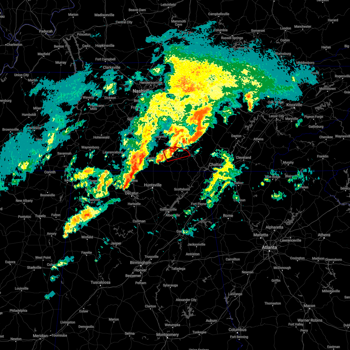 The tornado warning for southeastern moore and northern franklin counties will expire at 600 pm cst, the storm which prompted the warning has weakened below severe limits, and no longer appears capable of producing a tornado. therefore, the warning will be allowed to expire. a tornado watch remains in effect until 700 pm cst for north central and northeastern alabama, and middle tennessee. The tornado warning for southeastern moore and northern franklin counties will expire at 600 pm cst, the storm which prompted the warning has weakened below severe limits, and no longer appears capable of producing a tornado. therefore, the warning will be allowed to expire. a tornado watch remains in effect until 700 pm cst for north central and northeastern alabama, and middle tennessee.
|
| 1/1/2022 5:51 PM CST |
 At 551 pm cst, severe thunderstorms were located along a line extending from near manchester to near estill springs to near tims ford lake, moving northeast at 60 mph (radar indicated). Hazards include 60 mph wind gusts. expect damage to roofs, siding, and trees At 551 pm cst, severe thunderstorms were located along a line extending from near manchester to near estill springs to near tims ford lake, moving northeast at 60 mph (radar indicated). Hazards include 60 mph wind gusts. expect damage to roofs, siding, and trees
|
| 1/1/2022 5:47 PM CST |
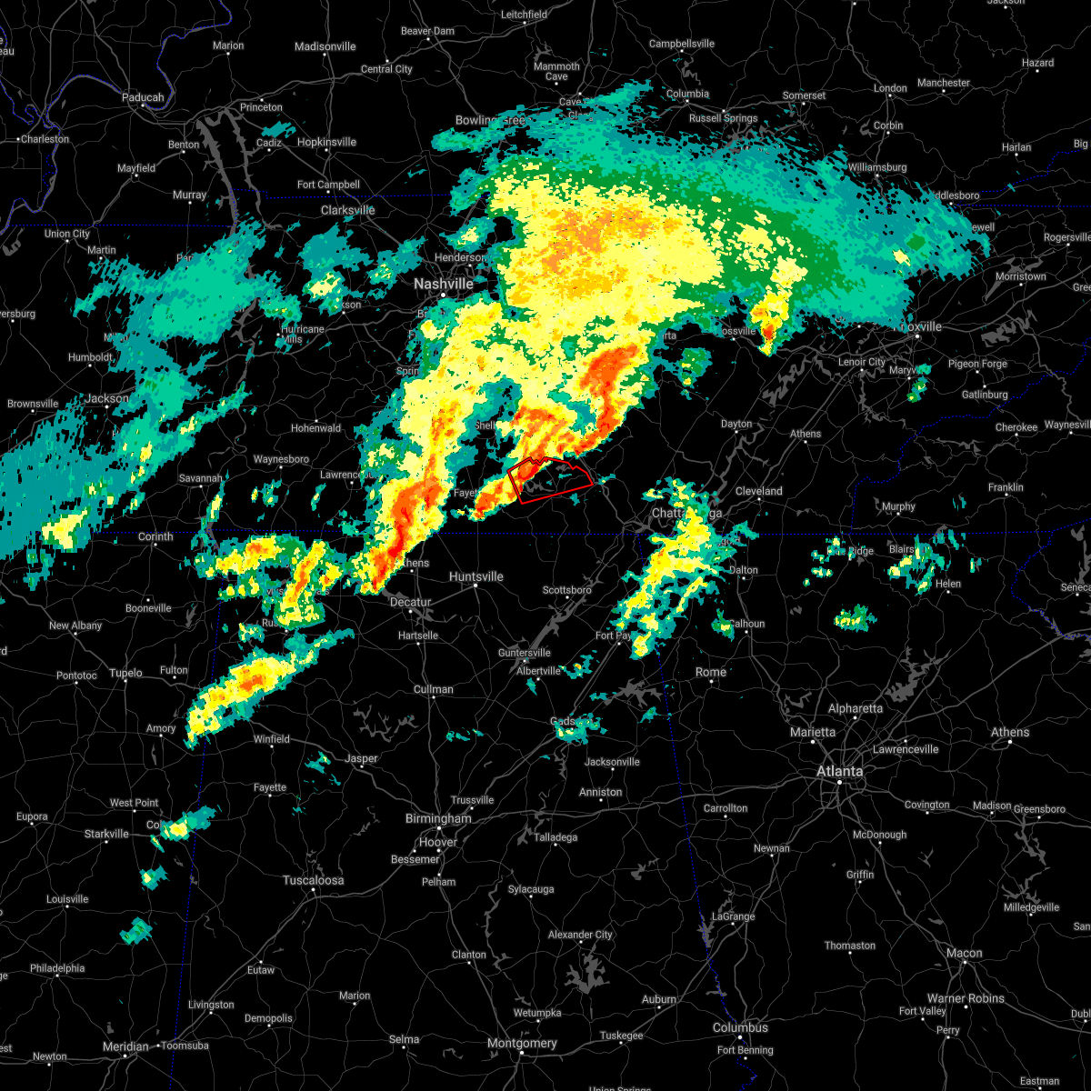 At 546 pm cst, a severe thunderstorm capable of producing a tornado was located near tims ford lake, or near lynchburg, moving east at 50 mph (radar indicated rotation). Hazards include tornado. Flying debris will be dangerous to those caught without shelter. mobile homes will be damaged or destroyed. damage to roofs, windows, and vehicles will occur. tree damage is likely. this dangerous storm will be near, winchester and estill springs around 555 pm cst. decherd around 600 pm cst. Other locations impacted by this tornadic thunderstorm include alto, marble hill, woods reservoir, harmony and arnold afb. At 546 pm cst, a severe thunderstorm capable of producing a tornado was located near tims ford lake, or near lynchburg, moving east at 50 mph (radar indicated rotation). Hazards include tornado. Flying debris will be dangerous to those caught without shelter. mobile homes will be damaged or destroyed. damage to roofs, windows, and vehicles will occur. tree damage is likely. this dangerous storm will be near, winchester and estill springs around 555 pm cst. decherd around 600 pm cst. Other locations impacted by this tornadic thunderstorm include alto, marble hill, woods reservoir, harmony and arnold afb.
|
| 1/1/2022 5:42 PM CST |
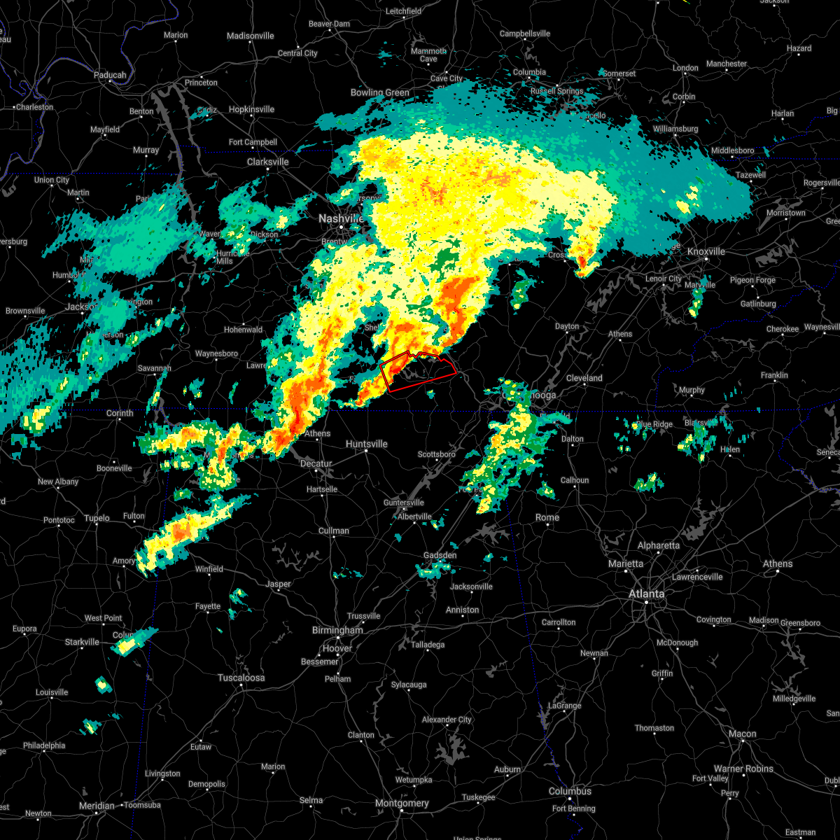 At 541 pm cst, a severe thunderstorm capable of producing a tornado was located near lynchburg, moving east at 50 mph (radar indicated rotation). Hazards include tornado. Flying debris will be dangerous to those caught without shelter. mobile homes will be damaged or destroyed. damage to roofs, windows, and vehicles will occur. tree damage is likely. this dangerous storm will be near, tims ford lake around 550 pm cst. winchester and estill springs around 555 pm cst. decherd around 600 pm cst. Other locations impacted by this tornadic thunderstorm include lexie crossroads, smithland, woods reservoir, harmony, arnold afb, hurdlow, lois, alto, booneville and marble hill. At 541 pm cst, a severe thunderstorm capable of producing a tornado was located near lynchburg, moving east at 50 mph (radar indicated rotation). Hazards include tornado. Flying debris will be dangerous to those caught without shelter. mobile homes will be damaged or destroyed. damage to roofs, windows, and vehicles will occur. tree damage is likely. this dangerous storm will be near, tims ford lake around 550 pm cst. winchester and estill springs around 555 pm cst. decherd around 600 pm cst. Other locations impacted by this tornadic thunderstorm include lexie crossroads, smithland, woods reservoir, harmony, arnold afb, hurdlow, lois, alto, booneville and marble hill.
|
| 1/1/2022 5:33 PM CST |
 At 532 pm cst, a severe thunderstorm was located near fayetteville, moving east at 50 mph (radar indicated). Hazards include 60 mph wind gusts. expect damage to roofs, siding, and trees At 532 pm cst, a severe thunderstorm was located near fayetteville, moving east at 50 mph (radar indicated). Hazards include 60 mph wind gusts. expect damage to roofs, siding, and trees
|
| 12/6/2021 8:38 AM CST |
 The severe thunderstorm warning for east central franklin county will expire at 845 am cst, the storm which prompted the warning has weakened below severe limits, and no longer poses an immediate threat to life or property. therefore, the warning will be allowed to expire. The severe thunderstorm warning for east central franklin county will expire at 845 am cst, the storm which prompted the warning has weakened below severe limits, and no longer poses an immediate threat to life or property. therefore, the warning will be allowed to expire.
|
| 12/6/2021 8:35 AM CST |
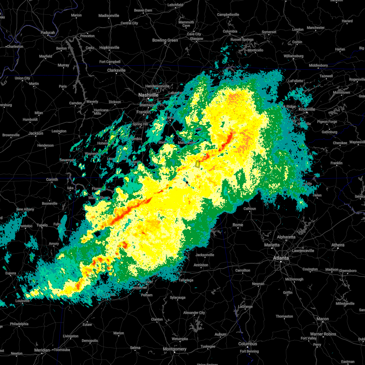 At 835 am cst, a severe thunderstorm was located over sewanee, or 12 miles east of winchester, moving east at 35 mph (radar indicated). Hazards include 60 mph wind gusts. Expect damage to roofs, siding, and trees. locations impacted include, sewanee and st. andrews. hail threat, radar indicated max hail size, <. 75 in wind threat, radar indicated max wind gust, 60 mph. At 835 am cst, a severe thunderstorm was located over sewanee, or 12 miles east of winchester, moving east at 35 mph (radar indicated). Hazards include 60 mph wind gusts. Expect damage to roofs, siding, and trees. locations impacted include, sewanee and st. andrews. hail threat, radar indicated max hail size, <. 75 in wind threat, radar indicated max wind gust, 60 mph.
|
| 12/6/2021 8:29 AM CST |
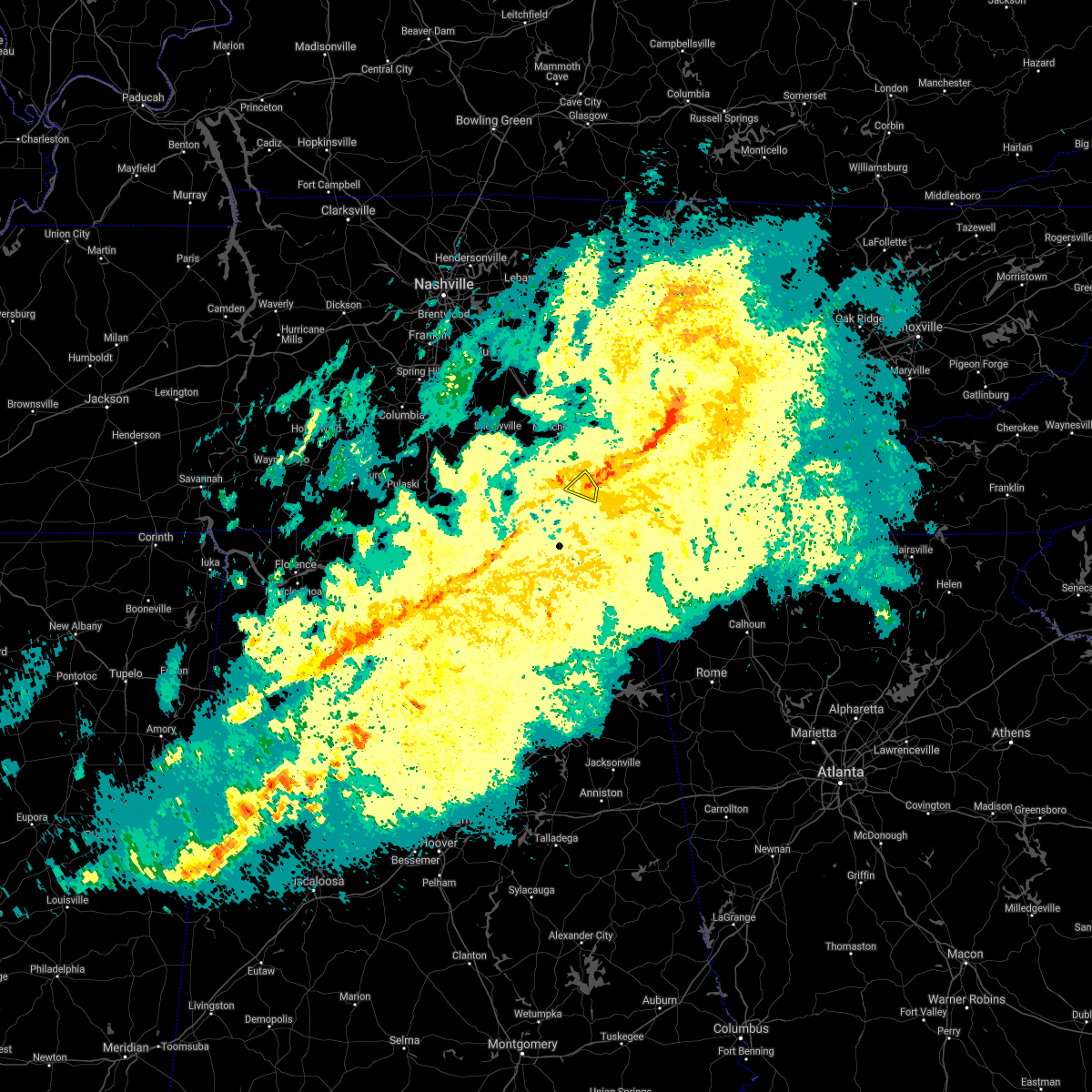 At 829 am cst, a severe thunderstorm was located over sewanee, or 9 miles east of winchester, moving east at 35 mph (radar indicated). Hazards include 60 mph wind gusts. expect damage to roofs, siding, and trees At 829 am cst, a severe thunderstorm was located over sewanee, or 9 miles east of winchester, moving east at 35 mph (radar indicated). Hazards include 60 mph wind gusts. expect damage to roofs, siding, and trees
|
| 8/1/2021 12:32 AM CDT |
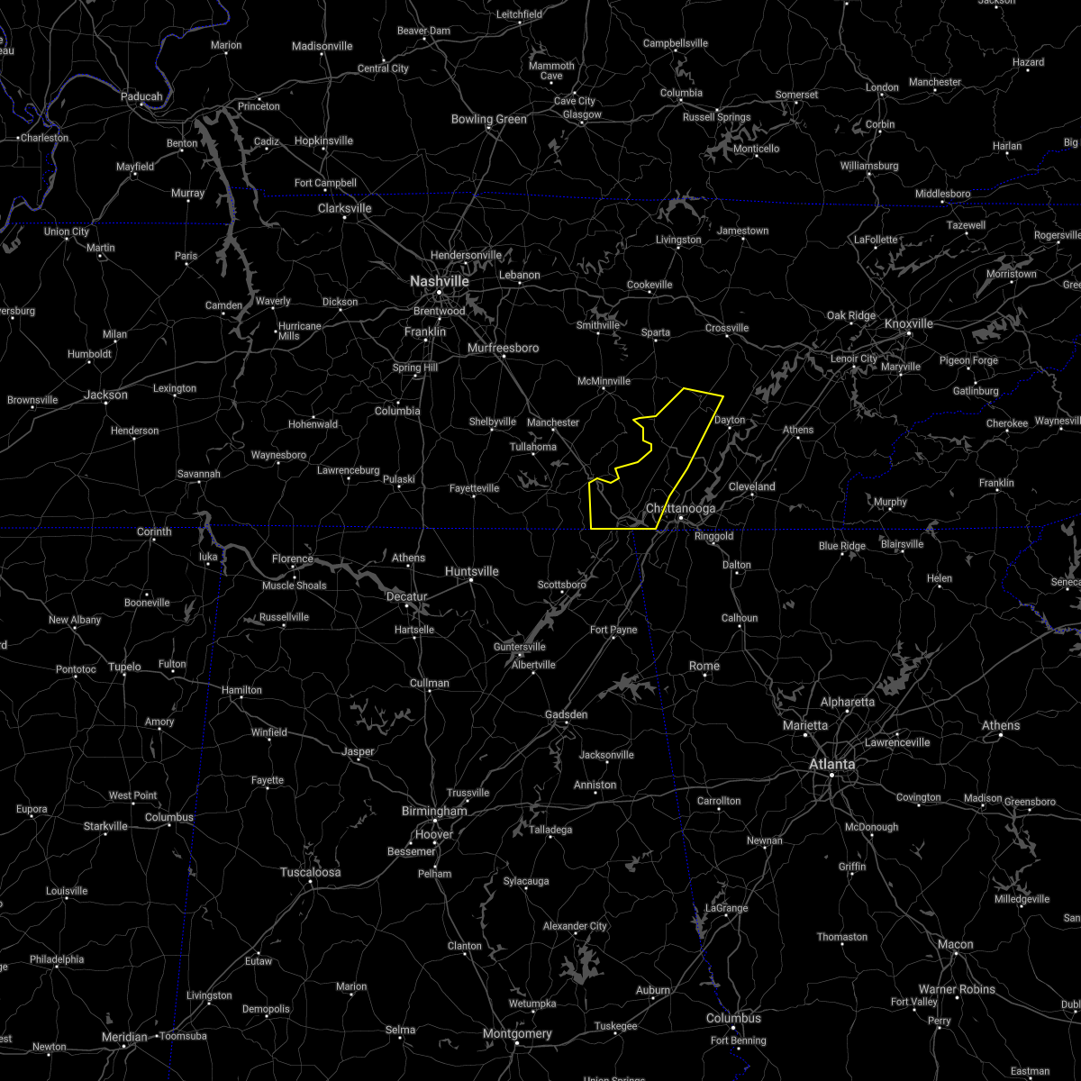 At 1231 am cdt, severe thunderstorms were located along a line extending from 10 miles south of spencer to near cowan, moving east at 45 mph (radar indicated). Hazards include 60 mph wind gusts. Expect damage to roofs, siding, and trees. Locations impacted include, dunlap, jasper, pikeville, signal mountain, south pittsburg, whitwell, kimball, monteagle, fairmount and powells crossroads. At 1231 am cdt, severe thunderstorms were located along a line extending from 10 miles south of spencer to near cowan, moving east at 45 mph (radar indicated). Hazards include 60 mph wind gusts. Expect damage to roofs, siding, and trees. Locations impacted include, dunlap, jasper, pikeville, signal mountain, south pittsburg, whitwell, kimball, monteagle, fairmount and powells crossroads.
|
| 8/1/2021 12:12 AM CDT |
 The severe thunderstorm warning for moore, lincoln and franklin counties will expire at 1215 am cdt, the storms which prompted the warning have moved out of the area. therefore, the warning will be allowed to expire. a severe thunderstorm watch remains in effect until 300 am cdt for north central and northeastern alabama, and middle tennessee. remember, a severe thunderstorm warning still remains in effect for franklin county tennessee until 100 am cdt. The severe thunderstorm warning for moore, lincoln and franklin counties will expire at 1215 am cdt, the storms which prompted the warning have moved out of the area. therefore, the warning will be allowed to expire. a severe thunderstorm watch remains in effect until 300 am cdt for north central and northeastern alabama, and middle tennessee. remember, a severe thunderstorm warning still remains in effect for franklin county tennessee until 100 am cdt.
|
| 8/1/2021 12:11 AM CDT |
 At 1210 am cdt, severe thunderstorms were located along a line extending from near manchester to near tims ford lake to near huntland, moving southeast at 50 mph (radar indicated). Hazards include 60 mph wind gusts. expect damage to roofs, siding, and trees At 1210 am cdt, severe thunderstorms were located along a line extending from near manchester to near tims ford lake to near huntland, moving southeast at 50 mph (radar indicated). Hazards include 60 mph wind gusts. expect damage to roofs, siding, and trees
|
| 8/1/2021 12:10 AM CDT |
 At 1209 am cdt, severe thunderstorms were located along a line extending from near mcminnville to near tims ford lake, moving east at 40 mph (radar indicated). Hazards include 60 mph wind gusts. expect damage to roofs, siding, and trees At 1209 am cdt, severe thunderstorms were located along a line extending from near mcminnville to near tims ford lake, moving east at 40 mph (radar indicated). Hazards include 60 mph wind gusts. expect damage to roofs, siding, and trees
|
| 8/1/2021 12:10 AM CDT |
 At 1210 am cdt, severe thunderstorms were located along a line extending from near mcminnville to near estill springs, moving east at 45 mph (radar indicated). Hazards include 60 mph wind gusts. Expect damage to roofs, siding, and trees. locations impacted include, mcminnville, manchester, tullahoma, gruetli-laager, tracy city, monteagle, altamont, coalmont, morrison, palmer, beersheba springs, centertown, viola, summitville, hillsboro, pelham, arnold afb and fiery gizzard state park. This includes interstate 24 between mile markers 104 and 134. At 1210 am cdt, severe thunderstorms were located along a line extending from near mcminnville to near estill springs, moving east at 45 mph (radar indicated). Hazards include 60 mph wind gusts. Expect damage to roofs, siding, and trees. locations impacted include, mcminnville, manchester, tullahoma, gruetli-laager, tracy city, monteagle, altamont, coalmont, morrison, palmer, beersheba springs, centertown, viola, summitville, hillsboro, pelham, arnold afb and fiery gizzard state park. This includes interstate 24 between mile markers 104 and 134.
|
| 7/31/2021 11:55 PM CDT |
 At 1154 pm cdt, severe thunderstorms were located along a line extending from centertown to near lynchburg, moving east at 45 mph (radar indicated). Hazards include 60 mph wind gusts. expect damage to roofs, siding, and trees At 1154 pm cdt, severe thunderstorms were located along a line extending from centertown to near lynchburg, moving east at 45 mph (radar indicated). Hazards include 60 mph wind gusts. expect damage to roofs, siding, and trees
|
| 7/31/2021 11:49 PM CDT |
 At 1148 pm cdt, severe thunderstorms were located along a line extending from 8 miles northwest of manchester to near lynchburg to 8 miles east of pulaski, moving east at 40 mph (radar indicated). Hazards include 60 mph wind gusts. Expect damage to roofs, siding, and trees. Locations impacted include, winchester, fayetteville, lynchburg, decherd, estill springs, cowan, huntland, petersburg, tims ford lake and sewanee. At 1148 pm cdt, severe thunderstorms were located along a line extending from 8 miles northwest of manchester to near lynchburg to 8 miles east of pulaski, moving east at 40 mph (radar indicated). Hazards include 60 mph wind gusts. Expect damage to roofs, siding, and trees. Locations impacted include, winchester, fayetteville, lynchburg, decherd, estill springs, cowan, huntland, petersburg, tims ford lake and sewanee.
|
| 7/31/2021 11:27 PM CDT |
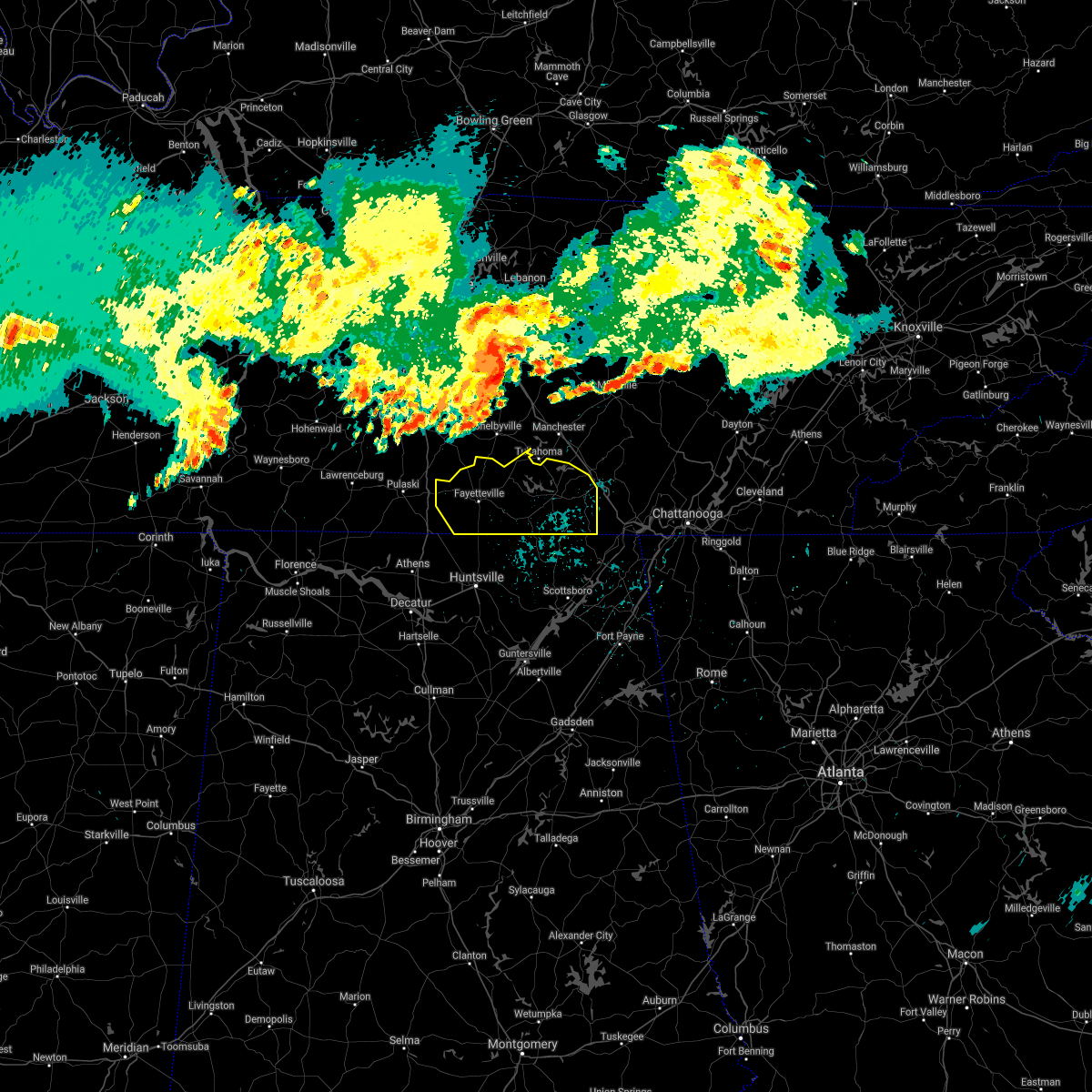 At 1126 pm cdt, severe thunderstorms were located along a line extending from 11 miles south of murfreesboro to 6 miles west of shelbyville to 8 miles southwest of lewisburg, moving southeast at 45 mph (radar indicated). Hazards include 60 mph wind gusts. expect damage to roofs, siding, and trees At 1126 pm cdt, severe thunderstorms were located along a line extending from 11 miles south of murfreesboro to 6 miles west of shelbyville to 8 miles southwest of lewisburg, moving southeast at 45 mph (radar indicated). Hazards include 60 mph wind gusts. expect damage to roofs, siding, and trees
|
| 7/26/2021 3:06 PM CDT |
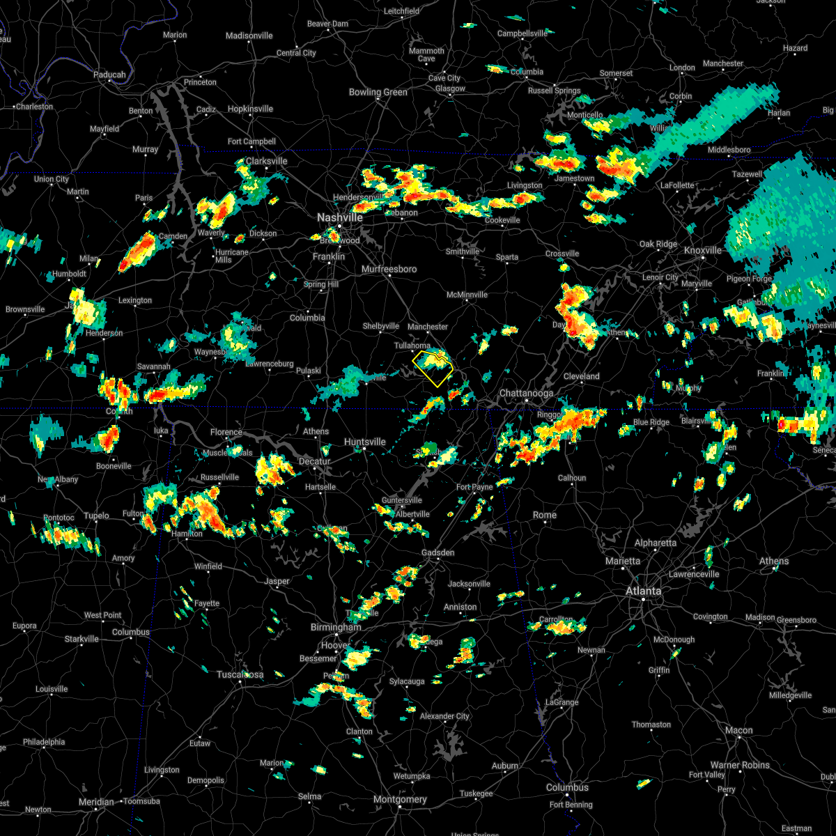 The severe thunderstorm warning for northeastern franklin county will expire at 315 pm cdt, the storm which prompted the warning has weakened below severe limits, and no longer poses an immediate threat to life or property. therefore, the warning will be allowed to expire. The severe thunderstorm warning for northeastern franklin county will expire at 315 pm cdt, the storm which prompted the warning has weakened below severe limits, and no longer poses an immediate threat to life or property. therefore, the warning will be allowed to expire.
|
| 7/26/2021 2:47 PM CDT |
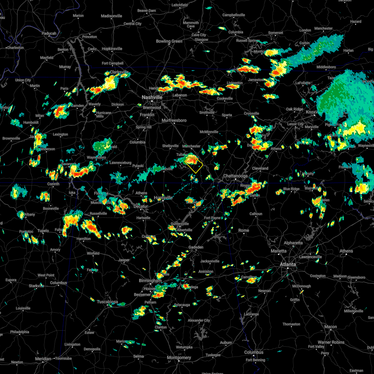 At 247 pm cdt, a severe thunderstorm was located near decherd, or 8 miles northeast of winchester, moving southeast at 10 mph (radar indicated). Hazards include 60 mph wind gusts. expect damage to roofs, siding, and trees At 247 pm cdt, a severe thunderstorm was located near decherd, or 8 miles northeast of winchester, moving southeast at 10 mph (radar indicated). Hazards include 60 mph wind gusts. expect damage to roofs, siding, and trees
|
| 5/6/2021 7:25 PM CDT |
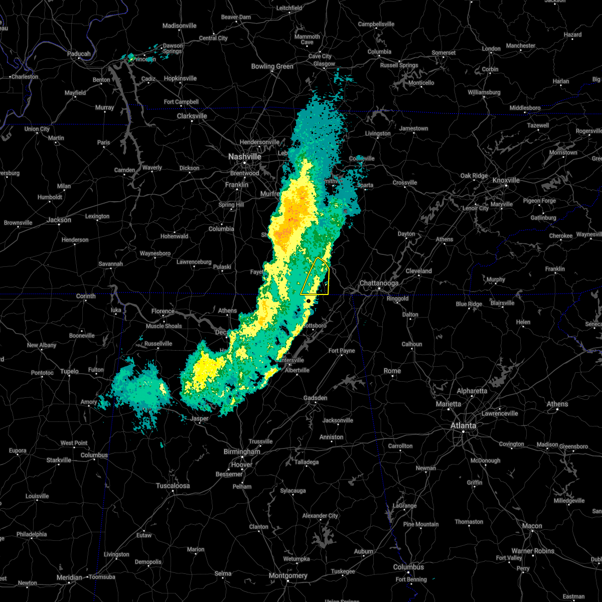 The severe thunderstorm warning for eastern franklin county will expire at 730 pm cdt, the storms which prompted the warning are moving out of the area. therefore, the warning will be allowed to expire. The severe thunderstorm warning for eastern franklin county will expire at 730 pm cdt, the storms which prompted the warning are moving out of the area. therefore, the warning will be allowed to expire.
|
| 5/6/2021 7:19 PM CDT |
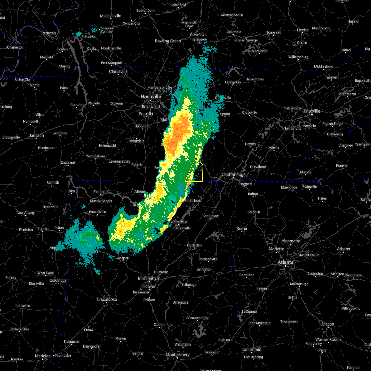 At 718 pm cdt, severe thunderstorms were located along a line extending from near monteagle to 11 miles northeast of skyline, moving east at 40 mph (emergency management and doppler radar). Hazards include 60 mph wind gusts. Expect damage to roofs, siding, and trees. locations impacted include, winchester, decherd, cowan, sewanee, anderson, alto, st. Andrews, sherwood and woods reservoir. At 718 pm cdt, severe thunderstorms were located along a line extending from near monteagle to 11 miles northeast of skyline, moving east at 40 mph (emergency management and doppler radar). Hazards include 60 mph wind gusts. Expect damage to roofs, siding, and trees. locations impacted include, winchester, decherd, cowan, sewanee, anderson, alto, st. Andrews, sherwood and woods reservoir.
|
| 5/6/2021 7:07 PM CDT |
 At 707 pm cdt, severe thunderstorms were located along a line extending from 9 miles east of manchester to 9 miles south of huntland, moving east at 45 mph (radar indicated). Hazards include 60 mph wind gusts. expect damage to roofs, siding, and trees At 707 pm cdt, severe thunderstorms were located along a line extending from 9 miles east of manchester to 9 miles south of huntland, moving east at 45 mph (radar indicated). Hazards include 60 mph wind gusts. expect damage to roofs, siding, and trees
|
| 5/6/2021 7:01 PM CDT |
 At 701 pm cdt, severe thunderstorms were located along a line extending from 6 miles north of mcminnville to decherd, moving east at 50 mph (radar indicated). Hazards include 60 mph wind gusts. Expect damage to roofs, siding, and trees. locations impacted include, mcminnville, manchester, monteagle, altamont, morrison, viola, hillsboro, pelham, summitville and arnold afb. This includes interstate 24 between mile markers 107 and 134. At 701 pm cdt, severe thunderstorms were located along a line extending from 6 miles north of mcminnville to decherd, moving east at 50 mph (radar indicated). Hazards include 60 mph wind gusts. Expect damage to roofs, siding, and trees. locations impacted include, mcminnville, manchester, monteagle, altamont, morrison, viola, hillsboro, pelham, summitville and arnold afb. This includes interstate 24 between mile markers 107 and 134.
|
| 5/6/2021 6:53 PM CDT |
 At 652 pm cdt, severe thunderstorms were located along a line extending from near estill springs to 6 miles southwest of huntland, moving east at 40 mph (radar indicated). Hazards include 60 mph wind gusts and penny size hail. expect damage to roofs, siding, and trees At 652 pm cdt, severe thunderstorms were located along a line extending from near estill springs to 6 miles southwest of huntland, moving east at 40 mph (radar indicated). Hazards include 60 mph wind gusts and penny size hail. expect damage to roofs, siding, and trees
|
| 5/6/2021 6:48 PM CDT |
 At 648 pm cdt, severe thunderstorms were located along a line extending from 6 miles southeast of woodbury to near tims ford lake, moving east at 50 mph (radar indicated). Hazards include 60 mph wind gusts. Expect damage to roofs, siding, and trees. locations impacted include, mcminnville, manchester, tullahoma, monteagle, altamont, morrison, normandy, viola, beechgrove, summitville, hillsboro, pelham and arnold afb. This includes interstate 24 between mile markers 96 and 134. At 648 pm cdt, severe thunderstorms were located along a line extending from 6 miles southeast of woodbury to near tims ford lake, moving east at 50 mph (radar indicated). Hazards include 60 mph wind gusts. Expect damage to roofs, siding, and trees. locations impacted include, mcminnville, manchester, tullahoma, monteagle, altamont, morrison, normandy, viola, beechgrove, summitville, hillsboro, pelham and arnold afb. This includes interstate 24 between mile markers 96 and 134.
|
| 5/6/2021 6:27 PM CDT |
 At 626 pm cdt, severe thunderstorms were located along a line extending from 10 miles southeast of murfreesboro to near fayetteville, moving east at 50 mph (radar indicated). Hazards include 60 mph wind gusts. expect damage to roofs, siding, and trees At 626 pm cdt, severe thunderstorms were located along a line extending from 10 miles southeast of murfreesboro to near fayetteville, moving east at 50 mph (radar indicated). Hazards include 60 mph wind gusts. expect damage to roofs, siding, and trees
|
| 5/4/2021 8:38 AM CDT | Trees down on summerfield road and near south cumberland visitors center in grundy county TN, 2.7 miles SW of Monteagle, TN |
| 3/27/2021 6:56 PM CDT |
 At 655 pm cdt, a severe thunderstorm was located near south pittsburg, or 9 miles west of jasper, moving northeast at 50 mph (radar indicated). Hazards include ping pong ball size hail and 60 mph wind gusts. People and animals outdoors will be injured. expect hail damage to roofs, siding, windows, and vehicles. expect wind damage to roofs, siding, and trees. Locations impacted include, jasper, south pittsburg, whitwell, kimball, monteagle, powells crossroads, orme, martin springs, fiery gizzard state park and griffith creek. At 655 pm cdt, a severe thunderstorm was located near south pittsburg, or 9 miles west of jasper, moving northeast at 50 mph (radar indicated). Hazards include ping pong ball size hail and 60 mph wind gusts. People and animals outdoors will be injured. expect hail damage to roofs, siding, windows, and vehicles. expect wind damage to roofs, siding, and trees. Locations impacted include, jasper, south pittsburg, whitwell, kimball, monteagle, powells crossroads, orme, martin springs, fiery gizzard state park and griffith creek.
|
| 3/27/2021 6:43 PM CDT |
 At 642 pm cdt, a severe thunderstorm was located 8 miles northwest of stevenson, or 13 miles west of bridgeport, moving northeast at 45 mph (radar indicated). Hazards include 60 mph wind gusts and half dollar size hail. Hail damage to vehicles is expected. Expect wind damage to roofs, siding, and trees. At 642 pm cdt, a severe thunderstorm was located 8 miles northwest of stevenson, or 13 miles west of bridgeport, moving northeast at 45 mph (radar indicated). Hazards include 60 mph wind gusts and half dollar size hail. Hail damage to vehicles is expected. Expect wind damage to roofs, siding, and trees.
|
| 9/28/2020 3:58 PM CDT |
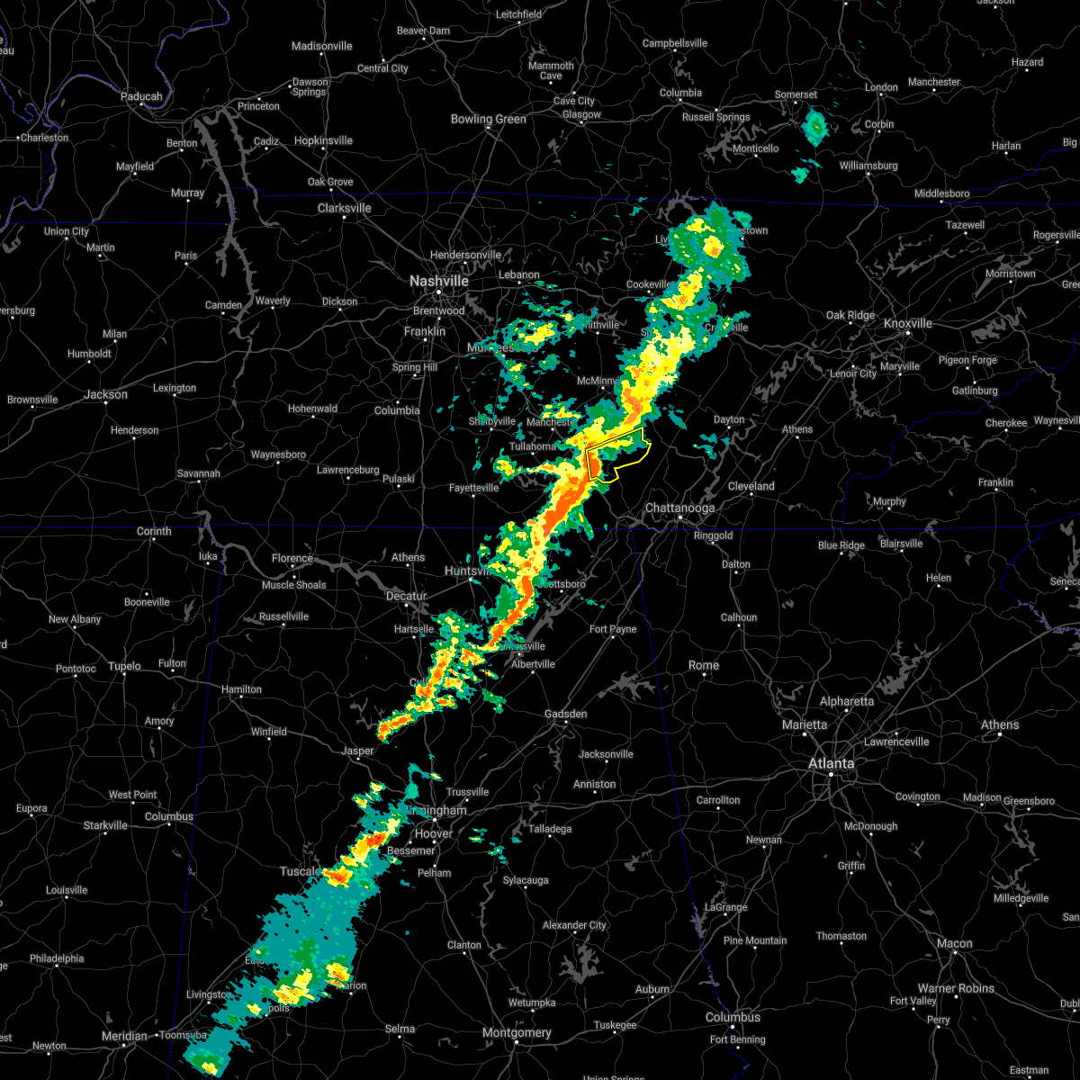 At 357 pm cdt, a severe thunderstorm was located near tracy city, or 18 miles southeast of manchester, moving east at 30 mph (radar indicated). Hazards include 60 mph wind gusts. expect damage to roofs, siding, and trees At 357 pm cdt, a severe thunderstorm was located near tracy city, or 18 miles southeast of manchester, moving east at 30 mph (radar indicated). Hazards include 60 mph wind gusts. expect damage to roofs, siding, and trees
|
| 8/31/2020 4:23 PM CDT |
 The severe thunderstorm warning for northeastern franklin county will expire at 430 pm cdt, the storm which prompted the warning has weakened below severe limits, and no longer poses an immediate threat to life or property. therefore, the warning will be allowed to expire. however heavy rain is still possible with this thunderstorm. The severe thunderstorm warning for northeastern franklin county will expire at 430 pm cdt, the storm which prompted the warning has weakened below severe limits, and no longer poses an immediate threat to life or property. therefore, the warning will be allowed to expire. however heavy rain is still possible with this thunderstorm.
|
| 8/31/2020 4:05 PM CDT |
 At 405 pm cdt, a severe thunderstorm was located near sewanee, or 7 miles northeast of winchester, moving southeast at 20 mph (radar indicated). Hazards include 60 mph wind gusts. Expect damage to roofs, siding, and trees. locations impacted include, decherd, sewanee, alto and st. Andrews. At 405 pm cdt, a severe thunderstorm was located near sewanee, or 7 miles northeast of winchester, moving southeast at 20 mph (radar indicated). Hazards include 60 mph wind gusts. Expect damage to roofs, siding, and trees. locations impacted include, decherd, sewanee, alto and st. Andrews.
|
| 8/31/2020 4:01 PM CDT |
 The national weather service in huntsville alabama has issued a * severe thunderstorm warning for. northeastern franklin county in middle tennessee. until 430 pm cdt. At 401 pm cdt, a severe thunderstorm was located near decherd, or near winchester, moving southeast at 20 mph. The national weather service in huntsville alabama has issued a * severe thunderstorm warning for. northeastern franklin county in middle tennessee. until 430 pm cdt. At 401 pm cdt, a severe thunderstorm was located near decherd, or near winchester, moving southeast at 20 mph.
|
| 7/4/2020 4:15 PM CDT | Several trees dow in marion county TN, 1.6 miles NW of Monteagle, TN |
| 7/4/2020 4:11 PM CDT |
 At 411 pm cdt, a severe thunderstorm was located near tracy city, or 9 miles north of jasper, moving east at 15 mph (radar indicated). Hazards include 60 mph wind gusts and penny size hail. Expect damage to roofs, siding, and trees. Locations impacted include, monteagle, fiery gizzard state park and foster falls state park. At 411 pm cdt, a severe thunderstorm was located near tracy city, or 9 miles north of jasper, moving east at 15 mph (radar indicated). Hazards include 60 mph wind gusts and penny size hail. Expect damage to roofs, siding, and trees. Locations impacted include, monteagle, fiery gizzard state park and foster falls state park.
|
| 7/4/2020 3:56 PM CDT |
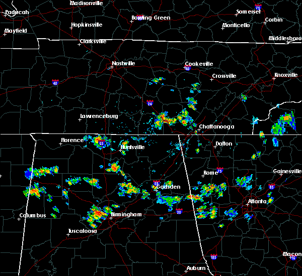 At 356 pm cdt, a severe thunderstorm was located over monteagle, or 14 miles northwest of jasper, and is nearly stationary (radar indicated). Hazards include 60 mph wind gusts and penny size hail. expect damage to roofs, siding, and trees At 356 pm cdt, a severe thunderstorm was located over monteagle, or 14 miles northwest of jasper, and is nearly stationary (radar indicated). Hazards include 60 mph wind gusts and penny size hail. expect damage to roofs, siding, and trees
|
| 6/28/2020 7:09 PM CDT |
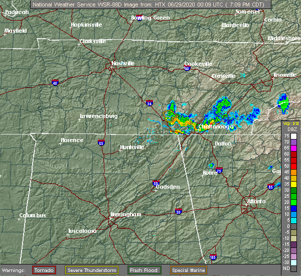 The severe thunderstorm warning for southwestern grundy county will expire at 715 pm cdt, the storm which prompted the warning has weakened below severe limits and has exited the warned area. therefore, the warning will be allowed to expire. The severe thunderstorm warning for southwestern grundy county will expire at 715 pm cdt, the storm which prompted the warning has weakened below severe limits and has exited the warned area. therefore, the warning will be allowed to expire.
|
| 6/28/2020 7:00 PM CDT |
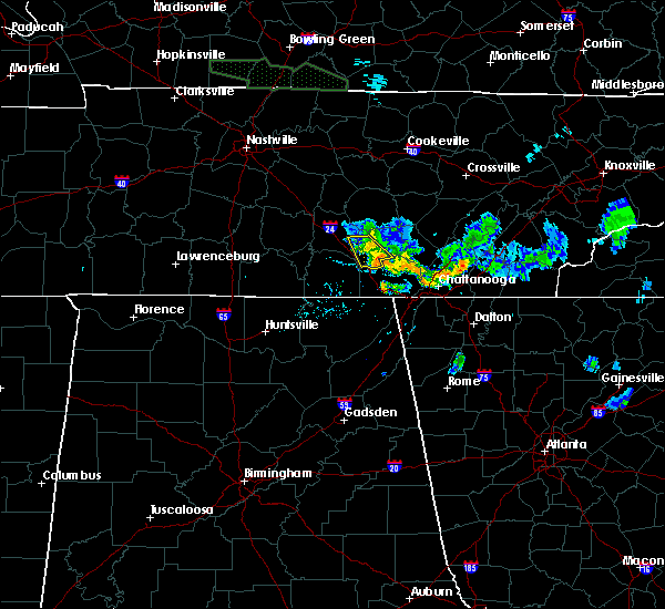 At 700 pm cdt, a severe thunderstorm was located near tracy city, or 18 miles southeast of manchester, moving southeast at 25 mph (radar indicated). Hazards include 60 mph wind gusts. Expect damage to roofs, siding, and trees. Locations impacted include, gruetli-laager, tracy city, monteagle, altamont, coalmont and fiery gizzard state park. At 700 pm cdt, a severe thunderstorm was located near tracy city, or 18 miles southeast of manchester, moving southeast at 25 mph (radar indicated). Hazards include 60 mph wind gusts. Expect damage to roofs, siding, and trees. Locations impacted include, gruetli-laager, tracy city, monteagle, altamont, coalmont and fiery gizzard state park.
|
| 6/28/2020 6:42 PM CDT |
 At 642 pm cdt, a severe thunderstorm was located 12 miles east of manchester, moving southeast at 25 mph (radar indicated). Hazards include 60 mph wind gusts. expect damage to roofs, siding, and trees At 642 pm cdt, a severe thunderstorm was located 12 miles east of manchester, moving southeast at 25 mph (radar indicated). Hazards include 60 mph wind gusts. expect damage to roofs, siding, and trees
|
| 5/22/2020 9:23 PM CDT |
 At 923 pm cdt, severe thunderstorms were located along a line extending from near tims ford lake to near hazel green, moving east at 40 mph (radar indicated). Hazards include 60 mph wind gusts. Expect damage to roofs, siding, and trees. Locations impacted include, winchester, fayetteville, hazel green, decherd, cowan, huntland, tims ford lake, sewanee, new market and lincoln. At 923 pm cdt, severe thunderstorms were located along a line extending from near tims ford lake to near hazel green, moving east at 40 mph (radar indicated). Hazards include 60 mph wind gusts. Expect damage to roofs, siding, and trees. Locations impacted include, winchester, fayetteville, hazel green, decherd, cowan, huntland, tims ford lake, sewanee, new market and lincoln.
|
| 5/22/2020 9:00 PM CDT |
 At 859 pm cdt, severe thunderstorms were located along a line extending from 7 miles west of lynchburg to ardmore, moving east at 40 mph (radar indicated). Hazards include 60 mph wind gusts. expect damage to roofs, siding, and trees At 859 pm cdt, severe thunderstorms were located along a line extending from 7 miles west of lynchburg to ardmore, moving east at 40 mph (radar indicated). Hazards include 60 mph wind gusts. expect damage to roofs, siding, and trees
|
| 5/4/2020 10:18 PM CDT |
 At 1018 pm cdt, a severe thunderstorm was located near kimball, or 7 miles west of jasper, moving east at 45 mph (radar indicated). Hazards include 60 mph wind gusts. Expect damage to roofs, siding, and trees. Locations impacted include, jasper, south pittsburg, whitwell, kimball, monteagle, powells crossroads, orme, martin springs, fiery gizzard state park and haletown (guild). At 1018 pm cdt, a severe thunderstorm was located near kimball, or 7 miles west of jasper, moving east at 45 mph (radar indicated). Hazards include 60 mph wind gusts. Expect damage to roofs, siding, and trees. Locations impacted include, jasper, south pittsburg, whitwell, kimball, monteagle, powells crossroads, orme, martin springs, fiery gizzard state park and haletown (guild).
|
| 5/4/2020 10:03 PM CDT |
 At 1003 pm cdt, a severe thunderstorm was located near cowan, or 10 miles southeast of winchester, moving east at 40 mph (radar indicated). Hazards include 60 mph wind gusts. expect damage to roofs, siding, and trees At 1003 pm cdt, a severe thunderstorm was located near cowan, or 10 miles southeast of winchester, moving east at 40 mph (radar indicated). Hazards include 60 mph wind gusts. expect damage to roofs, siding, and trees
|
| 5/3/2020 5:45 PM CDT | Multiple trees down near monteagle in grundy county TN, 0.2 miles S of Monteagle, TN |
| 5/3/2020 5:44 PM CDT |
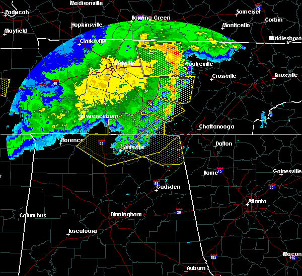 At 544 pm cdt, severe thunderstorms were located along a line extending from 10 miles southeast of smithville to 10 miles northwest of gruetli-laager to 8 miles south of cowan, moving east at 65 mph (radar indicated). Hazards include 60 mph wind gusts. expect damage to roofs, siding, and trees At 544 pm cdt, severe thunderstorms were located along a line extending from 10 miles southeast of smithville to 10 miles northwest of gruetli-laager to 8 miles south of cowan, moving east at 65 mph (radar indicated). Hazards include 60 mph wind gusts. expect damage to roofs, siding, and trees
|
| 5/3/2020 5:44 PM CDT |
 At 544 pm cdt, severe thunderstorms were located along a line extending from 7 miles north of gruetli-laager to near monteagle, moving southeast at 55 mph (radar indicated). Hazards include 60 mph wind gusts. expect damage to roofs, siding, and trees At 544 pm cdt, severe thunderstorms were located along a line extending from 7 miles north of gruetli-laager to near monteagle, moving southeast at 55 mph (radar indicated). Hazards include 60 mph wind gusts. expect damage to roofs, siding, and trees
|
| 5/3/2020 5:41 PM CDT |
 At 540 pm cdt, severe thunderstorms were located along a line extending from near monteagle to 7 miles southeast of new market to huntsville, moving east at 65 mph (radar indicated. this storm has a history of producing widespread tree damage and power outages). Hazards include 70 mph wind gusts and penny size hail. Expect considerable tree damage. Damage is likely to mobile homes, roofs, and outbuildings. At 540 pm cdt, severe thunderstorms were located along a line extending from near monteagle to 7 miles southeast of new market to huntsville, moving east at 65 mph (radar indicated. this storm has a history of producing widespread tree damage and power outages). Hazards include 70 mph wind gusts and penny size hail. Expect considerable tree damage. Damage is likely to mobile homes, roofs, and outbuildings.
|
| 5/3/2020 5:41 PM CDT |
 The national weather service in huntsville alabama has issued a * severe thunderstorm warning for. jackson county in northeastern alabama. northeastern madison county in north central alabama. northeastern dekalb county in northeastern alabama. Southeastern franklin county in middle tennessee. The national weather service in huntsville alabama has issued a * severe thunderstorm warning for. jackson county in northeastern alabama. northeastern madison county in north central alabama. northeastern dekalb county in northeastern alabama. Southeastern franklin county in middle tennessee.
|
| 5/3/2020 5:36 PM CDT |
 At 535 pm cdt, severe thunderstorms were located along a line extending from 7 miles north of sewanee to near new market to near madison, moving southeast at 65 mph. this storm continues to produce widespread wind damage (radar indicated). Hazards include 70 mph wind gusts. Expect considerable tree damage. damage is likely to mobile homes, roofs, and outbuildings. Locations impacted include, huntsville, decatur, madison, athens, scottsboro, winchester, fayetteville, bridgeport, moores mill and meridianville. At 535 pm cdt, severe thunderstorms were located along a line extending from 7 miles north of sewanee to near new market to near madison, moving southeast at 65 mph. this storm continues to produce widespread wind damage (radar indicated). Hazards include 70 mph wind gusts. Expect considerable tree damage. damage is likely to mobile homes, roofs, and outbuildings. Locations impacted include, huntsville, decatur, madison, athens, scottsboro, winchester, fayetteville, bridgeport, moores mill and meridianville.
|
| 5/3/2020 5:34 PM CDT |
 At 534 pm cdt, severe thunderstorms were located along a line extending from 12 miles east of manchester to near monteagle to near huntland, moving southeast at 70 mph (radar indicated). Hazards include 60 mph wind gusts and penny size hail. Expect damage to roofs, siding, and trees. locations impacted include, manchester, tullahoma, gruetli-laager, tracy city, monteagle, altamont, coalmont, morrison, palmer, beersheba springs, viola, summitville, hillsboro, pelham, arnold afb and fiery gizzard state park. This includes interstate 24 between mile markers 108 and 135. At 534 pm cdt, severe thunderstorms were located along a line extending from 12 miles east of manchester to near monteagle to near huntland, moving southeast at 70 mph (radar indicated). Hazards include 60 mph wind gusts and penny size hail. Expect damage to roofs, siding, and trees. locations impacted include, manchester, tullahoma, gruetli-laager, tracy city, monteagle, altamont, coalmont, morrison, palmer, beersheba springs, viola, summitville, hillsboro, pelham, arnold afb and fiery gizzard state park. This includes interstate 24 between mile markers 108 and 135.
|
| 5/3/2020 5:23 PM CDT |
 At 522 pm cdt, severe thunderstorms were located along a line extending from near tullahoma to hazel green to near athens, moving southeast at 65 mph. this storm has a history of producing wind damage, most recently in northern limestone and madison county (radar indicated). Hazards include 70 mph wind gusts. Expect considerable tree damage. damage is likely to mobile homes, roofs, and outbuildings. Locations impacted include, huntsville, decatur, madison, athens, scottsboro, winchester, fayetteville, bridgeport, moores mill and meridianville. At 522 pm cdt, severe thunderstorms were located along a line extending from near tullahoma to hazel green to near athens, moving southeast at 65 mph. this storm has a history of producing wind damage, most recently in northern limestone and madison county (radar indicated). Hazards include 70 mph wind gusts. Expect considerable tree damage. damage is likely to mobile homes, roofs, and outbuildings. Locations impacted include, huntsville, decatur, madison, athens, scottsboro, winchester, fayetteville, bridgeport, moores mill and meridianville.
|
| 5/3/2020 5:13 PM CDT |
 At 512 pm cdt, severe thunderstorms were located along a line extending from near tullahoma to near ardmore to 7 miles east of rogersville, moving southeast at 65 mph (radar indicated. this storm has a history of producing wind damage). Hazards include 60 mph wind gusts and penny size hail. expect damage to roofs, siding, and trees At 512 pm cdt, severe thunderstorms were located along a line extending from near tullahoma to near ardmore to 7 miles east of rogersville, moving southeast at 65 mph (radar indicated. this storm has a history of producing wind damage). Hazards include 60 mph wind gusts and penny size hail. expect damage to roofs, siding, and trees
|
| 5/3/2020 5:06 PM CDT |
 At 506 pm cdt, severe thunderstorms were located along a line extending from 10 miles south of murfreesboro to near shelbyville to 9 miles west of fayetteville, moving southeast at 70 mph (radar indicated). Hazards include 70 mph wind gusts and penny size hail. Expect considerable tree damage. Damage is likely to mobile homes, roofs, and outbuildings. At 506 pm cdt, severe thunderstorms were located along a line extending from 10 miles south of murfreesboro to near shelbyville to 9 miles west of fayetteville, moving southeast at 70 mph (radar indicated). Hazards include 70 mph wind gusts and penny size hail. Expect considerable tree damage. Damage is likely to mobile homes, roofs, and outbuildings.
|
| 3/29/2020 3:36 AM CDT |
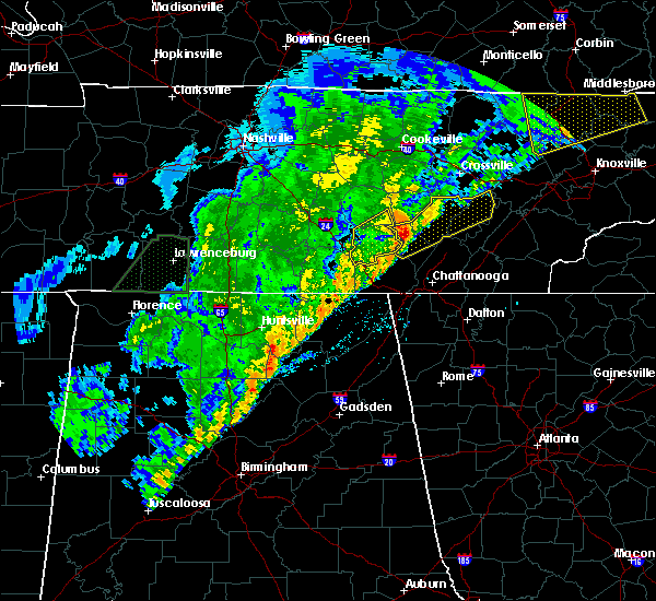 The severe thunderstorm warning for southeastern warren and grundy counties will expire at 345 am cdt, the storm which prompted the warning has moved out of the area. therefore, the warning will be allowed to expire. a tornado watch remains in effect until 400 am cdt for middle tennessee. The severe thunderstorm warning for southeastern warren and grundy counties will expire at 345 am cdt, the storm which prompted the warning has moved out of the area. therefore, the warning will be allowed to expire. a tornado watch remains in effect until 400 am cdt for middle tennessee.
|
| 3/29/2020 3:24 AM CDT |
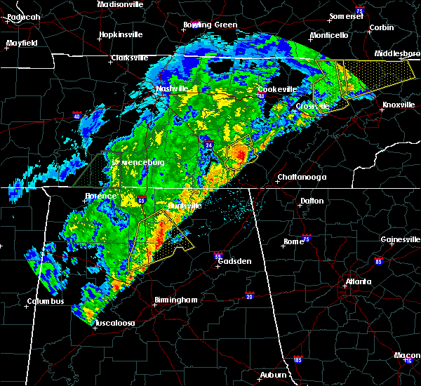 At 323 am cdt, a severe thunderstorm was located near gruetli-laager, or 15 miles west of dunlap, moving northeast at 80 mph (radar indicated). Hazards include 60 mph wind gusts. Expect damage to roofs, siding, and trees. locations impacted include, gruetli-laager, tracy city, altamont, coalmont, palmer, beersheba springs and pelham. This includes interstate 24 between mile markers 127 and 134. At 323 am cdt, a severe thunderstorm was located near gruetli-laager, or 15 miles west of dunlap, moving northeast at 80 mph (radar indicated). Hazards include 60 mph wind gusts. Expect damage to roofs, siding, and trees. locations impacted include, gruetli-laager, tracy city, altamont, coalmont, palmer, beersheba springs and pelham. This includes interstate 24 between mile markers 127 and 134.
|
| 3/29/2020 3:10 AM CDT |
 At 309 am cdt, a severe thunderstorm was located 9 miles north of sewanee, or 11 miles southeast of manchester, moving northeast at 80 mph (radar indicated). Hazards include 60 mph wind gusts. expect damage to roofs, siding, and trees At 309 am cdt, a severe thunderstorm was located 9 miles north of sewanee, or 11 miles southeast of manchester, moving northeast at 80 mph (radar indicated). Hazards include 60 mph wind gusts. expect damage to roofs, siding, and trees
|
| 3/24/2020 7:26 PM CDT |
 At 725 pm cdt, a severe thunderstorm capable of producing a tornado was located near sewanee, or 12 miles east of winchester, moving east at 35 mph (radar indicated rotation). Hazards include tornado. Flying debris will be dangerous to those caught without shelter. mobile homes will be damaged or destroyed. damage to roofs, windows, and vehicles will occur. tree damage is likely. Locations impacted include, monteagle, fiery gizzard state park, sequatchie cave and foster falls state park. At 725 pm cdt, a severe thunderstorm capable of producing a tornado was located near sewanee, or 12 miles east of winchester, moving east at 35 mph (radar indicated rotation). Hazards include tornado. Flying debris will be dangerous to those caught without shelter. mobile homes will be damaged or destroyed. damage to roofs, windows, and vehicles will occur. tree damage is likely. Locations impacted include, monteagle, fiery gizzard state park, sequatchie cave and foster falls state park.
|
| 3/24/2020 7:20 PM CDT |
 At 719 pm cdt, a confirmed tornado was located over sewanee, or 8 miles east of winchester, moving east at 35 mph (radar confirmed tornado). Hazards include damaging tornado. Flying debris will be dangerous to those caught without shelter. mobile homes will be damaged or destroyed. damage to roofs, windows, and vehicles will occur. tree damage is likely. locations impacted include, sewanee, alto, st. Andrews and woods reservoir. At 719 pm cdt, a confirmed tornado was located over sewanee, or 8 miles east of winchester, moving east at 35 mph (radar confirmed tornado). Hazards include damaging tornado. Flying debris will be dangerous to those caught without shelter. mobile homes will be damaged or destroyed. damage to roofs, windows, and vehicles will occur. tree damage is likely. locations impacted include, sewanee, alto, st. Andrews and woods reservoir.
|
| 3/24/2020 7:18 PM CDT |
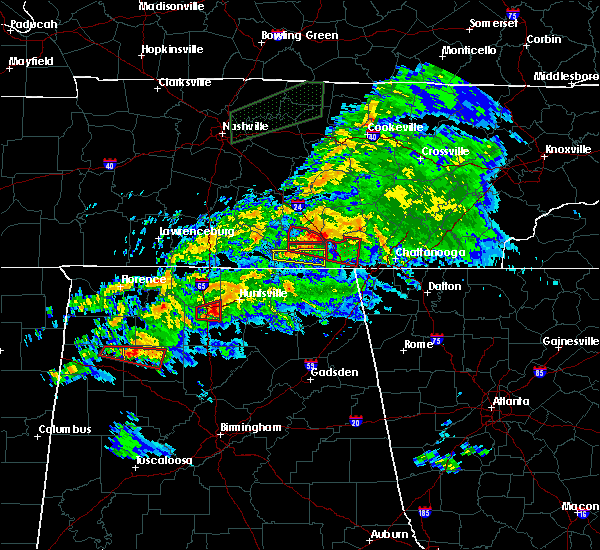 At 718 pm cdt, a severe thunderstorm capable of producing a tornado was located near sewanee, or 7 miles east of winchester, moving east at 35 mph (radar indicated rotation). Hazards include tornado. Flying debris will be dangerous to those caught without shelter. mobile homes will be damaged or destroyed. damage to roofs, windows, and vehicles will occur. tree damage is likely. this dangerous storm will be near, tracy city around 740 pm cdt. This includes interstate 24 between mile markers 130 and 134. At 718 pm cdt, a severe thunderstorm capable of producing a tornado was located near sewanee, or 7 miles east of winchester, moving east at 35 mph (radar indicated rotation). Hazards include tornado. Flying debris will be dangerous to those caught without shelter. mobile homes will be damaged or destroyed. damage to roofs, windows, and vehicles will occur. tree damage is likely. this dangerous storm will be near, tracy city around 740 pm cdt. This includes interstate 24 between mile markers 130 and 134.
|
| 3/24/2020 7:11 PM CDT |
 At 710 pm cdt, a severe thunderstorm capable of producing a tornado was located over decherd, or near winchester, moving east at 45 mph (radar indicated rotation). Hazards include tornado. Flying debris will be dangerous to those caught without shelter. mobile homes will be damaged or destroyed. damage to roofs, windows, and vehicles will occur. tree damage is likely. this dangerous storm will be near, monteagle around 730 pm cdt. jasper and kimball around 745 pm cdt. Other locations impacted by this tornadic thunderstorm include fiery gizzard state park, sequatchie cave, foster falls state park and new hope. At 710 pm cdt, a severe thunderstorm capable of producing a tornado was located over decherd, or near winchester, moving east at 45 mph (radar indicated rotation). Hazards include tornado. Flying debris will be dangerous to those caught without shelter. mobile homes will be damaged or destroyed. damage to roofs, windows, and vehicles will occur. tree damage is likely. this dangerous storm will be near, monteagle around 730 pm cdt. jasper and kimball around 745 pm cdt. Other locations impacted by this tornadic thunderstorm include fiery gizzard state park, sequatchie cave, foster falls state park and new hope.
|
| 3/24/2020 7:08 PM CDT |
 At 707 pm cdt, a severe thunderstorm capable of producing a tornado was located over winchester, moving east at 45 mph (radar indicated rotation). Hazards include tornado. Flying debris will be dangerous to those caught without shelter. mobile homes will be damaged or destroyed. damage to roofs, windows, and vehicles will occur. Tree damage is likely. At 707 pm cdt, a severe thunderstorm capable of producing a tornado was located over winchester, moving east at 45 mph (radar indicated rotation). Hazards include tornado. Flying debris will be dangerous to those caught without shelter. mobile homes will be damaged or destroyed. damage to roofs, windows, and vehicles will occur. Tree damage is likely.
|
| 3/24/2020 7:02 PM CDT |
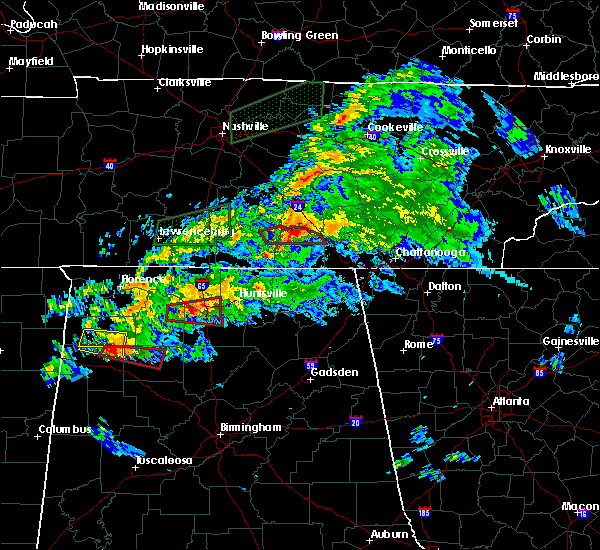 At 702 pm cdt, a severe thunderstorm capable of producing a tornado was located over winchester, moving east at 45 mph (radar indicated rotation). Hazards include tornado and quarter size hail. Flying debris will be dangerous to those caught without shelter. mobile homes will be damaged or destroyed. damage to roofs, windows, and vehicles will occur. tree damage is likely. locations impacted include, winchester, decherd, estill springs, sewanee, tims ford lake, woods reservoir, arnold afb, alto and st. Andrews. At 702 pm cdt, a severe thunderstorm capable of producing a tornado was located over winchester, moving east at 45 mph (radar indicated rotation). Hazards include tornado and quarter size hail. Flying debris will be dangerous to those caught without shelter. mobile homes will be damaged or destroyed. damage to roofs, windows, and vehicles will occur. tree damage is likely. locations impacted include, winchester, decherd, estill springs, sewanee, tims ford lake, woods reservoir, arnold afb, alto and st. Andrews.
|
| 3/24/2020 6:45 PM CDT |
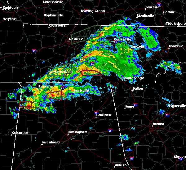 At 645 pm cdt, a severe thunderstorm capable of producing a tornado was located over lynchburg, moving east at 45 mph (radar indicated rotation). Hazards include tornado and quarter size hail. Flying debris will be dangerous to those caught without shelter. mobile homes will be damaged or destroyed. damage to roofs, windows, and vehicles will occur. Tree damage is likely. At 645 pm cdt, a severe thunderstorm capable of producing a tornado was located over lynchburg, moving east at 45 mph (radar indicated rotation). Hazards include tornado and quarter size hail. Flying debris will be dangerous to those caught without shelter. mobile homes will be damaged or destroyed. damage to roofs, windows, and vehicles will occur. Tree damage is likely.
|
| 2/12/2020 7:00 PM CST |
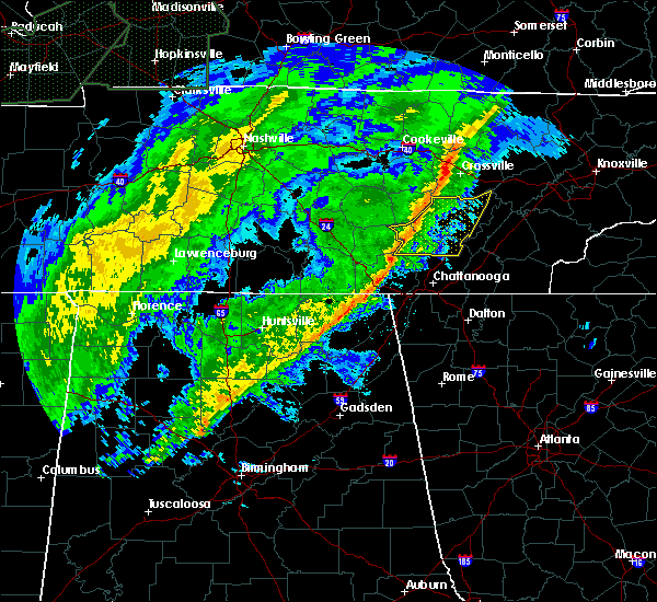 At 659 pm cst, severe thunderstorms were located along a line extending from 8 miles northeast of estill springs to near gurley, moving east at 45 mph (radar indicated). Hazards include 60 mph wind gusts. expect damage to roofs, siding, and trees At 659 pm cst, severe thunderstorms were located along a line extending from 8 miles northeast of estill springs to near gurley, moving east at 45 mph (radar indicated). Hazards include 60 mph wind gusts. expect damage to roofs, siding, and trees
|
| 2/12/2020 6:30 PM CST |
 At 629 pm cst, severe thunderstorms were located along a line extending from near tullahoma to 6 miles northwest of new market, moving east at 60 mph (radar indicated). Hazards include 60 mph wind gusts and penny size hail. expect damage to roofs, siding, and trees At 629 pm cst, severe thunderstorms were located along a line extending from near tullahoma to 6 miles northwest of new market, moving east at 60 mph (radar indicated). Hazards include 60 mph wind gusts and penny size hail. expect damage to roofs, siding, and trees
|
| 1/11/2020 2:16 PM CST |
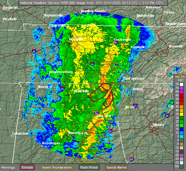 At 216 pm cst, a severe thunderstorm was located 8 miles northwest of dunlap, moving east at 60 mph (radar indicated). Hazards include 60 mph wind gusts. Expect damage to roofs, siding, and trees. Locations impacted include, gruetli-laager, tracy city, altamont, coalmont, palmer and beersheba springs. At 216 pm cst, a severe thunderstorm was located 8 miles northwest of dunlap, moving east at 60 mph (radar indicated). Hazards include 60 mph wind gusts. Expect damage to roofs, siding, and trees. Locations impacted include, gruetli-laager, tracy city, altamont, coalmont, palmer and beersheba springs.
|
| 1/11/2020 2:02 PM CST |
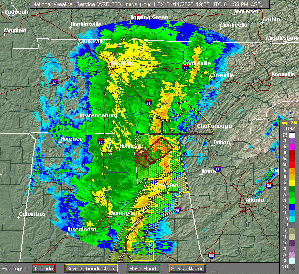 At 201 pm cst, a severe thunderstorm was located near gruetli-laager, or 18 miles east of manchester, moving east at 60 mph (radar indicated). Hazards include 60 mph wind gusts. expect damage to roofs, siding, and trees At 201 pm cst, a severe thunderstorm was located near gruetli-laager, or 18 miles east of manchester, moving east at 60 mph (radar indicated). Hazards include 60 mph wind gusts. expect damage to roofs, siding, and trees
|
| 1/11/2020 1:56 PM CST |
 At 255 pm est/155 pm cst/, severe thunderstorms were located along a line extending from near skyline to near powell, moving northeast at 60 mph (radar indicated). Hazards include 70 mph wind gusts. Expect considerable tree damage. Damage is likely to mobile homes, roofs, and outbuildings. At 255 pm est/155 pm cst/, severe thunderstorms were located along a line extending from near skyline to near powell, moving northeast at 60 mph (radar indicated). Hazards include 70 mph wind gusts. Expect considerable tree damage. Damage is likely to mobile homes, roofs, and outbuildings.
|
| 1/11/2020 1:54 PM CST |
 At 154 pm cst, a severe thunderstorm was located over cowan, or 7 miles southeast of winchester, moving east at 30 mph (radar indicated). Hazards include 60 mph wind gusts. expect damage to roofs, siding, and trees At 154 pm cst, a severe thunderstorm was located over cowan, or 7 miles southeast of winchester, moving east at 30 mph (radar indicated). Hazards include 60 mph wind gusts. expect damage to roofs, siding, and trees
|
| 12/16/2019 6:46 PM CST |
 At 645 pm cst, severe thunderstorms were located along a line extending from near lynchburg to near new market, moving east at 55 mph (radar indicated). Hazards include 60 mph wind gusts. expect damage to roofs, siding, and trees At 645 pm cst, severe thunderstorms were located along a line extending from near lynchburg to near new market, moving east at 55 mph (radar indicated). Hazards include 60 mph wind gusts. expect damage to roofs, siding, and trees
|
| 12/16/2019 6:46 PM CST |
 At 646 pm cst, a severe thunderstorm capable of producing a tornado was located near sewanee, or 10 miles east of winchester, moving east at 60 mph (radar indicated rotation). Hazards include tornado. Flying debris will be dangerous to those caught without shelter. mobile homes will be damaged or destroyed. damage to roofs, windows, and vehicles will occur. Tree damage is likely. At 646 pm cst, a severe thunderstorm capable of producing a tornado was located near sewanee, or 10 miles east of winchester, moving east at 60 mph (radar indicated rotation). Hazards include tornado. Flying debris will be dangerous to those caught without shelter. mobile homes will be damaged or destroyed. damage to roofs, windows, and vehicles will occur. Tree damage is likely.
|
| 12/16/2019 6:39 PM CST |
 At 639 pm cst, severe thunderstorms were located along a line extending from 8 miles northwest of sewanee to 6 miles southwest of scottsboro, moving east at 50 mph (radar indicated). Hazards include 60 mph wind gusts. expect damage to roofs, siding, and trees At 639 pm cst, severe thunderstorms were located along a line extending from 8 miles northwest of sewanee to 6 miles southwest of scottsboro, moving east at 50 mph (radar indicated). Hazards include 60 mph wind gusts. expect damage to roofs, siding, and trees
|
| 12/16/2019 6:32 PM CST |
 At 632 pm cst, severe thunderstorms were located along a line extending from near manchester to 10 miles south of cowan to near skyline, moving northeast at 70 mph (radar indicated). Hazards include 60 mph wind gusts. Expect damage to roofs, siding, and trees. Locations impacted include, scottsboro, winchester, lynchburg, decherd, estill springs, cowan, hollywood, huntland, skyline and woodville. At 632 pm cst, severe thunderstorms were located along a line extending from near manchester to 10 miles south of cowan to near skyline, moving northeast at 70 mph (radar indicated). Hazards include 60 mph wind gusts. Expect damage to roofs, siding, and trees. Locations impacted include, scottsboro, winchester, lynchburg, decherd, estill springs, cowan, hollywood, huntland, skyline and woodville.
|
| 12/16/2019 6:03 PM CST |
 At 602 pm cst, severe thunderstorms were located along a line extending from near petersburg to huntsville to triana, moving northeast at 70 mph. wind gusts of 60 to 70 mph have been measured (radar indicated). Hazards include 70 mph wind gusts and quarter size hail. Hail damage to vehicles is expected. expect considerable tree damage. Wind damage is also likely to mobile homes, roofs, and outbuildings. At 602 pm cst, severe thunderstorms were located along a line extending from near petersburg to huntsville to triana, moving northeast at 70 mph. wind gusts of 60 to 70 mph have been measured (radar indicated). Hazards include 70 mph wind gusts and quarter size hail. Hail damage to vehicles is expected. expect considerable tree damage. Wind damage is also likely to mobile homes, roofs, and outbuildings.
|
| 9/10/2019 3:43 PM CDT |
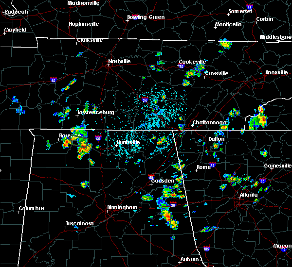 The national weather service in huntsville alabama has issued a * severe thunderstorm warning for. eastern franklin county in middle tennessee. until 430 pm cdt. At 343 pm cdt, a severe thunderstorm was located 5 miles northwest of sewanee, or 15 miles northeast of winchester, and is nearly. The national weather service in huntsville alabama has issued a * severe thunderstorm warning for. eastern franklin county in middle tennessee. until 430 pm cdt. At 343 pm cdt, a severe thunderstorm was located 5 miles northwest of sewanee, or 15 miles northeast of winchester, and is nearly.
|
| 6/21/2019 9:59 PM CDT |
 At 1059 pm edt/959 pm cdt/, severe thunderstorms were located along a line extending from 8 miles northwest of soddy-daisy to near jasper to near skyline, moving southeast at 45 mph (radar indicated). Hazards include 70 mph wind gusts and quarter size hail. Hail damage to vehicles is expected. expect considerable tree damage. wind damage is also likely to mobile homes, roofs, and outbuildings. Locations impacted include, chattanooga, dunlap, jasper, soddy-daisy, signal mountain, south pittsburg, walden, lakesite, whitwell, kimball, monteagle, ridgeside, fairmount, harrison, red bank, collegedale, powells crossroads, orme, cartwright and flat top mountain. At 1059 pm edt/959 pm cdt/, severe thunderstorms were located along a line extending from 8 miles northwest of soddy-daisy to near jasper to near skyline, moving southeast at 45 mph (radar indicated). Hazards include 70 mph wind gusts and quarter size hail. Hail damage to vehicles is expected. expect considerable tree damage. wind damage is also likely to mobile homes, roofs, and outbuildings. Locations impacted include, chattanooga, dunlap, jasper, soddy-daisy, signal mountain, south pittsburg, walden, lakesite, whitwell, kimball, monteagle, ridgeside, fairmount, harrison, red bank, collegedale, powells crossroads, orme, cartwright and flat top mountain.
|
| 6/21/2019 9:32 PM CDT |
 At 1032 pm edt/932 pm cdt/, severe thunderstorms were located along a line extending from 8 miles north of gruetli-laager to near sewanee to 6 miles northeast of new market, moving southeast at 45 mph (radar indicated). Hazards include 70 mph wind gusts and penny size hail. Expect considerable tree damage. Damage is likely to mobile homes, roofs, and outbuildings. At 1032 pm edt/932 pm cdt/, severe thunderstorms were located along a line extending from 8 miles north of gruetli-laager to near sewanee to 6 miles northeast of new market, moving southeast at 45 mph (radar indicated). Hazards include 70 mph wind gusts and penny size hail. Expect considerable tree damage. Damage is likely to mobile homes, roofs, and outbuildings.
|
| 6/21/2019 9:31 PM CDT |
 At 931 pm cdt, severe thunderstorms were located along a line extending from gruetli-laager to near hazel green, moving east at 50 mph (radar indicated). Hazards include 70 mph wind gusts. Expect considerable tree damage. damage is likely to mobile homes, roofs, and outbuildings. Locations impacted include, northern huntsville, winchester, fayetteville, moores mill, meridianville, lynchburg, hazel green, decherd, estill springs and cowan. At 931 pm cdt, severe thunderstorms were located along a line extending from gruetli-laager to near hazel green, moving east at 50 mph (radar indicated). Hazards include 70 mph wind gusts. Expect considerable tree damage. damage is likely to mobile homes, roofs, and outbuildings. Locations impacted include, northern huntsville, winchester, fayetteville, moores mill, meridianville, lynchburg, hazel green, decherd, estill springs and cowan.
|
| 6/21/2019 9:13 PM CDT |
 At 912 pm cdt, severe thunderstorms were located along a line extending from 9 miles east of manchester to near ardmore, moving east at 40 mph (radar indicated). Hazards include 60 mph wind gusts and penny size hail. expect damage to roofs, siding, and trees At 912 pm cdt, severe thunderstorms were located along a line extending from 9 miles east of manchester to near ardmore, moving east at 40 mph (radar indicated). Hazards include 60 mph wind gusts and penny size hail. expect damage to roofs, siding, and trees
|
| 6/21/2019 9:12 PM CDT |
 At 912 pm cdt, severe thunderstorms were located along a line extending from 6 miles northeast of mcminnville to 11 miles northeast of manchester to tullahoma, moving southeast at 45 mph (radar indicated). Hazards include 70 mph wind gusts and nickel size hail. Expect considerable tree damage. Damage is likely to mobile homes, roofs, and outbuildings. At 912 pm cdt, severe thunderstorms were located along a line extending from 6 miles northeast of mcminnville to 11 miles northeast of manchester to tullahoma, moving southeast at 45 mph (radar indicated). Hazards include 70 mph wind gusts and nickel size hail. Expect considerable tree damage. Damage is likely to mobile homes, roofs, and outbuildings.
|
| 6/20/2019 4:38 AM CDT |
 At 537 am edt/437 am cdt/, severe thunderstorms were located along a line extending from 9 miles south of mcminnville to near trenton to near gaylesville, moving east northeast at 45 mph (radar indicated). Hazards include 60 mph wind gusts. Expect damage to roofs, siding, and trees. Locations impacted include, chattanooga, dunlap, jasper, pikeville, soddy-daisy, signal mountain, south pittsburg, walden, lakesite, whitwell, kimball, monteagle, ridgeside, harrison, fairmount, red bank, collegedale, powells crossroads, orme and cartwright. At 537 am edt/437 am cdt/, severe thunderstorms were located along a line extending from 9 miles south of mcminnville to near trenton to near gaylesville, moving east northeast at 45 mph (radar indicated). Hazards include 60 mph wind gusts. Expect damage to roofs, siding, and trees. Locations impacted include, chattanooga, dunlap, jasper, pikeville, soddy-daisy, signal mountain, south pittsburg, walden, lakesite, whitwell, kimball, monteagle, ridgeside, harrison, fairmount, red bank, collegedale, powells crossroads, orme and cartwright.
|
| 6/20/2019 4:23 AM CDT |
 At 422 am cdt, severe thunderstorms were located along a line extending from near manchester to 6 miles northeast of little river falls, moving northeast at 60 mph (radar indicated). Hazards include 60 mph wind gusts. Expect damage to roofs, siding, and trees. Locations impacted include, scottsboro, winchester, rainsville, bridgeport, decherd, henagar, estill springs, stevenson, sylvania and cowan. At 422 am cdt, severe thunderstorms were located along a line extending from near manchester to 6 miles northeast of little river falls, moving northeast at 60 mph (radar indicated). Hazards include 60 mph wind gusts. Expect damage to roofs, siding, and trees. Locations impacted include, scottsboro, winchester, rainsville, bridgeport, decherd, henagar, estill springs, stevenson, sylvania and cowan.
|
| 6/20/2019 4:08 AM CDT |
 At 408 am cdt, severe thunderstorms were located along a line extending from tullahoma to near little river canyon national preserve, moving northeast at 60 mph (radar indicated). Hazards include 60 mph wind gusts. expect damage to roofs, siding, and trees At 408 am cdt, severe thunderstorms were located along a line extending from tullahoma to near little river canyon national preserve, moving northeast at 60 mph (radar indicated). Hazards include 60 mph wind gusts. expect damage to roofs, siding, and trees
|
| 6/20/2019 4:05 AM CDT |
 At 504 am edt/404 am cdt/, severe thunderstorms were located along a line extending from near tullahoma to near hollywood to near tabor road, moving east northeast at 40 mph (radar indicated). Hazards include 60 mph wind gusts. expect damage to roofs, siding, and trees At 504 am edt/404 am cdt/, severe thunderstorms were located along a line extending from near tullahoma to near hollywood to near tabor road, moving east northeast at 40 mph (radar indicated). Hazards include 60 mph wind gusts. expect damage to roofs, siding, and trees
|
| 6/20/2019 3:30 AM CDT |
 At 329 am cdt, a severe thunderstorm was located 7 miles north of hazel green, or 7 miles south of fayetteville, moving northeast at 45 mph (radar indicated). Hazards include 60 mph wind gusts. expect damage to roofs, siding, and trees At 329 am cdt, a severe thunderstorm was located 7 miles north of hazel green, or 7 miles south of fayetteville, moving northeast at 45 mph (radar indicated). Hazards include 60 mph wind gusts. expect damage to roofs, siding, and trees
|
| 5/9/2019 1:55 PM CDT |
 The national weather service in huntsville alabama has issued a * severe thunderstorm warning for. northeastern jackson county in northeastern alabama. southeastern franklin county in middle tennessee. until 230 pm cdt. At 155 pm cdt, severe thunderstorms were located along a line. The national weather service in huntsville alabama has issued a * severe thunderstorm warning for. northeastern jackson county in northeastern alabama. southeastern franklin county in middle tennessee. until 230 pm cdt. At 155 pm cdt, severe thunderstorms were located along a line.
|
| 5/9/2019 1:44 PM CDT |
 A severe thunderstorm warning remains in effect until 200 pm cdt for eastern jackson and eastern franklin counties. at 143 pm cdt, severe thunderstorms were located along a line extending from near decherd to 10 miles northwest of stevenson to scottsboro, moving northeast at 45 mph. This line has a history of producing damage. A severe thunderstorm warning remains in effect until 200 pm cdt for eastern jackson and eastern franklin counties. at 143 pm cdt, severe thunderstorms were located along a line extending from near decherd to 10 miles northwest of stevenson to scottsboro, moving northeast at 45 mph. This line has a history of producing damage.
|
| 5/9/2019 1:24 PM CDT |
 The national weather service in huntsville alabama has issued a * severe thunderstorm warning for. jackson county in northeastern alabama. franklin county in middle tennessee. until 200 pm cdt. At 124 pm cdt, severe thunderstorms were located along a line. The national weather service in huntsville alabama has issued a * severe thunderstorm warning for. jackson county in northeastern alabama. franklin county in middle tennessee. until 200 pm cdt. At 124 pm cdt, severe thunderstorms were located along a line.
|
| 4/8/2019 7:49 AM CDT |
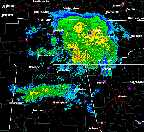 At 749 am cdt, a severe thunderstorm was located over monteagle, or 16 miles east of winchester, moving northeast at 45 mph (radar indicated). Hazards include 60 mph wind gusts. expect damage to roofs, siding, and trees At 749 am cdt, a severe thunderstorm was located over monteagle, or 16 miles east of winchester, moving northeast at 45 mph (radar indicated). Hazards include 60 mph wind gusts. expect damage to roofs, siding, and trees
|
| 4/8/2019 7:48 AM CDT | A few trees down in and around monteagl in marion county TN, 0.6 miles WSW of Monteagle, TN |
| 4/8/2019 7:45 AM CDT |
 At 745 am cdt, a severe thunderstorm capable of producing a tornado was located over sewanee, or 12 miles east of winchester, moving northeast at 35 mph (radar indicated rotation). Hazards include tornado. Flying debris will be dangerous to those caught without shelter. mobile homes will be damaged or destroyed. damage to roofs, windows, and vehicles will occur. tree damage is likely. locations impacted include, sewanee, st. Andrews and alto. At 745 am cdt, a severe thunderstorm capable of producing a tornado was located over sewanee, or 12 miles east of winchester, moving northeast at 35 mph (radar indicated rotation). Hazards include tornado. Flying debris will be dangerous to those caught without shelter. mobile homes will be damaged or destroyed. damage to roofs, windows, and vehicles will occur. tree damage is likely. locations impacted include, sewanee, st. Andrews and alto.
|
| 4/8/2019 7:44 AM CDT |
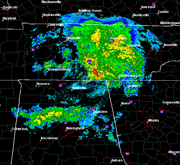 At 744 am cdt, a severe thunderstorm was located over monteagle, or 14 miles east of winchester, moving northeast at 40 mph (radar indicated). Hazards include 60 mph wind gusts. expect damage to roofs, siding, and trees At 744 am cdt, a severe thunderstorm was located over monteagle, or 14 miles east of winchester, moving northeast at 40 mph (radar indicated). Hazards include 60 mph wind gusts. expect damage to roofs, siding, and trees
|
| 4/8/2019 7:40 AM CDT |
 At 740 am cdt, a severe thunderstorm capable of producing a tornado was located over sewanee, or 10 miles east of winchester, moving northeast at 35 mph (radar indicated rotation). Hazards include tornado. Flying debris will be dangerous to those caught without shelter. mobile homes will be damaged or destroyed. damage to roofs, windows, and vehicles will occur. Tree damage is likely. At 740 am cdt, a severe thunderstorm capable of producing a tornado was located over sewanee, or 10 miles east of winchester, moving northeast at 35 mph (radar indicated rotation). Hazards include tornado. Flying debris will be dangerous to those caught without shelter. mobile homes will be damaged or destroyed. damage to roofs, windows, and vehicles will occur. Tree damage is likely.
|
| 3/25/2019 2:39 PM CDT |
 At 238 pm cdt, a severe thunderstorm was located over estill springs, or near winchester, moving east at 30 mph (radar indicated). Hazards include 60 mph wind gusts and quarter size hail. Hail damage to vehicles is expected. expect wind damage to roofs, siding, and trees. locations impacted include, decherd, estill springs, sewanee, tims ford lake, woods reservoir, arnold afb, alto and st. Andrews. At 238 pm cdt, a severe thunderstorm was located over estill springs, or near winchester, moving east at 30 mph (radar indicated). Hazards include 60 mph wind gusts and quarter size hail. Hail damage to vehicles is expected. expect wind damage to roofs, siding, and trees. locations impacted include, decherd, estill springs, sewanee, tims ford lake, woods reservoir, arnold afb, alto and st. Andrews.
|
| 3/25/2019 2:23 PM CDT |
 At 222 pm cdt, a severe thunderstorm was located near estill springs, or 8 miles east of lynchburg, moving east at 35 mph (radar indicated). Hazards include 60 mph wind gusts and quarter size hail. Hail damage to vehicles is expected. Expect wind damage to roofs, siding, and trees. At 222 pm cdt, a severe thunderstorm was located near estill springs, or 8 miles east of lynchburg, moving east at 35 mph (radar indicated). Hazards include 60 mph wind gusts and quarter size hail. Hail damage to vehicles is expected. Expect wind damage to roofs, siding, and trees.
|
| 11/6/2018 1:48 AM CST |
 At 147 am cst, a confirmed tornado was located near gruetli-laager, or 17 miles west of dunlap, moving east at 35 mph (radar confirmed tornado). Hazards include damaging tornado. Flying debris will be dangerous to those caught without shelter. mobile homes will be damaged or destroyed. damage to roofs, windows, and vehicles will occur. tree damage is likely. This tornadic thunderstorm will remain over mainly rural areas of grundy county, including the following locations, altamont, coalmont, palmer, beersheba springs and fiery gizzard state park. At 147 am cst, a confirmed tornado was located near gruetli-laager, or 17 miles west of dunlap, moving east at 35 mph (radar confirmed tornado). Hazards include damaging tornado. Flying debris will be dangerous to those caught without shelter. mobile homes will be damaged or destroyed. damage to roofs, windows, and vehicles will occur. tree damage is likely. This tornadic thunderstorm will remain over mainly rural areas of grundy county, including the following locations, altamont, coalmont, palmer, beersheba springs and fiery gizzard state park.
|
| 11/6/2018 1:38 AM CST |
 At 138 am cst, a confirmed tornado was located 8 miles north of tracy city, or 17 miles east of manchester, moving northeast at 55 mph (radar confirmed tornado). Hazards include damaging tornado. Flying debris will be dangerous to those caught without shelter. mobile homes will be damaged or destroyed. damage to roofs, windows, and vehicles will occur. tree damage is likely. this tornado will be near, gruetli-laager around 150 am cst. other locations impacted by this tornadic thunderstorm include pelham, altamont, coalmont, palmer, beersheba springs and fiery gizzard state park. This includes interstate 24 between mile markers 127 and 134. At 138 am cst, a confirmed tornado was located 8 miles north of tracy city, or 17 miles east of manchester, moving northeast at 55 mph (radar confirmed tornado). Hazards include damaging tornado. Flying debris will be dangerous to those caught without shelter. mobile homes will be damaged or destroyed. damage to roofs, windows, and vehicles will occur. tree damage is likely. this tornado will be near, gruetli-laager around 150 am cst. other locations impacted by this tornadic thunderstorm include pelham, altamont, coalmont, palmer, beersheba springs and fiery gizzard state park. This includes interstate 24 between mile markers 127 and 134.
|
| 11/6/2018 1:23 AM CST |
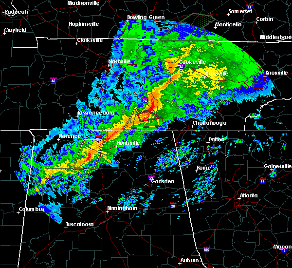 At 122 am cst, a tornado producing storm was located near decherd, or 8 miles northeast of winchester, moving east at 55 mph (radar confirmed tornado). Hazards include damaging tornado. Flying debris will be dangerous to those caught without shelter. mobile homes will be damaged or destroyed. damage to roofs, windows, and vehicles will occur. tree damage is likely. this tornadic storm will be near, monteagle around 135 am cst. tracy city around 140 am cst. gruetli-laager around 150 am cst. other locations impacted by this tornadic thunderstorm include coalmont, palmer, pelham, altamont, beersheba springs, arnold afb, fiery gizzard state park and woods reservoir. This includes interstate 24 between mile markers 120 and 135. At 122 am cst, a tornado producing storm was located near decherd, or 8 miles northeast of winchester, moving east at 55 mph (radar confirmed tornado). Hazards include damaging tornado. Flying debris will be dangerous to those caught without shelter. mobile homes will be damaged or destroyed. damage to roofs, windows, and vehicles will occur. tree damage is likely. this tornadic storm will be near, monteagle around 135 am cst. tracy city around 140 am cst. gruetli-laager around 150 am cst. other locations impacted by this tornadic thunderstorm include coalmont, palmer, pelham, altamont, beersheba springs, arnold afb, fiery gizzard state park and woods reservoir. This includes interstate 24 between mile markers 120 and 135.
|
| 11/6/2018 1:21 AM CST |
 At 120 am cst, a confirmed large and extremely dangerous tornado was located near estill springs, or 7 miles northeast of winchester, moving northeast at 60 mph. this is a particularly dangerous situation. take cover now! (radar confirmed tornado). Hazards include damaging tornado. You are in a life-threatening situation. flying debris may be deadly to those caught without shelter. mobile homes will be destroyed. considerable damage to homes, businesses, and vehicles is likely and complete destruction is possible. Locations impacted include, winchester, decherd, estill springs, tims ford lake, sewanee, woods reservoir, alto and arnold afb. At 120 am cst, a confirmed large and extremely dangerous tornado was located near estill springs, or 7 miles northeast of winchester, moving northeast at 60 mph. this is a particularly dangerous situation. take cover now! (radar confirmed tornado). Hazards include damaging tornado. You are in a life-threatening situation. flying debris may be deadly to those caught without shelter. mobile homes will be destroyed. considerable damage to homes, businesses, and vehicles is likely and complete destruction is possible. Locations impacted include, winchester, decherd, estill springs, tims ford lake, sewanee, woods reservoir, alto and arnold afb.
|
| 11/6/2018 1:15 AM CST |
 At 115 am cst, a severe thunderstorm capable of producing a tornado was located over estill springs, or near winchester, moving east at 60 mph (radar indicated rotation). Hazards include tornado. Flying debris will be dangerous to those caught without shelter. mobile homes will be damaged or destroyed. damage to roofs, windows, and vehicles will occur. Tree damage is likely. At 115 am cst, a severe thunderstorm capable of producing a tornado was located over estill springs, or near winchester, moving east at 60 mph (radar indicated rotation). Hazards include tornado. Flying debris will be dangerous to those caught without shelter. mobile homes will be damaged or destroyed. damage to roofs, windows, and vehicles will occur. Tree damage is likely.
|
| 11/6/2018 1:14 AM CST |
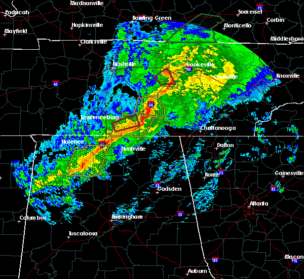 At 114 am cst, severe thunderstorms were located along a line extending from manchester to tims ford lake to 9 miles west of huntland, moving east at 55 mph (radar indicated). Hazards include 60 mph wind gusts. expect damage to roofs, siding, and trees At 114 am cst, severe thunderstorms were located along a line extending from manchester to tims ford lake to 9 miles west of huntland, moving east at 55 mph (radar indicated). Hazards include 60 mph wind gusts. expect damage to roofs, siding, and trees
|
| 8/6/2018 5:40 PM CDT |
 At 540 pm cdt, a severe thunderstorm was located near tracy city, or 18 miles west of dunlap, moving northeast at 15 mph (radar indicated). Hazards include 60 mph wind gusts. expect damage to roofs, siding, and trees At 540 pm cdt, a severe thunderstorm was located near tracy city, or 18 miles west of dunlap, moving northeast at 15 mph (radar indicated). Hazards include 60 mph wind gusts. expect damage to roofs, siding, and trees
|
| 7/21/2018 3:13 AM CDT |
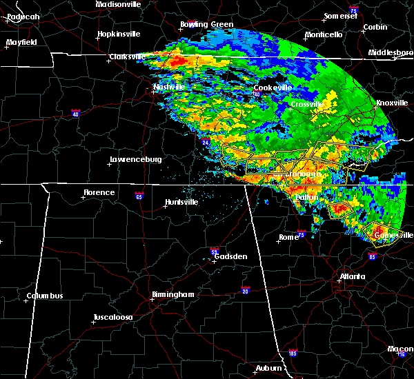 At 313 am cdt, severe thunderstorms were located along a line extending from pelham to near whitwell, moving south at 30 mph (radar indicated). Hazards include 60 mph wind gusts. Expect damage to roofs, siding, and trees. locations impacted include, gruetli-laager, tracy city, monteagle, altamont, coalmont, palmer, pelham and fiery gizzard state park. This includes interstate 24 between mile markers 128 and 134. At 313 am cdt, severe thunderstorms were located along a line extending from pelham to near whitwell, moving south at 30 mph (radar indicated). Hazards include 60 mph wind gusts. Expect damage to roofs, siding, and trees. locations impacted include, gruetli-laager, tracy city, monteagle, altamont, coalmont, palmer, pelham and fiery gizzard state park. This includes interstate 24 between mile markers 128 and 134.
|
| 7/21/2018 2:52 AM CDT |
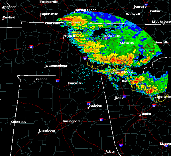 At 252 am cdt, severe thunderstorms were located along a line extending from hillsboro to palmer, moving south at 35 mph (radar indicated). Hazards include 60 mph wind gusts. Expect damage to roofs, siding, and trees. locations impacted include, gruetli-laager, tracy city, monteagle, altamont, coalmont, palmer, beersheba springs, hillsboro, pelham, fiery gizzard state park and woods reservoir. This includes interstate 24 between mile markers 118 and 135. At 252 am cdt, severe thunderstorms were located along a line extending from hillsboro to palmer, moving south at 35 mph (radar indicated). Hazards include 60 mph wind gusts. Expect damage to roofs, siding, and trees. locations impacted include, gruetli-laager, tracy city, monteagle, altamont, coalmont, palmer, beersheba springs, hillsboro, pelham, fiery gizzard state park and woods reservoir. This includes interstate 24 between mile markers 118 and 135.
|
| 7/21/2018 2:38 AM CDT |
 At 238 am cdt, severe thunderstorms were located along a line extending from viola to beersheba springs, moving south at 35 mph (radar indicated). Hazards include 60 mph wind gusts. expect damage to roofs, siding, and trees At 238 am cdt, severe thunderstorms were located along a line extending from viola to beersheba springs, moving south at 35 mph (radar indicated). Hazards include 60 mph wind gusts. expect damage to roofs, siding, and trees
|
| 6/28/2018 2:23 PM CDT |
 At 223 pm cdt, severe thunderstorms were located along a line extending from 7 miles northeast of decherd to 8 miles east of fayetteville, moving southeast at 55 mph (radar indicated). Hazards include 60 mph wind gusts and nickel size hail. expect damage to roofs, siding, and trees At 223 pm cdt, severe thunderstorms were located along a line extending from 7 miles northeast of decherd to 8 miles east of fayetteville, moving southeast at 55 mph (radar indicated). Hazards include 60 mph wind gusts and nickel size hail. expect damage to roofs, siding, and trees
|
| 6/28/2018 11:55 AM CDT |
 At 1154 am cdt, a severe thunderstorm was located near tims ford lake, or 7 miles south of lynchburg, moving southeast at 35 mph (radar indicated). Hazards include 70 mph wind gusts and penny size hail. Expect considerable tree damage. Damage is likely to mobile homes, roofs, and outbuildings. At 1154 am cdt, a severe thunderstorm was located near tims ford lake, or 7 miles south of lynchburg, moving southeast at 35 mph (radar indicated). Hazards include 70 mph wind gusts and penny size hail. Expect considerable tree damage. Damage is likely to mobile homes, roofs, and outbuildings.
|
| 6/28/2018 11:36 AM CDT |
 At 1135 am cdt, a severe thunderstorm was located 7 miles west of lynchburg, moving southeast at 30 mph. an area of very strong winds is moving through winchester, tn now and will impact jackson county al soon (radar indicated). Hazards include 70 mph wind gusts. Expect considerable tree damage. damage is likely to mobile homes, roofs, and outbuildings. Locations impacted include, winchester, fayetteville, lynchburg, decherd, estill springs, cowan, ardmore, huntland, petersburg and tims ford lake. At 1135 am cdt, a severe thunderstorm was located 7 miles west of lynchburg, moving southeast at 30 mph. an area of very strong winds is moving through winchester, tn now and will impact jackson county al soon (radar indicated). Hazards include 70 mph wind gusts. Expect considerable tree damage. damage is likely to mobile homes, roofs, and outbuildings. Locations impacted include, winchester, fayetteville, lynchburg, decherd, estill springs, cowan, ardmore, huntland, petersburg and tims ford lake.
|
| 6/28/2018 11:02 AM CDT |
 At 1101 am cdt, a severe thunderstorm was located 8 miles northeast of lewisburg, moving southeast at 30 mph (radar indicated). Hazards include 70 mph wind gusts and nickel size hail. Expect considerable tree damage. Damage is likely to mobile homes, roofs, and outbuildings. At 1101 am cdt, a severe thunderstorm was located 8 miles northeast of lewisburg, moving southeast at 30 mph (radar indicated). Hazards include 70 mph wind gusts and nickel size hail. Expect considerable tree damage. Damage is likely to mobile homes, roofs, and outbuildings.
|
| 6/28/2018 10:45 AM CDT |
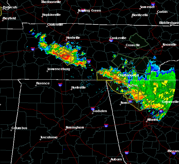 At 1144 am edt/1044 am cdt/, severe thunderstorms were located along a line extending from near monteagle to near ringgold, moving south at 15 mph (radar indicated). Hazards include 60 mph wind gusts and penny size hail. Expect damage to roofs, siding, and trees. Locations impacted include, chattanooga, jasper, signal mountain, south pittsburg, walden, whitwell, kimball, monteagle, ridgeside, fairmount, red bank, powells crossroads, orme, martin springs, east brainerd, lookout mountain, fiery gizzard state park, haletown (guild), chimneys state park and east ridge. At 1144 am edt/1044 am cdt/, severe thunderstorms were located along a line extending from near monteagle to near ringgold, moving south at 15 mph (radar indicated). Hazards include 60 mph wind gusts and penny size hail. Expect damage to roofs, siding, and trees. Locations impacted include, chattanooga, jasper, signal mountain, south pittsburg, walden, whitwell, kimball, monteagle, ridgeside, fairmount, red bank, powells crossroads, orme, martin springs, east brainerd, lookout mountain, fiery gizzard state park, haletown (guild), chimneys state park and east ridge.
|
| 6/28/2018 10:14 AM CDT |
 At 1113 am edt/1013 am cdt/, severe thunderstorms were located along a line extending from 10 miles northwest of tracy city to 6 miles northeast of ringgold, moving south at 15 mph (radar indicated). Hazards include 60 mph wind gusts and penny size hail. expect damage to roofs, siding, and trees At 1113 am edt/1013 am cdt/, severe thunderstorms were located along a line extending from 10 miles northwest of tracy city to 6 miles northeast of ringgold, moving south at 15 mph (radar indicated). Hazards include 60 mph wind gusts and penny size hail. expect damage to roofs, siding, and trees
|
| 6/27/2018 7:55 PM CDT |
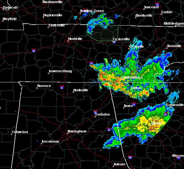 The severe thunderstorm warning for marion county will expire at 800 pm cdt, the storm which prompted the warning has weakened below severe limits, and no longer poses an immediate threat to life or property. therefore, the warning will be allowed to expire. however heavy rain is still possible with this thunderstorm. The severe thunderstorm warning for marion county will expire at 800 pm cdt, the storm which prompted the warning has weakened below severe limits, and no longer poses an immediate threat to life or property. therefore, the warning will be allowed to expire. however heavy rain is still possible with this thunderstorm.
|
| 6/27/2018 7:25 PM CDT |
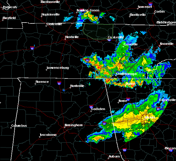 At 725 pm cdt, a severe thunderstorm was located near whitwell, or 7 miles north of jasper, moving east at 30 mph (radar indicated). Hazards include 60 mph wind gusts and penny size hail. Expect damage to roofs, siding, and trees. Locations impacted include, jasper, south pittsburg, whitwell, kimball, monteagle, powells crossroads, martin springs, fiery gizzard state park, haletown (guild), griffith creek, chimneys state park, hicks gap state park, sequatchie cave, foster falls state park, lone oak and new hope. At 725 pm cdt, a severe thunderstorm was located near whitwell, or 7 miles north of jasper, moving east at 30 mph (radar indicated). Hazards include 60 mph wind gusts and penny size hail. Expect damage to roofs, siding, and trees. Locations impacted include, jasper, south pittsburg, whitwell, kimball, monteagle, powells crossroads, martin springs, fiery gizzard state park, haletown (guild), griffith creek, chimneys state park, hicks gap state park, sequatchie cave, foster falls state park, lone oak and new hope.
|
| 6/27/2018 6:57 PM CDT |
 At 657 pm cdt, a severe thunderstorm was located over monteagle, or 15 miles east of winchester, moving east at 25 mph (radar indicated). Hazards include 60 mph wind gusts and nickel size hail. expect damage to roofs, siding, and trees At 657 pm cdt, a severe thunderstorm was located over monteagle, or 15 miles east of winchester, moving east at 25 mph (radar indicated). Hazards include 60 mph wind gusts and nickel size hail. expect damage to roofs, siding, and trees
|
| 6/26/2018 7:48 PM EDT |
 At 748 pm edt/648 pm cdt/, severe thunderstorms were located along a line extending from near murphy to near jasper, moving south at 25 mph (radar indicated). Hazards include 60 mph wind gusts and penny size hail. Expect damage to roofs, siding, and trees. Locations impacted include, chattanooga, cleveland, jasper, andrews, murphy, benton, ducktown, hayesville, soddy-daisy, signal mountain, south pittsburg, walden, lakesite, whitwell, kimball, monteagle, ridgeside, harrison, east cleveland and south cleveland. At 748 pm edt/648 pm cdt/, severe thunderstorms were located along a line extending from near murphy to near jasper, moving south at 25 mph (radar indicated). Hazards include 60 mph wind gusts and penny size hail. Expect damage to roofs, siding, and trees. Locations impacted include, chattanooga, cleveland, jasper, andrews, murphy, benton, ducktown, hayesville, soddy-daisy, signal mountain, south pittsburg, walden, lakesite, whitwell, kimball, monteagle, ridgeside, harrison, east cleveland and south cleveland.
|
| 6/26/2018 7:17 PM EDT |
 At 716 pm edt/616 pm cdt/, severe thunderstorms were located along a line extending from 10 miles north of murphy to near whitwell, moving south at 30 mph (radar indicated). Hazards include 60 mph wind gusts and penny size hail. expect damage to roofs, siding, and trees At 716 pm edt/616 pm cdt/, severe thunderstorms were located along a line extending from 10 miles north of murphy to near whitwell, moving south at 30 mph (radar indicated). Hazards include 60 mph wind gusts and penny size hail. expect damage to roofs, siding, and trees
|
| 6/23/2018 12:35 PM CDT |
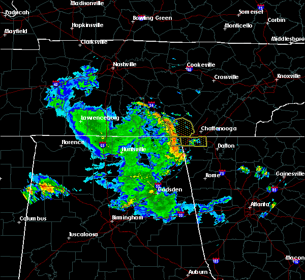 At 1234 pm cdt, severe thunderstorms were located along a line extending from near monteagle to near kimball to near south pittsburg, moving east at 50 mph (radar indicated). Hazards include 60 mph wind gusts. expect damage to roofs, siding, and trees At 1234 pm cdt, severe thunderstorms were located along a line extending from near monteagle to near kimball to near south pittsburg, moving east at 50 mph (radar indicated). Hazards include 60 mph wind gusts. expect damage to roofs, siding, and trees
|
| 5/31/2018 7:51 PM CDT |
 At 749 pm cdt, a severe thunderstorm was located 7 miles northeast of decherd, or 9 miles northeast of winchester, moving east at 10 mph (radar indicated). Hazards include 60 mph wind gusts and quarter size hail. Hail damage to vehicles is expected. expect wind damage to roofs, siding, and trees. locations impacted include, winchester, decherd, estill springs, sewanee, tims ford lake, woods reservoir, arnold afb, alto and st. Andrews. At 749 pm cdt, a severe thunderstorm was located 7 miles northeast of decherd, or 9 miles northeast of winchester, moving east at 10 mph (radar indicated). Hazards include 60 mph wind gusts and quarter size hail. Hail damage to vehicles is expected. expect wind damage to roofs, siding, and trees. locations impacted include, winchester, decherd, estill springs, sewanee, tims ford lake, woods reservoir, arnold afb, alto and st. Andrews.
|
| 5/31/2018 7:46 PM CDT |
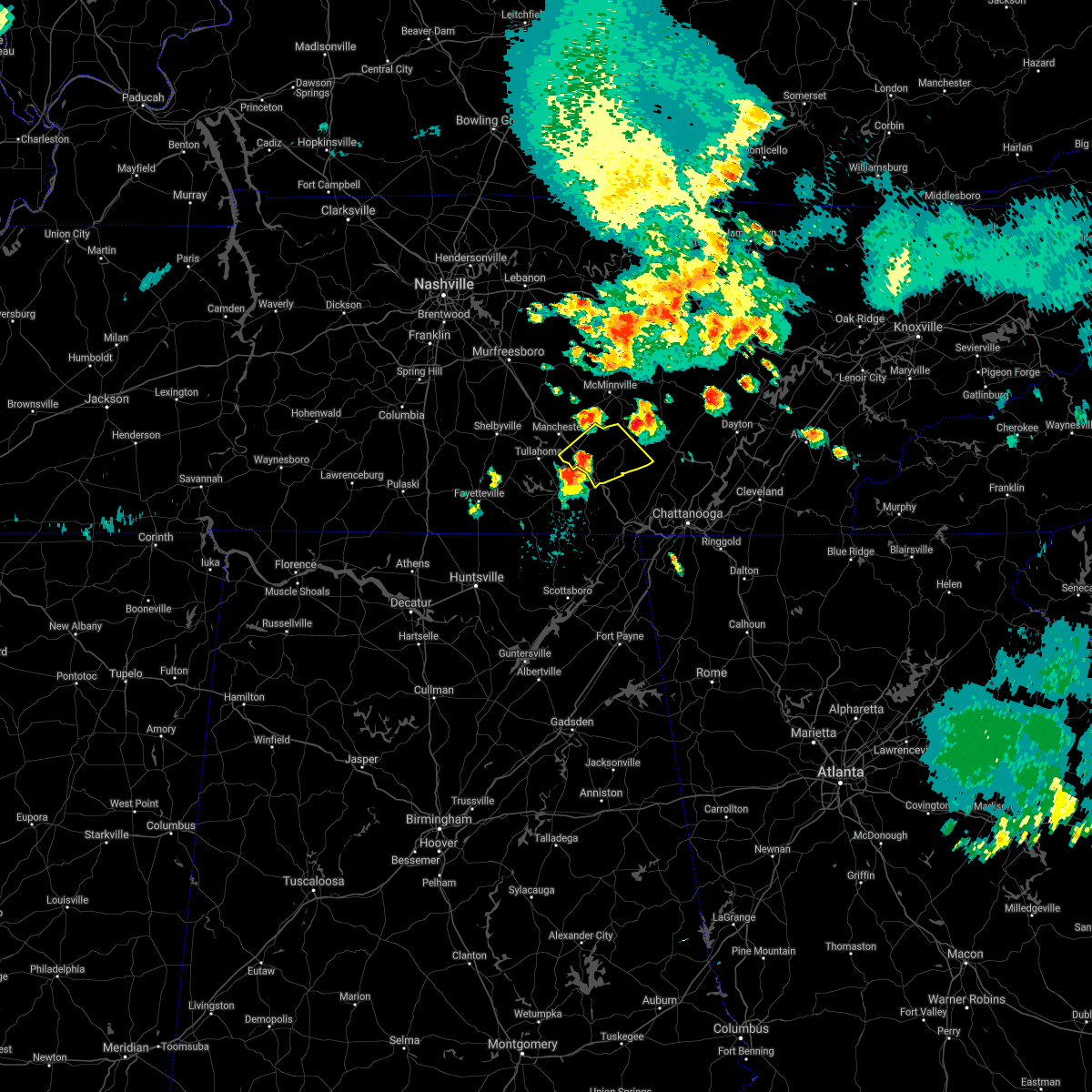 The national weather service in nashville has issued a * severe thunderstorm warning for. southeastern coffee county in middle tennessee. grundy county in middle tennessee. until 830 pm cdt. At 746 pm cdt, a severe thunderstorm was located 10 miles northwest. The national weather service in nashville has issued a * severe thunderstorm warning for. southeastern coffee county in middle tennessee. grundy county in middle tennessee. until 830 pm cdt. At 746 pm cdt, a severe thunderstorm was located 10 miles northwest.
|
| 5/31/2018 7:34 PM CDT |
 At 734 pm cdt, a severe thunderstorm was located near estill springs, or 8 miles northeast of winchester, moving east at 10 mph (radar indicated). Hazards include 60 mph wind gusts and quarter size hail. Hail damage to vehicles is expected. Expect wind damage to roofs, siding, and trees. At 734 pm cdt, a severe thunderstorm was located near estill springs, or 8 miles northeast of winchester, moving east at 10 mph (radar indicated). Hazards include 60 mph wind gusts and quarter size hail. Hail damage to vehicles is expected. Expect wind damage to roofs, siding, and trees.
|
| 4/4/2018 12:03 AM CDT |
 At 103 am edt/1203 am cdt/, severe thunderstorms were located along a line extending from near midtown to near kimball, moving east at 60 mph (radar indicated). Hazards include 60 mph wind gusts and quarter size hail. Hail damage to vehicles is expected. expect wind damage to roofs, siding, and trees. Locations impacted include, chattanooga, dayton, dunlap, jasper, pikeville, decatur, soddy-daisy, signal mountain, south pittsburg, spring city, walden, lakesite, whitwell, kimball, monteagle, ridgeside, harrison, fairmount, red bank and collegedale. At 103 am edt/1203 am cdt/, severe thunderstorms were located along a line extending from near midtown to near kimball, moving east at 60 mph (radar indicated). Hazards include 60 mph wind gusts and quarter size hail. Hail damage to vehicles is expected. expect wind damage to roofs, siding, and trees. Locations impacted include, chattanooga, dayton, dunlap, jasper, pikeville, decatur, soddy-daisy, signal mountain, south pittsburg, spring city, walden, lakesite, whitwell, kimball, monteagle, ridgeside, harrison, fairmount, red bank and collegedale.
|
| 4/3/2018 11:44 PM CDT |
 At 1143 pm cdt, severe thunderstorms were located along a line extending from near alto to near sherwood, moving east at 40 mph (radar indicated). Hazards include 70 mph wind gusts and quarter size hail. Hail damage to vehicles is expected. expect considerable tree damage. Wind damage is also likely to mobile homes, roofs, and outbuildings. At 1143 pm cdt, severe thunderstorms were located along a line extending from near alto to near sherwood, moving east at 40 mph (radar indicated). Hazards include 70 mph wind gusts and quarter size hail. Hail damage to vehicles is expected. expect considerable tree damage. Wind damage is also likely to mobile homes, roofs, and outbuildings.
|
| 4/3/2018 11:38 PM CDT |
 At 1237 am edt/1137 pm cdt/, severe thunderstorms were located along a line extending from near rockwood to near gruetli-laager, moving east at 60 mph (radar indicated). Hazards include 60 mph wind gusts and quarter size hail. Hail damage to vehicles is expected. expect wind damage to roofs, siding, and trees. Locations impacted include, chattanooga, dayton, dunlap, jasper, pikeville, decatur, soddy-daisy, signal mountain, south pittsburg, spring city, walden, lakesite, whitwell, kimball, monteagle, ridgeside, harrison, fairmount, red bank and collegedale. At 1237 am edt/1137 pm cdt/, severe thunderstorms were located along a line extending from near rockwood to near gruetli-laager, moving east at 60 mph (radar indicated). Hazards include 60 mph wind gusts and quarter size hail. Hail damage to vehicles is expected. expect wind damage to roofs, siding, and trees. Locations impacted include, chattanooga, dayton, dunlap, jasper, pikeville, decatur, soddy-daisy, signal mountain, south pittsburg, spring city, walden, lakesite, whitwell, kimball, monteagle, ridgeside, harrison, fairmount, red bank and collegedale.
|
| 4/3/2018 11:35 PM CDT |
 At 1132 pm cdt, severe thunderstorms were located along a line extending from near sewanee to near boaz, moving east at 60 mph (emergency managers. at 1132 pm cdt, emergency managers reported a tree down on a house in scottsboro. this line of storms has a history of producing widespread wind damage across much of north alabama). Hazards include 60 mph wind gusts. Expect damage to roofs, siding, and trees. Locations impacted include, albertville, scottsboro, boaz, winchester, guntersville, rainsville, decherd, estill springs, stevenson and crossville. At 1132 pm cdt, severe thunderstorms were located along a line extending from near sewanee to near boaz, moving east at 60 mph (emergency managers. at 1132 pm cdt, emergency managers reported a tree down on a house in scottsboro. this line of storms has a history of producing widespread wind damage across much of north alabama). Hazards include 60 mph wind gusts. Expect damage to roofs, siding, and trees. Locations impacted include, albertville, scottsboro, boaz, winchester, guntersville, rainsville, decherd, estill springs, stevenson and crossville.
|
| 4/3/2018 11:24 PM CDT |
 At 1123 pm cdt, severe thunderstorms were located along a line extending from near estill springs tennessee to douglas alabama, moving east at 50 mph (radar indicated. this line of storms has a history of producing widespread wind damage across the shoals and huntsville areas). Hazards include 60 mph wind gusts. Expect damage to roofs, siding, and trees. Locations impacted include, albertville, scottsboro, boaz, winchester, guntersville, rainsville, decherd, estill springs, stevenson and crossville. At 1123 pm cdt, severe thunderstorms were located along a line extending from near estill springs tennessee to douglas alabama, moving east at 50 mph (radar indicated. this line of storms has a history of producing widespread wind damage across the shoals and huntsville areas). Hazards include 60 mph wind gusts. Expect damage to roofs, siding, and trees. Locations impacted include, albertville, scottsboro, boaz, winchester, guntersville, rainsville, decherd, estill springs, stevenson and crossville.
|
| 4/3/2018 11:17 PM CDT |
 At 1115 pm cdt, severe thunderstorms were located along a line extending from near estill springs to near arab, moving east at 60 mph (radar indicated. this line of storms has a history of producing widespread wind damage across the shoals and huntsville areas). Hazards include 60 mph wind gusts. Expect damage to roofs, siding, and trees. Locations impacted include, albertville, scottsboro, boaz, winchester, guntersville, arab, rainsville, decherd, estill springs and stevenson. At 1115 pm cdt, severe thunderstorms were located along a line extending from near estill springs to near arab, moving east at 60 mph (radar indicated. this line of storms has a history of producing widespread wind damage across the shoals and huntsville areas). Hazards include 60 mph wind gusts. Expect damage to roofs, siding, and trees. Locations impacted include, albertville, scottsboro, boaz, winchester, guntersville, arab, rainsville, decherd, estill springs and stevenson.
|
| 4/3/2018 11:08 PM CDT |
 The national weather service in morristown has issued a * severe thunderstorm warning for. rhea county in east tennessee. meigs county in east tennessee. sequatchie county in east tennessee. Bledsoe county in east tennessee. The national weather service in morristown has issued a * severe thunderstorm warning for. rhea county in east tennessee. meigs county in east tennessee. sequatchie county in east tennessee. Bledsoe county in east tennessee.
|
| 4/3/2018 11:01 PM CDT |
 At 1059 pm cdt, severe thunderstorms were located along a line extending from near lynchburg to holly pond, moving east at 60 mph (emergency management. there have been numerous reports of downed trees and power lines across northwest and north central alabama, and the decatur and huntsville airports have reported wind gusts of at least 70 mph). Hazards include 70 mph wind gusts. Expect considerable tree damage. Damage is likely to mobile homes, roofs, and outbuildings. At 1059 pm cdt, severe thunderstorms were located along a line extending from near lynchburg to holly pond, moving east at 60 mph (emergency management. there have been numerous reports of downed trees and power lines across northwest and north central alabama, and the decatur and huntsville airports have reported wind gusts of at least 70 mph). Hazards include 70 mph wind gusts. Expect considerable tree damage. Damage is likely to mobile homes, roofs, and outbuildings.
|
| 3/19/2018 7:48 PM CDT |
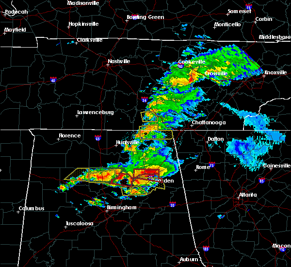 At 748 pm cdt, a severe thunderstorm capable of producing a tornado was located near decherd, or near winchester, moving east at 30 mph (radar indicated rotation). Hazards include tornado. Flying debris will be dangerous to those caught without shelter. mobile homes will be damaged or destroyed. damage to roofs, windows, and vehicles will occur. tree damage is likely. this dangerous storm will be near, sewanee around 800 pm cdt. monteagle around 815 pm cdt. Other locations impacted by this tornadic thunderstorm include woods reservoir and alto. At 748 pm cdt, a severe thunderstorm capable of producing a tornado was located near decherd, or near winchester, moving east at 30 mph (radar indicated rotation). Hazards include tornado. Flying debris will be dangerous to those caught without shelter. mobile homes will be damaged or destroyed. damage to roofs, windows, and vehicles will occur. tree damage is likely. this dangerous storm will be near, sewanee around 800 pm cdt. monteagle around 815 pm cdt. Other locations impacted by this tornadic thunderstorm include woods reservoir and alto.
|
| 3/19/2018 7:47 PM CDT |
 At 747 pm cdt, a severe thunderstorm was located 9 miles south of cowan, or 13 miles southeast of winchester, moving east at 50 mph (radar indicated). Hazards include 60 mph wind gusts and quarter size hail. Hail damage to vehicles is expected. Expect wind damage to roofs, siding, and trees. At 747 pm cdt, a severe thunderstorm was located 9 miles south of cowan, or 13 miles southeast of winchester, moving east at 50 mph (radar indicated). Hazards include 60 mph wind gusts and quarter size hail. Hail damage to vehicles is expected. Expect wind damage to roofs, siding, and trees.
|
| 3/19/2018 7:43 PM CDT |
 At 743 pm cdt, a severe thunderstorm was located over decherd, or near winchester, moving east at 45 mph (radar indicated). Hazards include 70 mph wind gusts and quarter size hail. Hail damage to vehicles is expected. expect considerable tree damage. Wind damage is also likely to mobile homes, roofs, and outbuildings. At 743 pm cdt, a severe thunderstorm was located over decherd, or near winchester, moving east at 45 mph (radar indicated). Hazards include 70 mph wind gusts and quarter size hail. Hail damage to vehicles is expected. expect considerable tree damage. Wind damage is also likely to mobile homes, roofs, and outbuildings.
|
| 11/18/2017 6:41 PM CST |
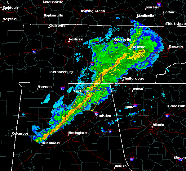 At 641 pm cst, severe thunderstorms were located along a line extending from 7 miles north of gruetli-laager to 10 miles northwest of stevenson, moving east at 65 mph (radar indicated). Hazards include 60 mph wind gusts. Expect damage to roofs, siding, and trees. locations impacted include, monteagle, sewanee, anderson, hytop, jericho, st. Andrews and sherwood. At 641 pm cst, severe thunderstorms were located along a line extending from 7 miles north of gruetli-laager to 10 miles northwest of stevenson, moving east at 65 mph (radar indicated). Hazards include 60 mph wind gusts. Expect damage to roofs, siding, and trees. locations impacted include, monteagle, sewanee, anderson, hytop, jericho, st. Andrews and sherwood.
|
| 11/18/2017 6:27 PM CST |
 At 626 pm cst, severe thunderstorms were located along a line extending from 11 miles east of manchester to 9 miles south of huntland, moving east at 65 mph (radar indicated). Hazards include 60 mph wind gusts. Expect damage to roofs, siding, and trees. Locations impacted include, winchester, decherd, cowan, monteagle, sewanee, tims ford lake, anderson, hytop, jericho and maxwell. At 626 pm cst, severe thunderstorms were located along a line extending from 11 miles east of manchester to 9 miles south of huntland, moving east at 65 mph (radar indicated). Hazards include 60 mph wind gusts. Expect damage to roofs, siding, and trees. Locations impacted include, winchester, decherd, cowan, monteagle, sewanee, tims ford lake, anderson, hytop, jericho and maxwell.
|
| 11/18/2017 6:27 PM CST |
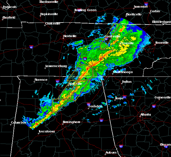 At 626 pm cst, severe thunderstorms were located along a line extending from 11 miles east of manchester to 9 miles south of huntland, moving east at 65 mph (radar indicated). Hazards include 60 mph wind gusts. Expect damage to roofs, siding, and trees. Locations impacted include, winchester, decherd, cowan, monteagle, sewanee, tims ford lake, anderson, hytop, jericho and maxwell. At 626 pm cst, severe thunderstorms were located along a line extending from 11 miles east of manchester to 9 miles south of huntland, moving east at 65 mph (radar indicated). Hazards include 60 mph wind gusts. Expect damage to roofs, siding, and trees. Locations impacted include, winchester, decherd, cowan, monteagle, sewanee, tims ford lake, anderson, hytop, jericho and maxwell.
|
| 11/18/2017 6:09 PM CST |
 At 609 pm cst, severe thunderstorms were located along a line extending from tullahoma to meridianville, moving east at 65 mph (radar indicated). Hazards include 60 mph wind gusts. expect damage to roofs, siding, and trees At 609 pm cst, severe thunderstorms were located along a line extending from tullahoma to meridianville, moving east at 65 mph (radar indicated). Hazards include 60 mph wind gusts. expect damage to roofs, siding, and trees
|
| 7/5/2017 2:47 PM CDT |
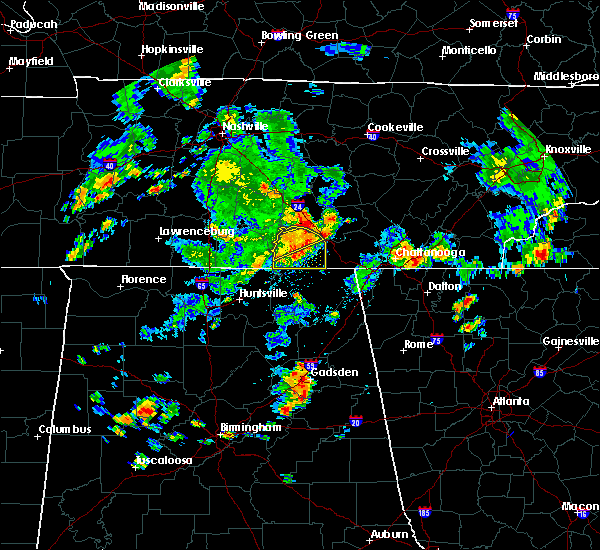 At 246 pm cdt, a severe thunderstorm was located near decherd, or near winchester, moving east at 45 mph (radar indicated). Hazards include 60 mph wind gusts. Expect damage to roofs, siding, and trees. Locations impacted include, winchester, decherd, estill springs, monteagle, tims ford lake, sewanee, lexie crossroads, harmony, oak grove and woods reservoir. At 246 pm cdt, a severe thunderstorm was located near decherd, or near winchester, moving east at 45 mph (radar indicated). Hazards include 60 mph wind gusts. Expect damage to roofs, siding, and trees. Locations impacted include, winchester, decherd, estill springs, monteagle, tims ford lake, sewanee, lexie crossroads, harmony, oak grove and woods reservoir.
|
| 7/5/2017 2:39 PM CDT |
 At 238 pm cdt, a severe thunderstorm was located near winchester, moving east at 40 mph (radar indicated). Hazards include 60 mph wind gusts. expect damage to roofs, siding, and trees At 238 pm cdt, a severe thunderstorm was located near winchester, moving east at 40 mph (radar indicated). Hazards include 60 mph wind gusts. expect damage to roofs, siding, and trees
|
| 7/5/2017 2:32 PM CDT |
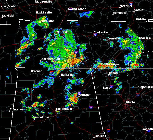 At 231 pm cdt, a severe thunderstorm was located near tims ford lake, or near winchester, moving east at 40 mph (radar indicated). Hazards include 60 mph wind gusts. Expect damage to roofs, siding, and trees. Locations impacted include, winchester, lynchburg, decherd, estill springs, monteagle, tims ford lake, sewanee, hurdlow, woods reservoir and alto. At 231 pm cdt, a severe thunderstorm was located near tims ford lake, or near winchester, moving east at 40 mph (radar indicated). Hazards include 60 mph wind gusts. Expect damage to roofs, siding, and trees. Locations impacted include, winchester, lynchburg, decherd, estill springs, monteagle, tims ford lake, sewanee, hurdlow, woods reservoir and alto.
|
| 7/5/2017 2:18 PM CDT |
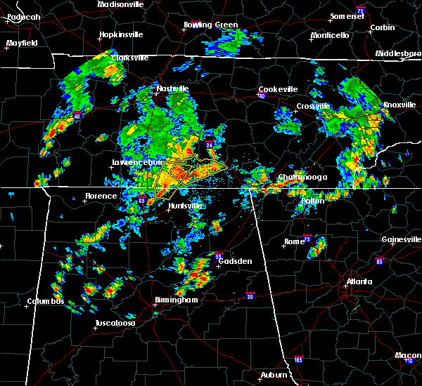 At 218 pm cdt, a severe thunderstorm was located near lynchburg, moving northeast at 45 mph (radar indicated). Hazards include 60 mph wind gusts. expect damage to roofs, siding, and trees At 218 pm cdt, a severe thunderstorm was located near lynchburg, moving northeast at 45 mph (radar indicated). Hazards include 60 mph wind gusts. expect damage to roofs, siding, and trees
|
| 5/27/2017 11:01 PM EDT |
 At 1101 pm edt/1001 pm cdt/, severe thunderstorms were located along a line extending from 9 miles north of fontana village to 10 miles south of madisonville to near etowah to near harrison to 8 miles southeast of sewanee, moving southeast at 45 mph (radar indicated). Hazards include 70 mph wind gusts and quarter size hail. Hail damage to vehicles is expected. expect considerable tree damage. wind damage is also likely to mobile homes, roofs, and outbuildings. Locations impacted include, chattanooga, cleveland, jasper, soddy-daisy, signal mountain, etowah, south pittsburg, walden, lakesite, whitwell, kimball, monteagle, charleston, ridgeside, harrison, east cleveland, south cleveland, fairmount, wildwood lake and red bank. At 1101 pm edt/1001 pm cdt/, severe thunderstorms were located along a line extending from 9 miles north of fontana village to 10 miles south of madisonville to near etowah to near harrison to 8 miles southeast of sewanee, moving southeast at 45 mph (radar indicated). Hazards include 70 mph wind gusts and quarter size hail. Hail damage to vehicles is expected. expect considerable tree damage. wind damage is also likely to mobile homes, roofs, and outbuildings. Locations impacted include, chattanooga, cleveland, jasper, soddy-daisy, signal mountain, etowah, south pittsburg, walden, lakesite, whitwell, kimball, monteagle, charleston, ridgeside, harrison, east cleveland, south cleveland, fairmount, wildwood lake and red bank.
|
| 5/27/2017 9:48 PM CDT |
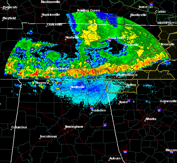 At 948 pm cdt, severe thunderstorms were located along a line extending from near sewanee to winchester, moving southeast at 25 mph (radar indicated). Hazards include 60 mph wind gusts and quarter size hail. Hail damage to vehicles is expected. expect wind damage to roofs, siding, and trees. locations impacted include, winchester, decherd, estill springs, cowan, monteagle, sewanee, tims ford lake, st. Andrews, sherwood and woods reservoir. At 948 pm cdt, severe thunderstorms were located along a line extending from near sewanee to winchester, moving southeast at 25 mph (radar indicated). Hazards include 60 mph wind gusts and quarter size hail. Hail damage to vehicles is expected. expect wind damage to roofs, siding, and trees. locations impacted include, winchester, decherd, estill springs, cowan, monteagle, sewanee, tims ford lake, st. Andrews, sherwood and woods reservoir.
|
| 5/27/2017 10:39 PM EDT |
 At 1039 pm edt/939 pm cdt/, severe thunderstorms were located along a line extending from near louisville to 7 miles west of madisonville to 6 miles southwest of athens to near dunlap, moving southeast at 45 mph (radar indicated). Hazards include 70 mph wind gusts and quarter size hail. Hail damage to vehicles is expected. expect considerable tree damage. wind damage is also likely to mobile homes, roofs, and outbuildings. Locations impacted include, chattanooga, cleveland, maryville, athens, alcoa, sweetwater, loudon, madisonville, jasper, decatur, soddy-daisy, signal mountain, etowah, south pittsburg, louisville, walden, lakesite, whitwell, tracy city and kimball. At 1039 pm edt/939 pm cdt/, severe thunderstorms were located along a line extending from near louisville to 7 miles west of madisonville to 6 miles southwest of athens to near dunlap, moving southeast at 45 mph (radar indicated). Hazards include 70 mph wind gusts and quarter size hail. Hail damage to vehicles is expected. expect considerable tree damage. wind damage is also likely to mobile homes, roofs, and outbuildings. Locations impacted include, chattanooga, cleveland, maryville, athens, alcoa, sweetwater, loudon, madisonville, jasper, decatur, soddy-daisy, signal mountain, etowah, south pittsburg, louisville, walden, lakesite, whitwell, tracy city and kimball.
|
| 5/27/2017 9:33 PM CDT |
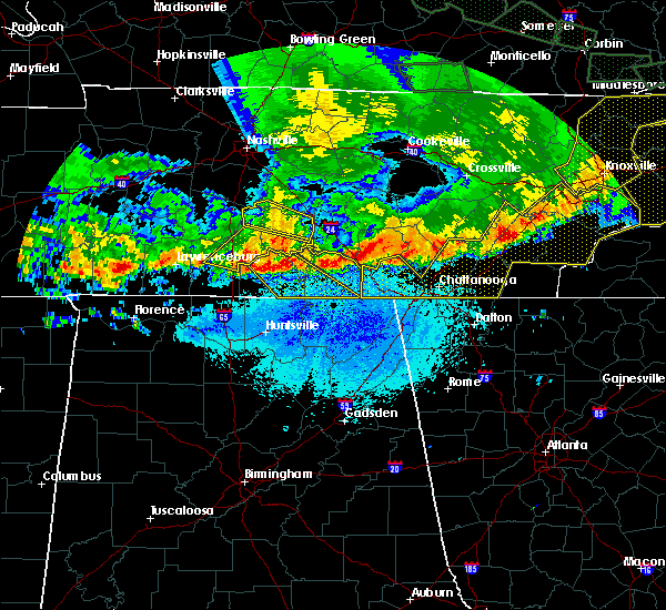 At 932 pm cdt, a severe thunderstorm was located near estill springs, or 8 miles north of winchester, moving southeast at 40 mph (radar indicated). Hazards include 60 mph wind gusts and quarter size hail. Hail damage to vehicles is expected. Expect wind damage to roofs, siding, and trees. At 932 pm cdt, a severe thunderstorm was located near estill springs, or 8 miles north of winchester, moving southeast at 40 mph (radar indicated). Hazards include 60 mph wind gusts and quarter size hail. Hail damage to vehicles is expected. Expect wind damage to roofs, siding, and trees.
|
| 5/27/2017 10:08 PM EDT |
 At 1008 pm edt/908 pm cdt/, severe thunderstorms were located along a line extending from oliver springs to 6 miles east of spring city to 6 miles north of dayton to 7 miles north of gruetli-laager, moving southeast at 45 mph (radar indicated). Hazards include 70 mph wind gusts and quarter size hail. Hail damage to vehicles is expected. expect considerable tree damage. Wind damage is also likely to mobile homes, roofs, and outbuildings. At 1008 pm edt/908 pm cdt/, severe thunderstorms were located along a line extending from oliver springs to 6 miles east of spring city to 6 miles north of dayton to 7 miles north of gruetli-laager, moving southeast at 45 mph (radar indicated). Hazards include 70 mph wind gusts and quarter size hail. Hail damage to vehicles is expected. expect considerable tree damage. Wind damage is also likely to mobile homes, roofs, and outbuildings.
|
| 4/30/2017 4:20 PM CDT |
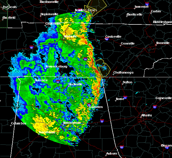 At 419 pm cdt, severe thunderstorms were located along a line extending from 12 miles northwest of gruetli-laager to near tracy city to 6 miles northwest of kimball to near bridgeport to 6 miles northeast of ider, moving northeast at 35 mph (radar indicated). Hazards include 60 mph wind gusts and penny size hail. Expect damage to roofs, siding, and trees. locations impacted include, jasper, south pittsburg, kimball, monteagle, fiery gizzard s. p. foster falls s. p. and new hope. A tornado watch remains in effect until 700 pm cdt for eastern tennessee. At 419 pm cdt, severe thunderstorms were located along a line extending from 12 miles northwest of gruetli-laager to near tracy city to 6 miles northwest of kimball to near bridgeport to 6 miles northeast of ider, moving northeast at 35 mph (radar indicated). Hazards include 60 mph wind gusts and penny size hail. Expect damage to roofs, siding, and trees. locations impacted include, jasper, south pittsburg, kimball, monteagle, fiery gizzard s. p. foster falls s. p. and new hope. A tornado watch remains in effect until 700 pm cdt for eastern tennessee.
|
| 4/30/2017 4:11 PM CDT |
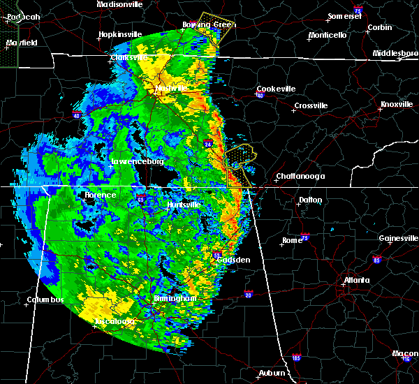 At 411 pm cdt, severe thunderstorms were located along a line extending from near sewanee to near south pittsburg, moving northeast at 40 mph (radar indicated). Hazards include 60 mph wind gusts. expect damage to roofs, siding, and trees At 411 pm cdt, severe thunderstorms were located along a line extending from near sewanee to near south pittsburg, moving northeast at 40 mph (radar indicated). Hazards include 60 mph wind gusts. expect damage to roofs, siding, and trees
|
| 4/30/2017 3:58 PM CDT |
 The severe thunderstorm warning for jackson, dekalb and franklin counties will expire at 400 pm cdt, the storms which prompted the warning have weakened below severe limits, and no longer pose an immediate threat to life or property. therefore the warning will be allowed to expire. however, gusty winds are still possible with these thunderstorms. a tornado watch remains in effect until 700 pm cdt for northeastern alabama, and middle tennessee. The severe thunderstorm warning for jackson, dekalb and franklin counties will expire at 400 pm cdt, the storms which prompted the warning have weakened below severe limits, and no longer pose an immediate threat to life or property. therefore the warning will be allowed to expire. however, gusty winds are still possible with these thunderstorms. a tornado watch remains in effect until 700 pm cdt for northeastern alabama, and middle tennessee.
|
| 4/30/2017 3:58 PM CDT |
 The severe thunderstorm warning for jackson. dekalb and franklin counties will expire at 400 pm cdt. the storms which prompted the warning have weakened below severe limits, and no longer pose an immediate threat to life or property. therefore the warning will be allowed to expire. However, gusty winds are still possible with these thunderstorms. The severe thunderstorm warning for jackson. dekalb and franklin counties will expire at 400 pm cdt. the storms which prompted the warning have weakened below severe limits, and no longer pose an immediate threat to life or property. therefore the warning will be allowed to expire. However, gusty winds are still possible with these thunderstorms.
|
| 4/30/2017 3:49 PM CDT |
 At 349 pm cdt, severe thunderstorms were located along a line extending from near estill springs to near collinsville, moving east at 40 mph (radar indicated). Hazards include 60 mph wind gusts. Expect damage to roofs, siding, and trees. locations impacted include, scottsboro, fort payne, winchester, rainsville, bridgeport, little river canyon national preserve, decherd, henagar, estill springs and stevenson. A tornado watch remains in effect until 700 pm cdt for north central and northeastern alabama, and middle tennessee. At 349 pm cdt, severe thunderstorms were located along a line extending from near estill springs to near collinsville, moving east at 40 mph (radar indicated). Hazards include 60 mph wind gusts. Expect damage to roofs, siding, and trees. locations impacted include, scottsboro, fort payne, winchester, rainsville, bridgeport, little river canyon national preserve, decherd, henagar, estill springs and stevenson. A tornado watch remains in effect until 700 pm cdt for north central and northeastern alabama, and middle tennessee.
|
| 4/30/2017 3:39 PM CDT |
 At 338 pm cdt, severe thunderstorms were located along a line extending from near tullahoma to near tims ford lake to 9 miles southeast of huntland to near skyline to near section, moving northeast at 35 mph (radar indicated). Hazards include 60 mph wind gusts and penny size hail. expect damage to roofs, siding, and trees At 338 pm cdt, severe thunderstorms were located along a line extending from near tullahoma to near tims ford lake to 9 miles southeast of huntland to near skyline to near section, moving northeast at 35 mph (radar indicated). Hazards include 60 mph wind gusts and penny size hail. expect damage to roofs, siding, and trees
|
| 4/30/2017 3:33 PM CDT |
 At 333 pm cdt, severe thunderstorms were located along a line extending from 7 miles north of tullahoma to near crossville, moving northeast at 55 mph (radar indicated). Hazards include 60 mph wind gusts. Expect damage to roofs, siding, and trees. locations impacted include, scottsboro, fort payne, boaz, winchester, rainsville, bridgeport, little river canyon national preserve, decherd, henagar and estill springs. A tornado watch remains in effect until 700 pm cdt for north central and northeastern alabama, and middle tennessee. At 333 pm cdt, severe thunderstorms were located along a line extending from 7 miles north of tullahoma to near crossville, moving northeast at 55 mph (radar indicated). Hazards include 60 mph wind gusts. Expect damage to roofs, siding, and trees. locations impacted include, scottsboro, fort payne, boaz, winchester, rainsville, bridgeport, little river canyon national preserve, decherd, henagar and estill springs. A tornado watch remains in effect until 700 pm cdt for north central and northeastern alabama, and middle tennessee.
|
| 4/30/2017 3:17 PM CDT |
 At 317 pm cdt, severe thunderstorms were located along a line extending from lynchburg to albertville, moving northeast at 40 mph (radar indicated). Hazards include 60 mph wind gusts. Expect damage to roofs, siding, and trees. locations impacted include, albertville, scottsboro, fort payne, boaz, winchester, guntersville, fayetteville, rainsville, bridgeport and lynchburg. A tornado watch remains in effect until 700 pm cdt for north central and northeastern alabama, and middle tennessee. At 317 pm cdt, severe thunderstorms were located along a line extending from lynchburg to albertville, moving northeast at 40 mph (radar indicated). Hazards include 60 mph wind gusts. Expect damage to roofs, siding, and trees. locations impacted include, albertville, scottsboro, fort payne, boaz, winchester, guntersville, fayetteville, rainsville, bridgeport and lynchburg. A tornado watch remains in effect until 700 pm cdt for north central and northeastern alabama, and middle tennessee.
|
| 4/30/2017 2:54 PM CDT |
 At 252 pm cdt, severe thunderstorms were located along a line extending from near petersburg to near altoona, moving northeast at 55 mph (radar indicated). Hazards include 60 mph wind gusts. expect damage to roofs, siding, and trees At 252 pm cdt, severe thunderstorms were located along a line extending from near petersburg to near altoona, moving northeast at 55 mph (radar indicated). Hazards include 60 mph wind gusts. expect damage to roofs, siding, and trees
|
| 4/18/2017 3:12 PM CDT |
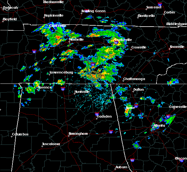 At 310 pm cdt, a severe thunderstorm was located over decherd, or near winchester, moving northeast at 20 mph (radar indicated). Hazards include 60 mph wind gusts and quarter size hail. Hail damage to vehicles is expected. Expect wind damage to roofs, siding, and trees. At 310 pm cdt, a severe thunderstorm was located over decherd, or near winchester, moving northeast at 20 mph (radar indicated). Hazards include 60 mph wind gusts and quarter size hail. Hail damage to vehicles is expected. Expect wind damage to roofs, siding, and trees.
|
| 4/18/2017 3:03 PM CDT |
 At 303 pm cdt, a severe thunderstorm was located over winchester, moving northeast at 15 mph (radar indicated). Hazards include quarter size hail. Damage to vehicles is expected. locations impacted include, winchester, decherd, estill springs, cowan, monteagle, sewanee, tims ford lake, st. Andrews, woods reservoir and arnold afb. At 303 pm cdt, a severe thunderstorm was located over winchester, moving northeast at 15 mph (radar indicated). Hazards include quarter size hail. Damage to vehicles is expected. locations impacted include, winchester, decherd, estill springs, cowan, monteagle, sewanee, tims ford lake, st. Andrews, woods reservoir and arnold afb.
|
| 4/18/2017 2:51 PM CDT |
 At 251 pm cdt, a severe thunderstorm was located near winchester, moving northeast at 15 mph (radar indicated). Hazards include quarter size hail. damage to vehicles is expected At 251 pm cdt, a severe thunderstorm was located near winchester, moving northeast at 15 mph (radar indicated). Hazards include quarter size hail. damage to vehicles is expected
|
| 4/5/2017 6:37 PM CDT |
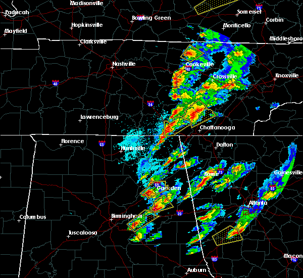 The severe thunderstorm warning for marion county will expire at 645 pm cdt, the storm which prompted the warning has moved out of the area. therefore the warning will be allowed to expire. however gusty winds to 40 mph are still possible with another thunderstorm that is moving across the county. a tornado watch remains in effect until 900 pm cdt for eastern tennessee. The severe thunderstorm warning for marion county will expire at 645 pm cdt, the storm which prompted the warning has moved out of the area. therefore the warning will be allowed to expire. however gusty winds to 40 mph are still possible with another thunderstorm that is moving across the county. a tornado watch remains in effect until 900 pm cdt for eastern tennessee.
|
| 4/5/2017 6:20 PM CDT |
 At 619 pm cdt, a severe thunderstorm was located near whitwell, or 10 miles north of jasper, moving northeast at 40 mph (radar indicated). Hazards include 60 mph wind gusts and quarter size hail. Hail damage to vehicles is expected. expect wind damage to roofs, siding, and trees. locations impacted include, jasper, south pittsburg, whitwell, kimball, monteagle, powells crossroads, orme, chimneys s. p. martin springs, fiery gizzard s. p. foster falls s. p. griffith creek, sequatchie cave, new hope and lone oak. A tornado watch remains in effect until 900 pm cdt for eastern tennessee. At 619 pm cdt, a severe thunderstorm was located near whitwell, or 10 miles north of jasper, moving northeast at 40 mph (radar indicated). Hazards include 60 mph wind gusts and quarter size hail. Hail damage to vehicles is expected. expect wind damage to roofs, siding, and trees. locations impacted include, jasper, south pittsburg, whitwell, kimball, monteagle, powells crossroads, orme, chimneys s. p. martin springs, fiery gizzard s. p. foster falls s. p. griffith creek, sequatchie cave, new hope and lone oak. A tornado watch remains in effect until 900 pm cdt for eastern tennessee.
|
| 4/5/2017 5:59 PM CDT |
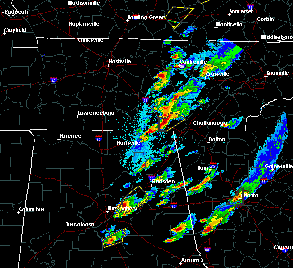 At 558 pm cdt, a severe thunderstorm was located near monteagle, or 11 miles northwest of jasper, moving northeast at 45 mph (radar indicated). Hazards include 60 mph wind gusts and quarter size hail. Hail damage to vehicles is expected. expect wind damage to roofs, siding, and trees. locations impacted include, jasper, south pittsburg, whitwell, kimball, monteagle, powells crossroads, orme, chimneys s. p. martin springs, fiery gizzard s. p. foster falls s. p. griffith creek, sequatchie cave, new hope and lone oak. A tornado watch remains in effect until 900 pm cdt for eastern tennessee. At 558 pm cdt, a severe thunderstorm was located near monteagle, or 11 miles northwest of jasper, moving northeast at 45 mph (radar indicated). Hazards include 60 mph wind gusts and quarter size hail. Hail damage to vehicles is expected. expect wind damage to roofs, siding, and trees. locations impacted include, jasper, south pittsburg, whitwell, kimball, monteagle, powells crossroads, orme, chimneys s. p. martin springs, fiery gizzard s. p. foster falls s. p. griffith creek, sequatchie cave, new hope and lone oak. A tornado watch remains in effect until 900 pm cdt for eastern tennessee.
|
| 4/5/2017 5:48 PM CDT |
 At 548 pm cdt, severe thunderstorms were located along a line extending from sewanee to 9 miles southeast of cowan, moving northeast at 50 mph. another severe thunderstorm was located near hytop, also moving northeast at 50 mph (radar indicated). Hazards include 60 mph wind gusts and quarter size hail. Hail damage to vehicles is expected. expect wind damage to roofs, siding, and trees. locations impacted include, cowan, monteagle, sewanee, anderson, hytop, jericho, st. andrews and sherwood. A tornado watch remains in effect until 900 pm cdt for northeastern alabama, and middle tennessee. At 548 pm cdt, severe thunderstorms were located along a line extending from sewanee to 9 miles southeast of cowan, moving northeast at 50 mph. another severe thunderstorm was located near hytop, also moving northeast at 50 mph (radar indicated). Hazards include 60 mph wind gusts and quarter size hail. Hail damage to vehicles is expected. expect wind damage to roofs, siding, and trees. locations impacted include, cowan, monteagle, sewanee, anderson, hytop, jericho, st. andrews and sherwood. A tornado watch remains in effect until 900 pm cdt for northeastern alabama, and middle tennessee.
|
| 4/5/2017 5:48 PM CDT |
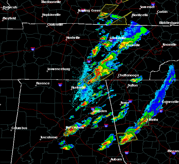 At 548 pm cdt, severe thunderstorms were located along a line extending from sewanee to 9 miles southeast of cowan, moving northeast at 50 mph. another severe thunderstorm was located near hytop, also moving northeast at 50 mph (radar indicated). Hazards include 60 mph wind gusts and quarter size hail. Hail damage to vehicles is expected. expect wind damage to roofs, siding, and trees. locations impacted include, cowan, monteagle, sewanee, anderson, hytop, jericho, st. andrews and sherwood. A tornado watch remains in effect until 900 pm cdt for northeastern alabama, and middle tennessee. At 548 pm cdt, severe thunderstorms were located along a line extending from sewanee to 9 miles southeast of cowan, moving northeast at 50 mph. another severe thunderstorm was located near hytop, also moving northeast at 50 mph (radar indicated). Hazards include 60 mph wind gusts and quarter size hail. Hail damage to vehicles is expected. expect wind damage to roofs, siding, and trees. locations impacted include, cowan, monteagle, sewanee, anderson, hytop, jericho, st. andrews and sherwood. A tornado watch remains in effect until 900 pm cdt for northeastern alabama, and middle tennessee.
|
| 4/5/2017 5:38 PM CDT |
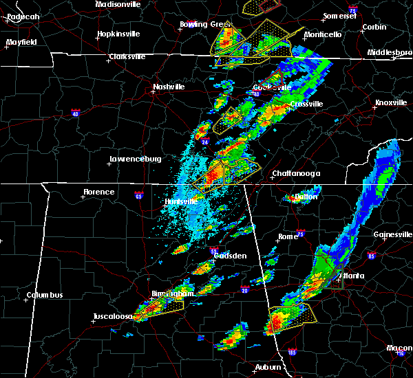 At 538 pm cdt, a severe thunderstorm was located 7 miles southeast of huntland, or 15 miles south of winchester, moving northeast at 40 mph (radar indicated). Hazards include 60 mph wind gusts and quarter size hail. Hail damage to vehicles is expected. Expect wind damage to roofs, siding, and trees. At 538 pm cdt, a severe thunderstorm was located 7 miles southeast of huntland, or 15 miles south of winchester, moving northeast at 40 mph (radar indicated). Hazards include 60 mph wind gusts and quarter size hail. Hail damage to vehicles is expected. Expect wind damage to roofs, siding, and trees.
|
| 4/5/2017 5:37 PM CDT |
 At 537 pm cdt, severe thunderstorms were located along a line extending from near cowan to 8 miles north of skyline, moving northeast at 60 mph (radar indicated). Hazards include 60 mph wind gusts and quarter size hail. Hail damage to vehicles is expected. expect wind damage to roofs, siding, and trees. locations impacted include, cowan, monteagle, sewanee, anderson, hytop, jericho, st. andrews and sherwood. A tornado watch remains in effect until 900 pm cdt for north central and northeastern alabama, and middle tennessee. At 537 pm cdt, severe thunderstorms were located along a line extending from near cowan to 8 miles north of skyline, moving northeast at 60 mph (radar indicated). Hazards include 60 mph wind gusts and quarter size hail. Hail damage to vehicles is expected. expect wind damage to roofs, siding, and trees. locations impacted include, cowan, monteagle, sewanee, anderson, hytop, jericho, st. andrews and sherwood. A tornado watch remains in effect until 900 pm cdt for north central and northeastern alabama, and middle tennessee.
|
| 4/5/2017 5:26 PM CDT |
 At 525 pm cdt, a severe thunderstorm was located 9 miles northwest of skyline, or 18 miles south of winchester, moving northeast at 45 mph (radar indicated. at 455 pm, there were several reports of hail to the size of quarters with these storms in madison county). Hazards include 60 mph wind gusts and quarter size hail. Hail damage to vehicles is expected. Expect wind damage to roofs, siding, and trees. At 525 pm cdt, a severe thunderstorm was located 9 miles northwest of skyline, or 18 miles south of winchester, moving northeast at 45 mph (radar indicated. at 455 pm, there were several reports of hail to the size of quarters with these storms in madison county). Hazards include 60 mph wind gusts and quarter size hail. Hail damage to vehicles is expected. Expect wind damage to roofs, siding, and trees.
|
| 4/5/2017 5:26 PM CDT |
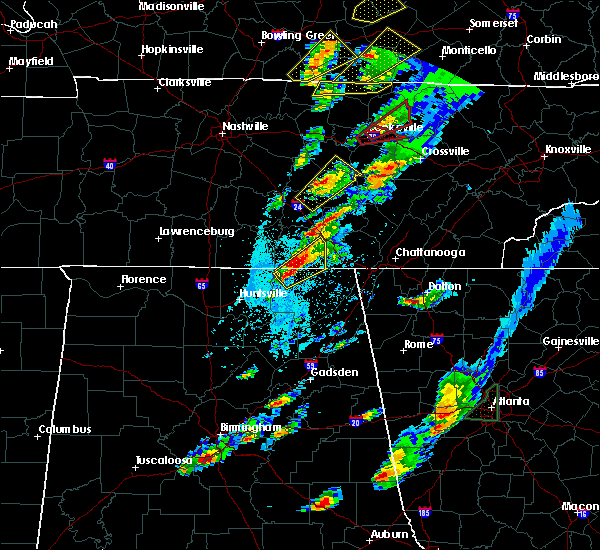 At 525 pm cdt, a severe thunderstorm was located 9 miles northwest of skyline, or 18 miles south of winchester, moving northeast at 45 mph (radar indicated. at 455 pm, there were several reports of hail to the size of quarters with these storms in madison county). Hazards include 60 mph wind gusts and quarter size hail. Hail damage to vehicles is expected. Expect wind damage to roofs, siding, and trees. At 525 pm cdt, a severe thunderstorm was located 9 miles northwest of skyline, or 18 miles south of winchester, moving northeast at 45 mph (radar indicated. at 455 pm, there were several reports of hail to the size of quarters with these storms in madison county). Hazards include 60 mph wind gusts and quarter size hail. Hail damage to vehicles is expected. Expect wind damage to roofs, siding, and trees.
|
| 4/5/2017 4:27 PM CDT |
 At 425 pm cdt, a severe thunderstorm was located near new market, or 12 miles northeast of moores mill, moving northeast at 55 mph. another strong to severe thunderstorm is located near meridianville, moving northeast at 50 mph (radar indicated. since 415 pm cdt, the public has reported hail to the size of pennies across north huntsville and meridianville with these storms). Hazards include 60 mph wind gusts and quarter size hail. Hail damage to vehicles is expected. Expect wind damage to roofs, siding, and trees. At 425 pm cdt, a severe thunderstorm was located near new market, or 12 miles northeast of moores mill, moving northeast at 55 mph. another strong to severe thunderstorm is located near meridianville, moving northeast at 50 mph (radar indicated. since 415 pm cdt, the public has reported hail to the size of pennies across north huntsville and meridianville with these storms). Hazards include 60 mph wind gusts and quarter size hail. Hail damage to vehicles is expected. Expect wind damage to roofs, siding, and trees.
|
| 3/21/2017 5:59 PM CDT |
 At 558 pm cdt, severe thunderstorms were located along a line extending from near tracy city to near trenton to near ider, moving east at 55 mph (radar indicated). Hazards include 70 mph wind gusts and quarter size hail. Hail damage to vehicles is expected. expect considerable tree damage. wind damage is also likely to mobile homes, roofs, and outbuildings. locations impacted include, jasper, south pittsburg, whitwell, kimball, monteagle, powells crossroads, orme, chimneys s. p. martin springs, fiery gizzard s. p. foster falls s. p. griffith creek, haletown (guild), hicks gap s. p. Sequatchie cave, new hope and lone oak. At 558 pm cdt, severe thunderstorms were located along a line extending from near tracy city to near trenton to near ider, moving east at 55 mph (radar indicated). Hazards include 70 mph wind gusts and quarter size hail. Hail damage to vehicles is expected. expect considerable tree damage. wind damage is also likely to mobile homes, roofs, and outbuildings. locations impacted include, jasper, south pittsburg, whitwell, kimball, monteagle, powells crossroads, orme, chimneys s. p. martin springs, fiery gizzard s. p. foster falls s. p. griffith creek, haletown (guild), hicks gap s. p. Sequatchie cave, new hope and lone oak.
|
| 3/21/2017 5:37 PM CDT |
 At 536 pm cdt, severe thunderstorms were located along a line extending from near monteagle to 8 miles north of stevenson to near skyline, moving east at 55 mph (radar indicated). Hazards include 70 mph wind gusts and quarter size hail. Hail damage to vehicles is expected. expect considerable tree damage. wind damage is also likely to mobile homes, roofs, and outbuildings. locations impacted include, jasper, south pittsburg, whitwell, kimball, monteagle, powells crossroads, orme, chimneys s. p. martin springs, fiery gizzard s. p. foster falls s. p. griffith creek, haletown (guild), hicks gap s. p. Sequatchie cave, new hope and lone oak. At 536 pm cdt, severe thunderstorms were located along a line extending from near monteagle to 8 miles north of stevenson to near skyline, moving east at 55 mph (radar indicated). Hazards include 70 mph wind gusts and quarter size hail. Hail damage to vehicles is expected. expect considerable tree damage. wind damage is also likely to mobile homes, roofs, and outbuildings. locations impacted include, jasper, south pittsburg, whitwell, kimball, monteagle, powells crossroads, orme, chimneys s. p. martin springs, fiery gizzard s. p. foster falls s. p. griffith creek, haletown (guild), hicks gap s. p. Sequatchie cave, new hope and lone oak.
|
| 3/21/2017 5:21 PM CDT |
 At 520 pm cdt, severe thunderstorms were located along a line extending from 6 miles south of manchester to 9 miles southwest of cowan to 8 miles south of huntland, moving east at 45 mph (radar indicated). Hazards include 70 mph wind gusts and quarter size hail. Hail damage to vehicles is expected. expect considerable tree damage. Wind damage is also likely to mobile homes, roofs, and outbuildings. At 520 pm cdt, severe thunderstorms were located along a line extending from 6 miles south of manchester to 9 miles southwest of cowan to 8 miles south of huntland, moving east at 45 mph (radar indicated). Hazards include 70 mph wind gusts and quarter size hail. Hail damage to vehicles is expected. expect considerable tree damage. Wind damage is also likely to mobile homes, roofs, and outbuildings.
|
| 3/10/2017 12:53 AM CST |
 The severe thunderstorm warning for northwestern jackson, central madison and southeastern franklin counties will expire at 100 am cst, the storms which prompted the warning have moved out of the area. therefore, the warning will be allowed to expire. a severe thunderstorm watch remains in effect until 400 am cst for north central, northeastern and northwestern alabama, and middle tennessee. The severe thunderstorm warning for northwestern jackson, central madison and southeastern franklin counties will expire at 100 am cst, the storms which prompted the warning have moved out of the area. therefore, the warning will be allowed to expire. a severe thunderstorm watch remains in effect until 400 am cst for north central, northeastern and northwestern alabama, and middle tennessee.
|
| 3/10/2017 12:44 AM CST |
 At 1243 am cst, severe thunderstorms were located along a line extending from 6 miles northwest of charleston to near trenton, moving east at 95 mph (radar indicated). Hazards include 60 mph wind gusts and quarter size hail. Hail damage to vehicles is expected. expect wind damage to roofs, siding, and trees. Locations impacted include, southern huntsville, redstone arsenal, owens cross roads, monteagle, skyline, gurley, woodville, sewanee, huntsville international airport and anderson. At 1243 am cst, severe thunderstorms were located along a line extending from 6 miles northwest of charleston to near trenton, moving east at 95 mph (radar indicated). Hazards include 60 mph wind gusts and quarter size hail. Hail damage to vehicles is expected. expect wind damage to roofs, siding, and trees. Locations impacted include, southern huntsville, redstone arsenal, owens cross roads, monteagle, skyline, gurley, woodville, sewanee, huntsville international airport and anderson.
|
| 3/10/2017 12:30 AM CST |
 At 1230 am cst, severe thunderstorms were located along a line extending from near gruetli-laager to 6 miles northeast of skyline, moving southeast at 60 mph (radar indicated). Hazards include 70 mph wind gusts and quarter size hail. Hail damage to vehicles is expected. expect considerable tree damage. wind damage is also likely to mobile homes, roofs, and outbuildings. locations impacted include, dunlap, jasper, signal mountain, south pittsburg, whitwell, kimball, monteagle, fairmount, powells crossroads, orme, chimneys s. p. martin springs, cartwright, fiery gizzard s. p. foster falls s. p. griffith creek, haletown (guild), hicks gap s. p. Lone oak and sequatchie cave. At 1230 am cst, severe thunderstorms were located along a line extending from near gruetli-laager to 6 miles northeast of skyline, moving southeast at 60 mph (radar indicated). Hazards include 70 mph wind gusts and quarter size hail. Hail damage to vehicles is expected. expect considerable tree damage. wind damage is also likely to mobile homes, roofs, and outbuildings. locations impacted include, dunlap, jasper, signal mountain, south pittsburg, whitwell, kimball, monteagle, fairmount, powells crossroads, orme, chimneys s. p. martin springs, cartwright, fiery gizzard s. p. foster falls s. p. griffith creek, haletown (guild), hicks gap s. p. Lone oak and sequatchie cave.
|
| 3/10/2017 12:14 AM CST |
 At 1214 am cst, a severe thunderstorm was located 10 miles northwest of monteagle, or 11 miles southeast of manchester, moving east at 50 mph (radar indicated). Hazards include golf ball size hail and 60 mph wind gusts. People and animals outdoors will be injured. expect hail damage to roofs, siding, windows, and vehicles. Expect wind damage to roofs, siding, and trees. At 1214 am cst, a severe thunderstorm was located 10 miles northwest of monteagle, or 11 miles southeast of manchester, moving east at 50 mph (radar indicated). Hazards include golf ball size hail and 60 mph wind gusts. People and animals outdoors will be injured. expect hail damage to roofs, siding, windows, and vehicles. Expect wind damage to roofs, siding, and trees.
|
| 3/10/2017 12:09 AM CST |
 At 1209 am cst, severe thunderstorms were located along a line extending from 11 miles south of mcminnville to near huntland, moving southeast at 60 mph (radar indicated). Hazards include 70 mph wind gusts and quarter size hail. Hail damage to vehicles is expected. expect considerable tree damage. Wind damage is also likely to mobile homes, roofs, and outbuildings. At 1209 am cst, severe thunderstorms were located along a line extending from 11 miles south of mcminnville to near huntland, moving southeast at 60 mph (radar indicated). Hazards include 70 mph wind gusts and quarter size hail. Hail damage to vehicles is expected. expect considerable tree damage. Wind damage is also likely to mobile homes, roofs, and outbuildings.
|
| 3/9/2017 11:59 PM CST |
 At 1159 pm cst, severe thunderstorms were located along a line extending from 8 miles northeast of manchester to 6 miles northwest of hazel green, moving east at 40 mph (radar indicated). Hazards include 60 mph wind gusts and quarter size hail. Hail damage to vehicles is expected. expect wind damage to roofs, siding, and trees. Locations impacted include, huntsville, madison, winchester, moores mill, meridianville, redstone arsenal, hazel green, decherd, estill springs and cowan. At 1159 pm cst, severe thunderstorms were located along a line extending from 8 miles northeast of manchester to 6 miles northwest of hazel green, moving east at 40 mph (radar indicated). Hazards include 60 mph wind gusts and quarter size hail. Hail damage to vehicles is expected. expect wind damage to roofs, siding, and trees. Locations impacted include, huntsville, madison, winchester, moores mill, meridianville, redstone arsenal, hazel green, decherd, estill springs and cowan.
|
| 3/9/2017 11:55 PM CST |
 At 1155 pm cst, severe thunderstorms were located along a line extending from 7 miles northeast of manchester to 7 miles east of ardmore, moving east at 95 mph (radar indicated). Hazards include 60 mph wind gusts and quarter size hail. Hail damage to vehicles is expected. Expect wind damage to roofs, siding, and trees. At 1155 pm cst, severe thunderstorms were located along a line extending from 7 miles northeast of manchester to 7 miles east of ardmore, moving east at 95 mph (radar indicated). Hazards include 60 mph wind gusts and quarter size hail. Hail damage to vehicles is expected. Expect wind damage to roofs, siding, and trees.
|
| 3/1/2017 1:30 PM CST |
 At 130 pm cst, a severe thunderstorm was located 9 miles southeast of cowan, or 14 miles northwest of bridgeport, moving east at 45 mph (radar indicated). Hazards include 60 mph wind gusts and quarter size hail. Hail damage to vehicles is expected. Expect wind damage to roofs, siding, and trees. At 130 pm cst, a severe thunderstorm was located 9 miles southeast of cowan, or 14 miles northwest of bridgeport, moving east at 45 mph (radar indicated). Hazards include 60 mph wind gusts and quarter size hail. Hail damage to vehicles is expected. Expect wind damage to roofs, siding, and trees.
|
| 3/1/2017 1:02 PM CST |
 At 101 pm cst, a severe thunderstorm was located over decherd, or over winchester, moving east at 60 mph (radar indicated). Hazards include 60 mph wind gusts and penny size hail. Expect damage to roofs, siding, and trees. locations impacted include, winchester, decherd, estill springs, cowan, monteagle, sewanee, tims ford lake, st. andrews, woods reservoir and alto. A tornado watch remains in effect until 600 pm cst for north central and northeastern alabama, and middle tennessee. At 101 pm cst, a severe thunderstorm was located over decherd, or over winchester, moving east at 60 mph (radar indicated). Hazards include 60 mph wind gusts and penny size hail. Expect damage to roofs, siding, and trees. locations impacted include, winchester, decherd, estill springs, cowan, monteagle, sewanee, tims ford lake, st. andrews, woods reservoir and alto. A tornado watch remains in effect until 600 pm cst for north central and northeastern alabama, and middle tennessee.
|
| 3/1/2017 12:52 PM CST |
 At 1252 pm cst, a severe thunderstorm was located near tims ford lake, or near lynchburg, moving east at 60 mph (radar indicated). Hazards include 60 mph wind gusts and penny size hail. expect damage to roofs, siding, and trees At 1252 pm cst, a severe thunderstorm was located near tims ford lake, or near lynchburg, moving east at 60 mph (radar indicated). Hazards include 60 mph wind gusts and penny size hail. expect damage to roofs, siding, and trees
|
| 2/24/2017 10:53 PM CST |
 At 1053 pm cst, a severe thunderstorm was located near monteagle, or 14 miles east of winchester, moving northeast at 45 mph (radar indicated). Hazards include quarter size hail. Damage to vehicles is expected. locations impacted include, monteagle, sewanee, alto and st. Andrews. At 1053 pm cst, a severe thunderstorm was located near monteagle, or 14 miles east of winchester, moving northeast at 45 mph (radar indicated). Hazards include quarter size hail. Damage to vehicles is expected. locations impacted include, monteagle, sewanee, alto and st. Andrews.
|
| 2/24/2017 10:44 PM CST |
 At 1043 pm cst, a severe thunderstorm was located near cowan, or near winchester, moving northeast at 45 mph (radar indicated). Hazards include quarter size hail. damage to vehicles is expected At 1043 pm cst, a severe thunderstorm was located near cowan, or near winchester, moving northeast at 45 mph (radar indicated). Hazards include quarter size hail. damage to vehicles is expected
|
| 2/24/2017 10:21 PM CST |
 At 1020 pm cst, a severe thunderstorm was located over huntland, or 11 miles southwest of winchester, moving northeast at 50 mph (radar indicated). Hazards include quarter size hail. damage to vehicles is expected At 1020 pm cst, a severe thunderstorm was located over huntland, or 11 miles southwest of winchester, moving northeast at 50 mph (radar indicated). Hazards include quarter size hail. damage to vehicles is expected
|
| 11/30/2016 2:13 AM CST |
 At 213 am cst, severe thunderstorms were located along a line extending from 9 miles northwest of gruetli-laager to monteagle to near stevenson, moving northeast at 60 mph (radar indicated). Hazards include 60 mph wind gusts. Expect damage to roofs. siding. And trees. At 213 am cst, severe thunderstorms were located along a line extending from 9 miles northwest of gruetli-laager to monteagle to near stevenson, moving northeast at 60 mph (radar indicated). Hazards include 60 mph wind gusts. Expect damage to roofs. siding. And trees.
|
| 11/30/2016 2:10 AM CST |
 At 210 am cst, a severe thunderstorm was located over monteagle, or 16 miles east of winchester, moving northeast at 75 mph (radar indicated). Hazards include 70 mph wind gusts and penny size hail. Expect considerable tree damage. Damage is likely to mobile homes, roofs, and outbuildings. At 210 am cst, a severe thunderstorm was located over monteagle, or 16 miles east of winchester, moving northeast at 75 mph (radar indicated). Hazards include 70 mph wind gusts and penny size hail. Expect considerable tree damage. Damage is likely to mobile homes, roofs, and outbuildings.
|
| 11/29/2016 11:37 PM CST |
 The severe thunderstorm warning for northeastern franklin county will expire at 1145 pm cst, the storm which prompted the warning has weakened below severe limits, and has exited the warned area. therefore, the warning will be allowed to expire. a tornado watch remains in effect until 300 am cst for north central and northeastern alabama, and middle tennessee. The severe thunderstorm warning for northeastern franklin county will expire at 1145 pm cst, the storm which prompted the warning has weakened below severe limits, and has exited the warned area. therefore, the warning will be allowed to expire. a tornado watch remains in effect until 300 am cst for north central and northeastern alabama, and middle tennessee.
|
| 11/29/2016 11:37 PM CST |
 At 1136 pm cst, severe thunderstorms were located along a line extending from beersheba springs to tracy city, moving east at 40 mph (radar indicated). Hazards include 60 mph wind gusts. Expect damage to roofs. siding. and trees. locations impacted include, gruetli-laager, tracy city, monteagle, altamont, coalmont, palmer, beersheba springs, pelham and fiery gizzard s. p. A tornado watch remains in effect until midnight cst for middle tennessee. At 1136 pm cst, severe thunderstorms were located along a line extending from beersheba springs to tracy city, moving east at 40 mph (radar indicated). Hazards include 60 mph wind gusts. Expect damage to roofs. siding. and trees. locations impacted include, gruetli-laager, tracy city, monteagle, altamont, coalmont, palmer, beersheba springs, pelham and fiery gizzard s. p. A tornado watch remains in effect until midnight cst for middle tennessee.
|
| 11/29/2016 11:29 PM CST |
 At 1129 pm cst, a severe thunderstorm was located over monteagle, or 17 miles northwest of jasper, moving northeast at 50 mph (radar indicated). Hazards include 60 mph wind gusts. Expect damage to roofs. siding. and trees. locations impacted include, winchester, decherd, cowan, monteagle, sewanee, st. andrews, alto and woods reservoir. A tornado watch remains in effect until 300 am cst for north central and northeastern alabama, and middle tennessee. At 1129 pm cst, a severe thunderstorm was located over monteagle, or 17 miles northwest of jasper, moving northeast at 50 mph (radar indicated). Hazards include 60 mph wind gusts. Expect damage to roofs. siding. and trees. locations impacted include, winchester, decherd, cowan, monteagle, sewanee, st. andrews, alto and woods reservoir. A tornado watch remains in effect until 300 am cst for north central and northeastern alabama, and middle tennessee.
|
| 11/29/2016 11:26 PM CST |
 At 1125 pm cst, severe thunderstorms were located along a line extending from 9 miles south of mcminnville to 8 miles west of gruetli-laager to near sewanee to near cowan, moving northeast at 55 mph (radar indicated). Hazards include 60 mph wind gusts. Expect damage to roofs. siding. And trees. At 1125 pm cst, severe thunderstorms were located along a line extending from 9 miles south of mcminnville to 8 miles west of gruetli-laager to near sewanee to near cowan, moving northeast at 55 mph (radar indicated). Hazards include 60 mph wind gusts. Expect damage to roofs. siding. And trees.
|
| 11/29/2016 11:22 PM CST |
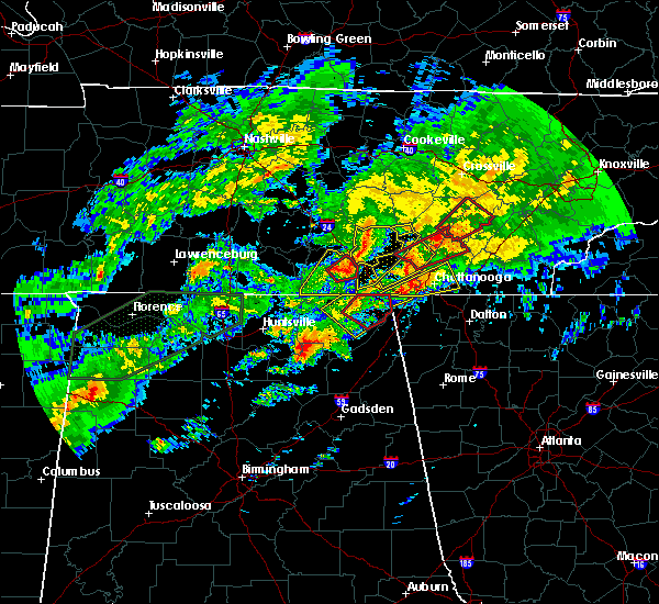 At 1122 pm cst, severe thunderstorms were located along a line extending from near viola to sewanee, moving east at 45 mph (radar indicated). Hazards include 60 mph wind gusts. Expect damage to roofs. siding. and trees. locations impacted include, gruetli-laager, tracy city, monteagle, altamont, coalmont, palmer, beersheba springs, pelham and fiery gizzard s. p. A tornado watch remains in effect until midnight cst for middle tennessee. At 1122 pm cst, severe thunderstorms were located along a line extending from near viola to sewanee, moving east at 45 mph (radar indicated). Hazards include 60 mph wind gusts. Expect damage to roofs. siding. and trees. locations impacted include, gruetli-laager, tracy city, monteagle, altamont, coalmont, palmer, beersheba springs, pelham and fiery gizzard s. p. A tornado watch remains in effect until midnight cst for middle tennessee.
|
| 11/29/2016 11:17 PM CST |
 At 1115 pm cst, a severe thunderstorm capable of producing a tornado was located over cowan, or near winchester, moving northeast at 50 mph (radar indicated rotation). Hazards include tornado. Flying debris will be dangerous to those caught without shelter. mobile homes will be damaged or destroyed. damage to roofs, windows, and vehicles will occur. tree damage is likely. this dangerous storm will be near, sewanee around 1125 pm cst. monteagle around 1135 pm cst. other locations impacted by this tornadic thunderstorm include alto and st. Andrews. At 1115 pm cst, a severe thunderstorm capable of producing a tornado was located over cowan, or near winchester, moving northeast at 50 mph (radar indicated rotation). Hazards include tornado. Flying debris will be dangerous to those caught without shelter. mobile homes will be damaged or destroyed. damage to roofs, windows, and vehicles will occur. tree damage is likely. this dangerous storm will be near, sewanee around 1125 pm cst. monteagle around 1135 pm cst. other locations impacted by this tornadic thunderstorm include alto and st. Andrews.
|
| 11/29/2016 11:09 PM CST |
 At 1109 pm cst, severe thunderstorms were located along a line extending from 6 miles southeast of manchester to near winchester, moving east at 45 mph (radar indicated). Hazards include 60 mph wind gusts. Expect damage to roofs. siding. And trees. At 1109 pm cst, severe thunderstorms were located along a line extending from 6 miles southeast of manchester to near winchester, moving east at 45 mph (radar indicated). Hazards include 60 mph wind gusts. Expect damage to roofs. siding. And trees.
|
| 11/29/2016 11:06 PM CST |
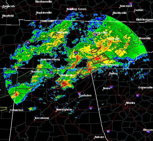 At 1105 pm cst, a severe thunderstorm was located near winchester, moving northeast at 50 mph (radar indicated). Hazards include 60 mph wind gusts. Expect damage to roofs. siding. And trees. At 1105 pm cst, a severe thunderstorm was located near winchester, moving northeast at 50 mph (radar indicated). Hazards include 60 mph wind gusts. Expect damage to roofs. siding. And trees.
|
| 11/29/2016 10:20 PM CST |
 At 1020 pm cst, a severe thunderstorm was located 9 miles northwest of tracy city, or 14 miles southeast of manchester, moving northeast at 40 mph (radar indicated). Hazards include 60 mph wind gusts. Expect damage to roofs. siding. and trees. locations impacted include, gruetli-laager, monteagle, altamont, coalmont and pelham. A tornado watch remains in effect until midnight cst for middle tennessee. At 1020 pm cst, a severe thunderstorm was located 9 miles northwest of tracy city, or 14 miles southeast of manchester, moving northeast at 40 mph (radar indicated). Hazards include 60 mph wind gusts. Expect damage to roofs. siding. and trees. locations impacted include, gruetli-laager, monteagle, altamont, coalmont and pelham. A tornado watch remains in effect until midnight cst for middle tennessee.
|
| 11/29/2016 10:04 PM CST |
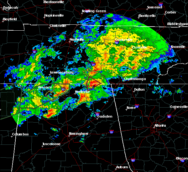 At 1004 pm cst, a severe thunderstorm was located near estill springs, or 9 miles northeast of winchester, moving northeast at 35 mph (radar indicated). Hazards include 60 mph wind gusts. Expect damage to roofs. siding. And trees. At 1004 pm cst, a severe thunderstorm was located near estill springs, or 9 miles northeast of winchester, moving northeast at 35 mph (radar indicated). Hazards include 60 mph wind gusts. Expect damage to roofs. siding. And trees.
|
| 8/28/2016 4:51 PM CDT |
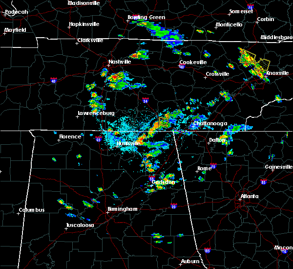 The severe thunderstorm warning for west central marion county will expire at 500 pm cdt, the storm which prompted the warning has weakened below severe limits, and has exited the warned area. therefore, the warning will be allowed to expire. however gusty winds are still possible with this thunderstorm. The severe thunderstorm warning for west central marion county will expire at 500 pm cdt, the storm which prompted the warning has weakened below severe limits, and has exited the warned area. therefore, the warning will be allowed to expire. however gusty winds are still possible with this thunderstorm.
|
| 8/28/2016 4:43 PM CDT |
 At 443 pm cdt, a severe thunderstorm was located near monteagle, or 13 miles northwest of jasper, moving northwest at 10 mph (radar indicated). Hazards include 60 mph wind gusts. Expect damage to roofs. siding. and trees. locations impacted include, monteagle and fiery gizzard s. P At 443 pm cdt, a severe thunderstorm was located near monteagle, or 13 miles northwest of jasper, moving northwest at 10 mph (radar indicated). Hazards include 60 mph wind gusts. Expect damage to roofs. siding. and trees. locations impacted include, monteagle and fiery gizzard s. P
|
| 8/28/2016 4:23 PM CDT |
 At 423 pm cdt, a severe thunderstorm was located near monteagle, or 10 miles northwest of jasper, moving west at 25 mph (radar indicated). Hazards include 60 mph wind gusts and quarter size hail. Hail damage to vehicles is expected. Expect wind damage to roofs, siding, and trees. At 423 pm cdt, a severe thunderstorm was located near monteagle, or 10 miles northwest of jasper, moving west at 25 mph (radar indicated). Hazards include 60 mph wind gusts and quarter size hail. Hail damage to vehicles is expected. Expect wind damage to roofs, siding, and trees.
|
| 7/8/2016 10:58 PM CDT |
 At 1158 pm edt/1058 pm cdt/, severe thunderstorms were located along a line extending from near dunlap to near whitwell to near tracy city, moving southeast at 45 mph (radar indicated). Hazards include 60 mph wind gusts. Expect damage to roofs. siding. and trees. locations impacted include, chattanooga, dunlap, jasper, soddy-daisy, signal mountain, walden, whitwell, kimball, monteagle, fairmount, red bank, powells crossroads, martin springs, foster falls s. p,. Sequatchie cave, haletown (guild), cagle, north chickamauga creek gorge, griffith creek and falling water. At 1158 pm edt/1058 pm cdt/, severe thunderstorms were located along a line extending from near dunlap to near whitwell to near tracy city, moving southeast at 45 mph (radar indicated). Hazards include 60 mph wind gusts. Expect damage to roofs. siding. and trees. locations impacted include, chattanooga, dunlap, jasper, soddy-daisy, signal mountain, walden, whitwell, kimball, monteagle, fairmount, red bank, powells crossroads, martin springs, foster falls s. p,. Sequatchie cave, haletown (guild), cagle, north chickamauga creek gorge, griffith creek and falling water.
|
| 7/8/2016 10:58 PM CDT |
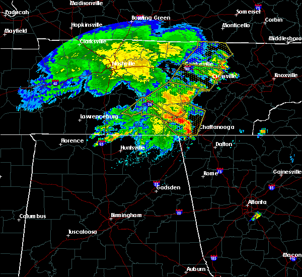 At 1057 pm cdt, severe thunderstorms were located along a line extending from 9 miles north of pikeville to 9 miles northwest of dunlap to near monteagle, moving southeast at 40 mph (radar indicated). Hazards include 60 mph wind gusts and penny size hail. Expect damage to roofs. siding. And trees. At 1057 pm cdt, severe thunderstorms were located along a line extending from 9 miles north of pikeville to 9 miles northwest of dunlap to near monteagle, moving southeast at 40 mph (radar indicated). Hazards include 60 mph wind gusts and penny size hail. Expect damage to roofs. siding. And trees.
|
| 7/8/2016 10:47 PM CDT |
 At 1147 pm edt/1047 pm cdt/, severe thunderstorms were located along a line extending from 14 miles northwest of dunlap to near gruetli-laager to near monteagle, moving southeast at 40 mph (radar indicated). Hazards include 60 mph wind gusts. Expect damage to roofs. siding. And trees. At 1147 pm edt/1047 pm cdt/, severe thunderstorms were located along a line extending from 14 miles northwest of dunlap to near gruetli-laager to near monteagle, moving southeast at 40 mph (radar indicated). Hazards include 60 mph wind gusts. Expect damage to roofs. siding. And trees.
|
| 7/8/2016 10:25 PM CDT |
 At 1024 pm cdt, severe thunderstorms were located along a line extending from 10 miles northeast of manchester to near lynchburg, moving east at 40 mph (radar indicated). Hazards include 60 mph wind gusts and penny size hail. Expect damage to roofs. siding. and trees. locations impacted include, shelbyville, manchester, tullahoma, tracy city, monteagle, coalmont, wartrace, normandy, raus, pelham, hillsboro, beechgrove, arnold afb and fiery gizzard s. P At 1024 pm cdt, severe thunderstorms were located along a line extending from 10 miles northeast of manchester to near lynchburg, moving east at 40 mph (radar indicated). Hazards include 60 mph wind gusts and penny size hail. Expect damage to roofs. siding. and trees. locations impacted include, shelbyville, manchester, tullahoma, tracy city, monteagle, coalmont, wartrace, normandy, raus, pelham, hillsboro, beechgrove, arnold afb and fiery gizzard s. P
|
| 7/8/2016 10:00 PM CDT |
 At 959 pm cdt, severe thunderstorms were located along a line extending from 14 miles northwest of manchester to near petersburg, moving east at 40 mph (radar indicated). Hazards include 60 mph wind gusts and penny size hail. Expect damage to roofs. siding. And trees. At 959 pm cdt, severe thunderstorms were located along a line extending from 14 miles northwest of manchester to near petersburg, moving east at 40 mph (radar indicated). Hazards include 60 mph wind gusts and penny size hail. Expect damage to roofs. siding. And trees.
|
| 7/7/2016 8:11 AM CDT |
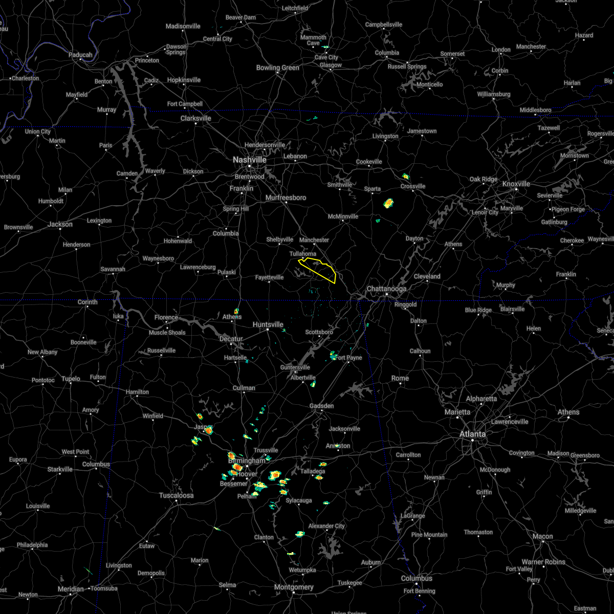 The severe thunderstorm warning for northeastern franklin county will expire at 815 am cdt, the storm which prompted the warning has weakened below severe limits, and no longer pose an immediate threat to life or property. therefore, the warning will be allowed to expire. however gusty winds and heavy rain are still possible with this thunderstorm. The severe thunderstorm warning for northeastern franklin county will expire at 815 am cdt, the storm which prompted the warning has weakened below severe limits, and no longer pose an immediate threat to life or property. therefore, the warning will be allowed to expire. however gusty winds and heavy rain are still possible with this thunderstorm.
|
| 7/7/2016 8:02 AM CDT |
 At 802 am cdt, a severe thunderstorm was located near monteagle, or 16 miles northeast of winchester, moving southeast at 45 mph (radar indicated). Hazards include 60 mph wind gusts. Expect damage to roofs. siding. and trees. locations impacted include, decherd, estill springs, monteagle, sewanee, st. Andrews, alto, arnold afb, oak grove and woods reservoir. At 802 am cdt, a severe thunderstorm was located near monteagle, or 16 miles northeast of winchester, moving southeast at 45 mph (radar indicated). Hazards include 60 mph wind gusts. Expect damage to roofs. siding. and trees. locations impacted include, decherd, estill springs, monteagle, sewanee, st. Andrews, alto, arnold afb, oak grove and woods reservoir.
|
| 7/7/2016 8:02 AM CDT |
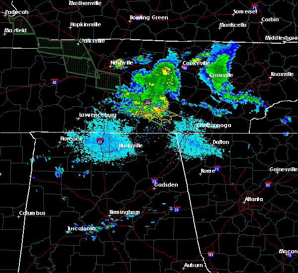 At 802 am cdt, a severe thunderstorm was located near pelham, or 16 miles southeast of manchester, moving southeast at 45 mph (radar indicated). Hazards include 60 mph wind gusts. Expect damage to roofs. siding. and trees. locations impacted include, tracy city, monteagle, coalmont, pelham and fiery gizzard s. P At 802 am cdt, a severe thunderstorm was located near pelham, or 16 miles southeast of manchester, moving southeast at 45 mph (radar indicated). Hazards include 60 mph wind gusts. Expect damage to roofs. siding. and trees. locations impacted include, tracy city, monteagle, coalmont, pelham and fiery gizzard s. P
|
| 7/7/2016 7:49 AM CDT |
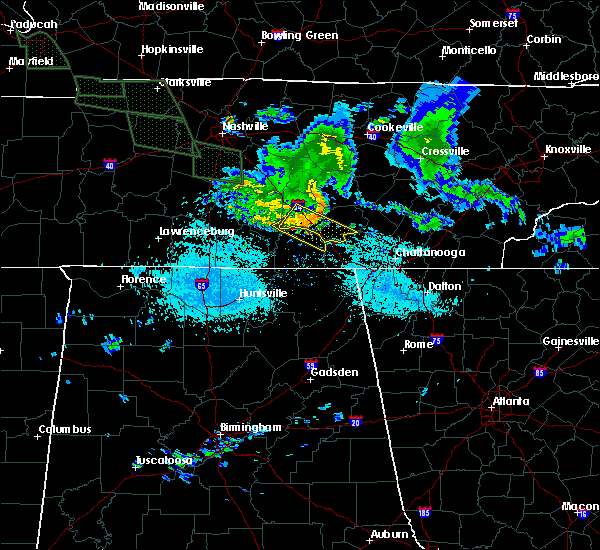 At 749 am cdt, a severe thunderstorm was located over manchester, moving southeast at 45 mph (radar indicated). Hazards include 60 mph wind gusts. Expect damage to roofs. siding. and trees. locations impacted include, manchester, tullahoma, tracy city, monteagle, coalmont, pelham, hillsboro, arnold afb and fiery gizzard s. P At 749 am cdt, a severe thunderstorm was located over manchester, moving southeast at 45 mph (radar indicated). Hazards include 60 mph wind gusts. Expect damage to roofs. siding. and trees. locations impacted include, manchester, tullahoma, tracy city, monteagle, coalmont, pelham, hillsboro, arnold afb and fiery gizzard s. P
|
| 7/7/2016 7:40 AM CDT |
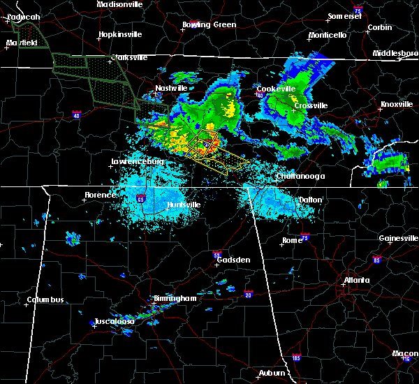 At 739 am cdt, a severe thunderstorm was located over manchester, moving southeast at 45 mph (radar indicated). Hazards include 60 mph wind gusts. Expect damage to roofs. siding. And trees. At 739 am cdt, a severe thunderstorm was located over manchester, moving southeast at 45 mph (radar indicated). Hazards include 60 mph wind gusts. Expect damage to roofs. siding. And trees.
|
| 7/7/2016 7:37 AM CDT |
 At 736 am cdt, a severe thunderstorm was located near tullahoma, or 7 miles west of manchester, moving southeast at 45 mph (radar indicated). Hazards include 60 mph wind gusts. Expect damage to roofs. siding. And trees. At 736 am cdt, a severe thunderstorm was located near tullahoma, or 7 miles west of manchester, moving southeast at 45 mph (radar indicated). Hazards include 60 mph wind gusts. Expect damage to roofs. siding. And trees.
|
| 6/15/2016 6:28 PM CDT |
 At 728 pm edt/628 pm cdt/, severe thunderstorms were located along a line extending from dunlap to 8 miles northwest of stevenson, moving southeast at 45 mph (radar indicated). Hazards include 60 mph wind gusts. Expect damage to roofs. siding. and trees. Locations impacted include, chattanooga, dunlap, jasper, soddy-daisy, signal mountain, south pittsburg, walden, lakesite, whitwell, kimball, monteagle, ridgeside, harrison, fairmount, red bank, collegedale, graysville, powells crossroads, orme and martin springs. At 728 pm edt/628 pm cdt/, severe thunderstorms were located along a line extending from dunlap to 8 miles northwest of stevenson, moving southeast at 45 mph (radar indicated). Hazards include 60 mph wind gusts. Expect damage to roofs. siding. and trees. Locations impacted include, chattanooga, dunlap, jasper, soddy-daisy, signal mountain, south pittsburg, walden, lakesite, whitwell, kimball, monteagle, ridgeside, harrison, fairmount, red bank, collegedale, graysville, powells crossroads, orme and martin springs.
|
| 6/15/2016 6:24 PM CDT |
 The severe thunderstorm warning for lincoln, northern franklin and moore counties will expire at 630 pm cdt, the storms which prompted the warning have moved out of the warned area. therefore the warning will be allowed to expire. an additional warning remains in effect for parts of lincoln, franklin and moore counties in tn. The severe thunderstorm warning for lincoln, northern franklin and moore counties will expire at 630 pm cdt, the storms which prompted the warning have moved out of the warned area. therefore the warning will be allowed to expire. an additional warning remains in effect for parts of lincoln, franklin and moore counties in tn.
|
| 6/15/2016 6:24 PM CDT |
 At 624 pm cdt, severe thunderstorms were located along a line extending from near dunlap to near sewanee, moving southeast at 40 mph (radar indicated). Hazards include 60 mph wind gusts. Expect damage to roofs. siding. and trees. locations impacted include, manchester, tullahoma, gruetli-laager, tracy city, monteagle, altamont, coalmont, palmer, beersheba springs, pelham, hillsboro, arnold afb and fiery gizzard s. P At 624 pm cdt, severe thunderstorms were located along a line extending from near dunlap to near sewanee, moving southeast at 40 mph (radar indicated). Hazards include 60 mph wind gusts. Expect damage to roofs. siding. and trees. locations impacted include, manchester, tullahoma, gruetli-laager, tracy city, monteagle, altamont, coalmont, palmer, beersheba springs, pelham, hillsboro, arnold afb and fiery gizzard s. P
|
| 6/15/2016 6:15 PM CDT |
 At 615 pm cdt, severe thunderstorms were located along a line extending from near pikeville to near monteagle, moving southeast at 35 mph (radar indicated). Hazards include 60 mph wind gusts. Expect damage to roofs. siding. and trees. locations impacted include, manchester, spencer, tullahoma, gruetli-laager, tracy city, monteagle, altamont, coalmont, palmer, beersheba springs, viola, fall creek falls state park, pelham, hillsboro, arnold afb, fall creek falls s. p. and fiery gizzard s. P At 615 pm cdt, severe thunderstorms were located along a line extending from near pikeville to near monteagle, moving southeast at 35 mph (radar indicated). Hazards include 60 mph wind gusts. Expect damage to roofs. siding. and trees. locations impacted include, manchester, spencer, tullahoma, gruetli-laager, tracy city, monteagle, altamont, coalmont, palmer, beersheba springs, viola, fall creek falls state park, pelham, hillsboro, arnold afb, fall creek falls s. p. and fiery gizzard s. P
|
| 6/15/2016 6:13 PM CDT |
 At 712 pm edt/612 pm cdt/, severe thunderstorms were located along a line extending from 9 miles northwest of dunlap to near winchester, moving southeast at 40 mph (radar indicated). Hazards include 60 mph wind gusts. Expect damage to roofs. siding. And trees. At 712 pm edt/612 pm cdt/, severe thunderstorms were located along a line extending from 9 miles northwest of dunlap to near winchester, moving southeast at 40 mph (radar indicated). Hazards include 60 mph wind gusts. Expect damage to roofs. siding. And trees.
|
| 6/15/2016 5:58 PM CDT |
 At 558 pm cdt, severe thunderstorms were located along a line extending from 8 miles north of monteagle to ardmore, moving southeast at 35 mph. this storm has a history of producing downed trees (radar indicated). Hazards include 60 mph wind gusts and quarter size hail. Hail damage to vehicles is expected. Expect wind damage to roofs, siding, and trees. At 558 pm cdt, severe thunderstorms were located along a line extending from 8 miles north of monteagle to ardmore, moving southeast at 35 mph. this storm has a history of producing downed trees (radar indicated). Hazards include 60 mph wind gusts and quarter size hail. Hail damage to vehicles is expected. Expect wind damage to roofs, siding, and trees.
|
| 6/15/2016 5:54 PM CDT |
 At 553 pm cdt, severe thunderstorms were located along a line extending from 9 miles south of mcminnville to 10 miles east of pulaski, moving southeast at 20 mph. this storm did topple trees in lynchburg, tn as it passed through as reported by law enforcement (radar indicated). Hazards include 60 mph wind gusts and quarter size hail. Hail damage to vehicles is expected. expect wind damage to roofs, siding, and trees. Locations impacted include, winchester, fayetteville, lynchburg, decherd, estill springs, ardmore, monteagle, petersburg, tims ford lake and sewanee. At 553 pm cdt, severe thunderstorms were located along a line extending from 9 miles south of mcminnville to 10 miles east of pulaski, moving southeast at 20 mph. this storm did topple trees in lynchburg, tn as it passed through as reported by law enforcement (radar indicated). Hazards include 60 mph wind gusts and quarter size hail. Hail damage to vehicles is expected. expect wind damage to roofs, siding, and trees. Locations impacted include, winchester, fayetteville, lynchburg, decherd, estill springs, ardmore, monteagle, petersburg, tims ford lake and sewanee.
|
| 6/15/2016 5:54 PM CDT |
 At 554 pm cdt, severe thunderstorms were located along a line extending from near spencer to 8 miles southeast of manchester, moving southeast at 35 mph (radar indicated). Hazards include 60 mph wind gusts. Expect damage to roofs. siding. And trees. At 554 pm cdt, severe thunderstorms were located along a line extending from near spencer to 8 miles southeast of manchester, moving southeast at 35 mph (radar indicated). Hazards include 60 mph wind gusts. Expect damage to roofs. siding. And trees.
|
| 6/15/2016 5:42 PM CDT |
 At 541 pm cdt, severe thunderstorms were located along a line extending from 7 miles south of mcminnville to 6 miles east of pulaski, moving southeast at 20 mph (radar indicated). Hazards include 60 mph wind gusts and quarter size hail. Hail damage to vehicles is expected. Expect wind damage to roofs, siding, and trees. At 541 pm cdt, severe thunderstorms were located along a line extending from 7 miles south of mcminnville to 6 miles east of pulaski, moving southeast at 20 mph (radar indicated). Hazards include 60 mph wind gusts and quarter size hail. Hail damage to vehicles is expected. Expect wind damage to roofs, siding, and trees.
|
| 3/31/2016 10:20 PM CDT |
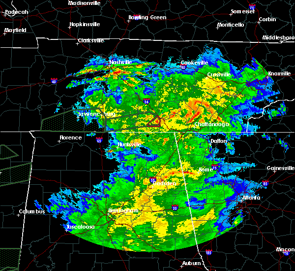 The tornado warning for east central franklin county will expire at 1030 pm cdt, the storm which prompted the warning has weakened below severe limits, and no longer appears capable of producing a tornado. therefore the warning will be allowed to expire. however gusty winds and heavy rain are still possible with this thunderstorm. a tornado watch remains in effect until 100 am cdt for northeastern alabama, and central tennessee. The tornado warning for east central franklin county will expire at 1030 pm cdt, the storm which prompted the warning has weakened below severe limits, and no longer appears capable of producing a tornado. therefore the warning will be allowed to expire. however gusty winds and heavy rain are still possible with this thunderstorm. a tornado watch remains in effect until 100 am cdt for northeastern alabama, and central tennessee.
|
| 3/31/2016 10:07 PM CDT |
 At 1007 pm cdt, a severe thunderstorm capable of producing a tornado was located 3 miles southwest of cowan, or near winchester, moving east at 30 mph (radar indicated rotation). Hazards include tornado. Flying debris will be dangerous to those caught without shelter. mobile homes will be damaged or destroyed. damage to roofs, windows, and vehicles will occur. tree damage is likely. locations impacted include, cowan, monteagle, sewanee and st. Andrews. At 1007 pm cdt, a severe thunderstorm capable of producing a tornado was located 3 miles southwest of cowan, or near winchester, moving east at 30 mph (radar indicated rotation). Hazards include tornado. Flying debris will be dangerous to those caught without shelter. mobile homes will be damaged or destroyed. damage to roofs, windows, and vehicles will occur. tree damage is likely. locations impacted include, cowan, monteagle, sewanee and st. Andrews.
|
| 3/31/2016 10:00 PM CDT |
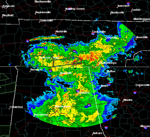 At 959 pm cdt, a severe thunderstorm capable of producing a tornado was located 3 miles southeast of belvidere, moving east at 30 mph (radar indicated rotation). Hazards include tornado. Flying debris will be dangerous to those caught without shelter. mobile homes will be damaged or destroyed. damage to roofs, windows, and vehicles will occur. Tree damage is likely. At 959 pm cdt, a severe thunderstorm capable of producing a tornado was located 3 miles southeast of belvidere, moving east at 30 mph (radar indicated rotation). Hazards include tornado. Flying debris will be dangerous to those caught without shelter. mobile homes will be damaged or destroyed. damage to roofs, windows, and vehicles will occur. Tree damage is likely.
|
| 3/31/2016 9:05 PM CDT |
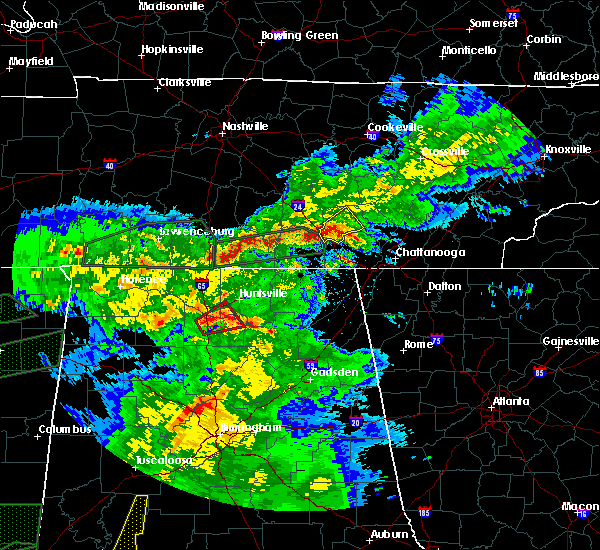 At 904 pm cdt, a severe thunderstorm was located near monteagle, or 14 miles east of winchester, moving northeast at 50 mph (radar indicated). Hazards include 60 mph wind gusts and quarter size hail. Hail damage to vehicles is expected. Expect wind damage to roofs, siding, and trees. At 904 pm cdt, a severe thunderstorm was located near monteagle, or 14 miles east of winchester, moving northeast at 50 mph (radar indicated). Hazards include 60 mph wind gusts and quarter size hail. Hail damage to vehicles is expected. Expect wind damage to roofs, siding, and trees.
|
| 7/14/2015 5:56 PM CDT |
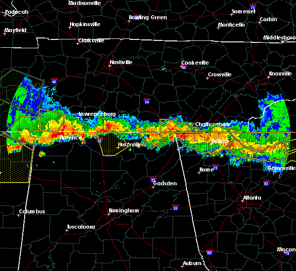 At 655 pm edt /555 pm cdt/, severe thunderstorms were located along a line extending from near ridgeside to 7 miles northwest of kimball, moving south at 25 mph (radar indicated). Hazards include 60 mph wind gusts and nickel size hail. Expect damage to roofs. siding and trees. Locations impacted include, chattanooga, jasper, south pittsburg, kimball, ridgeside, red bank, orme and haletown (guild). At 655 pm edt /555 pm cdt/, severe thunderstorms were located along a line extending from near ridgeside to 7 miles northwest of kimball, moving south at 25 mph (radar indicated). Hazards include 60 mph wind gusts and nickel size hail. Expect damage to roofs. siding and trees. Locations impacted include, chattanooga, jasper, south pittsburg, kimball, ridgeside, red bank, orme and haletown (guild).
|
| 7/14/2015 5:38 PM CDT |
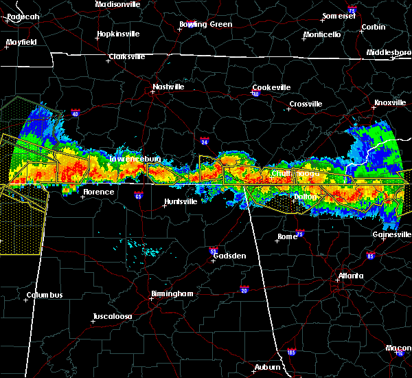 The severe thunderstorm warning for central franklin county will expire at 545 pm cdt, the storm which prompted the warning has weakened below severe limits, and is no longer an immediate threat to life or property. therefore the warning will be allowed to expire. however gusty winds and heavy rain are still possible with this thunderstorm. The severe thunderstorm warning for central franklin county will expire at 545 pm cdt, the storm which prompted the warning has weakened below severe limits, and is no longer an immediate threat to life or property. therefore the warning will be allowed to expire. however gusty winds and heavy rain are still possible with this thunderstorm.
|
| 7/14/2015 5:37 PM CDT |
 At 637 pm edt /537 pm cdt/, severe thunderstorms were located along a line extending from near south cleveland to 8 miles northwest of south pittsburg, moving south at 25 mph (radar indicated). Hazards include 60 mph wind gusts and quarter size hail. Hail damage to vehicles is expected. expect wind damage to roofs, siding and trees. Locations impacted include, chattanooga, jasper, soddy-daisy, signal mountain, south pittsburg, walden, whitwell, kimball, ridgeside, harrison, fairmount, south cleveland, red bank, collegedale, powells crossroads, orme, martin springs, haletown (guild), ooltewah and east brainerd. At 637 pm edt /537 pm cdt/, severe thunderstorms were located along a line extending from near south cleveland to 8 miles northwest of south pittsburg, moving south at 25 mph (radar indicated). Hazards include 60 mph wind gusts and quarter size hail. Hail damage to vehicles is expected. expect wind damage to roofs, siding and trees. Locations impacted include, chattanooga, jasper, soddy-daisy, signal mountain, south pittsburg, walden, whitwell, kimball, ridgeside, harrison, fairmount, south cleveland, red bank, collegedale, powells crossroads, orme, martin springs, haletown (guild), ooltewah and east brainerd.
|
| 7/14/2015 5:27 PM CDT |
 At 627 pm edt /527 pm cdt/, severe thunderstorms were located along a line extending from wildwood lake to 6 miles northwest of south pittsburg, moving southeast at 35 mph (radar indicated). Hazards include 60 mph wind gusts and half dollar size hail. Hail damage to vehicles is expected. Expect wind damage to roofs, siding and trees. At 627 pm edt /527 pm cdt/, severe thunderstorms were located along a line extending from wildwood lake to 6 miles northwest of south pittsburg, moving southeast at 35 mph (radar indicated). Hazards include 60 mph wind gusts and half dollar size hail. Hail damage to vehicles is expected. Expect wind damage to roofs, siding and trees.
|
| 7/14/2015 5:24 PM CDT |
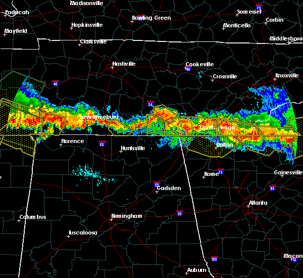 At 524 pm cdt, a severe thunderstorm was located near decherd, or near winchester, moving south at 30 mph (radar indicated). Hazards include 70 mph wind gusts. Expect considerable tree damage. damage is likely to mobile homes, roofs and outbuildings. locations impacted include, winchester, decherd, estill springs, cowan, monteagle, sewanee, tims ford lake, st. Andrews, alto and sherwood. At 524 pm cdt, a severe thunderstorm was located near decherd, or near winchester, moving south at 30 mph (radar indicated). Hazards include 70 mph wind gusts. Expect considerable tree damage. damage is likely to mobile homes, roofs and outbuildings. locations impacted include, winchester, decherd, estill springs, cowan, monteagle, sewanee, tims ford lake, st. Andrews, alto and sherwood.
|
| 7/14/2015 5:21 PM CDT |
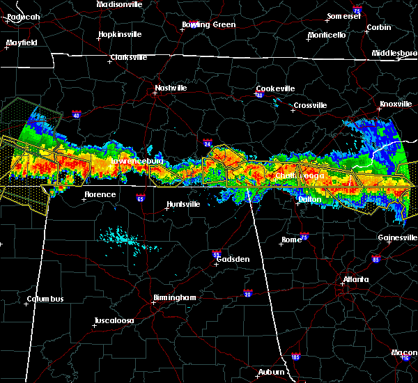 At 521 pm cdt, a severe thunderstorm was located 7 miles northwest of monteagle, or 15 miles southeast of manchester, moving southeast at 35 mph (radar indicated). Hazards include 60 mph wind gusts. Expect damage to roofs. siding and trees. this severe storm will be near, monteagle around 535 pm cdt. tracy city around 540 pm cdt. other locations impacted by this severe thunderstorm include coalmont, pelham, hillsboro, altamont, fiery gizzard s. p. And woods reservoir. At 521 pm cdt, a severe thunderstorm was located 7 miles northwest of monteagle, or 15 miles southeast of manchester, moving southeast at 35 mph (radar indicated). Hazards include 60 mph wind gusts. Expect damage to roofs. siding and trees. this severe storm will be near, monteagle around 535 pm cdt. tracy city around 540 pm cdt. other locations impacted by this severe thunderstorm include coalmont, pelham, hillsboro, altamont, fiery gizzard s. p. And woods reservoir.
|
| 7/14/2015 5:19 PM CDT |
 At 619 pm edt /519 pm cdt/, severe thunderstorms were located along a line extending from near cleveland to 7 miles east of monteagle, moving south at 20 mph (radar indicated). Hazards include 60 mph wind gusts and quarter size hail. Hail damage to vehicles is expected. expect wind damage to roofs, siding and trees. Locations impacted include, chattanooga, cleveland, jasper, soddy-daisy, signal mountain, south pittsburg, walden, lakesite, whitwell, kimball, ridgeside, harrison, fairmount, south cleveland, red bank, collegedale, powells crossroads, orme, martin springs and ooltewah. At 619 pm edt /519 pm cdt/, severe thunderstorms were located along a line extending from near cleveland to 7 miles east of monteagle, moving south at 20 mph (radar indicated). Hazards include 60 mph wind gusts and quarter size hail. Hail damage to vehicles is expected. expect wind damage to roofs, siding and trees. Locations impacted include, chattanooga, cleveland, jasper, soddy-daisy, signal mountain, south pittsburg, walden, lakesite, whitwell, kimball, ridgeside, harrison, fairmount, south cleveland, red bank, collegedale, powells crossroads, orme, martin springs and ooltewah.
|
| 7/14/2015 5:08 PM CDT |
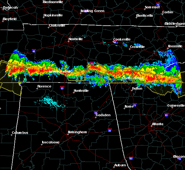 At 508 pm cdt, a severe thunderstorm was located 7 miles northeast of estill springs, or 7 miles south of manchester, moving south at 30 mph (radar indicated). Hazards include 70 mph wind gusts. Expect considerable tree damage. Damage is likely to mobile homes, roofs and outbuildings. At 508 pm cdt, a severe thunderstorm was located 7 miles northeast of estill springs, or 7 miles south of manchester, moving south at 30 mph (radar indicated). Hazards include 70 mph wind gusts. Expect considerable tree damage. Damage is likely to mobile homes, roofs and outbuildings.
|
| 7/14/2015 5:01 PM CDT |
 At 600 pm edt /500 pm cdt/, severe thunderstorms were located along a line extending from 9 miles northwest of cleveland to 9 miles west of dunlap, moving south at 30 mph (radar indicated). Hazards include 60 mph wind gusts and quarter size hail. Hail damage to vehicles is expected. expect wind damage to roofs, siding and trees. Locations impacted include, chattanooga, cleveland, dunlap, jasper, soddy-daisy, signal mountain, south pittsburg, walden, lakesite, whitwell, kimball, ridgeside, harrison, fairmount, south cleveland, red bank, collegedale, powells crossroads, orme and martin springs. At 600 pm edt /500 pm cdt/, severe thunderstorms were located along a line extending from 9 miles northwest of cleveland to 9 miles west of dunlap, moving south at 30 mph (radar indicated). Hazards include 60 mph wind gusts and quarter size hail. Hail damage to vehicles is expected. expect wind damage to roofs, siding and trees. Locations impacted include, chattanooga, cleveland, dunlap, jasper, soddy-daisy, signal mountain, south pittsburg, walden, lakesite, whitwell, kimball, ridgeside, harrison, fairmount, south cleveland, red bank, collegedale, powells crossroads, orme and martin springs.
|
| 7/14/2015 4:59 PM CDT |
 At 458 pm cdt, a severe thunderstorm was located near manchester, moving southeast at 30 mph (radar indicated). Hazards include 60 mph wind gusts and quarter size hail. Hail damage to vehicles is expected. expect wind damage to roofs, siding and trees. this severe thunderstorm will be near, monteagle around 535 pm cdt. tracy city around 540 pm cdt. other locations impacted by this severe thunderstorm include coalmont, pelham, hillsboro, arnold afb, fiery gizzard s. p,. Altamont and woods reservoir. At 458 pm cdt, a severe thunderstorm was located near manchester, moving southeast at 30 mph (radar indicated). Hazards include 60 mph wind gusts and quarter size hail. Hail damage to vehicles is expected. expect wind damage to roofs, siding and trees. this severe thunderstorm will be near, monteagle around 535 pm cdt. tracy city around 540 pm cdt. other locations impacted by this severe thunderstorm include coalmont, pelham, hillsboro, arnold afb, fiery gizzard s. p,. Altamont and woods reservoir.
|
| 7/14/2015 4:46 PM CDT |
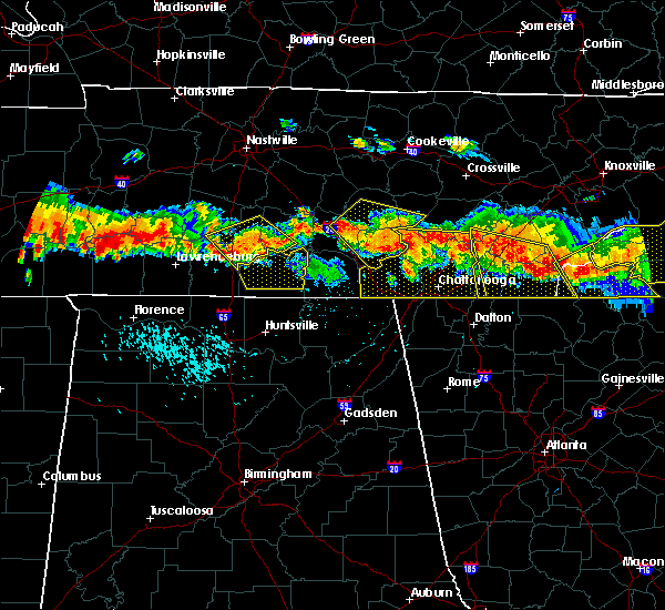 At 445 pm cdt, a severe thunderstorm was located near gruetli-laager, or 8 miles west of dunlap, moving southeast at 40 mph (trained weather spotters). Hazards include 70 mph wind gusts and quarter size hail. Hail damage to vehicles is expected. expect considerable tree damage. wind damage is also likely to mobile homes, roofs and outbuildings. this severe thunderstorm will remain over mainly rural areas of east central coffee and grundy counties, including the following locations, palmer, beersheba springs, coalmont, summitville, altamont, hillsboro and fiery gizzard s. P At 445 pm cdt, a severe thunderstorm was located near gruetli-laager, or 8 miles west of dunlap, moving southeast at 40 mph (trained weather spotters). Hazards include 70 mph wind gusts and quarter size hail. Hail damage to vehicles is expected. expect considerable tree damage. wind damage is also likely to mobile homes, roofs and outbuildings. this severe thunderstorm will remain over mainly rural areas of east central coffee and grundy counties, including the following locations, palmer, beersheba springs, coalmont, summitville, altamont, hillsboro and fiery gizzard s. P
|
| 7/14/2015 4:43 PM CDT |
 At 542 pm edt /442 pm cdt/, severe thunderstorms were located along a line extending from near dayton to 12 miles northwest of dunlap, moving south at 30 mph (radar indicated). Hazards include 60 mph wind gusts and quarter size hail. Hail damage to vehicles is expected. expect wind damage to roofs, siding and trees. Locations impacted include, chattanooga, cleveland, dayton, dunlap, jasper, soddy-daisy, signal mountain, south pittsburg, walden, lakesite, whitwell, kimball, monteagle, ridgeside, harrison, fairmount, south cleveland, red bank, collegedale and graysville. At 542 pm edt /442 pm cdt/, severe thunderstorms were located along a line extending from near dayton to 12 miles northwest of dunlap, moving south at 30 mph (radar indicated). Hazards include 60 mph wind gusts and quarter size hail. Hail damage to vehicles is expected. expect wind damage to roofs, siding and trees. Locations impacted include, chattanooga, cleveland, dayton, dunlap, jasper, soddy-daisy, signal mountain, south pittsburg, walden, lakesite, whitwell, kimball, monteagle, ridgeside, harrison, fairmount, south cleveland, red bank, collegedale and graysville.
|
| 7/14/2015 4:35 PM CDT |
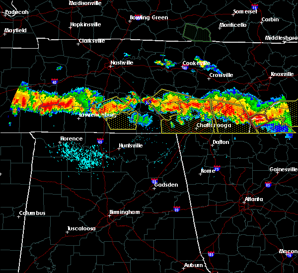 At 434 pm cdt, a severe thunderstorm was located 7 miles north of gruetli-laager, or 15 miles northwest of dunlap, moving southeast at 40 mph (trained weather spotters). Hazards include 70 mph wind gusts and quarter size hail. Hail damage to vehicles is expected. expect considerable tree damage. wind damage is also likely to mobile homes, roofs and outbuildings. this severe storm will be near, gruetli-laager around 445 pm cdt. other locations impacted by this severe thunderstorm include palmer, beersheba springs, coalmont, morrison, summitville, viola, altamont, hillsboro, centertown and fall creek falls s. P At 434 pm cdt, a severe thunderstorm was located 7 miles north of gruetli-laager, or 15 miles northwest of dunlap, moving southeast at 40 mph (trained weather spotters). Hazards include 70 mph wind gusts and quarter size hail. Hail damage to vehicles is expected. expect considerable tree damage. wind damage is also likely to mobile homes, roofs and outbuildings. this severe storm will be near, gruetli-laager around 445 pm cdt. other locations impacted by this severe thunderstorm include palmer, beersheba springs, coalmont, morrison, summitville, viola, altamont, hillsboro, centertown and fall creek falls s. P
|
| 7/14/2015 4:27 PM CDT |
 At 526 pm edt /426 pm cdt/, severe thunderstorms were located along a line extending from 6 miles southwest of decatur to 23 miles north of monteagle, moving south at 20 mph (radar indicated). Hazards include 60 mph wind gusts and half dollar size hail. Hail damage to vehicles is expected. Expect wind damage to roofs, siding and trees. At 526 pm edt /426 pm cdt/, severe thunderstorms were located along a line extending from 6 miles southwest of decatur to 23 miles north of monteagle, moving south at 20 mph (radar indicated). Hazards include 60 mph wind gusts and half dollar size hail. Hail damage to vehicles is expected. Expect wind damage to roofs, siding and trees.
|
| 7/14/2015 4:12 PM CDT |
 At 412 pm cdt, a severe thunderstorm was located near mcminnville, moving southeast at 40 mph (radar indicated). Hazards include 70 mph wind gusts and quarter size hail. Hail damage to vehicles is expected. expect considerable tree damage. wind damage is also likely to mobile homes, roofs and outbuildings. this severe thunderstorm will be near, gruetli-laager around 445 pm cdt. other locations impacted by this severe thunderstorm include palmer, beersheba springs, coalmont, morrison, summitville, viola, altamont, hillsboro, centertown and fall creek falls s. P At 412 pm cdt, a severe thunderstorm was located near mcminnville, moving southeast at 40 mph (radar indicated). Hazards include 70 mph wind gusts and quarter size hail. Hail damage to vehicles is expected. expect considerable tree damage. wind damage is also likely to mobile homes, roofs and outbuildings. this severe thunderstorm will be near, gruetli-laager around 445 pm cdt. other locations impacted by this severe thunderstorm include palmer, beersheba springs, coalmont, morrison, summitville, viola, altamont, hillsboro, centertown and fall creek falls s. P
|
| 7/3/2015 11:26 AM CDT |
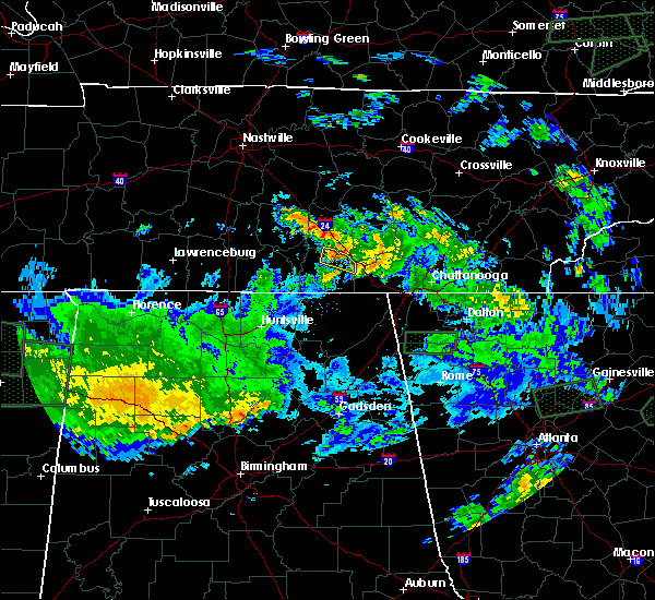 At 1126 am cdt, a severe thunderstorm was located near alto, or 9 miles northeast of winchester, moving east at 25 mph (radar indicated). Hazards include 60 mph wind gusts. Expect damage to roofs. siding and trees. locations impacted include, decherd, monteagle, sewanee, st. Andrews, alto and woods reservoir. At 1126 am cdt, a severe thunderstorm was located near alto, or 9 miles northeast of winchester, moving east at 25 mph (radar indicated). Hazards include 60 mph wind gusts. Expect damage to roofs. siding and trees. locations impacted include, decherd, monteagle, sewanee, st. Andrews, alto and woods reservoir.
|
| 7/3/2015 11:13 AM CDT |
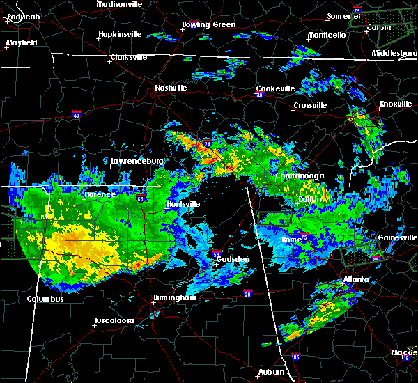 At 1113 am cdt, a severe thunderstorm was located near estill springs, or 7 miles northeast of winchester, moving east at 30 mph (radar indicated). Hazards include 60 mph wind gusts. Expect damage to roofs. Siding and trees. At 1113 am cdt, a severe thunderstorm was located near estill springs, or 7 miles northeast of winchester, moving east at 30 mph (radar indicated). Hazards include 60 mph wind gusts. Expect damage to roofs. Siding and trees.
|
| 6/24/2015 3:06 PM CDT |
 At 406 pm edt /306 pm cdt/, severe thunderstorms were located along a line extending from near etowah to near chattanooga to near whitwell to near monteagle, moving south at 20 mph (radar indicated). Hazards include 60 mph wind gusts and quarter size hail. Hail damage to vehicles is expected. expect wind damage to roofs, siding and trees. Locations impacted include, chattanooga, cleveland, dayton, dunlap, jasper, benton, soddy-daisy, signal mountain, south pittsburg, walden, lakesite, whitwell, kimball, monteagle, charleston, ridgeside, harrison, south cleveland, east cleveland and fairmount. At 406 pm edt /306 pm cdt/, severe thunderstorms were located along a line extending from near etowah to near chattanooga to near whitwell to near monteagle, moving south at 20 mph (radar indicated). Hazards include 60 mph wind gusts and quarter size hail. Hail damage to vehicles is expected. expect wind damage to roofs, siding and trees. Locations impacted include, chattanooga, cleveland, dayton, dunlap, jasper, benton, soddy-daisy, signal mountain, south pittsburg, walden, lakesite, whitwell, kimball, monteagle, charleston, ridgeside, harrison, south cleveland, east cleveland and fairmount.
|
| 6/24/2015 2:54 PM CDT |
 At 354 pm edt /254 pm cdt/, severe thunderstorms were located along a line extending from 6 miles southwest of etowah to near monteagle, moving southeast at 10 mph (radar indicated). Hazards include 60 mph wind gusts and quarter size hail. Hail damage to vehicles is expected. expect wind damage to roofs, siding and trees. Locations impacted include, chattanooga, cleveland, dayton, dunlap, jasper, benton, soddy-daisy, signal mountain, south pittsburg, walden, lakesite, whitwell, kimball, monteagle, charleston, ridgeside, harrison, south cleveland, east cleveland and fairmount. At 354 pm edt /254 pm cdt/, severe thunderstorms were located along a line extending from 6 miles southwest of etowah to near monteagle, moving southeast at 10 mph (radar indicated). Hazards include 60 mph wind gusts and quarter size hail. Hail damage to vehicles is expected. expect wind damage to roofs, siding and trees. Locations impacted include, chattanooga, cleveland, dayton, dunlap, jasper, benton, soddy-daisy, signal mountain, south pittsburg, walden, lakesite, whitwell, kimball, monteagle, charleston, ridgeside, harrison, south cleveland, east cleveland and fairmount.
|
| 6/24/2015 2:39 PM CDT |
 At 338 pm edt /238 pm cdt/, severe thunderstorms were located along a line extending from 6 miles west of etowah to monteagle, moving southeast at 10 mph (radar indicated). Hazards include 60 mph wind gusts and quarter size hail. Hail damage to vehicles is expected. Expect wind damage to roofs, siding and trees. At 338 pm edt /238 pm cdt/, severe thunderstorms were located along a line extending from 6 miles west of etowah to monteagle, moving southeast at 10 mph (radar indicated). Hazards include 60 mph wind gusts and quarter size hail. Hail damage to vehicles is expected. Expect wind damage to roofs, siding and trees.
|
| 6/17/2015 11:59 PM CDT |
 At 1158 pm cdt, a severe thunderstorm was located near kimball, or near jasper, moving northeast at 20 mph (radar indicated). Hazards include 60 mph wind gusts and quarter size hail. Hail damage to vehicles is expected. Expect wind damage to roofs, siding and trees. At 1158 pm cdt, a severe thunderstorm was located near kimball, or near jasper, moving northeast at 20 mph (radar indicated). Hazards include 60 mph wind gusts and quarter size hail. Hail damage to vehicles is expected. Expect wind damage to roofs, siding and trees.
|
| 6/16/2015 9:42 PM CDT | The severe thunderstorm warning for northeastern franklin county will expire at 945 pm cdt, the storm which prompted the warning has weakened below severe limits, and no longer pose an immediate threat to life or property. therefore the warning will be allowed to expire. however heavy rain is still possible with this thunderstorm. |
| 6/16/2015 9:21 PM CDT |
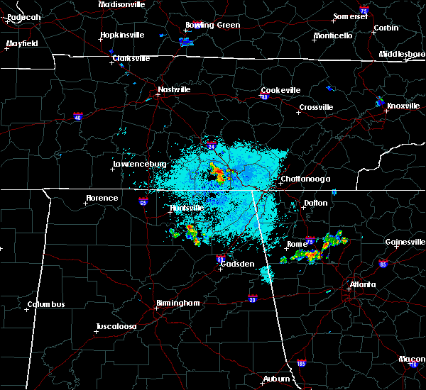 At 921 pm cdt, a severe thunderstorm was located over sewanee, or 7 miles east of winchester, moving northeast at 5 mph (radar indicated). Hazards include 60 mph wind gusts. Expect damage to roofs. Siding and trees. At 921 pm cdt, a severe thunderstorm was located over sewanee, or 7 miles east of winchester, moving northeast at 5 mph (radar indicated). Hazards include 60 mph wind gusts. Expect damage to roofs. Siding and trees.
|
| 4/20/2015 3:13 AM CDT | At 413 am edt /313 am cdt/, severe thunderstorms were located along a line extending from 12 miles north of dunlap to near jasper, moving northeast at 55 mph (radar indicated). Hazards include 60 mph wind gusts and penny size hail. Expect damage to roofs. siding and trees. locations impacted include, chattanooga, dunlap, jasper, pikeville, soddy-daisy, signal mountain, south pittsburg, walden, lakesite, whitwell, kimball, monteagle, ridgeside, harrison, fairmount, red bank, collegedale, powells crossroads, orme and martin springs. 0. 75in. |
| 4/20/2015 2:58 AM CDT | At 357 am edt /257 am cdt/, severe thunderstorms were located along a line extending from 16 miles north of monteagle to 7 miles west of south pittsburg, moving northeast at 55 mph (radar indicated). Hazards include 60 mph wind gusts and penny size hail. Expect damage to roofs. siding and trees. locations impacted include, chattanooga, dunlap, jasper, pikeville, soddy-daisy, signal mountain, south pittsburg, walden, lakesite, whitwell, kimball, monteagle, ridgeside, harrison, fairmount, red bank, collegedale, powells crossroads, orme and martin springs. 0. 75in. |
| 4/20/2015 2:51 AM CDT | At 251 am cdt, severe thunderstorms were located along a line extending from near monteagle to 8 miles northwest of stevenson, moving east at 45 mph (radar indicated). Hazards include 60 mph wind gusts and penny size hail. Expect damage to roofs. siding and trees. these severe thunderstorms will remain over mainly rural areas of southeastern franklin county, including the following locations, st. andrews, anderson and sherwood. 0. 75in. |
| 4/20/2015 2:44 AM CDT | At 343 am edt /243 am cdt/, severe thunderstorms were located along a line extending from 10 miles northwest of monteagle to 21 miles west of south pittsburg, moving northeast at 60 mph (radar indicated). Hazards include 60 mph wind gusts and penny size hail. Expect damage to roofs. Siding and trees. |
| 4/20/2015 2:38 AM CDT | At 238 am cdt, severe thunderstorms were located along a line extending from near decherd to 11 miles southeast of huntland, moving east at 50 mph (radar indicated). Hazards include 60 mph wind gusts and penny size hail. Expect damage to roofs. siding and trees. these severe storms will be near, monteagle and sewanee around 245 am cdt. other locations impacted by these severe thunderstorms include alto, anderson, sherwood, arnold afb, st. andrews and woods reservoir. 0. 75in. |
| 4/20/2015 2:15 AM CDT | At 214 am cdt, severe thunderstorms were located along a line extending from lynchburg to 6 miles north of new market, moving east at 45 mph (radar indicated). Hazards include 60 mph wind gusts and penny size hail. Expect damage to roofs. siding and trees. severe thunderstorms will be near, estill springs, huntland and tims ford lake around 230 am cdt. winchester and decherd around 235 am cdt. monteagle and sewanee around 250 am cdt. other locations impacted by these severe thunderstorms include belvidere, st. andrews, maxwell, harmony, alto, anderson, sherwood, arnold afb, beans creek and lexie crossroads. 0. 75in. |
| 4/19/2015 5:20 PM CDT | At 519 pm cdt, a severe thunderstorm was located 7 miles northwest of tracy city, and moving northeast at 35 mph (radar indicated). Hazards include 60 mph wind gusts and penny size hail. Expect damage to roofs. siding and trees. the severe thunderstorm will be near, gruetli-laager around 535 pm cdt. other locations in the warning include coalmont, altamont and beersheba springs. 0. 75in. |
| 4/3/2015 8:29 PM CDT | A severe thunderstorm warning remains in effect until 900 pm cdt for marion and southern sequatchie counties. at 829 pm cdt. severe thunderstorms were located along a line extending from 6 miles south of monteagle to 6 miles north of fairmount. moving southeast at 20 mph. hazard. 60 mph wind gusts and penny size hail. |
| 4/3/2015 8:21 PM CDT | The severe thunderstorm warning for southeastern franklin county will expire at 830 pm cdt. the storm which prompted the warning has moved out of franklin county tennessee. Therefore the warning will be allowed to expire. |
| 4/3/2015 8:13 PM CDT | The national weather service in morristown has issued a * severe thunderstorm warning for. marion county in eastern tennessee. southern sequatchie county in eastern tennessee. until 900 pm cdt * at 812 pm cdt. Severe thunderstorms were located along a line. |
| 4/3/2015 8:05 PM CDT | A severe thunderstorm warning remains in effect until 815 pm cdt for marion and sequatchie counties. at 804 pm cdt. severe thunderstorms were located along a line extending from near dunlap to near monteagle. moving east at 60 mph. hazard. quarter size hail and 60 mph wind gusts. source. Radar indicated. |
| 4/3/2015 8:02 PM CDT | The national weather service in huntsville has issued a * severe thunderstorm warning for. southeastern franklin county in middle tennessee. until 830 pm cdt * at 802 pm cdt. a severe thunderstorm was located near sewanee. or 12 miles east of winchester. Moving southeast at 45 mph. |
| 4/3/2015 7:50 PM CDT | A severe thunderstorm warning remains in effect until 815 pm cdt for marion and sequatchie counties. at 749 pm cdt. severe thunderstorms were located along a line extending from 8 miles northeast of dunlap to 35 miles southwest of monteagle. moving east at 50 mph. hazard. Quarter size hail and 60 mph wind gusts. |
| 4/3/2015 7:27 PM CDT | The national weather service in morristown has issued a * severe thunderstorm warning for. marion county in eastern tennessee. sequatchie county in eastern tennessee. until 815 pm cdt * at 725 pm cdt. Severe thunderstorms were located along a line. |
| 8/8/2014 4:45 PM CDT | Several trees dow in marion county TN, 0.8 miles NW of Monteagle, TN |
Hail Maps for Monteagle, TN


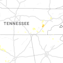

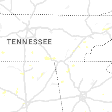


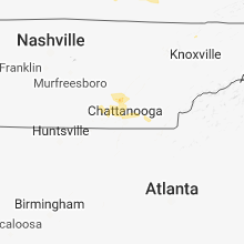


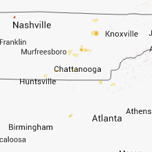


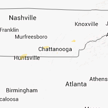


Connect with Interactive Hail Maps