

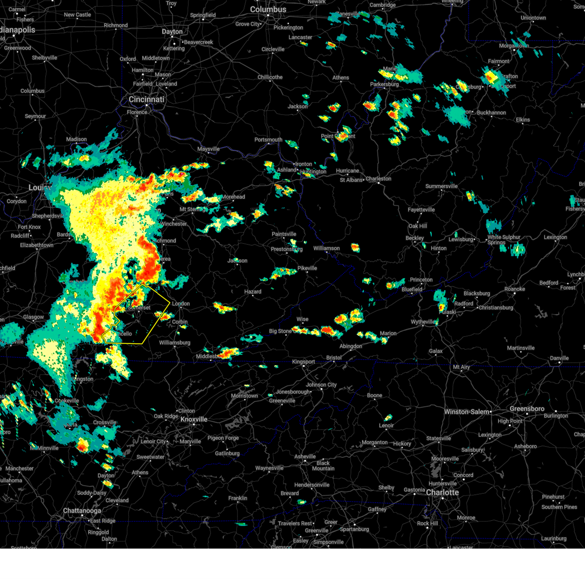
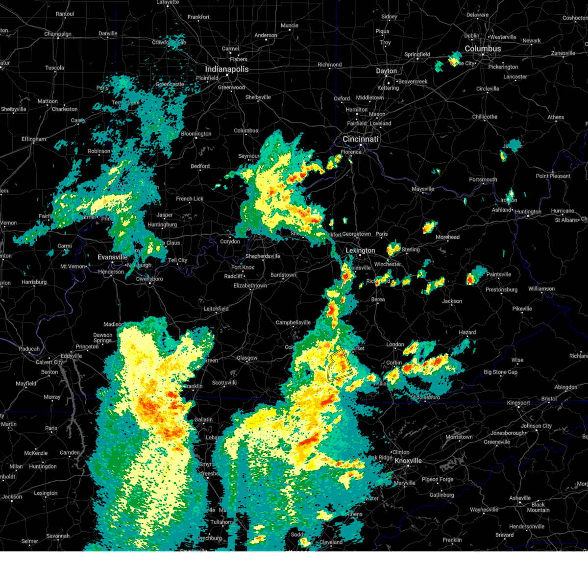
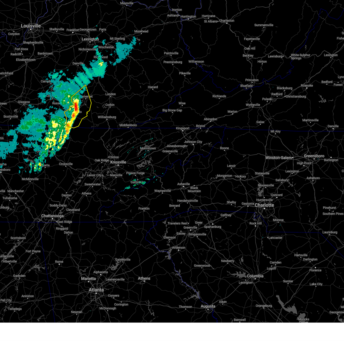
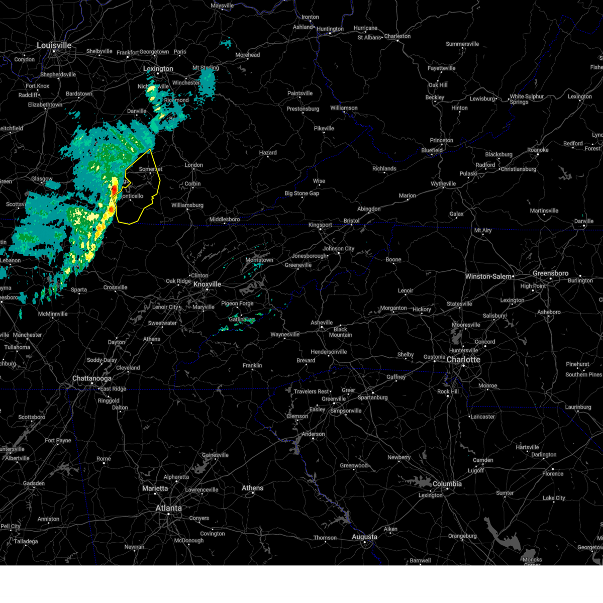
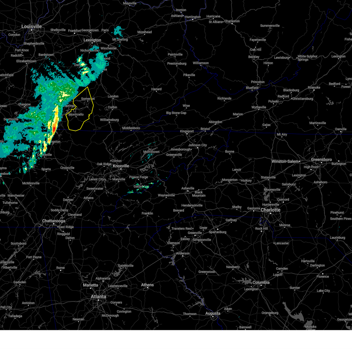
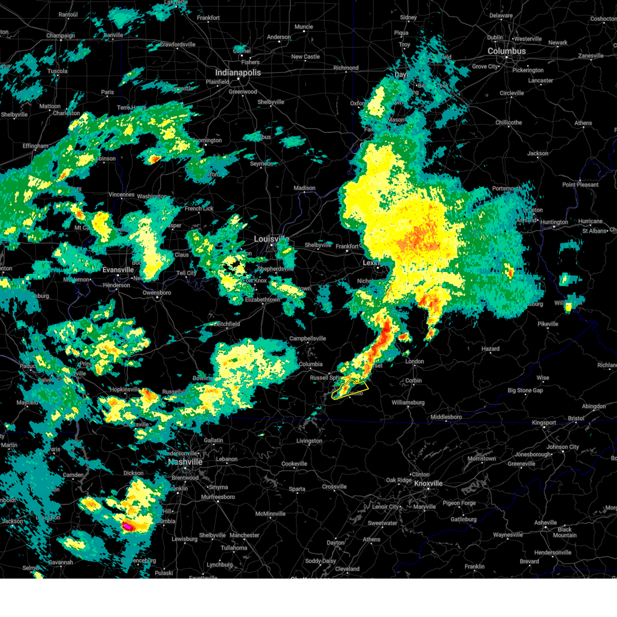
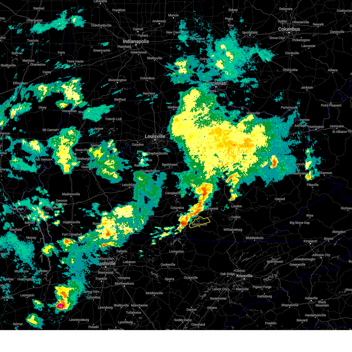
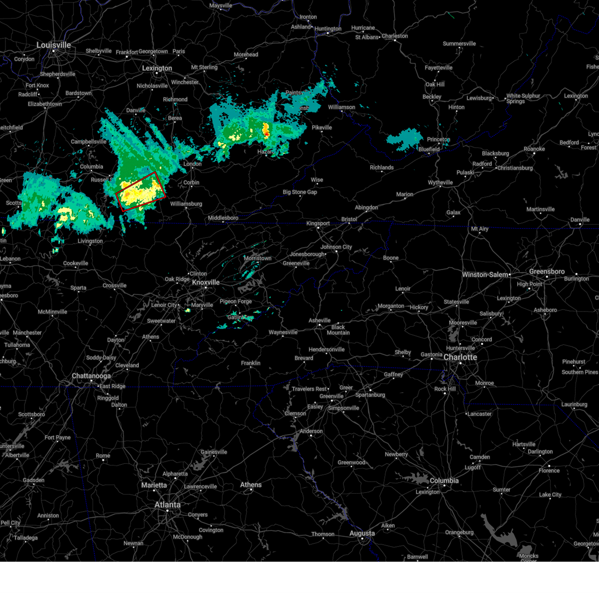
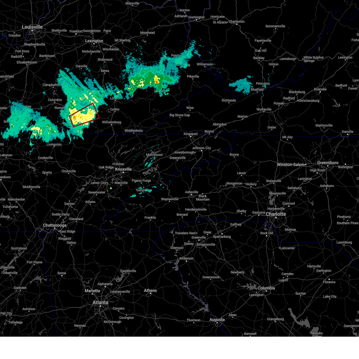
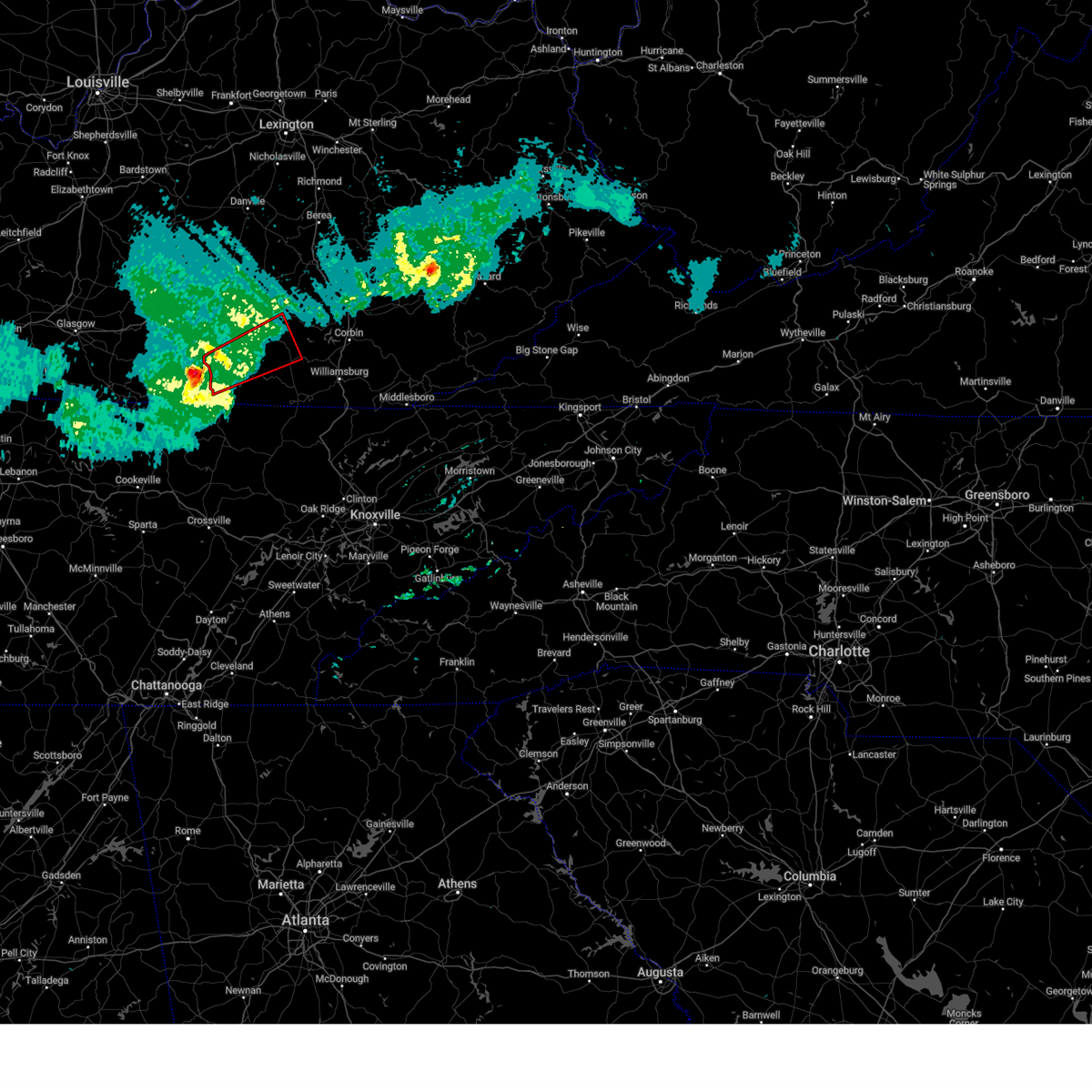
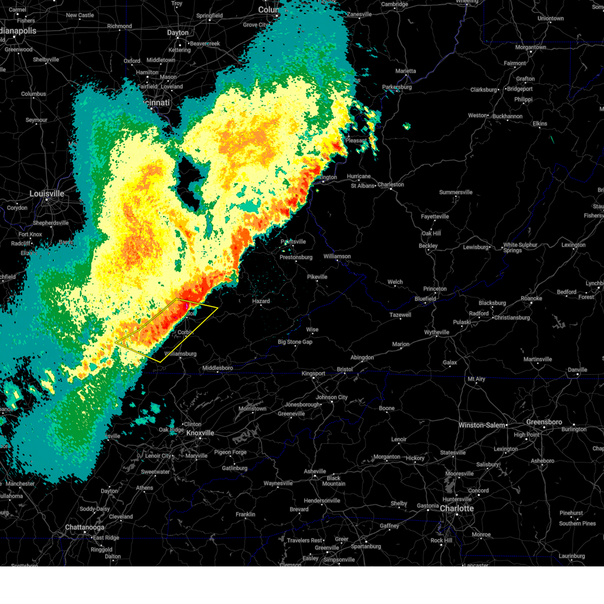
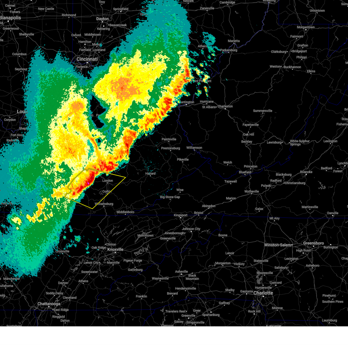
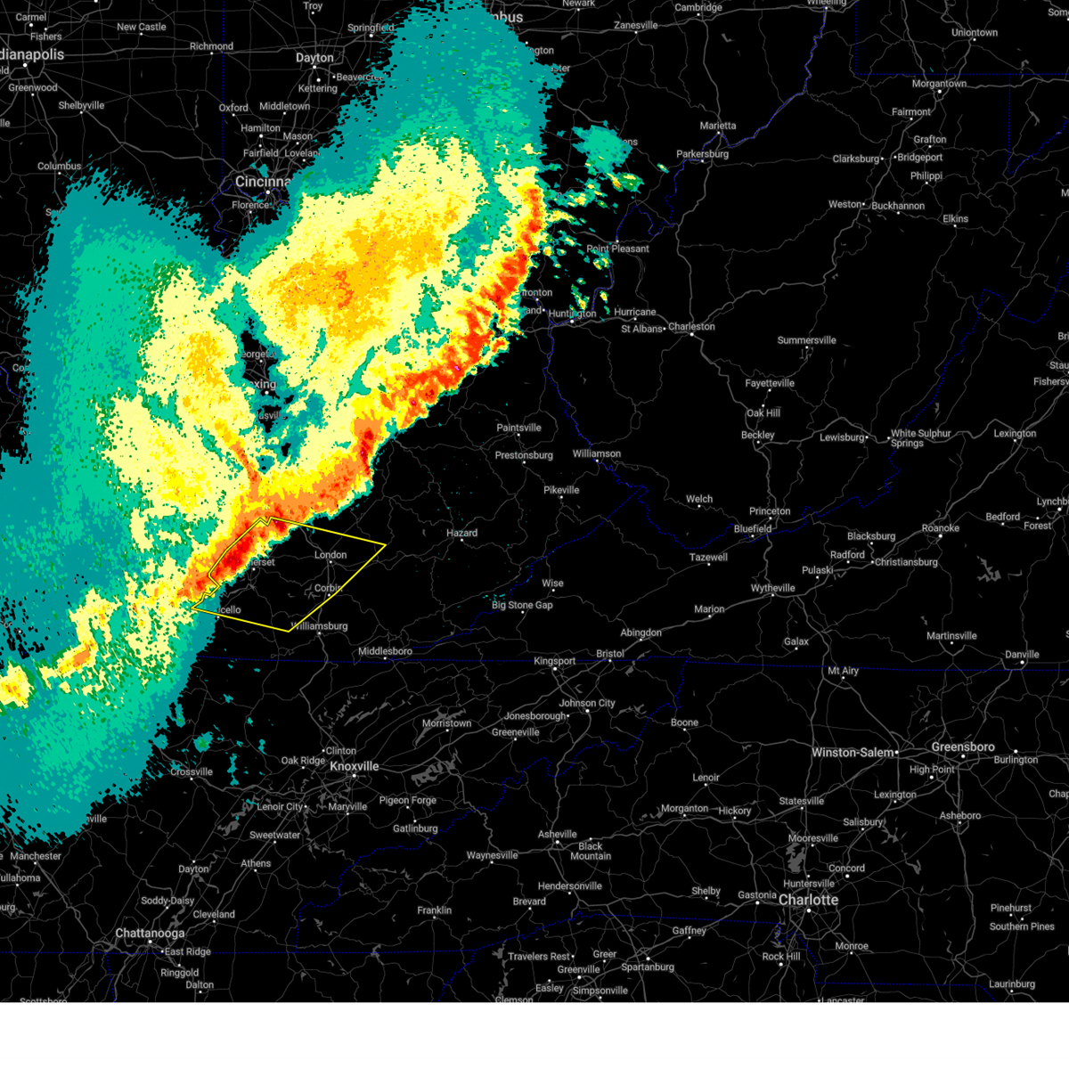
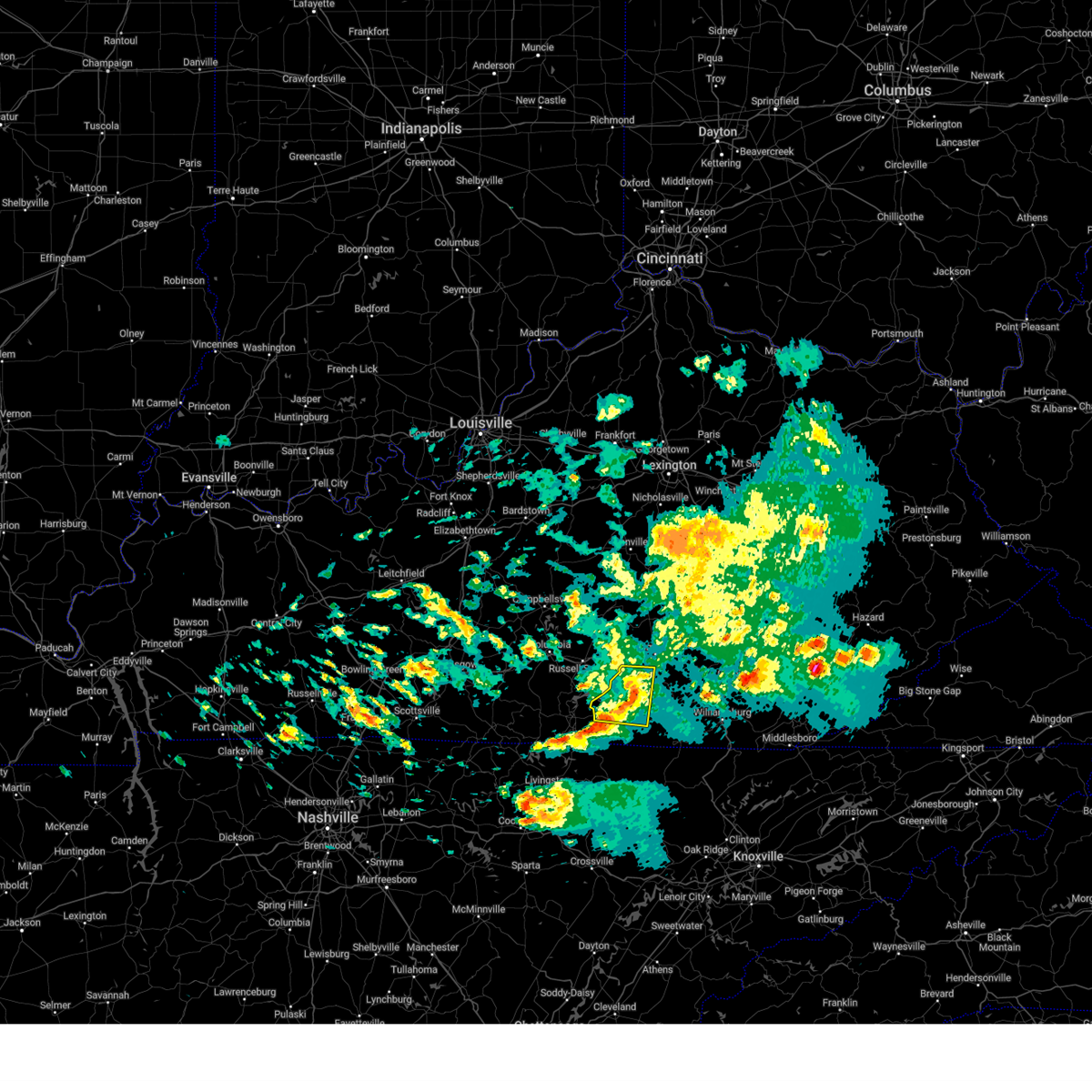
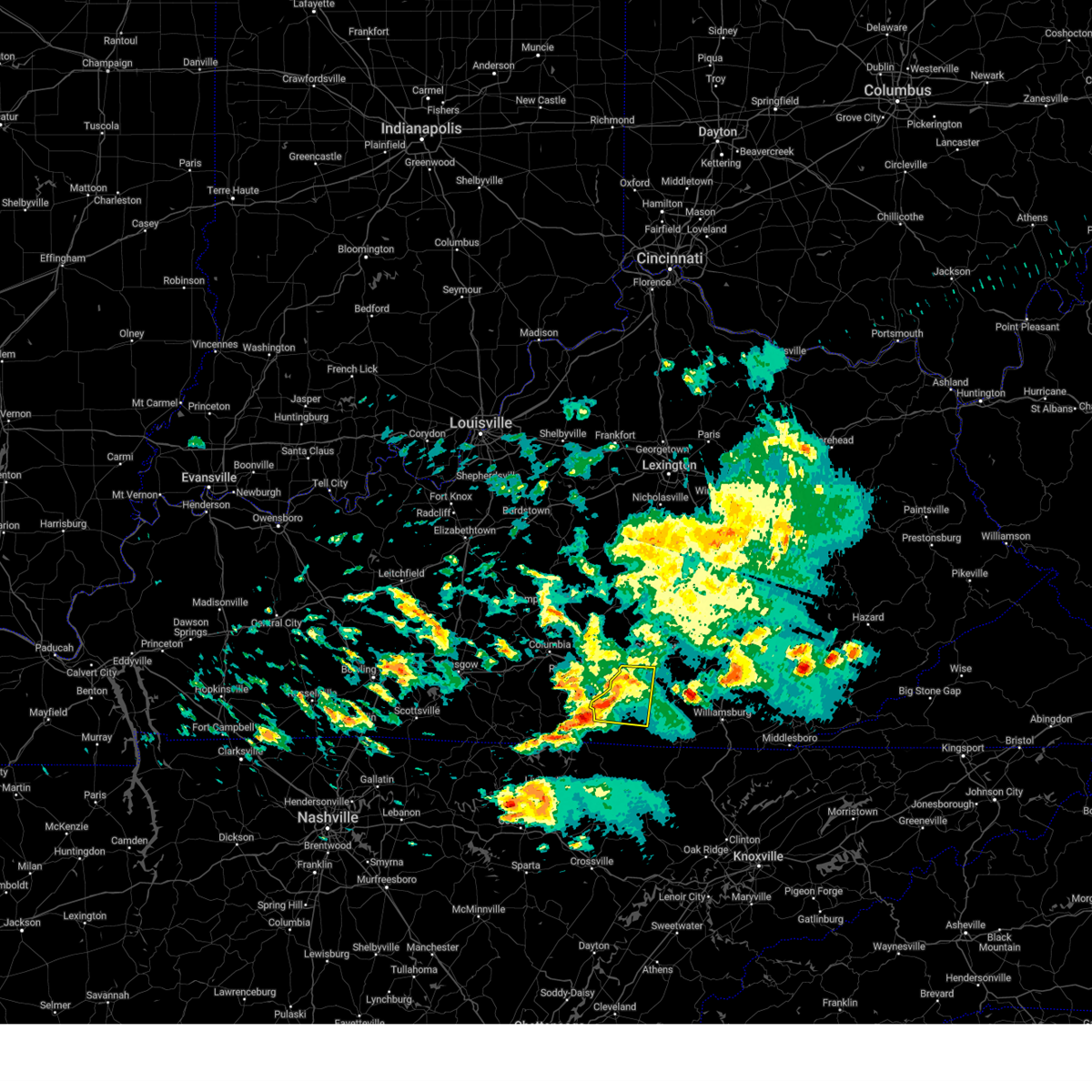
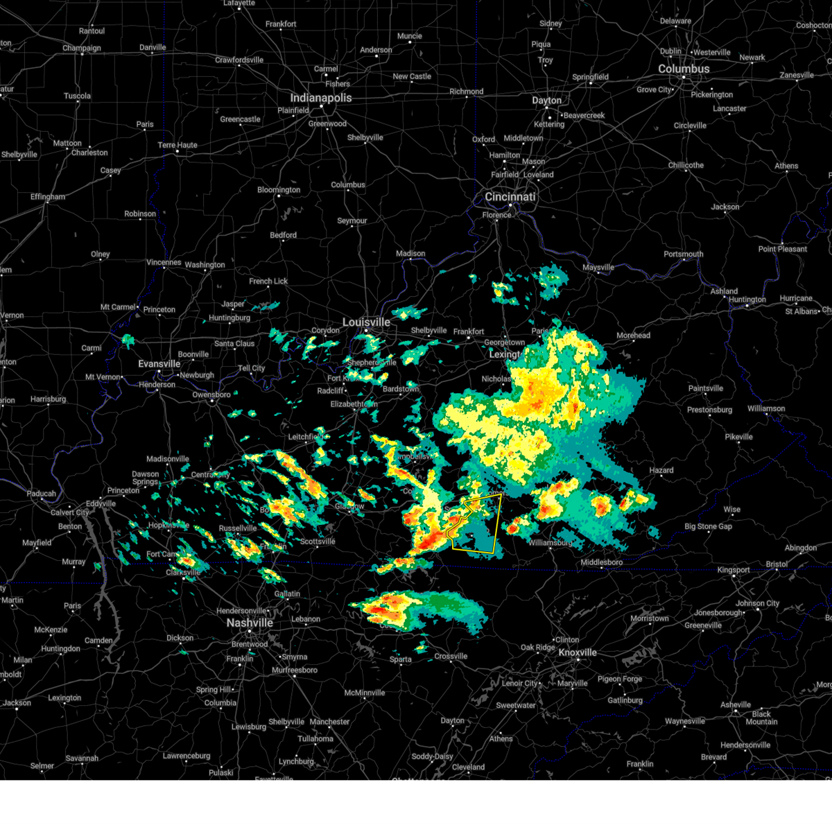
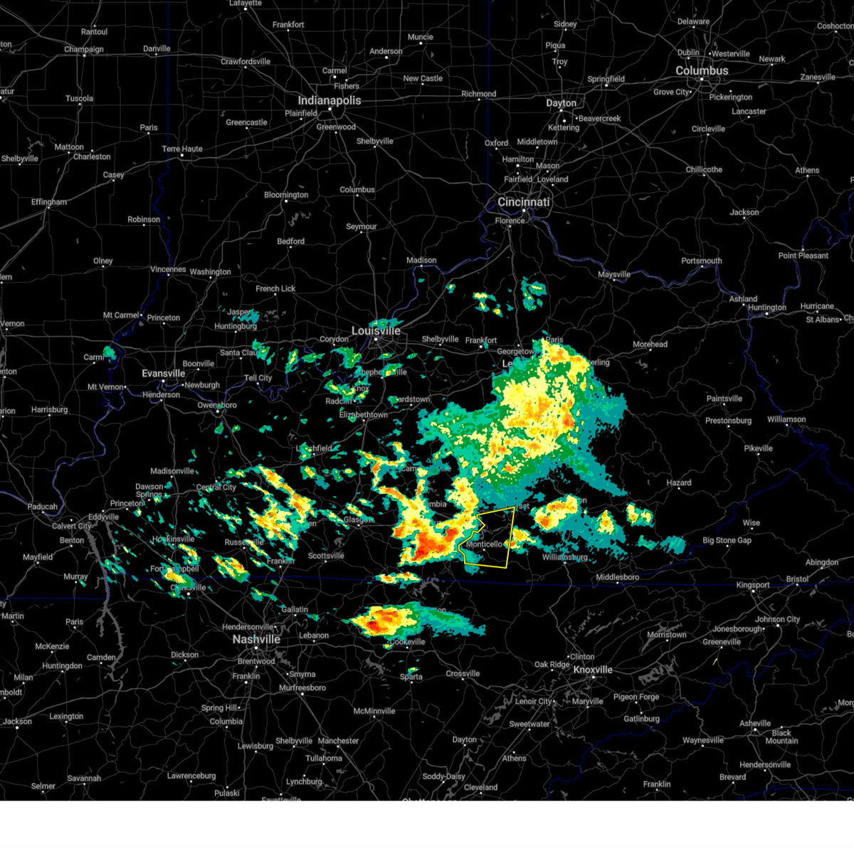
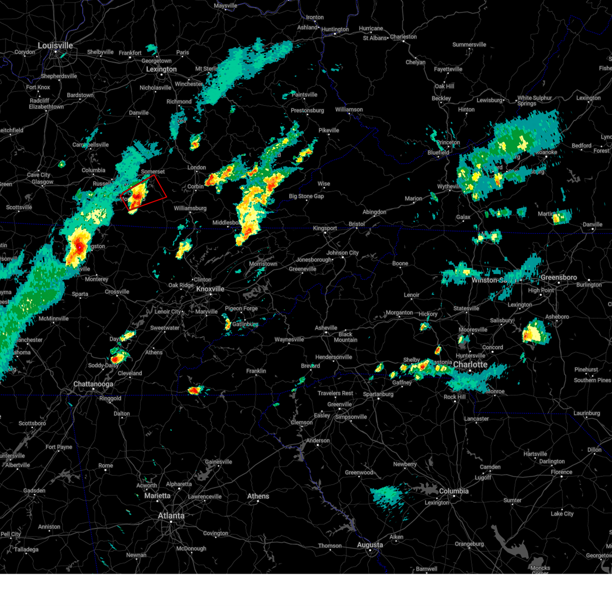
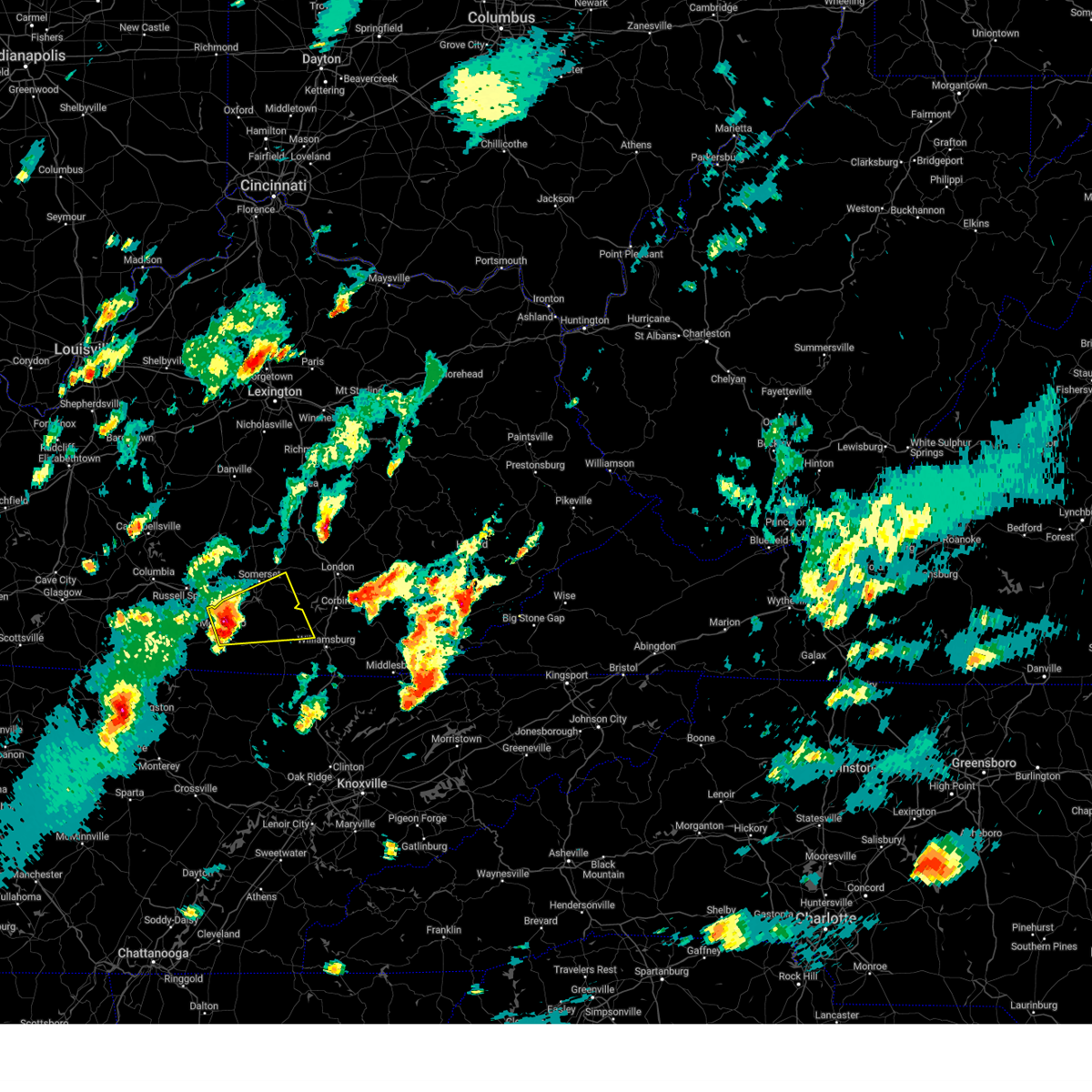
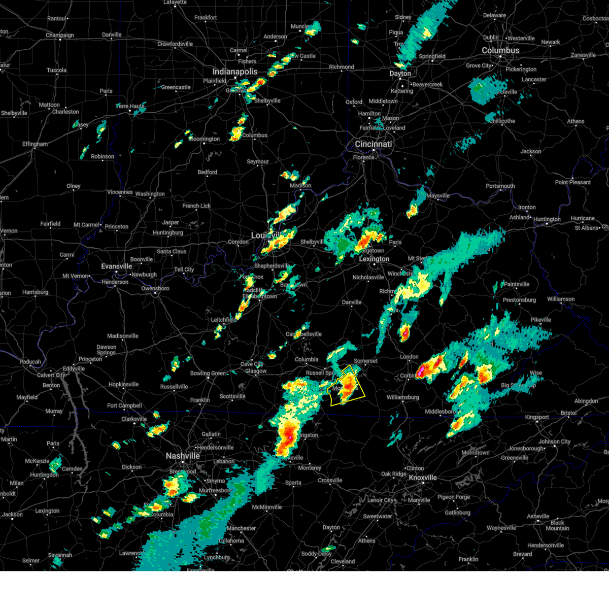
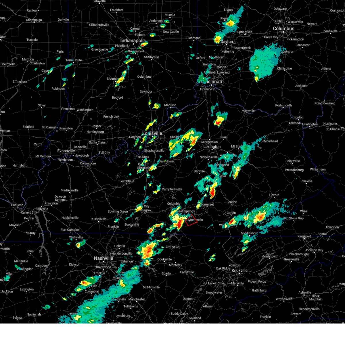
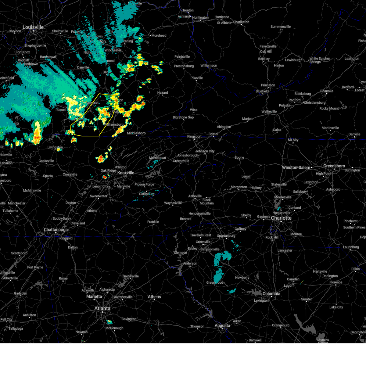
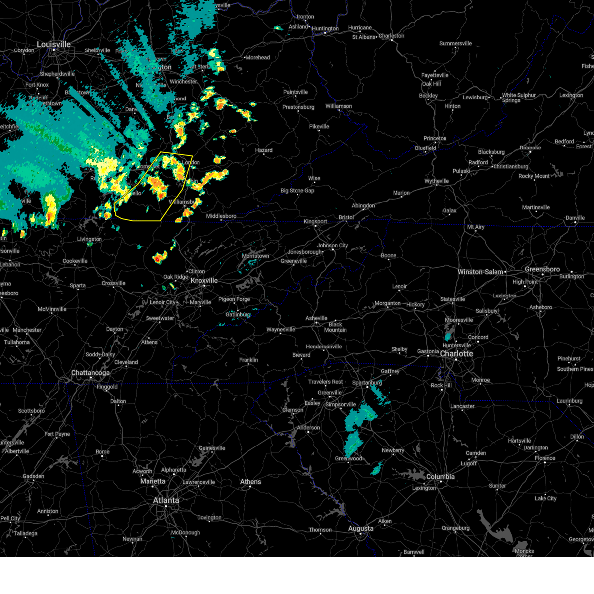
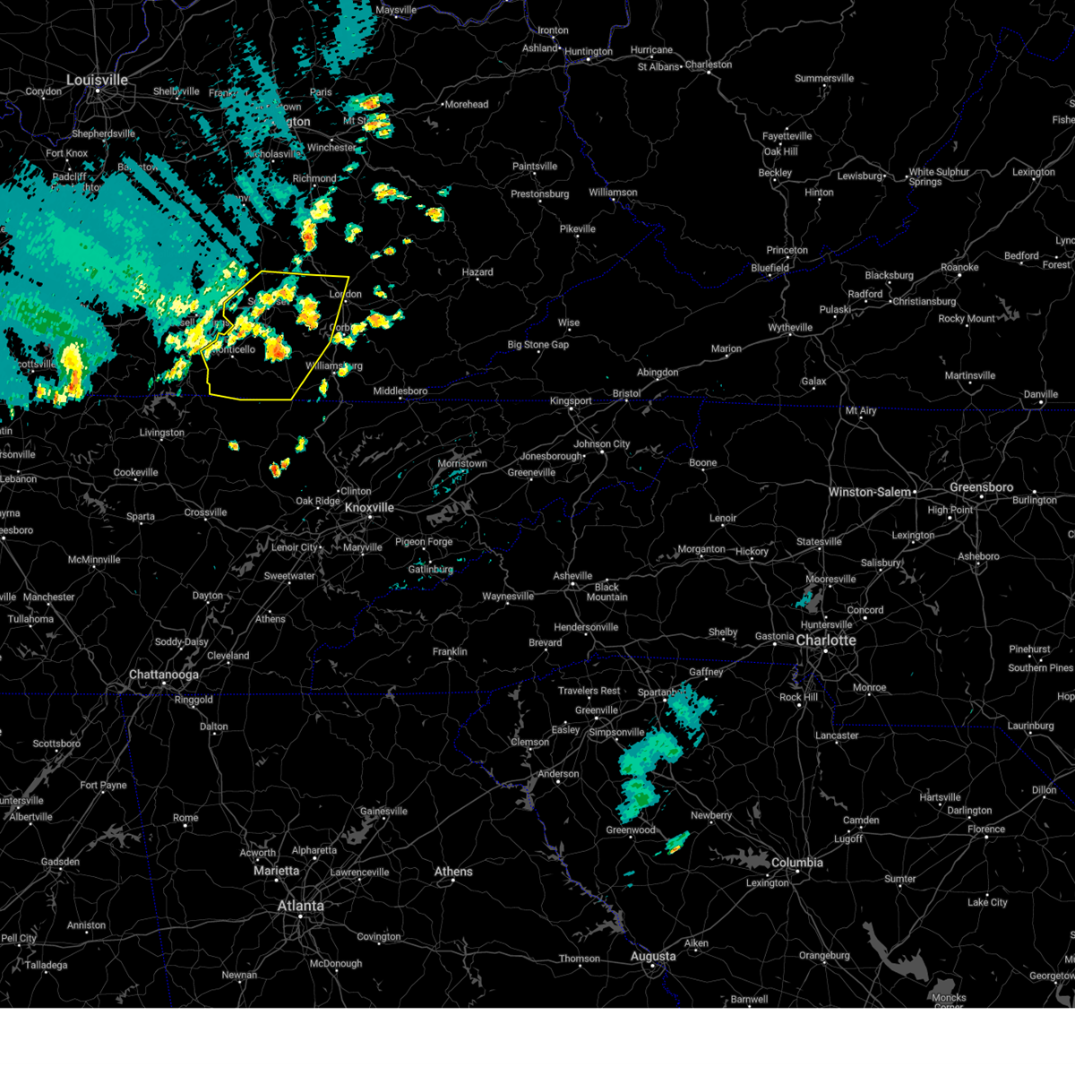
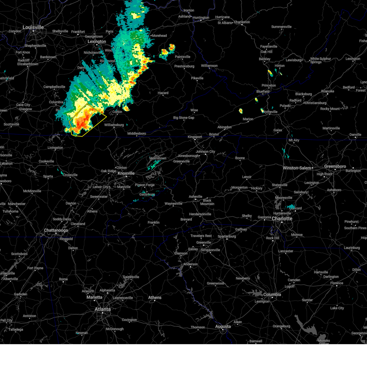
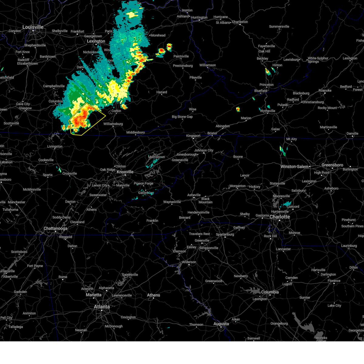
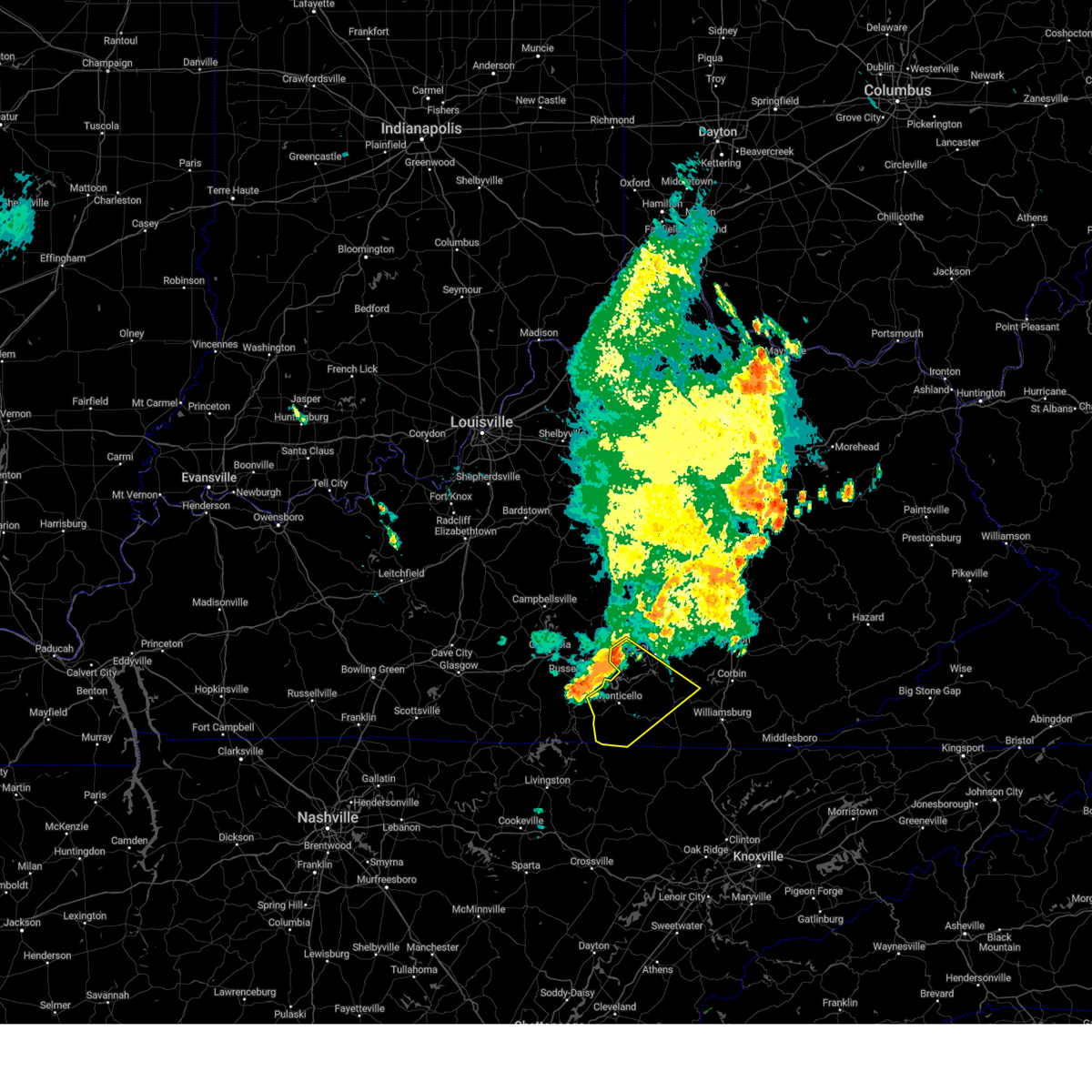
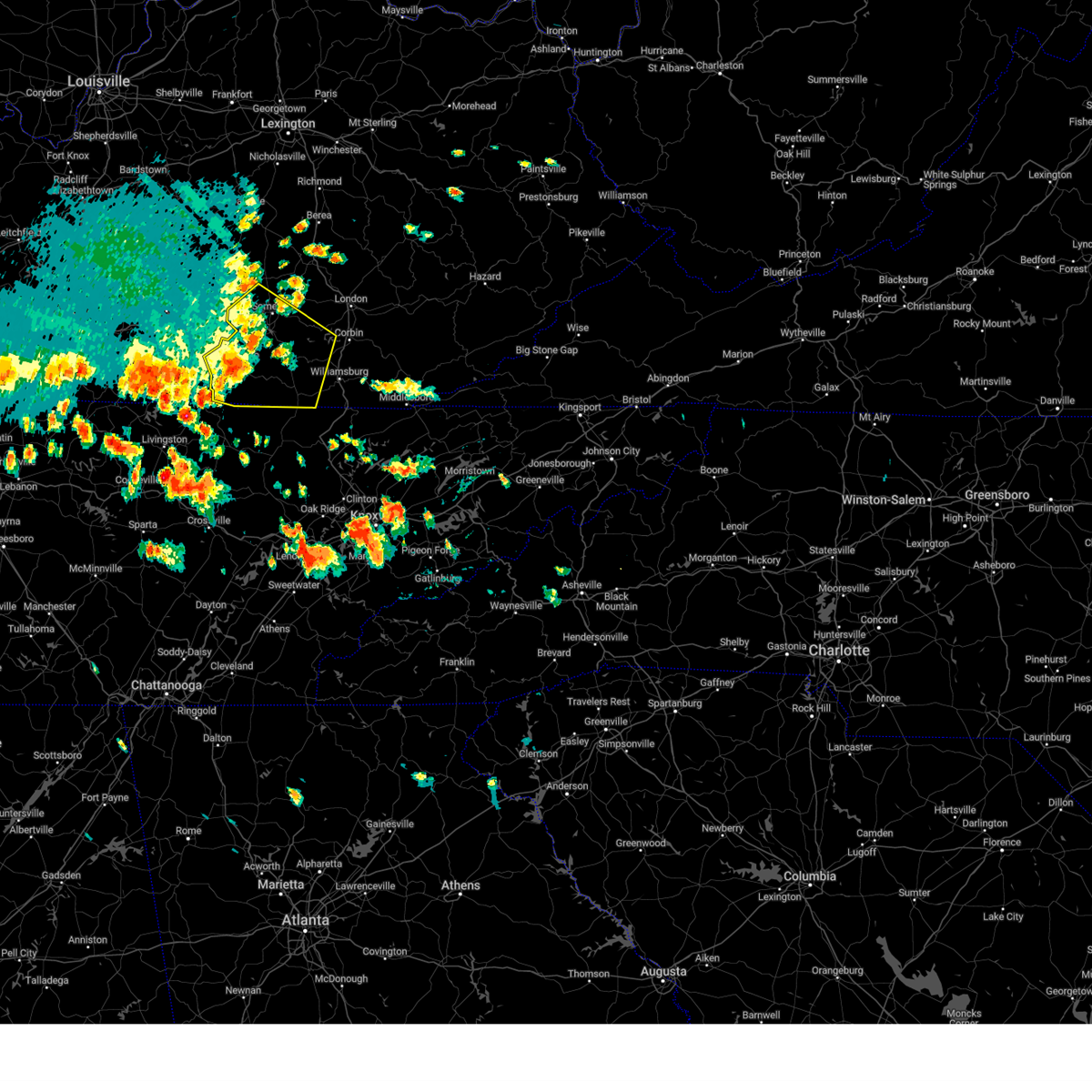
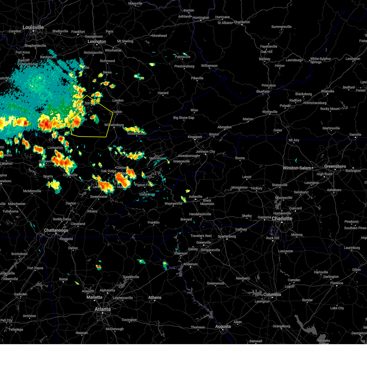
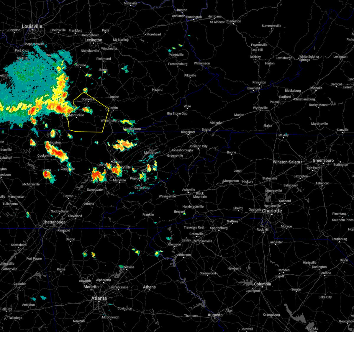
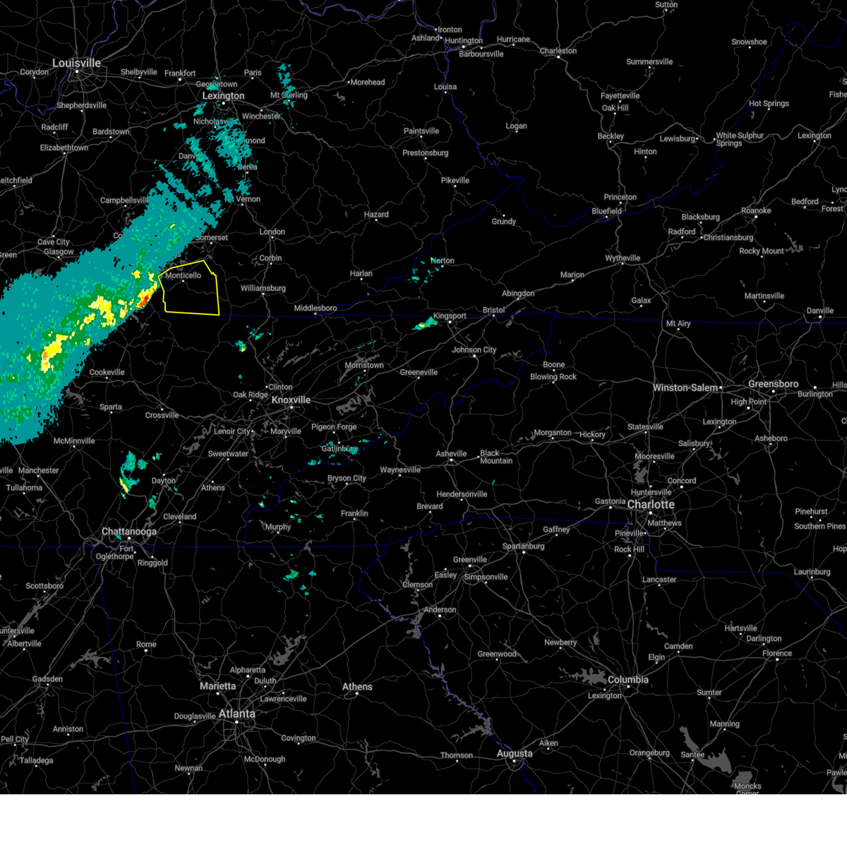
Hail Map for Monticello, KY
The Monticello, KY area has had 14 reports of on-the-ground hail by trained spotters, and has been under severe weather warnings 57 times during the past 12 months. Doppler radar has detected hail at or near Monticello, KY on 56 occasions, including 4 occasions during the past year.
| Name: | Monticello, KY |
| Where Located: | 76.7 miles SW of Irvine, KY |
| Map: | Google Map for Monticello, KY |
| Population: | 6188 |
| Housing Units: | 2880 |
| More Info: | Search Google for Monticello, KY |
2
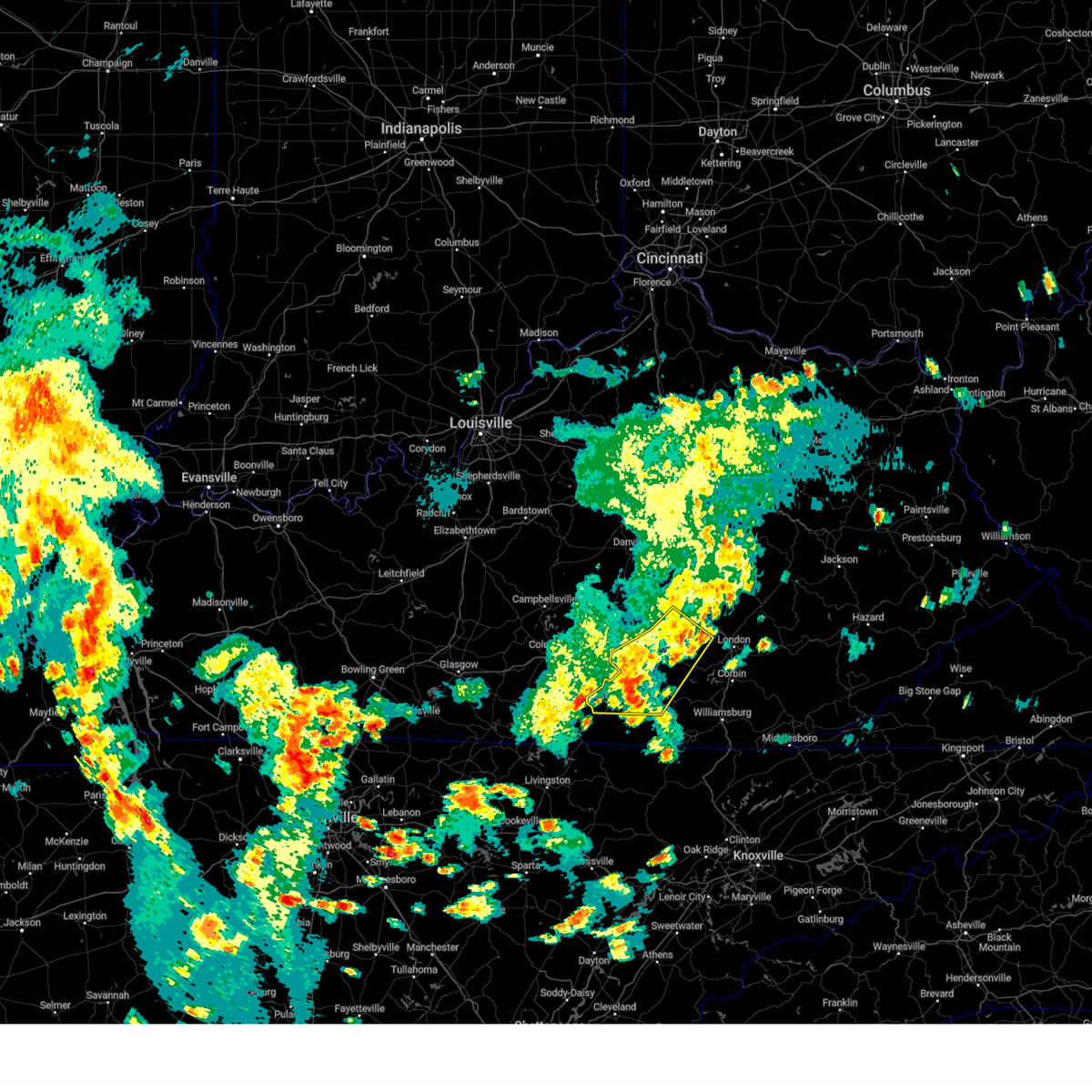
The Top Recent Hail Date for Monticello, KY is Thursday, May 8, 2025 (4th out of 56)

Hail and Wind Damage Spotted near Monticello, KY
| Date / Time | Report Details |
|---|---|
| 6/6/2025 3:28 PM EDT |
 The storms which prompted the warning have weakened below severe limits, and have exited the warned area. therefore, the warning will be allowed to expire. however, small hail and gusty winds are still possible with these thunderstorms. a severe thunderstorm watch remains in effect until 700 pm edt for south central kentucky. The storms which prompted the warning have weakened below severe limits, and have exited the warned area. therefore, the warning will be allowed to expire. however, small hail and gusty winds are still possible with these thunderstorms. a severe thunderstorm watch remains in effect until 700 pm edt for south central kentucky.
|
| 6/6/2025 3:23 PM EDT |
 At 322 pm edt, severe thunderstorms were located along a line extending from wabp to valley oak to pulaski county park to cooper, moving east at 45 mph (radar indicated). Hazards include 60 mph wind gusts and quarter size hail. Hail damage to vehicles is expected. expect wind damage to roofs, siding, and trees. Locations impacted include, somerset and sloans valley. At 322 pm edt, severe thunderstorms were located along a line extending from wabp to valley oak to pulaski county park to cooper, moving east at 45 mph (radar indicated). Hazards include 60 mph wind gusts and quarter size hail. Hail damage to vehicles is expected. expect wind damage to roofs, siding, and trees. Locations impacted include, somerset and sloans valley.
|
| 6/6/2025 3:06 PM EDT |
 Svrjkl the national weather service in jackson ky has issued a * severe thunderstorm warning for, wayne county in south central kentucky, west central laurel county in south central kentucky, pulaski county in south central kentucky, north central mccreary county in south central kentucky, southwestern rockcastle county in south central kentucky, * until 330 pm edt. * at 306 pm edt, severe thunderstorms were located along a line extending from near bee lick to near hogue to near cains store to near cabell, moving east at 30 mph (radar indicated). Hazards include 60 mph wind gusts and quarter size hail. Hail damage to vehicles is expected. expect wind damage to roofs, siding, and trees. severe thunderstorms will be near, science hill around 310 pm edt. monticello around 315 pm edt. Pulaski county park around 320 pm edt. Svrjkl the national weather service in jackson ky has issued a * severe thunderstorm warning for, wayne county in south central kentucky, west central laurel county in south central kentucky, pulaski county in south central kentucky, north central mccreary county in south central kentucky, southwestern rockcastle county in south central kentucky, * until 330 pm edt. * at 306 pm edt, severe thunderstorms were located along a line extending from near bee lick to near hogue to near cains store to near cabell, moving east at 30 mph (radar indicated). Hazards include 60 mph wind gusts and quarter size hail. Hail damage to vehicles is expected. expect wind damage to roofs, siding, and trees. severe thunderstorms will be near, science hill around 310 pm edt. monticello around 315 pm edt. Pulaski county park around 320 pm edt.
|
| 5/20/2025 9:06 PM EDT |
 Svrjkl the national weather service in jackson ky has issued a * severe thunderstorm warning for, northern wayne county in south central kentucky, southwestern laurel county in south central kentucky, southern pulaski county in south central kentucky, northeastern mccreary county in south central kentucky, northwestern whitley county in south central kentucky, * until 1000 pm edt. * at 905 pm edt, a severe thunderstorm was located over steubenville, or near monticello, moving east at 40 mph (radar indicated). Hazards include 60 mph wind gusts. Expect damage to roofs, siding, and trees. this severe thunderstorm will be near, kidder around 910 pm edt. quinton around 915 pm edt. burnside around 920 pm edt. greenwood around 925 pm edt. Other locations in the path of this severe thunderstorm include huxley and bark camp. Svrjkl the national weather service in jackson ky has issued a * severe thunderstorm warning for, northern wayne county in south central kentucky, southwestern laurel county in south central kentucky, southern pulaski county in south central kentucky, northeastern mccreary county in south central kentucky, northwestern whitley county in south central kentucky, * until 1000 pm edt. * at 905 pm edt, a severe thunderstorm was located over steubenville, or near monticello, moving east at 40 mph (radar indicated). Hazards include 60 mph wind gusts. Expect damage to roofs, siding, and trees. this severe thunderstorm will be near, kidder around 910 pm edt. quinton around 915 pm edt. burnside around 920 pm edt. greenwood around 925 pm edt. Other locations in the path of this severe thunderstorm include huxley and bark camp.
|
| 5/17/2025 12:19 AM EDT | Svrjkl the national weather service in jackson ky has issued a * severe thunderstorm warning for, wayne county in south central kentucky, laurel county in south central kentucky, pulaski county in south central kentucky, mccreary county in south central kentucky, south central rockcastle county in south central kentucky, northwestern whitley county in south central kentucky, * until 100 am edt. * at 1219 am edt, severe thunderstorms were located along a line extending from 8 miles south of stanford to 10 miles northwest of byrdstown, moving east at 65 mph (radar indicated). Hazards include 70 mph wind gusts and penny size hail. Expect considerable tree damage. damage is likely to mobile homes, roofs, and outbuildings. severe thunderstorms will be near, somerset around 1225 am edt. slickford around 1230 am edt. burnside around 1235 am edt. Other locations in the path of these severe thunderstorms include alpine, great meadows campsites and whitley city. |
| 5/16/2025 12:48 PM EDT | Trees and power lines down along ky highway 3106 and ky highway 1275 n between monticello and steubenville. exact location estimate in wayne county KY, 4.6 miles SW of Monticello, KY |
| 5/8/2025 5:25 PM EDT | The storm which prompted the warning has moved out of the area. therefore, the warning will be allowed to expire. a new warning has been issued for wayne, pulaski and mccreary counties. a severe thunderstorm watch remains in effect until 1100 pm edt for south central kentucky. |
| 5/8/2025 5:24 PM EDT | Svrjkl the national weather service in jackson ky has issued a * severe thunderstorm warning for, northeastern wayne county in south central kentucky, south central pulaski county in south central kentucky, central mccreary county in south central kentucky, * until 600 pm edt. * at 524 pm edt, a severe thunderstorm was located near gregory, or near monticello, moving east at 25 mph (radar indicated). Hazards include 60 mph wind gusts and quarter size hail. Hail damage to vehicles is expected. expect wind damage to roofs, siding, and trees. This severe thunderstorm will be near, denney around 530 pm edt. |
| 1/1/0001 12:00 AM | Quarter sized hail reported 1 miles NW of Monticello, KY, picture on social media of piles of melting large hail along michigan avenue in monticello. some of the storms are at least quarter sized still... and the entirety of t |
| 5/8/2025 5:15 PM EDT | Baseball sized hail reported 4.9 miles WNW of Monticello, KY, multiple pictures of baseball sized hail in monticello. one such stone was near the intersection of hwy 3285/hwy 776. time estimated via radar. |
| 5/8/2025 5:13 PM EDT | the severe thunderstorm warning has been cancelled and is no longer in effect |
| 5/8/2025 5:13 PM EDT | At 512 pm edt, a severe thunderstorm was located over monticello, moving east at 25 mph (radar indicated). Hazards include golf ball size hail and 60 mph wind gusts. People and animals outdoors will be injured. expect hail damage to roofs, siding, windows, and vehicles. expect wind damage to roofs, siding, and trees. Locations impacted include, monticello, gregory and delta. |
| 5/8/2025 5:12 PM EDT | Ping Pong Ball sized hail reported 1.6 miles NNE of Monticello, KY, multiple reports of broken windows and damaged vinyl siding in monticello from the large hail this evening. at a residence along bob carrender road... there were photos |
| 5/8/2025 5:11 PM EDT | Quarter sized hail reported 0.7 miles NNE of Monticello, KY |
| 5/8/2025 5:11 PM EDT | Ping Pong Ball sized hail reported 0.7 miles NNW of Monticello, KY, large amounts of ping pong ball sized hail reported near the doughboy statue in downtown monticello. time estimated via radar. |
| 5/8/2025 4:57 PM EDT | Svrjkl the national weather service in jackson ky has issued a * severe thunderstorm warning for, northern wayne county in south central kentucky, southwestern pulaski county in south central kentucky, * until 530 pm edt. * at 457 pm edt, a severe thunderstorm was located over cabell, or 8 miles west of monticello, moving northeast at 25 mph (radar indicated). Hazards include 60 mph wind gusts and quarter size hail. Hail damage to vehicles is expected. expect wind damage to roofs, siding, and trees. this severe thunderstorm will be near, parnell around 500 pm edt. monticello around 505 pm edt. steubenville around 515 pm edt. Other locations in the path of this severe thunderstorm include mill springs. |
| 5/2/2025 4:59 PM EDT |
 The severe thunderstorm which prompted the warning has weakened. therefore, the warning will be allowed to expire. however, small hail, gusty winds and heavy rain are still possible with this thunderstorm. a severe thunderstorm watch remains in effect until 900 pm edt for south central kentucky. to report severe weather, contact your nearest law enforcement agency. they will relay your report to the national weather service jackson ky. The severe thunderstorm which prompted the warning has weakened. therefore, the warning will be allowed to expire. however, small hail, gusty winds and heavy rain are still possible with this thunderstorm. a severe thunderstorm watch remains in effect until 900 pm edt for south central kentucky. to report severe weather, contact your nearest law enforcement agency. they will relay your report to the national weather service jackson ky.
|
| 5/2/2025 4:49 PM EDT | At 449 pm edt, a severe thunderstorm was located near mill springs, or 8 miles north of monticello, moving east at 20 mph (radar indicated). Hazards include 60 mph wind gusts and quarter size hail. Hail damage to vehicles is expected. expect wind damage to roofs, siding, and trees. Locations impacted include, naomi, betsey, frazer, trimble, pulaski county park, nancy, kidder, monticello, mill springs, faubush, and steubenville. |
| 5/2/2025 3:37 PM CDT | At 437 pm edt, a severe thunderstorm was located near parnell, or 7 miles north of monticello, moving east at 20 mph (radar indicated). Hazards include 60 mph wind gusts and quarter size hail. Hail damage to vehicles is expected. expect wind damage to roofs, siding, and trees. Locations impacted include, naomi and frazer. |
| 5/2/2025 4:26 PM EDT | Svrjkl the national weather service in jackson ky has issued a * severe thunderstorm warning for, northern wayne county in south central kentucky, southwestern pulaski county in south central kentucky, * until 500 pm edt. * at 426 pm edt, a severe thunderstorm was located near parnell, or 8 miles northwest of monticello, moving east at 20 mph (radar indicated). Hazards include 60 mph wind gusts and quarter size hail. Hail damage to vehicles is expected. expect wind damage to roofs, siding, and trees. this severe thunderstorm will be near, mill springs around 445 pm edt. Other locations in the path of this severe thunderstorm include naomi. |
| 4/29/2025 9:22 PM EDT | Wayne county 911 reports trees downed on dugan street in monticello. time estimated via rada in wayne county KY, 0.8 miles W of Monticello, KY |
| 4/5/2025 8:17 PM EDT |
 The storms which prompted the warning is moving out of the original warning area, and a new warning has been issued to the east. a tornado watch remains in effect until 1100 pm edt for south central kentucky. The storms which prompted the warning is moving out of the original warning area, and a new warning has been issued to the east. a tornado watch remains in effect until 1100 pm edt for south central kentucky.
|
| 4/5/2025 8:02 PM EDT |
 At 802 pm edt, severe thunderstorms were located along a line extending from near cains store to near mill springs to slickford, moving east at 55 mph (radar indicated). Hazards include 60 mph wind gusts. Expect damage to roofs, siding, and trees. Locations impacted include, barrier, burnside, science hill and alpine. At 802 pm edt, severe thunderstorms were located along a line extending from near cains store to near mill springs to slickford, moving east at 55 mph (radar indicated). Hazards include 60 mph wind gusts. Expect damage to roofs, siding, and trees. Locations impacted include, barrier, burnside, science hill and alpine.
|
| 4/5/2025 7:58 PM EDT | Two large trees were reported to have been blow down along ky 834 near the intersection with old fire trail road heading toward ky 90. event time is radar estimate in wayne county KY, 6.7 miles ENE of Monticello, KY |
| 4/5/2025 7:43 PM EDT |
 Svrjkl the national weather service in jackson ky has issued a * severe thunderstorm warning for, wayne county in south central kentucky, western pulaski county in south central kentucky, * until 815 pm edt. * at 742 pm edt, severe thunderstorms were located along a line extending from near jamestown to near cabell to near byrdstown, moving east at 55 mph (radar indicated). Hazards include 60 mph wind gusts. Expect damage to roofs, siding, and trees. severe thunderstorms will be near, zula around 745 pm edt. monticello around 750 pm edt. slickford around 755 pm edt. barrier around 800 pm edt. Other locations in the path of these severe thunderstorms include gregory and denney. Svrjkl the national weather service in jackson ky has issued a * severe thunderstorm warning for, wayne county in south central kentucky, western pulaski county in south central kentucky, * until 815 pm edt. * at 742 pm edt, severe thunderstorms were located along a line extending from near jamestown to near cabell to near byrdstown, moving east at 55 mph (radar indicated). Hazards include 60 mph wind gusts. Expect damage to roofs, siding, and trees. severe thunderstorms will be near, zula around 745 pm edt. monticello around 750 pm edt. slickford around 755 pm edt. barrier around 800 pm edt. Other locations in the path of these severe thunderstorms include gregory and denney.
|
| 4/3/2025 4:12 PM EDT |
 The storm which prompted the warning has weakened below severe limits, and no longer poses an immediate threat to life or property. therefore, the warning will be allowed to expire. however, small hail and gusty winds are still possible with this thunderstorm. a tornado watch remains in effect until 1100 pm edt for south central kentucky. The storm which prompted the warning has weakened below severe limits, and no longer poses an immediate threat to life or property. therefore, the warning will be allowed to expire. however, small hail and gusty winds are still possible with this thunderstorm. a tornado watch remains in effect until 1100 pm edt for south central kentucky.
|
| 4/3/2025 3:50 PM EDT |
 Svrjkl the national weather service in jackson ky has issued a * severe thunderstorm warning for, northern wayne county in south central kentucky, * until 415 pm edt. * at 350 pm edt, a severe thunderstorm was located near jamestown, or 13 miles northwest of monticello, moving east at 45 mph (radar indicated). Hazards include 60 mph wind gusts and quarter size hail. Hail damage to vehicles is expected. expect wind damage to roofs, siding, and trees. This severe thunderstorm will remain over mainly rural areas of northern wayne county. Svrjkl the national weather service in jackson ky has issued a * severe thunderstorm warning for, northern wayne county in south central kentucky, * until 415 pm edt. * at 350 pm edt, a severe thunderstorm was located near jamestown, or 13 miles northwest of monticello, moving east at 45 mph (radar indicated). Hazards include 60 mph wind gusts and quarter size hail. Hail damage to vehicles is expected. expect wind damage to roofs, siding, and trees. This severe thunderstorm will remain over mainly rural areas of northern wayne county.
|
| 4/3/2025 11:37 AM EDT |
 the tornado warning has been cancelled and is no longer in effect the tornado warning has been cancelled and is no longer in effect
|
| 4/3/2025 11:30 AM EDT |
 At 1130 am edt, a severe thunderstorm capable of producing a tornado was located over monticello, moving northeast at 45 mph (radar indicated rotation). Hazards include tornado. Flying debris will be dangerous to those caught without shelter. mobile homes will be damaged or destroyed. damage to roofs, windows, and vehicles will occur. tree damage is likely. Locations impacted include, mill springs, kidder, burnside and alpine. At 1130 am edt, a severe thunderstorm capable of producing a tornado was located over monticello, moving northeast at 45 mph (radar indicated rotation). Hazards include tornado. Flying debris will be dangerous to those caught without shelter. mobile homes will be damaged or destroyed. damage to roofs, windows, and vehicles will occur. tree damage is likely. Locations impacted include, mill springs, kidder, burnside and alpine.
|
| 4/3/2025 11:10 AM EDT |
 Torjkl the national weather service in jackson ky has issued a * tornado warning for, wayne county in south central kentucky, southwestern pulaski county in south central kentucky, north central mccreary county in south central kentucky, * until noon edt. * at 1109 am edt, a severe thunderstorm capable of producing a tornado was located near albany, or 12 miles north of byrdstown, moving northeast at 45 mph (weather spotters reported funnel cloud near albany, ky). Hazards include tornado. Flying debris will be dangerous to those caught without shelter. mobile homes will be damaged or destroyed. damage to roofs, windows, and vehicles will occur. tree damage is likely. this dangerous storm will be near, zula around 1115 am edt. monticello around 1125 am edt. Other locations in the path of this tornadic thunderstorm include steubenville, betsey, kidder and quinton. Torjkl the national weather service in jackson ky has issued a * tornado warning for, wayne county in south central kentucky, southwestern pulaski county in south central kentucky, north central mccreary county in south central kentucky, * until noon edt. * at 1109 am edt, a severe thunderstorm capable of producing a tornado was located near albany, or 12 miles north of byrdstown, moving northeast at 45 mph (weather spotters reported funnel cloud near albany, ky). Hazards include tornado. Flying debris will be dangerous to those caught without shelter. mobile homes will be damaged or destroyed. damage to roofs, windows, and vehicles will occur. tree damage is likely. this dangerous storm will be near, zula around 1115 am edt. monticello around 1125 am edt. Other locations in the path of this tornadic thunderstorm include steubenville, betsey, kidder and quinton.
|
| 4/3/2025 7:06 AM EDT |
 The storm which prompted the warning has weakened below severe limits, and has exited the warned area. therefore, the warning will be allowed to expire. however, small hail and gusty winds are still possible with this thunderstorm. a tornado watch remains in effect until 900 am edt for south central kentucky. The storm which prompted the warning has weakened below severe limits, and has exited the warned area. therefore, the warning will be allowed to expire. however, small hail and gusty winds are still possible with this thunderstorm. a tornado watch remains in effect until 900 am edt for south central kentucky.
|
| 4/3/2025 6:59 AM EDT | At 659 am edt, a severe thunderstorm capable of producing a tornado was located over monticello, moving northeast at 50 mph (radar indicated rotation). Hazards include tornado. Flying debris will be dangerous to those caught without shelter. mobile homes will be damaged or destroyed. damage to roofs, windows, and vehicles will occur. tree damage is likely. Locations impacted include, mill springs. |
| 4/3/2025 6:41 AM EDT | Torjkl the national weather service in jackson ky has issued a * tornado warning for, central wayne county in south central kentucky, southwestern pulaski county in south central kentucky, * until 715 am edt. * at 640 am edt, a severe thunderstorm capable of producing a tornado was located near albany, or 13 miles north of byrdstown, moving northeast at 50 mph (radar indicated rotation). Hazards include tornado. Flying debris will be dangerous to those caught without shelter. mobile homes will be damaged or destroyed. damage to roofs, windows, and vehicles will occur. tree damage is likely. this dangerous storm will be near, zula around 645 am edt. monticello around 650 am edt. steubenville around 700 am edt. Other locations in the path of this tornadic thunderstorm include mill springs. |
| 4/3/2025 6:22 AM EDT | Torjkl the national weather service in jackson ky has issued a * tornado warning for, northeastern wayne county in south central kentucky, southern pulaski county in south central kentucky, northeastern mccreary county in south central kentucky, * until 700 am edt. * at 622 am edt, a severe thunderstorm capable of producing a tornado was located over monticello, moving east at 50 mph (radar indicated rotation). Hazards include tornado. Flying debris will be dangerous to those caught without shelter. mobile homes will be damaged or destroyed. damage to roofs, windows, and vehicles will occur. tree damage is likely. this dangerous storm will be near, mill springs around 630 am edt. burnside around 635 am edt. alpine around 640 am edt. Other locations in the path of this tornadic thunderstorm include mount victory. |
| 4/3/2025 6:00 AM EDT |
 The storm which prompted the warning has weakened below severe limits, and no longer poses an immediate threat to life or property. therefore, the warning will be allowed to expire. a tornado watch remains in effect until 700 am edt for south central kentucky. The storm which prompted the warning has weakened below severe limits, and no longer poses an immediate threat to life or property. therefore, the warning will be allowed to expire. a tornado watch remains in effect until 700 am edt for south central kentucky.
|
| 4/3/2025 5:49 AM EDT | At 549 am edt, a severe thunderstorm was located over nancy, or 8 miles west of somerset, moving northeast at 60 mph (radar indicated). Hazards include 60 mph wind gusts. Expect damage to roofs, siding, and trees. Locations impacted include, pulaski county park, science hill and bobtown. |
| 4/3/2025 5:34 AM EDT | Svrjkl the national weather service in jackson ky has issued a * severe thunderstorm warning for, northern wayne county in south central kentucky, southwestern laurel county in south central kentucky, pulaski county in south central kentucky, southwestern rockcastle county in south central kentucky, * until 600 am edt. * at 534 am edt, a severe thunderstorm was located near parnell, or 9 miles northwest of monticello, moving northeast at 65 mph (radar indicated). Hazards include 60 mph wind gusts. Expect damage to roofs, siding, and trees. this severe thunderstorm will be near, naomi around 540 am edt. faubush around 545 am edt. pulaski county park around 550 am edt. Other locations in the path of this severe thunderstorm include science hill. |
| 3/31/2025 1:22 AM EDT |
 The storms which prompted the warning have moved out of the area. therefore, the warning will be allowed to expire. however, small hail and gusty winds are still possible with these thunderstorms. a severe thunderstorm watch remains in effect until 600 am edt for south central and southeastern kentucky. The storms which prompted the warning have moved out of the area. therefore, the warning will be allowed to expire. however, small hail and gusty winds are still possible with these thunderstorms. a severe thunderstorm watch remains in effect until 600 am edt for south central and southeastern kentucky.
|
| 3/31/2025 1:10 AM EDT |
 At 110 am edt, severe thunderstorms were located along a line extending from green hill to near bunch to denney, moving east at 40 mph (radar indicated). Hazards include 60 mph wind gusts and penny size hail. Expect damage to roofs, siding, and trees. Locations impacted include, honeybee, rye and lake. At 110 am edt, severe thunderstorms were located along a line extending from green hill to near bunch to denney, moving east at 40 mph (radar indicated). Hazards include 60 mph wind gusts and penny size hail. Expect damage to roofs, siding, and trees. Locations impacted include, honeybee, rye and lake.
|
| 3/31/2025 12:56 AM EDT |
 The storms which prompted the warning have moved out of the area. therefore, the warning will be allowed to expire. however, small hail and gusty winds are still possible with these thunderstorms. a severe thunderstorm watch remains in effect until 600 am edt for south central and southeastern kentucky. The storms which prompted the warning have moved out of the area. therefore, the warning will be allowed to expire. however, small hail and gusty winds are still possible with these thunderstorms. a severe thunderstorm watch remains in effect until 600 am edt for south central and southeastern kentucky.
|
| 3/31/2025 12:53 AM EDT |
 Svrjkl the national weather service in jackson ky has issued a * severe thunderstorm warning for, northern wayne county in south central kentucky, laurel county in south central kentucky, northwestern knox county in southeastern kentucky, pulaski county in south central kentucky, south central jackson county in southeastern kentucky, central mccreary county in south central kentucky, southern rockcastle county in south central kentucky, northwestern whitley county in south central kentucky, west central clay county in southeastern kentucky, * until 130 am edt. * at 1253 am edt, severe thunderstorms were located along a line extending from robinet to billows to frazer, moving east at 75 mph (radar indicated). Hazards include 60 mph wind gusts and penny size hail. Expect damage to roofs, siding, and trees. severe thunderstorms will be near, hazel patch around 100 am edt. hightop around 105 am edt. fall rock around 110 am edt. Other locations in the path of these severe thunderstorms include marydell and lynn camp. Svrjkl the national weather service in jackson ky has issued a * severe thunderstorm warning for, northern wayne county in south central kentucky, laurel county in south central kentucky, northwestern knox county in southeastern kentucky, pulaski county in south central kentucky, south central jackson county in southeastern kentucky, central mccreary county in south central kentucky, southern rockcastle county in south central kentucky, northwestern whitley county in south central kentucky, west central clay county in southeastern kentucky, * until 130 am edt. * at 1253 am edt, severe thunderstorms were located along a line extending from robinet to billows to frazer, moving east at 75 mph (radar indicated). Hazards include 60 mph wind gusts and penny size hail. Expect damage to roofs, siding, and trees. severe thunderstorms will be near, hazel patch around 100 am edt. hightop around 105 am edt. fall rock around 110 am edt. Other locations in the path of these severe thunderstorms include marydell and lynn camp.
|
| 3/31/2025 12:35 AM EDT |
 Svrjkl the national weather service in jackson ky has issued a * severe thunderstorm warning for, northern wayne county in south central kentucky, laurel county in south central kentucky, northwestern knox county in southeastern kentucky, pulaski county in south central kentucky, south central jackson county in southeastern kentucky, northeastern mccreary county in south central kentucky, southern rockcastle county in south central kentucky, northwestern whitley county in south central kentucky, west central clay county in southeastern kentucky, * until 100 am edt. * at 1234 am edt, severe thunderstorms were located along a line extending from bee lick to near somerset to near cabell, moving east at 75 mph (radar indicated). Hazards include 60 mph wind gusts and penny size hail. Expect damage to roofs, siding, and trees. severe thunderstorms will be near, sand springs around 1240 am edt. gauley around 1245 am edt. bunch around 1250 am edt. Other locations in the path of these severe thunderstorms include alpine. Svrjkl the national weather service in jackson ky has issued a * severe thunderstorm warning for, northern wayne county in south central kentucky, laurel county in south central kentucky, northwestern knox county in southeastern kentucky, pulaski county in south central kentucky, south central jackson county in southeastern kentucky, northeastern mccreary county in south central kentucky, southern rockcastle county in south central kentucky, northwestern whitley county in south central kentucky, west central clay county in southeastern kentucky, * until 100 am edt. * at 1234 am edt, severe thunderstorms were located along a line extending from bee lick to near somerset to near cabell, moving east at 75 mph (radar indicated). Hazards include 60 mph wind gusts and penny size hail. Expect damage to roofs, siding, and trees. severe thunderstorms will be near, sand springs around 1240 am edt. gauley around 1245 am edt. bunch around 1250 am edt. Other locations in the path of these severe thunderstorms include alpine.
|
| 2/6/2025 7:31 PM EST |
 A new downstream warning has been issued for portions of pulaski, wayne, and mccreary counties. see that bulletin for further details. a severe thunderstorm watch remains in effect until midnight est for south central kentucky. A new downstream warning has been issued for portions of pulaski, wayne, and mccreary counties. see that bulletin for further details. a severe thunderstorm watch remains in effect until midnight est for south central kentucky.
|
| 2/6/2025 7:29 PM EST |
 Svrjkl the national weather service in jackson ky has issued a * severe thunderstorm warning for, wayne county in south central kentucky, southwestern pulaski county in south central kentucky, central mccreary county in south central kentucky, * until 800 pm est. * at 729 pm est, a severe thunderstorm was located over gregory, or 7 miles east of monticello, moving east at 35 mph (radar indicated). Hazards include 60 mph wind gusts and quarter size hail. Hail damage to vehicles is expected. expect wind damage to roofs, siding, and trees. this severe thunderstorm will be near, denney around 735 pm est. greenwood around 745 pm est. Other locations in the path of this severe thunderstorm include beulah heights. Svrjkl the national weather service in jackson ky has issued a * severe thunderstorm warning for, wayne county in south central kentucky, southwestern pulaski county in south central kentucky, central mccreary county in south central kentucky, * until 800 pm est. * at 729 pm est, a severe thunderstorm was located over gregory, or 7 miles east of monticello, moving east at 35 mph (radar indicated). Hazards include 60 mph wind gusts and quarter size hail. Hail damage to vehicles is expected. expect wind damage to roofs, siding, and trees. this severe thunderstorm will be near, denney around 735 pm est. greenwood around 745 pm est. Other locations in the path of this severe thunderstorm include beulah heights.
|
| 2/6/2025 7:23 PM EST |
 At 723 pm est, a severe thunderstorm was located over betsey, or 8 miles northeast of monticello, moving east at 40 mph (radar indicated). Hazards include 60 mph wind gusts and quarter size hail. Hail damage to vehicles is expected. expect wind damage to roofs, siding, and trees. This severe storm will be near, kidder around 730 pm est. At 723 pm est, a severe thunderstorm was located over betsey, or 8 miles northeast of monticello, moving east at 40 mph (radar indicated). Hazards include 60 mph wind gusts and quarter size hail. Hail damage to vehicles is expected. expect wind damage to roofs, siding, and trees. This severe storm will be near, kidder around 730 pm est.
|
| 2/6/2025 7:12 PM EST |
 At 711 pm est, a severe thunderstorm was located near steubenville, or near monticello, moving east at 40 mph (radar indicated). Hazards include 60 mph wind gusts and quarter size hail. Hail damage to vehicles is expected. expect wind damage to roofs, siding, and trees. this severe storm will be near, monticello around 715 pm est. frazer around 720 pm est. Other locations in the path of this severe thunderstorm include kidder and quinton. At 711 pm est, a severe thunderstorm was located near steubenville, or near monticello, moving east at 40 mph (radar indicated). Hazards include 60 mph wind gusts and quarter size hail. Hail damage to vehicles is expected. expect wind damage to roofs, siding, and trees. this severe storm will be near, monticello around 715 pm est. frazer around 720 pm est. Other locations in the path of this severe thunderstorm include kidder and quinton.
|
| 2/6/2025 7:03 PM EST |
 Svrjkl the national weather service in jackson ky has issued a * severe thunderstorm warning for, wayne county in south central kentucky, southwestern pulaski county in south central kentucky, western mccreary county in south central kentucky, * until 730 pm est. * at 703 pm est, a severe thunderstorm was located near parnell, or 8 miles northwest of monticello, moving east at 40 mph (radar indicated). Hazards include 60 mph wind gusts and quarter size hail. Hail damage to vehicles is expected. expect wind damage to roofs, siding, and trees. this severe thunderstorm will be near, monticello around 710 pm est. mill springs around 715 pm est. Frazer around 720 pm est. Svrjkl the national weather service in jackson ky has issued a * severe thunderstorm warning for, wayne county in south central kentucky, southwestern pulaski county in south central kentucky, western mccreary county in south central kentucky, * until 730 pm est. * at 703 pm est, a severe thunderstorm was located near parnell, or 8 miles northwest of monticello, moving east at 40 mph (radar indicated). Hazards include 60 mph wind gusts and quarter size hail. Hail damage to vehicles is expected. expect wind damage to roofs, siding, and trees. this severe thunderstorm will be near, monticello around 710 pm est. mill springs around 715 pm est. Frazer around 720 pm est.
|
| 9/24/2024 5:46 PM EDT |
 the tornado warning has been cancelled and is no longer in effect the tornado warning has been cancelled and is no longer in effect
|
| 9/24/2024 5:43 PM EDT |
 Svrjkl the national weather service in jackson ky has issued a * severe thunderstorm warning for, northeastern wayne county in south central kentucky, southern pulaski county in south central kentucky, northern mccreary county in south central kentucky, west central whitley county in south central kentucky, * until 630 pm edt. * at 543 pm edt, a severe thunderstorm was located over steubenville, or near monticello, moving east at 45 mph (radar indicated). Hazards include 60 mph wind gusts and half dollar size hail. Hail damage to vehicles is expected. expect wind damage to roofs, siding, and trees. this severe thunderstorm will be near, kidder around 550 pm edt. burnside around 555 pm edt. sloans valley around 600 pm edt. Other locations in the path of this severe thunderstorm include mount victory. Svrjkl the national weather service in jackson ky has issued a * severe thunderstorm warning for, northeastern wayne county in south central kentucky, southern pulaski county in south central kentucky, northern mccreary county in south central kentucky, west central whitley county in south central kentucky, * until 630 pm edt. * at 543 pm edt, a severe thunderstorm was located over steubenville, or near monticello, moving east at 45 mph (radar indicated). Hazards include 60 mph wind gusts and half dollar size hail. Hail damage to vehicles is expected. expect wind damage to roofs, siding, and trees. this severe thunderstorm will be near, kidder around 550 pm edt. burnside around 555 pm edt. sloans valley around 600 pm edt. Other locations in the path of this severe thunderstorm include mount victory.
|
| 9/24/2024 5:43 PM EDT |
 The severe thunderstorm which prompted the warning has moved out of the warned area. therefore, the warning will be allowed to expire. a severe thunderstorm watch remains in effect until 800 pm edt for south central kentucky. The severe thunderstorm which prompted the warning has moved out of the warned area. therefore, the warning will be allowed to expire. a severe thunderstorm watch remains in effect until 800 pm edt for south central kentucky.
|
| 9/24/2024 5:40 PM EDT | The tornado warning that was previously in effect has been reissued for wayne county and is in effect until 6:15 pm. please refer to that bulletin for the latest severe weather information. a severe thunderstorm watch remains in effect until 800 pm edt for south central kentucky. |
| 9/24/2024 5:39 PM EDT |
 Torjkl the national weather service in jackson ky has issued a * tornado warning for, northern wayne county in south central kentucky, southwestern pulaski county in south central kentucky, north central mccreary county in south central kentucky, * until 615 pm edt. * at 538 pm edt, a severe thunderstorm capable of producing a tornado was located over monticello, moving northeast at 45 mph (radar indicated rotation). Hazards include tornado and half dollar size hail. Flying debris will be dangerous to those caught without shelter. mobile homes will be damaged or destroyed. damage to roofs, windows, and vehicles will occur. tree damage is likely. this dangerous storm will be near, mill springs around 545 pm edt. kidder around 550 pm edt. burnside around 555 pm edt. Other locations in the path of this tornadic thunderstorm include sloans valley. Torjkl the national weather service in jackson ky has issued a * tornado warning for, northern wayne county in south central kentucky, southwestern pulaski county in south central kentucky, north central mccreary county in south central kentucky, * until 615 pm edt. * at 538 pm edt, a severe thunderstorm capable of producing a tornado was located over monticello, moving northeast at 45 mph (radar indicated rotation). Hazards include tornado and half dollar size hail. Flying debris will be dangerous to those caught without shelter. mobile homes will be damaged or destroyed. damage to roofs, windows, and vehicles will occur. tree damage is likely. this dangerous storm will be near, mill springs around 545 pm edt. kidder around 550 pm edt. burnside around 555 pm edt. Other locations in the path of this tornadic thunderstorm include sloans valley.
|
| 9/24/2024 5:22 PM EDT | Wayne county dispatch reported a tree blown down onto ky-834 west approximately a mile north of the intersection with ky-9 in wayne county KY, 6.7 miles ENE of Monticello, KY |
| 9/24/2024 5:20 PM EDT | Svrjkl the national weather service in jackson ky has issued a * severe thunderstorm warning for, wayne county in south central kentucky, southwestern pulaski county in south central kentucky, * until 545 pm edt. * at 520 pm edt, a severe thunderstorm was located near cabell, or 11 miles west of monticello, moving northeast at 45 mph (radar indicated). Hazards include 60 mph wind gusts and half dollar size hail. Hail damage to vehicles is expected. expect wind damage to roofs, siding, and trees. this severe thunderstorm will be near, parnell around 525 pm edt. monticello around 530 pm edt. steubenville around 535 pm edt. Mill springs around 540 pm edt. |
| 9/24/2024 5:18 PM EDT | Torjkl the national weather service in jackson ky has issued a * tornado warning for, northwestern wayne county in south central kentucky, * until 545 pm edt. * at 518 pm edt, a severe thunderstorm capable of producing a tornado was located near cabell, or 13 miles west of monticello, moving northeast at 45 mph (radar indicated rotation). Hazards include tornado and half dollar size hail. Flying debris will be dangerous to those caught without shelter. mobile homes will be damaged or destroyed. damage to roofs, windows, and vehicles will occur. tree damage is likely. this dangerous storm will be near, parnell around 525 pm edt. Monticello around 530 pm edt. |
| 9/24/2024 5:17 PM EDT |
 Torjkl the national weather service in jackson ky has issued a * tornado warning for, northwestern wayne county in south central kentucky, * until 545 pm edt. * at 517 pm edt, a severe thunderstorm capable of producing a tornado was located near cabell, or 13 miles west of monticello, moving northeast at 45 mph (radar indicated rotation). Hazards include tornado. Flying debris will be dangerous to those caught without shelter. mobile homes will be damaged or destroyed. damage to roofs, windows, and vehicles will occur. tree damage is likely. this dangerous storm will be near, cabell around 520 pm edt. parnell around 525 pm edt. Monticello around 530 pm edt. Torjkl the national weather service in jackson ky has issued a * tornado warning for, northwestern wayne county in south central kentucky, * until 545 pm edt. * at 517 pm edt, a severe thunderstorm capable of producing a tornado was located near cabell, or 13 miles west of monticello, moving northeast at 45 mph (radar indicated rotation). Hazards include tornado. Flying debris will be dangerous to those caught without shelter. mobile homes will be damaged or destroyed. damage to roofs, windows, and vehicles will occur. tree damage is likely. this dangerous storm will be near, cabell around 520 pm edt. parnell around 525 pm edt. Monticello around 530 pm edt.
|
| 8/31/2024 6:45 PM EDT | Mesonet station fw1232 monticell in wayne county KY, 8.5 miles S of Monticello, KY |
| 8/1/2024 7:52 PM EDT |
 The storms which prompted the warning have moved out of the area. therefore, the warning will be allowed to expire. a severe thunderstorm watch remains in effect until midnight edt for south central kentucky. The storms which prompted the warning have moved out of the area. therefore, the warning will be allowed to expire. a severe thunderstorm watch remains in effect until midnight edt for south central kentucky.
|
| 8/1/2024 7:44 PM EDT |
 At 744 pm edt, severe thunderstorms were located along a line extending from near billows to alpine to slickford, moving east at 40 mph (radar indicated). Hazards include 60 mph wind gusts. Expect damage to roofs, siding, and trees. Locations impacted include, london, whitley city and pine knot. At 744 pm edt, severe thunderstorms were located along a line extending from near billows to alpine to slickford, moving east at 40 mph (radar indicated). Hazards include 60 mph wind gusts. Expect damage to roofs, siding, and trees. Locations impacted include, london, whitley city and pine knot.
|
| 8/1/2024 7:37 PM EDT | County dispatch reported that a vehicle hit a tree blown down into the road near the intersection of ky-1568 and bradley road. event time estimated from rada in wayne county KY, 11.9 miles SW of Monticello, KY |
| 8/1/2024 7:29 PM EDT | County dispatch reported a tree blown down on twyford point road near the lakeshore. event time estimated from rada in wayne county KY, 4.8 miles E of Monticello, KY |
| 8/1/2024 7:29 PM EDT |
 Svrjkl the national weather service in jackson ky has issued a * severe thunderstorm warning for, wayne county in south central kentucky, western laurel county in south central kentucky, pulaski county in south central kentucky, mccreary county in south central kentucky, southwestern rockcastle county in south central kentucky, northwestern whitley county in south central kentucky, * until 800 pm edt. * at 729 pm edt, severe thunderstorms were located along a line extending from near hansford to frazer to near zula, moving east at 40 mph (radar indicated). Hazards include 60 mph wind gusts. Expect damage to roofs, siding, and trees. severe thunderstorms will be near, somerset around 735 pm edt. hazel patch around 740 pm edt. slavens around 745 pm edt. Other locations in the path of these severe thunderstorms include parmleysville. Svrjkl the national weather service in jackson ky has issued a * severe thunderstorm warning for, wayne county in south central kentucky, western laurel county in south central kentucky, pulaski county in south central kentucky, mccreary county in south central kentucky, southwestern rockcastle county in south central kentucky, northwestern whitley county in south central kentucky, * until 800 pm edt. * at 729 pm edt, severe thunderstorms were located along a line extending from near hansford to frazer to near zula, moving east at 40 mph (radar indicated). Hazards include 60 mph wind gusts. Expect damage to roofs, siding, and trees. severe thunderstorms will be near, somerset around 735 pm edt. hazel patch around 740 pm edt. slavens around 745 pm edt. Other locations in the path of these severe thunderstorms include parmleysville.
|
| 8/1/2024 7:13 PM EDT | Multiple trees reportedly blown down on road to jonesville boat ramp. event time estimated from rada in wayne county KY, 14.8 miles W of Monticello, KY |
| 7/31/2024 6:39 PM EDT |
 The storms which prompted the warning have moved out of the area. therefore, the warning will be allowed to expire. however, a new warning will likely be issued for this same storm. The storms which prompted the warning have moved out of the area. therefore, the warning will be allowed to expire. however, a new warning will likely be issued for this same storm.
|
| 7/31/2024 6:34 PM EDT |
 At 634 pm edt, severe thunderstorms were located along a line extending from quinton to powersburg, moving southeast at 35 mph (radar indicated). Hazards include 60 mph wind gusts and penny size hail. Expect damage to roofs, siding, and trees. Locations impacted include, barrier and parkers lake. At 634 pm edt, severe thunderstorms were located along a line extending from quinton to powersburg, moving southeast at 35 mph (radar indicated). Hazards include 60 mph wind gusts and penny size hail. Expect damage to roofs, siding, and trees. Locations impacted include, barrier and parkers lake.
|
| 7/31/2024 6:23 PM EDT | Multiple trees and also powerlines were reported to have been blown down along ky1275 north in the direction of conley bottom. the event time and location are radar est in wayne county KY, 5.3 miles SSW of Monticello, KY |
| 7/31/2024 6:13 PM EDT |
 Svrjkl the national weather service in jackson ky has issued a * severe thunderstorm warning for, wayne county in south central kentucky, southwestern pulaski county in south central kentucky, central mccreary county in south central kentucky, * until 645 pm edt. * at 613 pm edt, severe thunderstorms were located along a line extending from near nancy to 6 miles west of cabell, moving southeast at 25 mph (radar indicated). Hazards include 60 mph wind gusts and penny size hail. Expect damage to roofs, siding, and trees. severe thunderstorms will be near, monticello around 620 pm edt. somerset around 625 pm edt. Hidalgo around 630 pm edt. Svrjkl the national weather service in jackson ky has issued a * severe thunderstorm warning for, wayne county in south central kentucky, southwestern pulaski county in south central kentucky, central mccreary county in south central kentucky, * until 645 pm edt. * at 613 pm edt, severe thunderstorms were located along a line extending from near nancy to 6 miles west of cabell, moving southeast at 25 mph (radar indicated). Hazards include 60 mph wind gusts and penny size hail. Expect damage to roofs, siding, and trees. severe thunderstorms will be near, monticello around 620 pm edt. somerset around 625 pm edt. Hidalgo around 630 pm edt.
|
| 7/30/2024 3:40 PM EDT |
 The storms which prompted the warning have moved out of the area. therefore, the warning will be allowed to expire. however, gusty winds and heavy rain are still possible with these thunderstorms. a severe thunderstorm watch remains in effect until 900 pm edt for south central kentucky. The storms which prompted the warning have moved out of the area. therefore, the warning will be allowed to expire. however, gusty winds and heavy rain are still possible with these thunderstorms. a severe thunderstorm watch remains in effect until 900 pm edt for south central kentucky.
|
| 7/30/2024 3:39 PM EDT |
 Svrjkl the national weather service in jackson ky has issued a * severe thunderstorm warning for, wayne county in south central kentucky, southwestern pulaski county in south central kentucky, mccreary county in south central kentucky, southwestern whitley county in south central kentucky, * until 415 pm edt. * at 339 pm edt, severe thunderstorms were located along a line extending from near frazer to burfield to 8 miles east of celina, moving southeast at 25 mph (radar indicated). Hazards include 60 mph wind gusts and quarter size hail. Hail damage to vehicles is expected. expect wind damage to roofs, siding, and trees. severe thunderstorms will be near, burnside around 345 pm edt. co-operative around 350 pm edt. greenwood around 355 pm edt. Other locations in the path of these severe thunderstorms include blue heron. Svrjkl the national weather service in jackson ky has issued a * severe thunderstorm warning for, wayne county in south central kentucky, southwestern pulaski county in south central kentucky, mccreary county in south central kentucky, southwestern whitley county in south central kentucky, * until 415 pm edt. * at 339 pm edt, severe thunderstorms were located along a line extending from near frazer to burfield to 8 miles east of celina, moving southeast at 25 mph (radar indicated). Hazards include 60 mph wind gusts and quarter size hail. Hail damage to vehicles is expected. expect wind damage to roofs, siding, and trees. severe thunderstorms will be near, burnside around 345 pm edt. co-operative around 350 pm edt. greenwood around 355 pm edt. Other locations in the path of these severe thunderstorms include blue heron.
|
| 7/30/2024 3:34 PM EDT |
 At 334 pm edt, severe thunderstorms were located along a line extending from near science hill to barrier to 9 miles northeast of celina, moving southeast at 40 mph (radar indicated). Hazards include 60 mph wind gusts and quarter size hail. Hail damage to vehicles is expected. expect wind damage to roofs, siding, and trees. Locations impacted include, somerset, great meadows campsites, whitley city, marshes siding, honeybee and rockcastle springs. At 334 pm edt, severe thunderstorms were located along a line extending from near science hill to barrier to 9 miles northeast of celina, moving southeast at 40 mph (radar indicated). Hazards include 60 mph wind gusts and quarter size hail. Hail damage to vehicles is expected. expect wind damage to roofs, siding, and trees. Locations impacted include, somerset, great meadows campsites, whitley city, marshes siding, honeybee and rockcastle springs.
|
| 7/30/2024 3:07 PM EDT |
 Svrjkl the national weather service in jackson ky has issued a * severe thunderstorm warning for, wayne county in south central kentucky, southwestern laurel county in south central kentucky, pulaski county in south central kentucky, mccreary county in south central kentucky, northwestern whitley county in south central kentucky, * until 345 pm edt. * at 306 pm edt, severe thunderstorms were located along a line extending from near liberty to near cabell to near tompkinsville, moving southeast at 50 mph (radar indicated). Hazards include 60 mph wind gusts and quarter size hail. Hail damage to vehicles is expected. expect wind damage to roofs, siding, and trees. severe thunderstorms will be near, parnell around 310 pm edt. monticello around 315 pm edt. naomi around 320 pm edt. somerset around 325 pm edt. Other locations in the path of these severe thunderstorms include burnside and great meadows campsites. Svrjkl the national weather service in jackson ky has issued a * severe thunderstorm warning for, wayne county in south central kentucky, southwestern laurel county in south central kentucky, pulaski county in south central kentucky, mccreary county in south central kentucky, northwestern whitley county in south central kentucky, * until 345 pm edt. * at 306 pm edt, severe thunderstorms were located along a line extending from near liberty to near cabell to near tompkinsville, moving southeast at 50 mph (radar indicated). Hazards include 60 mph wind gusts and quarter size hail. Hail damage to vehicles is expected. expect wind damage to roofs, siding, and trees. severe thunderstorms will be near, parnell around 310 pm edt. monticello around 315 pm edt. naomi around 320 pm edt. somerset around 325 pm edt. Other locations in the path of these severe thunderstorms include burnside and great meadows campsites.
|
| 5/27/2024 1:47 AM EDT |
 The storms which prompted the warning have moved east and a new warning has been issued. therefore, this warning has been allowed to expire. a tornado watch remains in effect until 600 am edt for south central kentucky. remember, a new severe thunderstorm warning is in effect until 245 am edt for eastern wayne county and eastern pulaski county and points to the east. The storms which prompted the warning have moved east and a new warning has been issued. therefore, this warning has been allowed to expire. a tornado watch remains in effect until 600 am edt for south central kentucky. remember, a new severe thunderstorm warning is in effect until 245 am edt for eastern wayne county and eastern pulaski county and points to the east.
|
| 5/27/2024 1:35 AM EDT | Numerous 911 calls reporting roof collapse at conley bottom resort main pier on lake cumberland with people trapped on the boat in wayne county KY, 7.8 miles S of Monticello, KY |
| 5/27/2024 1:20 AM EDT |
 At 119 am edt, severe thunderstorms were located along a line extending from science hill to naomi to near parnell to near hidalgo to powersburg to near sunnybrook, moving east at 55 mph (radar indicated). Hazards include 60 mph wind gusts and penny size hail. Expect damage to roofs, siding, and trees. Locations impacted include, somerset, great meadows campsites, blue heron, whitley city, hightop and london. At 119 am edt, severe thunderstorms were located along a line extending from science hill to naomi to near parnell to near hidalgo to powersburg to near sunnybrook, moving east at 55 mph (radar indicated). Hazards include 60 mph wind gusts and penny size hail. Expect damage to roofs, siding, and trees. Locations impacted include, somerset, great meadows campsites, blue heron, whitley city, hightop and london.
|
| 5/27/2024 1:18 AM EDT | Large limbs reported to have been blown down. public report via mpin in wayne county KY, 11 miles NE of Monticello, KY |
| 5/27/2024 12:50 AM EDT |
 Svrjkl the national weather service in jackson ky has issued a * severe thunderstorm warning for, wayne county in south central kentucky, southwestern laurel county in south central kentucky, pulaski county in south central kentucky, mccreary county in south central kentucky, south central rockcastle county in south central kentucky, northwestern whitley county in south central kentucky, * until 145 am edt. * at 1249 am edt, severe thunderstorms were located along a line extending from 11 miles southwest of liberty to near jamestown to 11 miles south of columbia to 12 miles northwest of albany to burkesville to 11 miles northeast of celina, moving east at 50 mph (radar indicated). Hazards include 60 mph wind gusts and quarter size hail. Hail damage to vehicles is expected. expect wind damage to roofs, siding, and trees. severe thunderstorms will be near, magnum around 100 am edt. zula around 105 am edt. Other locations in the path of these severe thunderstorms include monticello, somerset, burnside and great meadows campsites. Svrjkl the national weather service in jackson ky has issued a * severe thunderstorm warning for, wayne county in south central kentucky, southwestern laurel county in south central kentucky, pulaski county in south central kentucky, mccreary county in south central kentucky, south central rockcastle county in south central kentucky, northwestern whitley county in south central kentucky, * until 145 am edt. * at 1249 am edt, severe thunderstorms were located along a line extending from 11 miles southwest of liberty to near jamestown to 11 miles south of columbia to 12 miles northwest of albany to burkesville to 11 miles northeast of celina, moving east at 50 mph (radar indicated). Hazards include 60 mph wind gusts and quarter size hail. Hail damage to vehicles is expected. expect wind damage to roofs, siding, and trees. severe thunderstorms will be near, magnum around 100 am edt. zula around 105 am edt. Other locations in the path of these severe thunderstorms include monticello, somerset, burnside and great meadows campsites.
|
| 5/26/2024 1:01 PM EDT |
 The storms which prompted the warning have moved out of the area. therefore, the warning has been allowed to expire. however, gusty winds are still possible with these thunderstorms. a tornado watch remains in effect until 400 pm edt for south central kentucky. to report severe weather, contact your nearest law enforcement agency. they will relay your report to the national weather service jackson ky. The storms which prompted the warning have moved out of the area. therefore, the warning has been allowed to expire. however, gusty winds are still possible with these thunderstorms. a tornado watch remains in effect until 400 pm edt for south central kentucky. to report severe weather, contact your nearest law enforcement agency. they will relay your report to the national weather service jackson ky.
|
| 5/26/2024 12:45 PM EDT |
 At 1245 pm edt, severe thunderstorms were located along a line extending from naomi to near mount pisgah, moving east at 50 mph (radar indicated). Hazards include 60 mph wind gusts and nickel size hail. Expect damage to roofs, siding, and trees. Locations impacted include, somerset, blue heron, whitley city, strunk and honeybee. At 1245 pm edt, severe thunderstorms were located along a line extending from naomi to near mount pisgah, moving east at 50 mph (radar indicated). Hazards include 60 mph wind gusts and nickel size hail. Expect damage to roofs, siding, and trees. Locations impacted include, somerset, blue heron, whitley city, strunk and honeybee.
|
| 5/26/2024 12:17 PM EDT |
 Svrjkl the national weather service in jackson ky has issued a * severe thunderstorm warning for, wayne county in south central kentucky, southern pulaski county in south central kentucky, mccreary county in south central kentucky, * until 100 pm edt. * at 1217 pm edt, severe thunderstorms were located along a line extending from 7 miles west of jamestown to near byrdstown, moving east at 50 mph (radar indicated). Hazards include 60 mph wind gusts and nickel size hail. Expect damage to roofs, siding, and trees. severe thunderstorms will be near, zula around 1225 pm edt. monticello around 1230 pm edt. mount pisgah around 1235 pm edt. Other locations in the path of these severe thunderstorms include barrier, great meadows campsites and somerset. Svrjkl the national weather service in jackson ky has issued a * severe thunderstorm warning for, wayne county in south central kentucky, southern pulaski county in south central kentucky, mccreary county in south central kentucky, * until 100 pm edt. * at 1217 pm edt, severe thunderstorms were located along a line extending from 7 miles west of jamestown to near byrdstown, moving east at 50 mph (radar indicated). Hazards include 60 mph wind gusts and nickel size hail. Expect damage to roofs, siding, and trees. severe thunderstorms will be near, zula around 1225 pm edt. monticello around 1230 pm edt. mount pisgah around 1235 pm edt. Other locations in the path of these severe thunderstorms include barrier, great meadows campsites and somerset.
|
| 5/22/2024 5:27 PM EDT |
 The storm which prompted the warning has weakened below severe limits, and no longer poses an immediate threat to life or property. therefore, the warning will be allowed to expire. to report severe weather, contact your nearest law enforcement agency. they will relay your report to the national weather service jackson ky. The storm which prompted the warning has weakened below severe limits, and no longer poses an immediate threat to life or property. therefore, the warning will be allowed to expire. to report severe weather, contact your nearest law enforcement agency. they will relay your report to the national weather service jackson ky.
|
| 5/22/2024 5:15 PM EDT |
 At 513 pm edt, a severe thunderstorm was located over steubenville, or near monticello, moving east at 35 mph (public reported quarter size hail in monticello). Hazards include 60 mph wind gusts and quarter size hail. Hail damage to vehicles is expected. expect wind damage to roofs, siding, and trees. Locations impacted include, gregory, alpine and greenwood. At 513 pm edt, a severe thunderstorm was located over steubenville, or near monticello, moving east at 35 mph (public reported quarter size hail in monticello). Hazards include 60 mph wind gusts and quarter size hail. Hail damage to vehicles is expected. expect wind damage to roofs, siding, and trees. Locations impacted include, gregory, alpine and greenwood.
|
| 5/22/2024 5:06 PM EDT | Quarter sized hail reported 0.8 miles W of Monticello, KY |
| 5/22/2024 5:06 PM EDT | Tree down on a car and reports of other trees down around monticello relayed through x. time estimated by radar and previous repor in wayne county KY, 0.3 miles WSW of Monticello, KY |
| 5/22/2024 4:53 PM EDT |
 Svrjkl the national weather service in jackson ky has issued a * severe thunderstorm warning for, wayne county in south central kentucky, southwestern pulaski county in south central kentucky, central mccreary county in south central kentucky, * until 530 pm edt. * at 453 pm edt, a severe thunderstorm was located over cabell, or near monticello, moving east at 35 mph (radar indicated). Hazards include 60 mph wind gusts and quarter size hail. Hail damage to vehicles is expected. expect wind damage to roofs, siding, and trees. this severe thunderstorm will be near, monticello around 500 pm edt. steubenville around 505 pm edt. betsey around 510 pm edt. Other locations in the path of this severe thunderstorm include gregory and kidder. Svrjkl the national weather service in jackson ky has issued a * severe thunderstorm warning for, wayne county in south central kentucky, southwestern pulaski county in south central kentucky, central mccreary county in south central kentucky, * until 530 pm edt. * at 453 pm edt, a severe thunderstorm was located over cabell, or near monticello, moving east at 35 mph (radar indicated). Hazards include 60 mph wind gusts and quarter size hail. Hail damage to vehicles is expected. expect wind damage to roofs, siding, and trees. this severe thunderstorm will be near, monticello around 500 pm edt. steubenville around 505 pm edt. betsey around 510 pm edt. Other locations in the path of this severe thunderstorm include gregory and kidder.
|
| 5/8/2024 7:59 PM EDT | A tree was reported to have been blown down onto ky 834 w about 0.25 miles from ky 90. the event time is radar estimate in wayne county KY, 7.1 miles NE of Monticello, KY |
| 5/8/2024 7:56 PM EDT | Powerlines were reported to have been blown down on old bethel church road. the event time is radar estimate in wayne county KY, 8.1 miles ENE of Monticello, KY |
| 5/8/2024 7:50 PM EDT |
 Svrjkl the national weather service in jackson ky has issued a * severe thunderstorm warning for, wayne county in south central kentucky, southwestern pulaski county in south central kentucky, southwestern mccreary county in south central kentucky, * until 830 pm edt. * at 750 pm edt, severe thunderstorms were located along a line extending from near jamestown to near zula to near albany, moving east at 25 mph (radar indicated). Hazards include 60 mph wind gusts and nickel size hail. Expect damage to roofs, siding, and trees. severe thunderstorms will be near, zula around 755 pm edt. monticello around 800 pm edt. cooper around 805 pm edt. mill springs around 810 pm edt. Other locations in the path of these severe thunderstorms include barrier. Svrjkl the national weather service in jackson ky has issued a * severe thunderstorm warning for, wayne county in south central kentucky, southwestern pulaski county in south central kentucky, southwestern mccreary county in south central kentucky, * until 830 pm edt. * at 750 pm edt, severe thunderstorms were located along a line extending from near jamestown to near zula to near albany, moving east at 25 mph (radar indicated). Hazards include 60 mph wind gusts and nickel size hail. Expect damage to roofs, siding, and trees. severe thunderstorms will be near, zula around 755 pm edt. monticello around 800 pm edt. cooper around 805 pm edt. mill springs around 810 pm edt. Other locations in the path of these severe thunderstorms include barrier.
|
| 5/8/2024 8:12 AM EDT | Large tree down on power lines along highway 167 near patten creek rd. time estimated by rada in wayne county KY, 12.5 miles N of Monticello, KY |
| 3/6/2024 10:07 AM EST |
 Torjkl the national weather service in jackson ky has issued a * this is a test message. tornado warning for, montgomery county in east central kentucky, mccreary county in south central kentucky, rowan county in east central kentucky, morgan county in southeastern kentucky, bath county in east central kentucky, leslie county in southeastern kentucky, estill county in east central kentucky, pulaski county in south central kentucky, rockcastle county in south central kentucky, clay county in southeastern kentucky, elliott county in east central kentucky, wayne county in south central kentucky, harlan county in southeastern kentucky, knox county in southeastern kentucky, owsley county in southeastern kentucky, jackson county in southeastern kentucky, knott county in southeastern kentucky, floyd county in southeastern kentucky, whitley county in south central kentucky, menifee county in east central kentucky, lee county in southeastern kentucky, fleming county in east central kentucky, wolfe county in southeastern kentucky, powell county in east central kentucky, laurel county in south central kentucky, martin county in northeastern kentucky, bell county in southeastern kentucky, johnson county in northeastern kentucky, letcher county in southeastern kentucky, perry county in southeastern kentucky, breathitt county in southeastern kentucky, pike county in southeastern kentucky, magoffin county in southeastern kentucky, * this is a test message. until 1030 am est. * this is a test message. repeat, this is a test tornado warning message. there is no severe weather occuring at this time. this test warning message is part of the annual kentucky tornado drill. if this were an actual severe weather event, you would be given information about the hazard. the national weather service, kentucky emergency management angency, and the kentucky weather preparedness committee, encourges the use of this time to activate and review your severe weather safety plans. repeating, this has been a test tornado warning message for the 2024 kentucky tornado drill. this concludes the test. * this is a test message. Torjkl the national weather service in jackson ky has issued a * this is a test message. tornado warning for, montgomery county in east central kentucky, mccreary county in south central kentucky, rowan county in east central kentucky, morgan county in southeastern kentucky, bath county in east central kentucky, leslie county in southeastern kentucky, estill county in east central kentucky, pulaski county in south central kentucky, rockcastle county in south central kentucky, clay county in southeastern kentucky, elliott county in east central kentucky, wayne county in south central kentucky, harlan county in southeastern kentucky, knox county in southeastern kentucky, owsley county in southeastern kentucky, jackson county in southeastern kentucky, knott county in southeastern kentucky, floyd county in southeastern kentucky, whitley county in south central kentucky, menifee county in east central kentucky, lee county in southeastern kentucky, fleming county in east central kentucky, wolfe county in southeastern kentucky, powell county in east central kentucky, laurel county in south central kentucky, martin county in northeastern kentucky, bell county in southeastern kentucky, johnson county in northeastern kentucky, letcher county in southeastern kentucky, perry county in southeastern kentucky, breathitt county in southeastern kentucky, pike county in southeastern kentucky, magoffin county in southeastern kentucky, * this is a test message. until 1030 am est. * this is a test message. repeat, this is a test tornado warning message. there is no severe weather occuring at this time. this test warning message is part of the annual kentucky tornado drill. if this were an actual severe weather event, you would be given information about the hazard. the national weather service, kentucky emergency management angency, and the kentucky weather preparedness committee, encourges the use of this time to activate and review your severe weather safety plans. repeating, this has been a test tornado warning message for the 2024 kentucky tornado drill. this concludes the test. * this is a test message.
|
| 12/9/2023 7:49 PM EST |
 At 748 pm est, a severe thunderstorm was located near albany, or 14 miles north of byrdstown, moving east at 50 mph (radar indicated). Hazards include 70 mph wind gusts. Expect considerable tree damage. damage is likely to mobile homes, roofs, and outbuildings. this severe thunderstorm will be near, zula around 755 pm est. monticello around 800 pm est. oil valley around 805 pm est. other locations in the path of this severe thunderstorm include barrier and denney. thunderstorm damage threat, considerable hail threat, radar indicated max hail size, <. 75 in wind threat, radar indicated max wind gust, 70 mph. At 748 pm est, a severe thunderstorm was located near albany, or 14 miles north of byrdstown, moving east at 50 mph (radar indicated). Hazards include 70 mph wind gusts. Expect considerable tree damage. damage is likely to mobile homes, roofs, and outbuildings. this severe thunderstorm will be near, zula around 755 pm est. monticello around 800 pm est. oil valley around 805 pm est. other locations in the path of this severe thunderstorm include barrier and denney. thunderstorm damage threat, considerable hail threat, radar indicated max hail size, <. 75 in wind threat, radar indicated max wind gust, 70 mph.
|
| 6/26/2023 12:43 AM EDT | Trees were reported to have been blown down on ky 92 east. the event time is radar estimate in wayne county KY, 5.6 miles NNW of Monticello, KY |
| 6/26/2023 12:43 AM EDT |
 At 1242 am edt, severe thunderstorms were located along a line extending from southfork to malcomb to london to rockcastle springs to bronston, moving east at 45 mph (radar indicated). Hazards include 60 mph wind gusts and penny size hail. expect damage to roofs, siding, and trees At 1242 am edt, severe thunderstorms were located along a line extending from southfork to malcomb to london to rockcastle springs to bronston, moving east at 45 mph (radar indicated). Hazards include 60 mph wind gusts and penny size hail. expect damage to roofs, siding, and trees
|
| 6/26/2023 12:31 AM EDT | Measured by kekq awo in wayne county KY, 1.5 miles SSE of Monticello, KY |
| 6/26/2023 12:30 AM EDT | Trees were reported to have been blown down in the bugwood communit in wayne county KY, 8.5 miles ESE of Monticello, KY |
| 6/25/2023 11:58 PM EDT |
 At 1158 pm edt, severe thunderstorms were located along a line extending from near rockford to hiatt to near science hill to cains store to near columbia, moving east at 45 mph (radar indicated). Hazards include 60 mph wind gusts and penny size hail. Expect damage to roofs, siding, and trees. severe thunderstorms will be near, mount vernon around 1205 am edt. dudley station around 1210 am edt. robinet around 1215 am edt. other locations in the path of these severe thunderstorms include somerset, deese and dykes. hail threat, radar indicated max hail size, 0. 75 in wind threat, radar indicated max wind gust, 60 mph. At 1158 pm edt, severe thunderstorms were located along a line extending from near rockford to hiatt to near science hill to cains store to near columbia, moving east at 45 mph (radar indicated). Hazards include 60 mph wind gusts and penny size hail. Expect damage to roofs, siding, and trees. severe thunderstorms will be near, mount vernon around 1205 am edt. dudley station around 1210 am edt. robinet around 1215 am edt. other locations in the path of these severe thunderstorms include somerset, deese and dykes. hail threat, radar indicated max hail size, 0. 75 in wind threat, radar indicated max wind gust, 60 mph.
|
| 6/11/2023 4:59 PM EDT | A tree was reported to have been blown onto powerlines along mo hollow roa in wayne county KY, 2.8 miles NNW of Monticello, KY |
| 6/11/2023 4:58 PM EDT | A tree was reported to have been blown down onto powerlines along ky 16 in wayne county KY, 3.4 miles N of Monticello, KY |
| 5/16/2023 2:33 PM EDT |
 At 232 pm edt, a severe thunderstorm was located near parnell, or 10 miles northwest of monticello, moving east at 45 mph (radar indicated). Hazards include 60 mph wind gusts and quarter size hail. Hail damage to vehicles is expected. expect wind damage to roofs, siding, and trees. this severe thunderstorm will be near, mill springs around 250 pm edt. other locations in the path of this severe thunderstorm include frazer and burnside. hail threat, radar indicated max hail size, 1. 00 in wind threat, radar indicated max wind gust, 60 mph. At 232 pm edt, a severe thunderstorm was located near parnell, or 10 miles northwest of monticello, moving east at 45 mph (radar indicated). Hazards include 60 mph wind gusts and quarter size hail. Hail damage to vehicles is expected. expect wind damage to roofs, siding, and trees. this severe thunderstorm will be near, mill springs around 250 pm edt. other locations in the path of this severe thunderstorm include frazer and burnside. hail threat, radar indicated max hail size, 1. 00 in wind threat, radar indicated max wind gust, 60 mph.
|
| 3/3/2023 2:31 PM EST |
 At 230 pm est, a severe thunderstorm was located over mill springs, or near monticello, moving northeast at 115 mph (radar indicated). Hazards include 70 mph wind gusts and quarter size hail. Hail damage to vehicles is expected. expect considerable tree damage. wind damage is also likely to mobile homes, roofs, and outbuildings. this severe thunderstorm will be near, pulaski county park around 235 pm est. science hill around 240 pm est. Woodstock around 245 pm est. At 230 pm est, a severe thunderstorm was located over mill springs, or near monticello, moving northeast at 115 mph (radar indicated). Hazards include 70 mph wind gusts and quarter size hail. Hail damage to vehicles is expected. expect considerable tree damage. wind damage is also likely to mobile homes, roofs, and outbuildings. this severe thunderstorm will be near, pulaski county park around 235 pm est. science hill around 240 pm est. Woodstock around 245 pm est.
|
| 1/3/2023 10:57 AM EST |
 At 1057 am est, severe thunderstorms were located along a line extending from near parnell to near monticello to near slickford, moving northeast at 60 mph (radar indicated). Hazards include 60 mph wind gusts. Expect damage to roofs, siding, and trees. severe thunderstorms will be near, steubenville around 1100 am est. coopersville around 1105 am est. denney around 1110 am est. burnside around 1115 am est. Other locations in the path of these severe thunderstorms include science hill and dykes. At 1057 am est, severe thunderstorms were located along a line extending from near parnell to near monticello to near slickford, moving northeast at 60 mph (radar indicated). Hazards include 60 mph wind gusts. Expect damage to roofs, siding, and trees. severe thunderstorms will be near, steubenville around 1100 am est. coopersville around 1105 am est. denney around 1110 am est. burnside around 1115 am est. Other locations in the path of these severe thunderstorms include science hill and dykes.
|
| 1/3/2023 10:50 AM EST |
 At 1049 am est, severe thunderstorms were located along a line extending from near parnell to hidalgo to near sunnybrook, moving northeast at 50 mph (radar indicated). Hazards include 60 mph wind gusts. Expect damage to roofs, siding, and trees. Locations impacted include, cooper, oil valley, rockeybranch and kidds crossing. At 1049 am est, severe thunderstorms were located along a line extending from near parnell to hidalgo to near sunnybrook, moving northeast at 50 mph (radar indicated). Hazards include 60 mph wind gusts. Expect damage to roofs, siding, and trees. Locations impacted include, cooper, oil valley, rockeybranch and kidds crossing.
|
| 1/3/2023 10:27 AM EST |
 At 1026 am est, a severe thunderstorm was located over albany, or 10 miles north of byrdstown, moving northeast at 55 mph (radar indicated). Hazards include 60 mph wind gusts. Expect damage to roofs, siding, and trees. this severe thunderstorm will be near, zula around 1035 am est. parnell around 1040 am est. monticello around 1045 am est. Other locations in the path of this severe thunderstorm include steubenville, betsey and kidder. At 1026 am est, a severe thunderstorm was located over albany, or 10 miles north of byrdstown, moving northeast at 55 mph (radar indicated). Hazards include 60 mph wind gusts. Expect damage to roofs, siding, and trees. this severe thunderstorm will be near, zula around 1035 am est. parnell around 1040 am est. monticello around 1045 am est. Other locations in the path of this severe thunderstorm include steubenville, betsey and kidder.
|
| 10/12/2022 4:37 PM EDT |
 At 437 pm edt, a severe thunderstorm was located over mill springs, or 7 miles north of monticello, moving northeast at 30 mph (radar indicated). Hazards include 60 mph wind gusts and quarter size hail. Hail damage to vehicles is expected. expect wind damage to roofs, siding, and trees. this severe storm will be near, frazer around 445 pm edt. other locations in the path of this severe thunderstorm include bronston, burnside and somerset. hail threat, radar indicated max hail size, 1. 00 in wind threat, radar indicated max wind gust, 60 mph. At 437 pm edt, a severe thunderstorm was located over mill springs, or 7 miles north of monticello, moving northeast at 30 mph (radar indicated). Hazards include 60 mph wind gusts and quarter size hail. Hail damage to vehicles is expected. expect wind damage to roofs, siding, and trees. this severe storm will be near, frazer around 445 pm edt. other locations in the path of this severe thunderstorm include bronston, burnside and somerset. hail threat, radar indicated max hail size, 1. 00 in wind threat, radar indicated max wind gust, 60 mph.
|
| 10/12/2022 4:36 PM EDT |
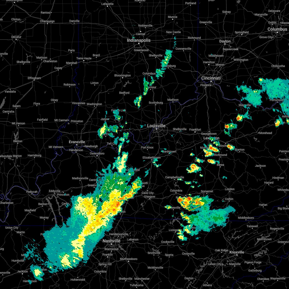 The severe thunderstorm warning for northwestern wayne county will expire at 445 pm edt, the storm which prompted the warning has moved out of the area. therefore, the warning will be allowed to expire. remember, a severe thunderstorm warning still remains in effect for a portion of wayne county. The severe thunderstorm warning for northwestern wayne county will expire at 445 pm edt, the storm which prompted the warning has moved out of the area. therefore, the warning will be allowed to expire. remember, a severe thunderstorm warning still remains in effect for a portion of wayne county.
|
| 10/12/2022 4:26 PM EDT |
 At 426 pm edt, a severe thunderstorm was located near steubenville, or near monticello, moving northeast at 35 mph (radar indicated). Hazards include 60 mph wind gusts and quarter size hail. Hail damage to vehicles is expected. expect wind damage to roofs, siding, and trees. this severe thunderstorm will be near, steubenville around 430 pm edt. mill springs around 435 pm edt. naomi around 440 pm edt. frazer around 445 pm edt. Other locations in the path of this severe thunderstorm include bronston and burnside. At 426 pm edt, a severe thunderstorm was located near steubenville, or near monticello, moving northeast at 35 mph (radar indicated). Hazards include 60 mph wind gusts and quarter size hail. Hail damage to vehicles is expected. expect wind damage to roofs, siding, and trees. this severe thunderstorm will be near, steubenville around 430 pm edt. mill springs around 435 pm edt. naomi around 440 pm edt. frazer around 445 pm edt. Other locations in the path of this severe thunderstorm include bronston and burnside.
|
| 10/12/2022 4:09 PM EDT |
 At 409 pm edt, a severe thunderstorm was located over parnell, or 7 miles northwest of monticello, moving northeast at 35 mph (radar indicated). Hazards include 60 mph wind gusts. Expect damage to roofs, siding, and trees. This severe thunderstorm will remain over mainly rural areas of northwestern wayne county. At 409 pm edt, a severe thunderstorm was located over parnell, or 7 miles northwest of monticello, moving northeast at 35 mph (radar indicated). Hazards include 60 mph wind gusts. Expect damage to roofs, siding, and trees. This severe thunderstorm will remain over mainly rural areas of northwestern wayne county.
|
| 10/12/2022 3:50 PM EDT |
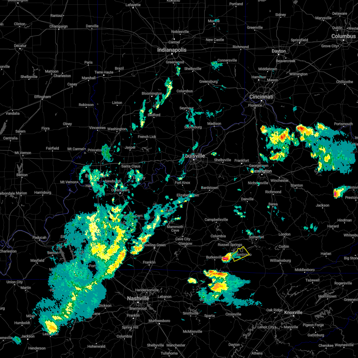 At 348 pm edt, a severe thunderstorm was located 8 miles north of albany, or 16 miles north of byrdstown, moving northeast at 35 mph (radar indicated). Hazards include 60 mph wind gusts. Expect damage to roofs, siding, and trees. this severe thunderstorm will be near, cabell around 400 pm edt. Other locations in the path of this severe thunderstorm include parnell. At 348 pm edt, a severe thunderstorm was located 8 miles north of albany, or 16 miles north of byrdstown, moving northeast at 35 mph (radar indicated). Hazards include 60 mph wind gusts. Expect damage to roofs, siding, and trees. this severe thunderstorm will be near, cabell around 400 pm edt. Other locations in the path of this severe thunderstorm include parnell.
|
| 7/21/2022 12:09 AM EDT |
 At 1209 am edt, a severe thunderstorm was located over parnell, or 7 miles northwest of monticello, moving east at 35 mph (radar indicated). Hazards include 60 mph wind gusts. Expect damage to roofs, siding, and trees. locations impacted include, monticello, steubenville, betsey and frazer. hail threat, radar indicated max hail size, <. 75 in wind threat, radar indicated max wind gust, 60 mph. At 1209 am edt, a severe thunderstorm was located over parnell, or 7 miles northwest of monticello, moving east at 35 mph (radar indicated). Hazards include 60 mph wind gusts. Expect damage to roofs, siding, and trees. locations impacted include, monticello, steubenville, betsey and frazer. hail threat, radar indicated max hail size, <. 75 in wind threat, radar indicated max wind gust, 60 mph.
|
| 7/20/2022 11:53 PM EDT |
 At 1152 pm edt, a severe thunderstorm was located 7 miles southwest of jamestown, or 15 miles west of monticello, moving east at 40 mph (radar indicated). Hazards include 60 mph wind gusts. Expect damage to roofs, siding, and trees. this severe thunderstorm will be near, parnell around 1210 am edt. other locations in the path of this severe thunderstorm include monticello, betsey and frazer. hail threat, radar indicated max hail size, <. 75 in wind threat, radar indicated max wind gust, 60 mph. At 1152 pm edt, a severe thunderstorm was located 7 miles southwest of jamestown, or 15 miles west of monticello, moving east at 40 mph (radar indicated). Hazards include 60 mph wind gusts. Expect damage to roofs, siding, and trees. this severe thunderstorm will be near, parnell around 1210 am edt. other locations in the path of this severe thunderstorm include monticello, betsey and frazer. hail threat, radar indicated max hail size, <. 75 in wind threat, radar indicated max wind gust, 60 mph.
|
| 7/12/2022 5:43 PM EDT |
 At 542 pm edt, a severe thunderstorm was located over alpine, or 12 miles north of whitley city, moving east at 25 mph (radar indicated). Hazards include 60 mph wind gusts and quarter size hail. Hail damage to vehicles is expected. expect wind damage to roofs, siding, and trees. this severe thunderstorm will be near, greenwood around 550 pm edt. parkers lake around 555 pm edt. other locations in the path of this severe thunderstorm include honeybee and cumberland falls s. p. hail threat, radar indicated max hail size, 1. 00 in wind threat, radar indicated max wind gust, 60 mph. At 542 pm edt, a severe thunderstorm was located over alpine, or 12 miles north of whitley city, moving east at 25 mph (radar indicated). Hazards include 60 mph wind gusts and quarter size hail. Hail damage to vehicles is expected. expect wind damage to roofs, siding, and trees. this severe thunderstorm will be near, greenwood around 550 pm edt. parkers lake around 555 pm edt. other locations in the path of this severe thunderstorm include honeybee and cumberland falls s. p. hail threat, radar indicated max hail size, 1. 00 in wind threat, radar indicated max wind gust, 60 mph.
|
| 7/12/2022 5:17 PM EDT |
 At 516 pm edt, a severe thunderstorm was located near steubenville, or near monticello, moving east at 25 mph (radar indicated). Hazards include 60 mph wind gusts and quarter size hail. Hail damage to vehicles is expected. expect wind damage to roofs, siding, and trees. this severe thunderstorm will be near, monticello around 525 pm edt. steubenville around 530 pm edt. betsey around 535 pm edt. other locations in the path of this severe thunderstorm include gregory, delta and denney. hail threat, radar indicated max hail size, 1. 00 in wind threat, radar indicated max wind gust, 60 mph. At 516 pm edt, a severe thunderstorm was located near steubenville, or near monticello, moving east at 25 mph (radar indicated). Hazards include 60 mph wind gusts and quarter size hail. Hail damage to vehicles is expected. expect wind damage to roofs, siding, and trees. this severe thunderstorm will be near, monticello around 525 pm edt. steubenville around 530 pm edt. betsey around 535 pm edt. other locations in the path of this severe thunderstorm include gregory, delta and denney. hail threat, radar indicated max hail size, 1. 00 in wind threat, radar indicated max wind gust, 60 mph.
|
| 6/22/2022 8:23 PM EDT |
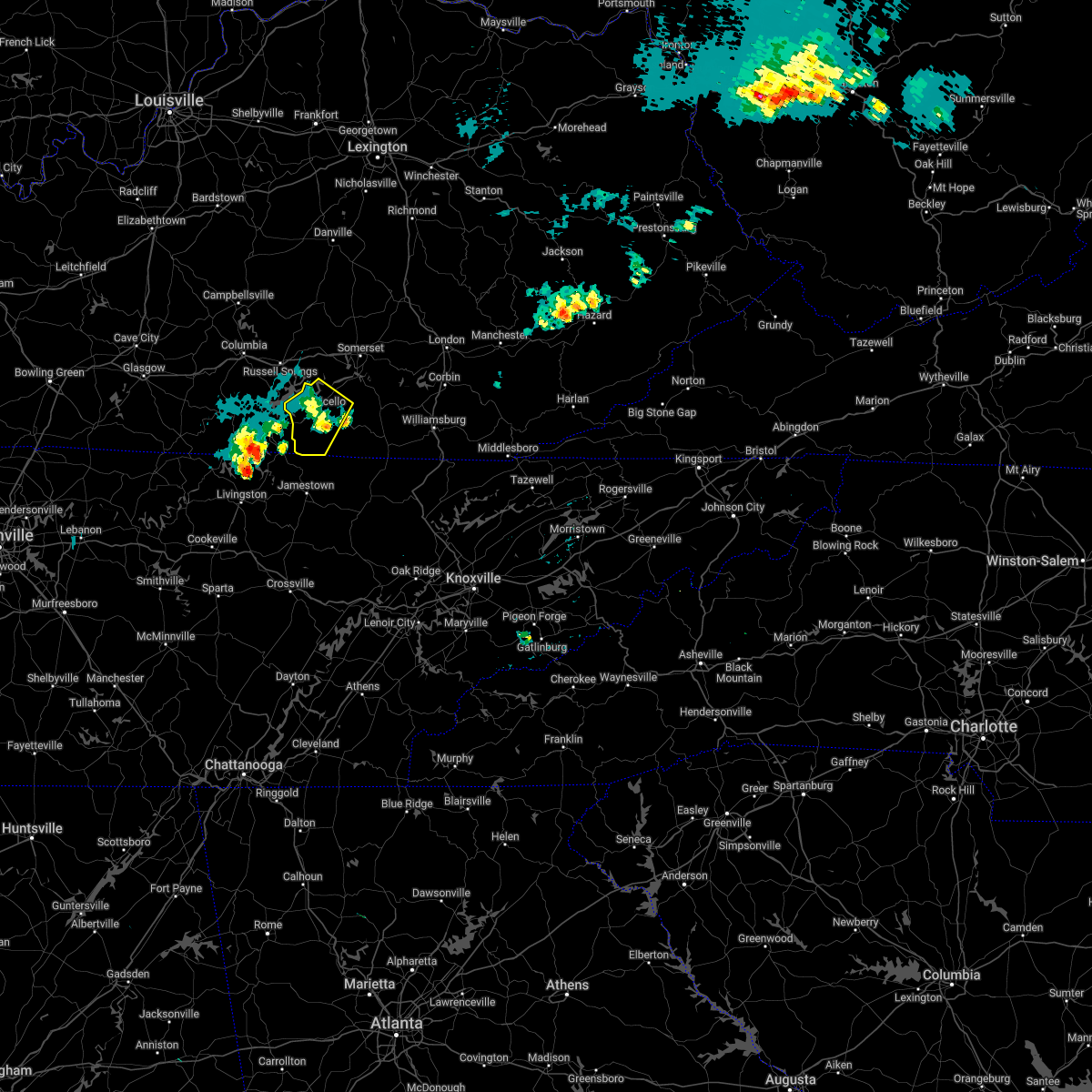 The severe thunderstorm warning for wayne county will expire at 830 pm edt, the storm which prompted the warning has weakened below severe limits, and no longer poses an immediate threat to life or property. therefore, the warning will be allowed to expire. however gusty winds are still possible with this thunderstorm. a severe thunderstorm watch remains in effect until midnight edt for south central kentucky. The severe thunderstorm warning for wayne county will expire at 830 pm edt, the storm which prompted the warning has weakened below severe limits, and no longer poses an immediate threat to life or property. therefore, the warning will be allowed to expire. however gusty winds are still possible with this thunderstorm. a severe thunderstorm watch remains in effect until midnight edt for south central kentucky.
|
| 6/22/2022 8:11 PM EDT |
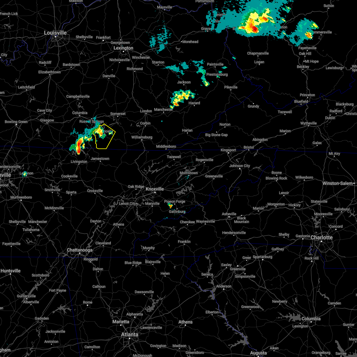 At 811 pm edt, a severe thunderstorm was located over monticello, moving southeast at 35 mph (radar indicated). Hazards include 60 mph wind gusts. Expect damage to roofs, siding, and trees. locations impacted include, cooper, oil valley and coopersville. hail threat, radar indicated max hail size, <. 75 in wind threat, radar indicated max wind gust, 60 mph. At 811 pm edt, a severe thunderstorm was located over monticello, moving southeast at 35 mph (radar indicated). Hazards include 60 mph wind gusts. Expect damage to roofs, siding, and trees. locations impacted include, cooper, oil valley and coopersville. hail threat, radar indicated max hail size, <. 75 in wind threat, radar indicated max wind gust, 60 mph.
|
| 6/22/2022 8:10 PM EDT | Tree down on bowlin roa in wayne county KY, 7.5 miles NE of Monticello, KY |
| 6/22/2022 7:48 PM EDT |
 At 748 pm edt, a severe thunderstorm was located near jamestown, or 14 miles northwest of monticello, moving southeast at 35 mph (radar indicated). Hazards include 60 mph wind gusts and penny size hail. Expect damage to roofs, siding, and trees. this severe thunderstorm will be near, cabell around 800 pm edt. parnell around 805 pm edt. other locations in the path of this severe thunderstorm include cooper, oil valley and coopersville. hail threat, radar indicated max hail size, 0. 75 in wind threat, radar indicated max wind gust, 60 mph. At 748 pm edt, a severe thunderstorm was located near jamestown, or 14 miles northwest of monticello, moving southeast at 35 mph (radar indicated). Hazards include 60 mph wind gusts and penny size hail. Expect damage to roofs, siding, and trees. this severe thunderstorm will be near, cabell around 800 pm edt. parnell around 805 pm edt. other locations in the path of this severe thunderstorm include cooper, oil valley and coopersville. hail threat, radar indicated max hail size, 0. 75 in wind threat, radar indicated max wind gust, 60 mph.
|
| 6/17/2022 12:40 PM EDT |
 At 1240 pm edt, severe thunderstorms were located along a line extending from jep hill to near great meadows campsites, moving east at 45 mph (radar indicated). Hazards include 60 mph wind gusts and penny size hail. Expect damage to roofs, siding, and trees. locations impacted include, somerset, london, monticello, mount vernon, whitley city, science hill, burnside, cains store, donaro, robinet, cumberland falls s. p. and co-operative. hail threat, radar indicated max hail size, 0. 75 in wind threat, radar indicated max wind gust, 60 mph. At 1240 pm edt, severe thunderstorms were located along a line extending from jep hill to near great meadows campsites, moving east at 45 mph (radar indicated). Hazards include 60 mph wind gusts and penny size hail. Expect damage to roofs, siding, and trees. locations impacted include, somerset, london, monticello, mount vernon, whitley city, science hill, burnside, cains store, donaro, robinet, cumberland falls s. p. and co-operative. hail threat, radar indicated max hail size, 0. 75 in wind threat, radar indicated max wind gust, 60 mph.
|
| 6/17/2022 12:31 PM EDT | Wayne county 911 call center reported a large tree blown down across ky-167 in the 700 bloc in wayne county KY, 1.3 miles NNE of Monticello, KY |
| 6/17/2022 12:31 PM EDT | Wayne county 911 reported 2 large trees blown down on ky-1275 n in the 600 block. time estimated from rada in wayne county KY, 2.3 miles SSW of Monticello, KY |
| 6/17/2022 12:31 PM EDT |
 At 1231 pm edt, severe thunderstorms were located along a line extending from burr to near great meadows campsites, moving east at 45 mph (radar indicated). Hazards include 60 mph wind gusts and penny size hail. expect damage to roofs, siding, and trees At 1231 pm edt, severe thunderstorms were located along a line extending from burr to near great meadows campsites, moving east at 45 mph (radar indicated). Hazards include 60 mph wind gusts and penny size hail. expect damage to roofs, siding, and trees
|
| 6/17/2022 12:25 PM EDT | Wayne county 911 call center reported large tree blown down onto ky-858 in the 1000 bloc in wayne county KY, 4.9 miles NE of Monticello, KY |
| 6/17/2022 12:23 PM EDT | Wayne county dispatch reported a large tree blown down onto utility lines along old susie r in wayne county KY, 7.1 miles NE of Monticello, KY |
| 5/26/2022 4:12 PM EDT | A tree was reported to have been blown down on webster drive in the city of monticell in wayne county KY, 0.9 miles E of Monticello, KY |
| 5/26/2022 4:12 PM EDT |
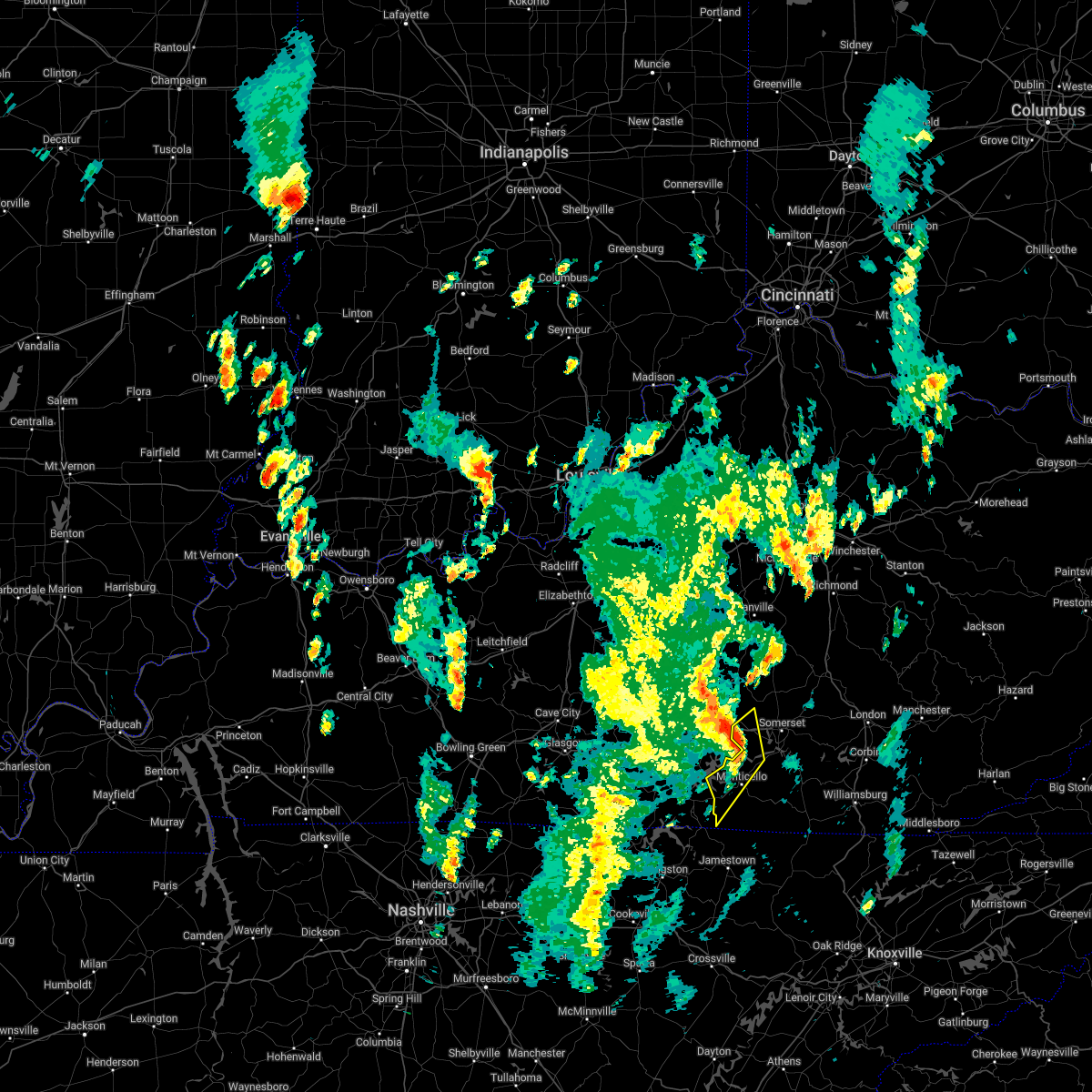 The severe thunderstorm warning for western wayne and southwestern pulaski counties will expire at 415 pm edt, the storms which prompted the warning have moved out of the area. therefore, the warning will be allowed to expire. however gusty winds are still possible with these thunderstorms. The severe thunderstorm warning for western wayne and southwestern pulaski counties will expire at 415 pm edt, the storms which prompted the warning have moved out of the area. therefore, the warning will be allowed to expire. however gusty winds are still possible with these thunderstorms.
|
| 5/26/2022 4:11 PM EDT |
 At 411 pm edt, severe thunderstorms were located along a line extending from near magnum to faubush to monticello, moving northeast at 60 mph (radar indicated). Hazards include 60 mph wind gusts. small hail is also possible. Expect damage to roofs, siding, and trees. severe thunderstorms will be near, pointer around 415 pm edt. hogue around 420 pm edt. science hill around 425 pm edt. somerset pulaski airport around 430 pm edt. other locations in the path of these severe thunderstorms include bee lick and dabney. hail threat, radar indicated max hail size, <. 75 in wind threat, radar indicated max wind gust, 60 mph. At 411 pm edt, severe thunderstorms were located along a line extending from near magnum to faubush to monticello, moving northeast at 60 mph (radar indicated). Hazards include 60 mph wind gusts. small hail is also possible. Expect damage to roofs, siding, and trees. severe thunderstorms will be near, pointer around 415 pm edt. hogue around 420 pm edt. science hill around 425 pm edt. somerset pulaski airport around 430 pm edt. other locations in the path of these severe thunderstorms include bee lick and dabney. hail threat, radar indicated max hail size, <. 75 in wind threat, radar indicated max wind gust, 60 mph.
|
| 5/26/2022 3:59 PM EDT | A tree was reported to have been blown down on ky highway 789 near ramseys point road and the highway department was called to remove the tree from the roadwa in wayne county KY, 8.1 miles SSE of Monticello, KY |
| 5/26/2022 3:44 PM EDT |
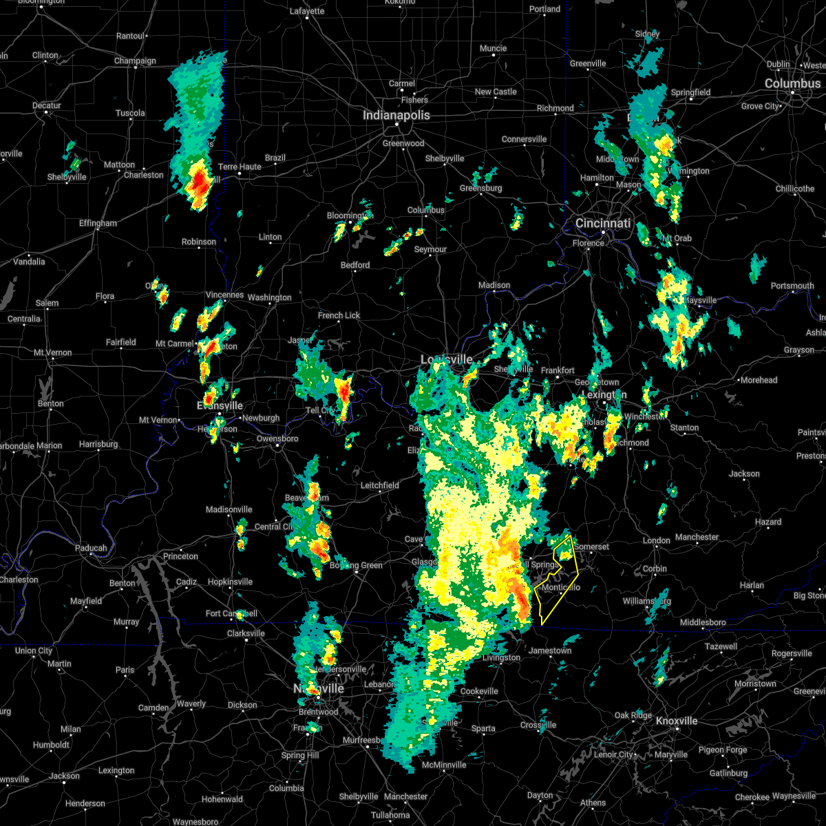 At 344 pm edt, severe thunderstorms were located along a line extending from 9 miles south of columbia to near cabell to near albany, moving northeast at 50 mph (radar indicated). Hazards include 70 mph wind gusts and quarter size hail. Hail damage to vehicles is expected. expect considerable tree damage. wind damage is also likely to mobile homes, roofs, and outbuildings. severe thunderstorms will be near, zula around 355 pm edt. cabell around 400 pm edt. other locations in the path of these severe thunderstorms include parnell and magnum. thunderstorm damage threat, considerable hail threat, radar indicated max hail size, 1. 00 in wind threat, radar indicated max wind gust, 70 mph. At 344 pm edt, severe thunderstorms were located along a line extending from 9 miles south of columbia to near cabell to near albany, moving northeast at 50 mph (radar indicated). Hazards include 70 mph wind gusts and quarter size hail. Hail damage to vehicles is expected. expect considerable tree damage. wind damage is also likely to mobile homes, roofs, and outbuildings. severe thunderstorms will be near, zula around 355 pm edt. cabell around 400 pm edt. other locations in the path of these severe thunderstorms include parnell and magnum. thunderstorm damage threat, considerable hail threat, radar indicated max hail size, 1. 00 in wind threat, radar indicated max wind gust, 70 mph.
|
| 1/1/2022 3:32 PM EST |
 At 332 pm est, severe thunderstorms were located along a line extending from pulaski county park to near steubenville to zula, moving east at 50 mph (radar indicated). Hazards include 60 mph wind gusts. Expect damage to roofs, siding, and trees. Locations impacted include, pulaski county park, somerset, ruth, burnside and delta. At 332 pm est, severe thunderstorms were located along a line extending from pulaski county park to near steubenville to zula, moving east at 50 mph (radar indicated). Hazards include 60 mph wind gusts. Expect damage to roofs, siding, and trees. Locations impacted include, pulaski county park, somerset, ruth, burnside and delta.
|
| 1/1/2022 3:27 PM EST | Wayne county 911 call center reported trees blown down and blocking tate drive off of highway 310 in wayne county KY, 2 miles SW of Monticello, KY |
| 1/1/2022 3:13 PM EST |
 At 313 pm est, severe thunderstorms were located along a line extending from near jamestown to near cabell to near albany, moving east at 50 mph (radar indicated). Hazards include 60 mph wind gusts. Expect damage to roofs, siding, and trees. severe thunderstorms will be near, parnell around 325 pm est. monticello around 330 pm est. Other locations in the path of these severe thunderstorms include steubenville, somerset and quinton. At 313 pm est, severe thunderstorms were located along a line extending from near jamestown to near cabell to near albany, moving east at 50 mph (radar indicated). Hazards include 60 mph wind gusts. Expect damage to roofs, siding, and trees. severe thunderstorms will be near, parnell around 325 pm est. monticello around 330 pm est. Other locations in the path of these severe thunderstorms include steubenville, somerset and quinton.
|
| 10/6/2021 9:41 PM EDT |
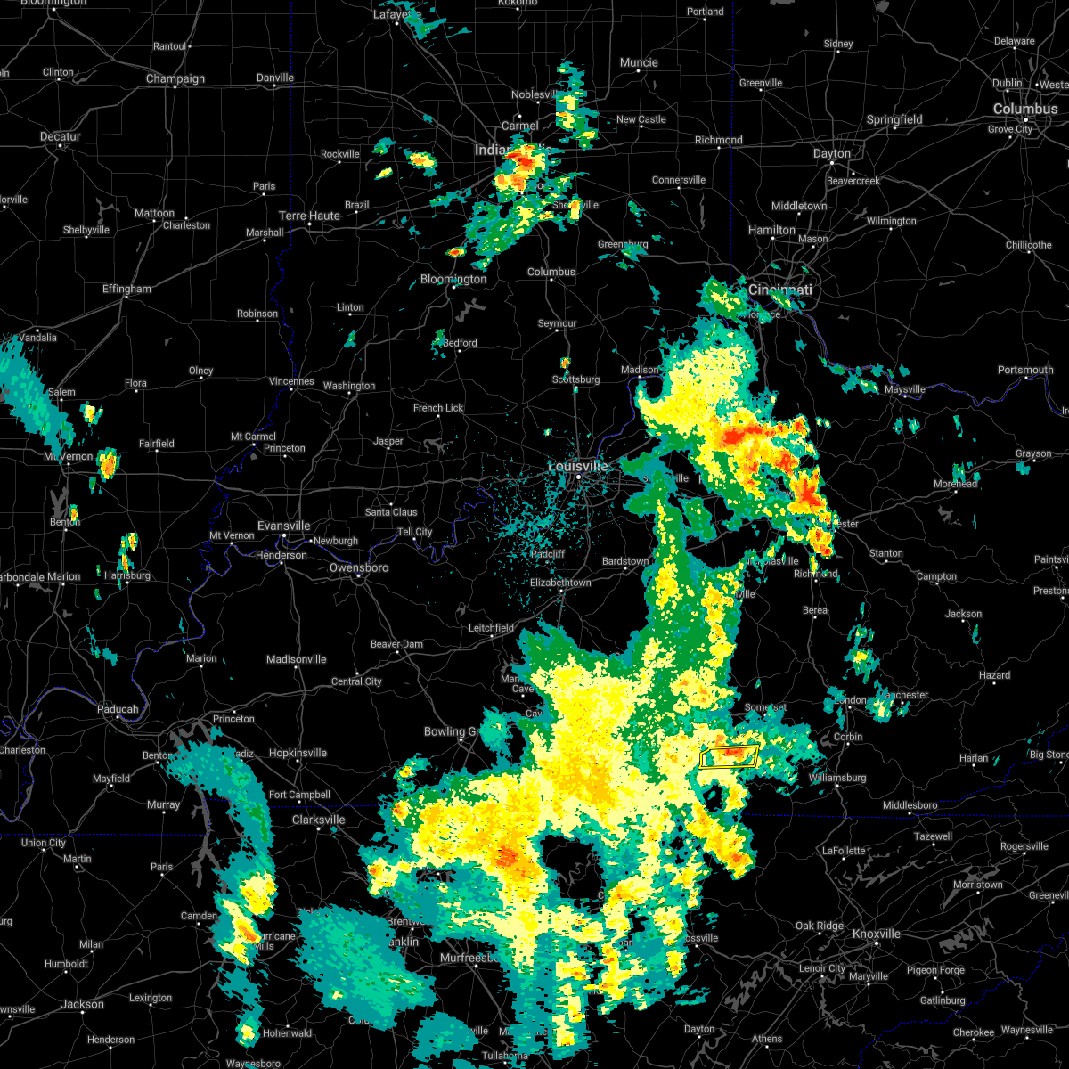 At 941 pm edt, a severe thunderstorm was located over monticello, moving north at 20 mph (radar indicated). Hazards include 60 mph wind gusts and quarter size hail. Hail damage to vehicles is expected. expect wind damage to roofs, siding, and trees. locations impacted include, monticello, cabell, parnell, mill springs, betsey and steubenville. hail threat, radar indicated max hail size, 1. 00 in wind threat, radar indicated max wind gust, 60 mph. At 941 pm edt, a severe thunderstorm was located over monticello, moving north at 20 mph (radar indicated). Hazards include 60 mph wind gusts and quarter size hail. Hail damage to vehicles is expected. expect wind damage to roofs, siding, and trees. locations impacted include, monticello, cabell, parnell, mill springs, betsey and steubenville. hail threat, radar indicated max hail size, 1. 00 in wind threat, radar indicated max wind gust, 60 mph.
|
| 10/6/2021 9:32 PM EDT |
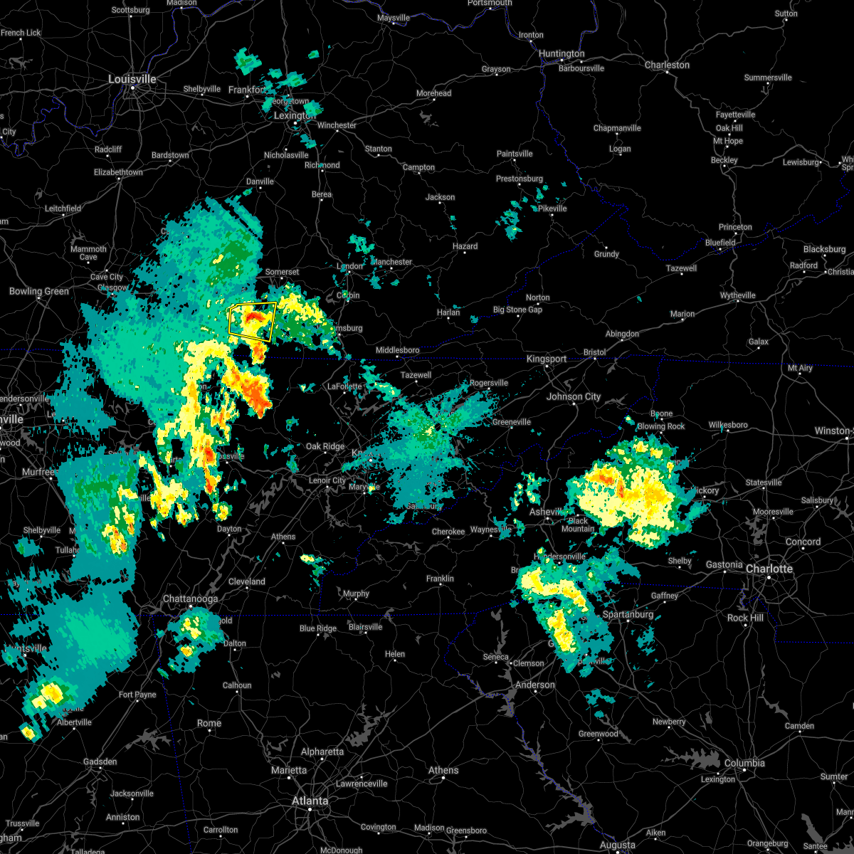 At 932 pm edt, a severe thunderstorm was located over monticello, moving north at 20 mph (radar indicated). Hazards include 60 mph wind gusts and quarter size hail. Hail damage to vehicles is expected. expect wind damage to roofs, siding, and trees. locations impacted include, steubenville and mill springs. hail threat, radar indicated max hail size, 1. 00 in wind threat, radar indicated max wind gust, 60 mph. At 932 pm edt, a severe thunderstorm was located over monticello, moving north at 20 mph (radar indicated). Hazards include 60 mph wind gusts and quarter size hail. Hail damage to vehicles is expected. expect wind damage to roofs, siding, and trees. locations impacted include, steubenville and mill springs. hail threat, radar indicated max hail size, 1. 00 in wind threat, radar indicated max wind gust, 60 mph.
|
| 10/6/2021 9:13 PM EDT |
 At 913 pm edt, a severe thunderstorm was located over slickford, or 8 miles south of monticello, moving north at 20 mph (radar indicated). Hazards include 60 mph wind gusts and quarter size hail. Hail damage to vehicles is expected. expect wind damage to roofs, siding, and trees. this severe thunderstorm will be near, cooper around 925 pm edt. Other locations in the path of this severe thunderstorm include monticello, steubenville and mill springs. At 913 pm edt, a severe thunderstorm was located over slickford, or 8 miles south of monticello, moving north at 20 mph (radar indicated). Hazards include 60 mph wind gusts and quarter size hail. Hail damage to vehicles is expected. expect wind damage to roofs, siding, and trees. this severe thunderstorm will be near, cooper around 925 pm edt. Other locations in the path of this severe thunderstorm include monticello, steubenville and mill springs.
|
| 6/21/2021 4:43 PM EDT |
 The severe thunderstorm warning for northeastern wayne and southwestern pulaski counties will expire at 445 pm edt, the storm which prompted the warning has moved out of the area. therefore, the warning will be allowed to expire. however gusty winds are still possible with this thunderstorm. a severe thunderstorm watch remains in effect until 900 pm edt for south central kentucky. The severe thunderstorm warning for northeastern wayne and southwestern pulaski counties will expire at 445 pm edt, the storm which prompted the warning has moved out of the area. therefore, the warning will be allowed to expire. however gusty winds are still possible with this thunderstorm. a severe thunderstorm watch remains in effect until 900 pm edt for south central kentucky.
|
| 6/21/2021 4:20 PM EDT |
 At 420 pm edt, a severe thunderstorm was located near monticello, moving east at 20 mph (radar indicated). Hazards include 60 mph wind gusts. Expect damage to roofs, siding, and trees. Locations impacted include, steubenville, mill springs, frazer and kidder. At 420 pm edt, a severe thunderstorm was located near monticello, moving east at 20 mph (radar indicated). Hazards include 60 mph wind gusts. Expect damage to roofs, siding, and trees. Locations impacted include, steubenville, mill springs, frazer and kidder.
|
| 6/21/2021 4:18 PM EDT | Wayne county 911 call center reported downed tree blocking highway 1619. time estimated from rada in wayne county KY, 8.9 miles WSW of Monticello, KY |
| 6/21/2021 4:16 PM EDT | Wayne county 911 call center reported tree down on mobile home and vehicle along tennessee avenue. time estimated from rada in wayne county KY, 1.5 miles NNW of Monticello, KY |
| 6/21/2021 4:14 PM EDT | Wayne county 911 call center reported tree down on a home along chesney street. time estimated from rada in wayne county KY, 0.3 miles WSW of Monticello, KY |
| 6/21/2021 4:14 PM EDT | Wayne county 911 call center reported tree down on a home along chesney street. time estimated from rada in wayne county KY, 0.3 miles WSW of Monticello, KY |
| 6/21/2021 4:13 PM EDT | Wayne county 911 call center reported down tree blocking highway 858 near bethesda rd. time estimated from radar. time estimated from rada in wayne county KY, 4.6 miles NE of Monticello, KY |
| 6/21/2021 4:08 PM EDT | Wayne county 911 call center reported downed tree on highway 1720. time estimated from rada in wayne county KY, 3.8 miles SE of Monticello, KY |
| 6/21/2021 4:08 PM EDT |
 At 408 pm edt, a severe thunderstorm was located over parnell, or near monticello, moving east at 20 mph (radar indicated). Hazards include 60 mph wind gusts. Expect damage to roofs, siding, and trees. this severe thunderstorm will be near, monticello around 425 pm edt. Other locations in the path of this severe thunderstorm include steubenville, mill springs, betsey and frazer. At 408 pm edt, a severe thunderstorm was located over parnell, or near monticello, moving east at 20 mph (radar indicated). Hazards include 60 mph wind gusts. Expect damage to roofs, siding, and trees. this severe thunderstorm will be near, monticello around 425 pm edt. Other locations in the path of this severe thunderstorm include steubenville, mill springs, betsey and frazer.
|
| 6/21/2021 4:03 PM EDT | Corrects previous tstm wnd dmg report from 2 nw zula. wayne county 911 call center reported downed tree on highway 1009 near marcum road. time estimated from rada in wayne county KY, 9 miles ENE of Monticello, KY |
| 6/21/2021 4:03 PM EDT | Corrects previous tstm wnd dmg report from 2 nw zula. wayne county 911 call center reported downed tree on highway 1009 near marcum road. time estimated from rada in wayne county KY, 9 miles ENE of Monticello, KY |
| 3/25/2021 11:25 PM EDT |
 At 1125 pm edt, a severe thunderstorm capable of producing a tornado was located over naomi, or 10 miles north of monticello, moving northeast at 55 mph (radar indicated rotation). Hazards include tornado. Flying debris will be dangerous to those caught without shelter. mobile homes will be damaged or destroyed. damage to roofs, windows, and vehicles will occur. tree damage is likely. this dangerous storm will be near, nancy around 1130 pm edt. pulaski county park around 1135 pm edt. somerset around 1140 pm edt. dabney around 1145 pm edt. shopville around 1150 pm edt. Other locations impacted by this tornadic thunderstorm include trimble. At 1125 pm edt, a severe thunderstorm capable of producing a tornado was located over naomi, or 10 miles north of monticello, moving northeast at 55 mph (radar indicated rotation). Hazards include tornado. Flying debris will be dangerous to those caught without shelter. mobile homes will be damaged or destroyed. damage to roofs, windows, and vehicles will occur. tree damage is likely. this dangerous storm will be near, nancy around 1130 pm edt. pulaski county park around 1135 pm edt. somerset around 1140 pm edt. dabney around 1145 pm edt. shopville around 1150 pm edt. Other locations impacted by this tornadic thunderstorm include trimble.
|
| 3/25/2021 11:17 PM EDT |
 At 1116 pm edt, a severe thunderstorm was located near steubenville, or near monticello, moving northeast at 65 mph (radar indicated). Hazards include 60 mph wind gusts and penny size hail. Expect damage to roofs, siding, and trees. Locations impacted include, somerset, monticello, burnside, susie, sloans valley, nancy, barrier, parnell, gregory, bronston, pulaski county park and somerset pulaski airport. At 1116 pm edt, a severe thunderstorm was located near steubenville, or near monticello, moving northeast at 65 mph (radar indicated). Hazards include 60 mph wind gusts and penny size hail. Expect damage to roofs, siding, and trees. Locations impacted include, somerset, monticello, burnside, susie, sloans valley, nancy, barrier, parnell, gregory, bronston, pulaski county park and somerset pulaski airport.
|
| 3/25/2021 11:06 PM EDT |
 At 1105 pm edt, a severe thunderstorm capable of producing a tornado was located over cabell, or 9 miles west of monticello, moving northeast at 65 mph (radar indicated rotation). Hazards include tornado. Flying debris will be dangerous to those caught without shelter. mobile homes will be damaged or destroyed. damage to roofs, windows, and vehicles will occur. tree damage is likely. this dangerous storm will be near, parnell around 1110 pm edt. monticello around 1115 pm edt. mill springs around 1120 pm edt. frazer around 1125 pm edt. somerset around 1130 pm edt. Other locations impacted by this tornadic thunderstorm include alpha. At 1105 pm edt, a severe thunderstorm capable of producing a tornado was located over cabell, or 9 miles west of monticello, moving northeast at 65 mph (radar indicated rotation). Hazards include tornado. Flying debris will be dangerous to those caught without shelter. mobile homes will be damaged or destroyed. damage to roofs, windows, and vehicles will occur. tree damage is likely. this dangerous storm will be near, parnell around 1110 pm edt. monticello around 1115 pm edt. mill springs around 1120 pm edt. frazer around 1125 pm edt. somerset around 1130 pm edt. Other locations impacted by this tornadic thunderstorm include alpha.
|
| 3/25/2021 11:02 PM EDT |
 At 1101 pm edt, a severe thunderstorm was located near albany, or 13 miles north of byrdstown, moving northeast at 65 mph (radar indicated). Hazards include 60 mph wind gusts and penny size hail. expect damage to roofs, siding, and trees At 1101 pm edt, a severe thunderstorm was located near albany, or 13 miles north of byrdstown, moving northeast at 65 mph (radar indicated). Hazards include 60 mph wind gusts and penny size hail. expect damage to roofs, siding, and trees
|
| 2/28/2021 9:41 PM EST |
 The severe thunderstorm warning for eastern wayne, south central pulaski and northwestern mccreary counties will expire at 945 pm est, the storm which prompted the warning has weakened below severe limits, and no longer poses an immediate threat to life or property. therefore, the warning will be allowed to expire. however heavy rain is still possible with this thunderstorm. The severe thunderstorm warning for eastern wayne, south central pulaski and northwestern mccreary counties will expire at 945 pm est, the storm which prompted the warning has weakened below severe limits, and no longer poses an immediate threat to life or property. therefore, the warning will be allowed to expire. however heavy rain is still possible with this thunderstorm.
|
| 2/28/2021 9:36 PM EST |
 At 935 pm est, a severe thunderstorm was located over gregory, or near monticello, moving east at 60 mph (radar indicated). Hazards include 60 mph wind gusts. Expect damage to roofs, siding, and trees. Locations impacted include, monticello, whitley city, burnside, oil valley, slavens, coopersville, sloans valley, burfield, barrier, kidds crossing, gregory and quinton. At 935 pm est, a severe thunderstorm was located over gregory, or near monticello, moving east at 60 mph (radar indicated). Hazards include 60 mph wind gusts. Expect damage to roofs, siding, and trees. Locations impacted include, monticello, whitley city, burnside, oil valley, slavens, coopersville, sloans valley, burfield, barrier, kidds crossing, gregory and quinton.
|
| 2/28/2021 9:20 PM EST |
 At 920 pm est, a severe thunderstorm was located over zula, or 9 miles southwest of monticello, moving east at 60 mph (radar indicated). Hazards include 60 mph wind gusts and penny size hail. expect damage to roofs, siding, and trees At 920 pm est, a severe thunderstorm was located over zula, or 9 miles southwest of monticello, moving east at 60 mph (radar indicated). Hazards include 60 mph wind gusts and penny size hail. expect damage to roofs, siding, and trees
|
| 7/5/2020 3:28 PM EDT |
 The severe thunderstorm warning for northwestern wayne county will expire at 330 pm edt, the storm which prompted the warning has weakened below severe limits, and no longer poses an immediate threat to life or property. therefore, the warning will be allowed to expire. however gusty winds and heavy rain are still possible with this thunderstorm. The severe thunderstorm warning for northwestern wayne county will expire at 330 pm edt, the storm which prompted the warning has weakened below severe limits, and no longer poses an immediate threat to life or property. therefore, the warning will be allowed to expire. however gusty winds and heavy rain are still possible with this thunderstorm.
|
| 7/5/2020 3:20 PM EDT |
 At 320 pm edt, a severe thunderstorm was located over susie, or near monticello, and is nearly stationary (radar indicated). Hazards include 60 mph wind gusts and penny size hail. Expect damage to roofs, siding, and trees. Locations impacted include, monticello, cabell, parnell, susie, zula and alpha. At 320 pm edt, a severe thunderstorm was located over susie, or near monticello, and is nearly stationary (radar indicated). Hazards include 60 mph wind gusts and penny size hail. Expect damage to roofs, siding, and trees. Locations impacted include, monticello, cabell, parnell, susie, zula and alpha.
|
| 7/5/2020 3:06 PM EDT |
 At 305 pm edt, a severe thunderstorm was located over susie, or near monticello, and is nearly stationary (radar indicated). Hazards include 60 mph wind gusts and penny size hail. expect damage to roofs, siding, and trees At 305 pm edt, a severe thunderstorm was located over susie, or near monticello, and is nearly stationary (radar indicated). Hazards include 60 mph wind gusts and penny size hail. expect damage to roofs, siding, and trees
|
| 6/21/2020 5:40 PM EDT | Carport toppled into electrical lines. time estimated from rada in wayne county KY, 8.2 miles E of Monticello, KY |
| 3/3/2020 3:00 AM EST | A tree was blown dow in wayne county KY, 1.6 miles NNE of Monticello, KY |
| 1/11/2020 1:13 PM EST |
 The severe thunderstorm warning for western wayne county will expire at 115 pm est, the storm which prompted the warning has weakened below severe limits, and has exited the warned area. therefore, the warning will be allowed to expire. however gusty winds are still possible with this thunderstorm. a severe thunderstorm watch remains in effect until 500 pm est for south central kentucky. The severe thunderstorm warning for western wayne county will expire at 115 pm est, the storm which prompted the warning has weakened below severe limits, and has exited the warned area. therefore, the warning will be allowed to expire. however gusty winds are still possible with this thunderstorm. a severe thunderstorm watch remains in effect until 500 pm est for south central kentucky.
|
| 1/11/2020 12:56 PM EST |
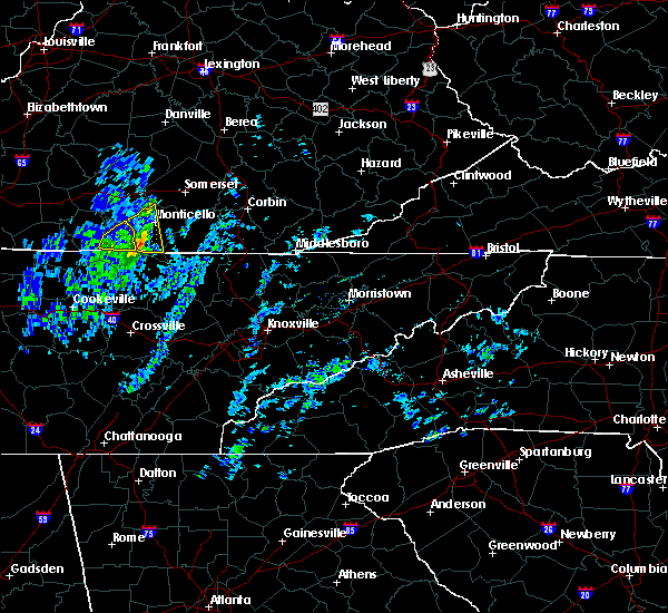 At 1256 pm est, a severe thunderstorm was located over cooper, or near monticello, moving northeast at 50 mph (radar indicated). Hazards include 60 mph wind gusts. Expect damage to roofs, siding, and trees. Locations impacted include, monticello, susie, parnell, hidalgo, slickford, cabell, zula, mount pisgah, powersburg, sunnybrook, cooper and burfield. At 1256 pm est, a severe thunderstorm was located over cooper, or near monticello, moving northeast at 50 mph (radar indicated). Hazards include 60 mph wind gusts. Expect damage to roofs, siding, and trees. Locations impacted include, monticello, susie, parnell, hidalgo, slickford, cabell, zula, mount pisgah, powersburg, sunnybrook, cooper and burfield.
|
| 1/11/2020 12:41 PM EST |
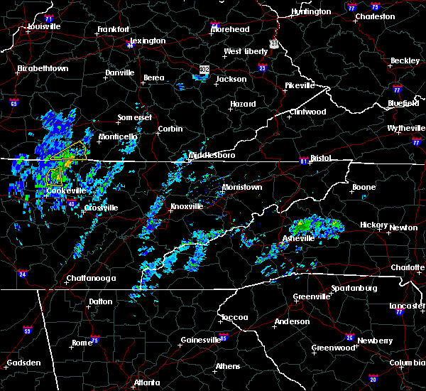 At 1240 pm est, a severe thunderstorm was located over albany, or 7 miles north of byrdstown, moving northeast at 60 mph (radar indicated). Hazards include 60 mph wind gusts. expect damage to roofs, siding, and trees At 1240 pm est, a severe thunderstorm was located over albany, or 7 miles north of byrdstown, moving northeast at 60 mph (radar indicated). Hazards include 60 mph wind gusts. expect damage to roofs, siding, and trees
|
| 7/30/2019 7:34 PM EDT | Golf Ball sized hail reported 1.7 miles SSW of Monticello, KY, police officer reported hail as large as golf balls. |
| 6/23/2019 6:21 PM EDT | Trees dow in wayne county KY, 0.3 miles WSW of Monticello, KY |
| 6/23/2019 6:03 PM EDT |
 At 603 pm edt, severe thunderstorms were located along a line extending from 10 miles northeast of columbia to powersburg, moving east at 35 mph (radar indicated). Hazards include 60 mph wind gusts. expect damage to roofs, siding, and trees At 603 pm edt, severe thunderstorms were located along a line extending from 10 miles northeast of columbia to powersburg, moving east at 35 mph (radar indicated). Hazards include 60 mph wind gusts. expect damage to roofs, siding, and trees
|
| 6/21/2019 10:17 PM EDT |
 At 1016 pm edt, a severe thunderstorm was located over naomi, or 10 miles southwest of somerset, moving east at 45 mph (radar indicated). Hazards include 60 mph wind gusts and penny size hail. Expect damage to roofs, siding, and trees. Locations impacted include, somerset, monticello, burnside, cains store, stab, nancy, pointer, bronston, pulaski county park, somerset pulaski airport, kidder and hogue. At 1016 pm edt, a severe thunderstorm was located over naomi, or 10 miles southwest of somerset, moving east at 45 mph (radar indicated). Hazards include 60 mph wind gusts and penny size hail. Expect damage to roofs, siding, and trees. Locations impacted include, somerset, monticello, burnside, cains store, stab, nancy, pointer, bronston, pulaski county park, somerset pulaski airport, kidder and hogue.
|
| 6/21/2019 10:11 PM EDT | A utility pole fell next to a firework tent at the cumberland crossing shopping center in monticello and then the tent came down 5 minutes later with another wind gus in wayne county KY, 0.3 miles WSW of Monticello, KY |
| 6/21/2019 9:56 PM EDT |
 At 955 pm edt, a severe thunderstorm was located near jamestown, or 18 miles northwest of monticello, moving east at 50 mph (radar indicated). Hazards include 60 mph wind gusts and penny size hail. expect damage to roofs, siding, and trees At 955 pm edt, a severe thunderstorm was located near jamestown, or 18 miles northwest of monticello, moving east at 50 mph (radar indicated). Hazards include 60 mph wind gusts and penny size hail. expect damage to roofs, siding, and trees
|
| 8/8/2018 2:10 PM EDT |
 At 159 pm edt, a severe thunderstorm was located over parnell, or near monticello, moving northeast at 30 mph (radar indicated). Hazards include 60 mph wind gusts and quarter size hail. Hail damage to vehicles is expected. expect wind damage to roofs, siding, and trees. Locations impacted include, monticello, burnside, susie, sloans valley, nancy, parnell, gregory, bronston, pulaski county park, cabell, kidder and naomi. At 159 pm edt, a severe thunderstorm was located over parnell, or near monticello, moving northeast at 30 mph (radar indicated). Hazards include 60 mph wind gusts and quarter size hail. Hail damage to vehicles is expected. expect wind damage to roofs, siding, and trees. Locations impacted include, monticello, burnside, susie, sloans valley, nancy, parnell, gregory, bronston, pulaski county park, cabell, kidder and naomi.
|
| 8/8/2018 2:02 PM EDT | Power line down on tree which resulted in tree catching on fire. time estimated from rada in wayne county KY, 1.6 miles ESE of Monticello, KY |
| 8/8/2018 2:00 PM EDT |
 At 153 pm edt, a severe thunderstorm was located over parnell, or near monticello, moving northeast at 30 mph (radar indicated). Hazards include 60 mph wind gusts. expect damage to roofs, siding, and trees At 153 pm edt, a severe thunderstorm was located over parnell, or near monticello, moving northeast at 30 mph (radar indicated). Hazards include 60 mph wind gusts. expect damage to roofs, siding, and trees
|
| 8/8/2018 1:54 PM EDT |
 At 153 pm edt, a severe thunderstorm was located over parnell, or near monticello, moving northeast at 30 mph (radar indicated). Hazards include 60 mph wind gusts. expect damage to roofs, siding, and trees At 153 pm edt, a severe thunderstorm was located over parnell, or near monticello, moving northeast at 30 mph (radar indicated). Hazards include 60 mph wind gusts. expect damage to roofs, siding, and trees
|
| 7/21/2018 1:20 AM EDT |
 At 120 am edt, a severe thunderstorm was located over susie, or near monticello, moving southeast at 40 mph (radar indicated). Hazards include 60 mph wind gusts. Expect damage to roofs, siding, and trees. Locations impacted include, monticello, parmleysville, oil valley, coopersville, susie, burfield, barrier, kidds crossing, hidalgo, rockeybranch, slickford and griffin. At 120 am edt, a severe thunderstorm was located over susie, or near monticello, moving southeast at 40 mph (radar indicated). Hazards include 60 mph wind gusts. Expect damage to roofs, siding, and trees. Locations impacted include, monticello, parmleysville, oil valley, coopersville, susie, burfield, barrier, kidds crossing, hidalgo, rockeybranch, slickford and griffin.
|
| 7/21/2018 1:02 AM EDT |
 At 102 am edt, a severe thunderstorm was located over cabell, or 11 miles west of monticello, moving southeast at 40 mph (radar indicated). Hazards include 60 mph wind gusts. expect damage to roofs, siding, and trees At 102 am edt, a severe thunderstorm was located over cabell, or 11 miles west of monticello, moving southeast at 40 mph (radar indicated). Hazards include 60 mph wind gusts. expect damage to roofs, siding, and trees
|
| 7/20/2018 8:33 PM EDT | Tree down on power line in monticell in wayne county KY, 0.3 miles WSW of Monticello, KY |
| 7/20/2018 8:32 PM EDT |
 At 831 pm edt, a severe thunderstorm was located over cooper, or near monticello, moving southeast at 30 mph (radar indicated). Hazards include 70 mph wind gusts and nickel size hail. Expect considerable tree damage. Damage is likely to mobile homes, roofs, and outbuildings. At 831 pm edt, a severe thunderstorm was located over cooper, or near monticello, moving southeast at 30 mph (radar indicated). Hazards include 70 mph wind gusts and nickel size hail. Expect considerable tree damage. Damage is likely to mobile homes, roofs, and outbuildings.
|
| 7/16/2018 4:31 PM EDT | Large tree branch down near the intersection of logan barnes road and highway 1546. relayed via twitte in wayne county KY, 7.6 miles E of Monticello, KY |
| 5/31/2018 5:53 PM EDT |
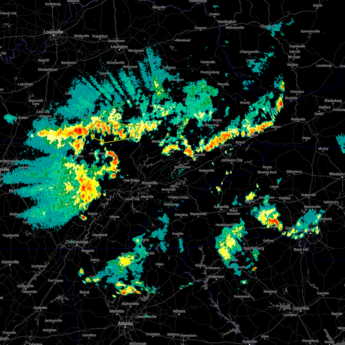 At 552 pm edt, severe thunderstorms were located along a line extending from bark camp to near marshes siding to near slickford, moving east at 45 mph (radar indicated). Hazards include 60 mph wind gusts. Expect damage to roofs, siding, and trees. locations impacted include, monticello, williamsburg, whitley city, parmleysville, parnell, cumberland falls s. p. Co- operative, goldbug, slickford, ritner, krupp, youngs creek, blue heron, honeybee, coopersville, greenwood, beulah heights, kidds crossing, hidalgo and rockeybranch. At 552 pm edt, severe thunderstorms were located along a line extending from bark camp to near marshes siding to near slickford, moving east at 45 mph (radar indicated). Hazards include 60 mph wind gusts. Expect damage to roofs, siding, and trees. locations impacted include, monticello, williamsburg, whitley city, parmleysville, parnell, cumberland falls s. p. Co- operative, goldbug, slickford, ritner, krupp, youngs creek, blue heron, honeybee, coopersville, greenwood, beulah heights, kidds crossing, hidalgo and rockeybranch.
|
| 5/31/2018 5:40 PM EDT | Two trees were reported to have been downed. the time of the event is estimated from radar dat in wayne county KY, 0.3 miles WSW of Monticello, KY |
| 5/31/2018 5:30 PM EDT | A tree was reported to have been blown down. the time of the event is estimated from rada in wayne county KY, 7 miles S of Monticello, KY |
| 5/31/2018 5:27 PM EDT |
 The national weather service in jackson ky has issued a * severe thunderstorm warning for. wayne county in south central kentucky. southern pulaski county in south central kentucky. mccreary county in south central kentucky. Northwestern whitley county in south central kentucky. The national weather service in jackson ky has issued a * severe thunderstorm warning for. wayne county in south central kentucky. southern pulaski county in south central kentucky. mccreary county in south central kentucky. Northwestern whitley county in south central kentucky.
|
| 5/10/2018 11:38 PM EDT |
 At 1137 pm edt, a severe thunderstorm was located over naomi, or 11 miles north of monticello, moving east at 30 mph (radar indicated). Hazards include 60 mph wind gusts and quarter size hail. Hail damage to vehicles is expected. Expect wind damage to roofs, siding, and trees. At 1137 pm edt, a severe thunderstorm was located over naomi, or 11 miles north of monticello, moving east at 30 mph (radar indicated). Hazards include 60 mph wind gusts and quarter size hail. Hail damage to vehicles is expected. Expect wind damage to roofs, siding, and trees.
|
| 5/5/2018 4:52 PM EDT |
 At 451 pm edt, a severe thunderstorm was located over betsey, or near monticello, moving northeast at 40 mph (radar indicated). Hazards include 70 mph wind gusts and penny size hail. Expect considerable tree damage. damage is likely to mobile homes, roofs, and outbuildings. Locations impacted include, monticello, parmleysville, oil valley, coopersville, barrier, parnell, kidds crossing, gregory, rockeybranch, betsey, ritner, delta, frazer, denney, kidder, griffin, mill springs, steubenville and burfield. At 451 pm edt, a severe thunderstorm was located over betsey, or near monticello, moving northeast at 40 mph (radar indicated). Hazards include 70 mph wind gusts and penny size hail. Expect considerable tree damage. damage is likely to mobile homes, roofs, and outbuildings. Locations impacted include, monticello, parmleysville, oil valley, coopersville, barrier, parnell, kidds crossing, gregory, rockeybranch, betsey, ritner, delta, frazer, denney, kidder, griffin, mill springs, steubenville and burfield.
|
| 5/5/2018 4:42 PM EDT | Several trees down on east hwy 9 in wayne county KY, 6.7 miles NW of Monticello, KY |
| 5/5/2018 4:42 PM EDT | Trees down in city limit in wayne county KY, 0.3 miles WSW of Monticello, KY |
| 5/5/2018 4:32 PM EDT |
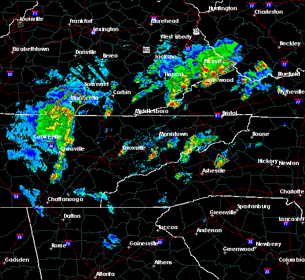 At 430 pm edt, a severe thunderstorm was located over hidalgo, or 8 miles southwest of monticello, moving northeast at 40 mph (radar indicated). Hazards include 70 mph wind gusts and penny size hail. Expect considerable tree damage. damage is likely to mobile homes, roofs, and outbuildings. Locations impacted include, monticello, parmleysville, susie, barrier, parnell, gregory, slickford, ritner, cabell, denney, kidder, powersburg, oil valley, coopersville, burfield, kidds crossing, hidalgo, rockeybranch, betsey and delta. At 430 pm edt, a severe thunderstorm was located over hidalgo, or 8 miles southwest of monticello, moving northeast at 40 mph (radar indicated). Hazards include 70 mph wind gusts and penny size hail. Expect considerable tree damage. damage is likely to mobile homes, roofs, and outbuildings. Locations impacted include, monticello, parmleysville, susie, barrier, parnell, gregory, slickford, ritner, cabell, denney, kidder, powersburg, oil valley, coopersville, burfield, kidds crossing, hidalgo, rockeybranch, betsey and delta.
|
| 5/5/2018 4:12 PM EDT |
 At 411 pm edt, a severe thunderstorm was located near byrdstown, moving northeast at 40 mph (radar indicated). Hazards include 60 mph wind gusts and penny size hail. expect damage to roofs, siding, and trees At 411 pm edt, a severe thunderstorm was located near byrdstown, moving northeast at 40 mph (radar indicated). Hazards include 60 mph wind gusts and penny size hail. expect damage to roofs, siding, and trees
|
| 3/17/2018 6:25 PM EDT |
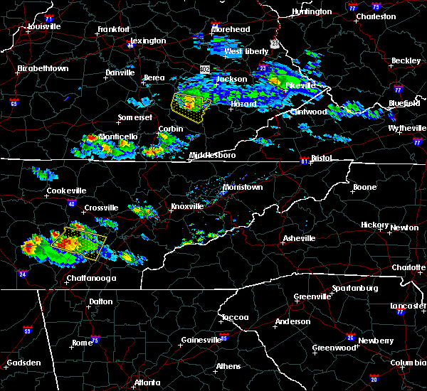 At 624 pm edt, a severe thunderstorm was located over parnell, or near monticello, moving east at 35 mph (radar indicated). Hazards include 60 mph wind gusts and nickel size hail. expect damage to roofs, siding, and trees At 624 pm edt, a severe thunderstorm was located over parnell, or near monticello, moving east at 35 mph (radar indicated). Hazards include 60 mph wind gusts and nickel size hail. expect damage to roofs, siding, and trees
|
| 2/25/2018 1:10 AM EST |
 The severe thunderstorm warning for northern wayne, pulaski and rockcastle counties will expire at 115 am est, the storms which prompted the warning have weakened below severe limits, and no longer pose an immediate threat to life or property. therefore the warning will be allowed to expire. however gusty winds are still possible with these thunderstorms. The severe thunderstorm warning for northern wayne, pulaski and rockcastle counties will expire at 115 am est, the storms which prompted the warning have weakened below severe limits, and no longer pose an immediate threat to life or property. therefore the warning will be allowed to expire. however gusty winds are still possible with these thunderstorms.
|
| 2/25/2018 12:41 AM EST |
 At 1240 am est, severe thunderstorms were located along a line extending from near stanford to near cabell, moving east at 45 mph (radar indicated). Hazards include 60 mph wind gusts. Expect damage to roofs, siding, and trees. Locations impacted include, somerset, monticello, mount vernon, boone, science hill, burnside, cains store, bummer, sloans valley, gum sulphur, parnell, bandy, bronston, woodstock, roundstone, spiro, wabp, climax, hansford and dabney. At 1240 am est, severe thunderstorms were located along a line extending from near stanford to near cabell, moving east at 45 mph (radar indicated). Hazards include 60 mph wind gusts. Expect damage to roofs, siding, and trees. Locations impacted include, somerset, monticello, mount vernon, boone, science hill, burnside, cains store, bummer, sloans valley, gum sulphur, parnell, bandy, bronston, woodstock, roundstone, spiro, wabp, climax, hansford and dabney.
|
| 2/25/2018 12:16 AM EST |
 At 1216 am est, severe thunderstorms were located along a line extending from 8 miles northwest of liberty to burkesville, moving east at 45 mph (radar indicated). Hazards include 60 mph wind gusts. expect damage to roofs, siding, and trees At 1216 am est, severe thunderstorms were located along a line extending from 8 miles northwest of liberty to burkesville, moving east at 45 mph (radar indicated). Hazards include 60 mph wind gusts. expect damage to roofs, siding, and trees
|
| 7/23/2017 7:30 PM EDT | Large limbs landed on storage building oning causing it to collapse. report from social media in wayne county KY, 0.3 miles WSW of Monticello, KY |
| 7/6/2017 5:45 PM EDT |
 At 545 pm edt, severe thunderstorms were located along a line extending from greenmount to cumberland falls s.p. to near great meadows campsites, moving east at 45 mph (radar indicated). Hazards include 60 mph wind gusts and quarter size hail. Hail damage to vehicles is expected. expect wind damage to roofs, siding, and trees. locations impacted include, london, monticello, mount vernon, whitley city, donaro, robinet, fariston, cumberland falls s. p. Co- operative, horse lick, spiro, mount victory, renfro valley, krupp, mershons, hazel patch, pine hill, bark camp, blue heron and camp wildcat. At 545 pm edt, severe thunderstorms were located along a line extending from greenmount to cumberland falls s.p. to near great meadows campsites, moving east at 45 mph (radar indicated). Hazards include 60 mph wind gusts and quarter size hail. Hail damage to vehicles is expected. expect wind damage to roofs, siding, and trees. locations impacted include, london, monticello, mount vernon, whitley city, donaro, robinet, fariston, cumberland falls s. p. Co- operative, horse lick, spiro, mount victory, renfro valley, krupp, mershons, hazel patch, pine hill, bark camp, blue heron and camp wildcat.
|
| 7/6/2017 5:23 PM EDT | Trees down across eads street in monticello in wayne county KY, 0.3 miles WSW of Monticello, KY |
| 7/6/2017 5:20 PM EDT |
 At 519 pm edt, severe thunderstorms were located along a line extending from wabp to kidder to near albany, moving east at 45 mph (radar indicated). Hazards include 60 mph wind gusts and quarter size hail. Hail damage to vehicles is expected. Expect wind damage to roofs, siding, and trees. At 519 pm edt, severe thunderstorms were located along a line extending from wabp to kidder to near albany, moving east at 45 mph (radar indicated). Hazards include 60 mph wind gusts and quarter size hail. Hail damage to vehicles is expected. Expect wind damage to roofs, siding, and trees.
|
| 4/30/2017 7:19 PM EDT |
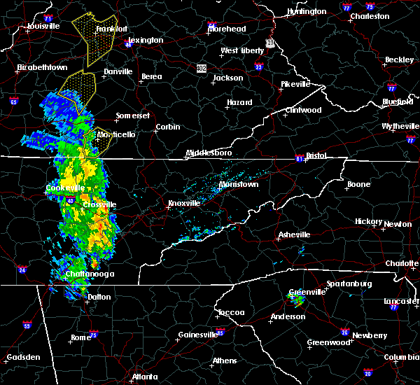 At 718 pm edt, a severe thunderstorm was located near steubenville, or near monticello, moving northeast at 45 mph (radar indicated). Hazards include 60 mph wind gusts. Expect damage to roofs, siding, and trees. Locations impacted include, monticello, oil valley, coopersville, susie, burfield, barrier, parnell, hidalgo, gregory, rockeybranch, slickford, betsey, delta, zula, mill springs, mount pisgah, powersburg, sunnybrook, steubenville and cooper. At 718 pm edt, a severe thunderstorm was located near steubenville, or near monticello, moving northeast at 45 mph (radar indicated). Hazards include 60 mph wind gusts. Expect damage to roofs, siding, and trees. Locations impacted include, monticello, oil valley, coopersville, susie, burfield, barrier, parnell, hidalgo, gregory, rockeybranch, slickford, betsey, delta, zula, mill springs, mount pisgah, powersburg, sunnybrook, steubenville and cooper.
|
| 4/30/2017 6:58 PM EDT |
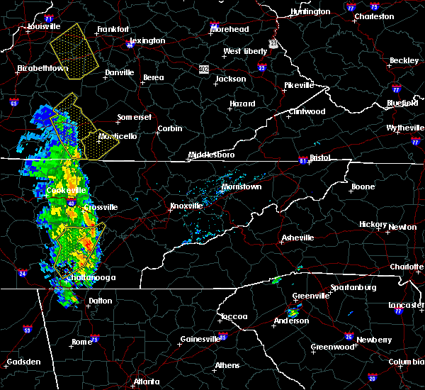 At 657 pm edt, a severe thunderstorm was located near powersburg, or 10 miles northeast of byrdstown, moving northeast at 45 mph (radar indicated). Hazards include 60 mph wind gusts. expect damage to roofs, siding, and trees At 657 pm edt, a severe thunderstorm was located near powersburg, or 10 miles northeast of byrdstown, moving northeast at 45 mph (radar indicated). Hazards include 60 mph wind gusts. expect damage to roofs, siding, and trees
|
| 3/27/2017 7:24 PM EDT |
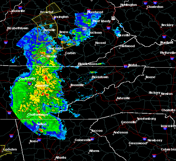 The severe thunderstorm warning for wayne county will expire at 730 pm edt, the storm which prompted the warning has weakened below severe limits, and has exited the warned area. therefore, the warning will be allowed to expire. however gusty winds are still possible with this thunderstorm. a severe thunderstorm watch remains in effect until 1100 pm edt for south central kentucky. The severe thunderstorm warning for wayne county will expire at 730 pm edt, the storm which prompted the warning has weakened below severe limits, and has exited the warned area. therefore, the warning will be allowed to expire. however gusty winds are still possible with this thunderstorm. a severe thunderstorm watch remains in effect until 1100 pm edt for south central kentucky.
|
| 3/27/2017 7:00 PM EDT |
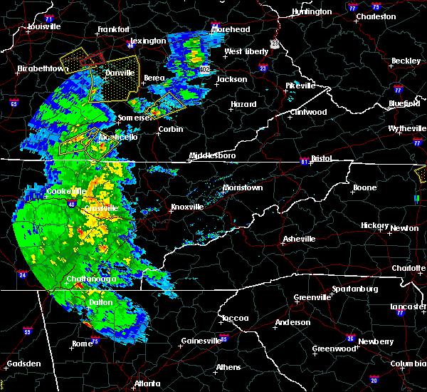 At 700 pm edt, a severe thunderstorm was located over cooper, or near monticello, moving northeast at 35 mph (radar indicated). Hazards include 60 mph wind gusts and quarter size hail. Hail damage to vehicles is expected. expect wind damage to roofs, siding, and trees. Locations impacted include, monticello, oil valley, coopersville, susie, burfield, barrier, hidalgo, gregory, rockeybranch, slickford, betsey, delta, denney, zula, mill springs, mount pisgah, powersburg, steubenville, cooper and alpha. At 700 pm edt, a severe thunderstorm was located over cooper, or near monticello, moving northeast at 35 mph (radar indicated). Hazards include 60 mph wind gusts and quarter size hail. Hail damage to vehicles is expected. expect wind damage to roofs, siding, and trees. Locations impacted include, monticello, oil valley, coopersville, susie, burfield, barrier, hidalgo, gregory, rockeybranch, slickford, betsey, delta, denney, zula, mill springs, mount pisgah, powersburg, steubenville, cooper and alpha.
|
| 3/27/2017 6:43 PM EDT |
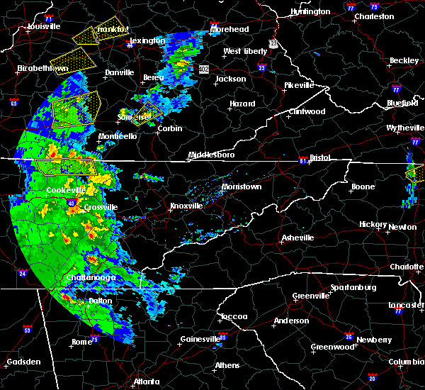 At 643 pm edt, a severe thunderstorm was located over sunnybrook, or 11 miles northeast of byrdstown, moving northeast at 35 mph (radar indicated). Hazards include 60 mph wind gusts and quarter size hail. Hail damage to vehicles is expected. Expect wind damage to roofs, siding, and trees. At 643 pm edt, a severe thunderstorm was located over sunnybrook, or 11 miles northeast of byrdstown, moving northeast at 35 mph (radar indicated). Hazards include 60 mph wind gusts and quarter size hail. Hail damage to vehicles is expected. Expect wind damage to roofs, siding, and trees.
|
| 3/1/2017 9:21 AM EST |
 At 921 am est, severe thunderstorms were located along a line extending from grace to near huxley to near cabell, moving southeast at 40 mph (radar indicated). Hazards include 70 mph wind gusts. Expect considerable tree damage. Damage is likely to mobile homes, roofs, and outbuildings. At 921 am est, severe thunderstorms were located along a line extending from grace to near huxley to near cabell, moving southeast at 40 mph (radar indicated). Hazards include 70 mph wind gusts. Expect considerable tree damage. Damage is likely to mobile homes, roofs, and outbuildings.
|
| 3/1/2017 8:40 AM EST |
 At 840 am est, severe thunderstorms were located along a line extending from near bee lick to near hogue to 6 miles east of columbia, moving southeast at 40 mph (radar indicated). Hazards include 60 mph wind gusts. expect damage to roofs, siding, and trees At 840 am est, severe thunderstorms were located along a line extending from near bee lick to near hogue to 6 miles east of columbia, moving southeast at 40 mph (radar indicated). Hazards include 60 mph wind gusts. expect damage to roofs, siding, and trees
|
| 2/24/2017 11:40 PM EST |
 The severe thunderstorm warning for wayne county will expire at 1145 pm est, the storm which prompted the warning has weakened below severe limits, and no longer pose an immediate threat to life or property. therefore the warning will be allowed to expire. however small hail and gusty winds are still possible with this thunderstorm. The severe thunderstorm warning for wayne county will expire at 1145 pm est, the storm which prompted the warning has weakened below severe limits, and no longer pose an immediate threat to life or property. therefore the warning will be allowed to expire. however small hail and gusty winds are still possible with this thunderstorm.
|
| 2/24/2017 11:30 PM EST |
 At 1129 pm est, a severe thunderstorm was located over monticello, moving northeast at 55 mph (radar indicated). Hazards include 60 mph wind gusts and quarter size hail. Hail damage to vehicles is expected. expect wind damage to roofs, siding, and trees. Locations impacted include, monticello, parmleysville, oil valley, coopersville, burfield, barrier, parnell, kidds crossing, gregory, rockeybranch, slickford, betsey, ritner, delta, denney, griffin, mill springs, mount pisgah, steubenville and cooper. At 1129 pm est, a severe thunderstorm was located over monticello, moving northeast at 55 mph (radar indicated). Hazards include 60 mph wind gusts and quarter size hail. Hail damage to vehicles is expected. expect wind damage to roofs, siding, and trees. Locations impacted include, monticello, parmleysville, oil valley, coopersville, burfield, barrier, parnell, kidds crossing, gregory, rockeybranch, slickford, betsey, ritner, delta, denney, griffin, mill springs, mount pisgah, steubenville and cooper.
|
| 2/24/2017 11:09 PM EST |
 At 1108 pm est, a severe thunderstorm was located near albany, or near byrdstown, moving northeast at 55 mph (radar indicated). Hazards include 60 mph wind gusts and quarter size hail. Hail damage to vehicles is expected. Expect wind damage to roofs, siding, and trees. At 1108 pm est, a severe thunderstorm was located near albany, or near byrdstown, moving northeast at 55 mph (radar indicated). Hazards include 60 mph wind gusts and quarter size hail. Hail damage to vehicles is expected. Expect wind damage to roofs, siding, and trees.
|
| 12/18/2016 1:40 AM EST |
 At 140 am est, a severe thunderstorm was located over monticello, moving northeast at 65 mph (radar indicated). Hazards include 70 mph wind gusts. Expect considerable tree damage. Damage is likely to mobile homes, roofs, and outbuildings. At 140 am est, a severe thunderstorm was located over monticello, moving northeast at 65 mph (radar indicated). Hazards include 70 mph wind gusts. Expect considerable tree damage. Damage is likely to mobile homes, roofs, and outbuildings.
|
| 7/7/2016 5:46 PM EDT |
 At 545 pm edt, severe thunderstorms were located along a line extending from quinton to near stearns, moving east at 45 mph (law enforcement and trained spotter). Hazards include 60 mph wind gusts. Expect damage to roofs. siding. and trees. locations impacted include, somerset, monticello, williamsburg, whitley city, burnside, pine knot, naomi, great meadows campsites, bent, mill springs, barrier, kidder, general burnside s. p,. denney, parmleysville, steubenville, coopersville, slavens, elihu and mountain ash. This includes interstate 75 in east central kentucky between mile markers 1 and 6, and between mile markers 9 and 12. At 545 pm edt, severe thunderstorms were located along a line extending from quinton to near stearns, moving east at 45 mph (law enforcement and trained spotter). Hazards include 60 mph wind gusts. Expect damage to roofs. siding. and trees. locations impacted include, somerset, monticello, williamsburg, whitley city, burnside, pine knot, naomi, great meadows campsites, bent, mill springs, barrier, kidder, general burnside s. p,. denney, parmleysville, steubenville, coopersville, slavens, elihu and mountain ash. This includes interstate 75 in east central kentucky between mile markers 1 and 6, and between mile markers 9 and 12.
|
| 7/7/2016 5:36 PM EDT | Trees down on boone and stokes street in wayne county KY, 0.3 miles WSW of Monticello, KY |
| 7/7/2016 5:36 PM EDT | Trees down on highway 776 at denny ga in wayne county KY, 11 miles W of Monticello, KY |
| 7/7/2016 5:23 PM EDT |
 At 522 pm edt, severe thunderstorms were located along a line extending from near parnell to near great meadows campsites, moving east at 40 mph (law enforcement). Hazards include 60 mph wind gusts. Expect damage to roofs. siding. And trees. At 522 pm edt, severe thunderstorms were located along a line extending from near parnell to near great meadows campsites, moving east at 40 mph (law enforcement). Hazards include 60 mph wind gusts. Expect damage to roofs. siding. And trees.
|
| 7/6/2016 5:39 PM EDT |
 At 539 pm edt, a severe thunderstorm was located near parnell, or 7 miles northwest of monticello, moving east at 35 mph (radar indicated). Hazards include 60 mph wind gusts. Expect damage to roofs. siding. and trees. locations impacted include, somerset, monticello, burnside, pulaski county park, naomi, frazer, delta, mill springs, gregory, faubush, somerset pulaski airport, betsey, kidder, general burnside s. p,. bronston, denney, parnell, nancy, steubenville and quinton. This includes kentucky highway 80 in pulaski county between mile markers 18 and 19. At 539 pm edt, a severe thunderstorm was located near parnell, or 7 miles northwest of monticello, moving east at 35 mph (radar indicated). Hazards include 60 mph wind gusts. Expect damage to roofs. siding. and trees. locations impacted include, somerset, monticello, burnside, pulaski county park, naomi, frazer, delta, mill springs, gregory, faubush, somerset pulaski airport, betsey, kidder, general burnside s. p,. bronston, denney, parnell, nancy, steubenville and quinton. This includes kentucky highway 80 in pulaski county between mile markers 18 and 19.
|
| 7/6/2016 5:19 PM EDT |
 At 519 pm edt, a severe thunderstorm was located near parnell, or 8 miles northwest of monticello, moving east at 25 mph (radar indicated). Hazards include 60 mph wind gusts. Expect damage to roofs. siding. And trees. At 519 pm edt, a severe thunderstorm was located near parnell, or 8 miles northwest of monticello, moving east at 25 mph (radar indicated). Hazards include 60 mph wind gusts. Expect damage to roofs. siding. And trees.
|
| 6/23/2016 8:25 PM EDT |
 At 825 pm edt, severe thunderstorms were located along a line extending from steubenville to bark camp, moving southeast at 60 mph (radar indicated). Hazards include 60 mph wind gusts. Expect damage to roofs. siding. and trees. locations impacted include, somerset, monticello, burnside, pulaski county park, beulah heights, youngs creek, naomi, frazer, delta, cabell, walden, mill springs, gregory, faubush, somerset pulaski airport, rockholds, clio, kidder, general burnside s. p. And denney. At 825 pm edt, severe thunderstorms were located along a line extending from steubenville to bark camp, moving southeast at 60 mph (radar indicated). Hazards include 60 mph wind gusts. Expect damage to roofs. siding. and trees. locations impacted include, somerset, monticello, burnside, pulaski county park, beulah heights, youngs creek, naomi, frazer, delta, cabell, walden, mill springs, gregory, faubush, somerset pulaski airport, rockholds, clio, kidder, general burnside s. p. And denney.
|
| 6/23/2016 8:01 PM EDT |
 At 801 pm edt, severe thunderstorms were located along a line extending from 9 miles north of jamestown to somerset, moving southeast at 40 mph (radar indicated). Hazards include 60 mph wind gusts. Expect damage to roofs. siding. And trees. At 801 pm edt, severe thunderstorms were located along a line extending from 9 miles north of jamestown to somerset, moving southeast at 40 mph (radar indicated). Hazards include 60 mph wind gusts. Expect damage to roofs. siding. And trees.
|
| 6/16/2016 7:12 PM EDT |
 The severe thunderstorm warning for southern pulaski and northern wayne counties will expire at 715 pm edt, the storm which prompted the warning has weakened below severe limits, and no longer pose an immediate threat to life or property. therefore the warning will be allowed to expire. however gusty winds are still possible with this thunderstorm. to report severe weather, contact your nearest law enforcement agency. they will relay your report to the national weather service jackson ky. The severe thunderstorm warning for southern pulaski and northern wayne counties will expire at 715 pm edt, the storm which prompted the warning has weakened below severe limits, and no longer pose an immediate threat to life or property. therefore the warning will be allowed to expire. however gusty winds are still possible with this thunderstorm. to report severe weather, contact your nearest law enforcement agency. they will relay your report to the national weather service jackson ky.
|
| 6/16/2016 7:03 PM EDT |
 At 703 pm edt, a severe thunderstorm was located over elihu, or near somerset, moving southeast at 45 mph (radar indicated). Hazards include 60 mph wind gusts and penny size hail. Expect damage to roofs. siding. and trees. locations impacted include, somerset, monticello, burnside, frazer, delta, bent, mill springs, gregory, somerset pulaski airport, barrier, kidder, general burnside s. p,. Denney, grade, steubenville, quinton, elihu, cooper, ruth and tateville. At 703 pm edt, a severe thunderstorm was located over elihu, or near somerset, moving southeast at 45 mph (radar indicated). Hazards include 60 mph wind gusts and penny size hail. Expect damage to roofs. siding. and trees. locations impacted include, somerset, monticello, burnside, frazer, delta, bent, mill springs, gregory, somerset pulaski airport, barrier, kidder, general burnside s. p,. Denney, grade, steubenville, quinton, elihu, cooper, ruth and tateville.
|
| 6/16/2016 6:52 PM EDT |
 At 652 pm edt, a severe thunderstorm was located over somerset, moving southeast at 45 mph (radar indicated). Hazards include 60 mph wind gusts and nickel size hail. Expect damage to roofs. siding. and trees. locations impacted include, somerset, monticello, science hill, burnside, pulaski county park, naomi, frazer, delta, bent, mill springs, gregory, faubush, somerset pulaski airport, barrier, kidder, general burnside s. p,. denney, grade, steubenville and quinton. this includes the following highways, kentucky highway 80 in pulaski county between mile markers 17 and 27. louis b. Nunn parkway. At 652 pm edt, a severe thunderstorm was located over somerset, moving southeast at 45 mph (radar indicated). Hazards include 60 mph wind gusts and nickel size hail. Expect damage to roofs. siding. and trees. locations impacted include, somerset, monticello, science hill, burnside, pulaski county park, naomi, frazer, delta, bent, mill springs, gregory, faubush, somerset pulaski airport, barrier, kidder, general burnside s. p,. denney, grade, steubenville and quinton. this includes the following highways, kentucky highway 80 in pulaski county between mile markers 17 and 27. louis b. Nunn parkway.
|
| 6/16/2016 6:32 PM EDT |
 At 631 pm edt, a severe thunderstorm was located near magnum, or 7 miles south of liberty, moving southeast at 45 mph (radar indicated). Hazards include 60 mph wind gusts and quarter size hail. Hail damage to vehicles is expected. Expect wind damage to roofs, siding, and trees. At 631 pm edt, a severe thunderstorm was located near magnum, or 7 miles south of liberty, moving southeast at 45 mph (radar indicated). Hazards include 60 mph wind gusts and quarter size hail. Hail damage to vehicles is expected. Expect wind damage to roofs, siding, and trees.
|
| 5/26/2016 5:25 PM EDT | The severe thunderstorm warning for west central mccreary and central wayne counties will expire at 530 pm edt, the storm which prompted the warning has weakened below severe limits, and no longer pose an immediate threat to life or property. therefore the warning will be allowed to expire. |
| 5/26/2016 5:03 PM EDT |
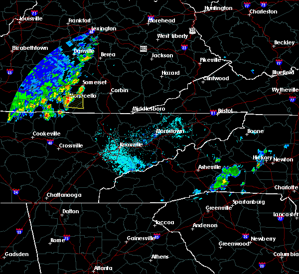 At 502 pm edt, a severe thunderstorm was located over monticello, moving east at 15 mph (radar indicated). Hazards include 60 mph wind gusts and quarter size hail. Hail damage to vehicles is expected. Expect wind damage to roofs, siding, and trees. At 502 pm edt, a severe thunderstorm was located over monticello, moving east at 15 mph (radar indicated). Hazards include 60 mph wind gusts and quarter size hail. Hail damage to vehicles is expected. Expect wind damage to roofs, siding, and trees.
|
| 5/10/2016 10:05 PM EDT |
 At 1005 pm edt, a severe thunderstorm capable of producing a tornado was located near steubenville, or near monticello, moving east at 30 mph (radar indicated rotation). Hazards include tornado and baseball size hail. Flying debris will be dangerous to those caught without shelter. mobile homes will be damaged or destroyed. damage to roofs, windows, and vehicles will occur. tree damage is likely. this dangerous storm will be near, steubenville and mill springs around 1015 pm edt. betsey around 1020 pm edt. gregory and frazer around 1025 pm edt. delta, kidder and denney around 1030 pm edt. Ritner around 1035 pm edt. At 1005 pm edt, a severe thunderstorm capable of producing a tornado was located near steubenville, or near monticello, moving east at 30 mph (radar indicated rotation). Hazards include tornado and baseball size hail. Flying debris will be dangerous to those caught without shelter. mobile homes will be damaged or destroyed. damage to roofs, windows, and vehicles will occur. tree damage is likely. this dangerous storm will be near, steubenville and mill springs around 1015 pm edt. betsey around 1020 pm edt. gregory and frazer around 1025 pm edt. delta, kidder and denney around 1030 pm edt. Ritner around 1035 pm edt.
|
| 5/10/2016 9:48 PM EDT |
 At 947 pm edt, a severe thunderstorm was located near jamestown, or 10 miles northwest of monticello, moving east at 25 mph (radar indicated). Hazards include golf ball size hail and 60 mph wind gusts. People and animals outdoors will be injured. expect hail damage to roofs, siding, windows, and vehicles. Expect wind damage to roofs, siding, and trees. At 947 pm edt, a severe thunderstorm was located near jamestown, or 10 miles northwest of monticello, moving east at 25 mph (radar indicated). Hazards include golf ball size hail and 60 mph wind gusts. People and animals outdoors will be injured. expect hail damage to roofs, siding, windows, and vehicles. Expect wind damage to roofs, siding, and trees.
|
| 5/1/2016 2:49 AM EDT |
 At 249 am edt, a severe thunderstorm was located over steubenville, or over monticello, moving east at 35 mph (radar indicated). Hazards include 60 mph wind gusts and quarter size hail. Hail damage to vehicles is expected. expect wind damage to roofs, siding, and trees. locations impacted include, somerset, monticello, burnside, tateville, naomi, frazer, mill springs, somerset pulaski airport, betsey, kidder, general burnside s. p,. Bronston, steubenville, quinton, elihu, trimble and ferguson. At 249 am edt, a severe thunderstorm was located over steubenville, or over monticello, moving east at 35 mph (radar indicated). Hazards include 60 mph wind gusts and quarter size hail. Hail damage to vehicles is expected. expect wind damage to roofs, siding, and trees. locations impacted include, somerset, monticello, burnside, tateville, naomi, frazer, mill springs, somerset pulaski airport, betsey, kidder, general burnside s. p,. Bronston, steubenville, quinton, elihu, trimble and ferguson.
|
| 5/1/2016 2:24 AM EDT |
 At 224 am edt, a severe thunderstorm was located near jamestown, or 11 miles northwest of monticello, moving east at 35 mph (radar indicated). Hazards include 60 mph wind gusts and quarter size hail. Hail damage to vehicles is expected. Expect wind damage to roofs, siding, and trees. At 224 am edt, a severe thunderstorm was located near jamestown, or 11 miles northwest of monticello, moving east at 35 mph (radar indicated). Hazards include 60 mph wind gusts and quarter size hail. Hail damage to vehicles is expected. Expect wind damage to roofs, siding, and trees.
|
| 4/6/2016 7:55 PM EDT |
 At 753 pm edt, severe thunderstorms were located along a line extending from near columbia to near albany to 6 miles northeast of algood, moving east at 55 mph (radar indicated). Hazards include 60 mph wind gusts and penny size hail. Expect damage to roofs. siding. And trees. At 753 pm edt, severe thunderstorms were located along a line extending from near columbia to near albany to 6 miles northeast of algood, moving east at 55 mph (radar indicated). Hazards include 60 mph wind gusts and penny size hail. Expect damage to roofs. siding. And trees.
|
| 12/24/2015 12:30 AM EST | A severe thunderstorm warning remains in effect until 1245 am est for northwestern mccreary. southeastern pulaski and wayne counties. at 1230 am est. a severe thunderstorm was located over gregory. or 7 miles east of monticello. moving northeast at 60 mph. hazard. 60 mph wind gusts. |
| 12/24/2015 12:04 AM EST | At 1204 am est, a severe thunderstorm was located over byrdstown, moving northeast at 60 mph (radar indicated). Hazards include 60 mph wind gusts and nickel size hail. Expect damage to roofs. Siding and trees. |
| 7/14/2015 9:34 PM EDT |
 At 933 pm edt, severe thunderstorms were located along a line extending from permon to near hollyhill to near blue heron to mount pisgah, moving southeast at 40 mph (radar indicated). Hazards include quarter size hail and 60 mph wind gusts. Hail damage to vehicles is expected. expect wind damage to roofs, siding and trees. locations impacted include, monticello, williamsburg, whitley city, corbin, liberty, dixie, nevisdale, frakes, pine knot, great meadows campsites, moore hill, faber, cabell, suttons mill, wofford, powersburg, barrier, clio, packard and denney. This includes interstate 75 in east central kentucky between mile markers 1 and 27. At 933 pm edt, severe thunderstorms were located along a line extending from permon to near hollyhill to near blue heron to mount pisgah, moving southeast at 40 mph (radar indicated). Hazards include quarter size hail and 60 mph wind gusts. Hail damage to vehicles is expected. expect wind damage to roofs, siding and trees. locations impacted include, monticello, williamsburg, whitley city, corbin, liberty, dixie, nevisdale, frakes, pine knot, great meadows campsites, moore hill, faber, cabell, suttons mill, wofford, powersburg, barrier, clio, packard and denney. This includes interstate 75 in east central kentucky between mile markers 1 and 27.
|
| 7/14/2015 9:00 PM EDT | A tree was blown dow in wayne county KY, 2.9 miles SE of Monticello, KY |
| 7/14/2015 8:47 PM EDT |
 At 847 pm edt, severe thunderstorms were located along a line extending from billows to elihu to near mill springs to near jamestown, moving southeast at 40 mph (radar indicated). Hazards include quarter size hail and 60 mph wind gusts. Hail damage to vehicles is expected. Expect wind damage to roofs, siding and trees. At 847 pm edt, severe thunderstorms were located along a line extending from billows to elihu to near mill springs to near jamestown, moving southeast at 40 mph (radar indicated). Hazards include quarter size hail and 60 mph wind gusts. Hail damage to vehicles is expected. Expect wind damage to roofs, siding and trees.
|
| 7/14/2015 12:01 PM EDT | Golf Ball sized hail reported 0.3 miles WSW of Monticello, KY, hail falling at dispatch center. |
| 7/14/2015 12:00 PM EDT | Golf Ball sized hail reported 0.3 miles WSW of Monticello, KY |
| 7/14/2015 11:56 AM EDT |
 At 1156 am edt, a severe thunderstorm was located near gregory, or near monticello, and is nearly stationary (radar indicated). Hazards include half dollar size hail and 70 mph wind gusts. Hail damage to vehicles is expected. expect considerable tree damage. wind damage is also likely to mobile homes, roofs and outbuildings. locations impacted include, monticello, whitley city, beulah heights, co-operative, pine knot, delta, lot, mill springs, zion hill, gregory, saxton, barrier, denney, rockeybranch, steubenville, coopersville, slavens, mountain ash, red ash and duckrun. This includes interstate 75 in east central kentucky between mile markers 1 and 7. At 1156 am edt, a severe thunderstorm was located near gregory, or near monticello, and is nearly stationary (radar indicated). Hazards include half dollar size hail and 70 mph wind gusts. Hail damage to vehicles is expected. expect considerable tree damage. wind damage is also likely to mobile homes, roofs and outbuildings. locations impacted include, monticello, whitley city, beulah heights, co-operative, pine knot, delta, lot, mill springs, zion hill, gregory, saxton, barrier, denney, rockeybranch, steubenville, coopersville, slavens, mountain ash, red ash and duckrun. This includes interstate 75 in east central kentucky between mile markers 1 and 7.
|
| 7/14/2015 11:44 AM EDT |
 At 1144 am edt, a severe thunderstorm was located near parnell, or near monticello, moving southeast at 45 mph (radar indicated). Hazards include quarter size hail and 60 mph wind gusts. Hail damage to vehicles is expected. Expect wind damage to roofs, siding and trees. At 1144 am edt, a severe thunderstorm was located near parnell, or near monticello, moving southeast at 45 mph (radar indicated). Hazards include quarter size hail and 60 mph wind gusts. Hail damage to vehicles is expected. Expect wind damage to roofs, siding and trees.
|
| 6/26/2015 5:00 PM EDT | Small tree fell on a car at conley bottom marin in wayne county KY, 7.8 miles S of Monticello, KY |
| 6/26/2015 4:53 PM EDT | At 452 pm edt, a severe thunderstorm was located near parnell, or 7 miles northwest of monticello, moving northeast at 20 mph (radar indicated). Hazards include golf ball size hail and 60 mph wind gusts. People and animals outdoors will be injured. expect hail damage to roofs, siding, windows and vehicles. expect wind damage to roofs, siding and trees. Locations impacted include, monticello, betsey, parnell, frazer, steubenville, cabell and mill springs. |
| 6/26/2015 4:43 PM EDT | At 443 pm edt, a severe thunderstorm was located over parnell, or 8 miles northwest of monticello, moving northeast at 20 mph (radar indicated). Hazards include ping pong size hail and 60 mph wind gusts. People and animals outdoors will be injured. expect hail damage to roofs, siding, windows and vehicles. Expect wind damage to roofs, siding and trees. |
| 6/26/2015 4:35 PM EDT | Golf Ball sized hail reported 8.1 miles E of Monticello, KY, golfball hail occurred in murl near highway 1546. |
| 6/26/2015 3:52 AM EDT | Large tree limbs down in monticello. report relayed via twitte in wayne county KY, 0.3 miles WSW of Monticello, KY |
| 6/21/2015 5:57 PM EDT |
 At 557 pm edt, severe thunderstorms were located along a line extending from near betsey to burfield, moving east at 20 mph (radar indicated). Hazards include quarter size hail and 60 mph wind gusts. Hail damage to vehicles is expected. Expect wind damage to roofs, siding and trees. At 557 pm edt, severe thunderstorms were located along a line extending from near betsey to burfield, moving east at 20 mph (radar indicated). Hazards include quarter size hail and 60 mph wind gusts. Hail damage to vehicles is expected. Expect wind damage to roofs, siding and trees.
|
| 6/21/2015 5:50 PM EDT | Large limbs were blown dow in wayne county KY, 0.3 miles WSW of Monticello, KY |
| 6/21/2015 5:45 PM EDT | A tree was blown down on hwy 834 east just off hwy 9 in wayne county KY, 7.1 miles NE of Monticello, KY |
| 6/21/2015 5:45 PM EDT |
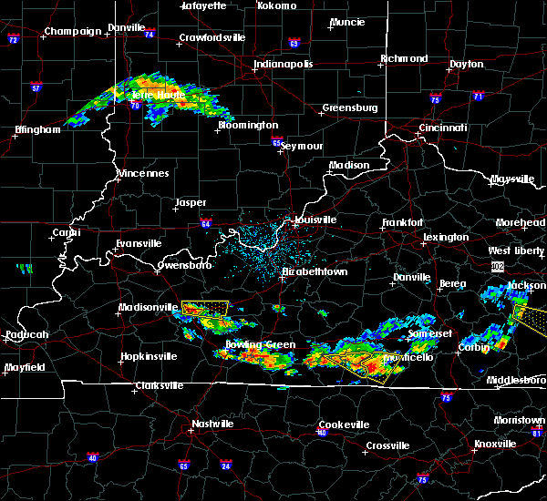 At 544 pm edt, severe thunderstorms were located along a line extending from mill springs to near slickford, moving east at 20 mph (radar indicated). Hazards include quarter size hail and 60 mph wind gusts. Hail damage to vehicles is expected. expect wind damage to roofs, siding and trees. Locations impacted include, monticello, cabell, mill springs, oil valley, zula, powersburg, barrier, betsey, slickford, parnell, steubenville, hidalgo, burfield, cooper, susie and alpha. At 544 pm edt, severe thunderstorms were located along a line extending from mill springs to near slickford, moving east at 20 mph (radar indicated). Hazards include quarter size hail and 60 mph wind gusts. Hail damage to vehicles is expected. expect wind damage to roofs, siding and trees. Locations impacted include, monticello, cabell, mill springs, oil valley, zula, powersburg, barrier, betsey, slickford, parnell, steubenville, hidalgo, burfield, cooper, susie and alpha.
|
| 6/21/2015 5:43 PM EDT | Large limbs were blown dow in wayne county KY, 0.3 miles WSW of Monticello, KY |
| 6/21/2015 5:28 PM EDT |
 At 527 pm edt, severe thunderstorms were located along a line extending from near parnell to near powersburg, moving east at 20 mph (radar indicated). Hazards include quarter size hail and 60 mph wind gusts. Hail damage to vehicles is expected. Expect wind damage to roofs, siding and trees. At 527 pm edt, severe thunderstorms were located along a line extending from near parnell to near powersburg, moving east at 20 mph (radar indicated). Hazards include quarter size hail and 60 mph wind gusts. Hail damage to vehicles is expected. Expect wind damage to roofs, siding and trees.
|
| 6/16/2015 6:10 PM EDT |
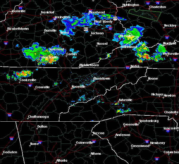 The severe thunderstorm warning for central wayne county will expire at 615 pm edt, the storm which prompted the warning has weakened below severe limits and exited wayne county. therefore the warning will be allowed to expire. to report severe weather, contact your nearest law enforcement agency. they will relay your report to the national weather service jackson ky. The severe thunderstorm warning for central wayne county will expire at 615 pm edt, the storm which prompted the warning has weakened below severe limits and exited wayne county. therefore the warning will be allowed to expire. to report severe weather, contact your nearest law enforcement agency. they will relay your report to the national weather service jackson ky.
|
| 6/16/2015 5:52 PM EDT |
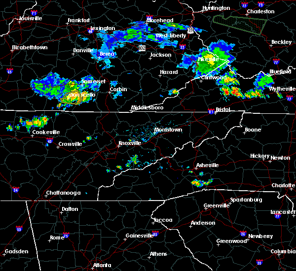 At 551 pm edt, a severe thunderstorm was located over steubenville, or near monticello, moving east at 20 mph (radar indicated). Hazards include 60 mph wind gusts and penny size hail. Expect damage to roofs. siding and trees. Locations impacted include, monticello, ritner, frazer, delta, mill springs, oil valley, gregory, kidds crossing, barrier, betsey, kidder, denney, steubenville, coopersville and cooper. At 551 pm edt, a severe thunderstorm was located over steubenville, or near monticello, moving east at 20 mph (radar indicated). Hazards include 60 mph wind gusts and penny size hail. Expect damage to roofs. siding and trees. Locations impacted include, monticello, ritner, frazer, delta, mill springs, oil valley, gregory, kidds crossing, barrier, betsey, kidder, denney, steubenville, coopersville and cooper.
|
| 6/16/2015 5:45 PM EDT | Multiple trees were blown down bringing powerlines down with the in wayne county KY, 4.6 miles SW of Monticello, KY |
| 6/16/2015 5:40 PM EDT | Trees were reported to have been blown dow in wayne county KY, 0.3 miles WSW of Monticello, KY |
| 6/16/2015 5:26 PM EDT |
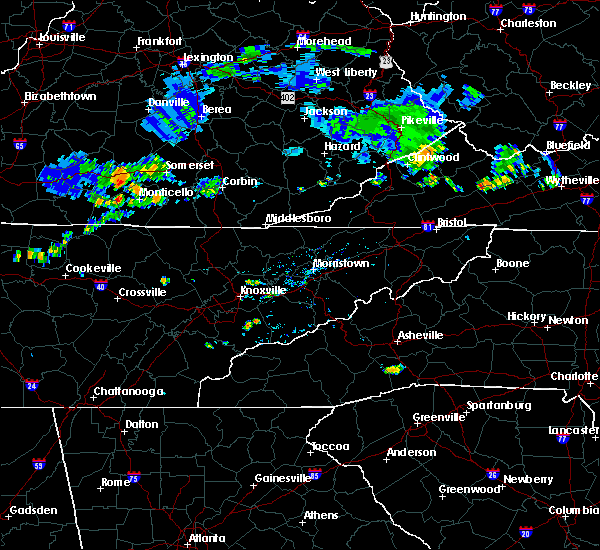 At 526 pm edt, a severe thunderstorm was located over parnell, or near monticello, moving east at 20 mph (radar indicated). Hazards include half dollar size hail and 60 mph wind gusts. Hail damage to vehicles is expected. Expect wind damage to roofs, siding and trees. At 526 pm edt, a severe thunderstorm was located over parnell, or near monticello, moving east at 20 mph (radar indicated). Hazards include half dollar size hail and 60 mph wind gusts. Hail damage to vehicles is expected. Expect wind damage to roofs, siding and trees.
|
| 4/25/2015 10:02 PM EDT | At 957 pm edt, a severe thunderstorm was located near faubush, or 15 miles north of monticello, moving east at 50 mph (radar indicated). Hazards include 60 mph wind gusts and penny size hail. Expect damage to roofs. Siding and trees. |
| 4/25/2015 9:56 PM EDT | At 956 pm edt, a severe thunderstorm was located near faubush, or 15 miles north of monticello, moving east at 50 mph (radar indicated). Hazards include 60 mph wind gusts and penny size hail. Expect damage to roofs. Siding and trees. |
| 4/2/2015 8:11 PM EDT | The severe thunderstorm warning for wayne and southwestern mccreary counties will expire at 815 pm edt. the storm which prompted the warning has weakened below severe limits. and no longer pose an immediate threat to life or property. therefore the warning will be allowed to expire. however. Gusty winds are still possible with this thunderstorm. |
| 4/2/2015 7:52 PM EDT | A severe thunderstorm warning remains in effect until 815 pm edt for wayne and southwestern mccreary counties. at 752 pm edt. a severe thunderstorm was located over kidds crossing. or 9 miles southeast of monticello. moving east at 45 mph. hazard. 60 mph wind gusts. |
| 4/2/2015 7:32 PM EDT | The national weather service in jackson ky has issued a * severe thunderstorm warning for. wayne county in south central kentucky. southwestern mccreary county in south central kentucky. until 815 pm edt * at 731 pm edt. a severe thunderstorm was located over zula. Or 9. |
| 8/20/2014 5:55 PM EDT | Part of a boat storage building was blown away west of hwy 82 in wayne county KY, 0.3 miles WSW of Monticello, KY |
| 7/27/2014 2:54 PM EDT | Golf Ball sized hail reported 4.7 miles SE of Monticello, KY, in the community of eadsville. |
| 7/10/2013 3:45 PM EDT | Trees down on highway 90 wes in wayne county KY, 5.7 miles ESE of Monticello, KY |
| 6/27/2013 12:14 AM EDT | Tree limbs down on power lines with power outages. also pea sized hai in wayne county KY, 0.3 miles WSW of Monticello, KY |
| 6/27/2013 12:09 AM EDT | Trees and power lines down in monticello. reports from broadcast and social media. time estimated from rada in wayne county KY, 0.3 miles WSW of Monticello, KY |
| 5/21/2013 4:00 PM EDT | Trees dow in wayne county KY, 0.3 miles WSW of Monticello, KY |
| 5/21/2013 4:00 AM EDT | Trees dow in wayne county KY, 0.3 miles WSW of Monticello, KY |
| 3/24/2013 5:16 PM EDT | Two roofs taken off storage buildings. pulled post out of ground in cemen in wayne county KY, 0.3 miles WSW of Monticello, KY |
| 1/30/2013 6:24 AM EST | Trees down on higway 167 and ray hill roa in wayne county KY, 8.2 miles N of Monticello, KY |
| 1/30/2013 6:15 AM EST | Trees down on green briar loo in wayne county KY, 3.3 miles SW of Monticello, KY |
| 1/30/2013 6:13 AM EST | Trees down at highway 1275 north and highway 9 in wayne county KY, 2.4 miles SW of Monticello, KY |
| 1/30/2013 6:06 AM EST | Trees down at highway 834 and 9 in wayne county KY, 8 miles NE of Monticello, KY |
| 1/30/2013 6:03 AM EST | Trees down on highway 789 at camp earl wallac in wayne county KY, 7.7 miles SE of Monticello, KY |
| 7/28/2012 12:11 AM EDT | Powerlines down near conley bottom resor in wayne county KY, 7 miles SSW of Monticello, KY |
| 7/27/2012 12:11 PM EDT | Powerlines down near conley bottom resor in wayne county KY, 7 miles SSW of Monticello, KY |
| 7/8/2012 8:00 PM EDT | Trees down with powerlines down on a house in the zula and alpha communitie in wayne county KY, 8.4 miles NE of Monticello, KY |
| 7/5/2012 4:48 PM EDT | Trees down and siding blown off a garage on missouri hollow roa in wayne county KY, 1.6 miles NNE of Monticello, KY |
| 7/5/2012 4:45 PM EDT | Several trees down in town along with about 10 minutes of hail up to the size of dime in wayne county KY, 0.3 miles WSW of Monticello, KY |
| 7/5/2012 3:41 PM CDT | Multiple trees down on highway 156 near jabe in russell county KY, 9.8 miles S of Monticello, KY |
| 4/26/2012 5:52 PM EDT | Several trees down along hwy 1546 near the murl communit in wayne county KY, 6.2 miles ENE of Monticello, KY |
| 4/26/2012 5:25 PM EDT | Golf Ball sized hail reported 7.5 miles SSW of Monticello, KY, sheriff reports golf ball size hail in mill springs. relayed by 911 dispatch. |
| 4/26/2012 5:20 PM EDT | Quarter sized hail reported 9.3 miles SW of Monticello, KY |
| 4/26/2012 6:00 AM EDT | Trees and power lines/poles down countywide. time estimated off of rada in wayne county KY, 0.3 miles WSW of Monticello, KY |
| 1/1/0001 12:00 AM | Storm damage reported in wayne county KY, 2.2 miles S of Monticello, KY |
| 1/1/0001 12:00 AM | Trees down on highway 167 just north of mount pisgah. time estimated from rada in wayne county KY, 12.6 miles NNW of Monticello, KY |
| 1/1/0001 12:00 AM | Tree across hwy 200 in the number one communit in wayne county KY, 2.5 miles E of Monticello, KY |
| 1/1/0001 12:00 AM | Trees down in parmleysville. also half inch size hail and torrential rai in wayne county KY, 12.4 miles NNW of Monticello, KY |
| 1/1/0001 12:00 AM | Trees were blown down onto a trailer home on evelyn avenue in monticell in wayne county KY, 0.3 miles WSW of Monticello, KY |
| 1/1/0001 12:00 AM | A tree was blown down onto a house along hwy 1546 in mur in wayne county KY, 7.1 miles NE of Monticello, KY |
| 1/1/0001 12:00 AM | Barn blown into ky 200 near hwy 16 in wayne county KY, 0.7 miles NNE of Monticello, KY |
| 1/1/0001 12:00 AM | Trees and limbs were blown down in monticell in wayne county KY, 0.3 miles WSW of Monticello, KY |
| 1/1/0001 12:00 AM | Trees...power lines...and limbs were blown down in the towns of zula and number on in wayne county KY, 8.4 miles NE of Monticello, KY |
| 1/1/0001 12:00 AM | Trees...power lines...and limbs were blown down in zul in wayne county KY, 8.4 miles NE of Monticello, KY |
| 1/1/0001 12:00 AM | A few trees and large limbs were reported to have been blown down. time of event is estimated from rada in wayne county KY, 0.3 miles WSW of Monticello, KY |
| 1/1/0001 12:00 AM | Tree down on highway 200 at flat spring in wayne county KY, 3.2 miles NW of Monticello, KY |
| 1/1/0001 12:00 AM | Tree down on house on highway 239 in wayne county KY, 7 miles S of Monticello, KY |
| 1/1/0001 12:00 AM | Trees down on hollow roa in wayne county KY, 2 miles N of Monticello, KY |
| 1/1/0001 12:00 AM | Trees down on highway 67 in wayne county KY, 5.7 miles ESE of Monticello, KY |
| 1/1/0001 12:00 AM | Quarter sized hail reported 0.3 miles WSW of Monticello, KY |
| 1/1/0001 12:00 AM | A screen door was torn from a home along hwy 92e in monticello. a number of power outages were also reported in and around monticello. multiple trees had been blown dow in wayne county KY, 0.3 miles WSW of Monticello, KY |
Hail Maps for Monticello, KY
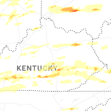


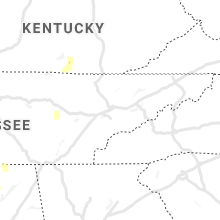


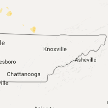


Connect with Interactive Hail Maps