

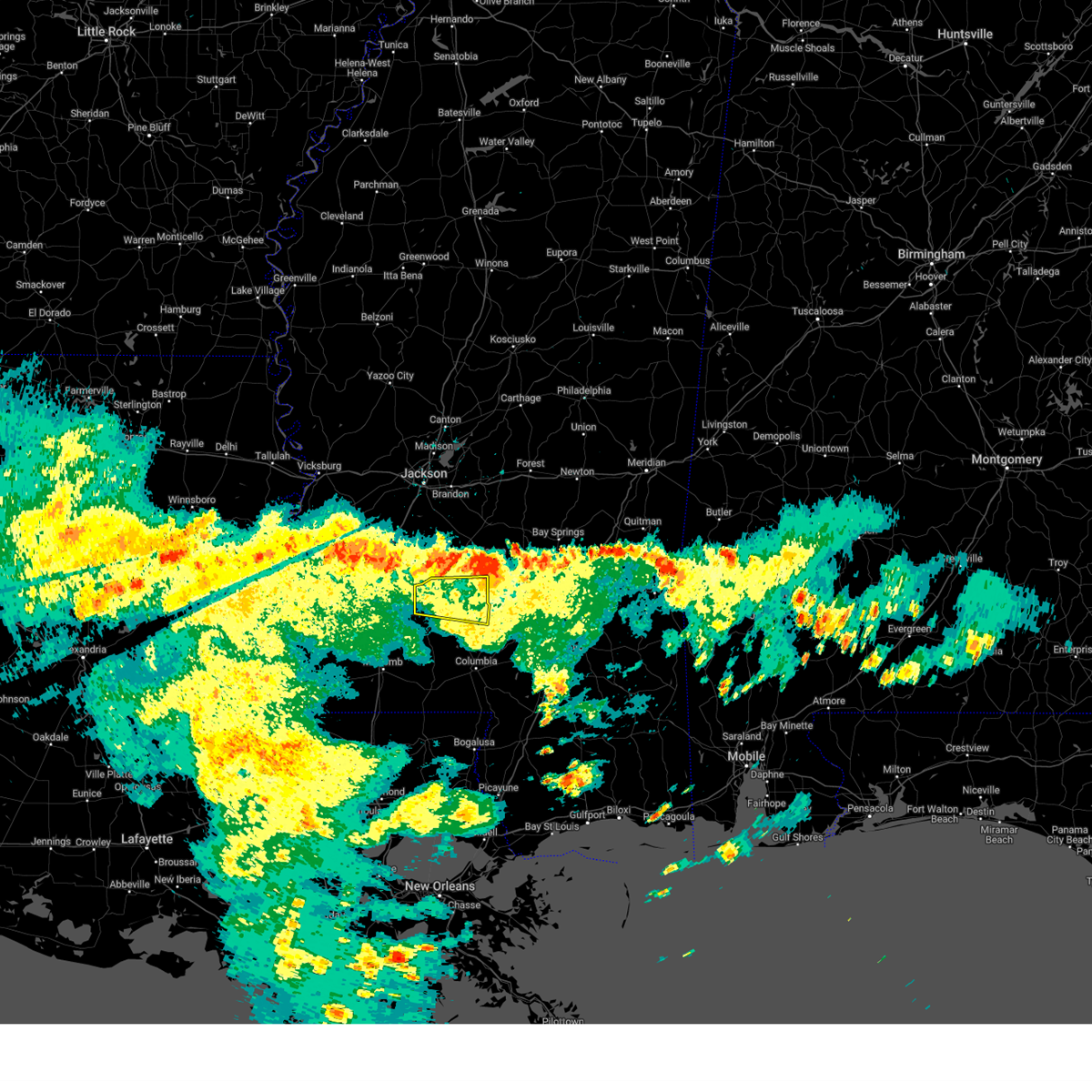
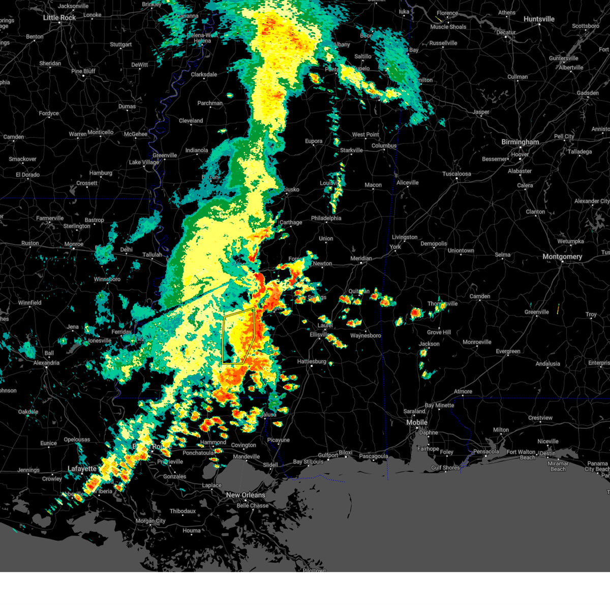
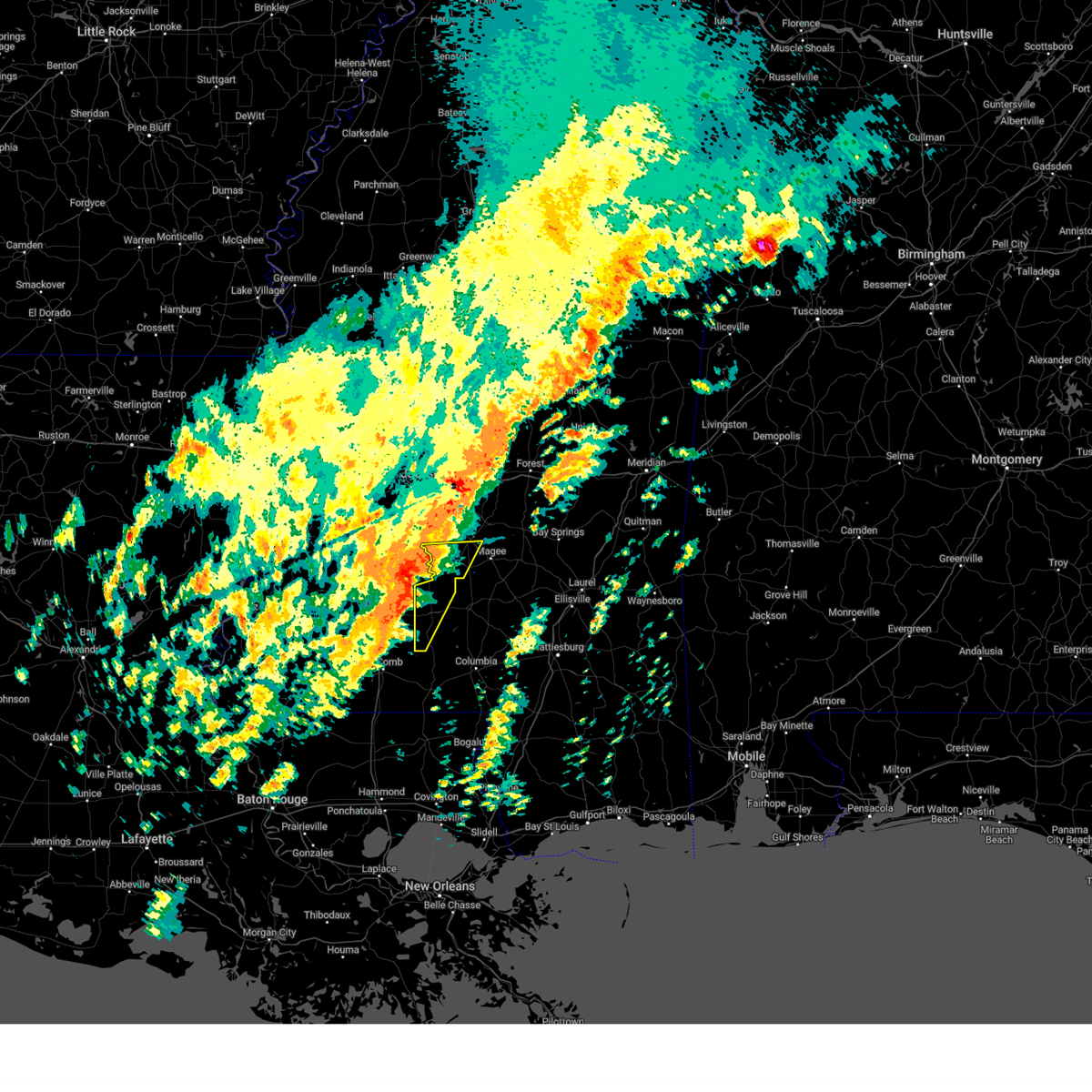
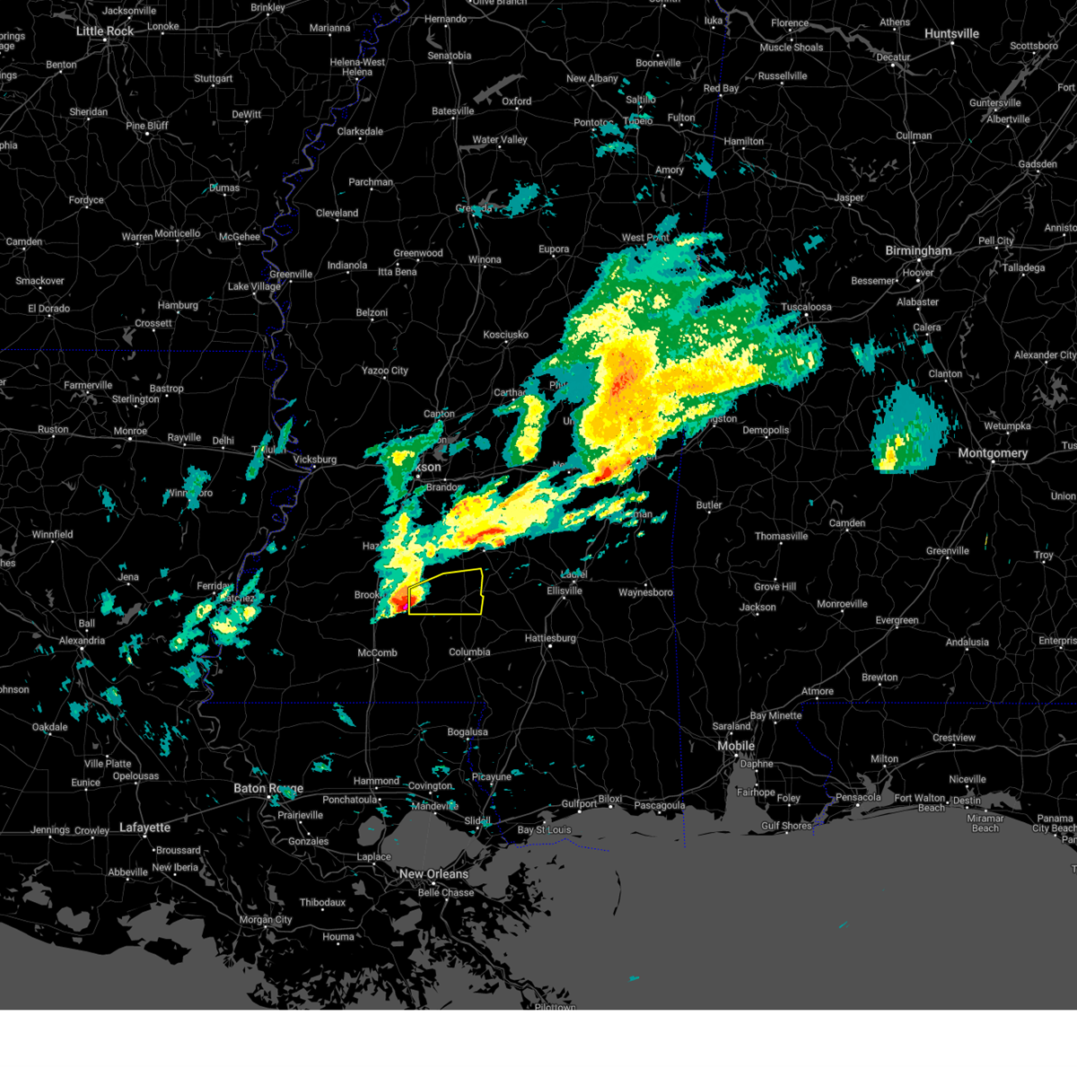
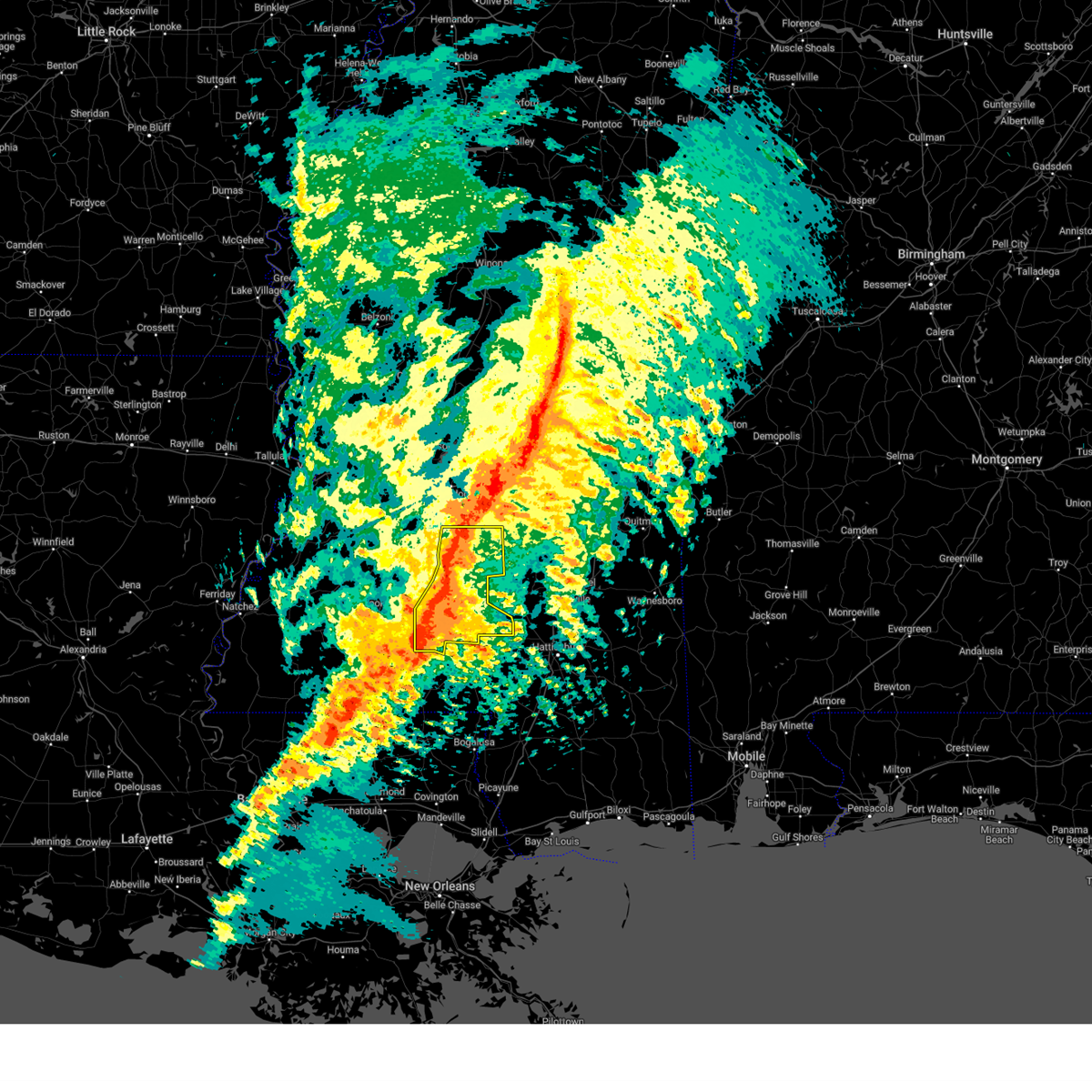
Hail Map for Monticello, MS
The Monticello, MS area has had 15 reports of on-the-ground hail by trained spotters, and has been under severe weather warnings 42 times during the past 12 months. Doppler radar has detected hail at or near Monticello, MS on 58 occasions, including 7 occasions during the past year.
| Name: | Monticello, MS |
| Where Located: | 51.6 miles S of Jackson, MS |
| Map: | Google Map for Monticello, MS |
| Population: | 1571 |
| Housing Units: | 742 |
| More Info: | Search Google for Monticello, MS |
3
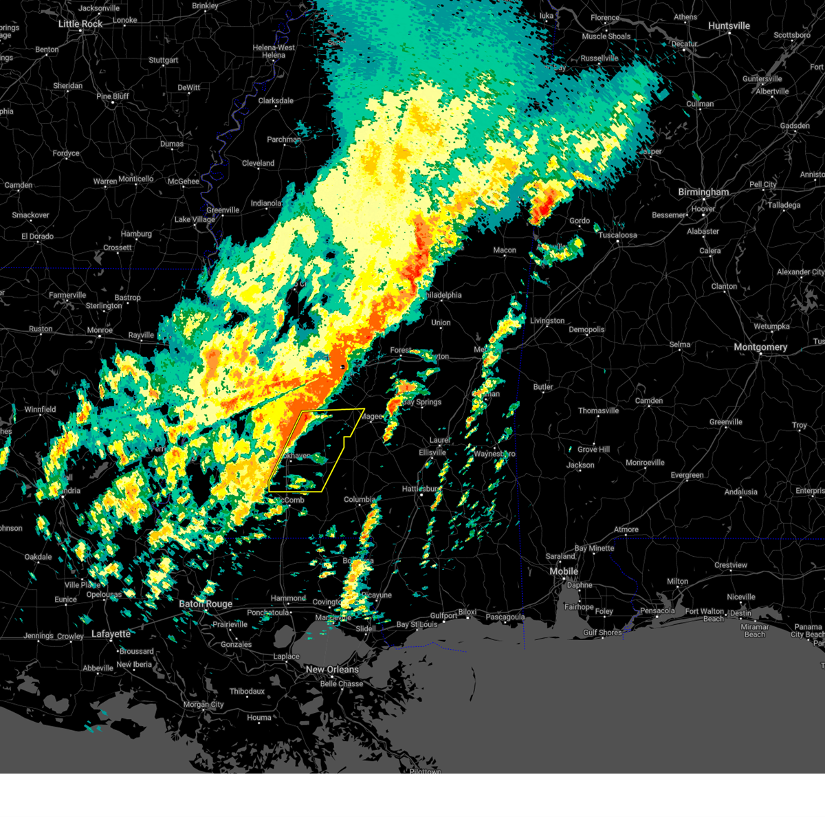
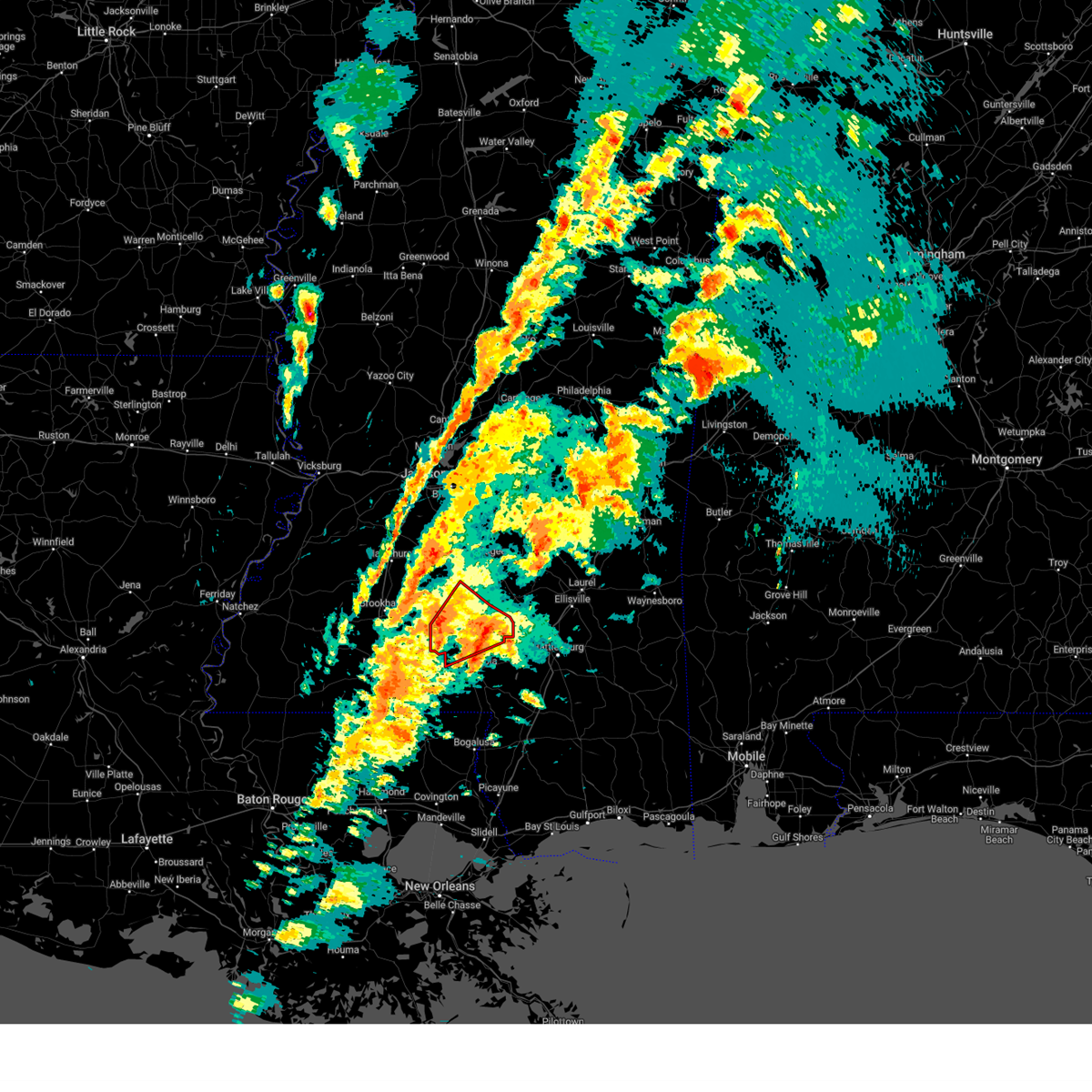
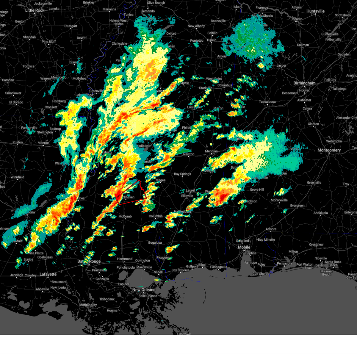
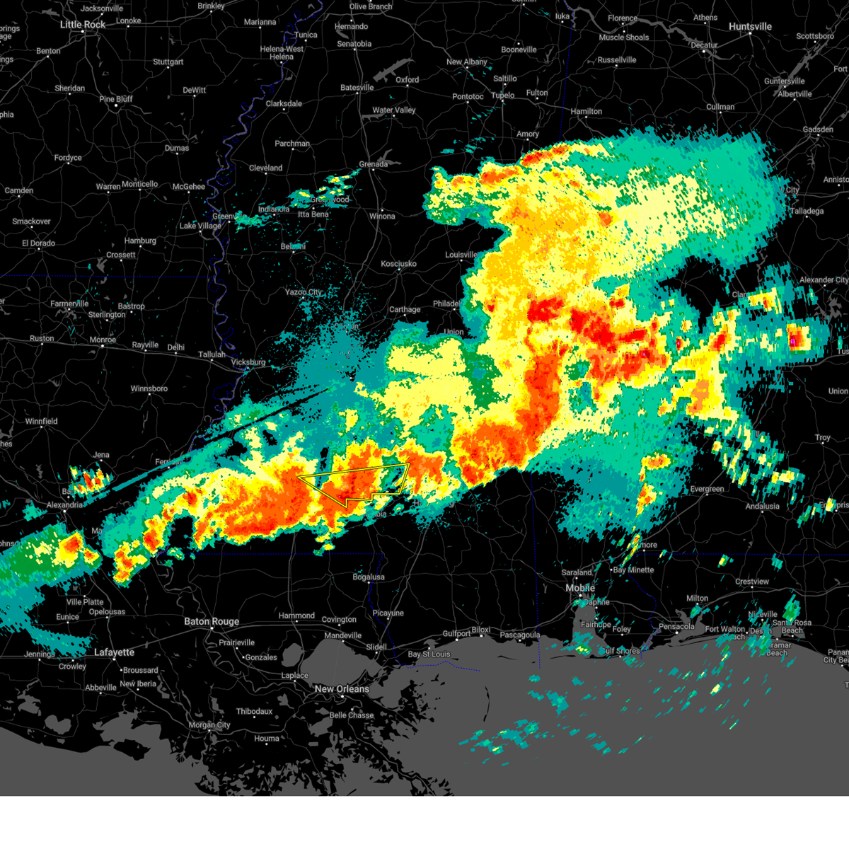
The Top Recent Hail Date for Monticello, MS is Monday, June 23, 2025 (6th out of 58)
Hail and Wind Damage Spotted near Monticello, MS
| Date / Time | Report Details |
|---|---|
| 6/23/2025 8:05 PM CDT |
 The storm which prompted the warning has moved out of the area. therefore, the warning will be allowed to expire. The storm which prompted the warning has moved out of the area. therefore, the warning will be allowed to expire.
|
| 6/23/2025 7:19 PM CDT |
 Svrjan the national weather service in jackson has issued a * severe thunderstorm warning for, eastern lincoln county in south central mississippi, lawrence county in south central mississippi, * until 815 pm cdt. * at 719 pm cdt, a severe thunderstorm was located over monticello, moving west at 15 mph (radar indicated). Hazards include 60 mph wind gusts and half dollar size hail. Hail damage to vehicles is expected. expect wind damage to roofs, siding, and trees. This severe thunderstorm will be near, east lincoln and sontag around 725 pm cdt. Svrjan the national weather service in jackson has issued a * severe thunderstorm warning for, eastern lincoln county in south central mississippi, lawrence county in south central mississippi, * until 815 pm cdt. * at 719 pm cdt, a severe thunderstorm was located over monticello, moving west at 15 mph (radar indicated). Hazards include 60 mph wind gusts and half dollar size hail. Hail damage to vehicles is expected. expect wind damage to roofs, siding, and trees. This severe thunderstorm will be near, east lincoln and sontag around 725 pm cdt.
|
| 6/23/2025 7:10 PM CDT | A few trees were downed in monticell in lawrence county MS, 0.2 miles NW of Monticello, MS |
| 6/14/2025 2:03 PM CDT |
 Svrjan the national weather service in jackson has issued a * severe thunderstorm warning for, western simpson county in central mississippi, northeastern lincoln county in south central mississippi, lawrence county in south central mississippi, southeastern copiah county in central mississippi, * until 300 pm cdt. * at 203 pm cdt, a severe thunderstorm was located near sontag, or 12 miles northeast of brookhaven, moving east at 15 mph (radar indicated). Hazards include 60 mph wind gusts and quarter size hail. Hail damage to vehicles is expected. expect wind damage to roofs, siding, and trees. this severe thunderstorm will be near, sontag, rockport, and oma around 210 pm cdt. Wanilla around 215 pm cdt. Svrjan the national weather service in jackson has issued a * severe thunderstorm warning for, western simpson county in central mississippi, northeastern lincoln county in south central mississippi, lawrence county in south central mississippi, southeastern copiah county in central mississippi, * until 300 pm cdt. * at 203 pm cdt, a severe thunderstorm was located near sontag, or 12 miles northeast of brookhaven, moving east at 15 mph (radar indicated). Hazards include 60 mph wind gusts and quarter size hail. Hail damage to vehicles is expected. expect wind damage to roofs, siding, and trees. this severe thunderstorm will be near, sontag, rockport, and oma around 210 pm cdt. Wanilla around 215 pm cdt.
|
| 5/28/2025 7:11 PM CDT |
 The severe thunderstorm which prompted the warning has moved out of the warned area. therefore, the warning will be allowed to expire. a severe thunderstorm watch remains in effect until 900 pm cdt for central, south central and southeastern mississippi. The severe thunderstorm which prompted the warning has moved out of the warned area. therefore, the warning will be allowed to expire. a severe thunderstorm watch remains in effect until 900 pm cdt for central, south central and southeastern mississippi.
|
| 5/28/2025 6:44 PM CDT |
 the severe thunderstorm warning has been cancelled and is no longer in effect the severe thunderstorm warning has been cancelled and is no longer in effect
|
| 5/28/2025 6:44 PM CDT |
 At 643 pm cdt, a severe thunderstorm was located over new hebron, or 10 miles northwest of prentiss, moving north at 30 mph (radar indicated). Hazards include 60 mph wind gusts and penny size hail. Expect damage to roofs, siding, and trees. This severe storm will be near, new hebron around 650 pm cdt. At 643 pm cdt, a severe thunderstorm was located over new hebron, or 10 miles northwest of prentiss, moving north at 30 mph (radar indicated). Hazards include 60 mph wind gusts and penny size hail. Expect damage to roofs, siding, and trees. This severe storm will be near, new hebron around 650 pm cdt.
|
| 5/28/2025 5:58 PM CDT |
 Svrjan the national weather service in jackson has issued a * severe thunderstorm warning for, northwestern marion county in south central mississippi, lawrence county in south central mississippi, jefferson davis county in south central mississippi, * until 715 pm cdt. * at 558 pm cdt, a severe thunderstorm was located over tilton, or 10 miles south of monticello, moving north at 25 mph (radar indicated). Hazards include 60 mph wind gusts and penny size hail. Expect damage to roofs, siding, and trees. this severe thunderstorm will be near, monticello, robinwood, arm, and oak vale around 605 pm cdt. progress around 610 pm cdt. silver creek around 615 pm cdt. wanilla around 625 pm cdt. New hebron around 630 pm cdt. Svrjan the national weather service in jackson has issued a * severe thunderstorm warning for, northwestern marion county in south central mississippi, lawrence county in south central mississippi, jefferson davis county in south central mississippi, * until 715 pm cdt. * at 558 pm cdt, a severe thunderstorm was located over tilton, or 10 miles south of monticello, moving north at 25 mph (radar indicated). Hazards include 60 mph wind gusts and penny size hail. Expect damage to roofs, siding, and trees. this severe thunderstorm will be near, monticello, robinwood, arm, and oak vale around 605 pm cdt. progress around 610 pm cdt. silver creek around 615 pm cdt. wanilla around 625 pm cdt. New hebron around 630 pm cdt.
|
| 5/27/2025 8:00 AM CDT | A few trees down on power lines along trace r in lawrence county MS, 6.5 miles ENE of Monticello, MS |
| 5/27/2025 8:00 AM CDT |
 Svrjan the national weather service in jackson has issued a * severe thunderstorm warning for, lawrence county in south central mississippi, western covington county in southeastern mississippi, jefferson davis county in south central mississippi, * until 845 am cdt. * at 800 am cdt, a severe thunderstorm was located over robinwood, or near monticello, moving northeast at 45 mph (radar indicated). Hazards include 60 mph wind gusts. Expect damage to roofs, siding, and trees. this severe thunderstorm will be near, monticello, silver creek, tilton, robinwood, progress, arm, and oak vale around 805 am cdt. prentiss around 810 am cdt. carson around 815 am cdt. lone star around 820 am cdt. clem around 825 am cdt. Mount olive around 835 am cdt. Svrjan the national weather service in jackson has issued a * severe thunderstorm warning for, lawrence county in south central mississippi, western covington county in southeastern mississippi, jefferson davis county in south central mississippi, * until 845 am cdt. * at 800 am cdt, a severe thunderstorm was located over robinwood, or near monticello, moving northeast at 45 mph (radar indicated). Hazards include 60 mph wind gusts. Expect damage to roofs, siding, and trees. this severe thunderstorm will be near, monticello, silver creek, tilton, robinwood, progress, arm, and oak vale around 805 am cdt. prentiss around 810 am cdt. carson around 815 am cdt. lone star around 820 am cdt. clem around 825 am cdt. Mount olive around 835 am cdt.
|
| 5/26/2025 2:57 PM CDT |
 the severe thunderstorm warning has been cancelled and is no longer in effect the severe thunderstorm warning has been cancelled and is no longer in effect
|
| 5/26/2025 2:38 PM CDT |
 At 238 pm cdt, severe thunderstorms were located along a line extending from near oma to near wanilla to near topeka, moving east at 45 mph (radar indicated). Hazards include 60 mph wind gusts and nickel size hail. Expect damage to roofs, siding, and trees. Locations impacted include, monticello, new hebron, silver creek, topeka, oma, east lincoln, union, ruth, robinwood, jayess, shivers, sontag, rockport, and wanilla. At 238 pm cdt, severe thunderstorms were located along a line extending from near oma to near wanilla to near topeka, moving east at 45 mph (radar indicated). Hazards include 60 mph wind gusts and nickel size hail. Expect damage to roofs, siding, and trees. Locations impacted include, monticello, new hebron, silver creek, topeka, oma, east lincoln, union, ruth, robinwood, jayess, shivers, sontag, rockport, and wanilla.
|
| 5/26/2025 2:08 PM CDT |
 Svrjan the national weather service in jackson has issued a * severe thunderstorm warning for, southwestern simpson county in central mississippi, lincoln county in south central mississippi, lawrence county in south central mississippi, southeastern copiah county in central mississippi, * until 315 pm cdt. * at 208 pm cdt, severe thunderstorms were located along a line extending from near loyd star to near brookhaven to near center point, moving east at 40 mph (radar indicated). Hazards include 60 mph wind gusts and nickel size hail. expect damage to roofs, siding, and trees Svrjan the national weather service in jackson has issued a * severe thunderstorm warning for, southwestern simpson county in central mississippi, lincoln county in south central mississippi, lawrence county in south central mississippi, southeastern copiah county in central mississippi, * until 315 pm cdt. * at 208 pm cdt, severe thunderstorms were located along a line extending from near loyd star to near brookhaven to near center point, moving east at 40 mph (radar indicated). Hazards include 60 mph wind gusts and nickel size hail. expect damage to roofs, siding, and trees
|
| 5/24/2025 6:08 PM CDT |
 Svrjan the national weather service in jackson has issued a * severe thunderstorm warning for, southwestern jasper county in east central mississippi, southeastern smith county in central mississippi, southeastern lawrence county in south central mississippi, covington county in southeastern mississippi, northern jones county in southeastern mississippi, jefferson davis county in south central mississippi, * until 715 pm cdt. * at 607 pm cdt, severe thunderstorms were located along a line extending from near stringer to silver creek, moving southeast at 25 mph (radar indicated). Hazards include 60 mph wind gusts and penny size hail. expect damage to roofs, siding, and trees Svrjan the national weather service in jackson has issued a * severe thunderstorm warning for, southwestern jasper county in east central mississippi, southeastern smith county in central mississippi, southeastern lawrence county in south central mississippi, covington county in southeastern mississippi, northern jones county in southeastern mississippi, jefferson davis county in south central mississippi, * until 715 pm cdt. * at 607 pm cdt, severe thunderstorms were located along a line extending from near stringer to silver creek, moving southeast at 25 mph (radar indicated). Hazards include 60 mph wind gusts and penny size hail. expect damage to roofs, siding, and trees
|
| 4/6/2025 2:37 AM CDT |
 At 237 am cdt, severe thunderstorms were located along a line extending from near georgetown to near oma to near east lincoln, moving east at 35 mph (radar indicated). Hazards include 60 mph wind gusts and penny size hail. Expect damage to roofs, siding, and trees. these severe storms will be near, monticello, new hebron, pinola, topeka, shivers, and wanilla around 245 am cdt. Mendenhall around 255 am cdt. At 237 am cdt, severe thunderstorms were located along a line extending from near georgetown to near oma to near east lincoln, moving east at 35 mph (radar indicated). Hazards include 60 mph wind gusts and penny size hail. Expect damage to roofs, siding, and trees. these severe storms will be near, monticello, new hebron, pinola, topeka, shivers, and wanilla around 245 am cdt. Mendenhall around 255 am cdt.
|
| 4/6/2025 2:37 AM CDT |
 the severe thunderstorm warning has been cancelled and is no longer in effect the severe thunderstorm warning has been cancelled and is no longer in effect
|
| 4/6/2025 2:01 AM CDT |
 the severe thunderstorm warning has been cancelled and is no longer in effect the severe thunderstorm warning has been cancelled and is no longer in effect
|
| 4/6/2025 2:01 AM CDT |
 At 201 am cdt, severe thunderstorms were located along a line extending from hopewell to near center point, moving east at 25 mph (radar indicated). Hazards include 60 mph wind gusts and quarter size hail. Hail damage to vehicles is expected. expect wind damage to roofs, siding, and trees. these severe storms will be near, bogue chitto, hopewell, brookhaven, georgetown, and enterprise around 205 am cdt. rockport and union around 210 am cdt. sontag and oma around 215 am cdt. east lincoln around 220 am cdt. ruth and wanilla around 225 am cdt. pinola around 230 am cdt. mendenhall and shivers around 235 am cdt. Monticello, new hebron, and topeka around 240 am cdt. At 201 am cdt, severe thunderstorms were located along a line extending from hopewell to near center point, moving east at 25 mph (radar indicated). Hazards include 60 mph wind gusts and quarter size hail. Hail damage to vehicles is expected. expect wind damage to roofs, siding, and trees. these severe storms will be near, bogue chitto, hopewell, brookhaven, georgetown, and enterprise around 205 am cdt. rockport and union around 210 am cdt. sontag and oma around 215 am cdt. east lincoln around 220 am cdt. ruth and wanilla around 225 am cdt. pinola around 230 am cdt. mendenhall and shivers around 235 am cdt. Monticello, new hebron, and topeka around 240 am cdt.
|
| 4/6/2025 1:40 AM CDT | Svrjan the national weather service in jackson has issued a * severe thunderstorm warning for, central simpson county in central mississippi, lincoln county in south central mississippi, lawrence county in south central mississippi, southeastern franklin county in southwestern mississippi, southeastern copiah county in central mississippi, * until 245 am cdt. * at 139 am cdt, severe thunderstorms were located along a line extending from near gallman to smithdale, moving east at 25 mph (radar indicated). Hazards include 60 mph wind gusts. Expect damage to roofs, siding, and trees. severe thunderstorms will be near, hopewell, center point, west lincoln, brookhaven, martinsville, beauregard, hazlehurst, and wesson around 145 am cdt. bogue chitto around 155 am cdt. georgetown around 200 am cdt. rockport and enterprise around 205 am cdt. union around 210 am cdt. east lincoln, sontag, and oma around 215 am cdt. ruth and wanilla around 225 am cdt. Pinola around 230 am cdt. |
| 3/31/2025 5:42 AM CDT |
 Svrjan the national weather service in jackson has issued a * severe thunderstorm warning for, northeastern lincoln county in south central mississippi, lawrence county in south central mississippi, southeastern copiah county in central mississippi, jefferson davis county in south central mississippi, * until 645 am cdt. * at 542 am cdt, a severe thunderstorm was located near brookhaven, moving east at 40 mph (radar indicated). Hazards include 60 mph wind gusts and quarter size hail. Hail damage to vehicles is expected. expect wind damage to roofs, siding, and trees. this severe thunderstorm will be near, sontag and wanilla around 550 am cdt. monticello and oma around 555 am cdt. silver creek around 605 am cdt. new hebron around 610 am cdt. prentiss around 620 am cdt. Clem around 625 am cdt. Svrjan the national weather service in jackson has issued a * severe thunderstorm warning for, northeastern lincoln county in south central mississippi, lawrence county in south central mississippi, southeastern copiah county in central mississippi, jefferson davis county in south central mississippi, * until 645 am cdt. * at 542 am cdt, a severe thunderstorm was located near brookhaven, moving east at 40 mph (radar indicated). Hazards include 60 mph wind gusts and quarter size hail. Hail damage to vehicles is expected. expect wind damage to roofs, siding, and trees. this severe thunderstorm will be near, sontag and wanilla around 550 am cdt. monticello and oma around 555 am cdt. silver creek around 605 am cdt. new hebron around 610 am cdt. prentiss around 620 am cdt. Clem around 625 am cdt.
|
| 3/31/2025 5:14 AM CDT |
 Svrjan the national weather service in jackson has issued a * severe thunderstorm warning for, lincoln county in south central mississippi, lawrence county in south central mississippi, southeastern jefferson county in southwestern mississippi, franklin county in southwestern mississippi, southern copiah county in central mississippi, western jefferson davis county in south central mississippi, * until 615 am cdt. * at 514 am cdt, a severe thunderstorm was located near loyd star, or 10 miles west of brookhaven, moving east at 50 mph (radar indicated). Hazards include 60 mph wind gusts and penny size hail. Expect damage to roofs, siding, and trees. this severe thunderstorm will be near, brookhaven and loyd star around 520 am cdt. wesson around 525 am cdt. east lincoln and sontag around 535 am cdt. monticello and wanilla around 540 am cdt. silver creek and robinwood around 545 am cdt. Arm and progress around 550 am cdt. Svrjan the national weather service in jackson has issued a * severe thunderstorm warning for, lincoln county in south central mississippi, lawrence county in south central mississippi, southeastern jefferson county in southwestern mississippi, franklin county in southwestern mississippi, southern copiah county in central mississippi, western jefferson davis county in south central mississippi, * until 615 am cdt. * at 514 am cdt, a severe thunderstorm was located near loyd star, or 10 miles west of brookhaven, moving east at 50 mph (radar indicated). Hazards include 60 mph wind gusts and penny size hail. Expect damage to roofs, siding, and trees. this severe thunderstorm will be near, brookhaven and loyd star around 520 am cdt. wesson around 525 am cdt. east lincoln and sontag around 535 am cdt. monticello and wanilla around 540 am cdt. silver creek and robinwood around 545 am cdt. Arm and progress around 550 am cdt.
|
| 3/15/2025 2:55 PM CDT |
 At 255 pm cdt, a severe thunderstorm capable of producing a tornado was located over oak vale, or 9 miles southeast of monticello, moving northeast at 45 mph (radar indicated rotation). Hazards include tornado. Flying debris will be dangerous to those caught without shelter. mobile homes will be damaged or destroyed. damage to roofs, windows, and vehicles will occur. tree damage is likely. this dangerous storm will be near, prentiss, silver creek, progress, and carson around 300 pm cdt. Bassfield around 305 pm cdt. At 255 pm cdt, a severe thunderstorm capable of producing a tornado was located over oak vale, or 9 miles southeast of monticello, moving northeast at 45 mph (radar indicated rotation). Hazards include tornado. Flying debris will be dangerous to those caught without shelter. mobile homes will be damaged or destroyed. damage to roofs, windows, and vehicles will occur. tree damage is likely. this dangerous storm will be near, prentiss, silver creek, progress, and carson around 300 pm cdt. Bassfield around 305 pm cdt.
|
| 3/15/2025 2:41 PM CDT | At 241 pm cdt, a severe thunderstorm capable of producing a tornado was located near jayess, or 12 miles south of monticello, moving northeast at 45 mph (radar indicated rotation). Hazards include tornado. Flying debris will be dangerous to those caught without shelter. mobile homes will be damaged or destroyed. damage to roofs, windows, and vehicles will occur. tree damage is likely. this dangerous storm will be near, tilton, robinwood, arm, and oak vale around 245 pm cdt. progress and society hill around 250 pm cdt. prentiss, silver creek, and carson around 300 pm cdt. Bassfield around 310 pm cdt. |
| 3/15/2025 2:41 PM CDT | the tornado warning has been cancelled and is no longer in effect |
| 3/15/2025 2:26 PM CDT |
 Torjan the national weather service in jackson has issued a * tornado warning for, northern marion county in south central mississippi, southeastern lincoln county in south central mississippi, lawrence county in south central mississippi, jefferson davis county in south central mississippi, * until 330 pm cdt. * at 226 pm cdt, a severe thunderstorm capable of producing a tornado was located 8 miles south of ruth, or 10 miles east of mccomb, moving northeast at 45 mph (radar indicated rotation). Hazards include tornado. Flying debris will be dangerous to those caught without shelter. mobile homes will be damaged or destroyed. damage to roofs, windows, and vehicles will occur. tree damage is likely. this dangerous storm will be near, jayess, topeka, and ruth around 230 pm cdt. tilton and robinwood around 240 pm cdt. arm and oak vale around 245 pm cdt. progress around 250 pm cdt. society hill around 255 pm cdt. prentiss, silver creek, and carson around 300 pm cdt. Bassfield around 310 pm cdt. Torjan the national weather service in jackson has issued a * tornado warning for, northern marion county in south central mississippi, southeastern lincoln county in south central mississippi, lawrence county in south central mississippi, jefferson davis county in south central mississippi, * until 330 pm cdt. * at 226 pm cdt, a severe thunderstorm capable of producing a tornado was located 8 miles south of ruth, or 10 miles east of mccomb, moving northeast at 45 mph (radar indicated rotation). Hazards include tornado. Flying debris will be dangerous to those caught without shelter. mobile homes will be damaged or destroyed. damage to roofs, windows, and vehicles will occur. tree damage is likely. this dangerous storm will be near, jayess, topeka, and ruth around 230 pm cdt. tilton and robinwood around 240 pm cdt. arm and oak vale around 245 pm cdt. progress around 250 pm cdt. society hill around 255 pm cdt. prentiss, silver creek, and carson around 300 pm cdt. Bassfield around 310 pm cdt.
|
| 3/15/2025 12:39 PM CDT |
 Torjan the national weather service in jackson has issued a * tornado warning for, northern marion county in south central mississippi, southern lawrence county in south central mississippi, jefferson davis county in south central mississippi, * until 145 pm cdt. * at 1238 pm cdt, a confirmed large and extremely dangerous tornado was located 7 miles west of tylertown, or 14 miles southeast of mccomb, moving northeast at 50 mph. this is a particularly dangerous situation. take cover now! (weather spotters confirmed tornado). Hazards include damaging tornado. You are in a life-threatening situation. flying debris may be deadly to those caught without shelter. mobile homes will be destroyed. considerable damage to homes, businesses, and vehicles is likely and complete destruction is possible. the tornado will be near, jayess and holly springs around 1255 pm cdt. tilton around 100 pm cdt. goss, robinwood, arm, oak vale, morgantown, and society hill around 105 pm cdt. progress around 110 pm cdt. Bassfield, prentiss, and carson around 120 pm cdt. Torjan the national weather service in jackson has issued a * tornado warning for, northern marion county in south central mississippi, southern lawrence county in south central mississippi, jefferson davis county in south central mississippi, * until 145 pm cdt. * at 1238 pm cdt, a confirmed large and extremely dangerous tornado was located 7 miles west of tylertown, or 14 miles southeast of mccomb, moving northeast at 50 mph. this is a particularly dangerous situation. take cover now! (weather spotters confirmed tornado). Hazards include damaging tornado. You are in a life-threatening situation. flying debris may be deadly to those caught without shelter. mobile homes will be destroyed. considerable damage to homes, businesses, and vehicles is likely and complete destruction is possible. the tornado will be near, jayess and holly springs around 1255 pm cdt. tilton around 100 pm cdt. goss, robinwood, arm, oak vale, morgantown, and society hill around 105 pm cdt. progress around 110 pm cdt. Bassfield, prentiss, and carson around 120 pm cdt.
|
| 3/9/2025 10:30 AM CDT |
 the severe thunderstorm warning has been cancelled and is no longer in effect the severe thunderstorm warning has been cancelled and is no longer in effect
|
| 3/9/2025 10:10 AM CDT |
 At 1010 am cdt, a severe thunderstorm was located near silver creek, or near monticello, moving east at 50 mph (radar indicated). Hazards include 60 mph wind gusts and quarter size hail. Hail damage to vehicles is expected. expect wind damage to roofs, siding, and trees. this severe storm will be near, prentiss, new hebron, silver creek, and progress around 1015 am cdt. Clem around 1025 am cdt. At 1010 am cdt, a severe thunderstorm was located near silver creek, or near monticello, moving east at 50 mph (radar indicated). Hazards include 60 mph wind gusts and quarter size hail. Hail damage to vehicles is expected. expect wind damage to roofs, siding, and trees. this severe storm will be near, prentiss, new hebron, silver creek, and progress around 1015 am cdt. Clem around 1025 am cdt.
|
| 3/9/2025 9:58 AM CDT |
 Svrjan the national weather service in jackson has issued a * severe thunderstorm warning for, central lawrence county in south central mississippi, northwestern jefferson davis county in south central mississippi, * until 1045 am cdt. * at 958 am cdt, a severe thunderstorm was located near sontag, or near monticello, moving east at 50 mph (radar indicated). Hazards include 60 mph wind gusts and half dollar size hail. Hail damage to vehicles is expected. expect wind damage to roofs, siding, and trees. this severe thunderstorm will be near, monticello, silver creek, and wanilla around 1005 am cdt. arm around 1010 am cdt. prentiss, new hebron, and progress around 1015 am cdt. Clem around 1020 am cdt. Svrjan the national weather service in jackson has issued a * severe thunderstorm warning for, central lawrence county in south central mississippi, northwestern jefferson davis county in south central mississippi, * until 1045 am cdt. * at 958 am cdt, a severe thunderstorm was located near sontag, or near monticello, moving east at 50 mph (radar indicated). Hazards include 60 mph wind gusts and half dollar size hail. Hail damage to vehicles is expected. expect wind damage to roofs, siding, and trees. this severe thunderstorm will be near, monticello, silver creek, and wanilla around 1005 am cdt. arm around 1010 am cdt. prentiss, new hebron, and progress around 1015 am cdt. Clem around 1020 am cdt.
|
| 3/8/2025 10:17 PM CDT |
 the severe thunderstorm warning has been cancelled and is no longer in effect the severe thunderstorm warning has been cancelled and is no longer in effect
|
| 3/8/2025 10:17 PM CDT |
 At 916 pm cst, a severe thunderstorm was located over arm, or near monticello, moving east at 45 mph (radar indicated). Hazards include 60 mph wind gusts and quarter size hail. Hail damage to vehicles is expected. expect wind damage to roofs, siding, and trees. this severe storm will be near, prentiss, silver creek, arm, progress, and oak vale around 920 pm cst. carson around 925 pm cst. Bassfield around 930 pm cst. At 916 pm cst, a severe thunderstorm was located over arm, or near monticello, moving east at 45 mph (radar indicated). Hazards include 60 mph wind gusts and quarter size hail. Hail damage to vehicles is expected. expect wind damage to roofs, siding, and trees. this severe storm will be near, prentiss, silver creek, arm, progress, and oak vale around 920 pm cst. carson around 925 pm cst. Bassfield around 930 pm cst.
|
| 3/8/2025 9:57 PM CDT |
 Svrjan the national weather service in jackson has issued a * severe thunderstorm warning for, southeastern lincoln county in south central mississippi, lawrence county in south central mississippi, jefferson davis county in south central mississippi, * until 945 pm cst. * at 857 pm cst, a severe thunderstorm was located over east lincoln, or 12 miles southwest of monticello, moving east at 45 mph (radar indicated). Hazards include 60 mph wind gusts and quarter size hail. Hail damage to vehicles is expected. expect wind damage to roofs, siding, and trees. this severe thunderstorm will be near, jayess, east lincoln, and topeka around 900 pm cst. monticello and robinwood around 905 pm cst. tilton and arm around 910 pm cst. silver creek, progress, and oak vale around 915 pm cst. prentiss around 920 pm cst. carson around 925 pm cst. Bassfield around 930 pm cst. Svrjan the national weather service in jackson has issued a * severe thunderstorm warning for, southeastern lincoln county in south central mississippi, lawrence county in south central mississippi, jefferson davis county in south central mississippi, * until 945 pm cst. * at 857 pm cst, a severe thunderstorm was located over east lincoln, or 12 miles southwest of monticello, moving east at 45 mph (radar indicated). Hazards include 60 mph wind gusts and quarter size hail. Hail damage to vehicles is expected. expect wind damage to roofs, siding, and trees. this severe thunderstorm will be near, jayess, east lincoln, and topeka around 900 pm cst. monticello and robinwood around 905 pm cst. tilton and arm around 910 pm cst. silver creek, progress, and oak vale around 915 pm cst. prentiss around 920 pm cst. carson around 925 pm cst. Bassfield around 930 pm cst.
|
| 3/4/2025 4:18 PM CST |
 At 417 pm cst, severe thunderstorms were located along a line extending from near white oak to near clem to near tilton, moving east at 40 mph (radar indicated). Hazards include 60 mph wind gusts. Expect damage to roofs, siding, and trees. these severe storms will be near, prentiss, magee, clem, oak vale, society hill, and carson around 425 pm cst. bassfield around 430 pm cst. Melba around 440 pm cst. At 417 pm cst, severe thunderstorms were located along a line extending from near white oak to near clem to near tilton, moving east at 40 mph (radar indicated). Hazards include 60 mph wind gusts. Expect damage to roofs, siding, and trees. these severe storms will be near, prentiss, magee, clem, oak vale, society hill, and carson around 425 pm cst. bassfield around 430 pm cst. Melba around 440 pm cst.
|
| 3/4/2025 4:07 PM CST |
 Svrjan the national weather service in jackson has issued a * severe thunderstorm warning for, simpson county in central mississippi, lawrence county in south central mississippi, jefferson davis county in south central mississippi, * until 515 pm cst. * at 407 pm cst, severe thunderstorms were located along a line extending from near d'lo to near shivers to near jayess, moving east at 40 mph (radar indicated). Hazards include 60 mph wind gusts. Expect damage to roofs, siding, and trees. severe thunderstorms will be near, new hebron, silver creek, mendenhall, shivers, tilton, robinwood, arm, and martinville around 410 pm cst. prentiss, sanatorium, magee, progress, and oak vale around 415 pm cst. clem and society hill around 420 pm cst. carson around 425 pm cst. bassfield around 430 pm cst. Melba around 440 pm cst. Svrjan the national weather service in jackson has issued a * severe thunderstorm warning for, simpson county in central mississippi, lawrence county in south central mississippi, jefferson davis county in south central mississippi, * until 515 pm cst. * at 407 pm cst, severe thunderstorms were located along a line extending from near d'lo to near shivers to near jayess, moving east at 40 mph (radar indicated). Hazards include 60 mph wind gusts. Expect damage to roofs, siding, and trees. severe thunderstorms will be near, new hebron, silver creek, mendenhall, shivers, tilton, robinwood, arm, and martinville around 410 pm cst. prentiss, sanatorium, magee, progress, and oak vale around 415 pm cst. clem and society hill around 420 pm cst. carson around 425 pm cst. bassfield around 430 pm cst. Melba around 440 pm cst.
|
| 3/4/2025 4:01 PM CST |
 At 401 pm cst, severe thunderstorms were located along a line extending from near d'lo to shivers to near jayess, moving east at 45 mph (radar indicated). Hazards include 60 mph wind gusts. Expect damage to roofs, siding, and trees. these severe storms will be near, sanatorium, new hebron, silver creek, mendenhall, tilton, arm, progress, oak vale, and martinville around 405 pm cst. prentiss, magee, clem, and society hill around 410 pm cst. carson around 415 pm cst. bassfield around 420 pm cst. Melba around 430 pm cst. At 401 pm cst, severe thunderstorms were located along a line extending from near d'lo to shivers to near jayess, moving east at 45 mph (radar indicated). Hazards include 60 mph wind gusts. Expect damage to roofs, siding, and trees. these severe storms will be near, sanatorium, new hebron, silver creek, mendenhall, tilton, arm, progress, oak vale, and martinville around 405 pm cst. prentiss, magee, clem, and society hill around 410 pm cst. carson around 415 pm cst. bassfield around 420 pm cst. Melba around 430 pm cst.
|
| 3/4/2025 3:36 PM CST |
 At 335 pm cst, severe thunderstorms were located along a line extending from near star to 6 miles west of oma to near ruth, moving east at 35 mph (radar indicated). Hazards include 60 mph wind gusts. Expect damage to roofs, siding, and trees. these severe storms will be near, braxton, sontag, harrisville, oma, and union around 340 pm cst. jayess, pinola, d'lo, topeka, and wanilla around 345 pm cst. monticello, mendenhall, and shivers around 350 pm cst. new hebron and robinwood around 355 pm cst. silver creek, arm, and martinville around 400 pm cst. sanatorium and tilton around 405 pm cst. prentiss, magee, progress, and oak vale around 410 pm cst. Clem around 415 pm cst. At 335 pm cst, severe thunderstorms were located along a line extending from near star to 6 miles west of oma to near ruth, moving east at 35 mph (radar indicated). Hazards include 60 mph wind gusts. Expect damage to roofs, siding, and trees. these severe storms will be near, braxton, sontag, harrisville, oma, and union around 340 pm cst. jayess, pinola, d'lo, topeka, and wanilla around 345 pm cst. monticello, mendenhall, and shivers around 350 pm cst. new hebron and robinwood around 355 pm cst. silver creek, arm, and martinville around 400 pm cst. sanatorium and tilton around 405 pm cst. prentiss, magee, progress, and oak vale around 410 pm cst. Clem around 415 pm cst.
|
| 3/4/2025 3:05 PM CST |
 Svrjan the national weather service in jackson has issued a * severe thunderstorm warning for, simpson county in central mississippi, lawrence county in south central mississippi, jefferson davis county in south central mississippi, * until 415 pm cst. * at 305 pm cst, severe thunderstorms were located along a line extending from near whites to wesson to smithdale, moving east at 45 mph (radar indicated). Hazards include 60 mph wind gusts. Expect damage to roofs, siding, and trees. severe thunderstorms will be near, harrisville around 310 pm cst. braxton, sontag, oma, and union around 315 pm cst. d'lo and wanilla around 320 pm cst. pinola, mendenhall, and shivers around 325 pm cst. monticello, new hebron, and topeka around 330 pm cst. jayess, sanatorium, silver creek, robinwood, and martinville around 335 pm cst. magee and arm around 340 pm cst. Prentiss, tilton, progress, and clem around 345 pm cst. Svrjan the national weather service in jackson has issued a * severe thunderstorm warning for, simpson county in central mississippi, lawrence county in south central mississippi, jefferson davis county in south central mississippi, * until 415 pm cst. * at 305 pm cst, severe thunderstorms were located along a line extending from near whites to wesson to smithdale, moving east at 45 mph (radar indicated). Hazards include 60 mph wind gusts. Expect damage to roofs, siding, and trees. severe thunderstorms will be near, harrisville around 310 pm cst. braxton, sontag, oma, and union around 315 pm cst. d'lo and wanilla around 320 pm cst. pinola, mendenhall, and shivers around 325 pm cst. monticello, new hebron, and topeka around 330 pm cst. jayess, sanatorium, silver creek, robinwood, and martinville around 335 pm cst. magee and arm around 340 pm cst. Prentiss, tilton, progress, and clem around 345 pm cst.
|
| 2/12/2025 3:45 PM CST |
 Torjan the national weather service in jackson has issued a * tornado warning for, northern lincoln county in south central mississippi, northern lawrence county in south central mississippi, southeastern copiah county in central mississippi, * until 430 pm cst. * at 345 pm cst, a severe thunderstorm capable of producing a tornado was located over vaughn, or near brookhaven, moving northeast at 50 mph (radar indicated rotation). Hazards include tornado. Flying debris will be dangerous to those caught without shelter. mobile homes will be damaged or destroyed. damage to roofs, windows, and vehicles will occur. tree damage is likely. this dangerous storm will be near, brookhaven, beauregard, and wesson around 350 pm cst. sontag around 400 pm cst. rockport and oma around 405 pm cst. wanilla around 410 pm cst. Georgetown around 415 pm cst. Torjan the national weather service in jackson has issued a * tornado warning for, northern lincoln county in south central mississippi, northern lawrence county in south central mississippi, southeastern copiah county in central mississippi, * until 430 pm cst. * at 345 pm cst, a severe thunderstorm capable of producing a tornado was located over vaughn, or near brookhaven, moving northeast at 50 mph (radar indicated rotation). Hazards include tornado. Flying debris will be dangerous to those caught without shelter. mobile homes will be damaged or destroyed. damage to roofs, windows, and vehicles will occur. tree damage is likely. this dangerous storm will be near, brookhaven, beauregard, and wesson around 350 pm cst. sontag around 400 pm cst. rockport and oma around 405 pm cst. wanilla around 410 pm cst. Georgetown around 415 pm cst.
|
| 12/28/2024 7:30 PM CST |
 the tornado warning has been cancelled and is no longer in effect the tornado warning has been cancelled and is no longer in effect
|
| 12/28/2024 7:30 PM CST |
 At 730 pm cst, a severe thunderstorm capable of producing a tornado was located over puckett, or 9 miles northeast of mendenhall, moving northeast at 60 mph (radar indicated rotation). Hazards include tornado. Flying debris will be dangerous to those caught without shelter. mobile homes will be damaged or destroyed. damage to roofs, windows, and vehicles will occur. tree damage is likely. This tornadic thunderstorm will remain over mainly rural areas of lawrence and western jefferson davis counties. At 730 pm cst, a severe thunderstorm capable of producing a tornado was located over puckett, or 9 miles northeast of mendenhall, moving northeast at 60 mph (radar indicated rotation). Hazards include tornado. Flying debris will be dangerous to those caught without shelter. mobile homes will be damaged or destroyed. damage to roofs, windows, and vehicles will occur. tree damage is likely. This tornadic thunderstorm will remain over mainly rural areas of lawrence and western jefferson davis counties.
|
| 12/28/2024 6:58 PM CST |
 Torjan the national weather service in jackson has issued a * tornado warning for, south central rankin county in central mississippi, western simpson county in central mississippi, lawrence county in south central mississippi, western jefferson davis county in south central mississippi, * until 800 pm cst. * at 658 pm cst, a severe thunderstorm capable of producing a tornado was located over rockport, or 14 miles southeast of hazlehurst, moving northeast at 60 mph (radar indicated rotation). Hazards include tornado. Flying debris will be dangerous to those caught without shelter. mobile homes will be damaged or destroyed. damage to roofs, windows, and vehicles will occur. tree damage is likely. this dangerous storm will be near, pinola, shivers, and union around 705 pm cst. Braxton and d'lo around 715 pm cst. Torjan the national weather service in jackson has issued a * tornado warning for, south central rankin county in central mississippi, western simpson county in central mississippi, lawrence county in south central mississippi, western jefferson davis county in south central mississippi, * until 800 pm cst. * at 658 pm cst, a severe thunderstorm capable of producing a tornado was located over rockport, or 14 miles southeast of hazlehurst, moving northeast at 60 mph (radar indicated rotation). Hazards include tornado. Flying debris will be dangerous to those caught without shelter. mobile homes will be damaged or destroyed. damage to roofs, windows, and vehicles will occur. tree damage is likely. this dangerous storm will be near, pinola, shivers, and union around 705 pm cst. Braxton and d'lo around 715 pm cst.
|
| 12/28/2024 5:47 PM CST |
 At 547 pm cst, a severe thunderstorm capable of producing a tornado was located near east lincoln, or 8 miles east of brookhaven, moving northeast at 45 mph (radar indicated rotation). Hazards include tornado. Flying debris will be dangerous to those caught without shelter. mobile homes will be damaged or destroyed. damage to roofs, windows, and vehicles will occur. tree damage is likely. this dangerous storm will be near, sontag, oma, and wanilla around 555 pm cst. Rockport around 600 pm cst. At 547 pm cst, a severe thunderstorm capable of producing a tornado was located near east lincoln, or 8 miles east of brookhaven, moving northeast at 45 mph (radar indicated rotation). Hazards include tornado. Flying debris will be dangerous to those caught without shelter. mobile homes will be damaged or destroyed. damage to roofs, windows, and vehicles will occur. tree damage is likely. this dangerous storm will be near, sontag, oma, and wanilla around 555 pm cst. Rockport around 600 pm cst.
|
| 12/28/2024 5:33 PM CST |
 At 533 pm cst, a severe thunderstorm capable of producing a tornado was located over bogue chitto, or 11 miles north of mccomb, moving northeast at 45 mph (radar indicated rotation). Hazards include tornado. Flying debris will be dangerous to those caught without shelter. mobile homes will be damaged or destroyed. damage to roofs, windows, and vehicles will occur. tree damage is likely. this dangerous storm will be near, east lincoln, brookhaven, and enterprise around 540 pm cst. sontag around 550 pm cst. wanilla around 555 pm cst. oma around 600 pm cst. rockport around 605 pm cst. New hebron around 610 pm cst. At 533 pm cst, a severe thunderstorm capable of producing a tornado was located over bogue chitto, or 11 miles north of mccomb, moving northeast at 45 mph (radar indicated rotation). Hazards include tornado. Flying debris will be dangerous to those caught without shelter. mobile homes will be damaged or destroyed. damage to roofs, windows, and vehicles will occur. tree damage is likely. this dangerous storm will be near, east lincoln, brookhaven, and enterprise around 540 pm cst. sontag around 550 pm cst. wanilla around 555 pm cst. oma around 600 pm cst. rockport around 605 pm cst. New hebron around 610 pm cst.
|
| 12/28/2024 5:16 PM CST |
 Torjan the national weather service in jackson has issued a * tornado warning for, south central simpson county in central mississippi, lincoln county in south central mississippi, northern lawrence county in south central mississippi, southeastern copiah county in central mississippi, * until 615 pm cst. * at 516 pm cst, a severe thunderstorm capable of producing a tornado was located near summit, or near mccomb, moving northeast at 50 mph (radar indicated rotation). Hazards include tornado. Flying debris will be dangerous to those caught without shelter. mobile homes will be damaged or destroyed. damage to roofs, windows, and vehicles will occur. tree damage is likely. this dangerous storm will be near, bogue chitto and center point around 520 pm cst. west lincoln and enterprise around 525 pm cst. brookhaven around 530 pm cst. east lincoln around 535 pm cst. sontag and wesson around 545 pm cst. beauregard around 550 pm cst. Rockport, oma, and wanilla around 555 pm cst. Torjan the national weather service in jackson has issued a * tornado warning for, south central simpson county in central mississippi, lincoln county in south central mississippi, northern lawrence county in south central mississippi, southeastern copiah county in central mississippi, * until 615 pm cst. * at 516 pm cst, a severe thunderstorm capable of producing a tornado was located near summit, or near mccomb, moving northeast at 50 mph (radar indicated rotation). Hazards include tornado. Flying debris will be dangerous to those caught without shelter. mobile homes will be damaged or destroyed. damage to roofs, windows, and vehicles will occur. tree damage is likely. this dangerous storm will be near, bogue chitto and center point around 520 pm cst. west lincoln and enterprise around 525 pm cst. brookhaven around 530 pm cst. east lincoln around 535 pm cst. sontag and wesson around 545 pm cst. beauregard around 550 pm cst. Rockport, oma, and wanilla around 555 pm cst.
|
| 6/4/2024 5:42 PM CDT |
 Svrjan the national weather service in jackson has issued a * severe thunderstorm warning for, marion county in south central mississippi, lawrence county in south central mississippi, covington county in southeastern mississippi, lamar county in southeastern mississippi, southwestern jones county in southeastern mississippi, jefferson davis county in south central mississippi, * until 645 pm cdt. * at 541 pm cdt, a severe thunderstorm was located over robinwood, or near monticello, moving east at 45 mph (radar indicated). Hazards include 60 mph wind gusts and quarter size hail. Hail damage to vehicles is expected. expect wind damage to roofs, siding, and trees. this severe thunderstorm will be near, monticello, tilton, robinwood, arm, progress, and oak vale around 545 pm cdt. silver creek around 550 pm cdt. society hill around 555 pm cdt. prentiss, bassfield, and carson around 600 pm cdt. bunker hill around 605 pm cdt. melba around 610 pm cdt. sumrall around 620 pm cdt. Seminary around 625 pm cdt. Svrjan the national weather service in jackson has issued a * severe thunderstorm warning for, marion county in south central mississippi, lawrence county in south central mississippi, covington county in southeastern mississippi, lamar county in southeastern mississippi, southwestern jones county in southeastern mississippi, jefferson davis county in south central mississippi, * until 645 pm cdt. * at 541 pm cdt, a severe thunderstorm was located over robinwood, or near monticello, moving east at 45 mph (radar indicated). Hazards include 60 mph wind gusts and quarter size hail. Hail damage to vehicles is expected. expect wind damage to roofs, siding, and trees. this severe thunderstorm will be near, monticello, tilton, robinwood, arm, progress, and oak vale around 545 pm cdt. silver creek around 550 pm cdt. society hill around 555 pm cdt. prentiss, bassfield, and carson around 600 pm cdt. bunker hill around 605 pm cdt. melba around 610 pm cdt. sumrall around 620 pm cdt. Seminary around 625 pm cdt.
|
| 6/4/2024 5:26 PM CDT | Sporadic trees reported down across lincoln count in lincoln county MS, 9.9 miles NE of Monticello, MS |
| 6/4/2024 5:22 PM CDT |
 At 522 pm cdt, a severe thunderstorm was located near east lincoln, or 8 miles east of brookhaven, moving east at 35 mph (radar indicated). Hazards include 60 mph wind gusts and quarter size hail. Hail damage to vehicles is expected. expect wind damage to roofs, siding, and trees. this severe storm will be near, sontag around 525 pm cdt. Wanilla around 530 pm cdt. At 522 pm cdt, a severe thunderstorm was located near east lincoln, or 8 miles east of brookhaven, moving east at 35 mph (radar indicated). Hazards include 60 mph wind gusts and quarter size hail. Hail damage to vehicles is expected. expect wind damage to roofs, siding, and trees. this severe storm will be near, sontag around 525 pm cdt. Wanilla around 530 pm cdt.
|
| 6/4/2024 5:22 PM CDT |
 the severe thunderstorm warning has been cancelled and is no longer in effect the severe thunderstorm warning has been cancelled and is no longer in effect
|
| 6/4/2024 4:46 PM CDT |
 Svrjan the national weather service in jackson has issued a * severe thunderstorm warning for, lincoln county in south central mississippi, western lawrence county in south central mississippi, eastern franklin county in southwestern mississippi, * until 545 pm cdt. * at 446 pm cdt, a severe thunderstorm was located over mccall creek, or 13 miles east of meadville, moving east at 35 mph (radar indicated). Hazards include 60 mph wind gusts and quarter size hail. Hail damage to vehicles is expected. expect wind damage to roofs, siding, and trees. this severe thunderstorm will be near, west lincoln, vaughn, and loyd star around 450 pm cdt. brookhaven around 455 pm cdt. bogue chitto and enterprise around 505 pm cdt. east lincoln around 510 pm cdt. sontag around 525 pm cdt. Wanilla around 530 pm cdt. Svrjan the national weather service in jackson has issued a * severe thunderstorm warning for, lincoln county in south central mississippi, western lawrence county in south central mississippi, eastern franklin county in southwestern mississippi, * until 545 pm cdt. * at 446 pm cdt, a severe thunderstorm was located over mccall creek, or 13 miles east of meadville, moving east at 35 mph (radar indicated). Hazards include 60 mph wind gusts and quarter size hail. Hail damage to vehicles is expected. expect wind damage to roofs, siding, and trees. this severe thunderstorm will be near, west lincoln, vaughn, and loyd star around 450 pm cdt. brookhaven around 455 pm cdt. bogue chitto and enterprise around 505 pm cdt. east lincoln around 510 pm cdt. sontag around 525 pm cdt. Wanilla around 530 pm cdt.
|
| 5/13/2024 3:33 AM CDT | Report of trees down on highway 27s. time estimated based on rada in lawrence county MS, 10 miles NNE of Monticello, MS |
| 5/13/2024 3:30 AM CDT | Reports of trees down on both holmesville road and robert tynes road. one resident was trapped in a trailer on robert tynes road. time estimated based on rada in lawrence county MS, 9.9 miles NNE of Monticello, MS |
| 5/10/2024 12:48 AM CDT |
 At 1248 am cdt, a severe thunderstorm was located over oak vale, or 11 miles southwest of prentiss, moving southeast at 35 mph (radar indicated). Hazards include 60 mph wind gusts and quarter size hail. Hail damage to vehicles is expected. expect wind damage to roofs, siding, and trees. Locations impacted include, collins, monticello, prentiss, bassfield, silver creek, progress, tilton, east lincoln, oak vale, robinwood, society hill, arm, melba, and carson. At 1248 am cdt, a severe thunderstorm was located over oak vale, or 11 miles southwest of prentiss, moving southeast at 35 mph (radar indicated). Hazards include 60 mph wind gusts and quarter size hail. Hail damage to vehicles is expected. expect wind damage to roofs, siding, and trees. Locations impacted include, collins, monticello, prentiss, bassfield, silver creek, progress, tilton, east lincoln, oak vale, robinwood, society hill, arm, melba, and carson.
|
| 5/10/2024 12:14 AM CDT |
 Svrjan the national weather service in jackson has issued a * severe thunderstorm warning for, northeastern lincoln county in south central mississippi, lawrence county in south central mississippi, covington county in southeastern mississippi, jefferson davis county in south central mississippi, * until 130 am cdt. * at 1214 am cdt, a severe thunderstorm was located near east lincoln, or 9 miles west of monticello, moving east at 45 mph (radar indicated). Hazards include 60 mph wind gusts and quarter size hail. Hail damage to vehicles is expected. Expect wind damage to roofs, siding, and trees. Svrjan the national weather service in jackson has issued a * severe thunderstorm warning for, northeastern lincoln county in south central mississippi, lawrence county in south central mississippi, covington county in southeastern mississippi, jefferson davis county in south central mississippi, * until 130 am cdt. * at 1214 am cdt, a severe thunderstorm was located near east lincoln, or 9 miles west of monticello, moving east at 45 mph (radar indicated). Hazards include 60 mph wind gusts and quarter size hail. Hail damage to vehicles is expected. Expect wind damage to roofs, siding, and trees.
|
| 5/9/2024 11:25 PM CDT |
 Svrjan the national weather service in jackson has issued a * severe thunderstorm warning for, southeastern simpson county in central mississippi, northeastern lincoln county in south central mississippi, lawrence county in south central mississippi, covington county in southeastern mississippi, jefferson davis county in south central mississippi, * until 1215 am cdt. * at 1125 pm cdt, a severe thunderstorm was located over wanilla, or near monticello, moving southeast at 35 mph (radar indicated). Hazards include 60 mph wind gusts and quarter size hail. Hail damage to vehicles is expected. expect wind damage to roofs, siding, and trees. this severe thunderstorm will be near, monticello and silver creek around 1130 pm cdt. arm and progress around 1135 pm cdt. prentiss and robinwood around 1140 pm cdt. oak vale around 1145 pm cdt. society hill and carson around 1150 pm cdt. Bassfield around 1155 pm cdt. Svrjan the national weather service in jackson has issued a * severe thunderstorm warning for, southeastern simpson county in central mississippi, northeastern lincoln county in south central mississippi, lawrence county in south central mississippi, covington county in southeastern mississippi, jefferson davis county in south central mississippi, * until 1215 am cdt. * at 1125 pm cdt, a severe thunderstorm was located over wanilla, or near monticello, moving southeast at 35 mph (radar indicated). Hazards include 60 mph wind gusts and quarter size hail. Hail damage to vehicles is expected. expect wind damage to roofs, siding, and trees. this severe thunderstorm will be near, monticello and silver creek around 1130 pm cdt. arm and progress around 1135 pm cdt. prentiss and robinwood around 1140 pm cdt. oak vale around 1145 pm cdt. society hill and carson around 1150 pm cdt. Bassfield around 1155 pm cdt.
|
| 4/10/2024 9:39 AM CDT |
 At 939 am cdt, severe thunderstorms were located along a line extending from near sontag to near tilton, moving northeast at 65 mph (radar indicated). Hazards include 60 mph wind gusts. Expect damage to roofs, siding, and trees. these severe storms will be near, silver creek, oma, arm, oak vale, and wanilla around 945 am cdt. New hebron around 950 am cdt. At 939 am cdt, severe thunderstorms were located along a line extending from near sontag to near tilton, moving northeast at 65 mph (radar indicated). Hazards include 60 mph wind gusts. Expect damage to roofs, siding, and trees. these severe storms will be near, silver creek, oma, arm, oak vale, and wanilla around 945 am cdt. New hebron around 950 am cdt.
|
| 4/10/2024 9:39 AM CDT |
 the severe thunderstorm warning has been cancelled and is no longer in effect the severe thunderstorm warning has been cancelled and is no longer in effect
|
| 4/10/2024 9:36 AM CDT | Tree down on nursing home. no injurie in lawrence county MS, 0.7 miles W of Monticello, MS |
| 4/10/2024 9:36 AM CDT | Numerous trees and powerlines down across monticell in lawrence county MS, 0.2 miles NW of Monticello, MS |
| 4/10/2024 9:35 AM CDT | Tree blocking road at mary and 3rd stree in lawrence county MS, 0.6 miles SSW of Monticello, MS |
| 4/10/2024 9:32 AM CDT | Tree down on a hom in lawrence county MS, 1.8 miles NE of Monticello, MS |
| 4/10/2024 9:28 AM CDT |
 At 927 am cdt, severe thunderstorms were located along a line extending from near brookhaven to near jayess, moving northeast at 65 mph (radar indicated). Hazards include 60 mph wind gusts. Expect damage to roofs, siding, and trees. these severe storms will be near, monticello, sontag, tilton, and robinwood around 935 am cdt. oma, arm, oak vale, and wanilla around 940 am cdt. silver creek around 945 am cdt. New hebron around 950 am cdt. At 927 am cdt, severe thunderstorms were located along a line extending from near brookhaven to near jayess, moving northeast at 65 mph (radar indicated). Hazards include 60 mph wind gusts. Expect damage to roofs, siding, and trees. these severe storms will be near, monticello, sontag, tilton, and robinwood around 935 am cdt. oma, arm, oak vale, and wanilla around 940 am cdt. silver creek around 945 am cdt. New hebron around 950 am cdt.
|
| 4/10/2024 9:28 AM CDT |
 the severe thunderstorm warning has been cancelled and is no longer in effect the severe thunderstorm warning has been cancelled and is no longer in effect
|
| 4/10/2024 9:25 AM CDT | Multiple trees down in the county with several roads blocked. roads are being cleared no in lawrence county MS, 9.6 miles NNE of Monticello, MS |
| 4/10/2024 9:00 AM CDT |
 Svrjan the national weather service in jackson has issued a * severe thunderstorm warning for, lincoln county in south central mississippi, lawrence county in south central mississippi, southeastern franklin county in southwestern mississippi, * until 1000 am cdt. * at 900 am cdt, severe thunderstorms were located along a line extending from near little springs to near magnolia, moving northeast at 60 mph (radar indicated). Hazards include 60 mph wind gusts. Expect damage to roofs, siding, and trees. severe thunderstorms will be near, center point and little springs around 905 am cdt. bogue chitto and west lincoln around 915 am cdt. brookhaven, jayess, ruth, and enterprise around 920 am cdt. east lincoln and topeka around 925 am cdt. monticello, sontag, tilton, robinwood, arm, and oak vale around 935 am cdt. silver creek and wanilla around 940 am cdt. New hebron around 950 am cdt. Svrjan the national weather service in jackson has issued a * severe thunderstorm warning for, lincoln county in south central mississippi, lawrence county in south central mississippi, southeastern franklin county in southwestern mississippi, * until 1000 am cdt. * at 900 am cdt, severe thunderstorms were located along a line extending from near little springs to near magnolia, moving northeast at 60 mph (radar indicated). Hazards include 60 mph wind gusts. Expect damage to roofs, siding, and trees. severe thunderstorms will be near, center point and little springs around 905 am cdt. bogue chitto and west lincoln around 915 am cdt. brookhaven, jayess, ruth, and enterprise around 920 am cdt. east lincoln and topeka around 925 am cdt. monticello, sontag, tilton, robinwood, arm, and oak vale around 935 am cdt. silver creek and wanilla around 940 am cdt. New hebron around 950 am cdt.
|
| 1/25/2024 9:13 AM CST |
 At 913 am cst, severe thunderstorms were located along a line extending from near dry grove to near crystal springs to near beauregard, moving east at 50 mph (radar indicated). Hazards include 60 mph wind gusts. Expect damage to roofs, siding, and trees. these severe storms will be near, georgetown, hopewell, rockport, and oma around 920 am cst. hail threat, radar indicated max hail size, <. 75 in wind threat, radar indicated max wind gust, 60 mph. At 913 am cst, severe thunderstorms were located along a line extending from near dry grove to near crystal springs to near beauregard, moving east at 50 mph (radar indicated). Hazards include 60 mph wind gusts. Expect damage to roofs, siding, and trees. these severe storms will be near, georgetown, hopewell, rockport, and oma around 920 am cst. hail threat, radar indicated max hail size, <. 75 in wind threat, radar indicated max wind gust, 60 mph.
|
| 1/25/2024 9:12 AM CST | Tree down across forrest grove rd near miles hill r in lawrence county MS, 7.2 miles NE of Monticello, MS |
| 1/25/2024 9:12 AM CST |
 At 912 am cst, severe thunderstorms were located along a line extending from near crystal springs to near rockport to near jayess, moving east at 45 mph (radar indicated). Hazards include 60 mph wind gusts. Expect damage to roofs, siding, and trees. severe thunderstorms will be near, robinwood around 915 am cst. silver creek, arm, harrisville, and union around 920 am cst. new hebron, pinola, shivers, tilton, and oak vale around 925 am cst. braxton and progress around 930 am cst. mendenhall, prentiss, d`lo, and society hill around 935 am cst. sanatorium, clem, and carson around 940 am cst. magee, bassfield, lone star, and martinville around 945 am cst. mount olive and melba around 950 am cst. hail threat, radar indicated max hail size, <. 75 in wind threat, radar indicated max wind gust, 60 mph. At 912 am cst, severe thunderstorms were located along a line extending from near crystal springs to near rockport to near jayess, moving east at 45 mph (radar indicated). Hazards include 60 mph wind gusts. Expect damage to roofs, siding, and trees. severe thunderstorms will be near, robinwood around 915 am cst. silver creek, arm, harrisville, and union around 920 am cst. new hebron, pinola, shivers, tilton, and oak vale around 925 am cst. braxton and progress around 930 am cst. mendenhall, prentiss, d`lo, and society hill around 935 am cst. sanatorium, clem, and carson around 940 am cst. magee, bassfield, lone star, and martinville around 945 am cst. mount olive and melba around 950 am cst. hail threat, radar indicated max hail size, <. 75 in wind threat, radar indicated max wind gust, 60 mph.
|
| 1/25/2024 8:54 AM CST |
 At 853 am cst, severe thunderstorms were located along a line extending from near carpenter to glancy to near brookhaven, moving east at 50 mph (radar indicated). Hazards include 60 mph wind gusts. Expect damage to roofs, siding, and trees. these severe storms will be near, brookhaven, crystal springs, hazlehurst, wesson, beauregard, martinsville, and gallman around 900 am cst. sontag around 905 am cst. georgetown, hopewell, rockport, oma, and wanilla around 910 am cst. monticello around 920 am cst. hail threat, radar indicated max hail size, <. 75 in wind threat, radar indicated max wind gust, 60 mph. At 853 am cst, severe thunderstorms were located along a line extending from near carpenter to glancy to near brookhaven, moving east at 50 mph (radar indicated). Hazards include 60 mph wind gusts. Expect damage to roofs, siding, and trees. these severe storms will be near, brookhaven, crystal springs, hazlehurst, wesson, beauregard, martinsville, and gallman around 900 am cst. sontag around 905 am cst. georgetown, hopewell, rockport, oma, and wanilla around 910 am cst. monticello around 920 am cst. hail threat, radar indicated max hail size, <. 75 in wind threat, radar indicated max wind gust, 60 mph.
|
| 1/25/2024 8:33 AM CST |
 At 833 am cst, severe thunderstorms were located along a line extending from near hermanville to near pleasant hill to near mccall creek, moving northeast at 50 mph (radar indicated). Hazards include 60 mph wind gusts. Expect damage to roofs, siding, and trees. severe thunderstorms will be near, caseyville, allen, vaughn, barlow, and loyd star around 840 am cst. brookhaven, glancy, and carpenter around 845 am cst. dentville around 850 am cst. hazlehurst, wesson, beauregard, and martinsville around 855 am cst. crystal springs and gallman around 900 am cst. hopewell around 910 am cst. georgetown and rockport around 915 am cst. hail threat, radar indicated max hail size, <. 75 in wind threat, radar indicated max wind gust, 60 mph. At 833 am cst, severe thunderstorms were located along a line extending from near hermanville to near pleasant hill to near mccall creek, moving northeast at 50 mph (radar indicated). Hazards include 60 mph wind gusts. Expect damage to roofs, siding, and trees. severe thunderstorms will be near, caseyville, allen, vaughn, barlow, and loyd star around 840 am cst. brookhaven, glancy, and carpenter around 845 am cst. dentville around 850 am cst. hazlehurst, wesson, beauregard, and martinsville around 855 am cst. crystal springs and gallman around 900 am cst. hopewell around 910 am cst. georgetown and rockport around 915 am cst. hail threat, radar indicated max hail size, <. 75 in wind threat, radar indicated max wind gust, 60 mph.
|
| 11/20/2023 8:34 PM CST |
 At 833 pm cst, a severe thunderstorm capable of producing a tornado was located near monticello, moving east at 30 mph (radar indicated rotation). Hazards include tornado. Flying debris will be dangerous to those caught without shelter. mobile homes will be damaged or destroyed. damage to roofs, windows, and vehicles will occur. tree damage is likely. this dangerous storm will be near, silver creek and wanilla around 840 pm cst. Prentiss and new hebron around 850 pm cst. At 833 pm cst, a severe thunderstorm capable of producing a tornado was located near monticello, moving east at 30 mph (radar indicated rotation). Hazards include tornado. Flying debris will be dangerous to those caught without shelter. mobile homes will be damaged or destroyed. damage to roofs, windows, and vehicles will occur. tree damage is likely. this dangerous storm will be near, silver creek and wanilla around 840 pm cst. Prentiss and new hebron around 850 pm cst.
|
| 11/20/2023 8:05 PM CST |
 At 805 pm cst, a severe thunderstorm capable of producing a tornado was located near brookhaven, moving east at 40 mph (radar indicated rotation). Hazards include tornado. Flying debris will be dangerous to those caught without shelter. mobile homes will be damaged or destroyed. damage to roofs, windows, and vehicles will occur. tree damage is likely. this dangerous storm will be near, east lincoln and sontag around 810 pm cst. wanilla around 815 pm cst. monticello around 820 pm cst. silver creek and oma around 830 pm cst. new hebron around 835 pm cst. Prentiss and progress around 840 pm cst. At 805 pm cst, a severe thunderstorm capable of producing a tornado was located near brookhaven, moving east at 40 mph (radar indicated rotation). Hazards include tornado. Flying debris will be dangerous to those caught without shelter. mobile homes will be damaged or destroyed. damage to roofs, windows, and vehicles will occur. tree damage is likely. this dangerous storm will be near, east lincoln and sontag around 810 pm cst. wanilla around 815 pm cst. monticello around 820 pm cst. silver creek and oma around 830 pm cst. new hebron around 835 pm cst. Prentiss and progress around 840 pm cst.
|
| 6/26/2023 12:20 AM CDT |
 At 1220 am cdt, severe thunderstorms were located along a line extending from near orange to near laurel to near seminary to near carson, moving southeast at 60 mph (radar indicated). Hazards include 60 mph wind gusts. Expect damage to roofs, siding, and trees. these severe storms will be near, laurel and orange around 1225 am cdt. moselle, tuckers crossing and mill creek around 1230 am cdt. eastabuchie around 1235 am cdt. other locations impacted by these severe thunderstorms include lightsey. hail threat, radar indicated max hail size, <. 75 in wind threat, radar indicated max wind gust, 60 mph. At 1220 am cdt, severe thunderstorms were located along a line extending from near orange to near laurel to near seminary to near carson, moving southeast at 60 mph (radar indicated). Hazards include 60 mph wind gusts. Expect damage to roofs, siding, and trees. these severe storms will be near, laurel and orange around 1225 am cdt. moselle, tuckers crossing and mill creek around 1230 am cdt. eastabuchie around 1235 am cdt. other locations impacted by these severe thunderstorms include lightsey. hail threat, radar indicated max hail size, <. 75 in wind threat, radar indicated max wind gust, 60 mph.
|
| 6/26/2023 12:06 AM CDT |
 At 1205 am cdt, severe thunderstorms were located along a line extending from near garlandville to near soso to near collins to near progress, moving southeast at 60 mph (radar indicated). Hazards include 70 mph wind gusts and penny size hail. Expect considerable tree damage. damage is likely to mobile homes, roofs, and outbuildings. these severe storms will be near, soso and stringer around 1210 am cdt. seminary, rose hill, paulding and society hill around 1215 am cdt. laurel, bassfield, orange and sanford around 1220 am cdt. tuckers crossing and melba around 1225 am cdt. moselle, eastabuchie and mill creek around 1230 am cdt. other locations impacted by these severe thunderstorms include lightsey. thunderstorm damage threat, considerable hail threat, radar indicated max hail size, 0. 75 in wind threat, radar indicated max wind gust, 70 mph. At 1205 am cdt, severe thunderstorms were located along a line extending from near garlandville to near soso to near collins to near progress, moving southeast at 60 mph (radar indicated). Hazards include 70 mph wind gusts and penny size hail. Expect considerable tree damage. damage is likely to mobile homes, roofs, and outbuildings. these severe storms will be near, soso and stringer around 1210 am cdt. seminary, rose hill, paulding and society hill around 1215 am cdt. laurel, bassfield, orange and sanford around 1220 am cdt. tuckers crossing and melba around 1225 am cdt. moselle, eastabuchie and mill creek around 1230 am cdt. other locations impacted by these severe thunderstorms include lightsey. thunderstorm damage threat, considerable hail threat, radar indicated max hail size, 0. 75 in wind threat, radar indicated max wind gust, 70 mph.
|
| 6/25/2023 11:40 PM CDT |
 At 1140 pm cdt, severe thunderstorms were located along a line extending from near lake to near raleigh to near sanatorium to near shivers, moving southeast at 55 mph (radar indicated). Hazards include 70 mph wind gusts and nickel size hail. Expect considerable tree damage. damage is likely to mobile homes, roofs, and outbuildings. severe thunderstorms will be near, roberts and lawrence around 1150 pm cdt. mount olive and montrose around 1155 pm cdt. lone star and stringer around 1200 am cdt. collins, soso and hebron around 1205 am cdt. seminary, rose hill, moss and paulding around 1210 am cdt. laurel and ellisville around 1215 am cdt. tuckers crossing around 1220 am cdt. moselle, sanford and mill creek around 1225 am cdt. other locations impacted by these severe thunderstorms include lightsey. thunderstorm damage threat, considerable hail threat, radar indicated max hail size, 0. 88 in wind threat, radar indicated max wind gust, 70 mph. At 1140 pm cdt, severe thunderstorms were located along a line extending from near lake to near raleigh to near sanatorium to near shivers, moving southeast at 55 mph (radar indicated). Hazards include 70 mph wind gusts and nickel size hail. Expect considerable tree damage. damage is likely to mobile homes, roofs, and outbuildings. severe thunderstorms will be near, roberts and lawrence around 1150 pm cdt. mount olive and montrose around 1155 pm cdt. lone star and stringer around 1200 am cdt. collins, soso and hebron around 1205 am cdt. seminary, rose hill, moss and paulding around 1210 am cdt. laurel and ellisville around 1215 am cdt. tuckers crossing around 1220 am cdt. moselle, sanford and mill creek around 1225 am cdt. other locations impacted by these severe thunderstorms include lightsey. thunderstorm damage threat, considerable hail threat, radar indicated max hail size, 0. 88 in wind threat, radar indicated max wind gust, 70 mph.
|
| 6/19/2023 5:44 AM CDT |
 At 544 am cdt, a severe thunderstorm was located near beauregard, or 8 miles southeast of hazlehurst, moving southeast at 50 mph (radar indicated). Hazards include 60 mph wind gusts. Expect damage to roofs, siding, and trees. this severe thunderstorm will be near, rockport around 550 am cdt. sontag and oma around 555 am cdt. wanilla around 600 am cdt. monticello around 605 am cdt. silver creek around 610 am cdt. Arm around 615 am cdt. At 544 am cdt, a severe thunderstorm was located near beauregard, or 8 miles southeast of hazlehurst, moving southeast at 50 mph (radar indicated). Hazards include 60 mph wind gusts. Expect damage to roofs, siding, and trees. this severe thunderstorm will be near, rockport around 550 am cdt. sontag and oma around 555 am cdt. wanilla around 600 am cdt. monticello around 605 am cdt. silver creek around 610 am cdt. Arm around 615 am cdt.
|
| 6/18/2023 7:24 AM CDT |
 At 724 am cdt, a severe thunderstorm was located over progress, or near prentiss, moving southeast at 40 mph (radar indicated). Hazards include 60 mph wind gusts and quarter size hail. Hail damage to vehicles is expected. expect wind damage to roofs, siding, and trees. this severe storm will be near, carson around 730 am cdt. bassfield around 735 am cdt. hail threat, radar indicated max hail size, 1. 00 in wind threat, radar indicated max wind gust, 60 mph. At 724 am cdt, a severe thunderstorm was located over progress, or near prentiss, moving southeast at 40 mph (radar indicated). Hazards include 60 mph wind gusts and quarter size hail. Hail damage to vehicles is expected. expect wind damage to roofs, siding, and trees. this severe storm will be near, carson around 730 am cdt. bassfield around 735 am cdt. hail threat, radar indicated max hail size, 1. 00 in wind threat, radar indicated max wind gust, 60 mph.
|
| 6/18/2023 7:08 AM CDT |
 At 708 am cdt, a severe thunderstorm was located over silver creek, or 7 miles northeast of monticello, moving southeast at 40 mph (radar indicated). Hazards include 60 mph wind gusts and quarter size hail. Hail damage to vehicles is expected. expect wind damage to roofs, siding, and trees. this severe storm will be near, prentiss, progress and arm around 720 am cdt. oak vale and carson around 730 am cdt. bassfield around 735 am cdt. hail threat, radar indicated max hail size, 1. 00 in wind threat, radar indicated max wind gust, 60 mph. At 708 am cdt, a severe thunderstorm was located over silver creek, or 7 miles northeast of monticello, moving southeast at 40 mph (radar indicated). Hazards include 60 mph wind gusts and quarter size hail. Hail damage to vehicles is expected. expect wind damage to roofs, siding, and trees. this severe storm will be near, prentiss, progress and arm around 720 am cdt. oak vale and carson around 730 am cdt. bassfield around 735 am cdt. hail threat, radar indicated max hail size, 1. 00 in wind threat, radar indicated max wind gust, 60 mph.
|
| 6/18/2023 6:55 AM CDT |
 At 655 am cdt, a severe thunderstorm was located over oma, or 12 miles north of monticello, moving southeast at 40 mph (radar indicated). Hazards include golf ball size hail and 60 mph wind gusts. People and animals outdoors will be injured. expect hail damage to roofs, siding, windows, and vehicles. expect wind damage to roofs, siding, and trees. this severe storm will be near, wanilla around 700 am cdt. new hebron around 705 am cdt. monticello around 710 am cdt. silver creek around 715 am cdt. prentiss, progress and arm around 720 am cdt. carson and oak vale around 730 am cdt. bassfield around 735 am cdt. thunderstorm damage threat, considerable hail threat, radar indicated max hail size, 1. 75 in wind threat, radar indicated max wind gust, 60 mph. At 655 am cdt, a severe thunderstorm was located over oma, or 12 miles north of monticello, moving southeast at 40 mph (radar indicated). Hazards include golf ball size hail and 60 mph wind gusts. People and animals outdoors will be injured. expect hail damage to roofs, siding, windows, and vehicles. expect wind damage to roofs, siding, and trees. this severe storm will be near, wanilla around 700 am cdt. new hebron around 705 am cdt. monticello around 710 am cdt. silver creek around 715 am cdt. prentiss, progress and arm around 720 am cdt. carson and oak vale around 730 am cdt. bassfield around 735 am cdt. thunderstorm damage threat, considerable hail threat, radar indicated max hail size, 1. 75 in wind threat, radar indicated max wind gust, 60 mph.
|
| 6/18/2023 6:41 AM CDT |
 At 640 am cdt, a severe thunderstorm was located 7 miles west of rockport, or 7 miles southeast of hazlehurst, moving southeast at 40 mph. this is a destructive storm for eastern copiah county and northern lawrence county (radar indicated). Hazards include baseball size hail and 60 mph wind gusts. People and animals outdoors will be severely injured. expect shattered windows, extensive damage to roofs, siding, and vehicles. this severe thunderstorm will be near, rockport around 650 am cdt. oma and sontag around 655 am cdt. wanilla around 700 am cdt. monticello and silver creek around 710 am cdt. robinwood around 715 am cdt. arm and progress around 720 am cdt. oak vale around 725 am cdt. thunderstorm damage threat, destructive hail threat, radar indicated max hail size, 2. 75 in wind threat, radar indicated max wind gust, 60 mph. At 640 am cdt, a severe thunderstorm was located 7 miles west of rockport, or 7 miles southeast of hazlehurst, moving southeast at 40 mph. this is a destructive storm for eastern copiah county and northern lawrence county (radar indicated). Hazards include baseball size hail and 60 mph wind gusts. People and animals outdoors will be severely injured. expect shattered windows, extensive damage to roofs, siding, and vehicles. this severe thunderstorm will be near, rockport around 650 am cdt. oma and sontag around 655 am cdt. wanilla around 700 am cdt. monticello and silver creek around 710 am cdt. robinwood around 715 am cdt. arm and progress around 720 am cdt. oak vale around 725 am cdt. thunderstorm damage threat, destructive hail threat, radar indicated max hail size, 2. 75 in wind threat, radar indicated max wind gust, 60 mph.
|
| 6/16/2023 5:45 AM CDT |
 At 544 am cdt, severe thunderstorms were located along a line extending from near martinville to 6 miles southwest of magee to prentiss, moving east at 60 mph. these are destructive storms for parts of central mississippi (radar indicated). Hazards include 80 mph wind gusts and quarter size hail. Flying debris will be dangerous to those caught without shelter. mobile homes will be heavily damaged. expect considerable damage to roofs, windows, and vehicles. extensive tree damage and power outages are likely. these severe storms will be near, magee around 550 am cdt. thunderstorm damage threat, destructive hail threat, radar indicated max hail size, 1. 00 in wind threat, radar indicated max wind gust, 80 mph. At 544 am cdt, severe thunderstorms were located along a line extending from near martinville to 6 miles southwest of magee to prentiss, moving east at 60 mph. these are destructive storms for parts of central mississippi (radar indicated). Hazards include 80 mph wind gusts and quarter size hail. Flying debris will be dangerous to those caught without shelter. mobile homes will be heavily damaged. expect considerable damage to roofs, windows, and vehicles. extensive tree damage and power outages are likely. these severe storms will be near, magee around 550 am cdt. thunderstorm damage threat, destructive hail threat, radar indicated max hail size, 1. 00 in wind threat, radar indicated max wind gust, 80 mph.
|
| 6/16/2023 5:16 AM CDT |
 At 516 am cdt, severe thunderstorms were located along a line extending from near hopewell to near sontag, moving east at 60 mph (radar indicated). Hazards include 70 mph wind gusts and quarter size hail. Hail damage to vehicles is expected. expect considerable tree damage. wind damage is also likely to mobile homes, roofs, and outbuildings. these severe storms will be near, sontag around 520 am cdt. wanilla, oma and rockport around 525 am cdt. harrisville around 530 am cdt. new hebron, silver creek, braxton and pinola around 535 am cdt. mendenhall, prentiss and d`lo around 540 am cdt. clem and sanatorium around 545 am cdt. martinville around 550 am cdt. thunderstorm damage threat, considerable hail threat, radar indicated max hail size, 1. 00 in wind threat, radar indicated max wind gust, 70 mph. At 516 am cdt, severe thunderstorms were located along a line extending from near hopewell to near sontag, moving east at 60 mph (radar indicated). Hazards include 70 mph wind gusts and quarter size hail. Hail damage to vehicles is expected. expect considerable tree damage. wind damage is also likely to mobile homes, roofs, and outbuildings. these severe storms will be near, sontag around 520 am cdt. wanilla, oma and rockport around 525 am cdt. harrisville around 530 am cdt. new hebron, silver creek, braxton and pinola around 535 am cdt. mendenhall, prentiss and d`lo around 540 am cdt. clem and sanatorium around 545 am cdt. martinville around 550 am cdt. thunderstorm damage threat, considerable hail threat, radar indicated max hail size, 1. 00 in wind threat, radar indicated max wind gust, 70 mph.
|
| 6/16/2023 4:49 AM CDT |
 At 449 am cdt, severe thunderstorms were located along a line extending from carpenter to near caseyville, moving east at 55 mph (radar indicated). Hazards include 70 mph wind gusts and quarter size hail. Hail damage to vehicles is expected. expect considerable tree damage. wind damage is also likely to mobile homes, roofs, and outbuildings. severe thunderstorms will be near, loyd star around 455 am cdt. glancy around 505 am cdt. crystal springs, wesson, beauregard and martinsville around 510 am cdt. sontag around 520 am cdt. georgetown, rockport and oma around 525 am cdt. union and harrisville around 530 am cdt. new hebron, braxton and shivers around 535 am cdt. d`lo and pinola around 540 am cdt. thunderstorm damage threat, considerable hail threat, radar indicated max hail size, 1. 00 in wind threat, radar indicated max wind gust, 70 mph. At 449 am cdt, severe thunderstorms were located along a line extending from carpenter to near caseyville, moving east at 55 mph (radar indicated). Hazards include 70 mph wind gusts and quarter size hail. Hail damage to vehicles is expected. expect considerable tree damage. wind damage is also likely to mobile homes, roofs, and outbuildings. severe thunderstorms will be near, loyd star around 455 am cdt. glancy around 505 am cdt. crystal springs, wesson, beauregard and martinsville around 510 am cdt. sontag around 520 am cdt. georgetown, rockport and oma around 525 am cdt. union and harrisville around 530 am cdt. new hebron, braxton and shivers around 535 am cdt. d`lo and pinola around 540 am cdt. thunderstorm damage threat, considerable hail threat, radar indicated max hail size, 1. 00 in wind threat, radar indicated max wind gust, 70 mph.
|
| 6/14/2023 6:20 PM CDT | Trees and power lines were blown down along portions of ms highway 27 sout in lawrence county MS, 7.6 miles NNE of Monticello, MS |
| 6/14/2023 6:17 PM CDT | A house in the 1100 block of carmel-new hope road was damaged... with possible major damage to the house. additional trees and power lines were blown down in the surrou in lawrence county MS, 3.6 miles NE of Monticello, MS |
| 6/14/2023 6:16 PM CDT | Trees and power lines were blown down in the 500 block of lower brookhaven road... and the lines had caught fir in lawrence county MS, 5.1 miles ENE of Monticello, MS |
| 6/14/2023 6:09 PM CDT |
 At 609 pm cdt, a severe thunderstorm was located over east lincoln, or 9 miles west of monticello, moving east at 55 mph (radar indicated). Hazards include golf ball size hail and 60 mph wind gusts. People and animals outdoors will be injured. expect hail damage to roofs, siding, windows, and vehicles. expect wind damage to roofs, siding, and trees. this severe storm will be near, topeka around 615 pm cdt. monticello and robinwood around 620 pm cdt. tilton and arm around 625 pm cdt. oak vale around 630 pm cdt. thunderstorm damage threat, considerable hail threat, radar indicated max hail size, 1. 75 in wind threat, radar indicated max wind gust, 60 mph. At 609 pm cdt, a severe thunderstorm was located over east lincoln, or 9 miles west of monticello, moving east at 55 mph (radar indicated). Hazards include golf ball size hail and 60 mph wind gusts. People and animals outdoors will be injured. expect hail damage to roofs, siding, windows, and vehicles. expect wind damage to roofs, siding, and trees. this severe storm will be near, topeka around 615 pm cdt. monticello and robinwood around 620 pm cdt. tilton and arm around 625 pm cdt. oak vale around 630 pm cdt. thunderstorm damage threat, considerable hail threat, radar indicated max hail size, 1. 75 in wind threat, radar indicated max wind gust, 60 mph.
|
| 6/14/2023 5:58 PM CDT |
 At 558 pm cdt, a severe thunderstorm was located over brookhaven, moving east at 55 mph (radar indicated). Hazards include 60 mph wind gusts and half dollar size hail. Hail damage to vehicles is expected. expect wind damage to roofs, siding, and trees. this severe storm will be near, east lincoln around 605 pm cdt. monticello and topeka around 615 pm cdt. robinwood around 620 pm cdt. tilton and arm around 625 pm cdt. oak vale around 630 pm cdt. hail threat, radar indicated max hail size, 1. 25 in wind threat, radar indicated max wind gust, 60 mph. At 558 pm cdt, a severe thunderstorm was located over brookhaven, moving east at 55 mph (radar indicated). Hazards include 60 mph wind gusts and half dollar size hail. Hail damage to vehicles is expected. expect wind damage to roofs, siding, and trees. this severe storm will be near, east lincoln around 605 pm cdt. monticello and topeka around 615 pm cdt. robinwood around 620 pm cdt. tilton and arm around 625 pm cdt. oak vale around 630 pm cdt. hail threat, radar indicated max hail size, 1. 25 in wind threat, radar indicated max wind gust, 60 mph.
|
| 6/14/2023 5:40 PM CDT |
 At 539 pm cdt, a severe thunderstorm was located over allen, or 16 miles southwest of hazlehurst, moving east at 40 mph (radar indicated). Hazards include 60 mph wind gusts and half dollar size hail. Hail damage to vehicles is expected. expect wind damage to roofs, siding, and trees. this severe thunderstorm will be near, glancy around 550 pm cdt. martinsville around 600 pm cdt. wesson and beauregard around 605 pm cdt. sontag and rockport around 620 pm cdt. wanilla and oma around 625 pm cdt. new hebron and silver creek around 640 pm cdt. hail threat, radar indicated max hail size, 1. 25 in wind threat, radar indicated max wind gust, 60 mph. At 539 pm cdt, a severe thunderstorm was located over allen, or 16 miles southwest of hazlehurst, moving east at 40 mph (radar indicated). Hazards include 60 mph wind gusts and half dollar size hail. Hail damage to vehicles is expected. expect wind damage to roofs, siding, and trees. this severe thunderstorm will be near, glancy around 550 pm cdt. martinsville around 600 pm cdt. wesson and beauregard around 605 pm cdt. sontag and rockport around 620 pm cdt. wanilla and oma around 625 pm cdt. new hebron and silver creek around 640 pm cdt. hail threat, radar indicated max hail size, 1. 25 in wind threat, radar indicated max wind gust, 60 mph.
|
| 5/5/2023 2:42 PM CDT |
 The severe thunderstorm warning for southern simpson, northeastern lawrence, northwestern covington and jefferson davis counties will expire at 245 pm cdt, the storms which prompted the warning have moved out of the area. therefore, the warning will be allowed to expire. The severe thunderstorm warning for southern simpson, northeastern lawrence, northwestern covington and jefferson davis counties will expire at 245 pm cdt, the storms which prompted the warning have moved out of the area. therefore, the warning will be allowed to expire.
|
| 5/5/2023 2:18 PM CDT |
 At 218 pm cdt, severe thunderstorms were located along a line extending from near shivers to near new hebron to near wanilla, moving east at 45 mph (radar indicated). Hazards include 70 mph wind gusts and quarter size hail. Hail damage to vehicles is expected. expect considerable tree damage. wind damage is also likely to mobile homes, roofs, and outbuildings. these severe storms will be near, clem around 230 pm cdt. prentiss, mount olive and lone star around 235 pm cdt. carson around 245 pm cdt. bassfield around 250 pm cdt. Melba around 300 pm cdt. At 218 pm cdt, severe thunderstorms were located along a line extending from near shivers to near new hebron to near wanilla, moving east at 45 mph (radar indicated). Hazards include 70 mph wind gusts and quarter size hail. Hail damage to vehicles is expected. expect considerable tree damage. wind damage is also likely to mobile homes, roofs, and outbuildings. these severe storms will be near, clem around 230 pm cdt. prentiss, mount olive and lone star around 235 pm cdt. carson around 245 pm cdt. bassfield around 250 pm cdt. Melba around 300 pm cdt.
|
| 5/5/2023 2:07 PM CDT |
 At 207 pm cdt, severe thunderstorms were located along a line extending from near sanatorium to near vaughn, moving southeast at 30 mph (radar indicated). Hazards include 70 mph wind gusts and quarter size hail. Hail damage to vehicles is expected. expect considerable tree damage. wind damage is also likely to mobile homes, roofs, and outbuildings. these severe storms will be near, magee and sanatorium around 210 pm cdt. clem around 220 pm cdt. mount olive and enterprise around 225 pm cdt. east lincoln and lone star around 230 pm cdt. ruth around 240 pm cdt. Topeka around 245 pm cdt. At 207 pm cdt, severe thunderstorms were located along a line extending from near sanatorium to near vaughn, moving southeast at 30 mph (radar indicated). Hazards include 70 mph wind gusts and quarter size hail. Hail damage to vehicles is expected. expect considerable tree damage. wind damage is also likely to mobile homes, roofs, and outbuildings. these severe storms will be near, magee and sanatorium around 210 pm cdt. clem around 220 pm cdt. mount olive and enterprise around 225 pm cdt. east lincoln and lone star around 230 pm cdt. ruth around 240 pm cdt. Topeka around 245 pm cdt.
|
| 5/5/2023 1:50 PM CDT |
 At 149 pm cdt, severe thunderstorms were located along a line extending from near mendenhall to near caseyville, moving southeast at 30 mph (radar indicated). Hazards include 60 mph wind gusts. Expect damage to roofs, siding, and trees. severe thunderstorms will be near, pinola around 155 pm cdt. sanatorium around 200 pm cdt. brookhaven around 205 pm cdt. magee around 210 pm cdt. clem around 215 pm cdt. bogue chitto around 220 pm cdt. mount olive, enterprise and lone star around 225 pm cdt. east lincoln around 230 pm cdt. hail threat, radar indicated max hail size, <. 75 in wind threat, radar indicated max wind gust, 60 mph. At 149 pm cdt, severe thunderstorms were located along a line extending from near mendenhall to near caseyville, moving southeast at 30 mph (radar indicated). Hazards include 60 mph wind gusts. Expect damage to roofs, siding, and trees. severe thunderstorms will be near, pinola around 155 pm cdt. sanatorium around 200 pm cdt. brookhaven around 205 pm cdt. magee around 210 pm cdt. clem around 215 pm cdt. bogue chitto around 220 pm cdt. mount olive, enterprise and lone star around 225 pm cdt. east lincoln around 230 pm cdt. hail threat, radar indicated max hail size, <. 75 in wind threat, radar indicated max wind gust, 60 mph.
|
| 3/28/2023 7:51 AM CDT |
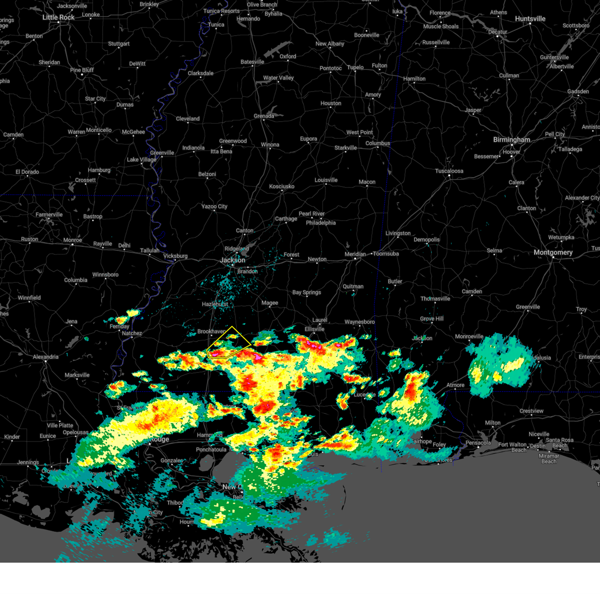 At 751 am cdt, a severe thunderstorm was located near ruth, or 13 miles southeast of brookhaven, moving northeast at 30 mph (radar indicated). Hazards include 60 mph wind gusts and quarter size hail. Hail damage to vehicles is expected. expect wind damage to roofs, siding, and trees. this severe storm will be near, east lincoln around 800 am cdt. topeka around 810 am cdt. monticello and robinwood around 825 am cdt. arm around 835 am cdt. hail threat, radar indicated max hail size, 1. 00 in wind threat, radar indicated max wind gust, 60 mph. At 751 am cdt, a severe thunderstorm was located near ruth, or 13 miles southeast of brookhaven, moving northeast at 30 mph (radar indicated). Hazards include 60 mph wind gusts and quarter size hail. Hail damage to vehicles is expected. expect wind damage to roofs, siding, and trees. this severe storm will be near, east lincoln around 800 am cdt. topeka around 810 am cdt. monticello and robinwood around 825 am cdt. arm around 835 am cdt. hail threat, radar indicated max hail size, 1. 00 in wind threat, radar indicated max wind gust, 60 mph.
|
| 3/28/2023 7:34 AM CDT |
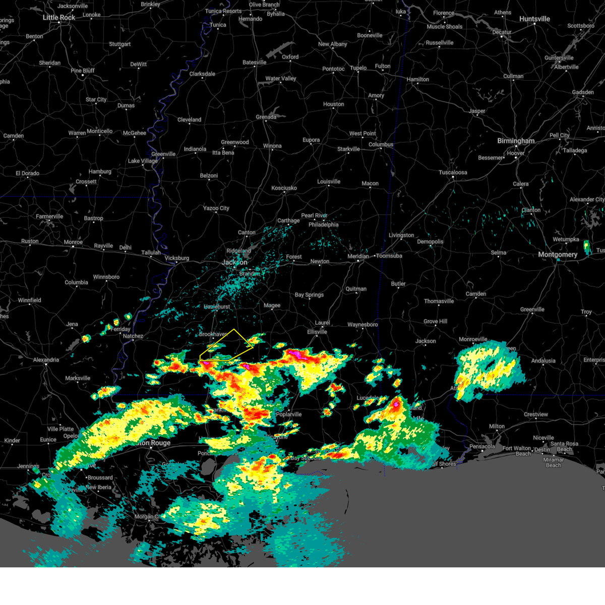 At 733 am cdt, a severe thunderstorm was located near bogue chitto, or 8 miles north of mccomb, moving northeast at 30 mph (radar indicated). Hazards include 60 mph wind gusts and half dollar size hail. Hail damage to vehicles is expected. expect wind damage to roofs, siding, and trees. this severe thunderstorm will be near, bogue chitto around 740 am cdt. enterprise and ruth around 750 am cdt. east lincoln around 800 am cdt. topeka around 810 am cdt. monticello and robinwood around 825 am cdt. arm around 830 am cdt. hail threat, radar indicated max hail size, 1. 25 in wind threat, radar indicated max wind gust, 60 mph. At 733 am cdt, a severe thunderstorm was located near bogue chitto, or 8 miles north of mccomb, moving northeast at 30 mph (radar indicated). Hazards include 60 mph wind gusts and half dollar size hail. Hail damage to vehicles is expected. expect wind damage to roofs, siding, and trees. this severe thunderstorm will be near, bogue chitto around 740 am cdt. enterprise and ruth around 750 am cdt. east lincoln around 800 am cdt. topeka around 810 am cdt. monticello and robinwood around 825 am cdt. arm around 830 am cdt. hail threat, radar indicated max hail size, 1. 25 in wind threat, radar indicated max wind gust, 60 mph.
|
| 3/26/2023 6:20 PM CDT |
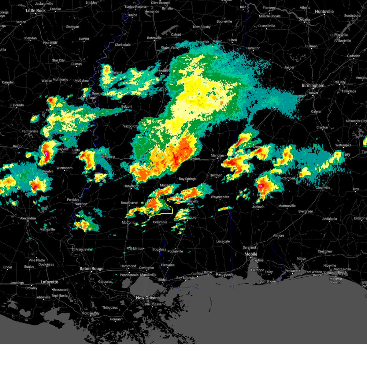 At 620 pm cdt, a severe thunderstorm was located near arm, or 22 miles northwest of columbia, moving northeast at 40 mph (radar indicated). Hazards include tennis ball size hail and 60 mph wind gusts. People and animals outdoors will be injured. expect hail damage to roofs, siding, windows, and vehicles. expect wind damage to roofs, siding, and trees. this severe storm will be near, prentiss around 630 pm cdt. carson around 635 pm cdt. clem around 645 pm cdt. other locations impacted by this severe thunderstorm include bassfield and silver creek. thunderstorm damage threat, considerable hail threat, radar indicated max hail size, 2. 50 in wind threat, radar indicated max wind gust, 60 mph. At 620 pm cdt, a severe thunderstorm was located near arm, or 22 miles northwest of columbia, moving northeast at 40 mph (radar indicated). Hazards include tennis ball size hail and 60 mph wind gusts. People and animals outdoors will be injured. expect hail damage to roofs, siding, windows, and vehicles. expect wind damage to roofs, siding, and trees. this severe storm will be near, prentiss around 630 pm cdt. carson around 635 pm cdt. clem around 645 pm cdt. other locations impacted by this severe thunderstorm include bassfield and silver creek. thunderstorm damage threat, considerable hail threat, radar indicated max hail size, 2. 50 in wind threat, radar indicated max wind gust, 60 mph.
|
| 3/26/2023 6:13 PM CDT |
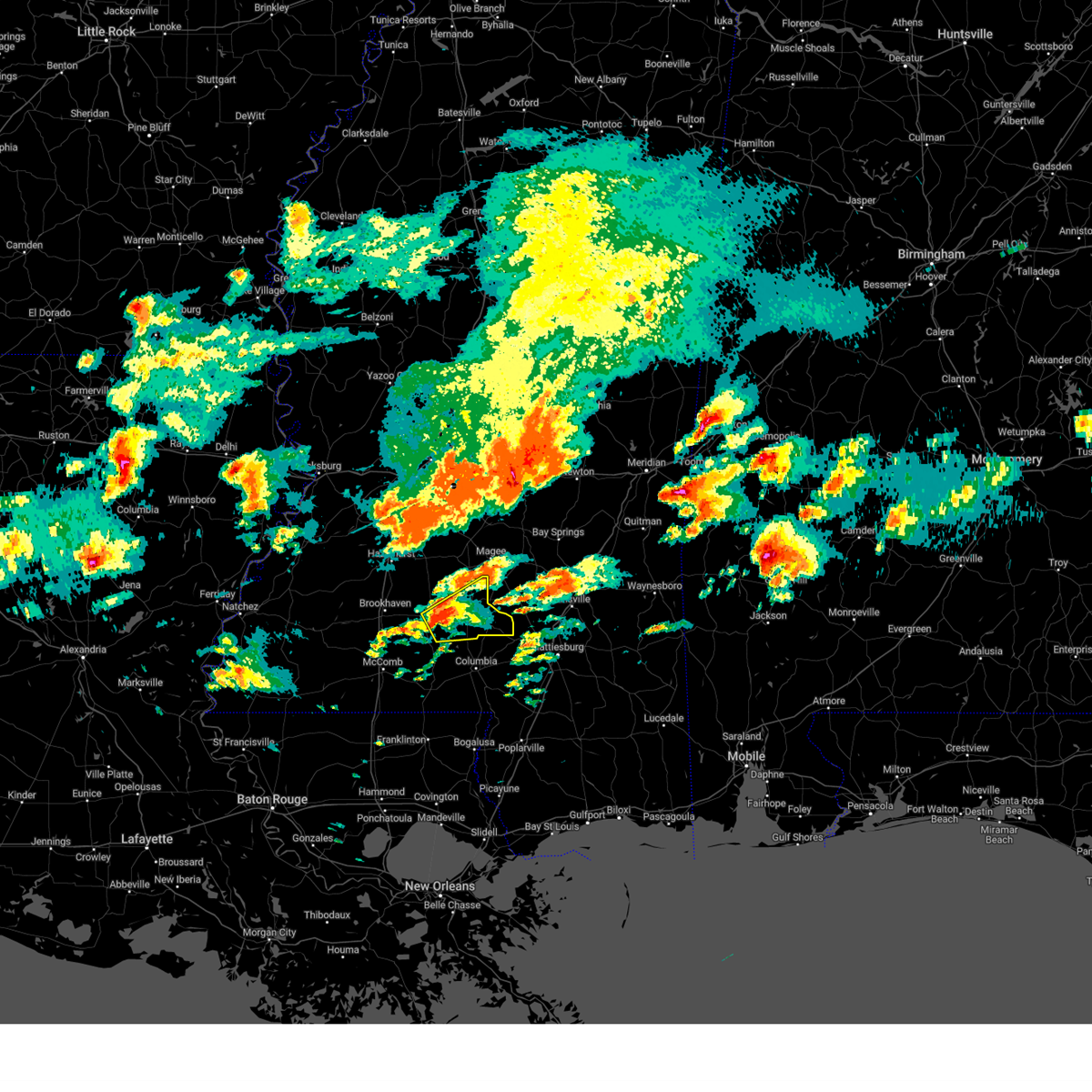 At 613 pm cdt, a severe thunderstorm was located over robinwood, or 22 miles east of brookhaven, moving northeast at 45 mph (radar indicated). Hazards include 60 mph wind gusts and quarter size hail. Hail damage to vehicles is expected. expect wind damage to roofs, siding, and trees. this severe thunderstorm will be near, progress around 625 pm cdt. prentiss around 630 pm cdt. carson around 635 pm cdt. clem around 645 pm cdt. other locations impacted by this severe thunderstorm include bassfield and silver creek. hail threat, radar indicated max hail size, 1. 00 in wind threat, radar indicated max wind gust, 60 mph. At 613 pm cdt, a severe thunderstorm was located over robinwood, or 22 miles east of brookhaven, moving northeast at 45 mph (radar indicated). Hazards include 60 mph wind gusts and quarter size hail. Hail damage to vehicles is expected. expect wind damage to roofs, siding, and trees. this severe thunderstorm will be near, progress around 625 pm cdt. prentiss around 630 pm cdt. carson around 635 pm cdt. clem around 645 pm cdt. other locations impacted by this severe thunderstorm include bassfield and silver creek. hail threat, radar indicated max hail size, 1. 00 in wind threat, radar indicated max wind gust, 60 mph.
|
| 3/12/2023 8:50 AM CDT | Tree blown down on divide rd reported by e in lawrence county MS, 9.2 miles N of Monticello, MS |
| 3/12/2023 8:41 AM CDT |
 At 840 am cdt, severe thunderstorms were located along a line extending from near prentiss to near robinwood to near ruth, moving east at 55 mph (radar indicated). Hazards include 60 mph wind gusts and penny size hail. Expect damage to roofs, siding, and trees. these severe storms will be near, prentiss, arm, oak vale, tilton and progress around 845 am cdt. society hill, clem and carson around 850 am cdt. other locations impacted by these severe thunderstorms include bassfield and silver creek. hail threat, radar indicated max hail size, 0. 75 in wind threat, radar indicated max wind gust, 60 mph. At 840 am cdt, severe thunderstorms were located along a line extending from near prentiss to near robinwood to near ruth, moving east at 55 mph (radar indicated). Hazards include 60 mph wind gusts and penny size hail. Expect damage to roofs, siding, and trees. these severe storms will be near, prentiss, arm, oak vale, tilton and progress around 845 am cdt. society hill, clem and carson around 850 am cdt. other locations impacted by these severe thunderstorms include bassfield and silver creek. hail threat, radar indicated max hail size, 0. 75 in wind threat, radar indicated max wind gust, 60 mph.
|
| 3/12/2023 8:40 AM CDT | Tree blown down at e lincoln rd @ carmel-new hope r in lawrence county MS, 4.9 miles NE of Monticello, MS |
| 3/12/2023 8:40 AM CDT | Corrects previous tstm wnd dmg report from 3 e topeka. tree blown down on divide rd reported by e in lawrence county MS, 9.2 miles N of Monticello, MS |
| 3/12/2023 8:19 AM CDT |
 At 818 am cdt, severe thunderstorms were located along a line extending from near oma to near enterprise to little springs, moving east at 45 mph (radar indicated). Hazards include 60 mph wind gusts and quarter size hail. Hail damage to vehicles is expected. expect wind damage to roofs, siding, and trees. severe thunderstorms will be near, east lincoln and wanilla around 830 am cdt. topeka and jayess around 840 am cdt. robinwood and progress around 845 am cdt. prentiss, tilton, ruth and arm around 850 am cdt. carson and oak vale around 855 am cdt. society hill around 900 am cdt. other locations impacted by these severe thunderstorms include bassfield, new hebron and silver creek. hail threat, radar indicated max hail size, 1. 00 in wind threat, radar indicated max wind gust, 60 mph. At 818 am cdt, severe thunderstorms were located along a line extending from near oma to near enterprise to little springs, moving east at 45 mph (radar indicated). Hazards include 60 mph wind gusts and quarter size hail. Hail damage to vehicles is expected. expect wind damage to roofs, siding, and trees. severe thunderstorms will be near, east lincoln and wanilla around 830 am cdt. topeka and jayess around 840 am cdt. robinwood and progress around 845 am cdt. prentiss, tilton, ruth and arm around 850 am cdt. carson and oak vale around 855 am cdt. society hill around 900 am cdt. other locations impacted by these severe thunderstorms include bassfield, new hebron and silver creek. hail threat, radar indicated max hail size, 1. 00 in wind threat, radar indicated max wind gust, 60 mph.
|
| 2/8/2023 7:46 PM CST |
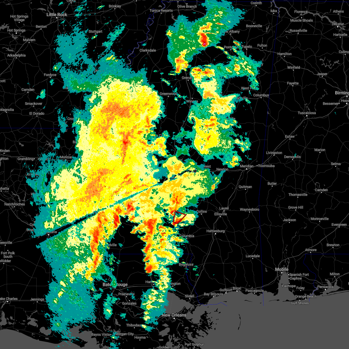 At 746 pm cst, a severe thunderstorm capable of producing a tornado was located over arm, or 22 miles northwest of columbia, moving north at 30 mph (radar indicated rotation). Hazards include tornado. Flying debris will be dangerous to those caught without shelter. mobile homes will be damaged or destroyed. damage to roofs, windows, and vehicles will occur. tree damage is likely. This tornadic thunderstorm will remain over mainly rural areas of northeastern lawrence and west central jefferson davis counties, including the following locations, silver creek. At 746 pm cst, a severe thunderstorm capable of producing a tornado was located over arm, or 22 miles northwest of columbia, moving north at 30 mph (radar indicated rotation). Hazards include tornado. Flying debris will be dangerous to those caught without shelter. mobile homes will be damaged or destroyed. damage to roofs, windows, and vehicles will occur. tree damage is likely. This tornadic thunderstorm will remain over mainly rural areas of northeastern lawrence and west central jefferson davis counties, including the following locations, silver creek.
|
| 2/8/2023 7:31 PM CST |
 At 730 pm cst, a severe thunderstorm capable of producing a tornado was located over tilton, or 16 miles north of kokomo, moving northeast at 30 mph (radar indicated rotation). Hazards include tornado. Flying debris will be dangerous to those caught without shelter. mobile homes will be damaged or destroyed. damage to roofs, windows, and vehicles will occur. tree damage is likely. this dangerous storm will be near, robinwood around 735 pm cst. arm around 740 pm cst. progress around 750 pm cst. prentiss around 800 pm cst. Other locations impacted by this tornadic thunderstorm include silver creek. At 730 pm cst, a severe thunderstorm capable of producing a tornado was located over tilton, or 16 miles north of kokomo, moving northeast at 30 mph (radar indicated rotation). Hazards include tornado. Flying debris will be dangerous to those caught without shelter. mobile homes will be damaged or destroyed. damage to roofs, windows, and vehicles will occur. tree damage is likely. this dangerous storm will be near, robinwood around 735 pm cst. arm around 740 pm cst. progress around 750 pm cst. prentiss around 800 pm cst. Other locations impacted by this tornadic thunderstorm include silver creek.
|
| 2/8/2023 7:13 PM CST |
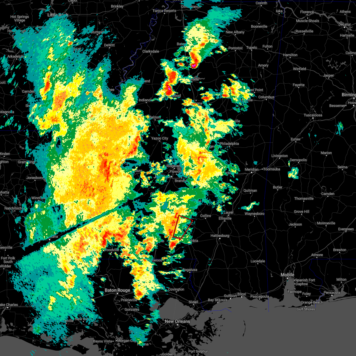 At 713 pm cst, a severe thunderstorm capable of producing a tornado was located near salem, or 10 miles northwest of kokomo, moving north at 30 mph (radar indicated rotation). Hazards include tornado. Flying debris will be dangerous to those caught without shelter. mobile homes will be damaged or destroyed. damage to roofs, windows, and vehicles will occur. tree damage is likely. this dangerous storm will be near, tilton around 730 pm cst. robinwood and oak vale around 735 pm cst. arm around 745 pm cst. progress around 750 pm cst. prentiss around 800 pm cst. Other locations impacted by this tornadic thunderstorm include silver creek. At 713 pm cst, a severe thunderstorm capable of producing a tornado was located near salem, or 10 miles northwest of kokomo, moving north at 30 mph (radar indicated rotation). Hazards include tornado. Flying debris will be dangerous to those caught without shelter. mobile homes will be damaged or destroyed. damage to roofs, windows, and vehicles will occur. tree damage is likely. this dangerous storm will be near, tilton around 730 pm cst. robinwood and oak vale around 735 pm cst. arm around 745 pm cst. progress around 750 pm cst. prentiss around 800 pm cst. Other locations impacted by this tornadic thunderstorm include silver creek.
|
| 1/12/2023 8:19 AM CST |
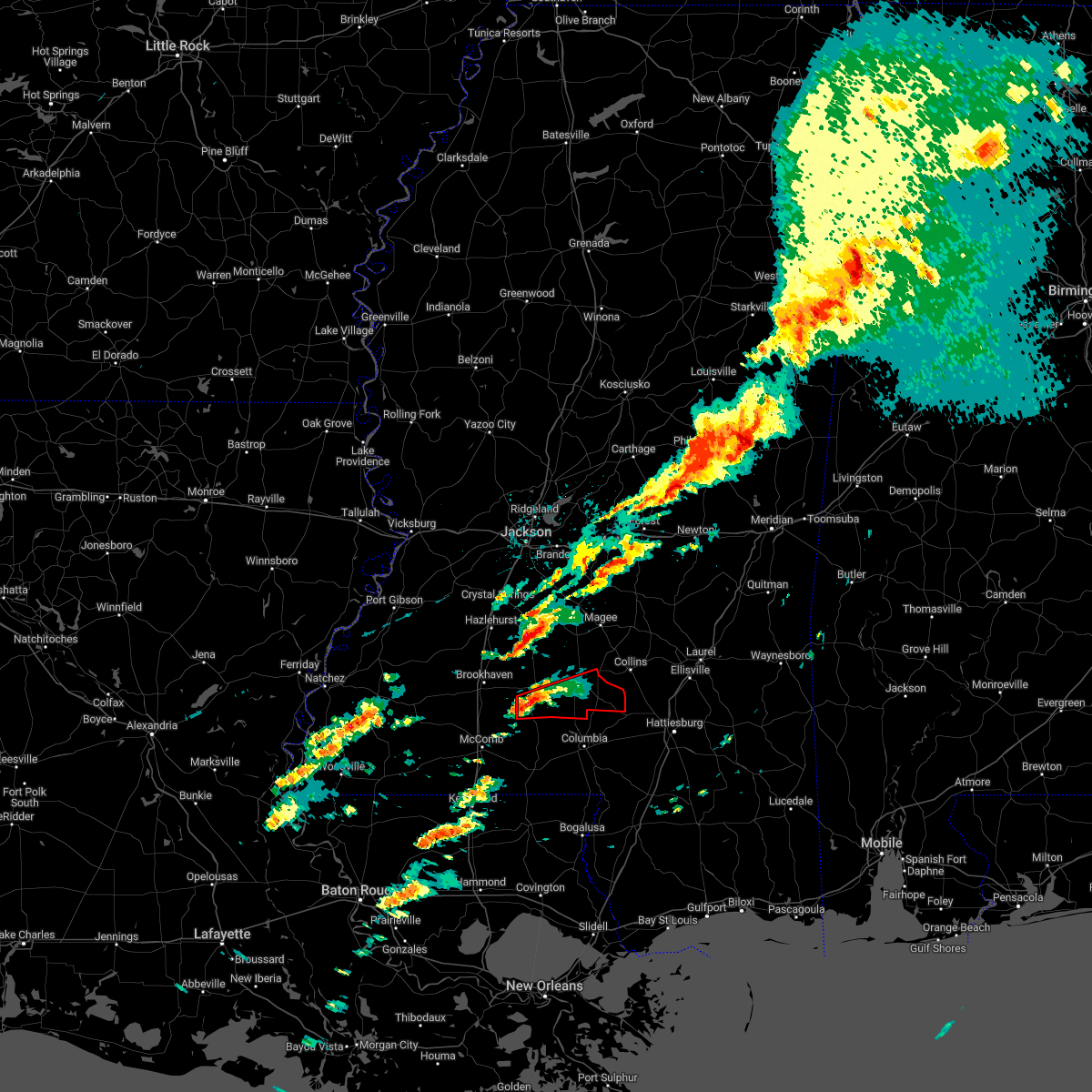 At 819 am cst, a severe thunderstorm capable of producing a tornado was located over topeka, or 18 miles northwest of kokomo, moving east at 40 mph (radar indicated rotation). Hazards include tornado. Flying debris will be dangerous to those caught without shelter. mobile homes will be damaged or destroyed. damage to roofs, windows, and vehicles will occur. tree damage is likely. this dangerous storm will be near, robinwood around 825 am cst. tilton around 830 am cst. oak vale and arm around 835 am cst. progress and society hill around 840 am cst. prentiss around 850 am cst. carson around 855 am cst. melba around 905 am cst. Other locations impacted by this tornadic thunderstorm include bassfield. At 819 am cst, a severe thunderstorm capable of producing a tornado was located over topeka, or 18 miles northwest of kokomo, moving east at 40 mph (radar indicated rotation). Hazards include tornado. Flying debris will be dangerous to those caught without shelter. mobile homes will be damaged or destroyed. damage to roofs, windows, and vehicles will occur. tree damage is likely. this dangerous storm will be near, robinwood around 825 am cst. tilton around 830 am cst. oak vale and arm around 835 am cst. progress and society hill around 840 am cst. prentiss around 850 am cst. carson around 855 am cst. melba around 905 am cst. Other locations impacted by this tornadic thunderstorm include bassfield.
|
| 1/12/2023 8:16 AM CST |
 At 816 am cst, a severe thunderstorm was located over topeka, or 18 miles northwest of kokomo, moving east at 45 mph (radar indicated). Hazards include 60 mph wind gusts. Expect damage to roofs, siding, and trees. this severe storm will be near, robinwood around 825 am cst. arm and tilton around 830 am cst. oak vale and progress around 835 am cst. society hill around 840 am cst. Prentiss around 845 am cst. At 816 am cst, a severe thunderstorm was located over topeka, or 18 miles northwest of kokomo, moving east at 45 mph (radar indicated). Hazards include 60 mph wind gusts. Expect damage to roofs, siding, and trees. this severe storm will be near, robinwood around 825 am cst. arm and tilton around 830 am cst. oak vale and progress around 835 am cst. society hill around 840 am cst. Prentiss around 845 am cst.
|
| 1/12/2023 8:06 AM CST |
 At 806 am cst, a severe thunderstorm was located over ruth, or 13 miles northeast of mccomb, moving east at 45 mph (radar indicated). Hazards include 60 mph wind gusts. Expect damage to roofs, siding, and trees. this severe thunderstorm will be near, east lincoln around 810 am cst. topeka and jayess around 815 am cst. robinwood around 825 am cst. tilton around 830 am cst. oak vale and arm around 835 am cst. progress and society hill around 840 am cst. Prentiss around 845 am cst. At 806 am cst, a severe thunderstorm was located over ruth, or 13 miles northeast of mccomb, moving east at 45 mph (radar indicated). Hazards include 60 mph wind gusts. Expect damage to roofs, siding, and trees. this severe thunderstorm will be near, east lincoln around 810 am cst. topeka and jayess around 815 am cst. robinwood around 825 am cst. tilton around 830 am cst. oak vale and arm around 835 am cst. progress and society hill around 840 am cst. Prentiss around 845 am cst.
|
| 1/3/2023 8:56 PM CST |
 At 853 pm cst, a severe thunderstorm was located over sontag, or 15 miles east of brookhaven, moving northeast at 50 mph (radar indicated). Hazards include 60 mph wind gusts and quarter size hail. Hail damage to vehicles is expected. expect wind damage to roofs, siding, and trees. this severe storm will be near, oma around 900 pm cst. shivers around 915 pm cst. pinola around 920 pm cst. other locations impacted by this severe thunderstorm include new hebron and silver creek. hail threat, radar indicated max hail size, 1. 00 in wind threat, radar indicated max wind gust, 60 mph. At 853 pm cst, a severe thunderstorm was located over sontag, or 15 miles east of brookhaven, moving northeast at 50 mph (radar indicated). Hazards include 60 mph wind gusts and quarter size hail. Hail damage to vehicles is expected. expect wind damage to roofs, siding, and trees. this severe storm will be near, oma around 900 pm cst. shivers around 915 pm cst. pinola around 920 pm cst. other locations impacted by this severe thunderstorm include new hebron and silver creek. hail threat, radar indicated max hail size, 1. 00 in wind threat, radar indicated max wind gust, 60 mph.
|
| 1/3/2023 8:36 PM CST |
 At 836 pm cst, a severe thunderstorm was located over enterprise, or 9 miles southeast of brookhaven, moving northeast at 50 mph (radar indicated). Hazards include 60 mph wind gusts and quarter size hail. Hail damage to vehicles is expected. expect wind damage to roofs, siding, and trees. this severe thunderstorm will be near, east lincoln around 840 pm cst. monticello and sontag around 855 pm cst. wanilla around 900 pm cst. oma around 905 pm cst. shivers around 915 pm cst. pinola around 920 pm cst. other locations impacted by this severe thunderstorm include new hebron and silver creek. hail threat, radar indicated max hail size, 1. 00 in wind threat, radar indicated max wind gust, 60 mph. At 836 pm cst, a severe thunderstorm was located over enterprise, or 9 miles southeast of brookhaven, moving northeast at 50 mph (radar indicated). Hazards include 60 mph wind gusts and quarter size hail. Hail damage to vehicles is expected. expect wind damage to roofs, siding, and trees. this severe thunderstorm will be near, east lincoln around 840 pm cst. monticello and sontag around 855 pm cst. wanilla around 900 pm cst. oma around 905 pm cst. shivers around 915 pm cst. pinola around 920 pm cst. other locations impacted by this severe thunderstorm include new hebron and silver creek. hail threat, radar indicated max hail size, 1. 00 in wind threat, radar indicated max wind gust, 60 mph.
|
| 12/14/2022 1:08 PM CST |
 At 108 pm cst, a severe thunderstorm capable of producing a tornado was located over arm, or 19 miles north of kokomo, moving northeast at 40 mph (radar indicated rotation). Hazards include tornado. Flying debris will be dangerous to those caught without shelter. mobile homes will be damaged or destroyed. damage to roofs, windows, and vehicles will occur. tree damage is likely. this dangerous storm will be near, progress around 120 pm cst. prentiss around 125 pm cst. clem around 140 pm cst. Other locations impacted by this tornadic thunderstorm include new hebron and silver creek. At 108 pm cst, a severe thunderstorm capable of producing a tornado was located over arm, or 19 miles north of kokomo, moving northeast at 40 mph (radar indicated rotation). Hazards include tornado. Flying debris will be dangerous to those caught without shelter. mobile homes will be damaged or destroyed. damage to roofs, windows, and vehicles will occur. tree damage is likely. this dangerous storm will be near, progress around 120 pm cst. prentiss around 125 pm cst. clem around 140 pm cst. Other locations impacted by this tornadic thunderstorm include new hebron and silver creek.
|
| 12/14/2022 12:55 PM CST |
 At 1254 pm cst, a severe thunderstorm capable of producing a tornado was located near jayess, or 14 miles northwest of kokomo, moving northeast at 40 mph (radar indicated rotation). Hazards include tornado. Flying debris will be dangerous to those caught without shelter. mobile homes will be damaged or destroyed. damage to roofs, windows, and vehicles will occur. tree damage is likely. this dangerous storm will be near, robinwood and tilton around 105 pm cst. monticello, arm and oak vale around 110 pm cst. progress around 120 pm cst. prentiss around 130 pm cst. clem around 140 pm cst. Other locations impacted by this tornadic thunderstorm include new hebron and silver creek. At 1254 pm cst, a severe thunderstorm capable of producing a tornado was located near jayess, or 14 miles northwest of kokomo, moving northeast at 40 mph (radar indicated rotation). Hazards include tornado. Flying debris will be dangerous to those caught without shelter. mobile homes will be damaged or destroyed. damage to roofs, windows, and vehicles will occur. tree damage is likely. this dangerous storm will be near, robinwood and tilton around 105 pm cst. monticello, arm and oak vale around 110 pm cst. progress around 120 pm cst. prentiss around 130 pm cst. clem around 140 pm cst. Other locations impacted by this tornadic thunderstorm include new hebron and silver creek.
|
| 12/14/2022 7:33 AM CST |
 At 733 am cst, a severe thunderstorm capable of producing a tornado was located over wanilla, or 18 miles southwest of pinola, moving northeast at 35 mph (radar indicated rotation). Hazards include tornado and quarter size hail. Flying debris will be dangerous to those caught without shelter. mobile homes will be damaged or destroyed. damage to roofs, windows, and vehicles will occur. tree damage is likely. This tornadic thunderstorm will remain over mainly rural areas of northeastern lawrence county, including the following locations, new hebron. At 733 am cst, a severe thunderstorm capable of producing a tornado was located over wanilla, or 18 miles southwest of pinola, moving northeast at 35 mph (radar indicated rotation). Hazards include tornado and quarter size hail. Flying debris will be dangerous to those caught without shelter. mobile homes will be damaged or destroyed. damage to roofs, windows, and vehicles will occur. tree damage is likely. This tornadic thunderstorm will remain over mainly rural areas of northeastern lawrence county, including the following locations, new hebron.
|
| 12/14/2022 7:23 AM CST |
 At 722 am cst, a severe thunderstorm capable of producing a tornado was located near sontag, or 14 miles east of brookhaven, moving northeast at 35 mph (radar indicated rotation). Hazards include tornado. Flying debris will be dangerous to those caught without shelter. mobile homes will be damaged or destroyed. damage to roofs, windows, and vehicles will occur. tree damage is likely. this dangerous storm will be near, wanilla around 730 am cst. oma around 735 am cst. Other locations impacted by this tornadic thunderstorm include new hebron. At 722 am cst, a severe thunderstorm capable of producing a tornado was located near sontag, or 14 miles east of brookhaven, moving northeast at 35 mph (radar indicated rotation). Hazards include tornado. Flying debris will be dangerous to those caught without shelter. mobile homes will be damaged or destroyed. damage to roofs, windows, and vehicles will occur. tree damage is likely. this dangerous storm will be near, wanilla around 730 am cst. oma around 735 am cst. Other locations impacted by this tornadic thunderstorm include new hebron.
|
| 12/14/2022 7:14 AM CST |
 At 714 am cst, a severe thunderstorm capable of producing a tornado was located near east lincoln, or 10 miles east of brookhaven, moving northeast at 35 mph (radar indicated rotation). Hazards include tornado. Flying debris will be dangerous to those caught without shelter. mobile homes will be damaged or destroyed. damage to roofs, windows, and vehicles will occur. tree damage is likely. this dangerous storm will be near, monticello and sontag around 730 am cst. wanilla around 735 am cst. oma around 740 am cst. Other locations impacted by this tornadic thunderstorm include new hebron and silver creek. At 714 am cst, a severe thunderstorm capable of producing a tornado was located near east lincoln, or 10 miles east of brookhaven, moving northeast at 35 mph (radar indicated rotation). Hazards include tornado. Flying debris will be dangerous to those caught without shelter. mobile homes will be damaged or destroyed. damage to roofs, windows, and vehicles will occur. tree damage is likely. this dangerous storm will be near, monticello and sontag around 730 am cst. wanilla around 735 am cst. oma around 740 am cst. Other locations impacted by this tornadic thunderstorm include new hebron and silver creek.
|
| 12/14/2022 7:00 AM CST |
 At 700 am cst, a severe thunderstorm capable of producing a tornado was located over enterprise, or 10 miles south of brookhaven, moving northeast at 30 mph (radar indicated rotation). Hazards include tornado. Flying debris will be dangerous to those caught without shelter. mobile homes will be damaged or destroyed. damage to roofs, windows, and vehicles will occur. tree damage is likely. this dangerous storm will be near, east lincoln around 715 am cst. monticello and sontag around 735 am cst. wanilla around 740 am cst. oma around 745 am cst. Other locations impacted by this tornadic thunderstorm include new hebron and silver creek. At 700 am cst, a severe thunderstorm capable of producing a tornado was located over enterprise, or 10 miles south of brookhaven, moving northeast at 30 mph (radar indicated rotation). Hazards include tornado. Flying debris will be dangerous to those caught without shelter. mobile homes will be damaged or destroyed. damage to roofs, windows, and vehicles will occur. tree damage is likely. this dangerous storm will be near, east lincoln around 715 am cst. monticello and sontag around 735 am cst. wanilla around 740 am cst. oma around 745 am cst. Other locations impacted by this tornadic thunderstorm include new hebron and silver creek.
|
| 11/29/2022 10:04 PM CST |
 At 1004 pm cst, a severe thunderstorm capable of producing a tornado was located 7 miles south of shivers, or 12 miles south of pinola, moving northeast at 45 mph (radar indicated rotation). Hazards include tornado. Flying debris will be dangerous to those caught without shelter. mobile homes will be damaged or destroyed. damage to roofs, windows, and vehicles will occur. tree damage is likely. this dangerous storm will be near, clem around 1015 pm cst. magee, mount olive and sanatorium around 1025 pm cst. Other locations impacted by this tornadic thunderstorm include new hebron and silver creek. At 1004 pm cst, a severe thunderstorm capable of producing a tornado was located 7 miles south of shivers, or 12 miles south of pinola, moving northeast at 45 mph (radar indicated rotation). Hazards include tornado. Flying debris will be dangerous to those caught without shelter. mobile homes will be damaged or destroyed. damage to roofs, windows, and vehicles will occur. tree damage is likely. this dangerous storm will be near, clem around 1015 pm cst. magee, mount olive and sanatorium around 1025 pm cst. Other locations impacted by this tornadic thunderstorm include new hebron and silver creek.
|
| 11/29/2022 9:41 PM CST |
 At 941 pm cst, a severe thunderstorm capable of producing a tornado was located near monticello, or 16 miles east of brookhaven, moving northeast at 45 mph (radar indicated rotation). Hazards include tornado. Flying debris will be dangerous to those caught without shelter. mobile homes will be damaged or destroyed. damage to roofs, windows, and vehicles will occur. tree damage is likely. this dangerous storm will be near, wanilla around 945 pm cst. oma around 950 pm cst. shivers around 1005 pm cst. clem around 1010 pm cst. magee and sanatorium around 1025 pm cst. martinville around 1030 pm cst. Other locations impacted by this tornadic thunderstorm include new hebron and silver creek. At 941 pm cst, a severe thunderstorm capable of producing a tornado was located near monticello, or 16 miles east of brookhaven, moving northeast at 45 mph (radar indicated rotation). Hazards include tornado. Flying debris will be dangerous to those caught without shelter. mobile homes will be damaged or destroyed. damage to roofs, windows, and vehicles will occur. tree damage is likely. this dangerous storm will be near, wanilla around 945 pm cst. oma around 950 pm cst. shivers around 1005 pm cst. clem around 1010 pm cst. magee and sanatorium around 1025 pm cst. martinville around 1030 pm cst. Other locations impacted by this tornadic thunderstorm include new hebron and silver creek.
|
| 11/29/2022 9:29 PM CST |
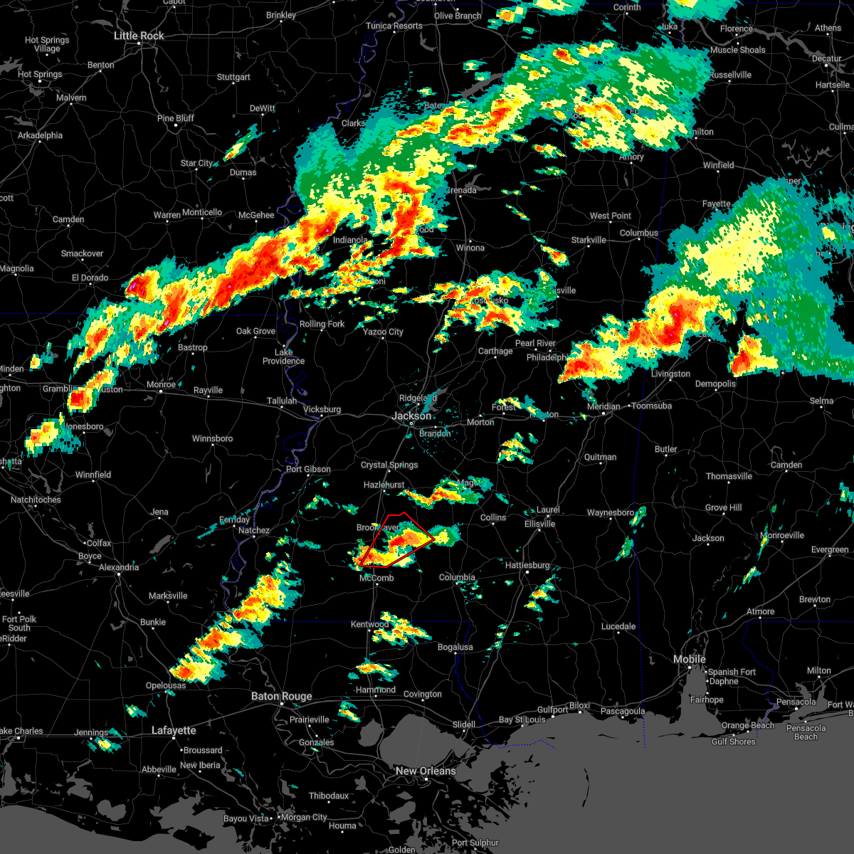 At 929 pm cst, a severe thunderstorm capable of producing a tornado was located near east lincoln, or 11 miles east of brookhaven, moving northeast at 40 mph (radar indicated rotation). Hazards include tornado. Flying debris will be dangerous to those caught without shelter. mobile homes will be damaged or destroyed. damage to roofs, windows, and vehicles will occur. tree damage is likely. This dangerous storm will be near, monticello and sontag around 940 pm cst. At 929 pm cst, a severe thunderstorm capable of producing a tornado was located near east lincoln, or 11 miles east of brookhaven, moving northeast at 40 mph (radar indicated rotation). Hazards include tornado. Flying debris will be dangerous to those caught without shelter. mobile homes will be damaged or destroyed. damage to roofs, windows, and vehicles will occur. tree damage is likely. This dangerous storm will be near, monticello and sontag around 940 pm cst.
|
| 11/29/2022 9:06 PM CST |
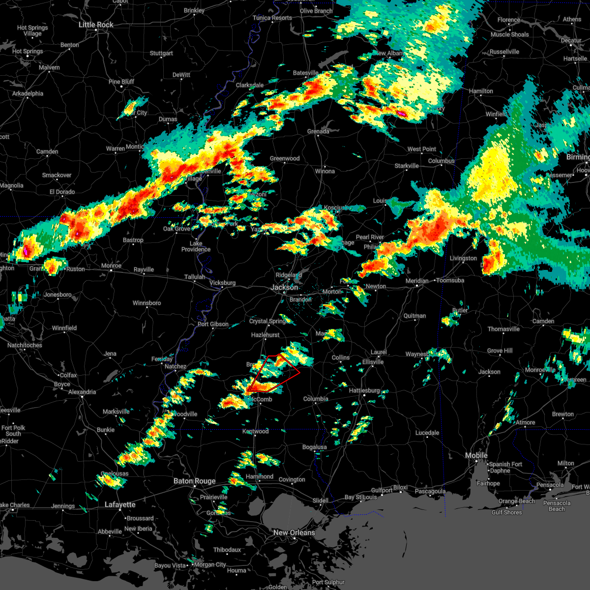 At 905 pm cst, a severe thunderstorm capable of producing a tornado was located over bogue chitto, or 11 miles south of brookhaven, moving northeast at 35 mph (radar indicated rotation). Hazards include tornado. Flying debris will be dangerous to those caught without shelter. mobile homes will be damaged or destroyed. damage to roofs, windows, and vehicles will occur. tree damage is likely. this dangerous storm will be near, enterprise around 915 pm cst. east lincoln around 925 pm cst. Monticello and sontag around 945 pm cst. At 905 pm cst, a severe thunderstorm capable of producing a tornado was located over bogue chitto, or 11 miles south of brookhaven, moving northeast at 35 mph (radar indicated rotation). Hazards include tornado. Flying debris will be dangerous to those caught without shelter. mobile homes will be damaged or destroyed. damage to roofs, windows, and vehicles will occur. tree damage is likely. this dangerous storm will be near, enterprise around 915 pm cst. east lincoln around 925 pm cst. Monticello and sontag around 945 pm cst.
|
| 11/29/2022 8:46 PM CST |
 At 846 pm cst, a severe thunderstorm capable of producing a tornado was located near smithdale, or 11 miles northwest of mccomb, moving northeast at 40 mph (radar indicated rotation). Hazards include tornado. Flying debris will be dangerous to those caught without shelter. mobile homes will be damaged or destroyed. damage to roofs, windows, and vehicles will occur. tree damage is likely. this dangerous storm will be near, center point around 850 pm cst. west lincoln around 900 pm cst. bogue chitto around 905 pm cst. enterprise around 910 pm cst. east lincoln around 920 pm cst. Monticello and sontag around 935 pm cst. At 846 pm cst, a severe thunderstorm capable of producing a tornado was located near smithdale, or 11 miles northwest of mccomb, moving northeast at 40 mph (radar indicated rotation). Hazards include tornado. Flying debris will be dangerous to those caught without shelter. mobile homes will be damaged or destroyed. damage to roofs, windows, and vehicles will occur. tree damage is likely. this dangerous storm will be near, center point around 850 pm cst. west lincoln around 900 pm cst. bogue chitto around 905 pm cst. enterprise around 910 pm cst. east lincoln around 920 pm cst. Monticello and sontag around 935 pm cst.
|
| 8/18/2022 5:20 AM CDT |
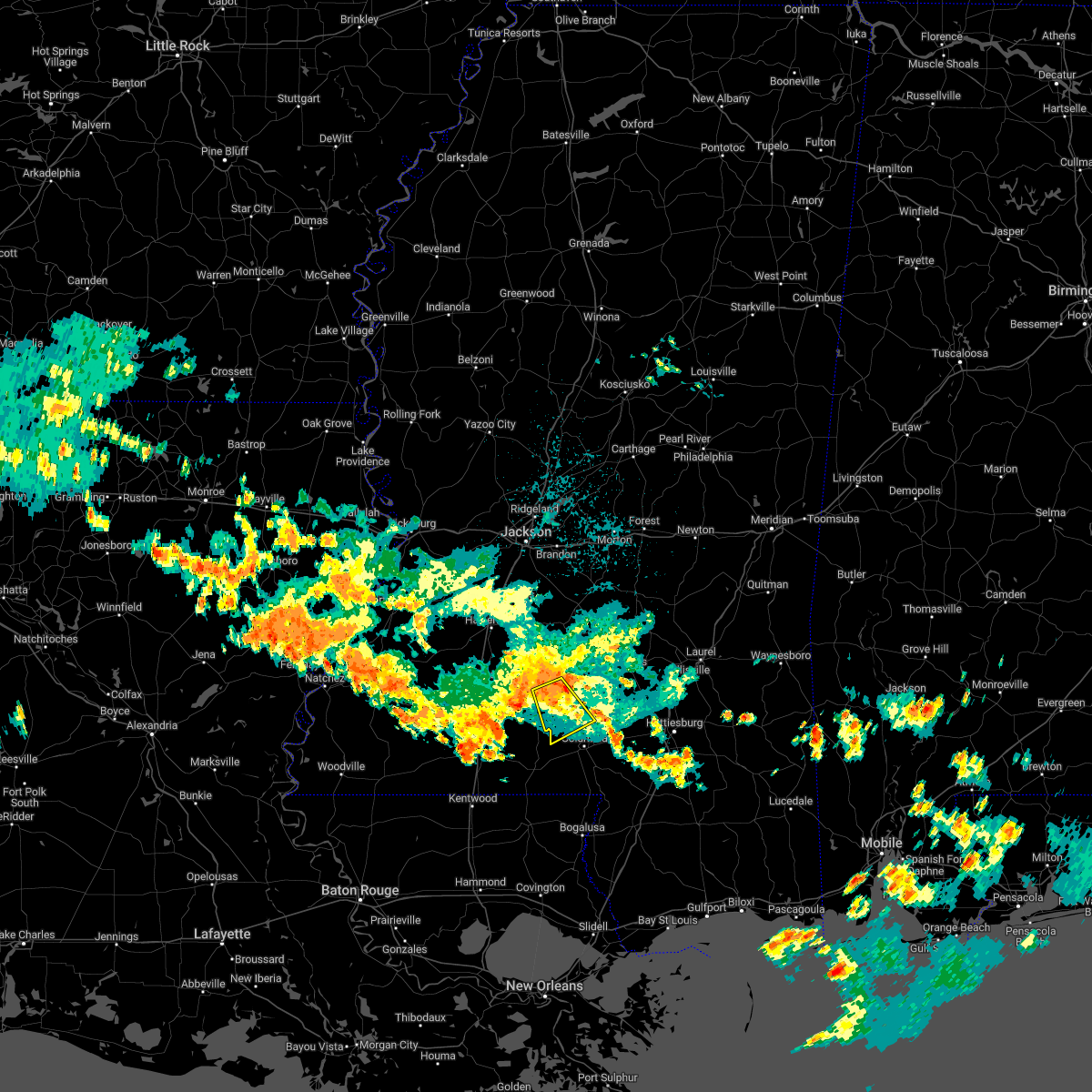 At 519 am cdt, a severe thunderstorm was located over arm, or 20 miles northwest of columbia, moving south at 25 mph (radar indicated). Hazards include 60 mph wind gusts. Expect damage to roofs, siding, and trees. this severe thunderstorm will be near, oak vale and tilton around 535 am cdt. society hill around 540 am cdt. goss around 550 am cdt. holly springs around 555 am cdt. hail threat, radar indicated max hail size, <. 75 in wind threat, radar indicated max wind gust, 60 mph. At 519 am cdt, a severe thunderstorm was located over arm, or 20 miles northwest of columbia, moving south at 25 mph (radar indicated). Hazards include 60 mph wind gusts. Expect damage to roofs, siding, and trees. this severe thunderstorm will be near, oak vale and tilton around 535 am cdt. society hill around 540 am cdt. goss around 550 am cdt. holly springs around 555 am cdt. hail threat, radar indicated max hail size, <. 75 in wind threat, radar indicated max wind gust, 60 mph.
|
| 6/10/2022 12:53 PM CDT |
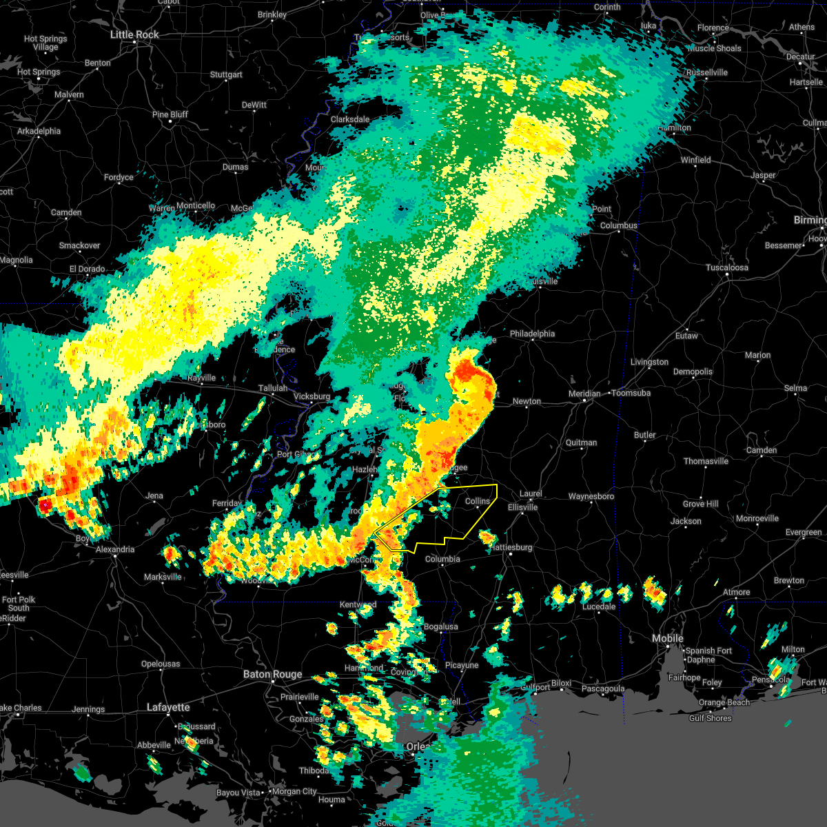 At 1253 pm cdt, severe thunderstorms were located along a line extending from near clem to near east lincoln, moving southeast at 35 mph (radar indicated). Hazards include 60 mph wind gusts. Expect damage to roofs, siding, and trees. these severe storms will be near, clem around 100 pm cdt. mount olive around 105 pm cdt. lone star around 110 pm cdt. tilton around 115 pm cdt. collins around 125 pm cdt. other locations impacted by these severe thunderstorms include bassfield and silver creek. hail threat, radar indicated max hail size, <. 75 in wind threat, radar indicated max wind gust, 60 mph. At 1253 pm cdt, severe thunderstorms were located along a line extending from near clem to near east lincoln, moving southeast at 35 mph (radar indicated). Hazards include 60 mph wind gusts. Expect damage to roofs, siding, and trees. these severe storms will be near, clem around 100 pm cdt. mount olive around 105 pm cdt. lone star around 110 pm cdt. tilton around 115 pm cdt. collins around 125 pm cdt. other locations impacted by these severe thunderstorms include bassfield and silver creek. hail threat, radar indicated max hail size, <. 75 in wind threat, radar indicated max wind gust, 60 mph.
|
| 6/10/2022 12:29 PM CDT |
 At 1228 pm cdt, severe thunderstorms were located along a line extending from near union to near brookhaven, moving southeast at 40 mph (radar indicated). Hazards include 60 mph wind gusts. Expect damage to roofs, siding, and trees. severe thunderstorms will be near, monticello around 1250 pm cdt. robinwood, topeka and jayess around 1255 pm cdt. clem and arm around 100 pm cdt. mount olive, tilton and lone star around 105 pm cdt. oak vale around 110 pm cdt. society hill around 115 pm cdt. collins around 120 pm cdt. other locations impacted by these severe thunderstorms include bassfield, new hebron and silver creek. hail threat, radar indicated max hail size, <. 75 in wind threat, radar indicated max wind gust, 60 mph. At 1228 pm cdt, severe thunderstorms were located along a line extending from near union to near brookhaven, moving southeast at 40 mph (radar indicated). Hazards include 60 mph wind gusts. Expect damage to roofs, siding, and trees. severe thunderstorms will be near, monticello around 1250 pm cdt. robinwood, topeka and jayess around 1255 pm cdt. clem and arm around 100 pm cdt. mount olive, tilton and lone star around 105 pm cdt. oak vale around 110 pm cdt. society hill around 115 pm cdt. collins around 120 pm cdt. other locations impacted by these severe thunderstorms include bassfield, new hebron and silver creek. hail threat, radar indicated max hail size, <. 75 in wind threat, radar indicated max wind gust, 60 mph.
|
| 4/17/2022 7:59 PM CDT |
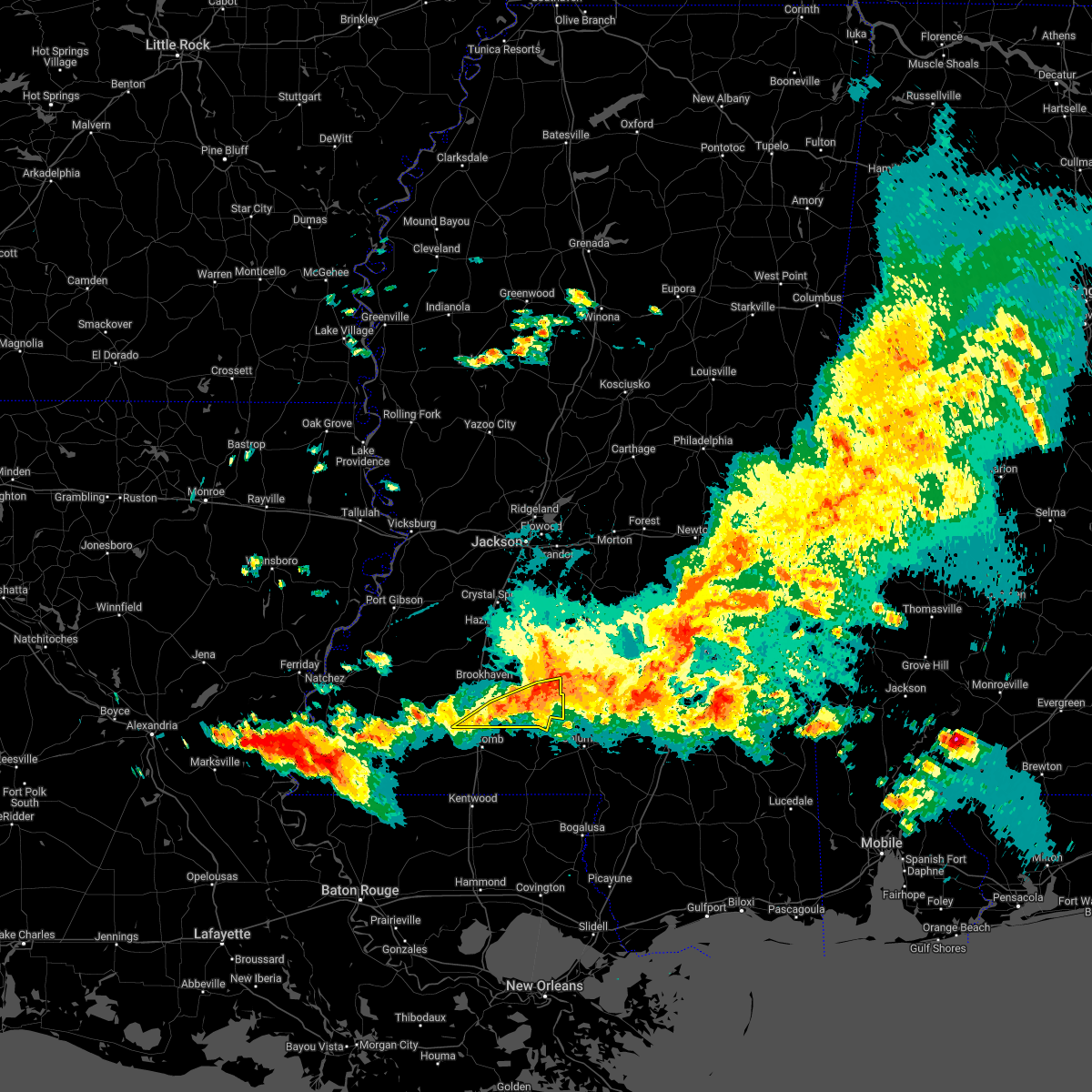 At 759 pm cdt, severe thunderstorms were located along a line extending from 7 miles southeast of shivers to near oak vale to near summit, moving east at 55 mph (radar indicated). Hazards include 60 mph wind gusts and nickel size hail. Expect damage to roofs, siding, and trees. these severe storms will be near, oak vale around 805 pm cdt. hail threat, radar indicated max hail size, 0. 88 in wind threat, radar indicated max wind gust, 60 mph. At 759 pm cdt, severe thunderstorms were located along a line extending from 7 miles southeast of shivers to near oak vale to near summit, moving east at 55 mph (radar indicated). Hazards include 60 mph wind gusts and nickel size hail. Expect damage to roofs, siding, and trees. these severe storms will be near, oak vale around 805 pm cdt. hail threat, radar indicated max hail size, 0. 88 in wind threat, radar indicated max wind gust, 60 mph.
|
| 4/17/2022 7:42 PM CDT |
 At 742 pm cdt, severe thunderstorms were located along a line extending from near wesson to enterprise to 8 miles southwest of smithdale, moving east at 50 mph (radar indicated). Hazards include 60 mph wind gusts and nickel size hail. Expect damage to roofs, siding, and trees. these severe storms will be near, enterprise, east lincoln and ruth around 750 pm cdt. topeka, sontag and oma around 755 pm cdt. monticello, wanilla, jayess and robinwood around 800 pm cdt. tilton, oak vale and arm around 810 pm cdt. other locations impacted by these severe thunderstorms include new hebron, silver creek, beauregard and meadville. hail threat, radar indicated max hail size, 0. 88 in wind threat, radar indicated max wind gust, 60 mph. At 742 pm cdt, severe thunderstorms were located along a line extending from near wesson to enterprise to 8 miles southwest of smithdale, moving east at 50 mph (radar indicated). Hazards include 60 mph wind gusts and nickel size hail. Expect damage to roofs, siding, and trees. these severe storms will be near, enterprise, east lincoln and ruth around 750 pm cdt. topeka, sontag and oma around 755 pm cdt. monticello, wanilla, jayess and robinwood around 800 pm cdt. tilton, oak vale and arm around 810 pm cdt. other locations impacted by these severe thunderstorms include new hebron, silver creek, beauregard and meadville. hail threat, radar indicated max hail size, 0. 88 in wind threat, radar indicated max wind gust, 60 mph.
|
| 4/17/2022 7:19 PM CDT |
 At 718 pm cdt, severe thunderstorms were located along a line extending from barlow to near mccall creek to near garden city, moving east at 50 mph (radar indicated). Hazards include 60 mph wind gusts and nickel size hail. Expect damage to roofs, siding, and trees. severe thunderstorms will be near, vaughn, loyd star and mccall creek around 725 pm cdt. glancy and west lincoln around 730 pm cdt. brookhaven and martinsville around 735 pm cdt. wesson, enterprise and bogue chitto around 740 pm cdt. east lincoln around 745 pm cdt. sontag and ruth around 750 pm cdt. topeka, wanilla, jayess and oma around 755 pm cdt. monticello and robinwood around 800 pm cdt. other locations impacted by these severe thunderstorms include new hebron, meadville, silver creek and beauregard. hail threat, radar indicated max hail size, 0. 88 in wind threat, radar indicated max wind gust, 60 mph. At 718 pm cdt, severe thunderstorms were located along a line extending from barlow to near mccall creek to near garden city, moving east at 50 mph (radar indicated). Hazards include 60 mph wind gusts and nickel size hail. Expect damage to roofs, siding, and trees. severe thunderstorms will be near, vaughn, loyd star and mccall creek around 725 pm cdt. glancy and west lincoln around 730 pm cdt. brookhaven and martinsville around 735 pm cdt. wesson, enterprise and bogue chitto around 740 pm cdt. east lincoln around 745 pm cdt. sontag and ruth around 750 pm cdt. topeka, wanilla, jayess and oma around 755 pm cdt. monticello and robinwood around 800 pm cdt. other locations impacted by these severe thunderstorms include new hebron, meadville, silver creek and beauregard. hail threat, radar indicated max hail size, 0. 88 in wind threat, radar indicated max wind gust, 60 mph.
|
| 4/17/2022 7:08 PM CDT |
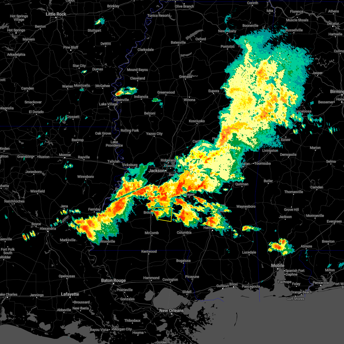 At 708 pm cdt, a severe thunderstorm was located near sontag, or 10 miles east of brookhaven, moving east at 30 mph (radar indicated). Hazards include 60 mph wind gusts and half dollar size hail. Hail damage to vehicles is expected. expect wind damage to roofs, siding, and trees. this severe storm will be near, sontag around 715 pm cdt. wanilla around 725 pm cdt. monticello around 730 pm cdt. hail threat, radar indicated max hail size, 1. 25 in wind threat, radar indicated max wind gust, 60 mph. At 708 pm cdt, a severe thunderstorm was located near sontag, or 10 miles east of brookhaven, moving east at 30 mph (radar indicated). Hazards include 60 mph wind gusts and half dollar size hail. Hail damage to vehicles is expected. expect wind damage to roofs, siding, and trees. this severe storm will be near, sontag around 715 pm cdt. wanilla around 725 pm cdt. monticello around 730 pm cdt. hail threat, radar indicated max hail size, 1. 25 in wind threat, radar indicated max wind gust, 60 mph.
|
| 4/17/2022 6:56 PM CDT |
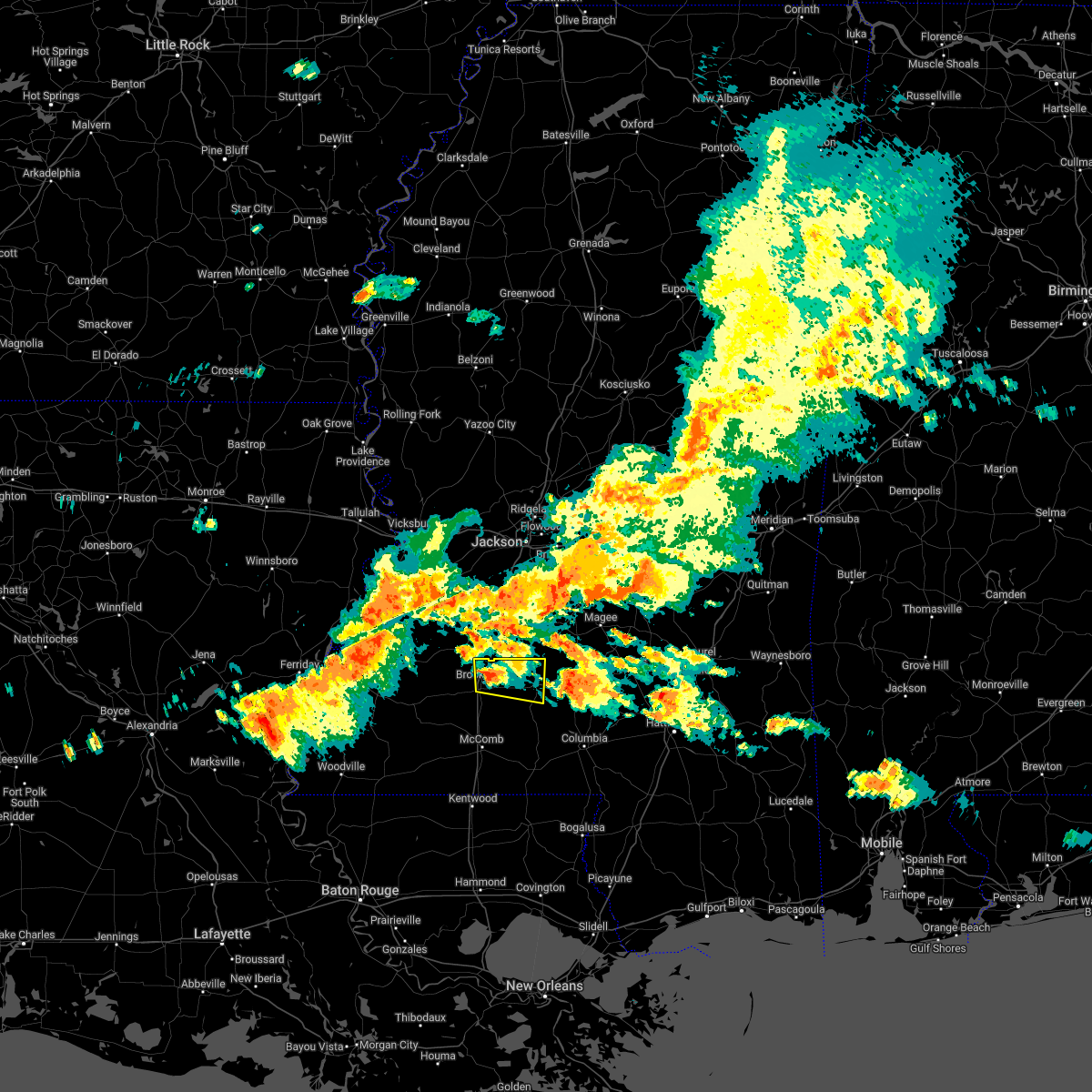 At 656 pm cdt, a severe thunderstorm was located near brookhaven, moving east at 30 mph (radar indicated). Hazards include 60 mph wind gusts and half dollar size hail. Hail damage to vehicles is expected. expect wind damage to roofs, siding, and trees. this severe thunderstorm will be near, sontag around 715 pm cdt. wanilla around 725 pm cdt. monticello around 730 pm cdt. hail threat, radar indicated max hail size, 1. 25 in wind threat, radar indicated max wind gust, 60 mph. At 656 pm cdt, a severe thunderstorm was located near brookhaven, moving east at 30 mph (radar indicated). Hazards include 60 mph wind gusts and half dollar size hail. Hail damage to vehicles is expected. expect wind damage to roofs, siding, and trees. this severe thunderstorm will be near, sontag around 715 pm cdt. wanilla around 725 pm cdt. monticello around 730 pm cdt. hail threat, radar indicated max hail size, 1. 25 in wind threat, radar indicated max wind gust, 60 mph.
|
| 4/17/2022 6:27 PM CDT |
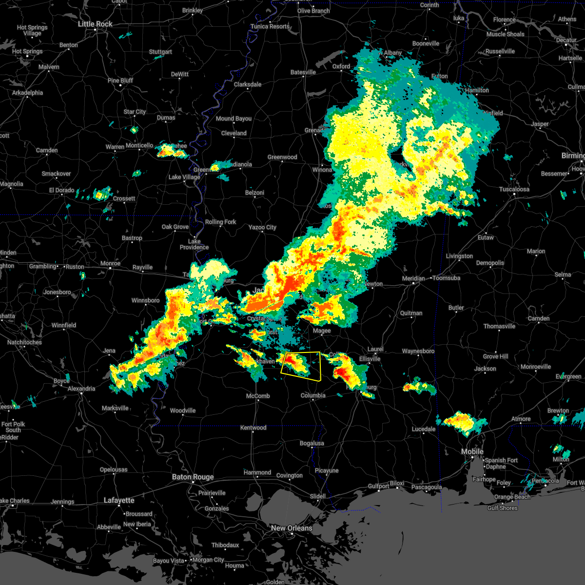 At 627 pm cdt, a severe thunderstorm was located near wanilla, or 17 miles south of pinola, moving east at 30 mph (radar indicated). Hazards include golf ball size hail and 60 mph wind gusts. People and animals outdoors will be injured. expect hail damage to roofs, siding, windows, and vehicles. expect wind damage to roofs, siding, and trees. this severe storm will be near, progress around 640 pm cdt. prentiss around 650 pm cdt. carson around 700 pm cdt. Other locations impacted by this severe thunderstorm include silver creek. At 627 pm cdt, a severe thunderstorm was located near wanilla, or 17 miles south of pinola, moving east at 30 mph (radar indicated). Hazards include golf ball size hail and 60 mph wind gusts. People and animals outdoors will be injured. expect hail damage to roofs, siding, windows, and vehicles. expect wind damage to roofs, siding, and trees. this severe storm will be near, progress around 640 pm cdt. prentiss around 650 pm cdt. carson around 700 pm cdt. Other locations impacted by this severe thunderstorm include silver creek.
|
| 4/17/2022 6:21 PM CDT |
 At 621 pm cdt, a severe thunderstorm was located over wanilla, or 18 miles east of brookhaven, moving east at 30 mph (radar indicated). Hazards include golf ball size hail and 60 mph wind gusts. People and animals outdoors will be injured. expect hail damage to roofs, siding, windows, and vehicles. expect wind damage to roofs, siding, and trees. this severe storm will be near, progress around 640 pm cdt. prentiss around 650 pm cdt. carson around 700 pm cdt. other locations impacted by this severe thunderstorm include silver creek. thunderstorm damage threat, considerable hail threat, radar indicated max hail size, 1. 75 in wind threat, radar indicated max wind gust, 60 mph. At 621 pm cdt, a severe thunderstorm was located over wanilla, or 18 miles east of brookhaven, moving east at 30 mph (radar indicated). Hazards include golf ball size hail and 60 mph wind gusts. People and animals outdoors will be injured. expect hail damage to roofs, siding, windows, and vehicles. expect wind damage to roofs, siding, and trees. this severe storm will be near, progress around 640 pm cdt. prentiss around 650 pm cdt. carson around 700 pm cdt. other locations impacted by this severe thunderstorm include silver creek. thunderstorm damage threat, considerable hail threat, radar indicated max hail size, 1. 75 in wind threat, radar indicated max wind gust, 60 mph.
|
| 4/17/2022 6:18 PM CDT |
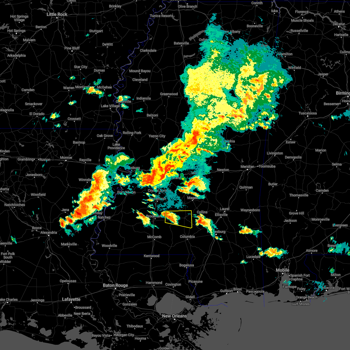 At 618 pm cdt, a severe thunderstorm was located over monticello, or 19 miles east of brookhaven, moving east at 30 mph (radar indicated). Hazards include 60 mph wind gusts and half dollar size hail. Hail damage to vehicles is expected. expect wind damage to roofs, siding, and trees. this severe thunderstorm will be near, arm around 630 pm cdt. progress around 640 pm cdt. prentiss around 645 pm cdt. carson around 655 pm cdt. other locations impacted by this severe thunderstorm include silver creek. hail threat, radar indicated max hail size, 1. 25 in wind threat, radar indicated max wind gust, 60 mph. At 618 pm cdt, a severe thunderstorm was located over monticello, or 19 miles east of brookhaven, moving east at 30 mph (radar indicated). Hazards include 60 mph wind gusts and half dollar size hail. Hail damage to vehicles is expected. expect wind damage to roofs, siding, and trees. this severe thunderstorm will be near, arm around 630 pm cdt. progress around 640 pm cdt. prentiss around 645 pm cdt. carson around 655 pm cdt. other locations impacted by this severe thunderstorm include silver creek. hail threat, radar indicated max hail size, 1. 25 in wind threat, radar indicated max wind gust, 60 mph.
|
| 4/15/2022 3:45 PM CDT | Quarter sized hail reported 0.2 miles NW of Monticello, MS, nickel to quarter size hail in monticello. |
| 4/13/2022 8:13 PM CDT |
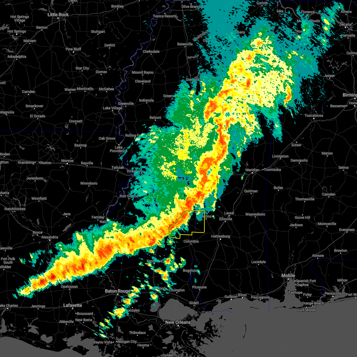 At 813 pm cdt, severe thunderstorms were located along a line extending from near clem to arm, moving east at 55 mph (radar indicated). Hazards include 60 mph wind gusts. Expect damage to roofs, siding, and trees. these severe storms will be near, clem and lone star around 820 pm cdt. mount olive around 825 pm cdt. carson around 830 pm cdt. melba around 840 pm cdt. other locations impacted by these severe thunderstorms include bassfield and silver creek. hail threat, radar indicated max hail size, <. 75 in wind threat, radar indicated max wind gust, 60 mph. At 813 pm cdt, severe thunderstorms were located along a line extending from near clem to arm, moving east at 55 mph (radar indicated). Hazards include 60 mph wind gusts. Expect damage to roofs, siding, and trees. these severe storms will be near, clem and lone star around 820 pm cdt. mount olive around 825 pm cdt. carson around 830 pm cdt. melba around 840 pm cdt. other locations impacted by these severe thunderstorms include bassfield and silver creek. hail threat, radar indicated max hail size, <. 75 in wind threat, radar indicated max wind gust, 60 mph.
|
| 1/1/0001 12:00 AM | Numerous trees downed across the county... with several roads blocked. one tree fell on a home on hwy 184 e and a tree fell on a mobile home on lee hedgepeth r in lawrence county MS, 0.2 miles NW of Monticello, MS |
| 4/13/2022 8:00 PM CDT |
 At 800 pm cdt, a severe thunderstorm was located near wanilla, or 15 miles southwest of pinola, moving east at 60 mph (radar indicated). Hazards include 60 mph wind gusts. Expect damage to roofs, siding, and trees. this severe thunderstorm will be near, prentiss around 810 pm cdt. clem around 815 pm cdt. lone star around 820 pm cdt. mount olive around 825 pm cdt. other locations impacted by this severe thunderstorm include bassfield, new hebron and silver creek. hail threat, radar indicated max hail size, <. 75 in wind threat, radar indicated max wind gust, 60 mph. At 800 pm cdt, a severe thunderstorm was located near wanilla, or 15 miles southwest of pinola, moving east at 60 mph (radar indicated). Hazards include 60 mph wind gusts. Expect damage to roofs, siding, and trees. this severe thunderstorm will be near, prentiss around 810 pm cdt. clem around 815 pm cdt. lone star around 820 pm cdt. mount olive around 825 pm cdt. other locations impacted by this severe thunderstorm include bassfield, new hebron and silver creek. hail threat, radar indicated max hail size, <. 75 in wind threat, radar indicated max wind gust, 60 mph.
|
| 4/5/2022 7:00 AM CDT | At 659 am cdt, severe thunderstorms were located along a line extending from near sanatorium to near monticello, moving east at 50 mph (radar indicated). Hazards include 60 mph wind gusts. Expect damage to roofs, siding, and trees. these severe storms will be near, magee, martinville and sanatorium around 705 am cdt. raleigh around 715 am cdt. taylorsville, center ridge, carson and clem around 720 am cdt. lone star around 725 am cdt. collins around 735 am cdt. Other locations impacted by these severe thunderstorms include sylvarena, new hebron, seminary, mize and silver creek. |
| 4/5/2022 6:40 AM CDT |
 At 640 am cdt, severe thunderstorms were located along a line extending from near mendenhall to near east lincoln, moving east at 60 mph (radar indicated). Hazards include 60 mph wind gusts. Expect damage to roofs, siding, and trees. severe thunderstorms will be near, sanatorium around 645 am cdt. magee and martinville around 650 am cdt. arm around 655 am cdt. progress around 700 am cdt. raleigh, prentiss, center ridge and carson around 705 am cdt. lone star around 710 am cdt. collins around 720 am cdt. other locations impacted by these severe thunderstorms include sylvarena, new hebron, seminary, mize and silver creek. hail threat, radar indicated max hail size, <. 75 in wind threat, radar indicated max wind gust, 60 mph. At 640 am cdt, severe thunderstorms were located along a line extending from near mendenhall to near east lincoln, moving east at 60 mph (radar indicated). Hazards include 60 mph wind gusts. Expect damage to roofs, siding, and trees. severe thunderstorms will be near, sanatorium around 645 am cdt. magee and martinville around 650 am cdt. arm around 655 am cdt. progress around 700 am cdt. raleigh, prentiss, center ridge and carson around 705 am cdt. lone star around 710 am cdt. collins around 720 am cdt. other locations impacted by these severe thunderstorms include sylvarena, new hebron, seminary, mize and silver creek. hail threat, radar indicated max hail size, <. 75 in wind threat, radar indicated max wind gust, 60 mph.
|
| 3/30/2022 6:57 PM CDT |
 The severe thunderstorm warning for southeastern simpson, lawrence, northwestern covington and jefferson davis counties will expire at 700 pm cdt, the storms which prompted the warning have moved out of the area. therefore, the warning will be allowed to expire. however gusty winds are still possible with these thunderstorms. a tornado watch remains in effect until 800 pm cdt for south central, central and southeastern mississippi. The severe thunderstorm warning for southeastern simpson, lawrence, northwestern covington and jefferson davis counties will expire at 700 pm cdt, the storms which prompted the warning have moved out of the area. therefore, the warning will be allowed to expire. however gusty winds are still possible with these thunderstorms. a tornado watch remains in effect until 800 pm cdt for south central, central and southeastern mississippi.
|
| 3/30/2022 6:14 PM CDT |
 At 613 pm cdt, severe thunderstorms were located along a line extending from near pinola to near hebron to near topeka, moving east at 30 mph (radar indicated). Hazards include 60 mph wind gusts. Expect damage to roofs, siding, and trees. severe thunderstorms will be near, pinola and shivers around 620 pm cdt. sanatorium around 630 pm cdt. magee around 635 pm cdt. clem and progress around 640 pm cdt. prentiss, society hill and lone star around 645 pm cdt. mount olive and carson around 655 pm cdt. other locations impacted by these severe thunderstorms include new hebron and silver creek. hail threat, radar indicated max hail size, <. 75 in wind threat, radar indicated max wind gust, 60 mph. At 613 pm cdt, severe thunderstorms were located along a line extending from near pinola to near hebron to near topeka, moving east at 30 mph (radar indicated). Hazards include 60 mph wind gusts. Expect damage to roofs, siding, and trees. severe thunderstorms will be near, pinola and shivers around 620 pm cdt. sanatorium around 630 pm cdt. magee around 635 pm cdt. clem and progress around 640 pm cdt. prentiss, society hill and lone star around 645 pm cdt. mount olive and carson around 655 pm cdt. other locations impacted by these severe thunderstorms include new hebron and silver creek. hail threat, radar indicated max hail size, <. 75 in wind threat, radar indicated max wind gust, 60 mph.
|
| 3/30/2022 5:48 PM CDT |
 At 548 pm cdt, severe thunderstorms were located along a line extending from near pinola to near enterprise, moving east at 35 mph (radar indicated). Hazards include 60 mph wind gusts. Expect damage to roofs, siding, and trees. these severe storms will be near, pinola around 555 pm cdt. monticello around 615 pm cdt. Other locations impacted by these severe thunderstorms include new hebron and georgetown. At 548 pm cdt, severe thunderstorms were located along a line extending from near pinola to near enterprise, moving east at 35 mph (radar indicated). Hazards include 60 mph wind gusts. Expect damage to roofs, siding, and trees. these severe storms will be near, pinola around 555 pm cdt. monticello around 615 pm cdt. Other locations impacted by these severe thunderstorms include new hebron and georgetown.
|
| 3/30/2022 5:25 PM CDT |
 At 525 pm cdt, severe thunderstorms were located along a line extending from near hopewell to near west lincoln, moving east at 35 mph (radar indicated). Hazards include 60 mph wind gusts. Expect damage to roofs, siding, and trees. severe thunderstorms will be near, union around 540 pm cdt. east lincoln around 545 pm cdt. pinola around 555 pm cdt. sontag around 600 pm cdt. monticello and wanilla around 605 pm cdt. other locations impacted by these severe thunderstorms include beauregard, new hebron and georgetown. hail threat, radar indicated max hail size, <. 75 in wind threat, radar indicated max wind gust, 60 mph. At 525 pm cdt, severe thunderstorms were located along a line extending from near hopewell to near west lincoln, moving east at 35 mph (radar indicated). Hazards include 60 mph wind gusts. Expect damage to roofs, siding, and trees. severe thunderstorms will be near, union around 540 pm cdt. east lincoln around 545 pm cdt. pinola around 555 pm cdt. sontag around 600 pm cdt. monticello and wanilla around 605 pm cdt. other locations impacted by these severe thunderstorms include beauregard, new hebron and georgetown. hail threat, radar indicated max hail size, <. 75 in wind threat, radar indicated max wind gust, 60 mph.
|
| 3/22/2022 1:29 PM CDT | Social media picture of a tree on a home in om in lawrence county MS, 12.5 miles S of Monticello, MS |
| 3/18/2022 4:20 AM CDT |
 At 420 am cdt, severe thunderstorms were located along a line extending from white oak to clem to near tilton, moving east at 45 mph (radar indicated). Hazards include 60 mph wind gusts. Expect damage to roofs, siding, and trees. severe thunderstorms will be near, white oak, clem and lone star around 425 am cdt. magee, mount olive and arm around 430 am cdt. raleigh, society hill and burns around 435 am cdt. pineville and carson around 445 am cdt. taylorsville and hebron around 450 am cdt. melba around 455 am cdt. stringer around 500 am cdt. garlandville around 505 am cdt. other locations impacted by these severe thunderstorms include sylvarena, new hebron, mize, silver creek, bassfield, louin, polkville, seminary, montrose and soso. hail threat, radar indicated max hail size, <. 75 in wind threat, radar indicated max wind gust, 60 mph. At 420 am cdt, severe thunderstorms were located along a line extending from white oak to clem to near tilton, moving east at 45 mph (radar indicated). Hazards include 60 mph wind gusts. Expect damage to roofs, siding, and trees. severe thunderstorms will be near, white oak, clem and lone star around 425 am cdt. magee, mount olive and arm around 430 am cdt. raleigh, society hill and burns around 435 am cdt. pineville and carson around 445 am cdt. taylorsville and hebron around 450 am cdt. melba around 455 am cdt. stringer around 500 am cdt. garlandville around 505 am cdt. other locations impacted by these severe thunderstorms include sylvarena, new hebron, mize, silver creek, bassfield, louin, polkville, seminary, montrose and soso. hail threat, radar indicated max hail size, <. 75 in wind threat, radar indicated max wind gust, 60 mph.
|
| 6/14/2021 6:40 PM CDT |
 At 640 pm cdt, a severe thunderstorm was located over prentiss, or 18 miles west of collins, moving south at 15 mph (radar indicated). Hazards include 60 mph wind gusts. Expect damage to roofs, siding, and trees. Locations impacted include, monticello, prentiss, progress, carson and silver creek. At 640 pm cdt, a severe thunderstorm was located over prentiss, or 18 miles west of collins, moving south at 15 mph (radar indicated). Hazards include 60 mph wind gusts. Expect damage to roofs, siding, and trees. Locations impacted include, monticello, prentiss, progress, carson and silver creek.
|
| 6/14/2021 6:31 PM CDT |
 At 631 pm cdt, a severe thunderstorm was located between prentiss and new hebron, or 16 miles south of pinola, moving south at 15 mph (radar indicated). Hazards include 60 mph wind gusts. Expect damage to roofs, siding, and trees. Locations impacted include, monticello, prentiss, progress, carson, new hebron and silver creek. At 631 pm cdt, a severe thunderstorm was located between prentiss and new hebron, or 16 miles south of pinola, moving south at 15 mph (radar indicated). Hazards include 60 mph wind gusts. Expect damage to roofs, siding, and trees. Locations impacted include, monticello, prentiss, progress, carson, new hebron and silver creek.
|
| 6/14/2021 6:12 PM CDT |
 At 612 pm cdt, a severe thunderstorm was located over gwinville, or 12 miles south of pinola, moving south at 10 mph (radar indicated). Hazards include 60 mph wind gusts. expect damage to roofs, siding, and trees At 612 pm cdt, a severe thunderstorm was located over gwinville, or 12 miles south of pinola, moving south at 10 mph (radar indicated). Hazards include 60 mph wind gusts. expect damage to roofs, siding, and trees
|
| 6/13/2021 4:52 PM CDT |
 At 452 pm cdt, a severe thunderstorm was located near wanilla, or 16 miles east of brookhaven, moving southwest at 30 mph (radar indicated). Hazards include 60 mph wind gusts. Expect damage to roofs, siding, and trees. this severe storm will be near, monticello around 455 pm cdt. robinwood around 505 pm cdt. topeka around 520 pm cdt. jayess around 525 pm cdt. Other locations impacted by this severe thunderstorm include silver creek. At 452 pm cdt, a severe thunderstorm was located near wanilla, or 16 miles east of brookhaven, moving southwest at 30 mph (radar indicated). Hazards include 60 mph wind gusts. Expect damage to roofs, siding, and trees. this severe storm will be near, monticello around 455 pm cdt. robinwood around 505 pm cdt. topeka around 520 pm cdt. jayess around 525 pm cdt. Other locations impacted by this severe thunderstorm include silver creek.
|
| 6/13/2021 4:19 PM CDT |
 At 419 pm cdt, a severe thunderstorm was located near shivers, or 7 miles southwest of pinola, moving south at 30 mph (radar indicated). Hazards include 60 mph wind gusts and quarter size hail. Hail damage to vehicles is expected. expect wind damage to roofs, siding, and trees. this severe thunderstorm will be near, oma around 430 pm cdt. wanilla and sontag around 440 pm cdt. monticello around 450 pm cdt. arm around 455 pm cdt. robinwood around 500 pm cdt. topeka around 510 pm cdt. jayess around 515 pm cdt. Other locations impacted by this severe thunderstorm include new hebron, georgetown and silver creek. At 419 pm cdt, a severe thunderstorm was located near shivers, or 7 miles southwest of pinola, moving south at 30 mph (radar indicated). Hazards include 60 mph wind gusts and quarter size hail. Hail damage to vehicles is expected. expect wind damage to roofs, siding, and trees. this severe thunderstorm will be near, oma around 430 pm cdt. wanilla and sontag around 440 pm cdt. monticello around 450 pm cdt. arm around 455 pm cdt. robinwood around 500 pm cdt. topeka around 510 pm cdt. jayess around 515 pm cdt. Other locations impacted by this severe thunderstorm include new hebron, georgetown and silver creek.
|
| 5/4/2021 4:00 PM CDT | A large tree fell and took down a power line and two other power poles associated with main feeder lines went down resulting in power outages to most of monticello...re in lawrence county MS, 0.2 miles NW of Monticello, MS |
| 5/4/2021 4:00 PM CDT | Large limb fell and went through the roof of a house...reported by lawrence county e in lawrence county MS, 0.5 miles ENE of Monticello, MS |
| 5/4/2021 3:58 PM CDT |
 At 357 pm cdt, severe thunderstorms were located along a line extending from near bay springs to near topeka, moving southeast at 45 mph (radar indicated). Hazards include 70 mph wind gusts and nickel size hail. Expect considerable tree damage. damage is likely to mobile homes, roofs, and outbuildings. these severe storms will be near, society hill around 415 pm cdt. morgantown, goss, moss and bunker hill around 420 pm cdt. columbia around 425 pm cdt. sandersville and improve around 430 pm cdt. other locations impacted by these severe thunderstorms include seminary, silver creek, bassfield and soso. A tornado watch remains in effect until 1000 pm cdt for south central, central, southeastern and east central mississippi. At 357 pm cdt, severe thunderstorms were located along a line extending from near bay springs to near topeka, moving southeast at 45 mph (radar indicated). Hazards include 70 mph wind gusts and nickel size hail. Expect considerable tree damage. damage is likely to mobile homes, roofs, and outbuildings. these severe storms will be near, society hill around 415 pm cdt. morgantown, goss, moss and bunker hill around 420 pm cdt. columbia around 425 pm cdt. sandersville and improve around 430 pm cdt. other locations impacted by these severe thunderstorms include seminary, silver creek, bassfield and soso. A tornado watch remains in effect until 1000 pm cdt for south central, central, southeastern and east central mississippi.
|
| 5/4/2021 3:41 PM CDT |
 At 341 pm cdt, severe thunderstorms were located along a line extending from near white oak to summit, moving southeast at 35 mph (radar indicated). Hazards include 70 mph wind gusts and nickel size hail. Expect considerable tree damage. damage is likely to mobile homes, roofs, and outbuildings. locations impacted include, brookhaven, magee, monticello, prentiss, enterprise, topeka, bogue chitto, west lincoln, clem, sanatorium, robinwood, jayess, center point, shivers, sontag, wanilla, progress, tilton, east lincoln and ruth. A tornado watch remains in effect until 1000 pm cdt for south central and southeastern mississippi. At 341 pm cdt, severe thunderstorms were located along a line extending from near white oak to summit, moving southeast at 35 mph (radar indicated). Hazards include 70 mph wind gusts and nickel size hail. Expect considerable tree damage. damage is likely to mobile homes, roofs, and outbuildings. locations impacted include, brookhaven, magee, monticello, prentiss, enterprise, topeka, bogue chitto, west lincoln, clem, sanatorium, robinwood, jayess, center point, shivers, sontag, wanilla, progress, tilton, east lincoln and ruth. A tornado watch remains in effect until 1000 pm cdt for south central and southeastern mississippi.
|
| 5/4/2021 3:38 PM CDT |
 At 338 pm cdt, severe thunderstorms were located along a line extending from near raleigh to east lincoln, moving southeast at 40 mph (radar indicated). Hazards include 70 mph wind gusts and nickel size hail. Expect considerable tree damage. damage is likely to mobile homes, roofs, and outbuildings. severe thunderstorms will be near, robinwood around 355 pm cdt. tilton and oak vale around 405 pm cdt. holly springs around 410 pm cdt. morgantown, goss, moss and society hill around 415 pm cdt. bunker hill around 420 pm cdt. columbia around 425 pm cdt. sandersville and improve around 430 pm cdt. other locations impacted by these severe thunderstorms include seminary, silver creek, bassfield and soso. A tornado watch remains in effect until 1000 pm cdt for south central, central, southeastern and east central mississippi. At 338 pm cdt, severe thunderstorms were located along a line extending from near raleigh to east lincoln, moving southeast at 40 mph (radar indicated). Hazards include 70 mph wind gusts and nickel size hail. Expect considerable tree damage. damage is likely to mobile homes, roofs, and outbuildings. severe thunderstorms will be near, robinwood around 355 pm cdt. tilton and oak vale around 405 pm cdt. holly springs around 410 pm cdt. morgantown, goss, moss and society hill around 415 pm cdt. bunker hill around 420 pm cdt. columbia around 425 pm cdt. sandersville and improve around 430 pm cdt. other locations impacted by these severe thunderstorms include seminary, silver creek, bassfield and soso. A tornado watch remains in effect until 1000 pm cdt for south central, central, southeastern and east central mississippi.
|
| 5/4/2021 3:35 PM CDT |
 At 335 pm cdt, severe thunderstorms were located along a line extending from near martinville to near summit, moving east at 50 mph (radar indicated). Hazards include 70 mph wind gusts and nickel size hail. Expect considerable tree damage. damage is likely to mobile homes, roofs, and outbuildings. these severe thunderstorms will remain over mainly rural areas of southern simpson, lincoln, lawrence, southeastern copiah and western jefferson davis counties, including the following locations, new hebron and silver creek. A tornado watch remains in effect until 1000 pm cdt for south central and southeastern mississippi. At 335 pm cdt, severe thunderstorms were located along a line extending from near martinville to near summit, moving east at 50 mph (radar indicated). Hazards include 70 mph wind gusts and nickel size hail. Expect considerable tree damage. damage is likely to mobile homes, roofs, and outbuildings. these severe thunderstorms will remain over mainly rural areas of southern simpson, lincoln, lawrence, southeastern copiah and western jefferson davis counties, including the following locations, new hebron and silver creek. A tornado watch remains in effect until 1000 pm cdt for south central and southeastern mississippi.
|
| 5/4/2021 3:20 PM CDT |
 At 320 pm cdt, severe thunderstorms were located along a line extending from near piney woods to 7 miles southwest of smithdale, moving east at 60 mph (radar indicated). Hazards include 70 mph wind gusts and nickel size hail. Expect considerable tree damage. damage is likely to mobile homes, roofs, and outbuildings. these severe storms will be near, center point around 330 pm cdt. ruth around 350 pm cdt. jayess and topeka around 355 pm cdt. tilton around 405 pm cdt. oak vale around 410 pm cdt. society hill around 415 pm cdt. other locations impacted by these severe thunderstorms include new hebron, silver creek, beauregard and georgetown. a tornado watch remains in effect until 400 pm cdt for central, south central and southeastern mississippi. A tornado watch also remains in effect until 600 pm cdt for southwestern mississippi. At 320 pm cdt, severe thunderstorms were located along a line extending from near piney woods to 7 miles southwest of smithdale, moving east at 60 mph (radar indicated). Hazards include 70 mph wind gusts and nickel size hail. Expect considerable tree damage. damage is likely to mobile homes, roofs, and outbuildings. these severe storms will be near, center point around 330 pm cdt. ruth around 350 pm cdt. jayess and topeka around 355 pm cdt. tilton around 405 pm cdt. oak vale around 410 pm cdt. society hill around 415 pm cdt. other locations impacted by these severe thunderstorms include new hebron, silver creek, beauregard and georgetown. a tornado watch remains in effect until 400 pm cdt for central, south central and southeastern mississippi. A tornado watch also remains in effect until 600 pm cdt for southwestern mississippi.
|
| 5/4/2021 2:40 PM CDT |
 At 240 pm cdt, severe thunderstorms were located along a line extending from near carpenter to 8 miles northeast of woodville, moving east at 60 mph (radar indicated). Hazards include 70 mph wind gusts and nickel size hail. Expect considerable tree damage. damage is likely to mobile homes, roofs, and outbuildings. severe thunderstorms will be near, dentville around 250 pm cdt. hazlehurst around 255 pm cdt. crystal springs and gallman around 300 pm cdt. hopewell around 310 pm cdt. union around 315 pm cdt. sanatorium around 335 pm cdt. other locations impacted by these severe thunderstorms include new hebron, silver creek, beauregard and georgetown. a tornado watch remains in effect until 400 pm cdt for central, south central and southeastern mississippi. A tornado watch also remains in effect until 600 pm cdt for southwestern mississippi. At 240 pm cdt, severe thunderstorms were located along a line extending from near carpenter to 8 miles northeast of woodville, moving east at 60 mph (radar indicated). Hazards include 70 mph wind gusts and nickel size hail. Expect considerable tree damage. damage is likely to mobile homes, roofs, and outbuildings. severe thunderstorms will be near, dentville around 250 pm cdt. hazlehurst around 255 pm cdt. crystal springs and gallman around 300 pm cdt. hopewell around 310 pm cdt. union around 315 pm cdt. sanatorium around 335 pm cdt. other locations impacted by these severe thunderstorms include new hebron, silver creek, beauregard and georgetown. a tornado watch remains in effect until 400 pm cdt for central, south central and southeastern mississippi. A tornado watch also remains in effect until 600 pm cdt for southwestern mississippi.
|
| 4/24/2021 2:19 AM CDT |
 At 219 am cdt, severe thunderstorms were located along a line extending from near wanilla to near jayess, moving east at 60 mph (radar indicated). Hazards include 60 mph wind gusts. Expect damage to roofs, siding, and trees. these severe storms will be near, oak vale around 230 am cdt. other locations impacted by these severe thunderstorms include silver creek. A tornado watch remains in effect until 400 am cdt for south central mississippi. At 219 am cdt, severe thunderstorms were located along a line extending from near wanilla to near jayess, moving east at 60 mph (radar indicated). Hazards include 60 mph wind gusts. Expect damage to roofs, siding, and trees. these severe storms will be near, oak vale around 230 am cdt. other locations impacted by these severe thunderstorms include silver creek. A tornado watch remains in effect until 400 am cdt for south central mississippi.
|
| 4/24/2021 2:05 AM CDT |
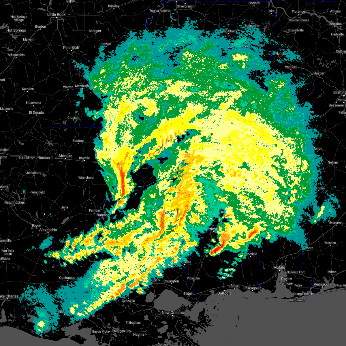 At 205 am cdt, severe thunderstorms were located along a line extending from 6 miles southwest of sontag to near jayess, moving east at 65 mph (radar indicated). Hazards include 60 mph wind gusts. Expect damage to roofs, siding, and trees. severe thunderstorms will be near, monticello, wanilla and robinwood around 215 am cdt. tilton, oak vale and arm around 220 am cdt. other locations impacted by these severe thunderstorms include silver creek. A tornado watch remains in effect until 400 am cdt for south central mississippi. At 205 am cdt, severe thunderstorms were located along a line extending from 6 miles southwest of sontag to near jayess, moving east at 65 mph (radar indicated). Hazards include 60 mph wind gusts. Expect damage to roofs, siding, and trees. severe thunderstorms will be near, monticello, wanilla and robinwood around 215 am cdt. tilton, oak vale and arm around 220 am cdt. other locations impacted by these severe thunderstorms include silver creek. A tornado watch remains in effect until 400 am cdt for south central mississippi.
|
| 4/9/2021 11:52 PM CDT |
 At 1151 pm cdt, severe thunderstorms were located along a line extending from near wesson to near brookhaven to near center point, moving east at 45 mph (radar indicated). Hazards include 60 mph wind gusts and quarter size hail. Hail damage to vehicles is expected. expect wind damage to roofs, siding, and trees. severe thunderstorms will be near, enterprise around 1155 pm cdt. oma, east lincoln and sontag around 1205 am cdt. ruth and wanilla around 1210 am cdt. monticello around 1215 am cdt. robinwood, jayess and topeka around 1220 am cdt. arm and tilton around 1225 am cdt. progress and oak vale around 1230 am cdt. Other locations impacted by these severe thunderstorms include new hebron and silver creek. At 1151 pm cdt, severe thunderstorms were located along a line extending from near wesson to near brookhaven to near center point, moving east at 45 mph (radar indicated). Hazards include 60 mph wind gusts and quarter size hail. Hail damage to vehicles is expected. expect wind damage to roofs, siding, and trees. severe thunderstorms will be near, enterprise around 1155 pm cdt. oma, east lincoln and sontag around 1205 am cdt. ruth and wanilla around 1210 am cdt. monticello around 1215 am cdt. robinwood, jayess and topeka around 1220 am cdt. arm and tilton around 1225 am cdt. progress and oak vale around 1230 am cdt. Other locations impacted by these severe thunderstorms include new hebron and silver creek.
|
| 3/17/2021 5:45 PM CDT |
 At 544 pm cdt, severe thunderstorms were located along a line extending from near robinwood to kokomo, moving northeast at 65 mph (radar indicated). Hazards include 60 mph wind gusts. Expect damage to roofs, siding, and trees. severe thunderstorms will be near, columbia, arm, morgantown and oak vale around 550 pm cdt. progress and goss around 555 pm cdt. prentiss, improve, bunker hill and carson around 600 pm cdt. clem and melba around 610 pm cdt. other locations impacted by these severe thunderstorms include bassfield, new hebron and silver creek. A tornado watch remains in effect until 700 pm cdt for south central and southeastern mississippi. At 544 pm cdt, severe thunderstorms were located along a line extending from near robinwood to kokomo, moving northeast at 65 mph (radar indicated). Hazards include 60 mph wind gusts. Expect damage to roofs, siding, and trees. severe thunderstorms will be near, columbia, arm, morgantown and oak vale around 550 pm cdt. progress and goss around 555 pm cdt. prentiss, improve, bunker hill and carson around 600 pm cdt. clem and melba around 610 pm cdt. other locations impacted by these severe thunderstorms include bassfield, new hebron and silver creek. A tornado watch remains in effect until 700 pm cdt for south central and southeastern mississippi.
|
| 3/17/2021 3:33 PM CDT |
 At 333 pm cdt, a severe thunderstorm was located over arm, or 22 miles northwest of columbia, moving northeast at 40 mph (radar indicated). Hazards include 60 mph wind gusts and quarter size hail. Hail damage to vehicles is expected. expect wind damage to roofs, siding, and trees. this severe thunderstorm will be near, prentiss around 345 pm cdt. clem around 400 pm cdt. mount olive around 410 pm cdt. other locations impacted by this severe thunderstorm include new hebron and silver creek. A tornado watch remains in effect until 700 pm cdt for south central and southeastern mississippi. At 333 pm cdt, a severe thunderstorm was located over arm, or 22 miles northwest of columbia, moving northeast at 40 mph (radar indicated). Hazards include 60 mph wind gusts and quarter size hail. Hail damage to vehicles is expected. expect wind damage to roofs, siding, and trees. this severe thunderstorm will be near, prentiss around 345 pm cdt. clem around 400 pm cdt. mount olive around 410 pm cdt. other locations impacted by this severe thunderstorm include new hebron and silver creek. A tornado watch remains in effect until 700 pm cdt for south central and southeastern mississippi.
|
| 12/13/2020 9:08 PM CST |
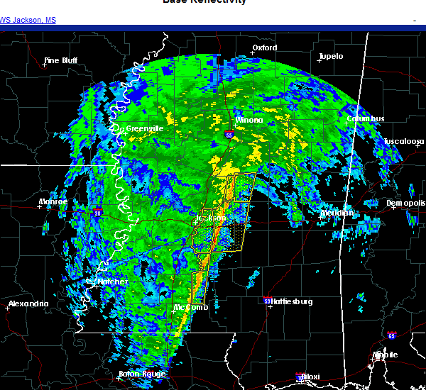 The severe thunderstorm warning for southwestern simpson and lawrence counties will expire at 915 pm cst, the storms which prompted the warning have weakened below severe limits, and no longer pose an immediate threat to life or property. therefore, the warning will be allowed to expire. The severe thunderstorm warning for southwestern simpson and lawrence counties will expire at 915 pm cst, the storms which prompted the warning have weakened below severe limits, and no longer pose an immediate threat to life or property. therefore, the warning will be allowed to expire.
|
| 12/13/2020 9:03 PM CST |
 At 903 pm cst, severe thunderstorms were located along a line extending from piney woods to near rockport to near east lincoln, moving northeast at 45 mph (radar indicated). Hazards include 60 mph wind gusts. Expect damage to roofs, siding, and trees. these severe storms will be near, union around 910 pm cst. Wanilla around 920 pm cst. At 903 pm cst, severe thunderstorms were located along a line extending from piney woods to near rockport to near east lincoln, moving northeast at 45 mph (radar indicated). Hazards include 60 mph wind gusts. Expect damage to roofs, siding, and trees. these severe storms will be near, union around 910 pm cst. Wanilla around 920 pm cst.
|
| 12/13/2020 8:43 PM CST |
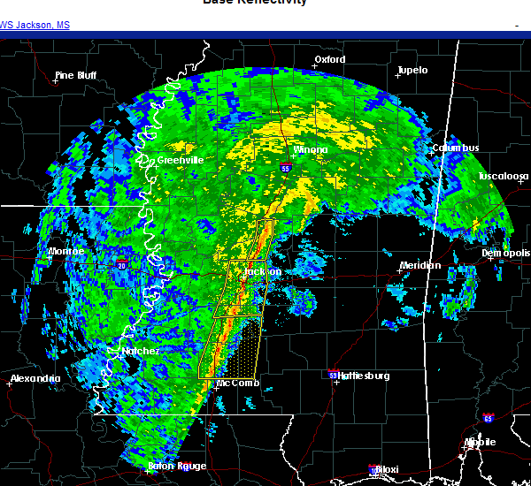 At 843 pm cst, severe thunderstorms were located along a line extending from hopewell to near wesson to near bogue chitto, moving northeast at 45 mph (radar indicated). Hazards include 60 mph wind gusts. Expect damage to roofs, siding, and trees. these severe storms will be near, hopewell and sontag around 850 pm cst. oma around 855 pm cst. rockport and jayess around 900 pm cst. topeka around 905 pm cst. union around 910 pm cst. monticello and robinwood around 915 pm cst. wanilla around 920 pm cst. Other locations impacted by these severe thunderstorms include georgetown. At 843 pm cst, severe thunderstorms were located along a line extending from hopewell to near wesson to near bogue chitto, moving northeast at 45 mph (radar indicated). Hazards include 60 mph wind gusts. Expect damage to roofs, siding, and trees. these severe storms will be near, hopewell and sontag around 850 pm cst. oma around 855 pm cst. rockport and jayess around 900 pm cst. topeka around 905 pm cst. union around 910 pm cst. monticello and robinwood around 915 pm cst. wanilla around 920 pm cst. Other locations impacted by these severe thunderstorms include georgetown.
|
| 12/13/2020 8:28 PM CST |
 At 828 pm cst, severe thunderstorms were located along a line extending from gallman to near brookhaven to near center point, moving northeast at 45 mph (radar indicated). Hazards include 60 mph wind gusts. Expect damage to roofs, siding, and trees. severe thunderstorms will be near, wesson and gallman around 835 pm cst. hopewell and martinsville around 840 pm cst. enterprise, ruth and sontag around 850 pm cst. oma around 855 pm cst. rockport, east lincoln and topeka around 900 pm cst. union around 905 pm cst. monticello, robinwood and wanilla around 915 pm cst. Other locations impacted by these severe thunderstorms include beauregard and georgetown. At 828 pm cst, severe thunderstorms were located along a line extending from gallman to near brookhaven to near center point, moving northeast at 45 mph (radar indicated). Hazards include 60 mph wind gusts. Expect damage to roofs, siding, and trees. severe thunderstorms will be near, wesson and gallman around 835 pm cst. hopewell and martinsville around 840 pm cst. enterprise, ruth and sontag around 850 pm cst. oma around 855 pm cst. rockport, east lincoln and topeka around 900 pm cst. union around 905 pm cst. monticello, robinwood and wanilla around 915 pm cst. Other locations impacted by these severe thunderstorms include beauregard and georgetown.
|
| 8/16/2020 7:23 PM CDT | Social media report of trees down along hwy 587 south of monticell in lawrence county MS, 3.2 miles NNW of Monticello, MS |
| 6/25/2020 4:16 PM CDT |
 At 415 pm cdt, a severe thunderstorm was located over enterprise, or 7 miles south of brookhaven, moving northeast at 60 mph (radar indicated). Hazards include 70 mph wind gusts. Expect considerable tree damage. damage is likely to mobile homes, roofs, and outbuildings. this severe storm will be near, east lincoln around 420 pm cdt. sontag and wanilla around 435 pm cdt. oma around 440 pm cdt. Other locations impacted by this severe thunderstorm include new hebron and silver creek. At 415 pm cdt, a severe thunderstorm was located over enterprise, or 7 miles south of brookhaven, moving northeast at 60 mph (radar indicated). Hazards include 70 mph wind gusts. Expect considerable tree damage. damage is likely to mobile homes, roofs, and outbuildings. this severe storm will be near, east lincoln around 420 pm cdt. sontag and wanilla around 435 pm cdt. oma around 440 pm cdt. Other locations impacted by this severe thunderstorm include new hebron and silver creek.
|
| 6/25/2020 4:10 PM CDT | Sevreal trees down in monticello including one on a car and one on a powerlin in lawrence county MS, 0.2 miles NW of Monticello, MS |
| 6/25/2020 4:10 PM CDT | Trees down along hwy 58 in lawrence county MS, 5.3 miles NNW of Monticello, MS |
| 6/25/2020 3:34 PM CDT |
 At 334 pm cdt, a severe thunderstorm was located near east lincoln, or 14 miles southeast of brookhaven, moving northeast at 25 mph (radar indicated). Hazards include 60 mph wind gusts. Expect damage to roofs, siding, and trees. this severe thunderstorm will be near, robinwood around 355 pm cdt. monticello around 400 pm cdt. wanilla and sontag around 410 pm cdt. oma around 420 pm cdt. Other locations impacted by this severe thunderstorm include new hebron and silver creek. At 334 pm cdt, a severe thunderstorm was located near east lincoln, or 14 miles southeast of brookhaven, moving northeast at 25 mph (radar indicated). Hazards include 60 mph wind gusts. Expect damage to roofs, siding, and trees. this severe thunderstorm will be near, robinwood around 355 pm cdt. monticello around 400 pm cdt. wanilla and sontag around 410 pm cdt. oma around 420 pm cdt. Other locations impacted by this severe thunderstorm include new hebron and silver creek.
|
| 6/5/2020 8:10 PM CDT |
 At 810 pm cdt, severe thunderstorms were located along a line extending from near west lincoln to near topeka to near carson, moving south at 35 mph (radar indicated). Hazards include 60 mph wind gusts. Expect damage to roofs, siding, and trees. these severe storms will be near, west lincoln around 815 pm cdt. topeka and bogue chitto around 820 pm cdt. jayess and ruth around 825 pm cdt. center point around 830 pm cdt. Other locations impacted by these severe thunderstorms include bassfield and silver creek. At 810 pm cdt, severe thunderstorms were located along a line extending from near west lincoln to near topeka to near carson, moving south at 35 mph (radar indicated). Hazards include 60 mph wind gusts. Expect damage to roofs, siding, and trees. these severe storms will be near, west lincoln around 815 pm cdt. topeka and bogue chitto around 820 pm cdt. jayess and ruth around 825 pm cdt. center point around 830 pm cdt. Other locations impacted by these severe thunderstorms include bassfield and silver creek.
|
| 6/5/2020 7:51 PM CDT |
 At 750 pm cdt, severe thunderstorms were located along a line extending from near brookhaven to near sontag to 6 miles northwest of prentiss, moving south at 40 mph (radar indicated). Hazards include 60 mph wind gusts. Expect damage to roofs, siding, and trees. these severe storms will be near, brookhaven and loyd star around 755 pm cdt. vaughn around 800 pm cdt. monticello, arm and east lincoln around 805 pm cdt. enterprise, west lincoln, robinwood, oak vale and topeka around 810 pm cdt. tilton, bogue chitto and jayess around 815 pm cdt. ruth and center point around 820 pm cdt. Other locations impacted by these severe thunderstorms include bassfield, new hebron and silver creek. At 750 pm cdt, severe thunderstorms were located along a line extending from near brookhaven to near sontag to 6 miles northwest of prentiss, moving south at 40 mph (radar indicated). Hazards include 60 mph wind gusts. Expect damage to roofs, siding, and trees. these severe storms will be near, brookhaven and loyd star around 755 pm cdt. vaughn around 800 pm cdt. monticello, arm and east lincoln around 805 pm cdt. enterprise, west lincoln, robinwood, oak vale and topeka around 810 pm cdt. tilton, bogue chitto and jayess around 815 pm cdt. ruth and center point around 820 pm cdt. Other locations impacted by these severe thunderstorms include bassfield, new hebron and silver creek.
|
| 6/5/2020 7:28 PM CDT |
 At 728 pm cdt, severe thunderstorms were located along a line extending from near hazlehurst to near shivers to near sanatorium, moving southwest at 45 mph (radar indicated). Hazards include 60 mph wind gusts. Expect damage to roofs, siding, and trees. severe thunderstorms will be near, oma around 735 pm cdt. wanilla and sontag around 745 pm cdt. brookhaven, monticello and prentiss around 750 pm cdt. progress and loyd star around 755 pm cdt. arm, east lincoln and vaughn around 800 pm cdt. enterprise, west lincoln, oak vale, robinwood, bogue chitto and topeka around 805 pm cdt. ruth, tilton and jayess around 810 pm cdt. center point around 815 pm cdt. Other locations impacted by these severe thunderstorms include bassfield, new hebron and silver creek. At 728 pm cdt, severe thunderstorms were located along a line extending from near hazlehurst to near shivers to near sanatorium, moving southwest at 45 mph (radar indicated). Hazards include 60 mph wind gusts. Expect damage to roofs, siding, and trees. severe thunderstorms will be near, oma around 735 pm cdt. wanilla and sontag around 745 pm cdt. brookhaven, monticello and prentiss around 750 pm cdt. progress and loyd star around 755 pm cdt. arm, east lincoln and vaughn around 800 pm cdt. enterprise, west lincoln, oak vale, robinwood, bogue chitto and topeka around 805 pm cdt. ruth, tilton and jayess around 810 pm cdt. center point around 815 pm cdt. Other locations impacted by these severe thunderstorms include bassfield, new hebron and silver creek.
|
| 5/22/2020 5:53 PM CDT |
 At 553 pm cdt, a severe thunderstorm was located over wanilla, or 17 miles southwest of pinola, moving northeast at 20 mph (radar indicated). Hazards include 60 mph wind gusts and nickel size hail. Expect damage to roofs, siding, and trees. this severe thunderstorm will be near, oma around 600 pm cdt. rockport around 610 pm cdt. Other locations impacted by this severe thunderstorm include new hebron. At 553 pm cdt, a severe thunderstorm was located over wanilla, or 17 miles southwest of pinola, moving northeast at 20 mph (radar indicated). Hazards include 60 mph wind gusts and nickel size hail. Expect damage to roofs, siding, and trees. this severe thunderstorm will be near, oma around 600 pm cdt. rockport around 610 pm cdt. Other locations impacted by this severe thunderstorm include new hebron.
|
| 4/22/2020 10:37 PM CDT | Trees down on hwy 2 in lawrence county MS, 11.7 miles S of Monticello, MS |
| 2/10/2020 5:54 PM CST |
 The severe thunderstorm warning for northern lawrence county will expire at 600 pm cst, the severe thunderstorm which prompted the warning has weakened. therefore, the warning will be allowed to expire. The severe thunderstorm warning for northern lawrence county will expire at 600 pm cst, the severe thunderstorm which prompted the warning has weakened. therefore, the warning will be allowed to expire.
|
| 2/10/2020 5:32 PM CST |
 At 531 pm cst, a severe thunderstorm was located over wanilla, or 18 miles southwest of pinola, moving northeast at 40 mph (radar indicated). Hazards include 60 mph wind gusts. Expect damage to roofs, siding, and trees. This severe thunderstorm will remain over mainly rural areas of northern lawrence county, including the following locations, new hebron and silver creek. At 531 pm cst, a severe thunderstorm was located over wanilla, or 18 miles southwest of pinola, moving northeast at 40 mph (radar indicated). Hazards include 60 mph wind gusts. Expect damage to roofs, siding, and trees. This severe thunderstorm will remain over mainly rural areas of northern lawrence county, including the following locations, new hebron and silver creek.
|
| 2/10/2020 5:27 PM CST |
 At 526 pm cst, a severe thunderstorm was located over wanilla, or 18 miles east of brookhaven, moving northeast at 40 mph (radar indicated). Hazards include 60 mph wind gusts. Expect damage to roofs, siding, and trees. this severe storm will be near, oma around 530 pm cst. Other locations impacted by this severe thunderstorm include new hebron and silver creek. At 526 pm cst, a severe thunderstorm was located over wanilla, or 18 miles east of brookhaven, moving northeast at 40 mph (radar indicated). Hazards include 60 mph wind gusts. Expect damage to roofs, siding, and trees. this severe storm will be near, oma around 530 pm cst. Other locations impacted by this severe thunderstorm include new hebron and silver creek.
|
| 2/10/2020 4:59 PM CST |
 At 459 pm cst, a severe thunderstorm was located near enterprise, or near brookhaven, moving northeast at 40 mph (radar indicated). Hazards include 60 mph wind gusts. Expect damage to roofs, siding, and trees. this severe thunderstorm will be near, east lincoln around 505 pm cst. sontag around 520 pm cst. monticello and wanilla around 525 pm cst. oma around 530 pm cst. Other locations impacted by this severe thunderstorm include new hebron and silver creek. At 459 pm cst, a severe thunderstorm was located near enterprise, or near brookhaven, moving northeast at 40 mph (radar indicated). Hazards include 60 mph wind gusts. Expect damage to roofs, siding, and trees. this severe thunderstorm will be near, east lincoln around 505 pm cst. sontag around 520 pm cst. monticello and wanilla around 525 pm cst. oma around 530 pm cst. Other locations impacted by this severe thunderstorm include new hebron and silver creek.
|
| 2/5/2020 10:01 PM CST |
 At 1000 pm cst, a severe thunderstorm was located near hebron, or 16 miles south of pinola, moving northeast at 50 mph (radar indicated). Hazards include quarter size hail. Damage to vehicles is expected. this severe thunderstorm will remain over mainly rural areas of lawrence county, including the following locations, silver creek. A tornado watch remains in effect until midnight cst for south central mississippi. At 1000 pm cst, a severe thunderstorm was located near hebron, or 16 miles south of pinola, moving northeast at 50 mph (radar indicated). Hazards include quarter size hail. Damage to vehicles is expected. this severe thunderstorm will remain over mainly rural areas of lawrence county, including the following locations, silver creek. A tornado watch remains in effect until midnight cst for south central mississippi.
|
| 2/5/2020 9:44 PM CST |
 At 944 pm cst, a severe thunderstorm was located over robinwood, or 19 miles east of brookhaven, moving northeast at 50 mph (radar indicated). Hazards include quarter size hail. Damage to vehicles is expected. this severe storm will be near, arm around 950 pm cst. wanilla around 955 pm cst. other locations impacted by this severe thunderstorm include silver creek. A tornado watch remains in effect until midnight cst for south central mississippi. At 944 pm cst, a severe thunderstorm was located over robinwood, or 19 miles east of brookhaven, moving northeast at 50 mph (radar indicated). Hazards include quarter size hail. Damage to vehicles is expected. this severe storm will be near, arm around 950 pm cst. wanilla around 955 pm cst. other locations impacted by this severe thunderstorm include silver creek. A tornado watch remains in effect until midnight cst for south central mississippi.
|
| 2/5/2020 9:30 PM CST |
 At 929 pm cst, a severe thunderstorm was located near jayess, or 14 miles northeast of mccomb, moving northeast at 55 mph (radar indicated). Hazards include 60 mph wind gusts and quarter size hail. Hail damage to vehicles is expected. expect wind damage to roofs, siding, and trees. this severe thunderstorm will be near, topeka around 935 pm cst. robinwood and tilton around 945 pm cst. monticello and arm around 950 pm cst. other locations impacted by this severe thunderstorm include silver creek. A tornado watch remains in effect until midnight cst for south central mississippi. At 929 pm cst, a severe thunderstorm was located near jayess, or 14 miles northeast of mccomb, moving northeast at 55 mph (radar indicated). Hazards include 60 mph wind gusts and quarter size hail. Hail damage to vehicles is expected. expect wind damage to roofs, siding, and trees. this severe thunderstorm will be near, topeka around 935 pm cst. robinwood and tilton around 945 pm cst. monticello and arm around 950 pm cst. other locations impacted by this severe thunderstorm include silver creek. A tornado watch remains in effect until midnight cst for south central mississippi.
|
| 1/11/2020 9:02 AM CST | Trees dow in lawrence county MS, 11 miles NW of Monticello, MS |
| 1/11/2020 8:44 AM CST | Trees dow in lawrence county MS, 0.7 miles W of Monticello, MS |
| 1/11/2020 8:40 AM CST |
 At 840 am cst, severe thunderstorms were located along a line extending from near oma to near robinwood, moving northeast at 70 mph (radar indicated). Hazards include 60 mph wind gusts. Expect damage to roofs, siding, and trees. these severe storms will be near, oma around 845 am cst. shivers and progress around 850 am cst. pinola and prentiss around 855 am cst. mendenhall and clem around 900 am cst. magee and sanatorium around 910 am cst. martinville around 915 am cst. other locations impacted by these severe thunderstorms include new hebron, d`lo and silver creek. a tornado watch remains in effect until 900 am cst for central and south central mississippi. A tornado watch also remains in effect until 400 pm cst for south central, central and southeastern mississippi. At 840 am cst, severe thunderstorms were located along a line extending from near oma to near robinwood, moving northeast at 70 mph (radar indicated). Hazards include 60 mph wind gusts. Expect damage to roofs, siding, and trees. these severe storms will be near, oma around 845 am cst. shivers and progress around 850 am cst. pinola and prentiss around 855 am cst. mendenhall and clem around 900 am cst. magee and sanatorium around 910 am cst. martinville around 915 am cst. other locations impacted by these severe thunderstorms include new hebron, d`lo and silver creek. a tornado watch remains in effect until 900 am cst for central and south central mississippi. A tornado watch also remains in effect until 400 pm cst for south central, central and southeastern mississippi.
|
| 1/11/2020 8:24 AM CST |
 At 823 am cst, severe thunderstorms were located along a line extending from near east lincoln to 6 miles south of ruth, moving northeast at 70 mph (radar indicated). Hazards include 60 mph wind gusts. Expect damage to roofs, siding, and trees. severe thunderstorms will be near, topeka, sontag and wanilla around 835 am cst. monticello, robinwood, oma and tilton around 840 am cst. arm and progress around 845 am cst. prentiss and shivers around 850 am cst. pinola around 855 am cst. mendenhall and clem around 900 am cst. martinville around 905 am cst. magee and sanatorium around 910 am cst. other locations impacted by these severe thunderstorms include new hebron, d`lo and silver creek. a tornado watch remains in effect until 900 am cst for central and south central mississippi. A tornado watch also remains in effect until 400 pm cst for south central, central and southeastern mississippi. At 823 am cst, severe thunderstorms were located along a line extending from near east lincoln to 6 miles south of ruth, moving northeast at 70 mph (radar indicated). Hazards include 60 mph wind gusts. Expect damage to roofs, siding, and trees. severe thunderstorms will be near, topeka, sontag and wanilla around 835 am cst. monticello, robinwood, oma and tilton around 840 am cst. arm and progress around 845 am cst. prentiss and shivers around 850 am cst. pinola around 855 am cst. mendenhall and clem around 900 am cst. martinville around 905 am cst. magee and sanatorium around 910 am cst. other locations impacted by these severe thunderstorms include new hebron, d`lo and silver creek. a tornado watch remains in effect until 900 am cst for central and south central mississippi. A tornado watch also remains in effect until 400 pm cst for south central, central and southeastern mississippi.
|
| 12/16/2019 6:09 PM CST |
 At 609 pm cst, a severe thunderstorm capable of producing a tornado was located near arm, or 23 miles south of pinola, moving northeast at 40 mph (radar indicated rotation). Hazards include tornado and quarter size hail. Flying debris will be dangerous to those caught without shelter. mobile homes will be damaged or destroyed. damage to roofs, windows, and vehicles will occur. tree damage is likely. This tornadic thunderstorm will remain over mainly rural areas of east central lawrence county, including the following locations, silver creek. At 609 pm cst, a severe thunderstorm capable of producing a tornado was located near arm, or 23 miles south of pinola, moving northeast at 40 mph (radar indicated rotation). Hazards include tornado and quarter size hail. Flying debris will be dangerous to those caught without shelter. mobile homes will be damaged or destroyed. damage to roofs, windows, and vehicles will occur. tree damage is likely. This tornadic thunderstorm will remain over mainly rural areas of east central lawrence county, including the following locations, silver creek.
|
| 12/16/2019 5:57 PM CST |
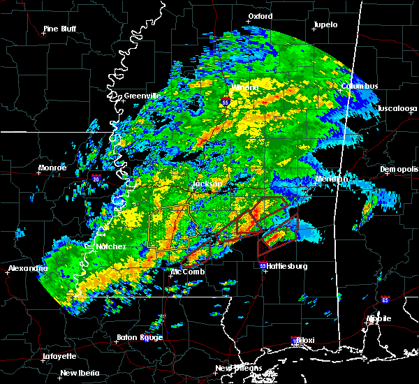 At 556 pm cst, a severe thunderstorm capable of producing a tornado was located near robinwood, or 17 miles east of brookhaven, moving northeast at 45 mph (radar indicated rotation). Hazards include tornado and quarter size hail. Flying debris will be dangerous to those caught without shelter. mobile homes will be damaged or destroyed. damage to roofs, windows, and vehicles will occur. tree damage is likely. this dangerous storm will be near, robinwood around 600 pm cst. monticello around 605 pm cst. arm around 610 pm cst. Other locations impacted by this tornadic thunderstorm include silver creek. At 556 pm cst, a severe thunderstorm capable of producing a tornado was located near robinwood, or 17 miles east of brookhaven, moving northeast at 45 mph (radar indicated rotation). Hazards include tornado and quarter size hail. Flying debris will be dangerous to those caught without shelter. mobile homes will be damaged or destroyed. damage to roofs, windows, and vehicles will occur. tree damage is likely. this dangerous storm will be near, robinwood around 600 pm cst. monticello around 605 pm cst. arm around 610 pm cst. Other locations impacted by this tornadic thunderstorm include silver creek.
|
| 12/16/2019 5:46 PM CST |
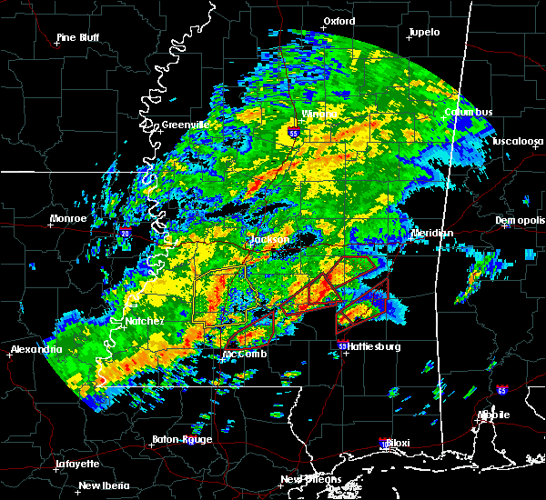 At 545 pm cst, a severe thunderstorm capable of producing a tornado was located near ruth, or 14 miles southeast of brookhaven, moving northeast at 40 mph (radar indicated rotation). Hazards include tornado and quarter size hail. Flying debris will be dangerous to those caught without shelter. mobile homes will be damaged or destroyed. damage to roofs, windows, and vehicles will occur. tree damage is likely. this dangerous storm will be near, topeka around 555 pm cst. monticello and robinwood around 605 pm cst. arm around 610 pm cst. Other locations impacted by this tornadic thunderstorm include silver creek. At 545 pm cst, a severe thunderstorm capable of producing a tornado was located near ruth, or 14 miles southeast of brookhaven, moving northeast at 40 mph (radar indicated rotation). Hazards include tornado and quarter size hail. Flying debris will be dangerous to those caught without shelter. mobile homes will be damaged or destroyed. damage to roofs, windows, and vehicles will occur. tree damage is likely. this dangerous storm will be near, topeka around 555 pm cst. monticello and robinwood around 605 pm cst. arm around 610 pm cst. Other locations impacted by this tornadic thunderstorm include silver creek.
|
| 12/16/2019 5:35 PM CST |
 At 535 pm cst, a severe thunderstorm capable of producing a tornado was located near ruth, or 10 miles northeast of mccomb, moving northeast at 40 mph (radar indicated rotation). Hazards include tornado and quarter size hail. Flying debris will be dangerous to those caught without shelter. mobile homes will be damaged or destroyed. damage to roofs, windows, and vehicles will occur. tree damage is likely. this dangerous storm will be near, east lincoln and jayess around 545 pm cst. topeka around 550 pm cst. monticello, robinwood and arm around 600 pm cst. Other locations impacted by this tornadic thunderstorm include silver creek. At 535 pm cst, a severe thunderstorm capable of producing a tornado was located near ruth, or 10 miles northeast of mccomb, moving northeast at 40 mph (radar indicated rotation). Hazards include tornado and quarter size hail. Flying debris will be dangerous to those caught without shelter. mobile homes will be damaged or destroyed. damage to roofs, windows, and vehicles will occur. tree damage is likely. this dangerous storm will be near, east lincoln and jayess around 545 pm cst. topeka around 550 pm cst. monticello, robinwood and arm around 600 pm cst. Other locations impacted by this tornadic thunderstorm include silver creek.
|
| 12/16/2019 5:24 PM CST |
 At 523 pm cst, a severe thunderstorm capable of producing a tornado was located over summit, or near mccomb, moving northeast at 40 mph (radar indicated rotation). Hazards include tornado and quarter size hail. Flying debris will be dangerous to those caught without shelter. mobile homes will be damaged or destroyed. damage to roofs, windows, and vehicles will occur. tree damage is likely. this dangerous storm will be near, enterprise and ruth around 535 pm cst. east lincoln and jayess around 545 pm cst. topeka around 550 pm cst. monticello and robinwood around 600 pm cst. arm and wanilla around 605 pm cst. Other locations impacted by this tornadic thunderstorm include new hebron and silver creek. At 523 pm cst, a severe thunderstorm capable of producing a tornado was located over summit, or near mccomb, moving northeast at 40 mph (radar indicated rotation). Hazards include tornado and quarter size hail. Flying debris will be dangerous to those caught without shelter. mobile homes will be damaged or destroyed. damage to roofs, windows, and vehicles will occur. tree damage is likely. this dangerous storm will be near, enterprise and ruth around 535 pm cst. east lincoln and jayess around 545 pm cst. topeka around 550 pm cst. monticello and robinwood around 600 pm cst. arm and wanilla around 605 pm cst. Other locations impacted by this tornadic thunderstorm include new hebron and silver creek.
|
| 12/16/2019 4:28 PM CST |
 At 428 pm cst, a severe thunderstorm capable of producing a tornado was located over monticello, or 17 miles east of brookhaven, moving northeast at 35 mph (weather spotters reported a funnel cloud). Hazards include tornado and ping pong ball size hail. Flying debris will be dangerous to those caught without shelter. mobile homes will be damaged or destroyed. damage to roofs, windows, and vehicles will occur. tree damage is likely. this dangerous storm will be near, wanilla and arm around 435 pm cst. prentiss around 455 pm cst. clem around 500 pm cst. Other locations impacted by this tornadic thunderstorm include silver creek. At 428 pm cst, a severe thunderstorm capable of producing a tornado was located over monticello, or 17 miles east of brookhaven, moving northeast at 35 mph (weather spotters reported a funnel cloud). Hazards include tornado and ping pong ball size hail. Flying debris will be dangerous to those caught without shelter. mobile homes will be damaged or destroyed. damage to roofs, windows, and vehicles will occur. tree damage is likely. this dangerous storm will be near, wanilla and arm around 435 pm cst. prentiss around 455 pm cst. clem around 500 pm cst. Other locations impacted by this tornadic thunderstorm include silver creek.
|
| 12/16/2019 4:14 PM CST |
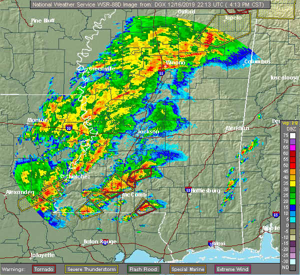 At 414 pm cst, a severe thunderstorm capable of producing a tornado was located near east lincoln, or 12 miles east of brookhaven, moving northeast at 35 mph (radar indicated rotation). Hazards include tornado and hail up to two inches in diameter. Flying debris will be dangerous to those caught without shelter. mobile homes will be damaged or destroyed. damage to roofs, windows, and vehicles will occur. tree damage is likely. this dangerous storm will be near, monticello and wanilla around 430 pm cst. prentiss around 450 pm cst. clem around 505 pm cst. Other locations impacted by this tornadic thunderstorm include silver creek. At 414 pm cst, a severe thunderstorm capable of producing a tornado was located near east lincoln, or 12 miles east of brookhaven, moving northeast at 35 mph (radar indicated rotation). Hazards include tornado and hail up to two inches in diameter. Flying debris will be dangerous to those caught without shelter. mobile homes will be damaged or destroyed. damage to roofs, windows, and vehicles will occur. tree damage is likely. this dangerous storm will be near, monticello and wanilla around 430 pm cst. prentiss around 450 pm cst. clem around 505 pm cst. Other locations impacted by this tornadic thunderstorm include silver creek.
|
| 12/16/2019 4:13 PM CST |
 At 413 pm cst, a severe thunderstorm capable of producing a tornado was located over oma, or 14 miles southwest of pinola, moving northeast at 30 mph (radar indicated rotation). Hazards include tornado. Flying debris will be dangerous to those caught without shelter. mobile homes will be damaged or destroyed. damage to roofs, windows, and vehicles will occur. tree damage is likely. This tornadic thunderstorm will remain over mainly rural areas of northeastern lincoln and northern lawrence counties, including the following locations, new hebron. At 413 pm cst, a severe thunderstorm capable of producing a tornado was located over oma, or 14 miles southwest of pinola, moving northeast at 30 mph (radar indicated rotation). Hazards include tornado. Flying debris will be dangerous to those caught without shelter. mobile homes will be damaged or destroyed. damage to roofs, windows, and vehicles will occur. tree damage is likely. This tornadic thunderstorm will remain over mainly rural areas of northeastern lincoln and northern lawrence counties, including the following locations, new hebron.
|
| 12/16/2019 3:45 PM CST |
 At 345 pm cst, a severe thunderstorm capable of producing a tornado was located 7 miles north of east lincoln, or 7 miles east of brookhaven, moving northeast at 30 mph (radar indicated rotation). Hazards include tornado and quarter size hail. Flying debris will be dangerous to those caught without shelter. mobile homes will be damaged or destroyed. damage to roofs, windows, and vehicles will occur. tree damage is likely. this dangerous storm will be near, sontag around 400 pm cst. wanilla around 405 pm cst. oma and rockport around 415 pm cst. Other locations impacted by this tornadic thunderstorm include new hebron. At 345 pm cst, a severe thunderstorm capable of producing a tornado was located 7 miles north of east lincoln, or 7 miles east of brookhaven, moving northeast at 30 mph (radar indicated rotation). Hazards include tornado and quarter size hail. Flying debris will be dangerous to those caught without shelter. mobile homes will be damaged or destroyed. damage to roofs, windows, and vehicles will occur. tree damage is likely. this dangerous storm will be near, sontag around 400 pm cst. wanilla around 405 pm cst. oma and rockport around 415 pm cst. Other locations impacted by this tornadic thunderstorm include new hebron.
|
| 12/16/2019 3:27 PM CST |
 At 327 pm cst, a severe thunderstorm capable of producing a tornado was located over enterprise, or near brookhaven, moving northeast at 35 mph (radar indicated rotation). Hazards include tornado and quarter size hail. Flying debris will be dangerous to those caught without shelter. mobile homes will be damaged or destroyed. damage to roofs, windows, and vehicles will occur. tree damage is likely. this dangerous storm will be near, brookhaven around 335 pm cst. east lincoln around 340 pm cst. monticello and sontag around 355 pm cst. wanilla around 400 pm cst. oma around 405 pm cst. Other locations impacted by this tornadic thunderstorm include new hebron and silver creek. At 327 pm cst, a severe thunderstorm capable of producing a tornado was located over enterprise, or near brookhaven, moving northeast at 35 mph (radar indicated rotation). Hazards include tornado and quarter size hail. Flying debris will be dangerous to those caught without shelter. mobile homes will be damaged or destroyed. damage to roofs, windows, and vehicles will occur. tree damage is likely. this dangerous storm will be near, brookhaven around 335 pm cst. east lincoln around 340 pm cst. monticello and sontag around 355 pm cst. wanilla around 400 pm cst. oma around 405 pm cst. Other locations impacted by this tornadic thunderstorm include new hebron and silver creek.
|
| 10/26/2019 6:55 AM CDT |
 At 654 am cdt, severe thunderstorms were located along a line extending from near sontag to near collins, moving north at 35 mph (radar indicated). Hazards include 60 mph wind gusts. Expect damage to roofs, siding, and trees. severe thunderstorms will be near, mount olive and oma around 705 am cdt. center ridge around 720 am cdt. raleigh around 730 am cdt. white oak around 740 am cdt. burns around 745 am cdt. Other locations impacted by these severe thunderstorms include new hebron, d`lo, mize, silver creek and braxton. At 654 am cdt, severe thunderstorms were located along a line extending from near sontag to near collins, moving north at 35 mph (radar indicated). Hazards include 60 mph wind gusts. Expect damage to roofs, siding, and trees. severe thunderstorms will be near, mount olive and oma around 705 am cdt. center ridge around 720 am cdt. raleigh around 730 am cdt. white oak around 740 am cdt. burns around 745 am cdt. Other locations impacted by these severe thunderstorms include new hebron, d`lo, mize, silver creek and braxton.
|
| 9/9/2019 5:20 PM CDT |
 At 520 pm cdt, a severe thunderstorm was located near tilton, or 16 miles north of kokomo, and is nearly stationary (radar indicated). Hazards include 60 mph wind gusts. Expect damage to roofs, siding, and trees. this severe storm will be near, topeka around 530 pm cdt. Other locations impacted by this severe thunderstorm include silver creek. At 520 pm cdt, a severe thunderstorm was located near tilton, or 16 miles north of kokomo, and is nearly stationary (radar indicated). Hazards include 60 mph wind gusts. Expect damage to roofs, siding, and trees. this severe storm will be near, topeka around 530 pm cdt. Other locations impacted by this severe thunderstorm include silver creek.
|
| 9/9/2019 4:45 PM CDT |
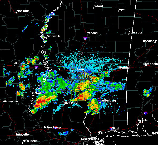 At 445 pm cdt, a severe thunderstorm was located over robinwood, or 21 miles east of brookhaven, moving west at 20 mph (radar indicated). Hazards include 60 mph wind gusts and penny size hail. Expect damage to roofs, siding, and trees. this severe thunderstorm will be near, monticello around 450 pm cdt. topeka around 500 pm cdt. Other locations impacted by this severe thunderstorm include silver creek. At 445 pm cdt, a severe thunderstorm was located over robinwood, or 21 miles east of brookhaven, moving west at 20 mph (radar indicated). Hazards include 60 mph wind gusts and penny size hail. Expect damage to roofs, siding, and trees. this severe thunderstorm will be near, monticello around 450 pm cdt. topeka around 500 pm cdt. Other locations impacted by this severe thunderstorm include silver creek.
|
| 9/9/2019 4:27 PM CDT |
 At 406 pm cdt, a severe thunderstorm was located over prentiss, or 16 miles west of collins, moving west at 25 mph (radar indicated). Hazards include 60 mph wind gusts and quarter size hail. Hail damage to vehicles is expected. expect wind damage to roofs, siding, and trees. this severe thunderstorm will be near, prentiss around 410 pm cdt. progress around 420 pm cdt. monticello around 440 pm cdt. Other locations impacted by this severe thunderstorm include bassfield, new hebron and silver creek. At 406 pm cdt, a severe thunderstorm was located over prentiss, or 16 miles west of collins, moving west at 25 mph (radar indicated). Hazards include 60 mph wind gusts and quarter size hail. Hail damage to vehicles is expected. expect wind damage to roofs, siding, and trees. this severe thunderstorm will be near, prentiss around 410 pm cdt. progress around 420 pm cdt. monticello around 440 pm cdt. Other locations impacted by this severe thunderstorm include bassfield, new hebron and silver creek.
|
| 9/9/2019 4:06 PM CDT |
 At 406 pm cdt, a severe thunderstorm was located over prentiss, or 16 miles west of collins, moving west at 25 mph (radar indicated). Hazards include 60 mph wind gusts and quarter size hail. Hail damage to vehicles is expected. expect wind damage to roofs, siding, and trees. this severe thunderstorm will be near, prentiss around 410 pm cdt. progress around 420 pm cdt. monticello around 440 pm cdt. Other locations impacted by this severe thunderstorm include bassfield, new hebron and silver creek. At 406 pm cdt, a severe thunderstorm was located over prentiss, or 16 miles west of collins, moving west at 25 mph (radar indicated). Hazards include 60 mph wind gusts and quarter size hail. Hail damage to vehicles is expected. expect wind damage to roofs, siding, and trees. this severe thunderstorm will be near, prentiss around 410 pm cdt. progress around 420 pm cdt. monticello around 440 pm cdt. Other locations impacted by this severe thunderstorm include bassfield, new hebron and silver creek.
|
| 7/14/2019 12:37 PM CDT |
 At 1237 pm cdt, a severe thunderstorm was located over tilton, or 16 miles north of kokomo, moving north at 45 mph (radar indicated). Hazards include 60 mph wind gusts. Expect damage to roofs, siding, and trees. this severe thunderstorm will be near, progress around 1245 pm cdt. monticello around 1250 pm cdt. wanilla around 1255 pm cdt. sontag around 100 pm cdt. oma around 105 pm cdt. rockport and shivers around 110 pm cdt. union around 115 pm cdt. harrisville and hopewell around 125 pm cdt. other locations impacted by this severe thunderstorm include new hebron, d`lo, silver creek, bassfield, braxton and georgetown. A tornado watch remains in effect until 700 pm cdt for central and south central mississippi. At 1237 pm cdt, a severe thunderstorm was located over tilton, or 16 miles north of kokomo, moving north at 45 mph (radar indicated). Hazards include 60 mph wind gusts. Expect damage to roofs, siding, and trees. this severe thunderstorm will be near, progress around 1245 pm cdt. monticello around 1250 pm cdt. wanilla around 1255 pm cdt. sontag around 100 pm cdt. oma around 105 pm cdt. rockport and shivers around 110 pm cdt. union around 115 pm cdt. harrisville and hopewell around 125 pm cdt. other locations impacted by this severe thunderstorm include new hebron, d`lo, silver creek, bassfield, braxton and georgetown. A tornado watch remains in effect until 700 pm cdt for central and south central mississippi.
|
| 6/27/2019 5:38 PM CDT |
 At 523 pm cdt, severe thunderstorms were located along a line extending from mount olive to near hebron, moving south at 15 mph (radar indicated). Hazards include 60 mph wind gusts and quarter size hail. Hail damage to vehicles is expected. expect wind damage to roofs, siding, and trees. Locations impacted include, magee, collins, monticello, prentiss, mount olive, topeka, progress, oma, tilton, oak vale, clem, robinwood, shivers, society hill, lone star, arm, melba, wanilla, carson and new hebron. At 523 pm cdt, severe thunderstorms were located along a line extending from mount olive to near hebron, moving south at 15 mph (radar indicated). Hazards include 60 mph wind gusts and quarter size hail. Hail damage to vehicles is expected. expect wind damage to roofs, siding, and trees. Locations impacted include, magee, collins, monticello, prentiss, mount olive, topeka, progress, oma, tilton, oak vale, clem, robinwood, shivers, society hill, lone star, arm, melba, wanilla, carson and new hebron.
|
| 6/27/2019 5:23 PM CDT |
 At 523 pm cdt, severe thunderstorms were located along a line extending from mount olive to near hebron, moving south at 15 mph (radar indicated). Hazards include 60 mph wind gusts and quarter size hail. Hail damage to vehicles is expected. expect wind damage to roofs, siding, and trees. Locations impacted include, magee, collins, monticello, prentiss, mount olive, topeka, progress, oma, tilton, oak vale, clem, robinwood, shivers, society hill, lone star, arm, melba, wanilla, carson and new hebron. At 523 pm cdt, severe thunderstorms were located along a line extending from mount olive to near hebron, moving south at 15 mph (radar indicated). Hazards include 60 mph wind gusts and quarter size hail. Hail damage to vehicles is expected. expect wind damage to roofs, siding, and trees. Locations impacted include, magee, collins, monticello, prentiss, mount olive, topeka, progress, oma, tilton, oak vale, clem, robinwood, shivers, society hill, lone star, arm, melba, wanilla, carson and new hebron.
|
| 6/27/2019 4:57 PM CDT |
 At 457 pm cdt, a severe thunderstorm was located near hebron, or 8 miles southeast of pinola, moving south at 25 mph (radar indicated). Hazards include 60 mph wind gusts and nickel size hail. expect damage to roofs, siding, and trees At 457 pm cdt, a severe thunderstorm was located near hebron, or 8 miles southeast of pinola, moving south at 25 mph (radar indicated). Hazards include 60 mph wind gusts and nickel size hail. expect damage to roofs, siding, and trees
|
| 6/23/2019 3:59 PM CDT |
 At 359 pm cdt, a severe thunderstorm was located near monticello, or 17 miles east of brookhaven, moving northeast at 30 mph (radar indicated). Hazards include 60 mph wind gusts and quarter size hail. Hail damage to vehicles is expected. expect wind damage to roofs, siding, and trees. this severe thunderstorm will be near, monticello around 405 pm cdt. sontag around 410 pm cdt. wanilla around 415 pm cdt. oma around 425 pm cdt. Other locations impacted by this severe thunderstorm include new hebron and silver creek. At 359 pm cdt, a severe thunderstorm was located near monticello, or 17 miles east of brookhaven, moving northeast at 30 mph (radar indicated). Hazards include 60 mph wind gusts and quarter size hail. Hail damage to vehicles is expected. expect wind damage to roofs, siding, and trees. this severe thunderstorm will be near, monticello around 405 pm cdt. sontag around 410 pm cdt. wanilla around 415 pm cdt. oma around 425 pm cdt. Other locations impacted by this severe thunderstorm include new hebron and silver creek.
|
| 6/17/2019 1:49 PM CDT |
 At 149 pm cdt, a severe thunderstorm was located near east lincoln, or 10 miles east of brookhaven, moving north at 45 mph (radar indicated). Hazards include 60 mph wind gusts. Expect damage to roofs, siding, and trees. this severe storm will be near, sontag and wanilla around 200 pm cdt. Oma around 210 pm cdt. At 149 pm cdt, a severe thunderstorm was located near east lincoln, or 10 miles east of brookhaven, moving north at 45 mph (radar indicated). Hazards include 60 mph wind gusts. Expect damage to roofs, siding, and trees. this severe storm will be near, sontag and wanilla around 200 pm cdt. Oma around 210 pm cdt.
|
| 6/17/2019 1:33 PM CDT |
 At 133 pm cdt, a severe thunderstorm was located over ruth, or 13 miles northeast of mccomb, moving north at 40 mph (radar indicated). Hazards include 60 mph wind gusts. Expect damage to roofs, siding, and trees. this severe thunderstorm will be near, topeka around 140 pm cdt. east lincoln around 145 pm cdt. sontag and wanilla around 205 pm cdt. Oma around 215 pm cdt. At 133 pm cdt, a severe thunderstorm was located over ruth, or 13 miles northeast of mccomb, moving north at 40 mph (radar indicated). Hazards include 60 mph wind gusts. Expect damage to roofs, siding, and trees. this severe thunderstorm will be near, topeka around 140 pm cdt. east lincoln around 145 pm cdt. sontag and wanilla around 205 pm cdt. Oma around 215 pm cdt.
|
| 5/9/2019 11:32 AM CDT |
 At 1131 am cdt, a severe thunderstorm was located over robinwood, or 20 miles north of kokomo, moving northeast at 30 mph (radar indicated). Hazards include 60 mph wind gusts and half dollar size hail. Hail damage to vehicles is expected. expect wind damage to roofs, siding, and trees. this severe thunderstorm will be near, arm and oak vale around 1135 am cdt. progress around 1145 am cdt. prentiss and carson around 1200 pm cdt. clem around 1215 pm cdt. Other locations impacted by this severe thunderstorm include silver creek. At 1131 am cdt, a severe thunderstorm was located over robinwood, or 20 miles north of kokomo, moving northeast at 30 mph (radar indicated). Hazards include 60 mph wind gusts and half dollar size hail. Hail damage to vehicles is expected. expect wind damage to roofs, siding, and trees. this severe thunderstorm will be near, arm and oak vale around 1135 am cdt. progress around 1145 am cdt. prentiss and carson around 1200 pm cdt. clem around 1215 pm cdt. Other locations impacted by this severe thunderstorm include silver creek.
|
| 4/18/2019 3:13 PM CDT |
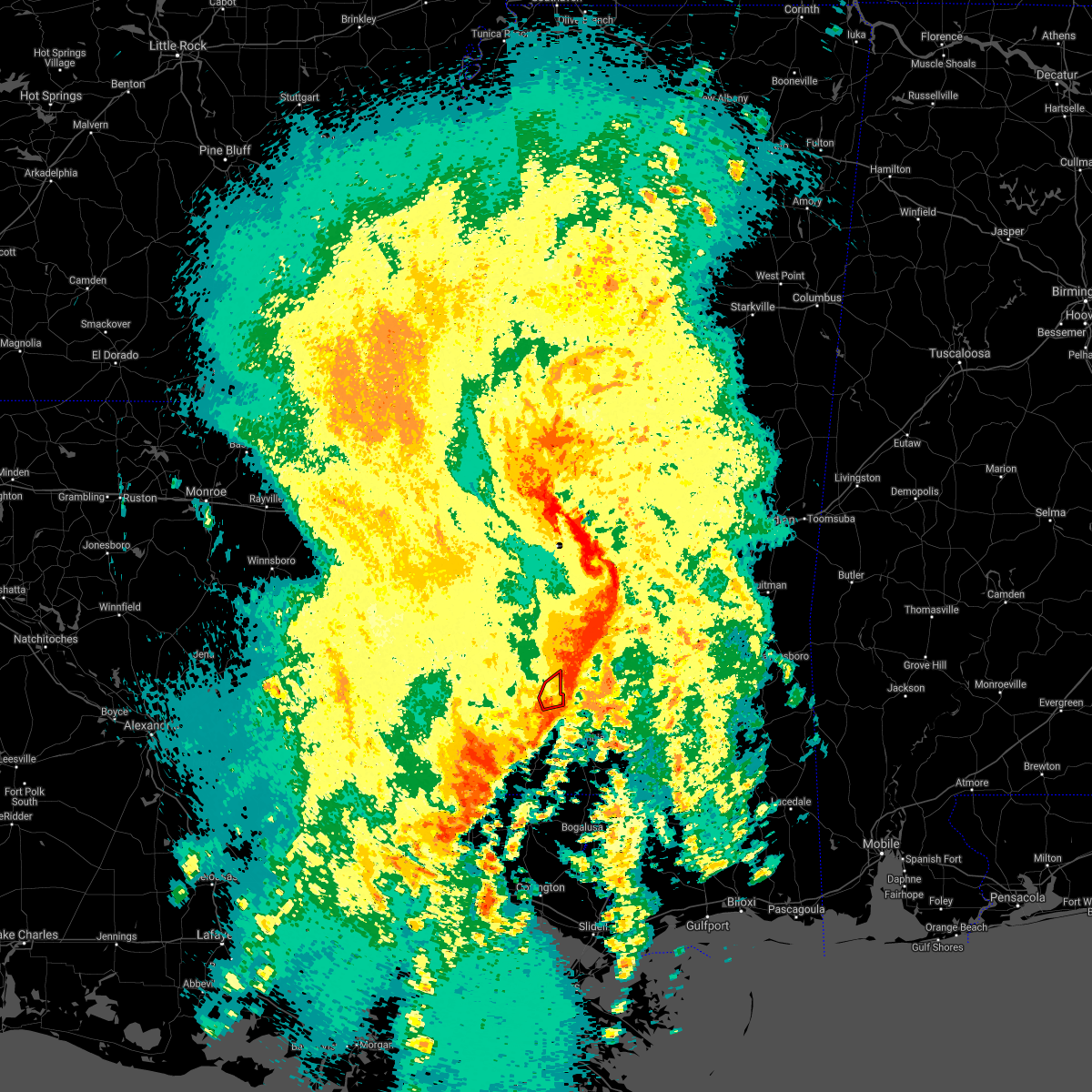 The tornado warning for east central lawrence county will expire at 315 pm cdt, the storm which prompted the warning has moved out of the area. therefore, the warning will be allowed to expire. a tornado watch remains in effect until 700 pm cdt for south central mississippi. The tornado warning for east central lawrence county will expire at 315 pm cdt, the storm which prompted the warning has moved out of the area. therefore, the warning will be allowed to expire. a tornado watch remains in effect until 700 pm cdt for south central mississippi.
|
| 4/18/2019 3:03 PM CDT |
 At 303 pm cdt, a severe thunderstorm capable of producing a tornado was located over arm, or 19 miles northwest of columbia, moving east at 50 mph (radar indicated rotation). Hazards include tornado. Flying debris will be dangerous to those caught without shelter. mobile homes will be damaged or destroyed. damage to roofs, windows, and vehicles will occur. tree damage is likely. This tornadic thunderstorm will remain over mainly rural areas of east central lawrence county, including the following locations, silver creek. At 303 pm cdt, a severe thunderstorm capable of producing a tornado was located over arm, or 19 miles northwest of columbia, moving east at 50 mph (radar indicated rotation). Hazards include tornado. Flying debris will be dangerous to those caught without shelter. mobile homes will be damaged or destroyed. damage to roofs, windows, and vehicles will occur. tree damage is likely. This tornadic thunderstorm will remain over mainly rural areas of east central lawrence county, including the following locations, silver creek.
|
| 4/18/2019 2:53 PM CDT |
 At 253 pm cdt, a severe thunderstorm capable of producing a tornado was located near robinwood, or 19 miles southeast of brookhaven, moving east at 45 mph (radar indicated rotation). Hazards include tornado. Flying debris will be dangerous to those caught without shelter. mobile homes will be damaged or destroyed. damage to roofs, windows, and vehicles will occur. tree damage is likely. this dangerous storm will be near, arm and oak vale around 305 pm cdt. Other locations impacted by this tornadic thunderstorm include new hebron and silver creek. At 253 pm cdt, a severe thunderstorm capable of producing a tornado was located near robinwood, or 19 miles southeast of brookhaven, moving east at 45 mph (radar indicated rotation). Hazards include tornado. Flying debris will be dangerous to those caught without shelter. mobile homes will be damaged or destroyed. damage to roofs, windows, and vehicles will occur. tree damage is likely. this dangerous storm will be near, arm and oak vale around 305 pm cdt. Other locations impacted by this tornadic thunderstorm include new hebron and silver creek.
|
| 4/18/2019 2:46 PM CDT | Several trees down on china grove rd. possible tornad in lawrence county MS, 10.4 miles NE of Monticello, MS |
| 4/18/2019 2:46 PM CDT |
 At 245 pm cdt, a severe thunderstorm capable of producing a tornado was located near east lincoln, or 15 miles southeast of brookhaven, moving east at 45 mph (radar indicated rotation). Hazards include tornado. Flying debris will be dangerous to those caught without shelter. mobile homes will be damaged or destroyed. damage to roofs, windows, and vehicles will occur. tree damage is likely. this dangerous storm will be near, monticello and robinwood around 255 pm cdt. arm around 300 pm cdt. oak vale around 305 pm cdt. Other locations impacted by this tornadic thunderstorm include new hebron and silver creek. At 245 pm cdt, a severe thunderstorm capable of producing a tornado was located near east lincoln, or 15 miles southeast of brookhaven, moving east at 45 mph (radar indicated rotation). Hazards include tornado. Flying debris will be dangerous to those caught without shelter. mobile homes will be damaged or destroyed. damage to roofs, windows, and vehicles will occur. tree damage is likely. this dangerous storm will be near, monticello and robinwood around 255 pm cdt. arm around 300 pm cdt. oak vale around 305 pm cdt. Other locations impacted by this tornadic thunderstorm include new hebron and silver creek.
|
| 4/18/2019 2:30 PM CDT |
 At 229 pm cdt, severe thunderstorms were located along a line extending from near wesson to near bogue chitto to magnolia, moving east at 40 mph. a tornado warning remains in effect for much of lawrence county as well (radar indicated). Hazards include 60 mph wind gusts. Expect damage to roofs, siding, and trees. severe thunderstorms will be near, sontag around 235 pm cdt. oma and topeka around 245 pm cdt. jayess around 255 pm cdt. monticello and robinwood around 300 pm cdt. arm around 305 pm cdt. holly springs and progress around 310 pm cdt. morgantown and tilton around 315 pm cdt. prentiss, goss and oak vale around 320 pm cdt. other locations impacted by these severe thunderstorms include bassfield, new hebron and silver creek. a tornado watch remains in effect until 700 pm cdt for central and south central mississippi. A tornado watch also remains in effect until 900 pm cdt for south central and southeastern mississippi. At 229 pm cdt, severe thunderstorms were located along a line extending from near wesson to near bogue chitto to magnolia, moving east at 40 mph. a tornado warning remains in effect for much of lawrence county as well (radar indicated). Hazards include 60 mph wind gusts. Expect damage to roofs, siding, and trees. severe thunderstorms will be near, sontag around 235 pm cdt. oma and topeka around 245 pm cdt. jayess around 255 pm cdt. monticello and robinwood around 300 pm cdt. arm around 305 pm cdt. holly springs and progress around 310 pm cdt. morgantown and tilton around 315 pm cdt. prentiss, goss and oak vale around 320 pm cdt. other locations impacted by these severe thunderstorms include bassfield, new hebron and silver creek. a tornado watch remains in effect until 700 pm cdt for central and south central mississippi. A tornado watch also remains in effect until 900 pm cdt for south central and southeastern mississippi.
|
| 4/18/2019 2:26 PM CDT |
 At 225 pm cdt, a severe thunderstorm capable of producing a tornado was located over bogue chitto, or 10 miles north of mccomb, moving east at 50 mph (radar indicated rotation). Hazards include tornado. Flying debris will be dangerous to those caught without shelter. mobile homes will be damaged or destroyed. damage to roofs, windows, and vehicles will occur. tree damage is likely. this dangerous storm will be near, ruth around 235 pm cdt. east lincoln around 240 pm cdt. topeka and jayess around 245 pm cdt. monticello, robinwood and tilton around 255 pm cdt. arm and oak vale around 300 pm cdt. Other locations impacted by this tornadic thunderstorm include new hebron and silver creek. At 225 pm cdt, a severe thunderstorm capable of producing a tornado was located over bogue chitto, or 10 miles north of mccomb, moving east at 50 mph (radar indicated rotation). Hazards include tornado. Flying debris will be dangerous to those caught without shelter. mobile homes will be damaged or destroyed. damage to roofs, windows, and vehicles will occur. tree damage is likely. this dangerous storm will be near, ruth around 235 pm cdt. east lincoln around 240 pm cdt. topeka and jayess around 245 pm cdt. monticello, robinwood and tilton around 255 pm cdt. arm and oak vale around 300 pm cdt. Other locations impacted by this tornadic thunderstorm include new hebron and silver creek.
|
| 2/22/2019 6:02 PM CST |
 At 602 pm cst, a severe thunderstorm was located near monticello, or 20 miles south of pinola, moving northeast at 20 mph (radar indicated). Hazards include 60 mph wind gusts. Expect damage to roofs, siding, and trees. This severe thunderstorm will remain over mainly rural areas of northeastern lawrence county, including the following locations, silver creek. At 602 pm cst, a severe thunderstorm was located near monticello, or 20 miles south of pinola, moving northeast at 20 mph (radar indicated). Hazards include 60 mph wind gusts. Expect damage to roofs, siding, and trees. This severe thunderstorm will remain over mainly rural areas of northeastern lawrence county, including the following locations, silver creek.
|
| 2/22/2019 5:37 PM CST |
 At 537 pm cst, a severe thunderstorm was located near robinwood, or 18 miles east of brookhaven, moving northeast at 20 mph (radar indicated). Hazards include 60 mph wind gusts. Expect damage to roofs, siding, and trees. this severe thunderstorm will be near, robinwood around 545 pm cst. monticello around 550 pm cst. arm around 600 pm cst. Other locations impacted by this severe thunderstorm include silver creek. At 537 pm cst, a severe thunderstorm was located near robinwood, or 18 miles east of brookhaven, moving northeast at 20 mph (radar indicated). Hazards include 60 mph wind gusts. Expect damage to roofs, siding, and trees. this severe thunderstorm will be near, robinwood around 545 pm cst. monticello around 550 pm cst. arm around 600 pm cst. Other locations impacted by this severe thunderstorm include silver creek.
|
| 11/1/2018 3:32 AM CDT |
 At 332 am cdt, severe thunderstorms were located along a line extending from near terry to wesson to near center point, moving east at 30 mph (radar indicated). Hazards include 60 mph wind gusts. expect damage to roofs, siding, and trees At 332 am cdt, severe thunderstorms were located along a line extending from near terry to wesson to near center point, moving east at 30 mph (radar indicated). Hazards include 60 mph wind gusts. expect damage to roofs, siding, and trees
|
| 7/28/2018 5:23 PM CDT |
 At 523 pm cdt, a severe thunderstorm was located near monticello, or 16 miles east of brookhaven, and is nearly stationary (radar indicated). Hazards include 60 mph wind gusts and quarter size hail. Hail damage to vehicles is expected. expect wind damage to roofs, siding, and trees. this severe thunderstorm will be near, monticello and robinwood around 615 pm cdt. Other locations impacted by this severe thunderstorm include silver creek. At 523 pm cdt, a severe thunderstorm was located near monticello, or 16 miles east of brookhaven, and is nearly stationary (radar indicated). Hazards include 60 mph wind gusts and quarter size hail. Hail damage to vehicles is expected. expect wind damage to roofs, siding, and trees. this severe thunderstorm will be near, monticello and robinwood around 615 pm cdt. Other locations impacted by this severe thunderstorm include silver creek.
|
| 7/18/2018 4:00 PM CDT | County em reports possible funnel cloud and damage at 4708 hwy 587. damage includes structural damage and downed tree in lawrence county MS, 6 miles NNW of Monticello, MS |
| 6/12/2018 4:35 PM CDT | Quarter sized hail reported 8.5 miles N of Monticello, MS, hail up to the size of quarters fell along divide road. |
| 6/12/2018 4:33 PM CDT |
 At 433 pm cdt, a severe thunderstorm was located over robinwood, or 18 miles north of kokomo, moving east at 10 mph (radar indicated). Hazards include 60 mph wind gusts and penny size hail. Expect damage to roofs, siding, and trees. this severe thunderstorm will be near, arm around 440 pm cdt. tilton around 445 pm cdt. oak vale and progress around 500 pm cdt. society hill and goss around 515 pm cdt. Other locations impacted by this severe thunderstorm include silver creek. At 433 pm cdt, a severe thunderstorm was located over robinwood, or 18 miles north of kokomo, moving east at 10 mph (radar indicated). Hazards include 60 mph wind gusts and penny size hail. Expect damage to roofs, siding, and trees. this severe thunderstorm will be near, arm around 440 pm cdt. tilton around 445 pm cdt. oak vale and progress around 500 pm cdt. society hill and goss around 515 pm cdt. Other locations impacted by this severe thunderstorm include silver creek.
|
| 4/14/2018 8:47 AM CDT |
 At 847 am cdt, a severe thunderstorm was located near progress, or 20 miles south of pinola, moving east at 35 mph (radar indicated). Hazards include 60 mph wind gusts. Expect damage to roofs, siding, and trees. this severe storm will be near, progress around 850 am cdt. prentiss around 900 am cdt. carson around 905 am cdt. clem around 910 am cdt. lone star around 915 am cdt. mount olive around 925 am cdt. other locations impacted by this severe thunderstorm include bassfield, new hebron and silver creek. A tornado watch remains in effect until 200 pm cdt for south central, central and southeastern mississippi. At 847 am cdt, a severe thunderstorm was located near progress, or 20 miles south of pinola, moving east at 35 mph (radar indicated). Hazards include 60 mph wind gusts. Expect damage to roofs, siding, and trees. this severe storm will be near, progress around 850 am cdt. prentiss around 900 am cdt. carson around 905 am cdt. clem around 910 am cdt. lone star around 915 am cdt. mount olive around 925 am cdt. other locations impacted by this severe thunderstorm include bassfield, new hebron and silver creek. A tornado watch remains in effect until 200 pm cdt for south central, central and southeastern mississippi.
|
| 4/14/2018 8:44 AM CDT | Trees downed in southwest lawrence c in lawrence county MS, 12.5 miles NNE of Monticello, MS |
| 4/14/2018 8:33 AM CDT |
 At 833 am cdt, a severe thunderstorm was located over monticello, or 18 miles east of brookhaven, moving east at 35 mph (radar indicated). Hazards include 60 mph wind gusts. Expect damage to roofs, siding, and trees. this severe thunderstorm will be near, arm around 845 am cdt. progress around 855 am cdt. prentiss around 900 am cdt. carson around 910 am cdt. lone star and clem around 915 am cdt. other locations impacted by this severe thunderstorm include bassfield, new hebron and silver creek. A tornado watch remains in effect until 200 pm cdt for central, south central and southeastern mississippi. At 833 am cdt, a severe thunderstorm was located over monticello, or 18 miles east of brookhaven, moving east at 35 mph (radar indicated). Hazards include 60 mph wind gusts. Expect damage to roofs, siding, and trees. this severe thunderstorm will be near, arm around 845 am cdt. progress around 855 am cdt. prentiss around 900 am cdt. carson around 910 am cdt. lone star and clem around 915 am cdt. other locations impacted by this severe thunderstorm include bassfield, new hebron and silver creek. A tornado watch remains in effect until 200 pm cdt for central, south central and southeastern mississippi.
|
| 4/6/2018 10:43 PM CDT |
 At 1043 pm cdt, a severe thunderstorm was located over vaughn, or 8 miles west of brookhaven, moving east at 35 mph (radar indicated). Hazards include 60 mph wind gusts and quarter size hail. Hail damage to vehicles is expected. expect wind damage to roofs, siding, and trees. this severe thunderstorm will be near, brookhaven around 1100 pm cdt. east lincoln around 1115 pm cdt. sontag around 1120 pm cdt. wanilla around 1130 pm cdt. monticello and robinwood around 1135 pm cdt. A tornado watch remains in effect until 1100 pm cdt for south central mississippi. At 1043 pm cdt, a severe thunderstorm was located over vaughn, or 8 miles west of brookhaven, moving east at 35 mph (radar indicated). Hazards include 60 mph wind gusts and quarter size hail. Hail damage to vehicles is expected. expect wind damage to roofs, siding, and trees. this severe thunderstorm will be near, brookhaven around 1100 pm cdt. east lincoln around 1115 pm cdt. sontag around 1120 pm cdt. wanilla around 1130 pm cdt. monticello and robinwood around 1135 pm cdt. A tornado watch remains in effect until 1100 pm cdt for south central mississippi.
|
| 4/3/2018 9:48 PM CDT |
 At 946 pm cdt, severe thunderstorms were located along a line extending from near homewood to near sanatorium to rockport, moving east at 30 mph (emergency management). Hazards include 60 mph wind gusts. Expect damage to roofs, siding, and trees. these severe storms will be near, sanatorium, martinville and burns around 950 pm cdt. magee around 1000 pm cdt. pineville around 1005 pm cdt. shivers around 1010 pm cdt. center ridge around 1025 pm cdt. taylorsville, clem and lone star around 1030 pm cdt. Other locations impacted by these severe thunderstorms include sylvarena, new hebron, mize, silver creek, louin, puckett, polkville, d`lo, montrose and braxton. At 946 pm cdt, severe thunderstorms were located along a line extending from near homewood to near sanatorium to rockport, moving east at 30 mph (emergency management). Hazards include 60 mph wind gusts. Expect damage to roofs, siding, and trees. these severe storms will be near, sanatorium, martinville and burns around 950 pm cdt. magee around 1000 pm cdt. pineville around 1005 pm cdt. shivers around 1010 pm cdt. center ridge around 1025 pm cdt. taylorsville, clem and lone star around 1030 pm cdt. Other locations impacted by these severe thunderstorms include sylvarena, new hebron, mize, silver creek, louin, puckett, polkville, d`lo, montrose and braxton.
|
| 4/3/2018 9:11 PM CDT |
 At 910 pm cdt, severe thunderstorms were located along a line extending from 7 miles southeast of pelahatchie to hazlehurst, moving southeast at 30 mph (emergency management). Hazards include 60 mph wind gusts. Expect damage to roofs, siding, and trees. severe thunderstorms will be near, white oak around 930 pm cdt. burns around 935 pm cdt. rockport around 940 pm cdt. oma and sontag around 945 pm cdt. raleigh around 950 pm cdt. wanilla around 955 pm cdt. center ridge around 1000 pm cdt. monticello around 1005 pm cdt. Other locations impacted by these severe thunderstorms include sylvarena, new hebron, mize, silver creek, beauregard, louin, puckett, polkville, d`lo and montrose. At 910 pm cdt, severe thunderstorms were located along a line extending from 7 miles southeast of pelahatchie to hazlehurst, moving southeast at 30 mph (emergency management). Hazards include 60 mph wind gusts. Expect damage to roofs, siding, and trees. severe thunderstorms will be near, white oak around 930 pm cdt. burns around 935 pm cdt. rockport around 940 pm cdt. oma and sontag around 945 pm cdt. raleigh around 950 pm cdt. wanilla around 955 pm cdt. center ridge around 1000 pm cdt. monticello around 1005 pm cdt. Other locations impacted by these severe thunderstorms include sylvarena, new hebron, mize, silver creek, beauregard, louin, puckett, polkville, d`lo and montrose.
|
| 8/30/2017 9:10 PM CDT |
 At 910 pm cdt, a severe thunderstorm capable of producing a tornado was located near east lincoln, or 13 miles east of brookhaven, moving north at 35 mph (radar indicated rotation). Hazards include tornado. Flying debris will be dangerous to those caught without shelter. mobile homes will be damaged or destroyed. damage to roofs, windows, and vehicles will occur. tree damage is likely. this dangerous storm will be near, sontag and wanilla around 925 pm cdt. oma around 935 pm cdt. rockport around 940 pm cdt. union around 950 pm cdt. Other locations impacted by this tornadic thunderstorm include georgetown. At 910 pm cdt, a severe thunderstorm capable of producing a tornado was located near east lincoln, or 13 miles east of brookhaven, moving north at 35 mph (radar indicated rotation). Hazards include tornado. Flying debris will be dangerous to those caught without shelter. mobile homes will be damaged or destroyed. damage to roofs, windows, and vehicles will occur. tree damage is likely. this dangerous storm will be near, sontag and wanilla around 925 pm cdt. oma around 935 pm cdt. rockport around 940 pm cdt. union around 950 pm cdt. Other locations impacted by this tornadic thunderstorm include georgetown.
|
| 7/17/2017 5:32 PM CDT |
 At 532 pm cdt, severe thunderstorms were located along a line extending from near brookhaven to monticello, moving southwest at 10 mph (radar indicated). Hazards include 60 mph wind gusts and penny size hail. Expect damage to roofs, siding, and trees. severe thunderstorms will be near, brookhaven around 600 pm cdt. Enterprise, topeka, east lincoln and jayess around 615 pm cdt. At 532 pm cdt, severe thunderstorms were located along a line extending from near brookhaven to monticello, moving southwest at 10 mph (radar indicated). Hazards include 60 mph wind gusts and penny size hail. Expect damage to roofs, siding, and trees. severe thunderstorms will be near, brookhaven around 600 pm cdt. Enterprise, topeka, east lincoln and jayess around 615 pm cdt.
|
| 6/16/2017 9:26 PM CDT |
 At 925 pm cdt, severe thunderstorms were located along a line extending from near collins to oak vale to near east lincoln, moving south at 45 mph (radar indicated). Hazards include 70 mph wind gusts. Expect considerable tree damage. damage is likely to mobile homes, roofs, and outbuildings. these severe storms will be near, society hill around 930 pm cdt. melba around 935 pm cdt. Other locations impacted by these severe thunderstorms include bassfield, new hebron and silver creek. At 925 pm cdt, severe thunderstorms were located along a line extending from near collins to oak vale to near east lincoln, moving south at 45 mph (radar indicated). Hazards include 70 mph wind gusts. Expect considerable tree damage. damage is likely to mobile homes, roofs, and outbuildings. these severe storms will be near, society hill around 930 pm cdt. melba around 935 pm cdt. Other locations impacted by these severe thunderstorms include bassfield, new hebron and silver creek.
|
| 6/16/2017 8:53 PM CDT |
 At 853 pm cdt, severe thunderstorms were located along a line extending from sanatorium to near rockport to near glancy, moving southeast at 55 mph (radar indicated). Hazards include 70 mph wind gusts. Expect considerable tree damage. damage is likely to mobile homes, roofs, and outbuildings. severe thunderstorms will be near, sontag around 900 pm cdt. wanilla and clem around 905 pm cdt. brookhaven and monticello around 910 pm cdt. arm, progress and robinwood around 915 pm cdt. enterprise, oak vale, east lincoln and tilton around 920 pm cdt. society hill around 925 pm cdt. topeka, ruth and melba around 930 pm cdt. jayess around 935 pm cdt. Other locations impacted by these severe thunderstorms include bassfield, new hebron and silver creek. At 853 pm cdt, severe thunderstorms were located along a line extending from sanatorium to near rockport to near glancy, moving southeast at 55 mph (radar indicated). Hazards include 70 mph wind gusts. Expect considerable tree damage. damage is likely to mobile homes, roofs, and outbuildings. severe thunderstorms will be near, sontag around 900 pm cdt. wanilla and clem around 905 pm cdt. brookhaven and monticello around 910 pm cdt. arm, progress and robinwood around 915 pm cdt. enterprise, oak vale, east lincoln and tilton around 920 pm cdt. society hill around 925 pm cdt. topeka, ruth and melba around 930 pm cdt. jayess around 935 pm cdt. Other locations impacted by these severe thunderstorms include bassfield, new hebron and silver creek.
|
| 5/12/2017 3:05 PM CDT |
 At 305 pm cdt, a severe thunderstorm was located over wanilla, or 16 miles southwest of pinola, moving east at 30 mph (radar indicated). Hazards include 60 mph wind gusts and quarter size hail. Hail damage to vehicles is expected. expect wind damage to roofs, siding, and trees. this severe thunderstorm will be near, prentiss around 335 pm cdt. clem around 345 pm cdt. Other locations impacted by this severe thunderstorm include new hebron and silver creek. At 305 pm cdt, a severe thunderstorm was located over wanilla, or 16 miles southwest of pinola, moving east at 30 mph (radar indicated). Hazards include 60 mph wind gusts and quarter size hail. Hail damage to vehicles is expected. expect wind damage to roofs, siding, and trees. this severe thunderstorm will be near, prentiss around 335 pm cdt. clem around 345 pm cdt. Other locations impacted by this severe thunderstorm include new hebron and silver creek.
|
| 4/26/2017 11:40 PM CDT |
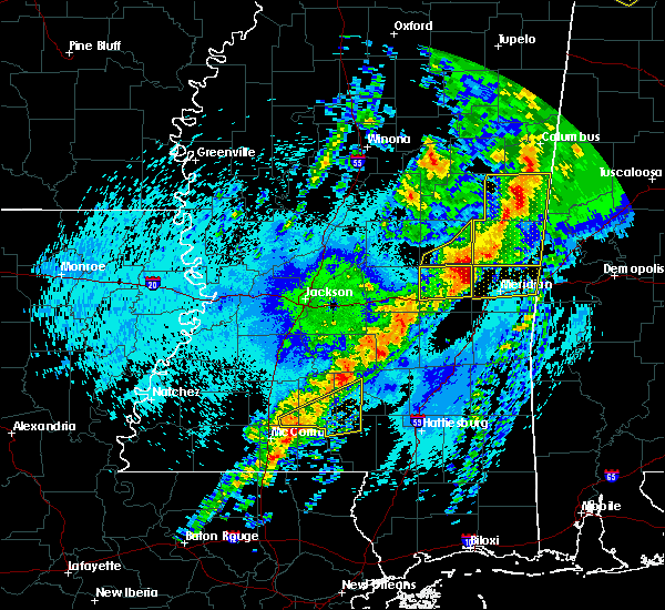 At 1140 pm cdt, a severe thunderstorm was located near ruth, or 12 miles northeast of mccomb, moving east at 55 mph (radar indicated). Hazards include 60 mph wind gusts and quarter size hail. Hail damage to vehicles is expected. expect wind damage to roofs, siding, and trees. this severe thunderstorm will be near, jayess around 1145 pm cdt. topeka around 1150 pm cdt. robinwood around 1155 pm cdt. tilton and arm around 1200 am cdt. oak vale, society hill, progress and goss around 1205 am cdt. bunker hill around 1210 am cdt. Carson around 1215 am cdt. At 1140 pm cdt, a severe thunderstorm was located near ruth, or 12 miles northeast of mccomb, moving east at 55 mph (radar indicated). Hazards include 60 mph wind gusts and quarter size hail. Hail damage to vehicles is expected. expect wind damage to roofs, siding, and trees. this severe thunderstorm will be near, jayess around 1145 pm cdt. topeka around 1150 pm cdt. robinwood around 1155 pm cdt. tilton and arm around 1200 am cdt. oak vale, society hill, progress and goss around 1205 am cdt. bunker hill around 1210 am cdt. Carson around 1215 am cdt.
|
| 4/22/2017 7:21 PM CDT |
 At 721 pm cdt, a severe thunderstorm was located over robinwood, or 20 miles north of kokomo, moving east at 30 mph (radar indicated). Hazards include 60 mph wind gusts and quarter size hail. Hail damage to vehicles is expected. expect wind damage to roofs, siding, and trees. this severe storm will be near, arm, tilton and oak vale around 730 pm cdt. Other locations impacted by this severe thunderstorm include silver creek. At 721 pm cdt, a severe thunderstorm was located over robinwood, or 20 miles north of kokomo, moving east at 30 mph (radar indicated). Hazards include 60 mph wind gusts and quarter size hail. Hail damage to vehicles is expected. expect wind damage to roofs, siding, and trees. this severe storm will be near, arm, tilton and oak vale around 730 pm cdt. Other locations impacted by this severe thunderstorm include silver creek.
|
| 4/22/2017 6:52 PM CDT |
 At 652 pm cdt, a severe thunderstorm was located near east lincoln, or 8 miles southeast of brookhaven, moving east at 30 mph (radar indicated). Hazards include 60 mph wind gusts and quarter size hail. Hail damage to vehicles is expected. expect wind damage to roofs, siding, and trees. this severe thunderstorm will be near, sontag around 710 pm cdt. monticello, robinwood and wanilla around 715 pm cdt. arm around 725 pm cdt. Other locations impacted by this severe thunderstorm include new hebron and silver creek. At 652 pm cdt, a severe thunderstorm was located near east lincoln, or 8 miles southeast of brookhaven, moving east at 30 mph (radar indicated). Hazards include 60 mph wind gusts and quarter size hail. Hail damage to vehicles is expected. expect wind damage to roofs, siding, and trees. this severe thunderstorm will be near, sontag around 710 pm cdt. monticello, robinwood and wanilla around 715 pm cdt. arm around 725 pm cdt. Other locations impacted by this severe thunderstorm include new hebron and silver creek.
|
| 4/3/2017 1:43 AM CDT |
 At 143 am cdt, severe thunderstorms were located along a line extending from near whites to union to near monticello to ruth, moving east at 40 mph (radar indicated). Hazards include 60 mph wind gusts and half dollar size hail. Hail damage to vehicles is expected. expect wind damage to roofs, siding, and trees. these severe storms will be near, union and harrisville around 150 am cdt. shivers and arm around 155 am cdt. tilton around 205 am cdt. oak vale around 215 am cdt. other locations impacted by these severe thunderstorms include new hebron, silver creek, braxton and georgetown. A tornado watch remains in effect until 200 am cdt for central and south central mississippi. At 143 am cdt, severe thunderstorms were located along a line extending from near whites to union to near monticello to ruth, moving east at 40 mph (radar indicated). Hazards include 60 mph wind gusts and half dollar size hail. Hail damage to vehicles is expected. expect wind damage to roofs, siding, and trees. these severe storms will be near, union and harrisville around 150 am cdt. shivers and arm around 155 am cdt. tilton around 205 am cdt. oak vale around 215 am cdt. other locations impacted by these severe thunderstorms include new hebron, silver creek, braxton and georgetown. A tornado watch remains in effect until 200 am cdt for central and south central mississippi.
|
| 4/3/2017 1:28 AM CDT |
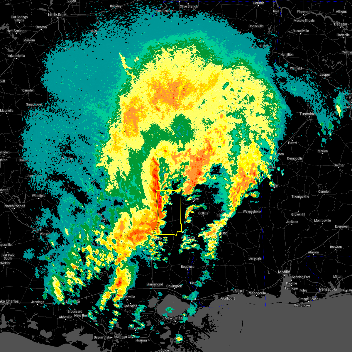 At 128 am cdt, severe thunderstorms were located along a line extending from near crystal springs to near hazlehurst to near east lincoln to near bogue chitto, moving east at 40 mph (radar indicated). Hazards include 60 mph wind gusts and quarter size hail. Hail damage to vehicles is expected. expect wind damage to roofs, siding, and trees. severe thunderstorms will be near, hopewell around 135 am cdt. rockport, sontag and oma around 140 am cdt. monticello and wanilla around 145 am cdt. union, jayess, topeka and harrisville around 150 am cdt. shivers and arm around 155 am cdt. robinwood around 200 am cdt. tilton around 205 am cdt. oak vale around 210 am cdt. other locations impacted by these severe thunderstorms include new hebron, silver creek, beauregard, braxton and georgetown. A tornado watch remains in effect until 200 am cdt for central and south central mississippi. At 128 am cdt, severe thunderstorms were located along a line extending from near crystal springs to near hazlehurst to near east lincoln to near bogue chitto, moving east at 40 mph (radar indicated). Hazards include 60 mph wind gusts and quarter size hail. Hail damage to vehicles is expected. expect wind damage to roofs, siding, and trees. severe thunderstorms will be near, hopewell around 135 am cdt. rockport, sontag and oma around 140 am cdt. monticello and wanilla around 145 am cdt. union, jayess, topeka and harrisville around 150 am cdt. shivers and arm around 155 am cdt. robinwood around 200 am cdt. tilton around 205 am cdt. oak vale around 210 am cdt. other locations impacted by these severe thunderstorms include new hebron, silver creek, beauregard, braxton and georgetown. A tornado watch remains in effect until 200 am cdt for central and south central mississippi.
|
| 4/2/2017 7:50 PM CDT |
 At 749 pm cdt, a severe thunderstorm was located over hebron, or 10 miles south of pinola, moving northeast at 45 mph (radar indicated). Hazards include 60 mph wind gusts and quarter size hail. Hail damage to vehicles is expected. expect wind damage to roofs, siding, and trees. A tornado watch remains in effect until 200 am cdt for central and south central mississippi. At 749 pm cdt, a severe thunderstorm was located over hebron, or 10 miles south of pinola, moving northeast at 45 mph (radar indicated). Hazards include 60 mph wind gusts and quarter size hail. Hail damage to vehicles is expected. expect wind damage to roofs, siding, and trees. A tornado watch remains in effect until 200 am cdt for central and south central mississippi.
|
| 4/2/2017 7:23 PM CDT |
 At 723 pm cdt, a severe thunderstorm was located near east lincoln, or 13 miles east of brookhaven, moving northeast at 40 mph (radar indicated). Hazards include 60 mph wind gusts and quarter size hail. Hail damage to vehicles is expected. expect wind damage to roofs, siding, and trees. A tornado watch remains in effect until 200 am cdt for central and south central mississippi. At 723 pm cdt, a severe thunderstorm was located near east lincoln, or 13 miles east of brookhaven, moving northeast at 40 mph (radar indicated). Hazards include 60 mph wind gusts and quarter size hail. Hail damage to vehicles is expected. expect wind damage to roofs, siding, and trees. A tornado watch remains in effect until 200 am cdt for central and south central mississippi.
|
| 4/2/2017 6:53 PM CDT |
 At 652 pm cdt, a severe thunderstorm was located near bogue chitto, or 8 miles north of mccomb, moving northeast at 45 mph (radar indicated). Hazards include 60 mph wind gusts and quarter size hail. Hail damage to vehicles is expected. expect wind damage to roofs, siding, and trees. this severe thunderstorm will be near, enterprise and ruth around 700 pm cdt. east lincoln and topeka around 710 pm cdt. robinwood around 720 pm cdt. monticello and sontag around 725 pm cdt. wanilla around 730 pm cdt. oma around 735 pm cdt. other locations impacted by this severe thunderstorm include new hebron and silver creek. A tornado watch remains in effect until 200 am cdt for central and south central mississippi. At 652 pm cdt, a severe thunderstorm was located near bogue chitto, or 8 miles north of mccomb, moving northeast at 45 mph (radar indicated). Hazards include 60 mph wind gusts and quarter size hail. Hail damage to vehicles is expected. expect wind damage to roofs, siding, and trees. this severe thunderstorm will be near, enterprise and ruth around 700 pm cdt. east lincoln and topeka around 710 pm cdt. robinwood around 720 pm cdt. monticello and sontag around 725 pm cdt. wanilla around 730 pm cdt. oma around 735 pm cdt. other locations impacted by this severe thunderstorm include new hebron and silver creek. A tornado watch remains in effect until 200 am cdt for central and south central mississippi.
|
| 3/9/2017 5:42 PM CST | Ping Pong Ball sized hail reported 11.2 miles NNW of Monticello, MS, ping pong ball size hail reported in the tilton area. |
| 3/9/2017 5:25 PM CST |
 The severe thunderstorm warning for lawrence and west central jefferson davis counties will expire at 530 pm cst, the storm which prompted the warning has weakened below severe limits, and no longer pose an immediate threat to life or property. therefore the warning will be allowed to expire. however small hail is still possible with this thunderstorm. The severe thunderstorm warning for lawrence and west central jefferson davis counties will expire at 530 pm cst, the storm which prompted the warning has weakened below severe limits, and no longer pose an immediate threat to life or property. therefore the warning will be allowed to expire. however small hail is still possible with this thunderstorm.
|
| 3/9/2017 5:02 PM CST |
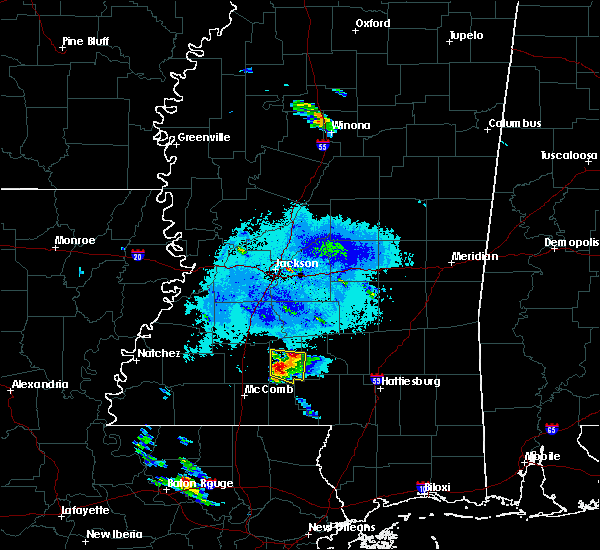 At 502 pm cst, a severe thunderstorm was located near robinwood, or 17 miles east of brookhaven, moving east at 25 mph (radar indicated). Hazards include 60 mph wind gusts and half dollar size hail. Hail damage to vehicles is expected. expect wind damage to roofs, siding, and trees. this severe storm will be near, monticello around 510 pm cst. robinwood around 515 pm cst. arm and tilton around 525 pm cst. oak vale around 530 pm cst. Other locations impacted by this severe thunderstorm include silver creek. At 502 pm cst, a severe thunderstorm was located near robinwood, or 17 miles east of brookhaven, moving east at 25 mph (radar indicated). Hazards include 60 mph wind gusts and half dollar size hail. Hail damage to vehicles is expected. expect wind damage to roofs, siding, and trees. this severe storm will be near, monticello around 510 pm cst. robinwood around 515 pm cst. arm and tilton around 525 pm cst. oak vale around 530 pm cst. Other locations impacted by this severe thunderstorm include silver creek.
|
| 3/9/2017 4:52 PM CST |
 At 451 pm cst, a severe thunderstorm was located near east lincoln, or 13 miles east of brookhaven, moving east at 25 mph (radar indicated). Hazards include 60 mph wind gusts and quarter size hail. Hail damage to vehicles is expected. expect wind damage to roofs, siding, and trees. this severe thunderstorm will be near, topeka around 500 pm cst. monticello around 510 pm cst. robinwood around 515 pm cst. arm and tilton around 525 pm cst. oak vale around 530 pm cst. Other locations impacted by this severe thunderstorm include silver creek. At 451 pm cst, a severe thunderstorm was located near east lincoln, or 13 miles east of brookhaven, moving east at 25 mph (radar indicated). Hazards include 60 mph wind gusts and quarter size hail. Hail damage to vehicles is expected. expect wind damage to roofs, siding, and trees. this severe thunderstorm will be near, topeka around 500 pm cst. monticello around 510 pm cst. robinwood around 515 pm cst. arm and tilton around 525 pm cst. oak vale around 530 pm cst. Other locations impacted by this severe thunderstorm include silver creek.
|
| 1/21/2017 3:09 AM CST |
 The severe thunderstorm warning for lawrence and eastern lincoln counties will expire at 315 am cst, the storms which prompted the warning have weakened below severe limits, and no longer pose an immediate threat to life or property. therefore the warning will be allowed to expire. however gusty winds are still possible with these thunderstorms. a tornado watch remains in effect until 700 am cst for south central and central mississippi. The severe thunderstorm warning for lawrence and eastern lincoln counties will expire at 315 am cst, the storms which prompted the warning have weakened below severe limits, and no longer pose an immediate threat to life or property. therefore the warning will be allowed to expire. however gusty winds are still possible with these thunderstorms. a tornado watch remains in effect until 700 am cst for south central and central mississippi.
|
| 1/21/2017 2:59 AM CST |
 At 259 am cst, severe thunderstorms were located along a line extending from sontag to near east lincoln, moving east at 50 mph (radar indicated). Hazards include 60 mph wind gusts. Expect damage to roofs, siding, and trees. these severe storms will be near, oma and wanilla around 305 am cst. monticello and robinwood around 310 am cst. arm, oak vale and tilton around 315 am cst. other locations impacted by these severe thunderstorms include silver creek and new hebron. A tornado watch remains in effect until 700 am cst for south central and central mississippi. At 259 am cst, severe thunderstorms were located along a line extending from sontag to near east lincoln, moving east at 50 mph (radar indicated). Hazards include 60 mph wind gusts. Expect damage to roofs, siding, and trees. these severe storms will be near, oma and wanilla around 305 am cst. monticello and robinwood around 310 am cst. arm, oak vale and tilton around 315 am cst. other locations impacted by these severe thunderstorms include silver creek and new hebron. A tornado watch remains in effect until 700 am cst for south central and central mississippi.
|
| 1/21/2017 2:44 AM CST |
 At 244 am cst, severe thunderstorms were located along a line extending from near brookhaven to bogue chitto, moving east at 40 mph (radar indicated). Hazards include 60 mph wind gusts and quarter size hail. Hail damage to vehicles is expected. expect wind damage to roofs, siding, and trees. these severe storms will be near, east lincoln and sontag around 300 am cst. topeka around 305 am cst. oma and wanilla around 310 am cst. monticello, robinwood and arm around 315 am cst. other locations impacted by these severe thunderstorms include silver creek and new hebron. A tornado watch remains in effect until 700 am cst for south central and central mississippi. At 244 am cst, severe thunderstorms were located along a line extending from near brookhaven to bogue chitto, moving east at 40 mph (radar indicated). Hazards include 60 mph wind gusts and quarter size hail. Hail damage to vehicles is expected. expect wind damage to roofs, siding, and trees. these severe storms will be near, east lincoln and sontag around 300 am cst. topeka around 305 am cst. oma and wanilla around 310 am cst. monticello, robinwood and arm around 315 am cst. other locations impacted by these severe thunderstorms include silver creek and new hebron. A tornado watch remains in effect until 700 am cst for south central and central mississippi.
|
| 1/21/2017 2:22 AM CST |
 At 221 am cst, severe thunderstorms were located along a line extending from near mccall creek to near smithdale, moving east at 50 mph (radar indicated). Hazards include 60 mph wind gusts and quarter size hail. Hail damage to vehicles is expected. expect wind damage to roofs, siding, and trees. severe thunderstorms will be near, vaughn and west lincoln around 230 am cst. bogue chitto around 235 am cst. brookhaven and enterprise around 240 am cst. ruth around 245 am cst. jayess and east lincoln around 250 am cst. topeka and sontag around 255 am cst. monticello, wanilla, robinwood and oma around 300 am cst. tilton and arm around 305 am cst. other locations impacted by these severe thunderstorms include silver creek and new hebron. A tornado watch remains in effect until 700 am cst for south central and central mississippi. At 221 am cst, severe thunderstorms were located along a line extending from near mccall creek to near smithdale, moving east at 50 mph (radar indicated). Hazards include 60 mph wind gusts and quarter size hail. Hail damage to vehicles is expected. expect wind damage to roofs, siding, and trees. severe thunderstorms will be near, vaughn and west lincoln around 230 am cst. bogue chitto around 235 am cst. brookhaven and enterprise around 240 am cst. ruth around 245 am cst. jayess and east lincoln around 250 am cst. topeka and sontag around 255 am cst. monticello, wanilla, robinwood and oma around 300 am cst. tilton and arm around 305 am cst. other locations impacted by these severe thunderstorms include silver creek and new hebron. A tornado watch remains in effect until 700 am cst for south central and central mississippi.
|
| 1/2/2017 1:55 PM CST | Trees and power lines down across the south portion of the count in lawrence county MS, 10.2 miles NNE of Monticello, MS |
| 1/2/2017 1:46 PM CST | Trees and power lines down across the west part of the count in lawrence county MS, 8.5 miles SE of Monticello, MS |
| 1/2/2017 1:33 PM CST |
 At 133 pm cst, a severe thunderstorm was located over jayess, or 16 miles northwest of kokomo, moving northeast at 50 mph (radar indicated). Hazards include 60 mph wind gusts. Expect damage to roofs, siding, and trees. this severe thunderstorm will be near, robinwood and tilton around 145 pm cst. monticello and arm around 150 pm cst. wanilla around 155 pm cst. other locations impacted by this severe thunderstorm include new hebron and silver creek. A tornado watch remains in effect until 800 pm cst for south central and central mississippi. At 133 pm cst, a severe thunderstorm was located over jayess, or 16 miles northwest of kokomo, moving northeast at 50 mph (radar indicated). Hazards include 60 mph wind gusts. Expect damage to roofs, siding, and trees. this severe thunderstorm will be near, robinwood and tilton around 145 pm cst. monticello and arm around 150 pm cst. wanilla around 155 pm cst. other locations impacted by this severe thunderstorm include new hebron and silver creek. A tornado watch remains in effect until 800 pm cst for south central and central mississippi.
|
| 8/6/2016 6:57 PM CDT | Small trees downed along mallalieu dr in lincoln county MS, 13.3 miles NE of Monticello, MS |
| 8/6/2016 6:42 PM CDT |
 At 642 pm cdt, a severe thunderstorm was located over arm, or 21 miles north of kokomo, moving southeast at 25 mph (radar indicated). Hazards include 60 mph wind gusts. Expect damage to roofs. siding. and trees. this severe storm will be near, arm and progress around 645 pm cdt. oak vale around 655 pm cdt. tilton and society hill around 700 pm cdt. Other locations impacted by this severe thunderstorm include silver creek. At 642 pm cdt, a severe thunderstorm was located over arm, or 21 miles north of kokomo, moving southeast at 25 mph (radar indicated). Hazards include 60 mph wind gusts. Expect damage to roofs. siding. and trees. this severe storm will be near, arm and progress around 645 pm cdt. oak vale around 655 pm cdt. tilton and society hill around 700 pm cdt. Other locations impacted by this severe thunderstorm include silver creek.
|
| 8/6/2016 6:35 PM CDT | Trees downed near na sandifer highway and old highway 27 in lawrence county MS, 4 miles S of Monticello, MS |
| 8/6/2016 6:23 PM CDT |
 At 622 pm cdt, a severe thunderstorm was located over wanilla, or 19 miles southwest of pinola, moving south at 30 mph (radar indicated). Hazards include 60 mph wind gusts. Expect damage to roofs. siding. and trees. this severe storm will be near, monticello around 635 pm cdt. robinwood and progress around 640 pm cdt. arm around 645 pm cdt. oak vale around 650 pm cdt. tilton around 655 pm cdt. society hill around 700 pm cdt. Other locations impacted by this severe thunderstorm include silver creek and new hebron. At 622 pm cdt, a severe thunderstorm was located over wanilla, or 19 miles southwest of pinola, moving south at 30 mph (radar indicated). Hazards include 60 mph wind gusts. Expect damage to roofs. siding. and trees. this severe storm will be near, monticello around 635 pm cdt. robinwood and progress around 640 pm cdt. arm around 645 pm cdt. oak vale around 650 pm cdt. tilton around 655 pm cdt. society hill around 700 pm cdt. Other locations impacted by this severe thunderstorm include silver creek and new hebron.
|
| 8/6/2016 6:04 PM CDT |
 At 603 pm cdt, a severe thunderstorm was located over rockport, or 14 miles southeast of hazlehurst, moving southeast at 25 mph (radar indicated). Hazards include 60 mph wind gusts. Expect damage to roofs. siding. and trees. this severe thunderstorm will be near, oma around 610 pm cdt. sontag around 620 pm cdt. wanilla around 625 pm cdt. monticello around 640 pm cdt. arm, robinwood and progress around 650 pm cdt. tilton, oak vale and society hill around 700 pm cdt. Other locations impacted by this severe thunderstorm include silver creek and new hebron. At 603 pm cdt, a severe thunderstorm was located over rockport, or 14 miles southeast of hazlehurst, moving southeast at 25 mph (radar indicated). Hazards include 60 mph wind gusts. Expect damage to roofs. siding. and trees. this severe thunderstorm will be near, oma around 610 pm cdt. sontag around 620 pm cdt. wanilla around 625 pm cdt. monticello around 640 pm cdt. arm, robinwood and progress around 650 pm cdt. tilton, oak vale and society hill around 700 pm cdt. Other locations impacted by this severe thunderstorm include silver creek and new hebron.
|
| 7/13/2016 6:56 PM CDT |
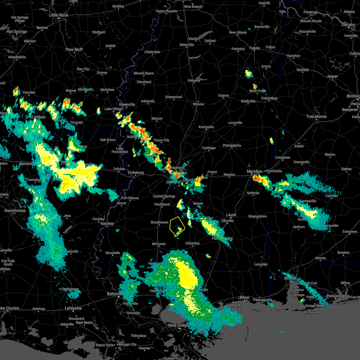 The severe thunderstorm warning for central lawrence county will expire at 700 pm cdt, the storm which prompted the warning has weakened below severe limits, and no longer pose an immediate threat to life or property. therefore the warning will be allowed to expire. The severe thunderstorm warning for central lawrence county will expire at 700 pm cdt, the storm which prompted the warning has weakened below severe limits, and no longer pose an immediate threat to life or property. therefore the warning will be allowed to expire.
|
| 7/13/2016 6:30 PM CDT | Multiple trees down in monticello and throughout the southern part of lawrence county...reported by lawrence county so in lawrence county MS, 0.2 miles NW of Monticello, MS |
| 7/13/2016 6:30 PM CDT | Tree down on a house near intersection of forest grove rd and frog ridge rd...reported by lawrence county so in lawrence county MS, 3.1 miles NE of Monticello, MS |
| 7/13/2016 6:16 PM CDT |
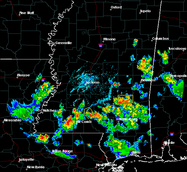 At 615 pm cdt, a severe thunderstorm was located over monticello, or 20 miles east of brookhaven, moving northwest at 5 mph (radar indicated). Hazards include 60 mph wind gusts and quarter size hail. Hail damage to vehicles is expected. expect wind damage to roofs, siding, and trees. this severe thunderstorm will be near, monticello around 625 pm cdt. Wanilla and sontag around 700 pm cdt. At 615 pm cdt, a severe thunderstorm was located over monticello, or 20 miles east of brookhaven, moving northwest at 5 mph (radar indicated). Hazards include 60 mph wind gusts and quarter size hail. Hail damage to vehicles is expected. expect wind damage to roofs, siding, and trees. this severe thunderstorm will be near, monticello around 625 pm cdt. Wanilla and sontag around 700 pm cdt.
|
| 4/14/2016 4:20 PM CDT | Quarter sized hail reported 9.4 miles NNE of Monticello, MS |
| 4/14/2016 4:15 PM CDT | Several trees were blown down or uprooted and a few powerlines brought down by straight line winds along the south side of the community in lawrence county MS, 10.2 miles NNE of Monticello, MS |
| 4/14/2016 4:15 PM CDT | Several trees were blown down or uprooted and a few powerlines brought down by straight line winds in walthall county MS, 15.7 miles NNE of Monticello, MS |
| 3/31/2016 2:58 PM CDT |
 At 258 pm cdt, a severe thunderstorm was located near wanilla, or 18 miles south of pinola, moving northeast at 30 mph (radar indicated). Hazards include 60 mph wind gusts and quarter size hail. Hail damage to vehicles is expected. expect wind damage to roofs, siding and trees. this severe thunderstorm will be near, shivers around 325 pm cdt. pinola around 335 pm cdt. other locations impacted by this severe thunderstorm include silver creek and new hebron. A tornado watch remains in effect until 1000 pm cdt for central mississippi. At 258 pm cdt, a severe thunderstorm was located near wanilla, or 18 miles south of pinola, moving northeast at 30 mph (radar indicated). Hazards include 60 mph wind gusts and quarter size hail. Hail damage to vehicles is expected. expect wind damage to roofs, siding and trees. this severe thunderstorm will be near, shivers around 325 pm cdt. pinola around 335 pm cdt. other locations impacted by this severe thunderstorm include silver creek and new hebron. A tornado watch remains in effect until 1000 pm cdt for central mississippi.
|
| 3/31/2016 2:52 PM CDT | Tree down on hwy 2 in lawrence county MS, 6.2 miles S of Monticello, MS |
| 3/31/2016 2:48 PM CDT | Tree down on hwy 184 blocking traffi in lawrence county MS, 4 miles E of Monticello, MS |
| 3/17/2016 5:01 PM CDT |
 At 501 pm cdt, severe thunderstorms were located along a line extending from near progress to near east lincoln, moving southeast at 15 mph (radar indicated). Hazards include 60 mph wind gusts and penny size hail. Expect damage to roofs. siding and trees. Locations impacted include, monticello, arm and robinwood. At 501 pm cdt, severe thunderstorms were located along a line extending from near progress to near east lincoln, moving southeast at 15 mph (radar indicated). Hazards include 60 mph wind gusts and penny size hail. Expect damage to roofs. siding and trees. Locations impacted include, monticello, arm and robinwood.
|
| 3/17/2016 4:46 PM CDT |
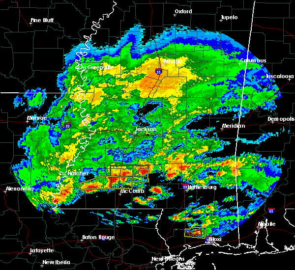 At 446 pm cdt, a severe thunderstorm was located near wanilla, or 18 miles south of pinola, moving east at 35 mph (radar indicated). Hazards include 60 mph wind gusts and quarter size hail. Hail damage to vehicles is expected. expect wind damage to roofs, siding and trees. Locations impacted include, monticello, arm, wanilla, robinwood and silver creek. At 446 pm cdt, a severe thunderstorm was located near wanilla, or 18 miles south of pinola, moving east at 35 mph (radar indicated). Hazards include 60 mph wind gusts and quarter size hail. Hail damage to vehicles is expected. expect wind damage to roofs, siding and trees. Locations impacted include, monticello, arm, wanilla, robinwood and silver creek.
|
| 3/17/2016 4:36 PM CDT |
 At 436 pm cdt, a severe thunderstorm was located over wanilla, or 18 miles east of brookhaven, moving east at 35 mph (radar indicated). Hazards include golf ball size hail and 60 mph wind gusts. People and animals outdoors will be injured. expect hail damage to roofs, siding, windows and vehicles. expect wind damage to roofs, siding and trees. this severe storm will be near, arm around 450 pm cdt. Other locations impacted by this severe thunderstorm include silver creek. At 436 pm cdt, a severe thunderstorm was located over wanilla, or 18 miles east of brookhaven, moving east at 35 mph (radar indicated). Hazards include golf ball size hail and 60 mph wind gusts. People and animals outdoors will be injured. expect hail damage to roofs, siding, windows and vehicles. expect wind damage to roofs, siding and trees. this severe storm will be near, arm around 450 pm cdt. Other locations impacted by this severe thunderstorm include silver creek.
|
| 3/17/2016 4:12 PM CDT |
 At 412 pm cdt, a severe thunderstorm was located near wesson, or 7 miles northeast of brookhaven, moving east at 35 mph (radar indicated). Hazards include golf ball size hail and 60 mph wind gusts. People and animals outdoors will be injured. expect hail damage to roofs, siding, windows and vehicles. expect wind damage to roofs, siding and trees. this severe thunderstorm will be near, sontag around 425 pm cdt. oma around 430 pm cdt. monticello and wanilla around 435 pm cdt. Other locations impacted by this severe thunderstorm include new hebron and silver creek. At 412 pm cdt, a severe thunderstorm was located near wesson, or 7 miles northeast of brookhaven, moving east at 35 mph (radar indicated). Hazards include golf ball size hail and 60 mph wind gusts. People and animals outdoors will be injured. expect hail damage to roofs, siding, windows and vehicles. expect wind damage to roofs, siding and trees. this severe thunderstorm will be near, sontag around 425 pm cdt. oma around 430 pm cdt. monticello and wanilla around 435 pm cdt. Other locations impacted by this severe thunderstorm include new hebron and silver creek.
|
| 3/17/2016 3:47 PM CDT |
 At 347 pm cdt, a severe thunderstorm was located near wanilla, or 17 miles south of pinola, moving east at 25 mph (radar indicated). Hazards include tennis ball size hail and 60 mph wind gusts. People and animals outdoors will be injured. expect hail damage to roofs, siding, windows and vehicles. expect wind damage to roofs, siding and trees. This severe thunderstorm will remain over mainly rural areas of northeastern lawrence county, including the following locations, silver creek. At 347 pm cdt, a severe thunderstorm was located near wanilla, or 17 miles south of pinola, moving east at 25 mph (radar indicated). Hazards include tennis ball size hail and 60 mph wind gusts. People and animals outdoors will be injured. expect hail damage to roofs, siding, windows and vehicles. expect wind damage to roofs, siding and trees. This severe thunderstorm will remain over mainly rural areas of northeastern lawrence county, including the following locations, silver creek.
|
| 3/17/2016 3:40 PM CDT |
 At 339 pm cdt, a severe thunderstorm was located near wanilla, or just north of monticello, moving east at 30 mph (radar indicated). Hazards include two inch hail and 60 mph wind gusts. People and animals outdoors will be injured. expect hail damage to roofs, siding, windows and vehicles. expect wind damage to roofs, siding and trees. this severe storm will be near, arm around 350 pm cdt. Other locations impacted by this severe thunderstorm include new hebron and silver creek. At 339 pm cdt, a severe thunderstorm was located near wanilla, or just north of monticello, moving east at 30 mph (radar indicated). Hazards include two inch hail and 60 mph wind gusts. People and animals outdoors will be injured. expect hail damage to roofs, siding, windows and vehicles. expect wind damage to roofs, siding and trees. this severe storm will be near, arm around 350 pm cdt. Other locations impacted by this severe thunderstorm include new hebron and silver creek.
|
| 3/17/2016 3:38 PM CDT | Golf Ball sized hail reported 4.1 miles SSE of Monticello, MS, a lot of golfball size hail fell at brads one stop. |
| 3/17/2016 3:30 PM CDT |
 At 330 pm cdt, a severe thunderstorm was located near sontag, or 14 miles east of brookhaven, moving east at 25 mph (radar indicated). Hazards include tennis ball size hail and 60 mph wind gusts. People and animals outdoors will be injured. expect hail damage to roofs, siding, windows and vehicles. expect wind damage to roofs, siding and trees. this severe storm will be near, wanilla around 340 pm cdt. monticello around 345 pm cdt. arm around 355 pm cdt. Other locations impacted by this severe thunderstorm include new hebron and silver creek. At 330 pm cdt, a severe thunderstorm was located near sontag, or 14 miles east of brookhaven, moving east at 25 mph (radar indicated). Hazards include tennis ball size hail and 60 mph wind gusts. People and animals outdoors will be injured. expect hail damage to roofs, siding, windows and vehicles. expect wind damage to roofs, siding and trees. this severe storm will be near, wanilla around 340 pm cdt. monticello around 345 pm cdt. arm around 355 pm cdt. Other locations impacted by this severe thunderstorm include new hebron and silver creek.
|
| 3/17/2016 3:18 PM CDT |
 At 317 pm cdt, a severe thunderstorm was located near sontag, or 9 miles northeast of brookhaven, moving east at 25 mph (radar indicated). Hazards include two inch hail and 60 mph wind gusts. People and animals outdoors will be injured. expect hail damage to roofs, siding, windows and vehicles. expect wind damage to roofs, siding and trees. this severe storm will be near, sontag around 330 pm cdt. wanilla and oma around 340 pm cdt. monticello around 345 pm cdt. Other locations impacted by this severe thunderstorm include new hebron and silver creek. At 317 pm cdt, a severe thunderstorm was located near sontag, or 9 miles northeast of brookhaven, moving east at 25 mph (radar indicated). Hazards include two inch hail and 60 mph wind gusts. People and animals outdoors will be injured. expect hail damage to roofs, siding, windows and vehicles. expect wind damage to roofs, siding and trees. this severe storm will be near, sontag around 330 pm cdt. wanilla and oma around 340 pm cdt. monticello around 345 pm cdt. Other locations impacted by this severe thunderstorm include new hebron and silver creek.
|
| 3/17/2016 3:07 PM CDT |
 At 306 pm cdt, a severe thunderstorm was located near new sight, or just north of brookhaven, moving east at 25 mph. this is a very dangerous storm (radar indicated. at 245 pm... golfball size hail was reported near loyd star). Hazards include baseball size hail and 60 mph wind gusts. People and animals outdoors will be severely injured. expect shattered windows, extensive damage to roofs, siding and vehicles. this severe storm will be near, sontag around 330 pm cdt. oma around 335 pm cdt. wanilla around 340 pm cdt. monticello around 345 pm cdt. arm around 355 pm cdt. Other locations impacted by this severe thunderstorm include new hebron and silver creek. At 306 pm cdt, a severe thunderstorm was located near new sight, or just north of brookhaven, moving east at 25 mph. this is a very dangerous storm (radar indicated. at 245 pm... golfball size hail was reported near loyd star). Hazards include baseball size hail and 60 mph wind gusts. People and animals outdoors will be severely injured. expect shattered windows, extensive damage to roofs, siding and vehicles. this severe storm will be near, sontag around 330 pm cdt. oma around 335 pm cdt. wanilla around 340 pm cdt. monticello around 345 pm cdt. arm around 355 pm cdt. Other locations impacted by this severe thunderstorm include new hebron and silver creek.
|
| 3/17/2016 2:57 PM CDT |
 At 257 pm cdt, a severe thunderstorm was located near wesson, or near brookhaven, moving east at 30 mph. this is a very dangerous storm (radar indicated). Hazards include baseball size hail and 60 mph wind gusts. People and animals outdoors will be severely injured. expect shattered windows, extensive damage to roofs, siding and vehicles. this severe thunderstorm will be near, sontag around 325 pm cdt. wanilla and oma around 335 pm cdt. monticello around 340 pm cdt. arm around 355 pm cdt. Other locations impacted by this severe thunderstorm include new hebron and silver creek. At 257 pm cdt, a severe thunderstorm was located near wesson, or near brookhaven, moving east at 30 mph. this is a very dangerous storm (radar indicated). Hazards include baseball size hail and 60 mph wind gusts. People and animals outdoors will be severely injured. expect shattered windows, extensive damage to roofs, siding and vehicles. this severe thunderstorm will be near, sontag around 325 pm cdt. wanilla and oma around 335 pm cdt. monticello around 340 pm cdt. arm around 355 pm cdt. Other locations impacted by this severe thunderstorm include new hebron and silver creek.
|
| 3/17/2016 9:55 AM CDT | Quarter sized hail reported 12.4 miles S of Monticello, MS, nickel to quarter size |
| 3/17/2016 9:50 AM CDT | Baseball sized hail reported 15 miles NNE of Monticello, MS |
| 3/17/2016 9:42 AM CDT | Ping Pong Ball sized hail reported 14.4 miles NNE of Monticello, MS, ping pong ball size in at the co line... baseball size about 1 mile south. |
| 2/15/2016 2:05 PM CST |
 At 205 pm cst, severe thunderstorms were located along a line extending from near martinville to 7 miles southeast of pinola to near prentiss to jayess, moving east at 60 mph (radar indicated). Hazards include 60 mph wind gusts. Expect damage to roofs. siding and trees. these severe storms will be near, sanatorium and martinville around 210 pm cst. magee, lone star, clem and arm around 215 pm cst. mount olive and oak vale around 220 pm cst. society hill around 225 pm cst. carson around 230 pm cst. other locations impacted by these severe thunderstorms include silver creek, new hebron, bassfield and d`lo. A tornado watch remains in effect until 600 pm cst for southeastern mississippi. At 205 pm cst, severe thunderstorms were located along a line extending from near martinville to 7 miles southeast of pinola to near prentiss to jayess, moving east at 60 mph (radar indicated). Hazards include 60 mph wind gusts. Expect damage to roofs. siding and trees. these severe storms will be near, sanatorium and martinville around 210 pm cst. magee, lone star, clem and arm around 215 pm cst. mount olive and oak vale around 220 pm cst. society hill around 225 pm cst. carson around 230 pm cst. other locations impacted by these severe thunderstorms include silver creek, new hebron, bassfield and d`lo. A tornado watch remains in effect until 600 pm cst for southeastern mississippi.
|
| 2/15/2016 1:46 PM CST |
 At 146 pm cst, severe thunderstorms were located along a line extending from near piney woods to near rockport to sontag to near ruth, moving east at 40 mph (radar indicated). Hazards include 60 mph wind gusts. Expect damage to roofs. siding and trees. severe thunderstorms will be near, wanilla and harrisville around 150 pm cst. union around 155 pm cst. shivers around 200 pm cst. pinola, jayess and topeka around 205 pm cst. mendenhall, prentiss and robinwood around 215 pm cst. sanatorium and tilton around 220 pm cst. magee, clem, lone star, martinville and arm around 225 pm cst. oak vale around 230 pm cst. other locations impacted by these severe thunderstorms include silver creek, new hebron, braxton, bassfield and d`lo. A tornado watch remains in effect until 600 pm cst for southeastern mississippi. At 146 pm cst, severe thunderstorms were located along a line extending from near piney woods to near rockport to sontag to near ruth, moving east at 40 mph (radar indicated). Hazards include 60 mph wind gusts. Expect damage to roofs. siding and trees. severe thunderstorms will be near, wanilla and harrisville around 150 pm cst. union around 155 pm cst. shivers around 200 pm cst. pinola, jayess and topeka around 205 pm cst. mendenhall, prentiss and robinwood around 215 pm cst. sanatorium and tilton around 220 pm cst. magee, clem, lone star, martinville and arm around 225 pm cst. oak vale around 230 pm cst. other locations impacted by these severe thunderstorms include silver creek, new hebron, braxton, bassfield and d`lo. A tornado watch remains in effect until 600 pm cst for southeastern mississippi.
|
| 12/28/2015 4:22 AM CST |
 At 422 am cst, a severe thunderstorm was located over topeka, or 17 miles southeast of brookhaven, moving northeast at 50 mph (radar indicated). Hazards include 60 mph wind gusts. Expect damage to roofs. siding and trees. this severe thunderstorm will be near, robinwood around 430 am cst. monticello around 435 am cst. wanilla and sontag around 440 am cst. oma around 445 am cst. A tornado watch remains in effect until 800 am cst for south central mississippi. At 422 am cst, a severe thunderstorm was located over topeka, or 17 miles southeast of brookhaven, moving northeast at 50 mph (radar indicated). Hazards include 60 mph wind gusts. Expect damage to roofs. siding and trees. this severe thunderstorm will be near, robinwood around 430 am cst. monticello around 435 am cst. wanilla and sontag around 440 am cst. oma around 445 am cst. A tornado watch remains in effect until 800 am cst for south central mississippi.
|
| 12/24/2015 5:37 PM CST |
 At 536 pm cst, a severe thunderstorm was located near monticello, or 14 miles east of brookhaven, moving northeast at 30 mph (radar indicated). Hazards include 60 mph wind gusts and quarter size hail. Hail damage to vehicles is expected. expect wind damage to roofs, siding and trees. this severe storm will be near, monticello and sontag around 545 pm cst. wanilla around 550 pm cst. Other locations impacted by this severe thunderstorm include new hebron and silver creek. At 536 pm cst, a severe thunderstorm was located near monticello, or 14 miles east of brookhaven, moving northeast at 30 mph (radar indicated). Hazards include 60 mph wind gusts and quarter size hail. Hail damage to vehicles is expected. expect wind damage to roofs, siding and trees. this severe storm will be near, monticello and sontag around 545 pm cst. wanilla around 550 pm cst. Other locations impacted by this severe thunderstorm include new hebron and silver creek.
|
| 12/24/2015 5:28 PM CST |
 At 527 pm cst, a severe thunderstorm was located near east lincoln, or 12 miles east of brookhaven, moving northeast at 35 mph (radar indicated). Hazards include 60 mph wind gusts and quarter size hail. Hail damage to vehicles is expected. expect wind damage to roofs, siding and trees. this severe thunderstorm will be near, monticello, sontag and robinwood around 540 pm cst. wanilla around 545 pm cst. arm around 550 pm cst. Other locations impacted by this severe thunderstorm include new hebron and silver creek. At 527 pm cst, a severe thunderstorm was located near east lincoln, or 12 miles east of brookhaven, moving northeast at 35 mph (radar indicated). Hazards include 60 mph wind gusts and quarter size hail. Hail damage to vehicles is expected. expect wind damage to roofs, siding and trees. this severe thunderstorm will be near, monticello, sontag and robinwood around 540 pm cst. wanilla around 545 pm cst. arm around 550 pm cst. Other locations impacted by this severe thunderstorm include new hebron and silver creek.
|
| 11/18/2015 12:22 AM CST |
 At 1222 am cst, a severe thunderstorm was located near jayess, or 14 miles northwest of kokomo, moving northeast at 35 mph (radar indicated). Hazards include 60 mph wind gusts. Expect damage to roofs. siding and trees. this severe thunderstorm will be near, robinwood and tilton around 1235 am cst. oak vale around 1240 am cst. monticello and arm around 1245 am cst. progress around 1250 am cst. prentiss around 100 am cst. clem around 115 am cst. other locations impacted by this severe thunderstorm include silver creek and new hebron. A tornado watch remains in effect until 300 am cst for southeastern mississippi. At 1222 am cst, a severe thunderstorm was located near jayess, or 14 miles northwest of kokomo, moving northeast at 35 mph (radar indicated). Hazards include 60 mph wind gusts. Expect damage to roofs. siding and trees. this severe thunderstorm will be near, robinwood and tilton around 1235 am cst. oak vale around 1240 am cst. monticello and arm around 1245 am cst. progress around 1250 am cst. prentiss around 100 am cst. clem around 115 am cst. other locations impacted by this severe thunderstorm include silver creek and new hebron. A tornado watch remains in effect until 300 am cst for southeastern mississippi.
|
| 10/31/2015 2:43 PM CDT |
 At 242 pm cdt, a severe thunderstorm was located near arm, or 23 miles northwest of columbia, moving northeast at 40 mph (radar indicated). Hazards include 60 mph wind gusts. Expect damage to roofs. siding and trees. this severe storm will be near, progress around 250 pm cdt. prentiss and carson around 300 pm cdt. other locations impacted by this severe thunderstorm include bassfield, silver creek and new hebron. A tornado watch remains in effect until 700 pm cdt for southeastern mississippi. At 242 pm cdt, a severe thunderstorm was located near arm, or 23 miles northwest of columbia, moving northeast at 40 mph (radar indicated). Hazards include 60 mph wind gusts. Expect damage to roofs. siding and trees. this severe storm will be near, progress around 250 pm cdt. prentiss and carson around 300 pm cdt. other locations impacted by this severe thunderstorm include bassfield, silver creek and new hebron. A tornado watch remains in effect until 700 pm cdt for southeastern mississippi.
|
| 10/31/2015 2:35 PM CDT |
 At 235 pm cdt, a severe thunderstorm was located over monticello, or 18 miles east of brookhaven, moving northeast at 35 mph (radar indicated). Hazards include 60 mph wind gusts. Expect damage to roofs. siding and trees. this severe thunderstorm will be near, arm around 245 pm cdt. progress around 250 pm cdt. prentiss around 300 pm cdt. other locations impacted by this severe thunderstorm include bassfield, silver creek and new hebron. A tornado watch remains in effect until 700 pm cdt for southeastern mississippi. At 235 pm cdt, a severe thunderstorm was located over monticello, or 18 miles east of brookhaven, moving northeast at 35 mph (radar indicated). Hazards include 60 mph wind gusts. Expect damage to roofs. siding and trees. this severe thunderstorm will be near, arm around 245 pm cdt. progress around 250 pm cdt. prentiss around 300 pm cdt. other locations impacted by this severe thunderstorm include bassfield, silver creek and new hebron. A tornado watch remains in effect until 700 pm cdt for southeastern mississippi.
|
| 8/21/2015 4:28 PM CDT |
 At 428 pm cdt, a severe thunderstorm was located near monticello, or 15 miles east of brookhaven, moving north at 15 mph (radar indicated). Hazards include 60 mph wind gusts and nickel size hail. Expect damage to roofs. siding and trees. this severe storm will be near, sontag and wanilla around 450 pm cdt. oma around 515 pm cdt. Other locations impacted by this severe thunderstorm include new hebron and silver creek. At 428 pm cdt, a severe thunderstorm was located near monticello, or 15 miles east of brookhaven, moving north at 15 mph (radar indicated). Hazards include 60 mph wind gusts and nickel size hail. Expect damage to roofs. siding and trees. this severe storm will be near, sontag and wanilla around 450 pm cdt. oma around 515 pm cdt. Other locations impacted by this severe thunderstorm include new hebron and silver creek.
|
| 8/21/2015 4:14 PM CDT |
 At 414 pm cdt, severe thunderstorms were located along a line extending from near sontag to near monticello to near robinwood, moving north at 20 mph (radar indicated). Hazards include 60 mph wind gusts and quarter size hail. Hail damage to vehicles is expected. expect wind damage to roofs, siding and trees. severe thunderstorms will be near, monticello around 420 pm cdt. sontag around 425 pm cdt. wanilla around 440 pm cdt. oma around 455 pm cdt. Other locations impacted by these severe thunderstorms include new hebron and silver creek. At 414 pm cdt, severe thunderstorms were located along a line extending from near sontag to near monticello to near robinwood, moving north at 20 mph (radar indicated). Hazards include 60 mph wind gusts and quarter size hail. Hail damage to vehicles is expected. expect wind damage to roofs, siding and trees. severe thunderstorms will be near, monticello around 420 pm cdt. sontag around 425 pm cdt. wanilla around 440 pm cdt. oma around 455 pm cdt. Other locations impacted by these severe thunderstorms include new hebron and silver creek.
|
| 8/21/2015 3:37 PM CDT |
 At 336 pm cdt, a severe thunderstorm was located near tilton, or 13 miles north of kokomo, moving north at 5 mph (radar indicated). Hazards include 60 mph wind gusts and quarter size hail. Hail damage to vehicles is expected. expect wind damage to roofs, siding and trees. this severe thunderstorm will be near, tilton around 400 pm cdt. oak vale around 420 pm cdt. robinwood around 425 pm cdt. Arm around 430 pm cdt. At 336 pm cdt, a severe thunderstorm was located near tilton, or 13 miles north of kokomo, moving north at 5 mph (radar indicated). Hazards include 60 mph wind gusts and quarter size hail. Hail damage to vehicles is expected. expect wind damage to roofs, siding and trees. this severe thunderstorm will be near, tilton around 400 pm cdt. oak vale around 420 pm cdt. robinwood around 425 pm cdt. Arm around 430 pm cdt.
|
| 8/10/2015 6:40 PM CDT | Trees and power lines were dow in lawrence county MS, 0.2 miles NW of Monticello, MS |
| 8/10/2015 6:39 PM CDT |
 At 639 pm cdt, a severe thunderstorm was located near arm, or 22 miles south of pinola, moving southeast at 15 mph (radar indicated). Hazards include 60 mph wind gusts and half dollar size hail. Hail damage to vehicles is expected. expect wind damage to roofs, siding and trees. this severe thunderstorm will be near, progress and arm around 650 pm cdt. oak vale and tilton around 710 pm cdt. society hill around 725 pm cdt. Other locations impacted by this severe thunderstorm include silver creek. At 639 pm cdt, a severe thunderstorm was located near arm, or 22 miles south of pinola, moving southeast at 15 mph (radar indicated). Hazards include 60 mph wind gusts and half dollar size hail. Hail damage to vehicles is expected. expect wind damage to roofs, siding and trees. this severe thunderstorm will be near, progress and arm around 650 pm cdt. oak vale and tilton around 710 pm cdt. society hill around 725 pm cdt. Other locations impacted by this severe thunderstorm include silver creek.
|
| 8/10/2015 6:30 PM CDT |
 At 630 pm cdt, a severe thunderstorm was located near monticello, or 19 miles south of pinola, moving southeast at 30 mph (radar indicated). Hazards include 60 mph wind gusts and quarter size hail. Hail damage to vehicles is expected. expect wind damage to roofs, siding and trees. This severe thunderstorm will remain over mainly rural areas of central lawrence county, including the following locations, silver creek. At 630 pm cdt, a severe thunderstorm was located near monticello, or 19 miles south of pinola, moving southeast at 30 mph (radar indicated). Hazards include 60 mph wind gusts and quarter size hail. Hail damage to vehicles is expected. expect wind damage to roofs, siding and trees. This severe thunderstorm will remain over mainly rural areas of central lawrence county, including the following locations, silver creek.
|
| 8/10/2015 6:00 PM CDT |
 At 600 pm cdt, a severe thunderstorm was located over wanilla, or 17 miles east of brookhaven, moving southeast at 10 mph (radar indicated). Hazards include 60 mph wind gusts and quarter size hail. Hail damage to vehicles is expected. expect wind damage to roofs, siding and trees. this severe thunderstorm will be near, wanilla around 610 pm cdt. monticello around 640 pm cdt. Other locations impacted by this severe thunderstorm include silver creek. At 600 pm cdt, a severe thunderstorm was located over wanilla, or 17 miles east of brookhaven, moving southeast at 10 mph (radar indicated). Hazards include 60 mph wind gusts and quarter size hail. Hail damage to vehicles is expected. expect wind damage to roofs, siding and trees. this severe thunderstorm will be near, wanilla around 610 pm cdt. monticello around 640 pm cdt. Other locations impacted by this severe thunderstorm include silver creek.
|
| 8/8/2015 7:00 PM CDT | Numerous trees down in lawrence county MS, 11.9 miles NW of Monticello, MS |
| 8/8/2015 6:55 PM CDT | Large oak tree fell on old highway 27. a vehicle crashed into the tree. no injurie in lawrence county MS, 0.2 miles NW of Monticello, MS |
| 8/8/2015 6:32 PM CDT |
 At 631 pm cdt, a severe thunderstorm was located near oma, or 10 miles southwest of pinola, moving south at 30 mph (radar indicated). Hazards include 60 mph wind gusts and quarter size hail. Hail damage to vehicles is expected. expect wind damage to roofs, siding and trees. this severe thunderstorm will be near, wanilla around 645 pm cdt. monticello around 700 pm cdt. Robinwood around 710 pm cdt. At 631 pm cdt, a severe thunderstorm was located near oma, or 10 miles southwest of pinola, moving south at 30 mph (radar indicated). Hazards include 60 mph wind gusts and quarter size hail. Hail damage to vehicles is expected. expect wind damage to roofs, siding and trees. this severe thunderstorm will be near, wanilla around 645 pm cdt. monticello around 700 pm cdt. Robinwood around 710 pm cdt.
|
| 6/24/2015 2:56 PM CDT | A few trees down on cub brown road and benson roa in lawrence county MS, 3.8 miles SE of Monticello, MS |
| 6/24/2015 2:56 PM CDT |
 At 256 pm cdt, a severe thunderstorm was located near oma, or 15 miles southwest of pinola, moving west at 20 mph (radar indicated). Hazards include 60 mph wind gusts. Expect damage to roofs. siding and trees. Locations impacted include, monticello, hopewell, wanilla, rockport, oma, sontag, new hebron, georgetown and silver creek. At 256 pm cdt, a severe thunderstorm was located near oma, or 15 miles southwest of pinola, moving west at 20 mph (radar indicated). Hazards include 60 mph wind gusts. Expect damage to roofs. siding and trees. Locations impacted include, monticello, hopewell, wanilla, rockport, oma, sontag, new hebron, georgetown and silver creek.
|
| 6/24/2015 2:46 PM CDT |
 At 246 pm cdt, a severe thunderstorm was located near hebron, or 13 miles south of pinola, moving west at 20 mph (radar indicated). Hazards include 60 mph wind gusts and quarter size hail. Hail damage to vehicles is expected. expect wind damage to roofs, siding and trees. Locations impacted include, monticello, hopewell, wanilla, rockport, progress, oma, sontag, new hebron, georgetown and silver creek. At 246 pm cdt, a severe thunderstorm was located near hebron, or 13 miles south of pinola, moving west at 20 mph (radar indicated). Hazards include 60 mph wind gusts and quarter size hail. Hail damage to vehicles is expected. expect wind damage to roofs, siding and trees. Locations impacted include, monticello, hopewell, wanilla, rockport, progress, oma, sontag, new hebron, georgetown and silver creek.
|
| 6/24/2015 2:26 PM CDT |
 At 226 pm cdt, a severe thunderstorm was located over hebron, or 11 miles south of pinola, moving west at 20 mph (radar indicated). Hazards include 60 mph wind gusts and quarter size hail. Hail damage to vehicles is expected. Expect wind damage to roofs, siding and trees. At 226 pm cdt, a severe thunderstorm was located over hebron, or 11 miles south of pinola, moving west at 20 mph (radar indicated). Hazards include 60 mph wind gusts and quarter size hail. Hail damage to vehicles is expected. Expect wind damage to roofs, siding and trees.
|
| 5/27/2015 12:53 PM CDT | A couple trees down blocking roads with phone lines down as wel in lawrence county MS, 0.2 miles NW of Monticello, MS |
| 5/27/2015 12:48 PM CDT | At 1247 pm cdt, a severe thunderstorm was located over robinwood, or 22 miles east of brookhaven. another severe storm was located just south of jayess. both storms were moving northeast at 25 mph (radar indicated). Hazards include 60 mph wind gusts. Expect damage to roofs. siding and trees. Locations impacted include, kokomo, holly springs, monticello, prentiss, wanilla, jayess, arm, goss, progress, topeka, society hill, oak vale, robinwood, morgantown, tilton and silver creek. |
| 5/27/2015 12:26 PM CDT | At 1225 pm cdt, a cluster of severe thunderstorms was located near jayess, or 12 miles northwest of kokomo, moving northeast at 25 mph (radar indicated). Hazards include 60 mph wind gusts. Expect damage to roofs. siding and trees. this severe thunderstorm will be near, topeka around 1235 pm cdt. Tilton around 1245 pm cdt. |
| 4/15/2015 7:22 PM CDT | Quarter sized hail reported 0.2 miles NW of Monticello, MS, report of dime to quarter size hail in monticello. |
| 4/15/2015 7:17 PM CDT | The national weather service in jackson has issued a * severe thunderstorm warning for. northwestern jefferson davis county in south central mississippi. northeastern lawrence county in south central mississippi. until 800 pm cdt * at 717 pm cdt. A severe thunderstorm was located over. |
| 4/15/2015 6:50 PM CDT | Ping Pong Ball sized hail reported 12.9 miles NNE of Monticello, MS, report of ping pong size hail northeast of jayess. report and picture relayed via social media. |
| 12/23/2014 12:49 PM CST | Quarter sized hail reported 11 miles S of Monticello, MS, high winds also reported at this location |
| 10/13/2014 4:50 PM CDT | A few trees down on robinwood rd in lawrence county MS, 0.2 miles NW of Monticello, MS |
| 4/29/2014 5:05 PM CDT | Quarter sized hail reported 4.6 miles E of Monticello, MS, reported in the new zion area |
| 4/8/2014 4:45 PM CDT | So reports trees down across lawrence county...primarily in monticello and silver creek in lawrence county MS, 0.2 miles NW of Monticello, MS |
| 6/6/2013 2:00 PM CDT | Quarter sized hail reported 0.2 miles NW of Monticello, MS |
| 6/6/2013 2:00 PM CDT | Reports of a tree down on east broad street near highway 84 and atwood water park and one down on carmel-new hope road. also two trees fell on a powerline in monticello in lawrence county MS, 0.2 miles NW of Monticello, MS |
| 3/18/2013 8:33 PM CDT | Baseball sized hail reported 8.2 miles NNE of Monticello, MS |
| 2/10/2013 3:42 PM CST | A home was damaged and trees and powerlines were downed along gw smith rd. possible tornad in lawrence county MS, 9.3 miles WNW of Monticello, MS |
| 12/25/2012 3:38 PM CST | Two mobile homes damaged along highway 184 west of monticello. possible tornad in lawrence county MS, 2.9 miles E of Monticello, MS |
| 12/25/2012 3:37 PM CST | Trees downed along james cox rd. possible tornad in lawrence county MS, 4 miles E of Monticello, MS |
| 12/20/2012 6:25 AM CST | Trees down along rabbit rd east of monticello. power is out in a few areas along highway 84 between monticello and silver creek in lawrence county MS, 0.2 miles NW of Monticello, MS |
| 7/4/2012 4:15 PM CDT | Trees down in monticell in lawrence county MS, 0.2 miles NW of Monticello, MS |
| 6/11/2012 10:30 PM CDT | One tree was down across hwy 27 1 mi s of town...several large limbs were down in tow in lawrence county MS, 0.2 miles NW of Monticello, MS |
| 5/31/2012 3:35 PM CDT | 3 trees down inside the monticello city limits. 2 fell on home in lawrence county MS, 0.2 miles NW of Monticello, MS |
| 3/21/2012 12:30 PM CDT | Power lines and a few trees down in lawrence county MS, 0.2 miles NW of Monticello, MS |
| 1/1/0001 12:00 AM | Multiple trees downed in the topeka area...including one that fell on a house. time estimate in lawrence county MS, 10.2 miles NNE of Monticello, MS |
| 1/1/0001 12:00 AM | Few trees down near tilto in lawrence county MS, 11.2 miles NNW of Monticello, MS |
| 1/1/0001 12:00 AM | Golf Ball sized hail reported 13.2 miles N of Monticello, MS |
| 1/1/0001 12:00 AM | Multiple trees down across carmel-new hope road and olivar wilson roa in lawrence county MS, 3.1 miles NE of Monticello, MS |
Hail Maps for Monticello, MS

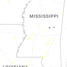
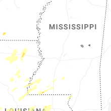
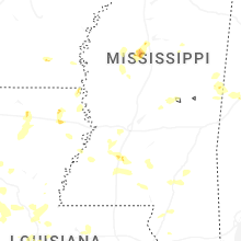
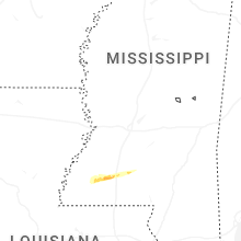


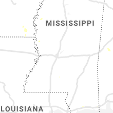


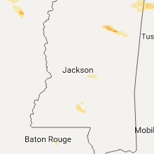


Connect with Interactive Hail Maps