

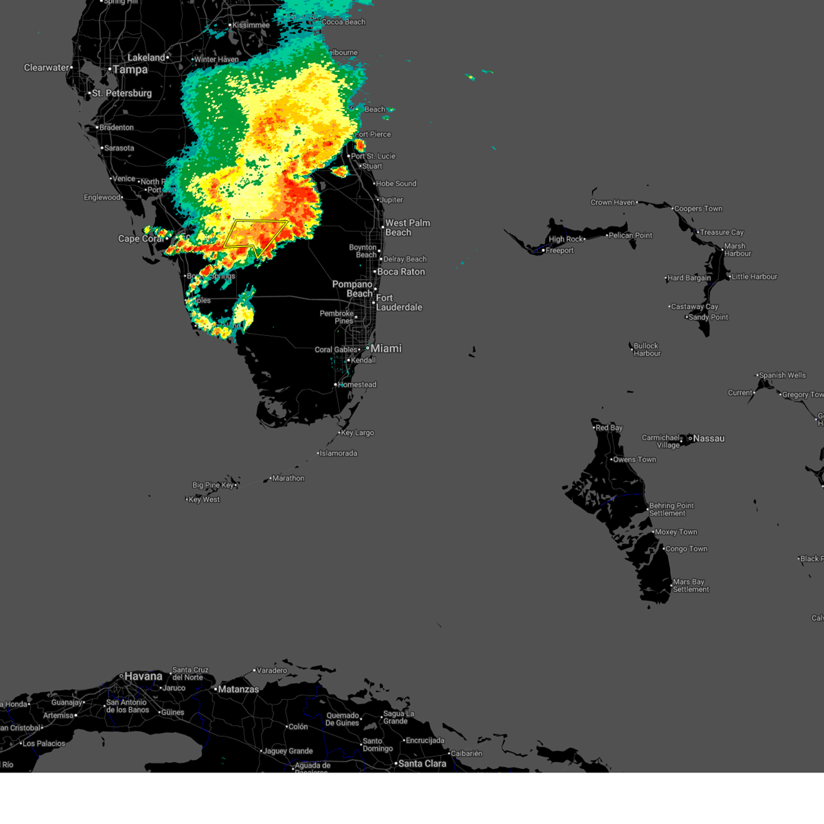
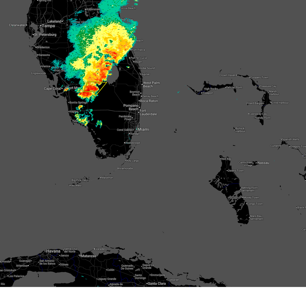
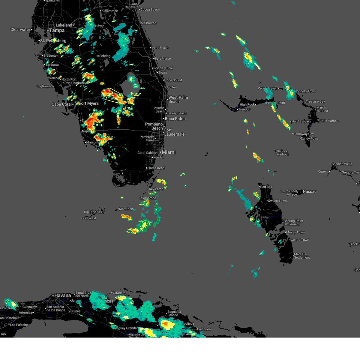
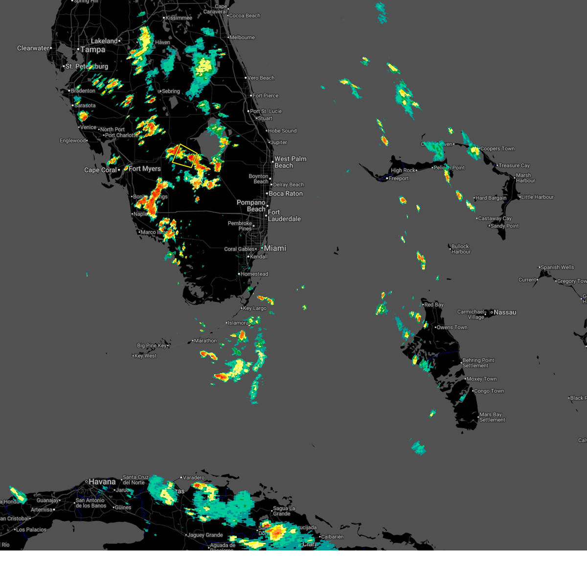
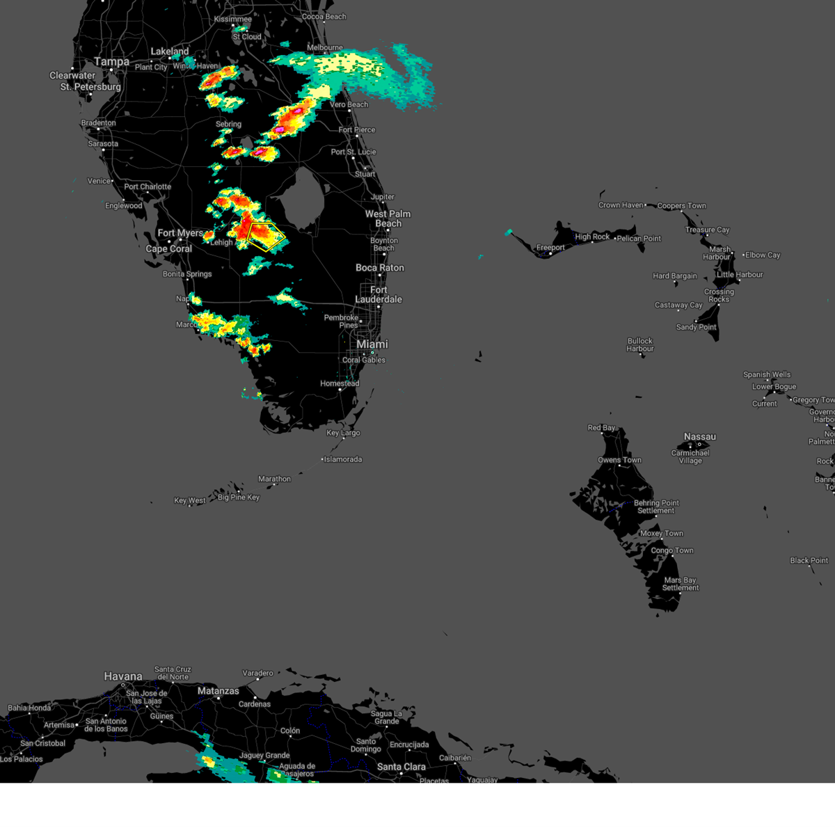
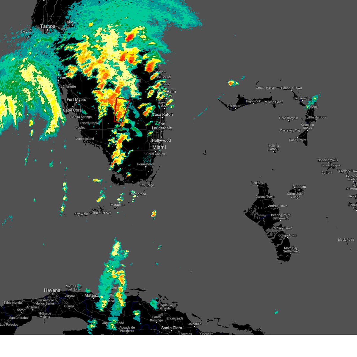
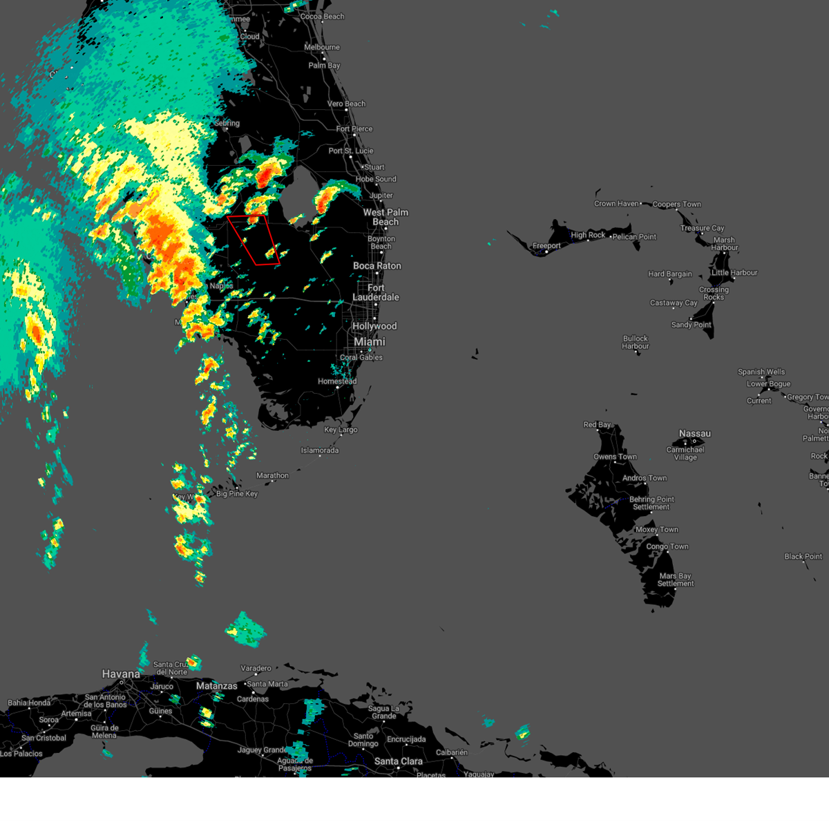
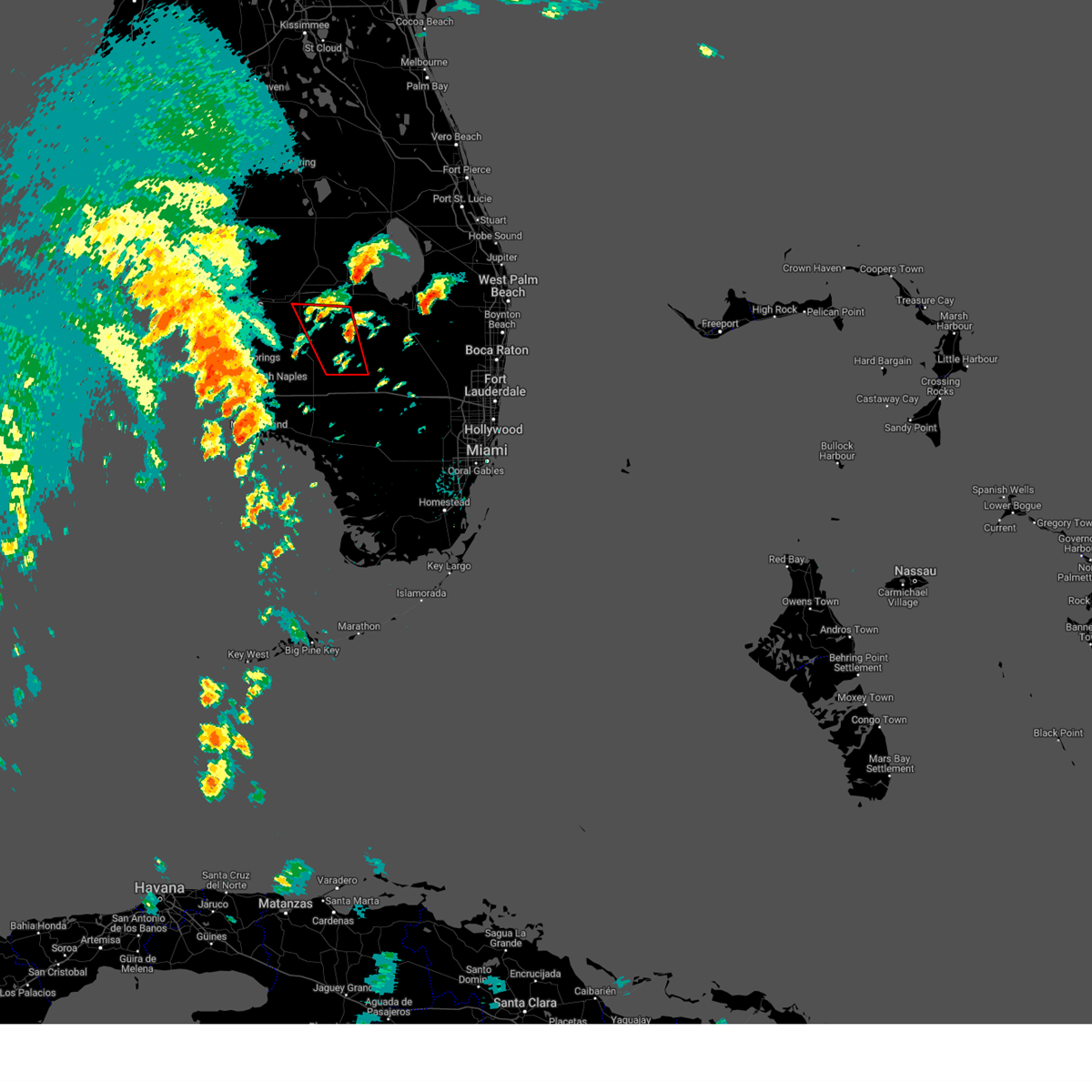
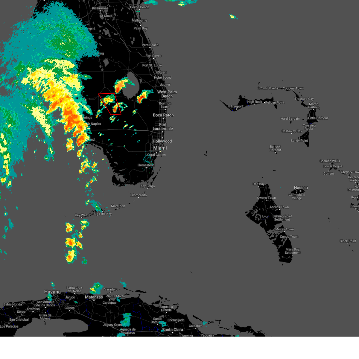
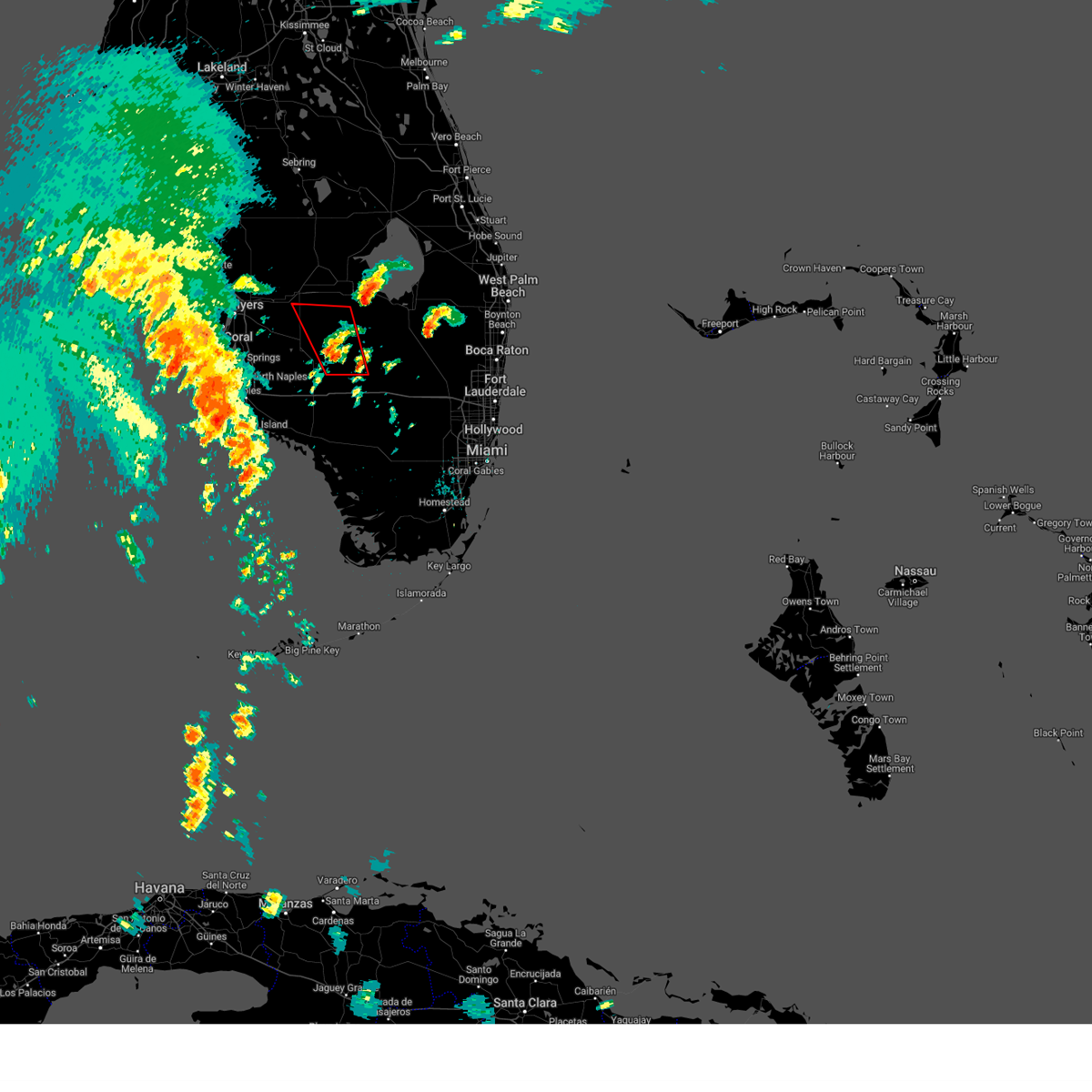
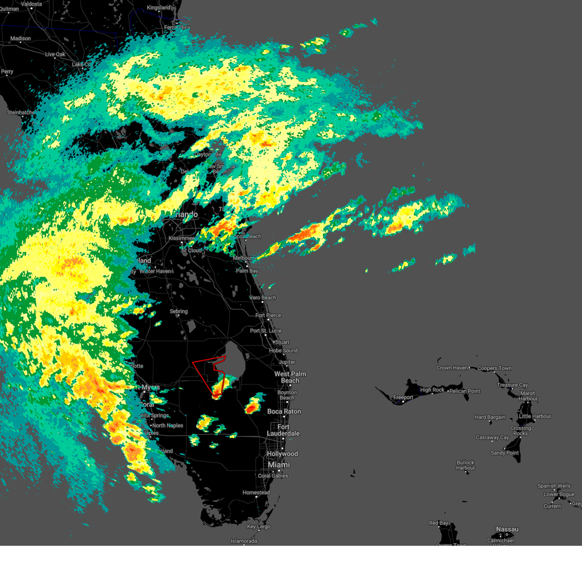
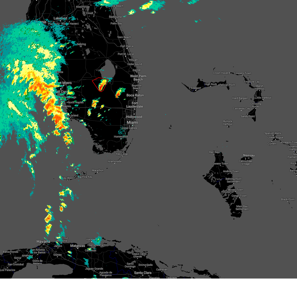
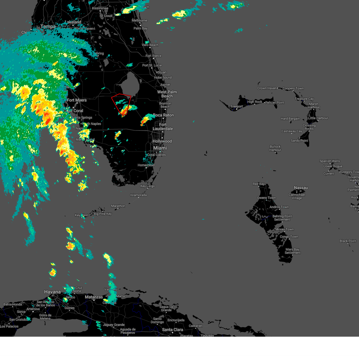
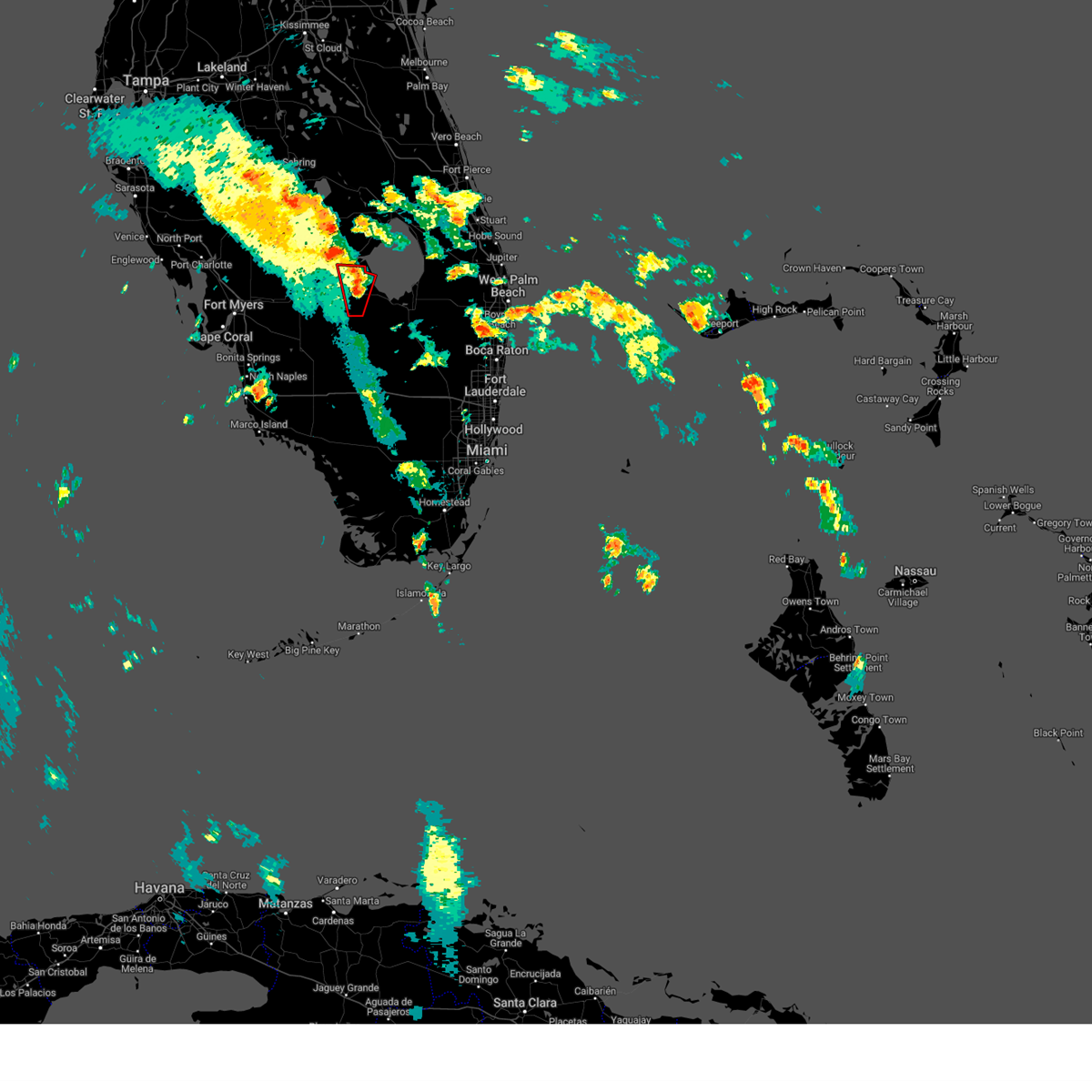
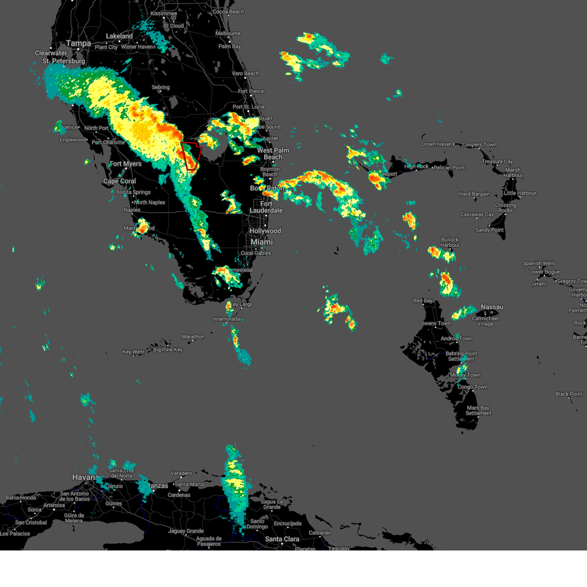
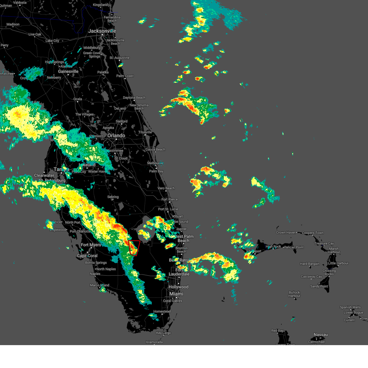
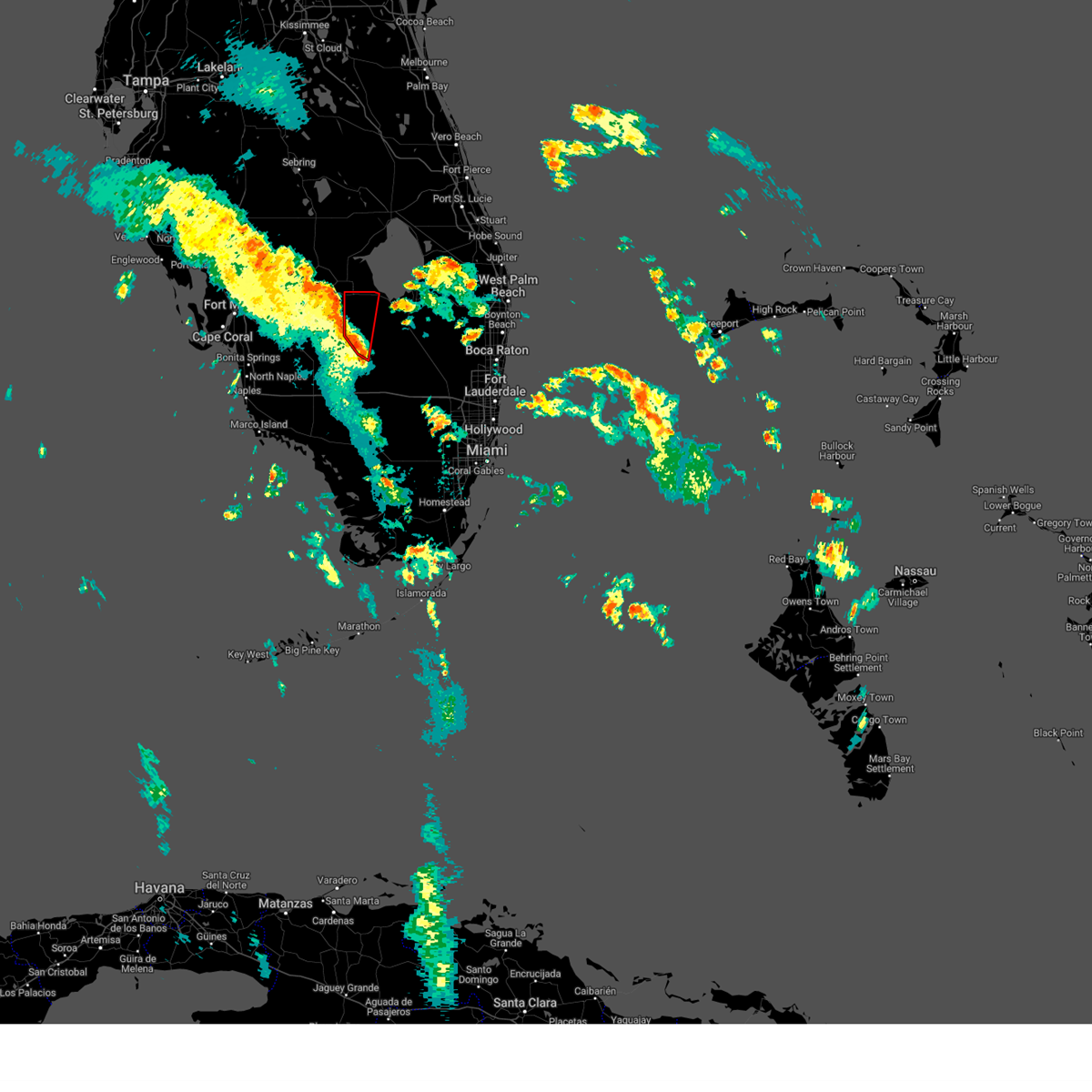
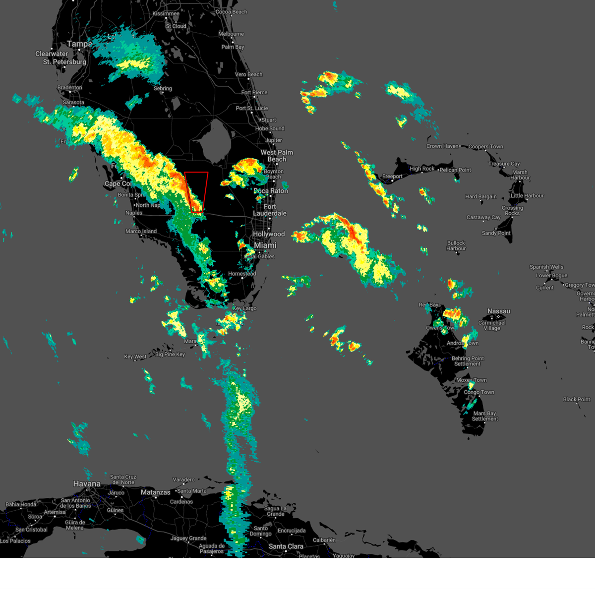
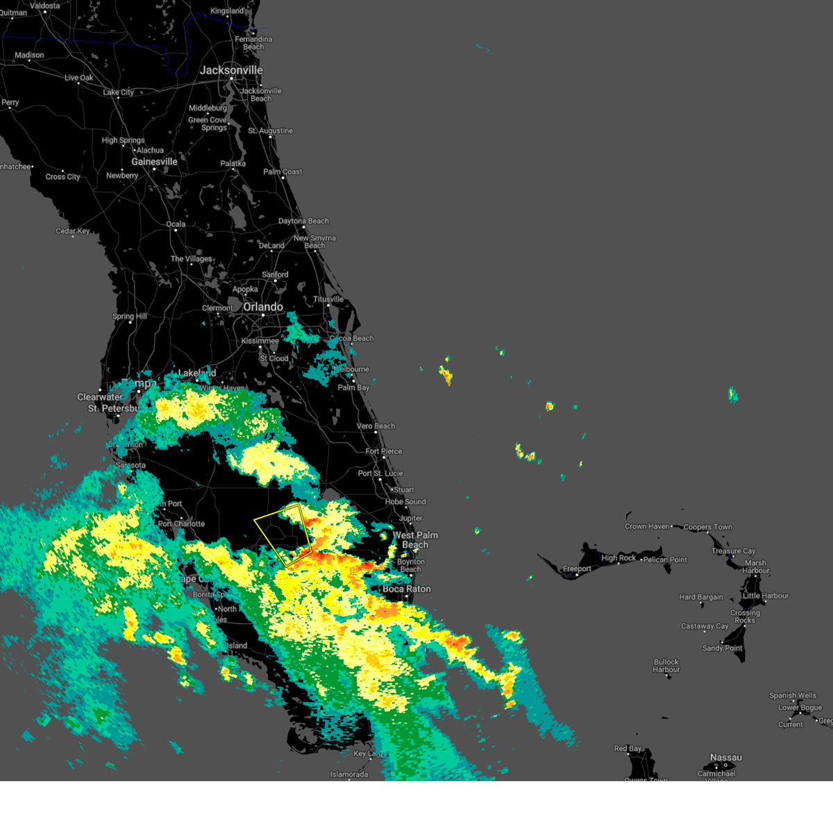
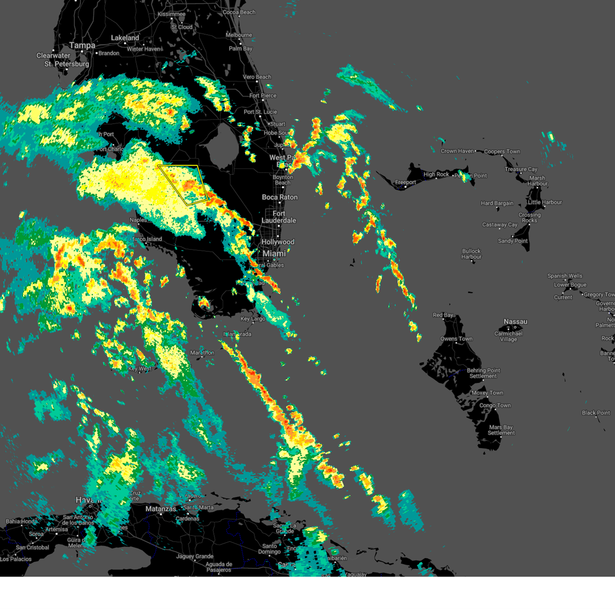
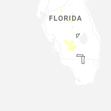
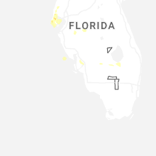
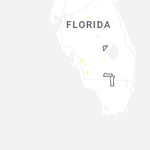
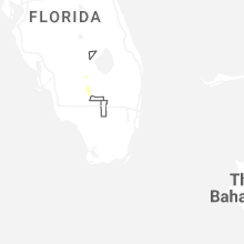
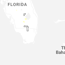
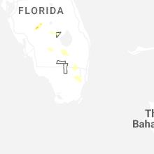
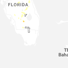
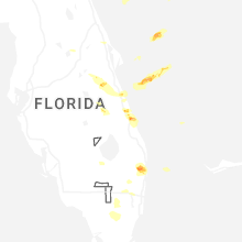
Hail Map for Montura, FL
The Montura, FL area has had 0 reports of on-the-ground hail by trained spotters, and has been under severe weather warnings 26 times during the past 12 months. Doppler radar has detected hail at or near Montura, FL on 61 occasions, including 8 occasions during the past year.
| Name: | Montura, FL |
| Where Located: | 55.7 miles NE of Naples, FL |
| Map: | Google Map for Montura, FL |
| Population: | 3283 |
| Housing Units: | 1303 |
| More Info: | Search Google for Montura, FL |
2
The Top Recent Hail Date for Montura, FL is Saturday, June 28, 2025 (10th out of 61)

Hail and Wind Damage Spotted near Montura, FL
| Date / Time | Report Details |
|---|---|
| 6/28/2025 7:31 PM EDT |
 the severe thunderstorm warning has been cancelled and is no longer in effect the severe thunderstorm warning has been cancelled and is no longer in effect
|
| 6/28/2025 6:56 PM EDT |
 Svrmfl the national weather service in miami has issued a * severe thunderstorm warning for, northern hendry county in southern florida, southwestern glades county in southern florida, * until 745 pm edt. * at 656 pm edt, a severe thunderstorm was located 9 miles west of devils garden, or 11 miles west of montura, moving southeast at 15 mph (radar indicated). Hazards include 60 mph wind gusts and penny size hail. damage to roofs, siding, and trees possible Svrmfl the national weather service in miami has issued a * severe thunderstorm warning for, northern hendry county in southern florida, southwestern glades county in southern florida, * until 745 pm edt. * at 656 pm edt, a severe thunderstorm was located 9 miles west of devils garden, or 11 miles west of montura, moving southeast at 15 mph (radar indicated). Hazards include 60 mph wind gusts and penny size hail. damage to roofs, siding, and trees possible
|
| 6/11/2025 4:00 PM EDT |
 the severe thunderstorm warning has been cancelled and is no longer in effect the severe thunderstorm warning has been cancelled and is no longer in effect
|
| 6/11/2025 3:45 PM EDT |
 Svrmfl the national weather service in miami has issued a * severe thunderstorm warning for, north central hendry county in southern florida, south central glades county in southern florida, * until 415 pm edt. * at 345 pm edt, a severe thunderstorm was located near moore haven, moving west at 20 mph (radar indicated). Hazards include 60 mph wind gusts and quarter size hail. Hail damage to vehicles is expected. Expect wind damage to roofs, siding, and trees. Svrmfl the national weather service in miami has issued a * severe thunderstorm warning for, north central hendry county in southern florida, south central glades county in southern florida, * until 415 pm edt. * at 345 pm edt, a severe thunderstorm was located near moore haven, moving west at 20 mph (radar indicated). Hazards include 60 mph wind gusts and quarter size hail. Hail damage to vehicles is expected. Expect wind damage to roofs, siding, and trees.
|
| 5/6/2025 6:32 PM EDT |
 the severe thunderstorm warning has been cancelled and is no longer in effect the severe thunderstorm warning has been cancelled and is no longer in effect
|
| 5/6/2025 6:22 PM EDT | At 622 pm edt, a severe thunderstorm was located near ortona, or 7 miles northeast of labelle, moving northeast at 15 mph (radar indicated). Hazards include ping pong ball size hail and 60 mph wind gusts. People and animals outdoors will be injured. expect hail damage to roofs, siding, windows, and vehicles. expect wind damage to roofs, siding, and trees. Locations impacted include, montura and devils garden. |
| 5/6/2025 6:11 PM EDT | At 611 pm edt, a severe thunderstorm was located near port la belle, or near labelle, and is nearly stationary (radar indicated). Hazards include two inch hail and 70 mph wind gusts. People and animals outdoors will be injured. expect hail damage to roofs, siding, windows, and vehicles. expect considerable tree damage. wind damage is also likely to mobile homes, roofs, and outbuildings. Locations impacted include, montura and devils garden. |
| 5/6/2025 6:05 PM EDT | Svrmfl the national weather service in miami has issued a * severe thunderstorm warning for, northeastern hendry county in southern florida, * until 645 pm edt. * at 605 pm edt, a severe thunderstorm was located near devils garden, or near montura, moving northeast at 15 mph (radar indicated). Hazards include ping pong ball size hail and 60 mph wind gusts. People and animals outdoors will be injured. expect hail damage to roofs, siding, windows, and vehicles. Expect wind damage to roofs, siding, and trees. |
| 10/9/2024 2:21 PM EDT |
 Tormfl the national weather service in miami has issued a * tornado warning for, eastern hendry county in southern florida, west central palm beach county in southeastern florida, * until 245 pm edt. * at 221 pm edt, a severe thunderstorm capable of producing a tornado was located near big cypress seminole reservation, or 20 miles south of montura, moving north at 50 mph (radar indicated rotation). Hazards include tornado. Flying debris will be dangerous to those caught without shelter. mobile homes will be damaged or destroyed. damage to roofs, windows, and vehicles will occur. Tree damage is likely. Tormfl the national weather service in miami has issued a * tornado warning for, eastern hendry county in southern florida, west central palm beach county in southeastern florida, * until 245 pm edt. * at 221 pm edt, a severe thunderstorm capable of producing a tornado was located near big cypress seminole reservation, or 20 miles south of montura, moving north at 50 mph (radar indicated rotation). Hazards include tornado. Flying debris will be dangerous to those caught without shelter. mobile homes will be damaged or destroyed. damage to roofs, windows, and vehicles will occur. Tree damage is likely.
|
| 10/9/2024 1:51 PM EDT | Tormfl the national weather service in miami has issued a * tornado warning for, northeastern hendry county in southern florida, south central glades county in southern florida, * until 215 pm edt. * at 151 pm edt, a severe thunderstorm capable of producing a tornado was located 9 miles southeast of devils garden, or 9 miles southeast of montura, moving north at 45 mph (radar indicated rotation). Hazards include tornado. Flying debris will be dangerous to those caught without shelter. mobile homes will be damaged or destroyed. damage to roofs, windows, and vehicles will occur. Tree damage is likely. |
| 10/9/2024 11:58 AM EDT |
 The tornado warning that was previously in effect has been reissued for hendry and glades counties and is in effect until 12:30 pm edt. please refer to that bulletin for the latest severe weather information. a tornado watch remains in effect until 900 pm edt for southern florida. remember, a tornado warning still remains in effect for glades and hendry coutnies. The tornado warning that was previously in effect has been reissued for hendry and glades counties and is in effect until 12:30 pm edt. please refer to that bulletin for the latest severe weather information. a tornado watch remains in effect until 900 pm edt for southern florida. remember, a tornado warning still remains in effect for glades and hendry coutnies.
|
| 10/9/2024 11:28 AM EDT |
 The tornado warning that was previously in effect has been reissued for hendry and glades counties and is in effect until 12 pm edt. please refer to that bulletin for the latest severe weather information. a tornado watch remains in effect until 900 pm edt for southern and southwestern florida. remember, a tornado warning still remains in effect for hendry and glades counties. The tornado warning that was previously in effect has been reissued for hendry and glades counties and is in effect until 12 pm edt. please refer to that bulletin for the latest severe weather information. a tornado watch remains in effect until 900 pm edt for southern and southwestern florida. remember, a tornado warning still remains in effect for hendry and glades counties.
|
| 10/9/2024 11:27 AM EDT |
 Tormfl the national weather service in miami has issued a * tornado warning for, northeastern hendry county in southern florida, south central glades county in southern florida, * until noon edt. * at 1127 am edt, a severe thunderstorm capable of producing a tornado was located near devils garden, or 9 miles south of montura, moving north at 45 mph (radar indicated rotation). Hazards include tornado. Flying debris will be dangerous to those caught without shelter. mobile homes will be damaged or destroyed. damage to roofs, windows, and vehicles will occur. Tree damage is likely. Tormfl the national weather service in miami has issued a * tornado warning for, northeastern hendry county in southern florida, south central glades county in southern florida, * until noon edt. * at 1127 am edt, a severe thunderstorm capable of producing a tornado was located near devils garden, or 9 miles south of montura, moving north at 45 mph (radar indicated rotation). Hazards include tornado. Flying debris will be dangerous to those caught without shelter. mobile homes will be damaged or destroyed. damage to roofs, windows, and vehicles will occur. Tree damage is likely.
|
| 10/9/2024 11:06 AM EDT |
 Tormfl the national weather service in miami has issued a * tornado warning for, north central collier county in southwestern florida, central hendry county in southern florida, * until 1130 am edt. * at 1106 am edt, two severe thunderstorms capable of producing a tornados were located near hendry correctional, or 14 miles east of immokalee, moving north at 45 mph (radar indicated rotation). Hazards include tornado. Flying debris will be dangerous to those caught without shelter. mobile homes will be damaged or destroyed. damage to roofs, windows, and vehicles will occur. Tree damage is likely. Tormfl the national weather service in miami has issued a * tornado warning for, north central collier county in southwestern florida, central hendry county in southern florida, * until 1130 am edt. * at 1106 am edt, two severe thunderstorms capable of producing a tornados were located near hendry correctional, or 14 miles east of immokalee, moving north at 45 mph (radar indicated rotation). Hazards include tornado. Flying debris will be dangerous to those caught without shelter. mobile homes will be damaged or destroyed. damage to roofs, windows, and vehicles will occur. Tree damage is likely.
|
| 10/9/2024 10:55 AM EDT |
 Tormfl the national weather service in miami has issued a * tornado warning for, northeastern hendry county in southern florida, southeastern glades county in southern florida, * until 1130 am edt. * at 1055 am edt, a severe thunderstorm capable of producing a tornado was located near clewiston, moving north at 30 mph (radar indicated rotation). Hazards include tornado. Flying debris will be dangerous to those caught without shelter. mobile homes will be damaged or destroyed. damage to roofs, windows, and vehicles will occur. Tree damage is likely. Tormfl the national weather service in miami has issued a * tornado warning for, northeastern hendry county in southern florida, southeastern glades county in southern florida, * until 1130 am edt. * at 1055 am edt, a severe thunderstorm capable of producing a tornado was located near clewiston, moving north at 30 mph (radar indicated rotation). Hazards include tornado. Flying debris will be dangerous to those caught without shelter. mobile homes will be damaged or destroyed. damage to roofs, windows, and vehicles will occur. Tree damage is likely.
|
| 10/9/2024 10:43 AM EDT |
 At 1043 am edt, a confirmed tornado was located 9 miles southeast of montura, moving north at 30 mph (weather spotters confirmed tornado). Hazards include damaging tornado. Flying debris will be dangerous to those caught without shelter. mobile homes will be damaged or destroyed. damage to roofs, windows, and vehicles will occur. tree damage is likely. Locations impacted include, clewiston, montura, and harlem. At 1043 am edt, a confirmed tornado was located 9 miles southeast of montura, moving north at 30 mph (weather spotters confirmed tornado). Hazards include damaging tornado. Flying debris will be dangerous to those caught without shelter. mobile homes will be damaged or destroyed. damage to roofs, windows, and vehicles will occur. tree damage is likely. Locations impacted include, clewiston, montura, and harlem.
|
| 10/9/2024 10:26 AM EDT |
 Tormfl the national weather service in miami has issued a * tornado warning for, northeastern hendry county in southern florida, west central palm beach county in southeastern florida, southern glades county in southern florida, * until 1100 am edt. * at 1026 am edt, a severe thunderstorm capable of producing a tornado was located 7 miles northwest of rotenberger wildlife refuge, or 15 miles southeast of montura, moving north at 30 mph (radar indicated rotation). Hazards include tornado. Flying debris will be dangerous to those caught without shelter. mobile homes will be damaged or destroyed. damage to roofs, windows, and vehicles will occur. Tree damage is likely. Tormfl the national weather service in miami has issued a * tornado warning for, northeastern hendry county in southern florida, west central palm beach county in southeastern florida, southern glades county in southern florida, * until 1100 am edt. * at 1026 am edt, a severe thunderstorm capable of producing a tornado was located 7 miles northwest of rotenberger wildlife refuge, or 15 miles southeast of montura, moving north at 30 mph (radar indicated rotation). Hazards include tornado. Flying debris will be dangerous to those caught without shelter. mobile homes will be damaged or destroyed. damage to roofs, windows, and vehicles will occur. Tree damage is likely.
|
| 9/26/2024 8:25 AM EDT |
 The storm which prompted the warning has weakened below severe limits, and no longer appears capable of producing a tornado. therefore, the warning will be allowed to expire. however, heavy rain is still possible with this thunderstorm. a tornado watch remains in effect until 800 pm edt for southern florida. to report severe weather, contact your nearest law enforcement agency. they will relay your report to the national weather service miami. you can also share your report with nws miami on facebook and twitter. The storm which prompted the warning has weakened below severe limits, and no longer appears capable of producing a tornado. therefore, the warning will be allowed to expire. however, heavy rain is still possible with this thunderstorm. a tornado watch remains in effect until 800 pm edt for southern florida. to report severe weather, contact your nearest law enforcement agency. they will relay your report to the national weather service miami. you can also share your report with nws miami on facebook and twitter.
|
| 9/26/2024 8:11 AM EDT |
 Tormfl the national weather service in miami has issued a * tornado warning for, northeastern hendry county in southern florida, southeast glades county in southern florida, * until 830 am edt. * at 810 am edt, a severe thunderstorm capable of producing a tornado was located near montura, moving north at 40 to 45 mph (radar indicated rotation). Hazards include tornado. Expect damage to mobile homes, roofs, and vehicles. Tree damage is likely. Tormfl the national weather service in miami has issued a * tornado warning for, northeastern hendry county in southern florida, southeast glades county in southern florida, * until 830 am edt. * at 810 am edt, a severe thunderstorm capable of producing a tornado was located near montura, moving north at 40 to 45 mph (radar indicated rotation). Hazards include tornado. Expect damage to mobile homes, roofs, and vehicles. Tree damage is likely.
|
| 9/26/2024 8:06 AM EDT |
 At 805 am edt, severe thunderstorms capable of producing tornadoes were located along a line extending from near montura to 7 miles southeast of devils garden, moving north at 50 mph (radar indicated rotation). Hazards include tornado. Flying debris will be dangerous to those caught without shelter. mobile homes will be damaged or destroyed. damage to roofs, windows, and vehicles will occur. tree damage is likely. Locations impacted include, clewiston, montura, and harlem. At 805 am edt, severe thunderstorms capable of producing tornadoes were located along a line extending from near montura to 7 miles southeast of devils garden, moving north at 50 mph (radar indicated rotation). Hazards include tornado. Flying debris will be dangerous to those caught without shelter. mobile homes will be damaged or destroyed. damage to roofs, windows, and vehicles will occur. tree damage is likely. Locations impacted include, clewiston, montura, and harlem.
|
| 9/26/2024 7:55 AM EDT |
 Tormfl the national weather service in miami has issued a * tornado warning for, northeastern hendry county in southern florida, * until 815 am edt. * at 755 am edt, severe thunderstorms capable of producing a tornado were located along a line extending from devils garden to 10 miles north of big cypress seminole reservation, moving north at 50 mph (radar indicated rotation). Hazards include tornado. Flying debris will be dangerous to those caught without shelter. mobile homes will be damaged or destroyed. damage to roofs, windows, and vehicles will occur. Tree damage is likely. Tormfl the national weather service in miami has issued a * tornado warning for, northeastern hendry county in southern florida, * until 815 am edt. * at 755 am edt, severe thunderstorms capable of producing a tornado were located along a line extending from devils garden to 10 miles north of big cypress seminole reservation, moving north at 50 mph (radar indicated rotation). Hazards include tornado. Flying debris will be dangerous to those caught without shelter. mobile homes will be damaged or destroyed. damage to roofs, windows, and vehicles will occur. Tree damage is likely.
|
| 9/26/2024 7:38 AM EDT |
 Tormfl the national weather service in miami has issued a * tornado warning for, east central collier county in southwestern florida, southeastern hendry county in southern florida, * until 800 am edt. * at 736 am edt, a severe thunderstorm capable of producing a tornado was located near big cypress seminole reservation, or 22 miles south of montura, moving north at 50 mph. anonther severe thunderstorm capable of producing a tornado southwest of big cypress moving north at 50 mph (radar indicated rotation). Hazards include tornado. Flying debris will be dangerous to those caught without shelter. mobile homes will be damaged or destroyed. damage to roofs, windows, and vehicles will occur. Tree damage is likely. Tormfl the national weather service in miami has issued a * tornado warning for, east central collier county in southwestern florida, southeastern hendry county in southern florida, * until 800 am edt. * at 736 am edt, a severe thunderstorm capable of producing a tornado was located near big cypress seminole reservation, or 22 miles south of montura, moving north at 50 mph. anonther severe thunderstorm capable of producing a tornado southwest of big cypress moving north at 50 mph (radar indicated rotation). Hazards include tornado. Flying debris will be dangerous to those caught without shelter. mobile homes will be damaged or destroyed. damage to roofs, windows, and vehicles will occur. Tree damage is likely.
|
| 8/3/2024 10:11 PM EDT |
 Svrmfl the national weather service in miami has issued a * severe thunderstorm warning for, northeastern hendry county in southern florida, southwestern glades county in southern florida, * until 1030 pm edt. * at 1010 pm edt, a severe thunderstorm was located near moore haven, moving north at 45 mph (radar indicated). Hazards include 60 mph wind gusts. expect damage to roofs, siding, and trees Svrmfl the national weather service in miami has issued a * severe thunderstorm warning for, northeastern hendry county in southern florida, southwestern glades county in southern florida, * until 1030 pm edt. * at 1010 pm edt, a severe thunderstorm was located near moore haven, moving north at 45 mph (radar indicated). Hazards include 60 mph wind gusts. expect damage to roofs, siding, and trees
|
| 8/3/2024 6:00 PM EDT | the severe thunderstorm warning has been cancelled and is no longer in effect |
| 8/3/2024 5:50 PM EDT |
 At 547 pm edt, a severe thunderstorm was located 8 miles southwest of devils garden, or 11 miles southwest of montura, moving northwest at 30 mph. there was another severe thunderstorm developing over southeast hendry county that is also moving northwest at 30 mph and will be moving into the warning area. both severe storms will be capable of producing funnel clouds that could produce a tornados (radar indicated). Hazards include 60 mph wind gusts. Expect damage to roofs, siding, and trees. Locations impacted include, labelle, montura, port la belle, devils garden, and keri. At 547 pm edt, a severe thunderstorm was located 8 miles southwest of devils garden, or 11 miles southwest of montura, moving northwest at 30 mph. there was another severe thunderstorm developing over southeast hendry county that is also moving northwest at 30 mph and will be moving into the warning area. both severe storms will be capable of producing funnel clouds that could produce a tornados (radar indicated). Hazards include 60 mph wind gusts. Expect damage to roofs, siding, and trees. Locations impacted include, labelle, montura, port la belle, devils garden, and keri.
|
| 8/3/2024 5:38 PM EDT | Svrmfl the national weather service in miami has issued a * severe thunderstorm warning for, extreme northeast collier county in southwestern florida, central hendry county in southern florida, * until 630 pm edt. * at 537 pm edt, a severe thunderstorm was located 10 miles north of hendry correctional, or 14 miles south of montura, moving northwest at 30 to 35 mph (radar indicated). Hazards include 60 mph wind gusts. expect damage to roofs, siding, and trees |
| 6/6/2024 7:07 PM EDT |
 The storm which prompted the warning has weakened below severe limits, and no longer poses an immediate threat to life or property. therefore, the warning will be allowed to expire. however, small hail, gusty winds and heavy rain are still possible with this thunderstorm. to report severe weather, contact your nearest law enforcement agency. they will relay your report to the national weather service miami. you can also share your report with nws miami on facebook and twitter. The storm which prompted the warning has weakened below severe limits, and no longer poses an immediate threat to life or property. therefore, the warning will be allowed to expire. however, small hail, gusty winds and heavy rain are still possible with this thunderstorm. to report severe weather, contact your nearest law enforcement agency. they will relay your report to the national weather service miami. you can also share your report with nws miami on facebook and twitter.
|
| 6/6/2024 6:41 PM EDT |
 At 641 pm edt, a severe thunderstorm was located near devils garden, or near montura, and is nearly stationary (radar indicated). Hazards include 60 mph wind gusts and half dollar size hail. Hail damage to vehicles is expected. expect wind damage to roofs, siding, and trees. Locations impacted include, montura, devils garden, keri, and lake hicpochee. At 641 pm edt, a severe thunderstorm was located near devils garden, or near montura, and is nearly stationary (radar indicated). Hazards include 60 mph wind gusts and half dollar size hail. Hail damage to vehicles is expected. expect wind damage to roofs, siding, and trees. Locations impacted include, montura, devils garden, keri, and lake hicpochee.
|
| 6/6/2024 6:27 PM EDT |
 Svrmfl the national weather service in miami has issued a * severe thunderstorm warning for, northern hendry county in southern florida, south central glades county in southern florida, * until 715 pm edt. * at 626 pm edt, a severe thunderstorm was located near montura, moving northeast at 15 mph (radar indicated). Hazards include 60 mph wind gusts and quarter size hail. Hail damage to vehicles is expected. Expect wind damage to roofs, siding, and trees. Svrmfl the national weather service in miami has issued a * severe thunderstorm warning for, northern hendry county in southern florida, south central glades county in southern florida, * until 715 pm edt. * at 626 pm edt, a severe thunderstorm was located near montura, moving northeast at 15 mph (radar indicated). Hazards include 60 mph wind gusts and quarter size hail. Hail damage to vehicles is expected. Expect wind damage to roofs, siding, and trees.
|
| 5/13/2024 8:39 PM EDT |
 The storm which prompted the warning has weakened below severe limits, and no longer poses an immediate threat to life or property. therefore, the warning will be allowed to expire. however, gusty winds and heavy rain are still possible with this thunderstorm. The storm which prompted the warning has weakened below severe limits, and no longer poses an immediate threat to life or property. therefore, the warning will be allowed to expire. however, gusty winds and heavy rain are still possible with this thunderstorm.
|
| 5/13/2024 8:20 PM EDT |
 Svrmfl the national weather service in miami has issued a * severe thunderstorm warning for, north central hendry county in southern florida, south central glades county in southern florida, * until 845 pm edt. * at 820 pm edt, a severe thunderstorm was located near ortona, or 9 miles southwest of moore haven, moving east at 5 mph (radar indicated). Hazards include 60 mph wind gusts and quarter size hail. Hail damage to vehicles is expected. Expect wind damage to roofs, siding, and trees. Svrmfl the national weather service in miami has issued a * severe thunderstorm warning for, north central hendry county in southern florida, south central glades county in southern florida, * until 845 pm edt. * at 820 pm edt, a severe thunderstorm was located near ortona, or 9 miles southwest of moore haven, moving east at 5 mph (radar indicated). Hazards include 60 mph wind gusts and quarter size hail. Hail damage to vehicles is expected. Expect wind damage to roofs, siding, and trees.
|
| 9/25/2023 3:13 PM EDT |
 At 313 pm edt, a severe thunderstorm was located 7 miles northwest of big cypress seminole reservation, or 17 miles south of montura, moving north at 25 mph (radar indicated). Hazards include 60 mph wind gusts and quarter size hail. Hail damage to vehicles is expected. Expect wind damage to roofs, siding, and trees. At 313 pm edt, a severe thunderstorm was located 7 miles northwest of big cypress seminole reservation, or 17 miles south of montura, moving north at 25 mph (radar indicated). Hazards include 60 mph wind gusts and quarter size hail. Hail damage to vehicles is expected. Expect wind damage to roofs, siding, and trees.
|
| 6/4/2023 9:57 PM EDT |
 The severe thunderstorm warning for northeastern hendry county will expire at 1000 pm edt, the storm which prompted the warning has weakened below severe limits, and no longer poses an immediate threat to life or property. therefore, the warning will be allowed to expire. however small hail, gusty winds and heavy rain are still possible with this thunderstorm. to report severe weather, contact your nearest law enforcement agency. they will relay your report to the national weather service miami. you can also share your report with nws miami on facebook and twitter. The severe thunderstorm warning for northeastern hendry county will expire at 1000 pm edt, the storm which prompted the warning has weakened below severe limits, and no longer poses an immediate threat to life or property. therefore, the warning will be allowed to expire. however small hail, gusty winds and heavy rain are still possible with this thunderstorm. to report severe weather, contact your nearest law enforcement agency. they will relay your report to the national weather service miami. you can also share your report with nws miami on facebook and twitter.
|
| 6/4/2023 9:47 PM EDT |
 At 947 pm edt, a severe thunderstorm was located over devils garden, or near montura, moving southeast at 15 mph (radar indicated). Hazards include 70 mph wind gusts and half dollar size hail. Hail damage to vehicles is expected. expect considerable tree damage. wind damage is also likely to mobile homes, roofs, and outbuildings. Locations impacted include, montura and devils garden. At 947 pm edt, a severe thunderstorm was located over devils garden, or near montura, moving southeast at 15 mph (radar indicated). Hazards include 70 mph wind gusts and half dollar size hail. Hail damage to vehicles is expected. expect considerable tree damage. wind damage is also likely to mobile homes, roofs, and outbuildings. Locations impacted include, montura and devils garden.
|
| 6/4/2023 9:36 PM EDT |
 At 935 pm edt, a severe thunderstorm was located over devils garden, or near montura, moving southeast at 10 mph (radar indicated). Hazards include 70 mph wind gusts and half dollar size hail. Hail damage to vehicles is expected. expect considerable tree damage. wind damage is also likely to mobile homes, roofs, and outbuildings. Locations impacted include, clewiston, montura, devils garden and harlem. At 935 pm edt, a severe thunderstorm was located over devils garden, or near montura, moving southeast at 10 mph (radar indicated). Hazards include 70 mph wind gusts and half dollar size hail. Hail damage to vehicles is expected. expect considerable tree damage. wind damage is also likely to mobile homes, roofs, and outbuildings. Locations impacted include, clewiston, montura, devils garden and harlem.
|
| 6/4/2023 9:20 PM EDT |
 At 920 pm edt, a severe thunderstorm was located near montura, moving east at 15 mph (radar indicated). Hazards include 70 mph wind gusts and half dollar size hail. Hail damage to vehicles is expected. expect considerable tree damage. wind damage is also likely to mobile homes, roofs, and outbuildings. Locations impacted include, clewiston, montura, devils garden and harlem. At 920 pm edt, a severe thunderstorm was located near montura, moving east at 15 mph (radar indicated). Hazards include 70 mph wind gusts and half dollar size hail. Hail damage to vehicles is expected. expect considerable tree damage. wind damage is also likely to mobile homes, roofs, and outbuildings. Locations impacted include, clewiston, montura, devils garden and harlem.
|
| 6/4/2023 9:15 PM EDT |
 At 914 pm edt, a severe thunderstorm was located near montura, moving east at 15 mph (radar indicated). Hazards include 60 mph wind gusts and quarter size hail. Hail damage to vehicles is expected. Expect wind damage to roofs, siding, and trees. At 914 pm edt, a severe thunderstorm was located near montura, moving east at 15 mph (radar indicated). Hazards include 60 mph wind gusts and quarter size hail. Hail damage to vehicles is expected. Expect wind damage to roofs, siding, and trees.
|
| 4/30/2023 8:31 AM EDT |
 At 831 am edt, a severe thunderstorm was located 9 miles southwest of lake harbor, moving northeast at 45 mph (radar indicated). Hazards include 60 mph wind gusts and penny size hail. expect damage to roofs, siding, and trees At 831 am edt, a severe thunderstorm was located 9 miles southwest of lake harbor, moving northeast at 45 mph (radar indicated). Hazards include 60 mph wind gusts and penny size hail. expect damage to roofs, siding, and trees
|
| 4/30/2023 8:06 AM EDT |
 At 805 am edt, severe thunderstorms were located along a line extending from montura to 7 miles east of ave maria, moving northeast at 55 mph (radar indicated). Hazards include 60 mph wind gusts. expect damage to roofs, siding, and trees At 805 am edt, severe thunderstorms were located along a line extending from montura to 7 miles east of ave maria, moving northeast at 55 mph (radar indicated). Hazards include 60 mph wind gusts. expect damage to roofs, siding, and trees
|
| 3/13/2023 7:15 PM EDT |
 At 715 pm edt, a severe thunderstorm was located 10 miles southeast of devils garden, or 11 miles south of montura, moving east at 35 mph (radar indicated). Hazards include 60 mph wind gusts and penny size hail. expect damage to roofs, siding, and trees At 715 pm edt, a severe thunderstorm was located 10 miles southeast of devils garden, or 11 miles south of montura, moving east at 35 mph (radar indicated). Hazards include 60 mph wind gusts and penny size hail. expect damage to roofs, siding, and trees
|
| 9/27/2022 8:09 PM EDT |
 The tornado warning for northern collier and central hendry counties will expire at 815 pm edt, the storm which prompted the warning has weakened below severe limits, and no longer appears capable of producing a tornado. therefore, the warning will be allowed to expire. a tornado watch remains in effect until 500 am edt for southern and southwestern florida. The tornado warning for northern collier and central hendry counties will expire at 815 pm edt, the storm which prompted the warning has weakened below severe limits, and no longer appears capable of producing a tornado. therefore, the warning will be allowed to expire. a tornado watch remains in effect until 500 am edt for southern and southwestern florida.
|
| 9/27/2022 7:59 PM EDT |
 At 759 pm edt, a severe thunderstorm capable of producing a tornado was located 10 miles south of devils garden, or 13 miles south of montura, moving northwest at 25 mph (radar indicated rotation). Hazards include tornado. Flying debris will be dangerous to those caught without shelter. mobile homes will be damaged or destroyed. damage to roofs, windows, and vehicles will occur. tree damage is likely. Locations impacted include, devils garden. At 759 pm edt, a severe thunderstorm capable of producing a tornado was located 10 miles south of devils garden, or 13 miles south of montura, moving northwest at 25 mph (radar indicated rotation). Hazards include tornado. Flying debris will be dangerous to those caught without shelter. mobile homes will be damaged or destroyed. damage to roofs, windows, and vehicles will occur. tree damage is likely. Locations impacted include, devils garden.
|
| 9/27/2022 7:44 PM EDT |
 At 744 pm edt, a severe thunderstorm capable of producing a tornado was located 8 miles northwest of big cypress seminole reservation, or 17 miles south of montura, moving northwest at 25 mph (radar indicated rotation). Hazards include tornado. Flying debris will be dangerous to those caught without shelter. mobile homes will be damaged or destroyed. damage to roofs, windows, and vehicles will occur. Tree damage is likely. At 744 pm edt, a severe thunderstorm capable of producing a tornado was located 8 miles northwest of big cypress seminole reservation, or 17 miles south of montura, moving northwest at 25 mph (radar indicated rotation). Hazards include tornado. Flying debris will be dangerous to those caught without shelter. mobile homes will be damaged or destroyed. damage to roofs, windows, and vehicles will occur. Tree damage is likely.
|
| 5/29/2022 5:04 PM EDT |
 At 503 pm edt, a severe thunderstorm was located near montura, moving northwest at 10 mph (radar indicated). Hazards include 60 mph wind gusts and quarter size hail. Hail damage to vehicles is expected. expect wind damage to roofs, siding, and trees. locations impacted include, clewiston, montura and harlem. hail threat, radar indicated max hail size, 1. 00 in wind threat, radar indicated max wind gust, 60 mph. At 503 pm edt, a severe thunderstorm was located near montura, moving northwest at 10 mph (radar indicated). Hazards include 60 mph wind gusts and quarter size hail. Hail damage to vehicles is expected. expect wind damage to roofs, siding, and trees. locations impacted include, clewiston, montura and harlem. hail threat, radar indicated max hail size, 1. 00 in wind threat, radar indicated max wind gust, 60 mph.
|
| 5/29/2022 4:48 PM EDT |
 At 448 pm edt, a severe thunderstorm was located near montura, moving northwest at 10 mph (radar indicated). Hazards include 60 mph wind gusts and quarter size hail. Hail damage to vehicles is expected. Expect wind damage to roofs, siding, and trees. At 448 pm edt, a severe thunderstorm was located near montura, moving northwest at 10 mph (radar indicated). Hazards include 60 mph wind gusts and quarter size hail. Hail damage to vehicles is expected. Expect wind damage to roofs, siding, and trees.
|
| 4/4/2022 4:14 PM EDT |
 At 413 pm edt, a severe thunderstorm was located 8 miles west of devils garden, or 11 miles west of montura, moving southeast at 25 mph (radar indicated). Hazards include 60 mph wind gusts and quarter size hail. Hail damage to vehicles is possible. Wind damage to roofs, siding, and trees may also occur. At 413 pm edt, a severe thunderstorm was located 8 miles west of devils garden, or 11 miles west of montura, moving southeast at 25 mph (radar indicated). Hazards include 60 mph wind gusts and quarter size hail. Hail damage to vehicles is possible. Wind damage to roofs, siding, and trees may also occur.
|
| 4/4/2022 3:45 PM EDT |
 At 345 pm edt, a severe thunderstorm was located near labelle, moving southeast at 15 mph (radar indicated). Hazards include 60 mph wind gusts and half dollar size hail. Hail damage to vehicles is possible. Wind damage to roofs, siding, and trees may also occur. At 345 pm edt, a severe thunderstorm was located near labelle, moving southeast at 15 mph (radar indicated). Hazards include 60 mph wind gusts and half dollar size hail. Hail damage to vehicles is possible. Wind damage to roofs, siding, and trees may also occur.
|
| 1/16/2022 10:58 AM EST |
 At 1058 am est, severe thunderstorms were located along a line extending from near montura to 7 miles southeast of ave maria, moving northeast at 35 mph (radar indicated). Hazards include 60 mph wind gusts. expect damage to roofs, siding, and trees At 1058 am est, severe thunderstorms were located along a line extending from near montura to 7 miles southeast of ave maria, moving northeast at 35 mph (radar indicated). Hazards include 60 mph wind gusts. expect damage to roofs, siding, and trees
|
| 1/16/2022 10:11 AM EST |
 At 1010 am est, severe thunderstorms were located along a line extending from labelle to near lehigh acres, moving east at 35 mph (radar indicated). Hazards include 60 mph wind gusts. expect damage to roofs, siding, and trees At 1010 am est, severe thunderstorms were located along a line extending from labelle to near lehigh acres, moving east at 35 mph (radar indicated). Hazards include 60 mph wind gusts. expect damage to roofs, siding, and trees
|
| 7/12/2021 11:27 AM EDT |
 At 1127 am edt, a severe thunderstorm was located near lake harbor, moving northwest at 25 mph (radar indicated). Hazards include 60 mph wind gusts. expect damage to roofs, siding, and trees At 1127 am edt, a severe thunderstorm was located near lake harbor, moving northwest at 25 mph (radar indicated). Hazards include 60 mph wind gusts. expect damage to roofs, siding, and trees
|
| 7/6/2021 4:19 AM EDT |
 At 419 am edt, a severe thunderstorm capable of producing a tornado was located 7 miles southwest of lake harbor, moving northwest at 20 mph (radar indicated rotation). Hazards include tornado. Flying debris will be dangerous to those caught without shelter. mobile homes will be damaged or destroyed. damage to roofs, windows, and vehicles will occur. Tree damage is likely. At 419 am edt, a severe thunderstorm capable of producing a tornado was located 7 miles southwest of lake harbor, moving northwest at 20 mph (radar indicated rotation). Hazards include tornado. Flying debris will be dangerous to those caught without shelter. mobile homes will be damaged or destroyed. damage to roofs, windows, and vehicles will occur. Tree damage is likely.
|
| 7/1/2021 2:57 PM EDT |
 At 257 pm edt, a severe thunderstorm was located near montura, moving north at 5 mph (radar indicated). Hazards include 60 mph wind gusts. Expect damage to roofs, siding, and trees. Locations impacted include, clewiston, montura, devils garden, lake hicpochee and harlem. At 257 pm edt, a severe thunderstorm was located near montura, moving north at 5 mph (radar indicated). Hazards include 60 mph wind gusts. Expect damage to roofs, siding, and trees. Locations impacted include, clewiston, montura, devils garden, lake hicpochee and harlem.
|
| 7/1/2021 2:43 PM EDT |
 At 243 pm edt, a severe thunderstorm was located near montura, moving north at 5 mph (radar indicated). Hazards include 60 mph wind gusts and penny size hail. expect damage to roofs, siding, and trees At 243 pm edt, a severe thunderstorm was located near montura, moving north at 5 mph (radar indicated). Hazards include 60 mph wind gusts and penny size hail. expect damage to roofs, siding, and trees
|
| 5/13/2021 7:11 PM EDT |
 The severe thunderstorm warning for north central collier and central hendry counties will expire at 715 pm edt, the storm which prompted the warning has weakened below severe limits, and has exited the warned area. therefore, the warning will be allowed to expire. The severe thunderstorm warning for north central collier and central hendry counties will expire at 715 pm edt, the storm which prompted the warning has weakened below severe limits, and has exited the warned area. therefore, the warning will be allowed to expire.
|
| 5/13/2021 7:04 PM EDT |
 At 703 pm edt, a severe thunderstorm was located 9 miles southwest of devils garden, or 12 miles southwest of montura, moving southeast at 30 mph (radar indicated). Hazards include 60 mph wind gusts and half dollar size hail. Hail damage to vehicles is expected. expect wind damage to roofs, siding, and trees. This severe thunderstorm will remain over mainly rural areas of north central collier and central hendry counties, including the following locations, keri. At 703 pm edt, a severe thunderstorm was located 9 miles southwest of devils garden, or 12 miles southwest of montura, moving southeast at 30 mph (radar indicated). Hazards include 60 mph wind gusts and half dollar size hail. Hail damage to vehicles is expected. expect wind damage to roofs, siding, and trees. This severe thunderstorm will remain over mainly rural areas of north central collier and central hendry counties, including the following locations, keri.
|
| 5/13/2021 6:52 PM EDT |
 At 652 pm edt, a severe thunderstorm was located 9 miles southeast of port la belle, or 11 miles southeast of labelle, moving southeast at 20 mph (radar indicated). Hazards include 60 mph wind gusts and half dollar size hail. Hail damage to vehicles is expected. expect wind damage to roofs, siding, and trees. this severe storm will be near, devils garden around 725 pm edt. Other locations impacted by this severe thunderstorm include keri. At 652 pm edt, a severe thunderstorm was located 9 miles southeast of port la belle, or 11 miles southeast of labelle, moving southeast at 20 mph (radar indicated). Hazards include 60 mph wind gusts and half dollar size hail. Hail damage to vehicles is expected. expect wind damage to roofs, siding, and trees. this severe storm will be near, devils garden around 725 pm edt. Other locations impacted by this severe thunderstorm include keri.
|
| 5/13/2021 6:37 PM EDT |
 At 637 pm edt, a severe thunderstorm was located near port la belle, or near labelle, moving southeast at 20 mph (radar indicated). Hazards include 60 mph wind gusts and half dollar size hail. Hail damage to vehicles is expected. expect wind damage to roofs, siding, and trees. this severe storm will be near, devils garden around 725 pm edt. Other locations impacted by this severe thunderstorm include keri. At 637 pm edt, a severe thunderstorm was located near port la belle, or near labelle, moving southeast at 20 mph (radar indicated). Hazards include 60 mph wind gusts and half dollar size hail. Hail damage to vehicles is expected. expect wind damage to roofs, siding, and trees. this severe storm will be near, devils garden around 725 pm edt. Other locations impacted by this severe thunderstorm include keri.
|
| 5/13/2021 6:11 PM EDT |
 At 611 pm edt, a severe thunderstorm was located near labelle, moving southeast at 20 mph (radar indicated). Hazards include 60 mph wind gusts and half dollar size hail. Hail damage to vehicles is expected. Expect wind damage to roofs, siding, and trees. At 611 pm edt, a severe thunderstorm was located near labelle, moving southeast at 20 mph (radar indicated). Hazards include 60 mph wind gusts and half dollar size hail. Hail damage to vehicles is expected. Expect wind damage to roofs, siding, and trees.
|
| 8/19/2020 2:07 PM EDT |
 At 207 pm edt, a severe thunderstorm was located near clewiston, moving northeast at 20 mph (radar indicated). Hazards include 60 mph wind gusts. expect damage to roofs, siding, and trees At 207 pm edt, a severe thunderstorm was located near clewiston, moving northeast at 20 mph (radar indicated). Hazards include 60 mph wind gusts. expect damage to roofs, siding, and trees
|
| 7/26/2020 4:38 PM EDT |
 The severe thunderstorm warning for northern hendry, northwestern palm beach and south central glades counties will expire at 445 pm edt, the storms which prompted the warning have moved out of the area. therefore, the warning will be allowed to expire. The severe thunderstorm warning for northern hendry, northwestern palm beach and south central glades counties will expire at 445 pm edt, the storms which prompted the warning have moved out of the area. therefore, the warning will be allowed to expire.
|
| 7/26/2020 4:12 PM EDT |
 At 412 pm edt, severe thunderstorms were located along a line extending from labelle to near moore haven to clewiston, moving north at 20 mph (radar indicated). Hazards include 60 mph wind gusts and quarter size hail. Hail damage to vehicles is expected. expect wind damage to roofs, siding, and trees. Locations impacted include, clewiston, labelle, moore haven, montura and port la belle. At 412 pm edt, severe thunderstorms were located along a line extending from labelle to near moore haven to clewiston, moving north at 20 mph (radar indicated). Hazards include 60 mph wind gusts and quarter size hail. Hail damage to vehicles is expected. expect wind damage to roofs, siding, and trees. Locations impacted include, clewiston, labelle, moore haven, montura and port la belle.
|
| 7/26/2020 3:43 PM EDT |
 At 342 pm edt, severe thunderstorms were located along a line extending from 7 miles northeast of felda to 8 miles west of montura to devils garden, moving north at 10 mph (radar indicated). Hazards include 60 mph wind gusts and quarter size hail. Hail damage to vehicles is expected. Expect wind damage to roofs, siding, and trees. At 342 pm edt, severe thunderstorms were located along a line extending from 7 miles northeast of felda to 8 miles west of montura to devils garden, moving north at 10 mph (radar indicated). Hazards include 60 mph wind gusts and quarter size hail. Hail damage to vehicles is expected. Expect wind damage to roofs, siding, and trees.
|
| 6/6/2020 3:54 PM EDT |
 The tornado warning for north central hendry and south central glades counties will expire at 400 pm edt, the storm which prompted the warning has weakened below severe limits, and has exited the warned area. therefore, the warning will be allowed to expire. however gusty winds and heavy rain are still possible with this thunderstorm. to report severe weather, contact your nearest law enforcement agency. they will relay your report to the national weather service miami. The tornado warning for north central hendry and south central glades counties will expire at 400 pm edt, the storm which prompted the warning has weakened below severe limits, and has exited the warned area. therefore, the warning will be allowed to expire. however gusty winds and heavy rain are still possible with this thunderstorm. to report severe weather, contact your nearest law enforcement agency. they will relay your report to the national weather service miami.
|
| 6/6/2020 3:36 PM EDT |
 At 335 pm edt, a severe thunderstorm capable of producing a tornado was located near montura, moving north at 25 mph (radar indicated rotation). Hazards include tornado and quarter size hail. Flying debris will be dangerous to those caught without shelter. mobile homes will be damaged or destroyed. damage to roofs, windows, and vehicles will occur. tree damage is likely. Locations impacted include, moore haven and lake hicpochee. At 335 pm edt, a severe thunderstorm capable of producing a tornado was located near montura, moving north at 25 mph (radar indicated rotation). Hazards include tornado and quarter size hail. Flying debris will be dangerous to those caught without shelter. mobile homes will be damaged or destroyed. damage to roofs, windows, and vehicles will occur. tree damage is likely. Locations impacted include, moore haven and lake hicpochee.
|
| 6/6/2020 3:18 PM EDT |
 At 318 pm edt, a severe thunderstorm capable of producing a tornado was located over devils garden, or near montura, moving north at 20 mph (radar indicated rotation). Hazards include tornado and ping pong ball size hail. Flying debris will be dangerous to those caught without shelter. mobile homes will be damaged or destroyed. damage to roofs, windows, and vehicles will occur. Tree damage is likely. At 318 pm edt, a severe thunderstorm capable of producing a tornado was located over devils garden, or near montura, moving north at 20 mph (radar indicated rotation). Hazards include tornado and ping pong ball size hail. Flying debris will be dangerous to those caught without shelter. mobile homes will be damaged or destroyed. damage to roofs, windows, and vehicles will occur. Tree damage is likely.
|
| 6/6/2020 2:46 PM EDT |
 At 245 pm edt, a severe thunderstorm was located over devils garden, or near montura, moving north at 20 mph (radar indicated). Hazards include 60 mph wind gusts and penny size hail. expect damage to roofs, siding, and trees At 245 pm edt, a severe thunderstorm was located over devils garden, or near montura, moving north at 20 mph (radar indicated). Hazards include 60 mph wind gusts and penny size hail. expect damage to roofs, siding, and trees
|
| 5/21/2020 4:54 PM EDT |
 The severe thunderstorm warning for central collier, hendry and glades counties will expire at 500 pm edt, the storms which prompted the warning have weakened below severe limits, and no longer pose an immediate threat to life or property. therefore, the warning will be allowed to expire. however gusty winds and heavy rain are still possible with these thunderstorms. The severe thunderstorm warning for central collier, hendry and glades counties will expire at 500 pm edt, the storms which prompted the warning have weakened below severe limits, and no longer pose an immediate threat to life or property. therefore, the warning will be allowed to expire. however gusty winds and heavy rain are still possible with these thunderstorms.
|
| 5/21/2020 4:39 PM EDT |
 At 439 pm edt, severe thunderstorms were located along a line extending from near lakeport to near ortona to ave maria, moving west at 20 mph (radar indicated). Hazards include 60 mph wind gusts and quarter size hail. Hail damage to vehicles is expected. expect wind damage to roofs, siding, and trees. Locations impacted include, clewiston, labelle, moore haven, lakeport and palmdale. At 439 pm edt, severe thunderstorms were located along a line extending from near lakeport to near ortona to ave maria, moving west at 20 mph (radar indicated). Hazards include 60 mph wind gusts and quarter size hail. Hail damage to vehicles is expected. expect wind damage to roofs, siding, and trees. Locations impacted include, clewiston, labelle, moore haven, lakeport and palmdale.
|
| 5/21/2020 4:18 PM EDT |
 At 418 pm edt, severe thunderstorms were located along a line extending from lakeport to near moore haven to near hendry correctional to 9 miles north of big cypress national preserve, moving west at 5 mph (radar indicated). Hazards include 60 mph wind gusts and quarter size hail. Hail damage to vehicles is expected. expect wind damage to roofs, siding, and trees. Locations impacted include, clewiston, labelle, moore haven, lakeport and palmdale. At 418 pm edt, severe thunderstorms were located along a line extending from lakeport to near moore haven to near hendry correctional to 9 miles north of big cypress national preserve, moving west at 5 mph (radar indicated). Hazards include 60 mph wind gusts and quarter size hail. Hail damage to vehicles is expected. expect wind damage to roofs, siding, and trees. Locations impacted include, clewiston, labelle, moore haven, lakeport and palmdale.
|
| 5/21/2020 3:57 PM EDT |
 At 356 pm edt, severe thunderstorms were located along a line extending from 7 miles west of brighton seminole reservation to near moore haven to 6 miles east of hendry correctional to near big cypress national preserve, moving west at 15 mph (radar indicated). Hazards include 60 mph wind gusts and quarter size hail. Hail damage to vehicles is expected. Expect wind damage to roofs, siding, and trees. At 356 pm edt, severe thunderstorms were located along a line extending from 7 miles west of brighton seminole reservation to near moore haven to 6 miles east of hendry correctional to near big cypress national preserve, moving west at 15 mph (radar indicated). Hazards include 60 mph wind gusts and quarter size hail. Hail damage to vehicles is expected. Expect wind damage to roofs, siding, and trees.
|
| 5/21/2020 3:44 PM EDT |
 At 343 pm edt, severe thunderstorms were located along a line extending from near montura to 10 miles north of rotenberger wildlife refuge to near hendry correctional to miccosukee indian reservation, and are nearly stationary (radar indicated). Hazards include 60 mph wind gusts and quarter size hail. Hail damage to vehicles is expected. expect wind damage to roofs, siding, and trees. Locations impacted include, montura, big cypress seminole reservation, big cypress national preserve, devils garden and rotenberger wildlife refuge. At 343 pm edt, severe thunderstorms were located along a line extending from near montura to 10 miles north of rotenberger wildlife refuge to near hendry correctional to miccosukee indian reservation, and are nearly stationary (radar indicated). Hazards include 60 mph wind gusts and quarter size hail. Hail damage to vehicles is expected. expect wind damage to roofs, siding, and trees. Locations impacted include, montura, big cypress seminole reservation, big cypress national preserve, devils garden and rotenberger wildlife refuge.
|
| 5/21/2020 3:21 PM EDT |
 At 320 pm edt, severe thunderstorms were located along a line extending from near montura to 6 miles southeast of hendry correctional to near big cypress seminole reservation to miccosukee service plaza, moving west at 5 mph (radar indicated). Hazards include 60 mph wind gusts and quarter size hail. Hail damage to vehicles is expected. expect wind damage to roofs, siding, and trees. Locations impacted include, montura, big cypress seminole reservation, big cypress national preserve, devils garden and rotenberger wildlife refuge. At 320 pm edt, severe thunderstorms were located along a line extending from near montura to 6 miles southeast of hendry correctional to near big cypress seminole reservation to miccosukee service plaza, moving west at 5 mph (radar indicated). Hazards include 60 mph wind gusts and quarter size hail. Hail damage to vehicles is expected. expect wind damage to roofs, siding, and trees. Locations impacted include, montura, big cypress seminole reservation, big cypress national preserve, devils garden and rotenberger wildlife refuge.
|
| 5/21/2020 3:05 PM EDT |
 At 305 pm edt, severe thunderstorms were located along a line extending from near montura to near big cypress seminole reservation, moving northwest at 5 mph (radar indicated). Hazards include 60 mph wind gusts and quarter size hail. Hail damage to vehicles is expected. Expect wind damage to roofs, siding, and trees. At 305 pm edt, severe thunderstorms were located along a line extending from near montura to near big cypress seminole reservation, moving northwest at 5 mph (radar indicated). Hazards include 60 mph wind gusts and quarter size hail. Hail damage to vehicles is expected. Expect wind damage to roofs, siding, and trees.
|
| 4/26/2020 12:32 PM EDT |
 At 1232 pm edt, a severe thunderstorm was located near felda, or 9 miles northeast of immokalee, moving east at 25 mph (radar indicated). Hazards include 60 mph wind gusts and quarter size hail. Hail damage to vehicles is expected. expect wind damage to roofs, siding, and trees. Locations impacted include, immokalee, felda, devils garden, keri and bunker hill. At 1232 pm edt, a severe thunderstorm was located near felda, or 9 miles northeast of immokalee, moving east at 25 mph (radar indicated). Hazards include 60 mph wind gusts and quarter size hail. Hail damage to vehicles is expected. expect wind damage to roofs, siding, and trees. Locations impacted include, immokalee, felda, devils garden, keri and bunker hill.
|
| 4/26/2020 12:04 PM EDT |
 At 1204 pm edt, a severe thunderstorm was located over felda, or near immokalee, moving east at 25 mph (radar indicated). Hazards include 60 mph wind gusts and quarter size hail. Hail damage to vehicles is expected. Expect wind damage to roofs, siding, and trees. At 1204 pm edt, a severe thunderstorm was located over felda, or near immokalee, moving east at 25 mph (radar indicated). Hazards include 60 mph wind gusts and quarter size hail. Hail damage to vehicles is expected. Expect wind damage to roofs, siding, and trees.
|
| 10/19/2019 4:21 PM EDT |
 At 421 pm edt, a severe thunderstorm was located over montura, moving northeast at 35 mph (radar indicated). Hazards include 60 mph wind gusts. expect damage to roofs, siding, and trees At 421 pm edt, a severe thunderstorm was located over montura, moving northeast at 35 mph (radar indicated). Hazards include 60 mph wind gusts. expect damage to roofs, siding, and trees
|
| 6/4/2019 4:16 PM EDT |
 At 415 pm edt, a severe thunderstorm was located 9 miles southeast of devils garden, or 9 miles southeast of montura, moving south at 15 mph (radar indicated). Hazards include 60 mph wind gusts and quarter size hail. Hail damage to vehicles is expected. Expect wind damage to roofs, siding, and trees. At 415 pm edt, a severe thunderstorm was located 9 miles southeast of devils garden, or 9 miles southeast of montura, moving south at 15 mph (radar indicated). Hazards include 60 mph wind gusts and quarter size hail. Hail damage to vehicles is expected. Expect wind damage to roofs, siding, and trees.
|
| 1/23/2017 12:25 AM EST |
 At 1225 am est, severe thunderstorms were located along a line extending from near clewiston to 8 miles southwest of devils garden, moving east at 30 mph (radar indicated). Hazards include 60 mph wind gusts. expect damage to roofs, siding, and trees At 1225 am est, severe thunderstorms were located along a line extending from near clewiston to 8 miles southwest of devils garden, moving east at 30 mph (radar indicated). Hazards include 60 mph wind gusts. expect damage to roofs, siding, and trees
|
| 5/20/2016 4:17 PM EDT |
 At 417 pm edt, a severe thunderstorm was located 8 miles southeast of port la belle, or 11 miles southeast of labelle, moving east at 5 mph (radar indicated). Hazards include 60 mph wind gusts and quarter size hail. Hail damage to vehicles is expected. Expect wind damage to roofs, siding, and trees. At 417 pm edt, a severe thunderstorm was located 8 miles southeast of port la belle, or 11 miles southeast of labelle, moving east at 5 mph (radar indicated). Hazards include 60 mph wind gusts and quarter size hail. Hail damage to vehicles is expected. Expect wind damage to roofs, siding, and trees.
|
| 1/17/2016 6:12 AM EST |
 At 611 am est, a severe thunderstorm capable of producing a tornado was located near montura, moving northeast at 65 mph (radar indicated rotation). Hazards include tornado. Flying debris will be dangerous to those caught without shelter. mobile homes will be damaged or destroyed. damage to roofs, windows and vehicles will occur. Tree damage is likely. At 611 am est, a severe thunderstorm capable of producing a tornado was located near montura, moving northeast at 65 mph (radar indicated rotation). Hazards include tornado. Flying debris will be dangerous to those caught without shelter. mobile homes will be damaged or destroyed. damage to roofs, windows and vehicles will occur. Tree damage is likely.
|
| 1/15/2016 12:11 PM EST |
 The tornado warning for northwestern collier, glades and northern hendry counties will expire at 1215 pm est, the line of storms which prompted the warning have weakened below severe limits, and no longer appears capable of producing a tornado. therefore the warning will be allowed to expire. however gusty winds up to 50 mph are still possible with these thunderstorms. a tornado watch remains in effect until 500 pm est for southwestern florida. The tornado warning for northwestern collier, glades and northern hendry counties will expire at 1215 pm est, the line of storms which prompted the warning have weakened below severe limits, and no longer appears capable of producing a tornado. therefore the warning will be allowed to expire. however gusty winds up to 50 mph are still possible with these thunderstorms. a tornado watch remains in effect until 500 pm est for southwestern florida.
|
| 1/15/2016 11:47 AM EST |
 At 1145 am est, a severe thunderstorm capable of producing a tornado was located near charleston park, or 7 miles northeast of lehigh acres. an additional severe thunderstorm was located 5 miles northeast of muse, both moving northeast at 40 mph (radar indicated rotation). Hazards include tornado. Flying debris will be dangerous to those caught without shelter. mobile homes will be damaged or destroyed. damage to roofs, windows and vehicles will occur. tree damage is likely. Locations impacted include, clewiston, labelle, moore haven, immokalee and lakeport. At 1145 am est, a severe thunderstorm capable of producing a tornado was located near charleston park, or 7 miles northeast of lehigh acres. an additional severe thunderstorm was located 5 miles northeast of muse, both moving northeast at 40 mph (radar indicated rotation). Hazards include tornado. Flying debris will be dangerous to those caught without shelter. mobile homes will be damaged or destroyed. damage to roofs, windows and vehicles will occur. tree damage is likely. Locations impacted include, clewiston, labelle, moore haven, immokalee and lakeport.
|
| 1/15/2016 11:30 AM EST |
 At 1127 am est, a severe thunderstorm capable of producing a tornado was located near lehigh acres, moving northeast at 25 mph. there are additional storms in the warning area that are capable of producing tornadoes (radar indicated rotation). Hazards include tornado. Flying debris will be dangerous to those caught without shelter. mobile homes will be damaged or destroyed. damage to roofs, windows and vehicles will occur. Tree damage is likely. At 1127 am est, a severe thunderstorm capable of producing a tornado was located near lehigh acres, moving northeast at 25 mph. there are additional storms in the warning area that are capable of producing tornadoes (radar indicated rotation). Hazards include tornado. Flying debris will be dangerous to those caught without shelter. mobile homes will be damaged or destroyed. damage to roofs, windows and vehicles will occur. Tree damage is likely.
|
| 8/17/2015 5:36 PM EDT |
 At 535 pm edt, doppler radar indicated a severe thunderstorm capable of producing a tornado. this dangerous storm was located near montura. the tornadic storm was drifting west. At 535 pm edt, doppler radar indicated a severe thunderstorm capable of producing a tornado. this dangerous storm was located near montura. the tornadic storm was drifting west.
|
Hail Maps for Montura, FL


Connect with Interactive Hail Maps