

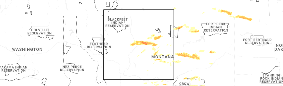
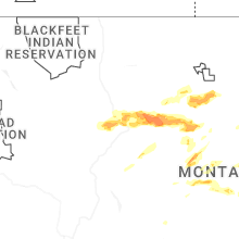
Hail Map for Moore, MT
The Moore, MT area has had 8 reports of on-the-ground hail by trained spotters, and has been under severe weather warnings 12 times during the past 12 months. Doppler radar has detected hail at or near Moore, MT on 22 occasions, including 3 occasions during the past year.
| Name: | Moore, MT |
| Where Located: | 84.2 miles ESE of Great Falls, MT |
| Map: | Google Map for Moore, MT |
| Population: | 193 |
| Housing Units: | 93 |
| More Info: | Search Google for Moore, MT |
2
The Top Recent Hail Date for Moore, MT is Sunday, June 15, 2025 (4th out of 22)
Hail and Wind Damage Spotted near Moore, MT
| Date / Time | Report Details |
|---|---|
| 6/14/2025 7:08 PM MDT |
 The storm which prompted the warning has moved out of the area. therefore, the warning will be allowed to expire. a severe thunderstorm watch remains in effect until 100 am mdt for central montana. remember, a severe thunderstorm warning still remains in effect for central fergus county through 8 pm mdt. The storm which prompted the warning has moved out of the area. therefore, the warning will be allowed to expire. a severe thunderstorm watch remains in effect until 100 am mdt for central montana. remember, a severe thunderstorm warning still remains in effect for central fergus county through 8 pm mdt.
|
| 6/14/2025 7:07 PM MDT |
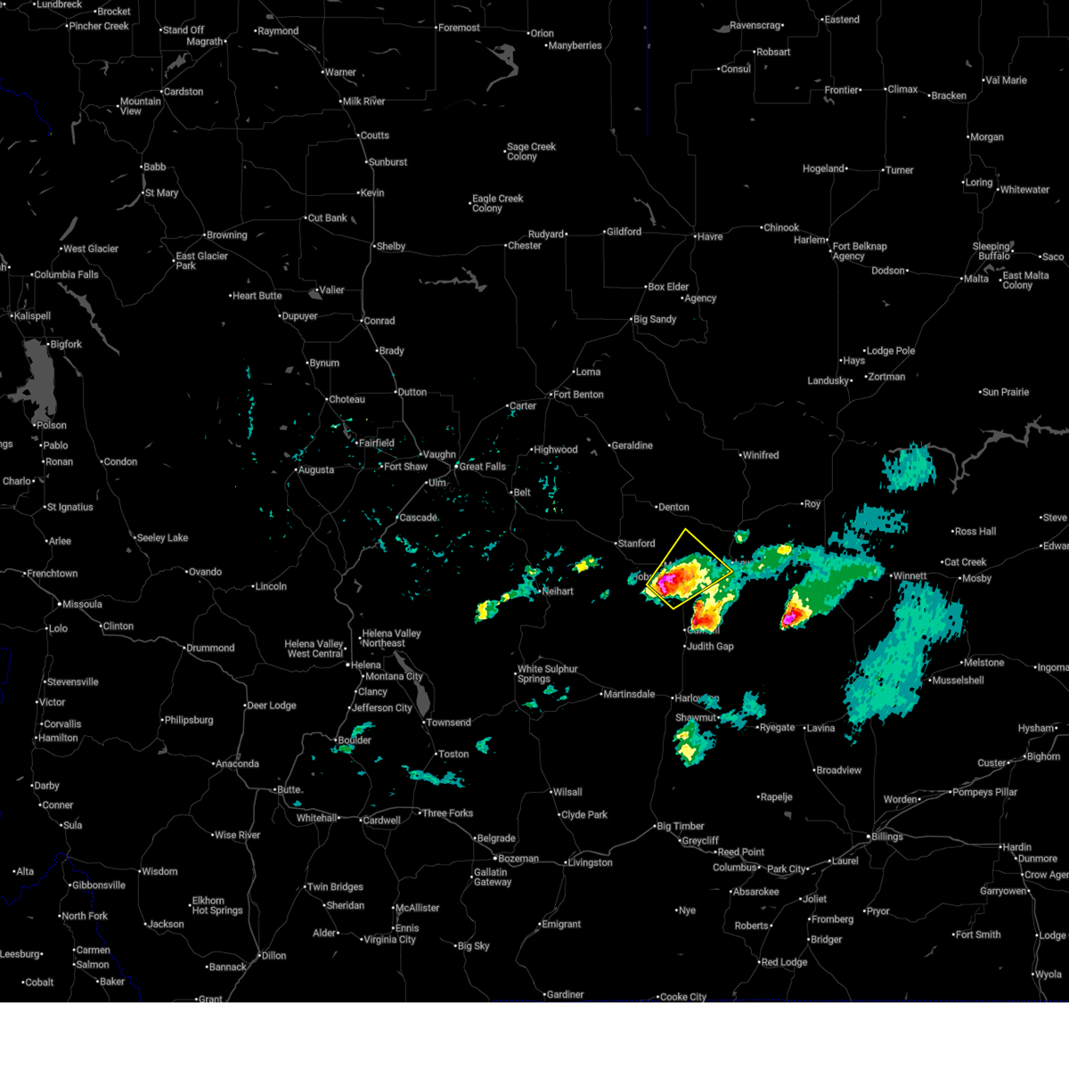
 Svrtfx the national weather service in great falls has issued a * severe thunderstorm warning for, east central judith basin county in central montana, west central fergus county in central montana, * until 800 pm mdt. * at 707 pm mdt, a severe thunderstorm was located 8 miles north of moore, or 14 miles west of lewistown, moving northeast at 30 mph (radar indicated). Hazards include golf ball size hail and 60 mph wind gusts. People and animals outdoors will be injured. expect hail damage to roofs, siding, windows, and vehicles. Expect wind damage to roofs, siding, and trees. Svrtfx the national weather service in great falls has issued a * severe thunderstorm warning for, east central judith basin county in central montana, west central fergus county in central montana, * until 800 pm mdt. * at 707 pm mdt, a severe thunderstorm was located 8 miles north of moore, or 14 miles west of lewistown, moving northeast at 30 mph (radar indicated). Hazards include golf ball size hail and 60 mph wind gusts. People and animals outdoors will be injured. expect hail damage to roofs, siding, windows, and vehicles. Expect wind damage to roofs, siding, and trees.
|
| 6/14/2025 6:58 PM MDT | Golf Ball sized hail reported 8.3 miles SSE of Moore, MT, spotter reports golf ball size hail. |
| 6/14/2025 6:56 PM MDT |
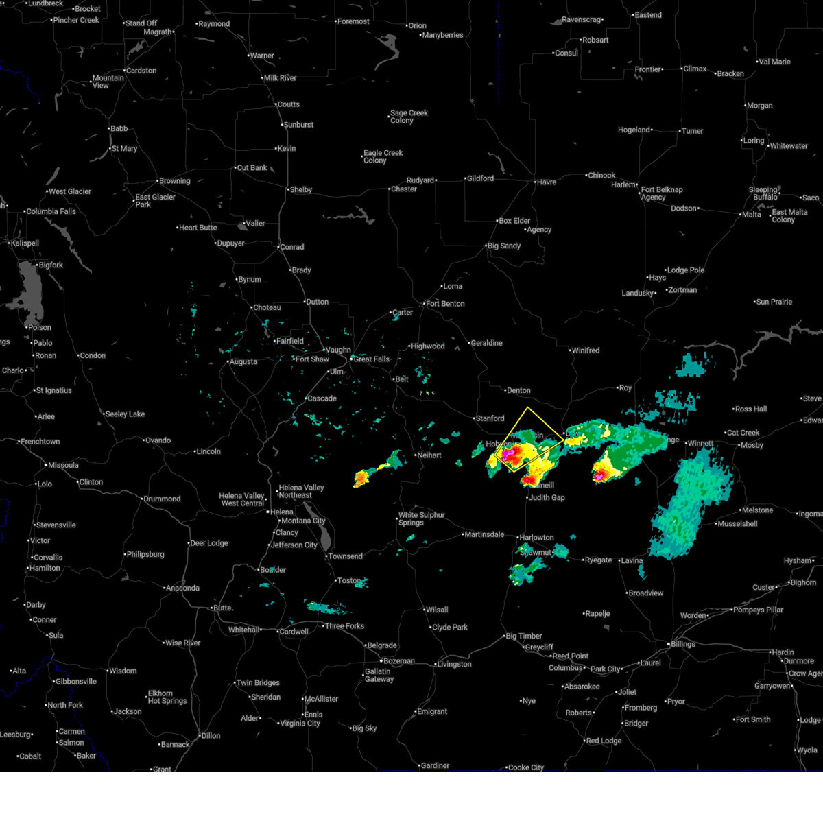
 At 656 pm mdt, a severe thunderstorm was located near hobson, or 17 miles west of lewistown, moving northeast at 25 mph (trained weather spotters). Hazards include two inch hail and 60 mph wind gusts. People and animals outdoors will be injured. expect hail damage to roofs, siding, windows, and vehicles. expect wind damage to roofs, siding, and trees. Locations impacted include, hobson, moore, glengarry, and moccasin. At 656 pm mdt, a severe thunderstorm was located near hobson, or 17 miles west of lewistown, moving northeast at 25 mph (trained weather spotters). Hazards include two inch hail and 60 mph wind gusts. People and animals outdoors will be injured. expect hail damage to roofs, siding, windows, and vehicles. expect wind damage to roofs, siding, and trees. Locations impacted include, hobson, moore, glengarry, and moccasin.
|
| 6/14/2025 6:46 PM MDT |
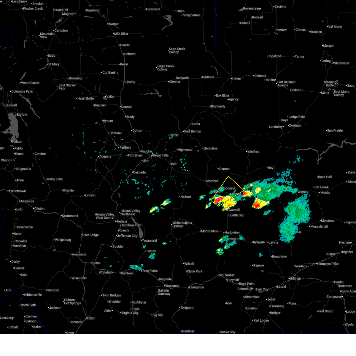
 At 646 pm mdt, a severe thunderstorm was located near hobson, or 20 miles west of lewistown, moving northeast at 25 mph (radar indicated). Hazards include two inch hail and 60 mph wind gusts. People and animals outdoors will be injured. expect hail damage to roofs, siding, windows, and vehicles. expect wind damage to roofs, siding, and trees. Locations impacted include, hobson, moore, ackley lake state park, glengarry, and moccasin. At 646 pm mdt, a severe thunderstorm was located near hobson, or 20 miles west of lewistown, moving northeast at 25 mph (radar indicated). Hazards include two inch hail and 60 mph wind gusts. People and animals outdoors will be injured. expect hail damage to roofs, siding, windows, and vehicles. expect wind damage to roofs, siding, and trees. Locations impacted include, hobson, moore, ackley lake state park, glengarry, and moccasin.
|
| 6/14/2025 6:37 PM MDT |
 At 637 pm mdt, a severe thunderstorm was located near hobson, or 22 miles southeast of stanford, moving northeast at 25 mph (radar indicated). Hazards include ping pong ball size hail and 60 mph wind gusts. People and animals outdoors will be injured. expect hail damage to roofs, siding, windows, and vehicles. expect wind damage to roofs, siding, and trees. Locations impacted include, hobson, moore, ackley lake state park, glengarry, and moccasin. At 637 pm mdt, a severe thunderstorm was located near hobson, or 22 miles southeast of stanford, moving northeast at 25 mph (radar indicated). Hazards include ping pong ball size hail and 60 mph wind gusts. People and animals outdoors will be injured. expect hail damage to roofs, siding, windows, and vehicles. expect wind damage to roofs, siding, and trees. Locations impacted include, hobson, moore, ackley lake state park, glengarry, and moccasin.
|
| 6/14/2025 6:26 PM MDT |
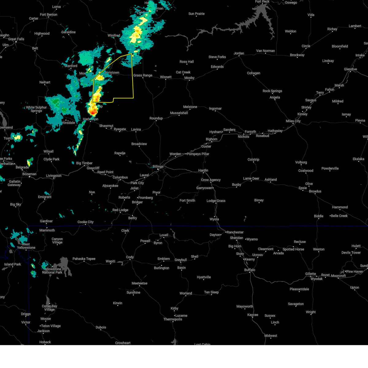
 Svrtfx the national weather service in great falls has issued a * severe thunderstorm warning for, southeastern judith basin county in central montana, south central fergus county in central montana, * until 715 pm mdt. * at 625 pm mdt, a severe thunderstorm was located 9 miles southwest of hobson, or 22 miles southeast of stanford, moving northeast at 25 mph (radar indicated). Hazards include 60 mph wind gusts and half dollar size hail. Hail damage to vehicles is expected. Expect wind damage to roofs, siding, and trees. Svrtfx the national weather service in great falls has issued a * severe thunderstorm warning for, southeastern judith basin county in central montana, south central fergus county in central montana, * until 715 pm mdt. * at 625 pm mdt, a severe thunderstorm was located 9 miles southwest of hobson, or 22 miles southeast of stanford, moving northeast at 25 mph (radar indicated). Hazards include 60 mph wind gusts and half dollar size hail. Hail damage to vehicles is expected. Expect wind damage to roofs, siding, and trees.
|
| 5/10/2025 6:31 PM MDT |
 Svrtfx the national weather service in great falls has issued a * severe thunderstorm warning for, east central judith basin county in central montana, south central fergus county in central montana, * until 730 pm mdt. * at 629 pm mdt, severe thunderstorms were located along a line extending from near moore to 20 miles southeast of hobson, moving east northeast at 40 mph (radar indicated). Hazards include 60 mph wind gusts. expect damage to roofs, siding, and trees Svrtfx the national weather service in great falls has issued a * severe thunderstorm warning for, east central judith basin county in central montana, south central fergus county in central montana, * until 730 pm mdt. * at 629 pm mdt, severe thunderstorms were located along a line extending from near moore to 20 miles southeast of hobson, moving east northeast at 40 mph (radar indicated). Hazards include 60 mph wind gusts. expect damage to roofs, siding, and trees
|
| 8/23/2024 6:22 PM MDT |
 The storms which prompted the warning have moved out of the area. therefore, the warning will be allowed to expire. a severe thunderstorm watch remains in effect until 900 pm mdt for central and north central montana. The storms which prompted the warning have moved out of the area. therefore, the warning will be allowed to expire. a severe thunderstorm watch remains in effect until 900 pm mdt for central and north central montana.
|
| 8/23/2024 6:02 PM MDT |
 At 601 pm mdt, severe thunderstorms were located along a line extending from near fort benton to near denton to 25 miles south of lewistown, moving east at 30 mph (radar indicated). Hazards include 70 mph wind gusts. Expect considerable tree damage. damage is likely to mobile homes, roofs, and outbuildings. Locations impacted include, lewistown, fort benton, geraldine, denton, winifred, moore, grass range, forestgrove, glengarry, danvers, loma, suffolk, square butte, giltedge, judith landing, hilger, heath, christina, iliad, and virgelle. At 601 pm mdt, severe thunderstorms were located along a line extending from near fort benton to near denton to 25 miles south of lewistown, moving east at 30 mph (radar indicated). Hazards include 70 mph wind gusts. Expect considerable tree damage. damage is likely to mobile homes, roofs, and outbuildings. Locations impacted include, lewistown, fort benton, geraldine, denton, winifred, moore, grass range, forestgrove, glengarry, danvers, loma, suffolk, square butte, giltedge, judith landing, hilger, heath, christina, iliad, and virgelle.
|
| 8/23/2024 6:02 PM MDT |
 the severe thunderstorm warning has been cancelled and is no longer in effect the severe thunderstorm warning has been cancelled and is no longer in effect
|
| 8/23/2024 5:43 PM MDT |
 At 542 pm mdt, severe thunderstorms were located along a line extending from 7 miles northwest of fort benton to 7 miles west of denton to 20 miles southeast of moore, moving east at 30 mph (radar indicated). Hazards include 70 mph wind gusts. Expect considerable tree damage. damage is likely to mobile homes, roofs, and outbuildings. Locations impacted include, lewistown, fort benton, stanford, geraldine, denton, hobson, winifred, moore, grass range, highwood, carter, floweree, windham, forestgrove, shonkin, danvers, loma, hilger, iliad, and virgelle. At 542 pm mdt, severe thunderstorms were located along a line extending from 7 miles northwest of fort benton to 7 miles west of denton to 20 miles southeast of moore, moving east at 30 mph (radar indicated). Hazards include 70 mph wind gusts. Expect considerable tree damage. damage is likely to mobile homes, roofs, and outbuildings. Locations impacted include, lewistown, fort benton, stanford, geraldine, denton, hobson, winifred, moore, grass range, highwood, carter, floweree, windham, forestgrove, shonkin, danvers, loma, hilger, iliad, and virgelle.
|
| 8/23/2024 5:23 PM MDT |
 Svrtfx the national weather service in great falls has issued a * severe thunderstorm warning for, judith basin county in central montana, fergus county in central montana, southwestern blaine county in north central montana, chouteau county in north central montana, northeastern cascade county in central montana, * until 630 pm mdt. * at 523 pm mdt, severe thunderstorms were located along a line extending from 15 miles southeast of the knees to 8 miles east of geyser to 16 miles south of moore, moving east at 30 mph (radar indicated). Hazards include 70 mph wind gusts. Expect considerable tree damage. Damage is likely to mobile homes, roofs, and outbuildings. Svrtfx the national weather service in great falls has issued a * severe thunderstorm warning for, judith basin county in central montana, fergus county in central montana, southwestern blaine county in north central montana, chouteau county in north central montana, northeastern cascade county in central montana, * until 630 pm mdt. * at 523 pm mdt, severe thunderstorms were located along a line extending from 15 miles southeast of the knees to 8 miles east of geyser to 16 miles south of moore, moving east at 30 mph (radar indicated). Hazards include 70 mph wind gusts. Expect considerable tree damage. Damage is likely to mobile homes, roofs, and outbuildings.
|
| 6/21/2024 2:09 PM MDT |
 the severe thunderstorm warning has been cancelled and is no longer in effect the severe thunderstorm warning has been cancelled and is no longer in effect
|
| 6/21/2024 2:09 PM MDT |
 At 209 pm mdt, a severe thunderstorm was located near moore, or 13 miles southwest of lewistown, moving east at 25 mph (radar indicated). Hazards include golf ball size hail and 60 mph wind gusts. People and animals outdoors will be injured. expect hail damage to roofs, siding, windows, and vehicles. expect wind damage to roofs, siding, and trees. Locations impacted include, lewistown, moore, and glengarry. At 209 pm mdt, a severe thunderstorm was located near moore, or 13 miles southwest of lewistown, moving east at 25 mph (radar indicated). Hazards include golf ball size hail and 60 mph wind gusts. People and animals outdoors will be injured. expect hail damage to roofs, siding, windows, and vehicles. expect wind damage to roofs, siding, and trees. Locations impacted include, lewistown, moore, and glengarry.
|
| 6/21/2024 1:55 PM MDT |
 The severe thunderstorm warning has been replaced by a new warning in effect for east central judith basin county and south central fergus county until 245 pm mdt. a severe thunderstorm watch remains in effect until 800 pm mdt for central montana. The severe thunderstorm warning has been replaced by a new warning in effect for east central judith basin county and south central fergus county until 245 pm mdt. a severe thunderstorm watch remains in effect until 800 pm mdt for central montana.
|
| 6/21/2024 1:53 PM MDT |
 Svrtfx the national weather service in great falls has issued a * severe thunderstorm warning for, east central judith basin county in central montana, south central fergus county in central montana, * until 245 pm mdt. * at 152 pm mdt, a severe thunderstorm was located near moore, or 18 miles southwest of lewistown, moving east at 25 mph (radar indicated). Hazards include golf ball size hail and 60 mph wind gusts. People and animals outdoors will be injured. expect hail damage to roofs, siding, windows, and vehicles. Expect wind damage to roofs, siding, and trees. Svrtfx the national weather service in great falls has issued a * severe thunderstorm warning for, east central judith basin county in central montana, south central fergus county in central montana, * until 245 pm mdt. * at 152 pm mdt, a severe thunderstorm was located near moore, or 18 miles southwest of lewistown, moving east at 25 mph (radar indicated). Hazards include golf ball size hail and 60 mph wind gusts. People and animals outdoors will be injured. expect hail damage to roofs, siding, windows, and vehicles. Expect wind damage to roofs, siding, and trees.
|
| 6/21/2024 1:38 PM MDT |
 At 138 pm mdt, a severe thunderstorm was located 7 miles south of hobson, or 23 miles southeast of stanford, moving east at 25 mph (radar indicated). Hazards include two inch hail and 60 mph wind gusts. People and animals outdoors will be injured. expect hail damage to roofs, siding, windows, and vehicles. expect wind damage to roofs, siding, and trees. Locations impacted include, hobson, moore, ackley lake state park, buffalo, moccasin, and garneill. At 138 pm mdt, a severe thunderstorm was located 7 miles south of hobson, or 23 miles southeast of stanford, moving east at 25 mph (radar indicated). Hazards include two inch hail and 60 mph wind gusts. People and animals outdoors will be injured. expect hail damage to roofs, siding, windows, and vehicles. expect wind damage to roofs, siding, and trees. Locations impacted include, hobson, moore, ackley lake state park, buffalo, moccasin, and garneill.
|
| 6/21/2024 1:22 PM MDT |
 Svrtfx the national weather service in great falls has issued a * severe thunderstorm warning for, southeastern judith basin county in central montana, south central fergus county in central montana, * until 200 pm mdt. * at 122 pm mdt, a severe thunderstorm was located 9 miles southwest of hobson, or 17 miles southeast of stanford, moving east at 20 mph (radar indicated). Hazards include two inch hail and 60 mph wind gusts. People and animals outdoors will be injured. expect hail damage to roofs, siding, windows, and vehicles. Expect wind damage to roofs, siding, and trees. Svrtfx the national weather service in great falls has issued a * severe thunderstorm warning for, southeastern judith basin county in central montana, south central fergus county in central montana, * until 200 pm mdt. * at 122 pm mdt, a severe thunderstorm was located 9 miles southwest of hobson, or 17 miles southeast of stanford, moving east at 20 mph (radar indicated). Hazards include two inch hail and 60 mph wind gusts. People and animals outdoors will be injured. expect hail damage to roofs, siding, windows, and vehicles. Expect wind damage to roofs, siding, and trees.
|
| 6/20/2024 3:30 PM MDT |
 At 329 pm mdt, a severe thunderstorm was located near moore, or 11 miles west of lewistown, moving east at 15 mph (radar indicated). Hazards include quarter size hail. Damage to vehicles is expected. Locations impacted include, moore and glengarry. At 329 pm mdt, a severe thunderstorm was located near moore, or 11 miles west of lewistown, moving east at 15 mph (radar indicated). Hazards include quarter size hail. Damage to vehicles is expected. Locations impacted include, moore and glengarry.
|
| 6/20/2024 3:17 PM MDT |
 The storm which prompted the warning continues to move east. while this warning has expired, a new severe thunderstorm warning is in effect as hail is still possible with this thunderstorm. to report severe weather, contact your nearest law enforcement agency. they will relay your report to the national weather service great falls. remember, a severe thunderstorm warning still remains in effect for eastern judith basin and western fergus counties until 415pm. The storm which prompted the warning continues to move east. while this warning has expired, a new severe thunderstorm warning is in effect as hail is still possible with this thunderstorm. to report severe weather, contact your nearest law enforcement agency. they will relay your report to the national weather service great falls. remember, a severe thunderstorm warning still remains in effect for eastern judith basin and western fergus counties until 415pm.
|
| 6/20/2024 3:14 PM MDT |
 Svrtfx the national weather service in great falls has issued a * severe thunderstorm warning for, east central judith basin county in central montana, south central fergus county in central montana, * until 400 pm mdt. * at 312 pm mdt, a severe thunderstorm was located near moore, or 16 miles west of lewistown, moving east at 15 mph (radar indicated). Hazards include half dollar size hail. damage to vehicles is expected Svrtfx the national weather service in great falls has issued a * severe thunderstorm warning for, east central judith basin county in central montana, south central fergus county in central montana, * until 400 pm mdt. * at 312 pm mdt, a severe thunderstorm was located near moore, or 16 miles west of lewistown, moving east at 15 mph (radar indicated). Hazards include half dollar size hail. damage to vehicles is expected
|
| 6/20/2024 3:07 PM MDT |
 At 305 pm mdt, a severe thunderstorm was located near moore, or 17 miles southwest of lewistown, moving east at 15 mph (trained weather spotters reported quarter to golf ball sized hail near hobson, with hail lasting nearly 20 minutes near moccasin). Hazards include golf ball size hail. People and animals outdoors will be injured. expect damage to roofs, siding, windows, and vehicles. Locations impacted include, hobson, moore, and moccasin. At 305 pm mdt, a severe thunderstorm was located near moore, or 17 miles southwest of lewistown, moving east at 15 mph (trained weather spotters reported quarter to golf ball sized hail near hobson, with hail lasting nearly 20 minutes near moccasin). Hazards include golf ball size hail. People and animals outdoors will be injured. expect damage to roofs, siding, windows, and vehicles. Locations impacted include, hobson, moore, and moccasin.
|
| 6/20/2024 2:54 PM MDT |
 At 253 pm mdt, a severe thunderstorm was located over hobson, or 19 miles west of lewistown, moving east at 15 mph (trained weather spotters). Hazards include golf ball size hail and 60 mph wind gusts. People and animals outdoors will be injured. expect hail damage to roofs, siding, windows, and vehicles. expect wind damage to roofs, siding, and trees. Locations impacted include, hobson, moore, and moccasin. At 253 pm mdt, a severe thunderstorm was located over hobson, or 19 miles west of lewistown, moving east at 15 mph (trained weather spotters). Hazards include golf ball size hail and 60 mph wind gusts. People and animals outdoors will be injured. expect hail damage to roofs, siding, windows, and vehicles. expect wind damage to roofs, siding, and trees. Locations impacted include, hobson, moore, and moccasin.
|
| 6/20/2024 2:46 PM MDT |
 At 246 pm mdt, a severe thunderstorm was located over hobson, or 19 miles southeast of stanford, moving east at 15 mph (radar indicated). Hazards include 60 mph wind gusts and half dollar size hail. Hail damage to vehicles is expected. expect wind damage to roofs, siding, and trees. Locations impacted include, hobson, moore, ackley lake state park, and moccasin. At 246 pm mdt, a severe thunderstorm was located over hobson, or 19 miles southeast of stanford, moving east at 15 mph (radar indicated). Hazards include 60 mph wind gusts and half dollar size hail. Hail damage to vehicles is expected. expect wind damage to roofs, siding, and trees. Locations impacted include, hobson, moore, ackley lake state park, and moccasin.
|
| 6/20/2024 2:26 PM MDT |
 Svrtfx the national weather service in great falls has issued a * severe thunderstorm warning for, east central judith basin county in central montana, southwestern fergus county in central montana, * until 315 pm mdt. * at 226 pm mdt, a severe thunderstorm was located near hobson, or 14 miles southeast of stanford, moving east at 15 mph (radar indicated). Hazards include ping pong ball size hail. People and animals outdoors will be injured. Expect damage to roofs, siding, windows, and vehicles. Svrtfx the national weather service in great falls has issued a * severe thunderstorm warning for, east central judith basin county in central montana, southwestern fergus county in central montana, * until 315 pm mdt. * at 226 pm mdt, a severe thunderstorm was located near hobson, or 14 miles southeast of stanford, moving east at 15 mph (radar indicated). Hazards include ping pong ball size hail. People and animals outdoors will be injured. Expect damage to roofs, siding, windows, and vehicles.
|
| 8/18/2023 5:25 PM MDT |
 The severe thunderstorm warning for northeastern judith basin and western fergus counties will expire at 530 pm mdt, the storms which prompted the warning have weakened below severe limits, and no longer pose an immediate threat to life or property. therefore, the warning will be allowed to expire. however gusty winds are still possible with these thunderstorms. The severe thunderstorm warning for northeastern judith basin and western fergus counties will expire at 530 pm mdt, the storms which prompted the warning have weakened below severe limits, and no longer pose an immediate threat to life or property. therefore, the warning will be allowed to expire. however gusty winds are still possible with these thunderstorms.
|
| 8/18/2023 5:09 PM MDT |
 At 509 pm mdt, severe thunderstorms were located along a line extending from 9 miles southeast of geraldine to near denton to near moore, moving northeast at 35 mph (radar indicated). Hazards include 60 mph wind gusts. Expect damage to roofs, siding, and trees. locations impacted include, lewistown, stanford, denton, hobson, moore, windham, moccasin, ackley lake state park, glengarry, danvers, coffee creek, hilger, heath, buffalo and benchland. hail threat, radar indicated max hail size, <. 75 in wind threat, radar indicated max wind gust, 60 mph. At 509 pm mdt, severe thunderstorms were located along a line extending from 9 miles southeast of geraldine to near denton to near moore, moving northeast at 35 mph (radar indicated). Hazards include 60 mph wind gusts. Expect damage to roofs, siding, and trees. locations impacted include, lewistown, stanford, denton, hobson, moore, windham, moccasin, ackley lake state park, glengarry, danvers, coffee creek, hilger, heath, buffalo and benchland. hail threat, radar indicated max hail size, <. 75 in wind threat, radar indicated max wind gust, 60 mph.
|
| 8/18/2023 4:47 PM MDT |
 At 447 pm mdt, severe thunderstorms were located along a line extending from 10 miles north of geyser to near stanford to 12 miles south of hobson, moving northeast at 45 mph (radar indicated). Hazards include 60 mph wind gusts. expect damage to roofs, siding, and trees At 447 pm mdt, severe thunderstorms were located along a line extending from 10 miles north of geyser to near stanford to 12 miles south of hobson, moving northeast at 45 mph (radar indicated). Hazards include 60 mph wind gusts. expect damage to roofs, siding, and trees
|
| 7/15/2022 1:56 PM MDT |
 The severe thunderstorm warning for eastern judith basin, southwestern fergus and south central chouteau counties will expire at 200 pm mdt, the storms which prompted the warning have weakened below severe limits, and no longer pose an immediate threat to life or property. therefore, the warning will be allowed to expire. however gusty winds are still possible with these thunderstorms. a severe thunderstorm watch remains in effect until 700 pm mdt for central and north central montana. The severe thunderstorm warning for eastern judith basin, southwestern fergus and south central chouteau counties will expire at 200 pm mdt, the storms which prompted the warning have weakened below severe limits, and no longer pose an immediate threat to life or property. therefore, the warning will be allowed to expire. however gusty winds are still possible with these thunderstorms. a severe thunderstorm watch remains in effect until 700 pm mdt for central and north central montana.
|
| 7/15/2022 1:46 PM MDT |
 At 146 pm mdt, severe thunderstorms were located along a line extending from 7 miles west of denton to 10 miles south of hobson, moving east at 30 mph (radar indicated). Hazards include 60 mph wind gusts. Expect damage to roofs, siding, and trees. locations impacted include, lewistown, stanford, denton, hobson, moore, windham, moccasin, ackley lake state park, glengarry, utica, garneill, danvers, coffee creek, buffalo and benchland. hail threat, radar indicated max hail size, <. 75 in wind threat, radar indicated max wind gust, 60 mph. At 146 pm mdt, severe thunderstorms were located along a line extending from 7 miles west of denton to 10 miles south of hobson, moving east at 30 mph (radar indicated). Hazards include 60 mph wind gusts. Expect damage to roofs, siding, and trees. locations impacted include, lewistown, stanford, denton, hobson, moore, windham, moccasin, ackley lake state park, glengarry, utica, garneill, danvers, coffee creek, buffalo and benchland. hail threat, radar indicated max hail size, <. 75 in wind threat, radar indicated max wind gust, 60 mph.
|
| 7/15/2022 1:14 PM MDT |
 At 114 pm mdt, severe thunderstorms were located along a line extending from 6 miles southeast of geyser to 16 miles northwest of harlowton, moving northeast at 40 mph (radar indicated). Hazards include 60 mph wind gusts. Expect damage to roofs, siding, and trees. locations impacted include, lewistown, stanford, denton, hobson, moore, windham, moccasin, ackley lake state park, sapphire village, glengarry, utica, garneill, danvers, coffee creek, buffalo and benchland. hail threat, radar indicated max hail size, <. 75 in wind threat, radar indicated max wind gust, 60 mph. At 114 pm mdt, severe thunderstorms were located along a line extending from 6 miles southeast of geyser to 16 miles northwest of harlowton, moving northeast at 40 mph (radar indicated). Hazards include 60 mph wind gusts. Expect damage to roofs, siding, and trees. locations impacted include, lewistown, stanford, denton, hobson, moore, windham, moccasin, ackley lake state park, sapphire village, glengarry, utica, garneill, danvers, coffee creek, buffalo and benchland. hail threat, radar indicated max hail size, <. 75 in wind threat, radar indicated max wind gust, 60 mph.
|
| 7/15/2022 12:54 PM MDT |
 At 1253 pm mdt, severe thunderstorms were located along a line extending from 12 miles southwest of geyser to 25 miles east of white sulphur springs, moving east at 25 mph (radar indicated). Hazards include 60 mph wind gusts. expect damage to roofs, siding, and trees At 1253 pm mdt, severe thunderstorms were located along a line extending from 12 miles southwest of geyser to 25 miles east of white sulphur springs, moving east at 25 mph (radar indicated). Hazards include 60 mph wind gusts. expect damage to roofs, siding, and trees
|
| 7/13/2022 5:27 PM MDT |
 At 428 pm mdt, a severe thunderstorm was located 12 miles southeast of moore, or 16 miles south of lewistown, moving east at 40 mph (radar indicated). Hazards include ping pong ball size hail and 60 mph wind gusts. People and animals outdoors will be injured. expect hail damage to roofs, siding, windows, and vehicles. Expect wind damage to roofs, siding, and trees. At 428 pm mdt, a severe thunderstorm was located 12 miles southeast of moore, or 16 miles south of lewistown, moving east at 40 mph (radar indicated). Hazards include ping pong ball size hail and 60 mph wind gusts. People and animals outdoors will be injured. expect hail damage to roofs, siding, windows, and vehicles. Expect wind damage to roofs, siding, and trees.
|
| 7/13/2022 4:30 PM MDT |
 At 428 pm mdt, a severe thunderstorm was located 12 miles southeast of moore, or 16 miles south of lewistown, moving east at 40 mph (radar indicated). Hazards include ping pong ball size hail and 60 mph wind gusts. People and animals outdoors will be injured. expect hail damage to roofs, siding, windows, and vehicles. Expect wind damage to roofs, siding, and trees. At 428 pm mdt, a severe thunderstorm was located 12 miles southeast of moore, or 16 miles south of lewistown, moving east at 40 mph (radar indicated). Hazards include ping pong ball size hail and 60 mph wind gusts. People and animals outdoors will be injured. expect hail damage to roofs, siding, windows, and vehicles. Expect wind damage to roofs, siding, and trees.
|
| 7/13/2022 4:14 PM MDT |
 At 412 pm mdt, a severe thunderstorm was located near moore, or 20 miles southwest of lewistown, moving east at 35 mph (radar indicated). Hazards include 60 mph wind gusts and quarter size hail. Hail damage to vehicles is expected. expect wind damage to roofs, siding, and trees. locations impacted include, glengarry, buffalo and garneill. hail threat, radar indicated max hail size, 1. 00 in wind threat, radar indicated max wind gust, 60 mph. At 412 pm mdt, a severe thunderstorm was located near moore, or 20 miles southwest of lewistown, moving east at 35 mph (radar indicated). Hazards include 60 mph wind gusts and quarter size hail. Hail damage to vehicles is expected. expect wind damage to roofs, siding, and trees. locations impacted include, glengarry, buffalo and garneill. hail threat, radar indicated max hail size, 1. 00 in wind threat, radar indicated max wind gust, 60 mph.
|
| 7/13/2022 3:46 PM MDT |
 At 346 pm mdt, a severe thunderstorm was located 15 miles southwest of hobson, or 21 miles south of stanford, moving east at 35 mph (radar indicated). Hazards include 60 mph wind gusts and quarter size hail. Hail damage to vehicles is expected. Expect wind damage to roofs, siding, and trees. At 346 pm mdt, a severe thunderstorm was located 15 miles southwest of hobson, or 21 miles south of stanford, moving east at 35 mph (radar indicated). Hazards include 60 mph wind gusts and quarter size hail. Hail damage to vehicles is expected. Expect wind damage to roofs, siding, and trees.
|
| 7/6/2022 5:58 PM MDT |
 At 558 pm mdt, a severe thunderstorm was located near moore, or 12 miles southwest of lewistown, moving southeast at 10 mph (radar indicated). Hazards include golf ball size hail. People and animals outdoors will be injured. expect damage to roofs, siding, windows, and vehicles. locations impacted include, moore and glengarry. thunderstorm damage threat, considerable hail threat, radar indicated max hail size, 1. 75 in wind threat, radar indicated max wind gust, <50 mph. At 558 pm mdt, a severe thunderstorm was located near moore, or 12 miles southwest of lewistown, moving southeast at 10 mph (radar indicated). Hazards include golf ball size hail. People and animals outdoors will be injured. expect damage to roofs, siding, windows, and vehicles. locations impacted include, moore and glengarry. thunderstorm damage threat, considerable hail threat, radar indicated max hail size, 1. 75 in wind threat, radar indicated max wind gust, <50 mph.
|
| 7/6/2022 5:48 PM MDT |
 At 548 pm mdt, a severe thunderstorm was located over moore, or 12 miles southwest of lewistown, moving east at 10 mph (radar indicated). Hazards include quarter size hail. damage to vehicles is expected At 548 pm mdt, a severe thunderstorm was located over moore, or 12 miles southwest of lewistown, moving east at 10 mph (radar indicated). Hazards include quarter size hail. damage to vehicles is expected
|
| 7/6/2022 5:35 PM MDT | Half Dollar sized hail reported 0.5 miles NW of Moore, MT, pictures submitted of hail in moore. |
| 7/6/2022 5:02 PM MDT | Tennis Ball sized hail reported 4.5 miles SE of Moore, MT, pictures submitted via social media of very large hail near moore. |
| 7/4/2022 6:24 PM MDT |
 At 624 pm mdt, a severe thunderstorm was located near moore, or 9 miles west of lewistown, moving north at 15 mph (radar indicated). Hazards include 60 mph wind gusts and penny size hail. expect damage to roofs, siding, and trees At 624 pm mdt, a severe thunderstorm was located near moore, or 9 miles west of lewistown, moving north at 15 mph (radar indicated). Hazards include 60 mph wind gusts and penny size hail. expect damage to roofs, siding, and trees
|
| 6/28/2022 5:22 PM MDT |
 At 522 pm mdt, severe thunderstorms were located along a line extending from 8 miles west of grass range to 12 miles south of moore, moving east at 35 mph (radar indicated). Hazards include 60 mph wind gusts. expect damage to roofs, siding, and trees At 522 pm mdt, severe thunderstorms were located along a line extending from 8 miles west of grass range to 12 miles south of moore, moving east at 35 mph (radar indicated). Hazards include 60 mph wind gusts. expect damage to roofs, siding, and trees
|
| 12/23/2021 7:30 PM MST |
 At 728 pm mst, severe thunderstorms were located along a line extending from 24 miles north of winifred to 9 miles south of stanford, moving east at 55 mph (radar indicated). Hazards include 60 mph wind gusts. expect damage to roofs, siding, and trees At 728 pm mst, severe thunderstorms were located along a line extending from 24 miles north of winifred to 9 miles south of stanford, moving east at 55 mph (radar indicated). Hazards include 60 mph wind gusts. expect damage to roofs, siding, and trees
|
| 7/7/2021 6:31 PM MDT |
 At 631 pm mdt, severe thunderstorms were located along a line extending from 8 miles north of lewistown to near hobson, moving east at 25 mph (radar indicated). Hazards include 60 mph wind gusts and penny size hail. Expect damage to roofs, siding, and trees. Locations impacted include, lewistown, hobson, moore, giltedge and glengarry. At 631 pm mdt, severe thunderstorms were located along a line extending from 8 miles north of lewistown to near hobson, moving east at 25 mph (radar indicated). Hazards include 60 mph wind gusts and penny size hail. Expect damage to roofs, siding, and trees. Locations impacted include, lewistown, hobson, moore, giltedge and glengarry.
|
| 7/7/2021 6:10 PM MDT |
 At 608 pm mdt, severe thunderstorms were located along a line extending from 9 miles northwest of lewistown to near hobson, moving east at 25 mph (radar indicated). Hazards include 60 mph wind gusts and quarter size hail. Hail damage to vehicles is expected. Expect wind damage to roofs, siding, and trees. At 608 pm mdt, severe thunderstorms were located along a line extending from 9 miles northwest of lewistown to near hobson, moving east at 25 mph (radar indicated). Hazards include 60 mph wind gusts and quarter size hail. Hail damage to vehicles is expected. Expect wind damage to roofs, siding, and trees.
|
| 7/7/2021 2:46 PM MDT |
 At 246 pm mdt, a severe thunderstorm was located near lewistown, moving east at 35 mph (radar indicated). Hazards include 60 mph wind gusts and quarter size hail. Hail damage to vehicles is expected. Expect wind damage to roofs, siding, and trees. At 246 pm mdt, a severe thunderstorm was located near lewistown, moving east at 35 mph (radar indicated). Hazards include 60 mph wind gusts and quarter size hail. Hail damage to vehicles is expected. Expect wind damage to roofs, siding, and trees.
|
| 7/23/2020 5:53 PM MDT |
 The severe thunderstorm warning for east central judith basin and south central fergus counties will expire at 600 pm mdt, the storms which prompted the warning have weakened below severe limits, and no longer pose an immediate threat to life or property. therefore, the warning will be allowed to expire. however gusty winds and heavy rain are still possible with these thunderstorms. a severe thunderstorm watch remains in effect until 900 pm mdt for central montana. The severe thunderstorm warning for east central judith basin and south central fergus counties will expire at 600 pm mdt, the storms which prompted the warning have weakened below severe limits, and no longer pose an immediate threat to life or property. therefore, the warning will be allowed to expire. however gusty winds and heavy rain are still possible with these thunderstorms. a severe thunderstorm watch remains in effect until 900 pm mdt for central montana.
|
| 7/23/2020 5:45 PM MDT |
 At 544 pm mdt, severe thunderstorms were located along a line extending from near hobson to moore to 24 miles north of deadmans basin reservoir, moving east at 20 mph (radar indicated). Hazards include 60 mph wind gusts and pea size hail. Expect damage to roofs, siding, and trees. Locations impacted include, hobson, moore, glengarry, moccasin and benchland. At 544 pm mdt, severe thunderstorms were located along a line extending from near hobson to moore to 24 miles north of deadmans basin reservoir, moving east at 20 mph (radar indicated). Hazards include 60 mph wind gusts and pea size hail. Expect damage to roofs, siding, and trees. Locations impacted include, hobson, moore, glengarry, moccasin and benchland.
|
| 7/23/2020 5:33 PM MDT |
 At 532 pm mdt, severe thunderstorms were located along a line extending from 8 miles west of hobson to near moore to 24 miles north of deadmans basin reservoir, moving east at 20 mph (radar indicated). Hazards include 60 mph wind gusts and half inch size hail. Expect damage to roofs, siding, and trees. Locations impacted include, hobson, moore, windham, moccasin, ackley lake state park, glengarry, buffalo and benchland. At 532 pm mdt, severe thunderstorms were located along a line extending from 8 miles west of hobson to near moore to 24 miles north of deadmans basin reservoir, moving east at 20 mph (radar indicated). Hazards include 60 mph wind gusts and half inch size hail. Expect damage to roofs, siding, and trees. Locations impacted include, hobson, moore, windham, moccasin, ackley lake state park, glengarry, buffalo and benchland.
|
| 7/23/2020 5:18 PM MDT |
 At 518 pm mdt, severe thunderstorms were located along a line extending from 10 miles south of stanford to near hobson to 20 miles southeast of moore, moving east at 20 mph (radar indicated). Hazards include 60 mph wind gusts and penny size hail. expect damage to roofs, siding, and trees At 518 pm mdt, severe thunderstorms were located along a line extending from 10 miles south of stanford to near hobson to 20 miles southeast of moore, moving east at 20 mph (radar indicated). Hazards include 60 mph wind gusts and penny size hail. expect damage to roofs, siding, and trees
|
| 7/7/2020 3:13 PM MDT |
 At 312 pm mdt, a broken line of severe thunderstorms were located over western and central fergus county, moving east northeast at 50 mph (radar indicated). Hazards include ping pong ball size hail and 60 mph wind gusts. People and animals outdoors will be injured. expect hail damage to roofs, siding, windows, and vehicles. Expect wind damage to roofs, siding, and trees. At 312 pm mdt, a broken line of severe thunderstorms were located over western and central fergus county, moving east northeast at 50 mph (radar indicated). Hazards include ping pong ball size hail and 60 mph wind gusts. People and animals outdoors will be injured. expect hail damage to roofs, siding, windows, and vehicles. Expect wind damage to roofs, siding, and trees.
|
| 7/7/2020 3:08 PM MDT |
 At 307 pm mdt, a line severe thunderstorms were located over western fergus county, moving east northeast at 50 mph (radar indicated). Hazards include 60 mph wind gusts and quarter size hail. Hail damage to vehicles is expected. expect wind damage to roofs, siding, and trees. Locations impacted include, lewistown, denton, winifred, moore, glengarry, garneill, danvers, suffolk, giltedge, heath, hilger, christina and buffalo. At 307 pm mdt, a line severe thunderstorms were located over western fergus county, moving east northeast at 50 mph (radar indicated). Hazards include 60 mph wind gusts and quarter size hail. Hail damage to vehicles is expected. expect wind damage to roofs, siding, and trees. Locations impacted include, lewistown, denton, winifred, moore, glengarry, garneill, danvers, suffolk, giltedge, heath, hilger, christina and buffalo.
|
| 7/7/2020 2:43 PM MDT |
 At 241 pm mdt, a line of severe thunderstorms were located along a line from loma to harlowton, moving east northeast at 50 mph (radar indicated). Hazards include 60 mph wind gusts and quarter size hail. Hail damage to vehicles is expected. Expect wind damage to roofs, siding, and trees. At 241 pm mdt, a line of severe thunderstorms were located along a line from loma to harlowton, moving east northeast at 50 mph (radar indicated). Hazards include 60 mph wind gusts and quarter size hail. Hail damage to vehicles is expected. Expect wind damage to roofs, siding, and trees.
|
| 5/19/2020 8:19 PM MDT |
 At 818 pm mdt, a severe thunderstorm was located near lewistown, moving north at 30 mph (radar indicated). Hazards include 60 mph wind gusts and quarter size hail. Hail damage to vehicles is expected. Expect wind damage to roofs, siding, and trees. At 818 pm mdt, a severe thunderstorm was located near lewistown, moving north at 30 mph (radar indicated). Hazards include 60 mph wind gusts and quarter size hail. Hail damage to vehicles is expected. Expect wind damage to roofs, siding, and trees.
|
| 6/28/2019 7:21 PM MDT |
 The severe thunderstorm warning for south central fergus county will expire at 730 pm mdt, the storm which prompted the warning has moved out of the area. therefore, the warning will be allowed to expire. a tornado watch remains in effect until midnight mdt for central montana. remember, a severe thunderstorm warning still remains in effect for central fergus county until 800 pm. The severe thunderstorm warning for south central fergus county will expire at 730 pm mdt, the storm which prompted the warning has moved out of the area. therefore, the warning will be allowed to expire. a tornado watch remains in effect until midnight mdt for central montana. remember, a severe thunderstorm warning still remains in effect for central fergus county until 800 pm.
|
| 6/28/2019 7:06 PM MDT |
 At 706 pm mdt, a severe thunderstorm was located near lewistown, moving northeast at 40 mph (trained weather spotters). Hazards include 60 mph wind gusts and quarter size hail. Hail damage to vehicles is expected. expect wind damage to roofs, siding, and trees. Locations impacted include, lewistown, moore, glengarry and garneill. At 706 pm mdt, a severe thunderstorm was located near lewistown, moving northeast at 40 mph (trained weather spotters). Hazards include 60 mph wind gusts and quarter size hail. Hail damage to vehicles is expected. expect wind damage to roofs, siding, and trees. Locations impacted include, lewistown, moore, glengarry and garneill.
|
| 6/28/2019 6:59 PM MDT | Half Dollar sized hail reported 3.1 miles NE of Moore, MT |
| 6/28/2019 6:53 PM MDT |
 At 653 pm mdt, a severe thunderstorm was located near moore, or 11 miles southwest of lewistown, moving northeast at 50 mph (radar indicated). Hazards include 60 mph wind gusts and quarter size hail. Hail damage to vehicles is expected. expect wind damage to roofs, siding, and trees. Locations impacted include, lewistown, moore, glengarry and garneill. At 653 pm mdt, a severe thunderstorm was located near moore, or 11 miles southwest of lewistown, moving northeast at 50 mph (radar indicated). Hazards include 60 mph wind gusts and quarter size hail. Hail damage to vehicles is expected. expect wind damage to roofs, siding, and trees. Locations impacted include, lewistown, moore, glengarry and garneill.
|
| 6/28/2019 6:45 PM MDT | Quarter sized hail reported 6.3 miles NNE of Moore, MT, quarter sized hail reported by storm spotters driving through the storm on us 191. hail fell from 643 pm to 648 pm. |
| 6/28/2019 6:43 PM MDT |
 At 643 pm mdt, a severe thunderstorm was located 8 miles southwest of moore, or 21 miles southwest of lewistown, moving northeast at 30 mph (radar indicated). Hazards include 60 mph wind gusts and quarter size hail. Hail damage to vehicles is expected. Expect wind damage to roofs, siding, and trees. At 643 pm mdt, a severe thunderstorm was located 8 miles southwest of moore, or 21 miles southwest of lewistown, moving northeast at 30 mph (radar indicated). Hazards include 60 mph wind gusts and quarter size hail. Hail damage to vehicles is expected. Expect wind damage to roofs, siding, and trees.
|
| 6/27/2019 6:04 PM MDT |
 At 604 pm mdt, a severe thunderstorm was located near hobson, or 18 miles west of lewistown, moving northeast at 35 mph (radar indicated). Hazards include 60 mph wind gusts and quarter size hail. Hail damage to vehicles is expected. expect wind damage to roofs, siding, and trees. Locations impacted include, hobson, moore, ackley lake state park and moccasin. At 604 pm mdt, a severe thunderstorm was located near hobson, or 18 miles west of lewistown, moving northeast at 35 mph (radar indicated). Hazards include 60 mph wind gusts and quarter size hail. Hail damage to vehicles is expected. expect wind damage to roofs, siding, and trees. Locations impacted include, hobson, moore, ackley lake state park and moccasin.
|
| 6/27/2019 5:48 PM MDT |
 At 547 pm mdt, a severe thunderstorm was located 8 miles southwest of hobson, or 20 miles southeast of stanford, moving northeast at 35 mph (radar indicated). Hazards include 60 mph wind gusts and quarter size hail. Hail damage to vehicles is expected. Expect wind damage to roofs, siding, and trees. At 547 pm mdt, a severe thunderstorm was located 8 miles southwest of hobson, or 20 miles southeast of stanford, moving northeast at 35 mph (radar indicated). Hazards include 60 mph wind gusts and quarter size hail. Hail damage to vehicles is expected. Expect wind damage to roofs, siding, and trees.
|
| 6/27/2019 5:35 PM MDT |
 At 535 pm mdt, severe thunderstorms were located along a line extending from 13 miles northeast of fort benton to 8 miles south of denton, moving northeast at 35 mph (radar indicated). Hazards include 70 mph wind gusts and quarter size hail. Hail damage to vehicles is expected. expect considerable tree damage. wind damage is also likely to mobile homes, roofs, and outbuildings. Locations impacted include, lewistown, big sandy, denton, hobson, moore, moccasin, glengarry, danvers, coffee creek, square butte, iliad, virgelle and loma. At 535 pm mdt, severe thunderstorms were located along a line extending from 13 miles northeast of fort benton to 8 miles south of denton, moving northeast at 35 mph (radar indicated). Hazards include 70 mph wind gusts and quarter size hail. Hail damage to vehicles is expected. expect considerable tree damage. wind damage is also likely to mobile homes, roofs, and outbuildings. Locations impacted include, lewistown, big sandy, denton, hobson, moore, moccasin, glengarry, danvers, coffee creek, square butte, iliad, virgelle and loma.
|
| 6/27/2019 5:16 PM MDT |
 At 516 pm mdt, severe thunderstorms were located along a line extending from near fort benton to 9 miles southeast of stanford, moving northeast at 35 mph (radar indicated). Hazards include 70 mph wind gusts and quarter size hail. Hail damage to vehicles is expected. expect considerable tree damage. wind damage is also likely to mobile homes, roofs, and outbuildings. Locations impacted include, lewistown, big sandy, geraldine, denton, hobson, moore, windham, moccasin, ackley lake state park, glengarry, danvers, loma, coffee creek, square butte, iliad, virgelle and benchland. At 516 pm mdt, severe thunderstorms were located along a line extending from near fort benton to 9 miles southeast of stanford, moving northeast at 35 mph (radar indicated). Hazards include 70 mph wind gusts and quarter size hail. Hail damage to vehicles is expected. expect considerable tree damage. wind damage is also likely to mobile homes, roofs, and outbuildings. Locations impacted include, lewistown, big sandy, geraldine, denton, hobson, moore, windham, moccasin, ackley lake state park, glengarry, danvers, loma, coffee creek, square butte, iliad, virgelle and benchland.
|
| 6/27/2019 5:10 PM MDT |
 At 510 pm mdt, severe thunderstorms were located along a line extending from near fort benton to 9 miles southeast of stanford, moving northeast at 35 mph (radar indicated). Hazards include 70 mph wind gusts and quarter size hail. Hail damage to vehicles is expected. expect considerable tree damage. Wind damage is also likely to mobile homes, roofs, and outbuildings. At 510 pm mdt, severe thunderstorms were located along a line extending from near fort benton to 9 miles southeast of stanford, moving northeast at 35 mph (radar indicated). Hazards include 70 mph wind gusts and quarter size hail. Hail damage to vehicles is expected. expect considerable tree damage. Wind damage is also likely to mobile homes, roofs, and outbuildings.
|
| 6/26/2019 6:36 PM MDT |
 At 635 pm mdt, a severe thunderstorm was located 10 miles northeast of hobson, or 16 miles west of lewistown, moving north at 40 mph (radar indicated). Hazards include 60 mph wind gusts and quarter size hail. Hail damage to vehicles is expected. expect wind damage to roofs, siding, and trees. Locations impacted include, hobson, moore and moccasin. At 635 pm mdt, a severe thunderstorm was located 10 miles northeast of hobson, or 16 miles west of lewistown, moving north at 40 mph (radar indicated). Hazards include 60 mph wind gusts and quarter size hail. Hail damage to vehicles is expected. expect wind damage to roofs, siding, and trees. Locations impacted include, hobson, moore and moccasin.
|
| 6/26/2019 6:20 PM MDT |
 At 620 pm mdt, a severe thunderstorm was located over hobson, or 19 miles west of lewistown, moving north at 40 mph (radar indicated). Hazards include 60 mph wind gusts and quarter size hail. Hail damage to vehicles is expected. Expect wind damage to roofs, siding, and trees. At 620 pm mdt, a severe thunderstorm was located over hobson, or 19 miles west of lewistown, moving north at 40 mph (radar indicated). Hazards include 60 mph wind gusts and quarter size hail. Hail damage to vehicles is expected. Expect wind damage to roofs, siding, and trees.
|
| 6/28/2018 4:41 PM MDT |
 The severe thunderstorm warning for south central fergus county will expire at 445 pm mdt, the storm which prompted the warning has weakened below severe limits, and no longer poses an immediate threat to life or property. therefore, the warning will be allowed to expire. however small hail and gusty winds are still possible with this thunderstorm. The severe thunderstorm warning for south central fergus county will expire at 445 pm mdt, the storm which prompted the warning has weakened below severe limits, and no longer poses an immediate threat to life or property. therefore, the warning will be allowed to expire. however small hail and gusty winds are still possible with this thunderstorm.
|
| 6/28/2018 4:23 PM MDT |
 At 422 pm mdt, a severe thunderstorm was located near moore, or 14 miles southwest of lewistown, moving northeast at 40 mph (radar indicated). Hazards include 60 mph wind gusts and half dollar size hail. Hail damage to vehicles is expected. expect wind damage to roofs, siding, and trees. Locations impacted include, lewistown, moore, glengarry and heath. At 422 pm mdt, a severe thunderstorm was located near moore, or 14 miles southwest of lewistown, moving northeast at 40 mph (radar indicated). Hazards include 60 mph wind gusts and half dollar size hail. Hail damage to vehicles is expected. expect wind damage to roofs, siding, and trees. Locations impacted include, lewistown, moore, glengarry and heath.
|
| 6/28/2018 4:08 PM MDT |
 At 407 pm mdt, a severe thunderstorm was located 10 miles south of moore, or 22 miles southwest of lewistown, moving northeast at 50 mph (radar indicated). Hazards include 60 mph wind gusts and half dollar size hail. Hail damage to vehicles is expected. Expect wind damage to roofs, siding, and trees. At 407 pm mdt, a severe thunderstorm was located 10 miles south of moore, or 22 miles southwest of lewistown, moving northeast at 50 mph (radar indicated). Hazards include 60 mph wind gusts and half dollar size hail. Hail damage to vehicles is expected. Expect wind damage to roofs, siding, and trees.
|
| 6/21/2018 4:17 PM MDT |
 At 417 pm mdt, a severe thunderstorm was located near lewistown, moving east at 25 mph (radar indicated). Hazards include 60 mph wind gusts and quarter size hail. Hail damage to vehicles is expected. expect wind damage to roofs, siding, and trees. this severe thunderstorm will be near, lewistown around 430 pm mdt. Other locations impacted by this severe thunderstorm include giltedge, glengarry, heath and forestgrove. At 417 pm mdt, a severe thunderstorm was located near lewistown, moving east at 25 mph (radar indicated). Hazards include 60 mph wind gusts and quarter size hail. Hail damage to vehicles is expected. expect wind damage to roofs, siding, and trees. this severe thunderstorm will be near, lewistown around 430 pm mdt. Other locations impacted by this severe thunderstorm include giltedge, glengarry, heath and forestgrove.
|
| 8/7/2016 5:46 PM MDT |
 At 546 pm mdt, severe thunderstorms were located along a line extending from 8 miles south of geyser to 14 miles southwest of stanford, moving northeast at 25 mph (radar indicated). Hazards include 60 mph wind gusts and quarter size hail. Hail damage to vehicles is expected. Expect wind damage to roofs, siding, and trees. At 546 pm mdt, severe thunderstorms were located along a line extending from 8 miles south of geyser to 14 miles southwest of stanford, moving northeast at 25 mph (radar indicated). Hazards include 60 mph wind gusts and quarter size hail. Hail damage to vehicles is expected. Expect wind damage to roofs, siding, and trees.
|
| 6/3/2014 2:00 PM MDT | Quarter sized hail reported 4.7 miles NE of Moore, MT, location was 1 s of eddies corner...in addition to 1 inch diameter hail...1.25 inches of rainfall was measured |
| 7/8/2013 3:30 PM MDT | Golf Ball sized hail reported 5.3 miles NW of Moore, MT |
| 7/8/2013 2:40 PM MDT | Ping Pong Ball sized hail reported 10.1 miles N of Moore, MT |
Hail Maps for Moore, MT


Connect with Interactive Hail Maps