

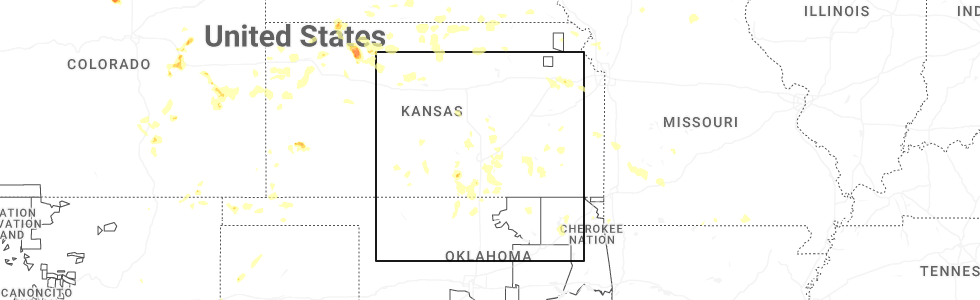
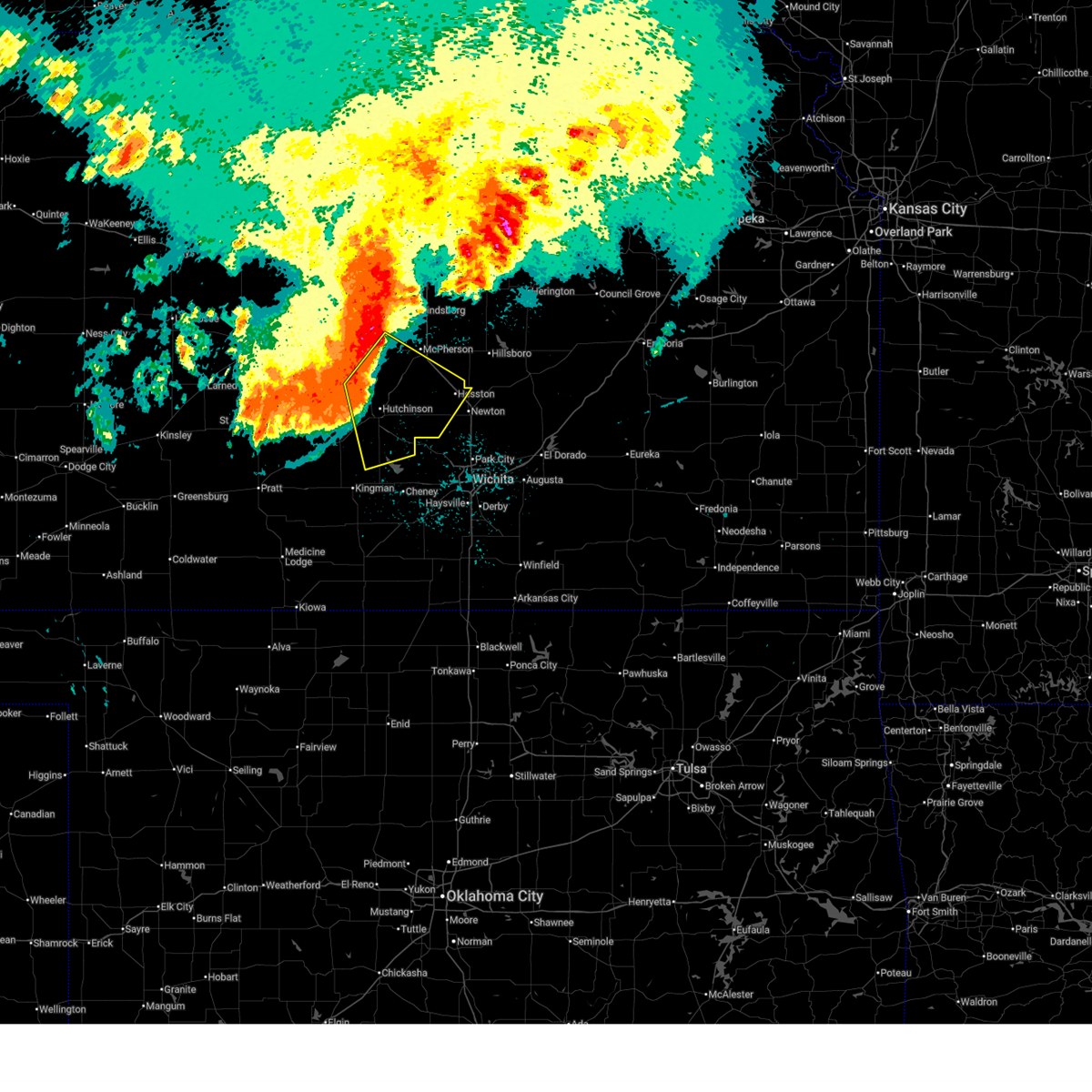
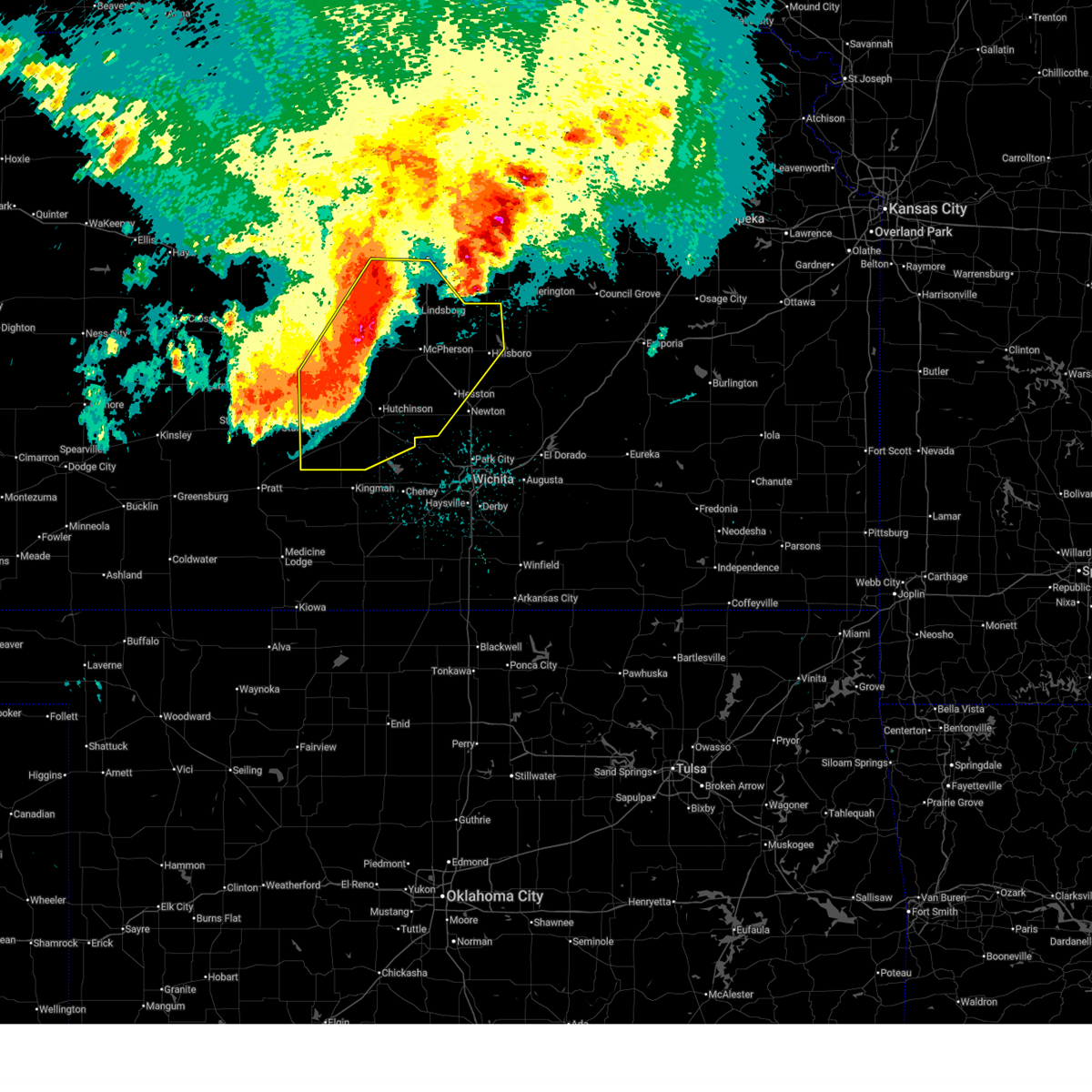
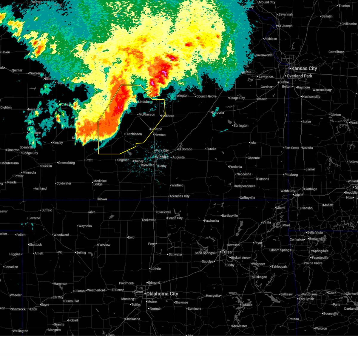
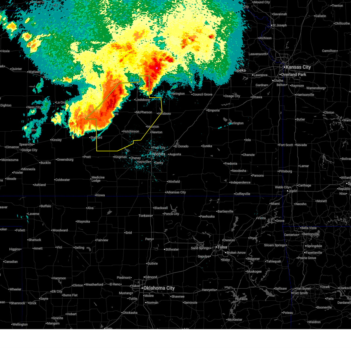
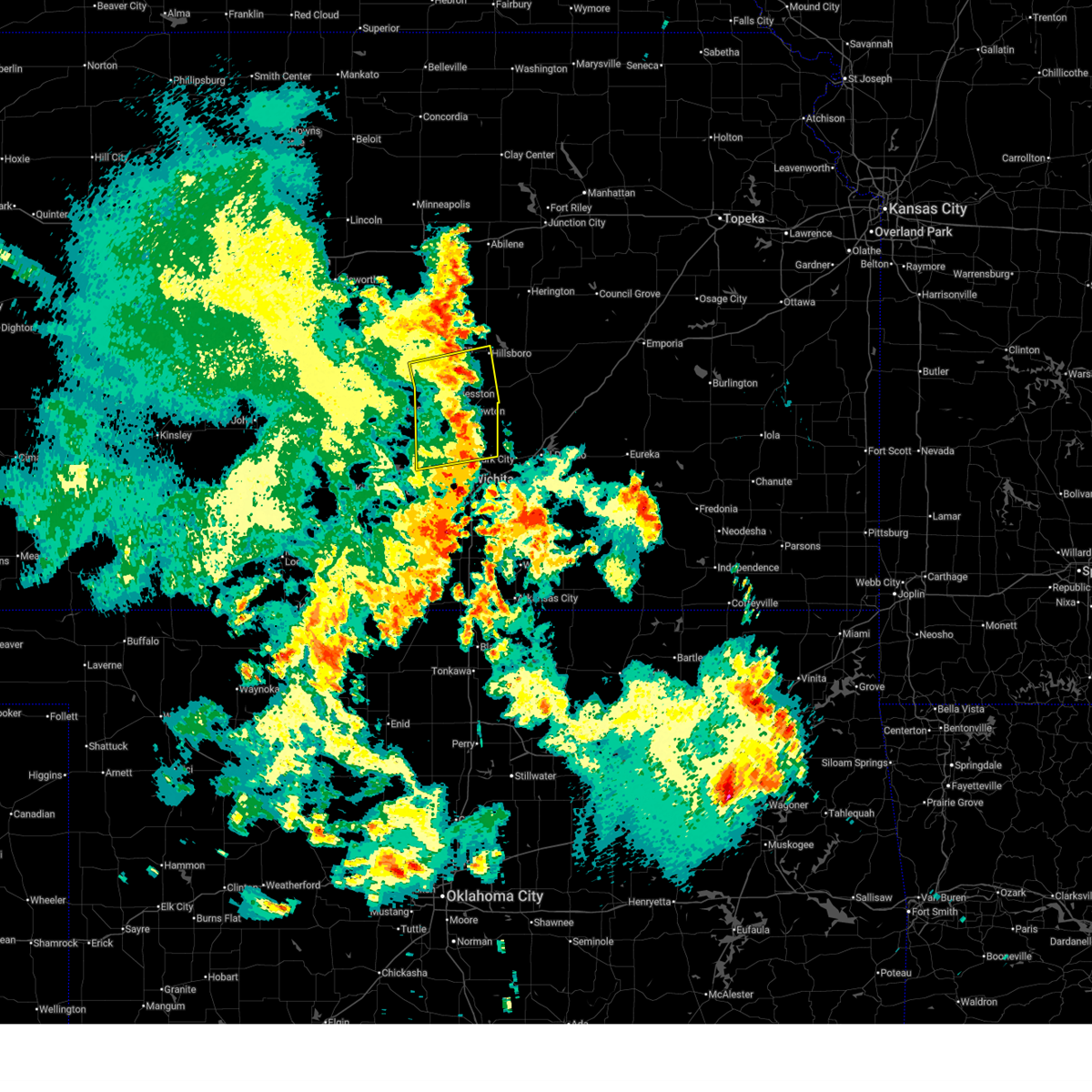
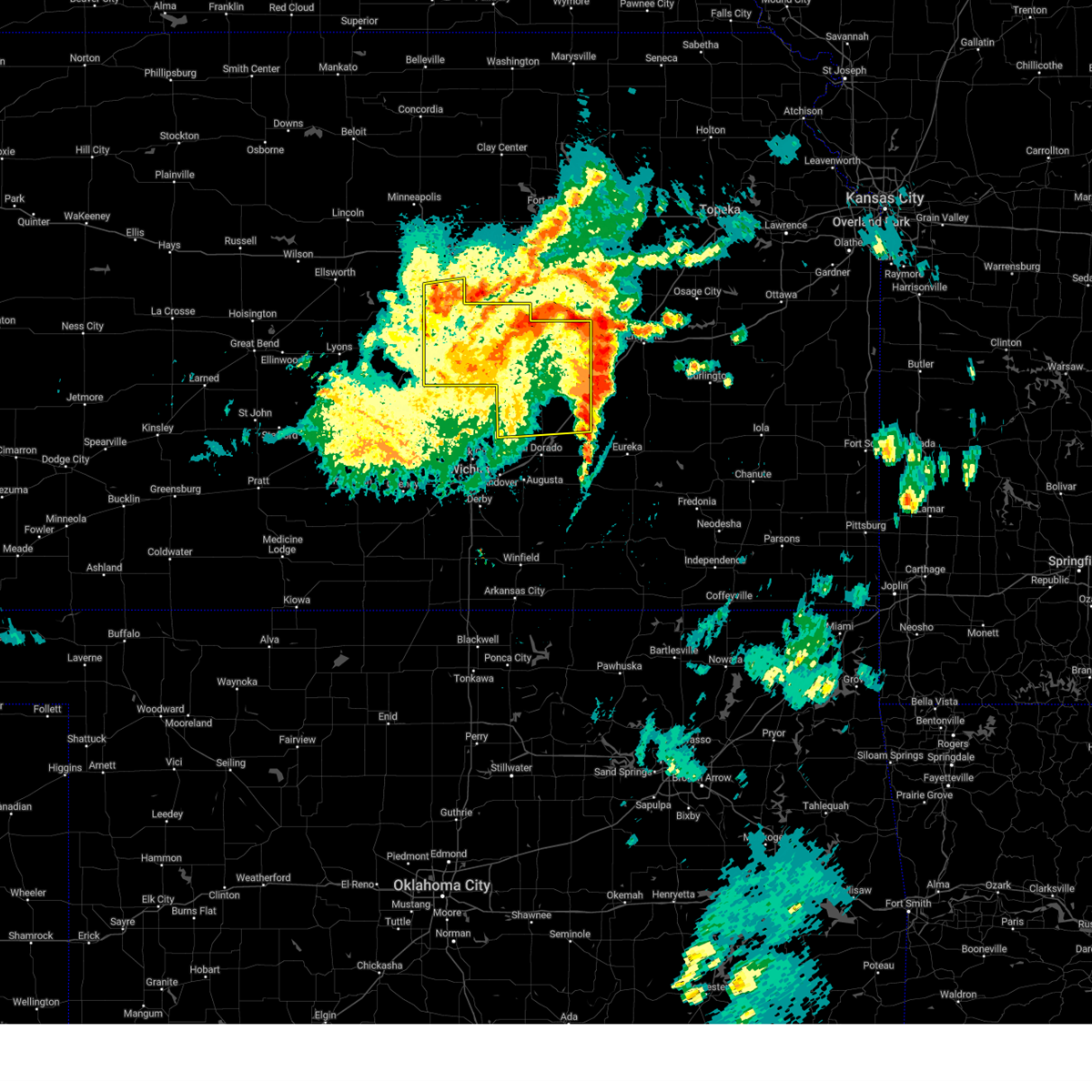
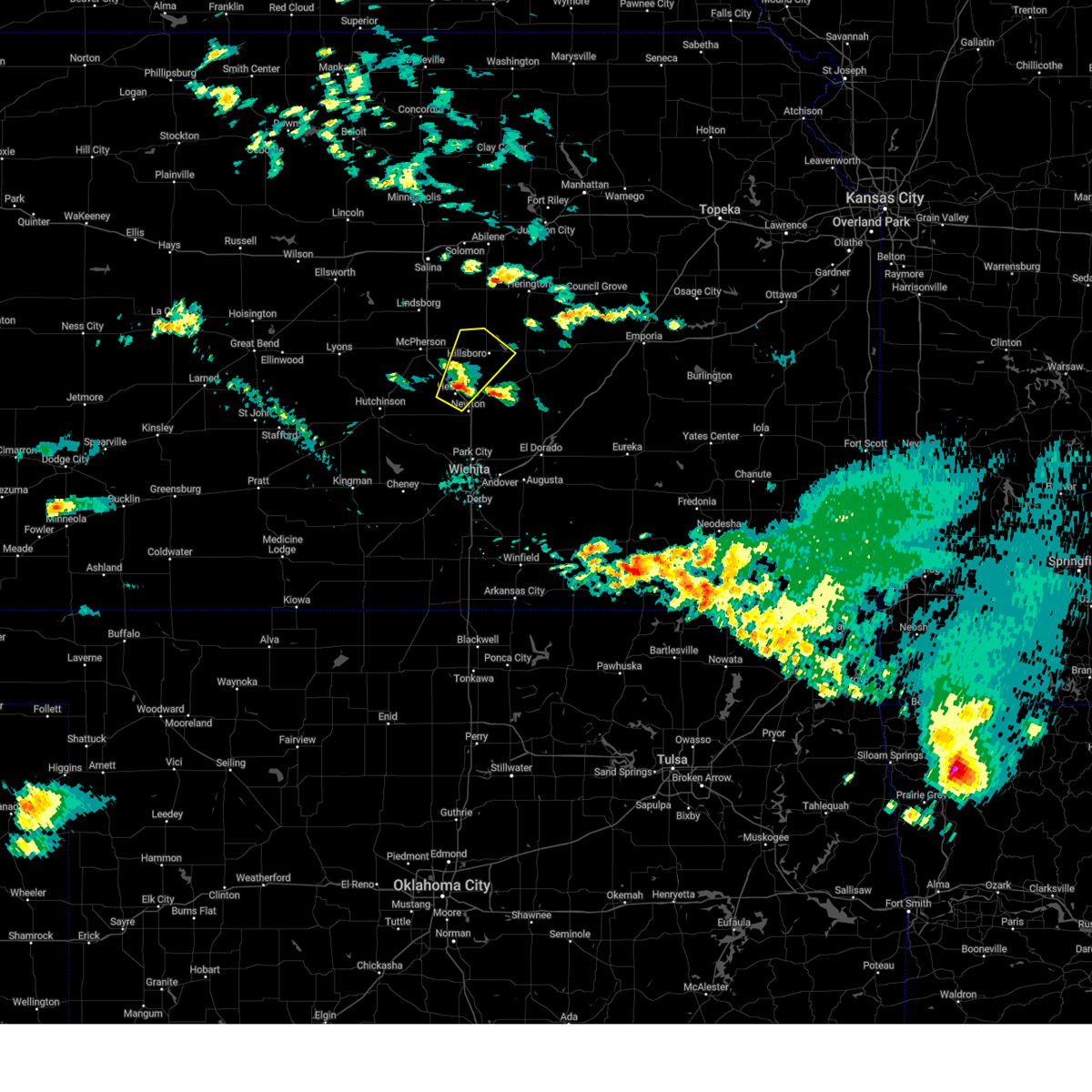
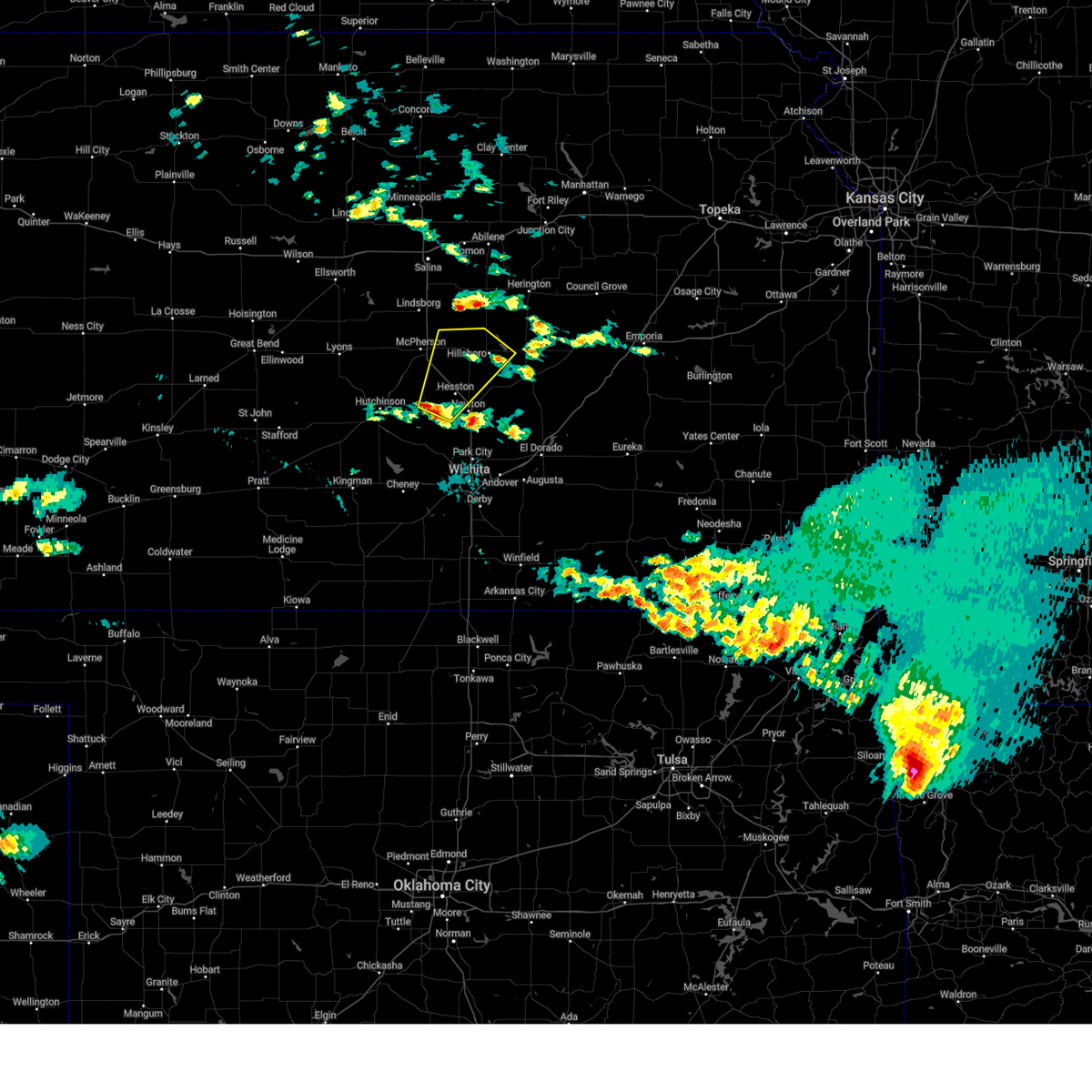
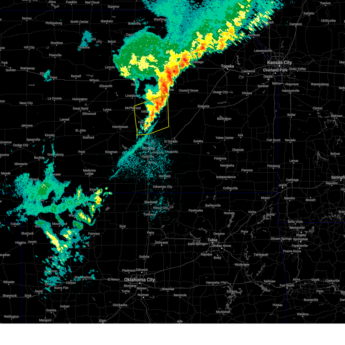
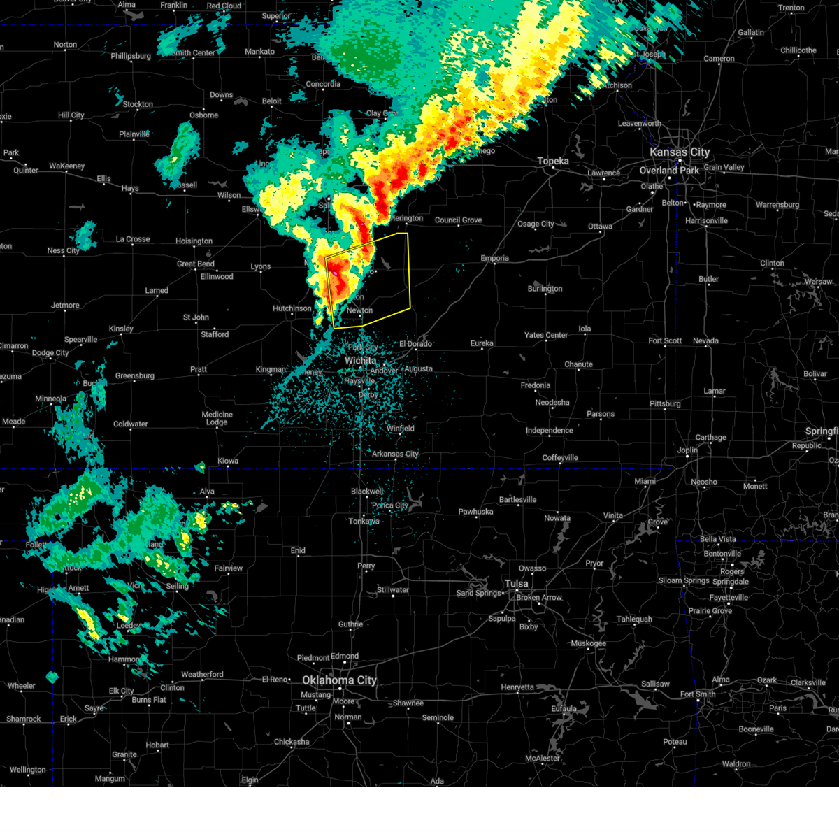
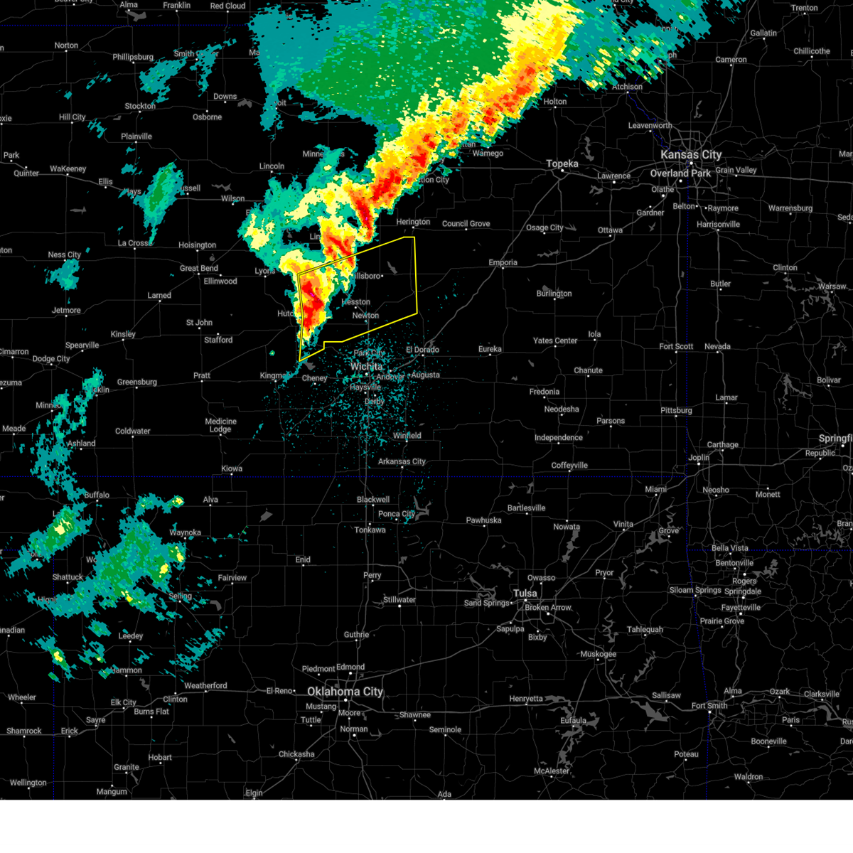
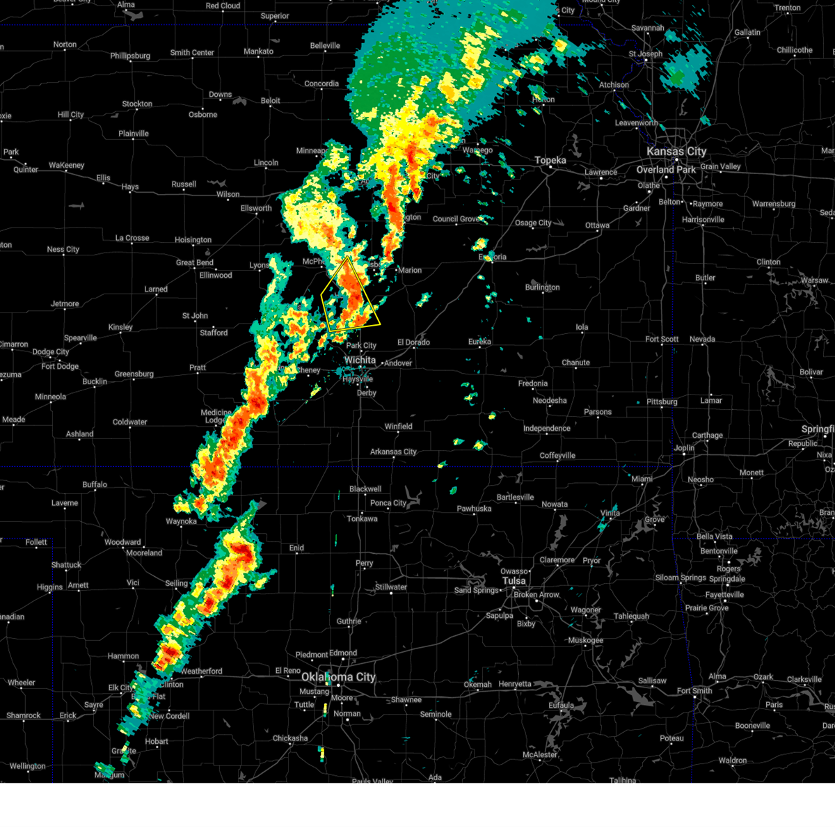
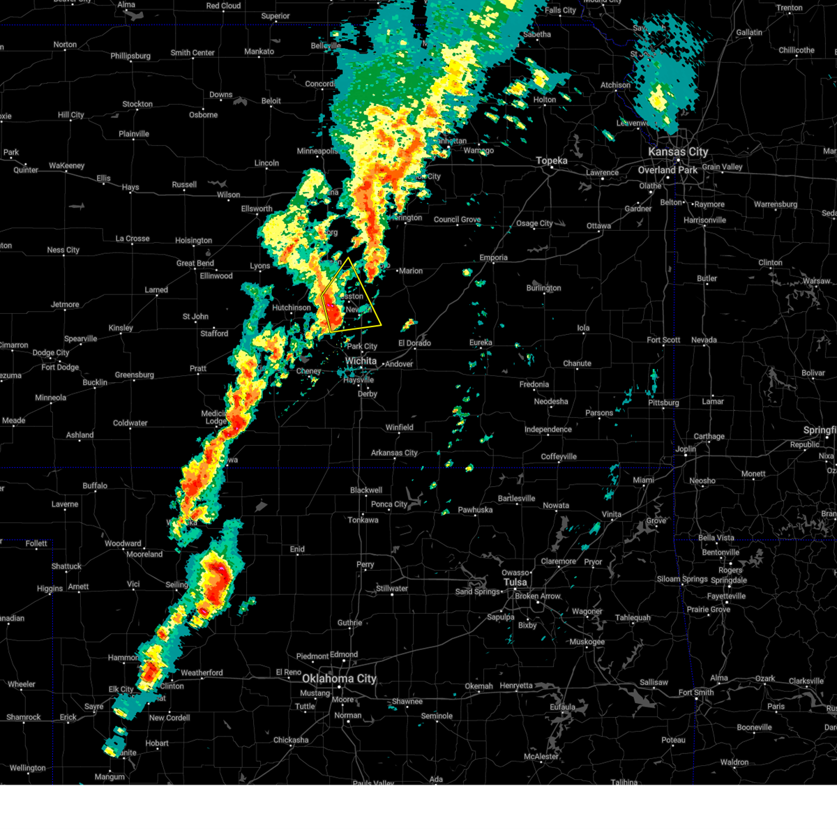
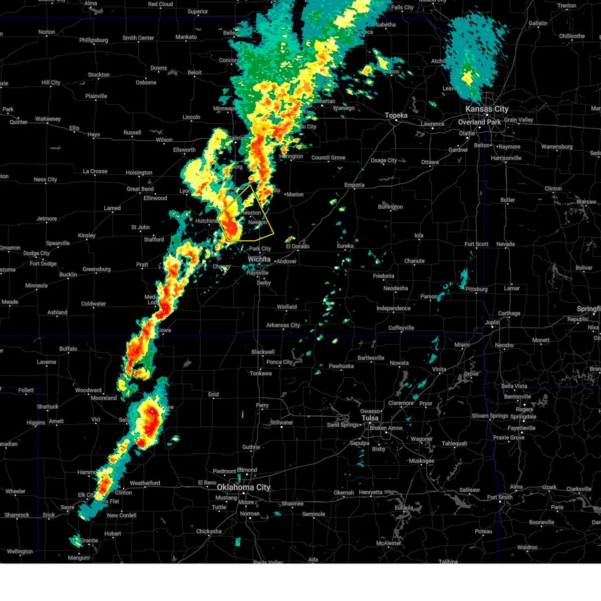
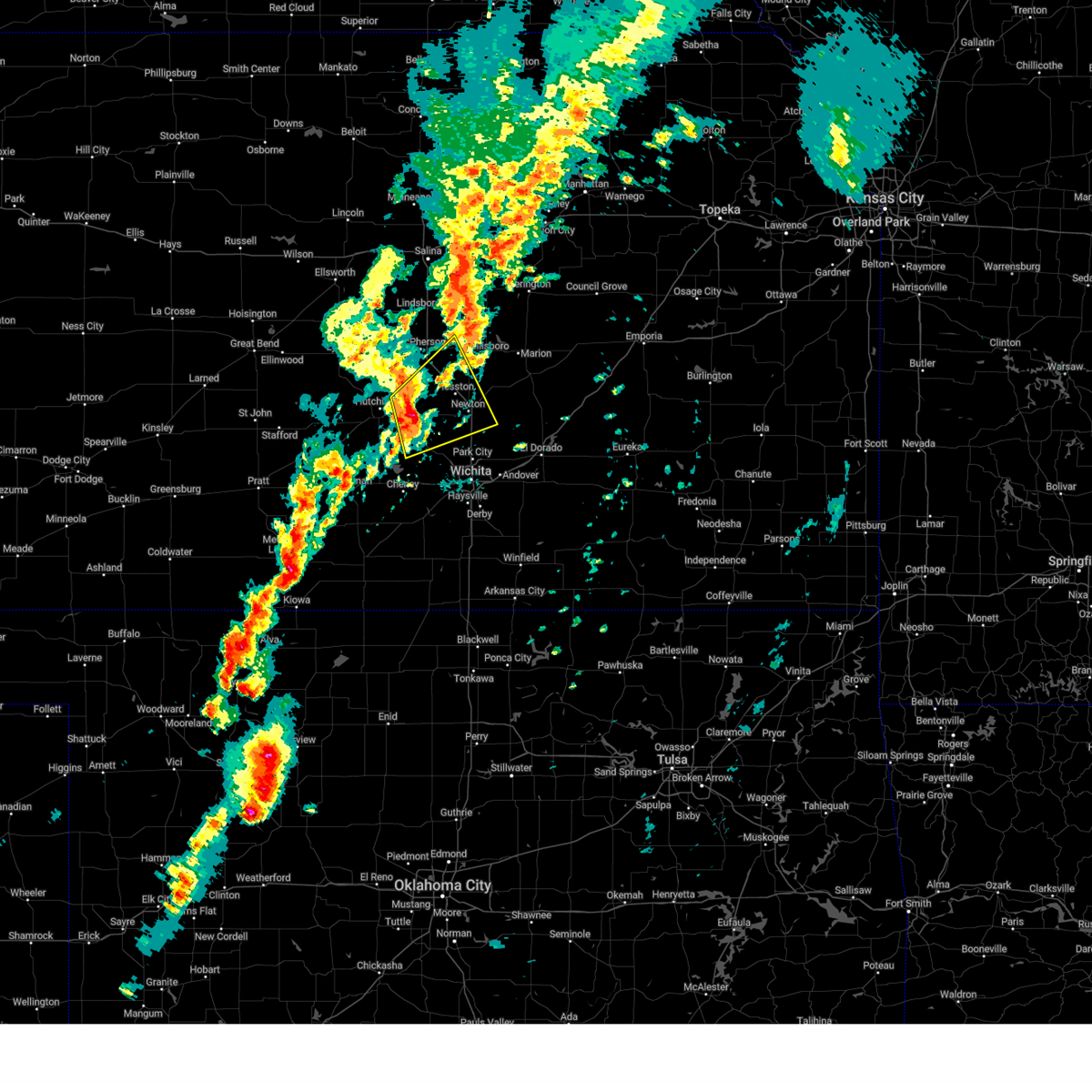
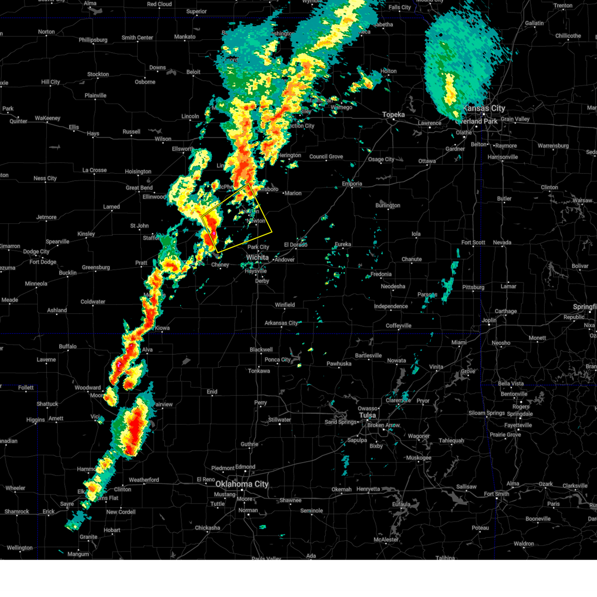
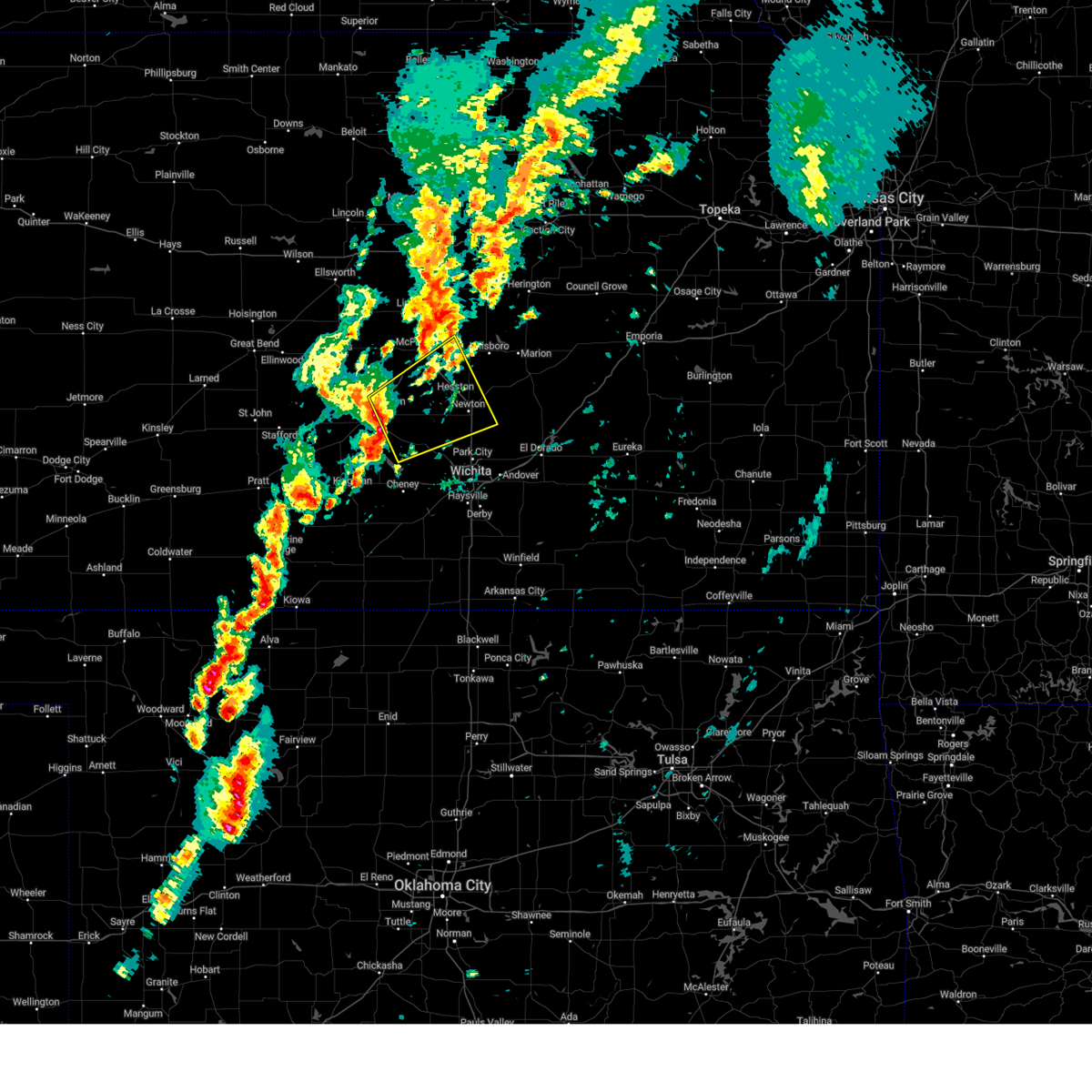
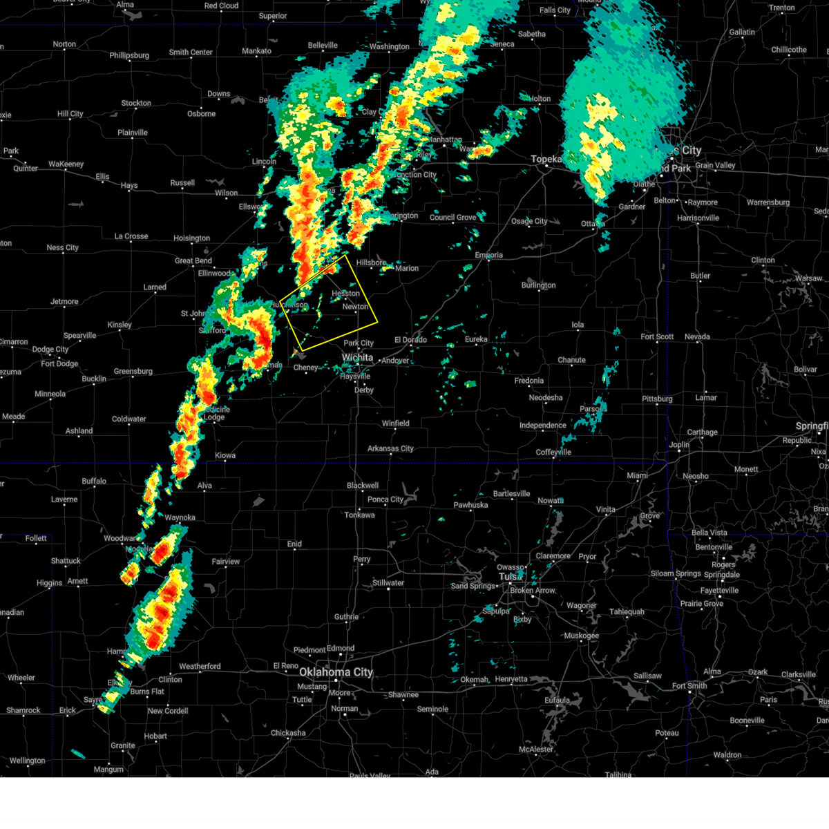
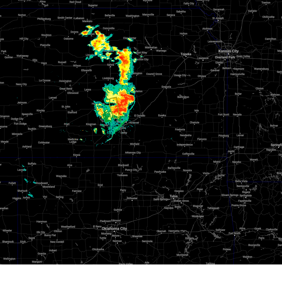
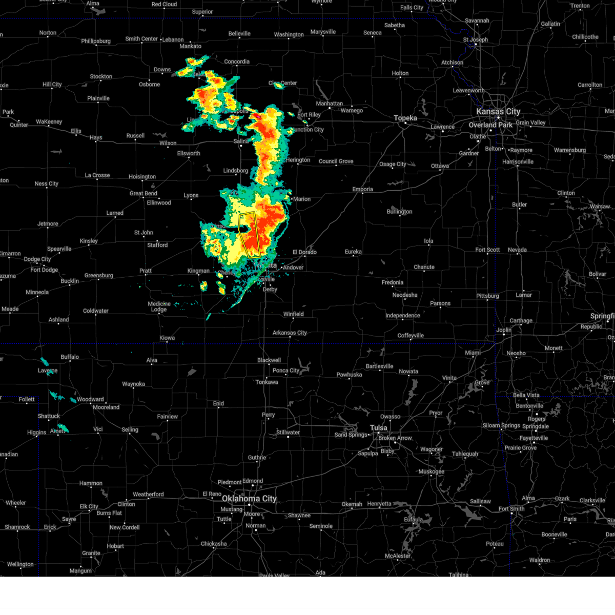
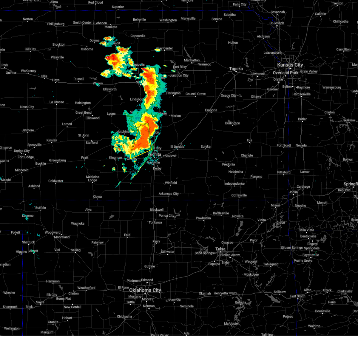
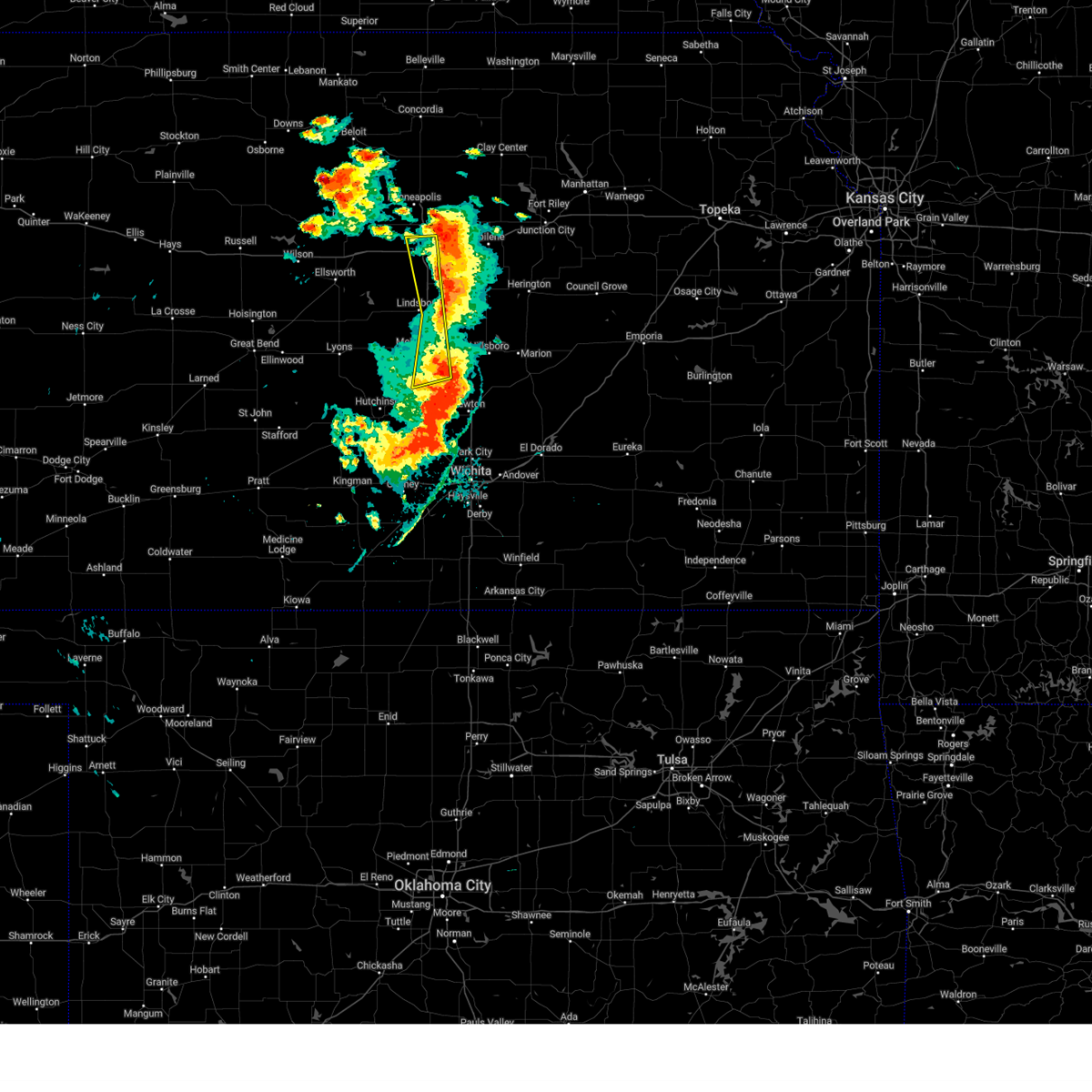
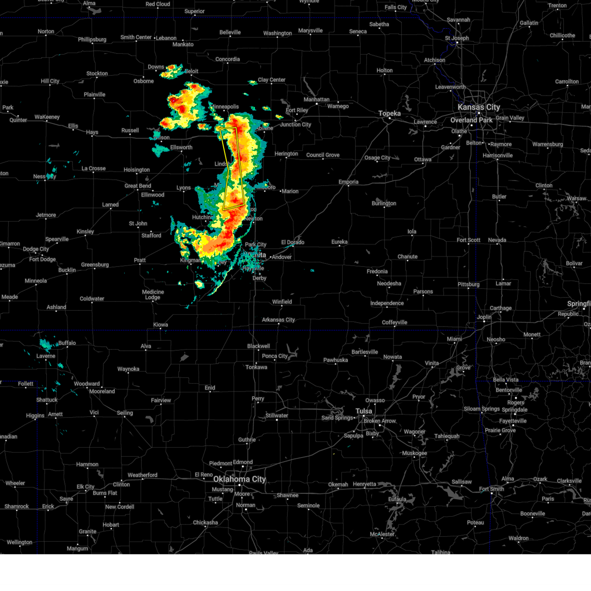
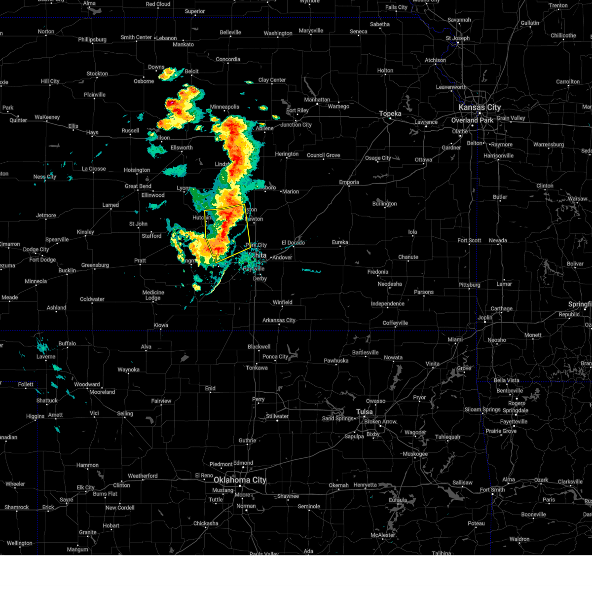
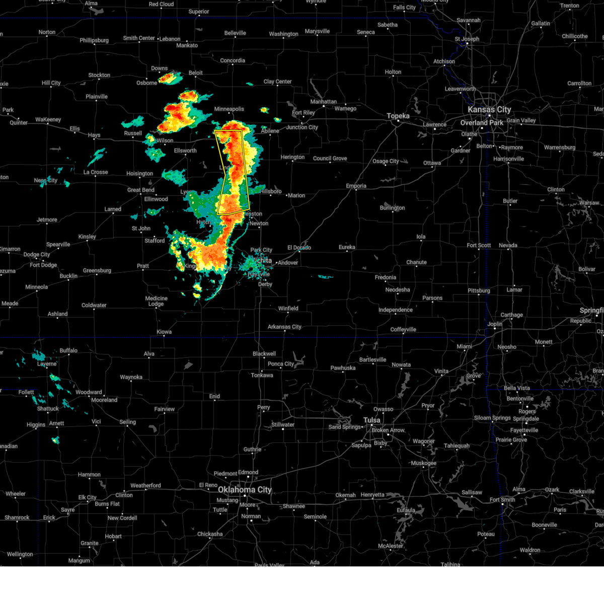
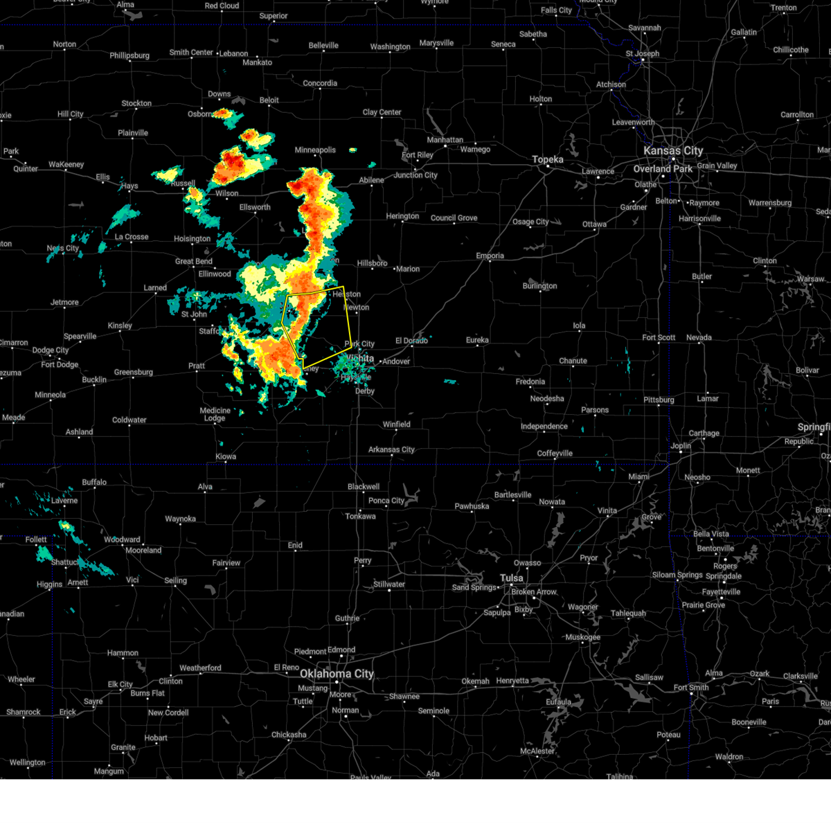
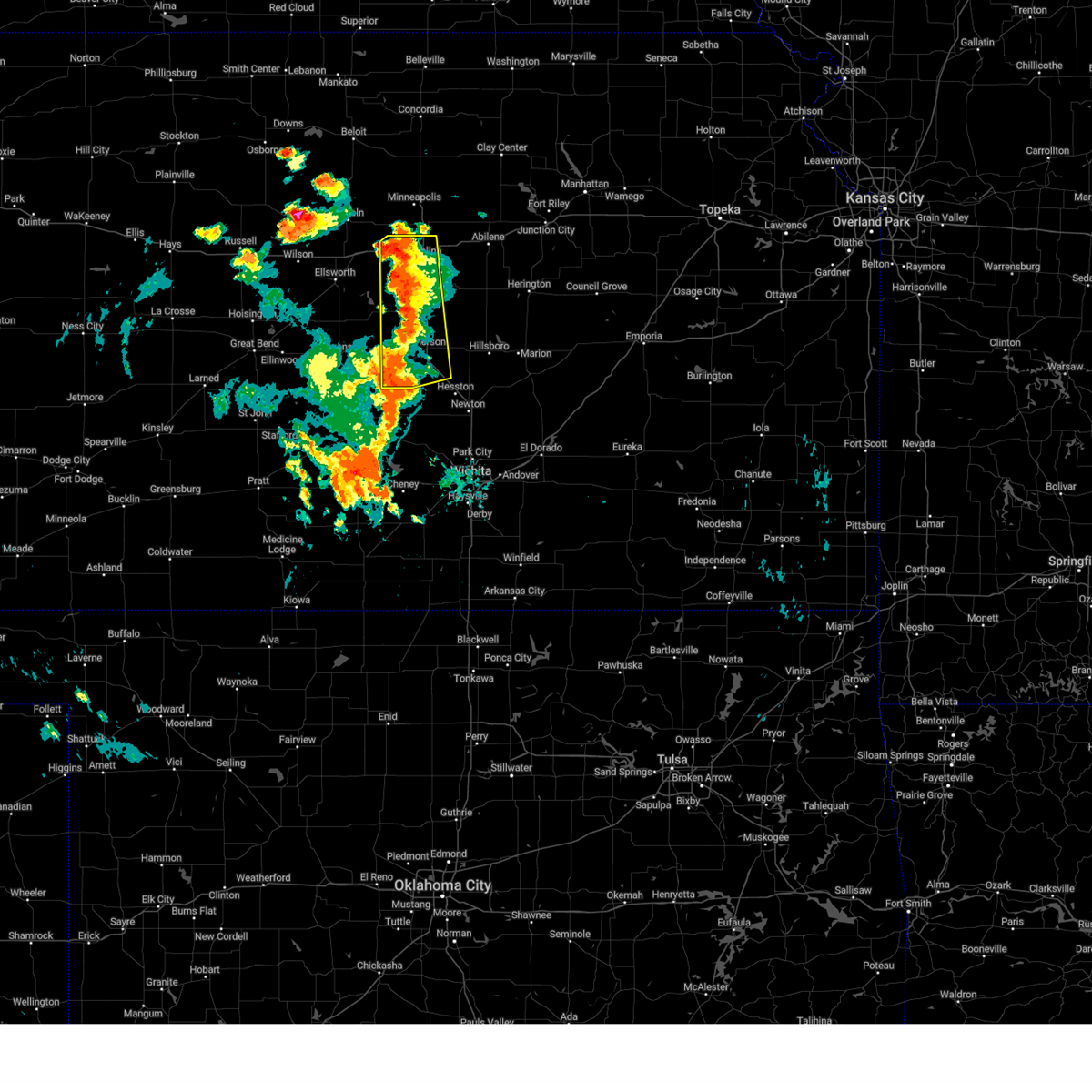
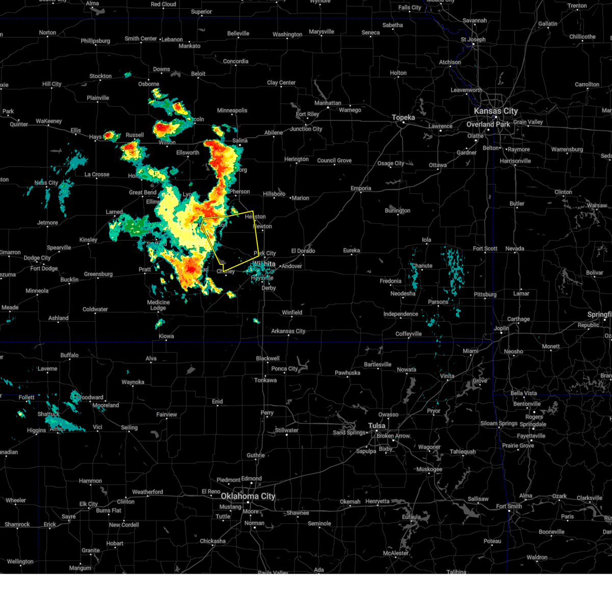
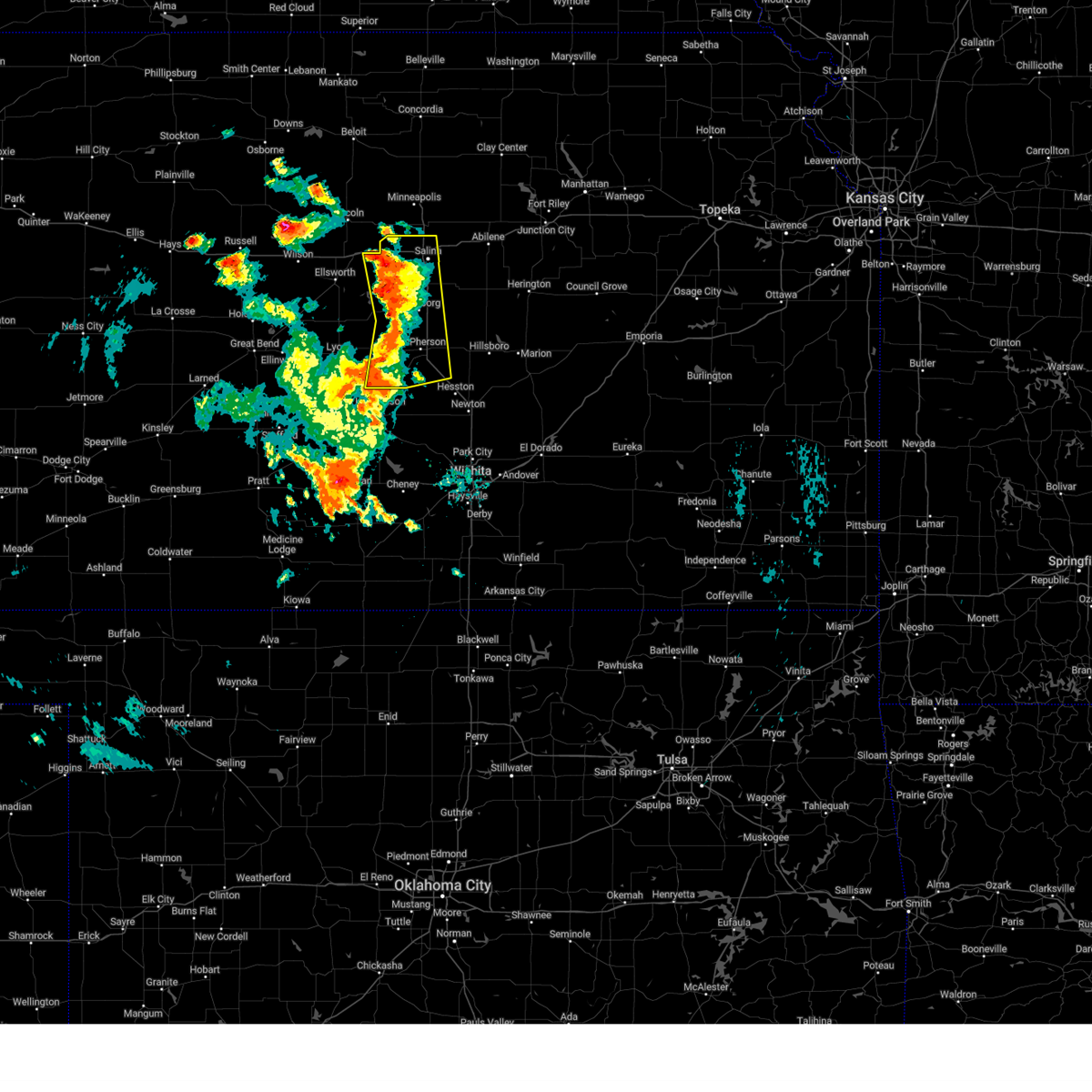
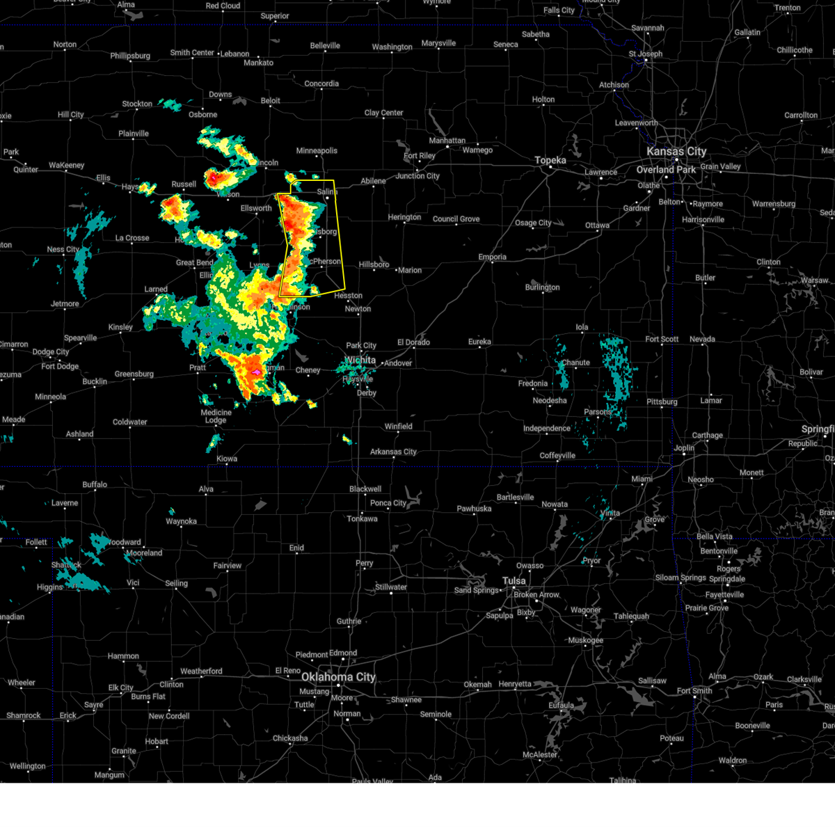
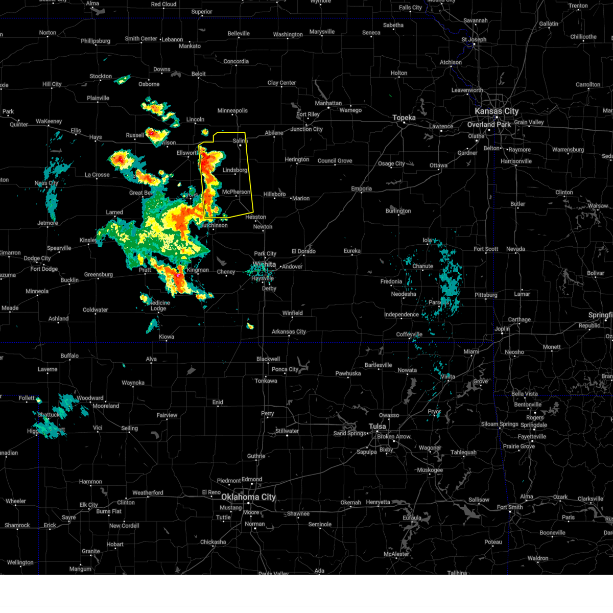
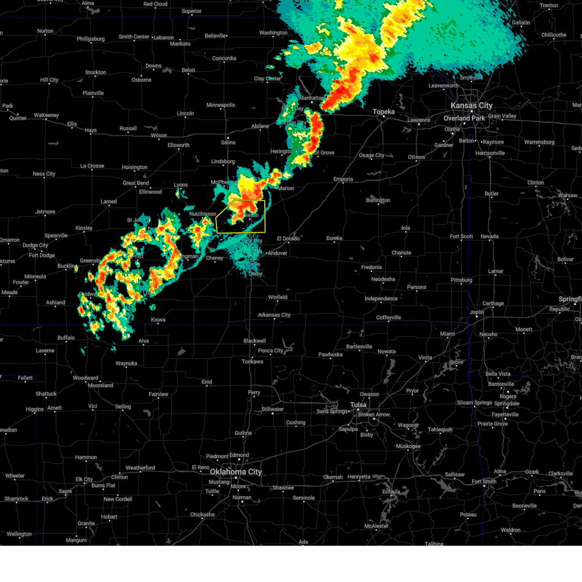
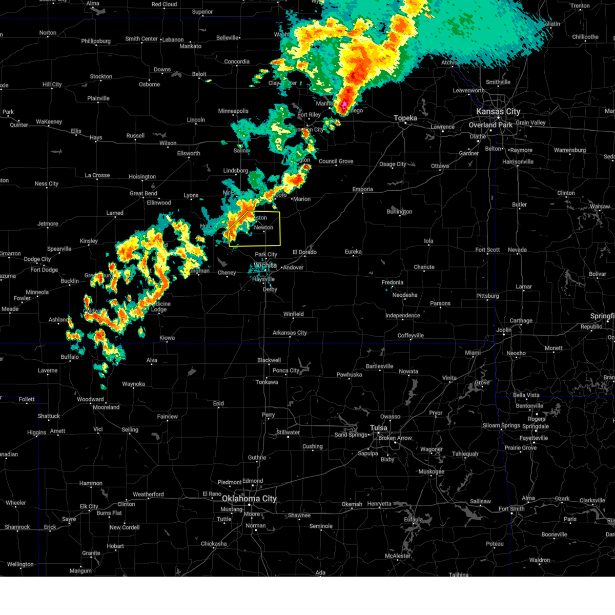
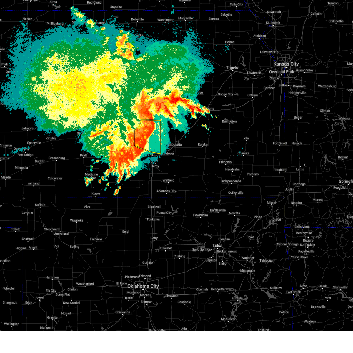
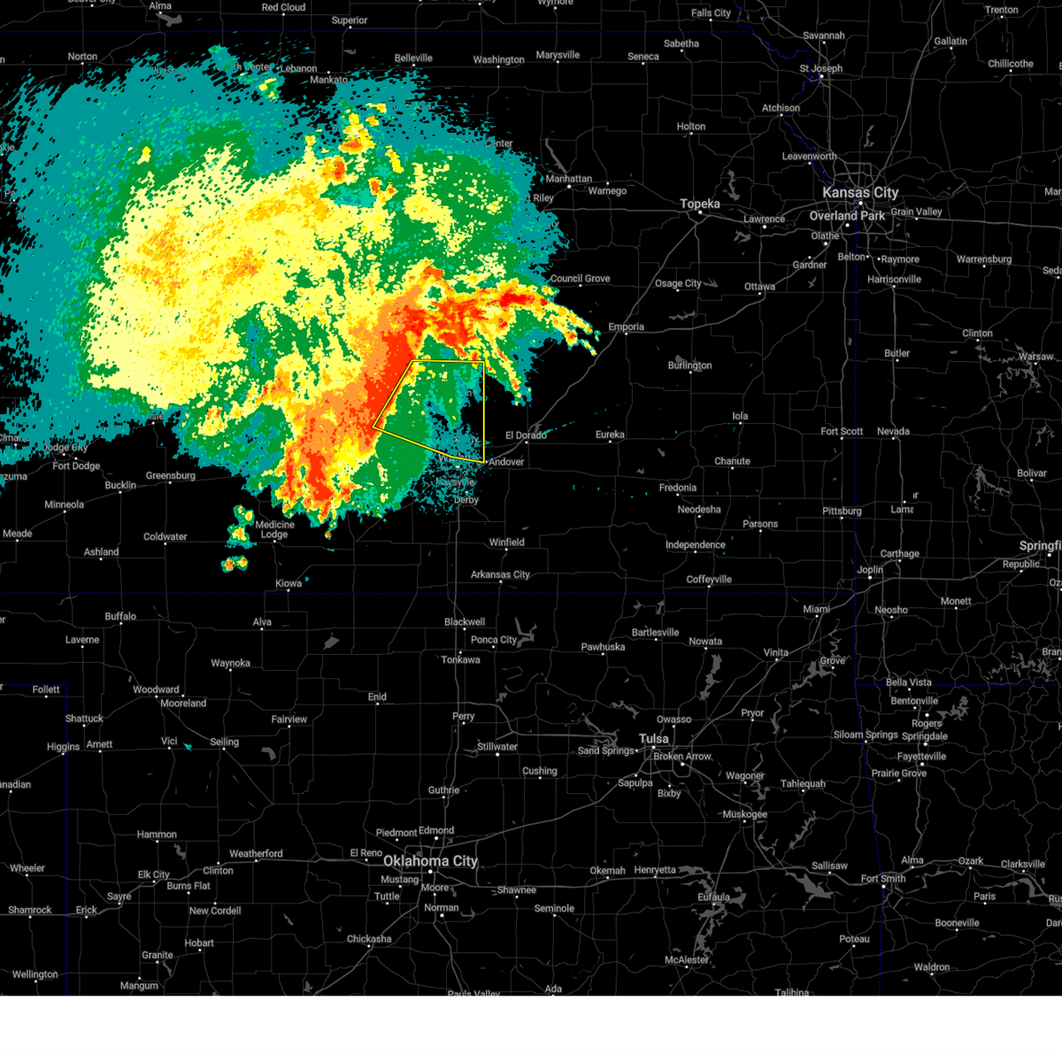
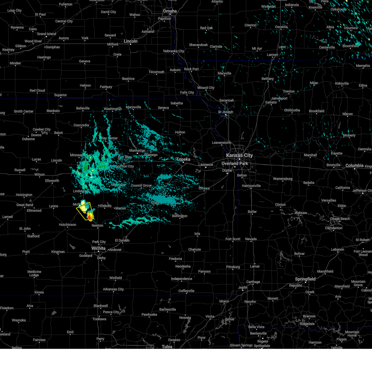
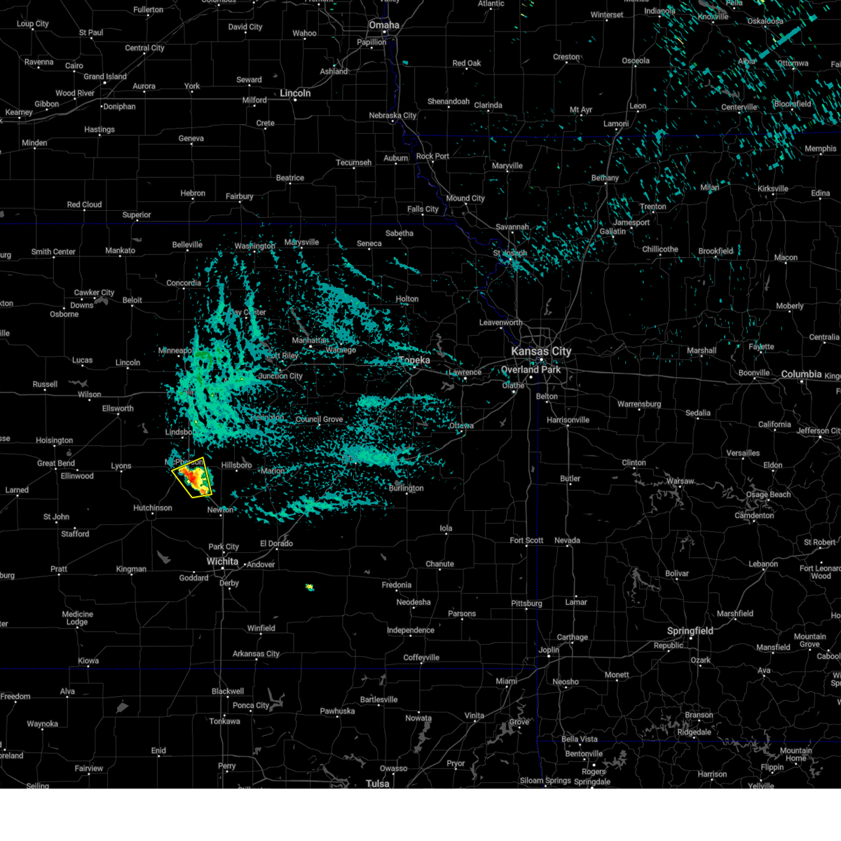
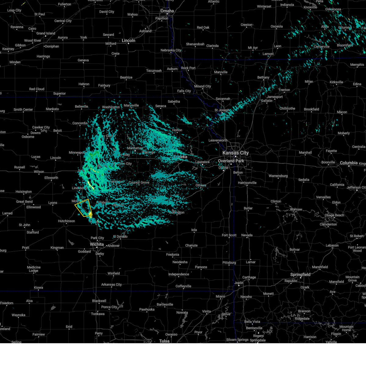
Hail Map for Moundridge, KS
The Moundridge, KS area has had 10 reports of on-the-ground hail by trained spotters, and has been under severe weather warnings 66 times during the past 12 months. Doppler radar has detected hail at or near Moundridge, KS on 103 occasions, including 9 occasions during the past year.
| Name: | Moundridge, KS |
| Where Located: | 36.7 miles NNW of Wichita, KS |
| Map: | Google Map for Moundridge, KS |
| Population: | 1737 |
| Housing Units: | 803 |
| More Info: | Search Google for Moundridge, KS |
0
The Top Recent Hail Date for Moundridge, KS is Sunday, June 29, 2025 (86th out of 103)
Hail and Wind Damage Spotted near Moundridge, KS
| Date / Time | Report Details |
|---|---|
| 6/17/2025 4:17 AM CDT |
 Svrict the national weather service in wichita has issued a * severe thunderstorm warning for, eastern mcpherson county in central kansas, sedgwick county in south central kansas, harvey county in south central kansas, southwestern chase county in east central kansas, butler county in south central kansas, marion county in central kansas, * until 515 am cdt. * at 417 am cdt, severe thunderstorms were located along a line extending from near canton to 5 miles southwest of hillsboro to near park city to near eisenhower national airport, moving southeast at 45 mph (radar indicated). Hazards include 70 mph wind gusts. Expect considerable tree damage. Damage is likely to mobile homes, roofs, and outbuildings. Svrict the national weather service in wichita has issued a * severe thunderstorm warning for, eastern mcpherson county in central kansas, sedgwick county in south central kansas, harvey county in south central kansas, southwestern chase county in east central kansas, butler county in south central kansas, marion county in central kansas, * until 515 am cdt. * at 417 am cdt, severe thunderstorms were located along a line extending from near canton to 5 miles southwest of hillsboro to near park city to near eisenhower national airport, moving southeast at 45 mph (radar indicated). Hazards include 70 mph wind gusts. Expect considerable tree damage. Damage is likely to mobile homes, roofs, and outbuildings.
|
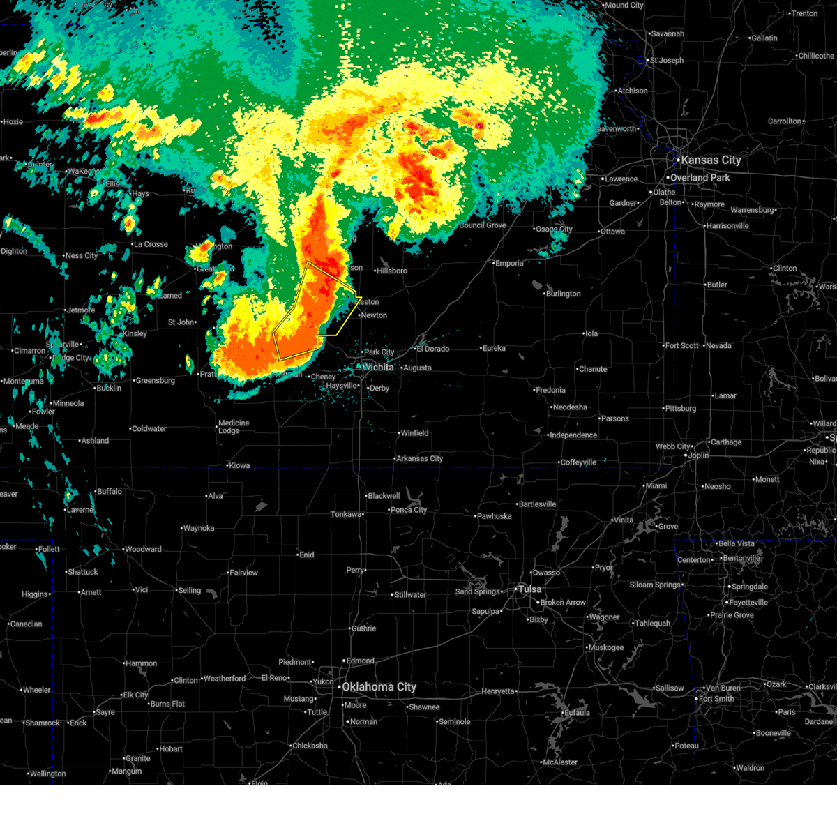
| 6/17/2025 3:57 AM CDT | At least 70 mph estimate in mcpherson county KS, 1.4 miles S of Moundridge, KS |
| 6/17/2025 3:50 AM CDT |
 the severe thunderstorm warning has been cancelled and is no longer in effect the severe thunderstorm warning has been cancelled and is no longer in effect
|
| 6/17/2025 3:50 AM CDT |
 At 349 am cdt, a severe thunderstorm was located near mount hope, moving southeast at 35 mph. this is a destructive storm for burrton and moundridge (trained weather spotters). Hazards include 90 mph wind gusts. You are in a life-threatening situation. flying debris may be deadly to those caught without shelter. mobile homes will be heavily damaged or destroyed. homes and businesses will have substantial roof and window damage. expect extensive tree damage and power outages. locations impacted include, hutchinson, mcpherson, hesston, south hutchinson, halstead, moundridge, inman, buhler, haven, burrton, pretty prairie, yoder, mcpherson airport, hutchinson airport, and cheney lake. This includes interstate 135 between mile markers 38 and 57. At 349 am cdt, a severe thunderstorm was located near mount hope, moving southeast at 35 mph. this is a destructive storm for burrton and moundridge (trained weather spotters). Hazards include 90 mph wind gusts. You are in a life-threatening situation. flying debris may be deadly to those caught without shelter. mobile homes will be heavily damaged or destroyed. homes and businesses will have substantial roof and window damage. expect extensive tree damage and power outages. locations impacted include, hutchinson, mcpherson, hesston, south hutchinson, halstead, moundridge, inman, buhler, haven, burrton, pretty prairie, yoder, mcpherson airport, hutchinson airport, and cheney lake. This includes interstate 135 between mile markers 38 and 57.
|
| 6/17/2025 3:35 AM CDT |
 At 335 am cdt, a severe thunderstorm was located near haven, moving southeast at 70 mph. this is a destructive storm for hutchinson, inman, and burrton (trained weather spotters). Hazards include 90 mph wind gusts. You are in a life-threatening situation. flying debris may be deadly to those caught without shelter. mobile homes will be heavily damaged or destroyed. homes and businesses will have substantial roof and window damage. expect extensive tree damage and power outages. locations impacted include, hutchinson, mcpherson, hesston, south hutchinson, halstead, moundridge, inman, buhler, haven, nickerson, burrton, pretty prairie, partridge, windom, yoder, willowbrook, mcpherson airport, hutchinson airport, and cheney lake. This includes interstate 135 between mile markers 38 and 57. At 335 am cdt, a severe thunderstorm was located near haven, moving southeast at 70 mph. this is a destructive storm for hutchinson, inman, and burrton (trained weather spotters). Hazards include 90 mph wind gusts. You are in a life-threatening situation. flying debris may be deadly to those caught without shelter. mobile homes will be heavily damaged or destroyed. homes and businesses will have substantial roof and window damage. expect extensive tree damage and power outages. locations impacted include, hutchinson, mcpherson, hesston, south hutchinson, halstead, moundridge, inman, buhler, haven, nickerson, burrton, pretty prairie, partridge, windom, yoder, willowbrook, mcpherson airport, hutchinson airport, and cheney lake. This includes interstate 135 between mile markers 38 and 57.
|
| 6/17/2025 3:34 AM CDT |
 Svrict the national weather service in wichita has issued a * severe thunderstorm warning for, southern mcpherson county in central kansas, southeastern reno county in south central kansas, sedgwick county in south central kansas, harvey county in south central kansas, harper county in south central kansas, kingman county in south central kansas, southwestern marion county in central kansas, northern sumner county in south central kansas, * until 430 am cdt. * at 333 am cdt, severe thunderstorms were located along a line extending from 6 miles north of mcpherson to 7 miles northeast of pretty prairie to 6 miles east of cunningham, moving southeast at 45 mph (trained weather spotters). Hazards include 70 mph wind gusts. Expect considerable tree damage. Damage is likely to mobile homes, roofs, and outbuildings. Svrict the national weather service in wichita has issued a * severe thunderstorm warning for, southern mcpherson county in central kansas, southeastern reno county in south central kansas, sedgwick county in south central kansas, harvey county in south central kansas, harper county in south central kansas, kingman county in south central kansas, southwestern marion county in central kansas, northern sumner county in south central kansas, * until 430 am cdt. * at 333 am cdt, severe thunderstorms were located along a line extending from 6 miles north of mcpherson to 7 miles northeast of pretty prairie to 6 miles east of cunningham, moving southeast at 45 mph (trained weather spotters). Hazards include 70 mph wind gusts. Expect considerable tree damage. Damage is likely to mobile homes, roofs, and outbuildings.
|
| 6/17/2025 3:31 AM CDT |
 At 330 am cdt, a severe thunderstorm was located near south hutchinson, moving southeast at 35 mph. this is a destructive storm for hutchinson, inman, and burrton (radar indicated). Hazards include 80 mph wind gusts. Flying debris will be dangerous to those caught without shelter. mobile homes will be heavily damaged. expect considerable damage to roofs, windows, and vehicles. extensive tree damage and power outages are likely. locations impacted include, hutchinson, mcpherson, hesston, south hutchinson, halstead, moundridge, inman, buhler, haven, nickerson, burrton, pretty prairie, partridge, windom, yoder, willowbrook, mcpherson airport, hutchinson airport, and cheney lake. This includes interstate 135 between mile markers 38 and 57. At 330 am cdt, a severe thunderstorm was located near south hutchinson, moving southeast at 35 mph. this is a destructive storm for hutchinson, inman, and burrton (radar indicated). Hazards include 80 mph wind gusts. Flying debris will be dangerous to those caught without shelter. mobile homes will be heavily damaged. expect considerable damage to roofs, windows, and vehicles. extensive tree damage and power outages are likely. locations impacted include, hutchinson, mcpherson, hesston, south hutchinson, halstead, moundridge, inman, buhler, haven, nickerson, burrton, pretty prairie, partridge, windom, yoder, willowbrook, mcpherson airport, hutchinson airport, and cheney lake. This includes interstate 135 between mile markers 38 and 57.
|
| 6/17/2025 3:18 AM CDT |
 Svrict the national weather service in wichita has issued a * severe thunderstorm warning for, southern mcpherson county in central kansas, eastern reno county in south central kansas, western harvey county in south central kansas, southeastern rice county in central kansas, * until 400 am cdt. * at 318 am cdt, a severe thunderstorm was located near hutchinson, moving southeast at 35 mph. this is a destructive storm for hutchinson (radar indicated). Hazards include 80 mph wind gusts. Flying debris will be dangerous to those caught without shelter. mobile homes will be heavily damaged. expect considerable damage to roofs, windows, and vehicles. Extensive tree damage and power outages are likely. Svrict the national weather service in wichita has issued a * severe thunderstorm warning for, southern mcpherson county in central kansas, eastern reno county in south central kansas, western harvey county in south central kansas, southeastern rice county in central kansas, * until 400 am cdt. * at 318 am cdt, a severe thunderstorm was located near hutchinson, moving southeast at 35 mph. this is a destructive storm for hutchinson (radar indicated). Hazards include 80 mph wind gusts. Flying debris will be dangerous to those caught without shelter. mobile homes will be heavily damaged. expect considerable damage to roofs, windows, and vehicles. Extensive tree damage and power outages are likely.
|
| 6/17/2025 3:10 AM CDT |
 the severe thunderstorm warning has been cancelled and is no longer in effect the severe thunderstorm warning has been cancelled and is no longer in effect
|
| 6/17/2025 3:10 AM CDT |
 At 309 am cdt, severe thunderstorms were located along a line extending from near marquette to near abbyville to near st. john, moving southeast at 60 mph (trained weather spotters). Hazards include 70 mph wind gusts. Expect considerable tree damage. damage is likely to mobile homes, roofs, and outbuildings. locations impacted include, salina, hutchinson, mcpherson, lyons, hesston, lindsborg, hillsboro, south hutchinson, sterling, halstead, moundridge, inman, buhler, haven, nickerson, burrton, galva, canton, pretty prairie, and marquette. This includes interstate 135 between mile markers 37 and 92. At 309 am cdt, severe thunderstorms were located along a line extending from near marquette to near abbyville to near st. john, moving southeast at 60 mph (trained weather spotters). Hazards include 70 mph wind gusts. Expect considerable tree damage. damage is likely to mobile homes, roofs, and outbuildings. locations impacted include, salina, hutchinson, mcpherson, lyons, hesston, lindsborg, hillsboro, south hutchinson, sterling, halstead, moundridge, inman, buhler, haven, nickerson, burrton, galva, canton, pretty prairie, and marquette. This includes interstate 135 between mile markers 37 and 92.
|
| 6/17/2025 2:59 AM CDT |
 At 258 am cdt, severe thunderstorms were located along a line extending from 8 miles southwest of brookville to near sterling to near st. john, moving southeast at 55 mph (asos weather station). Hazards include 70 mph wind gusts. Expect considerable tree damage. damage is likely to mobile homes, roofs, and outbuildings. locations impacted include, salina, hutchinson, mcpherson, lyons, hesston, lindsborg, hillsboro, south hutchinson, sterling, ellinwood, halstead, moundridge, inman, buhler, haven, nickerson, burrton, galva, canton, and pretty prairie. this includes the following highways, interstate 135 between mile markers 37 and 94. Interstate 70 between mile markers 256 and 266. At 258 am cdt, severe thunderstorms were located along a line extending from 8 miles southwest of brookville to near sterling to near st. john, moving southeast at 55 mph (asos weather station). Hazards include 70 mph wind gusts. Expect considerable tree damage. damage is likely to mobile homes, roofs, and outbuildings. locations impacted include, salina, hutchinson, mcpherson, lyons, hesston, lindsborg, hillsboro, south hutchinson, sterling, ellinwood, halstead, moundridge, inman, buhler, haven, nickerson, burrton, galva, canton, and pretty prairie. this includes the following highways, interstate 135 between mile markers 37 and 94. Interstate 70 between mile markers 256 and 266.
|
| 6/17/2025 2:41 AM CDT |
 Svrict the national weather service in wichita has issued a * severe thunderstorm warning for, mcpherson county in central kansas, reno county in south central kansas, western harvey county in south central kansas, rice county in central kansas, ellsworth county in central kansas, northwestern marion county in central kansas, southern barton county in central kansas, saline county in central kansas, * until 345 am cdt. * at 240 am cdt, severe thunderstorms were located along a line extending from 7 miles east of kanopolis to near bushton to near pawnee rock, moving southeast at 45 mph (weather station observed). Hazards include 60 mph wind gusts. expect damage to roofs, siding, and trees Svrict the national weather service in wichita has issued a * severe thunderstorm warning for, mcpherson county in central kansas, reno county in south central kansas, western harvey county in south central kansas, rice county in central kansas, ellsworth county in central kansas, northwestern marion county in central kansas, southern barton county in central kansas, saline county in central kansas, * until 345 am cdt. * at 240 am cdt, severe thunderstorms were located along a line extending from 7 miles east of kanopolis to near bushton to near pawnee rock, moving southeast at 45 mph (weather station observed). Hazards include 60 mph wind gusts. expect damage to roofs, siding, and trees
|
| 6/14/2025 8:30 AM CDT |
 the severe thunderstorm warning has been cancelled and is no longer in effect the severe thunderstorm warning has been cancelled and is no longer in effect
|
| 6/14/2025 8:10 AM CDT |
 At 809 am cdt, severe thunderstorms were located along a line extending from 6 miles north of moundridge to near sedgwick to near bentley, moving east at 45 mph (radar indicated). Hazards include 60 mph wind gusts. Expect damage to roofs, siding, and trees. locations impacted include, newton, park city, valley center, hesston, maize, hillsboro, halstead, north newton, moundridge, sedgwick, colwich, burrton, mount hope, whitewater, kechi, andale, goessel, bentley, walton, and lehigh. This includes interstate 135 between mile markers 14 and 56. At 809 am cdt, severe thunderstorms were located along a line extending from 6 miles north of moundridge to near sedgwick to near bentley, moving east at 45 mph (radar indicated). Hazards include 60 mph wind gusts. Expect damage to roofs, siding, and trees. locations impacted include, newton, park city, valley center, hesston, maize, hillsboro, halstead, north newton, moundridge, sedgwick, colwich, burrton, mount hope, whitewater, kechi, andale, goessel, bentley, walton, and lehigh. This includes interstate 135 between mile markers 14 and 56.
|
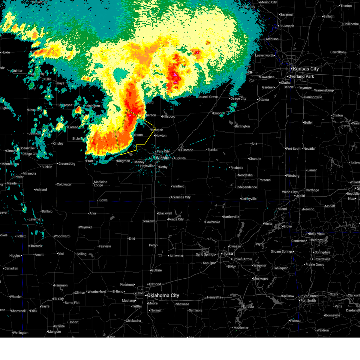
| 6/14/2025 8:05 AM CDT | Storm damage reported in mcpherson county KS, 4.9 miles SE of Moundridge, KS |
| 6/14/2025 8:04 AM CDT |
 At 803 am cdt, severe thunderstorms were located along a line extending from 5 miles northwest of moundridge to near halstead to near bentley, moving east at 45 mph (a personal weather station 4 miles of moundridge measured a 65 mph wind gust at 801 am). Hazards include 60 mph wind gusts. Expect damage to roofs, siding, and trees. locations impacted include, newton, park city, valley center, hesston, maize, hillsboro, halstead, north newton, moundridge, sedgwick, inman, colwich, burrton, mount hope, whitewater, kechi, andale, goessel, bentley, and walton. This includes interstate 135 between mile markers 14 and 56. At 803 am cdt, severe thunderstorms were located along a line extending from 5 miles northwest of moundridge to near halstead to near bentley, moving east at 45 mph (a personal weather station 4 miles of moundridge measured a 65 mph wind gust at 801 am). Hazards include 60 mph wind gusts. Expect damage to roofs, siding, and trees. locations impacted include, newton, park city, valley center, hesston, maize, hillsboro, halstead, north newton, moundridge, sedgwick, inman, colwich, burrton, mount hope, whitewater, kechi, andale, goessel, bentley, and walton. This includes interstate 135 between mile markers 14 and 56.
|
| 6/14/2025 7:53 AM CDT |
 At 752 am cdt, severe thunderstorms were located along a line extending from near inman to near burrton to near mount hope, moving east at 45 mph (a 62 mph wind gust was measured at the hutchinson regional airport at 751 am). Hazards include 60 mph wind gusts. Expect damage to roofs, siding, and trees. locations impacted include, newton, park city, valley center, hesston, maize, hillsboro, halstead, north newton, moundridge, sedgwick, inman, colwich, burrton, mount hope, whitewater, kechi, andale, goessel, bentley, and walton. This includes interstate 135 between mile markers 14 and 56. At 752 am cdt, severe thunderstorms were located along a line extending from near inman to near burrton to near mount hope, moving east at 45 mph (a 62 mph wind gust was measured at the hutchinson regional airport at 751 am). Hazards include 60 mph wind gusts. Expect damage to roofs, siding, and trees. locations impacted include, newton, park city, valley center, hesston, maize, hillsboro, halstead, north newton, moundridge, sedgwick, inman, colwich, burrton, mount hope, whitewater, kechi, andale, goessel, bentley, and walton. This includes interstate 135 between mile markers 14 and 56.
|
| 6/14/2025 7:49 AM CDT |
 Svrict the national weather service in wichita has issued a * severe thunderstorm warning for, southern mcpherson county in central kansas, northern sedgwick county in south central kansas, harvey county in south central kansas, southwestern marion county in central kansas, * until 845 am cdt. * at 748 am cdt, severe thunderstorms were located along a line extending from near inman to near burrton to 5 miles southwest of mount hope, moving east at 45 mph (automated weather observation station). Hazards include a 56 mph wind gust was reported at hutchinson regional airport at 742 am. expect damage to roofs, siding, and trees Svrict the national weather service in wichita has issued a * severe thunderstorm warning for, southern mcpherson county in central kansas, northern sedgwick county in south central kansas, harvey county in south central kansas, southwestern marion county in central kansas, * until 845 am cdt. * at 748 am cdt, severe thunderstorms were located along a line extending from near inman to near burrton to 5 miles southwest of mount hope, moving east at 45 mph (automated weather observation station). Hazards include a 56 mph wind gust was reported at hutchinson regional airport at 742 am. expect damage to roofs, siding, and trees
|
| 5/20/2025 12:55 AM CDT |
 The storms which prompted the warning have weakened below severe limits, and no longer pose an immediate threat to life or property. therefore, the warning will be allowed to expire. however, gusty winds are still possible with these thunderstorms. The storms which prompted the warning have weakened below severe limits, and no longer pose an immediate threat to life or property. therefore, the warning will be allowed to expire. however, gusty winds are still possible with these thunderstorms.
|
| 5/20/2025 12:39 AM CDT | the severe thunderstorm warning has been cancelled and is no longer in effect |
| 5/20/2025 12:39 AM CDT | At 1238 am cdt, severe thunderstorms were located along a line extending from near enterprise to near tampa to 11 miles south of cottonwood falls, moving northeast at 45 mph (numerous reports of trees down). Hazards include 70 mph wind gusts. Expect considerable tree damage. damage is likely to mobile homes, roofs, and outbuildings. locations impacted include, mcpherson, hillsboro, marion, moundridge, peabody, cottonwood falls, galva, canton, whitewater, strong city, florence, goessel, potwin, assaria, gypsum, elbing, burns, lincolnville, ramona, and lehigh. this includes the following highways, interstate 135 between mile markers 44 and 84. Interstate 35 between mile markers 81 and 101. |
| 5/20/2025 12:05 AM CDT | At 1204 am cdt, severe thunderstorms were located along a line extending from near gypsum to galva to 6 miles south of burns, moving northeast at 45 mph (a measured wind gust of 67 mph was recorded in newton). Hazards include 70 mph wind gusts and quarter size hail. Hail damage to vehicles is expected. expect considerable tree damage. wind damage is also likely to mobile homes, roofs, and outbuildings. locations impacted include, newton, mcpherson, hesston, hillsboro, halstead, marion, north newton, moundridge, sedgwick, peabody, cottonwood falls, galva, canton, whitewater, strong city, florence, goessel, potwin, assaria, and gypsum. this includes the following highways, interstate 135 between mile markers 23 and 84. Interstate 35 between mile markers 81 and 101. |
| 5/19/2025 11:57 PM CDT | Svrict the national weather service in wichita has issued a * severe thunderstorm warning for, eastern mcpherson county in central kansas, harvey county in south central kansas, chase county in east central kansas, northern butler county in south central kansas, marion county in central kansas, southeastern saline county in central kansas, * until 100 am cdt. * at 1156 pm cdt, severe thunderstorms were located along a line extending from near assaria to near galva to near potwin, moving northeast at 45 mph (trained weather spotters have reported numerous gusts to 60 mph and hail up to quarter size). Hazards include 60 mph wind gusts and quarter size hail. Hail damage to vehicles is expected. Expect wind damage to roofs, siding, and trees. |
| 5/18/2025 4:29 PM CDT |
 At 429 pm cdt, a severe thunderstorm was located over hesston, moving northeast at 40 mph (radar indicated. at 428 pm cdt, ping pong ball sized hail was reported in hesston). Hazards include ping pong ball size hail. People and animals outdoors will be injured. expect damage to roofs, siding, windows, and vehicles. locations impacted include, hesston, hillsboro, north newton, moundridge, canton, goessel, lehigh, and marion lake. This includes interstate 135 between mile markers 35 and 48. At 429 pm cdt, a severe thunderstorm was located over hesston, moving northeast at 40 mph (radar indicated. at 428 pm cdt, ping pong ball sized hail was reported in hesston). Hazards include ping pong ball size hail. People and animals outdoors will be injured. expect damage to roofs, siding, windows, and vehicles. locations impacted include, hesston, hillsboro, north newton, moundridge, canton, goessel, lehigh, and marion lake. This includes interstate 135 between mile markers 35 and 48.
|
| 5/18/2025 4:28 PM CDT |
 At 427 pm cdt, a severe thunderstorm was located over hesston, moving northeast at 40 mph (radar indicated). Hazards include quarter size hail. Damage to vehicles is expected. locations impacted include, hesston, hillsboro, north newton, moundridge, canton, goessel, lehigh, and marion lake. This includes interstate 135 between mile markers 35 and 48. At 427 pm cdt, a severe thunderstorm was located over hesston, moving northeast at 40 mph (radar indicated). Hazards include quarter size hail. Damage to vehicles is expected. locations impacted include, hesston, hillsboro, north newton, moundridge, canton, goessel, lehigh, and marion lake. This includes interstate 135 between mile markers 35 and 48.
|
| 5/18/2025 4:14 PM CDT |
 Svrict the national weather service in wichita has issued a * severe thunderstorm warning for, southeastern mcpherson county in central kansas, northwestern harvey county in south central kansas, southwestern marion county in central kansas, * until 500 pm cdt. * at 414 pm cdt, a severe thunderstorm was located 7 miles north of halstead, moving northeast at 40 mph (radar indicated). Hazards include half dollar size hail. damage to vehicles is expected Svrict the national weather service in wichita has issued a * severe thunderstorm warning for, southeastern mcpherson county in central kansas, northwestern harvey county in south central kansas, southwestern marion county in central kansas, * until 500 pm cdt. * at 414 pm cdt, a severe thunderstorm was located 7 miles north of halstead, moving northeast at 40 mph (radar indicated). Hazards include half dollar size hail. damage to vehicles is expected
|
| 4/22/2025 8:45 PM CDT | At 844 pm cdt, a severe thunderstorm was located near halstead, moving northeast at 40 mph (public. at 838 pm, half dollar size hail was reported in halstead). Hazards include 60 mph wind gusts and half dollar size hail. Hail damage to vehicles is expected. expect wind damage to roofs, siding, and trees. Locations impacted include, newton airport, newton, hesston, halstead, moundridge, goessel, north newton, and walton. |
| 4/22/2025 8:41 PM CDT | Svrict the national weather service in wichita has issued a * severe thunderstorm warning for, southeastern mcpherson county in central kansas, central harvey county in south central kansas, southwestern marion county in central kansas, * until 915 pm cdt. * at 841 pm cdt, a severe thunderstorm was located near halstead, moving northeast at 40 mph (radar indicated). Hazards include 60 mph wind gusts and quarter size hail. Hail damage to vehicles is expected. Expect wind damage to roofs, siding, and trees. |
| 4/2/2025 1:51 AM CDT |
 The storms which prompted the warning have weakened below severe limits, and no longer pose an immediate threat to life or property. therefore, the warning will be allowed to expire. however, gusty winds are still possible with these thunderstorms. a tornado watch remains in effect until 700 am cdt for south central and central kansas. The storms which prompted the warning have weakened below severe limits, and no longer pose an immediate threat to life or property. therefore, the warning will be allowed to expire. however, gusty winds are still possible with these thunderstorms. a tornado watch remains in effect until 700 am cdt for south central and central kansas.
|
| 4/2/2025 1:37 AM CDT |
 At 135 am cdt, severe thunderstorms were located along a line extending from 5 miles northwest of canton to near goessel to near halstead, moving east at 65 mph (trained weather spotters. at 135 am, 65 mph winds were reported 1 mile north of moundridge). Hazards include 60 mph wind gusts and quarter size hail. Hail damage to vehicles is expected. expect wind damage to roofs, siding, and trees. Locations impacted include, newton airport, lost springs, marion lake, florence, lehigh, galva, lincolnville, goessel, north newton, walton, newton, hesston, ramona, halstead, moundridge, hillsboro, pilsen, elbing, marion, and canton. At 135 am cdt, severe thunderstorms were located along a line extending from 5 miles northwest of canton to near goessel to near halstead, moving east at 65 mph (trained weather spotters. at 135 am, 65 mph winds were reported 1 mile north of moundridge). Hazards include 60 mph wind gusts and quarter size hail. Hail damage to vehicles is expected. expect wind damage to roofs, siding, and trees. Locations impacted include, newton airport, lost springs, marion lake, florence, lehigh, galva, lincolnville, goessel, north newton, walton, newton, hesston, ramona, halstead, moundridge, hillsboro, pilsen, elbing, marion, and canton.
|
| 4/2/2025 1:37 AM CDT |
 the severe thunderstorm warning has been cancelled and is no longer in effect the severe thunderstorm warning has been cancelled and is no longer in effect
|
| 4/2/2025 1:35 AM CDT | Pea-sized hail also occurrin in mcpherson county KS, 1.4 miles S of Moundridge, KS |
| 4/2/2025 1:21 AM CDT |
 Svrict the national weather service in wichita has issued a * severe thunderstorm warning for, southern mcpherson county in central kansas, eastern reno county in south central kansas, harvey county in south central kansas, northwestern butler county in south central kansas, marion county in central kansas, * until 200 am cdt. * at 121 am cdt, severe thunderstorms were located along a line extending from near mcpherson to near buhler to haven, moving east at 65 mph (trained weather spotters). Hazards include 60 mph wind gusts and quarter size hail. Hail damage to vehicles is expected. Expect wind damage to roofs, siding, and trees. Svrict the national weather service in wichita has issued a * severe thunderstorm warning for, southern mcpherson county in central kansas, eastern reno county in south central kansas, harvey county in south central kansas, northwestern butler county in south central kansas, marion county in central kansas, * until 200 am cdt. * at 121 am cdt, severe thunderstorms were located along a line extending from near mcpherson to near buhler to haven, moving east at 65 mph (trained weather spotters). Hazards include 60 mph wind gusts and quarter size hail. Hail damage to vehicles is expected. Expect wind damage to roofs, siding, and trees.
|
| 10/30/2024 3:54 PM CDT |
 The storms which prompted the warning have weakened below severe limits, and no longer pose an immediate threat to life or property. therefore, the warning will be allowed to expire. however, small hail, gusty winds and heavy rain are still possible with these thunderstorms. a tornado watch remains in effect until 900 pm cdt for south central and central kansas. The storms which prompted the warning have weakened below severe limits, and no longer pose an immediate threat to life or property. therefore, the warning will be allowed to expire. however, small hail, gusty winds and heavy rain are still possible with these thunderstorms. a tornado watch remains in effect until 900 pm cdt for south central and central kansas.
|
| 10/30/2024 3:42 PM CDT |
 the severe thunderstorm warning has been cancelled and is no longer in effect the severe thunderstorm warning has been cancelled and is no longer in effect
|
| 10/30/2024 3:42 PM CDT |
 At 342 pm cdt, severe thunderstorms were located along a line extending from near moundridge to near halstead, moving northeast at 55 mph (radar indicated). Hazards include 60 mph wind gusts and penny size hail. Expect damage to roofs, siding, and trees. Locations impacted include, newton, hesston, halstead, north newton, moundridge, canton, goessel, walton, and newton airport. At 342 pm cdt, severe thunderstorms were located along a line extending from near moundridge to near halstead, moving northeast at 55 mph (radar indicated). Hazards include 60 mph wind gusts and penny size hail. Expect damage to roofs, siding, and trees. Locations impacted include, newton, hesston, halstead, north newton, moundridge, canton, goessel, walton, and newton airport.
|
| 10/30/2024 3:36 PM CDT |
 At 336 pm cdt, severe thunderstorms were located along a line extending from 7 miles southwest of moundridge to near halstead, moving northeast at 55 mph (radar indicated). Hazards include 60 mph wind gusts and penny size hail. Expect damage to roofs, siding, and trees. Locations impacted include, newton, hesston, halstead, north newton, moundridge, sedgwick, buhler, burrton, canton, goessel, walton, and newton airport. At 336 pm cdt, severe thunderstorms were located along a line extending from 7 miles southwest of moundridge to near halstead, moving northeast at 55 mph (radar indicated). Hazards include 60 mph wind gusts and penny size hail. Expect damage to roofs, siding, and trees. Locations impacted include, newton, hesston, halstead, north newton, moundridge, sedgwick, buhler, burrton, canton, goessel, walton, and newton airport.
|
| 10/30/2024 3:36 PM CDT |
 the severe thunderstorm warning has been cancelled and is no longer in effect the severe thunderstorm warning has been cancelled and is no longer in effect
|
| 10/30/2024 3:29 PM CDT |
 At 329 pm cdt, severe thunderstorms were located along a line extending from near buhler to near burrton, moving northeast at 55 mph (radar indicated). Hazards include 60 mph wind gusts and nickel size hail. Expect damage to roofs, siding, and trees. Locations impacted include, newton, hesston, halstead, north newton, moundridge, sedgwick, buhler, haven, burrton, mount hope, canton, goessel, bentley, walton, and newton airport. At 329 pm cdt, severe thunderstorms were located along a line extending from near buhler to near burrton, moving northeast at 55 mph (radar indicated). Hazards include 60 mph wind gusts and nickel size hail. Expect damage to roofs, siding, and trees. Locations impacted include, newton, hesston, halstead, north newton, moundridge, sedgwick, buhler, haven, burrton, mount hope, canton, goessel, bentley, walton, and newton airport.
|
| 10/30/2024 3:19 PM CDT |
 At 319 pm cdt, severe thunderstorms were located along a line extending from near hutchinson to near haven, moving northeast at 55 mph (radar indicated). Hazards include 60 mph wind gusts and quarter size hail. Hail damage to vehicles is expected. expect wind damage to roofs, siding, and trees. Locations impacted include, hutchinson, newton, hesston, south hutchinson, halstead, north newton, moundridge, sedgwick, inman, buhler, haven, burrton, galva, mount hope, canton, goessel, bentley, walton, yoder, and willowbrook. At 319 pm cdt, severe thunderstorms were located along a line extending from near hutchinson to near haven, moving northeast at 55 mph (radar indicated). Hazards include 60 mph wind gusts and quarter size hail. Hail damage to vehicles is expected. expect wind damage to roofs, siding, and trees. Locations impacted include, hutchinson, newton, hesston, south hutchinson, halstead, north newton, moundridge, sedgwick, inman, buhler, haven, burrton, galva, mount hope, canton, goessel, bentley, walton, yoder, and willowbrook.
|
| 10/30/2024 3:16 PM CDT |
 At 316 pm cdt, severe thunderstorms were located along a line extending from hutchinson to near haven, moving northeast at 55 mph (radar indicated). Hazards include 60 mph wind gusts and half dollar size hail. Hail damage to vehicles is expected. expect wind damage to roofs, siding, and trees. Locations impacted include, hutchinson, newton, hesston, south hutchinson, halstead, north newton, moundridge, sedgwick, inman, buhler, haven, burrton, galva, mount hope, canton, goessel, bentley, walton, yoder, and willowbrook. At 316 pm cdt, severe thunderstorms were located along a line extending from hutchinson to near haven, moving northeast at 55 mph (radar indicated). Hazards include 60 mph wind gusts and half dollar size hail. Hail damage to vehicles is expected. expect wind damage to roofs, siding, and trees. Locations impacted include, hutchinson, newton, hesston, south hutchinson, halstead, north newton, moundridge, sedgwick, inman, buhler, haven, burrton, galva, mount hope, canton, goessel, bentley, walton, yoder, and willowbrook.
|
| 10/30/2024 3:02 PM CDT |
 Svrict the national weather service in wichita has issued a * severe thunderstorm warning for, southeastern mcpherson county in central kansas, eastern reno county in south central kansas, northwestern sedgwick county in south central kansas, harvey county in south central kansas, southwestern marion county in central kansas, * until 400 pm cdt. * at 302 pm cdt, severe thunderstorms were located along a line extending from partridge to near pretty prairie, moving northeast at 55 mph (radar indicated). Hazards include ping pong ball size hail and 60 mph wind gusts. People and animals outdoors will be injured. expect hail damage to roofs, siding, windows, and vehicles. Expect wind damage to roofs, siding, and trees. Svrict the national weather service in wichita has issued a * severe thunderstorm warning for, southeastern mcpherson county in central kansas, eastern reno county in south central kansas, northwestern sedgwick county in south central kansas, harvey county in south central kansas, southwestern marion county in central kansas, * until 400 pm cdt. * at 302 pm cdt, severe thunderstorms were located along a line extending from partridge to near pretty prairie, moving northeast at 55 mph (radar indicated). Hazards include ping pong ball size hail and 60 mph wind gusts. People and animals outdoors will be injured. expect hail damage to roofs, siding, windows, and vehicles. Expect wind damage to roofs, siding, and trees.
|
| 9/20/2024 7:43 PM CDT |
 The storms which prompted the warning have moved out of the area. therefore, the warning will be allowed to expire. however, gusty winds are still possible with these thunderstorms. The storms which prompted the warning have moved out of the area. therefore, the warning will be allowed to expire. however, gusty winds are still possible with these thunderstorms.
|
| 9/20/2024 7:38 PM CDT |
 At 738 pm cdt, severe thunderstorms were located along a line extending from near hillsboro to near elbing to park city, moving northeast at 30 mph (radar indicated). Hazards include 70 mph wind gusts and nickel size hail. Expect considerable tree damage. damage is likely to mobile homes, roofs, and outbuildings. Locations impacted include, valley center, halstead, moundridge, sedgwick, and bentley. At 738 pm cdt, severe thunderstorms were located along a line extending from near hillsboro to near elbing to park city, moving northeast at 30 mph (radar indicated). Hazards include 70 mph wind gusts and nickel size hail. Expect considerable tree damage. damage is likely to mobile homes, roofs, and outbuildings. Locations impacted include, valley center, halstead, moundridge, sedgwick, and bentley.
|
| 9/20/2024 7:34 PM CDT |
 At 733 pm cdt, severe thunderstorms were located along a line extending from 5 miles south of hillsboro to near elbing to near park city, moving east at 50 mph (radar indicated). Hazards include 70 mph wind gusts and nickel size hail. Expect considerable tree damage. damage is likely to mobile homes, roofs, and outbuildings. Locations impacted include, valley center, maize, halstead, moundridge, sedgwick, colwich, andale, and bentley. At 733 pm cdt, severe thunderstorms were located along a line extending from 5 miles south of hillsboro to near elbing to near park city, moving east at 50 mph (radar indicated). Hazards include 70 mph wind gusts and nickel size hail. Expect considerable tree damage. damage is likely to mobile homes, roofs, and outbuildings. Locations impacted include, valley center, maize, halstead, moundridge, sedgwick, colwich, andale, and bentley.
|
| 9/20/2024 7:34 PM CDT |
 the severe thunderstorm warning has been cancelled and is no longer in effect the severe thunderstorm warning has been cancelled and is no longer in effect
|
| 9/20/2024 7:25 PM CDT |
 At 724 pm cdt, severe thunderstorms were located along a line extending from near moundridge to halstead to near andale, moving northeast at 35 mph (radar indicated). Hazards include 70 mph wind gusts and nickel size hail. Expect considerable tree damage. damage is likely to mobile homes, roofs, and outbuildings. Locations impacted include, valley center, maize, halstead, moundridge, sedgwick, colwich, burrton, mount hope, andale, bentley, cheney state park, and cheney lake. At 724 pm cdt, severe thunderstorms were located along a line extending from near moundridge to halstead to near andale, moving northeast at 35 mph (radar indicated). Hazards include 70 mph wind gusts and nickel size hail. Expect considerable tree damage. damage is likely to mobile homes, roofs, and outbuildings. Locations impacted include, valley center, maize, halstead, moundridge, sedgwick, colwich, burrton, mount hope, andale, bentley, cheney state park, and cheney lake.
|
| 9/20/2024 7:24 PM CDT |
 The storms which prompted the warning have moved out of the area. therefore, the warning will be allowed to expire. The storms which prompted the warning have moved out of the area. therefore, the warning will be allowed to expire.
|
| 9/20/2024 7:16 PM CDT |
 At 716 pm cdt, severe thunderstorms were located along a line extending from near niles to 6 miles north of canton to near moundridge, moving east at 35 mph (radar indicated). Hazards include 70 mph wind gusts and nickel size hail. Expect considerable tree damage. damage is likely to mobile homes, roofs, and outbuildings. Locations impacted include, salina, mcpherson, moundridge, galva, assaria, smolan, bridgeport, and salina airport. At 716 pm cdt, severe thunderstorms were located along a line extending from near niles to 6 miles north of canton to near moundridge, moving east at 35 mph (radar indicated). Hazards include 70 mph wind gusts and nickel size hail. Expect considerable tree damage. damage is likely to mobile homes, roofs, and outbuildings. Locations impacted include, salina, mcpherson, moundridge, galva, assaria, smolan, bridgeport, and salina airport.
|
| 9/20/2024 7:13 PM CDT |
 At 713 pm cdt, severe thunderstorms were located along a line extending from 6 miles west of moundridge to 5 miles southeast of burrton to 5 miles north of cheney, moving northeast at 30 mph (at 712 a trained spotter reported a 65 mph wind gust in mount hope). Hazards include 70 mph wind gusts and nickel size hail. Expect considerable tree damage. damage is likely to mobile homes, roofs, and outbuildings. Locations impacted include, hutchinson, valley center, maize, south hutchinson, halstead, moundridge, sedgwick, colwich, buhler, haven, burrton, mount hope, andale, bentley, yoder, cheney lake, hutchinson airport, and cheney state park. At 713 pm cdt, severe thunderstorms were located along a line extending from 6 miles west of moundridge to 5 miles southeast of burrton to 5 miles north of cheney, moving northeast at 30 mph (at 712 a trained spotter reported a 65 mph wind gust in mount hope). Hazards include 70 mph wind gusts and nickel size hail. Expect considerable tree damage. damage is likely to mobile homes, roofs, and outbuildings. Locations impacted include, hutchinson, valley center, maize, south hutchinson, halstead, moundridge, sedgwick, colwich, buhler, haven, burrton, mount hope, andale, bentley, yoder, cheney lake, hutchinson airport, and cheney state park.
|
| 9/20/2024 7:09 PM CDT |
 At 709 pm cdt, severe thunderstorms were located along a line extending from 5 miles west of niles to 8 miles north of galva to 6 miles northwest of moundridge, moving northeast at 35 mph (at 703 pm the salina airport reported a 67 mph wind gust). Hazards include 70 mph wind gusts and nickel size hail. Expect considerable tree damage. damage is likely to mobile homes, roofs, and outbuildings. Locations impacted include, salina, mcpherson, lindsborg, moundridge, inman, galva, assaria, smolan, falun, bridgeport, salina airport, and mcpherson airport. At 709 pm cdt, severe thunderstorms were located along a line extending from 5 miles west of niles to 8 miles north of galva to 6 miles northwest of moundridge, moving northeast at 35 mph (at 703 pm the salina airport reported a 67 mph wind gust). Hazards include 70 mph wind gusts and nickel size hail. Expect considerable tree damage. damage is likely to mobile homes, roofs, and outbuildings. Locations impacted include, salina, mcpherson, lindsborg, moundridge, inman, galva, assaria, smolan, falun, bridgeport, salina airport, and mcpherson airport.
|
| 9/20/2024 7:07 PM CDT |
 At 707 pm cdt, severe thunderstorms were located along a line extending from 6 miles northeast of buhler to near mount hope to near cheney, moving east at 30 mph (radar indicated). Hazards include 70 mph wind gusts and nickel size hail. Expect considerable tree damage. damage is likely to mobile homes, roofs, and outbuildings. Locations impacted include, hutchinson, valley center, maize, south hutchinson, halstead, moundridge, sedgwick, colwich, buhler, haven, burrton, mount hope, andale, bentley, yoder, cheney lake, hutchinson airport, and cheney state park. At 707 pm cdt, severe thunderstorms were located along a line extending from 6 miles northeast of buhler to near mount hope to near cheney, moving east at 30 mph (radar indicated). Hazards include 70 mph wind gusts and nickel size hail. Expect considerable tree damage. damage is likely to mobile homes, roofs, and outbuildings. Locations impacted include, hutchinson, valley center, maize, south hutchinson, halstead, moundridge, sedgwick, colwich, buhler, haven, burrton, mount hope, andale, bentley, yoder, cheney lake, hutchinson airport, and cheney state park.
|
| 9/20/2024 7:06 PM CDT | Storm damage reported in mcpherson county KS, 0.2 miles E of Moundridge, KS |
| 9/20/2024 6:55 PM CDT |
 At 655 pm cdt, severe thunderstorms were located along a line extending from near inman to near haven to 6 miles southeast of pretty prairie, moving northeast at 30 mph (at 650 pm a 55 mph wind gust was reported at hutchinson airport). Hazards include 60 mph wind gusts and nickel size hail. Expect damage to roofs, siding, and trees. Locations impacted include, hutchinson, valley center, maize, south hutchinson, halstead, moundridge, sedgwick, colwich, buhler, haven, burrton, mount hope, andale, bentley, yoder, cheney lake, hutchinson airport, and cheney state park. At 655 pm cdt, severe thunderstorms were located along a line extending from near inman to near haven to 6 miles southeast of pretty prairie, moving northeast at 30 mph (at 650 pm a 55 mph wind gust was reported at hutchinson airport). Hazards include 60 mph wind gusts and nickel size hail. Expect damage to roofs, siding, and trees. Locations impacted include, hutchinson, valley center, maize, south hutchinson, halstead, moundridge, sedgwick, colwich, buhler, haven, burrton, mount hope, andale, bentley, yoder, cheney lake, hutchinson airport, and cheney state park.
|
| 9/20/2024 6:52 PM CDT |
 At 651 pm cdt, severe thunderstorms were located along a line extending from 5 miles south of culver to 5 miles northwest of mcpherson to near inman, moving northeast at 35 mph (trained weather spotters reported 70 mph winds 2.5 west of inman at 649 pm). Hazards include 70 mph wind gusts and nickel size hail. Expect considerable tree damage. damage is likely to mobile homes, roofs, and outbuildings. Locations impacted include, salina, mcpherson, lindsborg, moundridge, inman, galva, marquette, assaria, brookville, smolan, windom, falun, glendale, salina airport, mcpherson airport, and bridgeport. At 651 pm cdt, severe thunderstorms were located along a line extending from 5 miles south of culver to 5 miles northwest of mcpherson to near inman, moving northeast at 35 mph (trained weather spotters reported 70 mph winds 2.5 west of inman at 649 pm). Hazards include 70 mph wind gusts and nickel size hail. Expect considerable tree damage. damage is likely to mobile homes, roofs, and outbuildings. Locations impacted include, salina, mcpherson, lindsborg, moundridge, inman, galva, marquette, assaria, brookville, smolan, windom, falun, glendale, salina airport, mcpherson airport, and bridgeport.
|
| 9/20/2024 6:52 PM CDT |
 the severe thunderstorm warning has been cancelled and is no longer in effect the severe thunderstorm warning has been cancelled and is no longer in effect
|
| 9/20/2024 6:46 PM CDT |
 the severe thunderstorm warning has been cancelled and is no longer in effect the severe thunderstorm warning has been cancelled and is no longer in effect
|
| 9/20/2024 6:46 PM CDT |
 At 646 pm cdt, severe thunderstorms were located along a line extending from 6 miles north of brookville to 6 miles northwest of mcpherson to near inman, moving northeast at 35 mph (trained weather spotters reported 60 mph winds 2.5 miles west of inman). Hazards include 60 mph wind gusts and nickel size hail. Expect damage to roofs, siding, and trees. Locations impacted include, salina, mcpherson, lindsborg, moundridge, inman, galva, marquette, assaria, brookville, smolan, windom, falun, glendale, salina airport, mcpherson airport, and bridgeport. At 646 pm cdt, severe thunderstorms were located along a line extending from 6 miles north of brookville to 6 miles northwest of mcpherson to near inman, moving northeast at 35 mph (trained weather spotters reported 60 mph winds 2.5 miles west of inman). Hazards include 60 mph wind gusts and nickel size hail. Expect damage to roofs, siding, and trees. Locations impacted include, salina, mcpherson, lindsborg, moundridge, inman, galva, marquette, assaria, brookville, smolan, windom, falun, glendale, salina airport, mcpherson airport, and bridgeport.
|
| 9/20/2024 6:43 PM CDT |
 Svrict the national weather service in wichita has issued a * severe thunderstorm warning for, south central mcpherson county in central kansas, eastern reno county in south central kansas, northwestern sedgwick county in south central kansas, western harvey county in south central kansas, * until 745 pm cdt. * at 643 pm cdt, severe thunderstorms were located along a line extending from 6 miles west of buhler to 6 miles west of haven to 7 miles south of kingman, moving northeast at 25 mph (radar indicated). Hazards include 60 mph wind gusts and nickel size hail. expect damage to roofs, siding, and trees Svrict the national weather service in wichita has issued a * severe thunderstorm warning for, south central mcpherson county in central kansas, eastern reno county in south central kansas, northwestern sedgwick county in south central kansas, western harvey county in south central kansas, * until 745 pm cdt. * at 643 pm cdt, severe thunderstorms were located along a line extending from 6 miles west of buhler to 6 miles west of haven to 7 miles south of kingman, moving northeast at 25 mph (radar indicated). Hazards include 60 mph wind gusts and nickel size hail. expect damage to roofs, siding, and trees
|
| 9/20/2024 6:40 PM CDT |
 At 639 pm cdt, severe thunderstorms were located along a line extending from near brookville to near windom to 7 miles southwest of inman, moving northeast at 35 mph (trained weather spotters reported 60 mph winds 16 miles northeast of ellsworth at 639 pm). Hazards include 60 mph wind gusts and nickel size hail. Expect damage to roofs, siding, and trees. Locations impacted include, salina, mcpherson, lindsborg, moundridge, inman, galva, marquette, assaria, brookville, smolan, windom, falun, glendale, salina airport, mcpherson airport, bridgeport, kanopolis state park, and kanopolis lake. At 639 pm cdt, severe thunderstorms were located along a line extending from near brookville to near windom to 7 miles southwest of inman, moving northeast at 35 mph (trained weather spotters reported 60 mph winds 16 miles northeast of ellsworth at 639 pm). Hazards include 60 mph wind gusts and nickel size hail. Expect damage to roofs, siding, and trees. Locations impacted include, salina, mcpherson, lindsborg, moundridge, inman, galva, marquette, assaria, brookville, smolan, windom, falun, glendale, salina airport, mcpherson airport, bridgeport, kanopolis state park, and kanopolis lake.
|
| 9/20/2024 6:37 PM CDT |
 At 636 pm cdt, severe thunderstorms were located along a line extending from near brookville to near windom to 7 miles north of hutchinson, moving northeast at 35 mph (radar indicated). Hazards include 60 mph wind gusts and nickel size hail. Expect damage to roofs, siding, and trees. Locations impacted include, salina, mcpherson, lindsborg, moundridge, inman, galva, marquette, assaria, brookville, smolan, windom, falun, glendale, salina airport, mcpherson airport, bridgeport, kanopolis state park, and kanopolis lake. At 636 pm cdt, severe thunderstorms were located along a line extending from near brookville to near windom to 7 miles north of hutchinson, moving northeast at 35 mph (radar indicated). Hazards include 60 mph wind gusts and nickel size hail. Expect damage to roofs, siding, and trees. Locations impacted include, salina, mcpherson, lindsborg, moundridge, inman, galva, marquette, assaria, brookville, smolan, windom, falun, glendale, salina airport, mcpherson airport, bridgeport, kanopolis state park, and kanopolis lake.
|
| 9/20/2024 6:23 PM CDT |
 Svrict the national weather service in wichita has issued a * severe thunderstorm warning for, mcpherson county in central kansas, eastern rice county in central kansas, eastern ellsworth county in central kansas, saline county in central kansas, * until 730 pm cdt. * at 623 pm cdt, severe thunderstorms were located along a line extending from 8 miles west of brookville to 6 miles south of windom, moving northeast at 35 mph (radar indicated). Hazards include 60 mph wind gusts and nickel size hail. expect damage to roofs, siding, and trees Svrict the national weather service in wichita has issued a * severe thunderstorm warning for, mcpherson county in central kansas, eastern rice county in central kansas, eastern ellsworth county in central kansas, saline county in central kansas, * until 730 pm cdt. * at 623 pm cdt, severe thunderstorms were located along a line extending from 8 miles west of brookville to 6 miles south of windom, moving northeast at 35 mph (radar indicated). Hazards include 60 mph wind gusts and nickel size hail. expect damage to roofs, siding, and trees
|
| 8/14/2024 9:21 PM CDT |
 At 921 pm cdt, severe thunderstorms were located along a line extending from 6 miles north of walton to near newton to just north of sedgwick, moving east at 25 mph (radar indicated). Hazards include 60 mph wind gusts. Expect damage to roofs, siding, and trees. Locations impacted include, newton, hesston, halstead, north newton, moundridge, sedgwick, burrton, whitewater, walton, and newton airport. At 921 pm cdt, severe thunderstorms were located along a line extending from 6 miles north of walton to near newton to just north of sedgwick, moving east at 25 mph (radar indicated). Hazards include 60 mph wind gusts. Expect damage to roofs, siding, and trees. Locations impacted include, newton, hesston, halstead, north newton, moundridge, sedgwick, burrton, whitewater, walton, and newton airport.
|
| 8/14/2024 8:52 PM CDT |
 Svrict the national weather service in wichita has issued a * severe thunderstorm warning for, southeastern mcpherson county in central kansas, east central reno county in south central kansas, harvey county in south central kansas, southwestern marion county in central kansas, * until 930 pm cdt. * at 852 pm cdt, severe thunderstorms were located along a line extending from near goessel to near halstead to near mount hope, moving east at 25 mph (radar indicated). Hazards include 60 mph wind gusts. expect damage to roofs, siding, and trees Svrict the national weather service in wichita has issued a * severe thunderstorm warning for, southeastern mcpherson county in central kansas, east central reno county in south central kansas, harvey county in south central kansas, southwestern marion county in central kansas, * until 930 pm cdt. * at 852 pm cdt, severe thunderstorms were located along a line extending from near goessel to near halstead to near mount hope, moving east at 25 mph (radar indicated). Hazards include 60 mph wind gusts. expect damage to roofs, siding, and trees
|
| 8/14/2024 8:20 PM CDT |
 the severe thunderstorm warning has been cancelled and is no longer in effect the severe thunderstorm warning has been cancelled and is no longer in effect
|
| 8/14/2024 8:00 PM CDT |
 At 800 pm cdt, severe thunderstorms were located along a line extending from 5 miles northeast of galva to near canton to moundridge, moving east at 25 mph (radar indicated). Hazards include 70 mph wind gusts. Expect considerable tree damage. damage is likely to mobile homes, roofs, and outbuildings. Locations impacted include, moundridge, galva, and canton. At 800 pm cdt, severe thunderstorms were located along a line extending from 5 miles northeast of galva to near canton to moundridge, moving east at 25 mph (radar indicated). Hazards include 70 mph wind gusts. Expect considerable tree damage. damage is likely to mobile homes, roofs, and outbuildings. Locations impacted include, moundridge, galva, and canton.
|
| 8/14/2024 7:42 PM CDT |
 Svrict the national weather service in wichita has issued a * severe thunderstorm warning for, southeastern mcpherson county in central kansas, * until 830 pm cdt. * at 742 pm cdt, a severe thunderstorm was located over mcpherson, moving east at 25 mph. this is a destructive storm! (radar indicated). Hazards include 80 mph wind gusts and penny size hail. Flying debris will be dangerous to those caught without shelter. mobile homes will be heavily damaged. expect considerable damage to roofs, windows, and vehicles. Extensive tree damage and power outages are likely. Svrict the national weather service in wichita has issued a * severe thunderstorm warning for, southeastern mcpherson county in central kansas, * until 830 pm cdt. * at 742 pm cdt, a severe thunderstorm was located over mcpherson, moving east at 25 mph. this is a destructive storm! (radar indicated). Hazards include 80 mph wind gusts and penny size hail. Flying debris will be dangerous to those caught without shelter. mobile homes will be heavily damaged. expect considerable damage to roofs, windows, and vehicles. Extensive tree damage and power outages are likely.
|
| 8/13/2024 4:42 AM CDT |
 At 441 am cdt, severe thunderstorms were located along a line extending from near goessel to walton to colwich, moving east at 35 mph (radar indicated). Hazards include 60 mph wind gusts. Expect damage to roofs, siding, and trees. Locations impacted include, wichita, newton, park city, valley center, bel aire, hesston, maize, halstead, north newton, moundridge, sedgwick, colwich, burrton, mount hope, whitewater, kechi, goessel, bentley, walton, and northeast wichita. At 441 am cdt, severe thunderstorms were located along a line extending from near goessel to walton to colwich, moving east at 35 mph (radar indicated). Hazards include 60 mph wind gusts. Expect damage to roofs, siding, and trees. Locations impacted include, wichita, newton, park city, valley center, bel aire, hesston, maize, halstead, north newton, moundridge, sedgwick, colwich, burrton, mount hope, whitewater, kechi, goessel, bentley, walton, and northeast wichita.
|
| 8/13/2024 4:42 AM CDT |
 the severe thunderstorm warning has been cancelled and is no longer in effect the severe thunderstorm warning has been cancelled and is no longer in effect
|
| 8/13/2024 4:10 AM CDT |
 Svrict the national weather service in wichita has issued a * severe thunderstorm warning for, southeastern mcpherson county in central kansas, east central reno county in south central kansas, northern sedgwick county in south central kansas, harvey county in south central kansas, southwestern marion county in central kansas, * until 515 am cdt. * at 410 am cdt, severe thunderstorms were located along a line extending from 6 miles northwest of moundridge to near haven, moving east at 35 mph (radar indicated). Hazards include 60 mph wind gusts. expect damage to roofs, siding, and trees Svrict the national weather service in wichita has issued a * severe thunderstorm warning for, southeastern mcpherson county in central kansas, east central reno county in south central kansas, northern sedgwick county in south central kansas, harvey county in south central kansas, southwestern marion county in central kansas, * until 515 am cdt. * at 410 am cdt, severe thunderstorms were located along a line extending from 6 miles northwest of moundridge to near haven, moving east at 35 mph (radar indicated). Hazards include 60 mph wind gusts. expect damage to roofs, siding, and trees
|
| 7/4/2024 1:39 AM CDT |
 The storms which prompted the warning have moved out of the area. therefore, the warning will be allowed to expire. The storms which prompted the warning have moved out of the area. therefore, the warning will be allowed to expire.
|
| 7/4/2024 12:45 AM CDT |
 Svrict the national weather service in wichita has issued a * severe thunderstorm warning for, mcpherson county in central kansas, * until 145 am cdt. * at 1245 am cdt, severe thunderstorms were located along a line extending from niles to assaria to near little river, moving east at 50 mph (radar indicated). Hazards include 70 mph wind gusts. Expect considerable tree damage. Damage is likely to mobile homes, roofs, and outbuildings. Svrict the national weather service in wichita has issued a * severe thunderstorm warning for, mcpherson county in central kansas, * until 145 am cdt. * at 1245 am cdt, severe thunderstorms were located along a line extending from niles to assaria to near little river, moving east at 50 mph (radar indicated). Hazards include 70 mph wind gusts. Expect considerable tree damage. Damage is likely to mobile homes, roofs, and outbuildings.
|
| 7/2/2024 5:51 PM CDT |
 the severe thunderstorm warning has been cancelled and is no longer in effect the severe thunderstorm warning has been cancelled and is no longer in effect
|
| 7/2/2024 5:51 PM CDT |
 At 551 pm cdt, severe thunderstorms were located along a line extending from hesston to 5 miles southwest of whitewater, moving northeast at 40 mph (radar indicated). Hazards include 60 mph wind gusts. Expect damage to roofs, siding, and trees. Locations impacted include, newton, hesston, halstead, north newton, moundridge, sedgwick, whitewater, goessel, walton, and newton airport. At 551 pm cdt, severe thunderstorms were located along a line extending from hesston to 5 miles southwest of whitewater, moving northeast at 40 mph (radar indicated). Hazards include 60 mph wind gusts. Expect damage to roofs, siding, and trees. Locations impacted include, newton, hesston, halstead, north newton, moundridge, sedgwick, whitewater, goessel, walton, and newton airport.
|
| 7/2/2024 5:21 PM CDT |
 Svrict the national weather service in wichita has issued a * severe thunderstorm warning for, southeastern mcpherson county in central kansas, northeastern reno county in south central kansas, harvey county in south central kansas, western marion county in central kansas, * until 615 pm cdt. * at 521 pm cdt, a severe thunderstorm was located over burrton, moving northeast at 40 mph (radar indicated). Hazards include 60 mph wind gusts. expect damage to roofs, siding, and trees Svrict the national weather service in wichita has issued a * severe thunderstorm warning for, southeastern mcpherson county in central kansas, northeastern reno county in south central kansas, harvey county in south central kansas, western marion county in central kansas, * until 615 pm cdt. * at 521 pm cdt, a severe thunderstorm was located over burrton, moving northeast at 40 mph (radar indicated). Hazards include 60 mph wind gusts. expect damage to roofs, siding, and trees
|
| 6/7/2024 11:41 PM CDT |
 The storm which prompted the warning has weakened below severe limits, and no longer poses an immediate threat to life or property. therefore, the warning will be allowed to expire. a severe thunderstorm watch remains in effect until 100 am cdt for central kansas. The storm which prompted the warning has weakened below severe limits, and no longer poses an immediate threat to life or property. therefore, the warning will be allowed to expire. a severe thunderstorm watch remains in effect until 100 am cdt for central kansas.
|
| 6/7/2024 11:37 PM CDT |
 the severe thunderstorm warning has been cancelled and is no longer in effect the severe thunderstorm warning has been cancelled and is no longer in effect
|
| 6/7/2024 11:37 PM CDT |
 At 1137 pm cdt, a severe thunderstorm was located over inman, moving east at 40 mph (radar indicated). Hazards include 60 mph wind gusts. Expect damage to roofs, siding, and trees. Locations impacted include, mcpherson, moundridge, inman, galva, canton, windom, and mcpherson airport. At 1137 pm cdt, a severe thunderstorm was located over inman, moving east at 40 mph (radar indicated). Hazards include 60 mph wind gusts. Expect damage to roofs, siding, and trees. Locations impacted include, mcpherson, moundridge, inman, galva, canton, windom, and mcpherson airport.
|
| 6/7/2024 11:14 PM CDT |
 At 1114 pm cdt, a severe thunderstorm was located near halstead, moving southeast at 50 mph (trained weather spotters). Hazards include 60 mph wind gusts. Expect damage to roofs, siding, and trees. Locations impacted include, newton, mcpherson, hesston, halstead, north newton, moundridge, sedgwick, inman, burrton, galva, canton, walton, windom, newton airport, and mcpherson airport. At 1114 pm cdt, a severe thunderstorm was located near halstead, moving southeast at 50 mph (trained weather spotters). Hazards include 60 mph wind gusts. Expect damage to roofs, siding, and trees. Locations impacted include, newton, mcpherson, hesston, halstead, north newton, moundridge, sedgwick, inman, burrton, galva, canton, walton, windom, newton airport, and mcpherson airport.
|
| 6/7/2024 11:14 PM CDT |
 the severe thunderstorm warning has been cancelled and is no longer in effect the severe thunderstorm warning has been cancelled and is no longer in effect
|
| 6/7/2024 10:52 PM CDT |
 Svrict the national weather service in wichita has issued a * severe thunderstorm warning for, southern mcpherson county in central kansas, northeastern reno county in south central kansas, harvey county in south central kansas, central rice county in central kansas, * until 1145 pm cdt. * at 1051 pm cdt, a severe thunderstorm outflow boundary was located over inman, moving southeast at 50 mph (trained weather spotters). Hazards include 60 mph wind gusts. expect damage to roofs, siding, and trees Svrict the national weather service in wichita has issued a * severe thunderstorm warning for, southern mcpherson county in central kansas, northeastern reno county in south central kansas, harvey county in south central kansas, central rice county in central kansas, * until 1145 pm cdt. * at 1051 pm cdt, a severe thunderstorm outflow boundary was located over inman, moving southeast at 50 mph (trained weather spotters). Hazards include 60 mph wind gusts. expect damage to roofs, siding, and trees
|
| 5/31/2024 8:25 PM CDT |
 At 824 pm cdt, a severe thunderstorm was located near inman, moving south at 25 mph (radar indicated). Hazards include 60 mph wind gusts and penny size hail. Expect damage to roofs, siding, and trees. Locations impacted include, moundridge and inman. At 824 pm cdt, a severe thunderstorm was located near inman, moving south at 25 mph (radar indicated). Hazards include 60 mph wind gusts and penny size hail. Expect damage to roofs, siding, and trees. Locations impacted include, moundridge and inman.
|
| 5/31/2024 8:25 PM CDT |
 the severe thunderstorm warning has been cancelled and is no longer in effect the severe thunderstorm warning has been cancelled and is no longer in effect
|
| 5/31/2024 8:02 PM CDT |
 At 802 pm cdt, a severe thunderstorm was located over canton, moving southeast at 25 mph (radar indicated). Hazards include 60 mph wind gusts and penny size hail. Expect damage to roofs, siding, and trees. Locations impacted include, mcpherson, hillsboro, moundridge, inman, peabody, galva, canton, goessel, lehigh, and mcpherson airport. At 802 pm cdt, a severe thunderstorm was located over canton, moving southeast at 25 mph (radar indicated). Hazards include 60 mph wind gusts and penny size hail. Expect damage to roofs, siding, and trees. Locations impacted include, mcpherson, hillsboro, moundridge, inman, peabody, galva, canton, goessel, lehigh, and mcpherson airport.
|
| 5/31/2024 7:51 PM CDT |
 Svrict the national weather service in wichita has issued a * severe thunderstorm warning for, southeastern mcpherson county in central kansas, southwestern marion county in central kansas, * until 845 pm cdt. * at 750 pm cdt, a severe thunderstorm was located near canton, moving southeast at 25 mph (radar indicated). Hazards include 60 mph wind gusts and nickel size hail. expect damage to roofs, siding, and trees Svrict the national weather service in wichita has issued a * severe thunderstorm warning for, southeastern mcpherson county in central kansas, southwestern marion county in central kansas, * until 845 pm cdt. * at 750 pm cdt, a severe thunderstorm was located near canton, moving southeast at 25 mph (radar indicated). Hazards include 60 mph wind gusts and nickel size hail. expect damage to roofs, siding, and trees
|
| 5/19/2024 8:45 PM CDT |
 the severe thunderstorm warning has been cancelled and is no longer in effect the severe thunderstorm warning has been cancelled and is no longer in effect
|
| 5/19/2024 7:57 PM CDT |
 Svrict the national weather service in wichita has issued a * severe thunderstorm warning for, southeastern mcpherson county in central kansas, marion county in central kansas, * until 900 pm cdt. * at 757 pm cdt, severe thunderstorms were located along a line extending from 7 miles northeast of florence to near walton, moving southeast at 30 mph (radar indicated). Hazards include 70 mph wind gusts and penny size hail. Expect considerable tree damage. Damage is likely to mobile homes, roofs, and outbuildings. Svrict the national weather service in wichita has issued a * severe thunderstorm warning for, southeastern mcpherson county in central kansas, marion county in central kansas, * until 900 pm cdt. * at 757 pm cdt, severe thunderstorms were located along a line extending from 7 miles northeast of florence to near walton, moving southeast at 30 mph (radar indicated). Hazards include 70 mph wind gusts and penny size hail. Expect considerable tree damage. Damage is likely to mobile homes, roofs, and outbuildings.
|
| 5/19/2024 7:55 PM CDT | Quarter sized hail reported 4.7 miles W of Moundridge, KS, quarter sized hail and 65 mph winds reported. |
| 5/19/2024 7:55 PM CDT | Storm damage reported in mcpherson county KS, 4.7 miles W of Moundridge, KS |
| 5/19/2024 7:48 PM CDT |
 At 748 pm cdt, severe thunderstorms were located along a line extending from near hesston to 9 miles southeast of lincolnville, moving southeast at 25 mph (radar indicated). Hazards include 70 mph wind gusts and quarter size hail. Hail damage to vehicles is expected. expect considerable tree damage. wind damage is also likely to mobile homes, roofs, and outbuildings. Locations impacted include, mcpherson, hillsboro, marion, moundridge, inman, galva, canton, florence, goessel, lincolnville, lehigh, tampa, durham, lost springs, mcpherson airport, marion lake, and pilsen. At 748 pm cdt, severe thunderstorms were located along a line extending from near hesston to 9 miles southeast of lincolnville, moving southeast at 25 mph (radar indicated). Hazards include 70 mph wind gusts and quarter size hail. Hail damage to vehicles is expected. expect considerable tree damage. wind damage is also likely to mobile homes, roofs, and outbuildings. Locations impacted include, mcpherson, hillsboro, marion, moundridge, inman, galva, canton, florence, goessel, lincolnville, lehigh, tampa, durham, lost springs, mcpherson airport, marion lake, and pilsen.
|
| 5/19/2024 7:03 PM CDT |
 Svrict the national weather service in wichita has issued a * severe thunderstorm warning for, mcpherson county in central kansas, marion county in central kansas, * until 800 pm cdt. * at 703 pm cdt, severe thunderstorms were located along a line extending from 6 miles northeast of little river to near durham, moving east at 30 mph (radar indicated). Hazards include 60 mph wind gusts and quarter size hail. Hail damage to vehicles is expected. Expect wind damage to roofs, siding, and trees. Svrict the national weather service in wichita has issued a * severe thunderstorm warning for, mcpherson county in central kansas, marion county in central kansas, * until 800 pm cdt. * at 703 pm cdt, severe thunderstorms were located along a line extending from 6 miles northeast of little river to near durham, moving east at 30 mph (radar indicated). Hazards include 60 mph wind gusts and quarter size hail. Hail damage to vehicles is expected. Expect wind damage to roofs, siding, and trees.
|
| 8/22/2023 6:07 PM CDT |
 The severe thunderstorm warning for southeastern mcpherson county will expire at 615 pm cdt, the storm which prompted the warning has weakened below severe limits, and no longer poses an immediate threat to life or property. therefore, the warning will be allowed to expire. however gusty winds of 40 to 55 mph are still possible with this thunderstorm. The severe thunderstorm warning for southeastern mcpherson county will expire at 615 pm cdt, the storm which prompted the warning has weakened below severe limits, and no longer poses an immediate threat to life or property. therefore, the warning will be allowed to expire. however gusty winds of 40 to 55 mph are still possible with this thunderstorm.
|
| 8/22/2023 5:56 PM CDT |
 At 555 pm cdt, a severe thunderstorm was located over moundridge, moving northwest at 5 mph (radar indicated). Hazards include 60 mph wind gusts and penny size hail. Expect damage to roofs, siding, and trees. locations impacted include, mcpherson, moundridge, galva, and mcpherson airport. hail threat, radar indicated max hail size, 0. 75 in wind threat, radar indicated max wind gust, 60 mph. At 555 pm cdt, a severe thunderstorm was located over moundridge, moving northwest at 5 mph (radar indicated). Hazards include 60 mph wind gusts and penny size hail. Expect damage to roofs, siding, and trees. locations impacted include, mcpherson, moundridge, galva, and mcpherson airport. hail threat, radar indicated max hail size, 0. 75 in wind threat, radar indicated max wind gust, 60 mph.
|
| 8/22/2023 5:45 PM CDT |
 At 544 pm cdt, a severe thunderstorm was located over mcpherson, moving northwest at 5 mph. another thunderstorm was located over moundridge moving northwest at 5 mph (radar indicated). Hazards include 60 mph wind gusts and penny size hail. Expect damage to roofs, siding, and trees. locations impacted include, mcpherson, moundridge, galva, and mcpherson airport. hail threat, radar indicated max hail size, 0. 75 in wind threat, radar indicated max wind gust, 60 mph. At 544 pm cdt, a severe thunderstorm was located over mcpherson, moving northwest at 5 mph. another thunderstorm was located over moundridge moving northwest at 5 mph (radar indicated). Hazards include 60 mph wind gusts and penny size hail. Expect damage to roofs, siding, and trees. locations impacted include, mcpherson, moundridge, galva, and mcpherson airport. hail threat, radar indicated max hail size, 0. 75 in wind threat, radar indicated max wind gust, 60 mph.
|
| 8/22/2023 5:27 PM CDT |
 At 526 pm cdt, a severe thunderstorm was located 6 miles northwest of moundridge, moving northwest at 5 mph (radar indicated). Hazards include 60 mph wind gusts and penny size hail. Expect damage to roofs, siding, and trees. locations impacted include, mcpherson, moundridge, galva, and mcpherson airport. hail threat, radar indicated max hail size, 0. 75 in wind threat, radar indicated max wind gust, 60 mph. At 526 pm cdt, a severe thunderstorm was located 6 miles northwest of moundridge, moving northwest at 5 mph (radar indicated). Hazards include 60 mph wind gusts and penny size hail. Expect damage to roofs, siding, and trees. locations impacted include, mcpherson, moundridge, galva, and mcpherson airport. hail threat, radar indicated max hail size, 0. 75 in wind threat, radar indicated max wind gust, 60 mph.
|
| 8/22/2023 5:19 PM CDT | Numerous tree limbs downed via social media report in mcpherson county KS, 0.7 miles SSE of Moundridge, KS |
| 8/22/2023 5:15 PM CDT |
 At 515 pm cdt, a severe thunderstorm was located over moundridge, and is nearly stationary (radar indicated). Hazards include 60 mph wind gusts and penny size hail. expect damage to roofs, siding, and trees At 515 pm cdt, a severe thunderstorm was located over moundridge, and is nearly stationary (radar indicated). Hazards include 60 mph wind gusts and penny size hail. expect damage to roofs, siding, and trees
|
| 8/5/2023 11:17 PM CDT |
 At 1116 pm cdt, severe thunderstorms were located along a line extending from 5 miles north of mcpherson to near burrton to 6 miles west of pretty prairie, moving east-southeast at 55 mph. these are destructive storms to 80 mph (radar indicated). Hazards include 80 mph wind gusts and nickel size hail. Flying debris will be dangerous to those caught without shelter. mobile homes will be heavily damaged. expect considerable damage to roofs, windows, and vehicles. extensive tree damage and power outages are likely. locations impacted include, hutchinson, newton, mcpherson, hesston, kingman, south hutchinson, halstead, moundridge, sedgwick, inman, buhler, haven, burrton, galva, mount hope, canton, pretty prairie, andale, bentley and arlington. thunderstorm damage threat, destructive hail threat, radar indicated max hail size, 0. 88 in wind threat, observed max wind gust, 80 mph. At 1116 pm cdt, severe thunderstorms were located along a line extending from 5 miles north of mcpherson to near burrton to 6 miles west of pretty prairie, moving east-southeast at 55 mph. these are destructive storms to 80 mph (radar indicated). Hazards include 80 mph wind gusts and nickel size hail. Flying debris will be dangerous to those caught without shelter. mobile homes will be heavily damaged. expect considerable damage to roofs, windows, and vehicles. extensive tree damage and power outages are likely. locations impacted include, hutchinson, newton, mcpherson, hesston, kingman, south hutchinson, halstead, moundridge, sedgwick, inman, buhler, haven, burrton, galva, mount hope, canton, pretty prairie, andale, bentley and arlington. thunderstorm damage threat, destructive hail threat, radar indicated max hail size, 0. 88 in wind threat, observed max wind gust, 80 mph.
|
| 8/5/2023 10:58 PM CDT |
 At 1057 pm cdt, severe thunderstorms were located along a line extending from near little river to 5 miles south of nickerson to near turon, moving east-southeast at 50 mph (radar indicated). Hazards include 70 mph wind gusts and quarter size hail. Hail damage to vehicles is expected. expect considerable tree damage. Wind damage is also likely to mobile homes, roofs, and outbuildings. At 1057 pm cdt, severe thunderstorms were located along a line extending from near little river to 5 miles south of nickerson to near turon, moving east-southeast at 50 mph (radar indicated). Hazards include 70 mph wind gusts and quarter size hail. Hail damage to vehicles is expected. expect considerable tree damage. Wind damage is also likely to mobile homes, roofs, and outbuildings.
|
| 7/22/2023 8:07 PM CDT |
 The severe thunderstorm warning for southeastern mcpherson and southwestern marion counties will expire at 815 pm cdt, the storm which prompted the warning has moved out of the area. therefore, the warning will be allowed to expire. however gusty winds are still possible with this thunderstorm. a severe thunderstorm watch remains in effect until 1100 pm cdt for central kansas. The severe thunderstorm warning for southeastern mcpherson and southwestern marion counties will expire at 815 pm cdt, the storm which prompted the warning has moved out of the area. therefore, the warning will be allowed to expire. however gusty winds are still possible with this thunderstorm. a severe thunderstorm watch remains in effect until 1100 pm cdt for central kansas.
|
| 7/22/2023 7:59 PM CDT |
 At 759 pm cdt, a severe thunderstorm was located near hesston, moving south at 30 mph (radar indicated). Hazards include 60 mph wind gusts and quarter size hail. Hail damage to vehicles is expected. expect wind damage to roofs, siding, and trees. locations impacted include, hillsboro, moundridge and goessel. hail threat, radar indicated max hail size, 1. 00 in wind threat, radar indicated max wind gust, 60 mph. At 759 pm cdt, a severe thunderstorm was located near hesston, moving south at 30 mph (radar indicated). Hazards include 60 mph wind gusts and quarter size hail. Hail damage to vehicles is expected. expect wind damage to roofs, siding, and trees. locations impacted include, hillsboro, moundridge and goessel. hail threat, radar indicated max hail size, 1. 00 in wind threat, radar indicated max wind gust, 60 mph.
|
| 7/22/2023 7:53 PM CDT |
 At 753 pm cdt, a severe thunderstorm was located near goessel, or near hesston, moving south at 30 mph (radar indicated). Hazards include 60 mph wind gusts and quarter size hail. Hail damage to vehicles is expected. expect wind damage to roofs, siding, and trees. locations impacted include, hillsboro, moundridge, goessel and lehigh. hail threat, radar indicated max hail size, 1. 00 in wind threat, radar indicated max wind gust, 60 mph. At 753 pm cdt, a severe thunderstorm was located near goessel, or near hesston, moving south at 30 mph (radar indicated). Hazards include 60 mph wind gusts and quarter size hail. Hail damage to vehicles is expected. expect wind damage to roofs, siding, and trees. locations impacted include, hillsboro, moundridge, goessel and lehigh. hail threat, radar indicated max hail size, 1. 00 in wind threat, radar indicated max wind gust, 60 mph.
|
| 7/22/2023 7:40 PM CDT |
 At 740 pm cdt, a severe thunderstorm was located near goessel, or 7 miles southeast of canton, moving south at 35 mph (radar indicated). Hazards include 60 mph wind gusts and quarter size hail. Hail damage to vehicles is expected. expect wind damage to roofs, siding, and trees. locations impacted include, hillsboro, moundridge, galva, canton, goessel and lehigh. hail threat, radar indicated max hail size, 1. 00 in wind threat, radar indicated max wind gust, 60 mph. At 740 pm cdt, a severe thunderstorm was located near goessel, or 7 miles southeast of canton, moving south at 35 mph (radar indicated). Hazards include 60 mph wind gusts and quarter size hail. Hail damage to vehicles is expected. expect wind damage to roofs, siding, and trees. locations impacted include, hillsboro, moundridge, galva, canton, goessel and lehigh. hail threat, radar indicated max hail size, 1. 00 in wind threat, radar indicated max wind gust, 60 mph.
|
| 7/22/2023 7:28 PM CDT |
 At 728 pm cdt, a severe thunderstorm was located near canton, moving south at 25 mph (radar indicated). Hazards include 60 mph wind gusts and quarter size hail. Hail damage to vehicles is expected. expect wind damage to roofs, siding, and trees. locations impacted include, hillsboro, moundridge, galva, canton, goessel, lehigh and durham. hail threat, radar indicated max hail size, 1. 00 in wind threat, radar indicated max wind gust, 60 mph. At 728 pm cdt, a severe thunderstorm was located near canton, moving south at 25 mph (radar indicated). Hazards include 60 mph wind gusts and quarter size hail. Hail damage to vehicles is expected. expect wind damage to roofs, siding, and trees. locations impacted include, hillsboro, moundridge, galva, canton, goessel, lehigh and durham. hail threat, radar indicated max hail size, 1. 00 in wind threat, radar indicated max wind gust, 60 mph.
|
| 7/22/2023 7:22 PM CDT |
 At 721 pm cdt, a severe thunderstorm was located near canton, moving south at 30 mph (radar indicated). Hazards include 60 mph wind gusts and quarter size hail. Hail damage to vehicles is expected. expect wind damage to roofs, siding, and trees. locations impacted include, hillsboro, moundridge, galva, canton, goessel, lehigh, durham and roxbury. hail threat, radar indicated max hail size, 1. 00 in wind threat, radar indicated max wind gust, 60 mph. At 721 pm cdt, a severe thunderstorm was located near canton, moving south at 30 mph (radar indicated). Hazards include 60 mph wind gusts and quarter size hail. Hail damage to vehicles is expected. expect wind damage to roofs, siding, and trees. locations impacted include, hillsboro, moundridge, galva, canton, goessel, lehigh, durham and roxbury. hail threat, radar indicated max hail size, 1. 00 in wind threat, radar indicated max wind gust, 60 mph.
|
| 7/22/2023 7:07 PM CDT |
 At 707 pm cdt, a severe thunderstorm was located 10 miles south of gypsum, or 12 miles north of canton, moving south at 30 mph (radar indicated). Hazards include 60 mph wind gusts and quarter size hail. Hail damage to vehicles is expected. Expect wind damage to roofs, siding, and trees. At 707 pm cdt, a severe thunderstorm was located 10 miles south of gypsum, or 12 miles north of canton, moving south at 30 mph (radar indicated). Hazards include 60 mph wind gusts and quarter size hail. Hail damage to vehicles is expected. Expect wind damage to roofs, siding, and trees.
|
| 7/14/2023 3:33 PM CDT |
 At 333 pm cdt, severe thunderstorms were located along a line extending from lincolnville to near north newton, moving east at 50 mph (radar indicated). Hazards include 60 mph wind gusts. Expect damage to roofs, siding, and trees. locations impacted include, newton, hesston, hillsboro, marion, north newton, moundridge, peabody, canton, whitewater, goessel, walton, elbing, lincolnville, ramona, lehigh, durham, tampa, lost springs, newton airport and marion lake. hail threat, radar indicated max hail size, <. 75 in wind threat, radar indicated max wind gust, 60 mph. At 333 pm cdt, severe thunderstorms were located along a line extending from lincolnville to near north newton, moving east at 50 mph (radar indicated). Hazards include 60 mph wind gusts. Expect damage to roofs, siding, and trees. locations impacted include, newton, hesston, hillsboro, marion, north newton, moundridge, peabody, canton, whitewater, goessel, walton, elbing, lincolnville, ramona, lehigh, durham, tampa, lost springs, newton airport and marion lake. hail threat, radar indicated max hail size, <. 75 in wind threat, radar indicated max wind gust, 60 mph.
|
| 7/14/2023 3:14 PM CDT |
 At 314 pm cdt, severe thunderstorms were located along a line extending from near tampa to near burrton, moving east at 50 mph (radar indicated). Hazards include 60 mph wind gusts. Expect damage to roofs, siding, and trees. locations impacted include, newton, hesston, hillsboro, marion, north newton, moundridge, peabody, galva, canton, whitewater, goessel, walton, elbing, lincolnville, ramona, lehigh, durham, tampa, lost springs and newton airport. hail threat, radar indicated max hail size, <. 75 in wind threat, radar indicated max wind gust, 60 mph. At 314 pm cdt, severe thunderstorms were located along a line extending from near tampa to near burrton, moving east at 50 mph (radar indicated). Hazards include 60 mph wind gusts. Expect damage to roofs, siding, and trees. locations impacted include, newton, hesston, hillsboro, marion, north newton, moundridge, peabody, galva, canton, whitewater, goessel, walton, elbing, lincolnville, ramona, lehigh, durham, tampa, lost springs and newton airport. hail threat, radar indicated max hail size, <. 75 in wind threat, radar indicated max wind gust, 60 mph.
|
| 7/14/2023 3:00 PM CDT |
 At 259 pm cdt, severe thunderstorms were located along a line extending from 9 miles south of gypsum to near buhler, moving east at 55 mph (radar indicated). Hazards include 60 mph wind gusts. expect damage to roofs, siding, and trees At 259 pm cdt, severe thunderstorms were located along a line extending from 9 miles south of gypsum to near buhler, moving east at 55 mph (radar indicated). Hazards include 60 mph wind gusts. expect damage to roofs, siding, and trees
|
| 7/4/2023 11:21 PM CDT |
 At 1121 pm cdt, severe thunderstorms were located along a line extending from near dunlap to 7 miles southeast of durham to 5 miles southwest of windom, moving southeast at 30 mph (radar indicated). Hazards include 50 to 60 mph wind gusts. expect damage to roofs, siding, and trees At 1121 pm cdt, severe thunderstorms were located along a line extending from near dunlap to 7 miles southeast of durham to 5 miles southwest of windom, moving southeast at 30 mph (radar indicated). Hazards include 50 to 60 mph wind gusts. expect damage to roofs, siding, and trees
|
| 6/27/2023 8:32 AM CDT |
 At 832 am cdt, a severe thunderstorm was located near burrton, moving east at 45 mph (radar indicated). Hazards include 60 mph wind gusts and nickel size hail. expect damage to roofs, siding, and trees At 832 am cdt, a severe thunderstorm was located near burrton, moving east at 45 mph (radar indicated). Hazards include 60 mph wind gusts and nickel size hail. expect damage to roofs, siding, and trees
|
| 6/17/2023 11:43 PM CDT |
 At 1143 pm cdt, severe thunderstorms were located along a line extending from 5 miles south of marion to near leon to 6 miles southwest of cedar vale, moving northeast at 55 mph (radar indicated). Hazards include 70 mph wind gusts and quarter size hail. Hail damage to vehicles is expected. expect considerable tree damage. wind damage is also likely to mobile homes, roofs, and outbuildings. locations impacted include, wichita, derby, newton, el dorado, arkansas city, winfield, andover, haysville, augusta, wellington, park city, valley center, bel aire, mulvane, rose hill, hesston, maize, hillsboro, clearwater and marion. thunderstorm damage threat, considerable hail threat, radar indicated max hail size, 1. 00 in wind threat, radar indicated max wind gust, 70 mph. At 1143 pm cdt, severe thunderstorms were located along a line extending from 5 miles south of marion to near leon to 6 miles southwest of cedar vale, moving northeast at 55 mph (radar indicated). Hazards include 70 mph wind gusts and quarter size hail. Hail damage to vehicles is expected. expect considerable tree damage. wind damage is also likely to mobile homes, roofs, and outbuildings. locations impacted include, wichita, derby, newton, el dorado, arkansas city, winfield, andover, haysville, augusta, wellington, park city, valley center, bel aire, mulvane, rose hill, hesston, maize, hillsboro, clearwater and marion. thunderstorm damage threat, considerable hail threat, radar indicated max hail size, 1. 00 in wind threat, radar indicated max wind gust, 70 mph.
|
| 6/17/2023 11:26 PM CDT |
 At 1125 pm cdt, severe thunderstorms were located along a line extending from near potwin to 8 miles east of arkansas city, moving east at 40 mph (radar indicated). Hazards include 70 mph wind gusts and quarter size hail. Hail damage to vehicles is expected. expect considerable tree damage. Wind damage is also likely to mobile homes, roofs, and outbuildings. At 1125 pm cdt, severe thunderstorms were located along a line extending from near potwin to 8 miles east of arkansas city, moving east at 40 mph (radar indicated). Hazards include 70 mph wind gusts and quarter size hail. Hail damage to vehicles is expected. expect considerable tree damage. Wind damage is also likely to mobile homes, roofs, and outbuildings.
|
| 6/17/2023 11:23 PM CDT |
 At 1123 pm cdt, a severe thunderstorm was located near mcpherson, moving northeast at 25 mph (radar indicated). Hazards include 60 mph wind gusts and penny size hail. Expect damage to roofs, siding, and trees. locations impacted include, mcpherson, lindsborg, hillsboro, moundridge, inman, galva, canton, marquette, goessel, lehigh, windom, mcpherson airport and roxbury. hail threat, radar indicated max hail size, 0. 75 in wind threat, radar indicated max wind gust, 60 mph. At 1123 pm cdt, a severe thunderstorm was located near mcpherson, moving northeast at 25 mph (radar indicated). Hazards include 60 mph wind gusts and penny size hail. Expect damage to roofs, siding, and trees. locations impacted include, mcpherson, lindsborg, hillsboro, moundridge, inman, galva, canton, marquette, goessel, lehigh, windom, mcpherson airport and roxbury. hail threat, radar indicated max hail size, 0. 75 in wind threat, radar indicated max wind gust, 60 mph.
|
| 6/17/2023 11:07 PM CDT |
 At 1106 pm cdt, a severe thunderstorm was located 6 miles east of inman, moving northeast at 40 mph (radar indicated). Hazards include 60 mph wind gusts and nickel size hail. Expect damage to roofs, siding, and trees. locations impacted include, hutchinson, mcpherson, lindsborg, hillsboro, south hutchinson, moundridge, inman, nickerson, galva, canton, marquette, little river, goessel, lehigh, windom, willowbrook, mcpherson airport, roxbury and hutchinson airport. hail threat, radar indicated max hail size, 0. 88 in wind threat, radar indicated max wind gust, 60 mph. At 1106 pm cdt, a severe thunderstorm was located 6 miles east of inman, moving northeast at 40 mph (radar indicated). Hazards include 60 mph wind gusts and nickel size hail. Expect damage to roofs, siding, and trees. locations impacted include, hutchinson, mcpherson, lindsborg, hillsboro, south hutchinson, moundridge, inman, nickerson, galva, canton, marquette, little river, goessel, lehigh, windom, willowbrook, mcpherson airport, roxbury and hutchinson airport. hail threat, radar indicated max hail size, 0. 88 in wind threat, radar indicated max wind gust, 60 mph.
|
| 6/17/2023 10:52 PM CDT |
 At 1052 pm cdt, a severe thunderstorm was located near buhler, moving northeast at 40 mph (radar indicated). Hazards include 60 mph wind gusts and quarter size hail. Hail damage to vehicles is expected. Expect wind damage to roofs, siding, and trees. At 1052 pm cdt, a severe thunderstorm was located near buhler, moving northeast at 40 mph (radar indicated). Hazards include 60 mph wind gusts and quarter size hail. Hail damage to vehicles is expected. Expect wind damage to roofs, siding, and trees.
|
| 4/19/2023 5:37 PM CDT |
 At 537 pm cdt, a severe thunderstorm was located over moundridge, moving northeast at 50 mph (radar indicated). Hazards include 60 mph wind gusts and quarter size hail. Hail damage to vehicles is expected. Expect wind damage to roofs, siding, and trees. At 537 pm cdt, a severe thunderstorm was located over moundridge, moving northeast at 50 mph (radar indicated). Hazards include 60 mph wind gusts and quarter size hail. Hail damage to vehicles is expected. Expect wind damage to roofs, siding, and trees.
|
| 4/15/2023 12:04 AM CDT | Quarter sized hail reported 2.1 miles S of Moundridge, KS |
| 7/1/2022 5:10 PM CDT | Golf Ball sized hail reported 4.2 miles NNW of Moundridge, KS |
| 7/1/2022 5:10 PM CDT |
 At 510 pm cdt, a severe thunderstorm was located near hesston, moving east at 5 mph (trained weather spotters). Hazards include golf ball size hail and 60 mph wind gusts. People and animals outdoors will be injured. expect hail damage to roofs, siding, windows, and vehicles. expect wind damage to roofs, siding, and trees. locations impacted include, newton, hesston, north newton and moundridge. thunderstorm damage threat, considerable hail threat, radar indicated max hail size, 1. 75 in wind threat, radar indicated max wind gust, 60 mph. At 510 pm cdt, a severe thunderstorm was located near hesston, moving east at 5 mph (trained weather spotters). Hazards include golf ball size hail and 60 mph wind gusts. People and animals outdoors will be injured. expect hail damage to roofs, siding, windows, and vehicles. expect wind damage to roofs, siding, and trees. locations impacted include, newton, hesston, north newton and moundridge. thunderstorm damage threat, considerable hail threat, radar indicated max hail size, 1. 75 in wind threat, radar indicated max wind gust, 60 mph.
|
| 7/1/2022 5:08 PM CDT | Golf Ball sized hail reported 4.2 miles N of Moundridge, KS |
| 7/1/2022 5:06 PM CDT |
 At 506 pm cdt, a severe thunderstorm was located near hesston, moving east at 5 mph (radar indicated). Hazards include 60 mph wind gusts and half dollar size hail. Hail damage to vehicles is expected. Expect wind damage to roofs, siding, and trees. At 506 pm cdt, a severe thunderstorm was located near hesston, moving east at 5 mph (radar indicated). Hazards include 60 mph wind gusts and half dollar size hail. Hail damage to vehicles is expected. Expect wind damage to roofs, siding, and trees.
|
| 6/10/2022 2:05 AM CDT |
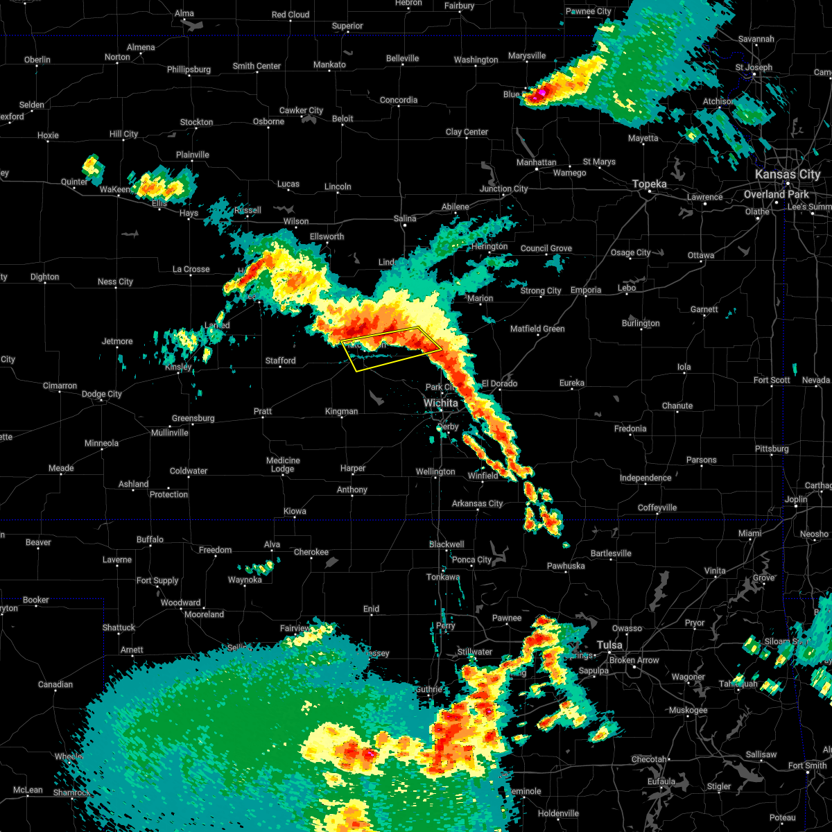 At 205 am cdt, a severe thunderstorm was located near hutchinson, moving south at 35 mph (radar indicated). Hazards include 60 mph wind gusts and quarter size hail. Hail damage to vehicles is expected. expect wind damage to roofs, siding, and trees. locations impacted include, hutchinson, hesston, south hutchinson, north newton, moundridge, buhler, burrton, willowbrook and hutchinson airport. hail threat, radar indicated max hail size, 1. 00 in wind threat, radar indicated max wind gust, 60 mph. At 205 am cdt, a severe thunderstorm was located near hutchinson, moving south at 35 mph (radar indicated). Hazards include 60 mph wind gusts and quarter size hail. Hail damage to vehicles is expected. expect wind damage to roofs, siding, and trees. locations impacted include, hutchinson, hesston, south hutchinson, north newton, moundridge, buhler, burrton, willowbrook and hutchinson airport. hail threat, radar indicated max hail size, 1. 00 in wind threat, radar indicated max wind gust, 60 mph.
|
| 6/10/2022 1:43 AM CDT |
 At 143 am cdt, a severe thunderstorm was located near windom, or 10 miles northwest of inman, moving southeast at 45 mph (radar indicated). Hazards include 60 mph wind gusts and quarter size hail. Hail damage to vehicles is expected. Expect wind damage to roofs, siding, and trees. At 143 am cdt, a severe thunderstorm was located near windom, or 10 miles northwest of inman, moving southeast at 45 mph (radar indicated). Hazards include 60 mph wind gusts and quarter size hail. Hail damage to vehicles is expected. Expect wind damage to roofs, siding, and trees.
|
| 6/5/2022 11:09 PM CDT |
 The severe thunderstorm warning for southeastern mcpherson, harvey and southwestern marion counties will expire at 1115 pm cdt, the storm which prompted the warning has moved out of the area. therefore, the warning will be allowed to expire. however gusty winds and heavy rain are still possible with this thunderstorm. a severe thunderstorm watch remains in effect until 300 am cdt for south central and central kansas. The severe thunderstorm warning for southeastern mcpherson, harvey and southwestern marion counties will expire at 1115 pm cdt, the storm which prompted the warning has moved out of the area. therefore, the warning will be allowed to expire. however gusty winds and heavy rain are still possible with this thunderstorm. a severe thunderstorm watch remains in effect until 300 am cdt for south central and central kansas.
|
| 6/5/2022 10:17 PM CDT |
 At 1016 pm cdt, a severe thunderstorm was located near moundridge, moving east at 30 mph (radar indicated). Hazards include 60 mph wind gusts and quarter size hail. Hail damage to vehicles is expected. Expect wind damage to roofs, siding, and trees. At 1016 pm cdt, a severe thunderstorm was located near moundridge, moving east at 30 mph (radar indicated). Hazards include 60 mph wind gusts and quarter size hail. Hail damage to vehicles is expected. Expect wind damage to roofs, siding, and trees.
|
| 5/17/2022 11:09 PM CDT |
 At 1109 pm cdt, a severe thunderstorm was located near sterling, moving east at 50 mph (radar indicated). Hazards include 60 mph wind gusts and quarter size hail. Hail damage to vehicles is expected. expect wind damage to roofs, siding, and trees. locations impacted include, mcpherson, lyons, sterling, moundridge, inman, galva, canton, little river, chase, alden, windom, raymond and mcpherson airport. hail threat, radar indicated max hail size, 1. 00 in wind threat, observed max wind gust, 60 mph. At 1109 pm cdt, a severe thunderstorm was located near sterling, moving east at 50 mph (radar indicated). Hazards include 60 mph wind gusts and quarter size hail. Hail damage to vehicles is expected. expect wind damage to roofs, siding, and trees. locations impacted include, mcpherson, lyons, sterling, moundridge, inman, galva, canton, little river, chase, alden, windom, raymond and mcpherson airport. hail threat, radar indicated max hail size, 1. 00 in wind threat, observed max wind gust, 60 mph.
|
| 5/17/2022 11:08 PM CDT |
 At 1108 pm cdt, a severe thunderstorm was located 7 miles east of buhler, moving southeast at 85 mph (radar indicated). Hazards include 60 mph wind gusts and quarter size hail. Hail damage to vehicles is expected. expect wind damage to roofs, siding, and trees. locations impacted include, mcpherson, lyons, sterling, moundridge, inman, galva, canton, little river, chase, alden, windom, raymond and mcpherson airport. hail threat, radar indicated max hail size, 1. 00 in wind threat, observed max wind gust, 60 mph. At 1108 pm cdt, a severe thunderstorm was located 7 miles east of buhler, moving southeast at 85 mph (radar indicated). Hazards include 60 mph wind gusts and quarter size hail. Hail damage to vehicles is expected. expect wind damage to roofs, siding, and trees. locations impacted include, mcpherson, lyons, sterling, moundridge, inman, galva, canton, little river, chase, alden, windom, raymond and mcpherson airport. hail threat, radar indicated max hail size, 1. 00 in wind threat, observed max wind gust, 60 mph.
|
| 5/17/2022 10:36 PM CDT |
 At 1036 pm cdt, a severe thunderstorm was located near chase, or 10 miles southeast of claflin, moving southeast at 85 mph (radar indicated). Hazards include 60 mph wind gusts and quarter size hail. Hail damage to vehicles is expected. Expect wind damage to roofs, siding, and trees. At 1036 pm cdt, a severe thunderstorm was located near chase, or 10 miles southeast of claflin, moving southeast at 85 mph (radar indicated). Hazards include 60 mph wind gusts and quarter size hail. Hail damage to vehicles is expected. Expect wind damage to roofs, siding, and trees.
|
| 5/15/2022 8:17 AM CDT |
 At 817 am cdt, a severe thunderstorm was located near burns, or 8 miles south of florence, moving southeast at 45 mph (radar indicated). Hazards include ping pong ball size hail and 60 mph wind gusts. People and animals outdoors will be injured. expect hail damage to roofs, siding, windows, and vehicles. expect wind damage to roofs, siding, and trees. locations impacted include, newton, hesston, hillsboro, north newton, moundridge, peabody, canton, florence, goessel, walton, elbing, burns, lehigh, cassoday, matfield green, cedar point, newton airport, wonsevu, el dorado lake and el dorado state park. hail threat, radar indicated max hail size, 1. 50 in wind threat, radar indicated max wind gust, 60 mph. At 817 am cdt, a severe thunderstorm was located near burns, or 8 miles south of florence, moving southeast at 45 mph (radar indicated). Hazards include ping pong ball size hail and 60 mph wind gusts. People and animals outdoors will be injured. expect hail damage to roofs, siding, windows, and vehicles. expect wind damage to roofs, siding, and trees. locations impacted include, newton, hesston, hillsboro, north newton, moundridge, peabody, canton, florence, goessel, walton, elbing, burns, lehigh, cassoday, matfield green, cedar point, newton airport, wonsevu, el dorado lake and el dorado state park. hail threat, radar indicated max hail size, 1. 50 in wind threat, radar indicated max wind gust, 60 mph.
|
| 5/15/2022 7:55 AM CDT |
 At 755 am cdt, a severe thunderstorm was located near peabody, moving southeast at 45 mph (radar indicated). Hazards include two inch hail and 60 mph wind gusts. People and animals outdoors will be injured. expect hail damage to roofs, siding, windows, and vehicles. Expect wind damage to roofs, siding, and trees. At 755 am cdt, a severe thunderstorm was located near peabody, moving southeast at 45 mph (radar indicated). Hazards include two inch hail and 60 mph wind gusts. People and animals outdoors will be injured. expect hail damage to roofs, siding, windows, and vehicles. Expect wind damage to roofs, siding, and trees.
|
| 12/15/2021 3:10 PM CST |
 At 310 pm cst, severe thunderstorms were located along a line extending from 6 miles south of gypsum to moundridge, moving east at 45 mph (radar indicated). Hazards include 70 mph wind gusts. Expect considerable tree damage. Damage is likely to mobile homes, roofs, and outbuildings. At 310 pm cst, severe thunderstorms were located along a line extending from 6 miles south of gypsum to moundridge, moving east at 45 mph (radar indicated). Hazards include 70 mph wind gusts. Expect considerable tree damage. Damage is likely to mobile homes, roofs, and outbuildings.
|
| 12/15/2021 2:12 PM CST |
 At 211 pm cst, severe thunderstorms were located along a line extending from 6 miles south of barnard to near alden, moving northeast at 55 mph (radar indicated). Hazards include 70 mph wind gusts. Expect considerable tree damage. Damage is likely to mobile homes, roofs, and outbuildings. At 211 pm cst, severe thunderstorms were located along a line extending from 6 miles south of barnard to near alden, moving northeast at 55 mph (radar indicated). Hazards include 70 mph wind gusts. Expect considerable tree damage. Damage is likely to mobile homes, roofs, and outbuildings.
|
| 8/20/2021 9:25 PM CDT |
 The severe thunderstorm warning for southern mcpherson, northwestern chase and marion counties will expire at 930 pm cdt, the storms which prompted the warning have weakened below severe limits, and have exited the warned area. therefore, the warning will be allowed to expire. however very small hail, gusty winds and heavy rain are still possible with these thunderstorms. The severe thunderstorm warning for southern mcpherson, northwestern chase and marion counties will expire at 930 pm cdt, the storms which prompted the warning have weakened below severe limits, and have exited the warned area. therefore, the warning will be allowed to expire. however very small hail, gusty winds and heavy rain are still possible with these thunderstorms.
|
| 8/20/2021 8:41 PM CDT |
 At 839 pm cdt, severe thunderstorms were located along a line extending from 5 miles south of burdick to near moundridge, moving east at 25 mph. the strongest storms were located across southern mcpherson county, and also over far northeast marion county (radar indicated). Hazards include 60 mph wind gusts and quarter size hail. Hail damage to vehicles is expected. expect wind damage to roofs, siding, and trees. locations impacted include, mcpherson, hillsboro, marion, moundridge, inman, peabody, cottonwood falls, galva, canton, strong city, florence, goessel, lincolnville, lehigh, elmdale, cedar point, hymer, marion lake, tallgrass prairie and pilsen. hail threat, radar indicated max hail size, 1. 00 in wind threat, radar indicated max wind gust, 60 mph. At 839 pm cdt, severe thunderstorms were located along a line extending from 5 miles south of burdick to near moundridge, moving east at 25 mph. the strongest storms were located across southern mcpherson county, and also over far northeast marion county (radar indicated). Hazards include 60 mph wind gusts and quarter size hail. Hail damage to vehicles is expected. expect wind damage to roofs, siding, and trees. locations impacted include, mcpherson, hillsboro, marion, moundridge, inman, peabody, cottonwood falls, galva, canton, strong city, florence, goessel, lincolnville, lehigh, elmdale, cedar point, hymer, marion lake, tallgrass prairie and pilsen. hail threat, radar indicated max hail size, 1. 00 in wind threat, radar indicated max wind gust, 60 mph.
|
| 8/20/2021 8:22 PM CDT |
 At 822 pm cdt, severe thunderstorms were located along a line extending from near burdick to near inman, moving east at 25 mph (radar indicated). Hazards include 60 mph wind gusts and quarter size hail. Hail damage to vehicles is expected. Expect wind damage to roofs, siding, and trees. At 822 pm cdt, severe thunderstorms were located along a line extending from near burdick to near inman, moving east at 25 mph (radar indicated). Hazards include 60 mph wind gusts and quarter size hail. Hail damage to vehicles is expected. Expect wind damage to roofs, siding, and trees.
|
| 8/20/2021 8:13 PM CDT |
 At 813 pm cdt, severe thunderstorms were located along a line extending from ramona to near inman, moving east at 20 mph (radar indicated). Hazards include 70 mph wind gusts and quarter size hail. Hail damage to vehicles is expected. expect considerable tree damage. wind damage is also likely to mobile homes, roofs, and outbuildings. locations impacted include, mcpherson, moundridge, inman, galva, canton, goessel, ramona, lehigh, durham, tampa, mcpherson airport and roxbury. thunderstorm damage threat, considerable hail threat, radar indicated max hail size, 1. 00 in wind threat, radar indicated max wind gust, 70 mph. At 813 pm cdt, severe thunderstorms were located along a line extending from ramona to near inman, moving east at 20 mph (radar indicated). Hazards include 70 mph wind gusts and quarter size hail. Hail damage to vehicles is expected. expect considerable tree damage. wind damage is also likely to mobile homes, roofs, and outbuildings. locations impacted include, mcpherson, moundridge, inman, galva, canton, goessel, ramona, lehigh, durham, tampa, mcpherson airport and roxbury. thunderstorm damage threat, considerable hail threat, radar indicated max hail size, 1. 00 in wind threat, radar indicated max wind gust, 70 mph.
|
| 8/20/2021 7:56 PM CDT |
 At 756 pm cdt, a severe thunderstorm was located near inman, moving east to northeast at 25 mph (radar indicated). Hazards include 70 mph wind gusts and ping pong ball size hail. People and animals outdoors will be injured. expect hail damage to roofs, siding, windows, and vehicles. expect considerable tree damage. wind damage is also likely to mobile homes, roofs, and outbuildings. locations impacted include, mcpherson, lindsborg, moundridge, inman, galva, canton, marquette, goessel, ramona, lehigh, windom, durham, tampa, mcpherson airport and roxbury. thunderstorm damage threat, considerable hail threat, radar indicated max hail size, 1. 50 in wind threat, radar indicated max wind gust, 70 mph. At 756 pm cdt, a severe thunderstorm was located near inman, moving east to northeast at 25 mph (radar indicated). Hazards include 70 mph wind gusts and ping pong ball size hail. People and animals outdoors will be injured. expect hail damage to roofs, siding, windows, and vehicles. expect considerable tree damage. wind damage is also likely to mobile homes, roofs, and outbuildings. locations impacted include, mcpherson, lindsborg, moundridge, inman, galva, canton, marquette, goessel, ramona, lehigh, windom, durham, tampa, mcpherson airport and roxbury. thunderstorm damage threat, considerable hail threat, radar indicated max hail size, 1. 50 in wind threat, radar indicated max wind gust, 70 mph.
|
| 8/20/2021 7:49 PM CDT |
 At 748 pm cdt, severe thunderstorms were located along a line extending from 5 miles northwest of galva to inman, moving northeast at 25 mph (radar indicated). Hazards include 70 mph wind gusts and quarter size hail. Hail damage to vehicles is expected. expect considerable tree damage. wind damage is also likely to mobile homes, roofs, and outbuildings. locations impacted include, mcpherson, lindsborg, moundridge, inman, galva, canton, marquette, goessel, ramona, lehigh, windom, durham, tampa, mcpherson airport and roxbury. thunderstorm damage threat, considerable hail threat, radar indicated max hail size, 1. 00 in wind threat, radar indicated max wind gust, 70 mph. At 748 pm cdt, severe thunderstorms were located along a line extending from 5 miles northwest of galva to inman, moving northeast at 25 mph (radar indicated). Hazards include 70 mph wind gusts and quarter size hail. Hail damage to vehicles is expected. expect considerable tree damage. wind damage is also likely to mobile homes, roofs, and outbuildings. locations impacted include, mcpherson, lindsborg, moundridge, inman, galva, canton, marquette, goessel, ramona, lehigh, windom, durham, tampa, mcpherson airport and roxbury. thunderstorm damage threat, considerable hail threat, radar indicated max hail size, 1. 00 in wind threat, radar indicated max wind gust, 70 mph.
|
| 8/20/2021 7:35 PM CDT |
 At 734 pm cdt, severe thunderstorms were located along a line extending from 5 miles east of lindsborg to near inman, moving east at 25 mph (radar indicated). Hazards include 60 mph wind gusts and nickel size hail. Expect damage to roofs, siding, and trees. locations impacted include, mcpherson, lindsborg, moundridge, inman, galva, canton, marquette, goessel, ramona, lehigh, windom, durham, tampa, mcpherson airport, roxbury, bridgeport and marion lake. hail threat, radar indicated max hail size, 0. 88 in wind threat, radar indicated max wind gust, 60 mph. At 734 pm cdt, severe thunderstorms were located along a line extending from 5 miles east of lindsborg to near inman, moving east at 25 mph (radar indicated). Hazards include 60 mph wind gusts and nickel size hail. Expect damage to roofs, siding, and trees. locations impacted include, mcpherson, lindsborg, moundridge, inman, galva, canton, marquette, goessel, ramona, lehigh, windom, durham, tampa, mcpherson airport, roxbury, bridgeport and marion lake. hail threat, radar indicated max hail size, 0. 88 in wind threat, radar indicated max wind gust, 60 mph.
|
| 8/20/2021 7:23 PM CDT |
 At 722 pm cdt, severe thunderstorms were located along a line extending from 5 miles east of lindsborg to 5 miles northwest of mcpherson to 8 miles south of windom, moving northeast at 30 mph (radar indicated). Hazards include 60 mph wind gusts and penny size hail. expect damage to roofs, siding, and trees At 722 pm cdt, severe thunderstorms were located along a line extending from 5 miles east of lindsborg to 5 miles northwest of mcpherson to 8 miles south of windom, moving northeast at 30 mph (radar indicated). Hazards include 60 mph wind gusts and penny size hail. expect damage to roofs, siding, and trees
|
| 6/25/2021 8:53 PM CDT |
 The severe thunderstorm warning for mcpherson and marion counties will expire at 900 pm cdt, the storms which prompted the warning have weakened below severe limits, and no longer pose an immediate threat to life or property. therefore, the warning will be allowed to expire. however gusty winds are still possible with these thunderstorms. a severe thunderstorm watch remains in effect until 900 pm cdt for south central, central and east central kansas. The severe thunderstorm warning for mcpherson and marion counties will expire at 900 pm cdt, the storms which prompted the warning have weakened below severe limits, and no longer pose an immediate threat to life or property. therefore, the warning will be allowed to expire. however gusty winds are still possible with these thunderstorms. a severe thunderstorm watch remains in effect until 900 pm cdt for south central, central and east central kansas.
|
| 6/25/2021 7:59 PM CDT |
 At 759 pm cdt, severe thunderstorms were located along a line extending from 6 miles north of hutchinson to moundridge to near newton, moving east at 35 mph (radar indicated). Hazards include 60 mph wind gusts and penny size hail. Expect damage to roofs, siding, and trees. severe thunderstorms will be near, moundridge around 805 pm cdt. goessel around 815 pm cdt. other locations in the path of these severe thunderstorms include hillsboro, peabody, burns, marion, canton, florence and lehigh. This includes interstate 135 between mile markers 44 and 71. At 759 pm cdt, severe thunderstorms were located along a line extending from 6 miles north of hutchinson to moundridge to near newton, moving east at 35 mph (radar indicated). Hazards include 60 mph wind gusts and penny size hail. Expect damage to roofs, siding, and trees. severe thunderstorms will be near, moundridge around 805 pm cdt. goessel around 815 pm cdt. other locations in the path of these severe thunderstorms include hillsboro, peabody, burns, marion, canton, florence and lehigh. This includes interstate 135 between mile markers 44 and 71.
|
| 6/25/2021 5:55 PM CDT |
 The severe thunderstorm warning for southeastern mcpherson and northwestern harvey counties will expire at 600 pm cdt, the storm which prompted the warning has moved out of the area. therefore, the warning will be allowed to expire. however heavy rain is still possible with this thunderstorm. a severe thunderstorm watch remains in effect until 900 pm cdt for south central and central kansas. The severe thunderstorm warning for southeastern mcpherson and northwestern harvey counties will expire at 600 pm cdt, the storm which prompted the warning has moved out of the area. therefore, the warning will be allowed to expire. however heavy rain is still possible with this thunderstorm. a severe thunderstorm watch remains in effect until 900 pm cdt for south central and central kansas.
|
| 6/25/2021 5:05 PM CDT |
 At 505 pm cdt, a severe thunderstorm was located near moundridge, moving east at 20 mph (radar indicated). Hazards include 60 mph wind gusts and nickel size hail. Expect damage to roofs, siding, and trees. this severe thunderstorm will be near, moundridge around 520 pm cdt. other locations in the path of this severe thunderstorm include hesston. This includes interstate 135 between mile markers 41 and 49. At 505 pm cdt, a severe thunderstorm was located near moundridge, moving east at 20 mph (radar indicated). Hazards include 60 mph wind gusts and nickel size hail. Expect damage to roofs, siding, and trees. this severe thunderstorm will be near, moundridge around 520 pm cdt. other locations in the path of this severe thunderstorm include hesston. This includes interstate 135 between mile markers 41 and 49.
|
| 5/26/2021 10:27 PM CDT |
 The severe thunderstorm warning for southeastern mcpherson, north central harvey and southwestern marion counties will expire at 1030 pm cdt, the storm which prompted the warning has weakened below severe limits, and no longer poses an immediate threat to life or property. therefore, the warning will be allowed to expire. however small hail, gusty winds and very heavy rain are still likely with this thunderstorm. a tornado watch remains in effect until 1100 pm cdt for central kansas. The severe thunderstorm warning for southeastern mcpherson, north central harvey and southwestern marion counties will expire at 1030 pm cdt, the storm which prompted the warning has weakened below severe limits, and no longer poses an immediate threat to life or property. therefore, the warning will be allowed to expire. however small hail, gusty winds and very heavy rain are still likely with this thunderstorm. a tornado watch remains in effect until 1100 pm cdt for central kansas.
|
| 5/26/2021 10:16 PM CDT |
 At 1016 pm cdt, a severe thunderstorm was located near goessel, or 7 miles northeast of hesston, moving east at 5 mph (radar indicated). Hazards include 60 mph wind gusts and half dollar size hail. Hail damage to vehicles is expected. expect wind damage to roofs, siding, and trees. This severe storm will be near, goessel around 1020 pm cdt. At 1016 pm cdt, a severe thunderstorm was located near goessel, or 7 miles northeast of hesston, moving east at 5 mph (radar indicated). Hazards include 60 mph wind gusts and half dollar size hail. Hail damage to vehicles is expected. expect wind damage to roofs, siding, and trees. This severe storm will be near, goessel around 1020 pm cdt.
|
| 5/26/2021 10:00 PM CDT |
 The national weather service in wichita has issued a * severe thunderstorm warning for. southeastern mcpherson county in central kansas. north central harvey county in south central kansas. southwestern marion county in central kansas. Until 1030 pm cdt. The national weather service in wichita has issued a * severe thunderstorm warning for. southeastern mcpherson county in central kansas. north central harvey county in south central kansas. southwestern marion county in central kansas. Until 1030 pm cdt.
|
| 5/26/2021 9:34 PM CDT |
 At 933 pm cdt, severe thunderstorms were located along a line extending from canton to hesston to 5 miles north of burrton, moving southeast at 20 mph (radar indicated). Hazards include two inch hail and 70 mph wind gusts. People and animals outdoors will be injured. expect hail damage to roofs, siding, windows, and vehicles. expect considerable tree damage. wind damage is also likely to mobile homes, roofs, and outbuildings. Locations impacted include, hesston and goessel. At 933 pm cdt, severe thunderstorms were located along a line extending from canton to hesston to 5 miles north of burrton, moving southeast at 20 mph (radar indicated). Hazards include two inch hail and 70 mph wind gusts. People and animals outdoors will be injured. expect hail damage to roofs, siding, windows, and vehicles. expect considerable tree damage. wind damage is also likely to mobile homes, roofs, and outbuildings. Locations impacted include, hesston and goessel.
|
| 5/26/2021 9:30 PM CDT | Also reported dime size hai in mcpherson county KS, 5.4 miles SE of Moundridge, KS |
| 5/26/2021 9:15 PM CDT |
 At 914 pm cdt, severe thunderstorms were located along a line extending from near galva to moundridge to near buhler, moving southeast at 20 mph (radar indicated). Hazards include golf ball size hail and 70 mph wind gusts. People and animals outdoors will be injured. expect hail damage to roofs, siding, windows, and vehicles. expect considerable tree damage. wind damage is also likely to mobile homes, roofs, and outbuildings. severe thunderstorms will be near, moundridge around 920 pm cdt. hesston around 930 pm cdt. other locations in the path of these severe thunderstorms include burrton and goessel. this includes interstate 135 between mile markers 35 and 64. This replaces the severe thunderstorm warnings previously in effect for mcpherson county. At 914 pm cdt, severe thunderstorms were located along a line extending from near galva to moundridge to near buhler, moving southeast at 20 mph (radar indicated). Hazards include golf ball size hail and 70 mph wind gusts. People and animals outdoors will be injured. expect hail damage to roofs, siding, windows, and vehicles. expect considerable tree damage. wind damage is also likely to mobile homes, roofs, and outbuildings. severe thunderstorms will be near, moundridge around 920 pm cdt. hesston around 930 pm cdt. other locations in the path of these severe thunderstorms include burrton and goessel. this includes interstate 135 between mile markers 35 and 64. This replaces the severe thunderstorm warnings previously in effect for mcpherson county.
|
| 5/26/2021 9:10 PM CDT |
 At 909 pm cdt, a severe thunderstorm was located 6 miles south of mcpherson, moving southeast at 10 mph (radar indicated). Hazards include 70 mph wind gusts and ping pong ball size hail. People and animals outdoors will be injured. expect hail damage to roofs, siding, windows, and vehicles. expect considerable tree damage. wind damage is also likely to mobile homes, roofs, and outbuildings. Locations impacted include, moundridge and inman. At 909 pm cdt, a severe thunderstorm was located 6 miles south of mcpherson, moving southeast at 10 mph (radar indicated). Hazards include 70 mph wind gusts and ping pong ball size hail. People and animals outdoors will be injured. expect hail damage to roofs, siding, windows, and vehicles. expect considerable tree damage. wind damage is also likely to mobile homes, roofs, and outbuildings. Locations impacted include, moundridge and inman.
|
| 5/26/2021 8:57 PM CDT |
 At 856 pm cdt, a severe thunderstorm was located just north of inman, moving east-southeast at 10 mph (radar indicated). Hazards include ping pong ball size hail and 60 mph wind gusts. People and animals outdoors will be injured. expect hail damage to roofs, siding, windows, and vehicles. Expect wind damage to roofs, siding, and trees. At 856 pm cdt, a severe thunderstorm was located just north of inman, moving east-southeast at 10 mph (radar indicated). Hazards include ping pong ball size hail and 60 mph wind gusts. People and animals outdoors will be injured. expect hail damage to roofs, siding, windows, and vehicles. Expect wind damage to roofs, siding, and trees.
|
| 5/16/2021 12:58 AM CDT |
 At 1258 am cdt, a severe thunderstorm was located near halstead, moving north at 20 mph (radar indicated). Hazards include 60 mph wind gusts and quarter size hail. Hail damage to vehicles is expected. Expect wind damage to roofs, siding, and trees. At 1258 am cdt, a severe thunderstorm was located near halstead, moving north at 20 mph (radar indicated). Hazards include 60 mph wind gusts and quarter size hail. Hail damage to vehicles is expected. Expect wind damage to roofs, siding, and trees.
|
| 7/30/2020 2:37 AM CDT |
 At 236 am cdt, severe thunderstorms were located along a line extending from 5 miles north of beverly to 7 miles south of brookville to 6 miles northeast of nickerson, moving east at 50 mph (radar indicated). Hazards include 60 mph wind gusts and penny size hail. expect damage to roofs, siding, and trees At 236 am cdt, severe thunderstorms were located along a line extending from 5 miles north of beverly to 7 miles south of brookville to 6 miles northeast of nickerson, moving east at 50 mph (radar indicated). Hazards include 60 mph wind gusts and penny size hail. expect damage to roofs, siding, and trees
|
| 7/29/2020 9:51 PM CDT |
 At 951 pm cdt, severe thunderstorms were located along a line extending from 6 miles northeast of windom to buhler to near partridge, moving southeast at 35 mph (radar indicated). Hazards include 60 mph wind gusts and penny size hail. Expect damage to roofs, siding, and trees. Locations impacted include, hutchinson, mcpherson, hesston, south hutchinson, moundridge, inman, buhler, haven, burrton, galva, canton, partridge, windom, yoder, willowbrook, mcpherson airport and hutchinson airport. At 951 pm cdt, severe thunderstorms were located along a line extending from 6 miles northeast of windom to buhler to near partridge, moving southeast at 35 mph (radar indicated). Hazards include 60 mph wind gusts and penny size hail. Expect damage to roofs, siding, and trees. Locations impacted include, hutchinson, mcpherson, hesston, south hutchinson, moundridge, inman, buhler, haven, burrton, galva, canton, partridge, windom, yoder, willowbrook, mcpherson airport and hutchinson airport.
|
| 7/29/2020 9:19 PM CDT |
 At 918 pm cdt, severe thunderstorms were located along a line extending from 6 miles northeast of geneseo to 5 miles south of little river to 8 miles south of alden, moving east at 55 mph (radar indicated). Hazards include 60 mph wind gusts and penny size hail. expect damage to roofs, siding, and trees At 918 pm cdt, severe thunderstorms were located along a line extending from 6 miles northeast of geneseo to 5 miles south of little river to 8 miles south of alden, moving east at 55 mph (radar indicated). Hazards include 60 mph wind gusts and penny size hail. expect damage to roofs, siding, and trees
|
| 7/15/2020 2:34 AM CDT |
 At 234 am cdt, severe thunderstorms were located along a line extending from 9 miles south of gypsum to hillsboro to walton, moving northeast at 50 mph (radar indicated). Hazards include 70 mph wind gusts. Expect considerable tree damage. damage is likely to mobile homes, roofs, and outbuildings. Locations impacted include, hesston, hillsboro, marion, north newton, moundridge, peabody, galva, canton, florence, goessel, walton, lincolnville, ramona, lehigh, durham, tampa, lost springs, roxbury, marion lake and pilsen. At 234 am cdt, severe thunderstorms were located along a line extending from 9 miles south of gypsum to hillsboro to walton, moving northeast at 50 mph (radar indicated). Hazards include 70 mph wind gusts. Expect considerable tree damage. damage is likely to mobile homes, roofs, and outbuildings. Locations impacted include, hesston, hillsboro, marion, north newton, moundridge, peabody, galva, canton, florence, goessel, walton, lincolnville, ramona, lehigh, durham, tampa, lost springs, roxbury, marion lake and pilsen.
|
| 7/15/2020 2:14 AM CDT |
 At 213 am cdt, severe thunderstorms were located along a line extending from 6 miles south of lindsborg to 5 miles north of galva to near canton to near hesston to near halstead, moving northeast at 55 mph (radar indicated). Hazards include 70 mph wind gusts. Expect considerable tree damage. damage is likely to mobile homes, roofs, and outbuildings. Locations impacted include, mcpherson, hesston, north newton, moundridge, inman and mcpherson airport. At 213 am cdt, severe thunderstorms were located along a line extending from 6 miles south of lindsborg to 5 miles north of galva to near canton to near hesston to near halstead, moving northeast at 55 mph (radar indicated). Hazards include 70 mph wind gusts. Expect considerable tree damage. damage is likely to mobile homes, roofs, and outbuildings. Locations impacted include, mcpherson, hesston, north newton, moundridge, inman and mcpherson airport.
|
| 7/15/2020 2:06 AM CDT |
 At 206 am cdt, a severe thunderstorm was located over moundridge, moving northeast at 50 mph (radar indicated). Hazards include 70 mph wind gusts. Expect considerable tree damage. Damage is likely to mobile homes, roofs, and outbuildings. At 206 am cdt, a severe thunderstorm was located over moundridge, moving northeast at 50 mph (radar indicated). Hazards include 70 mph wind gusts. Expect considerable tree damage. Damage is likely to mobile homes, roofs, and outbuildings.
|
| 7/15/2020 1:54 AM CDT |
 At 154 am cdt, severe thunderstorms were located along a line extending from 7 miles southwest of windom to near inman to near buhler to near burrton to near haven, moving northeast at 55 mph (radar indicated). Hazards include 60 mph wind gusts. Expect damage to roofs, siding, and trees. Locations impacted include, hutchinson, newton, mcpherson, hesston, south hutchinson, sterling, halstead, north newton, moundridge, inman, buhler, haven, nickerson, burrton, windom, yoder, willowbrook, mcpherson airport and hutchinson airport. At 154 am cdt, severe thunderstorms were located along a line extending from 7 miles southwest of windom to near inman to near buhler to near burrton to near haven, moving northeast at 55 mph (radar indicated). Hazards include 60 mph wind gusts. Expect damage to roofs, siding, and trees. Locations impacted include, hutchinson, newton, mcpherson, hesston, south hutchinson, sterling, halstead, north newton, moundridge, inman, buhler, haven, nickerson, burrton, windom, yoder, willowbrook, mcpherson airport and hutchinson airport.
|
| 7/15/2020 1:30 AM CDT |
 At 130 am cdt, severe thunderstorms were located along a line extending from near sterling to near nickerson to near south hutchinson to 8 miles southeast of partridge to near pretty prairie, moving east at 55 mph (radar indicated). Hazards include 70 mph wind gusts. Expect considerable tree damage. Damage is likely to mobile homes, roofs, and outbuildings. At 130 am cdt, severe thunderstorms were located along a line extending from near sterling to near nickerson to near south hutchinson to 8 miles southeast of partridge to near pretty prairie, moving east at 55 mph (radar indicated). Hazards include 70 mph wind gusts. Expect considerable tree damage. Damage is likely to mobile homes, roofs, and outbuildings.
|
| 5/3/2020 5:19 AM CDT |
 At 519 am cdt, a severe thunderstorm was located near goessel, or 7 miles south of hillsboro, moving east at 30 mph (radar indicated). Hazards include ping pong ball size hail. People and animals outdoors will be injured. expect damage to roofs, siding, windows, and vehicles. Locations impacted include, hillsboro, marion, moundridge, peabody, goessel, lehigh and marion lake. At 519 am cdt, a severe thunderstorm was located near goessel, or 7 miles south of hillsboro, moving east at 30 mph (radar indicated). Hazards include ping pong ball size hail. People and animals outdoors will be injured. expect damage to roofs, siding, windows, and vehicles. Locations impacted include, hillsboro, marion, moundridge, peabody, goessel, lehigh and marion lake.
|
| 5/3/2020 5:03 AM CDT |
 At 502 am cdt, a severe thunderstorm was located near goessel, or 6 miles northeast of moundridge, moving east at 30 mph (radar indicated). Hazards include ping pong ball size hail. People and animals outdoors will be injured. expect damage to roofs, siding, windows, and vehicles. Locations impacted include, hillsboro, marion, moundridge, inman, peabody, goessel, lehigh and marion lake. At 502 am cdt, a severe thunderstorm was located near goessel, or 6 miles northeast of moundridge, moving east at 30 mph (radar indicated). Hazards include ping pong ball size hail. People and animals outdoors will be injured. expect damage to roofs, siding, windows, and vehicles. Locations impacted include, hillsboro, marion, moundridge, inman, peabody, goessel, lehigh and marion lake.
|
| 5/3/2020 4:59 AM CDT |
 At 458 am cdt, a severe thunderstorm was located near moundridge, moving east at 30 mph (radar indicated). Hazards include half dollar size hail. damage to vehicles is expected At 458 am cdt, a severe thunderstorm was located near moundridge, moving east at 30 mph (radar indicated). Hazards include half dollar size hail. damage to vehicles is expected
|
| 10/1/2019 4:55 PM CDT |
 At 455 pm cdt, a severe thunderstorm was located near moundridge, moving northeast at 45 mph (radar indicated). Hazards include 70 mph wind gusts. Expect considerable tree damage. damage is likely to mobile homes, roofs, and outbuildings. Locations impacted include, mcpherson, hesston, hillsboro, marion, moundridge, galva, canton, florence, goessel, lehigh, durham, tampa, roxbury and marion lake. At 455 pm cdt, a severe thunderstorm was located near moundridge, moving northeast at 45 mph (radar indicated). Hazards include 70 mph wind gusts. Expect considerable tree damage. damage is likely to mobile homes, roofs, and outbuildings. Locations impacted include, mcpherson, hesston, hillsboro, marion, moundridge, galva, canton, florence, goessel, lehigh, durham, tampa, roxbury and marion lake.
|
| 10/1/2019 4:37 PM CDT |
 At 437 pm cdt, a severe thunderstorm was located over buhler, moving northeast at 50 mph. the hutchinson aiport has gusted to 71 mph (trained weather spotters). Hazards include 70 mph wind gusts. Expect considerable tree damage. damage is likely to mobile homes, roofs, and outbuildings. Locations impacted include, hutchinson, mcpherson, hesston, hillsboro, marion, moundridge, inman, buhler, burrton, galva, canton, florence, goessel, lehigh, durham, tampa, roxbury, marion lake and hutchinson airport. At 437 pm cdt, a severe thunderstorm was located over buhler, moving northeast at 50 mph. the hutchinson aiport has gusted to 71 mph (trained weather spotters). Hazards include 70 mph wind gusts. Expect considerable tree damage. damage is likely to mobile homes, roofs, and outbuildings. Locations impacted include, hutchinson, mcpherson, hesston, hillsboro, marion, moundridge, inman, buhler, burrton, galva, canton, florence, goessel, lehigh, durham, tampa, roxbury, marion lake and hutchinson airport.
|
| 10/1/2019 4:32 PM CDT |
 At 432 pm cdt, a severe thunderstorm was located near hutchinson, moving northeast at 50 mph (trained weather spotters). Hazards include 60 mph wind gusts. expect damage to roofs, siding, and trees At 432 pm cdt, a severe thunderstorm was located near hutchinson, moving northeast at 50 mph (trained weather spotters). Hazards include 60 mph wind gusts. expect damage to roofs, siding, and trees
|
| 9/27/2019 8:25 PM CDT |
 The severe thunderstorm warning for southeastern mcpherson and west central marion counties will expire at 830 pm cdt, the severe thunderstorm which prompted the warning has moved out of the warned area. therefore, the warning will be allowed to expire. a severe thunderstorm watch remains in effect until 200 am cdt for central kansas. remember, a severe thunderstorm warning still remains in effect for marion county. The severe thunderstorm warning for southeastern mcpherson and west central marion counties will expire at 830 pm cdt, the severe thunderstorm which prompted the warning has moved out of the warned area. therefore, the warning will be allowed to expire. a severe thunderstorm watch remains in effect until 200 am cdt for central kansas. remember, a severe thunderstorm warning still remains in effect for marion county.
|
| 9/27/2019 7:58 PM CDT |
 At 758 pm cdt, a severe thunderstorm was located near moundridge, moving northeast at 30 mph (radar indicated). Hazards include quarter size hail. Damage to vehicles is expected. Locations impacted include, moundridge, canton, goessel and lehigh. At 758 pm cdt, a severe thunderstorm was located near moundridge, moving northeast at 30 mph (radar indicated). Hazards include quarter size hail. Damage to vehicles is expected. Locations impacted include, moundridge, canton, goessel and lehigh.
|
| 9/27/2019 7:41 PM CDT |
 At 740 pm cdt, a severe thunderstorm was located near moundridge, moving northeast at 30 mph (radar indicated). Hazards include 60 mph wind gusts and quarter size hail. Hail damage to vehicles is expected. expect wind damage to roofs, siding, and trees. Locations impacted include, hesston, moundridge, canton, goessel and lehigh. At 740 pm cdt, a severe thunderstorm was located near moundridge, moving northeast at 30 mph (radar indicated). Hazards include 60 mph wind gusts and quarter size hail. Hail damage to vehicles is expected. expect wind damage to roofs, siding, and trees. Locations impacted include, hesston, moundridge, canton, goessel and lehigh.
|
| 9/27/2019 7:26 PM CDT |
 At 726 pm cdt, a severe thunderstorm was located near buhler, moving northeast at 30 mph (radar indicated). Hazards include golf ball size hail and 60 mph wind gusts. People and animals outdoors will be injured. expect hail damage to roofs, siding, windows, and vehicles. Expect wind damage to roofs, siding, and trees. At 726 pm cdt, a severe thunderstorm was located near buhler, moving northeast at 30 mph (radar indicated). Hazards include golf ball size hail and 60 mph wind gusts. People and animals outdoors will be injured. expect hail damage to roofs, siding, windows, and vehicles. Expect wind damage to roofs, siding, and trees.
|
| 8/30/2019 12:17 AM CDT |
 At 1216 am cdt, severe thunderstorms were located along a line extending from near herington to near newton, moving southeast at 45 mph (radar indicated). Hazards include 60 mph wind gusts and penny size hail. Expect damage to roofs, siding, and trees. Locations impacted include, hillsboro, marion, peabody, canton, florence, goessel, burns, lincolnville, ramona, lehigh, durham, tampa, lost springs, marion lake and pilsen. At 1216 am cdt, severe thunderstorms were located along a line extending from near herington to near newton, moving southeast at 45 mph (radar indicated). Hazards include 60 mph wind gusts and penny size hail. Expect damage to roofs, siding, and trees. Locations impacted include, hillsboro, marion, peabody, canton, florence, goessel, burns, lincolnville, ramona, lehigh, durham, tampa, lost springs, marion lake and pilsen.
|
| 8/29/2019 11:59 PM CDT |
 At 1143 pm cdt, severe thunderstorms were located along a line extending from near solomon to 5 miles east of buhler, moving southeast at 45 mph (radar indicated). Hazards include 60 mph wind gusts and penny size hail. expect damage to roofs, siding, and trees At 1143 pm cdt, severe thunderstorms were located along a line extending from near solomon to 5 miles east of buhler, moving southeast at 45 mph (radar indicated). Hazards include 60 mph wind gusts and penny size hail. expect damage to roofs, siding, and trees
|
| 8/29/2019 11:43 PM CDT |
 At 1143 pm cdt, severe thunderstorms were located along a line extending from near solomon to 5 miles east of buhler, moving southeast at 45 mph (radar indicated). Hazards include 60 mph wind gusts and penny size hail. expect damage to roofs, siding, and trees At 1143 pm cdt, severe thunderstorms were located along a line extending from near solomon to 5 miles east of buhler, moving southeast at 45 mph (radar indicated). Hazards include 60 mph wind gusts and penny size hail. expect damage to roofs, siding, and trees
|
| 8/29/2019 11:23 PM CDT |
 A severe thunderstorm warning remains in effect until 1145 pm cdt for mcpherson. northern reno. rice and saline counties. At 1122 pm cdt, severe thunderstorms were located along a line extending from near new cambria to near mcpherson to 7 miles northeast of nickerson to 8 miles north of sylvia, moving southeast at 55 mph. A severe thunderstorm warning remains in effect until 1145 pm cdt for mcpherson. northern reno. rice and saline counties. At 1122 pm cdt, severe thunderstorms were located along a line extending from near new cambria to near mcpherson to 7 miles northeast of nickerson to 8 miles north of sylvia, moving southeast at 55 mph.
|
| 8/29/2019 10:58 PM CDT |
 At 1058 pm cdt, severe thunderstorms were located along a line extending from 5 miles south of beverly to 7 miles east of geneseo to 5 miles east of great bend, moving southeast at 50 mph. these are very dangerous storms (radar indicated). Hazards include 80 mph wind gusts and quarter size hail. Flying debris will be dangerous to those caught without shelter. mobile homes will be heavily damaged. expect considerable damage to roofs, windows, and vehicles. extensive tree damage and power outages are likely. Locations impacted include, salina, mcpherson, lyons, lindsborg, sterling, moundridge, inman, galva, canton, kanopolis, marquette, little river, chase, assaria, gypsum, bushton, geneseo, brookville, smolan and alden. At 1058 pm cdt, severe thunderstorms were located along a line extending from 5 miles south of beverly to 7 miles east of geneseo to 5 miles east of great bend, moving southeast at 50 mph. these are very dangerous storms (radar indicated). Hazards include 80 mph wind gusts and quarter size hail. Flying debris will be dangerous to those caught without shelter. mobile homes will be heavily damaged. expect considerable damage to roofs, windows, and vehicles. extensive tree damage and power outages are likely. Locations impacted include, salina, mcpherson, lyons, lindsborg, sterling, moundridge, inman, galva, canton, kanopolis, marquette, little river, chase, assaria, gypsum, bushton, geneseo, brookville, smolan and alden.
|
| 8/29/2019 10:30 PM CDT |
 At 1030 pm cdt, severe thunderstorms were located along a line extending from 7 miles southeast of victor to near kanopolis to near olmitz, moving southeast at 60 mph (radar indicated). Hazards include 70 mph wind gusts and quarter size hail. Hail damage to vehicles is expected. expect considerable tree damage. Wind damage is also likely to mobile homes, roofs, and outbuildings. At 1030 pm cdt, severe thunderstorms were located along a line extending from 7 miles southeast of victor to near kanopolis to near olmitz, moving southeast at 60 mph (radar indicated). Hazards include 70 mph wind gusts and quarter size hail. Hail damage to vehicles is expected. expect considerable tree damage. Wind damage is also likely to mobile homes, roofs, and outbuildings.
|
| 8/25/2019 2:00 AM CDT |
 At 159 am cdt, severe thunderstorms were located along a line extending from 5 miles southwest of carlton to near hesston to 5 miles northwest of bentley to near arlington, moving southeast at 40 mph (radar indicated). Hazards include 60 mph wind gusts and penny size hail. Expect damage to roofs, siding, and trees. Locations impacted include, wichita, hutchinson, derby, newton, el dorado, andover, haysville, augusta, park city, valley center, bel aire, mulvane, goddard, rose hill, hesston, maize, kingman, hillsboro, clearwater and south hutchinson. At 159 am cdt, severe thunderstorms were located along a line extending from 5 miles southwest of carlton to near hesston to 5 miles northwest of bentley to near arlington, moving southeast at 40 mph (radar indicated). Hazards include 60 mph wind gusts and penny size hail. Expect damage to roofs, siding, and trees. Locations impacted include, wichita, hutchinson, derby, newton, el dorado, andover, haysville, augusta, park city, valley center, bel aire, mulvane, goddard, rose hill, hesston, maize, kingman, hillsboro, clearwater and south hutchinson.
|
| 8/25/2019 1:44 AM CDT |
 At 144 am cdt, severe thunderstorms were located along a line extending from near gypsum to near moundridge to near burrton to near plevna, moving southeast at 40 mph (radar indicated). Hazards include 60 mph wind gusts and nickel size hail. expect damage to roofs, siding, and trees At 144 am cdt, severe thunderstorms were located along a line extending from near gypsum to near moundridge to near burrton to near plevna, moving southeast at 40 mph (radar indicated). Hazards include 60 mph wind gusts and nickel size hail. expect damage to roofs, siding, and trees
|
| 8/25/2019 1:29 AM CDT |
 At 128 am cdt, severe thunderstorms were located along a line extending from near salina to mcpherson to near hutchinson to near sylvia, moving southeast at 40 mph (radar indicated). Hazards include 60 mph wind gusts and nickel size hail. Expect damage to roofs, siding, and trees. Locations impacted include, salina, hutchinson, mcpherson, lyons, hesston, lindsborg, south hutchinson, sterling, moundridge, inman, buhler, haven, nickerson, burrton, galva, canton, marquette, little river, arlington and assaria. At 128 am cdt, severe thunderstorms were located along a line extending from near salina to mcpherson to near hutchinson to near sylvia, moving southeast at 40 mph (radar indicated). Hazards include 60 mph wind gusts and nickel size hail. Expect damage to roofs, siding, and trees. Locations impacted include, salina, hutchinson, mcpherson, lyons, hesston, lindsborg, south hutchinson, sterling, moundridge, inman, buhler, haven, nickerson, burrton, galva, canton, marquette, little river, arlington and assaria.
|
| 8/25/2019 1:14 AM CDT |
 At 112 am cdt, severe thunderstorms were located along a line extending from 5 miles northwest of assaria to 9 miles west of inman to just north of sylvia, moving southeast at 50 mph (radar indicated). Hazards include 70 mph wind gusts and nickel size hail. Expect considerable tree damage. damage is likely to mobile homes, roofs, and outbuildings. Locations impacted include, salina, hutchinson, mcpherson, lyons, hesston, lindsborg, south hutchinson, sterling, moundridge, inman, buhler, haven, nickerson, burrton, galva, canton, marquette, little river, arlington and assaria. At 112 am cdt, severe thunderstorms were located along a line extending from 5 miles northwest of assaria to 9 miles west of inman to just north of sylvia, moving southeast at 50 mph (radar indicated). Hazards include 70 mph wind gusts and nickel size hail. Expect considerable tree damage. damage is likely to mobile homes, roofs, and outbuildings. Locations impacted include, salina, hutchinson, mcpherson, lyons, hesston, lindsborg, south hutchinson, sterling, moundridge, inman, buhler, haven, nickerson, burrton, galva, canton, marquette, little river, arlington and assaria.
|
| 8/25/2019 12:59 AM CDT |
 At 1258 am cdt, severe thunderstorms were located along a line extending from near brookville to 6 miles southeast of lyons to near hudson, moving southeast at 45 mph (radar indicated). Hazards include 70 mph wind gusts and nickel size hail. Expect considerable tree damage. damage is likely to mobile homes, roofs, and outbuildings. Locations impacted include, salina, hutchinson, mcpherson, lyons, hesston, lindsborg, south hutchinson, sterling, moundridge, inman, buhler, haven, nickerson, burrton, galva, canton, marquette, little river, arlington and assaria. At 1258 am cdt, severe thunderstorms were located along a line extending from near brookville to 6 miles southeast of lyons to near hudson, moving southeast at 45 mph (radar indicated). Hazards include 70 mph wind gusts and nickel size hail. Expect considerable tree damage. damage is likely to mobile homes, roofs, and outbuildings. Locations impacted include, salina, hutchinson, mcpherson, lyons, hesston, lindsborg, south hutchinson, sterling, moundridge, inman, buhler, haven, nickerson, burrton, galva, canton, marquette, little river, arlington and assaria.
|
| 8/25/2019 12:45 AM CDT |
 At 1244 am cdt, severe thunderstorms were located along a line extending from 8 miles northwest of brookville to near lyons to near seward, moving southeast at 50 mph (radar indicated). Hazards include 70 mph wind gusts and nickel size hail. Expect considerable tree damage. Damage is likely to mobile homes, roofs, and outbuildings. At 1244 am cdt, severe thunderstorms were located along a line extending from 8 miles northwest of brookville to near lyons to near seward, moving southeast at 50 mph (radar indicated). Hazards include 70 mph wind gusts and nickel size hail. Expect considerable tree damage. Damage is likely to mobile homes, roofs, and outbuildings.
|
| 8/21/2019 7:21 PM CDT |
 At 701 pm cdt, a severe thunderstorm was located near buhler, moving east at 15 mph (radar indicated. at 6:55 pm, 65 to 70 mph winds were reported in buhler). Hazards include 70 mph wind gusts and quarter size hail. Hail damage to vehicles is expected. expect considerable tree damage. wind damage is also likely to mobile homes, roofs, and outbuildings. Locations impacted include, moundridge. At 701 pm cdt, a severe thunderstorm was located near buhler, moving east at 15 mph (radar indicated. at 6:55 pm, 65 to 70 mph winds were reported in buhler). Hazards include 70 mph wind gusts and quarter size hail. Hail damage to vehicles is expected. expect considerable tree damage. wind damage is also likely to mobile homes, roofs, and outbuildings. Locations impacted include, moundridge.
|
| 8/21/2019 7:01 PM CDT |
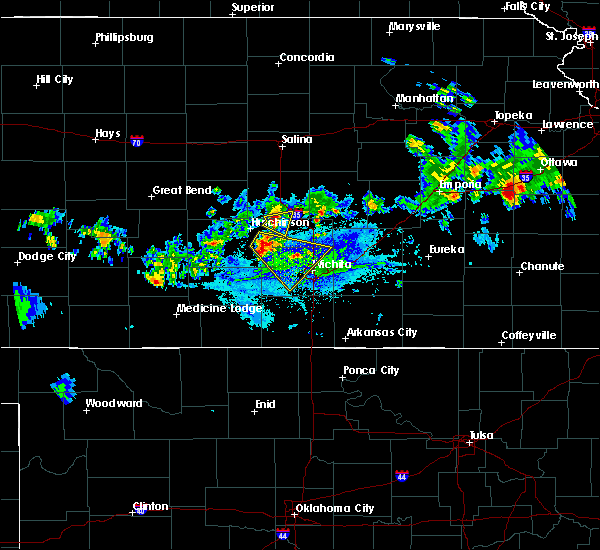 At 630 pm cdt, a severe thunderstorm was located 6 miles west of inman, moving east at 15 mph (radar indicated). Hazards include 60 mph wind gusts and penny size hail. expect damage to roofs, siding, and trees At 630 pm cdt, a severe thunderstorm was located 6 miles west of inman, moving east at 15 mph (radar indicated). Hazards include 60 mph wind gusts and penny size hail. expect damage to roofs, siding, and trees
|
| 8/21/2019 6:51 PM CDT |
 At 650 pm cdt, a severe thunderstorm was located over buhler, moving southeast at 25 mph (radar indicated). Hazards include 60 mph wind gusts and quarter size hail. Hail damage to vehicles is expected. expect wind damage to roofs, siding, and trees. Locations impacted include, moundridge, inman and buhler. At 650 pm cdt, a severe thunderstorm was located over buhler, moving southeast at 25 mph (radar indicated). Hazards include 60 mph wind gusts and quarter size hail. Hail damage to vehicles is expected. expect wind damage to roofs, siding, and trees. Locations impacted include, moundridge, inman and buhler.
|
| 8/21/2019 6:38 PM CDT |
 At 637 pm cdt, a severe thunderstorm was located near inman, moving east at 15 mph (radar indicated. at 6:35 pm, 60 mph winds were reported in southwest mcpherson county). Hazards include 60 mph wind gusts and quarter size hail. Hail damage to vehicles is expected. expect wind damage to roofs, siding, and trees. Locations impacted include, moundridge, inman and buhler. At 637 pm cdt, a severe thunderstorm was located near inman, moving east at 15 mph (radar indicated. at 6:35 pm, 60 mph winds were reported in southwest mcpherson county). Hazards include 60 mph wind gusts and quarter size hail. Hail damage to vehicles is expected. expect wind damage to roofs, siding, and trees. Locations impacted include, moundridge, inman and buhler.
|
| 8/21/2019 6:30 PM CDT |
 The national weather service in wichita has issued a * severe thunderstorm warning for. southern mcpherson county in central kansas. northeastern reno county in south central kansas. northwestern harvey county in south central kansas. Until 730 pm cdt. The national weather service in wichita has issued a * severe thunderstorm warning for. southern mcpherson county in central kansas. northeastern reno county in south central kansas. northwestern harvey county in south central kansas. Until 730 pm cdt.
|
| 8/21/2019 6:29 PM CDT |
 At 628 pm cdt, a severe thunderstorm was located 6 miles west of inman, moving east at 15 mph. this is a very dangerous storm (radar indicated). Hazards include 100 mph wind gusts. You are in a life-threatening situation. flying debris may be deadly to those caught without shelter. mobile homes will be destroyed. expect considerable damage to homes and businesses. Expect extensive tree damage and power outages. At 628 pm cdt, a severe thunderstorm was located 6 miles west of inman, moving east at 15 mph. this is a very dangerous storm (radar indicated). Hazards include 100 mph wind gusts. You are in a life-threatening situation. flying debris may be deadly to those caught without shelter. mobile homes will be destroyed. expect considerable damage to homes and businesses. Expect extensive tree damage and power outages.
|
| 8/18/2019 1:23 AM CDT |
 The severe thunderstorm warning for mcpherson, northeastern reno and harvey counties will expire at 130 am cdt, the storms which prompted the warning have weakened below severe limits, and no longer pose an immediate threat to life or property. therefore, the warning will be allowed to expire. however gusty winds and heavy rain are still possible with these thunderstorms. a severe thunderstorm watch remains in effect until 300 am cdt for south central and central kansas. The severe thunderstorm warning for mcpherson, northeastern reno and harvey counties will expire at 130 am cdt, the storms which prompted the warning have weakened below severe limits, and no longer pose an immediate threat to life or property. therefore, the warning will be allowed to expire. however gusty winds and heavy rain are still possible with these thunderstorms. a severe thunderstorm watch remains in effect until 300 am cdt for south central and central kansas.
|
| 8/18/2019 12:17 AM CDT |
 At 1217 am cdt, severe thunderstorms were located along a line extending from near north newton to near little river, moving southeast at 25 mph (radar indicated). Hazards include 70 mph wind gusts and quarter size hail. Hail damage to vehicles is expected. expect considerable tree damage. Wind damage is also likely to mobile homes, roofs, and outbuildings. At 1217 am cdt, severe thunderstorms were located along a line extending from near north newton to near little river, moving southeast at 25 mph (radar indicated). Hazards include 70 mph wind gusts and quarter size hail. Hail damage to vehicles is expected. expect considerable tree damage. Wind damage is also likely to mobile homes, roofs, and outbuildings.
|
| 8/18/2019 12:06 AM CDT |
 The severe thunderstorm warning for mcpherson, northwestern harvey and west central marion counties will expire at 1215 am cdt, the storms which prompted the warning have moved out of the area. therefore, the warning will be allowed to expire. however gusty winds and heavy rain are still possible with this area of thunderstorms. a severe thunderstorm watch remains in effect until 300 am cdt for south central and central kansas. The severe thunderstorm warning for mcpherson, northwestern harvey and west central marion counties will expire at 1215 am cdt, the storms which prompted the warning have moved out of the area. therefore, the warning will be allowed to expire. however gusty winds and heavy rain are still possible with this area of thunderstorms. a severe thunderstorm watch remains in effect until 300 am cdt for south central and central kansas.
|
| 8/17/2019 11:44 PM CDT |
 At 1143 pm cdt, a severe thunderstorm was located near peabody, moving southeast at 50 mph (radar indicated). Hazards include 60 mph wind gusts and penny size hail. Expect damage to roofs, siding, and trees. Locations impacted include, newton, mcpherson, hesston, lindsborg, moundridge, inman, galva, canton, marquette, windom, mcpherson airport and roxbury. At 1143 pm cdt, a severe thunderstorm was located near peabody, moving southeast at 50 mph (radar indicated). Hazards include 60 mph wind gusts and penny size hail. Expect damage to roofs, siding, and trees. Locations impacted include, newton, mcpherson, hesston, lindsborg, moundridge, inman, galva, canton, marquette, windom, mcpherson airport and roxbury.
|
| 8/17/2019 11:31 PM CDT |
 A severe thunderstorm warning remains in effect until 1215 am cdt for mcpherson. northwestern harvey. west central marion and southeastern saline counties. at 1131 pm cdt, a severe thunderstorm was located over goessel, or 9 miles southeast of canton, moving southeast at 45 mph. hazard. 70 mph wind gusts and nickel size hail. A severe thunderstorm warning remains in effect until 1215 am cdt for mcpherson. northwestern harvey. west central marion and southeastern saline counties. at 1131 pm cdt, a severe thunderstorm was located over goessel, or 9 miles southeast of canton, moving southeast at 45 mph. hazard. 70 mph wind gusts and nickel size hail.
|
| 8/17/2019 10:43 PM CDT |
 At 1043 pm cdt, a severe thunderstorm was located over little river, or 12 miles northeast of lyons, moving southeast at 50 mph (radar indicated). Hazards include 70 mph wind gusts and nickel size hail. Expect considerable tree damage. Damage is likely to mobile homes, roofs, and outbuildings. At 1043 pm cdt, a severe thunderstorm was located over little river, or 12 miles northeast of lyons, moving southeast at 50 mph (radar indicated). Hazards include 70 mph wind gusts and nickel size hail. Expect considerable tree damage. Damage is likely to mobile homes, roofs, and outbuildings.
|
| 7/28/2019 10:06 PM CDT |
 The severe thunderstorm warning for southwestern mcpherson and southeastern rice counties will expire at 1015 pm cdt, the storm which prompted the warning has weakened below severe limits, and no longer poses an immediate threat to life or property. therefore, the warning will be allowed to expire. however gusty winds are still possible with this thunderstorm. The severe thunderstorm warning for southwestern mcpherson and southeastern rice counties will expire at 1015 pm cdt, the storm which prompted the warning has weakened below severe limits, and no longer poses an immediate threat to life or property. therefore, the warning will be allowed to expire. however gusty winds are still possible with this thunderstorm.
|
| 7/28/2019 9:56 PM CDT |
 At 956 pm cdt, a severe thunderstorm was located near inman, moving east at 35 mph (radar indicated). Hazards include 60 mph wind gusts. Expect damage to roofs, siding, and trees. Locations impacted include, sterling, moundridge, inman, little river and windom. At 956 pm cdt, a severe thunderstorm was located near inman, moving east at 35 mph (radar indicated). Hazards include 60 mph wind gusts. Expect damage to roofs, siding, and trees. Locations impacted include, sterling, moundridge, inman, little river and windom.
|
| 7/28/2019 9:35 PM CDT |
 At 933 pm cdt, a severe thunderstorm was located over little river, or 8 miles northeast of lyons, moving southeast at 40 mph. this storm has a history of producing 60 mph winds (radar indicated). Hazards include 60 mph wind gusts. Expect damage to roofs, siding, and trees. Locations impacted include, lyons, sterling, moundridge, inman, little river, chase, geneseo and windom. At 933 pm cdt, a severe thunderstorm was located over little river, or 8 miles northeast of lyons, moving southeast at 40 mph. this storm has a history of producing 60 mph winds (radar indicated). Hazards include 60 mph wind gusts. Expect damage to roofs, siding, and trees. Locations impacted include, lyons, sterling, moundridge, inman, little river, chase, geneseo and windom.
|
| 7/28/2019 9:17 PM CDT |
 At 917 pm cdt, a severe thunderstorm was located over geneseo, or 10 miles northeast of lyons, moving southeast at 40 mph (radar indicated). Hazards include 60 mph wind gusts. expect damage to roofs, siding, and trees At 917 pm cdt, a severe thunderstorm was located over geneseo, or 10 miles northeast of lyons, moving southeast at 40 mph (radar indicated). Hazards include 60 mph wind gusts. expect damage to roofs, siding, and trees
|
| 6/22/2019 6:56 PM CDT |
 At 655 pm cdt, a severe thunderstorm was located over mcpherson, moving northeast at 35 mph (trained weather spotters. this storm has a history of producing large hail and damaging wind gusts in excess of 60 mph). Hazards include two inch hail and 70 mph wind gusts. People and animals outdoors will be injured. expect hail damage to roofs, siding, windows, and vehicles. expect considerable tree damage. Wind damage is also likely to mobile homes, roofs, and outbuildings. At 655 pm cdt, a severe thunderstorm was located over mcpherson, moving northeast at 35 mph (trained weather spotters. this storm has a history of producing large hail and damaging wind gusts in excess of 60 mph). Hazards include two inch hail and 70 mph wind gusts. People and animals outdoors will be injured. expect hail damage to roofs, siding, windows, and vehicles. expect considerable tree damage. Wind damage is also likely to mobile homes, roofs, and outbuildings.
|
| 6/22/2019 6:45 PM CDT |
 At 644 pm cdt, a severe thunderstorm was located 6 miles east of inman, moving northeast at 35 mph. this is a very dangerous storm (trained weather spotters. this storm recently produced wind gusts in excess of 60 mph in mcpherson). Hazards include baseball size hail and 70 mph wind gusts. People and animals outdoors will be severely injured. expect shattered windows, extensive damage to roofs, siding, and vehicles. Locations impacted include, mcpherson, moundridge, inman, buhler, galva and mcpherson airport. At 644 pm cdt, a severe thunderstorm was located 6 miles east of inman, moving northeast at 35 mph. this is a very dangerous storm (trained weather spotters. this storm recently produced wind gusts in excess of 60 mph in mcpherson). Hazards include baseball size hail and 70 mph wind gusts. People and animals outdoors will be severely injured. expect shattered windows, extensive damage to roofs, siding, and vehicles. Locations impacted include, mcpherson, moundridge, inman, buhler, galva and mcpherson airport.
|
| 6/22/2019 6:27 PM CDT |
 At 626 pm cdt, a severe thunderstorm was located near buhler, moving northeast at 45 mph. baseball size hail has been reported 6 east of hutchinson. this is a very dangerous storm (radar indicated). Hazards include baseball size hail and 60 mph wind gusts. People and animals outdoors will be severely injured. expect shattered windows, extensive damage to roofs, siding, and vehicles. Locations impacted include, hutchinson, mcpherson, hesston, south hutchinson, moundridge, inman, buhler, haven, burrton, galva, canton, goessel, yoder, mcpherson airport and hutchinson airport. At 626 pm cdt, a severe thunderstorm was located near buhler, moving northeast at 45 mph. baseball size hail has been reported 6 east of hutchinson. this is a very dangerous storm (radar indicated). Hazards include baseball size hail and 60 mph wind gusts. People and animals outdoors will be severely injured. expect shattered windows, extensive damage to roofs, siding, and vehicles. Locations impacted include, hutchinson, mcpherson, hesston, south hutchinson, moundridge, inman, buhler, haven, burrton, galva, canton, goessel, yoder, mcpherson airport and hutchinson airport.
|
| 6/22/2019 6:16 PM CDT |
 At 616 pm cdt, a severe thunderstorm was located near haven, moving northeast at 35 mph (radar indicated). Hazards include ping pong ball size hail and 60 mph wind gusts. People and animals outdoors will be injured. expect hail damage to roofs, siding, windows, and vehicles. Expect wind damage to roofs, siding, and trees. At 616 pm cdt, a severe thunderstorm was located near haven, moving northeast at 35 mph (radar indicated). Hazards include ping pong ball size hail and 60 mph wind gusts. People and animals outdoors will be injured. expect hail damage to roofs, siding, windows, and vehicles. Expect wind damage to roofs, siding, and trees.
|
| 6/22/2019 3:51 AM CDT |
 The severe thunderstorm warning for southeastern mcpherson and harvey counties will expire at 400 am cdt, the storms which prompted the warning have moved out of the area. therefore, the warning will be allowed to expire. a severe thunderstorm watch remains in effect until 500 am cdt for south central and central kansas. The severe thunderstorm warning for southeastern mcpherson and harvey counties will expire at 400 am cdt, the storms which prompted the warning have moved out of the area. therefore, the warning will be allowed to expire. a severe thunderstorm watch remains in effect until 500 am cdt for south central and central kansas.
|
| 6/22/2019 3:17 AM CDT |
 At 317 am cdt, severe thunderstorms were located along a line extending from near mcpherson to near buhler to near south hutchinson, moving southeast at 40 mph (radar indicated). Hazards include 60 mph wind gusts and nickel size hail. expect damage to roofs, siding, and trees At 317 am cdt, severe thunderstorms were located along a line extending from near mcpherson to near buhler to near south hutchinson, moving southeast at 40 mph (radar indicated). Hazards include 60 mph wind gusts and nickel size hail. expect damage to roofs, siding, and trees
|
| 6/15/2019 12:26 AM CDT |
 At 1226 am cdt, severe thunderstorms were located along a line extending from 6 miles southwest of carlton to near hesston, moving east at 40 mph (radar indicated). Hazards include 60 mph wind gusts and quarter size hail. Hail damage to vehicles is expected. Expect wind damage to roofs, siding, and trees. At 1226 am cdt, severe thunderstorms were located along a line extending from 6 miles southwest of carlton to near hesston, moving east at 40 mph (radar indicated). Hazards include 60 mph wind gusts and quarter size hail. Hail damage to vehicles is expected. Expect wind damage to roofs, siding, and trees.
|
| 6/15/2019 12:14 AM CDT |
 At 1214 am cdt, severe thunderstorms were located along a line extending from 6 miles east of lindsborg to 5 miles west of moundridge, moving east at 50 mph (radar indicated). Hazards include 60 mph wind gusts and quarter size hail. Hail damage to vehicles is expected. expect wind damage to roofs, siding, and trees. Locations impacted include, mcpherson, moundridge, inman, galva, canton, windom, mcpherson airport and roxbury. At 1214 am cdt, severe thunderstorms were located along a line extending from 6 miles east of lindsborg to 5 miles west of moundridge, moving east at 50 mph (radar indicated). Hazards include 60 mph wind gusts and quarter size hail. Hail damage to vehicles is expected. expect wind damage to roofs, siding, and trees. Locations impacted include, mcpherson, moundridge, inman, galva, canton, windom, mcpherson airport and roxbury.
|
| 6/14/2019 11:56 PM CDT |
 At 1156 pm cdt, severe thunderstorms were located along a line extending from near lindsborg to 8 miles west of inman, moving east at 25 mph (radar indicated). Hazards include 60 mph wind gusts and quarter size hail. Hail damage to vehicles is expected. expect wind damage to roofs, siding, and trees. Locations impacted include, mcpherson, sterling, moundridge, inman, galva, canton, little river, windom, mcpherson airport and roxbury. At 1156 pm cdt, severe thunderstorms were located along a line extending from near lindsborg to 8 miles west of inman, moving east at 25 mph (radar indicated). Hazards include 60 mph wind gusts and quarter size hail. Hail damage to vehicles is expected. expect wind damage to roofs, siding, and trees. Locations impacted include, mcpherson, sterling, moundridge, inman, galva, canton, little river, windom, mcpherson airport and roxbury.
|
| 6/14/2019 11:27 PM CDT |
 The national weather service in wichita has issued a * severe thunderstorm warning for. mcpherson county in central kansas. rice county in central kansas. until 1230 am cdt. At 1127 pm cdt, a severe thunderstorm was located over little. The national weather service in wichita has issued a * severe thunderstorm warning for. mcpherson county in central kansas. rice county in central kansas. until 1230 am cdt. At 1127 pm cdt, a severe thunderstorm was located over little.
|
| 6/9/2019 3:29 AM CDT |
 The national weather service in wichita has issued a * severe thunderstorm warning for. southern mcpherson county in central kansas. reno county in south central kansas. sedgwick county in south central kansas. Harvey county in south central kansas. The national weather service in wichita has issued a * severe thunderstorm warning for. southern mcpherson county in central kansas. reno county in south central kansas. sedgwick county in south central kansas. Harvey county in south central kansas.
|
| 6/9/2019 3:14 AM CDT |
 At 313 am cdt, severe thunderstorms were located along a line extending from near marquette to 6 miles southeast of windom to near buhler to near partridge, moving east at 50 mph (radar indicated). Hazards include 60 mph wind gusts and penny size hail. Expect damage to roofs, siding, and trees. Locations impacted include, hutchinson, mcpherson, lyons, south hutchinson, sterling, inman, buhler, nickerson, burrton, galva, little river, chase, geneseo, alden, windom, raymond, yoder, willowbrook, frederick and mcpherson airport. At 313 am cdt, severe thunderstorms were located along a line extending from near marquette to 6 miles southeast of windom to near buhler to near partridge, moving east at 50 mph (radar indicated). Hazards include 60 mph wind gusts and penny size hail. Expect damage to roofs, siding, and trees. Locations impacted include, hutchinson, mcpherson, lyons, south hutchinson, sterling, inman, buhler, nickerson, burrton, galva, little river, chase, geneseo, alden, windom, raymond, yoder, willowbrook, frederick and mcpherson airport.
|
| 6/9/2019 3:03 AM CDT |
 At 303 am cdt, severe thunderstorms were located along a line extending from 7 miles southwest of brookville to near little river to 6 miles northeast of nickerson to near abbyville, moving east at 50 mph (radar indicated). Hazards include 60 mph wind gusts and penny size hail. Expect damage to roofs, siding, and trees. Locations impacted include, hutchinson, mcpherson, lyons, lindsborg, ellsworth, south hutchinson, sterling, inman, buhler, nickerson, burrton, galva, kanopolis, marquette, little river, chase, assaria, geneseo, alden and lorraine. At 303 am cdt, severe thunderstorms were located along a line extending from 7 miles southwest of brookville to near little river to 6 miles northeast of nickerson to near abbyville, moving east at 50 mph (radar indicated). Hazards include 60 mph wind gusts and penny size hail. Expect damage to roofs, siding, and trees. Locations impacted include, hutchinson, mcpherson, lyons, lindsborg, ellsworth, south hutchinson, sterling, inman, buhler, nickerson, burrton, galva, kanopolis, marquette, little river, chase, assaria, geneseo, alden and lorraine.
|
| 6/9/2019 2:45 AM CDT |
 At 245 am cdt, severe thunderstorms were located along a line extending from ellsworth to near lyons to near sterling to 9 miles east of hudson, moving east at 50 mph (radar indicated). Hazards include 60 mph wind gusts and nickel size hail. expect damage to roofs, siding, and trees At 245 am cdt, severe thunderstorms were located along a line extending from ellsworth to near lyons to near sterling to 9 miles east of hudson, moving east at 50 mph (radar indicated). Hazards include 60 mph wind gusts and nickel size hail. expect damage to roofs, siding, and trees
|
| 5/28/2019 10:42 AM CDT |
 A severe thunderstorm warning remains in effect until 1115 am cdt for eastern mcpherson. northern marion and southeastern saline counties. at 1042 am cdt, a severe thunderstorm was located 10 miles south of gypsum, or 11 miles north of canton, moving northeast at 55 mph. hazard. Quarter size hail. A severe thunderstorm warning remains in effect until 1115 am cdt for eastern mcpherson. northern marion and southeastern saline counties. at 1042 am cdt, a severe thunderstorm was located 10 miles south of gypsum, or 11 miles north of canton, moving northeast at 55 mph. hazard. Quarter size hail.
|
| 5/28/2019 10:30 AM CDT |
 At 1030 am cdt, a severe thunderstorm was located near galva, moving northeast at 50 mph (radar indicated). Hazards include half dollar size hail. Damage to vehicles is expected. Locations impacted include, mcpherson, hesston, lindsborg, hillsboro, moundridge, burrton, galva, canton, goessel, assaria, gypsum, lincolnville, lehigh, durham, tampa, mcpherson airport, roxbury, marion lake, bridgeport and pilsen. At 1030 am cdt, a severe thunderstorm was located near galva, moving northeast at 50 mph (radar indicated). Hazards include half dollar size hail. Damage to vehicles is expected. Locations impacted include, mcpherson, hesston, lindsborg, hillsboro, moundridge, burrton, galva, canton, goessel, assaria, gypsum, lincolnville, lehigh, durham, tampa, mcpherson airport, roxbury, marion lake, bridgeport and pilsen.
|
| 5/28/2019 10:12 AM CDT |
 At 1012 am cdt, a severe thunderstorm was located over buhler, moving northeast at 50 mph (radar indicated). Hazards include half dollar size hail. damage to vehicles is expected At 1012 am cdt, a severe thunderstorm was located over buhler, moving northeast at 50 mph (radar indicated). Hazards include half dollar size hail. damage to vehicles is expected
|
| 5/27/2019 1:30 AM CDT |
 At 129 am cdt, severe thunderstorms were located along a line extending from near delphos to new cambria to near galva, moving northeast at 60 mph (trained weather spotters). Hazards include 70 mph wind gusts and nickel size hail. Expect considerable tree damage. damage is likely to mobile homes, roofs, and outbuildings. Locations impacted include, salina, mcpherson, lindsborg, moundridge, inman, galva, canton, kanopolis, lincoln, marquette, assaria, gypsum, sylvan grove, brookville, smolan, beverly, new cambria, barnard, falun and glendale. At 129 am cdt, severe thunderstorms were located along a line extending from near delphos to new cambria to near galva, moving northeast at 60 mph (trained weather spotters). Hazards include 70 mph wind gusts and nickel size hail. Expect considerable tree damage. damage is likely to mobile homes, roofs, and outbuildings. Locations impacted include, salina, mcpherson, lindsborg, moundridge, inman, galva, canton, kanopolis, lincoln, marquette, assaria, gypsum, sylvan grove, brookville, smolan, beverly, new cambria, barnard, falun and glendale.
|
| 5/27/2019 1:10 AM CDT |
 At 110 am cdt, severe thunderstorms were located along a line extending from 5 miles north of lincoln to near brookville to near inman, moving northeast at 60 mph (radar indicated). Hazards include 70 mph wind gusts and nickel size hail. Expect considerable tree damage. damage is likely to mobile homes, roofs, and outbuildings. Locations impacted include, salina, mcpherson, lindsborg, moundridge, inman, galva, canton, kanopolis, lincoln, marquette, assaria, gypsum, sylvan grove, brookville, smolan, beverly, new cambria, barnard, falun and glendale. At 110 am cdt, severe thunderstorms were located along a line extending from 5 miles north of lincoln to near brookville to near inman, moving northeast at 60 mph (radar indicated). Hazards include 70 mph wind gusts and nickel size hail. Expect considerable tree damage. damage is likely to mobile homes, roofs, and outbuildings. Locations impacted include, salina, mcpherson, lindsborg, moundridge, inman, galva, canton, kanopolis, lincoln, marquette, assaria, gypsum, sylvan grove, brookville, smolan, beverly, new cambria, barnard, falun and glendale.
|
| 5/27/2019 12:38 AM CDT |
 At 1237 am cdt, severe thunderstorms were located along a line extending from near dorrance to 5 miles south of bushton to near plevna, moving northeast at 65 mph (radar indicated). Hazards include 70 mph wind gusts and nickel size hail. Expect considerable tree damage. Damage is likely to mobile homes, roofs, and outbuildings. At 1237 am cdt, severe thunderstorms were located along a line extending from near dorrance to 5 miles south of bushton to near plevna, moving northeast at 65 mph (radar indicated). Hazards include 70 mph wind gusts and nickel size hail. Expect considerable tree damage. Damage is likely to mobile homes, roofs, and outbuildings.
|
| 5/21/2019 3:09 PM CDT |
 At 309 pm cdt, a severe thunderstorm was located near galva, moving northeast at 45 mph (radar indicated). Hazards include quarter size hail. damage to vehicles is expected At 309 pm cdt, a severe thunderstorm was located near galva, moving northeast at 45 mph (radar indicated). Hazards include quarter size hail. damage to vehicles is expected
|
| 5/18/2019 8:20 PM CDT |
 At 819 pm cdt, severe thunderstorms were located along a line extending from near brookville to near lindsborg to 7 miles north of mcpherson to 5 miles west of inman, moving northeast at 25 mph (trained weather spotters). Hazards include 70 mph wind gusts and quarter size hail. Hail damage to vehicles is expected. expect considerable tree damage. wind damage is also likely to mobile homes, roofs, and outbuildings. Locations impacted include, salina, mcpherson, lindsborg, moundridge, inman, galva, canton, marquette, little river, assaria, gypsum, brookville, smolan, windom, falun, salina airport, mcpherson airport, roxbury, bridgeport and kanopolis lake. At 819 pm cdt, severe thunderstorms were located along a line extending from near brookville to near lindsborg to 7 miles north of mcpherson to 5 miles west of inman, moving northeast at 25 mph (trained weather spotters). Hazards include 70 mph wind gusts and quarter size hail. Hail damage to vehicles is expected. expect considerable tree damage. wind damage is also likely to mobile homes, roofs, and outbuildings. Locations impacted include, salina, mcpherson, lindsborg, moundridge, inman, galva, canton, marquette, little river, assaria, gypsum, brookville, smolan, windom, falun, salina airport, mcpherson airport, roxbury, bridgeport and kanopolis lake.
|
| 5/18/2019 8:09 PM CDT |
 At 744 pm cdt, severe thunderstorms were located along a line extending from 6 miles southeast of kanopolis to near windom to 5 miles northeast of nickerson, moving northeast at 25 mph (radar indicated). Hazards include 70 mph wind gusts and half dollar size hail. Hail damage to vehicles is expected. expect considerable tree damage. Wind damage is also likely to mobile homes, roofs, and outbuildings. At 744 pm cdt, severe thunderstorms were located along a line extending from 6 miles southeast of kanopolis to near windom to 5 miles northeast of nickerson, moving northeast at 25 mph (radar indicated). Hazards include 70 mph wind gusts and half dollar size hail. Hail damage to vehicles is expected. expect considerable tree damage. Wind damage is also likely to mobile homes, roofs, and outbuildings.
|
| 5/18/2019 7:44 PM CDT |
 At 744 pm cdt, severe thunderstorms were located along a line extending from 6 miles southeast of kanopolis to near windom to 5 miles northeast of nickerson, moving northeast at 25 mph (radar indicated). Hazards include 70 mph wind gusts and half dollar size hail. Hail damage to vehicles is expected. expect considerable tree damage. Wind damage is also likely to mobile homes, roofs, and outbuildings. At 744 pm cdt, severe thunderstorms were located along a line extending from 6 miles southeast of kanopolis to near windom to 5 miles northeast of nickerson, moving northeast at 25 mph (radar indicated). Hazards include 70 mph wind gusts and half dollar size hail. Hail damage to vehicles is expected. expect considerable tree damage. Wind damage is also likely to mobile homes, roofs, and outbuildings.
|
| 5/7/2019 1:04 AM CDT |
 At 104 am cdt, severe thunderstorms were located along a line extending from lindsborg to near canton to near moundridge, moving east at 65 mph (radar indicated). Hazards include 60 mph wind gusts and penny size hail. Expect damage to roofs, siding, and trees. Locations impacted include, mcpherson, lindsborg, moundridge, inman, galva, canton, marquette, mcpherson airport and roxbury. At 104 am cdt, severe thunderstorms were located along a line extending from lindsborg to near canton to near moundridge, moving east at 65 mph (radar indicated). Hazards include 60 mph wind gusts and penny size hail. Expect damage to roofs, siding, and trees. Locations impacted include, mcpherson, lindsborg, moundridge, inman, galva, canton, marquette, mcpherson airport and roxbury.
|
| 5/7/2019 12:28 AM CDT |
 At 1228 am cdt, severe thunderstorms were located along a line extending from near geneseo to 5 miles northeast of nickerson, moving east at 45 mph (radar indicated). Hazards include 60 mph wind gusts and penny size hail. expect damage to roofs, siding, and trees At 1228 am cdt, severe thunderstorms were located along a line extending from near geneseo to 5 miles northeast of nickerson, moving east at 45 mph (radar indicated). Hazards include 60 mph wind gusts and penny size hail. expect damage to roofs, siding, and trees
|
| 5/5/2019 7:30 PM CDT |
 The national weather service in wichita has issued a * severe thunderstorm warning for. south central mcpherson county in central kansas. northeastern reno county in south central kansas. northwestern harvey county in south central kansas. Until 830 pm cdt. The national weather service in wichita has issued a * severe thunderstorm warning for. south central mcpherson county in central kansas. northeastern reno county in south central kansas. northwestern harvey county in south central kansas. Until 830 pm cdt.
|
| 4/29/2019 1:08 AM CDT |
 At 108 am cdt, a severe thunderstorm was located near halstead, moving east at 45 mph (radar indicated). Hazards include golf ball size hail and 70 mph wind gusts. People and animals outdoors will be injured. expect hail damage to roofs, siding, windows, and vehicles. expect considerable tree damage. wind damage is also likely to mobile homes, roofs, and outbuildings. Locations impacted include, newton, mcpherson, valley center, hesston, halstead, moundridge, sedgwick, inman, burrton, galva, mount hope, canton, bentley and mcpherson airport. At 108 am cdt, a severe thunderstorm was located near halstead, moving east at 45 mph (radar indicated). Hazards include golf ball size hail and 70 mph wind gusts. People and animals outdoors will be injured. expect hail damage to roofs, siding, windows, and vehicles. expect considerable tree damage. wind damage is also likely to mobile homes, roofs, and outbuildings. Locations impacted include, newton, mcpherson, valley center, hesston, halstead, moundridge, sedgwick, inman, burrton, galva, mount hope, canton, bentley and mcpherson airport.
|
| 4/29/2019 12:52 AM CDT |
 At 1252 am cdt, a severe thunderstorm was located near burrton, moving east at 50 mph (radar indicated). Hazards include golf ball size hail and 70 mph wind gusts. People and animals outdoors will be injured. expect hail damage to roofs, siding, windows, and vehicles. expect considerable tree damage. wind damage is also likely to mobile homes, roofs, and outbuildings. Locations impacted include, hutchinson, newton, mcpherson, valley center, hesston, south hutchinson, halstead, moundridge, sedgwick, inman, buhler, haven, burrton, galva, mount hope, canton, bentley, partridge, yoder and willowbrook. At 1252 am cdt, a severe thunderstorm was located near burrton, moving east at 50 mph (radar indicated). Hazards include golf ball size hail and 70 mph wind gusts. People and animals outdoors will be injured. expect hail damage to roofs, siding, windows, and vehicles. expect considerable tree damage. wind damage is also likely to mobile homes, roofs, and outbuildings. Locations impacted include, hutchinson, newton, mcpherson, valley center, hesston, south hutchinson, halstead, moundridge, sedgwick, inman, buhler, haven, burrton, galva, mount hope, canton, bentley, partridge, yoder and willowbrook.
|
| 4/29/2019 12:38 AM CDT |
 At 1237 am cdt, a severe thunderstorm was located over south hutchinson, moving east at 50 mph (radar indicated). Hazards include golf ball size hail and 70 mph wind gusts. People and animals outdoors will be injured. expect hail damage to roofs, siding, windows, and vehicles. expect considerable tree damage. Wind damage is also likely to mobile homes, roofs, and outbuildings. At 1237 am cdt, a severe thunderstorm was located over south hutchinson, moving east at 50 mph (radar indicated). Hazards include golf ball size hail and 70 mph wind gusts. People and animals outdoors will be injured. expect hail damage to roofs, siding, windows, and vehicles. expect considerable tree damage. Wind damage is also likely to mobile homes, roofs, and outbuildings.
|
| 8/25/2018 1:36 AM CDT |
 The severe thunderstorm warning for southeastern mcpherson, harvey and southwestern marion counties will expire at 145 am cdt, the storm which prompted the warning has weakened below severe limits, and no longer poses an immediate threat to life or property. therefore, the warning will be allowed to expire. The severe thunderstorm warning for southeastern mcpherson, harvey and southwestern marion counties will expire at 145 am cdt, the storm which prompted the warning has weakened below severe limits, and no longer poses an immediate threat to life or property. therefore, the warning will be allowed to expire.
|
| 8/25/2018 1:11 AM CDT |
 At 111 am cdt, a severe thunderstorm was located near hesston, moving east at 30 mph (radar indicated). Hazards include 70 mph wind gusts and penny size hail. Expect considerable tree damage. damage is likely to mobile homes, roofs, and outbuildings. Locations impacted include, newton, hesston, halstead, north newton, moundridge, burrton, goessel, walton, lehigh and newton airport. At 111 am cdt, a severe thunderstorm was located near hesston, moving east at 30 mph (radar indicated). Hazards include 70 mph wind gusts and penny size hail. Expect considerable tree damage. damage is likely to mobile homes, roofs, and outbuildings. Locations impacted include, newton, hesston, halstead, north newton, moundridge, burrton, goessel, walton, lehigh and newton airport.
|
| 8/25/2018 12:43 AM CDT |
 At 1243 am cdt, a severe thunderstorm was located near buhler, moving east at 30 mph (radar indicated). Hazards include 70 mph wind gusts and nickel size hail. Expect considerable tree damage. Damage is likely to mobile homes, roofs, and outbuildings. At 1243 am cdt, a severe thunderstorm was located near buhler, moving east at 30 mph (radar indicated). Hazards include 70 mph wind gusts and nickel size hail. Expect considerable tree damage. Damage is likely to mobile homes, roofs, and outbuildings.
|
| 7/30/2018 7:02 PM CDT |
 At 702 pm cdt, a severe thunderstorm was located near mcpherson, moving south at 30 mph (radar indicated). Hazards include 60 mph wind gusts and penny size hail. Expect damage to roofs, siding, and trees. Locations impacted include, mcpherson, moundridge, inman, galva and mcpherson airport. At 702 pm cdt, a severe thunderstorm was located near mcpherson, moving south at 30 mph (radar indicated). Hazards include 60 mph wind gusts and penny size hail. Expect damage to roofs, siding, and trees. Locations impacted include, mcpherson, moundridge, inman, galva and mcpherson airport.
|
| 7/30/2018 6:45 PM CDT |
 The national weather service in wichita has issued a * severe thunderstorm warning for. southern mcpherson county in central kansas. until 745 pm cdt. At 645 pm cdt, a severe thunderstorm was located 6 miles northwest of mcpherson, moving southeast at 25 mph. The national weather service in wichita has issued a * severe thunderstorm warning for. southern mcpherson county in central kansas. until 745 pm cdt. At 645 pm cdt, a severe thunderstorm was located 6 miles northwest of mcpherson, moving southeast at 25 mph.
|
| 7/29/2018 3:19 AM CDT |
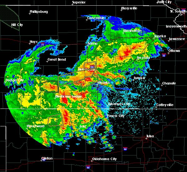 At 319 am cdt, a severe thunderstorm was located near moundridge, moving east at 15 mph (radar indicated). Hazards include 60 mph wind gusts. Expect damage to roofs, siding, and trees. Locations impacted include, moundridge. At 319 am cdt, a severe thunderstorm was located near moundridge, moving east at 15 mph (radar indicated). Hazards include 60 mph wind gusts. Expect damage to roofs, siding, and trees. Locations impacted include, moundridge.
|
| 7/29/2018 2:29 AM CDT |
 At 228 am cdt, severe thunderstorms were located along a line extending from 5 miles west of marquette to near windom to near nickerson, moving southeast at 45 mph (radar indicated). Hazards include 70 mph wind gusts. Expect considerable tree damage. Damage is likely to mobile homes, roofs, and outbuildings. At 228 am cdt, severe thunderstorms were located along a line extending from 5 miles west of marquette to near windom to near nickerson, moving southeast at 45 mph (radar indicated). Hazards include 70 mph wind gusts. Expect considerable tree damage. Damage is likely to mobile homes, roofs, and outbuildings.
|
| 6/11/2018 10:47 PM CDT |
 At 1046 pm cdt, severe thunderstorms were located along a line extending from near lincolnville to 5 miles northwest of buhler, moving southeast at 15 mph (trained weather spotters). Hazards include 70 mph wind gusts and quarter size hail. Hail damage to vehicles is expected. expect considerable tree damage. wind damage is also likely to mobile homes, roofs, and outbuildings. Locations impacted include, hutchinson, newton, hesston, south hutchinson, halstead, north newton, moundridge, sedgwick, inman, buhler, nickerson, burrton, whitewater, partridge, walton, yoder, willowbrook, newton airport and hutchinson airport. At 1046 pm cdt, severe thunderstorms were located along a line extending from near lincolnville to 5 miles northwest of buhler, moving southeast at 15 mph (trained weather spotters). Hazards include 70 mph wind gusts and quarter size hail. Hail damage to vehicles is expected. expect considerable tree damage. wind damage is also likely to mobile homes, roofs, and outbuildings. Locations impacted include, hutchinson, newton, hesston, south hutchinson, halstead, north newton, moundridge, sedgwick, inman, buhler, nickerson, burrton, whitewater, partridge, walton, yoder, willowbrook, newton airport and hutchinson airport.
|
| 6/11/2018 10:31 PM CDT |
 At 1030 pm cdt, severe thunderstorms were located along a line extending from near ramona to 8 miles west of inman, moving southeast at 15 mph (trained weather spotters have reported 1 inch hail just west of mcpherson with this storm). Hazards include 70 mph wind gusts and half dollar size hail. Hail damage to vehicles is expected. expect considerable tree damage. wind damage is also likely to mobile homes, roofs, and outbuildings. Locations impacted include, hutchinson, newton, hesston, hillsboro, south hutchinson, halstead, marion, north newton, moundridge, sedgwick, inman, buhler, peabody, nickerson, burrton, whitewater, florence, goessel, partridge and walton. At 1030 pm cdt, severe thunderstorms were located along a line extending from near ramona to 8 miles west of inman, moving southeast at 15 mph (trained weather spotters have reported 1 inch hail just west of mcpherson with this storm). Hazards include 70 mph wind gusts and half dollar size hail. Hail damage to vehicles is expected. expect considerable tree damage. wind damage is also likely to mobile homes, roofs, and outbuildings. Locations impacted include, hutchinson, newton, hesston, hillsboro, south hutchinson, halstead, marion, north newton, moundridge, sedgwick, inman, buhler, peabody, nickerson, burrton, whitewater, florence, goessel, partridge and walton.
|
| 6/11/2018 10:14 PM CDT |
 At 1014 pm cdt, severe thunderstorms were located along a line extending from ramona to 8 miles northeast of nickerson, moving southeast at 20 mph (radar indicated). Hazards include 70 mph wind gusts and half dollar size hail. Hail damage to vehicles is expected. expect considerable tree damage. Wind damage is also likely to mobile homes, roofs, and outbuildings. At 1014 pm cdt, severe thunderstorms were located along a line extending from ramona to 8 miles northeast of nickerson, moving southeast at 20 mph (radar indicated). Hazards include 70 mph wind gusts and half dollar size hail. Hail damage to vehicles is expected. expect considerable tree damage. Wind damage is also likely to mobile homes, roofs, and outbuildings.
|
| 5/29/2018 8:03 PM CDT |
 At 801 pm cdt, severe thunderstorms were located along a line extending from near assaria to near nickerson, and are nearly stationary. at 755 pm cdt a trained spotter reported an estimated 60mph wind gust near inman (trained weather spotters). Hazards include 60 mph wind gusts and quarter size hail. Hail damage to vehicles is expected. expect wind damage to roofs, siding, and trees. Locations impacted include, mcpherson, lindsborg, moundridge, inman, galva, canton, marquette, little river, lehigh, windom, durham, mcpherson airport and roxbury. At 801 pm cdt, severe thunderstorms were located along a line extending from near assaria to near nickerson, and are nearly stationary. at 755 pm cdt a trained spotter reported an estimated 60mph wind gust near inman (trained weather spotters). Hazards include 60 mph wind gusts and quarter size hail. Hail damage to vehicles is expected. expect wind damage to roofs, siding, and trees. Locations impacted include, mcpherson, lindsborg, moundridge, inman, galva, canton, marquette, little river, lehigh, windom, durham, mcpherson airport and roxbury.
|
| 5/29/2018 7:48 PM CDT |
 At 747 pm cdt, severe thunderstorms were located along a line extending from near assaria to nickerson, moving east at 35 mph (radar indicated). Hazards include 60 mph wind gusts and quarter size hail. Hail damage to vehicles is expected. Expect wind damage to roofs, siding, and trees. At 747 pm cdt, severe thunderstorms were located along a line extending from near assaria to nickerson, moving east at 35 mph (radar indicated). Hazards include 60 mph wind gusts and quarter size hail. Hail damage to vehicles is expected. Expect wind damage to roofs, siding, and trees.
|
| 5/29/2018 7:16 PM CDT |
 At 715 pm cdt, a severe thunderstorm was located near galva, moving northeast at 20 mph (radar indicated). Hazards include 60 mph wind gusts and half dollar size hail. Hail damage to vehicles is expected. Expect wind damage to roofs, siding, and trees. At 715 pm cdt, a severe thunderstorm was located near galva, moving northeast at 20 mph (radar indicated). Hazards include 60 mph wind gusts and half dollar size hail. Hail damage to vehicles is expected. Expect wind damage to roofs, siding, and trees.
|
| 5/29/2018 6:47 PM CDT |
 At 647 pm cdt, a severe thunderstorm was located 6 miles south of mcpherson, moving north at 20 mph (radar indicated). Hazards include ping pong ball size hail and 60 mph wind gusts. People and animals outdoors will be injured. expect hail damage to roofs, siding, windows, and vehicles. Expect wind damage to roofs, siding, and trees. At 647 pm cdt, a severe thunderstorm was located 6 miles south of mcpherson, moving north at 20 mph (radar indicated). Hazards include ping pong ball size hail and 60 mph wind gusts. People and animals outdoors will be injured. expect hail damage to roofs, siding, windows, and vehicles. Expect wind damage to roofs, siding, and trees.
|
| 5/2/2018 5:02 PM CDT |
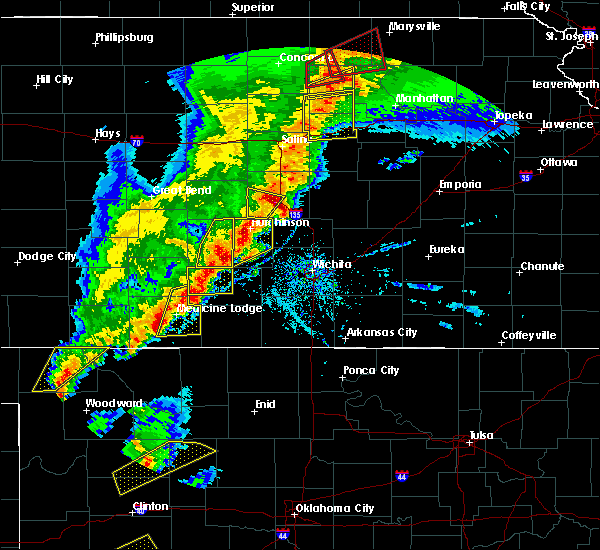 At 502 pm cdt, a severe thunderstorm was located 6 miles southeast of mcpherson, moving northeast at 50 mph (radar indicated). Hazards include 70 mph wind gusts and half dollar size hail. Hail damage to vehicles is expected. expect considerable tree damage. Wind damage is also likely to mobile homes, roofs, and outbuildings. At 502 pm cdt, a severe thunderstorm was located 6 miles southeast of mcpherson, moving northeast at 50 mph (radar indicated). Hazards include 70 mph wind gusts and half dollar size hail. Hail damage to vehicles is expected. expect considerable tree damage. Wind damage is also likely to mobile homes, roofs, and outbuildings.
|
| 9/16/2017 7:24 PM CDT |
 At 724 pm cdt, a severe thunderstorm was located near inman, moving northeast at 20 mph (radar indicated). Hazards include 60 mph wind gusts and quarter size hail. Hail damage to vehicles is expected. Expect wind damage to roofs, siding, and trees. At 724 pm cdt, a severe thunderstorm was located near inman, moving northeast at 20 mph (radar indicated). Hazards include 60 mph wind gusts and quarter size hail. Hail damage to vehicles is expected. Expect wind damage to roofs, siding, and trees.
|
| 6/15/2017 6:55 PM CDT |
 At 654 pm cdt, severe thunderstorms were located along a line extending from near mcpherson to near inman to 6 miles northwest of partridge, moving east at 35 mph (trained weather spotters). Hazards include 70 mph wind gusts and quarter size hail. Hail damage to vehicles is expected. expect considerable tree damage. wind damage is also likely to mobile homes, roofs, and outbuildings. Locations impacted include, hutchinson, mcpherson, hesston, south hutchinson, moundridge, inman, buhler, nickerson, burrton, arlington, partridge, sylvia, windom, plevna, abbyville, yoder, willowbrook, langdon, mcpherson airport and hutchinson airport. At 654 pm cdt, severe thunderstorms were located along a line extending from near mcpherson to near inman to 6 miles northwest of partridge, moving east at 35 mph (trained weather spotters). Hazards include 70 mph wind gusts and quarter size hail. Hail damage to vehicles is expected. expect considerable tree damage. wind damage is also likely to mobile homes, roofs, and outbuildings. Locations impacted include, hutchinson, mcpherson, hesston, south hutchinson, moundridge, inman, buhler, nickerson, burrton, arlington, partridge, sylvia, windom, plevna, abbyville, yoder, willowbrook, langdon, mcpherson airport and hutchinson airport.
|
| 6/15/2017 6:44 PM CDT | 60 to 70 mph. 4 to 6 inch tree limbs down in tow in mcpherson county KS, 0.2 miles E of Moundridge, KS |
| 6/15/2017 6:32 PM CDT |
 At 630 pm cdt, severe thunderstorms were located along a line extending from 6 miles east of windom to 6 miles northeast of nickerson to 8 miles north of plevna, moving east at 35 mph (trained spotters have reported 65 mph winds in northern reno county). Hazards include 70 mph wind gusts and quarter size hail. Hail damage to vehicles is expected. expect considerable tree damage. wind damage is also likely to mobile homes, roofs, and outbuildings. Locations impacted include, hutchinson, mcpherson, hesston, south hutchinson, sterling, moundridge, inman, buhler, nickerson, burrton, little river, arlington, partridge, sylvia, alden, windom, plevna, abbyville, yoder and willowbrook. At 630 pm cdt, severe thunderstorms were located along a line extending from 6 miles east of windom to 6 miles northeast of nickerson to 8 miles north of plevna, moving east at 35 mph (trained spotters have reported 65 mph winds in northern reno county). Hazards include 70 mph wind gusts and quarter size hail. Hail damage to vehicles is expected. expect considerable tree damage. wind damage is also likely to mobile homes, roofs, and outbuildings. Locations impacted include, hutchinson, mcpherson, hesston, south hutchinson, sterling, moundridge, inman, buhler, nickerson, burrton, little river, arlington, partridge, sylvia, alden, windom, plevna, abbyville, yoder and willowbrook.
|
| 6/15/2017 6:02 PM CDT |
 At 602 pm cdt, severe thunderstorms were located along a line extending from near little river to near alden to near hudson, moving east at 35 mph (radar indicated). Hazards include 70 mph wind gusts and quarter size hail. Hail damage to vehicles is expected. expect considerable tree damage. Wind damage is also likely to mobile homes, roofs, and outbuildings. At 602 pm cdt, severe thunderstorms were located along a line extending from near little river to near alden to near hudson, moving east at 35 mph (radar indicated). Hazards include 70 mph wind gusts and quarter size hail. Hail damage to vehicles is expected. expect considerable tree damage. Wind damage is also likely to mobile homes, roofs, and outbuildings.
|
| 5/27/2017 2:10 PM CDT |
 At 209 pm cdt, a severe thunderstorm was located near galva, moving east at 35 mph (radar indicated). Hazards include ping pong ball size hail and 60 mph wind gusts. People and animals outdoors will be injured. expect hail damage to roofs, siding, windows, and vehicles. expect wind damage to roofs, siding, and trees. Locations impacted include, galva, canton and roxbury. At 209 pm cdt, a severe thunderstorm was located near galva, moving east at 35 mph (radar indicated). Hazards include ping pong ball size hail and 60 mph wind gusts. People and animals outdoors will be injured. expect hail damage to roofs, siding, windows, and vehicles. expect wind damage to roofs, siding, and trees. Locations impacted include, galva, canton and roxbury.
|
| 5/19/2017 6:25 PM CDT |
 At 624 pm cdt, severe thunderstorms were located along a line extending from 5 miles north of galva to near hesston, moving northeast at 30 mph (radar indicated). Hazards include 60 mph wind gusts and nickel size hail. Expect damage to roofs, siding, and trees. locations impacted include, mcpherson, hesston, moundridge, inman, burrton, galva, canton and mcpherson airport. A tornado watch remains in effect until 1000 pm cdt for south central and central kansas. At 624 pm cdt, severe thunderstorms were located along a line extending from 5 miles north of galva to near hesston, moving northeast at 30 mph (radar indicated). Hazards include 60 mph wind gusts and nickel size hail. Expect damage to roofs, siding, and trees. locations impacted include, mcpherson, hesston, moundridge, inman, burrton, galva, canton and mcpherson airport. A tornado watch remains in effect until 1000 pm cdt for south central and central kansas.
|
| 5/19/2017 6:09 PM CDT |
 A severe thunderstorm warning remains in effect until 645 pm cdt for southeastern mcpherson and northwestern harvey counties. at 608 pm cdt, severe thunderstorms were located along a line extending from near mcpherson to near buhler, moving northeast at 50 mph. hazard. 70 mph wind gusts and quarter size hail. A severe thunderstorm warning remains in effect until 645 pm cdt for southeastern mcpherson and northwestern harvey counties. at 608 pm cdt, severe thunderstorms were located along a line extending from near mcpherson to near buhler, moving northeast at 50 mph. hazard. 70 mph wind gusts and quarter size hail.
|
| 5/19/2017 5:43 PM CDT |
 At 543 pm cdt, severe thunderstorms were located along a line extending from near hutchinson to 6 miles west of haven, moving northeast at 50 mph (radar indicated). Hazards include 60 mph wind gusts and quarter size hail. Hail damage to vehicles is expected. Expect wind damage to roofs, siding, and trees. At 543 pm cdt, severe thunderstorms were located along a line extending from near hutchinson to 6 miles west of haven, moving northeast at 50 mph (radar indicated). Hazards include 60 mph wind gusts and quarter size hail. Hail damage to vehicles is expected. Expect wind damage to roofs, siding, and trees.
|
| 5/18/2017 5:13 PM CDT |
 At 513 pm cdt, a severe thunderstorm was located 7 miles northeast of burrton, moving north at 30 mph (radar indicated). Hazards include ping pong ball size hail and 60 mph wind gusts. People and animals outdoors will be injured. expect hail damage to roofs, siding, windows, and vehicles. expect wind damage to roofs, siding, and trees. locations impacted include, mcpherson, hesston, halstead, moundridge, inman, burrton, galva, canton and mcpherson airport. A tornado watch remains in effect until 1100 pm cdt for south central and central kansas. At 513 pm cdt, a severe thunderstorm was located 7 miles northeast of burrton, moving north at 30 mph (radar indicated). Hazards include ping pong ball size hail and 60 mph wind gusts. People and animals outdoors will be injured. expect hail damage to roofs, siding, windows, and vehicles. expect wind damage to roofs, siding, and trees. locations impacted include, mcpherson, hesston, halstead, moundridge, inman, burrton, galva, canton and mcpherson airport. A tornado watch remains in effect until 1100 pm cdt for south central and central kansas.
|
| 5/18/2017 4:57 PM CDT |
 At 457 pm cdt, a severe thunderstorm was located near burrton, moving north at 30 mph (radar indicated). Hazards include 60 mph wind gusts and half dollar size hail. Hail damage to vehicles is expected. Expect wind damage to roofs, siding, and trees. At 457 pm cdt, a severe thunderstorm was located near burrton, moving north at 30 mph (radar indicated). Hazards include 60 mph wind gusts and half dollar size hail. Hail damage to vehicles is expected. Expect wind damage to roofs, siding, and trees.
|
| 3/24/2017 6:16 PM CDT |
 At 614 pm cdt, a severe thunderstorm was located near moundridge, moving north at 20 mph (radar indicated). Hazards include 60 mph wind gusts and quarter size hail. Hail damage to vehicles is expected. expect wind damage to roofs, siding, and trees. Locations impacted include, mcpherson, lindsborg, moundridge, galva, canton, mcpherson airport and roxbury. At 614 pm cdt, a severe thunderstorm was located near moundridge, moving north at 20 mph (radar indicated). Hazards include 60 mph wind gusts and quarter size hail. Hail damage to vehicles is expected. expect wind damage to roofs, siding, and trees. Locations impacted include, mcpherson, lindsborg, moundridge, galva, canton, mcpherson airport and roxbury.
|
| 3/24/2017 5:58 PM CDT |
 At 558 pm cdt, a severe thunderstorm was located over moundridge, moving north at 20 mph (radar indicated). Hazards include 60 mph wind gusts and quarter size hail. Hail damage to vehicles is expected. Expect wind damage to roofs, siding, and trees. At 558 pm cdt, a severe thunderstorm was located over moundridge, moving north at 20 mph (radar indicated). Hazards include 60 mph wind gusts and quarter size hail. Hail damage to vehicles is expected. Expect wind damage to roofs, siding, and trees.
|
| 3/24/2017 5:57 PM CDT | Quarter sized hail reported 0.2 miles E of Moundridge, KS |
| 10/12/2016 2:22 AM CDT |
 The severe thunderstorm warning for southwestern marion and southeastern mcpherson counties will expire at 230 am cdt, the storm which prompted the warning has weakened below severe limits, and no longer pose an immediate threat to life or property. therefore, the warning will be allowed to expire. The severe thunderstorm warning for southwestern marion and southeastern mcpherson counties will expire at 230 am cdt, the storm which prompted the warning has weakened below severe limits, and no longer pose an immediate threat to life or property. therefore, the warning will be allowed to expire.
|
| 10/12/2016 2:16 AM CDT |
 At 215 am cdt, a severe thunderstorm was located over goessel, or 8 miles north of hesston, moving east at 35 mph (radar indicated). Hazards include 60 mph wind gusts and quarter size hail. Hail damage to vehicles is expected. expect wind damage to roofs, siding, and trees. Locations impacted include, moundridge, goessel and lehigh. At 215 am cdt, a severe thunderstorm was located over goessel, or 8 miles north of hesston, moving east at 35 mph (radar indicated). Hazards include 60 mph wind gusts and quarter size hail. Hail damage to vehicles is expected. expect wind damage to roofs, siding, and trees. Locations impacted include, moundridge, goessel and lehigh.
|
| 10/12/2016 1:52 AM CDT |
 At 152 am cdt, a severe thunderstorm was located 6 miles west of moundridge, moving east at 30 mph (radar indicated). Hazards include 60 mph wind gusts and quarter size hail. Hail damage to vehicles is expected. Expect wind damage to roofs, siding, and trees. At 152 am cdt, a severe thunderstorm was located 6 miles west of moundridge, moving east at 30 mph (radar indicated). Hazards include 60 mph wind gusts and quarter size hail. Hail damage to vehicles is expected. Expect wind damage to roofs, siding, and trees.
|
| 10/4/2016 6:44 PM CDT |
 At 644 pm cdt, a severe thunderstorm was located near moundridge, moving northeast at 45 mph (radar indicated). Hazards include 60 mph wind gusts and quarter size hail. Hail damage to vehicles is expected. Expect wind damage to roofs, siding, and trees. At 644 pm cdt, a severe thunderstorm was located near moundridge, moving northeast at 45 mph (radar indicated). Hazards include 60 mph wind gusts and quarter size hail. Hail damage to vehicles is expected. Expect wind damage to roofs, siding, and trees.
|
| 7/28/2016 8:00 PM CDT |
 At 800 pm cdt, severe thunderstorms were located along a line extending from near goessel to near mount hope to 7 miles west of kingman, moving southeast at 45 mph. these are very dangerous storms (radar indicated). Hazards include 80 mph wind gusts and two inch hail. Flying debris will be dangerous to those caught without shelter. mobile homes will be heavily damaged. expect considerable damage to roofs, windows, and vehicles. extensive tree damage and power outages are likely. Locations impacted include, wichita, newton, park city, valley center, bel aire, goddard, hesston, maize, kingman, cheney, halstead, north newton, moundridge, sedgwick, colwich, haven, burrton, garden plain, mount hope and whitewater. At 800 pm cdt, severe thunderstorms were located along a line extending from near goessel to near mount hope to 7 miles west of kingman, moving southeast at 45 mph. these are very dangerous storms (radar indicated). Hazards include 80 mph wind gusts and two inch hail. Flying debris will be dangerous to those caught without shelter. mobile homes will be heavily damaged. expect considerable damage to roofs, windows, and vehicles. extensive tree damage and power outages are likely. Locations impacted include, wichita, newton, park city, valley center, bel aire, goddard, hesston, maize, kingman, cheney, halstead, north newton, moundridge, sedgwick, colwich, haven, burrton, garden plain, mount hope and whitewater.
|
| 7/28/2016 7:50 PM CDT |
 At 749 pm cdt, severe thunderstorms were located along a line extending from near goessel to near mount hope to 9 miles northwest of kingman, moving southeast at 45 mph. these are very dangerous storms (radar indicated). Hazards include 80 mph wind gusts and golf ball size hail. Flying debris will be dangerous to those caught without shelter. mobile homes will be heavily damaged. expect considerable damage to roofs, windows, and vehicles. Extensive tree damage and power outages are likely. At 749 pm cdt, severe thunderstorms were located along a line extending from near goessel to near mount hope to 9 miles northwest of kingman, moving southeast at 45 mph. these are very dangerous storms (radar indicated). Hazards include 80 mph wind gusts and golf ball size hail. Flying debris will be dangerous to those caught without shelter. mobile homes will be heavily damaged. expect considerable damage to roofs, windows, and vehicles. Extensive tree damage and power outages are likely.
|
| 7/28/2016 7:42 PM CDT |
 At 741 pm cdt, severe thunderstorms were located along a line extending from 6 miles north of moundridge to near burrton to near arlington, moving southeast at 45 mph. these are very dangerous storms (radar indicated). Hazards include 80 mph wind gusts and golf ball size hail. Flying debris will be dangerous to those caught without shelter. mobile homes will be heavily damaged. expect considerable damage to roofs, windows, and vehicles. extensive tree damage and power outages are likely. Locations impacted include, hutchinson, mcpherson, hesston, south hutchinson, halstead, moundridge, inman, buhler, haven, nickerson, burrton, galva, canton, arlington, turon, partridge, sylvia, plevna, abbyville and yoder. At 741 pm cdt, severe thunderstorms were located along a line extending from 6 miles north of moundridge to near burrton to near arlington, moving southeast at 45 mph. these are very dangerous storms (radar indicated). Hazards include 80 mph wind gusts and golf ball size hail. Flying debris will be dangerous to those caught without shelter. mobile homes will be heavily damaged. expect considerable damage to roofs, windows, and vehicles. extensive tree damage and power outages are likely. Locations impacted include, hutchinson, mcpherson, hesston, south hutchinson, halstead, moundridge, inman, buhler, haven, nickerson, burrton, galva, canton, arlington, turon, partridge, sylvia, plevna, abbyville and yoder.
|
| 7/28/2016 7:37 PM CDT |
 At 737 pm cdt, severe thunderstorms were located along a line extending from 5 miles south of galva to near burrton to near abbyville, moving southeast at 45 mph. these are very dangerous storms (radar indicated). Hazards include 80 mph wind gusts and golf ball size hail. Flying debris will be dangerous to those caught without shelter. mobile homes will be heavily damaged. expect considerable damage to roofs, windows, and vehicles. extensive tree damage and power outages are likely. Locations impacted include, hutchinson, mcpherson, hesston, south hutchinson, halstead, moundridge, inman, buhler, haven, nickerson, burrton, galva, canton, arlington, turon, partridge, sylvia, plevna, abbyville and yoder. At 737 pm cdt, severe thunderstorms were located along a line extending from 5 miles south of galva to near burrton to near abbyville, moving southeast at 45 mph. these are very dangerous storms (radar indicated). Hazards include 80 mph wind gusts and golf ball size hail. Flying debris will be dangerous to those caught without shelter. mobile homes will be heavily damaged. expect considerable damage to roofs, windows, and vehicles. extensive tree damage and power outages are likely. Locations impacted include, hutchinson, mcpherson, hesston, south hutchinson, halstead, moundridge, inman, buhler, haven, nickerson, burrton, galva, canton, arlington, turon, partridge, sylvia, plevna, abbyville and yoder.
|
| 7/28/2016 7:23 PM CDT |
 At 723 pm cdt, severe thunderstorms were located along a line extending from mcpherson to near hutchinson to 6 miles southwest of alden, moving southeast at 50 mph. these are very dangerous storms (radar indicated). Hazards include 80 mph wind gusts and golf ball size hail. Flying debris will be dangerous to those caught without shelter. mobile homes will be heavily damaged. expect considerable damage to roofs, windows, and vehicles. Extensive tree damage and power outages are likely. At 723 pm cdt, severe thunderstorms were located along a line extending from mcpherson to near hutchinson to 6 miles southwest of alden, moving southeast at 50 mph. these are very dangerous storms (radar indicated). Hazards include 80 mph wind gusts and golf ball size hail. Flying debris will be dangerous to those caught without shelter. mobile homes will be heavily damaged. expect considerable damage to roofs, windows, and vehicles. Extensive tree damage and power outages are likely.
|
| 7/13/2016 8:23 AM CDT |
 At 823 am cdt, a severe thunderstorm was located over north newton, moving east at 40 mph (radar indicated). Hazards include 60 mph wind gusts and quarter size hail. Hail damage to vehicles is expected. Expect wind damage to roofs, siding, and trees. At 823 am cdt, a severe thunderstorm was located over north newton, moving east at 40 mph (radar indicated). Hazards include 60 mph wind gusts and quarter size hail. Hail damage to vehicles is expected. Expect wind damage to roofs, siding, and trees.
|
| 7/12/2016 3:51 AM CDT |
 The severe thunderstorm warning for southern saline, northern harvey, western marion, eastern rice, mcpherson and southeastern ellsworth counties will expire at 400 am cdt, the storm which prompted the warning has weakened below severe limits and exited the warned area. therefore the warning will be allowed to expire. however gusty winds and heavy rain are still possible with this thunderstorm. The severe thunderstorm warning for southern saline, northern harvey, western marion, eastern rice, mcpherson and southeastern ellsworth counties will expire at 400 am cdt, the storm which prompted the warning has weakened below severe limits and exited the warned area. therefore the warning will be allowed to expire. however gusty winds and heavy rain are still possible with this thunderstorm.
|
| 7/12/2016 3:33 AM CDT |
 At 332 am cdt, a severe thunderstorm was located near canton, moving southeast at 20 mph (radar indicated). Hazards include 60 mph wind gusts and penny size hail. Expect damage to roofs. siding. and trees. Locations impacted include, mcpherson, lyons, lindsborg, hillsboro, sterling, moundridge, inman, galva, canton, marquette, little river, goessel, assaria, gypsum, geneseo, lehigh, windom, durham, tampa and falun. At 332 am cdt, a severe thunderstorm was located near canton, moving southeast at 20 mph (radar indicated). Hazards include 60 mph wind gusts and penny size hail. Expect damage to roofs. siding. and trees. Locations impacted include, mcpherson, lyons, lindsborg, hillsboro, sterling, moundridge, inman, galva, canton, marquette, little river, goessel, assaria, gypsum, geneseo, lehigh, windom, durham, tampa and falun.
|
| 7/12/2016 3:12 AM CDT |
 At 312 am cdt, a severe thunderstorm was located 7 miles northwest of mcpherson, moving southeast at 30 mph (radar indicated). Hazards include 60 mph wind gusts and penny size hail. Expect damage to roofs. siding. and trees. Locations impacted include, mcpherson, lyons, lindsborg, hillsboro, sterling, moundridge, inman, galva, canton, marquette, little river, goessel, assaria, gypsum, geneseo, lehigh, windom, durham, tampa and falun. At 312 am cdt, a severe thunderstorm was located 7 miles northwest of mcpherson, moving southeast at 30 mph (radar indicated). Hazards include 60 mph wind gusts and penny size hail. Expect damage to roofs. siding. and trees. Locations impacted include, mcpherson, lyons, lindsborg, hillsboro, sterling, moundridge, inman, galva, canton, marquette, little river, goessel, assaria, gypsum, geneseo, lehigh, windom, durham, tampa and falun.
|
| 7/12/2016 2:59 AM CDT |
 At 258 am cdt, a severe thunderstorm was located near marquette, or near lindsborg, moving east at 15 mph (radar indicated). Hazards include 60 mph wind gusts and penny size hail. Expect damage to roofs. siding. And trees. At 258 am cdt, a severe thunderstorm was located near marquette, or near lindsborg, moving east at 15 mph (radar indicated). Hazards include 60 mph wind gusts and penny size hail. Expect damage to roofs. siding. And trees.
|
| 7/6/2016 2:01 AM CDT |
 At 200 am cdt, severe thunderstorms were located along a line extending from near new cambria to near mcpherson to near haven, moving east at 55 mph (radar indicated). Hazards include 70 mph wind gusts and nickel size hail. Expect considerable tree damage. damage is likely to mobile homes, roofs, and outbuildings. Locations impacted include, salina, hutchinson, newton, mcpherson, hesston, lindsborg, south hutchinson, halstead, north newton, moundridge, sedgwick, inman, buhler, haven, burrton, galva, canton, marquette, goessel and assaria. At 200 am cdt, severe thunderstorms were located along a line extending from near new cambria to near mcpherson to near haven, moving east at 55 mph (radar indicated). Hazards include 70 mph wind gusts and nickel size hail. Expect considerable tree damage. damage is likely to mobile homes, roofs, and outbuildings. Locations impacted include, salina, hutchinson, newton, mcpherson, hesston, lindsborg, south hutchinson, halstead, north newton, moundridge, sedgwick, inman, buhler, haven, burrton, galva, canton, marquette, goessel and assaria.
|
| 7/6/2016 1:48 AM CDT |
 At 148 am cdt, severe thunderstorms were located along a line extending from near culver to 6 miles east of windom to 7 miles west of haven, moving east at 55 mph (radar indicated). Hazards include 70 mph wind gusts and nickel size hail. Expect considerable tree damage. damage is likely to mobile homes, roofs, and outbuildings. locations impacted include, salina, hutchinson, newton, mcpherson, hesston, lindsborg, south hutchinson, halstead, north newton, moundridge, sedgwick, inman, buhler, haven, burrton, galva, canton, marquette, goessel and assaria. This line of storms has a history of producing severe wind gusts of 60 mph or greater. At 148 am cdt, severe thunderstorms were located along a line extending from near culver to 6 miles east of windom to 7 miles west of haven, moving east at 55 mph (radar indicated). Hazards include 70 mph wind gusts and nickel size hail. Expect considerable tree damage. damage is likely to mobile homes, roofs, and outbuildings. locations impacted include, salina, hutchinson, newton, mcpherson, hesston, lindsborg, south hutchinson, halstead, north newton, moundridge, sedgwick, inman, buhler, haven, burrton, galva, canton, marquette, goessel and assaria. This line of storms has a history of producing severe wind gusts of 60 mph or greater.
|
| 7/6/2016 1:23 AM CDT |
 At 123 am cdt, severe thunderstorms were located along a line extending from near culver to near nickerson, moving east at 55 mph (radar indicated). Hazards include 70 mph wind gusts and nickel size hail. Expect considerable tree damage. Damage is likely to mobile homes, roofs, and outbuildings. At 123 am cdt, severe thunderstorms were located along a line extending from near culver to near nickerson, moving east at 55 mph (radar indicated). Hazards include 70 mph wind gusts and nickel size hail. Expect considerable tree damage. Damage is likely to mobile homes, roofs, and outbuildings.
|
| 7/2/2016 9:40 PM CDT |
 At 939 pm cdt, severe thunderstorms were located along a line extending from near galva, to near burrton, to 8 miles north of cheney, moving east to southeast at 45 mph (radar indicated). Hazards include 60 mph wind gusts and penny size hail. Expect damage to roofs. siding. And trees. At 939 pm cdt, severe thunderstorms were located along a line extending from near galva, to near burrton, to 8 miles north of cheney, moving east to southeast at 45 mph (radar indicated). Hazards include 60 mph wind gusts and penny size hail. Expect damage to roofs. siding. And trees.
|
| 6/23/2016 2:32 PM CDT |
 At 231 pm cdt, severe thunderstorms were located along a line extending from 5 miles southwest of mcpherson to halstead, moving northeast at 25 mph (radar indicated). Hazards include 60 mph wind gusts and quarter size hail. Hail damage to vehicles is expected. expect wind damage to roofs, siding, and trees. Locations impacted include, mcpherson, hesston, lindsborg, halstead, moundridge, inman, burrton, galva, canton, marquette, mcpherson airport and roxbury. At 231 pm cdt, severe thunderstorms were located along a line extending from 5 miles southwest of mcpherson to halstead, moving northeast at 25 mph (radar indicated). Hazards include 60 mph wind gusts and quarter size hail. Hail damage to vehicles is expected. expect wind damage to roofs, siding, and trees. Locations impacted include, mcpherson, hesston, lindsborg, halstead, moundridge, inman, burrton, galva, canton, marquette, mcpherson airport and roxbury.
|
| 6/23/2016 2:17 PM CDT |
 At 217 pm cdt, a severe thunderstorm was located near buhler, moving northeast at 25 mph (radar indicated). Hazards include 70 mph wind gusts and quarter size hail. Hail damage to vehicles is expected. expect considerable tree damage. Wind damage is also likely to mobile homes, roofs, and outbuildings. At 217 pm cdt, a severe thunderstorm was located near buhler, moving northeast at 25 mph (radar indicated). Hazards include 70 mph wind gusts and quarter size hail. Hail damage to vehicles is expected. expect considerable tree damage. Wind damage is also likely to mobile homes, roofs, and outbuildings.
|
| 6/15/2016 8:26 PM CDT |
 The severe thunderstorm warning for mcpherson county will expire at 830 pm cdt, the storm which prompted the warning has weakened below severe limits, and no longer pose an immediate threat to life or property. therefore the warning will be allowed to expire. The severe thunderstorm warning for mcpherson county will expire at 830 pm cdt, the storm which prompted the warning has weakened below severe limits, and no longer pose an immediate threat to life or property. therefore the warning will be allowed to expire.
|
| 6/15/2016 8:13 PM CDT |
 At 813 pm cdt, a severe thunderstorm was located near windom, or 10 miles west of mcpherson, moving southeast at 15 mph (radar indicated). Hazards include 60 mph wind gusts and penny size hail. Expect damage to roofs. siding. and trees. Locations impacted include, mcpherson, lindsborg, moundridge, inman, galva, canton, marquette, windom and mcpherson airport. At 813 pm cdt, a severe thunderstorm was located near windom, or 10 miles west of mcpherson, moving southeast at 15 mph (radar indicated). Hazards include 60 mph wind gusts and penny size hail. Expect damage to roofs. siding. and trees. Locations impacted include, mcpherson, lindsborg, moundridge, inman, galva, canton, marquette, windom and mcpherson airport.
|
| 6/15/2016 7:23 PM CDT |
 At 723 pm cdt, a severe thunderstorm was located 6 miles south of mcpherson, moving northeast at 20 mph (radar indicated). Hazards include 60 mph wind gusts and half dollar size hail. Hail damage to vehicles is expected. Expect wind damage to roofs, siding, and trees. At 723 pm cdt, a severe thunderstorm was located 6 miles south of mcpherson, moving northeast at 20 mph (radar indicated). Hazards include 60 mph wind gusts and half dollar size hail. Hail damage to vehicles is expected. Expect wind damage to roofs, siding, and trees.
|
| 6/15/2016 6:50 PM CDT |
 At 649 pm cdt, a severe thunderstorm was located near inman, moving northeast at 15 mph (radar indicated). Hazards include 60 mph wind gusts and half dollar size hail. Hail damage to vehicles is expected. expect wind damage to roofs, siding, and trees. Locations impacted include, mcpherson, moundridge, inman, galva and mcpherson airport. At 649 pm cdt, a severe thunderstorm was located near inman, moving northeast at 15 mph (radar indicated). Hazards include 60 mph wind gusts and half dollar size hail. Hail damage to vehicles is expected. expect wind damage to roofs, siding, and trees. Locations impacted include, mcpherson, moundridge, inman, galva and mcpherson airport.
|
| 6/15/2016 6:31 PM CDT |
 At 631 pm cdt, a severe thunderstorm was located over inman, moving east at 15 mph (radar indicated). Hazards include 60 mph wind gusts and half dollar size hail. Hail damage to vehicles is expected. Expect wind damage to roofs, siding, and trees. At 631 pm cdt, a severe thunderstorm was located over inman, moving east at 15 mph (radar indicated). Hazards include 60 mph wind gusts and half dollar size hail. Hail damage to vehicles is expected. Expect wind damage to roofs, siding, and trees.
|
| 5/29/2016 1:30 PM CDT | Quarter sized hail reported 4.1 miles SW of Moundridge, KS, delayed report |
| 5/26/2016 7:26 PM CDT |
 At 726 pm cdt, a severe thunderstorm was located 6 miles southeast of mcpherson, moving northeast at 30 mph (radar indicated). Hazards include 60 mph wind gusts and quarter size hail. Hail damage to vehicles is expected. expect wind damage to roofs, siding, and trees. locations impacted include, mcpherson, moundridge, galva, canton, roxbury and mcpherson airport. A tornado watch remains in effect until 1000 pm cdt for south central kansas. At 726 pm cdt, a severe thunderstorm was located 6 miles southeast of mcpherson, moving northeast at 30 mph (radar indicated). Hazards include 60 mph wind gusts and quarter size hail. Hail damage to vehicles is expected. expect wind damage to roofs, siding, and trees. locations impacted include, mcpherson, moundridge, galva, canton, roxbury and mcpherson airport. A tornado watch remains in effect until 1000 pm cdt for south central kansas.
|
| 5/26/2016 7:15 PM CDT | Half Dollar sized hail reported 6.6 miles ESE of Moundridge, KS, delayed report from moundridge fire department who received a report of half dollar sized hail. time is estimated from radar. |
| 5/26/2016 7:15 PM CDT |
 At 715 pm cdt, a severe thunderstorm was located 7 miles west of moundridge, moving northeast at 25 mph (radar indicated). Hazards include ping pong ball size hail and 60 mph wind gusts. People and animals outdoors will be injured. expect hail damage to roofs, siding, windows, and vehicles. expect wind damage to roofs, siding, and trees. locations impacted include, mcpherson, moundridge, inman, buhler, galva, canton, mcpherson airport and roxbury. A tornado watch remains in effect until 1000 pm cdt for south central kansas. At 715 pm cdt, a severe thunderstorm was located 7 miles west of moundridge, moving northeast at 25 mph (radar indicated). Hazards include ping pong ball size hail and 60 mph wind gusts. People and animals outdoors will be injured. expect hail damage to roofs, siding, windows, and vehicles. expect wind damage to roofs, siding, and trees. locations impacted include, mcpherson, moundridge, inman, buhler, galva, canton, mcpherson airport and roxbury. A tornado watch remains in effect until 1000 pm cdt for south central kansas.
|
| 5/26/2016 7:06 PM CDT |
 At 705 pm cdt, a severe thunderstorm was located near moundridge, moving northeast at 25 mph (radar indicated). Hazards include ping pong ball size hail and 60 mph wind gusts. People and animals outdoors will be injured. expect hail damage to roofs, siding, windows, and vehicles. Expect wind damage to roofs, siding, and trees. At 705 pm cdt, a severe thunderstorm was located near moundridge, moving northeast at 25 mph (radar indicated). Hazards include ping pong ball size hail and 60 mph wind gusts. People and animals outdoors will be injured. expect hail damage to roofs, siding, windows, and vehicles. Expect wind damage to roofs, siding, and trees.
|
| 5/26/2016 6:25 PM CDT |
 At 625 pm cdt, a severe thunderstorm was located 7 miles southwest of moundridge, moving north at 35 mph (radar indicated). Hazards include 60 mph wind gusts and quarter size hail. Hail damage to vehicles is expected. expect wind damage to roofs, siding, and trees. locations impacted include, newton, mcpherson, hesston, lindsborg, north newton, moundridge, burrton, galva, canton, goessel, lehigh, mcpherson airport and roxbury. A tornado watch remains in effect until 1000 pm cdt for south central kansas. At 625 pm cdt, a severe thunderstorm was located 7 miles southwest of moundridge, moving north at 35 mph (radar indicated). Hazards include 60 mph wind gusts and quarter size hail. Hail damage to vehicles is expected. expect wind damage to roofs, siding, and trees. locations impacted include, newton, mcpherson, hesston, lindsborg, north newton, moundridge, burrton, galva, canton, goessel, lehigh, mcpherson airport and roxbury. A tornado watch remains in effect until 1000 pm cdt for south central kansas.
|
| 5/26/2016 6:18 PM CDT |
 At 618 pm cdt, a severe thunderstorm was located near moundridge, moving north at 30 mph (radar indicated). Hazards include 60 mph wind gusts and quarter size hail. Hail damage to vehicles is expected. Expect wind damage to roofs, siding, and trees. At 618 pm cdt, a severe thunderstorm was located near moundridge, moving north at 30 mph (radar indicated). Hazards include 60 mph wind gusts and quarter size hail. Hail damage to vehicles is expected. Expect wind damage to roofs, siding, and trees.
|
| 5/26/2016 5:29 PM CDT |
 At 528 pm cdt, a severe thunderstorm was located over walton, or near north newton, moving north at 35 mph (radar indicated). Hazards include ping pong ball size hail and 60 mph wind gusts. People and animals outdoors will be injured. expect hail damage to roofs, siding, windows, and vehicles. expect wind damage to roofs, siding, and trees. locations impacted include, newton, hesston, hillsboro, marion, north newton, peabody, whitewater, goessel, walton, elbing, lehigh and newton airport. A tornado watch remains in effect until 1000 pm cdt for south central kansas. At 528 pm cdt, a severe thunderstorm was located over walton, or near north newton, moving north at 35 mph (radar indicated). Hazards include ping pong ball size hail and 60 mph wind gusts. People and animals outdoors will be injured. expect hail damage to roofs, siding, windows, and vehicles. expect wind damage to roofs, siding, and trees. locations impacted include, newton, hesston, hillsboro, marion, north newton, peabody, whitewater, goessel, walton, elbing, lehigh and newton airport. A tornado watch remains in effect until 1000 pm cdt for south central kansas.
|
| 5/26/2016 4:55 PM CDT |
 At 455 pm cdt, a severe thunderstorm was located near sedgwick, moving north at 45 mph (trained weather spotters). Hazards include 60 mph wind gusts and quarter size hail. Hail damage to vehicles is expected. expect wind damage to roofs, siding, and trees. locations impacted include, newton, park city, valley center, hesston, hillsboro, marion, north newton, sedgwick, peabody, whitewater, kechi, goessel, walton, elbing, lehigh and newton airport. A tornado watch remains in effect until 1000 pm cdt for south central kansas. At 455 pm cdt, a severe thunderstorm was located near sedgwick, moving north at 45 mph (trained weather spotters). Hazards include 60 mph wind gusts and quarter size hail. Hail damage to vehicles is expected. expect wind damage to roofs, siding, and trees. locations impacted include, newton, park city, valley center, hesston, hillsboro, marion, north newton, sedgwick, peabody, whitewater, kechi, goessel, walton, elbing, lehigh and newton airport. A tornado watch remains in effect until 1000 pm cdt for south central kansas.
|
| 5/26/2016 4:15 PM CDT |
 At 414 pm cdt, a severe thunderstorm was located 6 miles northwest of moundridge, moving north at 40 mph (radar indicated). Hazards include 60 mph wind gusts and half dollar size hail. Hail damage to vehicles is expected. expect wind damage to roofs, siding, and trees. locations impacted include, mcpherson, hillsboro, moundridge, inman, galva, canton, lehigh and mcpherson airport. A tornado watch remains in effect until 1000 pm cdt for south central kansas. At 414 pm cdt, a severe thunderstorm was located 6 miles northwest of moundridge, moving north at 40 mph (radar indicated). Hazards include 60 mph wind gusts and half dollar size hail. Hail damage to vehicles is expected. expect wind damage to roofs, siding, and trees. locations impacted include, mcpherson, hillsboro, moundridge, inman, galva, canton, lehigh and mcpherson airport. A tornado watch remains in effect until 1000 pm cdt for south central kansas.
|
| 5/26/2016 4:13 PM CDT | Quarter sized hail reported 1.9 miles SE of Moundridge, KS |
| 5/26/2016 4:03 PM CDT |
 At 403 pm cdt, a severe thunderstorm was located 6 miles southwest of moundridge, moving north at 40 mph (radar indicated). Hazards include 60 mph wind gusts and half dollar size hail. Hail damage to vehicles is expected. Expect wind damage to roofs, siding, and trees. At 403 pm cdt, a severe thunderstorm was located 6 miles southwest of moundridge, moving north at 40 mph (radar indicated). Hazards include 60 mph wind gusts and half dollar size hail. Hail damage to vehicles is expected. Expect wind damage to roofs, siding, and trees.
|
| 5/26/2016 1:55 PM CDT |
 The severe thunderstorm warning for northern reno, western harvey, west central marion, southern rice and mcpherson counties will expire at 200 pm cdt, the storms which prompted the warning have weakened below severe levels, and no longer pose an immediate threat to life or property. therefore the warning will be allowed to expire. however small. The severe thunderstorm warning for northern reno, western harvey, west central marion, southern rice and mcpherson counties will expire at 200 pm cdt, the storms which prompted the warning have weakened below severe levels, and no longer pose an immediate threat to life or property. therefore the warning will be allowed to expire. however small.
|
| 5/26/2016 1:42 PM CDT |
 At 142 pm cdt, severe thunderstorms were located along a line extending from near partridge to near buhler to near goessel, moving northeast at 60 mph (radar indicated). Hazards include 70 mph wind gusts and quarter size hail. Hail damage to vehicles is expected. expect considerable tree damage. wind damage is also likely to mobile homes, roofs, and outbuildings. street flooding is likely in hutchinson. locations impacted include, hutchinson, mcpherson, lyons, hesston, south hutchinson, sterling, halstead, moundridge, inman, buhler, haven, nickerson, burrton, galva, canton, arlington, partridge, alden, windom and plevna. A tornado watch remains in effect until 1000 pm cdt for south central kansas. At 142 pm cdt, severe thunderstorms were located along a line extending from near partridge to near buhler to near goessel, moving northeast at 60 mph (radar indicated). Hazards include 70 mph wind gusts and quarter size hail. Hail damage to vehicles is expected. expect considerable tree damage. wind damage is also likely to mobile homes, roofs, and outbuildings. street flooding is likely in hutchinson. locations impacted include, hutchinson, mcpherson, lyons, hesston, south hutchinson, sterling, halstead, moundridge, inman, buhler, haven, nickerson, burrton, galva, canton, arlington, partridge, alden, windom and plevna. A tornado watch remains in effect until 1000 pm cdt for south central kansas.
|
| 5/26/2016 1:29 PM CDT |
 At 128 pm cdt, severe thunderstorms were located along a line extending from near abbyville to 6 miles south of moundridge, moving northeast at 50 mph (radar indicated). Hazards include 70 mph wind gusts and quarter size hail. Hail damage to vehicles is expected. expect considerable tree damage. wind damage is also likely to mobile homes, roofs, and outbuildings. Locations impacted include, hutchinson, mcpherson, lyons, hesston, south hutchinson, sterling, halstead, moundridge, inman, buhler, haven, nickerson, burrton, galva, canton, arlington, partridge, alden, windom and plevna. At 128 pm cdt, severe thunderstorms were located along a line extending from near abbyville to 6 miles south of moundridge, moving northeast at 50 mph (radar indicated). Hazards include 70 mph wind gusts and quarter size hail. Hail damage to vehicles is expected. expect considerable tree damage. wind damage is also likely to mobile homes, roofs, and outbuildings. Locations impacted include, hutchinson, mcpherson, lyons, hesston, south hutchinson, sterling, halstead, moundridge, inman, buhler, haven, nickerson, burrton, galva, canton, arlington, partridge, alden, windom and plevna.
|
| 5/26/2016 1:19 PM CDT |
 At 118 pm cdt, severe thunderstorms were located along a line extending from near abbyville to near burrton, moving northeast at 55 mph (radar indicated). Hazards include 70 mph wind gusts and quarter size hail. Hail damage to vehicles is expected. expect considerable tree damage. Wind damage is also likely to mobile homes, roofs, and outbuildings. At 118 pm cdt, severe thunderstorms were located along a line extending from near abbyville to near burrton, moving northeast at 55 mph (radar indicated). Hazards include 70 mph wind gusts and quarter size hail. Hail damage to vehicles is expected. expect considerable tree damage. Wind damage is also likely to mobile homes, roofs, and outbuildings.
|
| 8/22/2015 11:59 PM CDT |
 At 1159 pm cdt, a severe thunderstorm was located near hesston, moving southeast at 30 mph (radar indicated). Hazards include 60 mph wind gusts and quarter size hail. Hail damage to vehicles is expected. expect wind damage to roofs, siding and trees. Locations impacted include, newton, hesston, halstead, north newton, moundridge, peabody, goessel, walton and newton airport. At 1159 pm cdt, a severe thunderstorm was located near hesston, moving southeast at 30 mph (radar indicated). Hazards include 60 mph wind gusts and quarter size hail. Hail damage to vehicles is expected. expect wind damage to roofs, siding and trees. Locations impacted include, newton, hesston, halstead, north newton, moundridge, peabody, goessel, walton and newton airport.
|
| 8/22/2015 11:48 PM CDT |
 At 1148 pm cdt, a severe thunderstorm was located over moundridge, moving southeast at 40 mph (radar indicated). Hazards include 60 mph wind gusts and quarter size hail. Hail damage to vehicles is expected. Expect wind damage to roofs, siding and trees. At 1148 pm cdt, a severe thunderstorm was located over moundridge, moving southeast at 40 mph (radar indicated). Hazards include 60 mph wind gusts and quarter size hail. Hail damage to vehicles is expected. Expect wind damage to roofs, siding and trees.
|
| 8/22/2015 11:29 PM CDT |
 At 1129 pm cdt, a severe thunderstorm was located near goessel, or 8 miles northeast of hesston, moving southeast at 30 mph (trained weather spotters). Hazards include 70 mph wind gusts and quarter size hail. Hail damage to vehicles is expected. expect considerable tree damage. wind damage is also likely to mobile homes, roofs and outbuildings. Locations impacted include, mcpherson, hesston, hillsboro, marion, moundridge, galva, canton, goessel, lehigh, durham, tampa, mcpherson airport, marion lake and pilsen. At 1129 pm cdt, a severe thunderstorm was located near goessel, or 8 miles northeast of hesston, moving southeast at 30 mph (trained weather spotters). Hazards include 70 mph wind gusts and quarter size hail. Hail damage to vehicles is expected. expect considerable tree damage. wind damage is also likely to mobile homes, roofs and outbuildings. Locations impacted include, mcpherson, hesston, hillsboro, marion, moundridge, galva, canton, goessel, lehigh, durham, tampa, mcpherson airport, marion lake and pilsen.
|
| 8/22/2015 11:12 PM CDT |
 At 1111 pm cdt, a severe thunderstorm was located over canton, moving southeast at 25 mph (radar indicated). Hazards include golf ball size hail and 70 mph wind gusts. People and animals outdoors will be injured. expect hail damage to roofs, siding, windows and vehicles. expect considerable tree damage. Wind damage is also likely to mobile homes, roofs and outbuildings. At 1111 pm cdt, a severe thunderstorm was located over canton, moving southeast at 25 mph (radar indicated). Hazards include golf ball size hail and 70 mph wind gusts. People and animals outdoors will be injured. expect hail damage to roofs, siding, windows and vehicles. expect considerable tree damage. Wind damage is also likely to mobile homes, roofs and outbuildings.
|
| 8/22/2015 11:02 PM CDT |
 At 1101 pm cdt, a severe thunderstorm was located over canton, moving southeast at 30 mph (radar indicated). Hazards include 70 mph wind gusts and half dollar size hail. Hail damage to vehicles is expected. expect considerable tree damage. wind damage is also likely to mobile homes, roofs and outbuildings. Locations impacted include, mcpherson, lindsborg, hillsboro, moundridge, galva, canton, goessel, lincolnville, ramona, lehigh, durham, tampa, lost springs, mcpherson airport, marion lake, pilsen and roxbury. At 1101 pm cdt, a severe thunderstorm was located over canton, moving southeast at 30 mph (radar indicated). Hazards include 70 mph wind gusts and half dollar size hail. Hail damage to vehicles is expected. expect considerable tree damage. wind damage is also likely to mobile homes, roofs and outbuildings. Locations impacted include, mcpherson, lindsborg, hillsboro, moundridge, galva, canton, goessel, lincolnville, ramona, lehigh, durham, tampa, lost springs, mcpherson airport, marion lake, pilsen and roxbury.
|
| 8/22/2015 10:40 PM CDT |
 At 1040 pm cdt, a severe thunderstorm was located 8 miles east of lindsborg, moving southeast at 30 mph (trained weather spotters). Hazards include golf ball size hail and 70 mph wind gusts. People and animals outdoors will be injured. expect hail damage to roofs, siding, windows and vehicles. expect considerable tree damage. Wind damage is also likely to mobile homes, roofs and outbuildings. At 1040 pm cdt, a severe thunderstorm was located 8 miles east of lindsborg, moving southeast at 30 mph (trained weather spotters). Hazards include golf ball size hail and 70 mph wind gusts. People and animals outdoors will be injured. expect hail damage to roofs, siding, windows and vehicles. expect considerable tree damage. Wind damage is also likely to mobile homes, roofs and outbuildings.
|
| 8/5/2015 4:46 AM CDT |
 At 446 am cdt, severe thunderstorms were located along a line extending from near hillsboro to burrton, moving southeast at 30 mph (radar indicated). Hazards include 60 mph wind gusts and penny size hail. Expect damage to roofs. siding and trees. Locations impacted include, newton, mcpherson, hesston, hillsboro, north newton, moundridge, inman, buhler, peabody, burrton, galva, canton, goessel, walton, lehigh, mcpherson airport, newton airport and marion lake. At 446 am cdt, severe thunderstorms were located along a line extending from near hillsboro to burrton, moving southeast at 30 mph (radar indicated). Hazards include 60 mph wind gusts and penny size hail. Expect damage to roofs. siding and trees. Locations impacted include, newton, mcpherson, hesston, hillsboro, north newton, moundridge, inman, buhler, peabody, burrton, galva, canton, goessel, walton, lehigh, mcpherson airport, newton airport and marion lake.
|
| 8/5/2015 4:32 AM CDT |
 At 431 am cdt, severe thunderstorms were located along a line extending from near lehigh to 5 miles northwest of inman, moving southeast at 30 mph (radar indicated). Hazards include 60 mph wind gusts and penny size hail. Expect damage to roofs. Siding and trees. At 431 am cdt, severe thunderstorms were located along a line extending from near lehigh to 5 miles northwest of inman, moving southeast at 30 mph (radar indicated). Hazards include 60 mph wind gusts and penny size hail. Expect damage to roofs. Siding and trees.
|
| 7/20/2015 8:17 PM CDT |
 At 816 pm cdt, a severe thunderstorm was located over goessel, or 8 miles northeast of hesston, moving east at 5 mph (radar indicated). Hazards include 60 mph wind gusts and quarter size hail. Hail damage to vehicles is expected. expect wind damage to roofs, siding and trees. Locations impacted include, hesston, hillsboro, moundridge, goessel and walton. At 816 pm cdt, a severe thunderstorm was located over goessel, or 8 miles northeast of hesston, moving east at 5 mph (radar indicated). Hazards include 60 mph wind gusts and quarter size hail. Hail damage to vehicles is expected. expect wind damage to roofs, siding and trees. Locations impacted include, hesston, hillsboro, moundridge, goessel and walton.
|
| 7/20/2015 8:04 PM CDT |
 At 804 pm cdt, a severe thunderstorm was located near goessel, or 6 miles northeast of moundridge, moving east at 5 mph (radar indicated). Hazards include 60 mph wind gusts and quarter size hail. Hail damage to vehicles is expected. Expect wind damage to roofs, siding and trees. At 804 pm cdt, a severe thunderstorm was located near goessel, or 6 miles northeast of moundridge, moving east at 5 mph (radar indicated). Hazards include 60 mph wind gusts and quarter size hail. Hail damage to vehicles is expected. Expect wind damage to roofs, siding and trees.
|
| 7/13/2015 6:24 PM CDT |
 At 623 pm cdt, a severe thunderstorm was located near inman, moving south at 20 mph (trained weather spotters reported quarter size hail). Hazards include 60 mph wind gusts and quarter size hail. Hail damage to vehicles is expected. expect wind damage to roofs, siding and trees. Locations impacted include, hutchinson, mcpherson, hesston, south hutchinson, moundridge, inman, buhler, willowbrook, mcpherson airport and hutchinson airport. At 623 pm cdt, a severe thunderstorm was located near inman, moving south at 20 mph (trained weather spotters reported quarter size hail). Hazards include 60 mph wind gusts and quarter size hail. Hail damage to vehicles is expected. expect wind damage to roofs, siding and trees. Locations impacted include, hutchinson, mcpherson, hesston, south hutchinson, moundridge, inman, buhler, willowbrook, mcpherson airport and hutchinson airport.
|
| 7/13/2015 6:10 PM CDT |
 At 608 pm cdt, a severe thunderstorm was located near inman, moving south at 10 mph (radar indicated). Hazards include 60 mph wind gusts and quarter size hail. Hail damage to vehicles is expected. Expect wind damage to roofs, siding and trees. At 608 pm cdt, a severe thunderstorm was located near inman, moving south at 10 mph (radar indicated). Hazards include 60 mph wind gusts and quarter size hail. Hail damage to vehicles is expected. Expect wind damage to roofs, siding and trees.
|
| 7/13/2015 6:03 PM CDT |
 At 603 pm cdt, a severe thunderstorm was located near inman, moving southeast at 20 mph (radar indicated). Hazards include 60 mph wind gusts and quarter size hail. Hail damage to vehicles is expected. expect wind damage to roofs, siding and trees. Locations impacted include, hutchinson, mcpherson, moundridge, inman, buhler and mcpherson airport. At 603 pm cdt, a severe thunderstorm was located near inman, moving southeast at 20 mph (radar indicated). Hazards include 60 mph wind gusts and quarter size hail. Hail damage to vehicles is expected. expect wind damage to roofs, siding and trees. Locations impacted include, hutchinson, mcpherson, moundridge, inman, buhler and mcpherson airport.
|
| 7/13/2015 5:55 PM CDT |
 At 555 pm cdt, a severe thunderstorm was located over inman, moving south at 15 mph (radar indicated). Hazards include 60 mph wind gusts and quarter size hail. Hail damage to vehicles is expected. expect wind damage to roofs, siding and trees. Locations impacted include, hutchinson, mcpherson, moundridge, inman, buhler and mcpherson airport. At 555 pm cdt, a severe thunderstorm was located over inman, moving south at 15 mph (radar indicated). Hazards include 60 mph wind gusts and quarter size hail. Hail damage to vehicles is expected. expect wind damage to roofs, siding and trees. Locations impacted include, hutchinson, mcpherson, moundridge, inman, buhler and mcpherson airport.
|
| 7/13/2015 5:41 PM CDT |
 At 541 pm cdt, a severe thunderstorm was located 7 miles north of inman, moving south at 15 mph (radar indicated). Hazards include 60 mph wind gusts and quarter size hail. Hail damage to vehicles is expected. Expect wind damage to roofs, siding and trees. At 541 pm cdt, a severe thunderstorm was located 7 miles north of inman, moving south at 15 mph (radar indicated). Hazards include 60 mph wind gusts and quarter size hail. Hail damage to vehicles is expected. Expect wind damage to roofs, siding and trees.
|
| 6/14/2015 3:43 PM CDT |
 At 342 pm cdt, a severe thunderstorm was located over goessel, or 7 miles north of hesston, moving north at 30 mph (radar indicated). Hazards include 60 mph wind gusts and quarter size hail. Hail damage to vehicles is expected. Expect wind damage to roofs, siding and trees. At 342 pm cdt, a severe thunderstorm was located over goessel, or 7 miles north of hesston, moving north at 30 mph (radar indicated). Hazards include 60 mph wind gusts and quarter size hail. Hail damage to vehicles is expected. Expect wind damage to roofs, siding and trees.
|
| 5/6/2015 5:26 PM CDT | At 526 pm cdt, a severe thunderstorm was located over hesston, moving northeast at 40 mph (radar indicated). Hazards include 60 mph wind gusts and half dollar size hail. Hail damage to vehicles is expected. Expect wind damage to roofs, siding and trees. |
| 5/6/2015 5:20 PM CDT | At 520 pm cdt, a severe thunderstorm capable of producing a tornado was located near halstead, moving northeast at 35 mph (radar indicated rotation). Hazards include tornado and half dollar size hail. Flying debris will be dangerous to those caught without shelter. mobile homes will be damaged or destroyed. damage to roofs, windows and vehicles will occur. tree damage is likely. this dangerous storm will be near, newton around 525 pm cdt. hesston, north newton and moundridge around 530 pm cdt. Radar indicated. |
| 5/6/2015 5:06 PM CDT | At 505 pm cdt, a confirmed tornado was located near halstead, moving north at 40 mph (weather spotters confirmed tornado). Hazards include damaging tornado and ping pong ball size hail. Flying debris will be dangerous to those caught without shelter. mobile homes will be damaged or destroyed. damage to roofs, windows and vehicles will occur. tree damage is likely. this tornado will be near, halstead around 510 pm cdt. hesston around 525 pm cdt. moundridge around 530 pm cdt. Observed. |
| 5/6/2015 4:58 PM CDT | At 457 pm cdt, a confirmed tornado was located northeast of mount hope, moving north at 40 mph (weather spotters confirmed tornado). Hazards include damaging tornado and ping pong ball size hail. Flying debris will be dangerous to those caught without shelter. mobile homes will be damaged or destroyed. damage to roofs, windows and vehicles will occur. tree damage is likely. this tornado will be near, burrton around 505 pm cdt. halstead around 510 pm cdt. hesston around 525 pm cdt. moundridge around 530 pm cdt. Observed. |
| 5/6/2015 4:52 PM CDT | At 451 pm cdt, a tornado producing storm was located over mount hope, moving northeast at 40 mph (radar confirmed tornado). Hazards include damaging tornado and ping pong ball size hail. Flying debris will be dangerous to those caught without shelter. mobile homes will be damaged or destroyed. damage to roofs, windows and vehicles will occur. tree damage is likely. this tornadic storm will be near, bentley around 455 pm cdt. halstead and burrton around 505 pm cdt. hesston around 520 pm cdt. moundridge around 525 pm cdt. this includes interstate 135 between mile markers 36 and 49. Observed. |
| 4/16/2015 5:29 PM CDT | At 527 pm cdt, a severe thunderstorm was located 6 miles south of marquette, or 9 miles northwest of mcpherson, moving north at 15 mph. another strong to severe thunderstorm was located south of mcpherson, moving north (radar indicated). Hazards include quarter size hail. Damage to vehicles is expected. locations impacted include, mcpherson, moundridge, inman, galva, canton, marquette, windom and mcpherson airport. 1. 00in. |
| 4/16/2015 5:13 PM CDT | At 512 pm cdt, two severe thunderstorms, one located northwest of moundridge and another located near windom were, moving north at 20 mph (radar indicated). Hazards include quarter size hail. damage to vehicles is expected |
| 4/16/2015 5:05 PM CDT | At 505 pm cdt, a severe thunderstorm was located near moundridge, moving north at 20 mph. another strong to severe thunderstorm was located over far western mcpherson county, moving northeast (radar indicated). Hazards include half dollar size hail. Damage to vehicles is expected. locations impacted include, mcpherson, lindsborg, moundridge, inman, galva, canton, marquette, windom, mcpherson airport and roxbury. 1. 25in. |
| 4/16/2015 4:51 PM CDT | At 450 pm cdt, a severe thunderstorm was located near moundridge, moving north at 20 mph. additional strong to severe thunderstorms were located in western mcpherson county (radar indicated). Hazards include quarter size hail. damage to vehicles is expected |
| 4/3/2015 12:36 AM CDT | The severe thunderstorm warning for harvey. sedgwick and southeastern mcpherson counties will expire at 1245 am cdt. the line of storms which prompted the warning have moved out of the area. Therefore the warning will be allowed to expire. |
| 4/3/2015 12:16 AM CDT | A severe thunderstorm warning remains in effect until 1245 am cdt for harvey. sedgwick and southeastern mcpherson counties. at 1215 am cdt. severe thunderstorms were located along a line extending from near moundridge to near wichita eisenhower national airport to near clearwater. moving east at 70 mph. hazard. Ping pong size hail and 70 mph wind gusts. |
| 4/3/2015 12:06 AM CDT | A severe thunderstorm warning remains in effect until 1245 am cdt for northeastern reno. harvey. sedgwick and southern mcpherson counties. at 1205 am cdt. severe thunderstorms were located along a line extending from near inman to near goddard to viola. Moving east at 70 mph. |
| 4/2/2015 11:57 PM CDT | A severe thunderstorm warning remains in effect until 1245 am cdt for eastern reno. harvey. sedgwick. southern mcpherson and east central kingman counties. at 1156 pm cdt. severe thunderstorms were located along a line extending from near burrton to near andale to near norwich. Moving east at 70 mph. |
| 4/2/2015 11:42 PM CDT | The national weather service in wichita has issued a * severe thunderstorm warning for. eastern reno county in south central kansas. harvey county in south central kansas. sedgwick county in south central kansas. Southern mcpherson county in central kansas. |
| 5/7/2014 6:05 PM CDT | Half Dollar sized hail reported 0.2 miles E of Moundridge, KS, half dollar size hail reported by kwch news via twitter from viewer in moundridge. |
| 5/7/2014 5:58 PM CDT | Roof damage to a barn was reported near 17th and apache rd in southern mcpherson county west of moundridg in mcpherson county KS, 0.2 miles E of Moundridge, KS |
| 5/30/2012 6:52 PM CDT | Major tree damage throughout city with numerous power poles downed. power out across cit in mcpherson county KS, 0.2 miles E of Moundridge, KS |
| 3/29/2012 6:06 PM CDT | Quarter sized hail reported 4.9 miles SW of Moundridge, KS, relayed through nssl shave project |
| 1/1/0001 12:00 AM | Trained spotter reported two large post signs twisted 22 degrees and exit 48 on interstate 135 on the north end of moundridge severely fractured. other wooden sign post in mcpherson county KS, 0.2 miles E of Moundridge, KS |
| 1/1/0001 12:00 AM | Storm damage reported in mcpherson county KS, 0.2 miles E of Moundridge, KS |
| 1/1/0001 12:00 AM | Storm damage reported in mcpherson county KS, 0.2 miles E of Moundridge, KS |
| 1/1/0001 12:00 AM | Storm damage reported in mcpherson county KS, 0.2 miles E of Moundridge, KS |
| 1/1/0001 12:00 AM | Law enforcement reports a vehicle blown off the road just north of moundridg in mcpherson county KS, 1.4 miles S of Moundridge, KS |
Hail Maps for Moundridge, KS


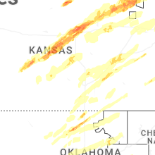


Connect with Interactive Hail Maps