

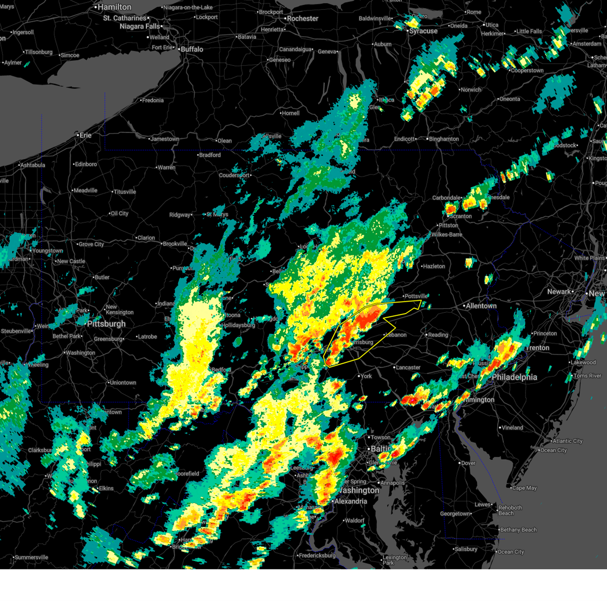
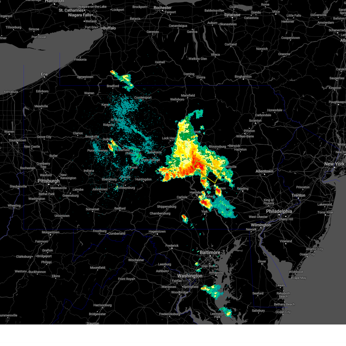
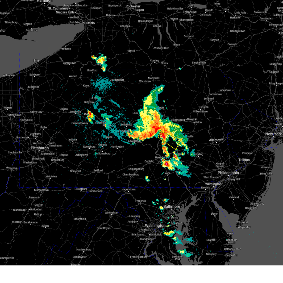
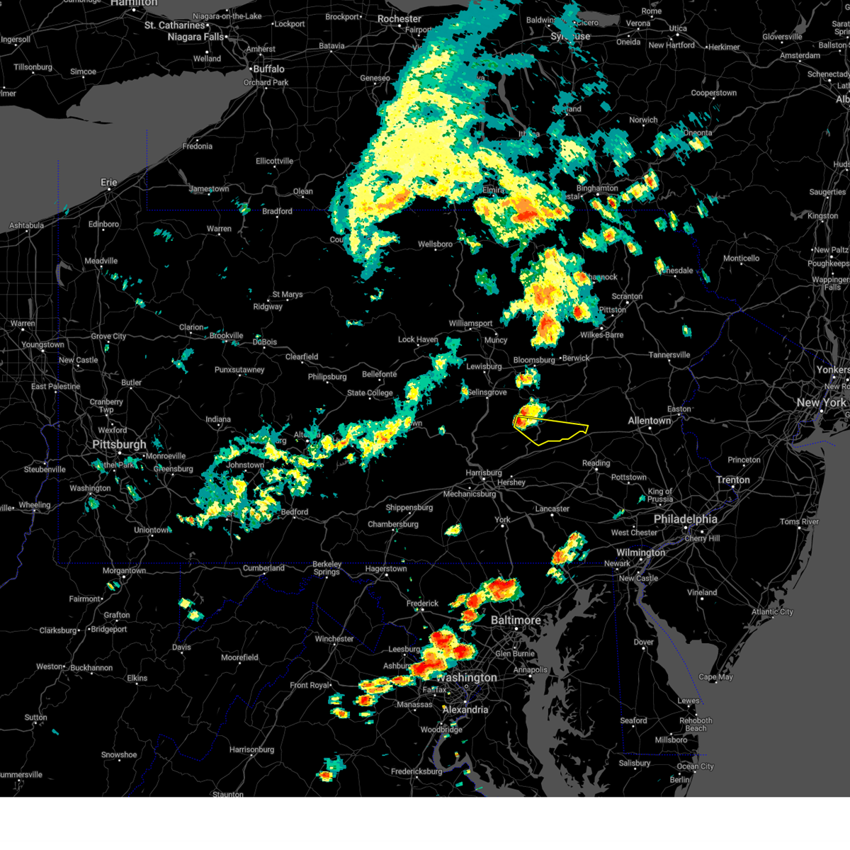
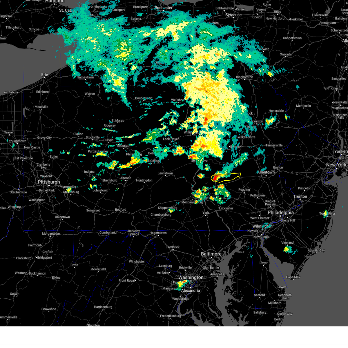
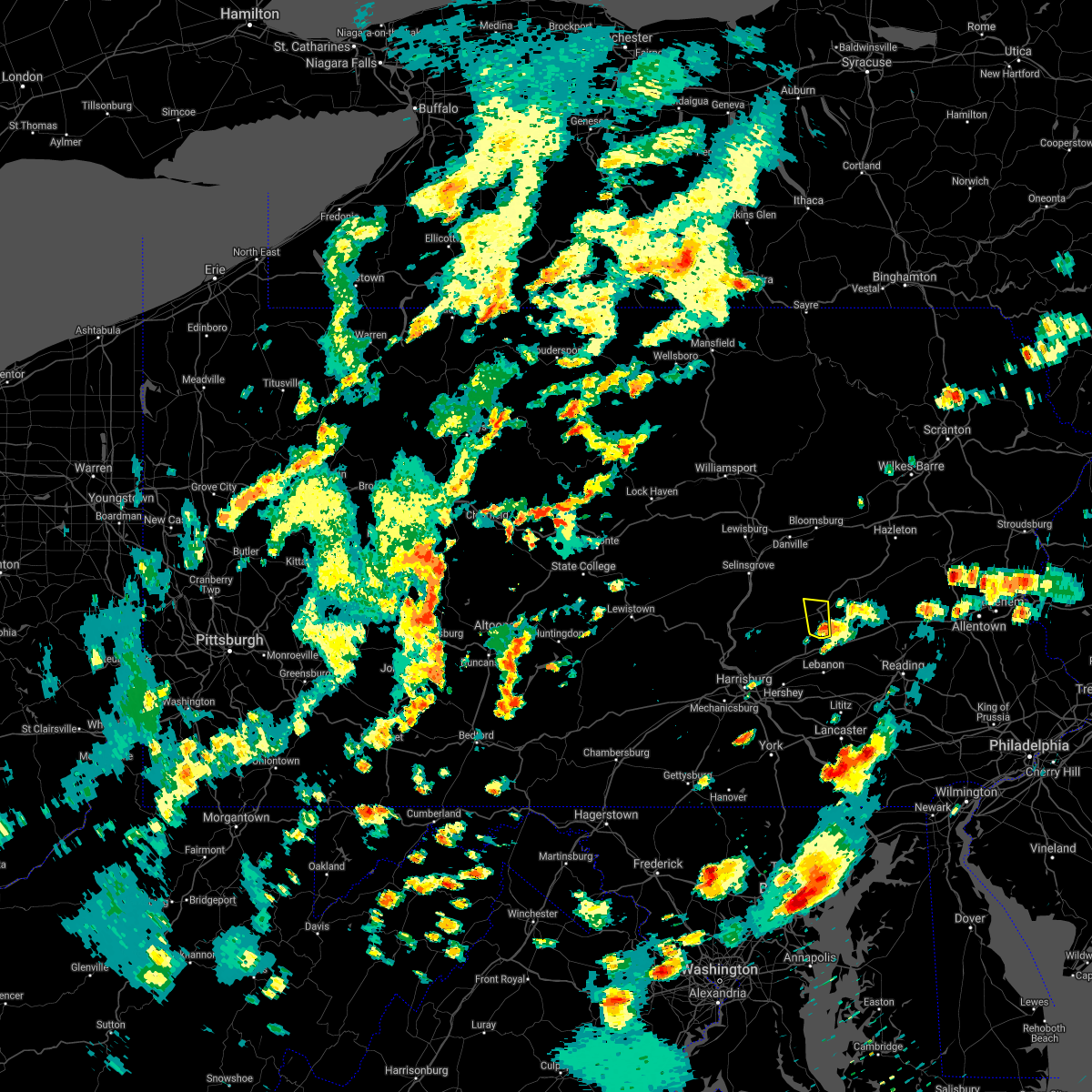
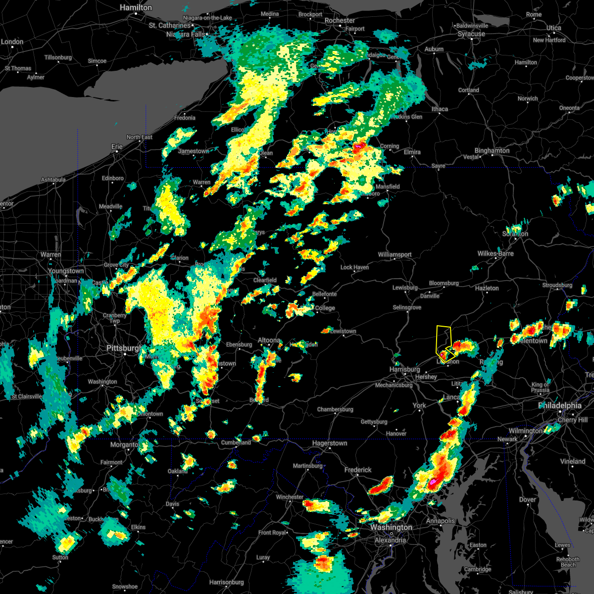
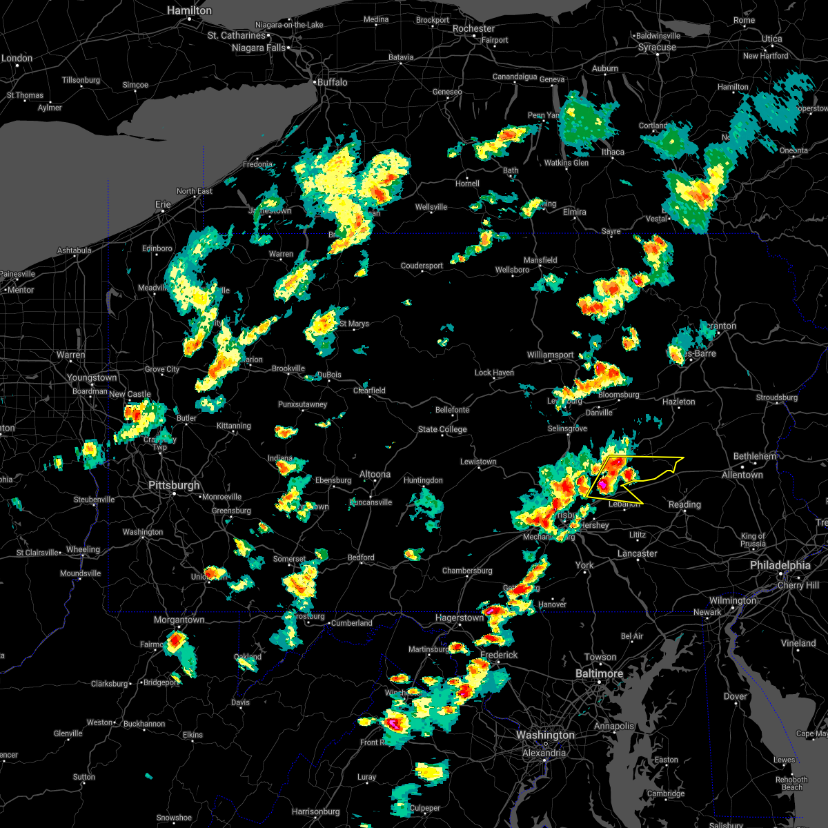
Hail Map for Muir, PA
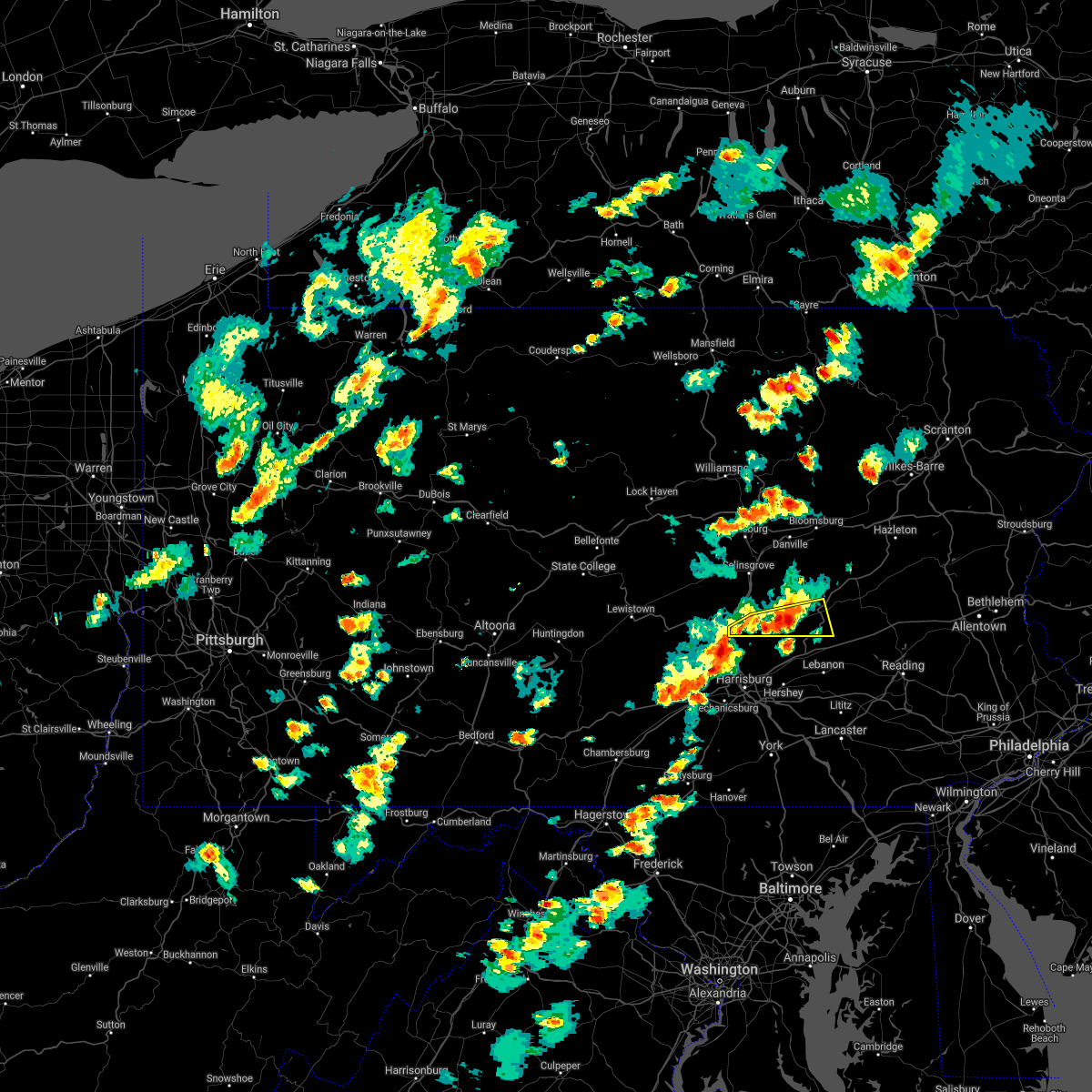
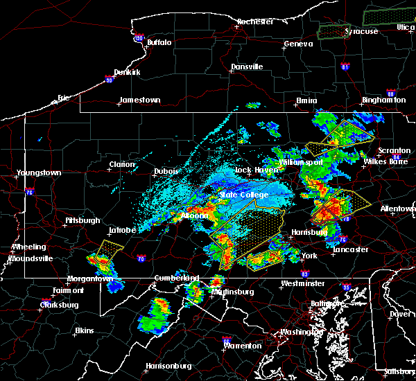
The Muir, PA area has had 0 reports of on-the-ground hail by trained spotters, and has been under severe weather warnings 4 times during the past 12 months. Doppler radar has detected hail at or near Muir, PA on 37 occasions, including 2 occasions during the past year.
| Name: | Muir, PA |
| Where Located: | 72.1 miles ESE of State College, PA |
| Map: | Google Map for Muir, PA |
| Population: | 451 |
| Housing Units: | 194 |
| More Info: | Search Google for Muir, PA |
0
The Top Recent Hail Date for Muir, PA is Sunday, March 16, 2025 (21st out of 37)

Hail and Wind Damage Spotted near Muir, PA
| Date / Time | Report Details |
|---|---|
| 7/1/2025 3:17 PM EDT |
 Svrctp the national weather service in state college pa has issued a * severe thunderstorm warning for, northeastern cumberland county in south central pennsylvania, dauphin county in south central pennsylvania, lebanon county in south central pennsylvania, east central perry county in south central pennsylvania, southwestern schuylkill county in central pennsylvania, northwestern york county in south central pennsylvania, * until 415 pm edt. * at 317 pm edt, severe thunderstorms were located along a line extending from pine grove to shiremanstown, moving east at 25 mph (radar indicated). Hazards include 60 mph wind gusts. expect damage to roofs, siding, and trees Svrctp the national weather service in state college pa has issued a * severe thunderstorm warning for, northeastern cumberland county in south central pennsylvania, dauphin county in south central pennsylvania, lebanon county in south central pennsylvania, east central perry county in south central pennsylvania, southwestern schuylkill county in central pennsylvania, northwestern york county in south central pennsylvania, * until 415 pm edt. * at 317 pm edt, severe thunderstorms were located along a line extending from pine grove to shiremanstown, moving east at 25 mph (radar indicated). Hazards include 60 mph wind gusts. expect damage to roofs, siding, and trees
|
| 4/29/2025 7:50 PM EDT | Svrctp the national weather service in state college pa has issued a * severe thunderstorm warning for, columbia county in central pennsylvania, northern dauphin county in south central pennsylvania, northwestern lebanon county in south central pennsylvania, southern northumberland county in central pennsylvania, schuylkill county in central pennsylvania, sullivan county in north central pennsylvania, * until 845 pm edt. * at 750 pm edt, severe thunderstorms were located along a line extending from ralston to near hughesville to mooresburg to selinsgrove to new buffalo, moving east at 65 mph (radar indicated). Hazards include 60 mph wind gusts. expect damage to roofs, siding, and trees |
| 9/21/2024 11:13 PM EDT |
 At 1111 pm edt, a severe thunderstorm was located over klingerstown, moving southeast at 30 mph. a large area of strong storms were just to the north and west of this storm (radar indicated). Hazards include 60 mph wind gusts and half dollar size hail. Hail damage to vehicles is expected. expect wind damage to roofs, siding, and trees. locations impacted include, selinsgrove, lykens, williamstown, tower city, port trevorton, donaldson, klingerstown, rebuck, leck kill, urban, wiconisco, and hegins. This includes interstate 81 between mile markers 92 and 96, and from mile markers 106 to 111. At 1111 pm edt, a severe thunderstorm was located over klingerstown, moving southeast at 30 mph. a large area of strong storms were just to the north and west of this storm (radar indicated). Hazards include 60 mph wind gusts and half dollar size hail. Hail damage to vehicles is expected. expect wind damage to roofs, siding, and trees. locations impacted include, selinsgrove, lykens, williamstown, tower city, port trevorton, donaldson, klingerstown, rebuck, leck kill, urban, wiconisco, and hegins. This includes interstate 81 between mile markers 92 and 96, and from mile markers 106 to 111.
|
| 9/21/2024 10:58 PM EDT |
 Svrctp the national weather service in state college pa has issued a * severe thunderstorm warning for, northeastern dauphin county in south central pennsylvania, north central lebanon county in south central pennsylvania, southwestern northumberland county in central pennsylvania, southwestern schuylkill county in central pennsylvania, southeastern snyder county in central pennsylvania, * until 1130 pm edt. * at 1056 pm edt, a severe thunderstorm was located over urban, moving southeast at 30 mph. other storms were just to the northwest of this storm (radar indicated). Hazards include 60 mph wind gusts and half dollar size hail. Hail damage to vehicles is expected. Expect wind damage to roofs, siding, and trees. Svrctp the national weather service in state college pa has issued a * severe thunderstorm warning for, northeastern dauphin county in south central pennsylvania, north central lebanon county in south central pennsylvania, southwestern northumberland county in central pennsylvania, southwestern schuylkill county in central pennsylvania, southeastern snyder county in central pennsylvania, * until 1130 pm edt. * at 1056 pm edt, a severe thunderstorm was located over urban, moving southeast at 30 mph. other storms were just to the northwest of this storm (radar indicated). Hazards include 60 mph wind gusts and half dollar size hail. Hail damage to vehicles is expected. Expect wind damage to roofs, siding, and trees.
|
| 6/29/2024 6:19 PM EDT |
 At 618 pm edt, severe thunderstorms were located along a line extending from shenandoah to tremont to penn national race course, moving east at 45 mph (trained weather spotters). Hazards include 70 mph wind gusts. Expect considerable tree damage. damage is likely to mobile homes, roofs, and outbuildings. locations impacted include, lebanon, pottsville, shamokin, palmyra, tamaqua, linglestown, mount carmel, schuylkill haven, shenandoah, annville, minersville, and mahanoy city. this includes the following interstates, interstate 78 from mile markers 0 to 8. Interstate 81 from mile markers 75 to 132. At 618 pm edt, severe thunderstorms were located along a line extending from shenandoah to tremont to penn national race course, moving east at 45 mph (trained weather spotters). Hazards include 70 mph wind gusts. Expect considerable tree damage. damage is likely to mobile homes, roofs, and outbuildings. locations impacted include, lebanon, pottsville, shamokin, palmyra, tamaqua, linglestown, mount carmel, schuylkill haven, shenandoah, annville, minersville, and mahanoy city. this includes the following interstates, interstate 78 from mile markers 0 to 8. Interstate 81 from mile markers 75 to 132.
|
| 6/29/2024 6:19 PM EDT |
 the severe thunderstorm warning has been cancelled and is no longer in effect the severe thunderstorm warning has been cancelled and is no longer in effect
|
| 6/29/2024 5:57 PM EDT |
 Svrctp the national weather service in state college pa has issued a * severe thunderstorm warning for, south central columbia county in central pennsylvania, northern dauphin county in south central pennsylvania, lebanon county in south central pennsylvania, southeastern northumberland county in central pennsylvania, east central perry county in south central pennsylvania, schuylkill county in central pennsylvania, * until 645 pm edt. * at 557 pm edt, severe thunderstorms were located along a line extending from knoebels grove to williamstown to new buffalo, moving east at 40 mph (trained weather spotters. at 555 pm a measured wind gust of 65 mph was reported in elizabethville). Hazards include 70 mph wind gusts. Expect considerable tree damage. Damage is likely to mobile homes, roofs, and outbuildings. Svrctp the national weather service in state college pa has issued a * severe thunderstorm warning for, south central columbia county in central pennsylvania, northern dauphin county in south central pennsylvania, lebanon county in south central pennsylvania, southeastern northumberland county in central pennsylvania, east central perry county in south central pennsylvania, schuylkill county in central pennsylvania, * until 645 pm edt. * at 557 pm edt, severe thunderstorms were located along a line extending from knoebels grove to williamstown to new buffalo, moving east at 40 mph (trained weather spotters. at 555 pm a measured wind gust of 65 mph was reported in elizabethville). Hazards include 70 mph wind gusts. Expect considerable tree damage. Damage is likely to mobile homes, roofs, and outbuildings.
|
| 6/26/2024 6:04 PM EDT |
 At 603 pm edt, severe thunderstorms were located along a line extending from beurys lake to pine grove to near myerstown to mount joy, moving northeast at 40 mph (radar indicated). Hazards include 60 mph wind gusts. Expect damage to roofs, siding, and trees. locations impacted include, lancaster, lebanon, pottsville, ephrata, columbia, lititz, mount joy, schuylkill haven, shenandoah, manheim, annville, and east petersburg. this includes the following interstates, the pennsylvania turnpike from mile markers 261 to 281. interstate 78 from mile markers 0 to 8. Interstate 81 from mile markers 88 to 131. At 603 pm edt, severe thunderstorms were located along a line extending from beurys lake to pine grove to near myerstown to mount joy, moving northeast at 40 mph (radar indicated). Hazards include 60 mph wind gusts. Expect damage to roofs, siding, and trees. locations impacted include, lancaster, lebanon, pottsville, ephrata, columbia, lititz, mount joy, schuylkill haven, shenandoah, manheim, annville, and east petersburg. this includes the following interstates, the pennsylvania turnpike from mile markers 261 to 281. interstate 78 from mile markers 0 to 8. Interstate 81 from mile markers 88 to 131.
|
| 6/26/2024 6:04 PM EDT |
 the severe thunderstorm warning has been cancelled and is no longer in effect the severe thunderstorm warning has been cancelled and is no longer in effect
|
| 6/26/2024 5:31 PM EDT |
 Svrctp the national weather service in state college pa has issued a * severe thunderstorm warning for, dauphin county in south central pennsylvania, northwestern lancaster county in south central pennsylvania, lebanon county in south central pennsylvania, schuylkill county in central pennsylvania, northwestern york county in south central pennsylvania, * until 615 pm edt. * at 531 pm edt, severe thunderstorms were located along a line extending from lykens to dehart dam to hershey to dover, moving northeast at 40 mph (radar indicated). Hazards include 60 mph wind gusts. expect damage to roofs, siding, and trees Svrctp the national weather service in state college pa has issued a * severe thunderstorm warning for, dauphin county in south central pennsylvania, northwestern lancaster county in south central pennsylvania, lebanon county in south central pennsylvania, schuylkill county in central pennsylvania, northwestern york county in south central pennsylvania, * until 615 pm edt. * at 531 pm edt, severe thunderstorms were located along a line extending from lykens to dehart dam to hershey to dover, moving northeast at 40 mph (radar indicated). Hazards include 60 mph wind gusts. expect damage to roofs, siding, and trees
|
| 9/7/2023 4:56 PM EDT |
 At 456 pm edt, a severe thunderstorm was located over branchdale, moving northeast at 45 mph (radar indicated). Hazards include 60 mph wind gusts and quarter size hail. Hail damage to vehicles is expected. expect wind damage to roofs, siding, and trees. locations impacted include, pottsville, berwick, tamaqua, schuylkill haven, shenandoah, minersville, mahanoy city, frackville, st. clair, orwigsburg, mcadoo and pine grove. for those driving on interstate 80, this includes areas between the mifflinville and nescopek exits, specifically from mile markers 245 to 247. this includes interstate 81 from mile markers 97 to 139. hail threat, radar indicated max hail size, 1. 00 in wind threat, radar indicated max wind gust, 60 mph. At 456 pm edt, a severe thunderstorm was located over branchdale, moving northeast at 45 mph (radar indicated). Hazards include 60 mph wind gusts and quarter size hail. Hail damage to vehicles is expected. expect wind damage to roofs, siding, and trees. locations impacted include, pottsville, berwick, tamaqua, schuylkill haven, shenandoah, minersville, mahanoy city, frackville, st. clair, orwigsburg, mcadoo and pine grove. for those driving on interstate 80, this includes areas between the mifflinville and nescopek exits, specifically from mile markers 245 to 247. this includes interstate 81 from mile markers 97 to 139. hail threat, radar indicated max hail size, 1. 00 in wind threat, radar indicated max wind gust, 60 mph.
|
| 9/7/2023 4:41 PM EDT |
 At 439 pm edt, a severe thunderstorm was located over fredericksburg, moving northeast at 35 mph. other strong storms were nearby and intensifying (radar indicated). Hazards include 60 mph wind gusts and quarter size hail. Hail damage to vehicles is expected. Expect wind damage to roofs, siding, and trees. At 439 pm edt, a severe thunderstorm was located over fredericksburg, moving northeast at 35 mph. other strong storms were nearby and intensifying (radar indicated). Hazards include 60 mph wind gusts and quarter size hail. Hail damage to vehicles is expected. Expect wind damage to roofs, siding, and trees.
|
| 9/7/2023 4:06 PM EDT |
 At 406 pm edt, a severe thunderstorm was located over leck kill, moving north at 25 mph (radar indicated). Hazards include 60 mph wind gusts and quarter size hail. Hail damage to vehicles is expected. expect wind damage to roofs, siding, and trees. locations impacted include, harrisburg, lower allen, hershey, colonial park, progress, middletown, new cumberland, linglestown, steelton, lemoyne, hummelstown and paxtonia. this includes the following interstates, the pennsylvania turnpike from mile markers 241 to 253. interstate 81 from mile markers 73 to 85. interstate 83 between mile markers 36 and 39, and from mile markers 42 to 49. interstate 283 from mile markers 0 to 2. hail threat, radar indicated max hail size, 1. 00 in wind threat, radar indicated max wind gust, 60 mph. At 406 pm edt, a severe thunderstorm was located over leck kill, moving north at 25 mph (radar indicated). Hazards include 60 mph wind gusts and quarter size hail. Hail damage to vehicles is expected. expect wind damage to roofs, siding, and trees. locations impacted include, harrisburg, lower allen, hershey, colonial park, progress, middletown, new cumberland, linglestown, steelton, lemoyne, hummelstown and paxtonia. this includes the following interstates, the pennsylvania turnpike from mile markers 241 to 253. interstate 81 from mile markers 73 to 85. interstate 83 between mile markers 36 and 39, and from mile markers 42 to 49. interstate 283 from mile markers 0 to 2. hail threat, radar indicated max hail size, 1. 00 in wind threat, radar indicated max wind gust, 60 mph.
|
| 9/7/2023 3:33 PM EDT |
 At 333 pm edt, a severe thunderstorm was located over fort indiantown gap, moving north at 25 mph (radar indicated). Hazards include 60 mph wind gusts and quarter size hail. Hail damage to vehicles is expected. Expect wind damage to roofs, siding, and trees. At 333 pm edt, a severe thunderstorm was located over fort indiantown gap, moving north at 25 mph (radar indicated). Hazards include 60 mph wind gusts and quarter size hail. Hail damage to vehicles is expected. Expect wind damage to roofs, siding, and trees.
|
| 7/29/2023 4:08 PM EDT |
 At 407 pm edt, a severe thunderstorm was located over tower city, moving east at 35 mph (radar indicated). Hazards include 60 mph wind gusts. Expect damage to roofs, siding, and trees. locations impacted include, schuylkill haven, pine grove, tremont, tower city, friedensburg, donaldson, lake wynonah, cressona, hegins, auburn, deer lake and ravine. This includes interstate 81 from mile markers 97 to 111. At 407 pm edt, a severe thunderstorm was located over tower city, moving east at 35 mph (radar indicated). Hazards include 60 mph wind gusts. Expect damage to roofs, siding, and trees. locations impacted include, schuylkill haven, pine grove, tremont, tower city, friedensburg, donaldson, lake wynonah, cressona, hegins, auburn, deer lake and ravine. This includes interstate 81 from mile markers 97 to 111.
|
| 7/29/2023 3:50 PM EDT |
 At 349 pm edt, a severe thunderstorm was located over klingerstown, moving east at 35 mph (radar indicated). Hazards include 60 mph wind gusts. expect damage to roofs, siding, and trees At 349 pm edt, a severe thunderstorm was located over klingerstown, moving east at 35 mph (radar indicated). Hazards include 60 mph wind gusts. expect damage to roofs, siding, and trees
|
| 7/2/2023 4:43 PM EDT |
 At 442 pm edt, a severe thunderstorm was located over tower city, moving east at 25 mph. this storm has a history of producing wind damage across northern dauphin county (radar indicated). Hazards include 60 mph wind gusts. expect damage to roofs, siding, and trees At 442 pm edt, a severe thunderstorm was located over tower city, moving east at 25 mph. this storm has a history of producing wind damage across northern dauphin county (radar indicated). Hazards include 60 mph wind gusts. expect damage to roofs, siding, and trees
|
| 6/27/2023 2:03 PM EDT |
 At 202 pm edt, severe thunderstorms were located along a line extending from millersburg to near new buffalo to paxtang, moving east northeast at 20 mph (radar indicated). Hazards include 60 mph wind gusts and quarter size hail. Hail damage to vehicles is expected. Expect wind damage to roofs, siding, and trees. At 202 pm edt, severe thunderstorms were located along a line extending from millersburg to near new buffalo to paxtang, moving east northeast at 20 mph (radar indicated). Hazards include 60 mph wind gusts and quarter size hail. Hail damage to vehicles is expected. Expect wind damage to roofs, siding, and trees.
|
| 6/3/2023 7:16 PM EDT |
 At 715 pm edt, a severe thunderstorm was located over williamstown, moving south at 30 mph (radar indicated). Hazards include 60 mph wind gusts and quarter size hail. Hail damage to vehicles is expected. Expect wind damage to roofs, siding, and trees. At 715 pm edt, a severe thunderstorm was located over williamstown, moving south at 30 mph (radar indicated). Hazards include 60 mph wind gusts and quarter size hail. Hail damage to vehicles is expected. Expect wind damage to roofs, siding, and trees.
|
| 4/22/2023 3:08 PM EDT |
 At 307 pm edt, a severe thunderstorm was located over fort indiantown gap, moving north at 45 mph (radar indicated). Hazards include 60 mph wind gusts and quarter size hail. Hail damage to vehicles is expected. expect wind damage to roofs, siding, and trees. this severe thunderstorm will be near, lykens around 310 pm edt. tower city, williamstown and klingerstown around 320 pm edt. shamokin, fairview-ferndale and marshallton around 330 pm edt. kulpmont, mount carmel and knoebels grove around 340 pm edt. other locations impacted by this severe thunderstorm include edgewood, gratz, muir, espy and orwin. for those driving on interstate 80, this includes areas between the danville and bloomsburg-light street exits, specifically from mile markers 225 to 233. this includes interstate 81 between mile markers 85 and 87, between mile markers 92 and 95, and from mile markers 108 to 109. hail threat, radar indicated max hail size, 1. 00 in wind threat, radar indicated max wind gust, 60 mph. At 307 pm edt, a severe thunderstorm was located over fort indiantown gap, moving north at 45 mph (radar indicated). Hazards include 60 mph wind gusts and quarter size hail. Hail damage to vehicles is expected. expect wind damage to roofs, siding, and trees. this severe thunderstorm will be near, lykens around 310 pm edt. tower city, williamstown and klingerstown around 320 pm edt. shamokin, fairview-ferndale and marshallton around 330 pm edt. kulpmont, mount carmel and knoebels grove around 340 pm edt. other locations impacted by this severe thunderstorm include edgewood, gratz, muir, espy and orwin. for those driving on interstate 80, this includes areas between the danville and bloomsburg-light street exits, specifically from mile markers 225 to 233. this includes interstate 81 between mile markers 85 and 87, between mile markers 92 and 95, and from mile markers 108 to 109. hail threat, radar indicated max hail size, 1. 00 in wind threat, radar indicated max wind gust, 60 mph.
|
| 4/1/2023 5:16 PM EDT |
 At 516 pm edt, severe thunderstorms were located along a line extending from pine grove to bonneauville, moving east at 40 mph (radar indicated). Hazards include 60 mph wind gusts. expect damage to roofs, siding, and trees At 516 pm edt, severe thunderstorms were located along a line extending from pine grove to bonneauville, moving east at 40 mph (radar indicated). Hazards include 60 mph wind gusts. expect damage to roofs, siding, and trees
|
| 3/31/2022 5:34 PM EDT |
 At 534 pm edt, severe thunderstorms were located along a line extending from port trevorton to near meiserville to millersburg to duncannon, moving northeast at 35 mph (radar indicated). Hazards include 60 mph wind gusts and nickel size hail. expect damage to roofs, siding, and trees At 534 pm edt, severe thunderstorms were located along a line extending from port trevorton to near meiserville to millersburg to duncannon, moving northeast at 35 mph (radar indicated). Hazards include 60 mph wind gusts and nickel size hail. expect damage to roofs, siding, and trees
|
| 3/19/2022 5:48 PM EDT |
 At 547 pm edt, severe thunderstorms were located along a line extending from oneida to coaldale to pottsville to pine grove, moving east at 30 mph (radar indicated). Hazards include 60 mph wind gusts and penny size hail. Expect damage to roofs, siding, and trees. locations impacted include, pottsville, shenandoah, st. clair, minersville, mahanoy city, frackville, ashland, mcadoo, pine grove, port carbon, tremont, girardville, hometown, tower city, tuscarora, new philadelphia, oneida, lavelle, marlin and altamont. this includes interstate 81 from mile markers 97 to 139. hail threat, observed max hail size, 0. 75 in wind threat, radar indicated max wind gust, 60 mph. At 547 pm edt, severe thunderstorms were located along a line extending from oneida to coaldale to pottsville to pine grove, moving east at 30 mph (radar indicated). Hazards include 60 mph wind gusts and penny size hail. Expect damage to roofs, siding, and trees. locations impacted include, pottsville, shenandoah, st. clair, minersville, mahanoy city, frackville, ashland, mcadoo, pine grove, port carbon, tremont, girardville, hometown, tower city, tuscarora, new philadelphia, oneida, lavelle, marlin and altamont. this includes interstate 81 from mile markers 97 to 139. hail threat, observed max hail size, 0. 75 in wind threat, radar indicated max wind gust, 60 mph.
|
| 3/19/2022 5:15 PM EDT |
 At 514 pm edt, severe thunderstorms were located along a line extending from slabtown to near marshallton to lykens, moving east at 30 mph (radar indicated). Hazards include 60 mph wind gusts and penny size hail. expect damage to roofs, siding, and trees At 514 pm edt, severe thunderstorms were located along a line extending from slabtown to near marshallton to lykens, moving east at 30 mph (radar indicated). Hazards include 60 mph wind gusts and penny size hail. expect damage to roofs, siding, and trees
|
| 3/7/2022 7:30 PM EST |
 At 730 pm est, severe thunderstorms were located along a line extending from branchdale to colonial park, moving east at 65 mph (radar indicated). Hazards include 60 mph wind gusts. Expect damage to roofs, siding, and trees. locations impacted include, harrisburg, lebanon, pottsville, hershey, palmyra, new cumberland, tamaqua, linglestown, schuylkill haven, shenandoah, lemoyne, myerstown, st. clair, colonial park, progress, steelton, paxtonia, annville, hummelstown and minersville. this includes the following interstates, interstate 78 from mile markers 0 to 8. interstate 81 from mile markers 66 to 139. interstate 83 from mile markers 42 to 50. interstate 283 near mile marker 2. hail threat, radar indicated max hail size, <. 75 in wind threat, radar indicated max wind gust, 60 mph. At 730 pm est, severe thunderstorms were located along a line extending from branchdale to colonial park, moving east at 65 mph (radar indicated). Hazards include 60 mph wind gusts. Expect damage to roofs, siding, and trees. locations impacted include, harrisburg, lebanon, pottsville, hershey, palmyra, new cumberland, tamaqua, linglestown, schuylkill haven, shenandoah, lemoyne, myerstown, st. clair, colonial park, progress, steelton, paxtonia, annville, hummelstown and minersville. this includes the following interstates, interstate 78 from mile markers 0 to 8. interstate 81 from mile markers 66 to 139. interstate 83 from mile markers 42 to 50. interstate 283 near mile marker 2. hail threat, radar indicated max hail size, <. 75 in wind threat, radar indicated max wind gust, 60 mph.
|
| 3/7/2022 7:00 PM EST |
 At 700 pm est, severe thunderstorms were located along a line extending from meiserville to plainfield, moving east at 55 mph (radar indicated). Hazards include 60 mph wind gusts. expect damage to roofs, siding, and trees At 700 pm est, severe thunderstorms were located along a line extending from meiserville to plainfield, moving east at 55 mph (radar indicated). Hazards include 60 mph wind gusts. expect damage to roofs, siding, and trees
|
| 9/15/2021 6:17 PM EDT |
 At 617 pm edt, a severe thunderstorm was located near pine grove, moving east at 35 mph (radar indicated). Hazards include 60 mph wind gusts and quarter size hail. Hail damage to vehicles is expected. Expect wind damage to roofs, siding, and trees. At 617 pm edt, a severe thunderstorm was located near pine grove, moving east at 35 mph (radar indicated). Hazards include 60 mph wind gusts and quarter size hail. Hail damage to vehicles is expected. Expect wind damage to roofs, siding, and trees.
|
| 8/18/2021 6:47 PM EDT |
 At 646 pm edt, severe thunderstorms were located along a line extending from near new buffalo to near dehart dam to linglestown to highspire to near emigsville to spring grove to hanover to near taneytown, moving northeast at 35 mph (radar indicated). Hazards include 60 mph wind gusts. Expect damage to roofs, siding, and trees. severe thunderstorms will be near, middletown, york, hummelstown, linglestown, weigelstown, colonial park, steelton, progress, emigsville and skyline view around 650 pm edt. spry, hershey, elizabethtown, tyler run-queens gate, valley view, fort indiantown gap, penn national race course, east york, grantley and bainbridge around 700 pm edt. mount joy, palmyra, yorkana, lickdale, maytown, jacobus, rheems, yorklyn, harper tavern and marietta around 710 pm edt. dallastown, cornwall, lebanon, red lion, columbia, annville, lebanon south, salunga-landisville, yoe and quentin around 720 pm edt. other locations impacted by these severe thunderstorms include york haven, ravine, three mile island, east prospect, mount gretna, glenville, newtown, ono, schoeneck and loganville. this includes the following interstates, the pennsylvania turnpike from mile markers 243 to 281. interstate 78 from mile markers 0 to 8. interstate 81 from mile markers 69 to 113. interstate 83 between mile markers 2 and 37, and from mile markers 44 to 50. Interstate 283 from mile markers 0 to 2. At 646 pm edt, severe thunderstorms were located along a line extending from near new buffalo to near dehart dam to linglestown to highspire to near emigsville to spring grove to hanover to near taneytown, moving northeast at 35 mph (radar indicated). Hazards include 60 mph wind gusts. Expect damage to roofs, siding, and trees. severe thunderstorms will be near, middletown, york, hummelstown, linglestown, weigelstown, colonial park, steelton, progress, emigsville and skyline view around 650 pm edt. spry, hershey, elizabethtown, tyler run-queens gate, valley view, fort indiantown gap, penn national race course, east york, grantley and bainbridge around 700 pm edt. mount joy, palmyra, yorkana, lickdale, maytown, jacobus, rheems, yorklyn, harper tavern and marietta around 710 pm edt. dallastown, cornwall, lebanon, red lion, columbia, annville, lebanon south, salunga-landisville, yoe and quentin around 720 pm edt. other locations impacted by these severe thunderstorms include york haven, ravine, three mile island, east prospect, mount gretna, glenville, newtown, ono, schoeneck and loganville. this includes the following interstates, the pennsylvania turnpike from mile markers 243 to 281. interstate 78 from mile markers 0 to 8. interstate 81 from mile markers 69 to 113. interstate 83 between mile markers 2 and 37, and from mile markers 44 to 50. Interstate 283 from mile markers 0 to 2.
|
| 8/1/2021 6:49 PM EDT |
 At 648 pm edt, severe thunderstorms were located along a line extending from near donaldson to near skyline view to near hogestown, moving southeast at 30 mph (radar indicated). Hazards include 60 mph wind gusts and penny size hail. Expect damage to roofs, siding, and trees. these severe storms will be near, donaldson, penn national race course, tremont, fort indiantown gap and tower city around 650 pm edt. hershey, progress, pine grove, harper tavern and branchdale around 700 pm edt. palmyra, annville, hummelstown, highspire, bressler-enhaut-oberlin, paxtang, campbelltown, cleona, friedensburg and lawnton around 710 pm edt. Other locations impacted by these severe thunderstorms include ravine, dauphin, landingville, newtown, ono, palo alto, mount carbon, jonestown, cressona and muir. At 648 pm edt, severe thunderstorms were located along a line extending from near donaldson to near skyline view to near hogestown, moving southeast at 30 mph (radar indicated). Hazards include 60 mph wind gusts and penny size hail. Expect damage to roofs, siding, and trees. these severe storms will be near, donaldson, penn national race course, tremont, fort indiantown gap and tower city around 650 pm edt. hershey, progress, pine grove, harper tavern and branchdale around 700 pm edt. palmyra, annville, hummelstown, highspire, bressler-enhaut-oberlin, paxtang, campbelltown, cleona, friedensburg and lawnton around 710 pm edt. Other locations impacted by these severe thunderstorms include ravine, dauphin, landingville, newtown, ono, palo alto, mount carbon, jonestown, cressona and muir.
|
| 8/1/2021 6:27 PM EDT |
 At 627 pm edt, severe thunderstorms were located along a line extending from near leck kill to near new buffalo to shermansdale, moving southeast at 35 mph (radar indicated). Hazards include 60 mph wind gusts and penny size hail. expect damage to roofs, siding, and trees At 627 pm edt, severe thunderstorms were located along a line extending from near leck kill to near new buffalo to shermansdale, moving southeast at 35 mph (radar indicated). Hazards include 60 mph wind gusts and penny size hail. expect damage to roofs, siding, and trees
|
| 7/17/2021 3:23 PM EDT |
 At 322 pm edt, a severe thunderstorm was located near pine grove, moving northeast at 15 mph (radar indicated). Hazards include 60 mph wind gusts and quarter size hail. Hail damage to vehicles is expected. expect wind damage to roofs, siding, and trees. locations impacted include, pine grove, tremont, donaldson, hegins and ravine. This includes interstate 81 from mile markers 97 to 112. At 322 pm edt, a severe thunderstorm was located near pine grove, moving northeast at 15 mph (radar indicated). Hazards include 60 mph wind gusts and quarter size hail. Hail damage to vehicles is expected. expect wind damage to roofs, siding, and trees. locations impacted include, pine grove, tremont, donaldson, hegins and ravine. This includes interstate 81 from mile markers 97 to 112.
|
| 7/17/2021 3:02 PM EDT |
 At 302 pm edt, a severe thunderstorm was located over fredericksburg, moving northeast at 15 mph (radar indicated). Hazards include 60 mph wind gusts and quarter size hail. Hail damage to vehicles is expected. Expect wind damage to roofs, siding, and trees. At 302 pm edt, a severe thunderstorm was located over fredericksburg, moving northeast at 15 mph (radar indicated). Hazards include 60 mph wind gusts and quarter size hail. Hail damage to vehicles is expected. Expect wind damage to roofs, siding, and trees.
|
| 7/11/2021 8:44 PM EDT |
 At 844 pm edt, severe thunderstorms were located along a line extending from near millersburg to near new buffalo to near shippensburg, moving east at 20 mph (radar indicated). Hazards include 60 mph wind gusts. expect damage to roofs, siding, and trees At 844 pm edt, severe thunderstorms were located along a line extending from near millersburg to near new buffalo to near shippensburg, moving east at 20 mph (radar indicated). Hazards include 60 mph wind gusts. expect damage to roofs, siding, and trees
|
| 7/9/2021 4:16 PM EDT |
 At 415 pm edt, a severe thunderstorm was located near millersburg, moving east at 30 mph (radar indicated). Hazards include 60 mph wind gusts. expect damage to roofs, siding, and trees At 415 pm edt, a severe thunderstorm was located near millersburg, moving east at 30 mph (radar indicated). Hazards include 60 mph wind gusts. expect damage to roofs, siding, and trees
|
| 5/26/2021 3:23 PM EDT |
 At 323 pm edt, severe thunderstorms were located along a line extending from donaldson to fort indiantown gap, moving east at 20 mph (radar indicated). Hazards include 60 mph wind gusts and nickel size hail. expect damage to trees, roofs, and siding At 323 pm edt, severe thunderstorms were located along a line extending from donaldson to fort indiantown gap, moving east at 20 mph (radar indicated). Hazards include 60 mph wind gusts and nickel size hail. expect damage to trees, roofs, and siding
|
| 5/26/2021 3:14 PM EDT |
 At 312 pm edt, a severe thunderstorm was located near leck kill, moving east at 30 mph (emergency management reported multiple trees down in washington township and damage to a barn). Hazards include 60 mph wind gusts. Expect damage to trees, roofs, and siding. locations impacted include, millersburg, pine grove, lykens, tremont, elizabethville, williamstown, tower city, donaldson, wiconisco, hegins, gratz, ravine, muir, berrysburg and orwin. This includes interstate 81 from mile markers 96 to 110. At 312 pm edt, a severe thunderstorm was located near leck kill, moving east at 30 mph (emergency management reported multiple trees down in washington township and damage to a barn). Hazards include 60 mph wind gusts. Expect damage to trees, roofs, and siding. locations impacted include, millersburg, pine grove, lykens, tremont, elizabethville, williamstown, tower city, donaldson, wiconisco, hegins, gratz, ravine, muir, berrysburg and orwin. This includes interstate 81 from mile markers 96 to 110.
|
| 5/26/2021 3:03 PM EDT |
 At 302 pm edt, a severe thunderstorm was located over leck kill, moving east at 30 mph (radar indicated). Hazards include 60 mph wind gusts. Expect damage to trees, roofs, and siding. locations impacted include, millersburg, pine grove, lykens, tremont, elizabethville, williamstown, tower city, donaldson, klingerstown, beurys lake, wiconisco, hegins, gratz, ravine, muir, berrysburg, orwin, pillow, pitman and schuykill county airport. This includes interstate 81 from mile markers 96 to 113. At 302 pm edt, a severe thunderstorm was located over leck kill, moving east at 30 mph (radar indicated). Hazards include 60 mph wind gusts. Expect damage to trees, roofs, and siding. locations impacted include, millersburg, pine grove, lykens, tremont, elizabethville, williamstown, tower city, donaldson, klingerstown, beurys lake, wiconisco, hegins, gratz, ravine, muir, berrysburg, orwin, pillow, pitman and schuykill county airport. This includes interstate 81 from mile markers 96 to 113.
|
| 5/26/2021 2:33 PM EDT |
 At 232 pm edt, a severe thunderstorm was located near meiserville, moving east at 30 mph (radar indicated). Hazards include 60 mph wind gusts. expect damage to trees, roofs, and siding At 232 pm edt, a severe thunderstorm was located near meiserville, moving east at 30 mph (radar indicated). Hazards include 60 mph wind gusts. expect damage to trees, roofs, and siding
|
| 8/27/2020 7:29 PM EDT |
 At 729 pm edt, a severe thunderstorm was located over fairview-ferndale, moving southeast at 45 mph (radar indicated). Hazards include 60 mph wind gusts. expect damage to trees, roofs, and siding At 729 pm edt, a severe thunderstorm was located over fairview-ferndale, moving southeast at 45 mph (radar indicated). Hazards include 60 mph wind gusts. expect damage to trees, roofs, and siding
|
| 6/10/2020 8:44 PM EDT |
 At 844 pm edt, a severe thunderstorm was located over donaldson, moving northeast at 25 mph (radar indicated). Hazards include 60 mph wind gusts. expect damage to trees, roofs, and siding At 844 pm edt, a severe thunderstorm was located over donaldson, moving northeast at 25 mph (radar indicated). Hazards include 60 mph wind gusts. expect damage to trees, roofs, and siding
|
| 6/4/2020 8:15 PM EDT |
 At 815 pm edt, severe thunderstorms were located along a line extending from near port trevorton to near penn national race course, moving northeast at 35 mph (radar indicated). Hazards include 60 mph wind gusts. Expect damage to trees, roofs, and siding. locations impacted include, lebanon, hershey, sunbury, palmyra, selinsgrove, annville, myerstown, skyline view, winfield, pleasant hill, sand hill, cleona, lykens, shamokin dam, elizabethville, williamstown, fredericksburg, hummels wharf, tower city and kreamer. this includes the following interstates, interstate 78 from mile markers 0 to 7. Interstate 81 from mile markers 76 to 98. At 815 pm edt, severe thunderstorms were located along a line extending from near port trevorton to near penn national race course, moving northeast at 35 mph (radar indicated). Hazards include 60 mph wind gusts. Expect damage to trees, roofs, and siding. locations impacted include, lebanon, hershey, sunbury, palmyra, selinsgrove, annville, myerstown, skyline view, winfield, pleasant hill, sand hill, cleona, lykens, shamokin dam, elizabethville, williamstown, fredericksburg, hummels wharf, tower city and kreamer. this includes the following interstates, interstate 78 from mile markers 0 to 7. Interstate 81 from mile markers 76 to 98.
|
| 6/4/2020 7:41 PM EDT |
 At 740 pm edt, severe thunderstorms were located along a line extending from near mcalisterville to near wertzville, moving northeast at 35 mph (radar indicated). Hazards include 60 mph wind gusts. expect damage to trees, roofs, and siding At 740 pm edt, severe thunderstorms were located along a line extending from near mcalisterville to near wertzville, moving northeast at 35 mph (radar indicated). Hazards include 60 mph wind gusts. expect damage to trees, roofs, and siding
|
| 6/4/2020 5:43 PM EDT |
 At 542 pm edt, a severe thunderstorm was located over harper tavern, moving east at 40 mph (emergency management). Hazards include 70 mph wind gusts and quarter size hail. Hail damage to vehicles is expected. expect considerable tree damage. Wind damage is also likely to mobile homes, roofs, and outbuildings. At 542 pm edt, a severe thunderstorm was located over harper tavern, moving east at 40 mph (emergency management). Hazards include 70 mph wind gusts and quarter size hail. Hail damage to vehicles is expected. expect considerable tree damage. Wind damage is also likely to mobile homes, roofs, and outbuildings.
|
| 6/3/2020 5:10 PM EDT |
 At 509 pm edt, a severe thunderstorm was located over paxtonville, moving southeast at 45 mph (radar indicated). Hazards include 70 mph wind gusts and ping pong ball size hail. People and animals outdoors will be injured. expect hail damage to roofs, siding, windows, and vehicles. expect considerable tree damage. wind damage is also likely to mobile homes, roofs, and outbuildings. this severe storm will be near, mount pleasant mills, fremont and kreamer around 510 pm edt. meiserville and port trevorton around 520 pm edt. elizabethville and urban around 530 pm edt. lykens, williamstown, klingerstown and dehart dam around 540 pm edt. other locations impacted by this severe thunderstorm include gratz, ravine, wiconisco, dalmatia, newtown, seven points, cressona, muir, lake wynonah and orwin. This includes interstate 81 between mile markers 80 and 81, and from mile markers 98 to 114. At 509 pm edt, a severe thunderstorm was located over paxtonville, moving southeast at 45 mph (radar indicated). Hazards include 70 mph wind gusts and ping pong ball size hail. People and animals outdoors will be injured. expect hail damage to roofs, siding, windows, and vehicles. expect considerable tree damage. wind damage is also likely to mobile homes, roofs, and outbuildings. this severe storm will be near, mount pleasant mills, fremont and kreamer around 510 pm edt. meiserville and port trevorton around 520 pm edt. elizabethville and urban around 530 pm edt. lykens, williamstown, klingerstown and dehart dam around 540 pm edt. other locations impacted by this severe thunderstorm include gratz, ravine, wiconisco, dalmatia, newtown, seven points, cressona, muir, lake wynonah and orwin. This includes interstate 81 between mile markers 80 and 81, and from mile markers 98 to 114.
|
| 6/3/2020 4:43 PM EDT |
 At 442 pm edt, a cluster of severe thunderstorms were located near penns creek, moving southeast at 40 mph (radar indicated). Hazards include 60 mph wind gusts and quarter size hail. Hail damage to vehicles is expected. expect wind damage to trees, roofs, and siding. this severe thunderstorm will be near, selinsgrove, kratzerville and hummels wharf around 450 pm edt. port trevorton around 500 pm edt. klingerstown, urban, rebuck, leck kill and lykens around 510 pm edt. tower city and williamstown around 520 pm edt. other locations impacted by this severe thunderstorm include ravine, landingville, newtown, seven points, mount carbon, cressona, muir, hegins, new berlin and herndon. this includes interstate 81 between mile markers 80 and 81, and from mile markers 97 to 117. this includes the following covid-19 test sites, family practice selinsgrove, geisinger orwigsburg, geisinger st. Luke`s hospital, and lehigh valley health network. At 442 pm edt, a cluster of severe thunderstorms were located near penns creek, moving southeast at 40 mph (radar indicated). Hazards include 60 mph wind gusts and quarter size hail. Hail damage to vehicles is expected. expect wind damage to trees, roofs, and siding. this severe thunderstorm will be near, selinsgrove, kratzerville and hummels wharf around 450 pm edt. port trevorton around 500 pm edt. klingerstown, urban, rebuck, leck kill and lykens around 510 pm edt. tower city and williamstown around 520 pm edt. other locations impacted by this severe thunderstorm include ravine, landingville, newtown, seven points, mount carbon, cressona, muir, hegins, new berlin and herndon. this includes interstate 81 between mile markers 80 and 81, and from mile markers 97 to 117. this includes the following covid-19 test sites, family practice selinsgrove, geisinger orwigsburg, geisinger st. Luke`s hospital, and lehigh valley health network.
|
| 6/3/2020 10:50 AM EDT |
 At 1050 am edt, severe thunderstorms were located along a line extending from near catawissa to near shamokin to rebuck to port trevorton, moving east at 100 mph (radar indicated). Hazards include 60 mph wind gusts and penny size hail. Expect damage to trees, roofs, and siding. severe thunderstorms will be near, frackville, ashland, shenandoah, mahanoy city, nuremburg, girardville, oneida, sheppton, brandonville and aristes around 1100 am edt. tamaqua, pottsville, st. clair, minersville, schuylkill haven, port carbon, hometown, new philadelphia, orwigsburg and branchdale around 1110 am edt. mckeansburg and snyders around 1120 am edt. other locations impacted by these severe thunderstorms include ravine, mary-d, park place, ringtown, deer lake, cumbola, marion heights, landingville, newtown and mount carbon. this includes interstate 81 from mile markers 98 to 139. this includes the following covid-19 test sites, geisinger, geisinger kulpmont, geisinger orwigsburg, geisinger st. Luke`s hospital, lehigh valley health network, and west penn medical center. At 1050 am edt, severe thunderstorms were located along a line extending from near catawissa to near shamokin to rebuck to port trevorton, moving east at 100 mph (radar indicated). Hazards include 60 mph wind gusts and penny size hail. Expect damage to trees, roofs, and siding. severe thunderstorms will be near, frackville, ashland, shenandoah, mahanoy city, nuremburg, girardville, oneida, sheppton, brandonville and aristes around 1100 am edt. tamaqua, pottsville, st. clair, minersville, schuylkill haven, port carbon, hometown, new philadelphia, orwigsburg and branchdale around 1110 am edt. mckeansburg and snyders around 1120 am edt. other locations impacted by these severe thunderstorms include ravine, mary-d, park place, ringtown, deer lake, cumbola, marion heights, landingville, newtown and mount carbon. this includes interstate 81 from mile markers 98 to 139. this includes the following covid-19 test sites, geisinger, geisinger kulpmont, geisinger orwigsburg, geisinger st. Luke`s hospital, lehigh valley health network, and west penn medical center.
|
| 5/29/2020 2:16 PM EDT |
 At 215 pm edt, a severe thunderstorm was located near dehart dam, moving northeast at 55 mph (radar indicated). Hazards include 70 mph wind gusts and quarter size hail. Hail damage to vehicles is expected. expect considerable tree damage. Wind damage is also likely to mobile homes, roofs, and outbuildings. At 215 pm edt, a severe thunderstorm was located near dehart dam, moving northeast at 55 mph (radar indicated). Hazards include 70 mph wind gusts and quarter size hail. Hail damage to vehicles is expected. expect considerable tree damage. Wind damage is also likely to mobile homes, roofs, and outbuildings.
|
| 10/31/2019 8:05 PM EDT |
 At 804 pm edt, severe thunderstorms were located along a line extending from fountain springs to near pine grove to harper tavern to royalton to near lake heritage, moving northeast at 50 mph (radar indicated). Hazards include 60 mph wind gusts. expect damage to trees, roofs, and siding At 804 pm edt, severe thunderstorms were located along a line extending from fountain springs to near pine grove to harper tavern to royalton to near lake heritage, moving northeast at 50 mph (radar indicated). Hazards include 60 mph wind gusts. expect damage to trees, roofs, and siding
|
| 10/31/2019 7:56 PM EDT |
 At 755 pm edt, severe thunderstorms were located along a line extending from near pine grove to near penn national race course to near valley green to near hampton to near littlestown, moving east at 30 mph (radar indicated). Hazards include 60 mph wind gusts. Expect damage to trees, roofs, and siding. Locations impacted include, harrisburg, york, lower allen, hanover, hershey, colonial park, weigelstown, progress, mechanicsburg, middletown, camp hill, gettysburg, palmyra, new cumberland, parkville, linglestown, enola, steelton, annville and lemoyne. At 755 pm edt, severe thunderstorms were located along a line extending from near pine grove to near penn national race course to near valley green to near hampton to near littlestown, moving east at 30 mph (radar indicated). Hazards include 60 mph wind gusts. Expect damage to trees, roofs, and siding. Locations impacted include, harrisburg, york, lower allen, hanover, hershey, colonial park, weigelstown, progress, mechanicsburg, middletown, camp hill, gettysburg, palmyra, new cumberland, parkville, linglestown, enola, steelton, annville and lemoyne.
|
| 10/31/2019 7:08 PM EDT |
 At 706 pm edt, severe thunderstorms were located along a line extending from 7 miles northwest of millersburg to newport to near duncannon to pine grove furnace to near mont alto, moving northeast at 65 mph (radar indicated). Hazards include 70 mph wind gusts. Expect considerable tree damage. Damage is likely to mobile homes, roofs, and outbuildings. At 706 pm edt, severe thunderstorms were located along a line extending from 7 miles northwest of millersburg to newport to near duncannon to pine grove furnace to near mont alto, moving northeast at 65 mph (radar indicated). Hazards include 70 mph wind gusts. Expect considerable tree damage. Damage is likely to mobile homes, roofs, and outbuildings.
|
| 7/22/2019 3:17 PM EDT |
 At 316 pm edt, a severe thunderstorm was located over fort indiantown gap, moving northeast at 25 mph (radar indicated). Hazards include 70 mph wind gusts. Expect considerable tree damage. Damage is likely to mobile homes, roofs, and outbuildings. At 316 pm edt, a severe thunderstorm was located over fort indiantown gap, moving northeast at 25 mph (radar indicated). Hazards include 70 mph wind gusts. Expect considerable tree damage. Damage is likely to mobile homes, roofs, and outbuildings.
|
| 7/6/2019 5:39 PM EDT |
 At 539 pm edt, severe thunderstorms were located along a line extending from near rohrsburg to near lykens, moving southeast at 25 mph (radar indicated). Hazards include 60 mph wind gusts and quarter size hail. Hail damage to vehicles is expected. Expect wind damage to trees, roofs, and siding. At 539 pm edt, severe thunderstorms were located along a line extending from near rohrsburg to near lykens, moving southeast at 25 mph (radar indicated). Hazards include 60 mph wind gusts and quarter size hail. Hail damage to vehicles is expected. Expect wind damage to trees, roofs, and siding.
|
| 6/29/2019 6:45 PM EDT |
 At 644 pm edt, severe thunderstorms were located along a line extending from leck kill to near urban to port trevorton, moving southeast at 45 mph (radar indicated). Hazards include 60 mph wind gusts and penny size hail. expect damage to trees, roofs, and siding At 644 pm edt, severe thunderstorms were located along a line extending from leck kill to near urban to port trevorton, moving southeast at 45 mph (radar indicated). Hazards include 60 mph wind gusts and penny size hail. expect damage to trees, roofs, and siding
|
| 6/29/2019 2:23 PM EDT |
 A severe thunderstorm warning remains in effect until 245 pm edt for western schuylkill. southeastern northumberland. southeastern montour and southeastern columbia counties. at 222 pm edt, severe thunderstorms were located along a line extending from mount carmel to pine grove, moving east at 35 mph. hazard. 60 mph wind gusts and quarter size hail. A severe thunderstorm warning remains in effect until 245 pm edt for western schuylkill. southeastern northumberland. southeastern montour and southeastern columbia counties. at 222 pm edt, severe thunderstorms were located along a line extending from mount carmel to pine grove, moving east at 35 mph. hazard. 60 mph wind gusts and quarter size hail.
|
| 6/29/2019 2:03 PM EDT |
 At 202 pm edt, severe thunderstorms were located along a line extending from near elysburg to near williamstown, moving east at 35 mph (radar indicated). Hazards include 60 mph wind gusts and quarter size hail. Hail damage to vehicles is expected. expect wind damage to trees, roofs, and siding. locations impacted include, pottsville, shamokin, mount carmel, schuylkill haven, shenandoah, minersville, frackville, st. clair, kulpmont, ashland, elysburg, pine grove, fairview-ferndale, port carbon, trevorton, tremont, catawissa, girardville, marshallton and williamstown. This includes interstate 81 from mile markers 97 to 128. At 202 pm edt, severe thunderstorms were located along a line extending from near elysburg to near williamstown, moving east at 35 mph (radar indicated). Hazards include 60 mph wind gusts and quarter size hail. Hail damage to vehicles is expected. expect wind damage to trees, roofs, and siding. locations impacted include, pottsville, shamokin, mount carmel, schuylkill haven, shenandoah, minersville, frackville, st. clair, kulpmont, ashland, elysburg, pine grove, fairview-ferndale, port carbon, trevorton, tremont, catawissa, girardville, marshallton and williamstown. This includes interstate 81 from mile markers 97 to 128.
|
| 6/29/2019 2:01 PM EDT |
 At 200 pm edt, a severe thunderstorm was located near klingerstown, moving east at 35 mph (radar indicated). Hazards include 60 mph wind gusts and quarter size hail. Hail damage to vehicles is expected. Expect wind damage to trees, roofs, and siding. At 200 pm edt, a severe thunderstorm was located near klingerstown, moving east at 35 mph (radar indicated). Hazards include 60 mph wind gusts and quarter size hail. Hail damage to vehicles is expected. Expect wind damage to trees, roofs, and siding.
|
| 5/29/2019 4:48 PM EDT |
 A severe thunderstorm warning remains in effect until 530 pm edt for schuylkill. northern dauphin and lebanon counties. at 447 pm edt, severe thunderstorms were located along a line extending from beurys lake to pine grove to lickdale to near harper tavern, moving east at 50 mph. hazard. 60 mph wind gusts and quarter size hail. A severe thunderstorm warning remains in effect until 530 pm edt for schuylkill. northern dauphin and lebanon counties. at 447 pm edt, severe thunderstorms were located along a line extending from beurys lake to pine grove to lickdale to near harper tavern, moving east at 50 mph. hazard. 60 mph wind gusts and quarter size hail.
|
| 5/29/2019 4:29 PM EDT |
 The national weather service in state college pa has issued a * severe thunderstorm warning for. schuylkill county in central pennsylvania. southeastern northumberland county in central pennsylvania. northern dauphin county in south central pennsylvania. South central columbia county in central pennsylvania. The national weather service in state college pa has issued a * severe thunderstorm warning for. schuylkill county in central pennsylvania. southeastern northumberland county in central pennsylvania. northern dauphin county in south central pennsylvania. South central columbia county in central pennsylvania.
|
| 5/29/2019 3:53 PM EDT |
 At 352 pm edt, severe thunderstorms were located along a line extending from near tower city to near dehart dam to paxtonia, moving northeast at 45 mph (radar indicated). Hazards include 60 mph wind gusts and quarter size hail. Hail damage to vehicles is expected. expect wind damage to trees, roofs, and siding. severe thunderstorms will be near, tower city around 400 pm edt. annville, lebanon, buck run, beurys lake, lickdale, pine grove, donaldson, branchdale, forrestville and tremont around 410 pm edt. mahanoy city, frackville, minersville, myerstown, new boston-morea, altamont, marlin, locust lake state park, englewood and friedensburg around 420 pm edt. pottsville, st. clair, schuylkill haven, new philadelphia, port carbon, mechanicsville, orwigsburg and renningers around 430 pm edt. other locations impacted by these severe thunderstorms include gordon, ravine, cumbola, newtown, ono, palo alto, mount carbon, jonestown, cressona and muir. this includes the following interstates, interstate 78 from mile markers 0 to 8. interstate 81 from mile markers 69 to 131. interstate 83 from mile markers 43 to 50. Interstate 283 near mile marker 2. At 352 pm edt, severe thunderstorms were located along a line extending from near tower city to near dehart dam to paxtonia, moving northeast at 45 mph (radar indicated). Hazards include 60 mph wind gusts and quarter size hail. Hail damage to vehicles is expected. expect wind damage to trees, roofs, and siding. severe thunderstorms will be near, tower city around 400 pm edt. annville, lebanon, buck run, beurys lake, lickdale, pine grove, donaldson, branchdale, forrestville and tremont around 410 pm edt. mahanoy city, frackville, minersville, myerstown, new boston-morea, altamont, marlin, locust lake state park, englewood and friedensburg around 420 pm edt. pottsville, st. clair, schuylkill haven, new philadelphia, port carbon, mechanicsville, orwigsburg and renningers around 430 pm edt. other locations impacted by these severe thunderstorms include gordon, ravine, cumbola, newtown, ono, palo alto, mount carbon, jonestown, cressona and muir. this includes the following interstates, interstate 78 from mile markers 0 to 8. interstate 81 from mile markers 69 to 131. interstate 83 from mile markers 43 to 50. Interstate 283 near mile marker 2.
|
| 5/28/2019 5:54 PM EDT |
 The severe thunderstorm warning for southern schuylkill county will expire at 600 pm edt, the storm which prompted the warning has moved out of the area. therefore, the warning will be allowed to expire. a tornado watch remains in effect until 1000 pm edt for south central and central pennsylvania. to report severe weather, contact your nearest law enforcement agency. they will relay your report to the national weather service state college pa. The severe thunderstorm warning for southern schuylkill county will expire at 600 pm edt, the storm which prompted the warning has moved out of the area. therefore, the warning will be allowed to expire. a tornado watch remains in effect until 1000 pm edt for south central and central pennsylvania. to report severe weather, contact your nearest law enforcement agency. they will relay your report to the national weather service state college pa.
|
| 5/28/2019 5:40 PM EDT |
 The severe thunderstorm warning for southwestern schuylkill and southeastern northumberland counties will expire at 545 pm edt, the storm which prompted the warning has moved out of the area. therefore, the warning will be allowed to expire. a tornado watch remains in effect until 1000 pm edt for south central and central pennsylvania. to report severe weather, contact your nearest law enforcement agency. they will relay your report to the national weather service state college pa. The severe thunderstorm warning for southwestern schuylkill and southeastern northumberland counties will expire at 545 pm edt, the storm which prompted the warning has moved out of the area. therefore, the warning will be allowed to expire. a tornado watch remains in effect until 1000 pm edt for south central and central pennsylvania. to report severe weather, contact your nearest law enforcement agency. they will relay your report to the national weather service state college pa.
|
| 5/28/2019 5:26 PM EDT |
 At 525 pm edt, a severe thunderstorm was located near donaldson, moving east southeast at 35 mph (radar indicated). Hazards include two inch hail and 60 mph wind gusts. People and animals outdoors will be injured. expect hail damage to roofs, siding, windows, and vehicles. expect wind damage to trees, roofs, and siding. this severe thunderstorm will be near, pine grove, branchdale and buck run around 530 pm edt. schuylkill haven, pottsville, st. clair, minersville, friedensburg, renningers, marlin, mechanicsville, seltzer and port carbon around 540 pm edt. mckeansburg and orwigsburg around 550 pm edt. other locations impacted by this severe thunderstorm include ravine, auburn, deer lake, landingville, newtown, palo alto, mount carbon, cressona, muir and lake wynonah. This includes interstate 81 from mile markers 97 to 115. At 525 pm edt, a severe thunderstorm was located near donaldson, moving east southeast at 35 mph (radar indicated). Hazards include two inch hail and 60 mph wind gusts. People and animals outdoors will be injured. expect hail damage to roofs, siding, windows, and vehicles. expect wind damage to trees, roofs, and siding. this severe thunderstorm will be near, pine grove, branchdale and buck run around 530 pm edt. schuylkill haven, pottsville, st. clair, minersville, friedensburg, renningers, marlin, mechanicsville, seltzer and port carbon around 540 pm edt. mckeansburg and orwigsburg around 550 pm edt. other locations impacted by this severe thunderstorm include ravine, auburn, deer lake, landingville, newtown, palo alto, mount carbon, cressona, muir and lake wynonah. This includes interstate 81 from mile markers 97 to 115.
|
| 5/28/2019 5:18 PM EDT |
 At 518 pm edt, a severe thunderstorm was located near leck kill, moving southeast at 40 mph (radar indicated). Hazards include ping pong ball size hail and 60 mph wind gusts. People and animals outdoors will be injured. expect hail damage to roofs, siding, windows, and vehicles. expect wind damage to trees, roofs, and siding. locations impacted include, shamokin, kulpmont, fairview-ferndale, trevorton, marshallton, tower city, lavelle, klingerstown, beurys lake, leck kill, edgewood, hegins, gordon, muir, orwin, pitman and schuykill county airport. This includes interstate 81 from mile markers 115 to 116. At 518 pm edt, a severe thunderstorm was located near leck kill, moving southeast at 40 mph (radar indicated). Hazards include ping pong ball size hail and 60 mph wind gusts. People and animals outdoors will be injured. expect hail damage to roofs, siding, windows, and vehicles. expect wind damage to trees, roofs, and siding. locations impacted include, shamokin, kulpmont, fairview-ferndale, trevorton, marshallton, tower city, lavelle, klingerstown, beurys lake, leck kill, edgewood, hegins, gordon, muir, orwin, pitman and schuykill county airport. This includes interstate 81 from mile markers 115 to 116.
|
| 5/28/2019 5:06 PM EDT |
 At 505 pm edt, a severe thunderstorm was located over trevorton, moving southeast at 40 mph (radar indicated). Hazards include ping pong ball size hail and 60 mph wind gusts. People and animals outdoors will be injured. expect hail damage to roofs, siding, windows, and vehicles. expect wind damage to trees, roofs, and siding. locations impacted include, shamokin, mount carmel, kulpmont, ashland, elysburg, fairview-ferndale, riverside, trevorton, girardville, marshallton, williamstown, tower city, lavelle, englewood, aristes, fountain springs, wilburton number one, locustdale, klingerstown and beurys lake. This includes interstate 81 from mile markers 115 to 117. At 505 pm edt, a severe thunderstorm was located over trevorton, moving southeast at 40 mph (radar indicated). Hazards include ping pong ball size hail and 60 mph wind gusts. People and animals outdoors will be injured. expect hail damage to roofs, siding, windows, and vehicles. expect wind damage to trees, roofs, and siding. locations impacted include, shamokin, mount carmel, kulpmont, ashland, elysburg, fairview-ferndale, riverside, trevorton, girardville, marshallton, williamstown, tower city, lavelle, englewood, aristes, fountain springs, wilburton number one, locustdale, klingerstown and beurys lake. This includes interstate 81 from mile markers 115 to 117.
|
| 5/28/2019 4:54 PM EDT |
 At 454 pm edt, a severe thunderstorm was located over hummels wharf, moving southeast at 40 mph (radar indicated). Hazards include ping pong ball size hail and 60 mph wind gusts. People and animals outdoors will be injured. expect hail damage to roofs, siding, windows, and vehicles. Expect wind damage to trees, roofs, and siding. At 454 pm edt, a severe thunderstorm was located over hummels wharf, moving southeast at 40 mph (radar indicated). Hazards include ping pong ball size hail and 60 mph wind gusts. People and animals outdoors will be injured. expect hail damage to roofs, siding, windows, and vehicles. Expect wind damage to trees, roofs, and siding.
|
| 5/28/2019 4:22 PM EDT |
 At 422 pm edt, a severe thunderstorm capable of producing a tornado was located over tower city, moving southeast at 35 mph (radar indicated rotation). Hazards include tornado and hail up to two inches in diameter. Tree damage will occur. damage to roofs, windows, and vehicles is likely. flying debris will be dangerous to those caught without shelter. mobile homes will be damaged or destroyed. this dangerous storm will be near, pine grove around 430 pm edt. other locations impacted by this tornadic thunderstorm include ravine, muir, orwin, summit station, hegins, pitman and newtown. This includes interstate 81 from mile markers 98 to 112. At 422 pm edt, a severe thunderstorm capable of producing a tornado was located over tower city, moving southeast at 35 mph (radar indicated rotation). Hazards include tornado and hail up to two inches in diameter. Tree damage will occur. damage to roofs, windows, and vehicles is likely. flying debris will be dangerous to those caught without shelter. mobile homes will be damaged or destroyed. this dangerous storm will be near, pine grove around 430 pm edt. other locations impacted by this tornadic thunderstorm include ravine, muir, orwin, summit station, hegins, pitman and newtown. This includes interstate 81 from mile markers 98 to 112.
|
| 5/28/2019 3:58 PM EDT |
 At 358 pm edt, a severe thunderstorm capable of producing a tornado was located near rebuck, moving southeast at 25 mph (radar indicated rotation). Hazards include tornado and golf ball size hail. Tree damage will occur. damage to roofs, windows, and vehicles is likely. flying debris will be dangerous to those caught without shelter. mobile homes will be damaged or destroyed. this dangerous storm will be near, rebuck, urban and trevorton around 410 pm edt. leck kill, klingerstown and fairview-ferndale around 420 pm edt. tower city around 430 pm edt. other locations impacted by this tornadic thunderstorm include edgewood, seven points, muir, orwin, hegins, herndon, pitman, schuykill county airport and pillow. This includes interstate 81 from mile markers 108 to 110. At 358 pm edt, a severe thunderstorm capable of producing a tornado was located near rebuck, moving southeast at 25 mph (radar indicated rotation). Hazards include tornado and golf ball size hail. Tree damage will occur. damage to roofs, windows, and vehicles is likely. flying debris will be dangerous to those caught without shelter. mobile homes will be damaged or destroyed. this dangerous storm will be near, rebuck, urban and trevorton around 410 pm edt. leck kill, klingerstown and fairview-ferndale around 420 pm edt. tower city around 430 pm edt. other locations impacted by this tornadic thunderstorm include edgewood, seven points, muir, orwin, hegins, herndon, pitman, schuykill county airport and pillow. This includes interstate 81 from mile markers 108 to 110.
|
| 5/19/2019 11:04 PM EDT |
 At 1103 pm edt, a severe thunderstorm was located over friedensburg, moving east at 50 mph (public). Hazards include 60 mph wind gusts and quarter size hail. Hail damage to vehicles is expected. expect wind damage to trees, roofs, and siding. locations impacted include, pottsville, tamaqua, schuylkill haven, shenandoah, minersville, mahanoy city, frackville, st. clair, ashland, orwigsburg, mcadoo, pine grove, port carbon, tremont, girardville, hometown, tower city, tuscarora, new philadelphia and oneida. This includes interstate 81 from mile markers 98 to 139. At 1103 pm edt, a severe thunderstorm was located over friedensburg, moving east at 50 mph (public). Hazards include 60 mph wind gusts and quarter size hail. Hail damage to vehicles is expected. expect wind damage to trees, roofs, and siding. locations impacted include, pottsville, tamaqua, schuylkill haven, shenandoah, minersville, mahanoy city, frackville, st. clair, ashland, orwigsburg, mcadoo, pine grove, port carbon, tremont, girardville, hometown, tower city, tuscarora, new philadelphia and oneida. This includes interstate 81 from mile markers 98 to 139.
|
| 5/19/2019 10:33 PM EDT |
 At 1032 pm edt, severe thunderstorms were located in a cluster extending from mahanoy city to lawn, moving east at 50 mph (public). Hazards include 60 mph wind gusts and quarter size hail. Hail damage to vehicles is expected. Expect wind damage to trees, roofs, and siding. At 1032 pm edt, severe thunderstorms were located in a cluster extending from mahanoy city to lawn, moving east at 50 mph (public). Hazards include 60 mph wind gusts and quarter size hail. Hail damage to vehicles is expected. Expect wind damage to trees, roofs, and siding.
|
| 5/19/2019 5:55 PM EDT |
 At 536 pm edt, a severe thunderstorm capable of producing a tornado was located near tower city, moving northeast at 35 mph (radar indicated rotation). Hazards include tornado and quarter size hail. Tree damage will occur. damage to roofs, windows, and vehicles is likely. flying debris will be dangerous to those caught without shelter. mobile homes will be damaged or destroyed. this dangerous storm will be near, pine grove around 540 pm edt. tremont and donaldson around 550 pm edt. other locations impacted by this tornadic thunderstorm include ravine, muir, orwin and newtown. This includes interstate 81 from mile markers 92 to 112. At 536 pm edt, a severe thunderstorm capable of producing a tornado was located near tower city, moving northeast at 35 mph (radar indicated rotation). Hazards include tornado and quarter size hail. Tree damage will occur. damage to roofs, windows, and vehicles is likely. flying debris will be dangerous to those caught without shelter. mobile homes will be damaged or destroyed. this dangerous storm will be near, pine grove around 540 pm edt. tremont and donaldson around 550 pm edt. other locations impacted by this tornadic thunderstorm include ravine, muir, orwin and newtown. This includes interstate 81 from mile markers 92 to 112.
|
| 5/19/2019 5:47 PM EDT |
 At 547 pm edt, a severe thunderstorm was located over pine grove, moving northeast at 30 mph (radar indicated). Hazards include 70 mph wind gusts and ping pong ball size hail. People and animals outdoors will be injured. expect hail damage to roofs, siding, windows, and vehicles. expect considerable tree damage. Wind damage is also likely to mobile homes, roofs, and outbuildings. At 547 pm edt, a severe thunderstorm was located over pine grove, moving northeast at 30 mph (radar indicated). Hazards include 70 mph wind gusts and ping pong ball size hail. People and animals outdoors will be injured. expect hail damage to roofs, siding, windows, and vehicles. expect considerable tree damage. Wind damage is also likely to mobile homes, roofs, and outbuildings.
|
| 5/19/2019 5:37 PM EDT |
 At 536 pm edt, a severe thunderstorm capable of producing a tornado was located near tower city, moving northeast at 35 mph (radar indicated rotation). Hazards include tornado and quarter size hail. Tree damage will occur. damage to roofs, windows, and vehicles is likely. flying debris will be dangerous to those caught without shelter. mobile homes will be damaged or destroyed. this dangerous storm will be near, pine grove around 540 pm edt. tremont and donaldson around 550 pm edt. other locations impacted by this tornadic thunderstorm include ravine, muir, orwin and newtown. This includes interstate 81 from mile markers 92 to 112. At 536 pm edt, a severe thunderstorm capable of producing a tornado was located near tower city, moving northeast at 35 mph (radar indicated rotation). Hazards include tornado and quarter size hail. Tree damage will occur. damage to roofs, windows, and vehicles is likely. flying debris will be dangerous to those caught without shelter. mobile homes will be damaged or destroyed. this dangerous storm will be near, pine grove around 540 pm edt. tremont and donaldson around 550 pm edt. other locations impacted by this tornadic thunderstorm include ravine, muir, orwin and newtown. This includes interstate 81 from mile markers 92 to 112.
|
| 4/26/2019 4:19 PM EDT |
 At 418 pm edt, severe thunderstorms were located along a line extending from trevorton to leck kill to near williamstown to fort indiantown gap, moving northeast at 110 mph (radar indicated). Hazards include 60 mph wind gusts. Expect damage to trees, roofs, and siding. locations impacted include, shamokin, mount carmel, kulpmont, ashland, valley view, elysburg, pine grove, fairview-ferndale, trevorton, lykens, tremont, elizabethville, marshallton, williamstown, fredericksburg, tower city, lavelle, forrestville, branchdale and donaldson. this includes the following interstates, interstate 78 from mile markers 0 to 8. interstate 81 from mile markers 77 to 119. A tornado watch remains in effect until 900 pm edt for central and south central pennsylvania. At 418 pm edt, severe thunderstorms were located along a line extending from trevorton to leck kill to near williamstown to fort indiantown gap, moving northeast at 110 mph (radar indicated). Hazards include 60 mph wind gusts. Expect damage to trees, roofs, and siding. locations impacted include, shamokin, mount carmel, kulpmont, ashland, valley view, elysburg, pine grove, fairview-ferndale, trevorton, lykens, tremont, elizabethville, marshallton, williamstown, fredericksburg, tower city, lavelle, forrestville, branchdale and donaldson. this includes the following interstates, interstate 78 from mile markers 0 to 8. interstate 81 from mile markers 77 to 119. A tornado watch remains in effect until 900 pm edt for central and south central pennsylvania.
|
| 4/26/2019 3:45 PM EDT |
 At 345 pm edt, severe thunderstorms were located along a line extending from near richfield to new buffalo to hogestown, moving northeast at 30 mph (radar indicated). Hazards include 60 mph wind gusts. expect damage to trees, roofs, and siding At 345 pm edt, severe thunderstorms were located along a line extending from near richfield to new buffalo to hogestown, moving northeast at 30 mph (radar indicated). Hazards include 60 mph wind gusts. expect damage to trees, roofs, and siding
|
| 10/2/2018 9:06 PM EDT |
 At 905 pm edt, severe thunderstorms were located along a line extending from near donaldson to near lickdale to 6 miles southwest of dehart dam, moving southeast at 45 mph (radar indicated). Hazards include 60 mph wind gusts and penny size hail. Expect damage to roofs, siding, and trees. locations impacted include, pottsville, schuylkill haven, minersville, st. clair, orwigsburg, valley view, millersburg, pine grove, port carbon, lykens, tremont, elizabethville, williamstown, fredericksburg, tower city, new philadelphia, friedensburg, port trevorton, marlin and renningers. this includes the following interstates, interstate 78 from mile markers 0 to 8. interstate 81 from mile markers 80 to 115. A tornado watch remains in effect until 1100 pm edt for south central and central pennsylvania. At 905 pm edt, severe thunderstorms were located along a line extending from near donaldson to near lickdale to 6 miles southwest of dehart dam, moving southeast at 45 mph (radar indicated). Hazards include 60 mph wind gusts and penny size hail. Expect damage to roofs, siding, and trees. locations impacted include, pottsville, schuylkill haven, minersville, st. clair, orwigsburg, valley view, millersburg, pine grove, port carbon, lykens, tremont, elizabethville, williamstown, fredericksburg, tower city, new philadelphia, friedensburg, port trevorton, marlin and renningers. this includes the following interstates, interstate 78 from mile markers 0 to 8. interstate 81 from mile markers 80 to 115. A tornado watch remains in effect until 1100 pm edt for south central and central pennsylvania.
|
| 10/2/2018 8:48 PM EDT |
 At 846 pm edt, severe thunderstorms were located along a line extending from fairview to near klingerstown to millersburg, moving east at 70 mph (radar indicated). Hazards include 60 mph wind gusts and penny size hail. Expect damage to roofs, siding, and trees. locations impacted include, pottsville, tamaqua, mount carmel, schuylkill haven, shenandoah, minersville, mahanoy city, frackville, st. clair, ashland, orwigsburg, valley view, millersburg, mcadoo, pine grove, fairview-ferndale, port carbon, trevorton, lykens and tremont. this includes the following interstates, interstate 78 from mile markers 0 to 8. interstate 81 from mile markers 80 to 139. A tornado watch remains in effect until 1100 pm edt for central and south central pennsylvania. At 846 pm edt, severe thunderstorms were located along a line extending from fairview to near klingerstown to millersburg, moving east at 70 mph (radar indicated). Hazards include 60 mph wind gusts and penny size hail. Expect damage to roofs, siding, and trees. locations impacted include, pottsville, tamaqua, mount carmel, schuylkill haven, shenandoah, minersville, mahanoy city, frackville, st. clair, ashland, orwigsburg, valley view, millersburg, mcadoo, pine grove, fairview-ferndale, port carbon, trevorton, lykens and tremont. this includes the following interstates, interstate 78 from mile markers 0 to 8. interstate 81 from mile markers 80 to 139. A tornado watch remains in effect until 1100 pm edt for central and south central pennsylvania.
|
| 10/2/2018 8:38 PM EDT |
 At 837 pm edt, severe thunderstorms were located along a line extending from mcadoo to heckscherville to near rebuck to meiserville to near mcalisterville, moving east at 95 mph (radar indicated). Hazards include 60 mph wind gusts and penny size hail. expect damage to roofs, siding, and trees At 837 pm edt, severe thunderstorms were located along a line extending from mcadoo to heckscherville to near rebuck to meiserville to near mcalisterville, moving east at 95 mph (radar indicated). Hazards include 60 mph wind gusts and penny size hail. expect damage to roofs, siding, and trees
|
| 8/17/2018 6:52 PM EDT |
 At 649 pm edt, a severe thunderstorm was located over reamstown, and another storm was moving through central schuylkill county. both are moving northeast at 30 mph (local law enforcement). Hazards include 60 mph wind gusts and nickel size hail. Expect damage to roofs, siding, and trees. reamstown, denver, adamstown and terre hill are in the path of the severe thunderstorm. other locations impacted by these severe thunderstorms include ravine, bowmansville, deer lake, cumbola, reinholds, goodville, landingville, newtown, schoeneck and mount carbon. this includes the following interstates, the pennsylvania turnpike from mile markers 272 to 295. interstate 78 from mile markers 4 to 8. Interstate 81 from mile markers 95 to 111. At 649 pm edt, a severe thunderstorm was located over reamstown, and another storm was moving through central schuylkill county. both are moving northeast at 30 mph (local law enforcement). Hazards include 60 mph wind gusts and nickel size hail. Expect damage to roofs, siding, and trees. reamstown, denver, adamstown and terre hill are in the path of the severe thunderstorm. other locations impacted by these severe thunderstorms include ravine, bowmansville, deer lake, cumbola, reinholds, goodville, landingville, newtown, schoeneck and mount carbon. this includes the following interstates, the pennsylvania turnpike from mile markers 272 to 295. interstate 78 from mile markers 4 to 8. Interstate 81 from mile markers 95 to 111.
|
| 8/17/2018 6:22 PM EDT |
 At 621 pm edt, severe thunderstorms were located along a line extending from near dehart dam to lebanon south to near east petersburg, moving northeast at 40 mph (radar indicated). Hazards include 60 mph wind gusts and nickel size hail. Expect damage to roofs, siding, and trees. severe thunderstorms will be near, myerstown, richland, leacock, schaefferstown, rothsville and kleinfeltersville around 630 pm edt. akron, ephrata, leola, newmanstown, bareville and fredericksburg around 640 pm edt. new holland, terre hill, pine grove, adamstown, tremont, donaldson, reamstown, denver and churchtown around 650 pm edt. minersville, friedensburg, marlin, seltzer, forrestville and branchdale around 700 pm edt. this includes the following interstates, the pennsylvania turnpike from mile markers 264 to 295. interstate 78 from mile markers 0 to 8. Interstate 81 from mile markers 79 to 111. At 621 pm edt, severe thunderstorms were located along a line extending from near dehart dam to lebanon south to near east petersburg, moving northeast at 40 mph (radar indicated). Hazards include 60 mph wind gusts and nickel size hail. Expect damage to roofs, siding, and trees. severe thunderstorms will be near, myerstown, richland, leacock, schaefferstown, rothsville and kleinfeltersville around 630 pm edt. akron, ephrata, leola, newmanstown, bareville and fredericksburg around 640 pm edt. new holland, terre hill, pine grove, adamstown, tremont, donaldson, reamstown, denver and churchtown around 650 pm edt. minersville, friedensburg, marlin, seltzer, forrestville and branchdale around 700 pm edt. this includes the following interstates, the pennsylvania turnpike from mile markers 264 to 295. interstate 78 from mile markers 0 to 8. Interstate 81 from mile markers 79 to 111.
|
| 8/7/2018 3:15 PM EDT |
 At 315 pm edt, a severe thunderstorm was located over fort indiantown gap, moving northeast at 25 mph (radar indicated). Hazards include 60 mph wind gusts and quarter size hail. Hail damage to vehicles is expected. expect wind damage to roofs, siding, and trees. locations impacted include, pottsville, palmyra, schuylkill haven, shenandoah, minersville, mahanoy city, frackville, st. clair, ashland, valley view, pine grove, port carbon, tremont, girardville, fredericksburg, tower city, new philadelphia, friedensburg, lavelle and marlin. this includes the following interstates, interstate 78 from mile markers 0 to 7. Interstate 81 from mile markers 82 to 129. At 315 pm edt, a severe thunderstorm was located over fort indiantown gap, moving northeast at 25 mph (radar indicated). Hazards include 60 mph wind gusts and quarter size hail. Hail damage to vehicles is expected. expect wind damage to roofs, siding, and trees. locations impacted include, pottsville, palmyra, schuylkill haven, shenandoah, minersville, mahanoy city, frackville, st. clair, ashland, valley view, pine grove, port carbon, tremont, girardville, fredericksburg, tower city, new philadelphia, friedensburg, lavelle and marlin. this includes the following interstates, interstate 78 from mile markers 0 to 7. Interstate 81 from mile markers 82 to 129.
|
| 8/7/2018 3:07 PM EDT |
 The national weather service in state college pa has issued a * severe thunderstorm warning for. central schuylkill county in central pennsylvania. east central dauphin county in south central pennsylvania. northwestern lebanon county in south central pennsylvania. Until 400 pm edt. The national weather service in state college pa has issued a * severe thunderstorm warning for. central schuylkill county in central pennsylvania. east central dauphin county in south central pennsylvania. northwestern lebanon county in south central pennsylvania. Until 400 pm edt.
|
| 5/15/2018 3:45 PM EDT |
 At 345 pm edt, severe thunderstorms were located along a line extending from new mahoning to near dehart dam to 6 miles west of newville, moving east at 45 mph (radar indicated). Hazards include ping pong ball size hail and 60 mph wind gusts. People and animals outdoors will be injured. expect hail damage to roofs, siding, windows, and vehicles. Expect wind damage to trees and power lines. At 345 pm edt, severe thunderstorms were located along a line extending from new mahoning to near dehart dam to 6 miles west of newville, moving east at 45 mph (radar indicated). Hazards include ping pong ball size hail and 60 mph wind gusts. People and animals outdoors will be injured. expect hail damage to roofs, siding, windows, and vehicles. Expect wind damage to trees and power lines.
|
| 5/15/2018 3:14 PM EDT |
 At 314 pm edt, severe thunderstorms were located along a line extending from near rock glen to kulpmont to near richfield to near honey grove, moving east at 50 mph (radar indicated). Hazards include two inch hail and 70 mph wind gusts. People and animals outdoors will be injured. expect hail damage to roofs, siding, windows, and vehicles. expect considerable tree damage. Wind damage is also likely to mobile homes, roofs, and outbuildings. At 314 pm edt, severe thunderstorms were located along a line extending from near rock glen to kulpmont to near richfield to near honey grove, moving east at 50 mph (radar indicated). Hazards include two inch hail and 70 mph wind gusts. People and animals outdoors will be injured. expect hail damage to roofs, siding, windows, and vehicles. expect considerable tree damage. Wind damage is also likely to mobile homes, roofs, and outbuildings.
|
| 8/22/2017 8:09 PM EDT |
 At 808 pm edt, severe thunderstorms were located along a line extending from forrestville to dehart dam, moving east at 15 mph (radar indicated). Hazards include 60 mph wind gusts and nickel size hail. Expect damage to trees and power lines. Locations impacted include, tower city, pine grove, donaldson, branchdale, tremont, fort indiantown gap, newtown, ravine, muir and orwin. At 808 pm edt, severe thunderstorms were located along a line extending from forrestville to dehart dam, moving east at 15 mph (radar indicated). Hazards include 60 mph wind gusts and nickel size hail. Expect damage to trees and power lines. Locations impacted include, tower city, pine grove, donaldson, branchdale, tremont, fort indiantown gap, newtown, ravine, muir and orwin.
|
| 8/22/2017 7:23 PM EDT |
 At 722 pm edt, a severe thunderstorm was located over millersburg, moving east at 35 mph (radar indicated). Hazards include 70 mph wind gusts. Expect considerable tree damage. damage is likely to mobile homes, roofs, and outbuildings. this severe thunderstorm will be near, elizabethville around 730 pm edt. lykens and dehart dam around 740 pm edt. williamstown and fort indiantown gap around 750 pm edt. tower city around 800 pm edt. other locations impacted by this severe thunderstorm include gordon, gratz, ravine, wiconisco, halifax, enders, newtown, muir, orwin and hegins. This includes interstate 81 from mile markers 92 to 117. At 722 pm edt, a severe thunderstorm was located over millersburg, moving east at 35 mph (radar indicated). Hazards include 70 mph wind gusts. Expect considerable tree damage. damage is likely to mobile homes, roofs, and outbuildings. this severe thunderstorm will be near, elizabethville around 730 pm edt. lykens and dehart dam around 740 pm edt. williamstown and fort indiantown gap around 750 pm edt. tower city around 800 pm edt. other locations impacted by this severe thunderstorm include gordon, gratz, ravine, wiconisco, halifax, enders, newtown, muir, orwin and hegins. This includes interstate 81 from mile markers 92 to 117.
|
| 8/19/2017 7:48 PM EDT |
 At 748 pm edt, severe thunderstorms were located along a line extending from near rebuck to near fort indiantown gap to hummelstown, moving east at 45 mph (radar indicated). Hazards include 60 mph wind gusts. Expect damage to trees and power lines. severe thunderstorms will be near, fort indiantown gap and harper tavern around 750 pm edt. palmyra, campbelltown, lickdale, fredericksburg, lawn, sand hill and tower city around 800 pm edt. cornwall, myerstown, lebanon, annville, ashland, quentin, beurys lake, timber hills, mount gretna heights and branchdale around 810 pm edt. minersville, pottsville, st. clair, frackville, seltzer, marlin, heckscherville, forrestville, schaefferstown and mechanicsville around 820 pm edt. this includes the following interstates, the pennsylvania turnpike from mile markers 259 to 264. interstate 78 from mile markers 0 to 8. Interstate 81 from mile markers 82 to 132. At 748 pm edt, severe thunderstorms were located along a line extending from near rebuck to near fort indiantown gap to hummelstown, moving east at 45 mph (radar indicated). Hazards include 60 mph wind gusts. Expect damage to trees and power lines. severe thunderstorms will be near, fort indiantown gap and harper tavern around 750 pm edt. palmyra, campbelltown, lickdale, fredericksburg, lawn, sand hill and tower city around 800 pm edt. cornwall, myerstown, lebanon, annville, ashland, quentin, beurys lake, timber hills, mount gretna heights and branchdale around 810 pm edt. minersville, pottsville, st. clair, frackville, seltzer, marlin, heckscherville, forrestville, schaefferstown and mechanicsville around 820 pm edt. this includes the following interstates, the pennsylvania turnpike from mile markers 259 to 264. interstate 78 from mile markers 0 to 8. Interstate 81 from mile markers 82 to 132.
|
| 8/4/2017 10:13 PM EDT |
 At 1012 pm edt, a severe thunderstorm was located near valley green, moving northeast at 35 mph (radar indicated). Hazards include 60 mph wind gusts and quarter size hail. Hail damage to vehicles is possible. Expect wind damage to trees and power lines. At 1012 pm edt, a severe thunderstorm was located near valley green, moving northeast at 35 mph (radar indicated). Hazards include 60 mph wind gusts and quarter size hail. Hail damage to vehicles is possible. Expect wind damage to trees and power lines.
|
| 8/4/2017 9:16 PM EDT |
 At 915 pm edt, severe thunderstorms were located along a line extending from mainville to locustdale to near pine grove to highspire, moving east at 25 mph (radar indicated). Hazards include 60 mph wind gusts and quarter size hail. Hail damage to vehicles is possible. expect wind damage to trees and power lines. locations impacted include, cornwall, tamaqua, st. Clair, myerstown, minersville, palmyra, mahanoy city, colonial park, annville and harrisburg. At 915 pm edt, severe thunderstorms were located along a line extending from mainville to locustdale to near pine grove to highspire, moving east at 25 mph (radar indicated). Hazards include 60 mph wind gusts and quarter size hail. Hail damage to vehicles is possible. expect wind damage to trees and power lines. locations impacted include, cornwall, tamaqua, st. Clair, myerstown, minersville, palmyra, mahanoy city, colonial park, annville and harrisburg.
|
| 8/4/2017 8:12 PM EDT |
 At 811 pm edt, severe thunderstorms were located along a line extending from paxtonville to near elizabethville to near new buffalo to near mount holly springs, moving northeast at 30 mph (radar indicated). Hazards include 60 mph wind gusts and quarter size hail. Hail damage to vehicles is possible. Expect wind damage to trees and power lines. At 811 pm edt, severe thunderstorms were located along a line extending from paxtonville to near elizabethville to near new buffalo to near mount holly springs, moving northeast at 30 mph (radar indicated). Hazards include 60 mph wind gusts and quarter size hail. Hail damage to vehicles is possible. Expect wind damage to trees and power lines.
|
| 7/22/2017 6:32 PM EDT |
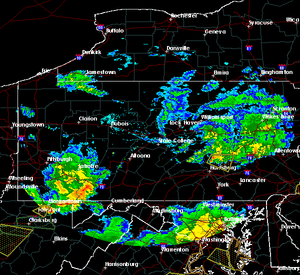 At 631 pm edt, severe thunderstorms were located along a line extending from elizabethville to near new buffalo, moving east at 25 mph (radar indicated). Hazards include 60 mph wind gusts. Expect damage to trees and power lines. Locations impacted include, palmyra, annville, harper tavern, lykens, williamstown, lickdale, fort indiantown gap, elizabethville, tower city and penn national race course. At 631 pm edt, severe thunderstorms were located along a line extending from elizabethville to near new buffalo, moving east at 25 mph (radar indicated). Hazards include 60 mph wind gusts. Expect damage to trees and power lines. Locations impacted include, palmyra, annville, harper tavern, lykens, williamstown, lickdale, fort indiantown gap, elizabethville, tower city and penn national race course.
|
| 7/22/2017 6:17 PM EDT |
 At 617 pm edt, severe thunderstorms were located along a line extending from near port trevorton to new buffalo, moving east at 20 mph (radar indicated). Hazards include 60 mph wind gusts. Expect damage to trees and power lines. Locations impacted include, palmyra, annville, hershey, linglestown, harper tavern, skyline view, beurys lake, lykens, valley view and urban. At 617 pm edt, severe thunderstorms were located along a line extending from near port trevorton to new buffalo, moving east at 20 mph (radar indicated). Hazards include 60 mph wind gusts. Expect damage to trees and power lines. Locations impacted include, palmyra, annville, hershey, linglestown, harper tavern, skyline view, beurys lake, lykens, valley view and urban.
|
| 7/22/2017 6:07 PM EDT |
 At 607 pm edt, severe thunderstorms were located along a line extending from port trevorton to near new buffalo, moving east at 20 mph (radar indicated). Hazards include 60 mph wind gusts. expect damage to trees and power lines At 607 pm edt, severe thunderstorms were located along a line extending from port trevorton to near new buffalo, moving east at 20 mph (radar indicated). Hazards include 60 mph wind gusts. expect damage to trees and power lines
|
| 6/19/2017 1:49 PM EDT |
 At 148 pm edt, severe thunderstorms were located along a line extending from near littlestown to royalton to penbrook to near dehart dam, moving east at 40 mph (radar indicated). Hazards include 70 mph wind gusts and quarter size hail. Hail damage to vehicles is possible. expect considerable tree damage. Wind damage is also likely to mobile homes, roofs, and outbuildings. At 148 pm edt, severe thunderstorms were located along a line extending from near littlestown to royalton to penbrook to near dehart dam, moving east at 40 mph (radar indicated). Hazards include 70 mph wind gusts and quarter size hail. Hail damage to vehicles is possible. expect considerable tree damage. Wind damage is also likely to mobile homes, roofs, and outbuildings.
|
| 6/19/2017 12:19 PM EDT |
 At 1218 pm edt, a severe thunderstorm was located near elizabethville, moving northeast at 45 mph (radar indicated). Hazards include 60 mph wind gusts. expect damage to trees and power lines At 1218 pm edt, a severe thunderstorm was located near elizabethville, moving northeast at 45 mph (radar indicated). Hazards include 60 mph wind gusts. expect damage to trees and power lines
|
| 6/19/2017 11:32 AM EDT |
 At 1130 am edt, a severe thunderstorm was located near elizabethville, moving northeast at 45 mph (radar indicated). Hazards include 60 mph wind gusts and quarter size hail. Hail damage to vehicles is possible. expect wind damage to trees and power lines. Locations impacted include, beurys lake, lykens, tower city, donaldson, friedensburg, dehart dam, williamstown, lickdale, fort indiantown gap and pine grove. At 1130 am edt, a severe thunderstorm was located near elizabethville, moving northeast at 45 mph (radar indicated). Hazards include 60 mph wind gusts and quarter size hail. Hail damage to vehicles is possible. expect wind damage to trees and power lines. Locations impacted include, beurys lake, lykens, tower city, donaldson, friedensburg, dehart dam, williamstown, lickdale, fort indiantown gap and pine grove.
|
| 6/19/2017 11:12 AM EDT |
 At 1111 am edt, a severe thunderstorm was located near linglestown, moving northeast at 40 mph (radar indicated). Hazards include 60 mph wind gusts and quarter size hail. Hail damage to vehicles is possible. Expect wind damage to trees and power lines. At 1111 am edt, a severe thunderstorm was located near linglestown, moving northeast at 40 mph (radar indicated). Hazards include 60 mph wind gusts and quarter size hail. Hail damage to vehicles is possible. Expect wind damage to trees and power lines.
|
| 8/16/2016 4:28 PM EDT |
 At 427 pm edt, severe thunderstorms were located along a line extending from near buckhorn to pine grove, moving northeast at 40 mph (radar indicated). Hazards include 60 mph wind gusts. Expect damage to roofs. siding. And trees. At 427 pm edt, severe thunderstorms were located along a line extending from near buckhorn to pine grove, moving northeast at 40 mph (radar indicated). Hazards include 60 mph wind gusts. Expect damage to roofs. siding. And trees.
|
| 7/25/2016 6:03 PM EDT |
 At 602 pm edt, severe thunderstorms were located along a line extending from near branchdale to near millersburg, moving east at 50 mph (radar indicated). Hazards include 60 mph wind gusts. Expect damage to roofs. siding. and trees. Locations impacted include, schuylkill haven, pottsville, minersville, branchdale, tower city, renningers, klingerstown, tremont, orwigsburg, pine grove, williamstown, friedensburg, lykens, donaldson, marlin, mckeansburg, landingville, gratz, dalmatia and summit station. At 602 pm edt, severe thunderstorms were located along a line extending from near branchdale to near millersburg, moving east at 50 mph (radar indicated). Hazards include 60 mph wind gusts. Expect damage to roofs. siding. and trees. Locations impacted include, schuylkill haven, pottsville, minersville, branchdale, tower city, renningers, klingerstown, tremont, orwigsburg, pine grove, williamstown, friedensburg, lykens, donaldson, marlin, mckeansburg, landingville, gratz, dalmatia and summit station.
|
| 7/25/2016 5:15 PM EDT |
 At 514 pm edt, a severe thunderstorm was located near beurys lake, moving east at 25 mph (radar indicated). Hazards include 60 mph wind gusts and quarter size hail. Hail damage to vehicles is expected. Expect wind damage to roofs, siding, and trees. At 514 pm edt, a severe thunderstorm was located near beurys lake, moving east at 25 mph (radar indicated). Hazards include 60 mph wind gusts and quarter size hail. Hail damage to vehicles is expected. Expect wind damage to roofs, siding, and trees.
|
| 10/9/2015 3:10 PM EDT |
 At 309 pm edt, doppler radar indicated a line of severe thunderstorms capable of producing damaging winds in excess of 60 mph. these storms were located along a line extending from near wilburton number one to linglestown, moving east at 50 mph. locations impacted include, palmyra, pottsville, myerstown, lebanon, cornwall, st. clair, frackville, schuylkill haven, annville, linglestown, mahanoy city, mount carmel, middletown, hummelstown, shenandoah, tamaqua, minersville, hershey, colonial park and shamokin. At 309 pm edt, doppler radar indicated a line of severe thunderstorms capable of producing damaging winds in excess of 60 mph. these storms were located along a line extending from near wilburton number one to linglestown, moving east at 50 mph. locations impacted include, palmyra, pottsville, myerstown, lebanon, cornwall, st. clair, frackville, schuylkill haven, annville, linglestown, mahanoy city, mount carmel, middletown, hummelstown, shenandoah, tamaqua, minersville, hershey, colonial park and shamokin.
|
| 10/9/2015 2:50 PM EDT |
 At 249 pm edt, doppler radar indicated a line of severe thunderstorms capable of producing damaging winds around 60 mph. these storms were located along a line extending from near trevorton to near duncannon, and moving east at 50 mph. At 249 pm edt, doppler radar indicated a line of severe thunderstorms capable of producing damaging winds around 60 mph. these storms were located along a line extending from near trevorton to near duncannon, and moving east at 50 mph.
|
| 7/9/2015 6:36 PM EDT |
 At 635 pm edt, doppler radar indicated a line of severe thunderstorms capable of producing damaging winds in excess of 60 mph. these storms were located along a line extending from st. clair to tremont to near tower city, moving east at 30 mph. locations impacted include, ashland, frackville, mahanoy city, minersville, pottsville, schuylkill haven, shenandoah, st. clair, tamaqua, altamont, beurys lake, branchdale, brandonville, buck run, delano, donaldson, englewood, forrestville, fountain springs and friedensburg. At 635 pm edt, doppler radar indicated a line of severe thunderstorms capable of producing damaging winds in excess of 60 mph. these storms were located along a line extending from st. clair to tremont to near tower city, moving east at 30 mph. locations impacted include, ashland, frackville, mahanoy city, minersville, pottsville, schuylkill haven, shenandoah, st. clair, tamaqua, altamont, beurys lake, branchdale, brandonville, buck run, delano, donaldson, englewood, forrestville, fountain springs and friedensburg.
|
| 7/9/2015 6:01 PM EDT |
 At 601 pm edt, doppler radar indicated a line of severe thunderstorms capable of producing damaging winds around 60 mph. these storms were located along a line extending from near locustdale to near tower city to near elizabethville, and moving east at 35 mph. At 601 pm edt, doppler radar indicated a line of severe thunderstorms capable of producing damaging winds around 60 mph. these storms were located along a line extending from near locustdale to near tower city to near elizabethville, and moving east at 35 mph.
|
| 6/23/2015 2:05 PM EDT |
 At 204 pm edt, doppler radar indicated a severe thunderstorm capable of producing quarter size hail and damaging winds in excess of 60 mph. this storm was located near port trevorton, moving east at 30 mph. locations impacted include, shamokin, elizabethville, fairview-ferndale, klingerstown, leck kill, lykens, meiserville, millersburg, port trevorton, rebuck, tower city, trevorton, urban, williamstown, berrysburg, dalmatia, edgewood, gratz, hegins and herndon. At 204 pm edt, doppler radar indicated a severe thunderstorm capable of producing quarter size hail and damaging winds in excess of 60 mph. this storm was located near port trevorton, moving east at 30 mph. locations impacted include, shamokin, elizabethville, fairview-ferndale, klingerstown, leck kill, lykens, meiserville, millersburg, port trevorton, rebuck, tower city, trevorton, urban, williamstown, berrysburg, dalmatia, edgewood, gratz, hegins and herndon.
|
| 6/23/2015 1:37 PM EDT |
 At 137 pm edt, doppler radar indicated a severe thunderstorm capable of producing quarter size hail and damaging winds around 60 mph. this storm was located over richfield, and moving east at 35 mph. At 137 pm edt, doppler radar indicated a severe thunderstorm capable of producing quarter size hail and damaging winds around 60 mph. this storm was located over richfield, and moving east at 35 mph.
|
| 6/14/2015 6:21 PM EDT |
 At 620 pm edt, doppler radar indicated a severe thunderstorm capable of producing damaging winds around 60 mph. this storm was located over lickdale, and moving northeast at 25 mph. At 620 pm edt, doppler radar indicated a severe thunderstorm capable of producing damaging winds around 60 mph. this storm was located over lickdale, and moving northeast at 25 mph.
|
| 6/12/2015 9:46 PM EDT |
 At 946 pm edt, doppler radar indicated a line of severe thunderstorms capable of producing damaging winds in excess of 60 mph. these storms were located along a line extending from near lykens to near linglestown to hogestown, moving east at 35 mph. locations impacted include, annville, camp hill, carlisle, colonial park, cornwall, elizabethtown, enola, harrisburg, hershey, hummelstown, lebanon, lemoyne, linglestown, lower allen, mechanicsburg, middletown, myerstown, new cumberland, palmyra and pottsville. At 946 pm edt, doppler radar indicated a line of severe thunderstorms capable of producing damaging winds in excess of 60 mph. these storms were located along a line extending from near lykens to near linglestown to hogestown, moving east at 35 mph. locations impacted include, annville, camp hill, carlisle, colonial park, cornwall, elizabethtown, enola, harrisburg, hershey, hummelstown, lebanon, lemoyne, linglestown, lower allen, mechanicsburg, middletown, myerstown, new cumberland, palmyra and pottsville.
|
| 6/12/2015 9:18 PM EDT |
 At 916 pm edt, doppler radar indicated a line of severe thunderstorms capable of producing damaging winds around 60 mph. these storms were located along a line extending from near meiserville to near new bloomfield to near bloserville, and moving east at 35 mph. At 916 pm edt, doppler radar indicated a line of severe thunderstorms capable of producing damaging winds around 60 mph. these storms were located along a line extending from near meiserville to near new bloomfield to near bloserville, and moving east at 35 mph.
|
| 6/11/2015 8:39 PM EDT |
 At 838 pm edt, doppler radar indicated a severe thunderstorm capable of producing quarter size hail and damaging winds in excess of 60 mph. this storm was located near leck kill, moving east at 20 mph. the storms look to be weakening and the warning will likely be allowed to expire. locations impacted include, ashland, kulpmont, minersville, mount carmel, pottsville, schuylkill haven, shamokin, st. clair, sunbury, beurys lake, branchdale, buck run, donaldson, fairview-ferndale, forrestville, fountain springs, friedensburg, heckscherville, klingerstown and lavelle. At 838 pm edt, doppler radar indicated a severe thunderstorm capable of producing quarter size hail and damaging winds in excess of 60 mph. this storm was located near leck kill, moving east at 20 mph. the storms look to be weakening and the warning will likely be allowed to expire. locations impacted include, ashland, kulpmont, minersville, mount carmel, pottsville, schuylkill haven, shamokin, st. clair, sunbury, beurys lake, branchdale, buck run, donaldson, fairview-ferndale, forrestville, fountain springs, friedensburg, heckscherville, klingerstown and lavelle.
|
| 6/11/2015 7:35 PM EDT |
 At 735 pm edt, doppler radar indicated a severe thunderstorm capable of producing quarter size hail and damaging winds around 60 mph. this storm was located over kreamer, and moving southeast at 30 mph. At 735 pm edt, doppler radar indicated a severe thunderstorm capable of producing quarter size hail and damaging winds around 60 mph. this storm was located over kreamer, and moving southeast at 30 mph.
|
| 6/8/2015 5:08 PM EDT | At 508 pm edt, doppler radar indicated a line of severe thunderstorms capable of producing damaging winds of 60 to 70 mph. these storms were located along a line extending from near donaldson to near boiling springs, and moving southeast at 25 mph. |
| 6/8/2015 4:52 PM EDT | At 449 pm edt, doppler radar indicated a severe thunderstorm capable of producing large hail up to ping pong ball size and destructive winds in excess of 70 mph. this storm was located near tremont, moving east at 25 mph. locations impacted include, minersville, pottsville, schuylkill haven, branchdale, donaldson, forrestville, friedensburg, marlin, mckeansburg, orwigsburg, pine grove, port carbon, renningers, seltzer, tower city, tremont, auburn, cressona, deer lake and hegins. |
| 6/8/2015 4:29 PM EDT |
 At 428 pm edt, doppler radar indicated a severe thunderstorm capable of producing quarter size hail and damaging winds of 70 mph. this storm was located over highland park, and moving east at 45 mph. At 428 pm edt, doppler radar indicated a severe thunderstorm capable of producing quarter size hail and damaging winds of 70 mph. this storm was located over highland park, and moving east at 45 mph.
|
| 5/31/2015 6:18 PM EDT | At 618 pm edt, doppler radar indicated a severe thunderstorm capable of producing quarter size hail and damaging winds around 60 mph. this storm was located near friedensburg, and moving northeast at 15 mph. |
| 4/20/2015 9:00 PM EDT | At 859 pm edt, doppler radar indicated a severe thunderstorm capable of producing quarter size hail and damaging winds around 60 mph. this storm was located near williamstown, and moving northeast at 35 mph. * this severe thunderstorm will be near, williamstown around 900 pm edt. tower city around 910 pm edt. pine grove, tremont and donaldson around 920 pm edt. minersville, friedensburg, lavelle, forrestville, branchdale, buck run and beurys lake around 930 pm edt. other locations impacted by this severe thunderstorm include brockton, landingville, schuykill county airport, penn state schuylkill, middleport, summit station, mary-d, orwin, lake wynonah and muir. this includes interstate 81 from mile markers 93 to 132. |
Hail Maps for Muir, PA


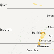


Connect with Interactive Hail Maps