

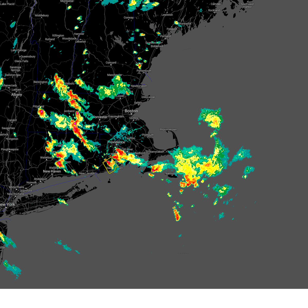
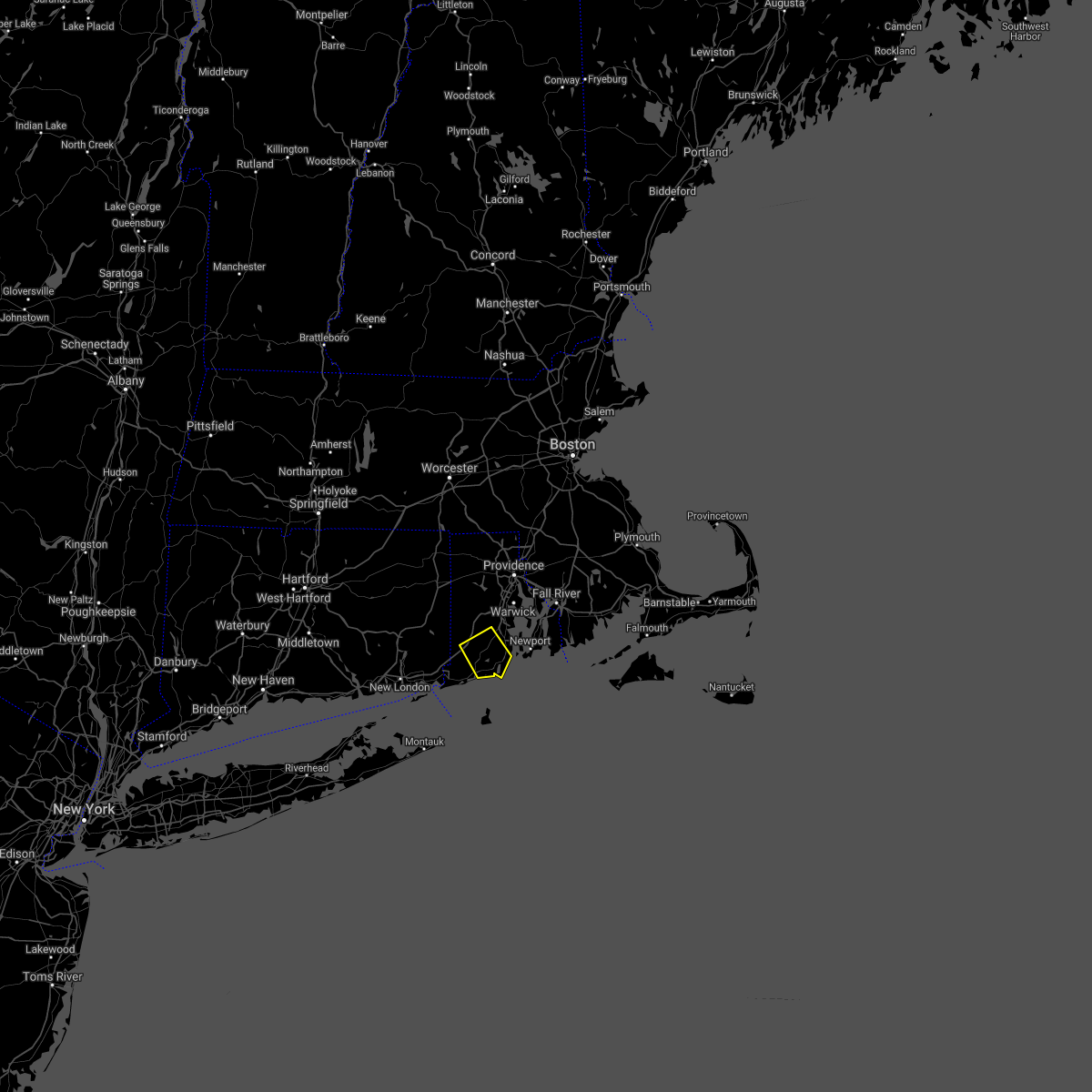
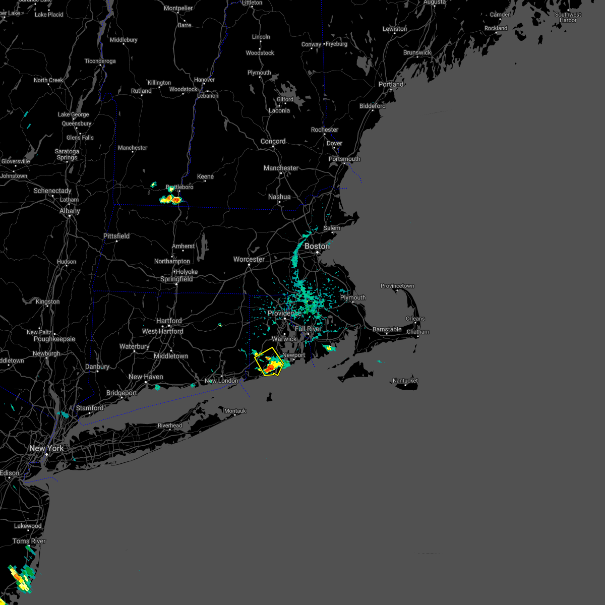
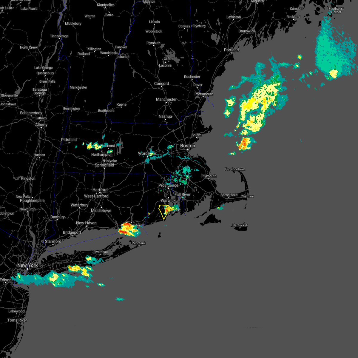
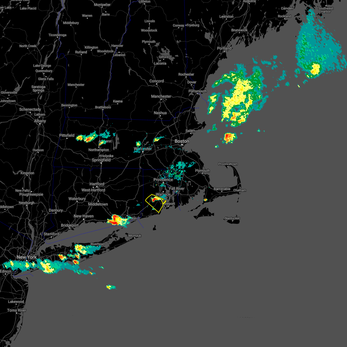
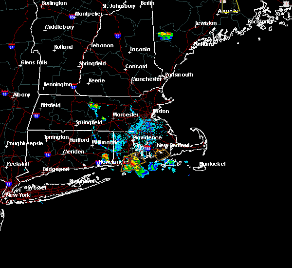
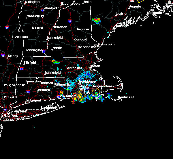
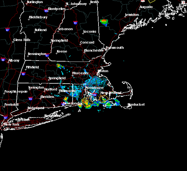
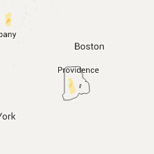
Hail Map for Narragansett Pier, RI
The Narragansett Pier, RI area has had 5 reports of on-the-ground hail by trained spotters, and has been under severe weather warnings 1 time during the past 12 months. Doppler radar has detected hail at or near Narragansett Pier, RI on 9 occasions, including 2 occasions during the past year.
| Name: | Narragansett Pier, RI |
| Where Located: | 27.9 miles S of Providence, RI |
| Map: | Google Map for Narragansett Pier, RI |
| Population: | 3409 |
| Housing Units: | 2215 |
| More Info: | Search Google for Narragansett Pier, RI |
0
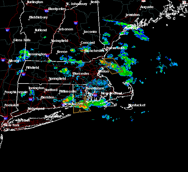
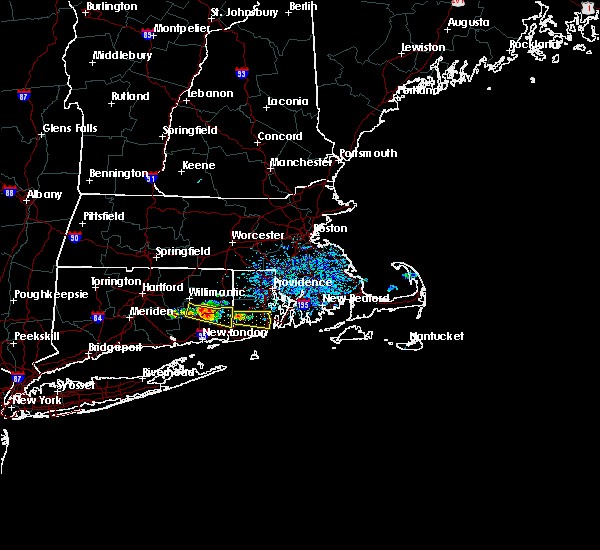
The Top Recent Hail Date for Narragansett Pier, RI is Monday, August 26, 2024 (9th out of 9)

Hail and Wind Damage Spotted near Narragansett Pier, RI
| Date / Time | Report Details |
|---|---|
| 8/26/2024 3:10 PM EDT |
 Svrbox the national weather service in boston/norton has issued a * severe thunderstorm warning for, northeastern washington county in rhode island, southwestern newport county in rhode island, * until 400 pm edt. * at 309 pm edt, a severe thunderstorm was located near richmond, or near south kingstown, moving southeast at 20 mph (radar indicated). Hazards include 60 mph wind gusts and quarter size hail. Hail damage to vehicles is expected. Expect wind damage to trees and power lines. Svrbox the national weather service in boston/norton has issued a * severe thunderstorm warning for, northeastern washington county in rhode island, southwestern newport county in rhode island, * until 400 pm edt. * at 309 pm edt, a severe thunderstorm was located near richmond, or near south kingstown, moving southeast at 20 mph (radar indicated). Hazards include 60 mph wind gusts and quarter size hail. Hail damage to vehicles is expected. Expect wind damage to trees and power lines.
|
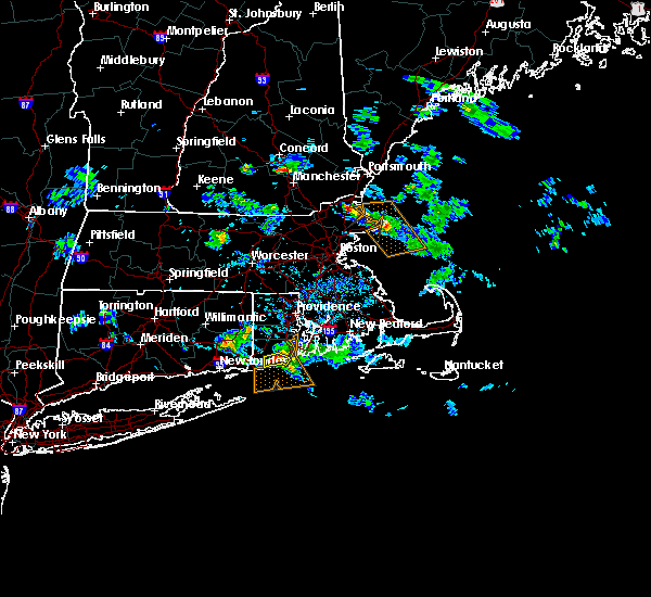
| 6/26/2024 11:29 PM EDT |
 the severe thunderstorm warning has been cancelled and is no longer in effect the severe thunderstorm warning has been cancelled and is no longer in effect
|
| 6/26/2024 11:16 PM EDT |
 Svrbox the national weather service in boston/norton has issued a * severe thunderstorm warning for, norfolk county in eastern massachusetts, suffolk county in eastern massachusetts, southeastern middlesex county in northeastern massachusetts, plymouth county in southeastern massachusetts, bristol county in southeastern massachusetts, northeastern washington county in rhode island, newport county in rhode island, northeastern kent county in rhode island, eastern providence county in rhode island, bristol county in rhode island, * until 1215 am edt. * at 1115 pm edt, severe thunderstorms were located along a line extending from near millbury to johnston to south kingstown, moving east at 55 mph (radar indicated). Hazards include 60 mph wind gusts. expect damage to roofs, siding, and trees Svrbox the national weather service in boston/norton has issued a * severe thunderstorm warning for, norfolk county in eastern massachusetts, suffolk county in eastern massachusetts, southeastern middlesex county in northeastern massachusetts, plymouth county in southeastern massachusetts, bristol county in southeastern massachusetts, northeastern washington county in rhode island, newport county in rhode island, northeastern kent county in rhode island, eastern providence county in rhode island, bristol county in rhode island, * until 1215 am edt. * at 1115 pm edt, severe thunderstorms were located along a line extending from near millbury to johnston to south kingstown, moving east at 55 mph (radar indicated). Hazards include 60 mph wind gusts. expect damage to roofs, siding, and trees
|
| 6/26/2024 10:46 PM EDT |
 Svrbox the national weather service in boston/norton has issued a * severe thunderstorm warning for, northeastern windham county in northern connecticut, southeastern worcester county in central massachusetts, southwestern norfolk county in eastern massachusetts, south central middlesex county in northeastern massachusetts, washington county in rhode island, kent county in rhode island, providence county in rhode island, * until 1145 pm edt. * at 1045 pm edt, severe thunderstorms were located along a line extending from union to canterbury to near groton, moving east at 55 mph (radar indicated). Hazards include 70 mph wind gusts. Expect considerable tree damage. Damage is likely to mobile homes, roofs, and outbuildings. Svrbox the national weather service in boston/norton has issued a * severe thunderstorm warning for, northeastern windham county in northern connecticut, southeastern worcester county in central massachusetts, southwestern norfolk county in eastern massachusetts, south central middlesex county in northeastern massachusetts, washington county in rhode island, kent county in rhode island, providence county in rhode island, * until 1145 pm edt. * at 1045 pm edt, severe thunderstorms were located along a line extending from union to canterbury to near groton, moving east at 55 mph (radar indicated). Hazards include 70 mph wind gusts. Expect considerable tree damage. Damage is likely to mobile homes, roofs, and outbuildings.
|
| 6/21/2024 7:46 PM EDT |
 the severe thunderstorm warning has been cancelled and is no longer in effect the severe thunderstorm warning has been cancelled and is no longer in effect
|
| 6/21/2024 7:37 PM EDT |
 the severe thunderstorm warning has been cancelled and is no longer in effect the severe thunderstorm warning has been cancelled and is no longer in effect
|
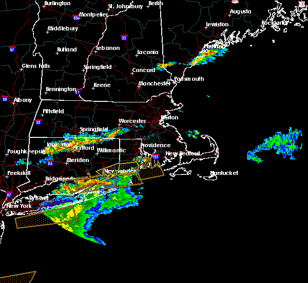
| 6/21/2024 7:37 PM EDT |
 At 736 pm edt, severe thunderstorms were located along a line extending from near exeter to near south kingstown to 6 miles northwest of block island, moving east at 30 mph (radar indicated). Hazards include 60 mph wind gusts and nickel size hail. Expect damage to roofs, siding, and trees. Locations impacted include, warwick, coventry, south kingstown, west warwick, north kingstown, narragansett, east greenwich, hopkinton, charlestown, richmond, exeter, and west greenwich. At 736 pm edt, severe thunderstorms were located along a line extending from near exeter to near south kingstown to 6 miles northwest of block island, moving east at 30 mph (radar indicated). Hazards include 60 mph wind gusts and nickel size hail. Expect damage to roofs, siding, and trees. Locations impacted include, warwick, coventry, south kingstown, west warwick, north kingstown, narragansett, east greenwich, hopkinton, charlestown, richmond, exeter, and west greenwich.
|
| 6/21/2024 7:15 PM EDT |
 Svrbox the national weather service in boston/norton has issued a * severe thunderstorm warning for, southeastern windham county in northern connecticut, washington county in rhode island, southern kent county in rhode island, * until 800 pm edt. * at 715 pm edt, severe thunderstorms were located along a line extending from near voluntown to hopkinton to 7 miles east of fishers island, moving east at 30 mph (radar indicated). Hazards include 60 mph wind gusts and nickel size hail. expect damage to roofs, siding, and trees Svrbox the national weather service in boston/norton has issued a * severe thunderstorm warning for, southeastern windham county in northern connecticut, washington county in rhode island, southern kent county in rhode island, * until 800 pm edt. * at 715 pm edt, severe thunderstorms were located along a line extending from near voluntown to hopkinton to 7 miles east of fishers island, moving east at 30 mph (radar indicated). Hazards include 60 mph wind gusts and nickel size hail. expect damage to roofs, siding, and trees
|
| 5/8/2024 10:09 PM EDT |
 The storm which prompted the warning has moved out of the area. therefore, the warning will be allowed to expire. to report severe weather, contact your nearest law enforcement agency. they will relay your report to the national weather service boston/norton. The storm which prompted the warning has moved out of the area. therefore, the warning will be allowed to expire. to report severe weather, contact your nearest law enforcement agency. they will relay your report to the national weather service boston/norton.
|
| 5/8/2024 9:58 PM EDT | Hen Egg sized hail reported 0.6 miles S of Narragansett Pier, RI, social media photo of 2 inch diameter hailstones in narragansett. also was relayed by amateur radio. |
| 5/8/2024 9:58 PM EDT | Hen Egg sized hail reported 3.5 miles SSW of Narragansett Pier, RI, corrects previous hail report from 1 ne narragansett for location. social media photo of 2 inch diameter hailstones in narragansett. also was relayed by amateur radio. |
| 5/8/2024 9:55 PM EDT |
 the severe thunderstorm warning has been cancelled and is no longer in effect the severe thunderstorm warning has been cancelled and is no longer in effect
|
| 5/8/2024 9:55 PM EDT |
 At 955 pm edt, a severe thunderstorm was located over jamestown, or near newport, moving southeast at 50 mph (radar indicated). Hazards include quarter size hail. Damage to vehicles is expected. Locations impacted include, south kingstown, north kingstown, newport, portsmouth, middletown, narragansett, exeter, jamestown, and little compton. At 955 pm edt, a severe thunderstorm was located over jamestown, or near newport, moving southeast at 50 mph (radar indicated). Hazards include quarter size hail. Damage to vehicles is expected. Locations impacted include, south kingstown, north kingstown, newport, portsmouth, middletown, narragansett, exeter, jamestown, and little compton.
|
| 5/8/2024 9:53 PM EDT | Golf Ball sized hail reported 4.1 miles S of Narragansett Pier, RI, delayed report. varying ranges of hail size... up to golf ball. vehicle hood dented from hail. |
| 5/8/2024 9:47 PM EDT |
 Svrbox the national weather service in boston/norton has issued a * severe thunderstorm warning for, southern bristol county in southeastern massachusetts, northeastern washington county in rhode island, southern newport county in rhode island, south central kent county in rhode island, * until 1015 pm edt. * at 947 pm edt, a severe thunderstorm was located near exeter, or near north kingstown, moving southeast at 40 mph (radar indicated). Hazards include quarter size hail. damage to vehicles is expected Svrbox the national weather service in boston/norton has issued a * severe thunderstorm warning for, southern bristol county in southeastern massachusetts, northeastern washington county in rhode island, southern newport county in rhode island, south central kent county in rhode island, * until 1015 pm edt. * at 947 pm edt, a severe thunderstorm was located near exeter, or near north kingstown, moving southeast at 40 mph (radar indicated). Hazards include quarter size hail. damage to vehicles is expected
|
| 8/18/2023 8:50 AM EDT |
 At 850 am edt, severe thunderstorms were located along a line extending from west warwick to exeter to near westerly, moving northeast at 30 mph (radar indicated). Hazards include 60 mph wind gusts and nickel size hail. expect damage to roofs, siding, and trees At 850 am edt, severe thunderstorms were located along a line extending from west warwick to exeter to near westerly, moving northeast at 30 mph (radar indicated). Hazards include 60 mph wind gusts and nickel size hail. expect damage to roofs, siding, and trees
|
| 8/8/2023 10:07 AM EDT |
 At 1007 am edt, severe thunderstorms were located along a line extending from near bristol to near newport to block island, moving northeast at 15 mph (radar indicated. at 930 am conimicut light reported a gust of 60 mph). Hazards include 60 mph wind gusts. expect damage to roofs, siding, and trees At 1007 am edt, severe thunderstorms were located along a line extending from near bristol to near newport to block island, moving northeast at 15 mph (radar indicated. at 930 am conimicut light reported a gust of 60 mph). Hazards include 60 mph wind gusts. expect damage to roofs, siding, and trees
|
| 8/8/2023 9:54 AM EDT |
 At 953 am edt, a severe thunderstorm was located near portsmouth, or near newport, moving northeast at 30 mph (radar indicated). Hazards include 60 mph wind gusts. Expect damage to roofs, siding, and trees. locations impacted include, new bedford, fall river, warwick, taunton, dartmouth, north kingstown, newport, bristol, somerset, portsmouth, barrington, middletown, fairhaven, narragansett, swansea, tiverton, westport, seekonk, rehoboth, and warren. hail threat, radar indicated max hail size, <. 75 in wind threat, radar indicated max wind gust, 60 mph. At 953 am edt, a severe thunderstorm was located near portsmouth, or near newport, moving northeast at 30 mph (radar indicated). Hazards include 60 mph wind gusts. Expect damage to roofs, siding, and trees. locations impacted include, new bedford, fall river, warwick, taunton, dartmouth, north kingstown, newport, bristol, somerset, portsmouth, barrington, middletown, fairhaven, narragansett, swansea, tiverton, westport, seekonk, rehoboth, and warren. hail threat, radar indicated max hail size, <. 75 in wind threat, radar indicated max wind gust, 60 mph.
|
| 8/8/2023 9:33 AM EDT |
 At 933 am edt, a severe thunderstorm was located over north kingstown, moving northeast at 35 mph (radar indicated). Hazards include 60 mph wind gusts. Expect damage to roofs, siding, and trees. locations impacted include, new bedford, fall river, warwick, cranston, taunton, east providence, coventry, dartmouth, south kingstown, west warwick, north kingstown, newport, bristol, somerset, portsmouth, barrington, middletown, fairhaven, narragansett, and swansea. hail threat, radar indicated max hail size, <. 75 in wind threat, radar indicated max wind gust, 60 mph. At 933 am edt, a severe thunderstorm was located over north kingstown, moving northeast at 35 mph (radar indicated). Hazards include 60 mph wind gusts. Expect damage to roofs, siding, and trees. locations impacted include, new bedford, fall river, warwick, cranston, taunton, east providence, coventry, dartmouth, south kingstown, west warwick, north kingstown, newport, bristol, somerset, portsmouth, barrington, middletown, fairhaven, narragansett, and swansea. hail threat, radar indicated max hail size, <. 75 in wind threat, radar indicated max wind gust, 60 mph.
|
| 8/8/2023 9:17 AM EDT |
 At 917 am edt, a severe thunderstorm was located near south kingstown, moving northeast at 35 mph (radar indicated). Hazards include 60 mph wind gusts. expect damage to roofs, siding, and trees At 917 am edt, a severe thunderstorm was located near south kingstown, moving northeast at 35 mph (radar indicated). Hazards include 60 mph wind gusts. expect damage to roofs, siding, and trees
|
| 7/27/2023 7:42 PM EDT |
 At 742 pm edt, a severe thunderstorm was located over ledyard center, or 7 miles southeast of norwich, moving east at 45 mph (radar indicated). Hazards include 60 mph wind gusts. expect damage to trees and power lines At 742 pm edt, a severe thunderstorm was located over ledyard center, or 7 miles southeast of norwich, moving east at 45 mph (radar indicated). Hazards include 60 mph wind gusts. expect damage to trees and power lines
|
| 6/17/2022 3:16 PM EDT |
 At 315 pm edt, a severe thunderstorm was located near bristol, moving east at 35 mph (radar indicated). Hazards include 60 mph wind gusts, penny size hail and brief torrential rain. Expect damage to trees and power lines. locations impacted include, new bedford, fall river, warwick, dartmouth, south kingstown, west warwick, north kingstown, newport, bristol, portsmouth, barrington, middletown, narragansett, tiverton, westport, east greenwich, warren, hopkinton, richmond and exeter. hail threat, radar indicated max hail size, 0. 75 in wind threat, radar indicated max wind gust, 60 mph. At 315 pm edt, a severe thunderstorm was located near bristol, moving east at 35 mph (radar indicated). Hazards include 60 mph wind gusts, penny size hail and brief torrential rain. Expect damage to trees and power lines. locations impacted include, new bedford, fall river, warwick, dartmouth, south kingstown, west warwick, north kingstown, newport, bristol, portsmouth, barrington, middletown, narragansett, tiverton, westport, east greenwich, warren, hopkinton, richmond and exeter. hail threat, radar indicated max hail size, 0. 75 in wind threat, radar indicated max wind gust, 60 mph.
|
| 6/17/2022 3:02 PM EDT |
 At 302 pm edt, a severe thunderstorm was located over east greenwich, or over west warwick, moving east at 45 mph (radar indicated). Hazards include 60 mph wind gusts and penny size hail. Expect damage to trees and power lines. locations impacted include, new bedford, fall river, warwick, cranston, coventry, dartmouth, south kingstown, west warwick, north kingstown, newport, bristol, portsmouth, barrington, middletown, narragansett, tiverton, westport, east greenwich, warren and scituate. hail threat, radar indicated max hail size, 0. 75 in wind threat, radar indicated max wind gust, 60 mph. At 302 pm edt, a severe thunderstorm was located over east greenwich, or over west warwick, moving east at 45 mph (radar indicated). Hazards include 60 mph wind gusts and penny size hail. Expect damage to trees and power lines. locations impacted include, new bedford, fall river, warwick, cranston, coventry, dartmouth, south kingstown, west warwick, north kingstown, newport, bristol, portsmouth, barrington, middletown, narragansett, tiverton, westport, east greenwich, warren and scituate. hail threat, radar indicated max hail size, 0. 75 in wind threat, radar indicated max wind gust, 60 mph.
|
| 6/17/2022 2:51 PM EDT |
 At 250 pm edt, a severe thunderstorm was located over coventry, moving east at 45 mph (radar indicated). Hazards include 60 mph wind gusts and penny size hail. expect damage to trees and power lines At 250 pm edt, a severe thunderstorm was located over coventry, moving east at 45 mph (radar indicated). Hazards include 60 mph wind gusts and penny size hail. expect damage to trees and power lines
|
| 11/13/2021 5:12 PM EST |
 At 512 pm est, severe thunderstorms were located along a line extending from near coventry to near exeter to near south kingstown, moving northeast at 50 mph (radar indicated). Hazards include 60 mph wind gusts and penny size hail. expect damage to trees and power lines At 512 pm est, severe thunderstorms were located along a line extending from near coventry to near exeter to near south kingstown, moving northeast at 50 mph (radar indicated). Hazards include 60 mph wind gusts and penny size hail. expect damage to trees and power lines
|
| 8/27/2021 2:50 PM EDT |
 The severe thunderstorm warning for northeastern washington county will expire at 300 pm edt, the storm which prompted the warning has weakened below severe limits, and no longer poses an immediate threat to life or property. therefore, the warning will be allowed to expire. The severe thunderstorm warning for northeastern washington county will expire at 300 pm edt, the storm which prompted the warning has weakened below severe limits, and no longer poses an immediate threat to life or property. therefore, the warning will be allowed to expire.
|
| 8/27/2021 2:24 PM EDT |
 At 223 pm edt, a severe thunderstorm was located over south kingstown, moving southeast at 10 mph (radar indicated). Hazards include 60 mph wind gusts. Expect damage to trees and power lines. locations impacted include, south kingstown, north kingstown, narragansett, hopkinton, charlestown, richmond and exeter. hail threat, radar indicated max hail size, <. 75 in wind threat, radar indicated max wind gust, 60 mph. At 223 pm edt, a severe thunderstorm was located over south kingstown, moving southeast at 10 mph (radar indicated). Hazards include 60 mph wind gusts. Expect damage to trees and power lines. locations impacted include, south kingstown, north kingstown, narragansett, hopkinton, charlestown, richmond and exeter. hail threat, radar indicated max hail size, <. 75 in wind threat, radar indicated max wind gust, 60 mph.
|
| 8/27/2021 1:58 PM EDT |
 At 158 pm edt, a severe thunderstorm was located near exeter, or 8 miles west of north kingstown, moving southeast at 10 mph (radar indicated). Hazards include 60 mph wind gusts and penny size hail. expect damage to trees and power lines At 158 pm edt, a severe thunderstorm was located near exeter, or 8 miles west of north kingstown, moving southeast at 10 mph (radar indicated). Hazards include 60 mph wind gusts and penny size hail. expect damage to trees and power lines
|
| 7/6/2021 6:41 PM EDT |
 The severe thunderstorm warning for south central norfolk, northwestern bristol, washington, west central newport, kent, southeastern providence and bristol counties will expire at 645 pm edt, the storms which prompted the warning have weakened below severe limits, and no longer pose an immediate threat to life or property. therefore, the warning will be allowed to expire. however gusty winds and heavy rain are still possible with these thunderstorms. a severe thunderstorm watch remains in effect until 800 pm edt for eastern and southeastern massachusetts, and rhode island. The severe thunderstorm warning for south central norfolk, northwestern bristol, washington, west central newport, kent, southeastern providence and bristol counties will expire at 645 pm edt, the storms which prompted the warning have weakened below severe limits, and no longer pose an immediate threat to life or property. therefore, the warning will be allowed to expire. however gusty winds and heavy rain are still possible with these thunderstorms. a severe thunderstorm watch remains in effect until 800 pm edt for eastern and southeastern massachusetts, and rhode island.
|
| 7/6/2021 6:35 PM EDT |
 At 635 pm edt, severe thunderstorms were located along a line extending from near wrentham to near norwich, moving southeast at 25 mph (radar indicated). Hazards include 60 mph wind gusts. Expect damage to trees and power lines. Locations impacted include, providence, fall river, warwick, cranston, pawtucket, taunton, east providence, coventry, cumberland, north providence, south kingstown, west warwick, johnston, north attleborough, north kingstown, bristol, attleboro, mansfield, westerly and smithfield. At 635 pm edt, severe thunderstorms were located along a line extending from near wrentham to near norwich, moving southeast at 25 mph (radar indicated). Hazards include 60 mph wind gusts. Expect damage to trees and power lines. Locations impacted include, providence, fall river, warwick, cranston, pawtucket, taunton, east providence, coventry, cumberland, north providence, south kingstown, west warwick, johnston, north attleborough, north kingstown, bristol, attleboro, mansfield, westerly and smithfield.
|
| 7/6/2021 6:21 PM EDT |
 At 620 pm edt, severe thunderstorms were located along a line extending from franklin to near jewett city connecticut, moving southeast at 25 mph (radar indicated). Hazards include 60 mph wind gusts. Expect damage to trees and power lines. Locations impacted include, providence, fall river, warwick, cranston, pawtucket, taunton, east providence, woonsocket, coventry, cumberland, north providence, franklin, south kingstown, west warwick, johnston, north attleborough, north kingstown, windham, bristol and plainfield. At 620 pm edt, severe thunderstorms were located along a line extending from franklin to near jewett city connecticut, moving southeast at 25 mph (radar indicated). Hazards include 60 mph wind gusts. Expect damage to trees and power lines. Locations impacted include, providence, fall river, warwick, cranston, pawtucket, taunton, east providence, woonsocket, coventry, cumberland, north providence, franklin, south kingstown, west warwick, johnston, north attleborough, north kingstown, windham, bristol and plainfield.
|
| 7/6/2021 5:52 PM EDT |
 At 552 pm edt, severe thunderstorms were located along a line extending from near holliston to willimantic, moving southeast at 25 mph (radar indicated). Hazards include 60 mph wind gusts and penny size hail. expect damage to trees and power lines At 552 pm edt, severe thunderstorms were located along a line extending from near holliston to willimantic, moving southeast at 25 mph (radar indicated). Hazards include 60 mph wind gusts and penny size hail. expect damage to trees and power lines
|
| 11/15/2020 10:51 PM EST |
 At 1050 pm est, severe thunderstorms were located along a line extending from near burrillville to near richmond to 7 miles southeast of montauk point, moving east at 45 mph (radar indicated). Hazards include 60 mph wind gusts. Expect damage to trees and power lines. Locations impacted include, providence, new bedford, brockton, fall river, warwick, cranston, pawtucket, taunton, east providence, woonsocket, coventry, dartmouth, cumberland, north providence, franklin, south kingstown, west warwick, johnston, north attleborough and stoughton. At 1050 pm est, severe thunderstorms were located along a line extending from near burrillville to near richmond to 7 miles southeast of montauk point, moving east at 45 mph (radar indicated). Hazards include 60 mph wind gusts. Expect damage to trees and power lines. Locations impacted include, providence, new bedford, brockton, fall river, warwick, cranston, pawtucket, taunton, east providence, woonsocket, coventry, dartmouth, cumberland, north providence, franklin, south kingstown, west warwick, johnston, north attleborough and stoughton.
|
| 11/15/2020 10:24 PM EST |
 At 1024 pm est, severe thunderstorms were located along a line extending from near southbridge to preston to gardner`s island, moving east at 45 mph (radar indicated). Hazards include 60 mph wind gusts. expect damage to trees and power lines At 1024 pm est, severe thunderstorms were located along a line extending from near southbridge to preston to gardner`s island, moving east at 45 mph (radar indicated). Hazards include 60 mph wind gusts. expect damage to trees and power lines
|
| 8/25/2020 7:23 PM EDT |
 The severe thunderstorm warning for southern bristol, eastern washington and southern newport counties will expire at 730 pm edt, the storm which prompted the warning has moved out of the area. therefore, the warning will be allowed to expire. a severe thunderstorm watch remains in effect until 1000 pm edt for southeastern massachusetts, and rhode island. The severe thunderstorm warning for southern bristol, eastern washington and southern newport counties will expire at 730 pm edt, the storm which prompted the warning has moved out of the area. therefore, the warning will be allowed to expire. a severe thunderstorm watch remains in effect until 1000 pm edt for southeastern massachusetts, and rhode island.
|
| 8/25/2020 6:58 PM EDT |
 At 658 pm edt, a severe thunderstorm was located over jamestown, or near north kingstown, moving southeast at 45 mph (radar indicated). Hazards include ping pong ball size hail and 60 mph wind gusts. Expect wind damage to trees and power lines. Minor hail damage to vehicles is possible. At 658 pm edt, a severe thunderstorm was located over jamestown, or near north kingstown, moving southeast at 45 mph (radar indicated). Hazards include ping pong ball size hail and 60 mph wind gusts. Expect wind damage to trees and power lines. Minor hail damage to vehicles is possible.
|
| 8/25/2020 6:55 PM EDT |
 At 654 pm edt, a severe thunderstorm was located near north kingstown, moving southeast at 40 mph. this is a dangerous storm with very large hail expected (radar indicated). Hazards include ping pong ball size hail and 60 mph wind gusts. Expect wind damage to trees and power lines. minor hail damage to vehicles is possible. Locations impacted include, south kingstown, north kingstown, narragansett, exeter and jamestown. At 654 pm edt, a severe thunderstorm was located near north kingstown, moving southeast at 40 mph. this is a dangerous storm with very large hail expected (radar indicated). Hazards include ping pong ball size hail and 60 mph wind gusts. Expect wind damage to trees and power lines. minor hail damage to vehicles is possible. Locations impacted include, south kingstown, north kingstown, narragansett, exeter and jamestown.
|
| 8/25/2020 6:43 PM EDT |
 At 642 pm edt, a severe thunderstorm was located over exeter, or 8 miles south of coventry, moving east at 40 mph (radar indicated). Hazards include 60 mph wind gusts and quarter size hail. Expect wind damage to trees and power lines. minor hail damage to vehicles is possible. Locations impacted include, south kingstown, north kingstown, narragansett, east greenwich, hopkinton, richmond, exeter, west greenwich and jamestown. At 642 pm edt, a severe thunderstorm was located over exeter, or 8 miles south of coventry, moving east at 40 mph (radar indicated). Hazards include 60 mph wind gusts and quarter size hail. Expect wind damage to trees and power lines. minor hail damage to vehicles is possible. Locations impacted include, south kingstown, north kingstown, narragansett, east greenwich, hopkinton, richmond, exeter, west greenwich and jamestown.
|
| 8/25/2020 6:23 PM EDT |
 At 623 pm edt, a severe thunderstorm was located over plainfield, moving southeast at 40 mph. this storm has downed trees and wires in coventry and mansfield (radar indicated). Hazards include 60 mph wind gusts and penny size hail. expect damage to trees and power lines At 623 pm edt, a severe thunderstorm was located over plainfield, moving southeast at 40 mph. this storm has downed trees and wires in coventry and mansfield (radar indicated). Hazards include 60 mph wind gusts and penny size hail. expect damage to trees and power lines
|
| 7/14/2020 2:15 PM EDT | Large tree down on windermere road in washington county RI, 0.7 miles SE of Narragansett Pier, RI |
| 7/2/2020 10:25 PM EDT |
 At 1023 pm edt, a severe thunderstorm was located near exeter, or near north kingstown, moving south at 25 mph (radar indicated and trained spotters. at 1010 pm, a tree was downed in coventry, along with pea-sized hail). Hazards include 60 mph wind gusts. Expect damage to trees and power lines. Locations impacted include, warwick, coventry, south kingstown, west warwick, north kingstown, newport, narragansett, east greenwich, charlestown, richmond, exeter, west greenwich and jamestown. At 1023 pm edt, a severe thunderstorm was located near exeter, or near north kingstown, moving south at 25 mph (radar indicated and trained spotters. at 1010 pm, a tree was downed in coventry, along with pea-sized hail). Hazards include 60 mph wind gusts. Expect damage to trees and power lines. Locations impacted include, warwick, coventry, south kingstown, west warwick, north kingstown, newport, narragansett, east greenwich, charlestown, richmond, exeter, west greenwich and jamestown.
|
| 7/2/2020 10:16 PM EDT |
 At 1015 pm edt, a severe thunderstorm was located over east greenwich, or near west warwick, moving south at 25 mph (radar indicated). Hazards include 60 mph wind gusts. Expect damage to trees and power lines. Locations impacted include, warwick, coventry, south kingstown, west warwick, north kingstown, newport, narragansett, east greenwich, scituate, charlestown, richmond, exeter, west greenwich and jamestown. At 1015 pm edt, a severe thunderstorm was located over east greenwich, or near west warwick, moving south at 25 mph (radar indicated). Hazards include 60 mph wind gusts. Expect damage to trees and power lines. Locations impacted include, warwick, coventry, south kingstown, west warwick, north kingstown, newport, narragansett, east greenwich, scituate, charlestown, richmond, exeter, west greenwich and jamestown.
|
| 7/2/2020 9:53 PM EDT |
 At 953 pm edt, a severe thunderstorm was located near scituate, or near coventry, moving south at 25 mph (radar indicated). Hazards include 60 mph wind gusts. expect damage to trees and power lines At 953 pm edt, a severe thunderstorm was located near scituate, or near coventry, moving south at 25 mph (radar indicated). Hazards include 60 mph wind gusts. expect damage to trees and power lines
|
| 4/9/2020 3:32 PM EDT |
 At 331 pm edt, severe thunderstorms were located along a line extending from near exeter to hither hills state park, moving east at 60 mph (radar indicated). Hazards include 60 mph wind gusts. expect damage to trees and power lines At 331 pm edt, severe thunderstorms were located along a line extending from near exeter to hither hills state park, moving east at 60 mph (radar indicated). Hazards include 60 mph wind gusts. expect damage to trees and power lines
|
| 7/22/2019 9:20 PM EDT | Trees down on route 1 blocking one lane in washington county RI, 0.7 miles SE of Narragansett Pier, RI |
| 7/22/2019 9:14 PM EDT |
 At 914 pm edt, a severe thunderstorm was located over narragansett, or over south kingstown, moving northeast at 30 mph (radar indicated). Hazards include 60 mph wind gusts. Expect damage to trees and power lines. Locations impacted include, south kingstown, north kingstown, newport, narragansett, charlestown, richmond, exeter and jamestown. At 914 pm edt, a severe thunderstorm was located over narragansett, or over south kingstown, moving northeast at 30 mph (radar indicated). Hazards include 60 mph wind gusts. Expect damage to trees and power lines. Locations impacted include, south kingstown, north kingstown, newport, narragansett, charlestown, richmond, exeter and jamestown.
|
| 7/22/2019 9:09 PM EDT |
 At 908 pm edt, a severe thunderstorm was located near south kingstown, moving northeast at 30 mph (radar indicated). Hazards include 60 mph wind gusts. expect damage to trees and power lines At 908 pm edt, a severe thunderstorm was located near south kingstown, moving northeast at 30 mph (radar indicated). Hazards include 60 mph wind gusts. expect damage to trees and power lines
|
| 10/29/2018 8:38 AM EDT |
 The national weather service in boston/norton has issued a * severe thunderstorm warning for. east central washington county in rhode island. southwestern newport county in rhode island. until 930 am edt. At 838 am edt, a severe thunderstorm was located over narragansett,. The national weather service in boston/norton has issued a * severe thunderstorm warning for. east central washington county in rhode island. southwestern newport county in rhode island. until 930 am edt. At 838 am edt, a severe thunderstorm was located over narragansett,.
|
| 5/15/2018 5:57 PM EDT |
 At 556 pm edt, severe thunderstorms were located along a line extending from sprague to preston to ledyard center to near new london to near plum island, moving east at 65 mph (radar indicated). Hazards include 60 mph wind gusts. expect damage to trees and power lines At 556 pm edt, severe thunderstorms were located along a line extending from sprague to preston to ledyard center to near new london to near plum island, moving east at 65 mph (radar indicated). Hazards include 60 mph wind gusts. expect damage to trees and power lines
|
| 9/6/2017 10:04 AM EDT |
 At 1003 am edt, severe thunderstorms were located along a line extending from sprague to block island, moving northeast at 55 mph (radar indicated). Hazards include 60 mph wind gusts and penny size hail. expect damage to trees and power lines At 1003 am edt, severe thunderstorms were located along a line extending from sprague to block island, moving northeast at 55 mph (radar indicated). Hazards include 60 mph wind gusts and penny size hail. expect damage to trees and power lines
|
| 9/19/2016 9:22 AM EDT |
 At 922 am edt, a severe thunderstorm was located over stonington, or near mystic, moving east at 25 mph (radar indicated). Hazards include 60 mph wind gusts. Expect damage to roofs. siding. And trees. At 922 am edt, a severe thunderstorm was located over stonington, or near mystic, moving east at 25 mph (radar indicated). Hazards include 60 mph wind gusts. Expect damage to roofs. siding. And trees.
|
| 2/25/2016 4:06 AM EST |
 The severe thunderstorm warning for bristol, western newport, kent, washington and providence counties will expire at 415 am est, the storms which prompted the warning have moved out of the area. therefore the warning will be allowed to expire. however gusty winds are still possible with lingering thunderstorms. The severe thunderstorm warning for bristol, western newport, kent, washington and providence counties will expire at 415 am est, the storms which prompted the warning have moved out of the area. therefore the warning will be allowed to expire. however gusty winds are still possible with lingering thunderstorms.
|
| 2/25/2016 3:27 AM EST |
 At 326 am est, doppler radar indicated a line of severe thunderstorms capable of producing destructive winds in excess of 70 mph. these storms were located along a line extending from near south berwick to 9 miles east of rye to near lynnfield, moving northeast at 45 mph. penny size hail may also accompany the damaging winds. in addition, small hail was reported. locations impacted include, providence, warwick, cranston, pawtucket, east providence, woonsocket, coventry, cumberland, north providence, south kingstown, west warwick, johnston, north attleborough, north kingstown, newport, bristol, attleboro, westerly, smithfield and lincoln. At 326 am est, doppler radar indicated a line of severe thunderstorms capable of producing destructive winds in excess of 70 mph. these storms were located along a line extending from near south berwick to 9 miles east of rye to near lynnfield, moving northeast at 45 mph. penny size hail may also accompany the damaging winds. in addition, small hail was reported. locations impacted include, providence, warwick, cranston, pawtucket, east providence, woonsocket, coventry, cumberland, north providence, south kingstown, west warwick, johnston, north attleborough, north kingstown, newport, bristol, attleboro, westerly, smithfield and lincoln.
|
| 2/25/2016 3:13 AM EST |
 At 312 am est, doppler radar indicated a line of severe thunderstorms capable of producing destructive winds in excess of 70 mph. these storms were located along a line extending from near epping to ipswich to newton, and was moving northeast at 45 mph. At 312 am est, doppler radar indicated a line of severe thunderstorms capable of producing destructive winds in excess of 70 mph. these storms were located along a line extending from near epping to ipswich to newton, and was moving northeast at 45 mph.
|
| 2/25/2016 2:21 AM EST |
 At 220 am est, doppler radar indicated a line of severe thunderstorms capable of producing destructive winds in excess of 70 mph. these storms were located along a line extending from near oxford to near foster to near conning towers-nautilus park, and was moving northeast at 90 mph. At 220 am est, doppler radar indicated a line of severe thunderstorms capable of producing destructive winds in excess of 70 mph. these storms were located along a line extending from near oxford to near foster to near conning towers-nautilus park, and was moving northeast at 90 mph.
|
| 7/28/2015 6:35 PM EDT | Large limb down 8 to 14 inches in diameter in the boston neck road and juliet road area in washington county RI, 2 miles SSW of Narragansett Pier, RI |
| 7/28/2015 6:35 PM EDT | Straight line wind damage estimated to be around 60 mph occurred across old boston neck and boston neck road. most of the damage was large tree limbs that were southerl in washington county RI, 2 miles SSW of Narragansett Pier, RI |
| 7/28/2015 6:33 PM EDT | Branch and wires down on middlebridge road in washington county RI, 2 miles SSW of Narragansett Pier, RI |
| 7/28/2015 6:31 PM EDT | Large limbs blocking ocean road in washington county RI, 2 miles SSW of Narragansett Pier, RI |
| 7/28/2015 6:14 PM EDT |
 At 614 pm edt, doppler radar indicated a severe thunderstorm capable of producing a tornado. this dangerous storm was located over narragansett, or near south kingstown, moving south at 15 mph. locations impacted include, south kingstown and narragansett. At 614 pm edt, doppler radar indicated a severe thunderstorm capable of producing a tornado. this dangerous storm was located over narragansett, or near south kingstown, moving south at 15 mph. locations impacted include, south kingstown and narragansett.
|
| 7/28/2015 6:07 PM EDT | Multiple trees down across road on old boston neck road in washington county RI, 2 miles SSW of Narragansett Pier, RI |
| 7/28/2015 6:06 PM EDT |
 At 605 pm edt, doppler radar indicated a severe thunderstorm capable of producing a tornado. this dangerous storm was located over narragansett, or near south kingstown, and was moving south at 15 mph. * some locations impacted include, south kingstown, block island and narragansett. At 605 pm edt, doppler radar indicated a severe thunderstorm capable of producing a tornado. this dangerous storm was located over narragansett, or near south kingstown, and was moving south at 15 mph. * some locations impacted include, south kingstown, block island and narragansett.
|
| 7/28/2015 6:00 PM EDT |
 At 559 pm edt, trained weather spotters reported a severe thunderstorm producing quarter size hail and damaging winds in excess of 60 mph. this storm was located near narragansett, or near south kingstown, and was moving south at 15 mph. * some locations impacted include, south kingstown, narragansett and exeter. At 559 pm edt, trained weather spotters reported a severe thunderstorm producing quarter size hail and damaging winds in excess of 60 mph. this storm was located near narragansett, or near south kingstown, and was moving south at 15 mph. * some locations impacted include, south kingstown, narragansett and exeter.
|
| 7/28/2015 5:57 PM EDT | Quarter sized hail reported 2 miles SSW of Narragansett Pier, RI, one half to 1 inch diameter hail and power outage due to lightning |
| 7/28/2015 5:42 PM EDT |
 At 542 pm edt, doppler radar indicated a severe thunderstorm capable of producing quarter size hail and damaging winds in excess of 60 mph. this storm was located over jamestown, or near newport, and was moving south at 15 mph. * some locations impacted include, south kingstown, north kingstown, newport, narragansett and jamestown. At 542 pm edt, doppler radar indicated a severe thunderstorm capable of producing quarter size hail and damaging winds in excess of 60 mph. this storm was located over jamestown, or near newport, and was moving south at 15 mph. * some locations impacted include, south kingstown, north kingstown, newport, narragansett and jamestown.
|
| 7/24/2015 6:54 PM EDT |
 The severe thunderstorm warning for east central washington county will expire at 700 pm edt, the storm which prompted the warning was moving offshore near point judith and galilee. therefore the warning will be allowed to expire. The severe thunderstorm warning for east central washington county will expire at 700 pm edt, the storm which prompted the warning was moving offshore near point judith and galilee. therefore the warning will be allowed to expire.
|
| 7/24/2015 6:44 PM EDT |
 At 643 pm edt, doppler radar indicated a severe thunderstorm capable of producing quarter size hail and damaging winds in excess of 60 mph. this storm was located over south kingstown, moving south at 25 mph. locations impacted include, south kingstown, narragansett, charlestown and richmond. At 643 pm edt, doppler radar indicated a severe thunderstorm capable of producing quarter size hail and damaging winds in excess of 60 mph. this storm was located over south kingstown, moving south at 25 mph. locations impacted include, south kingstown, narragansett, charlestown and richmond.
|
| 7/24/2015 6:30 PM EDT |
 At 630 pm edt, doppler radar indicated a severe thunderstorm capable of producing half dollar size hail and damaging winds in excess of 60 mph. this storm was located over richmond, or near south kingstown, moving south at 20 mph. locations impacted include, south kingstown, north kingstown, westerly, narragansett, charlestown, richmond and exeter. At 630 pm edt, doppler radar indicated a severe thunderstorm capable of producing half dollar size hail and damaging winds in excess of 60 mph. this storm was located over richmond, or near south kingstown, moving south at 20 mph. locations impacted include, south kingstown, north kingstown, westerly, narragansett, charlestown, richmond and exeter.
|
| 7/24/2015 6:06 PM EDT |
 At 605 pm edt, doppler radar indicated a severe thunderstorm capable of producing large damaging hail up to golf ball size and damaging winds in excess of 60 mph. this storm was located over west greenwich, or near coventry, and was moving south at 20 mph. * some locations impacted include, south kingstown, north kingstown, westerly, narragansett, east greenwich, hopkinton, charlestown, richmond, exeter and west greenwich. At 605 pm edt, doppler radar indicated a severe thunderstorm capable of producing large damaging hail up to golf ball size and damaging winds in excess of 60 mph. this storm was located over west greenwich, or near coventry, and was moving south at 20 mph. * some locations impacted include, south kingstown, north kingstown, westerly, narragansett, east greenwich, hopkinton, charlestown, richmond, exeter and west greenwich.
|
| 7/20/2015 3:20 PM EDT |
 At 320 pm edt, doppler radar indicated a severe thunderstorm capable of producing quarter size hail and damaging winds in excess of 60 mph. this storm was located near richmond, or 10 miles south of coventry, and was moving east at 20 mph. * some locations impacted include, south kingstown, north kingstown, narragansett, hopkinton, richmond, exeter and west greenwich. At 320 pm edt, doppler radar indicated a severe thunderstorm capable of producing quarter size hail and damaging winds in excess of 60 mph. this storm was located near richmond, or 10 miles south of coventry, and was moving east at 20 mph. * some locations impacted include, south kingstown, north kingstown, narragansett, hopkinton, richmond, exeter and west greenwich.
|
| 7/1/2015 6:51 AM EDT |
 At 650 am edt, doppler radar indicated a severe thunderstorm capable of producing damaging winds in excess of 60 mph. this storm was located near westerly, or 10 miles northwest of block island, and was moving northeast at 50 mph. * some locations impacted include, south kingstown, north kingstown, newport, block island, westerly, narragansett, charlestown, exeter and jamestown. At 650 am edt, doppler radar indicated a severe thunderstorm capable of producing damaging winds in excess of 60 mph. this storm was located near westerly, or 10 miles northwest of block island, and was moving northeast at 50 mph. * some locations impacted include, south kingstown, north kingstown, newport, block island, westerly, narragansett, charlestown, exeter and jamestown.
|
| 6/23/2015 9:00 PM EDT | 6 to 8 inch tree limbs down on wires on point judith road at john stree in washington county RI, 2 miles SSW of Narragansett Pier, RI |
| 6/23/2015 8:46 PM EDT |
 At 846 pm edt, doppler radar indicated a severe thunderstorm capable of producing quarter size hail and destructive winds in excess of 70 mph. this storm was located over narragansett, or near south kingstown, moving east at 65 mph. locations impacted include, south kingstown and narragansett. At 846 pm edt, doppler radar indicated a severe thunderstorm capable of producing quarter size hail and destructive winds in excess of 70 mph. this storm was located over narragansett, or near south kingstown, moving east at 65 mph. locations impacted include, south kingstown and narragansett.
|
| 6/23/2015 8:22 PM EDT |
 At 822 pm edt, doppler radar indicated a severe thunderstorm capable of producing damaging winds in excess of 60 mph. this storm was located over fishers island, and was moving east at 50 mph. * some locations impacted include, south kingstown, north kingstown, westerly, narragansett, hopkinton, charlestown, richmond and exeter. At 822 pm edt, doppler radar indicated a severe thunderstorm capable of producing damaging winds in excess of 60 mph. this storm was located over fishers island, and was moving east at 50 mph. * some locations impacted include, south kingstown, north kingstown, westerly, narragansett, hopkinton, charlestown, richmond and exeter.
|
| 6/23/2015 6:24 PM EDT |
 The severe thunderstorm warning for central bristol, bristol, newport, eastern kent, northeastern washington and southeastern providence counties will expire at 630 pm edt, the line of storms which prompted the warning have weakened below severe limits, and exited the warned area. therefore the warning will be allowed to expire. &&. The severe thunderstorm warning for central bristol, bristol, newport, eastern kent, northeastern washington and southeastern providence counties will expire at 630 pm edt, the line of storms which prompted the warning have weakened below severe limits, and exited the warned area. therefore the warning will be allowed to expire. &&.
|
| 6/23/2015 5:57 PM EDT | The severe thunderstorm warning for southeastern windham, western newport, kent, washington and southern providence counties will expire at 600 pm edt, the storm which prompted the warning has moved out of the area. therefore the warning will be allowed to expire. &&. |
| 6/23/2015 5:57 PM EDT | The severe thunderstorm warning for southeastern windham, western newport, kent, washington and southern providence counties will expire at 600 pm edt, the storm which prompted the warning has moved out of the area. therefore the warning will be allowed to expire. &&. |
| 6/23/2015 5:42 PM EDT |
 At 541 pm edt, doppler radar indicated a line of severe thunderstorms capable of producing damaging winds in excess of 60 mph. these storms were located along a line extending from near warwick to near jamestown, and was moving east at 55 mph. * some locations impacted include, providence, fall river, warwick, cranston, pawtucket, taunton, east providence, dartmouth, north providence, south kingstown, north kingstown, newport, bristol, lincoln, central falls, somerset, portsmouth, barrington, middletown and narragansett. At 541 pm edt, doppler radar indicated a line of severe thunderstorms capable of producing damaging winds in excess of 60 mph. these storms were located along a line extending from near warwick to near jamestown, and was moving east at 55 mph. * some locations impacted include, providence, fall river, warwick, cranston, pawtucket, taunton, east providence, dartmouth, north providence, south kingstown, north kingstown, newport, bristol, lincoln, central falls, somerset, portsmouth, barrington, middletown and narragansett.
|
| 6/23/2015 5:20 PM EDT |
 At 520 pm edt, doppler radar indicated a severe thunderstorm capable of producing destructive winds in excess of 70 mph. this storm was located near voluntown, or 11 miles southeast of plainfield, and was moving east at 40 mph. * some locations impacted include, providence, warwick, cranston, pawtucket, coventry, north providence, south kingstown, west warwick, johnston, north kingstown, newport, westerly, smithfield, lincoln, portsmouth, killingly, middletown, narragansett, east greenwich and scituate. At 520 pm edt, doppler radar indicated a severe thunderstorm capable of producing destructive winds in excess of 70 mph. this storm was located near voluntown, or 11 miles southeast of plainfield, and was moving east at 40 mph. * some locations impacted include, providence, warwick, cranston, pawtucket, coventry, north providence, south kingstown, west warwick, johnston, north kingstown, newport, westerly, smithfield, lincoln, portsmouth, killingly, middletown, narragansett, east greenwich and scituate.
|
| 8/10/2012 4:10 PM EDT | Umbrellas in wooden stands snapped in two...tables blown ove in washington county RI, 0.7 miles SE of Narragansett Pier, RI |
| 7/1/2012 5:00 PM EDT | 4 to 8 inch diameter tree limbs down in washington county RI, 0.7 miles SE of Narragansett Pier, RI |
| 6/3/2012 5:05 PM EDT | Quarter sized hail reported 2 miles SSW of Narragansett Pier, RI, ham radio |
Hail Maps for Narragansett Pier, RI


Connect with Interactive Hail Maps