

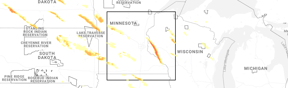
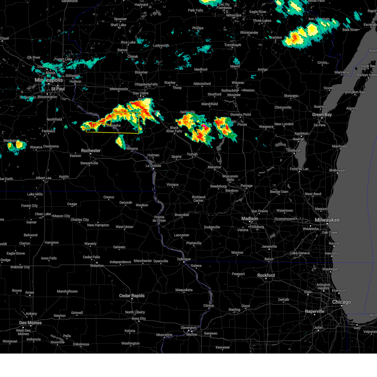
Hail Map for Nelson, WI
The Nelson, WI area has had 7 reports of on-the-ground hail by trained spotters, and has been under severe weather warnings 17 times during the past 12 months. Doppler radar has detected hail at or near Nelson, WI on 58 occasions, including 8 occasions during the past year.
| Name: | Nelson, WI |
| Where Located: | 56.1 miles NW of La Crosse, WI |
| Map: | Google Map for Nelson, WI |
| Population: | 374 |
| Housing Units: | 204 |
| More Info: | Search Google for Nelson, WI |
5
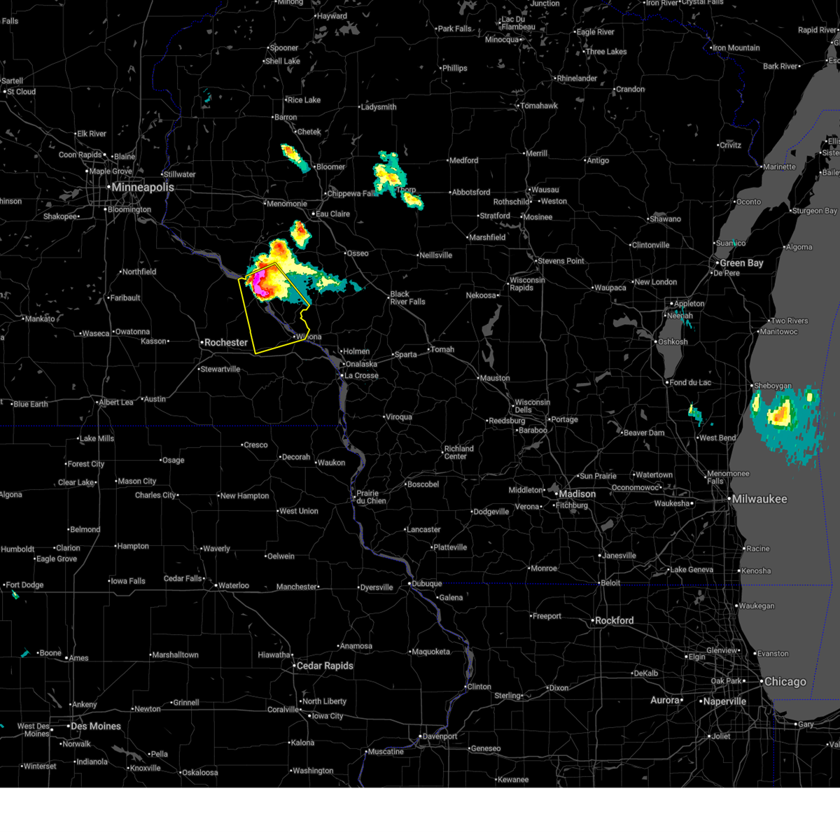
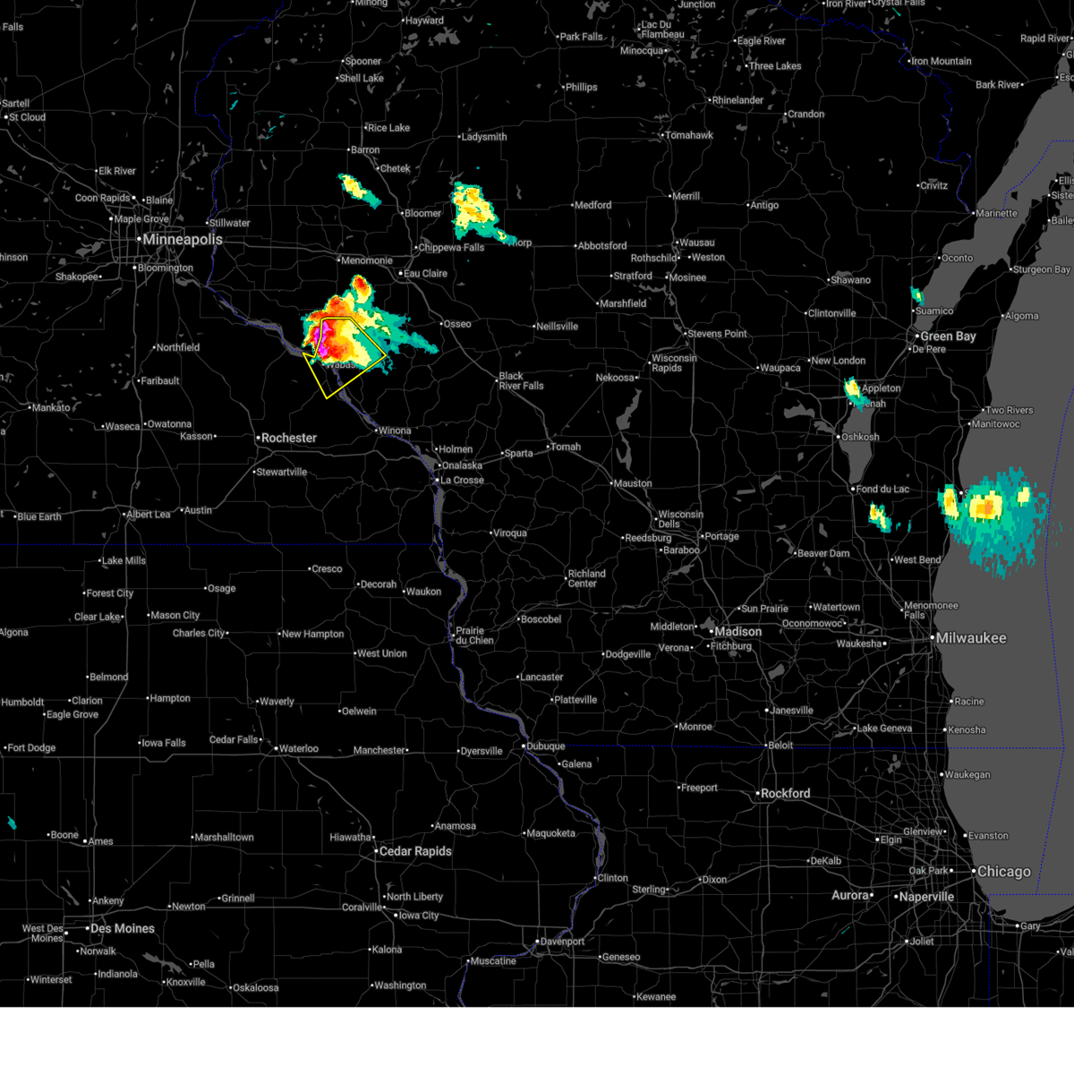
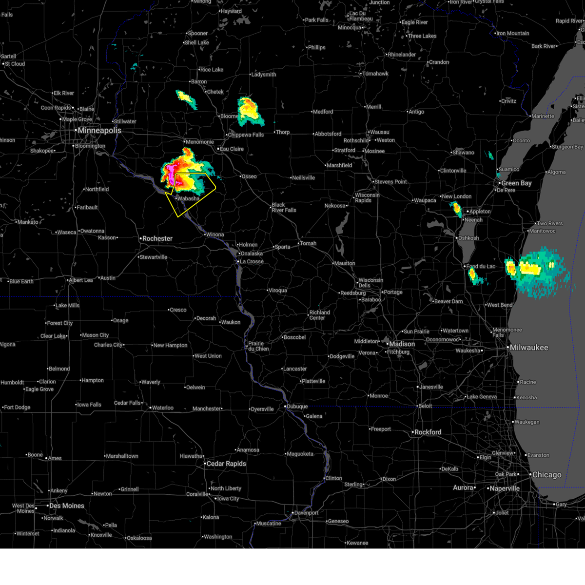
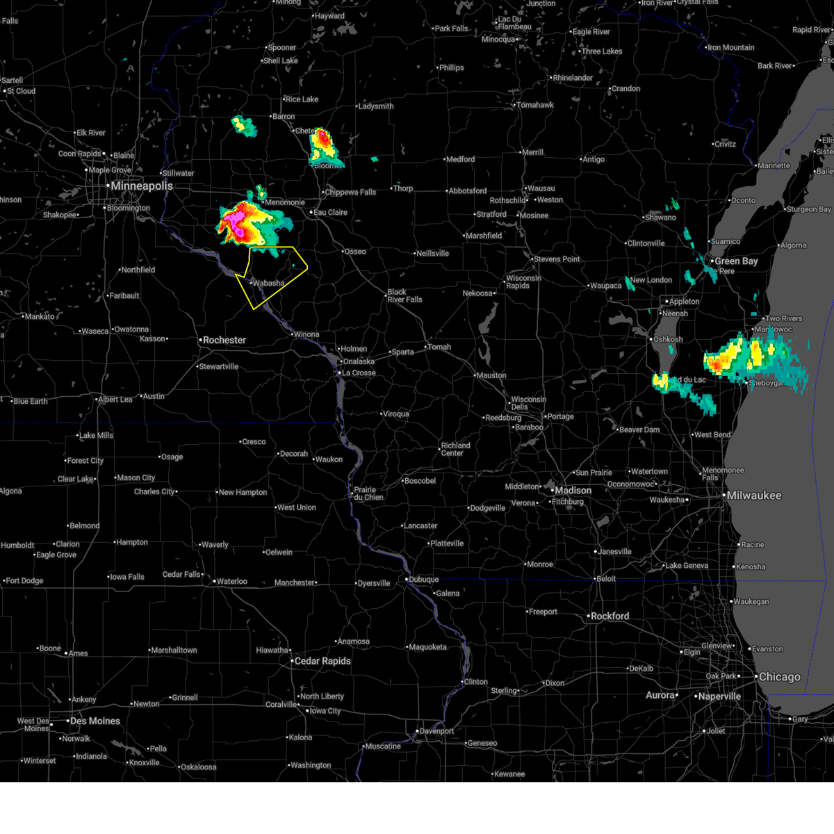
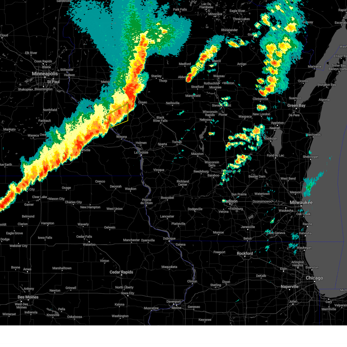
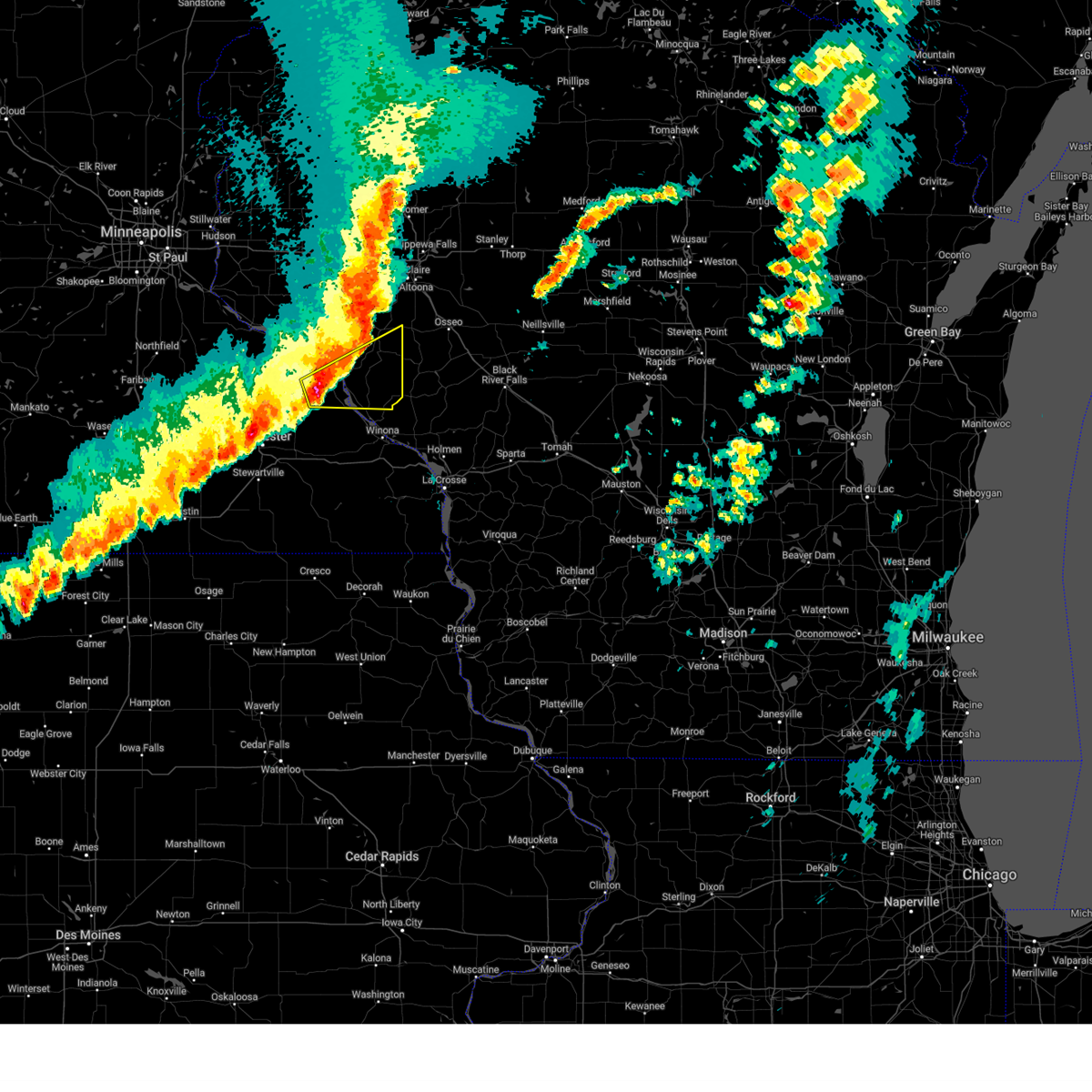
The Top Recent Hail Date for Nelson, WI is Thursday, June 19, 2025 (2nd out of 58)
Hail and Wind Damage Spotted near Nelson, WI
| Date / Time | Report Details |
|---|---|
| 6/19/2025 9:09 PM CDT |
 Svrarx the national weather service in la crosse has issued a * severe thunderstorm warning for, northwestern winona county in southeastern minnesota, northeastern wabasha county in southeastern minnesota, central buffalo county in west central wisconsin, * until 1000 pm cdt. * at 908 pm cdt, a severe thunderstorm was located near alma, moving southeast at 40 mph (public). Hazards include ping pong ball size hail and 60 mph wind gusts. People and animals outdoors will be injured. expect hail damage to roofs, siding, windows, and vehicles. expect wind damage to roofs, siding, and trees. this severe thunderstorm will be near, buffalo and buffalo city around 915 pm cdt. winona, fountain city, and rollingstone around 925 pm cdt. goodview and stockton around 930 pm cdt. Other locations impacted by this severe thunderstorm include pioneer campground, czechville, merrick state park, lock and dam 5 a, dodge, cream, and highway 88 and county o. Svrarx the national weather service in la crosse has issued a * severe thunderstorm warning for, northwestern winona county in southeastern minnesota, northeastern wabasha county in southeastern minnesota, central buffalo county in west central wisconsin, * until 1000 pm cdt. * at 908 pm cdt, a severe thunderstorm was located near alma, moving southeast at 40 mph (public). Hazards include ping pong ball size hail and 60 mph wind gusts. People and animals outdoors will be injured. expect hail damage to roofs, siding, windows, and vehicles. expect wind damage to roofs, siding, and trees. this severe thunderstorm will be near, buffalo and buffalo city around 915 pm cdt. winona, fountain city, and rollingstone around 925 pm cdt. goodview and stockton around 930 pm cdt. Other locations impacted by this severe thunderstorm include pioneer campground, czechville, merrick state park, lock and dam 5 a, dodge, cream, and highway 88 and county o.
|
| 6/19/2025 9:07 PM CDT | Quarter sized hail reported 0.8 miles SSE of Nelson, WI |
| 6/19/2025 9:05 PM CDT | Half Dollar sized hail reported 2.3 miles SSE of Nelson, WI |
| 6/19/2025 9:02 PM CDT | Quarter sized hail reported 1.7 miles SSE of Nelson, WI, heavy rain and hail up to quarter size north of nelson. |
| 6/19/2025 8:59 PM CDT |
 At 858 pm cdt, a severe thunderstorm was located over wabasha, moving southeast at 40 mph (radar indicated). Hazards include golf ball size hail and 60 mph wind gusts. People and animals outdoors will be injured. expect hail damage to roofs, siding, windows, and vehicles. expect wind damage to roofs, siding, and trees. this severe storm will be near, alma and kellogg around 905 pm cdt. Other locations impacted by this severe thunderstorm include gilmanton, nelson, maxville, pioneer campground, misha mokwa, county roads f and k k, and rattlesnake ridge. At 858 pm cdt, a severe thunderstorm was located over wabasha, moving southeast at 40 mph (radar indicated). Hazards include golf ball size hail and 60 mph wind gusts. People and animals outdoors will be injured. expect hail damage to roofs, siding, windows, and vehicles. expect wind damage to roofs, siding, and trees. this severe storm will be near, alma and kellogg around 905 pm cdt. Other locations impacted by this severe thunderstorm include gilmanton, nelson, maxville, pioneer campground, misha mokwa, county roads f and k k, and rattlesnake ridge.
|
| 6/19/2025 8:51 PM CDT |
 At 850 pm cdt, a severe thunderstorm was located near wabasha, moving south at 35 mph (radar indicated). Hazards include golf ball size hail and 60 mph wind gusts. People and animals outdoors will be injured. expect hail damage to roofs, siding, windows, and vehicles. expect wind damage to roofs, siding, and trees. this severe storm will be near, wabasha and alma around 855 pm cdt. kellogg around 900 pm cdt. Other locations impacted by this severe thunderstorm include gilmanton, nelson, maxville, pioneer campground, misha mokwa, county roads f and k k, and rattlesnake ridge. At 850 pm cdt, a severe thunderstorm was located near wabasha, moving south at 35 mph (radar indicated). Hazards include golf ball size hail and 60 mph wind gusts. People and animals outdoors will be injured. expect hail damage to roofs, siding, windows, and vehicles. expect wind damage to roofs, siding, and trees. this severe storm will be near, wabasha and alma around 855 pm cdt. kellogg around 900 pm cdt. Other locations impacted by this severe thunderstorm include gilmanton, nelson, maxville, pioneer campground, misha mokwa, county roads f and k k, and rattlesnake ridge.
|
| 6/19/2025 8:30 PM CDT |
 Svrarx the national weather service in la crosse has issued a * severe thunderstorm warning for, northeastern wabasha county in southeastern minnesota, northern buffalo county in west central wisconsin, * until 915 pm cdt. * at 829 pm cdt, a severe thunderstorm was located near durand, or 15 miles north of wabasha, moving southeast at 40 mph (radar indicated). Hazards include ping pong ball size hail and 60 mph wind gusts. People and animals outdoors will be injured. expect hail damage to roofs, siding, windows, and vehicles. expect wind damage to roofs, siding, and trees. this severe thunderstorm will be near, alma around 850 pm cdt. Other locations impacted by this severe thunderstorm include gilmanton, nelson, maxville, pioneer campground, misha mokwa, county roads f and k k, and rattlesnake ridge. Svrarx the national weather service in la crosse has issued a * severe thunderstorm warning for, northeastern wabasha county in southeastern minnesota, northern buffalo county in west central wisconsin, * until 915 pm cdt. * at 829 pm cdt, a severe thunderstorm was located near durand, or 15 miles north of wabasha, moving southeast at 40 mph (radar indicated). Hazards include ping pong ball size hail and 60 mph wind gusts. People and animals outdoors will be injured. expect hail damage to roofs, siding, windows, and vehicles. expect wind damage to roofs, siding, and trees. this severe thunderstorm will be near, alma around 850 pm cdt. Other locations impacted by this severe thunderstorm include gilmanton, nelson, maxville, pioneer campground, misha mokwa, county roads f and k k, and rattlesnake ridge.
|
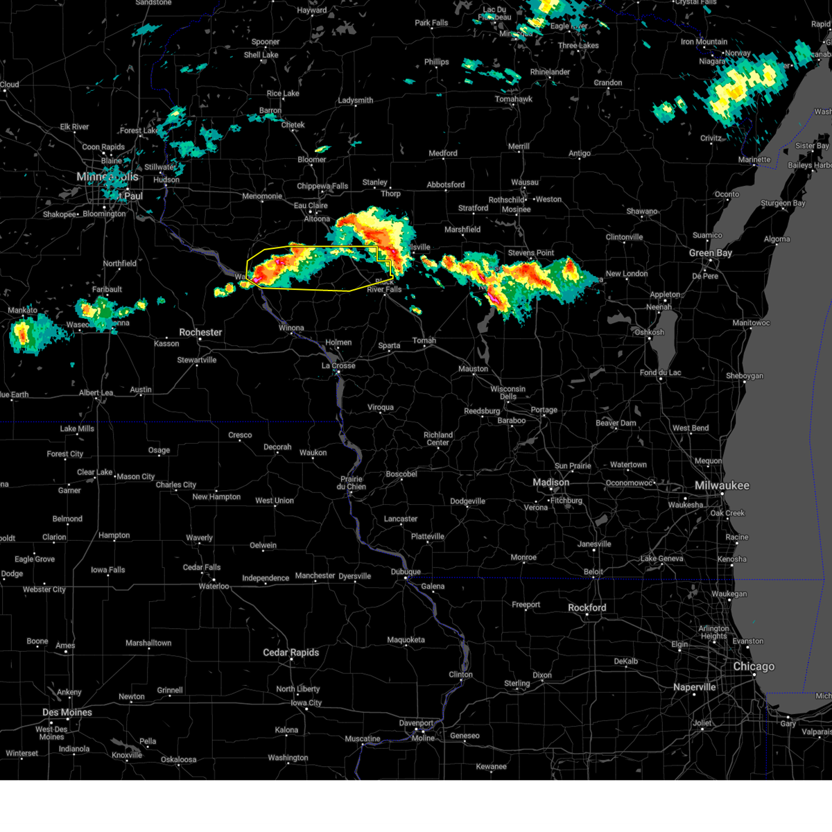
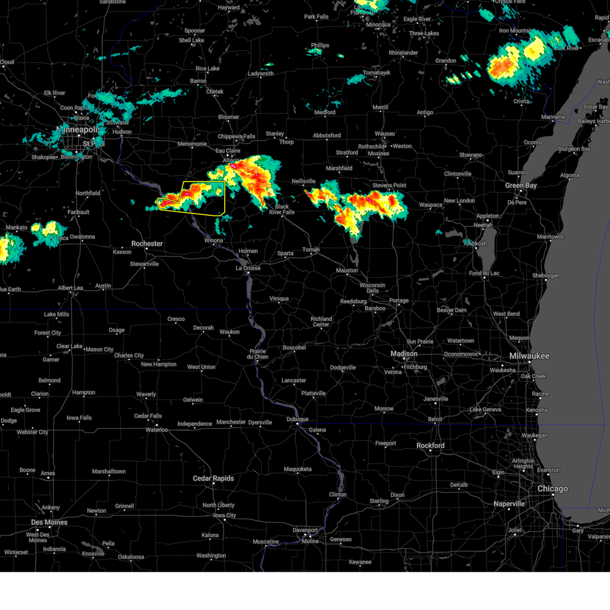
| 5/15/2025 3:28 PM CDT |
 Svrarx the national weather service in la crosse has issued a * severe thunderstorm warning for, buffalo county in west central wisconsin, trempealeau county in west central wisconsin, * until 415 pm cdt. * at 328 pm cdt, severe thunderstorms were located along a line extending from 8 miles south of durand to near modena to near galesville, moving north at 40 mph (trained weather spotters). Hazards include 60 mph wind gusts and quarter size hail. Hail damage to vehicles is expected. expect wind damage to roofs, siding, and trees. severe thunderstorms will be near, arcadia, mondovi, and independence around 335 pm cdt. whitehall and blair around 345 pm cdt. strum around 355 pm cdt. other locations impacted by these severe thunderstorms include beach corners, cream, chimney rock, mondovi airfield, highway 88 and county o, county roads f and k k, and tamarack. This includes interstate 94 between mile markers 88 and 90. Svrarx the national weather service in la crosse has issued a * severe thunderstorm warning for, buffalo county in west central wisconsin, trempealeau county in west central wisconsin, * until 415 pm cdt. * at 328 pm cdt, severe thunderstorms were located along a line extending from 8 miles south of durand to near modena to near galesville, moving north at 40 mph (trained weather spotters). Hazards include 60 mph wind gusts and quarter size hail. Hail damage to vehicles is expected. expect wind damage to roofs, siding, and trees. severe thunderstorms will be near, arcadia, mondovi, and independence around 335 pm cdt. whitehall and blair around 345 pm cdt. strum around 355 pm cdt. other locations impacted by these severe thunderstorms include beach corners, cream, chimney rock, mondovi airfield, highway 88 and county o, county roads f and k k, and tamarack. This includes interstate 94 between mile markers 88 and 90.
|
| 5/15/2025 3:16 PM CDT |
 At 316 pm cdt, severe thunderstorms were located along a line extending from near woodville to near pepin, moving north at 60 mph (trained weather spotters. at 302 pm quarter sized hail was reported in nelson, wisconsin). Hazards include 60 mph wind gusts and quarter size hail. Hail damage to vehicles is expected. expect wind damage to roofs, siding, and trees. Locations impacted include, wabasha, nelson, maxville, dumfries, maple springs, misha mokwa, and kruger campground. At 316 pm cdt, severe thunderstorms were located along a line extending from near woodville to near pepin, moving north at 60 mph (trained weather spotters. at 302 pm quarter sized hail was reported in nelson, wisconsin). Hazards include 60 mph wind gusts and quarter size hail. Hail damage to vehicles is expected. expect wind damage to roofs, siding, and trees. Locations impacted include, wabasha, nelson, maxville, dumfries, maple springs, misha mokwa, and kruger campground.
|
| 5/15/2025 3:02 PM CDT | Quarter sized hail reported 0.3 miles ESE of Nelson, WI |
| 5/15/2025 2:44 PM CDT |
 Svrarx the national weather service in la crosse has issued a * severe thunderstorm warning for, wabasha county in southeastern minnesota, northwestern buffalo county in west central wisconsin, * until 330 pm cdt. * at 243 pm cdt, severe thunderstorms were located along a line extending from near frontenac to near elgin, moving north at 60 mph (radar indicated). Hazards include 60 mph wind gusts and quarter size hail. Hail damage to vehicles is expected. expect wind damage to roofs, siding, and trees. These severe thunderstorms will remain over mainly rural areas of wabasha and northwestern buffalo counties, including the following locations, west albany, county roads 33 and 4, bremen, theilman, maple springs, state road 42 and county 14, and millville. Svrarx the national weather service in la crosse has issued a * severe thunderstorm warning for, wabasha county in southeastern minnesota, northwestern buffalo county in west central wisconsin, * until 330 pm cdt. * at 243 pm cdt, severe thunderstorms were located along a line extending from near frontenac to near elgin, moving north at 60 mph (radar indicated). Hazards include 60 mph wind gusts and quarter size hail. Hail damage to vehicles is expected. expect wind damage to roofs, siding, and trees. These severe thunderstorms will remain over mainly rural areas of wabasha and northwestern buffalo counties, including the following locations, west albany, county roads 33 and 4, bremen, theilman, maple springs, state road 42 and county 14, and millville.
|
| 4/28/2025 7:43 PM CDT |
 the severe thunderstorm warning has been cancelled and is no longer in effect the severe thunderstorm warning has been cancelled and is no longer in effect
|
| 4/28/2025 7:34 PM CDT | At 733 pm cdt, a severe thunderstorm was located near modena, or near alma, moving northeast at 45 mph (radar indicated). Hazards include quarter size hail. Damage to vehicles is expected. This severe thunderstorm will remain over mainly rural areas of northern buffalo county, including the following locations, gilmanton, waumandee, montana, cream, mondovi airfield, county roads f and k k, and lock and dam 4. |
| 4/28/2025 7:34 PM CDT | the severe thunderstorm warning has been cancelled and is no longer in effect |
| 4/28/2025 7:18 PM CDT |
 Svrarx the national weather service in la crosse has issued a * severe thunderstorm warning for, northeastern wabasha county in southeastern minnesota, buffalo county in west central wisconsin, * until 800 pm cdt. * at 718 pm cdt, a severe thunderstorm was located near kellogg, or near wabasha, moving east at 50 mph (radar indicated). Hazards include 60 mph wind gusts and quarter size hail. Hail damage to vehicles is expected. expect wind damage to roofs, siding, and trees. this severe thunderstorm will be near, alma, kellogg, and wabasha around 725 pm cdt. Other locations impacted by this severe thunderstorm include pioneer campground, cream, mondovi airfield, highway 88 and county o, county roads f and k k, rattlesnake ridge, and state road 42 and county 14. Svrarx the national weather service in la crosse has issued a * severe thunderstorm warning for, northeastern wabasha county in southeastern minnesota, buffalo county in west central wisconsin, * until 800 pm cdt. * at 718 pm cdt, a severe thunderstorm was located near kellogg, or near wabasha, moving east at 50 mph (radar indicated). Hazards include 60 mph wind gusts and quarter size hail. Hail damage to vehicles is expected. expect wind damage to roofs, siding, and trees. this severe thunderstorm will be near, alma, kellogg, and wabasha around 725 pm cdt. Other locations impacted by this severe thunderstorm include pioneer campground, cream, mondovi airfield, highway 88 and county o, county roads f and k k, rattlesnake ridge, and state road 42 and county 14.
|
| 3/28/2025 7:56 PM CDT |
 Svrarx the national weather service in la crosse has issued a * severe thunderstorm warning for, northern buffalo county in west central wisconsin, northwestern jackson county in west central wisconsin, northern trempealeau county in west central wisconsin, * until 845 pm cdt. * at 756 pm cdt, severe thunderstorms were located along a line extending from mondovi to 6 miles east of modena to near alma, moving east at 45 mph (radar indicated). Hazards include quarter size hail. Damage to vehicles is expected. severe thunderstorms will be near, strum around 805 pm cdt. independence around 810 pm cdt. whitehall around 815 pm cdt. osseo around 820 pm cdt. price around 830 pm cdt. other locations impacted by these severe thunderstorms include york, chimney rock, mondovi airfield, north branch, county roads f and k k, the borst valley area, and eleva. This includes interstate 94 between mile markers 88 and 108. Svrarx the national weather service in la crosse has issued a * severe thunderstorm warning for, northern buffalo county in west central wisconsin, northwestern jackson county in west central wisconsin, northern trempealeau county in west central wisconsin, * until 845 pm cdt. * at 756 pm cdt, severe thunderstorms were located along a line extending from mondovi to 6 miles east of modena to near alma, moving east at 45 mph (radar indicated). Hazards include quarter size hail. Damage to vehicles is expected. severe thunderstorms will be near, strum around 805 pm cdt. independence around 810 pm cdt. whitehall around 815 pm cdt. osseo around 820 pm cdt. price around 830 pm cdt. other locations impacted by these severe thunderstorms include york, chimney rock, mondovi airfield, north branch, county roads f and k k, the borst valley area, and eleva. This includes interstate 94 between mile markers 88 and 108.
|
| 3/28/2025 7:38 PM CDT |
 At 738 pm cdt, severe thunderstorms were located along a line extending from 7 miles southeast of durand to near modena to wabasha, moving east at 50 mph (radar indicated). Hazards include half dollar size hail. Damage to vehicles is expected. these severe storms will be near, modena, alma, mondovi, and wabasha around 745 pm cdt. Other locations impacted by these severe thunderstorms include gilmanton, nelson, maxville, montana, cream, mondovi airfield, and misha mokwa. At 738 pm cdt, severe thunderstorms were located along a line extending from 7 miles southeast of durand to near modena to wabasha, moving east at 50 mph (radar indicated). Hazards include half dollar size hail. Damage to vehicles is expected. these severe storms will be near, modena, alma, mondovi, and wabasha around 745 pm cdt. Other locations impacted by these severe thunderstorms include gilmanton, nelson, maxville, montana, cream, mondovi airfield, and misha mokwa.
|
| 3/28/2025 7:16 PM CDT |
 Svrarx the national weather service in la crosse has issued a * severe thunderstorm warning for, northern wabasha county in southeastern minnesota, buffalo county in west central wisconsin, * until 800 pm cdt. * at 716 pm cdt, severe thunderstorms were located along a line extending from near stockholm to near pepin to 10 miles south of frontenac, moving east at 50 mph (radar indicated). Hazards include half dollar size hail. Damage to vehicles is expected. severe thunderstorms will be near, wabasha around 720 pm cdt. alma around 725 pm cdt. modena and kellogg around 735 pm cdt. Other locations impacted by these severe thunderstorms include pioneer campground, cream, mondovi airfield, county roads f and k k, county roads 33 and 4, maple springs, and gilbert valley. Svrarx the national weather service in la crosse has issued a * severe thunderstorm warning for, northern wabasha county in southeastern minnesota, buffalo county in west central wisconsin, * until 800 pm cdt. * at 716 pm cdt, severe thunderstorms were located along a line extending from near stockholm to near pepin to 10 miles south of frontenac, moving east at 50 mph (radar indicated). Hazards include half dollar size hail. Damage to vehicles is expected. severe thunderstorms will be near, wabasha around 720 pm cdt. alma around 725 pm cdt. modena and kellogg around 735 pm cdt. Other locations impacted by these severe thunderstorms include pioneer campground, cream, mondovi airfield, county roads f and k k, county roads 33 and 4, maple springs, and gilbert valley.
|
| 7/13/2024 3:36 PM CDT |
 At 336 pm cdt, a severe thunderstorm was located near modena, or near alma, moving southeast at 40 mph (radar indicated). Hazards include 70 mph wind gusts and half dollar size hail. Hail damage to vehicles is expected. expect considerable tree damage. wind damage is also likely to mobile homes, roofs, and outbuildings. This severe thunderstorm will remain over mainly rural areas of northeastern wabasha and buffalo counties, including the following locations, gilmanton, nelson, pioneer campground, maxville, west newton, cream, and mondovi airfield. At 336 pm cdt, a severe thunderstorm was located near modena, or near alma, moving southeast at 40 mph (radar indicated). Hazards include 70 mph wind gusts and half dollar size hail. Hail damage to vehicles is expected. expect considerable tree damage. wind damage is also likely to mobile homes, roofs, and outbuildings. This severe thunderstorm will remain over mainly rural areas of northeastern wabasha and buffalo counties, including the following locations, gilmanton, nelson, pioneer campground, maxville, west newton, cream, and mondovi airfield.
|
| 7/13/2024 3:23 PM CDT |
 At 322 pm cdt, a severe thunderstorm was located near wabasha, moving southeast at 40 mph (radar indicated). Hazards include 70 mph wind gusts and quarter size hail. Hail damage to vehicles is expected. expect considerable tree damage. wind damage is also likely to mobile homes, roofs, and outbuildings. this severe storm will be near, alma around 330 pm cdt. Other locations impacted by this severe thunderstorm include gilmanton, nelson, pioneer campground, maxville, west newton, cream, and mondovi airfield. At 322 pm cdt, a severe thunderstorm was located near wabasha, moving southeast at 40 mph (radar indicated). Hazards include 70 mph wind gusts and quarter size hail. Hail damage to vehicles is expected. expect considerable tree damage. wind damage is also likely to mobile homes, roofs, and outbuildings. this severe storm will be near, alma around 330 pm cdt. Other locations impacted by this severe thunderstorm include gilmanton, nelson, pioneer campground, maxville, west newton, cream, and mondovi airfield.
|
| 7/13/2024 3:07 PM CDT |
 Svrarx the national weather service in la crosse has issued a * severe thunderstorm warning for, northeastern wabasha county in southeastern minnesota, buffalo county in west central wisconsin, * until 415 pm cdt. * at 307 pm cdt, a severe thunderstorm was located over stockholm, or 13 miles northwest of wabasha, moving southeast at 40 mph (radar indicated). Hazards include 60 mph wind gusts and quarter size hail. Hail damage to vehicles is expected. expect wind damage to roofs, siding, and trees. this severe thunderstorm will be near, alma around 330 pm cdt. Other locations impacted by this severe thunderstorm include gilmanton, nelson, pioneer campground, maxville, west newton, cream, and mondovi airfield. Svrarx the national weather service in la crosse has issued a * severe thunderstorm warning for, northeastern wabasha county in southeastern minnesota, buffalo county in west central wisconsin, * until 415 pm cdt. * at 307 pm cdt, a severe thunderstorm was located over stockholm, or 13 miles northwest of wabasha, moving southeast at 40 mph (radar indicated). Hazards include 60 mph wind gusts and quarter size hail. Hail damage to vehicles is expected. expect wind damage to roofs, siding, and trees. this severe thunderstorm will be near, alma around 330 pm cdt. Other locations impacted by this severe thunderstorm include gilmanton, nelson, pioneer campground, maxville, west newton, cream, and mondovi airfield.
|
| 6/17/2024 6:56 AM CDT |
 Svrarx the national weather service in la crosse has issued a * severe thunderstorm warning for, buffalo county in west central wisconsin, * until 745 am cdt. * at 656 am cdt, severe thunderstorms were located along a line extending from near frontenac to near kellogg to near altura, moving northeast at 45 mph (trained weather spotters). Hazards include 60 mph wind gusts. Expect damage to roofs, siding, and trees. severe thunderstorms will be near, wabasha, alma, buffalo, and buffalo city around 700 am cdt. fountain city around 710 am cdt. modena around 715 am cdt. mondovi around 725 am cdt. Other locations impacted by these severe thunderstorms include gilmanton, nelson, waumandee, maxville, montana, merrick state park, and czechville. Svrarx the national weather service in la crosse has issued a * severe thunderstorm warning for, buffalo county in west central wisconsin, * until 745 am cdt. * at 656 am cdt, severe thunderstorms were located along a line extending from near frontenac to near kellogg to near altura, moving northeast at 45 mph (trained weather spotters). Hazards include 60 mph wind gusts. Expect damage to roofs, siding, and trees. severe thunderstorms will be near, wabasha, alma, buffalo, and buffalo city around 700 am cdt. fountain city around 710 am cdt. modena around 715 am cdt. mondovi around 725 am cdt. Other locations impacted by these severe thunderstorms include gilmanton, nelson, waumandee, maxville, montana, merrick state park, and czechville.
|
| 5/21/2024 6:09 PM CDT |
 Svrarx the national weather service in la crosse has issued a * severe thunderstorm warning for, buffalo county in west central wisconsin, la crosse county in west central wisconsin, western jackson county in west central wisconsin, northwestern monroe county in west central wisconsin, trempealeau county in west central wisconsin, * until 715 pm cdt. * at 609 pm cdt, severe thunderstorms were located along a line extending from near plainview to near rollingstone to near rushford to near mabel, moving northeast at 70 mph (radar indicated). Hazards include 70 mph wind gusts and penny size hail. Expect considerable tree damage. damage is likely to mobile homes, roofs, and outbuildings. severe thunderstorms will be near, winona, alma, buffalo, buffalo city, and fountain city around 615 pm cdt. arcadia and trempealeau around 625 pm cdt. galesville, independence, dakota, and brice prairie around 630 pm cdt. La crosse, whitehall, onalaska, holmen, la crosse airport, and french island around 635 pm cdt. Svrarx the national weather service in la crosse has issued a * severe thunderstorm warning for, buffalo county in west central wisconsin, la crosse county in west central wisconsin, western jackson county in west central wisconsin, northwestern monroe county in west central wisconsin, trempealeau county in west central wisconsin, * until 715 pm cdt. * at 609 pm cdt, severe thunderstorms were located along a line extending from near plainview to near rollingstone to near rushford to near mabel, moving northeast at 70 mph (radar indicated). Hazards include 70 mph wind gusts and penny size hail. Expect considerable tree damage. damage is likely to mobile homes, roofs, and outbuildings. severe thunderstorms will be near, winona, alma, buffalo, buffalo city, and fountain city around 615 pm cdt. arcadia and trempealeau around 625 pm cdt. galesville, independence, dakota, and brice prairie around 630 pm cdt. La crosse, whitehall, onalaska, holmen, la crosse airport, and french island around 635 pm cdt.
|
| 8/11/2023 6:55 PM CDT |
 At 654 pm cdt, a severe thunderstorm was located near alma, moving southeast at 50 mph. this is a destructive storm for buffalo and trempealeau counties (radar indicated). Hazards include 80 mph wind gusts and two inch hail. Flying debris will be dangerous to those caught without shelter. mobile homes will be heavily damaged. expect considerable damage to roofs, windows, and vehicles. extensive tree damage and power outages are likely. this severe storm will be near, arcadia around 720 pm cdt. other locations impacted by this severe thunderstorm include pioneer campground, czechville, cream, highway 88 and county o, county roads f and k k, maple springs and urne. people attending ashley for the arts in arcadia should seek safe shelter immediately! thunderstorm damage threat, destructive hail threat, radar indicated max hail size, 2. 00 in wind threat, radar indicated max wind gust, 80 mph. At 654 pm cdt, a severe thunderstorm was located near alma, moving southeast at 50 mph. this is a destructive storm for buffalo and trempealeau counties (radar indicated). Hazards include 80 mph wind gusts and two inch hail. Flying debris will be dangerous to those caught without shelter. mobile homes will be heavily damaged. expect considerable damage to roofs, windows, and vehicles. extensive tree damage and power outages are likely. this severe storm will be near, arcadia around 720 pm cdt. other locations impacted by this severe thunderstorm include pioneer campground, czechville, cream, highway 88 and county o, county roads f and k k, maple springs and urne. people attending ashley for the arts in arcadia should seek safe shelter immediately! thunderstorm damage threat, destructive hail threat, radar indicated max hail size, 2. 00 in wind threat, radar indicated max wind gust, 80 mph.
|
| 8/11/2023 6:37 PM CDT |
 At 635 pm cdt, a severe thunderstorm was located near pepin, or 11 miles northwest of wabasha, moving southeast at 50 mph. this is a destructive storm for buffalo and trempealeau counties (radar indicated). Hazards include 80 mph wind gusts and tennis ball size hail. Flying debris will be dangerous to those caught without shelter. mobile homes will be heavily damaged. expect considerable damage to roofs, windows, and vehicles. extensive tree damage and power outages are likely. this severe thunderstorm will be near, wabasha around 645 pm cdt. modena around 655 pm cdt. alma around 700 pm cdt. arcadia around 715 pm cdt. other locations impacted by this severe thunderstorm include pioneer campground, czechville, cream, highway 88 and county o, county roads f and k k, maple springs and urne. people attending ashley for the arts in arcadia should seek safe shelter immediately! thunderstorm damage threat, destructive hail threat, radar indicated max hail size, 2. 50 in wind threat, radar indicated max wind gust, 80 mph. At 635 pm cdt, a severe thunderstorm was located near pepin, or 11 miles northwest of wabasha, moving southeast at 50 mph. this is a destructive storm for buffalo and trempealeau counties (radar indicated). Hazards include 80 mph wind gusts and tennis ball size hail. Flying debris will be dangerous to those caught without shelter. mobile homes will be heavily damaged. expect considerable damage to roofs, windows, and vehicles. extensive tree damage and power outages are likely. this severe thunderstorm will be near, wabasha around 645 pm cdt. modena around 655 pm cdt. alma around 700 pm cdt. arcadia around 715 pm cdt. other locations impacted by this severe thunderstorm include pioneer campground, czechville, cream, highway 88 and county o, county roads f and k k, maple springs and urne. people attending ashley for the arts in arcadia should seek safe shelter immediately! thunderstorm damage threat, destructive hail threat, radar indicated max hail size, 2. 50 in wind threat, radar indicated max wind gust, 80 mph.
|
| 8/11/2023 6:22 PM CDT |
 At 622 pm cdt, severe thunderstorms were located along a line extending from near elk mound to 6 miles northeast of bay city, moving east at 55 mph (radar indicated). Hazards include 70 mph wind gusts and ping pong ball size hail. People and animals outdoors will be injured. expect hail damage to roofs, siding, windows, and vehicles. expect considerable tree damage. wind damage is also likely to mobile homes, roofs, and outbuildings. severe thunderstorms will be near, mondovi, modena and price around 655 pm cdt. other locations impacted by these severe thunderstorms include gilmanton, nelson, maxville, chimney rock, mondovi airfield, misha mokwa and elk creek. this includes interstate 94 between mile markers 88 and 97. thunderstorm damage threat, considerable hail threat, radar indicated max hail size, 1. 50 in wind threat, radar indicated max wind gust, 70 mph. At 622 pm cdt, severe thunderstorms were located along a line extending from near elk mound to 6 miles northeast of bay city, moving east at 55 mph (radar indicated). Hazards include 70 mph wind gusts and ping pong ball size hail. People and animals outdoors will be injured. expect hail damage to roofs, siding, windows, and vehicles. expect considerable tree damage. wind damage is also likely to mobile homes, roofs, and outbuildings. severe thunderstorms will be near, mondovi, modena and price around 655 pm cdt. other locations impacted by these severe thunderstorms include gilmanton, nelson, maxville, chimney rock, mondovi airfield, misha mokwa and elk creek. this includes interstate 94 between mile markers 88 and 97. thunderstorm damage threat, considerable hail threat, radar indicated max hail size, 1. 50 in wind threat, radar indicated max wind gust, 70 mph.
|
| 7/28/2023 7:39 PM CDT | Powerlines blown down. riverland energy cooperative reports 618 people without powe in buffalo county WI, 1.1 miles SW of Nelson, WI |
| 7/28/2023 6:26 PM CDT |
 At 626 pm cdt, a severe thunderstorm was located over alma, moving southeast at 25 mph (radar indicated). Hazards include 60 mph wind gusts and quarter size hail. Hail damage to vehicles is expected. expect wind damage to roofs, siding, and trees. this severe thunderstorm will be near, buffalo city around 640 pm cdt. buffalo around 645 pm cdt. rollingstone around 700 pm cdt. fountain city around 705 pm cdt. winona and goodview around 710 pm cdt. other locations impacted by this severe thunderstorm include pioneer campground, merrick state park, czechville, lock and dam 5 a, dodge, cream and highway 88 and county o. hail threat, radar indicated max hail size, 1. 00 in wind threat, radar indicated max wind gust, 60 mph. At 626 pm cdt, a severe thunderstorm was located over alma, moving southeast at 25 mph (radar indicated). Hazards include 60 mph wind gusts and quarter size hail. Hail damage to vehicles is expected. expect wind damage to roofs, siding, and trees. this severe thunderstorm will be near, buffalo city around 640 pm cdt. buffalo around 645 pm cdt. rollingstone around 700 pm cdt. fountain city around 705 pm cdt. winona and goodview around 710 pm cdt. other locations impacted by this severe thunderstorm include pioneer campground, merrick state park, czechville, lock and dam 5 a, dodge, cream and highway 88 and county o. hail threat, radar indicated max hail size, 1. 00 in wind threat, radar indicated max wind gust, 60 mph.
|
| 5/11/2022 10:32 PM CDT |
 At 1032 pm cdt, a severe thunderstorm was located over modena, or 9 miles northeast of alma, moving east at 40 mph (law enforcement. quarter sized hail was reported in nelson at 1030 pm). Hazards include ping pong ball size hail and 60 mph wind gusts. People and animals outdoors will be injured. expect hail damage to roofs, siding, windows, and vehicles. expect wind damage to roofs, siding, and trees. This severe thunderstorm will remain over mainly rural areas of northern buffalo county, including the following locations, gilmanton, maxville, the big swamp area, tell, mondovi airfield, praag and misha mokwa. At 1032 pm cdt, a severe thunderstorm was located over modena, or 9 miles northeast of alma, moving east at 40 mph (law enforcement. quarter sized hail was reported in nelson at 1030 pm). Hazards include ping pong ball size hail and 60 mph wind gusts. People and animals outdoors will be injured. expect hail damage to roofs, siding, windows, and vehicles. expect wind damage to roofs, siding, and trees. This severe thunderstorm will remain over mainly rural areas of northern buffalo county, including the following locations, gilmanton, maxville, the big swamp area, tell, mondovi airfield, praag and misha mokwa.
|
| 5/11/2022 10:23 PM CDT |
 At 1022 pm cdt, a severe thunderstorm was located 7 miles west of modena, or 9 miles northeast of wabasha, moving northeast at 40 mph. this is a destructive storm for northern buffalo county. take shelter (law enforcement. baseball sized hail was reported in lake city around 1010 pm. quarter sized hail was reported in nelson at 1024 pm). Hazards include baseball size hail and 60 mph wind gusts. People and animals outdoors will be severely injured. expect shattered windows, extensive damage to roofs, siding, and vehicles. this severe storm will be near, modena around 1030 pm cdt. mondovi around 1045 pm cdt. Other locations impacted by this severe thunderstorm include gilmanton, nelson, maxville, the big swamp area, tell, mondovi airfield and praag. At 1022 pm cdt, a severe thunderstorm was located 7 miles west of modena, or 9 miles northeast of wabasha, moving northeast at 40 mph. this is a destructive storm for northern buffalo county. take shelter (law enforcement. baseball sized hail was reported in lake city around 1010 pm. quarter sized hail was reported in nelson at 1024 pm). Hazards include baseball size hail and 60 mph wind gusts. People and animals outdoors will be severely injured. expect shattered windows, extensive damage to roofs, siding, and vehicles. this severe storm will be near, modena around 1030 pm cdt. mondovi around 1045 pm cdt. Other locations impacted by this severe thunderstorm include gilmanton, nelson, maxville, the big swamp area, tell, mondovi airfield and praag.
|
| 5/11/2022 10:22 PM CDT | Quarter sized hail reported 0.2 miles WSW of Nelson, WI |
| 5/11/2022 10:16 PM CDT |
 At 1015 pm cdt, severe thunderstorms were located along a line extending from near eau galle to wabasha, moving east at 30 mph. these are destructive storms for northern buffalo county (law enforcement reported baseball-sized hail on the north side of lake city around 1010 pm). Hazards include baseball size hail and 60 mph wind gusts. People and animals outdoors will be severely injured. expect shattered windows, extensive damage to roofs, siding, and vehicles. these severe storms will be near, modena around 1045 pm cdt. Other locations impacted by these severe thunderstorms include gilmanton, nelson, maxville, the big swamp area, tell, mondovi airfield and maple springs. At 1015 pm cdt, severe thunderstorms were located along a line extending from near eau galle to wabasha, moving east at 30 mph. these are destructive storms for northern buffalo county (law enforcement reported baseball-sized hail on the north side of lake city around 1010 pm). Hazards include baseball size hail and 60 mph wind gusts. People and animals outdoors will be severely injured. expect shattered windows, extensive damage to roofs, siding, and vehicles. these severe storms will be near, modena around 1045 pm cdt. Other locations impacted by these severe thunderstorms include gilmanton, nelson, maxville, the big swamp area, tell, mondovi airfield and maple springs.
|
| 5/11/2022 10:07 PM CDT |
 At 1007 pm cdt, severe thunderstorms were located along a line extending from near eau galle to near wabasha, moving east at 35 mph (radar indicated). Hazards include 60 mph wind gusts and half dollar size hail. Hail damage to vehicles is expected. expect wind damage to roofs, siding, and trees. these severe storms will be near, alma around 1025 pm cdt. modena around 1040 pm cdt. Other locations impacted by these severe thunderstorms include gilmanton, nelson, maxville, mondovi airfield, misha mokwa, county roads f and k k and county roads 33 and 4. At 1007 pm cdt, severe thunderstorms were located along a line extending from near eau galle to near wabasha, moving east at 35 mph (radar indicated). Hazards include 60 mph wind gusts and half dollar size hail. Hail damage to vehicles is expected. expect wind damage to roofs, siding, and trees. these severe storms will be near, alma around 1025 pm cdt. modena around 1040 pm cdt. Other locations impacted by these severe thunderstorms include gilmanton, nelson, maxville, mondovi airfield, misha mokwa, county roads f and k k and county roads 33 and 4.
|
| 5/11/2022 9:58 PM CDT |
 At 957 pm cdt, a severe thunderstorm was located near pepin, or 10 miles west of wabasha, moving east at 35 mph (trained weather spotters. large hail was reported in red wing and pea-sized hail in lake city between 930 and 10 pm). Hazards include 60 mph wind gusts and half dollar size hail. Hail damage to vehicles is expected. expect wind damage to roofs, siding, and trees. this severe thunderstorm will be near, wabasha around 1015 pm cdt. modena around 1035 pm cdt. other locations impacted by this severe thunderstorm include gilmanton, nelson, maxville, mondovi airfield, misha mokwa, county roads f and k k and county roads 33 and 4. hail threat, observed max hail size, 1. 25 in wind threat, radar indicated max wind gust, 60 mph. At 957 pm cdt, a severe thunderstorm was located near pepin, or 10 miles west of wabasha, moving east at 35 mph (trained weather spotters. large hail was reported in red wing and pea-sized hail in lake city between 930 and 10 pm). Hazards include 60 mph wind gusts and half dollar size hail. Hail damage to vehicles is expected. expect wind damage to roofs, siding, and trees. this severe thunderstorm will be near, wabasha around 1015 pm cdt. modena around 1035 pm cdt. other locations impacted by this severe thunderstorm include gilmanton, nelson, maxville, mondovi airfield, misha mokwa, county roads f and k k and county roads 33 and 4. hail threat, observed max hail size, 1. 25 in wind threat, radar indicated max wind gust, 60 mph.
|
| 5/9/2022 8:09 PM CDT |
 At 808 pm cdt, a severe squall line capable of producing both tornadoes and extensive straight line wind damage was located near modena, or 7 miles northeast of wabasha, moving northeast at 25 mph (radar indicated rotation). Hazards include tornado and quarter size hail. Flying debris will be dangerous to those caught without shelter. mobile homes will be damaged or destroyed. damage to roofs, windows, and vehicles will occur. tree damage is likely. these dangerous storms will be near, modena around 825 pm cdt. mondovi around 840 pm cdt. Other locations impacted by this tornadic thunderstorm include gilmanton, nelson, misha mokwa, urne and county roads f and k k. At 808 pm cdt, a severe squall line capable of producing both tornadoes and extensive straight line wind damage was located near modena, or 7 miles northeast of wabasha, moving northeast at 25 mph (radar indicated rotation). Hazards include tornado and quarter size hail. Flying debris will be dangerous to those caught without shelter. mobile homes will be damaged or destroyed. damage to roofs, windows, and vehicles will occur. tree damage is likely. these dangerous storms will be near, modena around 825 pm cdt. mondovi around 840 pm cdt. Other locations impacted by this tornadic thunderstorm include gilmanton, nelson, misha mokwa, urne and county roads f and k k.
|
| 5/9/2022 8:04 PM CDT |
 At 802 pm cdt, severe thunderstorms were located along a line extending from kellogg to 6 miles south of eyota, moving northeast at 45 mph (radar indicated. at 754 pm, the rochester airport reported a wind gust of 76 mph). Hazards include 75 mph wind gusts and quarter size hail. Hail damage to vehicles is expected. expect considerable tree damage. wind damage is also likely to mobile homes, roofs, and outbuildings. these severe storms will be near, wabasha and kellogg around 805 pm cdt. alma and buffalo city around 810 pm cdt. st. charles around 820 pm cdt. modena around 825 pm cdt. lewiston and altura around 830 pm cdt. rollingstone around 840 pm cdt. other locations impacted by these severe thunderstorms include pioneer campground, county roads 9 and 10, cream, mondovi airfield, highway 88 and county o, county roads 28 and 31 and utica. this includes interstate 90 in minnesota between mile markers 206 and 243. thunderstorm damage threat, considerable hail threat, radar indicated max hail size, 1. 00 in wind threat, observed max wind gust, 70 mph. At 802 pm cdt, severe thunderstorms were located along a line extending from kellogg to 6 miles south of eyota, moving northeast at 45 mph (radar indicated. at 754 pm, the rochester airport reported a wind gust of 76 mph). Hazards include 75 mph wind gusts and quarter size hail. Hail damage to vehicles is expected. expect considerable tree damage. wind damage is also likely to mobile homes, roofs, and outbuildings. these severe storms will be near, wabasha and kellogg around 805 pm cdt. alma and buffalo city around 810 pm cdt. st. charles around 820 pm cdt. modena around 825 pm cdt. lewiston and altura around 830 pm cdt. rollingstone around 840 pm cdt. other locations impacted by these severe thunderstorms include pioneer campground, county roads 9 and 10, cream, mondovi airfield, highway 88 and county o, county roads 28 and 31 and utica. this includes interstate 90 in minnesota between mile markers 206 and 243. thunderstorm damage threat, considerable hail threat, radar indicated max hail size, 1. 00 in wind threat, observed max wind gust, 70 mph.
|
| 5/9/2022 7:59 PM CDT |
 At 759 pm cdt, severe thunderstorms capable of producing both tornadoes and extensive straight line wind damage were located near wabasha, moving northeast at 25 mph (radar indicated rotation). Hazards include tornado and quarter size hail. Flying debris will be dangerous to those caught without shelter. mobile homes will be damaged or destroyed. damage to roofs, windows, and vehicles will occur. tree damage is likely. these dangerous storms will be near, modena around 825 pm cdt. mondovi around 845 pm cdt. Other locations impacted by this tornadic thunderstorm include gilmanton, nelson, maxville, the big swamp area, misha mokwa, urne and county roads f and k k. At 759 pm cdt, severe thunderstorms capable of producing both tornadoes and extensive straight line wind damage were located near wabasha, moving northeast at 25 mph (radar indicated rotation). Hazards include tornado and quarter size hail. Flying debris will be dangerous to those caught without shelter. mobile homes will be damaged or destroyed. damage to roofs, windows, and vehicles will occur. tree damage is likely. these dangerous storms will be near, modena around 825 pm cdt. mondovi around 845 pm cdt. Other locations impacted by this tornadic thunderstorm include gilmanton, nelson, maxville, the big swamp area, misha mokwa, urne and county roads f and k k.
|
| 5/9/2022 7:46 PM CDT |
 At 745 pm cdt, a severe thunderstorm was located near durand, or 10 miles west of mondovi, moving northeast at 30 mph (law enforcement. around 730 pm, quarter sized hail was reported near lake city). Hazards include 60 mph wind gusts and quarter size hail. Hail damage to vehicles is expected. expect wind damage to roofs, siding, and trees. this severe storm will be near, mondovi around 800 pm cdt. other locations impacted by this severe thunderstorm include maxville, the big swamp area, maple springs, misha mokwa, urne, county roads 33 and 4 and nelson. hail threat, radar indicated max hail size, 1. 00 in wind threat, radar indicated max wind gust, 60 mph. At 745 pm cdt, a severe thunderstorm was located near durand, or 10 miles west of mondovi, moving northeast at 30 mph (law enforcement. around 730 pm, quarter sized hail was reported near lake city). Hazards include 60 mph wind gusts and quarter size hail. Hail damage to vehicles is expected. expect wind damage to roofs, siding, and trees. this severe storm will be near, mondovi around 800 pm cdt. other locations impacted by this severe thunderstorm include maxville, the big swamp area, maple springs, misha mokwa, urne, county roads 33 and 4 and nelson. hail threat, radar indicated max hail size, 1. 00 in wind threat, radar indicated max wind gust, 60 mph.
|
| 5/9/2022 7:34 PM CDT |
 At 734 pm cdt, severe thunderstorms were located along a line extending from 7 miles northwest of elgin to 6 miles north of grand meadow, moving northeast at 45 mph (radar indicated). Hazards include 60 mph wind gusts and quarter size hail. Hail damage to vehicles is expected. expect wind damage to roofs, siding, and trees. severe thunderstorms will be near, elgin around 740 pm cdt. plainview around 745 pm cdt. wabasha and kellogg around 800 pm cdt. chatfield, eyota and buffalo city around 805 pm cdt. alma and dover around 810 pm cdt. st. charles around 815 pm cdt. modena around 820 pm cdt. lewiston, rollingstone and altura around 830 pm cdt. other locations impacted by these severe thunderstorms include south troy, pioneer campground, county roads 9 and 10, potsdam, cream, mondovi airfield and highway 88 and county o. this includes interstate 90 in minnesota between mile markers 205 and 243. hail threat, radar indicated max hail size, 1. 00 in wind threat, radar indicated max wind gust, 60 mph. At 734 pm cdt, severe thunderstorms were located along a line extending from 7 miles northwest of elgin to 6 miles north of grand meadow, moving northeast at 45 mph (radar indicated). Hazards include 60 mph wind gusts and quarter size hail. Hail damage to vehicles is expected. expect wind damage to roofs, siding, and trees. severe thunderstorms will be near, elgin around 740 pm cdt. plainview around 745 pm cdt. wabasha and kellogg around 800 pm cdt. chatfield, eyota and buffalo city around 805 pm cdt. alma and dover around 810 pm cdt. st. charles around 815 pm cdt. modena around 820 pm cdt. lewiston, rollingstone and altura around 830 pm cdt. other locations impacted by these severe thunderstorms include south troy, pioneer campground, county roads 9 and 10, potsdam, cream, mondovi airfield and highway 88 and county o. this includes interstate 90 in minnesota between mile markers 205 and 243. hail threat, radar indicated max hail size, 1. 00 in wind threat, radar indicated max wind gust, 60 mph.
|
| 5/9/2022 7:13 PM CDT |
 At 712 pm cdt, a severe thunderstorm was located over stockholm, or 11 miles northwest of wabasha, moving northeast at 30 mph (radar indicated). Hazards include 60 mph wind gusts and quarter size hail. Hail damage to vehicles is expected. expect wind damage to roofs, siding, and trees. this severe thunderstorm will be near, mondovi around 800 pm cdt. Other locations impacted by this severe thunderstorm include maxville, oak center, misha mokwa, county roads 33 and 4, highway 63 and county 2, the big swamp area and maple springs. At 712 pm cdt, a severe thunderstorm was located over stockholm, or 11 miles northwest of wabasha, moving northeast at 30 mph (radar indicated). Hazards include 60 mph wind gusts and quarter size hail. Hail damage to vehicles is expected. expect wind damage to roofs, siding, and trees. this severe thunderstorm will be near, mondovi around 800 pm cdt. Other locations impacted by this severe thunderstorm include maxville, oak center, misha mokwa, county roads 33 and 4, highway 63 and county 2, the big swamp area and maple springs.
|
| 7/28/2021 10:50 PM CDT | Trained spotter reports 50-60 mph wind gusts with signs blown off of gas statio in buffalo county WI, 0.8 miles SSE of Nelson, WI |
| 7/6/2021 2:14 PM CDT |
 At 214 pm cdt, a severe thunderstorm was located near modena, or 8 miles southwest of mondovi, moving east at 25 mph (radar indicated). Hazards include 60 mph wind gusts. expect damage to roofs, siding, and trees At 214 pm cdt, a severe thunderstorm was located near modena, or 8 miles southwest of mondovi, moving east at 25 mph (radar indicated). Hazards include 60 mph wind gusts. expect damage to roofs, siding, and trees
|
| 7/6/2021 2:08 PM CDT |
 At 208 pm cdt, a severe thunderstorm was located over modena, or 10 miles northeast of alma, moving east at 30 mph (radar indicated). Hazards include 60 mph wind gusts. expect damage to roofs, siding, and trees At 208 pm cdt, a severe thunderstorm was located over modena, or 10 miles northeast of alma, moving east at 30 mph (radar indicated). Hazards include 60 mph wind gusts. expect damage to roofs, siding, and trees
|
| 7/6/2021 2:01 PM CDT |
 At 200 pm cdt, a severe thunderstorm was located near modena, or 7 miles north of alma, moving east at 25 mph (radar indicated). Hazards include 60 mph wind gusts. Expect damage to roofs, siding, and trees. This severe thunderstorm will be near, modena around 215 pm cdt. At 200 pm cdt, a severe thunderstorm was located near modena, or 7 miles north of alma, moving east at 25 mph (radar indicated). Hazards include 60 mph wind gusts. Expect damage to roofs, siding, and trees. This severe thunderstorm will be near, modena around 215 pm cdt.
|
| 6/17/2021 6:41 PM CDT |
 At 620 pm cdt, a severe thunderstorm was located near durand, or 13 miles north of wabasha, moving east at 50 mph (radar indicated). Hazards include 60 mph wind gusts and quarter size hail. Hail damage to vehicles is expected. expect wind damage to roofs, siding, and trees. this severe thunderstorm will be near, modena around 630 pm cdt. mondovi around 635 pm cdt. strum around 645 pm cdt. Other locations impacted by this severe thunderstorm include gilmanton, nelson, maxville, mondovi airfield, misha mokwa, county roads f and k k and the big swamp area. At 620 pm cdt, a severe thunderstorm was located near durand, or 13 miles north of wabasha, moving east at 50 mph (radar indicated). Hazards include 60 mph wind gusts and quarter size hail. Hail damage to vehicles is expected. expect wind damage to roofs, siding, and trees. this severe thunderstorm will be near, modena around 630 pm cdt. mondovi around 635 pm cdt. strum around 645 pm cdt. Other locations impacted by this severe thunderstorm include gilmanton, nelson, maxville, mondovi airfield, misha mokwa, county roads f and k k and the big swamp area.
|
| 6/17/2021 6:20 PM CDT |
 At 620 pm cdt, a severe thunderstorm was located near durand, or 13 miles north of wabasha, moving east at 50 mph (radar indicated). Hazards include 60 mph wind gusts and quarter size hail. Hail damage to vehicles is expected. expect wind damage to roofs, siding, and trees. this severe thunderstorm will be near, modena around 630 pm cdt. mondovi around 635 pm cdt. strum around 645 pm cdt. Other locations impacted by this severe thunderstorm include gilmanton, nelson, maxville, mondovi airfield, misha mokwa, county roads f and k k and the big swamp area. At 620 pm cdt, a severe thunderstorm was located near durand, or 13 miles north of wabasha, moving east at 50 mph (radar indicated). Hazards include 60 mph wind gusts and quarter size hail. Hail damage to vehicles is expected. expect wind damage to roofs, siding, and trees. this severe thunderstorm will be near, modena around 630 pm cdt. mondovi around 635 pm cdt. strum around 645 pm cdt. Other locations impacted by this severe thunderstorm include gilmanton, nelson, maxville, mondovi airfield, misha mokwa, county roads f and k k and the big swamp area.
|
| 5/25/2021 4:16 PM CDT |
 At 416 pm cdt, a severe thunderstorm was located over modena, or 9 miles southwest of mondovi, moving east at 35 mph (radar indicated). Hazards include 60 mph wind gusts and quarter size hail. Hail damage to vehicles is expected. expect wind damage to roofs, siding, and trees. this severe storm will be near, mondovi around 430 pm cdt. Other locations impacted by this severe thunderstorm include gilmanton, nelson, waumandee, maxville, montana, cream and mondovi airfield. At 416 pm cdt, a severe thunderstorm was located over modena, or 9 miles southwest of mondovi, moving east at 35 mph (radar indicated). Hazards include 60 mph wind gusts and quarter size hail. Hail damage to vehicles is expected. expect wind damage to roofs, siding, and trees. this severe storm will be near, mondovi around 430 pm cdt. Other locations impacted by this severe thunderstorm include gilmanton, nelson, waumandee, maxville, montana, cream and mondovi airfield.
|
| 5/25/2021 3:45 PM CDT |
 At 345 pm cdt, a severe thunderstorm was located over pepin, or near wabasha, moving northeast at 45 mph (radar indicated). Hazards include ping pong ball size hail and 60 mph wind gusts. People and animals outdoors will be injured. expect hail damage to roofs, siding, windows, and vehicles. expect wind damage to roofs, siding, and trees. this severe thunderstorm will be near, wabasha around 350 pm cdt. modena around 410 pm cdt. mondovi around 420 pm cdt. Other locations impacted by this severe thunderstorm include gilmanton, nelson, waumandee, maxville, montana, cream and mondovi airfield. At 345 pm cdt, a severe thunderstorm was located over pepin, or near wabasha, moving northeast at 45 mph (radar indicated). Hazards include ping pong ball size hail and 60 mph wind gusts. People and animals outdoors will be injured. expect hail damage to roofs, siding, windows, and vehicles. expect wind damage to roofs, siding, and trees. this severe thunderstorm will be near, wabasha around 350 pm cdt. modena around 410 pm cdt. mondovi around 420 pm cdt. Other locations impacted by this severe thunderstorm include gilmanton, nelson, waumandee, maxville, montana, cream and mondovi airfield.
|
| 5/15/2021 6:58 PM CDT |
 At 658 pm cdt, a severe thunderstorm was located over wabasha, moving southeast at 20 mph (radar indicated). Hazards include half dollar size hail. Damage to vehicles is expected. this severe thunderstorm will be near, wabasha around 705 pm cdt. kellogg around 720 pm cdt. alma around 730 pm cdt. buffalo city around 740 pm cdt. buffalo around 745 pm cdt. Other locations impacted by this severe thunderstorm include nelson, pioneer campground, weaver, west newton, zumbro bottoms campground, conception and misha mokwa. At 658 pm cdt, a severe thunderstorm was located over wabasha, moving southeast at 20 mph (radar indicated). Hazards include half dollar size hail. Damage to vehicles is expected. this severe thunderstorm will be near, wabasha around 705 pm cdt. kellogg around 720 pm cdt. alma around 730 pm cdt. buffalo city around 740 pm cdt. buffalo around 745 pm cdt. Other locations impacted by this severe thunderstorm include nelson, pioneer campground, weaver, west newton, zumbro bottoms campground, conception and misha mokwa.
|
| 5/15/2021 6:58 PM CDT |
 The national weather service in la crosse has issued a * severe thunderstorm warning for. northeastern wabasha county in southeastern minnesota. northwestern buffalo county in west central wisconsin. until 745 pm cdt. At 658 pm cdt, a severe thunderstorm was located over wabasha,. The national weather service in la crosse has issued a * severe thunderstorm warning for. northeastern wabasha county in southeastern minnesota. northwestern buffalo county in west central wisconsin. until 745 pm cdt. At 658 pm cdt, a severe thunderstorm was located over wabasha,.
|
| 8/10/2020 5:21 AM CDT |
 At 520 am cdt, severe thunderstorms were located along a line extending from wabasha to 6 miles north of plainview to near elgin, moving east at 30 mph (radar indicated). Hazards include 60 mph wind gusts and quarter size hail. Hail damage to vehicles is expected. expect wind damage to roofs, siding, and trees. severe thunderstorms will be near, wabasha around 525 am cdt. kellogg around 540 am cdt. alma, buffalo city and modena around 550 am cdt. buffalo and altura around 555 am cdt. rollingstone around 610 am cdt. goodview and fountain city around 615 am cdt. winona around 620 am cdt. Other locations impacted by these severe thunderstorms include whitewater state park, pioneer campground, merrick state park, czechville, lock and dam 5 a, county roads 9 and 10 and dodge. At 520 am cdt, severe thunderstorms were located along a line extending from wabasha to 6 miles north of plainview to near elgin, moving east at 30 mph (radar indicated). Hazards include 60 mph wind gusts and quarter size hail. Hail damage to vehicles is expected. expect wind damage to roofs, siding, and trees. severe thunderstorms will be near, wabasha around 525 am cdt. kellogg around 540 am cdt. alma, buffalo city and modena around 550 am cdt. buffalo and altura around 555 am cdt. rollingstone around 610 am cdt. goodview and fountain city around 615 am cdt. winona around 620 am cdt. Other locations impacted by these severe thunderstorms include whitewater state park, pioneer campground, merrick state park, czechville, lock and dam 5 a, county roads 9 and 10 and dodge.
|
| 8/8/2020 5:58 PM CDT |
 At 557 pm cdt, a severe thunderstorm was located 7 miles southwest of durand, or 11 miles north of wabasha, moving east at 30 mph (radar indicated). Hazards include 60 mph wind gusts and penny size hail. Expect damage to roofs, siding, and trees. this severe thunderstorm will be near, mondovi around 635 pm cdt. Other locations impacted by this severe thunderstorm include mondovi airfield, misha mokwa, maxville, the big swamp area, urne and nelson. At 557 pm cdt, a severe thunderstorm was located 7 miles southwest of durand, or 11 miles north of wabasha, moving east at 30 mph (radar indicated). Hazards include 60 mph wind gusts and penny size hail. Expect damage to roofs, siding, and trees. this severe thunderstorm will be near, mondovi around 635 pm cdt. Other locations impacted by this severe thunderstorm include mondovi airfield, misha mokwa, maxville, the big swamp area, urne and nelson.
|
| 9/24/2019 8:11 PM CDT |
 At 810 pm cdt, a severe thunderstorm was approaching western wisconsin, near wabasha, moving northeast at 50 mph (trained weather spotters). Hazards include 70 mph wind gusts. Expect considerable tree damage. damage is likely to mobile homes, roofs, and outbuildings. this severe thunderstorm will be near, wabasha around 820 pm cdt. alma around 825 pm cdt. modena around 835 pm cdt. mondovi around 845 pm cdt. Other locations impacted by this severe thunderstorm include gilmanton, nelson, waumandee, maxville, montana, cream and mondovi airfield. At 810 pm cdt, a severe thunderstorm was approaching western wisconsin, near wabasha, moving northeast at 50 mph (trained weather spotters). Hazards include 70 mph wind gusts. Expect considerable tree damage. damage is likely to mobile homes, roofs, and outbuildings. this severe thunderstorm will be near, wabasha around 820 pm cdt. alma around 825 pm cdt. modena around 835 pm cdt. mondovi around 845 pm cdt. Other locations impacted by this severe thunderstorm include gilmanton, nelson, waumandee, maxville, montana, cream and mondovi airfield.
|
| 8/5/2019 5:21 PM CDT |
 The severe thunderstorm warning for northeastern wabasha and northern buffalo counties will expire at 530 pm cdt, the storm which prompted the warning has moved out of the area. therefore, the warning will be allowed to expire. another severe thunderstorm warning remains in effect for southeastern portions of buffalo county through 600 pm. The severe thunderstorm warning for northeastern wabasha and northern buffalo counties will expire at 530 pm cdt, the storm which prompted the warning has moved out of the area. therefore, the warning will be allowed to expire. another severe thunderstorm warning remains in effect for southeastern portions of buffalo county through 600 pm.
|
| 8/5/2019 4:42 PM CDT |
 At 442 pm cdt, a severe thunderstorm was located near modena, or 8 miles north of alma, moving east at 25 mph (radar indicated. dime sized hail has been reported near nelson as of 440 pm). Hazards include ping pong ball size hail. People and animals outdoors will be injured. expect damage to roofs, siding, windows, and vehicles. this severe storm will be near, modena around 450 pm cdt. Other locations impacted by this severe thunderstorm include gilmanton, nelson, maxville, montana, mondovi airfield, misha mokwa and county roads f and k k. At 442 pm cdt, a severe thunderstorm was located near modena, or 8 miles north of alma, moving east at 25 mph (radar indicated. dime sized hail has been reported near nelson as of 440 pm). Hazards include ping pong ball size hail. People and animals outdoors will be injured. expect damage to roofs, siding, windows, and vehicles. this severe storm will be near, modena around 450 pm cdt. Other locations impacted by this severe thunderstorm include gilmanton, nelson, maxville, montana, mondovi airfield, misha mokwa and county roads f and k k.
|
| 8/5/2019 4:42 PM CDT |
 At 424 pm cdt, a severe thunderstorm was located near wabasha, moving east at 25 mph (radar indicated). Hazards include 60 mph wind gusts and half dollar size hail. Hail damage to vehicles is expected. expect wind damage to roofs, siding, and trees. this severe thunderstorm will be near, modena around 450 pm cdt. Other locations impacted by this severe thunderstorm include gilmanton, nelson, maxville, montana, mondovi airfield, misha mokwa and county roads f and k k. At 424 pm cdt, a severe thunderstorm was located near wabasha, moving east at 25 mph (radar indicated). Hazards include 60 mph wind gusts and half dollar size hail. Hail damage to vehicles is expected. expect wind damage to roofs, siding, and trees. this severe thunderstorm will be near, modena around 450 pm cdt. Other locations impacted by this severe thunderstorm include gilmanton, nelson, maxville, montana, mondovi airfield, misha mokwa and county roads f and k k.
|
| 8/5/2019 4:24 PM CDT |
 At 424 pm cdt, a severe thunderstorm was located near wabasha, moving east at 25 mph (radar indicated). Hazards include 60 mph wind gusts and half dollar size hail. Hail damage to vehicles is expected. expect wind damage to roofs, siding, and trees. this severe thunderstorm will be near, modena around 450 pm cdt. Other locations impacted by this severe thunderstorm include gilmanton, nelson, maxville, montana, mondovi airfield, misha mokwa and county roads f and k k. At 424 pm cdt, a severe thunderstorm was located near wabasha, moving east at 25 mph (radar indicated). Hazards include 60 mph wind gusts and half dollar size hail. Hail damage to vehicles is expected. expect wind damage to roofs, siding, and trees. this severe thunderstorm will be near, modena around 450 pm cdt. Other locations impacted by this severe thunderstorm include gilmanton, nelson, maxville, montana, mondovi airfield, misha mokwa and county roads f and k k.
|
| 7/20/2019 9:20 AM CDT |
 At 919 am cdt, severe thunderstorms were located along a line extending from 7 miles northeast of wabasha to near altura to chatfield, moving east at 50 mph (radar indicated). Hazards include 60 mph wind gusts. Expect damage to roofs, siding, and trees. severe thunderstorms will be near, lewiston around 925 am cdt. fountain city, stockton, rollingstone and modena around 930 am cdt. winona and goodview around 935 am cdt. dakota around 955 am cdt. Other locations impacted by these severe thunderstorms include pioneer campground, merrick state park, cream, i 90 exit 257, highway 88 and county o, ridgeway and county roads 28 and 31. At 919 am cdt, severe thunderstorms were located along a line extending from 7 miles northeast of wabasha to near altura to chatfield, moving east at 50 mph (radar indicated). Hazards include 60 mph wind gusts. Expect damage to roofs, siding, and trees. severe thunderstorms will be near, lewiston around 925 am cdt. fountain city, stockton, rollingstone and modena around 930 am cdt. winona and goodview around 935 am cdt. dakota around 955 am cdt. Other locations impacted by these severe thunderstorms include pioneer campground, merrick state park, cream, i 90 exit 257, highway 88 and county o, ridgeway and county roads 28 and 31.
|
| 7/15/2019 8:46 PM CDT |
 At 845 pm cdt, severe thunderstorms were located along a line extending from near durand to near wabasha, moving southeast at 30 mph (radar indicated). Hazards include 60 mph wind gusts and penny size hail. Expect damage to roofs, siding, and trees. severe thunderstorms will be near, wabasha around 850 pm cdt. kellogg around 855 pm cdt. alma around 905 pm cdt. buffalo city and modena around 910 pm cdt. mondovi and buffalo around 915 pm cdt. Other locations impacted by these severe thunderstorms include pioneer campground, cream, rattlesnake ridge, theilman and maple springs. At 845 pm cdt, severe thunderstorms were located along a line extending from near durand to near wabasha, moving southeast at 30 mph (radar indicated). Hazards include 60 mph wind gusts and penny size hail. Expect damage to roofs, siding, and trees. severe thunderstorms will be near, wabasha around 850 pm cdt. kellogg around 855 pm cdt. alma around 905 pm cdt. buffalo city and modena around 910 pm cdt. mondovi and buffalo around 915 pm cdt. Other locations impacted by these severe thunderstorms include pioneer campground, cream, rattlesnake ridge, theilman and maple springs.
|
| 6/4/2019 6:52 PM CDT |
 The severe thunderstorm warning for northwestern winona, eastern wabasha and western buffalo counties will expire at 700 pm cdt, the storms which prompted the warning have moved out of the area. therefore, the warning will be allowed to expire. however gusty winds are still possible with these thunderstorms. a severe thunderstorm watch remains in effect until 1100 pm cdt for southeastern minnesota, and west central wisconsin. severe thunderstorm warnings still remain in effect for much of southern winona county. The severe thunderstorm warning for northwestern winona, eastern wabasha and western buffalo counties will expire at 700 pm cdt, the storms which prompted the warning have moved out of the area. therefore, the warning will be allowed to expire. however gusty winds are still possible with these thunderstorms. a severe thunderstorm watch remains in effect until 1100 pm cdt for southeastern minnesota, and west central wisconsin. severe thunderstorm warnings still remain in effect for much of southern winona county.
|
| 6/4/2019 6:26 PM CDT |
 At 626 pm cdt, severe thunderstorms were located along a line extending from near modena to near altura, moving east at 35 mph (radar indicated). Hazards include 60 mph wind gusts and quarter size hail. Hail damage to vehicles is expected. expect wind damage to roofs, siding, and trees. these severe storms will be near, fountain city around 640 pm cdt. Other locations impacted by these severe thunderstorms include pioneer campground, merrick state park, czechville, cream, highway 88 and county o, whitman and county roads 28 and 31. At 626 pm cdt, severe thunderstorms were located along a line extending from near modena to near altura, moving east at 35 mph (radar indicated). Hazards include 60 mph wind gusts and quarter size hail. Hail damage to vehicles is expected. expect wind damage to roofs, siding, and trees. these severe storms will be near, fountain city around 640 pm cdt. Other locations impacted by these severe thunderstorms include pioneer campground, merrick state park, czechville, cream, highway 88 and county o, whitman and county roads 28 and 31.
|
| 6/4/2019 5:58 PM CDT |
 At 557 pm cdt, severe thunderstorms were located along a line extending from near plum city to near elgin, moving east at 45 mph (radar indicated). Hazards include ping pong ball size hail and 60 mph wind gusts. People and animals outdoors will be injured. expect hail damage to roofs, siding, windows, and vehicles. expect wind damage to roofs, siding, and trees. severe thunderstorms will be near, buffalo and modena around 620 pm cdt. fountain city around 630 pm cdt. Other locations impacted by these severe thunderstorms include pioneer campground, merrick state park, cream, highway 88 and county o, county roads 28 and 31, county roads f and k k and rattlesnake ridge. At 557 pm cdt, severe thunderstorms were located along a line extending from near plum city to near elgin, moving east at 45 mph (radar indicated). Hazards include ping pong ball size hail and 60 mph wind gusts. People and animals outdoors will be injured. expect hail damage to roofs, siding, windows, and vehicles. expect wind damage to roofs, siding, and trees. severe thunderstorms will be near, buffalo and modena around 620 pm cdt. fountain city around 630 pm cdt. Other locations impacted by these severe thunderstorms include pioneer campground, merrick state park, cream, highway 88 and county o, county roads 28 and 31, county roads f and k k and rattlesnake ridge.
|
| 6/1/2019 4:57 AM CDT |
 At 457 am cdt, a severe thunderstorm was located 8 miles northeast of wabasha, moving east at 40 mph (radar indicated). Hazards include quarter size hail. Damage to vehicles is expected. this severe thunderstorm will be near, modena around 510 am cdt. mondovi around 515 am cdt. Other locations impacted by this severe thunderstorm include gilmanton, nelson, praag, misha mokwa, urne, county roads f and k k and ella. At 457 am cdt, a severe thunderstorm was located 8 miles northeast of wabasha, moving east at 40 mph (radar indicated). Hazards include quarter size hail. Damage to vehicles is expected. this severe thunderstorm will be near, modena around 510 am cdt. mondovi around 515 am cdt. Other locations impacted by this severe thunderstorm include gilmanton, nelson, praag, misha mokwa, urne, county roads f and k k and ella.
|
| 9/20/2018 7:47 PM CDT |
 At 745 pm cdt, severe thunderstorms were located along a line extending from 6 miles southeast of durand to near eyota, moving east at 65 mph (trained weather spotters. the rochester airport, spotters, and the top of the mayo clinic reported 35 to 50 mph wind gusts between 715 to 745 pm). Hazards include 60 mph wind gusts. Expect damage to roofs, siding, and trees. these severe storms will be near, mondovi and modena around 750 pm cdt. rollingstone around 800 pm cdt. other locations impacted by these severe thunderstorms include saratoga, viola, cochrane, gilmanton and west newton. A tornado watch remains in effect until midnight cdt for southeastern minnesota, and west central wisconsin. At 745 pm cdt, severe thunderstorms were located along a line extending from 6 miles southeast of durand to near eyota, moving east at 65 mph (trained weather spotters. the rochester airport, spotters, and the top of the mayo clinic reported 35 to 50 mph wind gusts between 715 to 745 pm). Hazards include 60 mph wind gusts. Expect damage to roofs, siding, and trees. these severe storms will be near, mondovi and modena around 750 pm cdt. rollingstone around 800 pm cdt. other locations impacted by these severe thunderstorms include saratoga, viola, cochrane, gilmanton and west newton. A tornado watch remains in effect until midnight cdt for southeastern minnesota, and west central wisconsin.
|
| 9/20/2018 7:47 PM CDT |
 At 721 pm cdt, severe thunderstorms were located along a line extending from near red wing to austin, moving northeast at 65 mph (trained weather spotters. these storms have a history of localized damaging winds to 70 mph and brief tornadoes). Hazards include 70 mph wind gusts. Expect considerable tree damage. damage is likely to mobile homes, roofs, and outbuildings. these severe storms will be near, rochester around 735 pm cdt. chatfield and eyota around 745 pm cdt. mondovi and dover around 750 pm cdt. st. charles around 755 pm cdt. lewiston, altura and rollingstone around 800 pm cdt. other locations impacted by these severe thunderstorms include marion, pleasant grove, saratoga, viola and cochrane. A tornado watch remains in effect until midnight cdt for southeastern minnesota, and west central wisconsin. At 721 pm cdt, severe thunderstorms were located along a line extending from near red wing to austin, moving northeast at 65 mph (trained weather spotters. these storms have a history of localized damaging winds to 70 mph and brief tornadoes). Hazards include 70 mph wind gusts. Expect considerable tree damage. damage is likely to mobile homes, roofs, and outbuildings. these severe storms will be near, rochester around 735 pm cdt. chatfield and eyota around 745 pm cdt. mondovi and dover around 750 pm cdt. st. charles around 755 pm cdt. lewiston, altura and rollingstone around 800 pm cdt. other locations impacted by these severe thunderstorms include marion, pleasant grove, saratoga, viola and cochrane. A tornado watch remains in effect until midnight cdt for southeastern minnesota, and west central wisconsin.
|
| 9/20/2018 7:42 PM CDT |
 At 721 pm cdt, severe thunderstorms were located along a line extending from near red wing to austin, moving northeast at 65 mph (trained weather spotters. these storms have a history of localized damaging winds to 70 mph and brief tornadoes). Hazards include 70 mph wind gusts. Expect considerable tree damage. damage is likely to mobile homes, roofs, and outbuildings. these severe storms will be near, rochester around 735 pm cdt. chatfield and eyota around 745 pm cdt. mondovi and dover around 750 pm cdt. st. charles around 755 pm cdt. lewiston, altura and rollingstone around 800 pm cdt. other locations impacted by these severe thunderstorms include marion, pleasant grove, saratoga, viola and cochrane. A tornado watch remains in effect until midnight cdt for southeastern minnesota, and west central wisconsin. At 721 pm cdt, severe thunderstorms were located along a line extending from near red wing to austin, moving northeast at 65 mph (trained weather spotters. these storms have a history of localized damaging winds to 70 mph and brief tornadoes). Hazards include 70 mph wind gusts. Expect considerable tree damage. damage is likely to mobile homes, roofs, and outbuildings. these severe storms will be near, rochester around 735 pm cdt. chatfield and eyota around 745 pm cdt. mondovi and dover around 750 pm cdt. st. charles around 755 pm cdt. lewiston, altura and rollingstone around 800 pm cdt. other locations impacted by these severe thunderstorms include marion, pleasant grove, saratoga, viola and cochrane. A tornado watch remains in effect until midnight cdt for southeastern minnesota, and west central wisconsin.
|
| 9/20/2018 7:32 PM CDT |
 At 729 pm cdt, severe thunderstorms were located along a line extending from near stockholm to near stewartville, moving northeast at 75 mph (trained weather spotters have reported trees down in cannon falls). Hazards include 70 mph wind gusts. Expect considerable tree damage. damage is likely to mobile homes, roofs, and outbuildings. these severe storms will be near, dover and elgin around 745 pm cdt. mondovi, st. charles and plainview around 750 pm cdt. altura and lewiston around 755 pm cdt. alma, rollingstone, buffalo and buffalo city around 800 pm cdt. the most severe winds near 70 mph and possible tornadoes are more likely in northern wabasha and northern buffalo county. other locations impacted by these severe thunderstorms include marion, pleasant grove, saratoga, viola and cochrane. A tornado watch remains in effect until midnight cdt for southeastern minnesota, and west central wisconsin. At 729 pm cdt, severe thunderstorms were located along a line extending from near stockholm to near stewartville, moving northeast at 75 mph (trained weather spotters have reported trees down in cannon falls). Hazards include 70 mph wind gusts. Expect considerable tree damage. damage is likely to mobile homes, roofs, and outbuildings. these severe storms will be near, dover and elgin around 745 pm cdt. mondovi, st. charles and plainview around 750 pm cdt. altura and lewiston around 755 pm cdt. alma, rollingstone, buffalo and buffalo city around 800 pm cdt. the most severe winds near 70 mph and possible tornadoes are more likely in northern wabasha and northern buffalo county. other locations impacted by these severe thunderstorms include marion, pleasant grove, saratoga, viola and cochrane. A tornado watch remains in effect until midnight cdt for southeastern minnesota, and west central wisconsin.
|
| 9/20/2018 7:32 PM CDT |
 At 721 pm cdt, severe thunderstorms were located along a line extending from near red wing to austin, moving northeast at 65 mph (trained weather spotters. these storms have a history of localized damaging winds to 70 mph and brief tornadoes). Hazards include 70 mph wind gusts. Expect considerable tree damage. damage is likely to mobile homes, roofs, and outbuildings. these severe storms will be near, rochester around 735 pm cdt. chatfield and eyota around 745 pm cdt. mondovi and dover around 750 pm cdt. st. charles around 755 pm cdt. lewiston, altura and rollingstone around 800 pm cdt. other locations impacted by these severe thunderstorms include marion, pleasant grove, saratoga, viola and cochrane. A tornado watch remains in effect until midnight cdt for southeastern minnesota, and west central wisconsin. At 721 pm cdt, severe thunderstorms were located along a line extending from near red wing to austin, moving northeast at 65 mph (trained weather spotters. these storms have a history of localized damaging winds to 70 mph and brief tornadoes). Hazards include 70 mph wind gusts. Expect considerable tree damage. damage is likely to mobile homes, roofs, and outbuildings. these severe storms will be near, rochester around 735 pm cdt. chatfield and eyota around 745 pm cdt. mondovi and dover around 750 pm cdt. st. charles around 755 pm cdt. lewiston, altura and rollingstone around 800 pm cdt. other locations impacted by these severe thunderstorms include marion, pleasant grove, saratoga, viola and cochrane. A tornado watch remains in effect until midnight cdt for southeastern minnesota, and west central wisconsin.
|
| 9/20/2018 7:23 PM CDT |
 At 721 pm cdt, severe thunderstorms were located along a line extending from near red wing to austin, moving northeast at 65 mph (trained weather spotters. these storms have a history of localized damaging winds to 70 mph and brief tornadoes). Hazards include 70 mph wind gusts. Expect considerable tree damage. damage is likely to mobile homes, roofs, and outbuildings. these severe storms will be near, rochester around 735 pm cdt. chatfield and eyota around 745 pm cdt. mondovi and dover around 750 pm cdt. st. charles around 755 pm cdt. lewiston, altura and rollingstone around 800 pm cdt. other locations impacted by these severe thunderstorms include marion, pleasant grove, saratoga, viola and cochrane. A tornado watch remains in effect until midnight cdt for southeastern minnesota, and west central wisconsin. At 721 pm cdt, severe thunderstorms were located along a line extending from near red wing to austin, moving northeast at 65 mph (trained weather spotters. these storms have a history of localized damaging winds to 70 mph and brief tornadoes). Hazards include 70 mph wind gusts. Expect considerable tree damage. damage is likely to mobile homes, roofs, and outbuildings. these severe storms will be near, rochester around 735 pm cdt. chatfield and eyota around 745 pm cdt. mondovi and dover around 750 pm cdt. st. charles around 755 pm cdt. lewiston, altura and rollingstone around 800 pm cdt. other locations impacted by these severe thunderstorms include marion, pleasant grove, saratoga, viola and cochrane. A tornado watch remains in effect until midnight cdt for southeastern minnesota, and west central wisconsin.
|
| 9/20/2018 7:04 PM CDT |
 The national weather service in la crosse has issued a * severe thunderstorm warning for. western winona county in southeastern minnesota. eastern olmsted county in southeastern minnesota. wabasha county in southeastern minnesota. Western buffalo county in west central wisconsin. The national weather service in la crosse has issued a * severe thunderstorm warning for. western winona county in southeastern minnesota. eastern olmsted county in southeastern minnesota. wabasha county in southeastern minnesota. Western buffalo county in west central wisconsin.
|
| 9/20/2018 7:04 PM CDT |
 At 702 pm cdt, severe thunderstorms were located along a line extending from near goodhue to near london, moving east at 70 mph (trained weather spotters and law enforcement have reported wind damage, wind gusts to 70 mph, and brief tornadoes with this line of storms). Hazards include 70 mph wind gusts. Expect considerable tree damage. damage is likely to mobile homes, roofs, and outbuildings. severe thunderstorms will be near, mazeppa around 710 pm cdt. wabasha around 730 pm cdt. modena around 740 pm cdt. mondovi around 750 pm cdt. other locations impacted by these severe thunderstorms include marion, pleasant grove, saratoga, viola and cochrane. A tornado watch remains in effect until midnight cdt for southeastern minnesota, and west central wisconsin. At 702 pm cdt, severe thunderstorms were located along a line extending from near goodhue to near london, moving east at 70 mph (trained weather spotters and law enforcement have reported wind damage, wind gusts to 70 mph, and brief tornadoes with this line of storms). Hazards include 70 mph wind gusts. Expect considerable tree damage. damage is likely to mobile homes, roofs, and outbuildings. severe thunderstorms will be near, mazeppa around 710 pm cdt. wabasha around 730 pm cdt. modena around 740 pm cdt. mondovi around 750 pm cdt. other locations impacted by these severe thunderstorms include marion, pleasant grove, saratoga, viola and cochrane. A tornado watch remains in effect until midnight cdt for southeastern minnesota, and west central wisconsin.
|
| 8/27/2018 6:41 PM CDT |
 The severe thunderstorm warning for western winona, eastern olmsted, southeastern mower, wabasha, western fillmore and northwestern buffalo counties will expire at 645 pm cdt, the storms which prompted the warning have either weakened or moved out of the area. therefore the warning will be allowed to expire. however gusty winds and heavy rain are still possible with thunderstorms that remain in the area. a severe thunderstorm watch remains in effect until 1000 pm cdt for northeastern iowa, southeastern minnesota, and west central wisconsin. remember, a severe thunderstorm warning still remains in effect for eastern buffalo and eastern winona counties until 715 pm!. The severe thunderstorm warning for western winona, eastern olmsted, southeastern mower, wabasha, western fillmore and northwestern buffalo counties will expire at 645 pm cdt, the storms which prompted the warning have either weakened or moved out of the area. therefore the warning will be allowed to expire. however gusty winds and heavy rain are still possible with thunderstorms that remain in the area. a severe thunderstorm watch remains in effect until 1000 pm cdt for northeastern iowa, southeastern minnesota, and west central wisconsin. remember, a severe thunderstorm warning still remains in effect for eastern buffalo and eastern winona counties until 715 pm!.
|
| 8/27/2018 6:17 PM CDT |
 At 616 pm cdt, severe thunderstorms were located along a line extending from near durand to near plainview to adams, moving east at 45 mph. these storms have a history of 45 to 55 mph (radar indicated). Hazards include 60 mph wind gusts. Expect damage to roofs, siding, and trees. these severe storms will be near, plainview and st. charles around 620 pm cdt. altura around 625 pm cdt. kellogg around 630 pm cdt. alma, buffalo and buffalo city around 635 pm cdt. spring valley around 640 pm cdt. Other locations impacted by these severe thunderstorms include fillmore, marion, pleasant grove, washington and saratoga. At 616 pm cdt, severe thunderstorms were located along a line extending from near durand to near plainview to adams, moving east at 45 mph. these storms have a history of 45 to 55 mph (radar indicated). Hazards include 60 mph wind gusts. Expect damage to roofs, siding, and trees. these severe storms will be near, plainview and st. charles around 620 pm cdt. altura around 625 pm cdt. kellogg around 630 pm cdt. alma, buffalo and buffalo city around 635 pm cdt. spring valley around 640 pm cdt. Other locations impacted by these severe thunderstorms include fillmore, marion, pleasant grove, washington and saratoga.
|
| 8/27/2018 5:57 PM CDT |
 At 555 pm cdt, severe thunderstorms were located along a line extending from near bay city to near rochester to near lyle, moving east at 50 mph (radar indicated. trees were reported down in the city of kasson minnesota at 535 pm). Hazards include 60 mph wind gusts. Expect damage to roofs, siding, and trees. these severe storms will be near, eyota around 600 pm cdt. elgin and dover around 605 pm cdt. plainview and st. charles around 610 pm cdt. le roy around 615 pm cdt. grand meadow and altura around 620 pm cdt. buffalo, buffalo city and kellogg around 625 pm cdt. Other locations impacted by these severe thunderstorms include fillmore, marion, pleasant grove, washington and saratoga. At 555 pm cdt, severe thunderstorms were located along a line extending from near bay city to near rochester to near lyle, moving east at 50 mph (radar indicated. trees were reported down in the city of kasson minnesota at 535 pm). Hazards include 60 mph wind gusts. Expect damage to roofs, siding, and trees. these severe storms will be near, eyota around 600 pm cdt. elgin and dover around 605 pm cdt. plainview and st. charles around 610 pm cdt. le roy around 615 pm cdt. grand meadow and altura around 620 pm cdt. buffalo, buffalo city and kellogg around 625 pm cdt. Other locations impacted by these severe thunderstorms include fillmore, marion, pleasant grove, washington and saratoga.
|
| 8/27/2018 5:42 PM CDT |
 At 541 pm cdt, severe thunderstorms were located along a line extending from near goodhue to near byron to 6 miles east of northwood, moving northeast at 50 mph. this line of storms has produced winds of 45 to 55 mph (radar indicated). Hazards include 60 mph wind gusts. Expect damage to roofs, siding, and trees. these severe storms will be near, adams and eyota around 605 pm cdt. elgin and dover around 610 pm cdt. plainview and le roy around 615 pm cdt. grand meadow around 620 pm cdt. altura around 625 pm cdt. Other locations impacted by these severe thunderstorms include fillmore, marion, pleasant grove, washington and saratoga. At 541 pm cdt, severe thunderstorms were located along a line extending from near goodhue to near byron to 6 miles east of northwood, moving northeast at 50 mph. this line of storms has produced winds of 45 to 55 mph (radar indicated). Hazards include 60 mph wind gusts. Expect damage to roofs, siding, and trees. these severe storms will be near, adams and eyota around 605 pm cdt. elgin and dover around 610 pm cdt. plainview and le roy around 615 pm cdt. grand meadow around 620 pm cdt. altura around 625 pm cdt. Other locations impacted by these severe thunderstorms include fillmore, marion, pleasant grove, washington and saratoga.
|
| 8/27/2018 5:28 PM CDT |
 At 527 pm cdt, severe thunderstorms were located along a line extending from near wanamingo to hayfield to 7 miles southwest of northwood, moving east at 45 mph (radar indicated). Hazards include 60 mph wind gusts. expect damage to roofs, siding, and trees At 527 pm cdt, severe thunderstorms were located along a line extending from near wanamingo to hayfield to 7 miles southwest of northwood, moving east at 45 mph (radar indicated). Hazards include 60 mph wind gusts. expect damage to roofs, siding, and trees
|
| 7/12/2018 9:11 PM CDT |
 At 911 pm cdt, severe thunderstorms were located along a line extending from near modena to near buffalo, moving east at 45 mph (radar indicated). Hazards include 60 mph wind gusts. Expect damage to roofs, siding, and trees. these severe storms will be near, modena around 915 pm cdt. fountain city around 920 pm cdt. mondovi around 925 pm cdt. Other locations impacted by these severe thunderstorms include waumandee, cochrane, gilmanton, west newton and nelson. At 911 pm cdt, severe thunderstorms were located along a line extending from near modena to near buffalo, moving east at 45 mph (radar indicated). Hazards include 60 mph wind gusts. Expect damage to roofs, siding, and trees. these severe storms will be near, modena around 915 pm cdt. fountain city around 920 pm cdt. mondovi around 925 pm cdt. Other locations impacted by these severe thunderstorms include waumandee, cochrane, gilmanton, west newton and nelson.
|
| 7/12/2018 9:05 PM CDT |
 At 905 pm cdt, severe thunderstorms were located along a line extending from 7 miles northwest of modena to near buffalo, moving east at 35 mph (radar indicated). Hazards include 60 mph wind gusts. Expect damage to roofs, siding, and trees. these severe storms will be near, modena around 915 pm cdt. fountain city around 920 pm cdt. mondovi around 925 pm cdt. Other locations impacted by these severe thunderstorms include waumandee, cochrane, gilmanton, west newton and nelson. At 905 pm cdt, severe thunderstorms were located along a line extending from 7 miles northwest of modena to near buffalo, moving east at 35 mph (radar indicated). Hazards include 60 mph wind gusts. Expect damage to roofs, siding, and trees. these severe storms will be near, modena around 915 pm cdt. fountain city around 920 pm cdt. mondovi around 925 pm cdt. Other locations impacted by these severe thunderstorms include waumandee, cochrane, gilmanton, west newton and nelson.
|
| 7/12/2018 8:57 PM CDT |
 At 856 pm cdt, severe thunderstorms were located along a line extending from near durand to near st. charles, moving east at 45 mph (radar indicated). Hazards include 60 mph wind gusts. Expect damage to roofs, siding, and trees. these severe storms will be near, modena and buffalo around 910 pm cdt. mondovi and fountain city around 920 pm cdt. Other locations impacted by these severe thunderstorms include waumandee, cochrane, gilmanton, west newton and west albany. At 856 pm cdt, severe thunderstorms were located along a line extending from near durand to near st. charles, moving east at 45 mph (radar indicated). Hazards include 60 mph wind gusts. Expect damage to roofs, siding, and trees. these severe storms will be near, modena and buffalo around 910 pm cdt. mondovi and fountain city around 920 pm cdt. Other locations impacted by these severe thunderstorms include waumandee, cochrane, gilmanton, west newton and west albany.
|
| 7/12/2018 8:49 PM CDT |
 At 849 pm cdt, severe thunderstorms were located along a line extending from 7 miles southeast of plum city to near dover, moving east at 45 mph (radar indicated). Hazards include 60 mph wind gusts. Expect damage to roofs, siding, and trees. severe thunderstorms will be near, wabasha around 855 pm cdt. modena and buffalo around 910 pm cdt. mondovi and fountain city around 920 pm cdt. Other locations impacted by these severe thunderstorms include waumandee, cochrane, gilmanton, west newton and west albany. At 849 pm cdt, severe thunderstorms were located along a line extending from 7 miles southeast of plum city to near dover, moving east at 45 mph (radar indicated). Hazards include 60 mph wind gusts. Expect damage to roofs, siding, and trees. severe thunderstorms will be near, wabasha around 855 pm cdt. modena and buffalo around 910 pm cdt. mondovi and fountain city around 920 pm cdt. Other locations impacted by these severe thunderstorms include waumandee, cochrane, gilmanton, west newton and west albany.
|
| 5/25/2018 7:45 PM CDT |
 At 744 pm cdt, severe thunderstorms were located along a line extending from 7 miles southwest of altoona to near mondovi to 6 miles north of modena, moving southeast at 30 mph (radar indicated). Hazards include 60 mph wind gusts and penny size hail. Expect damage to roofs, siding, and trees. these severe storms will be near, strum around 810 pm cdt. osseo around 815 pm cdt. Other locations impacted by these severe thunderstorms include eleva, gilmanton, pigeon falls, nelson and chimney rock. At 744 pm cdt, severe thunderstorms were located along a line extending from 7 miles southwest of altoona to near mondovi to 6 miles north of modena, moving southeast at 30 mph (radar indicated). Hazards include 60 mph wind gusts and penny size hail. Expect damage to roofs, siding, and trees. these severe storms will be near, strum around 810 pm cdt. osseo around 815 pm cdt. Other locations impacted by these severe thunderstorms include eleva, gilmanton, pigeon falls, nelson and chimney rock.
|
| 5/25/2018 7:32 PM CDT |
 At 731 pm cdt, severe thunderstorms were located along a line extending from near elk mound to 10 miles northwest of mondovi to near durand, moving east at 25 mph (radar indicated). Hazards include 60 mph wind gusts and nickel size hail. Expect damage to roofs, siding, and trees. severe thunderstorms will be near, modena around 750 pm cdt. mondovi around 755 pm cdt. strum and osseo around 815 pm cdt. Other locations impacted by these severe thunderstorms include eleva, gilmanton, pigeon falls, nelson and chimney rock. At 731 pm cdt, severe thunderstorms were located along a line extending from near elk mound to 10 miles northwest of mondovi to near durand, moving east at 25 mph (radar indicated). Hazards include 60 mph wind gusts and nickel size hail. Expect damage to roofs, siding, and trees. severe thunderstorms will be near, modena around 750 pm cdt. mondovi around 755 pm cdt. strum and osseo around 815 pm cdt. Other locations impacted by these severe thunderstorms include eleva, gilmanton, pigeon falls, nelson and chimney rock.
|
| 6/3/2017 4:10 PM CDT |
 At 410 pm cdt, a severe thunderstorm was located near alma, moving east at 30 mph (radar indicated). Hazards include 60 mph wind gusts and quarter size hail. Hail damage to vehicles is expected. expect wind damage to roofs, siding, and trees. this severe thunderstorm will be near, modena around 425 pm cdt. Other locations impacted by this severe thunderstorm include nelson, cream, county roads f and k k, highways 37 and 35 and tell. At 410 pm cdt, a severe thunderstorm was located near alma, moving east at 30 mph (radar indicated). Hazards include 60 mph wind gusts and quarter size hail. Hail damage to vehicles is expected. expect wind damage to roofs, siding, and trees. this severe thunderstorm will be near, modena around 425 pm cdt. Other locations impacted by this severe thunderstorm include nelson, cream, county roads f and k k, highways 37 and 35 and tell.
|
| 5/17/2017 8:16 PM CDT |
 At 816 pm cdt, severe thunderstorms were located along a line extending from near bay city to mondovi to 6 miles northeast of galesville, moving north at 45 mph (radar indicated). Hazards include 70 mph wind gusts. Expect considerable tree damage. damage is likely to mobile homes, roofs, and outbuildings. these severe storms will be near, mondovi around 820 pm cdt. whitehall and independence around 830 pm cdt. other locations impacted by these severe thunderstorms include eleva, ettrick, gilmanton, pigeon falls and nelson. A tornado watch remains in effect until 1100 pm cdt for southeastern minnesota, and west central wisconsin. At 816 pm cdt, severe thunderstorms were located along a line extending from near bay city to mondovi to 6 miles northeast of galesville, moving north at 45 mph (radar indicated). Hazards include 70 mph wind gusts. Expect considerable tree damage. damage is likely to mobile homes, roofs, and outbuildings. these severe storms will be near, mondovi around 820 pm cdt. whitehall and independence around 830 pm cdt. other locations impacted by these severe thunderstorms include eleva, ettrick, gilmanton, pigeon falls and nelson. A tornado watch remains in effect until 1100 pm cdt for southeastern minnesota, and west central wisconsin.
|
| 5/17/2017 8:07 PM CDT |
 At 807 pm cdt, severe thunderstorms were located along a line extending from near frontenac to near modena to near holmen, moving north at 45 mph (radar indicated). Hazards include 70 mph wind gusts. Expect considerable tree damage. damage is likely to mobile homes, roofs, and outbuildings. these severe storms will be near, modena around 810 pm cdt. mondovi around 820 pm cdt. blair around 830 pm cdt. other locations impacted by these severe thunderstorms include dodge, eleva, ettrick, waumandee and gilmanton. A tornado watch remains in effect until 1100 pm cdt for southeastern minnesota, and west central wisconsin. At 807 pm cdt, severe thunderstorms were located along a line extending from near frontenac to near modena to near holmen, moving north at 45 mph (radar indicated). Hazards include 70 mph wind gusts. Expect considerable tree damage. damage is likely to mobile homes, roofs, and outbuildings. these severe storms will be near, modena around 810 pm cdt. mondovi around 820 pm cdt. blair around 830 pm cdt. other locations impacted by these severe thunderstorms include dodge, eleva, ettrick, waumandee and gilmanton. A tornado watch remains in effect until 1100 pm cdt for southeastern minnesota, and west central wisconsin.
|
| 5/17/2017 7:49 PM CDT |
 At 749 pm cdt, severe thunderstorms were located along a line extending from mazeppa to near buffalo city to near dakota, moving north at 30 mph (radar indicated). Hazards include 70 mph wind gusts. Expect considerable tree damage. damage is likely to mobile homes, roofs, and outbuildings. these severe storms will be near, alma, buffalo city, buffalo and kellogg around 755 pm cdt. wabasha around 800 pm cdt. modena around 810 pm cdt. galesville around 820 pm cdt. mondovi, arcadia and blair around 830 pm cdt. other locations impacted by these severe thunderstorms include dodge, eleva, ettrick, waumandee and cochrane. A tornado watch remains in effect until 1100 pm cdt for southeastern minnesota, and west central wisconsin. At 749 pm cdt, severe thunderstorms were located along a line extending from mazeppa to near buffalo city to near dakota, moving north at 30 mph (radar indicated). Hazards include 70 mph wind gusts. Expect considerable tree damage. damage is likely to mobile homes, roofs, and outbuildings. these severe storms will be near, alma, buffalo city, buffalo and kellogg around 755 pm cdt. wabasha around 800 pm cdt. modena around 810 pm cdt. galesville around 820 pm cdt. mondovi, arcadia and blair around 830 pm cdt. other locations impacted by these severe thunderstorms include dodge, eleva, ettrick, waumandee and cochrane. A tornado watch remains in effect until 1100 pm cdt for southeastern minnesota, and west central wisconsin.
|
| 5/17/2017 7:31 PM CDT |
 At 731 pm cdt, severe thunderstorms were located along a line extending from near pine island to near buffalo to near hokah, moving north at 60 mph (radar indicated). Hazards include 70 mph wind gusts. Expect considerable tree damage. damage is likely to mobile homes, roofs, and outbuildings. severe thunderstorms will be near, winona, buffalo and fountain city around 735 pm cdt. alma, buffalo city and kellogg around 740 pm cdt. modena and trempealeau around 750 pm cdt. galesville around 755 pm cdt. mondovi around 800 pm cdt. blair around 810 pm cdt. other locations impacted by these severe thunderstorms include dodge, eleva, ettrick, waumandee and cochrane. A tornado watch remains in effect until 1100 pm cdt for southeastern minnesota, and west central wisconsin. At 731 pm cdt, severe thunderstorms were located along a line extending from near pine island to near buffalo to near hokah, moving north at 60 mph (radar indicated). Hazards include 70 mph wind gusts. Expect considerable tree damage. damage is likely to mobile homes, roofs, and outbuildings. severe thunderstorms will be near, winona, buffalo and fountain city around 735 pm cdt. alma, buffalo city and kellogg around 740 pm cdt. modena and trempealeau around 750 pm cdt. galesville around 755 pm cdt. mondovi around 800 pm cdt. blair around 810 pm cdt. other locations impacted by these severe thunderstorms include dodge, eleva, ettrick, waumandee and cochrane. A tornado watch remains in effect until 1100 pm cdt for southeastern minnesota, and west central wisconsin.
|
| 5/16/2017 9:30 PM CDT |
 At 928 pm cdt, a severe thunderstorm was located near elgin, or 15 miles southwest of wabasha, moving east at 40 mph (radar indicated). Hazards include 60 mph wind gusts and quarter size hail. Hail damage to vehicles is expected. expect wind damage to roofs, siding, and trees. this severe storm will be near, conception around 945 pm cdt. other locations impacted by this severe thunderstorm include west newton, west albany, nelson, bremen and millville. A tornado watch remains in effect until 1000 pm cdt for west central wisconsin. At 928 pm cdt, a severe thunderstorm was located near elgin, or 15 miles southwest of wabasha, moving east at 40 mph (radar indicated). Hazards include 60 mph wind gusts and quarter size hail. Hail damage to vehicles is expected. expect wind damage to roofs, siding, and trees. this severe storm will be near, conception around 945 pm cdt. other locations impacted by this severe thunderstorm include west newton, west albany, nelson, bremen and millville. A tornado watch remains in effect until 1000 pm cdt for west central wisconsin.
|
| 5/16/2017 9:09 PM CDT |
 At 909 pm cdt, a severe thunderstorm was located near wabasha, moving east at 30 mph (radar indicated). Hazards include 60 mph wind gusts and quarter size hail. Hail damage to vehicles is expected. expect wind damage to roofs, siding, and trees. this severe storm will be near, wabasha around 915 pm cdt. kellogg around 920 pm cdt. alma around 930 pm cdt. other locations impacted by this severe thunderstorm include west newton, west albany, nelson, maxville and bremen. A tornado watch remains in effect until 1000 pm cdt for west central wisconsin. At 909 pm cdt, a severe thunderstorm was located near wabasha, moving east at 30 mph (radar indicated). Hazards include 60 mph wind gusts and quarter size hail. Hail damage to vehicles is expected. expect wind damage to roofs, siding, and trees. this severe storm will be near, wabasha around 915 pm cdt. kellogg around 920 pm cdt. alma around 930 pm cdt. other locations impacted by this severe thunderstorm include west newton, west albany, nelson, maxville and bremen. A tornado watch remains in effect until 1000 pm cdt for west central wisconsin.
|
| 5/16/2017 8:53 PM CDT |
 At 853 pm cdt, a severe thunderstorm was located 10 miles northwest of plainview, or 12 miles southwest of wabasha, moving east at 30 mph (radar indicated). Hazards include 60 mph wind gusts and quarter size hail. Hail damage to vehicles is expected. expect wind damage to roofs, siding, and trees. this severe thunderstorm will be near, wabasha and kellogg around 920 pm cdt. alma around 930 pm cdt. other locations impacted by this severe thunderstorm include west newton, west albany, nelson, maxville and bremen. A tornado watch remains in effect until 1000 pm cdt for west central wisconsin. At 853 pm cdt, a severe thunderstorm was located 10 miles northwest of plainview, or 12 miles southwest of wabasha, moving east at 30 mph (radar indicated). Hazards include 60 mph wind gusts and quarter size hail. Hail damage to vehicles is expected. expect wind damage to roofs, siding, and trees. this severe thunderstorm will be near, wabasha and kellogg around 920 pm cdt. alma around 930 pm cdt. other locations impacted by this severe thunderstorm include west newton, west albany, nelson, maxville and bremen. A tornado watch remains in effect until 1000 pm cdt for west central wisconsin.
|
| 4/9/2017 10:44 PM CDT |
 At 1043 pm cdt, a severe thunderstorm was located near arcadia, moving northeast at 30 mph (radar indicated). Hazards include ping pong ball size hail. People and animals outdoors will be injured. Expect damage to roofs, siding, windows, and vehicles. At 1043 pm cdt, a severe thunderstorm was located near arcadia, moving northeast at 30 mph (radar indicated). Hazards include ping pong ball size hail. People and animals outdoors will be injured. Expect damage to roofs, siding, windows, and vehicles.
|
| 4/9/2017 10:30 PM CDT |
 At 1029 pm cdt, a severe thunderstorm was located near buffalo city, or 10 miles southeast of alma, moving northeast at 30 mph (trained weather spotters). Hazards include golf ball size hail was reported just east of cochrane. People and animals outdoors will be injured. Expect damage to roofs, siding, windows, and vehicles. At 1029 pm cdt, a severe thunderstorm was located near buffalo city, or 10 miles southeast of alma, moving northeast at 30 mph (trained weather spotters). Hazards include golf ball size hail was reported just east of cochrane. People and animals outdoors will be injured. Expect damage to roofs, siding, windows, and vehicles.
|
| 4/9/2017 10:23 PM CDT |
 At 1023 pm cdt, a severe thunderstorm was located near buffalo city, or 10 miles southeast of alma, moving northeast at 30 mph (radar indicated). Hazards include ping pong ball size hail. People and animals outdoors will be injured. expect damage to roofs, siding, windows, and vehicles. This severe thunderstorm will remain over mainly rural areas of buffalo county, including the following locations: dodge, waumandee, cochrane, gilmanton and nelson. At 1023 pm cdt, a severe thunderstorm was located near buffalo city, or 10 miles southeast of alma, moving northeast at 30 mph (radar indicated). Hazards include ping pong ball size hail. People and animals outdoors will be injured. expect damage to roofs, siding, windows, and vehicles. This severe thunderstorm will remain over mainly rural areas of buffalo county, including the following locations: dodge, waumandee, cochrane, gilmanton and nelson.
|
| 4/9/2017 10:11 PM CDT |
 At 1011 pm cdt, a severe thunderstorm was located near buffalo, or 9 miles south of alma, moving northeast at 25 mph (radar indicated). Hazards include quarter size hail. Damage to vehicles is expected. this severe thunderstorm will be near, buffalo around 1015 pm cdt. alma, winona and buffalo city around 1020 pm cdt. fountain city around 1025 pm cdt. Other locations impacted by this severe thunderstorm include dodge, waumandee, cochrane, gilmanton and nelson. At 1011 pm cdt, a severe thunderstorm was located near buffalo, or 9 miles south of alma, moving northeast at 25 mph (radar indicated). Hazards include quarter size hail. Damage to vehicles is expected. this severe thunderstorm will be near, buffalo around 1015 pm cdt. alma, winona and buffalo city around 1020 pm cdt. fountain city around 1025 pm cdt. Other locations impacted by this severe thunderstorm include dodge, waumandee, cochrane, gilmanton and nelson.
|
| 3/6/2017 7:23 PM CST |
 At 723 pm cst, severe thunderstorms were located along a line extending from 6 miles east of durand to near alma, moving northeast at 50 mph (radar indicated). Hazards include 60 mph wind gusts. Expect damage to roofs, siding, and trees. these severe storms will be near, mondovi around 730 pm cst. other locations impacted by these severe thunderstorms include waumandee, gilmanton, nelson, montana and cream. A tornado watch remains in effect until 1000 pm cst for southeastern minnesota, and west central wisconsin. At 723 pm cst, severe thunderstorms were located along a line extending from 6 miles east of durand to near alma, moving northeast at 50 mph (radar indicated). Hazards include 60 mph wind gusts. Expect damage to roofs, siding, and trees. these severe storms will be near, mondovi around 730 pm cst. other locations impacted by these severe thunderstorms include waumandee, gilmanton, nelson, montana and cream. A tornado watch remains in effect until 1000 pm cst for southeastern minnesota, and west central wisconsin.
|
| 3/6/2017 7:04 PM CST |
 At 704 pm cst, severe thunderstorms were located along a line extending from near durand to near plainview, moving northeast at 45 mph (radar indicated). Hazards include 60 mph wind gusts. Expect damage to roofs, siding, and trees. these severe storms will be near, mondovi and modena around 730 pm cst. other locations impacted by these severe thunderstorms include waumandee, cochrane, gilmanton, nelson and maxville. A tornado watch remains in effect until 1000 pm cst for southeastern minnesota, and west central wisconsin. At 704 pm cst, severe thunderstorms were located along a line extending from near durand to near plainview, moving northeast at 45 mph (radar indicated). Hazards include 60 mph wind gusts. Expect damage to roofs, siding, and trees. these severe storms will be near, mondovi and modena around 730 pm cst. other locations impacted by these severe thunderstorms include waumandee, cochrane, gilmanton, nelson and maxville. A tornado watch remains in effect until 1000 pm cst for southeastern minnesota, and west central wisconsin.
|
| 3/6/2017 6:47 PM CST |
 At 647 pm cst, severe thunderstorms were located along a line extending from near frontenac to plainview, moving northeast at 65 mph (radar indicated). Hazards include 60 mph wind gusts. Expect damage to roofs, siding, and trees. severe thunderstorms will be near, wabasha, buffalo city and buffalo around 700 pm cst. alma around 705 pm cst. modena around 710 pm cst. mondovi around 720 pm cst. other locations impacted by these severe thunderstorms include waumandee, cochrane, gilmanton, nelson and maxville. A tornado watch remains in effect until 1000 pm cst for southeastern minnesota, and west central wisconsin. At 647 pm cst, severe thunderstorms were located along a line extending from near frontenac to plainview, moving northeast at 65 mph (radar indicated). Hazards include 60 mph wind gusts. Expect damage to roofs, siding, and trees. severe thunderstorms will be near, wabasha, buffalo city and buffalo around 700 pm cst. alma around 705 pm cst. modena around 710 pm cst. mondovi around 720 pm cst. other locations impacted by these severe thunderstorms include waumandee, cochrane, gilmanton, nelson and maxville. A tornado watch remains in effect until 1000 pm cst for southeastern minnesota, and west central wisconsin.
|
| 7/5/2016 8:53 PM CDT |
 At 852 pm cdt, severe thunderstorms were located along a line extending from near altoona to 7 miles south of durand, moving east at 55 mph (trained weather spotters). Hazards include 60 mph wind gusts. Expect damage to roofs. siding. and trees. These severe thunderstorms will remain over mainly rural areas of northwestern trempealeau and buffalo counties, including the following locations: eleva, waumandee, cochrane, gilmanton and nelson. At 852 pm cdt, severe thunderstorms were located along a line extending from near altoona to 7 miles south of durand, moving east at 55 mph (trained weather spotters). Hazards include 60 mph wind gusts. Expect damage to roofs. siding. and trees. These severe thunderstorms will remain over mainly rural areas of northwestern trempealeau and buffalo counties, including the following locations: eleva, waumandee, cochrane, gilmanton and nelson.
|
| 7/5/2016 8:34 PM CDT |
 At 834 pm cdt, severe thunderstorms were located along a line extending from 10 miles southwest of elk mound to near stockholm, moving east at 55 mph (radar indicated). Hazards include 60 mph wind gusts. Expect damage to roofs. siding. and trees. these severe storms will be near, modena around 855 pm cdt. mondovi around 900 pm cdt. Other locations impacted by these severe thunderstorms include eleva, waumandee, cochrane, gilmanton and nelson. At 834 pm cdt, severe thunderstorms were located along a line extending from 10 miles southwest of elk mound to near stockholm, moving east at 55 mph (radar indicated). Hazards include 60 mph wind gusts. Expect damage to roofs. siding. and trees. these severe storms will be near, modena around 855 pm cdt. mondovi around 900 pm cdt. Other locations impacted by these severe thunderstorms include eleva, waumandee, cochrane, gilmanton and nelson.
|
| 7/5/2016 8:22 PM CDT |
 At 819 pm cdt, severe thunderstorms were located along a line extending from near elmwood to near red wing, moving east at 55 mph (off duty national weather service employee). Hazards include 60 mph wind gusts. Expect damage to roofs. siding. and trees. severe thunderstorms will be near, wabasha around 845 pm cdt. modena around 855 pm cdt. mondovi around 900 pm cdt. Other locations impacted by these severe thunderstorms include eleva, waumandee, cochrane, gilmanton and nelson. At 819 pm cdt, severe thunderstorms were located along a line extending from near elmwood to near red wing, moving east at 55 mph (off duty national weather service employee). Hazards include 60 mph wind gusts. Expect damage to roofs. siding. and trees. severe thunderstorms will be near, wabasha around 845 pm cdt. modena around 855 pm cdt. mondovi around 900 pm cdt. Other locations impacted by these severe thunderstorms include eleva, waumandee, cochrane, gilmanton and nelson.
|
| 6/10/2016 5:00 PM CDT |
 At 500 pm cdt, severe thunderstorms were located along a line extending from near strum to 6 miles southwest of wabasha, moving east at 30 mph (radar indicated). Hazards include 60 mph wind gusts and quarter size hail. Hail damage to vehicles is expected. expect wind damage to roofs, siding, and trees. These severe thunderstorms will remain over mainly rural areas of northern wabasha and buffalo counties, including the following locations: waumandee, gilmanton, west albany, nelson and maxville. At 500 pm cdt, severe thunderstorms were located along a line extending from near strum to 6 miles southwest of wabasha, moving east at 30 mph (radar indicated). Hazards include 60 mph wind gusts and quarter size hail. Hail damage to vehicles is expected. expect wind damage to roofs, siding, and trees. These severe thunderstorms will remain over mainly rural areas of northern wabasha and buffalo counties, including the following locations: waumandee, gilmanton, west albany, nelson and maxville.
|
| 6/10/2016 4:43 PM CDT |
 At 442 pm cdt, severe thunderstorms were located along a line extending from near mondovi to 10 miles southwest of pepin, moving east at 35 mph (radar indicated. spotters reported 50 mph wind gusts in lake city at 427 pm). Hazards include 60 mph wind gusts and quarter size hail. Hail damage to vehicles is expected. expect wind damage to roofs, siding, and trees. these severe storms will be near, mondovi around 450 pm cdt. alma around 515 pm cdt. Other locations impacted by these severe thunderstorms include waumandee, gilmanton, west albany, nelson and maxville. At 442 pm cdt, severe thunderstorms were located along a line extending from near mondovi to 10 miles southwest of pepin, moving east at 35 mph (radar indicated. spotters reported 50 mph wind gusts in lake city at 427 pm). Hazards include 60 mph wind gusts and quarter size hail. Hail damage to vehicles is expected. expect wind damage to roofs, siding, and trees. these severe storms will be near, mondovi around 450 pm cdt. alma around 515 pm cdt. Other locations impacted by these severe thunderstorms include waumandee, gilmanton, west albany, nelson and maxville.
|
| 6/10/2016 4:24 PM CDT |
 At 424 pm cdt, severe thunderstorms were located along a line extending from near mondovi to 10 miles northeast of mazeppa, moving east at 30 mph (radar indicated). Hazards include 60 mph wind gusts and quarter size hail. Hail damage to vehicles is expected. expect wind damage to roofs, siding, and trees. these severe storms will be near, mondovi around 430 pm cdt. wabasha around 455 pm cdt. kellogg around 505 pm cdt. alma and modena around 515 pm cdt. Other locations impacted by these severe thunderstorms include waumandee, gilmanton, west albany, nelson and maxville. At 424 pm cdt, severe thunderstorms were located along a line extending from near mondovi to 10 miles northeast of mazeppa, moving east at 30 mph (radar indicated). Hazards include 60 mph wind gusts and quarter size hail. Hail damage to vehicles is expected. expect wind damage to roofs, siding, and trees. these severe storms will be near, mondovi around 430 pm cdt. wabasha around 455 pm cdt. kellogg around 505 pm cdt. alma and modena around 515 pm cdt. Other locations impacted by these severe thunderstorms include waumandee, gilmanton, west albany, nelson and maxville.
|
| 6/10/2016 4:14 PM CDT |
 At 414 pm cdt, severe thunderstorms were located along a line extending from 7 miles east of durand to 7 miles northeast of mazeppa, moving east at 30 mph (radar indicated). Hazards include 60 mph wind gusts and quarter size hail. Hail damage to vehicles is expected. expect wind damage to roofs, siding, and trees. these severe storms will be near, mondovi around 425 pm cdt. wabasha around 455 pm cdt. kellogg around 500 pm cdt. alma around 510 pm cdt. modena around 515 pm cdt. Other locations impacted by these severe thunderstorms include waumandee, gilmanton, west albany, nelson and maxville. At 414 pm cdt, severe thunderstorms were located along a line extending from 7 miles east of durand to 7 miles northeast of mazeppa, moving east at 30 mph (radar indicated). Hazards include 60 mph wind gusts and quarter size hail. Hail damage to vehicles is expected. expect wind damage to roofs, siding, and trees. these severe storms will be near, mondovi around 425 pm cdt. wabasha around 455 pm cdt. kellogg around 500 pm cdt. alma around 510 pm cdt. modena around 515 pm cdt. Other locations impacted by these severe thunderstorms include waumandee, gilmanton, west albany, nelson and maxville.
|
| 6/10/2016 4:04 PM CDT |
 At 404 pm cdt, severe thunderstorms were located along a line extending from near durand to near mazeppa, moving east at 30 mph (radar indicated). Hazards include 60 mph wind gusts and quarter size hail. Hail damage to vehicles is expected. expect wind damage to roofs, siding, and trees. severe thunderstorms will be near, mondovi around 425 pm cdt. wabasha around 455 pm cdt. kellogg around 500 pm cdt. alma around 510 pm cdt. modena around 515 pm cdt. Other locations impacted by these severe thunderstorms include waumandee, gilmanton, west albany, nelson and maxville. At 404 pm cdt, severe thunderstorms were located along a line extending from near durand to near mazeppa, moving east at 30 mph (radar indicated). Hazards include 60 mph wind gusts and quarter size hail. Hail damage to vehicles is expected. expect wind damage to roofs, siding, and trees. severe thunderstorms will be near, mondovi around 425 pm cdt. wabasha around 455 pm cdt. kellogg around 500 pm cdt. alma around 510 pm cdt. modena around 515 pm cdt. Other locations impacted by these severe thunderstorms include waumandee, gilmanton, west albany, nelson and maxville.
|
| 7/18/2015 2:16 AM CDT |
 At 216 am cdt, severe thunderstorms were located along a line extending from mondovi to near stewartville, moving east at 45 mph (radar indicated). Hazards include 60 mph wind gusts. Expect damage to roofs. siding and trees. these severe storms will be near, mondovi around 220 am cdt. dover around 230 am cdt. Other locations impacted by these severe thunderstorms include marion, high forest, pleasant grove, rock dell and viola. At 216 am cdt, severe thunderstorms were located along a line extending from mondovi to near stewartville, moving east at 45 mph (radar indicated). Hazards include 60 mph wind gusts. Expect damage to roofs. siding and trees. these severe storms will be near, mondovi around 220 am cdt. dover around 230 am cdt. Other locations impacted by these severe thunderstorms include marion, high forest, pleasant grove, rock dell and viola.
|
| 7/18/2015 2:00 AM CDT |
 At 159 am cdt, severe thunderstorms were located along a line extending from 6 miles southeast of durand to the rochester airport, moving east at 50 mph (radar indicated). Hazards include 60 mph wind gusts. Expect damage to roofs. siding and trees. these severe storms will be near, modena around 205 am cdt. mondovi around 210 am cdt. eyota around 220 am cdt. chatfield around 225 am cdt. dover around 230 am cdt. other locations impacted by these severe thunderstorms include marion, high forest, pleasant grove, douglas and rock dell. Note that a tornado warning remains in effect for northeastern wabasha county until 230 am cdt. At 159 am cdt, severe thunderstorms were located along a line extending from 6 miles southeast of durand to the rochester airport, moving east at 50 mph (radar indicated). Hazards include 60 mph wind gusts. Expect damage to roofs. siding and trees. these severe storms will be near, modena around 205 am cdt. mondovi around 210 am cdt. eyota around 220 am cdt. chatfield around 225 am cdt. dover around 230 am cdt. other locations impacted by these severe thunderstorms include marion, high forest, pleasant grove, douglas and rock dell. Note that a tornado warning remains in effect for northeastern wabasha county until 230 am cdt.
|
| 7/18/2015 1:40 AM CDT |
 At 139 am cdt, severe thunderstorms were located along a line extending from near maiden rock to near blooming prairie, moving east at 45 mph (radar indicated). Hazards include 70 mph wind gusts. Expect considerable tree damage. damage is likely to mobile homes, roofs and outbuildings. these severe storms will be near, wabasha around 150 am cdt. modena and rochester around 205 am cdt. mondovi and stewartville around 210 am cdt. Other locations impacted by these severe thunderstorms include marion, high forest, pleasant grove, douglas and rock dell. At 139 am cdt, severe thunderstorms were located along a line extending from near maiden rock to near blooming prairie, moving east at 45 mph (radar indicated). Hazards include 70 mph wind gusts. Expect considerable tree damage. damage is likely to mobile homes, roofs and outbuildings. these severe storms will be near, wabasha around 150 am cdt. modena and rochester around 205 am cdt. mondovi and stewartville around 210 am cdt. Other locations impacted by these severe thunderstorms include marion, high forest, pleasant grove, douglas and rock dell.
|
| 7/18/2015 1:23 AM CDT |
 At 120 am cdt, severe thunderstorms were located along a line extending from 8 miles northeast of ellsworth to near waseca, moving east at 45 mph (radar indicated). Hazards include 70 mph wind gusts. Expect considerable tree damage. damage is likely to mobile homes, roofs and outbuildings. severe thunderstorms will be near, lake city and pine island around 145 am cdt. rochester around 150 am cdt. stewartville and alma around 205 am cdt. mondovi around 210 am cdt. chatfield around 225 am cdt. Other locations impacted by these severe thunderstorms include marion, wabasha, pleasant grove, douglas and rock dell. At 120 am cdt, severe thunderstorms were located along a line extending from 8 miles northeast of ellsworth to near waseca, moving east at 45 mph (radar indicated). Hazards include 70 mph wind gusts. Expect considerable tree damage. damage is likely to mobile homes, roofs and outbuildings. severe thunderstorms will be near, lake city and pine island around 145 am cdt. rochester around 150 am cdt. stewartville and alma around 205 am cdt. mondovi around 210 am cdt. chatfield around 225 am cdt. Other locations impacted by these severe thunderstorms include marion, wabasha, pleasant grove, douglas and rock dell.
|
| 5/26/2012 3:55 PM CDT | Quarter sized hail reported 0.2 miles WSW of Nelson, WI |
| 1/1/0001 12:00 AM | Quarter sized hail reported 0.2 miles WSW of Nelson, WI |
Hail Maps for Nelson, WI


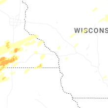
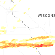
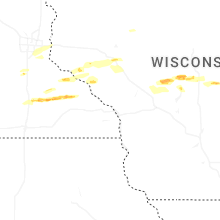


Connect with Interactive Hail Maps