

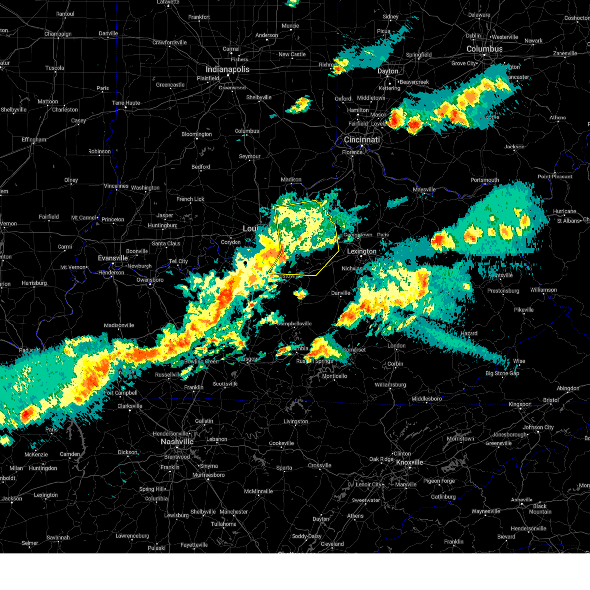
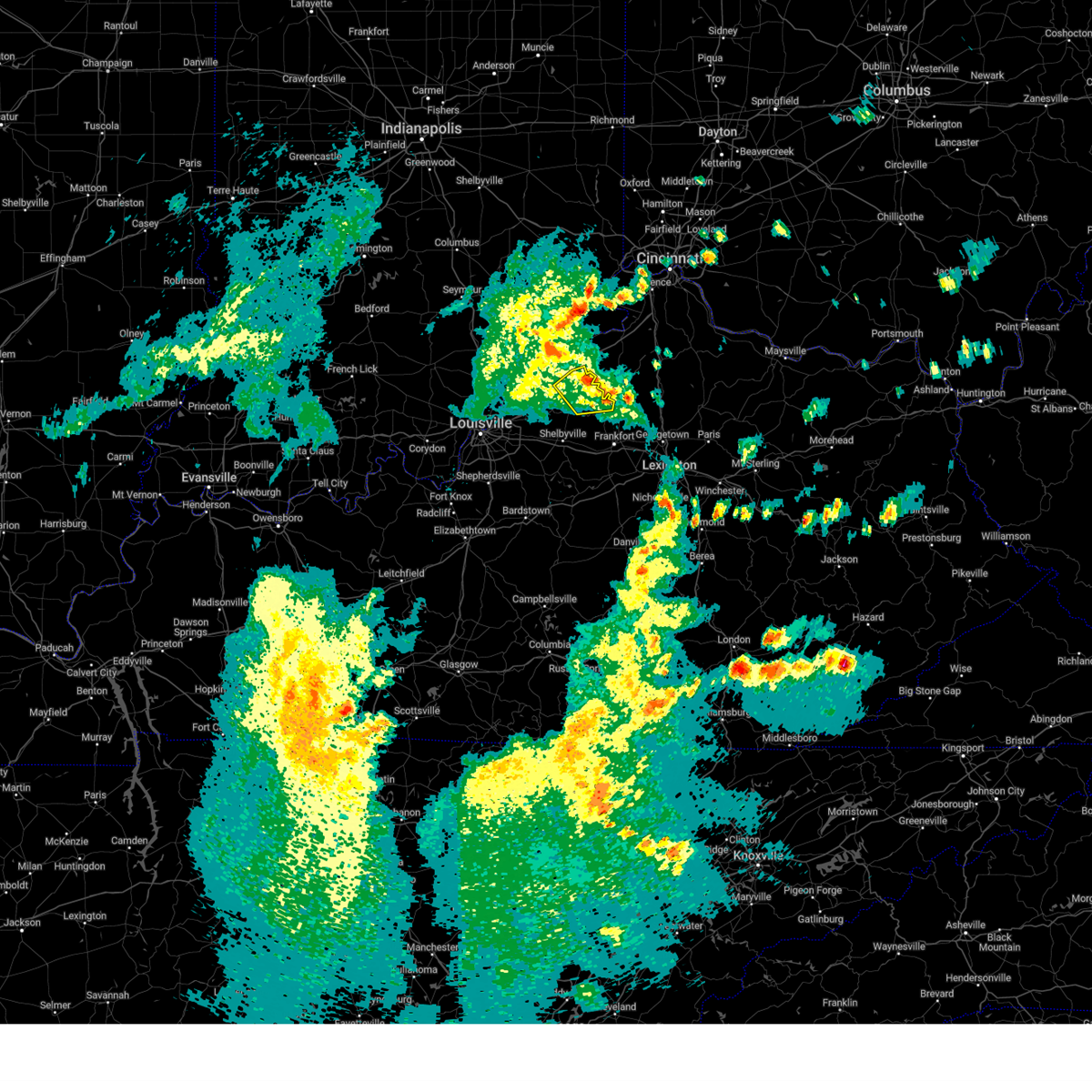
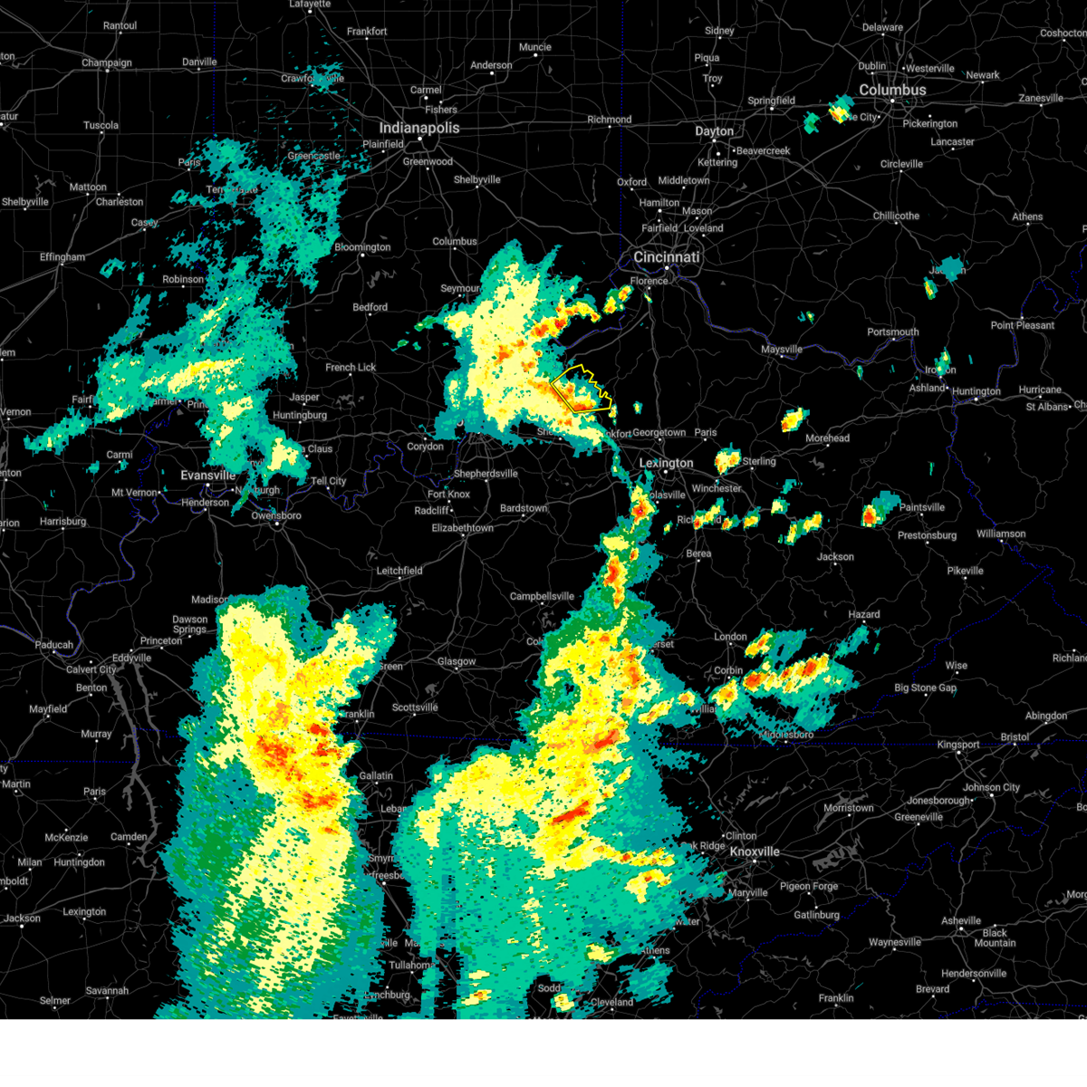
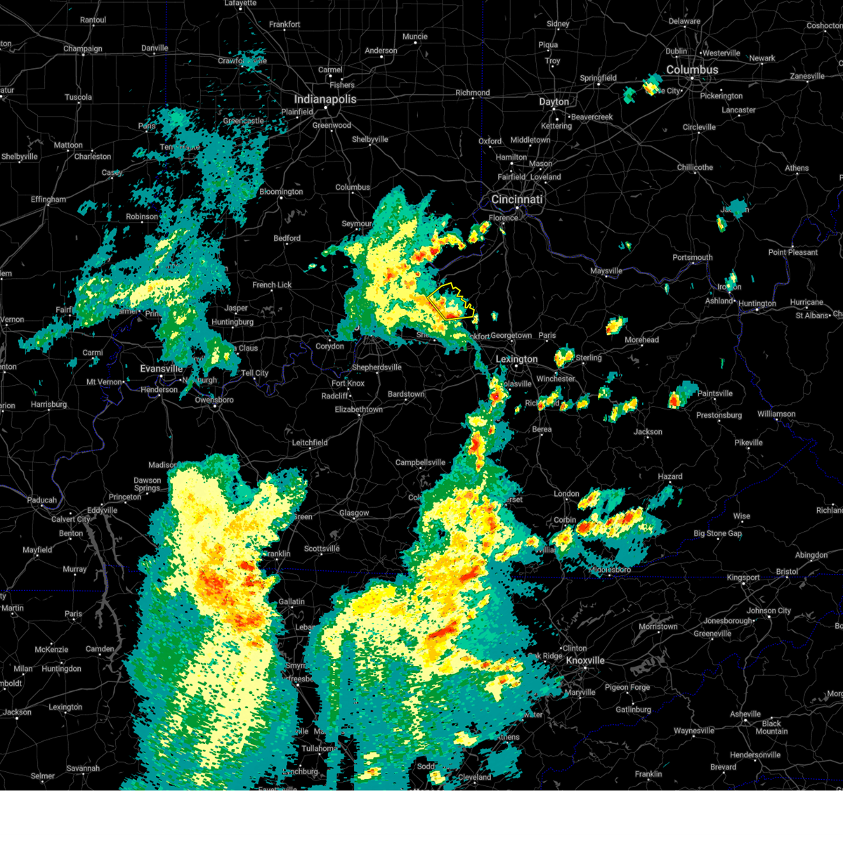
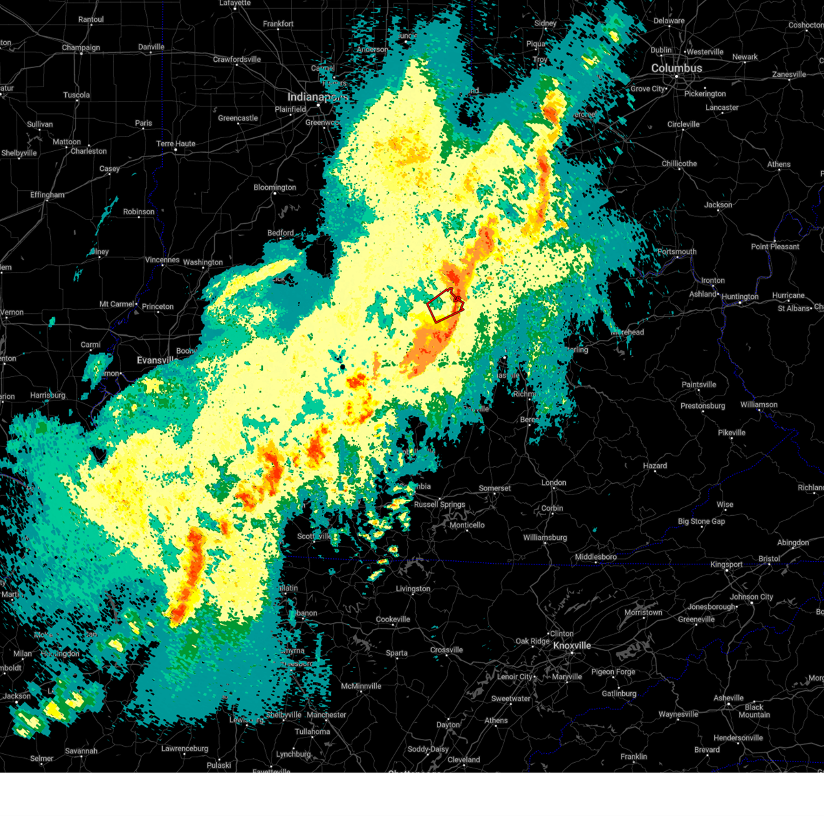
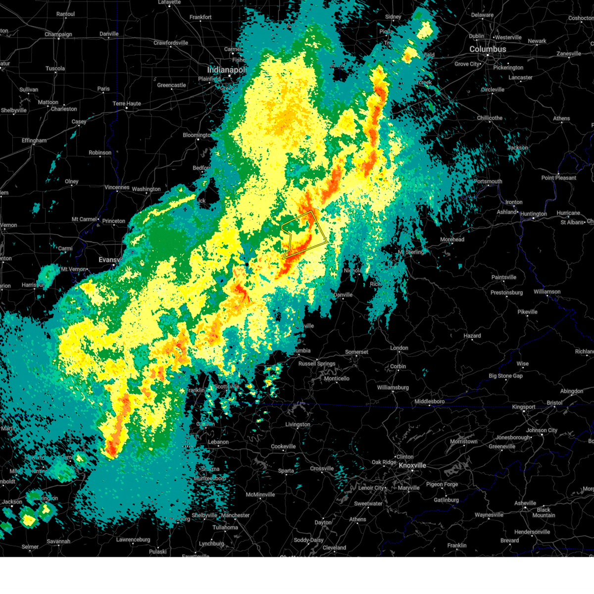
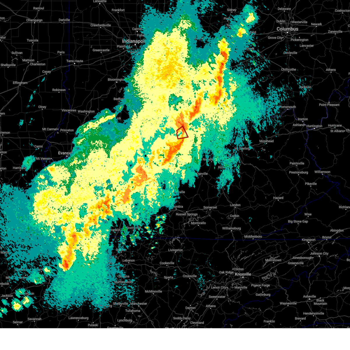
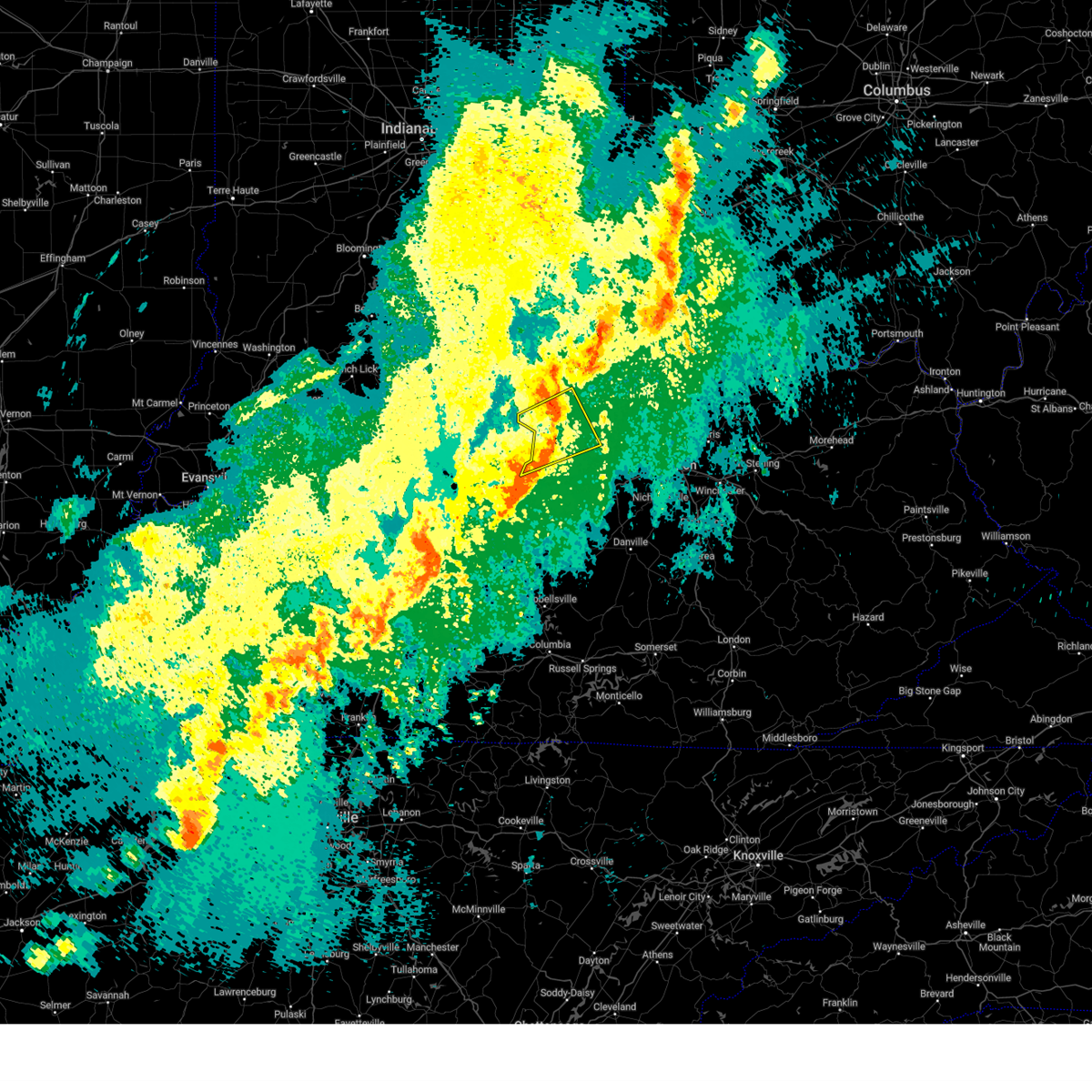
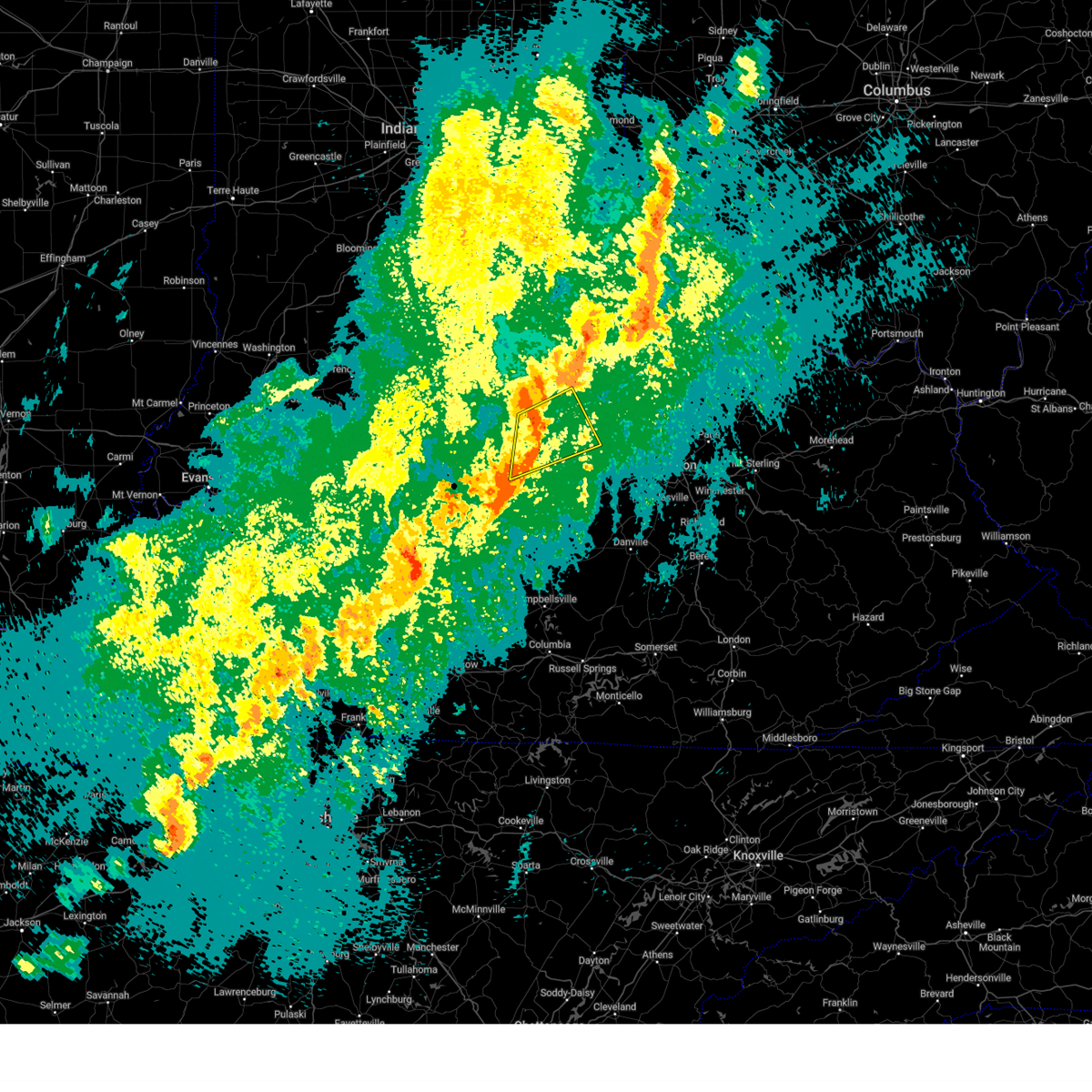
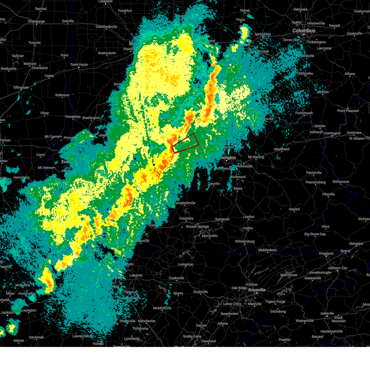
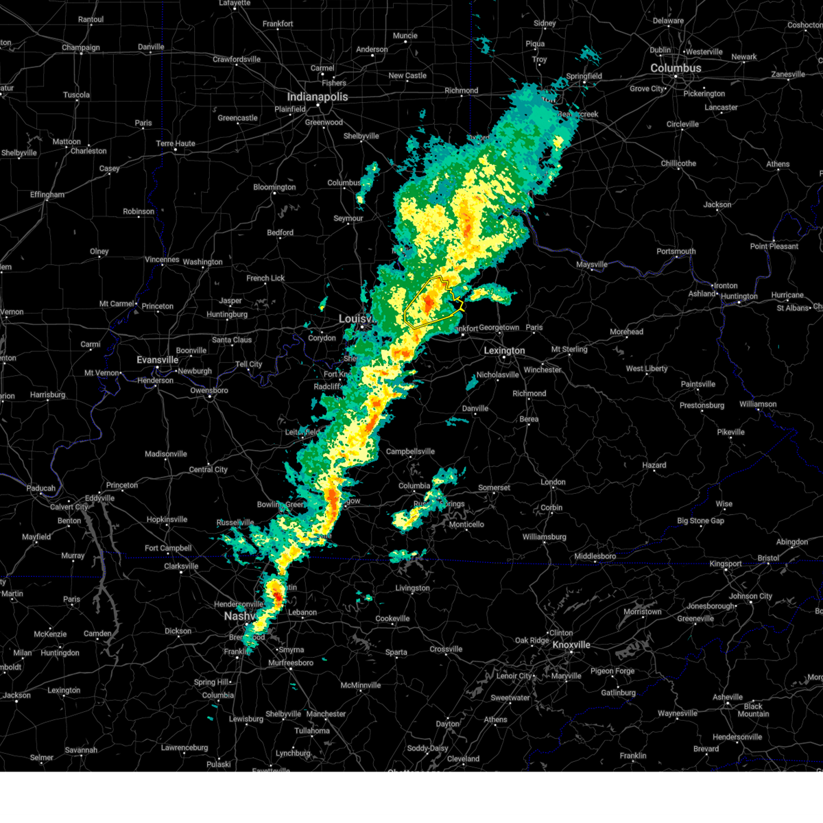
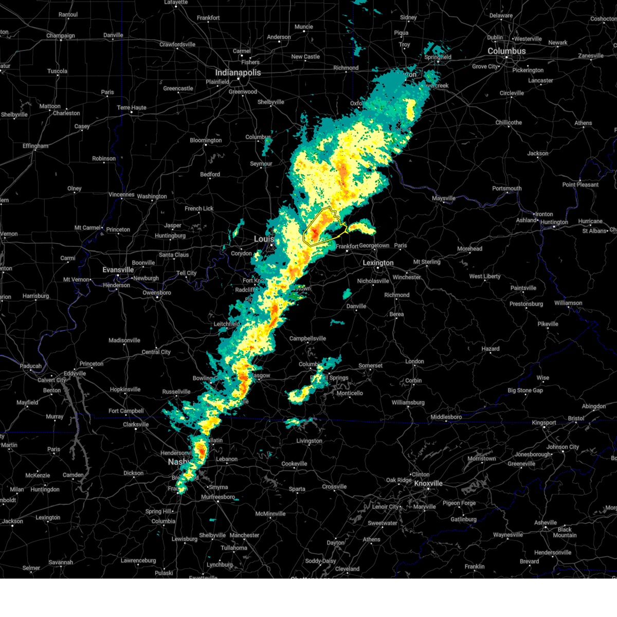
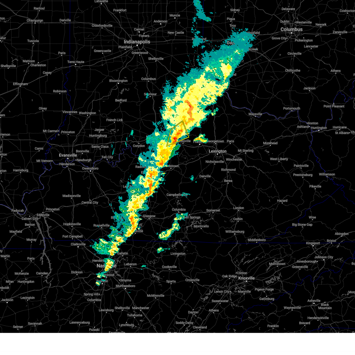
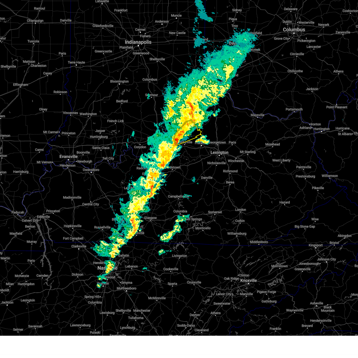
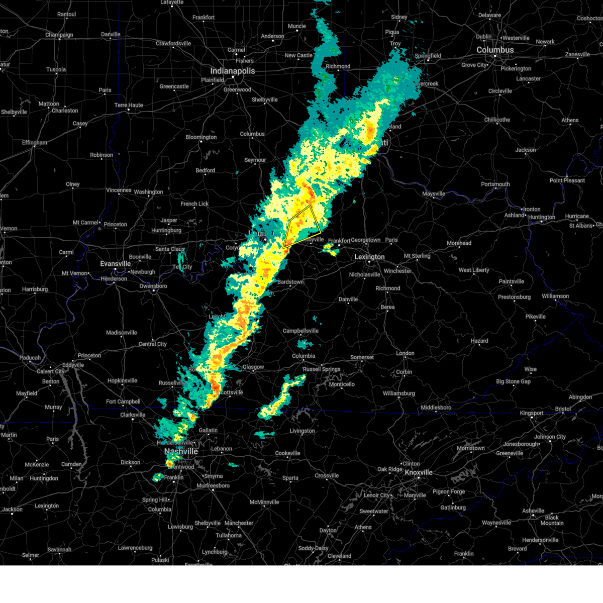
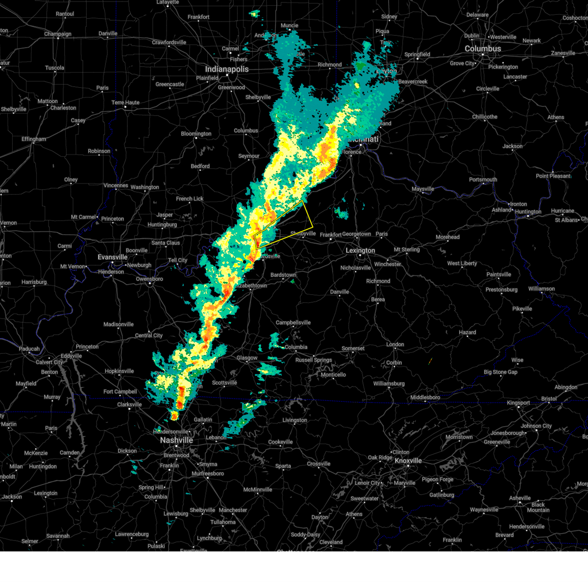
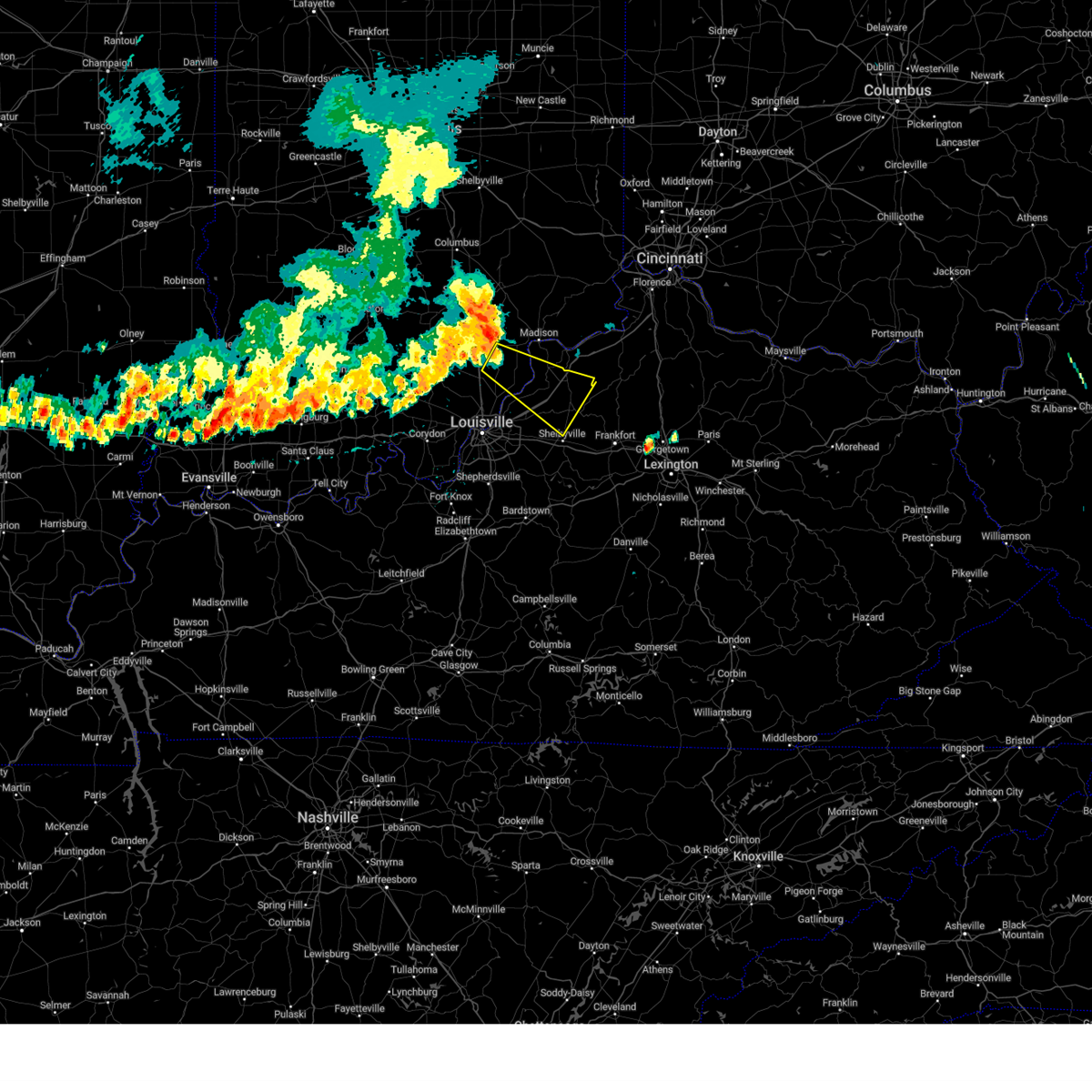
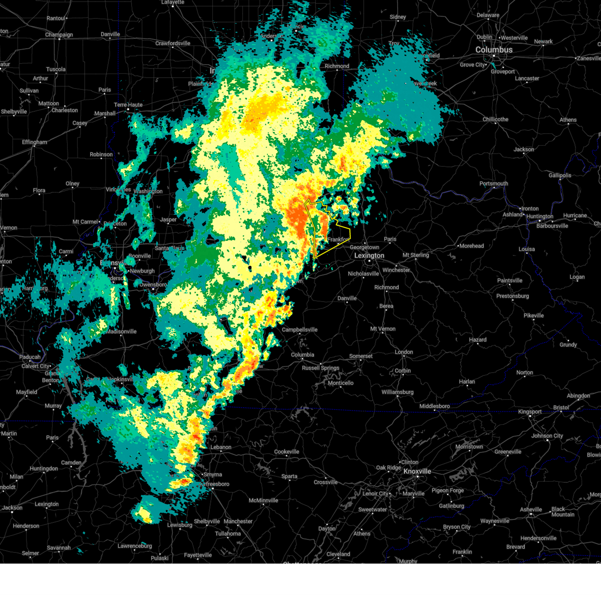
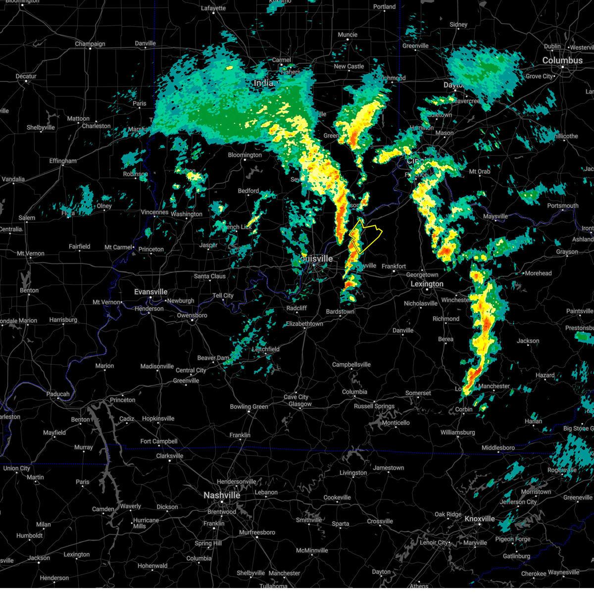
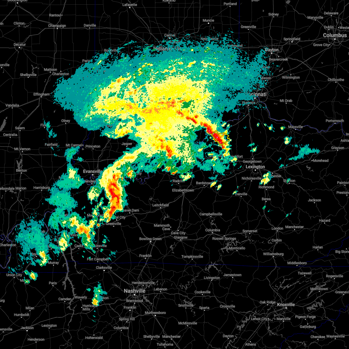
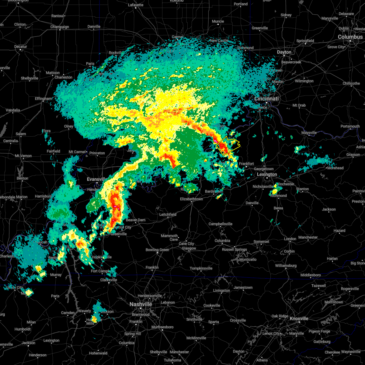
Hail Map for New Castle, KY
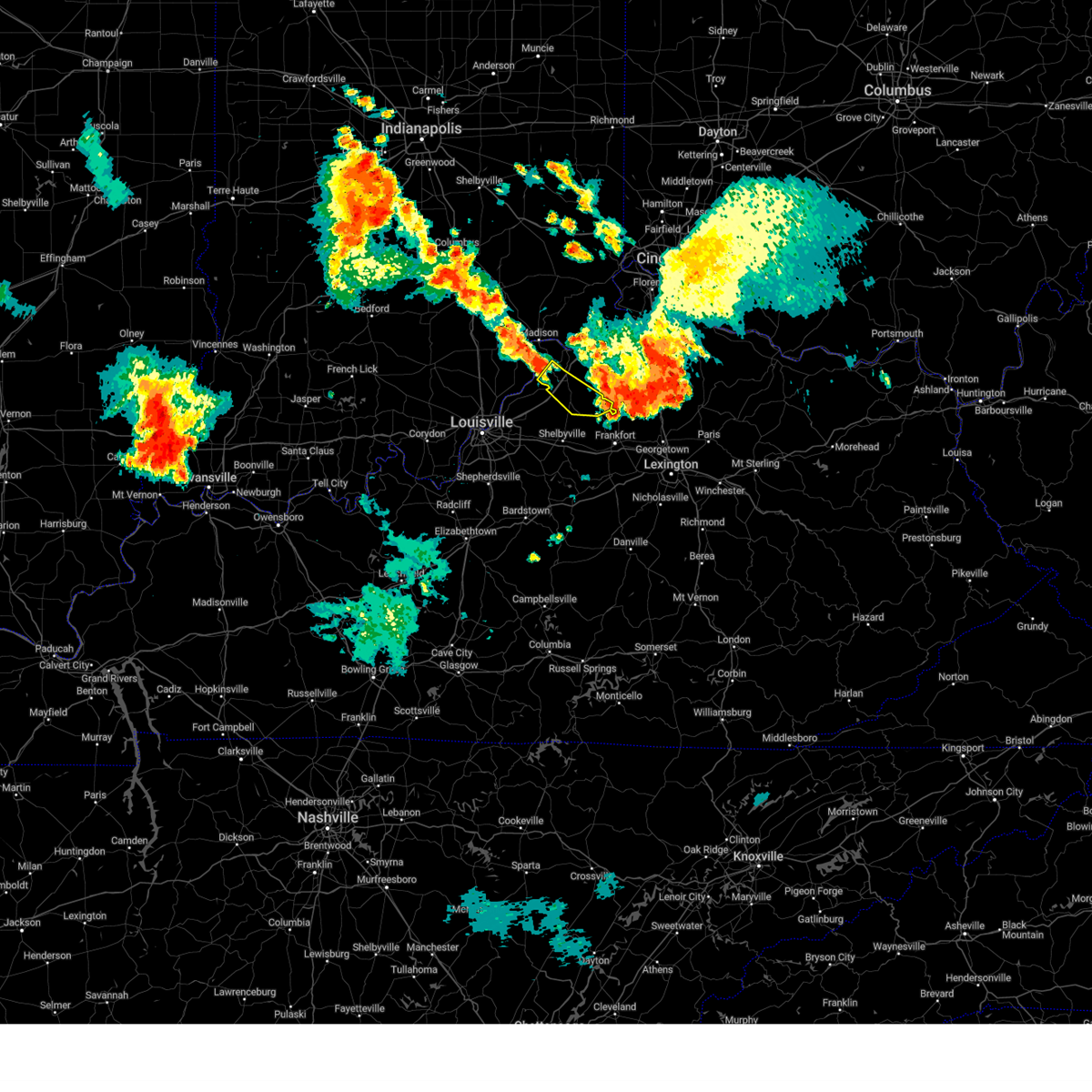
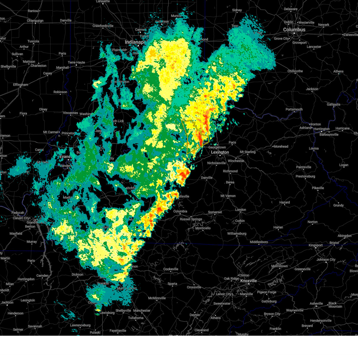
The New Castle, KY area has had 1 report of on-the-ground hail by trained spotters, and has been under severe weather warnings 34 times during the past 12 months. Doppler radar has detected hail at or near New Castle, KY on 46 occasions, including 3 occasions during the past year.
| Name: | New Castle, KY |
| Where Located: | 42.8 miles NE of Louisville, KY |
| Map: | Google Map for New Castle, KY |
| Population: | 912 |
| Housing Units: | 416 |
| More Info: | Search Google for New Castle, KY |
0
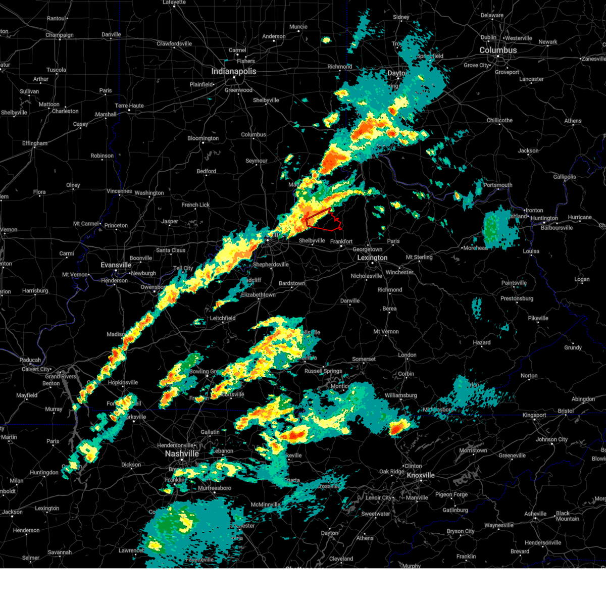
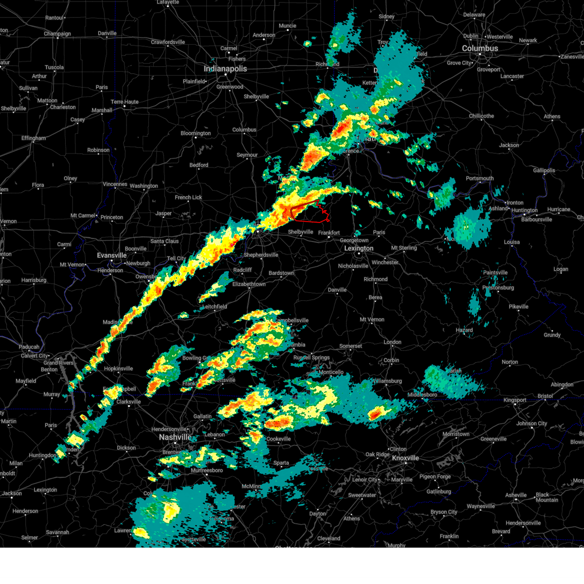
The Top Recent Hail Date for New Castle, KY is Monday, July 7, 2025 (28th out of 46)
Hail and Wind Damage Spotted near New Castle, KY
| Date / Time | Report Details |
|---|---|
| 5/16/2025 10:19 PM EDT |
 Svrlmk the national weather service in louisville has issued a * severe thunderstorm warning for, east central clark county in south central indiana, oldham county in central kentucky, shelby county in central kentucky, northern nelson county in central kentucky, anderson county in central kentucky, henry county in central kentucky, northeastern jefferson county in central kentucky, eastern bullitt county in central kentucky, franklin county in central kentucky, spencer county in central kentucky, northwestern woodford county in central kentucky, southern trimble county in central kentucky, northeastern washington county in central kentucky, * until 1100 pm edt. * at 1018 pm edt, severe thunderstorms were located along a line extending from near prospect to 7 miles southeast of fern creek to 8 miles south of shepherdsville, moving east at 60 mph (radar indicated). Hazards include 70 mph wind gusts and penny size hail. Expect considerable tree damage. Damage is likely to mobile homes, roofs, and outbuildings. Svrlmk the national weather service in louisville has issued a * severe thunderstorm warning for, east central clark county in south central indiana, oldham county in central kentucky, shelby county in central kentucky, northern nelson county in central kentucky, anderson county in central kentucky, henry county in central kentucky, northeastern jefferson county in central kentucky, eastern bullitt county in central kentucky, franklin county in central kentucky, spencer county in central kentucky, northwestern woodford county in central kentucky, southern trimble county in central kentucky, northeastern washington county in central kentucky, * until 1100 pm edt. * at 1018 pm edt, severe thunderstorms were located along a line extending from near prospect to 7 miles southeast of fern creek to 8 miles south of shepherdsville, moving east at 60 mph (radar indicated). Hazards include 70 mph wind gusts and penny size hail. Expect considerable tree damage. Damage is likely to mobile homes, roofs, and outbuildings.
|
| 5/2/2025 5:13 PM EDT |
 The storm which prompted the warning has moved out of the area. therefore, the warning will be allowed to expire. however, small hail, gusty winds and heavy rain are still possible with this thunderstorm. a severe thunderstorm watch remains in effect until 900 pm edt for central kentucky. to report severe weather, contact your nearest law enforcement agency. they will relay your report to the national weather service louisville. The storm which prompted the warning has moved out of the area. therefore, the warning will be allowed to expire. however, small hail, gusty winds and heavy rain are still possible with this thunderstorm. a severe thunderstorm watch remains in effect until 900 pm edt for central kentucky. to report severe weather, contact your nearest law enforcement agency. they will relay your report to the national weather service louisville.
|
| 5/2/2025 5:01 PM EDT |
 the severe thunderstorm warning has been cancelled and is no longer in effect the severe thunderstorm warning has been cancelled and is no longer in effect
|
| 5/2/2025 5:01 PM EDT |
 At 501 pm edt, a severe thunderstorm was located near new castle, moving northeast at 40 mph (radar indicated). Hazards include 60 mph wind gusts and penny size hail. Expect damage to roofs, siding, and trees. Locations impacted include, new castle, pleasureville, campbellsburg, gratz, port royal, north pleasureville, drennon springs, delville, bethlehem, and slabtown. At 501 pm edt, a severe thunderstorm was located near new castle, moving northeast at 40 mph (radar indicated). Hazards include 60 mph wind gusts and penny size hail. Expect damage to roofs, siding, and trees. Locations impacted include, new castle, pleasureville, campbellsburg, gratz, port royal, north pleasureville, drennon springs, delville, bethlehem, and slabtown.
|
| 5/2/2025 4:36 PM EDT | Svrlmk the national weather service in louisville has issued a * severe thunderstorm warning for, southeastern oldham county in central kentucky, northwestern shelby county in central kentucky, henry county in central kentucky, * until 515 pm edt. * at 436 pm edt, a severe thunderstorm was located over la grange, moving northeast at 40 mph (radar indicated). Hazards include 60 mph wind gusts and penny size hail. expect damage to roofs, siding, and trees |
| 4/3/2025 1:08 AM EDT |
 the tornado warning has been cancelled and is no longer in effect the tornado warning has been cancelled and is no longer in effect
|
| 4/3/2025 1:00 AM EDT |
 The storm which prompted the warning has moved out of the area. therefore, the warning has been allowed to expire. a tornado watch remains in effect until 700 am edt for central kentucky. The storm which prompted the warning has moved out of the area. therefore, the warning has been allowed to expire. a tornado watch remains in effect until 700 am edt for central kentucky.
|
| 4/3/2025 12:54 AM EDT |
 Torlmk the national weather service in louisville has issued a * tornado warning for, northeastern shelby county in central kentucky, southeastern henry county in central kentucky, northwestern franklin county in central kentucky, * until 130 am edt. * at 1254 am edt, a severe thunderstorm capable of producing a tornado was located near new castle, moving northeast at 70 mph (radar indicated rotation). Hazards include tornado. Flying debris will be dangerous to those caught without shelter. mobile homes will be damaged or destroyed. damage to roofs, windows, and vehicles will occur. tree damage is likely. This tornadic thunderstorm will remain over mainly rural areas of northeastern shelby, southeastern henry and northwestern franklin counties, including the following locations, north pleasureville, bethlehem, slabtown, elmburg, orville, pleasureville, defoe, cropper, fallis, and lockport. Torlmk the national weather service in louisville has issued a * tornado warning for, northeastern shelby county in central kentucky, southeastern henry county in central kentucky, northwestern franklin county in central kentucky, * until 130 am edt. * at 1254 am edt, a severe thunderstorm capable of producing a tornado was located near new castle, moving northeast at 70 mph (radar indicated rotation). Hazards include tornado. Flying debris will be dangerous to those caught without shelter. mobile homes will be damaged or destroyed. damage to roofs, windows, and vehicles will occur. tree damage is likely. This tornadic thunderstorm will remain over mainly rural areas of northeastern shelby, southeastern henry and northwestern franklin counties, including the following locations, north pleasureville, bethlehem, slabtown, elmburg, orville, pleasureville, defoe, cropper, fallis, and lockport.
|
| 4/3/2025 12:51 AM EDT |
 the tornado warning has been cancelled and is no longer in effect the tornado warning has been cancelled and is no longer in effect
|
| 4/3/2025 12:51 AM EDT |
 At 1251 am edt, a severe thunderstorm capable of producing a tornado was located near new castle, moving northeast at 70 mph (radar indicated rotation). Hazards include tornado. Flying debris will be dangerous to those caught without shelter. mobile homes will be damaged or destroyed. damage to roofs, windows, and vehicles will occur. tree damage is likely. Locations impacted include, new castle, eminence, pleasureville, smithfield, chestnut grove, cropper, old christianburg, and bellview. At 1251 am edt, a severe thunderstorm capable of producing a tornado was located near new castle, moving northeast at 70 mph (radar indicated rotation). Hazards include tornado. Flying debris will be dangerous to those caught without shelter. mobile homes will be damaged or destroyed. damage to roofs, windows, and vehicles will occur. tree damage is likely. Locations impacted include, new castle, eminence, pleasureville, smithfield, chestnut grove, cropper, old christianburg, and bellview.
|
| 4/3/2025 12:49 AM EDT |
 At 1249 am edt, a severe thunderstorm was located 7 miles north of shelbyville, moving northeast at 65 mph (radar indicated). Hazards include 70 mph wind gusts and penny size hail. Expect considerable tree damage. damage is likely to mobile homes, roofs, and outbuildings. Locations impacted include, shelbyville, la grange, coldstream, new castle, crestwood, eminence, simpsonville, orchard grass hills, pewee valley, and pleasureville. At 1249 am edt, a severe thunderstorm was located 7 miles north of shelbyville, moving northeast at 65 mph (radar indicated). Hazards include 70 mph wind gusts and penny size hail. Expect considerable tree damage. damage is likely to mobile homes, roofs, and outbuildings. Locations impacted include, shelbyville, la grange, coldstream, new castle, crestwood, eminence, simpsonville, orchard grass hills, pewee valley, and pleasureville.
|
| 4/3/2025 12:49 AM EDT |
 the severe thunderstorm warning has been cancelled and is no longer in effect the severe thunderstorm warning has been cancelled and is no longer in effect
|
| 4/3/2025 12:46 AM EDT |
 the tornado warning has been cancelled and is no longer in effect the tornado warning has been cancelled and is no longer in effect
|
| 4/3/2025 12:46 AM EDT |
 At 1246 am edt, a confirmed tornado was located 7 miles south of new castle, moving northeast at 70 mph (radar confirmed tornado). Hazards include damaging tornado. Flying debris will be dangerous to those caught without shelter. mobile homes will be damaged or destroyed. damage to roofs, windows, and vehicles will occur. tree damage is likely. Locations impacted include, new castle, eminence, pleasureville, smithfield, chestnut grove, cropper, todds point, old christianburg, and bellview. At 1246 am edt, a confirmed tornado was located 7 miles south of new castle, moving northeast at 70 mph (radar confirmed tornado). Hazards include damaging tornado. Flying debris will be dangerous to those caught without shelter. mobile homes will be damaged or destroyed. damage to roofs, windows, and vehicles will occur. tree damage is likely. Locations impacted include, new castle, eminence, pleasureville, smithfield, chestnut grove, cropper, todds point, old christianburg, and bellview.
|
| 4/3/2025 12:40 AM EDT |
 At 1240 am edt, a severe thunderstorm was located 7 miles northwest of shelbyville, moving northeast at 70 mph (radar indicated). Hazards include 70 mph wind gusts and penny size hail. Expect considerable tree damage. damage is likely to mobile homes, roofs, and outbuildings. Locations impacted include, jeffersontown, shelbyville, la grange, middletown, douglass hills, anchorage, worthington hills, coldstream, new castle, and woodland hills. At 1240 am edt, a severe thunderstorm was located 7 miles northwest of shelbyville, moving northeast at 70 mph (radar indicated). Hazards include 70 mph wind gusts and penny size hail. Expect considerable tree damage. damage is likely to mobile homes, roofs, and outbuildings. Locations impacted include, jeffersontown, shelbyville, la grange, middletown, douglass hills, anchorage, worthington hills, coldstream, new castle, and woodland hills.
|
| 4/3/2025 12:38 AM EDT | At 1238 am edt, a confirmed tornado was located 7 miles east of middletown, moving northeast at 70 mph (radar confirmed tornado). Hazards include damaging tornado. Flying debris will be dangerous to those caught without shelter. mobile homes will be damaged or destroyed. damage to roofs, windows, and vehicles will occur. tree damage is likely. This tornadic thunderstorm will remain over mainly rural areas of southeastern oldham, northern shelby, southwestern henry and northeastern jefferson counties, including the following locations, smithfield, mulberry, simpsonville, chestnut grove, montclair, cropper, eminence, pleasureville, conner, and todds point. |
| 4/3/2025 12:36 AM EDT | At 1236 am edt, a confirmed tornado was located near middletown, moving northeast at 70 mph (radar confirmed tornado). Hazards include damaging tornado. Flying debris will be dangerous to those caught without shelter. mobile homes will be damaged or destroyed. damage to roofs, windows, and vehicles will occur. tree damage is likely. This tornadic thunderstorm will remain over mainly rural areas of southeastern oldham, northern shelby, southwestern henry and east central jefferson counties, including the following locations, l s park, mulberry, simpsonville, chestnut grove, fisherville, montclair, floydsburg, ballardsville, pleasureville, and old christianburg. |
| 4/3/2025 12:34 AM EDT |
 At 1234 am edt, a severe thunderstorm capable of producing a tornado was located over middletown, moving northeast at 70 mph (radar indicated rotation). Hazards include tornado. Flying debris will be dangerous to those caught without shelter. mobile homes will be damaged or destroyed. damage to roofs, windows, and vehicles will occur. tree damage is likely. This tornadic thunderstorm will remain over mainly rural areas of southeastern oldham, northern shelby, southwestern henry and east central jefferson counties, including the following locations, l s park, mulberry, simpsonville, chestnut grove, fisherville, montclair, floydsburg, ballardsville, pleasureville, and old christianburg. At 1234 am edt, a severe thunderstorm capable of producing a tornado was located over middletown, moving northeast at 70 mph (radar indicated rotation). Hazards include tornado. Flying debris will be dangerous to those caught without shelter. mobile homes will be damaged or destroyed. damage to roofs, windows, and vehicles will occur. tree damage is likely. This tornadic thunderstorm will remain over mainly rural areas of southeastern oldham, northern shelby, southwestern henry and east central jefferson counties, including the following locations, l s park, mulberry, simpsonville, chestnut grove, fisherville, montclair, floydsburg, ballardsville, pleasureville, and old christianburg.
|
| 4/3/2025 12:28 AM EDT |
 Torlmk the national weather service in louisville has issued a * tornado warning for, southeastern oldham county in central kentucky, northern shelby county in central kentucky, southwestern henry county in central kentucky, east central jefferson county in central kentucky, * until 100 am edt. * at 1228 am edt, a severe thunderstorm capable of producing a tornado was located over buechel, moving northeast at 70 mph (radar indicated rotation). Hazards include tornado. Flying debris will be dangerous to those caught without shelter. mobile homes will be damaged or destroyed. damage to roofs, windows, and vehicles will occur. tree damage is likely. this dangerous storm will be near, middletown, douglass hills, anchorage, and woodland hills around 1235 am edt. Other locations impacted by this tornadic thunderstorm include l s park, mulberry, forest hills, simpsonville, chestnut grove, fisherville, montclair, floydsburg, ballardsville, and pleasureville. Torlmk the national weather service in louisville has issued a * tornado warning for, southeastern oldham county in central kentucky, northern shelby county in central kentucky, southwestern henry county in central kentucky, east central jefferson county in central kentucky, * until 100 am edt. * at 1228 am edt, a severe thunderstorm capable of producing a tornado was located over buechel, moving northeast at 70 mph (radar indicated rotation). Hazards include tornado. Flying debris will be dangerous to those caught without shelter. mobile homes will be damaged or destroyed. damage to roofs, windows, and vehicles will occur. tree damage is likely. this dangerous storm will be near, middletown, douglass hills, anchorage, and woodland hills around 1235 am edt. Other locations impacted by this tornadic thunderstorm include l s park, mulberry, forest hills, simpsonville, chestnut grove, fisherville, montclair, floydsburg, ballardsville, and pleasureville.
|
| 4/3/2025 12:26 AM EDT | Svrlmk the national weather service in louisville has issued a * severe thunderstorm warning for, southeastern oldham county in central kentucky, northwestern spencer county in central kentucky, shelby county in central kentucky, southwestern henry county in central kentucky, jefferson county in central kentucky, northeastern bullitt county in central kentucky, southwestern franklin county in central kentucky, * until 100 am edt. * at 1226 am edt, a severe thunderstorm was located over buechel, moving northeast at 70 mph (radar indicated). Hazards include 70 mph wind gusts and penny size hail. Expect considerable tree damage. Damage is likely to mobile homes, roofs, and outbuildings. |
| 3/19/2025 11:32 PM EDT |
 the severe thunderstorm warning has been cancelled and is no longer in effect the severe thunderstorm warning has been cancelled and is no longer in effect
|
| 3/19/2025 11:23 PM EDT |
 At 1122 pm edt, a severe thunderstorm was located near new castle, moving northeast at 60 mph (radar indicated). Hazards include 60 mph wind gusts and quarter size hail. Hail damage to vehicles is expected. expect wind damage to roofs, siding, and trees. Locations impacted include, la grange, new castle, eminence, pleasureville, campbellsburg, smithfield, north pleasureville, elmburg, ballardsville, and defoe. At 1122 pm edt, a severe thunderstorm was located near new castle, moving northeast at 60 mph (radar indicated). Hazards include 60 mph wind gusts and quarter size hail. Hail damage to vehicles is expected. expect wind damage to roofs, siding, and trees. Locations impacted include, la grange, new castle, eminence, pleasureville, campbellsburg, smithfield, north pleasureville, elmburg, ballardsville, and defoe.
|
| 3/19/2025 11:23 PM EDT |
 the severe thunderstorm warning has been cancelled and is no longer in effect the severe thunderstorm warning has been cancelled and is no longer in effect
|
| 3/19/2025 11:18 PM EDT |
 The storm which prompted the warning has moved out of the area. therefore, the warning has been allowed to expire. a new severe thunderstorm warning has been issued for shelby county. a tornado watch remains in effect until midnight edt for central kentucky. to report severe weather, contact your nearest law enforcement agency. they will relay your report to the national weather service louisville. The storm which prompted the warning has moved out of the area. therefore, the warning has been allowed to expire. a new severe thunderstorm warning has been issued for shelby county. a tornado watch remains in effect until midnight edt for central kentucky. to report severe weather, contact your nearest law enforcement agency. they will relay your report to the national weather service louisville.
|
| 3/19/2025 11:14 PM EDT |
 Svrlmk the national weather service in louisville has issued a * severe thunderstorm warning for, southeastern oldham county in central kentucky, northern shelby county in central kentucky, southeastern trimble county in central kentucky, henry county in central kentucky, * until 1145 pm edt. * at 1114 pm edt, a severe thunderstorm was located 7 miles south of la grange, moving northeast at 60 mph (radar indicated). Hazards include 60 mph wind gusts and quarter size hail. Hail damage to vehicles is expected. Expect wind damage to roofs, siding, and trees. Svrlmk the national weather service in louisville has issued a * severe thunderstorm warning for, southeastern oldham county in central kentucky, northern shelby county in central kentucky, southeastern trimble county in central kentucky, henry county in central kentucky, * until 1145 pm edt. * at 1114 pm edt, a severe thunderstorm was located 7 miles south of la grange, moving northeast at 60 mph (radar indicated). Hazards include 60 mph wind gusts and quarter size hail. Hail damage to vehicles is expected. Expect wind damage to roofs, siding, and trees.
|
| 3/19/2025 11:05 PM EDT |
 At 1104 pm edt, a severe thunderstorm was located near la grange, moving northeast at 60 mph (radar indicated). Hazards include 60 mph wind gusts and penny size hail. Expect damage to roofs, siding, and trees. Locations impacted include, jeffersontown, la grange, middletown, douglass hills, new castle, woodland hills, pendleton, crestwood, eminence, and pewee valley. At 1104 pm edt, a severe thunderstorm was located near la grange, moving northeast at 60 mph (radar indicated). Hazards include 60 mph wind gusts and penny size hail. Expect damage to roofs, siding, and trees. Locations impacted include, jeffersontown, la grange, middletown, douglass hills, new castle, woodland hills, pendleton, crestwood, eminence, and pewee valley.
|
| 3/19/2025 10:53 PM EDT |
 At 1053 pm edt, a severe thunderstorm was located over coldstream, moving northeast at 60 mph (radar indicated). Hazards include 60 mph wind gusts and penny size hail. Expect damage to roofs, siding, and trees. locations impacted include, louisville, jeffersontown, st. Matthews, lyndon, la grange, middletown, douglass hills, prospect, hurstbourne, and graymoor-devondale. At 1053 pm edt, a severe thunderstorm was located over coldstream, moving northeast at 60 mph (radar indicated). Hazards include 60 mph wind gusts and penny size hail. Expect damage to roofs, siding, and trees. locations impacted include, louisville, jeffersontown, st. Matthews, lyndon, la grange, middletown, douglass hills, prospect, hurstbourne, and graymoor-devondale.
|
| 3/19/2025 10:51 PM EDT |
 At 1050 pm edt, a severe thunderstorm was located over worthington hills, moving northeast at 70 mph (radar indicated). Hazards include 70 mph wind gusts and quarter size hail. Hail damage to vehicles is expected. expect considerable tree damage. wind damage is also likely to mobile homes, roofs, and outbuildings. locations impacted include, louisville, jeffersontown, st. Matthews, shively, lyndon, la grange, middletown, douglass hills, prospect, and hurstbourne. At 1050 pm edt, a severe thunderstorm was located over worthington hills, moving northeast at 70 mph (radar indicated). Hazards include 70 mph wind gusts and quarter size hail. Hail damage to vehicles is expected. expect considerable tree damage. wind damage is also likely to mobile homes, roofs, and outbuildings. locations impacted include, louisville, jeffersontown, st. Matthews, shively, lyndon, la grange, middletown, douglass hills, prospect, and hurstbourne.
|
| 3/19/2025 10:41 PM EDT |
 Svrlmk the national weather service in louisville has issued a * severe thunderstorm warning for, oldham county in central kentucky, northwestern shelby county in central kentucky, southeastern trimble county in central kentucky, western henry county in central kentucky, central jefferson county in central kentucky, * until 1115 pm edt. * at 1041 pm edt, a severe thunderstorm was located over strathmoor manor, moving northeast at 65 mph (radar indicated). Hazards include 60 mph wind gusts and penny size hail. expect damage to roofs, siding, and trees Svrlmk the national weather service in louisville has issued a * severe thunderstorm warning for, oldham county in central kentucky, northwestern shelby county in central kentucky, southeastern trimble county in central kentucky, western henry county in central kentucky, central jefferson county in central kentucky, * until 1115 pm edt. * at 1041 pm edt, a severe thunderstorm was located over strathmoor manor, moving northeast at 65 mph (radar indicated). Hazards include 60 mph wind gusts and penny size hail. expect damage to roofs, siding, and trees
|
| 9/24/2024 2:29 PM EDT |
 The storm which prompted the warning has weakened below severe limits, and no longer appears capable of producing a tornado. therefore, the warning will be allowed to expire. a severe thunderstorm watch remains in effect until 800 pm edt for central kentucky. remember, a severe thunderstorm warning still remains in effect for portions of oldham, henry, and trimble county until 245 pm edt. The storm which prompted the warning has weakened below severe limits, and no longer appears capable of producing a tornado. therefore, the warning will be allowed to expire. a severe thunderstorm watch remains in effect until 800 pm edt for central kentucky. remember, a severe thunderstorm warning still remains in effect for portions of oldham, henry, and trimble county until 245 pm edt.
|
| 9/24/2024 2:19 PM EDT |
 the tornado warning has been cancelled and is no longer in effect the tornado warning has been cancelled and is no longer in effect
|
| 9/24/2024 2:19 PM EDT |
 At 218 pm edt, a severe thunderstorm capable of producing a tornado was located near sligo, moving east at 35 mph (radar indicated rotation). Hazards include tornado and quarter size hail. Flying debris will be dangerous to those caught without shelter. mobile homes will be damaged or destroyed. damage to roofs, windows, and vehicles will occur. tree damage is likely. This tornadic thunderstorm will remain over mainly rural areas of northeastern oldham, southeastern trimble and northwestern henry counties, including the following locations, pendleton, campbellsburg, sligo, and sulphur. At 218 pm edt, a severe thunderstorm capable of producing a tornado was located near sligo, moving east at 35 mph (radar indicated rotation). Hazards include tornado and quarter size hail. Flying debris will be dangerous to those caught without shelter. mobile homes will be damaged or destroyed. damage to roofs, windows, and vehicles will occur. tree damage is likely. This tornadic thunderstorm will remain over mainly rural areas of northeastern oldham, southeastern trimble and northwestern henry counties, including the following locations, pendleton, campbellsburg, sligo, and sulphur.
|
| 9/24/2024 2:07 PM EDT |
 Torlmk the national weather service in louisville has issued a * tornado warning for, east central clark county in south central indiana, central oldham county in central kentucky, southern trimble county in central kentucky, western henry county in central kentucky, * until 230 pm edt. * at 206 pm edt, a severe thunderstorm capable of producing a tornado was located near la grange, moving east at 35 mph (radar indicated rotation). Hazards include tornado and quarter size hail. Flying debris will be dangerous to those caught without shelter. mobile homes will be damaged or destroyed. damage to roofs, windows, and vehicles will occur. tree damage is likely. this dangerous storm will be near, la grange around 210 pm edt. Other locations impacted by this tornadic thunderstorm include westport, oldham, pendleton, campbellsburg, greenhaven, demplytown, buckner, russell corner, skylight, and sulphur. Torlmk the national weather service in louisville has issued a * tornado warning for, east central clark county in south central indiana, central oldham county in central kentucky, southern trimble county in central kentucky, western henry county in central kentucky, * until 230 pm edt. * at 206 pm edt, a severe thunderstorm capable of producing a tornado was located near la grange, moving east at 35 mph (radar indicated rotation). Hazards include tornado and quarter size hail. Flying debris will be dangerous to those caught without shelter. mobile homes will be damaged or destroyed. damage to roofs, windows, and vehicles will occur. tree damage is likely. this dangerous storm will be near, la grange around 210 pm edt. Other locations impacted by this tornadic thunderstorm include westport, oldham, pendleton, campbellsburg, greenhaven, demplytown, buckner, russell corner, skylight, and sulphur.
|
| 6/25/2024 5:15 PM EDT |
 Svrlmk the national weather service in louisville has issued a * severe thunderstorm warning for, southwestern jefferson county in south central indiana, northeastern clark county in south central indiana, southeastern scott county in south central indiana, eastern oldham county in central kentucky, north central shelby county in central kentucky, southern trimble county in central kentucky, henry county in central kentucky, * until 600 pm edt. * at 514 pm edt, a severe thunderstorm was located 10 miles southeast of scottsburg, moving southeast at 45 mph (radar indicated). Hazards include 60 mph wind gusts. expect damage to roofs, siding, and trees Svrlmk the national weather service in louisville has issued a * severe thunderstorm warning for, southwestern jefferson county in south central indiana, northeastern clark county in south central indiana, southeastern scott county in south central indiana, eastern oldham county in central kentucky, north central shelby county in central kentucky, southern trimble county in central kentucky, henry county in central kentucky, * until 600 pm edt. * at 514 pm edt, a severe thunderstorm was located 10 miles southeast of scottsburg, moving southeast at 45 mph (radar indicated). Hazards include 60 mph wind gusts. expect damage to roofs, siding, and trees
|
| 5/26/2024 1:05 PM EDT |
 the severe thunderstorm warning has been cancelled and is no longer in effect the severe thunderstorm warning has been cancelled and is no longer in effect
|
| 5/26/2024 1:05 PM EDT |
 At 104 pm edt, a severe thunderstorm was located 10 miles northeast of madison, moving northeast at 55 mph (radar indicated). Hazards include 60 mph wind gusts. Expect damage to roofs, siding, and trees. Locations impacted include, madison, new castle, bedford, pendleton, hanover, eminence, smyrna, pleasureville, campbellsburg, and milton. At 104 pm edt, a severe thunderstorm was located 10 miles northeast of madison, moving northeast at 55 mph (radar indicated). Hazards include 60 mph wind gusts. Expect damage to roofs, siding, and trees. Locations impacted include, madison, new castle, bedford, pendleton, hanover, eminence, smyrna, pleasureville, campbellsburg, and milton.
|
| 5/26/2024 12:25 PM EDT |
 Svrlmk the national weather service in louisville has issued a * severe thunderstorm warning for, jefferson county in south central indiana, central scott county in south central indiana, northeastern oldham county in central kentucky, northeastern shelby county in central kentucky, trimble county in central kentucky, henry county in central kentucky, northwestern franklin county in central kentucky, * until 130 pm edt. * at 1225 pm edt, a severe thunderstorm was located over la grange, moving northeast at 60 mph (radar indicated). Hazards include 70 mph wind gusts. Expect considerable tree damage. Damage is likely to mobile homes, roofs, and outbuildings. Svrlmk the national weather service in louisville has issued a * severe thunderstorm warning for, jefferson county in south central indiana, central scott county in south central indiana, northeastern oldham county in central kentucky, northeastern shelby county in central kentucky, trimble county in central kentucky, henry county in central kentucky, northwestern franklin county in central kentucky, * until 130 pm edt. * at 1225 pm edt, a severe thunderstorm was located over la grange, moving northeast at 60 mph (radar indicated). Hazards include 70 mph wind gusts. Expect considerable tree damage. Damage is likely to mobile homes, roofs, and outbuildings.
|
| 5/26/2024 12:17 PM EDT |
 At 1216 pm edt, a severe thunderstorm was located near prospect, moving northeast at 60 mph (radar indicated). Hazards include 75 mph wind gusts. Expect considerable tree damage. damage is likely to mobile homes, roofs, and outbuildings. Locations impacted include, louisville, jeffersonville, lyndon, la grange, prospect, graymoor-devondale, windy hills, anchorage, worthington hills, and barbourmeade. At 1216 pm edt, a severe thunderstorm was located near prospect, moving northeast at 60 mph (radar indicated). Hazards include 75 mph wind gusts. Expect considerable tree damage. damage is likely to mobile homes, roofs, and outbuildings. Locations impacted include, louisville, jeffersonville, lyndon, la grange, prospect, graymoor-devondale, windy hills, anchorage, worthington hills, and barbourmeade.
|
| 5/26/2024 12:07 PM EDT |
 At 1206 pm edt, a severe thunderstorm was located near jeffersonville, moving east at 45 mph. this is a destructive storm for southern indiana (radar indicated). Hazards include 80 mph wind gusts. Flying debris will be dangerous to those caught without shelter. mobile homes will be heavily damaged. expect considerable damage to roofs, windows, and vehicles. extensive tree damage and power outages are likely. locations impacted include, louisville, jeffersonville, new albany, st. Matthews, lyndon, la grange, prospect, graymoor-devondale, windy hills, and anchorage. At 1206 pm edt, a severe thunderstorm was located near jeffersonville, moving east at 45 mph. this is a destructive storm for southern indiana (radar indicated). Hazards include 80 mph wind gusts. Flying debris will be dangerous to those caught without shelter. mobile homes will be heavily damaged. expect considerable damage to roofs, windows, and vehicles. extensive tree damage and power outages are likely. locations impacted include, louisville, jeffersonville, new albany, st. Matthews, lyndon, la grange, prospect, graymoor-devondale, windy hills, and anchorage.
|
| 5/26/2024 12:00 PM EDT |
 Svrlmk the national weather service in louisville has issued a * severe thunderstorm warning for, south central jefferson county in south central indiana, clark county in south central indiana, floyd county in south central indiana, southern scott county in south central indiana, southeastern washington county in south central indiana, oldham county in central kentucky, northern shelby county in central kentucky, trimble county in central kentucky, western henry county in central kentucky, northern jefferson county in central kentucky, * until 1230 pm edt. * at 1159 am edt, a severe thunderstorm was located over louisville, moving northeast at 65 mph (radar indicated). Hazards include 70 mph wind gusts. Expect considerable tree damage. Damage is likely to mobile homes, roofs, and outbuildings. Svrlmk the national weather service in louisville has issued a * severe thunderstorm warning for, south central jefferson county in south central indiana, clark county in south central indiana, floyd county in south central indiana, southern scott county in south central indiana, southeastern washington county in south central indiana, oldham county in central kentucky, northern shelby county in central kentucky, trimble county in central kentucky, western henry county in central kentucky, northern jefferson county in central kentucky, * until 1230 pm edt. * at 1159 am edt, a severe thunderstorm was located over louisville, moving northeast at 65 mph (radar indicated). Hazards include 70 mph wind gusts. Expect considerable tree damage. Damage is likely to mobile homes, roofs, and outbuildings.
|
| 4/2/2024 6:45 PM EDT |
 the severe thunderstorm warning has been cancelled and is no longer in effect the severe thunderstorm warning has been cancelled and is no longer in effect
|
| 4/2/2024 6:45 PM EDT |
 At 645 pm edt, a severe thunderstorm was located 8 miles west of owenton, moving northeast at 75 mph (radar indicated). Hazards include 60 mph wind gusts and quarter size hail. Hail damage to vehicles is expected. expect wind damage to roofs, siding, and trees. Locations impacted include, new castle, eminence, simpsonville, pleasureville, smithfield, chestnut grove, north pleasureville, drennon springs, delville, and bethlehem. At 645 pm edt, a severe thunderstorm was located 8 miles west of owenton, moving northeast at 75 mph (radar indicated). Hazards include 60 mph wind gusts and quarter size hail. Hail damage to vehicles is expected. expect wind damage to roofs, siding, and trees. Locations impacted include, new castle, eminence, simpsonville, pleasureville, smithfield, chestnut grove, north pleasureville, drennon springs, delville, and bethlehem.
|
| 4/2/2024 6:22 PM EDT |
 Svrlmk the national weather service in louisville has issued a * severe thunderstorm warning for, southern oldham county in central kentucky, northwestern shelby county in central kentucky, southeastern trimble county in central kentucky, henry county in central kentucky, northeastern jefferson county in central kentucky, * until 700 pm edt. * at 622 pm edt, a severe thunderstorm was located over coldstream, moving northeast at 75 mph (radar indicated). Hazards include 60 mph wind gusts and quarter size hail. Hail damage to vehicles is expected. Expect wind damage to roofs, siding, and trees. Svrlmk the national weather service in louisville has issued a * severe thunderstorm warning for, southern oldham county in central kentucky, northwestern shelby county in central kentucky, southeastern trimble county in central kentucky, henry county in central kentucky, northeastern jefferson county in central kentucky, * until 700 pm edt. * at 622 pm edt, a severe thunderstorm was located over coldstream, moving northeast at 75 mph (radar indicated). Hazards include 60 mph wind gusts and quarter size hail. Hail damage to vehicles is expected. Expect wind damage to roofs, siding, and trees.
|
| 4/2/2024 6:15 PM EDT | House damaged with roof blown of in henry county KY, 0.2 miles NNE of New Castle, KY |
| 4/2/2024 6:04 PM EDT |
 At 604 pm edt, a confirmed tornado was located near new castle, moving east at 35 mph (radar confirmed tornado). Hazards include damaging tornado. Flying debris will be dangerous to those caught without shelter. mobile homes will be damaged or destroyed. damage to roofs, windows, and vehicles will occur. tree damage is likely. this tornado will be near, new castle around 610 pm edt. Other locations impacted by this tornadic thunderstorm include drennon springs, delville, bethlehem, slabtown, orville, smithfield, fallis, lockport, franklinton, and gest. At 604 pm edt, a confirmed tornado was located near new castle, moving east at 35 mph (radar confirmed tornado). Hazards include damaging tornado. Flying debris will be dangerous to those caught without shelter. mobile homes will be damaged or destroyed. damage to roofs, windows, and vehicles will occur. tree damage is likely. this tornado will be near, new castle around 610 pm edt. Other locations impacted by this tornadic thunderstorm include drennon springs, delville, bethlehem, slabtown, orville, smithfield, fallis, lockport, franklinton, and gest.
|
| 4/2/2024 5:56 PM EDT |
 Torlmk the national weather service in louisville has issued a * tornado warning for, henry county in central kentucky, * until 630 pm edt. * at 556 pm edt, a severe thunderstorm capable of producing a tornado was located near la grange, moving east at 55 mph (radar indicated rotation). Hazards include tornado. Flying debris will be dangerous to those caught without shelter. mobile homes will be damaged or destroyed. damage to roofs, windows, and vehicles will occur. tree damage is likely. this dangerous storm will be near, new castle around 600 pm edt. Other locations impacted by this tornadic thunderstorm include pendleton, north pleasureville, drennon springs, delville, bethlehem, slabtown, orville, pleasureville, smithfield, and lacie. Torlmk the national weather service in louisville has issued a * tornado warning for, henry county in central kentucky, * until 630 pm edt. * at 556 pm edt, a severe thunderstorm capable of producing a tornado was located near la grange, moving east at 55 mph (radar indicated rotation). Hazards include tornado. Flying debris will be dangerous to those caught without shelter. mobile homes will be damaged or destroyed. damage to roofs, windows, and vehicles will occur. tree damage is likely. this dangerous storm will be near, new castle around 600 pm edt. Other locations impacted by this tornadic thunderstorm include pendleton, north pleasureville, drennon springs, delville, bethlehem, slabtown, orville, pleasureville, smithfield, and lacie.
|
| 3/6/2024 10:06 AM EST |
 Torlmk the national weather service in louisville has issued a * this is a test message. tornado warning for, meade county in central kentucky, larue county in central kentucky, jessamine county in central kentucky, nicholas county in central kentucky, adair county in south central kentucky, bourbon county in central kentucky, warren county in south central kentucky, cumberland county in south central kentucky, henry county in central kentucky, russell county in south central kentucky, taylor county in central kentucky, jefferson county in central kentucky, hardin county in central kentucky, spencer county in central kentucky, scott county in central kentucky, hancock county in central kentucky, trimble county in central kentucky, monroe county in south central kentucky, metcalfe county in south central kentucky, shelby county in central kentucky, logan county in south central kentucky, nelson county in central kentucky, anderson county in central kentucky, clark county in central kentucky, marion county in central kentucky, simpson county in south central kentucky, grayson county in central kentucky, casey county in central kentucky, franklin county in central kentucky, edmonson county in south central kentucky, lincoln county in central kentucky, woodford county in central kentucky, butler county in south central kentucky, madison county in central kentucky, barren county in south central kentucky, ohio county in central kentucky, oldham county in central kentucky, garrard county in central kentucky, hart county in central kentucky, bullitt county in central kentucky, harrison county in central kentucky, mercer county in central kentucky, clinton county in south central kentucky, green county in central kentucky, allen county in south central kentucky, washington county in central kentucky, boyle county in central kentucky, breckinridge county in central kentucky, fayette county in central kentucky, * this is a test message. until 1030 am est/930 am cst/. * this is a test message. Torlmk the national weather service in louisville has issued a * this is a test message. tornado warning for, meade county in central kentucky, larue county in central kentucky, jessamine county in central kentucky, nicholas county in central kentucky, adair county in south central kentucky, bourbon county in central kentucky, warren county in south central kentucky, cumberland county in south central kentucky, henry county in central kentucky, russell county in south central kentucky, taylor county in central kentucky, jefferson county in central kentucky, hardin county in central kentucky, spencer county in central kentucky, scott county in central kentucky, hancock county in central kentucky, trimble county in central kentucky, monroe county in south central kentucky, metcalfe county in south central kentucky, shelby county in central kentucky, logan county in south central kentucky, nelson county in central kentucky, anderson county in central kentucky, clark county in central kentucky, marion county in central kentucky, simpson county in south central kentucky, grayson county in central kentucky, casey county in central kentucky, franklin county in central kentucky, edmonson county in south central kentucky, lincoln county in central kentucky, woodford county in central kentucky, butler county in south central kentucky, madison county in central kentucky, barren county in south central kentucky, ohio county in central kentucky, oldham county in central kentucky, garrard county in central kentucky, hart county in central kentucky, bullitt county in central kentucky, harrison county in central kentucky, mercer county in central kentucky, clinton county in south central kentucky, green county in central kentucky, allen county in south central kentucky, washington county in central kentucky, boyle county in central kentucky, breckinridge county in central kentucky, fayette county in central kentucky, * this is a test message. until 1030 am est/930 am cst/. * this is a test message.
|
| 7/17/2023 2:31 AM EDT |
 At 230 am edt, a severe thunderstorm was located near new castle, moving east at 25 mph (radar indicated). Hazards include 60 mph wind gusts and quarter size hail. Hail damage to vehicles is expected. Expect wind damage to roofs, siding, and trees. At 230 am edt, a severe thunderstorm was located near new castle, moving east at 25 mph (radar indicated). Hazards include 60 mph wind gusts and quarter size hail. Hail damage to vehicles is expected. Expect wind damage to roofs, siding, and trees.
|
| 7/17/2023 2:14 AM EDT |
 At 214 am edt, a severe thunderstorm was located over la grange, moving east at 25 mph (radar indicated). Hazards include 60 mph wind gusts and quarter size hail. Hail damage to vehicles is expected. Expect wind damage to roofs, siding, and trees. At 214 am edt, a severe thunderstorm was located over la grange, moving east at 25 mph (radar indicated). Hazards include 60 mph wind gusts and quarter size hail. Hail damage to vehicles is expected. Expect wind damage to roofs, siding, and trees.
|
| 7/1/2023 2:17 AM EDT |
 At 217 am edt, a severe thunderstorm was located near bedford, moving southeast at 65 mph (radar indicated). Hazards include 60 mph wind gusts and half dollar size hail. Hail damage to vehicles is expected. Expect wind damage to roofs, siding, and trees. At 217 am edt, a severe thunderstorm was located near bedford, moving southeast at 65 mph (radar indicated). Hazards include 60 mph wind gusts and half dollar size hail. Hail damage to vehicles is expected. Expect wind damage to roofs, siding, and trees.
|
| 4/5/2023 5:56 PM EDT |
 The severe thunderstorm warning for eastern shelby, southeastern trimble, henry and franklin counties will expire at 600 pm edt, the storms which prompted the warning have weakened below severe limits, and have exited the warned area. therefore, the warning will be allowed to expire. however gusty winds are still possible with these thunderstorms. a severe thunderstorm watch remains in effect until 1000 pm edt for central kentucky. The severe thunderstorm warning for eastern shelby, southeastern trimble, henry and franklin counties will expire at 600 pm edt, the storms which prompted the warning have weakened below severe limits, and have exited the warned area. therefore, the warning will be allowed to expire. however gusty winds are still possible with these thunderstorms. a severe thunderstorm watch remains in effect until 1000 pm edt for central kentucky.
|
| 4/5/2023 5:43 PM EDT |
 The severe thunderstorm warning for central shelby, southeastern trimble and western henry counties will expire at 545 pm edt, the storms which prompted the warning have moved out of the area. therefore, the warning will be allowed to expire. however gusty winds and heavy rain are still possible with these thunderstorms. a severe thunderstorm watch remains in effect until 1000 pm edt for central kentucky. The severe thunderstorm warning for central shelby, southeastern trimble and western henry counties will expire at 545 pm edt, the storms which prompted the warning have moved out of the area. therefore, the warning will be allowed to expire. however gusty winds and heavy rain are still possible with these thunderstorms. a severe thunderstorm watch remains in effect until 1000 pm edt for central kentucky.
|
| 4/5/2023 5:39 PM EDT |
 At 539 pm edt, severe thunderstorms were located along a line extending from near carrollton to near new castle to 7 miles south of shelbyville, moving northeast at 70 mph (radar indicated). Hazards include 60 mph wind gusts. Expect damage to roofs, siding, and trees. Locations impacted include, shelbyville, new castle, bedford, pendleton, eminence, campbellsburg, smithfield, mulberry, southville and sulphur. At 539 pm edt, severe thunderstorms were located along a line extending from near carrollton to near new castle to 7 miles south of shelbyville, moving northeast at 70 mph (radar indicated). Hazards include 60 mph wind gusts. Expect damage to roofs, siding, and trees. Locations impacted include, shelbyville, new castle, bedford, pendleton, eminence, campbellsburg, smithfield, mulberry, southville and sulphur.
|
| 4/5/2023 5:36 PM EDT |
 At 536 pm edt, severe thunderstorms were located along a line extending from 7 miles southeast of bedford to near new castle to 6 miles southeast of shelbyville, moving northeast at 75 mph (radar indicated). Hazards include 60 mph wind gusts. Expect damage to roofs, siding, and trees. severe thunderstorms will be near, frankfort around 550 pm edt. hail threat, radar indicated max hail size, <. 75 in wind threat, radar indicated max wind gust, 60 mph. At 536 pm edt, severe thunderstorms were located along a line extending from 7 miles southeast of bedford to near new castle to 6 miles southeast of shelbyville, moving northeast at 75 mph (radar indicated). Hazards include 60 mph wind gusts. Expect damage to roofs, siding, and trees. severe thunderstorms will be near, frankfort around 550 pm edt. hail threat, radar indicated max hail size, <. 75 in wind threat, radar indicated max wind gust, 60 mph.
|
| 4/5/2023 5:30 PM EDT |
 At 528 pm edt, severe thunderstorms were located along a line extending from near bedford to 8 miles south of la grange to taylorsville, moving northeast at 70 mph (radar indicated). Hazards include 70 mph wind gusts. Expect considerable tree damage. damage is likely to mobile homes, roofs, and outbuildings. Locations impacted include, shelbyville, la grange, new castle, taylorsville, bedford, pendleton, eminence, simpsonville, campbellsburg and bethlehem. At 528 pm edt, severe thunderstorms were located along a line extending from near bedford to 8 miles south of la grange to taylorsville, moving northeast at 70 mph (radar indicated). Hazards include 70 mph wind gusts. Expect considerable tree damage. damage is likely to mobile homes, roofs, and outbuildings. Locations impacted include, shelbyville, la grange, new castle, taylorsville, bedford, pendleton, eminence, simpsonville, campbellsburg and bethlehem.
|
| 4/5/2023 5:27 PM EDT |
 At 527 pm edt, a severe squall line capable of producing both tornadoes and extensive straight line wind damage was located near la grange, moving northeast at 55 mph (radar indicated rotation). Hazards include tornado. Flying debris will be dangerous to those caught without shelter. mobile homes will be damaged or destroyed. damage to roofs, windows, and vehicles will occur. tree damage is likely. Locations impacted include, new castle. At 527 pm edt, a severe squall line capable of producing both tornadoes and extensive straight line wind damage was located near la grange, moving northeast at 55 mph (radar indicated rotation). Hazards include tornado. Flying debris will be dangerous to those caught without shelter. mobile homes will be damaged or destroyed. damage to roofs, windows, and vehicles will occur. tree damage is likely. Locations impacted include, new castle.
|
| 4/5/2023 5:22 PM EDT |
 At 522 pm edt, severe thunderstorms were located along a line extending from 8 miles northwest of la grange to near middletown to 6 miles west of taylorsville, moving northeast at 70 mph. these are destructive storms for eastern louisville and eastern suburbs (radar indicated). Hazards include 80 mph wind gusts. Flying debris will be dangerous to those caught without shelter. mobile homes will be heavily damaged. expect considerable damage to roofs, windows, and vehicles. extensive tree damage and power outages are likely. Locations impacted include, jeffersontown, shelbyville, lyndon, la grange, middletown, douglass hills, anchorage, worthington hills, coldstream and new castle. At 522 pm edt, severe thunderstorms were located along a line extending from 8 miles northwest of la grange to near middletown to 6 miles west of taylorsville, moving northeast at 70 mph. these are destructive storms for eastern louisville and eastern suburbs (radar indicated). Hazards include 80 mph wind gusts. Flying debris will be dangerous to those caught without shelter. mobile homes will be heavily damaged. expect considerable damage to roofs, windows, and vehicles. extensive tree damage and power outages are likely. Locations impacted include, jeffersontown, shelbyville, lyndon, la grange, middletown, douglass hills, anchorage, worthington hills, coldstream and new castle.
|
| 4/5/2023 5:17 PM EDT |
 At 517 pm edt, severe thunderstorms capable of producing both tornadoes and extensive straight line wind damage were located over anchorage, moving northeast at 55 mph (radar indicated rotation). Hazards include tornado. Flying debris will be dangerous to those caught without shelter. mobile homes will be damaged or destroyed. damage to roofs, windows, and vehicles will occur. tree damage is likely. these dangerous storms will be near, la grange around 530 pm edt. Other locations in the path of this tornadic thunderstorm include new castle. At 517 pm edt, severe thunderstorms capable of producing both tornadoes and extensive straight line wind damage were located over anchorage, moving northeast at 55 mph (radar indicated rotation). Hazards include tornado. Flying debris will be dangerous to those caught without shelter. mobile homes will be damaged or destroyed. damage to roofs, windows, and vehicles will occur. tree damage is likely. these dangerous storms will be near, la grange around 530 pm edt. Other locations in the path of this tornadic thunderstorm include new castle.
|
| 4/5/2023 5:08 PM EDT |
 At 507 pm edt, severe thunderstorms were located along a line extending from 8 miles north of jeffersonville to minor lane heights to 6 miles south of shepherdsville, moving northeast at 70 mph. these are destructive storms for the louisville metro (radar indicated). Hazards include 80 mph wind gusts. Flying debris will be dangerous to those caught without shelter. mobile homes will be heavily damaged. expect considerable damage to roofs, windows, and vehicles. extensive tree damage and power outages are likely. At 504 pm edt, louisville airport reported a gust to 78 mph!. At 507 pm edt, severe thunderstorms were located along a line extending from 8 miles north of jeffersonville to minor lane heights to 6 miles south of shepherdsville, moving northeast at 70 mph. these are destructive storms for the louisville metro (radar indicated). Hazards include 80 mph wind gusts. Flying debris will be dangerous to those caught without shelter. mobile homes will be heavily damaged. expect considerable damage to roofs, windows, and vehicles. extensive tree damage and power outages are likely. At 504 pm edt, louisville airport reported a gust to 78 mph!.
|
| 3/3/2023 3:43 PM EST |
 At 343 pm est, a severe thunderstorm was located near new castle, moving northeast at 60 mph (radar indicated). Hazards include 70 mph wind gusts. Expect considerable tree damage. damage is likely to mobile homes, roofs, and outbuildings. This severe thunderstorm will remain over mainly rural areas of southeastern trimble and western henry counties, including the following locations, smithfield, pendleton, campbellsburg, port royal, drennon springs, lacie, delville, turners station, sulphur and sligo. At 343 pm est, a severe thunderstorm was located near new castle, moving northeast at 60 mph (radar indicated). Hazards include 70 mph wind gusts. Expect considerable tree damage. damage is likely to mobile homes, roofs, and outbuildings. This severe thunderstorm will remain over mainly rural areas of southeastern trimble and western henry counties, including the following locations, smithfield, pendleton, campbellsburg, port royal, drennon springs, lacie, delville, turners station, sulphur and sligo.
|
| 3/3/2023 3:38 PM EST |
 At 337 pm est, a severe thunderstorm was located over la grange, moving northeast at 60 mph (radar indicated). Hazards include 70 mph wind gusts. Expect considerable tree damage. damage is likely to mobile homes, roofs, and outbuildings. This severe thunderstorm will be near, new castle around 345 pm est. At 337 pm est, a severe thunderstorm was located over la grange, moving northeast at 60 mph (radar indicated). Hazards include 70 mph wind gusts. Expect considerable tree damage. damage is likely to mobile homes, roofs, and outbuildings. This severe thunderstorm will be near, new castle around 345 pm est.
|
| 1/12/2023 5:59 AM EST |
 At 559 am est, a severe thunderstorm was located 8 miles north of new castle, moving northeast at 60 mph (radar indicated). Hazards include quarter size hail. Damage to vehicles is expected. locations impacted include, new castle, campbellsburg, port royal, drennon springs, lacie, delville and turners station. hail threat, radar indicated max hail size, 1. 00 in wind threat, radar indicated max wind gust, <50 mph. At 559 am est, a severe thunderstorm was located 8 miles north of new castle, moving northeast at 60 mph (radar indicated). Hazards include quarter size hail. Damage to vehicles is expected. locations impacted include, new castle, campbellsburg, port royal, drennon springs, lacie, delville and turners station. hail threat, radar indicated max hail size, 1. 00 in wind threat, radar indicated max wind gust, <50 mph.
|
| 1/12/2023 5:51 AM EST |
 At 551 am est, a severe thunderstorm was located near new castle, moving northeast at 60 mph (radar indicated). Hazards include 60 mph wind gusts and quarter size hail. Hail damage to vehicles is expected. expect wind damage to roofs, siding, and trees. this severe thunderstorm will remain over mainly rural areas of northeastern oldham, southeastern trimble and western henry counties, including the following locations, smithfield, pendleton, campbellsburg, port royal, drennon springs, lacie, delville, sligo, turners station and sulphur. hail threat, radar indicated max hail size, 1. 00 in wind threat, radar indicated max wind gust, 60 mph. At 551 am est, a severe thunderstorm was located near new castle, moving northeast at 60 mph (radar indicated). Hazards include 60 mph wind gusts and quarter size hail. Hail damage to vehicles is expected. expect wind damage to roofs, siding, and trees. this severe thunderstorm will remain over mainly rural areas of northeastern oldham, southeastern trimble and western henry counties, including the following locations, smithfield, pendleton, campbellsburg, port royal, drennon springs, lacie, delville, sligo, turners station and sulphur. hail threat, radar indicated max hail size, 1. 00 in wind threat, radar indicated max wind gust, 60 mph.
|
| 1/12/2023 5:39 AM EST |
 At 539 am est, a severe thunderstorm was located near la grange, moving northeast at 60 mph (radar indicated). Hazards include quarter size hail. Damage to vehicles is expected. this severe thunderstorm will be near, new castle around 555 am est. hail threat, radar indicated max hail size, 1. 00 in wind threat, radar indicated max wind gust, <50 mph. At 539 am est, a severe thunderstorm was located near la grange, moving northeast at 60 mph (radar indicated). Hazards include quarter size hail. Damage to vehicles is expected. this severe thunderstorm will be near, new castle around 555 am est. hail threat, radar indicated max hail size, 1. 00 in wind threat, radar indicated max wind gust, <50 mph.
|
| 7/6/2022 3:48 PM EDT |
 At 348 pm edt, a severe thunderstorm was located 7 miles north of shelbyville, moving east at 35 mph (radar indicated). Hazards include 60 mph wind gusts and penny size hail. expect damage to roofs, siding, and trees At 348 pm edt, a severe thunderstorm was located 7 miles north of shelbyville, moving east at 35 mph (radar indicated). Hazards include 60 mph wind gusts and penny size hail. expect damage to roofs, siding, and trees
|
| 6/22/2022 5:08 PM EDT |
 The severe thunderstorm warning for eastern oldham, northwestern shelby, southeastern trimble, southwestern henry and east central jefferson counties will expire at 515 pm edt, the storms which prompted the warning have weakened. a severe thunderstorm watch remains in effect until 800 pm edt for central kentucky. The severe thunderstorm warning for eastern oldham, northwestern shelby, southeastern trimble, southwestern henry and east central jefferson counties will expire at 515 pm edt, the storms which prompted the warning have weakened. a severe thunderstorm watch remains in effect until 800 pm edt for central kentucky.
|
| 6/22/2022 4:46 PM EDT |
 At 445 pm edt, severe thunderstorms were from near bedford to la grange to near middletown, moving southeast at 15 mph (radar indicated). Hazards include 60 mph wind gusts and nickel size hail. expect damage to roofs, siding, and trees At 445 pm edt, severe thunderstorms were from near bedford to la grange to near middletown, moving southeast at 15 mph (radar indicated). Hazards include 60 mph wind gusts and nickel size hail. expect damage to roofs, siding, and trees
|
| 6/6/2022 2:56 PM EDT |
 At 256 pm edt, a severe thunderstorm was located west of eminence, moving northeast at 25 mph (radar indicated). Hazards include 60 mph wind gusts and quarter size hail. Hail damage to vehicles is expected. expect wind damage to roofs, siding, and trees. this severe thunderstorm will be near, new castle around 315 pm edt. hail threat, radar indicated max hail size, 1. 00 in wind threat, radar indicated max wind gust, 60 mph. At 256 pm edt, a severe thunderstorm was located west of eminence, moving northeast at 25 mph (radar indicated). Hazards include 60 mph wind gusts and quarter size hail. Hail damage to vehicles is expected. expect wind damage to roofs, siding, and trees. this severe thunderstorm will be near, new castle around 315 pm edt. hail threat, radar indicated max hail size, 1. 00 in wind threat, radar indicated max wind gust, 60 mph.
|
| 5/19/2022 10:18 PM EDT |
 At 1017 pm edt, a severe thunderstorm was located 7 miles north of shelbyville, moving northeast at 30 mph (radar indicated). Hazards include 60 mph wind gusts and quarter size hail. Hail damage to vehicles is expected. expect wind damage to roofs, siding, and trees. locations impacted include, new castle, eminence, pleasureville, smithfield, gratz, north pleasureville, elmburg, old christianburg, defoe and ottusville. hail threat, radar indicated max hail size, 1. 00 in wind threat, radar indicated max wind gust, 60 mph. At 1017 pm edt, a severe thunderstorm was located 7 miles north of shelbyville, moving northeast at 30 mph (radar indicated). Hazards include 60 mph wind gusts and quarter size hail. Hail damage to vehicles is expected. expect wind damage to roofs, siding, and trees. locations impacted include, new castle, eminence, pleasureville, smithfield, gratz, north pleasureville, elmburg, old christianburg, defoe and ottusville. hail threat, radar indicated max hail size, 1. 00 in wind threat, radar indicated max wind gust, 60 mph.
|
| 5/19/2022 10:03 PM EDT |
 At 1003 pm edt, a severe thunderstorm was located near shelbyville, moving northeast at 30 mph (radar indicated). Hazards include 60 mph wind gusts and half dollar size hail. Hail damage to vehicles is expected. Expect wind damage to roofs, siding, and trees. At 1003 pm edt, a severe thunderstorm was located near shelbyville, moving northeast at 30 mph (radar indicated). Hazards include 60 mph wind gusts and half dollar size hail. Hail damage to vehicles is expected. Expect wind damage to roofs, siding, and trees.
|
| 4/13/2022 9:24 PM EDT |
 The severe thunderstorm warning for central spencer, southeastern oldham, shelby, northeastern nelson, mercer, western woodford, west central scott, anderson, henry, washington, northwestern boyle and franklin counties will expire at 930 pm edt, the storms which prompted the warning have moved out of the area. therefore, the warning will be allowed to expire. The severe thunderstorm warning for central spencer, southeastern oldham, shelby, northeastern nelson, mercer, western woodford, west central scott, anderson, henry, washington, northwestern boyle and franklin counties will expire at 930 pm edt, the storms which prompted the warning have moved out of the area. therefore, the warning will be allowed to expire.
|
| 4/13/2022 8:51 PM EDT |
 At 851 pm edt, severe thunderstorms were located along a line extending from near la grange to 6 miles northwest of springfield, moving northeast at 65 mph (radar indicated). Hazards include 70 mph wind gusts and quarter size hail. Hail damage to vehicles is expected. expect considerable tree damage. wind damage is also likely to mobile homes, roofs, and outbuildings. severe thunderstorms will be near, new castle around 900 pm edt. Other locations in the path of these severe thunderstorms include harrodsburg and versailles. At 851 pm edt, severe thunderstorms were located along a line extending from near la grange to 6 miles northwest of springfield, moving northeast at 65 mph (radar indicated). Hazards include 70 mph wind gusts and quarter size hail. Hail damage to vehicles is expected. expect considerable tree damage. wind damage is also likely to mobile homes, roofs, and outbuildings. severe thunderstorms will be near, new castle around 900 pm edt. Other locations in the path of these severe thunderstorms include harrodsburg and versailles.
|
| 4/13/2022 8:41 PM EDT |
 At 841 pm edt, a tornado producing storm was located near shelbyville, moving northeast at 60 mph (radar confirmed tornado). Hazards include damaging tornado and quarter size hail. Flying debris will be dangerous to those caught without shelter. mobile homes will be damaged or destroyed. damage to roofs, windows, and vehicles will occur. tree damage is likely. This tornadic storm will be near, shelbyville around 850 pm edt. At 841 pm edt, a tornado producing storm was located near shelbyville, moving northeast at 60 mph (radar confirmed tornado). Hazards include damaging tornado and quarter size hail. Flying debris will be dangerous to those caught without shelter. mobile homes will be damaged or destroyed. damage to roofs, windows, and vehicles will occur. tree damage is likely. This tornadic storm will be near, shelbyville around 850 pm edt.
|
| 3/18/2022 11:51 PM EDT |
 At 1151 pm edt, a severe thunderstorm was located near coldstream, moving northeast at 40 mph (radar indicated). Hazards include 65 mph wind gusts. Expect damage to roofs, siding, and trees. this severe thunderstorm will be near, la grange around 1200 am edt. Other locations in the path of this severe thunderstorm include new castle. At 1151 pm edt, a severe thunderstorm was located near coldstream, moving northeast at 40 mph (radar indicated). Hazards include 65 mph wind gusts. Expect damage to roofs, siding, and trees. this severe thunderstorm will be near, la grange around 1200 am edt. Other locations in the path of this severe thunderstorm include new castle.
|
| 3/25/2021 8:08 PM EDT |
 The severe thunderstorm warning for southwestern henry county will expire at 815 pm edt, the storm which prompted the warning has moved out of the area. therefore, the warning will be allowed to expire. The severe thunderstorm warning for southwestern henry county will expire at 815 pm edt, the storm which prompted the warning has moved out of the area. therefore, the warning will be allowed to expire.
|
| 3/25/2021 7:57 PM EDT |
 At 757 pm edt, a severe thunderstorm was located over new castle, moving northeast at 75 mph (radar indicated). Hazards include 60 mph wind gusts and quarter size hail. Hail damage to vehicles is expected. expect wind damage to roofs, siding, and trees. Locations impacted include, new castle, eminence and campbellsburg. At 757 pm edt, a severe thunderstorm was located over new castle, moving northeast at 75 mph (radar indicated). Hazards include 60 mph wind gusts and quarter size hail. Hail damage to vehicles is expected. expect wind damage to roofs, siding, and trees. Locations impacted include, new castle, eminence and campbellsburg.
|
| 3/25/2021 7:50 PM EDT |
 At 750 pm edt, a severe thunderstorm was located 7 miles north of shelbyville, moving northeast at 75 mph (radar indicated). Hazards include 60 mph wind gusts and quarter size hail. Hail damage to vehicles is expected. expect wind damage to roofs, siding, and trees. Locations impacted include, new castle, eminence, pleasureville, campbellsburg, smithfield, chestnut grove, north pleasureville, bethlehem, franklinton and bellview. At 750 pm edt, a severe thunderstorm was located 7 miles north of shelbyville, moving northeast at 75 mph (radar indicated). Hazards include 60 mph wind gusts and quarter size hail. Hail damage to vehicles is expected. expect wind damage to roofs, siding, and trees. Locations impacted include, new castle, eminence, pleasureville, campbellsburg, smithfield, chestnut grove, north pleasureville, bethlehem, franklinton and bellview.
|
| 3/25/2021 7:38 PM EDT |
 At 737 pm edt, a severe thunderstorm was located near taylorsville, moving northeast at 75 mph (radar indicated). Hazards include 60 mph wind gusts and quarter size hail. Hail damage to vehicles is expected. Expect wind damage to roofs, siding, and trees. At 737 pm edt, a severe thunderstorm was located near taylorsville, moving northeast at 75 mph (radar indicated). Hazards include 60 mph wind gusts and quarter size hail. Hail damage to vehicles is expected. Expect wind damage to roofs, siding, and trees.
|
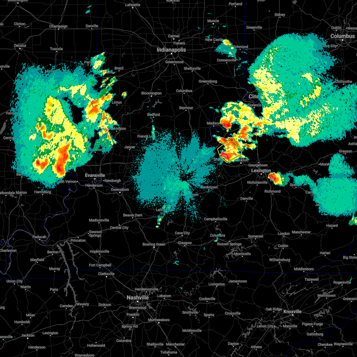
| 10/23/2020 6:45 PM EDT |
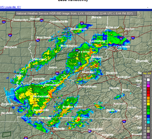 At 645 pm edt, a severe thunderstorm was located near new castle, moving northeast at 35 mph (radar indicated). Hazards include 60 mph wind gusts and quarter size hail. Hail damage to vehicles is expected. Expect wind damage to roofs, siding, and trees. At 645 pm edt, a severe thunderstorm was located near new castle, moving northeast at 35 mph (radar indicated). Hazards include 60 mph wind gusts and quarter size hail. Hail damage to vehicles is expected. Expect wind damage to roofs, siding, and trees.
|
| 10/23/2020 6:40 PM EDT | Tree down in new castle. time estimated from tsd in henry county KY, 0.2 miles NNE of New Castle, KY |
| 7/11/2020 8:31 PM EDT |
 At 830 pm edt, a severe thunderstorm was located over la grange, moving southeast at 45 mph (radar indicated). Hazards include 60 mph wind gusts and penny size hail. expect damage to roofs, siding, and trees At 830 pm edt, a severe thunderstorm was located over la grange, moving southeast at 45 mph (radar indicated). Hazards include 60 mph wind gusts and penny size hail. expect damage to roofs, siding, and trees
|
| 4/8/2020 10:56 PM EDT |
 At 1055 pm edt, severe thunderstorms were located along a line extending from 8 miles north of new castle to near la grange to 8 miles east of brandenburg, moving east at 50 mph (radar indicated). Hazards include 60 mph wind gusts. Expect damage to roofs, siding, and trees. locations impacted include, louisville, jeffersonville, jeffersontown, st. Matthews, shively, shepherdsville, lyndon, la grange, middletown and douglass hills. At 1055 pm edt, severe thunderstorms were located along a line extending from 8 miles north of new castle to near la grange to 8 miles east of brandenburg, moving east at 50 mph (radar indicated). Hazards include 60 mph wind gusts. Expect damage to roofs, siding, and trees. locations impacted include, louisville, jeffersonville, jeffersontown, st. Matthews, shively, shepherdsville, lyndon, la grange, middletown and douglass hills.
|
| 4/8/2020 10:28 PM EDT |
 At 1028 pm edt, severe thunderstorms were located along a line extending from 8 miles southwest of madison to 10 miles northwest of prospect to 8 miles south of carefree town, moving east at 50 mph (radar indicated). Hazards include 70 mph wind gusts. Expect considerable tree damage. Damage is likely to mobile homes, roofs, and outbuildings. At 1028 pm edt, severe thunderstorms were located along a line extending from 8 miles southwest of madison to 10 miles northwest of prospect to 8 miles south of carefree town, moving east at 50 mph (radar indicated). Hazards include 70 mph wind gusts. Expect considerable tree damage. Damage is likely to mobile homes, roofs, and outbuildings.
|
| 7/16/2019 9:28 PM EDT |
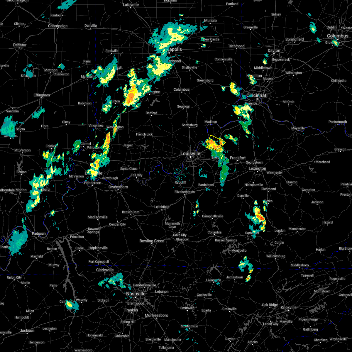 The severe thunderstorm warning for northeastern oldham, southwestern trimble and southwestern henry counties will expire at 930 pm edt, the storm which prompted the warning has weakened just below severe limits, and has exited the warned area. therefore, the warning will be allowed to expire. however gusty winds and heavy rain are still possible with this thunderstorm. report severe weather to local law enforcement, post your report to the national weather service louisville facebook page, or tweet your report using hashtag l, m, k, spotter. The severe thunderstorm warning for northeastern oldham, southwestern trimble and southwestern henry counties will expire at 930 pm edt, the storm which prompted the warning has weakened just below severe limits, and has exited the warned area. therefore, the warning will be allowed to expire. however gusty winds and heavy rain are still possible with this thunderstorm. report severe weather to local law enforcement, post your report to the national weather service louisville facebook page, or tweet your report using hashtag l, m, k, spotter.
|
| 7/16/2019 9:12 PM EDT |
 At 912 pm edt, a severe thunderstorm was located near centerfield, moving northeast at 40 mph (radar indicated). Hazards include 60 mph wind gusts. expect damage to roofs, siding, and trees At 912 pm edt, a severe thunderstorm was located near centerfield, moving northeast at 40 mph (radar indicated). Hazards include 60 mph wind gusts. expect damage to roofs, siding, and trees
|
| 6/23/2019 5:44 PM EDT |
 At 543 pm edt, severe thunderstorms were located along a line extending from 6 miles southwest of kentucky speedway to 7 miles northwest of frankfort to 11 miles southeast of shelbyville, moving east at 45 mph (radar indicated). Hazards include 60 mph wind gusts. Expect damage to roofs, siding, and trees. Locations impacted include, frankfort, shelbyville, new castle, eminence, pleasureville, campbellsburg, farmdale, harvieland, elmville and old christianburg. At 543 pm edt, severe thunderstorms were located along a line extending from 6 miles southwest of kentucky speedway to 7 miles northwest of frankfort to 11 miles southeast of shelbyville, moving east at 45 mph (radar indicated). Hazards include 60 mph wind gusts. Expect damage to roofs, siding, and trees. Locations impacted include, frankfort, shelbyville, new castle, eminence, pleasureville, campbellsburg, farmdale, harvieland, elmville and old christianburg.
|
| 6/23/2019 5:24 PM EDT |
 At 524 pm edt, severe thunderstorms were located along a line extending from near bedford to near shelbyville to taylorsville, moving east at 45 mph (radar indicated). Hazards include 60 mph wind gusts. expect damage to roofs, siding, and trees At 524 pm edt, severe thunderstorms were located along a line extending from near bedford to near shelbyville to taylorsville, moving east at 45 mph (radar indicated). Hazards include 60 mph wind gusts. expect damage to roofs, siding, and trees
|
| 6/23/2019 5:12 PM EDT |
 At 512 pm edt, severe thunderstorms were located along a line extending from near bedford to 6 miles west of shelbyville to 7 miles southeast of fern creek, moving east at 45 mph (radar indicated). Hazards include 60 mph wind gusts. Expect damage to roofs, siding, and trees. Locations impacted include, jeffersontown, shelbyville, la grange, middletown, douglass hills, anchorage, worthington hills, coldstream, new castle and taylorsville. At 512 pm edt, severe thunderstorms were located along a line extending from near bedford to 6 miles west of shelbyville to 7 miles southeast of fern creek, moving east at 45 mph (radar indicated). Hazards include 60 mph wind gusts. Expect damage to roofs, siding, and trees. Locations impacted include, jeffersontown, shelbyville, la grange, middletown, douglass hills, anchorage, worthington hills, coldstream, new castle and taylorsville.
|
| 6/23/2019 4:58 PM EDT |
 At 458 pm edt, severe thunderstorms were located along a line extending from 11 miles northwest of la grange to near jeffersontown to near pioneer village, moving east at 45 mph (radar indicated). Hazards include 60 mph wind gusts. expect damage to roofs, siding, and trees At 458 pm edt, severe thunderstorms were located along a line extending from 11 miles northwest of la grange to near jeffersontown to near pioneer village, moving east at 45 mph (radar indicated). Hazards include 60 mph wind gusts. expect damage to roofs, siding, and trees
|
| 6/16/2019 4:57 PM EDT |
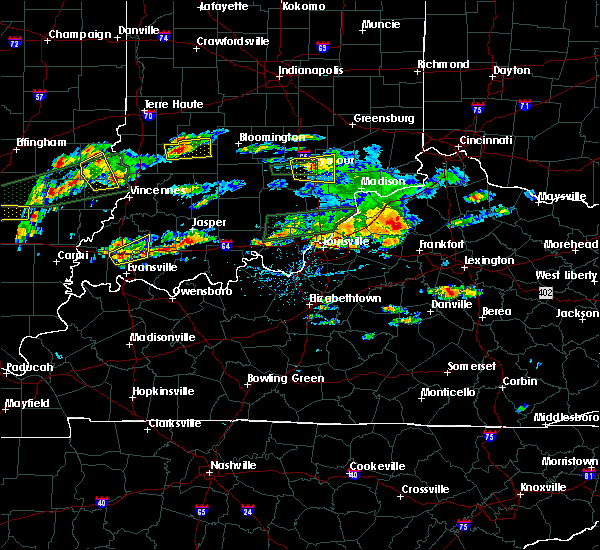 At 457 pm edt, a severe thunderstorm was located near new castle, moving northeast at 30 mph (radar indicated). Hazards include 60 mph wind gusts and half dollar size hail. Hail damage to vehicles is expected. Expect wind damage to roofs, siding, and trees. At 457 pm edt, a severe thunderstorm was located near new castle, moving northeast at 30 mph (radar indicated). Hazards include 60 mph wind gusts and half dollar size hail. Hail damage to vehicles is expected. Expect wind damage to roofs, siding, and trees.
|
| 5/23/2019 5:25 PM EDT |
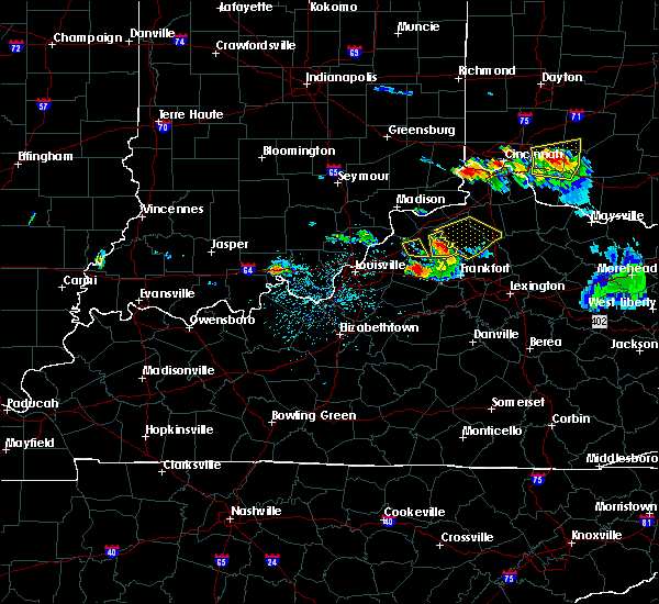 The severe thunderstorm warning for southwestern henry county will expire at 530 pm edt, the storm which prompted the warning has moved out of the area. therefore, the warning will be allowed to expire. however, a severe thunderstorm warning remains in effect for central and eastern henry county until 545 pm edt. The severe thunderstorm warning for southwestern henry county will expire at 530 pm edt, the storm which prompted the warning has moved out of the area. therefore, the warning will be allowed to expire. however, a severe thunderstorm warning remains in effect for central and eastern henry county until 545 pm edt.
|
| 5/23/2019 5:16 PM EDT |
 At 516 pm edt, a severe thunderstorm was located over new castle, moving east at 35 mph (radar indicated). Hazards include 60 mph wind gusts and quarter size hail. Hail damage to vehicles is expected. Expect wind damage to roofs, siding, and trees. At 516 pm edt, a severe thunderstorm was located over new castle, moving east at 35 mph (radar indicated). Hazards include 60 mph wind gusts and quarter size hail. Hail damage to vehicles is expected. Expect wind damage to roofs, siding, and trees.
|
| 5/23/2019 5:10 PM EDT |
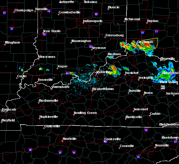 At 510 pm edt, a severe thunderstorm was located near la grange, moving east at 35 mph (radar indicated). Hazards include 60 mph wind gusts. Expect damage to roofs, siding, and trees. Locations impacted include, new castle, pendleton, eminence, smithfield, tarascon and bellview. At 510 pm edt, a severe thunderstorm was located near la grange, moving east at 35 mph (radar indicated). Hazards include 60 mph wind gusts. Expect damage to roofs, siding, and trees. Locations impacted include, new castle, pendleton, eminence, smithfield, tarascon and bellview.
|
| 5/23/2019 5:00 PM EDT |
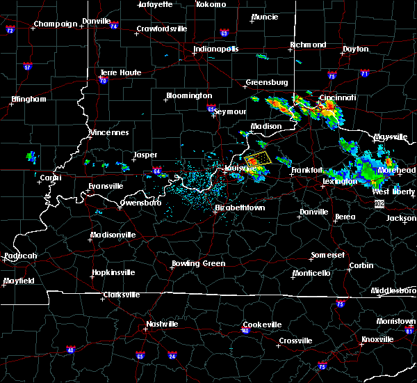 At 500 pm edt, a severe thunderstorm was located over la grange, moving east at 35 mph (radar indicated). Hazards include 60 mph wind gusts. expect damage to roofs, siding, and trees At 500 pm edt, a severe thunderstorm was located over la grange, moving east at 35 mph (radar indicated). Hazards include 60 mph wind gusts. expect damage to roofs, siding, and trees
|
| 4/25/2019 7:46 PM EDT |
 At 746 pm edt, a severe thunderstorm was located near new castle, moving northeast at 45 mph (radar indicated). Hazards include 60 mph wind gusts. expect damage to roofs, siding, and trees At 746 pm edt, a severe thunderstorm was located near new castle, moving northeast at 45 mph (radar indicated). Hazards include 60 mph wind gusts. expect damage to roofs, siding, and trees
|
| 4/25/2019 7:26 PM EDT |
 At 725 pm edt, severe thunderstorms were located along a line extending from near bedford to near la grange, moving northeast at 45 mph (radar indicated). Hazards include 60 mph wind gusts. Expect damage to roofs, siding, and trees. Locations impacted include, new castle, bedford, pendleton, campbellsburg, delville, sulphur, monitor, lacie, franklinton and sligo. At 725 pm edt, severe thunderstorms were located along a line extending from near bedford to near la grange, moving northeast at 45 mph (radar indicated). Hazards include 60 mph wind gusts. Expect damage to roofs, siding, and trees. Locations impacted include, new castle, bedford, pendleton, campbellsburg, delville, sulphur, monitor, lacie, franklinton and sligo.
|
| 4/25/2019 7:10 PM EDT |
 At 709 pm edt, severe thunderstorms were located along a line extending from 10 miles northwest of la grange to near coldstream, moving northeast at 45 mph (radar indicated). Hazards include 60 mph wind gusts. expect damage to roofs, siding, and trees At 709 pm edt, severe thunderstorms were located along a line extending from 10 miles northwest of la grange to near coldstream, moving northeast at 45 mph (radar indicated). Hazards include 60 mph wind gusts. expect damage to roofs, siding, and trees
|
| 3/14/2019 8:34 PM EDT |
 At 834 pm edt, a severe thunderstorm was located 7 miles east of new castle, moving northeast at 50 mph (radar indicated). Hazards include 60 mph wind gusts. expect damage to roofs, siding, and trees At 834 pm edt, a severe thunderstorm was located 7 miles east of new castle, moving northeast at 50 mph (radar indicated). Hazards include 60 mph wind gusts. expect damage to roofs, siding, and trees
|
| 3/14/2019 6:35 PM EDT |
 At 633 pm edt, a severe thunderstorm was located over new castle, moving northeast at 70 mph. another severe thunderstorm was near port royal, moving northeast at 65 mph (public). Hazards include ping pong ball size hail and 60 mph wind gusts. People and animals outdoors will be injured. expect hail damage to roofs, siding, windows, and vehicles. expect wind damage to roofs, siding, and trees. Locations impacted include, new castle, campbellsburg, smithfield, port royal, drennon springs, lacie, delville, and franklinton. At 633 pm edt, a severe thunderstorm was located over new castle, moving northeast at 70 mph. another severe thunderstorm was near port royal, moving northeast at 65 mph (public). Hazards include ping pong ball size hail and 60 mph wind gusts. People and animals outdoors will be injured. expect hail damage to roofs, siding, windows, and vehicles. expect wind damage to roofs, siding, and trees. Locations impacted include, new castle, campbellsburg, smithfield, port royal, drennon springs, lacie, delville, and franklinton.
|
| 3/14/2019 6:29 PM EDT |
 At 628 pm edt, a severe thunderstorm was located near la grange, moving northeast at 70 mph. another severe thunderstorm was between new castle and port royal moving northeast at 65 mph (radar indicated). Hazards include 60 mph wind gusts and half dollar size hail. Hail damage to vehicles is expected. Expect wind damage to roofs, siding, and trees. At 628 pm edt, a severe thunderstorm was located near la grange, moving northeast at 70 mph. another severe thunderstorm was between new castle and port royal moving northeast at 65 mph (radar indicated). Hazards include 60 mph wind gusts and half dollar size hail. Hail damage to vehicles is expected. Expect wind damage to roofs, siding, and trees.
|
| 3/14/2019 6:22 PM EDT |
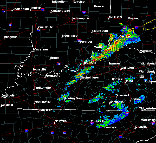 At 621 pm edt, a severe thunderstorm was located near new castle, moving northeast at 60 mph. another severe thunderstorm was located near centerfield moving northeast at 60 mph (radar indicated). Hazards include 60 mph wind gusts and half dollar size hail. Hail damage to vehicles is expected. expect wind damage to roofs, siding, and trees. Locations impacted include, la grange, new castle, pendleton, crestwood, eminence, campbellsburg, smithfield, and gratz. At 621 pm edt, a severe thunderstorm was located near new castle, moving northeast at 60 mph. another severe thunderstorm was located near centerfield moving northeast at 60 mph (radar indicated). Hazards include 60 mph wind gusts and half dollar size hail. Hail damage to vehicles is expected. expect wind damage to roofs, siding, and trees. Locations impacted include, la grange, new castle, pendleton, crestwood, eminence, campbellsburg, smithfield, and gratz.
|
| 3/14/2019 6:06 PM EDT |
 At 606 pm edt, a severe thunderstorm was located over coldstream, moving northeast at 60 mph (radar indicated). Hazards include 60 mph wind gusts and half dollar size hail. Hail damage to vehicles is expected. Expect wind damage to roofs, siding, and trees. At 606 pm edt, a severe thunderstorm was located over coldstream, moving northeast at 60 mph (radar indicated). Hazards include 60 mph wind gusts and half dollar size hail. Hail damage to vehicles is expected. Expect wind damage to roofs, siding, and trees.
|
| 7/20/2018 9:46 PM EDT |
 At 946 pm edt, severe thunderstorms were located along a line extending from near coldstream to near shelbyville, moving east at 45 mph (radar indicated). Hazards include 60 mph wind gusts and quarter size hail. Hail damage to vehicles is expected. Expect wind damage to roofs, siding, and trees. At 946 pm edt, severe thunderstorms were located along a line extending from near coldstream to near shelbyville, moving east at 45 mph (radar indicated). Hazards include 60 mph wind gusts and quarter size hail. Hail damage to vehicles is expected. Expect wind damage to roofs, siding, and trees.
|
| 6/26/2018 2:21 PM EDT |
 At 220 pm edt, severe thunderstorms were located along a line extending from 6 miles south of kentucky speedway to 8 miles northwest of frankfort to near lawrenceburg, moving east at 45 mph (radar indicated). Hazards include 70 mph wind gusts. Expect considerable tree damage. damage is likely to mobile homes, roofs, and outbuildings. Locations impacted include, frankfort, lawrenceburg, new castle, pleasureville, glensboro, farmdale, harvieland, old christianburg, bridgeport and hatton. At 220 pm edt, severe thunderstorms were located along a line extending from 6 miles south of kentucky speedway to 8 miles northwest of frankfort to near lawrenceburg, moving east at 45 mph (radar indicated). Hazards include 70 mph wind gusts. Expect considerable tree damage. damage is likely to mobile homes, roofs, and outbuildings. Locations impacted include, frankfort, lawrenceburg, new castle, pleasureville, glensboro, farmdale, harvieland, old christianburg, bridgeport and hatton.
|
| 6/26/2018 2:10 PM EDT | Multiple trees reported down at lagrange rd new castle... k in henry county KY, 1.3 miles ESE of New Castle, KY |
| 6/26/2018 1:58 PM EDT |
 The national weather service in louisville has issued a * severe thunderstorm warning for. eastern spencer county in central kentucky. shelby county in central kentucky. northern anderson county in central kentucky. Southeastern trimble county in central kentucky. The national weather service in louisville has issued a * severe thunderstorm warning for. eastern spencer county in central kentucky. shelby county in central kentucky. northern anderson county in central kentucky. Southeastern trimble county in central kentucky.
|
| 5/31/2018 2:55 PM EDT |
 At 252 pm edt, severe thunderstorms were located along a line extending from near bedford to 8 miles east of coldstream, moving northeast at 55 mph (radar indicated). Hazards include 70 mph wind gusts. Expect considerable tree damage. Damage is likely to mobile homes, roofs, and outbuildings. At 252 pm edt, severe thunderstorms were located along a line extending from near bedford to 8 miles east of coldstream, moving northeast at 55 mph (radar indicated). Hazards include 70 mph wind gusts. Expect considerable tree damage. Damage is likely to mobile homes, roofs, and outbuildings.
|
| 4/3/2018 8:21 PM EDT |
 At 820 pm edt, a severe thunderstorm was located near bedford, moving northeast at 65 mph (radar indicated). Hazards include 60 mph wind gusts and penny size hail. expect damage to roofs, siding, and trees At 820 pm edt, a severe thunderstorm was located near bedford, moving northeast at 65 mph (radar indicated). Hazards include 60 mph wind gusts and penny size hail. expect damage to roofs, siding, and trees
|
| 2/24/2018 7:18 PM EST |
 At 718 pm est, a severe thunderstorm was located near new castle, moving northeast at 55 mph (radar indicated). Hazards include 60 mph wind gusts. Expect damage to roofs, siding, and trees. Locations impacted include, new castle, eminence, pleasureville, smithfield, north pleasureville, bethlehem and bellview. At 718 pm est, a severe thunderstorm was located near new castle, moving northeast at 55 mph (radar indicated). Hazards include 60 mph wind gusts. Expect damage to roofs, siding, and trees. Locations impacted include, new castle, eminence, pleasureville, smithfield, north pleasureville, bethlehem and bellview.
|
| 2/24/2018 7:08 PM EST |
 At 707 pm est, a severe thunderstorm was located near new castle, moving northeast at 55 mph (radar indicated). Hazards include 60 mph wind gusts. Expect damage to roofs, siding, and trees. Locations impacted include, new castle, eminence, pleasureville, smithfield, chestnut grove, north pleasureville, defoe, cropper, bethlehem and ballardsville. At 707 pm est, a severe thunderstorm was located near new castle, moving northeast at 55 mph (radar indicated). Hazards include 60 mph wind gusts. Expect damage to roofs, siding, and trees. Locations impacted include, new castle, eminence, pleasureville, smithfield, chestnut grove, north pleasureville, defoe, cropper, bethlehem and ballardsville.
|
| 2/24/2018 7:01 PM EST |
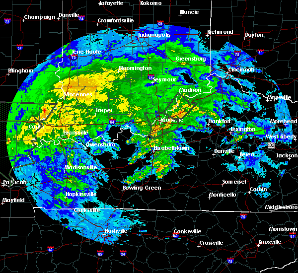 At 700 pm est, a severe thunderstorm was located 7 miles south of la grange, moving northeast at 55 mph (radar indicated). Hazards include 60 mph wind gusts. expect damage to roofs, siding, and trees At 700 pm est, a severe thunderstorm was located 7 miles south of la grange, moving northeast at 55 mph (radar indicated). Hazards include 60 mph wind gusts. expect damage to roofs, siding, and trees
|
| 7/21/2017 6:28 PM EDT |
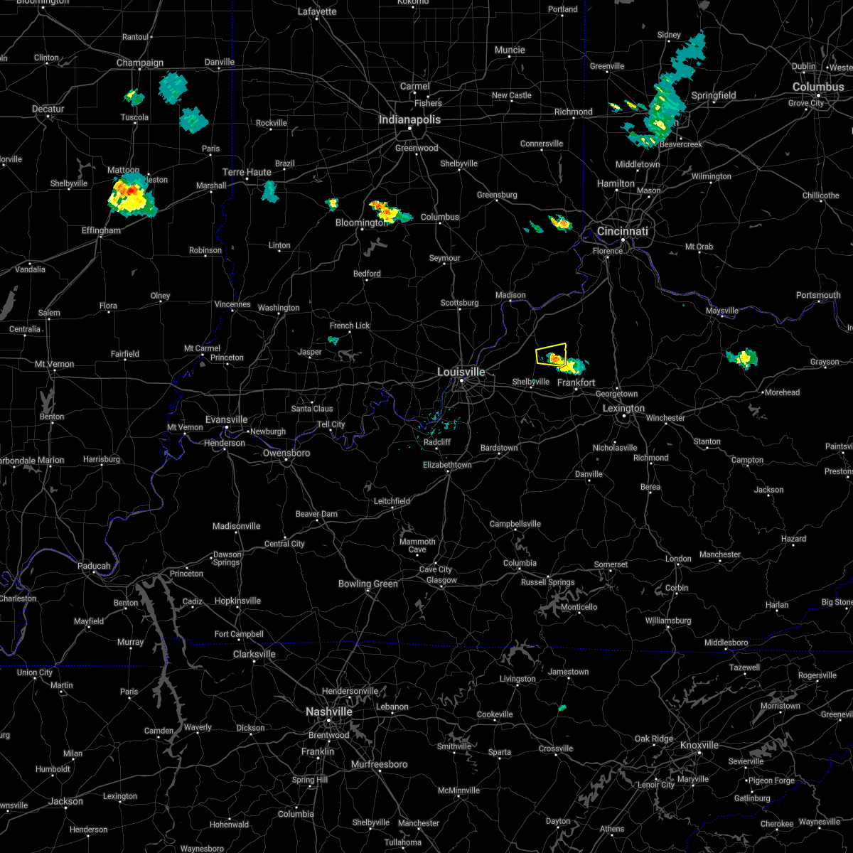 The severe thunderstorm warning for southeastern henry county will expire at 630 pm edt, the storm which prompted the warning has weakened below severe limits, and no longer poses an immediate threat to life or property. therefore the warning will be allowed to expire. however gusty winds and heavy rain are still possible with this thunderstorm. report severe weather to local law enforcement, post your report to the national weather service louisville facebook page, or tweet your report using hashtag l, m, k, spotter. The severe thunderstorm warning for southeastern henry county will expire at 630 pm edt, the storm which prompted the warning has weakened below severe limits, and no longer poses an immediate threat to life or property. therefore the warning will be allowed to expire. however gusty winds and heavy rain are still possible with this thunderstorm. report severe weather to local law enforcement, post your report to the national weather service louisville facebook page, or tweet your report using hashtag l, m, k, spotter.
|
| 7/21/2017 6:19 PM EDT |
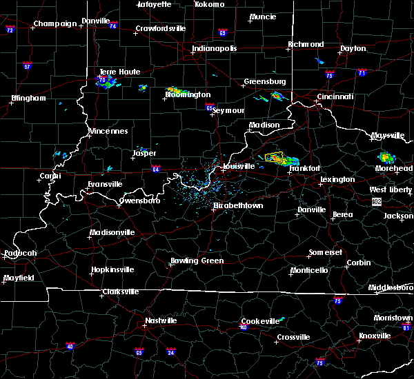 At 619 pm edt, a severe thunderstorm was located near new castle, and is nearly stationary (radar indicated). Hazards include 60 mph wind gusts and penny size hail. Expect damage to roofs, siding, and trees. Locations impacted include, new castle, eminence, pleasureville, gratz, north pleasureville, bethlehem, slabtown, lockport, franklinton and bellview. At 619 pm edt, a severe thunderstorm was located near new castle, and is nearly stationary (radar indicated). Hazards include 60 mph wind gusts and penny size hail. Expect damage to roofs, siding, and trees. Locations impacted include, new castle, eminence, pleasureville, gratz, north pleasureville, bethlehem, slabtown, lockport, franklinton and bellview.
|
| 7/21/2017 5:56 PM EDT |
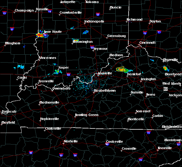 At 556 pm edt, a severe thunderstorm was located near new castle, moving east at 10 mph (radar indicated). Hazards include 60 mph wind gusts and penny size hail. expect damage to roofs, siding, and trees At 556 pm edt, a severe thunderstorm was located near new castle, moving east at 10 mph (radar indicated). Hazards include 60 mph wind gusts and penny size hail. expect damage to roofs, siding, and trees
|
| 5/27/2017 8:38 PM EDT |
 The severe thunderstorm warning for northeastern clark, northeastern oldham, trimble and northwestern henry counties will expire at 845 pm edt, the storm which prompted the warning has weakened below severe limits, and no longer poses an immediate threat to life or property. therefore the warning will be allowed to expire. however heavy rain is still possible with this thunderstorm. a severe thunderstorm watch remains in effect until 1000 pm edt for south central indiana, and central kentucky. report severe weather to local law enforcement, post your report to the national weather service louisville facebook page, or tweet your report using hashtag l, m, k, spotter. The severe thunderstorm warning for northeastern clark, northeastern oldham, trimble and northwestern henry counties will expire at 845 pm edt, the storm which prompted the warning has weakened below severe limits, and no longer poses an immediate threat to life or property. therefore the warning will be allowed to expire. however heavy rain is still possible with this thunderstorm. a severe thunderstorm watch remains in effect until 1000 pm edt for south central indiana, and central kentucky. report severe weather to local law enforcement, post your report to the national weather service louisville facebook page, or tweet your report using hashtag l, m, k, spotter.
|
| 5/27/2017 8:38 PM EDT |
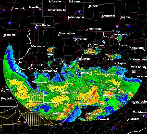 The severe thunderstorm warning for northeastern clark, northeastern oldham, trimble and northwestern henry counties will expire at 845 pm edt, the storm which prompted the warning has weakened below severe limits, and no longer poses an immediate threat to life or property. therefore the warning will be allowed to expire. however heavy rain is still possible with this thunderstorm. a severe thunderstorm watch remains in effect until 1000 pm edt for south central indiana, and central kentucky. report severe weather to local law enforcement, post your report to the national weather service louisville facebook page, or tweet your report using hashtag l, m, k, spotter. The severe thunderstorm warning for northeastern clark, northeastern oldham, trimble and northwestern henry counties will expire at 845 pm edt, the storm which prompted the warning has weakened below severe limits, and no longer poses an immediate threat to life or property. therefore the warning will be allowed to expire. however heavy rain is still possible with this thunderstorm. a severe thunderstorm watch remains in effect until 1000 pm edt for south central indiana, and central kentucky. report severe weather to local law enforcement, post your report to the national weather service louisville facebook page, or tweet your report using hashtag l, m, k, spotter.
|
| 5/27/2017 8:26 PM EDT |
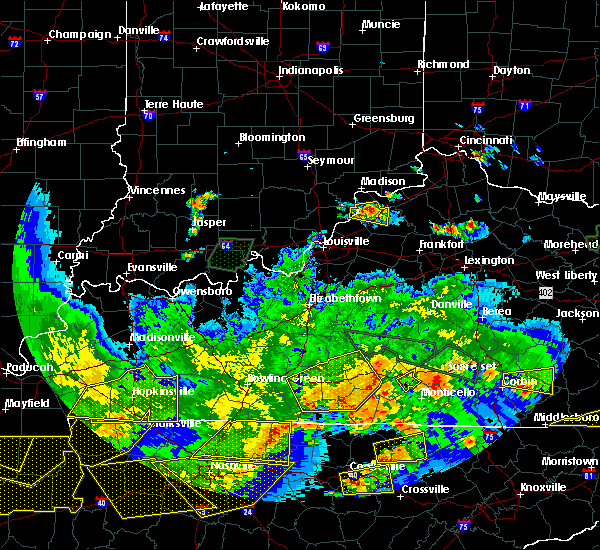 At 826 pm edt, a severe thunderstorm was located near bedford, moving east at 30 mph (radar indicated). Hazards include 60 mph wind gusts and quarter size hail. Hail damage to vehicles is expected. expect wind damage to roofs, siding, and trees. Locations impacted include, new castle, bedford, pendleton, campbellsburg, bethlehem, oldham, otto, sligo, wises landing and turners station. At 826 pm edt, a severe thunderstorm was located near bedford, moving east at 30 mph (radar indicated). Hazards include 60 mph wind gusts and quarter size hail. Hail damage to vehicles is expected. expect wind damage to roofs, siding, and trees. Locations impacted include, new castle, bedford, pendleton, campbellsburg, bethlehem, oldham, otto, sligo, wises landing and turners station.
|
| 5/27/2017 8:15 PM EDT |
 At 815 pm edt, a severe thunderstorm was located near bedford, moving east at 30 mph (radar indicated). Hazards include 60 mph wind gusts and half dollar size hail. Hail damage to vehicles is expected. Expect wind damage to roofs, siding, and trees. At 815 pm edt, a severe thunderstorm was located near bedford, moving east at 30 mph (radar indicated). Hazards include 60 mph wind gusts and half dollar size hail. Hail damage to vehicles is expected. Expect wind damage to roofs, siding, and trees.
|
| 5/27/2017 8:15 PM EDT |
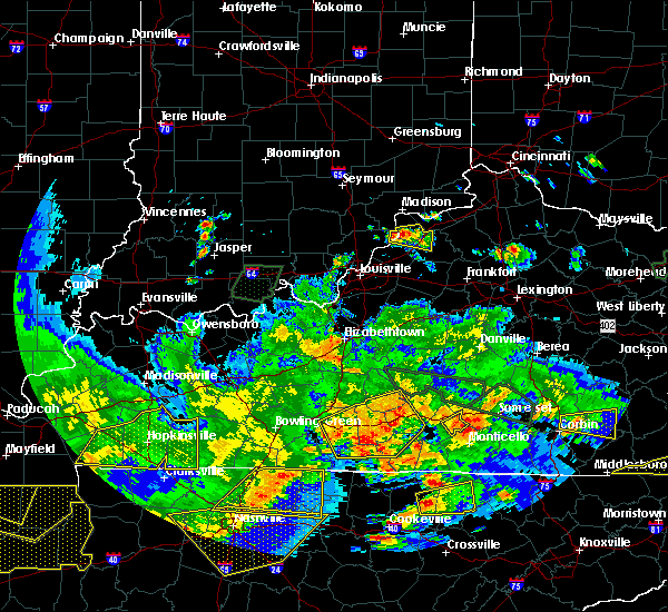 At 815 pm edt, a severe thunderstorm was located near bedford, moving east at 30 mph (radar indicated). Hazards include 60 mph wind gusts and half dollar size hail. Hail damage to vehicles is expected. Expect wind damage to roofs, siding, and trees. At 815 pm edt, a severe thunderstorm was located near bedford, moving east at 30 mph (radar indicated). Hazards include 60 mph wind gusts and half dollar size hail. Hail damage to vehicles is expected. Expect wind damage to roofs, siding, and trees.
|
| 5/19/2017 5:57 PM EDT |
 At 556 pm edt, a severe thunderstorm was located over new castle, moving northeast at 25 mph (radar indicated). Hazards include 60 mph wind gusts and quarter size hail. Hail damage to vehicles is expected. expect wind damage to roofs, siding, and trees. Locations impacted include, new castle, eminence, pleasureville, campbellsburg, smithfield, lacie, delville, bethlehem, tarascon and north pleasureville. At 556 pm edt, a severe thunderstorm was located over new castle, moving northeast at 25 mph (radar indicated). Hazards include 60 mph wind gusts and quarter size hail. Hail damage to vehicles is expected. expect wind damage to roofs, siding, and trees. Locations impacted include, new castle, eminence, pleasureville, campbellsburg, smithfield, lacie, delville, bethlehem, tarascon and north pleasureville.
|
| 5/19/2017 5:39 PM EDT |
 At 539 pm edt, a severe thunderstorm was located near la grange, moving northeast at 30 mph (radar indicated). Hazards include 60 mph wind gusts and quarter size hail. Hail damage to vehicles is expected. Expect wind damage to roofs, siding, and trees. At 539 pm edt, a severe thunderstorm was located near la grange, moving northeast at 30 mph (radar indicated). Hazards include 60 mph wind gusts and quarter size hail. Hail damage to vehicles is expected. Expect wind damage to roofs, siding, and trees.
|
| 4/29/2017 12:42 AM EDT |
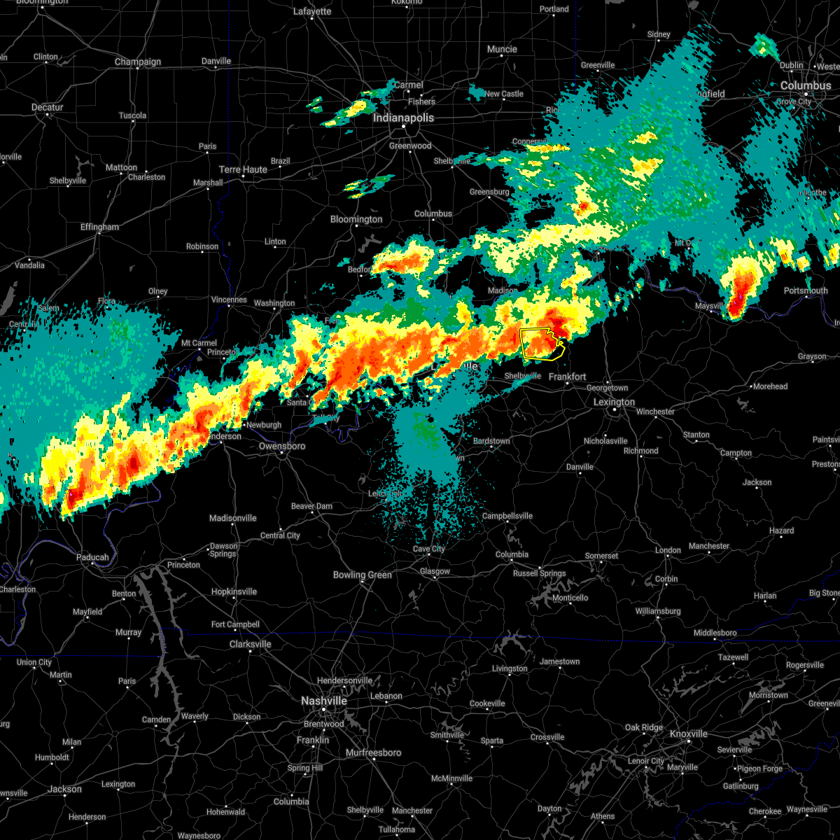 The severe thunderstorm warning for henry county will expire at 1245 am edt, the storm which prompted the warning has moved out of the area. therefore the warning will be allowed to expire. however small hail and torrential rain will continue across the area for the next several hours. a tornado watch remains in effect until 200 am edt for central kentucky. report severe weather to local law enforcement, post your report to the national weather service louisville facebook page, or tweet your report using hashtag l, m, k, spotter. The severe thunderstorm warning for henry county will expire at 1245 am edt, the storm which prompted the warning has moved out of the area. therefore the warning will be allowed to expire. however small hail and torrential rain will continue across the area for the next several hours. a tornado watch remains in effect until 200 am edt for central kentucky. report severe weather to local law enforcement, post your report to the national weather service louisville facebook page, or tweet your report using hashtag l, m, k, spotter.
|
| 4/29/2017 12:33 AM EDT |
 At 1233 am edt, a severe thunderstorm was located near new castle, moving east at 40 mph (radar indicated). Hazards include 60 mph wind gusts and half dollar size hail. Hail damage to vehicles is expected. expect wind damage to roofs, siding, and trees. locations impacted include, new castle, eminence, pleasureville, campbellsburg, gratz, north pleasureville, drennon springs, delville, bethlehem and slabtown. A tornado watch remains in effect until 200 am edt for central kentucky. At 1233 am edt, a severe thunderstorm was located near new castle, moving east at 40 mph (radar indicated). Hazards include 60 mph wind gusts and half dollar size hail. Hail damage to vehicles is expected. expect wind damage to roofs, siding, and trees. locations impacted include, new castle, eminence, pleasureville, campbellsburg, gratz, north pleasureville, drennon springs, delville, bethlehem and slabtown. A tornado watch remains in effect until 200 am edt for central kentucky.
|
| 4/29/2017 12:25 AM EDT |
 At 1224 am edt, a severe thunderstorm was located over new castle, moving east at 35 mph (radar indicated). Hazards include 60 mph wind gusts and quarter size hail. Hail damage to vehicles is expected. expect wind damage to roofs, siding, and trees. locations impacted include, new castle, eminence, pleasureville, campbellsburg, smithfield, gratz, north pleasureville, drennon springs, delville and bethlehem. A tornado watch remains in effect until 200 am edt for central kentucky. At 1224 am edt, a severe thunderstorm was located over new castle, moving east at 35 mph (radar indicated). Hazards include 60 mph wind gusts and quarter size hail. Hail damage to vehicles is expected. expect wind damage to roofs, siding, and trees. locations impacted include, new castle, eminence, pleasureville, campbellsburg, smithfield, gratz, north pleasureville, drennon springs, delville and bethlehem. A tornado watch remains in effect until 200 am edt for central kentucky.
|
| 4/29/2017 12:16 AM EDT |
 At 1215 am edt, a severe thunderstorm was located near la grange, moving east at 40 mph (radar indicated). Hazards include 60 mph wind gusts and quarter size hail. Hail damage to vehicles is expected. Expect wind damage to roofs, siding, and trees. At 1215 am edt, a severe thunderstorm was located near la grange, moving east at 40 mph (radar indicated). Hazards include 60 mph wind gusts and quarter size hail. Hail damage to vehicles is expected. Expect wind damage to roofs, siding, and trees.
|
| 4/5/2017 5:36 PM EDT |
 At 535 pm edt, severe thunderstorms were located along a line extending from near campbellsburg to 6 miles west of owenton, moving north at 30 mph (radar indicated). Hazards include 60 mph wind gusts and quarter size hail. Hail damage to vehicles is expected. expect wind damage to roofs, siding, and trees. locations impacted include, new castle, eminence, campbellsburg, smithfield, port royal, drennon springs, delville, bethlehem, slabtown and sulphur. A tornado watch remains in effect until 1000 pm edt for central kentucky. At 535 pm edt, severe thunderstorms were located along a line extending from near campbellsburg to 6 miles west of owenton, moving north at 30 mph (radar indicated). Hazards include 60 mph wind gusts and quarter size hail. Hail damage to vehicles is expected. expect wind damage to roofs, siding, and trees. locations impacted include, new castle, eminence, campbellsburg, smithfield, port royal, drennon springs, delville, bethlehem, slabtown and sulphur. A tornado watch remains in effect until 1000 pm edt for central kentucky.
|
| 4/5/2017 5:19 PM EDT |
 The national weather service in louisville has issued a * severe thunderstorm warning for. northeastern oldham county in central kentucky. southern trimble county in central kentucky. henry county in central kentucky. Until 545 pm edt. The national weather service in louisville has issued a * severe thunderstorm warning for. northeastern oldham county in central kentucky. southern trimble county in central kentucky. henry county in central kentucky. Until 545 pm edt.
|
| 3/1/2017 6:22 AM EST |
 At 621 am est, severe thunderstorms were located along a line extending from 8 miles north of brooksburg to 7 miles southwest of brandenburg, moving east at 55 mph (radar indicated). Hazards include 60 mph wind gusts. expect damage to roofs, siding, and trees At 621 am est, severe thunderstorms were located along a line extending from 8 miles north of brooksburg to 7 miles southwest of brandenburg, moving east at 55 mph (radar indicated). Hazards include 60 mph wind gusts. expect damage to roofs, siding, and trees
|
| 3/1/2017 3:10 AM EST |
 At 310 am est, severe thunderstorms were located along a line extending from near la grange to near shelbyville to 6 miles southwest of taylorsville, moving east at 70 mph (radar indicated). Hazards include 60 mph wind gusts. expect damage to roofs, siding, and trees At 310 am est, severe thunderstorms were located along a line extending from near la grange to near shelbyville to 6 miles southwest of taylorsville, moving east at 70 mph (radar indicated). Hazards include 60 mph wind gusts. expect damage to roofs, siding, and trees
|
| 2/24/2017 8:27 PM EST |
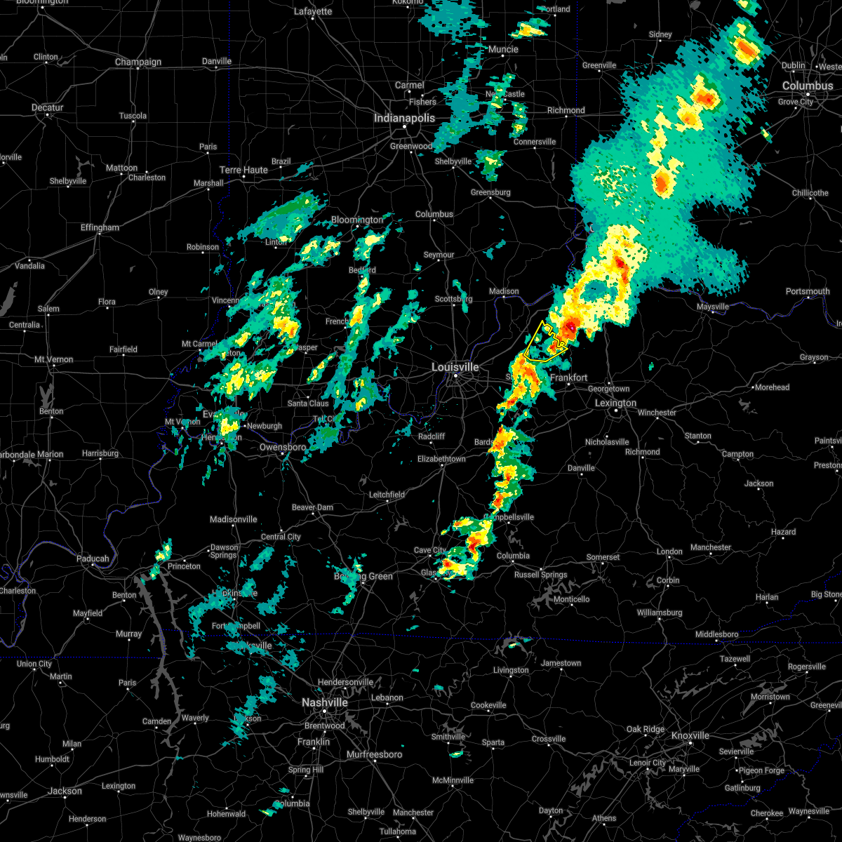 The severe thunderstorm warning for central henry county will expire at 830 pm est, the storm which prompted the warning has moved out of the area. therefore the warning will be allowed to expire. a severe thunderstorm watch remains in effect until 200 am est for central kentucky. report severe weather to local law enforcement, post your report to the national weather service louisville facebook page, or tweet your report using hashtag l, m, k, spotter. The severe thunderstorm warning for central henry county will expire at 830 pm est, the storm which prompted the warning has moved out of the area. therefore the warning will be allowed to expire. a severe thunderstorm watch remains in effect until 200 am est for central kentucky. report severe weather to local law enforcement, post your report to the national weather service louisville facebook page, or tweet your report using hashtag l, m, k, spotter.
|
| 2/24/2017 8:06 PM EST |
 At 805 pm est, a severe thunderstorm was located near new castle, moving northeast at 55 mph (radar indicated). Hazards include 60 mph wind gusts and quarter size hail. Hail damage to vehicles is expected. Expect wind damage to roofs, siding, and trees. At 805 pm est, a severe thunderstorm was located near new castle, moving northeast at 55 mph (radar indicated). Hazards include 60 mph wind gusts and quarter size hail. Hail damage to vehicles is expected. Expect wind damage to roofs, siding, and trees.
|
| 5/11/2016 10:10 PM EDT | The severe thunderstorm warning for henry. northeastern oldham. north central shelby and southern trimble counties will expire at 1015 pm edt. the storms which prompted the warning have weakened below severe limits. and exited the warned area. Therefore the warning will be allowed to expire. |
| 5/11/2016 9:43 PM EDT |
 At 942 pm edt, severe thunderstorms were located along a line extending from bedford to 7 miles north of new castle to 6 miles north of shelbyville, moving northeast at 25 mph (radar indicated. at 933 pm trees were reported down in bedford). Hazards include 60 mph wind gusts and quarter size hail. Hail damage to vehicles is expected. Expect wind damage to roofs, siding, and trees. At 942 pm edt, severe thunderstorms were located along a line extending from bedford to 7 miles north of new castle to 6 miles north of shelbyville, moving northeast at 25 mph (radar indicated. at 933 pm trees were reported down in bedford). Hazards include 60 mph wind gusts and quarter size hail. Hail damage to vehicles is expected. Expect wind damage to roofs, siding, and trees.
|
| 5/11/2016 9:39 PM EDT |
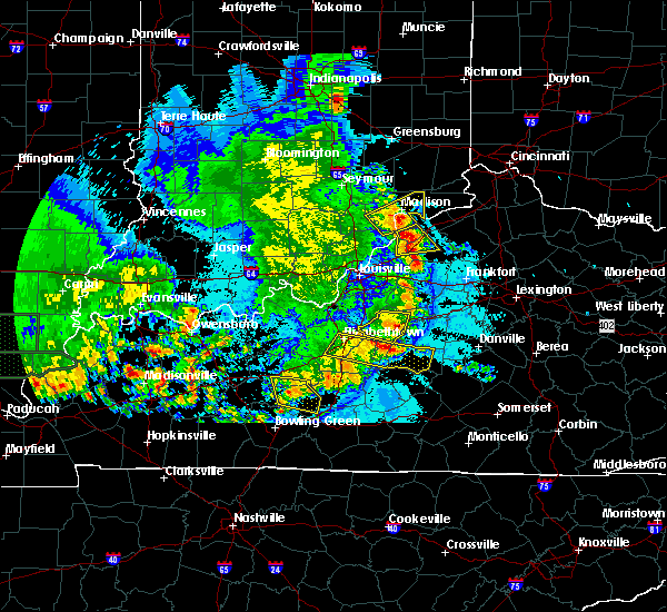 At 939 pm edt, a severe thunderstorm was located near new castle, moving east at 45 mph (radar indicated). Hazards include 60 mph wind gusts and quarter size hail. Hail damage to vehicles is expected. expect wind damage to roofs, siding, and trees. Locations impacted include, la grange, new castle, bedford, pendleton, campbellsburg, sulphur, wises landing, tarascon, sligo and russell corner. At 939 pm edt, a severe thunderstorm was located near new castle, moving east at 45 mph (radar indicated). Hazards include 60 mph wind gusts and quarter size hail. Hail damage to vehicles is expected. expect wind damage to roofs, siding, and trees. Locations impacted include, la grange, new castle, bedford, pendleton, campbellsburg, sulphur, wises landing, tarascon, sligo and russell corner.
|
| 5/11/2016 9:16 PM EDT |
 At 916 pm edt, a severe thunderstorm was located near la grange, moving east at 45 mph (radar indicated). Hazards include 60 mph wind gusts and quarter size hail. Hail damage to vehicles is expected. Expect wind damage to roofs, siding, and trees. At 916 pm edt, a severe thunderstorm was located near la grange, moving east at 45 mph (radar indicated). Hazards include 60 mph wind gusts and quarter size hail. Hail damage to vehicles is expected. Expect wind damage to roofs, siding, and trees.
|
| 5/11/2016 8:14 PM EDT |
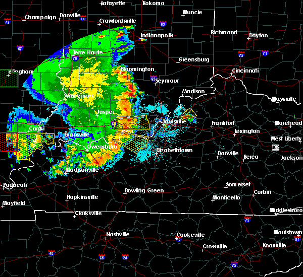 At 814 pm edt, a severe thunderstorm was located near la grange, moving northeast at 15 mph (radar indicated). Hazards include 60 mph wind gusts and quarter size hail. Hail damage to vehicles is expected. expect wind damage to roofs, siding, and trees. Locations impacted include, la grange, new castle, pendleton, eminence, smithfield, sulphur, ballardsville, centerfield, tarascon and liro. At 814 pm edt, a severe thunderstorm was located near la grange, moving northeast at 15 mph (radar indicated). Hazards include 60 mph wind gusts and quarter size hail. Hail damage to vehicles is expected. expect wind damage to roofs, siding, and trees. Locations impacted include, la grange, new castle, pendleton, eminence, smithfield, sulphur, ballardsville, centerfield, tarascon and liro.
|
| 5/11/2016 8:01 PM EDT |
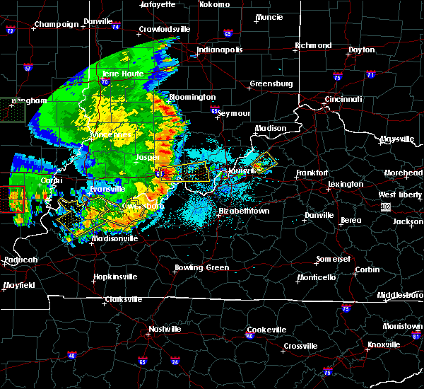 At 800 pm edt, a severe thunderstorm was located near la grange, moving northeast at 20 mph (radar indicated). Hazards include 60 mph wind gusts and quarter size hail. Hail damage to vehicles is expected. Expect wind damage to roofs, siding, and trees. At 800 pm edt, a severe thunderstorm was located near la grange, moving northeast at 20 mph (radar indicated). Hazards include 60 mph wind gusts and quarter size hail. Hail damage to vehicles is expected. Expect wind damage to roofs, siding, and trees.
|
| 5/1/2016 3:54 PM EDT |
 At 352 pm edt, a severe thunderstorm was located over new castle, moving east at 35 mph (radar indicated). Hazards include ping pong ball size hail and 60 mph wind gusts. Expect hail damage to roofs. siding. windows. and vehicles. expect wind damage to roofs, siding, and trees. Locations impacted include, new castle, eminence, pleasureville, smithfield, orville, gest, franklinton, fallis, bellview and bethlehem. At 352 pm edt, a severe thunderstorm was located over new castle, moving east at 35 mph (radar indicated). Hazards include ping pong ball size hail and 60 mph wind gusts. Expect hail damage to roofs. siding. windows. and vehicles. expect wind damage to roofs, siding, and trees. Locations impacted include, new castle, eminence, pleasureville, smithfield, orville, gest, franklinton, fallis, bellview and bethlehem.
|
| 5/1/2016 3:34 PM EDT |
 At 333 pm edt, a severe thunderstorm was located over la grange, moving east at 35 mph (radar indicated). Hazards include ping pong ball size hail. Expect damage to roofs. siding. windows. And vehicles. At 333 pm edt, a severe thunderstorm was located over la grange, moving east at 35 mph (radar indicated). Hazards include ping pong ball size hail. Expect damage to roofs. siding. windows. And vehicles.
|
| 5/1/2016 3:32 PM EDT |
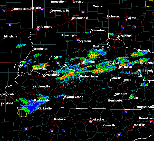 At 329 pm edt, a severe thunderstorm was located near la grange, moving east at 35 mph. this storm has been consistently producing at least quarter size hail over clark county over the past 30 minutes (radar indicated). Hazards include half dollar size hail. Damage to vehicles is expected. Locations impacted include, la grange, new castle, pendleton, campbellsburg, bethlehem, sulphur, oldham, greenhaven, sligo and russell corner. At 329 pm edt, a severe thunderstorm was located near la grange, moving east at 35 mph. this storm has been consistently producing at least quarter size hail over clark county over the past 30 minutes (radar indicated). Hazards include half dollar size hail. Damage to vehicles is expected. Locations impacted include, la grange, new castle, pendleton, campbellsburg, bethlehem, sulphur, oldham, greenhaven, sligo and russell corner.
|
| 5/1/2016 3:21 PM EDT |
 At 320 pm edt, a severe thunderstorm was located 9 miles north of prospect, moving east at 30 mph. quarter size hail was observed in charlestown indiana at 314 pm by a weather spotter (radar indicated). Hazards include half dollar size hail. Damage to vehicles is expected. Locations impacted include, la grange, new castle, pendleton, owen, campbellsburg, bethlehem, hibernia, sulphur, vesta and greenhaven. At 320 pm edt, a severe thunderstorm was located 9 miles north of prospect, moving east at 30 mph. quarter size hail was observed in charlestown indiana at 314 pm by a weather spotter (radar indicated). Hazards include half dollar size hail. Damage to vehicles is expected. Locations impacted include, la grange, new castle, pendleton, owen, campbellsburg, bethlehem, hibernia, sulphur, vesta and greenhaven.
|
| 5/1/2016 3:09 PM EDT |
 At 309 pm edt, a severe thunderstorm was located 8 miles north of prospect, moving east at 30 mph (radar indicated). Hazards include half dollar size hail. damage to vehicles is expected At 309 pm edt, a severe thunderstorm was located 8 miles north of prospect, moving east at 30 mph (radar indicated). Hazards include half dollar size hail. damage to vehicles is expected
|
| 4/26/2016 9:54 PM EDT |
 At 954 pm edt, severe thunderstorms were located along a line extending from 7 miles northeast of new castle to 13 miles northwest of frankfort to 9 miles southeast of shelbyville, moving east at 55 mph (trained weather spotters). Hazards include 60 mph wind gusts and quarter size hail. Hail damage to vehicles is expected. expect wind damage to roofs, siding, and trees. Locations impacted include, shelbyville, new castle, eminence, pleasureville, elmburg, hatton, chestnut grove, franklinton, fallis and peytona. At 954 pm edt, severe thunderstorms were located along a line extending from 7 miles northeast of new castle to 13 miles northwest of frankfort to 9 miles southeast of shelbyville, moving east at 55 mph (trained weather spotters). Hazards include 60 mph wind gusts and quarter size hail. Hail damage to vehicles is expected. expect wind damage to roofs, siding, and trees. Locations impacted include, shelbyville, new castle, eminence, pleasureville, elmburg, hatton, chestnut grove, franklinton, fallis and peytona.
|
| 4/26/2016 9:47 PM EDT |
 At 946 pm edt, severe thunderstorms were located along a line extending from near new castle to 14 miles southeast of la grange to 7 miles south of shelbyville, moving east at 55 mph. a private weather station measured a 61 mph gust at 936 pm in ballardsville (trained weather spotters). Hazards include 60 mph wind gusts and quarter size hail. Hail damage to vehicles is expected. expect wind damage to roofs, siding, and trees. Locations impacted include, shelbyville, la grange, new castle, pendleton, crestwood, eminence, simpsonville, pewee valley, pleasureville and smithfield. At 946 pm edt, severe thunderstorms were located along a line extending from near new castle to 14 miles southeast of la grange to 7 miles south of shelbyville, moving east at 55 mph. a private weather station measured a 61 mph gust at 936 pm in ballardsville (trained weather spotters). Hazards include 60 mph wind gusts and quarter size hail. Hail damage to vehicles is expected. expect wind damage to roofs, siding, and trees. Locations impacted include, shelbyville, la grange, new castle, pendleton, crestwood, eminence, simpsonville, pewee valley, pleasureville and smithfield.
|
| 4/26/2016 9:28 PM EDT |
 At 927 pm edt, severe thunderstorms were located along a line extending from near la grange to 8 miles northwest of shelbyville to near taylorsville, moving east at 55 mph. there have been reports of power outages and trees down in goshen and lagrange (trained weather spotters). Hazards include 60 mph wind gusts and quarter size hail. Hail damage to vehicles is expected. Expect wind damage to roofs, siding, and trees. At 927 pm edt, severe thunderstorms were located along a line extending from near la grange to 8 miles northwest of shelbyville to near taylorsville, moving east at 55 mph. there have been reports of power outages and trees down in goshen and lagrange (trained weather spotters). Hazards include 60 mph wind gusts and quarter size hail. Hail damage to vehicles is expected. Expect wind damage to roofs, siding, and trees.
|
| 3/31/2016 5:06 PM EDT |
 At 506 pm edt, a severe thunderstorm was located 8 miles east of new castle, moving east at 55 mph (radar indicated). Hazards include 60 mph wind gusts. Expect damage to roofs. siding. and trees. Locations impacted include, new castle, eminence, pleasureville, elmburg, defoe, orville, gest, franklinton, old christianburg and fallis. At 506 pm edt, a severe thunderstorm was located 8 miles east of new castle, moving east at 55 mph (radar indicated). Hazards include 60 mph wind gusts. Expect damage to roofs. siding. and trees. Locations impacted include, new castle, eminence, pleasureville, elmburg, defoe, orville, gest, franklinton, old christianburg and fallis.
|
| 3/31/2016 4:46 PM EDT |
 At 446 pm edt, a severe thunderstorm was located 7 miles south of la grange, moving east at 55 mph (radar indicated). Hazards include 60 mph wind gusts. Expect damage to roofs. siding. And trees. At 446 pm edt, a severe thunderstorm was located 7 miles south of la grange, moving east at 55 mph (radar indicated). Hazards include 60 mph wind gusts. Expect damage to roofs. siding. And trees.
|
| 12/23/2015 7:32 PM EST | At 732 pm est, a severe thunderstorm was located near new castle, moving northeast at 55 mph (radar indicated). Hazards include 60 mph wind gusts and quarter size hail. Hail damage to vehicles is expected. expect wind damage to roofs, siding and trees. locations impacted include, la grange, new castle, bedford, pendleton, crestwood, eminence, pleasureville, campbellsburg, smithfield, chestnut grove, sulphur, lacie, gest, tarascon, franklinton, fallis, bethlehem, lockport, north pleasureville and centerfield. A tornado watch remains in effect until 900 pm est for central kentucky. |
| 12/23/2015 7:05 PM EST | At 705 pm est, a severe thunderstorm was located over worthington hills, moving northeast at 55 mph (radar indicated). Hazards include 60 mph wind gusts and quarter size hail. Hail damage to vehicles is expected. Expect wind damage to roofs, siding and trees. |
| 12/23/2015 7:05 PM EST | At 705 pm est, a severe thunderstorm was located over worthington hills, moving northeast at 55 mph (radar indicated). Hazards include 60 mph wind gusts and quarter size hail. Hail damage to vehicles is expected. Expect wind damage to roofs, siding and trees. |
| 7/17/2015 11:06 PM EDT | At 1104 pm edt, a severe thunderstorm was located 7 miles east of shelbyville, and moving southeast at 45 mph (radar indicated). Hazards include 60 mph wind gusts. Expect damage to roofs. siding and trees. Locations impacted include, frankfort, flag fork, waddy, hatton, polsgrove, ottusville, graefenburg, bryant, benson, harvieland, bridgeport, kennebec, broadville manor, capital city airport, indian hills and elsinore. |
| 7/17/2015 10:45 PM EDT |
 At 1043 pm edt, a severe thunderstorm was located 8 miles south of la grange, and moving southeast at 45 mph (radar indicated). Hazards include 60 mph wind gusts. Expect damage to roofs. Siding and trees. At 1043 pm edt, a severe thunderstorm was located 8 miles south of la grange, and moving southeast at 45 mph (radar indicated). Hazards include 60 mph wind gusts. Expect damage to roofs. Siding and trees.
|
| 7/14/2015 4:20 AM EDT |
 At 418 am edt, a severe thunderstorm was located 6 miles north of la grange, and moving southeast at 50 mph (radar indicated). Hazards include 60 mph wind gusts. Expect damage to roofs. Siding and trees. At 418 am edt, a severe thunderstorm was located 6 miles north of la grange, and moving southeast at 50 mph (radar indicated). Hazards include 60 mph wind gusts. Expect damage to roofs. Siding and trees.
|
| 7/14/2015 1:45 AM EDT | Trees reported dow in henry county KY, 0.2 miles NNE of New Castle, KY |
| 7/13/2015 2:13 PM EDT |
 At 212 pm edt, severe thunderstorms were located along a line extending from 7 miles east of bedford to 6 miles northwest of prospect to 8 miles south of salem, and moving southeast at 40 mph (radar indicated). Hazards include 60 mph wind gusts. Expect damage to roofs. Siding and trees. At 212 pm edt, severe thunderstorms were located along a line extending from 7 miles east of bedford to 6 miles northwest of prospect to 8 miles south of salem, and moving southeast at 40 mph (radar indicated). Hazards include 60 mph wind gusts. Expect damage to roofs. Siding and trees.
|
| 7/13/2015 1:39 PM EDT |
 At 137 pm edt, severe thunderstorms were located along a line extending from 11 miles north of vevay to scottsburg to 12 miles southwest of brownstown, and moving southeast at 45 mph (radar indicated). Hazards include 70 mph wind gusts. Expect considerable tree damage. Damage is likely to mobile homes, roofs and outbuildings. At 137 pm edt, severe thunderstorms were located along a line extending from 11 miles north of vevay to scottsburg to 12 miles southwest of brownstown, and moving southeast at 45 mph (radar indicated). Hazards include 70 mph wind gusts. Expect considerable tree damage. Damage is likely to mobile homes, roofs and outbuildings.
|
| 6/26/2015 6:26 PM EDT | At 624 pm edt, a severe thunderstorm was located 11 miles southeast of new castle, and moving northeast at 40 mph. this is a very dangerous storm (radar indicated). Hazards include 80 mph wind gusts. Flying debris will be dangerous to those caught without shelter. mobile homes will be heavily damaged. expect considerable damage to roofs, windows and vehicles. Extensive tree damage and power outages are likely. |
| 6/26/2015 6:00 PM EDT | At 558 pm edt, a severe thunderstorm was located 7 miles southwest of shelbyville, and moving northeast at 40 mph. this has a history of producing damaging winds (radar indicated). Hazards include 70 mph wind gusts. Expect considerable tree damage. Damage is likely to mobile homes, roofs and outbuildings. |
| 5/11/2015 7:00 PM EDT | Tree dow in henry county KY, 0.2 miles NNE of New Castle, KY |
| 5/11/2015 6:58 PM EDT | At 656 pm edt, a severe thunderstorm was located near new castle, and moving northeast at 35 mph (radar indicated). Hazards include 60 mph wind gusts and penny size hail. Expect damage to roofs. siding and trees. locations impacted include, campbellsburg, providence, bethlehem, turners station, delville, lacie, franklinton, slabtown, drennon springs, port royal, lockport and fallis. 0. 75in. |
| 5/11/2015 6:52 PM EDT | At 652 pm edt, a severe thunderstorm was located near new castle, and moving northeast at 35 mph (radar indicated). Hazards include 60 mph wind gusts. Expect damage to roofs. Siding and trees. |
| 4/10/2015 3:38 AM EDT | The national weather service in louisville has issued a * severe thunderstorm warning for. northwestern franklin county in east central kentucky. southeastern henry county in north central kentucky. northeastern shelby county in north central kentucky. Until 410 am edt. |
| 4/8/2015 7:36 PM EDT | The severe thunderstorm warning for southern henry. northern shelby and southeastern oldham counties will expire at 740 pm edt/640 pm cdt/. the storm which prompted the warning has weakened below severe limits. and no longer poses an immediate threat to life or property. however. Small hail is still possible with this thunderstorm. |
| 4/8/2015 7:08 PM EDT | The national weather service in louisville has issued a * severe thunderstorm warning for. southern henry county in north central kentucky. southeastern oldham county in north central kentucky. northern shelby county in north central kentucky. Until 740 pm edt. |
| 4/7/2015 5:06 PM EDT | A severe thunderstorm warning remains in effect for henry county until 530 pm edt. at 505 pm edt. a severe thunderstorm was located near new castle. and moving east at 30 mph. hazard. 60 mph wind gusts and quarter size hail. source. Radar indicated. |
| 4/7/2015 4:58 PM EDT | The national weather service in louisville has issued a * severe thunderstorm warning for. henry county in north central kentucky. eastern oldham county in north central kentucky. southeastern trimble county in north central kentucky. Until 530 pm edt. |
| 6/18/2013 7:45 PM EDT | Large tree down near the intersection of highway 146 and sulphur road. time estimated from rada in henry county KY, 0.7 miles ENE of New Castle, KY |
| 6/18/2013 7:41 PM EDT | A few trees down on herndon lane... orem rd and lagrange r in henry county KY, 0.9 miles N of New Castle, KY |
| 1/1/0001 12:00 AM | Quarter sized hail reported 1.9 miles S of New Castle, KY |
| 1/1/0001 12:00 AM | Trees down countywid in henry county KY, 0.2 miles NNE of New Castle, KY |
Hail Maps for New Castle, KY
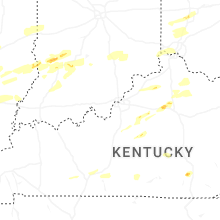


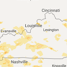


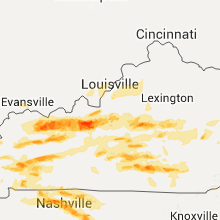


Connect with Interactive Hail Maps