

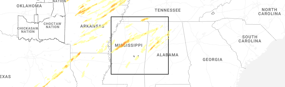
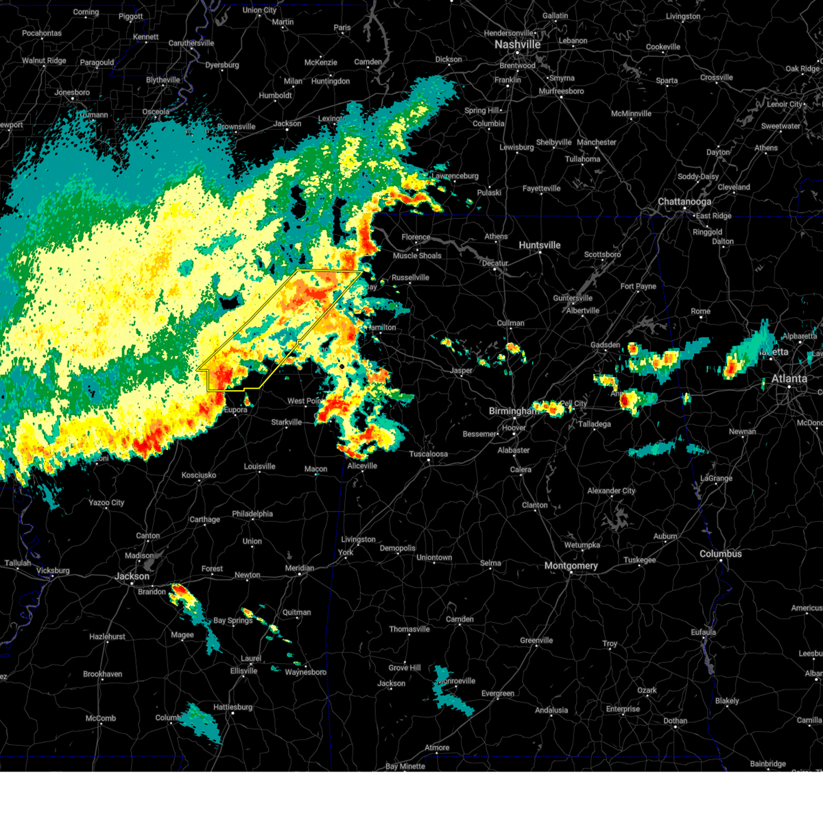
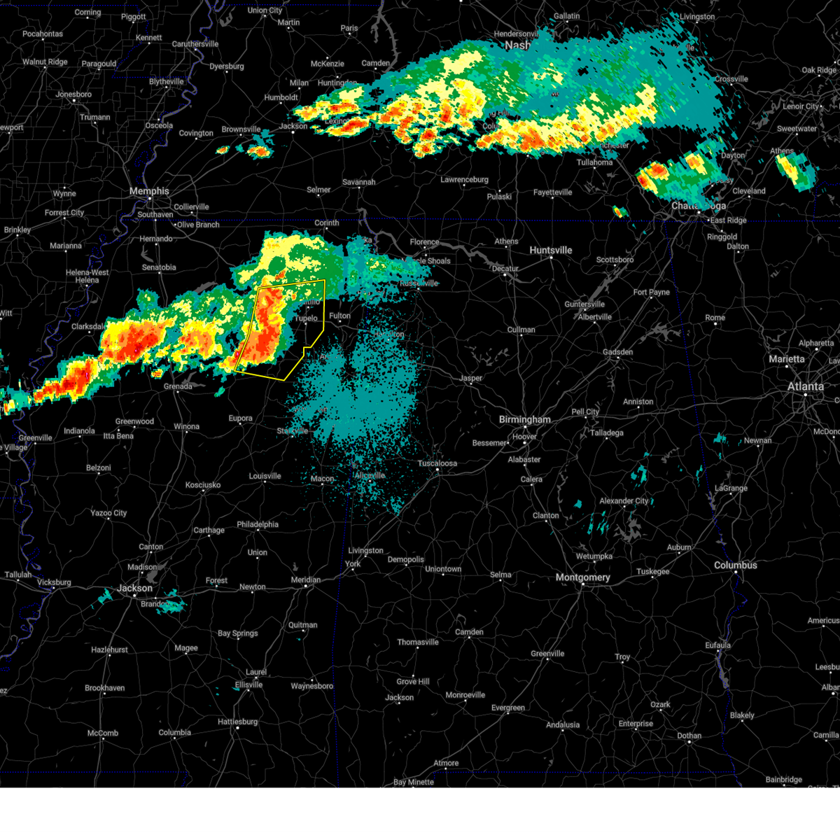
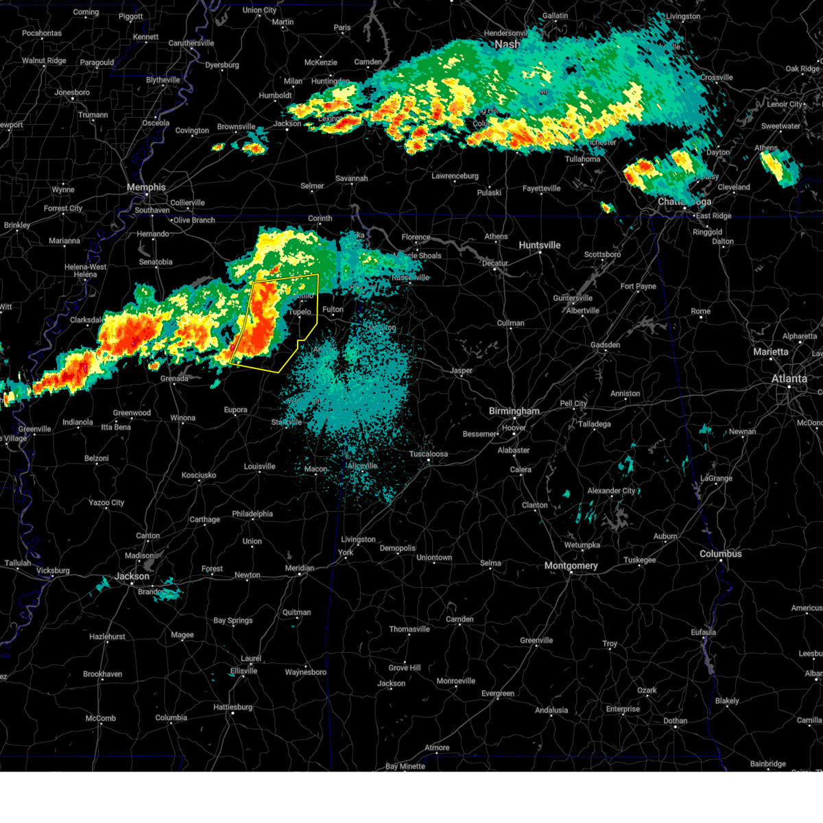
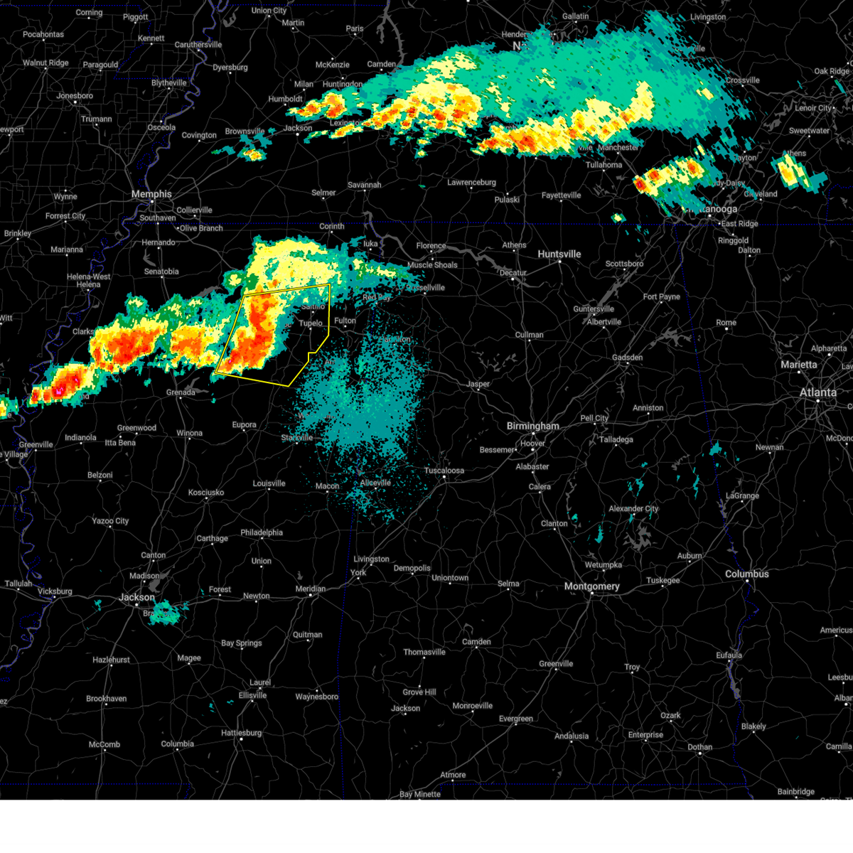
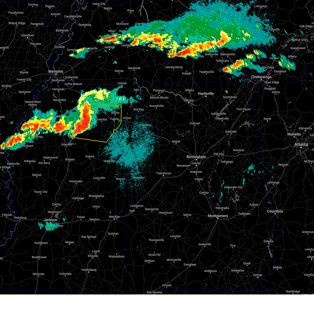
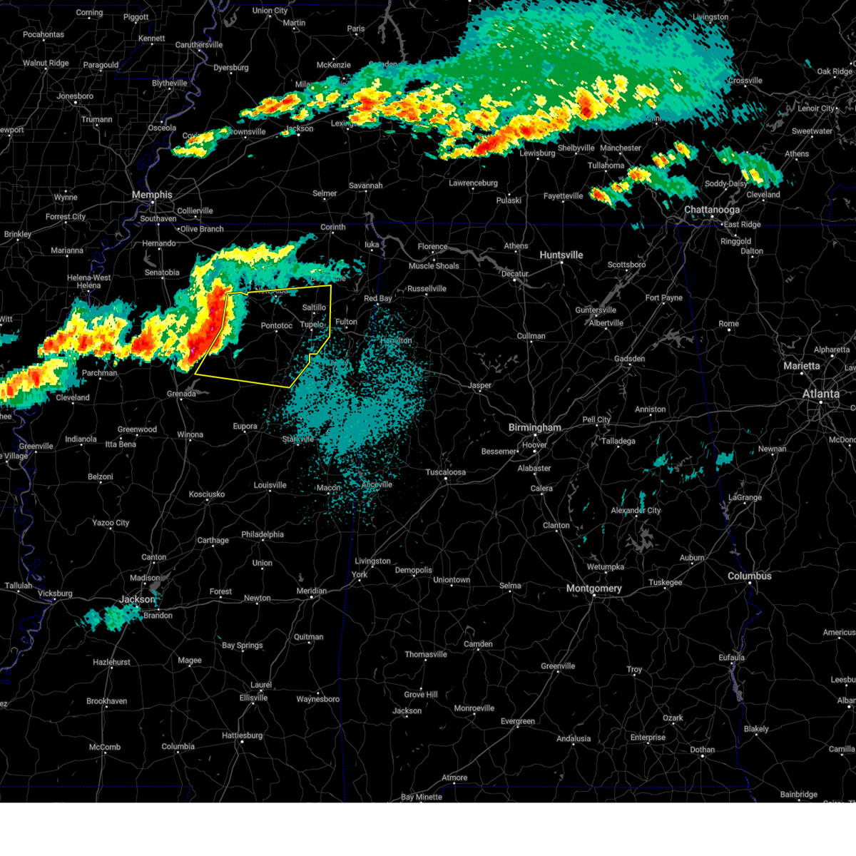
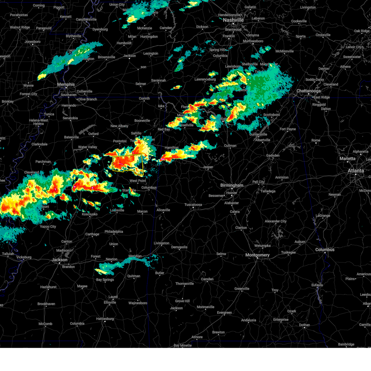
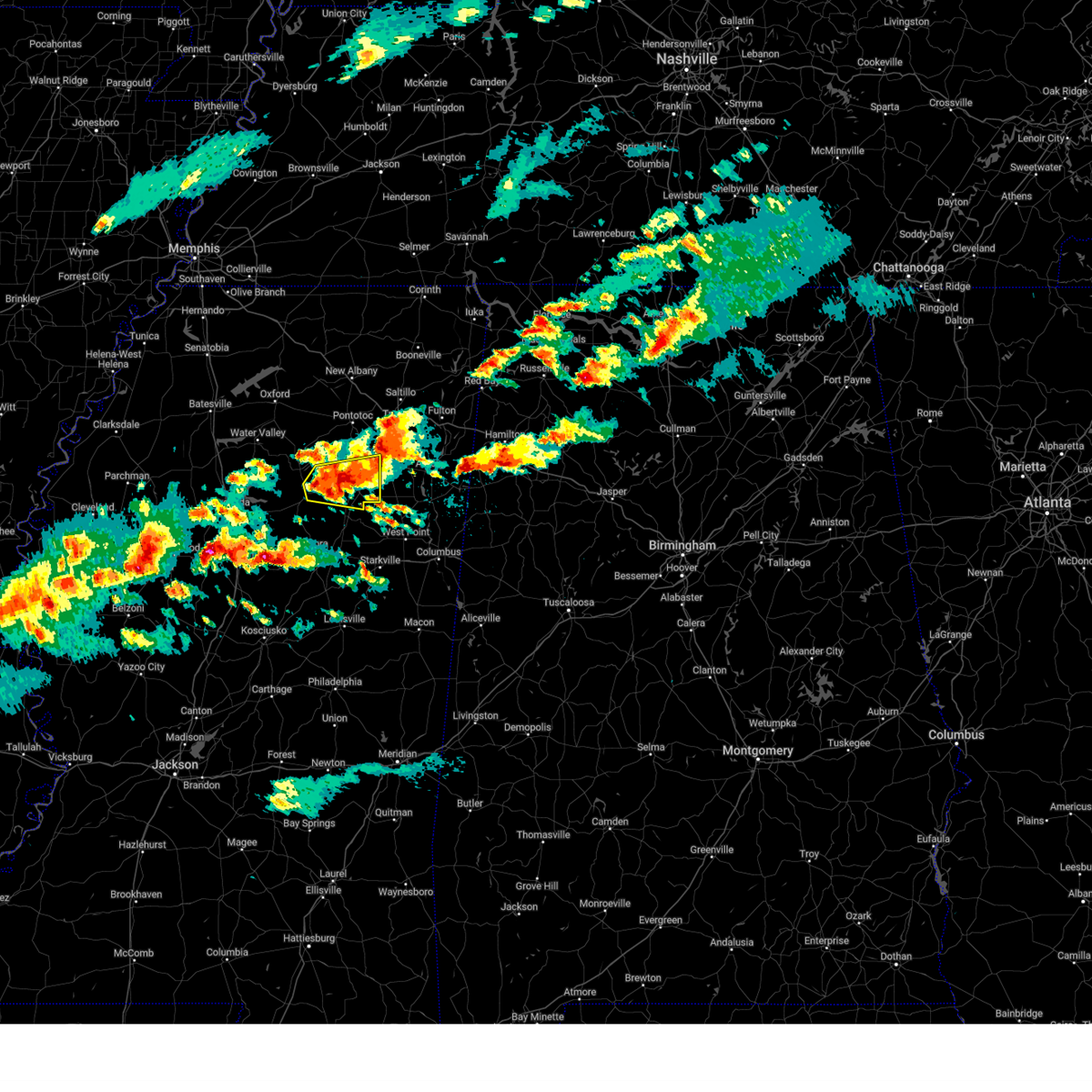
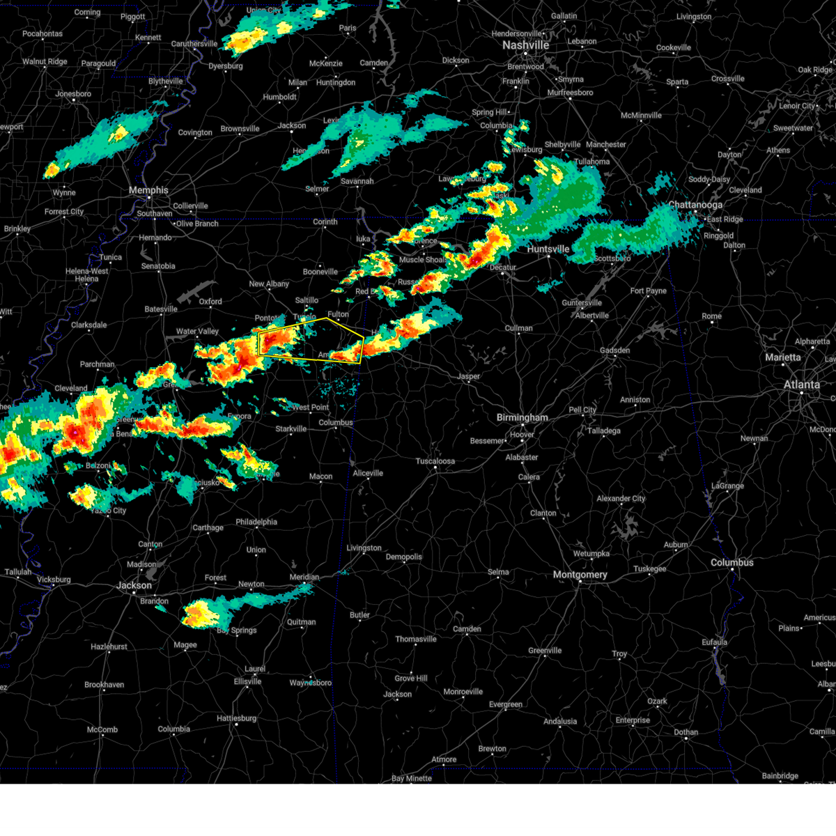
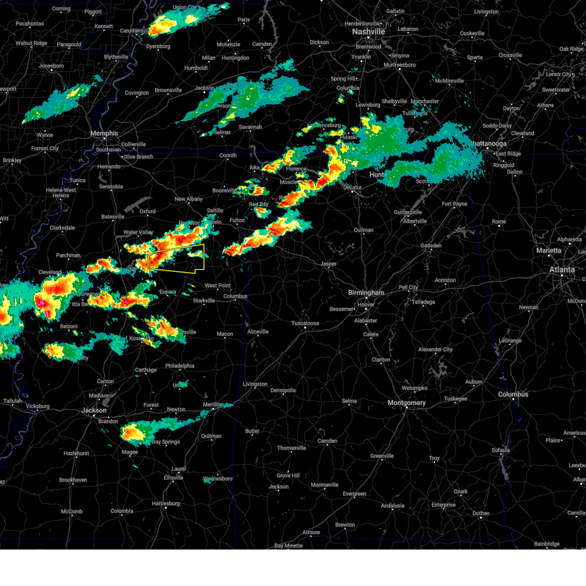
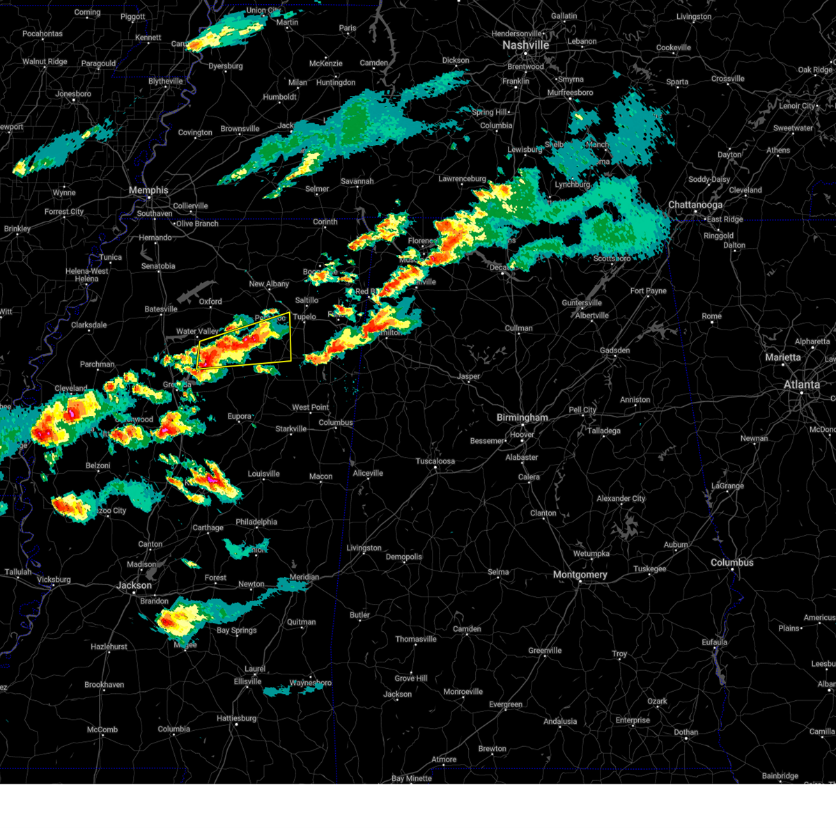
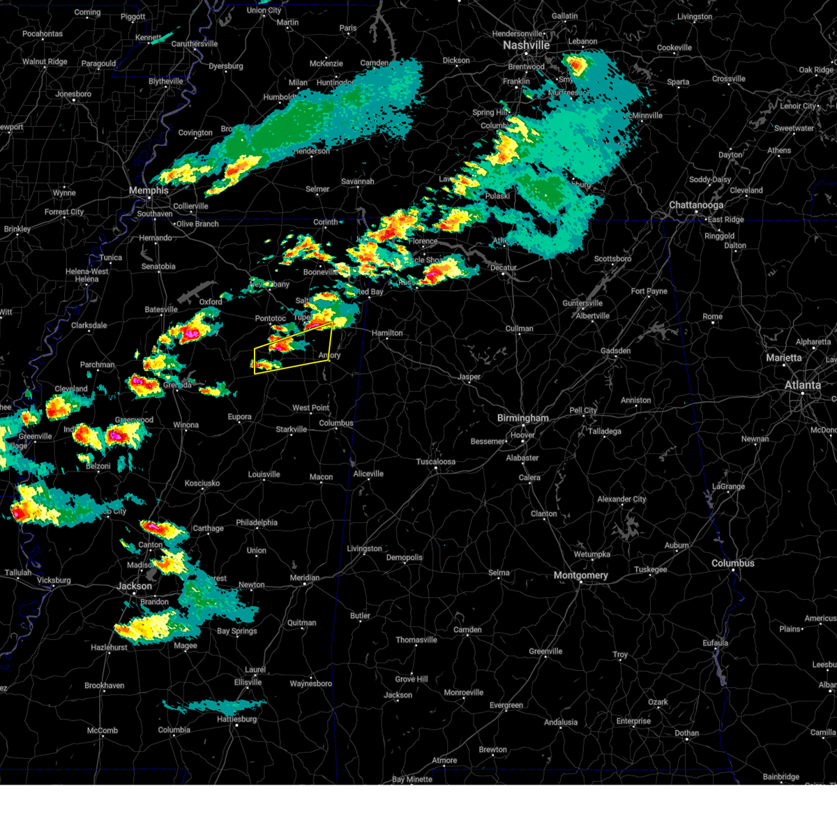
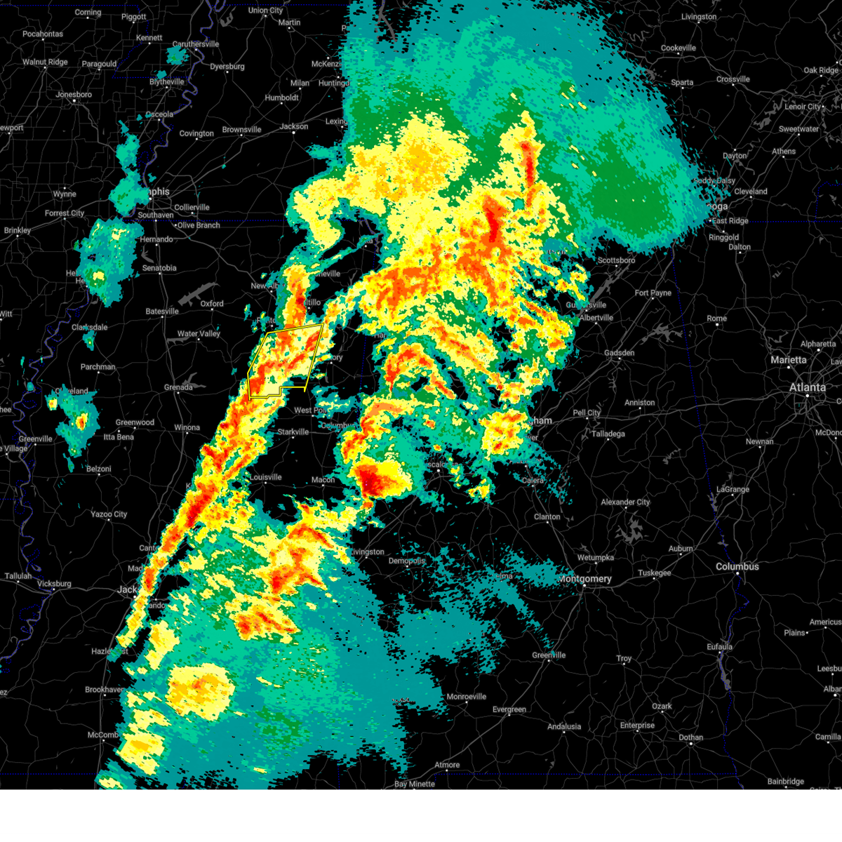
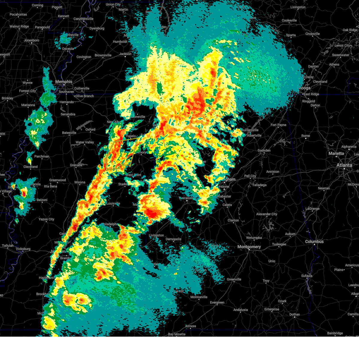
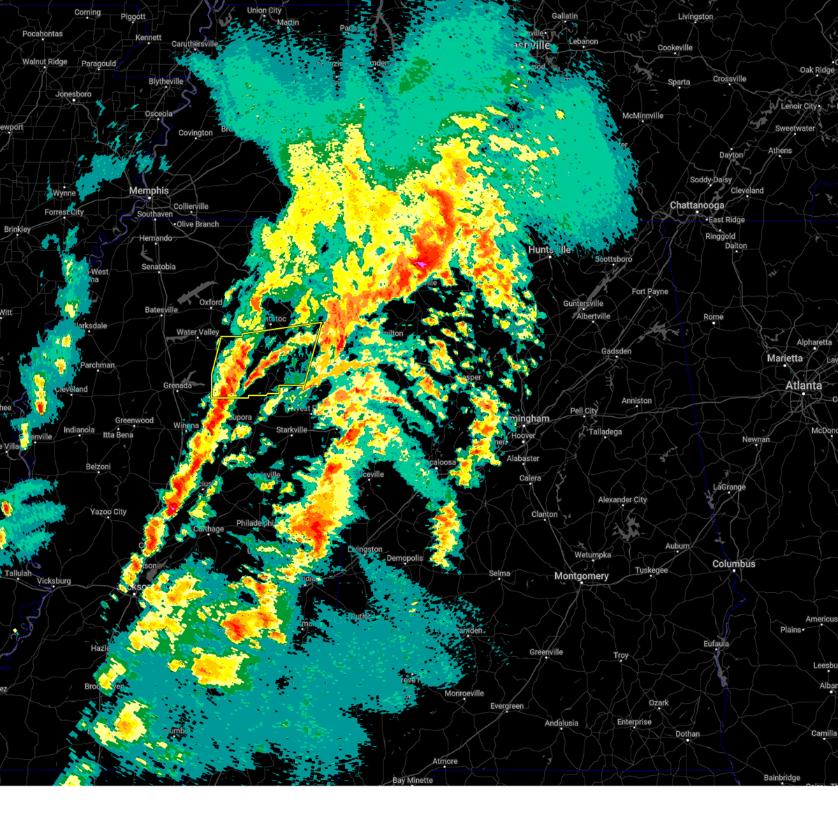
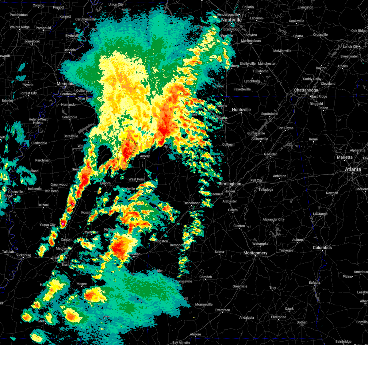
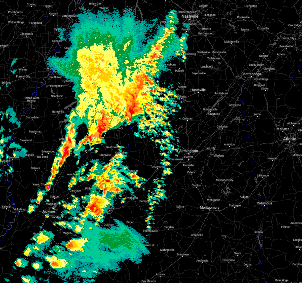
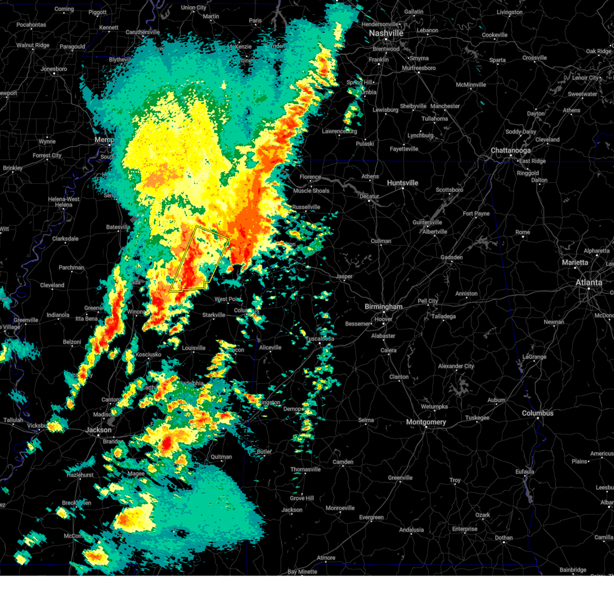
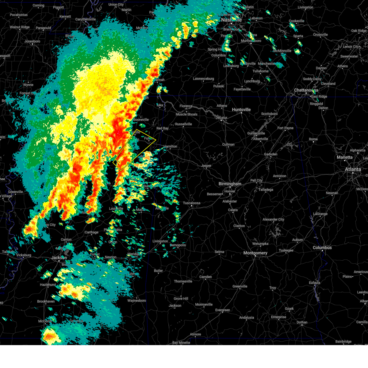
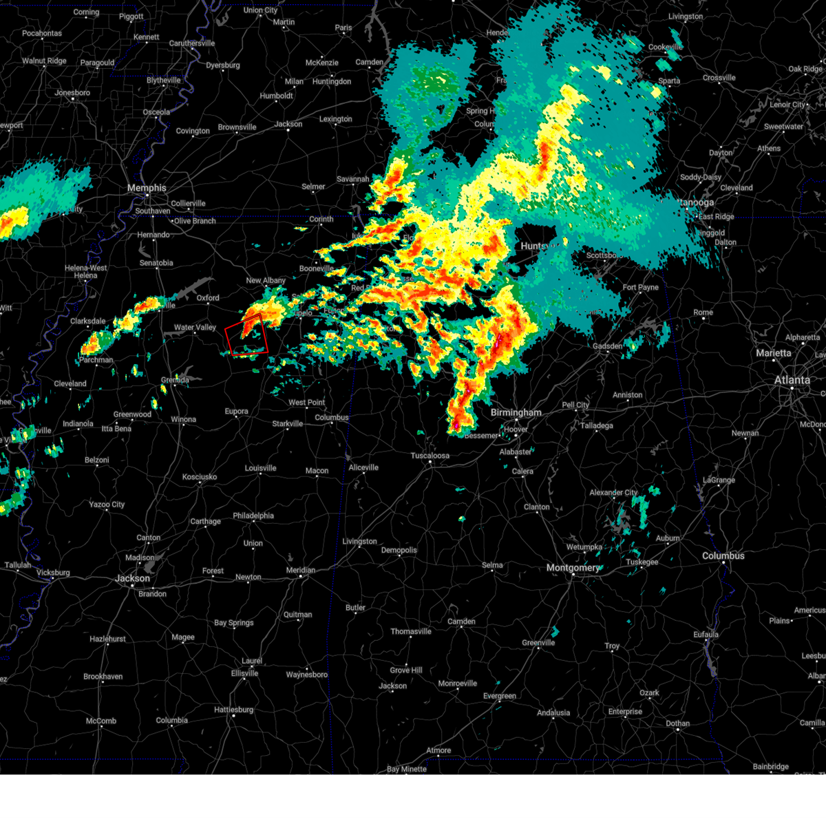
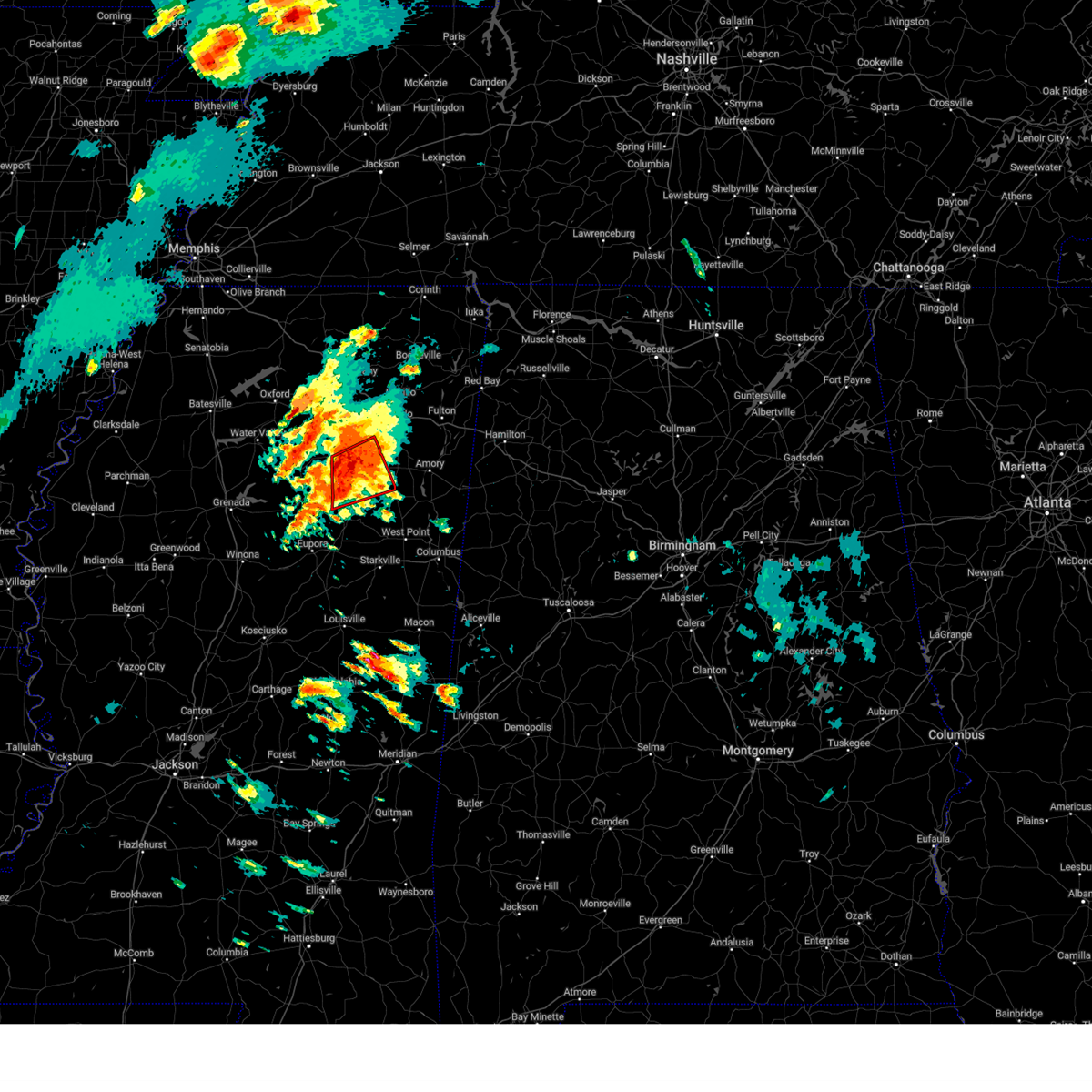
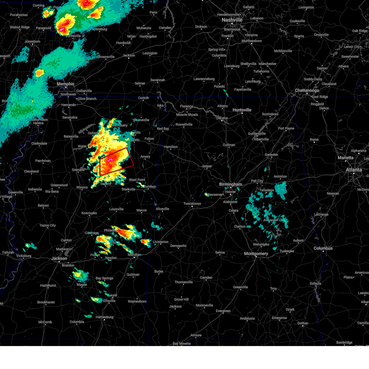
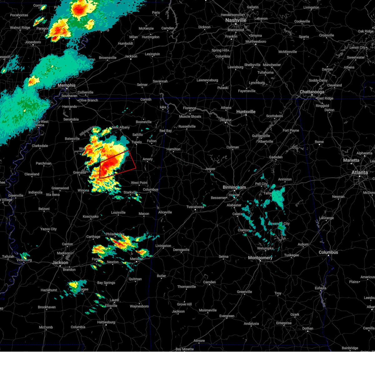
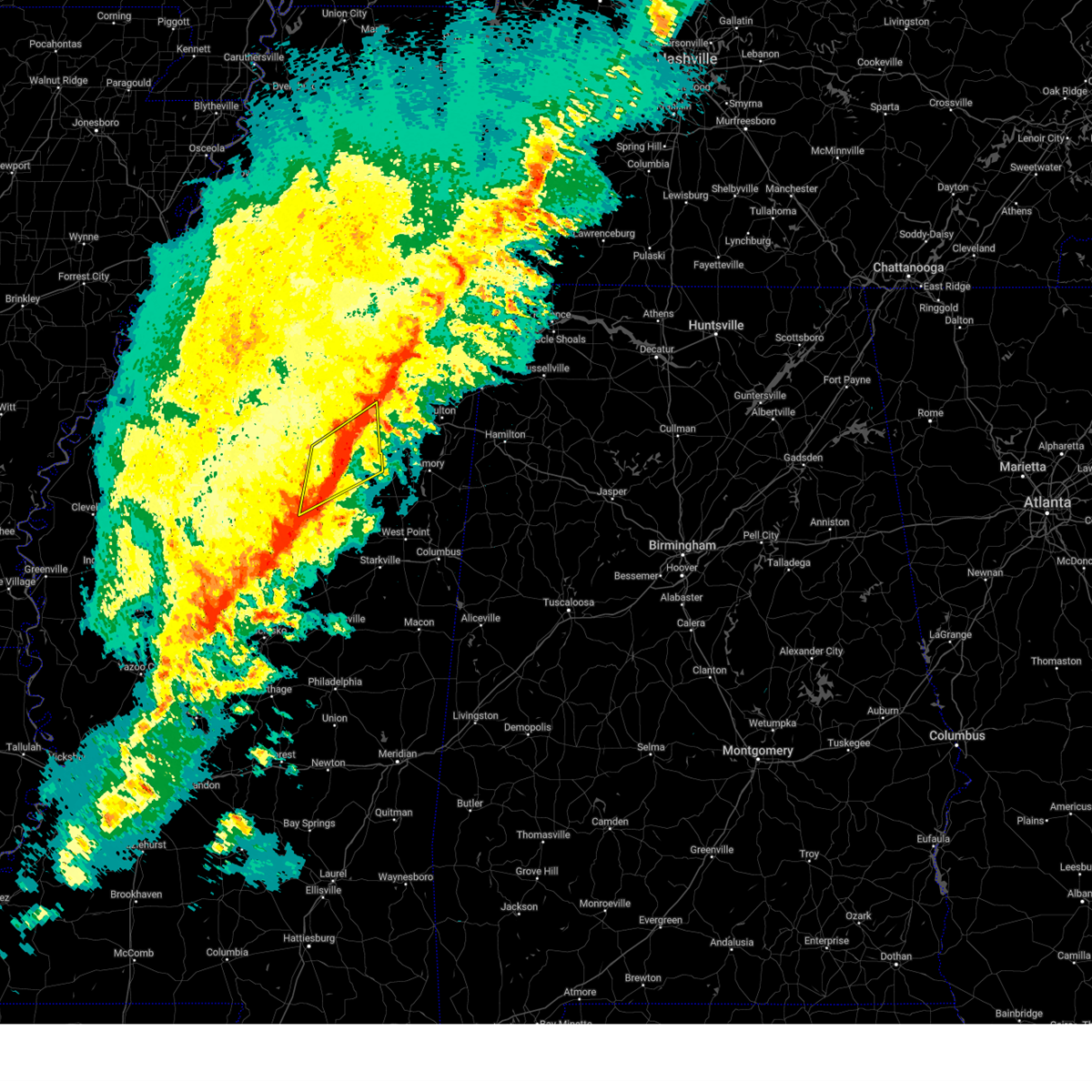
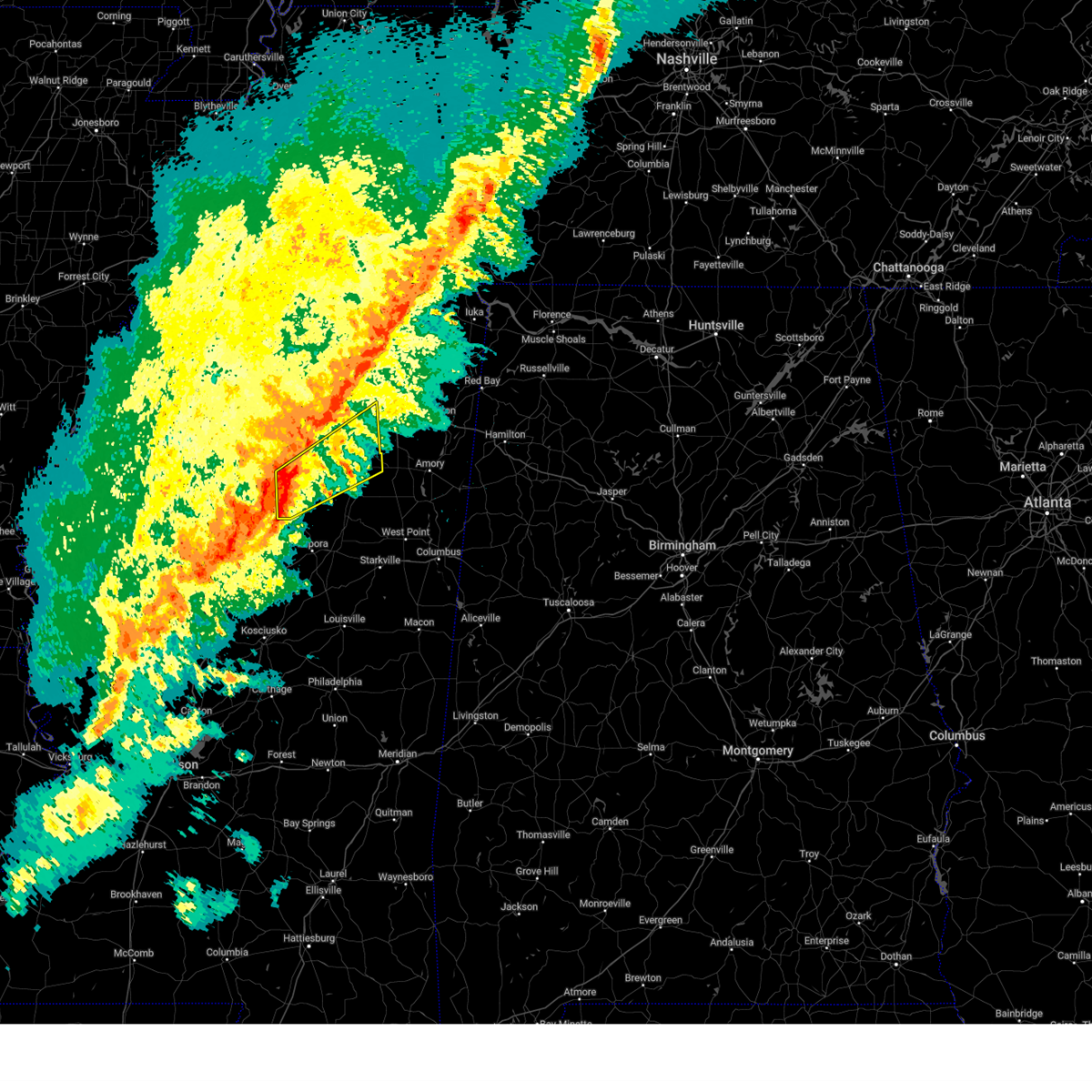
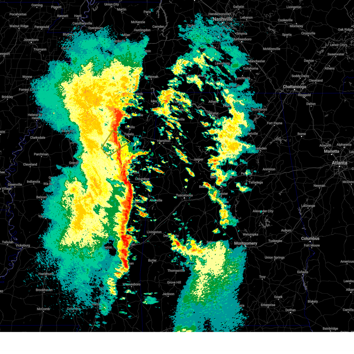
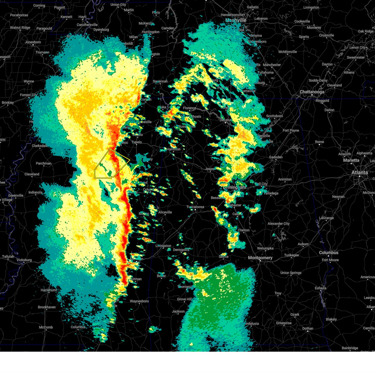
Hail Map for New Houlka, MS
The New Houlka, MS area has had 3 reports of on-the-ground hail by trained spotters, and has been under severe weather warnings 73 times during the past 12 months. Doppler radar has detected hail at or near New Houlka, MS on 79 occasions, including 8 occasions during the past year.
| Name: | New Houlka, MS |
| Where Located: | 41 miles NNW of Starkville, MS |
| Map: | Google Map for New Houlka, MS |
| Population: | 626 |
| Housing Units: | 297 |
| More Info: | Search Google for New Houlka, MS |
1
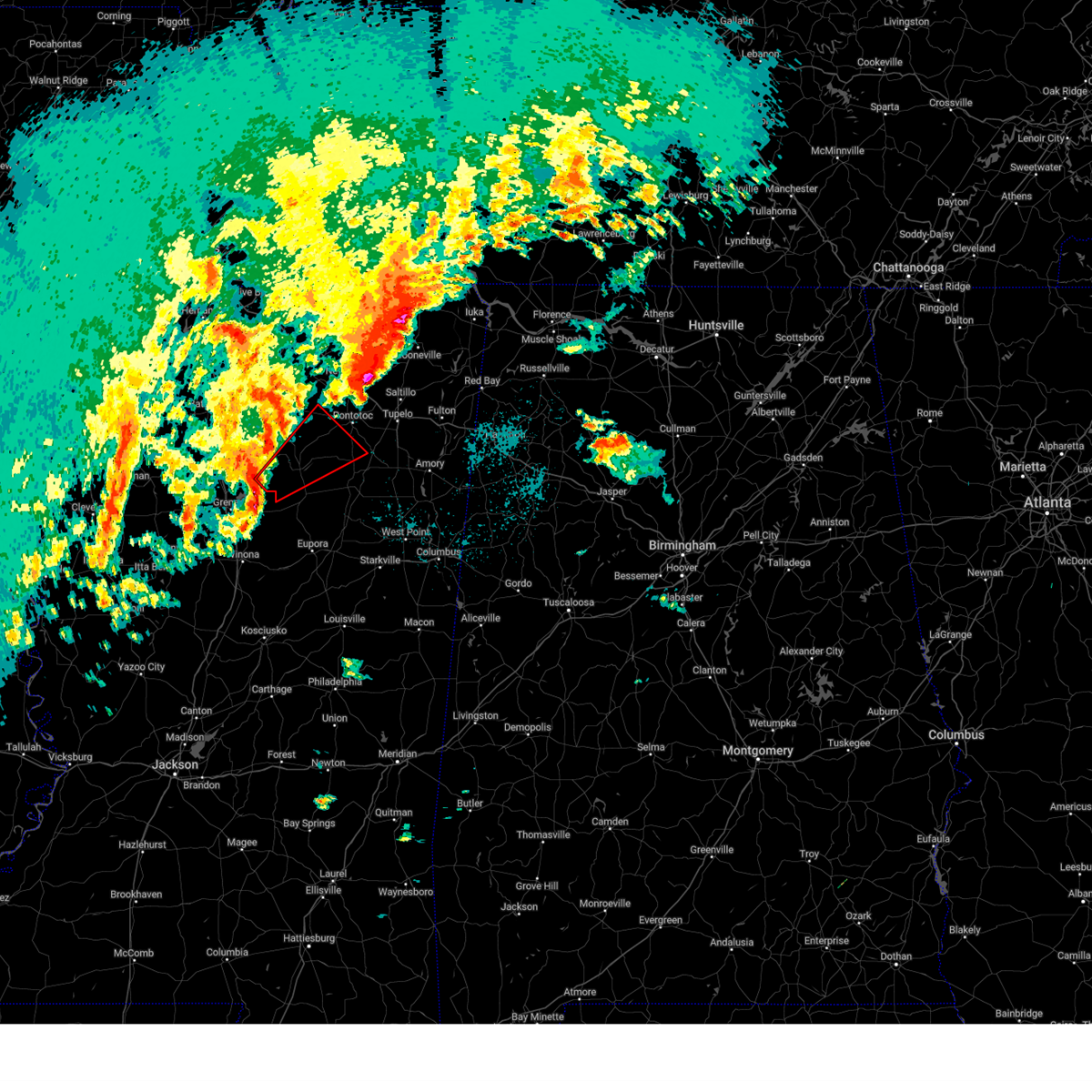
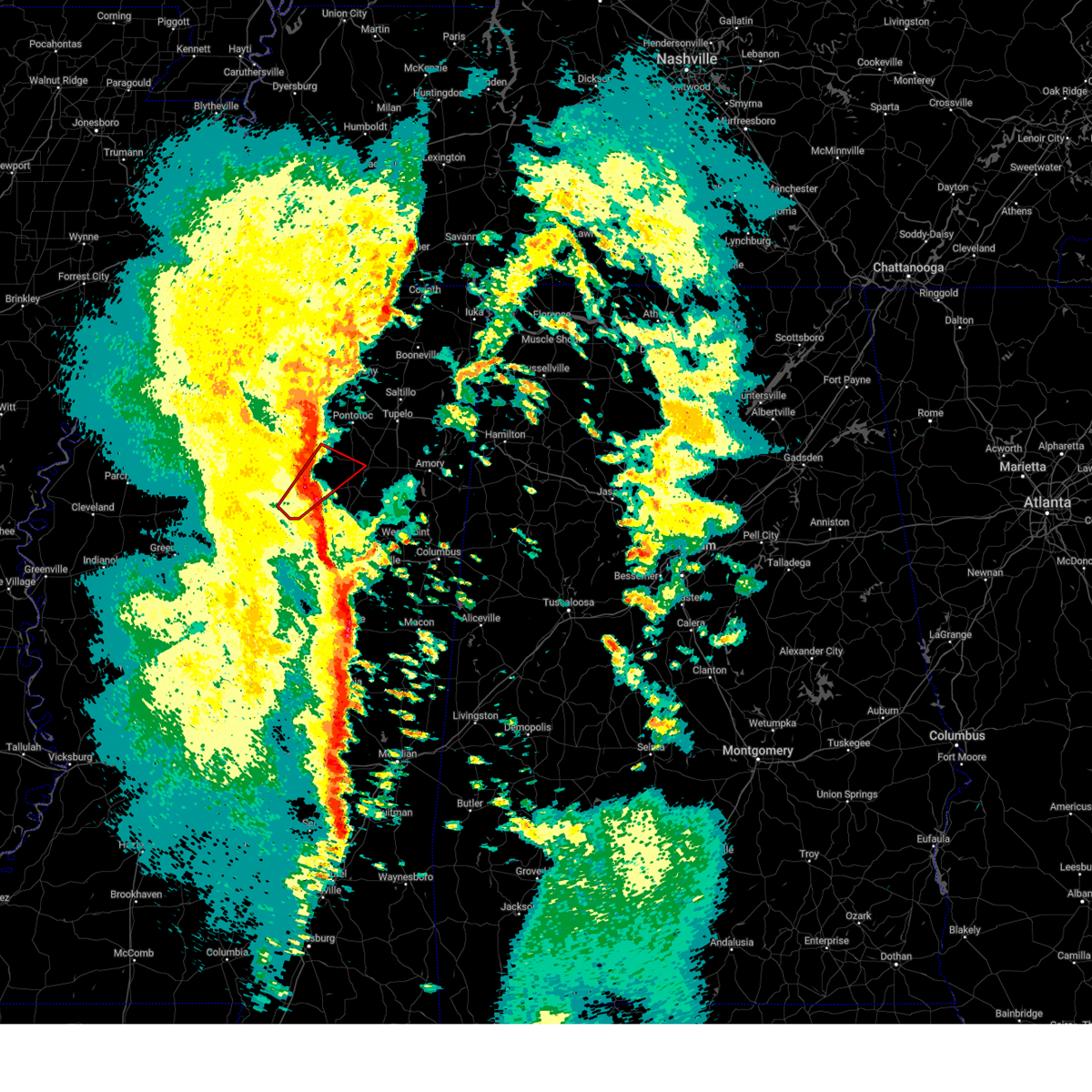
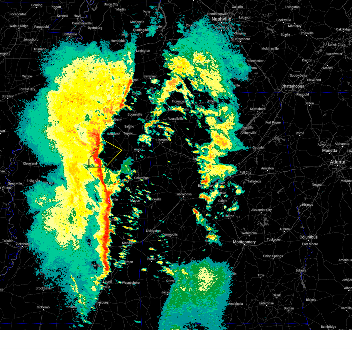
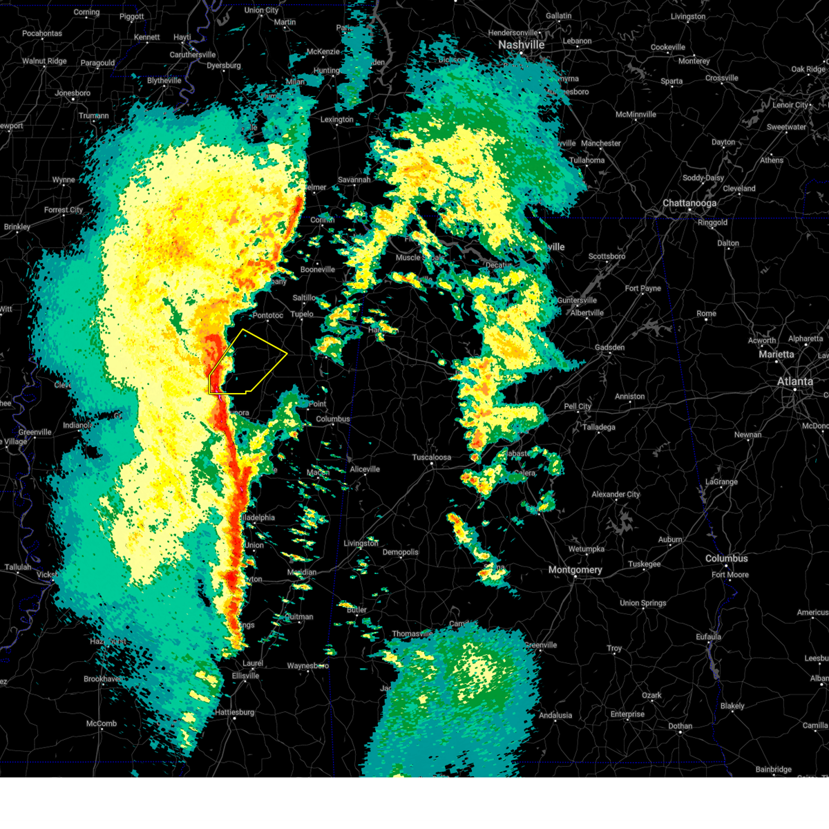
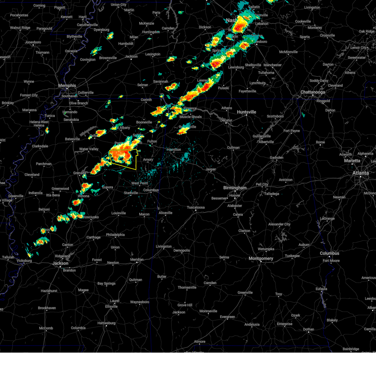
The Top Recent Hail Date for New Houlka, MS is Friday, March 14, 2025 (16th out of 79)
Hail and Wind Damage Spotted near New Houlka, MS
| Date / Time | Report Details |
|---|---|
| 6/7/2025 12:03 PM CDT |
 Svrmeg the national weather service in memphis has issued a * severe thunderstorm warning for, chickasaw county in northeastern mississippi, southeastern pontotoc county in northeastern mississippi, southwestern itawamba county in northeastern mississippi, southern lee county in northeastern mississippi, monroe county in northeastern mississippi, * until 1245 pm cdt. * at 1203 pm cdt, a severe thunderstorm was located near houlka, or near houston, moving east at 40 mph (radar indicated). Hazards include 60 mph wind gusts and nickel size hail. expect damage to roofs, siding, and trees Svrmeg the national weather service in memphis has issued a * severe thunderstorm warning for, chickasaw county in northeastern mississippi, southeastern pontotoc county in northeastern mississippi, southwestern itawamba county in northeastern mississippi, southern lee county in northeastern mississippi, monroe county in northeastern mississippi, * until 1245 pm cdt. * at 1203 pm cdt, a severe thunderstorm was located near houlka, or near houston, moving east at 40 mph (radar indicated). Hazards include 60 mph wind gusts and nickel size hail. expect damage to roofs, siding, and trees
|
| 5/25/2025 8:12 PM CDT |
 the severe thunderstorm warning has been cancelled and is no longer in effect the severe thunderstorm warning has been cancelled and is no longer in effect
|
| 5/25/2025 7:59 PM CDT |
 the severe thunderstorm warning has been cancelled and is no longer in effect the severe thunderstorm warning has been cancelled and is no longer in effect
|
| 5/25/2025 7:59 PM CDT |
 At 758 pm cdt, severe thunderstorms were located along a line extending from near sandy springs to near derma, moving southeast at 45 mph (radar indicated). Hazards include 60 mph wind gusts and quarter size hail. Hail damage to vehicles is expected. expect wind damage to roofs, siding, and trees. Locations impacted include, pittsboro, slate springs, thrasher, thorn, chiwapa, mooreville, reid, sabougla, shannon, ballardsville, vardaman, plantersville, retreat, trace state park, leotis, hobo station, dentontown, pratts friendship, wallfield, and beech springs. At 758 pm cdt, severe thunderstorms were located along a line extending from near sandy springs to near derma, moving southeast at 45 mph (radar indicated). Hazards include 60 mph wind gusts and quarter size hail. Hail damage to vehicles is expected. expect wind damage to roofs, siding, and trees. Locations impacted include, pittsboro, slate springs, thrasher, thorn, chiwapa, mooreville, reid, sabougla, shannon, ballardsville, vardaman, plantersville, retreat, trace state park, leotis, hobo station, dentontown, pratts friendship, wallfield, and beech springs.
|
| 5/25/2025 7:50 PM CDT |
 At 749 pm cdt, severe thunderstorms were located along a line extending from 8 miles north of sandy springs to derma, moving east at 50 mph (radar indicated). Hazards include 60 mph wind gusts and quarter size hail. Hail damage to vehicles is expected. expect wind damage to roofs, siding, and trees. Locations impacted include, pittsboro, robbs, thorn, chiwapa, ballardsville, vardaman, retreat, new harmony, pratts friendship, rough edge, george p cossar state park, bounds, van vleet, parkersburg, moores mill, alpine, bissell, troy, tabbville, and corrona. At 749 pm cdt, severe thunderstorms were located along a line extending from 8 miles north of sandy springs to derma, moving east at 50 mph (radar indicated). Hazards include 60 mph wind gusts and quarter size hail. Hail damage to vehicles is expected. expect wind damage to roofs, siding, and trees. Locations impacted include, pittsboro, robbs, thorn, chiwapa, ballardsville, vardaman, retreat, new harmony, pratts friendship, rough edge, george p cossar state park, bounds, van vleet, parkersburg, moores mill, alpine, bissell, troy, tabbville, and corrona.
|
| 5/25/2025 7:50 PM CDT |
 the severe thunderstorm warning has been cancelled and is no longer in effect the severe thunderstorm warning has been cancelled and is no longer in effect
|
| 5/25/2025 7:36 PM CDT |
 At 735 pm cdt, severe thunderstorms were located along a line extending from near wheeler to 6 miles west of calhoun city, moving east at 60 mph (radar indicated). Hazards include 70 mph wind gusts and quarter size hail. Hail damage to vehicles is expected. expect considerable tree damage. wind damage is also likely to mobile homes, roofs, and outbuildings. Locations impacted include, pittsboro, robbs, esperanza, thorn, chiwapa, ballardsville, vardaman, tyson, gums, retreat, new harmony, pratts friendship, rough edge, bryant, george p cossar state park, bounds, van vleet, parkersburg, moores mill, and toccopola. At 735 pm cdt, severe thunderstorms were located along a line extending from near wheeler to 6 miles west of calhoun city, moving east at 60 mph (radar indicated). Hazards include 70 mph wind gusts and quarter size hail. Hail damage to vehicles is expected. expect considerable tree damage. wind damage is also likely to mobile homes, roofs, and outbuildings. Locations impacted include, pittsboro, robbs, esperanza, thorn, chiwapa, ballardsville, vardaman, tyson, gums, retreat, new harmony, pratts friendship, rough edge, bryant, george p cossar state park, bounds, van vleet, parkersburg, moores mill, and toccopola.
|
| 5/25/2025 7:25 PM CDT |
 Svrmeg the national weather service in memphis has issued a * severe thunderstorm warning for, southeastern lafayette county in northwestern mississippi, chickasaw county in northeastern mississippi, eastern yalobusha county in northwestern mississippi, calhoun county in northeastern mississippi, union county in northeastern mississippi, pontotoc county in northeastern mississippi, northwestern itawamba county in northeastern mississippi, lee county in northeastern mississippi, southern tishomingo county in northeastern mississippi, southern prentiss county in northeastern mississippi, * until 830 pm cdt. * at 725 pm cdt, severe thunderstorms were located along a line extending from 7 miles north of blair to 8 miles north of gore springs, moving east at 65 mph (radar indicated). Hazards include 70 mph wind gusts and quarter size hail. Hail damage to vehicles is expected. expect considerable tree damage. Wind damage is also likely to mobile homes, roofs, and outbuildings. Svrmeg the national weather service in memphis has issued a * severe thunderstorm warning for, southeastern lafayette county in northwestern mississippi, chickasaw county in northeastern mississippi, eastern yalobusha county in northwestern mississippi, calhoun county in northeastern mississippi, union county in northeastern mississippi, pontotoc county in northeastern mississippi, northwestern itawamba county in northeastern mississippi, lee county in northeastern mississippi, southern tishomingo county in northeastern mississippi, southern prentiss county in northeastern mississippi, * until 830 pm cdt. * at 725 pm cdt, severe thunderstorms were located along a line extending from 7 miles north of blair to 8 miles north of gore springs, moving east at 65 mph (radar indicated). Hazards include 70 mph wind gusts and quarter size hail. Hail damage to vehicles is expected. expect considerable tree damage. Wind damage is also likely to mobile homes, roofs, and outbuildings.
|
| 5/25/2025 6:25 PM CDT | The storm which prompted the warning has weakened below severe limits, and no longer poses an immediate threat to life or property. therefore, the warning will be allowed to expire. however, small hail, gusty winds and heavy rain are still possible with this thunderstorm. a severe thunderstorm watch remains in effect until 900 pm cdt for northeastern and northwestern mississippi. |
| 5/25/2025 5:48 PM CDT |
 Svrmeg the national weather service in memphis has issued a * severe thunderstorm warning for, southern lafayette county in northwestern mississippi, northwestern chickasaw county in northeastern mississippi, northeastern yalobusha county in northwestern mississippi, northern calhoun county in northeastern mississippi, southwestern pontotoc county in northeastern mississippi, * until 630 pm cdt. * at 548 pm cdt, a severe thunderstorm was located near paris, or near water valley, moving east at 25 mph (radar indicated). Hazards include half dollar size hail. damage to vehicles is expected Svrmeg the national weather service in memphis has issued a * severe thunderstorm warning for, southern lafayette county in northwestern mississippi, northwestern chickasaw county in northeastern mississippi, northeastern yalobusha county in northwestern mississippi, northern calhoun county in northeastern mississippi, southwestern pontotoc county in northeastern mississippi, * until 630 pm cdt. * at 548 pm cdt, a severe thunderstorm was located near paris, or near water valley, moving east at 25 mph (radar indicated). Hazards include half dollar size hail. damage to vehicles is expected
|
| 5/17/2025 1:48 AM CDT |
 At 147 am cdt, severe thunderstorms were located along a line extending from new harmony to troy to near pyland, moving east at 60 mph (radar indicated). Hazards include 70 mph wind gusts and quarter size hail. Hail damage to vehicles is expected. expect considerable tree damage. wind damage is also likely to mobile homes, roofs, and outbuildings. Locations impacted include, shari, robbs, endville, thorn, chiwapa, mooreville, reid, shannon, plantersville, trace state park, okolona, leotis, new harmony, pratts friendship, randolph, rough edge, glenfield, wallfield, beech springs, and george p cossar state park. At 147 am cdt, severe thunderstorms were located along a line extending from new harmony to troy to near pyland, moving east at 60 mph (radar indicated). Hazards include 70 mph wind gusts and quarter size hail. Hail damage to vehicles is expected. expect considerable tree damage. wind damage is also likely to mobile homes, roofs, and outbuildings. Locations impacted include, shari, robbs, endville, thorn, chiwapa, mooreville, reid, shannon, plantersville, trace state park, okolona, leotis, new harmony, pratts friendship, randolph, rough edge, glenfield, wallfield, beech springs, and george p cossar state park.
|
| 5/17/2025 1:48 AM CDT |
 the severe thunderstorm warning has been cancelled and is no longer in effect the severe thunderstorm warning has been cancelled and is no longer in effect
|
| 5/17/2025 1:45 AM CDT | Partial loss of roo in chickasaw county MS, 0.3 miles SSE of New Houlka, MS |
| 5/17/2025 1:38 AM CDT |
 the severe thunderstorm warning has been cancelled and is no longer in effect the severe thunderstorm warning has been cancelled and is no longer in effect
|
| 5/17/2025 1:38 AM CDT |
 At 138 am cdt, severe thunderstorms were located along a line extending from near ecru to near randolph to near pittsboro, moving east at 55 mph (radar indicated). Hazards include 70 mph wind gusts and quarter size hail. Hail damage to vehicles is expected. expect considerable tree damage. wind damage is also likely to mobile homes, roofs, and outbuildings. Locations impacted include, shari, pittsboro, robbs, esperanza, thorn, chiwapa, okolona, new harmony, pratts friendship, rough edge, glenfield, george p cossar state park, van vleet, parkersburg, toccopola, alpine, bissell, buchannan, troy, and corrona. At 138 am cdt, severe thunderstorms were located along a line extending from near ecru to near randolph to near pittsboro, moving east at 55 mph (radar indicated). Hazards include 70 mph wind gusts and quarter size hail. Hail damage to vehicles is expected. expect considerable tree damage. wind damage is also likely to mobile homes, roofs, and outbuildings. Locations impacted include, shari, pittsboro, robbs, esperanza, thorn, chiwapa, okolona, new harmony, pratts friendship, rough edge, glenfield, george p cossar state park, van vleet, parkersburg, toccopola, alpine, bissell, buchannan, troy, and corrona.
|
| 5/17/2025 1:29 AM CDT |
 At 129 am cdt, severe thunderstorms were located along a line extending from near etta to near randolph to near bruce, moving east at 55 mph (radar indicated). Hazards include 70 mph wind gusts and quarter size hail. Hail damage to vehicles is expected. expect considerable tree damage. wind damage is also likely to mobile homes, roofs, and outbuildings. Locations impacted include, shari, pittsboro, robbs, esperanza, thorn, chiwapa, cambridge, tyson, okolona, new harmony, pratts friendship, rough edge, glenfield, george p cossar state park, altus, van vleet, parkersburg, toccopola, alpine, and bissell. At 129 am cdt, severe thunderstorms were located along a line extending from near etta to near randolph to near bruce, moving east at 55 mph (radar indicated). Hazards include 70 mph wind gusts and quarter size hail. Hail damage to vehicles is expected. expect considerable tree damage. wind damage is also likely to mobile homes, roofs, and outbuildings. Locations impacted include, shari, pittsboro, robbs, esperanza, thorn, chiwapa, cambridge, tyson, okolona, new harmony, pratts friendship, rough edge, glenfield, george p cossar state park, altus, van vleet, parkersburg, toccopola, alpine, and bissell.
|
| 5/17/2025 1:16 AM CDT |
 Svrmeg the national weather service in memphis has issued a * severe thunderstorm warning for, eastern lafayette county in northwestern mississippi, northern chickasaw county in northeastern mississippi, northeastern yalobusha county in northwestern mississippi, northern calhoun county in northeastern mississippi, union county in northeastern mississippi, pontotoc county in northeastern mississippi, lee county in northeastern mississippi, southwestern prentiss county in northeastern mississippi, * until 200 am cdt. * at 116 am cdt, severe thunderstorms were located along a line extending from cambridge to near paris to near coffeeville, moving east at 55 mph (radar indicated). Hazards include 70 mph wind gusts and quarter size hail. Hail damage to vehicles is expected. expect considerable tree damage. Wind damage is also likely to mobile homes, roofs, and outbuildings. Svrmeg the national weather service in memphis has issued a * severe thunderstorm warning for, eastern lafayette county in northwestern mississippi, northern chickasaw county in northeastern mississippi, northeastern yalobusha county in northwestern mississippi, northern calhoun county in northeastern mississippi, union county in northeastern mississippi, pontotoc county in northeastern mississippi, lee county in northeastern mississippi, southwestern prentiss county in northeastern mississippi, * until 200 am cdt. * at 116 am cdt, severe thunderstorms were located along a line extending from cambridge to near paris to near coffeeville, moving east at 55 mph (radar indicated). Hazards include 70 mph wind gusts and quarter size hail. Hail damage to vehicles is expected. expect considerable tree damage. Wind damage is also likely to mobile homes, roofs, and outbuildings.
|
| 5/2/2025 3:54 PM CDT | Svrmeg the national weather service in memphis has issued a * severe thunderstorm warning for, chickasaw county in northeastern mississippi, southern calhoun county in northeastern mississippi, southeastern pontotoc county in northeastern mississippi, southwestern lee county in northeastern mississippi, southwestern monroe county in northeastern mississippi, * until 445 pm cdt. * at 354 pm cdt, a severe thunderstorm was located near mantee, or 10 miles southwest of houston, moving east at 30 mph (radar indicated). Hazards include 60 mph wind gusts and quarter size hail. Hail damage to vehicles is expected. Expect wind damage to roofs, siding, and trees. |
| 5/1/2025 5:40 PM CDT | The storm which prompted the warning has moved out of the area. therefore, the warning will be allowed to expire. remember, a severe thunderstorm warning still remains in effect for eastern chickasaw county until 615pm. |
| 5/1/2025 5:21 PM CDT |
 At 521 pm cdt, a severe thunderstorm was located near vardaman, or 10 miles west of houston, moving northeast at 35 mph (radar indicated). Hazards include 60 mph wind gusts and quarter size hail. Hail damage to vehicles is expected. expect wind damage to roofs, siding, and trees. Locations impacted include, new houlka, thorn, van vleet, parkersburg, reid, loyd, pyland, houlka, vardaman, houston, thelma, and tabbville. At 521 pm cdt, a severe thunderstorm was located near vardaman, or 10 miles west of houston, moving northeast at 35 mph (radar indicated). Hazards include 60 mph wind gusts and quarter size hail. Hail damage to vehicles is expected. expect wind damage to roofs, siding, and trees. Locations impacted include, new houlka, thorn, van vleet, parkersburg, reid, loyd, pyland, houlka, vardaman, houston, thelma, and tabbville.
|
| 5/1/2025 5:02 PM CDT | Svrmeg the national weather service in memphis has issued a * severe thunderstorm warning for, chickasaw county in northeastern mississippi, southern calhoun county in northeastern mississippi, * until 545 pm cdt. * at 501 pm cdt, a severe thunderstorm was located over calhoun city, or 20 miles west of houston, moving east at 30 mph (radar indicated). Hazards include 60 mph wind gusts and quarter size hail. Hail damage to vehicles is expected. Expect wind damage to roofs, siding, and trees. |
| 4/5/2025 10:49 PM CDT |
 the tornado warning has been cancelled and is no longer in effect the tornado warning has been cancelled and is no longer in effect
|
| 4/5/2025 10:20 PM CDT |
 the tornado warning has been cancelled and is no longer in effect the tornado warning has been cancelled and is no longer in effect
|
| 4/5/2025 10:20 PM CDT |
 At 1020 pm cdt, a severe thunderstorm capable of producing a tornado was located over houlka, or 9 miles north of houston, moving northeast at 35 mph (radar indicated rotation). Hazards include tornado. Flying debris will be dangerous to those caught without shelter. mobile homes will be damaged or destroyed. damage to roofs, windows, and vehicles will occur. tree damage is likely. Locations impacted include, george p cossar state park, thorn, chiwapa, palmetto, shannon, troy, thelma, furrs, new houlka, leotis, houlka, old union, wallfield, nettleton, verona, and algoma. At 1020 pm cdt, a severe thunderstorm capable of producing a tornado was located over houlka, or 9 miles north of houston, moving northeast at 35 mph (radar indicated rotation). Hazards include tornado. Flying debris will be dangerous to those caught without shelter. mobile homes will be damaged or destroyed. damage to roofs, windows, and vehicles will occur. tree damage is likely. Locations impacted include, george p cossar state park, thorn, chiwapa, palmetto, shannon, troy, thelma, furrs, new houlka, leotis, houlka, old union, wallfield, nettleton, verona, and algoma.
|
| 4/5/2025 10:10 PM CDT |
 Tormeg the national weather service in memphis has issued a * tornado warning for, northern chickasaw county in northeastern mississippi, east central calhoun county in northeastern mississippi, southeastern pontotoc county in northeastern mississippi, southwestern lee county in northeastern mississippi, * until 1100 pm cdt. * at 1010 pm cdt, a severe thunderstorm capable of producing a tornado was located near pyland, or 9 miles northwest of houston, moving northeast at 35 mph (radar indicated rotation). Hazards include tornado. Flying debris will be dangerous to those caught without shelter. mobile homes will be damaged or destroyed. damage to roofs, windows, and vehicles will occur. Tree damage is likely. Tormeg the national weather service in memphis has issued a * tornado warning for, northern chickasaw county in northeastern mississippi, east central calhoun county in northeastern mississippi, southeastern pontotoc county in northeastern mississippi, southwestern lee county in northeastern mississippi, * until 1100 pm cdt. * at 1010 pm cdt, a severe thunderstorm capable of producing a tornado was located near pyland, or 9 miles northwest of houston, moving northeast at 35 mph (radar indicated rotation). Hazards include tornado. Flying debris will be dangerous to those caught without shelter. mobile homes will be damaged or destroyed. damage to roofs, windows, and vehicles will occur. Tree damage is likely.
|
| 4/5/2025 8:19 PM CDT |
 Tormeg the national weather service in memphis has issued a * tornado warning for, southeastern lafayette county in northwestern mississippi, northwestern chickasaw county in northeastern mississippi, northeastern calhoun county in northeastern mississippi, pontotoc county in northeastern mississippi, union county in northeastern mississippi, northwestern lee county in northeastern mississippi, southeastern tippah county in northeastern mississippi, western prentiss county in northeastern mississippi, southwestern alcorn county in northeastern mississippi, * until 900 pm cdt. * at 819 pm cdt, a severe thunderstorm capable of producing a tornado was located over ecru, or 7 miles northwest of pontotoc, moving northeast at 50 mph (radar indicated rotation). Hazards include tornado and quarter size hail. Flying debris will be dangerous to those caught without shelter. mobile homes will be damaged or destroyed. damage to roofs, windows, and vehicles will occur. Tree damage is likely. Tormeg the national weather service in memphis has issued a * tornado warning for, southeastern lafayette county in northwestern mississippi, northwestern chickasaw county in northeastern mississippi, northeastern calhoun county in northeastern mississippi, pontotoc county in northeastern mississippi, union county in northeastern mississippi, northwestern lee county in northeastern mississippi, southeastern tippah county in northeastern mississippi, western prentiss county in northeastern mississippi, southwestern alcorn county in northeastern mississippi, * until 900 pm cdt. * at 819 pm cdt, a severe thunderstorm capable of producing a tornado was located over ecru, or 7 miles northwest of pontotoc, moving northeast at 50 mph (radar indicated rotation). Hazards include tornado and quarter size hail. Flying debris will be dangerous to those caught without shelter. mobile homes will be damaged or destroyed. damage to roofs, windows, and vehicles will occur. Tree damage is likely.
|
| 4/5/2025 8:00 PM CDT |
 At 800 pm cdt, a severe thunderstorm capable of producing a tornado was located near bruce, or 17 miles west of houston, moving northeast at 45 mph (radar indicated rotation). Hazards include tornado. Flying debris will be dangerous to those caught without shelter. mobile homes will be damaged or destroyed. damage to roofs, windows, and vehicles will occur. tree damage is likely. Locations impacted include, pittsboro, robbs, banner, bounds, toccopola, reid, algoma, loyd, ellard, pannell, delay, bruce, shepherd, matthews, skuna, new houlka, retreat, lafayette springs, houlka, and randolph. At 800 pm cdt, a severe thunderstorm capable of producing a tornado was located near bruce, or 17 miles west of houston, moving northeast at 45 mph (radar indicated rotation). Hazards include tornado. Flying debris will be dangerous to those caught without shelter. mobile homes will be damaged or destroyed. damage to roofs, windows, and vehicles will occur. tree damage is likely. Locations impacted include, pittsboro, robbs, banner, bounds, toccopola, reid, algoma, loyd, ellard, pannell, delay, bruce, shepherd, matthews, skuna, new houlka, retreat, lafayette springs, houlka, and randolph.
|
| 4/5/2025 7:49 PM CDT |
 the tornado warning has been cancelled and is no longer in effect the tornado warning has been cancelled and is no longer in effect
|
| 4/5/2025 7:49 PM CDT |
 At 749 pm cdt, a severe thunderstorm capable of producing a tornado was located near pittsboro, or 22 miles southeast of water valley, moving northeast at 40 mph (radar indicated rotation). Hazards include tornado and quarter size hail. Flying debris will be dangerous to those caught without shelter. mobile homes will be damaged or destroyed. damage to roofs, windows, and vehicles will occur. tree damage is likely. Locations impacted include, pittsboro, robbs, banner, bounds, toccopola, reid, algoma, loyd, ellard, pannell, delay, bruce, shepherd, matthews, skuna, new houlka, retreat, lafayette springs, houlka, and randolph. At 749 pm cdt, a severe thunderstorm capable of producing a tornado was located near pittsboro, or 22 miles southeast of water valley, moving northeast at 40 mph (radar indicated rotation). Hazards include tornado and quarter size hail. Flying debris will be dangerous to those caught without shelter. mobile homes will be damaged or destroyed. damage to roofs, windows, and vehicles will occur. tree damage is likely. Locations impacted include, pittsboro, robbs, banner, bounds, toccopola, reid, algoma, loyd, ellard, pannell, delay, bruce, shepherd, matthews, skuna, new houlka, retreat, lafayette springs, houlka, and randolph.
|
| 4/5/2025 7:42 PM CDT |
 Tormeg the national weather service in memphis has issued a * tornado warning for, southeastern lafayette county in northwestern mississippi, northwestern chickasaw county in northeastern mississippi, southeastern yalobusha county in northwestern mississippi, northern calhoun county in northeastern mississippi, southwestern pontotoc county in northeastern mississippi, * until 830 pm cdt. * at 741 pm cdt, a severe thunderstorm capable of producing a tornado was located 10 miles east of coffeeville, or 17 miles southeast of water valley, moving northeast at 45 mph (radar indicated rotation). Hazards include tornado and quarter size hail. Flying debris will be dangerous to those caught without shelter. mobile homes will be damaged or destroyed. damage to roofs, windows, and vehicles will occur. Tree damage is likely. Tormeg the national weather service in memphis has issued a * tornado warning for, southeastern lafayette county in northwestern mississippi, northwestern chickasaw county in northeastern mississippi, southeastern yalobusha county in northwestern mississippi, northern calhoun county in northeastern mississippi, southwestern pontotoc county in northeastern mississippi, * until 830 pm cdt. * at 741 pm cdt, a severe thunderstorm capable of producing a tornado was located 10 miles east of coffeeville, or 17 miles southeast of water valley, moving northeast at 45 mph (radar indicated rotation). Hazards include tornado and quarter size hail. Flying debris will be dangerous to those caught without shelter. mobile homes will be damaged or destroyed. damage to roofs, windows, and vehicles will occur. Tree damage is likely.
|
| 3/31/2025 5:26 AM CDT |
 At 526 am cdt, severe thunderstorms were located along a line extending from near okolona to pala alto, moving east at 45 mph (radar indicated). Hazards include 60 mph wind gusts and quarter size hail. Hail damage to vehicles is expected. expect wind damage to roofs, siding, and trees. Locations impacted include, abney, quincy, aberdeen, smithville, turon, egypt, prairie, wise gap, shannon, wren, strong, mccondy, nettleton, new salem, muldon, okolona, gattman, leotis, old union, and buena vista. At 526 am cdt, severe thunderstorms were located along a line extending from near okolona to pala alto, moving east at 45 mph (radar indicated). Hazards include 60 mph wind gusts and quarter size hail. Hail damage to vehicles is expected. expect wind damage to roofs, siding, and trees. Locations impacted include, abney, quincy, aberdeen, smithville, turon, egypt, prairie, wise gap, shannon, wren, strong, mccondy, nettleton, new salem, muldon, okolona, gattman, leotis, old union, and buena vista.
|
| 3/31/2025 5:10 AM CDT |
 Svrmeg the national weather service in memphis has issued a * severe thunderstorm warning for, chickasaw county in northeastern mississippi, southeastern pontotoc county in northeastern mississippi, southern itawamba county in northeastern mississippi, southern lee county in northeastern mississippi, monroe county in northeastern mississippi, * until 615 am cdt. * at 510 am cdt, severe thunderstorms were located along a line extending from near houlka to near montpelier, moving east at 45 mph (radar indicated). Hazards include 60 mph wind gusts and quarter size hail. Hail damage to vehicles is expected. Expect wind damage to roofs, siding, and trees. Svrmeg the national weather service in memphis has issued a * severe thunderstorm warning for, chickasaw county in northeastern mississippi, southeastern pontotoc county in northeastern mississippi, southern itawamba county in northeastern mississippi, southern lee county in northeastern mississippi, monroe county in northeastern mississippi, * until 615 am cdt. * at 510 am cdt, severe thunderstorms were located along a line extending from near houlka to near montpelier, moving east at 45 mph (radar indicated). Hazards include 60 mph wind gusts and quarter size hail. Hail damage to vehicles is expected. Expect wind damage to roofs, siding, and trees.
|
| 3/31/2025 4:38 AM CDT |
 Svrmeg the national weather service in memphis has issued a * severe thunderstorm warning for, chickasaw county in northeastern mississippi, central calhoun county in northeastern mississippi, * until 530 am cdt. * at 438 am cdt, a severe thunderstorm was located near derma, or 16 miles west of houston, moving east at 40 mph (radar indicated). Hazards include 60 mph wind gusts and quarter size hail. Hail damage to vehicles is expected. Expect wind damage to roofs, siding, and trees. Svrmeg the national weather service in memphis has issued a * severe thunderstorm warning for, chickasaw county in northeastern mississippi, central calhoun county in northeastern mississippi, * until 530 am cdt. * at 438 am cdt, a severe thunderstorm was located near derma, or 16 miles west of houston, moving east at 40 mph (radar indicated). Hazards include 60 mph wind gusts and quarter size hail. Hail damage to vehicles is expected. Expect wind damage to roofs, siding, and trees.
|
| 3/23/2025 8:28 PM CDT |
 Svrmeg the national weather service in memphis has issued a * severe thunderstorm warning for, chickasaw county in northeastern mississippi, western monroe county in northeastern mississippi, * until 915 pm cdt. * at 827 pm cdt, a severe thunderstorm was located over houston, moving east at 30 mph (radar indicated). Hazards include 60 mph wind gusts and quarter size hail. Hail damage to vehicles is expected. Expect wind damage to roofs, siding, and trees. Svrmeg the national weather service in memphis has issued a * severe thunderstorm warning for, chickasaw county in northeastern mississippi, western monroe county in northeastern mississippi, * until 915 pm cdt. * at 827 pm cdt, a severe thunderstorm was located over houston, moving east at 30 mph (radar indicated). Hazards include 60 mph wind gusts and quarter size hail. Hail damage to vehicles is expected. Expect wind damage to roofs, siding, and trees.
|
| 3/23/2025 8:15 PM CDT |
 At 815 pm cdt, a severe thunderstorm was located over pyland, or near houston, moving east at 30 mph (radar indicated). Hazards include 60 mph wind gusts and quarter size hail. Hail damage to vehicles is expected. expect wind damage to roofs, siding, and trees. Locations impacted include, thorn, van vleet, parkersburg, derma, reid, loyd, pyland, vardaman, thelma, tabbville, mccondy, anchor, trebloc, new houlka, houlka, buena vista, houston, and calhoun city. At 815 pm cdt, a severe thunderstorm was located over pyland, or near houston, moving east at 30 mph (radar indicated). Hazards include 60 mph wind gusts and quarter size hail. Hail damage to vehicles is expected. expect wind damage to roofs, siding, and trees. Locations impacted include, thorn, van vleet, parkersburg, derma, reid, loyd, pyland, vardaman, thelma, tabbville, mccondy, anchor, trebloc, new houlka, houlka, buena vista, houston, and calhoun city.
|
| 3/23/2025 7:57 PM CDT |
 Svrmeg the national weather service in memphis has issued a * severe thunderstorm warning for, northeastern chickasaw county in northeastern mississippi, southeastern pontotoc county in northeastern mississippi, southern itawamba county in northeastern mississippi, southern lee county in northeastern mississippi, northern monroe county in northeastern mississippi, * until 845 pm cdt. * at 757 pm cdt, a severe thunderstorm was located near houlka, or 9 miles south of pontotoc, moving east at 40 mph (radar indicated). Hazards include 60 mph wind gusts and quarter size hail. Hail damage to vehicles is expected. Expect wind damage to roofs, siding, and trees. Svrmeg the national weather service in memphis has issued a * severe thunderstorm warning for, northeastern chickasaw county in northeastern mississippi, southeastern pontotoc county in northeastern mississippi, southern itawamba county in northeastern mississippi, southern lee county in northeastern mississippi, northern monroe county in northeastern mississippi, * until 845 pm cdt. * at 757 pm cdt, a severe thunderstorm was located near houlka, or 9 miles south of pontotoc, moving east at 40 mph (radar indicated). Hazards include 60 mph wind gusts and quarter size hail. Hail damage to vehicles is expected. Expect wind damage to roofs, siding, and trees.
|
| 3/23/2025 7:49 PM CDT |
 the severe thunderstorm warning has been cancelled and is no longer in effect the severe thunderstorm warning has been cancelled and is no longer in effect
|
| 3/23/2025 7:49 PM CDT |
 At 749 pm cdt, severe thunderstorms were located along a line extending from troy to 6 miles southwest of randolph to bruce, moving east at 45 mph (radar indicated). Hazards include 60 mph wind gusts and quarter size hail. Hail damage to vehicles is expected. expect wind damage to roofs, siding, and trees. Locations impacted include, george p cossar state park, robbs, banner, chiwapa, van vleet, reid, algoma, loyd, ellard, pannell, troy, thelma, bruce, shepherd, matthews, skuna, new houlka, houlka, sarepta, and wallfield. At 749 pm cdt, severe thunderstorms were located along a line extending from troy to 6 miles southwest of randolph to bruce, moving east at 45 mph (radar indicated). Hazards include 60 mph wind gusts and quarter size hail. Hail damage to vehicles is expected. expect wind damage to roofs, siding, and trees. Locations impacted include, george p cossar state park, robbs, banner, chiwapa, van vleet, reid, algoma, loyd, ellard, pannell, troy, thelma, bruce, shepherd, matthews, skuna, new houlka, houlka, sarepta, and wallfield.
|
| 3/23/2025 7:48 PM CDT |
 Svrmeg the national weather service in memphis has issued a * severe thunderstorm warning for, chickasaw county in northeastern mississippi, central calhoun county in northeastern mississippi, * until 830 pm cdt. * at 747 pm cdt, a severe thunderstorm was located over pittsboro, or 20 miles west of houston, moving east at 35 mph (radar indicated). Hazards include 60 mph wind gusts and quarter size hail. Hail damage to vehicles is expected. Expect wind damage to roofs, siding, and trees. Svrmeg the national weather service in memphis has issued a * severe thunderstorm warning for, chickasaw county in northeastern mississippi, central calhoun county in northeastern mississippi, * until 830 pm cdt. * at 747 pm cdt, a severe thunderstorm was located over pittsboro, or 20 miles west of houston, moving east at 35 mph (radar indicated). Hazards include 60 mph wind gusts and quarter size hail. Hail damage to vehicles is expected. Expect wind damage to roofs, siding, and trees.
|
| 3/23/2025 7:35 PM CDT |
 At 734 pm cdt, severe thunderstorms were located along a line extending from near randolph to near banner to 9 miles east of coffeeville, moving east at 45 mph (radar indicated). Hazards include 60 mph wind gusts and quarter size hail. Hail damage to vehicles is expected. expect wind damage to roofs, siding, and trees. Locations impacted include, robbs, chiwapa, reid, algoma, loyd, ellard, pannell, thelma, tyson, gums, trace state park, randolph, rough edge, wallfield, spearman, nixon, george p cossar state park, benwood, pontotoc, and banner. At 734 pm cdt, severe thunderstorms were located along a line extending from near randolph to near banner to 9 miles east of coffeeville, moving east at 45 mph (radar indicated). Hazards include 60 mph wind gusts and quarter size hail. Hail damage to vehicles is expected. expect wind damage to roofs, siding, and trees. Locations impacted include, robbs, chiwapa, reid, algoma, loyd, ellard, pannell, thelma, tyson, gums, trace state park, randolph, rough edge, wallfield, spearman, nixon, george p cossar state park, benwood, pontotoc, and banner.
|
| 3/23/2025 7:18 PM CDT |
 Svrmeg the national weather service in memphis has issued a * severe thunderstorm warning for, southeastern lafayette county in northwestern mississippi, northern chickasaw county in northeastern mississippi, eastern yalobusha county in northwestern mississippi, northern calhoun county in northeastern mississippi, pontotoc county in northeastern mississippi, * until 800 pm cdt. * at 717 pm cdt, a severe thunderstorm was located near velma, or 9 miles southeast of water valley, moving east at 45 mph (public). Hazards include 60 mph wind gusts and quarter size hail. Hail damage to vehicles is expected. Expect wind damage to roofs, siding, and trees. Svrmeg the national weather service in memphis has issued a * severe thunderstorm warning for, southeastern lafayette county in northwestern mississippi, northern chickasaw county in northeastern mississippi, eastern yalobusha county in northwestern mississippi, northern calhoun county in northeastern mississippi, pontotoc county in northeastern mississippi, * until 800 pm cdt. * at 717 pm cdt, a severe thunderstorm was located near velma, or 9 miles southeast of water valley, moving east at 45 mph (public). Hazards include 60 mph wind gusts and quarter size hail. Hail damage to vehicles is expected. Expect wind damage to roofs, siding, and trees.
|
| 3/23/2025 6:40 PM CDT |
 Svrmeg the national weather service in memphis has issued a * severe thunderstorm warning for, northern chickasaw county in northeastern mississippi, southeastern pontotoc county in northeastern mississippi, southwestern itawamba county in northeastern mississippi, southern lee county in northeastern mississippi, northwestern monroe county in northeastern mississippi, * until 730 pm cdt. * at 640 pm cdt, a severe thunderstorm was located near troy, or 10 miles northwest of okolona, moving east at 35 mph (radar indicated). Hazards include 60 mph wind gusts and quarter size hail. Hail damage to vehicles is expected. Expect wind damage to roofs, siding, and trees. Svrmeg the national weather service in memphis has issued a * severe thunderstorm warning for, northern chickasaw county in northeastern mississippi, southeastern pontotoc county in northeastern mississippi, southwestern itawamba county in northeastern mississippi, southern lee county in northeastern mississippi, northwestern monroe county in northeastern mississippi, * until 730 pm cdt. * at 640 pm cdt, a severe thunderstorm was located near troy, or 10 miles northwest of okolona, moving east at 35 mph (radar indicated). Hazards include 60 mph wind gusts and quarter size hail. Hail damage to vehicles is expected. Expect wind damage to roofs, siding, and trees.
|
| 3/15/2025 3:12 PM CDT |
 The storms which prompted the warning have weakened below severe limits, and no longer pose an immediate threat to life or property. therefore, the warning will be allowed to expire. however, gusty winds are still possible with these thunderstorms. a tornado watch remains in effect until 600 pm cdt for northeastern mississippi. The storms which prompted the warning have weakened below severe limits, and no longer pose an immediate threat to life or property. therefore, the warning will be allowed to expire. however, gusty winds are still possible with these thunderstorms. a tornado watch remains in effect until 600 pm cdt for northeastern mississippi.
|
| 3/15/2025 3:02 PM CDT |
 At 302 pm cdt, severe thunderstorms were located along a line extending from near plantersville to near montpelier, moving east at 50 mph (radar indicated). Hazards include 60 mph wind gusts and quarter size hail. Hail damage to vehicles is expected. expect wind damage to roofs, siding, and trees. Locations impacted include, thorn, chiwapa, egypt, algoma, pyland, shannon, vardaman, woodland, thelma, plantersville, mccondy, nettleton, atlanta, okolona, leotis, old union, buena vista, wallfield, george p cossar state park, and sparta. At 302 pm cdt, severe thunderstorms were located along a line extending from near plantersville to near montpelier, moving east at 50 mph (radar indicated). Hazards include 60 mph wind gusts and quarter size hail. Hail damage to vehicles is expected. expect wind damage to roofs, siding, and trees. Locations impacted include, thorn, chiwapa, egypt, algoma, pyland, shannon, vardaman, woodland, thelma, plantersville, mccondy, nettleton, atlanta, okolona, leotis, old union, buena vista, wallfield, george p cossar state park, and sparta.
|
| 3/15/2025 2:25 PM CDT |
 Svrmeg the national weather service in memphis has issued a * severe thunderstorm warning for, chickasaw county in northeastern mississippi, calhoun county in northeastern mississippi, southern pontotoc county in northeastern mississippi, southern lee county in northeastern mississippi, northwestern monroe county in northeastern mississippi, * until 315 pm cdt. * at 224 pm cdt, severe thunderstorms were located along a line extending from near randolph to embry, moving east at 50 mph (radar indicated). Hazards include 60 mph wind gusts and quarter size hail. Hail damage to vehicles is expected. Expect wind damage to roofs, siding, and trees. Svrmeg the national weather service in memphis has issued a * severe thunderstorm warning for, chickasaw county in northeastern mississippi, calhoun county in northeastern mississippi, southern pontotoc county in northeastern mississippi, southern lee county in northeastern mississippi, northwestern monroe county in northeastern mississippi, * until 315 pm cdt. * at 224 pm cdt, severe thunderstorms were located along a line extending from near randolph to embry, moving east at 50 mph (radar indicated). Hazards include 60 mph wind gusts and quarter size hail. Hail damage to vehicles is expected. Expect wind damage to roofs, siding, and trees.
|
| 3/15/2025 1:46 PM CDT |
 At 146 pm cdt, a severe thunderstorm was located near troy, or 7 miles northwest of okolona, moving northeast at 50 mph (radar indicated). Hazards include 60 mph wind gusts and half dollar size hail. Hail damage to vehicles is expected. expect wind damage to roofs, siding, and trees. Locations impacted include, george p cossar state park, tupelo, chiwapa, van vleet, parkersburg, palmetto, bissell, troy, plantersville, chesterville, furrs, new houlka, trace state park, verona, leotis, houlka, old union, buena vista, houston, and shannon. At 146 pm cdt, a severe thunderstorm was located near troy, or 7 miles northwest of okolona, moving northeast at 50 mph (radar indicated). Hazards include 60 mph wind gusts and half dollar size hail. Hail damage to vehicles is expected. expect wind damage to roofs, siding, and trees. Locations impacted include, george p cossar state park, tupelo, chiwapa, van vleet, parkersburg, palmetto, bissell, troy, plantersville, chesterville, furrs, new houlka, trace state park, verona, leotis, houlka, old union, buena vista, houston, and shannon.
|
| 3/15/2025 1:46 PM CDT |
 the severe thunderstorm warning has been cancelled and is no longer in effect the severe thunderstorm warning has been cancelled and is no longer in effect
|
| 3/15/2025 1:39 PM CDT |
 At 139 pm cdt, a severe thunderstorm was located near troy, or 9 miles southwest of verona, moving northeast at 50 mph (radar indicated). Hazards include 60 mph wind gusts and quarter size hail. Hail damage to vehicles is expected. expect wind damage to roofs, siding, and trees. Locations impacted include, cherry creek, thorn, chiwapa, reid, algoma, loyd, pyland, pannell, vardaman, woodland, thelma, plantersville, atlanta, trace state park, leotis, rough edge, old union, buena vista, wallfield, and nixon. At 139 pm cdt, a severe thunderstorm was located near troy, or 9 miles southwest of verona, moving northeast at 50 mph (radar indicated). Hazards include 60 mph wind gusts and quarter size hail. Hail damage to vehicles is expected. expect wind damage to roofs, siding, and trees. Locations impacted include, cherry creek, thorn, chiwapa, reid, algoma, loyd, pyland, pannell, vardaman, woodland, thelma, plantersville, atlanta, trace state park, leotis, rough edge, old union, buena vista, wallfield, and nixon.
|
| 3/15/2025 1:19 PM CDT |
 Svrmeg the national weather service in memphis has issued a * severe thunderstorm warning for, chickasaw county in northeastern mississippi, southeastern calhoun county in northeastern mississippi, eastern pontotoc county in northeastern mississippi, southwestern lee county in northeastern mississippi, * until 200 pm cdt. * at 119 pm cdt, a severe thunderstorm was located near houlka, or near houston, moving northeast at 55 mph (radar indicated). Hazards include 60 mph wind gusts and quarter size hail. Hail damage to vehicles is expected. Expect wind damage to roofs, siding, and trees. Svrmeg the national weather service in memphis has issued a * severe thunderstorm warning for, chickasaw county in northeastern mississippi, southeastern calhoun county in northeastern mississippi, eastern pontotoc county in northeastern mississippi, southwestern lee county in northeastern mississippi, * until 200 pm cdt. * at 119 pm cdt, a severe thunderstorm was located near houlka, or near houston, moving northeast at 55 mph (radar indicated). Hazards include 60 mph wind gusts and quarter size hail. Hail damage to vehicles is expected. Expect wind damage to roofs, siding, and trees.
|
| 3/15/2025 12:23 PM CDT |
 Svrmeg the national weather service in memphis has issued a * severe thunderstorm warning for, chickasaw county in northeastern mississippi, southeastern pontotoc county in northeastern mississippi, southwestern itawamba county in northeastern mississippi, lee county in northeastern mississippi, northwestern monroe county in northeastern mississippi, * until 115 pm cdt. * at 1222 pm cdt, a severe thunderstorm was located over houston, moving northeast at 40 mph (radar indicated). Hazards include 60 mph wind gusts. expect damage to roofs, siding, and trees Svrmeg the national weather service in memphis has issued a * severe thunderstorm warning for, chickasaw county in northeastern mississippi, southeastern pontotoc county in northeastern mississippi, southwestern itawamba county in northeastern mississippi, lee county in northeastern mississippi, northwestern monroe county in northeastern mississippi, * until 115 pm cdt. * at 1222 pm cdt, a severe thunderstorm was located over houston, moving northeast at 40 mph (radar indicated). Hazards include 60 mph wind gusts. expect damage to roofs, siding, and trees
|
| 3/15/2025 4:52 AM CDT |
 The storm which prompted the warning has weakened below severe limits, and no longer appears capable of producing a tornado. therefore, the warning will be allowed to expire. a tornado watch remains in effect until 600 am cdt for northeastern mississippi. The storm which prompted the warning has weakened below severe limits, and no longer appears capable of producing a tornado. therefore, the warning will be allowed to expire. a tornado watch remains in effect until 600 am cdt for northeastern mississippi.
|
| 3/15/2025 4:44 AM CDT | At 444 am cdt, a severe thunderstorm capable of producing a tornado was located near randolph, or 15 miles southwest of pontotoc, moving east at 35 mph (radar indicated rotation). Hazards include tornado. Flying debris will be dangerous to those caught without shelter. mobile homes will be damaged or destroyed. damage to roofs, windows, and vehicles will occur. tree damage is likely. Locations impacted include, matthews, robbs, new houlka, reid, algoma, houlka, randolph, sarepta, pannell, and wallfield. |
| 3/15/2025 4:17 AM CDT | Tormeg the national weather service in memphis has issued a * tornado warning for, southeastern lafayette county in northwestern mississippi, northwestern chickasaw county in northeastern mississippi, northern calhoun county in northeastern mississippi, southwestern pontotoc county in northeastern mississippi, * until 500 am cdt. * at 416 am cdt, a severe thunderstorm capable of producing a tornado was located near banner, or 13 miles southeast of water valley, moving east at 35 mph (radar indicated rotation). Hazards include tornado. Flying debris will be dangerous to those caught without shelter. mobile homes will be damaged or destroyed. damage to roofs, windows, and vehicles will occur. Tree damage is likely. |
| 3/15/2025 1:48 AM CDT |
 At 147 am cdt, a severe thunderstorm capable of producing a tornado was located over houston, moving northeast at 40 mph (radar indicated rotation). Hazards include tornado and half dollar size hail. Flying debris will be dangerous to those caught without shelter. mobile homes will be damaged or destroyed. damage to roofs, windows, and vehicles will occur. tree damage is likely. Locations impacted include, george p cossar state park, thorn, van vleet, parkersburg, egypt, pyland, thelma, tabbville, anchor, new houlka, houlka, buena vista, houston, and okolona. At 147 am cdt, a severe thunderstorm capable of producing a tornado was located over houston, moving northeast at 40 mph (radar indicated rotation). Hazards include tornado and half dollar size hail. Flying debris will be dangerous to those caught without shelter. mobile homes will be damaged or destroyed. damage to roofs, windows, and vehicles will occur. tree damage is likely. Locations impacted include, george p cossar state park, thorn, van vleet, parkersburg, egypt, pyland, thelma, tabbville, anchor, new houlka, houlka, buena vista, houston, and okolona.
|
| 3/15/2025 1:48 AM CDT |
 the tornado warning has been cancelled and is no longer in effect the tornado warning has been cancelled and is no longer in effect
|
| 3/15/2025 1:34 AM CDT |
 At 134 am cdt, a large and extremely dangerous tornado was located over vardaman, or 10 miles west of houston, moving northeast at 40 mph. this is a particularly dangerous situation. take cover now! (radar indicated rotation). Hazards include damaging tornado. You are in a life-threatening situation. flying debris may be deadly to those caught without shelter. mobile homes will be destroyed. considerable damage to homes, businesses, and vehicles is likely and complete destruction is possible. Locations impacted include, george p cossar state park, pittsboro, slate springs, thorn, van vleet, parkersburg, egypt, derma, reid, loyd, pyland, vardaman, thelma, bruce, tabbville, anchor, atlanta, new houlka, houlka, and buena vista. At 134 am cdt, a large and extremely dangerous tornado was located over vardaman, or 10 miles west of houston, moving northeast at 40 mph. this is a particularly dangerous situation. take cover now! (radar indicated rotation). Hazards include damaging tornado. You are in a life-threatening situation. flying debris may be deadly to those caught without shelter. mobile homes will be destroyed. considerable damage to homes, businesses, and vehicles is likely and complete destruction is possible. Locations impacted include, george p cossar state park, pittsboro, slate springs, thorn, van vleet, parkersburg, egypt, derma, reid, loyd, pyland, vardaman, thelma, bruce, tabbville, anchor, atlanta, new houlka, houlka, and buena vista.
|
| 3/15/2025 1:23 AM CDT |
 Tormeg the national weather service in memphis has issued a * tornado warning for, chickasaw county in northeastern mississippi, southeastern calhoun county in northeastern mississippi, southeastern pontotoc county in northeastern mississippi, * until 215 am cdt. * at 122 am cdt, a severe thunderstorm capable of producing a tornado was located over derma, or 16 miles west of houston, moving northeast at 35 mph (radar indicated rotation). Hazards include tornado and half dollar size hail. Flying debris will be dangerous to those caught without shelter. mobile homes will be damaged or destroyed. damage to roofs, windows, and vehicles will occur. Tree damage is likely. Tormeg the national weather service in memphis has issued a * tornado warning for, chickasaw county in northeastern mississippi, southeastern calhoun county in northeastern mississippi, southeastern pontotoc county in northeastern mississippi, * until 215 am cdt. * at 122 am cdt, a severe thunderstorm capable of producing a tornado was located over derma, or 16 miles west of houston, moving northeast at 35 mph (radar indicated rotation). Hazards include tornado and half dollar size hail. Flying debris will be dangerous to those caught without shelter. mobile homes will be damaged or destroyed. damage to roofs, windows, and vehicles will occur. Tree damage is likely.
|
| 2/15/2025 10:20 PM CST |
 the severe thunderstorm warning has been cancelled and is no longer in effect the severe thunderstorm warning has been cancelled and is no longer in effect
|
| 2/15/2025 10:20 PM CST |
 At 1019 pm cst, a severe thunderstorm was located over plantersville, or over verona, moving northeast at 65 mph (radar indicated). Hazards include 60 mph wind gusts and nickel size hail. Expect damage to roofs, siding, and trees. Locations impacted include, houston, trace state park, troy, furrs, houlka, sherman, new houlka, endville, chiwapa, van vleet, parkersburg, thelma, and george p cossar state park. At 1019 pm cst, a severe thunderstorm was located over plantersville, or over verona, moving northeast at 65 mph (radar indicated). Hazards include 60 mph wind gusts and nickel size hail. Expect damage to roofs, siding, and trees. Locations impacted include, houston, trace state park, troy, furrs, houlka, sherman, new houlka, endville, chiwapa, van vleet, parkersburg, thelma, and george p cossar state park.
|
| 2/15/2025 10:15 PM CST |
 At 1015 pm cst, a severe thunderstorm was located near shannon, or near okolona, moving east at 50 mph (radar indicated). Hazards include 60 mph wind gusts and quarter size hail. Hail damage to vehicles is expected. expect wind damage to roofs, siding, and trees. Locations impacted include, tupelo, amory, aberdeen, fulton, houston, verona, okolona, trace state park, tombigbee state park, saltillo, shannon, plantersville, mantachie, smithville, tremont, fairview, troy, new salem, new wren, and trebloc. At 1015 pm cst, a severe thunderstorm was located near shannon, or near okolona, moving east at 50 mph (radar indicated). Hazards include 60 mph wind gusts and quarter size hail. Hail damage to vehicles is expected. expect wind damage to roofs, siding, and trees. Locations impacted include, tupelo, amory, aberdeen, fulton, houston, verona, okolona, trace state park, tombigbee state park, saltillo, shannon, plantersville, mantachie, smithville, tremont, fairview, troy, new salem, new wren, and trebloc.
|
| 2/15/2025 10:09 PM CST |
 Svrmeg the national weather service in memphis has issued a * severe thunderstorm warning for, chickasaw county in northeastern mississippi, eastern pontotoc county in northeastern mississippi, itawamba county in northeastern mississippi, lee county in northeastern mississippi, monroe county in northeastern mississippi, * until 1100 pm cst. * at 1008 pm cst, a severe thunderstorm was located near okolona, moving east at 50 mph (radar indicated). Hazards include 60 mph wind gusts and nickel size hail. expect damage to roofs, siding, and trees Svrmeg the national weather service in memphis has issued a * severe thunderstorm warning for, chickasaw county in northeastern mississippi, eastern pontotoc county in northeastern mississippi, itawamba county in northeastern mississippi, lee county in northeastern mississippi, monroe county in northeastern mississippi, * until 1100 pm cst. * at 1008 pm cst, a severe thunderstorm was located near okolona, moving east at 50 mph (radar indicated). Hazards include 60 mph wind gusts and nickel size hail. expect damage to roofs, siding, and trees
|
| 2/15/2025 10:02 PM CST |
 At 1002 pm cst, a severe thunderstorm was located over houlka, or 10 miles north of houston, moving northeast at 65 mph (radar indicated). Hazards include 60 mph wind gusts and nickel size hail. Expect damage to roofs, siding, and trees. Locations impacted include, pontotoc, houston, trace state park, calhoun city, vardaman, derma, pyland, troy, furrs, houlka, sherman, new houlka, algoma, robbs, endville, thorn, chiwapa, reid, loyd, and pannell. At 1002 pm cst, a severe thunderstorm was located over houlka, or 10 miles north of houston, moving northeast at 65 mph (radar indicated). Hazards include 60 mph wind gusts and nickel size hail. Expect damage to roofs, siding, and trees. Locations impacted include, pontotoc, houston, trace state park, calhoun city, vardaman, derma, pyland, troy, furrs, houlka, sherman, new houlka, algoma, robbs, endville, thorn, chiwapa, reid, loyd, and pannell.
|
| 2/15/2025 9:57 PM CST |
 At 957 pm cst, a severe thunderstorm was located over houlka, or 9 miles north of houston, moving northeast at 65 mph (radar indicated). Hazards include 60 mph wind gusts and nickel size hail. Expect damage to roofs, siding, and trees. Locations impacted include, pontotoc, houston, trace state park, calhoun city, vardaman, derma, pyland, troy, furrs, houlka, sherman, new houlka, algoma, robbs, endville, thorn, chiwapa, reid, loyd, and pannell. At 957 pm cst, a severe thunderstorm was located over houlka, or 9 miles north of houston, moving northeast at 65 mph (radar indicated). Hazards include 60 mph wind gusts and nickel size hail. Expect damage to roofs, siding, and trees. Locations impacted include, pontotoc, houston, trace state park, calhoun city, vardaman, derma, pyland, troy, furrs, houlka, sherman, new houlka, algoma, robbs, endville, thorn, chiwapa, reid, loyd, and pannell.
|
| 2/15/2025 9:38 PM CST |
 Svrmeg the national weather service in memphis has issued a * severe thunderstorm warning for, northern chickasaw county in northeastern mississippi, calhoun county in northeastern mississippi, southeastern pontotoc county in northeastern mississippi, * until 1030 pm cst. * at 938 pm cst, a severe thunderstorm was located near calhoun city, or 21 miles west of houston, moving northeast at 55 mph (radar indicated). Hazards include 60 mph wind gusts and nickel size hail. expect damage to roofs, siding, and trees Svrmeg the national weather service in memphis has issued a * severe thunderstorm warning for, northern chickasaw county in northeastern mississippi, calhoun county in northeastern mississippi, southeastern pontotoc county in northeastern mississippi, * until 1030 pm cst. * at 938 pm cst, a severe thunderstorm was located near calhoun city, or 21 miles west of houston, moving northeast at 55 mph (radar indicated). Hazards include 60 mph wind gusts and nickel size hail. expect damage to roofs, siding, and trees
|
| 12/28/2024 8:51 PM CST |
 the severe thunderstorm warning has been cancelled and is no longer in effect the severe thunderstorm warning has been cancelled and is no longer in effect
|
| 12/28/2024 8:40 PM CST |
 The storm which prompted the warning has moved out of the area. therefore, the warning will be allowed to expire. a tornado watch remains in effect until 400 am cst for northeastern mississippi. remember, a severe thunderstorm warning still remains in effect for portions of chickasaw, calhoun, and pontotoc counties. The storm which prompted the warning has moved out of the area. therefore, the warning will be allowed to expire. a tornado watch remains in effect until 400 am cst for northeastern mississippi. remember, a severe thunderstorm warning still remains in effect for portions of chickasaw, calhoun, and pontotoc counties.
|
| 12/28/2024 8:39 PM CST |
 Svrmeg the national weather service in memphis has issued a * severe thunderstorm warning for, northwestern chickasaw county in northeastern mississippi, northeastern calhoun county in northeastern mississippi, pontotoc county in northeastern mississippi, southwestern lee county in northeastern mississippi, * until 915 pm cst. * at 838 pm cst, a severe thunderstorm was located near houlka, or 12 miles northwest of houston, moving northeast at 60 mph (radar indicated). Hazards include 60 mph wind gusts and quarter size hail. Hail damage to vehicles is expected. Expect wind damage to roofs, siding, and trees. Svrmeg the national weather service in memphis has issued a * severe thunderstorm warning for, northwestern chickasaw county in northeastern mississippi, northeastern calhoun county in northeastern mississippi, pontotoc county in northeastern mississippi, southwestern lee county in northeastern mississippi, * until 915 pm cst. * at 838 pm cst, a severe thunderstorm was located near houlka, or 12 miles northwest of houston, moving northeast at 60 mph (radar indicated). Hazards include 60 mph wind gusts and quarter size hail. Hail damage to vehicles is expected. Expect wind damage to roofs, siding, and trees.
|
| 12/28/2024 8:30 PM CST |
 the tornado warning has been cancelled and is no longer in effect the tornado warning has been cancelled and is no longer in effect
|
| 12/28/2024 8:21 PM CST |
 At 820 pm cst, a severe thunderstorm was located over calhoun city, or 18 miles west of houston, moving northeast at 55 mph (radar indicated). Hazards include 60 mph wind gusts and quarter size hail. Hail damage to vehicles is expected. expect wind damage to roofs, siding, and trees. Locations impacted include, houston, bruce, calhoun city, vardaman, derma, pittsboro, slate springs, sabougla, pyland, houlka, new houlka, big creek, robbs, thorn, reid, loyd, thelma, atlanta, retreat, and dentontown. At 820 pm cst, a severe thunderstorm was located over calhoun city, or 18 miles west of houston, moving northeast at 55 mph (radar indicated). Hazards include 60 mph wind gusts and quarter size hail. Hail damage to vehicles is expected. expect wind damage to roofs, siding, and trees. Locations impacted include, houston, bruce, calhoun city, vardaman, derma, pittsboro, slate springs, sabougla, pyland, houlka, new houlka, big creek, robbs, thorn, reid, loyd, thelma, atlanta, retreat, and dentontown.
|
| 12/28/2024 8:13 PM CST |
 Tormeg the national weather service in memphis has issued a * tornado warning for, northwestern chickasaw county in northeastern mississippi, central calhoun county in northeastern mississippi, southwestern pontotoc county in northeastern mississippi, * until 845 pm cst. * at 813 pm cst, a severe thunderstorm capable of producing a tornado was located near slate springs, or 18 miles north of eupora, moving northeast at 55 mph (radar indicated rotation). Hazards include tornado. Flying debris will be dangerous to those caught without shelter. mobile homes will be damaged or destroyed. damage to roofs, windows, and vehicles will occur. Tree damage is likely. Tormeg the national weather service in memphis has issued a * tornado warning for, northwestern chickasaw county in northeastern mississippi, central calhoun county in northeastern mississippi, southwestern pontotoc county in northeastern mississippi, * until 845 pm cst. * at 813 pm cst, a severe thunderstorm capable of producing a tornado was located near slate springs, or 18 miles north of eupora, moving northeast at 55 mph (radar indicated rotation). Hazards include tornado. Flying debris will be dangerous to those caught without shelter. mobile homes will be damaged or destroyed. damage to roofs, windows, and vehicles will occur. Tree damage is likely.
|
| 12/28/2024 8:08 PM CST |
 Svrmeg the national weather service in memphis has issued a * severe thunderstorm warning for, western chickasaw county in northeastern mississippi, calhoun county in northeastern mississippi, southwestern pontotoc county in northeastern mississippi, * until 845 pm cst. * at 808 pm cst, a severe thunderstorm was located near sabougla, or 16 miles northwest of eupora, moving northeast at 55 mph (radar indicated). Hazards include 60 mph wind gusts and quarter size hail. Hail damage to vehicles is expected. Expect wind damage to roofs, siding, and trees. Svrmeg the national weather service in memphis has issued a * severe thunderstorm warning for, western chickasaw county in northeastern mississippi, calhoun county in northeastern mississippi, southwestern pontotoc county in northeastern mississippi, * until 845 pm cst. * at 808 pm cst, a severe thunderstorm was located near sabougla, or 16 miles northwest of eupora, moving northeast at 55 mph (radar indicated). Hazards include 60 mph wind gusts and quarter size hail. Hail damage to vehicles is expected. Expect wind damage to roofs, siding, and trees.
|
| 9/24/2024 3:06 PM CDT |
 The storm which prompted the warning has moved out of the area. therefore, the warning will be allowed to expire. however, small hail and gusty winds are still possible with this thunderstorm. The storm which prompted the warning has moved out of the area. therefore, the warning will be allowed to expire. however, small hail and gusty winds are still possible with this thunderstorm.
|
| 9/24/2024 3:00 PM CDT |
 At 300 pm cdt, a severe thunderstorm was located near houlka, or 10 miles south of pontotoc, moving east at 25 mph (radar indicated). Hazards include 60 mph wind gusts and quarter size hail. Hail damage to vehicles is expected. expect wind damage to roofs, siding, and trees. Locations impacted include, verona, okolona, shannon, troy, houlka, new houlka, algoma, robbs, chiwapa, van vleet, parkersburg, egypt, reid, pannell, thelma, matthews, leotis, old union, wallfield, and george p cossar state park. At 300 pm cdt, a severe thunderstorm was located near houlka, or 10 miles south of pontotoc, moving east at 25 mph (radar indicated). Hazards include 60 mph wind gusts and quarter size hail. Hail damage to vehicles is expected. expect wind damage to roofs, siding, and trees. Locations impacted include, verona, okolona, shannon, troy, houlka, new houlka, algoma, robbs, chiwapa, van vleet, parkersburg, egypt, reid, pannell, thelma, matthews, leotis, old union, wallfield, and george p cossar state park.
|
| 9/24/2024 2:23 PM CDT |
 Svrmeg the national weather service in memphis has issued a * severe thunderstorm warning for, chickasaw county in northeastern mississippi, northeastern calhoun county in northeastern mississippi, southern pontotoc county in northeastern mississippi, southwestern lee county in northeastern mississippi, * until 315 pm cdt. * at 223 pm cdt, a severe thunderstorm was located 8 miles south of randolph, or 16 miles northwest of houston, moving east at 25 mph (radar indicated). Hazards include 60 mph wind gusts and quarter size hail. Hail damage to vehicles is expected. Expect wind damage to roofs, siding, and trees. Svrmeg the national weather service in memphis has issued a * severe thunderstorm warning for, chickasaw county in northeastern mississippi, northeastern calhoun county in northeastern mississippi, southern pontotoc county in northeastern mississippi, southwestern lee county in northeastern mississippi, * until 315 pm cdt. * at 223 pm cdt, a severe thunderstorm was located 8 miles south of randolph, or 16 miles northwest of houston, moving east at 25 mph (radar indicated). Hazards include 60 mph wind gusts and quarter size hail. Hail damage to vehicles is expected. Expect wind damage to roofs, siding, and trees.
|
| 12/9/2023 6:38 PM CST |
 At 638 pm cst, a severe thunderstorm was located over houston, moving northeast at 55 mph (radar indicated). Hazards include 60 mph wind gusts and quarter size hail. Hail damage to vehicles is expected. expect wind damage to roofs, siding, and trees. locations impacted include, houston, okolona, pyland, trebloc, houlka, new houlka, woodland, sparta, thorn, van vleet, parkersburg, egypt, thelma, tabbville, mccondy, anchor, atlanta, and buena vista. hail threat, radar indicated max hail size, 1. 00 in wind threat, radar indicated max wind gust, 60 mph. At 638 pm cst, a severe thunderstorm was located over houston, moving northeast at 55 mph (radar indicated). Hazards include 60 mph wind gusts and quarter size hail. Hail damage to vehicles is expected. expect wind damage to roofs, siding, and trees. locations impacted include, houston, okolona, pyland, trebloc, houlka, new houlka, woodland, sparta, thorn, van vleet, parkersburg, egypt, thelma, tabbville, mccondy, anchor, atlanta, and buena vista. hail threat, radar indicated max hail size, 1. 00 in wind threat, radar indicated max wind gust, 60 mph.
|
| 12/9/2023 6:07 PM CST |
 At 607 pm cst, a severe thunderstorm was located over sabougla, or 16 miles east of grenada, moving northeast at 55 mph (radar indicated). Hazards include 60 mph wind gusts and quarter size hail. Hail damage to vehicles is expected. Expect wind damage to roofs, siding, and trees. At 607 pm cst, a severe thunderstorm was located over sabougla, or 16 miles east of grenada, moving northeast at 55 mph (radar indicated). Hazards include 60 mph wind gusts and quarter size hail. Hail damage to vehicles is expected. Expect wind damage to roofs, siding, and trees.
|
| 9/6/2023 8:23 PM CDT |
 At 822 pm cdt, severe thunderstorms were located along a line extending from near okolona to near montpelier to 7 miles south of vardaman, moving southeast at 35 mph (radar indicated). Hazards include 60 mph wind gusts. Expect damage to roofs, siding, and trees. locations impacted include, aberdeen, houston, okolona, calhoun city, vardaman, derma, pittsboro, slate springs, prairie, pyland, trebloc, houlka, new houlka, big creek, woodland, thorn, egypt, loyd, thelma and mccondy. hail threat, radar indicated max hail size, <. 75 in wind threat, radar indicated max wind gust, 60 mph. At 822 pm cdt, severe thunderstorms were located along a line extending from near okolona to near montpelier to 7 miles south of vardaman, moving southeast at 35 mph (radar indicated). Hazards include 60 mph wind gusts. Expect damage to roofs, siding, and trees. locations impacted include, aberdeen, houston, okolona, calhoun city, vardaman, derma, pittsboro, slate springs, prairie, pyland, trebloc, houlka, new houlka, big creek, woodland, thorn, egypt, loyd, thelma and mccondy. hail threat, radar indicated max hail size, <. 75 in wind threat, radar indicated max wind gust, 60 mph.
|
| 9/6/2023 8:01 PM CDT |
 At 800 pm cdt, severe thunderstorms were located along a line extending from 7 miles east of houlka to near houston to derma, moving southeast at 40 mph (radar indicated). Hazards include 60 mph wind gusts. Expect damage to roofs, siding, and trees. locations impacted include, pontotoc, aberdeen, houston, okolona, bruce, calhoun city, vardaman, derma, pittsboro, slate springs, prairie, pyland, randolph, trebloc, houlka, new houlka, algoma, big creek, woodland and robbs. hail threat, radar indicated max hail size, <. 75 in wind threat, radar indicated max wind gust, 60 mph. At 800 pm cdt, severe thunderstorms were located along a line extending from 7 miles east of houlka to near houston to derma, moving southeast at 40 mph (radar indicated). Hazards include 60 mph wind gusts. Expect damage to roofs, siding, and trees. locations impacted include, pontotoc, aberdeen, houston, okolona, bruce, calhoun city, vardaman, derma, pittsboro, slate springs, prairie, pyland, randolph, trebloc, houlka, new houlka, algoma, big creek, woodland and robbs. hail threat, radar indicated max hail size, <. 75 in wind threat, radar indicated max wind gust, 60 mph.
|
| 9/6/2023 7:36 PM CDT |
 At 736 pm cdt, severe thunderstorms were located along a line extending from near houlka to 9 miles northeast of pittsboro to near bruce, moving southeast at 40 mph (radar indicated). Hazards include 70 mph wind gusts and quarter size hail. Hail damage to vehicles is expected. expect considerable tree damage. wind damage is also likely to mobile homes, roofs, and outbuildings. locations impacted include, pontotoc, aberdeen, houston, okolona, bruce, calhoun city, vardaman, derma, pittsboro, slate springs, prairie, randolph, pyland, banner, tula, trebloc, houlka, paris, thaxton and new houlka. thunderstorm damage threat, considerable hail threat, radar indicated max hail size, 1. 00 in wind threat, radar indicated max wind gust, 70 mph. At 736 pm cdt, severe thunderstorms were located along a line extending from near houlka to 9 miles northeast of pittsboro to near bruce, moving southeast at 40 mph (radar indicated). Hazards include 70 mph wind gusts and quarter size hail. Hail damage to vehicles is expected. expect considerable tree damage. wind damage is also likely to mobile homes, roofs, and outbuildings. locations impacted include, pontotoc, aberdeen, houston, okolona, bruce, calhoun city, vardaman, derma, pittsboro, slate springs, prairie, randolph, pyland, banner, tula, trebloc, houlka, paris, thaxton and new houlka. thunderstorm damage threat, considerable hail threat, radar indicated max hail size, 1. 00 in wind threat, radar indicated max wind gust, 70 mph.
|
| 9/6/2023 7:21 PM CDT |
 The severe thunderstorm warning for chickasaw, northeastern calhoun, pontotoc, eastern union, itawamba, lee, northwestern monroe, southwestern tishomingo and prentiss counties will expire at 730 pm cdt, the storms which prompted the warning have moved out of the area. therefore, the warning will be allowed to expire. a severe thunderstorm watch remains in effect until 1100 pm cdt for northeastern and northwestern mississippi. remember, a severe thunderstorm warning still remains in effect for pontotoc, calhoun, and chickasaw counties. The severe thunderstorm warning for chickasaw, northeastern calhoun, pontotoc, eastern union, itawamba, lee, northwestern monroe, southwestern tishomingo and prentiss counties will expire at 730 pm cdt, the storms which prompted the warning have moved out of the area. therefore, the warning will be allowed to expire. a severe thunderstorm watch remains in effect until 1100 pm cdt for northeastern and northwestern mississippi. remember, a severe thunderstorm warning still remains in effect for pontotoc, calhoun, and chickasaw counties.
|
| 9/6/2023 7:15 PM CDT |
 At 715 pm cdt, severe thunderstorms were located along a line extending from near booneville to pratts friendship to 6 miles southeast of houlka, moving southeast at 45 mph (radar indicated). Hazards include 60 mph wind gusts and quarter size hail. Hail damage to vehicles is expected. expect wind damage to roofs, siding, and trees. locations impacted include, tupelo, booneville, new albany, amory, pontotoc, aberdeen, fulton, houston, baldwyn, verona, okolona, trace state park, tombigbee state park, saltillo, guntown, shannon, plantersville, mantachie, ecru and jumpertown. hail threat, radar indicated max hail size, 1. 00 in wind threat, radar indicated max wind gust, 60 mph. At 715 pm cdt, severe thunderstorms were located along a line extending from near booneville to pratts friendship to 6 miles southeast of houlka, moving southeast at 45 mph (radar indicated). Hazards include 60 mph wind gusts and quarter size hail. Hail damage to vehicles is expected. expect wind damage to roofs, siding, and trees. locations impacted include, tupelo, booneville, new albany, amory, pontotoc, aberdeen, fulton, houston, baldwyn, verona, okolona, trace state park, tombigbee state park, saltillo, guntown, shannon, plantersville, mantachie, ecru and jumpertown. hail threat, radar indicated max hail size, 1. 00 in wind threat, radar indicated max wind gust, 60 mph.
|
| 9/6/2023 7:15 PM CDT |
 At 715 pm cdt, severe thunderstorms were located along a line extending from 7 miles southwest of ecru to near tula to 6 miles northeast of george payne state park, moving southeast at 40 mph (radar indicated). Hazards include 60 mph wind gusts and penny size hail. expect damage to roofs, siding, and trees At 715 pm cdt, severe thunderstorms were located along a line extending from 7 miles southwest of ecru to near tula to 6 miles northeast of george payne state park, moving southeast at 40 mph (radar indicated). Hazards include 60 mph wind gusts and penny size hail. expect damage to roofs, siding, and trees
|
| 9/6/2023 7:06 PM CDT |
 At 705 pm cdt, severe thunderstorms were located along a line extending from near jumpertown to near blair to houlka, moving southeast at 45 mph (radar indicated). Hazards include 60 mph wind gusts and quarter size hail. Hail damage to vehicles is expected. expect wind damage to roofs, siding, and trees. locations impacted include, tupelo, booneville, new albany, amory, pontotoc, aberdeen, fulton, houston, baldwyn, verona, okolona, trace state park, tombigbee state park, saltillo, guntown, shannon, plantersville, mantachie, ecru and jumpertown. hail threat, radar indicated max hail size, 1. 00 in wind threat, radar indicated max wind gust, 60 mph. At 705 pm cdt, severe thunderstorms were located along a line extending from near jumpertown to near blair to houlka, moving southeast at 45 mph (radar indicated). Hazards include 60 mph wind gusts and quarter size hail. Hail damage to vehicles is expected. expect wind damage to roofs, siding, and trees. locations impacted include, tupelo, booneville, new albany, amory, pontotoc, aberdeen, fulton, houston, baldwyn, verona, okolona, trace state park, tombigbee state park, saltillo, guntown, shannon, plantersville, mantachie, ecru and jumpertown. hail threat, radar indicated max hail size, 1. 00 in wind threat, radar indicated max wind gust, 60 mph.
|
| 9/6/2023 6:42 PM CDT |
 At 642 pm cdt, severe thunderstorms were located along a line extending from 9 miles north of ripley to near blue mountain to near randolph, moving southeast at 45 mph (radar indicated). Hazards include 60 mph wind gusts and quarter size hail. Hail damage to vehicles is expected. Expect wind damage to roofs, siding, and trees. At 642 pm cdt, severe thunderstorms were located along a line extending from 9 miles north of ripley to near blue mountain to near randolph, moving southeast at 45 mph (radar indicated). Hazards include 60 mph wind gusts and quarter size hail. Hail damage to vehicles is expected. Expect wind damage to roofs, siding, and trees.
|
| 8/7/2023 1:21 PM CDT |
 At 121 pm cdt, severe thunderstorms were located along a line extending from 6 miles west of littleville to 7 miles northeast of tremont to near new wren, moving east at 60 mph (public). Hazards include 60 mph wind gusts. Expect damage to roofs, siding, and trees. locations impacted include, tupelo, amory, fulton, verona, okolona, tombigbee state park, shannon, plantersville, mantachie, smithville, tremont, fairview, new salem, houlka, evergreen, clay, nettleton, new houlka, hatley and abney. hail threat, radar indicated max hail size, <. 75 in wind threat, radar indicated max wind gust, 60 mph. At 121 pm cdt, severe thunderstorms were located along a line extending from 6 miles west of littleville to 7 miles northeast of tremont to near new wren, moving east at 60 mph (public). Hazards include 60 mph wind gusts. Expect damage to roofs, siding, and trees. locations impacted include, tupelo, amory, fulton, verona, okolona, tombigbee state park, shannon, plantersville, mantachie, smithville, tremont, fairview, new salem, houlka, evergreen, clay, nettleton, new houlka, hatley and abney. hail threat, radar indicated max hail size, <. 75 in wind threat, radar indicated max wind gust, 60 mph.
|
| 8/7/2023 12:59 PM CDT |
 At 1259 pm cdt, severe thunderstorms were located along a line extending from near tishomingo state park to mantachie to 6 miles east of houlka, moving east at 55 mph (radar indicated). Hazards include 60 mph wind gusts and penny size hail. expect damage to roofs, siding, and trees At 1259 pm cdt, severe thunderstorms were located along a line extending from near tishomingo state park to mantachie to 6 miles east of houlka, moving east at 55 mph (radar indicated). Hazards include 60 mph wind gusts and penny size hail. expect damage to roofs, siding, and trees
|
| 8/6/2023 12:33 PM CDT |
 At 1233 pm cdt, a severe thunderstorm was located near houlka, or 10 miles south of pontotoc, moving east at 30 mph (radar indicated). Hazards include 60 mph wind gusts and quarter size hail. Hail damage to vehicles is expected. expect wind damage to roofs, siding, and trees. locations impacted include, pontotoc, trace state park, furrs, houlka, randolph, troy, new houlka, algoma, chiwapa, pannell, wallfield and george p cossar state park. hail threat, radar indicated max hail size, 1. 00 in wind threat, radar indicated max wind gust, 60 mph. At 1233 pm cdt, a severe thunderstorm was located near houlka, or 10 miles south of pontotoc, moving east at 30 mph (radar indicated). Hazards include 60 mph wind gusts and quarter size hail. Hail damage to vehicles is expected. expect wind damage to roofs, siding, and trees. locations impacted include, pontotoc, trace state park, furrs, houlka, randolph, troy, new houlka, algoma, chiwapa, pannell, wallfield and george p cossar state park. hail threat, radar indicated max hail size, 1. 00 in wind threat, radar indicated max wind gust, 60 mph.
|
| 8/6/2023 12:14 PM CDT |
 At 1213 pm cdt, a severe thunderstorm was located 7 miles south of randolph, or 15 miles southwest of pontotoc, moving east at 25 mph (radar indicated). Hazards include 60 mph wind gusts and quarter size hail. Hail damage to vehicles is expected. Expect wind damage to roofs, siding, and trees. At 1213 pm cdt, a severe thunderstorm was located 7 miles south of randolph, or 15 miles southwest of pontotoc, moving east at 25 mph (radar indicated). Hazards include 60 mph wind gusts and quarter size hail. Hail damage to vehicles is expected. Expect wind damage to roofs, siding, and trees.
|
| 6/25/2023 9:23 PM CDT |
 The severe thunderstorm warning for southeastern lafayette, chickasaw, northeastern calhoun, pontotoc, south central union, southwestern lee and northwestern monroe counties will expire at 930 pm cdt, the storms which prompted the warning have weakened below severe limits, and no longer pose an immediate threat to life or property. therefore, the warning will be allowed to expire. a severe thunderstorm watch remains in effect until midnight cdt for northwestern mississippi. a severe thunderstorm watch also remains in effect until 200 am cdt for northeastern mississippi. The severe thunderstorm warning for southeastern lafayette, chickasaw, northeastern calhoun, pontotoc, south central union, southwestern lee and northwestern monroe counties will expire at 930 pm cdt, the storms which prompted the warning have weakened below severe limits, and no longer pose an immediate threat to life or property. therefore, the warning will be allowed to expire. a severe thunderstorm watch remains in effect until midnight cdt for northwestern mississippi. a severe thunderstorm watch also remains in effect until 200 am cdt for northeastern mississippi.
|
| 6/25/2023 9:19 PM CDT |
 At 918 pm cdt, severe thunderstorms were located along a line extending from near tupelo to near pyland, moving east at 45 mph (radar indicated). Hazards include 60 mph wind gusts and quarter size hail. Hail damage to vehicles is expected. expect wind damage to roofs, siding, and trees. locations impacted include, tupelo, pontotoc, houston, verona, okolona, trace state park, shannon, ecru, randolph, troy, pyland, banner, trebloc, furrs, houlka, nettleton, thaxton, new houlka, algoma and toccopola. hail threat, radar indicated max hail size, 1. 00 in wind threat, radar indicated max wind gust, 60 mph. At 918 pm cdt, severe thunderstorms were located along a line extending from near tupelo to near pyland, moving east at 45 mph (radar indicated). Hazards include 60 mph wind gusts and quarter size hail. Hail damage to vehicles is expected. expect wind damage to roofs, siding, and trees. locations impacted include, tupelo, pontotoc, houston, verona, okolona, trace state park, shannon, ecru, randolph, troy, pyland, banner, trebloc, furrs, houlka, nettleton, thaxton, new houlka, algoma and toccopola. hail threat, radar indicated max hail size, 1. 00 in wind threat, radar indicated max wind gust, 60 mph.
|
| 6/25/2023 8:56 PM CDT |
 At 856 pm cdt, severe thunderstorms were located along a line extending from near pontotoc to near pittsboro, moving southeast at 50 mph (radar indicated). Hazards include 60 mph wind gusts and quarter size hail. Hail damage to vehicles is expected. Expect wind damage to roofs, siding, and trees. At 856 pm cdt, severe thunderstorms were located along a line extending from near pontotoc to near pittsboro, moving southeast at 50 mph (radar indicated). Hazards include 60 mph wind gusts and quarter size hail. Hail damage to vehicles is expected. Expect wind damage to roofs, siding, and trees.
|
| 6/11/2023 9:44 PM CDT |
 At 944 pm cdt, a severe thunderstorm was located over houston, moving southeast at 30 mph (radar indicated). Hazards include 60 mph wind gusts and quarter size hail. Hail damage to vehicles is expected. Expect wind damage to roofs, siding, and trees. At 944 pm cdt, a severe thunderstorm was located over houston, moving southeast at 30 mph (radar indicated). Hazards include 60 mph wind gusts and quarter size hail. Hail damage to vehicles is expected. Expect wind damage to roofs, siding, and trees.
|
| 6/11/2023 9:38 PM CDT |
 At 938 pm cdt, a severe thunderstorm was located near houlka, or 7 miles northwest of houston, moving southeast at 45 mph (radar indicated). Hazards include 60 mph wind gusts and quarter size hail. Hail damage to vehicles is expected. expect wind damage to roofs, siding, and trees. locations impacted include, houston, verona, bruce, vardaman, derma, pittsboro, pyland, randolph, banner, troy, houlka, new houlka, algoma, woodland, robbs, thorn, chiwapa, reid, loyd and ellard. hail threat, radar indicated max hail size, 1. 00 in wind threat, radar indicated max wind gust, 60 mph. At 938 pm cdt, a severe thunderstorm was located near houlka, or 7 miles northwest of houston, moving southeast at 45 mph (radar indicated). Hazards include 60 mph wind gusts and quarter size hail. Hail damage to vehicles is expected. expect wind damage to roofs, siding, and trees. locations impacted include, houston, verona, bruce, vardaman, derma, pittsboro, pyland, randolph, banner, troy, houlka, new houlka, algoma, woodland, robbs, thorn, chiwapa, reid, loyd and ellard. hail threat, radar indicated max hail size, 1. 00 in wind threat, radar indicated max wind gust, 60 mph.
|
| 6/11/2023 9:26 PM CDT |
 At 926 pm cdt, a severe thunderstorm was located 8 miles northeast of bruce, or 15 miles northwest of houston, moving southeast at 45 mph (radar indicated). Hazards include 60 mph wind gusts and quarter size hail. Hail damage to vehicles is expected. expect wind damage to roofs, siding, and trees. locations impacted include, pontotoc, houston, verona, bruce, vardaman, derma, pittsboro, pyland, randolph, banner, troy, tula, houlka, paris, new houlka, algoma, toccopola, woodland, robbs and thorn. hail threat, radar indicated max hail size, 1. 00 in wind threat, radar indicated max wind gust, 60 mph. At 926 pm cdt, a severe thunderstorm was located 8 miles northeast of bruce, or 15 miles northwest of houston, moving southeast at 45 mph (radar indicated). Hazards include 60 mph wind gusts and quarter size hail. Hail damage to vehicles is expected. expect wind damage to roofs, siding, and trees. locations impacted include, pontotoc, houston, verona, bruce, vardaman, derma, pittsboro, pyland, randolph, banner, troy, tula, houlka, paris, new houlka, algoma, toccopola, woodland, robbs and thorn. hail threat, radar indicated max hail size, 1. 00 in wind threat, radar indicated max wind gust, 60 mph.
|
| 6/11/2023 9:08 PM CDT |
 At 907 pm cdt, a severe thunderstorm was located near paris, or 12 miles east of water valley, moving southeast at 45 mph (radar indicated). Hazards include 60 mph wind gusts and quarter size hail. Hail damage to vehicles is expected. Expect wind damage to roofs, siding, and trees. At 907 pm cdt, a severe thunderstorm was located near paris, or 12 miles east of water valley, moving southeast at 45 mph (radar indicated). Hazards include 60 mph wind gusts and quarter size hail. Hail damage to vehicles is expected. Expect wind damage to roofs, siding, and trees.
|
| 6/11/2023 8:37 PM CDT |
 At 837 pm cdt, a severe thunderstorm was located 7 miles northeast of bruce, or 18 miles southwest of pontotoc, moving southeast at 35 mph (radar indicated). Hazards include 60 mph wind gusts and quarter size hail. Hail damage to vehicles is expected. Expect wind damage to roofs, siding, and trees. At 837 pm cdt, a severe thunderstorm was located 7 miles northeast of bruce, or 18 miles southwest of pontotoc, moving southeast at 35 mph (radar indicated). Hazards include 60 mph wind gusts and quarter size hail. Hail damage to vehicles is expected. Expect wind damage to roofs, siding, and trees.
|
| 6/11/2023 8:29 PM CDT |
 At 828 pm cdt, a severe thunderstorm was located near banner, or 18 miles east of water valley, moving southeast at 35 mph (radar indicated). Hazards include ping pong ball size hail and 60 mph wind gusts. People and animals outdoors will be injured. expect hail damage to roofs, siding, windows, and vehicles. expect wind damage to roofs, siding, and trees. locations impacted include, houston, bruce, vardaman, pittsboro, banner, pyland, houlka, new houlka, woodland, robbs, thorn, parkersburg, reid, loyd, ellard, thelma, tabbville, matthews, anchor and sarepta. hail threat, radar indicated max hail size, 1. 50 in wind threat, radar indicated max wind gust, 60 mph. At 828 pm cdt, a severe thunderstorm was located near banner, or 18 miles east of water valley, moving southeast at 35 mph (radar indicated). Hazards include ping pong ball size hail and 60 mph wind gusts. People and animals outdoors will be injured. expect hail damage to roofs, siding, windows, and vehicles. expect wind damage to roofs, siding, and trees. locations impacted include, houston, bruce, vardaman, pittsboro, banner, pyland, houlka, new houlka, woodland, robbs, thorn, parkersburg, reid, loyd, ellard, thelma, tabbville, matthews, anchor and sarepta. hail threat, radar indicated max hail size, 1. 50 in wind threat, radar indicated max wind gust, 60 mph.
|
| 6/11/2023 8:25 PM CDT |
 The severe thunderstorm warning for southeastern lafayette, northeastern chickasaw, pontotoc and southwestern lee counties will expire at 830 pm cdt, the storm which prompted the warning has weakened below severe limits, and no longer poses an immediate threat to life or property. therefore, the warning will be allowed to expire. a severe thunderstorm watch remains in effect until 1000 pm cdt for northeastern and northwestern mississippi. The severe thunderstorm warning for southeastern lafayette, northeastern chickasaw, pontotoc and southwestern lee counties will expire at 830 pm cdt, the storm which prompted the warning has weakened below severe limits, and no longer poses an immediate threat to life or property. therefore, the warning will be allowed to expire. a severe thunderstorm watch remains in effect until 1000 pm cdt for northeastern and northwestern mississippi.
|
| 6/11/2023 8:02 PM CDT |
 At 801 pm cdt, a severe thunderstorm was located over banner, or 11 miles east of water valley, moving southeast at 30 mph (radar indicated). Hazards include 60 mph wind gusts and quarter size hail. Hail damage to vehicles is expected. Expect wind damage to roofs, siding, and trees. At 801 pm cdt, a severe thunderstorm was located over banner, or 11 miles east of water valley, moving southeast at 30 mph (radar indicated). Hazards include 60 mph wind gusts and quarter size hail. Hail damage to vehicles is expected. Expect wind damage to roofs, siding, and trees.
|
| 6/11/2023 7:49 PM CDT |
 At 748 pm cdt, a severe thunderstorm was located near randolph, or 11 miles west of pontotoc, moving southeast at 30 mph (radar indicated). Hazards include 60 mph wind gusts and quarter size hail. Hail damage to vehicles is expected. Expect wind damage to roofs, siding, and trees. At 748 pm cdt, a severe thunderstorm was located near randolph, or 11 miles west of pontotoc, moving southeast at 30 mph (radar indicated). Hazards include 60 mph wind gusts and quarter size hail. Hail damage to vehicles is expected. Expect wind damage to roofs, siding, and trees.
|
| 3/24/2023 10:15 PM CDT |
 At 1015 pm cdt, a severe thunderstorm capable of producing a tornado was located near clarkson, or 9 miles west of montpelier, moving northeast at 65 mph (radar indicated rotation). Hazards include tornado and 60 mph wind gusts. Flying debris will be dangerous to those caught without shelter. mobile homes will be damaged or destroyed. damage to roofs, windows, and vehicles will occur. tree damage is likely. Locations impacted include, houston, prairie, pyland, trebloc, houlka, new houlka, woodland, sparta, thorn, van vleet, parkersburg, thelma, tabbville, mccondy, anchor, atlanta and buena vista. At 1015 pm cdt, a severe thunderstorm capable of producing a tornado was located near clarkson, or 9 miles west of montpelier, moving northeast at 65 mph (radar indicated rotation). Hazards include tornado and 60 mph wind gusts. Flying debris will be dangerous to those caught without shelter. mobile homes will be damaged or destroyed. damage to roofs, windows, and vehicles will occur. tree damage is likely. Locations impacted include, houston, prairie, pyland, trebloc, houlka, new houlka, woodland, sparta, thorn, van vleet, parkersburg, thelma, tabbville, mccondy, anchor, atlanta and buena vista.
|
| 3/24/2023 10:03 PM CDT |
 At 1003 pm cdt, a severe thunderstorm capable of producing a tornado was located near bellefontaine, or 17 miles west of montpelier, moving northeast at 60 mph (radar indicated rotation). Hazards include tornado and 60 mph wind gusts. Flying debris will be dangerous to those caught without shelter. mobile homes will be damaged or destroyed. damage to roofs, windows, and vehicles will occur. tree damage is likely. Locations impacted include, houston, calhoun city, vardaman, derma, slate springs, prairie, pyland, trebloc, houlka, new houlka, woodland, sparta, thorn, van vleet, parkersburg, thelma, tabbville, mccondy, anchor and atlanta. At 1003 pm cdt, a severe thunderstorm capable of producing a tornado was located near bellefontaine, or 17 miles west of montpelier, moving northeast at 60 mph (radar indicated rotation). Hazards include tornado and 60 mph wind gusts. Flying debris will be dangerous to those caught without shelter. mobile homes will be damaged or destroyed. damage to roofs, windows, and vehicles will occur. tree damage is likely. Locations impacted include, houston, calhoun city, vardaman, derma, slate springs, prairie, pyland, trebloc, houlka, new houlka, woodland, sparta, thorn, van vleet, parkersburg, thelma, tabbville, mccondy, anchor and atlanta.
|
| 3/24/2023 9:55 PM CDT |
 At 955 pm cdt, a confirmed large and extremely dangerous tornado was located over embry, or 24 miles west of montpelier, moving northeast at 65 mph. this is a particularly dangerous situation. take cover now! (radar confirmed tornado). Hazards include damaging tornado. You are in a life-threatening situation. flying debris may be deadly to those caught without shelter. mobile homes will be destroyed. considerable damage to homes, businesses, and vehicles is likely and complete destruction is possible. Locations impacted include, houston, calhoun city, vardaman, derma, slate springs, prairie, pyland, trebloc, houlka, new houlka, woodland, sparta, thorn, van vleet, parkersburg, thelma, tabbville, mccondy, anchor and atlanta. At 955 pm cdt, a confirmed large and extremely dangerous tornado was located over embry, or 24 miles west of montpelier, moving northeast at 65 mph. this is a particularly dangerous situation. take cover now! (radar confirmed tornado). Hazards include damaging tornado. You are in a life-threatening situation. flying debris may be deadly to those caught without shelter. mobile homes will be destroyed. considerable damage to homes, businesses, and vehicles is likely and complete destruction is possible. Locations impacted include, houston, calhoun city, vardaman, derma, slate springs, prairie, pyland, trebloc, houlka, new houlka, woodland, sparta, thorn, van vleet, parkersburg, thelma, tabbville, mccondy, anchor and atlanta.
|
| 3/24/2023 9:43 PM CDT |
 At 942 pm cdt, a confirmed large and extremely dangerous tornado was located over lodi, or 11 miles northeast of winona, moving northeast at 65 mph. this is a particularly dangerous situation. take cover now! (radar confirmed tornado). Hazards include damaging tornado. You are in a life-threatening situation. flying debris may be deadly to those caught without shelter. mobile homes will be destroyed. Considerable damage to homes, businesses, and vehicles is likely and complete destruction is possible. At 942 pm cdt, a confirmed large and extremely dangerous tornado was located over lodi, or 11 miles northeast of winona, moving northeast at 65 mph. this is a particularly dangerous situation. take cover now! (radar confirmed tornado). Hazards include damaging tornado. You are in a life-threatening situation. flying debris may be deadly to those caught without shelter. mobile homes will be destroyed. Considerable damage to homes, businesses, and vehicles is likely and complete destruction is possible.
|
| 2/16/2023 2:46 PM CST |
 At 245 pm cst, severe thunderstorms were located along a line extending from near randolph to near clarkson, moving east at 20 mph (radar indicated). Hazards include 60 mph wind gusts. Expect damage to roofs, siding, and trees. locations impacted include, pontotoc, houston, trace state park, ecru, pyland, troy, trebloc, furrs, houlka, sherman, new houlka, algoma, woodland, endville, cherry creek, thorn, chiwapa, pannell, thelma and mccondy. hail threat, radar indicated max hail size, <. 75 in wind threat, radar indicated max wind gust, 60 mph. At 245 pm cst, severe thunderstorms were located along a line extending from near randolph to near clarkson, moving east at 20 mph (radar indicated). Hazards include 60 mph wind gusts. Expect damage to roofs, siding, and trees. locations impacted include, pontotoc, houston, trace state park, ecru, pyland, troy, trebloc, furrs, houlka, sherman, new houlka, algoma, woodland, endville, cherry creek, thorn, chiwapa, pannell, thelma and mccondy. hail threat, radar indicated max hail size, <. 75 in wind threat, radar indicated max wind gust, 60 mph.
|
| 2/16/2023 2:28 PM CST |
 At 228 pm cst, severe thunderstorms were located along a line extending from near randolph to near bellefontaine, moving east at 20 mph (radar indicated). Hazards include 60 mph wind gusts. expect damage to roofs, siding, and trees At 228 pm cst, severe thunderstorms were located along a line extending from near randolph to near bellefontaine, moving east at 20 mph (radar indicated). Hazards include 60 mph wind gusts. expect damage to roofs, siding, and trees
|
| 1/3/2023 9:28 AM CST |
 At 927 am cst, severe thunderstorms were located along a line extending from near new harmony to near houlka to near sabougla, moving east at 45 mph (radar indicated). Hazards include 60 mph wind gusts. expect damage to roofs, siding, and trees At 927 am cst, severe thunderstorms were located along a line extending from near new harmony to near houlka to near sabougla, moving east at 45 mph (radar indicated). Hazards include 60 mph wind gusts. expect damage to roofs, siding, and trees
|
| 1/3/2023 9:12 AM CST |
 At 911 am cst, severe thunderstorms were located along a line extending from randolph to near pittsboro, moving east at 40 mph (radar indicated). Hazards include 60 mph wind gusts. Expect damage to roofs, siding, and trees. Locations impacted include, pontotoc, houston, trace state park, bruce, calhoun city, vardaman, derma, ecru, pittsboro, slate springs, sabougla, new harmony, randolph, pyland, banner, tula, houlka, paris, sherman and thaxton. At 911 am cst, severe thunderstorms were located along a line extending from randolph to near pittsboro, moving east at 40 mph (radar indicated). Hazards include 60 mph wind gusts. Expect damage to roofs, siding, and trees. Locations impacted include, pontotoc, houston, trace state park, bruce, calhoun city, vardaman, derma, ecru, pittsboro, slate springs, sabougla, new harmony, randolph, pyland, banner, tula, houlka, paris, sherman and thaxton.
|
| 1/3/2023 8:40 AM CST |
 At 839 am cst, severe thunderstorms were located along a line extending from near paris to near coffeeville, moving east at 45 mph (radar indicated). Hazards include 60 mph wind gusts. expect damage to roofs, siding, and trees At 839 am cst, severe thunderstorms were located along a line extending from near paris to near coffeeville, moving east at 45 mph (radar indicated). Hazards include 60 mph wind gusts. expect damage to roofs, siding, and trees
|
| 5/12/2022 3:37 PM CDT |
 The severe thunderstorm warning for northeastern chickasaw county will expire at 345 pm cdt, the storm which prompted the warning has weakened below severe limits, and no longer poses an immediate threat to life or property. therefore, the warning will be allowed to expire. The severe thunderstorm warning for northeastern chickasaw county will expire at 345 pm cdt, the storm which prompted the warning has weakened below severe limits, and no longer poses an immediate threat to life or property. therefore, the warning will be allowed to expire.
|
| 5/12/2022 3:32 PM CDT |
 At 331 pm cdt, a severe thunderstorm was located 7 miles east of houlka, or 8 miles west of okolona, moving south at 20 mph (radar indicated). Hazards include 60 mph wind gusts and quarter size hail. Hail damage to vehicles is expected. expect wind damage to roofs, siding, and trees. locations impacted include, houlka, new houlka, van vleet and parkersburg. hail threat, radar indicated max hail size, 1. 00 in wind threat, radar indicated max wind gust, 60 mph. At 331 pm cdt, a severe thunderstorm was located 7 miles east of houlka, or 8 miles west of okolona, moving south at 20 mph (radar indicated). Hazards include 60 mph wind gusts and quarter size hail. Hail damage to vehicles is expected. expect wind damage to roofs, siding, and trees. locations impacted include, houlka, new houlka, van vleet and parkersburg. hail threat, radar indicated max hail size, 1. 00 in wind threat, radar indicated max wind gust, 60 mph.
|
| 5/12/2022 3:10 PM CDT |
 At 310 pm cdt, a severe thunderstorm was located near troy, or 10 miles south of trace state park, moving southwest at 15 mph (radar indicated). Hazards include ping pong ball size hail and 60 mph wind gusts. People and animals outdoors will be injured. expect hail damage to roofs, siding, windows, and vehicles. expect wind damage to roofs, siding, and trees. locations impacted include, shannon, houlka, troy, new houlka, chiwapa, van vleet, parkersburg, old union, wallfield and george p cossar state park. hail threat, radar indicated max hail size, 1. 50 in wind threat, radar indicated max wind gust, 60 mph. At 310 pm cdt, a severe thunderstorm was located near troy, or 10 miles south of trace state park, moving southwest at 15 mph (radar indicated). Hazards include ping pong ball size hail and 60 mph wind gusts. People and animals outdoors will be injured. expect hail damage to roofs, siding, windows, and vehicles. expect wind damage to roofs, siding, and trees. locations impacted include, shannon, houlka, troy, new houlka, chiwapa, van vleet, parkersburg, old union, wallfield and george p cossar state park. hail threat, radar indicated max hail size, 1. 50 in wind threat, radar indicated max wind gust, 60 mph.
|
| 5/12/2022 2:57 PM CDT |
 At 257 pm cdt, a severe thunderstorm was located near troy, or 7 miles southeast of trace state park, moving southwest at 15 mph (radar indicated). Hazards include 60 mph wind gusts and quarter size hail. Hail damage to vehicles is expected. Expect wind damage to roofs, siding, and trees. At 257 pm cdt, a severe thunderstorm was located near troy, or 7 miles southeast of trace state park, moving southwest at 15 mph (radar indicated). Hazards include 60 mph wind gusts and quarter size hail. Hail damage to vehicles is expected. Expect wind damage to roofs, siding, and trees.
|
| 1/1/0001 12:00 AM | Large tree down on county road 413... blocking roadwa in chickasaw county MS, 3.3 miles WSW of New Houlka, MS |
| 4/13/2022 7:41 PM CDT |
 At 741 pm cdt, severe thunderstorms were located along a line extending from near new harmony to slate springs, moving east at 35 mph (radar indicated). Hazards include 60 mph wind gusts. expect damage to roofs, siding, and trees At 741 pm cdt, severe thunderstorms were located along a line extending from near new harmony to slate springs, moving east at 35 mph (radar indicated). Hazards include 60 mph wind gusts. expect damage to roofs, siding, and trees
|
| 4/13/2022 7:29 PM CDT |
 At 729 pm cdt, severe thunderstorms were located along a line extending from near randolph to near bruce to near gore springs, moving east at 45 mph (radar indicated). Hazards include 60 mph wind gusts. Expect damage to roofs, siding, and trees. locations impacted include, pontotoc, houston, bruce, calhoun city, vardaman, derma, coffeeville, pittsboro, slate springs, sabougla, pyland, randolph, banner, houlka, new houlka, algoma, big creek, robbs, thorn and reid. hail threat, radar indicated max hail size, <. 75 in wind threat, radar indicated max wind gust, 60 mph. At 729 pm cdt, severe thunderstorms were located along a line extending from near randolph to near bruce to near gore springs, moving east at 45 mph (radar indicated). Hazards include 60 mph wind gusts. Expect damage to roofs, siding, and trees. locations impacted include, pontotoc, houston, bruce, calhoun city, vardaman, derma, coffeeville, pittsboro, slate springs, sabougla, pyland, randolph, banner, houlka, new houlka, algoma, big creek, robbs, thorn and reid. hail threat, radar indicated max hail size, <. 75 in wind threat, radar indicated max wind gust, 60 mph.
|
| 4/13/2022 7:14 PM CDT |
 At 714 pm cdt, severe thunderstorms were located along a line extending from near tula to 8 miles west of bruce to near grenada, moving east at 50 mph (radar indicated). Hazards include 60 mph wind gusts. Expect damage to roofs, siding, and trees. locations impacted include, pontotoc, houston, water valley, bruce, calhoun city, vardaman, derma, coffeeville, pittsboro, slate springs, sabougla, pyland, randolph, banner, velma, houlka, paris, new houlka, algoma and big creek. hail threat, radar indicated max hail size, <. 75 in wind threat, radar indicated max wind gust, 60 mph. At 714 pm cdt, severe thunderstorms were located along a line extending from near tula to 8 miles west of bruce to near grenada, moving east at 50 mph (radar indicated). Hazards include 60 mph wind gusts. Expect damage to roofs, siding, and trees. locations impacted include, pontotoc, houston, water valley, bruce, calhoun city, vardaman, derma, coffeeville, pittsboro, slate springs, sabougla, pyland, randolph, banner, velma, houlka, paris, new houlka, algoma and big creek. hail threat, radar indicated max hail size, <. 75 in wind threat, radar indicated max wind gust, 60 mph.
|
| 4/13/2022 6:52 PM CDT |
 At 652 pm cdt, severe thunderstorms were located along a line extending from 6 miles west of water valley to 7 miles southeast of scobey to avalon, moving east at 45 mph (radar indicated). Hazards include 60 mph wind gusts. expect damage to roofs, siding, and trees At 652 pm cdt, severe thunderstorms were located along a line extending from 6 miles west of water valley to 7 miles southeast of scobey to avalon, moving east at 45 mph (radar indicated). Hazards include 60 mph wind gusts. expect damage to roofs, siding, and trees
|
| 3/30/2022 5:56 PM CDT |
 At 556 pm cdt, severe thunderstorms were located along a line extending from near ecru to near houlka to 8 miles west of montpelier, moving northeast at 55 mph (radar indicated). Hazards include 60 mph wind gusts. expect damage to roofs, siding, and trees At 556 pm cdt, severe thunderstorms were located along a line extending from near ecru to near houlka to 8 miles west of montpelier, moving northeast at 55 mph (radar indicated). Hazards include 60 mph wind gusts. expect damage to roofs, siding, and trees
|
| 3/30/2022 5:35 PM CDT |
 At 535 pm cdt, a severe thunderstorm producing a tornado was located near slate springs, or 20 miles southwest of houston, moving northeast at 60 mph (radar indicated rotation). Hazards include tornado. Flying debris will be dangerous to those caught without shelter. mobile homes will be damaged or destroyed. damage to roofs, windows, and vehicles will occur. Tree damage is likely. At 535 pm cdt, a severe thunderstorm producing a tornado was located near slate springs, or 20 miles southwest of houston, moving northeast at 60 mph (radar indicated rotation). Hazards include tornado. Flying debris will be dangerous to those caught without shelter. mobile homes will be damaged or destroyed. damage to roofs, windows, and vehicles will occur. Tree damage is likely.
|
| 3/30/2022 5:21 PM CDT |
 At 520 pm cdt, severe thunderstorms were located along a line extending from near wall doxey state park to near denmark to 7 miles west of pittsboro, moving northeast at 60 mph (radar indicated). Hazards include 70 mph wind gusts. Expect considerable tree damage. Damage is likely to mobile homes, roofs, and outbuildings. At 520 pm cdt, severe thunderstorms were located along a line extending from near wall doxey state park to near denmark to 7 miles west of pittsboro, moving northeast at 60 mph (radar indicated). Hazards include 70 mph wind gusts. Expect considerable tree damage. Damage is likely to mobile homes, roofs, and outbuildings.
|
| 3/22/2022 2:24 PM CDT |
 The tornado warning for chickasaw, calhoun, southwestern pontotoc and west central monroe counties will expire at 230 pm cdt, the storm which prompted the warning has weakened below severe limits, and no longer appears capable of producing a tornado. therefore, the warning will be allowed to expire. a tornado watch remains in effect until 700 pm cdt for northeastern mississippi. The tornado warning for chickasaw, calhoun, southwestern pontotoc and west central monroe counties will expire at 230 pm cdt, the storm which prompted the warning has weakened below severe limits, and no longer appears capable of producing a tornado. therefore, the warning will be allowed to expire. a tornado watch remains in effect until 700 pm cdt for northeastern mississippi.
|
| 3/22/2022 2:10 PM CDT |
 At 209 pm cdt, a severe thunderstorm producing a tornado was located over slate springs, or 24 miles east of grenada, moving northeast at 25 mph (radar indicated rotation). Hazards include tornado. Flying debris will be dangerous to those caught without shelter. mobile homes will be damaged or destroyed. damage to roofs, windows, and vehicles will occur. tree damage is likely. Locations impacted include, houston, okolona, bruce, calhoun city, vardaman, derma, pittsboro, slate springs, sabougla, pyland, randolph, trebloc, houlka, new houlka, algoma, big creek, woodland, robbs, thorn and egypt. At 209 pm cdt, a severe thunderstorm producing a tornado was located over slate springs, or 24 miles east of grenada, moving northeast at 25 mph (radar indicated rotation). Hazards include tornado. Flying debris will be dangerous to those caught without shelter. mobile homes will be damaged or destroyed. damage to roofs, windows, and vehicles will occur. tree damage is likely. Locations impacted include, houston, okolona, bruce, calhoun city, vardaman, derma, pittsboro, slate springs, sabougla, pyland, randolph, trebloc, houlka, new houlka, algoma, big creek, woodland, robbs, thorn and egypt.
|
| 3/22/2022 1:46 PM CDT |
 At 146 pm cdt, a severe thunderstorm producing a tornado was located over sweatman, or 13 miles northeast of winona, moving northeast at 65 mph (radar indicated rotation). Hazards include tornado. Flying debris will be dangerous to those caught without shelter. mobile homes will be damaged or destroyed. damage to roofs, windows, and vehicles will occur. Tree damage is likely. At 146 pm cdt, a severe thunderstorm producing a tornado was located over sweatman, or 13 miles northeast of winona, moving northeast at 65 mph (radar indicated rotation). Hazards include tornado. Flying debris will be dangerous to those caught without shelter. mobile homes will be damaged or destroyed. damage to roofs, windows, and vehicles will occur. Tree damage is likely.
|
| 12/29/2021 4:53 PM CST |
 At 453 pm cst, a severe thunderstorm was located near houlka, or 12 miles northwest of houston, moving northeast at 55 mph (radar indicated). Hazards include 70 mph wind gusts. Expect considerable tree damage. Damage is likely to mobile homes, roofs, and outbuildings. At 453 pm cst, a severe thunderstorm was located near houlka, or 12 miles northwest of houston, moving northeast at 55 mph (radar indicated). Hazards include 70 mph wind gusts. Expect considerable tree damage. Damage is likely to mobile homes, roofs, and outbuildings.
|
| 6/13/2021 4:21 PM CDT |
 At 420 pm cdt, a severe thunderstorm was located over new albany, moving south at 25 mph (radar indicated). Hazards include 60 mph wind gusts and quarter size hail. Hail damage to vehicles is expected. Expect wind damage to roofs, siding, and trees. At 420 pm cdt, a severe thunderstorm was located over new albany, moving south at 25 mph (radar indicated). Hazards include 60 mph wind gusts and quarter size hail. Hail damage to vehicles is expected. Expect wind damage to roofs, siding, and trees.
|
| 5/9/2021 8:04 PM CDT |
 At 804 pm cdt, a severe thunderstorm was located near amory, moving southeast at 65 mph (radar indicated). Hazards include 60 mph wind gusts. Expect damage to roofs, siding, and trees. Locations impacted include, tupelo, amory, aberdeen, fulton, verona, okolona, tombigbee state park, shannon, plantersville, mantachie, smithville, tremont, prairie, fairview, new salem, new wren, houlka, evergreen, clay and nettleton. At 804 pm cdt, a severe thunderstorm was located near amory, moving southeast at 65 mph (radar indicated). Hazards include 60 mph wind gusts. Expect damage to roofs, siding, and trees. Locations impacted include, tupelo, amory, aberdeen, fulton, verona, okolona, tombigbee state park, shannon, plantersville, mantachie, smithville, tremont, prairie, fairview, new salem, new wren, houlka, evergreen, clay and nettleton.
|
| 5/9/2021 7:28 PM CDT |
 At 724 pm cdt, a severe thunderstorm was located over pontotoc, moving southeast at 45 mph (radar indicated). Hazards include 60 mph wind gusts and quarter size hail. Hail damage to vehicles is expected. Expect wind damage to roofs, siding, and trees. At 724 pm cdt, a severe thunderstorm was located over pontotoc, moving southeast at 45 mph (radar indicated). Hazards include 60 mph wind gusts and quarter size hail. Hail damage to vehicles is expected. Expect wind damage to roofs, siding, and trees.
|
| 5/9/2021 7:05 PM CDT |
 At 705 pm cdt, a severe thunderstorm was located near pinedale, or 12 miles northwest of pontotoc, moving southeast at 40 mph (radar indicated). Hazards include 60 mph wind gusts. expect damage to roofs, siding, and trees At 705 pm cdt, a severe thunderstorm was located near pinedale, or 12 miles northwest of pontotoc, moving southeast at 40 mph (radar indicated). Hazards include 60 mph wind gusts. expect damage to roofs, siding, and trees
|
| 5/6/2021 7:13 PM CDT |
 The severe thunderstorm warning for chickasaw, southeastern calhoun and monroe counties will expire at 715 pm cdt, the storms which prompted the warning have moved out of the area. therefore, the warning will be allowed to expire. The severe thunderstorm warning for chickasaw, southeastern calhoun and monroe counties will expire at 715 pm cdt, the storms which prompted the warning have moved out of the area. therefore, the warning will be allowed to expire.
|
| 5/6/2021 6:55 PM CDT |
 At 654 pm cdt, severe thunderstorms were located along a line extending from 6 miles south of vardaman to bedford, moving south at 35 mph (radar indicated). Hazards include 60 mph wind gusts. Expect damage to roofs, siding, and trees. Locations impacted include, amory, aberdeen, houston, okolona, calhoun city, vardaman, derma, prairie, pyland, new wren, trebloc, houlka, new houlka, hatley, woodland, gattman, quincy, thorn, egypt and reid. At 654 pm cdt, severe thunderstorms were located along a line extending from 6 miles south of vardaman to bedford, moving south at 35 mph (radar indicated). Hazards include 60 mph wind gusts. Expect damage to roofs, siding, and trees. Locations impacted include, amory, aberdeen, houston, okolona, calhoun city, vardaman, derma, prairie, pyland, new wren, trebloc, houlka, new houlka, hatley, woodland, gattman, quincy, thorn, egypt and reid.
|
| 5/6/2021 6:25 PM CDT |
 At 624 pm cdt, severe thunderstorms were located along a line extending from 6 miles northeast of bruce to near detroit, moving south at 35 mph (radar indicated). Hazards include 60 mph wind gusts. expect damage to roofs, siding, and trees At 624 pm cdt, severe thunderstorms were located along a line extending from 6 miles northeast of bruce to near detroit, moving south at 35 mph (radar indicated). Hazards include 60 mph wind gusts. expect damage to roofs, siding, and trees
|
| 5/6/2021 6:02 PM CDT |
 At 559 pm cdt, severe thunderstorms were located along a line extending from near haleyville to near amory to 6 miles west of houlka, moving southeast at 70 mph (radar indicated). Hazards include 60 mph wind gusts. Expect damage to roofs, siding, and trees. wind gust of 60 mph reported at the tupelo airport. Locations impacted include, tupelo, oxford, amory, pontotoc, aberdeen, fulton, houston, water valley, verona, okolona, trace state park, holly springs national forest, tombigbee state park, saltillo, guntown, bruce, calhoun city, shannon, vardaman and plantersville. At 559 pm cdt, severe thunderstorms were located along a line extending from near haleyville to near amory to 6 miles west of houlka, moving southeast at 70 mph (radar indicated). Hazards include 60 mph wind gusts. Expect damage to roofs, siding, and trees. wind gust of 60 mph reported at the tupelo airport. Locations impacted include, tupelo, oxford, amory, pontotoc, aberdeen, fulton, houston, water valley, verona, okolona, trace state park, holly springs national forest, tombigbee state park, saltillo, guntown, bruce, calhoun city, shannon, vardaman and plantersville.
|
| 5/6/2021 5:24 PM CDT |
 At 523 pm cdt, severe thunderstorms were located along a line extending from near cherokee to near keownville to near harmontown, moving southeast at 70 mph (radar indicated). Hazards include 60 mph wind gusts. expect damage to roofs, siding, and trees At 523 pm cdt, severe thunderstorms were located along a line extending from near cherokee to near keownville to near harmontown, moving southeast at 70 mph (radar indicated). Hazards include 60 mph wind gusts. expect damage to roofs, siding, and trees
|
| 5/2/2021 9:13 PM CDT |
 At 912 pm cdt, doppler radar indicated a severe thunderstorm producing a tornado was located near houlka, or 12 miles north of houston, moving northeast at 35 mph (radar indicated rotation). Hazards include tornado. Flying debris will be dangerous to those caught without shelter. mobile homes will be damaged or destroyed. damage to roofs, windows, and vehicles will occur. Tree damage is likely. At 912 pm cdt, doppler radar indicated a severe thunderstorm producing a tornado was located near houlka, or 12 miles north of houston, moving northeast at 35 mph (radar indicated rotation). Hazards include tornado. Flying debris will be dangerous to those caught without shelter. mobile homes will be damaged or destroyed. damage to roofs, windows, and vehicles will occur. Tree damage is likely.
|
| 5/2/2021 8:55 PM CDT |
 At 855 pm cdt, doppler radar indicated a severe thunderstorm producing a tornado was located near vardaman, or 9 miles west of houston, moving northeast at 25 mph (radar indicated rotation). Hazards include tornado. Flying debris will be dangerous to those caught without shelter. mobile homes will be damaged or destroyed. damage to roofs, windows, and vehicles will occur. tree damage is likely. Locations impacted include, houston, vardaman, pyland, houlka, new houlka, thorn, van vleet, parkersburg, reid, loyd, wallfield and thelma. At 855 pm cdt, doppler radar indicated a severe thunderstorm producing a tornado was located near vardaman, or 9 miles west of houston, moving northeast at 25 mph (radar indicated rotation). Hazards include tornado. Flying debris will be dangerous to those caught without shelter. mobile homes will be damaged or destroyed. damage to roofs, windows, and vehicles will occur. tree damage is likely. Locations impacted include, houston, vardaman, pyland, houlka, new houlka, thorn, van vleet, parkersburg, reid, loyd, wallfield and thelma.
|
| 5/2/2021 8:35 PM CDT |
 At 834 pm cdt, a confirmed large and extremely dangerous tornado was located over derma, or 16 miles west of houston, moving northeast at 25 mph. a trained spotter reported damage in calhoun city. this is a particularly dangerous situation. take cover now! (radar confirmed tornado). Hazards include damaging tornado. You are in a life-threatening situation. flying debris may be deadly to those caught without shelter. mobile homes will be destroyed. considerable damage to homes, businesses, and vehicles is likely and complete destruction is possible. Locations impacted include, houston, calhoun city, vardaman, derma, pittsboro, slate springs, pyland, houlka, new houlka, big creek, thorn, van vleet, parkersburg, reid, loyd, thelma, tabbville, atlanta, slate spring and wallfield. At 834 pm cdt, a confirmed large and extremely dangerous tornado was located over derma, or 16 miles west of houston, moving northeast at 25 mph. a trained spotter reported damage in calhoun city. this is a particularly dangerous situation. take cover now! (radar confirmed tornado). Hazards include damaging tornado. You are in a life-threatening situation. flying debris may be deadly to those caught without shelter. mobile homes will be destroyed. considerable damage to homes, businesses, and vehicles is likely and complete destruction is possible. Locations impacted include, houston, calhoun city, vardaman, derma, pittsboro, slate springs, pyland, houlka, new houlka, big creek, thorn, van vleet, parkersburg, reid, loyd, thelma, tabbville, atlanta, slate spring and wallfield.
|
| 5/2/2021 8:29 PM CDT |
 At 829 pm cdt, doppler radar indicated a severe thunderstorm producing a tornado was located over calhoun city, or 18 miles west of houston, moving northeast at 25 mph (radar indicated rotation). Hazards include tornado. Flying debris will be dangerous to those caught without shelter. mobile homes will be damaged or destroyed. damage to roofs, windows, and vehicles will occur. Tree damage is likely. At 829 pm cdt, doppler radar indicated a severe thunderstorm producing a tornado was located over calhoun city, or 18 miles west of houston, moving northeast at 25 mph (radar indicated rotation). Hazards include tornado. Flying debris will be dangerous to those caught without shelter. mobile homes will be damaged or destroyed. damage to roofs, windows, and vehicles will occur. Tree damage is likely.
|
| 4/9/2021 8:30 PM CDT |
 At 830 pm cdt, a severe thunderstorm was located near houlka, or 9 miles west of okolona, moving northeast at 15 mph (radar indicated). Hazards include 60 mph wind gusts and quarter size hail. Hail damage to vehicles is expected. expect wind damage to roofs, siding, and trees. Locations impacted include, tupelo, houston, verona, okolona, trace state park, shannon, troy, furrs, houlka, new houlka, chiwapa, van vleet, parkersburg, palmetto, thelma, leotis, old union and george p cossar state park. At 830 pm cdt, a severe thunderstorm was located near houlka, or 9 miles west of okolona, moving northeast at 15 mph (radar indicated). Hazards include 60 mph wind gusts and quarter size hail. Hail damage to vehicles is expected. expect wind damage to roofs, siding, and trees. Locations impacted include, tupelo, houston, verona, okolona, trace state park, shannon, troy, furrs, houlka, new houlka, chiwapa, van vleet, parkersburg, palmetto, thelma, leotis, old union and george p cossar state park.
|
| 4/9/2021 8:13 PM CDT |
 At 813 pm cdt, a severe thunderstorm was located near houston, moving northeast at 15 mph (radar indicated). Hazards include 60 mph wind gusts and quarter size hail. Hail damage to vehicles is expected. Expect wind damage to roofs, siding, and trees. At 813 pm cdt, a severe thunderstorm was located near houston, moving northeast at 15 mph (radar indicated). Hazards include 60 mph wind gusts and quarter size hail. Hail damage to vehicles is expected. Expect wind damage to roofs, siding, and trees.
|
| 3/31/2021 12:41 AM CDT |
 At 1241 am cdt, a severe thunderstorm was located over houston, moving east at 35 mph (radar indicated). Hazards include 60 mph wind gusts. expect damage to roofs, siding, and trees At 1241 am cdt, a severe thunderstorm was located over houston, moving east at 35 mph (radar indicated). Hazards include 60 mph wind gusts. expect damage to roofs, siding, and trees
|
| 3/31/2021 12:33 AM CDT |
 At 1233 am cdt, doppler radar indicated a severe thunderstorm producing a tornado was located over pyland, or near houston, moving east at 35 mph (radar indicated rotation). Hazards include tornado. Flying debris will be dangerous to those caught without shelter. mobile homes will be damaged or destroyed. damage to roofs, windows, and vehicles will occur. tree damage is likely. Locations impacted include, houston, pyland, houlka, new houlka, thorn, van vleet, parkersburg and thelma. At 1233 am cdt, doppler radar indicated a severe thunderstorm producing a tornado was located over pyland, or near houston, moving east at 35 mph (radar indicated rotation). Hazards include tornado. Flying debris will be dangerous to those caught without shelter. mobile homes will be damaged or destroyed. damage to roofs, windows, and vehicles will occur. tree damage is likely. Locations impacted include, houston, pyland, houlka, new houlka, thorn, van vleet, parkersburg and thelma.
|
| 3/31/2021 12:17 AM CDT |
 At 1217 am cdt, doppler radar indicated a severe thunderstorm producing a tornado was located over derma, or 14 miles west of houston, moving east at 35 mph (radar indicated rotation). Hazards include tornado. Flying debris will be dangerous to those caught without shelter. mobile homes will be damaged or destroyed. damage to roofs, windows, and vehicles will occur. Tree damage is likely. At 1217 am cdt, doppler radar indicated a severe thunderstorm producing a tornado was located over derma, or 14 miles west of houston, moving east at 35 mph (radar indicated rotation). Hazards include tornado. Flying debris will be dangerous to those caught without shelter. mobile homes will be damaged or destroyed. damage to roofs, windows, and vehicles will occur. Tree damage is likely.
|
| 3/28/2021 1:47 AM CDT |
 At 147 am cdt, a severe thunderstorm was located 7 miles north of houlka, or 7 miles south of pontotoc, moving east at 60 mph (radar indicated). Hazards include 60 mph wind gusts. expect damage to roofs, siding, and trees At 147 am cdt, a severe thunderstorm was located 7 miles north of houlka, or 7 miles south of pontotoc, moving east at 60 mph (radar indicated). Hazards include 60 mph wind gusts. expect damage to roofs, siding, and trees
|
| 3/28/2021 1:28 AM CDT |
 At 128 am cdt, severe thunderstorms were located along a line extending from near pinedale to near houlka to 7 miles southwest of pittsboro, moving east at 75 mph (radar indicated). Hazards include 70 mph wind gusts. Expect considerable tree damage. damage is likely to mobile homes, roofs, and outbuildings. Locations impacted include, pontotoc, houston, water valley, charleston, trace state park, bruce, calhoun city, vardaman, derma, coffeeville, ecru, pittsboro, slate springs, paynes, sabougla, randolph, troy, velma, pyland and banner. At 128 am cdt, severe thunderstorms were located along a line extending from near pinedale to near houlka to 7 miles southwest of pittsboro, moving east at 75 mph (radar indicated). Hazards include 70 mph wind gusts. Expect considerable tree damage. damage is likely to mobile homes, roofs, and outbuildings. Locations impacted include, pontotoc, houston, water valley, charleston, trace state park, bruce, calhoun city, vardaman, derma, coffeeville, ecru, pittsboro, slate springs, paynes, sabougla, randolph, troy, velma, pyland and banner.
|
| 3/28/2021 12:59 AM CDT |
 The national weather service in memphis has issued a * severe thunderstorm warning for. southern lafayette county in northwestern mississippi. western chickasaw county in northeastern mississippi. yalobusha county in northwestern mississippi. Calhoun county in northeastern mississippi. The national weather service in memphis has issued a * severe thunderstorm warning for. southern lafayette county in northwestern mississippi. western chickasaw county in northeastern mississippi. yalobusha county in northwestern mississippi. Calhoun county in northeastern mississippi.
|
| 3/25/2021 1:05 PM CDT |
 The severe thunderstorm warning for northwestern chickasaw, southeastern calhoun and southeastern pontotoc counties will expire at 115 pm cdt, the storm which prompted the warning has weakened below severe limits, and no longer poses an immediate threat to life or property. therefore, the warning will be allowed to expire. however gusty winds are still possible with this thunderstorm. a tornado watch remains in effect until 800 pm cdt for northeastern mississippi. The severe thunderstorm warning for northwestern chickasaw, southeastern calhoun and southeastern pontotoc counties will expire at 115 pm cdt, the storm which prompted the warning has weakened below severe limits, and no longer poses an immediate threat to life or property. therefore, the warning will be allowed to expire. however gusty winds are still possible with this thunderstorm. a tornado watch remains in effect until 800 pm cdt for northeastern mississippi.
|
| 3/25/2021 12:57 PM CDT |
 At 1241 pm cdt, a severe thunderstorm was located near slate springs, or 20 miles southwest of houston, moving northeast at 60 mph (radar indicated). Hazards include 60 mph wind gusts and quarter size hail. Hail damage to vehicles is expected. Expect wind damage to roofs, siding, and trees. At 1241 pm cdt, a severe thunderstorm was located near slate springs, or 20 miles southwest of houston, moving northeast at 60 mph (radar indicated). Hazards include 60 mph wind gusts and quarter size hail. Hail damage to vehicles is expected. Expect wind damage to roofs, siding, and trees.
|
| 3/25/2021 12:41 PM CDT |
 At 1241 pm cdt, a severe thunderstorm was located near slate springs, or 20 miles southwest of houston, moving northeast at 60 mph (radar indicated). Hazards include 60 mph wind gusts and quarter size hail. Hail damage to vehicles is expected. Expect wind damage to roofs, siding, and trees. At 1241 pm cdt, a severe thunderstorm was located near slate springs, or 20 miles southwest of houston, moving northeast at 60 mph (radar indicated). Hazards include 60 mph wind gusts and quarter size hail. Hail damage to vehicles is expected. Expect wind damage to roofs, siding, and trees.
|
| 3/17/2021 7:17 PM CDT |
 At 717 pm cdt, a severe thunderstorm was located over trebloc, or 7 miles southeast of houston, moving northeast at 35 mph (radar indicated). Hazards include 60 mph wind gusts. expect damage to roofs, siding, and trees At 717 pm cdt, a severe thunderstorm was located over trebloc, or 7 miles southeast of houston, moving northeast at 35 mph (radar indicated). Hazards include 60 mph wind gusts. expect damage to roofs, siding, and trees
|
| 3/17/2021 4:58 PM CDT |
 At 458 pm cdt, a severe thunderstorm was located over slate springs, or 23 miles east of grenada, moving northeast at 40 mph (radar indicated). Hazards include 60 mph wind gusts and quarter size hail. Hail damage to vehicles is expected. Expect wind damage to roofs, siding, and trees. At 458 pm cdt, a severe thunderstorm was located over slate springs, or 23 miles east of grenada, moving northeast at 40 mph (radar indicated). Hazards include 60 mph wind gusts and quarter size hail. Hail damage to vehicles is expected. Expect wind damage to roofs, siding, and trees.
|
| 3/17/2021 4:56 PM CDT |
 At 456 pm cdt, a severe thunderstorm was located near houlka, or 11 miles northwest of okolona, moving northeast at 40 mph (radar indicated). Hazards include 60 mph wind gusts and quarter size hail. Hail damage to vehicles is expected. Expect wind damage to roofs, siding, and trees. At 456 pm cdt, a severe thunderstorm was located near houlka, or 11 miles northwest of okolona, moving northeast at 40 mph (radar indicated). Hazards include 60 mph wind gusts and quarter size hail. Hail damage to vehicles is expected. Expect wind damage to roofs, siding, and trees.
|
| 8/28/2020 3:26 PM CDT |
 The severe thunderstorm warning for northeastern chickasaw and southeastern pontotoc counties will expire at 330 pm cdt, the storm which prompted the warning has weakened below severe limits, and no longer poses an immediate threat to life or property. therefore, the warning will be allowed to expire. a tornado watch remains in effect until 400 pm cdt for northeastern mississippi. The severe thunderstorm warning for northeastern chickasaw and southeastern pontotoc counties will expire at 330 pm cdt, the storm which prompted the warning has weakened below severe limits, and no longer poses an immediate threat to life or property. therefore, the warning will be allowed to expire. a tornado watch remains in effect until 400 pm cdt for northeastern mississippi.
|
| 8/28/2020 3:23 PM CDT |
 At 323 pm cdt, a severe thunderstorm was located 7 miles west of okolona, moving east at 55 mph (radar indicated). Hazards include 60 mph wind gusts. Expect damage to roofs, siding, and trees. Locations impacted include, okolona, houlka, new houlka, van vleet, parkersburg and thelma. At 323 pm cdt, a severe thunderstorm was located 7 miles west of okolona, moving east at 55 mph (radar indicated). Hazards include 60 mph wind gusts. Expect damage to roofs, siding, and trees. Locations impacted include, okolona, houlka, new houlka, van vleet, parkersburg and thelma.
|
| 8/28/2020 3:19 PM CDT |
 At 318 pm cdt, a severe thunderstorm was located near houlka, or 8 miles north of houston, moving east at 55 mph (radar indicated). Hazards include 60 mph wind gusts. Expect damage to roofs, siding, and trees. Locations impacted include, houston, okolona, houlka, new houlka, van vleet, parkersburg and thelma. At 318 pm cdt, a severe thunderstorm was located near houlka, or 8 miles north of houston, moving east at 55 mph (radar indicated). Hazards include 60 mph wind gusts. Expect damage to roofs, siding, and trees. Locations impacted include, houston, okolona, houlka, new houlka, van vleet, parkersburg and thelma.
|
| 8/28/2020 3:15 PM CDT | Large tree split in houlk in chickasaw county MS, 0.4 miles NNE of New Houlka, MS |
| 8/28/2020 3:12 PM CDT |
 The severe thunderstorm warning for northwestern chickasaw and east central calhoun counties will expire at 315 pm cdt, the severe thunderstorm which prompted the warning has moved out of the warned area. therefore, the warning will be allowed to expire. a tornado watch remains in effect until 400 pm cdt for northeastern mississippi. remember, a severe thunderstorm warning still remains in effect for chickasaw county through 3:30 pm. The severe thunderstorm warning for northwestern chickasaw and east central calhoun counties will expire at 315 pm cdt, the severe thunderstorm which prompted the warning has moved out of the warned area. therefore, the warning will be allowed to expire. a tornado watch remains in effect until 400 pm cdt for northeastern mississippi. remember, a severe thunderstorm warning still remains in effect for chickasaw county through 3:30 pm.
|
| 8/28/2020 3:11 PM CDT |
 At 310 pm cdt, a severe thunderstorm was located near houlka, or near houston, moving east at 50 mph (radar indicated). Hazards include 60 mph wind gusts. expect damage to roofs, siding, and trees At 310 pm cdt, a severe thunderstorm was located near houlka, or near houston, moving east at 50 mph (radar indicated). Hazards include 60 mph wind gusts. expect damage to roofs, siding, and trees
|
| 8/28/2020 3:04 PM CDT |
 At 304 pm cdt, a severe thunderstorm was located near vardaman, or 12 miles west of houston, moving northeast at 45 mph (radar indicated). Hazards include 60 mph wind gusts. Expect damage to roofs, siding, and trees. Locations impacted include, houston, vardaman, pyland, houlka, new houlka, thorn, reid, loyd and thelma. At 304 pm cdt, a severe thunderstorm was located near vardaman, or 12 miles west of houston, moving northeast at 45 mph (radar indicated). Hazards include 60 mph wind gusts. Expect damage to roofs, siding, and trees. Locations impacted include, houston, vardaman, pyland, houlka, new houlka, thorn, reid, loyd and thelma.
|
| 8/28/2020 2:57 PM CDT |
 At 257 pm cdt, a severe thunderstorm was located near derma, or 16 miles west of houston, moving northeast at 45 mph (radar indicated). Hazards include 60 mph wind gusts. expect damage to roofs, siding, and trees At 257 pm cdt, a severe thunderstorm was located near derma, or 16 miles west of houston, moving northeast at 45 mph (radar indicated). Hazards include 60 mph wind gusts. expect damage to roofs, siding, and trees
|
| 6/5/2020 3:45 PM CDT |
 At 345 pm cdt, severe thunderstorms were located along a line extending from near fulton to near new wren to near houston, moving southeast at 45 mph (radar indicated). Hazards include 60 mph wind gusts and penny size hail. Expect damage to roofs, siding, and trees. Locations impacted include, tupelo, amory, pontotoc, aberdeen, fulton, houston, verona, okolona, trace state park, tombigbee state park, saltillo, shannon, plantersville, mantachie, smithville, tremont, prairie, troy, new salem and new wren. At 345 pm cdt, severe thunderstorms were located along a line extending from near fulton to near new wren to near houston, moving southeast at 45 mph (radar indicated). Hazards include 60 mph wind gusts and penny size hail. Expect damage to roofs, siding, and trees. Locations impacted include, tupelo, amory, pontotoc, aberdeen, fulton, houston, verona, okolona, trace state park, tombigbee state park, saltillo, shannon, plantersville, mantachie, smithville, tremont, prairie, troy, new salem and new wren.
|
| 6/5/2020 3:24 PM CDT |
 At 324 pm cdt, severe thunderstorms were located along a line extending from near pratts friendship to near houlka, moving southeast at 40 mph (radar indicated). Hazards include 60 mph wind gusts. expect damage to roofs, siding, and trees At 324 pm cdt, severe thunderstorms were located along a line extending from near pratts friendship to near houlka, moving southeast at 40 mph (radar indicated). Hazards include 60 mph wind gusts. expect damage to roofs, siding, and trees
|
| 4/12/2020 10:49 PM CDT |
 At 1048 pm cdt, severe thunderstorms were located along a line extending from eads to near lamar to houston, moving northeast at 65 mph (radar indicated). Hazards include 60 mph wind gusts. Expect damage to roofs, siding, and trees. Locations impacted include, tupelo, booneville, new albany, amory, pontotoc, aberdeen, ripley, houston, baldwyn, verona, okolona, trace state park, tombigbee state park, lamar, saltillo, guntown, shannon, plantersville, mantachie and blue mountain. At 1048 pm cdt, severe thunderstorms were located along a line extending from eads to near lamar to houston, moving northeast at 65 mph (radar indicated). Hazards include 60 mph wind gusts. Expect damage to roofs, siding, and trees. Locations impacted include, tupelo, booneville, new albany, amory, pontotoc, aberdeen, ripley, houston, baldwyn, verona, okolona, trace state park, tombigbee state park, lamar, saltillo, guntown, shannon, plantersville, mantachie and blue mountain.
|
| 4/12/2020 10:43 PM CDT |
 At 1043 pm cdt, severe thunderstorms were located along a line extending from near collierville to 6 miles southwest of snow lake shores to near pyland, moving east at 75 mph (radar indicated). Hazards include 60 mph wind gusts. Expect damage to roofs, siding, and trees. Locations impacted include, new albany, holly springs, pontotoc, houston, calhoun city, vardaman, derma, blue mountain, ecru, snow lake shores, mt pleasant, randolph, bethlehem, red banks, pyland, etta, gravestown, denmark, pinedale and houlka. At 1043 pm cdt, severe thunderstorms were located along a line extending from near collierville to 6 miles southwest of snow lake shores to near pyland, moving east at 75 mph (radar indicated). Hazards include 60 mph wind gusts. Expect damage to roofs, siding, and trees. Locations impacted include, new albany, holly springs, pontotoc, houston, calhoun city, vardaman, derma, blue mountain, ecru, snow lake shores, mt pleasant, randolph, bethlehem, red banks, pyland, etta, gravestown, denmark, pinedale and houlka.
|
| 4/12/2020 10:39 PM CDT |
 At 1038 pm cdt, severe thunderstorms were located along a line extending from germantown to near holly springs to near derma, moving northeast at 65 mph (radar indicated). Hazards include 60 mph wind gusts. expect damage to roofs, siding, and trees At 1038 pm cdt, severe thunderstorms were located along a line extending from germantown to near holly springs to near derma, moving northeast at 65 mph (radar indicated). Hazards include 60 mph wind gusts. expect damage to roofs, siding, and trees
|
| 4/12/2020 10:28 PM CDT |
 At 1028 pm cdt, severe thunderstorms were located along a line extending from near downtown memphis to near marianna to near sabougla, moving northeast at 75 mph (radar indicated). Hazards include 70 mph wind gusts. Expect considerable tree damage. damage is likely to mobile homes, roofs, and outbuildings. Locations impacted include, southaven, olive branch, horn lake, oxford, new albany, holly springs, pontotoc, houston, wall doxey state park, bruce, calhoun city, vardaman, byhalia, derma, blue mountain, ecru, snow lake shores, pittsboro, slate springs and cambridge. At 1028 pm cdt, severe thunderstorms were located along a line extending from near downtown memphis to near marianna to near sabougla, moving northeast at 75 mph (radar indicated). Hazards include 70 mph wind gusts. Expect considerable tree damage. damage is likely to mobile homes, roofs, and outbuildings. Locations impacted include, southaven, olive branch, horn lake, oxford, new albany, holly springs, pontotoc, houston, wall doxey state park, bruce, calhoun city, vardaman, byhalia, derma, blue mountain, ecru, snow lake shores, pittsboro, slate springs and cambridge.
|
| 4/12/2020 10:13 PM CDT |
 At 1013 pm cdt, severe thunderstorms were located along a line extending from horseshoe lake to near barr to near scobey, moving northeast at 75 mph (radar indicated). Hazards include 60 mph wind gusts. expect damage to roofs, siding, and trees At 1013 pm cdt, severe thunderstorms were located along a line extending from horseshoe lake to near barr to near scobey, moving northeast at 75 mph (radar indicated). Hazards include 60 mph wind gusts. expect damage to roofs, siding, and trees
|
| 4/9/2020 4:28 AM CDT |
 The severe thunderstorm warning for chickasaw, northeastern calhoun, southern pontotoc and northwestern monroe counties will expire at 430 am cdt, the storm which prompted the warning has moved out of the area. therefore, the warning will be allowed to expire. The severe thunderstorm warning for chickasaw, northeastern calhoun, southern pontotoc and northwestern monroe counties will expire at 430 am cdt, the storm which prompted the warning has moved out of the area. therefore, the warning will be allowed to expire.
|
| 4/9/2020 3:50 AM CDT |
 At 350 am cdt, a severe thunderstorm was located near randolph, or 13 miles southwest of pontotoc, moving southeast at 50 mph (radar indicated). Hazards include ping pong ball size hail and 60 mph wind gusts. People and animals outdoors will be injured. expect hail damage to roofs, siding, windows, and vehicles. Expect wind damage to roofs, siding, and trees. At 350 am cdt, a severe thunderstorm was located near randolph, or 13 miles southwest of pontotoc, moving southeast at 50 mph (radar indicated). Hazards include ping pong ball size hail and 60 mph wind gusts. People and animals outdoors will be injured. expect hail damage to roofs, siding, windows, and vehicles. Expect wind damage to roofs, siding, and trees.
|
| 2/5/2020 4:35 PM CST |
 At 435 pm cst, a severe thunderstorm was located near houlka, or 10 miles south of pontotoc, moving east at 55 mph (radar indicated). Hazards include 60 mph wind gusts and penny size hail. Expect damage to roofs, siding, and trees. Locations impacted include, tupelo, amory, pontotoc, houston, verona, okolona, trace state park, tombigbee state park, saltillo, guntown, shannon, vardaman, plantersville, mantachie, smithville, pratts friendship, randolph, troy, furrs and houlka. At 435 pm cst, a severe thunderstorm was located near houlka, or 10 miles south of pontotoc, moving east at 55 mph (radar indicated). Hazards include 60 mph wind gusts and penny size hail. Expect damage to roofs, siding, and trees. Locations impacted include, tupelo, amory, pontotoc, houston, verona, okolona, trace state park, tombigbee state park, saltillo, guntown, shannon, vardaman, plantersville, mantachie, smithville, pratts friendship, randolph, troy, furrs and houlka.
|
| 2/5/2020 4:15 PM CST |
 At 415 pm cst, a severe thunderstorm was located near bruce, or 15 miles west of houston, moving northeast at 75 mph (radar indicated). Hazards include 60 mph wind gusts. expect damage to roofs, siding, and trees At 415 pm cst, a severe thunderstorm was located near bruce, or 15 miles west of houston, moving northeast at 75 mph (radar indicated). Hazards include 60 mph wind gusts. expect damage to roofs, siding, and trees
|
| 1/11/2020 6:37 AM CST |
 At 636 am cst, severe thunderstorms were located along a line extending from near keownville to 7 miles north of clarkson, moving east at 50 mph (radar indicated). Hazards include 60 mph wind gusts. expect damage to roofs, siding, and trees At 636 am cst, severe thunderstorms were located along a line extending from near keownville to 7 miles north of clarkson, moving east at 50 mph (radar indicated). Hazards include 60 mph wind gusts. expect damage to roofs, siding, and trees
|
| 1/11/2020 6:33 AM CST |
 At 633 am cst, severe thunderstorms were located along a line extending from blair to pheba, moving southeast at 55 mph (radar indicated). Hazards include 60 mph wind gusts. Expect damage to roofs, siding, and trees. Locations impacted include, tupelo, new albany, pontotoc, houston, baldwyn, verona, okolona, trace state park, saltillo, guntown, calhoun city, shannon, vardaman, derma, ecru, slate springs, keownville, new harmony, troy and pyland. At 633 am cst, severe thunderstorms were located along a line extending from blair to pheba, moving southeast at 55 mph (radar indicated). Hazards include 60 mph wind gusts. Expect damage to roofs, siding, and trees. Locations impacted include, tupelo, new albany, pontotoc, houston, baldwyn, verona, okolona, trace state park, saltillo, guntown, calhoun city, shannon, vardaman, derma, ecru, slate springs, keownville, new harmony, troy and pyland.
|
| 1/11/2020 6:16 AM CST |
 At 616 am cst, severe thunderstorms were located along a line extending from near keownville to near clarkson, moving southeast at 55 mph (radar indicated). Hazards include 60 mph wind gusts. Expect damage to roofs, siding, and trees. Locations impacted include, tupelo, new albany, pontotoc, houston, baldwyn, verona, okolona, trace state park, saltillo, guntown, bruce, calhoun city, shannon, vardaman, derma, ecru, pittsboro, slate springs, new harmony and troy. At 616 am cst, severe thunderstorms were located along a line extending from near keownville to near clarkson, moving southeast at 55 mph (radar indicated). Hazards include 60 mph wind gusts. Expect damage to roofs, siding, and trees. Locations impacted include, tupelo, new albany, pontotoc, houston, baldwyn, verona, okolona, trace state park, saltillo, guntown, bruce, calhoun city, shannon, vardaman, derma, ecru, pittsboro, slate springs, new harmony and troy.
|
| 1/11/2020 5:57 AM CST |
 At 557 am cst, severe thunderstorms were located along a line extending from 8 miles northeast of bethlehem to near sabougla, moving southeast at 55 mph (radar indicated). Hazards include 60 mph wind gusts. expect damage to roofs, siding, and trees At 557 am cst, severe thunderstorms were located along a line extending from 8 miles northeast of bethlehem to near sabougla, moving southeast at 55 mph (radar indicated). Hazards include 60 mph wind gusts. expect damage to roofs, siding, and trees
|
| 12/16/2019 4:03 PM CST |
 At 403 pm cst, a severe thunderstorm was located near tombigbee state park, moving east at 50 mph (radar indicated). Hazards include 60 mph wind gusts. Expect damage to roofs, siding, and trees. Locations impacted include, tupelo, amory, fulton, houston, verona, okolona, trace state park, tombigbee state park, saltillo, shannon, plantersville, mantachie, smithville, fairview, troy, new salem, new wren, trebloc, furrs and houlka. At 403 pm cst, a severe thunderstorm was located near tombigbee state park, moving east at 50 mph (radar indicated). Hazards include 60 mph wind gusts. Expect damage to roofs, siding, and trees. Locations impacted include, tupelo, amory, fulton, houston, verona, okolona, trace state park, tombigbee state park, saltillo, shannon, plantersville, mantachie, smithville, fairview, troy, new salem, new wren, trebloc, furrs and houlka.
|
| 12/16/2019 3:42 PM CST |
 At 342 pm cst, a severe thunderstorm was located over trace state park, moving east at 50 mph (radar indicated). Hazards include 60 mph wind gusts. expect damage to roofs, siding, and trees At 342 pm cst, a severe thunderstorm was located over trace state park, moving east at 50 mph (radar indicated). Hazards include 60 mph wind gusts. expect damage to roofs, siding, and trees
|
| 12/16/2019 3:17 PM CST |
 At 317 pm cst, a severe thunderstorm was located near tula, or 17 miles west of pontotoc, moving east at 50 mph (radar indicated). Hazards include 60 mph wind gusts. expect damage to roofs, siding, and trees At 317 pm cst, a severe thunderstorm was located near tula, or 17 miles west of pontotoc, moving east at 50 mph (radar indicated). Hazards include 60 mph wind gusts. expect damage to roofs, siding, and trees
|
| 10/26/2019 11:04 AM CDT |
 At 1104 am cdt, a severe thunderstorm was located over ecru, or 8 miles northwest of pontotoc, moving north at 45 mph (radar indicated). Hazards include 60 mph wind gusts. expect damage to roofs, siding, and trees At 1104 am cdt, a severe thunderstorm was located over ecru, or 8 miles northwest of pontotoc, moving north at 45 mph (radar indicated). Hazards include 60 mph wind gusts. expect damage to roofs, siding, and trees
|
| 10/26/2019 10:57 AM CDT |
 At 1057 am cdt, a severe thunderstorm was located near randolph, or 7 miles west of pontotoc, moving north at 45 mph (radar indicated). Hazards include 60 mph wind gusts. Expect damage to roofs, siding, and trees. Locations impacted include, tupelo, new albany, pontotoc, houston, trace state park, saltillo, bruce, calhoun city, vardaman, derma, ecru, pittsboro, cambridge, new harmony, troy, etta, banner, blair, pinedale and randolph. At 1057 am cdt, a severe thunderstorm was located near randolph, or 7 miles west of pontotoc, moving north at 45 mph (radar indicated). Hazards include 60 mph wind gusts. Expect damage to roofs, siding, and trees. Locations impacted include, tupelo, new albany, pontotoc, houston, trace state park, saltillo, bruce, calhoun city, vardaman, derma, ecru, pittsboro, cambridge, new harmony, troy, etta, banner, blair, pinedale and randolph.
|
| 10/26/2019 10:35 AM CDT |
 At 1035 am cdt, a severe thunderstorm was located 9 miles west of houlka, or 13 miles northwest of houston, moving north at 45 mph (radar indicated). Hazards include 60 mph wind gusts. expect damage to roofs, siding, and trees At 1035 am cdt, a severe thunderstorm was located 9 miles west of houlka, or 13 miles northwest of houston, moving north at 45 mph (radar indicated). Hazards include 60 mph wind gusts. expect damage to roofs, siding, and trees
|
| 10/26/2019 10:27 AM CDT |
 At 1027 am cdt, a severe thunderstorm was located near vardaman, or 14 miles west of houston, moving north at 45 mph (radar indicated). Hazards include 60 mph wind gusts. Expect damage to roofs, siding, and trees. Locations impacted include, tupelo, pontotoc, houston, verona, okolona, trace state park, bruce, calhoun city, vardaman, derma, pittsboro, slate springs, sabougla, randolph, troy, pyland, banner, tula, trebloc and furrs. At 1027 am cdt, a severe thunderstorm was located near vardaman, or 14 miles west of houston, moving north at 45 mph (radar indicated). Hazards include 60 mph wind gusts. Expect damage to roofs, siding, and trees. Locations impacted include, tupelo, pontotoc, houston, verona, okolona, trace state park, bruce, calhoun city, vardaman, derma, pittsboro, slate springs, sabougla, randolph, troy, pyland, banner, tula, trebloc and furrs.
|
| 10/26/2019 9:54 AM CDT |
 At 953 am cdt, a severe thunderstorm was located over eupora, or 23 miles southwest of montpelier, moving north at 45 mph (radar indicated). Hazards include 60 mph wind gusts. expect damage to roofs, siding, and trees At 953 am cdt, a severe thunderstorm was located over eupora, or 23 miles southwest of montpelier, moving north at 45 mph (radar indicated). Hazards include 60 mph wind gusts. expect damage to roofs, siding, and trees
|
| 7/15/2019 5:35 PM CDT |
 At 534 pm cdt, a severe thunderstorm was located near pyland, or near houston, moving northeast at 45 mph (radar indicated). Hazards include 60 mph wind gusts. expect damage to roofs, siding, and trees At 534 pm cdt, a severe thunderstorm was located near pyland, or near houston, moving northeast at 45 mph (radar indicated). Hazards include 60 mph wind gusts. expect damage to roofs, siding, and trees
|
| 6/24/2019 2:30 AM CDT |
 At 230 am cdt, a severe thunderstorm was located near houlka, or 11 miles northwest of houston, moving northeast at 40 mph (radar indicated). Hazards include 60 mph wind gusts. expect damage to roofs, siding, and trees At 230 am cdt, a severe thunderstorm was located near houlka, or 11 miles northwest of houston, moving northeast at 40 mph (radar indicated). Hazards include 60 mph wind gusts. expect damage to roofs, siding, and trees
|
| 6/23/2019 10:04 PM CDT |
 At 1004 pm cdt, a severe thunderstorm was located over houston, moving northeast at 35 mph (radar indicated). Hazards include 60 mph wind gusts and dime size hail. Hail damage to vehicles is expected. Expect wind damage to roofs, siding, and trees. At 1004 pm cdt, a severe thunderstorm was located over houston, moving northeast at 35 mph (radar indicated). Hazards include 60 mph wind gusts and dime size hail. Hail damage to vehicles is expected. Expect wind damage to roofs, siding, and trees.
|
| 6/20/2019 12:30 AM CDT |
 At 1229 am cdt, severe thunderstorms were located along a line extending from pinedale to 7 miles north of clarkson, moving east at 60 mph (radar indicated). Hazards include 60 mph wind gusts. Expect damage to roofs, siding, and trees. Locations impacted include, tupelo, new albany, pontotoc, houston, verona, okolona, trace state park, bruce, calhoun city, shannon, vardaman, derma, ecru, pittsboro, cambridge, new harmony, troy, etta, trebloc and pinedale. At 1229 am cdt, severe thunderstorms were located along a line extending from pinedale to 7 miles north of clarkson, moving east at 60 mph (radar indicated). Hazards include 60 mph wind gusts. Expect damage to roofs, siding, and trees. Locations impacted include, tupelo, new albany, pontotoc, houston, verona, okolona, trace state park, bruce, calhoun city, shannon, vardaman, derma, ecru, pittsboro, cambridge, new harmony, troy, etta, trebloc and pinedale.
|
| 6/20/2019 12:10 AM CDT |
 At 1209 am cdt, severe thunderstorms were located along a line extending from holly springs national forest to near embry, moving east at 60 mph (radar indicated). Hazards include 60 mph wind gusts. expect damage to roofs, siding, and trees At 1209 am cdt, severe thunderstorms were located along a line extending from holly springs national forest to near embry, moving east at 60 mph (radar indicated). Hazards include 60 mph wind gusts. expect damage to roofs, siding, and trees
|
| 4/13/2019 9:52 PM CDT |
 At 951 pm cdt, doppler radar indicated a severe thunderstorm producing a tornado was located over houston, moving north at 40 mph (radar indicated rotation). Hazards include tornado. Flying debris will be dangerous to those caught without shelter. mobile homes will be damaged or destroyed. damage to roofs, windows, and vehicles will occur. tree damage is likely. Locations impacted include, houston, houlka, new houlka, parkersburg and thelma. At 951 pm cdt, doppler radar indicated a severe thunderstorm producing a tornado was located over houston, moving north at 40 mph (radar indicated rotation). Hazards include tornado. Flying debris will be dangerous to those caught without shelter. mobile homes will be damaged or destroyed. damage to roofs, windows, and vehicles will occur. tree damage is likely. Locations impacted include, houston, houlka, new houlka, parkersburg and thelma.
|
| 4/13/2019 9:47 PM CDT |
 At 947 pm cdt, a confirmed tornado was located over houston, moving north at 45 mph (radar confirmed tornado). Hazards include damaging tornado. Flying debris will be dangerous to those caught without shelter. mobile homes will be damaged or destroyed. damage to roofs, windows, and vehicles will occur. tree damage is likely. Locations impacted include, houston, houlka, new houlka, tabbville, anchor, thorn, van vleet, parkersburg and thelma. At 947 pm cdt, a confirmed tornado was located over houston, moving north at 45 mph (radar confirmed tornado). Hazards include damaging tornado. Flying debris will be dangerous to those caught without shelter. mobile homes will be damaged or destroyed. damage to roofs, windows, and vehicles will occur. tree damage is likely. Locations impacted include, houston, houlka, new houlka, tabbville, anchor, thorn, van vleet, parkersburg and thelma.
|
| 4/13/2019 9:41 PM CDT |
 At 940 pm cdt, a confirmed tornado was located near houston, moving north at 35 mph (radar confirmed tornado). Hazards include damaging tornado and quarter size hail. Flying debris will be dangerous to those caught without shelter. mobile homes will be damaged or destroyed. damage to roofs, windows, and vehicles will occur. tree damage is likely. Locations impacted include, houston, pyland, houlka, new houlka, woodland, sparta, thorn, van vleet, parkersburg, thelma, tabbville, anchor and atlanta. At 940 pm cdt, a confirmed tornado was located near houston, moving north at 35 mph (radar confirmed tornado). Hazards include damaging tornado and quarter size hail. Flying debris will be dangerous to those caught without shelter. mobile homes will be damaged or destroyed. damage to roofs, windows, and vehicles will occur. tree damage is likely. Locations impacted include, houston, pyland, houlka, new houlka, woodland, sparta, thorn, van vleet, parkersburg, thelma, tabbville, anchor and atlanta.
|
| 4/13/2019 9:30 PM CDT |
 At 929 pm cdt, a tornado producing storm was located near cumberland, or near montpelier, moving north at 35 mph (radar confirmed tornado). Hazards include damaging tornado. Flying debris will be dangerous to those caught without shelter. mobile homes will be damaged or destroyed. damage to roofs, windows, and vehicles will occur. Tree damage is likely. At 929 pm cdt, a tornado producing storm was located near cumberland, or near montpelier, moving north at 35 mph (radar confirmed tornado). Hazards include damaging tornado. Flying debris will be dangerous to those caught without shelter. mobile homes will be damaged or destroyed. damage to roofs, windows, and vehicles will occur. Tree damage is likely.
|
| 3/9/2019 4:58 PM CST |
 At 458 pm cst, a severe thunderstorm was located near houston, moving east at 50 mph (radar indicated). Hazards include 60 mph wind gusts and quarter size hail. Hail damage to vehicles is expected. expect wind damage to roofs, siding, and trees. locations impacted include, houston, okolona, pyland, houlka, new houlka, thorn, van vleet, parkersburg, egypt, thelma, tabbville, leotis and buena vista. a tornado watch remains in effect until 700 pm cst for northeastern mississippi. A tornado watch also remains in effect until 900 pm cst for northeastern mississippi. At 458 pm cst, a severe thunderstorm was located near houston, moving east at 50 mph (radar indicated). Hazards include 60 mph wind gusts and quarter size hail. Hail damage to vehicles is expected. expect wind damage to roofs, siding, and trees. locations impacted include, houston, okolona, pyland, houlka, new houlka, thorn, van vleet, parkersburg, egypt, thelma, tabbville, leotis and buena vista. a tornado watch remains in effect until 700 pm cst for northeastern mississippi. A tornado watch also remains in effect until 900 pm cst for northeastern mississippi.
|
| 3/9/2019 4:43 PM CST |
 At 443 pm cst, a severe thunderstorm was located over derma, or 14 miles west of houston, moving east at 55 mph (radar indicated). Hazards include 60 mph wind gusts and quarter size hail. Hail damage to vehicles is expected. Expect wind damage to roofs, siding, and trees. At 443 pm cst, a severe thunderstorm was located over derma, or 14 miles west of houston, moving east at 55 mph (radar indicated). Hazards include 60 mph wind gusts and quarter size hail. Hail damage to vehicles is expected. Expect wind damage to roofs, siding, and trees.
|
| 3/9/2019 4:32 PM CST |
 At 432 pm cst, a severe thunderstorm was located near calhoun city, or 22 miles west of houston, moving east at 65 mph (radar indicated). Hazards include 60 mph wind gusts and quarter size hail. Hail damage to vehicles is expected. expect wind damage to roofs, siding, and trees. locations impacted include, houston, calhoun city, vardaman, derma, pittsboro, sabougla, pyland, trebloc, houlka, new houlka, big creek, bounds, thorn, van vleet, parkersburg, loyd, thelma, tabbville, anchor and atlanta. A tornado watch remains in effect until 500 pm cst for northeastern and northwestern mississippi. At 432 pm cst, a severe thunderstorm was located near calhoun city, or 22 miles west of houston, moving east at 65 mph (radar indicated). Hazards include 60 mph wind gusts and quarter size hail. Hail damage to vehicles is expected. expect wind damage to roofs, siding, and trees. locations impacted include, houston, calhoun city, vardaman, derma, pittsboro, sabougla, pyland, trebloc, houlka, new houlka, big creek, bounds, thorn, van vleet, parkersburg, loyd, thelma, tabbville, anchor and atlanta. A tornado watch remains in effect until 500 pm cst for northeastern and northwestern mississippi.
|
| 3/9/2019 4:06 PM CST |
 At 405 pm cst, a severe thunderstorm was located near sabougla, or 15 miles east of grenada, moving east at 60 mph (radar indicated). Hazards include 60 mph wind gusts and quarter size hail. Hail damage to vehicles is expected. Expect wind damage to roofs, siding, and trees. At 405 pm cst, a severe thunderstorm was located near sabougla, or 15 miles east of grenada, moving east at 60 mph (radar indicated). Hazards include 60 mph wind gusts and quarter size hail. Hail damage to vehicles is expected. Expect wind damage to roofs, siding, and trees.
|
| 11/1/2018 4:50 AM CDT |
 At 449 am cdt, a severe thunderstorm was located near pontotoc, moving northeast at 50 mph (radar indicated). Hazards include 60 mph wind gusts. expect damage to roofs, siding, and trees At 449 am cdt, a severe thunderstorm was located near pontotoc, moving northeast at 50 mph (radar indicated). Hazards include 60 mph wind gusts. expect damage to roofs, siding, and trees
|
| 8/20/2018 7:37 PM CDT |
 At 737 pm cdt, severe thunderstorms were located along a line extending from near houlka to near montpelier, moving east at 55 mph (radar indicated). Hazards include 60 mph wind gusts. expect damage to roofs, siding, and trees At 737 pm cdt, severe thunderstorms were located along a line extending from near houlka to near montpelier, moving east at 55 mph (radar indicated). Hazards include 60 mph wind gusts. expect damage to roofs, siding, and trees
|
| 7/6/2018 4:08 PM CDT |
 At 408 pm cdt, a severe thunderstorm was located near new wren, or near aberdeen, moving west at 30 mph (radar indicated). Hazards include 60 mph wind gusts. expect damage to roofs, siding, and trees At 408 pm cdt, a severe thunderstorm was located near new wren, or near aberdeen, moving west at 30 mph (radar indicated). Hazards include 60 mph wind gusts. expect damage to roofs, siding, and trees
|
| 6/22/2018 12:02 AM CDT |
 At 1201 am cdt, severe thunderstorms were located along a line extending from near detroit to amory to 6 miles northeast of houston, moving southeast at 40 mph (radar indicated). Hazards include 60 mph wind gusts. Expect damage to roofs, siding, and trees. Locations impacted include, amory, aberdeen, okolona, shannon, smithville, new salem, new wren, houlka, nettleton, new houlka, hatley, gattman, quincy, turon, egypt, wise gap, wren, thelma, leotis and new hamilton. At 1201 am cdt, severe thunderstorms were located along a line extending from near detroit to amory to 6 miles northeast of houston, moving southeast at 40 mph (radar indicated). Hazards include 60 mph wind gusts. Expect damage to roofs, siding, and trees. Locations impacted include, amory, aberdeen, okolona, shannon, smithville, new salem, new wren, houlka, nettleton, new houlka, hatley, gattman, quincy, turon, egypt, wise gap, wren, thelma, leotis and new hamilton.
|
| 6/21/2018 11:48 PM CDT |
 At 1148 pm cdt, severe thunderstorms were located along a line extending from near fulton, to 7 miles east of shannon, to 6 miles northeast of houston, moving southeast at 40 mph (radar indicated). Hazards include 60 mph wind gusts. Expect damage to roofs, siding, and trees. Locations impacted include, tupelo, amory, aberdeen, fulton, verona, okolona, tombigbee state park, shannon, plantersville, mantachie, smithville, tremont, prairie, fairview, new salem, new wren, houlka, evergreen, clay and nettleton. At 1148 pm cdt, severe thunderstorms were located along a line extending from near fulton, to 7 miles east of shannon, to 6 miles northeast of houston, moving southeast at 40 mph (radar indicated). Hazards include 60 mph wind gusts. Expect damage to roofs, siding, and trees. Locations impacted include, tupelo, amory, aberdeen, fulton, verona, okolona, tombigbee state park, shannon, plantersville, mantachie, smithville, tremont, prairie, fairview, new salem, new wren, houlka, evergreen, clay and nettleton.
|
| 6/21/2018 11:30 PM CDT |
 At 1129 pm cdt, severe thunderstorms were located along a line extending from near mantachie to near houlka, moving southeast at 40 mph (radar indicated). Hazards include 60 mph wind gusts. expect damage to roofs, siding, and trees At 1129 pm cdt, severe thunderstorms were located along a line extending from near mantachie to near houlka, moving southeast at 40 mph (radar indicated). Hazards include 60 mph wind gusts. expect damage to roofs, siding, and trees
|
| 4/14/2018 5:53 AM CDT |
 At 553 am cdt, a severe thunderstorm was located over coffeeville, or 11 miles south of water valley, moving northeast at 45 mph (radar indicated). Hazards include 60 mph wind gusts. expect damage to roofs, siding, and trees At 553 am cdt, a severe thunderstorm was located over coffeeville, or 11 miles south of water valley, moving northeast at 45 mph (radar indicated). Hazards include 60 mph wind gusts. expect damage to roofs, siding, and trees
|
| 4/14/2018 5:17 AM CDT |
 At 517 am cdt, a severe thunderstorm was located near tula, or 14 miles east of water valley, moving east at 60 mph (radar indicated). Hazards include 60 mph wind gusts. expect damage to roofs, siding, and trees At 517 am cdt, a severe thunderstorm was located near tula, or 14 miles east of water valley, moving east at 60 mph (radar indicated). Hazards include 60 mph wind gusts. expect damage to roofs, siding, and trees
|
| 4/3/2018 9:07 PM CDT |
 At 907 pm cdt, severe thunderstorms were located along a line extending from near evergreen to near okolona to near montpelier, moving east at 60 mph (radar indicated). Hazards include 60 mph wind gusts. Expect damage to roofs, siding, and trees. Locations impacted include, tupelo, amory, aberdeen, houston, verona, okolona, tombigbee state park, shannon, plantersville, smithville, prairie, troy, new salem, new wren, trebloc, furrs, houlka, evergreen, nettleton and new houlka. At 907 pm cdt, severe thunderstorms were located along a line extending from near evergreen to near okolona to near montpelier, moving east at 60 mph (radar indicated). Hazards include 60 mph wind gusts. Expect damage to roofs, siding, and trees. Locations impacted include, tupelo, amory, aberdeen, houston, verona, okolona, tombigbee state park, shannon, plantersville, smithville, prairie, troy, new salem, new wren, trebloc, furrs, houlka, evergreen, nettleton and new houlka.
|
| 4/3/2018 8:50 PM CDT |
 At 850 pm cdt, severe thunderstorms were located along a line extending from 6 miles south of pontotoc to near houston to near clarkson, moving east at 55 mph (radar indicated). Hazards include 60 mph wind gusts. expect damage to roofs, siding, and trees At 850 pm cdt, severe thunderstorms were located along a line extending from 6 miles south of pontotoc to near houston to near clarkson, moving east at 55 mph (radar indicated). Hazards include 60 mph wind gusts. expect damage to roofs, siding, and trees
|
| 8/31/2017 2:12 PM CDT |
 At 212 pm cdt, a severe thunderstorm producing a tornado was located 7 miles east of houlka, or 7 miles west of okolona, moving north at 30 mph (radar indicated rotation). Hazards include tornado. Flying debris will be dangerous to those caught without shelter. mobile homes will be damaged or destroyed. damage to roofs, windows, and vehicles will occur. tree damage is likely. this dangerous storm will be near, troy around 235 pm cdt. furrs around 240 pm cdt. trace state park around 245 pm cdt. pontotoc around 250 pm cdt. ecru around 300 pm cdt. Other locations impacted by this tornadic thunderstorm include nixon, chesterville, hortontown, endville, cherry creek, van vleet, chiwapa, parkersburg, algoma and rough edge. At 212 pm cdt, a severe thunderstorm producing a tornado was located 7 miles east of houlka, or 7 miles west of okolona, moving north at 30 mph (radar indicated rotation). Hazards include tornado. Flying debris will be dangerous to those caught without shelter. mobile homes will be damaged or destroyed. damage to roofs, windows, and vehicles will occur. tree damage is likely. this dangerous storm will be near, troy around 235 pm cdt. furrs around 240 pm cdt. trace state park around 245 pm cdt. pontotoc around 250 pm cdt. ecru around 300 pm cdt. Other locations impacted by this tornadic thunderstorm include nixon, chesterville, hortontown, endville, cherry creek, van vleet, chiwapa, parkersburg, algoma and rough edge.
|
| 8/31/2017 12:14 PM CDT |
 At 1214 pm cdt, a severe thunderstorm producing a tornado was located near houlka, or 12 miles south of pontotoc, moving north at 30 mph (radar indicated rotation). Hazards include tornado. Flying debris will be dangerous to those caught without shelter. mobile homes will be damaged or destroyed. damage to roofs, windows, and vehicles will occur. tree damage is likely. this dangerous storm will be near, randolph around 1230 pm cdt. pontotoc around 1240 pm cdt. Other locations impacted by this tornadic thunderstorm include robbs, hortontown, esperanza, toccopola, algoma, pannell, delay, buchannan, matthews and new houlka. At 1214 pm cdt, a severe thunderstorm producing a tornado was located near houlka, or 12 miles south of pontotoc, moving north at 30 mph (radar indicated rotation). Hazards include tornado. Flying debris will be dangerous to those caught without shelter. mobile homes will be damaged or destroyed. damage to roofs, windows, and vehicles will occur. tree damage is likely. this dangerous storm will be near, randolph around 1230 pm cdt. pontotoc around 1240 pm cdt. Other locations impacted by this tornadic thunderstorm include robbs, hortontown, esperanza, toccopola, algoma, pannell, delay, buchannan, matthews and new houlka.
|
| 8/31/2017 12:01 PM CDT |
 At 1201 pm cdt, a severe thunderstorm producing a tornado was located near houlka, or 8 miles northwest of houston, moving northwest at 30 mph (radar indicated rotation). Hazards include tornado. Flying debris will be dangerous to those caught without shelter. mobile homes will be damaged or destroyed. damage to roofs, windows, and vehicles will occur. tree damage is likely. This tornadic thunderstorm will remain over mainly rural areas of northwestern chickasaw and east central calhoun counties, including the following locations: reid, new houlka, thorn, parkersburg and thelma. At 1201 pm cdt, a severe thunderstorm producing a tornado was located near houlka, or 8 miles northwest of houston, moving northwest at 30 mph (radar indicated rotation). Hazards include tornado. Flying debris will be dangerous to those caught without shelter. mobile homes will be damaged or destroyed. damage to roofs, windows, and vehicles will occur. tree damage is likely. This tornadic thunderstorm will remain over mainly rural areas of northwestern chickasaw and east central calhoun counties, including the following locations: reid, new houlka, thorn, parkersburg and thelma.
|
| 8/31/2017 11:40 AM CDT |
 At 1140 am cdt, a severe thunderstorm producing a tornado was located 4 miles south of houston, moving northwest at 25 mph (radar indicated rotation). Hazards include tornado. Flying debris will be dangerous to those caught without shelter. mobile homes will be damaged or destroyed. damage to roofs, windows, and vehicles will occur. tree damage is likely. this dangerous storm will be near, houston and pyland around 1150 am cdt. vardaman around 1155 am cdt. houlka around 1205 pm cdt. Other locations impacted by this tornadic thunderstorm include tabbville, anchor, new houlka, thorn, parkersburg, reid, loyd, woodland and thelma. At 1140 am cdt, a severe thunderstorm producing a tornado was located 4 miles south of houston, moving northwest at 25 mph (radar indicated rotation). Hazards include tornado. Flying debris will be dangerous to those caught without shelter. mobile homes will be damaged or destroyed. damage to roofs, windows, and vehicles will occur. tree damage is likely. this dangerous storm will be near, houston and pyland around 1150 am cdt. vardaman around 1155 am cdt. houlka around 1205 pm cdt. Other locations impacted by this tornadic thunderstorm include tabbville, anchor, new houlka, thorn, parkersburg, reid, loyd, woodland and thelma.
|
| 6/15/2017 1:56 PM CDT |
 At 154 pm cdt, a severe thunderstorm was located over houlka, or 9 miles north of houston, moving southeast at 35 mph (radar indicated). Hazards include 60 mph wind gusts. expect damage to roofs, siding, and trees At 154 pm cdt, a severe thunderstorm was located over houlka, or 9 miles north of houston, moving southeast at 35 mph (radar indicated). Hazards include 60 mph wind gusts. expect damage to roofs, siding, and trees
|
| 5/28/2017 12:56 AM CDT |
 At 1256 am cdt, a severe thunderstorm was located near fulton, moving southeast at 65 mph (radar indicated). Hazards include 70 mph wind gusts. Expect considerable tree damage. Damage is likely to mobile homes, roofs, and outbuildings. At 1256 am cdt, a severe thunderstorm was located near fulton, moving southeast at 65 mph (radar indicated). Hazards include 70 mph wind gusts. Expect considerable tree damage. Damage is likely to mobile homes, roofs, and outbuildings.
|
| 4/2/2017 7:00 PM CDT |
 At 659 pm cdt, a severe thunderstorm was located near bruce, or 19 miles southeast of water valley, moving east at 60 mph (radar indicated). Hazards include 60 mph wind gusts. Expect damage to roofs, siding, and trees. Locations impacted include, pontotoc, houston, okolona, trace state park, bruce, vardaman, pittsboro, randolph, banner, troy, tula, furrs, houlka, paris, sherman, new houlka, algoma, toccopola, robbs and endville. At 659 pm cdt, a severe thunderstorm was located near bruce, or 19 miles southeast of water valley, moving east at 60 mph (radar indicated). Hazards include 60 mph wind gusts. Expect damage to roofs, siding, and trees. Locations impacted include, pontotoc, houston, okolona, trace state park, bruce, vardaman, pittsboro, randolph, banner, troy, tula, furrs, houlka, paris, sherman, new houlka, algoma, toccopola, robbs and endville.
|
| 4/2/2017 6:29 PM CDT |
 At 628 pm cdt, a severe thunderstorm was located near coffeeville, or 13 miles north of grenada, moving northeast at 55 mph (radar indicated). Hazards include 60 mph wind gusts. expect damage to roofs, siding, and trees At 628 pm cdt, a severe thunderstorm was located near coffeeville, or 13 miles north of grenada, moving northeast at 55 mph (radar indicated). Hazards include 60 mph wind gusts. expect damage to roofs, siding, and trees
|
| 3/10/2017 1:08 AM CST |
 At 108 am cst, a severe thunderstorm was located over bruce, or 19 miles southeast of water valley, moving south at 60 mph (radar indicated). Hazards include 60 mph wind gusts. Expect damage to roofs, siding, and trees. Locations impacted include, tupelo, oxford, new albany, pontotoc, water valley, baldwyn, verona, trace state park, saltillo, guntown, bruce, shannon, plantersville, coffeeville, ecru, new harmony, pratts friendship, randolph, troy and velma. At 108 am cst, a severe thunderstorm was located over bruce, or 19 miles southeast of water valley, moving south at 60 mph (radar indicated). Hazards include 60 mph wind gusts. Expect damage to roofs, siding, and trees. Locations impacted include, tupelo, oxford, new albany, pontotoc, water valley, baldwyn, verona, trace state park, saltillo, guntown, bruce, shannon, plantersville, coffeeville, ecru, new harmony, pratts friendship, randolph, troy and velma.
|
| 3/10/2017 12:44 AM CST |
 At 1244 am cst, a severe thunderstorm was located over oxford, moving south at 60 mph (radar indicated). Hazards include 70 mph wind gusts. Expect considerable tree damage. Damage is likely to mobile homes, roofs, and outbuildings. At 1244 am cst, a severe thunderstorm was located over oxford, moving south at 60 mph (radar indicated). Hazards include 70 mph wind gusts. Expect considerable tree damage. Damage is likely to mobile homes, roofs, and outbuildings.
|
| 1/21/2017 10:52 PM CST |
 At 1052 pm cst, a severe thunderstorm was located over houston, moving north at 25 mph (radar indicated). Hazards include quarter size hail. damage to vehicles is expected At 1052 pm cst, a severe thunderstorm was located over houston, moving north at 25 mph (radar indicated). Hazards include quarter size hail. damage to vehicles is expected
|
| 12/17/2016 11:50 PM CST |
 At 1149 pm cst, a severe thunderstorm was located over saltillo, or 7 miles southwest of baldwyn, moving northeast at 55 mph (radar indicated). Hazards include 60 mph wind gusts. Expect damage to roofs, siding, and trees. locations impacted include, tupelo, pontotoc, verona, trace state park, tombigbee state park, saltillo, bruce, shannon, plantersville, pittsboro, houlka, troy, furrs, randolph, nettleton, sherman, thaxton, new houlka, algoma and beech springs. A tornado watch remains in effect until 300 am cst for northeastern and northwestern mississippi. At 1149 pm cst, a severe thunderstorm was located over saltillo, or 7 miles southwest of baldwyn, moving northeast at 55 mph (radar indicated). Hazards include 60 mph wind gusts. Expect damage to roofs, siding, and trees. locations impacted include, tupelo, pontotoc, verona, trace state park, tombigbee state park, saltillo, bruce, shannon, plantersville, pittsboro, houlka, troy, furrs, randolph, nettleton, sherman, thaxton, new houlka, algoma and beech springs. A tornado watch remains in effect until 300 am cst for northeastern and northwestern mississippi.
|
| 12/17/2016 11:33 PM CST |
 At 1133 pm cst, a severe thunderstorm was located near trace state park, moving northeast at 55 mph (radar indicated). Hazards include 60 mph wind gusts. Expect damage to roofs, siding, and trees. locations impacted include, tupelo, pontotoc, verona, trace state park, tombigbee state park, saltillo, bruce, shannon, plantersville, pittsboro, houlka, troy, randolph, paris, furrs, banner, nettleton, sherman, thaxton and new houlka. A tornado watch remains in effect until 300 am cst for northeastern and northwestern mississippi. At 1133 pm cst, a severe thunderstorm was located near trace state park, moving northeast at 55 mph (radar indicated). Hazards include 60 mph wind gusts. Expect damage to roofs, siding, and trees. locations impacted include, tupelo, pontotoc, verona, trace state park, tombigbee state park, saltillo, bruce, shannon, plantersville, pittsboro, houlka, troy, randolph, paris, furrs, banner, nettleton, sherman, thaxton and new houlka. A tornado watch remains in effect until 300 am cst for northeastern and northwestern mississippi.
|
| 12/17/2016 11:25 PM CST |
 At 1125 pm cst, a severe thunderstorm was located near pontotoc, moving northeast at 55 mph (radar indicated). Hazards include 60 mph wind gusts. expect damage to roofs, siding, and trees At 1125 pm cst, a severe thunderstorm was located near pontotoc, moving northeast at 55 mph (radar indicated). Hazards include 60 mph wind gusts. expect damage to roofs, siding, and trees
|
| 11/29/2016 7:05 PM CST |
 The severe thunderstorm warning for east central calhoun, southeastern pontotoc and northern chickasaw counties will expire at 715 pm cst, the storm which prompted the warning has weakened below severe limits, and has exited the warned area. therefore, the warning will be allowed to expire. a tornado watch remains in effect until 1100 pm cst for northeastern mississippi. The severe thunderstorm warning for east central calhoun, southeastern pontotoc and northern chickasaw counties will expire at 715 pm cst, the storm which prompted the warning has weakened below severe limits, and has exited the warned area. therefore, the warning will be allowed to expire. a tornado watch remains in effect until 1100 pm cst for northeastern mississippi.
|
| 11/29/2016 6:41 PM CST |
 At 640 pm cst, a severe thunderstorm was located near houlka, or 8 miles northwest of houston, moving east at 45 mph (radar indicated). Hazards include 60 mph wind gusts and quarter size hail. Hail damage to vehicles is expected. expect wind damage to roofs, siding, and trees. locations impacted include, houston, okolona, houlka, troy, new houlka, parkersburg, thorn, reid, wallfield, thelma and van vleet. A tornado watch remains in effect until 1100 pm cst for northeastern mississippi. At 640 pm cst, a severe thunderstorm was located near houlka, or 8 miles northwest of houston, moving east at 45 mph (radar indicated). Hazards include 60 mph wind gusts and quarter size hail. Hail damage to vehicles is expected. expect wind damage to roofs, siding, and trees. locations impacted include, houston, okolona, houlka, troy, new houlka, parkersburg, thorn, reid, wallfield, thelma and van vleet. A tornado watch remains in effect until 1100 pm cst for northeastern mississippi.
|
| 11/29/2016 6:23 PM CST |
 At 623 pm cst, a severe thunderstorm was located over pittsboro, or 17 miles west of houston, moving east at 45 mph (radar indicated). Hazards include 60 mph wind gusts and quarter size hail. Hail damage to vehicles is expected. Expect wind damage to roofs, siding, and trees. At 623 pm cst, a severe thunderstorm was located over pittsboro, or 17 miles west of houston, moving east at 45 mph (radar indicated). Hazards include 60 mph wind gusts and quarter size hail. Hail damage to vehicles is expected. Expect wind damage to roofs, siding, and trees.
|
| 11/29/2016 5:42 PM CST |
 The tornado warning for southeastern pontotoc and northern chickasaw counties will expire at 545 pm cst, the tornado threat has diminished and the tornado warning has been cancelled. however, large hail and damaging winds remain likely and a severe thunderstorm warning remains in effect for the area. however small hail and gusty winds are still possible with this thunderstorm. a tornado watch remains in effect until 1100 pm cst for northeastern mississippi. remember, a severe thunderstorm warning still remains in effect for ponotoc county. The tornado warning for southeastern pontotoc and northern chickasaw counties will expire at 545 pm cst, the tornado threat has diminished and the tornado warning has been cancelled. however, large hail and damaging winds remain likely and a severe thunderstorm warning remains in effect for the area. however small hail and gusty winds are still possible with this thunderstorm. a tornado watch remains in effect until 1100 pm cst for northeastern mississippi. remember, a severe thunderstorm warning still remains in effect for ponotoc county.
|
| 11/29/2016 5:33 PM CST | Trees dow in chickasaw county MS, 0.4 miles NNE of New Houlka, MS |
| 11/29/2016 5:28 PM CST |
 At 527 pm cst, a severe thunderstorm was located over houlka, or 9 miles north of houston, moving east at 45 mph (trained weather spotters). Hazards include golf ball size hail and 60 mph wind gusts. People and animals outdoors will be injured. expect hail damage to roofs, siding, windows, and vehicles. expect wind damage to roofs, siding, and trees. locations impacted include, houlka, troy, new houlka, algoma, parkersburg, chiwapa, wallfield, thelma and van vleet. A tornado watch remains in effect until 1100 pm cst for northeastern mississippi. At 527 pm cst, a severe thunderstorm was located over houlka, or 9 miles north of houston, moving east at 45 mph (trained weather spotters). Hazards include golf ball size hail and 60 mph wind gusts. People and animals outdoors will be injured. expect hail damage to roofs, siding, windows, and vehicles. expect wind damage to roofs, siding, and trees. locations impacted include, houlka, troy, new houlka, algoma, parkersburg, chiwapa, wallfield, thelma and van vleet. A tornado watch remains in effect until 1100 pm cst for northeastern mississippi.
|
| 11/29/2016 5:25 PM CST |
 At 524 pm cst, a severe thunderstorm producing a tornado was located over houlka, or 9 miles north of houston, moving northeast at 50 mph (weather spotters reported a funnel cloud). Hazards include tornado and quarter size hail. Flying debris will be dangerous to those caught without shelter. mobile homes will be damaged or destroyed. damage to roofs, windows, and vehicles will occur. tree damage is likely. this dangerous storm will be near, troy around 535 pm cst. okolona around 540 pm cst. Other locations impacted by this tornadic thunderstorm include parkersburg, chiwapa, thorn, new houlka, wallfield, thelma and van vleet. At 524 pm cst, a severe thunderstorm producing a tornado was located over houlka, or 9 miles north of houston, moving northeast at 50 mph (weather spotters reported a funnel cloud). Hazards include tornado and quarter size hail. Flying debris will be dangerous to those caught without shelter. mobile homes will be damaged or destroyed. damage to roofs, windows, and vehicles will occur. tree damage is likely. this dangerous storm will be near, troy around 535 pm cst. okolona around 540 pm cst. Other locations impacted by this tornadic thunderstorm include parkersburg, chiwapa, thorn, new houlka, wallfield, thelma and van vleet.
|
| 11/29/2016 5:08 PM CST |
 At 508 pm cst, a severe thunderstorm producing a tornado was located near vardaman, or 13 miles west of houston, moving east at 50 mph (radar indicated rotation). Hazards include tornado and quarter size hail. Flying debris will be dangerous to those caught without shelter. mobile homes will be damaged or destroyed. damage to roofs, windows, and vehicles will occur. tree damage is likely. this dangerous storm will be near, houston around 520 pm cst. houlka around 525 pm cst. troy around 535 pm cst. okolona around 540 pm cst. Other locations impacted by this tornadic thunderstorm include parkersburg, chiwapa, thorn, new houlka, reid, loyd, wallfield, thelma and van vleet. At 508 pm cst, a severe thunderstorm producing a tornado was located near vardaman, or 13 miles west of houston, moving east at 50 mph (radar indicated rotation). Hazards include tornado and quarter size hail. Flying debris will be dangerous to those caught without shelter. mobile homes will be damaged or destroyed. damage to roofs, windows, and vehicles will occur. tree damage is likely. this dangerous storm will be near, houston around 520 pm cst. houlka around 525 pm cst. troy around 535 pm cst. okolona around 540 pm cst. Other locations impacted by this tornadic thunderstorm include parkersburg, chiwapa, thorn, new houlka, reid, loyd, wallfield, thelma and van vleet.
|
| 11/29/2016 4:56 PM CST |
 At 455 pm cst, a severe thunderstorm was located near pittsboro, or 20 miles southeast of water valley, moving east at 45 mph (trained weather spotters). Hazards include golf ball size hail and 60 mph wind gusts. People and animals outdoors will be injured. expect hail damage to roofs, siding, windows, and vehicles. Expect wind damage to roofs, siding, and trees. At 455 pm cst, a severe thunderstorm was located near pittsboro, or 20 miles southeast of water valley, moving east at 45 mph (trained weather spotters). Hazards include golf ball size hail and 60 mph wind gusts. People and animals outdoors will be injured. expect hail damage to roofs, siding, windows, and vehicles. Expect wind damage to roofs, siding, and trees.
|
| 6/27/2016 3:43 PM CDT | Quarter sized hail reported 6.3 miles W of New Houlka, MS, mixed hail from pea to quarter size reported in oakland tn on highway 64 near mcdonalds. time is radar estimated. |
| 4/29/2016 2:34 PM CDT |
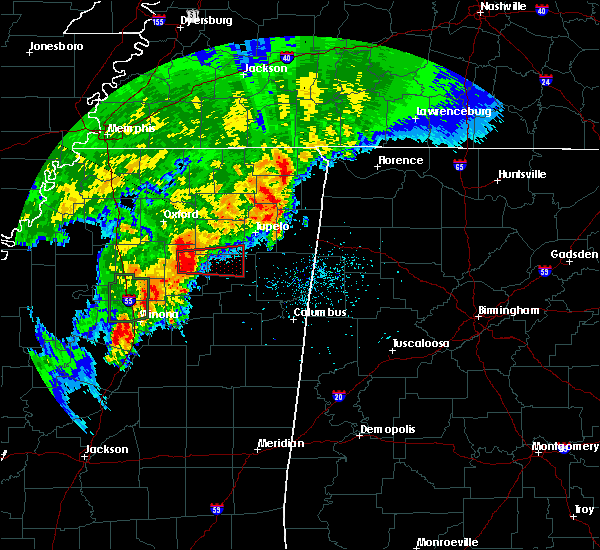 At 233 pm cdt, a severe thunderstorm producing a tornado was located near bruce, or 16 miles northwest of houston, moving east at 35 mph (radar indicated rotation). Hazards include tornado and quarter size hail. Flying debris will be dangerous to those caught without shelter. mobile homes will be damaged or destroyed. damage to roofs, windows, and vehicles will occur. tree damage is likely. this dangerous storm will be near, houlka around 255 pm cdt. houston around 300 pm cdt. trees reported down on highway 9 near bruce. Other locations impacted by this tornadic thunderstorm include parkersburg, thorn, new houlka, reid, robbs, loyd, wallfield, buena vista, matthews and thelma. At 233 pm cdt, a severe thunderstorm producing a tornado was located near bruce, or 16 miles northwest of houston, moving east at 35 mph (radar indicated rotation). Hazards include tornado and quarter size hail. Flying debris will be dangerous to those caught without shelter. mobile homes will be damaged or destroyed. damage to roofs, windows, and vehicles will occur. tree damage is likely. this dangerous storm will be near, houlka around 255 pm cdt. houston around 300 pm cdt. trees reported down on highway 9 near bruce. Other locations impacted by this tornadic thunderstorm include parkersburg, thorn, new houlka, reid, robbs, loyd, wallfield, buena vista, matthews and thelma.
|
| 4/29/2016 2:26 PM CDT |
 At 226 pm cdt, a severe thunderstorm producing a tornado was located near bruce, or 19 miles northwest of houston, moving east at 35 mph (radar indicated rotation). Hazards include tornado. Flying debris will be dangerous to those caught without shelter. mobile homes will be damaged or destroyed. damage to roofs, windows, and vehicles will occur. tree damage is likely. this dangerous storm will be near, houston and houlka around 255 pm cdt. Other locations impacted by this tornadic thunderstorm include parkersburg, thorn, new houlka, reid, robbs, loyd, wallfield, buena vista, matthews and thelma. At 226 pm cdt, a severe thunderstorm producing a tornado was located near bruce, or 19 miles northwest of houston, moving east at 35 mph (radar indicated rotation). Hazards include tornado. Flying debris will be dangerous to those caught without shelter. mobile homes will be damaged or destroyed. damage to roofs, windows, and vehicles will occur. tree damage is likely. this dangerous storm will be near, houston and houlka around 255 pm cdt. Other locations impacted by this tornadic thunderstorm include parkersburg, thorn, new houlka, reid, robbs, loyd, wallfield, buena vista, matthews and thelma.
|
| 3/31/2016 6:53 PM CDT |
 At 653 pm cdt, a severe thunderstorm was located near houston, moving northeast at 35 mph (radar indicated). Hazards include golf ball size hail and 60 mph wind gusts. People and animals outdoors will be injured. expect hail damage to roofs, siding, windows, and vehicles. Expect wind damage to roofs, siding, and trees. At 653 pm cdt, a severe thunderstorm was located near houston, moving northeast at 35 mph (radar indicated). Hazards include golf ball size hail and 60 mph wind gusts. People and animals outdoors will be injured. expect hail damage to roofs, siding, windows, and vehicles. Expect wind damage to roofs, siding, and trees.
|
| 3/31/2016 6:46 PM CDT |
 At 645 pm cdt, a severe thunderstorm was located over verona, moving northeast at 25 mph (radar indicated). Hazards include tennis ball size hail and 60 mph wind gusts. People and animals outdoors will be injured. expect hail damage to roofs, siding, windows, and vehicles. expect wind damage to roofs, siding, and trees. locations impacted include, tupelo, verona, okolona, tombigbee state park, saltillo, shannon, plantersville, houlka, troy, furrs, nettleton, sherman, new houlka, beech springs, eggville, richmond, leotis, mooreville, chiwapa and old union. A tornado watch remains in effect until 1000 pm cdt for northeastern mississippi. At 645 pm cdt, a severe thunderstorm was located over verona, moving northeast at 25 mph (radar indicated). Hazards include tennis ball size hail and 60 mph wind gusts. People and animals outdoors will be injured. expect hail damage to roofs, siding, windows, and vehicles. expect wind damage to roofs, siding, and trees. locations impacted include, tupelo, verona, okolona, tombigbee state park, saltillo, shannon, plantersville, houlka, troy, furrs, nettleton, sherman, new houlka, beech springs, eggville, richmond, leotis, mooreville, chiwapa and old union. A tornado watch remains in effect until 1000 pm cdt for northeastern mississippi.
|
| 3/31/2016 6:14 PM CDT |
 At 614 pm cdt, a severe thunderstorm was located near houlka, or 9 miles west of okolona, moving northeast at 25 mph (radar indicated). Hazards include 60 mph wind gusts and half dollar size hail. Hail damage to vehicles is expected. Expect wind damage to roofs, siding, and trees. At 614 pm cdt, a severe thunderstorm was located near houlka, or 9 miles west of okolona, moving northeast at 25 mph (radar indicated). Hazards include 60 mph wind gusts and half dollar size hail. Hail damage to vehicles is expected. Expect wind damage to roofs, siding, and trees.
|
| 12/28/2015 8:39 AM CST |
 The severe thunderstorm warning for chickasaw, pontotoc, western lee and union counties will expire at 845 am cst, the storm which prompted the warning has weakened below severe limits and exited the warned area. therefore the warning will be allowed to expire. a tornado watch remains in effect until 1000 am cst for northeastern mississippi. The severe thunderstorm warning for chickasaw, pontotoc, western lee and union counties will expire at 845 am cst, the storm which prompted the warning has weakened below severe limits and exited the warned area. therefore the warning will be allowed to expire. a tornado watch remains in effect until 1000 am cst for northeastern mississippi.
|
| 12/28/2015 8:09 AM CST |
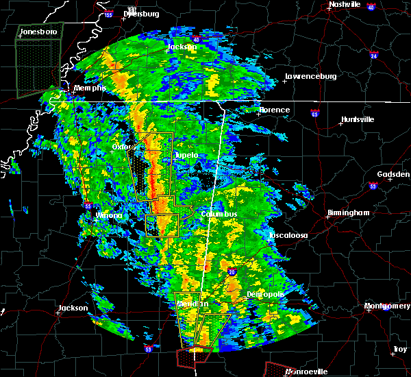 At 809 am cst, a severe thunderstorm was located near ecru, or near trace state park, moving north at 50 mph (radar indicated). Hazards include 60 mph wind gusts. Expect damage to roofs. siding and trees. locations impacted include, tupelo, new albany, pontotoc, houston, okolona, trace state park, ecru, houlka, troy, new harmony, keownville, trebloc, furrs, sherman, thaxton, new houlka, algoma, blue springs, woodland and jericho. A tornado watch remains in effect until 1000 am cst for northeastern mississippi. At 809 am cst, a severe thunderstorm was located near ecru, or near trace state park, moving north at 50 mph (radar indicated). Hazards include 60 mph wind gusts. Expect damage to roofs. siding and trees. locations impacted include, tupelo, new albany, pontotoc, houston, okolona, trace state park, ecru, houlka, troy, new harmony, keownville, trebloc, furrs, sherman, thaxton, new houlka, algoma, blue springs, woodland and jericho. A tornado watch remains in effect until 1000 am cst for northeastern mississippi.
|
| 12/28/2015 7:56 AM CST |
 At 756 am cst, a severe thunderstorm was located near pontotoc, moving north at 50 mph (radar indicated). Hazards include 60 mph wind gusts. Expect damage to roofs. Siding and trees. At 756 am cst, a severe thunderstorm was located near pontotoc, moving north at 50 mph (radar indicated). Hazards include 60 mph wind gusts. Expect damage to roofs. Siding and trees.
|
| 12/25/2015 9:56 AM CST |
 The severe thunderstorm warning for chickasaw and southern calhoun counties will expire at 1000 am cst, the storm which prompted the warning has weakened below severe limits, and no longer poses an immediate threat to life or property. therefore the warning will be allowed to expire. The severe thunderstorm warning for chickasaw and southern calhoun counties will expire at 1000 am cst, the storm which prompted the warning has weakened below severe limits, and no longer poses an immediate threat to life or property. therefore the warning will be allowed to expire.
|
| 12/25/2015 9:28 AM CST |
 At 927 am cst, a severe thunderstorm was located near houlka, or near houston, moving northeast at 55 mph (radar indicated). Hazards include 60 mph wind gusts and penny size hail. Expect damage to roofs. siding and trees. Locations impacted include, houston, okolona, calhoun city, vardaman, derma, pittsboro, slate springs, houlka, sabougla, trebloc, pyland, new houlka, big creek, woodland, tabbville, retreat, loyd, slate spring, sparta and mc condy. At 927 am cst, a severe thunderstorm was located near houlka, or near houston, moving northeast at 55 mph (radar indicated). Hazards include 60 mph wind gusts and penny size hail. Expect damage to roofs. siding and trees. Locations impacted include, houston, okolona, calhoun city, vardaman, derma, pittsboro, slate springs, houlka, sabougla, trebloc, pyland, new houlka, big creek, woodland, tabbville, retreat, loyd, slate spring, sparta and mc condy.
|
| 12/25/2015 9:07 AM CST |
 At 907 am cst, a severe thunderstorm was located over derma, or 15 miles west of houston, moving northeast at 55 mph (radar indicated). Hazards include 60 mph wind gusts and penny size hail. Expect damage to roofs. Siding and trees. At 907 am cst, a severe thunderstorm was located over derma, or 15 miles west of houston, moving northeast at 55 mph (radar indicated). Hazards include 60 mph wind gusts and penny size hail. Expect damage to roofs. Siding and trees.
|
| 8/18/2015 6:05 PM CDT |
 At 605 pm cdt, a severe thunderstorm was located near houlka, or near houston, moving east at 15 mph (radar indicated). Hazards include 60 mph wind gusts and quarter size hail. Hail damage to vehicles is expected. expect wind damage to roofs, siding and trees. Locations impacted include, new houlka, parkersburg and van vleet. At 605 pm cdt, a severe thunderstorm was located near houlka, or near houston, moving east at 15 mph (radar indicated). Hazards include 60 mph wind gusts and quarter size hail. Hail damage to vehicles is expected. expect wind damage to roofs, siding and trees. Locations impacted include, new houlka, parkersburg and van vleet.
|
| 8/18/2015 5:54 PM CDT |
 At 553 pm cdt, a severe thunderstorm was located over houlka, or 7 miles north of houston, moving east at 25 mph (radar indicated). Hazards include 60 mph wind gusts and quarter size hail. Hail damage to vehicles is expected. expect wind damage to roofs, siding and trees. Locations impacted include, houston, houlka, new houlka, parkersburg, thorn, thelma and van vleet. At 553 pm cdt, a severe thunderstorm was located over houlka, or 7 miles north of houston, moving east at 25 mph (radar indicated). Hazards include 60 mph wind gusts and quarter size hail. Hail damage to vehicles is expected. expect wind damage to roofs, siding and trees. Locations impacted include, houston, houlka, new houlka, parkersburg, thorn, thelma and van vleet.
|
| 8/18/2015 5:36 PM CDT |
 At 536 pm cdt, a severe thunderstorm was located near houlka, or 8 miles northwest of houston, moving east at 20 mph (radar indicated). Hazards include 60 mph wind gusts and quarter size hail. Hail damage to vehicles is expected. Expect wind damage to roofs, siding and trees. At 536 pm cdt, a severe thunderstorm was located near houlka, or 8 miles northwest of houston, moving east at 20 mph (radar indicated). Hazards include 60 mph wind gusts and quarter size hail. Hail damage to vehicles is expected. Expect wind damage to roofs, siding and trees.
|
| 8/7/2015 10:10 AM CDT |
 At 1006 am cdt, a severe thunderstorm was located near randolph, or 15 miles west of pontotoc, moving southeast at 55 mph (trained weather spotters. at 1000 am...layfayette county emergency management reported a tree down on old taylor road south of oxford). Hazards include 60 mph wind gusts. Expect damage to roofs. siding and trees. Locations impacted include, pontotoc, bruce, vardaman, houlka, tula, troy, denmark, randolph, paris, pyland, banner, thaxton, new houlka, algoma, taylor, toccopola, sarepta, loyd, springville and buchannan. At 1006 am cdt, a severe thunderstorm was located near randolph, or 15 miles west of pontotoc, moving southeast at 55 mph (trained weather spotters. at 1000 am...layfayette county emergency management reported a tree down on old taylor road south of oxford). Hazards include 60 mph wind gusts. Expect damage to roofs. siding and trees. Locations impacted include, pontotoc, bruce, vardaman, houlka, tula, troy, denmark, randolph, paris, pyland, banner, thaxton, new houlka, algoma, taylor, toccopola, sarepta, loyd, springville and buchannan.
|
| 8/7/2015 9:51 AM CDT |
 At 949 am cdt, a severe thunderstorm was located near oxford, moving southeast at 55 mph (public. at 939 am...a 61 mph wind gust was measured 2 miles north of oxford with several trees uprooted). Hazards include 60 mph wind gusts. Expect damage to roofs. Siding and trees. At 949 am cdt, a severe thunderstorm was located near oxford, moving southeast at 55 mph (public. at 939 am...a 61 mph wind gust was measured 2 miles north of oxford with several trees uprooted). Hazards include 60 mph wind gusts. Expect damage to roofs. Siding and trees.
|
| 7/4/2015 5:07 AM CDT |
 At 507 am cdt, a severe thunderstorm was located near houston, moving east at 45 mph (radar indicated). Hazards include 60 mph wind gusts and quarter size hail. Hail damage to vehicles is expected. Expect wind damage to roofs, siding and trees. At 507 am cdt, a severe thunderstorm was located near houston, moving east at 45 mph (radar indicated). Hazards include 60 mph wind gusts and quarter size hail. Hail damage to vehicles is expected. Expect wind damage to roofs, siding and trees.
|
| 6/24/2015 4:30 PM CDT | Powerlines down near intersection of redland sarepta road and highway 15 in pontotoc county MS, 3.1 miles S of New Houlka, MS |
| 5/24/2015 4:28 PM CDT | Big oak tree uprooted and fell on trailer. no injurie in chickasaw county MS, 4.7 miles E of New Houlka, MS |
| 4/10/2015 1:27 AM CDT | A severe thunderstorm warning remains in effect until 145 am cdt for northern chickasaw. northeastern calhoun. pontotoc and lee counties. at 125 am cdt. a severe thunderstorm was located near troy. or 8 miles southeast of pontotoc. moving east at 50 mph. hazard. 70 mph wind gusts and quarter size hail. |
| 4/10/2015 1:07 AM CDT | The national weather service in memphis has issued a * severe thunderstorm warning for. northern chickasaw county in northeastern mississippi. northeastern calhoun county in northeastern mississippi. pontotoc county in northeastern mississippi. Lee county in northeastern mississippi. |
| 3/31/2015 4:28 PM CDT | The national weather service in memphis has issued a * severe thunderstorm warning for. northwestern chickasaw county in northeastern mississippi. northern calhoun county in northeastern mississippi. southeastern lafayette county in northwestern mississippi. Pontotoc county in northeastern mississippi. |
| 3/18/2013 1:20 PM CDT | Half Dollar sized hail reported 2.7 miles NNW of New Houlka, MS |
| 3/18/2013 1:20 PM CDT | Trees down in chickasaw county MS, 2.7 miles NNW of New Houlka, MS |
| 3/18/2013 12:20 PM CDT | Trees down or uprooted in chickasaw county MS, 3.5 miles WSW of New Houlka, MS |
| 3/8/2012 6:02 PM CST | Numerous trees down along highway 32 in van vleet with cars striking fallen trees. no injuries reported at this tim in chickasaw county MS, 7.5 miles WNW of New Houlka, MS |
| 3/2/2012 8:11 PM CST | Tea Cup sized hail reported 4.7 miles E of New Houlka, MS |
| 1/1/0001 12:00 AM | A few trees and power lines down across southeast pontotoc count in chickasaw county MS, 7.2 miles WSW of New Houlka, MS |
| 1/1/0001 12:00 AM | Multiple trees down along new salem roa in pontotoc county MS, 7.8 miles WSW of New Houlka, MS |
| 1/1/0001 12:00 AM | Numerous trees down in the town of van vleet. a roof was blown off a mobile home. the roof of a porch was lifted and blown over a house. a tree fell also fell onto a ho in chickasaw county MS, 7.5 miles WNW of New Houlka, MS |
Hail Maps for New Houlka, MS


Connect with Interactive Hail Maps