

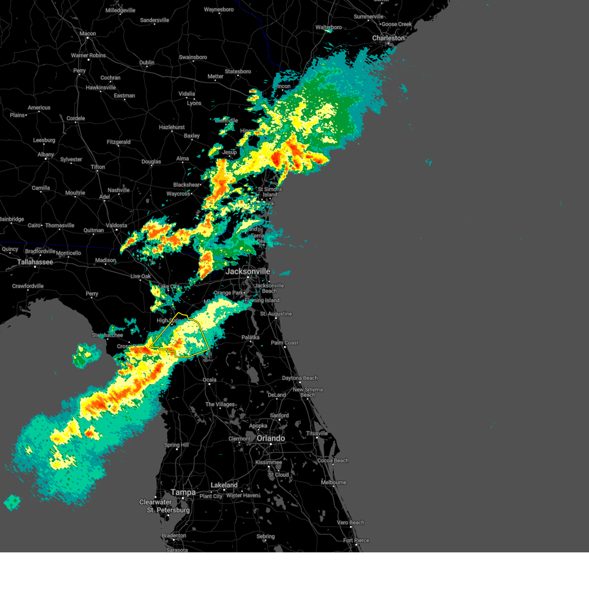
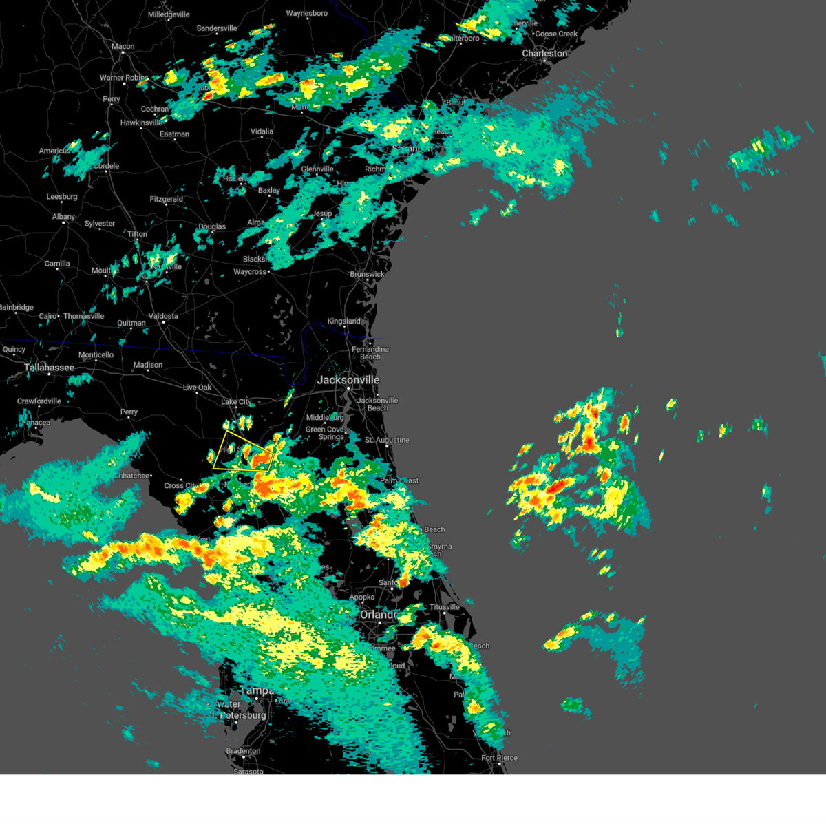
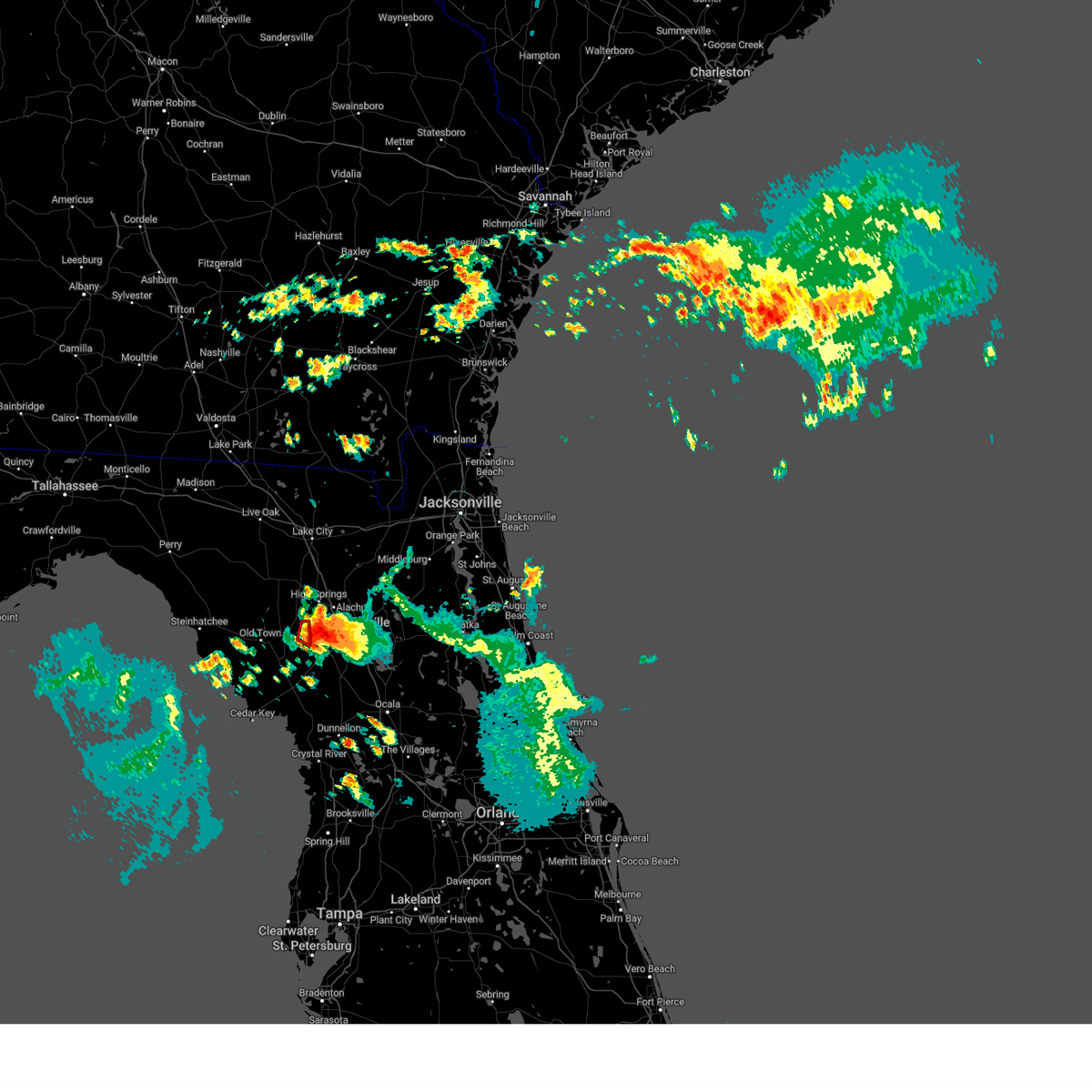
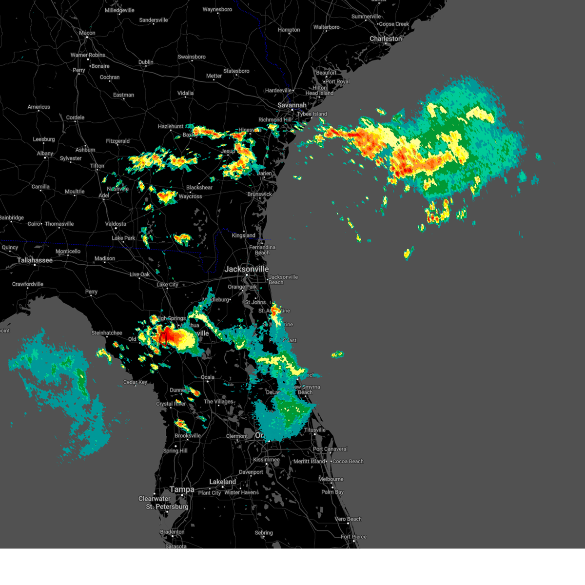
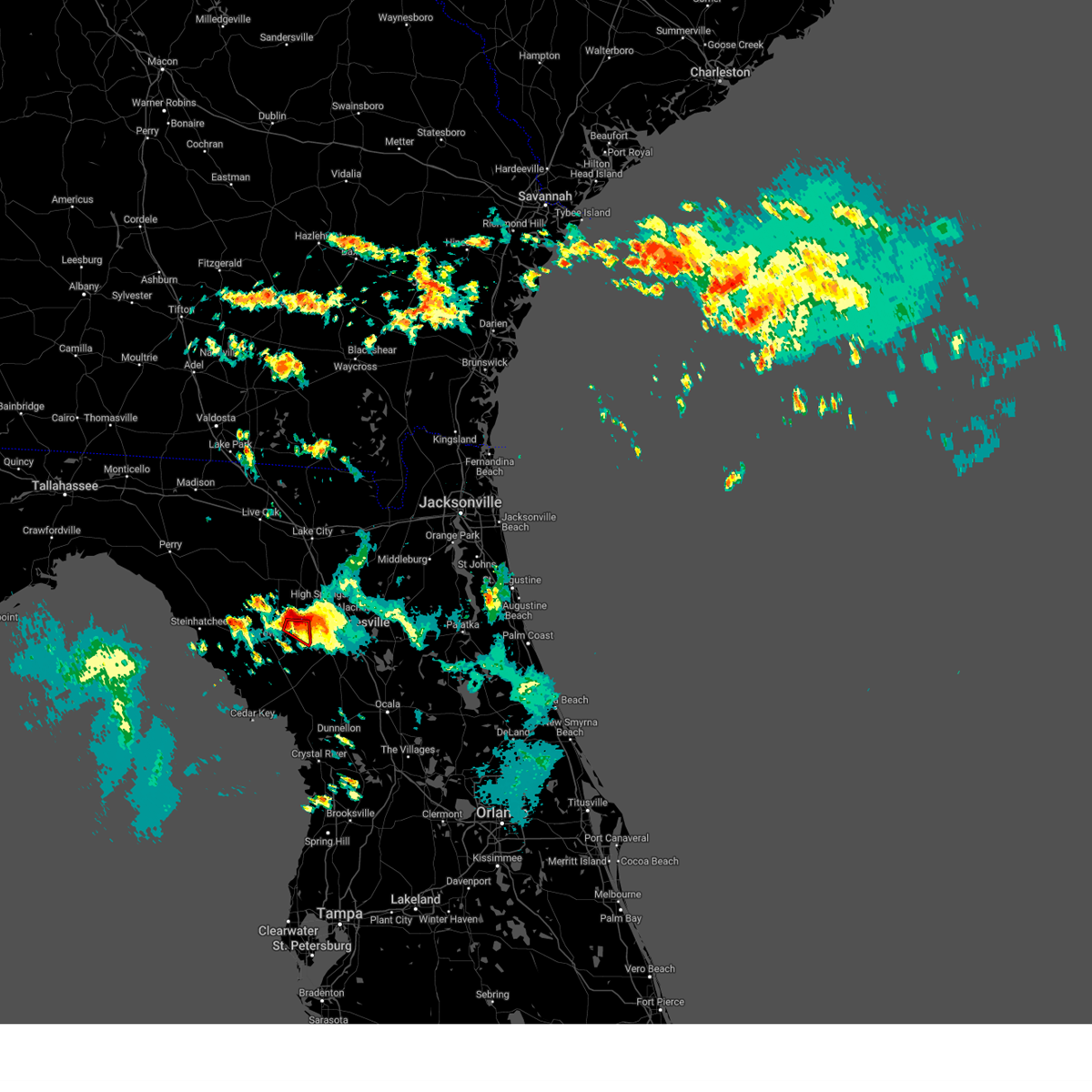
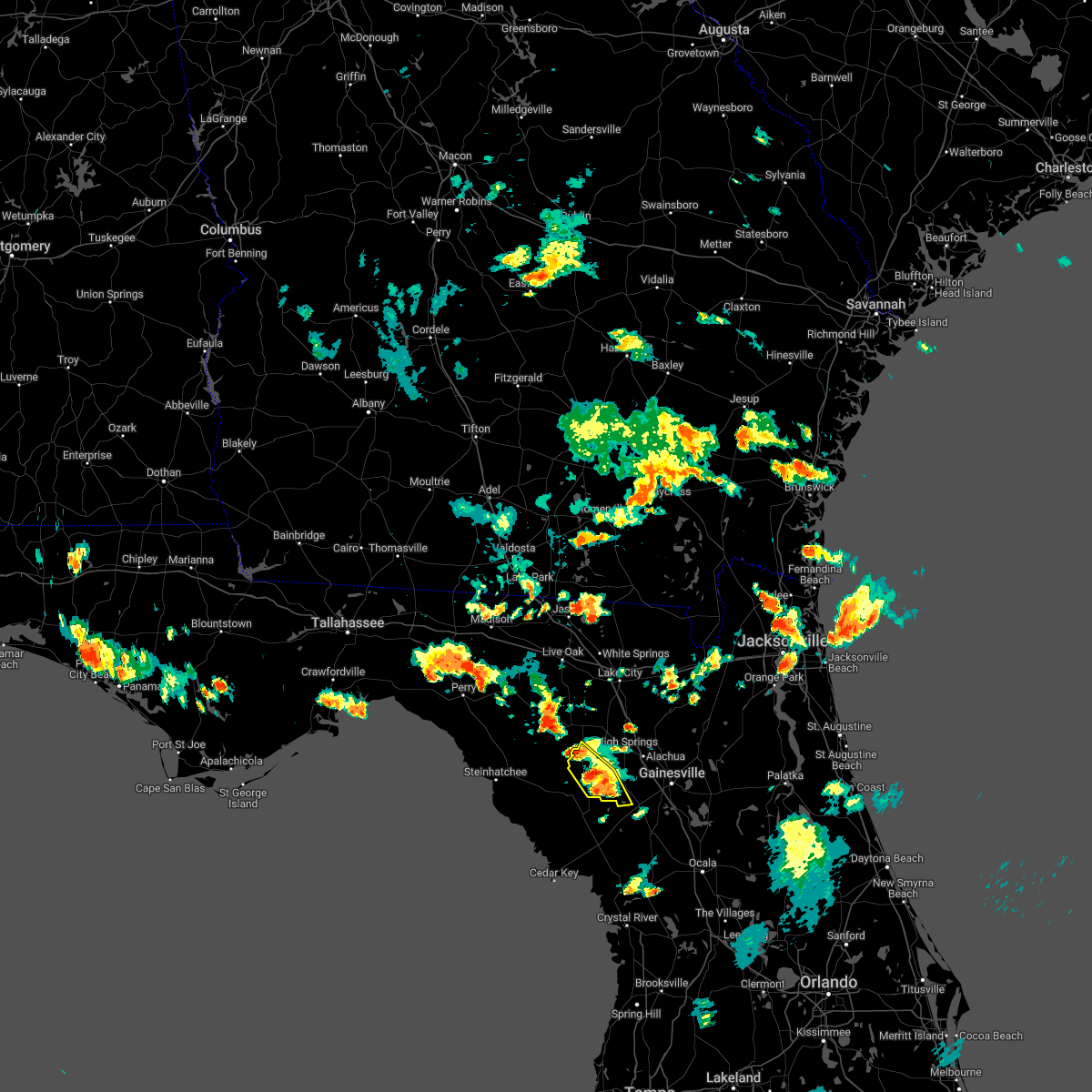
Hail Map for Newberry, FL
The Newberry, FL area has had 0 reports of on-the-ground hail by trained spotters, and has been under severe weather warnings 5 times during the past 12 months. Doppler radar has detected hail at or near Newberry, FL on 95 occasions, including 4 occasions during the past year.
| Name: | Newberry, FL |
| Where Located: | 74.1 miles SW of Jacksonville, FL |
| Map: | Google Map for Newberry, FL |
| Population: | 4950 |
| Housing Units: | 2068 |
| More Info: | Search Google for Newberry, FL |
2
The Top Recent Hail Date for Newberry, FL is Friday, April 11, 2025 (14th out of 95)

Hail and Wind Damage Spotted near Newberry, FL
| Date / Time | Report Details |
|---|---|
| 3/16/2025 12:14 PM EDT |
 the severe thunderstorm warning has been cancelled and is no longer in effect the severe thunderstorm warning has been cancelled and is no longer in effect
|
| 3/16/2025 11:56 AM EDT |
 Svrjax the national weather service in jacksonville has issued a * severe thunderstorm warning for, southeastern gilchrist county in northern florida, alachua county in northern florida, * until 1230 pm edt. * at 1156 am edt, a severe thunderstorm was located near trenton, moving northeast at 40 mph (radar indicated). Hazards include 60 mph wind gusts and penny size hail. expect damage to roofs, siding, and trees Svrjax the national weather service in jacksonville has issued a * severe thunderstorm warning for, southeastern gilchrist county in northern florida, alachua county in northern florida, * until 1230 pm edt. * at 1156 am edt, a severe thunderstorm was located near trenton, moving northeast at 40 mph (radar indicated). Hazards include 60 mph wind gusts and penny size hail. expect damage to roofs, siding, and trees
|
| 8/4/2024 2:56 PM EDT |
 The storm which prompted the warning has weakened below severe limits, and no longer poses an immediate threat to life or property. therefore, the warning will be allowed to expire. however, gusty winds and heavy rain are still possible with this thunderstorm. a tornado watch remains in effect until 800 pm edt for northern florida. The storm which prompted the warning has weakened below severe limits, and no longer poses an immediate threat to life or property. therefore, the warning will be allowed to expire. however, gusty winds and heavy rain are still possible with this thunderstorm. a tornado watch remains in effect until 800 pm edt for northern florida.
|
| 8/4/2024 2:43 PM EDT |
 At 243 pm edt, a severe thunderstorm was located over alachua, or 10 miles southwest of worthington spring, moving northwest at 35 mph (radar indicated). Hazards include 60 mph wind gusts. Expect damage to roofs, siding, and trees. Locations impacted include, alachua, high springs, fort white, and la crosse. At 243 pm edt, a severe thunderstorm was located over alachua, or 10 miles southwest of worthington spring, moving northwest at 35 mph (radar indicated). Hazards include 60 mph wind gusts. Expect damage to roofs, siding, and trees. Locations impacted include, alachua, high springs, fort white, and la crosse.
|
| 8/4/2024 2:33 PM EDT |
 Svrjax the national weather service in jacksonville has issued a * severe thunderstorm warning for, northeastern gilchrist county in northern florida, northwestern alachua county in northern florida, southwestern columbia county in northern florida, * until 300 pm edt. * at 233 pm edt, a severe thunderstorm was located near alachua, or 7 miles northwest of gainesville, moving west at 35 mph (radar indicated). Hazards include 60 mph wind gusts. expect damage to roofs, siding, and trees Svrjax the national weather service in jacksonville has issued a * severe thunderstorm warning for, northeastern gilchrist county in northern florida, northwestern alachua county in northern florida, southwestern columbia county in northern florida, * until 300 pm edt. * at 233 pm edt, a severe thunderstorm was located near alachua, or 7 miles northwest of gainesville, moving west at 35 mph (radar indicated). Hazards include 60 mph wind gusts. expect damage to roofs, siding, and trees
|
| 5/17/2024 9:08 AM EDT |
 The storm which prompted the warning has weakened below severe limits, and no longer poses an immediate threat to life or property. therefore, the warning will be allowed to expire. however, gusty winds are still possible with this thunderstorm. The storm which prompted the warning has weakened below severe limits, and no longer poses an immediate threat to life or property. therefore, the warning will be allowed to expire. however, gusty winds are still possible with this thunderstorm.
|
| 5/17/2024 8:09 AM EDT |
 Svrtbw the national weather service in ruskin has issued a * severe thunderstorm warning for, northwestern citrus county in west central florida, levy county in northern florida, * until 915 am edt. * at 809 am edt, a severe thunderstorm was located 15 miles south of fowlers bluff, or 25 miles southwest of chiefland, moving northeast at 25 mph (radar indicated). Hazards include 70 mph wind gusts. Expect considerable tree damage. Damage is likely to mobile homes, roofs, and outbuildings. Svrtbw the national weather service in ruskin has issued a * severe thunderstorm warning for, northwestern citrus county in west central florida, levy county in northern florida, * until 915 am edt. * at 809 am edt, a severe thunderstorm was located 15 miles south of fowlers bluff, or 25 miles southwest of chiefland, moving northeast at 25 mph (radar indicated). Hazards include 70 mph wind gusts. Expect considerable tree damage. Damage is likely to mobile homes, roofs, and outbuildings.
|
| 5/10/2024 8:44 AM EDT |
 Svrjax the national weather service in jacksonville has issued a * severe thunderstorm warning for, nassau county in northeastern florida, bradford county in northern florida, alachua county in northern florida, north central marion county in northern florida, baker county in northeastern florida, northwestern putnam county in northeastern florida, union county in northern florida, western clay county in northeastern florida, western duval county in northeastern florida, southwestern camden county in southeastern georgia, southeastern ware county in southeastern georgia, charlton county in southeastern georgia, * until 915 am edt. * at 843 am edt, severe thunderstorms were located along a line extending from 9 miles south of argyle to near lulu to 7 miles southeast of cross city, moving east at 70 mph. these are destructive storms for lake butler, starke, gainesville, macclenny, baldwin, and hilliard. (radar indicated). Hazards include 80 mph wind gusts and quarter size hail. Flying debris will be dangerous to those caught without shelter. mobile homes will be heavily damaged. expect considerable damage to roofs, windows, and vehicles. Extensive tree damage and power outages are likely. Svrjax the national weather service in jacksonville has issued a * severe thunderstorm warning for, nassau county in northeastern florida, bradford county in northern florida, alachua county in northern florida, north central marion county in northern florida, baker county in northeastern florida, northwestern putnam county in northeastern florida, union county in northern florida, western clay county in northeastern florida, western duval county in northeastern florida, southwestern camden county in southeastern georgia, southeastern ware county in southeastern georgia, charlton county in southeastern georgia, * until 915 am edt. * at 843 am edt, severe thunderstorms were located along a line extending from 9 miles south of argyle to near lulu to 7 miles southeast of cross city, moving east at 70 mph. these are destructive storms for lake butler, starke, gainesville, macclenny, baldwin, and hilliard. (radar indicated). Hazards include 80 mph wind gusts and quarter size hail. Flying debris will be dangerous to those caught without shelter. mobile homes will be heavily damaged. expect considerable damage to roofs, windows, and vehicles. Extensive tree damage and power outages are likely.
|
| 5/10/2024 8:23 AM EDT |
 Svrtbw the national weather service in ruskin has issued a * severe thunderstorm warning for, northern levy county in northern florida, * until 900 am edt. * at 823 am edt, severe thunderstorms were located along a line extending from near belmont to fort white to near cross city, moving east at 40 mph (radar indicated). Hazards include 60 mph wind gusts. expect damage to roofs, siding, and trees Svrtbw the national weather service in ruskin has issued a * severe thunderstorm warning for, northern levy county in northern florida, * until 900 am edt. * at 823 am edt, severe thunderstorms were located along a line extending from near belmont to fort white to near cross city, moving east at 40 mph (radar indicated). Hazards include 60 mph wind gusts. expect damage to roofs, siding, and trees
|
| 5/10/2024 8:18 AM EDT |
 Svrjax the national weather service in jacksonville has issued a * severe thunderstorm warning for, gilchrist county in northern florida, western alachua county in northern florida, baker county in northeastern florida, union county in northern florida, southeastern suwannee county in northern florida, columbia county in northern florida, eastern hamilton county in northern florida, southeastern echols county in southeastern georgia, southern ware county in southeastern georgia, southeastern clinch county in southeastern georgia, central charlton county in southeastern georgia, * until 900 am edt. * at 818 am edt, severe thunderstorms were located along a line extending from 6 miles south of homerville to near white springs to near cross city, moving east at 60 mph (radar indicated). Hazards include 70 mph wind gusts and quarter size hail. Hail damage to vehicles is expected. expect considerable tree damage. Wind damage is also likely to mobile homes, roofs, and outbuildings. Svrjax the national weather service in jacksonville has issued a * severe thunderstorm warning for, gilchrist county in northern florida, western alachua county in northern florida, baker county in northeastern florida, union county in northern florida, southeastern suwannee county in northern florida, columbia county in northern florida, eastern hamilton county in northern florida, southeastern echols county in southeastern georgia, southern ware county in southeastern georgia, southeastern clinch county in southeastern georgia, central charlton county in southeastern georgia, * until 900 am edt. * at 818 am edt, severe thunderstorms were located along a line extending from 6 miles south of homerville to near white springs to near cross city, moving east at 60 mph (radar indicated). Hazards include 70 mph wind gusts and quarter size hail. Hail damage to vehicles is expected. expect considerable tree damage. Wind damage is also likely to mobile homes, roofs, and outbuildings.
|
| 4/11/2024 9:53 AM EDT |
 Svrtbw the national weather service in ruskin has issued a * severe thunderstorm warning for, levy county in northern florida, * until 1015 am edt. * at 951 am edt, severe thunderstorms were located along a line extending from fowlers bluff to 10 miles south of chiefland to 18 miles southwest of williston highlands, moving northeast at 30 mph (radar indicated). Hazards include 60 mph wind gusts. expect damage to roofs, siding, and trees Svrtbw the national weather service in ruskin has issued a * severe thunderstorm warning for, levy county in northern florida, * until 1015 am edt. * at 951 am edt, severe thunderstorms were located along a line extending from fowlers bluff to 10 miles south of chiefland to 18 miles southwest of williston highlands, moving northeast at 30 mph (radar indicated). Hazards include 60 mph wind gusts. expect damage to roofs, siding, and trees
|
| 4/3/2024 10:59 AM EDT |
 At 1059 am edt, severe thunderstorms were located along a line extending from near glen st. mary to near high springs, moving east at 50 mph (radar indicated). Hazards include 60 mph wind gusts and penny size hail. Expect damage to roofs, siding, and trees. Locations impacted include, lake butler, raiford, worthington spring, alachua, macclenny, high springs, worthington springs, groves, beasley, and new river. At 1059 am edt, severe thunderstorms were located along a line extending from near glen st. mary to near high springs, moving east at 50 mph (radar indicated). Hazards include 60 mph wind gusts and penny size hail. Expect damage to roofs, siding, and trees. Locations impacted include, lake butler, raiford, worthington spring, alachua, macclenny, high springs, worthington springs, groves, beasley, and new river.
|
| 4/3/2024 10:59 AM EDT |
 the severe thunderstorm warning has been cancelled and is no longer in effect the severe thunderstorm warning has been cancelled and is no longer in effect
|
| 4/3/2024 10:47 AM EDT |
 At 1047 am edt, severe thunderstorms were located along a line extending from near sanderson to near high springs, moving east at 50 mph (radar indicated). Hazards include 60 mph wind gusts and penny size hail. Expect damage to roofs, siding, and trees. locations impacted include, lake butler, bell, raiford, worthington spring, alachua, macclenny, high springs, glen st. Mary, worthington springs, and palestine community. At 1047 am edt, severe thunderstorms were located along a line extending from near sanderson to near high springs, moving east at 50 mph (radar indicated). Hazards include 60 mph wind gusts and penny size hail. Expect damage to roofs, siding, and trees. locations impacted include, lake butler, bell, raiford, worthington spring, alachua, macclenny, high springs, glen st. Mary, worthington springs, and palestine community.
|
| 4/3/2024 10:31 AM EDT |
 the severe thunderstorm warning has been cancelled and is no longer in effect the severe thunderstorm warning has been cancelled and is no longer in effect
|
| 4/3/2024 10:31 AM EDT |
 At 1030 am edt, severe thunderstorms were located along a line extending from near watertown to near bell, moving east at 40 mph (radar indicated). Hazards include 60 mph wind gusts and penny size hail. Expect damage to roofs, siding, and trees. Locations impacted include, lake city, lake butler, bell, raiford, worthington spring, columbia, alachua, macclenny, high springs, and fort white. At 1030 am edt, severe thunderstorms were located along a line extending from near watertown to near bell, moving east at 40 mph (radar indicated). Hazards include 60 mph wind gusts and penny size hail. Expect damage to roofs, siding, and trees. Locations impacted include, lake city, lake butler, bell, raiford, worthington spring, columbia, alachua, macclenny, high springs, and fort white.
|
| 4/3/2024 10:12 AM EDT |
 Svrjax the national weather service in jacksonville has issued a * severe thunderstorm warning for, central gilchrist county in northern florida, central bradford county in northern florida, northwestern alachua county in northern florida, southern baker county in northeastern florida, union county in northern florida, southeastern suwannee county in northern florida, southern columbia county in northern florida, * until 1115 am edt. * at 1012 am edt, severe thunderstorms were located along a line extending from near wellborn to 6 miles north of bell, moving east at 35 mph (radar indicated). Hazards include 60 mph wind gusts and penny size hail. expect damage to roofs, siding, and trees Svrjax the national weather service in jacksonville has issued a * severe thunderstorm warning for, central gilchrist county in northern florida, central bradford county in northern florida, northwestern alachua county in northern florida, southern baker county in northeastern florida, union county in northern florida, southeastern suwannee county in northern florida, southern columbia county in northern florida, * until 1115 am edt. * at 1012 am edt, severe thunderstorms were located along a line extending from near wellborn to 6 miles north of bell, moving east at 35 mph (radar indicated). Hazards include 60 mph wind gusts and penny size hail. expect damage to roofs, siding, and trees
|
| 3/27/2024 9:21 AM EDT |
 The storms which prompted the warning have weakened below severe limits, and have exited the warned area. therefore, the warning will be allowed to expire. however, gusty winds and heavy rain are still possible with these thunderstorms. The storms which prompted the warning have weakened below severe limits, and have exited the warned area. therefore, the warning will be allowed to expire. however, gusty winds and heavy rain are still possible with these thunderstorms.
|
| 3/27/2024 9:13 AM EDT |
 At 913 am edt, severe thunderstorms were located along a line extending from near fort white to near bronson, moving east at 45 mph (radar indicated). Hazards include 60 mph wind gusts. Expect damage to roofs, siding, and trees. Locations impacted include, trenton, high springs, and newberry. At 913 am edt, severe thunderstorms were located along a line extending from near fort white to near bronson, moving east at 45 mph (radar indicated). Hazards include 60 mph wind gusts. Expect damage to roofs, siding, and trees. Locations impacted include, trenton, high springs, and newberry.
|
| 3/27/2024 9:12 AM EDT |
 The storms which prompted the warning have weakened below severe limits, and no longer pose an immediate threat to life or property. therefore, the warning will be allowed to expire. however, small hail and gusty winds are still possible with these thunderstorms. The storms which prompted the warning have weakened below severe limits, and no longer pose an immediate threat to life or property. therefore, the warning will be allowed to expire. however, small hail and gusty winds are still possible with these thunderstorms.
|
| 3/27/2024 8:57 AM EDT |
 At 857 am edt, severe thunderstorms were located along a line extending from 6 miles southwest of ichetucknee spring to near chiefland, moving northeast at 40 mph (radar indicated). Hazards include 60 mph wind gusts and penny size hail. Expect damage to roofs, siding, and trees. Locations impacted include, trenton, bell, high springs, and newberry. At 857 am edt, severe thunderstorms were located along a line extending from 6 miles southwest of ichetucknee spring to near chiefland, moving northeast at 40 mph (radar indicated). Hazards include 60 mph wind gusts and penny size hail. Expect damage to roofs, siding, and trees. Locations impacted include, trenton, bell, high springs, and newberry.
|
| 3/27/2024 8:38 AM EDT |
 Svrjax the national weather service in jacksonville has issued a * severe thunderstorm warning for, gilchrist county in northern florida, northwestern alachua county in northern florida, south central columbia county in northern florida, * until 930 am edt. * at 838 am edt, severe thunderstorms were located along a line extending from 10 miles northwest of bell to 21 miles southwest of fowlers bluff, moving east at 40 mph (radar indicated). Hazards include 60 mph wind gusts and penny size hail. expect damage to roofs, siding, and trees Svrjax the national weather service in jacksonville has issued a * severe thunderstorm warning for, gilchrist county in northern florida, northwestern alachua county in northern florida, south central columbia county in northern florida, * until 930 am edt. * at 838 am edt, severe thunderstorms were located along a line extending from 10 miles northwest of bell to 21 miles southwest of fowlers bluff, moving east at 40 mph (radar indicated). Hazards include 60 mph wind gusts and penny size hail. expect damage to roofs, siding, and trees
|
| 3/27/2024 8:23 AM EDT |
 Svrtbw the national weather service in ruskin has issued a * severe thunderstorm warning for, levy county in northern florida, * until 915 am edt. * at 823 am edt, severe thunderstorms were located along a line extending from near horseshoe point to 22 miles southwest of fowlers bluff to 49 miles south of steinhatchee, moving east at 50 mph (radar indicated). Hazards include 60 mph wind gusts and quarter size hail. Hail damage to vehicles is expected. Expect wind damage to roofs, siding, and trees. Svrtbw the national weather service in ruskin has issued a * severe thunderstorm warning for, levy county in northern florida, * until 915 am edt. * at 823 am edt, severe thunderstorms were located along a line extending from near horseshoe point to 22 miles southwest of fowlers bluff to 49 miles south of steinhatchee, moving east at 50 mph (radar indicated). Hazards include 60 mph wind gusts and quarter size hail. Hail damage to vehicles is expected. Expect wind damage to roofs, siding, and trees.
|
| 1/9/2024 2:57 PM EST |
 At 257 pm est, severe thunderstorms were located along a line extending from near alachua to 15 miles west of rainbow lakes estates, moving east at 35 mph (radar indicated). Hazards include 60 mph wind gusts. expect damage to roofs, siding, and trees At 257 pm est, severe thunderstorms were located along a line extending from near alachua to 15 miles west of rainbow lakes estates, moving east at 35 mph (radar indicated). Hazards include 60 mph wind gusts. expect damage to roofs, siding, and trees
|
| 1/9/2024 2:55 PM EST |
 At 255 pm est, a severe thunderstorm capable of producing a tornado was located 7 miles north of gainesville airport, or 9 miles northeast of gainesville, moving northeast at 80 mph (radar indicated rotation). Hazards include tornado. Flying debris will be dangerous to those caught without shelter. mobile homes will be damaged or destroyed. damage to roofs, windows, and vehicles will occur. tree damage is likely. This tornadic thunderstorm will remain over mainly rural areas of central alachua county, including the following locations, waldo. At 255 pm est, a severe thunderstorm capable of producing a tornado was located 7 miles north of gainesville airport, or 9 miles northeast of gainesville, moving northeast at 80 mph (radar indicated rotation). Hazards include tornado. Flying debris will be dangerous to those caught without shelter. mobile homes will be damaged or destroyed. damage to roofs, windows, and vehicles will occur. tree damage is likely. This tornadic thunderstorm will remain over mainly rural areas of central alachua county, including the following locations, waldo.
|
| 1/9/2024 2:38 PM EST |
 At 238 pm est, a severe thunderstorm capable of producing a tornado was located over archer, or 9 miles northeast of bronson, moving northeast at 80 mph (radar indicated rotation). Hazards include tornado. Flying debris will be dangerous to those caught without shelter. mobile homes will be damaged or destroyed. damage to roofs, windows, and vehicles will occur. tree damage is likely. this dangerous storm will be near, gainesville, alachua, and university of florida around 245 pm est. Other locations impacted by this tornadic thunderstorm include newberry and waldo. At 238 pm est, a severe thunderstorm capable of producing a tornado was located over archer, or 9 miles northeast of bronson, moving northeast at 80 mph (radar indicated rotation). Hazards include tornado. Flying debris will be dangerous to those caught without shelter. mobile homes will be damaged or destroyed. damage to roofs, windows, and vehicles will occur. tree damage is likely. this dangerous storm will be near, gainesville, alachua, and university of florida around 245 pm est. Other locations impacted by this tornadic thunderstorm include newberry and waldo.
|
| 1/9/2024 2:24 PM EST |
 The severe thunderstorm warning for gilchrist and west central alachua counties will expire at 230 pm est, the storms which prompted the warning have weakened below severe limits, and no longer pose an immediate threat to life or property. therefore, the warning will be allowed to expire. however, gusty winds are still possible with these thunderstorms. a tornado watch remains in effect until 300 pm est for northern florida. a tornado watch also remains in effect until 600 pm est for northern florida. The severe thunderstorm warning for gilchrist and west central alachua counties will expire at 230 pm est, the storms which prompted the warning have weakened below severe limits, and no longer pose an immediate threat to life or property. therefore, the warning will be allowed to expire. however, gusty winds are still possible with these thunderstorms. a tornado watch remains in effect until 300 pm est for northern florida. a tornado watch also remains in effect until 600 pm est for northern florida.
|
| 1/9/2024 2:09 PM EST |
 At 209 pm est, severe thunderstorms were located along a line extending from near high springs to 20 miles northwest of crystal river airport, moving east at 45 mph (radar indicated). Hazards include 60 mph wind gusts. expect damage to roofs, siding, and trees At 209 pm est, severe thunderstorms were located along a line extending from near high springs to 20 miles northwest of crystal river airport, moving east at 45 mph (radar indicated). Hazards include 60 mph wind gusts. expect damage to roofs, siding, and trees
|
| 1/9/2024 1:48 PM EST |
 At 147 pm est, severe thunderstorms were located along a line extending from manattee road to 38 miles south of horseshoe point, moving east at 40 mph (radar indicated). Hazards include 60 mph wind gusts. expect damage to roofs, siding, and trees At 147 pm est, severe thunderstorms were located along a line extending from manattee road to 38 miles south of horseshoe point, moving east at 40 mph (radar indicated). Hazards include 60 mph wind gusts. expect damage to roofs, siding, and trees
|
| 1/9/2024 1:39 PM EST |
 At 139 pm est, severe thunderstorms were located along a line extending from 7 miles south of obrien to 6 miles southwest of fowlers bluff, moving east at 30 mph (radar indicated). Hazards include 60 mph wind gusts. expect damage to roofs, siding, and trees At 139 pm est, severe thunderstorms were located along a line extending from 7 miles south of obrien to 6 miles southwest of fowlers bluff, moving east at 30 mph (radar indicated). Hazards include 60 mph wind gusts. expect damage to roofs, siding, and trees
|
| 10/12/2023 1:34 AM EDT |
 At 133 am edt, a severe thunderstorm was located 8 miles southwest of bronson, moving northeast at 35 mph (radar indicated). Hazards include 60 mph wind gusts. Expect damage to roofs, siding, and trees. Locations impacted include, williston, bronson, otter creek, williston highlands, east bronson, and williston municipal airport. At 133 am edt, a severe thunderstorm was located 8 miles southwest of bronson, moving northeast at 35 mph (radar indicated). Hazards include 60 mph wind gusts. Expect damage to roofs, siding, and trees. Locations impacted include, williston, bronson, otter creek, williston highlands, east bronson, and williston municipal airport.
|
| 10/12/2023 1:01 AM EDT |
 At 101 am edt, a severe thunderstorm was located 16 miles south of fowlers bluff, or 22 miles south of chiefland, moving northeast at 45 mph (radar indicated). Hazards include 60 mph wind gusts. expect damage to roofs, siding, and trees At 101 am edt, a severe thunderstorm was located 16 miles south of fowlers bluff, or 22 miles south of chiefland, moving northeast at 45 mph (radar indicated). Hazards include 60 mph wind gusts. expect damage to roofs, siding, and trees
|
| 7/30/2023 9:21 PM EDT |
 The severe thunderstorm warning for bradford, alachua, northeastern marion, western putnam, union and southwestern clay counties will expire at 930 pm edt, the storms which prompted the warning have weakened below severe limits, and no longer pose an immediate threat to life or property. therefore, the warning will be allowed to expire. however gusty winds and heavy rain are still possible with these thunderstorms. The severe thunderstorm warning for bradford, alachua, northeastern marion, western putnam, union and southwestern clay counties will expire at 930 pm edt, the storms which prompted the warning have weakened below severe limits, and no longer pose an immediate threat to life or property. therefore, the warning will be allowed to expire. however gusty winds and heavy rain are still possible with these thunderstorms.
|
| 7/30/2023 8:55 PM EDT |
 At 855 pm edt, severe thunderstorms were located along a line extending from near worthington spring to near lake delancy, moving southwest at 20 mph (radar indicated). Hazards include 60 mph wind gusts. expect damage to roofs, siding, and trees At 855 pm edt, severe thunderstorms were located along a line extending from near worthington spring to near lake delancy, moving southwest at 20 mph (radar indicated). Hazards include 60 mph wind gusts. expect damage to roofs, siding, and trees
|
| 6/16/2023 7:45 AM EDT |
 At 745 am edt, a severe thunderstorm was located near archer, or 10 miles southwest of gainesville, moving east at 25 mph (radar indicated). Hazards include 60 mph wind gusts and quarter size hail. Hail damage to vehicles is expected. Expect wind damage to roofs, siding, and trees. At 745 am edt, a severe thunderstorm was located near archer, or 10 miles southwest of gainesville, moving east at 25 mph (radar indicated). Hazards include 60 mph wind gusts and quarter size hail. Hail damage to vehicles is expected. Expect wind damage to roofs, siding, and trees.
|
| 6/16/2023 7:38 AM EDT |
 At 738 am edt, a severe thunderstorm was located near archer, or 10 miles southwest of gainesville, moving southeast at 20 mph (radar indicated). Hazards include 60 mph wind gusts and quarter size hail. Hail damage to vehicles is expected. expect wind damage to roofs, siding, and trees. Locations impacted include, gainesville, archer and university of florida. At 738 am edt, a severe thunderstorm was located near archer, or 10 miles southwest of gainesville, moving southeast at 20 mph (radar indicated). Hazards include 60 mph wind gusts and quarter size hail. Hail damage to vehicles is expected. expect wind damage to roofs, siding, and trees. Locations impacted include, gainesville, archer and university of florida.
|
| 6/16/2023 7:37 AM EDT |
 The tornado warning for southwestern alachua county will expire at 745 am edt, the tornado threat has diminished and the tornado warning has been cancelled. however, large hail and damaging winds remain likely and a severe thunderstorm warning remains in effect for the area. The tornado warning for southwestern alachua county will expire at 745 am edt, the tornado threat has diminished and the tornado warning has been cancelled. however, large hail and damaging winds remain likely and a severe thunderstorm warning remains in effect for the area.
|
| 6/16/2023 7:34 AM EDT |
 At 734 am edt, a severe thunderstorm capable of producing a tornado was located over archer, or 9 miles northeast of bronson, moving southeast at 25 mph (radar indicated rotation). Hazards include tornado and quarter size hail. Flying debris will be dangerous to those caught without shelter. mobile homes will be damaged or destroyed. damage to roofs, windows, and vehicles will occur. tree damage is likely. This dangerous storm will be near, archer around 740 am edt. At 734 am edt, a severe thunderstorm capable of producing a tornado was located over archer, or 9 miles northeast of bronson, moving southeast at 25 mph (radar indicated rotation). Hazards include tornado and quarter size hail. Flying debris will be dangerous to those caught without shelter. mobile homes will be damaged or destroyed. damage to roofs, windows, and vehicles will occur. tree damage is likely. This dangerous storm will be near, archer around 740 am edt.
|
| 6/16/2023 7:24 AM EDT |
 At 724 am edt, a severe thunderstorm was located near archer, or 13 miles north of bronson, moving southeast at 20 mph (radar indicated). Hazards include 60 mph wind gusts and quarter size hail. Hail damage to vehicles is expected. expect wind damage to roofs, siding, and trees. Locations impacted include, gainesville, archer, university of florida and newberry. At 724 am edt, a severe thunderstorm was located near archer, or 13 miles north of bronson, moving southeast at 20 mph (radar indicated). Hazards include 60 mph wind gusts and quarter size hail. Hail damage to vehicles is expected. expect wind damage to roofs, siding, and trees. Locations impacted include, gainesville, archer, university of florida and newberry.
|
| 6/16/2023 7:23 AM EDT |
 At 722 am edt, a severe thunderstorm capable of producing a tornado was located 7 miles northwest of archer, or 10 miles north of bronson, moving southeast at 25 mph (radar indicated rotation). Hazards include tornado and quarter size hail. Flying debris will be dangerous to those caught without shelter. mobile homes will be damaged or destroyed. damage to roofs, windows, and vehicles will occur. tree damage is likely. this dangerous storm will be near, archer around 740 am edt. Other locations impacted by this tornadic thunderstorm include newberry. At 722 am edt, a severe thunderstorm capable of producing a tornado was located 7 miles northwest of archer, or 10 miles north of bronson, moving southeast at 25 mph (radar indicated rotation). Hazards include tornado and quarter size hail. Flying debris will be dangerous to those caught without shelter. mobile homes will be damaged or destroyed. damage to roofs, windows, and vehicles will occur. tree damage is likely. this dangerous storm will be near, archer around 740 am edt. Other locations impacted by this tornadic thunderstorm include newberry.
|
| 6/16/2023 7:23 AM EDT |
 The tornado warning for southeastern gilchrist county will expire at 730 am edt, the storm which prompted the warning has moved out of the area. therefore, the warning will be allowed to expire. The tornado warning for southeastern gilchrist county will expire at 730 am edt, the storm which prompted the warning has moved out of the area. therefore, the warning will be allowed to expire.
|
| 6/16/2023 7:13 AM EDT |
 At 713 am edt, a severe thunderstorm capable of producing a tornado was located 8 miles east of trenton, moving southeast at 25 mph (radar indicated rotation). Hazards include tornado and quarter size hail. Flying debris will be dangerous to those caught without shelter. mobile homes will be damaged or destroyed. damage to roofs, windows, and vehicles will occur. tree damage is likely. this dangerous storm will be near, archer around 740 am edt. Other locations impacted by this tornadic thunderstorm include newberry. At 713 am edt, a severe thunderstorm capable of producing a tornado was located 8 miles east of trenton, moving southeast at 25 mph (radar indicated rotation). Hazards include tornado and quarter size hail. Flying debris will be dangerous to those caught without shelter. mobile homes will be damaged or destroyed. damage to roofs, windows, and vehicles will occur. tree damage is likely. this dangerous storm will be near, archer around 740 am edt. Other locations impacted by this tornadic thunderstorm include newberry.
|
| 6/16/2023 7:10 AM EDT |
 At 710 am edt, a severe thunderstorm was located 10 miles south of high springs, or 11 miles east of trenton, moving southeast at 20 mph (radar indicated). Hazards include 60 mph wind gusts and quarter size hail. Hail damage to vehicles is expected. Expect wind damage to roofs, siding, and trees. At 710 am edt, a severe thunderstorm was located 10 miles south of high springs, or 11 miles east of trenton, moving southeast at 20 mph (radar indicated). Hazards include 60 mph wind gusts and quarter size hail. Hail damage to vehicles is expected. Expect wind damage to roofs, siding, and trees.
|
| 6/16/2023 7:09 AM EDT |
 At 709 am edt, a severe thunderstorm capable of producing a tornado was located 7 miles east of trenton, moving east at 20 mph (radar indicated rotation). Hazards include tornado and quarter size hail. Flying debris will be dangerous to those caught without shelter. mobile homes will be damaged or destroyed. damage to roofs, windows, and vehicles will occur. tree damage is likely. This tornadic thunderstorm will remain over mainly rural areas of southeastern gilchrist county. At 709 am edt, a severe thunderstorm capable of producing a tornado was located 7 miles east of trenton, moving east at 20 mph (radar indicated rotation). Hazards include tornado and quarter size hail. Flying debris will be dangerous to those caught without shelter. mobile homes will be damaged or destroyed. damage to roofs, windows, and vehicles will occur. tree damage is likely. This tornadic thunderstorm will remain over mainly rural areas of southeastern gilchrist county.
|
| 6/16/2023 6:54 AM EDT |
 At 654 am edt, a severe thunderstorm capable of producing a tornado was located near trenton, moving southeast at 20 mph (radar indicated rotation). Hazards include tornado and quarter size hail. Flying debris will be dangerous to those caught without shelter. mobile homes will be damaged or destroyed. damage to roofs, windows, and vehicles will occur. tree damage is likely. This tornadic thunderstorm will remain over mainly rural areas of southeastern gilchrist county. At 654 am edt, a severe thunderstorm capable of producing a tornado was located near trenton, moving southeast at 20 mph (radar indicated rotation). Hazards include tornado and quarter size hail. Flying debris will be dangerous to those caught without shelter. mobile homes will be damaged or destroyed. damage to roofs, windows, and vehicles will occur. tree damage is likely. This tornadic thunderstorm will remain over mainly rural areas of southeastern gilchrist county.
|
| 6/16/2023 6:45 AM EDT |
 At 645 am edt, a severe thunderstorm was located near bell, moving southeast at 20 mph (radar indicated). Hazards include 60 mph wind gusts and penny size hail. Expect damage to roofs, siding, and trees. Locations impacted include, trenton and newberry. At 645 am edt, a severe thunderstorm was located near bell, moving southeast at 20 mph (radar indicated). Hazards include 60 mph wind gusts and penny size hail. Expect damage to roofs, siding, and trees. Locations impacted include, trenton and newberry.
|
| 6/16/2023 6:29 AM EDT |
 At 629 am edt, a severe thunderstorm was located over bell, moving east at 20 mph (radar indicated). Hazards include 60 mph wind gusts and penny size hail. expect damage to roofs, siding, and trees At 629 am edt, a severe thunderstorm was located over bell, moving east at 20 mph (radar indicated). Hazards include 60 mph wind gusts and penny size hail. expect damage to roofs, siding, and trees
|
| 6/14/2023 11:21 PM EDT |
 At 1121 pm edt, severe thunderstorms were located along a line extending from near worthington spring to near archer to 7 miles southeast of fowlers bluff, moving southeast at 40 mph (radar indicated). Hazards include 70 mph wind gusts. Expect considerable tree damage. damage is likely to mobile homes, roofs, and outbuildings. locations impacted include, gainesville, alachua, high springs, hawthorne, archer, university of florida, rochelle, cross creek, orange heights and gainesville airport. thunderstorm damage threat, considerable hail threat, radar indicated max hail size, <. 75 in wind threat, radar indicated max wind gust, 70 mph. At 1121 pm edt, severe thunderstorms were located along a line extending from near worthington spring to near archer to 7 miles southeast of fowlers bluff, moving southeast at 40 mph (radar indicated). Hazards include 70 mph wind gusts. Expect considerable tree damage. damage is likely to mobile homes, roofs, and outbuildings. locations impacted include, gainesville, alachua, high springs, hawthorne, archer, university of florida, rochelle, cross creek, orange heights and gainesville airport. thunderstorm damage threat, considerable hail threat, radar indicated max hail size, <. 75 in wind threat, radar indicated max wind gust, 70 mph.
|
| 6/14/2023 11:15 PM EDT | Trained weather spotter with hand held anemometer reported thunderstorm wind gusts of 70 to 75 mph 2 miles southwest of newberr in alachua county FL, 2.4 miles ENE of Newberry, FL |
| 6/14/2023 11:13 PM EDT |
 At 1113 pm edt, severe thunderstorms were located along a line extending from near worthington spring to 6 miles north of archer to near fowlers bluff, moving southeast at 40 mph (radar indicated). Hazards include 60 mph wind gusts. Expect damage to roofs, siding, and trees. locations impacted include, gainesville, trenton, alachua, high springs, hawthorne, archer, university of florida, rochelle, cross creek and orange heights. hail threat, radar indicated max hail size, <. 75 in wind threat, radar indicated max wind gust, 60 mph. At 1113 pm edt, severe thunderstorms were located along a line extending from near worthington spring to 6 miles north of archer to near fowlers bluff, moving southeast at 40 mph (radar indicated). Hazards include 60 mph wind gusts. Expect damage to roofs, siding, and trees. locations impacted include, gainesville, trenton, alachua, high springs, hawthorne, archer, university of florida, rochelle, cross creek and orange heights. hail threat, radar indicated max hail size, <. 75 in wind threat, radar indicated max wind gust, 60 mph.
|
| 6/14/2023 10:55 PM EDT |
 At 1054 pm edt, severe thunderstorms were located along a line extending from near watertown to 6 miles southwest of high springs to 8 miles south of cross city, moving southeast at 40 mph (radar indicated). Hazards include 60 mph wind gusts. expect damage to roofs, siding, and trees At 1054 pm edt, severe thunderstorms were located along a line extending from near watertown to 6 miles southwest of high springs to 8 miles south of cross city, moving southeast at 40 mph (radar indicated). Hazards include 60 mph wind gusts. expect damage to roofs, siding, and trees
|
| 5/12/2023 7:20 PM EDT |
 The severe thunderstorm warning for east central gilchrist and northwestern alachua counties will expire at 730 pm edt, the storm which prompted the warning has weakened below severe limits, and no longer poses an immediate threat to life or property. therefore, the warning will be allowed to expire. however small hail, gusty winds and heavy rain are still possible with this thunderstorm. The severe thunderstorm warning for east central gilchrist and northwestern alachua counties will expire at 730 pm edt, the storm which prompted the warning has weakened below severe limits, and no longer poses an immediate threat to life or property. therefore, the warning will be allowed to expire. however small hail, gusty winds and heavy rain are still possible with this thunderstorm.
|
| 5/12/2023 6:57 PM EDT |
 At 657 pm edt, a severe thunderstorm was located over high springs, or 12 miles southwest of worthington spring, and is nearly stationary (radar indicated). Hazards include 60 mph wind gusts and quarter size hail. Hail damage to vehicles is expected. Expect wind damage to roofs, siding, and trees. At 657 pm edt, a severe thunderstorm was located over high springs, or 12 miles southwest of worthington spring, and is nearly stationary (radar indicated). Hazards include 60 mph wind gusts and quarter size hail. Hail damage to vehicles is expected. Expect wind damage to roofs, siding, and trees.
|
| 5/11/2023 5:13 PM EDT |
 At 513 pm edt, a severe thunderstorm was located near high springs, or 11 miles southeast of ichetucknee spring, moving northwest at 10 mph (radar indicated). Hazards include two inch hail and 60 mph wind gusts. People and animals outdoors will be injured. expect hail damage to roofs, siding, windows, and vehicles. Expect wind damage to roofs, siding, and trees. At 513 pm edt, a severe thunderstorm was located near high springs, or 11 miles southeast of ichetucknee spring, moving northwest at 10 mph (radar indicated). Hazards include two inch hail and 60 mph wind gusts. People and animals outdoors will be injured. expect hail damage to roofs, siding, windows, and vehicles. Expect wind damage to roofs, siding, and trees.
|
| 5/11/2023 4:55 PM EDT |
 At 455 pm edt, a severe thunderstorm was located near high springs, or 13 miles east of bell, moving northwest at 10 mph (radar indicated). Hazards include ping pong ball size hail and 60 mph wind gusts. People and animals outdoors will be injured. expect hail damage to roofs, siding, windows, and vehicles. expect wind damage to roofs, siding, and trees. locations impacted include, high springs. hail threat, radar indicated max hail size, 1. 50 in wind threat, radar indicated max wind gust, 60 mph. At 455 pm edt, a severe thunderstorm was located near high springs, or 13 miles east of bell, moving northwest at 10 mph (radar indicated). Hazards include ping pong ball size hail and 60 mph wind gusts. People and animals outdoors will be injured. expect hail damage to roofs, siding, windows, and vehicles. expect wind damage to roofs, siding, and trees. locations impacted include, high springs. hail threat, radar indicated max hail size, 1. 50 in wind threat, radar indicated max wind gust, 60 mph.
|
| 5/11/2023 4:47 PM EDT |
 At 446 pm edt, a severe thunderstorm was located near high springs, or 13 miles east of bell, and is nearly stationary (radar indicated). Hazards include two inch hail and 60 mph wind gusts. People and animals outdoors will be injured. expect hail damage to roofs, siding, windows, and vehicles. expect wind damage to roofs, siding, and trees. locations impacted include, high springs. thunderstorm damage threat, considerable hail threat, radar indicated max hail size, 2. 00 in wind threat, radar indicated max wind gust, 60 mph. At 446 pm edt, a severe thunderstorm was located near high springs, or 13 miles east of bell, and is nearly stationary (radar indicated). Hazards include two inch hail and 60 mph wind gusts. People and animals outdoors will be injured. expect hail damage to roofs, siding, windows, and vehicles. expect wind damage to roofs, siding, and trees. locations impacted include, high springs. thunderstorm damage threat, considerable hail threat, radar indicated max hail size, 2. 00 in wind threat, radar indicated max wind gust, 60 mph.
|
| 5/11/2023 4:35 PM EDT |
 At 435 pm edt, a severe thunderstorm was located near high springs, or 15 miles east of bell, moving northwest at 10 mph (radar indicated). Hazards include 60 mph wind gusts and quarter size hail. Hail damage to vehicles is expected. Expect wind damage to roofs, siding, and trees. At 435 pm edt, a severe thunderstorm was located near high springs, or 15 miles east of bell, moving northwest at 10 mph (radar indicated). Hazards include 60 mph wind gusts and quarter size hail. Hail damage to vehicles is expected. Expect wind damage to roofs, siding, and trees.
|
| 3/13/2023 2:31 AM EDT |
 At 231 am edt, a severe thunderstorm was located near gainesville, moving east at 40 mph (radar indicated). Hazards include 60 mph wind gusts. Expect damage to roofs, siding, and trees. locations impacted include, gainesville, melrose, hawthorne, university of florida, orange heights, gainesville airport, newnans lake, rochelle, waldo and grove park. hail threat, radar indicated max hail size, <. 75 in wind threat, radar indicated max wind gust, 60 mph. At 231 am edt, a severe thunderstorm was located near gainesville, moving east at 40 mph (radar indicated). Hazards include 60 mph wind gusts. Expect damage to roofs, siding, and trees. locations impacted include, gainesville, melrose, hawthorne, university of florida, orange heights, gainesville airport, newnans lake, rochelle, waldo and grove park. hail threat, radar indicated max hail size, <. 75 in wind threat, radar indicated max wind gust, 60 mph.
|
| 3/13/2023 2:23 AM EDT |
 At 222 am edt, a severe thunderstorm was located over alachua, or 8 miles northwest of gainesville, moving east at 45 mph (radar indicated). Hazards include 60 mph wind gusts. expect damage to roofs, siding, and trees At 222 am edt, a severe thunderstorm was located over alachua, or 8 miles northwest of gainesville, moving east at 45 mph (radar indicated). Hazards include 60 mph wind gusts. expect damage to roofs, siding, and trees
|
| 2/11/2023 5:04 PM EST |
 At 504 pm est, severe thunderstorms were located along a line extending from 7 miles southeast of fowlers bluff to 13 miles south of chiefland to 17 miles southwest of williston highlands, moving northeast at 50 mph (radar indicated). Hazards include 60 mph wind gusts. expect damage to roofs, siding, and trees At 504 pm est, severe thunderstorms were located along a line extending from 7 miles southeast of fowlers bluff to 13 miles south of chiefland to 17 miles southwest of williston highlands, moving northeast at 50 mph (radar indicated). Hazards include 60 mph wind gusts. expect damage to roofs, siding, and trees
|
| 1/4/2023 3:23 PM EST |
 At 322 pm est, a severe thunderstorm was located near gainesville, moving northeast at 40 mph (radar indicated). Hazards include 70 mph wind gusts and quarter size hail. possible tornado. Hail damage to vehicles is expected. expect considerable tree damage. wind damage is also likely to mobile homes, roofs, and outbuildings. Locations impacted include, gainesville, keystone heights, melrose, citra, alachua, hawthorne, archer, university of florida, sparr and rochelle. At 322 pm est, a severe thunderstorm was located near gainesville, moving northeast at 40 mph (radar indicated). Hazards include 70 mph wind gusts and quarter size hail. possible tornado. Hail damage to vehicles is expected. expect considerable tree damage. wind damage is also likely to mobile homes, roofs, and outbuildings. Locations impacted include, gainesville, keystone heights, melrose, citra, alachua, hawthorne, archer, university of florida, sparr and rochelle.
|
| 1/4/2023 3:20 PM EST |
 At 320 pm est, a severe thunderstorm was located near archer, or 13 miles northeast of bronson, moving northeast at 40 mph (radar indicated). Hazards include 70 mph wind gusts and quarter size hail. Hail damage to vehicles is expected. expect considerable tree damage. wind damage is also likely to mobile homes, roofs, and outbuildings. Locations impacted include, gainesville, worthington spring, alachua, high springs, archer, worthington springs, university of florida, groves, providence and beasley. At 320 pm est, a severe thunderstorm was located near archer, or 13 miles northeast of bronson, moving northeast at 40 mph (radar indicated). Hazards include 70 mph wind gusts and quarter size hail. Hail damage to vehicles is expected. expect considerable tree damage. wind damage is also likely to mobile homes, roofs, and outbuildings. Locations impacted include, gainesville, worthington spring, alachua, high springs, archer, worthington springs, university of florida, groves, providence and beasley.
|
| 1/4/2023 3:14 PM EST |
 At 313 pm est, a severe thunderstorm was located 7 miles south of alachua, or 10 miles west of gainesville, moving northeast at 40 mph (radar indicated). Hazards include 70 mph wind gusts and quarter size hail. possible tornado. Hail damage to vehicles is expected. expect considerable tree damage. Wind damage is also likely to mobile homes, roofs, and outbuildings. At 313 pm est, a severe thunderstorm was located 7 miles south of alachua, or 10 miles west of gainesville, moving northeast at 40 mph (radar indicated). Hazards include 70 mph wind gusts and quarter size hail. possible tornado. Hail damage to vehicles is expected. expect considerable tree damage. Wind damage is also likely to mobile homes, roofs, and outbuildings.
|
| 1/4/2023 3:01 PM EST |
 At 301 pm est, severe thunderstorms were located along a line extending from groves to near worthington spring to 6 miles north of bronson, moving east at 50 mph (radar indicated). Hazards include 60 mph wind gusts and penny size hail. Expect damage to roofs, siding, and trees. locations impacted include, gainesville, worthington spring, alachua, high springs, archer, worthington springs, university of florida, groves, beasley and new river. hail threat, radar indicated max hail size, 0. 75 in wind threat, radar indicated max wind gust, 60 mph. At 301 pm est, severe thunderstorms were located along a line extending from groves to near worthington spring to 6 miles north of bronson, moving east at 50 mph (radar indicated). Hazards include 60 mph wind gusts and penny size hail. Expect damage to roofs, siding, and trees. locations impacted include, gainesville, worthington spring, alachua, high springs, archer, worthington springs, university of florida, groves, beasley and new river. hail threat, radar indicated max hail size, 0. 75 in wind threat, radar indicated max wind gust, 60 mph.
|
| 1/4/2023 2:43 PM EST |
 At 242 pm est, severe thunderstorms were located along a line extending from 8 miles north of st. george to near fort white, moving east at 35 mph (radar indicated). Hazards include 60 mph wind gusts and half dollar size hail. Hail damage to vehicles is expected. Expect wind damage to roofs, siding, and trees. At 242 pm est, severe thunderstorms were located along a line extending from 8 miles north of st. george to near fort white, moving east at 35 mph (radar indicated). Hazards include 60 mph wind gusts and half dollar size hail. Hail damage to vehicles is expected. Expect wind damage to roofs, siding, and trees.
|
| 1/4/2023 2:40 PM EST |
 At 240 pm est, severe thunderstorms were located along a line extending from fort white to trenton, moving east at 45 mph (radar indicated). Hazards include 60 mph wind gusts and penny size hail. expect damage to roofs, siding, and trees At 240 pm est, severe thunderstorms were located along a line extending from fort white to trenton, moving east at 45 mph (radar indicated). Hazards include 60 mph wind gusts and penny size hail. expect damage to roofs, siding, and trees
|
| 9/9/2022 7:21 PM EDT |
 At 721 pm edt, a severe thunderstorm was located over archer, or 9 miles northeast of bronson, moving northeast at 20 mph (radar indicated). Hazards include 60 mph wind gusts. expect damage to roofs, siding, and trees At 721 pm edt, a severe thunderstorm was located over archer, or 9 miles northeast of bronson, moving northeast at 20 mph (radar indicated). Hazards include 60 mph wind gusts. expect damage to roofs, siding, and trees
|
| 8/17/2022 5:28 PM EDT |
 At 528 pm edt, severe thunderstorms were located along a line extending from near bell to 6 miles east of trenton, and are nearly stationary (radar indicated). Hazards include 60 mph wind gusts. expect damage to roofs, siding, and trees At 528 pm edt, severe thunderstorms were located along a line extending from near bell to 6 miles east of trenton, and are nearly stationary (radar indicated). Hazards include 60 mph wind gusts. expect damage to roofs, siding, and trees
|
| 8/8/2022 4:07 PM EDT |
 At 406 pm edt, a severe thunderstorm was located near gainesville, moving west at 10 mph (radar indicated). Hazards include 60 mph wind gusts and penny size hail. expect damage to roofs, siding, and trees At 406 pm edt, a severe thunderstorm was located near gainesville, moving west at 10 mph (radar indicated). Hazards include 60 mph wind gusts and penny size hail. expect damage to roofs, siding, and trees
|
| 7/26/2022 6:06 PM EDT |
 At 606 pm edt, a severe thunderstorm was located over archer, or 8 miles northeast of bronson, moving west at 15 mph (radar indicated). Hazards include 60 mph wind gusts. expect damage to roofs, siding, and trees At 606 pm edt, a severe thunderstorm was located over archer, or 8 miles northeast of bronson, moving west at 15 mph (radar indicated). Hazards include 60 mph wind gusts. expect damage to roofs, siding, and trees
|
| 7/23/2022 5:24 PM EDT |
 The severe thunderstorm warning for southeastern gilchrist and west central alachua counties will expire at 530 pm edt, the storm which prompted the warning has weakened below severe limits, and no longer poses an immediate threat to life or property. therefore, the warning will be allowed to expire. however heavy rain is still possible with this thunderstorm. The severe thunderstorm warning for southeastern gilchrist and west central alachua counties will expire at 530 pm edt, the storm which prompted the warning has weakened below severe limits, and no longer poses an immediate threat to life or property. therefore, the warning will be allowed to expire. however heavy rain is still possible with this thunderstorm.
|
| 7/23/2022 5:15 PM EDT |
 At 515 pm edt, a severe thunderstorm was located 10 miles northeast of trenton, moving northwest at 5 mph (radar indicated). Hazards include 60 mph wind gusts and penny size hail. Expect damage to roofs, siding, and trees. locations impacted include, high springs and newberry. hail threat, radar indicated max hail size, 0. 75 in wind threat, radar indicated max wind gust, 60 mph. At 515 pm edt, a severe thunderstorm was located 10 miles northeast of trenton, moving northwest at 5 mph (radar indicated). Hazards include 60 mph wind gusts and penny size hail. Expect damage to roofs, siding, and trees. locations impacted include, high springs and newberry. hail threat, radar indicated max hail size, 0. 75 in wind threat, radar indicated max wind gust, 60 mph.
|
| 7/23/2022 5:02 PM EDT |
 At 501 pm edt, a severe thunderstorm was located 10 miles south of high springs, or 11 miles east of trenton, moving northwest at 5 mph (radar indicated). Hazards include 60 mph wind gusts and penny size hail. expect damage to roofs, siding, and trees At 501 pm edt, a severe thunderstorm was located 10 miles south of high springs, or 11 miles east of trenton, moving northwest at 5 mph (radar indicated). Hazards include 60 mph wind gusts and penny size hail. expect damage to roofs, siding, and trees
|
| 6/24/2022 4:28 PM EDT |
 The severe thunderstorm warning for gilchrist, western alachua and southwestern columbia counties will expire at 430 pm edt, the storm which prompted the warning has weakened below severe limits, and no longer poses an immediate threat to life or property. therefore, the warning will be allowed to expire. however gusty winds and heavy rain are still possible with this thunderstorm. to report severe weather, contact your nearest law enforcement agency. they will relay your report to the national weather service jacksonville. The severe thunderstorm warning for gilchrist, western alachua and southwestern columbia counties will expire at 430 pm edt, the storm which prompted the warning has weakened below severe limits, and no longer poses an immediate threat to life or property. therefore, the warning will be allowed to expire. however gusty winds and heavy rain are still possible with this thunderstorm. to report severe weather, contact your nearest law enforcement agency. they will relay your report to the national weather service jacksonville.
|
| 6/24/2022 4:11 PM EDT |
 At 410 pm edt, a severe thunderstorm was located 8 miles southwest of alachua, or 14 miles west of gainesville, moving south at 25 mph (radar indicated). Hazards include 60 mph wind gusts and penny size hail. Expect damage to roofs, siding, and trees. locations impacted include, gainesville, trenton, bell, alachua, high springs, archer, fort white, university of florida and newberry. hail threat, radar indicated max hail size, 0. 75 in wind threat, radar indicated max wind gust, 60 mph. At 410 pm edt, a severe thunderstorm was located 8 miles southwest of alachua, or 14 miles west of gainesville, moving south at 25 mph (radar indicated). Hazards include 60 mph wind gusts and penny size hail. Expect damage to roofs, siding, and trees. locations impacted include, gainesville, trenton, bell, alachua, high springs, archer, fort white, university of florida and newberry. hail threat, radar indicated max hail size, 0. 75 in wind threat, radar indicated max wind gust, 60 mph.
|
| 6/24/2022 4:03 PM EDT |
 At 402 pm edt, a severe thunderstorm was located near high springs, or 13 miles northeast of trenton, moving southwest at 30 mph (radar indicated). Hazards include 60 mph wind gusts and penny size hail. expect damage to roofs, siding, and trees At 402 pm edt, a severe thunderstorm was located near high springs, or 13 miles northeast of trenton, moving southwest at 30 mph (radar indicated). Hazards include 60 mph wind gusts and penny size hail. expect damage to roofs, siding, and trees
|
| 5/30/2022 8:10 PM EDT |
 At 810 pm edt, a severe thunderstorm was located near bronson, moving south at 5 mph (radar indicated). Hazards include 60 mph wind gusts and quarter size hail. Hail damage to vehicles is expected. Expect wind damage to roofs, siding, and trees. At 810 pm edt, a severe thunderstorm was located near bronson, moving south at 5 mph (radar indicated). Hazards include 60 mph wind gusts and quarter size hail. Hail damage to vehicles is expected. Expect wind damage to roofs, siding, and trees.
|
| 5/15/2022 4:48 PM EDT |
 At 448 pm edt, a severe thunderstorm was located near archer, or 9 miles northeast of bronson, moving north at 15 mph (radar indicated). Hazards include 60 mph wind gusts and quarter size hail. Hail damage to vehicles is expected. expect wind damage to roofs, siding, and trees. locations impacted include, archer and newberry. hail threat, radar indicated max hail size, 1. 00 in wind threat, radar indicated max wind gust, 60 mph. At 448 pm edt, a severe thunderstorm was located near archer, or 9 miles northeast of bronson, moving north at 15 mph (radar indicated). Hazards include 60 mph wind gusts and quarter size hail. Hail damage to vehicles is expected. expect wind damage to roofs, siding, and trees. locations impacted include, archer and newberry. hail threat, radar indicated max hail size, 1. 00 in wind threat, radar indicated max wind gust, 60 mph.
|
| 5/15/2022 4:33 PM EDT |
 At 433 pm edt, a severe thunderstorm was located near archer, or 8 miles northeast of bronson, moving north at 10 mph (radar indicated). Hazards include 60 mph wind gusts and quarter size hail. Hail damage to vehicles is expected. Expect wind damage to roofs, siding, and trees. At 433 pm edt, a severe thunderstorm was located near archer, or 8 miles northeast of bronson, moving north at 10 mph (radar indicated). Hazards include 60 mph wind gusts and quarter size hail. Hail damage to vehicles is expected. Expect wind damage to roofs, siding, and trees.
|
| 4/2/2022 12:19 PM EDT |
 At 1219 pm edt, severe thunderstorms were located along a line extending from 7 miles south of alachua to near university of florida to 6 miles south of gainesville, moving east at 45 mph (radar indicated). Hazards include 60 mph wind gusts and quarter size hail. Hail damage to vehicles is expected. expect wind damage to roofs, siding, and trees. locations impacted include, gainesville, archer, university of florida and newberry. hail threat, radar indicated max hail size, 1. 00 in wind threat, radar indicated max wind gust, 60 mph. At 1219 pm edt, severe thunderstorms were located along a line extending from 7 miles south of alachua to near university of florida to 6 miles south of gainesville, moving east at 45 mph (radar indicated). Hazards include 60 mph wind gusts and quarter size hail. Hail damage to vehicles is expected. expect wind damage to roofs, siding, and trees. locations impacted include, gainesville, archer, university of florida and newberry. hail threat, radar indicated max hail size, 1. 00 in wind threat, radar indicated max wind gust, 60 mph.
|
| 4/2/2022 11:59 AM EDT |
 At 1159 am edt, severe thunderstorms were located along a line extending from 6 miles east of trenton to near archer, moving east at 40 mph (radar indicated). Hazards include 60 mph wind gusts and quarter size hail. Hail damage to vehicles is expected. Expect wind damage to roofs, siding, and trees. At 1159 am edt, severe thunderstorms were located along a line extending from 6 miles east of trenton to near archer, moving east at 40 mph (radar indicated). Hazards include 60 mph wind gusts and quarter size hail. Hail damage to vehicles is expected. Expect wind damage to roofs, siding, and trees.
|
| 8/19/2021 5:35 PM EDT |
 At 535 pm edt, a severe thunderstorm was located near university of florida, or near gainesville, moving south at 5 mph (radar indicated). Hazards include 60 mph wind gusts and nickel size hail. expect damage to roofs, siding, and trees At 535 pm edt, a severe thunderstorm was located near university of florida, or near gainesville, moving south at 5 mph (radar indicated). Hazards include 60 mph wind gusts and nickel size hail. expect damage to roofs, siding, and trees
|
| 6/21/2021 1:36 PM EDT |
 At 136 pm edt, a severe thunderstorm was located 7 miles east of trenton, moving northeast at 15 mph (radar indicated). Hazards include 60 mph wind gusts and quarter size hail. Hail damage to vehicles is expected. expect wind damage to roofs, siding, and trees. Locations impacted include, newberry. At 136 pm edt, a severe thunderstorm was located 7 miles east of trenton, moving northeast at 15 mph (radar indicated). Hazards include 60 mph wind gusts and quarter size hail. Hail damage to vehicles is expected. expect wind damage to roofs, siding, and trees. Locations impacted include, newberry.
|
| 6/21/2021 1:25 PM EDT |
 At 125 pm edt, a severe thunderstorm was located near trenton, moving northeast at 10 mph (radar indicated). Hazards include 60 mph wind gusts and quarter size hail. Hail damage to vehicles is expected. Expect wind damage to roofs, siding, and trees. At 125 pm edt, a severe thunderstorm was located near trenton, moving northeast at 10 mph (radar indicated). Hazards include 60 mph wind gusts and quarter size hail. Hail damage to vehicles is expected. Expect wind damage to roofs, siding, and trees.
|
| 6/20/2021 10:56 AM EDT |
 At 1055 am edt, a severe thunderstorm was located near university of florida, or near gainesville, moving northeast at 20 mph (radar indicated). Hazards include 60 mph wind gusts. Expect damage to roofs, siding, and trees. Locations impacted include, gainesville, alachua, hawthorne, archer, university of florida, rochelle, cross creek, orange heights, gainesville airport and newnans lake. At 1055 am edt, a severe thunderstorm was located near university of florida, or near gainesville, moving northeast at 20 mph (radar indicated). Hazards include 60 mph wind gusts. Expect damage to roofs, siding, and trees. Locations impacted include, gainesville, alachua, hawthorne, archer, university of florida, rochelle, cross creek, orange heights, gainesville airport and newnans lake.
|
| 6/20/2021 10:36 AM EDT |
 At 1036 am edt, a severe thunderstorm was located over archer, or 12 miles northeast of bronson, moving northeast at 20 mph (radar indicated). Hazards include 60 mph wind gusts. expect damage to roofs, siding, and trees At 1036 am edt, a severe thunderstorm was located over archer, or 12 miles northeast of bronson, moving northeast at 20 mph (radar indicated). Hazards include 60 mph wind gusts. expect damage to roofs, siding, and trees
|
| 6/15/2021 5:15 PM EDT |
 At 515 pm edt, a severe thunderstorm was located near gainesville, moving east at 30 mph (radar indicated). Hazards include 60 mph wind gusts and quarter size hail. Hail damage to vehicles is expected. Expect wind damage to roofs, siding, and trees. At 515 pm edt, a severe thunderstorm was located near gainesville, moving east at 30 mph (radar indicated). Hazards include 60 mph wind gusts and quarter size hail. Hail damage to vehicles is expected. Expect wind damage to roofs, siding, and trees.
|
| 4/18/2021 9:11 AM EDT |
 The severe thunderstorm warning for northeastern levy county will expire at 915 am edt, the storm which prompted the warning has weakened below severe limits, and has exited the warned area. therefore, the warning will be allowed to expire. The severe thunderstorm warning for northeastern levy county will expire at 915 am edt, the storm which prompted the warning has weakened below severe limits, and has exited the warned area. therefore, the warning will be allowed to expire.
|
| 4/18/2021 8:51 AM EDT |
 At 851 am edt, a severe thunderstorm was located near bronson, moving east at 45 mph (radar indicated). Hazards include 60 mph wind gusts and penny size hail. expect damage to roofs, siding, and trees At 851 am edt, a severe thunderstorm was located near bronson, moving east at 45 mph (radar indicated). Hazards include 60 mph wind gusts and penny size hail. expect damage to roofs, siding, and trees
|
| 3/18/2021 3:12 PM EDT |
 The tornado warning for northwestern alachua county will expire at 315 pm edt, the storm which prompted the warning has moved out of the area. therefore, the warning will be allowed to expire. however gusty winds and heavy rain are still possible with this thunderstorm. a tornado watch remains in effect until 600 pm edt for northern florida. to report severe weather, contact your nearest law enforcement agency. they will relay your report to the national weather service jacksonville. The tornado warning for northwestern alachua county will expire at 315 pm edt, the storm which prompted the warning has moved out of the area. therefore, the warning will be allowed to expire. however gusty winds and heavy rain are still possible with this thunderstorm. a tornado watch remains in effect until 600 pm edt for northern florida. to report severe weather, contact your nearest law enforcement agency. they will relay your report to the national weather service jacksonville.
|
| 3/18/2021 3:11 PM EDT |
 The severe thunderstorm warning for gilchrist and western alachua counties will expire at 315 pm edt, the severe thunderstorm which prompted the warning has moved out of the warned area. therefore, the warning will be allowed to expire. a tornado watch remains in effect until 600 pm edt for northern florida. to report severe weather, contact your nearest law enforcement agency. they will relay your report to the national weather service jacksonville. remember, a tornado warning still remains in effect for alachua county. The severe thunderstorm warning for gilchrist and western alachua counties will expire at 315 pm edt, the severe thunderstorm which prompted the warning has moved out of the warned area. therefore, the warning will be allowed to expire. a tornado watch remains in effect until 600 pm edt for northern florida. to report severe weather, contact your nearest law enforcement agency. they will relay your report to the national weather service jacksonville. remember, a tornado warning still remains in effect for alachua county.
|
| 3/18/2021 3:05 PM EDT |
 At 304 pm edt, a severe thunderstorm capable of producing a tornado was located near alachua, or 9 miles southwest of worthington spring, moving northeast at 45 mph (radar indicated rotation). Hazards include tornado. Flying debris will be dangerous to those caught without shelter. mobile homes will be damaged or destroyed. damage to roofs, windows, and vehicles will occur. tree damage is likely. This tornadic thunderstorm will remain over mainly rural areas of northwestern alachua county. At 304 pm edt, a severe thunderstorm capable of producing a tornado was located near alachua, or 9 miles southwest of worthington spring, moving northeast at 45 mph (radar indicated rotation). Hazards include tornado. Flying debris will be dangerous to those caught without shelter. mobile homes will be damaged or destroyed. damage to roofs, windows, and vehicles will occur. tree damage is likely. This tornadic thunderstorm will remain over mainly rural areas of northwestern alachua county.
|
| 3/18/2021 2:50 PM EDT |
 At 250 pm edt, a severe thunderstorm capable of producing a tornado was located near high springs, or 11 miles east of bell, moving east at 40 mph (radar indicated rotation). Hazards include tornado. Flying debris will be dangerous to those caught without shelter. mobile homes will be damaged or destroyed. damage to roofs, windows, and vehicles will occur. tree damage is likely. this dangerous storm will be near, high springs around 300 pm edt. Alachua around 310 pm edt. At 250 pm edt, a severe thunderstorm capable of producing a tornado was located near high springs, or 11 miles east of bell, moving east at 40 mph (radar indicated rotation). Hazards include tornado. Flying debris will be dangerous to those caught without shelter. mobile homes will be damaged or destroyed. damage to roofs, windows, and vehicles will occur. tree damage is likely. this dangerous storm will be near, high springs around 300 pm edt. Alachua around 310 pm edt.
|
| 3/18/2021 2:40 PM EDT |
 At 240 pm edt, a severe thunderstorm capable of producing a tornado was located near trenton, moving east at 40 mph (radar indicated rotation). Hazards include tornado. Flying debris will be dangerous to those caught without shelter. mobile homes will be damaged or destroyed. damage to roofs, windows, and vehicles will occur. tree damage is likely. this dangerous storm will be near, high springs around 300 pm edt. Alachua around 310 pm edt. At 240 pm edt, a severe thunderstorm capable of producing a tornado was located near trenton, moving east at 40 mph (radar indicated rotation). Hazards include tornado. Flying debris will be dangerous to those caught without shelter. mobile homes will be damaged or destroyed. damage to roofs, windows, and vehicles will occur. tree damage is likely. this dangerous storm will be near, high springs around 300 pm edt. Alachua around 310 pm edt.
|
| 3/18/2021 2:29 PM EDT |
 At 229 pm edt, a severe thunderstorm was located near trenton, moving east at 40 mph (radar indicated). Hazards include 60 mph wind gusts. possible tornado. expect damage to roofs, siding, and trees At 229 pm edt, a severe thunderstorm was located near trenton, moving east at 40 mph (radar indicated). Hazards include 60 mph wind gusts. possible tornado. expect damage to roofs, siding, and trees
|
| 2/6/2021 5:08 PM EST |
 At 508 pm est, a severe thunderstorm was located near high springs, or 11 miles southwest of worthington spring, moving northeast at 55 mph (radar indicated). Hazards include quarter size hail. Damage to vehicles is expected. Locations impacted include, starke, trenton, lake butler, bell, raiford, worthington spring, alachua, high springs, worthington springs and groves. At 508 pm est, a severe thunderstorm was located near high springs, or 11 miles southwest of worthington spring, moving northeast at 55 mph (radar indicated). Hazards include quarter size hail. Damage to vehicles is expected. Locations impacted include, starke, trenton, lake butler, bell, raiford, worthington spring, alachua, high springs, worthington springs and groves.
|
| 2/6/2021 4:59 PM EST |
 At 459 pm est, a severe thunderstorm was located near high springs, or 13 miles east of bell, moving northeast at 55 mph (radar indicated). Hazards include 60 mph wind gusts and quarter size hail. Hail damage to vehicles is expected. Expect wind damage to roofs, siding, and trees. At 459 pm est, a severe thunderstorm was located near high springs, or 13 miles east of bell, moving northeast at 55 mph (radar indicated). Hazards include 60 mph wind gusts and quarter size hail. Hail damage to vehicles is expected. Expect wind damage to roofs, siding, and trees.
|
| 12/24/2020 6:03 PM EST |
 At 602 pm est, severe thunderstorms were located along a line extending from 10 miles southeast of stephen foster state park to near sanderson to alachua, moving east at 60 mph (radar indicated). Hazards include 60 mph wind gusts. Expect damage to roofs, siding, and trees. Locations impacted include, starke, hilliard, lake butler, keystone heights, callahan, raiford, worthington spring, taylor, alachua and macclenny. At 602 pm est, severe thunderstorms were located along a line extending from 10 miles southeast of stephen foster state park to near sanderson to alachua, moving east at 60 mph (radar indicated). Hazards include 60 mph wind gusts. Expect damage to roofs, siding, and trees. Locations impacted include, starke, hilliard, lake butler, keystone heights, callahan, raiford, worthington spring, taylor, alachua and macclenny.
|
| 12/24/2020 5:42 PM EST |
 At 542 pm est, severe thunderstorms were located along a line extending from 6 miles southeast of fargo to near watertown to 6 miles northeast of trenton, moving east at 55 mph (radar indicated). Hazards include 60 mph wind gusts. expect damage to roofs, siding, and trees At 542 pm est, severe thunderstorms were located along a line extending from 6 miles southeast of fargo to near watertown to 6 miles northeast of trenton, moving east at 55 mph (radar indicated). Hazards include 60 mph wind gusts. expect damage to roofs, siding, and trees
|
| 6/27/2020 2:11 PM EDT |
 The severe thunderstorm warning for southwestern alachua county will expire at 215 pm edt, the storm which prompted the warning has weakened below severe limits, and no longer poses an immediate threat to life or property. therefore, the warning will be allowed to expire. however small hail, gusty winds and heavy rain are still possible with this thunderstorm. The severe thunderstorm warning for southwestern alachua county will expire at 215 pm edt, the storm which prompted the warning has weakened below severe limits, and no longer poses an immediate threat to life or property. therefore, the warning will be allowed to expire. however small hail, gusty winds and heavy rain are still possible with this thunderstorm.
|
| 6/27/2020 1:51 PM EDT |
 At 151 pm edt, a severe thunderstorm was located over archer, or 11 miles northeast of bronson, moving northeast at 15 mph (radar indicated). Hazards include 60 mph wind gusts and quarter size hail. Hail damage to vehicles is expected. Expect wind damage to roofs, siding, and trees. At 151 pm edt, a severe thunderstorm was located over archer, or 11 miles northeast of bronson, moving northeast at 15 mph (radar indicated). Hazards include 60 mph wind gusts and quarter size hail. Hail damage to vehicles is expected. Expect wind damage to roofs, siding, and trees.
|
| 4/30/2020 1:44 AM EDT |
 At 144 am edt, severe thunderstorms were located along a line extending from near high springs to 7 miles west of university of florida to near archer, moving northeast at 45 mph (radar indicated). Hazards include 60 mph wind gusts. Expect damage to roofs, siding, and trees. Locations impacted include, gainesville, alachua, high springs, archer, university of florida, gainesville airport, newnans lake, rochelle, micanopy and la crosse. At 144 am edt, severe thunderstorms were located along a line extending from near high springs to 7 miles west of university of florida to near archer, moving northeast at 45 mph (radar indicated). Hazards include 60 mph wind gusts. Expect damage to roofs, siding, and trees. Locations impacted include, gainesville, alachua, high springs, archer, university of florida, gainesville airport, newnans lake, rochelle, micanopy and la crosse.
|
| 4/30/2020 1:37 AM EDT |
 At 136 am edt, severe thunderstorms were located along a line extending from 6 miles southwest of high springs to 8 miles west of university of florida to near archer, moving northeast at 45 mph (radar indicated). Hazards include 60 mph wind gusts. Expect damage to roofs, siding, and trees. Locations impacted include, gainesville, alachua, high springs, archer, university of florida, gainesville airport, newnans lake, rochelle, newberry and micanopy. At 136 am edt, severe thunderstorms were located along a line extending from 6 miles southwest of high springs to 8 miles west of university of florida to near archer, moving northeast at 45 mph (radar indicated). Hazards include 60 mph wind gusts. Expect damage to roofs, siding, and trees. Locations impacted include, gainesville, alachua, high springs, archer, university of florida, gainesville airport, newnans lake, rochelle, newberry and micanopy.
|
| 4/30/2020 1:15 AM EDT |
 At 115 am edt, severe thunderstorms were located along a line extending from near trenton to near bronson to near williston highlands, moving northeast at 45 mph (radar indicated). Hazards include 60 mph wind gusts. expect damage to roofs, siding, and trees At 115 am edt, severe thunderstorms were located along a line extending from near trenton to near bronson to near williston highlands, moving northeast at 45 mph (radar indicated). Hazards include 60 mph wind gusts. expect damage to roofs, siding, and trees
|
| 4/23/2020 9:57 PM EDT |
 At 956 pm edt, a severe thunderstorm capable of producing a tornado was located over alachua, or 10 miles southwest of worthington spring, moving east at 40 mph (radar indicated rotation). Hazards include tornado. Flying debris will be dangerous to those caught without shelter. mobile homes will be damaged or destroyed. damage to roofs, windows, and vehicles will occur. tree damage is likely. this dangerous storm will be near, alachua around 1005 pm edt. gainesville around 1010 pm edt. Other locations impacted by this tornadic thunderstorm include brooker and la crosse. At 956 pm edt, a severe thunderstorm capable of producing a tornado was located over alachua, or 10 miles southwest of worthington spring, moving east at 40 mph (radar indicated rotation). Hazards include tornado. Flying debris will be dangerous to those caught without shelter. mobile homes will be damaged or destroyed. damage to roofs, windows, and vehicles will occur. tree damage is likely. this dangerous storm will be near, alachua around 1005 pm edt. gainesville around 1010 pm edt. Other locations impacted by this tornadic thunderstorm include brooker and la crosse.
|
| 4/23/2020 9:34 PM EDT |
 At 933 pm edt, a severe thunderstorm capable of producing a tornado was located near bell, moving east at 30 mph (radar indicated rotation). Hazards include tornado. Flying debris will be dangerous to those caught without shelter. mobile homes will be damaged or destroyed. damage to roofs, windows, and vehicles will occur. tree damage is likely. this dangerous storm will be near, high springs around 955 pm edt. alachua around 1010 pm edt. gainesville around 1015 pm edt. Other locations impacted by this tornadic thunderstorm include brooker and la crosse. At 933 pm edt, a severe thunderstorm capable of producing a tornado was located near bell, moving east at 30 mph (radar indicated rotation). Hazards include tornado. Flying debris will be dangerous to those caught without shelter. mobile homes will be damaged or destroyed. damage to roofs, windows, and vehicles will occur. tree damage is likely. this dangerous storm will be near, high springs around 955 pm edt. alachua around 1010 pm edt. gainesville around 1015 pm edt. Other locations impacted by this tornadic thunderstorm include brooker and la crosse.
|
| 4/20/2020 8:00 AM EDT |
 At 800 am edt, severe thunderstorms were located along a line extending from 8 miles southwest of horseshoe point to 22 miles southwest of fowlers bluff, moving east at 40 mph (radar indicated). Hazards include 60 mph wind gusts and nickel size hail. expect damage to roofs, siding, and trees At 800 am edt, severe thunderstorms were located along a line extending from 8 miles southwest of horseshoe point to 22 miles southwest of fowlers bluff, moving east at 40 mph (radar indicated). Hazards include 60 mph wind gusts and nickel size hail. expect damage to roofs, siding, and trees
|
| 2/6/2020 9:44 PM EST |
 At 944 pm est, severe thunderstorms were located along a line extending from near st. george to 6 miles northeast of archer, moving east at 35 mph. some storms could potentially produce brief tornadoes (radar indicated). Hazards include 70 mph wind gusts. Expect considerable tree damage. damage is likely to mobile homes, roofs, and outbuildings. Locations impacted include, gainesville, starke, lake butler, keystone heights, callahan, raiford, melrose, worthington spring, taylor and alachua. At 944 pm est, severe thunderstorms were located along a line extending from near st. george to 6 miles northeast of archer, moving east at 35 mph. some storms could potentially produce brief tornadoes (radar indicated). Hazards include 70 mph wind gusts. Expect considerable tree damage. damage is likely to mobile homes, roofs, and outbuildings. Locations impacted include, gainesville, starke, lake butler, keystone heights, callahan, raiford, melrose, worthington spring, taylor and alachua.
|
| 2/6/2020 9:28 PM EST |
 At 928 pm est, severe thunderstorms were located along a line extending from 8 miles northwest of archer to 37 miles west of harbor bluffs, moving east at 35 mph (radar indicated). Hazards include 60 mph wind gusts. expect damage to roofs, siding, and trees At 928 pm est, severe thunderstorms were located along a line extending from 8 miles northwest of archer to 37 miles west of harbor bluffs, moving east at 35 mph (radar indicated). Hazards include 60 mph wind gusts. expect damage to roofs, siding, and trees
|
| 2/6/2020 9:22 PM EST |
 At 920 pm est, severe thunderstorms were located along a line extending from 10 miles northwest of taylor to near high springs, moving east at 45 mph. some storms could potentially produce brief tornadoes (radar indicated). Hazards include 70 mph wind gusts. Expect considerable tree damage. Damage is likely to mobile homes, roofs, and outbuildings. At 920 pm est, severe thunderstorms were located along a line extending from 10 miles northwest of taylor to near high springs, moving east at 45 mph. some storms could potentially produce brief tornadoes (radar indicated). Hazards include 70 mph wind gusts. Expect considerable tree damage. Damage is likely to mobile homes, roofs, and outbuildings.
|
| 2/6/2020 8:55 PM EST |
 At 855 pm est, a severe thunderstorm was located 7 miles northwest of trenton, moving east at 35 mph (radar indicated). Hazards include 60 mph wind gusts. expect damage to roofs, siding, and trees At 855 pm est, a severe thunderstorm was located 7 miles northwest of trenton, moving east at 35 mph (radar indicated). Hazards include 60 mph wind gusts. expect damage to roofs, siding, and trees
|
| 2/6/2020 8:33 PM EST |
 At 831 pm est, severe thunderstorms were located along a line extending from near cross city to 59 miles west of hudson, moving east at 35 mph (radar indicated). Hazards include 60 mph wind gusts. expect damage to roofs, siding, and trees At 831 pm est, severe thunderstorms were located along a line extending from near cross city to 59 miles west of hudson, moving east at 35 mph (radar indicated). Hazards include 60 mph wind gusts. expect damage to roofs, siding, and trees
|
| 7/4/2019 5:40 PM EDT | Trained spotter reported large tree limbs downed and panels of fencing flung by strong wind gusts. time of damage based on radar dat in alachua county FL, 4.3 miles NNE of Newberry, FL |
| 4/19/2019 11:58 AM EDT |
 The severe thunderstorm warning for levy county will expire at noon edt. the storm which prompted the warning has moved out of the area. therefore, the warning will be allowed to expire. A tornado watch remains in effect until 400 pm edt for northern florida. The severe thunderstorm warning for levy county will expire at noon edt. the storm which prompted the warning has moved out of the area. therefore, the warning will be allowed to expire. A tornado watch remains in effect until 400 pm edt for northern florida.
|
| 4/19/2019 11:29 AM EDT |
 At 1129 am edt, severe thunderstorms were located along a line extending from near raybon to near raiford, moving northeast at 55 mph (radar indicated). Hazards include 70 mph wind gusts. Expect considerable tree damage. damage is likely to mobile homes, roofs, and outbuildings. Locations impacted include, gainesville, starke, folkston, lake butler, raiford, worthington spring, stephen foster state park, taylor, alachua and macclenny. At 1129 am edt, severe thunderstorms were located along a line extending from near raybon to near raiford, moving northeast at 55 mph (radar indicated). Hazards include 70 mph wind gusts. Expect considerable tree damage. damage is likely to mobile homes, roofs, and outbuildings. Locations impacted include, gainesville, starke, folkston, lake butler, raiford, worthington spring, stephen foster state park, taylor, alachua and macclenny.
|
| 4/19/2019 11:22 AM EDT |
 At 1122 am edt, a severe thunderstorm was located 16 miles southwest of williston highlands, or 18 miles southwest of bronson, moving northeast at 60 mph (radar indicated). Hazards include 60 mph wind gusts. expect damage to roofs, siding, and trees At 1122 am edt, a severe thunderstorm was located 16 miles southwest of williston highlands, or 18 miles southwest of bronson, moving northeast at 60 mph (radar indicated). Hazards include 60 mph wind gusts. expect damage to roofs, siding, and trees
|
| 4/19/2019 11:15 AM EDT |
 At 1114 am edt, severe thunderstorms were located along a line extending from near braganza to near alachua, moving northeast at 55 mph (radar indicated). Hazards include 70 mph wind gusts. Expect considerable tree damage. damage is likely to mobile homes, roofs, and outbuildings. Locations impacted include, gainesville, starke, folkston, lake butler, raiford, worthington spring, stephen foster state park, taylor, alachua and macclenny. At 1114 am edt, severe thunderstorms were located along a line extending from near braganza to near alachua, moving northeast at 55 mph (radar indicated). Hazards include 70 mph wind gusts. Expect considerable tree damage. damage is likely to mobile homes, roofs, and outbuildings. Locations impacted include, gainesville, starke, folkston, lake butler, raiford, worthington spring, stephen foster state park, taylor, alachua and macclenny.
|
| 4/19/2019 11:10 AM EDT | Social media post of a tree downed along northwest 162nd street between newberry and gainesvill in alachua county FL, 5.9 miles WSW of Newberry, FL |
| 4/19/2019 11:00 AM EDT |
 At 1100 am edt, severe thunderstorms were located along a line extending from 8 miles west of stephen foster state park to 7 miles north of bronson, moving northeast at 55 mph (radar indicated). Hazards include 70 mph wind gusts. Expect considerable tree damage. Damage is likely to mobile homes, roofs, and outbuildings. At 1100 am edt, severe thunderstorms were located along a line extending from 8 miles west of stephen foster state park to 7 miles north of bronson, moving northeast at 55 mph (radar indicated). Hazards include 70 mph wind gusts. Expect considerable tree damage. Damage is likely to mobile homes, roofs, and outbuildings.
|
| 4/19/2019 10:56 AM EDT |
 At 1055 am edt, severe thunderstorms were located along a line extending from andrews to 9 miles south of chiefland to 13 miles southeast of fowlers bluff, moving northeast at 65 mph (radar indicated). Hazards include 60 mph wind gusts. Expect damage to roofs, siding, and trees. Locations impacted include, chiefland, bronson, east bronson, andrews, manattee road, fowlers bluff, williston highlands, fanning springs, otter creek and manatee springs state park. At 1055 am edt, severe thunderstorms were located along a line extending from andrews to 9 miles south of chiefland to 13 miles southeast of fowlers bluff, moving northeast at 65 mph (radar indicated). Hazards include 60 mph wind gusts. Expect damage to roofs, siding, and trees. Locations impacted include, chiefland, bronson, east bronson, andrews, manattee road, fowlers bluff, williston highlands, fanning springs, otter creek and manatee springs state park.
|
| 4/19/2019 10:36 AM EDT |
 At 1036 am edt, severe thunderstorms were located along a line extending from 8 miles southwest of fowlers bluff to 20 miles southeast of horseshoe point to 38 miles west of homosassa, moving northeast at 65 mph (radar indicated). Hazards include 60 mph wind gusts. expect damage to roofs, siding, and trees At 1036 am edt, severe thunderstorms were located along a line extending from 8 miles southwest of fowlers bluff to 20 miles southeast of horseshoe point to 38 miles west of homosassa, moving northeast at 65 mph (radar indicated). Hazards include 60 mph wind gusts. expect damage to roofs, siding, and trees
|
| 8/17/2018 4:30 PM EDT |
 At 429 pm edt, a severe thunderstorm was located near archer, or 9 miles southwest of gainesville, and is nearly stationary (trained weather spotters). Hazards include 60 mph wind gusts and penny size hail. expect damage to roofs, siding, and trees At 429 pm edt, a severe thunderstorm was located near archer, or 9 miles southwest of gainesville, and is nearly stationary (trained weather spotters). Hazards include 60 mph wind gusts and penny size hail. expect damage to roofs, siding, and trees
|
| 7/22/2018 2:24 PM EDT |
 At 224 pm edt, a severe thunderstorm was located near ichetucknee spring, moving southeast at 30 mph (radar indicated). Hazards include 60 mph wind gusts and quarter size hail. Hail damage to vehicles is expected. Expect wind damage to roofs, siding, and trees. At 224 pm edt, a severe thunderstorm was located near ichetucknee spring, moving southeast at 30 mph (radar indicated). Hazards include 60 mph wind gusts and quarter size hail. Hail damage to vehicles is expected. Expect wind damage to roofs, siding, and trees.
|
| 7/22/2018 11:49 AM EDT |
 A severe thunderstorm warning remains in effect until noon edt for alachua county. at 1149 am edt, a severe thunderstorm was located over gainesville airport, or near gainesville, moving east at 15 mph. hazard. 70 mph wind gusts. source. Radar indicated. A severe thunderstorm warning remains in effect until noon edt for alachua county. at 1149 am edt, a severe thunderstorm was located over gainesville airport, or near gainesville, moving east at 15 mph. hazard. 70 mph wind gusts. source. Radar indicated.
|
| 7/22/2018 11:42 AM EDT |
 At 1142 am edt, a severe thunderstorm was located over gainesville airport, or near gainesville, moving east at 15 mph (radar indicated). Hazards include 70 mph wind gusts. Expect considerable tree damage. damage is likely to mobile homes, roofs, and outbuildings. Locations impacted include, gainesville, alachua, hawthorne, university of florida, rochelle, cross creek, orange heights, gainesville airport, newnans lake and waldo. At 1142 am edt, a severe thunderstorm was located over gainesville airport, or near gainesville, moving east at 15 mph (radar indicated). Hazards include 70 mph wind gusts. Expect considerable tree damage. damage is likely to mobile homes, roofs, and outbuildings. Locations impacted include, gainesville, alachua, hawthorne, university of florida, rochelle, cross creek, orange heights, gainesville airport, newnans lake and waldo.
|
| 7/22/2018 11:29 AM EDT |
 At 1128 am edt, a severe thunderstorm was located near gainesville, moving east at 15 mph (radar indicated). Hazards include 70 mph wind gusts. Expect considerable tree damage. damage is likely to mobile homes, roofs, and outbuildings. Locations impacted include, gainesville, alachua, high springs, hawthorne, university of florida, rochelle, cross creek, orange heights, gainesville airport and newnans lake. At 1128 am edt, a severe thunderstorm was located near gainesville, moving east at 15 mph (radar indicated). Hazards include 70 mph wind gusts. Expect considerable tree damage. damage is likely to mobile homes, roofs, and outbuildings. Locations impacted include, gainesville, alachua, high springs, hawthorne, university of florida, rochelle, cross creek, orange heights, gainesville airport and newnans lake.
|
| 7/22/2018 11:21 AM EDT |
 At 1121 am edt, a severe thunderstorm was located near alachua, or near gainesville, moving east at 15 mph (radar indicated). Hazards include 70 mph wind gusts. Expect considerable tree damage. Damage is likely to mobile homes, roofs, and outbuildings. At 1121 am edt, a severe thunderstorm was located near alachua, or near gainesville, moving east at 15 mph (radar indicated). Hazards include 70 mph wind gusts. Expect considerable tree damage. Damage is likely to mobile homes, roofs, and outbuildings.
|
| 7/21/2018 3:47 PM EDT |
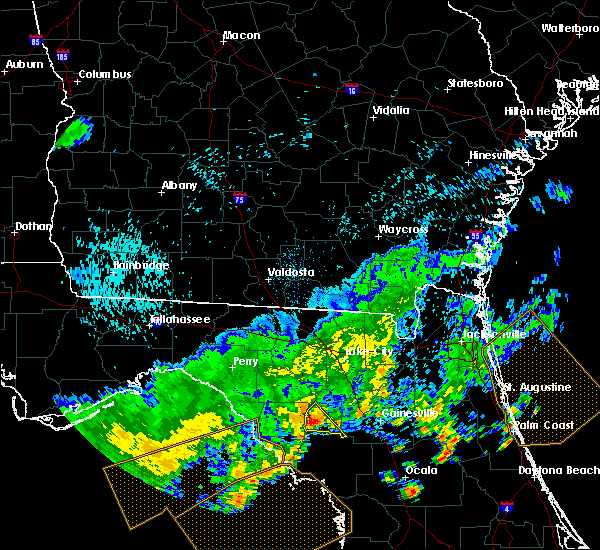 At 346 pm edt, a severe thunderstorm was located near trenton, moving southeast at 40 mph (radar indicated). Hazards include 60 mph wind gusts. expect damage to roofs, siding, and trees At 346 pm edt, a severe thunderstorm was located near trenton, moving southeast at 40 mph (radar indicated). Hazards include 60 mph wind gusts. expect damage to roofs, siding, and trees
|
| 7/21/2018 3:18 PM EDT |
 At 318 pm edt, severe thunderstorms were located along a line extending from 13 miles northwest of bell to near alachua, moving southeast at 40 mph (radar indicated). Hazards include 60 mph wind gusts. Expect damage to roofs, siding, and trees. Locations impacted include, trenton, bell, high springs and newberry. At 318 pm edt, severe thunderstorms were located along a line extending from 13 miles northwest of bell to near alachua, moving southeast at 40 mph (radar indicated). Hazards include 60 mph wind gusts. Expect damage to roofs, siding, and trees. Locations impacted include, trenton, bell, high springs and newberry.
|
| 7/21/2018 2:38 PM EDT |
 At 237 pm edt, severe thunderstorms were located along a line extending from near luraville to near columbia, moving south at 30 mph (radar indicated). Hazards include 60 mph wind gusts. expect damage to roofs, siding, and trees At 237 pm edt, severe thunderstorms were located along a line extending from near luraville to near columbia, moving south at 30 mph (radar indicated). Hazards include 60 mph wind gusts. expect damage to roofs, siding, and trees
|
| 6/28/2018 6:42 PM EDT |
 At 642 pm edt, a severe thunderstorm was located near university of florida, or 8 miles southwest of gainesville, moving northeast at 10 mph (radar indicated). Hazards include 60 mph wind gusts. expect damage to roofs, siding, and trees At 642 pm edt, a severe thunderstorm was located near university of florida, or 8 miles southwest of gainesville, moving northeast at 10 mph (radar indicated). Hazards include 60 mph wind gusts. expect damage to roofs, siding, and trees
|
| 6/4/2018 3:25 PM EDT |
 At 325 pm edt, a severe thunderstorm was located near high springs, or 12 miles southwest of worthington spring, moving southeast at 30 mph (radar indicated). Hazards include 60 mph wind gusts and quarter size hail. Hail damage to vehicles is expected. expect wind damage to roofs, siding, and trees. Locations impacted include, alachua and high springs. At 325 pm edt, a severe thunderstorm was located near high springs, or 12 miles southwest of worthington spring, moving southeast at 30 mph (radar indicated). Hazards include 60 mph wind gusts and quarter size hail. Hail damage to vehicles is expected. expect wind damage to roofs, siding, and trees. Locations impacted include, alachua and high springs.
|
| 6/4/2018 3:12 PM EDT |
 At 312 pm edt, a severe thunderstorm was located near high springs, or 12 miles southeast of ichetucknee spring, moving southeast at 30 mph (radar indicated). Hazards include 60 mph wind gusts and quarter size hail. Hail damage to vehicles is expected. Expect wind damage to roofs, siding, and trees. At 312 pm edt, a severe thunderstorm was located near high springs, or 12 miles southeast of ichetucknee spring, moving southeast at 30 mph (radar indicated). Hazards include 60 mph wind gusts and quarter size hail. Hail damage to vehicles is expected. Expect wind damage to roofs, siding, and trees.
|
| 6/3/2018 6:40 PM EDT |
 At 640 pm edt, a severe thunderstorm was located near gainesville, moving southeast at 10 mph (radar indicated). Hazards include 60 mph wind gusts and nickel size hail. Expect damage to roofs, siding, and trees. Locations impacted include, gainesville. At 640 pm edt, a severe thunderstorm was located near gainesville, moving southeast at 10 mph (radar indicated). Hazards include 60 mph wind gusts and nickel size hail. Expect damage to roofs, siding, and trees. Locations impacted include, gainesville.
|
| 6/3/2018 6:16 PM EDT |
 At 616 pm edt, a severe thunderstorm was located near alachua, or 11 miles west of gainesville, moving southeast at 15 mph (radar indicated). Hazards include 60 mph wind gusts and quarter size hail. Hail damage to vehicles is expected. Expect wind damage to roofs, siding, and trees. At 616 pm edt, a severe thunderstorm was located near alachua, or 11 miles west of gainesville, moving southeast at 15 mph (radar indicated). Hazards include 60 mph wind gusts and quarter size hail. Hail damage to vehicles is expected. Expect wind damage to roofs, siding, and trees.
|
| 6/3/2018 6:07 PM EDT |
 At 607 pm edt, a severe thunderstorm was located 7 miles northeast of williston, moving south at 5 mph (radar indicated). Hazards include 60 mph wind gusts and quarter size hail. Hail damage to vehicles is expected. Expect wind damage to roofs, siding, and trees. At 607 pm edt, a severe thunderstorm was located 7 miles northeast of williston, moving south at 5 mph (radar indicated). Hazards include 60 mph wind gusts and quarter size hail. Hail damage to vehicles is expected. Expect wind damage to roofs, siding, and trees.
|
| 4/7/2018 4:26 PM EDT |
 At 425 pm edt, severe thunderstorms were located along a line extending from fanning springs to 30 miles west of homosassa, moving east at 40 mph (radar indicated). Hazards include 60 mph wind gusts and penny size hail. Expect damage to roofs, siding, and trees. Locations impacted include, chiefland, bronson, inglis, fanning springs, otter creek, lebanon and manatee springs state park. At 425 pm edt, severe thunderstorms were located along a line extending from fanning springs to 30 miles west of homosassa, moving east at 40 mph (radar indicated). Hazards include 60 mph wind gusts and penny size hail. Expect damage to roofs, siding, and trees. Locations impacted include, chiefland, bronson, inglis, fanning springs, otter creek, lebanon and manatee springs state park.
|
| 4/7/2018 4:01 PM EDT |
 At 400 pm edt, severe thunderstorms were located along a line extending from 7 miles east of horseshoe point to 35 miles southwest of fowlers bluff, moving east at 40 mph (radar indicated). Hazards include 60 mph wind gusts and penny size hail. expect damage to roofs, siding, and trees At 400 pm edt, severe thunderstorms were located along a line extending from 7 miles east of horseshoe point to 35 miles southwest of fowlers bluff, moving east at 40 mph (radar indicated). Hazards include 60 mph wind gusts and penny size hail. expect damage to roofs, siding, and trees
|
| 3/20/2018 3:11 PM EDT |
 The severe thunderstorm warning for gilchrist, northern alachua, bradford, southern baker, union and southern columbia counties will expire at 315 pm edt, the storms which prompted the warning have weakened below severe limits, and have exited the warned area. therefore the warning will be allowed to expire. however small hail, gusty winds and heavy rain are still possible with these thunderstorms. a tornado watch remains in effect until 700 pm edt for northern and northeastern florida. The severe thunderstorm warning for gilchrist, northern alachua, bradford, southern baker, union and southern columbia counties will expire at 315 pm edt, the storms which prompted the warning have weakened below severe limits, and have exited the warned area. therefore the warning will be allowed to expire. however small hail, gusty winds and heavy rain are still possible with these thunderstorms. a tornado watch remains in effect until 700 pm edt for northern and northeastern florida.
|
| 3/20/2018 2:44 PM EDT |
 At 243 pm edt, severe thunderstorms were located along a line extending from 6 miles southeast of columbia to 9 miles northeast of trenton, moving northeast at 55 mph (radar indicated). Hazards include ping pong ball size hail and 60 mph wind gusts. People and animals outdoors will be injured. expect hail damage to roofs, siding, windows, and vehicles. expect wind damage to roofs, siding, and trees. locations impacted include, gainesville, starke, trenton, lake butler, bell, raiford, worthington spring, ichetucknee spring, columbia and alachua. A tornado watch remains in effect until 700 pm edt for northern and northeastern florida. At 243 pm edt, severe thunderstorms were located along a line extending from 6 miles southeast of columbia to 9 miles northeast of trenton, moving northeast at 55 mph (radar indicated). Hazards include ping pong ball size hail and 60 mph wind gusts. People and animals outdoors will be injured. expect hail damage to roofs, siding, windows, and vehicles. expect wind damage to roofs, siding, and trees. locations impacted include, gainesville, starke, trenton, lake butler, bell, raiford, worthington spring, ichetucknee spring, columbia and alachua. A tornado watch remains in effect until 700 pm edt for northern and northeastern florida.
|
| 3/20/2018 2:23 PM EDT |
 At 223 pm edt, severe thunderstorms were located along a line extending from 8 miles north of bell to near manattee road, moving northeast at 55 mph (radar indicated). Hazards include ping pong ball size hail and 60 mph wind gusts. People and animals outdoors will be injured. expect hail damage to roofs, siding, windows, and vehicles. Expect wind damage to roofs, siding, and trees. At 223 pm edt, severe thunderstorms were located along a line extending from 8 miles north of bell to near manattee road, moving northeast at 55 mph (radar indicated). Hazards include ping pong ball size hail and 60 mph wind gusts. People and animals outdoors will be injured. expect hail damage to roofs, siding, windows, and vehicles. Expect wind damage to roofs, siding, and trees.
|
| 3/20/2018 2:07 PM EDT |
 The severe thunderstorm warning for central alachua county will expire at 215 pm edt, the storm which prompted the warning has moved out of the area. therefore the warning will be allowed to expire. however small hail, gusty winds and heavy rain are still possible with this thunderstorm. a tornado watch remains in effect until 700 pm edt for northern florida. The severe thunderstorm warning for central alachua county will expire at 215 pm edt, the storm which prompted the warning has moved out of the area. therefore the warning will be allowed to expire. however small hail, gusty winds and heavy rain are still possible with this thunderstorm. a tornado watch remains in effect until 700 pm edt for northern florida.
|
| 3/20/2018 1:58 PM EDT |
 At 158 pm edt, a severe thunderstorm was located near gainesville, moving east at 50 mph (radar indicated). Hazards include ping pong ball size hail and 60 mph wind gusts. People and animals outdoors will be injured. expect hail damage to roofs, siding, windows, and vehicles. expect wind damage to roofs, siding, and trees. locations impacted include, gainesville, alachua and waldo. A tornado watch remains in effect until 700 pm edt for northern florida. At 158 pm edt, a severe thunderstorm was located near gainesville, moving east at 50 mph (radar indicated). Hazards include ping pong ball size hail and 60 mph wind gusts. People and animals outdoors will be injured. expect hail damage to roofs, siding, windows, and vehicles. expect wind damage to roofs, siding, and trees. locations impacted include, gainesville, alachua and waldo. A tornado watch remains in effect until 700 pm edt for northern florida.
|
| 3/20/2018 1:51 PM EDT |
 At 151 pm edt, a severe thunderstorm was located over alachua, or 12 miles southwest of worthington spring, moving northeast at 55 mph (radar indicated). Hazards include 60 mph wind gusts and quarter size hail. Hail damage to vehicles is expected. Expect wind damage to roofs, siding, and trees. At 151 pm edt, a severe thunderstorm was located over alachua, or 12 miles southwest of worthington spring, moving northeast at 55 mph (radar indicated). Hazards include 60 mph wind gusts and quarter size hail. Hail damage to vehicles is expected. Expect wind damage to roofs, siding, and trees.
|
| 3/20/2018 1:48 PM EDT |
 At 148 pm edt, a severe thunderstorm was located 8 miles south of alachua, or 10 miles west of gainesville, moving east at 50 mph (radar indicated). Hazards include 60 mph wind gusts and quarter size hail. Hail damage to vehicles is expected. expect wind damage to roofs, siding, and trees. locations impacted include, gainesville, alachua, archer, university of florida, orange heights, gainesville airport, newnans lake, rochelle, newberry and waldo. A tornado watch remains in effect until 700 pm edt for northern florida. At 148 pm edt, a severe thunderstorm was located 8 miles south of alachua, or 10 miles west of gainesville, moving east at 50 mph (radar indicated). Hazards include 60 mph wind gusts and quarter size hail. Hail damage to vehicles is expected. expect wind damage to roofs, siding, and trees. locations impacted include, gainesville, alachua, archer, university of florida, orange heights, gainesville airport, newnans lake, rochelle, newberry and waldo. A tornado watch remains in effect until 700 pm edt for northern florida.
|
| 3/20/2018 1:39 PM EDT |
 At 139 pm edt, a severe thunderstorm was located 8 miles northwest of archer, or 11 miles east of trenton, moving northeast at 50 mph (radar indicated). Hazards include 60 mph wind gusts and quarter size hail. Hail damage to vehicles is expected. expect wind damage to roofs, siding, and trees. locations impacted include, gainesville, citra, alachua, hawthorne, archer, university of florida, rochelle, cross creek, orange heights and gainesville airport. A tornado watch remains in effect until 700 pm edt for northern and northeastern florida. At 139 pm edt, a severe thunderstorm was located 8 miles northwest of archer, or 11 miles east of trenton, moving northeast at 50 mph (radar indicated). Hazards include 60 mph wind gusts and quarter size hail. Hail damage to vehicles is expected. expect wind damage to roofs, siding, and trees. locations impacted include, gainesville, citra, alachua, hawthorne, archer, university of florida, rochelle, cross creek, orange heights and gainesville airport. A tornado watch remains in effect until 700 pm edt for northern and northeastern florida.
|
| 3/20/2018 1:29 PM EDT |
 At 129 pm edt, a severe thunderstorm was located near chiefland, moving east at 50 mph (radar indicated). Hazards include 60 mph wind gusts and half dollar size hail. Hail damage to vehicles is expected. Expect wind damage to roofs, siding, and trees. At 129 pm edt, a severe thunderstorm was located near chiefland, moving east at 50 mph (radar indicated). Hazards include 60 mph wind gusts and half dollar size hail. Hail damage to vehicles is expected. Expect wind damage to roofs, siding, and trees.
|
| 3/19/2018 6:41 AM EDT |
 At 641 am edt, severe thunderstorms were located along a line extending from near alachua to near bronson, moving east at 55 mph (radar indicated). Hazards include 60 mph wind gusts and penny size hail. Expect damage to roofs, siding, and trees. Locations impacted include, gainesville, alachua, archer, university of florida, gainesville airport, newberry and waldo. At 641 am edt, severe thunderstorms were located along a line extending from near alachua to near bronson, moving east at 55 mph (radar indicated). Hazards include 60 mph wind gusts and penny size hail. Expect damage to roofs, siding, and trees. Locations impacted include, gainesville, alachua, archer, university of florida, gainesville airport, newberry and waldo.
|
| 3/19/2018 6:24 AM EDT |
 At 624 am edt, severe thunderstorms were located along a line extending from near high springs to near andrews, moving east at 55 mph. radar indicated weak rotation with this storm. tornadoes can quickly develop with little or no advanced warning (radar indicated). Hazards include 60 mph wind gusts and penny size hail. expect damage to roofs, siding, and trees At 624 am edt, severe thunderstorms were located along a line extending from near high springs to near andrews, moving east at 55 mph. radar indicated weak rotation with this storm. tornadoes can quickly develop with little or no advanced warning (radar indicated). Hazards include 60 mph wind gusts and penny size hail. expect damage to roofs, siding, and trees
|
| 10/7/2017 8:42 PM EDT |
 The severe thunderstorm warning for east central gilchrist, northwestern alachua, southwestern union and southwestern columbia counties will expire at 845 pm edt, the storm which prompted the warning has weakened below severe limits, and no longer poses an immediate threat to life or property. therefore the warning will be allowed to expire. however gusty winds and heavy rain are still possible with this thunderstorm. to report severe weather, contact your nearest law enforcement agency. they will relay your report to the national weather service jacksonville. The severe thunderstorm warning for east central gilchrist, northwestern alachua, southwestern union and southwestern columbia counties will expire at 845 pm edt, the storm which prompted the warning has weakened below severe limits, and no longer poses an immediate threat to life or property. therefore the warning will be allowed to expire. however gusty winds and heavy rain are still possible with this thunderstorm. to report severe weather, contact your nearest law enforcement agency. they will relay your report to the national weather service jacksonville.
|
| 10/7/2017 8:23 PM EDT |
 At 823 pm edt, a severe thunderstorm was located near alachua, or 14 miles west of gainesville, moving north at 25 mph (radar indicated). Hazards include 60 mph wind gusts. Expect damage to roofs, siding, and trees. Locations impacted include, alachua, high springs, fort white, upland pines and providence. At 823 pm edt, a severe thunderstorm was located near alachua, or 14 miles west of gainesville, moving north at 25 mph (radar indicated). Hazards include 60 mph wind gusts. Expect damage to roofs, siding, and trees. Locations impacted include, alachua, high springs, fort white, upland pines and providence.
|
| 10/7/2017 8:08 PM EDT |
 At 807 pm edt, a severe thunderstorm was located 8 miles southwest of alachua, or 12 miles west of gainesville, moving north at 25 mph (radar indicated). Hazards include 60 mph wind gusts. expect damage to roofs, siding, and trees At 807 pm edt, a severe thunderstorm was located 8 miles southwest of alachua, or 12 miles west of gainesville, moving north at 25 mph (radar indicated). Hazards include 60 mph wind gusts. expect damage to roofs, siding, and trees
|
| 7/5/2017 3:20 PM EDT |
 At 320 pm edt, a severe thunderstorm was located near chiefland, moving north at 15 mph (radar indicated). Hazards include 60 mph wind gusts and quarter size hail. Hail damage to vehicles is expected. Expect wind damage to roofs, siding, and trees. At 320 pm edt, a severe thunderstorm was located near chiefland, moving north at 15 mph (radar indicated). Hazards include 60 mph wind gusts and quarter size hail. Hail damage to vehicles is expected. Expect wind damage to roofs, siding, and trees.
|
| 5/30/2017 5:05 PM EDT | Alachua county emergency manager relayed a report from the city of newberry of trees and powerlines dow in alachua county FL, 0.5 miles E of Newberry, FL |
| 5/24/2017 12:08 PM EDT |
 At 1207 pm edt, severe thunderstorms were located along a line extending from 5 miles southwest of alachua to 20 miles northwest of crystal river airport, moving northeast at 45 mph (radar indicated). Hazards include 60 mph wind gusts. Expect damage to roofs, siding, and trees. Locations impacted include, williston, bronson, williston highlands, east bronson, williston municipal airport, inglis, otter creek and lebanon. At 1207 pm edt, severe thunderstorms were located along a line extending from 5 miles southwest of alachua to 20 miles northwest of crystal river airport, moving northeast at 45 mph (radar indicated). Hazards include 60 mph wind gusts. Expect damage to roofs, siding, and trees. Locations impacted include, williston, bronson, williston highlands, east bronson, williston municipal airport, inglis, otter creek and lebanon.
|
| 5/24/2017 11:51 AM EDT |
 At 1150 am edt, severe thunderstorms were located along a line extending from near trenton to 20 miles west of homosassa, moving northeast at 35 mph (radar indicated). Hazards include 60 mph wind gusts. expect damage to roofs, siding, and trees At 1150 am edt, severe thunderstorms were located along a line extending from near trenton to 20 miles west of homosassa, moving northeast at 35 mph (radar indicated). Hazards include 60 mph wind gusts. expect damage to roofs, siding, and trees
|
| 4/4/2017 8:40 AM EDT |
 At 839 am edt, a severe thunderstorm was located near university of florida, or 8 miles south of gainesville, moving east at 35 mph (radar indicated). Hazards include 60 mph wind gusts. expect damage to roofs, siding, and trees At 839 am edt, a severe thunderstorm was located near university of florida, or 8 miles south of gainesville, moving east at 35 mph (radar indicated). Hazards include 60 mph wind gusts. expect damage to roofs, siding, and trees
|
| 4/4/2017 8:29 AM EDT |
 At 828 am edt, a severe thunderstorm was located over rochelle, or 8 miles southeast of gainesville, moving east at 25 mph (radar indicated). Hazards include 60 mph wind gusts. Expect damage to roofs, siding, and trees. Locations impacted include, gainesville, hawthorne, archer, university of florida, orange heights, newnans lake, rochelle, micanopy and grove park. At 828 am edt, a severe thunderstorm was located over rochelle, or 8 miles southeast of gainesville, moving east at 25 mph (radar indicated). Hazards include 60 mph wind gusts. Expect damage to roofs, siding, and trees. Locations impacted include, gainesville, hawthorne, archer, university of florida, orange heights, newnans lake, rochelle, micanopy and grove park.
|
| 4/4/2017 8:00 AM EDT |
 At 759 am edt, a severe thunderstorm was located over archer, or 11 miles northeast of bronson, moving east at 25 mph (radar indicated). Hazards include 60 mph wind gusts. expect damage to roofs, siding, and trees At 759 am edt, a severe thunderstorm was located over archer, or 11 miles northeast of bronson, moving east at 25 mph (radar indicated). Hazards include 60 mph wind gusts. expect damage to roofs, siding, and trees
|
| 2/7/2017 10:03 PM EST |
 At 1002 pm est, severe thunderstorms were located along a line extending from near east bronson to 19 miles northwest of crystal river airport to 30 miles west of weeki wachee gardens, moving east at 35 mph (radar indicated). Hazards include 60 mph wind gusts and penny size hail. Expect damage to roofs, siding, and trees. Locations impacted include, williston, bronson, beverly hills, homosassa springs, williston highlands, east bronson, crystal river airport, williston municipal airport, black diamond, homosassa, inglis, otter creek, citronelle, crystal manor, crystal oaks, citrus springs, lebanon, pine ridge and lecanto. At 1002 pm est, severe thunderstorms were located along a line extending from near east bronson to 19 miles northwest of crystal river airport to 30 miles west of weeki wachee gardens, moving east at 35 mph (radar indicated). Hazards include 60 mph wind gusts and penny size hail. Expect damage to roofs, siding, and trees. Locations impacted include, williston, bronson, beverly hills, homosassa springs, williston highlands, east bronson, crystal river airport, williston municipal airport, black diamond, homosassa, inglis, otter creek, citronelle, crystal manor, crystal oaks, citrus springs, lebanon, pine ridge and lecanto.
|
| 2/7/2017 9:52 PM EST |
 The severe thunderstorm warning for southeastern columbia, union, western alachua, west central bradford, southwestern baker and southern gilchrist counties will expire at 1000 pm est, the storm which prompted the warning has exited the warned area. therefore the warning will be allowed to expire. however gusty winds are still possible with this thunderstorm. a severe thunderstorm watch remains in effect until midnight est for northeastern and northern florida. to report severe weather, contact your nearest law enforcement agency. they will relay your report to the national weather service jacksonville. The severe thunderstorm warning for southeastern columbia, union, western alachua, west central bradford, southwestern baker and southern gilchrist counties will expire at 1000 pm est, the storm which prompted the warning has exited the warned area. therefore the warning will be allowed to expire. however gusty winds are still possible with this thunderstorm. a severe thunderstorm watch remains in effect until midnight est for northeastern and northern florida. to report severe weather, contact your nearest law enforcement agency. they will relay your report to the national weather service jacksonville.
|
| 2/7/2017 9:40 PM EST |
 At 939 pm est, severe thunderstorms were located along a line extending from near trenton to 21 miles south of fowlers bluff to 38 miles west of homosassa, moving east at 45 mph (radar indicated). Hazards include 60 mph wind gusts and penny size hail. expect damage to roofs, siding, and trees At 939 pm est, severe thunderstorms were located along a line extending from near trenton to 21 miles south of fowlers bluff to 38 miles west of homosassa, moving east at 45 mph (radar indicated). Hazards include 60 mph wind gusts and penny size hail. expect damage to roofs, siding, and trees
|
| 2/7/2017 9:39 PM EST |
 At 938 pm est, a severe thunderstorm was located near obrien, or 9 miles northwest of ichetucknee spring, moving east at 55 mph (radar indicated). Hazards include 60 mph wind gusts and nickel size hail. Expect damage to roofs, siding, and trees. Locations impacted include, trenton, lake butler, worthington spring, alachua, high springs, archer, worthington springs, groves, sanderson and upland pines. At 938 pm est, a severe thunderstorm was located near obrien, or 9 miles northwest of ichetucknee spring, moving east at 55 mph (radar indicated). Hazards include 60 mph wind gusts and nickel size hail. Expect damage to roofs, siding, and trees. Locations impacted include, trenton, lake butler, worthington spring, alachua, high springs, archer, worthington springs, groves, sanderson and upland pines.
|
| 2/7/2017 9:19 PM EST |
 At 918 pm est, a severe thunderstorm was located near columbia, or near lake city, moving east at 45 mph (radar indicated). Hazards include 60 mph wind gusts and quarter size hail. Hail damage to vehicles is expected. Expect wind damage to roofs, siding, and trees. At 918 pm est, a severe thunderstorm was located near columbia, or near lake city, moving east at 45 mph (radar indicated). Hazards include 60 mph wind gusts and quarter size hail. Hail damage to vehicles is expected. Expect wind damage to roofs, siding, and trees.
|
| 2/7/2017 9:08 PM EST |
 At 907 pm est, severe thunderstorms were located along a line extending from near horseshoe point to 28 miles southwest of fowlers bluff to 62 miles south of steinhatchee, moving east at 60 mph (radar indicated). Hazards include 60 mph wind gusts and penny size hail. expect damage to roofs, siding, and trees At 907 pm est, severe thunderstorms were located along a line extending from near horseshoe point to 28 miles southwest of fowlers bluff to 62 miles south of steinhatchee, moving east at 60 mph (radar indicated). Hazards include 60 mph wind gusts and penny size hail. expect damage to roofs, siding, and trees
|
| 1/22/2017 6:17 PM EST |
 At 617 pm est, severe thunderstorms were located along a line extending from 8 miles north of macclenny to near williston, moving northeast at 70 mph (radar indicated). Hazards include 60 mph wind gusts and quarter size hail. Hail damage to vehicles is expected. expect wind damage to roofs, siding, and trees. locations impacted include, jacksonville, gainesville, saint augustine, fernandina beach, palatka, orange park, green cove springs, starke, lake butler and interlachen. A tornado watch remains in effect until 800 pm est for northeastern and northern florida, and southeastern georgia. At 617 pm est, severe thunderstorms were located along a line extending from 8 miles north of macclenny to near williston, moving northeast at 70 mph (radar indicated). Hazards include 60 mph wind gusts and quarter size hail. Hail damage to vehicles is expected. expect wind damage to roofs, siding, and trees. locations impacted include, jacksonville, gainesville, saint augustine, fernandina beach, palatka, orange park, green cove springs, starke, lake butler and interlachen. A tornado watch remains in effect until 800 pm est for northeastern and northern florida, and southeastern georgia.
|
| 1/22/2017 6:06 PM EST |
 At 606 pm est, severe thunderstorms were located along a line extending from 5 miles southeast of trenton to 10 miles southwest of williston highlands, moving east at 60 mph (radar indicated). Hazards include 60 mph wind gusts. expect damage to roofs, siding, and trees At 606 pm est, severe thunderstorms were located along a line extending from 5 miles southeast of trenton to 10 miles southwest of williston highlands, moving east at 60 mph (radar indicated). Hazards include 60 mph wind gusts. expect damage to roofs, siding, and trees
|
| 1/22/2017 6:06 PM EST |
 At 605 pm est, severe thunderstorms were located along a line extending from near sanderson to near williston highlands, moving northeast at 70 mph (radar indicated). Hazards include 60 mph wind gusts and quarter size hail. Hail damage to vehicles is expected. Expect wind damage to roofs, siding, and trees. At 605 pm est, severe thunderstorms were located along a line extending from near sanderson to near williston highlands, moving northeast at 70 mph (radar indicated). Hazards include 60 mph wind gusts and quarter size hail. Hail damage to vehicles is expected. Expect wind damage to roofs, siding, and trees.
|
| 1/22/2017 6:01 PM EST |
 At 601 pm est, severe thunderstorms were located along a line extending from 8 miles northwest of taylor to lulu, moving east at 90 mph (radar indicated). Hazards include 60 mph wind gusts and quarter size hail. Hail damage to vehicles is expected. expect wind damage to roofs, siding, and trees. locations impacted include, lake city, trenton, worthington spring, ichetucknee spring, columbia, alachua, high springs, fort white, worthington springs and groves. A tornado watch remains in effect until 800 pm est for northeastern and northern florida. At 601 pm est, severe thunderstorms were located along a line extending from 8 miles northwest of taylor to lulu, moving east at 90 mph (radar indicated). Hazards include 60 mph wind gusts and quarter size hail. Hail damage to vehicles is expected. expect wind damage to roofs, siding, and trees. locations impacted include, lake city, trenton, worthington spring, ichetucknee spring, columbia, alachua, high springs, fort white, worthington springs and groves. A tornado watch remains in effect until 800 pm est for northeastern and northern florida.
|
| 1/22/2017 5:28 PM EST |
 At 528 pm est, severe thunderstorms were located along a line extending from near obrien to near manattee road, moving northeast at 90 mph (radar indicated). Hazards include 60 mph wind gusts and quarter size hail. Hail damage to vehicles is expected. Expect wind damage to roofs, siding, and trees. At 528 pm est, severe thunderstorms were located along a line extending from near obrien to near manattee road, moving northeast at 90 mph (radar indicated). Hazards include 60 mph wind gusts and quarter size hail. Hail damage to vehicles is expected. Expect wind damage to roofs, siding, and trees.
|
| 1/22/2017 5:23 PM EST |
 At 522 pm est, a severe thunderstorm was located 20 miles south of fowlers bluff, or 30 miles southwest of chiefland, moving northeast at 60 mph (radar indicated). Hazards include 60 mph wind gusts. expect damage to roofs, siding, and trees At 522 pm est, a severe thunderstorm was located 20 miles south of fowlers bluff, or 30 miles southwest of chiefland, moving northeast at 60 mph (radar indicated). Hazards include 60 mph wind gusts. expect damage to roofs, siding, and trees
|
| 8/11/2016 7:55 PM EDT |
 At 754 pm edt, a severe thunderstorm was located near bronson, moving northwest at 20 mph (radar indicated). Hazards include 60 mph wind gusts and quarter size hail. Hail damage to vehicles is expected. Expect wind damage to roofs, siding, and trees. At 754 pm edt, a severe thunderstorm was located near bronson, moving northwest at 20 mph (radar indicated). Hazards include 60 mph wind gusts and quarter size hail. Hail damage to vehicles is expected. Expect wind damage to roofs, siding, and trees.
|
| 7/23/2016 10:03 PM EDT |
 At 1002 pm edt, a severe thunderstorm was located over high springs, or 13 miles southeast of ichetucknee spring, moving northwest at 20 mph (radar indicated). Hazards include 60 mph wind gusts and quarter size hail. a funnel cloud was spotted near high springs by law enforcement. Hail damage to vehicles is expected. expect wind damage to roofs, siding, and trees. Locations impacted include, ichetucknee spring, alachua, high springs and fort white. At 1002 pm edt, a severe thunderstorm was located over high springs, or 13 miles southeast of ichetucknee spring, moving northwest at 20 mph (radar indicated). Hazards include 60 mph wind gusts and quarter size hail. a funnel cloud was spotted near high springs by law enforcement. Hail damage to vehicles is expected. expect wind damage to roofs, siding, and trees. Locations impacted include, ichetucknee spring, alachua, high springs and fort white.
|
| 7/23/2016 9:39 PM EDT |
 At 938 pm edt, a severe thunderstorm was located over high springs, or 14 miles southeast of ichetucknee spring, moving northwest at 25 mph (radar indicated). Hazards include 60 mph wind gusts and quarter size hail. Hail damage to vehicles is expected. expect wind damage to roofs, siding, and trees. Locations impacted include, ichetucknee spring, alachua, high springs and fort white. At 938 pm edt, a severe thunderstorm was located over high springs, or 14 miles southeast of ichetucknee spring, moving northwest at 25 mph (radar indicated). Hazards include 60 mph wind gusts and quarter size hail. Hail damage to vehicles is expected. expect wind damage to roofs, siding, and trees. Locations impacted include, ichetucknee spring, alachua, high springs and fort white.
|
| 7/23/2016 9:24 PM EDT |
 At 924 pm edt, a severe thunderstorm was located near alachua, or 13 miles northwest of gainesville, moving northwest at 25 mph (radar indicated). Hazards include 60 mph wind gusts and quarter size hail. Hail damage to vehicles is expected. Expect wind damage to roofs, siding, and trees. At 924 pm edt, a severe thunderstorm was located near alachua, or 13 miles northwest of gainesville, moving northwest at 25 mph (radar indicated). Hazards include 60 mph wind gusts and quarter size hail. Hail damage to vehicles is expected. Expect wind damage to roofs, siding, and trees.
|
| 7/15/2016 3:40 PM EDT |
 The severe thunderstorm warning for southwestern columbia, southwestern union, western alachua and eastern gilchrist counties will expire at 345 pm edt, the storm which prompted the warning has weakened below severe limits, and no longer pose an immediate threat to life or property. therefore, the warning will be allowed to expire. however heavy rain is still possible with this thunderstorm. The severe thunderstorm warning for southwestern columbia, southwestern union, western alachua and eastern gilchrist counties will expire at 345 pm edt, the storm which prompted the warning has weakened below severe limits, and no longer pose an immediate threat to life or property. therefore, the warning will be allowed to expire. however heavy rain is still possible with this thunderstorm.
|
| 7/15/2016 3:25 PM EDT |
 At 324 pm edt, a severe thunderstorm was located 9 miles northwest of archer, or 12 miles east of trenton, moving north at 25 mph (radar indicated). Hazards include 60 mph wind gusts and penny size hail. Expect damage to roofs. siding. and trees. Locations impacted include, ichetucknee spring, alachua, high springs, archer, fort white, groves, upland pines, providence and newberry. At 324 pm edt, a severe thunderstorm was located 9 miles northwest of archer, or 12 miles east of trenton, moving north at 25 mph (radar indicated). Hazards include 60 mph wind gusts and penny size hail. Expect damage to roofs. siding. and trees. Locations impacted include, ichetucknee spring, alachua, high springs, archer, fort white, groves, upland pines, providence and newberry.
|
| 7/15/2016 3:02 PM EDT |
 At 302 pm edt, a severe thunderstorm was located 9 miles south of high springs, or 12 miles east of trenton, moving north at 20 mph (radar indicated). Hazards include 60 mph wind gusts and penny size hail. Expect damage to roofs. siding. And trees. At 302 pm edt, a severe thunderstorm was located 9 miles south of high springs, or 12 miles east of trenton, moving north at 20 mph (radar indicated). Hazards include 60 mph wind gusts and penny size hail. Expect damage to roofs. siding. And trees.
|
| 6/10/2016 7:00 PM EDT |
 At 659 pm edt, severe thunderstorms were located along a line extending from near keystone heights to 8 miles northwest of archer, moving south at 15 mph (radar indicated). Hazards include 60 mph wind gusts and penny size hail. Expect damage to roofs. siding. and trees. Locations impacted include, gainesville, alachua, high springs, hawthorne, archer, cross creek, university of florida, orange heights, gainesville airport, newnans lake, rochelle, newberry, waldo, micanopy, grove park and lochloosa. At 659 pm edt, severe thunderstorms were located along a line extending from near keystone heights to 8 miles northwest of archer, moving south at 15 mph (radar indicated). Hazards include 60 mph wind gusts and penny size hail. Expect damage to roofs. siding. and trees. Locations impacted include, gainesville, alachua, high springs, hawthorne, archer, cross creek, university of florida, orange heights, gainesville airport, newnans lake, rochelle, newberry, waldo, micanopy, grove park and lochloosa.
|
| 6/10/2016 6:39 PM EDT |
 At 639 pm edt, severe thunderstorms were located along a line extending from 6 miles south of starke to 8 miles south of high springs, moving south at 15 mph (radar indicated). Hazards include 60 mph wind gusts and penny size hail. Expect damage to roofs. siding. And trees. At 639 pm edt, severe thunderstorms were located along a line extending from 6 miles south of starke to 8 miles south of high springs, moving south at 15 mph (radar indicated). Hazards include 60 mph wind gusts and penny size hail. Expect damage to roofs. siding. And trees.
|
| 5/13/2016 5:17 PM EDT |
 At 517 pm edt, a severe thunderstorm was located near alachua, or 8 miles northwest of gainesville, moving east at 20 mph (radar indicated). Hazards include 60 mph wind gusts and penny size hail. Expect damage to roofs. siding. And trees. At 517 pm edt, a severe thunderstorm was located near alachua, or 8 miles northwest of gainesville, moving east at 20 mph (radar indicated). Hazards include 60 mph wind gusts and penny size hail. Expect damage to roofs. siding. And trees.
|
| 2/24/2016 6:37 AM EST |
 The severe thunderstorm warning for gilchrist, southwestern columbia and northwestern alachua counties will expire at 645 am est, the storm which prompted the warning has weakened below severe limits. therefore the warning will be allowed to expire. however gusty winds of 45 to 55 mph are still possible. a tornado watch remains in effect until 1000 am est for northern florida. The severe thunderstorm warning for gilchrist, southwestern columbia and northwestern alachua counties will expire at 645 am est, the storm which prompted the warning has weakened below severe limits. therefore the warning will be allowed to expire. however gusty winds of 45 to 55 mph are still possible. a tornado watch remains in effect until 1000 am est for northern florida.
|
| 2/24/2016 6:18 AM EST |
 At 617 am est, a severe thunderstorm was located 7 miles northeast of bell, moving northeast at 50 mph (radar indicated). Hazards include 60 mph wind gusts. Expect damage to roofs. siding and trees. locations impacted include, gainesville, trenton, bell, ichetucknee spring, columbia, alachua, high springs, fort white, worthington springs, newberry, fanning springs, la crosse and guaranto springs. A tornado watch remains in effect until 1000 am est for northern florida. At 617 am est, a severe thunderstorm was located 7 miles northeast of bell, moving northeast at 50 mph (radar indicated). Hazards include 60 mph wind gusts. Expect damage to roofs. siding and trees. locations impacted include, gainesville, trenton, bell, ichetucknee spring, columbia, alachua, high springs, fort white, worthington springs, newberry, fanning springs, la crosse and guaranto springs. A tornado watch remains in effect until 1000 am est for northern florida.
|
| 2/24/2016 5:54 AM EST |
 At 554 am est, a severe thunderstorm was located 7 miles east of cross city, moving northeast at 60 mph (radar indicated). Hazards include 60 mph wind gusts. Expect damage to roofs. Siding and trees. At 554 am est, a severe thunderstorm was located 7 miles east of cross city, moving northeast at 60 mph (radar indicated). Hazards include 60 mph wind gusts. Expect damage to roofs. Siding and trees.
|
| 9/12/2015 1:04 PM EDT |
 At 104 pm edt, doppler radar indicated a severe thunderstorm capable of producing damaging winds in excess of 60 mph. this storm was located near archer, or 10 miles southwest of gainesville, and moving northeast at 20 mph. At 104 pm edt, doppler radar indicated a severe thunderstorm capable of producing damaging winds in excess of 60 mph. this storm was located near archer, or 10 miles southwest of gainesville, and moving northeast at 20 mph.
|
| 8/17/2015 3:29 PM EDT |
 At 329 pm edt, doppler radar indicated a severe thunderstorm capable of producing damaging winds in excess of 60 mph. this storm was located over gainesville, and moving east at 10 mph. At 329 pm edt, doppler radar indicated a severe thunderstorm capable of producing damaging winds in excess of 60 mph. this storm was located over gainesville, and moving east at 10 mph.
|
| 8/13/2015 5:00 PM EDT |
 At 500 pm edt, doppler radar indicated a severe thunderstorm capable of producing damaging winds in excess of 60 mph. this storm was located near upland pines, or near worthington spring, and moving southwest at 10 mph. At 500 pm edt, doppler radar indicated a severe thunderstorm capable of producing damaging winds in excess of 60 mph. this storm was located near upland pines, or near worthington spring, and moving southwest at 10 mph.
|
| 8/7/2015 7:07 PM EDT |
 At 707 pm edt, doppler radar indicated a line of severe thunderstorms capable of producing damaging winds in excess of 60 mph. these storms were located along a line extending from near cross creek to 7 miles south of chiefland, moving southeast at 50 mph. locations impacted include, gainesville, trenton, archer, cross creek, gainesville airport, newnans lake, university of florida, rochelle, newberry, fanning springs and micanopy. At 707 pm edt, doppler radar indicated a line of severe thunderstorms capable of producing damaging winds in excess of 60 mph. these storms were located along a line extending from near cross creek to 7 miles south of chiefland, moving southeast at 50 mph. locations impacted include, gainesville, trenton, archer, cross creek, gainesville airport, newnans lake, university of florida, rochelle, newberry, fanning springs and micanopy.
|
| 8/7/2015 6:54 PM EDT |
 At 653 pm edt, doppler radar indicated a line of severe thunderstorms capable of producing damaging winds in excess of 60 mph. these storms were located along a line extending from near orange heights to 6 miles northwest of andrews, moving southeast at 35 mph. locations impacted include, gainesville, trenton, bell, alachua, high springs, archer, cross creek, university of florida, gainesville airport, newnans lake, rochelle, newberry, fanning springs, micanopy, la crosse, fletcher springs and guaranto springs. At 653 pm edt, doppler radar indicated a line of severe thunderstorms capable of producing damaging winds in excess of 60 mph. these storms were located along a line extending from near orange heights to 6 miles northwest of andrews, moving southeast at 35 mph. locations impacted include, gainesville, trenton, bell, alachua, high springs, archer, cross creek, university of florida, gainesville airport, newnans lake, rochelle, newberry, fanning springs, micanopy, la crosse, fletcher springs and guaranto springs.
|
| 8/7/2015 6:08 PM EDT |
 At 608 pm edt, doppler radar indicated a line of severe thunderstorms capable of producing damaging winds in excess of 60 mph. these storms were located along a line extending from upland pines to 11 miles northeast of steinhatchee, and moving southeast at 35 mph. At 608 pm edt, doppler radar indicated a line of severe thunderstorms capable of producing damaging winds in excess of 60 mph. these storms were located along a line extending from upland pines to 11 miles northeast of steinhatchee, and moving southeast at 35 mph.
|
| 8/3/2015 7:17 PM EDT |
 At 716 pm edt, doppler radar indicated a line of severe thunderstorms capable of producing damaging winds in excess of 60 mph. these storms were located along a line extending from 8 miles south of high springs to cross creek, moving east at 5 mph. locations impacted include, gainesville, high springs, cross creek, newberry and micanopy. At 716 pm edt, doppler radar indicated a line of severe thunderstorms capable of producing damaging winds in excess of 60 mph. these storms were located along a line extending from 8 miles south of high springs to cross creek, moving east at 5 mph. locations impacted include, gainesville, high springs, cross creek, newberry and micanopy.
|
| 8/3/2015 6:58 PM EDT |
 At 657 pm edt, doppler radar indicated a line of severe thunderstorms capable of producing damaging winds in excess of 60 mph. these storms were located along a line extending from 6 miles south of high springs to cross creek, and moving east at 5 mph. At 657 pm edt, doppler radar indicated a line of severe thunderstorms capable of producing damaging winds in excess of 60 mph. these storms were located along a line extending from 6 miles south of high springs to cross creek, and moving east at 5 mph.
|
| 6/24/2015 3:40 PM EDT |
 The severe thunderstorm warning for alachua county will expire at 345 pm edt, the storm which prompted the warning has weakened below severe limits, and no longer poses an immediate threat to life or property. therefore the warning will be allowed to expire. however small. The severe thunderstorm warning for alachua county will expire at 345 pm edt, the storm which prompted the warning has weakened below severe limits, and no longer poses an immediate threat to life or property. therefore the warning will be allowed to expire. however small.
|
| 6/24/2015 3:36 PM EDT |
 At 336 pm edt, doppler radar indicated a severe thunderstorm capable of producing quarter size hail and destructive winds in excess of 70 mph. this storm was located near gainesville, moving east at 15 mph. locations impacted include, gainesville, melrose, hawthorne, archer, university of florida, orange heights, gainesville airport, newnans lake, rochelle, waldo, micanopy, grove park and lochloosa. At 336 pm edt, doppler radar indicated a severe thunderstorm capable of producing quarter size hail and destructive winds in excess of 70 mph. this storm was located near gainesville, moving east at 15 mph. locations impacted include, gainesville, melrose, hawthorne, archer, university of florida, orange heights, gainesville airport, newnans lake, rochelle, waldo, micanopy, grove park and lochloosa.
|
| 6/24/2015 3:32 PM EDT |
 At 332 pm edt, doppler radar indicated a severe thunderstorm capable of producing quarter size hail and destructive winds in excess of 70 mph. this storm was located near gainesville, moving east at 15 mph. locations impacted include, gainesville, melrose, hawthorne, archer, university of florida, orange heights, gainesville airport, newnans lake, rochelle, waldo, micanopy, grove park and lochloosa. At 332 pm edt, doppler radar indicated a severe thunderstorm capable of producing quarter size hail and destructive winds in excess of 70 mph. this storm was located near gainesville, moving east at 15 mph. locations impacted include, gainesville, melrose, hawthorne, archer, university of florida, orange heights, gainesville airport, newnans lake, rochelle, waldo, micanopy, grove park and lochloosa.
|
| 6/24/2015 3:24 PM EDT |
 At 324 pm edt, doppler radar indicated a severe thunderstorm capable of producing quarter size hail and destructive winds in excess of 70 mph. this storm was located near university of florida, or near gainesville, moving east at 10 mph. locations impacted include, gainesville, melrose, hawthorne, archer, university of florida, orange heights, gainesville airport, newnans lake, rochelle, waldo, micanopy, grove park and lochloosa. At 324 pm edt, doppler radar indicated a severe thunderstorm capable of producing quarter size hail and destructive winds in excess of 70 mph. this storm was located near university of florida, or near gainesville, moving east at 10 mph. locations impacted include, gainesville, melrose, hawthorne, archer, university of florida, orange heights, gainesville airport, newnans lake, rochelle, waldo, micanopy, grove park and lochloosa.
|
| 6/24/2015 3:15 PM EDT |
 At 315 pm edt, doppler radar indicated a severe thunderstorm capable of producing quarter size hail and destructive winds in excess of 70 mph. this storm was located near university of florida, or near gainesville, and moving northeast at 15 mph. At 315 pm edt, doppler radar indicated a severe thunderstorm capable of producing quarter size hail and destructive winds in excess of 70 mph. this storm was located near university of florida, or near gainesville, and moving northeast at 15 mph.
|
| 6/1/2015 5:13 PM EDT | At 512 pm edt, doppler radar indicated a severe thunderstorm capable of producing large damaging hail up to golf ball size and damaging winds in excess of 60 mph. this storm was located over gainesville, moving northeast at 10 mph. locations impacted include, gainesville, alachua, archer, gainesville airport, newnans lake, university of florida and la crosse. |
| 6/1/2015 4:58 PM EDT | At 458 pm edt, doppler radar indicated a severe thunderstorm capable of producing quarter size hail and damaging winds in excess of 60 mph. this storm was located over university of florida, or near gainesville, and moving northeast at 10 mph. |
| 5/31/2015 7:05 PM EDT | At 704 pm edt, doppler radar indicated a line of severe thunderstorms capable of producing quarter size hail. these storms were located along a line extending from 7 miles northwest of bronson to 14 miles west of rainbow lakes estates, moving west at 10 mph. locations impacted include, bronson and otter creek. |
| 5/31/2015 6:51 PM EDT | At 649 pm edt, trained weather spotters reported quarter size hail 3 miles southeast of bronson. a line of storms were located along a line extending from near bronson to 12 miles west of rainbow lakes estates, and moving west at 10 mph. |
| 5/31/2015 6:29 PM EDT | At 628 pm edt, doppler radar indicated a line of severe thunderstorms capable of producing quarter size hail and damaging winds in excess of 60 mph. these storms were located along a line extending from near high springs to near east bronson, and moving northwest at 5 mph. |
| 6/8/2014 8:15 PM EDT | A building suffered moderate damage at 10 nw 250th street and a gas station canopy toppled ove in alachua county FL, 0.8 miles SE of Newberry, FL |
| 5/29/2014 5:22 PM EDT | A large pine tree around 55 feet tall is dow in gilchrist county FL, 6.2 miles ESE of Newberry, FL |
| 7/23/2013 3:12 PM EDT | Broadcast media reported tree down on road at west newberry road near alachua and gilchrist county lin in gilchrist county FL, 3.5 miles E of Newberry, FL |
| 6/10/2013 4:29 PM EDT | Tree knocked down on country road 235 and nw 22nd av in alachua county FL, 2.1 miles SSW of Newberry, FL |
| 12/20/2012 9:51 PM EST | The emergency management reported a large tree down along southwest 30th avenu in alachua county FL, 2.2 miles NE of Newberry, FL |
| 12/20/2012 7:45 PM EST | Tree reported down near the intersection of west newberry road and 170th stree in alachua county FL, 5 miles W of Newberry, FL |
| 12/20/2012 6:45 PM EST | The emergency management reported a tree down blocking east bound lanes on northwest 78th avenue and northwest 218th stree in alachua county FL, 6.3 miles SSW of Newberry, FL |
| 10/7/2012 9:49 PM EDT | Tree dow in alachua county FL, 0.5 miles E of Newberry, FL |
| 10/7/2012 9:15 PM EDT | Trees were blown down in a neighborhood. the spotter reported numerous branches down in her yar in alachua county FL, 3.4 miles WSW of Newberry, FL |
| 9/18/2012 10:35 AM EDT | The 911 dispatch reported a tree down around a mile north of state road 26 and county road 337. the time given was based on rada in gilchrist county FL, 4.1 miles E of Newberry, FL |
| 9/18/2012 10:35 AM EDT | The 911 dispatch reported a tree down around a mile north of state road 26 and county road 337. the time given was based on rada in gilchrist county FL, 4.3 miles ESE of Newberry, FL |
| 1/1/0001 12:00 AM | Tree was reported blown down at 1550 w newberry r in alachua county FL, 5.6 miles W of Newberry, FL |
| 1/1/0001 12:00 AM | Emergency manager reported a tree down at sw 194th st and sr4 in alachua county FL, 5.2 miles NW of Newberry, FL |
| 1/1/0001 12:00 AM | Emergency manager reported a tree down at sw 194th st and sr45. time estimated by rada in alachua county FL, 5.2 miles NW of Newberry, FL |
| 1/1/0001 12:00 AM | 911 reported trees down in the waccasassa lake area. time estimated from rada in gilchrist county FL, 6 miles ENE of Newberry, FL |
Hail Maps for Newberry, FL
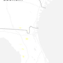
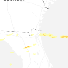


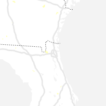


Connect with Interactive Hail Maps