

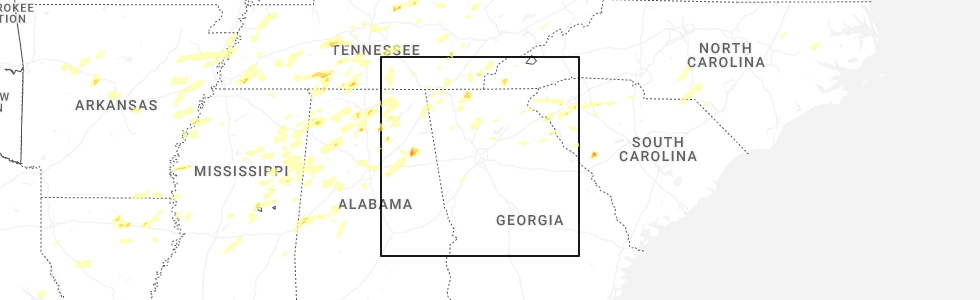
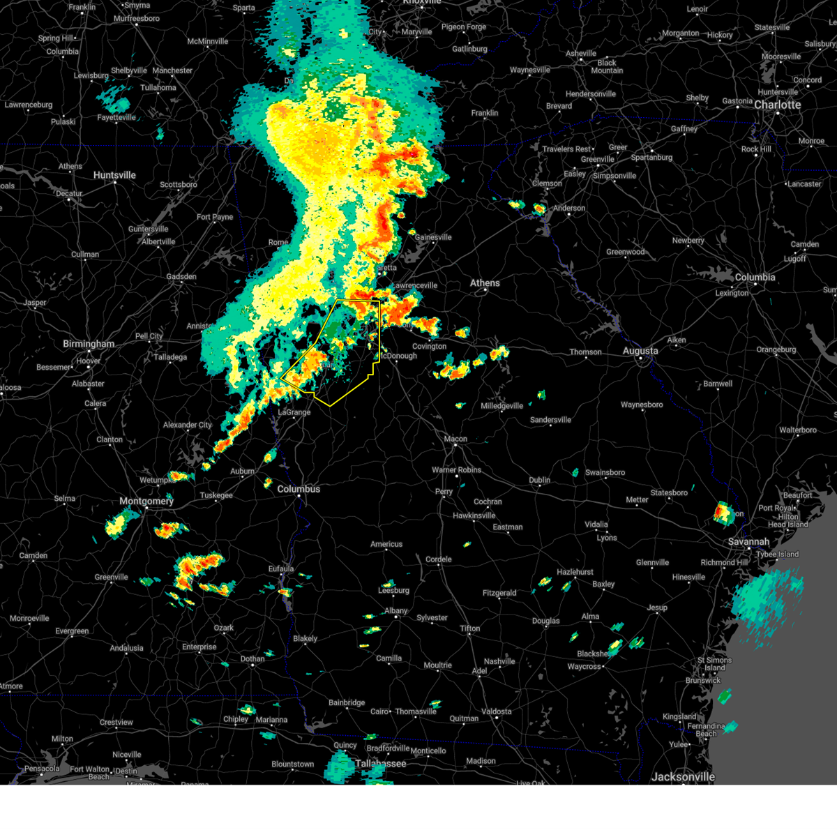
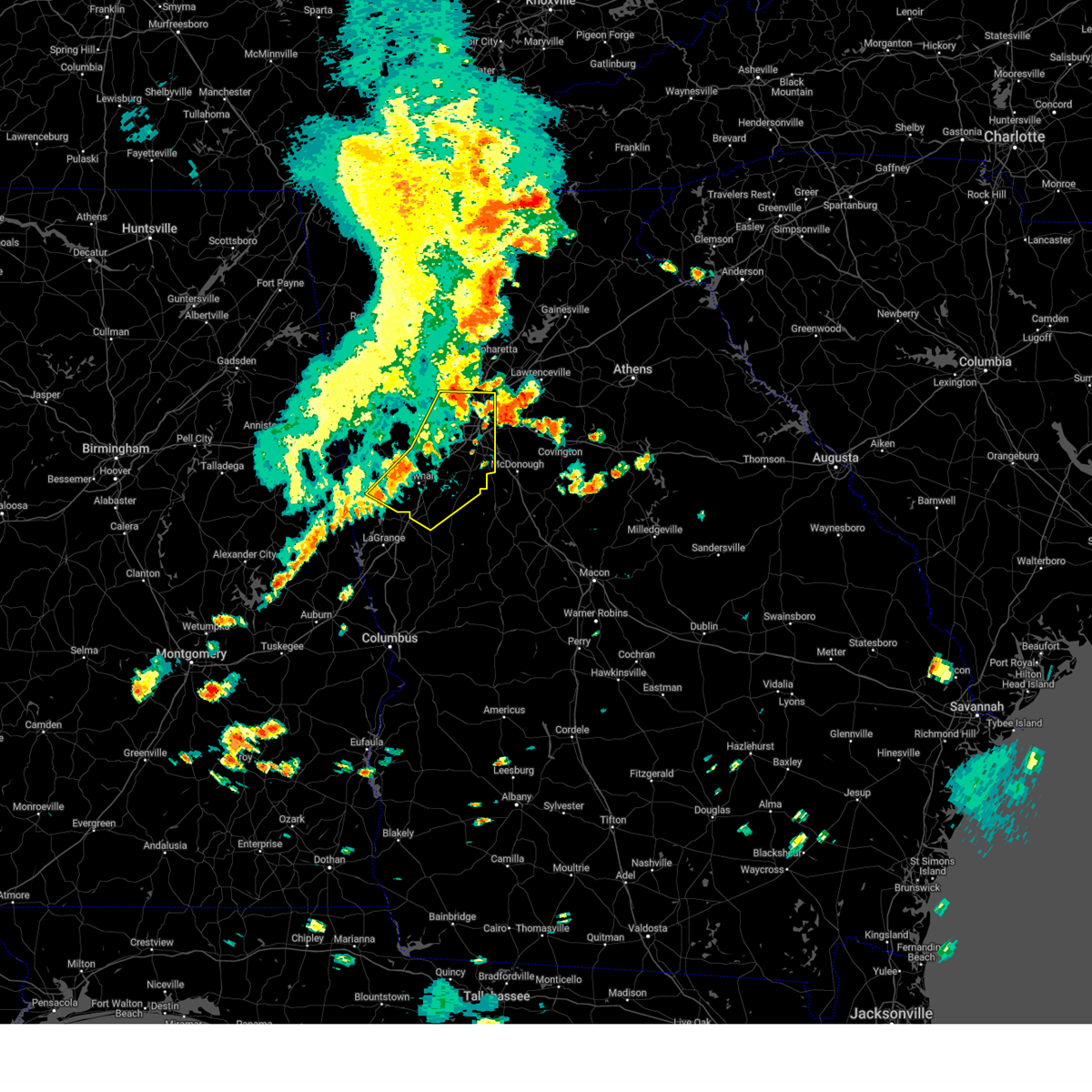
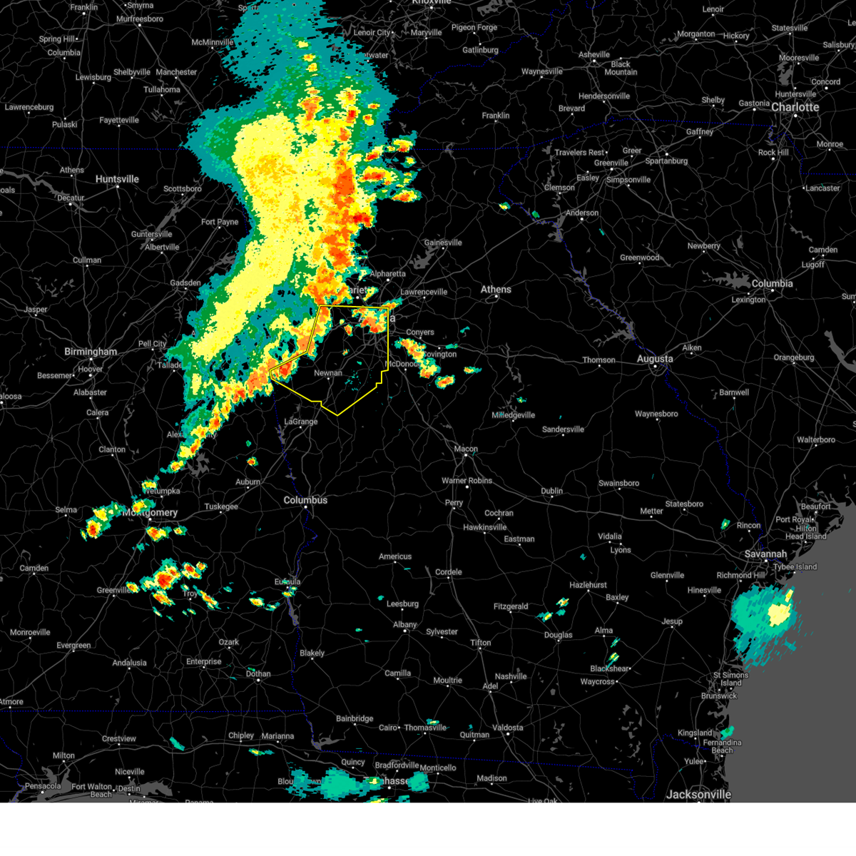
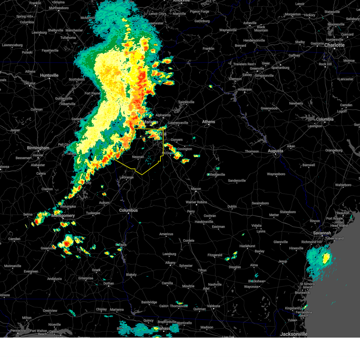
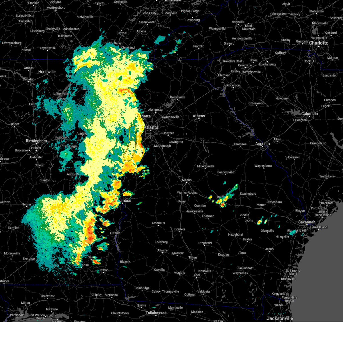
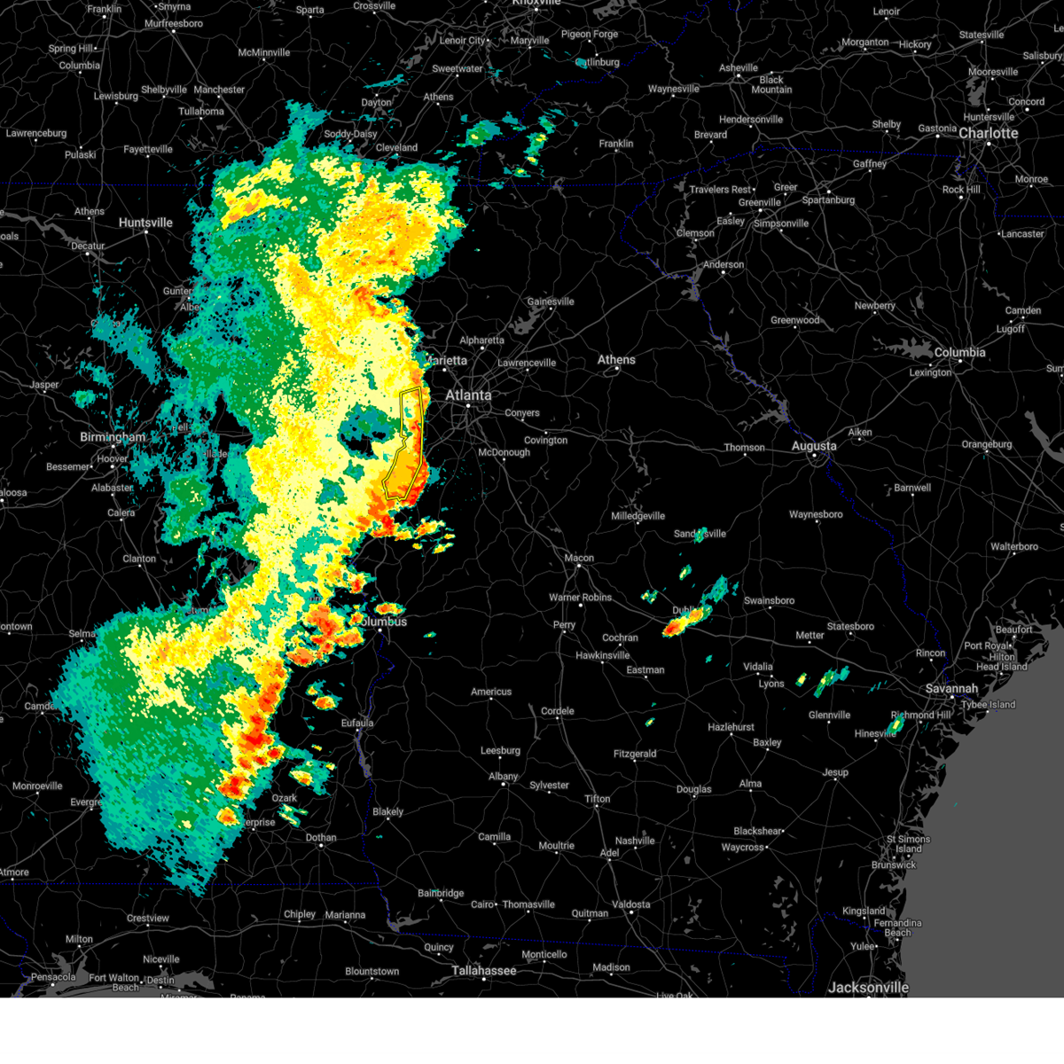
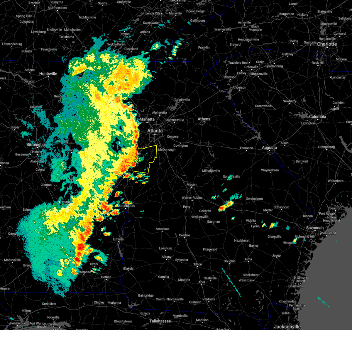
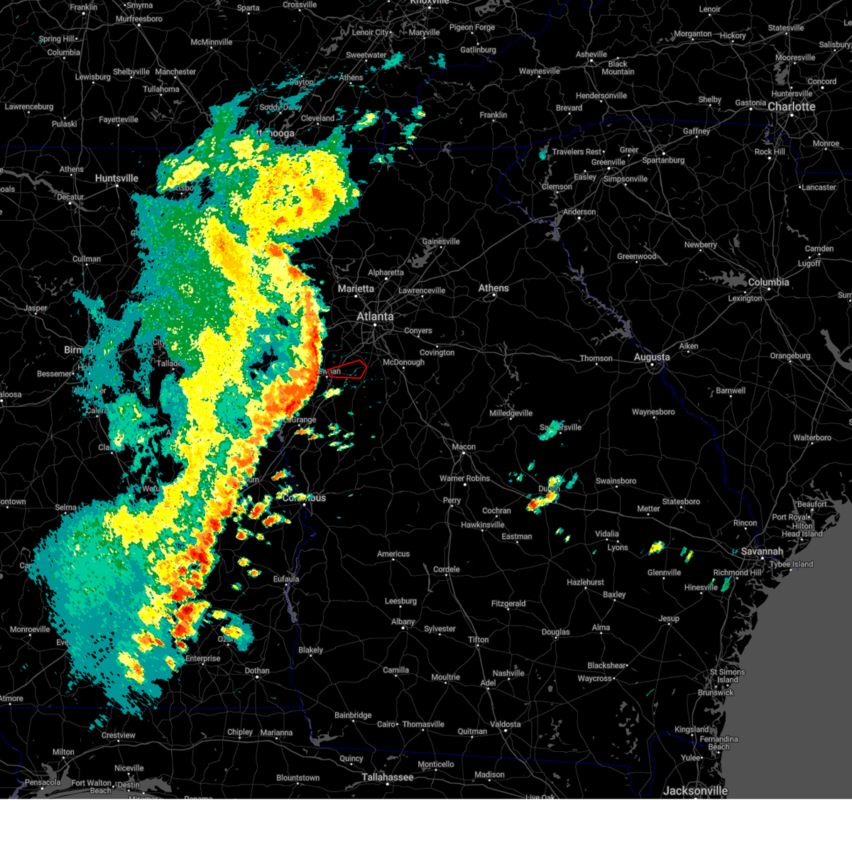
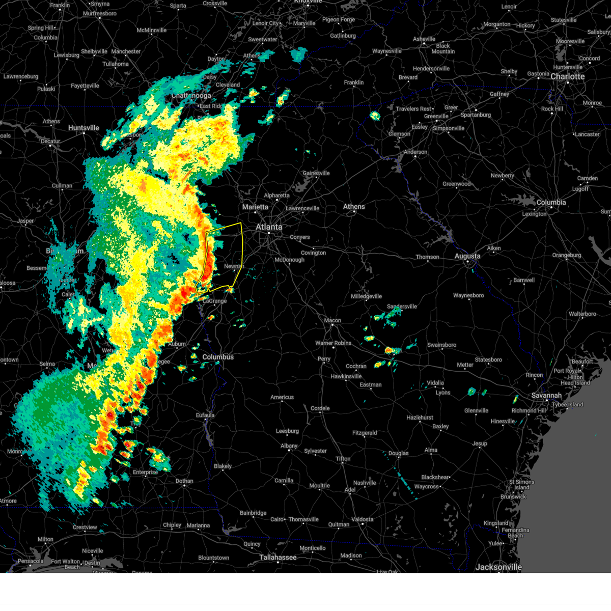
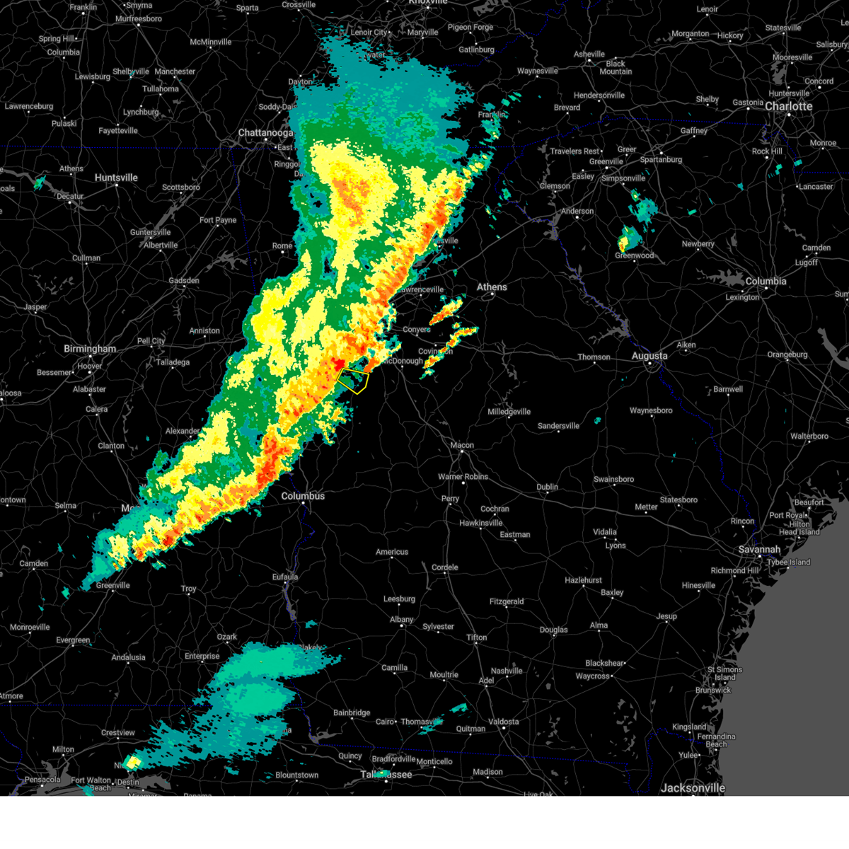
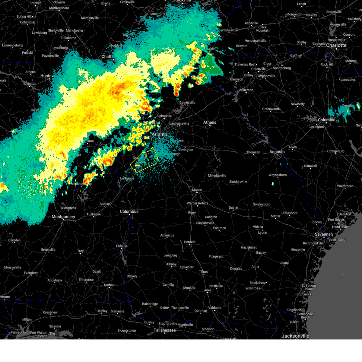
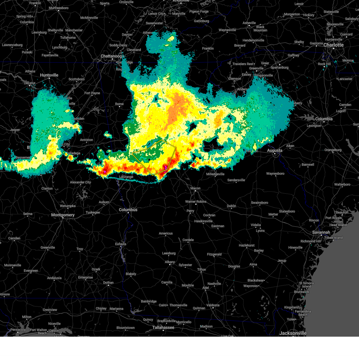
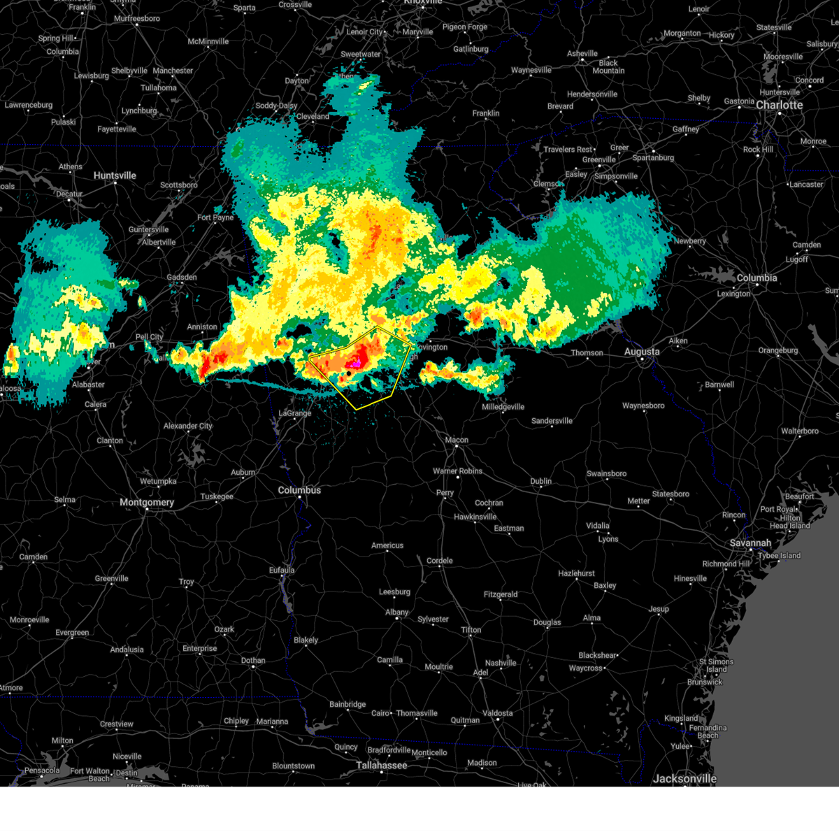
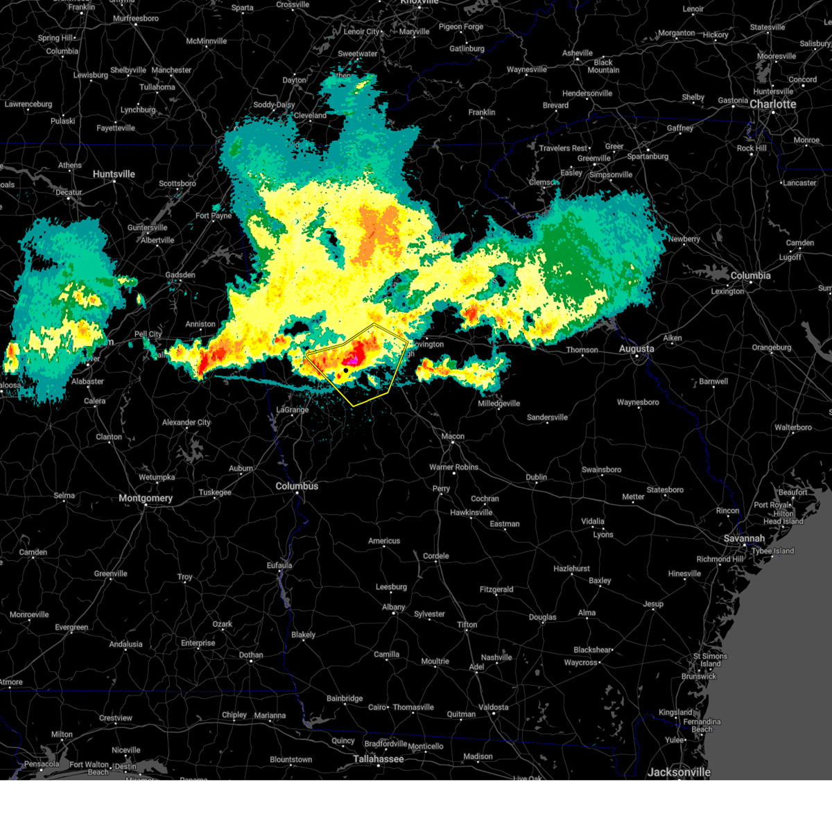
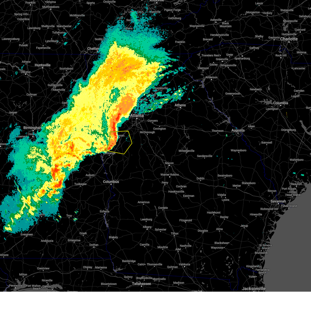
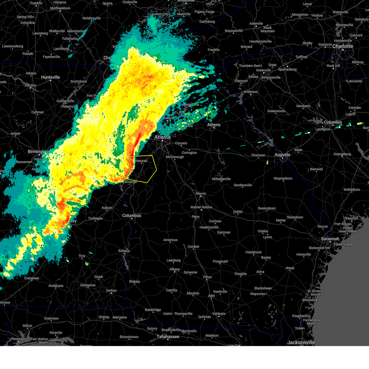
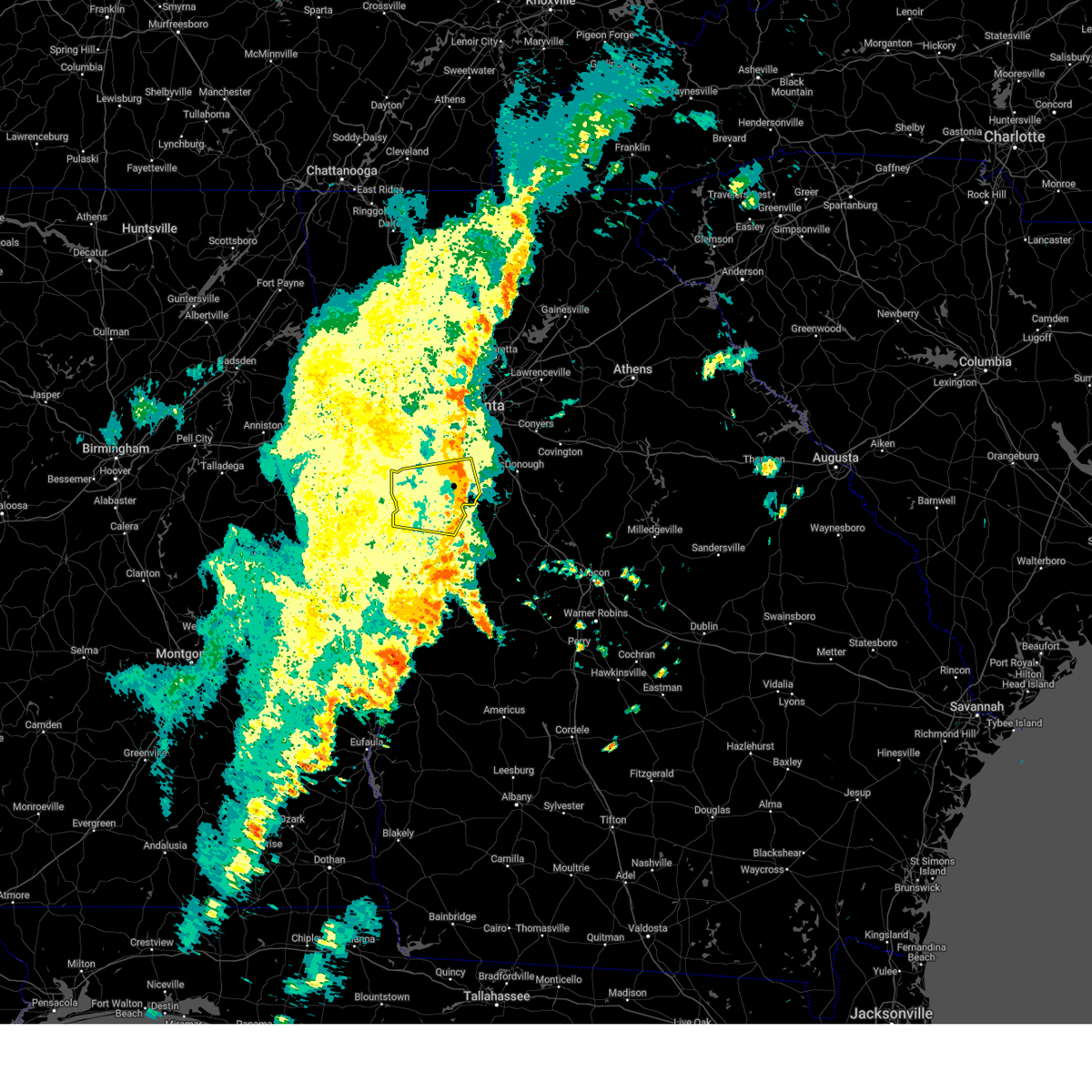
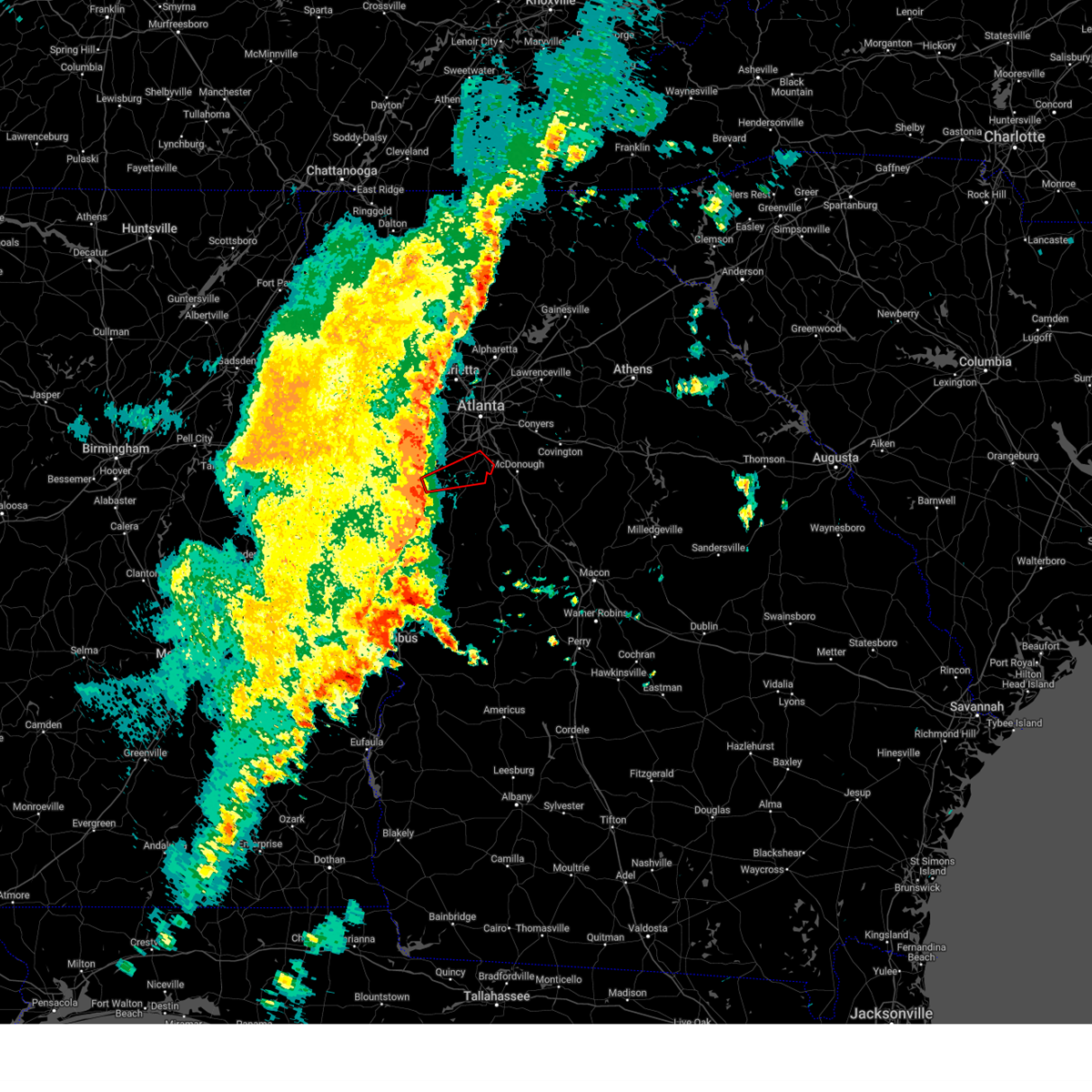
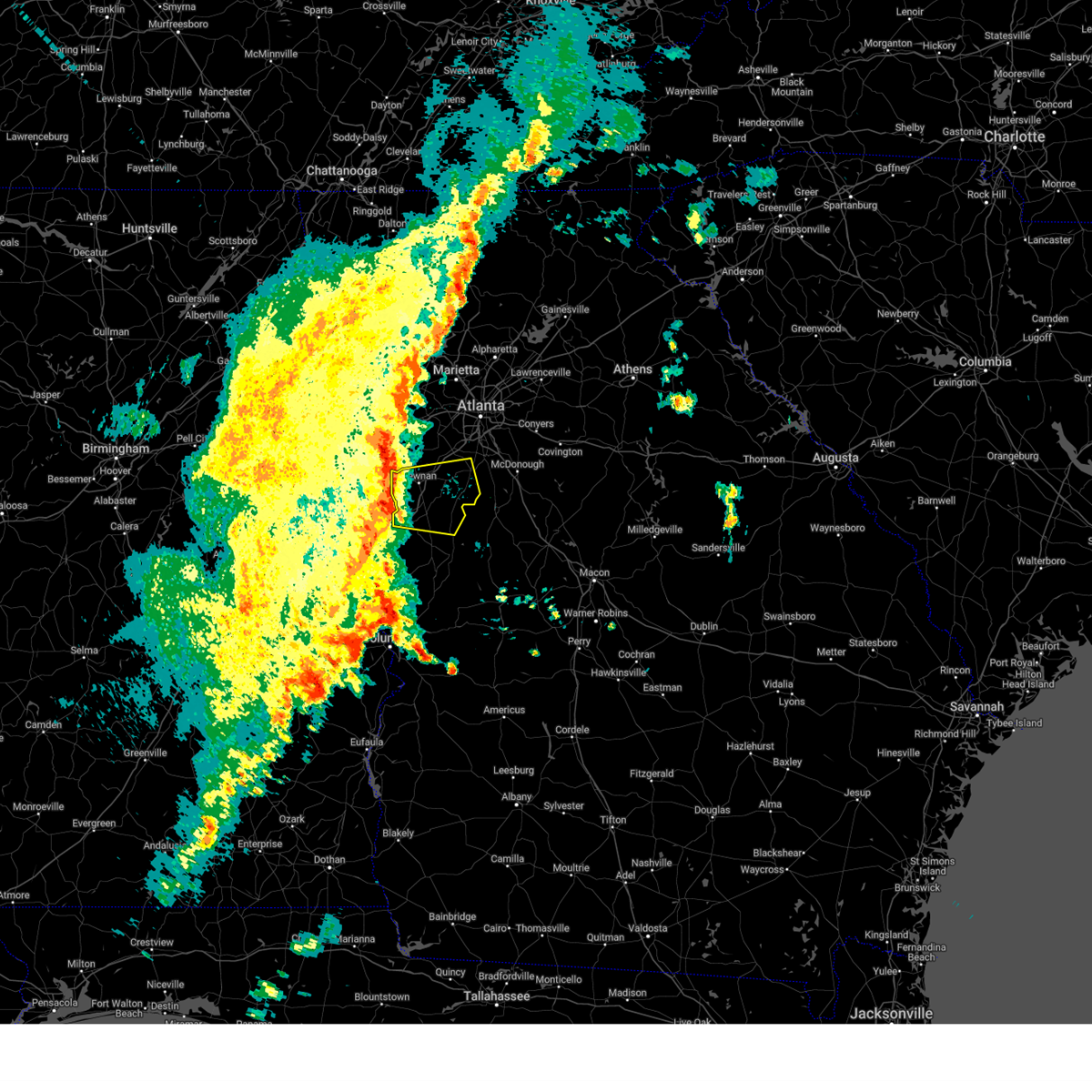
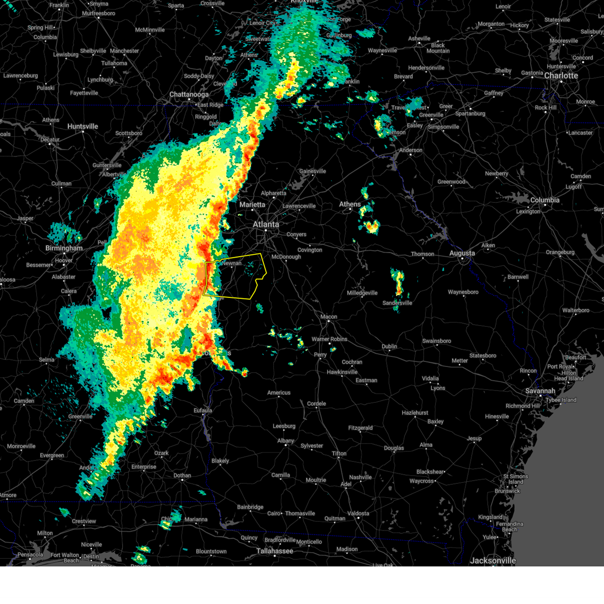
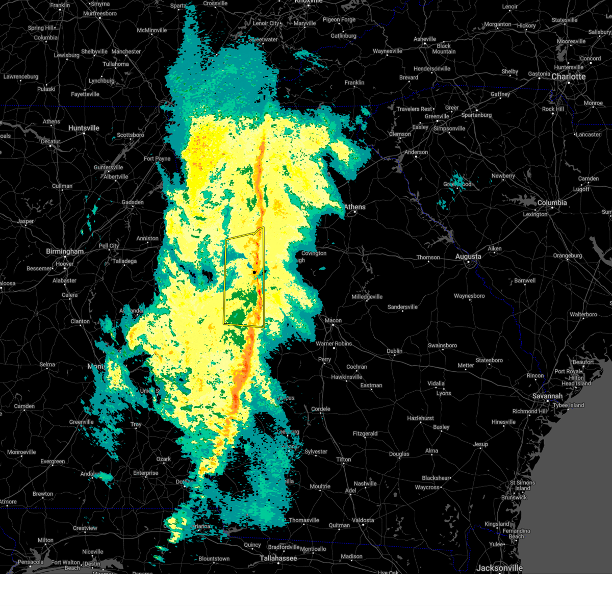
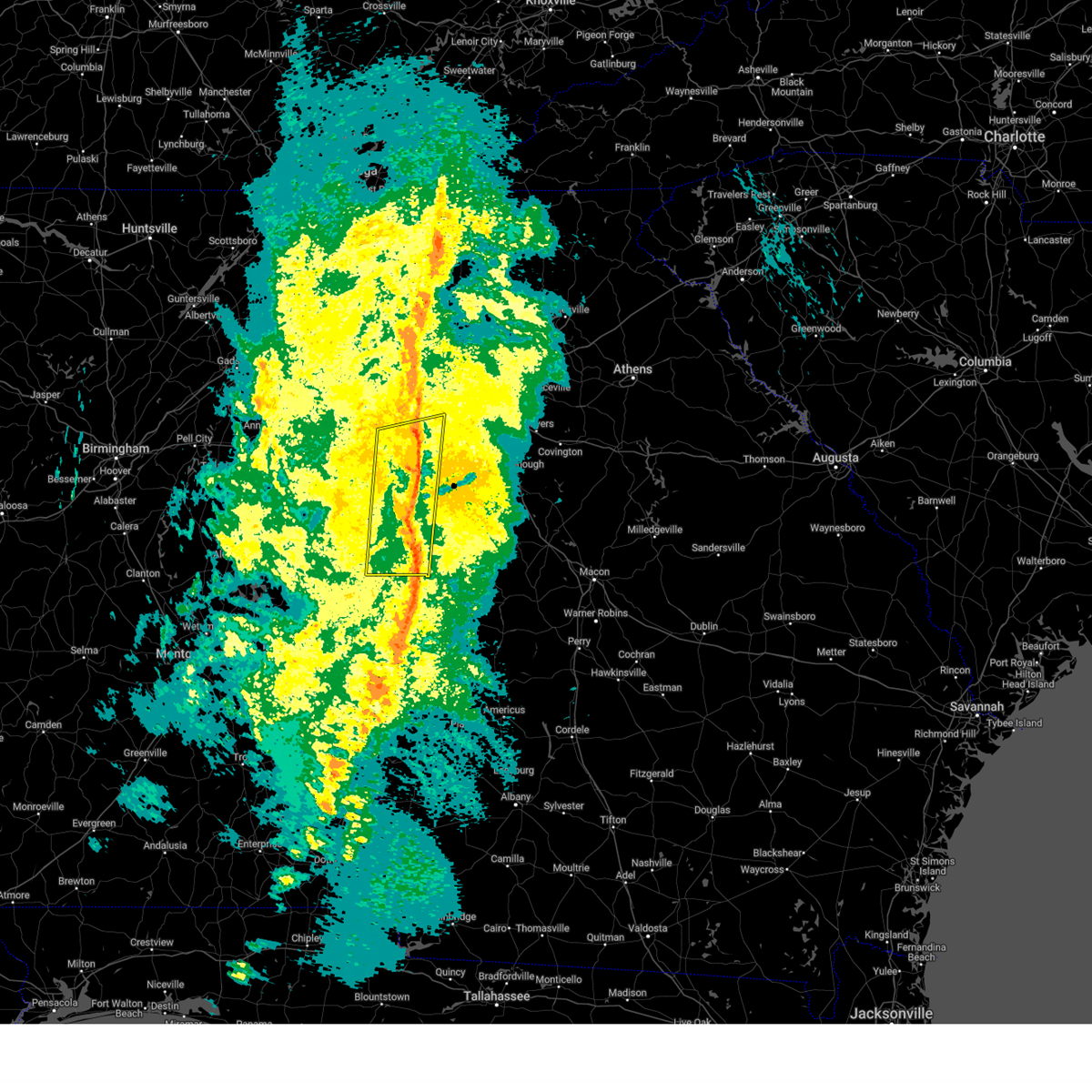
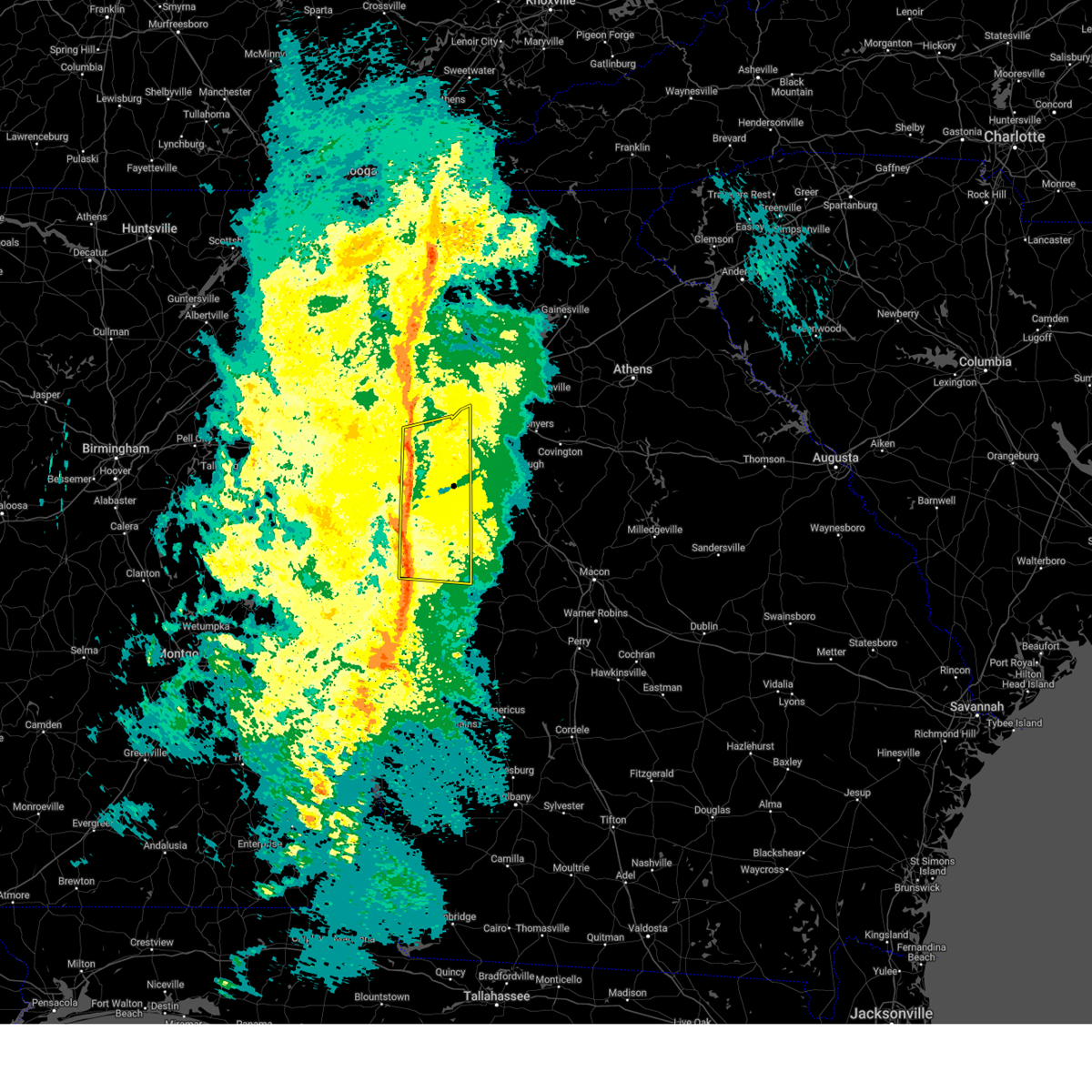
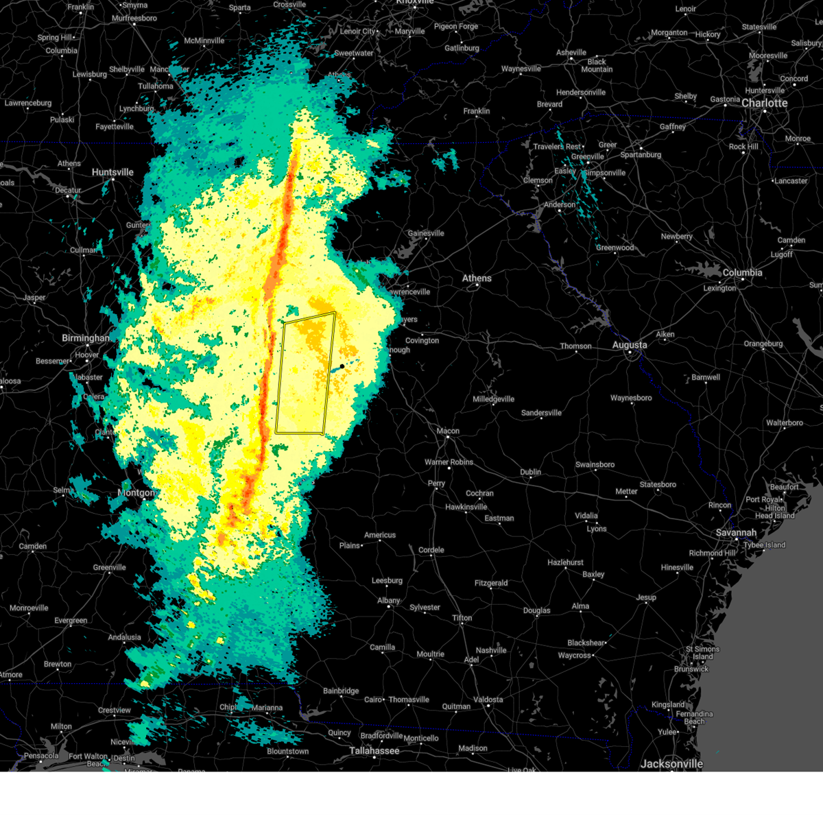
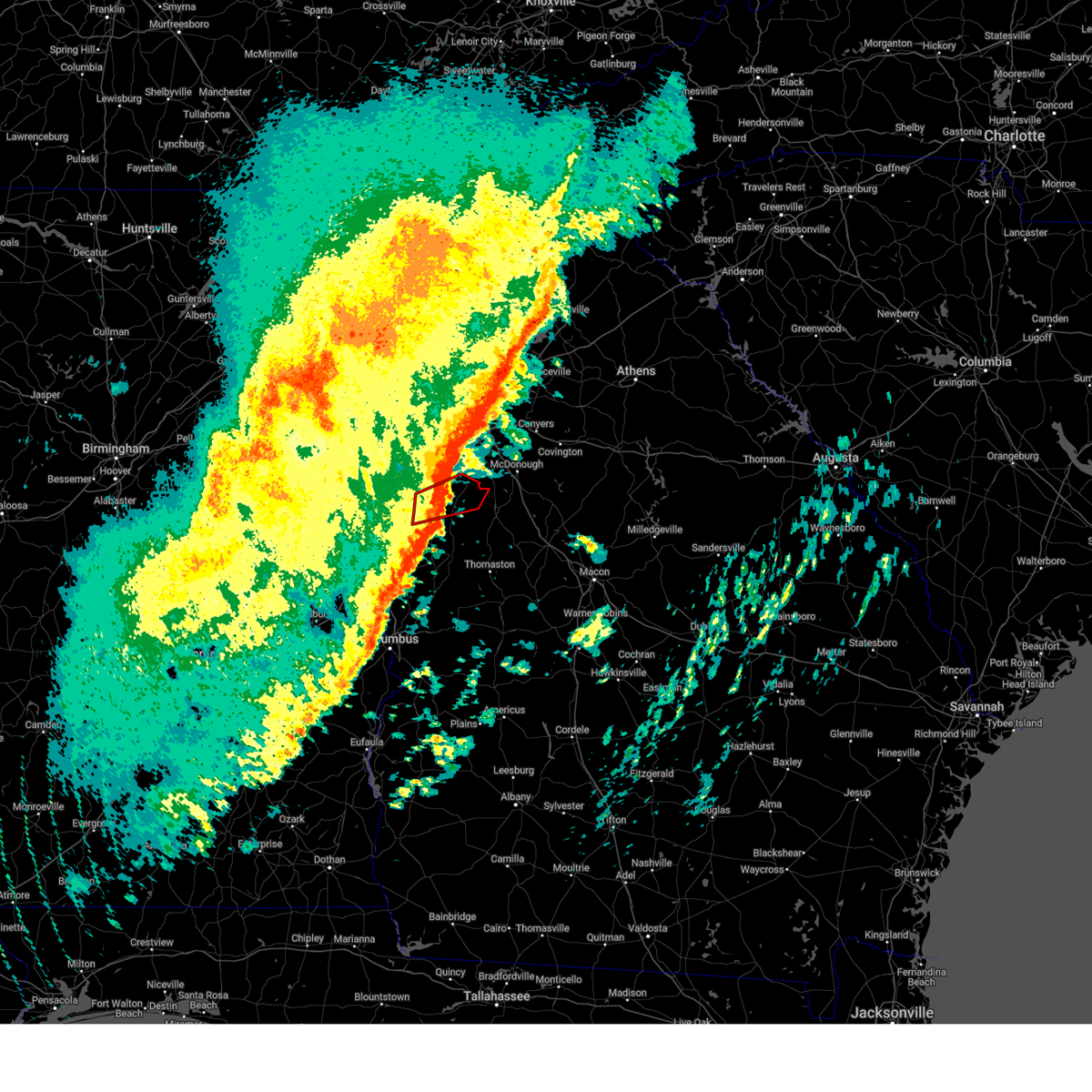
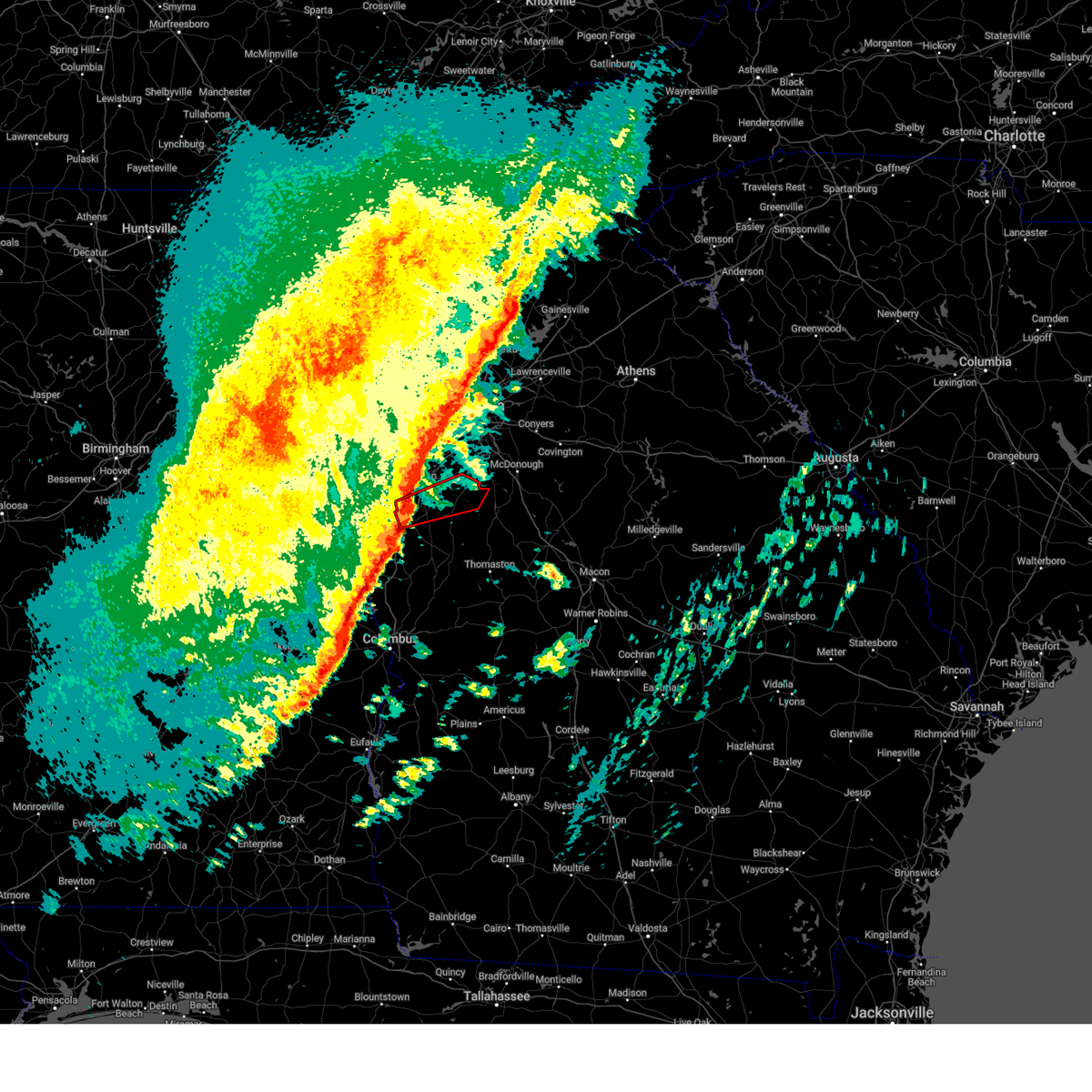
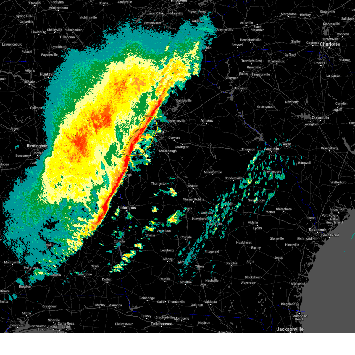
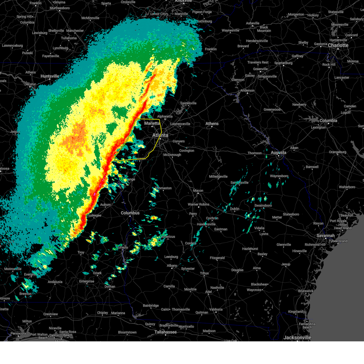
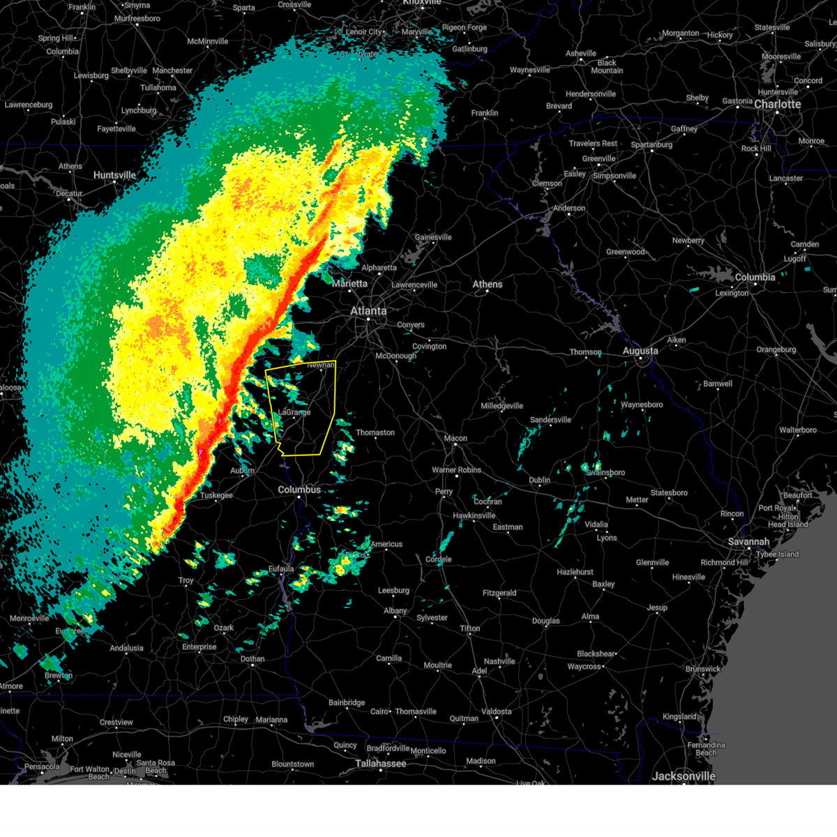
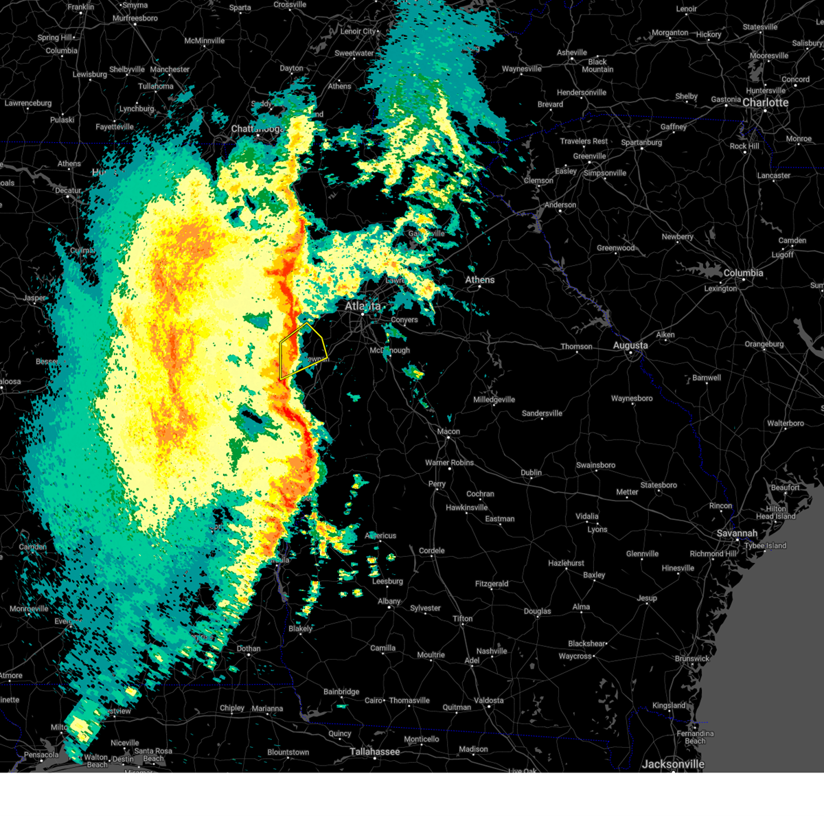
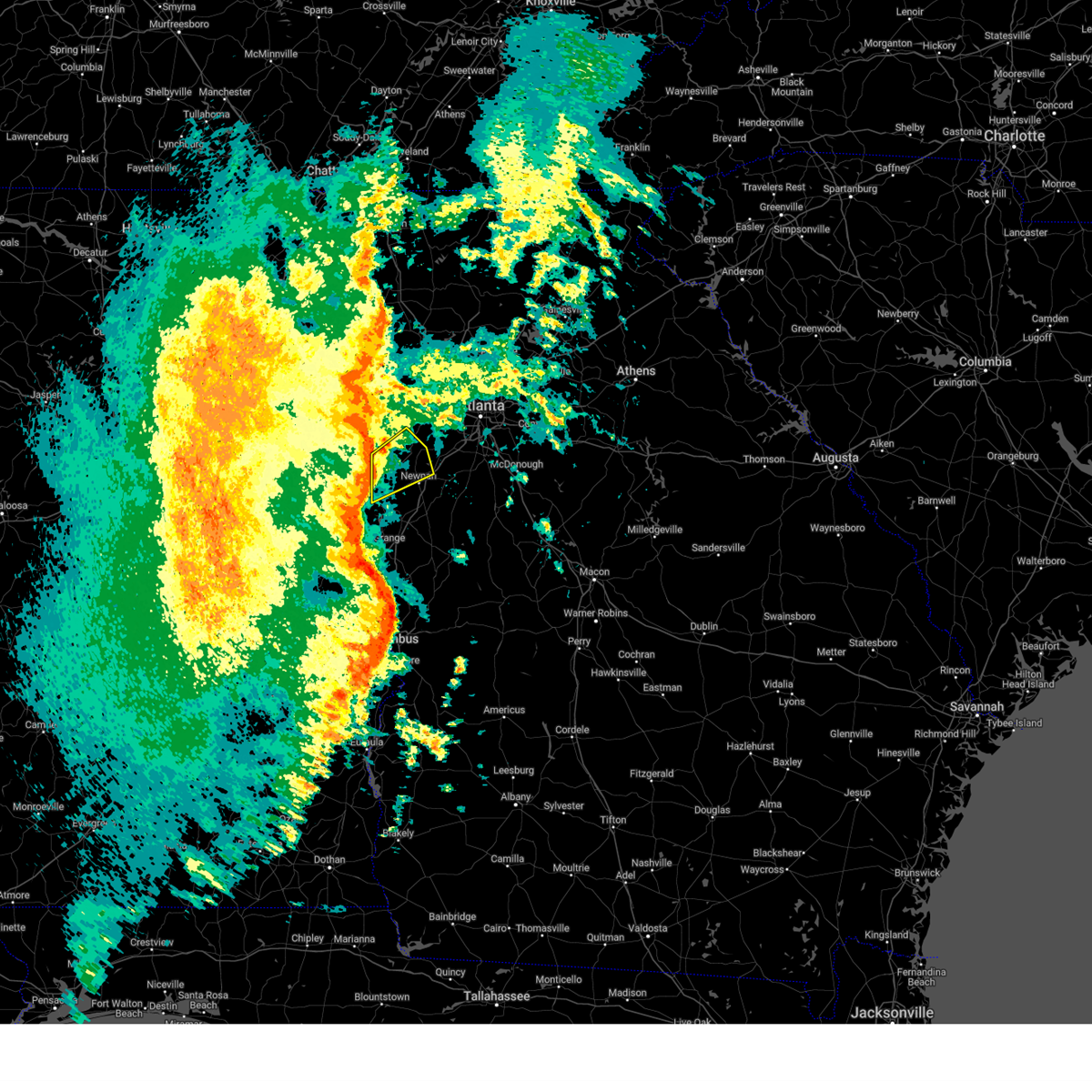
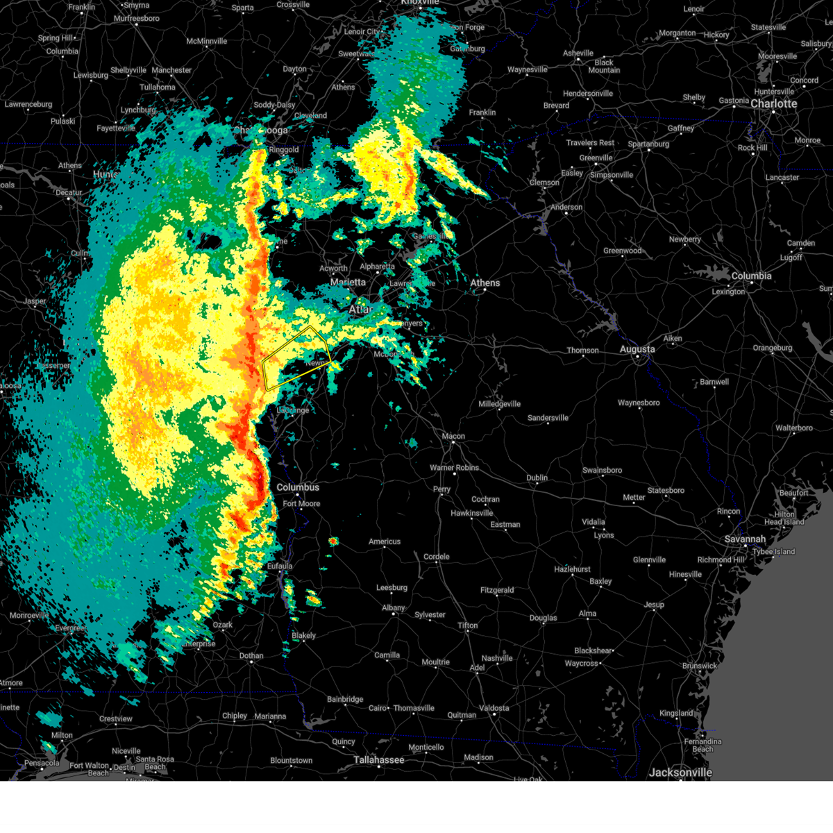
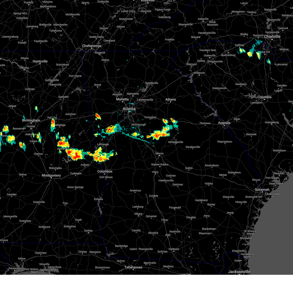
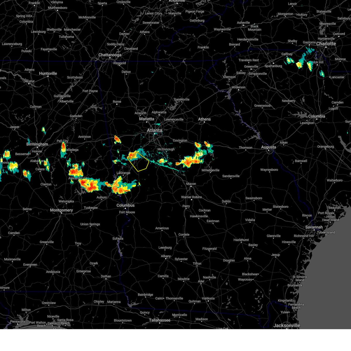
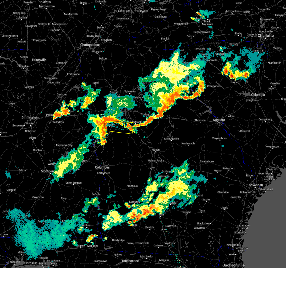
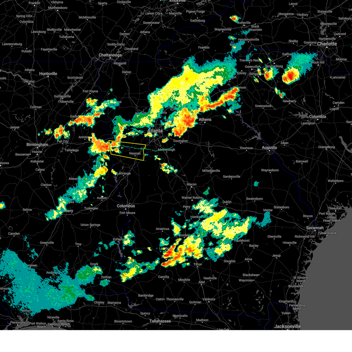
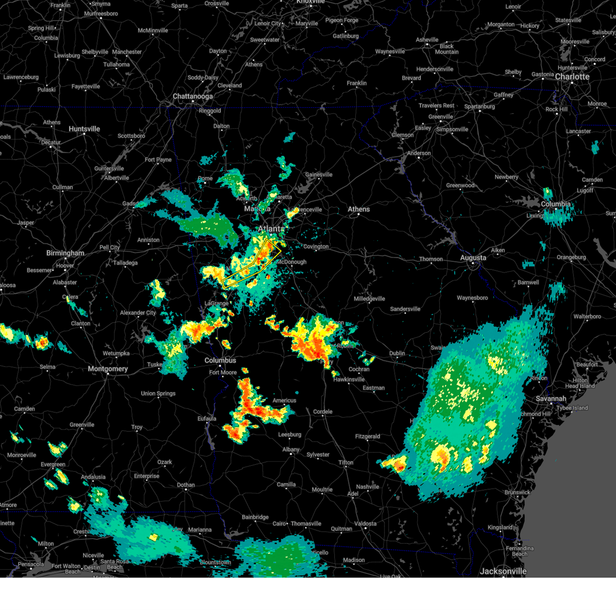
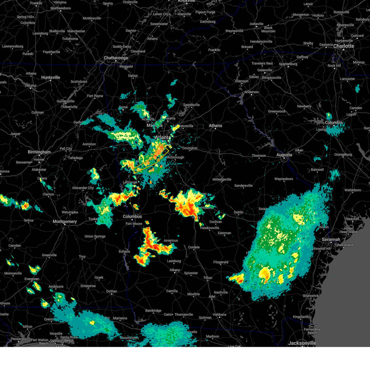
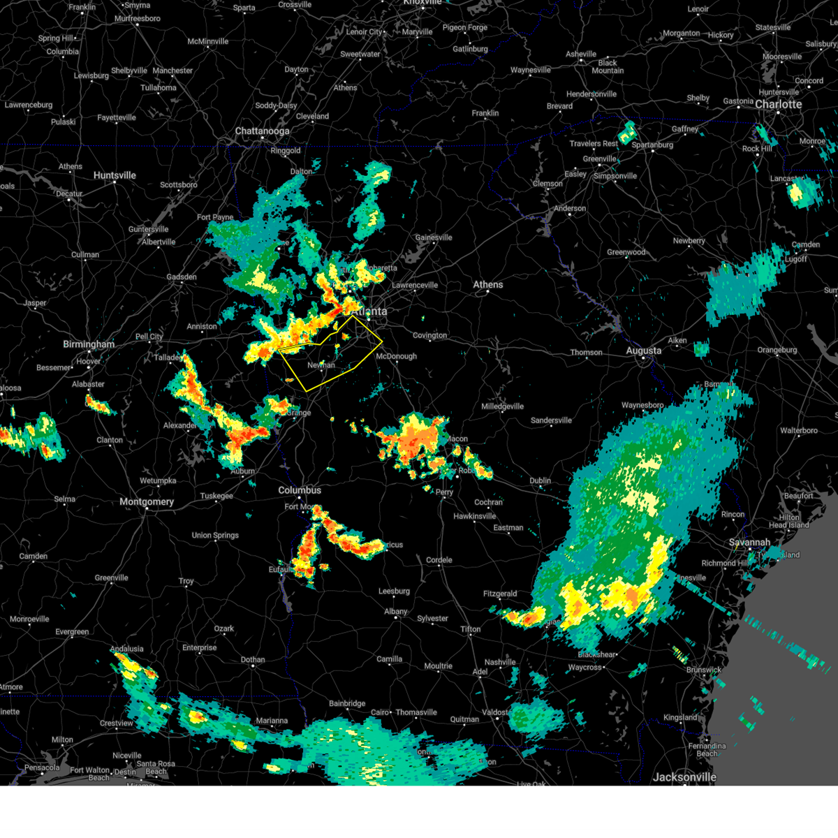
Hail Map for Newnan, GA
The Newnan, GA area has had 15 reports of on-the-ground hail by trained spotters, and has been under severe weather warnings 68 times during the past 12 months. Doppler radar has detected hail at or near Newnan, GA on 50 occasions, including 3 occasions during the past year.
| Name: | Newnan, GA |
| Where Located: | 33.3 miles SW of Atlanta, GA |
| Map: | Google Map for Newnan, GA |
| Population: | 33039 |
| Housing Units: | 13860 |
| More Info: | Search Google for Newnan, GA |
2
The Top Recent Hail Date for Newnan, GA is Friday, May 2, 2025 (7th out of 50)
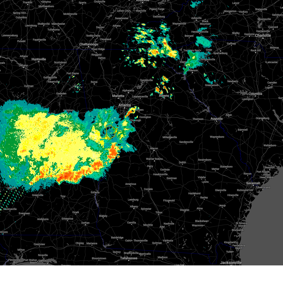
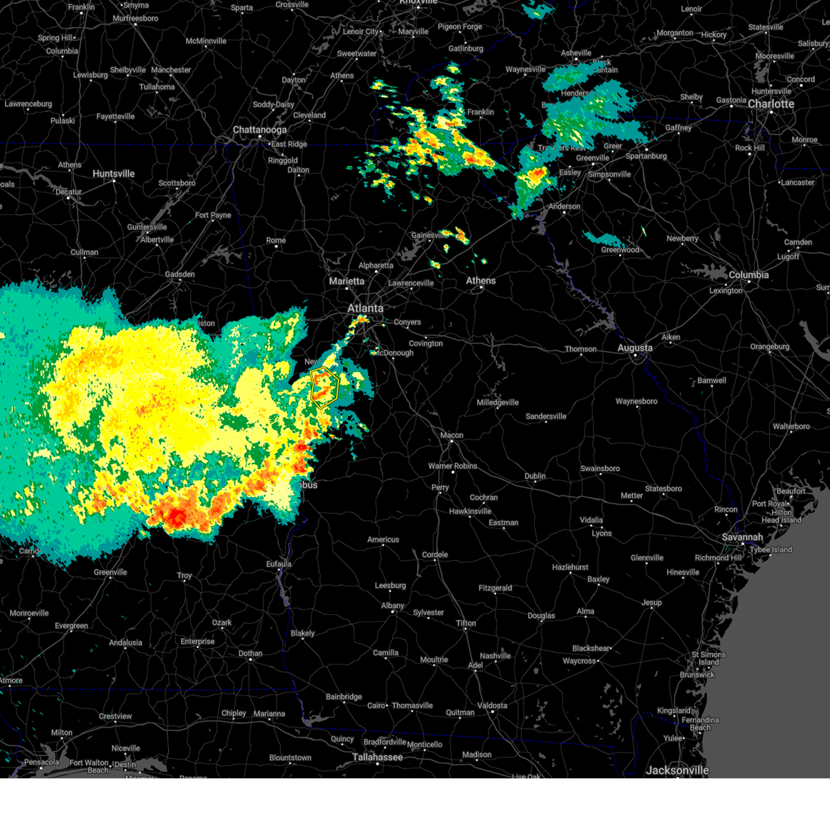
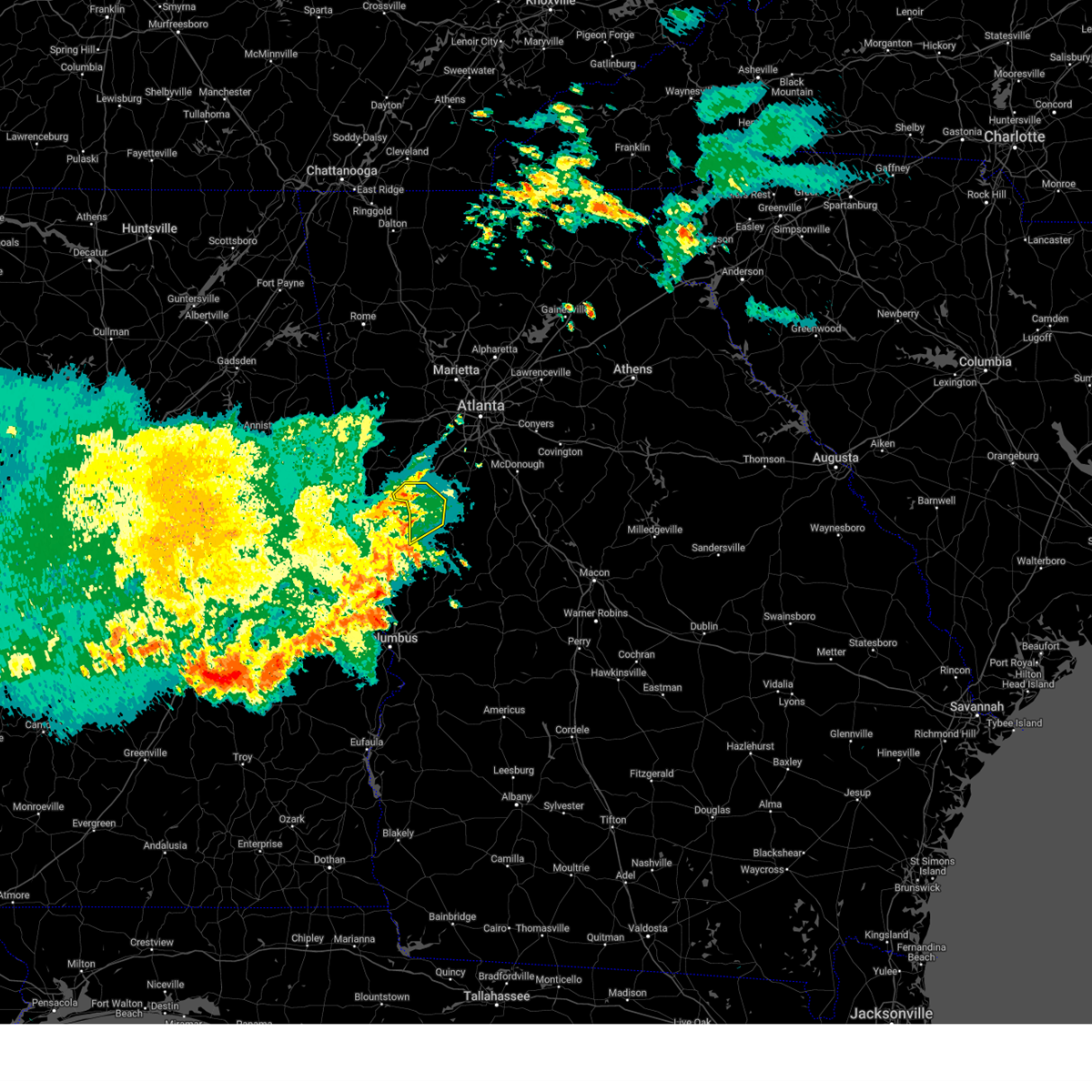
Hail and Wind Damage Spotted near Newnan, GA
| Date / Time | Report Details |
|---|---|
| 6/8/2025 7:14 AM EDT |
 The storm which prompted the warning has weakened below severe limits, and has exited the warned area. therefore, the warning will be allowed to expire. The storm which prompted the warning has weakened below severe limits, and has exited the warned area. therefore, the warning will be allowed to expire.
|
| 6/8/2025 7:00 AM EDT |
 At 700 am edt, a severe thunderstorm was located near luthersville, or 11 miles southeast of newnan, moving east at 45 mph (radar indicated). Hazards include 60 mph wind gusts. Expect damage to roofs, siding, and trees. Locations impacted include, newnan, grantville, luthersville, moreland, lone oak, east newnan, rocky mount, and saint marks. At 700 am edt, a severe thunderstorm was located near luthersville, or 11 miles southeast of newnan, moving east at 45 mph (radar indicated). Hazards include 60 mph wind gusts. Expect damage to roofs, siding, and trees. Locations impacted include, newnan, grantville, luthersville, moreland, lone oak, east newnan, rocky mount, and saint marks.
|
| 6/8/2025 6:45 AM EDT |
 Svrffc the national weather service in peachtree city has issued a * severe thunderstorm warning for, northwestern meriwether county in west central georgia, southwestern coweta county in west central georgia, * until 715 am edt. * at 645 am edt, a severe thunderstorm was located over grantville, or 12 miles southwest of newnan, moving east at 45 mph (radar indicated). Hazards include 60 mph wind gusts. expect damage to roofs, siding, and trees Svrffc the national weather service in peachtree city has issued a * severe thunderstorm warning for, northwestern meriwether county in west central georgia, southwestern coweta county in west central georgia, * until 715 am edt. * at 645 am edt, a severe thunderstorm was located over grantville, or 12 miles southwest of newnan, moving east at 45 mph (radar indicated). Hazards include 60 mph wind gusts. expect damage to roofs, siding, and trees
|
| 6/7/2025 5:53 PM EDT |
 The storms which prompted the warning have weakened below severe limits, and no longer pose an immediate threat to life or property. therefore, the warning will be allowed to expire. however, gusty winds are still possible with these thunderstorms. a severe thunderstorm watch remains in effect until 900 pm edt for north central and west central georgia. The storms which prompted the warning have weakened below severe limits, and no longer pose an immediate threat to life or property. therefore, the warning will be allowed to expire. however, gusty winds are still possible with these thunderstorms. a severe thunderstorm watch remains in effect until 900 pm edt for north central and west central georgia.
|
| 6/7/2025 5:50 PM EDT | Large tree limbs down near the intersection of high point north drive and portico plac in coweta county GA, 3.4 miles WNW of Newnan, GA |
| 6/7/2025 5:50 PM EDT | Large tree limbs down near the intersection of lower fayetteville road and mary freeman roa in coweta county GA, 3.4 miles WNW of Newnan, GA |
| 6/7/2025 5:46 PM EDT |
 At 546 pm edt, severe thunderstorms were located along a line extending from near mableton to near cannongate to near corinth, moving east at 50 mph (radar indicated). Hazards include 60 mph wind gusts. Expect damage to roofs, siding, and trees. Locations impacted include, atlanta, newnan, douglasville, decatur, fayetteville, jonesboro, city of south fulton, sandy springs, smyrna, peachtree city, east point, union city, forest park, riverdale, college park, powder springs, fairburn, chamblee, tyrone, and austell. At 546 pm edt, severe thunderstorms were located along a line extending from near mableton to near cannongate to near corinth, moving east at 50 mph (radar indicated). Hazards include 60 mph wind gusts. Expect damage to roofs, siding, and trees. Locations impacted include, atlanta, newnan, douglasville, decatur, fayetteville, jonesboro, city of south fulton, sandy springs, smyrna, peachtree city, east point, union city, forest park, riverdale, college park, powder springs, fairburn, chamblee, tyrone, and austell.
|
| 6/7/2025 5:46 PM EDT |
 the severe thunderstorm warning has been cancelled and is no longer in effect the severe thunderstorm warning has been cancelled and is no longer in effect
|
| 6/7/2025 5:26 PM EDT |
 At 526 pm edt, severe thunderstorms were located along a line extending from hiram to near hannah to near frolona, moving east at 50 mph (radar indicated). Hazards include 60 mph wind gusts. Expect damage to roofs, siding, and trees. Locations impacted include, atlanta, newnan, douglasville, decatur, fayetteville, jonesboro, franklin, city of south fulton, sandy springs, smyrna, peachtree city, east point, union city, forest park, riverdale, villa rica, college park, powder springs, fairburn, and chamblee. At 526 pm edt, severe thunderstorms were located along a line extending from hiram to near hannah to near frolona, moving east at 50 mph (radar indicated). Hazards include 60 mph wind gusts. Expect damage to roofs, siding, and trees. Locations impacted include, atlanta, newnan, douglasville, decatur, fayetteville, jonesboro, franklin, city of south fulton, sandy springs, smyrna, peachtree city, east point, union city, forest park, riverdale, villa rica, college park, powder springs, fairburn, and chamblee.
|
| 6/7/2025 5:18 PM EDT |
 Svrffc the national weather service in peachtree city has issued a * severe thunderstorm warning for, southeastern paulding county in northwestern georgia, southwestern dekalb county in north central georgia, fayette county in north central georgia, northwestern meriwether county in west central georgia, eastern carroll county in northwestern georgia, southern cobb county in north central georgia, douglas county in north central georgia, northern heard county in west central georgia, coweta county in west central georgia, clayton county in north central georgia, fulton county in north central georgia, * until 600 pm edt. * at 517 pm edt, severe thunderstorms were located along a line extending from near dallas to near clem to near frolona, moving east at 50 mph (radar indicated). Hazards include 70 mph wind gusts. Expect considerable tree damage. Damage is likely to mobile homes, roofs, and outbuildings. Svrffc the national weather service in peachtree city has issued a * severe thunderstorm warning for, southeastern paulding county in northwestern georgia, southwestern dekalb county in north central georgia, fayette county in north central georgia, northwestern meriwether county in west central georgia, eastern carroll county in northwestern georgia, southern cobb county in north central georgia, douglas county in north central georgia, northern heard county in west central georgia, coweta county in west central georgia, clayton county in north central georgia, fulton county in north central georgia, * until 600 pm edt. * at 517 pm edt, severe thunderstorms were located along a line extending from near dallas to near clem to near frolona, moving east at 50 mph (radar indicated). Hazards include 70 mph wind gusts. Expect considerable tree damage. Damage is likely to mobile homes, roofs, and outbuildings.
|
| 5/27/2025 3:30 PM EDT |
 The storms which prompted the warning have moved out of the area. therefore, the warning will be allowed to expire. a severe thunderstorm watch remains in effect until 900 pm edt for northwestern and west central georgia. remember, a severe thunderstorm warning still remains in effect for eastern coweta county until 345 pm edt. The storms which prompted the warning have moved out of the area. therefore, the warning will be allowed to expire. a severe thunderstorm watch remains in effect until 900 pm edt for northwestern and west central georgia. remember, a severe thunderstorm warning still remains in effect for eastern coweta county until 345 pm edt.
|
| 5/27/2025 3:16 PM EDT |
 At 315 pm edt, severe thunderstorms were located along a line extending from brownsville to near chapel hill to near newnan to near corinth, moving east at 50 mph (radar indicated). Hazards include 60 mph wind gusts and penny size hail. Expect damage to roofs, siding, and trees. Locations impacted include, newnan, douglasville, grantville, chattahoochee hill, east newnan, corinth, brownsville, arnco-sargent, bill arp, chapel hill, dunaway gardens, winston, roscoe, and madras. At 315 pm edt, severe thunderstorms were located along a line extending from brownsville to near chapel hill to near newnan to near corinth, moving east at 50 mph (radar indicated). Hazards include 60 mph wind gusts and penny size hail. Expect damage to roofs, siding, and trees. Locations impacted include, newnan, douglasville, grantville, chattahoochee hill, east newnan, corinth, brownsville, arnco-sargent, bill arp, chapel hill, dunaway gardens, winston, roscoe, and madras.
|
| 5/27/2025 3:16 PM EDT |
 the severe thunderstorm warning has been cancelled and is no longer in effect the severe thunderstorm warning has been cancelled and is no longer in effect
|
| 5/27/2025 3:11 PM EDT |
 Svrffc the national weather service in peachtree city has issued a * severe thunderstorm warning for, fayette county in north central georgia, northern meriwether county in west central georgia, eastern coweta county in west central georgia, southwestern clayton county in north central georgia, * until 345 pm edt. * at 311 pm edt, severe thunderstorms were located along a line extending from douglasville to near newnan to near hogansville, moving east at 35 mph (radar indicated). Hazards include 60 mph wind gusts and quarter size hail. Hail damage to vehicles is expected. Expect wind damage to roofs, siding, and trees. Svrffc the national weather service in peachtree city has issued a * severe thunderstorm warning for, fayette county in north central georgia, northern meriwether county in west central georgia, eastern coweta county in west central georgia, southwestern clayton county in north central georgia, * until 345 pm edt. * at 311 pm edt, severe thunderstorms were located along a line extending from douglasville to near newnan to near hogansville, moving east at 35 mph (radar indicated). Hazards include 60 mph wind gusts and quarter size hail. Hail damage to vehicles is expected. Expect wind damage to roofs, siding, and trees.
|
| 5/27/2025 3:10 PM EDT | Trees down at the intersection of dart rd and herring road. possible brief tornadic spin u in coweta county GA, 2.2 miles SSW of Newnan, GA |
| 5/27/2025 3:10 PM EDT |
 Torffc the national weather service in peachtree city has issued a * tornado warning for, northwestern fayette county in north central georgia, northeastern coweta county in west central georgia, * until 345 pm edt. * at 310 pm edt, a severe thunderstorm capable of producing a tornado was located over madras, or over newnan, moving east at 35 mph (radar indicated rotation). Hazards include tornado. Flying debris will be dangerous to those caught without shelter. mobile homes will be damaged or destroyed. damage to roofs, windows, and vehicles will occur. Tree damage is likely. Torffc the national weather service in peachtree city has issued a * tornado warning for, northwestern fayette county in north central georgia, northeastern coweta county in west central georgia, * until 345 pm edt. * at 310 pm edt, a severe thunderstorm capable of producing a tornado was located over madras, or over newnan, moving east at 35 mph (radar indicated rotation). Hazards include tornado. Flying debris will be dangerous to those caught without shelter. mobile homes will be damaged or destroyed. damage to roofs, windows, and vehicles will occur. Tree damage is likely.
|
| 5/27/2025 2:44 PM EDT |
 Svrffc the national weather service in peachtree city has issued a * severe thunderstorm warning for, southeastern paulding county in northwestern georgia, southeastern haralson county in northwestern georgia, carroll county in northwestern georgia, douglas county in north central georgia, heard county in west central georgia, western coweta county in west central georgia, southwestern fulton county in north central georgia, * until 330 pm edt. * at 244 pm edt, severe thunderstorms were located along a line extending from near bremen to carrollton to near centralhatchee to near glenn, moving east at 25 mph (radar indicated). Hazards include 60 mph wind gusts and penny size hail. expect damage to roofs, siding, and trees Svrffc the national weather service in peachtree city has issued a * severe thunderstorm warning for, southeastern paulding county in northwestern georgia, southeastern haralson county in northwestern georgia, carroll county in northwestern georgia, douglas county in north central georgia, heard county in west central georgia, western coweta county in west central georgia, southwestern fulton county in north central georgia, * until 330 pm edt. * at 244 pm edt, severe thunderstorms were located along a line extending from near bremen to carrollton to near centralhatchee to near glenn, moving east at 25 mph (radar indicated). Hazards include 60 mph wind gusts and penny size hail. expect damage to roofs, siding, and trees
|
| 5/18/2025 9:43 AM EDT |
 Svrffc the national weather service in peachtree city has issued a * severe thunderstorm warning for, spalding county in west central georgia, southern fayette county in north central georgia, northeastern marion county in west central georgia, meriwether county in west central georgia, pike county in west central georgia, northeastern muscogee county in west central georgia, western monroe county in central georgia, upson county in west central georgia, southwestern butts county in central georgia, harris county in west central georgia, southwestern henry county in north central georgia, northwestern crawford county in central georgia, southern coweta county in west central georgia, southern clayton county in north central georgia, talbot county in west central georgia, northern taylor county in west central georgia, lamar county in west central georgia, * until 1030 am edt. * at 943 am edt, severe thunderstorms were located along a line extending from newnan to near rocky mount to near woodbury to shiloh to near mulberry grove, moving east at 50 mph (radar indicated). Hazards include 60 mph wind gusts and quarter size hail. Hail damage to vehicles is expected. Expect wind damage to roofs, siding, and trees. Svrffc the national weather service in peachtree city has issued a * severe thunderstorm warning for, spalding county in west central georgia, southern fayette county in north central georgia, northeastern marion county in west central georgia, meriwether county in west central georgia, pike county in west central georgia, northeastern muscogee county in west central georgia, western monroe county in central georgia, upson county in west central georgia, southwestern butts county in central georgia, harris county in west central georgia, southwestern henry county in north central georgia, northwestern crawford county in central georgia, southern coweta county in west central georgia, southern clayton county in north central georgia, talbot county in west central georgia, northern taylor county in west central georgia, lamar county in west central georgia, * until 1030 am edt. * at 943 am edt, severe thunderstorms were located along a line extending from newnan to near rocky mount to near woodbury to shiloh to near mulberry grove, moving east at 50 mph (radar indicated). Hazards include 60 mph wind gusts and quarter size hail. Hail damage to vehicles is expected. Expect wind damage to roofs, siding, and trees.
|
| 5/18/2025 9:03 AM EDT |
 Svrffc the national weather service in peachtree city has issued a * severe thunderstorm warning for, western spalding county in west central georgia, fayette county in north central georgia, meriwether county in west central georgia, pike county in west central georgia, southeastern carroll county in northwestern georgia, northwestern upson county in west central georgia, eastern troup county in west central georgia, coweta county in west central georgia, southwestern clayton county in north central georgia, northwestern talbot county in west central georgia, harris county in west central georgia, * until 945 am edt. * at 903 am edt, severe thunderstorms were located along a line extending from graham to paran to near ridge grove, moving east at 65 mph (radar indicated). Hazards include 60 mph wind gusts and quarter size hail. Hail damage to vehicles is expected. Expect wind damage to roofs, siding, and trees. Svrffc the national weather service in peachtree city has issued a * severe thunderstorm warning for, western spalding county in west central georgia, fayette county in north central georgia, meriwether county in west central georgia, pike county in west central georgia, southeastern carroll county in northwestern georgia, northwestern upson county in west central georgia, eastern troup county in west central georgia, coweta county in west central georgia, southwestern clayton county in north central georgia, northwestern talbot county in west central georgia, harris county in west central georgia, * until 945 am edt. * at 903 am edt, severe thunderstorms were located along a line extending from graham to paran to near ridge grove, moving east at 65 mph (radar indicated). Hazards include 60 mph wind gusts and quarter size hail. Hail damage to vehicles is expected. Expect wind damage to roofs, siding, and trees.
|
| 5/17/2025 8:30 AM EDT |
 The storm which prompted the warning has weakened below severe limits, and has exited the warned area. therefore, the warning has been allowed to expire. however, gusty winds are still possible with this thunderstorm. The storm which prompted the warning has weakened below severe limits, and has exited the warned area. therefore, the warning has been allowed to expire. however, gusty winds are still possible with this thunderstorm.
|
| 5/17/2025 8:18 AM EDT |
 At 818 am edt, a severe thunderstorm was located over corinth, or 9 miles east of franklin, moving east at 45 mph (radar indicated). Hazards include 60 mph wind gusts. Expect damage to roofs, siding, and trees. Locations impacted include, newnan, hogansville, grantville, lone oak, corinth, harrisonville, powers crossroads, and handy. At 818 am edt, a severe thunderstorm was located over corinth, or 9 miles east of franklin, moving east at 45 mph (radar indicated). Hazards include 60 mph wind gusts. Expect damage to roofs, siding, and trees. Locations impacted include, newnan, hogansville, grantville, lone oak, corinth, harrisonville, powers crossroads, and handy.
|
| 5/17/2025 8:12 AM EDT |
 At 812 am edt, a severe thunderstorm was located near franklin, moving east at 45 mph (radar indicated). Hazards include 60 mph wind gusts. Expect damage to roofs, siding, and trees. Locations impacted include, newnan, franklin, hogansville, grantville, centralhatchee, lone oak, corinth, saint marks, texas, harrisonville, powers crossroads, and handy. At 812 am edt, a severe thunderstorm was located near franklin, moving east at 45 mph (radar indicated). Hazards include 60 mph wind gusts. Expect damage to roofs, siding, and trees. Locations impacted include, newnan, franklin, hogansville, grantville, centralhatchee, lone oak, corinth, saint marks, texas, harrisonville, powers crossroads, and handy.
|
| 5/17/2025 7:45 AM EDT |
 Svrffc the national weather service in peachtree city has issued a * severe thunderstorm warning for, northwestern meriwether county in west central georgia, heard county in west central georgia, northern troup county in west central georgia, southwestern coweta county in west central georgia, * until 830 am edt. * at 745 am edt, a severe thunderstorm was located near tennant, or near wedowee, moving east at 45 mph (radar indicated). Hazards include 60 mph wind gusts and penny size hail. expect damage to roofs, siding, and trees Svrffc the national weather service in peachtree city has issued a * severe thunderstorm warning for, northwestern meriwether county in west central georgia, heard county in west central georgia, northern troup county in west central georgia, southwestern coweta county in west central georgia, * until 830 am edt. * at 745 am edt, a severe thunderstorm was located near tennant, or near wedowee, moving east at 45 mph (radar indicated). Hazards include 60 mph wind gusts and penny size hail. expect damage to roofs, siding, and trees
|
| 5/3/2025 8:23 PM EDT |
 Svrffc the national weather service in peachtree city has issued a * severe thunderstorm warning for, southern fayette county in north central georgia, east central coweta county in west central georgia, * until 900 pm edt. * at 823 pm edt, a severe thunderstorm was located over sharpsburg, or 8 miles east of newnan, moving east at 30 mph (radar indicated). Hazards include 60 mph wind gusts. expect damage to roofs, siding, and trees Svrffc the national weather service in peachtree city has issued a * severe thunderstorm warning for, southern fayette county in north central georgia, east central coweta county in west central georgia, * until 900 pm edt. * at 823 pm edt, a severe thunderstorm was located over sharpsburg, or 8 miles east of newnan, moving east at 30 mph (radar indicated). Hazards include 60 mph wind gusts. expect damage to roofs, siding, and trees
|
| 5/2/2025 9:17 PM EDT |
 Svrffc the national weather service in peachtree city has issued a * severe thunderstorm warning for, fayette county in north central georgia, northwestern meriwether county in west central georgia, coweta county in west central georgia, southwestern fulton county in north central georgia, * until 1000 pm edt. * at 917 pm edt, a severe thunderstorm was located near thomas crossroads, or near newnan, moving northeast at 15 mph (radar indicated). Hazards include 60 mph wind gusts and nickel size hail. expect damage to roofs, siding, and trees Svrffc the national weather service in peachtree city has issued a * severe thunderstorm warning for, fayette county in north central georgia, northwestern meriwether county in west central georgia, coweta county in west central georgia, southwestern fulton county in north central georgia, * until 1000 pm edt. * at 917 pm edt, a severe thunderstorm was located near thomas crossroads, or near newnan, moving northeast at 15 mph (radar indicated). Hazards include 60 mph wind gusts and nickel size hail. expect damage to roofs, siding, and trees
|
| 4/10/2025 10:04 PM EDT |
 The storm which prompted the warning has moved out of the area. therefore, the warning has been allowed to expire. a severe thunderstorm watch remains in effect until midnight edt for north central, northwestern and west central georgia. The storm which prompted the warning has moved out of the area. therefore, the warning has been allowed to expire. a severe thunderstorm watch remains in effect until midnight edt for north central, northwestern and west central georgia.
|
| 4/10/2025 9:40 PM EDT |
 the severe thunderstorm warning has been cancelled and is no longer in effect the severe thunderstorm warning has been cancelled and is no longer in effect
|
| 4/10/2025 9:40 PM EDT |
 At 938 pm edt, a severe thunderstorm was located over birdie, or 8 miles northwest of griffin, moving southeast at 50 mph (radar indicated). Hazards include 60 mph wind gusts and half dollar size hail. Hail damage to vehicles is expected. expect wind damage to roofs, siding, and trees. Locations impacted include, turin, rex, woolsey, walker mill, mcdonough, haralson, hidden valley park, rover, cannongate, riverdale, east newnan, kelleytown, madras, highland mills, brooks, experiment, sharpsburg, east griffin, birdie, and sunny side. At 938 pm edt, a severe thunderstorm was located over birdie, or 8 miles northwest of griffin, moving southeast at 50 mph (radar indicated). Hazards include 60 mph wind gusts and half dollar size hail. Hail damage to vehicles is expected. expect wind damage to roofs, siding, and trees. Locations impacted include, turin, rex, woolsey, walker mill, mcdonough, haralson, hidden valley park, rover, cannongate, riverdale, east newnan, kelleytown, madras, highland mills, brooks, experiment, sharpsburg, east griffin, birdie, and sunny side.
|
| 4/10/2025 9:10 PM EDT |
 Svrffc the national weather service in peachtree city has issued a * severe thunderstorm warning for, spalding county in west central georgia, southwestern dekalb county in north central georgia, fayette county in north central georgia, northeastern meriwether county in west central georgia, northern pike county in west central georgia, southeastern carroll county in northwestern georgia, southeastern douglas county in north central georgia, southwestern rockdale county in north central georgia, south central cobb county in north central georgia, henry county in north central georgia, central coweta county in west central georgia, clayton county in north central georgia, southwestern fulton county in north central georgia, * until 1000 pm edt. * at 908 pm edt, a severe thunderstorm was located near palmetto, or near city of south fulton, moving southeast at 50 mph (emergency management). Hazards include golf ball size hail and 60 mph wind gusts. People and animals outdoors will be injured. expect hail damage to roofs, siding, windows, and vehicles. Expect wind damage to roofs, siding, and trees. Svrffc the national weather service in peachtree city has issued a * severe thunderstorm warning for, spalding county in west central georgia, southwestern dekalb county in north central georgia, fayette county in north central georgia, northeastern meriwether county in west central georgia, northern pike county in west central georgia, southeastern carroll county in northwestern georgia, southeastern douglas county in north central georgia, southwestern rockdale county in north central georgia, south central cobb county in north central georgia, henry county in north central georgia, central coweta county in west central georgia, clayton county in north central georgia, southwestern fulton county in north central georgia, * until 1000 pm edt. * at 908 pm edt, a severe thunderstorm was located near palmetto, or near city of south fulton, moving southeast at 50 mph (emergency management). Hazards include golf ball size hail and 60 mph wind gusts. People and animals outdoors will be injured. expect hail damage to roofs, siding, windows, and vehicles. Expect wind damage to roofs, siding, and trees.
|
| 4/6/2025 1:06 PM EDT |
 The storms which prompted the warning have moved out of the area. therefore, the warning will be allowed to expire. however, gusty winds are still possible with these thunderstorms. a tornado watch remains in effect until 700 pm edt for north central, northwestern and west central georgia. The storms which prompted the warning have moved out of the area. therefore, the warning will be allowed to expire. however, gusty winds are still possible with these thunderstorms. a tornado watch remains in effect until 700 pm edt for north central, northwestern and west central georgia.
|
| 4/6/2025 12:43 PM EDT |
 At 1243 pm edt, severe thunderstorms were located along a line extending from near arnco-sargent to near moreland to near hogansville, moving east at 35 mph (radar indicated). Hazards include 60 mph wind gusts. Expect damage to roofs, siding, and trees. Locations impacted include, turin, plant yates, haralson, dunaway gardens, hogansville, cannongate, harrisonville, east newnan, madras, rocky mount, saint marks, sharpsburg, luthersville, arnco-sargent, tyrone, peachtree city, senoia, grantville, lone oak, and moreland. At 1243 pm edt, severe thunderstorms were located along a line extending from near arnco-sargent to near moreland to near hogansville, moving east at 35 mph (radar indicated). Hazards include 60 mph wind gusts. Expect damage to roofs, siding, and trees. Locations impacted include, turin, plant yates, haralson, dunaway gardens, hogansville, cannongate, harrisonville, east newnan, madras, rocky mount, saint marks, sharpsburg, luthersville, arnco-sargent, tyrone, peachtree city, senoia, grantville, lone oak, and moreland.
|
| 4/6/2025 12:43 PM EDT |
 the severe thunderstorm warning has been cancelled and is no longer in effect the severe thunderstorm warning has been cancelled and is no longer in effect
|
| 4/6/2025 12:36 PM EDT |
 At 1236 pm edt, severe thunderstorms were located along a line extending from near arnco-sargent to near grantville to near corinth, moving east at 35 mph (radar indicated). Hazards include 60 mph wind gusts. Expect damage to roofs, siding, and trees. Locations impacted include, turin, plant yates, haralson, dunaway gardens, hogansville, cannongate, harrisonville, east newnan, hillcrest, corinth, whitesburg, madras, rocky mount, saint marks, sharpsburg, luthersville, arnco-sargent, tyrone, powers crossroads, and peachtree city. At 1236 pm edt, severe thunderstorms were located along a line extending from near arnco-sargent to near grantville to near corinth, moving east at 35 mph (radar indicated). Hazards include 60 mph wind gusts. Expect damage to roofs, siding, and trees. Locations impacted include, turin, plant yates, haralson, dunaway gardens, hogansville, cannongate, harrisonville, east newnan, hillcrest, corinth, whitesburg, madras, rocky mount, saint marks, sharpsburg, luthersville, arnco-sargent, tyrone, powers crossroads, and peachtree city.
|
| 4/6/2025 12:28 PM EDT |
 Svrffc the national weather service in peachtree city has issued a * severe thunderstorm warning for, southwestern fayette county in north central georgia, northwestern meriwether county in west central georgia, southeastern carroll county in northwestern georgia, eastern heard county in west central georgia, northeastern troup county in west central georgia, coweta county in west central georgia, * until 115 pm edt. * at 1228 pm edt, severe thunderstorms were located along a line extending from near handy to near corinth to near harrisonville, moving east at 35 mph (radar indicated). Hazards include 60 mph wind gusts. expect damage to roofs, siding, and trees Svrffc the national weather service in peachtree city has issued a * severe thunderstorm warning for, southwestern fayette county in north central georgia, northwestern meriwether county in west central georgia, southeastern carroll county in northwestern georgia, eastern heard county in west central georgia, northeastern troup county in west central georgia, coweta county in west central georgia, * until 115 pm edt. * at 1228 pm edt, severe thunderstorms were located along a line extending from near handy to near corinth to near harrisonville, moving east at 35 mph (radar indicated). Hazards include 60 mph wind gusts. expect damage to roofs, siding, and trees
|
| 3/31/2025 12:56 PM EDT |
 The storms which prompted the warning have moved out of the area. therefore, the warning will be allowed to expire. a severe thunderstorm watch remains in effect until 100 pm edt for northwestern georgia. a severe thunderstorm watch also remains in effect until 700 pm edt for north central and west central georgia. to report severe weather, contact your nearest law enforcement agency. they will relay your report to the national weather service peachtree city. The storms which prompted the warning have moved out of the area. therefore, the warning will be allowed to expire. a severe thunderstorm watch remains in effect until 100 pm edt for northwestern georgia. a severe thunderstorm watch also remains in effect until 700 pm edt for north central and west central georgia. to report severe weather, contact your nearest law enforcement agency. they will relay your report to the national weather service peachtree city.
|
| 3/31/2025 12:53 PM EDT |
 The storm which prompted the warning has weakened below severe limits, and has exited the warned area. therefore, the warning will be allowed to expire. a severe thunderstorm watch remains in effect until 700 pm edt for north central and west central georgia. to report severe weather, contact your nearest law enforcement agency. they will relay your report to the national weather service peachtree city. The storm which prompted the warning has weakened below severe limits, and has exited the warned area. therefore, the warning will be allowed to expire. a severe thunderstorm watch remains in effect until 700 pm edt for north central and west central georgia. to report severe weather, contact your nearest law enforcement agency. they will relay your report to the national weather service peachtree city.
|
| 3/31/2025 12:35 PM EDT |
 Torffc the national weather service in peachtree city has issued a * tornado warning for, fayette county in north central georgia, northeastern coweta county in west central georgia, central clayton county in north central georgia, * until 100 pm edt. * at 1235 pm edt, a severe thunderstorm capable of producing a tornado was located over thomas crossroads, or near newnan, moving east at 55 mph (radar indicated rotation). Hazards include tornado. Flying debris will be dangerous to those caught without shelter. mobile homes will be damaged or destroyed. damage to roofs, windows, and vehicles will occur. Tree damage is likely. Torffc the national weather service in peachtree city has issued a * tornado warning for, fayette county in north central georgia, northeastern coweta county in west central georgia, central clayton county in north central georgia, * until 100 pm edt. * at 1235 pm edt, a severe thunderstorm capable of producing a tornado was located over thomas crossroads, or near newnan, moving east at 55 mph (radar indicated rotation). Hazards include tornado. Flying debris will be dangerous to those caught without shelter. mobile homes will be damaged or destroyed. damage to roofs, windows, and vehicles will occur. Tree damage is likely.
|
| 3/31/2025 12:33 PM EDT | Corrects previous tstm wnd dmg report from 4 sw thomas crossroads. off duty nws employee reported four trees on powerlines along lower fayetteville road... near the int in coweta county GA, 2.1 miles W of Newnan, GA |
| 3/31/2025 12:32 PM EDT | 4 trees down along lower fayetteville rd near shenandoah blv in coweta county GA, 1.5 miles W of Newnan, GA |
| 3/31/2025 12:31 PM EDT | Tree down in cvs parking lot at intersection of lower fayetteville and newnan crossing blv in coweta county GA, 1.2 miles NW of Newnan, GA |
| 3/31/2025 12:22 PM EDT |
 the severe thunderstorm warning has been cancelled and is no longer in effect the severe thunderstorm warning has been cancelled and is no longer in effect
|
| 3/31/2025 12:22 PM EDT |
 At 1222 pm edt, severe thunderstorms were located along a line extending from near plant yates to corinth to near hogansville, moving east at 50 mph (radar indicated). Hazards include 60 mph wind gusts and nickel size hail. Expect damage to roofs, siding, and trees. Locations impacted include, turin, starrs mill, woolsey, haralson, inman, hogansville, cannongate, east newnan, madras, rocky mount, saint marks, brooks, fayetteville, sharpsburg, luthersville, arnco-sargent, tyrone, powers crossroads, peachtree city, and senoia. At 1222 pm edt, severe thunderstorms were located along a line extending from near plant yates to corinth to near hogansville, moving east at 50 mph (radar indicated). Hazards include 60 mph wind gusts and nickel size hail. Expect damage to roofs, siding, and trees. Locations impacted include, turin, starrs mill, woolsey, haralson, inman, hogansville, cannongate, east newnan, madras, rocky mount, saint marks, brooks, fayetteville, sharpsburg, luthersville, arnco-sargent, tyrone, powers crossroads, peachtree city, and senoia.
|
| 3/31/2025 12:13 PM EDT |
 Svrffc the national weather service in peachtree city has issued a * severe thunderstorm warning for, fayette county in north central georgia, northern meriwether county in west central georgia, eastern heard county in west central georgia, northeastern troup county in west central georgia, coweta county in west central georgia, * until 100 pm edt. * at 1213 pm edt, severe thunderstorms were located along a line extending from plant wansley to near harrisonville to wares crossroads, moving east at 50 mph (radar indicated). Hazards include 60 mph wind gusts and quarter size hail. Hail damage to vehicles is expected. Expect wind damage to roofs, siding, and trees. Svrffc the national weather service in peachtree city has issued a * severe thunderstorm warning for, fayette county in north central georgia, northern meriwether county in west central georgia, eastern heard county in west central georgia, northeastern troup county in west central georgia, coweta county in west central georgia, * until 100 pm edt. * at 1213 pm edt, severe thunderstorms were located along a line extending from plant wansley to near harrisonville to wares crossroads, moving east at 50 mph (radar indicated). Hazards include 60 mph wind gusts and quarter size hail. Hail damage to vehicles is expected. Expect wind damage to roofs, siding, and trees.
|
| 3/15/2025 10:55 PM EDT |
 Svrffc the national weather service in peachtree city has issued a * severe thunderstorm warning for, paulding county in northwestern georgia, haralson county in northwestern georgia, carroll county in northwestern georgia, northwestern cobb county in north central georgia, douglas county in north central georgia, southeastern floyd county in northwestern georgia, northern heard county in west central georgia, northwestern coweta county in west central georgia, southwestern fulton county in north central georgia, southeastern gordon county in northwestern georgia, polk county in northwestern georgia, bartow county in northwestern georgia, * until midnight edt. * at 1054 pm edt, severe thunderstorms were located along a line extending from esom hill to corinth, moving northeast at 70 mph (radar indicated). Hazards include 60 mph wind gusts. expect damage to roofs, siding, and trees Svrffc the national weather service in peachtree city has issued a * severe thunderstorm warning for, paulding county in northwestern georgia, haralson county in northwestern georgia, carroll county in northwestern georgia, northwestern cobb county in north central georgia, douglas county in north central georgia, southeastern floyd county in northwestern georgia, northern heard county in west central georgia, northwestern coweta county in west central georgia, southwestern fulton county in north central georgia, southeastern gordon county in northwestern georgia, polk county in northwestern georgia, bartow county in northwestern georgia, * until midnight edt. * at 1054 pm edt, severe thunderstorms were located along a line extending from esom hill to corinth, moving northeast at 70 mph (radar indicated). Hazards include 60 mph wind gusts. expect damage to roofs, siding, and trees
|
| 3/5/2025 9:09 AM EST | Tree down near highway 29 and sunny broo in coweta county GA, 3.4 miles S of Newnan, GA |
| 3/5/2025 2:13 AM EST |
 The storms which prompted the warning have moved out of the area. therefore, the warning will be allowed to expire. a severe thunderstorm watch remains in effect until 400 am est for north central, northwestern and west central georgia. The storms which prompted the warning have moved out of the area. therefore, the warning will be allowed to expire. a severe thunderstorm watch remains in effect until 400 am est for north central, northwestern and west central georgia.
|
| 3/5/2025 1:31 AM EST |
 The storms which prompted the warning have moved out of the area. therefore, the warning has been allowed to expire. a severe thunderstorm watch remains in effect until 400 am est for north central, northwestern and west central georgia. The storms which prompted the warning have moved out of the area. therefore, the warning has been allowed to expire. a severe thunderstorm watch remains in effect until 400 am est for north central, northwestern and west central georgia.
|
| 3/5/2025 1:24 AM EST |
 Svrffc the national weather service in peachtree city has issued a * severe thunderstorm warning for, southwestern spalding county in west central georgia, fayette county in north central georgia, meriwether county in west central georgia, western pike county in west central georgia, southeastern carroll county in northwestern georgia, southern douglas county in north central georgia, northwestern upson county in west central georgia, eastern troup county in west central georgia, coweta county in west central georgia, southwestern fulton county in north central georgia, northwestern talbot county in west central georgia, northeastern harris county in west central georgia, * until 215 am est. * at 123 am est, severe thunderstorms were located along a line extending from near winston to near pine mountain, moving east at 30 mph (radar indicated). Hazards include 60 mph wind gusts. expect damage to roofs, siding, and trees Svrffc the national weather service in peachtree city has issued a * severe thunderstorm warning for, southwestern spalding county in west central georgia, fayette county in north central georgia, meriwether county in west central georgia, western pike county in west central georgia, southeastern carroll county in northwestern georgia, southern douglas county in north central georgia, northwestern upson county in west central georgia, eastern troup county in west central georgia, coweta county in west central georgia, southwestern fulton county in north central georgia, northwestern talbot county in west central georgia, northeastern harris county in west central georgia, * until 215 am est. * at 123 am est, severe thunderstorms were located along a line extending from near winston to near pine mountain, moving east at 30 mph (radar indicated). Hazards include 60 mph wind gusts. expect damage to roofs, siding, and trees
|
| 3/5/2025 12:48 AM EST |
 Svrffc the national weather service in peachtree city has issued a * severe thunderstorm warning for, western meriwether county in west central georgia, southeastern carroll county in northwestern georgia, douglas county in north central georgia, eastern heard county in west central georgia, troup county in west central georgia, coweta county in west central georgia, southwestern fulton county in north central georgia, * until 130 am est. * at 1248 am est, severe thunderstorms were located along a line extending from bowdon junction to near fairfax, moving northeast at 60 mph (radar indicated). Hazards include 60 mph wind gusts. expect damage to roofs, siding, and trees Svrffc the national weather service in peachtree city has issued a * severe thunderstorm warning for, western meriwether county in west central georgia, southeastern carroll county in northwestern georgia, douglas county in north central georgia, eastern heard county in west central georgia, troup county in west central georgia, coweta county in west central georgia, southwestern fulton county in north central georgia, * until 130 am est. * at 1248 am est, severe thunderstorms were located along a line extending from bowdon junction to near fairfax, moving northeast at 60 mph (radar indicated). Hazards include 60 mph wind gusts. expect damage to roofs, siding, and trees
|
| 2/16/2025 4:34 AM EST |
 the tornado warning has been cancelled and is no longer in effect the tornado warning has been cancelled and is no longer in effect
|
| 2/16/2025 4:34 AM EST |
 At 433 am est, a severe squall line capable of producing both tornadoes and extensive straight line wind damage was located near moreland, or 8 miles south of newnan, moving east at 55 mph (radar indicated rotation). Hazards include tornado. Flying debris will be dangerous to those caught without shelter. mobile homes will be damaged or destroyed. damage to roofs, windows, and vehicles will occur. tree damage is likely. Locations impacted include, newnan, peachtree city, senoia, grantville, luthersville, brooks, moreland, sharpsburg, turin, haralson, woolsey, lone oak, east newnan, starrs mill, birdie, vaughn, inman, digbey, and lake horton. At 433 am est, a severe squall line capable of producing both tornadoes and extensive straight line wind damage was located near moreland, or 8 miles south of newnan, moving east at 55 mph (radar indicated rotation). Hazards include tornado. Flying debris will be dangerous to those caught without shelter. mobile homes will be damaged or destroyed. damage to roofs, windows, and vehicles will occur. tree damage is likely. Locations impacted include, newnan, peachtree city, senoia, grantville, luthersville, brooks, moreland, sharpsburg, turin, haralson, woolsey, lone oak, east newnan, starrs mill, birdie, vaughn, inman, digbey, and lake horton.
|
| 2/16/2025 4:32 AM EST |
 Svrffc the national weather service in peachtree city has issued a * severe thunderstorm warning for, spalding county in west central georgia, southern fayette county in north central georgia, meriwether county in west central georgia, pike county in west central georgia, southwestern henry county in north central georgia, northwestern upson county in west central georgia, southeastern troup county in west central georgia, southeastern coweta county in west central georgia, south central clayton county in north central georgia, northwestern talbot county in west central georgia, western lamar county in west central georgia, northern harris county in west central georgia, * until 515 am est. * at 432 am est, severe thunderstorms were located along a line extending from near madras to near saint marks to near whitesville-pine lake, moving east at 45 mph (radar indicated). Hazards include 60 mph wind gusts. expect damage to roofs, siding, and trees Svrffc the national weather service in peachtree city has issued a * severe thunderstorm warning for, spalding county in west central georgia, southern fayette county in north central georgia, meriwether county in west central georgia, pike county in west central georgia, southwestern henry county in north central georgia, northwestern upson county in west central georgia, southeastern troup county in west central georgia, southeastern coweta county in west central georgia, south central clayton county in north central georgia, northwestern talbot county in west central georgia, western lamar county in west central georgia, northern harris county in west central georgia, * until 515 am est. * at 432 am est, severe thunderstorms were located along a line extending from near madras to near saint marks to near whitesville-pine lake, moving east at 45 mph (radar indicated). Hazards include 60 mph wind gusts. expect damage to roofs, siding, and trees
|
| 2/16/2025 4:25 AM EST |
 Svrffc the national weather service in peachtree city has issued a * severe thunderstorm warning for, rockdale county in north central georgia, western barrow county in north central georgia, dekalb county in north central georgia, fayette county in north central georgia, southwestern forsyth county in north central georgia, eastern cobb county in north central georgia, gwinnett county in north central georgia, henry county in north central georgia, northwestern walton county in north central georgia, northern coweta county in west central georgia, fulton county in north central georgia, clayton county in north central georgia, * until 515 am est. * at 424 am est, severe thunderstorms were located along a line extending from near roswell to near six flags over georgia to dunaway gardens, moving east at 55 mph (radar indicated). Hazards include 60 mph wind gusts. expect damage to roofs, siding, and trees Svrffc the national weather service in peachtree city has issued a * severe thunderstorm warning for, rockdale county in north central georgia, western barrow county in north central georgia, dekalb county in north central georgia, fayette county in north central georgia, southwestern forsyth county in north central georgia, eastern cobb county in north central georgia, gwinnett county in north central georgia, henry county in north central georgia, northwestern walton county in north central georgia, northern coweta county in west central georgia, fulton county in north central georgia, clayton county in north central georgia, * until 515 am est. * at 424 am est, severe thunderstorms were located along a line extending from near roswell to near six flags over georgia to dunaway gardens, moving east at 55 mph (radar indicated). Hazards include 60 mph wind gusts. expect damage to roofs, siding, and trees
|
| 2/16/2025 4:25 AM EST |
 Torffc the national weather service in peachtree city has issued a * tornado warning for, northwestern spalding county in west central georgia, southern fayette county in north central georgia, northern meriwether county in west central georgia, northeastern troup county in west central georgia, southern coweta county in west central georgia, * until 500 am est. * at 424 am est, severe thunderstorms capable of producing both tornadoes and extensive straight line wind damage were located over grantville, or 12 miles southwest of newnan, moving east at 55 mph (radar indicated rotation). Hazards include tornado. Flying debris will be dangerous to those caught without shelter. mobile homes will be damaged or destroyed. damage to roofs, windows, and vehicles will occur. Tree damage is likely. Torffc the national weather service in peachtree city has issued a * tornado warning for, northwestern spalding county in west central georgia, southern fayette county in north central georgia, northern meriwether county in west central georgia, northeastern troup county in west central georgia, southern coweta county in west central georgia, * until 500 am est. * at 424 am est, severe thunderstorms capable of producing both tornadoes and extensive straight line wind damage were located over grantville, or 12 miles southwest of newnan, moving east at 55 mph (radar indicated rotation). Hazards include tornado. Flying debris will be dangerous to those caught without shelter. mobile homes will be damaged or destroyed. damage to roofs, windows, and vehicles will occur. Tree damage is likely.
|
| 2/16/2025 4:17 AM EST |
 the severe thunderstorm warning has been cancelled and is no longer in effect the severe thunderstorm warning has been cancelled and is no longer in effect
|
| 2/16/2025 4:17 AM EST |
 At 417 am est, severe thunderstorms were located along a line extending from near due west to near powder springs to near hannah to near roopville, moving east at 45 mph (radar indicated). Hazards include 60 mph wind gusts. Expect damage to roofs, siding, and trees. Locations impacted include, atlanta, marietta, douglasville, city of south fulton, sandy springs, roswell, smyrna, east point, kennesaw, acworth, union city, villa rica, college park, powder springs, fairburn, tyrone, austell, palmetto, whitesburg, and lithia springs. At 417 am est, severe thunderstorms were located along a line extending from near due west to near powder springs to near hannah to near roopville, moving east at 45 mph (radar indicated). Hazards include 60 mph wind gusts. Expect damage to roofs, siding, and trees. Locations impacted include, atlanta, marietta, douglasville, city of south fulton, sandy springs, roswell, smyrna, east point, kennesaw, acworth, union city, villa rica, college park, powder springs, fairburn, tyrone, austell, palmetto, whitesburg, and lithia springs.
|
| 2/16/2025 3:56 AM EST |
 Svrffc the national weather service in peachtree city has issued a * severe thunderstorm warning for, paulding county in northwestern georgia, carroll county in northwestern georgia, cobb county in north central georgia, douglas county in north central georgia, northwestern heard county in west central georgia, northwestern coweta county in west central georgia, western fulton county in north central georgia, * until 445 am est. * at 356 am est, severe thunderstorms were located along a line extending from near burnt hickory ridge to near new georgia to john tanner state park to near graham, moving east at 45 mph (radar indicated). Hazards include 60 mph wind gusts. expect damage to roofs, siding, and trees Svrffc the national weather service in peachtree city has issued a * severe thunderstorm warning for, paulding county in northwestern georgia, carroll county in northwestern georgia, cobb county in north central georgia, douglas county in north central georgia, northwestern heard county in west central georgia, northwestern coweta county in west central georgia, western fulton county in north central georgia, * until 445 am est. * at 356 am est, severe thunderstorms were located along a line extending from near burnt hickory ridge to near new georgia to john tanner state park to near graham, moving east at 45 mph (radar indicated). Hazards include 60 mph wind gusts. expect damage to roofs, siding, and trees
|
| 2/16/2025 3:46 AM EST |
 Svrffc the national weather service in peachtree city has issued a * severe thunderstorm warning for, western meriwether county in west central georgia, heard county in west central georgia, troup county in west central georgia, western coweta county in west central georgia, northern harris county in west central georgia, * until 430 am est. * at 346 am est, severe thunderstorms were located along a line extending from near wedowee to sparkling springs to susannah crossing, moving east at 55 mph (radar indicated). Hazards include 60 mph wind gusts. expect damage to roofs, siding, and trees Svrffc the national weather service in peachtree city has issued a * severe thunderstorm warning for, western meriwether county in west central georgia, heard county in west central georgia, troup county in west central georgia, western coweta county in west central georgia, northern harris county in west central georgia, * until 430 am est. * at 346 am est, severe thunderstorms were located along a line extending from near wedowee to sparkling springs to susannah crossing, moving east at 55 mph (radar indicated). Hazards include 60 mph wind gusts. expect damage to roofs, siding, and trees
|
| 12/29/2024 3:44 AM EST |
 The storm which prompted the warning has weakened below severe limits, and no longer poses an immediate threat to life or property. therefore, the warning will be allowed to expire. however, gusty winds are still possible with this thunderstorm. a tornado watch remains in effect until 900 am est for north central, northwestern and west central georgia. to report severe weather, contact your nearest law enforcement agency. they will relay your report to the national weather service peachtree city. The storm which prompted the warning has weakened below severe limits, and no longer poses an immediate threat to life or property. therefore, the warning will be allowed to expire. however, gusty winds are still possible with this thunderstorm. a tornado watch remains in effect until 900 am est for north central, northwestern and west central georgia. to report severe weather, contact your nearest law enforcement agency. they will relay your report to the national weather service peachtree city.
|
| 12/29/2024 3:35 AM EST |
 At 335 am est, a severe thunderstorm was located over lowell, or 9 miles south of carrollton, moving northeast at 45 mph (radar indicated). Hazards include 60 mph wind gusts. Expect damage to roofs, siding, and trees. Locations impacted include, newnan, carrollton, franklin, whitesburg, centralhatchee, chattahoochee hills, plant yates, byers crossroads, hannah, arnco-sargent, powers crossroads, seaton lake, fairplay, handy, dunaway gardens, clem, lowell, plant wansley, treasure lake, and roscoe. At 335 am est, a severe thunderstorm was located over lowell, or 9 miles south of carrollton, moving northeast at 45 mph (radar indicated). Hazards include 60 mph wind gusts. Expect damage to roofs, siding, and trees. Locations impacted include, newnan, carrollton, franklin, whitesburg, centralhatchee, chattahoochee hills, plant yates, byers crossroads, hannah, arnco-sargent, powers crossroads, seaton lake, fairplay, handy, dunaway gardens, clem, lowell, plant wansley, treasure lake, and roscoe.
|
| 12/29/2024 3:16 AM EST |
 Svrffc the national weather service in peachtree city has issued a * severe thunderstorm warning for, southeastern carroll county in northwestern georgia, southwestern douglas county in north central georgia, northern heard county in west central georgia, northwestern coweta county in west central georgia, southwestern fulton county in north central georgia, * until 345 am est. * at 316 am est, a severe thunderstorm was located over frolona, or 8 miles northwest of franklin, moving northeast at 60 mph (radar indicated). Hazards include 60 mph wind gusts. expect damage to roofs, siding, and trees Svrffc the national weather service in peachtree city has issued a * severe thunderstorm warning for, southeastern carroll county in northwestern georgia, southwestern douglas county in north central georgia, northern heard county in west central georgia, northwestern coweta county in west central georgia, southwestern fulton county in north central georgia, * until 345 am est. * at 316 am est, a severe thunderstorm was located over frolona, or 8 miles northwest of franklin, moving northeast at 60 mph (radar indicated). Hazards include 60 mph wind gusts. expect damage to roofs, siding, and trees
|
| 8/18/2024 5:59 PM EDT | Svrffc the national weather service in peachtree city has issued a * severe thunderstorm warning for, southeastern carroll county in northwestern georgia, southwestern douglas county in north central georgia, north central coweta county in west central georgia, southwestern fulton county in north central georgia, * until 645 pm edt. * at 559 pm edt, a severe thunderstorm was located over hannah, or 11 miles east of carrollton, moving east at 35 mph (radar indicated). Hazards include 60 mph wind gusts and penny size hail. expect damage to roofs, siding, and trees |
| 8/18/2024 5:29 PM EDT |
 the severe thunderstorm warning has been cancelled and is no longer in effect the severe thunderstorm warning has been cancelled and is no longer in effect
|
| 8/18/2024 5:29 PM EDT |
 At 529 pm edt, a severe thunderstorm was located over arnco-sargent, or 7 miles west of newnan, moving southeast at 25 mph (radar indicated). Hazards include 60 mph wind gusts. Expect damage to roofs, siding, and trees. Locations impacted include, newnan and arnco-sargent. At 529 pm edt, a severe thunderstorm was located over arnco-sargent, or 7 miles west of newnan, moving southeast at 25 mph (radar indicated). Hazards include 60 mph wind gusts. Expect damage to roofs, siding, and trees. Locations impacted include, newnan and arnco-sargent.
|
| 8/18/2024 5:26 PM EDT |
 Svrffc the national weather service in peachtree city has issued a * severe thunderstorm warning for, northeastern meriwether county in west central georgia, southern coweta county in west central georgia, * until 615 pm edt. * at 526 pm edt, a severe thunderstorm was located near newnan, moving southeast at 35 mph (radar indicated). Hazards include 60 mph wind gusts and penny size hail. expect damage to roofs, siding, and trees Svrffc the national weather service in peachtree city has issued a * severe thunderstorm warning for, northeastern meriwether county in west central georgia, southern coweta county in west central georgia, * until 615 pm edt. * at 526 pm edt, a severe thunderstorm was located near newnan, moving southeast at 35 mph (radar indicated). Hazards include 60 mph wind gusts and penny size hail. expect damage to roofs, siding, and trees
|
| 8/18/2024 5:13 PM EDT |
 At 512 pm edt, a severe thunderstorm was located near clem, or 8 miles southeast of carrollton, moving southeast at 25 mph (radar indicated). Hazards include 60 mph wind gusts. Expect damage to roofs, siding, and trees. Locations impacted include, newnan, whitesburg, plant yates, lowell, plant wansley, arnco-sargent, powers crossroads, and handy. At 512 pm edt, a severe thunderstorm was located near clem, or 8 miles southeast of carrollton, moving southeast at 25 mph (radar indicated). Hazards include 60 mph wind gusts. Expect damage to roofs, siding, and trees. Locations impacted include, newnan, whitesburg, plant yates, lowell, plant wansley, arnco-sargent, powers crossroads, and handy.
|
| 8/18/2024 5:00 PM EDT |
 Svrffc the national weather service in peachtree city has issued a * severe thunderstorm warning for, southeastern carroll county in northwestern georgia, northeastern heard county in west central georgia, northwestern coweta county in west central georgia, * until 545 pm edt. * at 500 pm edt, a severe thunderstorm was located over clem, or near carrollton, moving southeast at 25 mph (radar indicated). Hazards include 60 mph wind gusts. expect damage to roofs, siding, and trees Svrffc the national weather service in peachtree city has issued a * severe thunderstorm warning for, southeastern carroll county in northwestern georgia, northeastern heard county in west central georgia, northwestern coweta county in west central georgia, * until 545 pm edt. * at 500 pm edt, a severe thunderstorm was located over clem, or near carrollton, moving southeast at 25 mph (radar indicated). Hazards include 60 mph wind gusts. expect damage to roofs, siding, and trees
|
| 8/17/2024 8:20 PM EDT |
 At 819 pm edt, a severe thunderstorm was located over newnan, moving east at 45 mph (radar indicated). Hazards include 60 mph wind gusts and quarter size hail. Hail damage to vehicles is expected. expect wind damage to roofs, siding, and trees. Locations impacted include, newnan, griffin, fayetteville, peachtree city, hampton, tyrone, lovejoy, senoia, brooks, moreland, sharpsburg, turin, woolsey, sunny side, east newnan, east griffin, plant yates, starrs mill, inman, and dunaway gardens. At 819 pm edt, a severe thunderstorm was located over newnan, moving east at 45 mph (radar indicated). Hazards include 60 mph wind gusts and quarter size hail. Hail damage to vehicles is expected. expect wind damage to roofs, siding, and trees. Locations impacted include, newnan, griffin, fayetteville, peachtree city, hampton, tyrone, lovejoy, senoia, brooks, moreland, sharpsburg, turin, woolsey, sunny side, east newnan, east griffin, plant yates, starrs mill, inman, and dunaway gardens.
|
| 8/17/2024 8:15 PM EDT | Trees were downed across highway 29 at oaklawn circl in coweta county GA, 2.9 miles NNE of Newnan, GA |
| 8/17/2024 8:15 PM EDT | Two power poles were snapped at the intersection of sewell rd at armory r in coweta county GA, 2.9 miles ENE of Newnan, GA |
| 8/17/2024 8:15 PM EDT |
 Svrffc the national weather service in peachtree city has issued a * severe thunderstorm warning for, central spalding county in west central georgia, fayette county in north central georgia, southwestern henry county in north central georgia, coweta county in west central georgia, south central clayton county in north central georgia, * until 900 pm edt. * at 815 pm edt, a severe thunderstorm was located over newnan, moving east at 45 mph (radar indicated). Hazards include 60 mph wind gusts and quarter size hail. Hail damage to vehicles is expected. Expect wind damage to roofs, siding, and trees. Svrffc the national weather service in peachtree city has issued a * severe thunderstorm warning for, central spalding county in west central georgia, fayette county in north central georgia, southwestern henry county in north central georgia, coweta county in west central georgia, south central clayton county in north central georgia, * until 900 pm edt. * at 815 pm edt, a severe thunderstorm was located over newnan, moving east at 45 mph (radar indicated). Hazards include 60 mph wind gusts and quarter size hail. Hail damage to vehicles is expected. Expect wind damage to roofs, siding, and trees.
|
| 8/17/2024 7:33 PM EDT |
 Svrffc the national weather service in peachtree city has issued a * severe thunderstorm warning for, carroll county in northwestern georgia, southwestern douglas county in north central georgia, northern heard county in west central georgia, northern coweta county in west central georgia, southwestern fulton county in north central georgia, * until 815 pm edt. * at 732 pm edt, a severe thunderstorm was located over bowdon, or 12 miles west of carrollton, moving east at 45 mph (radar indicated). Hazards include 60 mph wind gusts and quarter size hail. Hail damage to vehicles is expected. Expect wind damage to roofs, siding, and trees. Svrffc the national weather service in peachtree city has issued a * severe thunderstorm warning for, carroll county in northwestern georgia, southwestern douglas county in north central georgia, northern heard county in west central georgia, northern coweta county in west central georgia, southwestern fulton county in north central georgia, * until 815 pm edt. * at 732 pm edt, a severe thunderstorm was located over bowdon, or 12 miles west of carrollton, moving east at 45 mph (radar indicated). Hazards include 60 mph wind gusts and quarter size hail. Hail damage to vehicles is expected. Expect wind damage to roofs, siding, and trees.
|
| 7/30/2024 9:15 PM EDT |
 Svrffc the national weather service in peachtree city has issued a * severe thunderstorm warning for, spalding county in west central georgia, southern fayette county in north central georgia, northeastern meriwether county in west central georgia, pike county in west central georgia, northwestern monroe county in central georgia, southwestern henry county in north central georgia, northeastern upson county in west central georgia, southwestern butts county in central georgia, eastern coweta county in west central georgia, south central clayton county in north central georgia, lamar county in west central georgia, * until 1000 pm edt. * at 915 pm edt, severe thunderstorms were located along a line extending from blacksville to near rover to near sharpsburg, moving southeast at 40 mph (radar indicated). Hazards include 60 mph wind gusts and quarter size hail. Hail damage to vehicles is expected. Expect wind damage to roofs, siding, and trees. Svrffc the national weather service in peachtree city has issued a * severe thunderstorm warning for, spalding county in west central georgia, southern fayette county in north central georgia, northeastern meriwether county in west central georgia, pike county in west central georgia, northwestern monroe county in central georgia, southwestern henry county in north central georgia, northeastern upson county in west central georgia, southwestern butts county in central georgia, eastern coweta county in west central georgia, south central clayton county in north central georgia, lamar county in west central georgia, * until 1000 pm edt. * at 915 pm edt, severe thunderstorms were located along a line extending from blacksville to near rover to near sharpsburg, moving southeast at 40 mph (radar indicated). Hazards include 60 mph wind gusts and quarter size hail. Hail damage to vehicles is expected. Expect wind damage to roofs, siding, and trees.
|
| 7/29/2024 8:45 PM EDT |
 At 845 pm edt, severe thunderstorms were located along a line extending from ellenwood to near fayetteville to near east newnan, moving east at 35 mph (radar indicated). Hazards include 60 mph wind gusts and quarter size hail. Hail damage to vehicles is expected. expect wind damage to roofs, siding, and trees. Locations impacted include, atlanta, newnan, fayetteville, jonesboro, city of south fulton, peachtree city, east point, union city, forest park, riverdale, college park, tyrone, morrow, hapeville, lake city, moreland, sharpsburg, hartsfield-jackson airport, east newnan, and fort gillem. At 845 pm edt, severe thunderstorms were located along a line extending from ellenwood to near fayetteville to near east newnan, moving east at 35 mph (radar indicated). Hazards include 60 mph wind gusts and quarter size hail. Hail damage to vehicles is expected. expect wind damage to roofs, siding, and trees. Locations impacted include, atlanta, newnan, fayetteville, jonesboro, city of south fulton, peachtree city, east point, union city, forest park, riverdale, college park, tyrone, morrow, hapeville, lake city, moreland, sharpsburg, hartsfield-jackson airport, east newnan, and fort gillem.
|
| 7/29/2024 8:45 PM EDT |
 the severe thunderstorm warning has been cancelled and is no longer in effect the severe thunderstorm warning has been cancelled and is no longer in effect
|
| 7/29/2024 8:44 PM EDT |
 Svrffc the national weather service in peachtree city has issued a * severe thunderstorm warning for, spalding county in west central georgia, fayette county in north central georgia, northeastern meriwether county in west central georgia, northern pike county in west central georgia, western henry county in north central georgia, southern coweta county in west central georgia, clayton county in north central georgia, * until 930 pm edt. * at 843 pm edt, severe thunderstorms were located along a line extending from conley to near sandy creek to near grantville, moving southeast at 35 mph (radar indicated). Hazards include 60 mph wind gusts and quarter size hail. Hail damage to vehicles is expected. Expect wind damage to roofs, siding, and trees. Svrffc the national weather service in peachtree city has issued a * severe thunderstorm warning for, spalding county in west central georgia, fayette county in north central georgia, northeastern meriwether county in west central georgia, northern pike county in west central georgia, western henry county in north central georgia, southern coweta county in west central georgia, clayton county in north central georgia, * until 930 pm edt. * at 843 pm edt, severe thunderstorms were located along a line extending from conley to near sandy creek to near grantville, moving southeast at 35 mph (radar indicated). Hazards include 60 mph wind gusts and quarter size hail. Hail damage to vehicles is expected. Expect wind damage to roofs, siding, and trees.
|
| 7/29/2024 8:25 PM EDT | Tree down on roscoe road near phillips stree in coweta county GA, 2.4 miles SE of Newnan, GA |
| 7/29/2024 8:21 PM EDT | Tree down on girl scout road near welcome-to-arnco roa in coweta county GA, 6.3 miles ESE of Newnan, GA |
| 7/29/2024 8:15 PM EDT |
 Svrffc the national weather service in peachtree city has issued a * severe thunderstorm warning for, northern fayette county in north central georgia, southeastern carroll county in northwestern georgia, northeastern heard county in west central georgia, coweta county in west central georgia, southwestern fulton county in north central georgia, northern clayton county in north central georgia, * until 900 pm edt. * at 815 pm edt, severe thunderstorms were located along a line extending from mableton to near bill arp to near roopville, moving southeast at 30 mph (radar indicated). Hazards include 60 mph wind gusts and quarter size hail. Hail damage to vehicles is expected. Expect wind damage to roofs, siding, and trees. Svrffc the national weather service in peachtree city has issued a * severe thunderstorm warning for, northern fayette county in north central georgia, southeastern carroll county in northwestern georgia, northeastern heard county in west central georgia, coweta county in west central georgia, southwestern fulton county in north central georgia, northern clayton county in north central georgia, * until 900 pm edt. * at 815 pm edt, severe thunderstorms were located along a line extending from mableton to near bill arp to near roopville, moving southeast at 30 mph (radar indicated). Hazards include 60 mph wind gusts and quarter size hail. Hail damage to vehicles is expected. Expect wind damage to roofs, siding, and trees.
|
| 5/27/2024 8:38 AM EDT |
 At 838 am edt, a severe thunderstorm capable of producing a tornado was located over madras, or over newnan, moving east at 45 mph (radar indicated rotation). Hazards include tornado. Flying debris will be dangerous to those caught without shelter. mobile homes will be damaged or destroyed. damage to roofs, windows, and vehicles will occur. tree damage is likely. Locations impacted include, newnan, east newnan, thomas crossroads, and madras. At 838 am edt, a severe thunderstorm capable of producing a tornado was located over madras, or over newnan, moving east at 45 mph (radar indicated rotation). Hazards include tornado. Flying debris will be dangerous to those caught without shelter. mobile homes will be damaged or destroyed. damage to roofs, windows, and vehicles will occur. tree damage is likely. Locations impacted include, newnan, east newnan, thomas crossroads, and madras.
|
| 5/27/2024 8:35 AM EDT |
 Svrffc the national weather service in peachtree city has issued a * severe thunderstorm warning for, southeastern paulding county in northwestern georgia, northwestern fayette county in north central georgia, southern cobb county in north central georgia, eastern douglas county in north central georgia, northeastern coweta county in west central georgia, southwestern fulton county in north central georgia, * until 845 am edt. * at 835 am edt, severe thunderstorms were located along a line extending from near hiram to near chattahoochee hills to near arnco-sargent, moving east at 70 mph (radar indicated). Hazards include 60 mph wind gusts and penny size hail. expect damage to roofs, siding, and trees Svrffc the national weather service in peachtree city has issued a * severe thunderstorm warning for, southeastern paulding county in northwestern georgia, northwestern fayette county in north central georgia, southern cobb county in north central georgia, eastern douglas county in north central georgia, northeastern coweta county in west central georgia, southwestern fulton county in north central georgia, * until 845 am edt. * at 835 am edt, severe thunderstorms were located along a line extending from near hiram to near chattahoochee hills to near arnco-sargent, moving east at 70 mph (radar indicated). Hazards include 60 mph wind gusts and penny size hail. expect damage to roofs, siding, and trees
|
| 5/27/2024 8:30 AM EDT |
 Torffc the national weather service in peachtree city has issued a * tornado warning for, northwestern coweta county in west central georgia, * until 845 am edt. * at 830 am edt, a severe thunderstorm capable of producing a tornado was located over arnco-sargent, or near newnan, moving east at 50 mph (radar indicated rotation). Hazards include tornado. Flying debris will be dangerous to those caught without shelter. mobile homes will be damaged or destroyed. damage to roofs, windows, and vehicles will occur. Tree damage is likely. Torffc the national weather service in peachtree city has issued a * tornado warning for, northwestern coweta county in west central georgia, * until 845 am edt. * at 830 am edt, a severe thunderstorm capable of producing a tornado was located over arnco-sargent, or near newnan, moving east at 50 mph (radar indicated rotation). Hazards include tornado. Flying debris will be dangerous to those caught without shelter. mobile homes will be damaged or destroyed. damage to roofs, windows, and vehicles will occur. Tree damage is likely.
|
| 5/27/2024 8:27 AM EDT |
 Svrffc the national weather service in peachtree city has issued a * severe thunderstorm warning for, rockdale county in north central georgia, spalding county in west central georgia, dekalb county in north central georgia, fayette county in north central georgia, southeastern cobb county in north central georgia, east central douglas county in north central georgia, southern gwinnett county in north central georgia, henry county in north central georgia, coweta county in west central georgia, south central fulton county in north central georgia, clayton county in north central georgia, * until 915 am edt. * at 827 am edt, severe thunderstorms were located along a line extending from bolton to union city to grantville, moving east at 50 mph (radar indicated). Hazards include 60 mph wind gusts and penny size hail. expect damage to roofs, siding, and trees Svrffc the national weather service in peachtree city has issued a * severe thunderstorm warning for, rockdale county in north central georgia, spalding county in west central georgia, dekalb county in north central georgia, fayette county in north central georgia, southeastern cobb county in north central georgia, east central douglas county in north central georgia, southern gwinnett county in north central georgia, henry county in north central georgia, coweta county in west central georgia, south central fulton county in north central georgia, clayton county in north central georgia, * until 915 am edt. * at 827 am edt, severe thunderstorms were located along a line extending from bolton to union city to grantville, moving east at 50 mph (radar indicated). Hazards include 60 mph wind gusts and penny size hail. expect damage to roofs, siding, and trees
|
| 5/27/2024 7:49 AM EDT |
 Svrffc the national weather service in peachtree city has issued a * severe thunderstorm warning for, northern fayette county in north central georgia, carroll county in northwestern georgia, douglas county in north central georgia, heard county in west central georgia, coweta county in west central georgia, southwestern fulton county in north central georgia, * until 830 am edt. * at 749 am edt, severe thunderstorms were located along a line extending from near douglasville to near carrollton to corinth, moving southeast at 40 mph (radar indicated). Hazards include 60 mph wind gusts and penny size hail. expect damage to roofs, siding, and trees Svrffc the national weather service in peachtree city has issued a * severe thunderstorm warning for, northern fayette county in north central georgia, carroll county in northwestern georgia, douglas county in north central georgia, heard county in west central georgia, coweta county in west central georgia, southwestern fulton county in north central georgia, * until 830 am edt. * at 749 am edt, severe thunderstorms were located along a line extending from near douglasville to near carrollton to corinth, moving southeast at 40 mph (radar indicated). Hazards include 60 mph wind gusts and penny size hail. expect damage to roofs, siding, and trees
|
| 2/28/2024 4:09 PM EST |
 At 408 pm est, severe thunderstorms were located along a line extending from bonanza to near moreland to near louise, moving east at 50 mph (radar indicated). Hazards include 60 mph wind gusts. Expect damage to roofs, siding, and trees. Locations impacted include, newnan, griffin, mcdonough, fayetteville, jackson, jonesboro, zebulon, greenville, peachtree city, stockbridge, hampton, tyrone, lovejoy, locust grove, senoia, hogansville, grantville, luthersville, brooks, and moreland. At 408 pm est, severe thunderstorms were located along a line extending from bonanza to near moreland to near louise, moving east at 50 mph (radar indicated). Hazards include 60 mph wind gusts. Expect damage to roofs, siding, and trees. Locations impacted include, newnan, griffin, mcdonough, fayetteville, jackson, jonesboro, zebulon, greenville, peachtree city, stockbridge, hampton, tyrone, lovejoy, locust grove, senoia, hogansville, grantville, luthersville, brooks, and moreland.
|
| 2/28/2024 3:55 PM EST |
 Svrffc the national weather service in peachtree city has issued a * severe thunderstorm warning for, spalding county in west central georgia, fayette county in north central georgia, meriwether county in west central georgia, pike county in west central georgia, henry county in north central georgia, southeastern heard county in west central georgia, troup county in west central georgia, central butts county in central georgia, coweta county in west central georgia, southern clayton county in north central georgia, * until 445 pm est. * at 354 pm est, severe thunderstorms were located along a line extending from near fayetteville to near corinth to near abbottsford, moving east at 50 mph (radar indicated). Hazards include 60 mph wind gusts. expect damage to roofs, siding, and trees Svrffc the national weather service in peachtree city has issued a * severe thunderstorm warning for, spalding county in west central georgia, fayette county in north central georgia, meriwether county in west central georgia, pike county in west central georgia, henry county in north central georgia, southeastern heard county in west central georgia, troup county in west central georgia, central butts county in central georgia, coweta county in west central georgia, southern clayton county in north central georgia, * until 445 pm est. * at 354 pm est, severe thunderstorms were located along a line extending from near fayetteville to near corinth to near abbottsford, moving east at 50 mph (radar indicated). Hazards include 60 mph wind gusts. expect damage to roofs, siding, and trees
|
| 2/28/2024 3:53 PM EST | Report of a tree downed along i85 near the sharpsburg-mccollum rd exi in coweta county GA, 5.6 miles SW of Newnan, GA |
| 2/28/2024 3:50 PM EST |
 At 350 pm est, severe thunderstorms were located along a line extending from sandy creek to near powers crossroads to near wares crossroads, moving east at 65 mph (radar indicated). Hazards include 60 mph wind gusts. Expect damage to roofs, siding, and trees. Locations impacted include, newnan, lagrange, fayetteville, franklin, city of south fulton, peachtree city, union city, fairburn, tyrone, palmetto, hogansville, grantville, moreland, sharpsburg, turin, east newnan, corinth, plant yates, dunaway gardens, and rocky point. At 350 pm est, severe thunderstorms were located along a line extending from sandy creek to near powers crossroads to near wares crossroads, moving east at 65 mph (radar indicated). Hazards include 60 mph wind gusts. Expect damage to roofs, siding, and trees. Locations impacted include, newnan, lagrange, fayetteville, franklin, city of south fulton, peachtree city, union city, fairburn, tyrone, palmetto, hogansville, grantville, moreland, sharpsburg, turin, east newnan, corinth, plant yates, dunaway gardens, and rocky point.
|
| 2/28/2024 3:21 PM EST |
 Svrffc the national weather service in peachtree city has issued a * severe thunderstorm warning for, northern fayette county in north central georgia, southeastern carroll county in northwestern georgia, heard county in west central georgia, northern troup county in west central georgia, coweta county in west central georgia, southwestern fulton county in north central georgia, * until 400 pm est. * at 321 pm est, severe thunderstorms were located along a line extending from near chattahoochee hills to roopville to wadley, moving southeast at 35 mph (radar indicated). Hazards include 60 mph wind gusts. expect damage to roofs, siding, and trees Svrffc the national weather service in peachtree city has issued a * severe thunderstorm warning for, northern fayette county in north central georgia, southeastern carroll county in northwestern georgia, heard county in west central georgia, northern troup county in west central georgia, coweta county in west central georgia, southwestern fulton county in north central georgia, * until 400 pm est. * at 321 pm est, severe thunderstorms were located along a line extending from near chattahoochee hills to roopville to wadley, moving southeast at 35 mph (radar indicated). Hazards include 60 mph wind gusts. expect damage to roofs, siding, and trees
|
| 2/28/2024 3:21 PM EST |
 Svrffc the national weather service in peachtree city has issued a * severe thunderstorm warning for, northern fayette county in north central georgia, southeastern carroll county in northwestern georgia, heard county in west central georgia, northern troup county in west central georgia, coweta county in west central georgia, southwestern fulton county in north central georgia, * until 400 pm est. * at 320 pm est, severe thunderstorms were located along a line extending from near fairplay to near roopville to wadley, moving southeast at 35 mph (radar indicated). Hazards include 60 mph wind gusts. expect damage to roofs, siding, and trees Svrffc the national weather service in peachtree city has issued a * severe thunderstorm warning for, northern fayette county in north central georgia, southeastern carroll county in northwestern georgia, heard county in west central georgia, northern troup county in west central georgia, coweta county in west central georgia, southwestern fulton county in north central georgia, * until 400 pm est. * at 320 pm est, severe thunderstorms were located along a line extending from near fairplay to near roopville to wadley, moving southeast at 35 mph (radar indicated). Hazards include 60 mph wind gusts. expect damage to roofs, siding, and trees
|
| 1/25/2024 5:17 PM EST |
 At 517 pm est, a severe thunderstorm was located near powers crossroads, or 9 miles southwest of newnan, moving east at 25 mph (radar indicated). Hazards include 60 mph wind gusts. Expect damage to roofs, siding, and trees. locations impacted include, newnan, moreland, and east newnan. hail threat, radar indicated max hail size, <. 75 in wind threat, radar indicated max wind gust, 60 mph. At 517 pm est, a severe thunderstorm was located near powers crossroads, or 9 miles southwest of newnan, moving east at 25 mph (radar indicated). Hazards include 60 mph wind gusts. Expect damage to roofs, siding, and trees. locations impacted include, newnan, moreland, and east newnan. hail threat, radar indicated max hail size, <. 75 in wind threat, radar indicated max wind gust, 60 mph.
|
| 1/25/2024 5:02 PM EST |
 At 502 pm est, a severe thunderstorm was located near powers crossroads, or near franklin, moving east at 25 mph (radar indicated). Hazards include 60 mph wind gusts. expect damage to roofs, siding, and trees At 502 pm est, a severe thunderstorm was located near powers crossroads, or near franklin, moving east at 25 mph (radar indicated). Hazards include 60 mph wind gusts. expect damage to roofs, siding, and trees
|
| 8/28/2023 5:52 PM EDT |
 The severe thunderstorm warning for southwestern fayette, north central meriwether, coweta and southwestern fulton counties will expire at 600 pm edt, the storm which prompted the warning has weakened below severe limits, and no longer poses an immediate threat to life or property. therefore, the warning will be allowed to expire. however, heavy rain is still possible with this thunderstorm. The severe thunderstorm warning for southwestern fayette, north central meriwether, coweta and southwestern fulton counties will expire at 600 pm edt, the storm which prompted the warning has weakened below severe limits, and no longer poses an immediate threat to life or property. therefore, the warning will be allowed to expire. however, heavy rain is still possible with this thunderstorm.
|
| 8/28/2023 5:30 PM EDT | Tree dow in coweta county GA, 2.4 miles SE of Newnan, GA |
| 8/28/2023 5:30 PM EDT | Tree dow in coweta county GA, 4.2 miles SE of Newnan, GA |
| 8/28/2023 5:08 PM EDT |
 At 508 pm edt, a severe thunderstorm was located over turin, or 10 miles southeast of newnan, moving northwest at 30 mph (radar indicated). Hazards include 60 mph wind gusts and quarter size hail. Hail damage to vehicles is expected. Expect wind damage to roofs, siding, and trees. At 508 pm edt, a severe thunderstorm was located over turin, or 10 miles southeast of newnan, moving northwest at 30 mph (radar indicated). Hazards include 60 mph wind gusts and quarter size hail. Hail damage to vehicles is expected. Expect wind damage to roofs, siding, and trees.
|
| 8/12/2023 6:38 PM EDT |
 The severe thunderstorm warning for northwestern fayette, northern coweta and southwestern fulton counties will expire at 645 pm edt, the storm which prompted the warning has weakened below severe limits, and no longer poses an immediate threat to life or property. therefore, the warning will be allowed to expire. a severe thunderstorm watch remains in effect until 700 pm edt for northwestern georgia. The severe thunderstorm warning for northwestern fayette, northern coweta and southwestern fulton counties will expire at 645 pm edt, the storm which prompted the warning has weakened below severe limits, and no longer poses an immediate threat to life or property. therefore, the warning will be allowed to expire. a severe thunderstorm watch remains in effect until 700 pm edt for northwestern georgia.
|
| 8/12/2023 6:32 PM EDT |
 At 632 pm edt, a severe thunderstorm was located over roscoe, or 10 miles north of newnan, moving east at 30 mph (radar indicated). Hazards include 60 mph wind gusts. Expect damage to roofs, siding, and trees. locations impacted include, newnan, fayetteville, city of south fulton, peachtree city, union city, fairburn, tyrone, palmetto, senoia, whitesburg, sharpsburg, turin, chattahoochee hills, east newnan, plant yates, arnco-sargent, dunaway gardens, cannongate, sandy creek, and roscoe. hail threat, radar indicated max hail size, <. 75 in wind threat, radar indicated max wind gust, 60 mph. At 632 pm edt, a severe thunderstorm was located over roscoe, or 10 miles north of newnan, moving east at 30 mph (radar indicated). Hazards include 60 mph wind gusts. Expect damage to roofs, siding, and trees. locations impacted include, newnan, fayetteville, city of south fulton, peachtree city, union city, fairburn, tyrone, palmetto, senoia, whitesburg, sharpsburg, turin, chattahoochee hills, east newnan, plant yates, arnco-sargent, dunaway gardens, cannongate, sandy creek, and roscoe. hail threat, radar indicated max hail size, <. 75 in wind threat, radar indicated max wind gust, 60 mph.
|
| 8/12/2023 6:13 PM EDT |
 At 613 pm edt, a severe thunderstorm was located over frolona, or 7 miles northwest of franklin, moving east at 30 mph (radar indicated). Hazards include 60 mph wind gusts. expect damage to roofs, siding, and trees At 613 pm edt, a severe thunderstorm was located over frolona, or 7 miles northwest of franklin, moving east at 30 mph (radar indicated). Hazards include 60 mph wind gusts. expect damage to roofs, siding, and trees
|
| 8/12/2023 6:06 PM EDT |
 At 606 pm edt, a severe thunderstorm was located near seaton lake, or near carrollton, moving east at 35 mph (radar indicated). Hazards include 60 mph wind gusts. expect damage to roofs, siding, and trees At 606 pm edt, a severe thunderstorm was located near seaton lake, or near carrollton, moving east at 35 mph (radar indicated). Hazards include 60 mph wind gusts. expect damage to roofs, siding, and trees
|
| 8/12/2023 4:27 PM EDT |
 At 427 pm edt, severe thunderstorms were located along a line extending from near sandtown to thomas crossroads, moving east at 20 mph (radar indicated). Hazards include 60 mph wind gusts. expect damage to roofs, siding, and trees At 427 pm edt, severe thunderstorms were located along a line extending from near sandtown to thomas crossroads, moving east at 20 mph (radar indicated). Hazards include 60 mph wind gusts. expect damage to roofs, siding, and trees
|
| 8/7/2023 6:12 PM EDT |
 The severe thunderstorm warning for northwestern fayette, southeastern carroll, southwestern douglas, northern heard, northwestern coweta, southwestern fulton and northwestern clayton counties will expire at 615 pm edt, the storm which prompted the warning has moved out of the area. therefore, the warning will be allowed to expire. a severe thunderstorm watch remains in effect until 800 pm edt for north central, northwestern and west central georgia. The severe thunderstorm warning for northwestern fayette, southeastern carroll, southwestern douglas, northern heard, northwestern coweta, southwestern fulton and northwestern clayton counties will expire at 615 pm edt, the storm which prompted the warning has moved out of the area. therefore, the warning will be allowed to expire. a severe thunderstorm watch remains in effect until 800 pm edt for north central, northwestern and west central georgia.
|
| 8/7/2023 5:54 PM EDT |
 At 554 pm edt, severe thunderstorms were located along a line extending from palmetto to harrisonville, moving east at 30 mph (radar indicated). Hazards include 60 mph wind gusts and nickel size hail. expect damage to roofs, siding, and trees At 554 pm edt, severe thunderstorms were located along a line extending from palmetto to harrisonville, moving east at 30 mph (radar indicated). Hazards include 60 mph wind gusts and nickel size hail. expect damage to roofs, siding, and trees
|
| 8/7/2023 5:43 PM EDT |
 The severe thunderstorm warning for southwestern fayette and east central coweta counties will expire at 545 pm edt, the storm which prompted the warning has weakened and has exited the warned area. therefore, the warning will be allowed to expire. however, gusty winds are still possible with this thunderstorm. a severe thunderstorm watch remains in effect until 800 pm edt for north central and west central georgia. remember, a severe thunderstorm warning still remains in effect for fayette county. The severe thunderstorm warning for southwestern fayette and east central coweta counties will expire at 545 pm edt, the storm which prompted the warning has weakened and has exited the warned area. therefore, the warning will be allowed to expire. however, gusty winds are still possible with this thunderstorm. a severe thunderstorm watch remains in effect until 800 pm edt for north central and west central georgia. remember, a severe thunderstorm warning still remains in effect for fayette county.
|
| 8/7/2023 5:40 PM EDT | A tree was reported down near the intersection of bud davis rd and mount carmel r in coweta county GA, 11.8 miles E of Newnan, GA |
| 8/7/2023 5:40 PM EDT | A tree was reported down near the intersection of austin rd and welcome sargent r in coweta county GA, 6.9 miles ESE of Newnan, GA |
| 8/7/2023 5:38 PM EDT |
 The severe thunderstorm warning for southwestern fayette and central coweta counties will expire at 545 pm edt, the storm which prompted the warning has moved out of the area. therefore, the warning will be allowed to expire. a severe thunderstorm watch remains in effect until 800 pm edt for north central and west central georgia. The severe thunderstorm warning for southwestern fayette and central coweta counties will expire at 545 pm edt, the storm which prompted the warning has moved out of the area. therefore, the warning will be allowed to expire. a severe thunderstorm watch remains in effect until 800 pm edt for north central and west central georgia.
|
| 8/7/2023 5:37 PM EDT |
 At 537 pm edt, a severe thunderstorm was located near chapel hill, or 7 miles south of douglasville, moving east at 40 mph (radar indicated). Hazards include 60 mph wind gusts. expect damage to roofs, siding, and trees At 537 pm edt, a severe thunderstorm was located near chapel hill, or 7 miles south of douglasville, moving east at 40 mph (radar indicated). Hazards include 60 mph wind gusts. expect damage to roofs, siding, and trees
|
| 8/7/2023 5:20 PM EDT |
 At 520 pm edt, a severe thunderstorm was located over sharpsburg, or 8 miles east of newnan, moving east at 40 mph. this is a destructive storm for fayette and coweta county (radar indicated). Hazards include 80 mph wind gusts. Flying debris will be dangerous to those caught without shelter. mobile homes will be heavily damaged. expect considerable damage to roofs, windows, and vehicles. Extensive tree damage and power outages are likely. At 520 pm edt, a severe thunderstorm was located over sharpsburg, or 8 miles east of newnan, moving east at 40 mph. this is a destructive storm for fayette and coweta county (radar indicated). Hazards include 80 mph wind gusts. Flying debris will be dangerous to those caught without shelter. mobile homes will be heavily damaged. expect considerable damage to roofs, windows, and vehicles. Extensive tree damage and power outages are likely.
|
| 8/7/2023 5:15 PM EDT | Tree snapped... causing damage to a roof to a home near the intersection of fox ridge dr and briandwood d in coweta county GA, 3.6 miles WNW of Newnan, GA |
| 8/7/2023 5:12 PM EDT | A tree was reported down in the 400 block of goodwyn r in coweta county GA, 4.3 miles NW of Newnan, GA |
| 8/7/2023 5:07 PM EDT |
 At 507 pm edt, a severe thunderstorm was located over east newnan, or near newnan, moving east at 35 mph (radar indicated). Hazards include 70 mph wind gusts and penny size hail. Expect considerable tree damage. Damage is likely to mobile homes, roofs, and outbuildings. At 507 pm edt, a severe thunderstorm was located over east newnan, or near newnan, moving east at 35 mph (radar indicated). Hazards include 70 mph wind gusts and penny size hail. Expect considerable tree damage. Damage is likely to mobile homes, roofs, and outbuildings.
|
| 8/6/2023 5:06 PM EDT |
 At 506 pm edt, severe thunderstorms were located along a line extending from east newnan to near luthersville, moving east at 25 mph (radar indicated). Hazards include 60 mph wind gusts and penny size hail. expect damage to roofs, siding, and trees At 506 pm edt, severe thunderstorms were located along a line extending from east newnan to near luthersville, moving east at 25 mph (radar indicated). Hazards include 60 mph wind gusts and penny size hail. expect damage to roofs, siding, and trees
|
| 8/6/2023 3:04 PM EDT |
 At 304 pm edt, a severe thunderstorm was located over east newnan, or near newnan, moving east at 25 mph (radar indicated). Hazards include 60 mph wind gusts. Expect damage to roofs, siding, and trees. locations impacted include, newnan, grantville, luthersville, moreland, sharpsburg, turin, east newnan, corinth, thomas crossroads, and madras. hail threat, radar indicated max hail size, <. 75 in wind threat, radar indicated max wind gust, 60 mph. At 304 pm edt, a severe thunderstorm was located over east newnan, or near newnan, moving east at 25 mph (radar indicated). Hazards include 60 mph wind gusts. Expect damage to roofs, siding, and trees. locations impacted include, newnan, grantville, luthersville, moreland, sharpsburg, turin, east newnan, corinth, thomas crossroads, and madras. hail threat, radar indicated max hail size, <. 75 in wind threat, radar indicated max wind gust, 60 mph.
|
| 8/6/2023 2:54 PM EDT | A tree was reported down in the vicinity of hwy 29 and the crescen in coweta county GA, 1.9 miles SE of Newnan, GA |
| 8/6/2023 2:51 PM EDT | A power line was reported down on happy valley circle near bantry park driv in coweta county GA, 6.3 miles SSE of Newnan, GA |
| 8/6/2023 2:50 PM EDT | A tree was reported down near the intersection of e wood st and e front s in coweta county GA, 2.2 miles NNE of Newnan, GA |
| 8/6/2023 2:50 PM EDT | A tree was reported down on old corinth rd near earl north r in coweta county GA, 6.8 miles NE of Newnan, GA |
| 8/6/2023 2:46 PM EDT |
 At 246 pm edt, a severe thunderstorm was located near handy, or near newnan, moving east at 25 mph (radar indicated). Hazards include 60 mph wind gusts. expect damage to roofs, siding, and trees At 246 pm edt, a severe thunderstorm was located near handy, or near newnan, moving east at 25 mph (radar indicated). Hazards include 60 mph wind gusts. expect damage to roofs, siding, and trees
|
| 8/3/2023 5:31 PM EDT |
 At 531 pm edt, severe thunderstorms were located along a line extending from near palmetto to near moreland to standing rock, moving southeast at 40 mph (radar indicated). Hazards include 60 mph wind gusts. expect damage to roofs, siding, and trees At 531 pm edt, severe thunderstorms were located along a line extending from near palmetto to near moreland to standing rock, moving southeast at 40 mph (radar indicated). Hazards include 60 mph wind gusts. expect damage to roofs, siding, and trees
|
| 8/3/2023 5:24 PM EDT | Tree down on powerline blocking roadwa in coweta county GA, 4.6 miles NNE of Newnan, GA |
| 8/3/2023 5:15 PM EDT | Numerous trees and powerlines down along roadways in the newnan are in coweta county GA, 3.2 miles SE of Newnan, GA |
| 8/3/2023 5:06 PM EDT |
 At 506 pm edt, a severe thunderstorm was located over clem, or near carrollton, moving southeast at 40 mph (radar indicated). Hazards include 70 mph wind gusts. Expect considerable tree damage. damage is likely to mobile homes, roofs, and outbuildings. locations impacted include, newnan, carrollton, franklin, city of south fulton, tyrone, palmetto, grantville, luthersville, whitesburg, centralhatchee, moreland, sharpsburg, roopville, chattahoochee hills, east newnan, corinth, plant yates, bill arp, seaton lake, and fairplay. thunderstorm damage threat, considerable hail threat, radar indicated max hail size, <. 75 in wind threat, radar indicated max wind gust, 70 mph. At 506 pm edt, a severe thunderstorm was located over clem, or near carrollton, moving southeast at 40 mph (radar indicated). Hazards include 70 mph wind gusts. Expect considerable tree damage. damage is likely to mobile homes, roofs, and outbuildings. locations impacted include, newnan, carrollton, franklin, city of south fulton, tyrone, palmetto, grantville, luthersville, whitesburg, centralhatchee, moreland, sharpsburg, roopville, chattahoochee hills, east newnan, corinth, plant yates, bill arp, seaton lake, and fairplay. thunderstorm damage threat, considerable hail threat, radar indicated max hail size, <. 75 in wind threat, radar indicated max wind gust, 70 mph.
|
| 8/3/2023 5:01 PM EDT |
 At 501 pm edt, a severe thunderstorm was located over lowell, or near carrollton, moving east at 40 mph (radar indicated). Hazards include 60 mph wind gusts. expect damage to roofs, siding, and trees At 501 pm edt, a severe thunderstorm was located over lowell, or near carrollton, moving east at 40 mph (radar indicated). Hazards include 60 mph wind gusts. expect damage to roofs, siding, and trees
|
| 6/30/2023 3:42 PM EDT | Powerlines down at walton rd and martin mill r in coweta county GA, 5 miles NNW of Newnan, GA |
| 6/30/2023 2:55 PM EDT |
 At 254 pm edt, severe thunderstorms were located along a line extending from near centralhatchee to near powers crossroads to near luthersville to senoia, moving south at 35 mph (radar indicated). Hazards include 60 mph wind gusts and quarter size hail. Hail damage to vehicles is expected. Expect wind damage to roofs, siding, and trees. At 254 pm edt, severe thunderstorms were located along a line extending from near centralhatchee to near powers crossroads to near luthersville to senoia, moving south at 35 mph (radar indicated). Hazards include 60 mph wind gusts and quarter size hail. Hail damage to vehicles is expected. Expect wind damage to roofs, siding, and trees.
|
| 6/30/2023 2:50 PM EDT | Tree down near the intersection of gordon rd and alex stephens r in coweta county GA, 4.2 miles N of Newnan, GA |
| 6/30/2023 2:45 PM EDT | Two trees reported snapped at the 200 block of handy r in coweta county GA, 8.9 miles E of Newnan, GA |
| 6/30/2023 2:45 PM EDT | Tree down at boy scout rd and handy r in coweta county GA, 10.6 miles E of Newnan, GA |
| 6/30/2023 2:45 PM EDT | Tree on house at bowers dr and holbrooke dr... southwest of newna in coweta county GA, 6.1 miles ENE of Newnan, GA |
| 6/30/2023 2:44 PM EDT | Tree reported down at the intersection of handy rd and boy scout r in coweta county GA, 10.6 miles E of Newnan, GA |
| 6/30/2023 2:36 PM EDT | Powerlines down at mary freeman rd and lower fayetteville r in coweta county GA, 3.4 miles WNW of Newnan, GA |
| 6/30/2023 2:36 PM EDT | Powerlines down at mary freeman rd and fox ridge d in coweta county GA, 3.6 miles WNW of Newnan, GA |
| 6/30/2023 2:35 PM EDT |
 At 234 pm edt, severe thunderstorms were located along a line extending from mount zion to lowell to dunaway gardens, moving south at 25 mph (radar indicated). Hazards include 60 mph wind gusts and quarter size hail. Hail damage to vehicles is expected. Expect wind damage to roofs, siding, and trees. At 234 pm edt, severe thunderstorms were located along a line extending from mount zion to lowell to dunaway gardens, moving south at 25 mph (radar indicated). Hazards include 60 mph wind gusts and quarter size hail. Hail damage to vehicles is expected. Expect wind damage to roofs, siding, and trees.
|
| 6/30/2023 2:32 PM EDT | Powerlines down at festiva dr and sweetbriar r in coweta county GA, 3.4 miles ENE of Newnan, GA |
| 6/30/2023 2:32 PM EDT | Powerlines down at franklin rd and newnan bypass r in coweta county GA, 4.8 miles E of Newnan, GA |
| 6/30/2023 2:30 PM EDT | Powerline down at azalea dr and windsor r in coweta county GA, 4.6 miles SE of Newnan, GA |
| 6/30/2023 2:30 PM EDT | Tree down near the intersection of tommy lee cook rd and jim starr r in coweta county GA, 8.3 miles S of Newnan, GA |
| 6/30/2023 2:30 PM EDT | Powerlines down at lazenby rd and welcome r in coweta county GA, 5.4 miles E of Newnan, GA |
| 6/25/2023 7:33 PM EDT |
 At 733 pm edt, severe thunderstorms were located along a line extending from near standing rock to near hogansville to gay, moving south at 40 mph (radar indicated). Hazards include 60 mph wind gusts. Expect damage to roofs, siding, and trees. locations impacted include, newnan, lagrange, franklin, greenville, peachtree city, tyrone, manchester, west point, senoia, hogansville, grantville, pine mountain, woodbury, luthersville, warm springs, centralhatchee, moreland, sharpsburg, turin and haralson. hail threat, radar indicated max hail size, <. 75 in wind threat, radar indicated max wind gust, 60 mph. At 733 pm edt, severe thunderstorms were located along a line extending from near standing rock to near hogansville to gay, moving south at 40 mph (radar indicated). Hazards include 60 mph wind gusts. Expect damage to roofs, siding, and trees. locations impacted include, newnan, lagrange, franklin, greenville, peachtree city, tyrone, manchester, west point, senoia, hogansville, grantville, pine mountain, woodbury, luthersville, warm springs, centralhatchee, moreland, sharpsburg, turin and haralson. hail threat, radar indicated max hail size, <. 75 in wind threat, radar indicated max wind gust, 60 mph.
|
| 6/25/2023 7:19 PM EDT |
 At 718 pm edt, severe thunderstorms were located along a line extending from glenn to near grantville to alvaton, moving south at 40 mph (radar indicated). Hazards include 60 mph wind gusts. expect damage to roofs, siding, and trees At 718 pm edt, severe thunderstorms were located along a line extending from glenn to near grantville to alvaton, moving south at 40 mph (radar indicated). Hazards include 60 mph wind gusts. expect damage to roofs, siding, and trees
|
| 6/25/2023 6:45 PM EDT |
 At 643 pm edt, severe thunderstorms were located along a line extending from near bowdon to fairburn, moving south at 60 mptherefore, the warning has been cancelled.h (radar indicated). Hazards include 60 mph wind gusts. Expect damage to roofs, siding, and trees. locations impacted include, newnan, carrollton, franklin, city of south fulton, peachtree city, tyrone, palmetto, senoia, grantville, bowdon, luthersville, whitesburg, ephesus, centralhatchee, moreland, sharpsburg, turin, roopville, haralson and chattahoochee hills. hail threat, radar indicated max hail size, <. 75 in wind threat, radar indicated max wind gust, 60 mph. At 643 pm edt, severe thunderstorms were located along a line extending from near bowdon to fairburn, moving south at 60 mptherefore, the warning has been cancelled.h (radar indicated). Hazards include 60 mph wind gusts. Expect damage to roofs, siding, and trees. locations impacted include, newnan, carrollton, franklin, city of south fulton, peachtree city, tyrone, palmetto, senoia, grantville, bowdon, luthersville, whitesburg, ephesus, centralhatchee, moreland, sharpsburg, turin, roopville, haralson and chattahoochee hills. hail threat, radar indicated max hail size, <. 75 in wind threat, radar indicated max wind gust, 60 mph.
|
| 6/25/2023 6:41 PM EDT |
 At 641 pm edt, severe thunderstorms were located along a line extending from near graham to near union city, moving south at 60 mph (radar indicated). Hazards include 60 mph wind gusts. expect damage to roofs, siding, and trees At 641 pm edt, severe thunderstorms were located along a line extending from near graham to near union city, moving south at 60 mph (radar indicated). Hazards include 60 mph wind gusts. expect damage to roofs, siding, and trees
|
| 6/14/2023 4:14 PM EDT |
 At 413 pm edt, severe thunderstorms were located along a line extending from lowell to texas to near dickert, moving east at 65 mph (radar indicated). Hazards include 60 mph wind gusts. Expect damage to roofs, siding, and trees. locations impacted include, newnan, lagrange, franklin, west point, hogansville, grantville, luthersville, ephesus, centralhatchee, moreland, lone oak, east newnan, corinth, mountville, cannonville, louise, piedmont heights, harrisonville, hillcrest and big springs. hail threat, radar indicated max hail size, <. 75 in wind threat, radar indicated max wind gust, 60 mph. At 413 pm edt, severe thunderstorms were located along a line extending from lowell to texas to near dickert, moving east at 65 mph (radar indicated). Hazards include 60 mph wind gusts. Expect damage to roofs, siding, and trees. locations impacted include, newnan, lagrange, franklin, west point, hogansville, grantville, luthersville, ephesus, centralhatchee, moreland, lone oak, east newnan, corinth, mountville, cannonville, louise, piedmont heights, harrisonville, hillcrest and big springs. hail threat, radar indicated max hail size, <. 75 in wind threat, radar indicated max wind gust, 60 mph.
|
| 6/14/2023 3:54 PM EDT |
 At 353 pm edt, severe thunderstorms were located along a line extending from near ranburne to near wedowee to near ashland, moving east at 60 mph (radar indicated). Hazards include 60 mph wind gusts. expect damage to roofs, siding, and trees At 353 pm edt, severe thunderstorms were located along a line extending from near ranburne to near wedowee to near ashland, moving east at 60 mph (radar indicated). Hazards include 60 mph wind gusts. expect damage to roofs, siding, and trees
|
| 6/14/2023 2:34 PM EDT |
 At 234 pm edt, a severe thunderstorm was located over turin, or 9 miles east of newnan, moving northeast at 55 mph (radar indicated). Hazards include 60 mph wind gusts and quarter size hail. Hail damage to vehicles is expected. expect wind damage to roofs, siding, and trees. locations impacted include, newnan, peachtree city, senoia, sharpsburg, turin and haralson. hail threat, radar indicated max hail size, 1. 00 in wind threat, radar indicated max wind gust, 60 mph. At 234 pm edt, a severe thunderstorm was located over turin, or 9 miles east of newnan, moving northeast at 55 mph (radar indicated). Hazards include 60 mph wind gusts and quarter size hail. Hail damage to vehicles is expected. expect wind damage to roofs, siding, and trees. locations impacted include, newnan, peachtree city, senoia, sharpsburg, turin and haralson. hail threat, radar indicated max hail size, 1. 00 in wind threat, radar indicated max wind gust, 60 mph.
|
| 6/14/2023 2:16 PM EDT |
 At 216 pm edt, a severe thunderstorm was located near grantville, or 12 miles southwest of newnan, moving northeast at 55 mph (radar indicated). Hazards include 60 mph wind gusts and quarter size hail. Hail damage to vehicles is expected. Expect wind damage to roofs, siding, and trees. At 216 pm edt, a severe thunderstorm was located near grantville, or 12 miles southwest of newnan, moving northeast at 55 mph (radar indicated). Hazards include 60 mph wind gusts and quarter size hail. Hail damage to vehicles is expected. Expect wind damage to roofs, siding, and trees.
|
| 6/11/2023 5:32 PM EDT |
 At 531 pm edt, a severe thunderstorm was located over luthersville, or 11 miles south of newnan, moving northeast at 40 mph (radar indicated). Hazards include 60 mph wind gusts and quarter size hail. Hail damage to vehicles is expected. Expect wind damage to roofs, siding, and trees. At 531 pm edt, a severe thunderstorm was located over luthersville, or 11 miles south of newnan, moving northeast at 40 mph (radar indicated). Hazards include 60 mph wind gusts and quarter size hail. Hail damage to vehicles is expected. Expect wind damage to roofs, siding, and trees.
|
| 5/9/2023 3:27 PM EDT |
 The severe thunderstorm warning for central fayette and northeastern coweta counties will expire at 330 pm edt, the storm which prompted the warning has weakened below severe limits, and no longer poses an immediate threat to life or property. therefore, the warning will be allowed to expire. The severe thunderstorm warning for central fayette and northeastern coweta counties will expire at 330 pm edt, the storm which prompted the warning has weakened below severe limits, and no longer poses an immediate threat to life or property. therefore, the warning will be allowed to expire.
|
| 5/9/2023 2:57 PM EDT |
 At 257 pm edt, a severe thunderstorm was located over peachtree city, or 9 miles southwest of fayetteville, moving east at 10 mph (radar indicated). Hazards include 60 mph wind gusts and quarter size hail. Hail damage to vehicles is expected. expect wind damage to roofs, siding, and trees. locations impacted include, newnan, fayetteville, peachtree city, tyrone, senoia, sharpsburg, turin and starrs mill. hail threat, radar indicated max hail size, 1. 00 in wind threat, radar indicated max wind gust, 60 mph. At 257 pm edt, a severe thunderstorm was located over peachtree city, or 9 miles southwest of fayetteville, moving east at 10 mph (radar indicated). Hazards include 60 mph wind gusts and quarter size hail. Hail damage to vehicles is expected. expect wind damage to roofs, siding, and trees. locations impacted include, newnan, fayetteville, peachtree city, tyrone, senoia, sharpsburg, turin and starrs mill. hail threat, radar indicated max hail size, 1. 00 in wind threat, radar indicated max wind gust, 60 mph.
|
| 5/9/2023 2:46 PM EDT | Quarter sized hail reported 2.8 miles WNW of Newnan, GA, nickel to quarter sized hail in the summergrove and eastlake neighborhoods. |
| 5/9/2023 2:44 PM EDT |
 At 244 pm edt, a severe thunderstorm was located near sharpsburg, or 8 miles east of newnan, moving east at 10 mph (radar indicated). Hazards include 60 mph wind gusts and quarter size hail. Hail damage to vehicles is expected. Expect wind damage to roofs, siding, and trees. At 244 pm edt, a severe thunderstorm was located near sharpsburg, or 8 miles east of newnan, moving east at 10 mph (radar indicated). Hazards include 60 mph wind gusts and quarter size hail. Hail damage to vehicles is expected. Expect wind damage to roofs, siding, and trees.
|
| 3/26/2023 11:27 PM EDT |
 At 1127 pm edt, a severe thunderstorm was located near sharpsburg, or near newnan, moving northeast at 50 mph (radar indicated). Hazards include 60 mph wind gusts. expect damage to roofs, siding, and trees At 1127 pm edt, a severe thunderstorm was located near sharpsburg, or near newnan, moving northeast at 50 mph (radar indicated). Hazards include 60 mph wind gusts. expect damage to roofs, siding, and trees
|
| 3/26/2023 9:22 PM EDT |
 The severe thunderstorm warning for west central fayette and coweta counties will expire at 930 pm edt, the storm which prompted the warning has moved out of the area. therefore, the warning will be allowed to expire. however heavy rain is still possible with this thunderstorm. a severe thunderstorm watch remains in effect until 100 am edt for north central, northwestern and west central georgia. to report severe weather, contact your nearest law enforcement agency. they will relay your report to the national weather service peachtree city. The severe thunderstorm warning for west central fayette and coweta counties will expire at 930 pm edt, the storm which prompted the warning has moved out of the area. therefore, the warning will be allowed to expire. however heavy rain is still possible with this thunderstorm. a severe thunderstorm watch remains in effect until 100 am edt for north central, northwestern and west central georgia. to report severe weather, contact your nearest law enforcement agency. they will relay your report to the national weather service peachtree city.
|
| 3/26/2023 9:10 PM EDT |
 At 910 pm edt, a severe thunderstorm was located over palmetto, or 9 miles south of city of south fulton, moving northeast at 35 mph (radar indicated). Hazards include golf ball size hail and 60 mph wind gusts. People and animals outdoors will be injured. expect hail damage to roofs, siding, windows, and vehicles. expect wind damage to roofs, siding, and trees. locations impacted include, atlanta, newnan, fayetteville, jonesboro, city of south fulton, peachtree city, east point, union city, forest park, riverdale, college park, fairburn, tyrone, morrow, hapeville, palmetto, lake city, chattahoochee hills, hartsfield-jackson airport and cascade heights. thunderstorm damage threat, considerable hail threat, observed max hail size, 1. 75 in wind threat, radar indicated max wind gust, 60 mph. At 910 pm edt, a severe thunderstorm was located over palmetto, or 9 miles south of city of south fulton, moving northeast at 35 mph (radar indicated). Hazards include golf ball size hail and 60 mph wind gusts. People and animals outdoors will be injured. expect hail damage to roofs, siding, windows, and vehicles. expect wind damage to roofs, siding, and trees. locations impacted include, atlanta, newnan, fayetteville, jonesboro, city of south fulton, peachtree city, east point, union city, forest park, riverdale, college park, fairburn, tyrone, morrow, hapeville, palmetto, lake city, chattahoochee hills, hartsfield-jackson airport and cascade heights. thunderstorm damage threat, considerable hail threat, observed max hail size, 1. 75 in wind threat, radar indicated max wind gust, 60 mph.
|
| 3/26/2023 9:05 PM EDT | Baseball sized hail reported 11 miles SW of Newnan, GA, 2.75 hail reported at palmetto rv park. |
| 3/26/2023 9:03 PM EDT |
 At 903 pm edt, a severe thunderstorm was located over cannongate, or 9 miles northeast of newnan, moving northeast at 35 mph (radar indicated). Hazards include 60 mph wind gusts and quarter size hail. Hail damage to vehicles is expected. Expect wind damage to roofs, siding, and trees. At 903 pm edt, a severe thunderstorm was located over cannongate, or 9 miles northeast of newnan, moving northeast at 35 mph (radar indicated). Hazards include 60 mph wind gusts and quarter size hail. Hail damage to vehicles is expected. Expect wind damage to roofs, siding, and trees.
|
| 3/26/2023 9:02 PM EDT | Quarter sized hail reported 7.4 miles SW of Newnan, GA, social media report of quarter sized hail along raymond hill rd. |
| 3/26/2023 8:43 PM EDT |
 At 842 pm edt, a severe thunderstorm was located near moreland, or near newnan, moving northeast at 25 mph (radar indicated). Hazards include 60 mph wind gusts and quarter size hail. Hail damage to vehicles is expected. Expect wind damage to roofs, siding, and trees. At 842 pm edt, a severe thunderstorm was located near moreland, or near newnan, moving northeast at 25 mph (radar indicated). Hazards include 60 mph wind gusts and quarter size hail. Hail damage to vehicles is expected. Expect wind damage to roofs, siding, and trees.
|
| 3/26/2023 9:07 AM EDT | Golf Ball sized hail reported 11 miles SW of Newnan, GA, social media report of golf ball sized hail at palmetto exit on i-85 south. |
| 3/26/2023 5:24 AM EDT |
 At 523 am edt, a severe thunderstorm was located near moreland, or near newnan, moving east at 45 mph (radar indicated). Hazards include two inch hail and 60 mph wind gusts. People and animals outdoors will be injured. Expect hail damage to roofs, siding, windows, and vehicles. At 523 am edt, a severe thunderstorm was located near moreland, or near newnan, moving east at 45 mph (radar indicated). Hazards include two inch hail and 60 mph wind gusts. People and animals outdoors will be injured. Expect hail damage to roofs, siding, windows, and vehicles.
|
| 3/26/2023 5:21 AM EDT |
 At 521 am edt, a severe thunderstorm was located over east newnan, or near newnan, moving east at 40 mph (radar indicated). Hazards include two inch hail and 60 mph wind gusts. People and animals outdoors will be injured. expect hail damage to roofs, siding, windows, and vehicles. locations impacted include, newnan, moreland, sharpsburg, turin and east newnan. thunderstorm damage threat, considerable hail threat, radar indicated max hail size, 2. 00 in wind threat, radar indicated max wind gust, 60 mph. At 521 am edt, a severe thunderstorm was located over east newnan, or near newnan, moving east at 40 mph (radar indicated). Hazards include two inch hail and 60 mph wind gusts. People and animals outdoors will be injured. expect hail damage to roofs, siding, windows, and vehicles. locations impacted include, newnan, moreland, sharpsburg, turin and east newnan. thunderstorm damage threat, considerable hail threat, radar indicated max hail size, 2. 00 in wind threat, radar indicated max wind gust, 60 mph.
|
| 3/26/2023 5:15 AM EDT |
 At 514 am edt, a severe thunderstorm was located near moreland, or near newnan, moving east at 40 mph (radar indicated). Hazards include 60 mph wind gusts and quarter size hail. Hail damage to vehicles is expected. expect wind damage to roofs, siding, and trees. locations impacted include, newnan, grantville, moreland, sharpsburg, turin, east newnan and thomas crossroads. hail threat, radar indicated max hail size, 1. 00 in wind threat, radar indicated max wind gust, 60 mph. At 514 am edt, a severe thunderstorm was located near moreland, or near newnan, moving east at 40 mph (radar indicated). Hazards include 60 mph wind gusts and quarter size hail. Hail damage to vehicles is expected. expect wind damage to roofs, siding, and trees. locations impacted include, newnan, grantville, moreland, sharpsburg, turin, east newnan and thomas crossroads. hail threat, radar indicated max hail size, 1. 00 in wind threat, radar indicated max wind gust, 60 mph.
|
| 3/26/2023 5:03 AM EDT |
 At 502 am edt, a severe thunderstorm was located near corinth, or near franklin, moving east at 40 mph (radar indicated). Hazards include 60 mph wind gusts and quarter size hail. Hail damage to vehicles is expected. Expect wind damage to roofs, siding, and trees. At 502 am edt, a severe thunderstorm was located near corinth, or near franklin, moving east at 40 mph (radar indicated). Hazards include 60 mph wind gusts and quarter size hail. Hail damage to vehicles is expected. Expect wind damage to roofs, siding, and trees.
|
| 3/25/2023 7:01 AM EDT |
 At 701 am edt, a severe thunderstorm was located over sharpsburg, or near newnan, moving southeast at 35 mph (radar indicated). Hazards include 60 mph wind gusts. expect damage to roofs, siding, and trees At 701 am edt, a severe thunderstorm was located over sharpsburg, or near newnan, moving southeast at 35 mph (radar indicated). Hazards include 60 mph wind gusts. expect damage to roofs, siding, and trees
|
| 1/12/2023 4:06 PM EST | Debris blocking hwy 16 just east of i-8 in coweta county GA, 3.5 miles N of Newnan, GA |
| 1/12/2023 4:03 PM EST | Tree fallen on witcher rd near hwy 1 in coweta county GA, 4.7 miles ESE of Newnan, GA |
| 1/12/2023 3:49 PM EST |
 At 348 pm est, severe thunderstorms were located along a line extending from near chattahoochee hills to near grantville, moving northeast at 80 mph (radar indicated). Hazards include 60 mph wind gusts and quarter size hail. Hail damage to vehicles is expected. Expect wind damage to roofs, siding, and trees. At 348 pm est, severe thunderstorms were located along a line extending from near chattahoochee hills to near grantville, moving northeast at 80 mph (radar indicated). Hazards include 60 mph wind gusts and quarter size hail. Hail damage to vehicles is expected. Expect wind damage to roofs, siding, and trees.
|
| 1/12/2023 3:21 PM EST |
 At 321 pm est, severe thunderstorms were located along a line extending from roosterville to near welch, moving northeast at 50 mph (radar indicated). Hazards include 60 mph wind gusts. expect damage to roofs, siding, and trees At 321 pm est, severe thunderstorms were located along a line extending from roosterville to near welch, moving northeast at 50 mph (radar indicated). Hazards include 60 mph wind gusts. expect damage to roofs, siding, and trees
|
| 1/4/2023 4:32 AM EST |
 At 432 am est, severe thunderstorms were located along a line extending from near r.l. harris dam in alabama to crystal lake to buffalo, moving northeast at 60 mph (radar indicated). Hazards include 60 mph wind gusts. expect damage to roofs, siding, and trees At 432 am est, severe thunderstorms were located along a line extending from near r.l. harris dam in alabama to crystal lake to buffalo, moving northeast at 60 mph (radar indicated). Hazards include 60 mph wind gusts. expect damage to roofs, siding, and trees
|
| 1/3/2023 5:24 PM EST |
 At 523 pm est, a severe thunderstorm was located near east newnan, or near newnan, moving east at 45 mph (radar indicated). Hazards include 60 mph wind gusts. expect damage to roofs, siding, and trees At 523 pm est, a severe thunderstorm was located near east newnan, or near newnan, moving east at 45 mph (radar indicated). Hazards include 60 mph wind gusts. expect damage to roofs, siding, and trees
|
| 11/30/2022 3:48 AM EST |
 At 348 am est, severe thunderstorms were located along a line extending from near winston to fairplay to plant wansley, moving east at 65 mph (radar indicated). Hazards include 60 mph wind gusts. Expect damage to roofs, siding, and trees. locations impacted include, newnan, douglasville, city of south fulton, villa rica, fairburn, palmetto, whitesburg, centralhatchee, roopville, lithia springs, chattahoochee hills, east newnan, plant yates, bill arp, seaton lake, fairplay, dunaway gardens, clem, winston and lake val-do-mar. hail threat, radar indicated max hail size, <. 75 in wind threat, radar indicated max wind gust, 60 mph. At 348 am est, severe thunderstorms were located along a line extending from near winston to fairplay to plant wansley, moving east at 65 mph (radar indicated). Hazards include 60 mph wind gusts. Expect damage to roofs, siding, and trees. locations impacted include, newnan, douglasville, city of south fulton, villa rica, fairburn, palmetto, whitesburg, centralhatchee, roopville, lithia springs, chattahoochee hills, east newnan, plant yates, bill arp, seaton lake, fairplay, dunaway gardens, clem, winston and lake val-do-mar. hail threat, radar indicated max hail size, <. 75 in wind threat, radar indicated max wind gust, 60 mph.
|
| 11/30/2022 3:37 AM EST |
 At 337 am est, severe thunderstorms were located along a line extending from near temple to abilene to ephesus, moving east at 60 mph (radar indicated). Hazards include 60 mph wind gusts. Expect damage to roofs, siding, and trees. locations impacted include, newnan, douglasville, carrollton, city of south fulton, villa rica, fairburn, palmetto, temple, whitesburg, ephesus, centralhatchee, roopville, lithia springs, chattahoochee hills, east newnan, plant yates, bill arp, seaton lake, fairplay and dunaway gardens. hail threat, radar indicated max hail size, <. 75 in wind threat, radar indicated max wind gust, 60 mph. At 337 am est, severe thunderstorms were located along a line extending from near temple to abilene to ephesus, moving east at 60 mph (radar indicated). Hazards include 60 mph wind gusts. Expect damage to roofs, siding, and trees. locations impacted include, newnan, douglasville, carrollton, city of south fulton, villa rica, fairburn, palmetto, temple, whitesburg, ephesus, centralhatchee, roopville, lithia springs, chattahoochee hills, east newnan, plant yates, bill arp, seaton lake, fairplay and dunaway gardens. hail threat, radar indicated max hail size, <. 75 in wind threat, radar indicated max wind gust, 60 mph.
|
| 11/30/2022 3:28 AM EST |
 At 328 am est, severe thunderstorms were located along a line extending from near buchanan to mount zion to near graham, moving east at 65 mph (radar indicated). Hazards include 60 mph wind gusts. expect damage to roofs, siding, and trees At 328 am est, severe thunderstorms were located along a line extending from near buchanan to mount zion to near graham, moving east at 65 mph (radar indicated). Hazards include 60 mph wind gusts. expect damage to roofs, siding, and trees
|
| 8/8/2022 6:19 PM EDT |
 At 618 pm edt, a severe thunderstorm was located over cannongate, or 10 miles northeast of newnan, and is nearly stationary (radar indicated). Hazards include 60 mph wind gusts and quarter size hail. Hail damage to vehicles is expected. expect wind damage to roofs, siding, and trees. locations impacted include, newnan, tyrone, palmetto, sharpsburg, dunaway gardens, cannongate, arnco-sargent, roscoe, thomas crossroads, madras and plant yates. hail threat, radar indicated max hail size, 1. 00 in wind threat, radar indicated max wind gust, 60 mph. At 618 pm edt, a severe thunderstorm was located over cannongate, or 10 miles northeast of newnan, and is nearly stationary (radar indicated). Hazards include 60 mph wind gusts and quarter size hail. Hail damage to vehicles is expected. expect wind damage to roofs, siding, and trees. locations impacted include, newnan, tyrone, palmetto, sharpsburg, dunaway gardens, cannongate, arnco-sargent, roscoe, thomas crossroads, madras and plant yates. hail threat, radar indicated max hail size, 1. 00 in wind threat, radar indicated max wind gust, 60 mph.
|
| 8/8/2022 5:50 PM EDT |
 At 550 pm edt, a severe thunderstorm was located near chattahoochee hills, or 7 miles southwest of city of south fulton, moving southwest at 10 mph (radar indicated). Hazards include 60 mph wind gusts and quarter size hail. Hail damage to vehicles is expected. Expect wind damage to roofs, siding, and trees. At 550 pm edt, a severe thunderstorm was located near chattahoochee hills, or 7 miles southwest of city of south fulton, moving southwest at 10 mph (radar indicated). Hazards include 60 mph wind gusts and quarter size hail. Hail damage to vehicles is expected. Expect wind damage to roofs, siding, and trees.
|
| 7/21/2022 12:15 PM EDT |
 At 1215 pm edt, a severe thunderstorm was located over dunaway gardens, or 7 miles northwest of newnan, moving southeast at 30 mph (radar indicated). Hazards include 60 mph wind gusts. expect damage to roofs, siding, and trees At 1215 pm edt, a severe thunderstorm was located over dunaway gardens, or 7 miles northwest of newnan, moving southeast at 30 mph (radar indicated). Hazards include 60 mph wind gusts. expect damage to roofs, siding, and trees
|
| 7/21/2022 11:51 AM EDT |
 At 1151 am edt, a severe thunderstorm was located over seaton lake, or 8 miles east of carrollton, moving southeast at 20 mph (radar indicated). Hazards include 60 mph wind gusts and penny size hail. expect damage to roofs, siding, and trees At 1151 am edt, a severe thunderstorm was located over seaton lake, or 8 miles east of carrollton, moving southeast at 20 mph (radar indicated). Hazards include 60 mph wind gusts and penny size hail. expect damage to roofs, siding, and trees
|
| 7/19/2022 5:41 PM EDT |
 The severe thunderstorm warning for southeastern carroll, north central coweta and southwestern fulton counties will expire at 545 pm edt, the storm which prompted the warning has weakened below severe limits, and no longer poses an immediate threat to life or property. therefore, the warning will be allowed to expire. however gusty winds are still possible with this thunderstorm. The severe thunderstorm warning for southeastern carroll, north central coweta and southwestern fulton counties will expire at 545 pm edt, the storm which prompted the warning has weakened below severe limits, and no longer poses an immediate threat to life or property. therefore, the warning will be allowed to expire. however gusty winds are still possible with this thunderstorm.
|
| 7/19/2022 5:20 PM EDT |
 At 519 pm edt, a severe thunderstorm was located over byers crossroads, or 10 miles north of newnan, moving southeast at 20 mph (radar indicated). Hazards include 60 mph wind gusts and penny size hail. expect damage to roofs, siding, and trees At 519 pm edt, a severe thunderstorm was located over byers crossroads, or 10 miles north of newnan, moving southeast at 20 mph (radar indicated). Hazards include 60 mph wind gusts and penny size hail. expect damage to roofs, siding, and trees
|
| 7/1/2022 2:53 PM EDT |
 At 253 pm edt, a severe thunderstorm was located over sharpsburg, or near newnan, moving east at 25 mph (radar indicated). Hazards include 60 mph wind gusts. Expect damage to roofs, siding, and trees. locations impacted include, newnan, peachtree city, senoia, moreland, sharpsburg, turin, haralson, east newnan, thomas crossroads and madras. hail threat, radar indicated max hail size, <. 75 in wind threat, radar indicated max wind gust, 60 mph. At 253 pm edt, a severe thunderstorm was located over sharpsburg, or near newnan, moving east at 25 mph (radar indicated). Hazards include 60 mph wind gusts. Expect damage to roofs, siding, and trees. locations impacted include, newnan, peachtree city, senoia, moreland, sharpsburg, turin, haralson, east newnan, thomas crossroads and madras. hail threat, radar indicated max hail size, <. 75 in wind threat, radar indicated max wind gust, 60 mph.
|
| 7/1/2022 2:43 PM EDT | Multiple trees down along forest road between foxcroft ct and stonehaven d in coweta county GA, 2.1 miles W of Newnan, GA |
| 7/1/2022 2:43 PM EDT | Powerlines down near main st and east s in coweta county GA, 1 miles SE of Newnan, GA |
| 7/1/2022 2:38 PM EDT | Large tree fell on i-85 southbound bocking most of the freewa in coweta county GA, 2 miles SW of Newnan, GA |
| 7/1/2022 2:38 PM EDT | Tree down on jefferson street west of anthony driv in coweta county GA, 1 miles SE of Newnan, GA |
| 7/1/2022 2:29 PM EDT |
 At 228 pm edt, a severe thunderstorm was located over arnco-sargent, or near newnan, moving east at 25 mph (radar indicated). Hazards include 60 mph wind gusts. expect damage to roofs, siding, and trees At 228 pm edt, a severe thunderstorm was located over arnco-sargent, or near newnan, moving east at 25 mph (radar indicated). Hazards include 60 mph wind gusts. expect damage to roofs, siding, and trees
|
| 6/15/2022 8:41 PM EDT |
 The severe thunderstorm warning for northwestern meriwether, eastern heard, northeastern troup and central coweta counties will expire at 845 pm edt, the storm which prompted the warning has weakened below severe limits, and no longer poses an immediate threat to life or property. therefore, the warning will be allowed to expire. The severe thunderstorm warning for northwestern meriwether, eastern heard, northeastern troup and central coweta counties will expire at 845 pm edt, the storm which prompted the warning has weakened below severe limits, and no longer poses an immediate threat to life or property. therefore, the warning will be allowed to expire.
|
| 6/15/2022 8:04 PM EDT |
 At 804 pm edt, a severe thunderstorm was located near lone oak, or 8 miles north of greenville, moving west at 35 mph (radar indicated). Hazards include 60 mph wind gusts and quarter size hail. Hail damage to vehicles is expected. Expect wind damage to roofs, siding, and trees. At 804 pm edt, a severe thunderstorm was located near lone oak, or 8 miles north of greenville, moving west at 35 mph (radar indicated). Hazards include 60 mph wind gusts and quarter size hail. Hail damage to vehicles is expected. Expect wind damage to roofs, siding, and trees.
|
| 6/15/2022 7:00 PM EDT |
 At 700 pm edt, a severe thunderstorm was located over east newnan, or near newnan, moving west at 5 mph (radar indicated). Hazards include 60 mph wind gusts and quarter size hail. Hail damage to vehicles is expected. expect wind damage to roofs, siding, and trees. locations impacted include, grantville, moreland and east newnan. hail threat, radar indicated max hail size, 1. 00 in wind threat, radar indicated max wind gust, 60 mph. At 700 pm edt, a severe thunderstorm was located over east newnan, or near newnan, moving west at 5 mph (radar indicated). Hazards include 60 mph wind gusts and quarter size hail. Hail damage to vehicles is expected. expect wind damage to roofs, siding, and trees. locations impacted include, grantville, moreland and east newnan. hail threat, radar indicated max hail size, 1. 00 in wind threat, radar indicated max wind gust, 60 mph.
|
| 6/15/2022 6:41 PM EDT |
 At 641 pm edt, a severe thunderstorm was located over east newnan, or near newnan, moving west at 5 mph (radar indicated). Hazards include 60 mph wind gusts and quarter size hail. Hail damage to vehicles is expected. Expect wind damage to roofs, siding, and trees. At 641 pm edt, a severe thunderstorm was located over east newnan, or near newnan, moving west at 5 mph (radar indicated). Hazards include 60 mph wind gusts and quarter size hail. Hail damage to vehicles is expected. Expect wind damage to roofs, siding, and trees.
|
| 6/15/2022 6:33 PM EDT | Tree and powerline reported down at the intersection of s hwy 29 and oaklawn r in coweta county GA, 3.6 miles NNE of Newnan, GA |
| 6/15/2022 6:33 PM EDT |
 At 632 pm edt, a severe thunderstorm was located over sharpsburg, or 8 miles east of newnan, moving southwest at 10 mph (public). Hazards include 60 mph wind gusts and quarter size hail. Hail damage to vehicles is expected. expect wind damage to roofs, siding, and trees. locations impacted include, newnan, peachtree city, tyrone, senoia, sharpsburg, turin, east newnan, starrs mill and thomas crossroads. hail threat, radar indicated max hail size, 1. 00 in wind threat, radar indicated max wind gust, 60 mph. At 632 pm edt, a severe thunderstorm was located over sharpsburg, or 8 miles east of newnan, moving southwest at 10 mph (public). Hazards include 60 mph wind gusts and quarter size hail. Hail damage to vehicles is expected. expect wind damage to roofs, siding, and trees. locations impacted include, newnan, peachtree city, tyrone, senoia, sharpsburg, turin, east newnan, starrs mill and thomas crossroads. hail threat, radar indicated max hail size, 1. 00 in wind threat, radar indicated max wind gust, 60 mph.
|
| 6/15/2022 6:04 PM EDT |
 At 604 pm edt, a severe thunderstorm was located over peachtree city, or 8 miles southwest of fayetteville, moving southwest at 10 mph (radar indicated). Hazards include 60 mph wind gusts and quarter size hail. Hail damage to vehicles is expected. Expect wind damage to roofs, siding, and trees. At 604 pm edt, a severe thunderstorm was located over peachtree city, or 8 miles southwest of fayetteville, moving southwest at 10 mph (radar indicated). Hazards include 60 mph wind gusts and quarter size hail. Hail damage to vehicles is expected. Expect wind damage to roofs, siding, and trees.
|
| 6/8/2022 10:57 PM EDT |
 At 1057 pm edt, a severe thunderstorm was located over sharpsburg, or 9 miles east of newnan, moving east at 35 mph (radar indicated). Hazards include 60 mph wind gusts. expect damage to roofs, siding, and trees At 1057 pm edt, a severe thunderstorm was located over sharpsburg, or 9 miles east of newnan, moving east at 35 mph (radar indicated). Hazards include 60 mph wind gusts. expect damage to roofs, siding, and trees
|
| 5/4/2022 1:26 AM EDT |
 The severe thunderstorm warning for northeastern coweta county will expire at 130 am edt, the storm which prompted the warning has weakened below severe limits, and no longer poses an immediate threat to life or property. therefore, the warning will be allowed to expire. The severe thunderstorm warning for northeastern coweta county will expire at 130 am edt, the storm which prompted the warning has weakened below severe limits, and no longer poses an immediate threat to life or property. therefore, the warning will be allowed to expire.
|
| 5/4/2022 1:15 AM EDT |
 At 114 am edt, a severe thunderstorm was located over thomas crossroads, or 7 miles east of newnan, moving east at 20 mph (radar indicated). Hazards include 60 mph wind gusts and penny size hail. Expect damage to roofs, siding, and trees. locations impacted include, newnan, peachtree city, tyrone, palmetto, sharpsburg, turin, east newnan, cannongate, thomas crossroads and madras. hail threat, radar indicated max hail size, 0. 75 in wind threat, radar indicated max wind gust, 60 mph. At 114 am edt, a severe thunderstorm was located over thomas crossroads, or 7 miles east of newnan, moving east at 20 mph (radar indicated). Hazards include 60 mph wind gusts and penny size hail. Expect damage to roofs, siding, and trees. locations impacted include, newnan, peachtree city, tyrone, palmetto, sharpsburg, turin, east newnan, cannongate, thomas crossroads and madras. hail threat, radar indicated max hail size, 0. 75 in wind threat, radar indicated max wind gust, 60 mph.
|
| 5/4/2022 1:02 AM EDT |
 At 101 am edt, a severe thunderstorm was located over east newnan, or over newnan, moving east at 20 mph (radar indicated). Hazards include 60 mph wind gusts and quarter size hail. Hail damage to vehicles is expected. expect wind damage to roofs, siding, and trees. locations impacted include, newnan, peachtree city, tyrone, palmetto, moreland, sharpsburg, turin, east newnan, arnco-sargent, dunaway gardens, cannongate, thomas crossroads and madras. hail threat, radar indicated max hail size, 1. 00 in wind threat, radar indicated max wind gust, 60 mph. At 101 am edt, a severe thunderstorm was located over east newnan, or over newnan, moving east at 20 mph (radar indicated). Hazards include 60 mph wind gusts and quarter size hail. Hail damage to vehicles is expected. expect wind damage to roofs, siding, and trees. locations impacted include, newnan, peachtree city, tyrone, palmetto, moreland, sharpsburg, turin, east newnan, arnco-sargent, dunaway gardens, cannongate, thomas crossroads and madras. hail threat, radar indicated max hail size, 1. 00 in wind threat, radar indicated max wind gust, 60 mph.
|
| 5/4/2022 12:44 AM EDT |
 At 1243 am edt, a severe thunderstorm was located near powers crossroads, or 7 miles west of newnan, moving east at 20 mph (radar indicated). Hazards include 60 mph wind gusts and quarter size hail. Hail damage to vehicles is expected. Expect wind damage to roofs, siding, and trees. At 1243 am edt, a severe thunderstorm was located near powers crossroads, or 7 miles west of newnan, moving east at 20 mph (radar indicated). Hazards include 60 mph wind gusts and quarter size hail. Hail damage to vehicles is expected. Expect wind damage to roofs, siding, and trees.
|
| 1/9/2022 4:28 PM EST | Individual called about strong winds near inland circle at lake redwine causing tree damage... power outages... knocking over a basketball goal... and tossing kayaks in in coweta county GA, 5.5 miles S of Newnan, GA |
| 1/9/2022 4:25 PM EST | Trees snapped or uprooted near coalson court and rudders crossin in coweta county GA, 6 miles SSE of Newnan, GA |
| 1/9/2022 4:20 PM EST | Report of trees down in north newnan on n coalson ct off roscoe rd in coweta county GA, 6 miles SSE of Newnan, GA |
| 12/30/2021 9:10 AM EST | Tree reported down at the intersection of jefferson st and main s in coweta county GA, 1.4 miles E of Newnan, GA |
| 12/30/2021 9:07 AM EST |
 At 907 am est, a severe thunderstorm was located near east newnan, or near newnan, moving east at 45 mph (radar indicated). Hazards include 60 mph wind gusts. expect damage to roofs, siding, and trees At 907 am est, a severe thunderstorm was located near east newnan, or near newnan, moving east at 45 mph (radar indicated). Hazards include 60 mph wind gusts. expect damage to roofs, siding, and trees
|
| 12/30/2021 9:02 AM EST | Tree reported down at the intersection of lazenby rd and welcome r in coweta county GA, 5.4 miles E of Newnan, GA |
| 12/30/2021 9:00 AM EST | Tree reported down at the intersection of providence rd and keith r in coweta county GA, 7.7 miles E of Newnan, GA |
| 8/11/2021 5:07 PM EDT | A tree was downed on hill stree in coweta county GA, 1.5 miles ENE of Newnan, GA |
| 8/11/2021 4:55 PM EDT | A tree was downed on the jefferson street extension at bullsboro driv in coweta county GA, 1.4 miles SSW of Newnan, GA |
| 8/11/2021 4:53 PM EDT | A tree was downed in the 1400 block of highway 34 eas in coweta county GA, 2.5 miles WSW of Newnan, GA |
| 8/11/2021 4:31 PM EDT |
 At 431 pm edt, a severe thunderstorm was located over madras, or near newnan, moving southeast at 5 mph (radar indicated). Hazards include 60 mph wind gusts and nickel size hail. expect damage to roofs, siding, and trees At 431 pm edt, a severe thunderstorm was located over madras, or near newnan, moving southeast at 5 mph (radar indicated). Hazards include 60 mph wind gusts and nickel size hail. expect damage to roofs, siding, and trees
|
| 4/24/2021 8:52 PM EDT |
 The severe thunderstorm warning for southeastern paulding, northwestern dekalb, northwestern fayette, cobb, douglas, west central gwinnett, northern heard, northern coweta, fulton and northwestern clayton counties will expire at 900 pm edt, the storms which prompted the warning have moved out of the area. therefore, the warning will be allowed to expire. a severe thunderstorm watch remains in effect until 1000 pm edt for north central, northwestern and west central georgia. The severe thunderstorm warning for southeastern paulding, northwestern dekalb, northwestern fayette, cobb, douglas, west central gwinnett, northern heard, northern coweta, fulton and northwestern clayton counties will expire at 900 pm edt, the storms which prompted the warning have moved out of the area. therefore, the warning will be allowed to expire. a severe thunderstorm watch remains in effect until 1000 pm edt for north central, northwestern and west central georgia.
|
| 4/24/2021 8:20 PM EDT |
 At 820 pm edt, severe thunderstorms were located along a line extending from near centralhatchee to near red level, moving east at 60 mph (radar indicated). Hazards include 70 mph wind gusts and quarter size hail. Hail damage to vehicles is expected. expect considerable tree damage. Wind damage is also likely to mobile homes, roofs, and outbuildings. At 820 pm edt, severe thunderstorms were located along a line extending from near centralhatchee to near red level, moving east at 60 mph (radar indicated). Hazards include 70 mph wind gusts and quarter size hail. Hail damage to vehicles is expected. expect considerable tree damage. Wind damage is also likely to mobile homes, roofs, and outbuildings.
|
| 4/24/2021 8:19 PM EDT |
 At 818 pm edt, severe thunderstorms were located along a line extending from due west to near lithia springs to plant wansley, moving northeast at 70 mph (radar indicated). Hazards include 70 mph wind gusts and quarter size hail. Hail damage to vehicles is expected. expect considerable tree damage. wind damage is also likely to mobile homes, roofs, and outbuildings. Locations impacted include, atlanta, marietta, newnan, douglasville, decatur, fayetteville, dallas, sandy springs, roswell, johns creek, alpharetta, smyrna, dunwoody, peachtree city, east point, kennesaw, duluth, union city, forest park and riverdale. At 818 pm edt, severe thunderstorms were located along a line extending from due west to near lithia springs to plant wansley, moving northeast at 70 mph (radar indicated). Hazards include 70 mph wind gusts and quarter size hail. Hail damage to vehicles is expected. expect considerable tree damage. wind damage is also likely to mobile homes, roofs, and outbuildings. Locations impacted include, atlanta, marietta, newnan, douglasville, decatur, fayetteville, dallas, sandy springs, roswell, johns creek, alpharetta, smyrna, dunwoody, peachtree city, east point, kennesaw, duluth, union city, forest park and riverdale.
|
| 4/24/2021 8:07 PM EDT |
 At 807 pm edt, severe thunderstorms were located along a line extending from near new hope to near douglasville to centralhatchee, moving east at 70 mph (radar indicated). Hazards include 60 mph wind gusts and quarter size hail. Hail damage to vehicles is expected. Expect wind damage to roofs, siding, and trees. At 807 pm edt, severe thunderstorms were located along a line extending from near new hope to near douglasville to centralhatchee, moving east at 70 mph (radar indicated). Hazards include 60 mph wind gusts and quarter size hail. Hail damage to vehicles is expected. Expect wind damage to roofs, siding, and trees.
|
| 4/24/2021 7:40 PM EDT |
 At 740 pm edt, a severe thunderstorm was located over ranburne, or 14 miles west of carrollton, moving east at 60 mph (radar indicated). Hazards include 60 mph wind gusts and quarter size hail. Hail damage to vehicles is expected. Expect wind damage to roofs, siding, and trees. At 740 pm edt, a severe thunderstorm was located over ranburne, or 14 miles west of carrollton, moving east at 60 mph (radar indicated). Hazards include 60 mph wind gusts and quarter size hail. Hail damage to vehicles is expected. Expect wind damage to roofs, siding, and trees.
|
| 4/24/2021 6:09 PM EDT |
 At 609 pm edt, a severe thunderstorm was located over lone oak, or 10 miles northwest of greenville, moving northeast at 60 mph (radar indicated). Hazards include 60 mph wind gusts and quarter size hail. Hail damage to vehicles is expected. Expect wind damage to roofs, siding, and trees. At 609 pm edt, a severe thunderstorm was located over lone oak, or 10 miles northwest of greenville, moving northeast at 60 mph (radar indicated). Hazards include 60 mph wind gusts and quarter size hail. Hail damage to vehicles is expected. Expect wind damage to roofs, siding, and trees.
|
| 3/26/2021 12:14 AM EDT |
 Tornado emergency for newnan, the national weather service in peachtree city has issued a * tornado warning for, north central coweta county in west central georgia, * until 100 am edt. * at 1214 am edt, a confirmed large and destructive tornado was observed over thomas crossroads, or near newnan, moving northeast at 50 mph. tornado emergency for newnan. this is a particularly dangerous situation. take cover now! (radar confirmed tornado). Hazards include deadly tornado. You are in a life-threatening situation. flying debris may be deadly to those caught without shelter. mobile homes will be destroyed. Considerable damage to homes, businesses, and vehicles is likely and complete destruction is possible. Tornado emergency for newnan, the national weather service in peachtree city has issued a * tornado warning for, north central coweta county in west central georgia, * until 100 am edt. * at 1214 am edt, a confirmed large and destructive tornado was observed over thomas crossroads, or near newnan, moving northeast at 50 mph. tornado emergency for newnan. this is a particularly dangerous situation. take cover now! (radar confirmed tornado). Hazards include deadly tornado. You are in a life-threatening situation. flying debris may be deadly to those caught without shelter. mobile homes will be destroyed. Considerable damage to homes, businesses, and vehicles is likely and complete destruction is possible.
|
| 3/26/2021 12:06 AM EDT |
 At 1206 am edt, a confirmed large and destructive tornado was located over newnan, moving northeast at 55 mph. tornado emergency for newnan. this is a particularly dangerous situation. take cover now! (radar confirmed tornado). Hazards include deadly tornado. You are in a life-threatening situation. flying debris may be deadly to those caught without shelter. mobile homes will be destroyed. considerable damage to homes, businesses, and vehicles is likely and complete destruction is possible. Locations impacted include, newnan, east newnan, arnco-sargent and madras. At 1206 am edt, a confirmed large and destructive tornado was located over newnan, moving northeast at 55 mph. tornado emergency for newnan. this is a particularly dangerous situation. take cover now! (radar confirmed tornado). Hazards include deadly tornado. You are in a life-threatening situation. flying debris may be deadly to those caught without shelter. mobile homes will be destroyed. considerable damage to homes, businesses, and vehicles is likely and complete destruction is possible. Locations impacted include, newnan, east newnan, arnco-sargent and madras.
|
| 3/25/2021 11:57 PM EDT |
 At 1157 pm edt, a confirmed large and extremely dangerous tornado was located near powers crossroads, or 8 miles southwest of newnan, moving east at 45 mph. this is a particularly dangerous situation. take cover now! (radar confirmed tornado). Hazards include damaging tornado. You are in a life-threatening situation. flying debris may be deadly to those caught without shelter. mobile homes will be destroyed. considerable damage to homes, businesses, and vehicles is likely and complete destruction is possible. Locations impacted include, newnan, moreland, east newnan, arnco-sargent, powers crossroads, handy and madras. At 1157 pm edt, a confirmed large and extremely dangerous tornado was located near powers crossroads, or 8 miles southwest of newnan, moving east at 45 mph. this is a particularly dangerous situation. take cover now! (radar confirmed tornado). Hazards include damaging tornado. You are in a life-threatening situation. flying debris may be deadly to those caught without shelter. mobile homes will be destroyed. considerable damage to homes, businesses, and vehicles is likely and complete destruction is possible. Locations impacted include, newnan, moreland, east newnan, arnco-sargent, powers crossroads, handy and madras.
|
| 3/25/2021 11:50 PM EDT |
 At 1149 pm edt, a confirmed large and extremely dangerous tornado was located over powers crossroads, or near franklin, moving east at 50 mph. this is a particularly dangerous situation. take cover now! (radar confirmed tornado). Hazards include damaging tornado. You are in a life-threatening situation. flying debris may be deadly to those caught without shelter. mobile homes will be destroyed. considerable damage to homes, businesses, and vehicles is likely and complete destruction is possible. Locations impacted include, newnan, moreland, east newnan, corinth, arnco-sargent, powers crossroads, handy and madras. At 1149 pm edt, a confirmed large and extremely dangerous tornado was located over powers crossroads, or near franklin, moving east at 50 mph. this is a particularly dangerous situation. take cover now! (radar confirmed tornado). Hazards include damaging tornado. You are in a life-threatening situation. flying debris may be deadly to those caught without shelter. mobile homes will be destroyed. considerable damage to homes, businesses, and vehicles is likely and complete destruction is possible. Locations impacted include, newnan, moreland, east newnan, corinth, arnco-sargent, powers crossroads, handy and madras.
|
| 3/25/2021 11:47 PM EDT |
 At 1147 pm edt, a confirmed tornado was located near franklin, moving east at 50 mph (radar confirmed tornado). Hazards include damaging tornado and ping pong ball size hail. Flying debris will be dangerous to those caught without shelter. mobile homes will be damaged or destroyed. damage to roofs, windows, and vehicles will occur. tree damage is likely. Locations impacted include, newnan, moreland, east newnan, corinth, arnco-sargent, powers crossroads, handy and madras. At 1147 pm edt, a confirmed tornado was located near franklin, moving east at 50 mph (radar confirmed tornado). Hazards include damaging tornado and ping pong ball size hail. Flying debris will be dangerous to those caught without shelter. mobile homes will be damaged or destroyed. damage to roofs, windows, and vehicles will occur. tree damage is likely. Locations impacted include, newnan, moreland, east newnan, corinth, arnco-sargent, powers crossroads, handy and madras.
|
| 3/25/2021 11:43 PM EDT |
 At 1143 pm edt, a severe thunderstorm capable of producing a tornado was located over franklin, moving east at 50 mph (radar indicated rotation). Hazards include tornado and ping pong ball size hail. Flying debris will be dangerous to those caught without shelter. mobile homes will be damaged or destroyed. damage to roofs, windows, and vehicles will occur. Tree damage is likely. At 1143 pm edt, a severe thunderstorm capable of producing a tornado was located over franklin, moving east at 50 mph (radar indicated rotation). Hazards include tornado and ping pong ball size hail. Flying debris will be dangerous to those caught without shelter. mobile homes will be damaged or destroyed. damage to roofs, windows, and vehicles will occur. Tree damage is likely.
|
| 10/10/2020 6:10 PM EDT |
 At 609 pm edt, a severe thunderstorm capable of producing a tornado was located over newnan, moving north at 30 mph (radar indicated rotation). Hazards include tornado. Flying debris will be dangerous to those caught without shelter. mobile homes will be damaged or destroyed. damage to roofs, windows, and vehicles will occur. Tree damage is likely. At 609 pm edt, a severe thunderstorm capable of producing a tornado was located over newnan, moving north at 30 mph (radar indicated rotation). Hazards include tornado. Flying debris will be dangerous to those caught without shelter. mobile homes will be damaged or destroyed. damage to roofs, windows, and vehicles will occur. Tree damage is likely.
|
| 8/10/2020 5:11 PM EDT |
 At 511 pm edt, a severe thunderstorm was located near franklin, moving southeast at 10 mph (radar indicated). Hazards include 60 mph wind gusts and nickel size hail. expect damage to roofs, siding, and trees At 511 pm edt, a severe thunderstorm was located near franklin, moving southeast at 10 mph (radar indicated). Hazards include 60 mph wind gusts and nickel size hail. expect damage to roofs, siding, and trees
|
| 6/21/2020 5:48 PM EDT |
 At 548 pm edt, a severe thunderstorm was located over sharpsburg, or 9 miles east of newnan, moving east at 35 mph (radar indicated). Hazards include 60 mph wind gusts. expect damage to roofs, siding, and trees At 548 pm edt, a severe thunderstorm was located over sharpsburg, or 9 miles east of newnan, moving east at 35 mph (radar indicated). Hazards include 60 mph wind gusts. expect damage to roofs, siding, and trees
|
| 6/21/2020 5:20 PM EDT | Tree reported down near the intersection of mcintosh pkwy and greison trai in coweta county GA, 0.8 miles E of Newnan, GA |
| 5/24/2020 5:51 PM EDT |
 The severe thunderstorm warning for southeastern carroll, eastern heard and western coweta counties will expire at 600 pm edt, the storms which prompted the warning are weakening below severe limits, and no longer pose an immediate threat to life or property. therefore, the warning will be allowed to expire. however, gusty winds, frequent lightning and heavy rain are still possible with these thunderstorms. The severe thunderstorm warning for southeastern carroll, eastern heard and western coweta counties will expire at 600 pm edt, the storms which prompted the warning are weakening below severe limits, and no longer pose an immediate threat to life or property. therefore, the warning will be allowed to expire. however, gusty winds, frequent lightning and heavy rain are still possible with these thunderstorms.
|
| 5/24/2020 5:41 PM EDT |
 At 540 pm edt, severe thunderstorms were located along a line extending from roscoe to handy to near franklin, moving north at 15 mph (radar indicated). Hazards include 60 mph wind gusts and nickel size hail. Expect damage to roofs, siding, and trees. Locations impacted include, newnan, franklin, grantville, whitesburg, centralhatchee, moreland, east newnan, corinth, plant yates, byers crossroads, arnco-sargent, powers crossroads, handy, seaton lake, dunaway gardens, clem, lowell, plant wansley, roscoe and madras. At 540 pm edt, severe thunderstorms were located along a line extending from roscoe to handy to near franklin, moving north at 15 mph (radar indicated). Hazards include 60 mph wind gusts and nickel size hail. Expect damage to roofs, siding, and trees. Locations impacted include, newnan, franklin, grantville, whitesburg, centralhatchee, moreland, east newnan, corinth, plant yates, byers crossroads, arnco-sargent, powers crossroads, handy, seaton lake, dunaway gardens, clem, lowell, plant wansley, roscoe and madras.
|
| 5/24/2020 5:30 PM EDT | Quarter sized hail reported 3.4 miles ENE of Newnan, GA, hail was reported near the intersection of woodrow place and lagrange street. |
| 5/24/2020 5:19 PM EDT |
 At 518 pm edt, severe thunderstorms were located along a line extending from newnan to near corinth to harrisonville, moving north at 10 mph (radar indicated). Hazards include 60 mph wind gusts and quarter size hail. Hail damage to vehicles is expected. Expect wind damage to roofs, siding, and trees. At 518 pm edt, severe thunderstorms were located along a line extending from newnan to near corinth to harrisonville, moving north at 10 mph (radar indicated). Hazards include 60 mph wind gusts and quarter size hail. Hail damage to vehicles is expected. Expect wind damage to roofs, siding, and trees.
|
| 4/13/2020 2:24 AM EDT |
 At 224 am edt, a severe thunderstorm was located over palmetto, or 12 miles northeast of newnan, moving east at 60 mph (radar indicated). Hazards include 60 mph wind gusts. expect damage to roofs, siding, and trees At 224 am edt, a severe thunderstorm was located over palmetto, or 12 miles northeast of newnan, moving east at 60 mph (radar indicated). Hazards include 60 mph wind gusts. expect damage to roofs, siding, and trees
|
| 4/13/2020 2:22 AM EDT |
 At 221 am edt, a severe thunderstorm was located over palmetto, or 10 miles northeast of newnan, moving east at 60 mph (radar indicated). Hazards include 60 mph wind gusts. Expect damage to roofs, siding, and trees. Locations impacted include, newnan, palmetto, whitesburg, chattahoochee hills, dunaway gardens, plant yates, byers crossroads, arnco-sargent, roscoe, thomas crossroads and madras. At 221 am edt, a severe thunderstorm was located over palmetto, or 10 miles northeast of newnan, moving east at 60 mph (radar indicated). Hazards include 60 mph wind gusts. Expect damage to roofs, siding, and trees. Locations impacted include, newnan, palmetto, whitesburg, chattahoochee hills, dunaway gardens, plant yates, byers crossroads, arnco-sargent, roscoe, thomas crossroads and madras.
|
| 4/13/2020 2:12 AM EDT |
 At 212 am edt, a severe thunderstorm was located over plant yates, or near newnan, moving east at 55 mph (radar indicated). Hazards include 60 mph wind gusts. Expect damage to roofs, siding, and trees. Locations impacted include, newnan, palmetto, whitesburg, centralhatchee, chattahoochee hills, plant yates, byers crossroads, hannah, arnco-sargent, handy, seaton lake, dunaway gardens, clem, lowell, plant wansley, roscoe, thomas crossroads and madras. At 212 am edt, a severe thunderstorm was located over plant yates, or near newnan, moving east at 55 mph (radar indicated). Hazards include 60 mph wind gusts. Expect damage to roofs, siding, and trees. Locations impacted include, newnan, palmetto, whitesburg, centralhatchee, chattahoochee hills, plant yates, byers crossroads, hannah, arnco-sargent, handy, seaton lake, dunaway gardens, clem, lowell, plant wansley, roscoe, thomas crossroads and madras.
|
| 4/13/2020 2:10 AM EDT |
 At 210 am edt, a severe thunderstorm was located over chapel hill, or near douglasville, moving east at 60 mph (radar indicated). Hazards include 60 mph wind gusts. Expect damage to roofs, siding, and trees. Locations impacted include, newnan, douglasville, villa rica, palmetto, hiram, whitesburg, centralhatchee, chattahoochee hills, plant yates, brownsville, bill arp, seaton lake, fairplay, dunaway gardens, clem, winston, madras, byers crossroads, hannah and arnco-sargent. At 210 am edt, a severe thunderstorm was located over chapel hill, or near douglasville, moving east at 60 mph (radar indicated). Hazards include 60 mph wind gusts. Expect damage to roofs, siding, and trees. Locations impacted include, newnan, douglasville, villa rica, palmetto, hiram, whitesburg, centralhatchee, chattahoochee hills, plant yates, brownsville, bill arp, seaton lake, fairplay, dunaway gardens, clem, winston, madras, byers crossroads, hannah and arnco-sargent.
|
| 4/13/2020 2:03 AM EDT |
 At 203 am edt, a severe thunderstorm was located over fairplay, or 9 miles southwest of douglasville, moving east at 60 mph (radar indicated). Hazards include 60 mph wind gusts. Expect damage to roofs, siding, and trees. Locations impacted include, newnan, douglasville, carrollton, villa rica, palmetto, temple, hiram, whitesburg, centralhatchee, roopville, chattahoochee hills, plant yates, brownsville, bill arp, seaton lake, fairplay, dunaway gardens, clem, winston and lake val-do-mar. At 203 am edt, a severe thunderstorm was located over fairplay, or 9 miles southwest of douglasville, moving east at 60 mph (radar indicated). Hazards include 60 mph wind gusts. Expect damage to roofs, siding, and trees. Locations impacted include, newnan, douglasville, carrollton, villa rica, palmetto, temple, hiram, whitesburg, centralhatchee, roopville, chattahoochee hills, plant yates, brownsville, bill arp, seaton lake, fairplay, dunaway gardens, clem, winston and lake val-do-mar.
|
| 4/13/2020 1:42 AM EDT |
 At 142 am edt, a severe thunderstorm was located near john tanner state park, or near carrollton, moving east at 60 mph (radar indicated). Hazards include 60 mph wind gusts. expect damage to roofs, siding, and trees At 142 am edt, a severe thunderstorm was located near john tanner state park, or near carrollton, moving east at 60 mph (radar indicated). Hazards include 60 mph wind gusts. expect damage to roofs, siding, and trees
|
| 3/31/2020 11:18 AM EDT | 5 trees down on lora smith road just north of white oak elementary in coweta county GA, 4.1 miles WSW of Newnan, GA |
| 3/31/2020 11:18 AM EDT |
 At 1118 am edt, a severe thunderstorm was located over sharpsburg, or 9 miles east of newnan, moving east at 60 mph (radar indicated). Hazards include 70 mph wind gusts. Expect considerable tree damage. damage is likely to mobile homes, roofs, and outbuildings. Locations impacted include, newnan, lagrange, greenville, peachtree city, palmetto, senoia, hogansville, grantville, woodbury, luthersville, moreland, sharpsburg, turin, haralson, lone oak, gay, east newnan, corinth, mountville and louise. At 1118 am edt, a severe thunderstorm was located over sharpsburg, or 9 miles east of newnan, moving east at 60 mph (radar indicated). Hazards include 70 mph wind gusts. Expect considerable tree damage. damage is likely to mobile homes, roofs, and outbuildings. Locations impacted include, newnan, lagrange, greenville, peachtree city, palmetto, senoia, hogansville, grantville, woodbury, luthersville, moreland, sharpsburg, turin, haralson, lone oak, gay, east newnan, corinth, mountville and louise.
|
| 3/31/2020 11:16 AM EDT | Multiple pine trees were snapped on ebenezer church road near highway 3 in coweta county GA, 5.7 miles WSW of Newnan, GA |
| 3/31/2020 11:16 AM EDT |
 At 1115 am edt, a severe thunderstorm was located over thomas crossroads, or near newnan, moving east at 60 mph (radar indicated). Hazards include 70 mph wind gusts. Expect considerable tree damage. Damage is likely to mobile homes, roofs, and outbuildings. At 1115 am edt, a severe thunderstorm was located over thomas crossroads, or near newnan, moving east at 60 mph (radar indicated). Hazards include 70 mph wind gusts. Expect considerable tree damage. Damage is likely to mobile homes, roofs, and outbuildings.
|
| 3/31/2020 11:10 AM EDT | Trees reported down across the road and on a structure near the intersection of pine hollow dr and us-2 in coweta county GA, 2.8 miles SSE of Newnan, GA |
| 3/31/2020 11:10 AM EDT | Multiple power poles reported down near the intersection of winfield dr... parks ave... and lundy s in coweta county GA, 2 miles ESE of Newnan, GA |
| 3/31/2020 11:08 AM EDT | Multiple trees reported down near intersection of belmont park dr and trotter ct in coweta county GA, 3.7 miles E of Newnan, GA |
| 3/31/2020 11:08 AM EDT | Several trees down in newnan along jackson st between parks ave and woodland dr in coweta county GA, 2 miles ESE of Newnan, GA |
| 3/31/2020 11:04 AM EDT |
 At 1104 am edt, a severe thunderstorm was located near powers crossroads, or near newnan, moving east at 60 mph (radar indicated). Hazards include 70 mph wind gusts. Expect considerable tree damage. damage is likely to mobile homes, roofs, and outbuildings. Locations impacted include, newnan, lagrange, franklin, greenville, peachtree city, tyrone, palmetto, senoia, hogansville, grantville, woodbury, luthersville, whitesburg, centralhatchee, moreland, sharpsburg, turin, haralson, lone oak and gay. At 1104 am edt, a severe thunderstorm was located near powers crossroads, or near newnan, moving east at 60 mph (radar indicated). Hazards include 70 mph wind gusts. Expect considerable tree damage. damage is likely to mobile homes, roofs, and outbuildings. Locations impacted include, newnan, lagrange, franklin, greenville, peachtree city, tyrone, palmetto, senoia, hogansville, grantville, woodbury, luthersville, whitesburg, centralhatchee, moreland, sharpsburg, turin, haralson, lone oak and gay.
|
| 3/31/2020 11:00 AM EDT | Couple trees reported down near the intersection of strong rd and mckoy rd in coweta county GA, 9 miles E of Newnan, GA |
| 3/31/2020 11:00 AM EDT | Multiple trees reported down near the intersection of fairgreen trce and ridgebriar l in coweta county GA, 2.5 miles NW of Newnan, GA |
| 3/31/2020 10:31 AM EDT |
 At 1030 am edt, a severe thunderstorm was located over tennant, or over wedowee, moving east at 60 mph (radar indicated). Hazards include 60 mph wind gusts. expect damage to roofs, siding, and trees At 1030 am edt, a severe thunderstorm was located over tennant, or over wedowee, moving east at 60 mph (radar indicated). Hazards include 60 mph wind gusts. expect damage to roofs, siding, and trees
|
| 1/11/2020 5:44 PM EST |
 At 544 pm est, severe thunderstorms were located along a line extending from tyrone to near haralson to near crest to near geneva, moving east at 55 mph (radar indicated). Hazards include 60 mph wind gusts. Expect damage to roofs, siding, and trees. Locations impacted include, newnan, griffin, fayetteville, thomaston, barnesville, jonesboro, zebulon, talbotton, peachtree city, stockbridge, hampton, tyrone, lovejoy, manchester, senoia, woodbury, milner, brooks, warm springs and woodland. At 544 pm est, severe thunderstorms were located along a line extending from tyrone to near haralson to near crest to near geneva, moving east at 55 mph (radar indicated). Hazards include 60 mph wind gusts. Expect damage to roofs, siding, and trees. Locations impacted include, newnan, griffin, fayetteville, thomaston, barnesville, jonesboro, zebulon, talbotton, peachtree city, stockbridge, hampton, tyrone, lovejoy, manchester, senoia, woodbury, milner, brooks, warm springs and woodland.
|
| 1/11/2020 5:29 PM EST |
 At 528 pm est, severe thunderstorms were located along a line extending from dunaway gardens to near luthersville to near warm springs to near upatoi, moving east at 55 mph (radar indicated). Hazards include 60 mph wind gusts. expect damage to roofs, siding, and trees At 528 pm est, severe thunderstorms were located along a line extending from dunaway gardens to near luthersville to near warm springs to near upatoi, moving east at 55 mph (radar indicated). Hazards include 60 mph wind gusts. expect damage to roofs, siding, and trees
|
| 1/11/2020 5:18 PM EST | Two trees and some powerlines were reported down near happy valley estates d in coweta county GA, 6.9 miles S of Newnan, GA |
| 1/11/2020 4:47 PM EST |
 At 446 pm est, severe thunderstorms were located along a line extending from rock mills to near beulah to near hatchechubbe, moving northeast at 60 mph (radar indicated). Hazards include 60 mph wind gusts. expect damage to roofs, siding, and trees At 446 pm est, severe thunderstorms were located along a line extending from rock mills to near beulah to near hatchechubbe, moving northeast at 60 mph (radar indicated). Hazards include 60 mph wind gusts. expect damage to roofs, siding, and trees
|
| 10/31/2019 1:07 PM EDT |
 At 106 pm edt, a severe thunderstorm was located over sharpsburg, or 10 miles east of newnan, moving northeast at 55 mph (radar indicated). Hazards include 60 mph wind gusts. expect damage to roofs, siding, and trees At 106 pm edt, a severe thunderstorm was located over sharpsburg, or 10 miles east of newnan, moving northeast at 55 mph (radar indicated). Hazards include 60 mph wind gusts. expect damage to roofs, siding, and trees
|
| 9/28/2019 6:57 PM EDT |
 At 657 pm edt, a severe thunderstorm was located over thomas crossroads, or near newnan, and is nearly stationary (radar indicated). Hazards include 60 mph wind gusts and quarter size hail. Hail damage to vehicles is expected. expect wind damage to roofs, siding, and trees. Locations impacted include, newnan, sharpsburg, turin, east newnan, cannongate, thomas crossroads and madras. At 657 pm edt, a severe thunderstorm was located over thomas crossroads, or near newnan, and is nearly stationary (radar indicated). Hazards include 60 mph wind gusts and quarter size hail. Hail damage to vehicles is expected. expect wind damage to roofs, siding, and trees. Locations impacted include, newnan, sharpsburg, turin, east newnan, cannongate, thomas crossroads and madras.
|
| 9/28/2019 6:39 PM EDT |
 At 638 pm edt, a severe thunderstorm was located over thomas crossroads, or near newnan, and is nearly stationary (radar indicated). Hazards include 60 mph wind gusts and quarter size hail. Hail damage to vehicles is expected. Expect wind damage to roofs, siding, and trees. At 638 pm edt, a severe thunderstorm was located over thomas crossroads, or near newnan, and is nearly stationary (radar indicated). Hazards include 60 mph wind gusts and quarter size hail. Hail damage to vehicles is expected. Expect wind damage to roofs, siding, and trees.
|
| 9/28/2019 6:32 PM EDT | Tree downed near the intersection of posey rd and hwy 3 in coweta county GA, 4.9 miles WSW of Newnan, GA |
| 7/18/2019 1:55 PM EDT | Large oak tree down across e gordon rd... blocking roadwa in coweta county GA, 2.5 miles NNE of Newnan, GA |
| 6/24/2019 7:38 PM EDT |
 At 738 pm edt, a severe thunderstorm was located near turin, or 10 miles southeast of newnan, moving east at 45 mph (radar indicated). Hazards include 60 mph wind gusts. Expect damage to roofs, siding, and trees. Locations impacted include, newnan, hogansville, grantville, luthersville, moreland, sharpsburg, turin, lone oak, east newnan, corinth, rocky mount, saint marks, powers crossroads, thomas crossroads and wooster. At 738 pm edt, a severe thunderstorm was located near turin, or 10 miles southeast of newnan, moving east at 45 mph (radar indicated). Hazards include 60 mph wind gusts. Expect damage to roofs, siding, and trees. Locations impacted include, newnan, hogansville, grantville, luthersville, moreland, sharpsburg, turin, lone oak, east newnan, corinth, rocky mount, saint marks, powers crossroads, thomas crossroads and wooster.
|
| 6/24/2019 7:33 PM EDT |
 At 733 pm edt, a severe thunderstorm was located near east newnan, or near newnan, moving east at 55 mph (radar indicated). Hazards include 60 mph wind gusts. expect damage to roofs, siding, and trees At 733 pm edt, a severe thunderstorm was located near east newnan, or near newnan, moving east at 55 mph (radar indicated). Hazards include 60 mph wind gusts. expect damage to roofs, siding, and trees
|
| 6/24/2019 7:24 PM EDT |
 At 724 pm edt, severe thunderstorms were located along a line extending from redan to near inman, moving east at 35 mph (radar indicated). Hazards include 60 mph wind gusts. Expect damage to roofs, siding, and trees. Locations impacted include, atlanta, newnan, mcdonough, decatur, fayetteville, conyers, jonesboro, peachtree city, east point, stockbridge, union city, forest park, riverdale, college park, fairburn, hampton, tyrone, morrow, lovejoy and hapeville. At 724 pm edt, severe thunderstorms were located along a line extending from redan to near inman, moving east at 35 mph (radar indicated). Hazards include 60 mph wind gusts. Expect damage to roofs, siding, and trees. Locations impacted include, atlanta, newnan, mcdonough, decatur, fayetteville, conyers, jonesboro, peachtree city, east point, stockbridge, union city, forest park, riverdale, college park, fairburn, hampton, tyrone, morrow, lovejoy and hapeville.
|
| 6/24/2019 7:06 PM EDT |
 At 705 pm edt, a severe thunderstorm was located near franklin, moving east at 45 mph (radar indicated). Hazards include 60 mph wind gusts. expect damage to roofs, siding, and trees At 705 pm edt, a severe thunderstorm was located near franklin, moving east at 45 mph (radar indicated). Hazards include 60 mph wind gusts. expect damage to roofs, siding, and trees
|
| 6/24/2019 6:52 PM EDT |
 At 634 pm edt, a severe thunderstorm was located over hannah, or 10 miles east of carrollton, moving east at 35 mph (radar indicated). Hazards include 60 mph wind gusts and penny size hail. expect damage to roofs, siding, and trees At 634 pm edt, a severe thunderstorm was located over hannah, or 10 miles east of carrollton, moving east at 35 mph (radar indicated). Hazards include 60 mph wind gusts and penny size hail. expect damage to roofs, siding, and trees
|
| 6/24/2019 6:51 PM EDT |
 At 651 pm edt, severe thunderstorms were located along a line extending from bankhead to madras, moving east at 35 mph (radar indicated). Hazards include 60 mph wind gusts. expect damage to roofs, siding, and trees At 651 pm edt, severe thunderstorms were located along a line extending from bankhead to madras, moving east at 35 mph (radar indicated). Hazards include 60 mph wind gusts. expect damage to roofs, siding, and trees
|
| 6/24/2019 6:35 PM EDT |
 At 634 pm edt, a severe thunderstorm was located over hannah, or 10 miles east of carrollton, moving east at 35 mph (radar indicated). Hazards include 60 mph wind gusts and penny size hail. expect damage to roofs, siding, and trees At 634 pm edt, a severe thunderstorm was located over hannah, or 10 miles east of carrollton, moving east at 35 mph (radar indicated). Hazards include 60 mph wind gusts and penny size hail. expect damage to roofs, siding, and trees
|
| 6/24/2019 6:11 PM EDT |
 At 611 pm edt, a severe thunderstorm was located over newell, or 11 miles northeast of wedowee, moving east at 40 mph (radar indicated). Hazards include 60 mph wind gusts and quarter size hail. Hail damage to vehicles is expected. Expect wind damage to roofs, siding, and trees. At 611 pm edt, a severe thunderstorm was located over newell, or 11 miles northeast of wedowee, moving east at 40 mph (radar indicated). Hazards include 60 mph wind gusts and quarter size hail. Hail damage to vehicles is expected. Expect wind damage to roofs, siding, and trees.
|
| 6/23/2019 3:06 PM EDT | Trees reported down along the 300th block of summers mckoy rd w of newnan g in coweta county GA, 8.9 miles E of Newnan, GA |
| 6/23/2019 2:57 PM EDT |
 At 256 pm edt, a severe thunderstorm was located over plant wansley, or 8 miles north of franklin, moving east at 15 mph (radar indicated). Hazards include 60 mph wind gusts and quarter size hail. Hail damage to vehicles is expected. Expect wind damage to roofs, siding, and trees. At 256 pm edt, a severe thunderstorm was located over plant wansley, or 8 miles north of franklin, moving east at 15 mph (radar indicated). Hazards include 60 mph wind gusts and quarter size hail. Hail damage to vehicles is expected. Expect wind damage to roofs, siding, and trees.
|
| 6/22/2019 7:06 PM EDT |
 At 706 pm edt, severe thunderstorms were located along a line extending from sandy creek to near starrs mill to haralson, moving east at 35 mph (radar indicated). Hazards include 60 mph wind gusts. Expect damage to roofs, siding, and trees. Locations impacted include, newnan, fayetteville, peachtree city, union city, fairburn, tyrone, palmetto, senoia, grantville, luthersville, moreland, sharpsburg, turin, haralson, chattahoochee hills, east newnan, starrs mill, cannongate, sandy creek and thomas crossroads. At 706 pm edt, severe thunderstorms were located along a line extending from sandy creek to near starrs mill to haralson, moving east at 35 mph (radar indicated). Hazards include 60 mph wind gusts. Expect damage to roofs, siding, and trees. Locations impacted include, newnan, fayetteville, peachtree city, union city, fairburn, tyrone, palmetto, senoia, grantville, luthersville, moreland, sharpsburg, turin, haralson, chattahoochee hills, east newnan, starrs mill, cannongate, sandy creek and thomas crossroads.
|
| 6/22/2019 6:53 PM EDT |
 At 653 pm edt, severe thunderstorms were located along a line extending from palmetto to near sharpsburg to near luthersville, moving east at 40 mph (radar indicated). Hazards include 60 mph wind gusts and quarter size hail. Hail damage to vehicles is expected. expect wind damage to roofs, siding, and trees. Locations impacted include, newnan, fayetteville, peachtree city, union city, fairburn, tyrone, palmetto, senoia, grantville, luthersville, whitesburg, moreland, sharpsburg, turin, haralson, chattahoochee hills, east newnan, plant yates, starrs mill and seaton lake. At 653 pm edt, severe thunderstorms were located along a line extending from palmetto to near sharpsburg to near luthersville, moving east at 40 mph (radar indicated). Hazards include 60 mph wind gusts and quarter size hail. Hail damage to vehicles is expected. expect wind damage to roofs, siding, and trees. Locations impacted include, newnan, fayetteville, peachtree city, union city, fairburn, tyrone, palmetto, senoia, grantville, luthersville, whitesburg, moreland, sharpsburg, turin, haralson, chattahoochee hills, east newnan, plant yates, starrs mill and seaton lake.
|
| 6/22/2019 6:48 PM EDT | Power line down along the 1200 block of country club road north of newna in coweta county GA, 4.2 miles SE of Newnan, GA |
| 6/22/2019 6:25 PM EDT |
 At 625 pm edt, severe thunderstorms were located along a line extending from near clem to near plant yates to near powers crossroads, moving east at 35 mph (radar indicated). Hazards include 60 mph wind gusts and quarter size hail. Hail damage to vehicles is expected. Expect wind damage to roofs, siding, and trees. At 625 pm edt, severe thunderstorms were located along a line extending from near clem to near plant yates to near powers crossroads, moving east at 35 mph (radar indicated). Hazards include 60 mph wind gusts and quarter size hail. Hail damage to vehicles is expected. Expect wind damage to roofs, siding, and trees.
|
| 5/10/2019 11:53 PM EDT |
 A severe thunderstorm warning remains in effect until 1215 am edt for coweta county. at 1153 pm edt, a severe thunderstorm was located near grantville, or near newnan, moving east at 30 mph. hazard. 60 mph wind gusts and nickel size hail. source. Radar indicated. A severe thunderstorm warning remains in effect until 1215 am edt for coweta county. at 1153 pm edt, a severe thunderstorm was located near grantville, or near newnan, moving east at 30 mph. hazard. 60 mph wind gusts and nickel size hail. source. Radar indicated.
|
| 5/10/2019 11:42 PM EDT |
 At 1142 pm edt, a severe thunderstorm was located over corinth, or 8 miles east of franklin, moving east at 30 mph (radar indicated). Hazards include 60 mph wind gusts and nickel size hail. expect damage to roofs, siding, and trees At 1142 pm edt, a severe thunderstorm was located over corinth, or 8 miles east of franklin, moving east at 30 mph (radar indicated). Hazards include 60 mph wind gusts and nickel size hail. expect damage to roofs, siding, and trees
|
| 3/15/2019 1:37 AM EDT |
 The severe thunderstorm warning for west central spalding, northern meriwether, central fayette, northeastern troup and eastern coweta counties will expire at 145 am edt, the storm which prompted the warning has weakened below severe limits, and no longer poses an immediate threat to life or property. therefore, the warning will be allowed to expire. however gusty winds are still possible with this thunderstorm. The severe thunderstorm warning for west central spalding, northern meriwether, central fayette, northeastern troup and eastern coweta counties will expire at 145 am edt, the storm which prompted the warning has weakened below severe limits, and no longer poses an immediate threat to life or property. therefore, the warning will be allowed to expire. however gusty winds are still possible with this thunderstorm.
|
| 3/15/2019 1:27 AM EDT |
 At 127 am edt, a severe thunderstorm was located near turin, or 8 miles southeast of newnan, moving northeast at 45 mph (radar indicated). Hazards include 60 mph wind gusts. Expect damage to roofs, siding, and trees. Locations impacted include, newnan, fayetteville, peachtree city, tyrone, senoia, hogansville, grantville, luthersville, brooks, moreland, sharpsburg, turin, haralson, lone oak, east newnan, rocky mount, saint marks, starrs mill, digbey and zetella. At 127 am edt, a severe thunderstorm was located near turin, or 8 miles southeast of newnan, moving northeast at 45 mph (radar indicated). Hazards include 60 mph wind gusts. Expect damage to roofs, siding, and trees. Locations impacted include, newnan, fayetteville, peachtree city, tyrone, senoia, hogansville, grantville, luthersville, brooks, moreland, sharpsburg, turin, haralson, lone oak, east newnan, rocky mount, saint marks, starrs mill, digbey and zetella.
|
| 3/15/2019 1:15 AM EDT |
 At 115 am edt, a severe thunderstorm was located over grantville, or 10 miles south of newnan, moving northeast at 45 mph (radar indicated). Hazards include 60 mph wind gusts. expect damage to roofs, siding, and trees At 115 am edt, a severe thunderstorm was located over grantville, or 10 miles south of newnan, moving northeast at 45 mph (radar indicated). Hazards include 60 mph wind gusts. expect damage to roofs, siding, and trees
|
| 3/15/2019 1:08 AM EDT |
 At 107 am edt, a severe thunderstorm was located over grantville, or 8 miles southwest of newnan, moving northeast at 45 mph (radar indicated). Hazards include 70 mph wind gusts. Expect considerable tree damage. damage is likely to mobile homes, roofs, and outbuildings. Locations impacted include, newnan, lagrange, hogansville, grantville, luthersville, moreland, lone oak, east newnan, corinth, rocky mount, saint marks, powers crossroads, harrisonville, hillcrest and wares crossroads. At 107 am edt, a severe thunderstorm was located over grantville, or 8 miles southwest of newnan, moving northeast at 45 mph (radar indicated). Hazards include 70 mph wind gusts. Expect considerable tree damage. damage is likely to mobile homes, roofs, and outbuildings. Locations impacted include, newnan, lagrange, hogansville, grantville, luthersville, moreland, lone oak, east newnan, corinth, rocky mount, saint marks, powers crossroads, harrisonville, hillcrest and wares crossroads.
|
| 3/15/2019 12:41 AM EDT |
 At 1241 am edt, a severe thunderstorm was located over glenn, or 10 miles northwest of lagrange, moving northeast at 45 mph (radar indicated). Hazards include 70 mph wind gusts. Expect considerable tree damage. Damage is likely to mobile homes, roofs, and outbuildings. At 1241 am edt, a severe thunderstorm was located over glenn, or 10 miles northwest of lagrange, moving northeast at 45 mph (radar indicated). Hazards include 70 mph wind gusts. Expect considerable tree damage. Damage is likely to mobile homes, roofs, and outbuildings.
|
| 2/24/2019 4:33 AM EST |
 At 433 am est, a severe thunderstorm capable of producing a tornado was located over moreland, or near newnan, moving east at 30 mph (radar indicated rotation). Hazards include tornado. Flying debris will be dangerous to those caught without shelter. mobile homes will be damaged or destroyed. damage to roofs, windows, and vehicles will occur. Tree damage is likely. At 433 am est, a severe thunderstorm capable of producing a tornado was located over moreland, or near newnan, moving east at 30 mph (radar indicated rotation). Hazards include tornado. Flying debris will be dangerous to those caught without shelter. mobile homes will be damaged or destroyed. damage to roofs, windows, and vehicles will occur. Tree damage is likely.
|
| 2/24/2019 4:13 AM EST |
 At 412 am est, severe thunderstorms were located along a line extending from byers crossroads to near harrisonville, moving northeast at 60 mph (radar indicated). Hazards include 60 mph wind gusts. expect damage to roofs, siding, and trees At 412 am est, severe thunderstorms were located along a line extending from byers crossroads to near harrisonville, moving northeast at 60 mph (radar indicated). Hazards include 60 mph wind gusts. expect damage to roofs, siding, and trees
|
| 2/12/2019 1:05 PM EST | A tree was reported down near the intersection of highway 34 and providence church roa in coweta county GA, 7.8 miles E of Newnan, GA |
| 6/28/2018 1:57 PM EDT |
 At 156 pm edt, severe thunderstorms were located along a line extending from corinth to near woodbury, moving southwest at 35 mph (radar indicated). Hazards include 60 mph wind gusts. Expect damage to roofs, siding, and trees. Locations impacted include, newnan, greenville, hogansville, grantville, woodbury, luthersville, moreland, molena, haralson, lone oak, gay, east newnan, corinth, rocky mount, saint marks, hilltop, hollonville, alvaton, imlac and wooster. At 156 pm edt, severe thunderstorms were located along a line extending from corinth to near woodbury, moving southwest at 35 mph (radar indicated). Hazards include 60 mph wind gusts. Expect damage to roofs, siding, and trees. Locations impacted include, newnan, greenville, hogansville, grantville, woodbury, luthersville, moreland, molena, haralson, lone oak, gay, east newnan, corinth, rocky mount, saint marks, hilltop, hollonville, alvaton, imlac and wooster.
|
| 6/28/2018 1:26 PM EDT |
 At 126 pm edt, severe thunderstorms were located along a line extending from madras to near hollonville, moving south at 30 mph (radar indicated). Hazards include 60 mph wind gusts. expect damage to roofs, siding, and trees At 126 pm edt, severe thunderstorms were located along a line extending from madras to near hollonville, moving south at 30 mph (radar indicated). Hazards include 60 mph wind gusts. expect damage to roofs, siding, and trees
|
| 6/25/2018 5:53 PM EDT | Tree down across the road on the 1900 block of hwy 1 in coweta county GA, 4.4 miles NW of Newnan, GA |
| 6/25/2018 5:48 PM EDT | Tree down in the emergency lane of i-85 southbound between the exit ramp and hwy 29 overpas in coweta county GA, 4.2 miles N of Newnan, GA |
| 6/25/2018 5:30 PM EDT | Tree and power lines down on the 400 block of lake ci in coweta county GA, 5 miles ESE of Newnan, GA |
| 6/25/2018 5:29 PM EDT |
 At 529 pm edt, a severe thunderstorm was located over newnan, moving southeast at 35 mph (radar indicated). Hazards include 60 mph wind gusts and penny size hail. expect damage to roofs, siding, and trees At 529 pm edt, a severe thunderstorm was located over newnan, moving southeast at 35 mph (radar indicated). Hazards include 60 mph wind gusts and penny size hail. expect damage to roofs, siding, and trees
|
| 6/25/2018 5:27 PM EDT | Tree down on power lines on the 300 block of macedonia r in coweta county GA, 6.8 miles SE of Newnan, GA |
| 6/25/2018 5:23 PM EDT | Tree reported down on a house near the intersection of old carrollton rd and hwy 2 in coweta county GA, 7.2 miles SE of Newnan, GA |
| 6/25/2018 5:14 PM EDT |
 At 514 pm edt, a severe thunderstorm was located over clem, or near carrollton, moving southeast at 15 mph (radar indicated). Hazards include 60 mph wind gusts and half dollar size hail. Hail damage to vehicles is expected. Expect wind damage to roofs, siding, and trees. At 514 pm edt, a severe thunderstorm was located over clem, or near carrollton, moving southeast at 15 mph (radar indicated). Hazards include 60 mph wind gusts and half dollar size hail. Hail damage to vehicles is expected. Expect wind damage to roofs, siding, and trees.
|
| 6/22/2018 7:15 PM EDT |
 At 714 pm edt, severe thunderstorms were located along a line extending from roscoe to near starrs mill to digbey to near williamson, moving northeast at 40 mph (radar indicated). Hazards include 60 mph wind gusts. Expect damage to roofs, siding, and trees. Locations impacted include, newnan, griffin, fayetteville, zebulon, peachtree city, tyrone, senoia, brooks, moreland, williamson, sharpsburg, turin, haralson, woolsey, sunny side, gay, east newnan, starrs mill, hilltop and hollonville. At 714 pm edt, severe thunderstorms were located along a line extending from roscoe to near starrs mill to digbey to near williamson, moving northeast at 40 mph (radar indicated). Hazards include 60 mph wind gusts. Expect damage to roofs, siding, and trees. Locations impacted include, newnan, griffin, fayetteville, zebulon, peachtree city, tyrone, senoia, brooks, moreland, williamson, sharpsburg, turin, haralson, woolsey, sunny side, gay, east newnan, starrs mill, hilltop and hollonville.
|
| 6/22/2018 7:03 PM EDT | A tree was blown down on green top rd near highway 2 in coweta county GA, 2.7 miles S of Newnan, GA |
| 6/22/2018 7:02 PM EDT | A tree was blown down on witcher rd near highway 1 in coweta county GA, 4.7 miles ESE of Newnan, GA |
| 6/22/2018 7:00 PM EDT | Two trees were blown down on welcome roa in coweta county GA, 6 miles E of Newnan, GA |
| 6/22/2018 6:55 PM EDT | A tree was blown down on highway 29 at alex stephens roa in coweta county GA, 4.9 miles N of Newnan, GA |
| 6/22/2018 6:55 PM EDT |
 At 654 pm edt, severe thunderstorms were located along a line extending from handy to near luthersville to rocky mount to imlac, moving northeast at 40 mph (radar indicated). Hazards include 60 mph wind gusts. expect damage to roofs, siding, and trees At 654 pm edt, severe thunderstorms were located along a line extending from handy to near luthersville to rocky mount to imlac, moving northeast at 40 mph (radar indicated). Hazards include 60 mph wind gusts. expect damage to roofs, siding, and trees
|
| 6/22/2018 6:33 PM EDT |
 At 633 pm edt, a severe thunderstorm was located over frolona, or 9 miles northwest of franklin, moving east at 40 mph (radar indicated). Hazards include 60 mph wind gusts. expect damage to roofs, siding, and trees At 633 pm edt, a severe thunderstorm was located over frolona, or 9 miles northwest of franklin, moving east at 40 mph (radar indicated). Hazards include 60 mph wind gusts. expect damage to roofs, siding, and trees
|
| 6/10/2018 3:15 PM EDT | A radar indicated downburst in western coweta county blew down 2 trees near bud davis rd and hewlette south rd. the trees fell onto a powerpole which then caught fir in coweta county GA, 11.8 miles E of Newnan, GA |
| 6/8/2018 6:37 PM EDT |
 The severe thunderstorm warning for western spalding, fayette and coweta counties will expire at 645 pm edt, the storms which prompted the warning have weakened below severe limits, and no longer pose an immediate threat to life or property, therefore, the warning will be allowed to expire. however gusty winds and heavy rain are still possible with these thunderstorms. The severe thunderstorm warning for western spalding, fayette and coweta counties will expire at 645 pm edt, the storms which prompted the warning have weakened below severe limits, and no longer pose an immediate threat to life or property, therefore, the warning will be allowed to expire. however gusty winds and heavy rain are still possible with these thunderstorms.
|
| 6/8/2018 6:05 PM EDT | Tree blown down on lora smith rd in east newnan in coweta county GA, 3.9 miles W of Newnan, GA |
| 6/8/2018 5:59 PM EDT |
 At 558 pm edt, a severe thunderstorms stretched from newnan to peachtree city, and are nearly stationary (radar indicated). Hazards include 60 mph wind gusts and quarter size hail. Hail damage to vehicles is expected. Expect wind damage to roofs, siding, and trees. At 558 pm edt, a severe thunderstorms stretched from newnan to peachtree city, and are nearly stationary (radar indicated). Hazards include 60 mph wind gusts and quarter size hail. Hail damage to vehicles is expected. Expect wind damage to roofs, siding, and trees.
|
| 6/8/2018 5:23 PM EDT | A tree was blown down onto a bowling alley at shenandoah blvd (east newnan) causing structural damag in coweta county GA, 2.5 miles WSW of Newnan, GA |
| 6/8/2018 5:23 PM EDT | Tree down on mt. carmel rd... northwest of newnan in coweta county GA, 9.8 miles ESE of Newnan, GA |
| 6/1/2018 5:05 PM EDT |
 At 505 pm edt, severe thunderstorms were located along a line extending from jw smith reservoir to senoia to corinth, moving southeast at 10 mph (radar indicated). Hazards include 60 mph wind gusts and quarter size hail. Hail damage to vehicles is expected. expect wind damage to roofs, siding, and trees. Locations impacted include, newnan, griffin, mcdonough, fayetteville, jonesboro, peachtree city, stockbridge, riverdale, hampton, tyrone, lovejoy, senoia, grantville, luthersville, brooks, moreland, williamson, sharpsburg, turin and haralson. At 505 pm edt, severe thunderstorms were located along a line extending from jw smith reservoir to senoia to corinth, moving southeast at 10 mph (radar indicated). Hazards include 60 mph wind gusts and quarter size hail. Hail damage to vehicles is expected. expect wind damage to roofs, siding, and trees. Locations impacted include, newnan, griffin, mcdonough, fayetteville, jonesboro, peachtree city, stockbridge, riverdale, hampton, tyrone, lovejoy, senoia, grantville, luthersville, brooks, moreland, williamson, sharpsburg, turin and haralson.
|
| 6/1/2018 4:38 PM EDT |
 At 438 pm edt, severe thunderstorms were located along a line extending from near fayetteville to near turin to near powers crossroads, moving southeast at 10 mph (radar indicated). Hazards include 60 mph wind gusts and quarter size hail. Hail damage to vehicles is expected. Expect wind damage to roofs, siding, and trees. At 438 pm edt, severe thunderstorms were located along a line extending from near fayetteville to near turin to near powers crossroads, moving southeast at 10 mph (radar indicated). Hazards include 60 mph wind gusts and quarter size hail. Hail damage to vehicles is expected. Expect wind damage to roofs, siding, and trees.
|
| 6/1/2018 4:31 PM EDT |
 At 431 pm edt, a severe thunderstorm was located near powers crossroads, or near franklin, moving east at 20 mph (radar indicated). Hazards include 60 mph wind gusts and quarter size hail. Hail damage to vehicles is expected. expect wind damage to roofs, siding, and trees. Locations impacted include, newnan, franklin, grantville, centralhatchee, corinth, east newnan, plant yates, plant wansley, arnco-sargent, powers crossroads and handy. At 431 pm edt, a severe thunderstorm was located near powers crossroads, or near franklin, moving east at 20 mph (radar indicated). Hazards include 60 mph wind gusts and quarter size hail. Hail damage to vehicles is expected. expect wind damage to roofs, siding, and trees. Locations impacted include, newnan, franklin, grantville, centralhatchee, corinth, east newnan, plant yates, plant wansley, arnco-sargent, powers crossroads and handy.
|
| 6/1/2018 4:07 PM EDT |
 At 407 pm edt, a severe thunderstorm was located over roosterville, or 8 miles northwest of franklin, moving east at 20 mph (radar indicated). Hazards include 60 mph wind gusts and quarter size hail. Hail damage to vehicles is expected. Expect wind damage to roofs, siding, and trees. At 407 pm edt, a severe thunderstorm was located over roosterville, or 8 miles northwest of franklin, moving east at 20 mph (radar indicated). Hazards include 60 mph wind gusts and quarter size hail. Hail damage to vehicles is expected. Expect wind damage to roofs, siding, and trees.
|
| 5/20/2018 7:10 PM EDT | Tree reported down across the road on happy valley circle near the intersection with bantry park d in coweta county GA, 6.3 miles SSE of Newnan, GA |
| 5/20/2018 7:03 PM EDT | Tree reported down across the road on madras pkwy near the intersection with n hwy 2 in coweta county GA, 3.4 miles S of Newnan, GA |
| 5/20/2018 6:53 PM EDT | Tree down and blown transformer at the 2500 block of poplar r in coweta county GA, 4.4 miles WNW of Newnan, GA |
| 5/20/2018 6:48 PM EDT |
 At 648 pm edt, a severe thunderstorm was located near sandy creek, or near fayetteville, moving southwest at 15 mph (radar indicated). Hazards include 60 mph wind gusts and penny size hail. expect damage to roofs, siding, and trees At 648 pm edt, a severe thunderstorm was located near sandy creek, or near fayetteville, moving southwest at 15 mph (radar indicated). Hazards include 60 mph wind gusts and penny size hail. expect damage to roofs, siding, and trees
|
| 3/19/2018 11:15 PM EDT |
 At 1114 pm edt, a severe thunderstorm was located near carrollton, moving east at 65 mph (radar indicated). Hazards include golf ball size hail and 70 mph wind gusts. People and animals outdoors will be injured. expect hail damage to roofs, siding, windows, and vehicles. expect considerable tree damage. Wind damage is also likely to mobile homes, roofs, and outbuildings. At 1114 pm edt, a severe thunderstorm was located near carrollton, moving east at 65 mph (radar indicated). Hazards include golf ball size hail and 70 mph wind gusts. People and animals outdoors will be injured. expect hail damage to roofs, siding, windows, and vehicles. expect considerable tree damage. Wind damage is also likely to mobile homes, roofs, and outbuildings.
|
| 2/7/2018 9:23 AM EST |
 At 922 am est, a severe thunderstorm capable of producing a tornado was located over grantville, or 11 miles southwest of newnan, moving east at 55 mph (radar indicated rotation). Hazards include tornado. Flying debris will be dangerous to those caught without shelter. mobile homes will be damaged or destroyed. damage to roofs, windows, and vehicles will occur. tree damage is likely. Locations impacted include, newnan, hogansville, grantville, luthersville, moreland, lone oak, east newnan and corinth. At 922 am est, a severe thunderstorm capable of producing a tornado was located over grantville, or 11 miles southwest of newnan, moving east at 55 mph (radar indicated rotation). Hazards include tornado. Flying debris will be dangerous to those caught without shelter. mobile homes will be damaged or destroyed. damage to roofs, windows, and vehicles will occur. tree damage is likely. Locations impacted include, newnan, hogansville, grantville, luthersville, moreland, lone oak, east newnan and corinth.
|
| 2/7/2018 9:12 AM EST |
 At 912 am est, a severe thunderstorm capable of producing a tornado was located near harrisonville, or near franklin, moving east at 55 mph (radar indicated rotation). Hazards include tornado. Flying debris will be dangerous to those caught without shelter. mobile homes will be damaged or destroyed. damage to roofs, windows, and vehicles will occur. Tree damage is likely. At 912 am est, a severe thunderstorm capable of producing a tornado was located near harrisonville, or near franklin, moving east at 55 mph (radar indicated rotation). Hazards include tornado. Flying debris will be dangerous to those caught without shelter. mobile homes will be damaged or destroyed. damage to roofs, windows, and vehicles will occur. Tree damage is likely.
|
| 11/18/2017 10:55 PM EST |
 At 1055 pm est, severe thunderstorms were located along a line extending from near riverdale to moreland, moving east at 40 mph (radar indicated). Hazards include 60 mph wind gusts. Expect damage to roofs, siding, and trees. Locations impacted include, newnan, fayetteville, jonesboro, peachtree city, stockbridge, riverdale, tyrone, lovejoy, senoia, grantville, luthersville, brooks, moreland, sharpsburg, turin, haralson, woolsey, east newnan, starrs mill and inman. At 1055 pm est, severe thunderstorms were located along a line extending from near riverdale to moreland, moving east at 40 mph (radar indicated). Hazards include 60 mph wind gusts. Expect damage to roofs, siding, and trees. Locations impacted include, newnan, fayetteville, jonesboro, peachtree city, stockbridge, riverdale, tyrone, lovejoy, senoia, grantville, luthersville, brooks, moreland, sharpsburg, turin, haralson, woolsey, east newnan, starrs mill and inman.
|
| 11/18/2017 10:27 PM EST |
 At 1027 pm est, severe thunderstorms were located along a line extending from near campbellton to near powers crossroads, moving east at 40 mph (radar indicated). Hazards include 60 mph wind gusts. expect damage to roofs, siding, and trees At 1027 pm est, severe thunderstorms were located along a line extending from near campbellton to near powers crossroads, moving east at 40 mph (radar indicated). Hazards include 60 mph wind gusts. expect damage to roofs, siding, and trees
|
| 11/18/2017 10:07 PM EST |
 At 1006 pm est, severe thunderstorms were located along a line extending from lake val-do-mar to tyus, moving east at 40 mph (radar indicated). Hazards include 60 mph wind gusts. expect damage to roofs, siding, and trees At 1006 pm est, severe thunderstorms were located along a line extending from lake val-do-mar to tyus, moving east at 40 mph (radar indicated). Hazards include 60 mph wind gusts. expect damage to roofs, siding, and trees
|
| 7/11/2017 5:25 PM EDT | A tree was reported down on lower fayetteville road near the intersection of summergrove parkwa in coweta county GA, 1.5 miles W of Newnan, GA |
| 7/11/2017 5:24 PM EDT | A tree was reported down blocking the road on the 200 block of white oak drive... with another tree down in the 300 bloc in coweta county GA, 3 miles WSW of Newnan, GA |
| 7/11/2017 5:18 PM EDT | Power lines were reported down on baker road near highway 24 eas in coweta county GA, 3.5 miles WSW of Newnan, GA |
| 7/11/2017 5:18 PM EDT | Power lines were reported down on lakeside way near highway 34 eas in coweta county GA, 2 miles SW of Newnan, GA |
| 7/11/2017 5:02 PM EDT |
 At 502 pm edt, a severe thunderstorm was located over roscoe, or 8 miles north of newnan, moving southeast at 10 mph (radar indicated). Hazards include 60 mph wind gusts and quarter size hail. Hail damage to vehicles is expected. Expect wind damage to roofs, siding, and trees. At 502 pm edt, a severe thunderstorm was located over roscoe, or 8 miles north of newnan, moving southeast at 10 mph (radar indicated). Hazards include 60 mph wind gusts and quarter size hail. Hail damage to vehicles is expected. Expect wind damage to roofs, siding, and trees.
|
| 6/23/2017 8:42 PM EDT |
 At 841 pm edt, severe thunderstorms were located along a line extending from palmetto to near madras to near moreland, moving east at 45 mph (radar indicated). Hazards include 60 mph wind gusts. expect damage to roofs, siding, and trees At 841 pm edt, severe thunderstorms were located along a line extending from palmetto to near madras to near moreland, moving east at 45 mph (radar indicated). Hazards include 60 mph wind gusts. expect damage to roofs, siding, and trees
|
| 6/23/2017 8:36 PM EDT | A tree was reported down near the intersection of highway 29 south and reese stree in coweta county GA, 2.1 miles ENE of Newnan, GA |
| 6/23/2017 8:34 PM EDT |
 At 833 pm edt, severe thunderstorms were located along a line extending from whitesburg to arnco-sargent to near east newnan, moving northeast at 35 mph (radar indicated). Hazards include 60 mph wind gusts. Expect damage to roofs, siding, and trees. Locations impacted include, newnan, palmetto, whitesburg, moreland, east newnan, chattahoochee hill country, plant yates, byers crossroads, hannah, arnco-sargent, seaton lake, dunaway gardens, roscoe and madras. At 833 pm edt, severe thunderstorms were located along a line extending from whitesburg to arnco-sargent to near east newnan, moving northeast at 35 mph (radar indicated). Hazards include 60 mph wind gusts. Expect damage to roofs, siding, and trees. Locations impacted include, newnan, palmetto, whitesburg, moreland, east newnan, chattahoochee hill country, plant yates, byers crossroads, hannah, arnco-sargent, seaton lake, dunaway gardens, roscoe and madras.
|
| 6/23/2017 7:55 PM EDT |
 At 755 pm edt, severe thunderstorms were located along a line extending from near woodland to near big springs to near roanoke, moving northeast at 50 mph (radar indicated). Hazards include 60 mph wind gusts. expect damage to roofs, siding, and trees At 755 pm edt, severe thunderstorms were located along a line extending from near woodland to near big springs to near roanoke, moving northeast at 50 mph (radar indicated). Hazards include 60 mph wind gusts. expect damage to roofs, siding, and trees
|
| 6/15/2017 6:23 PM EDT |
 At 623 pm edt, severe thunderstorms were located along a line extending from near college park to near arnco-sargent to texas, moving southeast at 35 mph (radar indicated). Hazards include 60 mph wind gusts. Expect damage to roofs, siding, and trees. Locations impacted include, atlanta, newnan, franklin, peachtree city, east point, union city, forest park, riverdale, college park, fairburn, tyrone, hapeville, palmetto, hogansville, grantville, ephesus, centralhatchee, moreland, sharpsburg and turin. At 623 pm edt, severe thunderstorms were located along a line extending from near college park to near arnco-sargent to texas, moving southeast at 35 mph (radar indicated). Hazards include 60 mph wind gusts. Expect damage to roofs, siding, and trees. Locations impacted include, atlanta, newnan, franklin, peachtree city, east point, union city, forest park, riverdale, college park, fairburn, tyrone, hapeville, palmetto, hogansville, grantville, ephesus, centralhatchee, moreland, sharpsburg and turin.
|
| 6/15/2017 6:20 PM EDT |
 At 619 pm edt, severe thunderstorms were located along a line extending from madras to near corinth to near glenn, moving southeast at 30 mph (radar indicated). Hazards include 60 mph wind gusts. expect damage to roofs, siding, and trees At 619 pm edt, severe thunderstorms were located along a line extending from madras to near corinth to near glenn, moving southeast at 30 mph (radar indicated). Hazards include 60 mph wind gusts. expect damage to roofs, siding, and trees
|
| 6/15/2017 5:50 PM EDT |
 At 549 pm edt, severe thunderstorms were located along a line extending from near powder springs to near treasure lake to graham, moving southeast at 35 mph (radar indicated). Hazards include 60 mph wind gusts. expect damage to roofs, siding, and trees At 549 pm edt, severe thunderstorms were located along a line extending from near powder springs to near treasure lake to graham, moving southeast at 35 mph (radar indicated). Hazards include 60 mph wind gusts. expect damage to roofs, siding, and trees
|
| 4/5/2017 10:14 PM EDT |
 At 1013 pm edt, severe thunderstorms were located along a line extending from near byers crossroads to near plant yates, moving east at 35 mph (radar indicated). Hazards include 60 mph wind gusts and penny size hail. expect damage to roofs, siding, and trees At 1013 pm edt, severe thunderstorms were located along a line extending from near byers crossroads to near plant yates, moving east at 35 mph (radar indicated). Hazards include 60 mph wind gusts and penny size hail. expect damage to roofs, siding, and trees
|
| 4/5/2017 7:12 PM EDT |
 At 712 pm edt, a severe thunderstorm was located over hogansville, or 10 miles northeast of lagrange, moving east at 45 mph (radar indicated). Hazards include 60 mph wind gusts and penny size hail. expect damage to roofs, siding, and trees At 712 pm edt, a severe thunderstorm was located over hogansville, or 10 miles northeast of lagrange, moving east at 45 mph (radar indicated). Hazards include 60 mph wind gusts and penny size hail. expect damage to roofs, siding, and trees
|
| 4/5/2017 6:37 PM EDT |
 At 636 pm edt, a severe thunderstorm was located over waresville, or 8 miles southwest of franklin, moving northeast at 45 mph (radar indicated). Hazards include golf ball size hail and 60 mph wind gusts. People and animals outdoors will be injured. expect hail damage to roofs, siding, windows, and vehicles. Expect wind damage to roofs, siding, and trees. At 636 pm edt, a severe thunderstorm was located over waresville, or 8 miles southwest of franklin, moving northeast at 45 mph (radar indicated). Hazards include golf ball size hail and 60 mph wind gusts. People and animals outdoors will be injured. expect hail damage to roofs, siding, windows, and vehicles. Expect wind damage to roofs, siding, and trees.
|
| 4/5/2017 8:14 AM EDT |
 At 814 am edt, a severe thunderstorm capable of producing a tornado was located over plant wansley, or 7 miles north of franklin, moving east at 45 mph (radar indicated rotation). Hazards include tornado. Flying debris will be dangerous to those caught without shelter. mobile homes will be damaged or destroyed. damage to roofs, windows, and vehicles will occur. Tree damage is likely. At 814 am edt, a severe thunderstorm capable of producing a tornado was located over plant wansley, or 7 miles north of franklin, moving east at 45 mph (radar indicated rotation). Hazards include tornado. Flying debris will be dangerous to those caught without shelter. mobile homes will be damaged or destroyed. damage to roofs, windows, and vehicles will occur. Tree damage is likely.
|
| 4/5/2017 8:11 AM EDT |
 At 811 am edt, a severe thunderstorm was located over lowell, or 7 miles south of carrollton, moving east at 45 mph (radar indicated). Hazards include 60 mph wind gusts and half dollar size hail. Hail damage to vehicles is expected. Expect wind damage to roofs, siding, and trees. At 811 am edt, a severe thunderstorm was located over lowell, or 7 miles south of carrollton, moving east at 45 mph (radar indicated). Hazards include 60 mph wind gusts and half dollar size hail. Hail damage to vehicles is expected. Expect wind damage to roofs, siding, and trees.
|
| 4/5/2017 7:24 AM EDT |
 At 724 am edt, a severe thunderstorm was located over harrisonville, or 9 miles north of lagrange, moving northeast at 45 mph (radar indicated). Hazards include quarter size hail. damage to vehicles is expected At 724 am edt, a severe thunderstorm was located over harrisonville, or 9 miles north of lagrange, moving northeast at 45 mph (radar indicated). Hazards include quarter size hail. damage to vehicles is expected
|
| 3/1/2017 7:36 PM EST |
 The severe thunderstorm warning for southeastern carroll, southwestern douglas, north central coweta and southwestern fulton counties will expire at 745 pm est, the storms which prompted the warning have weakened below severe limits, and no longer pose an immediate threat to life or property. therefore the warning will be allowed to expire. however gusty winds and lightning remain possible with these thunderstorms. a severe thunderstorm watch remains in effect until 1000 pm est for north central, northwestern and west central georgia. The severe thunderstorm warning for southeastern carroll, southwestern douglas, north central coweta and southwestern fulton counties will expire at 745 pm est, the storms which prompted the warning have weakened below severe limits, and no longer pose an immediate threat to life or property. therefore the warning will be allowed to expire. however gusty winds and lightning remain possible with these thunderstorms. a severe thunderstorm watch remains in effect until 1000 pm est for north central, northwestern and west central georgia.
|
| 3/1/2017 6:57 PM EST |
 At 657 pm est, severe thunderstorms were located extending from treasure lake to near carrollton, moving east at 45 mph (radar indicated). Hazards include 60 mph wind gusts and quarter size hail. Hail damage to vehicles is expected. Expect wind damage to roofs, siding, and trees. At 657 pm est, severe thunderstorms were located extending from treasure lake to near carrollton, moving east at 45 mph (radar indicated). Hazards include 60 mph wind gusts and quarter size hail. Hail damage to vehicles is expected. Expect wind damage to roofs, siding, and trees.
|
| 1/22/2017 4:10 PM EST |
 At 410 pm est, severe thunderstorms were located extending from abilene to lowell to near centralhatchee, moving northeast at 45 mph (radar indicated). Hazards include 60 mph wind gusts and penny size hail. Expect damage to roofs, siding, and trees. locations impacted include, newnan, carrollton, franklin, mount zion, whitesburg, centralhatchee, east newnan, plant yates, byers crossroads, bowdon junction, arnco-sargent, powers crossroads, seaton lake, handy, dunaway gardens, clem, abilene, lowell, plant wansley and treasure lake. A tornado watch remains in effect until 800 pm est for north central, northwestern and west central georgia. At 410 pm est, severe thunderstorms were located extending from abilene to lowell to near centralhatchee, moving northeast at 45 mph (radar indicated). Hazards include 60 mph wind gusts and penny size hail. Expect damage to roofs, siding, and trees. locations impacted include, newnan, carrollton, franklin, mount zion, whitesburg, centralhatchee, east newnan, plant yates, byers crossroads, bowdon junction, arnco-sargent, powers crossroads, seaton lake, handy, dunaway gardens, clem, abilene, lowell, plant wansley and treasure lake. A tornado watch remains in effect until 800 pm est for north central, northwestern and west central georgia.
|
| 1/22/2017 3:46 PM EST |
 At 346 pm est, severe thunderstorms were located extending from ephesus to near standing rock, moving northeast at 65 mph (radar indicated). Hazards include 60 mph wind gusts and quarter size hail. Hail damage to vehicles is expected. Expect wind damage to roofs, siding, and trees. At 346 pm est, severe thunderstorms were located extending from ephesus to near standing rock, moving northeast at 65 mph (radar indicated). Hazards include 60 mph wind gusts and quarter size hail. Hail damage to vehicles is expected. Expect wind damage to roofs, siding, and trees.
|
| 8/18/2016 3:55 PM EDT | A tree was blown down onto power lines on wagers mill r in coweta county GA, 8.7 miles ESE of Newnan, GA |
| 8/18/2016 3:48 PM EDT |
 At 348 pm edt, a severe thunderstorm was located over arnco-sargent, or near newnan, moving east at 15 mph (radar indicated). Hazards include 60 mph wind gusts and quarter size hail. Hail damage to vehicles is expected. expect wind damage to roofs, siding, and trees. Other locations in the warning include but are not limited to newnan, tyrone, sharpsburg, east newnan, madras, plant yates, thomas crossroads, handy, arnco-sargent, cannongate and dunaway gardens. At 348 pm edt, a severe thunderstorm was located over arnco-sargent, or near newnan, moving east at 15 mph (radar indicated). Hazards include 60 mph wind gusts and quarter size hail. Hail damage to vehicles is expected. expect wind damage to roofs, siding, and trees. Other locations in the warning include but are not limited to newnan, tyrone, sharpsburg, east newnan, madras, plant yates, thomas crossroads, handy, arnco-sargent, cannongate and dunaway gardens.
|
| 7/21/2016 1:40 PM EDT | At least seven trees were either blown down or snapped in newnan. some of the streets impacted were greenville...east broad...lagrange...and 1st avenue. a large tree fe in coweta county GA, 2.1 miles ENE of Newnan, GA |
| 7/11/2016 6:07 PM EDT |
 At 607 pm edt, a severe thunderstorm was located over tyrone, or near fayetteville, moving northeast at 40 mph (radar indicated). Hazards include 60 mph wind gusts. Expect damage to roofs. siding. and trees. Other locations in the warning include but are not limited to newnan, fayetteville, peachtree city, tyrone, senoia, brooks, sharpsburg, turin, haralson, woolsey, east newnan, inman, thomas crossroads, madras, sandy creek, starrs mill, lake horton and cannongate. At 607 pm edt, a severe thunderstorm was located over tyrone, or near fayetteville, moving northeast at 40 mph (radar indicated). Hazards include 60 mph wind gusts. Expect damage to roofs. siding. and trees. Other locations in the warning include but are not limited to newnan, fayetteville, peachtree city, tyrone, senoia, brooks, sharpsburg, turin, haralson, woolsey, east newnan, inman, thomas crossroads, madras, sandy creek, starrs mill, lake horton and cannongate.
|
| 7/11/2016 5:49 PM EDT |
 At 548 pm edt, a severe thunderstorm was located near moreland, or 7 miles southeast of newnan, moving northeast at 40 mph (radar indicated). Hazards include 70 mph wind gusts. Expect considerable tree damage. damage is likely to mobile homes, roofs, and outbuildings. Other locations in the warning include but are not limited to newnan, fayetteville, peachtree city, tyrone, senoia, grantville, luthersville, brooks, moreland, sharpsburg, turin, haralson, woolsey, east newnan, inman, thomas crossroads, rocky mount, arnco-sargent, madras and sandy creek. At 548 pm edt, a severe thunderstorm was located near moreland, or 7 miles southeast of newnan, moving northeast at 40 mph (radar indicated). Hazards include 70 mph wind gusts. Expect considerable tree damage. damage is likely to mobile homes, roofs, and outbuildings. Other locations in the warning include but are not limited to newnan, fayetteville, peachtree city, tyrone, senoia, grantville, luthersville, brooks, moreland, sharpsburg, turin, haralson, woolsey, east newnan, inman, thomas crossroads, rocky mount, arnco-sargent, madras and sandy creek.
|
| 7/11/2016 5:31 PM EDT |
 At 531 pm edt, a severe thunderstorm was located over lone oak, or 12 miles northwest of greenville, moving northeast at 40 mph (radar indicated). Hazards include 60 mph wind gusts. Expect damage to roofs. siding. and trees. Other locations in the warning include but are not limited to newnan, fayetteville, peachtree city, tyrone, senoia, hogansville, grantville, luthersville, brooks, moreland, sharpsburg, turin, haralson, woolsey, lone oak, east newnan, corinth, thomas crossroads, rocky mount and madras. At 531 pm edt, a severe thunderstorm was located over lone oak, or 12 miles northwest of greenville, moving northeast at 40 mph (radar indicated). Hazards include 60 mph wind gusts. Expect damage to roofs. siding. and trees. Other locations in the warning include but are not limited to newnan, fayetteville, peachtree city, tyrone, senoia, hogansville, grantville, luthersville, brooks, moreland, sharpsburg, turin, haralson, woolsey, lone oak, east newnan, corinth, thomas crossroads, rocky mount and madras.
|
| 7/9/2016 7:00 PM EDT |
 At 700 pm edt, severe thunderstorms were located along a line extending from near jackson to near jenkinsburg, and are nearly stationary (radar indicated). Hazards include 60 mph wind gusts. Expect damage to roofs. siding. and trees. other locations in the warning include but are not limited to newnan, hamilton, greenville, hogansville, grantville, pine mountain, luthersville, waverly hall, moreland, sharpsburg, turin, lone oak, east newnan, harris city, thomas crossroads, rocky mount, madras, f. d. Roosevelt state park, cannongate and durand. At 700 pm edt, severe thunderstorms were located along a line extending from near jackson to near jenkinsburg, and are nearly stationary (radar indicated). Hazards include 60 mph wind gusts. Expect damage to roofs. siding. and trees. other locations in the warning include but are not limited to newnan, hamilton, greenville, hogansville, grantville, pine mountain, luthersville, waverly hall, moreland, sharpsburg, turin, lone oak, east newnan, harris city, thomas crossroads, rocky mount, madras, f. d. Roosevelt state park, cannongate and durand.
|
| 7/6/2016 7:03 PM EDT | A tree was blown down on turner roa in coweta county GA, 6.7 miles ESE of Newnan, GA |
| 7/6/2016 7:02 PM EDT | Two trees were downed on providence church roa in coweta county GA, 7.7 miles E of Newnan, GA |
| 7/6/2016 6:56 PM EDT |
 At 656 pm edt, a severe thunderstorm was located near newnan, moving east at 30 mph (radar indicated). Hazards include 60 mph wind gusts. Expect damage to roofs. siding. and trees. Other locations in the warning include but are not limited to newnan, moreland, sharpsburg, turin, east newnan, thomas crossroads and arnco-sargent. At 656 pm edt, a severe thunderstorm was located near newnan, moving east at 30 mph (radar indicated). Hazards include 60 mph wind gusts. Expect damage to roofs. siding. and trees. Other locations in the warning include but are not limited to newnan, moreland, sharpsburg, turin, east newnan, thomas crossroads and arnco-sargent.
|
| 7/6/2016 1:10 PM EDT |
 At 110 pm edt, a severe thunderstorm was located near sharpsburg, or 7 miles northeast of newnan, moving east at 30 mph (radar indicated). Hazards include 60 mph wind gusts. Expect damage to roofs. siding. and trees. Other locations in the warning include but are not limited to newnan, peachtree city, tyrone, palmetto, senoia, grantville, luthersville, moreland, sharpsburg, turin, haralson, east newnan, thomas crossroads, madras and cannongate. At 110 pm edt, a severe thunderstorm was located near sharpsburg, or 7 miles northeast of newnan, moving east at 30 mph (radar indicated). Hazards include 60 mph wind gusts. Expect damage to roofs. siding. and trees. Other locations in the warning include but are not limited to newnan, peachtree city, tyrone, palmetto, senoia, grantville, luthersville, moreland, sharpsburg, turin, haralson, east newnan, thomas crossroads, madras and cannongate.
|
| 7/6/2016 1:00 PM EDT | Report of 1 large tree down/blocking road on welcome rd near hwy 34/newnan bypass r in coweta county GA, 9 miles E of Newnan, GA |
| 7/6/2016 12:56 PM EDT | A large tree branch fell onto the roof of the coweta samaritan clini in coweta county GA, 1.9 miles E of Newnan, GA |
| 7/6/2016 12:55 PM EDT | Five trees were blown down on railroad tracks parallel to highway 27 between sargent and newnan bypas in coweta county GA, 3.9 miles ESE of Newnan, GA |
| 7/6/2016 12:55 PM EDT |
 At 1255 pm edt, a severe thunderstorm was located over newnan, moving east at 30 mph (radar indicated). Hazards include 60 mph wind gusts. Expect damage to roofs. siding. and trees. Other locations in the warning include but are not limited to newnan, peachtree city, tyrone, palmetto, senoia, grantville, luthersville, moreland, sharpsburg, turin, haralson, east newnan, thomas crossroads, arnco-sargent, madras, dunaway gardens, roscoe and cannongate. At 1255 pm edt, a severe thunderstorm was located over newnan, moving east at 30 mph (radar indicated). Hazards include 60 mph wind gusts. Expect damage to roofs. siding. and trees. Other locations in the warning include but are not limited to newnan, peachtree city, tyrone, palmetto, senoia, grantville, luthersville, moreland, sharpsburg, turin, haralson, east newnan, thomas crossroads, arnco-sargent, madras, dunaway gardens, roscoe and cannongate.
|
| 6/17/2016 3:59 PM EDT |
 At 358 pm edt, a severe thunderstorm was located near carrollton, moving southeast at 35 mph (radar indicated). Hazards include 60 mph wind gusts. Expect damage to roofs. siding. and trees. other locations in the warning include but are not limited to newnan, carrollton, franklin, bowdon, ephesus, centralhatchee. Roopville, east newnan, lowell, powers crossroads, tyus, frolona, plant wansley, texas, roosterville, handy, clem, blackjack mountain and waresville. At 358 pm edt, a severe thunderstorm was located near carrollton, moving southeast at 35 mph (radar indicated). Hazards include 60 mph wind gusts. Expect damage to roofs. siding. and trees. other locations in the warning include but are not limited to newnan, carrollton, franklin, bowdon, ephesus, centralhatchee. Roopville, east newnan, lowell, powers crossroads, tyus, frolona, plant wansley, texas, roosterville, handy, clem, blackjack mountain and waresville.
|
| 6/1/2016 3:57 PM EDT | The severe thunderstorm warning for south central douglas, northwestern fayette, north central coweta and southwestern fulton counties will expire at 400 pm edt, the storm which prompted the warning has weakened below severe limits, and have exited the warned area. therefore the warning will be allowed to expire. |
| 6/1/2016 3:25 PM EDT | Multiple large trees down in vicinity of buddy west and happy valley circl in coweta county GA, 4.2 miles S of Newnan, GA |
| 6/1/2016 3:22 PM EDT |
 At 321 pm edt, a severe thunderstorm was located near palmetto, or 10 miles northeast of newnan, and is nearly stationary (radar indicated). Hazards include 60 mph wind gusts and quarter size hail. Hail damage to vehicles is expected. expect wind damage to roofs, siding, and trees. Other locations in the warning include but are not limited to newnan, union city, fairburn, tyrone, palmetto, chattahoochee hill country, madras, dunaway gardens, roscoe, thomas crossroads and cannongate. At 321 pm edt, a severe thunderstorm was located near palmetto, or 10 miles northeast of newnan, and is nearly stationary (radar indicated). Hazards include 60 mph wind gusts and quarter size hail. Hail damage to vehicles is expected. expect wind damage to roofs, siding, and trees. Other locations in the warning include but are not limited to newnan, union city, fairburn, tyrone, palmetto, chattahoochee hill country, madras, dunaway gardens, roscoe, thomas crossroads and cannongate.
|
| 6/1/2016 3:17 PM EDT | 911 call center received report of 2 trees down just north of the willow creek estates north of newnan in coweta county GA, 2.9 miles SW of Newnan, GA |
| 6/1/2016 3:10 PM EDT | 911 call center received report of 2 trees down in the willow creek subdivision north of newnan in coweta county GA, 2.9 miles SW of Newnan, GA |
| 6/1/2016 2:55 PM EDT | 911 call center received report of 2 trees down...one on colley st and 1 on colley st and alexander rd intersectio in coweta county GA, 2.9 miles SW of Newnan, GA |
| 4/30/2016 7:21 PM EDT | 911 center received report of multiple trees down near the intersection of moore road and gordon road in coweta county GA, 2.9 miles SW of Newnan, GA |
| 4/30/2016 6:57 PM EDT |
 At 657 pm edt, a severe thunderstorm was located near luthersville, or 12 miles southeast of newnan, moving northeast at 25 mph (radar indicated). Hazards include 60 mph wind gusts and quarter size hail. Hail damage to vehicles is expected. expect wind damage to roofs, siding, and trees. Other locations in the warning include but are not limited to newnan, fayetteville, peachtree city, tyrone, palmetto, senoia, grantville, luthersville, brooks, moreland, sharpsburg, turin, haralson, woolsey, wooster, inman, thomas crossroads, rocky mount, starrs mill and alvaton. At 657 pm edt, a severe thunderstorm was located near luthersville, or 12 miles southeast of newnan, moving northeast at 25 mph (radar indicated). Hazards include 60 mph wind gusts and quarter size hail. Hail damage to vehicles is expected. expect wind damage to roofs, siding, and trees. Other locations in the warning include but are not limited to newnan, fayetteville, peachtree city, tyrone, palmetto, senoia, grantville, luthersville, brooks, moreland, sharpsburg, turin, haralson, woolsey, wooster, inman, thomas crossroads, rocky mount, starrs mill and alvaton.
|
| 4/7/2016 12:11 AM EDT |
 At 1211 am edt, severe thunderstorms were located along a line extending from doraville to near candler-mcafee to near peachtree city, moving east at 50 mph (radar indicated). Hazards include 60 mph wind gusts. Expect damage to roofs. siding. and trees. Other locations in the warning include but are not limited to atlanta, newnan, decatur, fayetteville, jonesboro, sandy springs, dunwoody, peachtree city, east point, stockbridge, union city, forest park, snellville, riverdale, college park, fairburn, lilburn, chamblee, norcross and doraville. At 1211 am edt, severe thunderstorms were located along a line extending from doraville to near candler-mcafee to near peachtree city, moving east at 50 mph (radar indicated). Hazards include 60 mph wind gusts. Expect damage to roofs. siding. and trees. Other locations in the warning include but are not limited to atlanta, newnan, decatur, fayetteville, jonesboro, sandy springs, dunwoody, peachtree city, east point, stockbridge, union city, forest park, snellville, riverdale, college park, fairburn, lilburn, chamblee, norcross and doraville.
|
| 4/7/2016 12:09 AM EDT |
 At 1209 am edt, severe thunderstorms were located along a line extending from near east newnan to 8 miles east of west point, moving east at 50 mph (radar indicated). Hazards include 60 mph wind gusts and quarter size hail. Hail damage to vehicles is expected. expect wind damage to roofs, siding, and trees. Other locations in the warning include but are not limited to lagrange, griffin, zebulon, greenville, peachtree city, manchester, senoia, hogansville, grantville, pine mountain, woodbury, luthersville, brooks, warm springs, moreland, molena, williamson, sharpsburg, turin and orchard hill. At 1209 am edt, severe thunderstorms were located along a line extending from near east newnan to 8 miles east of west point, moving east at 50 mph (radar indicated). Hazards include 60 mph wind gusts and quarter size hail. Hail damage to vehicles is expected. expect wind damage to roofs, siding, and trees. Other locations in the warning include but are not limited to lagrange, griffin, zebulon, greenville, peachtree city, manchester, senoia, hogansville, grantville, pine mountain, woodbury, luthersville, brooks, warm springs, moreland, molena, williamson, sharpsburg, turin and orchard hill.
|
| 4/6/2016 11:41 PM EDT |
 At 1141 pm edt, severe thunderstorms were located along a line extending from near marietta to near lithia springs to near newnan, moving east at 50 mph (radar indicated). Hazards include 60 mph wind gusts and quarter size hail. Hail damage to vehicles is expected. expect wind damage to roofs, siding, and trees. Other locations in the warning include but are not limited to atlanta, marietta, newnan, douglasville, decatur, fayetteville, jonesboro, sandy springs, smyrna, dunwoody, peachtree city, east point, stockbridge, union city, forest park, snellville, riverdale, college park, powder springs and fairburn. At 1141 pm edt, severe thunderstorms were located along a line extending from near marietta to near lithia springs to near newnan, moving east at 50 mph (radar indicated). Hazards include 60 mph wind gusts and quarter size hail. Hail damage to vehicles is expected. expect wind damage to roofs, siding, and trees. Other locations in the warning include but are not limited to atlanta, marietta, newnan, douglasville, decatur, fayetteville, jonesboro, sandy springs, smyrna, dunwoody, peachtree city, east point, stockbridge, union city, forest park, snellville, riverdale, college park, powder springs and fairburn.
|
| 3/1/2016 8:08 PM EST |
 At 807 pm est, severe thunderstorms were located along a line extending from 6 miles southeast of villa rica to near carrollton to near ephesus, moving southeast at 45 mph (radar indicated). Hazards include 60 mph wind gusts and penny size hail. Expect damage to roofs. siding. and trees. Other locations in the warning include but are not limited to newnan, carrollton, franklin, fairburn, tyrone, palmetto, grantville, whitesburg, ephesus, centralhatchee, moreland, sharpsburg, roopville, east newnan, chattahoochee hill country, corinth, thomas crossroads, handy, madras and dunaway gardens. At 807 pm est, severe thunderstorms were located along a line extending from 6 miles southeast of villa rica to near carrollton to near ephesus, moving southeast at 45 mph (radar indicated). Hazards include 60 mph wind gusts and penny size hail. Expect damage to roofs. siding. and trees. Other locations in the warning include but are not limited to newnan, carrollton, franklin, fairburn, tyrone, palmetto, grantville, whitesburg, ephesus, centralhatchee, moreland, sharpsburg, roopville, east newnan, chattahoochee hill country, corinth, thomas crossroads, handy, madras and dunaway gardens.
|
| 8/6/2015 8:00 PM EDT |
 At 800 pm edt, a severe thunderstorm was located near woodland, or 7 miles east of wedowee, moving east at 45 mph (radar indicated). Hazards include 60 mph wind gusts. Expect damage to roofs. siding and trees. Other locations in the warning include but are not limited to newnan, lagrange, franklin, hogansville, grantville, ephesus, centralhatchee, corinth, harrisonville, powers crossroads, frolona, plant wansley, texas, roosterville, handy, hillcrest, wares crossroads, louise, glenn and waresville. At 800 pm edt, a severe thunderstorm was located near woodland, or 7 miles east of wedowee, moving east at 45 mph (radar indicated). Hazards include 60 mph wind gusts. Expect damage to roofs. siding and trees. Other locations in the warning include but are not limited to newnan, lagrange, franklin, hogansville, grantville, ephesus, centralhatchee, corinth, harrisonville, powers crossroads, frolona, plant wansley, texas, roosterville, handy, hillcrest, wares crossroads, louise, glenn and waresville.
|
| 7/30/2015 5:46 PM EDT |
 At 546 pm edt, a severe thunderstorm was located over palmetto, or 11 miles west of fayetteville, moving south at 15 mph (radar indicated). Hazards include 60 mph wind gusts and quarter size hail. Hail damage to vehicles is expected. expect wind damage to roofs, siding and trees. Other locations in the warning include but are not limited to newnan, peachtree city, tyrone, palmetto, senoia, sharpsburg, turin, east newnan, madras, thomas crossroads and cannongate. At 546 pm edt, a severe thunderstorm was located over palmetto, or 11 miles west of fayetteville, moving south at 15 mph (radar indicated). Hazards include 60 mph wind gusts and quarter size hail. Hail damage to vehicles is expected. expect wind damage to roofs, siding and trees. Other locations in the warning include but are not limited to newnan, peachtree city, tyrone, palmetto, senoia, sharpsburg, turin, east newnan, madras, thomas crossroads and cannongate.
|
| 7/14/2015 9:22 PM EDT |
 At 921 pm edt, severe thunderstorms were located extending from near suwanee to lilburn to pine lake to near hapeville to near college park to near fairburn to near chattahoochee hills, moving southeast at 45 mph (radar indicated). Hazards include 60 mph wind gusts and nickel size hail. Expect damage to roofs. siding and trees. Other locations in the warning include but are not limited to atlanta, newnan, lawrenceville, mcdonough, decatur, fayetteville, conyers, winder, monroe, covington, jonesboro, peachtree city, east point, duluth, stockbridge, union city, sugar hill, forest park, snellville and suwanee. At 921 pm edt, severe thunderstorms were located extending from near suwanee to lilburn to pine lake to near hapeville to near college park to near fairburn to near chattahoochee hills, moving southeast at 45 mph (radar indicated). Hazards include 60 mph wind gusts and nickel size hail. Expect damage to roofs. siding and trees. Other locations in the warning include but are not limited to atlanta, newnan, lawrenceville, mcdonough, decatur, fayetteville, conyers, winder, monroe, covington, jonesboro, peachtree city, east point, duluth, stockbridge, union city, sugar hill, forest park, snellville and suwanee.
|
| 7/3/2015 11:50 PM EDT |
 The severe thunderstorm warning for northeastern troup, southern coweta and northern meriwether counties will expire at 1200 am edt, the storm which prompted the warning has weakened below severe limits and exited the warned area. therefore the warning will be allowed to expire. The severe thunderstorm warning for northeastern troup, southern coweta and northern meriwether counties will expire at 1200 am edt, the storm which prompted the warning has weakened below severe limits and exited the warned area. therefore the warning will be allowed to expire.
|
| 7/3/2015 11:23 PM EDT |
 At 1123 pm edt, a severe thunderstorm was located over grantville, or 11 miles south of newnan, moving east at 45 mph (radar indicated). Hazards include 60 mph wind gusts. Expect damage to roofs. siding and trees. Other locations in the warning include but are not limited to hogansville, grantville, luthersville, moreland, sharpsburg, turin, haralson, lone oak, corinth, east newnan, wooster, alvaton and rocky mount. At 1123 pm edt, a severe thunderstorm was located over grantville, or 11 miles south of newnan, moving east at 45 mph (radar indicated). Hazards include 60 mph wind gusts. Expect damage to roofs. siding and trees. Other locations in the warning include but are not limited to hogansville, grantville, luthersville, moreland, sharpsburg, turin, haralson, lone oak, corinth, east newnan, wooster, alvaton and rocky mount.
|
| 7/3/2015 9:56 AM EDT |
 At 956 am edt, a severe thunderstorm was located over sharpsburg, or 9 miles east of newnan, moving east at 45 mph (radar indicated). Hazards include 60 mph wind gusts. Expect damage to roofs. siding and trees. Other locations in the warning include but are not limited to newnan, fayetteville, peachtree city, tyrone, grantville, centralhatchee, moreland, sharpsburg, turin, corinth, east newnan, powers crossroads, thomas crossroads, handy, arnco-sargent, madras, dunaway gardens, roscoe, plant yates and cannongate. At 956 am edt, a severe thunderstorm was located over sharpsburg, or 9 miles east of newnan, moving east at 45 mph (radar indicated). Hazards include 60 mph wind gusts. Expect damage to roofs. siding and trees. Other locations in the warning include but are not limited to newnan, fayetteville, peachtree city, tyrone, grantville, centralhatchee, moreland, sharpsburg, turin, corinth, east newnan, powers crossroads, thomas crossroads, handy, arnco-sargent, madras, dunaway gardens, roscoe, plant yates and cannongate.
|
| 7/3/2015 9:50 AM EDT | Several trees were reported down along lower fayetteville road near summergrove in coweta county GA, 2.1 miles W of Newnan, GA |
| 7/3/2015 9:31 AM EDT |
 At 931 am edt, a severe thunderstorm was located near whitesburg, or 8 miles northwest of newnan, moving east at 45 mph (radar indicated). Hazards include 60 mph wind gusts. Expect damage to roofs. siding and trees. Other locations in the warning include but are not limited to newnan, fayetteville, peachtree city, tyrone, palmetto, grantville, whitesburg, centralhatchee, moreland, sharpsburg, turin, roopville, east newnan, corinth, thomas crossroads, handy, madras, dunaway gardens, clem and roscoe. At 931 am edt, a severe thunderstorm was located near whitesburg, or 8 miles northwest of newnan, moving east at 45 mph (radar indicated). Hazards include 60 mph wind gusts. Expect damage to roofs. siding and trees. Other locations in the warning include but are not limited to newnan, fayetteville, peachtree city, tyrone, palmetto, grantville, whitesburg, centralhatchee, moreland, sharpsburg, turin, roopville, east newnan, corinth, thomas crossroads, handy, madras, dunaway gardens, clem and roscoe.
|
| 6/18/2015 5:07 PM EDT | At 506 pm edt, severe thunderstorms were located along a line extending from near chattahoochee hill country to palmetto to near sharpsburg, moving east at 20 mph (radar indicated). Hazards include 60 mph wind gusts and nickel size hail. Expect downed trees and powerlines along with minor damage to roofs and siding. Other locations in the warning include but are not limited to newnan, peachtree city, fairburn, tyrone, palmetto, senoia, sharpsburg, turin, chattahoochee hill country, thomas crossroads, madras, sandy creek, hannah and cannongate. |
| 6/18/2015 4:50 PM EDT | The coweta county 911 center reported numerous trees and power lines down across the northern end of the county from arnco-sargent to canongat in coweta county GA, 5.5 miles S of Newnan, GA |
| 6/18/2015 4:41 PM EDT | At 440 pm edt, severe thunderstorms were located along a line extending from 6 miles northeast of whitesburg to 6 miles south of chattahoochee hill country to near east newnan, moving east at 20 mph (radar indicated). Hazards include 60 mph wind gusts and nickel size hail. Expect minor damage to roofs. siding and trees and powerlines down. Other locations in the warning include but are not limited to newnan, peachtree city, fairburn, tyrone, palmetto, senoia, whitesburg, sharpsburg, turin, chattahoochee hill country, east newnan, thomas crossroads, madras, byers crossroads, dunaway gardens, roscoe, seaton lake, sandy creek, hannah and cannongate. |
| 6/3/2015 5:02 PM EDT | Quarter sized hail reported 3.9 miles NW of Newnan, GA, web report of quarter sized hail |
| 6/3/2015 4:56 PM EDT | Golf Ball sized hail reported 0.8 miles NNW of Newnan, GA, dime to golf ball sized hail falling at i85 exit in newnan. time estimated from radar |
| 6/3/2015 4:54 PM EDT | Quarter sized hail reported 2.1 miles ENE of Newnan, GA |
| 6/3/2015 4:52 PM EDT | At 452 pm edt, a severe thunderstorm was located over newnan, moving south at 15 mph (radar indicated). Hazards include 60 mph wind gusts and half dollar size hail. Hail damage to vehicles is expected. expect wind damage to roofs, siding and trees. Other locations in the warning include but are not limited to newnan, senoia, moreland, sharpsburg, turin, haralson, east newnan and thomas crossroads. |
| 6/3/2015 4:27 PM EDT | At 427 pm edt, a severe thunderstorm was located just south of palmetto, or 8 miles northeast of newnan, moving southeast at 15 mph (radar indicated). Hazards include 60 mph wind gusts and quarter size hail. Hail damage to vehicles is expected. expect wind damage to roofs, siding and trees. Other locations in the warning include but are not limited to newnan, tyrone, palmetto, madras, thomas crossroads and cannongate. |
| 5/31/2015 6:15 PM EDT | Tree down on mt. carmel r in coweta county GA, 5.5 miles ESE of Newnan, GA |
| 5/31/2015 5:52 PM EDT | At 551 pm edt, a severe thunderstorm was located near newnan, and is nearly stationary (radar indicated). Hazards include 60 mph wind gusts and quarter size hail. Hail damage to vehicles is expected. expect wind damage to roofs, siding and trees. Other locations in the warning include but are not limited to newnan, east newnan, madras, dunaway gardens, arnco-sargent and plant yates. |
| 5/26/2015 3:52 PM EDT | At 352 pm edt, a severe thunderstorm was located over lone oak, or 12 miles northwest of greenville, moving northeast at 25 mph (radar indicated). Hazards include 60 mph wind gusts and nickel size hail. Expect damage to roofs. siding and trees. Other locations in the warning include but are not limited to newnan, grantville, luthersville, moreland, lone oak, east newnan and saint marks. |
| 3/31/2015 5:22 PM EST | Quarter sized hail reported 2.1 miles ENE of Newnan, GA, quarter size hail reported in newnan. report from social media. |
| 3/31/2015 6:09 PM EDT | The national weather service in peachtree city has issued a * severe thunderstorm warning for. central coweta county in west central georgia. western spalding county in west central georgia. southern clayton county in north central georgia. Southern fayette county in north central georgia. |
| 3/31/2015 6:03 PM EDT | A severe thunderstorm warning remains in effect until 615 pm edt for central coweta county. at 601 pm edt. doppler radar indicated a severe thunderstorm capable of producing quarter size hail and damaging winds in excess of 60 mph. this storm was located over newnan. This storm was moving southeast at 20 mph. |
| 3/31/2015 5:33 PM EDT | The national weather service in peachtree city has issued a * severe thunderstorm warning for. northeastern heard county in west central georgia. coweta county in west central georgia. southwestern carroll county in northwestern georgia. Until 615 pm edt. |
| 9/7/2014 6:55 PM EDT | A couple of trees down in the western portion of the count in coweta county GA, 7.7 miles E of Newnan, GA |
| 8/20/2014 5:27 PM EDT | Six trees downed across coweta county...including one across rex hyde roa in coweta county GA, 6.4 miles SE of Newnan, GA |
| 5/30/2014 6:40 PM EDT | A couple of trees down along franklin roa in coweta county GA, 7.7 miles E of Newnan, GA |
| 7/17/2013 4:37 PM EDT | Golf Ball sized hail reported 8.8 miles SW of Newnan, GA |
| 7/17/2013 4:32 PM EDT | Quarter sized hail reported 8.8 miles SW of Newnan, GA |
| 6/13/2013 9:30 PM EDT | Around a dozen trees were reported down across the county including several along highway 29 and a few more along highway 34 west. one tree was also reported on a house in coweta county GA, 2.1 miles ENE of Newnan, GA |
| 5/19/2013 12:05 PM EDT | Quarter sized hail reported 2.9 miles SSW of Newnan, GA, large hail was reported along north highway 29 near greentop road. |
| 3/18/2013 6:10 PM EDT | A nws employee in the summer grove subdivision estimated a wind gust to 60 mp in coweta county GA, 0.8 miles NNE of Newnan, GA |
| 3/18/2013 6:10 PM EDT | Coweta county em relayed a report of trees down all across the count in coweta county GA, 2.1 miles ENE of Newnan, GA |
| 3/18/2013 6:10 PM EDT | Coweta county em relayed a report of trees down all across the count in coweta county GA, 5.2 miles SSE of Newnan, GA |
| 1/30/2013 3:15 PM EST | Numerous trees down across the entire count in coweta county GA, 2.1 miles ENE of Newnan, GA |
| 1/30/2013 3:15 PM EST | Numerous trees down across the entire county. some roads where the trees fell were welcome and arnco roads...1900 block of highway 16...and newton roa in coweta county GA, 2.1 miles ENE of Newnan, GA |
| 1/30/2013 2:10 PM EST | Multiple trees were blown down across the north and northwest portion of the county in coweta county GA, 5.2 miles SSE of Newnan, GA |
| 1/30/2013 8:15 AM EST | Several trees were blown down...many blocking roads...in the northwest portion of the count in coweta county GA, 6.4 miles ESE of Newnan, GA |
| 7/27/2012 4:51 PM EDT | 7 trees down and several power lines down from east newnan to turin area in coweta county GA, 2.1 miles ENE of Newnan, GA |
| 1/1/0001 12:00 AM | One tree fell on phone and cable line in coweta county GA, 2.1 miles ENE of Newnan, GA |
| 1/1/0001 12:00 AM | Several trees down in the newnan area. 20 to 30 reports received across the count in coweta county GA, 2.1 miles ENE of Newnan, GA |
| 1/1/0001 12:00 AM | 911 center reports that 11 trees were down across the county. ten of the events occurred in the 812 pm edt to 848 pm edt time fram in coweta county GA, 2.1 miles ENE of Newnan, GA |
| 1/1/0001 12:00 AM | Coweta county 911 relayed reports of 20-30 downed trees and numerous downed powerlines in the northern half of the count in coweta county GA, 1.9 miles SE of Newnan, GA |
| 1/1/0001 12:00 AM | Coweta county 911 reports nearly a dozen downed trees in the area of corinth and earl north roads outside of newna in coweta county GA, 6.1 miles NE of Newnan, GA |
| 1/1/0001 12:00 AM | Coweta county 911 relayed a report of a tree down in newna in coweta county GA, 2.1 miles ENE of Newnan, GA |
| 1/1/0001 12:00 AM | Golf Ball sized hail reported 6.1 miles SW of Newnan, GA, public reported golf ball sized hail in coweta county near sr 154 and us 29. |
| 1/1/0001 12:00 AM | Quarter sized hail reported 11.5 miles ENE of Newnan, GA |
| 1/1/0001 12:00 AM | Grapefruit sized hail reported 5.9 miles NW of Newnan, GA |
Hail Maps for Newnan, GA
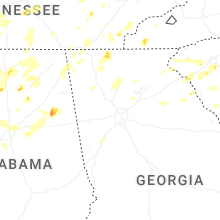


Connect with Interactive Hail Maps