

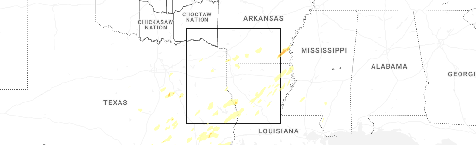
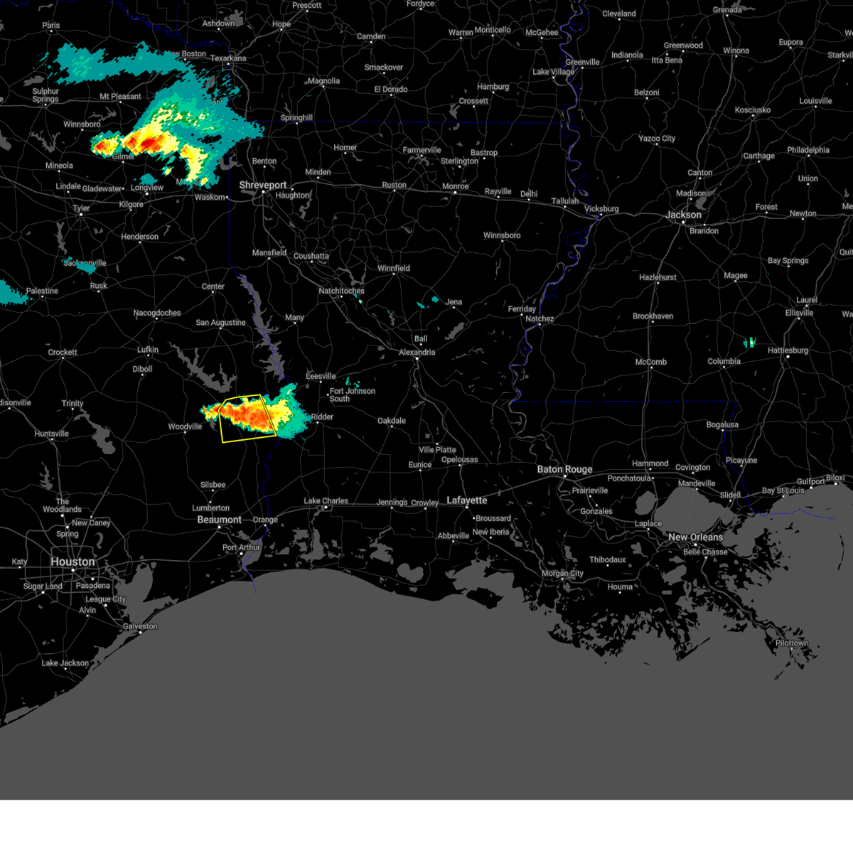
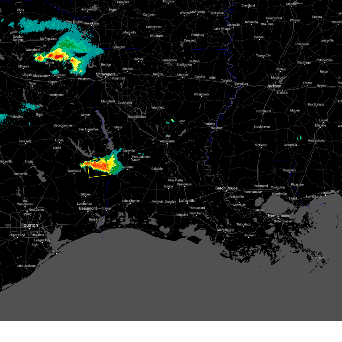
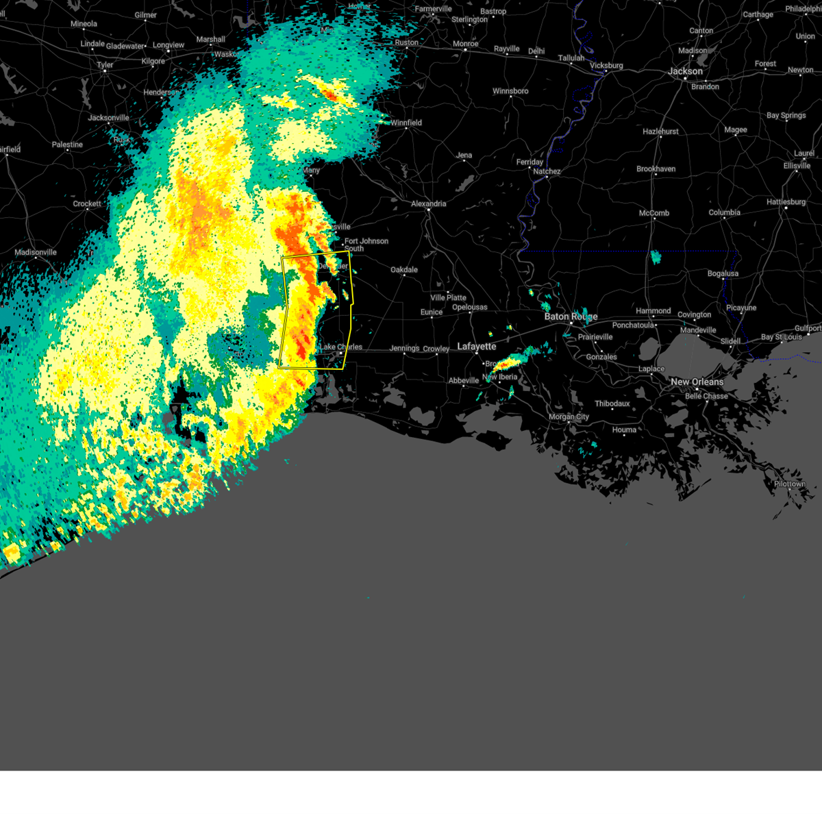
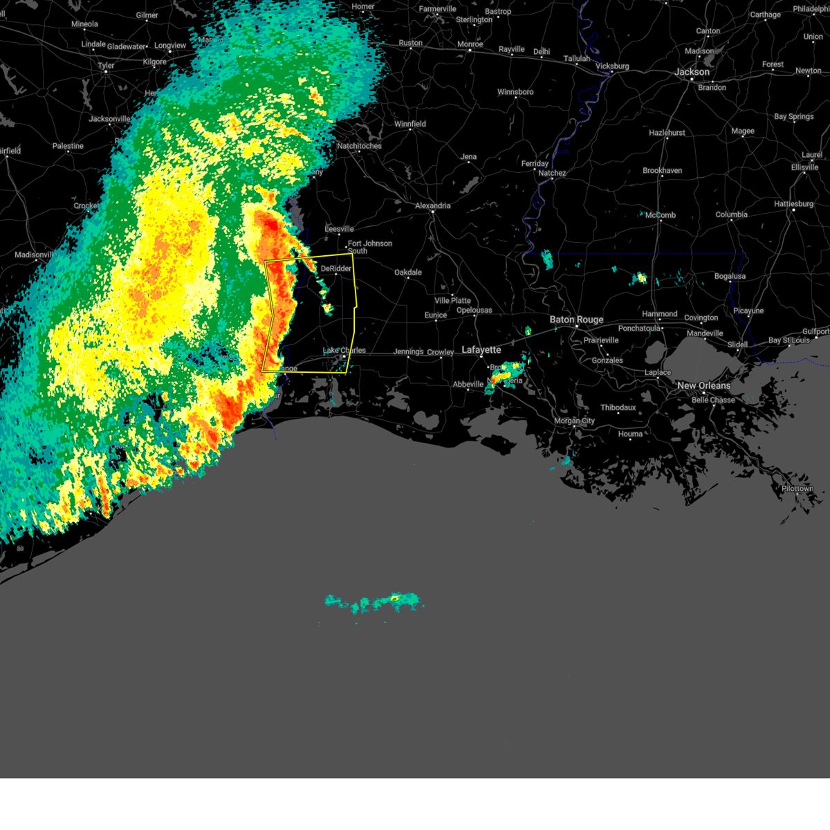
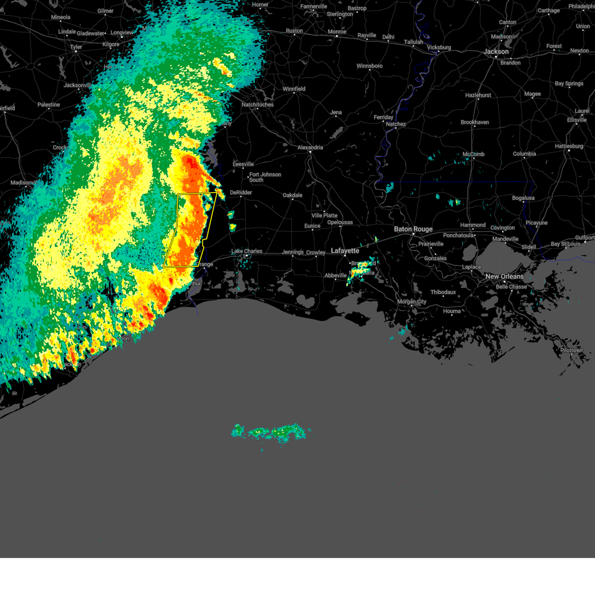
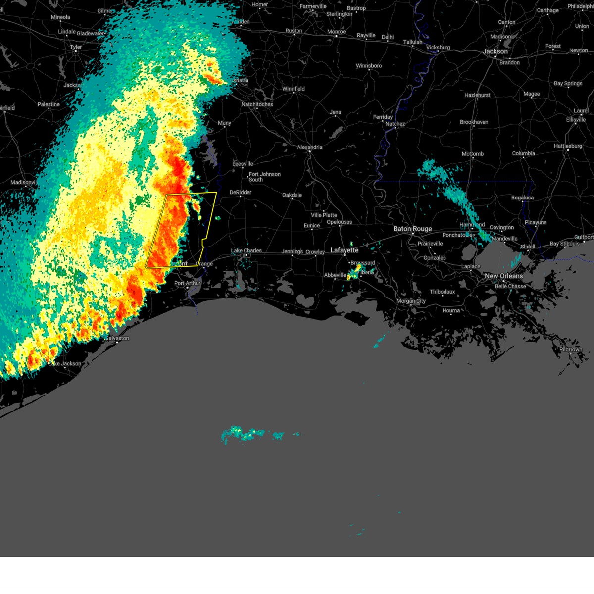
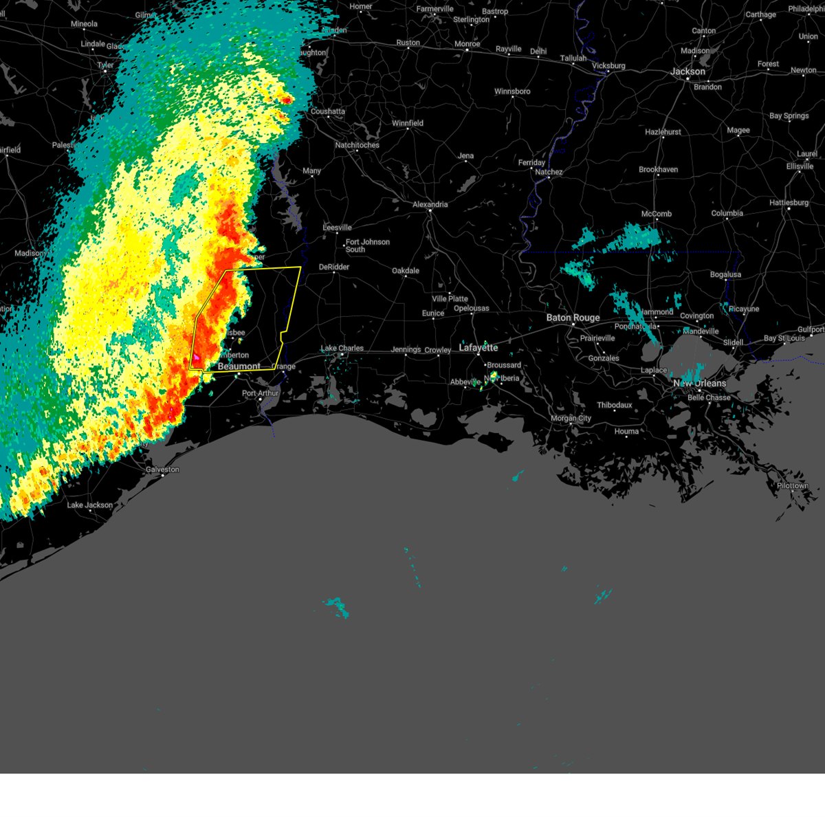
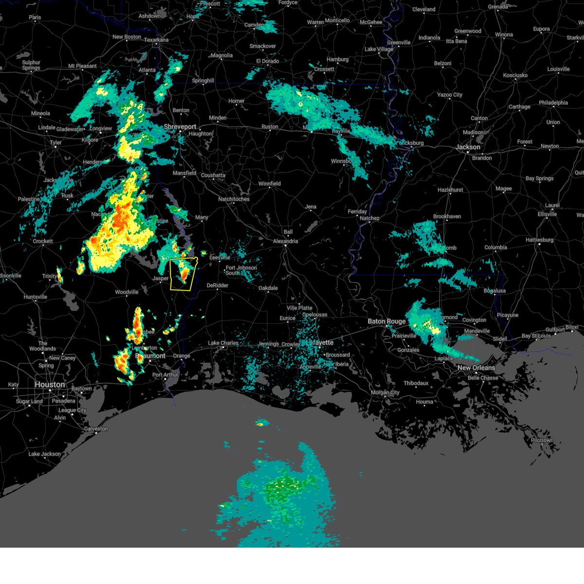
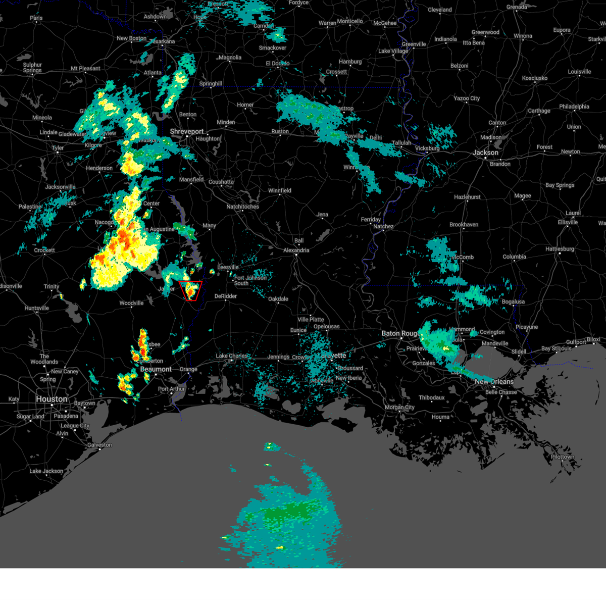
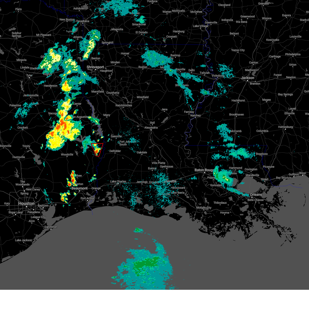
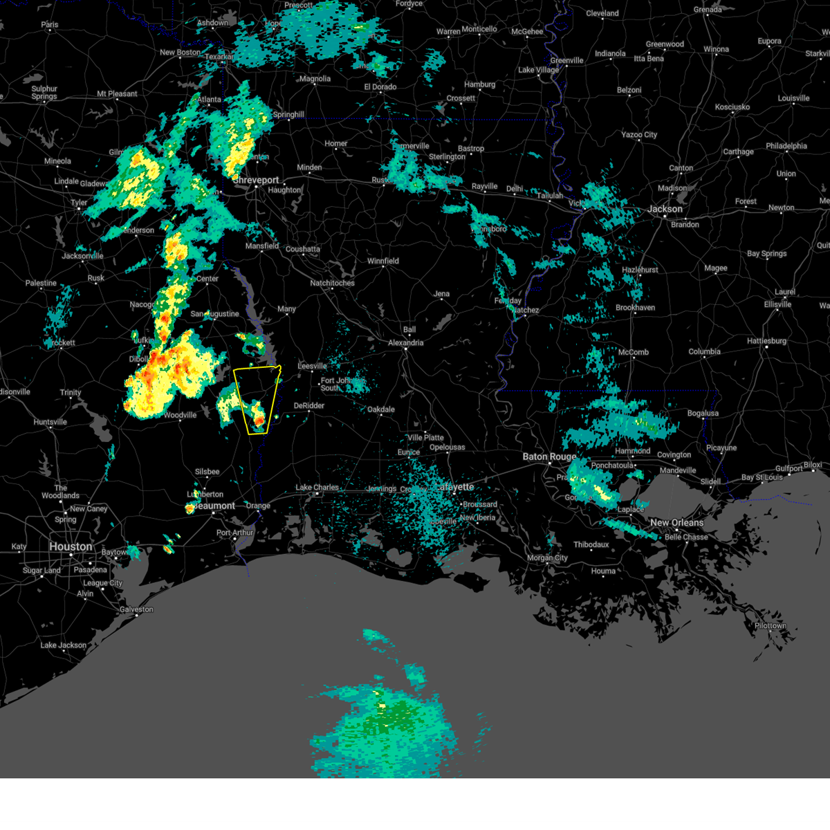
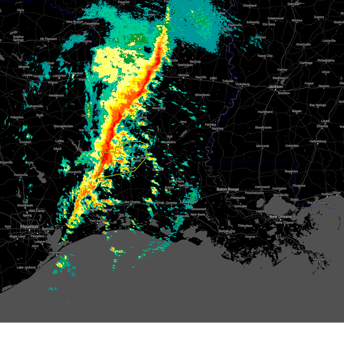
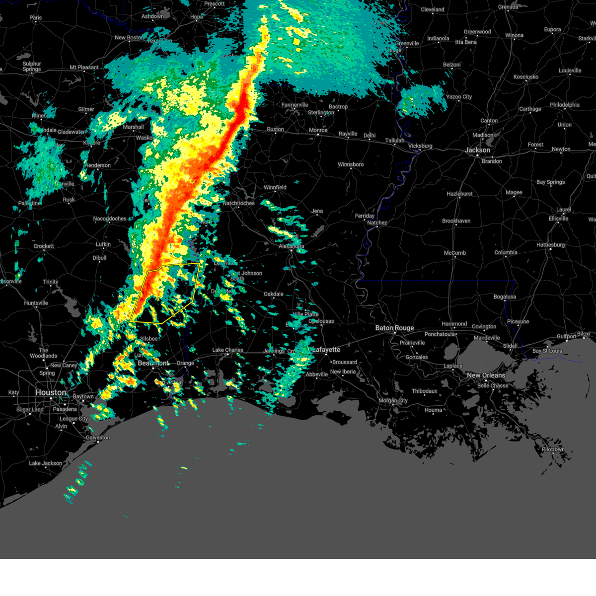
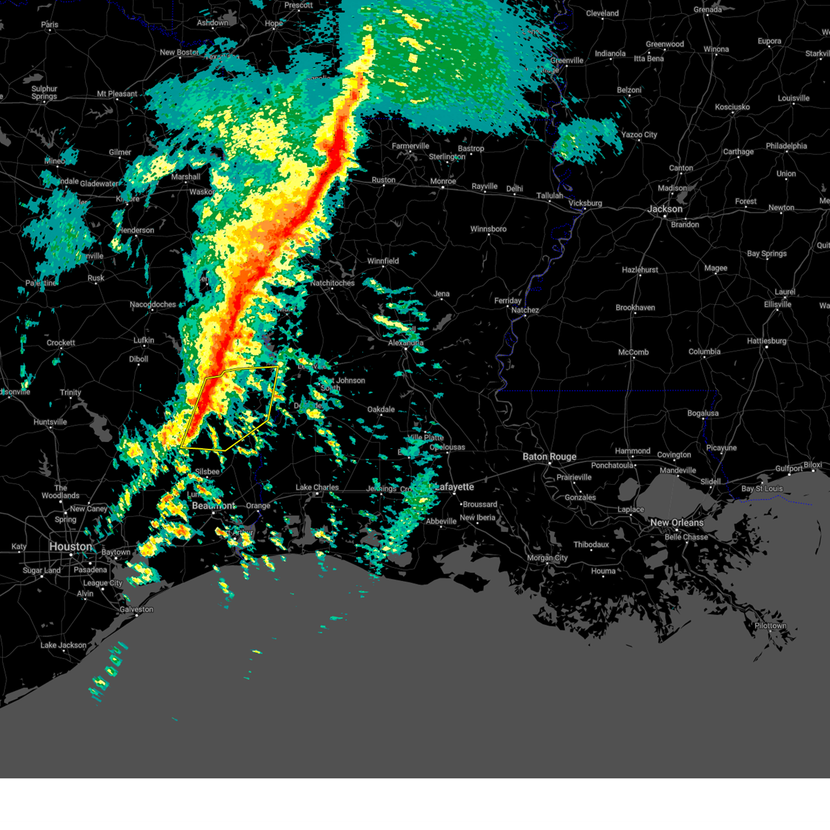
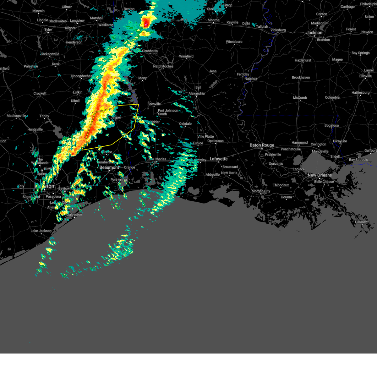
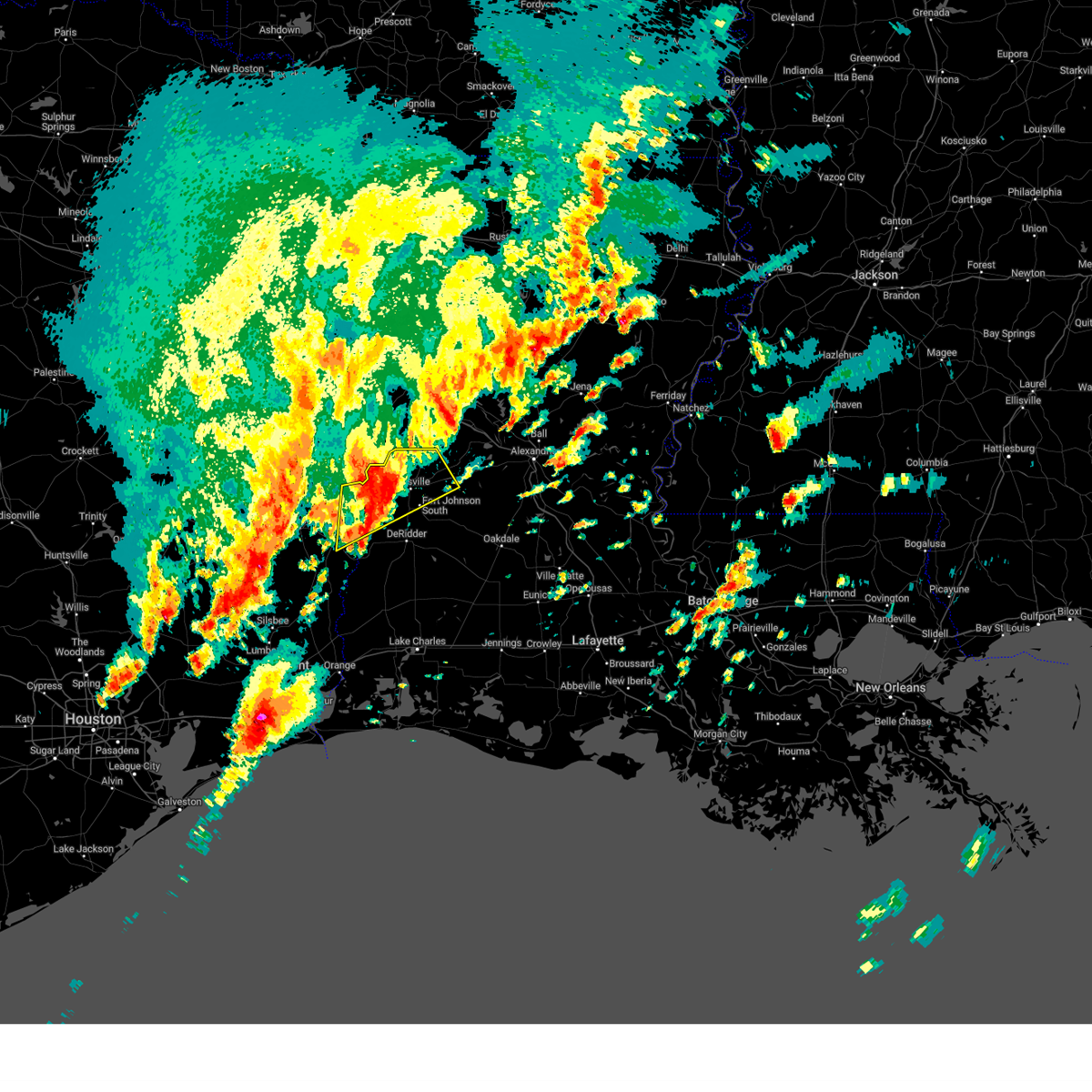
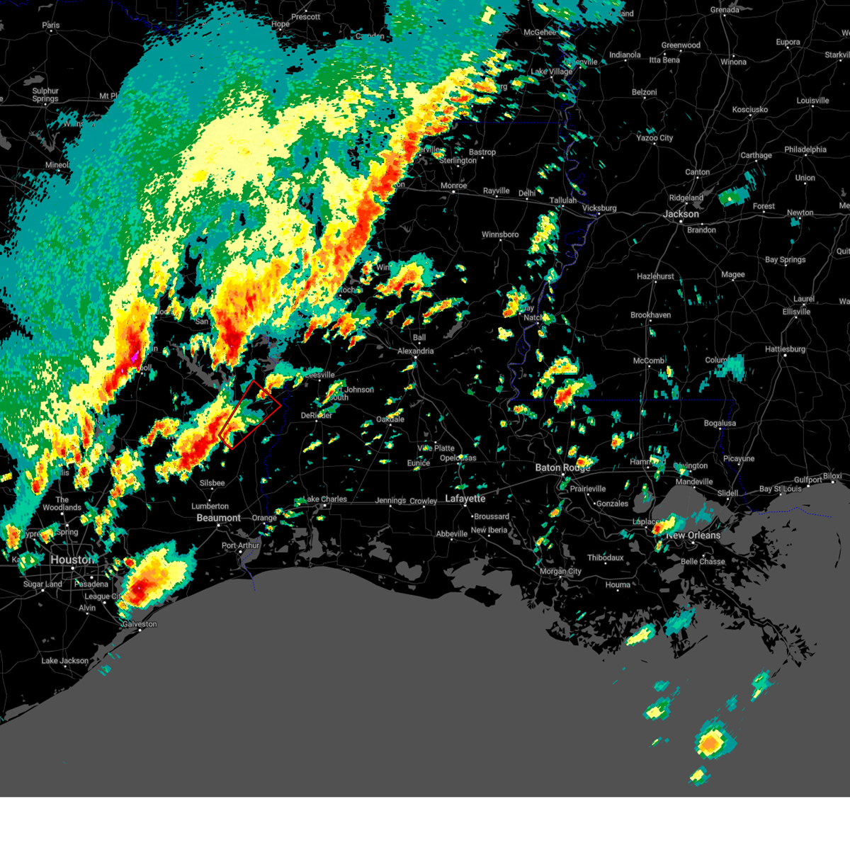
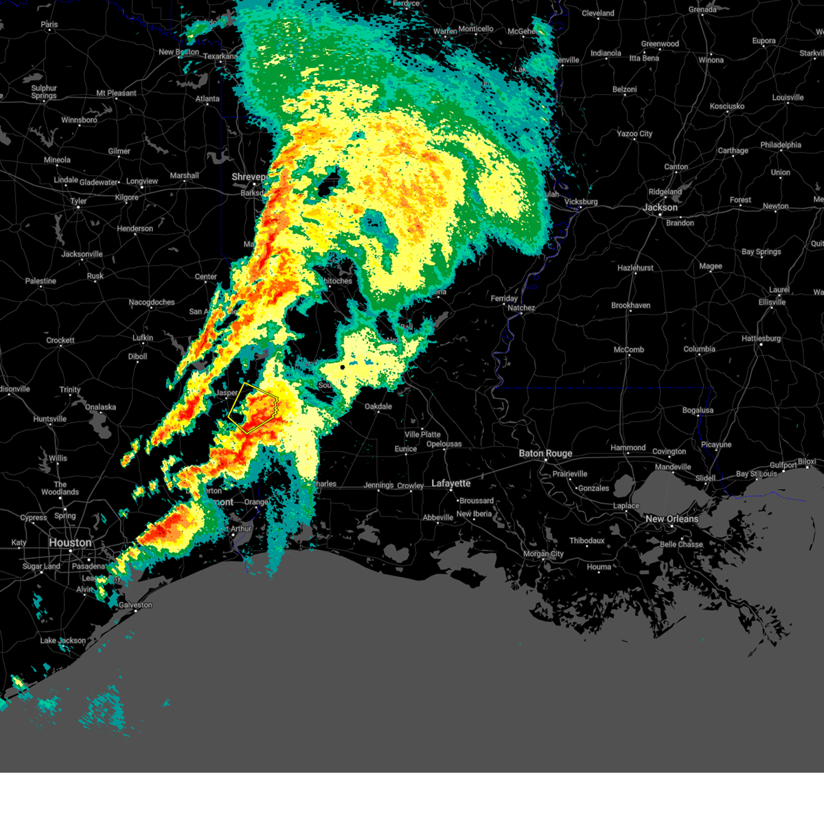
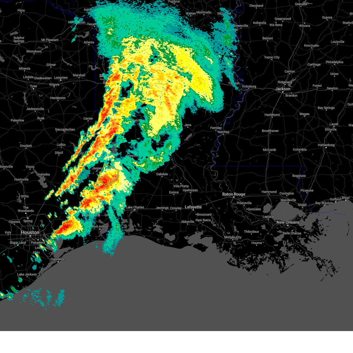
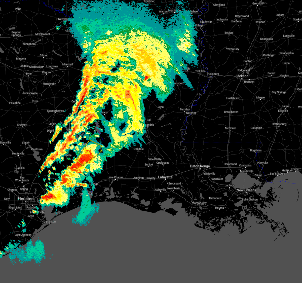
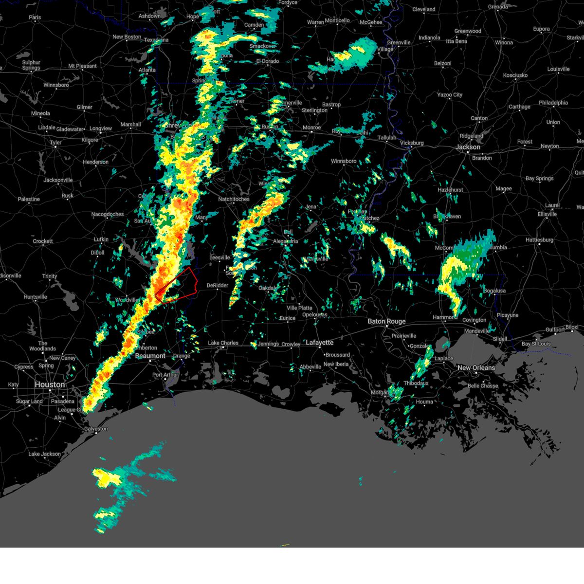
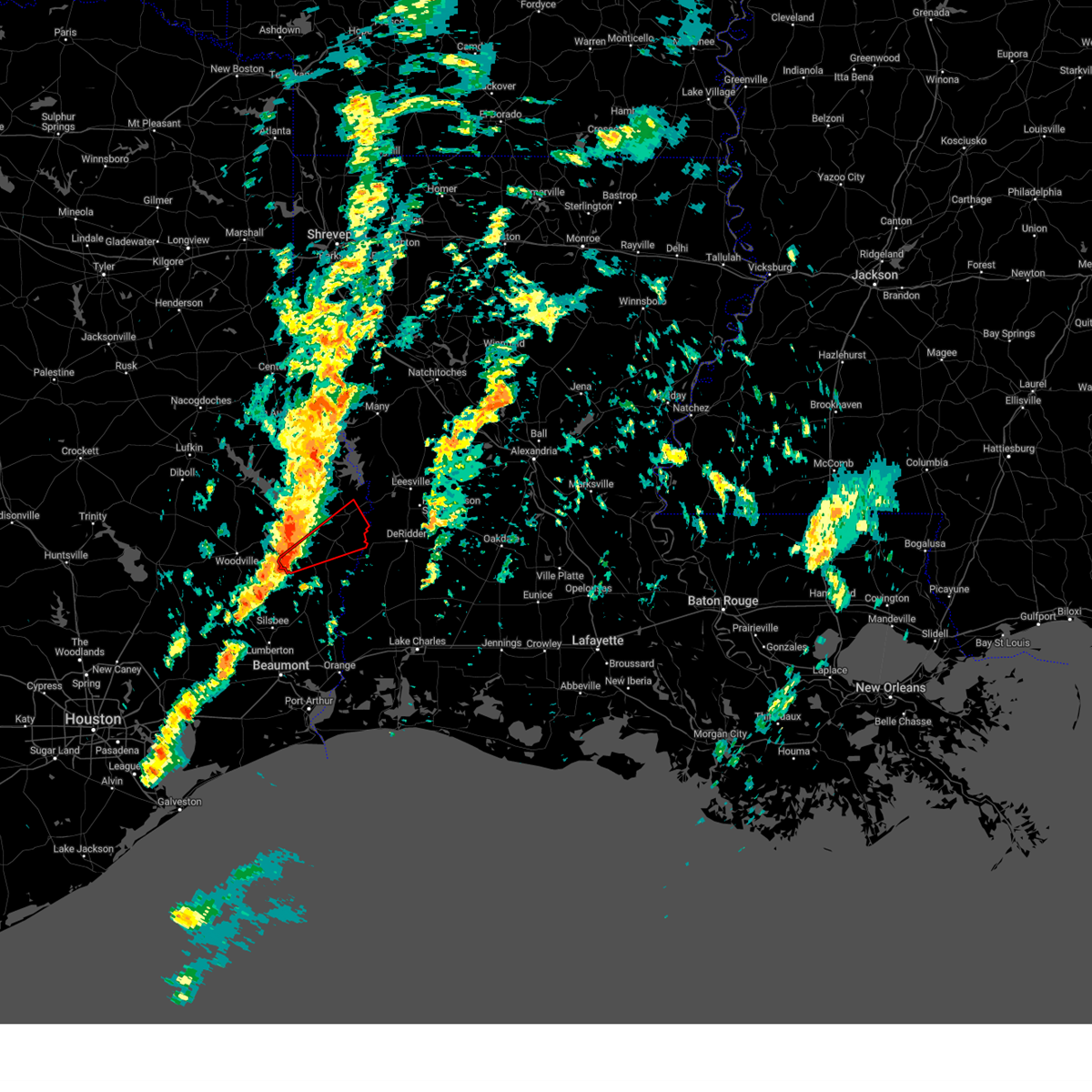
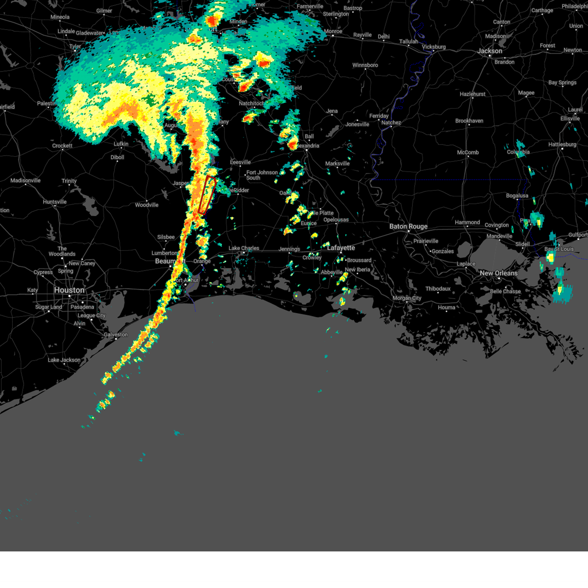
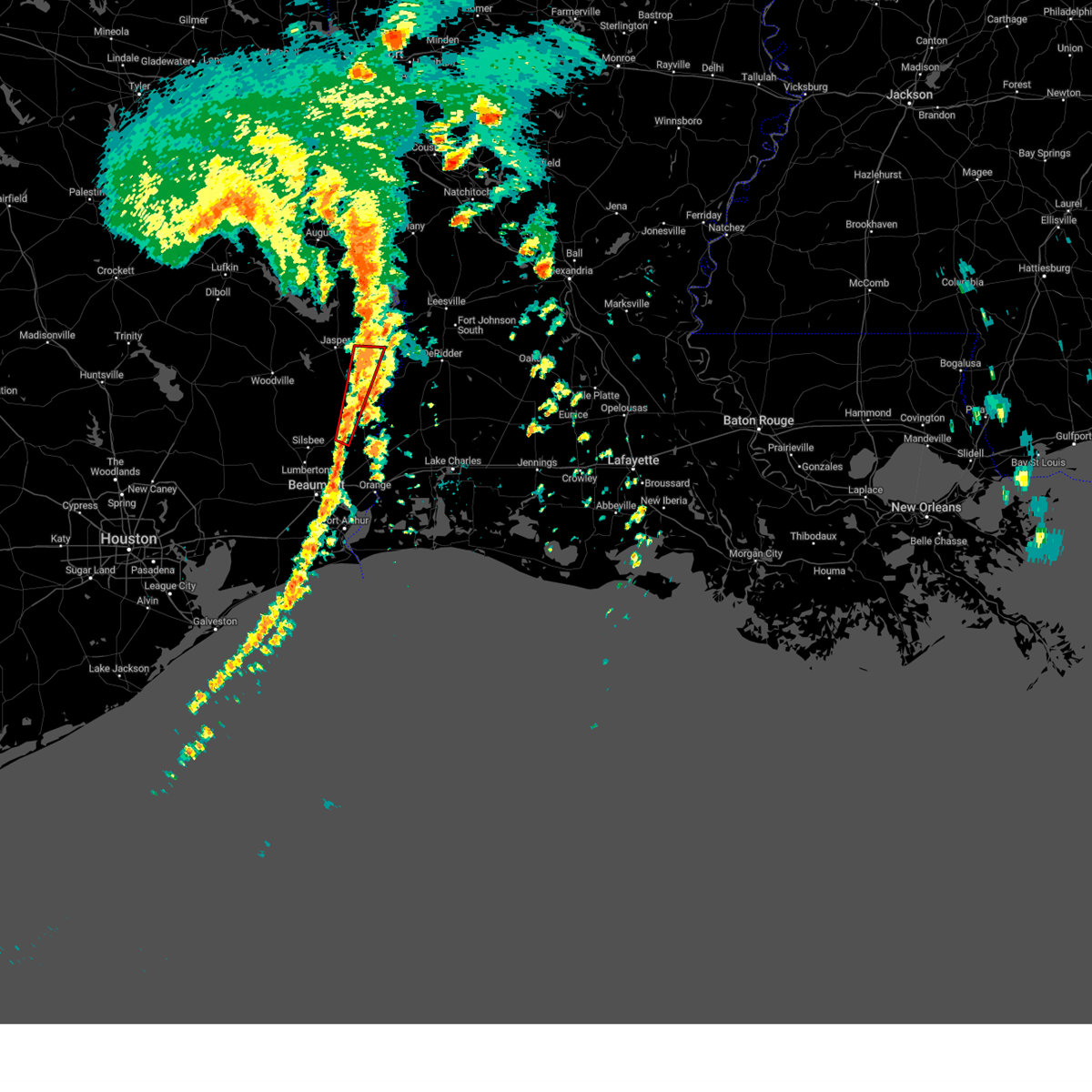
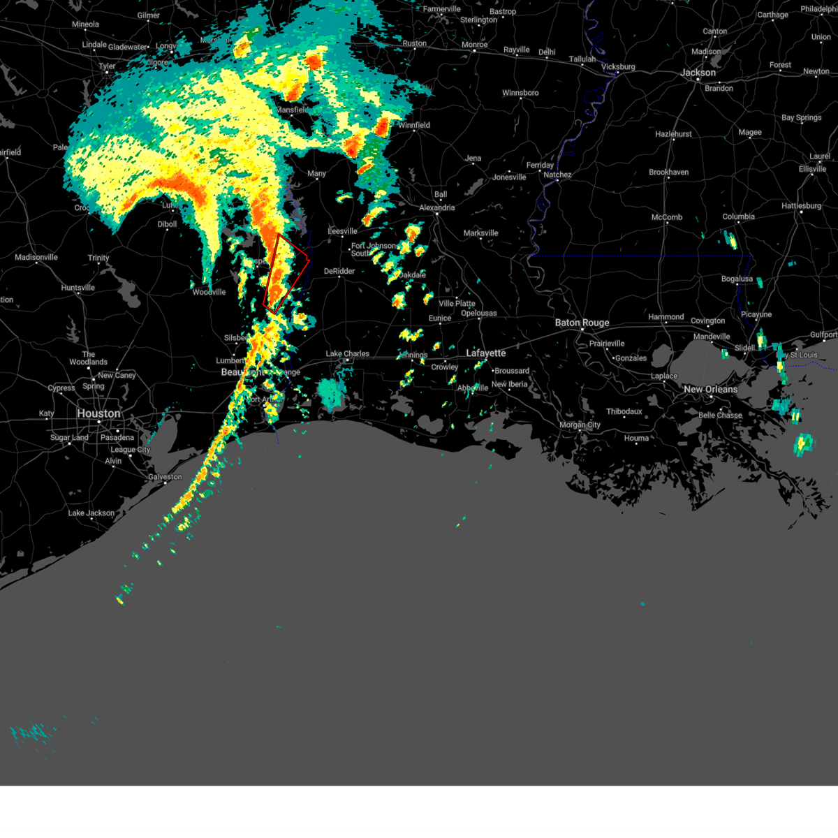
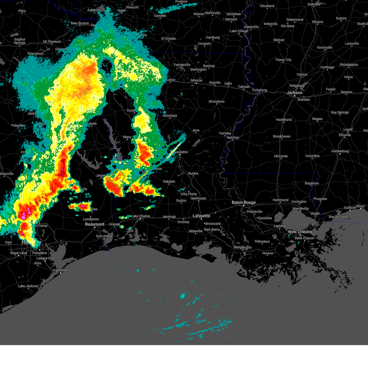
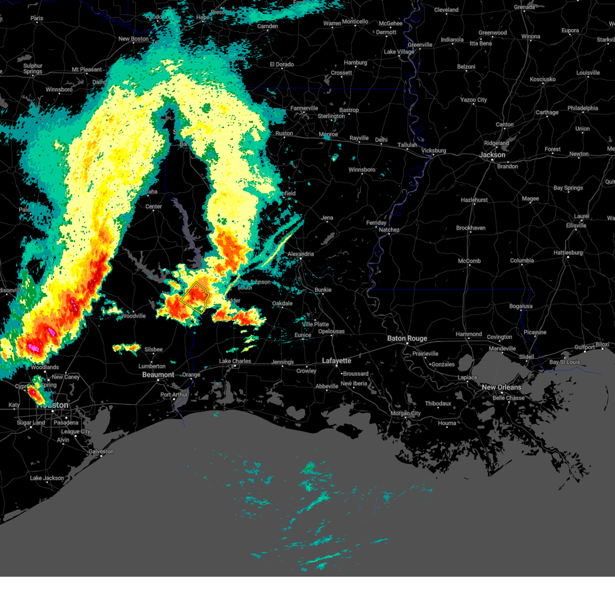
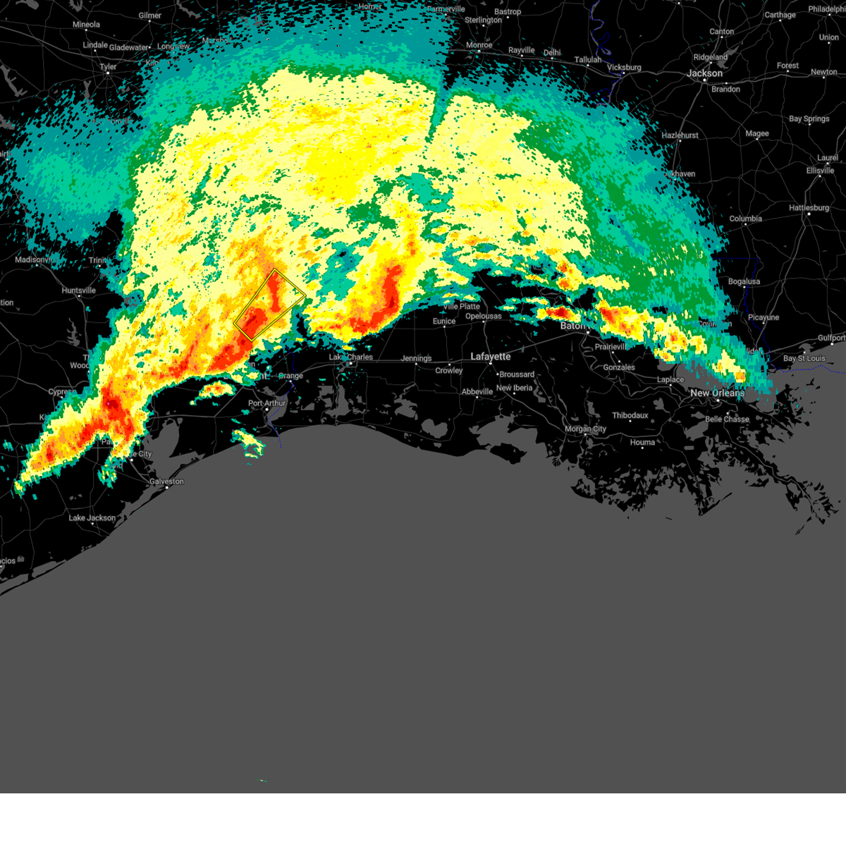
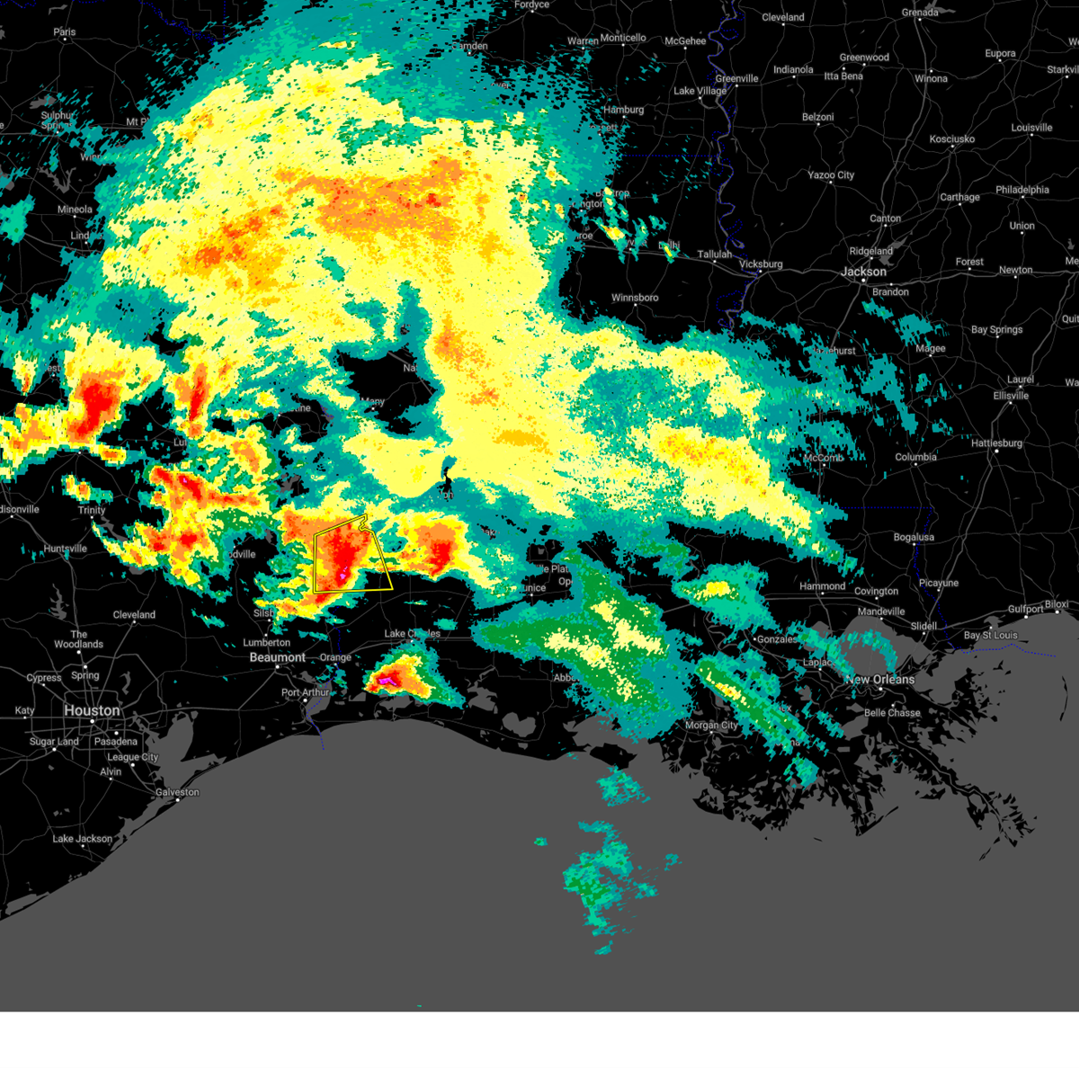
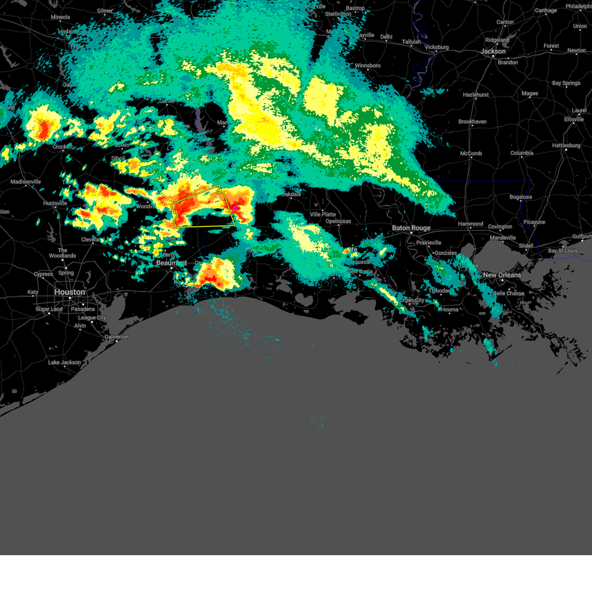
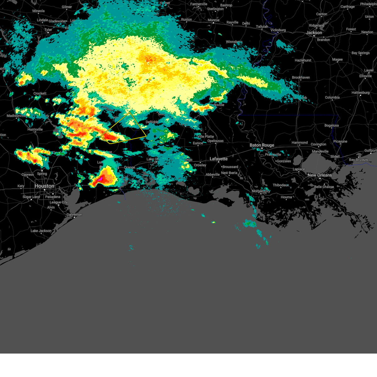
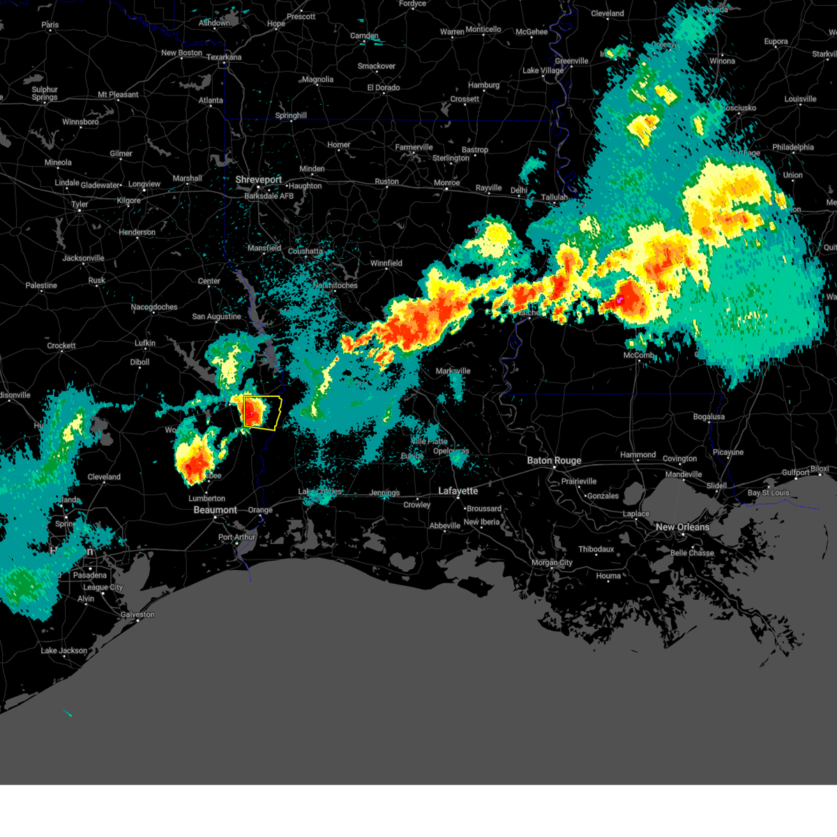
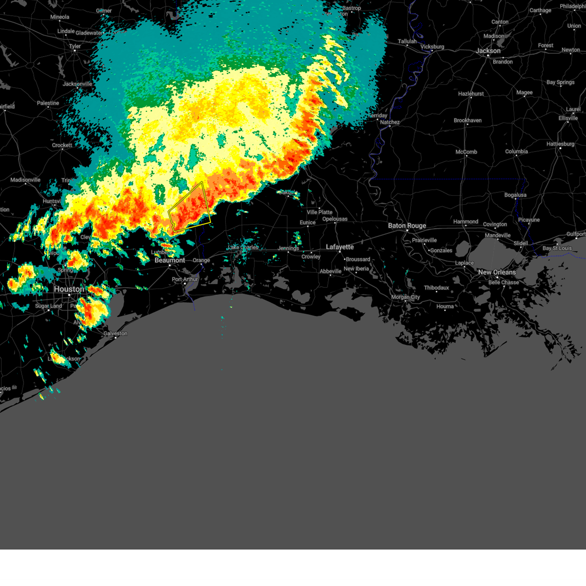
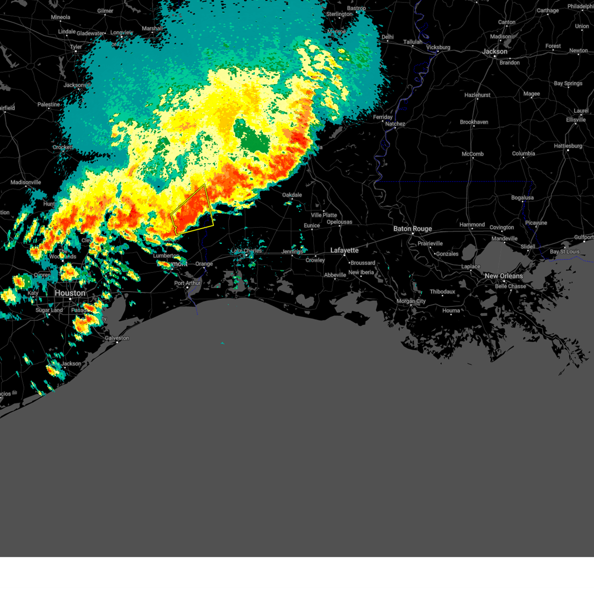
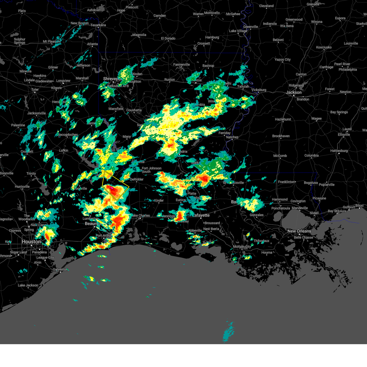
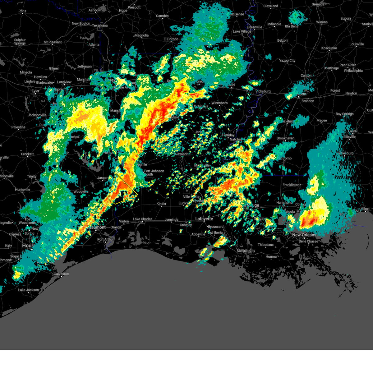
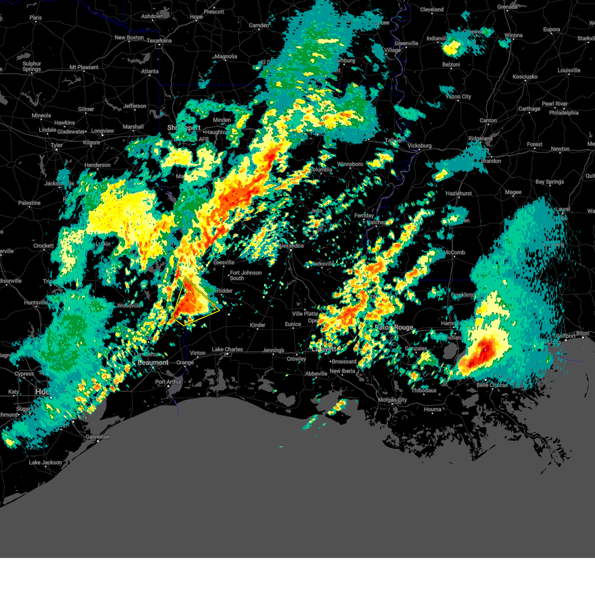
Hail Map for Newton, TX
The Newton, TX area has had 8 reports of on-the-ground hail by trained spotters, and has been under severe weather warnings 45 times during the past 12 months. Doppler radar has detected hail at or near Newton, TX on 78 occasions, including 3 occasions during the past year.
| Name: | Newton, TX |
| Where Located: | 52.2 miles N of Beaumont, TX |
| Map: | Google Map for Newton, TX |
| Population: | 2478 |
| Housing Units: | 852 |
| More Info: | Search Google for Newton, TX |
1
The Top Recent Hail Date for Newton, TX is Saturday, December 28, 2024 (31st out of 78)
Hail and Wind Damage Spotted near Newton, TX
| Date / Time | Report Details |
|---|---|
| 6/8/2025 8:28 PM CDT |
 The severe thunderstorm which prompted the warning has weakened. therefore, the warning will be allowed to expire. however heavy rain is still possible with this thunderstorm. to report severe weather, contact your nearest law enforcement agency. they will relay your report to the national weather service lake charles. The severe thunderstorm which prompted the warning has weakened. therefore, the warning will be allowed to expire. however heavy rain is still possible with this thunderstorm. to report severe weather, contact your nearest law enforcement agency. they will relay your report to the national weather service lake charles.
|
| 6/8/2025 8:18 PM CDT |
 At 818 pm cdt, a severe thunderstorm was located over jasper, moving south at 30 mph (radar indicated). Hazards include 60 mph wind gusts and quarter size hail. Hail damage to vehicles is expected. expect wind damage to roofs, siding, and trees. Locations impacted include, jasper, newton, jamestown, farrsville, roganville, harrisburg, and magnolia springs. At 818 pm cdt, a severe thunderstorm was located over jasper, moving south at 30 mph (radar indicated). Hazards include 60 mph wind gusts and quarter size hail. Hail damage to vehicles is expected. expect wind damage to roofs, siding, and trees. Locations impacted include, jasper, newton, jamestown, farrsville, roganville, harrisburg, and magnolia springs.
|
| 6/8/2025 8:08 PM CDT | At 807 pm cdt, a severe thunderstorm was located over jasper, moving south at 30 mph (radar indicated). Hazards include 60 mph wind gusts and half dollar size hail. Hail damage to vehicles is expected. expect wind damage to roofs, siding, and trees. Locations impacted include, jasper, newton, jamestown, farrsville, roganville, harrisburg, and magnolia springs. |
| 6/8/2025 7:24 PM CDT | Svrlch the national weather service in lake charles has issued a * severe thunderstorm warning for, northwestern newton county in southeastern texas, northeastern jasper county in southeastern texas, * until 830 pm cdt. * at 723 pm cdt, a severe thunderstorm was located near pineland, or 14 miles northeast of ebenezer, moving south at 35 mph (radar indicated). Hazards include golf ball size hail and 60 mph wind gusts. People and animals outdoors will be injured. expect hail damage to roofs, siding, windows, and vehicles. Expect wind damage to roofs, siding, and trees. |
| 5/27/2025 2:42 AM CDT |
 At 241 am cdt, severe thunderstorms were located along a line extending from 7 miles south of burr ferry to near oretta to near vinton, moving east at 35 mph (radar indicated). Hazards include 60 mph wind gusts. Expect damage to roofs, siding, and trees. Locations impacted include, lake charles, sulphur, orange, de ridder, westlake, vinton, newton, rosepine, merryville, singer, moss bluff, de quincy, ragley, lake charles regional airport, starks, fields, bon weir, lunita, bivens, and toomey. At 241 am cdt, severe thunderstorms were located along a line extending from 7 miles south of burr ferry to near oretta to near vinton, moving east at 35 mph (radar indicated). Hazards include 60 mph wind gusts. Expect damage to roofs, siding, and trees. Locations impacted include, lake charles, sulphur, orange, de ridder, westlake, vinton, newton, rosepine, merryville, singer, moss bluff, de quincy, ragley, lake charles regional airport, starks, fields, bon weir, lunita, bivens, and toomey.
|
| 5/27/2025 2:42 AM CDT |
 the severe thunderstorm warning has been cancelled and is no longer in effect the severe thunderstorm warning has been cancelled and is no longer in effect
|
| 5/27/2025 2:12 AM CDT |
 Svrlch the national weather service in lake charles has issued a * severe thunderstorm warning for, beauregard parish in southwestern louisiana, calcasieu parish in southwestern louisiana, southwestern vernon parish in west central louisiana, newton county in southeastern texas, northeastern orange county in southeastern texas, southeastern jasper county in southeastern texas, * until 315 am cdt. * at 211 am cdt, severe thunderstorms were located along a line extending from near farrsville to near bancroft to near orangefield, moving east at 35 mph (radar indicated). Hazards include 60 mph wind gusts. expect damage to roofs, siding, and trees Svrlch the national weather service in lake charles has issued a * severe thunderstorm warning for, beauregard parish in southwestern louisiana, calcasieu parish in southwestern louisiana, southwestern vernon parish in west central louisiana, newton county in southeastern texas, northeastern orange county in southeastern texas, southeastern jasper county in southeastern texas, * until 315 am cdt. * at 211 am cdt, severe thunderstorms were located along a line extending from near farrsville to near bancroft to near orangefield, moving east at 35 mph (radar indicated). Hazards include 60 mph wind gusts. expect damage to roofs, siding, and trees
|
| 5/27/2025 2:05 AM CDT |
 At 205 am cdt, severe thunderstorms were located along a line extending from near stringtown to near old salem to mauriceville, moving east at 50 mph (radar indicated). Hazards include 60 mph wind gusts and penny size hail. Expect damage to roofs, siding, and trees. Locations impacted include, beaumont, orange, lumberton, vidor, newton, kirbyville, deweyville, evadale, call, bon weir, mauriceville, buna, rose city, pine forest, lakeview, weiss bluff, gist, trout creek, hartburg, and wrights settlement. At 205 am cdt, severe thunderstorms were located along a line extending from near stringtown to near old salem to mauriceville, moving east at 50 mph (radar indicated). Hazards include 60 mph wind gusts and penny size hail. Expect damage to roofs, siding, and trees. Locations impacted include, beaumont, orange, lumberton, vidor, newton, kirbyville, deweyville, evadale, call, bon weir, mauriceville, buna, rose city, pine forest, lakeview, weiss bluff, gist, trout creek, hartburg, and wrights settlement.
|
| 5/27/2025 2:05 AM CDT |
 the severe thunderstorm warning has been cancelled and is no longer in effect the severe thunderstorm warning has been cancelled and is no longer in effect
|
| 5/27/2025 1:45 AM CDT |
 At 145 am cdt, severe thunderstorms were located along a line extending from near jamestown to near buna to near lakeview, moving east at 50 mph (radar indicated). Hazards include 60 mph wind gusts and penny size hail. Expect damage to roofs, siding, and trees. Locations impacted include, beaumont, orange, lumberton, vidor, silsbee, newton, kirbyville, kountze, sour lake, deweyville, evadale, town bluff, call, fred, bon weir, mauriceville, buna, bevil oaks, rose city, and pine forest. At 145 am cdt, severe thunderstorms were located along a line extending from near jamestown to near buna to near lakeview, moving east at 50 mph (radar indicated). Hazards include 60 mph wind gusts and penny size hail. Expect damage to roofs, siding, and trees. Locations impacted include, beaumont, orange, lumberton, vidor, silsbee, newton, kirbyville, kountze, sour lake, deweyville, evadale, town bluff, call, fred, bon weir, mauriceville, buna, bevil oaks, rose city, and pine forest.
|
| 5/27/2025 1:27 AM CDT |
 Svrlch the national weather service in lake charles has issued a * severe thunderstorm warning for, southwestern beauregard parish in southwestern louisiana, northwestern jefferson county in southeastern texas, southeastern tyler county in southeastern texas, southern newton county in southeastern texas, hardin county in southeastern texas, northern orange county in southeastern texas, jasper county in southeastern texas, * until 215 am cdt. * at 127 am cdt, severe thunderstorms were located along a line extending from 6 miles southwest of jasper to near kountze to sour lake, moving east at 50 mph (radar indicated). Hazards include 60 mph wind gusts and penny size hail. expect damage to roofs, siding, and trees Svrlch the national weather service in lake charles has issued a * severe thunderstorm warning for, southwestern beauregard parish in southwestern louisiana, northwestern jefferson county in southeastern texas, southeastern tyler county in southeastern texas, southern newton county in southeastern texas, hardin county in southeastern texas, northern orange county in southeastern texas, jasper county in southeastern texas, * until 215 am cdt. * at 127 am cdt, severe thunderstorms were located along a line extending from 6 miles southwest of jasper to near kountze to sour lake, moving east at 50 mph (radar indicated). Hazards include 60 mph wind gusts and penny size hail. expect damage to roofs, siding, and trees
|
| 5/6/2025 6:46 PM CDT |
 the severe thunderstorm warning has been cancelled and is no longer in effect the severe thunderstorm warning has been cancelled and is no longer in effect
|
| 5/6/2025 6:46 PM CDT |
 At 645 pm cdt, a severe thunderstorm was located over newton, moving east at 45 mph (radar indicated). Hazards include 60 mph wind gusts and penny size hail. Expect damage to roofs, siding, and trees. Locations impacted include, burkeville, newton, jamestown, and stringtown. At 645 pm cdt, a severe thunderstorm was located over newton, moving east at 45 mph (radar indicated). Hazards include 60 mph wind gusts and penny size hail. Expect damage to roofs, siding, and trees. Locations impacted include, burkeville, newton, jamestown, and stringtown.
|
| 5/6/2025 6:34 PM CDT |
 Svrlch the national weather service in lake charles has issued a * severe thunderstorm warning for, northern newton county in southeastern texas, east central jasper county in southeastern texas, * until 700 pm cdt. * at 634 pm cdt, a severe thunderstorm was located over roganville, or 8 miles southeast of jasper, moving east at 45 mph (radar indicated). Hazards include 60 mph wind gusts and penny size hail. expect damage to roofs, siding, and trees Svrlch the national weather service in lake charles has issued a * severe thunderstorm warning for, northern newton county in southeastern texas, east central jasper county in southeastern texas, * until 700 pm cdt. * at 634 pm cdt, a severe thunderstorm was located over roganville, or 8 miles southeast of jasper, moving east at 45 mph (radar indicated). Hazards include 60 mph wind gusts and penny size hail. expect damage to roofs, siding, and trees
|
| 5/6/2025 5:07 PM CDT |
 Torlch the national weather service in lake charles has issued a * tornado warning for, northeastern newton county in southeastern texas, * until 530 pm cdt. * at 506 pm cdt, a severe thunderstorm capable of producing a tornado was located over stringtown, or near burkeville, moving northeast at 25 mph (radar indicated rotation). Hazards include tornado. Flying debris will be dangerous to those caught without shelter. mobile homes will be damaged or destroyed. damage to roofs, windows, and vehicles will occur. tree damage is likely. this dangerous storm will be near, burkeville around 510 pm cdt. Other locations impacted by this tornadic thunderstorm include wiergate. Torlch the national weather service in lake charles has issued a * tornado warning for, northeastern newton county in southeastern texas, * until 530 pm cdt. * at 506 pm cdt, a severe thunderstorm capable of producing a tornado was located over stringtown, or near burkeville, moving northeast at 25 mph (radar indicated rotation). Hazards include tornado. Flying debris will be dangerous to those caught without shelter. mobile homes will be damaged or destroyed. damage to roofs, windows, and vehicles will occur. tree damage is likely. this dangerous storm will be near, burkeville around 510 pm cdt. Other locations impacted by this tornadic thunderstorm include wiergate.
|
| 5/6/2025 5:00 PM CDT | the tornado warning has been cancelled and is no longer in effect |
| 5/6/2025 5:00 PM CDT | At 500 pm cdt, a severe thunderstorm capable of producing a tornado was located near stringtown, or 8 miles north of merryville, moving northeast at 35 mph (radar indicated rotation). Hazards include tornado. Flying debris will be dangerous to those caught without shelter. mobile homes will be damaged or destroyed. damage to roofs, windows, and vehicles will occur. tree damage is likely. This tornadic thunderstorm will remain over mainly rural areas of southwestern vernon parish in west central louisiana and northeastern newton counties. |
| 5/6/2025 4:49 PM CDT | Torlch the national weather service in lake charles has issued a * tornado warning for, north central beauregard parish in southwestern louisiana, southwestern vernon parish in west central louisiana, northeastern newton county in southeastern texas, * until 515 pm cdt. * at 449 pm cdt, a severe thunderstorm capable of producing a tornado was located near newton, moving northeast at 35 mph (radar indicated rotation). Hazards include tornado and quarter size hail. Flying debris will be dangerous to those caught without shelter. mobile homes will be damaged or destroyed. damage to roofs, windows, and vehicles will occur. tree damage is likely. This dangerous storm will be near, stringtown and junction around 455 pm cdt. |
| 5/2/2025 4:08 PM CDT | the tornado warning has been cancelled and is no longer in effect |
| 5/2/2025 3:58 PM CDT | Torlch the national weather service in lake charles has issued a * tornado warning for, west central newton county in southeastern texas, east central jasper county in southeastern texas, * until 430 pm cdt. * at 358 pm cdt, a severe thunderstorm capable of producing a tornado was located over kirbyville, moving northeast at 15 mph (radar indicated rotation). Hazards include tornado. Flying debris will be dangerous to those caught without shelter. mobile homes will be damaged or destroyed. damage to roofs, windows, and vehicles will occur. tree damage is likely. this dangerous storm will be near, trout creek and kirbyville around 405 pm cdt. Other locations impacted by this tornadic thunderstorm include bleakwood. |
| 4/25/2025 5:10 PM CDT |
 Svrlch the national weather service in lake charles has issued a * severe thunderstorm warning for, northwestern newton county in southeastern texas, northeastern jasper county in southeastern texas, * until 545 pm cdt. * at 510 pm cdt, a severe thunderstorm was located over harrisburg, or 10 miles northeast of jasper, and is nearly stationary (radar indicated). Hazards include 60 mph wind gusts and quarter size hail. Hail damage to vehicles is expected. Expect wind damage to roofs, siding, and trees. Svrlch the national weather service in lake charles has issued a * severe thunderstorm warning for, northwestern newton county in southeastern texas, northeastern jasper county in southeastern texas, * until 545 pm cdt. * at 510 pm cdt, a severe thunderstorm was located over harrisburg, or 10 miles northeast of jasper, and is nearly stationary (radar indicated). Hazards include 60 mph wind gusts and quarter size hail. Hail damage to vehicles is expected. Expect wind damage to roofs, siding, and trees.
|
| 4/21/2025 3:47 AM CDT |
 Svrlch the national weather service in lake charles has issued a * severe thunderstorm warning for, west central newton county in southeastern texas, east central jasper county in southeastern texas, * until 430 am cdt. * at 346 am cdt, a severe thunderstorm was located near kirbyville, moving northeast at 15 mph (radar indicated). Hazards include 60 mph wind gusts and penny size hail. expect damage to roofs, siding, and trees Svrlch the national weather service in lake charles has issued a * severe thunderstorm warning for, west central newton county in southeastern texas, east central jasper county in southeastern texas, * until 430 am cdt. * at 346 am cdt, a severe thunderstorm was located near kirbyville, moving northeast at 15 mph (radar indicated). Hazards include 60 mph wind gusts and penny size hail. expect damage to roofs, siding, and trees
|
| 3/28/2025 11:54 AM CDT |
 At 1153 am cdt, a severe thunderstorm was located near farrsville, or near burkeville, moving north at 30 mph (radar indicated). Hazards include 60 mph wind gusts and penny size hail. Expect damage to roofs, siding, and trees. Locations impacted include, toledo bend dam, newton, jamestown, farrsville, burkeville, mayflower, stringtown, and wiergate. At 1153 am cdt, a severe thunderstorm was located near farrsville, or near burkeville, moving north at 30 mph (radar indicated). Hazards include 60 mph wind gusts and penny size hail. Expect damage to roofs, siding, and trees. Locations impacted include, toledo bend dam, newton, jamestown, farrsville, burkeville, mayflower, stringtown, and wiergate.
|
| 3/28/2025 11:54 AM CDT |
 the severe thunderstorm warning has been cancelled and is no longer in effect the severe thunderstorm warning has been cancelled and is no longer in effect
|
| 3/28/2025 11:46 AM CDT |
 At 1146 am cdt, a severe thunderstorm capable of producing a tornado was located over burkeville, moving north at 75 mph (radar indicated rotation). Hazards include tornado. Flying debris will be dangerous to those caught without shelter. mobile homes will be damaged or destroyed. damage to roofs, windows, and vehicles will occur. tree damage is likely. This tornadic thunderstorm will remain over mainly rural areas of northern newton county, including the following locations, wiergate. At 1146 am cdt, a severe thunderstorm capable of producing a tornado was located over burkeville, moving north at 75 mph (radar indicated rotation). Hazards include tornado. Flying debris will be dangerous to those caught without shelter. mobile homes will be damaged or destroyed. damage to roofs, windows, and vehicles will occur. tree damage is likely. This tornadic thunderstorm will remain over mainly rural areas of northern newton county, including the following locations, wiergate.
|
| 3/28/2025 11:38 AM CDT |
 Torlch the national weather service in lake charles has issued a * tornado warning for, northern newton county in southeastern texas, * until 1215 pm cdt. * at 1138 am cdt, a severe thunderstorm capable of producing a tornado was located over newton, moving north at 75 mph (radar indicated rotation). Hazards include tornado. Flying debris will be dangerous to those caught without shelter. mobile homes will be damaged or destroyed. damage to roofs, windows, and vehicles will occur. tree damage is likely. this dangerous storm will be near, stringtown and burkeville around 1145 am cdt. Other locations impacted by this tornadic thunderstorm include wiergate. Torlch the national weather service in lake charles has issued a * tornado warning for, northern newton county in southeastern texas, * until 1215 pm cdt. * at 1138 am cdt, a severe thunderstorm capable of producing a tornado was located over newton, moving north at 75 mph (radar indicated rotation). Hazards include tornado. Flying debris will be dangerous to those caught without shelter. mobile homes will be damaged or destroyed. damage to roofs, windows, and vehicles will occur. tree damage is likely. this dangerous storm will be near, stringtown and burkeville around 1145 am cdt. Other locations impacted by this tornadic thunderstorm include wiergate.
|
| 3/28/2025 11:22 AM CDT |
 Svrlch the national weather service in lake charles has issued a * severe thunderstorm warning for, northern newton county in southeastern texas, northeastern jasper county in southeastern texas, * until 1215 pm cdt. * at 1121 am cdt, a severe thunderstorm was located near bon weir, moving north at 30 mph (radar indicated). Hazards include 60 mph wind gusts and penny size hail. expect damage to roofs, siding, and trees Svrlch the national weather service in lake charles has issued a * severe thunderstorm warning for, northern newton county in southeastern texas, northeastern jasper county in southeastern texas, * until 1215 pm cdt. * at 1121 am cdt, a severe thunderstorm was located near bon weir, moving north at 30 mph (radar indicated). Hazards include 60 mph wind gusts and penny size hail. expect damage to roofs, siding, and trees
|
| 3/4/2025 10:50 AM CST | Trees and power lines reported down by ham radi in newton county TX, 1.8 miles ESE of Newton, TX |
| 3/4/2025 10:43 AM CST |
 Svrlch the national weather service in lake charles has issued a * severe thunderstorm warning for, northwestern beauregard parish in southwestern louisiana, vernon parish in west central louisiana, northern newton county in southeastern texas, northeastern jasper county in southeastern texas, * until 1130 am cst. * at 1042 am cst, severe thunderstorms were located along a line extending from near toledo bend dam to near kirbyville, moving northeast at 80 mph (radar indicated). Hazards include 60 mph wind gusts. expect damage to roofs, siding, and trees Svrlch the national weather service in lake charles has issued a * severe thunderstorm warning for, northwestern beauregard parish in southwestern louisiana, vernon parish in west central louisiana, northern newton county in southeastern texas, northeastern jasper county in southeastern texas, * until 1130 am cst. * at 1042 am cst, severe thunderstorms were located along a line extending from near toledo bend dam to near kirbyville, moving northeast at 80 mph (radar indicated). Hazards include 60 mph wind gusts. expect damage to roofs, siding, and trees
|
| 3/4/2025 10:16 AM CST |
 the severe thunderstorm warning has been cancelled and is no longer in effect the severe thunderstorm warning has been cancelled and is no longer in effect
|
| 3/4/2025 10:16 AM CST |
 At 1015 am cst, severe thunderstorms were located along a line extending from near pineland to 6 miles southwest of spurger, moving northeast at 70 mph (radar indicated). Hazards include 60 mph wind gusts. Expect damage to roofs, siding, and trees. locations impacted include, toledo bend dam, sam rayburn dam, ebenezer, farrsville, bleakwood, fred, magnolia springs, mayflower, mt. Union, wiergate, kirbyville, spurger, newton, jasper, jamestown, town bluff, roganville, burkeville, harrisburg, and browndell. At 1015 am cst, severe thunderstorms were located along a line extending from near pineland to 6 miles southwest of spurger, moving northeast at 70 mph (radar indicated). Hazards include 60 mph wind gusts. Expect damage to roofs, siding, and trees. locations impacted include, toledo bend dam, sam rayburn dam, ebenezer, farrsville, bleakwood, fred, magnolia springs, mayflower, mt. Union, wiergate, kirbyville, spurger, newton, jasper, jamestown, town bluff, roganville, burkeville, harrisburg, and browndell.
|
| 3/4/2025 9:59 AM CST |
 Svrlch the national weather service in lake charles has issued a * severe thunderstorm warning for, tyler county in southeastern texas, northwestern newton county in southeastern texas, northern hardin county in southeastern texas, jasper county in southeastern texas, * until 1045 am cst. * at 958 am cst, severe thunderstorms were located along a line extending from near ebenezer to near wildwood, moving northeast at 70 mph (radar indicated). Hazards include 60 mph wind gusts. expect damage to roofs, siding, and trees Svrlch the national weather service in lake charles has issued a * severe thunderstorm warning for, tyler county in southeastern texas, northwestern newton county in southeastern texas, northern hardin county in southeastern texas, jasper county in southeastern texas, * until 1045 am cst. * at 958 am cst, severe thunderstorms were located along a line extending from near ebenezer to near wildwood, moving northeast at 70 mph (radar indicated). Hazards include 60 mph wind gusts. expect damage to roofs, siding, and trees
|
| 12/28/2024 3:14 PM CST |
 At 314 pm cst, a severe thunderstorm was located near burkeville, moving northeast at 45 mph (radar indicated). Hazards include 60 mph wind gusts and nickel size hail. Expect damage to roofs, siding, and trees. Locations impacted include, toledo bend dam, leesville, hornbeck, anacoco, burr ferry, mayflower, wiergate, fort johnson, new llano, newton, kurthwood, evans, pickering, slagle, burkeville, stringtown, and simpson. At 314 pm cst, a severe thunderstorm was located near burkeville, moving northeast at 45 mph (radar indicated). Hazards include 60 mph wind gusts and nickel size hail. Expect damage to roofs, siding, and trees. Locations impacted include, toledo bend dam, leesville, hornbeck, anacoco, burr ferry, mayflower, wiergate, fort johnson, new llano, newton, kurthwood, evans, pickering, slagle, burkeville, stringtown, and simpson.
|
| 12/28/2024 2:58 PM CST |
 Svrlch the national weather service in lake charles has issued a * severe thunderstorm warning for, northwestern vernon parish in west central louisiana, northern newton county in southeastern texas, * until 400 pm cst. * at 258 pm cst, a severe thunderstorm was located near farrsville, or near burkeville, moving northeast at 40 mph (radar indicated). Hazards include 60 mph wind gusts and quarter size hail. Hail damage to vehicles is expected. Expect wind damage to roofs, siding, and trees. Svrlch the national weather service in lake charles has issued a * severe thunderstorm warning for, northwestern vernon parish in west central louisiana, northern newton county in southeastern texas, * until 400 pm cst. * at 258 pm cst, a severe thunderstorm was located near farrsville, or near burkeville, moving northeast at 40 mph (radar indicated). Hazards include 60 mph wind gusts and quarter size hail. Hail damage to vehicles is expected. Expect wind damage to roofs, siding, and trees.
|
| 12/28/2024 2:40 PM CST |
 At 240 pm cst, a severe thunderstorm capable of producing a tornado was located near jamestown, or near jasper, moving northeast at 30 mph (radar indicated rotation). Hazards include tornado and quarter size hail. Flying debris will be dangerous to those caught without shelter. mobile homes will be damaged or destroyed. damage to roofs, windows, and vehicles will occur. tree damage is likely. this dangerous storm will be near, farrsville, newton, jamestown, and harrisburg around 245 pm cst. burkeville around 300 pm cst. Other locations impacted by this tornadic thunderstorm include wiergate. At 240 pm cst, a severe thunderstorm capable of producing a tornado was located near jamestown, or near jasper, moving northeast at 30 mph (radar indicated rotation). Hazards include tornado and quarter size hail. Flying debris will be dangerous to those caught without shelter. mobile homes will be damaged or destroyed. damage to roofs, windows, and vehicles will occur. tree damage is likely. this dangerous storm will be near, farrsville, newton, jamestown, and harrisburg around 245 pm cst. burkeville around 300 pm cst. Other locations impacted by this tornadic thunderstorm include wiergate.
|
| 12/28/2024 2:20 PM CST |
 At 219 pm cst, a severe thunderstorm capable of producing a tornado was located over magnolia springs, or 9 miles east of town bluff, moving northeast at 30 mph (radar indicated rotation). Hazards include tornado. Flying debris will be dangerous to those caught without shelter. mobile homes will be damaged or destroyed. damage to roofs, windows, and vehicles will occur. tree damage is likely. this dangerous storm will be near, jasper and roganville around 225 pm cst. jamestown around 235 pm cst. newton around 240 pm cst. harrisburg around 245 pm cst. Other locations impacted by this tornadic thunderstorm include wiergate. At 219 pm cst, a severe thunderstorm capable of producing a tornado was located over magnolia springs, or 9 miles east of town bluff, moving northeast at 30 mph (radar indicated rotation). Hazards include tornado. Flying debris will be dangerous to those caught without shelter. mobile homes will be damaged or destroyed. damage to roofs, windows, and vehicles will occur. tree damage is likely. this dangerous storm will be near, jasper and roganville around 225 pm cst. jamestown around 235 pm cst. newton around 240 pm cst. harrisburg around 245 pm cst. Other locations impacted by this tornadic thunderstorm include wiergate.
|
| 12/28/2024 2:13 PM CST |
 Torlch the national weather service in lake charles has issued a * tornado warning for, northern newton county in southeastern texas, east central jasper county in southeastern texas, * until 300 pm cst. * at 213 pm cst, a severe thunderstorm capable of producing a tornado was located over magnolia springs, or 9 miles southeast of town bluff, moving northeast at 30 mph (radar indicated rotation). Hazards include tornado. Flying debris will be dangerous to those caught without shelter. mobile homes will be damaged or destroyed. damage to roofs, windows, and vehicles will occur. tree damage is likely. this dangerous storm will be near, jasper and roganville around 220 pm cst. newton and jamestown around 235 pm cst. farrsville around 240 pm cst. harrisburg around 245 pm cst. Other locations impacted by this tornadic thunderstorm include wiergate. Torlch the national weather service in lake charles has issued a * tornado warning for, northern newton county in southeastern texas, east central jasper county in southeastern texas, * until 300 pm cst. * at 213 pm cst, a severe thunderstorm capable of producing a tornado was located over magnolia springs, or 9 miles southeast of town bluff, moving northeast at 30 mph (radar indicated rotation). Hazards include tornado. Flying debris will be dangerous to those caught without shelter. mobile homes will be damaged or destroyed. damage to roofs, windows, and vehicles will occur. tree damage is likely. this dangerous storm will be near, jasper and roganville around 220 pm cst. newton and jamestown around 235 pm cst. farrsville around 240 pm cst. harrisburg around 245 pm cst. Other locations impacted by this tornadic thunderstorm include wiergate.
|
| 12/26/2024 6:16 PM CST |
 the severe thunderstorm warning has been cancelled and is no longer in effect the severe thunderstorm warning has been cancelled and is no longer in effect
|
| 12/26/2024 6:00 PM CST |
 the severe thunderstorm warning has been cancelled and is no longer in effect the severe thunderstorm warning has been cancelled and is no longer in effect
|
| 12/26/2024 6:00 PM CST |
 At 559 pm cst, a severe thunderstorm was located near roganville, or 7 miles southwest of newton, moving northeast at 35 mph (radar indicated). Hazards include 60 mph wind gusts. Expect damage to roofs, siding, and trees. Locations impacted include, bleakwood, newton, jamestown, stringtown, farrsville, and roganville. At 559 pm cst, a severe thunderstorm was located near roganville, or 7 miles southwest of newton, moving northeast at 35 mph (radar indicated). Hazards include 60 mph wind gusts. Expect damage to roofs, siding, and trees. Locations impacted include, bleakwood, newton, jamestown, stringtown, farrsville, and roganville.
|
| 12/26/2024 5:32 PM CST |
 Svrlch the national weather service in lake charles has issued a * severe thunderstorm warning for, eastern tyler county in southeastern texas, central newton county in southeastern texas, east central jasper county in southeastern texas, * until 630 pm cst. * at 532 pm cst, a severe thunderstorm was located 7 miles south of mt. union, or 7 miles east of fred, moving northeast at 35 mph (radar indicated). Hazards include 60 mph wind gusts. expect damage to roofs, siding, and trees Svrlch the national weather service in lake charles has issued a * severe thunderstorm warning for, eastern tyler county in southeastern texas, central newton county in southeastern texas, east central jasper county in southeastern texas, * until 630 pm cst. * at 532 pm cst, a severe thunderstorm was located 7 miles south of mt. union, or 7 miles east of fred, moving northeast at 35 mph (radar indicated). Hazards include 60 mph wind gusts. expect damage to roofs, siding, and trees
|
| 11/18/2024 5:03 PM CST |
 At 502 pm cst, a severe thunderstorm capable of producing a tornado was located over magnolia springs, or 8 miles northwest of kirbyville, moving northeast at 30 mph (radar indicated rotation). Hazards include tornado. Flying debris will be dangerous to those caught without shelter. mobile homes will be damaged or destroyed. damage to roofs, windows, and vehicles will occur. tree damage is likely. this dangerous storm will be near, roganville around 510 pm cst. Other locations impacted by this tornadic thunderstorm include wiergate. At 502 pm cst, a severe thunderstorm capable of producing a tornado was located over magnolia springs, or 8 miles northwest of kirbyville, moving northeast at 30 mph (radar indicated rotation). Hazards include tornado. Flying debris will be dangerous to those caught without shelter. mobile homes will be damaged or destroyed. damage to roofs, windows, and vehicles will occur. tree damage is likely. this dangerous storm will be near, roganville around 510 pm cst. Other locations impacted by this tornadic thunderstorm include wiergate.
|
| 11/18/2024 4:49 PM CST |
 Torlch the national weather service in lake charles has issued a * tornado warning for, northern newton county in southeastern texas, east central jasper county in southeastern texas, * until 515 pm cst. * at 449 pm cst, a severe thunderstorm capable of producing a tornado was located near mt. union, or 8 miles southeast of town bluff, moving northeast at 30 mph (radar indicated rotation). Hazards include tornado. Flying debris will be dangerous to those caught without shelter. mobile homes will be damaged or destroyed. damage to roofs, windows, and vehicles will occur. tree damage is likely. this dangerous storm will be near, mt. union and magnolia springs around 455 pm cst. Other locations impacted by this tornadic thunderstorm include wiergate. Torlch the national weather service in lake charles has issued a * tornado warning for, northern newton county in southeastern texas, east central jasper county in southeastern texas, * until 515 pm cst. * at 449 pm cst, a severe thunderstorm capable of producing a tornado was located near mt. union, or 8 miles southeast of town bluff, moving northeast at 30 mph (radar indicated rotation). Hazards include tornado. Flying debris will be dangerous to those caught without shelter. mobile homes will be damaged or destroyed. damage to roofs, windows, and vehicles will occur. tree damage is likely. this dangerous storm will be near, mt. union and magnolia springs around 455 pm cst. Other locations impacted by this tornadic thunderstorm include wiergate.
|
| 7/8/2024 3:15 PM CDT |
 Torlch the national weather service in lake charles has issued a * tornado warning for, central newton county in southeastern texas, * until 345 pm cdt. * at 315 pm cdt, a severe thunderstorm capable of producing a tornado was located near bon weir, moving north at 45 mph (radar indicated rotation). Hazards include tornado. Flying debris will be dangerous to those caught without shelter. mobile homes will be damaged or destroyed. damage to roofs, windows, and vehicles will occur. tree damage is likely. this dangerous storm will be near, newton around 320 pm cdt. stringtown around 325 pm cdt. Burkeville around 335 pm cdt. Torlch the national weather service in lake charles has issued a * tornado warning for, central newton county in southeastern texas, * until 345 pm cdt. * at 315 pm cdt, a severe thunderstorm capable of producing a tornado was located near bon weir, moving north at 45 mph (radar indicated rotation). Hazards include tornado. Flying debris will be dangerous to those caught without shelter. mobile homes will be damaged or destroyed. damage to roofs, windows, and vehicles will occur. tree damage is likely. this dangerous storm will be near, newton around 320 pm cdt. stringtown around 325 pm cdt. Burkeville around 335 pm cdt.
|
| 7/8/2024 3:13 PM CDT |
 Torlch the national weather service in lake charles has issued a * tornado warning for, west central newton county in southeastern texas, southeastern jasper county in southeastern texas, * until 345 pm cdt. * at 313 pm cdt, a severe thunderstorm capable of producing a tornado was located over buna, moving north at 75 mph (radar indicated rotation). Hazards include tornado. Flying debris will be dangerous to those caught without shelter. mobile homes will be damaged or destroyed. damage to roofs, windows, and vehicles will occur. tree damage is likely. this dangerous storm will be near, kirbyville, call, and trout creek around 320 pm cdt. newton around 330 pm cdt. jamestown around 335 pm cdt. Other locations impacted by this tornadic thunderstorm include bleakwood. Torlch the national weather service in lake charles has issued a * tornado warning for, west central newton county in southeastern texas, southeastern jasper county in southeastern texas, * until 345 pm cdt. * at 313 pm cdt, a severe thunderstorm capable of producing a tornado was located over buna, moving north at 75 mph (radar indicated rotation). Hazards include tornado. Flying debris will be dangerous to those caught without shelter. mobile homes will be damaged or destroyed. damage to roofs, windows, and vehicles will occur. tree damage is likely. this dangerous storm will be near, kirbyville, call, and trout creek around 320 pm cdt. newton around 330 pm cdt. jamestown around 335 pm cdt. Other locations impacted by this tornadic thunderstorm include bleakwood.
|
| 7/8/2024 2:41 PM CDT |
 Torlch the national weather service in lake charles has issued a * tornado warning for, northern newton county in southeastern texas, east central jasper county in southeastern texas, * until 315 pm cdt. * at 240 pm cdt, a severe thunderstorm capable of producing a tornado was located over kirbyville, moving northeast at 55 mph (radar indicated rotation). Hazards include tornado. Flying debris will be dangerous to those caught without shelter. mobile homes will be damaged or destroyed. damage to roofs, windows, and vehicles will occur. tree damage is likely. this dangerous storm will be near, newton and roganville around 245 pm cdt. jamestown around 255 pm cdt. burkeville, stringtown, and farrsville around 300 pm cdt. mayflower around 305 pm cdt. Other locations impacted by this tornadic thunderstorm include bleakwood and wiergate. Torlch the national weather service in lake charles has issued a * tornado warning for, northern newton county in southeastern texas, east central jasper county in southeastern texas, * until 315 pm cdt. * at 240 pm cdt, a severe thunderstorm capable of producing a tornado was located over kirbyville, moving northeast at 55 mph (radar indicated rotation). Hazards include tornado. Flying debris will be dangerous to those caught without shelter. mobile homes will be damaged or destroyed. damage to roofs, windows, and vehicles will occur. tree damage is likely. this dangerous storm will be near, newton and roganville around 245 pm cdt. jamestown around 255 pm cdt. burkeville, stringtown, and farrsville around 300 pm cdt. mayflower around 305 pm cdt. Other locations impacted by this tornadic thunderstorm include bleakwood and wiergate.
|
| 6/1/2024 4:28 PM CDT |
 The storm which prompted the warning has weakened below severe limits, and no longer poses an immediate threat to life or property. therefore, the warning will be allowed to expire. a severe thunderstorm watch remains in effect until 600 pm cdt for west central louisiana, and southeastern texas. The storm which prompted the warning has weakened below severe limits, and no longer poses an immediate threat to life or property. therefore, the warning will be allowed to expire. a severe thunderstorm watch remains in effect until 600 pm cdt for west central louisiana, and southeastern texas.
|
| 6/1/2024 4:22 PM CDT |
 the severe thunderstorm warning has been cancelled and is no longer in effect the severe thunderstorm warning has been cancelled and is no longer in effect
|
| 6/1/2024 4:22 PM CDT |
 At 422 pm cdt, a severe thunderstorm was located near burkeville, moving northeast at 25 mph (radar indicated). Hazards include quarter size hail. Damage to vehicles is expected. Locations impacted include, newton, burkeville, stringtown, and wiergate. At 422 pm cdt, a severe thunderstorm was located near burkeville, moving northeast at 25 mph (radar indicated). Hazards include quarter size hail. Damage to vehicles is expected. Locations impacted include, newton, burkeville, stringtown, and wiergate.
|
| 6/1/2024 4:06 PM CDT | Quarter sized hail reported 1.8 miles ENE of Newton, TX, quarter sized hail reported by a trained spotter. |
| 6/1/2024 3:58 PM CDT |
 Svrlch the national weather service in lake charles has issued a * severe thunderstorm warning for, northern newton county in southeastern texas, northeastern jasper county in southeastern texas, * until 430 pm cdt. * at 358 pm cdt, a severe thunderstorm was located over jamestown, or near newton, moving northeast at 25 mph (radar indicated). Hazards include quarter size hail. damage to vehicles is expected Svrlch the national weather service in lake charles has issued a * severe thunderstorm warning for, northern newton county in southeastern texas, northeastern jasper county in southeastern texas, * until 430 pm cdt. * at 358 pm cdt, a severe thunderstorm was located over jamestown, or near newton, moving northeast at 25 mph (radar indicated). Hazards include quarter size hail. damage to vehicles is expected
|
| 5/30/2024 8:40 PM CDT |
 The storms which prompted the warning have weakened below severe limits, and no longer pose an immediate threat to life or property. therefore, the warning will be allowed to expire. a severe thunderstorm watch remains in effect until 1100 pm cdt for southwestern and west central louisiana, and southeastern texas. The storms which prompted the warning have weakened below severe limits, and no longer pose an immediate threat to life or property. therefore, the warning will be allowed to expire. a severe thunderstorm watch remains in effect until 1100 pm cdt for southwestern and west central louisiana, and southeastern texas.
|
| 5/30/2024 8:11 PM CDT |
 Svrlch the national weather service in lake charles has issued a * severe thunderstorm warning for, western beauregard parish in southwestern louisiana, southwestern vernon parish in west central louisiana, northwestern jefferson county in southeastern texas, southern tyler county in southeastern texas, newton county in southeastern texas, hardin county in southeastern texas, northwestern orange county in southeastern texas, jasper county in southeastern texas, * until 845 pm cdt. * at 811 pm cdt, severe thunderstorms were located along a line extending from near newton to near fred to near honey island, moving south at 45 mph (radar indicated). Hazards include 60 mph wind gusts and nickel size hail. expect damage to roofs, siding, and trees Svrlch the national weather service in lake charles has issued a * severe thunderstorm warning for, western beauregard parish in southwestern louisiana, southwestern vernon parish in west central louisiana, northwestern jefferson county in southeastern texas, southern tyler county in southeastern texas, newton county in southeastern texas, hardin county in southeastern texas, northwestern orange county in southeastern texas, jasper county in southeastern texas, * until 845 pm cdt. * at 811 pm cdt, severe thunderstorms were located along a line extending from near newton to near fred to near honey island, moving south at 45 mph (radar indicated). Hazards include 60 mph wind gusts and nickel size hail. expect damage to roofs, siding, and trees
|
| 5/28/2024 12:57 PM CDT |
 Svrlch the national weather service in lake charles has issued a * severe thunderstorm warning for, western beauregard parish in southwestern louisiana, central newton county in southeastern texas, * until 130 pm cdt. * at 1257 pm cdt, a severe thunderstorm was located near bon weir, moving southeast at 30 mph (radar indicated). Hazards include quarter size hail. damage to vehicles is expected Svrlch the national weather service in lake charles has issued a * severe thunderstorm warning for, western beauregard parish in southwestern louisiana, central newton county in southeastern texas, * until 130 pm cdt. * at 1257 pm cdt, a severe thunderstorm was located near bon weir, moving southeast at 30 mph (radar indicated). Hazards include quarter size hail. damage to vehicles is expected
|
| 5/28/2024 12:48 PM CDT |
 the severe thunderstorm warning has been cancelled and is no longer in effect the severe thunderstorm warning has been cancelled and is no longer in effect
|
| 5/28/2024 12:35 PM CDT |
 the severe thunderstorm warning has been cancelled and is no longer in effect the severe thunderstorm warning has been cancelled and is no longer in effect
|
| 5/28/2024 12:35 PM CDT |
 At 1235 pm cdt, a severe thunderstorm was located near farrsville, or near newton, and is nearly stationary (radar indicated). Hazards include 60 mph wind gusts and quarter size hail. Hail damage to vehicles is expected. expect wind damage to roofs, siding, and trees. Locations impacted include, newton, burkeville, jamestown, stringtown, and wiergate. At 1235 pm cdt, a severe thunderstorm was located near farrsville, or near newton, and is nearly stationary (radar indicated). Hazards include 60 mph wind gusts and quarter size hail. Hail damage to vehicles is expected. expect wind damage to roofs, siding, and trees. Locations impacted include, newton, burkeville, jamestown, stringtown, and wiergate.
|
| 5/28/2024 12:07 PM CDT |
 Svrlch the national weather service in lake charles has issued a * severe thunderstorm warning for, northern newton county in southeastern texas, northeastern jasper county in southeastern texas, * until 115 pm cdt. * at 1207 pm cdt, a severe thunderstorm was located over farrsville, or near burkeville, and is nearly stationary (radar indicated). Hazards include 60 mph wind gusts and quarter size hail. Hail damage to vehicles is expected. Expect wind damage to roofs, siding, and trees. Svrlch the national weather service in lake charles has issued a * severe thunderstorm warning for, northern newton county in southeastern texas, northeastern jasper county in southeastern texas, * until 115 pm cdt. * at 1207 pm cdt, a severe thunderstorm was located over farrsville, or near burkeville, and is nearly stationary (radar indicated). Hazards include 60 mph wind gusts and quarter size hail. Hail damage to vehicles is expected. Expect wind damage to roofs, siding, and trees.
|
| 5/16/2024 6:44 PM CDT |
 Svrlch the national weather service in lake charles has issued a * severe thunderstorm warning for, southeastern tyler county in southeastern texas, west central newton county in southeastern texas, northeastern hardin county in southeastern texas, southeastern jasper county in southeastern texas, * until 715 pm cdt. * at 643 pm cdt, a severe thunderstorm was located 8 miles northwest of buna, moving northeast at 75 mph (radar indicated). Hazards include 60 mph wind gusts and quarter size hail. Hail damage to vehicles is expected. Expect wind damage to roofs, siding, and trees. Svrlch the national weather service in lake charles has issued a * severe thunderstorm warning for, southeastern tyler county in southeastern texas, west central newton county in southeastern texas, northeastern hardin county in southeastern texas, southeastern jasper county in southeastern texas, * until 715 pm cdt. * at 643 pm cdt, a severe thunderstorm was located 8 miles northwest of buna, moving northeast at 75 mph (radar indicated). Hazards include 60 mph wind gusts and quarter size hail. Hail damage to vehicles is expected. Expect wind damage to roofs, siding, and trees.
|
| 5/16/2024 5:04 PM CDT |
 Svrlch the national weather service in lake charles has issued a * severe thunderstorm warning for, northwestern beauregard parish in southwestern louisiana, southwestern vernon parish in west central louisiana, central newton county in southeastern texas, east central jasper county in southeastern texas, * until 530 pm cdt. * at 503 pm cdt, a severe thunderstorm was located over roganville, or 8 miles west of newton, moving east at 35 mph (radar indicated). Hazards include 60 mph wind gusts and penny size hail. expect damage to roofs, siding, and trees Svrlch the national weather service in lake charles has issued a * severe thunderstorm warning for, northwestern beauregard parish in southwestern louisiana, southwestern vernon parish in west central louisiana, central newton county in southeastern texas, east central jasper county in southeastern texas, * until 530 pm cdt. * at 503 pm cdt, a severe thunderstorm was located over roganville, or 8 miles west of newton, moving east at 35 mph (radar indicated). Hazards include 60 mph wind gusts and penny size hail. expect damage to roofs, siding, and trees
|
| 5/16/2024 3:52 PM CDT |
 Svrlch the national weather service in lake charles has issued a * severe thunderstorm warning for, tyler county in southeastern texas, northwestern newton county in southeastern texas, northern jasper county in southeastern texas, * until 445 pm cdt. * at 352 pm cdt, a severe thunderstorm was located near woodville, moving northeast at 40 mph (radar indicated). Hazards include 60 mph wind gusts and quarter size hail. Hail damage to vehicles is expected. Expect wind damage to roofs, siding, and trees. Svrlch the national weather service in lake charles has issued a * severe thunderstorm warning for, tyler county in southeastern texas, northwestern newton county in southeastern texas, northern jasper county in southeastern texas, * until 445 pm cdt. * at 352 pm cdt, a severe thunderstorm was located near woodville, moving northeast at 40 mph (radar indicated). Hazards include 60 mph wind gusts and quarter size hail. Hail damage to vehicles is expected. Expect wind damage to roofs, siding, and trees.
|
| 5/12/2024 2:13 PM CDT |
 At 213 pm cdt, a severe thunderstorm was located near bivens, or near bon weir, moving east at 45 mph (radar indicated). Hazards include 60 mph wind gusts and nickel size hail. Expect damage to roofs, siding, and trees. Locations impacted include, newton, merryville, singer, call, fields, bon weir, trout creek, bivens, old salem, bancroft, junction, stringtown, oretta, and bleakwood. At 213 pm cdt, a severe thunderstorm was located near bivens, or near bon weir, moving east at 45 mph (radar indicated). Hazards include 60 mph wind gusts and nickel size hail. Expect damage to roofs, siding, and trees. Locations impacted include, newton, merryville, singer, call, fields, bon weir, trout creek, bivens, old salem, bancroft, junction, stringtown, oretta, and bleakwood.
|
| 5/12/2024 2:13 PM CDT |
 the severe thunderstorm warning has been cancelled and is no longer in effect the severe thunderstorm warning has been cancelled and is no longer in effect
|
| 5/12/2024 1:49 PM CDT |
 Svrlch the national weather service in lake charles has issued a * severe thunderstorm warning for, northwestern beauregard parish in southwestern louisiana, central newton county in southeastern texas, east central jasper county in southeastern texas, * until 230 pm cdt. * at 149 pm cdt, a severe thunderstorm was located near kirbyville, moving east at 45 mph (radar indicated). Hazards include 70 mph wind gusts and half dollar size hail. Hail damage to vehicles is expected. expect considerable tree damage. Wind damage is also likely to mobile homes, roofs, and outbuildings. Svrlch the national weather service in lake charles has issued a * severe thunderstorm warning for, northwestern beauregard parish in southwestern louisiana, central newton county in southeastern texas, east central jasper county in southeastern texas, * until 230 pm cdt. * at 149 pm cdt, a severe thunderstorm was located near kirbyville, moving east at 45 mph (radar indicated). Hazards include 70 mph wind gusts and half dollar size hail. Hail damage to vehicles is expected. expect considerable tree damage. Wind damage is also likely to mobile homes, roofs, and outbuildings.
|
| 5/12/2024 1:31 PM CDT |
 The storm which prompted the warning has moved out of the area. therefore, the warning has been allowed to expire. a tornado watch remains in effect until 700 pm cdt for southwestern louisiana, and southeastern texas. The storm which prompted the warning has moved out of the area. therefore, the warning has been allowed to expire. a tornado watch remains in effect until 700 pm cdt for southwestern louisiana, and southeastern texas.
|
| 5/12/2024 1:17 PM CDT |
 At 117 pm cdt, a severe thunderstorm was located near stringtown, or near bon weir, moving northeast at 45 mph (radar indicated). Hazards include two inch hail and 60 mph wind gusts. People and animals outdoors will be injured. expect hail damage to roofs, siding, windows, and vehicles. expect wind damage to roofs, siding, and trees. Locations impacted include, newton, merryville, bon weir, jamestown, trout creek, bivens, farrsville, roganville, stringtown, bleakwood, and wiergate. At 117 pm cdt, a severe thunderstorm was located near stringtown, or near bon weir, moving northeast at 45 mph (radar indicated). Hazards include two inch hail and 60 mph wind gusts. People and animals outdoors will be injured. expect hail damage to roofs, siding, windows, and vehicles. expect wind damage to roofs, siding, and trees. Locations impacted include, newton, merryville, bon weir, jamestown, trout creek, bivens, farrsville, roganville, stringtown, bleakwood, and wiergate.
|
| 5/12/2024 12:55 PM CDT |
 the severe thunderstorm warning has been cancelled and is no longer in effect the severe thunderstorm warning has been cancelled and is no longer in effect
|
| 5/12/2024 12:55 PM CDT |
 At 1255 pm cdt, a severe thunderstorm was located near kirbyville, moving northeast at 45 mph (radar indicated). Hazards include quarter size hail. Damage to vehicles is expected. locations impacted include, newton, kirbyville, merryville, call, bon weir, trout creek, bivens, farrsville, magnolia springs, mt. Union, jamestown, roganville, stringtown, bleakwood, and wiergate. At 1255 pm cdt, a severe thunderstorm was located near kirbyville, moving northeast at 45 mph (radar indicated). Hazards include quarter size hail. Damage to vehicles is expected. locations impacted include, newton, kirbyville, merryville, call, bon weir, trout creek, bivens, farrsville, magnolia springs, mt. Union, jamestown, roganville, stringtown, bleakwood, and wiergate.
|
| 5/12/2024 12:38 PM CDT |
 Svrlch the national weather service in lake charles has issued a * severe thunderstorm warning for, northwestern beauregard parish in southwestern louisiana, southeastern tyler county in southeastern texas, central newton county in southeastern texas, east central jasper county in southeastern texas, * until 130 pm cdt. * at 1238 pm cdt, a severe thunderstorm was located near mt. union, or 7 miles northeast of fred, moving northeast at 45 mph (radar indicated). Hazards include quarter size hail. damage to vehicles is expected Svrlch the national weather service in lake charles has issued a * severe thunderstorm warning for, northwestern beauregard parish in southwestern louisiana, southeastern tyler county in southeastern texas, central newton county in southeastern texas, east central jasper county in southeastern texas, * until 130 pm cdt. * at 1238 pm cdt, a severe thunderstorm was located near mt. union, or 7 miles northeast of fred, moving northeast at 45 mph (radar indicated). Hazards include quarter size hail. damage to vehicles is expected
|
| 5/9/2024 11:07 PM CDT |
 At 1107 pm cdt, a severe thunderstorm was located over newton, moving east at 35 mph (radar indicated). Hazards include 60 mph wind gusts and quarter size hail. Hail damage to vehicles is expected. expect wind damage to roofs, siding, and trees. Locations impacted include, newton, bon weir, jamestown, and stringtown. At 1107 pm cdt, a severe thunderstorm was located over newton, moving east at 35 mph (radar indicated). Hazards include 60 mph wind gusts and quarter size hail. Hail damage to vehicles is expected. expect wind damage to roofs, siding, and trees. Locations impacted include, newton, bon weir, jamestown, and stringtown.
|
| 5/9/2024 11:07 PM CDT |
 the severe thunderstorm warning has been cancelled and is no longer in effect the severe thunderstorm warning has been cancelled and is no longer in effect
|
| 5/9/2024 10:43 PM CDT |
 Svrlch the national weather service in lake charles has issued a * severe thunderstorm warning for, central newton county in southeastern texas, northeastern jasper county in southeastern texas, * until 1145 pm cdt. * at 1042 pm cdt, severe thunderstorms were located along a line extending from near jasper to near magnolia springs, moving east at 25 mph (radar indicated). Hazards include 60 mph wind gusts and quarter size hail. Hail damage to vehicles is expected. Expect wind damage to roofs, siding, and trees. Svrlch the national weather service in lake charles has issued a * severe thunderstorm warning for, central newton county in southeastern texas, northeastern jasper county in southeastern texas, * until 1145 pm cdt. * at 1042 pm cdt, severe thunderstorms were located along a line extending from near jasper to near magnolia springs, moving east at 25 mph (radar indicated). Hazards include 60 mph wind gusts and quarter size hail. Hail damage to vehicles is expected. Expect wind damage to roofs, siding, and trees.
|
| 4/29/2024 2:15 AM CDT |
 At 215 am cdt, a severe thunderstorm was located over kirbyville, moving northeast at 30 mph (radar indicated). Hazards include ping pong ball size hail and 60 mph wind gusts. People and animals outdoors will be injured. expect hail damage to roofs, siding, windows, and vehicles. expect wind damage to roofs, siding, and trees. locations impacted include, newton, kirbyville, call, trout creek, roganville, bancroft, magnolia springs, old salem, mt. Union, and bleakwood. At 215 am cdt, a severe thunderstorm was located over kirbyville, moving northeast at 30 mph (radar indicated). Hazards include ping pong ball size hail and 60 mph wind gusts. People and animals outdoors will be injured. expect hail damage to roofs, siding, windows, and vehicles. expect wind damage to roofs, siding, and trees. locations impacted include, newton, kirbyville, call, trout creek, roganville, bancroft, magnolia springs, old salem, mt. Union, and bleakwood.
|
| 4/29/2024 1:52 AM CDT |
 Svrlch the national weather service in lake charles has issued a * severe thunderstorm warning for, west central beauregard parish in southwestern louisiana, southeastern tyler county in southeastern texas, west central newton county in southeastern texas, southeastern jasper county in southeastern texas, * until 230 am cdt. * at 152 am cdt, a severe thunderstorm was located near mt. union, or 8 miles west of kirbyville, moving northeast at 30 mph (radar indicated). Hazards include ping pong ball size hail and 60 mph wind gusts. People and animals outdoors will be injured. expect hail damage to roofs, siding, windows, and vehicles. Expect wind damage to roofs, siding, and trees. Svrlch the national weather service in lake charles has issued a * severe thunderstorm warning for, west central beauregard parish in southwestern louisiana, southeastern tyler county in southeastern texas, west central newton county in southeastern texas, southeastern jasper county in southeastern texas, * until 230 am cdt. * at 152 am cdt, a severe thunderstorm was located near mt. union, or 8 miles west of kirbyville, moving northeast at 30 mph (radar indicated). Hazards include ping pong ball size hail and 60 mph wind gusts. People and animals outdoors will be injured. expect hail damage to roofs, siding, windows, and vehicles. Expect wind damage to roofs, siding, and trees.
|
| 4/29/2024 12:13 AM CDT |
 Svrlch the national weather service in lake charles has issued a * severe thunderstorm warning for, western vernon parish in west central louisiana, northeastern tyler county in southeastern texas, northern newton county in southeastern texas, northeastern jasper county in southeastern texas, * until 1245 am cdt. * at 1212 am cdt, severe thunderstorms were located along a line extending from near toledo bend dam to near jamestown to near magnolia springs, moving east at 35 mph (radar indicated). Hazards include 60 mph wind gusts and penny size hail. expect damage to roofs, siding, and trees Svrlch the national weather service in lake charles has issued a * severe thunderstorm warning for, western vernon parish in west central louisiana, northeastern tyler county in southeastern texas, northern newton county in southeastern texas, northeastern jasper county in southeastern texas, * until 1245 am cdt. * at 1212 am cdt, severe thunderstorms were located along a line extending from near toledo bend dam to near jamestown to near magnolia springs, moving east at 35 mph (radar indicated). Hazards include 60 mph wind gusts and penny size hail. expect damage to roofs, siding, and trees
|
| 4/28/2024 11:40 PM CDT |
 Svrlch the national weather service in lake charles has issued a * severe thunderstorm warning for, central tyler county in southeastern texas, northern newton county in southeastern texas, jasper county in southeastern texas, * until 1215 am cdt. * at 1140 pm cdt, severe thunderstorms were located along a line extending from near browndell to jasper to 7 miles east of warren, moving east at 35 mph (radar indicated). Hazards include 60 mph wind gusts and penny size hail. expect damage to roofs, siding, and trees Svrlch the national weather service in lake charles has issued a * severe thunderstorm warning for, central tyler county in southeastern texas, northern newton county in southeastern texas, jasper county in southeastern texas, * until 1215 am cdt. * at 1140 pm cdt, severe thunderstorms were located along a line extending from near browndell to jasper to 7 miles east of warren, moving east at 35 mph (radar indicated). Hazards include 60 mph wind gusts and penny size hail. expect damage to roofs, siding, and trees
|
| 3/8/2024 2:05 PM CST |
 Svrlch the national weather service in lake charles has issued a * severe thunderstorm warning for, northwestern beauregard parish in southwestern louisiana, southwestern vernon parish in west central louisiana, northeastern newton county in southeastern texas, * until 245 pm cst. * at 205 pm cst, a severe thunderstorm was located near newton, moving northeast at 35 mph (radar indicated). Hazards include 60 mph wind gusts and quarter size hail. Hail damage to vehicles is expected. Expect wind damage to roofs, siding, and trees. Svrlch the national weather service in lake charles has issued a * severe thunderstorm warning for, northwestern beauregard parish in southwestern louisiana, southwestern vernon parish in west central louisiana, northeastern newton county in southeastern texas, * until 245 pm cst. * at 205 pm cst, a severe thunderstorm was located near newton, moving northeast at 35 mph (radar indicated). Hazards include 60 mph wind gusts and quarter size hail. Hail damage to vehicles is expected. Expect wind damage to roofs, siding, and trees.
|
| 2/11/2024 2:54 PM CST |
 The severe thunderstorm warning for northern newton and east central jasper counties will expire at 300 pm cst, the storm which prompted the warning has weakened below severe limits, and has exited the warned area. therefore, the warning will be allowed to expire. a tornado watch remains in effect until 500 pm cst for southeastern texas. &&. The severe thunderstorm warning for northern newton and east central jasper counties will expire at 300 pm cst, the storm which prompted the warning has weakened below severe limits, and has exited the warned area. therefore, the warning will be allowed to expire. a tornado watch remains in effect until 500 pm cst for southeastern texas. &&.
|
| 2/11/2024 2:30 PM CST |
 At 230 pm cst, a severe thunderstorm was located near jamestown, or near newton, moving northeast at 45 mph (radar indicated). Hazards include 60 mph wind gusts and quarter size hail. Hail damage to vehicles is expected. Expect wind damage to roofs, siding, and trees. At 230 pm cst, a severe thunderstorm was located near jamestown, or near newton, moving northeast at 45 mph (radar indicated). Hazards include 60 mph wind gusts and quarter size hail. Hail damage to vehicles is expected. Expect wind damage to roofs, siding, and trees.
|
| 1/26/2024 6:05 PM CST | Half Dollar sized hail reported 0.1 miles WNW of Newton, TX, newton county sheriff department reports golfball size hail which broke the windshield of a deputy's vehicle. |
| 1/26/2024 5:59 PM CST | Grapefruit sized hail reported 0.7 miles W of Newton, TX, picture from newton... tx showing large hail at least up to 4 inch diameter. reported as 5 inch... but needs additional investigation. |
| 1/26/2024 5:58 PM CST |
 At 558 pm cst, a severe thunderstorm was located near newton, moving northeast at 50 mph (radar indicated). Hazards include 60 mph wind gusts and ping pong ball size hail. People and animals outdoors will be injured. expect hail damage to roofs, siding, windows, and vehicles. expect considerable tree damage. Wind damage is also likely to mobile homes, roofs, and outbuildings. At 558 pm cst, a severe thunderstorm was located near newton, moving northeast at 50 mph (radar indicated). Hazards include 60 mph wind gusts and ping pong ball size hail. People and animals outdoors will be injured. expect hail damage to roofs, siding, windows, and vehicles. expect considerable tree damage. Wind damage is also likely to mobile homes, roofs, and outbuildings.
|
| 1/26/2024 5:50 PM CST |
 At 550 pm cst, a severe thunderstorm was located over newton, moving north at 50 mph (radar indicated). Hazards include 70 mph wind gusts and ping pong ball size hail. People and animals outdoors will be injured. expect hail damage to roofs, siding, windows, and vehicles. expect considerable tree damage. wind damage is also likely to mobile homes, roofs, and outbuildings. locations impacted include, newton, merryville, bon weir, jamestown, bivens, roganville, bancroft, harrisburg, and bleakwood. thunderstorm damage threat, considerable hail threat, radar indicated max hail size, 1. 50 in wind threat, radar indicated max wind gust, 70 mph. At 550 pm cst, a severe thunderstorm was located over newton, moving north at 50 mph (radar indicated). Hazards include 70 mph wind gusts and ping pong ball size hail. People and animals outdoors will be injured. expect hail damage to roofs, siding, windows, and vehicles. expect considerable tree damage. wind damage is also likely to mobile homes, roofs, and outbuildings. locations impacted include, newton, merryville, bon weir, jamestown, bivens, roganville, bancroft, harrisburg, and bleakwood. thunderstorm damage threat, considerable hail threat, radar indicated max hail size, 1. 50 in wind threat, radar indicated max wind gust, 70 mph.
|
| 1/26/2024 5:42 PM CST |
 At 541 pm cst, a severe thunderstorm was located near kirbyville, moving north at 50 mph (radar indicated). Hazards include 60 mph wind gusts and quarter size hail. Hail damage to vehicles is expected. expect wind damage to roofs, siding, and trees. locations impacted include, newton, kirbyville, merryville, call, bon weir, trout creek, bivens, old salem, jamestown, roganville, bancroft, harrisburg, and bleakwood. hail threat, radar indicated max hail size, 1. 00 in wind threat, radar indicated max wind gust, 60 mph. At 541 pm cst, a severe thunderstorm was located near kirbyville, moving north at 50 mph (radar indicated). Hazards include 60 mph wind gusts and quarter size hail. Hail damage to vehicles is expected. expect wind damage to roofs, siding, and trees. locations impacted include, newton, kirbyville, merryville, call, bon weir, trout creek, bivens, old salem, jamestown, roganville, bancroft, harrisburg, and bleakwood. hail threat, radar indicated max hail size, 1. 00 in wind threat, radar indicated max wind gust, 60 mph.
|
| 1/26/2024 5:33 PM CST |
 At 533 pm cst, a severe thunderstorm was located over call, moving north at 50 mph (radar indicated). Hazards include quarter size hail. damage to vehicles is expected At 533 pm cst, a severe thunderstorm was located over call, moving north at 50 mph (radar indicated). Hazards include quarter size hail. damage to vehicles is expected
|
| 1/8/2024 5:28 PM CST |
 The severe thunderstorm warning for northwestern beauregard parish in southwestern louisiana and central newton counties will expire at 530 pm cst, the storm which prompted the warning has moved out of the area. therefore, the warning will be allowed to expire. however small hail, gusty winds and heavy rain are still possible with this thunderstorm. a tornado watch remains in effect until 900 pm cst for southwestern and west central louisiana, and southeastern texas. to report severe weather, contact your nearest law enforcement agency. they will relay your report to the national weather service lake charles. &&. The severe thunderstorm warning for northwestern beauregard parish in southwestern louisiana and central newton counties will expire at 530 pm cst, the storm which prompted the warning has moved out of the area. therefore, the warning will be allowed to expire. however small hail, gusty winds and heavy rain are still possible with this thunderstorm. a tornado watch remains in effect until 900 pm cst for southwestern and west central louisiana, and southeastern texas. to report severe weather, contact your nearest law enforcement agency. they will relay your report to the national weather service lake charles. &&.
|
| 1/8/2024 5:28 PM CST |
 At 527 pm cst, a severe thunderstorm was located near bon weir, moving northeast at 30 mph (radar indicated). Hazards include 60 mph wind gusts and quarter size hail. Hail damage to vehicles is expected. Expect wind damage to roofs, siding, and trees. At 527 pm cst, a severe thunderstorm was located near bon weir, moving northeast at 30 mph (radar indicated). Hazards include 60 mph wind gusts and quarter size hail. Hail damage to vehicles is expected. Expect wind damage to roofs, siding, and trees.
|
| 1/8/2024 5:28 PM CST |
 The severe thunderstorm warning for northwestern beauregard parish in southwestern louisiana and central newton counties will expire at 530 pm cst, the storm which prompted the warning has moved out of the area. therefore, the warning will be allowed to expire. however small hail, gusty winds and heavy rain are still possible with this thunderstorm. a tornado watch remains in effect until 900 pm cst for southwestern and west central louisiana, and southeastern texas. to report severe weather, contact your nearest law enforcement agency. they will relay your report to the national weather service lake charles. &&. The severe thunderstorm warning for northwestern beauregard parish in southwestern louisiana and central newton counties will expire at 530 pm cst, the storm which prompted the warning has moved out of the area. therefore, the warning will be allowed to expire. however small hail, gusty winds and heavy rain are still possible with this thunderstorm. a tornado watch remains in effect until 900 pm cst for southwestern and west central louisiana, and southeastern texas. to report severe weather, contact your nearest law enforcement agency. they will relay your report to the national weather service lake charles. &&.
|
| 1/8/2024 5:11 PM CST |
 At 511 pm cst, a severe thunderstorm was located near bon weir, moving northeast at 45 mph (radar indicated). Hazards include 60 mph wind gusts and quarter size hail. Hail damage to vehicles is expected. expect wind damage to roofs, siding, and trees. locations impacted include, newton, merryville, singer, call, bon weir, trout creek, bivens, old salem, bancroft, junction, stringtown, bleakwood, and wiergate. hail threat, radar indicated max hail size, 1. 00 in wind threat, radar indicated max wind gust, 60 mph. At 511 pm cst, a severe thunderstorm was located near bon weir, moving northeast at 45 mph (radar indicated). Hazards include 60 mph wind gusts and quarter size hail. Hail damage to vehicles is expected. expect wind damage to roofs, siding, and trees. locations impacted include, newton, merryville, singer, call, bon weir, trout creek, bivens, old salem, bancroft, junction, stringtown, bleakwood, and wiergate. hail threat, radar indicated max hail size, 1. 00 in wind threat, radar indicated max wind gust, 60 mph.
|
| 1/8/2024 5:00 PM CST |
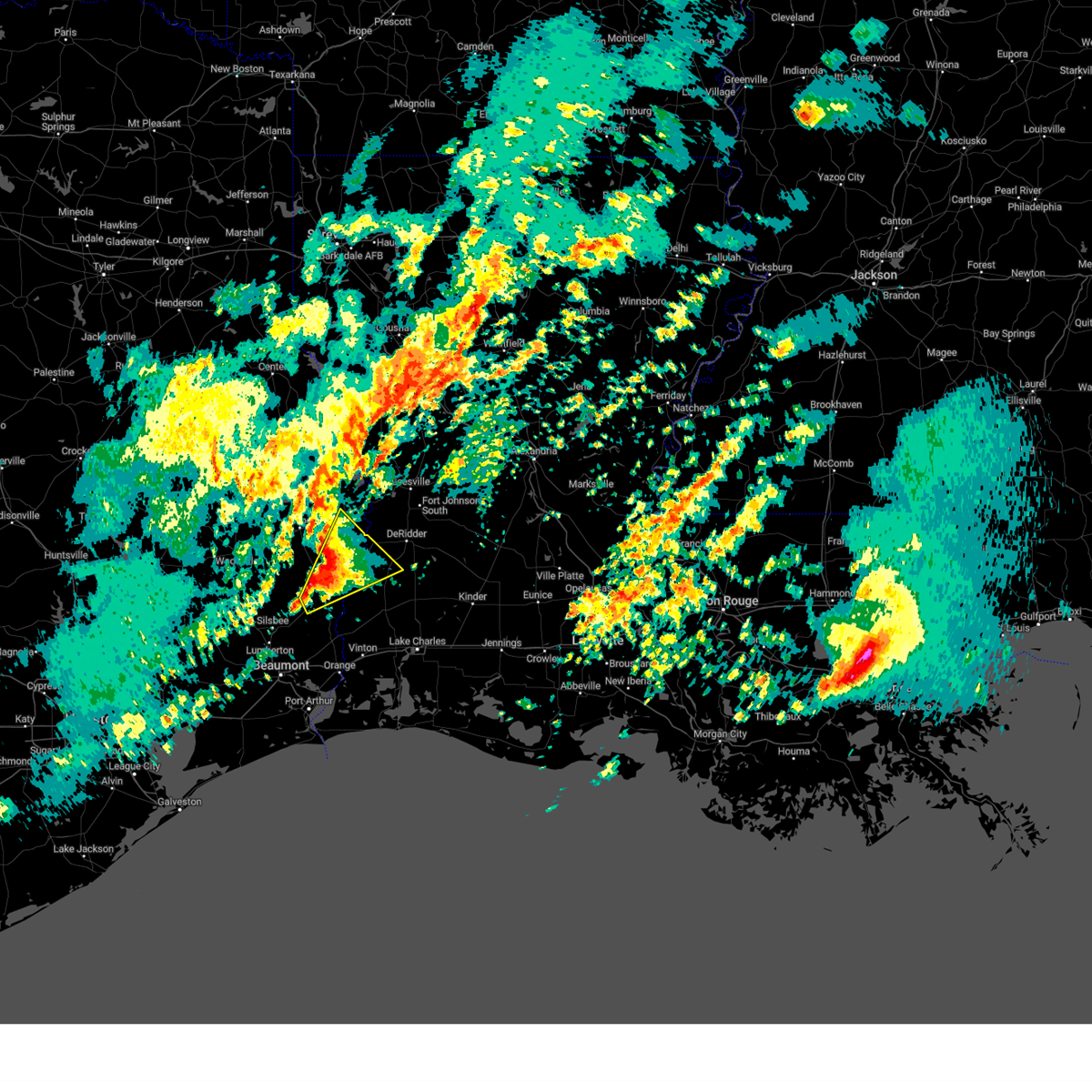 At 500 pm cst, a severe thunderstorm was located near trout creek, or near kirbyville, moving northeast at 45 mph (radar indicated). Hazards include 60 mph wind gusts and quarter size hail. Hail damage to vehicles is expected. expect wind damage to roofs, siding, and trees. locations impacted include, newton, kirbyville, merryville, singer, call, bon weir, trout creek, bivens, old salem, bancroft, junction, stringtown, bleakwood, and wiergate. hail threat, radar indicated max hail size, 1. 00 in wind threat, radar indicated max wind gust, 60 mph. At 500 pm cst, a severe thunderstorm was located near trout creek, or near kirbyville, moving northeast at 45 mph (radar indicated). Hazards include 60 mph wind gusts and quarter size hail. Hail damage to vehicles is expected. expect wind damage to roofs, siding, and trees. locations impacted include, newton, kirbyville, merryville, singer, call, bon weir, trout creek, bivens, old salem, bancroft, junction, stringtown, bleakwood, and wiergate. hail threat, radar indicated max hail size, 1. 00 in wind threat, radar indicated max wind gust, 60 mph.
|
| 1/8/2024 4:39 PM CST |
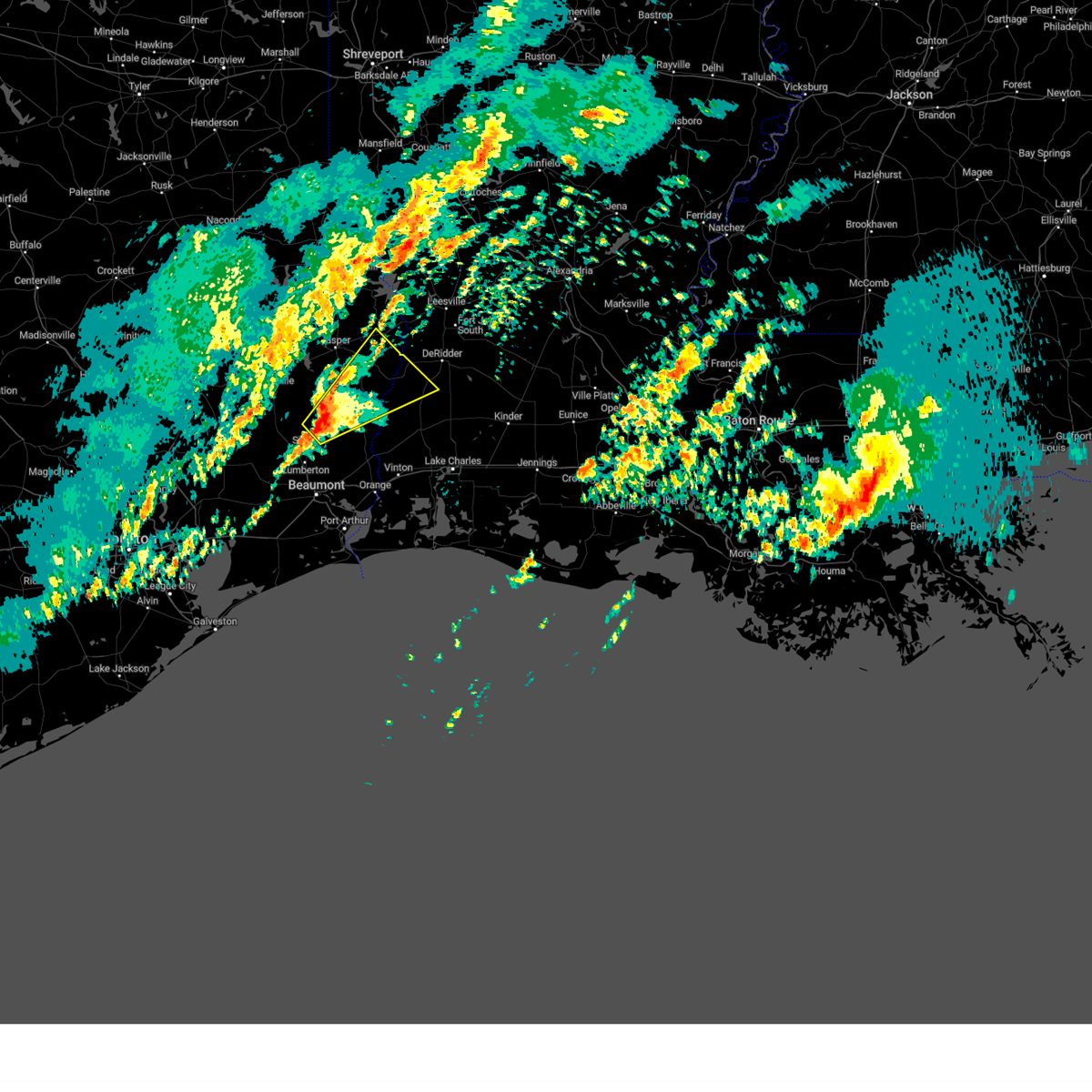 At 439 pm cst, a severe thunderstorm was located near buna, moving northeast at 55 mph (radar indicated). Hazards include 60 mph wind gusts and quarter size hail. Hail damage to vehicles is expected. Expect wind damage to roofs, siding, and trees. At 439 pm cst, a severe thunderstorm was located near buna, moving northeast at 55 mph (radar indicated). Hazards include 60 mph wind gusts and quarter size hail. Hail damage to vehicles is expected. Expect wind damage to roofs, siding, and trees.
|
| 11/20/2023 12:21 PM CST |
 At 1221 pm cst, a severe thunderstorm was located near spurger, or near town bluff, moving northeast at 35 mph (radar indicated). Hazards include 60 mph wind gusts and quarter size hail. Hail damage to vehicles is expected. Expect wind damage to roofs, siding, and trees. At 1221 pm cst, a severe thunderstorm was located near spurger, or near town bluff, moving northeast at 35 mph (radar indicated). Hazards include 60 mph wind gusts and quarter size hail. Hail damage to vehicles is expected. Expect wind damage to roofs, siding, and trees.
|
| 9/8/2023 1:56 PM CDT |
 The severe thunderstorm warning for western beauregard parish in southwestern louisiana and southern newton counties will expire at 200 pm cdt, the storms which prompted the warning have moved out of the area. therefore, the warning will be allowed to expire. to report severe weather, contact your nearest law enforcement agency. they will relay your report to the national weather service lake charles. The severe thunderstorm warning for western beauregard parish in southwestern louisiana and southern newton counties will expire at 200 pm cdt, the storms which prompted the warning have moved out of the area. therefore, the warning will be allowed to expire. to report severe weather, contact your nearest law enforcement agency. they will relay your report to the national weather service lake charles.
|
| 9/8/2023 1:56 PM CDT |
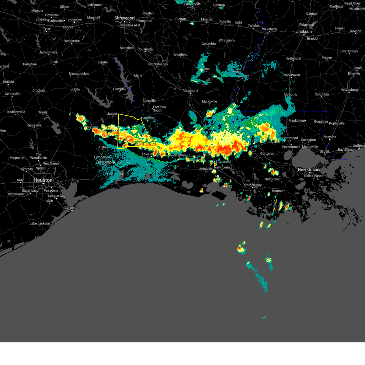 The severe thunderstorm warning for western beauregard parish in southwestern louisiana and southern newton counties will expire at 200 pm cdt, the storms which prompted the warning have moved out of the area. therefore, the warning will be allowed to expire. to report severe weather, contact your nearest law enforcement agency. they will relay your report to the national weather service lake charles. The severe thunderstorm warning for western beauregard parish in southwestern louisiana and southern newton counties will expire at 200 pm cdt, the storms which prompted the warning have moved out of the area. therefore, the warning will be allowed to expire. to report severe weather, contact your nearest law enforcement agency. they will relay your report to the national weather service lake charles.
|
| 9/8/2023 1:03 PM CDT |
 At 102 pm cdt, severe thunderstorms were located along a line extending from jamestown to near junction, moving south at 35 mph. these storms will impact the tiger island wildfire (radar indicated). Hazards include 60 mph wind gusts and quarter size hail. Hail damage to vehicles is expected. Expect wind damage to roofs, siding, and trees. At 102 pm cdt, severe thunderstorms were located along a line extending from jamestown to near junction, moving south at 35 mph. these storms will impact the tiger island wildfire (radar indicated). Hazards include 60 mph wind gusts and quarter size hail. Hail damage to vehicles is expected. Expect wind damage to roofs, siding, and trees.
|
| 9/8/2023 1:03 PM CDT |
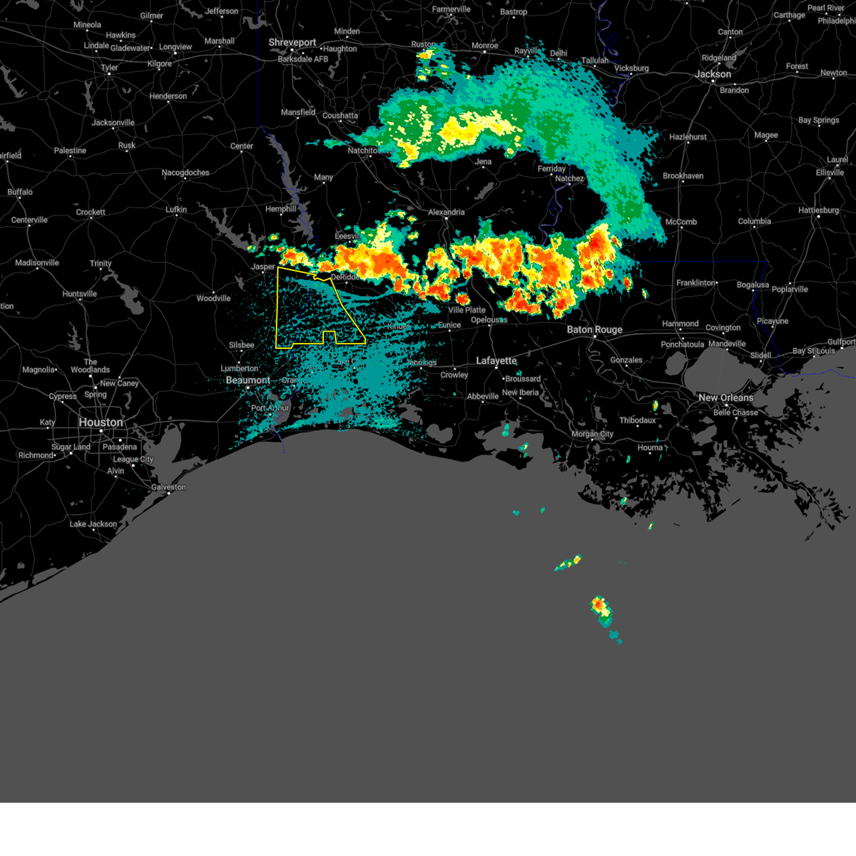 At 102 pm cdt, severe thunderstorms were located along a line extending from jamestown to near junction, moving south at 35 mph. these storms will impact the tiger island wildfire (radar indicated). Hazards include 60 mph wind gusts and quarter size hail. Hail damage to vehicles is expected. Expect wind damage to roofs, siding, and trees. At 102 pm cdt, severe thunderstorms were located along a line extending from jamestown to near junction, moving south at 35 mph. these storms will impact the tiger island wildfire (radar indicated). Hazards include 60 mph wind gusts and quarter size hail. Hail damage to vehicles is expected. Expect wind damage to roofs, siding, and trees.
|
| 4/27/2023 12:46 AM CDT |
 At 1246 am cdt, severe thunderstorms were located along a line extending from near mayflower to near stringtown to near bivens, moving east at 55 mph (radar indicated). Hazards include golf ball size hail and 60 mph wind gusts. People and animals outdoors will be injured. expect hail damage to roofs, siding, windows, and vehicles. Expect wind damage to roofs, siding, and trees. At 1246 am cdt, severe thunderstorms were located along a line extending from near mayflower to near stringtown to near bivens, moving east at 55 mph (radar indicated). Hazards include golf ball size hail and 60 mph wind gusts. People and animals outdoors will be injured. expect hail damage to roofs, siding, windows, and vehicles. Expect wind damage to roofs, siding, and trees.
|
| 4/27/2023 12:33 AM CDT |
 At 1231 am cdt, severe thunderstorms were located along a line extending from near mayflower to near jamestown to near kirbyville, moving east at 45 mph (radar indicated). Hazards include 60 mph wind gusts and half dollar size hail. Hail damage to vehicles is expected. expect wind damage to roofs, siding, and trees. locations impacted include, jasper, newton, kirbyville, burkeville, browndell, farrsville, magnolia springs, mayflower, mt. union, jamestown, roganville, harrisburg, stringtown, bleakwood and wiergate. hail threat, radar indicated max hail size, 1. 25 in wind threat, radar indicated max wind gust, 60 mph. At 1231 am cdt, severe thunderstorms were located along a line extending from near mayflower to near jamestown to near kirbyville, moving east at 45 mph (radar indicated). Hazards include 60 mph wind gusts and half dollar size hail. Hail damage to vehicles is expected. expect wind damage to roofs, siding, and trees. locations impacted include, jasper, newton, kirbyville, burkeville, browndell, farrsville, magnolia springs, mayflower, mt. union, jamestown, roganville, harrisburg, stringtown, bleakwood and wiergate. hail threat, radar indicated max hail size, 1. 25 in wind threat, radar indicated max wind gust, 60 mph.
|
| 4/27/2023 12:19 AM CDT |
 At 1219 am cdt, severe thunderstorms were located along a line extending from near browndell to near jasper to magnolia springs, moving east at 45 mph (radar indicated). Hazards include 60 mph wind gusts and half dollar size hail. Hail damage to vehicles is expected. Expect wind damage to roofs, siding, and trees. At 1219 am cdt, severe thunderstorms were located along a line extending from near browndell to near jasper to magnolia springs, moving east at 45 mph (radar indicated). Hazards include 60 mph wind gusts and half dollar size hail. Hail damage to vehicles is expected. Expect wind damage to roofs, siding, and trees.
|
| 4/15/2023 8:35 PM CDT |
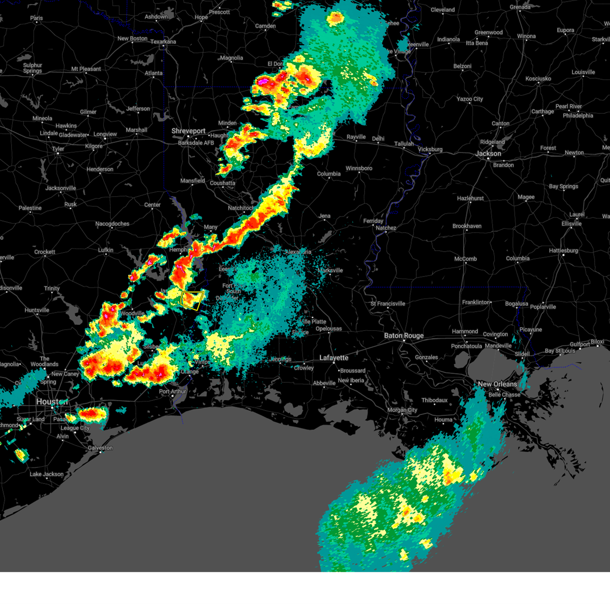 The severe thunderstorm warning for central newton county will expire at 845 pm cdt, the storm which prompted the warning has weakened below severe limits, and no longer poses an immediate threat to life or property. therefore, the warning will be allowed to expire. however heavy rain is still possible with this thunderstorm. a severe thunderstorm watch remains in effect until midnight cdt for southeastern texas. The severe thunderstorm warning for central newton county will expire at 845 pm cdt, the storm which prompted the warning has weakened below severe limits, and no longer poses an immediate threat to life or property. therefore, the warning will be allowed to expire. however heavy rain is still possible with this thunderstorm. a severe thunderstorm watch remains in effect until midnight cdt for southeastern texas.
|
| 4/15/2023 8:28 PM CDT |
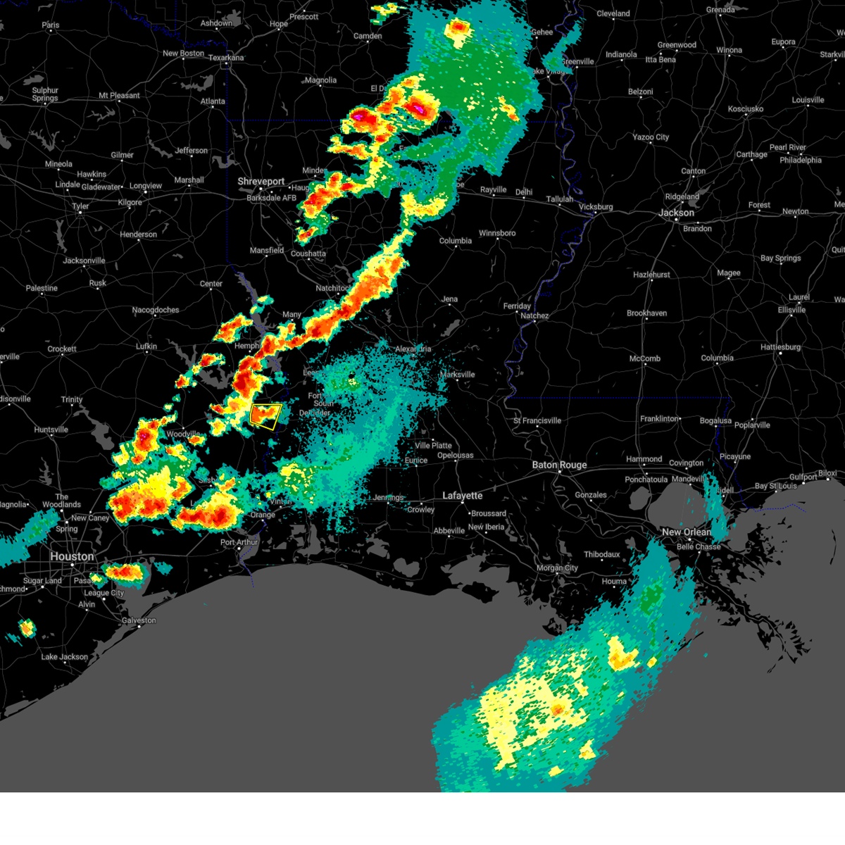 At 828 pm cdt, a severe thunderstorm was located over newton, and is nearly stationary (radar indicated). Hazards include 60 mph wind gusts and quarter size hail. Hail damage to vehicles is expected. expect wind damage to roofs, siding, and trees. locations impacted include, newton, stringtown and jamestown. hail threat, radar indicated max hail size, 1. 00 in wind threat, radar indicated max wind gust, 60 mph. At 828 pm cdt, a severe thunderstorm was located over newton, and is nearly stationary (radar indicated). Hazards include 60 mph wind gusts and quarter size hail. Hail damage to vehicles is expected. expect wind damage to roofs, siding, and trees. locations impacted include, newton, stringtown and jamestown. hail threat, radar indicated max hail size, 1. 00 in wind threat, radar indicated max wind gust, 60 mph.
|
| 4/15/2023 8:15 PM CDT |
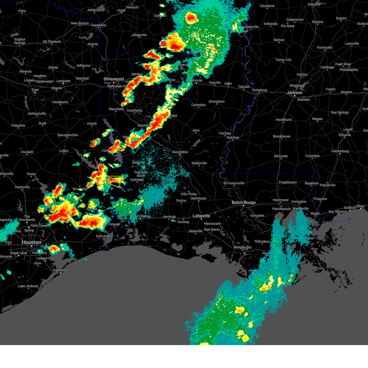 At 815 pm cdt, a severe thunderstorm was located over newton, and is nearly stationary (radar indicated). Hazards include 60 mph wind gusts and quarter size hail. Hail damage to vehicles is expected. Expect wind damage to roofs, siding, and trees. At 815 pm cdt, a severe thunderstorm was located over newton, and is nearly stationary (radar indicated). Hazards include 60 mph wind gusts and quarter size hail. Hail damage to vehicles is expected. Expect wind damage to roofs, siding, and trees.
|
| 4/15/2023 7:30 PM CDT |
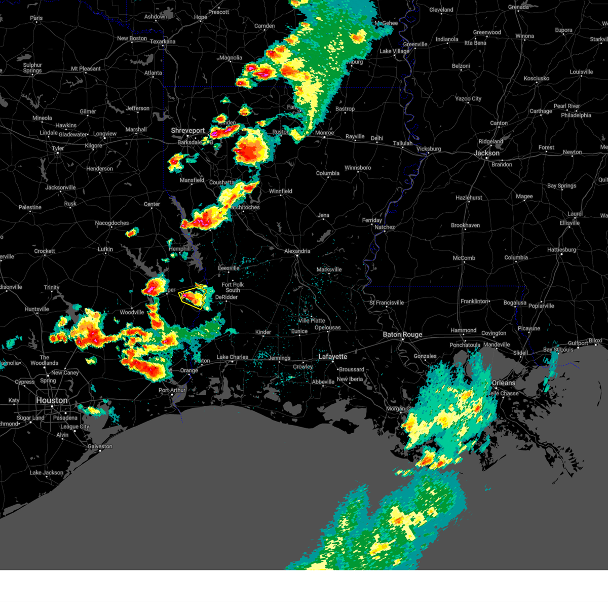 At 730 pm cdt, a severe thunderstorm was located over newton, moving east at 10 mph (radar indicated). Hazards include ping pong ball size hail and 60 mph wind gusts. People and animals outdoors will be injured. expect hail damage to roofs, siding, windows, and vehicles. expect wind damage to roofs, siding, and trees. locations impacted include, newton, stringtown and jamestown. hail threat, radar indicated max hail size, 1. 50 in wind threat, radar indicated max wind gust, 60 mph. At 730 pm cdt, a severe thunderstorm was located over newton, moving east at 10 mph (radar indicated). Hazards include ping pong ball size hail and 60 mph wind gusts. People and animals outdoors will be injured. expect hail damage to roofs, siding, windows, and vehicles. expect wind damage to roofs, siding, and trees. locations impacted include, newton, stringtown and jamestown. hail threat, radar indicated max hail size, 1. 50 in wind threat, radar indicated max wind gust, 60 mph.
|
| 4/15/2023 7:21 PM CDT |
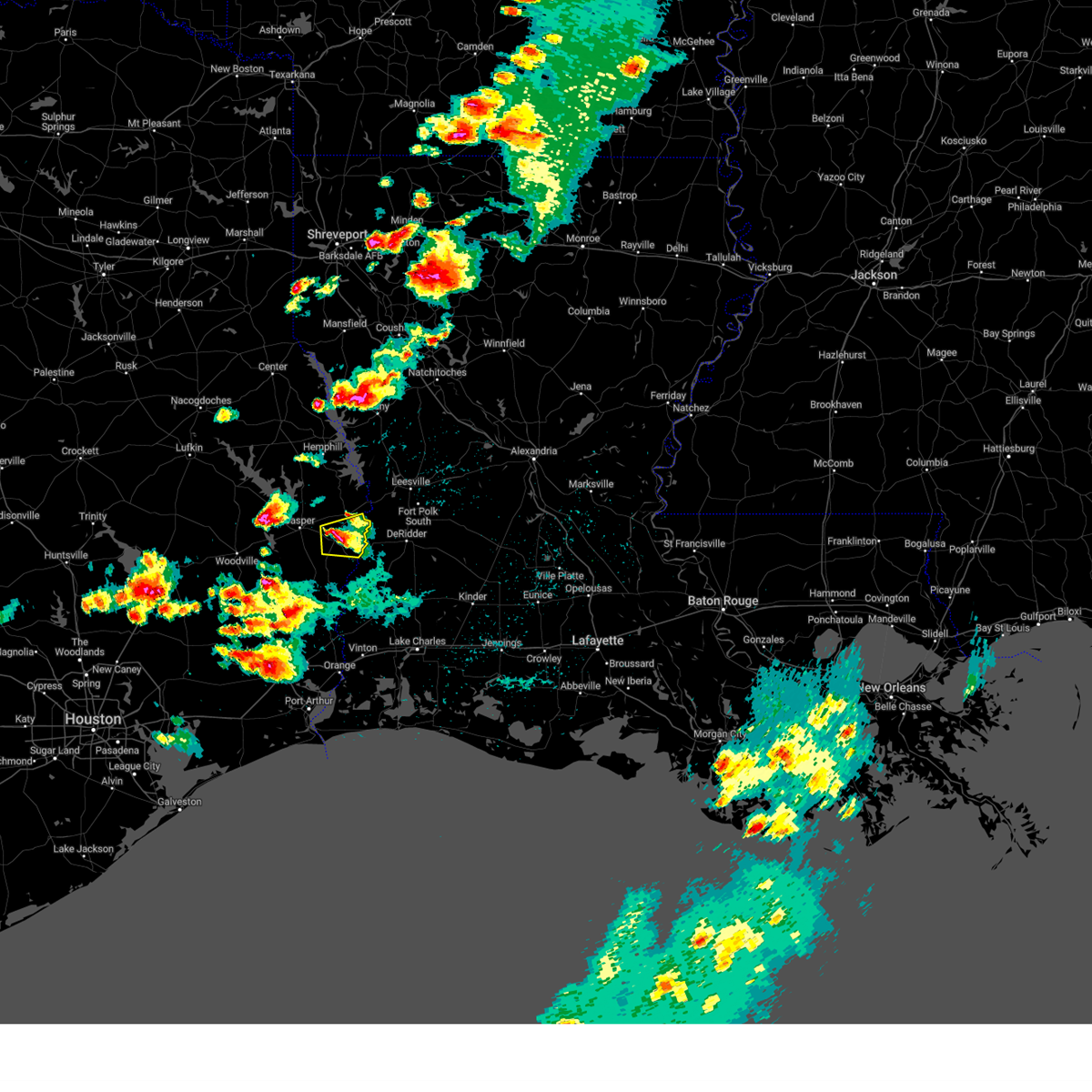 At 720 pm cdt, a severe thunderstorm was located over newton, moving east at 10 mph (radar indicated). Hazards include golf ball size hail and 60 mph wind gusts. People and animals outdoors will be injured. expect hail damage to roofs, siding, windows, and vehicles. Expect wind damage to roofs, siding, and trees. At 720 pm cdt, a severe thunderstorm was located over newton, moving east at 10 mph (radar indicated). Hazards include golf ball size hail and 60 mph wind gusts. People and animals outdoors will be injured. expect hail damage to roofs, siding, windows, and vehicles. Expect wind damage to roofs, siding, and trees.
|
| 3/26/2023 2:52 PM CDT |
 At 252 pm cdt, a severe thunderstorm was located near junction, or 11 miles southeast of burkeville, moving northeast at 55 mph (radar indicated). Hazards include ping pong ball size hail and 60 mph wind gusts. People and animals outdoors will be injured. expect hail damage to roofs, siding, windows, and vehicles. expect wind damage to roofs, siding, and trees. locations impacted include, de ridder, newton, rosepine, merryville, bon weir, burr ferry, junction, stringtown and evans. hail threat, radar indicated max hail size, 1. 50 in wind threat, radar indicated max wind gust, 60 mph. At 252 pm cdt, a severe thunderstorm was located near junction, or 11 miles southeast of burkeville, moving northeast at 55 mph (radar indicated). Hazards include ping pong ball size hail and 60 mph wind gusts. People and animals outdoors will be injured. expect hail damage to roofs, siding, windows, and vehicles. expect wind damage to roofs, siding, and trees. locations impacted include, de ridder, newton, rosepine, merryville, bon weir, burr ferry, junction, stringtown and evans. hail threat, radar indicated max hail size, 1. 50 in wind threat, radar indicated max wind gust, 60 mph.
|
| 3/26/2023 2:37 PM CDT |
 The severe thunderstorm warning for west central newton and east central jasper counties will expire at 245 pm cdt, the storm which prompted the warning has moved out of the area. therefore, the warning will be allowed to expire. however small hail and gusty winds are still possible with this thunderstorm. a tornado watch remains in effect until 700 pm cdt for southeastern texas. to report severe weather, contact your nearest law enforcement agency. they will relay your report to the national weather service lake charles. The severe thunderstorm warning for west central newton and east central jasper counties will expire at 245 pm cdt, the storm which prompted the warning has moved out of the area. therefore, the warning will be allowed to expire. however small hail and gusty winds are still possible with this thunderstorm. a tornado watch remains in effect until 700 pm cdt for southeastern texas. to report severe weather, contact your nearest law enforcement agency. they will relay your report to the national weather service lake charles.
|
| 3/26/2023 2:36 PM CDT |
 At 236 pm cdt, a severe thunderstorm was located over newton, moving northeast at 55 mph (radar indicated). Hazards include ping pong ball size hail and 60 mph wind gusts. People and animals outdoors will be injured. expect hail damage to roofs, siding, windows, and vehicles. Expect wind damage to roofs, siding, and trees. At 236 pm cdt, a severe thunderstorm was located over newton, moving northeast at 55 mph (radar indicated). Hazards include ping pong ball size hail and 60 mph wind gusts. People and animals outdoors will be injured. expect hail damage to roofs, siding, windows, and vehicles. Expect wind damage to roofs, siding, and trees.
|
| 3/26/2023 2:26 PM CDT |
 At 226 pm cdt, a severe thunderstorm was located near newton, moving northeast at 55 mph (radar indicated). Hazards include ping pong ball size hail and 60 mph wind gusts. People and animals outdoors will be injured. expect hail damage to roofs, siding, windows, and vehicles. expect wind damage to roofs, siding, and trees. locations impacted include, newton, kirbyville, jamestown, roganville, magnolia springs, mt. union and bleakwood. hail threat, radar indicated max hail size, 1. 50 in wind threat, radar indicated max wind gust, 60 mph. At 226 pm cdt, a severe thunderstorm was located near newton, moving northeast at 55 mph (radar indicated). Hazards include ping pong ball size hail and 60 mph wind gusts. People and animals outdoors will be injured. expect hail damage to roofs, siding, windows, and vehicles. expect wind damage to roofs, siding, and trees. locations impacted include, newton, kirbyville, jamestown, roganville, magnolia springs, mt. union and bleakwood. hail threat, radar indicated max hail size, 1. 50 in wind threat, radar indicated max wind gust, 60 mph.
|
| 3/26/2023 2:14 PM CDT |
 At 213 pm cdt, a severe thunderstorm was located over magnolia springs, or 8 miles northwest of kirbyville, moving northeast at 55 mph (radar indicated). Hazards include ping pong ball size hail and 60 mph wind gusts. People and animals outdoors will be injured. expect hail damage to roofs, siding, windows, and vehicles. Expect wind damage to roofs, siding, and trees. At 213 pm cdt, a severe thunderstorm was located over magnolia springs, or 8 miles northwest of kirbyville, moving northeast at 55 mph (radar indicated). Hazards include ping pong ball size hail and 60 mph wind gusts. People and animals outdoors will be injured. expect hail damage to roofs, siding, windows, and vehicles. Expect wind damage to roofs, siding, and trees.
|
| 3/17/2023 12:56 AM CDT |
 At 1256 am cdt, severe thunderstorms were located along a line extending from 9 miles northwest of mayflower to browndell, moving southeast at 40 mph (radar indicated). Hazards include 60 mph wind gusts. expect damage to roofs, siding, and trees At 1256 am cdt, severe thunderstorms were located along a line extending from 9 miles northwest of mayflower to browndell, moving southeast at 40 mph (radar indicated). Hazards include 60 mph wind gusts. expect damage to roofs, siding, and trees
|
| 11/11/2022 5:00 PM CST | Trees down around the tow in newton county TX, 11.4 miles SSW of Newton, TX |
| 10/12/2022 7:38 PM CDT |
 At 738 pm cdt, a severe thunderstorm was located over stringtown, or near newton, moving southeast at 15 mph (radar indicated). Hazards include 60 mph wind gusts and quarter size hail. Hail damage to vehicles is expected. Expect wind damage to roofs, siding, and trees. At 738 pm cdt, a severe thunderstorm was located over stringtown, or near newton, moving southeast at 15 mph (radar indicated). Hazards include 60 mph wind gusts and quarter size hail. Hail damage to vehicles is expected. Expect wind damage to roofs, siding, and trees.
|
| 9/7/2022 6:45 PM CDT |
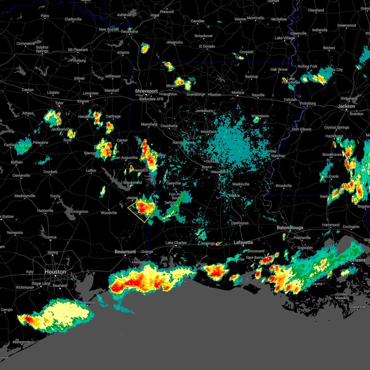 At 644 pm cdt, a severe thunderstorm was located near roganville, or 7 miles southwest of newton, moving southwest at 25 mph (radar indicated). Hazards include 70 mph wind gusts and quarter size hail. Hail damage to vehicles is expected. expect considerable tree damage. wind damage is also likely to mobile homes, roofs, and outbuildings. locations impacted include, newton, kirbyville, bon weir, jamestown, trout creek, roganville and bleakwood. thunderstorm damage threat, considerable hail threat, radar indicated max hail size, 1. 00 in wind threat, radar indicated max wind gust, 70 mph. At 644 pm cdt, a severe thunderstorm was located near roganville, or 7 miles southwest of newton, moving southwest at 25 mph (radar indicated). Hazards include 70 mph wind gusts and quarter size hail. Hail damage to vehicles is expected. expect considerable tree damage. wind damage is also likely to mobile homes, roofs, and outbuildings. locations impacted include, newton, kirbyville, bon weir, jamestown, trout creek, roganville and bleakwood. thunderstorm damage threat, considerable hail threat, radar indicated max hail size, 1. 00 in wind threat, radar indicated max wind gust, 70 mph.
|
| 9/7/2022 6:34 PM CDT |
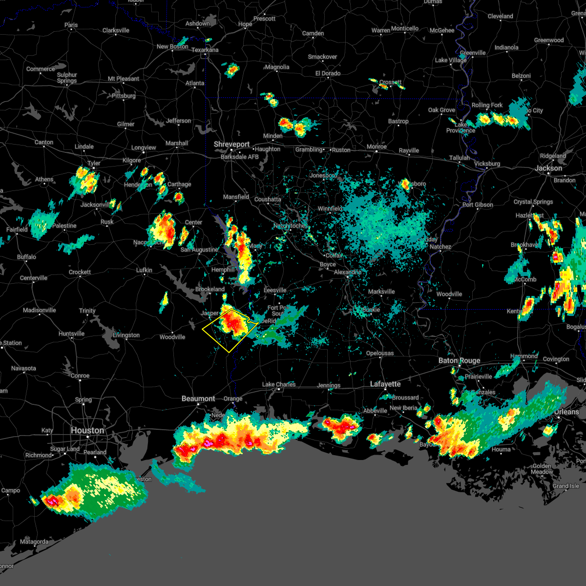 At 633 pm cdt, a severe thunderstorm was located near newton, moving southwest at 20 mph (radar indicated). Hazards include 70 mph wind gusts and half dollar size hail. Hail damage to vehicles is expected. expect considerable tree damage. Wind damage is also likely to mobile homes, roofs, and outbuildings. At 633 pm cdt, a severe thunderstorm was located near newton, moving southwest at 20 mph (radar indicated). Hazards include 70 mph wind gusts and half dollar size hail. Hail damage to vehicles is expected. expect considerable tree damage. Wind damage is also likely to mobile homes, roofs, and outbuildings.
|
| 9/7/2022 6:25 PM CDT |
 At 624 pm cdt, a severe thunderstorm was located over newton, moving southwest at 15 mph (radar indicated). Hazards include 60 mph wind gusts and half dollar size hail. Hail damage to vehicles is expected. Expect wind damage to roofs, siding, and trees. At 624 pm cdt, a severe thunderstorm was located over newton, moving southwest at 15 mph (radar indicated). Hazards include 60 mph wind gusts and half dollar size hail. Hail damage to vehicles is expected. Expect wind damage to roofs, siding, and trees.
|
| 9/7/2022 6:25 PM CDT |
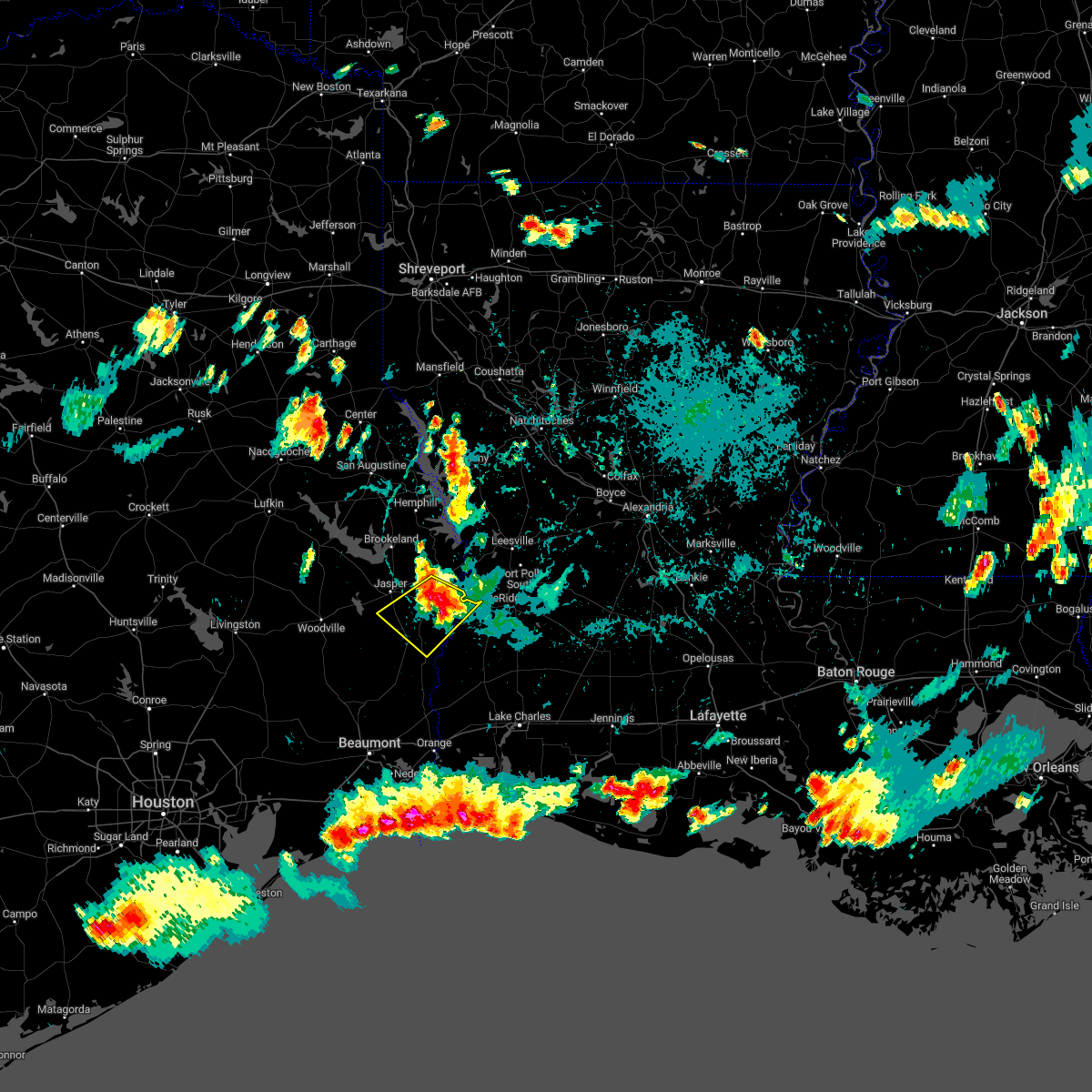 At 624 pm cdt, a severe thunderstorm was located over newton, moving southwest at 15 mph (radar indicated). Hazards include 60 mph wind gusts and half dollar size hail. Hail damage to vehicles is expected. Expect wind damage to roofs, siding, and trees. At 624 pm cdt, a severe thunderstorm was located over newton, moving southwest at 15 mph (radar indicated). Hazards include 60 mph wind gusts and half dollar size hail. Hail damage to vehicles is expected. Expect wind damage to roofs, siding, and trees.
|
| 9/7/2022 6:11 PM CDT |
 At 611 pm cdt, severe thunderstorms were located along a line extending from 8 miles northwest of mayflower to farrsville to near junction, moving southwest at 40 mph (radar indicated). Hazards include 60 mph wind gusts and quarter size hail. Hail damage to vehicles is expected. expect wind damage to roofs, siding, and trees. locations impacted include, newton, toledo bend dam, burkeville, browndell, jamestown, farrsville, harrisburg, mayflower, stringtown and wiergate. hail threat, radar indicated max hail size, 1. 00 in wind threat, radar indicated max wind gust, 60 mph. At 611 pm cdt, severe thunderstorms were located along a line extending from 8 miles northwest of mayflower to farrsville to near junction, moving southwest at 40 mph (radar indicated). Hazards include 60 mph wind gusts and quarter size hail. Hail damage to vehicles is expected. expect wind damage to roofs, siding, and trees. locations impacted include, newton, toledo bend dam, burkeville, browndell, jamestown, farrsville, harrisburg, mayflower, stringtown and wiergate. hail threat, radar indicated max hail size, 1. 00 in wind threat, radar indicated max wind gust, 60 mph.
|
| 9/7/2022 5:55 PM CDT |
 At 555 pm cdt, severe thunderstorms were located along a line extending from 7 miles north of toledo bend dam to near mayflower to 7 miles west of rosepine, moving west at 30 mph (radar indicated). Hazards include two inch hail and 70 mph wind gusts. People and animals outdoors will be injured. expect hail damage to roofs, siding, windows, and vehicles. expect considerable tree damage. wind damage is also likely to mobile homes, roofs, and outbuildings. locations impacted include, newton, anacoco, toledo bend dam, burkeville, hornbeck, browndell, farrsville, burr ferry, mayflower, jamestown, harrisburg, stringtown, wiergate and evans. thunderstorm damage threat, considerable hail threat, radar indicated max hail size, 2. 00 in wind threat, radar indicated max wind gust, 70 mph. At 555 pm cdt, severe thunderstorms were located along a line extending from 7 miles north of toledo bend dam to near mayflower to 7 miles west of rosepine, moving west at 30 mph (radar indicated). Hazards include two inch hail and 70 mph wind gusts. People and animals outdoors will be injured. expect hail damage to roofs, siding, windows, and vehicles. expect considerable tree damage. wind damage is also likely to mobile homes, roofs, and outbuildings. locations impacted include, newton, anacoco, toledo bend dam, burkeville, hornbeck, browndell, farrsville, burr ferry, mayflower, jamestown, harrisburg, stringtown, wiergate and evans. thunderstorm damage threat, considerable hail threat, radar indicated max hail size, 2. 00 in wind threat, radar indicated max wind gust, 70 mph.
|
| 9/7/2022 5:28 PM CDT |
 At 527 pm cdt, severe thunderstorms were located along a line extending from near many to 6 miles southwest of anacoco to near rosepine, moving southwest at 35 mph (radar indicated). Hazards include 70 mph wind gusts and quarter size hail. Hail damage to vehicles is expected. expect considerable tree damage. Wind damage is also likely to mobile homes, roofs, and outbuildings. At 527 pm cdt, severe thunderstorms were located along a line extending from near many to 6 miles southwest of anacoco to near rosepine, moving southwest at 35 mph (radar indicated). Hazards include 70 mph wind gusts and quarter size hail. Hail damage to vehicles is expected. expect considerable tree damage. Wind damage is also likely to mobile homes, roofs, and outbuildings.
|
| 3/22/2022 8:33 AM CDT |
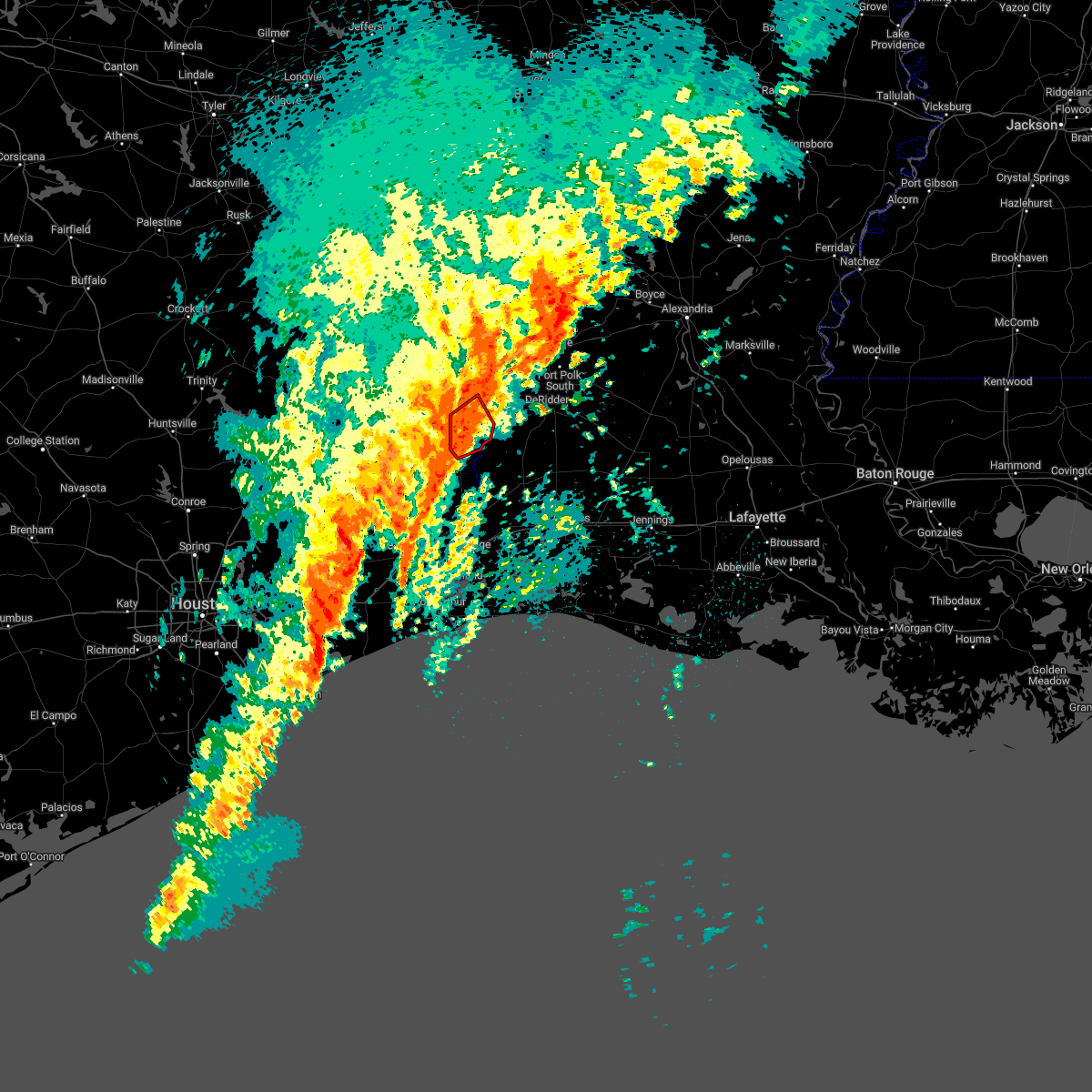 At 832 am cdt, a severe squall line capable of producing both tornadoes and extensive straight line wind damage was located near bon weir, moving northeast at 60 mph (radar indicated rotation). Hazards include tornado. Flying debris will be dangerous to those caught without shelter. mobile homes will be damaged or destroyed. damage to roofs, windows, and vehicles will occur. tree damage is likely. This tornadic thunderstorm will remain over mainly rural areas of central newton county, including the following locations, bleakwood. At 832 am cdt, a severe squall line capable of producing both tornadoes and extensive straight line wind damage was located near bon weir, moving northeast at 60 mph (radar indicated rotation). Hazards include tornado. Flying debris will be dangerous to those caught without shelter. mobile homes will be damaged or destroyed. damage to roofs, windows, and vehicles will occur. tree damage is likely. This tornadic thunderstorm will remain over mainly rural areas of central newton county, including the following locations, bleakwood.
|
| 3/22/2022 8:25 AM CDT |
 At 825 am cdt, a severe squall line capable of producing both tornadoes and extensive straight line wind damage was located near kirbyville, moving northeast at 60 mph (radar indicated rotation). Hazards include tornado. Flying debris will be dangerous to those caught without shelter. mobile homes will be damaged or destroyed. damage to roofs, windows, and vehicles will occur. tree damage is likely. these dangerous storms will be near, newton around 835 am cdt. bon weir around 840 am cdt. Other locations impacted by this tornadic thunderstorm include bleakwood. At 825 am cdt, a severe squall line capable of producing both tornadoes and extensive straight line wind damage was located near kirbyville, moving northeast at 60 mph (radar indicated rotation). Hazards include tornado. Flying debris will be dangerous to those caught without shelter. mobile homes will be damaged or destroyed. damage to roofs, windows, and vehicles will occur. tree damage is likely. these dangerous storms will be near, newton around 835 am cdt. bon weir around 840 am cdt. Other locations impacted by this tornadic thunderstorm include bleakwood.
|
| 3/22/2022 8:13 AM CDT |
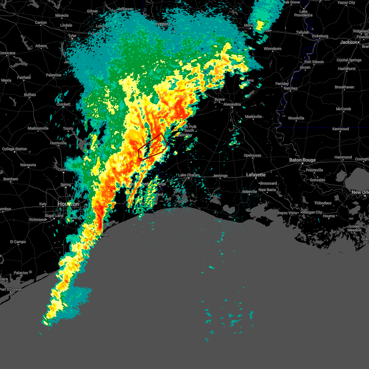 At 813 am cdt, severe thunderstorms capable of producing both tornadoes and extensive straight line wind damage were located near mt. union, or 7 miles southwest of kirbyville, moving northeast at 60 mph (radar indicated rotation). Hazards include tornado. Flying debris will be dangerous to those caught without shelter. mobile homes will be damaged or destroyed. damage to roofs, windows, and vehicles will occur. tree damage is likely. these dangerous storms will be near, kirbyville and call around 820 am cdt. trout creek around 825 am cdt. newton around 835 am cdt. bon weir around 840 am cdt. Other locations impacted by this tornadic thunderstorm include bleakwood. At 813 am cdt, severe thunderstorms capable of producing both tornadoes and extensive straight line wind damage were located near mt. union, or 7 miles southwest of kirbyville, moving northeast at 60 mph (radar indicated rotation). Hazards include tornado. Flying debris will be dangerous to those caught without shelter. mobile homes will be damaged or destroyed. damage to roofs, windows, and vehicles will occur. tree damage is likely. these dangerous storms will be near, kirbyville and call around 820 am cdt. trout creek around 825 am cdt. newton around 835 am cdt. bon weir around 840 am cdt. Other locations impacted by this tornadic thunderstorm include bleakwood.
|
| 12/18/2021 1:07 PM CST |
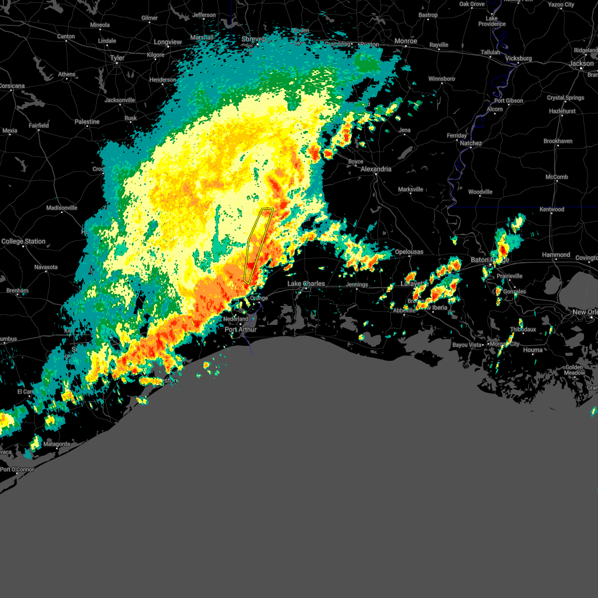 At 106 pm cst, severe thunderstorms were located along a line extending from newton to near buna, moving east at 20 mph (radar indicated). Hazards include 60 mph wind gusts and penny size hail. Expect damage to roofs, siding, and trees. locations impacted include, newton, wrights settlement, old salem, trout creek, stringtown and bleakwood. hail threat, radar indicated max hail size, 0. 75 in wind threat, radar indicated max wind gust, 60 mph. At 106 pm cst, severe thunderstorms were located along a line extending from newton to near buna, moving east at 20 mph (radar indicated). Hazards include 60 mph wind gusts and penny size hail. Expect damage to roofs, siding, and trees. locations impacted include, newton, wrights settlement, old salem, trout creek, stringtown and bleakwood. hail threat, radar indicated max hail size, 0. 75 in wind threat, radar indicated max wind gust, 60 mph.
|
| 12/18/2021 12:28 PM CST |
 At 1228 pm cst, severe thunderstorms were located along a line extending from jasper to caney head, moving east at 20 mph (radar indicated). Hazards include 60 mph wind gusts and penny size hail. expect damage to roofs, siding, and trees At 1228 pm cst, severe thunderstorms were located along a line extending from jasper to caney head, moving east at 20 mph (radar indicated). Hazards include 60 mph wind gusts and penny size hail. expect damage to roofs, siding, and trees
|
| 5/9/2021 7:22 PM CDT |
 At 721 pm cdt, severe thunderstorms were located along a line extending from 11 miles east of hemphill to near toledo bend dam to 6 miles east of mayflower to burkeville to near jamestown, moving east at 40 mph (radar indicated). Hazards include 60 mph wind gusts and quarter size hail. Hail damage to vehicles is expected. Expect wind damage to roofs, siding, and trees. At 721 pm cdt, severe thunderstorms were located along a line extending from 11 miles east of hemphill to near toledo bend dam to 6 miles east of mayflower to burkeville to near jamestown, moving east at 40 mph (radar indicated). Hazards include 60 mph wind gusts and quarter size hail. Hail damage to vehicles is expected. Expect wind damage to roofs, siding, and trees.
|
| 5/9/2021 7:19 PM CDT | Quarter sized hail reported 11.4 miles SSW of Newton, TX |
| 5/9/2021 7:19 PM CDT | Newton county sheriff department reported large tree limbs down... power line down... and estimated 60 mph wind gus in newton county TX, 11.4 miles SSW of Newton, TX |
| 4/23/2021 7:45 PM CDT |
 At 745 pm cdt, a severe thunderstorm was located near kirbyville, moving east at 45 mph (radar indicated). Hazards include 60 mph wind gusts and quarter size hail. Hail damage to vehicles is expected. Expect wind damage to roofs, siding, and trees. At 745 pm cdt, a severe thunderstorm was located near kirbyville, moving east at 45 mph (radar indicated). Hazards include 60 mph wind gusts and quarter size hail. Hail damage to vehicles is expected. Expect wind damage to roofs, siding, and trees.
|
| 4/23/2021 7:45 PM CDT |
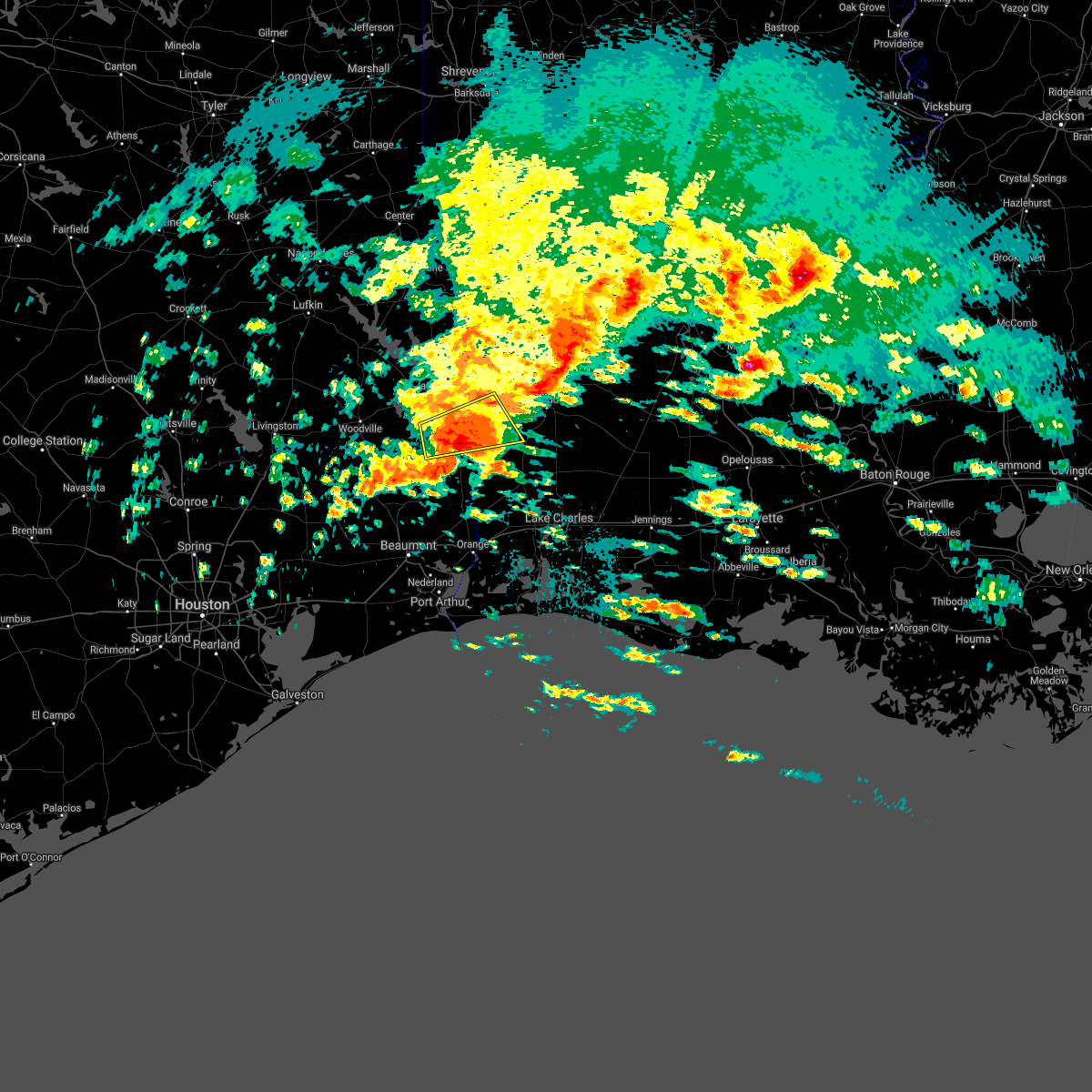 At 745 pm cdt, a severe thunderstorm was located near kirbyville, moving east at 45 mph (radar indicated). Hazards include 60 mph wind gusts and quarter size hail. Hail damage to vehicles is expected. Expect wind damage to roofs, siding, and trees. At 745 pm cdt, a severe thunderstorm was located near kirbyville, moving east at 45 mph (radar indicated). Hazards include 60 mph wind gusts and quarter size hail. Hail damage to vehicles is expected. Expect wind damage to roofs, siding, and trees.
|
| 4/16/2021 3:07 AM CDT |
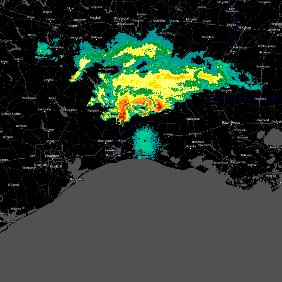 At 307 am cdt, severe thunderstorms were located along a line extending from near newton to call, moving east at 55 mph (radar indicated). Hazards include 60 mph wind gusts and quarter size hail. Hail damage to vehicles is expected. expect wind damage to roofs, siding, and trees. Locations impacted include, newton, old salem, trout creek, stringtown and bleakwood. At 307 am cdt, severe thunderstorms were located along a line extending from near newton to call, moving east at 55 mph (radar indicated). Hazards include 60 mph wind gusts and quarter size hail. Hail damage to vehicles is expected. expect wind damage to roofs, siding, and trees. Locations impacted include, newton, old salem, trout creek, stringtown and bleakwood.
|
| 4/16/2021 3:01 AM CDT |
 At 301 am cdt, severe thunderstorms were located along a line extending from roganville to call, moving east at 55 mph (radar indicated). Hazards include 60 mph wind gusts and quarter size hail. Hail damage to vehicles is expected. expect wind damage to roofs, siding, and trees. Locations impacted include, newton, kirbyville, call, trout creek, roganville, old salem, stringtown and bleakwood. At 301 am cdt, severe thunderstorms were located along a line extending from roganville to call, moving east at 55 mph (radar indicated). Hazards include 60 mph wind gusts and quarter size hail. Hail damage to vehicles is expected. expect wind damage to roofs, siding, and trees. Locations impacted include, newton, kirbyville, call, trout creek, roganville, old salem, stringtown and bleakwood.
|
| 4/16/2021 2:52 AM CDT |
 At 251 am cdt, severe thunderstorms were located along a line extending from near roganville to 6 miles south of mt. union, moving east at 55 mph (radar indicated). Hazards include 60 mph wind gusts and quarter size hail. Hail damage to vehicles is expected. expect wind damage to roofs, siding, and trees. locations impacted include, newton, kirbyville, call, trout creek, roganville, magnolia springs, old salem, mt. Union, stringtown and bleakwood. At 251 am cdt, severe thunderstorms were located along a line extending from near roganville to 6 miles south of mt. union, moving east at 55 mph (radar indicated). Hazards include 60 mph wind gusts and quarter size hail. Hail damage to vehicles is expected. expect wind damage to roofs, siding, and trees. locations impacted include, newton, kirbyville, call, trout creek, roganville, magnolia springs, old salem, mt. Union, stringtown and bleakwood.
|
| 4/16/2021 2:43 AM CDT |
 At 242 am cdt, severe thunderstorms were located along a line extending from near magnolia springs to near fred, moving east at 55 mph (radar indicated). Hazards include 60 mph wind gusts and nickel size hail. expect damage to roofs, siding, and trees At 242 am cdt, severe thunderstorms were located along a line extending from near magnolia springs to near fred, moving east at 55 mph (radar indicated). Hazards include 60 mph wind gusts and nickel size hail. expect damage to roofs, siding, and trees
|
| 4/14/2021 6:53 AM CDT |
 At 652 am cdt, a severe thunderstorm was located near stringtown, or 8 miles northwest of merryville, moving northeast at 50 mph (radar indicated). Hazards include 60 mph wind gusts and quarter size hail. Hail damage to vehicles is expected. expect wind damage to roofs, siding, and trees. Locations impacted include, newton, merryville, bon weir, junction and stringtown. At 652 am cdt, a severe thunderstorm was located near stringtown, or 8 miles northwest of merryville, moving northeast at 50 mph (radar indicated). Hazards include 60 mph wind gusts and quarter size hail. Hail damage to vehicles is expected. expect wind damage to roofs, siding, and trees. Locations impacted include, newton, merryville, bon weir, junction and stringtown.
|
| 4/14/2021 6:53 AM CDT |
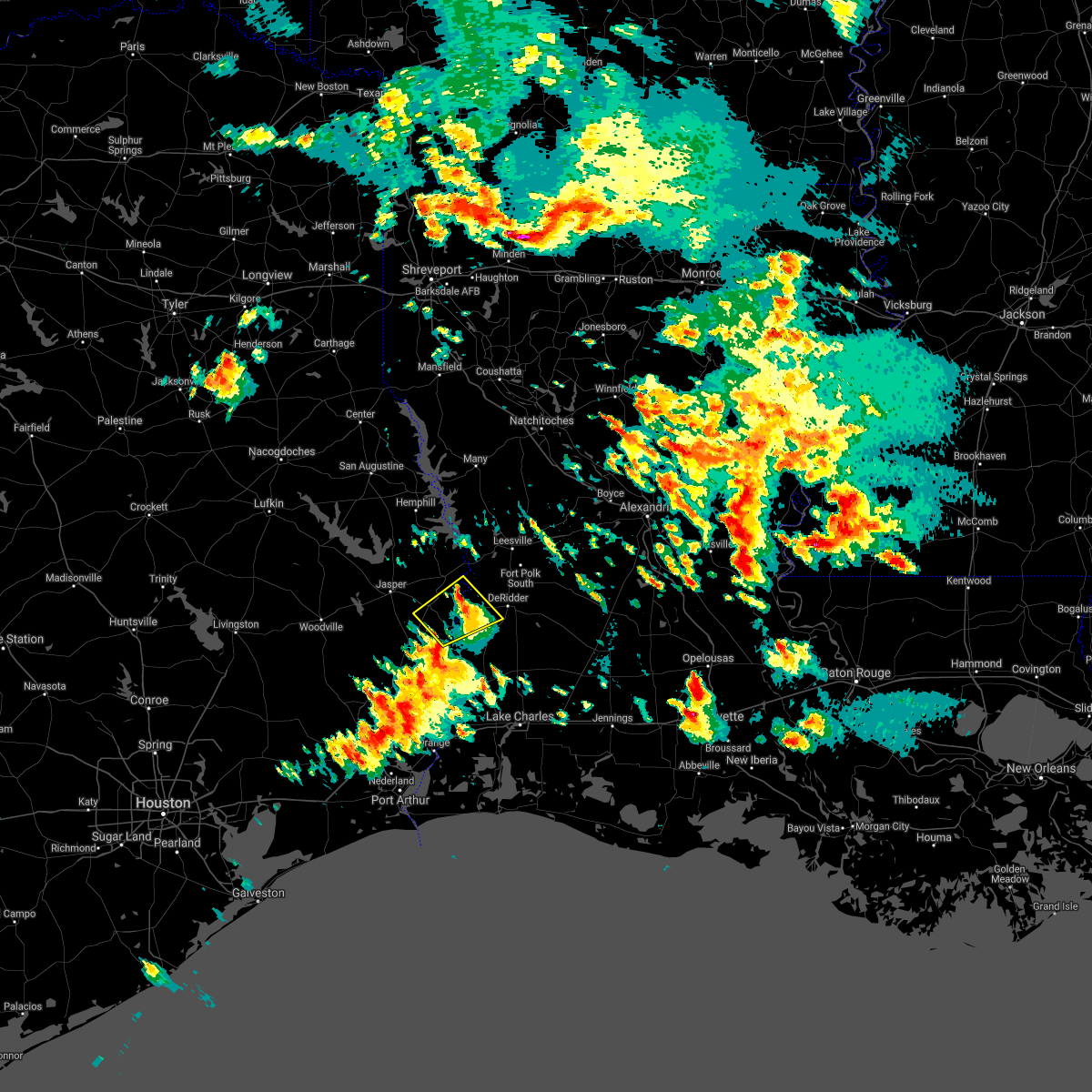 At 652 am cdt, a severe thunderstorm was located near stringtown, or 8 miles northwest of merryville, moving northeast at 50 mph (radar indicated). Hazards include 60 mph wind gusts and quarter size hail. Hail damage to vehicles is expected. expect wind damage to roofs, siding, and trees. Locations impacted include, newton, merryville, bon weir, junction and stringtown. At 652 am cdt, a severe thunderstorm was located near stringtown, or 8 miles northwest of merryville, moving northeast at 50 mph (radar indicated). Hazards include 60 mph wind gusts and quarter size hail. Hail damage to vehicles is expected. expect wind damage to roofs, siding, and trees. Locations impacted include, newton, merryville, bon weir, junction and stringtown.
|
| 4/14/2021 6:28 AM CDT |
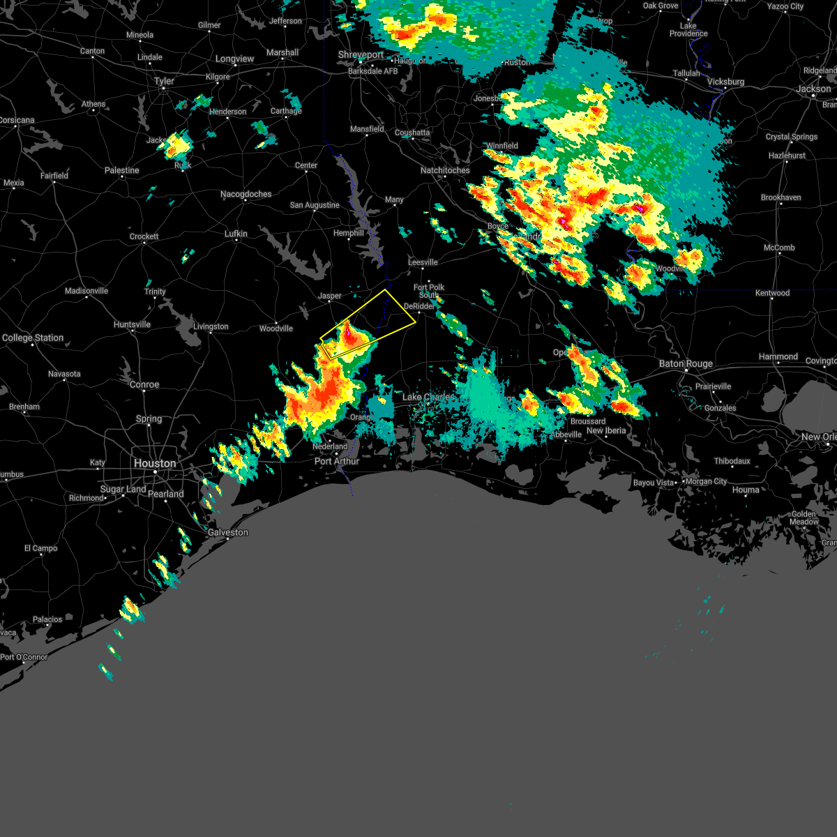 At 628 am cdt, a severe thunderstorm was located over kirbyville, moving northeast at 50 mph (radar indicated). Hazards include 60 mph wind gusts and quarter size hail. Hail damage to vehicles is expected. Expect wind damage to roofs, siding, and trees. At 628 am cdt, a severe thunderstorm was located over kirbyville, moving northeast at 50 mph (radar indicated). Hazards include 60 mph wind gusts and quarter size hail. Hail damage to vehicles is expected. Expect wind damage to roofs, siding, and trees.
|
| 12/23/2020 7:26 PM CST |
 At 725 pm cst, a severe thunderstorm capable of producing a tornado was located near bon weir, moving northeast at 30 mph (radar indicated rotation). Hazards include tornado. Flying debris will be dangerous to those caught without shelter. mobile homes will be damaged or destroyed. damage to roofs, windows, and vehicles will occur. tree damage is likely. this dangerous storm will be near, stringtown around 740 pm cst. Merryville and junction around 750 pm cst. At 725 pm cst, a severe thunderstorm capable of producing a tornado was located near bon weir, moving northeast at 30 mph (radar indicated rotation). Hazards include tornado. Flying debris will be dangerous to those caught without shelter. mobile homes will be damaged or destroyed. damage to roofs, windows, and vehicles will occur. tree damage is likely. this dangerous storm will be near, stringtown around 740 pm cst. Merryville and junction around 750 pm cst.
|
| 12/23/2020 7:12 PM CST |
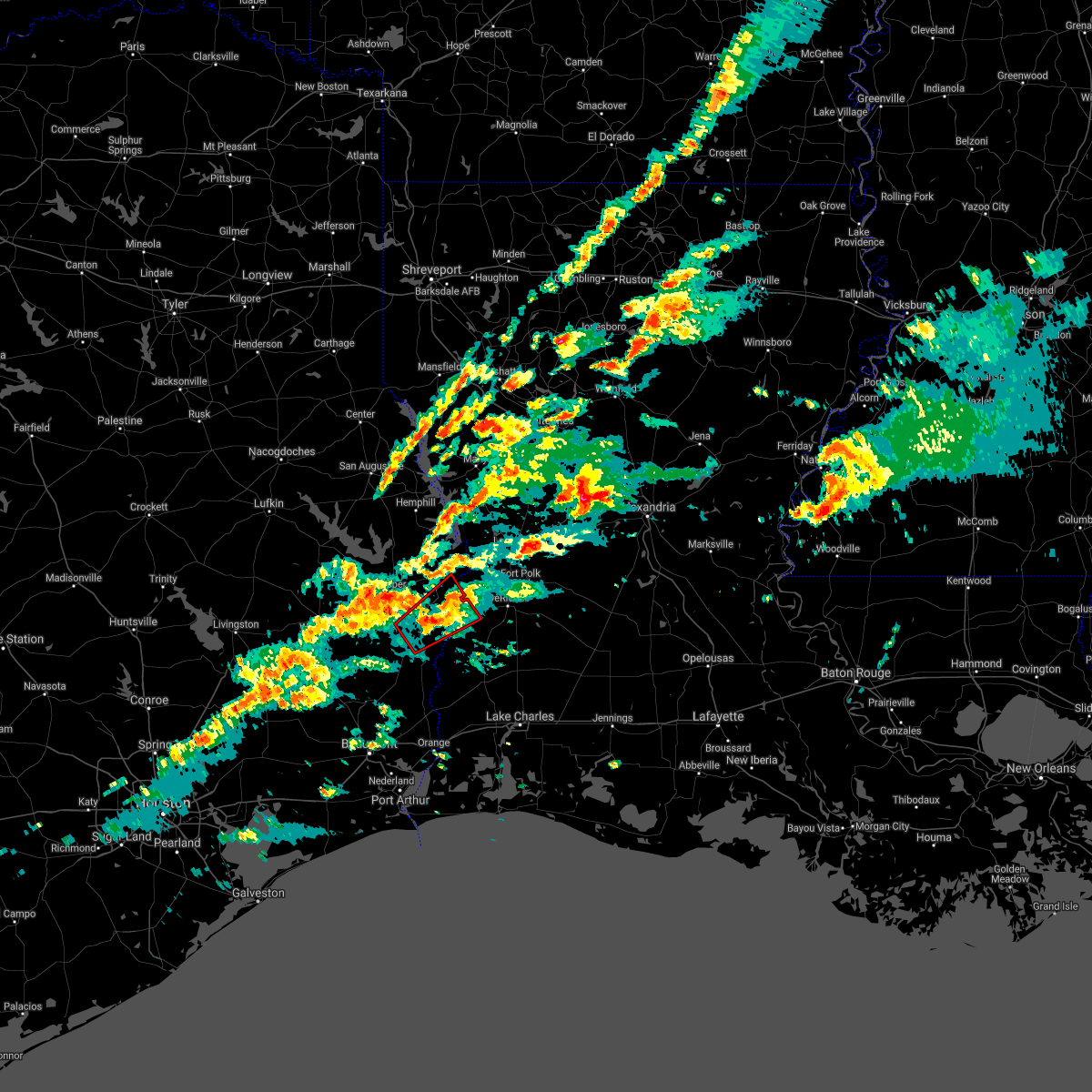 At 711 pm cst, a severe thunderstorm capable of producing a tornado was located near roganville, or 7 miles northeast of kirbyville, moving northeast at 30 mph (radar indicated rotation). Hazards include tornado. Flying debris will be dangerous to those caught without shelter. mobile homes will be damaged or destroyed. damage to roofs, windows, and vehicles will occur. tree damage is likely. this dangerous storm will be near, newton around 725 pm cst. bon weir around 730 pm cst. stringtown and junction around 745 pm cst. Other locations impacted by this tornadic thunderstorm include bleakwood. At 711 pm cst, a severe thunderstorm capable of producing a tornado was located near roganville, or 7 miles northeast of kirbyville, moving northeast at 30 mph (radar indicated rotation). Hazards include tornado. Flying debris will be dangerous to those caught without shelter. mobile homes will be damaged or destroyed. damage to roofs, windows, and vehicles will occur. tree damage is likely. this dangerous storm will be near, newton around 725 pm cst. bon weir around 730 pm cst. stringtown and junction around 745 pm cst. Other locations impacted by this tornadic thunderstorm include bleakwood.
|
| 8/26/2020 3:41 PM CDT |
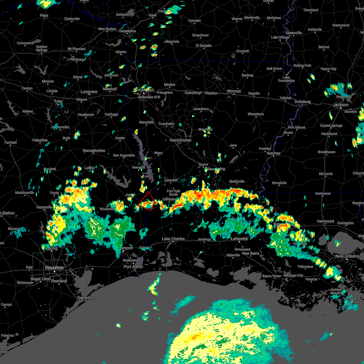 The tornado warning for central newton county will expire at 345 pm cdt, the storm which prompted the warning has weakened below severe limits, and no longer appears capable of producing a tornado. therefore, the warning will be allowed to expire. a tornado watch remains in effect until 900 pm cdt for southwestern louisiana, and southeastern texas. The tornado warning for central newton county will expire at 345 pm cdt, the storm which prompted the warning has weakened below severe limits, and no longer appears capable of producing a tornado. therefore, the warning will be allowed to expire. a tornado watch remains in effect until 900 pm cdt for southwestern louisiana, and southeastern texas.
|
| 8/26/2020 3:32 PM CDT |
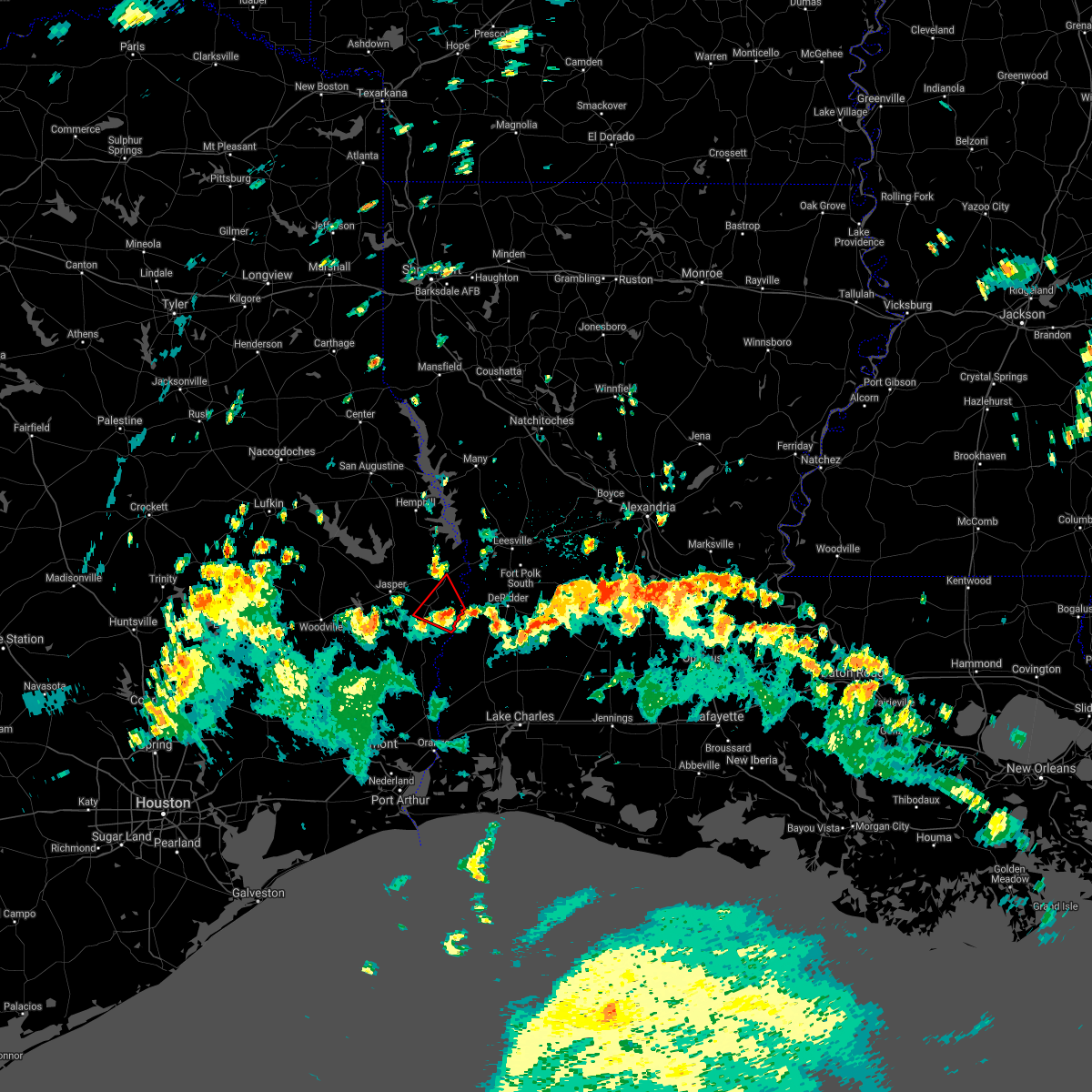 At 332 pm cdt, a severe thunderstorm capable of producing a tornado was located near bon weir, moving northwest at 25 mph (radar indicated rotation). Hazards include tornado. Flying debris will be dangerous to those caught without shelter. mobile homes will be damaged or destroyed. damage to roofs, windows, and vehicles will occur. tree damage is likely. This dangerous storm will be near, newton and stringtown around 345 pm cdt. At 332 pm cdt, a severe thunderstorm capable of producing a tornado was located near bon weir, moving northwest at 25 mph (radar indicated rotation). Hazards include tornado. Flying debris will be dangerous to those caught without shelter. mobile homes will be damaged or destroyed. damage to roofs, windows, and vehicles will occur. tree damage is likely. This dangerous storm will be near, newton and stringtown around 345 pm cdt.
|
| 8/26/2020 3:18 PM CDT |
 At 318 pm cdt, a severe thunderstorm capable of producing a tornado was located over merryville, moving northwest at 25 mph (radar indicated rotation). Hazards include tornado. Flying debris will be dangerous to those caught without shelter. mobile homes will be damaged or destroyed. damage to roofs, windows, and vehicles will occur. tree damage is likely. this dangerous storm will be near, bon weir around 330 pm cdt. Newton and stringtown around 345 pm cdt. At 318 pm cdt, a severe thunderstorm capable of producing a tornado was located over merryville, moving northwest at 25 mph (radar indicated rotation). Hazards include tornado. Flying debris will be dangerous to those caught without shelter. mobile homes will be damaged or destroyed. damage to roofs, windows, and vehicles will occur. tree damage is likely. this dangerous storm will be near, bon weir around 330 pm cdt. Newton and stringtown around 345 pm cdt.
|
| 8/26/2020 3:18 PM CDT |
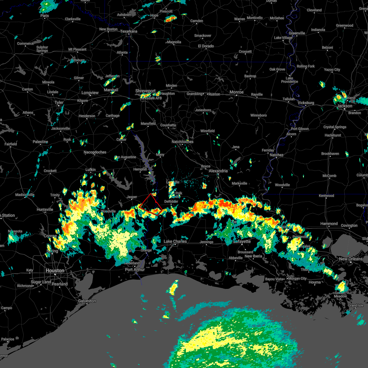 At 318 pm cdt, a severe thunderstorm capable of producing a tornado was located over merryville, moving northwest at 25 mph (radar indicated rotation). Hazards include tornado. Flying debris will be dangerous to those caught without shelter. mobile homes will be damaged or destroyed. damage to roofs, windows, and vehicles will occur. tree damage is likely. this dangerous storm will be near, bon weir around 330 pm cdt. Newton and stringtown around 345 pm cdt. At 318 pm cdt, a severe thunderstorm capable of producing a tornado was located over merryville, moving northwest at 25 mph (radar indicated rotation). Hazards include tornado. Flying debris will be dangerous to those caught without shelter. mobile homes will be damaged or destroyed. damage to roofs, windows, and vehicles will occur. tree damage is likely. this dangerous storm will be near, bon weir around 330 pm cdt. Newton and stringtown around 345 pm cdt.
|
| 4/29/2020 3:23 AM CDT |
 At 322 am cdt, severe thunderstorms were located along a line extending from 6 miles southeast of archie to 6 miles east of fort polk to near colmesneil, moving south at 45 mph (radar indicated). Hazards include 60 mph wind gusts and quarter size hail. Hail damage to vehicles is expected. expect wind damage to roofs, siding, and trees. locations impacted include, alexandria, pineville, de ridder, oakdale, jasper, leesville, marksville, woodville, newton, kirbyville, rosepine, glenmora, merryville, boyce, moreauville, anacoco, cheneyville, colmesneil, elizabeth and chester. This includes interstate 49 between mile markers 54 and 109. At 322 am cdt, severe thunderstorms were located along a line extending from 6 miles southeast of archie to 6 miles east of fort polk to near colmesneil, moving south at 45 mph (radar indicated). Hazards include 60 mph wind gusts and quarter size hail. Hail damage to vehicles is expected. expect wind damage to roofs, siding, and trees. locations impacted include, alexandria, pineville, de ridder, oakdale, jasper, leesville, marksville, woodville, newton, kirbyville, rosepine, glenmora, merryville, boyce, moreauville, anacoco, cheneyville, colmesneil, elizabeth and chester. This includes interstate 49 between mile markers 54 and 109.
|
| 4/29/2020 2:47 AM CDT |
 At 247 am cdt, severe thunderstorms were located along a line extending from near rosefield to near kurthwood to near huntington, moving south at 40 mph (radar indicated). Hazards include 60 mph wind gusts and quarter size hail. Hail damage to vehicles is expected. Expect wind damage to roofs, siding, and trees. At 247 am cdt, severe thunderstorms were located along a line extending from near rosefield to near kurthwood to near huntington, moving south at 40 mph (radar indicated). Hazards include 60 mph wind gusts and quarter size hail. Hail damage to vehicles is expected. Expect wind damage to roofs, siding, and trees.
|
| 4/22/2020 7:40 PM CDT | Tennis Ball sized hail reported 10 miles SSE of Newton, TX, large hail near farrsville estimated 2.5 in |
| 4/22/2020 7:34 PM CDT |
 At 734 pm cdt, a confirmed large and extremely dangerous tornado was located over farrsville, or 7 miles northwest of newton, moving east at 40 mph. this is a particularly dangerous situation. take cover now! (radar confirmed tornado). Hazards include damaging tornado. You are in a life-threatening situation. flying debris may be deadly to those caught without shelter. mobile homes will be destroyed. considerable damage to homes, businesses, and vehicles is likely and complete destruction is possible. the tornado will be near, burkeville around 745 pm cdt. stringtown around 750 pm cdt. Other locations impacted by this tornadic thunderstorm include wiergate. At 734 pm cdt, a confirmed large and extremely dangerous tornado was located over farrsville, or 7 miles northwest of newton, moving east at 40 mph. this is a particularly dangerous situation. take cover now! (radar confirmed tornado). Hazards include damaging tornado. You are in a life-threatening situation. flying debris may be deadly to those caught without shelter. mobile homes will be destroyed. considerable damage to homes, businesses, and vehicles is likely and complete destruction is possible. the tornado will be near, burkeville around 745 pm cdt. stringtown around 750 pm cdt. Other locations impacted by this tornadic thunderstorm include wiergate.
|
| 4/22/2020 7:28 PM CDT |
 At 728 pm cdt, a large and extremely dangerous tornado was located near jamestown, or 7 miles east of jasper, moving east at 40 mph. this is a particularly dangerous situation. take cover now! (radar indicated rotation). Hazards include damaging tornado. You are in a life-threatening situation. flying debris may be deadly to those caught without shelter. mobile homes will be destroyed. considerable damage to homes, businesses, and vehicles is likely and complete destruction is possible. the tornado will be near, burkeville around 745 pm cdt. stringtown around 750 pm cdt. Other locations impacted by this tornadic thunderstorm include wiergate. At 728 pm cdt, a large and extremely dangerous tornado was located near jamestown, or 7 miles east of jasper, moving east at 40 mph. this is a particularly dangerous situation. take cover now! (radar indicated rotation). Hazards include damaging tornado. You are in a life-threatening situation. flying debris may be deadly to those caught without shelter. mobile homes will be destroyed. considerable damage to homes, businesses, and vehicles is likely and complete destruction is possible. the tornado will be near, burkeville around 745 pm cdt. stringtown around 750 pm cdt. Other locations impacted by this tornadic thunderstorm include wiergate.
|
| 4/22/2020 7:17 PM CDT |
 At 716 pm cdt, a confirmed large and destructive tornado was located over jasper, moving east at 40 mph. tornado emergency for the city of jasper texas. this is a particularly dangerous situation. take cover now! (radar confirmed tornado). Hazards include deadly tornado. You are in a life-threatening situation. flying debris may be deadly to those caught without shelter. mobile homes will be destroyed. considerable damage to homes, businesses, and vehicles is likely and complete destruction is possible. the tornado will be near, harrisburg around 725 pm cdt. jamestown around 730 pm cdt. farrsville around 735 pm cdt. Other locations impacted by this tornadic thunderstorm include wiergate. At 716 pm cdt, a confirmed large and destructive tornado was located over jasper, moving east at 40 mph. tornado emergency for the city of jasper texas. this is a particularly dangerous situation. take cover now! (radar confirmed tornado). Hazards include deadly tornado. You are in a life-threatening situation. flying debris may be deadly to those caught without shelter. mobile homes will be destroyed. considerable damage to homes, businesses, and vehicles is likely and complete destruction is possible. the tornado will be near, harrisburg around 725 pm cdt. jamestown around 730 pm cdt. farrsville around 735 pm cdt. Other locations impacted by this tornadic thunderstorm include wiergate.
|
| 4/22/2020 7:08 PM CDT |
 Tornado emergency for the city of jasper texas, the national weather service in lake charles has issued a * tornado warning for, northwestern newton county in southeastern texas, northeastern jasper county in southeastern texas, * until 730 pm cdt. * at 707 pm cdt, a confirmed large and destructive tornado was observed near jasper, moving east at 45 mph. tornado emergency for the city of jasper texas. this is a particularly dangerous situation. take cover now! (radar confirmed tornado). Hazards include deadly tornado. You are in a life-threatening situation. flying debris may be deadly to those caught without shelter. mobile homes will be destroyed. considerable damage to homes, businesses, and vehicles is likely and complete destruction is possible. the tornado will be near, jasper around 715 pm cdt. harrisburg around 725 pm cdt. jamestown and farrsville around 730 pm cdt. Other locations impacted by this tornadic thunderstorm include wiergate. Tornado emergency for the city of jasper texas, the national weather service in lake charles has issued a * tornado warning for, northwestern newton county in southeastern texas, northeastern jasper county in southeastern texas, * until 730 pm cdt. * at 707 pm cdt, a confirmed large and destructive tornado was observed near jasper, moving east at 45 mph. tornado emergency for the city of jasper texas. this is a particularly dangerous situation. take cover now! (radar confirmed tornado). Hazards include deadly tornado. You are in a life-threatening situation. flying debris may be deadly to those caught without shelter. mobile homes will be destroyed. considerable damage to homes, businesses, and vehicles is likely and complete destruction is possible. the tornado will be near, jasper around 715 pm cdt. harrisburg around 725 pm cdt. jamestown and farrsville around 730 pm cdt. Other locations impacted by this tornadic thunderstorm include wiergate.
|
| 4/9/2020 5:46 PM CDT |
 At 546 pm cdt, a severe thunderstorm was located near jasper, moving east at 15 mph (radar indicated). Hazards include 60 mph wind gusts and quarter size hail. Hail damage to vehicles is expected. expect wind damage to roofs, siding, and trees. Locations impacted include, jasper, newton, burkeville, jamestown, farrsville, harrisburg, mayflower and wiergate. At 546 pm cdt, a severe thunderstorm was located near jasper, moving east at 15 mph (radar indicated). Hazards include 60 mph wind gusts and quarter size hail. Hail damage to vehicles is expected. expect wind damage to roofs, siding, and trees. Locations impacted include, jasper, newton, burkeville, jamestown, farrsville, harrisburg, mayflower and wiergate.
|
| 4/9/2020 5:29 PM CDT |
 At 529 pm cdt, a severe thunderstorm was located over jasper, moving east at 15 mph (radar indicated). Hazards include 60 mph wind gusts and quarter size hail. Hail damage to vehicles is expected. Expect wind damage to roofs, siding, and trees. At 529 pm cdt, a severe thunderstorm was located over jasper, moving east at 15 mph (radar indicated). Hazards include 60 mph wind gusts and quarter size hail. Hail damage to vehicles is expected. Expect wind damage to roofs, siding, and trees.
|
| 1/11/2020 2:40 AM CST |
 At 238 am cst, severe thunderstorms were located along a line extending from near hornbeck to near bivens to 22 miles southeast of high island, moving east at 40 mph (radar indicated. at 2:22 am cst jack brooks airport in beaumont reported a wind gust to 69 mph). Hazards include 70 mph wind gusts. Expect considerable tree damage. damage is likely to mobile homes, roofs, and outbuildings. locations impacted include, beaumont, lake charles, port arthur, sulphur, orange, nederland, groves, port neches, vidor, bridge city, leesville, west orange, vinton, newton, rosepine, merryville, anacoco, singer, sabine pass and johnsons bayou. this includes the following highways, interstate 10 in texas between mile markers 880 and 860. interstate 10 in louisiana between mile markers 1 and 26. Interstate 210 near mile marker 1. At 238 am cst, severe thunderstorms were located along a line extending from near hornbeck to near bivens to 22 miles southeast of high island, moving east at 40 mph (radar indicated. at 2:22 am cst jack brooks airport in beaumont reported a wind gust to 69 mph). Hazards include 70 mph wind gusts. Expect considerable tree damage. damage is likely to mobile homes, roofs, and outbuildings. locations impacted include, beaumont, lake charles, port arthur, sulphur, orange, nederland, groves, port neches, vidor, bridge city, leesville, west orange, vinton, newton, rosepine, merryville, anacoco, singer, sabine pass and johnsons bayou. this includes the following highways, interstate 10 in texas between mile markers 880 and 860. interstate 10 in louisiana between mile markers 1 and 26. Interstate 210 near mile marker 1.
|
| 1/11/2020 2:28 AM CST | Trees reported down across hwy 63 just west of burkevill in newton county TX, 10.1 miles SSW of Newton, TX |
| 1/11/2020 2:25 AM CST | Trees reported down on us-190 south of fm-262 in newton county TX, 7 miles NW of Newton, TX |
| 1/11/2020 2:16 AM CST |
 At 216 am cst, severe thunderstorms were located along a line extending from 7 miles north of toledo bend dam to call to 16 miles south of high island, moving east at 40 mph (radar indicated). Hazards include 60 mph wind gusts. expect damage to roofs, siding, and trees At 216 am cst, severe thunderstorms were located along a line extending from 7 miles north of toledo bend dam to call to 16 miles south of high island, moving east at 40 mph (radar indicated). Hazards include 60 mph wind gusts. expect damage to roofs, siding, and trees
|
| 12/16/2019 10:50 AM CST |
 At 1049 am cst, a severe thunderstorm was located over call, moving northeast at 40 mph (radar indicated). Hazards include 60 mph wind gusts. expect damage to roofs, siding, and trees At 1049 am cst, a severe thunderstorm was located over call, moving northeast at 40 mph (radar indicated). Hazards include 60 mph wind gusts. expect damage to roofs, siding, and trees
|
| 9/9/2019 2:55 PM CDT | Tree blown down on hwy63 in newton county TX, 11.1 miles SSW of Newton, TX |
| 5/19/2019 2:10 AM CDT |
 At 202 am cdt, a severe thunderstorm was located 7 miles west of bon weir, moving northeast at 30 mph (radar indicated). Hazards include ping pong ball size hail. People and animals outdoors will be injured. expect damage to roofs, siding, windows, and vehicles. Locations impacted include, newton, bon weir and bleakwood. At 202 am cdt, a severe thunderstorm was located 7 miles west of bon weir, moving northeast at 30 mph (radar indicated). Hazards include ping pong ball size hail. People and animals outdoors will be injured. expect damage to roofs, siding, windows, and vehicles. Locations impacted include, newton, bon weir and bleakwood.
|
| 5/19/2019 2:10 AM CDT |
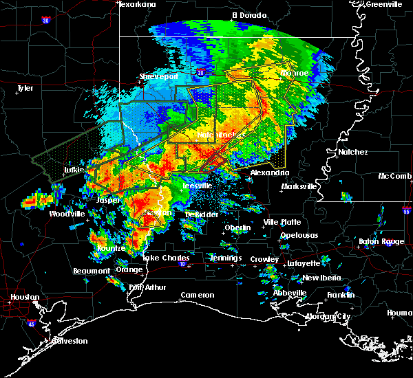 At 210 am cdt, a severe thunderstorm was located near bon weir, moving northeast at 30 mph (radar indicated). Hazards include quarter size hail. Damage to vehicles is expected. Locations impacted include, bon weir. At 210 am cdt, a severe thunderstorm was located near bon weir, moving northeast at 30 mph (radar indicated). Hazards include quarter size hail. Damage to vehicles is expected. Locations impacted include, bon weir.
|
| 5/19/2019 2:02 AM CDT |
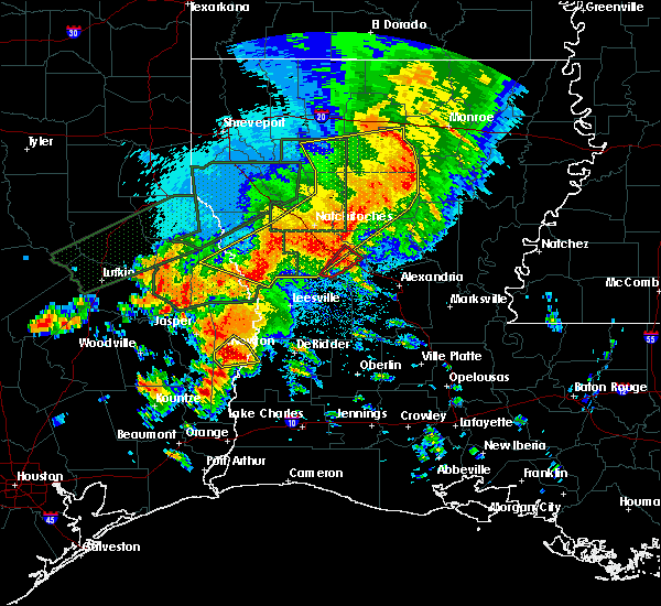 At 202 am cdt, a severe thunderstorm was located 7 miles west of bon weir, moving northeast at 30 mph (radar indicated). Hazards include ping pong ball size hail. People and animals outdoors will be injured. expect damage to roofs, siding, windows, and vehicles. Locations impacted include, newton, bon weir and bleakwood. At 202 am cdt, a severe thunderstorm was located 7 miles west of bon weir, moving northeast at 30 mph (radar indicated). Hazards include ping pong ball size hail. People and animals outdoors will be injured. expect damage to roofs, siding, windows, and vehicles. Locations impacted include, newton, bon weir and bleakwood.
|
| 5/19/2019 1:53 AM CDT |
 At 153 am cdt, a severe thunderstorm was located near kirbyville, moving northeast at 30 mph (radar indicated). Hazards include ping pong ball size hail. People and animals outdoors will be injured. expect damage to roofs, siding, windows, and vehicles. Locations impacted include, newton, kirbyville, call, bon weir, trout creek, bivens and bleakwood. At 153 am cdt, a severe thunderstorm was located near kirbyville, moving northeast at 30 mph (radar indicated). Hazards include ping pong ball size hail. People and animals outdoors will be injured. expect damage to roofs, siding, windows, and vehicles. Locations impacted include, newton, kirbyville, call, bon weir, trout creek, bivens and bleakwood.
|
| 5/19/2019 1:53 AM CDT |
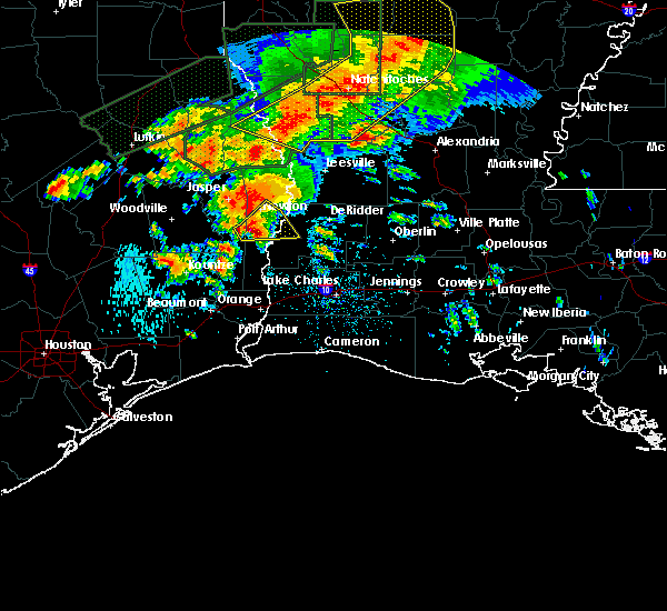 At 153 am cdt, a severe thunderstorm was located near kirbyville, moving northeast at 30 mph (radar indicated). Hazards include ping pong ball size hail. People and animals outdoors will be injured. expect damage to roofs, siding, windows, and vehicles. Locations impacted include, newton, kirbyville, call, bon weir, trout creek, bivens and bleakwood. At 153 am cdt, a severe thunderstorm was located near kirbyville, moving northeast at 30 mph (radar indicated). Hazards include ping pong ball size hail. People and animals outdoors will be injured. expect damage to roofs, siding, windows, and vehicles. Locations impacted include, newton, kirbyville, call, bon weir, trout creek, bivens and bleakwood.
|
| 5/19/2019 1:43 AM CDT |
 At 143 am cdt, a severe thunderstorm was located over kirbyville, moving northeast at 30 mph (radar indicated). Hazards include quarter size hail. damage to vehicles is expected At 143 am cdt, a severe thunderstorm was located over kirbyville, moving northeast at 30 mph (radar indicated). Hazards include quarter size hail. damage to vehicles is expected
|
| 5/9/2019 6:38 PM CDT |
 At 638 pm cdt, a severe thunderstorm was located near mt. union, or 7 miles west of kirbyville, moving northeast at 35 mph (radar indicated). Hazards include 60 mph wind gusts and quarter size hail. Hail damage to vehicles is expected. Expect wind damage to roofs, siding, and trees. At 638 pm cdt, a severe thunderstorm was located near mt. union, or 7 miles west of kirbyville, moving northeast at 35 mph (radar indicated). Hazards include 60 mph wind gusts and quarter size hail. Hail damage to vehicles is expected. Expect wind damage to roofs, siding, and trees.
|
| 4/7/2019 2:56 PM CDT |
 At 256 pm cdt, severe thunderstorms were located along a line extending from near ebenezer to near bon weir, moving northeast at 50 mph (radar indicated). Hazards include 60 mph wind gusts. expect damage to roofs, siding, and trees At 256 pm cdt, severe thunderstorms were located along a line extending from near ebenezer to near bon weir, moving northeast at 50 mph (radar indicated). Hazards include 60 mph wind gusts. expect damage to roofs, siding, and trees
|
| 4/4/2019 5:37 PM CDT |
 At 537 pm cdt, a severe thunderstorm was located near bon weir, moving east at 25 mph (radar indicated). Hazards include 60 mph wind gusts and quarter size hail. Hail damage to vehicles is expected. expect wind damage to roofs, siding, and trees. Locations impacted include, merryville, bon weir, deridder and junction. At 537 pm cdt, a severe thunderstorm was located near bon weir, moving east at 25 mph (radar indicated). Hazards include 60 mph wind gusts and quarter size hail. Hail damage to vehicles is expected. expect wind damage to roofs, siding, and trees. Locations impacted include, merryville, bon weir, deridder and junction.
|
| 4/4/2019 5:29 PM CDT | Quarter sized hail reported 7.3 miles NW of Newton, TX, public submitted a photo to local tv media of quarter size hail on fm 2626. time estimated by radar |
| 4/4/2019 5:15 PM CDT |
 At 514 pm cdt, a severe thunderstorm was located near newton, moving east at 25 mph (radar indicated). Hazards include 60 mph wind gusts and quarter size hail. Hail damage to vehicles is expected. Expect wind damage to roofs, siding, and trees. At 514 pm cdt, a severe thunderstorm was located near newton, moving east at 25 mph (radar indicated). Hazards include 60 mph wind gusts and quarter size hail. Hail damage to vehicles is expected. Expect wind damage to roofs, siding, and trees.
|
| 3/25/2019 12:15 PM CDT | Quarter sized hail reported 9.6 miles SSW of Newton, TX, gas station in burkeville reported quarter size hail. |
| 3/25/2019 12:14 PM CDT |
 At 1213 pm cdt, a severe thunderstorm was located over stringtown, or near burkeville, moving southeast at 25 mph (radar indicated). Hazards include 60 mph wind gusts and quarter size hail. Hail damage to vehicles is expected. expect wind damage to roofs, siding, and trees. Locations impacted include, merryville, burkeville, junction, stringtown, wiergate and evans. At 1213 pm cdt, a severe thunderstorm was located over stringtown, or near burkeville, moving southeast at 25 mph (radar indicated). Hazards include 60 mph wind gusts and quarter size hail. Hail damage to vehicles is expected. expect wind damage to roofs, siding, and trees. Locations impacted include, merryville, burkeville, junction, stringtown, wiergate and evans.
|
| 3/25/2019 12:14 PM CDT |
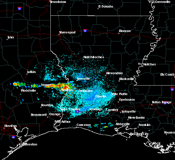 At 1213 pm cdt, a severe thunderstorm was located over stringtown, or near burkeville, moving southeast at 25 mph (radar indicated). Hazards include 60 mph wind gusts and quarter size hail. Hail damage to vehicles is expected. expect wind damage to roofs, siding, and trees. Locations impacted include, merryville, burkeville, junction, stringtown, wiergate and evans. At 1213 pm cdt, a severe thunderstorm was located over stringtown, or near burkeville, moving southeast at 25 mph (radar indicated). Hazards include 60 mph wind gusts and quarter size hail. Hail damage to vehicles is expected. expect wind damage to roofs, siding, and trees. Locations impacted include, merryville, burkeville, junction, stringtown, wiergate and evans.
|
| 3/25/2019 12:00 PM CDT |
 At 1200 pm cdt, a severe thunderstorm was located over burkeville, moving southeast at 25 mph (radar indicated). Hazards include 60 mph wind gusts and quarter size hail. Hail damage to vehicles is expected. Expect wind damage to roofs, siding, and trees. At 1200 pm cdt, a severe thunderstorm was located over burkeville, moving southeast at 25 mph (radar indicated). Hazards include 60 mph wind gusts and quarter size hail. Hail damage to vehicles is expected. Expect wind damage to roofs, siding, and trees.
|
| 3/25/2019 12:00 PM CDT |
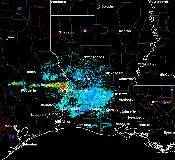 At 1200 pm cdt, a severe thunderstorm was located over burkeville, moving southeast at 25 mph (radar indicated). Hazards include 60 mph wind gusts and quarter size hail. Hail damage to vehicles is expected. Expect wind damage to roofs, siding, and trees. At 1200 pm cdt, a severe thunderstorm was located over burkeville, moving southeast at 25 mph (radar indicated). Hazards include 60 mph wind gusts and quarter size hail. Hail damage to vehicles is expected. Expect wind damage to roofs, siding, and trees.
|
| 7/31/2018 4:50 AM CDT |
 At 449 am cdt, a severe thunderstorm was located near stringtown, or near burkeville, moving southeast at 30 mph (radar indicated). Hazards include 60 mph wind gusts. Expect damage to roofs, siding, and trees. Locations impacted include, newton, burkeville, jamestown, mayflower, farrsville and wiergate. At 449 am cdt, a severe thunderstorm was located near stringtown, or near burkeville, moving southeast at 30 mph (radar indicated). Hazards include 60 mph wind gusts. Expect damage to roofs, siding, and trees. Locations impacted include, newton, burkeville, jamestown, mayflower, farrsville and wiergate.
|
| 7/31/2018 4:20 AM CDT |
 At 420 am cdt, a severe thunderstorm was located over harrisburg, or 8 miles northeast of jasper, moving southeast at 30 mph (radar indicated). Hazards include 60 mph wind gusts. expect damage to roofs, siding, and trees At 420 am cdt, a severe thunderstorm was located over harrisburg, or 8 miles northeast of jasper, moving southeast at 30 mph (radar indicated). Hazards include 60 mph wind gusts. expect damage to roofs, siding, and trees
|
| 6/3/2018 6:34 PM CDT |
 At 633 pm cdt, a severe thunderstorm was located near carlyss, or 8 miles southwest of sulphur, and is nearly stationary (radar indicated). Hazards include 60 mph wind gusts and quarter size hail. Hail damage to vehicles is expected. expect wind damage to roofs, siding, and trees. Locations impacted include, jasper, kirbyville, call, buna, jamestown, trout creek, roganville and bleakwood. At 633 pm cdt, a severe thunderstorm was located near carlyss, or 8 miles southwest of sulphur, and is nearly stationary (radar indicated). Hazards include 60 mph wind gusts and quarter size hail. Hail damage to vehicles is expected. expect wind damage to roofs, siding, and trees. Locations impacted include, jasper, kirbyville, call, buna, jamestown, trout creek, roganville and bleakwood.
|
| 6/3/2018 6:01 PM CDT |
 At 601 pm cdt, a severe thunderstorm was located near jasper, moving south at 30 mph (radar indicated). Hazards include 60 mph wind gusts and quarter size hail. Hail damage to vehicles is expected. Expect wind damage to roofs, siding, and trees. At 601 pm cdt, a severe thunderstorm was located near jasper, moving south at 30 mph (radar indicated). Hazards include 60 mph wind gusts and quarter size hail. Hail damage to vehicles is expected. Expect wind damage to roofs, siding, and trees.
|
| 4/7/2018 1:03 AM CDT |
 At 102 am cdt, severe thunderstorms were located along a line extending from 6 miles east of burkeville to near stringtown to near roganville to near magnolia springs, moving southeast at 40 mph (radar indicated). Hazards include 60 mph wind gusts and quarter size hail. Hail damage to vehicles is expected. Expect wind damage to roofs, siding, and trees. At 102 am cdt, severe thunderstorms were located along a line extending from 6 miles east of burkeville to near stringtown to near roganville to near magnolia springs, moving southeast at 40 mph (radar indicated). Hazards include 60 mph wind gusts and quarter size hail. Hail damage to vehicles is expected. Expect wind damage to roofs, siding, and trees.
|
| 4/7/2018 12:42 AM CDT |
 At 1241 am cdt, severe thunderstorms were located along a line extending from near harrisburg to 6 miles north of town bluff, moving southeast at 30 mph (radar indicated). Hazards include 60 mph wind gusts and quarter size hail. Hail damage to vehicles is expected. Expect wind damage to roofs, siding, and trees. At 1241 am cdt, severe thunderstorms were located along a line extending from near harrisburg to 6 miles north of town bluff, moving southeast at 30 mph (radar indicated). Hazards include 60 mph wind gusts and quarter size hail. Hail damage to vehicles is expected. Expect wind damage to roofs, siding, and trees.
|
| 4/6/2018 11:47 PM CDT |
 At 1147 pm cdt, severe thunderstorms were located along a line extending from 12 miles east of milam to 6 miles west of pineland to 6 miles southeast of huntington, moving southeast at 25 mph (radar indicated). Hazards include 60 mph wind gusts and quarter size hail. Hail damage to vehicles is expected. Expect wind damage to roofs, siding, and trees. At 1147 pm cdt, severe thunderstorms were located along a line extending from 12 miles east of milam to 6 miles west of pineland to 6 miles southeast of huntington, moving southeast at 25 mph (radar indicated). Hazards include 60 mph wind gusts and quarter size hail. Hail damage to vehicles is expected. Expect wind damage to roofs, siding, and trees.
|
| 4/3/2018 8:57 PM CDT |
 At 854 pm cdt, a severe thunderstorm was located over burr ferry, or near toledo bend dam, and near leesville, moving east at 40 mph. vernon parish s.o. reported golfball size hail near leesville (law enforcement). Hazards include golf ball size hail and 60 mph wind gusts. People and animals outdoors will be injured. expect hail damage to roofs, siding, windows, and vehicles. expect wind damage to roofs, siding, and trees. Locations impacted include, leesville, rosepine, anacoco, toledo bend dam, fort polk, slagle, burkeville, deridder, new llano, burr ferry, stringtown, wiergate, evans and pickering. At 854 pm cdt, a severe thunderstorm was located over burr ferry, or near toledo bend dam, and near leesville, moving east at 40 mph. vernon parish s.o. reported golfball size hail near leesville (law enforcement). Hazards include golf ball size hail and 60 mph wind gusts. People and animals outdoors will be injured. expect hail damage to roofs, siding, windows, and vehicles. expect wind damage to roofs, siding, and trees. Locations impacted include, leesville, rosepine, anacoco, toledo bend dam, fort polk, slagle, burkeville, deridder, new llano, burr ferry, stringtown, wiergate, evans and pickering.
|
| 4/3/2018 8:53 PM CDT | Quarter sized hail reported 11.4 miles SSW of Newton, TX, public reported quarter sized hail in burkeville. time estimated from radar. |
| 4/3/2018 8:53 PM CDT |
 At 852 pm cdt, a severe thunderstorm was located near burr ferry, or near toledo bend dam, moving east at 40 mph (radar indicated). Hazards include 60 mph wind gusts. expect damage to roofs, siding, and trees At 852 pm cdt, a severe thunderstorm was located near burr ferry, or near toledo bend dam, moving east at 40 mph (radar indicated). Hazards include 60 mph wind gusts. expect damage to roofs, siding, and trees
|
| 3/18/2018 10:17 PM CDT |
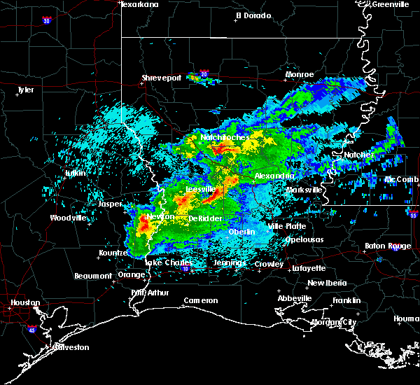 At 1016 pm cdt, severe thunderstorms were located along a line extending from near newton to near bon weir to bancroft, moving east at 55 mph (radar indicated). Hazards include 70 mph wind gusts. Expect considerable tree damage. damage is likely to mobile homes, roofs, and outbuildings. Locations impacted include, newton, merryville, bon weir, junction, stringtown and bleakwood. At 1016 pm cdt, severe thunderstorms were located along a line extending from near newton to near bon weir to bancroft, moving east at 55 mph (radar indicated). Hazards include 70 mph wind gusts. Expect considerable tree damage. damage is likely to mobile homes, roofs, and outbuildings. Locations impacted include, newton, merryville, bon weir, junction, stringtown and bleakwood.
|
| 3/18/2018 10:04 PM CDT |
 At 1003 pm cdt, severe thunderstorms were located along a line extending from near roganville to near kirbyville to near call, moving east at 55 mph (radar indicated). Hazards include 70 mph wind gusts. Expect considerable tree damage. damage is likely to mobile homes, roofs, and outbuildings. Locations impacted include, newton, kirbyville, merryville, singer, call, bon weir, deridder, trout creek, bivens, magnolia springs, roganville, junction, stringtown, bancroft and bleakwood. At 1003 pm cdt, severe thunderstorms were located along a line extending from near roganville to near kirbyville to near call, moving east at 55 mph (radar indicated). Hazards include 70 mph wind gusts. Expect considerable tree damage. damage is likely to mobile homes, roofs, and outbuildings. Locations impacted include, newton, kirbyville, merryville, singer, call, bon weir, deridder, trout creek, bivens, magnolia springs, roganville, junction, stringtown, bancroft and bleakwood.
|
| 3/18/2018 9:56 PM CDT |
 At 955 pm cdt, severe thunderstorms were located along a line extending from near magnolia springs to near kirbyville to 6 miles southwest of call, moving east at 55 mph (radar indicated). Hazards include 70 mph wind gusts. Expect considerable tree damage. damage is likely to mobile homes, roofs, and outbuildings. locations impacted include, newton, kirbyville, merryville, singer, call, town bluff, bon weir, deridder, trout creek, bivens, magnolia springs, mt. Union, spurger, roganville, junction, stringtown, bancroft and bleakwood. At 955 pm cdt, severe thunderstorms were located along a line extending from near magnolia springs to near kirbyville to 6 miles southwest of call, moving east at 55 mph (radar indicated). Hazards include 70 mph wind gusts. Expect considerable tree damage. damage is likely to mobile homes, roofs, and outbuildings. locations impacted include, newton, kirbyville, merryville, singer, call, town bluff, bon weir, deridder, trout creek, bivens, magnolia springs, mt. Union, spurger, roganville, junction, stringtown, bancroft and bleakwood.
|
| 3/18/2018 9:45 PM CDT |
 At 944 pm cdt, severe thunderstorms were located along a line extending from near town bluff to 6 miles southwest of mt. union to near caney head, moving east at 50 mph (radar indicated). Hazards include 70 mph wind gusts. Expect considerable tree damage. Damage is likely to mobile homes, roofs, and outbuildings. At 944 pm cdt, severe thunderstorms were located along a line extending from near town bluff to 6 miles southwest of mt. union to near caney head, moving east at 50 mph (radar indicated). Hazards include 70 mph wind gusts. Expect considerable tree damage. Damage is likely to mobile homes, roofs, and outbuildings.
|
| 8/26/2017 4:30 PM CDT |
 At 430 pm cdt, a severe thunderstorm capable of producing a tornado was located over bivens, or 7 miles south of bon weir, moving northwest at 30 mph (radar indicated rotation). Hazards include tornado. Flying debris will be dangerous to those caught without shelter. mobile homes will be damaged or destroyed. damage to roofs, windows, and vehicles will occur. tree damage is likely. this dangerous storm will be near, bon weir around 445 pm cdt. newton around 500 pm cdt. Other locations impacted by this tornadic thunderstorm include bleakwood. At 430 pm cdt, a severe thunderstorm capable of producing a tornado was located over bivens, or 7 miles south of bon weir, moving northwest at 30 mph (radar indicated rotation). Hazards include tornado. Flying debris will be dangerous to those caught without shelter. mobile homes will be damaged or destroyed. damage to roofs, windows, and vehicles will occur. tree damage is likely. this dangerous storm will be near, bon weir around 445 pm cdt. newton around 500 pm cdt. Other locations impacted by this tornadic thunderstorm include bleakwood.
|
| 5/28/2017 7:46 PM CDT |
 At 746 pm cdt, severe thunderstorms were located along a line extending from 10 miles south of natchitoches to near burr ferry to near browndell, moving southeast at 40 mph (radar indicated). Hazards include 60 mph wind gusts and nickel size hail. Expect damage to roofs, siding, and trees. Locations impacted include, leesville, newton, rosepine, boyce, anacoco, fort polk, de ridder, sugartown, slagle, toledo bend dam, hineston, lena, pitkin, burkeville, deridder, new llano, colfax, hornbeck, hutton and flatwoods. At 746 pm cdt, severe thunderstorms were located along a line extending from 10 miles south of natchitoches to near burr ferry to near browndell, moving southeast at 40 mph (radar indicated). Hazards include 60 mph wind gusts and nickel size hail. Expect damage to roofs, siding, and trees. Locations impacted include, leesville, newton, rosepine, boyce, anacoco, fort polk, de ridder, sugartown, slagle, toledo bend dam, hineston, lena, pitkin, burkeville, deridder, new llano, colfax, hornbeck, hutton and flatwoods.
|
| 5/28/2017 7:19 PM CDT |
 At 715 pm cdt, severe thunderstorms were located along a line extending from 15 miles west of natchitoches to 7 miles southeast of hemphill to 10 miles southeast of etoile, moving southeast at 45 mph (radar indicated). Hazards include 60 mph wind gusts and nickel size hail. expect damage to roofs, siding, and trees At 715 pm cdt, severe thunderstorms were located along a line extending from 15 miles west of natchitoches to 7 miles southeast of hemphill to 10 miles southeast of etoile, moving southeast at 45 mph (radar indicated). Hazards include 60 mph wind gusts and nickel size hail. expect damage to roofs, siding, and trees
|
| 5/20/2017 5:05 PM CDT |
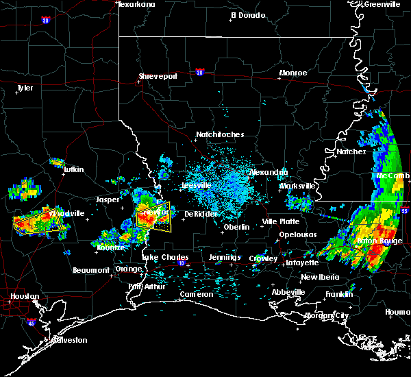 At 504 pm cdt, a severe thunderstorm was located over bon weir, moving east at 30 mph (radar indicated). Hazards include 60 mph wind gusts and quarter size hail. Hail damage to vehicles is expected. expect wind damage to roofs, siding, and trees. Locations impacted include, newton, merryville, singer, bon weir, junction and stringtown. At 504 pm cdt, a severe thunderstorm was located over bon weir, moving east at 30 mph (radar indicated). Hazards include 60 mph wind gusts and quarter size hail. Hail damage to vehicles is expected. expect wind damage to roofs, siding, and trees. Locations impacted include, newton, merryville, singer, bon weir, junction and stringtown.
|
| 5/20/2017 4:40 PM CDT |
 At 439 pm cdt, a severe thunderstorm was located near roganville, or near newton, moving east at 20 mph (radar indicated). Hazards include 60 mph wind gusts and quarter size hail. Hail damage to vehicles is expected. Expect wind damage to roofs, siding, and trees. At 439 pm cdt, a severe thunderstorm was located near roganville, or near newton, moving east at 20 mph (radar indicated). Hazards include 60 mph wind gusts and quarter size hail. Hail damage to vehicles is expected. Expect wind damage to roofs, siding, and trees.
|
| 5/3/2017 6:21 PM CDT |
 At 620 pm cdt, severe thunderstorms were located along a line extending from 6 miles southwest of hornbeck to near chester, moving southeast at 40 mph (radar indicated). Hazards include 60 mph wind gusts and quarter size hail. Hail damage to vehicles is expected. Expect wind damage to roofs, siding, and trees. At 620 pm cdt, severe thunderstorms were located along a line extending from 6 miles southwest of hornbeck to near chester, moving southeast at 40 mph (radar indicated). Hazards include 60 mph wind gusts and quarter size hail. Hail damage to vehicles is expected. Expect wind damage to roofs, siding, and trees.
|
| 4/26/2017 6:54 PM CDT |
 At 653 pm cdt, severe thunderstorms were located along a line extending from near junction to buna, moving east at 50 mph (radar indicated). Hazards include 60 mph wind gusts and quarter size hail. Hail damage to vehicles is expected. Expect wind damage to roofs, siding, and trees. At 653 pm cdt, severe thunderstorms were located along a line extending from near junction to buna, moving east at 50 mph (radar indicated). Hazards include 60 mph wind gusts and quarter size hail. Hail damage to vehicles is expected. Expect wind damage to roofs, siding, and trees.
|
| 4/26/2017 6:38 PM CDT |
 At 638 pm cdt, severe thunderstorms were located along a line extending from leesville to 6 miles north of trout creek, moving east at 45 mph (radar indicated). Hazards include 60 mph wind gusts and quarter size hail. Hail damage to vehicles is expected. expect wind damage to roofs, siding, and trees. locations impacted include, leesville, newton, kirbyville, anacoco, call, bon weir, slagle, burkeville, fort polk, new llano, hornbeck, trout creek, hutton, burr ferry, kurthwood, stringtown, roganville, bleakwood, wiergate and evans. A tornado watch remains in effect until 1100 pm cdt for central, southwestern and west central louisiana, and southeastern texas. At 638 pm cdt, severe thunderstorms were located along a line extending from leesville to 6 miles north of trout creek, moving east at 45 mph (radar indicated). Hazards include 60 mph wind gusts and quarter size hail. Hail damage to vehicles is expected. expect wind damage to roofs, siding, and trees. locations impacted include, leesville, newton, kirbyville, anacoco, call, bon weir, slagle, burkeville, fort polk, new llano, hornbeck, trout creek, hutton, burr ferry, kurthwood, stringtown, roganville, bleakwood, wiergate and evans. A tornado watch remains in effect until 1100 pm cdt for central, southwestern and west central louisiana, and southeastern texas.
|
| 4/26/2017 6:22 PM CDT |
 At 621 pm cdt, severe thunderstorms were located along a line extending from near burr ferry to near mt. union, moving east at 45 mph (radar indicated). Hazards include 60 mph wind gusts and quarter size hail. Hail damage to vehicles is expected. expect wind damage to roofs, siding, and trees. locations impacted include, leesville, newton, kirbyville, anacoco, slagle, toledo bend dam, call, bon weir, burkeville, fort polk, new llano, hornbeck, trout creek, hutton, mayflower, kurthwood, stringtown, farrsville, magnolia springs and burr ferry. A tornado watch remains in effect until 1100 pm cdt for central, southwestern and west central louisiana, and southeastern texas. At 621 pm cdt, severe thunderstorms were located along a line extending from near burr ferry to near mt. union, moving east at 45 mph (radar indicated). Hazards include 60 mph wind gusts and quarter size hail. Hail damage to vehicles is expected. expect wind damage to roofs, siding, and trees. locations impacted include, leesville, newton, kirbyville, anacoco, slagle, toledo bend dam, call, bon weir, burkeville, fort polk, new llano, hornbeck, trout creek, hutton, mayflower, kurthwood, stringtown, farrsville, magnolia springs and burr ferry. A tornado watch remains in effect until 1100 pm cdt for central, southwestern and west central louisiana, and southeastern texas.
|
| 4/26/2017 5:57 PM CDT |
 The national weather service in lake charles has issued a * severe thunderstorm warning for. western vernon parish in west central louisiana. southeastern tyler county in southeastern texas. newton county in southeastern texas. Northeastern jasper county in southeastern texas. The national weather service in lake charles has issued a * severe thunderstorm warning for. western vernon parish in west central louisiana. southeastern tyler county in southeastern texas. newton county in southeastern texas. Northeastern jasper county in southeastern texas.
|
| 4/2/2017 3:17 PM CDT |
 At 316 pm cdt, severe thunderstorms were located along a line extending from near hornbeck to near newton, moving northeast at 25 mph (radar indicated). Hazards include 60 mph wind gusts and nickel size hail. Expect damage to roofs, siding, and trees. locations impacted include, anacoco, toledo bend dam, burkeville, hornbeck, burr ferry, stringtown and evans. A tornado watch remains in effect until 900 pm cdt for southwestern and west central louisiana, and southeastern texas. At 316 pm cdt, severe thunderstorms were located along a line extending from near hornbeck to near newton, moving northeast at 25 mph (radar indicated). Hazards include 60 mph wind gusts and nickel size hail. Expect damage to roofs, siding, and trees. locations impacted include, anacoco, toledo bend dam, burkeville, hornbeck, burr ferry, stringtown and evans. A tornado watch remains in effect until 900 pm cdt for southwestern and west central louisiana, and southeastern texas.
|
| 4/2/2017 3:03 PM CDT |
 At 302 pm cdt, severe thunderstorms were located along a line extending from toledo bend dam to near kirbyville, moving east at 30 mph (radar indicated). Hazards include 70 mph wind gusts and nickel size hail. Expect considerable tree damage. damage is likely to mobile homes, roofs, and outbuildings. locations impacted include, newton, anacoco, toledo bend dam, bon weir, burkeville, hornbeck, farrsville, burr ferry, mayflower, jamestown, stringtown, wiergate and evans. A tornado watch remains in effect until 900 pm cdt for southwestern and west central louisiana, and southeastern texas. At 302 pm cdt, severe thunderstorms were located along a line extending from toledo bend dam to near kirbyville, moving east at 30 mph (radar indicated). Hazards include 70 mph wind gusts and nickel size hail. Expect considerable tree damage. damage is likely to mobile homes, roofs, and outbuildings. locations impacted include, newton, anacoco, toledo bend dam, bon weir, burkeville, hornbeck, farrsville, burr ferry, mayflower, jamestown, stringtown, wiergate and evans. A tornado watch remains in effect until 900 pm cdt for southwestern and west central louisiana, and southeastern texas.
|
| 4/2/2017 2:42 PM CDT |
 At 242 pm cdt, severe thunderstorms were located along a line extending from 6 miles west of toledo bend dam to near fred, moving east at 20 mph (radar indicated). Hazards include 70 mph wind gusts and quarter size hail. Hail damage to vehicles is expected. expect considerable tree damage. Wind damage is also likely to mobile homes, roofs, and outbuildings. At 242 pm cdt, severe thunderstorms were located along a line extending from 6 miles west of toledo bend dam to near fred, moving east at 20 mph (radar indicated). Hazards include 70 mph wind gusts and quarter size hail. Hail damage to vehicles is expected. expect considerable tree damage. Wind damage is also likely to mobile homes, roofs, and outbuildings.
|
| 3/29/2017 4:13 PM CDT |
 At 413 pm cdt, a severe thunderstorm capable of producing a tornado was located near roganville, or near jasper, moving northeast at 30 mph (radar indicated rotation). Hazards include tornado and ping pong ball size hail. Flying debris will be dangerous to those caught without shelter. mobile homes will be damaged or destroyed. damage to roofs, windows, and vehicles will occur. tree damage is likely. Locations impacted include, jasper, magnolia springs, harrisburg, jamestown and roganville. At 413 pm cdt, a severe thunderstorm capable of producing a tornado was located near roganville, or near jasper, moving northeast at 30 mph (radar indicated rotation). Hazards include tornado and ping pong ball size hail. Flying debris will be dangerous to those caught without shelter. mobile homes will be damaged or destroyed. damage to roofs, windows, and vehicles will occur. tree damage is likely. Locations impacted include, jasper, magnolia springs, harrisburg, jamestown and roganville.
|
| 3/29/2017 3:54 PM CDT |
 At 353 pm cdt, a severe thunderstorm capable of producing a tornado was located near town bluff, moving northeast at 30 mph (radar indicated rotation). Hazards include tornado and ping pong ball size hail. Flying debris will be dangerous to those caught without shelter. mobile homes will be damaged or destroyed. damage to roofs, windows, and vehicles will occur. Tree damage is likely. At 353 pm cdt, a severe thunderstorm capable of producing a tornado was located near town bluff, moving northeast at 30 mph (radar indicated rotation). Hazards include tornado and ping pong ball size hail. Flying debris will be dangerous to those caught without shelter. mobile homes will be damaged or destroyed. damage to roofs, windows, and vehicles will occur. Tree damage is likely.
|
| 3/25/2017 12:13 AM CDT |
 At 1212 am cdt, severe thunderstorms were located along a line extending from near toledo bend dam to near roganville, moving east at 45 mph (radar indicated). Hazards include 60 mph wind gusts. expect damage to roofs, siding, and trees At 1212 am cdt, severe thunderstorms were located along a line extending from near toledo bend dam to near roganville, moving east at 45 mph (radar indicated). Hazards include 60 mph wind gusts. expect damage to roofs, siding, and trees
|
| 3/24/2017 11:45 PM CDT |
 At 1145 pm cdt, severe thunderstorms were located along a line extending from near browndell to near magnolia springs, moving northeast at 50 mph (radar indicated). Hazards include 60 mph wind gusts. Expect damage to roofs, siding, and trees. locations impacted include, jasper, newton, toledo bend dam, ebenezer, town bluff, bon weir, burkeville, browndell, farrsville, magnolia springs, mayflower, mt. union, spurger, jamestown, roganville, harrisburg, stringtown, sam rayburn dam and wiergate. A tornado watch remains in effect until 400 am cdt for west central louisiana, and southeastern texas. At 1145 pm cdt, severe thunderstorms were located along a line extending from near browndell to near magnolia springs, moving northeast at 50 mph (radar indicated). Hazards include 60 mph wind gusts. Expect damage to roofs, siding, and trees. locations impacted include, jasper, newton, toledo bend dam, ebenezer, town bluff, bon weir, burkeville, browndell, farrsville, magnolia springs, mayflower, mt. union, spurger, jamestown, roganville, harrisburg, stringtown, sam rayburn dam and wiergate. A tornado watch remains in effect until 400 am cdt for west central louisiana, and southeastern texas.
|
| 3/24/2017 11:21 PM CDT |
 At 1120 pm cdt, severe thunderstorms were located along a line extending from 6 miles southwest of ebenezer to near warren, moving northeast at 45 mph (radar indicated). Hazards include 60 mph wind gusts. expect damage to roofs, siding, and trees At 1120 pm cdt, severe thunderstorms were located along a line extending from 6 miles southwest of ebenezer to near warren, moving northeast at 45 mph (radar indicated). Hazards include 60 mph wind gusts. expect damage to roofs, siding, and trees
|
| 1/18/2017 1:40 PM CST | Newton county emergency manager relayed reports of trees down along fm 2991 in newton county TX, 12.7 miles SW of Newton, TX |
| 1/2/2017 9:07 AM CST |
 At 906 am cst, severe thunderstorms were located along a line extending from near jasper to 7 miles southwest of kountze, moving east at 40 mph (radar indicated). Hazards include 70 mph wind gusts and nickel size hail. Expect considerable tree damage. Damage is likely to mobile homes, roofs, and outbuildings. At 906 am cst, severe thunderstorms were located along a line extending from near jasper to 7 miles southwest of kountze, moving east at 40 mph (radar indicated). Hazards include 70 mph wind gusts and nickel size hail. Expect considerable tree damage. Damage is likely to mobile homes, roofs, and outbuildings.
|
| 11/29/2016 5:53 PM CST |
 At 552 pm cst, severe thunderstorms were located along a line extending from near jamestown to newton to near roganville, moving east at 40 mph (radar indicated). Hazards include 60 mph wind gusts and nickel size hail. Expect damage to roofs. siding. And trees. At 552 pm cst, severe thunderstorms were located along a line extending from near jamestown to newton to near roganville, moving east at 40 mph (radar indicated). Hazards include 60 mph wind gusts and nickel size hail. Expect damage to roofs. siding. And trees.
|
| 6/18/2016 2:39 PM CDT |
 At 238 pm cdt, a severe thunderstorm was located near stringtown, or near burkeville, moving southwest at 15 mph (radar indicated). Hazards include 60 mph wind gusts. Expect damage to roofs. siding. And trees. At 238 pm cdt, a severe thunderstorm was located near stringtown, or near burkeville, moving southwest at 15 mph (radar indicated). Hazards include 60 mph wind gusts. Expect damage to roofs. siding. And trees.
|
| 5/27/2016 4:04 PM CDT |
 At 403 pm cdt, severe thunderstorms were located along a line extending from near burkeville to near devers, moving southeast at 15 mph (radar indicated). Hazards include 60 mph wind gusts and nickel size hail. Expect damage to roofs. siding. and trees. Locations impacted include, beaumont, lumberton, vidor, jasper, silsbee, newton, kirbyville, kountze, sour lake, thicket, fred, saratoga, bon weir, buna, burkeville, evadale, call, bevil oaks, china and rose city. At 403 pm cdt, severe thunderstorms were located along a line extending from near burkeville to near devers, moving southeast at 15 mph (radar indicated). Hazards include 60 mph wind gusts and nickel size hail. Expect damage to roofs. siding. and trees. Locations impacted include, beaumont, lumberton, vidor, jasper, silsbee, newton, kirbyville, kountze, sour lake, thicket, fred, saratoga, bon weir, buna, burkeville, evadale, call, bevil oaks, china and rose city.
|
| 5/27/2016 3:23 PM CDT |
 At 323 pm cdt, severe thunderstorms were located along a line extending from near mayflower to near daisetta, moving southeast at 15 mph (radar indicated). Hazards include 60 mph wind gusts. Expect damage to roofs. siding. And trees. At 323 pm cdt, severe thunderstorms were located along a line extending from near mayflower to near daisetta, moving southeast at 15 mph (radar indicated). Hazards include 60 mph wind gusts. Expect damage to roofs. siding. And trees.
|
| 4/30/2016 6:44 AM CDT |
 At 643 am cdt, severe thunderstorms were located along a line extending from newton to near bancroft to near gist, moving east at 40 mph (radar indicated). Hazards include 60 mph wind gusts and quarter size hail. Hail damage to vehicles is expected. Expect wind damage to roofs, siding, and trees. At 643 am cdt, severe thunderstorms were located along a line extending from newton to near bancroft to near gist, moving east at 40 mph (radar indicated). Hazards include 60 mph wind gusts and quarter size hail. Hail damage to vehicles is expected. Expect wind damage to roofs, siding, and trees.
|
| 4/27/2016 6:47 AM CDT |
 At 646 am cdt, severe thunderstorms were located along a line extending from 8 miles southeast of pineland to newton to near bancroft to mauriceville to 12 miles east of high island, moving east at 45 mph (radar indicated). Hazards include 60 mph wind gusts and quarter size hail. Hail damage to vehicles is expected. Expect wind damage to roofs, siding, and trees. At 646 am cdt, severe thunderstorms were located along a line extending from 8 miles southeast of pineland to newton to near bancroft to mauriceville to 12 miles east of high island, moving east at 45 mph (radar indicated). Hazards include 60 mph wind gusts and quarter size hail. Hail damage to vehicles is expected. Expect wind damage to roofs, siding, and trees.
|
| 4/27/2016 6:42 AM CDT |
 At 639 am cdt, severe thunderstorms were located along a line extending from hemphill to near jamestown to near kirbyville to 6 miles west of old salem to 6 miles southeast of buna to wrights settlement to near gist to near vidor to 6 miles east of high island, moving east at 45 mph (radar indicated). Hazards include 60 mph wind gusts and penny size hail. Expect damage to roofs. siding. and trees. Locations impacted include, beaumont, port arthur, orange, nederland, groves, port neches, lumberton, vidor, bridge city, jasper, silsbee, west orange, newton, kirbyville, nome, deweyville, fred, bon weir, hamshire and burkeville. At 639 am cdt, severe thunderstorms were located along a line extending from hemphill to near jamestown to near kirbyville to 6 miles west of old salem to 6 miles southeast of buna to wrights settlement to near gist to near vidor to 6 miles east of high island, moving east at 45 mph (radar indicated). Hazards include 60 mph wind gusts and penny size hail. Expect damage to roofs. siding. and trees. Locations impacted include, beaumont, port arthur, orange, nederland, groves, port neches, lumberton, vidor, bridge city, jasper, silsbee, west orange, newton, kirbyville, nome, deweyville, fred, bon weir, hamshire and burkeville.
|
| 4/27/2016 6:15 AM CDT |
 At 614 am cdt, severe thunderstorms were located along a line extending from 6 miles south of macune to 6 miles west of jasper to near spurger to caney head to 7 miles east of kountze to 8 miles northwest of evadale to silsbee to near lumberton to bevil oaks to near winnie to 7 miles southeast of anahuac, moving east at 45 mph (radar indicated). Hazards include 60 mph wind gusts. Expect damage to roofs. siding. And trees. At 614 am cdt, severe thunderstorms were located along a line extending from 6 miles south of macune to 6 miles west of jasper to near spurger to caney head to 7 miles east of kountze to 8 miles northwest of evadale to silsbee to near lumberton to bevil oaks to near winnie to 7 miles southeast of anahuac, moving east at 45 mph (radar indicated). Hazards include 60 mph wind gusts. Expect damage to roofs. siding. And trees.
|
| 3/17/2016 4:28 PM CDT |
 At 427 pm cdt, a severe thunderstorm was located near stringtown, or 7 miles east of burkeville, moving east at 20 mph (radar indicated). Hazards include 60 mph wind gusts and quarter size hail. Hail damage to vehicles is expected. Expect wind damage to roofs, siding and trees. At 427 pm cdt, a severe thunderstorm was located near stringtown, or 7 miles east of burkeville, moving east at 20 mph (radar indicated). Hazards include 60 mph wind gusts and quarter size hail. Hail damage to vehicles is expected. Expect wind damage to roofs, siding and trees.
|
| 1/21/2016 1:05 PM CST | At 105 pm cst, severe thunderstorms were located along a line extending from near burr ferry to near stringtown, moving northeast at 30 mph (radar indicated). Hazards include 60 mph wind gusts and quarter size hail. Hail damage to vehicles is expected. Expect wind damage to roofs, siding and trees. |
| 1/21/2016 1:05 PM CST | At 105 pm cst, severe thunderstorms were located along a line extending from near burr ferry to near stringtown, moving northeast at 30 mph (radar indicated). Hazards include 60 mph wind gusts and quarter size hail. Hail damage to vehicles is expected. Expect wind damage to roofs, siding and trees. |
| 10/31/2015 8:50 AM CDT | Public reports roof blown off storage building as well as trees and utility poles down in newton in newton county TX, 0.7 miles S of Newton, TX |
| 10/31/2015 8:47 AM CDT |
 The national weather service in lake charles has issued a * tornado warning for. northern beauregard parish in southwestern louisiana. northern newton county in southeastern texas. until 915 am cdt * at 847 am cdt. A severe thunderstorm capable of producing a. The national weather service in lake charles has issued a * tornado warning for. northern beauregard parish in southwestern louisiana. northern newton county in southeastern texas. until 915 am cdt * at 847 am cdt. A severe thunderstorm capable of producing a.
|
| 10/31/2015 8:47 AM CDT |
 At 847 am cdt, a severe thunderstorm capable of producing a tornado was located near newton, moving east at 55 mph (radar indicated rotation). Hazards include tornado. Flying debris will be dangerous to those caught without shelter. mobile homes will be damaged or destroyed. damage to roofs, windows and vehicles will occur. tree damage is likely. this dangerous storm will be near, newton around 850 am cdt. Stringtown around 900 am cdt. At 847 am cdt, a severe thunderstorm capable of producing a tornado was located near newton, moving east at 55 mph (radar indicated rotation). Hazards include tornado. Flying debris will be dangerous to those caught without shelter. mobile homes will be damaged or destroyed. damage to roofs, windows and vehicles will occur. tree damage is likely. this dangerous storm will be near, newton around 850 am cdt. Stringtown around 900 am cdt.
|
| 8/24/2015 9:03 PM CDT |
 At 902 pm cdt, doppler radar indicated a severe thunderstorm capable of producing damaging winds in excess of 60 mph. this storm was located over roganville, or 9 miles southeast of jasper, moving south at 25 mph. locations impacted include, jasper, newton, roganville, jamestown, holly springs and bleakwood. At 902 pm cdt, doppler radar indicated a severe thunderstorm capable of producing damaging winds in excess of 60 mph. this storm was located over roganville, or 9 miles southeast of jasper, moving south at 25 mph. locations impacted include, jasper, newton, roganville, jamestown, holly springs and bleakwood.
|
| 8/24/2015 8:37 PM CDT |
 At 836 pm cdt, doppler radar indicated a severe thunderstorm capable of producing quarter size hail and damaging winds in excess of 60 mph. this storm was located near jamestown, or near jasper, and moving southeast at 20 mph. At 836 pm cdt, doppler radar indicated a severe thunderstorm capable of producing quarter size hail and damaging winds in excess of 60 mph. this storm was located near jamestown, or near jasper, and moving southeast at 20 mph.
|
| 5/27/2015 5:44 AM CDT | At 543 am cdt, doppler radar indicated a line of severe thunderstorms capable of producing quarter size hail and damaging winds in excess of 60 mph. these storms were located along a line extending from 8 miles west of rosepine to near singer to evadale, moving southeast at 30 mph. locations impacted include, beaumont, lumberton, silsbee, newton, kirbyville, kountze, sour lake, merryville, saratoga, bon weir, buna, burkeville, evadale, call, toledo bend dam, gist, caney head, old salem, trout creek and junction. |
| 5/27/2015 5:44 AM CDT | At 543 am cdt, doppler radar indicated a line of severe thunderstorms capable of producing quarter size hail and damaging winds in excess of 60 mph. these storms were located along a line extending from 8 miles west of rosepine to near singer to evadale, moving southeast at 30 mph. locations impacted include, beaumont, lumberton, silsbee, newton, kirbyville, kountze, sour lake, merryville, saratoga, bon weir, buna, burkeville, evadale, call, toledo bend dam, gist, caney head, old salem, trout creek and junction. |
| 5/27/2015 4:53 AM CDT | At 453 am cdt, doppler radar indicated a line of severe thunderstorms capable of producing quarter size hail and damaging winds in excess of 60 mph. these storms were located along a line extending from near mayflower to near roganville to wildwood, and moving southeast at 35 mph. |
| 5/27/2015 4:53 AM CDT | At 453 am cdt, doppler radar indicated a line of severe thunderstorms capable of producing quarter size hail and damaging winds in excess of 60 mph. these storms were located along a line extending from near mayflower to near roganville to wildwood, and moving southeast at 35 mph. |
| 5/25/2015 9:39 PM CDT | At 938 pm cdt, doppler radar indicated a line of severe thunderstorms capable of producing quarter size hail and damaging winds in excess of 60 mph. these storms were located along a line extending from toledo bend dam to near bon weir to 6 miles northwest of buna, moving east at 35 mph. locations impacted include, jasper, newton, kirbyville, call, toledo bend dam, bon weir, ebenezer, buna, burkeville, browndell, roganville, harrisburg, mt. union, magnolia springs, stringtown, mayflower, old salem, farrsville, trout creek and wrights settlement. a tornado watch remains in effect until 200 am cdt for southwestern louisiana and southeastern texas. |
| 5/25/2015 9:06 PM CDT | At 906 pm cdt, doppler radar indicated a line of severe thunderstorms capable of producing quarter size hail and damaging winds in excess of 60 mph. these storms were located along a line extending from near browndell to 7 miles west of call, and moving northeast at 35 mph. |
| 4/27/2015 3:04 PM CDT | At 303 pm cdt, doppler radar indicated a severe thunderstorm capable of producing half dollar size hail. this storm was located over newton, moving northeast at 40 mph. locations impacted include, newton, burkeville, stringtown and wiergate. |
| 4/27/2015 3:04 PM CDT | At 303 pm cdt, doppler radar indicated a severe thunderstorm capable of producing half dollar size hail. this storm was located over newton, moving northeast at 40 mph. locations impacted include, newton, burkeville, stringtown and wiergate. |
| 4/27/2015 2:42 PM CDT | At 240 pm cdt, doppler radar indicated a severe thunderstorm capable of producing half dollar size hail. this storm was located near roganville, or near kirbyville, moving northeast at 40 mph. in addition, at 230 pm half dollar size hail was reported 7 miles northwest of kirbyville or near mount union. locations impacted include, newton, kirbyville, burkeville, roganville, jamestown, stringtown, wiergate and bleakwood. |
| 4/27/2015 2:42 PM CDT | At 240 pm cdt, doppler radar indicated a severe thunderstorm capable of producing half dollar size hail. this storm was located near roganville, or near kirbyville, moving northeast at 40 mph. in addition, at 230 pm half dollar size hail was reported 7 miles northwest of kirbyville or near mount union. locations impacted include, newton, kirbyville, burkeville, roganville, jamestown, stringtown, wiergate and bleakwood. |
| 4/27/2015 2:28 PM CDT | At 227 pm cdt, doppler radar indicated a severe thunderstorm capable of producing quarter size hail. this storm was located over mt. union, or 7 miles west of kirbyville, and moving northeast at 40 mph. |
| 4/27/2015 2:28 PM CDT | At 227 pm cdt, doppler radar indicated a severe thunderstorm capable of producing quarter size hail. this storm was located over mt. union, or 7 miles west of kirbyville, and moving northeast at 40 mph. |
| 4/27/2015 6:18 AM CDT | At 617 am cdt, doppler radar indicated a line of severe thunderstorms capable of producing quarter size hail and damaging winds in excess of 60 mph. these storms were located along a line extending from near harrisburg to buna to bevil oaks, moving east at 50 mph. locations impacted include, beaumont, lumberton, jasper, silsbee, newton, kirbyville, deweyville, bon weir, buna, burkeville, evadale, call, toledo bend dam, mauriceville, pine forest, browndell, lakeview, roganville, gist and mayflower. a tornado watch remains in effect until 900 am cdt for southeastern texas. a tornado watch also remains in effect until 100 pm cdt for southwestern louisiana and southeastern texas. |
| 4/27/2015 5:53 AM CDT | At 553 am cdt, doppler radar indicated a line of severe thunderstorms capable of producing quarter size hail and damaging winds in excess of 60 mph. these storms were located along a line extending from ebenezer to near kountze to 6 miles east of daisetta, and moving east at 50 mph. |
| 4/24/2015 11:58 AM CDT | At 1157 am cdt, doppler radar indicated a severe thunderstorm capable of producing quarter size hail and damaging winds in excess of 60 mph. this storm was located over magnolia springs, or 9 miles southeast of town bluff, and moving east at 50 mph. |
| 4/24/2015 11:58 AM CDT | At 1157 am cdt, doppler radar indicated a severe thunderstorm capable of producing quarter size hail and damaging winds in excess of 60 mph. this storm was located over magnolia springs, or 9 miles southeast of town bluff, and moving east at 50 mph. |
| 4/19/2015 8:08 PM CDT | The severe thunderstorm warning for east central jasper and central newton counties will expire at 815 pm cdt, the storm which prompted the warning has weakened below severe limits, and no longer poses an immediate threat to life or property. therefore the warning will be allowed to expire. |
| 4/19/2015 7:43 PM CDT | At 743 pm cdt, doppler radar indicated a severe thunderstorm capable of producing quarter size hail. this storm was located near roganville, or near kirbyville, moving east at 30 mph. locations impacted include, newton, kirbyville, bon weir, roganville and bleakwood. |
| 4/19/2015 7:25 PM CDT | The national weather service in lake charles has issued a * severe thunderstorm warning for. east central jasper county in southeastern texas. central newton county in southeastern texas. until 815 pm cdt * at 725 pm cdt. Doppler radar indicated a severe thunderstorm. |
| 3/28/2014 8:23 PM CDT | Newton county sheriff reports trees down in burkeville and a car blown off the road. time estimated by radar in newton county TX, 0.1 miles WNW of Newton, TX |
| 4/2/2012 11:04 AM CDT | Newton sheriff report trees down in burkeville along farm to market 1415 in newton county TX, 11.4 miles SSW of Newton, TX |
| 4/2/2012 10:45 AM CDT | Newton sheriff report multiple trees down in downtown newton. there are trees down near melody lane and also shady acre in newton county TX, 0.5 miles E of Newton, TX |
| 1/1/0001 12:00 AM | Several trees blown ove in newton county TX, 10.8 miles SSW of Newton, TX |
Hail Maps for Newton, TX


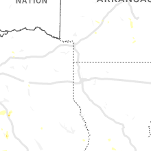


Connect with Interactive Hail Maps