

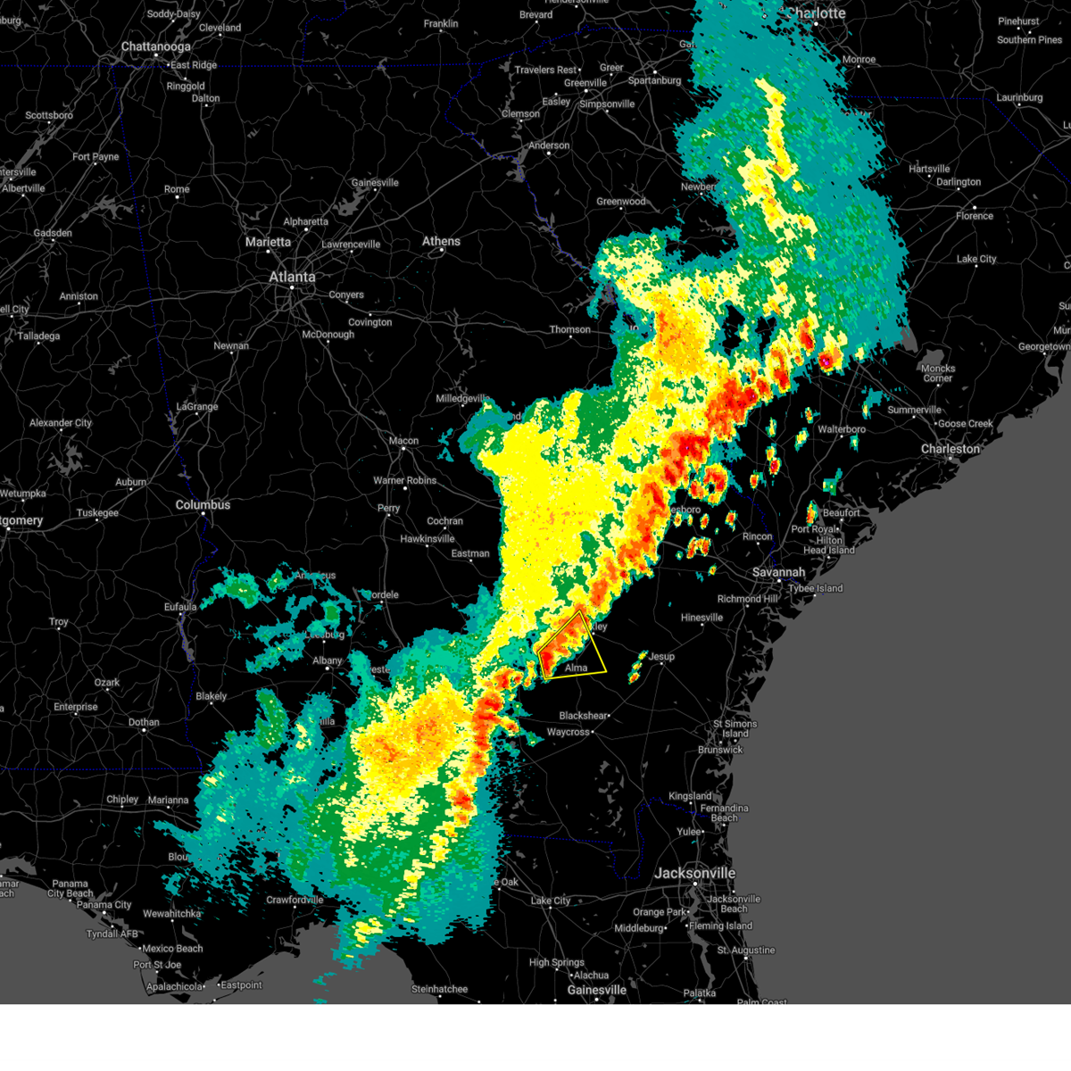
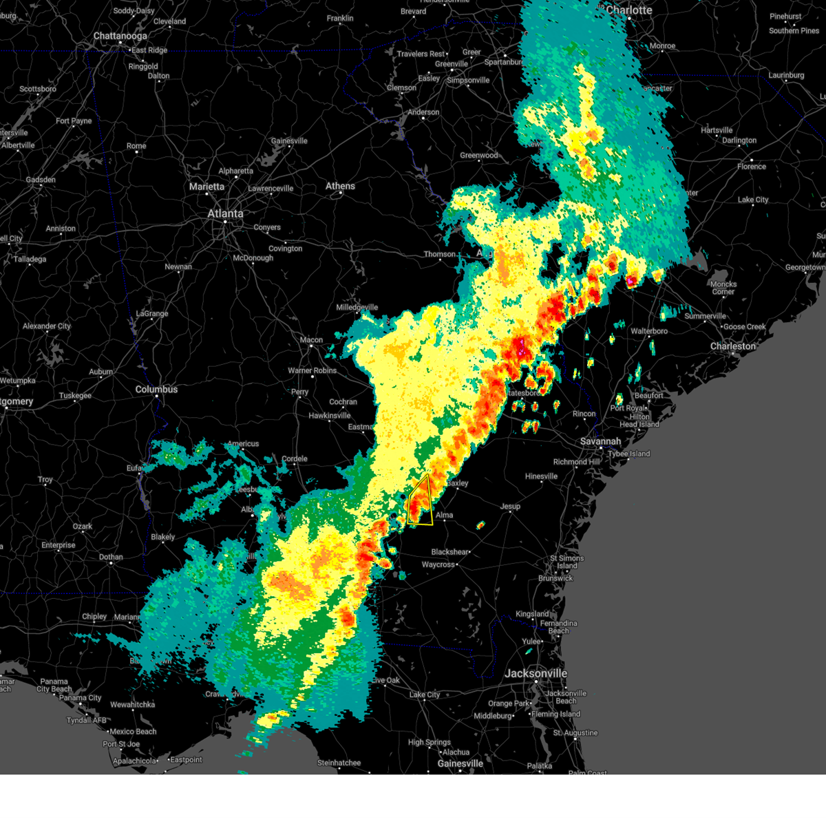
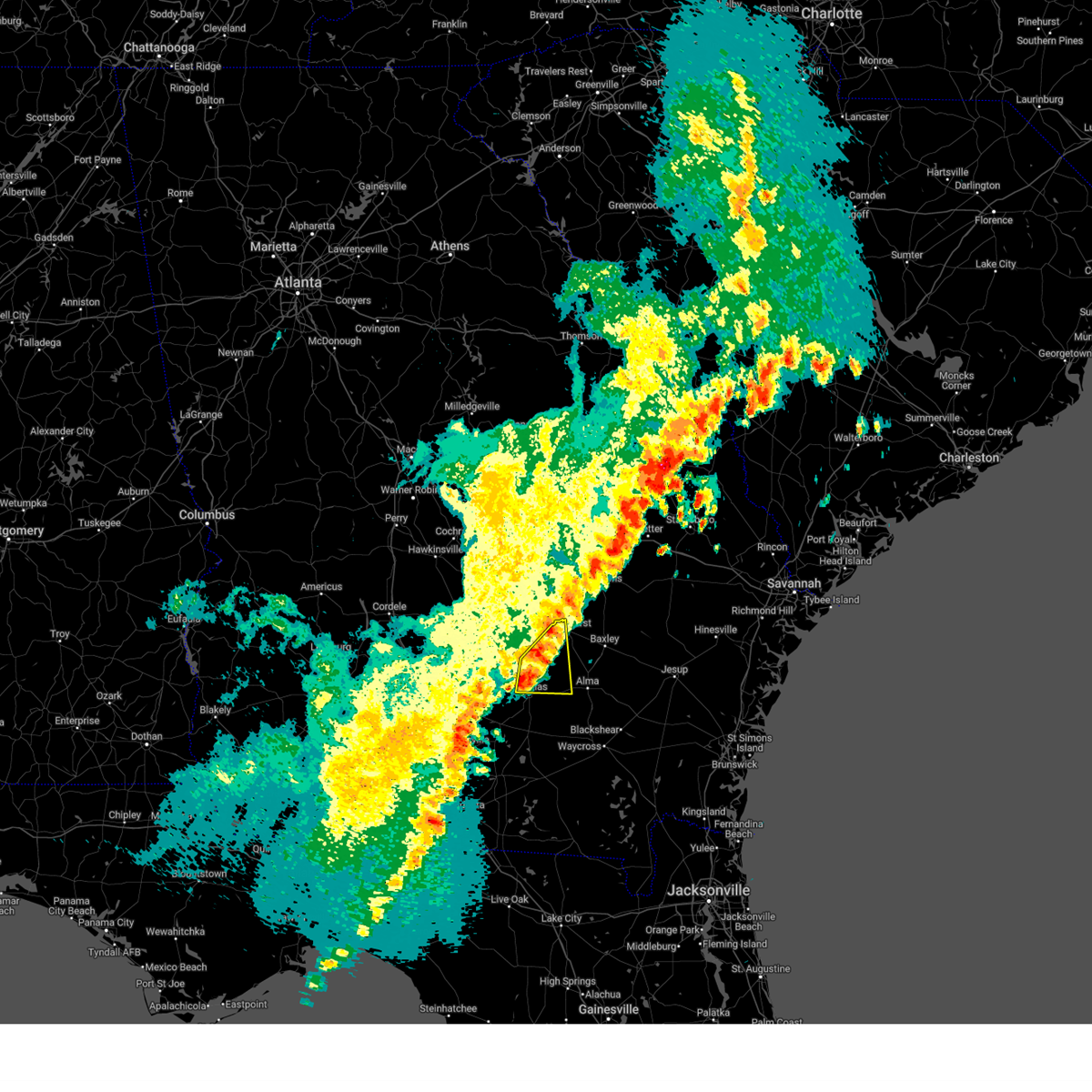
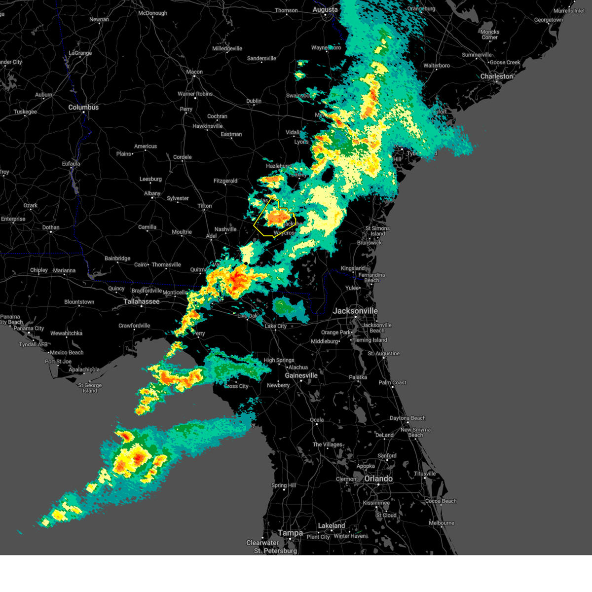
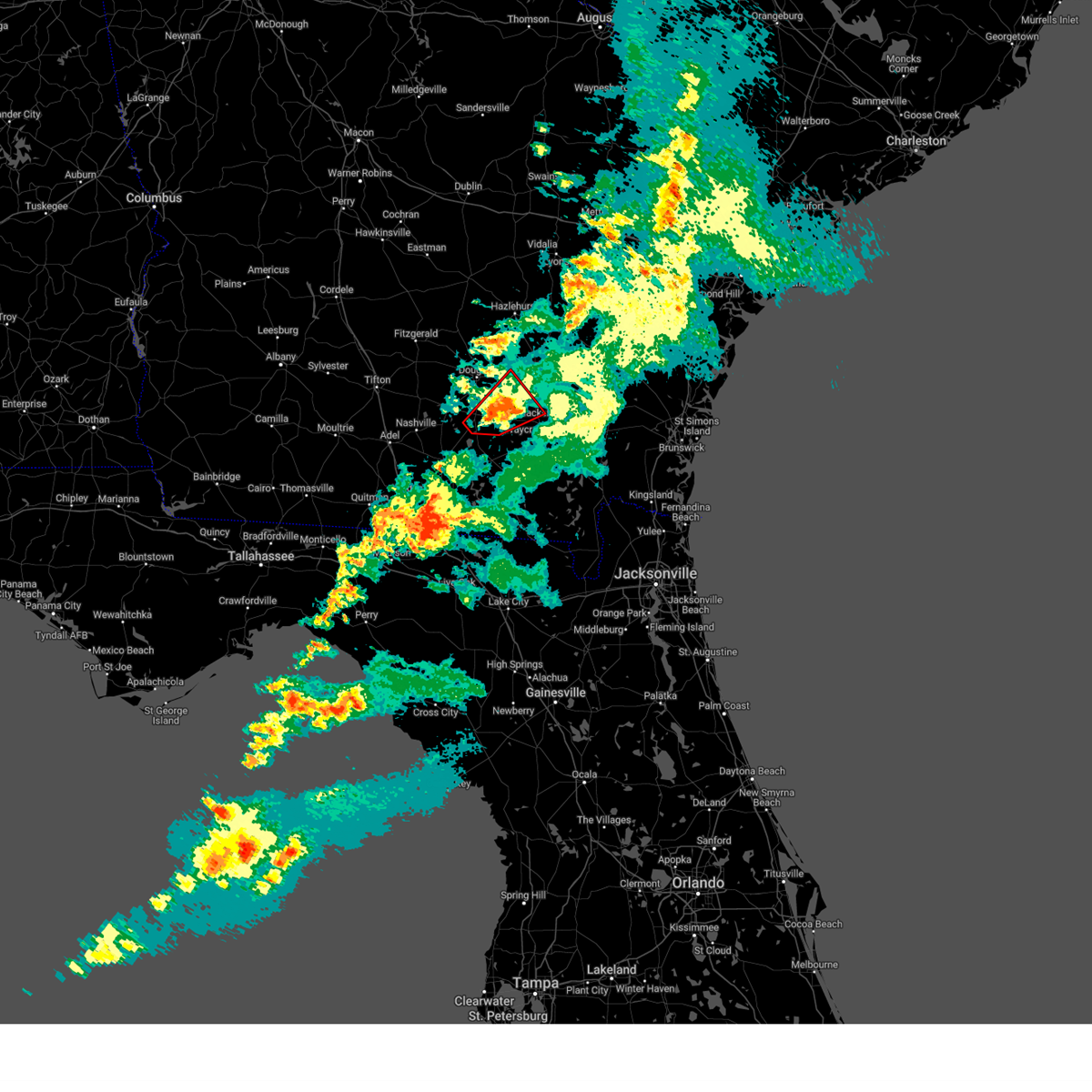
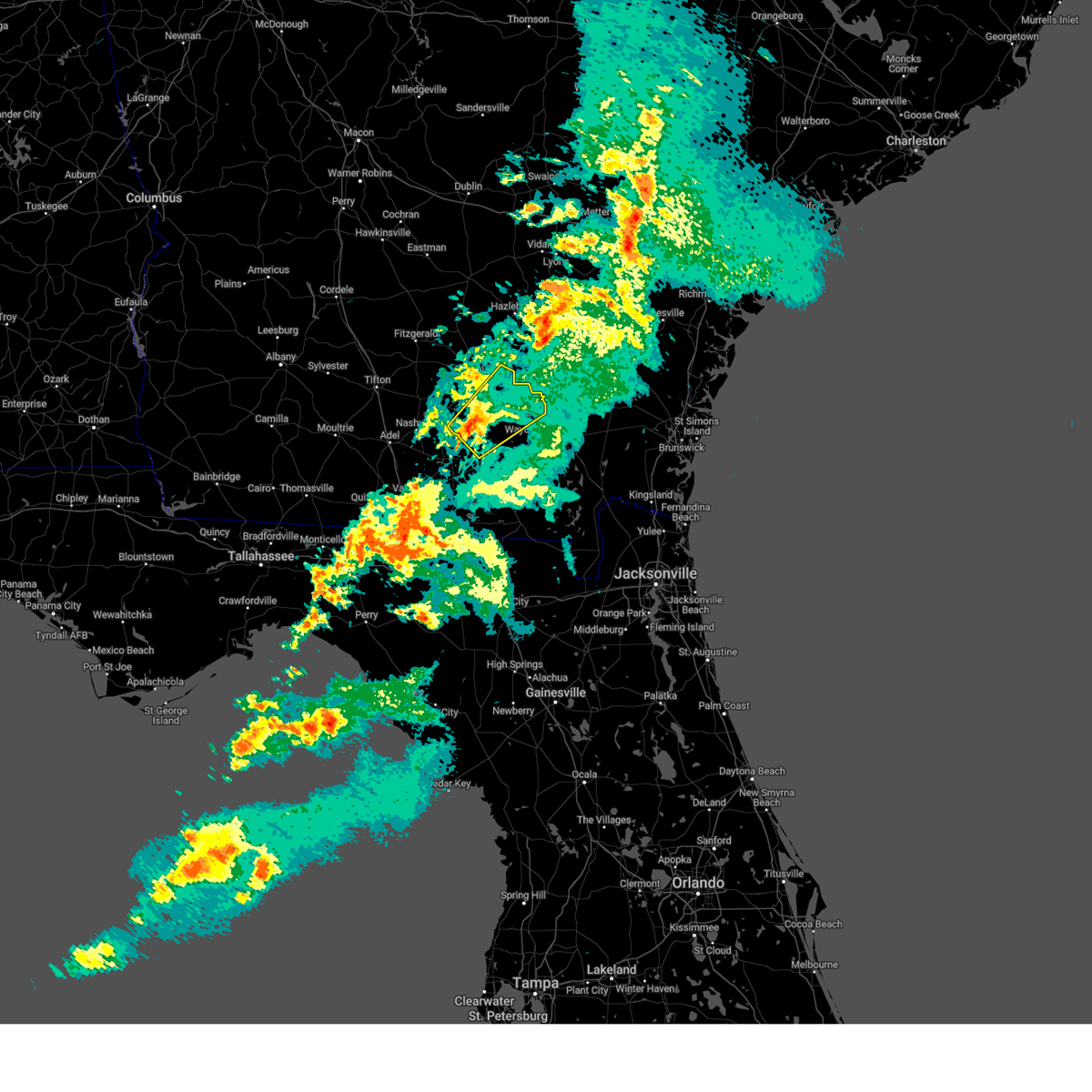
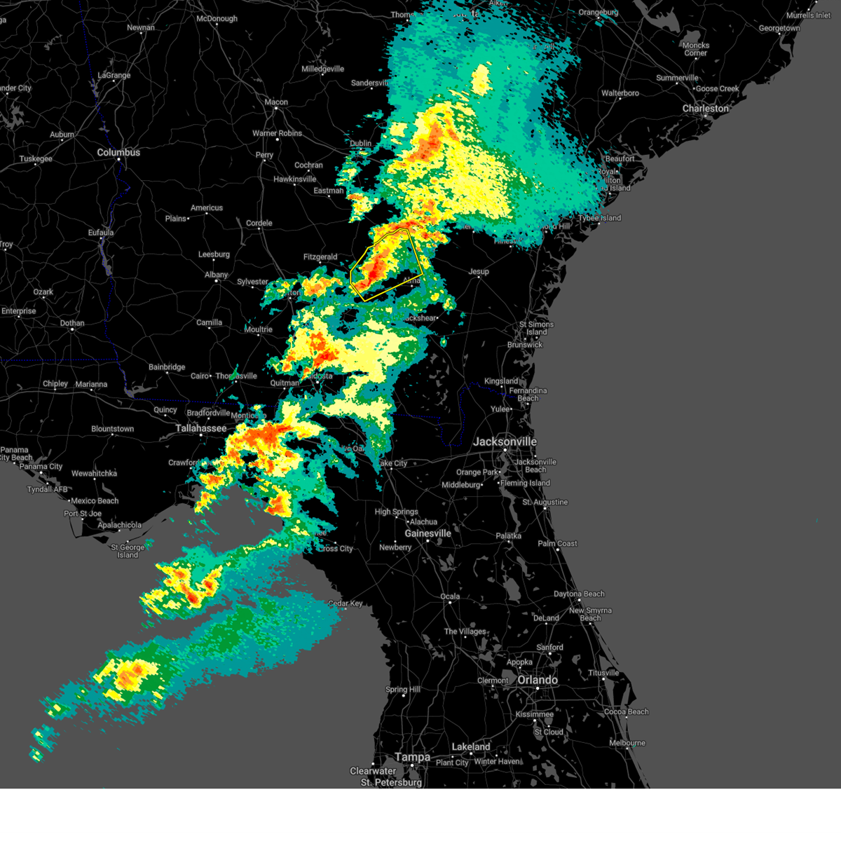
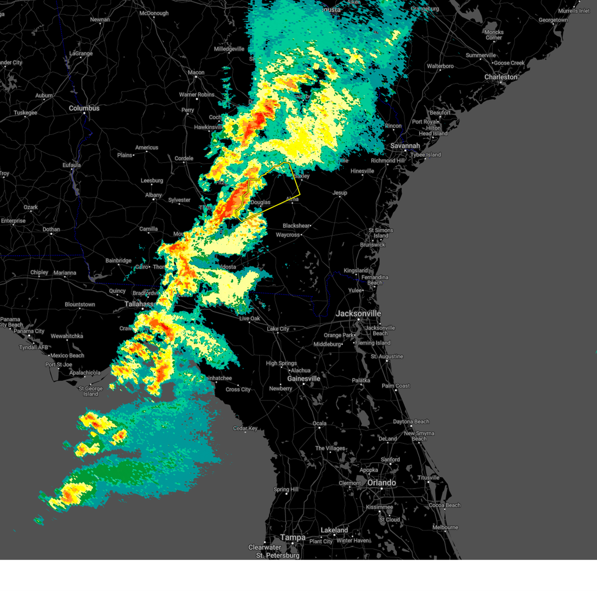
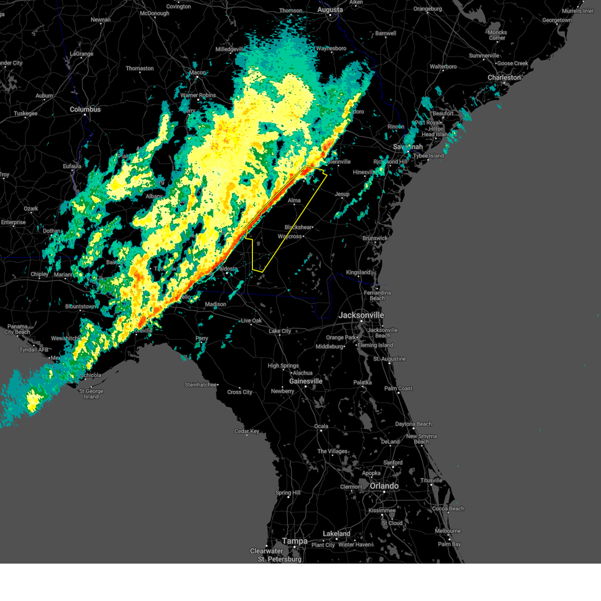
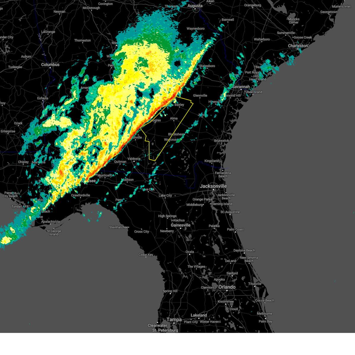
Hail Map for Nicholls, GA
The Nicholls, GA area has had 1 report of on-the-ground hail by trained spotters, and has been under severe weather warnings 16 times during the past 12 months. Doppler radar has detected hail at or near Nicholls, GA on 45 occasions, including 2 occasions during the past year.
| Name: | Nicholls, GA |
| Where Located: | 12.3 miles E of Douglas, GA |
| Map: | Google Map for Nicholls, GA |
| Population: | 2798 |
| Housing Units: | 434 |
| More Info: | Search Google for Nicholls, GA |
0
The Top Recent Hail Date for Nicholls, GA is Friday, May 30, 2025 (44th out of 45)

Hail and Wind Damage Spotted near Nicholls, GA
| Date / Time | Report Details |
|---|---|
| 3/31/2025 4:54 PM EDT |
 Svrjax the national weather service in jacksonville has issued a * severe thunderstorm warning for, east central coffee county in southeastern georgia, northern bacon county in southeastern georgia, southeastern jeff davis county in southeastern georgia, western appling county in southeastern georgia, * until 530 pm edt. * at 453 pm edt, a severe thunderstorm was located near nicholls, or 9 miles west of alma, moving east at 35 mph (radar indicated). Hazards include 60 mph wind gusts and nickel size hail. expect damage to roofs, siding, and trees Svrjax the national weather service in jacksonville has issued a * severe thunderstorm warning for, east central coffee county in southeastern georgia, northern bacon county in southeastern georgia, southeastern jeff davis county in southeastern georgia, western appling county in southeastern georgia, * until 530 pm edt. * at 453 pm edt, a severe thunderstorm was located near nicholls, or 9 miles west of alma, moving east at 35 mph (radar indicated). Hazards include 60 mph wind gusts and nickel size hail. expect damage to roofs, siding, and trees
|
| 3/31/2025 4:47 PM EDT |
 At 446 pm edt, a severe thunderstorm was located over west green, or 10 miles east of broxton, moving east at 40 mph (radar indicated). Hazards include 60 mph wind gusts and nickel size hail. Expect damage to roofs, siding, and trees. Locations impacted include, denton, west green, nicholls, and hazlehurst. At 446 pm edt, a severe thunderstorm was located over west green, or 10 miles east of broxton, moving east at 40 mph (radar indicated). Hazards include 60 mph wind gusts and nickel size hail. Expect damage to roofs, siding, and trees. Locations impacted include, denton, west green, nicholls, and hazlehurst.
|
| 3/31/2025 4:34 PM EDT |
 Svrjax the national weather service in jacksonville has issued a * severe thunderstorm warning for, northeastern coffee county in southeastern georgia, west central bacon county in southeastern georgia, western jeff davis county in southeastern georgia, * until 500 pm edt. * at 433 pm edt, a severe thunderstorm was located over broxton, moving east at 30 mph (radar indicated). Hazards include 60 mph wind gusts and nickel size hail. expect damage to roofs, siding, and trees Svrjax the national weather service in jacksonville has issued a * severe thunderstorm warning for, northeastern coffee county in southeastern georgia, west central bacon county in southeastern georgia, western jeff davis county in southeastern georgia, * until 500 pm edt. * at 433 pm edt, a severe thunderstorm was located over broxton, moving east at 30 mph (radar indicated). Hazards include 60 mph wind gusts and nickel size hail. expect damage to roofs, siding, and trees
|
| 3/16/2025 9:20 AM EDT |
 The storm which prompted the warning has weakened below severe limits, and no longer poses an immediate threat to life or property. therefore, the warning will be allowed to expire. a tornado watch remains in effect until 1000 am edt for southeastern georgia. a tornado watch also remains in effect until 300 pm edt for southeastern georgia. The storm which prompted the warning has weakened below severe limits, and no longer poses an immediate threat to life or property. therefore, the warning will be allowed to expire. a tornado watch remains in effect until 1000 am edt for southeastern georgia. a tornado watch also remains in effect until 300 pm edt for southeastern georgia.
|
| 3/16/2025 9:13 AM EDT |
 the tornado warning has been cancelled and is no longer in effect the tornado warning has been cancelled and is no longer in effect
|
| 3/16/2025 9:11 AM EDT |
 the severe thunderstorm warning has been cancelled and is no longer in effect the severe thunderstorm warning has been cancelled and is no longer in effect
|
| 3/16/2025 9:11 AM EDT |
 At 911 am edt, a severe thunderstorm was located 8 miles east of pearson, moving northeast at 50 mph (radar indicated). Hazards include 60 mph wind gusts. Expect damage to roofs, siding, and trees. Locations impacted include, nicholls, millwood, pearson, pebble hill, axson, bickley, and dixie union. At 911 am edt, a severe thunderstorm was located 8 miles east of pearson, moving northeast at 50 mph (radar indicated). Hazards include 60 mph wind gusts. Expect damage to roofs, siding, and trees. Locations impacted include, nicholls, millwood, pearson, pebble hill, axson, bickley, and dixie union.
|
| 3/16/2025 9:01 AM EDT |
 Torjax the national weather service in jacksonville has issued a * tornado warning for, southeastern coffee county in southeastern georgia, southeastern atkinson county in southeastern georgia, northwestern ware county in southeastern georgia, southwestern bacon county in southeastern georgia, * until 930 am edt. * at 900 am edt, a severe thunderstorm capable of producing a tornado was located near pearson, moving northeast at 45 mph (radar indicated rotation). Hazards include tornado. Flying debris will be dangerous to those caught without shelter. mobile homes will be damaged or destroyed. damage to roofs, windows, and vehicles will occur. tree damage is likely. this dangerous storm will be near, pearson around 905 am edt. Other locations impacted by this tornadic thunderstorm include millwood, bickley, and axson. Torjax the national weather service in jacksonville has issued a * tornado warning for, southeastern coffee county in southeastern georgia, southeastern atkinson county in southeastern georgia, northwestern ware county in southeastern georgia, southwestern bacon county in southeastern georgia, * until 930 am edt. * at 900 am edt, a severe thunderstorm capable of producing a tornado was located near pearson, moving northeast at 45 mph (radar indicated rotation). Hazards include tornado. Flying debris will be dangerous to those caught without shelter. mobile homes will be damaged or destroyed. damage to roofs, windows, and vehicles will occur. tree damage is likely. this dangerous storm will be near, pearson around 905 am edt. Other locations impacted by this tornadic thunderstorm include millwood, bickley, and axson.
|
| 3/16/2025 8:56 AM EDT |
 Svrjax the national weather service in jacksonville has issued a * severe thunderstorm warning for, southeastern coffee county in southeastern georgia, atkinson county in southeastern georgia, northwestern ware county in southeastern georgia, northwestern clinch county in southeastern georgia, * until 930 am edt. * at 856 am edt, a severe thunderstorm was located near pearson, moving northeast at 50 mph (radar indicated). Hazards include 60 mph wind gusts. expect damage to roofs, siding, and trees Svrjax the national weather service in jacksonville has issued a * severe thunderstorm warning for, southeastern coffee county in southeastern georgia, atkinson county in southeastern georgia, northwestern ware county in southeastern georgia, northwestern clinch county in southeastern georgia, * until 930 am edt. * at 856 am edt, a severe thunderstorm was located near pearson, moving northeast at 50 mph (radar indicated). Hazards include 60 mph wind gusts. expect damage to roofs, siding, and trees
|
| 3/16/2025 8:19 AM EDT |
 the severe thunderstorm warning has been cancelled and is no longer in effect the severe thunderstorm warning has been cancelled and is no longer in effect
|
| 3/16/2025 8:19 AM EDT |
 At 819 am edt, a severe thunderstorm was located over hazlehurst, moving northeast at 55 mph (radar indicated). Hazards include 60 mph wind gusts. Expect damage to roofs, siding, and trees. Locations impacted include, pridgen, graham, broxton, douglas, pine grove, denton, west green, hazlehurst, snipesville, and nicholls. At 819 am edt, a severe thunderstorm was located over hazlehurst, moving northeast at 55 mph (radar indicated). Hazards include 60 mph wind gusts. Expect damage to roofs, siding, and trees. Locations impacted include, pridgen, graham, broxton, douglas, pine grove, denton, west green, hazlehurst, snipesville, and nicholls.
|
| 3/16/2025 7:38 AM EDT |
 Svrjax the national weather service in jacksonville has issued a * severe thunderstorm warning for, coffee county in southeastern georgia, northwestern atkinson county in southeastern georgia, northwestern bacon county in southeastern georgia, jeff davis county in southeastern georgia, west central appling county in southeastern georgia, * until 830 am edt. * at 738 am edt, a severe thunderstorm was located near ocilla, moving northeast at 55 mph (radar indicated). Hazards include 60 mph wind gusts. expect damage to roofs, siding, and trees Svrjax the national weather service in jacksonville has issued a * severe thunderstorm warning for, coffee county in southeastern georgia, northwestern atkinson county in southeastern georgia, northwestern bacon county in southeastern georgia, jeff davis county in southeastern georgia, west central appling county in southeastern georgia, * until 830 am edt. * at 738 am edt, a severe thunderstorm was located near ocilla, moving northeast at 55 mph (radar indicated). Hazards include 60 mph wind gusts. expect damage to roofs, siding, and trees
|
| 2/16/2025 8:35 AM EST |
 At 834 am est, severe thunderstorms were located along a line extending from near nevils to 6 miles north of pearson to near hahira, moving east at 60 mph (radar indicated). Hazards include 60 mph wind gusts. Expect damage to roofs, siding, and trees. Locations impacted include, douglas, baxley, alma, homerville, pearson, surrency, nicholls, du pont, cogdell, and dixie union. At 834 am est, severe thunderstorms were located along a line extending from near nevils to 6 miles north of pearson to near hahira, moving east at 60 mph (radar indicated). Hazards include 60 mph wind gusts. Expect damage to roofs, siding, and trees. Locations impacted include, douglas, baxley, alma, homerville, pearson, surrency, nicholls, du pont, cogdell, and dixie union.
|
| 2/16/2025 8:10 AM EST |
 Svrjax the national weather service in jacksonville has issued a * severe thunderstorm warning for, coffee county in southeastern georgia, atkinson county in southeastern georgia, northwestern ware county in southeastern georgia, bacon county in southeastern georgia, northwestern clinch county in southeastern georgia, southeastern jeff davis county in southeastern georgia, appling county in southeastern georgia, * until 900 am est. * at 809 am est, severe thunderstorms were located along a line extending from 6 miles northwest of gordonia altamaha state park to near alapaha to 6 miles northwest of boston, moving east at 60 mph (radar indicated). Hazards include 60 mph wind gusts. expect damage to roofs, siding, and trees Svrjax the national weather service in jacksonville has issued a * severe thunderstorm warning for, coffee county in southeastern georgia, atkinson county in southeastern georgia, northwestern ware county in southeastern georgia, bacon county in southeastern georgia, northwestern clinch county in southeastern georgia, southeastern jeff davis county in southeastern georgia, appling county in southeastern georgia, * until 900 am est. * at 809 am est, severe thunderstorms were located along a line extending from 6 miles northwest of gordonia altamaha state park to near alapaha to 6 miles northwest of boston, moving east at 60 mph (radar indicated). Hazards include 60 mph wind gusts. expect damage to roofs, siding, and trees
|
| 9/26/2024 2:42 PM EDT |
 The storm which prompted the warning has moved out of the area. therefore, the warning will be allowed to expire. a tornado watch remains in effect until 1000 pm edt for southeastern georgia. to report severe weather, contact your nearest law enforcement agency. they will relay your report to the national weather service jacksonville. The storm which prompted the warning has moved out of the area. therefore, the warning will be allowed to expire. a tornado watch remains in effect until 1000 pm edt for southeastern georgia. to report severe weather, contact your nearest law enforcement agency. they will relay your report to the national weather service jacksonville.
|
| 9/26/2024 2:14 PM EDT |
 Torjax the national weather service in jacksonville has issued a * tornado warning for, east central coffee county in southeastern georgia, northwestern bacon county in southeastern georgia, * until 245 pm edt. * at 214 pm edt, a severe thunderstorm capable of producing a tornado was located over nicholls, or 10 miles west of alma, moving north at 30 mph (radar indicated rotation). Hazards include tornado. Flying debris will be dangerous to those caught without shelter. mobile homes will be damaged or destroyed. damage to roofs, windows, and vehicles will occur. tree damage is likely. This dangerous storm will be near, nicholls around 220 pm edt. Torjax the national weather service in jacksonville has issued a * tornado warning for, east central coffee county in southeastern georgia, northwestern bacon county in southeastern georgia, * until 245 pm edt. * at 214 pm edt, a severe thunderstorm capable of producing a tornado was located over nicholls, or 10 miles west of alma, moving north at 30 mph (radar indicated rotation). Hazards include tornado. Flying debris will be dangerous to those caught without shelter. mobile homes will be damaged or destroyed. damage to roofs, windows, and vehicles will occur. tree damage is likely. This dangerous storm will be near, nicholls around 220 pm edt.
|
| 5/14/2024 7:27 AM EDT |
 At 727 am edt, a severe thunderstorm was located 8 miles northeast of cogdell, or 12 miles east of pearson, moving northeast at 50 mph (radar indicated). Hazards include 60 mph wind gusts and penny size hail. Expect damage to roofs, siding, and trees. Locations impacted include, alma, nicholls, pebble hill, dixie union, millwood, axson, bickley, and new lacy. At 727 am edt, a severe thunderstorm was located 8 miles northeast of cogdell, or 12 miles east of pearson, moving northeast at 50 mph (radar indicated). Hazards include 60 mph wind gusts and penny size hail. Expect damage to roofs, siding, and trees. Locations impacted include, alma, nicholls, pebble hill, dixie union, millwood, axson, bickley, and new lacy.
|
| 5/14/2024 7:27 AM EDT |
 the severe thunderstorm warning has been cancelled and is no longer in effect the severe thunderstorm warning has been cancelled and is no longer in effect
|
| 5/14/2024 7:13 AM EDT |
 Svrjax the national weather service in jacksonville has issued a * severe thunderstorm warning for, southeastern coffee county in southeastern georgia, southeastern atkinson county in southeastern georgia, northwestern ware county in southeastern georgia, southern bacon county in southeastern georgia, northwestern clinch county in southeastern georgia, * until 745 am edt. * at 713 am edt, a severe thunderstorm was located near cogdell, or 8 miles north of homerville, moving northeast at 55 mph (radar indicated). Hazards include 60 mph wind gusts and penny size hail. expect damage to roofs, siding, and trees Svrjax the national weather service in jacksonville has issued a * severe thunderstorm warning for, southeastern coffee county in southeastern georgia, southeastern atkinson county in southeastern georgia, northwestern ware county in southeastern georgia, southern bacon county in southeastern georgia, northwestern clinch county in southeastern georgia, * until 745 am edt. * at 713 am edt, a severe thunderstorm was located near cogdell, or 8 miles north of homerville, moving northeast at 55 mph (radar indicated). Hazards include 60 mph wind gusts and penny size hail. expect damage to roofs, siding, and trees
|
| 5/10/2024 7:43 AM EDT |
 Svrjax the national weather service in jacksonville has issued a * severe thunderstorm warning for, southeastern coffee county in southeastern georgia, pierce county in southeastern georgia, eastern atkinson county in southeastern georgia, southwestern brantley county in southeastern georgia, ware county in southeastern georgia, bacon county in southeastern georgia, west central wayne county in southeastern georgia, northwestern clinch county in southeastern georgia, southeastern appling county in southeastern georgia, northwestern charlton county in southeastern georgia, * until 815 am edt. * at 743 am edt, severe thunderstorms were located along a line extending from nicholls to near cogdell, moving east at 45 mph (radar indicated). Hazards include 60 mph wind gusts and quarter size hail. Hail damage to vehicles is expected. Expect wind damage to roofs, siding, and trees. Svrjax the national weather service in jacksonville has issued a * severe thunderstorm warning for, southeastern coffee county in southeastern georgia, pierce county in southeastern georgia, eastern atkinson county in southeastern georgia, southwestern brantley county in southeastern georgia, ware county in southeastern georgia, bacon county in southeastern georgia, west central wayne county in southeastern georgia, northwestern clinch county in southeastern georgia, southeastern appling county in southeastern georgia, northwestern charlton county in southeastern georgia, * until 815 am edt. * at 743 am edt, severe thunderstorms were located along a line extending from nicholls to near cogdell, moving east at 45 mph (radar indicated). Hazards include 60 mph wind gusts and quarter size hail. Hail damage to vehicles is expected. Expect wind damage to roofs, siding, and trees.
|
| 5/10/2024 7:40 AM EDT |
 The storm which prompted the warning has moved out of the area. therefore, the warning will be allowed to expire. a severe thunderstorm watch remains in effect until noon edt for southeastern georgia. The storm which prompted the warning has moved out of the area. therefore, the warning will be allowed to expire. a severe thunderstorm watch remains in effect until noon edt for southeastern georgia.
|
| 5/10/2024 7:03 AM EDT |
 Svrjax the national weather service in jacksonville has issued a * severe thunderstorm warning for, coffee county in southeastern georgia, atkinson county in southeastern georgia, northwestern ware county in southeastern georgia, southwestern bacon county in southeastern georgia, northwestern clinch county in southeastern georgia, * until 745 am edt. * at 703 am edt, a severe thunderstorm was located near alapaha, or 7 miles west of willacoochee, moving east at 60 mph (radar indicated). Hazards include 60 mph wind gusts and quarter size hail. Hail damage to vehicles is expected. Expect wind damage to roofs, siding, and trees. Svrjax the national weather service in jacksonville has issued a * severe thunderstorm warning for, coffee county in southeastern georgia, atkinson county in southeastern georgia, northwestern ware county in southeastern georgia, southwestern bacon county in southeastern georgia, northwestern clinch county in southeastern georgia, * until 745 am edt. * at 703 am edt, a severe thunderstorm was located near alapaha, or 7 miles west of willacoochee, moving east at 60 mph (radar indicated). Hazards include 60 mph wind gusts and quarter size hail. Hail damage to vehicles is expected. Expect wind damage to roofs, siding, and trees.
|
| 5/9/2024 3:24 PM EDT |
 The storm which prompted the warning has weakened below severe limits, and no longer appears capable of producing a tornado. therefore, the warning will be allowed to expire. a tornado watch remains in effect until 900 pm edt for southeastern georgia. The storm which prompted the warning has weakened below severe limits, and no longer appears capable of producing a tornado. therefore, the warning will be allowed to expire. a tornado watch remains in effect until 900 pm edt for southeastern georgia.
|
| 5/9/2024 3:13 PM EDT |
 the severe thunderstorm warning has been cancelled and is no longer in effect the severe thunderstorm warning has been cancelled and is no longer in effect
|
| 5/9/2024 3:13 PM EDT |
 At 312 pm edt, severe thunderstorms were located along a line extending from near baxley to 6 miles northeast of alma to nicholls, moving southeast at 45 mph (radar indicated). Hazards include 70 mph wind gusts and quarter size hail. Hail damage to vehicles is expected. expect considerable tree damage. wind damage is also likely to mobile homes, roofs, and outbuildings. Locations impacted include, alma, nicholls, and new lacy. At 312 pm edt, severe thunderstorms were located along a line extending from near baxley to 6 miles northeast of alma to nicholls, moving southeast at 45 mph (radar indicated). Hazards include 70 mph wind gusts and quarter size hail. Hail damage to vehicles is expected. expect considerable tree damage. wind damage is also likely to mobile homes, roofs, and outbuildings. Locations impacted include, alma, nicholls, and new lacy.
|
| 5/9/2024 3:11 PM EDT |
 the tornado warning has been cancelled and is no longer in effect the tornado warning has been cancelled and is no longer in effect
|
| 5/9/2024 3:11 PM EDT |
 At 311 pm edt, a confirmed tornado was located near alma, moving east at 60 mph (weather spotters confirmed tornado). Hazards include damaging tornado and quarter size hail. Flying debris will be dangerous to those caught without shelter. mobile homes will be damaged or destroyed. damage to roofs, windows, and vehicles will occur. tree damage is likely. This tornado will be near, alma around 315 pm edt. At 311 pm edt, a confirmed tornado was located near alma, moving east at 60 mph (weather spotters confirmed tornado). Hazards include damaging tornado and quarter size hail. Flying debris will be dangerous to those caught without shelter. mobile homes will be damaged or destroyed. damage to roofs, windows, and vehicles will occur. tree damage is likely. This tornado will be near, alma around 315 pm edt.
|
| 5/9/2024 3:05 PM EDT |
 Torjax the national weather service in jacksonville has issued a * tornado warning for, southeastern coffee county in southeastern georgia, northwestern pierce county in southeastern georgia, north central ware county in southeastern georgia, southern bacon county in southeastern georgia, * until 330 pm edt. * at 304 pm edt, a confirmed tornado was located over nicholls, or 10 miles west of alma, moving east at 60 mph (weather spotters confirmed tornado). Hazards include damaging tornado and quarter size hail. Flying debris will be dangerous to those caught without shelter. mobile homes will be damaged or destroyed. damage to roofs, windows, and vehicles will occur. tree damage is likely. The tornado will be near, alma around 310 pm edt. Torjax the national weather service in jacksonville has issued a * tornado warning for, southeastern coffee county in southeastern georgia, northwestern pierce county in southeastern georgia, north central ware county in southeastern georgia, southern bacon county in southeastern georgia, * until 330 pm edt. * at 304 pm edt, a confirmed tornado was located over nicholls, or 10 miles west of alma, moving east at 60 mph (weather spotters confirmed tornado). Hazards include damaging tornado and quarter size hail. Flying debris will be dangerous to those caught without shelter. mobile homes will be damaged or destroyed. damage to roofs, windows, and vehicles will occur. tree damage is likely. The tornado will be near, alma around 310 pm edt.
|
| 5/9/2024 2:57 PM EDT |
 Svrjax the national weather service in jacksonville has issued a * severe thunderstorm warning for, east central coffee county in southeastern georgia, northwestern pierce county in southeastern georgia, bacon county in southeastern georgia, southeastern jeff davis county in southeastern georgia, central appling county in southeastern georgia, * until 330 pm edt. * at 257 pm edt, severe thunderstorms were located along a line extending from near baxley to 6 miles north of alma to near west green, moving southeast at 45 mph (radar indicated). Hazards include 60 mph wind gusts and quarter size hail. Hail damage to vehicles is expected. Expect wind damage to roofs, siding, and trees. Svrjax the national weather service in jacksonville has issued a * severe thunderstorm warning for, east central coffee county in southeastern georgia, northwestern pierce county in southeastern georgia, bacon county in southeastern georgia, southeastern jeff davis county in southeastern georgia, central appling county in southeastern georgia, * until 330 pm edt. * at 257 pm edt, severe thunderstorms were located along a line extending from near baxley to 6 miles north of alma to near west green, moving southeast at 45 mph (radar indicated). Hazards include 60 mph wind gusts and quarter size hail. Hail damage to vehicles is expected. Expect wind damage to roofs, siding, and trees.
|
| 4/3/2024 8:09 AM EDT |
 At 808 am edt, severe thunderstorms were located along a line extending from near alma to 10 miles southwest of nicholls to 8 miles south of willacoochee, moving east at 45 mph (radar indicated). Hazards include 60 mph wind gusts and penny size hail. Expect damage to roofs, siding, and trees. Locations impacted include, alma, pearson, nicholls, new lacy, millwood, axson, and bickley. At 808 am edt, severe thunderstorms were located along a line extending from near alma to 10 miles southwest of nicholls to 8 miles south of willacoochee, moving east at 45 mph (radar indicated). Hazards include 60 mph wind gusts and penny size hail. Expect damage to roofs, siding, and trees. Locations impacted include, alma, pearson, nicholls, new lacy, millwood, axson, and bickley.
|
| 4/3/2024 7:57 AM EDT |
 Svrjax the national weather service in jacksonville has issued a * severe thunderstorm warning for, southeastern coffee county in southeastern georgia, atkinson county in southeastern georgia, northwestern ware county in southeastern georgia, bacon county in southeastern georgia, central appling county in southeastern georgia, * until 830 am edt. * at 757 am edt, severe thunderstorms were located along a line extending from near nicholls to 8 miles northeast of pearson to 9 miles southeast of willacoochee, moving east at 75 mph (radar indicated). Hazards include 60 mph wind gusts and penny size hail. expect damage to roofs, siding, and trees Svrjax the national weather service in jacksonville has issued a * severe thunderstorm warning for, southeastern coffee county in southeastern georgia, atkinson county in southeastern georgia, northwestern ware county in southeastern georgia, bacon county in southeastern georgia, central appling county in southeastern georgia, * until 830 am edt. * at 757 am edt, severe thunderstorms were located along a line extending from near nicholls to 8 miles northeast of pearson to 9 miles southeast of willacoochee, moving east at 75 mph (radar indicated). Hazards include 60 mph wind gusts and penny size hail. expect damage to roofs, siding, and trees
|
| 4/3/2024 7:45 AM EDT |
 At 745 am edt, severe thunderstorms were located along a line extending from near douglas to near pearson to near adel, moving east at 55 mph (radar indicated). Hazards include 60 mph wind gusts. Expect damage to roofs, siding, and trees. Locations impacted include, douglas, pearson, willacoochee, nicholls, and axson. At 745 am edt, severe thunderstorms were located along a line extending from near douglas to near pearson to near adel, moving east at 55 mph (radar indicated). Hazards include 60 mph wind gusts. Expect damage to roofs, siding, and trees. Locations impacted include, douglas, pearson, willacoochee, nicholls, and axson.
|
| 4/3/2024 7:26 AM EDT |
 Svrjax the national weather service in jacksonville has issued a * severe thunderstorm warning for, southern coffee county in southeastern georgia, atkinson county in southeastern georgia, northwestern clinch county in southeastern georgia, * until 800 am edt. * at 725 am edt, severe thunderstorms were located along a line extending from 9 miles southwest of ambrose to near nashville to 10 miles west of sparks, moving east at 55 mph (radar indicated). Hazards include 60 mph wind gusts. expect damage to roofs, siding, and trees Svrjax the national weather service in jacksonville has issued a * severe thunderstorm warning for, southern coffee county in southeastern georgia, atkinson county in southeastern georgia, northwestern clinch county in southeastern georgia, * until 800 am edt. * at 725 am edt, severe thunderstorms were located along a line extending from 9 miles southwest of ambrose to near nashville to 10 miles west of sparks, moving east at 55 mph (radar indicated). Hazards include 60 mph wind gusts. expect damage to roofs, siding, and trees
|
| 3/9/2024 8:47 AM EST |
 The storms which prompted the warning have moved out of the area. therefore, the warning has been allowed to expire. however, gusty winds and heavy rain are still possible with these thunderstorms. a tornado watch remains in effect until 200 pm est for southeastern georgia. remember, a tornado warning still remains in effect for portions of the counties until 9 am. The storms which prompted the warning have moved out of the area. therefore, the warning has been allowed to expire. however, gusty winds and heavy rain are still possible with these thunderstorms. a tornado watch remains in effect until 200 pm est for southeastern georgia. remember, a tornado warning still remains in effect for portions of the counties until 9 am.
|
| 3/9/2024 8:28 AM EST |
 At 827 am est, severe thunderstorms were located along a line extending from near broxton to near douglas, moving east at 40 mph (radar indicated). Hazards include 60 mph wind gusts and penny size hail. Expect damage to roofs, siding, and trees. Locations impacted include, douglas, broxton, and west green. At 827 am est, severe thunderstorms were located along a line extending from near broxton to near douglas, moving east at 40 mph (radar indicated). Hazards include 60 mph wind gusts and penny size hail. Expect damage to roofs, siding, and trees. Locations impacted include, douglas, broxton, and west green.
|
| 3/9/2024 8:14 AM EST |
 Svrjax the national weather service in jacksonville has issued a * severe thunderstorm warning for, coffee county in southeastern georgia, northern atkinson county in southeastern georgia, * until 845 am est. * at 814 am est, severe thunderstorms were located along a line extending from near ambrose to 8 miles north of willacoochee, moving east at 40 mph (radar indicated). Hazards include 60 mph wind gusts and penny size hail. expect damage to roofs, siding, and trees Svrjax the national weather service in jacksonville has issued a * severe thunderstorm warning for, coffee county in southeastern georgia, northern atkinson county in southeastern georgia, * until 845 am est. * at 814 am est, severe thunderstorms were located along a line extending from near ambrose to 8 miles north of willacoochee, moving east at 40 mph (radar indicated). Hazards include 60 mph wind gusts and penny size hail. expect damage to roofs, siding, and trees
|
| 3/9/2024 8:00 AM EST |
 The storm which prompted the warning has weakened below severe limits, and no longer appears capable of producing a tornado. therefore, the warning will be allowed to expire. however, gusty winds are still possible with this thunderstorm. a tornado watch remains in effect until 200 pm est for southeastern georgia. remember, a severe thunderstorm warning still remains in effect for portions of the counties. The storm which prompted the warning has weakened below severe limits, and no longer appears capable of producing a tornado. therefore, the warning will be allowed to expire. however, gusty winds are still possible with this thunderstorm. a tornado watch remains in effect until 200 pm est for southeastern georgia. remember, a severe thunderstorm warning still remains in effect for portions of the counties.
|
| 3/9/2024 7:38 AM EST |
 At 738 am est, a severe thunderstorm capable of producing a tornado was located near broxton, moving east at 40 mph (radar indicated rotation). Hazards include tornado. Flying debris will be dangerous to those caught without shelter. mobile homes will be damaged or destroyed. damage to roofs, windows, and vehicles will occur. tree damage is likely. this dangerous storm will be near, west green around 745 am est. Other locations impacted by this tornadic thunderstorm include denton. At 738 am est, a severe thunderstorm capable of producing a tornado was located near broxton, moving east at 40 mph (radar indicated rotation). Hazards include tornado. Flying debris will be dangerous to those caught without shelter. mobile homes will be damaged or destroyed. damage to roofs, windows, and vehicles will occur. tree damage is likely. this dangerous storm will be near, west green around 745 am est. Other locations impacted by this tornadic thunderstorm include denton.
|
| 3/9/2024 7:29 AM EST |
 Torjax the national weather service in jacksonville has issued a * tornado warning for, central coffee county in southeastern georgia, southwestern jeff davis county in southeastern georgia, * until 800 am est. * at 728 am est, a severe thunderstorm capable of producing a tornado was located near pridgen, or near ambrose, moving east at 35 mph (radar indicated rotation). Hazards include tornado. Flying debris will be dangerous to those caught without shelter. mobile homes will be damaged or destroyed. damage to roofs, windows, and vehicles will occur. tree damage is likely. this dangerous storm will be near, broxton and pridgen around 735 am est. west green around 745 am est. Other locations impacted by this tornadic thunderstorm include denton. Torjax the national weather service in jacksonville has issued a * tornado warning for, central coffee county in southeastern georgia, southwestern jeff davis county in southeastern georgia, * until 800 am est. * at 728 am est, a severe thunderstorm capable of producing a tornado was located near pridgen, or near ambrose, moving east at 35 mph (radar indicated rotation). Hazards include tornado. Flying debris will be dangerous to those caught without shelter. mobile homes will be damaged or destroyed. damage to roofs, windows, and vehicles will occur. tree damage is likely. this dangerous storm will be near, broxton and pridgen around 735 am est. west green around 745 am est. Other locations impacted by this tornadic thunderstorm include denton.
|
| 3/9/2024 7:23 AM EST |
 Svrjax the national weather service in jacksonville has issued a * severe thunderstorm warning for, coffee county in southeastern georgia, northwestern bacon county in southeastern georgia, jeff davis county in southeastern georgia, * until 815 am est. * at 723 am est, severe thunderstorms were located along a line extending from near jacksonville to near ocilla, moving east at 35 mph (radar indicated). Hazards include 60 mph wind gusts and penny size hail. expect damage to roofs, siding, and trees Svrjax the national weather service in jacksonville has issued a * severe thunderstorm warning for, coffee county in southeastern georgia, northwestern bacon county in southeastern georgia, jeff davis county in southeastern georgia, * until 815 am est. * at 723 am est, severe thunderstorms were located along a line extending from near jacksonville to near ocilla, moving east at 35 mph (radar indicated). Hazards include 60 mph wind gusts and penny size hail. expect damage to roofs, siding, and trees
|
| 1/12/2024 7:39 PM EST |
 At 739 pm est, a severe thunderstorm was located near west green, or 10 miles west of alma, moving northeast at 55 mph (radar indicated). Hazards include 60 mph wind gusts. expect damage to roofs, siding, and trees At 739 pm est, a severe thunderstorm was located near west green, or 10 miles west of alma, moving northeast at 55 mph (radar indicated). Hazards include 60 mph wind gusts. expect damage to roofs, siding, and trees
|
| 1/9/2024 1:36 PM EST |
 The severe thunderstorm warning for southeastern coffee, southeastern atkinson, northwestern ware, central bacon, north central clinch and west central appling counties will expire at 145 pm est, the storms which prompted the warning have moved out of the area. therefore, the warning will be allowed to expire. however, gusty winds are still possible with these thunderstorms. a tornado watch remains in effect until 300 pm est for southeastern georgia. a tornado watch also remains in effect until 600 pm est for southeastern georgia. The severe thunderstorm warning for southeastern coffee, southeastern atkinson, northwestern ware, central bacon, north central clinch and west central appling counties will expire at 145 pm est, the storms which prompted the warning have moved out of the area. therefore, the warning will be allowed to expire. however, gusty winds are still possible with these thunderstorms. a tornado watch remains in effect until 300 pm est for southeastern georgia. a tornado watch also remains in effect until 600 pm est for southeastern georgia.
|
| 1/9/2024 1:26 PM EST |
 At 126 pm est, severe thunderstorms were located along a line extending from near plant hatch to 6 miles north of surrency to 8 miles east of alma to near dixie union, moving northeast at 60 mph (radar indicated). Hazards include 70 mph wind gusts and penny size hail. Expect considerable tree damage. damage is likely to mobile homes, roofs, and outbuildings. Locations impacted include, alma, nicholls, cogdell, dixie union, new lacy, millwood, axson, and bickley. At 126 pm est, severe thunderstorms were located along a line extending from near plant hatch to 6 miles north of surrency to 8 miles east of alma to near dixie union, moving northeast at 60 mph (radar indicated). Hazards include 70 mph wind gusts and penny size hail. Expect considerable tree damage. damage is likely to mobile homes, roofs, and outbuildings. Locations impacted include, alma, nicholls, cogdell, dixie union, new lacy, millwood, axson, and bickley.
|
| 1/9/2024 1:05 PM EST |
 At 105 pm est, severe thunderstorms were located along a line extending from 8 miles south of graham to near alma to 7 miles west of dixie union, moving northeast at 70 mph. these are destructive storms for bacon, ware, jeff davis, appling (radar indicated). Hazards include 80 mph wind gusts and penny size hail. Flying debris will be dangerous to those caught without shelter. mobile homes will be heavily damaged. expect considerable damage to roofs, windows, and vehicles. extensive tree damage and power outages are likely. Locations impacted include, hazlehurst, alma, pearson, graham, nicholls, cogdell, west green, dixie union, denton, and new lacy. At 105 pm est, severe thunderstorms were located along a line extending from 8 miles south of graham to near alma to 7 miles west of dixie union, moving northeast at 70 mph. these are destructive storms for bacon, ware, jeff davis, appling (radar indicated). Hazards include 80 mph wind gusts and penny size hail. Flying debris will be dangerous to those caught without shelter. mobile homes will be heavily damaged. expect considerable damage to roofs, windows, and vehicles. extensive tree damage and power outages are likely. Locations impacted include, hazlehurst, alma, pearson, graham, nicholls, cogdell, west green, dixie union, denton, and new lacy.
|
| 1/9/2024 1:01 PM EST |
 At 101 pm est, a severe thunderstorm capable of producing a tornado was located near nicholls, or 8 miles west of alma, moving northeast at 55 mph (radar indicated rotation). Hazards include tornado. Flying debris will be dangerous to those caught without shelter. mobile homes will be damaged or destroyed. damage to roofs, windows, and vehicles will occur. tree damage is likely. This tornadic thunderstorm will remain over mainly rural areas of east central coffee, northwestern bacon and south central jeff davis counties. At 101 pm est, a severe thunderstorm capable of producing a tornado was located near nicholls, or 8 miles west of alma, moving northeast at 55 mph (radar indicated rotation). Hazards include tornado. Flying debris will be dangerous to those caught without shelter. mobile homes will be damaged or destroyed. damage to roofs, windows, and vehicles will occur. tree damage is likely. This tornadic thunderstorm will remain over mainly rural areas of east central coffee, northwestern bacon and south central jeff davis counties.
|
| 1/9/2024 12:55 PM EST | Report of trees down and minor roof damage in nichols. possible tornado damage. time estimated by rada in coffee county GA, 0.1 miles WSW of Nicholls, GA |
| 1/9/2024 12:51 PM EST |
 At 1251 pm est, a severe thunderstorm capable of producing a tornado was located near douglas, moving northeast at 30 mph (radar indicated rotation). Hazards include tornado. Flying debris will be dangerous to those caught without shelter. mobile homes will be damaged or destroyed. damage to roofs, windows, and vehicles will occur. tree damage is likely. This dangerous storm will be near, nicholls around 105 pm est. At 1251 pm est, a severe thunderstorm capable of producing a tornado was located near douglas, moving northeast at 30 mph (radar indicated rotation). Hazards include tornado. Flying debris will be dangerous to those caught without shelter. mobile homes will be damaged or destroyed. damage to roofs, windows, and vehicles will occur. tree damage is likely. This dangerous storm will be near, nicholls around 105 pm est.
|
| 1/9/2024 12:41 PM EST |
 At 1240 pm est, severe thunderstorms were located along a line extending from near douglas to near pearson to 7 miles east of lakeland, moving northeast at 70 mph. these are destructive storms for atkinson, coffee, jeff davis (radar indicated). Hazards include 80 mph wind gusts and penny size hail. Flying debris will be dangerous to those caught without shelter. mobile homes will be heavily damaged. expect considerable damage to roofs, windows, and vehicles. Extensive tree damage and power outages are likely. At 1240 pm est, severe thunderstorms were located along a line extending from near douglas to near pearson to 7 miles east of lakeland, moving northeast at 70 mph. these are destructive storms for atkinson, coffee, jeff davis (radar indicated). Hazards include 80 mph wind gusts and penny size hail. Flying debris will be dangerous to those caught without shelter. mobile homes will be heavily damaged. expect considerable damage to roofs, windows, and vehicles. Extensive tree damage and power outages are likely.
|
| 8/8/2023 7:21 PM EDT |
 At 720 pm edt, severe thunderstorms were located along a line extending from 10 miles southwest of glennville to near lake park, moving east at 15 mph (radar indicated). Hazards include 60 mph wind gusts and quarter size hail. Hail damage to vehicles is expected. expect wind damage to roofs, siding, and trees. locations impacted include, waycross, jesup, baxley, alma, blackshear, homerville, pearson, patterson, fargo, and argyle. hail threat, radar indicated max hail size, 1. 00 in wind threat, radar indicated max wind gust, 60 mph. At 720 pm edt, severe thunderstorms were located along a line extending from 10 miles southwest of glennville to near lake park, moving east at 15 mph (radar indicated). Hazards include 60 mph wind gusts and quarter size hail. Hail damage to vehicles is expected. expect wind damage to roofs, siding, and trees. locations impacted include, waycross, jesup, baxley, alma, blackshear, homerville, pearson, patterson, fargo, and argyle. hail threat, radar indicated max hail size, 1. 00 in wind threat, radar indicated max wind gust, 60 mph.
|
| 8/8/2023 7:08 PM EDT |
 At 708 pm edt, severe thunderstorms were located along a line extending from 10 miles northeast of surrency to 6 miles southwest of lake park, moving east at 15 mph (radar indicated). Hazards include 60 mph wind gusts and quarter size hail. Hail damage to vehicles is expected. Expect wind damage to roofs, siding, and trees. At 708 pm edt, severe thunderstorms were located along a line extending from 10 miles northeast of surrency to 6 miles southwest of lake park, moving east at 15 mph (radar indicated). Hazards include 60 mph wind gusts and quarter size hail. Hail damage to vehicles is expected. Expect wind damage to roofs, siding, and trees.
|
| 8/8/2023 6:21 PM EDT |
 At 621 pm edt, severe thunderstorms were located along a line extending from near lumber city to near nashville, moving southeast at 35 mph (radar indicated). Hazards include 60 mph wind gusts and penny size hail. expect damage to roofs, siding, and trees At 621 pm edt, severe thunderstorms were located along a line extending from near lumber city to near nashville, moving southeast at 35 mph (radar indicated). Hazards include 60 mph wind gusts and penny size hail. expect damage to roofs, siding, and trees
|
| 8/6/2023 9:00 PM EDT |
 The severe thunderstorm warning for southeastern coffee, north central ware and bacon counties has expired, the storm which prompted the warning has moved out of the area and is weakening. therefore, the warning has been allowed to expire. however gusty winds of 40 to 55 mph are still possible with this thunderstorm. The severe thunderstorm warning for southeastern coffee, north central ware and bacon counties has expired, the storm which prompted the warning has moved out of the area and is weakening. therefore, the warning has been allowed to expire. however gusty winds of 40 to 55 mph are still possible with this thunderstorm.
|
| 8/6/2023 8:35 PM EDT |
 At 835 pm edt, a severe thunderstorm was located near nicholls, or 8 miles west of alma, moving southeast at 25 mph (radar indicated). Hazards include 60 mph wind gusts. Expect damage to roofs, siding, and trees. locations impacted include, alma, nicholls and new lacy. hail threat, radar indicated max hail size, <. 75 in wind threat, radar indicated max wind gust, 60 mph. At 835 pm edt, a severe thunderstorm was located near nicholls, or 8 miles west of alma, moving southeast at 25 mph (radar indicated). Hazards include 60 mph wind gusts. Expect damage to roofs, siding, and trees. locations impacted include, alma, nicholls and new lacy. hail threat, radar indicated max hail size, <. 75 in wind threat, radar indicated max wind gust, 60 mph.
|
| 8/6/2023 8:13 PM EDT |
 At 813 pm edt, a severe thunderstorm was located near broxton, moving east at 35 mph (radar indicated). Hazards include 60 mph wind gusts. expect damage to roofs, siding, and trees At 813 pm edt, a severe thunderstorm was located near broxton, moving east at 35 mph (radar indicated). Hazards include 60 mph wind gusts. expect damage to roofs, siding, and trees
|
| 7/30/2023 6:38 PM EDT |
 At 638 pm edt, severe thunderstorms were located along a line extending from near surrency to pearson, moving southeast at 25 mph (radar indicated). Hazards include 60 mph wind gusts and quarter size hail. Hail damage to vehicles is expected. Expect wind damage to roofs, siding, and trees. At 638 pm edt, severe thunderstorms were located along a line extending from near surrency to pearson, moving southeast at 25 mph (radar indicated). Hazards include 60 mph wind gusts and quarter size hail. Hail damage to vehicles is expected. Expect wind damage to roofs, siding, and trees.
|
| 7/22/2023 2:25 PM EDT | Trees down on east baker hwy. time estimated by rada in coffee county GA, 7.5 miles NE of Nicholls, GA |
| 7/22/2023 2:15 PM EDT |
 At 214 pm edt, severe thunderstorms were located along a line extending from douglas to near willacoochee, moving east at 10 mph (radar indicated). Hazards include 60 mph wind gusts and quarter size hail. Hail damage to vehicles is expected. Expect wind damage to roofs, siding, and trees. At 214 pm edt, severe thunderstorms were located along a line extending from douglas to near willacoochee, moving east at 10 mph (radar indicated). Hazards include 60 mph wind gusts and quarter size hail. Hail damage to vehicles is expected. Expect wind damage to roofs, siding, and trees.
|
| 6/15/2023 10:51 AM EDT |
 The severe thunderstorm warning for coffee and northern atkinson counties will expire at 1100 am edt, the storms which prompted the warning have weakened below severe limits, and are exiting the warned area. therefore, the warning will be allowed to expire. The severe thunderstorm warning for coffee and northern atkinson counties will expire at 1100 am edt, the storms which prompted the warning have weakened below severe limits, and are exiting the warned area. therefore, the warning will be allowed to expire.
|
| 6/15/2023 10:22 AM EDT |
 At 1021 am edt, severe thunderstorms were located along a line extending from near pridgen to near enigma, moving east at 55 mph (radar indicated). Hazards include 60 mph wind gusts and penny size hail. expect damage to roofs, siding, and trees At 1021 am edt, severe thunderstorms were located along a line extending from near pridgen to near enigma, moving east at 55 mph (radar indicated). Hazards include 60 mph wind gusts and penny size hail. expect damage to roofs, siding, and trees
|
| 6/14/2023 5:24 PM EDT |
 The severe thunderstorm warning for coffee county will expire at 530 pm edt, the storm which prompted the warning has weakened below severe limits, and no longer poses an immediate threat to life or property. therefore, the warning will be allowed to expire. however hail up to the size of a nickel, gusty winds to 50 mph and heavy rain are still possible with this thunderstorm. a tornado watch remains in effect until 1000 pm edt for southeastern georgia. The severe thunderstorm warning for coffee county will expire at 530 pm edt, the storm which prompted the warning has weakened below severe limits, and no longer poses an immediate threat to life or property. therefore, the warning will be allowed to expire. however hail up to the size of a nickel, gusty winds to 50 mph and heavy rain are still possible with this thunderstorm. a tornado watch remains in effect until 1000 pm edt for southeastern georgia.
|
| 6/14/2023 5:01 PM EDT |
 At 459 pm edt, a severe thunderstorm was located near ambrose, moving east at 30 mph. this is a destructive storm for douglas, ambrose. broxton, west green and nichols (radar indicated). Hazards include up to 80 mph wind gusts and ping pong ball size hail. Flying debris will be dangerous to those caught without shelter. mobile homes will be heavily damaged. expect considerable damage to roofs, windows, and vehicles. Extensive tree damage and power outages are likely. At 459 pm edt, a severe thunderstorm was located near ambrose, moving east at 30 mph. this is a destructive storm for douglas, ambrose. broxton, west green and nichols (radar indicated). Hazards include up to 80 mph wind gusts and ping pong ball size hail. Flying debris will be dangerous to those caught without shelter. mobile homes will be heavily damaged. expect considerable damage to roofs, windows, and vehicles. Extensive tree damage and power outages are likely.
|
| 6/14/2023 9:03 AM EDT | Downed trees in the area east off of highway 158 east of chatterton church rd due to wind in coffee county GA, 7.3 miles ENE of Nicholls, GA |
| 1/22/2023 6:41 PM EST | Severe structure damage/trees down reported by em in coffee county along hwy 158 se of douglas. suspected damage may be tornado related. time is based off rada in coffee county GA, 6.8 miles NE of Nicholls, GA |
| 1/22/2023 6:21 PM EST |
 At 621 pm est, a severe thunderstorm capable of producing a tornado was located over nicholls, or 11 miles west of alma, moving east at 35 mph (radar indicated rotation). Hazards include tornado. Flying debris will be dangerous to those caught without shelter. mobile homes will be damaged or destroyed. damage to roofs, windows, and vehicles will occur. Tree damage is likely. At 621 pm est, a severe thunderstorm capable of producing a tornado was located over nicholls, or 11 miles west of alma, moving east at 35 mph (radar indicated rotation). Hazards include tornado. Flying debris will be dangerous to those caught without shelter. mobile homes will be damaged or destroyed. damage to roofs, windows, and vehicles will occur. Tree damage is likely.
|
| 1/22/2023 6:13 PM EST |
 At 612 pm est, a severe thunderstorm was located 7 miles southeast of douglas, moving northeast at 50 mph (radar indicated). Hazards include 60 mph wind gusts. expect damage to roofs, siding, and trees At 612 pm est, a severe thunderstorm was located 7 miles southeast of douglas, moving northeast at 50 mph (radar indicated). Hazards include 60 mph wind gusts. expect damage to roofs, siding, and trees
|
| 1/12/2023 9:42 PM EST |
 The severe thunderstorm warning for southeastern coffee, north central ware, bacon, southeastern jeff davis and appling counties will expire at 945 pm est, the storms which prompted the warning have weakened below severe limits, and no longer pose an immediate threat to life or property. therefore, the warning will be allowed to expire. The severe thunderstorm warning for southeastern coffee, north central ware, bacon, southeastern jeff davis and appling counties will expire at 945 pm est, the storms which prompted the warning have weakened below severe limits, and no longer pose an immediate threat to life or property. therefore, the warning will be allowed to expire.
|
| 1/12/2023 9:34 PM EST |
 At 934 pm est, severe thunderstorms were located along a line extending from near baxley to 6 miles northwest of dixie union, moving east at 60 mph (radar indicated). Hazards include 60 mph wind gusts and nickel size hail. Expect damage to roofs, siding, and trees. locations impacted include, baxley, alma, nicholls, new lacy and pine grove. hail threat, radar indicated max hail size, 0. 88 in wind threat, radar indicated max wind gust, 60 mph. At 934 pm est, severe thunderstorms were located along a line extending from near baxley to 6 miles northwest of dixie union, moving east at 60 mph (radar indicated). Hazards include 60 mph wind gusts and nickel size hail. Expect damage to roofs, siding, and trees. locations impacted include, baxley, alma, nicholls, new lacy and pine grove. hail threat, radar indicated max hail size, 0. 88 in wind threat, radar indicated max wind gust, 60 mph.
|
| 1/12/2023 9:21 PM EST |
 The severe thunderstorm warning for western coffee, western atkinson, western bacon and southwestern jeff davis counties will expire at 930 pm est, the storms which prompted the warning have weakened below severe limits, and have exited the warned area. therefore, the warning will be allowed to expire. The severe thunderstorm warning for western coffee, western atkinson, western bacon and southwestern jeff davis counties will expire at 930 pm est, the storms which prompted the warning have weakened below severe limits, and have exited the warned area. therefore, the warning will be allowed to expire.
|
| 1/12/2023 9:20 PM EST |
 At 920 pm est, severe thunderstorms were located along a line extending from near graham to 8 miles northeast of pearson, moving east at 50 mph (radar indicated). Hazards include 60 mph wind gusts and nickel size hail. expect damage to roofs, siding, and trees At 920 pm est, severe thunderstorms were located along a line extending from near graham to 8 miles northeast of pearson, moving east at 50 mph (radar indicated). Hazards include 60 mph wind gusts and nickel size hail. expect damage to roofs, siding, and trees
|
| 1/12/2023 8:42 PM EST |
 At 841 pm est, severe thunderstorms were located along a line extending from 6 miles east of fitzgerald to near enigma to near lenox, moving east at 40 mph (radar indicated). Hazards include 60 mph wind gusts and quarter size hail. Hail damage to vehicles is expected. Expect wind damage to roofs, siding, and trees. At 841 pm est, severe thunderstorms were located along a line extending from 6 miles east of fitzgerald to near enigma to near lenox, moving east at 40 mph (radar indicated). Hazards include 60 mph wind gusts and quarter size hail. Hail damage to vehicles is expected. Expect wind damage to roofs, siding, and trees.
|
| 10/12/2022 10:29 PM EDT |
 At 1028 pm edt, a severe thunderstorm was located 10 miles northeast of pearson, moving east at 25 mph (radar indicated). Hazards include 60 mph wind gusts. possible tornado. expect damage to roofs, siding, and trees At 1028 pm edt, a severe thunderstorm was located 10 miles northeast of pearson, moving east at 25 mph (radar indicated). Hazards include 60 mph wind gusts. possible tornado. expect damage to roofs, siding, and trees
|
| 8/11/2022 1:06 PM EDT |
 The severe thunderstorm warning for southeastern coffee, northwestern pierce, north central ware and southern bacon counties will expire at 115 pm edt, the storm which prompted the warning has weakened below severe limits, and no longer poses an immediate threat to life or property. therefore, the warning will be allowed to expire. however gusty winds are still possible with this thunderstorm. The severe thunderstorm warning for southeastern coffee, northwestern pierce, north central ware and southern bacon counties will expire at 115 pm edt, the storm which prompted the warning has weakened below severe limits, and no longer poses an immediate threat to life or property. therefore, the warning will be allowed to expire. however gusty winds are still possible with this thunderstorm.
|
| 8/11/2022 12:47 PM EDT |
 At 1247 pm edt, a severe thunderstorm was located near dixie union, or 9 miles south of alma, moving northeast at 40 mph (radar indicated). Hazards include 60 mph wind gusts. expect damage to roofs, siding, and trees At 1247 pm edt, a severe thunderstorm was located near dixie union, or 9 miles south of alma, moving northeast at 40 mph (radar indicated). Hazards include 60 mph wind gusts. expect damage to roofs, siding, and trees
|
| 8/9/2022 8:24 PM EDT |
 The severe thunderstorm warning for southeastern coffee, northwestern ware, bacon, jeff davis and appling counties will expire at 830 pm edt, the storms which prompted the warning have weakened below severe limits, and no longer pose an immediate threat to life or property. therefore, the warning will be allowed to expire. however gusty winds and heavy rain are still possible with these thunderstorms. The severe thunderstorm warning for southeastern coffee, northwestern ware, bacon, jeff davis and appling counties will expire at 830 pm edt, the storms which prompted the warning have weakened below severe limits, and no longer pose an immediate threat to life or property. therefore, the warning will be allowed to expire. however gusty winds and heavy rain are still possible with these thunderstorms.
|
| 8/9/2022 8:12 PM EDT |
 At 812 pm edt, severe thunderstorms were located along a line extending from 6 miles southwest of lumber city to 8 miles south of nicholls, moving northeast at 30 mph (radar indicated). Hazards include 60 mph wind gusts. Expect damage to roofs, siding, and trees. locations impacted include, baxley, hazlehurst, alma, graham, surrency, plant hatch, nicholls, snipesville, west green and denton. hail threat, radar indicated max hail size, <. 75 in wind threat, radar indicated max wind gust, 60 mph. At 812 pm edt, severe thunderstorms were located along a line extending from 6 miles southwest of lumber city to 8 miles south of nicholls, moving northeast at 30 mph (radar indicated). Hazards include 60 mph wind gusts. Expect damage to roofs, siding, and trees. locations impacted include, baxley, hazlehurst, alma, graham, surrency, plant hatch, nicholls, snipesville, west green and denton. hail threat, radar indicated max hail size, <. 75 in wind threat, radar indicated max wind gust, 60 mph.
|
| 8/9/2022 7:56 PM EDT |
 At 756 pm edt, severe thunderstorms were located along a line extending from near snipesville to 8 miles west of dixie union, moving northeast at 25 mph (radar indicated). Hazards include 60 mph wind gusts. Expect damage to roofs, siding, and trees. locations impacted include, douglas, baxley, hazlehurst, alma, broxton, graham, surrency, plant hatch, nicholls and pridgen. hail threat, radar indicated max hail size, <. 75 in wind threat, radar indicated max wind gust, 60 mph. At 756 pm edt, severe thunderstorms were located along a line extending from near snipesville to 8 miles west of dixie union, moving northeast at 25 mph (radar indicated). Hazards include 60 mph wind gusts. Expect damage to roofs, siding, and trees. locations impacted include, douglas, baxley, hazlehurst, alma, broxton, graham, surrency, plant hatch, nicholls and pridgen. hail threat, radar indicated max hail size, <. 75 in wind threat, radar indicated max wind gust, 60 mph.
|
| 8/9/2022 7:25 PM EDT |
 At 725 pm edt, severe thunderstorms were located along a line extending from near ambrose to 7 miles west of dixie union, moving northeast at 35 mph (radar indicated). Hazards include 70 mph wind gusts. Expect considerable tree damage. Damage is likely to mobile homes, roofs, and outbuildings. At 725 pm edt, severe thunderstorms were located along a line extending from near ambrose to 7 miles west of dixie union, moving northeast at 35 mph (radar indicated). Hazards include 70 mph wind gusts. Expect considerable tree damage. Damage is likely to mobile homes, roofs, and outbuildings.
|
| 8/9/2022 7:02 PM EDT |
 At 702 pm edt, severe thunderstorms were located along a line extending from 9 miles northeast of alapaha to near cogdell, moving northeast at 40 mph (radar indicated). Hazards include 60 mph wind gusts. expect damage to roofs, siding, and trees At 702 pm edt, severe thunderstorms were located along a line extending from 9 miles northeast of alapaha to near cogdell, moving northeast at 40 mph (radar indicated). Hazards include 60 mph wind gusts. expect damage to roofs, siding, and trees
|
| 7/19/2022 4:03 PM EDT |
 At 403 pm edt, severe thunderstorms were located along a line extending from near baxley to nicholls, moving northeast at 35 mph (radar indicated). Hazards include 60 mph wind gusts. Expect damage to roofs, siding, and trees. locations impacted include, baxley, alma, surrency, nicholls and new lacy. hail threat, radar indicated max hail size, <. 75 in wind threat, radar indicated max wind gust, 60 mph. At 403 pm edt, severe thunderstorms were located along a line extending from near baxley to nicholls, moving northeast at 35 mph (radar indicated). Hazards include 60 mph wind gusts. Expect damage to roofs, siding, and trees. locations impacted include, baxley, alma, surrency, nicholls and new lacy. hail threat, radar indicated max hail size, <. 75 in wind threat, radar indicated max wind gust, 60 mph.
|
| 7/19/2022 3:44 PM EDT |
 At 343 pm edt, severe thunderstorms were located along a line extending from 6 miles southwest of graham to nicholls, moving northeast at 35 mph (radar indicated). Hazards include 60 mph wind gusts and heavy rainfall. expect damage to roofs, siding, and trees At 343 pm edt, severe thunderstorms were located along a line extending from 6 miles southwest of graham to nicholls, moving northeast at 35 mph (radar indicated). Hazards include 60 mph wind gusts and heavy rainfall. expect damage to roofs, siding, and trees
|
| 5/3/2022 6:01 PM EDT |
 At 601 pm edt, a severe thunderstorm was located near douglas, moving east at 15 mph (radar indicated). Hazards include 60 mph wind gusts and quarter size hail. Hail damage to vehicles is expected. Expect wind damage to roofs, siding, and trees. At 601 pm edt, a severe thunderstorm was located near douglas, moving east at 15 mph (radar indicated). Hazards include 60 mph wind gusts and quarter size hail. Hail damage to vehicles is expected. Expect wind damage to roofs, siding, and trees.
|
| 4/5/2022 5:53 PM EDT |
 At 552 pm edt, severe thunderstorms were located along a line extending from near plant hatch to near baxley to near pearson, moving east at 65 mph (radar indicated). Hazards include 60 mph wind gusts. Expect damage to roofs, siding, and trees. Locations impacted include, douglas, baxley, alma, willacoochee, graham, surrency, plant hatch, nicholls, west green and pine grove. At 552 pm edt, severe thunderstorms were located along a line extending from near plant hatch to near baxley to near pearson, moving east at 65 mph (radar indicated). Hazards include 60 mph wind gusts. Expect damage to roofs, siding, and trees. Locations impacted include, douglas, baxley, alma, willacoochee, graham, surrency, plant hatch, nicholls, west green and pine grove.
|
| 4/5/2022 5:41 PM EDT |
 At 541 pm edt, severe thunderstorms were located along a line extending from hazlehurst to 8 miles southeast of snipesville to near willacoochee, moving east at 65 mph (radar indicated). Hazards include 70 mph wind gusts. Expect considerable tree damage. damage is likely to mobile homes, roofs, and outbuildings. Locations impacted include, douglas, baxley, hazlehurst, alma, willacoochee, broxton, graham, surrency, plant hatch and nicholls. At 541 pm edt, severe thunderstorms were located along a line extending from hazlehurst to 8 miles southeast of snipesville to near willacoochee, moving east at 65 mph (radar indicated). Hazards include 70 mph wind gusts. Expect considerable tree damage. damage is likely to mobile homes, roofs, and outbuildings. Locations impacted include, douglas, baxley, hazlehurst, alma, willacoochee, broxton, graham, surrency, plant hatch and nicholls.
|
| 4/5/2022 5:30 PM EDT |
 At 530 pm edt, severe thunderstorms were located along a line extending from near snipesville to near west green to 6 miles southwest of alapaha, moving east at 65 mph (radar indicated). Hazards include 70 mph wind gusts. Expect considerable tree damage. Damage is likely to mobile homes, roofs, and outbuildings. At 530 pm edt, severe thunderstorms were located along a line extending from near snipesville to near west green to 6 miles southwest of alapaha, moving east at 65 mph (radar indicated). Hazards include 70 mph wind gusts. Expect considerable tree damage. Damage is likely to mobile homes, roofs, and outbuildings.
|
| 3/31/2022 12:39 PM EDT |
 At 1239 pm edt, a severe thunderstorm capable of producing a tornado was located over pearson, moving northeast at 45 mph (radar indicated rotation). Hazards include tornado. Flying debris will be dangerous to those caught without shelter. mobile homes will be damaged or destroyed. damage to roofs, windows, and vehicles will occur. tree damage is likely. this dangerous storm will be near, alma around 115 pm edt. Other locations impacted by this tornadic thunderstorm include bickley, new lacy and axson. At 1239 pm edt, a severe thunderstorm capable of producing a tornado was located over pearson, moving northeast at 45 mph (radar indicated rotation). Hazards include tornado. Flying debris will be dangerous to those caught without shelter. mobile homes will be damaged or destroyed. damage to roofs, windows, and vehicles will occur. tree damage is likely. this dangerous storm will be near, alma around 115 pm edt. Other locations impacted by this tornadic thunderstorm include bickley, new lacy and axson.
|
| 3/31/2022 12:37 PM EDT |
 At 1237 pm edt, a severe thunderstorm was located over pearson, moving northeast at 55 mph (radar indicated). Hazards include 60 mph wind gusts. expect damage to roofs, siding, and trees At 1237 pm edt, a severe thunderstorm was located over pearson, moving northeast at 55 mph (radar indicated). Hazards include 60 mph wind gusts. expect damage to roofs, siding, and trees
|
| 3/31/2022 12:03 PM EDT |
 At 1202 pm edt, a severe thunderstorm capable of producing a tornado was located over west green, or 8 miles northeast of douglas, moving northeast at 35 mph (radar indicated rotation). Hazards include tornado. Flying debris will be dangerous to those caught without shelter. mobile homes will be damaged or destroyed. damage to roofs, windows, and vehicles will occur. tree damage is likely. This tornadic thunderstorm will remain over mainly rural areas of northeastern coffee, northwestern bacon, southeastern jeff davis and west central appling counties, including the following locations, denton. At 1202 pm edt, a severe thunderstorm capable of producing a tornado was located over west green, or 8 miles northeast of douglas, moving northeast at 35 mph (radar indicated rotation). Hazards include tornado. Flying debris will be dangerous to those caught without shelter. mobile homes will be damaged or destroyed. damage to roofs, windows, and vehicles will occur. tree damage is likely. This tornadic thunderstorm will remain over mainly rural areas of northeastern coffee, northwestern bacon, southeastern jeff davis and west central appling counties, including the following locations, denton.
|
| 3/31/2022 11:58 AM EDT |
 At 1157 am edt, a severe thunderstorm capable of producing a tornado was located near west green, or near douglas, moving northeast at 35 mph (radar indicated rotation). Hazards include tornado. Flying debris will be dangerous to those caught without shelter. mobile homes will be damaged or destroyed. damage to roofs, windows, and vehicles will occur. tree damage is likely. this dangerous storm will be near, west green around 1205 pm edt. Other locations impacted by this tornadic thunderstorm include denton. At 1157 am edt, a severe thunderstorm capable of producing a tornado was located near west green, or near douglas, moving northeast at 35 mph (radar indicated rotation). Hazards include tornado. Flying debris will be dangerous to those caught without shelter. mobile homes will be damaged or destroyed. damage to roofs, windows, and vehicles will occur. tree damage is likely. this dangerous storm will be near, west green around 1205 pm edt. Other locations impacted by this tornadic thunderstorm include denton.
|
| 3/31/2022 11:53 AM EDT |
 At 1153 am edt, a severe thunderstorm was located near douglas, moving northeast at 35 mph (radar indicated). Hazards include 60 mph wind gusts. Expect damage to roofs, siding, and trees. Locations impacted include, douglas, alma, broxton, nicholls, west green, snipesville and denton. At 1153 am edt, a severe thunderstorm was located near douglas, moving northeast at 35 mph (radar indicated). Hazards include 60 mph wind gusts. Expect damage to roofs, siding, and trees. Locations impacted include, douglas, alma, broxton, nicholls, west green, snipesville and denton.
|
| 3/31/2022 11:43 AM EDT |
 At 1142 am edt, a severe thunderstorm was located near douglas, moving northeast at 35 mph (radar indicated). Hazards include 60 mph wind gusts. expect damage to roofs, siding, and trees At 1142 am edt, a severe thunderstorm was located near douglas, moving northeast at 35 mph (radar indicated). Hazards include 60 mph wind gusts. expect damage to roofs, siding, and trees
|
| 3/31/2022 11:31 AM EDT |
 At 1130 am edt, a severe thunderstorm was located near willacoochee, moving northeast at 35 mph (radar indicated). Hazards include 60 mph wind gusts. Expect damage to roofs, siding, and trees. locations impacted include, douglas, willacoochee, broxton, ambrose and pridgen. hail threat, radar indicated max hail size, <. 75 in wind threat, radar indicated max wind gust, 60 mph. At 1130 am edt, a severe thunderstorm was located near willacoochee, moving northeast at 35 mph (radar indicated). Hazards include 60 mph wind gusts. Expect damage to roofs, siding, and trees. locations impacted include, douglas, willacoochee, broxton, ambrose and pridgen. hail threat, radar indicated max hail size, <. 75 in wind threat, radar indicated max wind gust, 60 mph.
|
| 3/31/2022 11:13 AM EDT |
 At 1112 am edt, a severe thunderstorm was located near alapaha, or 7 miles west of willacoochee, moving northeast at 55 mph (radar indicated). Hazards include 60 mph wind gusts. expect damage to roofs, siding, and trees At 1112 am edt, a severe thunderstorm was located near alapaha, or 7 miles west of willacoochee, moving northeast at 55 mph (radar indicated). Hazards include 60 mph wind gusts. expect damage to roofs, siding, and trees
|
| 1/2/2022 10:02 PM EST |
 At 1002 pm est, severe thunderstorms were located along a line extending from graham to near douglas, moving east at 25 mph (radar indicated). Hazards include 60 mph wind gusts and penny size hail. Expect damage to roofs, siding, and trees. Locations impacted include, douglas, baxley, alma, pearson, willacoochee, graham, surrency, plant hatch, nicholls and west green. At 1002 pm est, severe thunderstorms were located along a line extending from graham to near douglas, moving east at 25 mph (radar indicated). Hazards include 60 mph wind gusts and penny size hail. Expect damage to roofs, siding, and trees. Locations impacted include, douglas, baxley, alma, pearson, willacoochee, graham, surrency, plant hatch, nicholls and west green.
|
| 1/2/2022 9:38 PM EST |
 At 937 pm est, severe thunderstorms were located along a line extending from near hazlehurst to near douglas, moving east at 25 mph (radar indicated). Hazards include 60 mph wind gusts and penny size hail. expect damage to roofs, siding, and trees At 937 pm est, severe thunderstorms were located along a line extending from near hazlehurst to near douglas, moving east at 25 mph (radar indicated). Hazards include 60 mph wind gusts and penny size hail. expect damage to roofs, siding, and trees
|
| 10/8/2021 8:30 AM EDT |
 At 829 am edt, severe thunderstorms were located along a line extending from near baxley to near willacoochee, and are nearly stationary (radar indicated). Hazards include 60 mph wind gusts and penny size hail. Expect damage to roofs, siding, and trees. locations impacted include, douglas, baxley, alma, willacoochee and nicholls. hail threat, radar indicated max hail size, 0. 75 in wind threat, radar indicated max wind gust, 60 mph. At 829 am edt, severe thunderstorms were located along a line extending from near baxley to near willacoochee, and are nearly stationary (radar indicated). Hazards include 60 mph wind gusts and penny size hail. Expect damage to roofs, siding, and trees. locations impacted include, douglas, baxley, alma, willacoochee and nicholls. hail threat, radar indicated max hail size, 0. 75 in wind threat, radar indicated max wind gust, 60 mph.
|
| 10/8/2021 7:53 AM EDT |
 At 753 am edt, severe thunderstorms were located along a line extending from 10 miles northeast of west green to 6 miles northeast of alapaha, moving east at 30 mph (radar indicated). Hazards include 60 mph wind gusts and quarter size hail. Hail damage to vehicles is expected. Expect wind damage to roofs, siding, and trees. At 753 am edt, severe thunderstorms were located along a line extending from 10 miles northeast of west green to 6 miles northeast of alapaha, moving east at 30 mph (radar indicated). Hazards include 60 mph wind gusts and quarter size hail. Hail damage to vehicles is expected. Expect wind damage to roofs, siding, and trees.
|
| 7/28/2021 6:28 PM EDT |
 At 628 pm edt, a severe thunderstorm was located over willacoochee, moving south at 35 mph (radar indicated). Hazards include 60 mph wind gusts and penny size hail. expect damage to roofs, siding, and trees At 628 pm edt, a severe thunderstorm was located over willacoochee, moving south at 35 mph (radar indicated). Hazards include 60 mph wind gusts and penny size hail. expect damage to roofs, siding, and trees
|
| 6/12/2021 8:20 PM EDT |
 At 820 pm edt, a severe thunderstorm was located 8 miles northeast of nicholls, or 8 miles northwest of alma, moving south at 25 mph (radar indicated). Hazards include 60 mph wind gusts. Expect damage to roofs, siding, and trees. Locations impacted include, alma, nicholls, west green and new lacy. At 820 pm edt, a severe thunderstorm was located 8 miles northeast of nicholls, or 8 miles northwest of alma, moving south at 25 mph (radar indicated). Hazards include 60 mph wind gusts. Expect damage to roofs, siding, and trees. Locations impacted include, alma, nicholls, west green and new lacy.
|
| 6/12/2021 8:16 PM EDT |
 At 815 pm edt, a severe thunderstorm was located 9 miles east of west green, or 10 miles northwest of alma, moving south at 30 mph (radar indicated). Hazards include 60 mph wind gusts. Expect damage to roofs, siding, and trees. Locations impacted include, douglas, alma, broxton, nicholls, west green, snipesville, denton and new lacy. At 815 pm edt, a severe thunderstorm was located 9 miles east of west green, or 10 miles northwest of alma, moving south at 30 mph (radar indicated). Hazards include 60 mph wind gusts. Expect damage to roofs, siding, and trees. Locations impacted include, douglas, alma, broxton, nicholls, west green, snipesville, denton and new lacy.
|
| 6/12/2021 7:57 PM EDT |
 At 756 pm edt, a severe thunderstorm was located near hazlehurst, moving south at 25 mph (radar indicated). Hazards include 60 mph wind gusts. expect damage to roofs, siding, and trees At 756 pm edt, a severe thunderstorm was located near hazlehurst, moving south at 25 mph (radar indicated). Hazards include 60 mph wind gusts. expect damage to roofs, siding, and trees
|
| 5/4/2021 11:53 PM EDT |
 At 1153 pm edt, severe thunderstorms were located along a line extending from near pearson to near nicholls to near hazlehurst, moving east at 40 mph (radar indicated). Hazards include 60 mph wind gusts. Expect damage to roofs, siding, and trees. Locations impacted include, baxley, hazlehurst, alma, pearson, graham, plant hatch, nicholls, pebble hill, jamestown and dixie union. At 1153 pm edt, severe thunderstorms were located along a line extending from near pearson to near nicholls to near hazlehurst, moving east at 40 mph (radar indicated). Hazards include 60 mph wind gusts. Expect damage to roofs, siding, and trees. Locations impacted include, baxley, hazlehurst, alma, pearson, graham, plant hatch, nicholls, pebble hill, jamestown and dixie union.
|
| 5/4/2021 11:38 PM EDT |
 At 1138 pm edt, severe thunderstorms were located along a line extending from near willacoochee to near douglas to near lumber city, moving east around 35 mph (radar indicated). Hazards include 60 mph wind gusts. expect damage to roofs, siding, and trees At 1138 pm edt, severe thunderstorms were located along a line extending from near willacoochee to near douglas to near lumber city, moving east around 35 mph (radar indicated). Hazards include 60 mph wind gusts. expect damage to roofs, siding, and trees
|
| 5/4/2021 11:28 PM EDT |
 At 1127 pm edt, severe thunderstorms were located along a line extending from near snipesville to douglas to 6 miles southwest of willacoochee, moving east at 50 mph. these storms have had a history of producing wind damage (radar indicated). Hazards include 60 mph wind gusts. Expect damage to roofs, siding, and trees. Locations impacted include, douglas, pearson, willacoochee, broxton, ambrose, nicholls, pridgen, west green, snipesville and denton. At 1127 pm edt, severe thunderstorms were located along a line extending from near snipesville to douglas to 6 miles southwest of willacoochee, moving east at 50 mph. these storms have had a history of producing wind damage (radar indicated). Hazards include 60 mph wind gusts. Expect damage to roofs, siding, and trees. Locations impacted include, douglas, pearson, willacoochee, broxton, ambrose, nicholls, pridgen, west green, snipesville and denton.
|
| 5/4/2021 11:12 PM EDT |
 At 1112 pm edt, severe thunderstorms were located along a line extending from near jacksonville to 6 miles southwest of ambrose to near enigma, moving east at 45 mph (radar indicated). Hazards include 60 mph wind gusts. Expect damage to roofs, siding, and trees. Locations impacted include, douglas, pearson, willacoochee, broxton, ambrose, nicholls, pridgen, west green, snipesville and denton. At 1112 pm edt, severe thunderstorms were located along a line extending from near jacksonville to 6 miles southwest of ambrose to near enigma, moving east at 45 mph (radar indicated). Hazards include 60 mph wind gusts. Expect damage to roofs, siding, and trees. Locations impacted include, douglas, pearson, willacoochee, broxton, ambrose, nicholls, pridgen, west green, snipesville and denton.
|
| 5/4/2021 10:54 PM EDT |
 At 1053 pm edt, severe thunderstorms were located along a line extending from 8 miles west of jacksonville to near unionville, moving east at 50 mph (radar indicated). Hazards include 60 mph wind gusts. expect damage to roofs, siding, and trees At 1053 pm edt, severe thunderstorms were located along a line extending from 8 miles west of jacksonville to near unionville, moving east at 50 mph (radar indicated). Hazards include 60 mph wind gusts. expect damage to roofs, siding, and trees
|
| 4/24/2021 9:35 PM EDT |
 At 935 pm edt, a severe thunderstorm capable of producing a tornado was located near nicholls, or 7 miles southwest of alma, moving east at 50 mph (radar indicated rotation). Hazards include tornado and quarter size hail. Flying debris will be dangerous to those caught without shelter. mobile homes will be damaged or destroyed. damage to roofs, windows, and vehicles will occur. tree damage is likely. this dangerous storm will be near, alma around 940 pm edt. Other locations impacted by this tornadic thunderstorm include bickley. At 935 pm edt, a severe thunderstorm capable of producing a tornado was located near nicholls, or 7 miles southwest of alma, moving east at 50 mph (radar indicated rotation). Hazards include tornado and quarter size hail. Flying debris will be dangerous to those caught without shelter. mobile homes will be damaged or destroyed. damage to roofs, windows, and vehicles will occur. tree damage is likely. this dangerous storm will be near, alma around 940 pm edt. Other locations impacted by this tornadic thunderstorm include bickley.
|
| 4/24/2021 9:24 PM EDT |
 At 924 pm edt, a confirmed tornado was located 7 miles southwest of nicholls, or 7 miles southeast of douglas, moving east at 45 mph (radar confirmed tornado). Hazards include damaging tornado and quarter size hail. Flying debris will be dangerous to those caught without shelter. mobile homes will be damaged or destroyed. damage to roofs, windows, and vehicles will occur. tree damage is likely. this tornado will be near, nicholls around 930 pm edt. alma around 945 pm edt. bristol around 1000 pm edt. Other locations impacted by this tornadic thunderstorm include bickley and new lacy. At 924 pm edt, a confirmed tornado was located 7 miles southwest of nicholls, or 7 miles southeast of douglas, moving east at 45 mph (radar confirmed tornado). Hazards include damaging tornado and quarter size hail. Flying debris will be dangerous to those caught without shelter. mobile homes will be damaged or destroyed. damage to roofs, windows, and vehicles will occur. tree damage is likely. this tornado will be near, nicholls around 930 pm edt. alma around 945 pm edt. bristol around 1000 pm edt. Other locations impacted by this tornadic thunderstorm include bickley and new lacy.
|
| 4/24/2021 9:16 PM EDT |
 At 916 pm edt, a tornado producing storm was located 7 miles southwest of douglas, moving east at 40 mph (radar confirmed tornado). Hazards include damaging tornado and quarter size hail. Flying debris will be dangerous to those caught without shelter. mobile homes will be damaged or destroyed. damage to roofs, windows, and vehicles will occur. tree damage is likely. this tornadic storm will be near, nicholls around 945 pm edt. Other locations impacted by this tornadic thunderstorm include bickley and new lacy. At 916 pm edt, a tornado producing storm was located 7 miles southwest of douglas, moving east at 40 mph (radar confirmed tornado). Hazards include damaging tornado and quarter size hail. Flying debris will be dangerous to those caught without shelter. mobile homes will be damaged or destroyed. damage to roofs, windows, and vehicles will occur. tree damage is likely. this tornadic storm will be near, nicholls around 945 pm edt. Other locations impacted by this tornadic thunderstorm include bickley and new lacy.
|
| 4/24/2021 9:08 PM EDT |
 At 907 pm edt, a severe thunderstorm was located near douglas, moving east at 45 mph (radar indicated). Hazards include quarter size hail. possible tornado. damage to vehicles is expected At 907 pm edt, a severe thunderstorm was located near douglas, moving east at 45 mph (radar indicated). Hazards include quarter size hail. possible tornado. damage to vehicles is expected
|
| 4/24/2021 8:34 PM EDT |
 At 834 pm edt, a severe thunderstorm was located near nicholls, or near alma, moving east at 65 mph (radar indicated). Hazards include half dollar size hail. Damage to vehicles is expected. Locations impacted include, alma, nicholls and west green. At 834 pm edt, a severe thunderstorm was located near nicholls, or near alma, moving east at 65 mph (radar indicated). Hazards include half dollar size hail. Damage to vehicles is expected. Locations impacted include, alma, nicholls and west green.
|
| 4/24/2021 8:18 PM EDT |
 At 818 pm edt, a severe thunderstorm was located over broxton, moving east at 65 mph (radar indicated). Hazards include half dollar size hail. damage to vehicles is expected At 818 pm edt, a severe thunderstorm was located over broxton, moving east at 65 mph (radar indicated). Hazards include half dollar size hail. damage to vehicles is expected
|
| 4/24/2021 7:43 PM EDT |
 The severe thunderstorm warning for southeastern coffee, central pierce, east central atkinson, northwestern ware, bacon and southeastern appling counties will expire at 745 pm edt, the storm which prompted the warning has moved out of the area. therefore, the warning will be allowed to expire. remember, a severe thunderstorm warning still remains in effect for eastern bacon county and pierce county. The severe thunderstorm warning for southeastern coffee, central pierce, east central atkinson, northwestern ware, bacon and southeastern appling counties will expire at 745 pm edt, the storm which prompted the warning has moved out of the area. therefore, the warning will be allowed to expire. remember, a severe thunderstorm warning still remains in effect for eastern bacon county and pierce county.
|
| 4/24/2021 7:31 PM EDT |
 At 730 pm edt, a severe thunderstorm was located 7 miles north of dixie union, or 7 miles southeast of alma, moving east at 60 mph (radar indicated). Hazards include half dollar size hail. Damage to vehicles is expected. Locations impacted include, alma, blackshear, patterson, nicholls, jamestown, pebble hill, bristol, dixie union, new lacy and bickley. At 730 pm edt, a severe thunderstorm was located 7 miles north of dixie union, or 7 miles southeast of alma, moving east at 60 mph (radar indicated). Hazards include half dollar size hail. Damage to vehicles is expected. Locations impacted include, alma, blackshear, patterson, nicholls, jamestown, pebble hill, bristol, dixie union, new lacy and bickley.
|
| 4/24/2021 7:13 PM EDT |
 The severe thunderstorm warning for coffee and northern atkinson counties will expire at 715 pm edt, this warning has been replaced by another a severe thunderstorm warning. The severe thunderstorm warning for coffee and northern atkinson counties will expire at 715 pm edt, this warning has been replaced by another a severe thunderstorm warning.
|
| 4/24/2021 7:12 PM EDT |
 At 712 pm edt, a severe thunderstorm was located 9 miles southeast of douglas, moving east at 60 mph (radar indicated). Hazards include quarter size hail. damage to vehicles is expected At 712 pm edt, a severe thunderstorm was located 9 miles southeast of douglas, moving east at 60 mph (radar indicated). Hazards include quarter size hail. damage to vehicles is expected
|
| 4/24/2021 6:39 PM EDT |
 At 638 pm edt, a severe thunderstorm was located near alapaha, or 8 miles northwest of willacoochee, moving east at 50 mph (radar indicated). Hazards include quarter size hail. damage to vehicles is expected At 638 pm edt, a severe thunderstorm was located near alapaha, or 8 miles northwest of willacoochee, moving east at 50 mph (radar indicated). Hazards include quarter size hail. damage to vehicles is expected
|
| 4/24/2021 12:05 PM EDT | Em reports tree down on mobile home from thunderstorm winds. a tornado was reported by ham operators... and is possible... however... radar indicated a collapsing cell in ware county GA, 6.6 miles NNW of Nicholls, GA |
| 4/24/2021 12:00 PM EDT | Emergency manager in bacon county reported stright line wind damage to a single wide mobile home... farm shelter... and an unoccupied tractor trailer that had been roll in bacon county GA, 5 miles NW of Nicholls, GA |
| 4/24/2021 11:57 AM EDT |
 The severe thunderstorm warning for southeastern coffee county will expire at noon edt, the storm which prompted the warning has moved out of the area. therefore, the warning will be allowed to expire. however heavy rain is still possible with this thunderstorm. a tornado watch remains in effect until 600 pm edt for southeastern georgia. The severe thunderstorm warning for southeastern coffee county will expire at noon edt, the storm which prompted the warning has moved out of the area. therefore, the warning will be allowed to expire. however heavy rain is still possible with this thunderstorm. a tornado watch remains in effect until 600 pm edt for southeastern georgia.
|
| 4/24/2021 11:44 AM EDT | Quarter sized hail reported 4.1 miles N of Nicholls, GA, hail the size of quarters was reported between wilsonville and nicholls on andrew tanner road. |
| 4/24/2021 11:40 AM EDT |
 At 1129 am edt, a severe thunderstorm was located 8 miles southwest of nicholls, or 8 miles southeast of douglas, moving east at 50 mph (radar indicated). Hazards include 70 mph wind gusts and quarter size hail. Hail damage to vehicles is expected. expect considerable tree damage. wind damage is also likely to mobile homes, roofs, and outbuildings. Locations impacted include, douglas and nicholls. At 1129 am edt, a severe thunderstorm was located 8 miles southwest of nicholls, or 8 miles southeast of douglas, moving east at 50 mph (radar indicated). Hazards include 70 mph wind gusts and quarter size hail. Hail damage to vehicles is expected. expect considerable tree damage. wind damage is also likely to mobile homes, roofs, and outbuildings. Locations impacted include, douglas and nicholls.
|
| 4/24/2021 11:29 AM EDT |
 At 1129 am edt, a severe thunderstorm was located 8 miles southwest of nicholls, or 8 miles southeast of douglas, moving east at 50 mph (radar indicated). Hazards include 70 mph wind gusts and quarter size hail. Hail damage to vehicles is expected. expect considerable tree damage. wind damage is also likely to mobile homes, roofs, and outbuildings. Locations impacted include, douglas and nicholls. At 1129 am edt, a severe thunderstorm was located 8 miles southwest of nicholls, or 8 miles southeast of douglas, moving east at 50 mph (radar indicated). Hazards include 70 mph wind gusts and quarter size hail. Hail damage to vehicles is expected. expect considerable tree damage. wind damage is also likely to mobile homes, roofs, and outbuildings. Locations impacted include, douglas and nicholls.
|
| 4/24/2021 11:15 AM EDT |
 At 1114 am edt, a severe thunderstorm was located 7 miles northeast of willacoochee, moving east at 50 mph (radar indicated). Hazards include 70 mph wind gusts and quarter size hail. Hail damage to vehicles is expected. expect considerable tree damage. Wind damage is also likely to mobile homes, roofs, and outbuildings. At 1114 am edt, a severe thunderstorm was located 7 miles northeast of willacoochee, moving east at 50 mph (radar indicated). Hazards include 70 mph wind gusts and quarter size hail. Hail damage to vehicles is expected. expect considerable tree damage. Wind damage is also likely to mobile homes, roofs, and outbuildings.
|
| 3/28/2021 7:06 PM EDT |
 At 706 pm edt, a severe thunderstorm was located near west green, or 11 miles northwest of alma, moving east at 45 mph (radar indicated). Hazards include 60 mph wind gusts and penny size hail. expect damage to roofs, siding, and trees At 706 pm edt, a severe thunderstorm was located near west green, or 11 miles northwest of alma, moving east at 45 mph (radar indicated). Hazards include 60 mph wind gusts and penny size hail. expect damage to roofs, siding, and trees
|
| 11/30/2020 4:27 AM EST |
 At 426 am est, a severe thunderstorm was located 8 miles southwest of nicholls, or 9 miles southeast of douglas, moving northeast at 25 mph (radar indicated). Hazards include 60 mph wind gusts. expect damage to roofs, siding, and trees At 426 am est, a severe thunderstorm was located 8 miles southwest of nicholls, or 9 miles southeast of douglas, moving northeast at 25 mph (radar indicated). Hazards include 60 mph wind gusts. expect damage to roofs, siding, and trees
|
| 11/30/2020 4:19 AM EST |
 At 419 am est, a severe thunderstorm was located near pearson, moving northeast at 40 mph (radar indicated). Hazards include 60 mph wind gusts. Expect damage to roofs, siding, and trees. Locations impacted include, pearson, nicholls, bickley and axson. At 419 am est, a severe thunderstorm was located near pearson, moving northeast at 40 mph (radar indicated). Hazards include 60 mph wind gusts. Expect damage to roofs, siding, and trees. Locations impacted include, pearson, nicholls, bickley and axson.
|
| 11/30/2020 3:52 AM EST |
 At 352 am est, a severe thunderstorm was located near willacoochee, moving northeast at 40 mph (radar indicated). Hazards include 60 mph wind gusts. expect damage to roofs, siding, and trees At 352 am est, a severe thunderstorm was located near willacoochee, moving northeast at 40 mph (radar indicated). Hazards include 60 mph wind gusts. expect damage to roofs, siding, and trees
|
| 8/24/2020 7:37 PM EDT |
 At 736 pm edt, a severe thunderstorm was located near nicholls, or 12 miles southwest of alma, moving north at 15 mph (radar indicated). Hazards include 60 mph wind gusts. Expect damage to roofs, siding, and trees. Locations impacted include, alma and nicholls. At 736 pm edt, a severe thunderstorm was located near nicholls, or 12 miles southwest of alma, moving north at 15 mph (radar indicated). Hazards include 60 mph wind gusts. Expect damage to roofs, siding, and trees. Locations impacted include, alma and nicholls.
|
| 8/24/2020 7:32 PM EDT |
 At 732 pm edt, a severe thunderstorm was located near nicholls, or 12 miles east of douglas, moving north at 15 mph (radar indicated). Hazards include 60 mph wind gusts. expect damage to roofs, siding, and trees At 732 pm edt, a severe thunderstorm was located near nicholls, or 12 miles east of douglas, moving north at 15 mph (radar indicated). Hazards include 60 mph wind gusts. expect damage to roofs, siding, and trees
|
| 8/24/2020 11:46 AM EDT |
 At 1146 am edt, a severe thunderstorm was located near jamestown, or 10 miles northwest of blackshear, moving north at 25 mph (radar indicated). Hazards include 60 mph wind gusts. expect damage to roofs, siding, and trees At 1146 am edt, a severe thunderstorm was located near jamestown, or 10 miles northwest of blackshear, moving north at 25 mph (radar indicated). Hazards include 60 mph wind gusts. expect damage to roofs, siding, and trees
|
| 8/18/2020 6:34 PM EDT |
 The national weather service in jacksonville has issued a * severe thunderstorm warning for. southern coffee county in southeastern georgia. northern atkinson county in southeastern georgia. until 715 pm edt. At 633 pm edt, a severe thunderstorm was located near willacoochee,. The national weather service in jacksonville has issued a * severe thunderstorm warning for. southern coffee county in southeastern georgia. northern atkinson county in southeastern georgia. until 715 pm edt. At 633 pm edt, a severe thunderstorm was located near willacoochee,.
|
| 8/6/2020 4:22 PM EDT |
 At 421 pm edt, severe thunderstorms were located along a line extending from near nicholls to 9 miles north of bristol, moving north at 25 mph (radar indicated). Hazards include 60 mph wind gusts. Expect damage to roofs, siding, and trees. Locations impacted include, baxley, alma, surrency, nicholls, west green, snipesville, denton, new lacy and pine grove. At 421 pm edt, severe thunderstorms were located along a line extending from near nicholls to 9 miles north of bristol, moving north at 25 mph (radar indicated). Hazards include 60 mph wind gusts. Expect damage to roofs, siding, and trees. Locations impacted include, baxley, alma, surrency, nicholls, west green, snipesville, denton, new lacy and pine grove.
|
| 8/6/2020 4:06 PM EDT |
 At 406 pm edt, severe thunderstorms were located along a line extending from 7 miles southwest of nicholls to near bristol, moving north at 20 mph (radar indicated). Hazards include 60 mph wind gusts. expect damage to roofs, siding, and trees At 406 pm edt, severe thunderstorms were located along a line extending from 7 miles southwest of nicholls to near bristol, moving north at 20 mph (radar indicated). Hazards include 60 mph wind gusts. expect damage to roofs, siding, and trees
|
| 6/30/2020 4:42 PM EDT |
 The severe thunderstorm warning for southeastern coffee county will expire at 445 pm edt, the storms which prompted the warning have weakened below severe limits, and no longer pose an immediate threat to life or property. therefore, the warning will be allowed to expire. however gusty winds and heavy rain are still possible with these thunderstorms. The severe thunderstorm warning for southeastern coffee county will expire at 445 pm edt, the storms which prompted the warning have weakened below severe limits, and no longer pose an immediate threat to life or property. therefore, the warning will be allowed to expire. however gusty winds and heavy rain are still possible with these thunderstorms.
|
| 6/30/2020 4:40 PM EDT | 911 call center reported multiple trees down across the count in coffee county GA, 7.1 miles NE of Nicholls, GA |
| 6/30/2020 4:28 PM EDT |
 At 428 pm edt, severe thunderstorms were located along a line extending from near west green to near douglas to 9 miles north of pearson, moving east at 20 mph (radar indicated). Hazards include 60 mph wind gusts and quarter size hail. Hail damage to vehicles is expected. expect wind damage to roofs, siding, and trees. Locations impacted include, douglas, nicholls and west green. At 428 pm edt, severe thunderstorms were located along a line extending from near west green to near douglas to 9 miles north of pearson, moving east at 20 mph (radar indicated). Hazards include 60 mph wind gusts and quarter size hail. Hail damage to vehicles is expected. expect wind damage to roofs, siding, and trees. Locations impacted include, douglas, nicholls and west green.
|
| 6/30/2020 4:11 PM EDT |
 At 411 pm edt, severe thunderstorms were located along a line extending from broxton to douglas to 7 miles northeast of willacoochee, moving east at 15 mph (radar indicated). Hazards include 60 mph wind gusts and quarter size hail. Hail damage to vehicles is expected. expect wind damage to roofs, siding, and trees. Locations impacted include, douglas, broxton, nicholls and west green. At 411 pm edt, severe thunderstorms were located along a line extending from broxton to douglas to 7 miles northeast of willacoochee, moving east at 15 mph (radar indicated). Hazards include 60 mph wind gusts and quarter size hail. Hail damage to vehicles is expected. expect wind damage to roofs, siding, and trees. Locations impacted include, douglas, broxton, nicholls and west green.
|
| 6/30/2020 4:00 PM EDT |
 At 400 pm edt, severe thunderstorms were located along a line extending from near broxton to near douglas to 6 miles north of willacoochee, moving east at 15 mph (radar indicated). Hazards include 60 mph wind gusts and quarter size hail. Hail damage to vehicles is expected. Expect wind damage to roofs, siding, and trees. At 400 pm edt, severe thunderstorms were located along a line extending from near broxton to near douglas to 6 miles north of willacoochee, moving east at 15 mph (radar indicated). Hazards include 60 mph wind gusts and quarter size hail. Hail damage to vehicles is expected. Expect wind damage to roofs, siding, and trees.
|
| 4/23/2020 1:34 PM EDT |
 At 134 pm edt, severe thunderstorms were located along a line extending from 7 miles northeast of willacoochee to 6 miles north of mayday, moving east at 50 mph (radar indicated). Hazards include 70 mph wind gusts and quarter size hail. Hail damage to vehicles is expected. expect considerable tree damage. Wind damage is also likely to mobile homes, roofs, and outbuildings. At 134 pm edt, severe thunderstorms were located along a line extending from 7 miles northeast of willacoochee to 6 miles north of mayday, moving east at 50 mph (radar indicated). Hazards include 70 mph wind gusts and quarter size hail. Hail damage to vehicles is expected. expect considerable tree damage. Wind damage is also likely to mobile homes, roofs, and outbuildings.
|
| 4/23/2020 12:52 PM EDT |
 At 1252 pm edt, severe thunderstorms were located along a line extending from near unionville to near boston, moving east at 50 mph (radar indicated). Hazards include 70 mph wind gusts and quarter size hail. Hail damage to vehicles is expected. expect considerable tree damage. Wind damage is also likely to mobile homes, roofs, and outbuildings. At 1252 pm edt, severe thunderstorms were located along a line extending from near unionville to near boston, moving east at 50 mph (radar indicated). Hazards include 70 mph wind gusts and quarter size hail. Hail damage to vehicles is expected. expect considerable tree damage. Wind damage is also likely to mobile homes, roofs, and outbuildings.
|
| 4/20/2020 4:36 AM EDT |
 The severe thunderstorm warning for southeastern coffee, pierce, southeastern atkinson, west central brantley, northern ware, bacon, western wayne, northern clinch, appling and central jeff davis counties will expire at 445 am edt, the storms which prompted the warning have moved out of the area. therefore, the warning will be allowed to expire. a tornado watch remains in effect until 1100 am edt for southeastern georgia. The severe thunderstorm warning for southeastern coffee, pierce, southeastern atkinson, west central brantley, northern ware, bacon, western wayne, northern clinch, appling and central jeff davis counties will expire at 445 am edt, the storms which prompted the warning have moved out of the area. therefore, the warning will be allowed to expire. a tornado watch remains in effect until 1100 am edt for southeastern georgia.
|
| 4/20/2020 3:58 AM EDT |
 At 358 am edt, severe thunderstorms were located along a line extending from near graham to near alma to 7 miles south of nicholls to near cogdell to 9 miles northwest of homerville to near lakeland, moving east at 40 mph (radar indicated). Hazards include quarter size hail. damage to vehicles is expected At 358 am edt, severe thunderstorms were located along a line extending from near graham to near alma to 7 miles south of nicholls to near cogdell to 9 miles northwest of homerville to near lakeland, moving east at 40 mph (radar indicated). Hazards include quarter size hail. damage to vehicles is expected
|
| 4/20/2020 3:17 AM EDT |
 At 317 am edt, severe thunderstorms were located along a line extending from 7 miles north of jacksonville to near ambrose to near alapaha to 7 miles west of willacoochee to nashville to 6 miles northwest of hahira, moving east at 40 mph (radar indicated). Hazards include 60 mph wind gusts. expect damage to roofs, siding, and trees At 317 am edt, severe thunderstorms were located along a line extending from 7 miles north of jacksonville to near ambrose to near alapaha to 7 miles west of willacoochee to nashville to 6 miles northwest of hahira, moving east at 40 mph (radar indicated). Hazards include 60 mph wind gusts. expect damage to roofs, siding, and trees
|
| 4/19/2020 4:39 PM EDT |
 At 439 pm edt, a severe thunderstorm was located over pearson, moving east at 45 mph (radar indicated). Hazards include 70 mph wind gusts and quarter size hail. Hail damage to vehicles is expected. expect considerable tree damage. wind damage is also likely to mobile homes, roofs, and outbuildings. Locations impacted include, pearson and axson. At 439 pm edt, a severe thunderstorm was located over pearson, moving east at 45 mph (radar indicated). Hazards include 70 mph wind gusts and quarter size hail. Hail damage to vehicles is expected. expect considerable tree damage. wind damage is also likely to mobile homes, roofs, and outbuildings. Locations impacted include, pearson and axson.
|
| 4/19/2020 4:29 PM EDT |
 At 429 pm edt, a severe thunderstorm was located over willacoochee, moving east at 40 mph (radar indicated). Hazards include 60 mph wind gusts and quarter size hail. Hail damage to vehicles is expected. expect wind damage to roofs, siding, and trees. Locations impacted include, douglas, pearson, willacoochee, nicholls and axson. At 429 pm edt, a severe thunderstorm was located over willacoochee, moving east at 40 mph (radar indicated). Hazards include 60 mph wind gusts and quarter size hail. Hail damage to vehicles is expected. expect wind damage to roofs, siding, and trees. Locations impacted include, douglas, pearson, willacoochee, nicholls and axson.
|
| 4/19/2020 4:15 PM EDT |
 At 414 pm edt, a severe thunderstorm was located near alapaha, or 7 miles northeast of nashville, moving east at 40 mph (radar indicated). Hazards include 60 mph wind gusts and quarter size hail. Hail damage to vehicles is expected. Expect wind damage to roofs, siding, and trees. At 414 pm edt, a severe thunderstorm was located near alapaha, or 7 miles northeast of nashville, moving east at 40 mph (radar indicated). Hazards include 60 mph wind gusts and quarter size hail. Hail damage to vehicles is expected. Expect wind damage to roofs, siding, and trees.
|
| 4/13/2020 7:08 AM EDT |
 At 708 am edt, severe thunderstorms were located along a line extending from 7 miles east of plant hatch to near alma to 6 miles south of willacoochee, moving east at 45 mph (radar indicated). Hazards include 60 mph wind gusts. Expect damage to roofs, siding, and trees. Locations impacted include, baxley, alma, pearson, surrency, plant hatch, nicholls, odum, pebble hill, jamestown and bristol. At 708 am edt, severe thunderstorms were located along a line extending from 7 miles east of plant hatch to near alma to 6 miles south of willacoochee, moving east at 45 mph (radar indicated). Hazards include 60 mph wind gusts. Expect damage to roofs, siding, and trees. Locations impacted include, baxley, alma, pearson, surrency, plant hatch, nicholls, odum, pebble hill, jamestown and bristol.
|
| 4/13/2020 6:50 AM EDT |
 At 649 am edt, severe thunderstorms were located along a line extending from near plant hatch to near alma to near willacoochee, moving east at 50 mph (radar indicated). Hazards include 60 mph wind gusts. Expect damage to roofs, siding, and trees. Locations impacted include, douglas, baxley, alma, pearson, willacoochee, graham, surrency, plant hatch, nicholls and odum. At 649 am edt, severe thunderstorms were located along a line extending from near plant hatch to near alma to near willacoochee, moving east at 50 mph (radar indicated). Hazards include 60 mph wind gusts. Expect damage to roofs, siding, and trees. Locations impacted include, douglas, baxley, alma, pearson, willacoochee, graham, surrency, plant hatch, nicholls and odum.
|
| 4/13/2020 6:46 AM EDT |
 At 646 am edt, a severe thunderstorm capable of producing a tornado was located near alma, moving east at 60 mph (radar indicated rotation). Hazards include tornado. Flying debris will be dangerous to those caught without shelter. mobile homes will be damaged or destroyed. damage to roofs, windows, and vehicles will occur. tree damage is likely. This dangerous storm will be near, alma around 650 am edt. At 646 am edt, a severe thunderstorm capable of producing a tornado was located near alma, moving east at 60 mph (radar indicated rotation). Hazards include tornado. Flying debris will be dangerous to those caught without shelter. mobile homes will be damaged or destroyed. damage to roofs, windows, and vehicles will occur. tree damage is likely. This dangerous storm will be near, alma around 650 am edt.
|
| 4/13/2020 6:45 AM EDT |
 At 645 am edt, a severe thunderstorm capable of producing a tornado was located over alma, moving east at 65 mph (radar indicated rotation). Hazards include tornado. Flying debris will be dangerous to those caught without shelter. mobile homes will be damaged or destroyed. damage to roofs, windows, and vehicles will occur. tree damage is likely. Locations impacted include, nicholls. At 645 am edt, a severe thunderstorm capable of producing a tornado was located over alma, moving east at 65 mph (radar indicated rotation). Hazards include tornado. Flying debris will be dangerous to those caught without shelter. mobile homes will be damaged or destroyed. damage to roofs, windows, and vehicles will occur. tree damage is likely. Locations impacted include, nicholls.
|
| 4/13/2020 6:40 AM EDT |
 At 640 am edt, a severe thunderstorm capable of producing a tornado was located near nicholls, or near alma, moving east at 65 mph (radar indicated rotation). Hazards include tornado. Flying debris will be dangerous to those caught without shelter. mobile homes will be damaged or destroyed. damage to roofs, windows, and vehicles will occur. tree damage is likely. Locations impacted include, nicholls and west green. At 640 am edt, a severe thunderstorm capable of producing a tornado was located near nicholls, or near alma, moving east at 65 mph (radar indicated rotation). Hazards include tornado. Flying debris will be dangerous to those caught without shelter. mobile homes will be damaged or destroyed. damage to roofs, windows, and vehicles will occur. tree damage is likely. Locations impacted include, nicholls and west green.
|
| 4/13/2020 6:39 AM EDT |
 At 639 am edt, a severe thunderstorm capable of producing a tornado was located near nicholls, or 10 miles northeast of douglas, moving east at 60 mph (radar indicated rotation). Hazards include tornado. Flying debris will be dangerous to those caught without shelter. mobile homes will be damaged or destroyed. damage to roofs, windows, and vehicles will occur. tree damage is likely. This dangerous storm will be near, alma around 650 am edt. At 639 am edt, a severe thunderstorm capable of producing a tornado was located near nicholls, or 10 miles northeast of douglas, moving east at 60 mph (radar indicated rotation). Hazards include tornado. Flying debris will be dangerous to those caught without shelter. mobile homes will be damaged or destroyed. damage to roofs, windows, and vehicles will occur. tree damage is likely. This dangerous storm will be near, alma around 650 am edt.
|
| 4/13/2020 6:35 AM EDT |
 At 635 am edt, severe thunderstorms were located along a line extending from near uvalda to near willacoochee, moving east at 50 mph (radar indicated). Hazards include 60 mph wind gusts. expect damage to roofs, siding, and trees At 635 am edt, severe thunderstorms were located along a line extending from near uvalda to near willacoochee, moving east at 50 mph (radar indicated). Hazards include 60 mph wind gusts. expect damage to roofs, siding, and trees
|
| 4/13/2020 6:35 AM EDT |
 At 634 am edt, a severe thunderstorm capable of producing a tornado was located near nicholls, or 9 miles east of douglas, moving east at 65 mph (radar indicated rotation). Hazards include tornado. Flying debris will be dangerous to those caught without shelter. mobile homes will be damaged or destroyed. damage to roofs, windows, and vehicles will occur. tree damage is likely. This tornadic thunderstorm will remain over mainly rural areas of southeastern coffee county. At 634 am edt, a severe thunderstorm capable of producing a tornado was located near nicholls, or 9 miles east of douglas, moving east at 65 mph (radar indicated rotation). Hazards include tornado. Flying debris will be dangerous to those caught without shelter. mobile homes will be damaged or destroyed. damage to roofs, windows, and vehicles will occur. tree damage is likely. This tornadic thunderstorm will remain over mainly rural areas of southeastern coffee county.
|
| 4/13/2020 6:33 AM EDT |
 At 632 am edt, a severe thunderstorm capable of producing a tornado was located near douglas, moving east at 60 mph (radar indicated rotation). Hazards include tornado. Flying debris will be dangerous to those caught without shelter. mobile homes will be damaged or destroyed. damage to roofs, windows, and vehicles will occur. tree damage is likely. this dangerous storm will be near, nicholls around 640 am edt. Alma around 655 am edt. At 632 am edt, a severe thunderstorm capable of producing a tornado was located near douglas, moving east at 60 mph (radar indicated rotation). Hazards include tornado. Flying debris will be dangerous to those caught without shelter. mobile homes will be damaged or destroyed. damage to roofs, windows, and vehicles will occur. tree damage is likely. this dangerous storm will be near, nicholls around 640 am edt. Alma around 655 am edt.
|
| 4/13/2020 6:20 AM EDT |
 At 619 am edt, a severe thunderstorm capable of producing a tornado was located 7 miles west of douglas, moving east at 65 mph (radar indicated rotation). Hazards include tornado. Flying debris will be dangerous to those caught without shelter. mobile homes will be damaged or destroyed. damage to roofs, windows, and vehicles will occur. tree damage is likely. this dangerous storm will be near, douglas around 625 am edt. west green around 635 am edt. Nicholls around 640 am edt. At 619 am edt, a severe thunderstorm capable of producing a tornado was located 7 miles west of douglas, moving east at 65 mph (radar indicated rotation). Hazards include tornado. Flying debris will be dangerous to those caught without shelter. mobile homes will be damaged or destroyed. damage to roofs, windows, and vehicles will occur. tree damage is likely. this dangerous storm will be near, douglas around 625 am edt. west green around 635 am edt. Nicholls around 640 am edt.
|
| 4/13/2020 5:50 AM EDT |
 At 549 am edt, severe thunderstorms were located along a line extending from near mystic to near omega, moving east at 50 mph (radar indicated). Hazards include 60 mph wind gusts. expect damage to roofs, siding, and trees At 549 am edt, severe thunderstorms were located along a line extending from near mystic to near omega, moving east at 50 mph (radar indicated). Hazards include 60 mph wind gusts. expect damage to roofs, siding, and trees
|
| 2/6/2020 8:14 PM EST |
 At 813 pm est, a severe thunderstorm was located over alma, moving northeast at 70 mph (radar indicated). Hazards include 70 mph wind gusts. Expect considerable tree damage. damage is likely to mobile homes, roofs, and outbuildings. Locations impacted include, baxley, alma, surrency, nicholls, screven, odum, bristol, dixie union, new lacy and bickley. At 813 pm est, a severe thunderstorm was located over alma, moving northeast at 70 mph (radar indicated). Hazards include 70 mph wind gusts. Expect considerable tree damage. damage is likely to mobile homes, roofs, and outbuildings. Locations impacted include, baxley, alma, surrency, nicholls, screven, odum, bristol, dixie union, new lacy and bickley.
|
| 2/6/2020 8:10 PM EST | Bacon county 911/dispatch reports trees and powerlines downed county-wid in bacon county GA, 6.1 miles WNW of Nicholls, GA |
| 2/6/2020 8:00 PM EST | Widespread trees down along hwy 32 e through nicholls. time estimated by rada in coffee county GA, 0.1 miles WSW of Nicholls, GA |
| 2/6/2020 7:52 PM EST |
 At 752 pm est, a severe thunderstorm was located near pearson, moving northeast at 70 mph (radar indicated). Hazards include 70 mph wind gusts. Expect considerable tree damage. Damage is likely to mobile homes, roofs, and outbuildings. At 752 pm est, a severe thunderstorm was located near pearson, moving northeast at 70 mph (radar indicated). Hazards include 70 mph wind gusts. Expect considerable tree damage. Damage is likely to mobile homes, roofs, and outbuildings.
|
| 2/6/2020 6:44 PM EST |
 At 643 pm est, a severe thunderstorm was located near douglas, moving northeast at 55 mph (radar indicated). Hazards include 60 mph wind gusts. expect damage to roofs, siding, and trees At 643 pm est, a severe thunderstorm was located near douglas, moving northeast at 55 mph (radar indicated). Hazards include 60 mph wind gusts. expect damage to roofs, siding, and trees
|
| 8/8/2019 6:58 PM EDT |
 At 658 pm edt, a severe thunderstorm was located near douglas, moving east at 15 mph (radar indicated). Hazards include 60 mph wind gusts and quarter size hail. Hail damage to vehicles is expected. Expect wind damage to roofs, siding, and trees. At 658 pm edt, a severe thunderstorm was located near douglas, moving east at 15 mph (radar indicated). Hazards include 60 mph wind gusts and quarter size hail. Hail damage to vehicles is expected. Expect wind damage to roofs, siding, and trees.
|
| 6/20/2019 7:40 PM EDT | Multiple trees and power lines reported down throughout the northern portions of ware count in ware county GA, 9.5 miles NW of Nicholls, GA |
| 6/20/2019 7:30 PM EDT |
 At 730 pm edt, severe thunderstorms were located along a line extending from near surrency to near lakeland, moving southeast at 45 mph (radar indicated). Hazards include 60 mph wind gusts. Expect damage to roofs, siding, and trees. Locations impacted include, douglas, baxley, alma, homerville, pearson, willacoochee, graham, surrency, plant hatch and nicholls. At 730 pm edt, severe thunderstorms were located along a line extending from near surrency to near lakeland, moving southeast at 45 mph (radar indicated). Hazards include 60 mph wind gusts. Expect damage to roofs, siding, and trees. Locations impacted include, douglas, baxley, alma, homerville, pearson, willacoochee, graham, surrency, plant hatch and nicholls.
|
| 6/20/2019 7:20 PM EDT | Tree down near 200 camp ground church rd in coffee count in bacon county GA, 6.9 miles SSW of Nicholls, GA |
| 6/20/2019 7:20 PM EDT |
 At 719 pm edt, severe thunderstorms were located along a line extending from near baxley to near lakeland, moving southeast at 45 mph (radar indicated). Hazards include 60 mph wind gusts. Expect damage to roofs, siding, and trees. Locations impacted include, douglas, baxley, alma, homerville, pearson, willacoochee, graham, surrency, plant hatch and nicholls. At 719 pm edt, severe thunderstorms were located along a line extending from near baxley to near lakeland, moving southeast at 45 mph (radar indicated). Hazards include 60 mph wind gusts. Expect damage to roofs, siding, and trees. Locations impacted include, douglas, baxley, alma, homerville, pearson, willacoochee, graham, surrency, plant hatch and nicholls.
|
| 6/20/2019 7:07 PM EDT |
 At 706 pm edt, severe thunderstorms were located along a line extending from near plant hatch to near nashville, moving southeast at 45 mph (radar indicated). Hazards include 60 mph wind gusts. Expect damage to roofs, siding, and trees. Locations impacted include, douglas, baxley, hazlehurst, alma, homerville, pearson, willacoochee, broxton, graham and surrency. At 706 pm edt, severe thunderstorms were located along a line extending from near plant hatch to near nashville, moving southeast at 45 mph (radar indicated). Hazards include 60 mph wind gusts. Expect damage to roofs, siding, and trees. Locations impacted include, douglas, baxley, hazlehurst, alma, homerville, pearson, willacoochee, broxton, graham and surrency.
|
| 6/20/2019 6:49 PM EDT |
 The national weather service in jacksonville has issued a * severe thunderstorm warning for. coffee county in southeastern georgia. north central echols county in southeastern georgia. atkinson county in southeastern georgia. Northwestern ware county in southeastern georgia. The national weather service in jacksonville has issued a * severe thunderstorm warning for. coffee county in southeastern georgia. north central echols county in southeastern georgia. atkinson county in southeastern georgia. Northwestern ware county in southeastern georgia.
|
| 6/20/2019 6:39 PM EDT |
 At 639 pm edt, severe thunderstorms were located along a line extending from near uvalda to near phillipsburg, moving southeast at 40 mph (radar indicated). Hazards include 60 mph wind gusts. Expect damage to roofs, siding, and trees. Locations impacted include, douglas, hazlehurst, pearson, willacoochee, broxton, ambrose, nicholls, pridgen, west green and snipesville. At 639 pm edt, severe thunderstorms were located along a line extending from near uvalda to near phillipsburg, moving southeast at 40 mph (radar indicated). Hazards include 60 mph wind gusts. Expect damage to roofs, siding, and trees. Locations impacted include, douglas, hazlehurst, pearson, willacoochee, broxton, ambrose, nicholls, pridgen, west green and snipesville.
|
| 6/20/2019 6:21 PM EDT |
 At 621 pm edt, severe thunderstorms were located along a line extending from near glenwood to near ty ty, moving east at 40 mph (radar indicated). Hazards include 60 mph wind gusts. Expect damage to roofs, siding, and trees. Locations impacted include, douglas, hazlehurst, pearson, willacoochee, broxton, ambrose, nicholls, pridgen, west green and snipesville. At 621 pm edt, severe thunderstorms were located along a line extending from near glenwood to near ty ty, moving east at 40 mph (radar indicated). Hazards include 60 mph wind gusts. Expect damage to roofs, siding, and trees. Locations impacted include, douglas, hazlehurst, pearson, willacoochee, broxton, ambrose, nicholls, pridgen, west green and snipesville.
|
| 6/20/2019 6:02 PM EDT |
 At 602 pm edt, severe thunderstorms were located along a line extending from near helena to near sylvester, moving southeast at 40 mph (radar indicated). Hazards include 60 mph wind gusts. expect damage to roofs, siding, and trees At 602 pm edt, severe thunderstorms were located along a line extending from near helena to near sylvester, moving southeast at 40 mph (radar indicated). Hazards include 60 mph wind gusts. expect damage to roofs, siding, and trees
|
| 5/12/2019 3:00 PM EDT |
 At 259 pm edt, severe thunderstorms were located along a line extending from broxton to near lakeland, moving northeast at 50 mph (radar indicated). Hazards include 60 mph wind gusts and penny size hail. Expect damage to roofs, siding, and trees. Locations impacted include, douglas, hazlehurst, homerville, pearson, willacoochee, broxton, ambrose, argyle, nicholls and du pont. At 259 pm edt, severe thunderstorms were located along a line extending from broxton to near lakeland, moving northeast at 50 mph (radar indicated). Hazards include 60 mph wind gusts and penny size hail. Expect damage to roofs, siding, and trees. Locations impacted include, douglas, hazlehurst, homerville, pearson, willacoochee, broxton, ambrose, argyle, nicholls and du pont.
|
| 5/12/2019 2:40 PM EDT |
 At 240 pm edt, severe thunderstorms were located along a line extending from 7 miles southwest of ambrose to near valdosta, moving northeast near 50 mph (radar indicated). Hazards include 60 mph wind gusts and penny size hail. expect damage to roofs, siding, and trees At 240 pm edt, severe thunderstorms were located along a line extending from 7 miles southwest of ambrose to near valdosta, moving northeast near 50 mph (radar indicated). Hazards include 60 mph wind gusts and penny size hail. expect damage to roofs, siding, and trees
|
| 5/11/2019 5:58 PM EDT |
 The severe thunderstorm warning for coffee, northern atkinson, northwestern bacon, west central appling and jeff davis counties will expire at 600 pm edt, the storms which prompted the warning have weakened below severe limits, and no longer pose an immediate threat to life or property. therefore, the warning will be allowed to expire. however gusty winds are still possible with these thunderstorms. The severe thunderstorm warning for coffee, northern atkinson, northwestern bacon, west central appling and jeff davis counties will expire at 600 pm edt, the storms which prompted the warning have weakened below severe limits, and no longer pose an immediate threat to life or property. therefore, the warning will be allowed to expire. however gusty winds are still possible with these thunderstorms.
|
| 5/11/2019 5:32 PM EDT |
 At 532 pm edt, severe thunderstorms were located along a line extending from near snipesville to near pearson, moving east at 20 mph (radar indicated). Hazards include 60 mph wind gusts and penny size hail. Expect damage to roofs, siding, and trees. Locations impacted include, douglas, hazlehurst, willacoochee, broxton, ambrose, graham, nicholls, pridgen, west green and snipesville. At 532 pm edt, severe thunderstorms were located along a line extending from near snipesville to near pearson, moving east at 20 mph (radar indicated). Hazards include 60 mph wind gusts and penny size hail. Expect damage to roofs, siding, and trees. Locations impacted include, douglas, hazlehurst, willacoochee, broxton, ambrose, graham, nicholls, pridgen, west green and snipesville.
|
| 5/11/2019 5:12 PM EDT |
 At 511 pm edt, severe thunderstorms were located along a line extending from jacksonville georgia to near willacoochee georgia, moving east at 30 mph (radar indicated). Hazards include 60 mph wind gusts and penny size hail. expect damage to roofs, siding, and trees At 511 pm edt, severe thunderstorms were located along a line extending from jacksonville georgia to near willacoochee georgia, moving east at 30 mph (radar indicated). Hazards include 60 mph wind gusts and penny size hail. expect damage to roofs, siding, and trees
|
| 4/19/2019 10:45 AM EDT | Coffee em director reports... numerous trees and power lines down on highway 158 near the county lin in coffee county GA, 10.3 miles N of Nicholls, GA |
| 4/19/2019 10:45 AM EDT |
 At 1045 am edt, severe thunderstorms were located along a line extending from near west green to 8 miles north of cogdell, moving northeast at 55 mph (radar indicated). Hazards include 70 mph wind gusts. Expect considerable tree damage. Damage is likely to mobile homes, roofs, and outbuildings. At 1045 am edt, severe thunderstorms were located along a line extending from near west green to 8 miles north of cogdell, moving northeast at 55 mph (radar indicated). Hazards include 70 mph wind gusts. Expect considerable tree damage. Damage is likely to mobile homes, roofs, and outbuildings.
|
| 4/19/2019 10:38 AM EDT |
 At 1037 am edt, severe thunderstorms were located along a line extending from graham to 8 miles south of boggy bay, moving east at 55 mph (radar indicated). Hazards include 70 mph wind gusts. Expect considerable tree damage. damage is likely to mobile homes, roofs, and outbuildings. Locations impacted include, homerville, nicholls, cogdell, west green and axson. At 1037 am edt, severe thunderstorms were located along a line extending from graham to 8 miles south of boggy bay, moving east at 55 mph (radar indicated). Hazards include 70 mph wind gusts. Expect considerable tree damage. damage is likely to mobile homes, roofs, and outbuildings. Locations impacted include, homerville, nicholls, cogdell, west green and axson.
|
| 4/19/2019 10:16 AM EDT |
 At 1016 am edt, severe thunderstorms were located along a line extending from near snipesville to 6 miles southeast of homerville, moving east at 55 mph (radar indicated). Hazards include 70 mph wind gusts. Expect considerable tree damage. damage is likely to mobile homes, roofs, and outbuildings. Locations impacted include, douglas, homerville, pearson, nicholls, du pont, cogdell, west green and axson. At 1016 am edt, severe thunderstorms were located along a line extending from near snipesville to 6 miles southeast of homerville, moving east at 55 mph (radar indicated). Hazards include 70 mph wind gusts. Expect considerable tree damage. damage is likely to mobile homes, roofs, and outbuildings. Locations impacted include, douglas, homerville, pearson, nicholls, du pont, cogdell, west green and axson.
|
| 4/19/2019 10:01 AM EDT |
 At 1001 am edt, severe thunderstorms were located along a line extending from near pridgen to near du pont, moving northeast at 55 mph (radar indicated). Hazards include 70 mph wind gusts. Expect considerable tree damage. Damage is likely to mobile homes, roofs, and outbuildings. At 1001 am edt, severe thunderstorms were located along a line extending from near pridgen to near du pont, moving northeast at 55 mph (radar indicated). Hazards include 70 mph wind gusts. Expect considerable tree damage. Damage is likely to mobile homes, roofs, and outbuildings.
|
| 4/14/2019 4:57 PM EDT |
 At 457 pm edt, a severe thunderstorm capable of producing a tornado was located near west green, or 7 miles east of douglas, moving northeast at 45 mph (radar indicated rotation). Hazards include tornado and quarter size hail. Flying debris will be dangerous to those caught without shelter. mobile homes will be damaged or destroyed. damage to roofs, windows, and vehicles will occur. tree damage is likely. This dangerous storm will be near, nicholls around 505 pm edt. At 457 pm edt, a severe thunderstorm capable of producing a tornado was located near west green, or 7 miles east of douglas, moving northeast at 45 mph (radar indicated rotation). Hazards include tornado and quarter size hail. Flying debris will be dangerous to those caught without shelter. mobile homes will be damaged or destroyed. damage to roofs, windows, and vehicles will occur. tree damage is likely. This dangerous storm will be near, nicholls around 505 pm edt.
|
| 4/14/2019 4:48 PM EDT |
 At 447 pm edt, a severe thunderstorm capable of producing a tornado was located near douglas, moving northeast at 50 mph (radar indicated rotation). Hazards include tornado and quarter size hail. Flying debris will be dangerous to those caught without shelter. mobile homes will be damaged or destroyed. damage to roofs, windows, and vehicles will occur. tree damage is likely. This dangerous storm will be near, nicholls and west green around 500 pm edt. At 447 pm edt, a severe thunderstorm capable of producing a tornado was located near douglas, moving northeast at 50 mph (radar indicated rotation). Hazards include tornado and quarter size hail. Flying debris will be dangerous to those caught without shelter. mobile homes will be damaged or destroyed. damage to roofs, windows, and vehicles will occur. tree damage is likely. This dangerous storm will be near, nicholls and west green around 500 pm edt.
|
| 4/14/2019 4:45 PM EDT |
 At 445 pm edt, a severe thunderstorm was located over douglas, moving northeast at 50 mph (radar indicated). Hazards include 60 mph wind gusts and quarter size hail. Hail damage to vehicles is expected. expect wind damage to roofs, siding, and trees. Locations impacted include, douglas. At 445 pm edt, a severe thunderstorm was located over douglas, moving northeast at 50 mph (radar indicated). Hazards include 60 mph wind gusts and quarter size hail. Hail damage to vehicles is expected. expect wind damage to roofs, siding, and trees. Locations impacted include, douglas.
|
| 4/14/2019 4:28 PM EDT |
 At 427 pm edt, a severe thunderstorm was located over willacoochee, moving northeast at 45 mph (radar indicated). Hazards include 60 mph wind gusts and penny size hail. expect damage to roofs, siding, and trees At 427 pm edt, a severe thunderstorm was located over willacoochee, moving northeast at 45 mph (radar indicated). Hazards include 60 mph wind gusts and penny size hail. expect damage to roofs, siding, and trees
|
| 4/6/2019 1:30 PM EDT | 911 call center reported trees down and a roof torn off a shelter in the 1600 block of wolfpit church roa in bacon county GA, 8.5 miles SSW of Nicholls, GA |
| 3/3/2019 5:07 PM EST |
 At 507 pm est, a severe thunderstorm capable of producing a tornado was located near douglas, moving northeast at 45 mph (radar indicated rotation). Hazards include tornado and two inch hail. Flying debris will be dangerous to those caught without shelter. mobile homes will be damaged or destroyed. damage to roofs, windows, and vehicles will occur. tree damage is likely. Locations impacted include, douglas, alma, broxton, nicholls, west green and denton. At 507 pm est, a severe thunderstorm capable of producing a tornado was located near douglas, moving northeast at 45 mph (radar indicated rotation). Hazards include tornado and two inch hail. Flying debris will be dangerous to those caught without shelter. mobile homes will be damaged or destroyed. damage to roofs, windows, and vehicles will occur. tree damage is likely. Locations impacted include, douglas, alma, broxton, nicholls, west green and denton.
|
| 3/3/2019 5:01 PM EST |
 At 500 pm est, a severe thunderstorm capable of producing a tornado was located near douglas, moving northeast at 45 mph (radar indicated rotation). Hazards include tornado and hail up to two inches in diameter. Flying debris will be dangerous to those caught without shelter. mobile homes will be damaged or destroyed. damage to roofs, windows, and vehicles will occur. Tree damage is likely. At 500 pm est, a severe thunderstorm capable of producing a tornado was located near douglas, moving northeast at 45 mph (radar indicated rotation). Hazards include tornado and hail up to two inches in diameter. Flying debris will be dangerous to those caught without shelter. mobile homes will be damaged or destroyed. damage to roofs, windows, and vehicles will occur. Tree damage is likely.
|
| 3/3/2019 4:49 PM EST |
 At 449 pm est, a severe thunderstorm was located 8 miles north of willacoochee, moving east at 45 mph (radar indicated). Hazards include ping pong ball size hail. People and animals outdoors will be injured. Expect damage to roofs, siding, windows, and vehicles. At 449 pm est, a severe thunderstorm was located 8 miles north of willacoochee, moving east at 45 mph (radar indicated). Hazards include ping pong ball size hail. People and animals outdoors will be injured. Expect damage to roofs, siding, windows, and vehicles.
|
| 7/21/2018 11:30 AM EDT | Report of a tree down near general coffee state park along highway 3 in coffee county GA, 6.4 miles E of Nicholls, GA |
| 6/25/2018 10:05 PM EDT |
 At 1005 pm edt, a severe thunderstorm was located near alma, moving south at 15 mph (radar indicated). Hazards include 60 mph wind gusts and nickel size hail. Expect damage to roofs, siding, and trees. Locations impacted include, alma, nicholls, dixie union, bristol and new lacy. At 1005 pm edt, a severe thunderstorm was located near alma, moving south at 15 mph (radar indicated). Hazards include 60 mph wind gusts and nickel size hail. Expect damage to roofs, siding, and trees. Locations impacted include, alma, nicholls, dixie union, bristol and new lacy.
|
| 6/25/2018 9:55 PM EDT |
 At 955 pm edt, a severe thunderstorm was located over alma, moving southeast at 15 mph (radar indicated). Hazards include 60 mph wind gusts and nickel size hail. expect damage to roofs, siding, and trees At 955 pm edt, a severe thunderstorm was located over alma, moving southeast at 15 mph (radar indicated). Hazards include 60 mph wind gusts and nickel size hail. expect damage to roofs, siding, and trees
|
| 6/11/2018 11:52 PM EDT |
 At 1152 pm edt, a severe thunderstorm was located near west green, or near douglas, moving south at 30 mph (radar indicated). Hazards include 60 mph wind gusts. expect damage to roofs, siding, and trees At 1152 pm edt, a severe thunderstorm was located near west green, or near douglas, moving south at 30 mph (radar indicated). Hazards include 60 mph wind gusts. expect damage to roofs, siding, and trees
|
| 6/11/2018 11:39 PM EDT |
 At 1139 pm edt, a severe thunderstorm was located near west green, or near broxton, moving south at 25 mph (radar indicated). Hazards include 60 mph wind gusts. Expect damage to roofs, siding, and trees. Locations impacted include, douglas, broxton, ambrose, nicholls, pridgen, west green, snipesville and denton. At 1139 pm edt, a severe thunderstorm was located near west green, or near broxton, moving south at 25 mph (radar indicated). Hazards include 60 mph wind gusts. Expect damage to roofs, siding, and trees. Locations impacted include, douglas, broxton, ambrose, nicholls, pridgen, west green, snipesville and denton.
|
| 6/11/2018 11:22 PM EDT |
 At 1122 pm edt, a severe thunderstorm was located over snipesville, or 11 miles southwest of hazlehurst, moving south at 25 mph (radar indicated). Hazards include 60 mph wind gusts. expect damage to roofs, siding, and trees At 1122 pm edt, a severe thunderstorm was located over snipesville, or 11 miles southwest of hazlehurst, moving south at 25 mph (radar indicated). Hazards include 60 mph wind gusts. expect damage to roofs, siding, and trees
|
| 6/2/2018 2:49 PM EDT |
 At 248 pm edt, a severe thunderstorm was located over pridgen, or near broxton, moving southeast at 25 mph (radar indicated). Hazards include 60 mph wind gusts and quarter size hail. Hail damage to vehicles is expected. Expect wind damage to roofs, siding, and trees. At 248 pm edt, a severe thunderstorm was located over pridgen, or near broxton, moving southeast at 25 mph (radar indicated). Hazards include 60 mph wind gusts and quarter size hail. Hail damage to vehicles is expected. Expect wind damage to roofs, siding, and trees.
|
| 5/28/2018 3:46 PM EDT |
 At 346 pm edt, severe thunderstorms were located along a line extending from 8 miles northeast of alapaha to 7 miles west of dixie union, moving north at 30 mph (radar indicated). Hazards include 60 mph wind gusts. Expect damage to roofs, siding, and trees. Locations impacted include, broxton, nicholls, west green and pridgen. At 346 pm edt, severe thunderstorms were located along a line extending from 8 miles northeast of alapaha to 7 miles west of dixie union, moving north at 30 mph (radar indicated). Hazards include 60 mph wind gusts. Expect damage to roofs, siding, and trees. Locations impacted include, broxton, nicholls, west green and pridgen.
|
| 5/28/2018 3:42 PM EDT |
 At 342 pm edt, severe thunderstorms were located along a line extending from 8 miles northeast of alapaha to 7 miles west of dixie union, moving north at 30 mph (radar indicated). Hazards include 60 mph wind gusts. Expect damage to roofs, siding, and trees. Locations impacted include, douglas, broxton, nicholls, west green and pridgen. At 342 pm edt, severe thunderstorms were located along a line extending from 8 miles northeast of alapaha to 7 miles west of dixie union, moving north at 30 mph (radar indicated). Hazards include 60 mph wind gusts. Expect damage to roofs, siding, and trees. Locations impacted include, douglas, broxton, nicholls, west green and pridgen.
|
| 5/28/2018 3:36 PM EDT |
 At 335 pm edt, severe thunderstorms were located along a line extending from 7 miles northeast of alapaha to 7 miles west of dixie union, moving north at 30 mph (radar indicated). Hazards include 60 mph wind gusts. Expect damage to roofs, siding, and trees. Locations impacted include, douglas, broxton, ambrose, nicholls, west green and pridgen. At 335 pm edt, severe thunderstorms were located along a line extending from 7 miles northeast of alapaha to 7 miles west of dixie union, moving north at 30 mph (radar indicated). Hazards include 60 mph wind gusts. Expect damage to roofs, siding, and trees. Locations impacted include, douglas, broxton, ambrose, nicholls, west green and pridgen.
|
| 5/28/2018 3:31 PM EDT |
 At 331 pm edt, severe thunderstorms were located along a line extending from 8 miles northeast of alapaha to 7 miles west of dixie union, moving north at 30 mph (radar indicated). Hazards include 60 mph wind gusts. Expect damage to roofs, siding, and trees. Locations impacted include, douglas, broxton, ambrose, nicholls, west green and pridgen. At 331 pm edt, severe thunderstorms were located along a line extending from 8 miles northeast of alapaha to 7 miles west of dixie union, moving north at 30 mph (radar indicated). Hazards include 60 mph wind gusts. Expect damage to roofs, siding, and trees. Locations impacted include, douglas, broxton, ambrose, nicholls, west green and pridgen.
|
| 5/28/2018 3:25 PM EDT |
 At 325 pm edt, severe thunderstorms were located along a line extending from 8 miles northeast of alapaha to 7 miles west of dixie union, moving north at 40 mph (radar indicated). Hazards include 60 mph wind gusts. Expect damage to roofs, siding, and trees. Locations impacted include, douglas, pearson, willacoochee, broxton, ambrose, nicholls, pridgen, west green and axson. At 325 pm edt, severe thunderstorms were located along a line extending from 8 miles northeast of alapaha to 7 miles west of dixie union, moving north at 40 mph (radar indicated). Hazards include 60 mph wind gusts. Expect damage to roofs, siding, and trees. Locations impacted include, douglas, pearson, willacoochee, broxton, ambrose, nicholls, pridgen, west green and axson.
|
| 5/28/2018 3:22 PM EDT |
 At 321 pm edt, severe thunderstorms were located along a line extending from near alapaha to 9 miles west of dixie union, moving north at 30 mph (radar indicated). Hazards include 60 mph wind gusts. expect damage to roofs, siding, and trees At 321 pm edt, severe thunderstorms were located along a line extending from near alapaha to 9 miles west of dixie union, moving north at 30 mph (radar indicated). Hazards include 60 mph wind gusts. expect damage to roofs, siding, and trees
|
| 4/15/2018 11:15 AM EDT |
 At 1115 am edt, severe thunderstorms were located along a line extending from 9 miles east of jacksonville to near snipesville to near cogdell, moving northeast at 60 mph (radar indicated). Hazards include 60 mph wind gusts. expect damage to roofs, siding, and trees At 1115 am edt, severe thunderstorms were located along a line extending from 9 miles east of jacksonville to near snipesville to near cogdell, moving northeast at 60 mph (radar indicated). Hazards include 60 mph wind gusts. expect damage to roofs, siding, and trees
|
| 4/15/2018 10:56 AM EDT |
 At 1056 am edt, a severe thunderstorm was located near pearson, moving northeast at 50 mph (radar indicated). Hazards include 60 mph wind gusts. Expect damage to roofs, siding, and trees. locations impacted include, douglas, pearson, broxton, pridgen, west green, snipesville, denton and axson. A tornado watch remains in effect until 600 pm edt for southeastern georgia. At 1056 am edt, a severe thunderstorm was located near pearson, moving northeast at 50 mph (radar indicated). Hazards include 60 mph wind gusts. Expect damage to roofs, siding, and trees. locations impacted include, douglas, pearson, broxton, pridgen, west green, snipesville, denton and axson. A tornado watch remains in effect until 600 pm edt for southeastern georgia.
|
| 4/15/2018 10:36 AM EDT |
 At 1035 am edt, severe thunderstorms were located along a line extending from 8 miles east of fitzgerald to 8 miles north of willacoochee to 6 miles south of lakeland, moving northeast at 45 mph (radar indicated). Hazards include 60 mph wind gusts. Expect damage to roofs, siding, and trees. locations impacted include, douglas, pearson, willacoochee, broxton, ambrose, pridgen, west green, snipesville, denton and axson. A tornado watch remains in effect until 600 pm edt for southeastern georgia. At 1035 am edt, severe thunderstorms were located along a line extending from 8 miles east of fitzgerald to 8 miles north of willacoochee to 6 miles south of lakeland, moving northeast at 45 mph (radar indicated). Hazards include 60 mph wind gusts. Expect damage to roofs, siding, and trees. locations impacted include, douglas, pearson, willacoochee, broxton, ambrose, pridgen, west green, snipesville, denton and axson. A tornado watch remains in effect until 600 pm edt for southeastern georgia.
|
| 4/15/2018 10:14 AM EDT |
 At 1013 am edt, severe thunderstorms were located along a line extending from near mystic to near alapaha to near moody air force base, moving northeast at 45 mph (radar indicated). Hazards include 60 mph wind gusts. expect damage to roofs, siding, and trees At 1013 am edt, severe thunderstorms were located along a line extending from near mystic to near alapaha to near moody air force base, moving northeast at 45 mph (radar indicated). Hazards include 60 mph wind gusts. expect damage to roofs, siding, and trees
|
| 8/30/2017 5:58 PM EDT |
 At 558 pm edt, severe thunderstorms were located along a line extending from 6 miles north of snipesville to near west green to 8 miles southeast of douglas, moving northeast at 30 mph (radar indicated). Hazards include 60 mph wind gusts. expect damage to roofs, siding, and trees At 558 pm edt, severe thunderstorms were located along a line extending from 6 miles north of snipesville to near west green to 8 miles southeast of douglas, moving northeast at 30 mph (radar indicated). Hazards include 60 mph wind gusts. expect damage to roofs, siding, and trees
|
| 5/23/2017 6:32 PM EDT |
 At 631 pm edt, a severe thunderstorm capable of producing a tornado was located over nicholls, or 9 miles west of alma, moving northeast at 30 mph (radar indicated rotation). Hazards include tornado. Flying debris will be dangerous to those caught without shelter. mobile homes will be damaged or destroyed. damage to roofs, windows, and vehicles will occur. tree damage is likely. this dangerous storm will be near, alma around 650 pm edt. baxley around 700 pm edt. Other locations impacted by this tornadic thunderstorm include new lacy. At 631 pm edt, a severe thunderstorm capable of producing a tornado was located over nicholls, or 9 miles west of alma, moving northeast at 30 mph (radar indicated rotation). Hazards include tornado. Flying debris will be dangerous to those caught without shelter. mobile homes will be damaged or destroyed. damage to roofs, windows, and vehicles will occur. tree damage is likely. this dangerous storm will be near, alma around 650 pm edt. baxley around 700 pm edt. Other locations impacted by this tornadic thunderstorm include new lacy.
|
| 5/23/2017 6:26 PM EDT |
 At 626 pm edt, a severe thunderstorm was located near nicholls, or 8 miles east of douglas, moving northeast at 30 mph (radar indicated). Hazards include 60 mph wind gusts. expect damage to roofs, siding, and trees At 626 pm edt, a severe thunderstorm was located near nicholls, or 8 miles east of douglas, moving northeast at 30 mph (radar indicated). Hazards include 60 mph wind gusts. expect damage to roofs, siding, and trees
|
| 5/23/2017 4:40 PM EDT |
 At 440 pm edt, a severe thunderstorm capable of producing a tornado was located near nicholls, or 10 miles southwest of alma, moving east at 35 mph (radar indicated rotation). Hazards include tornado and quarter size hail. Flying debris will be dangerous to those caught without shelter. mobile homes will be damaged or destroyed. damage to roofs, windows, and vehicles will occur. tree damage is likely. this dangerous storm will be near, alma around 500 pm edt. Other locations impacted by this tornadic thunderstorm include bickley. At 440 pm edt, a severe thunderstorm capable of producing a tornado was located near nicholls, or 10 miles southwest of alma, moving east at 35 mph (radar indicated rotation). Hazards include tornado and quarter size hail. Flying debris will be dangerous to those caught without shelter. mobile homes will be damaged or destroyed. damage to roofs, windows, and vehicles will occur. tree damage is likely. this dangerous storm will be near, alma around 500 pm edt. Other locations impacted by this tornadic thunderstorm include bickley.
|
| 5/23/2017 4:28 PM EDT |
 At 428 pm edt, a severe thunderstorm capable of producing a tornado was located 7 miles southeast of douglas, moving east at 35 mph (radar indicated rotation). Hazards include tornado and quarter size hail. Flying debris will be dangerous to those caught without shelter. mobile homes will be damaged or destroyed. damage to roofs, windows, and vehicles will occur. tree damage is likely. this dangerous storm will be near, nicholls around 445 pm edt. alma around 500 pm edt. Other locations impacted by this tornadic thunderstorm include bickley. At 428 pm edt, a severe thunderstorm capable of producing a tornado was located 7 miles southeast of douglas, moving east at 35 mph (radar indicated rotation). Hazards include tornado and quarter size hail. Flying debris will be dangerous to those caught without shelter. mobile homes will be damaged or destroyed. damage to roofs, windows, and vehicles will occur. tree damage is likely. this dangerous storm will be near, nicholls around 445 pm edt. alma around 500 pm edt. Other locations impacted by this tornadic thunderstorm include bickley.
|
| 5/4/2017 2:05 PM EDT | Emergency management reported several different areas of tree damage. tops of trees were snapped. farm sheds damaged. carport shelters damaged. one location of damage w in coffee county GA, 6.9 miles SSE of Nicholls, GA |
| 5/4/2017 2:03 PM EDT |
 At 202 pm edt, a severe thunderstorm was located over west green, or 9 miles northeast of douglas, moving northeast at 30 mph (radar indicated). Hazards include 60 mph wind gusts. expect damage to roofs, siding, and trees At 202 pm edt, a severe thunderstorm was located over west green, or 9 miles northeast of douglas, moving northeast at 30 mph (radar indicated). Hazards include 60 mph wind gusts. expect damage to roofs, siding, and trees
|
| 5/4/2017 1:47 PM EDT |
 At 147 pm edt, a severe thunderstorm was located near douglas, moving northeast at 30 mph (radar indicated). Hazards include 60 mph wind gusts. Expect damage to roofs, siding, and trees. Locations impacted include, douglas, nicholls and west green. At 147 pm edt, a severe thunderstorm was located near douglas, moving northeast at 30 mph (radar indicated). Hazards include 60 mph wind gusts. Expect damage to roofs, siding, and trees. Locations impacted include, douglas, nicholls and west green.
|
| 5/4/2017 1:20 PM EDT |
 At 120 pm edt, a severe thunderstorm was located near willacoochee, moving northeast at 40 mph (radar indicated). Hazards include 60 mph wind gusts. Expect damage to roofs, siding, and trees. Locations impacted include, douglas, pearson, willacoochee, nicholls and west green. At 120 pm edt, a severe thunderstorm was located near willacoochee, moving northeast at 40 mph (radar indicated). Hazards include 60 mph wind gusts. Expect damage to roofs, siding, and trees. Locations impacted include, douglas, pearson, willacoochee, nicholls and west green.
|
| 5/4/2017 1:08 PM EDT |
 At 108 pm edt, a severe thunderstorm was located near willacoochee, moving northeast at 35 mph (radar indicated). Hazards include 60 mph wind gusts. expect damage to roofs, siding, and trees At 108 pm edt, a severe thunderstorm was located near willacoochee, moving northeast at 35 mph (radar indicated). Hazards include 60 mph wind gusts. expect damage to roofs, siding, and trees
|
| 4/5/2017 6:55 PM EDT |
 At 654 pm edt, severe thunderstorms were located along a line extending from near snipesville to near douglas to near willacoochee, moving east at 40 mph (radar indicated). Hazards include 60 mph wind gusts and quarter size hail. Hail damage to vehicles is expected. expect wind damage to roofs, siding, and trees. locations impacted include, douglas, pearson, willacoochee, broxton, nicholls and west green. A tornado watch remains in effect until 800 pm edt for southeastern georgia. At 654 pm edt, severe thunderstorms were located along a line extending from near snipesville to near douglas to near willacoochee, moving east at 40 mph (radar indicated). Hazards include 60 mph wind gusts and quarter size hail. Hail damage to vehicles is expected. expect wind damage to roofs, siding, and trees. locations impacted include, douglas, pearson, willacoochee, broxton, nicholls and west green. A tornado watch remains in effect until 800 pm edt for southeastern georgia.
|
| 4/5/2017 6:33 PM EDT |
 At 633 pm edt, severe thunderstorms were located along a line extending from near ambrose to near willacoochee to near nashville, moving east at 40 mph (radar indicated). Hazards include 60 mph wind gusts and half dollar size hail. Hail damage to vehicles is expected. Expect wind damage to roofs, siding, and trees. At 633 pm edt, severe thunderstorms were located along a line extending from near ambrose to near willacoochee to near nashville, moving east at 40 mph (radar indicated). Hazards include 60 mph wind gusts and half dollar size hail. Hail damage to vehicles is expected. Expect wind damage to roofs, siding, and trees.
|
| 2/7/2017 8:43 PM EST |
 The severe thunderstorm warning for echols. clinch. coffee and atkinson counties will expire at 845 pm est. the storms which prompted the warning have weakened below severe limits, and no longer pose an immediate threat to life or property. therefore the warning will be allowed to expire. However gusty winds are still possible with these thunderstorms. The severe thunderstorm warning for echols. clinch. coffee and atkinson counties will expire at 845 pm est. the storms which prompted the warning have weakened below severe limits, and no longer pose an immediate threat to life or property. therefore the warning will be allowed to expire. However gusty winds are still possible with these thunderstorms.
|
| 2/7/2017 8:32 PM EST |
 At 832 pm est, severe thunderstorms were located along a line extending from 6 miles east of willacoochee to near du pont to near jennings, moving east at 50 mph (radar indicated). Hazards include 60 mph wind gusts. Expect damage to roofs, siding, and trees. Locations impacted include, douglas, homerville, pearson, broxton, ambrose, argyle, statenville, nicholls, du pont and mayday. At 832 pm est, severe thunderstorms were located along a line extending from 6 miles east of willacoochee to near du pont to near jennings, moving east at 50 mph (radar indicated). Hazards include 60 mph wind gusts. Expect damage to roofs, siding, and trees. Locations impacted include, douglas, homerville, pearson, broxton, ambrose, argyle, statenville, nicholls, du pont and mayday.
|
| 2/7/2017 8:04 PM EST |
 At 802 pm est, severe thunderstorms were located along a line extending from near alapaha to moody air force base to near madison, moving east at 45 mph (radar indicated). Hazards include 60 mph wind gusts. expect damage to roofs, siding, and trees At 802 pm est, severe thunderstorms were located along a line extending from near alapaha to moody air force base to near madison, moving east at 45 mph (radar indicated). Hazards include 60 mph wind gusts. expect damage to roofs, siding, and trees
|
| 1/22/2017 5:13 PM EST |
 At 512 pm est, severe thunderstorms were located along a line extending from 7 miles east of west green to 7 miles northeast of mayday, moving east around 55 mph (radar indicated). Hazards include 70 mph wind gusts and penny size hail. Expect considerable tree damage. damage is likely to mobile homes, roofs, and outbuildings. Numerous trees have already fell in coffee county due to these storms. At 512 pm est, severe thunderstorms were located along a line extending from 7 miles east of west green to 7 miles northeast of mayday, moving east around 55 mph (radar indicated). Hazards include 70 mph wind gusts and penny size hail. Expect considerable tree damage. damage is likely to mobile homes, roofs, and outbuildings. Numerous trees have already fell in coffee county due to these storms.
|
| 1/22/2017 4:40 PM EST |
 At 439 pm est, severe thunderstorms were located along a line extending from 9 miles northeast of alapaha to 6 miles southeast of willacoochee to 6 miles south of lakeland, moving north at near 70 mph (radar indicated). Hazards include 70 mph wind gusts and nickel size hail. Expect considerable tree damage. damage is likely to mobile homes, roofs, and outbuildings. locations impacted include, douglas, pearson, willacoochee, broxton, ambrose, nicholls, du pont, west green, snipesville and pridgen. A tornado watch remains in effect until 800 pm est for southeastern georgia. At 439 pm est, severe thunderstorms were located along a line extending from 9 miles northeast of alapaha to 6 miles southeast of willacoochee to 6 miles south of lakeland, moving north at near 70 mph (radar indicated). Hazards include 70 mph wind gusts and nickel size hail. Expect considerable tree damage. damage is likely to mobile homes, roofs, and outbuildings. locations impacted include, douglas, pearson, willacoochee, broxton, ambrose, nicholls, du pont, west green, snipesville and pridgen. A tornado watch remains in effect until 800 pm est for southeastern georgia.
|
| 1/22/2017 4:33 PM EST |
 At 433 pm est, a cluster of severes thunderstorms were located 9 miles southwest of pearson, moving northeast around 60 mph (radar indicated). Hazards include 60 mph wind gusts and nickel size hail. expect damage to roofs, siding, and trees At 433 pm est, a cluster of severes thunderstorms were located 9 miles southwest of pearson, moving northeast around 60 mph (radar indicated). Hazards include 60 mph wind gusts and nickel size hail. expect damage to roofs, siding, and trees
|
| 1/22/2017 7:09 AM EST |
 At 709 am est, a severe thunderstorm was located near douglas, moving northeast at 30 mph (radar indicated). Hazards include 60 mph wind gusts and quarter size hail. Hail damage to vehicles is expected. expect wind damage to roofs, siding, and trees. locations impacted include, alma, pearson, nicholls, cogdell, millwood, bickley and axson. A tornado watch remains in effect until 1000 am est for southeastern georgia. At 709 am est, a severe thunderstorm was located near douglas, moving northeast at 30 mph (radar indicated). Hazards include 60 mph wind gusts and quarter size hail. Hail damage to vehicles is expected. expect wind damage to roofs, siding, and trees. locations impacted include, alma, pearson, nicholls, cogdell, millwood, bickley and axson. A tornado watch remains in effect until 1000 am est for southeastern georgia.
|
| 1/22/2017 6:43 AM EST |
 At 643 am est, a severe thunderstorm was located over willacoochee, moving northeast at 30 mph (radar indicated). Hazards include 60 mph wind gusts and quarter size hail. Hail damage to vehicles is expected. Expect wind damage to roofs, siding, and trees. At 643 am est, a severe thunderstorm was located over willacoochee, moving northeast at 30 mph (radar indicated). Hazards include 60 mph wind gusts and quarter size hail. Hail damage to vehicles is expected. Expect wind damage to roofs, siding, and trees.
|
| 1/22/2017 6:02 AM EST |
 At 601 am est, a severe squall line capable of producing both tornadoes and extensive straight line wind damage was located along a line extending from near plant hatch to near douglas, moving east at 30 mph (radar indicated rotation). Hazards include tornado and quarter size hail. Flying debris will be dangerous to those caught without shelter. mobile homes will be damaged or destroyed. damage to roofs, windows, and vehicles will occur. tree damage is likely. Locations impacted include, baxley, alma, graham, surrency, plant hatch, nicholls, west green, pine grove and new lacy. At 601 am est, a severe squall line capable of producing both tornadoes and extensive straight line wind damage was located along a line extending from near plant hatch to near douglas, moving east at 30 mph (radar indicated rotation). Hazards include tornado and quarter size hail. Flying debris will be dangerous to those caught without shelter. mobile homes will be damaged or destroyed. damage to roofs, windows, and vehicles will occur. tree damage is likely. Locations impacted include, baxley, alma, graham, surrency, plant hatch, nicholls, west green, pine grove and new lacy.
|
| 1/22/2017 5:43 AM EST |
 At 543 am est, severe thunderstorms capable of producing both tornadoes and extensive straight line wind damage were located along a line extending from 6 miles northeast of hazlehurst to near douglas, moving east at 30 mph (radar indicated rotation). Hazards include tornado and quarter size hail. Flying debris will be dangerous to those caught without shelter. mobile homes will be damaged or destroyed. damage to roofs, windows, and vehicles will occur. Tree damage is likely. At 543 am est, severe thunderstorms capable of producing both tornadoes and extensive straight line wind damage were located along a line extending from 6 miles northeast of hazlehurst to near douglas, moving east at 30 mph (radar indicated rotation). Hazards include tornado and quarter size hail. Flying debris will be dangerous to those caught without shelter. mobile homes will be damaged or destroyed. damage to roofs, windows, and vehicles will occur. Tree damage is likely.
|
| 1/22/2017 4:37 AM EST |
 At 437 am est, a large and extremely dangerous tornado was located 9 miles northeast of pearson, moving northeast at 55 mph. this is a particularly dangerous situation. take cover now! (radar indicated rotation). Hazards include damaging tornado. You are in a life-threatening situation. flying debris may be deadly to those caught without shelter. mobile homes will be destroyed. Considerable damage to homes, businesses, and vehicles is likely and complete destruction is possible. At 437 am est, a large and extremely dangerous tornado was located 9 miles northeast of pearson, moving northeast at 55 mph. this is a particularly dangerous situation. take cover now! (radar indicated rotation). Hazards include damaging tornado. You are in a life-threatening situation. flying debris may be deadly to those caught without shelter. mobile homes will be destroyed. Considerable damage to homes, businesses, and vehicles is likely and complete destruction is possible.
|
| 1/22/2017 4:35 AM EST | Powerlines downed off of hickory lane in nicholls georgi in coffee county GA, 8.4 miles NE of Nicholls, GA |
| 1/22/2017 4:25 AM EST |
 At 425 am est, a severe thunderstorm capable of producing a tornado was located over pearson, moving northeast at 45 mph (radar indicated rotation). Hazards include tornado and quarter size hail. Flying debris will be dangerous to those caught without shelter. mobile homes will be damaged or destroyed. damage to roofs, windows, and vehicles will occur. tree damage is likely. Locations impacted include, pearson, nicholls, bickley, axson and millwood. At 425 am est, a severe thunderstorm capable of producing a tornado was located over pearson, moving northeast at 45 mph (radar indicated rotation). Hazards include tornado and quarter size hail. Flying debris will be dangerous to those caught without shelter. mobile homes will be damaged or destroyed. damage to roofs, windows, and vehicles will occur. tree damage is likely. Locations impacted include, pearson, nicholls, bickley, axson and millwood.
|
| 1/22/2017 4:17 AM EST |
 At 416 am est, a severe thunderstorm capable of producing a tornado was located near pearson, moving east at 50 mph (radar indicated rotation). Hazards include tornado and quarter size hail. Flying debris will be dangerous to those caught without shelter. mobile homes will be damaged or destroyed. damage to roofs, windows, and vehicles will occur. tree damage is likely. this dangerous storm will be near, pearson around 425 am est. Other locations impacted by this tornadic thunderstorm include millwood, bickley and axson. At 416 am est, a severe thunderstorm capable of producing a tornado was located near pearson, moving east at 50 mph (radar indicated rotation). Hazards include tornado and quarter size hail. Flying debris will be dangerous to those caught without shelter. mobile homes will be damaged or destroyed. damage to roofs, windows, and vehicles will occur. tree damage is likely. this dangerous storm will be near, pearson around 425 am est. Other locations impacted by this tornadic thunderstorm include millwood, bickley and axson.
|
| 1/22/2017 4:00 AM EST |
 At 359 am est, a severe thunderstorm capable of producing a tornado was located near nashville, moving east at 50 mph (radar indicated rotation). Hazards include tornado and quarter size hail. Flying debris will be dangerous to those caught without shelter. mobile homes will be damaged or destroyed. damage to roofs, windows, and vehicles will occur. tree damage is likely. this dangerous storm will be near, willacoochee around 410 am est. pearson around 425 am est. Other locations impacted by this tornadic thunderstorm include millwood, bickley and axson. At 359 am est, a severe thunderstorm capable of producing a tornado was located near nashville, moving east at 50 mph (radar indicated rotation). Hazards include tornado and quarter size hail. Flying debris will be dangerous to those caught without shelter. mobile homes will be damaged or destroyed. damage to roofs, windows, and vehicles will occur. tree damage is likely. this dangerous storm will be near, willacoochee around 410 am est. pearson around 425 am est. Other locations impacted by this tornadic thunderstorm include millwood, bickley and axson.
|
| 1/21/2017 2:57 PM EST |
 At 257 pm est, a severe thunderstorm was located 7 miles south of douglas, moving northeast at 40 mph (radar indicated). Hazards include 60 mph wind gusts and quarter size hail. Hail damage to vehicles is expected. Expect wind damage to roofs, siding, and trees. At 257 pm est, a severe thunderstorm was located 7 miles south of douglas, moving northeast at 40 mph (radar indicated). Hazards include 60 mph wind gusts and quarter size hail. Hail damage to vehicles is expected. Expect wind damage to roofs, siding, and trees.
|
| 1/21/2017 2:49 PM EST |
 At 249 pm est, a severe thunderstorm was located near nicholls, or 9 miles east of douglas, moving northeast at 55 mph (radar indicated). Hazards include 70 mph wind gusts and quarter size hail. Hail damage to vehicles is expected. expect considerable tree damage. wind damage is also likely to mobile homes, roofs, and outbuildings. locations impacted include, nicholls. A tornado watch remains in effect until 700 pm est for southeastern georgia. At 249 pm est, a severe thunderstorm was located near nicholls, or 9 miles east of douglas, moving northeast at 55 mph (radar indicated). Hazards include 70 mph wind gusts and quarter size hail. Hail damage to vehicles is expected. expect considerable tree damage. wind damage is also likely to mobile homes, roofs, and outbuildings. locations impacted include, nicholls. A tornado watch remains in effect until 700 pm est for southeastern georgia.
|
| 1/21/2017 2:41 PM EST |
 At 240 pm est, a severe thunderstorm was located 7 miles southeast of douglas, moving northeast at 35 mph (radar indicated). Hazards include 60 mph wind gusts and penny size hail. Expect damage to roofs, siding, and trees. locations impacted include, douglas, nicholls and west green. A tornado watch remains in effect until 700 pm est for southeastern georgia. At 240 pm est, a severe thunderstorm was located 7 miles southeast of douglas, moving northeast at 35 mph (radar indicated). Hazards include 60 mph wind gusts and penny size hail. Expect damage to roofs, siding, and trees. locations impacted include, douglas, nicholls and west green. A tornado watch remains in effect until 700 pm est for southeastern georgia.
|
| 1/21/2017 2:15 PM EST |
 At 215 pm est, a severe thunderstorm was located over willacoochee, moving northeast at 40 mph (radar indicated). Hazards include 60 mph wind gusts and penny size hail. expect damage to roofs, siding, and trees At 215 pm est, a severe thunderstorm was located over willacoochee, moving northeast at 40 mph (radar indicated). Hazards include 60 mph wind gusts and penny size hail. expect damage to roofs, siding, and trees
|
| 1/2/2017 11:51 PM EST |
 At 1150 pm est, severe thunderstorms were located along a line extending from 6 miles north of snipesville to 7 miles southeast of lakeland, moving east at 45 mph (radar indicated). Hazards include 70 mph wind gusts. Expect considerable tree damage. damage is likely to mobile homes, roofs, and outbuildings. locations impacted include, douglas, baxley, hazlehurst, alma, homerville, pearson, willacoochee, broxton, ambrose and graham. A tornado watch remains in effect until 300 am est for southeastern georgia. At 1150 pm est, severe thunderstorms were located along a line extending from 6 miles north of snipesville to 7 miles southeast of lakeland, moving east at 45 mph (radar indicated). Hazards include 70 mph wind gusts. Expect considerable tree damage. damage is likely to mobile homes, roofs, and outbuildings. locations impacted include, douglas, baxley, hazlehurst, alma, homerville, pearson, willacoochee, broxton, ambrose and graham. A tornado watch remains in effect until 300 am est for southeastern georgia.
|
| 1/2/2017 11:15 PM EST |
 At 1113 pm est, severe thunderstorms were located along a line extending from 8 miles north of fitzgerald to 7 miles southwest of hahira, moving east at 45 mph (radar indicated). Hazards include 70 mph wind gusts. Expect considerable tree damage. Damage is likely to mobile homes, roofs, and outbuildings. At 1113 pm est, severe thunderstorms were located along a line extending from 8 miles north of fitzgerald to 7 miles southwest of hahira, moving east at 45 mph (radar indicated). Hazards include 70 mph wind gusts. Expect considerable tree damage. Damage is likely to mobile homes, roofs, and outbuildings.
|
| 7/19/2016 4:48 PM EDT |
 At 447 pm edt, a severe thunderstorm was located near douglas, moving south at 25 mph (radar indicated). Hazards include 60 mph wind gusts and quarter size hail. Hail damage to vehicles is expected. expect wind damage to roofs, siding, and trees. Locations impacted include, douglas, broxton, ambrose, nicholls and west green. At 447 pm edt, a severe thunderstorm was located near douglas, moving south at 25 mph (radar indicated). Hazards include 60 mph wind gusts and quarter size hail. Hail damage to vehicles is expected. expect wind damage to roofs, siding, and trees. Locations impacted include, douglas, broxton, ambrose, nicholls and west green.
|
| 7/19/2016 4:41 PM EDT |
 At 440 pm edt, a severe thunderstorm was located over douglas, moving south at 25 mph (radar indicated). Hazards include 60 mph wind gusts and quarter size hail. Hail damage to vehicles is expected. expect wind damage to roofs, siding, and trees. Locations impacted include, douglas, broxton, ambrose, nicholls and west green. At 440 pm edt, a severe thunderstorm was located over douglas, moving south at 25 mph (radar indicated). Hazards include 60 mph wind gusts and quarter size hail. Hail damage to vehicles is expected. expect wind damage to roofs, siding, and trees. Locations impacted include, douglas, broxton, ambrose, nicholls and west green.
|
| 7/19/2016 4:38 PM EDT |
 At 438 pm edt, a severe thunderstorm was located over douglas, moving south at 25 mph (radar indicated). Hazards include 60 mph wind gusts and quarter size hail. Hail damage to vehicles is expected. expect wind damage to roofs, siding, and trees. Locations impacted include, douglas, broxton, ambrose, nicholls and west green. At 438 pm edt, a severe thunderstorm was located over douglas, moving south at 25 mph (radar indicated). Hazards include 60 mph wind gusts and quarter size hail. Hail damage to vehicles is expected. expect wind damage to roofs, siding, and trees. Locations impacted include, douglas, broxton, ambrose, nicholls and west green.
|
| 7/19/2016 4:29 PM EDT |
 At 429 pm edt, a severe thunderstorm was located near douglas, moving south at 25 mph (radar indicated). Hazards include 60 mph wind gusts and quarter size hail. Hail damage to vehicles is expected. Expect wind damage to roofs, siding, and trees. At 429 pm edt, a severe thunderstorm was located near douglas, moving south at 25 mph (radar indicated). Hazards include 60 mph wind gusts and quarter size hail. Hail damage to vehicles is expected. Expect wind damage to roofs, siding, and trees.
|
| 6/17/2016 8:57 PM EDT |
 The severe thunderstorm warning for bacon, northwestern ware, coffee, atkinson, pierce and southwestern appling counties will expire at 900 pm edt, the storms which prompted the warning was moving out of the area. therefore the warning will be allowed to expire. a severe thunderstorm watch remains in effect until 1100 pm edt for southeastern georgia. The severe thunderstorm warning for bacon, northwestern ware, coffee, atkinson, pierce and southwestern appling counties will expire at 900 pm edt, the storms which prompted the warning was moving out of the area. therefore the warning will be allowed to expire. a severe thunderstorm watch remains in effect until 1100 pm edt for southeastern georgia.
|
| 6/17/2016 8:35 PM EDT |
 At 833 pm edt, radar indicated potential for significant wind damage across northeastern ware county from dixie union to waycross. severe thunderstorms were located along a line extending from near bristol to near douglas, moving southeast at 30 mph (radar indicated). Hazards include 70 mph wind gusts. Expect wind damage to roofs. siding. and trees. Locations impacted include, waycross, douglas, alma, blackshear, pearson, patterson, nicholls, offerman, bristol, pebble hill, dixie union, west green, jamestown, bickley, axson, new lacy and millwood. At 833 pm edt, radar indicated potential for significant wind damage across northeastern ware county from dixie union to waycross. severe thunderstorms were located along a line extending from near bristol to near douglas, moving southeast at 30 mph (radar indicated). Hazards include 70 mph wind gusts. Expect wind damage to roofs. siding. and trees. Locations impacted include, waycross, douglas, alma, blackshear, pearson, patterson, nicholls, offerman, bristol, pebble hill, dixie union, west green, jamestown, bickley, axson, new lacy and millwood.
|
| 6/17/2016 8:25 PM EDT |
 At 824 pm edt, severe thunderstorms with a history of producing wind damage were located along a line extending from near bristol to near douglas, moving southeast at 30 mph (radar indicated). Hazards include 60 mph wind gusts and quarter size hail. Hail damage to vehicles is expected. expect wind damage to roofs, siding, and trees. Locations impacted include, waycross, douglas, alma, blackshear, pearson, patterson, nicholls, offerman, bristol, pebble hill, dixie union, west green, jamestown, bickley, axson, new lacy and millwood. At 824 pm edt, severe thunderstorms with a history of producing wind damage were located along a line extending from near bristol to near douglas, moving southeast at 30 mph (radar indicated). Hazards include 60 mph wind gusts and quarter size hail. Hail damage to vehicles is expected. expect wind damage to roofs, siding, and trees. Locations impacted include, waycross, douglas, alma, blackshear, pearson, patterson, nicholls, offerman, bristol, pebble hill, dixie union, west green, jamestown, bickley, axson, new lacy and millwood.
|
| 6/17/2016 8:12 PM EDT |
 At 811 pm edt, a severe thunderstorm was located over alma, moving east at 40 mph (radar indicated). Hazards include 60 mph wind gusts and quarter size hail. Hail damage to vehicles is expected. Expect wind damage to roofs, siding, and trees. At 811 pm edt, a severe thunderstorm was located over alma, moving east at 40 mph (radar indicated). Hazards include 60 mph wind gusts and quarter size hail. Hail damage to vehicles is expected. Expect wind damage to roofs, siding, and trees.
|
| 4/1/2016 5:33 PM EDT |
 At 533 pm edt, severe thunderstorms were located along a line extending from near nicholls to 8 miles southwest of dixie union to near du pont, moving northeast at 55 mph (radar indicated). Hazards include 60 mph wind gusts. Expect damage to roofs. siding. And trees. At 533 pm edt, severe thunderstorms were located along a line extending from near nicholls to 8 miles southwest of dixie union to near du pont, moving northeast at 55 mph (radar indicated). Hazards include 60 mph wind gusts. Expect damage to roofs. siding. And trees.
|
| 4/1/2016 5:22 PM EDT |
 At 522 pm edt, a confirmed tornado was located near cogdell, or 7 miles southeast of pearson, moving northeast at 50 mph (emergency management confirmed tornado). Hazards include damaging tornado. Flying debris will be dangerous to those caught without shelter. mobile homes will be damaged or destroyed. damage to roofs, windows, and vehicles will occur. tree damage is likely. This tornadic thunderstorm will remain over mainly rural areas of eastern atkinson, northwestern ware, west central bacon, southeastern coffee and northwestern clinch counties, including the following locations: millwood, bickley and axson. At 522 pm edt, a confirmed tornado was located near cogdell, or 7 miles southeast of pearson, moving northeast at 50 mph (emergency management confirmed tornado). Hazards include damaging tornado. Flying debris will be dangerous to those caught without shelter. mobile homes will be damaged or destroyed. damage to roofs, windows, and vehicles will occur. tree damage is likely. This tornadic thunderstorm will remain over mainly rural areas of eastern atkinson, northwestern ware, west central bacon, southeastern coffee and northwestern clinch counties, including the following locations: millwood, bickley and axson.
|
| 4/1/2016 5:14 PM EDT |
 At 514 pm edt, a severe thunderstorm capable of producing a tornado was located near pearson, moving northeast at 60 mph (radar indicated rotation). Hazards include tornado. Flying debris will be dangerous to those caught without shelter. mobile homes will be damaged or destroyed. damage to roofs, windows, and vehicles will occur. tree damage is likely. this dangerous storm will be near, nicholls around 540 pm edt. Other locations impacted by this tornadic thunderstorm include bickley, millwood and axson. At 514 pm edt, a severe thunderstorm capable of producing a tornado was located near pearson, moving northeast at 60 mph (radar indicated rotation). Hazards include tornado. Flying debris will be dangerous to those caught without shelter. mobile homes will be damaged or destroyed. damage to roofs, windows, and vehicles will occur. tree damage is likely. this dangerous storm will be near, nicholls around 540 pm edt. Other locations impacted by this tornadic thunderstorm include bickley, millwood and axson.
|
| 2/24/2016 6:37 AM EST |
 At 636 am est, a severe thunderstorm was located 7 miles south of nicholls, or 13 miles southwest of alma, moving northeast at 60 mph (radar indicated). Hazards include 60 mph wind gusts. Expect damage to roofs. siding and trees. locations impacted include, baxley, alma, nicholls, bickley and new lacy. A tornado watch remains in effect until 1000 am est for southeastern georgia. At 636 am est, a severe thunderstorm was located 7 miles south of nicholls, or 13 miles southwest of alma, moving northeast at 60 mph (radar indicated). Hazards include 60 mph wind gusts. Expect damage to roofs. siding and trees. locations impacted include, baxley, alma, nicholls, bickley and new lacy. A tornado watch remains in effect until 1000 am est for southeastern georgia.
|
| 2/24/2016 6:21 AM EST |
 At 621 am est, a severe thunderstorm was located near pearson, moving northeast at 70 mph (radar indicated). Hazards include 60 mph wind gusts. Expect damage to roofs. Siding and trees. At 621 am est, a severe thunderstorm was located near pearson, moving northeast at 70 mph (radar indicated). Hazards include 60 mph wind gusts. Expect damage to roofs. Siding and trees.
|
| 2/16/2016 12:57 AM EST | The severe thunderstorm warning for west central pierce, atkinson, northwestern ware, southwestern bacon, southeastern coffee and northwestern clinch counties will expire at 100 am est, the storm which prompted the warning has weakened below severe limits, and no longer pose an immediate threat to life or property. therefore the warning will be allowed to expire. however gusty winds are still possible with this thunderstorm. to report severe weather, contact your nearest law enforcement agency. they will relay your report to the national weather service jacksonville. |
| 2/16/2016 12:21 AM EST |
 At 1221 am est, a severe thunderstorm was located near pearson, moving northeast at 35 mph (radar indicated). Hazards include 60 mph wind gusts. Expect damage to roofs. Siding and trees. At 1221 am est, a severe thunderstorm was located near pearson, moving northeast at 35 mph (radar indicated). Hazards include 60 mph wind gusts. Expect damage to roofs. Siding and trees.
|
| 2/3/2016 3:35 PM EST |
 At 335 pm est, a severe thunderstorm capable of producing a tornado was located near nicholls, or 8 miles east of douglas, moving northeast at 40 mph (radar indicated rotation). Hazards include tornado. Flying debris will be dangerous to those caught without shelter. mobile homes will be damaged or destroyed. damage to roofs, windows and vehicles will occur. Tree damage is likely. At 335 pm est, a severe thunderstorm capable of producing a tornado was located near nicholls, or 8 miles east of douglas, moving northeast at 40 mph (radar indicated rotation). Hazards include tornado. Flying debris will be dangerous to those caught without shelter. mobile homes will be damaged or destroyed. damage to roofs, windows and vehicles will occur. Tree damage is likely.
|
| 2/3/2016 3:26 PM EST |
 At 325 pm est, a severe thunderstorm was located near douglas, moving northeast at 40 mph (radar indicated). Hazards include 60 mph wind gusts. Expect damage to roofs. siding and trees. Locations impacted include, douglas and nicholls. At 325 pm est, a severe thunderstorm was located near douglas, moving northeast at 40 mph (radar indicated). Hazards include 60 mph wind gusts. Expect damage to roofs. siding and trees. Locations impacted include, douglas and nicholls.
|
| 2/3/2016 3:06 PM EST |
 At 305 pm est, a severe thunderstorm was located near pearson, moving northeast at 40 mph (radar indicated). Hazards include 60 mph wind gusts. Expect damage to roofs. Siding and trees. At 305 pm est, a severe thunderstorm was located near pearson, moving northeast at 40 mph (radar indicated). Hazards include 60 mph wind gusts. Expect damage to roofs. Siding and trees.
|
| 7/19/2015 7:45 PM EDT |
 At 745 pm edt, doppler radar indicated a severe thunderstorm capable of producing quarter size hail and damaging winds in excess of 60 mph. this storm was located near douglas, moving south at 15 mph. locations impacted include, douglas, pearson, willacoochee, broxton, nicholls and west green. At 745 pm edt, doppler radar indicated a severe thunderstorm capable of producing quarter size hail and damaging winds in excess of 60 mph. this storm was located near douglas, moving south at 15 mph. locations impacted include, douglas, pearson, willacoochee, broxton, nicholls and west green.
|
| 7/19/2015 7:24 PM EDT |
 At 724 pm edt, doppler radar indicated a severe thunderstorm capable of producing quarter size hail and damaging winds in excess of 60 mph. this storm was located over west green, or 7 miles northeast of douglas, and moving south at 15 mph. At 724 pm edt, doppler radar indicated a severe thunderstorm capable of producing quarter size hail and damaging winds in excess of 60 mph. this storm was located over west green, or 7 miles northeast of douglas, and moving south at 15 mph.
|
| 7/14/2015 4:37 PM EDT |
 The severe thunderstorm warning for northern atkinson and southern coffee counties will expire at 445 pm edt, the storm which prompted the warning has weakened below severe limits, and no longer poses an immediate threat to life or property. therefore the warning will be allowed to expire. however gusty winds are still possible with this thunderstorm. The severe thunderstorm warning for northern atkinson and southern coffee counties will expire at 445 pm edt, the storm which prompted the warning has weakened below severe limits, and no longer poses an immediate threat to life or property. therefore the warning will be allowed to expire. however gusty winds are still possible with this thunderstorm.
|
| 7/14/2015 3:53 PM EDT |
 At 353 pm edt, doppler radar indicated a severe thunderstorm capable of producing quarter size hail and damaging winds in excess of 60 mph. this storm was located near broxton, and moving east at 15 mph. At 353 pm edt, doppler radar indicated a severe thunderstorm capable of producing quarter size hail and damaging winds in excess of 60 mph. this storm was located near broxton, and moving east at 15 mph.
|
| 7/2/2015 5:44 PM EDT |
 At 543 pm edt, doppler radar indicated a line of severe thunderstorms capable of producing damaging winds in excess of 60 mph. these storms were located along a line extending from graham to near sunnyside to 9 miles southeast of argyle, moving east at 45 mph. locations impacted include, hazlehurst, alma, graham, argyle, nicholls, deenwood, hebardville, sunnyside, pebble hill, dixie union, manor, emerson park, jamestown, boggy bay, pine grove, waresboro, bickley, new lacy and needham. At 543 pm edt, doppler radar indicated a line of severe thunderstorms capable of producing damaging winds in excess of 60 mph. these storms were located along a line extending from graham to near sunnyside to 9 miles southeast of argyle, moving east at 45 mph. locations impacted include, hazlehurst, alma, graham, argyle, nicholls, deenwood, hebardville, sunnyside, pebble hill, dixie union, manor, emerson park, jamestown, boggy bay, pine grove, waresboro, bickley, new lacy and needham.
|
| 7/2/2015 5:15 PM EDT |
 At 515 pm edt, doppler radar indicated a line of severe thunderstorms capable of producing damaging winds in excess of 60 mph. these storms were located along a line extending from near snipesville to 6 miles north of manor to 7 miles south of du pont, and moving east at 40 mph. At 515 pm edt, doppler radar indicated a line of severe thunderstorms capable of producing damaging winds in excess of 60 mph. these storms were located along a line extending from near snipesville to 6 miles north of manor to 7 miles south of du pont, and moving east at 40 mph.
|
| 7/2/2015 4:39 PM EDT |
 At 437 pm edt, doppler radar indicated a line of severe thunderstorms capable of producing damaging winds in excess of 60 mph. these storms were located along a line extending from 7 miles north of jacksonville to near ambrose to 11 miles northeast of alapaha to near willacoochee to near lakeland, and moving east at 40 mph. At 437 pm edt, doppler radar indicated a line of severe thunderstorms capable of producing damaging winds in excess of 60 mph. these storms were located along a line extending from 7 miles north of jacksonville to near ambrose to 11 miles northeast of alapaha to near willacoochee to near lakeland, and moving east at 40 mph.
|
| 6/12/2015 4:34 PM EDT |
 At 433 pm edt, doppler radar indicated a severe thunderstorm capable of producing quarter size hail and destructive winds in excess of 70 mph. this storm was located near nicholls, or 10 miles southwest of alma, moving northeast at 25 mph. locations impacted include, alma, nicholls and bickley. At 433 pm edt, doppler radar indicated a severe thunderstorm capable of producing quarter size hail and destructive winds in excess of 70 mph. this storm was located near nicholls, or 10 miles southwest of alma, moving northeast at 25 mph. locations impacted include, alma, nicholls and bickley.
|
| 6/12/2015 4:29 PM EDT |
 At 429 pm edt, doppler radar indicated a severe thunderstorm capable of producing quarter size hail and destructive winds in excess of 70 mph. this storm was located 7 miles south of nicholls, or 12 miles southwest of alma, moving northeast at 25 mph. locations impacted include, alma, nicholls and bickley. At 429 pm edt, doppler radar indicated a severe thunderstorm capable of producing quarter size hail and destructive winds in excess of 70 mph. this storm was located 7 miles south of nicholls, or 12 miles southwest of alma, moving northeast at 25 mph. locations impacted include, alma, nicholls and bickley.
|
| 6/12/2015 4:16 PM EDT |
 At 415 pm edt, doppler radar indicated a severe thunderstorm capable of producing quarter size hail and destructive winds in excess of 70 mph. this storm was located 10 miles east of pearson, and moving northeast at 25 mph. At 415 pm edt, doppler radar indicated a severe thunderstorm capable of producing quarter size hail and destructive winds in excess of 70 mph. this storm was located 10 miles east of pearson, and moving northeast at 25 mph.
|
| 5/26/2015 7:10 PM EDT | Tree and a powerline down at norman gillis road and us highway 158. time of damage estimated by rada in ware county GA, 12.5 miles N of Nicholls, GA |
| 5/19/2015 5:40 PM EDT | The emergency manager reported trees and powerlines down. there was also a report of roof damage to a buildin in coffee county GA, 0.1 miles WSW of Nicholls, GA |
| 5/19/2015 5:37 PM EDT | At 537 pm edt, doppler radar indicated a severe thunderstorm capable of producing quarter size hail and damaging winds in excess of 60 mph. this storm was located over nicholls, or 9 miles west of alma, and moving east at 15 mph. |
| 5/19/2015 5:20 PM EDT | Tree fell on hous in coffee county GA, 0.1 miles WSW of Nicholls, GA |
| 4/25/2015 8:23 PM EDT | At 822 pm edt, doppler radar indicated a severe thunderstorm capable of producing quarter size hail and damaging winds in excess of 60 mph. this storm was located 8 miles north of willacoochee, and moving east at 55 mph. |
| 4/19/2015 2:37 PM EDT | At 237 pm edt, doppler radar indicated a line of severe thunderstorms capable of producing destructive winds in excess of 70 mph. these storms were located along a line extending from near lumber city to 6 miles south of nicholls, moving east at 30 mph. nickel size hail may also accompany the damaging winds. locations impacted include, baxley, hazlehurst, alma, graham, surrency, plant hatch, nicholls, west green, snipesville, denton, pine grove and new lacy. a tornado watch remains in effect until 800 pm edt for southeastern georgia. |
| 4/19/2015 2:19 PM EDT | this alert has expired |
| 10/14/2014 2:55 PM EDT | Tree down on powerline near horntree r in ware county GA, 9.6 miles NNW of Nicholls, GA |
| 6/28/2013 3:00 PM EDT | Central dispatch reported several trees down near henry rowell road just west of nicholls. trees were also reported down in nicholl in coffee county GA, 1.7 miles E of Nicholls, GA |
| 8/29/2012 4:42 PM EDT | 911 call center reported powerlines down near intersection of alma avenue and vinson spring street. time is based on radar imager in coffee county GA, 0.7 miles W of Nicholls, GA |
| 8/29/2012 4:40 PM EDT | 911 call center reported tree down along henry rowell road in nicholls. time is based on radar imager in coffee county GA, 1.3 miles ENE of Nicholls, GA |
| 7/17/2012 2:30 PM EDT | Large trees down on 2 homes on birmingham avenue in nicholls. in addition...quarter sized hail was reporte in coffee county GA, 0.1 miles WSW of Nicholls, GA |
| 1/1/0001 12:00 AM | Tree limbs were reported dow in coffee county GA, 0.1 miles WSW of Nicholls, GA |
Hail Maps for Nicholls, GA
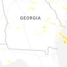


Connect with Interactive Hail Maps