

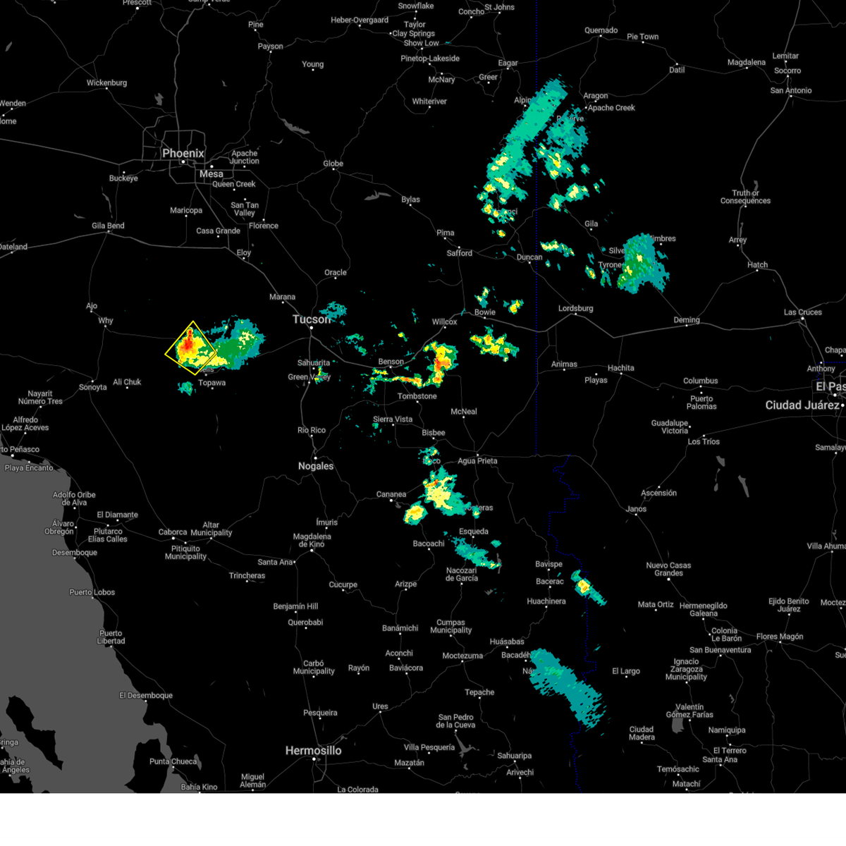
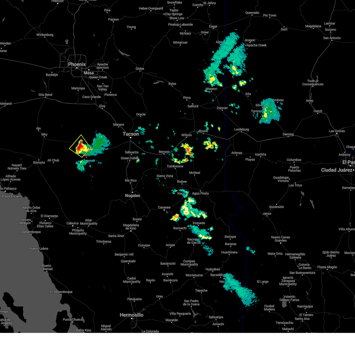
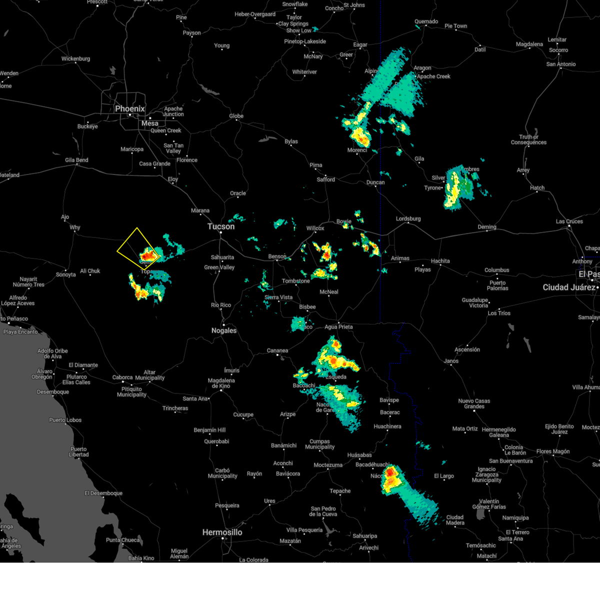
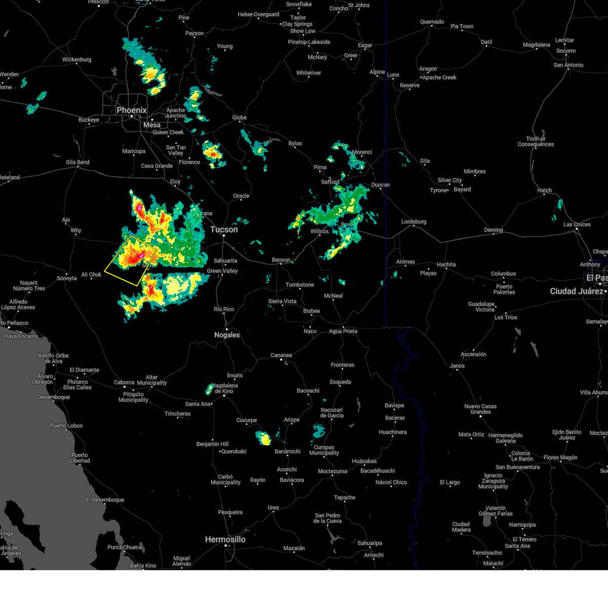
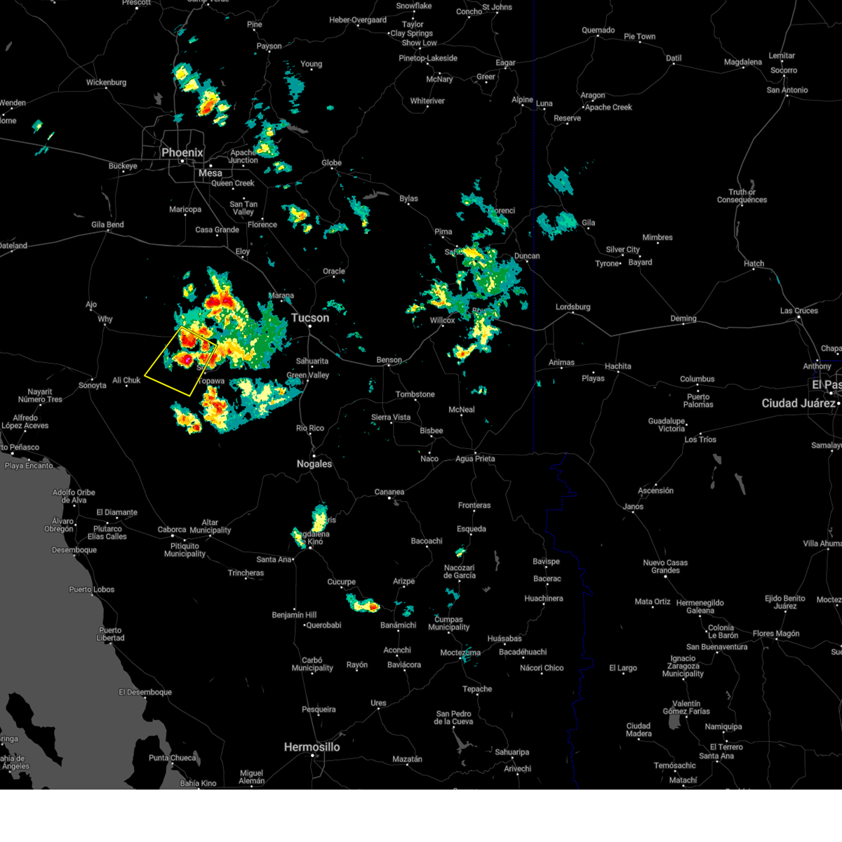
Hail Map for Nolic, AZ
The Nolic, AZ area has had 0 reports of on-the-ground hail by trained spotters, and has been under severe weather warnings 12 times during the past 12 months. Doppler radar has detected hail at or near Nolic, AZ on 26 occasions, including 3 occasions during the past year.
| Name: | Nolic, AZ |
| Where Located: | 59 miles WSW of Tucson, AZ |
| Map: | Google Map for Nolic, AZ |
| Population: | 37 |
| Housing Units: | 15 |
| More Info: | Search Google for Nolic, AZ |
5
The Top Recent Hail Date for Nolic, AZ is Sunday, August 4, 2024 (1st out of 26)

Hail and Wind Damage Spotted near Nolic, AZ
| Date / Time | Report Details |
|---|---|
| 8/16/2024 7:53 PM MST |
 The storm which prompted the warning has weakened below severe limits, and no longer poses an immediate threat to life or property. therefore, the warning will be allowed to expire. however, heavy rain and gusty winds are still possible with this thunderstorm. The storm which prompted the warning has weakened below severe limits, and no longer poses an immediate threat to life or property. therefore, the warning will be allowed to expire. however, heavy rain and gusty winds are still possible with this thunderstorm.
|
| 8/16/2024 7:38 PM MST |
 At 738 pm mst, a severe thunderstorm was located 14 miles south of santa rosa, or 15 miles northwest of sells, moving northwest at 25 mph (radar indicated). Hazards include 60 mph wind gusts and quarter size hail. Hail damage to vehicles is expected. expect wind damage to roofs, siding, and trees. locations impacted include, covered wells, no:ligk, cababi, comobabi, san luis - sells district, mountain village, rincon, and sikul himathk. This includes route 86 between mile markers 92 and 110. At 738 pm mst, a severe thunderstorm was located 14 miles south of santa rosa, or 15 miles northwest of sells, moving northwest at 25 mph (radar indicated). Hazards include 60 mph wind gusts and quarter size hail. Hail damage to vehicles is expected. expect wind damage to roofs, siding, and trees. locations impacted include, covered wells, no:ligk, cababi, comobabi, san luis - sells district, mountain village, rincon, and sikul himathk. This includes route 86 between mile markers 92 and 110.
|
| 8/16/2024 7:14 PM MST |
 Svrtwc the national weather service in tucson has issued a * severe thunderstorm warning for, central pima county in southeastern arizona, * until 800 pm mst. * at 714 pm mst, a severe thunderstorm was located 7 miles north of sells, moving northwest at 25 mph (radar indicated). Hazards include 60 mph wind gusts and quarter size hail. Hail damage to vehicles is expected. Expect wind damage to roofs, siding, and trees. Svrtwc the national weather service in tucson has issued a * severe thunderstorm warning for, central pima county in southeastern arizona, * until 800 pm mst. * at 714 pm mst, a severe thunderstorm was located 7 miles north of sells, moving northwest at 25 mph (radar indicated). Hazards include 60 mph wind gusts and quarter size hail. Hail damage to vehicles is expected. Expect wind damage to roofs, siding, and trees.
|
| 8/4/2024 6:39 PM MST |
 At 638 pm mst, a severe thunderstorm was located 12 miles west of sells, moving southwest at 10 mph (radar indicated). Hazards include 60 mph wind gusts and quarter size hail. Hail damage to vehicles is expected. expect wind damage to roofs, siding, and trees. locations impacted include, sells, covered wells, gu oidak, cowlic, no:ligk, cababi, san luis - sells district, mountain village, rincon, sikul himathk, kots kug, and kupk. This includes route 86 between mile markers 90 and 113. At 638 pm mst, a severe thunderstorm was located 12 miles west of sells, moving southwest at 10 mph (radar indicated). Hazards include 60 mph wind gusts and quarter size hail. Hail damage to vehicles is expected. expect wind damage to roofs, siding, and trees. locations impacted include, sells, covered wells, gu oidak, cowlic, no:ligk, cababi, san luis - sells district, mountain village, rincon, sikul himathk, kots kug, and kupk. This includes route 86 between mile markers 90 and 113.
|
| 8/4/2024 6:18 PM MST |
 Svrtwc the national weather service in tucson has issued a * severe thunderstorm warning for, central pima county in southeastern arizona, * until 700 pm mst. * at 618 pm mst, a severe thunderstorm was located 10 miles northwest of sells, moving southwest at 10 mph (radar indicated). Hazards include 60 mph wind gusts and quarter size hail. Hail damage to vehicles is expected. Expect wind damage to roofs, siding, and trees. Svrtwc the national weather service in tucson has issued a * severe thunderstorm warning for, central pima county in southeastern arizona, * until 700 pm mst. * at 618 pm mst, a severe thunderstorm was located 10 miles northwest of sells, moving southwest at 10 mph (radar indicated). Hazards include 60 mph wind gusts and quarter size hail. Hail damage to vehicles is expected. Expect wind damage to roofs, siding, and trees.
|
| 7/25/2024 2:07 PM MST |
 The storm which prompted the warning has weakened below severe limits, and no longer poses an immediate threat to life or property. therefore, the warning will be allowed to expire. however, gusty winds and heavy rain are still possible with this thunderstorm. to report severe weather, contact your nearest law enforcement agency. they will relay your report to the national weather service tucson. The storm which prompted the warning has weakened below severe limits, and no longer poses an immediate threat to life or property. therefore, the warning will be allowed to expire. however, gusty winds and heavy rain are still possible with this thunderstorm. to report severe weather, contact your nearest law enforcement agency. they will relay your report to the national weather service tucson.
|
| 7/25/2024 1:58 PM MST |
 Svrtwc the national weather service in tucson has issued a * severe thunderstorm warning for, central pima county in southeastern arizona, * until 215 pm mst. * at 158 pm mst, a severe thunderstorm was located 11 miles west of sells, moving south at 10 mph (radar indicated). Hazards include 60 mph wind gusts. expect damage to roofs, siding, and trees Svrtwc the national weather service in tucson has issued a * severe thunderstorm warning for, central pima county in southeastern arizona, * until 215 pm mst. * at 158 pm mst, a severe thunderstorm was located 11 miles west of sells, moving south at 10 mph (radar indicated). Hazards include 60 mph wind gusts. expect damage to roofs, siding, and trees
|
| 7/24/2024 4:23 PM MST |
 The storm which prompted the warning has weakened below severe limits, and no longer poses an immediate threat to life or property. therefore, the warning will be allowed to expire. however, gusty winds are still possible with this thunderstorm. a severe thunderstorm watch remains in effect until 900 pm mst for southeastern arizona. remember, severe thunderstorm warnings still remains in effect for pima county. The storm which prompted the warning has weakened below severe limits, and no longer poses an immediate threat to life or property. therefore, the warning will be allowed to expire. however, gusty winds are still possible with this thunderstorm. a severe thunderstorm watch remains in effect until 900 pm mst for southeastern arizona. remember, severe thunderstorm warnings still remains in effect for pima county.
|
| 7/24/2024 3:41 PM MST |
 Svrtwc the national weather service in tucson has issued a * severe thunderstorm warning for, central pima county in southeastern arizona, * until 430 pm mst. * at 340 pm mst, a severe thunderstorm was located 13 miles north of san isidro, or 19 miles north of sells, moving southwest at 10 mph (radar indicated). Hazards include 60 mph wind gusts and quarter size hail. Hail damage to vehicles is expected. Expect wind damage to roofs, siding, and trees. Svrtwc the national weather service in tucson has issued a * severe thunderstorm warning for, central pima county in southeastern arizona, * until 430 pm mst. * at 340 pm mst, a severe thunderstorm was located 13 miles north of san isidro, or 19 miles north of sells, moving southwest at 10 mph (radar indicated). Hazards include 60 mph wind gusts and quarter size hail. Hail damage to vehicles is expected. Expect wind damage to roofs, siding, and trees.
|
| 7/13/2024 5:00 PM MST |
 the severe thunderstorm warning has been cancelled and is no longer in effect the severe thunderstorm warning has been cancelled and is no longer in effect
|
| 7/13/2024 4:28 PM MST |
 At 426 pm mst, a severe thunderstorm was located near sells, moving west at 15 mph. outflow winds to 60 mph from this severe storm will liekly result in dense blowing dust impacting highway 86 to the west of sells across the central portions of the tohono oodham nation (radar indicated). Hazards include 60 mph wind gusts and quarter size hail. Hail damage to vehicles is expected. expect wind damage to roofs, siding, and trees. locations impacted include, sells, gu oidak, no:ligk, san luis - sells district, artesia, rincon, and kupk. This includes route 86 between mile markers 98 and 115. At 426 pm mst, a severe thunderstorm was located near sells, moving west at 15 mph. outflow winds to 60 mph from this severe storm will liekly result in dense blowing dust impacting highway 86 to the west of sells across the central portions of the tohono oodham nation (radar indicated). Hazards include 60 mph wind gusts and quarter size hail. Hail damage to vehicles is expected. expect wind damage to roofs, siding, and trees. locations impacted include, sells, gu oidak, no:ligk, san luis - sells district, artesia, rincon, and kupk. This includes route 86 between mile markers 98 and 115.
|
| 7/13/2024 4:23 PM MST |
 Svrtwc the national weather service in tucson has issued a * severe thunderstorm warning for, central pima county in southeastern arizona, * until 515 pm mst. * at 422 pm mst, a severe thunderstorm was located near sells, moving west at 15 mph (radar indicated). Hazards include 60 mph wind gusts and quarter size hail. Hail damage to vehicles is expected. Expect wind damage to roofs, siding, and trees. Svrtwc the national weather service in tucson has issued a * severe thunderstorm warning for, central pima county in southeastern arizona, * until 515 pm mst. * at 422 pm mst, a severe thunderstorm was located near sells, moving west at 15 mph (radar indicated). Hazards include 60 mph wind gusts and quarter size hail. Hail damage to vehicles is expected. Expect wind damage to roofs, siding, and trees.
|
| 9/22/2022 8:11 PM MST |
 The severe thunderstorm warning for western pima county will expire at 815 pm mst, the storm which prompted the warning has weakened below severe limits. therefore, the warning will be allowed to expire. however heavy rain is still possible with this thunderstorm, and a flash flood warning remains in effect this evening. The severe thunderstorm warning for western pima county will expire at 815 pm mst, the storm which prompted the warning has weakened below severe limits. therefore, the warning will be allowed to expire. however heavy rain is still possible with this thunderstorm, and a flash flood warning remains in effect this evening.
|
| 9/22/2022 7:58 PM MST |
 At 757 pm mst, a severe thunderstorm was located 14 miles south of santa rosa, or 14 miles northwest of sells, moving northwest at 10 mph (radar indicated). Hazards include 60 mph wind gusts and quarter size hail. Hail damage to vehicles is expected. expect wind damage to roofs, siding, and trees. locations impacted include, covered wells, cababi, san luis - sells district, mountain village and rincon. hail threat, radar indicated max hail size, 1. 00 in wind threat, radar indicated max wind gust, 60 mph. At 757 pm mst, a severe thunderstorm was located 14 miles south of santa rosa, or 14 miles northwest of sells, moving northwest at 10 mph (radar indicated). Hazards include 60 mph wind gusts and quarter size hail. Hail damage to vehicles is expected. expect wind damage to roofs, siding, and trees. locations impacted include, covered wells, cababi, san luis - sells district, mountain village and rincon. hail threat, radar indicated max hail size, 1. 00 in wind threat, radar indicated max wind gust, 60 mph.
|
| 9/22/2022 7:33 PM MST |
 At 732 pm mst, a severe thunderstorm was located 11 miles northwest of sells, moving northwest at 10 mph (radar indicated). Hazards include 60 mph wind gusts and quarter size hail. Hail damage to vehicles is expected. Expect wind damage to roofs, siding, and trees. At 732 pm mst, a severe thunderstorm was located 11 miles northwest of sells, moving northwest at 10 mph (radar indicated). Hazards include 60 mph wind gusts and quarter size hail. Hail damage to vehicles is expected. Expect wind damage to roofs, siding, and trees.
|
| 8/21/2022 7:50 PM MST | At 749 pm mst, a severe thunderstorm was located near santa rosa, or 34 miles north of sells, moving south at 15 mph (radar indicated). Hazards include 60 mph wind gusts and penny size hail. expect damage to roofs, siding, and trees |
| 7/16/2022 6:35 PM MST |
 At 635 pm mst, a severe thunderstorm was located near pisinemo, or 19 miles west of sells, moving west at 25 mph (radar indicated). Hazards include 60 mph wind gusts and quarter size hail. Hail damage to vehicles is expected. expect wind damage to roofs, siding, and trees. locations impacted include, pisinemo, gu oidak, no:ligk, santa cruz, mountain village and kupk. hail threat, radar indicated max hail size, 1. 00 in wind threat, radar indicated max wind gust, 60 mph. At 635 pm mst, a severe thunderstorm was located near pisinemo, or 19 miles west of sells, moving west at 25 mph (radar indicated). Hazards include 60 mph wind gusts and quarter size hail. Hail damage to vehicles is expected. expect wind damage to roofs, siding, and trees. locations impacted include, pisinemo, gu oidak, no:ligk, santa cruz, mountain village and kupk. hail threat, radar indicated max hail size, 1. 00 in wind threat, radar indicated max wind gust, 60 mph.
|
| 7/16/2022 6:09 PM MST |
 At 608 pm mst, a severe thunderstorm was located 9 miles northwest of sells, moving west at 25 mph (radar indicated). Hazards include 60 mph wind gusts and quarter size hail. Hail damage to vehicles is expected. Expect wind damage to roofs, siding, and trees. At 608 pm mst, a severe thunderstorm was located 9 miles northwest of sells, moving west at 25 mph (radar indicated). Hazards include 60 mph wind gusts and quarter size hail. Hail damage to vehicles is expected. Expect wind damage to roofs, siding, and trees.
|
| 7/15/2022 4:37 PM MST |
 The severe thunderstorm warning for central pima county will expire at 445 pm mst, the storm which prompted the warning has weakened below severe limits, and no longer poses an immediate threat to life or property. therefore, the warning will be allowed to expire. however small hail, gusty winds and heavy rain are still possible with this thunderstorm. The severe thunderstorm warning for central pima county will expire at 445 pm mst, the storm which prompted the warning has weakened below severe limits, and no longer poses an immediate threat to life or property. therefore, the warning will be allowed to expire. however small hail, gusty winds and heavy rain are still possible with this thunderstorm.
|
| 7/15/2022 3:58 PM MST |
 At 357 pm mst, a severe thunderstorm was located 10 miles north of kitt peak, or 22 miles northeast of sells, moving northwest at 10 mph (radar indicated). Hazards include 60 mph wind gusts and quarter size hail. Hail damage to vehicles is expected. Expect wind damage to roofs, siding, and trees. At 357 pm mst, a severe thunderstorm was located 10 miles north of kitt peak, or 22 miles northeast of sells, moving northwest at 10 mph (radar indicated). Hazards include 60 mph wind gusts and quarter size hail. Hail damage to vehicles is expected. Expect wind damage to roofs, siding, and trees.
|
| 8/10/2021 6:32 PM MST |
 At 631 pm mst, a severe thunderstorm was located 10 miles north of sells, moving northeast at 15 mph (radar indicated). Hazards include 60 mph wind gusts and quarter size hail. Hail damage to vehicles is expected. expect wind damage to roofs, siding, and trees. locations impacted include, sells, no:ligk, comobabi, south comobabi, cababi, sil nakya, san luis - sells district and rincon. hail threat, radar indicated max hail size, 1. 00 in wind threat, radar indicated max wind gust, 60 mph. At 631 pm mst, a severe thunderstorm was located 10 miles north of sells, moving northeast at 15 mph (radar indicated). Hazards include 60 mph wind gusts and quarter size hail. Hail damage to vehicles is expected. expect wind damage to roofs, siding, and trees. locations impacted include, sells, no:ligk, comobabi, south comobabi, cababi, sil nakya, san luis - sells district and rincon. hail threat, radar indicated max hail size, 1. 00 in wind threat, radar indicated max wind gust, 60 mph.
|
| 8/10/2021 6:19 PM MST |
 At 618 pm mst, a severe thunderstorm was located 8 miles northwest of sells, moving northeast at 15 mph (radar indicated). Hazards include 60 mph wind gusts. expect damage to roofs, siding, and trees At 618 pm mst, a severe thunderstorm was located 8 miles northwest of sells, moving northeast at 15 mph (radar indicated). Hazards include 60 mph wind gusts. expect damage to roofs, siding, and trees
|
| 7/10/2021 9:26 PM MST |
 At 925 pm mst, severe thunderstorms were located along a line extending from 12 miles southwest of chui-chu to near san isidro, moving west at 20 mph (radar indicated). Hazards include 60 mph wind gusts and quarter size hail. Hail damage to vehicles is expected. expect wind damage to roofs, siding, and trees. locations impacted include, santa rosa, san isidro, anegam, north komelik, kohatk, palo verde stand, ventana, ak chin, no:ligk, comobabi, south comobabi, cababi, sil nakya, san luis - sells district, san luis, rincon and santa rosa school. This includes route 86 between mile markers 92 and 108, and between mile markers 122 and 128. At 925 pm mst, severe thunderstorms were located along a line extending from 12 miles southwest of chui-chu to near san isidro, moving west at 20 mph (radar indicated). Hazards include 60 mph wind gusts and quarter size hail. Hail damage to vehicles is expected. expect wind damage to roofs, siding, and trees. locations impacted include, santa rosa, san isidro, anegam, north komelik, kohatk, palo verde stand, ventana, ak chin, no:ligk, comobabi, south comobabi, cababi, sil nakya, san luis - sells district, san luis, rincon and santa rosa school. This includes route 86 between mile markers 92 and 108, and between mile markers 122 and 128.
|
| 7/10/2021 8:40 PM MST |
 At 839 pm mst, severe thunderstorms were located along a line extending from near chui-chu to 12 miles southeast of kitt peak, moving west southwest at 20 mph (radar indicated). Hazards include 60 mph wind gusts and quarter size hail. Hail damage to vehicles is expected. Expect wind damage to roofs, siding, and trees. At 839 pm mst, severe thunderstorms were located along a line extending from near chui-chu to 12 miles southeast of kitt peak, moving west southwest at 20 mph (radar indicated). Hazards include 60 mph wind gusts and quarter size hail. Hail damage to vehicles is expected. Expect wind damage to roofs, siding, and trees.
|
| 6/29/2021 3:52 PM MST |
 The severe thunderstorm warning for central pima county will expire at 400 pm mst, the severe thunderstorm which prompted the warning has weakened. therefore, the warning will be allowed to expire. however gusty winds are still possible with localized areas of blowing dust. The severe thunderstorm warning for central pima county will expire at 400 pm mst, the severe thunderstorm which prompted the warning has weakened. therefore, the warning will be allowed to expire. however gusty winds are still possible with localized areas of blowing dust.
|
| 6/29/2021 3:37 PM MST |
 At 336 pm mst, a severe thunderstorm was located 7 miles northwest of sells, moving southwest at 5 mph (radar indicated). Hazards include 60 mph wind gusts. Expect damage to roofs, siding, and trees. locations impacted include, gu oidak, no:ligk, cababi, san luis - sells district and rincon. This includes route 86 between mile markers 99 and 111. At 336 pm mst, a severe thunderstorm was located 7 miles northwest of sells, moving southwest at 5 mph (radar indicated). Hazards include 60 mph wind gusts. Expect damage to roofs, siding, and trees. locations impacted include, gu oidak, no:ligk, cababi, san luis - sells district and rincon. This includes route 86 between mile markers 99 and 111.
|
| 6/29/2021 3:20 PM MST |
 At 320 pm mst, a severe thunderstorm was located 7 miles northwest of sells along highway 86, moving south at 10 mph (radar indicated). Hazards include 60 mph wind gusts and quarter size hail. Hail damage to vehicles is expected. Expect wind damage to roofs, siding, and trees. At 320 pm mst, a severe thunderstorm was located 7 miles northwest of sells along highway 86, moving south at 10 mph (radar indicated). Hazards include 60 mph wind gusts and quarter size hail. Hail damage to vehicles is expected. Expect wind damage to roofs, siding, and trees.
|
| 8/15/2020 8:56 PM MST |
 At 856 pm mst, severe thunderstorms were located along a line extending from near san isidro to near topawa to 8 miles northwest of san miguel, moving west at 25 mph (radar indicated). Hazards include 60 mph wind gusts and quarter size hail. Hail damage to vehicles is expected. Expect wind damage to roofs, siding, and trees. At 856 pm mst, severe thunderstorms were located along a line extending from near san isidro to near topawa to 8 miles northwest of san miguel, moving west at 25 mph (radar indicated). Hazards include 60 mph wind gusts and quarter size hail. Hail damage to vehicles is expected. Expect wind damage to roofs, siding, and trees.
|
| 9/24/2019 9:06 AM MST |
 At 905 am mst, a severe thunderstorm was located over sells, moving north at 35 mph (radar indicated). Hazards include 60 mph wind gusts and quarter size hail. Hail damage to vehicles is expected. Expect wind damage to roofs, siding, and trees. At 905 am mst, a severe thunderstorm was located over sells, moving north at 35 mph (radar indicated). Hazards include 60 mph wind gusts and quarter size hail. Hail damage to vehicles is expected. Expect wind damage to roofs, siding, and trees.
|
| 8/3/2019 4:57 PM MST |
 The severe thunderstorm warning for central pima county will expire at 500 pm mst, the storm which prompted the warning has weakened below severe limits, and no longer poses an immediate threat to life or property. therefore, the warning will be allowed to expire at 5 pm mst. however heavy rain is still possible with this thunderstorm. The severe thunderstorm warning for central pima county will expire at 500 pm mst, the storm which prompted the warning has weakened below severe limits, and no longer poses an immediate threat to life or property. therefore, the warning will be allowed to expire at 5 pm mst. however heavy rain is still possible with this thunderstorm.
|
| 8/3/2019 4:38 PM MST |
 At 437 pm mst, a severe thunderstorm was located near sells, moving east at 10 mph (radar indicated). Hazards include 60 mph wind gusts and penny size hail. Expect damage to roofs, siding, and trees. locations impacted include, sells, san isidro, ali chukson, fresnal, no:ligk, comobabi, south comobabi, cababi, artesia, rincon and ali molina. This includes route 86 between mile markers 105 and 125. At 437 pm mst, a severe thunderstorm was located near sells, moving east at 10 mph (radar indicated). Hazards include 60 mph wind gusts and penny size hail. Expect damage to roofs, siding, and trees. locations impacted include, sells, san isidro, ali chukson, fresnal, no:ligk, comobabi, south comobabi, cababi, artesia, rincon and ali molina. This includes route 86 between mile markers 105 and 125.
|
| 8/3/2019 4:14 PM MST |
 At 414 pm mst, a severe thunderstorm was located near sells, moving east at 10 mph (radar indicated). Hazards include 60 mph wind gusts and penny size hail. expect damage to roofs, siding, and trees At 414 pm mst, a severe thunderstorm was located near sells, moving east at 10 mph (radar indicated). Hazards include 60 mph wind gusts and penny size hail. expect damage to roofs, siding, and trees
|
| 7/22/2019 6:48 PM MST |
 At 647 pm mst, a severe thunderstorm was located 12 miles southwest of santa rosa, or 26 miles northwest of sells, moving northwest at 35 mph (radar indicated). Hazards include 70 mph wind gusts and penny size hail. Expect considerable tree damage. Damage is likely to mobile homes, roofs, and outbuildings. At 647 pm mst, a severe thunderstorm was located 12 miles southwest of santa rosa, or 26 miles northwest of sells, moving northwest at 35 mph (radar indicated). Hazards include 70 mph wind gusts and penny size hail. Expect considerable tree damage. Damage is likely to mobile homes, roofs, and outbuildings.
|
| 7/29/2018 6:17 PM MST |
 At 615 pm mst, severe thunderstorms were located along a line extending from 27 miles east of organ pipe national monument to 11 miles west of sells, moving northwest at 15 mph (radar indicated). Hazards include 60 mph wind gusts and quarter size hail. Hail damage to vehicles is expected. Expect wind damage to roofs, siding, and trees. At 615 pm mst, severe thunderstorms were located along a line extending from 27 miles east of organ pipe national monument to 11 miles west of sells, moving northwest at 15 mph (radar indicated). Hazards include 60 mph wind gusts and quarter size hail. Hail damage to vehicles is expected. Expect wind damage to roofs, siding, and trees.
|
| 7/17/2018 10:15 PM MST |
 At 1012 pm mst, national weather service doppler radar was tracking two severe thunderstorms within the warning area. one was near santa rosa ranch and the other was east of quijotoa. both storms were moving west at 20 mph (radar indicated). Hazards include 60 mph wind gusts. Expect damage to roofs, siding, and trees. locations impacted include, sells, kitt peak, san luis, santa rosa ranch, pisinimo, pisinemo, pan tak, mountain village, covered wells, comobabi, nolic, san isidro and sil naggia. This includes route 86 between mile markers 81 and 110, and between mile markers 121 and 138. At 1012 pm mst, national weather service doppler radar was tracking two severe thunderstorms within the warning area. one was near santa rosa ranch and the other was east of quijotoa. both storms were moving west at 20 mph (radar indicated). Hazards include 60 mph wind gusts. Expect damage to roofs, siding, and trees. locations impacted include, sells, kitt peak, san luis, santa rosa ranch, pisinimo, pisinemo, pan tak, mountain village, covered wells, comobabi, nolic, san isidro and sil naggia. This includes route 86 between mile markers 81 and 110, and between mile markers 121 and 138.
|
| 7/17/2018 9:58 PM MST |
 At 957 pm mst, a severe thunderstorm was located 7 miles north of kitt peak, or 13 miles northeast of sells, moving west at 20 mph (radar indicated). Hazards include 60 mph wind gusts. expect damage to roofs, siding, and trees At 957 pm mst, a severe thunderstorm was located 7 miles north of kitt peak, or 13 miles northeast of sells, moving west at 20 mph (radar indicated). Hazards include 60 mph wind gusts. expect damage to roofs, siding, and trees
|
| 7/9/2018 2:59 PM MST |
 At 257 pm mst, doppler radar indicated a severe thunderstorm capable of producing quarter size hail and destructive winds in excess of 70 mph. this storm was located 5 miles west of sells, and moving west at 15 to 20 mph. At 257 pm mst, doppler radar indicated a severe thunderstorm capable of producing quarter size hail and destructive winds in excess of 70 mph. this storm was located 5 miles west of sells, and moving west at 15 to 20 mph.
|
| 7/13/2017 8:14 PM MST |
 At 812 pm mst, the line of severe thunderstorms were south of highway 86, moving southwest at 25 mph (radar indicated). Hazards include 60 mph wind gusts. Expect damage to roofs, siding, and trees. Locations impacted include, santa cruz, little tucson, kupk, pisinimo, papago farms, pisinemo, vamori, mountain village, topawa, covered wells, big fields, cowlic, artesa, comobabi, nolic and san isidro. At 812 pm mst, the line of severe thunderstorms were south of highway 86, moving southwest at 25 mph (radar indicated). Hazards include 60 mph wind gusts. Expect damage to roofs, siding, and trees. Locations impacted include, santa cruz, little tucson, kupk, pisinimo, papago farms, pisinemo, vamori, mountain village, topawa, covered wells, big fields, cowlic, artesa, comobabi, nolic and san isidro.
|
| 7/13/2017 7:10 PM MST |
 At 709 pm mst, several severe thunderstorms were located 9 miles north of sells, moving southwest at 25 mph (radar indicated). Hazards include 60 mph wind gusts and blowing dust with visibilities below 1 mile at times. expect damage to roofs, siding, and trees At 709 pm mst, several severe thunderstorms were located 9 miles north of sells, moving southwest at 25 mph (radar indicated). Hazards include 60 mph wind gusts and blowing dust with visibilities below 1 mile at times. expect damage to roofs, siding, and trees
|
| 7/10/2017 7:38 PM MST |
 At 737 pm mst, a severe thunderstorm was located over sells, moving southeast at 15 mph (radar indicated). Hazards include 60 mph wind gusts and quarter size hail. Hail damage to vehicles is expected. expect wind damage to roofs, siding, and trees. Locations impacted include, sells, topawa, big fields, little tucson, artesa, nolic and vamori. At 737 pm mst, a severe thunderstorm was located over sells, moving southeast at 15 mph (radar indicated). Hazards include 60 mph wind gusts and quarter size hail. Hail damage to vehicles is expected. expect wind damage to roofs, siding, and trees. Locations impacted include, sells, topawa, big fields, little tucson, artesa, nolic and vamori.
|
| 7/10/2017 7:09 PM MST |
 At 709 pm mst, a severe thunderstorm was located near sells, moving southeast at 15 mph (radar indicated). Hazards include 60 mph wind gusts and quarter size hail. Hail damage to vehicles is expected. Expect wind damage to roofs, siding, and trees. At 709 pm mst, a severe thunderstorm was located near sells, moving southeast at 15 mph (radar indicated). Hazards include 60 mph wind gusts and quarter size hail. Hail damage to vehicles is expected. Expect wind damage to roofs, siding, and trees.
|
| 7/9/2017 5:56 PM MST |
 At 554 pm mst, radar indicates that a severe thunderstorm continues approximately 10 miles southwest of santa rosa, or 24 miles northwest of sells, moving northwest at 15 mph (radar indicated). Hazards include 70 mph wind gusts with blowing dust are still likely along with nickel size hail. locally heavy rain is expected directly under the storm. Expect considerable tree damage. damage is likely to mobile homes, roofs, and outbuildings. Locations impacted include, sells, santa rosa, san luis, santa rosa ranch, ventana, ak chin, mountain village, covered wells, anegam, comobabi, nolic, vaya chin, san simon village and sil naggia. At 554 pm mst, radar indicates that a severe thunderstorm continues approximately 10 miles southwest of santa rosa, or 24 miles northwest of sells, moving northwest at 15 mph (radar indicated). Hazards include 70 mph wind gusts with blowing dust are still likely along with nickel size hail. locally heavy rain is expected directly under the storm. Expect considerable tree damage. damage is likely to mobile homes, roofs, and outbuildings. Locations impacted include, sells, santa rosa, san luis, santa rosa ranch, ventana, ak chin, mountain village, covered wells, anegam, comobabi, nolic, vaya chin, san simon village and sil naggia.
|
| 7/9/2017 5:32 PM MST |
 At 531 pm mst, a severe thunderstorm was located 12 miles south of santa rosa, or 18 miles northwest of sells, moving northwest at 15 mph (trained weather spotters and radar). Hazards include up to 70 mph wind gusts, blowing dust and nickel size hail and locally heavy rain. Expect considerable tree damage. Damage is likely to mobile homes, roofs, and outbuildings. At 531 pm mst, a severe thunderstorm was located 12 miles south of santa rosa, or 18 miles northwest of sells, moving northwest at 15 mph (trained weather spotters and radar). Hazards include up to 70 mph wind gusts, blowing dust and nickel size hail and locally heavy rain. Expect considerable tree damage. Damage is likely to mobile homes, roofs, and outbuildings.
|
| 7/29/2016 6:39 PM MST |
 The severe thunderstorm warning for central pima county will expire at 645 pm mst, the storm which prompted the warning has weakened below severe limits, and no longer poses an immediate threat to life or property. therefore the warning will be allowed to expire. however heavy rain is still possible with this thunderstorm. a flash flood warning is still in effect for this area until 800 pm mst. The severe thunderstorm warning for central pima county will expire at 645 pm mst, the storm which prompted the warning has weakened below severe limits, and no longer poses an immediate threat to life or property. therefore the warning will be allowed to expire. however heavy rain is still possible with this thunderstorm. a flash flood warning is still in effect for this area until 800 pm mst.
|
| 7/29/2016 5:59 PM MST |
 At 557 pm mst, doppler radar indicated a severe thunderstorm capable of producing quarter size hail and damaging winds in excess of 60 mph. this storm was located 12 miles northwest of sells, and moving west at 15 mph. these winds may suspend dust, resulting in dense blowing dust alonghighway 86 to the northwest of sells. At 557 pm mst, doppler radar indicated a severe thunderstorm capable of producing quarter size hail and damaging winds in excess of 60 mph. this storm was located 12 miles northwest of sells, and moving west at 15 mph. these winds may suspend dust, resulting in dense blowing dust alonghighway 86 to the northwest of sells.
|
| 10/16/2015 1:52 PM MST |
 At 148 pm mst, doppler radar continued to indicate strong to a severe thunderstorms capable of producing damaging winds in excess of 60 mph. these storms continue to redevelop over the area near and north of the kitt peak area. heavy rain may also result in heavy runoff in the area. locations impacted include, kitt peak, santa rosa, sanluis, nolic, ak chin, queens well, san isidro, pan tak, comobabi, santa rosa ranch, sil naggia and big fields. At 148 pm mst, doppler radar continued to indicate strong to a severe thunderstorms capable of producing damaging winds in excess of 60 mph. these storms continue to redevelop over the area near and north of the kitt peak area. heavy rain may also result in heavy runoff in the area. locations impacted include, kitt peak, santa rosa, sanluis, nolic, ak chin, queens well, san isidro, pan tak, comobabi, santa rosa ranch, sil naggia and big fields.
|
| 10/16/2015 1:19 PM MST |
 At 117 pm mst, doppler radar indicated a pair of severe thunderstorms capable of producing quarter size hail and damaging winds in excess of 60 mph. these storms are located near state route 86 northeast and northwest of sells and were moving north at 20 mph. At 117 pm mst, doppler radar indicated a pair of severe thunderstorms capable of producing quarter size hail and damaging winds in excess of 60 mph. these storms are located near state route 86 northeast and northwest of sells and were moving north at 20 mph.
|
| 6/30/2015 8:27 PM MST |
 At 826 pm mst, doppler radar indicated a line of severe thunderstorms capable of producing quarter size hail and damaging winds in excess of 60 mph. these storms were located along a line extending from 6 miles east of kitt peak to 6 miles east of junction of highway 286 and arivaca road, and moving west at 30 mph. At 826 pm mst, doppler radar indicated a line of severe thunderstorms capable of producing quarter size hail and damaging winds in excess of 60 mph. these storms were located along a line extending from 6 miles east of kitt peak to 6 miles east of junction of highway 286 and arivaca road, and moving west at 30 mph.
|
| 6/29/2015 3:56 PM MST |
 The severe thunderstorm warning for central pima county will expire at 400 pm mst, the storm which prompted the warning has weakened below severe limits, and no longer poses an immediate threat to life or property. therefore the warning will be allowed to expire. however gusty winds are still possible with this thunderstorm. The severe thunderstorm warning for central pima county will expire at 400 pm mst, the storm which prompted the warning has weakened below severe limits, and no longer poses an immediate threat to life or property. therefore the warning will be allowed to expire. however gusty winds are still possible with this thunderstorm.
|
| 6/29/2015 3:13 PM MST |
 At 312 pm mst, doppler radar continued to indicated a severe thunderstorm capable of producing quarter size hail and damaging winds in excess of 60 mph. this storm was located over san isidro just northwest of kitt peak, and moving northwest at 15 mph. At 312 pm mst, doppler radar continued to indicated a severe thunderstorm capable of producing quarter size hail and damaging winds in excess of 60 mph. this storm was located over san isidro just northwest of kitt peak, and moving northwest at 15 mph.
|
Hail Maps for Nolic, AZ


Connect with Interactive Hail Maps