

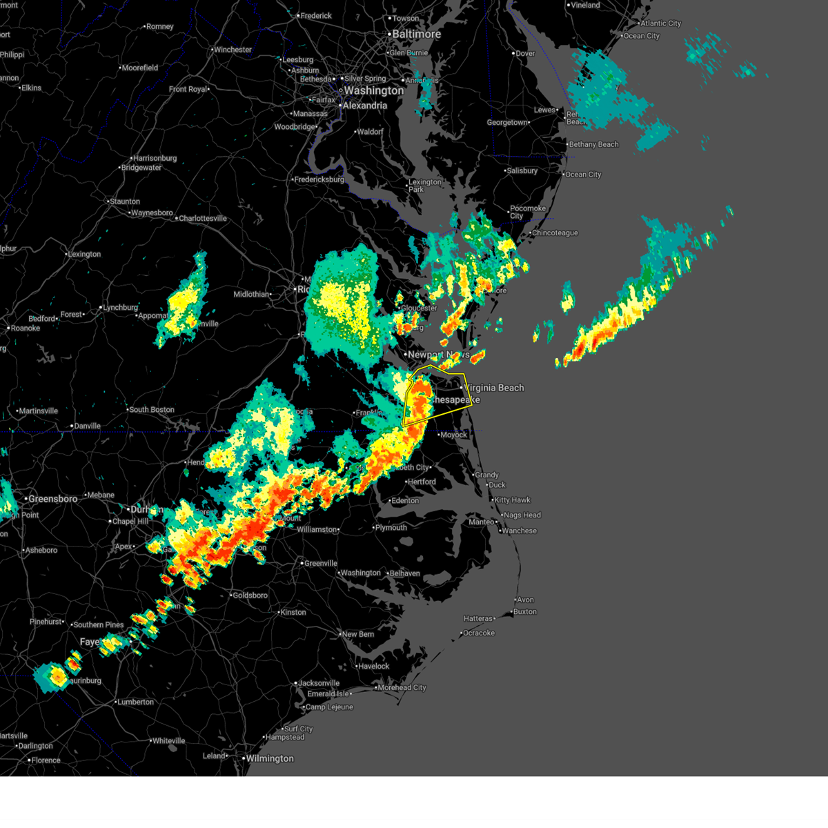
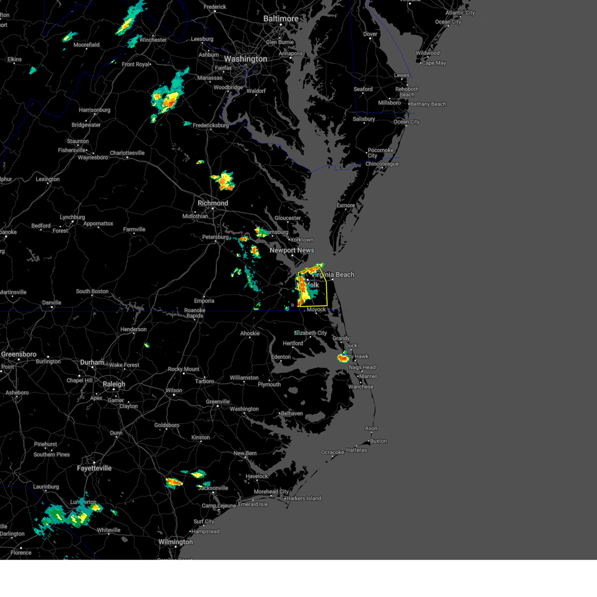
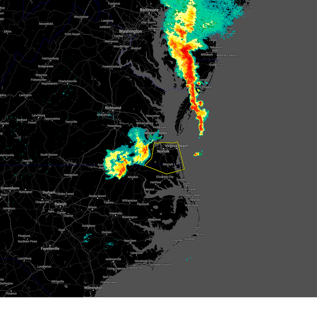
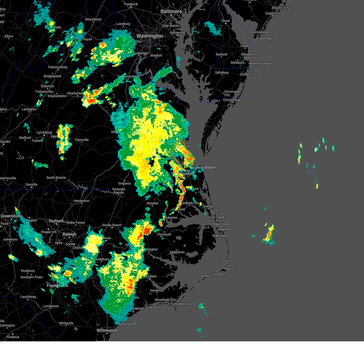
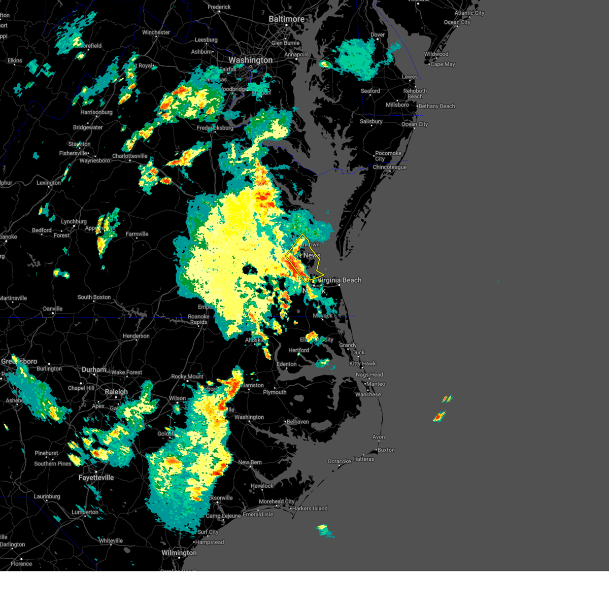
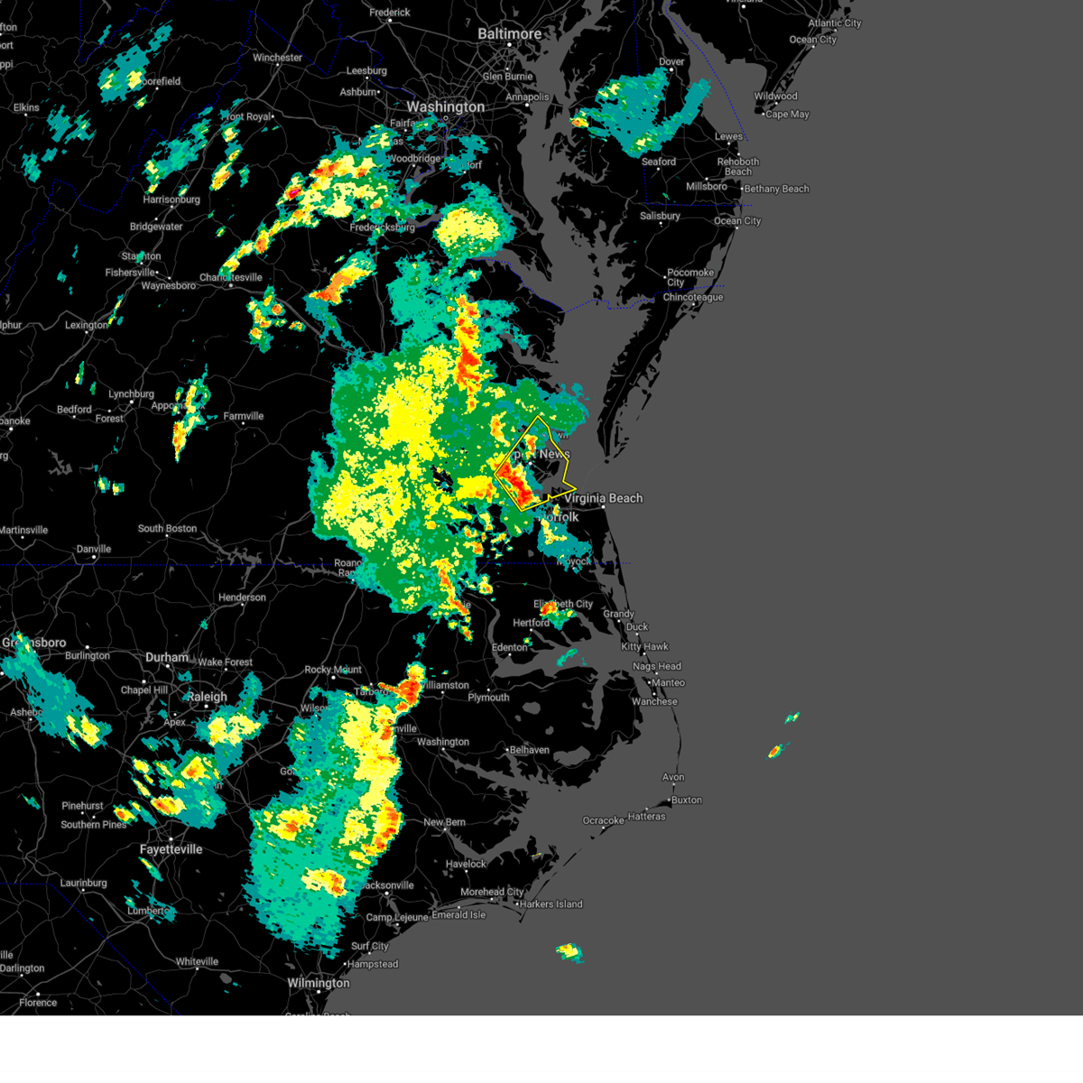
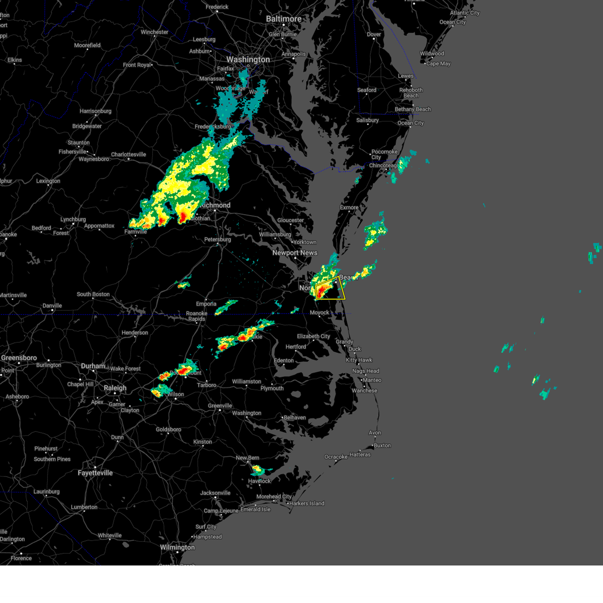
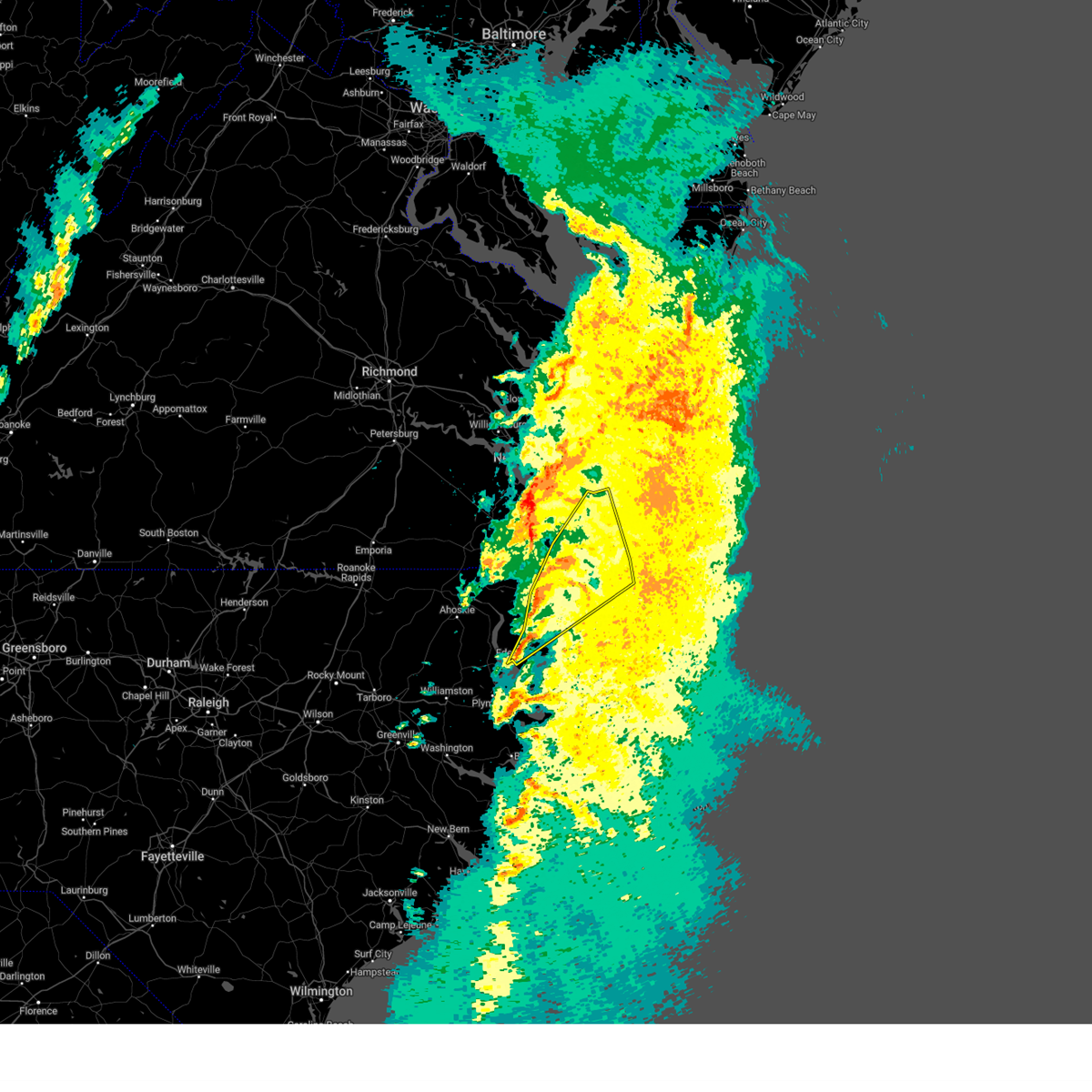
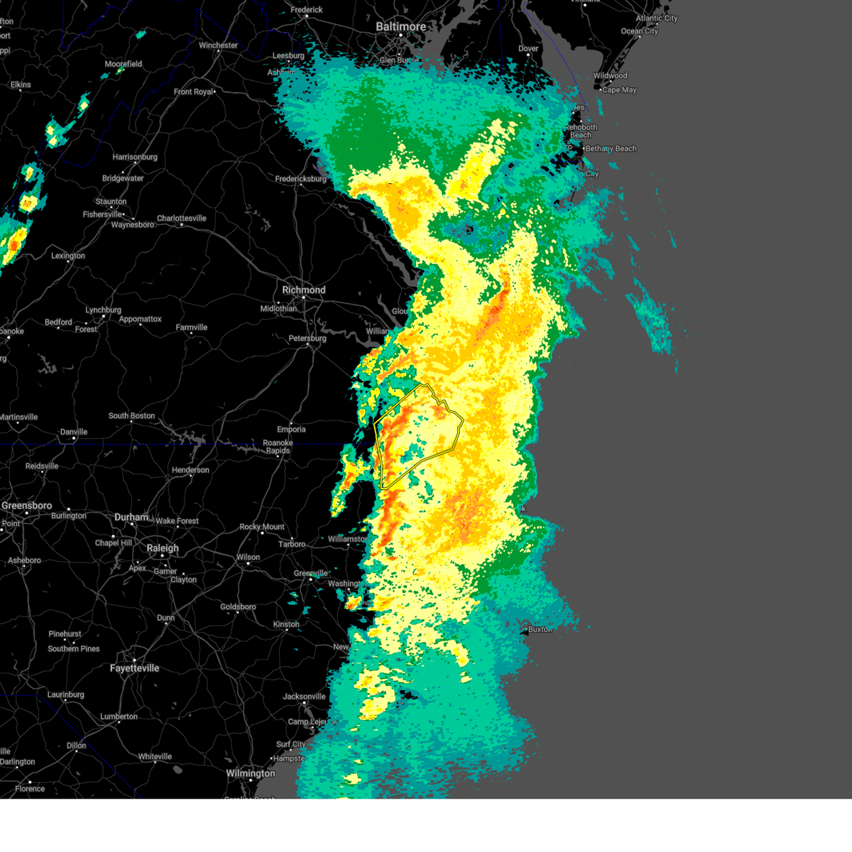
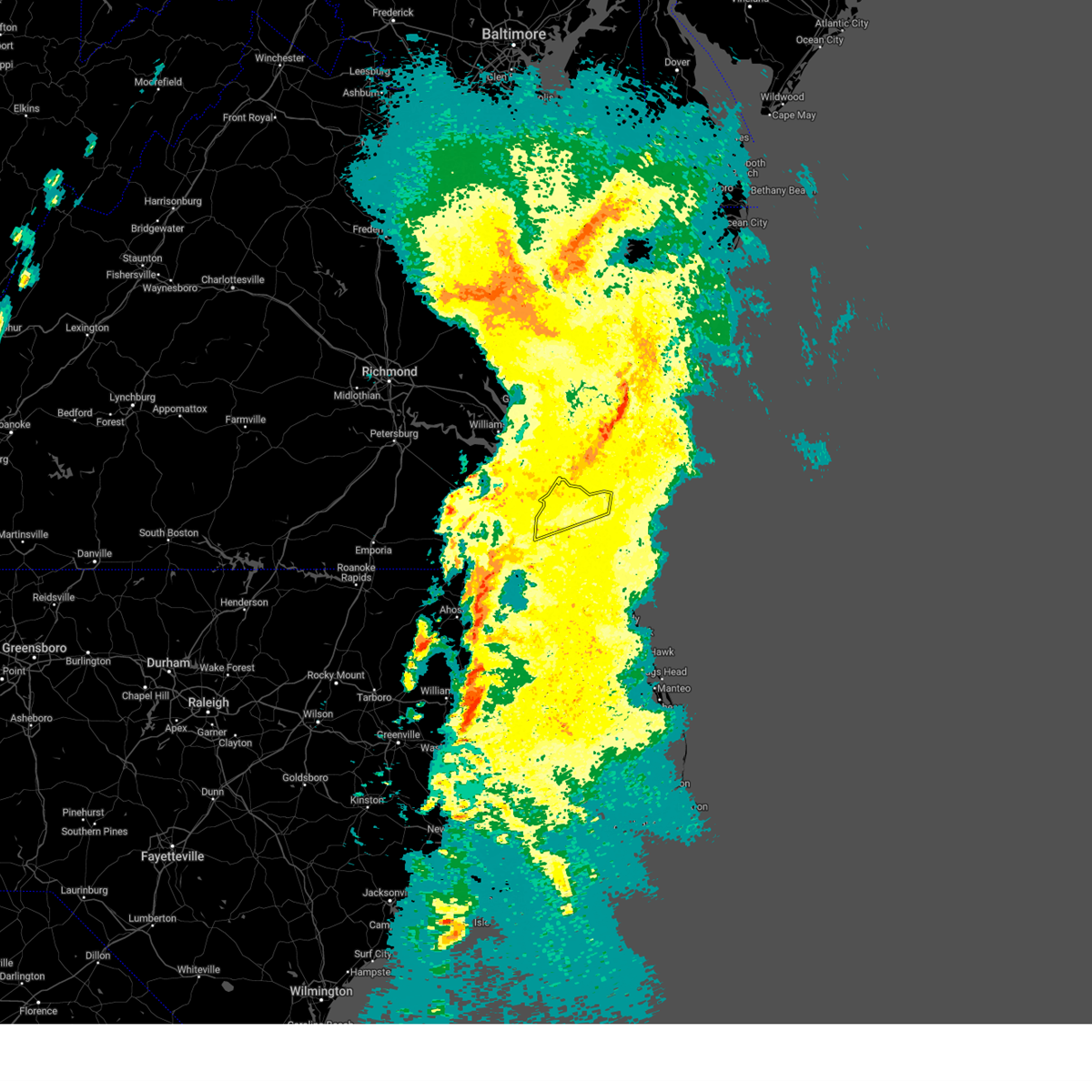
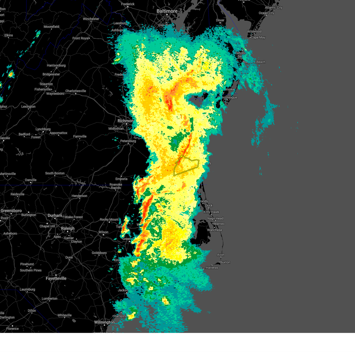
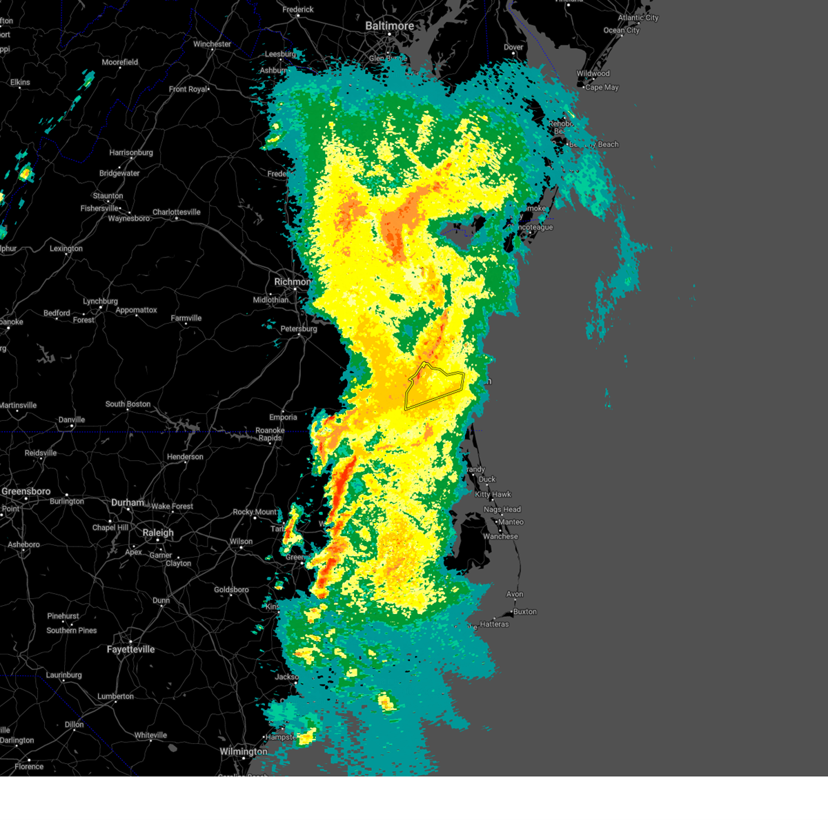
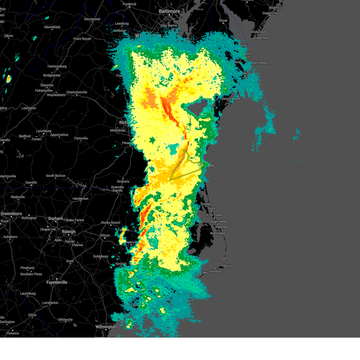
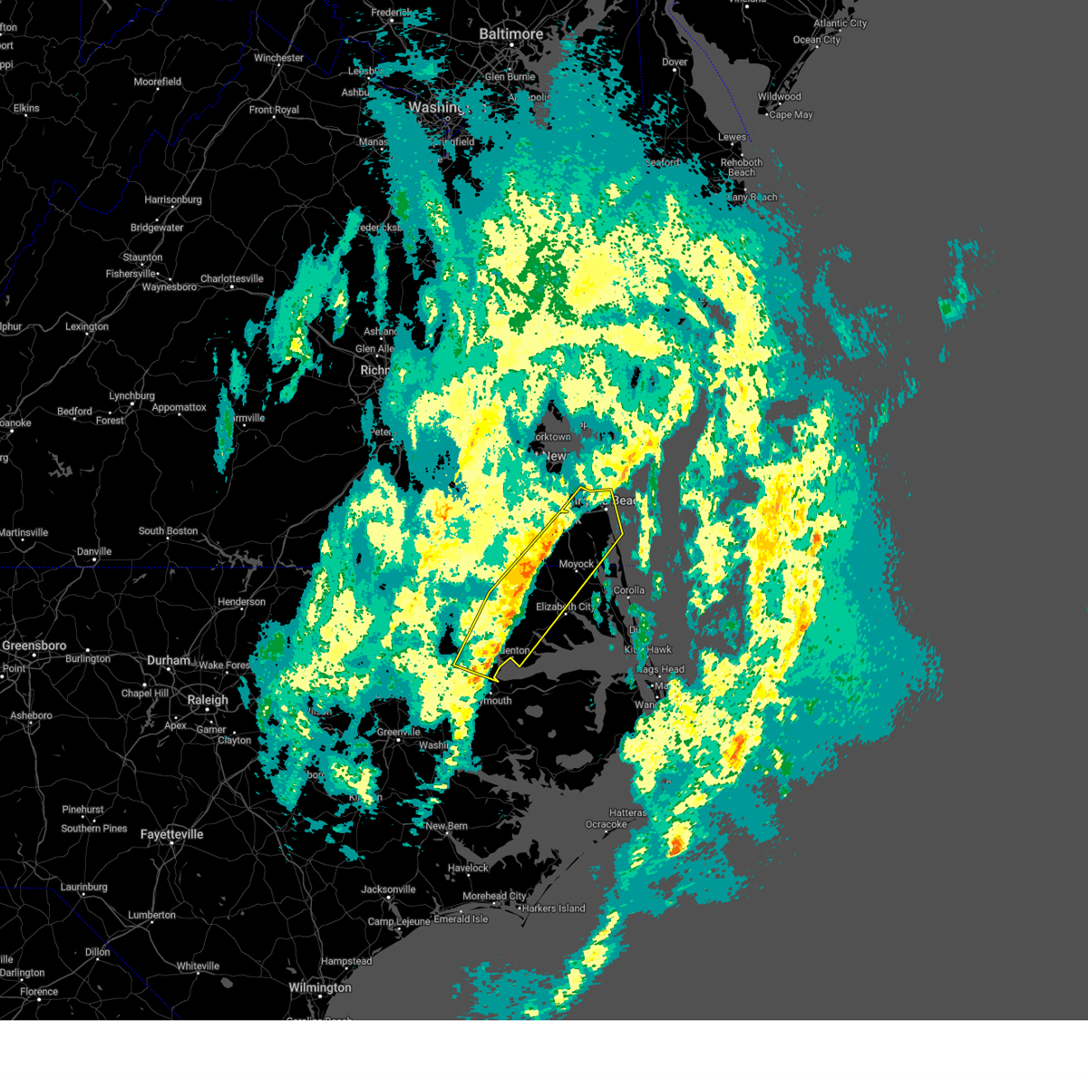
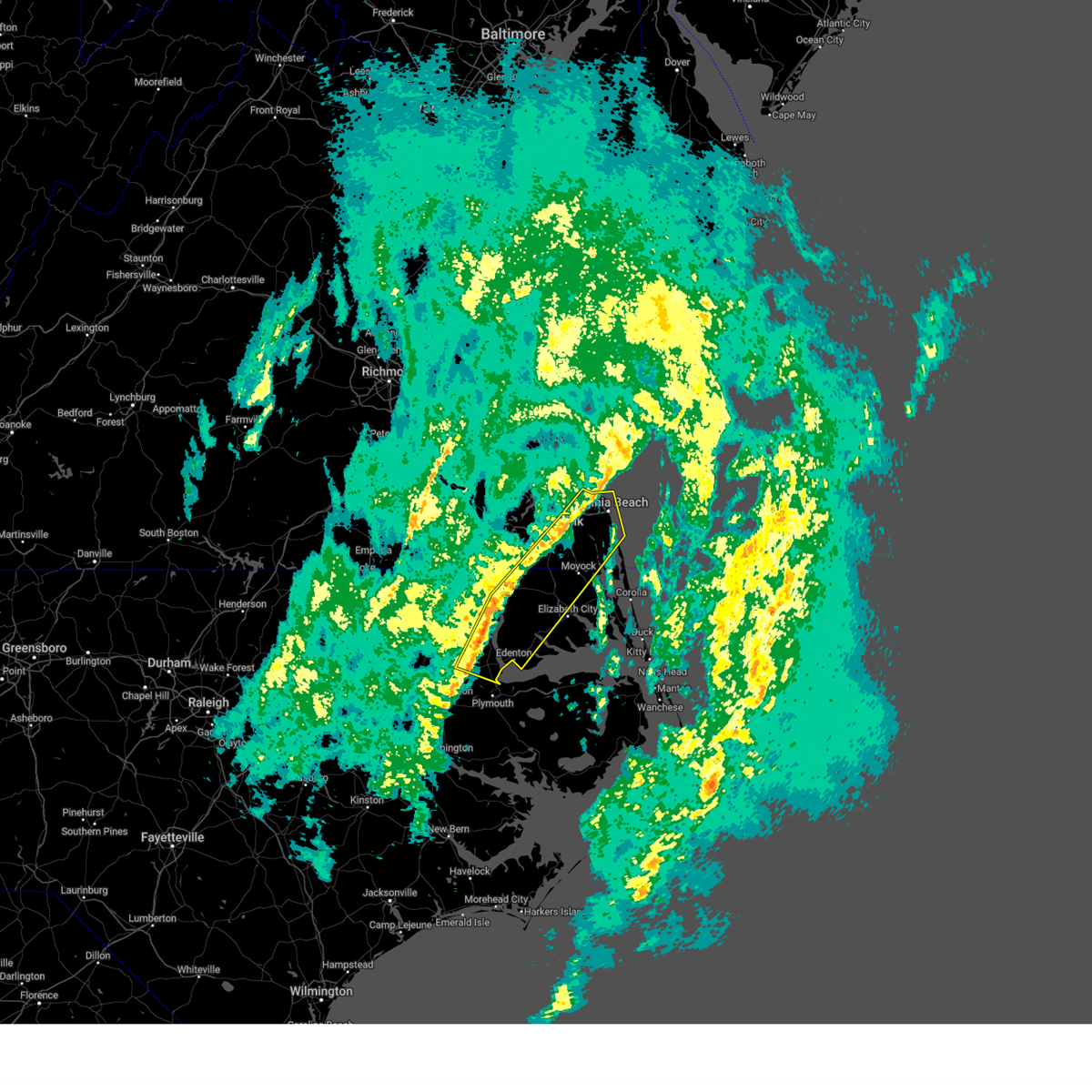
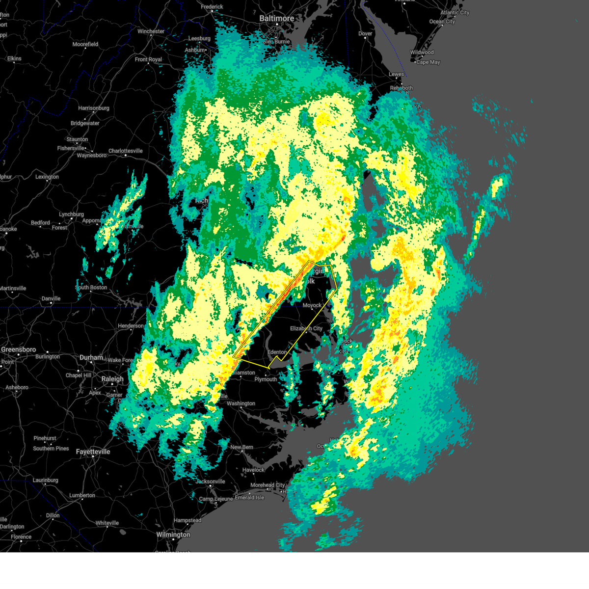
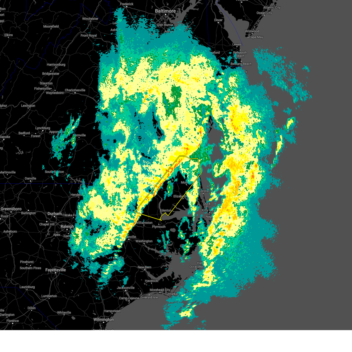
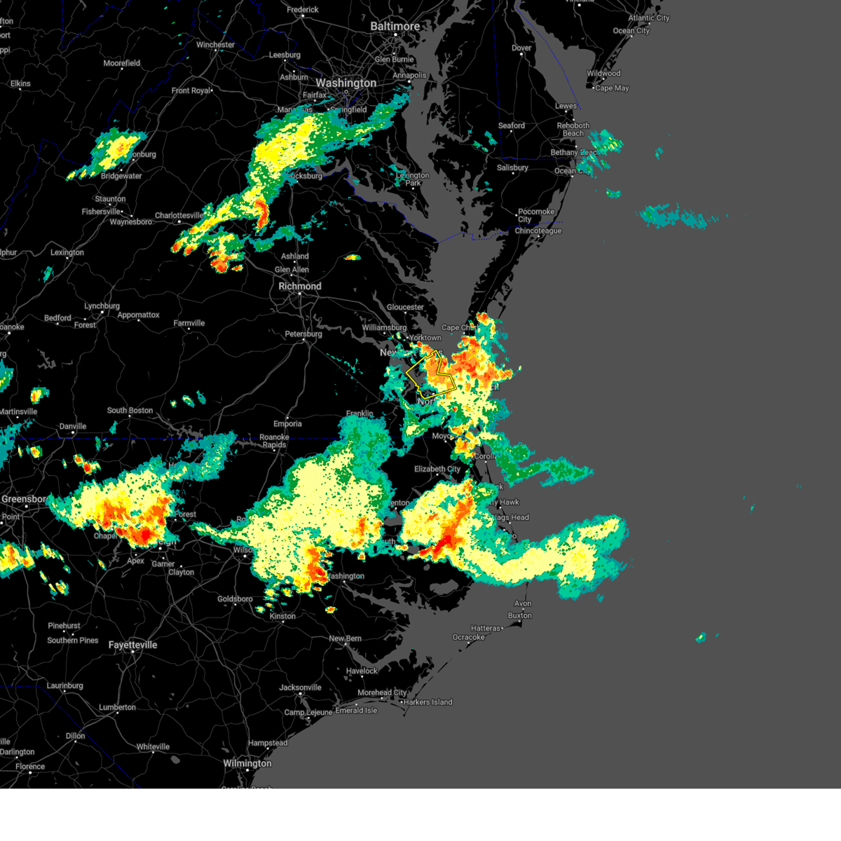
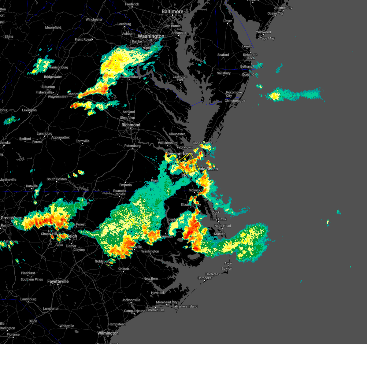
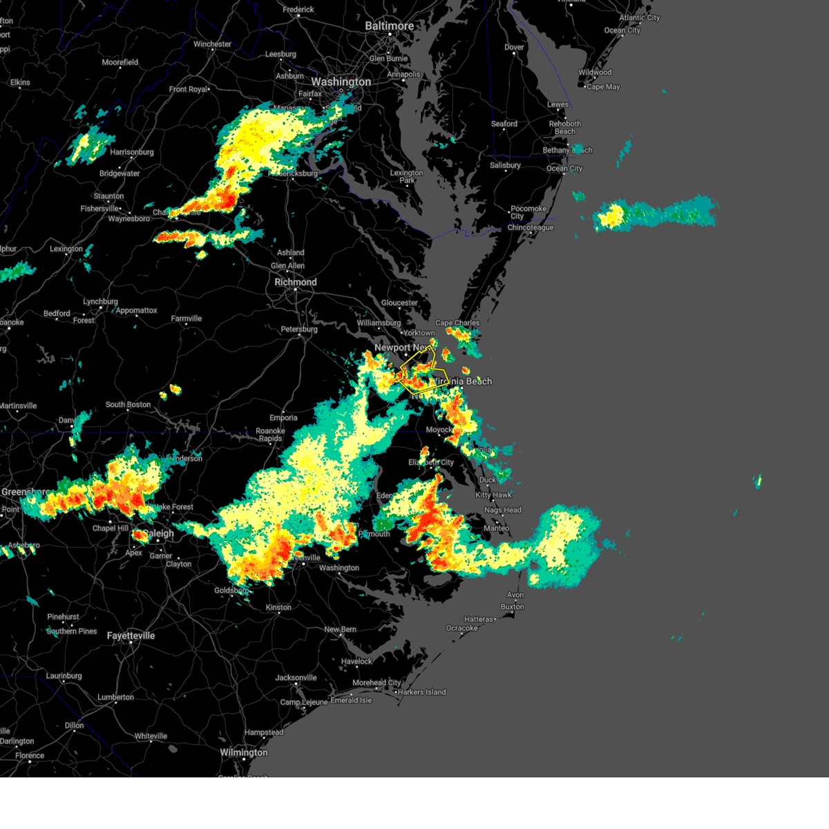
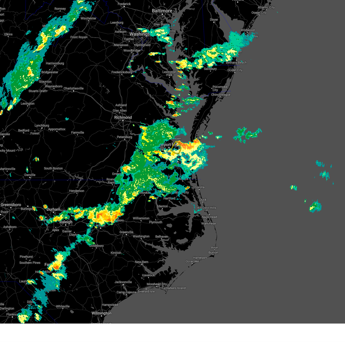
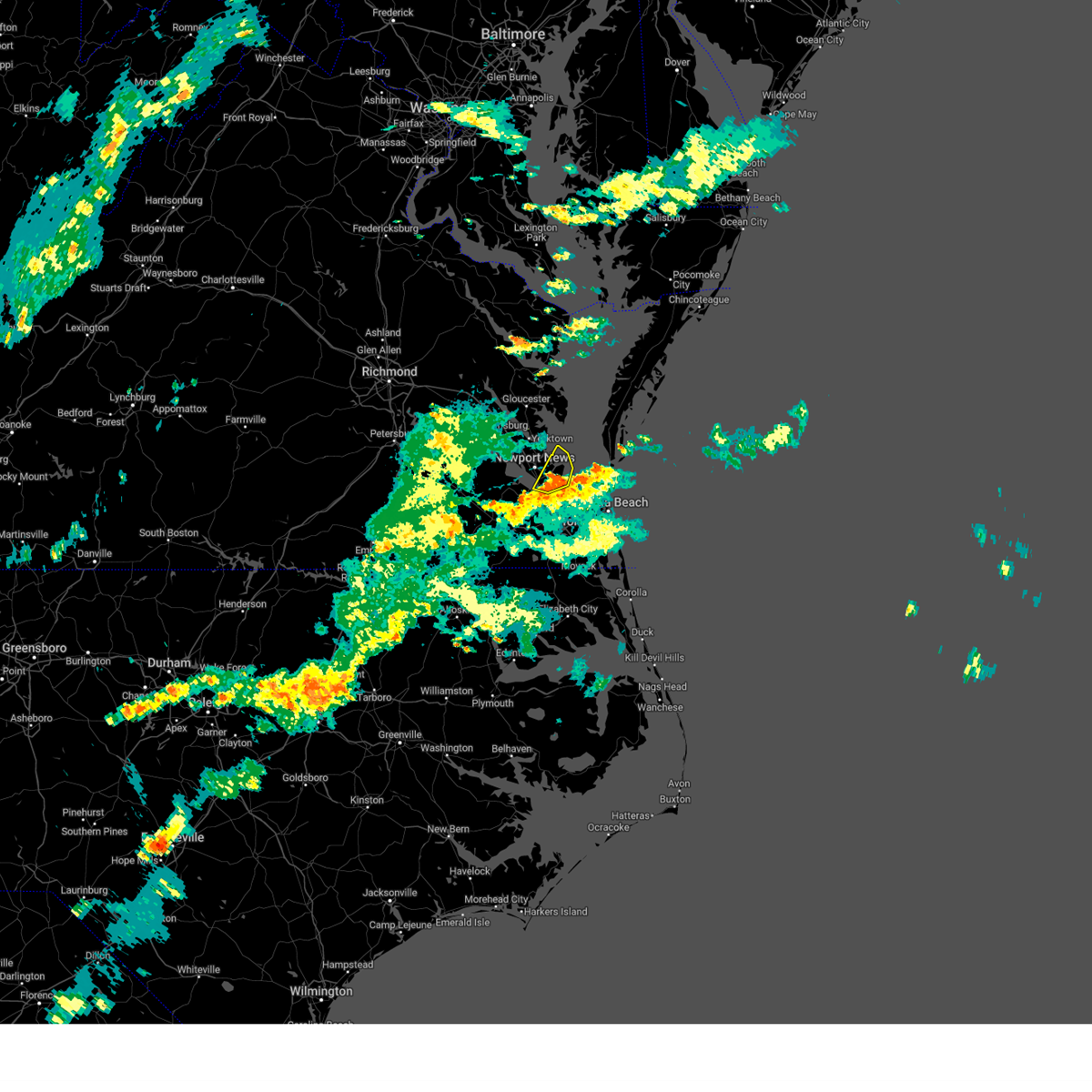
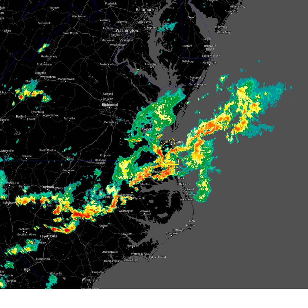
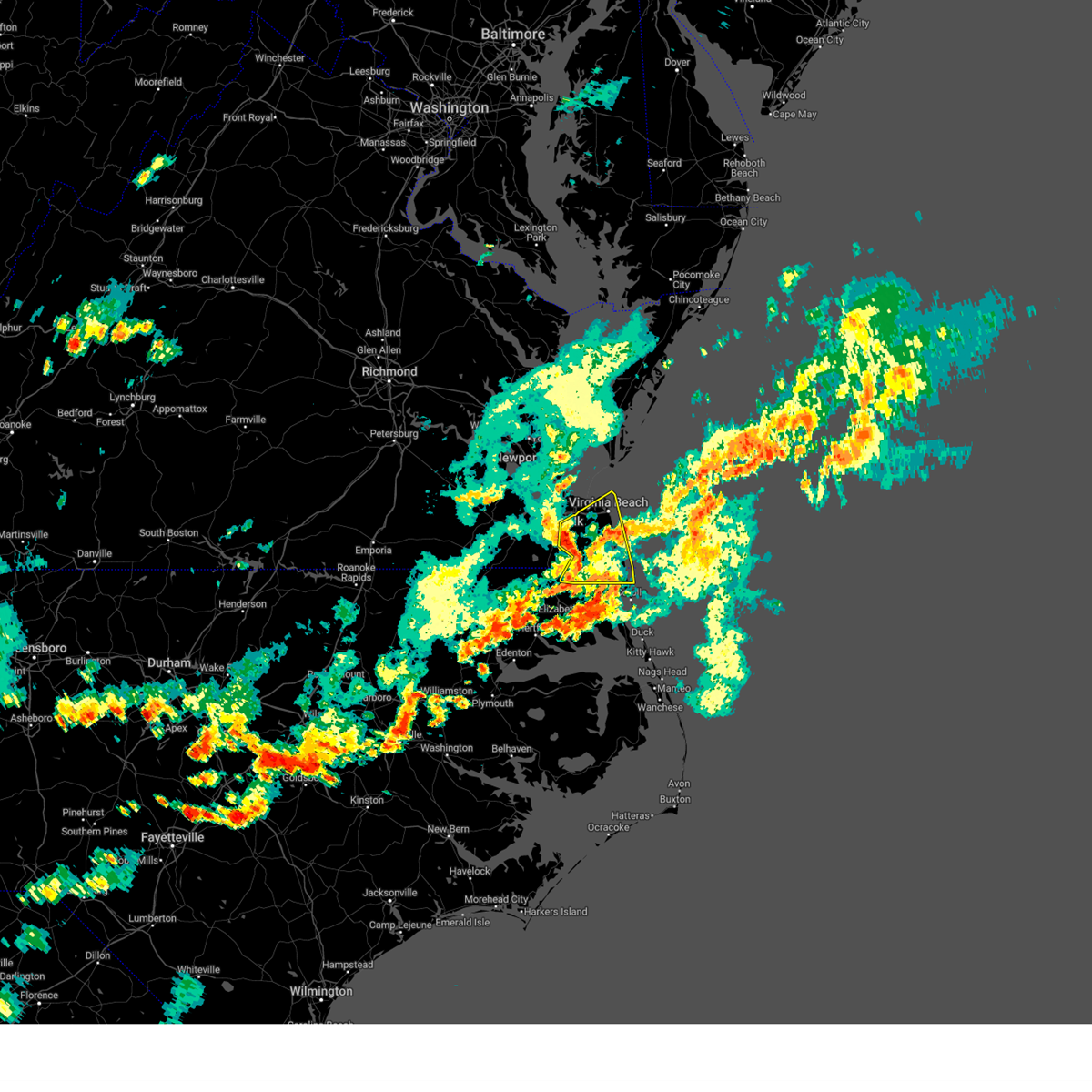
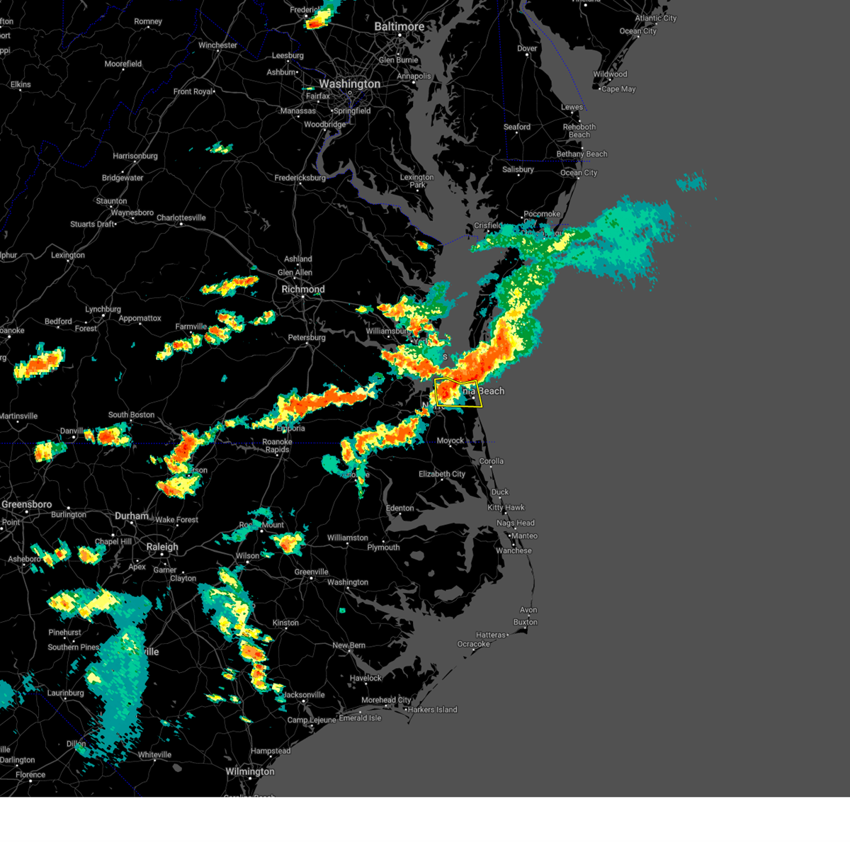
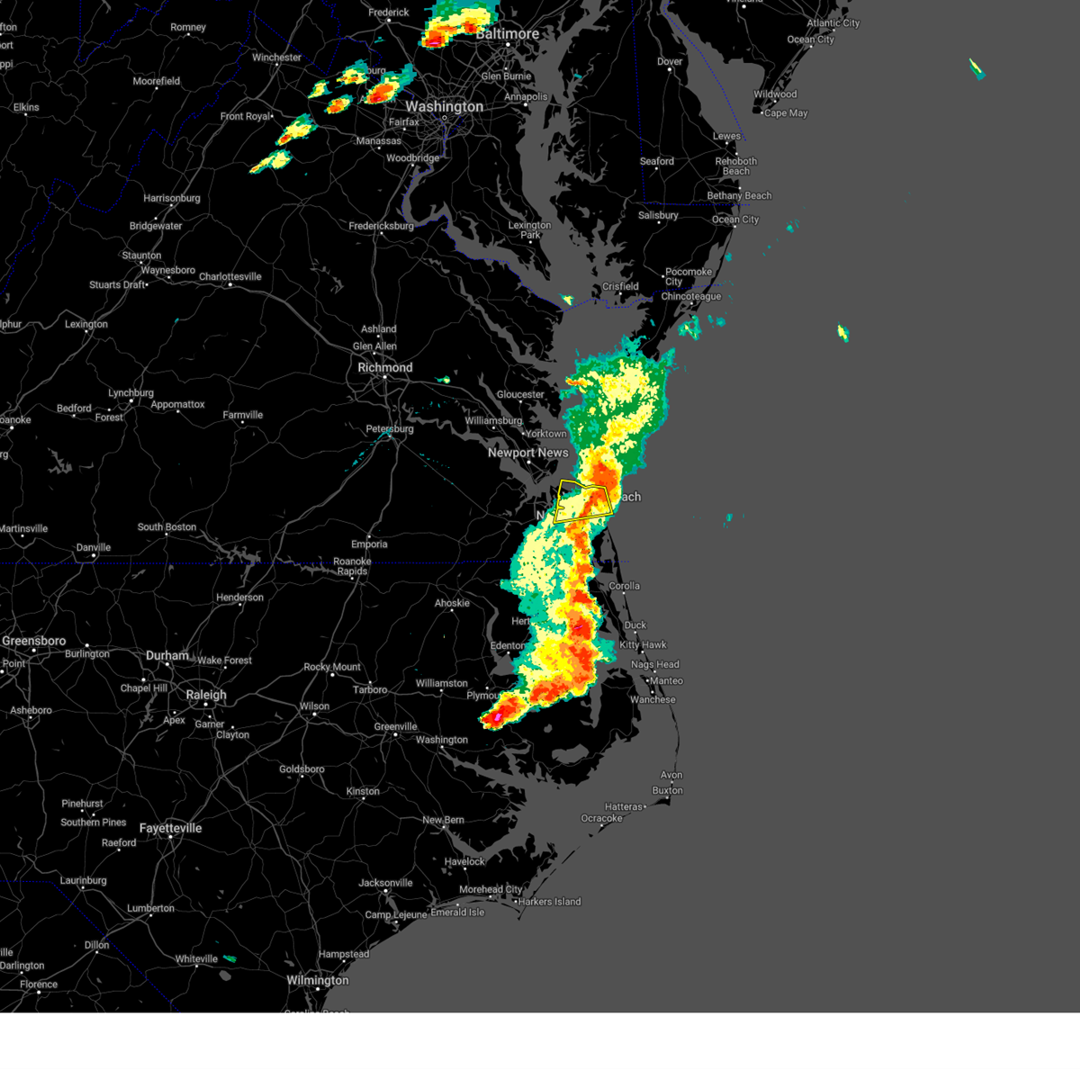
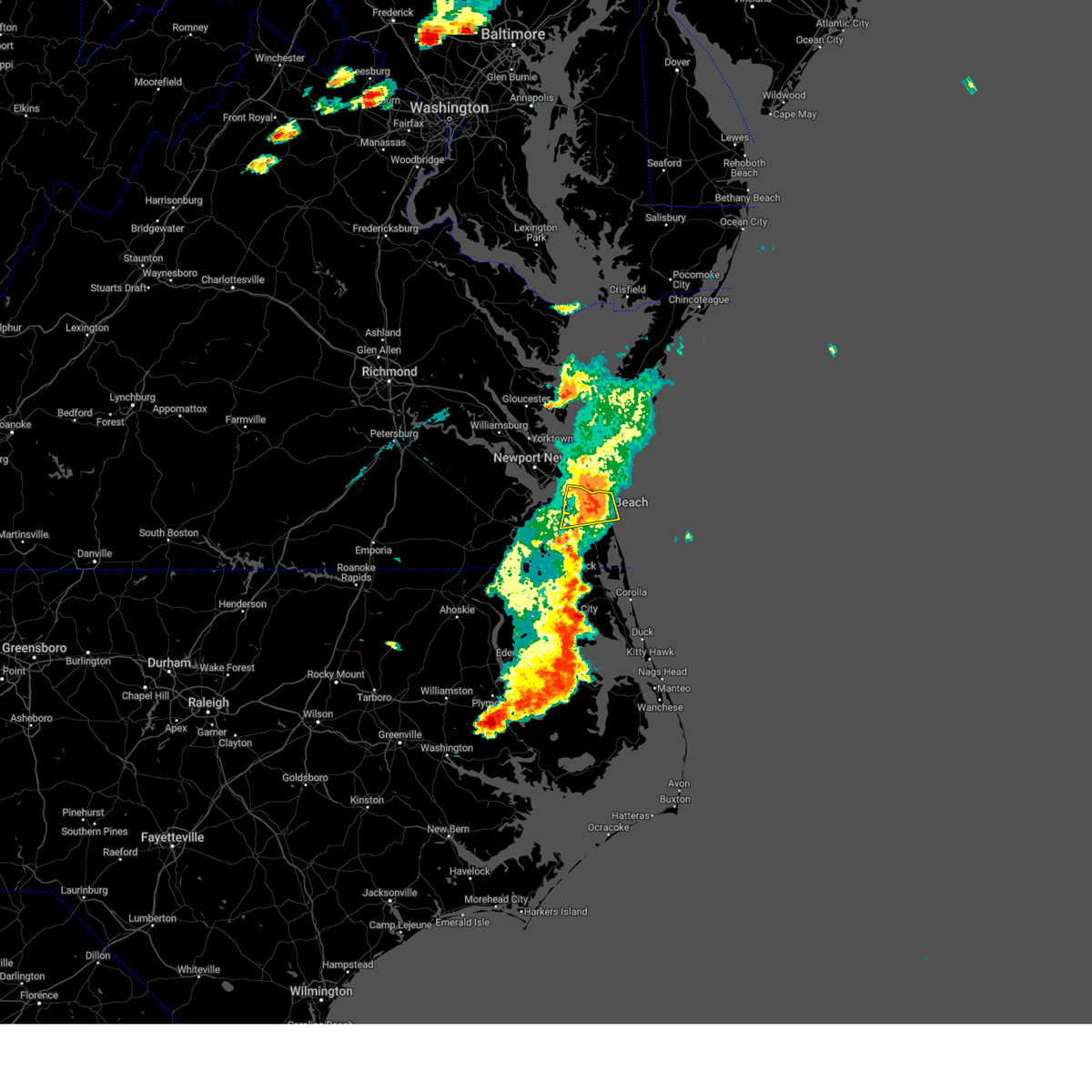
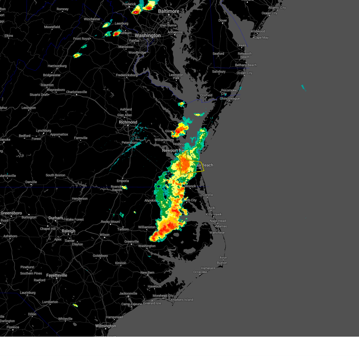
Hail Map for Norfolk, VA
The Norfolk, VA area has had 13 reports of on-the-ground hail by trained spotters, and has been under severe weather warnings 50 times during the past 12 months. Doppler radar has detected hail at or near Norfolk, VA on 63 occasions, including 2 occasions during the past year.
| Name: | Norfolk, VA |
| Where Located: | 11.9 miles NW of Virginia Beach, VA |
| Map: | Google Map for Norfolk, VA |
| Population: | 242803 |
| Housing Units: | 95018 |
| More Info: | Search Google for Norfolk, VA |
2
The Top Recent Hail Date for Norfolk, VA is Saturday, May 31, 2025 (9th out of 63)

Hail and Wind Damage Spotted near Norfolk, VA
| Date / Time | Report Details |
|---|---|
| 6/19/2025 9:47 PM EDT |
 the severe thunderstorm warning has been cancelled and is no longer in effect the severe thunderstorm warning has been cancelled and is no longer in effect
|
| 6/19/2025 9:47 PM EDT |
 At 946 pm edt, a severe thunderstorm was located near kempsville, moving east at 55 mph (radar indicated). Hazards include 60 mph wind gusts and penny size hail. Expect damage to trees and powerlines. this severe storm will be near, virginia beach around 950 pm edt. Other locations impacted by this severe thunderstorm include south norfolk, rudee heights, portlock, mount pleasant, princess anne plaza, sigma, sandbridge beach, herberts corner, oceana nas, and macons corner. At 946 pm edt, a severe thunderstorm was located near kempsville, moving east at 55 mph (radar indicated). Hazards include 60 mph wind gusts and penny size hail. Expect damage to trees and powerlines. this severe storm will be near, virginia beach around 950 pm edt. Other locations impacted by this severe thunderstorm include south norfolk, rudee heights, portlock, mount pleasant, princess anne plaza, sigma, sandbridge beach, herberts corner, oceana nas, and macons corner.
|
| 6/19/2025 9:35 PM EDT |
 At 934 pm edt, a severe thunderstorm was located over cradock, or near deep creek, moving east at 55 mph (radar indicated). Hazards include 60 mph wind gusts and penny size hail. Expect damage to trees and powerlines. this severe storm will be near, virginia beach, regent university, kempsville, norfolk, and chesapeake around 940 pm edt. Other locations impacted by this severe thunderstorm include south norfolk, rudee heights, portlock, princess anne plaza, sigma, huntersville, chuckatuck, pungo, greenbrier, and bayside. At 934 pm edt, a severe thunderstorm was located over cradock, or near deep creek, moving east at 55 mph (radar indicated). Hazards include 60 mph wind gusts and penny size hail. Expect damage to trees and powerlines. this severe storm will be near, virginia beach, regent university, kempsville, norfolk, and chesapeake around 940 pm edt. Other locations impacted by this severe thunderstorm include south norfolk, rudee heights, portlock, princess anne plaza, sigma, huntersville, chuckatuck, pungo, greenbrier, and bayside.
|
| 6/19/2025 9:16 PM EDT |
 Svrakq the national weather service in wakefield has issued a * severe thunderstorm warning for, the city of norfolk in southeastern virginia, the city of chesapeake in southeastern virginia, the city of portsmouth in southeastern virginia, the city of suffolk in southeastern virginia, the city of virginia beach in southeastern virginia, * until 1000 pm edt. * at 916 pm edt, a severe thunderstorm was located over downtown suffolk, moving east at 55 mph (radar indicated). Hazards include 60 mph wind gusts and penny size hail. Expect damage to trees and powerlines. this severe thunderstorm will be near, chesapeake and suffolk around 920 pm edt. portsmouth and bowers hill around 925 pm edt. deep creek and cradock around 930 pm edt. virginia beach, regent university, and norfolk around 935 pm edt. kempsville around 940 pm edt. Other locations impacted by this severe thunderstorm include south norfolk, rudee heights, portlock, princess anne plaza, sigma, suffolk airport, huntersville, chuckatuck, pungo, and greenbrier. Svrakq the national weather service in wakefield has issued a * severe thunderstorm warning for, the city of norfolk in southeastern virginia, the city of chesapeake in southeastern virginia, the city of portsmouth in southeastern virginia, the city of suffolk in southeastern virginia, the city of virginia beach in southeastern virginia, * until 1000 pm edt. * at 916 pm edt, a severe thunderstorm was located over downtown suffolk, moving east at 55 mph (radar indicated). Hazards include 60 mph wind gusts and penny size hail. Expect damage to trees and powerlines. this severe thunderstorm will be near, chesapeake and suffolk around 920 pm edt. portsmouth and bowers hill around 925 pm edt. deep creek and cradock around 930 pm edt. virginia beach, regent university, and norfolk around 935 pm edt. kempsville around 940 pm edt. Other locations impacted by this severe thunderstorm include south norfolk, rudee heights, portlock, princess anne plaza, sigma, suffolk airport, huntersville, chuckatuck, pungo, and greenbrier.
|
| 6/9/2025 7:26 PM EDT | The storms which prompted the warning have weakened below severe limits, and no longer pose an immediate threat to life or property. therefore, the warning will be allowed to expire. however, gusty winds and heavy rain are still possible with these thunderstorms. to report severe weather, contact your nearest law enforcement agency. they will relay your report to the national weather service wakefield. |
| 6/9/2025 7:17 PM EDT |
 the severe thunderstorm warning has been cancelled and is no longer in effect the severe thunderstorm warning has been cancelled and is no longer in effect
|
| 6/9/2025 7:17 PM EDT |
 At 717 pm edt, severe thunderstorms were located along a line extending from 6 miles northeast of ocean view to near virginia wesleyan university to near fentress, moving northeast at 25 mph (radar indicated). Hazards include 60 mph wind gusts. Expect damage to trees and powerlines. Locations impacted include, virginia beach, virginia wesleyan university, norfolk state university, downtown norfolk, regent university, ocean view, great bridge, kempsville, norfolk, chesapeake, fentress, norfolk international, norview, norfolk nas, south norfolk, portlock, mount pleasant, princess anne plaza, greenbrier, and bayside. At 717 pm edt, severe thunderstorms were located along a line extending from 6 miles northeast of ocean view to near virginia wesleyan university to near fentress, moving northeast at 25 mph (radar indicated). Hazards include 60 mph wind gusts. Expect damage to trees and powerlines. Locations impacted include, virginia beach, virginia wesleyan university, norfolk state university, downtown norfolk, regent university, ocean view, great bridge, kempsville, norfolk, chesapeake, fentress, norfolk international, norview, norfolk nas, south norfolk, portlock, mount pleasant, princess anne plaza, greenbrier, and bayside.
|
| 6/9/2025 6:45 PM EDT |
 Svrakq the national weather service in wakefield has issued a * severe thunderstorm warning for, the city of norfolk in southeastern virginia, the central city of chesapeake in southeastern virginia, the city of portsmouth in southeastern virginia, the western city of virginia beach in southeastern virginia, * until 730 pm edt. * at 645 pm edt, severe thunderstorms were located along a line extending from old dominion university to near cradock to near chesapeake, moving east at 20 mph (radar indicated). Hazards include 60 mph wind gusts and penny size hail. Expect damage to trees and powerlines. severe thunderstorms will be near, virginia beach, great bridge, regent university, downtown norfolk, old dominion university, norfolk state university, norfolk, chesapeake, portsmouth, and norfolk nas around 650 pm edt. fentress around 655 pm edt. kempsville, virginia wesleyan university, ocean view, and norfolk international around 700 pm edt. Other locations impacted by these severe thunderstorms include greenbrier, south norfolk, bayside, portlock, wards corner, mount pleasant, princess anne plaza, herberts corner, gallups corner, and hickory. Svrakq the national weather service in wakefield has issued a * severe thunderstorm warning for, the city of norfolk in southeastern virginia, the central city of chesapeake in southeastern virginia, the city of portsmouth in southeastern virginia, the western city of virginia beach in southeastern virginia, * until 730 pm edt. * at 645 pm edt, severe thunderstorms were located along a line extending from old dominion university to near cradock to near chesapeake, moving east at 20 mph (radar indicated). Hazards include 60 mph wind gusts and penny size hail. Expect damage to trees and powerlines. severe thunderstorms will be near, virginia beach, great bridge, regent university, downtown norfolk, old dominion university, norfolk state university, norfolk, chesapeake, portsmouth, and norfolk nas around 650 pm edt. fentress around 655 pm edt. kempsville, virginia wesleyan university, ocean view, and norfolk international around 700 pm edt. Other locations impacted by these severe thunderstorms include greenbrier, south norfolk, bayside, portlock, wards corner, mount pleasant, princess anne plaza, herberts corner, gallups corner, and hickory.
|
| 6/9/2025 6:20 PM EDT |
 Svrakq the national weather service in wakefield has issued a * severe thunderstorm warning for, the western city of chesapeake in southeastern virginia, the city of portsmouth in southeastern virginia, the east central city of suffolk in southeastern virginia, * until 645 pm edt. * at 620 pm edt, severe thunderstorms were located along a line extending from bowers hill to near deep creek to 8 miles southwest of chesapeake, moving east at 20 mph (radar indicated). Hazards include 60 mph wind gusts. expect damage to trees and powerlines Svrakq the national weather service in wakefield has issued a * severe thunderstorm warning for, the western city of chesapeake in southeastern virginia, the city of portsmouth in southeastern virginia, the east central city of suffolk in southeastern virginia, * until 645 pm edt. * at 620 pm edt, severe thunderstorms were located along a line extending from bowers hill to near deep creek to 8 miles southwest of chesapeake, moving east at 20 mph (radar indicated). Hazards include 60 mph wind gusts. expect damage to trees and powerlines
|
| 5/31/2025 7:08 PM EDT |
 At 707 pm edt, a severe thunderstorm was located near princess anne, or near virginia beach, moving east at 40 mph (at 702 pm, a trained weather spotter reported quarter size hail in virginia beach). Hazards include 60 mph wind gusts and quarter size hail. Minor damage to vehicles is possible. expect wind damage to trees and powerlines. Locations impacted include, virginia beach, regent university, great bridge, kempsville, chesapeake, fentress, princess anne, rudee heights, mount pleasant, princess anne plaza, sigma, sandbridge beach, oceana nas, macons corner, pungo, greenbrier, oceana, dam neck, gallups corner, and london bridge. At 707 pm edt, a severe thunderstorm was located near princess anne, or near virginia beach, moving east at 40 mph (at 702 pm, a trained weather spotter reported quarter size hail in virginia beach). Hazards include 60 mph wind gusts and quarter size hail. Minor damage to vehicles is possible. expect wind damage to trees and powerlines. Locations impacted include, virginia beach, regent university, great bridge, kempsville, chesapeake, fentress, princess anne, rudee heights, mount pleasant, princess anne plaza, sigma, sandbridge beach, oceana nas, macons corner, pungo, greenbrier, oceana, dam neck, gallups corner, and london bridge.
|
| 5/31/2025 6:58 PM EDT |
 Svrakq the national weather service in wakefield has issued a * severe thunderstorm warning for, the northeastern city of chesapeake in southeastern virginia, the central city of virginia beach in southeastern virginia, * until 745 pm edt. * at 658 pm edt, a severe thunderstorm was located near kempsville, moving east at 35 mph (radar indicated). Hazards include 60 mph wind gusts and quarter size hail. Minor damage to vehicles is possible. Expect wind damage to trees and powerlines. Svrakq the national weather service in wakefield has issued a * severe thunderstorm warning for, the northeastern city of chesapeake in southeastern virginia, the central city of virginia beach in southeastern virginia, * until 745 pm edt. * at 658 pm edt, a severe thunderstorm was located near kempsville, moving east at 35 mph (radar indicated). Hazards include 60 mph wind gusts and quarter size hail. Minor damage to vehicles is possible. Expect wind damage to trees and powerlines.
|
| 5/16/2025 7:37 PM EDT | the severe thunderstorm warning has been cancelled and is no longer in effect |
| 5/16/2025 7:24 PM EDT | the severe thunderstorm warning has been cancelled and is no longer in effect |
| 5/16/2025 7:24 PM EDT | At 724 pm edt, a severe thunderstorm was located over chesapeake, or over great bridge, moving east at 50 mph (radar indicated). Hazards include 60 mph wind gusts and penny size hail. Expect damage to trees and powerlines. this severe storm will be near, virginia beach, chesapeake, and fentress around 730 pm edt. back bay around 735 pm edt. Other locations impacted by this severe thunderstorm include south norfolk, rudee heights, portlock, pierceville, princess anne plaza, sigma, tar corner, sharon, pungo, and greenbrier. |
| 5/16/2025 7:03 PM EDT |
 Svrakq the national weather service in wakefield has issued a * severe thunderstorm warning for, northwestern camden county in northeastern north carolina, northwestern pasquotank county in northeastern north carolina, northeastern gates county in northeastern north carolina, northern currituck county in northeastern north carolina, the city of norfolk in southeastern virginia, the city of chesapeake in southeastern virginia, the city of portsmouth in southeastern virginia, the eastern city of suffolk in southeastern virginia, the city of virginia beach in southeastern virginia, * until 800 pm edt. * at 702 pm edt, severe thunderstorms were located along a line extending from near rescue to suffolk to boykins, moving east at 50 mph (radar indicated). Hazards include 70 mph wind gusts and quarter size hail. Minor damage to vehicles is possible. expect considerable tree damage. wind damage is also likely to mobile homes, roofs, and outbuildings. severe thunderstorms will be near, churchland, chesapeake, portsmouth, suffolk, bowers hill, driver, crittenden, and western branch around 710 pm edt. deep creek, old dominion university, norfolk, norfolk nas, ghent, and cradock around 715 pm edt. downtown norfolk, ocean view, downtown portsmouth, norfolk state university, norview, and corapeake around 720 pm edt. virginia beach, great bridge, regent university, kempsville, virginia wesleyan university, and norfolk international around 725 pm edt. northwest and fentress around 730 pm edt. princess anne around 735 pm edt. back bay around 740 pm edt. south mills and moyock around 745 pm edt. Other locations impacted by these severe thunderstorms include south norfolk, horseshoe, rudee heights, portlock, pierceville, princess anne plaza, sigma, huntersville, tar corner, and sharon. Svrakq the national weather service in wakefield has issued a * severe thunderstorm warning for, northwestern camden county in northeastern north carolina, northwestern pasquotank county in northeastern north carolina, northeastern gates county in northeastern north carolina, northern currituck county in northeastern north carolina, the city of norfolk in southeastern virginia, the city of chesapeake in southeastern virginia, the city of portsmouth in southeastern virginia, the eastern city of suffolk in southeastern virginia, the city of virginia beach in southeastern virginia, * until 800 pm edt. * at 702 pm edt, severe thunderstorms were located along a line extending from near rescue to suffolk to boykins, moving east at 50 mph (radar indicated). Hazards include 70 mph wind gusts and quarter size hail. Minor damage to vehicles is possible. expect considerable tree damage. wind damage is also likely to mobile homes, roofs, and outbuildings. severe thunderstorms will be near, churchland, chesapeake, portsmouth, suffolk, bowers hill, driver, crittenden, and western branch around 710 pm edt. deep creek, old dominion university, norfolk, norfolk nas, ghent, and cradock around 715 pm edt. downtown norfolk, ocean view, downtown portsmouth, norfolk state university, norview, and corapeake around 720 pm edt. virginia beach, great bridge, regent university, kempsville, virginia wesleyan university, and norfolk international around 725 pm edt. northwest and fentress around 730 pm edt. princess anne around 735 pm edt. back bay around 740 pm edt. south mills and moyock around 745 pm edt. Other locations impacted by these severe thunderstorms include south norfolk, horseshoe, rudee heights, portlock, pierceville, princess anne plaza, sigma, huntersville, tar corner, and sharon.
|
| 5/14/2025 7:32 PM EDT |
 The storm which prompted the warning has weakened below severe limits, and has exited the warned area. therefore, the warning has been allowed to expire. however, heavy rain is still possible with this thunderstorm. The storm which prompted the warning has weakened below severe limits, and has exited the warned area. therefore, the warning has been allowed to expire. however, heavy rain is still possible with this thunderstorm.
|
| 5/14/2025 7:06 PM EDT |
 At 706 pm edt, a severe thunderstorm was located over northampton, or over hampton, moving northeast at 20 mph (radar indicated). Hazards include 60 mph wind gusts. Expect damage to trees and powerlines. this severe storm will be near, hampton, hampton university, and langley afb around 710 pm edt. buckroe beach around 715 pm edt. grand view around 720 pm edt. Other locations impacted by this severe thunderstorm include fox hill, phoebus, langley view, oriana, maryus, hilton village, raleigh terrace, dare, newport news golf course, and severn. At 706 pm edt, a severe thunderstorm was located over northampton, or over hampton, moving northeast at 20 mph (radar indicated). Hazards include 60 mph wind gusts. Expect damage to trees and powerlines. this severe storm will be near, hampton, hampton university, and langley afb around 710 pm edt. buckroe beach around 715 pm edt. grand view around 720 pm edt. Other locations impacted by this severe thunderstorm include fox hill, phoebus, langley view, oriana, maryus, hilton village, raleigh terrace, dare, newport news golf course, and severn.
|
| 5/14/2025 7:06 PM EDT |
 the severe thunderstorm warning has been cancelled and is no longer in effect the severe thunderstorm warning has been cancelled and is no longer in effect
|
| 5/14/2025 6:47 PM EDT |
 Svrakq the national weather service in wakefield has issued a * severe thunderstorm warning for, the northern city of norfolk in southeastern virginia, the city of poquoson in southeastern virginia, southeastern gloucester county in eastern virginia, the northwestern city of portsmouth in southeastern virginia, northeastern isle of wight county in southeastern virginia, the northeastern city of suffolk in southeastern virginia, southeastern york county in southeastern virginia, the city of hampton in southeastern virginia, the city of newport news in southeastern virginia, * until 730 pm edt. * at 647 pm edt, a severe thunderstorm was located near rescue, or near christopher newport university, moving northeast at 20 mph (radar indicated). Hazards include 60 mph wind gusts. Expect damage to trees and powerlines. this severe thunderstorm will be near, newport news and hampton around 650 pm edt. northampton around 655 pm edt. beaconsdale around 700 pm edt. hampton university and langley afb around 705 pm edt. grand view and buckroe beach around 720 pm edt. Other locations impacted by this severe thunderstorm include carrollton, benns church, oriana, huntersville, hilton village, newport news golf course, wards corner, oyster point, messick, and mogarts beach. Svrakq the national weather service in wakefield has issued a * severe thunderstorm warning for, the northern city of norfolk in southeastern virginia, the city of poquoson in southeastern virginia, southeastern gloucester county in eastern virginia, the northwestern city of portsmouth in southeastern virginia, northeastern isle of wight county in southeastern virginia, the northeastern city of suffolk in southeastern virginia, southeastern york county in southeastern virginia, the city of hampton in southeastern virginia, the city of newport news in southeastern virginia, * until 730 pm edt. * at 647 pm edt, a severe thunderstorm was located near rescue, or near christopher newport university, moving northeast at 20 mph (radar indicated). Hazards include 60 mph wind gusts. Expect damage to trees and powerlines. this severe thunderstorm will be near, newport news and hampton around 650 pm edt. northampton around 655 pm edt. beaconsdale around 700 pm edt. hampton university and langley afb around 705 pm edt. grand view and buckroe beach around 720 pm edt. Other locations impacted by this severe thunderstorm include carrollton, benns church, oriana, huntersville, hilton village, newport news golf course, wards corner, oyster point, messick, and mogarts beach.
|
| 5/9/2025 4:32 PM EDT |
 Svrakq the national weather service in wakefield has issued a * severe thunderstorm warning for, the northeastern city of chesapeake in southeastern virginia, the central city of virginia beach in southeastern virginia, * until 515 pm edt. * at 432 pm edt, a severe thunderstorm was located near kempsville, moving east at 35 mph (radar indicated). Hazards include 60 mph wind gusts and quarter size hail. Minor damage to vehicles is possible. expect wind damage to trees and powerlines. this severe thunderstorm will be near, virginia beach and princess anne around 440 pm edt. Other locations impacted by this severe thunderstorm include rudee heights, mount pleasant, princess anne plaza, sigma, sandbridge beach, oceana nas, macons corner, pungo, greenbrier, and oceana. Svrakq the national weather service in wakefield has issued a * severe thunderstorm warning for, the northeastern city of chesapeake in southeastern virginia, the central city of virginia beach in southeastern virginia, * until 515 pm edt. * at 432 pm edt, a severe thunderstorm was located near kempsville, moving east at 35 mph (radar indicated). Hazards include 60 mph wind gusts and quarter size hail. Minor damage to vehicles is possible. expect wind damage to trees and powerlines. this severe thunderstorm will be near, virginia beach and princess anne around 440 pm edt. Other locations impacted by this severe thunderstorm include rudee heights, mount pleasant, princess anne plaza, sigma, sandbridge beach, oceana nas, macons corner, pungo, greenbrier, and oceana.
|
| 4/7/2025 2:28 PM EDT |
 Svrakq the national weather service in wakefield has issued a * severe thunderstorm warning for, northwestern currituck county in northeastern north carolina, the city of chesapeake in southeastern virginia, the city of virginia beach in southeastern virginia, * until 315 pm edt. * at 228 pm edt, severe thunderstorms were located along a line extending from near virginia wesleyan university to fentress to 6 miles north of south mills, moving east at 60 mph (radar indicated). Hazards include 60 mph wind gusts. Expect damage to trees and powerlines. severe thunderstorms will be near, back bay, virginia beach, northwest, chesapeake, and princess anne around 235 pm edt. Other locations impacted by these severe thunderstorms include south norfolk, rudee heights, portlock, mount pleasant, princess anne plaza, sigma, sandbridge beach, herberts corner, oceana nas, and munden. Svrakq the national weather service in wakefield has issued a * severe thunderstorm warning for, northwestern currituck county in northeastern north carolina, the city of chesapeake in southeastern virginia, the city of virginia beach in southeastern virginia, * until 315 pm edt. * at 228 pm edt, severe thunderstorms were located along a line extending from near virginia wesleyan university to fentress to 6 miles north of south mills, moving east at 60 mph (radar indicated). Hazards include 60 mph wind gusts. Expect damage to trees and powerlines. severe thunderstorms will be near, back bay, virginia beach, northwest, chesapeake, and princess anne around 235 pm edt. Other locations impacted by these severe thunderstorms include south norfolk, rudee heights, portlock, mount pleasant, princess anne plaza, sigma, sandbridge beach, herberts corner, oceana nas, and munden.
|
| 3/5/2025 5:36 PM EST |
 The storms which prompted the warning have weakened below severe limits, and have exited the warned area. therefore, the warning will be allowed to expire. a tornado watch remains in effect until 800 pm est for southeastern virginia. The storms which prompted the warning have weakened below severe limits, and have exited the warned area. therefore, the warning will be allowed to expire. a tornado watch remains in effect until 800 pm est for southeastern virginia.
|
| 3/5/2025 5:23 PM EST |
 the severe thunderstorm warning has been cancelled and is no longer in effect the severe thunderstorm warning has been cancelled and is no longer in effect
|
| 3/5/2025 5:23 PM EST |
 At 523 pm est, severe thunderstorms were located along a line extending from 7 miles west of cape charles to cradock, moving northeast at 30 mph (radar indicated). Hazards include 60 mph wind gusts. Expect damage to trees and powerlines. these severe storms will be near, regent university, ghent, virginia beach, downtown norfolk, norview, norfolk, portsmouth, norfolk international, virginia wesleyan university, and chesapeake around 530 pm est. kempsville around 535 pm est. Other locations impacted by these severe thunderstorms include greenbrier, south norfolk, bayside, fox hill, phoebus, langley view, wards corner, messick, willoughby spit, and plum tree island refuge. At 523 pm est, severe thunderstorms were located along a line extending from 7 miles west of cape charles to cradock, moving northeast at 30 mph (radar indicated). Hazards include 60 mph wind gusts. Expect damage to trees and powerlines. these severe storms will be near, regent university, ghent, virginia beach, downtown norfolk, norview, norfolk, portsmouth, norfolk international, virginia wesleyan university, and chesapeake around 530 pm est. kempsville around 535 pm est. Other locations impacted by these severe thunderstorms include greenbrier, south norfolk, bayside, fox hill, phoebus, langley view, wards corner, messick, willoughby spit, and plum tree island refuge.
|
| 3/5/2025 5:03 PM EST |
 Svrakq the national weather service in wakefield has issued a * severe thunderstorm warning for, the city of poquoson in southeastern virginia, the city of norfolk in southeastern virginia, the north central city of chesapeake in southeastern virginia, the city of portsmouth in southeastern virginia, the northeastern city of suffolk in southeastern virginia, the northwestern city of virginia beach in southeastern virginia, the city of hampton in southeastern virginia, the southern city of newport news in southeastern virginia, * until 545 pm est. * at 502 pm est, severe thunderstorms were located along a line extending from near grand view to 7 miles southwest of deep creek, moving northeast at 30 mph (radar indicated). Hazards include 60 mph wind gusts. Expect damage to trees and powerlines. severe thunderstorms will be near, hampton university, norfolk nas, grand view, ghent, fort monroe, downtown norfolk, buckroe beach, churchland, norfolk, and portsmouth around 510 pm est. norview and norfolk state university around 515 pm est. virginia beach around 520 pm est. norfolk international and virginia wesleyan university around 525 pm est. regent university around 530 pm est. Other locations impacted by these severe thunderstorms include south norfolk, fox hill, phoebus, langley view, huntersville, hilton village, chuckatuck, raleigh terrace, greenbrier, and hobson. Svrakq the national weather service in wakefield has issued a * severe thunderstorm warning for, the city of poquoson in southeastern virginia, the city of norfolk in southeastern virginia, the north central city of chesapeake in southeastern virginia, the city of portsmouth in southeastern virginia, the northeastern city of suffolk in southeastern virginia, the northwestern city of virginia beach in southeastern virginia, the city of hampton in southeastern virginia, the southern city of newport news in southeastern virginia, * until 545 pm est. * at 502 pm est, severe thunderstorms were located along a line extending from near grand view to 7 miles southwest of deep creek, moving northeast at 30 mph (radar indicated). Hazards include 60 mph wind gusts. Expect damage to trees and powerlines. severe thunderstorms will be near, hampton university, norfolk nas, grand view, ghent, fort monroe, downtown norfolk, buckroe beach, churchland, norfolk, and portsmouth around 510 pm est. norview and norfolk state university around 515 pm est. virginia beach around 520 pm est. norfolk international and virginia wesleyan university around 525 pm est. regent university around 530 pm est. Other locations impacted by these severe thunderstorms include south norfolk, fox hill, phoebus, langley view, huntersville, hilton village, chuckatuck, raleigh terrace, greenbrier, and hobson.
|
| 3/5/2025 5:01 PM EST |
 Svrakq the national weather service in wakefield has issued a * severe thunderstorm warning for, northern camden county in northeastern north carolina, pasquotank county in northeastern north carolina, perquimans county in northeastern north carolina, east central gates county in northeastern north carolina, currituck county in northeastern north carolina, south central chowan county in northeastern north carolina, the southeastern city of norfolk in southeastern virginia, the city of chesapeake in southeastern virginia, the city of virginia beach in southeastern virginia, * until 545 pm est. * at 501 pm est, severe thunderstorms were located along a line extending from near south mills to near chapanoke to near snug harbor, moving northeast at 60 mph (radar indicated). Hazards include 60 mph wind gusts. Expect damage to trees and powerlines. severe thunderstorms will be near, burgess, morgans corner, chesapeake, hertford, south mills, chapanoke, and winfall around 505 pm est. elizabeth city and northwest around 510 pm est. virginia beach around 515 pm est. elizabeth city state university, camden, and moyock around 520 pm est. back bay and princess anne around 525 pm est. currituck around 530 pm est. knotts island around 540 pm est. Other locations impacted by these severe thunderstorms include horseshoe, rudee heights, pierceville, princess anne plaza, sigma, parkville, tar corner, nicanor, yeopim station, and gregory. Svrakq the national weather service in wakefield has issued a * severe thunderstorm warning for, northern camden county in northeastern north carolina, pasquotank county in northeastern north carolina, perquimans county in northeastern north carolina, east central gates county in northeastern north carolina, currituck county in northeastern north carolina, south central chowan county in northeastern north carolina, the southeastern city of norfolk in southeastern virginia, the city of chesapeake in southeastern virginia, the city of virginia beach in southeastern virginia, * until 545 pm est. * at 501 pm est, severe thunderstorms were located along a line extending from near south mills to near chapanoke to near snug harbor, moving northeast at 60 mph (radar indicated). Hazards include 60 mph wind gusts. Expect damage to trees and powerlines. severe thunderstorms will be near, burgess, morgans corner, chesapeake, hertford, south mills, chapanoke, and winfall around 505 pm est. elizabeth city and northwest around 510 pm est. virginia beach around 515 pm est. elizabeth city state university, camden, and moyock around 520 pm est. back bay and princess anne around 525 pm est. currituck around 530 pm est. knotts island around 540 pm est. Other locations impacted by these severe thunderstorms include horseshoe, rudee heights, pierceville, princess anne plaza, sigma, parkville, tar corner, nicanor, yeopim station, and gregory.
|
| 3/5/2025 4:32 PM EST |
 Svrakq the national weather service in wakefield has issued a * severe thunderstorm warning for, northwestern camden county in northeastern north carolina, northwestern pasquotank county in northeastern north carolina, southeastern hertford county in northeastern north carolina, gates county in northeastern north carolina, northwestern currituck county in northeastern north carolina, northwestern chowan county in northeastern north carolina, the city of chesapeake in southeastern virginia, the city of portsmouth in southeastern virginia, the city of suffolk in southeastern virginia, * until 515 pm est. * at 432 pm est, severe thunderstorms were located along a line extending from near holland to near gatesville to near ryland, moving northeast at 55 mph (radar indicated). Hazards include 60 mph wind gusts. Expect damage to trees and powerlines. severe thunderstorms will be near, downtown suffolk, kings fork, corapeake, hobbsville, sunbury, and suffolk around 440 pm est. driver and chesapeake around 445 pm est. bowers hill, churchland, portsmouth, and western branch around 450 pm est. deep creek, norfolk, and cradock around 455 pm est. great bridge and downtown portsmouth around 500 pm est. fentress around 505 pm est. Other locations impacted by these severe thunderstorms include south norfolk, horseshoe, portlock, newsome store, savage, suffolk airport, huntersville, tar corner, buckland, and sharon. Svrakq the national weather service in wakefield has issued a * severe thunderstorm warning for, northwestern camden county in northeastern north carolina, northwestern pasquotank county in northeastern north carolina, southeastern hertford county in northeastern north carolina, gates county in northeastern north carolina, northwestern currituck county in northeastern north carolina, northwestern chowan county in northeastern north carolina, the city of chesapeake in southeastern virginia, the city of portsmouth in southeastern virginia, the city of suffolk in southeastern virginia, * until 515 pm est. * at 432 pm est, severe thunderstorms were located along a line extending from near holland to near gatesville to near ryland, moving northeast at 55 mph (radar indicated). Hazards include 60 mph wind gusts. Expect damage to trees and powerlines. severe thunderstorms will be near, downtown suffolk, kings fork, corapeake, hobbsville, sunbury, and suffolk around 440 pm est. driver and chesapeake around 445 pm est. bowers hill, churchland, portsmouth, and western branch around 450 pm est. deep creek, norfolk, and cradock around 455 pm est. great bridge and downtown portsmouth around 500 pm est. fentress around 505 pm est. Other locations impacted by these severe thunderstorms include south norfolk, horseshoe, portlock, newsome store, savage, suffolk airport, huntersville, tar corner, buckland, and sharon.
|
| 3/5/2025 4:21 PM EST |
 The storms which prompted the warning have weakened below severe limits, and no longer pose an immediate threat to life or property. therefore, the warning will be allowed to expire. however, gusty winds and heavy rain are still possible with these thunderstorms. a tornado watch remains in effect until 800 pm est for southeastern virginia. The storms which prompted the warning have weakened below severe limits, and no longer pose an immediate threat to life or property. therefore, the warning will be allowed to expire. however, gusty winds and heavy rain are still possible with these thunderstorms. a tornado watch remains in effect until 800 pm est for southeastern virginia.
|
| 3/5/2025 4:04 PM EST |
 At 403 pm est, severe thunderstorms were located along a line extending from 7 miles northwest of cheriton to 6 miles northeast of grand view to cradock, moving northeast at 50 mph (radar indicated). Hazards include 60 mph wind gusts. Expect damage to trees and powerlines. these severe storms will be near, regent university, virginia beach, downtown norfolk, norview, kempsville, norfolk, norfolk international, virginia wesleyan university, chesapeake, and ocean view around 410 pm est. Other locations impacted by these severe thunderstorms include greenbrier, south norfolk, bayside, oceana, portlock, wards corner, princess anne plaza, north virginia beach, gallups corner, and willoughby spit. At 403 pm est, severe thunderstorms were located along a line extending from 7 miles northwest of cheriton to 6 miles northeast of grand view to cradock, moving northeast at 50 mph (radar indicated). Hazards include 60 mph wind gusts. Expect damage to trees and powerlines. these severe storms will be near, regent university, virginia beach, downtown norfolk, norview, kempsville, norfolk, norfolk international, virginia wesleyan university, chesapeake, and ocean view around 410 pm est. Other locations impacted by these severe thunderstorms include greenbrier, south norfolk, bayside, oceana, portlock, wards corner, princess anne plaza, north virginia beach, gallups corner, and willoughby spit.
|
| 3/5/2025 4:04 PM EST |
 the severe thunderstorm warning has been cancelled and is no longer in effect the severe thunderstorm warning has been cancelled and is no longer in effect
|
| 3/5/2025 3:47 PM EST |
 Svrakq the national weather service in wakefield has issued a * severe thunderstorm warning for, the city of norfolk in southeastern virginia, the northwestern city of chesapeake in southeastern virginia, the city of portsmouth in southeastern virginia, the northeastern city of suffolk in southeastern virginia, the northwestern city of virginia beach in southeastern virginia, the city of hampton in southeastern virginia, * until 430 pm est. * at 347 pm est, severe thunderstorms were located along a line extending from near bavon to hampton to near downtown suffolk, moving northeast at 50 mph (radar indicated). Hazards include 70 mph wind gusts. Expect considerable tree damage. damage is likely to mobile homes, roofs, and outbuildings. severe thunderstorms will be near, bowers hill, norfolk nas, grand view, driver, fort monroe, buckroe beach, churchland, norfolk, portsmouth, and old dominion university around 350 pm est. ghent, deep creek, downtown norfolk, cradock, ocean view, and downtown portsmouth around 355 pm est. norview and norfolk state university around 400 pm est. virginia beach, norfolk international, and virginia wesleyan university around 405 pm est. regent university and kempsville around 410 pm est. Other locations impacted by these severe thunderstorms include south norfolk, fox hill, portlock, princess anne plaza, huntersville, magnolia, greenbrier, bayside, oceana, and wards corner. Svrakq the national weather service in wakefield has issued a * severe thunderstorm warning for, the city of norfolk in southeastern virginia, the northwestern city of chesapeake in southeastern virginia, the city of portsmouth in southeastern virginia, the northeastern city of suffolk in southeastern virginia, the northwestern city of virginia beach in southeastern virginia, the city of hampton in southeastern virginia, * until 430 pm est. * at 347 pm est, severe thunderstorms were located along a line extending from near bavon to hampton to near downtown suffolk, moving northeast at 50 mph (radar indicated). Hazards include 70 mph wind gusts. Expect considerable tree damage. damage is likely to mobile homes, roofs, and outbuildings. severe thunderstorms will be near, bowers hill, norfolk nas, grand view, driver, fort monroe, buckroe beach, churchland, norfolk, portsmouth, and old dominion university around 350 pm est. ghent, deep creek, downtown norfolk, cradock, ocean view, and downtown portsmouth around 355 pm est. norview and norfolk state university around 400 pm est. virginia beach, norfolk international, and virginia wesleyan university around 405 pm est. regent university and kempsville around 410 pm est. Other locations impacted by these severe thunderstorms include south norfolk, fox hill, portlock, princess anne plaza, huntersville, magnolia, greenbrier, bayside, oceana, and wards corner.
|
| 12/11/2024 4:43 PM EST |
 The storms which prompted the warning have weakened below severe limits, and no longer pose an immediate threat to life or property. therefore, the warning will be allowed to expire. The storms which prompted the warning have weakened below severe limits, and no longer pose an immediate threat to life or property. therefore, the warning will be allowed to expire.
|
| 12/11/2024 4:24 PM EST |
 At 422 pm est, severe thunderstorms were located along a line extending from 14 miles south of cape charles to near chesapeake to 6 miles southeast of powellsville, moving east at 20 mph (radar indicated). Hazards include 60 mph wind gusts. Expect damage to trees and powerlines. these severe storms will be near, great bridge, virginia beach, rockyhock, tyner, kempsville, fentress, colerain, chesapeake, ryland, and hobbsville around 430 pm est. belvidere and princess anne around 440 pm est. morgans corner, valhalla, northwest, and south mills around 445 pm est. back bay, hertford, and winfall around 500 pm est. moyock and chapanoke around 510 pm est. Other locations impacted by these severe thunderstorms include goose pond, south norfolk, whites crossroads, rudee heights, portlock, pierceville, newsome store, savage, arrowhead beach, and parkville. At 422 pm est, severe thunderstorms were located along a line extending from 14 miles south of cape charles to near chesapeake to 6 miles southeast of powellsville, moving east at 20 mph (radar indicated). Hazards include 60 mph wind gusts. Expect damage to trees and powerlines. these severe storms will be near, great bridge, virginia beach, rockyhock, tyner, kempsville, fentress, colerain, chesapeake, ryland, and hobbsville around 430 pm est. belvidere and princess anne around 440 pm est. morgans corner, valhalla, northwest, and south mills around 445 pm est. back bay, hertford, and winfall around 500 pm est. moyock and chapanoke around 510 pm est. Other locations impacted by these severe thunderstorms include goose pond, south norfolk, whites crossroads, rudee heights, portlock, pierceville, newsome store, savage, arrowhead beach, and parkville.
|
| 12/11/2024 4:06 PM EST |
 At 406 pm est, severe thunderstorms were located along a line extending from 13 miles east of grand view to near deep creek to near powellsville, moving east at 20 mph (radar indicated). Hazards include 60 mph wind gusts. Expect damage to trees and powerlines. these severe storms will be near, regent university, great bridge, harrellsville, virginia beach, deep creek, kempsville, norfolk, colerain, virginia wesleyan university, and chesapeake around 410 pm est. hobbsville around 415 pm est. ryland around 420 pm est. tyner and fentress around 425 pm est. rockyhock around 430 pm est. princess anne around 435 pm est. valhalla and belvidere around 440 pm est. morgans corner, northwest, and south mills around 445 pm est. Other locations impacted by these severe thunderstorms include goose pond, south norfolk, whites crossroads, rudee heights, portlock, pierceville, newsome store, savage, arrowhead beach, and parkville. At 406 pm est, severe thunderstorms were located along a line extending from 13 miles east of grand view to near deep creek to near powellsville, moving east at 20 mph (radar indicated). Hazards include 60 mph wind gusts. Expect damage to trees and powerlines. these severe storms will be near, regent university, great bridge, harrellsville, virginia beach, deep creek, kempsville, norfolk, colerain, virginia wesleyan university, and chesapeake around 410 pm est. hobbsville around 415 pm est. ryland around 420 pm est. tyner and fentress around 425 pm est. rockyhock around 430 pm est. princess anne around 435 pm est. valhalla and belvidere around 440 pm est. morgans corner, northwest, and south mills around 445 pm est. Other locations impacted by these severe thunderstorms include goose pond, south norfolk, whites crossroads, rudee heights, portlock, pierceville, newsome store, savage, arrowhead beach, and parkville.
|
| 12/11/2024 3:45 PM EST |
 Svrakq the national weather service in wakefield has issued a * severe thunderstorm warning for, northern bertie county in northeastern north carolina, gates county in northeastern north carolina, northwestern currituck county in northeastern north carolina, chowan county in northeastern north carolina, northwestern camden county in northeastern north carolina, northwestern pasquotank county in northeastern north carolina, perquimans county in northeastern north carolina, southeastern hertford county in northeastern north carolina, the city of norfolk in southeastern virginia, the city of chesapeake in southeastern virginia, the city of portsmouth in southeastern virginia, the southeastern city of suffolk in southeastern virginia, the city of virginia beach in southeastern virginia, * until 445 pm est. * at 344 pm est, severe winds along a line of showers with a few embedded thunderstorms were located along a line extending from 7 miles east of grand view to near downtown suffolk to 6 miles southeast of aulander, moving east at 20 mph (radar indicated). Hazards include 60 mph wind gusts. Expect damage to trees and powerlines. severe winds with showers and a few embedded thunderstorms will be near, harrellsville, ghent, virginia beach, deep creek, downtown norfolk, norview, norfolk, corapeake, powellsville, and portsmouth around 350 pm est. sunbury around 355 pm est. regent university around 400 pm est. kempsville around 405 pm est. great bridge, colerain, and hobbsville around 410 pm est. ryland around 420 pm est. rockyhock, tyner, and fentress around 425 pm est. Other locations impacted by these severe thunderstorms include goose pond, south norfolk, whites crossroads, tunis, rudee heights, portlock, earleys, pierceville, newsome store, and savage. Svrakq the national weather service in wakefield has issued a * severe thunderstorm warning for, northern bertie county in northeastern north carolina, gates county in northeastern north carolina, northwestern currituck county in northeastern north carolina, chowan county in northeastern north carolina, northwestern camden county in northeastern north carolina, northwestern pasquotank county in northeastern north carolina, perquimans county in northeastern north carolina, southeastern hertford county in northeastern north carolina, the city of norfolk in southeastern virginia, the city of chesapeake in southeastern virginia, the city of portsmouth in southeastern virginia, the southeastern city of suffolk in southeastern virginia, the city of virginia beach in southeastern virginia, * until 445 pm est. * at 344 pm est, severe winds along a line of showers with a few embedded thunderstorms were located along a line extending from 7 miles east of grand view to near downtown suffolk to 6 miles southeast of aulander, moving east at 20 mph (radar indicated). Hazards include 60 mph wind gusts. Expect damage to trees and powerlines. severe winds with showers and a few embedded thunderstorms will be near, harrellsville, ghent, virginia beach, deep creek, downtown norfolk, norview, norfolk, corapeake, powellsville, and portsmouth around 350 pm est. sunbury around 355 pm est. regent university around 400 pm est. kempsville around 405 pm est. great bridge, colerain, and hobbsville around 410 pm est. ryland around 420 pm est. rockyhock, tyner, and fentress around 425 pm est. Other locations impacted by these severe thunderstorms include goose pond, south norfolk, whites crossroads, tunis, rudee heights, portlock, earleys, pierceville, newsome store, and savage.
|
| 9/1/2024 6:35 PM EDT | Tree downed onto a power line on ocean av in city of norfolk county VA, 5.2 miles S of Norfolk, VA |
| 9/1/2024 6:35 PM EDT |
 The storm which prompted the warning has moved out of the area. therefore, the warning will be allowed to expire. to report severe weather, contact your nearest law enforcement agency. they will relay your report to the national weather service wakefield. The storm which prompted the warning has moved out of the area. therefore, the warning will be allowed to expire. to report severe weather, contact your nearest law enforcement agency. they will relay your report to the national weather service wakefield.
|
| 9/1/2024 6:07 PM EDT |
 At 607 pm edt, a severe thunderstorm was located near crittenden, or near churchland, moving northeast at 15 mph (radar indicated). Hazards include 60 mph wind gusts. Expect damage to trees and powerlines. Locations impacted include, newport news, hampton, virginia wesleyan university, hampton university, langley afb, old dominion university, downtown norfolk, ocean view, downtown portsmouth, churchland, norfolk state university, norfolk, portsmouth, northampton, buckroe beach, norfolk international, ghent, norfolk nas, norview, and grand view. At 607 pm edt, a severe thunderstorm was located near crittenden, or near churchland, moving northeast at 15 mph (radar indicated). Hazards include 60 mph wind gusts. Expect damage to trees and powerlines. Locations impacted include, newport news, hampton, virginia wesleyan university, hampton university, langley afb, old dominion university, downtown norfolk, ocean view, downtown portsmouth, churchland, norfolk state university, norfolk, portsmouth, northampton, buckroe beach, norfolk international, ghent, norfolk nas, norview, and grand view.
|
| 9/1/2024 6:07 PM EDT |
 the severe thunderstorm warning has been cancelled and is no longer in effect the severe thunderstorm warning has been cancelled and is no longer in effect
|
| 9/1/2024 6:01 PM EDT |
 Svrakq the national weather service in wakefield has issued a * severe thunderstorm warning for, the city of norfolk in southeastern virginia, the northwestern city of chesapeake in southeastern virginia, the city of portsmouth in southeastern virginia, the northeastern city of suffolk in southeastern virginia, the northwestern city of virginia beach in southeastern virginia, the city of hampton in southeastern virginia, the southern city of newport news in southeastern virginia, * until 645 pm edt. * at 601 pm edt, a severe thunderstorm was located near crittenden, or near churchland, moving northeast at 20 mph (radar indicated). Hazards include 60 mph wind gusts. expect damage to trees and powerlines Svrakq the national weather service in wakefield has issued a * severe thunderstorm warning for, the city of norfolk in southeastern virginia, the northwestern city of chesapeake in southeastern virginia, the city of portsmouth in southeastern virginia, the northeastern city of suffolk in southeastern virginia, the northwestern city of virginia beach in southeastern virginia, the city of hampton in southeastern virginia, the southern city of newport news in southeastern virginia, * until 645 pm edt. * at 601 pm edt, a severe thunderstorm was located near crittenden, or near churchland, moving northeast at 20 mph (radar indicated). Hazards include 60 mph wind gusts. expect damage to trees and powerlines
|
| 7/22/2024 6:08 PM EDT |
 the severe thunderstorm warning has been cancelled and is no longer in effect the severe thunderstorm warning has been cancelled and is no longer in effect
|
| 7/22/2024 5:56 PM EDT |
 the severe thunderstorm warning has been cancelled and is no longer in effect the severe thunderstorm warning has been cancelled and is no longer in effect
|
| 7/22/2024 5:56 PM EDT |
 At 555 pm edt, a severe thunderstorm was located over grand view, or near hampton, moving northeast at 25 mph (radar indicated). Hazards include 60 mph wind gusts. Expect damage to trees and powerlines. this severe storm will be near, hampton and grand view around 600 pm edt. Other locations impacted by this severe thunderstorm include messick, fox hill, phoebus, langley view, and plum tree island refuge. At 555 pm edt, a severe thunderstorm was located over grand view, or near hampton, moving northeast at 25 mph (radar indicated). Hazards include 60 mph wind gusts. Expect damage to trees and powerlines. this severe storm will be near, hampton and grand view around 600 pm edt. Other locations impacted by this severe thunderstorm include messick, fox hill, phoebus, langley view, and plum tree island refuge.
|
| 7/22/2024 5:50 PM EDT |
 Svrakq the national weather service in wakefield has issued a * severe thunderstorm warning for, the eastern city of poquoson in southeastern virginia, the city of hampton in southeastern virginia, the southern city of newport news in southeastern virginia, * until 630 pm edt. * at 549 pm edt, a severe thunderstorm was located near norfolk nas, or near churchland, moving northeast at 30 mph (radar indicated). Hazards include 60 mph wind gusts. Expect damage to trees and powerlines. this severe thunderstorm will be near, newport news, hampton, hampton university, and fort monroe around 555 pm edt. buckroe beach around 600 pm edt. grand view around 605 pm edt. Other locations impacted by this severe thunderstorm include messick, fox hill, phoebus, langley view, plum tree island refuge, and raleigh terrace. Svrakq the national weather service in wakefield has issued a * severe thunderstorm warning for, the eastern city of poquoson in southeastern virginia, the city of hampton in southeastern virginia, the southern city of newport news in southeastern virginia, * until 630 pm edt. * at 549 pm edt, a severe thunderstorm was located near norfolk nas, or near churchland, moving northeast at 30 mph (radar indicated). Hazards include 60 mph wind gusts. Expect damage to trees and powerlines. this severe thunderstorm will be near, newport news, hampton, hampton university, and fort monroe around 555 pm edt. buckroe beach around 600 pm edt. grand view around 605 pm edt. Other locations impacted by this severe thunderstorm include messick, fox hill, phoebus, langley view, plum tree island refuge, and raleigh terrace.
|
| 7/20/2024 6:14 PM EDT |
 At 614 pm edt, severe thunderstorms were located along a line extending from 11 miles east of norfolk international to 8 miles east of virginia wesleyan university to kempsville, moving east at 30 mph (radar indicated). Hazards include 60 mph wind gusts. Expect damage to trees and powerlines. these severe storms will be near, virginia beach around 620 pm edt. Other locations impacted by these severe thunderstorms include bayside, oceana, rudee heights, princess anne plaza, north virginia beach, dam neck, oceana nas, gallups corner, macons corner, and london bridge. At 614 pm edt, severe thunderstorms were located along a line extending from 11 miles east of norfolk international to 8 miles east of virginia wesleyan university to kempsville, moving east at 30 mph (radar indicated). Hazards include 60 mph wind gusts. Expect damage to trees and powerlines. these severe storms will be near, virginia beach around 620 pm edt. Other locations impacted by these severe thunderstorms include bayside, oceana, rudee heights, princess anne plaza, north virginia beach, dam neck, oceana nas, gallups corner, macons corner, and london bridge.
|
| 7/20/2024 6:14 PM EDT |
 the severe thunderstorm warning has been cancelled and is no longer in effect the severe thunderstorm warning has been cancelled and is no longer in effect
|
| 7/20/2024 6:03 PM EDT | Large hardwood tree down on a house on white chapel road in norfolk. time estimated from radar dat in city of norfolk county VA, 2.2 miles ESE of Norfolk, VA |
| 7/20/2024 5:54 PM EDT |
 Svrakq the national weather service in wakefield has issued a * severe thunderstorm warning for, the city of norfolk in southeastern virginia, the north central city of chesapeake in southeastern virginia, the southeastern city of portsmouth in southeastern virginia, the northwestern city of virginia beach in southeastern virginia, * until 645 pm edt. * at 554 pm edt, a severe thunderstorm was located over norfolk international, or over virginia wesleyan university, moving east at 30 mph (radar indicated). Hazards include 60 mph wind gusts. Expect damage to trees and powerlines. this severe thunderstorm will be near, virginia beach, virginia wesleyan university, and norfolk around 600 pm edt. Other locations impacted by this severe thunderstorm include south norfolk, rudee heights, portlock, princess anne plaza, oceana nas, macons corner, greenbrier, bayside, oceana, and wards corner. Svrakq the national weather service in wakefield has issued a * severe thunderstorm warning for, the city of norfolk in southeastern virginia, the north central city of chesapeake in southeastern virginia, the southeastern city of portsmouth in southeastern virginia, the northwestern city of virginia beach in southeastern virginia, * until 645 pm edt. * at 554 pm edt, a severe thunderstorm was located over norfolk international, or over virginia wesleyan university, moving east at 30 mph (radar indicated). Hazards include 60 mph wind gusts. Expect damage to trees and powerlines. this severe thunderstorm will be near, virginia beach, virginia wesleyan university, and norfolk around 600 pm edt. Other locations impacted by this severe thunderstorm include south norfolk, rudee heights, portlock, princess anne plaza, oceana nas, macons corner, greenbrier, bayside, oceana, and wards corner.
|
| 7/18/2024 5:46 PM EDT |
 the severe thunderstorm warning has been cancelled and is no longer in effect the severe thunderstorm warning has been cancelled and is no longer in effect
|
| 7/18/2024 5:27 PM EDT |
 At 527 pm edt, severe thunderstorms were located along a line extending from near great bridge to near fentress to near moyock, moving east at 30 mph (radar indicated). Hazards include 60 mph wind gusts. Expect damage to trees and powerlines. these severe storms will be near, virginia beach, great bridge, chesapeake, back bay, and fentress around 530 pm edt. princess anne around 540 pm edt. knotts island around 545 pm edt. Other locations impacted by these severe thunderstorms include rudee heights, portlock, mount pleasant, princess anne plaza, sigma, sandbridge beach, herberts corner, oceana nas, munden, and macons corner. At 527 pm edt, severe thunderstorms were located along a line extending from near great bridge to near fentress to near moyock, moving east at 30 mph (radar indicated). Hazards include 60 mph wind gusts. Expect damage to trees and powerlines. these severe storms will be near, virginia beach, great bridge, chesapeake, back bay, and fentress around 530 pm edt. princess anne around 540 pm edt. knotts island around 545 pm edt. Other locations impacted by these severe thunderstorms include rudee heights, portlock, mount pleasant, princess anne plaza, sigma, sandbridge beach, herberts corner, oceana nas, munden, and macons corner.
|
| 7/18/2024 5:27 PM EDT |
 the severe thunderstorm warning has been cancelled and is no longer in effect the severe thunderstorm warning has been cancelled and is no longer in effect
|
| 7/18/2024 5:05 PM EDT |
 Svrakq the national weather service in wakefield has issued a * severe thunderstorm warning for, north central camden county in northeastern north carolina, northern currituck county in northeastern north carolina, the southern city of norfolk in southeastern virginia, the city of chesapeake in southeastern virginia, the city of portsmouth in southeastern virginia, the city of virginia beach in southeastern virginia, * until 600 pm edt. * at 505 pm edt, severe thunderstorms were located along a line extending from bowers hill to near chesapeake to 7 miles north of south mills, moving east at 30 mph (radar indicated). Hazards include 60 mph wind gusts. Expect damage to trees and powerlines. severe thunderstorms will be near, deep creek, chesapeake, portsmouth, bowers hill, cradock, and western branch around 510 pm edt. great bridge, downtown portsmouth, norfolk, and northwest around 515 pm edt. virginia beach, downtown norfolk, norfolk state university, and fentress around 520 pm edt. regent university and ghent around 525 pm edt. kempsville and virginia wesleyan university around 530 pm edt. back bay and princess anne around 535 pm edt. Other locations impacted by these severe thunderstorms include south norfolk, rudee heights, portlock, mount pleasant, princess anne plaza, sigma, sandbridge beach, herberts corner, oceana nas, and sharon. Svrakq the national weather service in wakefield has issued a * severe thunderstorm warning for, north central camden county in northeastern north carolina, northern currituck county in northeastern north carolina, the southern city of norfolk in southeastern virginia, the city of chesapeake in southeastern virginia, the city of portsmouth in southeastern virginia, the city of virginia beach in southeastern virginia, * until 600 pm edt. * at 505 pm edt, severe thunderstorms were located along a line extending from bowers hill to near chesapeake to 7 miles north of south mills, moving east at 30 mph (radar indicated). Hazards include 60 mph wind gusts. Expect damage to trees and powerlines. severe thunderstorms will be near, deep creek, chesapeake, portsmouth, bowers hill, cradock, and western branch around 510 pm edt. great bridge, downtown portsmouth, norfolk, and northwest around 515 pm edt. virginia beach, downtown norfolk, norfolk state university, and fentress around 520 pm edt. regent university and ghent around 525 pm edt. kempsville and virginia wesleyan university around 530 pm edt. back bay and princess anne around 535 pm edt. Other locations impacted by these severe thunderstorms include south norfolk, rudee heights, portlock, mount pleasant, princess anne plaza, sigma, sandbridge beach, herberts corner, oceana nas, and sharon.
|
| 6/30/2024 4:28 PM EDT |
 the severe thunderstorm warning has been cancelled and is no longer in effect the severe thunderstorm warning has been cancelled and is no longer in effect
|
| 6/30/2024 4:28 PM EDT |
 At 427 pm edt, a severe thunderstorm was located 9 miles east of norfolk international, or 9 miles northeast of virginia wesleyan university, moving east at 25 mph (radar indicated). Hazards include 60 mph wind gusts. Expect damage to trees and powerlines. This severe thunderstorm will remain over mainly rural areas of the northwestern city of virginia beach, including the following locations, bayside, oceana, rudee heights, princess anne plaza, north virginia beach, oceana nas, gallups corner, macons corner, and london bridge. At 427 pm edt, a severe thunderstorm was located 9 miles east of norfolk international, or 9 miles northeast of virginia wesleyan university, moving east at 25 mph (radar indicated). Hazards include 60 mph wind gusts. Expect damage to trees and powerlines. This severe thunderstorm will remain over mainly rural areas of the northwestern city of virginia beach, including the following locations, bayside, oceana, rudee heights, princess anne plaza, north virginia beach, oceana nas, gallups corner, macons corner, and london bridge.
|
| 6/30/2024 4:13 PM EDT | Power line downed on chesapeake blvd in norfolk. time estimate in city of norfolk county VA, 1.9 miles SSE of Norfolk, VA |
| 6/30/2024 4:10 PM EDT |
 Svrakq the national weather service in wakefield has issued a * severe thunderstorm warning for, the city of norfolk in southeastern virginia, the north central city of chesapeake in southeastern virginia, the northwestern city of virginia beach in southeastern virginia, * until 500 pm edt. * at 410 pm edt, a severe thunderstorm was located over norfolk international, or over virginia wesleyan university, moving east at 30 mph (radar indicated). Hazards include 60 mph wind gusts. Expect damage to trees and powerlines. this severe thunderstorm will be near, virginia beach, virginia wesleyan university, and norfolk around 415 pm edt. Other locations impacted by this severe thunderstorm include south norfolk, bayside, oceana, rudee heights, wards corner, princess anne plaza, north virginia beach, oceana nas, gallups corner, and willoughby spit. Svrakq the national weather service in wakefield has issued a * severe thunderstorm warning for, the city of norfolk in southeastern virginia, the north central city of chesapeake in southeastern virginia, the northwestern city of virginia beach in southeastern virginia, * until 500 pm edt. * at 410 pm edt, a severe thunderstorm was located over norfolk international, or over virginia wesleyan university, moving east at 30 mph (radar indicated). Hazards include 60 mph wind gusts. Expect damage to trees and powerlines. this severe thunderstorm will be near, virginia beach, virginia wesleyan university, and norfolk around 415 pm edt. Other locations impacted by this severe thunderstorm include south norfolk, bayside, oceana, rudee heights, wards corner, princess anne plaza, north virginia beach, oceana nas, gallups corner, and willoughby spit.
|
| 6/24/2024 1:06 PM EDT |
 At 106 pm edt, severe thunderstorms were located along a line extending from 10 miles northeast of princess anne to 8 miles southeast of downtown suffolk, moving east at 25 mph (radar indicated). Hazards include 60 mph wind gusts and nickel size hail. Expect damage to trees and powerlines. these severe storms will be near, virginia beach, great bridge, chesapeake, fentress, and princess anne around 110 pm edt. back bay around 125 pm edt. Other locations impacted by these severe thunderstorms include south norfolk, rudee heights, portlock, mount pleasant, princess anne plaza, sigma, sandbridge beach, herberts corner, saunders, and oceana nas. At 106 pm edt, severe thunderstorms were located along a line extending from 10 miles northeast of princess anne to 8 miles southeast of downtown suffolk, moving east at 25 mph (radar indicated). Hazards include 60 mph wind gusts and nickel size hail. Expect damage to trees and powerlines. these severe storms will be near, virginia beach, great bridge, chesapeake, fentress, and princess anne around 110 pm edt. back bay around 125 pm edt. Other locations impacted by these severe thunderstorms include south norfolk, rudee heights, portlock, mount pleasant, princess anne plaza, sigma, sandbridge beach, herberts corner, saunders, and oceana nas.
|
| 6/24/2024 1:06 PM EDT |
 the severe thunderstorm warning has been cancelled and is no longer in effect the severe thunderstorm warning has been cancelled and is no longer in effect
|
| 6/24/2024 12:41 PM EDT |
 Svrakq the national weather service in wakefield has issued a * severe thunderstorm warning for, the city of norfolk in southeastern virginia, the city of chesapeake in southeastern virginia, the city of portsmouth in southeastern virginia, the southeastern city of suffolk in southeastern virginia, the city of virginia beach in southeastern virginia, * until 145 pm edt. * at 1241 pm edt, severe thunderstorms were located along a line extending from 7 miles east of norfolk international to near downtown suffolk, moving east at 30 mph (radar indicated). Hazards include 60 mph wind gusts and nickel size hail. Expect damage to trees and powerlines. severe thunderstorms will be near, virginia beach, regent university, deep creek, kempsville, virginia wesleyan university, norfolk state university, norfolk, chesapeake, portsmouth, and suffolk around 1245 pm edt. great bridge around 1255 pm edt. fentress around 100 pm edt. princess anne around 105 pm edt. back bay around 120 pm edt. Other locations impacted by these severe thunderstorms include south norfolk, rudee heights, portlock, princess anne plaza, sigma, suffolk airport, pungo, greenbrier, bayside, and wilroy. Svrakq the national weather service in wakefield has issued a * severe thunderstorm warning for, the city of norfolk in southeastern virginia, the city of chesapeake in southeastern virginia, the city of portsmouth in southeastern virginia, the southeastern city of suffolk in southeastern virginia, the city of virginia beach in southeastern virginia, * until 145 pm edt. * at 1241 pm edt, severe thunderstorms were located along a line extending from 7 miles east of norfolk international to near downtown suffolk, moving east at 30 mph (radar indicated). Hazards include 60 mph wind gusts and nickel size hail. Expect damage to trees and powerlines. severe thunderstorms will be near, virginia beach, regent university, deep creek, kempsville, virginia wesleyan university, norfolk state university, norfolk, chesapeake, portsmouth, and suffolk around 1245 pm edt. great bridge around 1255 pm edt. fentress around 100 pm edt. princess anne around 105 pm edt. back bay around 120 pm edt. Other locations impacted by these severe thunderstorms include south norfolk, rudee heights, portlock, princess anne plaza, sigma, suffolk airport, pungo, greenbrier, bayside, and wilroy.
|
| 5/27/2024 6:48 PM EDT |
 The storms which prompted the warning have moved out of the area. therefore, the warning will be allowed to expire. a tornado watch remains in effect until 1100 pm edt for southeastern virginia. The storms which prompted the warning have moved out of the area. therefore, the warning will be allowed to expire. a tornado watch remains in effect until 1100 pm edt for southeastern virginia.
|
| 5/27/2024 6:34 PM EDT |
 At 633 pm edt, severe thunderstorms were located along a line extending from 7 miles southwest of cape charles to 10 miles northeast of norfolk international to near kempsville, moving northeast at 25 mph (radar indicated). Hazards include 70 mph wind gusts. Expect considerable tree damage. damage is likely to mobile homes, roofs, and outbuildings. these severe storms will be near, virginia beach around 640 pm edt. Other locations impacted by these severe thunderstorms include greenbrier, south norfolk, bayside, oceana, rudee heights, portlock, princess anne plaza, north virginia beach, oceana nas, and gallups corner. At 633 pm edt, severe thunderstorms were located along a line extending from 7 miles southwest of cape charles to 10 miles northeast of norfolk international to near kempsville, moving northeast at 25 mph (radar indicated). Hazards include 70 mph wind gusts. Expect considerable tree damage. damage is likely to mobile homes, roofs, and outbuildings. these severe storms will be near, virginia beach around 640 pm edt. Other locations impacted by these severe thunderstorms include greenbrier, south norfolk, bayside, oceana, rudee heights, portlock, princess anne plaza, north virginia beach, oceana nas, and gallups corner.
|
| 5/27/2024 6:34 PM EDT |
 the severe thunderstorm warning has been cancelled and is no longer in effect the severe thunderstorm warning has been cancelled and is no longer in effect
|
| 5/27/2024 6:16 PM EDT |
 the severe thunderstorm warning has been cancelled and is no longer in effect the severe thunderstorm warning has been cancelled and is no longer in effect
|
| 5/27/2024 6:16 PM EDT |
 At 616 pm edt, severe thunderstorms were located along a line extending from near grand view to near ocean view to near regent university, moving east at 35 mph (radar indicated). Hazards include 70 mph wind gusts. Expect considerable tree damage. damage is likely to mobile homes, roofs, and outbuildings. these severe storms will be near, virginia beach, regent university, kempsville, virginia wesleyan university, norfolk, and norfolk international around 620 pm edt. Other locations impacted by these severe thunderstorms include south norfolk, rudee heights, fox hill, portlock, phoebus, princess anne plaza, oceana nas, macons corner, raleigh terrace, and greenbrier. At 616 pm edt, severe thunderstorms were located along a line extending from near grand view to near ocean view to near regent university, moving east at 35 mph (radar indicated). Hazards include 70 mph wind gusts. Expect considerable tree damage. damage is likely to mobile homes, roofs, and outbuildings. these severe storms will be near, virginia beach, regent university, kempsville, virginia wesleyan university, norfolk, and norfolk international around 620 pm edt. Other locations impacted by these severe thunderstorms include south norfolk, rudee heights, fox hill, portlock, phoebus, princess anne plaza, oceana nas, macons corner, raleigh terrace, and greenbrier.
|
| 5/27/2024 6:11 PM EDT | Awos station kngu norfolk nas cha in city of norfolk county VA, 4.5 miles SSE of Norfolk, VA |
| 5/27/2024 6:02 PM EDT |
 The storm which prompted the warning has weakened below severe limits, and no longer poses an immediate threat to life or property. therefore, the warning will be allowed to expire. however, gusty winds are still possible with this thunderstorm. a tornado watch remains in effect until 1100 pm edt for southeastern virginia. The storm which prompted the warning has weakened below severe limits, and no longer poses an immediate threat to life or property. therefore, the warning will be allowed to expire. however, gusty winds are still possible with this thunderstorm. a tornado watch remains in effect until 1100 pm edt for southeastern virginia.
|
| 5/27/2024 6:02 PM EDT |
 Svrakq the national weather service in wakefield has issued a * severe thunderstorm warning for, the southeastern city of poquoson in southeastern virginia, the city of norfolk in southeastern virginia, the northwestern city of chesapeake in southeastern virginia, the city of portsmouth in southeastern virginia, the northeastern city of suffolk in southeastern virginia, the northwestern city of virginia beach in southeastern virginia, the city of hampton in southeastern virginia, the southern city of newport news in southeastern virginia, * until 645 pm edt. * at 602 pm edt, severe thunderstorms were located along a line extending from langley afb to near old dominion university to near bowers hill, moving northeast at 25 mph (radar indicated). Hazards include 60 mph wind gusts. Expect damage to trees and powerlines. severe thunderstorms will be near, hampton, hampton university, downtown norfolk, langley afb, old dominion university, ocean view, downtown portsmouth, norfolk state university, norfolk, and chesapeake around 605 pm edt. virginia beach around 610 pm edt. virginia wesleyan university and norfolk international around 615 pm edt. regent university around 620 pm edt. kempsville around 625 pm edt. Other locations impacted by these severe thunderstorms include south norfolk, rudee heights, fox hill, portlock, phoebus, langley view, princess anne plaza, huntersville, hilton village, and oceana nas. Svrakq the national weather service in wakefield has issued a * severe thunderstorm warning for, the southeastern city of poquoson in southeastern virginia, the city of norfolk in southeastern virginia, the northwestern city of chesapeake in southeastern virginia, the city of portsmouth in southeastern virginia, the northeastern city of suffolk in southeastern virginia, the northwestern city of virginia beach in southeastern virginia, the city of hampton in southeastern virginia, the southern city of newport news in southeastern virginia, * until 645 pm edt. * at 602 pm edt, severe thunderstorms were located along a line extending from langley afb to near old dominion university to near bowers hill, moving northeast at 25 mph (radar indicated). Hazards include 60 mph wind gusts. Expect damage to trees and powerlines. severe thunderstorms will be near, hampton, hampton university, downtown norfolk, langley afb, old dominion university, ocean view, downtown portsmouth, norfolk state university, norfolk, and chesapeake around 605 pm edt. virginia beach around 610 pm edt. virginia wesleyan university and norfolk international around 615 pm edt. regent university around 620 pm edt. kempsville around 625 pm edt. Other locations impacted by these severe thunderstorms include south norfolk, rudee heights, fox hill, portlock, phoebus, langley view, princess anne plaza, huntersville, hilton village, and oceana nas.
|
| 5/27/2024 5:44 PM EDT |
 At 544 pm edt, a severe thunderstorm was located over rescue, or near smithfield, moving northeast at 25 mph (radar indicated). Hazards include 60 mph wind gusts. Expect damage to trees and powerlines. this severe storm will be near, newport news and hampton around 550 pm edt. northampton around 555 pm edt. hampton university around 600 pm edt. fort monroe around 605 pm edt. langley afb, grand view, and buckroe beach around 610 pm edt. Other locations impacted by this severe thunderstorm include fox hill, carrollton, phoebus, langley view, longview, benns church, wills corner, hilton village, chuckatuck, and lawson. At 544 pm edt, a severe thunderstorm was located over rescue, or near smithfield, moving northeast at 25 mph (radar indicated). Hazards include 60 mph wind gusts. Expect damage to trees and powerlines. this severe storm will be near, newport news and hampton around 550 pm edt. northampton around 555 pm edt. hampton university around 600 pm edt. fort monroe around 605 pm edt. langley afb, grand view, and buckroe beach around 610 pm edt. Other locations impacted by this severe thunderstorm include fox hill, carrollton, phoebus, langley view, longview, benns church, wills corner, hilton village, chuckatuck, and lawson.
|
| 5/27/2024 5:20 PM EDT |
 Svrakq the national weather service in wakefield has issued a * severe thunderstorm warning for, the city of poquoson in southeastern virginia, central isle of wight county in southeastern virginia, the north central city of suffolk in southeastern virginia, southeastern york county in southeastern virginia, the city of hampton in southeastern virginia, the city of newport news in southeastern virginia, * until 600 pm edt. * at 519 pm edt, a severe thunderstorm was located over isle of wight, or near windsor, moving northeast at 30 mph (radar indicated). Hazards include 60 mph wind gusts. Expect damage to trees and powerlines. this severe thunderstorm will be near, smithfield and isle of wight around 525 pm edt. rescue around 535 pm edt. newport news, hampton, christopher newport university, and beaconsdale around 550 pm edt. Other locations impacted by this severe thunderstorm include pons, carrollton, longview, benns church, oriana, bethel church, hilton village, chuckatuck, oyster point, and messick. Svrakq the national weather service in wakefield has issued a * severe thunderstorm warning for, the city of poquoson in southeastern virginia, central isle of wight county in southeastern virginia, the north central city of suffolk in southeastern virginia, southeastern york county in southeastern virginia, the city of hampton in southeastern virginia, the city of newport news in southeastern virginia, * until 600 pm edt. * at 519 pm edt, a severe thunderstorm was located over isle of wight, or near windsor, moving northeast at 30 mph (radar indicated). Hazards include 60 mph wind gusts. Expect damage to trees and powerlines. this severe thunderstorm will be near, smithfield and isle of wight around 525 pm edt. rescue around 535 pm edt. newport news, hampton, christopher newport university, and beaconsdale around 550 pm edt. Other locations impacted by this severe thunderstorm include pons, carrollton, longview, benns church, oriana, bethel church, hilton village, chuckatuck, oyster point, and messick.
|
| 5/26/2024 2:50 PM EDT |
 the severe thunderstorm warning has been cancelled and is no longer in effect the severe thunderstorm warning has been cancelled and is no longer in effect
|
| 5/26/2024 2:50 PM EDT |
 At 250 pm edt, a severe thunderstorm was located over deep creek, and is nearly stationary (radar indicated). Hazards include 60 mph wind gusts and quarter size hail. Minor damage to vehicles is possible. expect wind damage to trees and powerlines. Locations impacted include, great bridge, deep creek, chesapeake, portsmouth, cradock, fentress, south norfolk, portlock, herberts corner, hickory, and chesapeake airport. At 250 pm edt, a severe thunderstorm was located over deep creek, and is nearly stationary (radar indicated). Hazards include 60 mph wind gusts and quarter size hail. Minor damage to vehicles is possible. expect wind damage to trees and powerlines. Locations impacted include, great bridge, deep creek, chesapeake, portsmouth, cradock, fentress, south norfolk, portlock, herberts corner, hickory, and chesapeake airport.
|
| 5/26/2024 2:37 PM EDT |
 At 237 pm edt, a severe thunderstorm was located over cradock, or over downtown portsmouth, and is nearly stationary (radar indicated). Hazards include 60 mph wind gusts and penny size hail. Expect damage to trees and powerlines. Locations impacted include, virginia beach, norfolk state university, regent university, great bridge, kempsville, deep creek, downtown portsmouth, norfolk, chesapeake, portsmouth, fentress, cradock, south norfolk, portlock, mount pleasant, herberts corner, greenbrier, gallups corner, hickory, and chesapeake airport. At 237 pm edt, a severe thunderstorm was located over cradock, or over downtown portsmouth, and is nearly stationary (radar indicated). Hazards include 60 mph wind gusts and penny size hail. Expect damage to trees and powerlines. Locations impacted include, virginia beach, norfolk state university, regent university, great bridge, kempsville, deep creek, downtown portsmouth, norfolk, chesapeake, portsmouth, fentress, cradock, south norfolk, portlock, mount pleasant, herberts corner, greenbrier, gallups corner, hickory, and chesapeake airport.
|
| 5/26/2024 2:32 PM EDT |
 The storm which prompted the warning has moved out of part of the area. therefore, the warning has been allowed to expire. remember, a severe thunderstorm warning still remains in effect for southern part of the warned area until 315 pm. The storm which prompted the warning has moved out of part of the area. therefore, the warning has been allowed to expire. remember, a severe thunderstorm warning still remains in effect for southern part of the warned area until 315 pm.
|
| 5/26/2024 2:22 PM EDT |
 Svrakq the national weather service in wakefield has issued a * severe thunderstorm warning for, the southeastern city of norfolk in southeastern virginia, the central city of chesapeake in southeastern virginia, the southern city of portsmouth in southeastern virginia, the west central city of virginia beach in southeastern virginia, * until 315 pm edt. * at 222 pm edt, a severe thunderstorm was located over norfolk state university, moving south at 5 mph (radar indicated). Hazards include 70 mph wind gusts and half dollar size hail. Minor damage to vehicles is possible. expect considerable tree damage. wind damage is also likely to mobile homes, roofs, and outbuildings. this severe thunderstorm will be near, virginia beach, regent university, chesapeake, portsmouth, and cradock around 225 pm edt. Other locations impacted by this severe thunderstorm include greenbrier, south norfolk, portlock, mount pleasant, herberts corner, gallups corner, hickory, and chesapeake airport. Svrakq the national weather service in wakefield has issued a * severe thunderstorm warning for, the southeastern city of norfolk in southeastern virginia, the central city of chesapeake in southeastern virginia, the southern city of portsmouth in southeastern virginia, the west central city of virginia beach in southeastern virginia, * until 315 pm edt. * at 222 pm edt, a severe thunderstorm was located over norfolk state university, moving south at 5 mph (radar indicated). Hazards include 70 mph wind gusts and half dollar size hail. Minor damage to vehicles is possible. expect considerable tree damage. wind damage is also likely to mobile homes, roofs, and outbuildings. this severe thunderstorm will be near, virginia beach, regent university, chesapeake, portsmouth, and cradock around 225 pm edt. Other locations impacted by this severe thunderstorm include greenbrier, south norfolk, portlock, mount pleasant, herberts corner, gallups corner, hickory, and chesapeake airport.
|
| 5/26/2024 2:21 PM EDT | Quarter sized hail reported 3.5 miles NE of Norfolk, VA, picture via x. |
| 5/26/2024 2:16 PM EDT | Quarter sized hail reported 3 miles NE of Norfolk, VA, quarter size hail bouncing off of pavement and vehicles. heavy rain. |
| 5/26/2024 2:13 PM EDT |
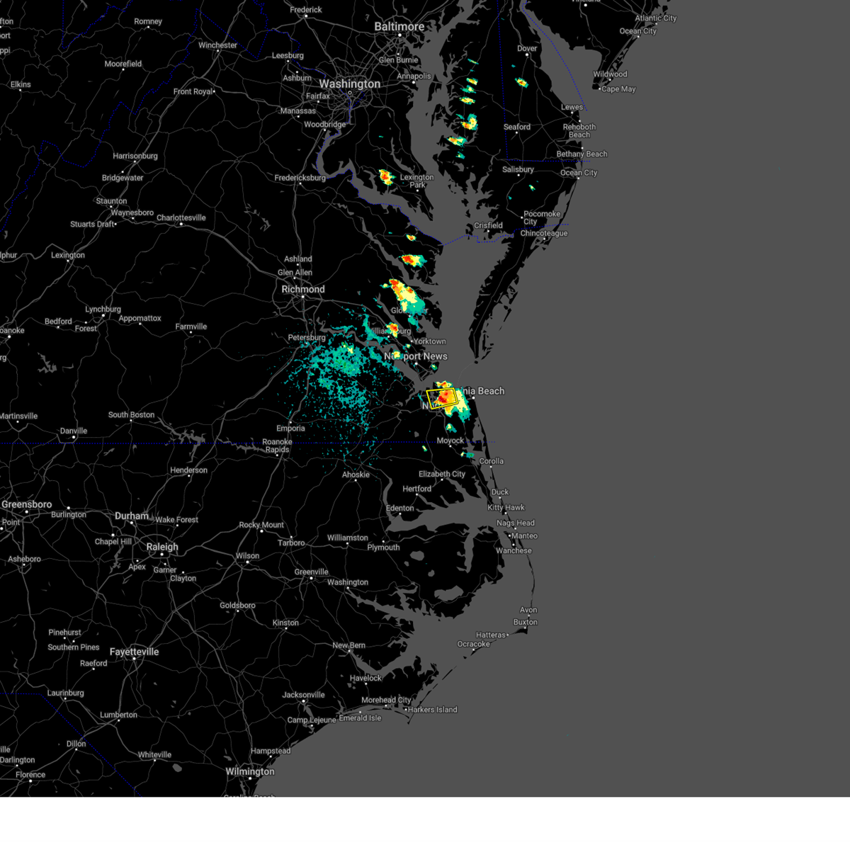 At 213 pm edt, a severe thunderstorm was located over norfolk state university, moving southeast at 5 mph (radar indicated). Hazards include 70 mph wind gusts and half dollar size hail. Minor damage to vehicles is possible. expect considerable tree damage. wind damage is also likely to mobile homes, roofs, and outbuildings. Locations impacted include, virginia beach, virginia wesleyan university, old dominion university, norfolk state university, downtown norfolk, regent university, kempsville, downtown portsmouth, norfolk, chesapeake, portsmouth, norfolk international, ghent, cradock, norview, and south norfolk. At 213 pm edt, a severe thunderstorm was located over norfolk state university, moving southeast at 5 mph (radar indicated). Hazards include 70 mph wind gusts and half dollar size hail. Minor damage to vehicles is possible. expect considerable tree damage. wind damage is also likely to mobile homes, roofs, and outbuildings. Locations impacted include, virginia beach, virginia wesleyan university, old dominion university, norfolk state university, downtown norfolk, regent university, kempsville, downtown portsmouth, norfolk, chesapeake, portsmouth, norfolk international, ghent, cradock, norview, and south norfolk.
|
| 5/26/2024 2:06 PM EDT |
 At 206 pm edt, a severe thunderstorm was located over norfolk state university, and is nearly stationary (radar indicated). Hazards include 60 mph wind gusts and quarter size hail. Minor damage to vehicles is possible. expect wind damage to trees and powerlines. Locations impacted include, virginia beach, virginia wesleyan university, old dominion university, norfolk state university, downtown norfolk, regent university, ocean view, kempsville, downtown portsmouth, norfolk, chesapeake, portsmouth, norfolk international, ghent, norfolk nas, cradock, norview, south norfolk, princess anne plaza, and bayside. At 206 pm edt, a severe thunderstorm was located over norfolk state university, and is nearly stationary (radar indicated). Hazards include 60 mph wind gusts and quarter size hail. Minor damage to vehicles is possible. expect wind damage to trees and powerlines. Locations impacted include, virginia beach, virginia wesleyan university, old dominion university, norfolk state university, downtown norfolk, regent university, ocean view, kempsville, downtown portsmouth, norfolk, chesapeake, portsmouth, norfolk international, ghent, norfolk nas, cradock, norview, south norfolk, princess anne plaza, and bayside.
|
| 5/26/2024 1:51 PM EDT | Quarter sized hail reported 1.7 miles S of Norfolk, VA, time estimated from radar. |
| 5/26/2024 1:43 PM EDT |
 Svrakq the national weather service in wakefield has issued a * severe thunderstorm warning for, the city of norfolk in southeastern virginia, the north central city of chesapeake in southeastern virginia, the city of portsmouth in southeastern virginia, the northwestern city of virginia beach in southeastern virginia, * until 230 pm edt. * at 142 pm edt, a severe thunderstorm was located over ocean view, and is nearly stationary (radar indicated). Hazards include 60 mph wind gusts and penny size hail. expect damage to trees and powerlines Svrakq the national weather service in wakefield has issued a * severe thunderstorm warning for, the city of norfolk in southeastern virginia, the north central city of chesapeake in southeastern virginia, the city of portsmouth in southeastern virginia, the northwestern city of virginia beach in southeastern virginia, * until 230 pm edt. * at 142 pm edt, a severe thunderstorm was located over ocean view, and is nearly stationary (radar indicated). Hazards include 60 mph wind gusts and penny size hail. expect damage to trees and powerlines
|
| 4/12/2024 1:01 AM EDT |
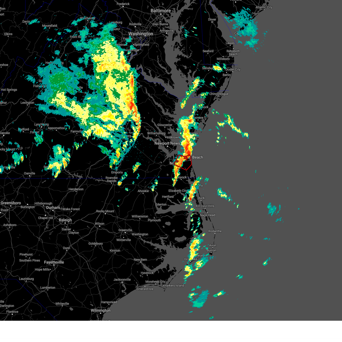 the tornado warning has been cancelled and is no longer in effect the tornado warning has been cancelled and is no longer in effect
|
| 4/12/2024 12:48 AM EDT |
 Torakq the national weather service in wakefield has issued a * tornado warning for, the southeastern city of norfolk in southeastern virginia, the northeastern city of chesapeake in southeastern virginia, the southeastern city of portsmouth in southeastern virginia, the northwestern city of virginia beach in southeastern virginia, * until 115 am edt. * at 1247 am edt, a severe thunderstorm capable of producing a tornado was located near kempsville, moving northeast at 25 mph (radar indicated rotation). Hazards include tornado. Flying debris will be dangerous to those caught without shelter. mobile homes will be damaged or destroyed. damage to roofs, windows, and vehicles will occur. tree damage is likely. this dangerous storm will be near, virginia beach around 1255 am edt. Other locations impacted by this tornadic thunderstorm include south norfolk, rudee heights, portlock, mount pleasant, princess anne plaza, oceana nas, macons corner, greenbrier, bayside, and oceana. Torakq the national weather service in wakefield has issued a * tornado warning for, the southeastern city of norfolk in southeastern virginia, the northeastern city of chesapeake in southeastern virginia, the southeastern city of portsmouth in southeastern virginia, the northwestern city of virginia beach in southeastern virginia, * until 115 am edt. * at 1247 am edt, a severe thunderstorm capable of producing a tornado was located near kempsville, moving northeast at 25 mph (radar indicated rotation). Hazards include tornado. Flying debris will be dangerous to those caught without shelter. mobile homes will be damaged or destroyed. damage to roofs, windows, and vehicles will occur. tree damage is likely. this dangerous storm will be near, virginia beach around 1255 am edt. Other locations impacted by this tornadic thunderstorm include south norfolk, rudee heights, portlock, mount pleasant, princess anne plaza, oceana nas, macons corner, greenbrier, bayside, and oceana.
|
| 4/12/2024 12:22 AM EDT | Svrakq the national weather service in wakefield has issued a * severe thunderstorm warning for, northwestern camden county in northeastern north carolina, northwestern pasquotank county in northeastern north carolina, northeastern gates county in northeastern north carolina, northwestern currituck county in northeastern north carolina, the city of norfolk in southeastern virginia, the city of chesapeake in southeastern virginia, the city of portsmouth in southeastern virginia, the southeastern city of suffolk in southeastern virginia, the city of virginia beach in southeastern virginia, * until 100 am edt. * at 1221 am edt, a severe thunderstorm was located near northwest, or 8 miles north of south mills, moving northeast at 60 mph (radar indicated). Hazards include 60 mph wind gusts. Expect damage to trees and powerlines. this severe thunderstorm will be near, great bridge, deep creek, chesapeake, northwest, and fentress around 1225 am edt. virginia beach, regent university, and portsmouth around 1230 am edt. kempsville, virginia wesleyan university, norfolk state university, norfolk, cradock, and princess anne around 1235 am edt. norview and norfolk international around 1240 am edt. Other locations impacted by this severe thunderstorm include south norfolk, horseshoe, rudee heights, portlock, pierceville, princess anne plaza, tar corner, sharon, pungo, and greenbrier. |
| 1/9/2024 9:24 PM EST |
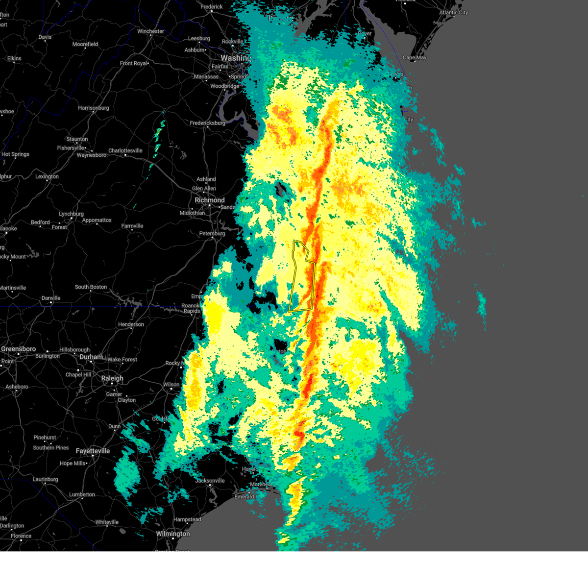 At 923 pm est, severe thunderstorms were located along a line extending from near grand view to near northwest, moving northeast at 50 mph (radar indicated). Hazards include 60 mph wind gusts. Expect damage to trees and powerlines. these severe storms will be near, virginia beach, great bridge, regent university, kempsville, virginia wesleyan university, norfolk, chesapeake, fentress, and norfolk international around 930 pm est. other locations impacted by these severe thunderstorms include south norfolk, fox hill, portlock, phoebus, langley view, herberts corner, raleigh terrace, greenbrier, wards corner, and messick. hail threat, radar indicated max hail size, <. 75 in wind threat, radar indicated max wind gust, 60 mph. At 923 pm est, severe thunderstorms were located along a line extending from near grand view to near northwest, moving northeast at 50 mph (radar indicated). Hazards include 60 mph wind gusts. Expect damage to trees and powerlines. these severe storms will be near, virginia beach, great bridge, regent university, kempsville, virginia wesleyan university, norfolk, chesapeake, fentress, and norfolk international around 930 pm est. other locations impacted by these severe thunderstorms include south norfolk, fox hill, portlock, phoebus, langley view, herberts corner, raleigh terrace, greenbrier, wards corner, and messick. hail threat, radar indicated max hail size, <. 75 in wind threat, radar indicated max wind gust, 60 mph.
|
| 1/9/2024 9:24 PM EST |
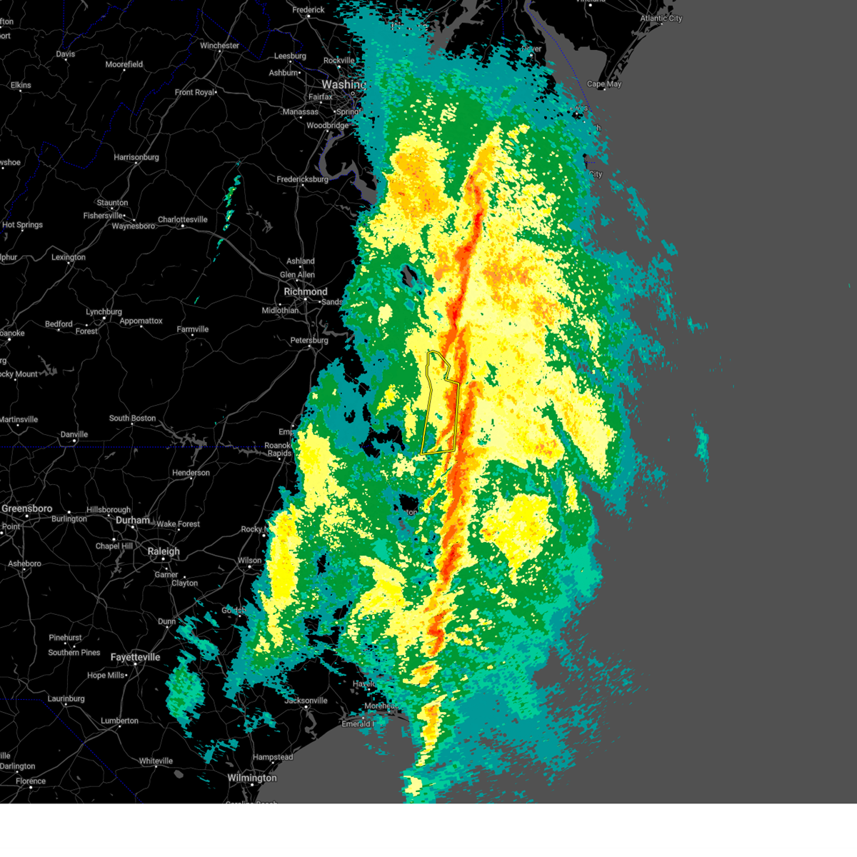 At 923 pm est, severe thunderstorms were located along a line extending from near grand view to near northwest, moving northeast at 50 mph (radar indicated). Hazards include 60 mph wind gusts. Expect damage to trees and powerlines. these severe storms will be near, virginia beach, great bridge, regent university, kempsville, virginia wesleyan university, norfolk, chesapeake, fentress, and norfolk international around 930 pm est. other locations impacted by these severe thunderstorms include south norfolk, fox hill, portlock, phoebus, langley view, herberts corner, raleigh terrace, greenbrier, wards corner, and messick. hail threat, radar indicated max hail size, <. 75 in wind threat, radar indicated max wind gust, 60 mph. At 923 pm est, severe thunderstorms were located along a line extending from near grand view to near northwest, moving northeast at 50 mph (radar indicated). Hazards include 60 mph wind gusts. Expect damage to trees and powerlines. these severe storms will be near, virginia beach, great bridge, regent university, kempsville, virginia wesleyan university, norfolk, chesapeake, fentress, and norfolk international around 930 pm est. other locations impacted by these severe thunderstorms include south norfolk, fox hill, portlock, phoebus, langley view, herberts corner, raleigh terrace, greenbrier, wards corner, and messick. hail threat, radar indicated max hail size, <. 75 in wind threat, radar indicated max wind gust, 60 mph.
|
| 1/9/2024 9:17 PM EST |
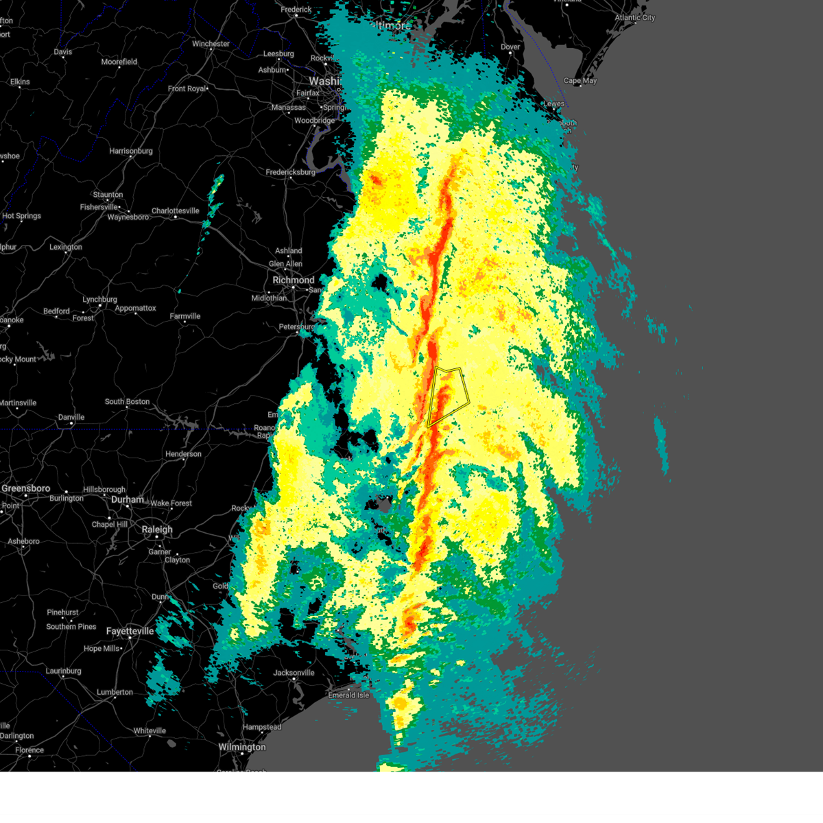 At 917 pm est, severe thunderstorms were located along a line extending from 6 miles east of buckroe beach to near south mills, moving northeast at 55 mph (radar indicated). Hazards include 60 mph wind gusts. Expect damage to trees and powerlines. severe thunderstorms will be near, virginia beach, regent university, kempsville, virginia wesleyan university, norfolk, chesapeake, and fentress around 925 pm est. princess anne around 930 pm est. other locations impacted by these severe thunderstorms include rudee heights, mount pleasant, princess anne plaza, sigma, sandbridge beach, oceana nas, macons corner, pungo, greenbrier, and bayside. hail threat, radar indicated max hail size, <. 75 in wind threat, radar indicated max wind gust, 60 mph. At 917 pm est, severe thunderstorms were located along a line extending from 6 miles east of buckroe beach to near south mills, moving northeast at 55 mph (radar indicated). Hazards include 60 mph wind gusts. Expect damage to trees and powerlines. severe thunderstorms will be near, virginia beach, regent university, kempsville, virginia wesleyan university, norfolk, chesapeake, and fentress around 925 pm est. princess anne around 930 pm est. other locations impacted by these severe thunderstorms include rudee heights, mount pleasant, princess anne plaza, sigma, sandbridge beach, oceana nas, macons corner, pungo, greenbrier, and bayside. hail threat, radar indicated max hail size, <. 75 in wind threat, radar indicated max wind gust, 60 mph.
|
| 1/9/2024 9:10 PM EST | 52 knot gust at kngu as the line of storms was moving throug in city of norfolk county VA, 6.3 miles SE of Norfolk, VA |
| 1/9/2024 9:02 PM EST |
 At 901 pm est, severe thunderstorms were located along a line extending from near churchland to near hobbsville, moving northeast at 45 mph (radar indicated). Hazards include 60 mph wind gusts. Expect damage to trees and powerlines. these severe storms will be near, hampton, deep creek, downtown norfolk, churchland, old dominion university, downtown portsmouth, norfolk, chesapeake, portsmouth, and ghent around 905 pm est. hampton university, ocean view, norfolk state university, morgans corner, norview, and buckroe beach around 910 pm est. virginia beach, great bridge, south mills, and norfolk international around 915 pm est. regent university, virginia wesleyan university, and grand view around 920 pm est. kempsville, northwest, and fentress around 925 pm est. other locations impacted by these severe thunderstorms include south norfolk, gliden, horseshoe, portlock, pierceville, savage, peach, huntersville, tar corner, and nicanor. hail threat, radar indicated max hail size, <. 75 in wind threat, radar indicated max wind gust, 60 mph. At 901 pm est, severe thunderstorms were located along a line extending from near churchland to near hobbsville, moving northeast at 45 mph (radar indicated). Hazards include 60 mph wind gusts. Expect damage to trees and powerlines. these severe storms will be near, hampton, deep creek, downtown norfolk, churchland, old dominion university, downtown portsmouth, norfolk, chesapeake, portsmouth, and ghent around 905 pm est. hampton university, ocean view, norfolk state university, morgans corner, norview, and buckroe beach around 910 pm est. virginia beach, great bridge, south mills, and norfolk international around 915 pm est. regent university, virginia wesleyan university, and grand view around 920 pm est. kempsville, northwest, and fentress around 925 pm est. other locations impacted by these severe thunderstorms include south norfolk, gliden, horseshoe, portlock, pierceville, savage, peach, huntersville, tar corner, and nicanor. hail threat, radar indicated max hail size, <. 75 in wind threat, radar indicated max wind gust, 60 mph.
|
| 1/9/2024 8:31 PM EST |
 At 831 pm est, severe thunderstorms were located along a line extending from near whaleyville to 8 miles south of colerain, moving northeast at 50 mph (radar indicated). Hazards include 60 mph wind gusts. Expect damage to trees and powerlines. severe thunderstorms will be near, gatesville, suffolk, gates, colerain, harrellsville, rockyhock, and whaleyville around 835 pm est. downtown suffolk, ryland, sunbury, tyner, valhalla, and hobbsville around 840 pm est. kings fork and corapeake around 845 pm est. chesapeake, driver, and belvidere around 850 pm est. portsmouth, bowers hill, and crittenden around 855 pm est. churchland and western branch around 900 pm est. newport news, hampton, deep creek, old dominion university, norfolk, and cradock around 905 pm est. hampton university, downtown norfolk, south mills, downtown portsmouth, ghent, norfolk nas, morgans corner, and fort monroe around 910 pm est. other locations impacted by these severe thunderstorms include goose pond, south norfolk, portlock, pierceville, newsome store, savage, arrowhead beach, huntersville, mount gould, and carter. hail threat, radar indicated max hail size, <. 75 in wind threat, radar indicated max wind gust, 60 mph. At 831 pm est, severe thunderstorms were located along a line extending from near whaleyville to 8 miles south of colerain, moving northeast at 50 mph (radar indicated). Hazards include 60 mph wind gusts. Expect damage to trees and powerlines. severe thunderstorms will be near, gatesville, suffolk, gates, colerain, harrellsville, rockyhock, and whaleyville around 835 pm est. downtown suffolk, ryland, sunbury, tyner, valhalla, and hobbsville around 840 pm est. kings fork and corapeake around 845 pm est. chesapeake, driver, and belvidere around 850 pm est. portsmouth, bowers hill, and crittenden around 855 pm est. churchland and western branch around 900 pm est. newport news, hampton, deep creek, old dominion university, norfolk, and cradock around 905 pm est. hampton university, downtown norfolk, south mills, downtown portsmouth, ghent, norfolk nas, morgans corner, and fort monroe around 910 pm est. other locations impacted by these severe thunderstorms include goose pond, south norfolk, portlock, pierceville, newsome store, savage, arrowhead beach, huntersville, mount gould, and carter. hail threat, radar indicated max hail size, <. 75 in wind threat, radar indicated max wind gust, 60 mph.
|
| 8/15/2023 5:41 PM EDT |
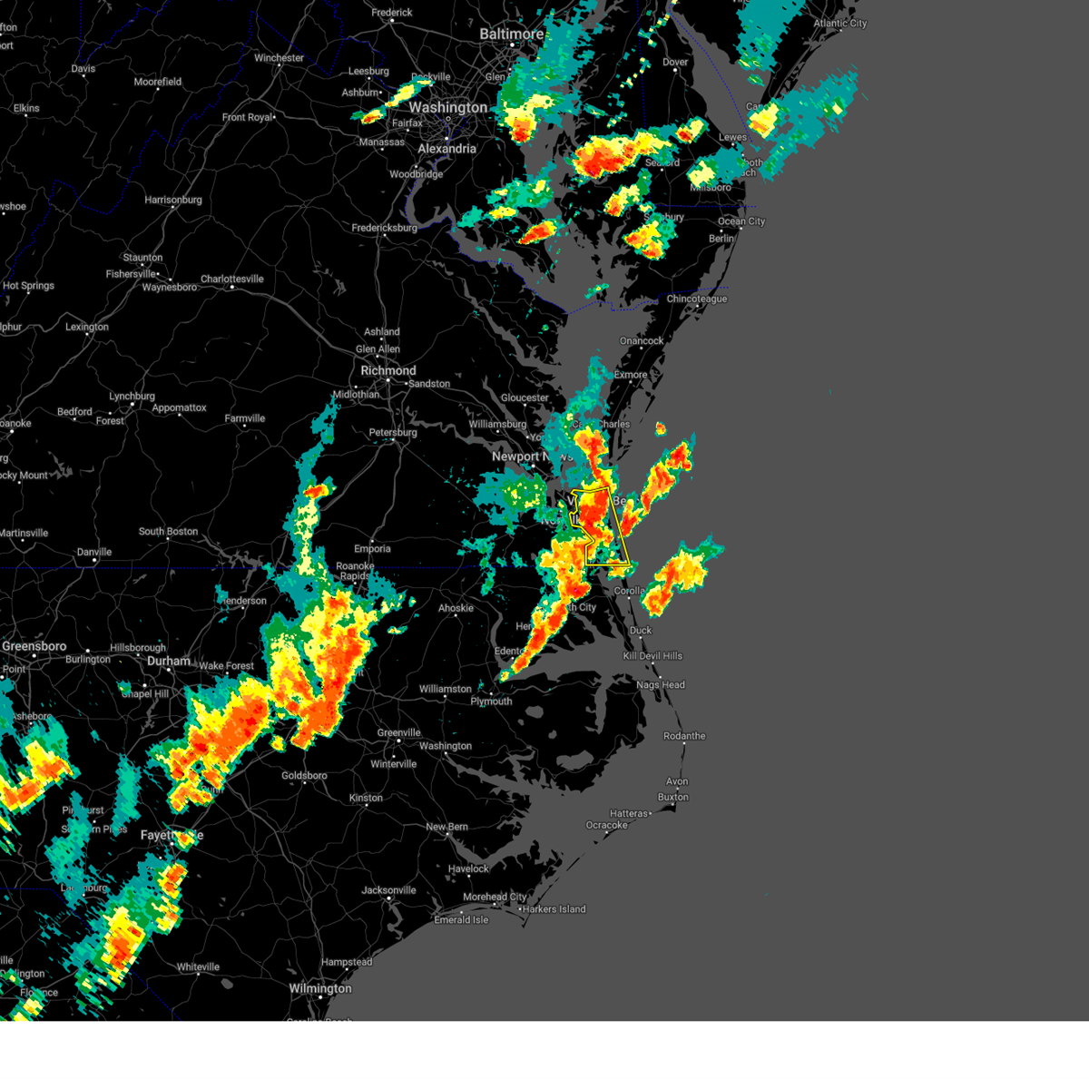 At 540 pm edt, severe thunderstorms were located along a line extending from 16 miles east of norfolk international to 7 miles northeast of princess anne to back bay, moving east at 35 mph (radar indicated). Hazards include 70 mph wind gusts and penny size hail. Expect considerable tree damage. damage is likely to mobile homes, roofs, and outbuildings. these severe storms will be near, virginia beach around 545 pm edt. other locations impacted by these severe thunderstorms include rudee heights, princess anne plaza, sigma, sandbridge beach, oceana nas, munden, macons corner, pungo, greenbrier, and bayside. thunderstorm damage threat, considerable hail threat, radar indicated max hail size, 0. 75 in wind threat, radar indicated max wind gust, 70 mph. At 540 pm edt, severe thunderstorms were located along a line extending from 16 miles east of norfolk international to 7 miles northeast of princess anne to back bay, moving east at 35 mph (radar indicated). Hazards include 70 mph wind gusts and penny size hail. Expect considerable tree damage. damage is likely to mobile homes, roofs, and outbuildings. these severe storms will be near, virginia beach around 545 pm edt. other locations impacted by these severe thunderstorms include rudee heights, princess anne plaza, sigma, sandbridge beach, oceana nas, munden, macons corner, pungo, greenbrier, and bayside. thunderstorm damage threat, considerable hail threat, radar indicated max hail size, 0. 75 in wind threat, radar indicated max wind gust, 70 mph.
|
| 8/15/2023 5:39 PM EDT |
 The severe thunderstorm warning for , the city of norfolk, the city of chesapeake, the city of portsmouth, the eastern city of suffolk and the northwestern city of virginia beach will expire at 545 pm edt, the storms which prompted the warning have moved out of the area. therefore, the warning will be allowed to expire. a severe thunderstorm watch remains in effect until 900 pm edt for northeastern north carolina, and southeastern virginia. The severe thunderstorm warning for , the city of norfolk, the city of chesapeake, the city of portsmouth, the eastern city of suffolk and the northwestern city of virginia beach will expire at 545 pm edt, the storms which prompted the warning have moved out of the area. therefore, the warning will be allowed to expire. a severe thunderstorm watch remains in effect until 900 pm edt for northeastern north carolina, and southeastern virginia.
|
| 8/15/2023 5:21 PM EDT |
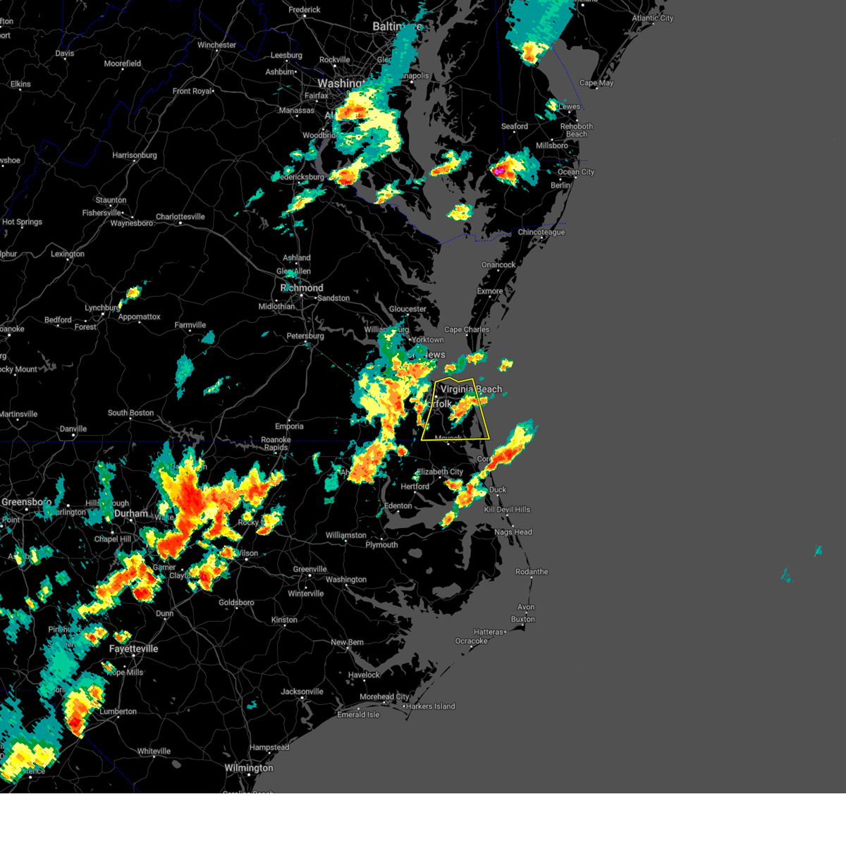 At 520 pm edt, severe thunderstorms were located along a line extending from near norfolk international to near regent university to near northwest, moving east at 35 mph (radar indicated). Hazards include 70 mph wind gusts and penny size hail. Expect considerable tree damage. damage is likely to mobile homes, roofs, and outbuildings. severe thunderstorms will be near, virginia beach, chesapeake, and princess anne around 525 pm edt. back bay around 530 pm edt. other locations impacted by these severe thunderstorms include south norfolk, rudee heights, portlock, mount pleasant, princess anne plaza, sigma, sandbridge beach, herberts corner, oceana nas, and munden. thunderstorm damage threat, considerable hail threat, radar indicated max hail size, 0. 75 in wind threat, radar indicated max wind gust, 70 mph. At 520 pm edt, severe thunderstorms were located along a line extending from near norfolk international to near regent university to near northwest, moving east at 35 mph (radar indicated). Hazards include 70 mph wind gusts and penny size hail. Expect considerable tree damage. damage is likely to mobile homes, roofs, and outbuildings. severe thunderstorms will be near, virginia beach, chesapeake, and princess anne around 525 pm edt. back bay around 530 pm edt. other locations impacted by these severe thunderstorms include south norfolk, rudee heights, portlock, mount pleasant, princess anne plaza, sigma, sandbridge beach, herberts corner, oceana nas, and munden. thunderstorm damage threat, considerable hail threat, radar indicated max hail size, 0. 75 in wind threat, radar indicated max wind gust, 70 mph.
|
| 8/15/2023 5:06 PM EDT |
 At 505 pm edt, severe thunderstorms were located along a line extending from near crittenden to near bowers hill to near corapeake, moving east at 30 mph (radar indicated). Hazards include 70 mph wind gusts and penny size hail. Expect considerable tree damage. damage is likely to mobile homes, roofs, and outbuildings. these severe storms will be near, churchland, chesapeake, portsmouth, suffolk, bowers hill, and western branch around 510 pm edt. deep creek, norfolk, and cradock around 515 pm edt. downtown norfolk, old dominion university, downtown portsmouth, and ghent around 520 pm edt. great bridge, norfolk state university, norfolk nas, and norview around 525 pm edt. virginia beach, regent university, ocean view, and norfolk international around 530 pm edt. kempsville, virginia wesleyan university, and fentress around 535 pm edt. other locations impacted by these severe thunderstorms include south norfolk, portlock, huntersville, herberts corner, saunders, magnolia, chuckatuck, greenbrier, hobson, and wilroy. thunderstorm damage threat, considerable hail threat, radar indicated max hail size, 0. 75 in wind threat, radar indicated max wind gust, 70 mph. At 505 pm edt, severe thunderstorms were located along a line extending from near crittenden to near bowers hill to near corapeake, moving east at 30 mph (radar indicated). Hazards include 70 mph wind gusts and penny size hail. Expect considerable tree damage. damage is likely to mobile homes, roofs, and outbuildings. these severe storms will be near, churchland, chesapeake, portsmouth, suffolk, bowers hill, and western branch around 510 pm edt. deep creek, norfolk, and cradock around 515 pm edt. downtown norfolk, old dominion university, downtown portsmouth, and ghent around 520 pm edt. great bridge, norfolk state university, norfolk nas, and norview around 525 pm edt. virginia beach, regent university, ocean view, and norfolk international around 530 pm edt. kempsville, virginia wesleyan university, and fentress around 535 pm edt. other locations impacted by these severe thunderstorms include south norfolk, portlock, huntersville, herberts corner, saunders, magnolia, chuckatuck, greenbrier, hobson, and wilroy. thunderstorm damage threat, considerable hail threat, radar indicated max hail size, 0. 75 in wind threat, radar indicated max wind gust, 70 mph.
|
| 8/15/2023 4:54 PM EDT |
 At 453 pm edt, severe thunderstorms were located along a line extending from near kings fork to downtown suffolk to near gates, moving east at 30 mph (radar indicated). Hazards include 70 mph wind gusts and penny size hail. Expect considerable tree damage. damage is likely to mobile homes, roofs, and outbuildings. severe thunderstorms will be near, chesapeake, suffolk, driver, and corapeake around 500 pm edt. bowers hill around 505 pm edt. portsmouth and western branch around 510 pm edt. deep creek and churchland around 515 pm edt. downtown portsmouth, norfolk, and cradock around 520 pm edt. great bridge, downtown norfolk, old dominion university, norfolk state university, and ghent around 525 pm edt. virginia beach, regent university, and norview around 530 pm edt. fentress around 535 pm edt. other locations impacted by these severe thunderstorms include south norfolk, portlock, suffolk airport, huntersville, sharon, chuckatuck, greenbrier, wilroy, wards corner, and nurney. thunderstorm damage threat, considerable hail threat, radar indicated max hail size, 0. 75 in wind threat, radar indicated max wind gust, 70 mph. At 453 pm edt, severe thunderstorms were located along a line extending from near kings fork to downtown suffolk to near gates, moving east at 30 mph (radar indicated). Hazards include 70 mph wind gusts and penny size hail. Expect considerable tree damage. damage is likely to mobile homes, roofs, and outbuildings. severe thunderstorms will be near, chesapeake, suffolk, driver, and corapeake around 500 pm edt. bowers hill around 505 pm edt. portsmouth and western branch around 510 pm edt. deep creek and churchland around 515 pm edt. downtown portsmouth, norfolk, and cradock around 520 pm edt. great bridge, downtown norfolk, old dominion university, norfolk state university, and ghent around 525 pm edt. virginia beach, regent university, and norview around 530 pm edt. fentress around 535 pm edt. other locations impacted by these severe thunderstorms include south norfolk, portlock, suffolk airport, huntersville, sharon, chuckatuck, greenbrier, wilroy, wards corner, and nurney. thunderstorm damage threat, considerable hail threat, radar indicated max hail size, 0. 75 in wind threat, radar indicated max wind gust, 70 mph.
|
| 7/19/2023 4:30 PM EDT |
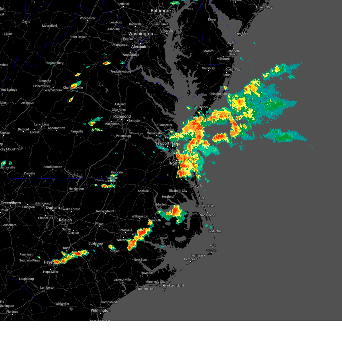 At 429 pm edt, severe thunderstorms were located along a line extending from near kempsville to near northwest, moving east at 35 mph (radar indicated). Hazards include 60 mph wind gusts and penny size hail. Expect damage to trees and powerlines. severe thunderstorms will be near, princess anne around 435 pm edt. virginia beach and back bay around 445 pm edt. Other locations impacted by these severe thunderstorms include rudee heights, mount pleasant, princess anne plaza, sigma, sandbridge beach, oceana nas, munden, macons corner, pungo and greenbrier. At 429 pm edt, severe thunderstorms were located along a line extending from near kempsville to near northwest, moving east at 35 mph (radar indicated). Hazards include 60 mph wind gusts and penny size hail. Expect damage to trees and powerlines. severe thunderstorms will be near, princess anne around 435 pm edt. virginia beach and back bay around 445 pm edt. Other locations impacted by these severe thunderstorms include rudee heights, mount pleasant, princess anne plaza, sigma, sandbridge beach, oceana nas, munden, macons corner, pungo and greenbrier.
|
| 7/19/2023 4:16 PM EDT |
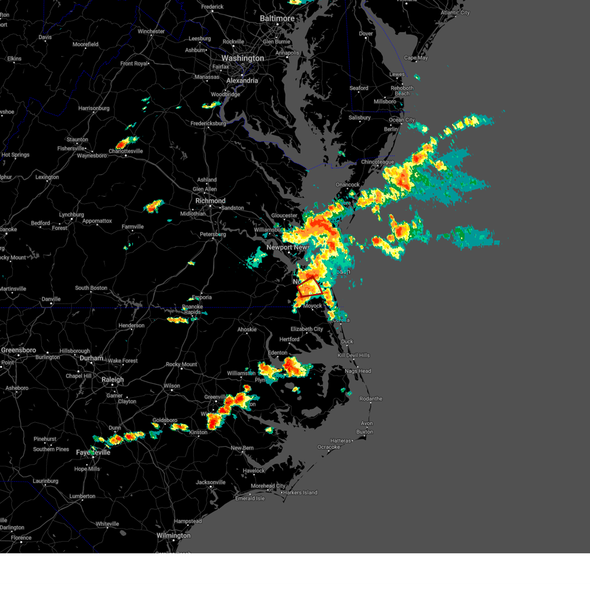 At 416 pm edt, a severe thunderstorm capable of producing a tornado was located over great bridge, moving east at 30 mph (radar indicated rotation). Hazards include tornado. Flying debris will be dangerous to those caught without shelter. mobile homes will be damaged or destroyed. damage to roofs, windows, and vehicles will occur. tree damage is likely. this dangerous storm will be near, great bridge around 420 pm edt. fentress around 425 pm edt. regent university around 430 pm edt. kempsville around 435 pm edt. Other locations impacted by this tornadic thunderstorm include greenbrier, herberts corner, portlock, mount pleasant and hickory. At 416 pm edt, a severe thunderstorm capable of producing a tornado was located over great bridge, moving east at 30 mph (radar indicated rotation). Hazards include tornado. Flying debris will be dangerous to those caught without shelter. mobile homes will be damaged or destroyed. damage to roofs, windows, and vehicles will occur. tree damage is likely. this dangerous storm will be near, great bridge around 420 pm edt. fentress around 425 pm edt. regent university around 430 pm edt. kempsville around 435 pm edt. Other locations impacted by this tornadic thunderstorm include greenbrier, herberts corner, portlock, mount pleasant and hickory.
|
| 7/19/2023 4:05 PM EDT |
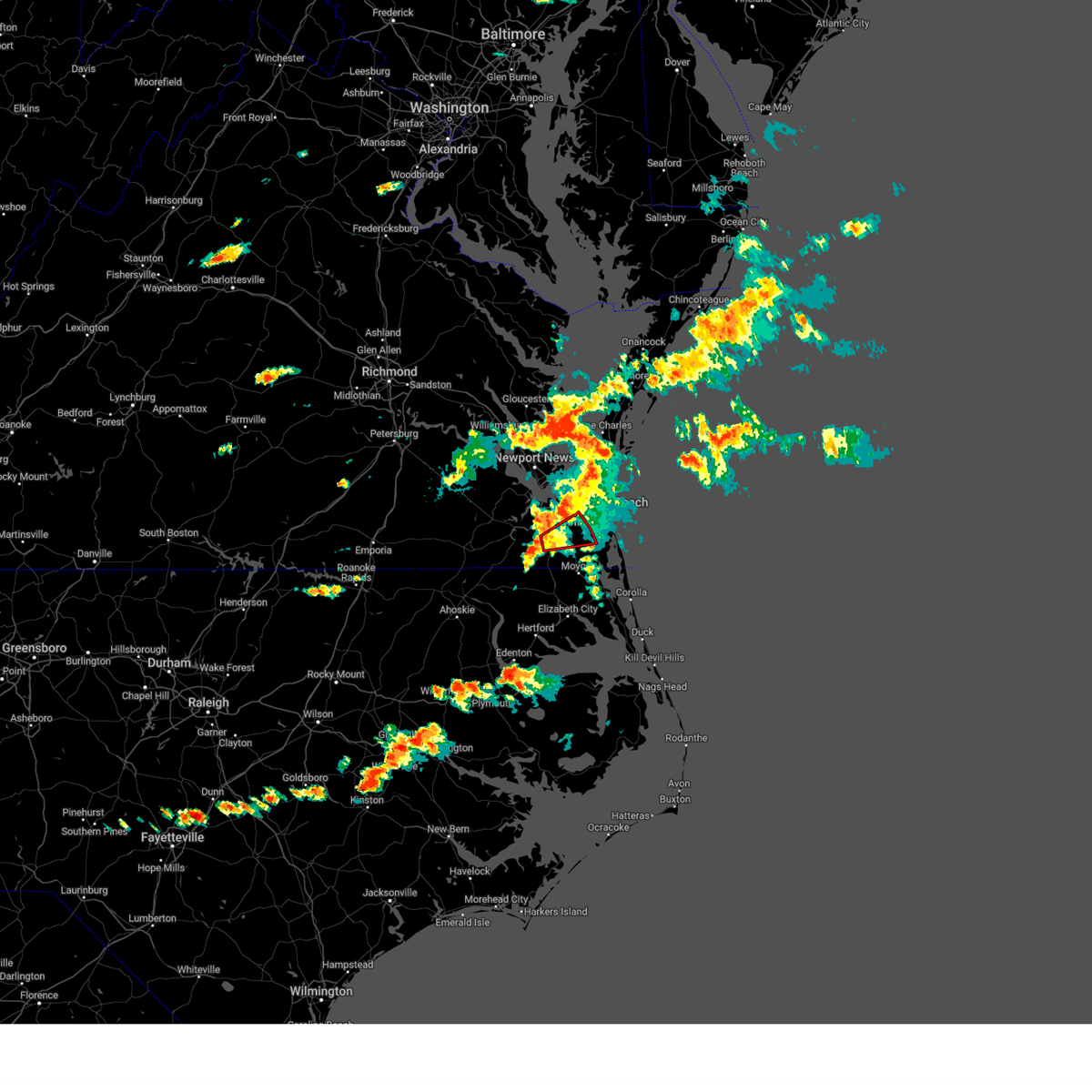 At 405 pm edt, a severe thunderstorm capable of producing a tornado was located near deep creek, moving east at 25 mph (radar indicated rotation). Hazards include tornado. Flying debris will be dangerous to those caught without shelter. mobile homes will be damaged or destroyed. damage to roofs, windows, and vehicles will occur. tree damage is likely. this dangerous storm will be near, great bridge around 420 pm edt. fentress around 425 pm edt. regent university and kempsville around 430 pm edt. Other locations impacted by this tornadic thunderstorm include greenbrier, herberts corner, portlock, mount pleasant, hickory and chesapeake airport. At 405 pm edt, a severe thunderstorm capable of producing a tornado was located near deep creek, moving east at 25 mph (radar indicated rotation). Hazards include tornado. Flying debris will be dangerous to those caught without shelter. mobile homes will be damaged or destroyed. damage to roofs, windows, and vehicles will occur. tree damage is likely. this dangerous storm will be near, great bridge around 420 pm edt. fentress around 425 pm edt. regent university and kempsville around 430 pm edt. Other locations impacted by this tornadic thunderstorm include greenbrier, herberts corner, portlock, mount pleasant, hickory and chesapeake airport.
|
| 7/3/2023 4:48 PM EDT |
 At 447 pm edt, severe thunderstorms were located along a line extending from near ocean view to near kempsville to back bay, moving east at 45 mph (radar indicated). Hazards include 70 mph wind gusts. Expect considerable tree damage. damage is likely to mobile homes, roofs, and outbuildings. these severe thunderstorms will remain over mainly rural areas of , the city of norfolk, the northeastern city of chesapeake, the city of portsmouth and the city of virginia beach, including the following locations, south norfolk, rudee heights, portlock, mount pleasant, princess anne plaza, sigma, sandbridge beach, oceana nas, macons corner and pungo. thunderstorm damage threat, considerable hail threat, radar indicated max hail size, <. 75 in wind threat, radar indicated max wind gust, 70 mph. At 447 pm edt, severe thunderstorms were located along a line extending from near ocean view to near kempsville to back bay, moving east at 45 mph (radar indicated). Hazards include 70 mph wind gusts. Expect considerable tree damage. damage is likely to mobile homes, roofs, and outbuildings. these severe thunderstorms will remain over mainly rural areas of , the city of norfolk, the northeastern city of chesapeake, the city of portsmouth and the city of virginia beach, including the following locations, south norfolk, rudee heights, portlock, mount pleasant, princess anne plaza, sigma, sandbridge beach, oceana nas, macons corner and pungo. thunderstorm damage threat, considerable hail threat, radar indicated max hail size, <. 75 in wind threat, radar indicated max wind gust, 70 mph.
|
| 7/3/2023 4:46 PM EDT | Lafayette river tower reported a wind gust of 54k in city of norfolk county VA, 6 miles ESE of Norfolk, VA |
| 7/3/2023 4:27 PM EDT |
 At 427 pm edt, severe thunderstorms were located along a line extending from near crittenden to near deep creek to 6 miles north of south mills, moving northeast at 30 mph (radar indicated). Hazards include 70 mph wind gusts and quarter size hail. Minor damage to vehicles is possible. expect considerable tree damage. wind damage is also likely to mobile homes, roofs, and outbuildings. these severe storms will be near, deep creek, chesapeake and cradock around 435 pm edt. downtown portsmouth and great bridge around 440 pm edt. norfolk state university, downtown norfolk, churchland, old dominion university, christopher newport university, northwest and ghent around 445 pm edt. regent university, norview and beaconsdale around 450 pm edt. kempsville, virginia wesleyan university, portsmouth, northampton, norfolk international and fentress around 455 pm edt. hampton university, langley afb, norfolk, fort monroe and norfolk nas around 500 pm edt. ocean view, back bay and buckroe beach around 505 pm edt. grand view and princess anne around 510 pm edt. other locations impacted by these severe thunderstorms include south norfolk, rudee heights, carrollton, portlock, longview, benns church, princess anne plaza, sigma, huntersville and hilton village. thunderstorm damage threat, considerable hail threat, radar indicated max hail size, 1. 00 in wind threat, radar indicated max wind gust, 70 mph. At 427 pm edt, severe thunderstorms were located along a line extending from near crittenden to near deep creek to 6 miles north of south mills, moving northeast at 30 mph (radar indicated). Hazards include 70 mph wind gusts and quarter size hail. Minor damage to vehicles is possible. expect considerable tree damage. wind damage is also likely to mobile homes, roofs, and outbuildings. these severe storms will be near, deep creek, chesapeake and cradock around 435 pm edt. downtown portsmouth and great bridge around 440 pm edt. norfolk state university, downtown norfolk, churchland, old dominion university, christopher newport university, northwest and ghent around 445 pm edt. regent university, norview and beaconsdale around 450 pm edt. kempsville, virginia wesleyan university, portsmouth, northampton, norfolk international and fentress around 455 pm edt. hampton university, langley afb, norfolk, fort monroe and norfolk nas around 500 pm edt. ocean view, back bay and buckroe beach around 505 pm edt. grand view and princess anne around 510 pm edt. other locations impacted by these severe thunderstorms include south norfolk, rudee heights, carrollton, portlock, longview, benns church, princess anne plaza, sigma, huntersville and hilton village. thunderstorm damage threat, considerable hail threat, radar indicated max hail size, 1. 00 in wind threat, radar indicated max wind gust, 70 mph.
|
| 7/3/2023 4:12 PM EDT |
 At 412 pm edt, severe thunderstorms were located along a line extending from near windsor to near downtown suffolk to 6 miles east of corapeake, moving northeast at 30 mph (radar indicated). Hazards include 70 mph wind gusts and quarter size hail. Minor damage to vehicles is possible. expect considerable tree damage. wind damage is also likely to mobile homes, roofs, and outbuildings. these severe storms will be near, smithfield and bowers hill around 425 pm edt. deep creek, chesapeake, western branch and driver around 430 pm edt. crittenden, cradock and rescue around 435 pm edt. downtown portsmouth, great bridge, old dominion university, suffolk and ghent around 440 pm edt. norfolk state university, downtown norfolk, churchland, christopher newport university and northwest around 445 pm edt. regent university, portsmouth, northampton, norview and beaconsdale around 450 pm edt. kempsville, virginia wesleyan university, norfolk, norfolk nas, norfolk international and fentress around 455 pm edt. virginia beach, hampton university, ocean view, langley afb, fort monroe, buckroe beach, back bay, grand view and princess anne around 500 pm edt. other locations impacted by these severe thunderstorms include south norfolk, rudee heights, carrollton, portlock, longview, benns church, princess anne plaza, savage, sigma and suffolk airport. thunderstorm damage threat, considerable hail threat, radar indicated max hail size, 1. 00 in wind threat, radar indicated max wind gust, 70 mph. At 412 pm edt, severe thunderstorms were located along a line extending from near windsor to near downtown suffolk to 6 miles east of corapeake, moving northeast at 30 mph (radar indicated). Hazards include 70 mph wind gusts and quarter size hail. Minor damage to vehicles is possible. expect considerable tree damage. wind damage is also likely to mobile homes, roofs, and outbuildings. these severe storms will be near, smithfield and bowers hill around 425 pm edt. deep creek, chesapeake, western branch and driver around 430 pm edt. crittenden, cradock and rescue around 435 pm edt. downtown portsmouth, great bridge, old dominion university, suffolk and ghent around 440 pm edt. norfolk state university, downtown norfolk, churchland, christopher newport university and northwest around 445 pm edt. regent university, portsmouth, northampton, norview and beaconsdale around 450 pm edt. kempsville, virginia wesleyan university, norfolk, norfolk nas, norfolk international and fentress around 455 pm edt. virginia beach, hampton university, ocean view, langley afb, fort monroe, buckroe beach, back bay, grand view and princess anne around 500 pm edt. other locations impacted by these severe thunderstorms include south norfolk, rudee heights, carrollton, portlock, longview, benns church, princess anne plaza, savage, sigma and suffolk airport. thunderstorm damage threat, considerable hail threat, radar indicated max hail size, 1. 00 in wind threat, radar indicated max wind gust, 70 mph.
|
| 7/3/2023 4:05 PM EDT |
 At 405 pm edt, severe thunderstorms were located along a line extending from windsor to near downtown suffolk to near corapeake, moving northeast at 30 mph (radar indicated). Hazards include 60 mph wind gusts. Expect damage to trees and powerlines. severe thunderstorms will be near, smithfield around 420 pm edt. bowers hill around 425 pm edt. deep creek, chesapeake, western branch and driver around 430 pm edt. suffolk, crittenden, cradock and rescue around 435 pm edt. downtown portsmouth, downtown norfolk, great bridge, churchland, northwest and ghent around 440 pm edt. norfolk state university around 445 pm edt. regent university, virginia wesleyan university, old dominion university, portsmouth, northampton, fentress and norview around 450 pm edt. kempsville, hampton university, norfolk, norfolk nas and norfolk international around 455 pm edt. other locations impacted by these severe thunderstorms include south norfolk, rudee heights, carrollton, portlock, longview, savage, huntersville, chuckatuck, pungo and bayside. hail threat, radar indicated max hail size, <. 75 in wind threat, radar indicated max wind gust, 60 mph. At 405 pm edt, severe thunderstorms were located along a line extending from windsor to near downtown suffolk to near corapeake, moving northeast at 30 mph (radar indicated). Hazards include 60 mph wind gusts. Expect damage to trees and powerlines. severe thunderstorms will be near, smithfield around 420 pm edt. bowers hill around 425 pm edt. deep creek, chesapeake, western branch and driver around 430 pm edt. suffolk, crittenden, cradock and rescue around 435 pm edt. downtown portsmouth, downtown norfolk, great bridge, churchland, northwest and ghent around 440 pm edt. norfolk state university around 445 pm edt. regent university, virginia wesleyan university, old dominion university, portsmouth, northampton, fentress and norview around 450 pm edt. kempsville, hampton university, norfolk, norfolk nas and norfolk international around 455 pm edt. other locations impacted by these severe thunderstorms include south norfolk, rudee heights, carrollton, portlock, longview, savage, huntersville, chuckatuck, pungo and bayside. hail threat, radar indicated max hail size, <. 75 in wind threat, radar indicated max wind gust, 60 mph.
|
| 6/27/2023 2:13 AM EDT |
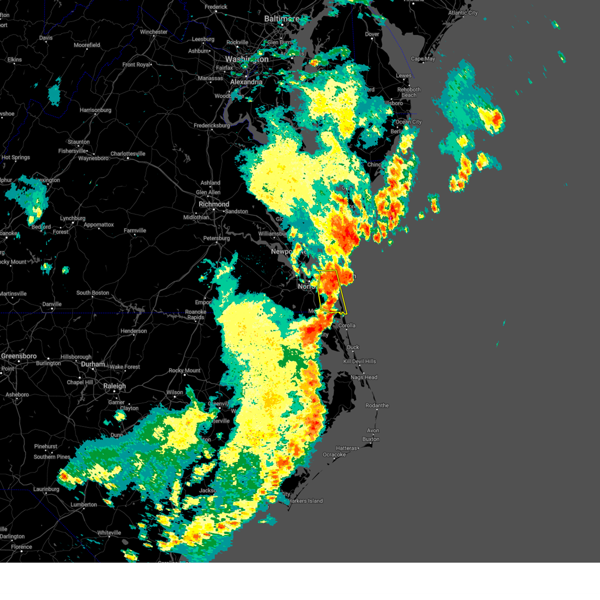 At 213 am edt, severe thunderstorms were located along a line extending from 9 miles northeast of kempsville to near back bay, moving east at 25 mph (radar indicated). Hazards include 60 mph wind gusts and quarter size hail. Minor damage to vehicles is possible. expect wind damage to trees and powerlines. locations impacted include, virginia beach, kempsville, chesapeake, back bay, princess anne, rudee heights, mount pleasant, princess anne plaza, sigma, sandbridge beach, oceana nas, munden, macons corner, pungo, bayside, oceana, north virginia beach, dam neck, gallups corner and london bridge. hail threat, radar indicated max hail size, 1. 00 in wind threat, radar indicated max wind gust, 60 mph. At 213 am edt, severe thunderstorms were located along a line extending from 9 miles northeast of kempsville to near back bay, moving east at 25 mph (radar indicated). Hazards include 60 mph wind gusts and quarter size hail. Minor damage to vehicles is possible. expect wind damage to trees and powerlines. locations impacted include, virginia beach, kempsville, chesapeake, back bay, princess anne, rudee heights, mount pleasant, princess anne plaza, sigma, sandbridge beach, oceana nas, munden, macons corner, pungo, bayside, oceana, north virginia beach, dam neck, gallups corner and london bridge. hail threat, radar indicated max hail size, 1. 00 in wind threat, radar indicated max wind gust, 60 mph.
|
| 6/27/2023 2:01 AM EDT |
 At 159 am edt, a severe thunderstorm was located near kempsville, moving northeast at 50 mph. additional strong to severe storms were located near fentress in chesapeake and near oceana in virginia beach (public. around 145 am edt, quarter size hail was reported in great bridge). Hazards include 60 mph wind gusts and quarter size hail. Minor damage to vehicles is possible. expect wind damage to trees and powerlines. this severe thunderstorm will remain over mainly rural areas of , the city of norfolk, the city of chesapeake, the city of portsmouth, the east central city of suffolk and the city of virginia beach, including the following locations, south norfolk, rudee heights, portlock, mount pleasant, princess anne plaza, sigma, sandbridge beach, herberts corner, oceana nas and munden. hail threat, observed max hail size, 1. 00 in wind threat, radar indicated max wind gust, 60 mph. At 159 am edt, a severe thunderstorm was located near kempsville, moving northeast at 50 mph. additional strong to severe storms were located near fentress in chesapeake and near oceana in virginia beach (public. around 145 am edt, quarter size hail was reported in great bridge). Hazards include 60 mph wind gusts and quarter size hail. Minor damage to vehicles is possible. expect wind damage to trees and powerlines. this severe thunderstorm will remain over mainly rural areas of , the city of norfolk, the city of chesapeake, the city of portsmouth, the east central city of suffolk and the city of virginia beach, including the following locations, south norfolk, rudee heights, portlock, mount pleasant, princess anne plaza, sigma, sandbridge beach, herberts corner, oceana nas and munden. hail threat, observed max hail size, 1. 00 in wind threat, radar indicated max wind gust, 60 mph.
|
| 6/27/2023 1:46 AM EDT |
 At 145 am edt, severe thunderstorms were located along a line extending from near grand view to norfolk international to near bowers hill, moving southeast at 45 mph (radar indicated). Hazards include 60 mph wind gusts and quarter size hail. Minor damage to vehicles is possible. expect wind damage to trees and powerlines. severe thunderstorms will be near, virginia wesleyan university, chesapeake and norfolk international around 150 am edt. kempsville and regent university around 155 am edt. great bridge around 200 am edt. princess anne and fentress around 205 am edt. virginia beach around 210 am edt. other locations impacted by these severe thunderstorms include south norfolk, rudee heights, portlock, mount pleasant, princess anne plaza, sigma, sandbridge beach, herberts corner, oceana nas and munden. hail threat, radar indicated max hail size, 1. 00 in wind threat, radar indicated max wind gust, 60 mph. At 145 am edt, severe thunderstorms were located along a line extending from near grand view to norfolk international to near bowers hill, moving southeast at 45 mph (radar indicated). Hazards include 60 mph wind gusts and quarter size hail. Minor damage to vehicles is possible. expect wind damage to trees and powerlines. severe thunderstorms will be near, virginia wesleyan university, chesapeake and norfolk international around 150 am edt. kempsville and regent university around 155 am edt. great bridge around 200 am edt. princess anne and fentress around 205 am edt. virginia beach around 210 am edt. other locations impacted by these severe thunderstorms include south norfolk, rudee heights, portlock, mount pleasant, princess anne plaza, sigma, sandbridge beach, herberts corner, oceana nas and munden. hail threat, radar indicated max hail size, 1. 00 in wind threat, radar indicated max wind gust, 60 mph.
|
| 6/27/2023 1:42 AM EDT | Tree and power line damage likely from storms is resulting in around 4...000 power outages in and near ocean view. time estimate in city of norfolk county VA, 6 miles SSE of Norfolk, VA |
| 6/27/2023 1:32 AM EDT |
 At 132 am edt, severe thunderstorms were located along a line extending from near tabb to northampton to crittenden, moving east at 45 mph (radar indicated). Hazards include 60 mph wind gusts and nickel size hail. Expect damage to trees and powerlines. these severe storms will be near, hampton, hampton university and langley afb around 135 am edt. buckroe beach, fort monroe and grand view around 140 am edt. old dominion university, downtown portsmouth, portsmouth, norfolk nas and ghent around 145 am edt. downtown norfolk, norfolk state university, ocean view and norview around 150 am edt. norfolk around 155 am edt. other locations impacted by these severe thunderstorms include fox hill, carrollton, phoebus, langley view, longview, benns church, oriana, huntersville, wills corner and hilton village. hail threat, radar indicated max hail size, 0. 88 in wind threat, radar indicated max wind gust, 60 mph. At 132 am edt, severe thunderstorms were located along a line extending from near tabb to northampton to crittenden, moving east at 45 mph (radar indicated). Hazards include 60 mph wind gusts and nickel size hail. Expect damage to trees and powerlines. these severe storms will be near, hampton, hampton university and langley afb around 135 am edt. buckroe beach, fort monroe and grand view around 140 am edt. old dominion university, downtown portsmouth, portsmouth, norfolk nas and ghent around 145 am edt. downtown norfolk, norfolk state university, ocean view and norview around 150 am edt. norfolk around 155 am edt. other locations impacted by these severe thunderstorms include fox hill, carrollton, phoebus, langley view, longview, benns church, oriana, huntersville, wills corner and hilton village. hail threat, radar indicated max hail size, 0. 88 in wind threat, radar indicated max wind gust, 60 mph.
|
| 6/27/2023 1:23 AM EDT |
 At 123 am edt, severe thunderstorms were located along a line extending from near fort eustis to near smithfield to near isle of wight, moving east at 35 mph (radar indicated). Hazards include 60 mph wind gusts and nickel size hail. Expect damage to trees and powerlines. these severe storms will be near, newport news and rescue around 130 am edt. patrick henry field and denbigh around 135 am edt. christopher newport university, crittenden, beaconsdale and tabb around 140 am edt. hampton and northampton around 145 am edt. langley afb, hampton university, portsmouth and fort monroe around 150 am edt. old dominion university and norfolk nas around 155 am edt. downtown norfolk, ocean view, norfolk state university, downtown portsmouth, grand view, ghent, norview and buckroe beach around 200 am edt. norfolk around 205 am edt. other locations impacted by these severe thunderstorms include rushmere, pons, carrollton, chippokes state park, longview, benns church, oriana, huntersville, bethel church and hilton village. hail threat, radar indicated max hail size, 0. 88 in wind threat, radar indicated max wind gust, 60 mph. At 123 am edt, severe thunderstorms were located along a line extending from near fort eustis to near smithfield to near isle of wight, moving east at 35 mph (radar indicated). Hazards include 60 mph wind gusts and nickel size hail. Expect damage to trees and powerlines. these severe storms will be near, newport news and rescue around 130 am edt. patrick henry field and denbigh around 135 am edt. christopher newport university, crittenden, beaconsdale and tabb around 140 am edt. hampton and northampton around 145 am edt. langley afb, hampton university, portsmouth and fort monroe around 150 am edt. old dominion university and norfolk nas around 155 am edt. downtown norfolk, ocean view, norfolk state university, downtown portsmouth, grand view, ghent, norview and buckroe beach around 200 am edt. norfolk around 205 am edt. other locations impacted by these severe thunderstorms include rushmere, pons, carrollton, chippokes state park, longview, benns church, oriana, huntersville, bethel church and hilton village. hail threat, radar indicated max hail size, 0. 88 in wind threat, radar indicated max wind gust, 60 mph.
|
| 6/27/2023 1:14 AM EDT |
 At 113 am edt, severe thunderstorms were located along a line extending from near scotland to near smithfield to near isle of wight, moving east at 35 mph (radar indicated). Hazards include 60 mph wind gusts. Expect damage to trees and powerlines. severe thunderstorms will be near, smithfield around 120 am edt. fort eustis around 125 am edt. newport news and rescue around 130 am edt. patrick henry field and denbigh around 135 am edt. christopher newport university, suffolk, crittenden, beaconsdale and tabb around 140 am edt. hampton and northampton around 145 am edt. langley afb, churchland, hampton university, portsmouth and fort monroe around 150 am edt. old dominion university, norfolk nas and buckroe beach around 155 am edt. other locations impacted by these severe thunderstorms include rushmere, pons, carrollton, chippokes state park, longview, benns church, oriana, huntersville, bethel church and hilton village. hail threat, radar indicated max hail size, <. 75 in wind threat, radar indicated max wind gust, 60 mph. At 113 am edt, severe thunderstorms were located along a line extending from near scotland to near smithfield to near isle of wight, moving east at 35 mph (radar indicated). Hazards include 60 mph wind gusts. Expect damage to trees and powerlines. severe thunderstorms will be near, smithfield around 120 am edt. fort eustis around 125 am edt. newport news and rescue around 130 am edt. patrick henry field and denbigh around 135 am edt. christopher newport university, suffolk, crittenden, beaconsdale and tabb around 140 am edt. hampton and northampton around 145 am edt. langley afb, churchland, hampton university, portsmouth and fort monroe around 150 am edt. old dominion university, norfolk nas and buckroe beach around 155 am edt. other locations impacted by these severe thunderstorms include rushmere, pons, carrollton, chippokes state park, longview, benns church, oriana, huntersville, bethel church and hilton village. hail threat, radar indicated max hail size, <. 75 in wind threat, radar indicated max wind gust, 60 mph.
|
| 6/25/2023 5:26 PM EDT |
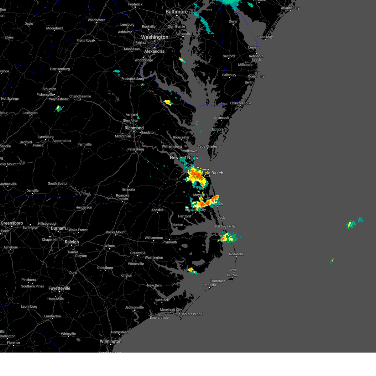 At 526 pm edt, a severe thunderstorm was located over virginia wesleyan university, moving northeast at 20 mph (radar indicated). Hazards include 60 mph wind gusts and penny size hail. Expect damage to trees and powerlines. this severe storm will be near, virginia beach around 550 pm edt. other locations impacted by this severe thunderstorm include gallups corner, bayside and princess anne plaza. hail threat, radar indicated max hail size, 0. 75 in wind threat, radar indicated max wind gust, 60 mph. At 526 pm edt, a severe thunderstorm was located over virginia wesleyan university, moving northeast at 20 mph (radar indicated). Hazards include 60 mph wind gusts and penny size hail. Expect damage to trees and powerlines. this severe storm will be near, virginia beach around 550 pm edt. other locations impacted by this severe thunderstorm include gallups corner, bayside and princess anne plaza. hail threat, radar indicated max hail size, 0. 75 in wind threat, radar indicated max wind gust, 60 mph.
|
| 6/25/2023 5:23 PM EDT | Quarter sized hail reported 2.7 miles WNW of Norfolk, VA, photo of quarter size hail near newtown rd in va beach. time estimated from radar. |
| 6/25/2023 5:10 PM EDT |
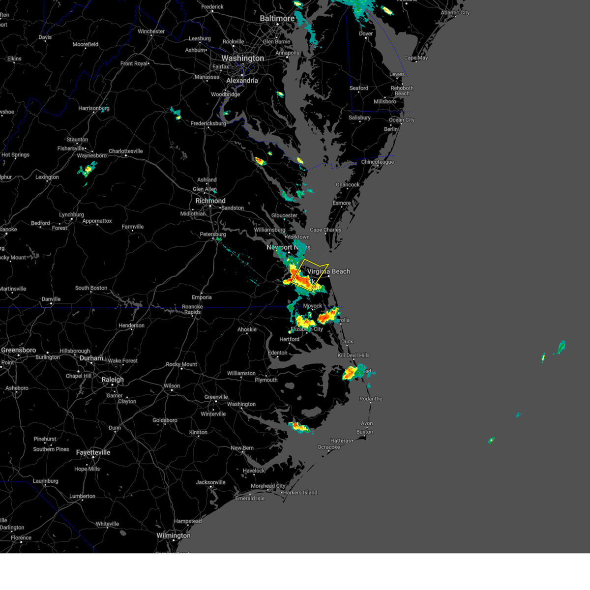 At 510 pm edt, a severe thunderstorm was located over norfolk state university, moving northeast at 20 mph (radar indicated). Hazards include 60 mph wind gusts and penny size hail. Expect damage to trees and powerlines. this severe thunderstorm will be near, kempsville and norview around 520 pm edt. virginia wesleyan university and norfolk nas around 525 pm edt. norfolk international around 530 pm edt. ocean view and norfolk around 535 pm edt. other locations impacted by this severe thunderstorm include greenbrier, south norfolk, bayside, portlock, wards corner, gallups corner, willoughby spit and princess anne plaza. hail threat, radar indicated max hail size, 0. 75 in wind threat, radar indicated max wind gust, 60 mph. At 510 pm edt, a severe thunderstorm was located over norfolk state university, moving northeast at 20 mph (radar indicated). Hazards include 60 mph wind gusts and penny size hail. Expect damage to trees and powerlines. this severe thunderstorm will be near, kempsville and norview around 520 pm edt. virginia wesleyan university and norfolk nas around 525 pm edt. norfolk international around 530 pm edt. ocean view and norfolk around 535 pm edt. other locations impacted by this severe thunderstorm include greenbrier, south norfolk, bayside, portlock, wards corner, gallups corner, willoughby spit and princess anne plaza. hail threat, radar indicated max hail size, 0. 75 in wind threat, radar indicated max wind gust, 60 mph.
|
| 6/16/2023 6:11 PM EDT |
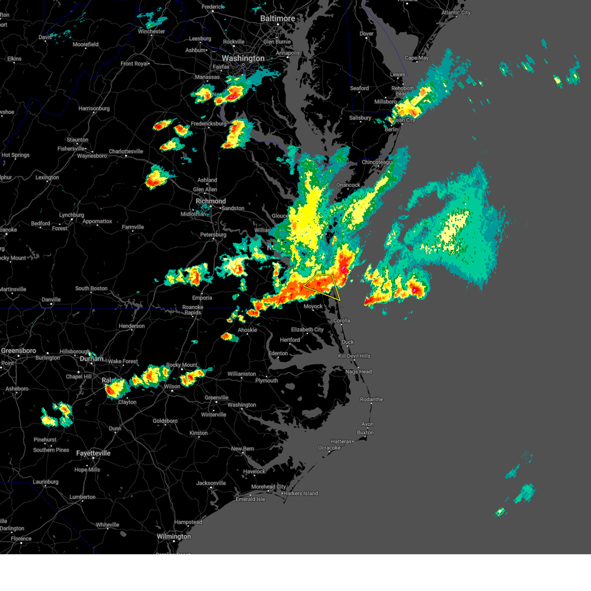 At 610 pm edt, severe thunderstorms were located along a line extending from 16 miles northeast of princess anne to near virginia beach to near fentress, moving east at 35 mph (radar indicated). Hazards include 60 mph wind gusts. Expect damage to trees and powerlines. locations impacted include, virginia beach, regent university, kempsville, chesapeake, princess anne, rudee heights, mount pleasant, princess anne plaza, sigma, sandbridge beach, oceana nas, macons corner, pungo, greenbrier, oceana, dam neck, gallups corner and london bridge. hail threat, radar indicated max hail size, <. 75 in wind threat, radar indicated max wind gust, 60 mph. At 610 pm edt, severe thunderstorms were located along a line extending from 16 miles northeast of princess anne to near virginia beach to near fentress, moving east at 35 mph (radar indicated). Hazards include 60 mph wind gusts. Expect damage to trees and powerlines. locations impacted include, virginia beach, regent university, kempsville, chesapeake, princess anne, rudee heights, mount pleasant, princess anne plaza, sigma, sandbridge beach, oceana nas, macons corner, pungo, greenbrier, oceana, dam neck, gallups corner and london bridge. hail threat, radar indicated max hail size, <. 75 in wind threat, radar indicated max wind gust, 60 mph.
|
| 6/16/2023 5:47 PM EDT |
 At 546 pm edt, a severe thunderstorm was located over suffolk, or over downtown suffolk, moving east at 40 mph (radar indicated). Hazards include 60 mph wind gusts and quarter size hail. Minor damage to vehicles is possible. expect wind damage to trees and powerlines. this severe storm will be near, downtown suffolk around 550 pm edt. driver around 600 pm edt. chesapeake, bowers hill and western branch around 605 pm edt. deep creek around 610 pm edt. downtown portsmouth, downtown norfolk and cradock around 615 pm edt. great bridge around 620 pm edt. other locations impacted by this severe thunderstorm include south norfolk, portlock, lummis, suffolk airport, herberts corner, saunders, magnolia, wilroy, nurney and kilby. hail threat, radar indicated max hail size, 1. 00 in wind threat, radar indicated max wind gust, 60 mph. At 546 pm edt, a severe thunderstorm was located over suffolk, or over downtown suffolk, moving east at 40 mph (radar indicated). Hazards include 60 mph wind gusts and quarter size hail. Minor damage to vehicles is possible. expect wind damage to trees and powerlines. this severe storm will be near, downtown suffolk around 550 pm edt. driver around 600 pm edt. chesapeake, bowers hill and western branch around 605 pm edt. deep creek around 610 pm edt. downtown portsmouth, downtown norfolk and cradock around 615 pm edt. great bridge around 620 pm edt. other locations impacted by this severe thunderstorm include south norfolk, portlock, lummis, suffolk airport, herberts corner, saunders, magnolia, wilroy, nurney and kilby. hail threat, radar indicated max hail size, 1. 00 in wind threat, radar indicated max wind gust, 60 mph.
|
| 6/16/2023 5:41 PM EDT |
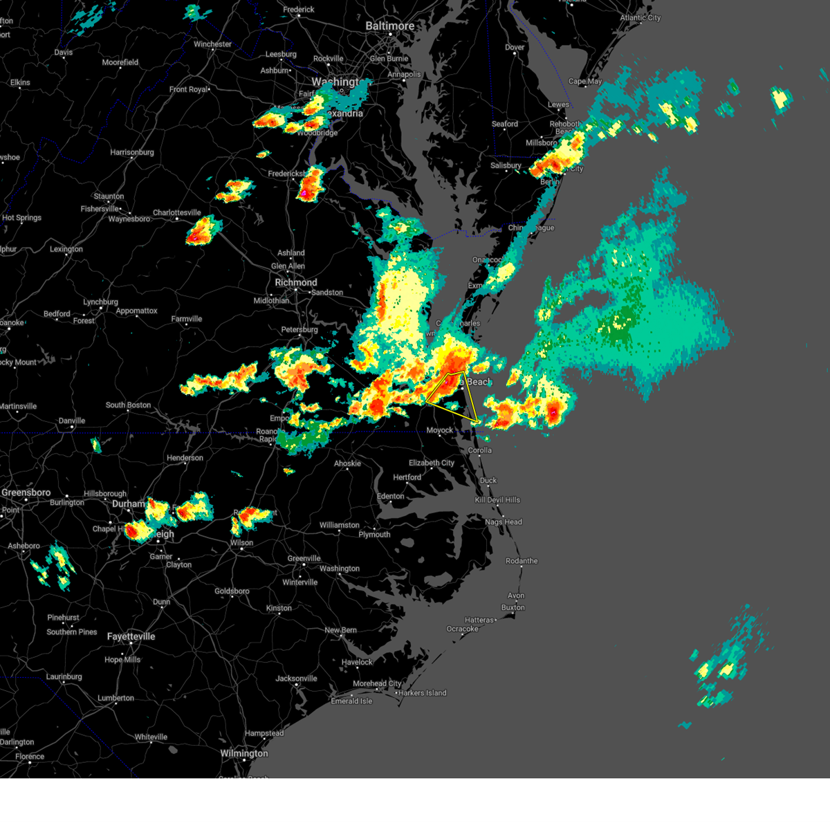 At 541 pm edt, severe thunderstorms were located along a line extending from 16 miles south of cape charles to near princess anne to near great bridge, moving east at 35 mph (radar indicated). Hazards include 60 mph wind gusts and quarter size hail. Minor damage to vehicles is possible. Expect wind damage to trees and powerlines. At 541 pm edt, severe thunderstorms were located along a line extending from 16 miles south of cape charles to near princess anne to near great bridge, moving east at 35 mph (radar indicated). Hazards include 60 mph wind gusts and quarter size hail. Minor damage to vehicles is possible. Expect wind damage to trees and powerlines.
|
| 6/16/2023 5:36 PM EDT |
 At 535 pm edt, a severe thunderstorm was located over holland, moving east at 40 mph (radar indicated). Hazards include 60 mph wind gusts and quarter size hail. Minor damage to vehicles is possible. expect wind damage to trees and powerlines. this severe thunderstorm will be near, downtown suffolk and kings fork around 550 pm edt. driver around 600 pm edt. chesapeake, bowers hill and western branch around 605 pm edt. deep creek and cradock around 610 pm edt. downtown portsmouth, downtown norfolk and great bridge around 615 pm edt. other locations impacted by this severe thunderstorm include south norfolk, portlock, lummis, suffolk airport, herberts corner, saunders, magnolia, collosse, wilroy and nurney. hail threat, radar indicated max hail size, 1. 00 in wind threat, radar indicated max wind gust, 60 mph. At 535 pm edt, a severe thunderstorm was located over holland, moving east at 40 mph (radar indicated). Hazards include 60 mph wind gusts and quarter size hail. Minor damage to vehicles is possible. expect wind damage to trees and powerlines. this severe thunderstorm will be near, downtown suffolk and kings fork around 550 pm edt. driver around 600 pm edt. chesapeake, bowers hill and western branch around 605 pm edt. deep creek and cradock around 610 pm edt. downtown portsmouth, downtown norfolk and great bridge around 615 pm edt. other locations impacted by this severe thunderstorm include south norfolk, portlock, lummis, suffolk airport, herberts corner, saunders, magnolia, collosse, wilroy and nurney. hail threat, radar indicated max hail size, 1. 00 in wind threat, radar indicated max wind gust, 60 mph.
|
| 6/16/2023 5:30 PM EDT |
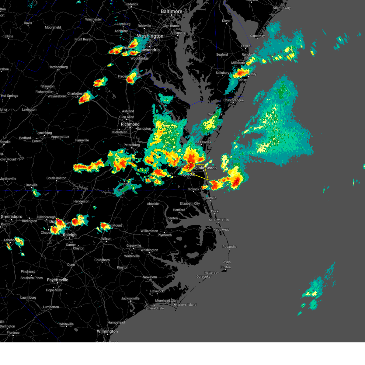 At 530 pm edt, severe thunderstorms were located along a line extending from 10 miles south of cape charles to near norfolk international to near cradock, moving southeast at 35 mph (radar indicated). Hazards include 70 mph wind gusts and quarter size hail. Minor damage to vehicles is possible. expect considerable tree damage. wind damage is also likely to mobile homes, roofs, and outbuildings. these severe storms will be near, virginia beach around 540 pm edt. Other locations impacted by these severe thunderstorms include bayside, oceana, rudee heights, wards corner, princess anne plaza, north virginia beach, dam neck, oceana nas, gallups corner and macons corner. At 530 pm edt, severe thunderstorms were located along a line extending from 10 miles south of cape charles to near norfolk international to near cradock, moving southeast at 35 mph (radar indicated). Hazards include 70 mph wind gusts and quarter size hail. Minor damage to vehicles is possible. expect considerable tree damage. wind damage is also likely to mobile homes, roofs, and outbuildings. these severe storms will be near, virginia beach around 540 pm edt. Other locations impacted by these severe thunderstorms include bayside, oceana, rudee heights, wards corner, princess anne plaza, north virginia beach, dam neck, oceana nas, gallups corner and macons corner.
|
| 6/16/2023 5:27 PM EDT | Quarter sized hail reported 4.5 miles S of Norfolk, VA |
| 6/16/2023 5:25 PM EDT | Quarter sized hail reported 3 miles SE of Norfolk, VA, picture of quarter sized hail in wayne creek area of norfolk. |
| 6/16/2023 5:19 PM EDT | Ngu site reported a 53kt gus in city of norfolk county VA, 6.6 miles SE of Norfolk, VA |
| 6/16/2023 5:19 PM EDT |
 At 518 pm edt, severe thunderstorms were located along a line extending from 8 miles northeast of grand view to ocean view to western branch, moving southeast at 35 mph. in addition, this storm has a history of producing a brief tornado near carrollton and funnel clouds have been spotted (radar indicated). Hazards include 70 mph wind gusts and ping pong ball size hail. People and animals outdoors will be injured. expect hail damage to roofs, siding, windows, and vehicles. expect considerable tree damage. wind damage is also likely to mobile homes, roofs, and outbuildings. these severe storms will be near, virginia wesleyan university, chesapeake and norfolk international around 525 pm edt. regent university around 535 pm edt. virginia beach and kempsville around 540 pm edt. princess anne around 555 pm edt. Other locations impacted by these severe thunderstorms include rudee heights, princess anne plaza, sigma, sandbridge beach, oceana nas, macons corner, bayside, oceana, wards corner and north virginia beach. At 518 pm edt, severe thunderstorms were located along a line extending from 8 miles northeast of grand view to ocean view to western branch, moving southeast at 35 mph. in addition, this storm has a history of producing a brief tornado near carrollton and funnel clouds have been spotted (radar indicated). Hazards include 70 mph wind gusts and ping pong ball size hail. People and animals outdoors will be injured. expect hail damage to roofs, siding, windows, and vehicles. expect considerable tree damage. wind damage is also likely to mobile homes, roofs, and outbuildings. these severe storms will be near, virginia wesleyan university, chesapeake and norfolk international around 525 pm edt. regent university around 535 pm edt. virginia beach and kempsville around 540 pm edt. princess anne around 555 pm edt. Other locations impacted by these severe thunderstorms include rudee heights, princess anne plaza, sigma, sandbridge beach, oceana nas, macons corner, bayside, oceana, wards corner and north virginia beach.
|
| 6/16/2023 5:15 PM EDT | Quarter sized hail reported 4.5 miles SSE of Norfolk, VA, quarter size hail near wards corner. video from social media. |
| 6/16/2023 5:14 PM EDT |
 At 514 pm edt, severe thunderstorms were located along a line extending from 7 miles northeast of grand view to ocean view to western branch, moving southeast at 30 mph (radar indicated). Hazards include 70 mph wind gusts and ping pong ball size hail. People and animals outdoors will be injured. expect hail damage to roofs, siding, windows, and vehicles. expect considerable tree damage. wind damage is also likely to mobile homes, roofs, and outbuildings. these severe storms will be near, chesapeake and norview around 520 pm edt. virginia wesleyan university, norfolk and norfolk international around 525 pm edt. norfolk state university and downtown norfolk around 530 pm edt. regent university and kempsville around 540 pm edt. virginia beach around 545 pm edt. princess anne around 555 pm edt. other locations impacted by these severe thunderstorms include rudee heights, princess anne plaza, sigma, sandbridge beach, oceana nas, macons corner, bayside, oceana, wards corner and north virginia beach. thunderstorm damage threat, considerable hail threat, radar indicated max hail size, 1. 50 in wind threat, radar indicated max wind gust, 70 mph. At 514 pm edt, severe thunderstorms were located along a line extending from 7 miles northeast of grand view to ocean view to western branch, moving southeast at 30 mph (radar indicated). Hazards include 70 mph wind gusts and ping pong ball size hail. People and animals outdoors will be injured. expect hail damage to roofs, siding, windows, and vehicles. expect considerable tree damage. wind damage is also likely to mobile homes, roofs, and outbuildings. these severe storms will be near, chesapeake and norview around 520 pm edt. virginia wesleyan university, norfolk and norfolk international around 525 pm edt. norfolk state university and downtown norfolk around 530 pm edt. regent university and kempsville around 540 pm edt. virginia beach around 545 pm edt. princess anne around 555 pm edt. other locations impacted by these severe thunderstorms include rudee heights, princess anne plaza, sigma, sandbridge beach, oceana nas, macons corner, bayside, oceana, wards corner and north virginia beach. thunderstorm damage threat, considerable hail threat, radar indicated max hail size, 1. 50 in wind threat, radar indicated max wind gust, 70 mph.
|
| 6/16/2023 5:07 PM EDT |
 At 505 pm edt, a tornado producing storm was located over crittenden, or near churchland, moving east at 25 mph. this storm likely produced a brief tornado near carrollton (radar confirmed tornado). Hazards include tornado and quarter size hail. Flying debris will be dangerous to those caught without shelter. mobile homes will be damaged or destroyed. damage to roofs, windows, and vehicles will occur. tree damage is likely. this tornado will be near, churchland around 515 pm edt. portsmouth around 520 pm edt. old dominion university, ghent and norfolk nas around 525 pm edt. norfolk around 540 pm edt. Other locations impacted by this tornadic thunderstorm include huntersville. At 505 pm edt, a tornado producing storm was located over crittenden, or near churchland, moving east at 25 mph. this storm likely produced a brief tornado near carrollton (radar confirmed tornado). Hazards include tornado and quarter size hail. Flying debris will be dangerous to those caught without shelter. mobile homes will be damaged or destroyed. damage to roofs, windows, and vehicles will occur. tree damage is likely. this tornado will be near, churchland around 515 pm edt. portsmouth around 520 pm edt. old dominion university, ghent and norfolk nas around 525 pm edt. norfolk around 540 pm edt. Other locations impacted by this tornadic thunderstorm include huntersville.
|
| 6/16/2023 5:04 PM EDT |
 At 504 pm edt, severe thunderstorms were located along a line extending from 7 miles north of grand view to fort monroe to driver, moving southeast at 35 mph (radar indicated). Hazards include 60 mph wind gusts and quarter size hail. Minor damage to vehicles is possible. expect wind damage to trees and powerlines. severe thunderstorms will be near, ocean view around 510 pm edt. norfolk, chesapeake, norfolk international and norview around 515 pm edt. downtown portsmouth, virginia wesleyan university, downtown norfolk, old dominion university and ghent around 520 pm edt. norfolk state university around 525 pm edt. regent university around 530 pm edt. virginia beach and kempsville around 535 pm edt. princess anne around 545 pm edt. other locations impacted by these severe thunderstorms include south norfolk, rudee heights, princess anne plaza, sigma, sandbridge beach, huntersville, oceana nas, macons corner, pungo and greenbrier. hail threat, radar indicated max hail size, 1. 00 in wind threat, radar indicated max wind gust, 60 mph. At 504 pm edt, severe thunderstorms were located along a line extending from 7 miles north of grand view to fort monroe to driver, moving southeast at 35 mph (radar indicated). Hazards include 60 mph wind gusts and quarter size hail. Minor damage to vehicles is possible. expect wind damage to trees and powerlines. severe thunderstorms will be near, ocean view around 510 pm edt. norfolk, chesapeake, norfolk international and norview around 515 pm edt. downtown portsmouth, virginia wesleyan university, downtown norfolk, old dominion university and ghent around 520 pm edt. norfolk state university around 525 pm edt. regent university around 530 pm edt. virginia beach and kempsville around 535 pm edt. princess anne around 545 pm edt. other locations impacted by these severe thunderstorms include south norfolk, rudee heights, princess anne plaza, sigma, sandbridge beach, huntersville, oceana nas, macons corner, pungo and greenbrier. hail threat, radar indicated max hail size, 1. 00 in wind threat, radar indicated max wind gust, 60 mph.
|
| 6/16/2023 4:56 PM EDT |
 At 455 pm edt, a confirmed tornado was located over crittenden, or near carrolton, moving east at 25 mph (public confirmed tornado). Hazards include damaging tornado and quarter size hail. Flying debris will be dangerous to those caught without shelter. mobile homes will be damaged or destroyed. damage to roofs, windows, and vehicles will occur. tree damage is likely. the tornado will be near, crittenden around 500 pm edt. churchland around 515 pm edt. portsmouth around 520 pm edt. old dominion university and norfolk nas around 525 pm edt. norfolk and ghent around 530 pm edt. Other locations impacted by this tornadic thunderstorm include huntersville, hobson and carrollton. At 455 pm edt, a confirmed tornado was located over crittenden, or near carrolton, moving east at 25 mph (public confirmed tornado). Hazards include damaging tornado and quarter size hail. Flying debris will be dangerous to those caught without shelter. mobile homes will be damaged or destroyed. damage to roofs, windows, and vehicles will occur. tree damage is likely. the tornado will be near, crittenden around 500 pm edt. churchland around 515 pm edt. portsmouth around 520 pm edt. old dominion university and norfolk nas around 525 pm edt. norfolk and ghent around 530 pm edt. Other locations impacted by this tornadic thunderstorm include huntersville, hobson and carrollton.
|
| 6/16/2023 3:02 PM EDT |
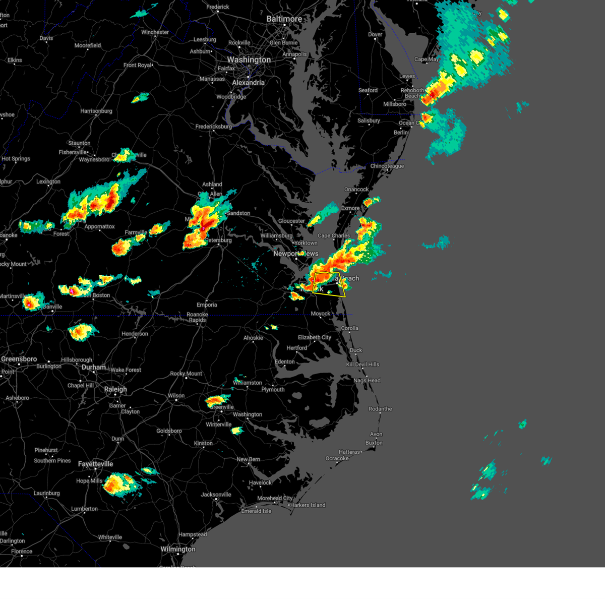 At 301 pm edt, a severe thunderstorm was located over virginia wesleyan university, moving east at 25 mph (radar indicated). Hazards include 60 mph wind gusts and quarter size hail. Minor damage to vehicles is possible. expect wind damage to trees and powerlines. this severe storm will be near, princess anne around 320 pm edt. virginia beach around 325 pm edt. other locations impacted by this severe thunderstorm include greenbrier, bayside, oceana, rudee heights, princess anne plaza, sigma, north virginia beach, dam neck, oceana nas and gallups corner. hail threat, radar indicated max hail size, 1. 00 in wind threat, radar indicated max wind gust, 60 mph. At 301 pm edt, a severe thunderstorm was located over virginia wesleyan university, moving east at 25 mph (radar indicated). Hazards include 60 mph wind gusts and quarter size hail. Minor damage to vehicles is possible. expect wind damage to trees and powerlines. this severe storm will be near, princess anne around 320 pm edt. virginia beach around 325 pm edt. other locations impacted by this severe thunderstorm include greenbrier, bayside, oceana, rudee heights, princess anne plaza, sigma, north virginia beach, dam neck, oceana nas and gallups corner. hail threat, radar indicated max hail size, 1. 00 in wind threat, radar indicated max wind gust, 60 mph.
|
| 6/16/2023 3:00 PM EDT | Quarter sized hail reported 1.9 miles SSW of Norfolk, VA |
| 6/16/2023 2:49 PM EDT | Half Dollar sized hail reported 4.8 miles ESE of Norfolk, VA |
| 6/16/2023 2:48 PM EDT |
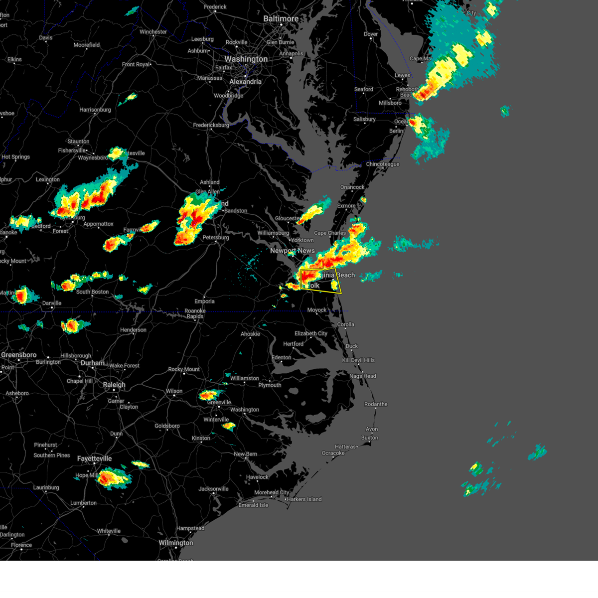 At 248 pm edt, a severe thunderstorm was located over downtown norfolk, moving east at 30 mph (radar indicated). Hazards include 70 mph wind gusts and ping pong ball size hail. People and animals outdoors will be injured. expect hail damage to roofs, siding, windows, and vehicles. expect considerable tree damage. wind damage is also likely to mobile homes, roofs, and outbuildings. this severe thunderstorm will be near, virginia wesleyan university, kempsville, regent university and norfolk international around 300 pm edt. princess anne around 315 pm edt. virginia beach around 320 pm edt. other locations impacted by this severe thunderstorm include south norfolk, rudee heights, portlock, princess anne plaza, sigma, oceana nas, macons corner, greenbrier, bayside and oceana. thunderstorm damage threat, considerable hail threat, radar indicated max hail size, 1. 50 in wind threat, radar indicated max wind gust, 70 mph. At 248 pm edt, a severe thunderstorm was located over downtown norfolk, moving east at 30 mph (radar indicated). Hazards include 70 mph wind gusts and ping pong ball size hail. People and animals outdoors will be injured. expect hail damage to roofs, siding, windows, and vehicles. expect considerable tree damage. wind damage is also likely to mobile homes, roofs, and outbuildings. this severe thunderstorm will be near, virginia wesleyan university, kempsville, regent university and norfolk international around 300 pm edt. princess anne around 315 pm edt. virginia beach around 320 pm edt. other locations impacted by this severe thunderstorm include south norfolk, rudee heights, portlock, princess anne plaza, sigma, oceana nas, macons corner, greenbrier, bayside and oceana. thunderstorm damage threat, considerable hail threat, radar indicated max hail size, 1. 50 in wind threat, radar indicated max wind gust, 70 mph.
|
| 6/16/2023 2:43 PM EDT |
 At 243 pm edt, a severe thunderstorm was located over portsmouth, or over old dominion university, moving east at 25 mph (radar indicated). Hazards include 70 mph wind gusts and ping pong ball size hail. People and animals outdoors will be injured. expect hail damage to roofs, siding, windows, and vehicles. expect considerable tree damage. wind damage is also likely to mobile homes, roofs, and outbuildings. this severe storm will be near, downtown norfolk and norfolk state university around 250 pm edt. ocean view and norview around 255 pm edt. regent university and norfolk international around 300 pm edt. virginia wesleyan university, kempsville and norfolk around 305 pm edt. virginia beach around 315 pm edt. other locations impacted by this severe thunderstorm include greenbrier, south norfolk, bayside, portlock, wards corner, gallups corner and willoughby spit. thunderstorm damage threat, considerable hail threat, radar indicated max hail size, 1. 50 in wind threat, radar indicated max wind gust, 70 mph. At 243 pm edt, a severe thunderstorm was located over portsmouth, or over old dominion university, moving east at 25 mph (radar indicated). Hazards include 70 mph wind gusts and ping pong ball size hail. People and animals outdoors will be injured. expect hail damage to roofs, siding, windows, and vehicles. expect considerable tree damage. wind damage is also likely to mobile homes, roofs, and outbuildings. this severe storm will be near, downtown norfolk and norfolk state university around 250 pm edt. ocean view and norview around 255 pm edt. regent university and norfolk international around 300 pm edt. virginia wesleyan university, kempsville and norfolk around 305 pm edt. virginia beach around 315 pm edt. other locations impacted by this severe thunderstorm include greenbrier, south norfolk, bayside, portlock, wards corner, gallups corner and willoughby spit. thunderstorm damage threat, considerable hail threat, radar indicated max hail size, 1. 50 in wind threat, radar indicated max wind gust, 70 mph.
|
| 6/16/2023 2:42 PM EDT | Measured by lafayette river wxflow station in city of norfolk county VA, 5 miles ESE of Norfolk, VA |
| 6/16/2023 2:35 PM EDT |
 At 235 pm edt, a severe thunderstorm was located over churchland, moving east at 35 mph (radar indicated). Hazards include 60 mph wind gusts and quarter size hail. Minor damage to vehicles is possible. expect wind damage to trees and powerlines. this severe storm will be near, chesapeake around 240 pm edt. downtown norfolk, downtown portsmouth, old dominion university, ghent, cradock and norfolk nas around 245 pm edt. norfolk state university, ocean view and norview around 250 pm edt. virginia wesleyan university, regent university, norfolk and norfolk international around 255 pm edt. kempsville around 300 pm edt. virginia beach around 315 pm edt. other locations impacted by this severe thunderstorm include greenbrier, south norfolk, bayside, portlock, wards corner, gallups corner and willoughby spit. hail threat, radar indicated max hail size, 1. 00 in wind threat, radar indicated max wind gust, 60 mph. At 235 pm edt, a severe thunderstorm was located over churchland, moving east at 35 mph (radar indicated). Hazards include 60 mph wind gusts and quarter size hail. Minor damage to vehicles is possible. expect wind damage to trees and powerlines. this severe storm will be near, chesapeake around 240 pm edt. downtown norfolk, downtown portsmouth, old dominion university, ghent, cradock and norfolk nas around 245 pm edt. norfolk state university, ocean view and norview around 250 pm edt. virginia wesleyan university, regent university, norfolk and norfolk international around 255 pm edt. kempsville around 300 pm edt. virginia beach around 315 pm edt. other locations impacted by this severe thunderstorm include greenbrier, south norfolk, bayside, portlock, wards corner, gallups corner and willoughby spit. hail threat, radar indicated max hail size, 1. 00 in wind threat, radar indicated max wind gust, 60 mph.
|
| 6/16/2023 2:21 PM EDT |
 At 221 pm edt, a severe thunderstorm was located near driver, or 8 miles north of downtown suffolk, moving east at 25 mph (radar indicated). Hazards include 60 mph wind gusts and quarter size hail. Minor damage to vehicles is possible. expect wind damage to trees and powerlines. this severe thunderstorm will be near, driver and crittenden around 230 pm edt. bowers hill around 240 pm edt. churchland, chesapeake and western branch around 245 pm edt. deep creek and portsmouth around 250 pm edt. downtown portsmouth, old dominion university, cradock, ghent and norfolk nas around 255 pm edt. norfolk state university, downtown norfolk, regent university, virginia wesleyan university, kempsville, norview and norfolk international around 300 pm edt. other locations impacted by this severe thunderstorm include south norfolk, portlock, longview, benns church, huntersville, wills corner, chuckatuck, greenbrier, hobson and bayside. hail threat, radar indicated max hail size, 1. 00 in wind threat, radar indicated max wind gust, 60 mph. At 221 pm edt, a severe thunderstorm was located near driver, or 8 miles north of downtown suffolk, moving east at 25 mph (radar indicated). Hazards include 60 mph wind gusts and quarter size hail. Minor damage to vehicles is possible. expect wind damage to trees and powerlines. this severe thunderstorm will be near, driver and crittenden around 230 pm edt. bowers hill around 240 pm edt. churchland, chesapeake and western branch around 245 pm edt. deep creek and portsmouth around 250 pm edt. downtown portsmouth, old dominion university, cradock, ghent and norfolk nas around 255 pm edt. norfolk state university, downtown norfolk, regent university, virginia wesleyan university, kempsville, norview and norfolk international around 300 pm edt. other locations impacted by this severe thunderstorm include south norfolk, portlock, longview, benns church, huntersville, wills corner, chuckatuck, greenbrier, hobson and bayside. hail threat, radar indicated max hail size, 1. 00 in wind threat, radar indicated max wind gust, 60 mph.
|
| 4/30/2023 5:47 PM EDT |
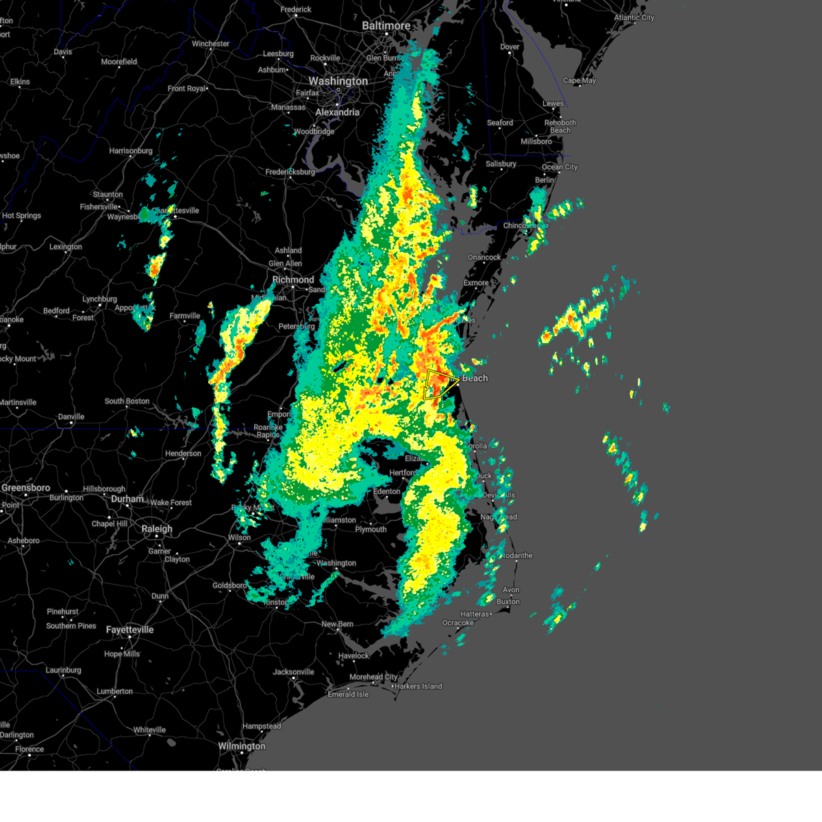 At 546 pm edt, a severe thunderstorm was located near virginia wesleyan university, moving northeast at 35 mph (radar indicated). Hazards include 60 mph wind gusts and nickel size hail. Expect damage to trees and powerlines. This severe thunderstorm will remain over mainly rural areas of , the eastern city of norfolk, the north central city of chesapeake and the northwestern city of virginia beach, including the following locations, greenbrier, bayside, north virginia beach, gallups corner, princess anne plaza and london bridge. At 546 pm edt, a severe thunderstorm was located near virginia wesleyan university, moving northeast at 35 mph (radar indicated). Hazards include 60 mph wind gusts and nickel size hail. Expect damage to trees and powerlines. This severe thunderstorm will remain over mainly rural areas of , the eastern city of norfolk, the north central city of chesapeake and the northwestern city of virginia beach, including the following locations, greenbrier, bayside, north virginia beach, gallups corner, princess anne plaza and london bridge.
|
| 4/30/2023 5:35 PM EDT | Brick siding torn off side of an apartment building. time estimated from rada in city of norfolk county VA, 6 miles SSE of Norfolk, VA |
| 4/30/2023 5:24 PM EDT |
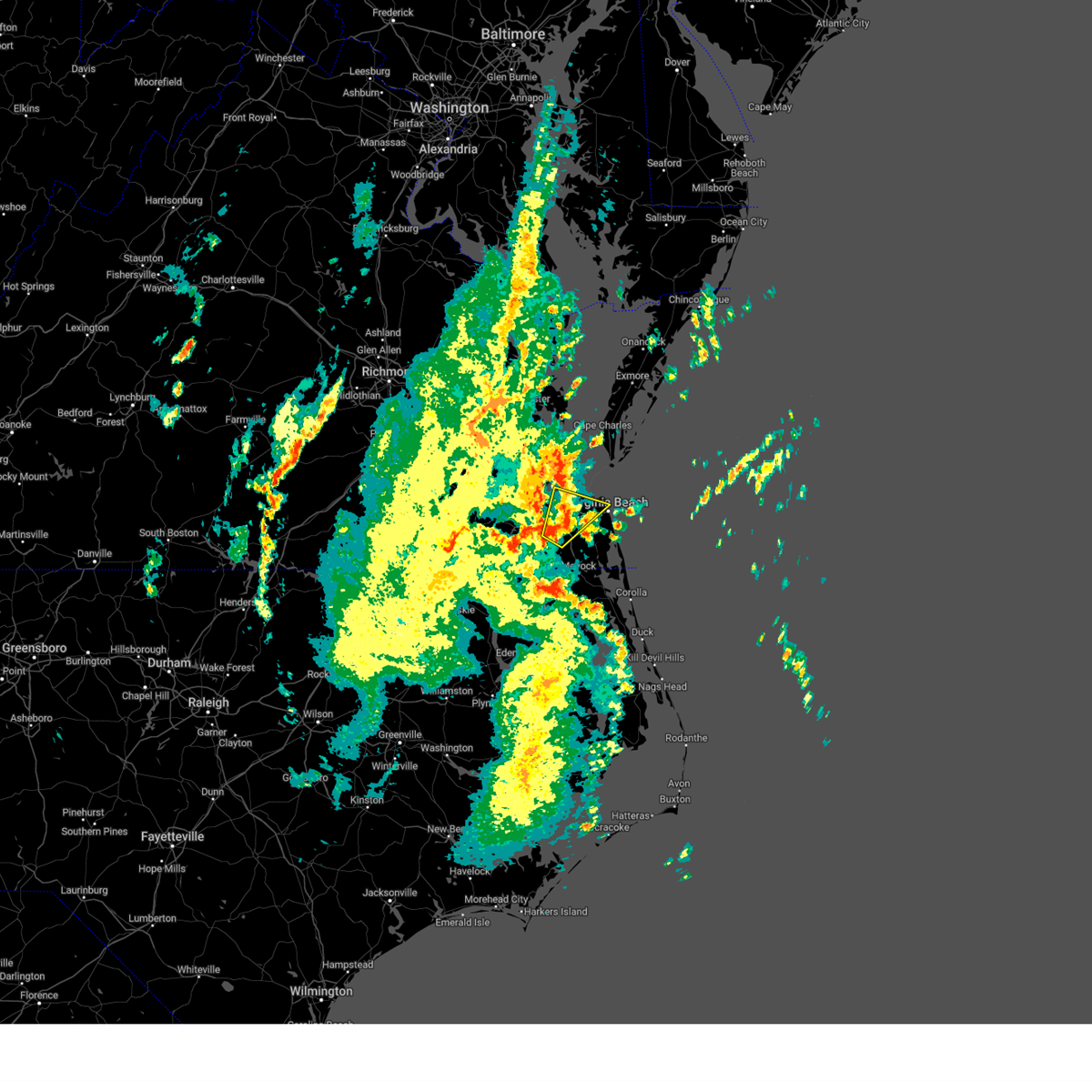 At 523 pm edt, a severe thunderstorm was located near cradock, or near great bridge, moving northeast at 40 mph (radar indicated). Hazards include 60 mph wind gusts and nickel size hail. Expect damage to trees and powerlines. this severe thunderstorm will be near, regent university, norfolk state university, old dominion university and ghent around 530 pm edt. virginia wesleyan university, kempsville, norview and norfolk nas around 535 pm edt. ocean view, norfolk and norfolk international around 540 pm edt. Other locations impacted by this severe thunderstorm include greenbrier, south norfolk, bayside, portlock, wards corner, princess anne plaza, herberts corner, north virginia beach, gallups corner and willoughby spit. At 523 pm edt, a severe thunderstorm was located near cradock, or near great bridge, moving northeast at 40 mph (radar indicated). Hazards include 60 mph wind gusts and nickel size hail. Expect damage to trees and powerlines. this severe thunderstorm will be near, regent university, norfolk state university, old dominion university and ghent around 530 pm edt. virginia wesleyan university, kempsville, norview and norfolk nas around 535 pm edt. ocean view, norfolk and norfolk international around 540 pm edt. Other locations impacted by this severe thunderstorm include greenbrier, south norfolk, bayside, portlock, wards corner, princess anne plaza, herberts corner, north virginia beach, gallups corner and willoughby spit.
|
| 8/1/2022 4:51 PM EDT |
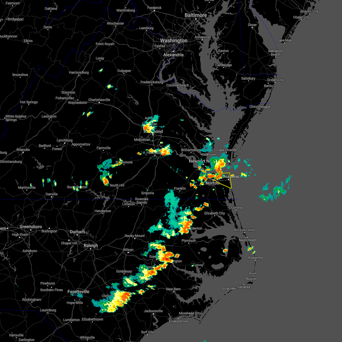 At 451 pm edt, severe thunderstorms were located along a line extending from langley afb to fort monroe to near churchland, moving east at 35 mph (radar indicated). Hazards include 60 mph wind gusts and penny size hail. Expect damage to trees and powerlines. severe thunderstorms will be near, norfolk and norfolk international around 505 pm edt. virginia beach, regent university, kempsville and virginia wesleyan university around 515 pm edt. other locations impacted by these severe thunderstorms include bayside, oceana, rudee heights, princess anne plaza, sandbridge beach, north virginia beach, dam neck, oceana nas, gallups corner and macons corner. hail threat, radar indicated max hail size, 0. 75 in wind threat, radar indicated max wind gust, 60 mph. At 451 pm edt, severe thunderstorms were located along a line extending from langley afb to fort monroe to near churchland, moving east at 35 mph (radar indicated). Hazards include 60 mph wind gusts and penny size hail. Expect damage to trees and powerlines. severe thunderstorms will be near, norfolk and norfolk international around 505 pm edt. virginia beach, regent university, kempsville and virginia wesleyan university around 515 pm edt. other locations impacted by these severe thunderstorms include bayside, oceana, rudee heights, princess anne plaza, sandbridge beach, north virginia beach, dam neck, oceana nas, gallups corner and macons corner. hail threat, radar indicated max hail size, 0. 75 in wind threat, radar indicated max wind gust, 60 mph.
|
| 8/1/2022 4:24 PM EDT |
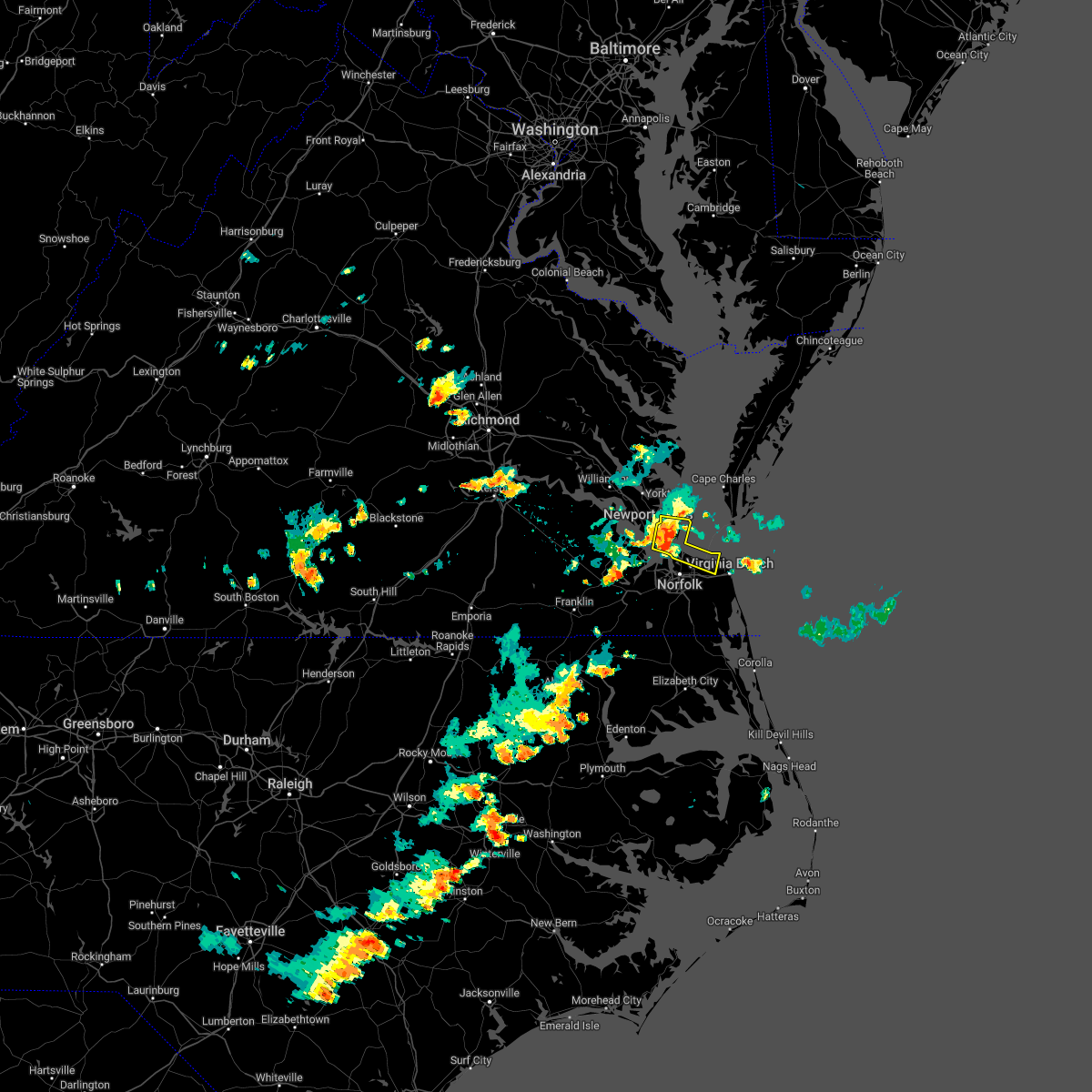 At 424 pm edt, a severe thunderstorm was located over hampton university, moving east at 30 mph (radar indicated). Hazards include 60 mph wind gusts and penny size hail. Expect damage to trees and powerlines. this severe thunderstorm will be near, fort monroe, buckroe beach and grand view around 430 pm edt. norfolk nas around 435 pm edt. ocean view around 440 pm edt. norfolk international around 445 pm edt. norfolk around 450 pm edt. virginia beach around 510 pm edt. other locations impacted by this severe thunderstorm include bayside, fox hill, phoebus, langley view, wards corner, messick, willoughby spit and raleigh terrace. hail threat, radar indicated max hail size, 0. 75 in wind threat, radar indicated max wind gust, 60 mph. At 424 pm edt, a severe thunderstorm was located over hampton university, moving east at 30 mph (radar indicated). Hazards include 60 mph wind gusts and penny size hail. Expect damage to trees and powerlines. this severe thunderstorm will be near, fort monroe, buckroe beach and grand view around 430 pm edt. norfolk nas around 435 pm edt. ocean view around 440 pm edt. norfolk international around 445 pm edt. norfolk around 450 pm edt. virginia beach around 510 pm edt. other locations impacted by this severe thunderstorm include bayside, fox hill, phoebus, langley view, wards corner, messick, willoughby spit and raleigh terrace. hail threat, radar indicated max hail size, 0. 75 in wind threat, radar indicated max wind gust, 60 mph.
|
| 7/29/2022 6:06 PM EDT |
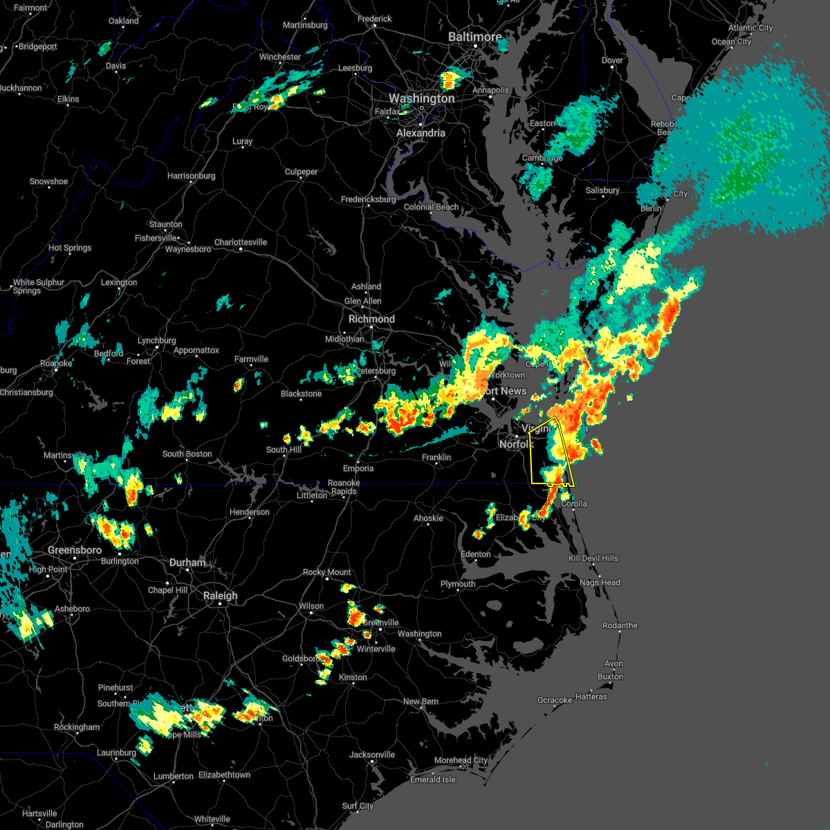 The severe thunderstorm warning for , the southeastern city of chesapeake and the city of virginia beach will expire at 615 pm edt, the storm which prompted the warning has moved out of the area. therefore, the warning will be allowed to expire. a severe thunderstorm watch remains in effect until 800 pm edt for southeastern virginia. The severe thunderstorm warning for , the southeastern city of chesapeake and the city of virginia beach will expire at 615 pm edt, the storm which prompted the warning has moved out of the area. therefore, the warning will be allowed to expire. a severe thunderstorm watch remains in effect until 800 pm edt for southeastern virginia.
|
| 7/29/2022 5:33 PM EDT |
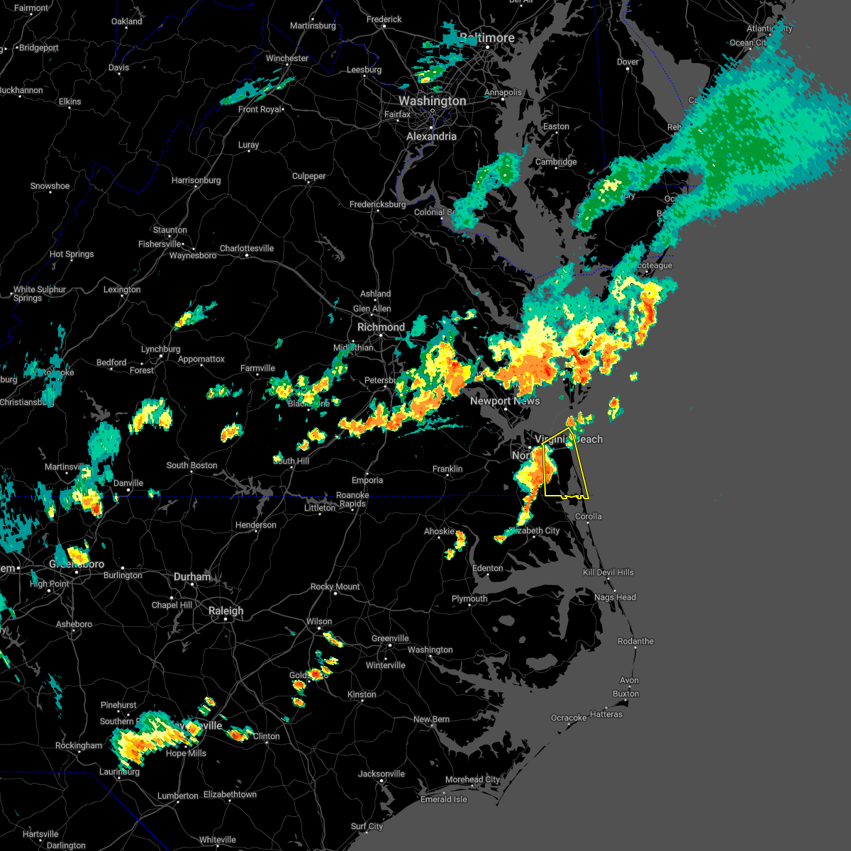 At 533 pm edt, a severe thunderstorm was located over virginia beach, moving east at 35 mph (radar indicated). Hazards include 60 mph wind gusts. Expect damage to trees and powerlines. this severe thunderstorm will remain over mainly rural areas of , the southeastern city of chesapeake and the city of virginia beach, including the following locations, rudee heights, mount pleasant, princess anne plaza, sigma, sandbridge beach, oceana nas, munden, macons corner, pungo and bayside. hail threat, radar indicated max hail size, <. 75 in wind threat, radar indicated max wind gust, 60 mph. At 533 pm edt, a severe thunderstorm was located over virginia beach, moving east at 35 mph (radar indicated). Hazards include 60 mph wind gusts. Expect damage to trees and powerlines. this severe thunderstorm will remain over mainly rural areas of , the southeastern city of chesapeake and the city of virginia beach, including the following locations, rudee heights, mount pleasant, princess anne plaza, sigma, sandbridge beach, oceana nas, munden, macons corner, pungo and bayside. hail threat, radar indicated max hail size, <. 75 in wind threat, radar indicated max wind gust, 60 mph.
|
| 7/26/2022 4:01 PM EDT |
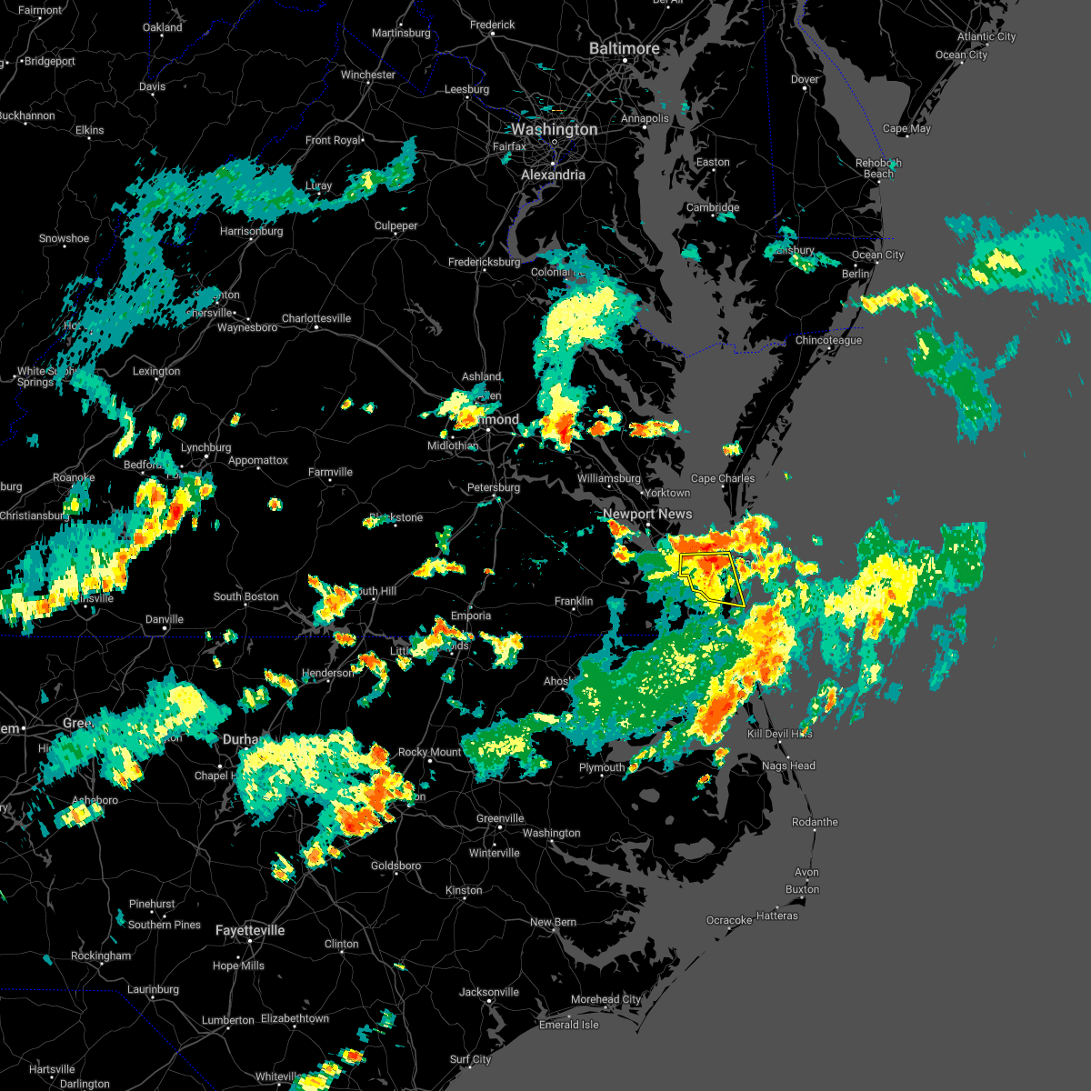 At 401 pm edt, a severe thunderstorm was located 7 miles northeast of princess anne, or 8 miles north of virginia beach, moving east at 45 mph (radar indicated). Hazards include 60 mph wind gusts. Expect damage to trees and powerlines. This severe thunderstorm will remain over mainly rural areas of , the southeastern city of norfolk and the city of virginia beach, including the following locations, rudee heights, princess anne plaza, sigma, sandbridge beach, oceana nas, macons corner, pungo, bayside, oceana and wards corner. At 401 pm edt, a severe thunderstorm was located 7 miles northeast of princess anne, or 8 miles north of virginia beach, moving east at 45 mph (radar indicated). Hazards include 60 mph wind gusts. Expect damage to trees and powerlines. This severe thunderstorm will remain over mainly rural areas of , the southeastern city of norfolk and the city of virginia beach, including the following locations, rudee heights, princess anne plaza, sigma, sandbridge beach, oceana nas, macons corner, pungo, bayside, oceana and wards corner.
|
| 7/26/2022 3:46 PM EDT |
 At 344 pm edt, a severe thunderstorm was located over norfolk state university, moving east at 45 mph (radar indicated). Hazards include 60 mph wind gusts. Expect damage to trees and powerlines. this severe storm will be near, kempsville around 350 pm edt. princess anne around 400 pm edt. virginia beach around 405 pm edt. Other locations impacted by this severe thunderstorm include south norfolk, rudee heights, portlock, princess anne plaza, sigma, sandbridge beach, oceana nas, macons corner, pungo and greenbrier. At 344 pm edt, a severe thunderstorm was located over norfolk state university, moving east at 45 mph (radar indicated). Hazards include 60 mph wind gusts. Expect damage to trees and powerlines. this severe storm will be near, kempsville around 350 pm edt. princess anne around 400 pm edt. virginia beach around 405 pm edt. Other locations impacted by this severe thunderstorm include south norfolk, rudee heights, portlock, princess anne plaza, sigma, sandbridge beach, oceana nas, macons corner, pungo and greenbrier.
|
| 7/26/2022 3:44 PM EDT | Trees down on maryland avenue. time estimated from rada in city of norfolk county VA, 3.6 miles E of Norfolk, VA |
| 7/26/2022 3:38 PM EDT | Five helicopters on their side and roof damage near norfolk naval air statio in city of norfolk county VA, 7.5 miles SE of Norfolk, VA |
| 7/26/2022 3:30 PM EDT |
 At 330 pm edt, a severe thunderstorm was located over churchland, moving east at 45 mph (radar indicated). Hazards include 60 mph wind gusts. Expect damage to trees and powerlines. this severe thunderstorm will be near, chesapeake and portsmouth around 335 pm edt. downtown norfolk, old dominion university, downtown portsmouth, ghent, norfolk nas and cradock around 340 pm edt. norfolk state university, ocean view and norview around 345 pm edt. virginia wesleyan university, kempsville, regent university, norfolk and norfolk international around 350 pm edt. princess anne around 400 pm edt. virginia beach around 405 pm edt. Other locations impacted by this severe thunderstorm include south norfolk, rudee heights, portlock, princess anne plaza, sigma, sandbridge beach, huntersville, oceana nas, macons corner and pungo. At 330 pm edt, a severe thunderstorm was located over churchland, moving east at 45 mph (radar indicated). Hazards include 60 mph wind gusts. Expect damage to trees and powerlines. this severe thunderstorm will be near, chesapeake and portsmouth around 335 pm edt. downtown norfolk, old dominion university, downtown portsmouth, ghent, norfolk nas and cradock around 340 pm edt. norfolk state university, ocean view and norview around 345 pm edt. virginia wesleyan university, kempsville, regent university, norfolk and norfolk international around 350 pm edt. princess anne around 400 pm edt. virginia beach around 405 pm edt. Other locations impacted by this severe thunderstorm include south norfolk, rudee heights, portlock, princess anne plaza, sigma, sandbridge beach, huntersville, oceana nas, macons corner and pungo.
|
| 7/9/2022 1:51 PM EDT |
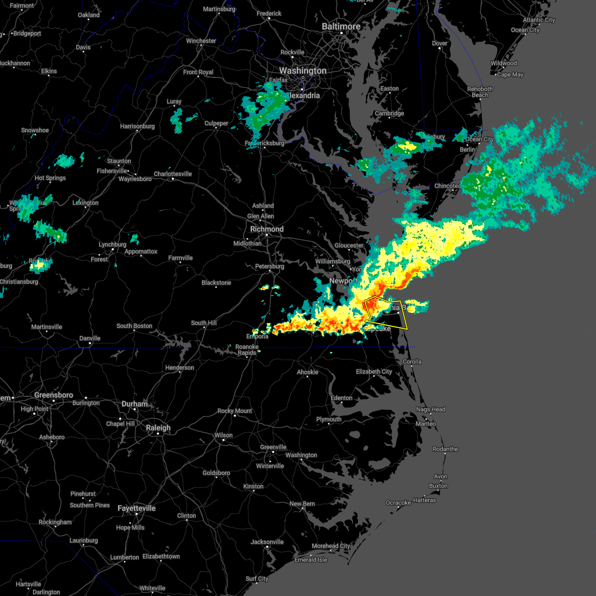 At 150 pm edt, a severe thunderstorm was located over norfolk international, or over virginia wesleyan university, moving east at 35 mph (radar indicated). Hazards include 60 mph wind gusts. Expect damage to trees and powerlines. this severe storm will be near, kempsville around 155 pm edt. princess anne around 205 pm edt. virginia beach around 210 pm edt. other locations impacted by this severe thunderstorm include south norfolk, rudee heights, portlock, princess anne plaza, sigma, sandbridge beach, oceana nas, macons corner, greenbrier and bayside. hail threat, radar indicated max hail size, <. 75 in wind threat, radar indicated max wind gust, 60 mph. At 150 pm edt, a severe thunderstorm was located over norfolk international, or over virginia wesleyan university, moving east at 35 mph (radar indicated). Hazards include 60 mph wind gusts. Expect damage to trees and powerlines. this severe storm will be near, kempsville around 155 pm edt. princess anne around 205 pm edt. virginia beach around 210 pm edt. other locations impacted by this severe thunderstorm include south norfolk, rudee heights, portlock, princess anne plaza, sigma, sandbridge beach, oceana nas, macons corner, greenbrier and bayside. hail threat, radar indicated max hail size, <. 75 in wind threat, radar indicated max wind gust, 60 mph.
|
| 7/9/2022 1:45 PM EDT | Cluster of power outages near downtown norfolk and norfolk state university. time estimate in city of norfolk county VA, 3.2 miles ENE of Norfolk, VA |
| 7/9/2022 1:32 PM EDT |
 At 132 pm edt, a severe thunderstorm was located near churchland, moving east at 35 mph (radar indicated). Hazards include 60 mph wind gusts. Expect damage to trees and powerlines. this severe thunderstorm will be near, chesapeake and portsmouth around 135 pm edt. old dominion university, downtown norfolk, downtown portsmouth, norfolk nas, ghent and cradock around 140 pm edt. ocean view, norfolk state university and norview around 145 pm edt. virginia wesleyan university, regent university, norfolk and norfolk international around 150 pm edt. kempsville around 155 pm edt. virginia beach around 205 pm edt. other locations impacted by this severe thunderstorm include south norfolk, rudee heights, portlock, princess anne plaza, sigma, sandbridge beach, huntersville, oceana nas, macons corner and raleigh terrace. hail threat, radar indicated max hail size, <. 75 in wind threat, radar indicated max wind gust, 60 mph. At 132 pm edt, a severe thunderstorm was located near churchland, moving east at 35 mph (radar indicated). Hazards include 60 mph wind gusts. Expect damage to trees and powerlines. this severe thunderstorm will be near, chesapeake and portsmouth around 135 pm edt. old dominion university, downtown norfolk, downtown portsmouth, norfolk nas, ghent and cradock around 140 pm edt. ocean view, norfolk state university and norview around 145 pm edt. virginia wesleyan university, regent university, norfolk and norfolk international around 150 pm edt. kempsville around 155 pm edt. virginia beach around 205 pm edt. other locations impacted by this severe thunderstorm include south norfolk, rudee heights, portlock, princess anne plaza, sigma, sandbridge beach, huntersville, oceana nas, macons corner and raleigh terrace. hail threat, radar indicated max hail size, <. 75 in wind threat, radar indicated max wind gust, 60 mph.
|
| 6/17/2022 8:45 PM EDT |
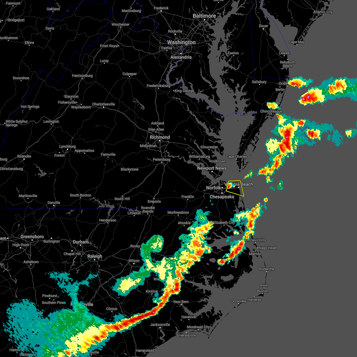 At 844 pm edt, a severe thunderstorm was located near kempsville, moving east at 45 mph (radar indicated). Hazards include 60 mph wind gusts and quarter size hail. Minor damage to vehicles is possible. expect wind damage to trees and powerlines. this severe thunderstorm will remain over mainly rural areas of the northern city of virginia beach, including the following locations, bayside, oceana, rudee heights, princess anne plaza, north virginia beach, dam neck, oceana nas, gallups corner, macons corner and london bridge. hail threat, radar indicated max hail size, 1. 00 in wind threat, radar indicated max wind gust, 60 mph. At 844 pm edt, a severe thunderstorm was located near kempsville, moving east at 45 mph (radar indicated). Hazards include 60 mph wind gusts and quarter size hail. Minor damage to vehicles is possible. expect wind damage to trees and powerlines. this severe thunderstorm will remain over mainly rural areas of the northern city of virginia beach, including the following locations, bayside, oceana, rudee heights, princess anne plaza, north virginia beach, dam neck, oceana nas, gallups corner, macons corner and london bridge. hail threat, radar indicated max hail size, 1. 00 in wind threat, radar indicated max wind gust, 60 mph.
|
| 6/17/2022 8:30 PM EDT |
 At 830 pm edt, a severe thunderstorm was located over norfolk, or over ocean view, moving east at 45 mph (radar indicated). Hazards include 60 mph wind gusts and quarter size hail. Minor damage to vehicles is possible. expect wind damage to trees and powerlines. this severe storm will be near, virginia wesleyan university, regent university and norfolk international around 835 pm edt. kempsville around 840 pm edt. virginia beach around 850 pm edt. other locations impacted by this severe thunderstorm include bayside, oceana, rudee heights, wards corner, princess anne plaza, north virginia beach, dam neck, oceana nas, gallups corner and willoughby spit. hail threat, radar indicated max hail size, 1. 00 in wind threat, radar indicated max wind gust, 60 mph. At 830 pm edt, a severe thunderstorm was located over norfolk, or over ocean view, moving east at 45 mph (radar indicated). Hazards include 60 mph wind gusts and quarter size hail. Minor damage to vehicles is possible. expect wind damage to trees and powerlines. this severe storm will be near, virginia wesleyan university, regent university and norfolk international around 835 pm edt. kempsville around 840 pm edt. virginia beach around 850 pm edt. other locations impacted by this severe thunderstorm include bayside, oceana, rudee heights, wards corner, princess anne plaza, north virginia beach, dam neck, oceana nas, gallups corner and willoughby spit. hail threat, radar indicated max hail size, 1. 00 in wind threat, radar indicated max wind gust, 60 mph.
|
| 6/17/2022 8:28 PM EDT |
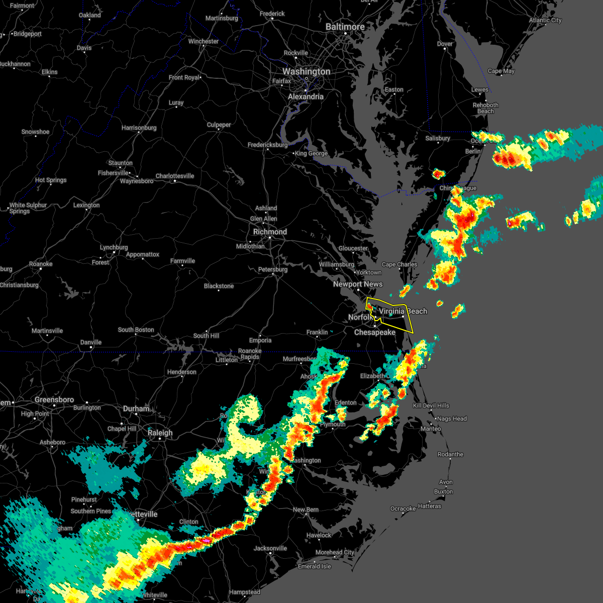 At 827 pm edt, a severe thunderstorm was located over norfolk nas, or over old dominion university, moving east at 45 mph (radar indicated). Hazards include 60 mph wind gusts and quarter size hail. Minor damage to vehicles is possible. expect wind damage to trees and powerlines. this severe thunderstorm will be near, virginia wesleyan university and norfolk international around 835 pm edt. kempsville and regent university around 840 pm edt. virginia beach around 850 pm edt. other locations impacted by this severe thunderstorm include rudee heights, princess anne plaza, oceana nas, macons corner, raleigh terrace, bayside, oceana, wards corner, north virginia beach and dam neck. hail threat, radar indicated max hail size, 1. 00 in wind threat, radar indicated max wind gust, 60 mph. At 827 pm edt, a severe thunderstorm was located over norfolk nas, or over old dominion university, moving east at 45 mph (radar indicated). Hazards include 60 mph wind gusts and quarter size hail. Minor damage to vehicles is possible. expect wind damage to trees and powerlines. this severe thunderstorm will be near, virginia wesleyan university and norfolk international around 835 pm edt. kempsville and regent university around 840 pm edt. virginia beach around 850 pm edt. other locations impacted by this severe thunderstorm include rudee heights, princess anne plaza, oceana nas, macons corner, raleigh terrace, bayside, oceana, wards corner, north virginia beach and dam neck. hail threat, radar indicated max hail size, 1. 00 in wind threat, radar indicated max wind gust, 60 mph.
|
| 6/12/2022 1:57 PM EDT |
 At 157 pm edt, a severe thunderstorm was located 7 miles north of princess anne, or 8 miles east of kempsville, moving southeast at 30 mph (radar indicated). Hazards include 60 mph wind gusts. Expect damage to trees and powerlines. this severe storm will be near, virginia beach and princess anne around 200 pm edt. other locations impacted by this severe thunderstorm include rudee heights, princess anne plaza, sigma, sandbridge beach, oceana nas, macons corner, pungo, bayside, oceana and north virginia beach. hail threat, radar indicated max hail size, <. 75 in wind threat, radar indicated max wind gust, 60 mph. At 157 pm edt, a severe thunderstorm was located 7 miles north of princess anne, or 8 miles east of kempsville, moving southeast at 30 mph (radar indicated). Hazards include 60 mph wind gusts. Expect damage to trees and powerlines. this severe storm will be near, virginia beach and princess anne around 200 pm edt. other locations impacted by this severe thunderstorm include rudee heights, princess anne plaza, sigma, sandbridge beach, oceana nas, macons corner, pungo, bayside, oceana and north virginia beach. hail threat, radar indicated max hail size, <. 75 in wind threat, radar indicated max wind gust, 60 mph.
|
| 6/12/2022 1:35 PM EDT |
 At 135 pm edt, a severe thunderstorm was located near ocean view, moving southeast at 30 mph (radar indicated). Hazards include 60 mph wind gusts. Expect damage to trees and powerlines. this severe thunderstorm will be near, kempsville around 145 pm edt. virginia beach around 155 pm edt. other locations impacted by this severe thunderstorm include rudee heights, princess anne plaza, sigma, sandbridge beach, oceana nas, macons corner, pungo, bayside, oceana and wards corner. hail threat, radar indicated max hail size, <. 75 in wind threat, radar indicated max wind gust, 60 mph. At 135 pm edt, a severe thunderstorm was located near ocean view, moving southeast at 30 mph (radar indicated). Hazards include 60 mph wind gusts. Expect damage to trees and powerlines. this severe thunderstorm will be near, kempsville around 145 pm edt. virginia beach around 155 pm edt. other locations impacted by this severe thunderstorm include rudee heights, princess anne plaza, sigma, sandbridge beach, oceana nas, macons corner, pungo, bayside, oceana and wards corner. hail threat, radar indicated max hail size, <. 75 in wind threat, radar indicated max wind gust, 60 mph.
|
| 5/16/2022 2:27 PM EDT |
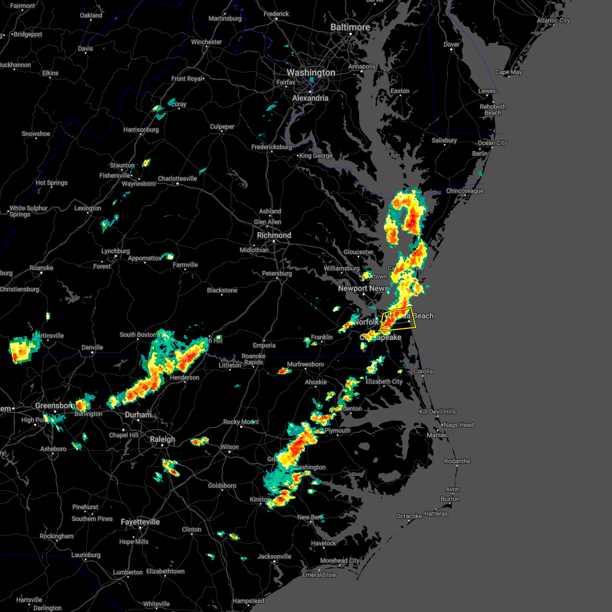 At 226 pm edt, a severe thunderstorm was located over virginia wesleyan university, moving east at 35 mph (radar indicated). Hazards include 60 mph wind gusts and quarter size hail. Minor damage to vehicles is possible. expect wind damage to trees and powerlines. this severe storm will be near, virginia beach around 245 pm edt. other locations impacted by this severe thunderstorm include greenbrier, south norfolk, bayside, oceana, rudee heights, portlock, princess anne plaza, north virginia beach, oceana nas and gallups corner. hail threat, radar indicated max hail size, 1. 00 in wind threat, radar indicated max wind gust, 60 mph. At 226 pm edt, a severe thunderstorm was located over virginia wesleyan university, moving east at 35 mph (radar indicated). Hazards include 60 mph wind gusts and quarter size hail. Minor damage to vehicles is possible. expect wind damage to trees and powerlines. this severe storm will be near, virginia beach around 245 pm edt. other locations impacted by this severe thunderstorm include greenbrier, south norfolk, bayside, oceana, rudee heights, portlock, princess anne plaza, north virginia beach, oceana nas and gallups corner. hail threat, radar indicated max hail size, 1. 00 in wind threat, radar indicated max wind gust, 60 mph.
|
| 5/16/2022 2:20 PM EDT | Powerlines knocked down resulting in multiple power outages in the area. time estimated from rada in city of norfolk county VA, 1.9 miles NNW of Norfolk, VA |
| 5/16/2022 2:13 PM EDT | Large tree down on house near the intersection of east indian river rd. and wilson rd in city of norfolk county VA, 3.1 miles NE of Norfolk, VA |
| 5/16/2022 2:02 PM EDT |
 At 202 pm edt, a severe thunderstorm was located over cradock, or over downtown portsmouth, moving east at 40 mph (radar indicated). Hazards include 60 mph wind gusts and quarter size hail. Minor damage to vehicles is possible. expect wind damage to trees and powerlines. this severe thunderstorm will be near, downtown portsmouth and old dominion university around 205 pm edt. norfolk state university, downtown norfolk and ghent around 210 pm edt. virginia wesleyan university, kempsville, regent university, norfolk international and norview around 215 pm edt. norfolk around 220 pm edt. virginia beach around 235 pm edt. other locations impacted by this severe thunderstorm include south norfolk, rudee heights, portlock, princess anne plaza, oceana nas, macons corner, greenbrier, bayside, oceana and wards corner. hail threat, radar indicated max hail size, 1. 00 in wind threat, radar indicated max wind gust, 60 mph. At 202 pm edt, a severe thunderstorm was located over cradock, or over downtown portsmouth, moving east at 40 mph (radar indicated). Hazards include 60 mph wind gusts and quarter size hail. Minor damage to vehicles is possible. expect wind damage to trees and powerlines. this severe thunderstorm will be near, downtown portsmouth and old dominion university around 205 pm edt. norfolk state university, downtown norfolk and ghent around 210 pm edt. virginia wesleyan university, kempsville, regent university, norfolk international and norview around 215 pm edt. norfolk around 220 pm edt. virginia beach around 235 pm edt. other locations impacted by this severe thunderstorm include south norfolk, rudee heights, portlock, princess anne plaza, oceana nas, macons corner, greenbrier, bayside, oceana and wards corner. hail threat, radar indicated max hail size, 1. 00 in wind threat, radar indicated max wind gust, 60 mph.
|
| 5/16/2022 1:52 PM EDT |
 At 152 pm edt, a severe thunderstorm was located near hampton university, moving northeast at 40 mph (radar indicated). Hazards include 60 mph wind gusts and quarter size hail. Minor damage to vehicles is possible. expect wind damage to trees and powerlines. this severe storm will be near, old dominion university around 155 pm edt. hampton university, langley afb, fort monroe and norfolk nas around 200 pm edt. ocean view, buckroe beach and grand view around 205 pm edt. other locations impacted by this severe thunderstorm include hobson, fox hill, phoebus, langley view, wards corner, huntersville, deanes, messick, hilton village and willoughby spit. hail threat, radar indicated max hail size, 1. 00 in wind threat, radar indicated max wind gust, 60 mph. At 152 pm edt, a severe thunderstorm was located near hampton university, moving northeast at 40 mph (radar indicated). Hazards include 60 mph wind gusts and quarter size hail. Minor damage to vehicles is possible. expect wind damage to trees and powerlines. this severe storm will be near, old dominion university around 155 pm edt. hampton university, langley afb, fort monroe and norfolk nas around 200 pm edt. ocean view, buckroe beach and grand view around 205 pm edt. other locations impacted by this severe thunderstorm include hobson, fox hill, phoebus, langley view, wards corner, huntersville, deanes, messick, hilton village and willoughby spit. hail threat, radar indicated max hail size, 1. 00 in wind threat, radar indicated max wind gust, 60 mph.
|
| 5/16/2022 1:32 PM EDT |
 At 132 pm edt, a severe thunderstorm was located near isle of wight, or 7 miles northeast of windsor, moving northeast at 40 mph (radar indicated). Hazards include 60 mph wind gusts and quarter size hail. Minor damage to vehicles is possible. expect wind damage to trees and powerlines. this severe thunderstorm will be near, smithfield around 135 pm edt. driver around 140 pm edt. crittenden and rescue around 145 pm edt. churchland around 150 pm edt. northampton and beaconsdale around 155 pm edt. old dominion university, portsmouth and norfolk nas around 200 pm edt. hampton university, ocean view, langley afb, fort monroe and buckroe beach around 205 pm edt. norfolk and grand view around 210 pm edt. other locations impacted by this severe thunderstorm include fox hill, carrollton, phoebus, langley view, longview, benns church, huntersville, wills corner, bethel church and hilton village. hail threat, radar indicated max hail size, 1. 00 in wind threat, radar indicated max wind gust, 60 mph. At 132 pm edt, a severe thunderstorm was located near isle of wight, or 7 miles northeast of windsor, moving northeast at 40 mph (radar indicated). Hazards include 60 mph wind gusts and quarter size hail. Minor damage to vehicles is possible. expect wind damage to trees and powerlines. this severe thunderstorm will be near, smithfield around 135 pm edt. driver around 140 pm edt. crittenden and rescue around 145 pm edt. churchland around 150 pm edt. northampton and beaconsdale around 155 pm edt. old dominion university, portsmouth and norfolk nas around 200 pm edt. hampton university, ocean view, langley afb, fort monroe and buckroe beach around 205 pm edt. norfolk and grand view around 210 pm edt. other locations impacted by this severe thunderstorm include fox hill, carrollton, phoebus, langley view, longview, benns church, huntersville, wills corner, bethel church and hilton village. hail threat, radar indicated max hail size, 1. 00 in wind threat, radar indicated max wind gust, 60 mph.
|
| 5/6/2022 8:29 PM EDT |
 At 828 pm edt, severe thunderstorms were located along a line extending from 7 miles east of norfolk international to near virginia beach, moving east at 40 mph (radar indicated). Hazards include 60 mph wind gusts and quarter size hail. Minor damage to vehicles is possible. expect wind damage to trees and powerlines. locations impacted include, virginia beach, virginia wesleyan university, regent university, kempsville, norfolk, chesapeake, back bay, fentress, princess anne, rudee heights, mount pleasant, princess anne plaza, sigma, sandbridge beach, oceana nas, macons corner, pungo, greenbrier, bayside and oceana. hail threat, radar indicated max hail size, 1. 00 in wind threat, radar indicated max wind gust, 60 mph. At 828 pm edt, severe thunderstorms were located along a line extending from 7 miles east of norfolk international to near virginia beach, moving east at 40 mph (radar indicated). Hazards include 60 mph wind gusts and quarter size hail. Minor damage to vehicles is possible. expect wind damage to trees and powerlines. locations impacted include, virginia beach, virginia wesleyan university, regent university, kempsville, norfolk, chesapeake, back bay, fentress, princess anne, rudee heights, mount pleasant, princess anne plaza, sigma, sandbridge beach, oceana nas, macons corner, pungo, greenbrier, bayside and oceana. hail threat, radar indicated max hail size, 1. 00 in wind threat, radar indicated max wind gust, 60 mph.
|
| 5/6/2022 8:14 PM EDT |
 At 814 pm edt, severe thunderstorms were located along a line extending from near norfolk international to near fentress, moving east at 45 mph (radar indicated). Hazards include 60 mph wind gusts and quarter size hail. Minor damage to vehicles is possible. expect wind damage to trees and powerlines. these severe thunderstorms will remain over mainly rural areas of , the southeastern city of norfolk, the northeastern city of chesapeake and the city of virginia beach, including the following locations, rudee heights, mount pleasant, princess anne plaza, sigma, sandbridge beach, oceana nas, macons corner, pungo, greenbrier and bayside. hail threat, radar indicated max hail size, 1. 00 in wind threat, radar indicated max wind gust, 60 mph. At 814 pm edt, severe thunderstorms were located along a line extending from near norfolk international to near fentress, moving east at 45 mph (radar indicated). Hazards include 60 mph wind gusts and quarter size hail. Minor damage to vehicles is possible. expect wind damage to trees and powerlines. these severe thunderstorms will remain over mainly rural areas of , the southeastern city of norfolk, the northeastern city of chesapeake and the city of virginia beach, including the following locations, rudee heights, mount pleasant, princess anne plaza, sigma, sandbridge beach, oceana nas, macons corner, pungo, greenbrier and bayside. hail threat, radar indicated max hail size, 1. 00 in wind threat, radar indicated max wind gust, 60 mph.
|
| 4/26/2022 6:22 PM EDT |
 At 621 pm edt, severe thunderstorms were located along a line extending from rescue to near churchland to near downtown suffolk, moving east at 40 mph (radar indicated). Hazards include 60 mph wind gusts and quarter size hail. Minor damage to vehicles is possible. expect wind damage to trees and powerlines. these severe storms will be near, churchland and western branch around 625 pm edt. old dominion university, downtown portsmouth, chesapeake, portsmouth, northampton, ghent and bowers hill around 630 pm edt. hampton, deep creek, downtown norfolk and norfolk nas around 635 pm edt. hampton university, norfolk, fort monroe and cradock around 640 pm edt. other locations impacted by these severe thunderstorms include wilroy, phoebus, nurney, huntersville, suffolk airport, deanes, hilton village, saunders, magnolia and raleigh terrace. hail threat, radar indicated max hail size, 1. 00 in wind threat, radar indicated max wind gust, 60 mph. At 621 pm edt, severe thunderstorms were located along a line extending from rescue to near churchland to near downtown suffolk, moving east at 40 mph (radar indicated). Hazards include 60 mph wind gusts and quarter size hail. Minor damage to vehicles is possible. expect wind damage to trees and powerlines. these severe storms will be near, churchland and western branch around 625 pm edt. old dominion university, downtown portsmouth, chesapeake, portsmouth, northampton, ghent and bowers hill around 630 pm edt. hampton, deep creek, downtown norfolk and norfolk nas around 635 pm edt. hampton university, norfolk, fort monroe and cradock around 640 pm edt. other locations impacted by these severe thunderstorms include wilroy, phoebus, nurney, huntersville, suffolk airport, deanes, hilton village, saunders, magnolia and raleigh terrace. hail threat, radar indicated max hail size, 1. 00 in wind threat, radar indicated max wind gust, 60 mph.
|
| 4/26/2022 5:59 PM EDT |
 At 559 pm edt, severe thunderstorms were located along a line extending from 6 miles west of smithfield to near isle of wight to near holland, moving east at 45 mph (radar indicated). Hazards include 60 mph wind gusts and quarter size hail. Minor damage to vehicles is possible. expect wind damage to trees and powerlines. severe thunderstorms will be near, smithfield around 605 pm edt. downtown suffolk, rescue and kings fork around 610 pm edt. crittenden around 615 pm edt. churchland, northampton and driver around 620 pm edt. hampton, old dominion university, chesapeake, portsmouth, bowers hill, western branch and ghent around 625 pm edt. hampton university, deep creek, downtown portsmouth, downtown norfolk, norfolk, cradock, norfolk nas and fort monroe around 630 pm edt. other locations impacted by these severe thunderstorms include carrollton, longview, benns church, huntersville, suffolk airport, bethel church, hilton village, chuckatuck, wilroy and nurney. hail threat, radar indicated max hail size, 1. 00 in wind threat, radar indicated max wind gust, 60 mph. At 559 pm edt, severe thunderstorms were located along a line extending from 6 miles west of smithfield to near isle of wight to near holland, moving east at 45 mph (radar indicated). Hazards include 60 mph wind gusts and quarter size hail. Minor damage to vehicles is possible. expect wind damage to trees and powerlines. severe thunderstorms will be near, smithfield around 605 pm edt. downtown suffolk, rescue and kings fork around 610 pm edt. crittenden around 615 pm edt. churchland, northampton and driver around 620 pm edt. hampton, old dominion university, chesapeake, portsmouth, bowers hill, western branch and ghent around 625 pm edt. hampton university, deep creek, downtown portsmouth, downtown norfolk, norfolk, cradock, norfolk nas and fort monroe around 630 pm edt. other locations impacted by these severe thunderstorms include carrollton, longview, benns church, huntersville, suffolk airport, bethel church, hilton village, chuckatuck, wilroy and nurney. hail threat, radar indicated max hail size, 1. 00 in wind threat, radar indicated max wind gust, 60 mph.
|
| 4/7/2022 6:47 PM EDT |
 At 647 pm edt, a severe thunderstorm was located over downtown norfolk, moving east at 35 mph (radar indicated). Hazards include 60 mph wind gusts and quarter size hail. Minor damage to vehicles is possible. expect wind damage to trees and powerlines. this severe storm will be near, ocean view and norview around 650 pm edt. virginia wesleyan university, regent university and norfolk international around 655 pm edt. kempsville around 700 pm edt. virginia beach around 715 pm edt. other locations impacted by this severe thunderstorm include greenbrier, south norfolk, bayside, portlock, wards corner, mount pleasant, herberts corner, gallups corner and willoughby spit. hail threat, radar indicated max hail size, 1. 00 in wind threat, radar indicated max wind gust, 60 mph. At 647 pm edt, a severe thunderstorm was located over downtown norfolk, moving east at 35 mph (radar indicated). Hazards include 60 mph wind gusts and quarter size hail. Minor damage to vehicles is possible. expect wind damage to trees and powerlines. this severe storm will be near, ocean view and norview around 650 pm edt. virginia wesleyan university, regent university and norfolk international around 655 pm edt. kempsville around 700 pm edt. virginia beach around 715 pm edt. other locations impacted by this severe thunderstorm include greenbrier, south norfolk, bayside, portlock, wards corner, mount pleasant, herberts corner, gallups corner and willoughby spit. hail threat, radar indicated max hail size, 1. 00 in wind threat, radar indicated max wind gust, 60 mph.
|
| 4/7/2022 6:33 PM EDT |
 At 632 pm edt, a severe thunderstorm was located over western branch, or near churchland, moving east at 35 mph (radar indicated). Hazards include 60 mph wind gusts and quarter size hail. Minor damage to vehicles is possible. expect wind damage to trees and powerlines. this severe storm will be near, deep creek and chesapeake around 640 pm edt. downtown portsmouth, old dominion university, portsmouth, ghent and cradock around 645 pm edt. norfolk state university, downtown norfolk, norview and norfolk nas around 650 pm edt. virginia wesleyan university, regent university, ocean view and norfolk international around 655 pm edt. kempsville and norfolk around 700 pm edt. virginia beach around 715 pm edt. other locations impacted by this severe thunderstorm include south norfolk, portlock, mount pleasant, huntersville, herberts corner, greenbrier, hobson, bayside, wilroy and wards corner. hail threat, radar indicated max hail size, 1. 00 in wind threat, radar indicated max wind gust, 60 mph. At 632 pm edt, a severe thunderstorm was located over western branch, or near churchland, moving east at 35 mph (radar indicated). Hazards include 60 mph wind gusts and quarter size hail. Minor damage to vehicles is possible. expect wind damage to trees and powerlines. this severe storm will be near, deep creek and chesapeake around 640 pm edt. downtown portsmouth, old dominion university, portsmouth, ghent and cradock around 645 pm edt. norfolk state university, downtown norfolk, norview and norfolk nas around 650 pm edt. virginia wesleyan university, regent university, ocean view and norfolk international around 655 pm edt. kempsville and norfolk around 700 pm edt. virginia beach around 715 pm edt. other locations impacted by this severe thunderstorm include south norfolk, portlock, mount pleasant, huntersville, herberts corner, greenbrier, hobson, bayside, wilroy and wards corner. hail threat, radar indicated max hail size, 1. 00 in wind threat, radar indicated max wind gust, 60 mph.
|
| 4/7/2022 6:21 PM EDT |
 At 621 pm edt, a severe thunderstorm was located over northampton, or near christopher newport university, moving east at 35 mph (radar indicated). Hazards include 60 mph wind gusts and penny size hail. Expect damage to trees and powerlines. this severe storm will be near, hampton around 625 pm edt. langley afb, hampton university and fort monroe around 630 pm edt. grand view and buckroe beach around 635 pm edt. other locations impacted by this severe thunderstorm include rushmere, pons, carrollton, chippokes state park, longview, benns church, oriana, bethel church, ellis fork and hilton village. hail threat, radar indicated max hail size, 0. 75 in wind threat, radar indicated max wind gust, 60 mph. At 621 pm edt, a severe thunderstorm was located over northampton, or near christopher newport university, moving east at 35 mph (radar indicated). Hazards include 60 mph wind gusts and penny size hail. Expect damage to trees and powerlines. this severe storm will be near, hampton around 625 pm edt. langley afb, hampton university and fort monroe around 630 pm edt. grand view and buckroe beach around 635 pm edt. other locations impacted by this severe thunderstorm include rushmere, pons, carrollton, chippokes state park, longview, benns church, oriana, bethel church, ellis fork and hilton village. hail threat, radar indicated max hail size, 0. 75 in wind threat, radar indicated max wind gust, 60 mph.
|
| 4/7/2022 6:09 PM EDT |
 At 608 pm edt, a severe thunderstorm was located over windsor, moving east at 35 mph (radar indicated). Hazards include 60 mph wind gusts and quarter size hail. Minor damage to vehicles is possible. expect wind damage to trees and powerlines. this severe thunderstorm will be near, kings fork around 615 pm edt. downtown suffolk around 620 pm edt. suffolk, driver and crittenden around 630 pm edt. chesapeake, western branch and bowers hill around 635 pm edt. churchland and deep creek around 640 pm edt. downtown portsmouth, old dominion university, portsmouth, ghent and cradock around 645 pm edt. norfolk state university, downtown norfolk, norview and norfolk nas around 650 pm edt. virginia wesleyan university, regent university, ocean view and norfolk international around 655 pm edt. other locations impacted by this severe thunderstorm include south norfolk, portlock, longview, mount pleasant, lummis, suffolk airport, huntersville, wills corner, herberts corner and magnolia. hail threat, radar indicated max hail size, 1. 00 in wind threat, radar indicated max wind gust, 60 mph. At 608 pm edt, a severe thunderstorm was located over windsor, moving east at 35 mph (radar indicated). Hazards include 60 mph wind gusts and quarter size hail. Minor damage to vehicles is possible. expect wind damage to trees and powerlines. this severe thunderstorm will be near, kings fork around 615 pm edt. downtown suffolk around 620 pm edt. suffolk, driver and crittenden around 630 pm edt. chesapeake, western branch and bowers hill around 635 pm edt. churchland and deep creek around 640 pm edt. downtown portsmouth, old dominion university, portsmouth, ghent and cradock around 645 pm edt. norfolk state university, downtown norfolk, norview and norfolk nas around 650 pm edt. virginia wesleyan university, regent university, ocean view and norfolk international around 655 pm edt. other locations impacted by this severe thunderstorm include south norfolk, portlock, longview, mount pleasant, lummis, suffolk airport, huntersville, wills corner, herberts corner and magnolia. hail threat, radar indicated max hail size, 1. 00 in wind threat, radar indicated max wind gust, 60 mph.
|
| 4/7/2022 5:50 PM EDT |
 At 550 pm edt, a severe thunderstorm was located near ivor, or 8 miles east of wakefield, moving east at 50 mph (radar indicated). Hazards include 60 mph wind gusts and penny size hail. Expect damage to trees and powerlines. this severe thunderstorm will be near, isle of wight around 555 pm edt. smithfield around 600 pm edt. rescue and fort eustis around 610 pm edt. christopher newport university, patrick henry field, beaconsdale and denbigh around 615 pm edt. hampton, northampton and tabb around 620 pm edt. langley afb, hampton university, buckroe beach and fort monroe around 625 pm edt. grand view around 630 pm edt. other locations impacted by this severe thunderstorm include rushmere, pons, carrollton, chippokes state park, longview, benns church, oriana, bethel church, ellis fork and hilton village. hail threat, radar indicated max hail size, 0. 75 in wind threat, radar indicated max wind gust, 60 mph. At 550 pm edt, a severe thunderstorm was located near ivor, or 8 miles east of wakefield, moving east at 50 mph (radar indicated). Hazards include 60 mph wind gusts and penny size hail. Expect damage to trees and powerlines. this severe thunderstorm will be near, isle of wight around 555 pm edt. smithfield around 600 pm edt. rescue and fort eustis around 610 pm edt. christopher newport university, patrick henry field, beaconsdale and denbigh around 615 pm edt. hampton, northampton and tabb around 620 pm edt. langley afb, hampton university, buckroe beach and fort monroe around 625 pm edt. grand view around 630 pm edt. other locations impacted by this severe thunderstorm include rushmere, pons, carrollton, chippokes state park, longview, benns church, oriana, bethel church, ellis fork and hilton village. hail threat, radar indicated max hail size, 0. 75 in wind threat, radar indicated max wind gust, 60 mph.
|
| 8/30/2021 9:41 PM EDT |
 At 940 pm edt, severe thunderstorms were located along a line extending from churchland to downtown suffolk to near como, moving east at 25 mph (radar indicated). Hazards include 60 mph wind gusts. expect damage to trees and powerlines At 940 pm edt, severe thunderstorms were located along a line extending from churchland to downtown suffolk to near como, moving east at 25 mph (radar indicated). Hazards include 60 mph wind gusts. expect damage to trees and powerlines
|
| 8/22/2021 4:16 PM EDT |
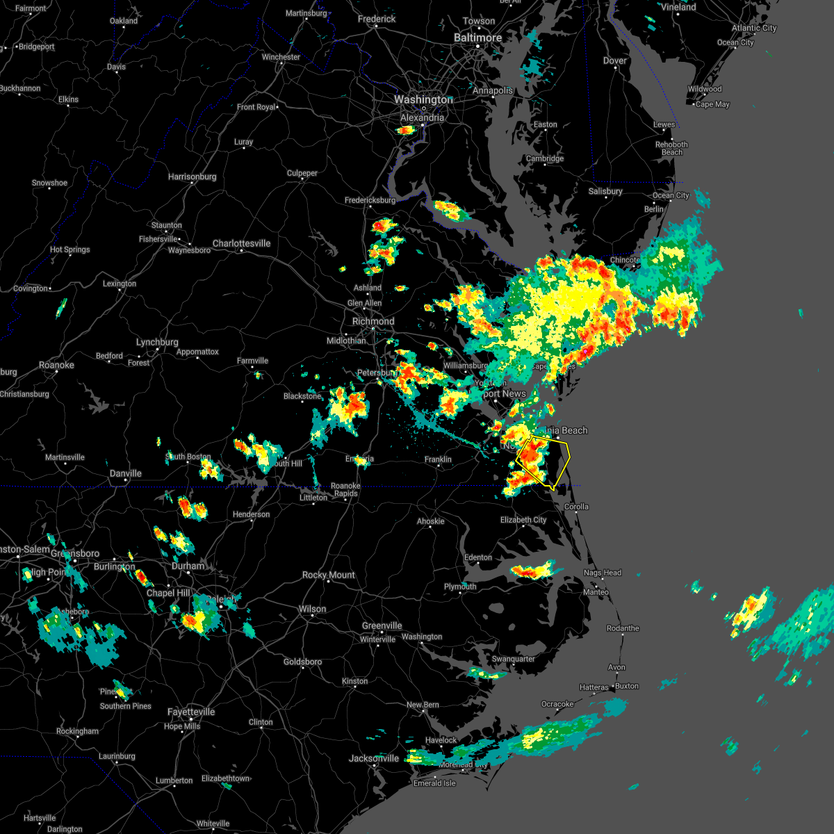 At 416 pm edt, a severe thunderstorm was located near kempsville, moving southeast at 10 mph (radar indicated). Hazards include 60 mph wind gusts and penny size hail. Expect damage to trees and powerlines. Locations impacted include, virginia beach, virginia wesleyan university, regent university, great bridge, kempsville, norfolk, chesapeake, back bay, fentress, princess anne, rudee heights, mount pleasant, princess anne plaza, sigma, sandbridge beach, oceana nas, munden, macons corner, pungo and greenbrier. At 416 pm edt, a severe thunderstorm was located near kempsville, moving southeast at 10 mph (radar indicated). Hazards include 60 mph wind gusts and penny size hail. Expect damage to trees and powerlines. Locations impacted include, virginia beach, virginia wesleyan university, regent university, great bridge, kempsville, norfolk, chesapeake, back bay, fentress, princess anne, rudee heights, mount pleasant, princess anne plaza, sigma, sandbridge beach, oceana nas, munden, macons corner, pungo and greenbrier.
|
| 8/22/2021 4:13 PM EDT |
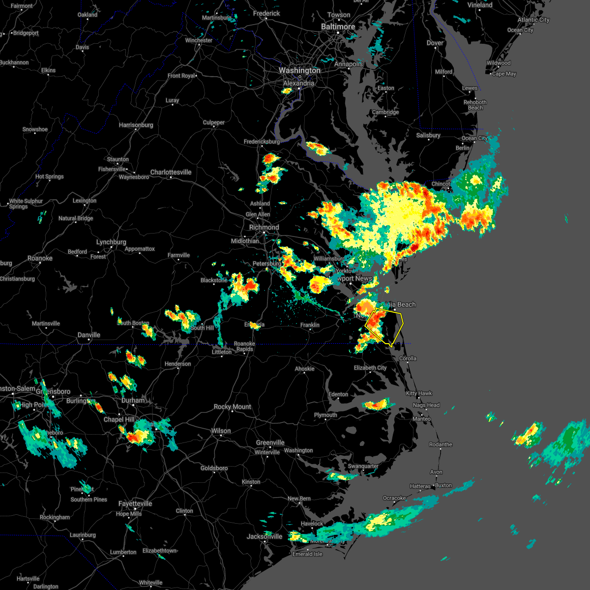 At 413 pm edt, a severe thunderstorm was located over kempsville, moving southeast at 10 mph (radar indicated). Hazards include 60 mph wind gusts and penny size hail. expect damage to trees and powerlines At 413 pm edt, a severe thunderstorm was located over kempsville, moving southeast at 10 mph (radar indicated). Hazards include 60 mph wind gusts and penny size hail. expect damage to trees and powerlines
|
| 8/14/2021 6:56 PM EDT |
 The severe thunderstorm warning for northeastern isle of wight , the city of norfolk, the northern city of portsmouth, the northeastern city of suffolk, the city of hampton and the southern city of newport news will expire at 700 pm edt, the storm which prompted the warning has weakened below severe limits, and no longer poses an immediate threat to life or property. therefore, the warning will be allowed to expire. however heavy rain is still possible with this thunderstorm. The severe thunderstorm warning for northeastern isle of wight , the city of norfolk, the northern city of portsmouth, the northeastern city of suffolk, the city of hampton and the southern city of newport news will expire at 700 pm edt, the storm which prompted the warning has weakened below severe limits, and no longer poses an immediate threat to life or property. therefore, the warning will be allowed to expire. however heavy rain is still possible with this thunderstorm.
|
| 8/14/2021 6:25 PM EDT |
 At 625 pm edt, a severe thunderstorm was located over rescue, or near smithfield, moving east at 10 mph (radar indicated). Hazards include 60 mph wind gusts. Expect damage to trees and powerlines. locations impacted include, newport news, hampton, smithfield, hampton university, old dominion university, ocean view, norfolk, portsmouth, northampton, rescue, buckroe beach, ghent, norfolk nas, norview, crittenden, fort monroe, carrollton, benns church, huntersville and hilton village. hail threat, radar indicated max hail size, <. 75 in wind threat, radar indicated max wind gust, 60 mph. At 625 pm edt, a severe thunderstorm was located over rescue, or near smithfield, moving east at 10 mph (radar indicated). Hazards include 60 mph wind gusts. Expect damage to trees and powerlines. locations impacted include, newport news, hampton, smithfield, hampton university, old dominion university, ocean view, norfolk, portsmouth, northampton, rescue, buckroe beach, ghent, norfolk nas, norview, crittenden, fort monroe, carrollton, benns church, huntersville and hilton village. hail threat, radar indicated max hail size, <. 75 in wind threat, radar indicated max wind gust, 60 mph.
|
| 8/14/2021 6:11 PM EDT |
 At 611 pm edt, a severe thunderstorm was located over smithfield, moving east at 10 mph (radar indicated). Hazards include 60 mph wind gusts. expect damage to trees and powerlines At 611 pm edt, a severe thunderstorm was located over smithfield, moving east at 10 mph (radar indicated). Hazards include 60 mph wind gusts. expect damage to trees and powerlines
|
| 7/8/2021 8:20 PM EDT |
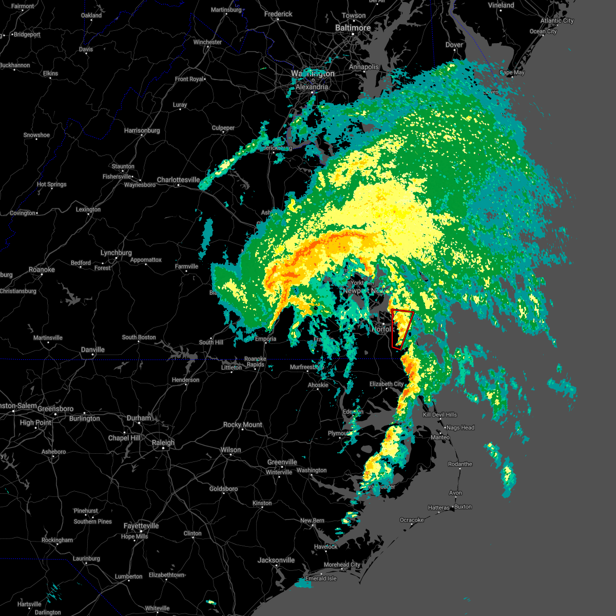 At 819 pm edt, a severe thunderstorm capable of producing a tornado was located near kempsville, moving northeast at 55 mph (radar indicated rotation). Hazards include tornado. Flying debris will be dangerous to those caught without shelter. mobile homes will be damaged or destroyed. damage to roofs, windows, and vehicles will occur. tree damage is likely. Locations impacted include, virginia beach, virginia wesleyan university, kempsville, chesapeake, fentress, princess anne, mount pleasant, princess anne plaza, oceana nas, bayside, oceana, north virginia beach, gallups corner and london bridge. At 819 pm edt, a severe thunderstorm capable of producing a tornado was located near kempsville, moving northeast at 55 mph (radar indicated rotation). Hazards include tornado. Flying debris will be dangerous to those caught without shelter. mobile homes will be damaged or destroyed. damage to roofs, windows, and vehicles will occur. tree damage is likely. Locations impacted include, virginia beach, virginia wesleyan university, kempsville, chesapeake, fentress, princess anne, mount pleasant, princess anne plaza, oceana nas, bayside, oceana, north virginia beach, gallups corner and london bridge.
|
| 7/8/2021 8:07 PM EDT |
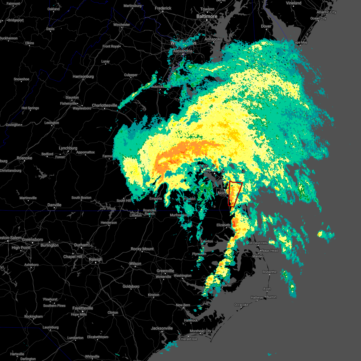 At 807 pm edt, a severe thunderstorm capable of producing a tornado was located over fentress, or near great bridge, moving northeast at 55 mph (radar indicated rotation). Hazards include tornado. Flying debris will be dangerous to those caught without shelter. mobile homes will be damaged or destroyed. damage to roofs, windows, and vehicles will occur. tree damage is likely. this dangerous storm will be near, kempsville, regent university and princess anne around 815 pm edt. virginia wesleyan university and norfolk international around 820 pm edt. virginia beach and norfolk around 825 pm edt. Other locations impacted by this tornadic thunderstorm include bayside, oceana, mount pleasant, princess anne plaza, north virginia beach, oceana nas, gallups corner and london bridge. At 807 pm edt, a severe thunderstorm capable of producing a tornado was located over fentress, or near great bridge, moving northeast at 55 mph (radar indicated rotation). Hazards include tornado. Flying debris will be dangerous to those caught without shelter. mobile homes will be damaged or destroyed. damage to roofs, windows, and vehicles will occur. tree damage is likely. this dangerous storm will be near, kempsville, regent university and princess anne around 815 pm edt. virginia wesleyan university and norfolk international around 820 pm edt. virginia beach and norfolk around 825 pm edt. Other locations impacted by this tornadic thunderstorm include bayside, oceana, mount pleasant, princess anne plaza, north virginia beach, oceana nas, gallups corner and london bridge.
|
| 6/22/2021 2:37 PM EDT |
 At 236 pm edt, severe thunderstorms were located along a line extending from near cheriton to 12 miles east of grand view to near norfolk nas, moving east at 45 mph (radar indicated). Hazards include 60 mph wind gusts. Expect damage to trees and powerlines. these severe storms will be near, cheriton and bay view around 240 pm edt. kempsville and regent university around 245 pm edt. virginia beach and princess anne around 255 pm edt. Other locations impacted by these severe thunderstorms include capeville, south norfolk, kiptopeke state park, rudee heights, portlock, princess anne plaza, sigma, eastville, pungo and greenbrier. At 236 pm edt, severe thunderstorms were located along a line extending from near cheriton to 12 miles east of grand view to near norfolk nas, moving east at 45 mph (radar indicated). Hazards include 60 mph wind gusts. Expect damage to trees and powerlines. these severe storms will be near, cheriton and bay view around 240 pm edt. kempsville and regent university around 245 pm edt. virginia beach and princess anne around 255 pm edt. Other locations impacted by these severe thunderstorms include capeville, south norfolk, kiptopeke state park, rudee heights, portlock, princess anne plaza, sigma, eastville, pungo and greenbrier.
|
| 6/22/2021 2:23 PM EDT |
 At 222 pm edt, severe thunderstorms were located along a line extending from 6 miles northeast of bavon to near grand view to near christopher newport university, moving east at 40 mph (radar indicated). Hazards include 60 mph wind gusts. Expect damage to trees and powerlines. severe thunderstorms will be near, grand view around 235 pm edt. cape charles, ocean view, old dominion university, cheriton, bay view and ghent around 240 pm edt. norfolk international and norview around 245 pm edt. virginia wesleyan university and norfolk around 250 pm edt. virginia beach around 300 pm edt. Other locations impacted by these severe thunderstorms include capeville, south norfolk, kiptopeke state park, rudee heights, carrollton, portlock, princess anne plaza, sigma, eastville and hilton village. At 222 pm edt, severe thunderstorms were located along a line extending from 6 miles northeast of bavon to near grand view to near christopher newport university, moving east at 40 mph (radar indicated). Hazards include 60 mph wind gusts. Expect damage to trees and powerlines. severe thunderstorms will be near, grand view around 235 pm edt. cape charles, ocean view, old dominion university, cheriton, bay view and ghent around 240 pm edt. norfolk international and norview around 245 pm edt. virginia wesleyan university and norfolk around 250 pm edt. virginia beach around 300 pm edt. Other locations impacted by these severe thunderstorms include capeville, south norfolk, kiptopeke state park, rudee heights, carrollton, portlock, princess anne plaza, sigma, eastville and hilton village.
|
| 5/29/2021 2:25 PM EDT |
 The severe thunderstorm warning for , the central city of norfolk, the northern city of portsmouth and the northeastern city of suffolk will expire at 230 pm edt, the storm which prompted the warning has weakened below severe limits, and no longer poses an immediate threat to life or property. therefore, the warning will be allowed to expire. The severe thunderstorm warning for , the central city of norfolk, the northern city of portsmouth and the northeastern city of suffolk will expire at 230 pm edt, the storm which prompted the warning has weakened below severe limits, and no longer poses an immediate threat to life or property. therefore, the warning will be allowed to expire.
|
| 5/29/2021 2:07 PM EDT |
 At 207 pm edt, a severe thunderstorm was located near churchland, moving east at 35 mph (radar indicated). Hazards include 60 mph wind gusts. Expect damage to trees and powerlines. this severe storm will be near, norfolk nas around 215 pm edt. ocean view and norview around 220 pm edt. norfolk around 225 pm edt. Other locations impacted by this severe thunderstorm include wards corner and willoughby spit. At 207 pm edt, a severe thunderstorm was located near churchland, moving east at 35 mph (radar indicated). Hazards include 60 mph wind gusts. Expect damage to trees and powerlines. this severe storm will be near, norfolk nas around 215 pm edt. ocean view and norview around 220 pm edt. norfolk around 225 pm edt. Other locations impacted by this severe thunderstorm include wards corner and willoughby spit.
|
| 5/29/2021 1:53 PM EDT |
 At 153 pm edt, a severe thunderstorm was located over driver, or near churchland, moving east at 35 mph (radar indicated). Hazards include 60 mph wind gusts. Expect damage to trees and powerlines. this severe thunderstorm will be near, churchland around 205 pm edt. portsmouth around 210 pm edt. old dominion university, norfolk nas and ghent around 215 pm edt. ocean view and norview around 220 pm edt. norfolk around 225 pm edt. Other locations impacted by this severe thunderstorm include huntersville, hobson, deanes, wards corner, willoughby spit and chuckatuck. At 153 pm edt, a severe thunderstorm was located over driver, or near churchland, moving east at 35 mph (radar indicated). Hazards include 60 mph wind gusts. Expect damage to trees and powerlines. this severe thunderstorm will be near, churchland around 205 pm edt. portsmouth around 210 pm edt. old dominion university, norfolk nas and ghent around 215 pm edt. ocean view and norview around 220 pm edt. norfolk around 225 pm edt. Other locations impacted by this severe thunderstorm include huntersville, hobson, deanes, wards corner, willoughby spit and chuckatuck.
|
| 5/4/2021 7:11 PM EDT |
 At 711 pm edt, severe thunderstorms were located along a line extending from near hayes to near seaford to near crittenden, moving east at 45 mph (radar indicated). Hazards include 60 mph wind gusts. Expect damage to trees and powerlines. severe thunderstorms will be near, old dominion university around 720 pm edt. hampton university, fort monroe and norfolk nas around 725 pm edt. ocean view, norfolk, buckroe beach and grand view around 730 pm edt. Other locations impacted by these severe thunderstorms include carrollton, lackey, benns church, oriana, huntersville, hilton village, chuckatuck, newport news golf course, wards corner and oyster point. At 711 pm edt, severe thunderstorms were located along a line extending from near hayes to near seaford to near crittenden, moving east at 45 mph (radar indicated). Hazards include 60 mph wind gusts. Expect damage to trees and powerlines. severe thunderstorms will be near, old dominion university around 720 pm edt. hampton university, fort monroe and norfolk nas around 725 pm edt. ocean view, norfolk, buckroe beach and grand view around 730 pm edt. Other locations impacted by these severe thunderstorms include carrollton, lackey, benns church, oriana, huntersville, hilton village, chuckatuck, newport news golf course, wards corner and oyster point.
|
| 5/4/2021 6:58 PM EDT |
 At 658 pm edt, severe thunderstorms were located along a line extending from college of william and mary to fort eustis to isle of wight, moving east at 45 mph (radar indicated). Hazards include 60 mph wind gusts. Expect damage to trees and powerlines. these severe storms will be near, newport news, patrick henry field, christopher newport university, denbigh, beaconsdale and lee hall around 705 pm edt. hampton, seaford and tabb around 710 pm edt. gloucester point and langley afb around 715 pm edt. northampton around 720 pm edt. hampton university around 725 pm edt. buckroe beach, fort monroe and grand view around 730 pm edt. Other locations impacted by these severe thunderstorms include rushmere, carrollton, chippokes state park, lackey, longview, benns church, oriana, huntersville, bethel church and hilton village. At 658 pm edt, severe thunderstorms were located along a line extending from college of william and mary to fort eustis to isle of wight, moving east at 45 mph (radar indicated). Hazards include 60 mph wind gusts. Expect damage to trees and powerlines. these severe storms will be near, newport news, patrick henry field, christopher newport university, denbigh, beaconsdale and lee hall around 705 pm edt. hampton, seaford and tabb around 710 pm edt. gloucester point and langley afb around 715 pm edt. northampton around 720 pm edt. hampton university around 725 pm edt. buckroe beach, fort monroe and grand view around 730 pm edt. Other locations impacted by these severe thunderstorms include rushmere, carrollton, chippokes state park, lackey, longview, benns church, oriana, huntersville, bethel church and hilton village.
|
| 5/4/2021 6:39 PM EDT |
 At 639 pm edt, severe thunderstorms were located along a line extending from claremont to near elberon to near ivor, moving east at 45 mph (radar indicated). Hazards include 60 mph wind gusts. Expect damage to trees and powerlines. severe thunderstorms will be near, scotland around 650 pm edt. isle of wight, fort eustis, kings point and jamestown around 655 pm edt. williamsburg, smithfield, christopher newport university, denbigh, york terrace, carver gardens, busch gardens and lee hall around 700 pm edt. newport news, patrick henry field, tabb, beaconsdale and grove around 705 pm edt. hampton, seaford, langley afb, suffolk, crittenden and rescue around 710 pm edt. gloucester point, hampton university, northampton and grand view around 715 pm edt. Other locations impacted by these severe thunderstorms include rushmere, pons, carrollton, chippokes state park, lackey, longview, benns church, oriana, huntersville and bethel church. At 639 pm edt, severe thunderstorms were located along a line extending from claremont to near elberon to near ivor, moving east at 45 mph (radar indicated). Hazards include 60 mph wind gusts. Expect damage to trees and powerlines. severe thunderstorms will be near, scotland around 650 pm edt. isle of wight, fort eustis, kings point and jamestown around 655 pm edt. williamsburg, smithfield, christopher newport university, denbigh, york terrace, carver gardens, busch gardens and lee hall around 700 pm edt. newport news, patrick henry field, tabb, beaconsdale and grove around 705 pm edt. hampton, seaford, langley afb, suffolk, crittenden and rescue around 710 pm edt. gloucester point, hampton university, northampton and grand view around 715 pm edt. Other locations impacted by these severe thunderstorms include rushmere, pons, carrollton, chippokes state park, lackey, longview, benns church, oriana, huntersville and bethel church.
|
| 4/21/2021 3:26 PM EDT |
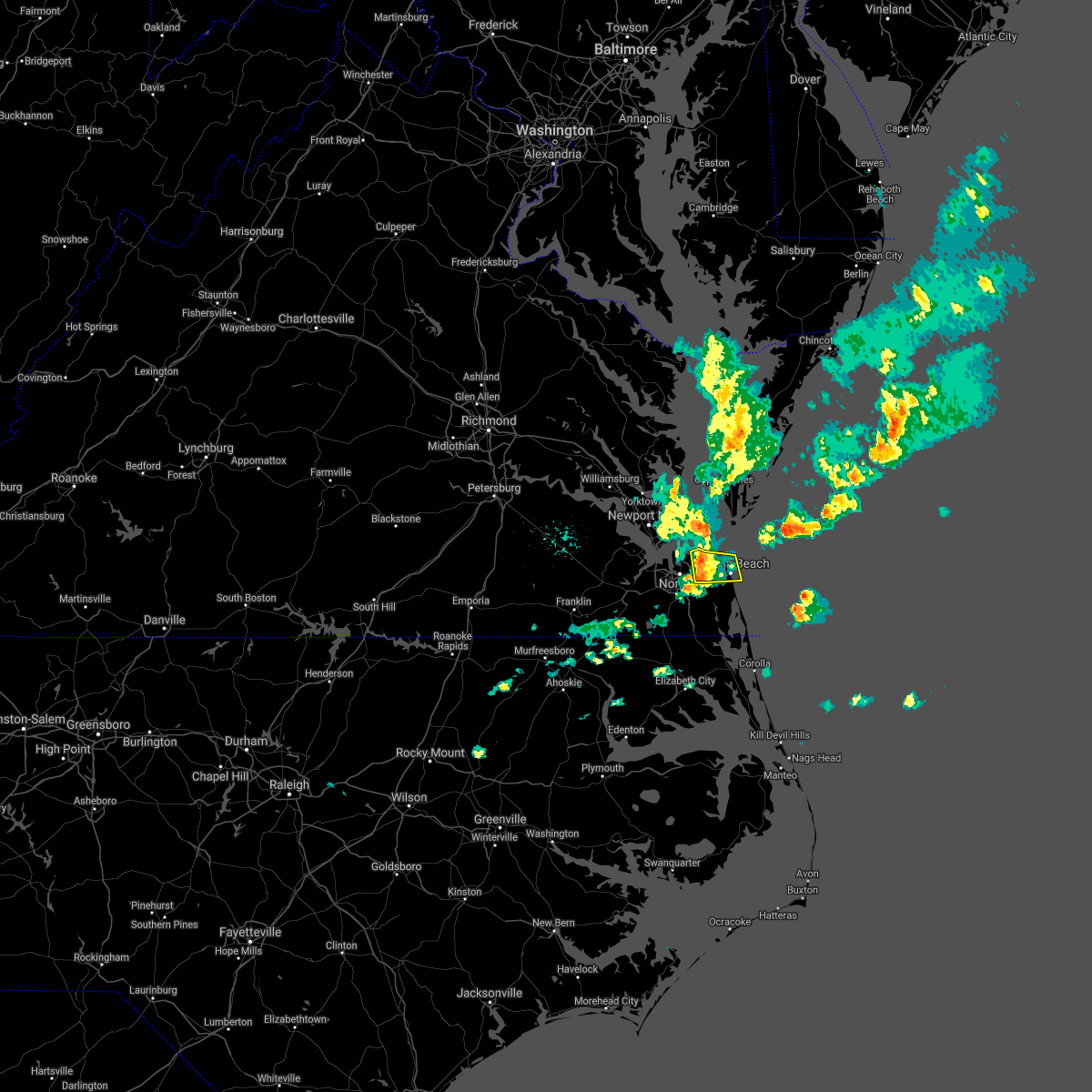 At 325 pm edt, a severe thunderstorm was located near virginia wesleyan university, moving east at 50 mph (radar indicated). Hazards include 60 mph wind gusts and penny size hail. Expect damage to trees and powerlines. This severe thunderstorm will be over the southeastern city of norfolk and the northwestern city of virginia beach, including the following locations, bayside, oceana, rudee heights, princess anne plaza, north virginia beach, oceana nas and london bridge. At 325 pm edt, a severe thunderstorm was located near virginia wesleyan university, moving east at 50 mph (radar indicated). Hazards include 60 mph wind gusts and penny size hail. Expect damage to trees and powerlines. This severe thunderstorm will be over the southeastern city of norfolk and the northwestern city of virginia beach, including the following locations, bayside, oceana, rudee heights, princess anne plaza, north virginia beach, oceana nas and london bridge.
|
| 4/21/2021 3:20 PM EDT | 57 kt gust reported at 3:20 p in city of norfolk county VA, 4 miles SE of Norfolk, VA |
| 4/21/2021 3:17 PM EDT | Norfolk nas... 53 knot wind gus in city of norfolk county VA, 6.6 miles SE of Norfolk, VA |
| 4/21/2021 3:11 PM EDT |
 At 311 pm edt, a severe thunderstorm was located over ocean view, moving east at 60 mph (radar indicated). Hazards include 60 mph wind gusts and penny size hail. Expect damage to trees and powerlines. this severe thunderstorm will be near, virginia beach around 325 pm edt. Other locations impacted by this severe thunderstorm include bayside, oceana, rudee heights, phoebus, wards corner, princess anne plaza, north virginia beach, willoughby spit, london bridge and oceana nas. At 311 pm edt, a severe thunderstorm was located over ocean view, moving east at 60 mph (radar indicated). Hazards include 60 mph wind gusts and penny size hail. Expect damage to trees and powerlines. this severe thunderstorm will be near, virginia beach around 325 pm edt. Other locations impacted by this severe thunderstorm include bayside, oceana, rudee heights, phoebus, wards corner, princess anne plaza, north virginia beach, willoughby spit, london bridge and oceana nas.
|
| 4/9/2021 6:25 PM EDT |
 The severe thunderstorm warning for , the northwestern city of chesapeake and the southern city of portsmouth will expire at 630 pm edt, the storm which prompted the warning has weakened below severe limits, and no longer poses an immediate threat to life or property. therefore, the warning will be allowed to expire. however heavy rain is still possible with this thunderstorm and minor flooding is possible in the previously warned area. a severe thunderstorm watch remains in effect until midnight edt for southeastern virginia. The severe thunderstorm warning for , the northwestern city of chesapeake and the southern city of portsmouth will expire at 630 pm edt, the storm which prompted the warning has weakened below severe limits, and no longer poses an immediate threat to life or property. therefore, the warning will be allowed to expire. however heavy rain is still possible with this thunderstorm and minor flooding is possible in the previously warned area. a severe thunderstorm watch remains in effect until midnight edt for southeastern virginia.
|
| 4/9/2021 6:03 PM EDT |
 At 602 pm edt, a severe thunderstorm was located over deep creek, moving east at 15 mph (public reports of hail around quarter size at 600 pm). Hazards include 60 mph wind gusts and quarter size hail. Minor damage to vehicles is possible. expect wind damage to trees and powerlines. this severe storm will be near, chesapeake around 610 pm edt. great bridge around 625 pm edt. Other locations impacted by this severe thunderstorm include south norfolk, herberts corner, portlock and hickory. At 602 pm edt, a severe thunderstorm was located over deep creek, moving east at 15 mph (public reports of hail around quarter size at 600 pm). Hazards include 60 mph wind gusts and quarter size hail. Minor damage to vehicles is possible. expect wind damage to trees and powerlines. this severe storm will be near, chesapeake around 610 pm edt. great bridge around 625 pm edt. Other locations impacted by this severe thunderstorm include south norfolk, herberts corner, portlock and hickory.
|
| 4/9/2021 5:53 PM EDT |
 The severe thunderstorm warning for northeastern isle of wight , the northwestern city of portsmouth, the northeastern city of suffolk, the city of hampton and the southern city of newport news will expire at 600 pm edt, the storm which prompted the warning has weakened below severe limits, and no longer poses an immediate threat to life or property. therefore, the warning will be allowed to expire. however gusty winds and heavy rain are still possible with this thunderstorm. a severe thunderstorm watch remains in effect until midnight edt for southeastern virginia. The severe thunderstorm warning for northeastern isle of wight , the northwestern city of portsmouth, the northeastern city of suffolk, the city of hampton and the southern city of newport news will expire at 600 pm edt, the storm which prompted the warning has weakened below severe limits, and no longer poses an immediate threat to life or property. therefore, the warning will be allowed to expire. however gusty winds and heavy rain are still possible with this thunderstorm. a severe thunderstorm watch remains in effect until midnight edt for southeastern virginia.
|
| 4/9/2021 5:40 PM EDT |
 At 539 pm edt, a severe thunderstorm was located near crittenden, or near churchland, moving east at 25 mph (radar indicated). Hazards include 60 mph wind gusts and quarter size hail. Minor damage to vehicles is possible. expect wind damage to trees and powerlines. this severe storm will be near, churchland around 545 pm edt. hampton university around 550 pm edt. portsmouth around 555 pm edt. Other locations impacted by this severe thunderstorm include huntersville, hobson and raleigh terrace. At 539 pm edt, a severe thunderstorm was located near crittenden, or near churchland, moving east at 25 mph (radar indicated). Hazards include 60 mph wind gusts and quarter size hail. Minor damage to vehicles is possible. expect wind damage to trees and powerlines. this severe storm will be near, churchland around 545 pm edt. hampton university around 550 pm edt. portsmouth around 555 pm edt. Other locations impacted by this severe thunderstorm include huntersville, hobson and raleigh terrace.
|
| 4/9/2021 5:39 PM EDT |
 At 538 pm edt, a severe thunderstorm was located over bowers hill, or near deep creek, moving east at 15 mph (radar indicated). Hazards include 60 mph wind gusts and quarter size hail. Minor damage to vehicles is possible. expect wind damage to trees and powerlines. this severe thunderstorm will be near, chesapeake around 550 pm edt. deep creek around 600 pm edt. cradock around 610 pm edt. great bridge around 625 pm edt. Other locations impacted by this severe thunderstorm include south norfolk, herberts corner, portlock and hickory. At 538 pm edt, a severe thunderstorm was located over bowers hill, or near deep creek, moving east at 15 mph (radar indicated). Hazards include 60 mph wind gusts and quarter size hail. Minor damage to vehicles is possible. expect wind damage to trees and powerlines. this severe thunderstorm will be near, chesapeake around 550 pm edt. deep creek around 600 pm edt. cradock around 610 pm edt. great bridge around 625 pm edt. Other locations impacted by this severe thunderstorm include south norfolk, herberts corner, portlock and hickory.
|
| 4/9/2021 5:23 PM EDT |
 At 523 pm edt, a severe thunderstorm was located near rescue, or near christopher newport university, moving east at 20 mph (radar indicated). Hazards include 60 mph wind gusts and quarter size hail. Minor damage to vehicles is possible. expect wind damage to trees and powerlines. this severe storm will be near, churchland around 540 pm edt. hampton university and portsmouth around 550 pm edt. Other locations impacted by this severe thunderstorm include huntersville, hobson, carrollton, benns church and raleigh terrace. At 523 pm edt, a severe thunderstorm was located near rescue, or near christopher newport university, moving east at 20 mph (radar indicated). Hazards include 60 mph wind gusts and quarter size hail. Minor damage to vehicles is possible. expect wind damage to trees and powerlines. this severe storm will be near, churchland around 540 pm edt. hampton university and portsmouth around 550 pm edt. Other locations impacted by this severe thunderstorm include huntersville, hobson, carrollton, benns church and raleigh terrace.
|
| 4/9/2021 5:07 PM EDT |
 At 507 pm edt, a severe thunderstorm was located over rescue, or near smithfield, moving east at 25 mph (radar indicated). Hazards include 60 mph wind gusts and quarter size hail. Minor damage to vehicles is possible. expect wind damage to trees and powerlines. this severe thunderstorm will be near, crittenden around 515 pm edt. hampton university and churchland around 535 pm edt. portsmouth around 540 pm edt. Other locations impacted by this severe thunderstorm include hobson, carrollton, longview, benns church, huntersville, wills corner, hilton village, lawson and raleigh terrace. At 507 pm edt, a severe thunderstorm was located over rescue, or near smithfield, moving east at 25 mph (radar indicated). Hazards include 60 mph wind gusts and quarter size hail. Minor damage to vehicles is possible. expect wind damage to trees and powerlines. this severe thunderstorm will be near, crittenden around 515 pm edt. hampton university and churchland around 535 pm edt. portsmouth around 540 pm edt. Other locations impacted by this severe thunderstorm include hobson, carrollton, longview, benns church, huntersville, wills corner, hilton village, lawson and raleigh terrace.
|
| 3/18/2021 10:05 PM EDT |
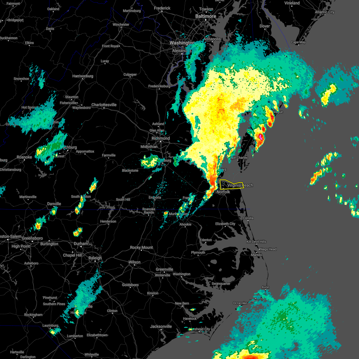 At 1005 pm edt, a severe thunderstorm was located over ocean view, moving east at 60 mph (radar indicated). Hazards include 60 mph wind gusts and penny size hail. Expect damage to trees and powerlines. this severe thunderstorm will be near, virginia beach around 1020 pm edt. other locations impacted by this severe thunderstorm include bayside, north virginia beach, wards corner and willoughby spit. A tornado watch remains in effect until 1100 pm edt for southeastern virginia. At 1005 pm edt, a severe thunderstorm was located over ocean view, moving east at 60 mph (radar indicated). Hazards include 60 mph wind gusts and penny size hail. Expect damage to trees and powerlines. this severe thunderstorm will be near, virginia beach around 1020 pm edt. other locations impacted by this severe thunderstorm include bayside, north virginia beach, wards corner and willoughby spit. A tornado watch remains in effect until 1100 pm edt for southeastern virginia.
|
| 2/22/2021 3:01 PM EST |
 At 300 pm est, severe thunderstorms were located along a line extending from 9 miles south of cape charles to corapeake, moving east at 35 mph (radar indicated. trees have been reported down across the peninsula. in addition, a gust to 54 mph was reported at langley afb). Hazards include 60 mph wind gusts. Expect damage to trees and powerlines. Locations impacted include, virginia beach, ocean view, kempsville, virginia wesleyan university, old dominion university, downtown norfolk, regent university, great bridge, downtown suffolk, deep creek, downtown portsmouth, churchland, norfolk state university, norfolk, chesapeake, portsmouth, suffolk, fentress, bowers hill and cradock. At 300 pm est, severe thunderstorms were located along a line extending from 9 miles south of cape charles to corapeake, moving east at 35 mph (radar indicated. trees have been reported down across the peninsula. in addition, a gust to 54 mph was reported at langley afb). Hazards include 60 mph wind gusts. Expect damage to trees and powerlines. Locations impacted include, virginia beach, ocean view, kempsville, virginia wesleyan university, old dominion university, downtown norfolk, regent university, great bridge, downtown suffolk, deep creek, downtown portsmouth, churchland, norfolk state university, norfolk, chesapeake, portsmouth, suffolk, fentress, bowers hill and cradock.
|
| 2/22/2021 2:56 PM EST | Power lines and a tree dow in city of norfolk county VA, 6 miles SSE of Norfolk, VA |
| 2/22/2021 2:34 PM EST |
 At 234 pm est, severe thunderstorms were located along a line extending from near grand view to 7 miles northeast of como, moving east at 60 mph (radar indicated. at 230pm edt, a 55 mph gust was reported at patrick henry airport). Hazards include 60 mph wind gusts. expect damage to trees and powerlines At 234 pm est, severe thunderstorms were located along a line extending from near grand view to 7 miles northeast of como, moving east at 60 mph (radar indicated. at 230pm edt, a 55 mph gust was reported at patrick henry airport). Hazards include 60 mph wind gusts. expect damage to trees and powerlines
|
| 2/22/2021 2:21 PM EST |
 At 221 pm est, severe thunderstorms were located along a line extending from near bavon to near conway, moving east at 40 mph (radar indicated). Hazards include 60 mph wind gusts. Expect damage to trees and powerlines. these severe storms will be near, murfreesboro and chowan university around 240 pm est. ahoskie, winton and cofield around 250 pm est. roduco around 300 pm est. gates around 305 pm est. Other locations impacted by these severe thunderstorms include eagletown, vicksville, milwaukee, tunis, pons, carrollton, lackey, longview, chowan beach and oriana. At 221 pm est, severe thunderstorms were located along a line extending from near bavon to near conway, moving east at 40 mph (radar indicated). Hazards include 60 mph wind gusts. Expect damage to trees and powerlines. these severe storms will be near, murfreesboro and chowan university around 240 pm est. ahoskie, winton and cofield around 250 pm est. roduco around 300 pm est. gates around 305 pm est. Other locations impacted by these severe thunderstorms include eagletown, vicksville, milwaukee, tunis, pons, carrollton, lackey, longview, chowan beach and oriana.
|
| 2/22/2021 1:57 PM EST |
 The national weather service in wakefield has issued a * severe thunderstorm warning for. northampton county in northeastern north carolina. northwestern gates county in northeastern north carolina. hertford county in northeastern north carolina. The city of poquoson in southeastern virginia. The national weather service in wakefield has issued a * severe thunderstorm warning for. northampton county in northeastern north carolina. northwestern gates county in northeastern north carolina. hertford county in northeastern north carolina. The city of poquoson in southeastern virginia.
|
| 12/25/2020 12:21 AM EST |
 At 1220 am est, severe thunderstorms were located along a line extending from near norfolk international to 8 miles north of newfoundland, moving east at 45 mph (radar indicated). Hazards include 60 mph wind gusts. Expect damage to trees and powerlines. these severe storms will be near, virginia beach around 1235 am est. Other locations impacted by these severe thunderstorms include bob white fork, rudee heights, poplar branch, spot, princess anne plaza, sigma, glen cove, gregory, pungo and barco. At 1220 am est, severe thunderstorms were located along a line extending from near norfolk international to 8 miles north of newfoundland, moving east at 45 mph (radar indicated). Hazards include 60 mph wind gusts. Expect damage to trees and powerlines. these severe storms will be near, virginia beach around 1235 am est. Other locations impacted by these severe thunderstorms include bob white fork, rudee heights, poplar branch, spot, princess anne plaza, sigma, glen cove, gregory, pungo and barco.
|
| 12/25/2020 12:20 AM EST |
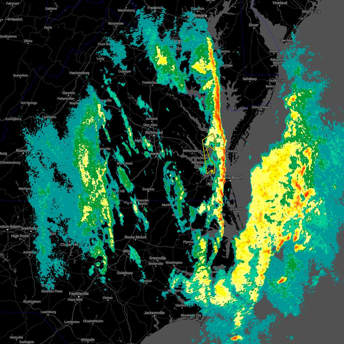 The severe thunderstorm warning for southeastern gloucester, southeastern middlesex, southeastern york, and mathews counties, the city of poquoson, the northwestern city of norfolk, the city of hampton and the southern city of newport news will expire at 1230 am est, the storms which prompted the warning have moved out of the area. therefore, the warning will be allowed to expire. The severe thunderstorm warning for southeastern gloucester, southeastern middlesex, southeastern york, and mathews counties, the city of poquoson, the northwestern city of norfolk, the city of hampton and the southern city of newport news will expire at 1230 am est, the storms which prompted the warning have moved out of the area. therefore, the warning will be allowed to expire.
|
| 12/25/2020 12:10 AM EST | Awos station kngu norfolk nas cha in city of norfolk county VA, 4.5 miles SSE of Norfolk, VA |
| 12/25/2020 12:04 AM EST |
 At 1204 am est, severe thunderstorms were located along a line extending from near norfolk nas to near snug harbor, moving east at 45 mph (radar indicated). Hazards include 60 mph wind gusts and penny size hail. Expect damage to trees and powerlines. severe thunderstorms will be near, virginia wesleyan university and norfolk international around 1215 am est. kempsville around 1220 am est. virginia beach around 1230 am est. other locations impacted by these severe thunderstorms include south norfolk, rudee heights, portlock, poplar branch, pierceville, spot, parkville, pungo, jacocks and spences corner. A tornado watch remains in effect until 300 am est for northeastern north carolina. At 1204 am est, severe thunderstorms were located along a line extending from near norfolk nas to near snug harbor, moving east at 45 mph (radar indicated). Hazards include 60 mph wind gusts and penny size hail. Expect damage to trees and powerlines. severe thunderstorms will be near, virginia wesleyan university and norfolk international around 1215 am est. kempsville around 1220 am est. virginia beach around 1230 am est. other locations impacted by these severe thunderstorms include south norfolk, rudee heights, portlock, poplar branch, pierceville, spot, parkville, pungo, jacocks and spences corner. A tornado watch remains in effect until 300 am est for northeastern north carolina.
|
| 12/24/2020 11:58 PM EST |
 At 1157 pm est, severe thunderstorms were located along a line extending from near blakes to near hampton university, moving northeast at 55 mph (radar indicated). Hazards include 60 mph wind gusts. Expect damage to trees and powerlines. severe thunderstorms will be near, deltaville, blakes and gwynn around 1205 am est. Other locations impacted by these severe thunderstorms include ruff, beulah, moon, laban, glass, naxera, fort nonsense, messick, north and soles. At 1157 pm est, severe thunderstorms were located along a line extending from near blakes to near hampton university, moving northeast at 55 mph (radar indicated). Hazards include 60 mph wind gusts. Expect damage to trees and powerlines. severe thunderstorms will be near, deltaville, blakes and gwynn around 1205 am est. Other locations impacted by these severe thunderstorms include ruff, beulah, moon, laban, glass, naxera, fort nonsense, messick, north and soles.
|
| 12/24/2020 11:49 PM EST |
 At 1148 pm est, a severe thunderstorm capable of producing a tornado was located over driver, or near churchland, moving northeast at 55 mph (radar indicated rotation). Hazards include tornado. Flying debris will be dangerous to those caught without shelter. mobile homes will be damaged or destroyed. damage to roofs, windows, and vehicles will occur. tree damage is likely. this dangerous storm will be near, downtown portsmouth around 1155 pm est. portsmouth around 1200 am est. Other locations impacted by this tornadic thunderstorm include huntersville, hobson and deanes. At 1148 pm est, a severe thunderstorm capable of producing a tornado was located over driver, or near churchland, moving northeast at 55 mph (radar indicated rotation). Hazards include tornado. Flying debris will be dangerous to those caught without shelter. mobile homes will be damaged or destroyed. damage to roofs, windows, and vehicles will occur. tree damage is likely. this dangerous storm will be near, downtown portsmouth around 1155 pm est. portsmouth around 1200 am est. Other locations impacted by this tornadic thunderstorm include huntersville, hobson and deanes.
|
| 12/24/2020 11:38 PM EST |
 At 1138 pm est, a severe thunderstorm capable of producing a tornado was located over downtown suffolk, moving northeast at 50 mph (radar indicated rotation). Hazards include tornado. Flying debris will be dangerous to those caught without shelter. mobile homes will be damaged or destroyed. damage to roofs, windows, and vehicles will occur. tree damage is likely. this dangerous storm will be near, driver and bowers hill around 1150 pm est. churchland, chesapeake, suffolk, western branch and crittenden around 1155 pm est. downtown portsmouth and cradock around 1200 am est. portsmouth around 1205 am est. Other locations impacted by this tornadic thunderstorm include hobson, south norfolk, wilroy, kilby, huntersville, deanes and magnolia. At 1138 pm est, a severe thunderstorm capable of producing a tornado was located over downtown suffolk, moving northeast at 50 mph (radar indicated rotation). Hazards include tornado. Flying debris will be dangerous to those caught without shelter. mobile homes will be damaged or destroyed. damage to roofs, windows, and vehicles will occur. tree damage is likely. this dangerous storm will be near, driver and bowers hill around 1150 pm est. churchland, chesapeake, suffolk, western branch and crittenden around 1155 pm est. downtown portsmouth and cradock around 1200 am est. portsmouth around 1205 am est. Other locations impacted by this tornadic thunderstorm include hobson, south norfolk, wilroy, kilby, huntersville, deanes and magnolia.
|
| 12/24/2020 11:31 PM EST |
 At 1131 pm est, a confirmed tornado was located near holland, moving northeast at 70 mph (radar confirmed tornado). Hazards include damaging tornado. Flying debris will be dangerous to those caught without shelter. mobile homes will be damaged or destroyed. damage to roofs, windows, and vehicles will occur. tree damage is likely. this tornado will be near, downtown suffolk around 1135 pm est. kings fork around 1140 pm est. chesapeake, driver, western branch and bowers hill around 1145 pm est. churchland, suffolk and crittenden around 1150 pm est. portsmouth around 1155 pm est. Other locations impacted by this tornadic thunderstorm include hobson, south norfolk, wilroy, kilby, lummis, huntersville, suffolk airport, deanes, magnolia and chuckatuck. At 1131 pm est, a confirmed tornado was located near holland, moving northeast at 70 mph (radar confirmed tornado). Hazards include damaging tornado. Flying debris will be dangerous to those caught without shelter. mobile homes will be damaged or destroyed. damage to roofs, windows, and vehicles will occur. tree damage is likely. this tornado will be near, downtown suffolk around 1135 pm est. kings fork around 1140 pm est. chesapeake, driver, western branch and bowers hill around 1145 pm est. churchland, suffolk and crittenden around 1150 pm est. portsmouth around 1155 pm est. Other locations impacted by this tornadic thunderstorm include hobson, south norfolk, wilroy, kilby, lummis, huntersville, suffolk airport, deanes, magnolia and chuckatuck.
|
| 12/24/2020 11:29 PM EST |
 At 1129 pm est, a severe thunderstorm capable of producing a tornado was located over holland, moving northeast at 70 mph (radar indicated rotation). Hazards include tornado. Flying debris will be dangerous to those caught without shelter. mobile homes will be damaged or destroyed. damage to roofs, windows, and vehicles will occur. tree damage is likely. this dangerous storm will be near, downtown suffolk around 1135 pm est. kings fork around 1140 pm est. chesapeake, driver and bowers hill around 1145 pm est. churchland, suffolk, crittenden and western branch around 1150 pm est. portsmouth around 1155 pm est. Other locations impacted by this tornadic thunderstorm include hobson, south norfolk, wilroy, kilby, lummis, huntersville, suffolk airport, deanes, magnolia and chuckatuck. At 1129 pm est, a severe thunderstorm capable of producing a tornado was located over holland, moving northeast at 70 mph (radar indicated rotation). Hazards include tornado. Flying debris will be dangerous to those caught without shelter. mobile homes will be damaged or destroyed. damage to roofs, windows, and vehicles will occur. tree damage is likely. this dangerous storm will be near, downtown suffolk around 1135 pm est. kings fork around 1140 pm est. chesapeake, driver and bowers hill around 1145 pm est. churchland, suffolk, crittenden and western branch around 1150 pm est. portsmouth around 1155 pm est. Other locations impacted by this tornadic thunderstorm include hobson, south norfolk, wilroy, kilby, lummis, huntersville, suffolk airport, deanes, magnolia and chuckatuck.
|
| 8/27/2020 11:15 PM EDT |
 At 1115 pm edt, severe thunderstorms were located along a line extending from near driver to near great bridge to 10 miles east of virginia beach, moving southeast at 35 mph (radar indicated). Hazards include 60 mph wind gusts. expect damage to trees and powerlines At 1115 pm edt, severe thunderstorms were located along a line extending from near driver to near great bridge to 10 miles east of virginia beach, moving southeast at 35 mph (radar indicated). Hazards include 60 mph wind gusts. expect damage to trees and powerlines
|
| 8/27/2020 10:57 PM EDT |
 At 1056 pm edt, a severe thunderstorm was located 13 miles east of back bay, or 13 miles east of virginia beach, moving east at 50 mph (radar indicated). Hazards include 60 mph wind gusts and nickel size hail. Expect damage to trees and powerlines. This severe thunderstorm will remain over mainly rural areas of east central isle of wight , the city of norfolk, the city of chesapeake, the city of portsmouth, the northeastern city of suffolk, the city of virginia beach and the southern city of newport news, including the following locations, south norfolk, rudee heights, carrollton, portlock, longview, benns church, princess anne plaza, sigma, huntersville and bethel church. At 1056 pm edt, a severe thunderstorm was located 13 miles east of back bay, or 13 miles east of virginia beach, moving east at 50 mph (radar indicated). Hazards include 60 mph wind gusts and nickel size hail. Expect damage to trees and powerlines. This severe thunderstorm will remain over mainly rural areas of east central isle of wight , the city of norfolk, the city of chesapeake, the city of portsmouth, the northeastern city of suffolk, the city of virginia beach and the southern city of newport news, including the following locations, south norfolk, rudee heights, carrollton, portlock, longview, benns church, princess anne plaza, sigma, huntersville and bethel church.
|
| 8/27/2020 10:20 PM EDT |
 At 1018 pm edt, severe thunderstorms were located along a line extending from near bavon to near tabb to near elberon, moving southeast at 30 mph (radar indicated). Hazards include 60 mph wind gusts and nickel size hail. Expect damage to trees and powerlines. these severe storms will be near, hampton, seaford, patrick henry field, tabb, beaconsdale and denbigh around 1025 pm edt. langley afb and northampton around 1030 pm edt. hampton university, grand view, buckroe beach and fort monroe around 1040 pm edt. smithfield around 1050 pm edt. rescue around 1100 pm edt. Other locations impacted by these severe thunderstorms include rushmere, capeville, kiptopeke state park, carsley, pons, carrollton, chippokes state park, benns church, oriana and bethel church. At 1018 pm edt, severe thunderstorms were located along a line extending from near bavon to near tabb to near elberon, moving southeast at 30 mph (radar indicated). Hazards include 60 mph wind gusts and nickel size hail. Expect damage to trees and powerlines. these severe storms will be near, hampton, seaford, patrick henry field, tabb, beaconsdale and denbigh around 1025 pm edt. langley afb and northampton around 1030 pm edt. hampton university, grand view, buckroe beach and fort monroe around 1040 pm edt. smithfield around 1050 pm edt. rescue around 1100 pm edt. Other locations impacted by these severe thunderstorms include rushmere, capeville, kiptopeke state park, carsley, pons, carrollton, chippokes state park, benns church, oriana and bethel church.
|
| 8/27/2020 10:11 PM EDT |
 At 1011 pm edt, a severe thunderstorm was located over hampton, moving southeast at 50 mph (radar indicated). Hazards include 60 mph wind gusts and nickel size hail. Expect damage to trees and powerlines. this severe thunderstorm will be near, fort monroe around 1015 pm edt. ocean view, old dominion university, portsmouth and norfolk nas around 1020 pm edt. norfolk state university, downtown norfolk, norfolk, norfolk international, norview and ghent around 1025 pm edt. virginia wesleyan university, kempsville and regent university around 1030 pm edt. virginia beach around 1035 pm edt. princess anne around 1040 pm edt. Other locations impacted by this severe thunderstorm include south norfolk, rudee heights, carrollton, portlock, longview, benns church, princess anne plaza, sigma, huntersville and bethel church. At 1011 pm edt, a severe thunderstorm was located over hampton, moving southeast at 50 mph (radar indicated). Hazards include 60 mph wind gusts and nickel size hail. Expect damage to trees and powerlines. this severe thunderstorm will be near, fort monroe around 1015 pm edt. ocean view, old dominion university, portsmouth and norfolk nas around 1020 pm edt. norfolk state university, downtown norfolk, norfolk, norfolk international, norview and ghent around 1025 pm edt. virginia wesleyan university, kempsville and regent university around 1030 pm edt. virginia beach around 1035 pm edt. princess anne around 1040 pm edt. Other locations impacted by this severe thunderstorm include south norfolk, rudee heights, carrollton, portlock, longview, benns church, princess anne plaza, sigma, huntersville and bethel church.
|
| 8/27/2020 9:50 PM EDT |
 At 949 pm edt, severe thunderstorms were located along a line extending from hayes to york terrace to near burrowsville, moving southeast at 30 mph (radar indicated). Hazards include 60 mph wind gusts and nickel size hail. Expect damage to trees and powerlines. severe thunderstorms will be near, williamsburg, gloucester courthouse, queens lake, gloucester point, college of william and mary, grove, busch gardens, hayes, carver gardens and york terrace around 955 pm edt. wicomico around 1000 pm edt. newport news, virginia institute for marine sciences, lee hall, achilles, mobjack and fort eustis around 1005 pm edt. denbigh around 1010 pm edt. seaford, patrick henry field and bavon around 1015 pm edt. christopher newport university, dendron, elberon, tabb and beaconsdale around 1020 pm edt. hampton, surry, northampton and scotland around 1025 pm edt. langley afb, hampton university, grand view, buckroe beach and fort monroe around 1030 pm edt. Other locations impacted by these severe thunderstorms include pons, carrollton, chippokes state park, lackey, beulah, camp peary, naxera, oriana, ewell and poolesville. At 949 pm edt, severe thunderstorms were located along a line extending from hayes to york terrace to near burrowsville, moving southeast at 30 mph (radar indicated). Hazards include 60 mph wind gusts and nickel size hail. Expect damage to trees and powerlines. severe thunderstorms will be near, williamsburg, gloucester courthouse, queens lake, gloucester point, college of william and mary, grove, busch gardens, hayes, carver gardens and york terrace around 955 pm edt. wicomico around 1000 pm edt. newport news, virginia institute for marine sciences, lee hall, achilles, mobjack and fort eustis around 1005 pm edt. denbigh around 1010 pm edt. seaford, patrick henry field and bavon around 1015 pm edt. christopher newport university, dendron, elberon, tabb and beaconsdale around 1020 pm edt. hampton, surry, northampton and scotland around 1025 pm edt. langley afb, hampton university, grand view, buckroe beach and fort monroe around 1030 pm edt. Other locations impacted by these severe thunderstorms include pons, carrollton, chippokes state park, lackey, beulah, camp peary, naxera, oriana, ewell and poolesville.
|
| 8/4/2020 4:19 AM EDT |
 At 419 am edt, a severe thunderstorm capable of producing a tornado was located over churchland, moving north at 70 mph (radar indicated rotation). Hazards include tornado. Flying debris will be dangerous to those caught without shelter. mobile homes will be damaged or destroyed. damage to roofs, windows, and vehicles will occur. tree damage is likely. This tornadic thunderstorm will remain over mainly rural areas of , the western city of norfolk, the northwestern city of chesapeake, the city of portsmouth and the northeastern city of suffolk, including the following locations, huntersville and deanes. At 419 am edt, a severe thunderstorm capable of producing a tornado was located over churchland, moving north at 70 mph (radar indicated rotation). Hazards include tornado. Flying debris will be dangerous to those caught without shelter. mobile homes will be damaged or destroyed. damage to roofs, windows, and vehicles will occur. tree damage is likely. This tornadic thunderstorm will remain over mainly rural areas of , the western city of norfolk, the northwestern city of chesapeake, the city of portsmouth and the northeastern city of suffolk, including the following locations, huntersville and deanes.
|
| 8/4/2020 4:08 AM EDT |
 At 408 am edt, a severe thunderstorm capable of producing a tornado was located over chesapeake, or near great bridge, moving north at 70 mph (radar indicated rotation). Hazards include tornado. Flying debris will be dangerous to those caught without shelter. mobile homes will be damaged or destroyed. damage to roofs, windows, and vehicles will occur. tree damage is likely. this dangerous storm will be near, downtown portsmouth, downtown norfolk, norfolk state university, western branch and bowers hill around 415 am edt. churchland, old dominion university, portsmouth, ghent, norfolk nas and norview around 420 am edt. suffolk around 425 am edt. Other locations impacted by this tornadic thunderstorm include south norfolk, portlock, wards corner, huntersville, deanes, herberts corner, willoughby spit, hickory and chesapeake airport. At 408 am edt, a severe thunderstorm capable of producing a tornado was located over chesapeake, or near great bridge, moving north at 70 mph (radar indicated rotation). Hazards include tornado. Flying debris will be dangerous to those caught without shelter. mobile homes will be damaged or destroyed. damage to roofs, windows, and vehicles will occur. tree damage is likely. this dangerous storm will be near, downtown portsmouth, downtown norfolk, norfolk state university, western branch and bowers hill around 415 am edt. churchland, old dominion university, portsmouth, ghent, norfolk nas and norview around 420 am edt. suffolk around 425 am edt. Other locations impacted by this tornadic thunderstorm include south norfolk, portlock, wards corner, huntersville, deanes, herberts corner, willoughby spit, hickory and chesapeake airport.
|
| 8/4/2020 1:40 AM EDT |
 At 139 am edt, a severe thunderstorm capable of producing a tornado was located over fort monroe, or over hampton university, moving north at 30 mph (radar indicated rotation). Hazards include tornado. Flying debris will be dangerous to those caught without shelter. mobile homes will be damaged or destroyed. damage to roofs, windows, and vehicles will occur. tree damage is likely. this dangerous storm will be near, langley afb, northampton and grand view around 150 am edt. hampton around 155 am edt. tabb around 200 am edt. seaford around 210 am edt. Other locations impacted by this tornadic thunderstorm include dare, fox hill, phoebus, langley view, messick, hornsbyville, hilton village, plum tree island refuge, raleigh terrace and harris grove. At 139 am edt, a severe thunderstorm capable of producing a tornado was located over fort monroe, or over hampton university, moving north at 30 mph (radar indicated rotation). Hazards include tornado. Flying debris will be dangerous to those caught without shelter. mobile homes will be damaged or destroyed. damage to roofs, windows, and vehicles will occur. tree damage is likely. this dangerous storm will be near, langley afb, northampton and grand view around 150 am edt. hampton around 155 am edt. tabb around 200 am edt. seaford around 210 am edt. Other locations impacted by this tornadic thunderstorm include dare, fox hill, phoebus, langley view, messick, hornsbyville, hilton village, plum tree island refuge, raleigh terrace and harris grove.
|
| 8/4/2020 1:31 AM EDT |
 At 130 am edt, a severe thunderstorm capable of producing a tornado was located over norfolk nas, or over ocean view, moving north at 35 mph (radar indicated rotation). Hazards include tornado. Flying debris will be dangerous to those caught without shelter. mobile homes will be damaged or destroyed. damage to roofs, windows, and vehicles will occur. tree damage is likely. this dangerous storm will be near, hampton university, fort monroe and buckroe beach around 140 am edt. northampton and grand view around 145 am edt. hampton and langley afb around 150 am edt. tabb around 155 am edt. seaford and patrick henry field around 200 am edt. Other locations impacted by this tornadic thunderstorm include dare, fox hill, phoebus, langley view, wards corner, messick, willoughby spit, plum tree island refuge, raleigh terrace and hornsbyville. At 130 am edt, a severe thunderstorm capable of producing a tornado was located over norfolk nas, or over ocean view, moving north at 35 mph (radar indicated rotation). Hazards include tornado. Flying debris will be dangerous to those caught without shelter. mobile homes will be damaged or destroyed. damage to roofs, windows, and vehicles will occur. tree damage is likely. this dangerous storm will be near, hampton university, fort monroe and buckroe beach around 140 am edt. northampton and grand view around 145 am edt. hampton and langley afb around 150 am edt. tabb around 155 am edt. seaford and patrick henry field around 200 am edt. Other locations impacted by this tornadic thunderstorm include dare, fox hill, phoebus, langley view, wards corner, messick, willoughby spit, plum tree island refuge, raleigh terrace and hornsbyville.
|
| 8/4/2020 1:24 AM EDT |
 At 124 am edt, a severe thunderstorm capable of producing a tornado was located over norfolk, or over old dominion university, moving north at 35 mph (radar indicated rotation). Hazards include tornado. Flying debris will be dangerous to those caught without shelter. mobile homes will be damaged or destroyed. damage to roofs, windows, and vehicles will occur. tree damage is likely. this dangerous storm will be near, ocean view and norfolk nas around 130 am edt. hampton university and fort monroe around 140 am edt. northampton, buckroe beach and grand view around 145 am edt. langley afb and beaconsdale around 150 am edt. hampton around 155 am edt. seaford, patrick henry field and tabb around 200 am edt. Other locations impacted by this tornadic thunderstorm include fox hill, phoebus, langley view, raleigh terrace, dare, bayside, wards corner, messick, willoughby spit and plum tree island refuge. At 124 am edt, a severe thunderstorm capable of producing a tornado was located over norfolk, or over old dominion university, moving north at 35 mph (radar indicated rotation). Hazards include tornado. Flying debris will be dangerous to those caught without shelter. mobile homes will be damaged or destroyed. damage to roofs, windows, and vehicles will occur. tree damage is likely. this dangerous storm will be near, ocean view and norfolk nas around 130 am edt. hampton university and fort monroe around 140 am edt. northampton, buckroe beach and grand view around 145 am edt. langley afb and beaconsdale around 150 am edt. hampton around 155 am edt. seaford, patrick henry field and tabb around 200 am edt. Other locations impacted by this tornadic thunderstorm include fox hill, phoebus, langley view, raleigh terrace, dare, bayside, wards corner, messick, willoughby spit and plum tree island refuge.
|
| 8/4/2020 12:59 AM EDT |
 At 1259 am edt, a severe thunderstorm capable of producing a tornado was located over fentress, or over great bridge, moving north at 40 mph (radar indicated rotation). Hazards include tornado. Flying debris will be dangerous to those caught without shelter. mobile homes will be damaged or destroyed. damage to roofs, windows, and vehicles will occur. tree damage is likely. this dangerous storm will be near, regent university, kempsville and cradock around 110 am edt. norfolk state university, downtown norfolk, downtown portsmouth and virginia wesleyan university around 115 am edt. old dominion university, churchland, norfolk, norview, ghent and norfolk international around 120 am edt. ocean view, portsmouth and norfolk nas around 125 am edt. Other locations impacted by this tornadic thunderstorm include greenbrier, south norfolk, portlock, wards corner, herberts corner, willoughby spit and hickory. At 1259 am edt, a severe thunderstorm capable of producing a tornado was located over fentress, or over great bridge, moving north at 40 mph (radar indicated rotation). Hazards include tornado. Flying debris will be dangerous to those caught without shelter. mobile homes will be damaged or destroyed. damage to roofs, windows, and vehicles will occur. tree damage is likely. this dangerous storm will be near, regent university, kempsville and cradock around 110 am edt. norfolk state university, downtown norfolk, downtown portsmouth and virginia wesleyan university around 115 am edt. old dominion university, churchland, norfolk, norview, ghent and norfolk international around 120 am edt. ocean view, portsmouth and norfolk nas around 125 am edt. Other locations impacted by this tornadic thunderstorm include greenbrier, south norfolk, portlock, wards corner, herberts corner, willoughby spit and hickory.
|
| 8/4/2020 12:49 AM EDT |
 At 1248 am edt, a severe thunderstorm capable of producing a tornado was located near northwest, or 7 miles southeast of great bridge, moving north at 40 mph (radar indicated rotation). Hazards include tornado. Flying debris will be dangerous to those caught without shelter. mobile homes will be damaged or destroyed. damage to roofs, windows, and vehicles will occur. tree damage is likely. this dangerous storm will be near, fentress around 1255 am edt. great bridge around 100 am edt. deep creek around 105 am edt. regent university, kempsville and cradock around 110 am edt. norfolk state university, downtown norfolk, downtown portsmouth, old dominion university, virginia wesleyan university, ocean view, churchland, norfolk, portsmouth and ghent around 115 am edt. Other locations impacted by this tornadic thunderstorm include greenbrier, bayside, south norfolk, portlock, wards corner, mount pleasant, herberts corner, gallups corner, willoughby spit and hickory. At 1248 am edt, a severe thunderstorm capable of producing a tornado was located near northwest, or 7 miles southeast of great bridge, moving north at 40 mph (radar indicated rotation). Hazards include tornado. Flying debris will be dangerous to those caught without shelter. mobile homes will be damaged or destroyed. damage to roofs, windows, and vehicles will occur. tree damage is likely. this dangerous storm will be near, fentress around 1255 am edt. great bridge around 100 am edt. deep creek around 105 am edt. regent university, kempsville and cradock around 110 am edt. norfolk state university, downtown norfolk, downtown portsmouth, old dominion university, virginia wesleyan university, ocean view, churchland, norfolk, portsmouth and ghent around 115 am edt. Other locations impacted by this tornadic thunderstorm include greenbrier, bayside, south norfolk, portlock, wards corner, mount pleasant, herberts corner, gallups corner, willoughby spit and hickory.
|
| 6/22/2020 4:52 PM EDT |
 The severe thunderstorm warning for , the city of norfolk, the city of portsmouth and the northwestern city of virginia beach will expire at 500 pm edt, the storm which prompted the warning has weakened below severe limits, and has exited the warned area. therefore, the warning will be allowed to expire. The severe thunderstorm warning for , the city of norfolk, the city of portsmouth and the northwestern city of virginia beach will expire at 500 pm edt, the storm which prompted the warning has weakened below severe limits, and has exited the warned area. therefore, the warning will be allowed to expire.
|
| 6/22/2020 4:32 PM EDT |
 At 432 pm edt, a severe thunderstorm was located over ocean view, moving east at 30 mph. a wind gust to 57 mph was recently reported at the lafayette river sensor near norfolk (radar indicated). Hazards include 60 mph wind gusts. Expect damage to trees and powerlines. this severe storm will be near, virginia wesleyan university around 435 pm edt. virginia beach around 455 pm edt. Other locations impacted by this severe thunderstorm include bayside, oceana, wards corner, princess anne plaza, north virginia beach, willoughby spit and london bridge. At 432 pm edt, a severe thunderstorm was located over ocean view, moving east at 30 mph. a wind gust to 57 mph was recently reported at the lafayette river sensor near norfolk (radar indicated). Hazards include 60 mph wind gusts. Expect damage to trees and powerlines. this severe storm will be near, virginia wesleyan university around 435 pm edt. virginia beach around 455 pm edt. Other locations impacted by this severe thunderstorm include bayside, oceana, wards corner, princess anne plaza, north virginia beach, willoughby spit and london bridge.
|
| 6/22/2020 4:28 PM EDT | Tree down blocking lafayete blv in city of norfolk county VA, 2.2 miles ESE of Norfolk, VA |
| 6/22/2020 4:25 PM EDT | Mesonet station xodu lafayette rive in city of norfolk county VA, 5.5 miles ESE of Norfolk, VA |
| 6/22/2020 4:24 PM EDT |
 At 423 pm edt, a severe thunderstorm was located over norfolk nas, or over old dominion university, moving east at 30 mph. a wind gust to 53 mph was recently reported at the lafayette river (radar indicated). Hazards include 60 mph wind gusts. Expect damage to trees and powerlines. this severe thunderstorm will be near, ocean view around 430 pm edt. virginia wesleyan university and norfolk international around 435 pm edt. virginia beach around 455 pm edt. Other locations impacted by this severe thunderstorm include bayside, oceana, wards corner, princess anne plaza, north virginia beach, willoughby spit and london bridge. At 423 pm edt, a severe thunderstorm was located over norfolk nas, or over old dominion university, moving east at 30 mph. a wind gust to 53 mph was recently reported at the lafayette river (radar indicated). Hazards include 60 mph wind gusts. Expect damage to trees and powerlines. this severe thunderstorm will be near, ocean view around 430 pm edt. virginia wesleyan university and norfolk international around 435 pm edt. virginia beach around 455 pm edt. Other locations impacted by this severe thunderstorm include bayside, oceana, wards corner, princess anne plaza, north virginia beach, willoughby spit and london bridge.
|
| 4/26/2020 10:55 PM EDT |
 At 1055 pm edt, a severe thunderstorm was located over virginia wesleyan university, moving east at 30 to 35 mph (radar indicated). Hazards include 60 mph wind gusts and quarter size hail. Minor damage to vehicles is possible. expect wind damage to trees and powerlines. this severe thunderstorm will be near, virginia beach around 1115 pm edt. other locations impacted by this severe thunderstorm include greenbrier, bayside, oceana, rudee heights, princess anne plaza, north virginia beach, gallups corner and london bridge. People at military circle should seek safe shelter immediately!. At 1055 pm edt, a severe thunderstorm was located over virginia wesleyan university, moving east at 30 to 35 mph (radar indicated). Hazards include 60 mph wind gusts and quarter size hail. Minor damage to vehicles is possible. expect wind damage to trees and powerlines. this severe thunderstorm will be near, virginia beach around 1115 pm edt. other locations impacted by this severe thunderstorm include greenbrier, bayside, oceana, rudee heights, princess anne plaza, north virginia beach, gallups corner and london bridge. People at military circle should seek safe shelter immediately!.
|
| 2/7/2020 9:45 AM EST |
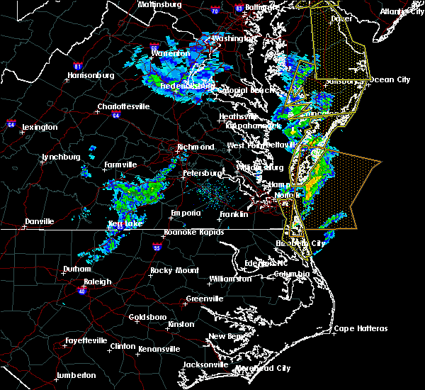 At 944 am est, severe thunderstorms were located along a line extending from 6 miles northwest of virginia beach to back bay to near indiantown, moving east at 45 mph (radar indicated). Hazards include 60 mph wind gusts. Expect damage to trees and powerlines. severe thunderstorms will be near, virginia beach around 950 am est. grandy around 955 am est. corolla around 1000 am est. Other locations impacted by these severe thunderstorms include rudee heights, poplar branch, princess anne plaza, sigma, pungo, barco, bayside, dam neck, maple and snowden. At 944 am est, severe thunderstorms were located along a line extending from 6 miles northwest of virginia beach to back bay to near indiantown, moving east at 45 mph (radar indicated). Hazards include 60 mph wind gusts. Expect damage to trees and powerlines. severe thunderstorms will be near, virginia beach around 950 am est. grandy around 955 am est. corolla around 1000 am est. Other locations impacted by these severe thunderstorms include rudee heights, poplar branch, princess anne plaza, sigma, pungo, barco, bayside, dam neck, maple and snowden.
|
| 2/7/2020 9:07 AM EST |
 At 906 am est, showers with severe winds were located along a line extending from near lee hall to near churchland to near corapeake, moving northeast at 60 mph (radar indicated). Hazards include 60 mph wind gusts. Expect damage to trees and powerlines. severe storms will be near, virginia institute for marine sciences, old dominion university, seaford, downtown norfolk, gloucester point, norfolk state university, downtown portsmouth, hampton university, patrick henry field and portsmouth around 910 am est. ocean view, virginia wesleyan university, norfolk, achilles, norfolk international, fort monroe and buckroe beach around 915 am est. deep creek and mobjack around 920 am est. great bridge and bavon around 925 am est. regent university and fentress around 930 am est. kempsville, princess anne and back bay around 935 am est. cheriton around 940 am est. virginia beach around 945 am est. Other locations impacted by these severe thunderstorms include south norfolk, rudee heights, portlock, lackey, laban, eastville, naxera, franktown, pungo and bayside. At 906 am est, showers with severe winds were located along a line extending from near lee hall to near churchland to near corapeake, moving northeast at 60 mph (radar indicated). Hazards include 60 mph wind gusts. Expect damage to trees and powerlines. severe storms will be near, virginia institute for marine sciences, old dominion university, seaford, downtown norfolk, gloucester point, norfolk state university, downtown portsmouth, hampton university, patrick henry field and portsmouth around 910 am est. ocean view, virginia wesleyan university, norfolk, achilles, norfolk international, fort monroe and buckroe beach around 915 am est. deep creek and mobjack around 920 am est. great bridge and bavon around 925 am est. regent university and fentress around 930 am est. kempsville, princess anne and back bay around 935 am est. cheriton around 940 am est. virginia beach around 945 am est. Other locations impacted by these severe thunderstorms include south norfolk, rudee heights, portlock, lackey, laban, eastville, naxera, franktown, pungo and bayside.
|
| 2/6/2020 3:52 PM EST |
 At 350 pm est, severe thunderstorms were located along a line extending from near northampton to near western branch to near downtown suffolk, moving east at 50 mph (radar indicated). Hazards include 60 mph wind gusts. Expect damage to trees and powerlines. these severe storms will be near, hampton, hampton university, langley afb, northampton, buckroe beach and fort monroe around 355 pm est. old dominion university, downtown norfolk, norfolk state university, chesapeake, portsmouth, ghent, grand view and norfolk nas around 400 pm est. virginia wesleyan university, ocean view, cradock, norfolk international and norview around 405 pm est. downtown portsmouth and norfolk around 410 pm est. virginia beach, regent university and kempsville around 415 pm est. Other locations impacted by these severe thunderstorms include south norfolk, rudee heights, portlock, princess anne plaza, huntersville, greenbrier, bayside, wilroy, wards corner and kilby. At 350 pm est, severe thunderstorms were located along a line extending from near northampton to near western branch to near downtown suffolk, moving east at 50 mph (radar indicated). Hazards include 60 mph wind gusts. Expect damage to trees and powerlines. these severe storms will be near, hampton, hampton university, langley afb, northampton, buckroe beach and fort monroe around 355 pm est. old dominion university, downtown norfolk, norfolk state university, chesapeake, portsmouth, ghent, grand view and norfolk nas around 400 pm est. virginia wesleyan university, ocean view, cradock, norfolk international and norview around 405 pm est. downtown portsmouth and norfolk around 410 pm est. virginia beach, regent university and kempsville around 415 pm est. Other locations impacted by these severe thunderstorms include south norfolk, rudee heights, portlock, princess anne plaza, huntersville, greenbrier, bayside, wilroy, wards corner and kilby.
|
| 2/6/2020 3:26 PM EST |
 At 325 pm est, severe thunderstorms were located along a line extending from near isle of wight to near windsor to carrsville, moving east at 55 mph (radar indicated). Hazards include 60 mph wind gusts and quarter size hail. Minor damage to vehicles is possible. expect wind damage to trees and powerlines. severe thunderstorms will be near, smithfield and isle of wight around 330 pm est. kings fork around 335 pm est. downtown suffolk, suffolk and rescue around 340 pm est. christopher newport university, northampton, driver, beaconsdale and crittenden around 345 pm est. hampton, churchland, hampton university, langley afb, bowers hill and western branch around 350 pm est. old dominion university, downtown norfolk, deep creek, chesapeake, portsmouth, buckroe beach, ghent, grand view, fort monroe and norfolk nas around 355 pm est. downtown portsmouth, norfolk state university, ocean view, norview, cradock and norfolk international around 400 pm est. regent university and norfolk around 405 pm est. other locations impacted by these severe thunderstorms include south norfolk, rudee heights, portlock, carrollton, longview, benns church, princess anne plaza, huntersville, bethel church and hilton village. A tornado watch remains in effect until 700 pm est for southeastern virginia. At 325 pm est, severe thunderstorms were located along a line extending from near isle of wight to near windsor to carrsville, moving east at 55 mph (radar indicated). Hazards include 60 mph wind gusts and quarter size hail. Minor damage to vehicles is possible. expect wind damage to trees and powerlines. severe thunderstorms will be near, smithfield and isle of wight around 330 pm est. kings fork around 335 pm est. downtown suffolk, suffolk and rescue around 340 pm est. christopher newport university, northampton, driver, beaconsdale and crittenden around 345 pm est. hampton, churchland, hampton university, langley afb, bowers hill and western branch around 350 pm est. old dominion university, downtown norfolk, deep creek, chesapeake, portsmouth, buckroe beach, ghent, grand view, fort monroe and norfolk nas around 355 pm est. downtown portsmouth, norfolk state university, ocean view, norview, cradock and norfolk international around 400 pm est. regent university and norfolk around 405 pm est. other locations impacted by these severe thunderstorms include south norfolk, rudee heights, portlock, carrollton, longview, benns church, princess anne plaza, huntersville, bethel church and hilton village. A tornado watch remains in effect until 700 pm est for southeastern virginia.
|
| 11/1/2019 12:49 AM EDT |
 At 1247 am edt, a severe thunderstorm capable of producing a tornado was located near deep creek, moving east at 40 mph (radar indicated rotation). Hazards include tornado. Flying debris will be dangerous to those caught without shelter. mobile homes will be damaged or destroyed. damage to roofs, windows, and vehicles will occur. tree damage is likely. this dangerous storm will be near, deep creek around 1255 am edt. great bridge around 105 am edt. regent university and fentress around 110 am edt. Other locations impacted by this tornadic thunderstorm include greenbrier, south norfolk, herberts corner, portlock, hickory and chesapeake airport. At 1247 am edt, a severe thunderstorm capable of producing a tornado was located near deep creek, moving east at 40 mph (radar indicated rotation). Hazards include tornado. Flying debris will be dangerous to those caught without shelter. mobile homes will be damaged or destroyed. damage to roofs, windows, and vehicles will occur. tree damage is likely. this dangerous storm will be near, deep creek around 1255 am edt. great bridge around 105 am edt. regent university and fentress around 110 am edt. Other locations impacted by this tornadic thunderstorm include greenbrier, south norfolk, herberts corner, portlock, hickory and chesapeake airport.
|
| 11/1/2019 12:31 AM EDT |
 At 1231 am edt, a severe thunderstorm capable of producing a tornado was located near whaleyville, or near downtown suffolk, moving east at 45 mph (radar indicated rotation). Hazards include tornado. Flying debris will be dangerous to those caught without shelter. mobile homes will be damaged or destroyed. damage to roofs, windows, and vehicles will occur. tree damage is likely. this dangerous storm will be near, deep creek around 1255 am edt. great bridge around 100 am edt. regent university and fentress around 105 am edt. Other locations impacted by this tornadic thunderstorm include greenbrier, south norfolk, portlock, nurney, suffolk airport, herberts corner, saunders, hickory and chesapeake airport. At 1231 am edt, a severe thunderstorm capable of producing a tornado was located near whaleyville, or near downtown suffolk, moving east at 45 mph (radar indicated rotation). Hazards include tornado. Flying debris will be dangerous to those caught without shelter. mobile homes will be damaged or destroyed. damage to roofs, windows, and vehicles will occur. tree damage is likely. this dangerous storm will be near, deep creek around 1255 am edt. great bridge around 100 am edt. regent university and fentress around 105 am edt. Other locations impacted by this tornadic thunderstorm include greenbrier, south norfolk, portlock, nurney, suffolk airport, herberts corner, saunders, hickory and chesapeake airport.
|
| 10/31/2019 11:58 PM EDT |
 The national weather service in wakefield has issued a * severe thunderstorm warning for. the city of poquoson in southeastern virginia. the city of norfolk in southeastern virginia. the northwestern city of chesapeake in southeastern virginia. Isle of wight county in southeastern virginia. The national weather service in wakefield has issued a * severe thunderstorm warning for. the city of poquoson in southeastern virginia. the city of norfolk in southeastern virginia. the northwestern city of chesapeake in southeastern virginia. Isle of wight county in southeastern virginia.
|
| 8/23/2019 5:33 PM EDT |
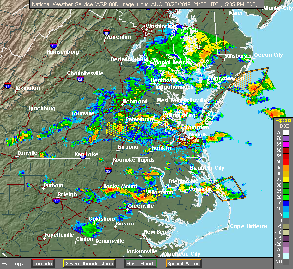 At 532 pm edt, a severe thunderstorm was located over virginia wesleyan university, moving east at 15 mph (radar indicated). Hazards include 60 mph wind gusts and quarter size hail. Minor damage to vehicles is possible. expect wind damage to trees and powerlines. Locations impacted include, virginia beach, virginia wesleyan university, norfolk state university, regent university, kempsville, norfolk, chesapeake, norfolk international, norview, rudee heights, princess anne plaza, oceana nas, macons corner, bayside, oceana, north virginia beach, gallups corner and london bridge. At 532 pm edt, a severe thunderstorm was located over virginia wesleyan university, moving east at 15 mph (radar indicated). Hazards include 60 mph wind gusts and quarter size hail. Minor damage to vehicles is possible. expect wind damage to trees and powerlines. Locations impacted include, virginia beach, virginia wesleyan university, norfolk state university, regent university, kempsville, norfolk, chesapeake, norfolk international, norview, rudee heights, princess anne plaza, oceana nas, macons corner, bayside, oceana, north virginia beach, gallups corner and london bridge.
|
| 8/23/2019 5:20 PM EDT |
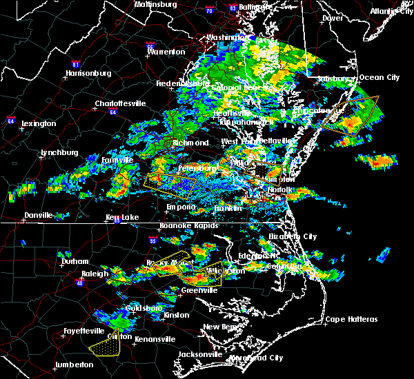 The national weather service in wakefield has issued a * severe thunderstorm warning for. the city of norfolk in southeastern virginia. the north central city of chesapeake in southeastern virginia. the eastern city of portsmouth in southeastern virginia. The northwestern city of virginia beach in southeastern virginia. The national weather service in wakefield has issued a * severe thunderstorm warning for. the city of norfolk in southeastern virginia. the north central city of chesapeake in southeastern virginia. the eastern city of portsmouth in southeastern virginia. The northwestern city of virginia beach in southeastern virginia.
|
| 8/22/2019 7:41 PM EDT |
 At 740 pm edt, a severe thunderstorm was located over regent university, moving east at 25 mph (radar indicated). Hazards include 60 mph wind gusts. Expect damage to trees and powerlines. this severe storm will be near, kempsville and virginia wesleyan university around 745 pm edt. virginia beach around 800 pm edt. Other locations impacted by this severe thunderstorm include greenbrier, south norfolk, bayside, portlock, wards corner, princess anne plaza, oceana nas, gallups corner, willoughby spit and macons corner. At 740 pm edt, a severe thunderstorm was located over regent university, moving east at 25 mph (radar indicated). Hazards include 60 mph wind gusts. Expect damage to trees and powerlines. this severe storm will be near, kempsville and virginia wesleyan university around 745 pm edt. virginia beach around 800 pm edt. Other locations impacted by this severe thunderstorm include greenbrier, south norfolk, bayside, portlock, wards corner, princess anne plaza, oceana nas, gallups corner, willoughby spit and macons corner.
|
| 8/22/2019 7:20 PM EDT |
 At 719 pm edt, a severe thunderstorm was located over western branch, or near churchland, moving northeast at 15 mph (radar indicated). Hazards include 60 mph wind gusts. Expect damage to trees and powerlines. this severe thunderstorm will be near, chesapeake and cradock around 725 pm edt. downtown portsmouth, old dominion university and portsmouth around 735 pm edt. downtown norfolk, norfolk state university and ghent around 740 pm edt. norfolk nas around 745 pm edt. regent university and norview around 750 pm edt. ocean view around 755 pm edt. virginia wesleyan university, kempsville, norfolk and norfolk international around 800 pm edt. Other locations impacted by this severe thunderstorm include south norfolk, portlock, princess anne plaza, huntersville, herberts corner, oceana nas, macons corner, greenbrier, bayside and wards corner. At 719 pm edt, a severe thunderstorm was located over western branch, or near churchland, moving northeast at 15 mph (radar indicated). Hazards include 60 mph wind gusts. Expect damage to trees and powerlines. this severe thunderstorm will be near, chesapeake and cradock around 725 pm edt. downtown portsmouth, old dominion university and portsmouth around 735 pm edt. downtown norfolk, norfolk state university and ghent around 740 pm edt. norfolk nas around 745 pm edt. regent university and norview around 750 pm edt. ocean view around 755 pm edt. virginia wesleyan university, kempsville, norfolk and norfolk international around 800 pm edt. Other locations impacted by this severe thunderstorm include south norfolk, portlock, princess anne plaza, huntersville, herberts corner, oceana nas, macons corner, greenbrier, bayside and wards corner.
|
| 8/7/2019 5:13 PM EDT |
 The severe thunderstorm warning for , the city of norfolk, the northwestern city of chesapeake, the city of portsmouth and the northwestern city of virginia beach will expire at 515 pm edt, the storms which prompted the warning have moved out of the area. therefore, the warning will be allowed to expire. however gusty winds to 40 mph are still possible through 545 pm. a severe thunderstorm watch remains in effect until 800 pm edt for southeastern virginia. remember, another severe thunderstorm warning still remains in effect for virginia beach until 530 pm. The severe thunderstorm warning for , the city of norfolk, the northwestern city of chesapeake, the city of portsmouth and the northwestern city of virginia beach will expire at 515 pm edt, the storms which prompted the warning have moved out of the area. therefore, the warning will be allowed to expire. however gusty winds to 40 mph are still possible through 545 pm. a severe thunderstorm watch remains in effect until 800 pm edt for southeastern virginia. remember, another severe thunderstorm warning still remains in effect for virginia beach until 530 pm.
|
| 8/7/2019 4:30 PM EDT | Numerous trees down across norfol in city of norfolk county VA, 2.2 miles ESE of Norfolk, VA |
| 8/7/2019 4:28 PM EDT | Quarter sized hail reported 5.2 miles S of Norfolk, VA |
| 8/7/2019 4:23 PM EDT |
 At 422 pm edt, severe thunderstorms were located along a line extending from hampton university to near deep creek, moving east at 35 mph (radar indicated). Hazards include 60 mph wind gusts and quarter size hail. Minor damage to vehicles is possible. expect wind damage to trees and powerlines. Locations impacted include, virginia beach, virginia wesleyan university, old dominion university, downtown norfolk, regent university, ocean view, kempsville, downtown portsmouth, churchland, norfolk state university, norfolk, chesapeake, portsmouth, norfolk international, ghent, norfolk nas, bowers hill, norview, cradock and western branch. At 422 pm edt, severe thunderstorms were located along a line extending from hampton university to near deep creek, moving east at 35 mph (radar indicated). Hazards include 60 mph wind gusts and quarter size hail. Minor damage to vehicles is possible. expect wind damage to trees and powerlines. Locations impacted include, virginia beach, virginia wesleyan university, old dominion university, downtown norfolk, regent university, ocean view, kempsville, downtown portsmouth, churchland, norfolk state university, norfolk, chesapeake, portsmouth, norfolk international, ghent, norfolk nas, bowers hill, norview, cradock and western branch.
|
| 8/7/2019 4:08 PM EDT |
 At 408 pm edt, severe thunderstorms were located along a line extending from near rescue to downtown suffolk, moving east at 20 mph. an additional severe thunderstorm was near the norfolk airport, moving north at 20 mph (radar indicated). Hazards include 60 mph wind gusts and quarter size hail. Minor damage to vehicles is possible. Expect wind damage to trees and powerlines. At 408 pm edt, severe thunderstorms were located along a line extending from near rescue to downtown suffolk, moving east at 20 mph. an additional severe thunderstorm was near the norfolk airport, moving north at 20 mph (radar indicated). Hazards include 60 mph wind gusts and quarter size hail. Minor damage to vehicles is possible. Expect wind damage to trees and powerlines.
|
| 8/4/2019 5:28 PM EDT |
 At 528 pm edt, severe thunderstorms were located along a line extending from virginia beach to princess anne to near fentress, moving southeast at 15 mph (radar indicated). Hazards include 60 mph wind gusts. Expect damage to trees and powerlines. Locations impacted include, virginia beach, regent university, great bridge, kempsville, chesapeake, back bay, fentress, princess anne, rudee heights, mount pleasant, princess anne plaza, sigma, sandbridge beach, oceana nas, macons corner, pungo, greenbrier, bayside, oceana and dam neck. At 528 pm edt, severe thunderstorms were located along a line extending from virginia beach to princess anne to near fentress, moving southeast at 15 mph (radar indicated). Hazards include 60 mph wind gusts. Expect damage to trees and powerlines. Locations impacted include, virginia beach, regent university, great bridge, kempsville, chesapeake, back bay, fentress, princess anne, rudee heights, mount pleasant, princess anne plaza, sigma, sandbridge beach, oceana nas, macons corner, pungo, greenbrier, bayside, oceana and dam neck.
|
| 8/4/2019 5:04 PM EDT |
 At 503 pm edt, severe thunderstorms were located along a line extending from 6 miles northwest of virginia beach to near kempsville to chesapeake, moving east at 20 mph (radar indicated). Hazards include 60 mph wind gusts. expect damage to trees and powerlines At 503 pm edt, severe thunderstorms were located along a line extending from 6 miles northwest of virginia beach to near kempsville to chesapeake, moving east at 20 mph (radar indicated). Hazards include 60 mph wind gusts. expect damage to trees and powerlines
|
| 8/4/2019 5:00 PM EDT |
 At 459 pm edt, severe thunderstorms were located along a line extending from near norfolk international to norfolk nas to near western branch, moving east at 15 mph (radar indicated). Hazards include 60 mph wind gusts and penny size hail. Expect damage to trees and powerlines. Locations impacted include, virginia beach, hampton, virginia wesleyan university, hampton university, old dominion university, downtown norfolk, regent university, ocean view, deep creek, downtown portsmouth, churchland, norfolk state university, norfolk, chesapeake, portsmouth, suffolk, driver, norfolk international, ghent and norfolk nas. At 459 pm edt, severe thunderstorms were located along a line extending from near norfolk international to norfolk nas to near western branch, moving east at 15 mph (radar indicated). Hazards include 60 mph wind gusts and penny size hail. Expect damage to trees and powerlines. Locations impacted include, virginia beach, hampton, virginia wesleyan university, hampton university, old dominion university, downtown norfolk, regent university, ocean view, deep creek, downtown portsmouth, churchland, norfolk state university, norfolk, chesapeake, portsmouth, suffolk, driver, norfolk international, ghent and norfolk nas.
|
| 8/4/2019 4:47 PM EDT |
 At 447 pm edt, severe thunderstorms were located along a line extending from near ocean view to near norfolk nas to driver, moving east at 15 mph (radar indicated). Hazards include 60 mph wind gusts and penny size hail. Expect damage to trees and powerlines. Locations impacted include, virginia beach, newport news, hampton, virginia wesleyan university, hampton university, langley afb, old dominion university, downtown norfolk, regent university, ocean view, deep creek, downtown portsmouth, churchland, norfolk state university, norfolk, chesapeake, portsmouth, suffolk, northampton and driver. At 447 pm edt, severe thunderstorms were located along a line extending from near ocean view to near norfolk nas to driver, moving east at 15 mph (radar indicated). Hazards include 60 mph wind gusts and penny size hail. Expect damage to trees and powerlines. Locations impacted include, virginia beach, newport news, hampton, virginia wesleyan university, hampton university, langley afb, old dominion university, downtown norfolk, regent university, ocean view, deep creek, downtown portsmouth, churchland, norfolk state university, norfolk, chesapeake, portsmouth, suffolk, northampton and driver.
|
| 8/4/2019 4:42 PM EDT | Tree knocked down in the roland park neighborhood. report via twitter... time estimated from rada in city of norfolk county VA, 3.1 miles SE of Norfolk, VA |
| 8/4/2019 4:30 PM EDT |
 At 430 pm edt, severe thunderstorms were located along a line extending from near grand view to near northampton to near driver, moving east at 15 mph (radar indicated). Hazards include 60 mph wind gusts. Expect damage to trees and powerlines. severe thunderstorms will be near, hampton and langley afb around 435 pm edt. grand view and buckroe beach around 440 pm edt. hampton university around 445 pm edt. portsmouth and fort monroe around 450 pm edt. old dominion university and norfolk nas around 500 pm edt. churchland and ghent around 505 pm edt. ocean view, downtown norfolk, chesapeake, western branch and bowers hill around 510 pm edt. virginia wesleyan university, deep creek, norfolk state university, downtown portsmouth, regent university, norfolk, norview, norfolk international and cradock around 515 pm edt. Other locations impacted by these severe thunderstorms include south norfolk, fox hill, portlock, carrollton, phoebus, langley view, longview, benns church, huntersville and wills corner. At 430 pm edt, severe thunderstorms were located along a line extending from near grand view to near northampton to near driver, moving east at 15 mph (radar indicated). Hazards include 60 mph wind gusts. Expect damage to trees and powerlines. severe thunderstorms will be near, hampton and langley afb around 435 pm edt. grand view and buckroe beach around 440 pm edt. hampton university around 445 pm edt. portsmouth and fort monroe around 450 pm edt. old dominion university and norfolk nas around 500 pm edt. churchland and ghent around 505 pm edt. ocean view, downtown norfolk, chesapeake, western branch and bowers hill around 510 pm edt. virginia wesleyan university, deep creek, norfolk state university, downtown portsmouth, regent university, norfolk, norview, norfolk international and cradock around 515 pm edt. Other locations impacted by these severe thunderstorms include south norfolk, fox hill, portlock, carrollton, phoebus, langley view, longview, benns church, huntersville and wills corner.
|
| 7/22/2019 9:26 PM EDT |
 The severe thunderstorm warning for east central isle of wight , the city of norfolk, the northwestern city of chesapeake, the city of portsmouth and the northeastern city of suffolk will expire at 930 pm edt, the storm which prompted the warning has moved out of the area. therefore, the warning will be allowed to expire. however gusty winds and heavy rain are still possible with this thunderstorm. to report severe weather, contact your nearest law enforcement agency. they will relay your report to the national weather service wakefield. The severe thunderstorm warning for east central isle of wight , the city of norfolk, the northwestern city of chesapeake, the city of portsmouth and the northeastern city of suffolk will expire at 930 pm edt, the storm which prompted the warning has moved out of the area. therefore, the warning will be allowed to expire. however gusty winds and heavy rain are still possible with this thunderstorm. to report severe weather, contact your nearest law enforcement agency. they will relay your report to the national weather service wakefield.
|
| 7/22/2019 9:12 PM EDT |
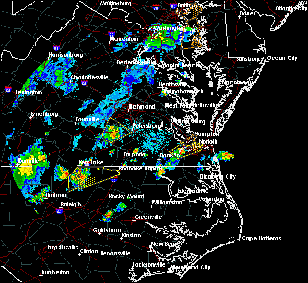 At 912 pm edt, a severe thunderstorm was located over driver, or near churchland, moving northeast at 45 mph (radar indicated). Hazards include 60 mph wind gusts. Expect damage to trees and powerlines. this severe storm will be near, churchland and chesapeake around 915 pm edt. downtown portsmouth around 920 pm edt. old dominion university, downtown norfolk, norfolk state university, portsmouth, norfolk nas and ghent around 925 pm edt. ocean view, norfolk, norview and norfolk international around 930 pm edt. Other locations impacted by this severe thunderstorm include hobson, south norfolk, wilroy, wards corner, huntersville, wills corner, deanes, magnolia, willoughby spit and chuckatuck. At 912 pm edt, a severe thunderstorm was located over driver, or near churchland, moving northeast at 45 mph (radar indicated). Hazards include 60 mph wind gusts. Expect damage to trees and powerlines. this severe storm will be near, churchland and chesapeake around 915 pm edt. downtown portsmouth around 920 pm edt. old dominion university, downtown norfolk, norfolk state university, portsmouth, norfolk nas and ghent around 925 pm edt. ocean view, norfolk, norview and norfolk international around 930 pm edt. Other locations impacted by this severe thunderstorm include hobson, south norfolk, wilroy, wards corner, huntersville, wills corner, deanes, magnolia, willoughby spit and chuckatuck.
|
| 7/22/2019 8:58 PM EDT |
 At 858 pm edt, a severe thunderstorm was located over kings fork, or near downtown suffolk, moving northeast at 40 mph (radar indicated). Hazards include 60 mph wind gusts. Expect damage to trees and powerlines. this severe thunderstorm will be near, driver around 905 pm edt. chesapeake, western branch, crittenden and bowers hill around 910 pm edt. churchland and cradock around 915 pm edt. old dominion university, downtown norfolk, downtown portsmouth, norfolk state university, portsmouth and ghent around 920 pm edt. norfolk nas and norview around 925 pm edt. ocean view, virginia wesleyan university, norfolk and norfolk international around 930 pm edt. Other locations impacted by this severe thunderstorm include south norfolk, longview, huntersville, suffolk airport, wills corner, magnolia, chuckatuck, indika, hobson and wilroy. At 858 pm edt, a severe thunderstorm was located over kings fork, or near downtown suffolk, moving northeast at 40 mph (radar indicated). Hazards include 60 mph wind gusts. Expect damage to trees and powerlines. this severe thunderstorm will be near, driver around 905 pm edt. chesapeake, western branch, crittenden and bowers hill around 910 pm edt. churchland and cradock around 915 pm edt. old dominion university, downtown norfolk, downtown portsmouth, norfolk state university, portsmouth and ghent around 920 pm edt. norfolk nas and norview around 925 pm edt. ocean view, virginia wesleyan university, norfolk and norfolk international around 930 pm edt. Other locations impacted by this severe thunderstorm include south norfolk, longview, huntersville, suffolk airport, wills corner, magnolia, chuckatuck, indika, hobson and wilroy.
|
| 6/20/2019 6:04 PM EDT |
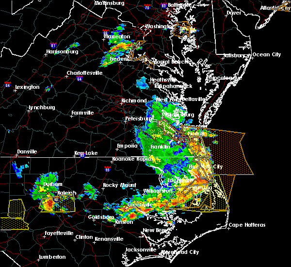 At 604 pm edt, severe thunderstorms were located along a line extending from near virginia beach to 8 miles east of knotts island, moving east at 45 mph (radar indicated). Hazards include 70 mph wind gusts. Expect considerable tree damage. damage is likely to mobile homes, roofs, and outbuildings. These severe thunderstorms will remain over mainly rural areas of , the northeastern city of chesapeake and the city of virginia beach, including the following locations, rudee heights, mount pleasant, princess anne plaza, sigma, sandbridge beach, oceana nas, munden, macons corner, pungo and greenbrier. At 604 pm edt, severe thunderstorms were located along a line extending from near virginia beach to 8 miles east of knotts island, moving east at 45 mph (radar indicated). Hazards include 70 mph wind gusts. Expect considerable tree damage. damage is likely to mobile homes, roofs, and outbuildings. These severe thunderstorms will remain over mainly rural areas of , the northeastern city of chesapeake and the city of virginia beach, including the following locations, rudee heights, mount pleasant, princess anne plaza, sigma, sandbridge beach, oceana nas, munden, macons corner, pungo and greenbrier.
|
| 6/20/2019 5:33 PM EDT |
 At 533 pm edt, severe thunderstorms were located along a line extending from western branch to near northwest, moving east at 55 mph (radar indicated). Hazards include 70 mph wind gusts. Expect considerable tree damage. damage is likely to mobile homes, roofs, and outbuildings. severe thunderstorms will be near, northwest around 540 pm edt. regent university, kempsville, virginia wesleyan university, norfolk international, back bay and fentress around 545 pm edt. princess anne around 555 pm edt. virginia beach around 600 pm edt. Other locations impacted by these severe thunderstorms include south norfolk, rudee heights, portlock, mount pleasant, princess anne plaza, sigma, sandbridge beach, herberts corner, oceana nas and munden. At 533 pm edt, severe thunderstorms were located along a line extending from western branch to near northwest, moving east at 55 mph (radar indicated). Hazards include 70 mph wind gusts. Expect considerable tree damage. damage is likely to mobile homes, roofs, and outbuildings. severe thunderstorms will be near, northwest around 540 pm edt. regent university, kempsville, virginia wesleyan university, norfolk international, back bay and fentress around 545 pm edt. princess anne around 555 pm edt. virginia beach around 600 pm edt. Other locations impacted by these severe thunderstorms include south norfolk, rudee heights, portlock, mount pleasant, princess anne plaza, sigma, sandbridge beach, herberts corner, oceana nas and munden.
|
| 6/5/2019 6:38 PM EDT |
 At 638 pm edt, severe thunderstorms were located along a line extending from near northampton to near bowers hill to near corapeake, moving east at 35 mph (radar indicated). Hazards include 60 mph wind gusts. Expect damage to trees and powerlines. these severe storms will be near, deep creek, churchland, chesapeake, portsmouth and cradock around 645 pm edt. downtown portsmouth, downtown norfolk, norfolk nas and ghent around 650 pm edt. great bridge, norfolk state university, ocean view and norview around 655 pm edt. regent university, virginia wesleyan university, norfolk and norfolk international around 700 pm edt. kempsville around 705 pm edt. princess anne and northwest around 710 pm edt. virginia beach and fentress around 715 pm edt. Other locations impacted by these severe thunderstorms include capeville, south norfolk, kiptopeke state park, rudee heights, portlock, princess anne plaza, sigma, huntersville, suffolk airport and pungo. At 638 pm edt, severe thunderstorms were located along a line extending from near northampton to near bowers hill to near corapeake, moving east at 35 mph (radar indicated). Hazards include 60 mph wind gusts. Expect damage to trees and powerlines. these severe storms will be near, deep creek, churchland, chesapeake, portsmouth and cradock around 645 pm edt. downtown portsmouth, downtown norfolk, norfolk nas and ghent around 650 pm edt. great bridge, norfolk state university, ocean view and norview around 655 pm edt. regent university, virginia wesleyan university, norfolk and norfolk international around 700 pm edt. kempsville around 705 pm edt. princess anne and northwest around 710 pm edt. virginia beach and fentress around 715 pm edt. Other locations impacted by these severe thunderstorms include capeville, south norfolk, kiptopeke state park, rudee heights, portlock, princess anne plaza, sigma, huntersville, suffolk airport and pungo.
|
| 6/5/2019 6:26 PM EDT |
 At 626 pm edt, severe thunderstorms were located along a line extending from rescue to near downtown suffolk to near whaleyville, moving east at 35 mph (radar indicated). Hazards include 60 mph wind gusts. Expect damage to trees and powerlines. these severe storms will be near, christopher newport university, crittenden and driver around 630 pm edt. bowers hill and beaconsdale around 635 pm edt. chesapeake, northampton and western branch around 640 pm edt. deep creek, langley afb, portsmouth and cradock around 645 pm edt. hampton university, downtown portsmouth, old dominion university, downtown norfolk, fort monroe, buckroe beach and norfolk nas around 650 pm edt. great bridge, ocean view, norfolk state university, grand view and norview around 655 pm edt. regent university, virginia wesleyan university, fentress and norfolk international around 700 pm edt. kempsville and norfolk around 705 pm edt. Other locations impacted by these severe thunderstorms include south norfolk, rudee heights, portlock, carrollton, longview, huntersville, chuckatuck, pungo, bayside and wilroy. At 626 pm edt, severe thunderstorms were located along a line extending from rescue to near downtown suffolk to near whaleyville, moving east at 35 mph (radar indicated). Hazards include 60 mph wind gusts. Expect damage to trees and powerlines. these severe storms will be near, christopher newport university, crittenden and driver around 630 pm edt. bowers hill and beaconsdale around 635 pm edt. chesapeake, northampton and western branch around 640 pm edt. deep creek, langley afb, portsmouth and cradock around 645 pm edt. hampton university, downtown portsmouth, old dominion university, downtown norfolk, fort monroe, buckroe beach and norfolk nas around 650 pm edt. great bridge, ocean view, norfolk state university, grand view and norview around 655 pm edt. regent university, virginia wesleyan university, fentress and norfolk international around 700 pm edt. kempsville and norfolk around 705 pm edt. Other locations impacted by these severe thunderstorms include south norfolk, rudee heights, portlock, carrollton, longview, huntersville, chuckatuck, pungo, bayside and wilroy.
|
| 6/5/2019 6:09 PM EDT |
 At 609 pm edt, severe thunderstorms were located along a line extending from near smithfield to suffolk to near gates, moving east at 35 mph (radar indicated). Hazards include 60 mph wind gusts. Expect damage to trees and powerlines. severe thunderstorms will be near, smithfield, downtown suffolk and kings fork around 615 pm edt. rescue, driver and crittenden around 625 pm edt. christopher newport university, suffolk and beaconsdale around 630 pm edt. chesapeake, northampton, bowers hill and western branch around 635 pm edt. hampton, deep creek, churchland and portsmouth around 640 pm edt. hampton university, downtown portsmouth, langley afb, old dominion university, cradock, fort monroe, ghent and norfolk nas around 645 pm edt. norfolk state university, downtown norfolk, ocean view, buckroe beach, grand view and norview around 650 pm edt. regent university, virginia wesleyan university and norfolk international around 655 pm edt. Other locations impacted by these severe thunderstorms include south norfolk, rudee heights, portlock, carrollton, longview, huntersville, chuckatuck, pungo, bayside and wilroy. At 609 pm edt, severe thunderstorms were located along a line extending from near smithfield to suffolk to near gates, moving east at 35 mph (radar indicated). Hazards include 60 mph wind gusts. Expect damage to trees and powerlines. severe thunderstorms will be near, smithfield, downtown suffolk and kings fork around 615 pm edt. rescue, driver and crittenden around 625 pm edt. christopher newport university, suffolk and beaconsdale around 630 pm edt. chesapeake, northampton, bowers hill and western branch around 635 pm edt. hampton, deep creek, churchland and portsmouth around 640 pm edt. hampton university, downtown portsmouth, langley afb, old dominion university, cradock, fort monroe, ghent and norfolk nas around 645 pm edt. norfolk state university, downtown norfolk, ocean view, buckroe beach, grand view and norview around 650 pm edt. regent university, virginia wesleyan university and norfolk international around 655 pm edt. Other locations impacted by these severe thunderstorms include south norfolk, rudee heights, portlock, carrollton, longview, huntersville, chuckatuck, pungo, bayside and wilroy.
|
| 6/5/2019 6:02 PM EDT |
 At 602 pm edt, severe thunderstorms were located along a line extending from near newport news to near crittenden to near suffolk, moving northeast at 50 mph (radar indicated). Hazards include 60 mph wind gusts. Expect damage to trees and powerlines. these severe storms will be near, christopher newport university, churchland, northampton, crittenden and beaconsdale around 610 pm edt. hampton, langley afb, hampton university, old dominion university, portsmouth, norfolk nas, fort monroe, bowers hill and buckroe beach around 615 pm edt. Other locations impacted by these severe thunderstorms include carrollton, longview, benns church, huntersville, suffolk airport, bethel church, hilton village, chuckatuck, wilroy and lees mill. At 602 pm edt, severe thunderstorms were located along a line extending from near newport news to near crittenden to near suffolk, moving northeast at 50 mph (radar indicated). Hazards include 60 mph wind gusts. Expect damage to trees and powerlines. these severe storms will be near, christopher newport university, churchland, northampton, crittenden and beaconsdale around 610 pm edt. hampton, langley afb, hampton university, old dominion university, portsmouth, norfolk nas, fort monroe, bowers hill and buckroe beach around 615 pm edt. Other locations impacted by these severe thunderstorms include carrollton, longview, benns church, huntersville, suffolk airport, bethel church, hilton village, chuckatuck, wilroy and lees mill.
|
| 6/5/2019 5:31 PM EDT |
 At 530 pm edt, severe thunderstorms were located along a line extending from near wakefield to sedley to near newsoms, moving northeast at 50 mph (radar indicated). Hazards include 60 mph wind gusts. Expect damage to trees and powerlines. severe thunderstorms will be near, ivor and sedley around 535 pm edt. franklin and zuni around 545 pm edt. windsor around 550 pm edt. smithfield, holland, isle of wight and carrsville around 555 pm edt. rescue around 600 pm edt. christopher newport university and crittenden around 605 pm edt. downtown suffolk, churchland, suffolk, northampton, kings fork and beaconsdale around 610 pm edt. hampton, langley afb, hampton university, old dominion university, chesapeake, portsmouth, driver, norfolk nas, fort monroe and bowers hill around 615 pm edt. Other locations impacted by these severe thunderstorms include vicksville, south norfolk, carrollton, longview, benns church, huntersville, suffolk airport, bethel church, hilton village and chuckatuck. At 530 pm edt, severe thunderstorms were located along a line extending from near wakefield to sedley to near newsoms, moving northeast at 50 mph (radar indicated). Hazards include 60 mph wind gusts. Expect damage to trees and powerlines. severe thunderstorms will be near, ivor and sedley around 535 pm edt. franklin and zuni around 545 pm edt. windsor around 550 pm edt. smithfield, holland, isle of wight and carrsville around 555 pm edt. rescue around 600 pm edt. christopher newport university and crittenden around 605 pm edt. downtown suffolk, churchland, suffolk, northampton, kings fork and beaconsdale around 610 pm edt. hampton, langley afb, hampton university, old dominion university, chesapeake, portsmouth, driver, norfolk nas, fort monroe and bowers hill around 615 pm edt. Other locations impacted by these severe thunderstorms include vicksville, south norfolk, carrollton, longview, benns church, huntersville, suffolk airport, bethel church, hilton village and chuckatuck.
|
| 6/5/2019 5:14 PM EDT |
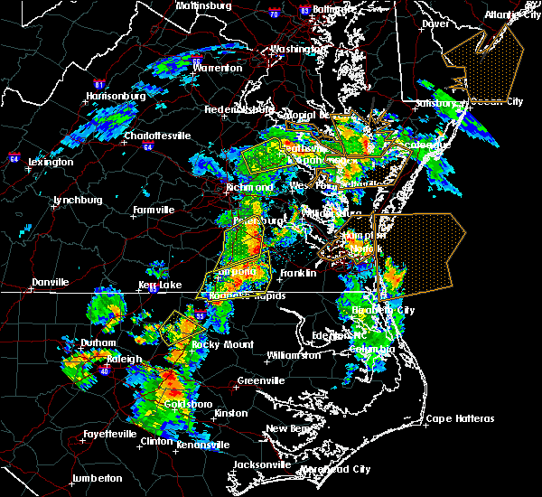 At 513 pm edt, severe thunderstorms were located along a line extending from near grand view to cape henry, moving northeast at 45 mph (radar indicated). Hazards include 70 mph wind gusts and quarter size hail. Minor damage to vehicles is possible. expect considerable tree damage. wind damage is also likely to mobile homes, roofs, and outbuildings. severe thunderstorms will be near, cheriton around 535 pm edt. bay view around 540 pm edt. nassawadox around 555 pm edt. Other locations impacted by these severe thunderstorms include birdsnest, capeville, kiptopeke state park, harborton, jamesville, eastville, machipongo, wardtown, franktown and simpkins. At 513 pm edt, severe thunderstorms were located along a line extending from near grand view to cape henry, moving northeast at 45 mph (radar indicated). Hazards include 70 mph wind gusts and quarter size hail. Minor damage to vehicles is possible. expect considerable tree damage. wind damage is also likely to mobile homes, roofs, and outbuildings. severe thunderstorms will be near, cheriton around 535 pm edt. bay view around 540 pm edt. nassawadox around 555 pm edt. Other locations impacted by these severe thunderstorms include birdsnest, capeville, kiptopeke state park, harborton, jamesville, eastville, machipongo, wardtown, franktown and simpkins.
|
| 5/31/2019 12:20 AM EDT |
 At 1203 am edt, severe thunderstorms were located along a line extending from 8 miles southwest of cape charles to churchland to downtown suffolk, moving east at 40 mph (radar indicated). Hazards include 60 mph wind gusts. Expect damage to trees and powerlines. these severe storms will be near, ocean view and norview around 1215 am edt. virginia wesleyan university, kempsville, regent university and norfolk international around 1220 am edt. deep creek, virginia beach, and fentress around 1225 am edt. Other locations impacted by these severe thunderstorms include capeville, south norfolk, kiptopeke state park, rudee heights, portlock, princess anne plaza, sigma, huntersville, pungo and greenbrier. At 1203 am edt, severe thunderstorms were located along a line extending from 8 miles southwest of cape charles to churchland to downtown suffolk, moving east at 40 mph (radar indicated). Hazards include 60 mph wind gusts. Expect damage to trees and powerlines. these severe storms will be near, ocean view and norview around 1215 am edt. virginia wesleyan university, kempsville, regent university and norfolk international around 1220 am edt. deep creek, virginia beach, and fentress around 1225 am edt. Other locations impacted by these severe thunderstorms include capeville, south norfolk, kiptopeke state park, rudee heights, portlock, princess anne plaza, sigma, huntersville, pungo and greenbrier.
|
| 5/31/2019 12:05 AM EDT |
 At 1203 am edt, severe thunderstorms were located along a line extending from 8 miles southwest of cape charles to churchland to downtown suffolk, moving east at 40 mph (radar indicated). Hazards include 60 mph wind gusts. Expect damage to trees and powerlines. these severe storms will be near, ocean view and norview around 1215 am edt. virginia wesleyan university, kempsville, regent university and norfolk international around 1220 am edt. deep creek, virginia beach, and fentress around 1225 am edt. Other locations impacted by these severe thunderstorms include capeville, south norfolk, kiptopeke state park, rudee heights, portlock, princess anne plaza, sigma, huntersville, pungo and greenbrier. At 1203 am edt, severe thunderstorms were located along a line extending from 8 miles southwest of cape charles to churchland to downtown suffolk, moving east at 40 mph (radar indicated). Hazards include 60 mph wind gusts. Expect damage to trees and powerlines. these severe storms will be near, ocean view and norview around 1215 am edt. virginia wesleyan university, kempsville, regent university and norfolk international around 1220 am edt. deep creek, virginia beach, and fentress around 1225 am edt. Other locations impacted by these severe thunderstorms include capeville, south norfolk, kiptopeke state park, rudee heights, portlock, princess anne plaza, sigma, huntersville, pungo and greenbrier.
|
| 5/30/2019 11:41 PM EDT |
 At 1140 pm edt, severe thunderstorms were located along a line extending from near seaford to near isle of wight to near carrsville, moving east at 40 mph (radar indicated). Hazards include 60 mph wind gusts. Expect damage to trees and powerlines. severe thunderstorms will be near, hampton, langley afb, seaford and tabb around 1145 pm edt. grand view around 1150 pm edt. suffolk, crittenden and driver around 1155 pm edt. downtown suffolk, churchland, portsmouth and western branch around 1205 am edt. old dominion university, downtown norfolk, downtown portsmouth, ghent and norfolk nas around 1210 am edt. norfolk state university, ocean view, norview and bowers hill around 1215 am edt. virginia wesleyan university, kempsville, regent university, norfolk, chesapeake and norfolk international around 1220 am edt. deep creek and cradock around 1225 am edt. Other locations impacted by these severe thunderstorms include south norfolk, rudee heights, portlock, longview, huntersville, oriana, chuckatuck, pungo, bayside and wilroy. At 1140 pm edt, severe thunderstorms were located along a line extending from near seaford to near isle of wight to near carrsville, moving east at 40 mph (radar indicated). Hazards include 60 mph wind gusts. Expect damage to trees and powerlines. severe thunderstorms will be near, hampton, langley afb, seaford and tabb around 1145 pm edt. grand view around 1150 pm edt. suffolk, crittenden and driver around 1155 pm edt. downtown suffolk, churchland, portsmouth and western branch around 1205 am edt. old dominion university, downtown norfolk, downtown portsmouth, ghent and norfolk nas around 1210 am edt. norfolk state university, ocean view, norview and bowers hill around 1215 am edt. virginia wesleyan university, kempsville, regent university, norfolk, chesapeake and norfolk international around 1220 am edt. deep creek and cradock around 1225 am edt. Other locations impacted by these severe thunderstorms include south norfolk, rudee heights, portlock, longview, huntersville, oriana, chuckatuck, pungo, bayside and wilroy.
|
| 5/11/2019 7:59 PM EDT |
 At 757 pm edt, a severe thunderstorm capable of producing a tornado was located over regent university, moving east at 20 mph (weather spotters continue to reported a funnel cloud near kempsville). Hazards include tornado. Flying debris will be dangerous to those caught without shelter. mobile homes will be damaged or destroyed. damage to roofs, windows, and vehicles will occur. tree damage is likely. this dangerous storm will be near, princess anne around 815 pm edt. Other locations impacted by this tornadic thunderstorm include oceana, rudee heights, princess anne plaza, dam neck, north virginia beach, oceana nas, gallups corner, macons corner and london bridge. At 757 pm edt, a severe thunderstorm capable of producing a tornado was located over regent university, moving east at 20 mph (weather spotters continue to reported a funnel cloud near kempsville). Hazards include tornado. Flying debris will be dangerous to those caught without shelter. mobile homes will be damaged or destroyed. damage to roofs, windows, and vehicles will occur. tree damage is likely. this dangerous storm will be near, princess anne around 815 pm edt. Other locations impacted by this tornadic thunderstorm include oceana, rudee heights, princess anne plaza, dam neck, north virginia beach, oceana nas, gallups corner, macons corner and london bridge.
|
| 5/11/2019 7:28 PM EDT |
 At 727 pm edt, a severe thunderstorm capable of producing a tornado was located over cradock, or near downtown portsmouth, moving east at 25 mph (weather spotters reported funnel cloud). Hazards include tornado. Flying debris will be dangerous to those caught without shelter. mobile homes will be damaged or destroyed. damage to roofs, windows, and vehicles will occur. tree damage is likely. this dangerous storm will be near, norfolk state university around 735 pm edt. regent university and virginia wesleyan university around 745 pm edt. kempsville and norfolk around 750 pm edt. princess anne around 800 pm edt. virginia beach around 815 pm edt. Other locations impacted by this tornadic thunderstorm include south norfolk, rudee heights, portlock, princess anne plaza, oceana nas, macons corner, greenbrier, bayside, oceana and dam neck. At 727 pm edt, a severe thunderstorm capable of producing a tornado was located over cradock, or near downtown portsmouth, moving east at 25 mph (weather spotters reported funnel cloud). Hazards include tornado. Flying debris will be dangerous to those caught without shelter. mobile homes will be damaged or destroyed. damage to roofs, windows, and vehicles will occur. tree damage is likely. this dangerous storm will be near, norfolk state university around 735 pm edt. regent university and virginia wesleyan university around 745 pm edt. kempsville and norfolk around 750 pm edt. princess anne around 800 pm edt. virginia beach around 815 pm edt. Other locations impacted by this tornadic thunderstorm include south norfolk, rudee heights, portlock, princess anne plaza, oceana nas, macons corner, greenbrier, bayside, oceana and dam neck.
|
| 5/11/2019 7:20 PM EDT |
 At 718 pm edt, the possible tornado was located over bowers hill, or near deep creek, moving east at 15 mph. confirmed damage has been reported in suffolk earlier (public confirmed tornado). Hazards include damaging tornado and quarter size hail. Flying debris will be dangerous to those caught without shelter. mobile homes will be damaged or destroyed. damage to roofs, windows, and vehicles will occur. tree damage is likely. this tornado will be near, chesapeake around 725 pm edt. deep creek, downtown portsmouth, great bridge and cradock around 730 pm edt. Other locations impacted by this tornadic thunderstorm include south norfolk, herberts corner, portlock, hickory and chesapeake airport. At 718 pm edt, the possible tornado was located over bowers hill, or near deep creek, moving east at 15 mph. confirmed damage has been reported in suffolk earlier (public confirmed tornado). Hazards include damaging tornado and quarter size hail. Flying debris will be dangerous to those caught without shelter. mobile homes will be damaged or destroyed. damage to roofs, windows, and vehicles will occur. tree damage is likely. this tornado will be near, chesapeake around 725 pm edt. deep creek, downtown portsmouth, great bridge and cradock around 730 pm edt. Other locations impacted by this tornadic thunderstorm include south norfolk, herberts corner, portlock, hickory and chesapeake airport.
|
| 5/11/2019 6:51 PM EDT |
 At 651 pm edt, a severe thunderstorm capable of producing a tornado was located over downtown suffolk, moving east at 15 mph (radar indicated rotation). Hazards include tornado and quarter size hail. Flying debris will be dangerous to those caught without shelter. mobile homes will be damaged or destroyed. damage to roofs, windows, and vehicles will occur. tree damage is likely. this dangerous storm will be near, bowers hill around 720 pm edt. chesapeake and western branch around 725 pm edt. deep creek, downtown portsmouth and cradock around 730 pm edt. Other locations impacted by this tornadic thunderstorm include south norfolk, wilroy, portlock, suffolk airport, herberts corner, magnolia, hickory and chesapeake airport. At 651 pm edt, a severe thunderstorm capable of producing a tornado was located over downtown suffolk, moving east at 15 mph (radar indicated rotation). Hazards include tornado and quarter size hail. Flying debris will be dangerous to those caught without shelter. mobile homes will be damaged or destroyed. damage to roofs, windows, and vehicles will occur. tree damage is likely. this dangerous storm will be near, bowers hill around 720 pm edt. chesapeake and western branch around 725 pm edt. deep creek, downtown portsmouth and cradock around 730 pm edt. Other locations impacted by this tornadic thunderstorm include south norfolk, wilroy, portlock, suffolk airport, herberts corner, magnolia, hickory and chesapeake airport.
|
| 4/26/2019 4:42 PM EDT |
 At 441 pm edt, a severe thunderstorm was located near fentress, or near regent university, moving northeast at 40 mph. in addition, trained weather spotters reported quarter size hail near mount trashmore (trained weather spotters). Hazards include 70 mph wind gusts and quarter size hail. Minor damage to vehicles is possible. expect considerable tree damage. wind damage is also likely to mobile homes, roofs, and outbuildings. this severe storm will be near, princess anne around 445 pm edt. virginia beach around 500 pm edt. Other locations impacted by this severe thunderstorm include rudee heights, mount pleasant, princess anne plaza, sigma, sandbridge beach, oceana nas, macons corner, pungo, greenbrier and bayside. At 441 pm edt, a severe thunderstorm was located near fentress, or near regent university, moving northeast at 40 mph. in addition, trained weather spotters reported quarter size hail near mount trashmore (trained weather spotters). Hazards include 70 mph wind gusts and quarter size hail. Minor damage to vehicles is possible. expect considerable tree damage. wind damage is also likely to mobile homes, roofs, and outbuildings. this severe storm will be near, princess anne around 445 pm edt. virginia beach around 500 pm edt. Other locations impacted by this severe thunderstorm include rudee heights, mount pleasant, princess anne plaza, sigma, sandbridge beach, oceana nas, macons corner, pungo, greenbrier and bayside.
|
| 4/26/2019 4:29 PM EDT |
 At 429 pm edt, a severe thunderstorm was located over chesapeake, or over great bridge, moving northeast at 40 mph (radar indicated). Hazards include 60 mph wind gusts and quarter size hail. Minor damage to vehicles is possible. expect wind damage to trees and powerlines. this severe thunderstorm will be near, fentress around 435 pm edt. kempsville and regent university around 445 pm edt. virginia wesleyan university and princess anne around 450 pm edt. virginia beach around 505 pm edt. Other locations impacted by this severe thunderstorm include south norfolk, rudee heights, portlock, mount pleasant, princess anne plaza, sigma, sandbridge beach, herberts corner, oceana nas and macons corner. At 429 pm edt, a severe thunderstorm was located over chesapeake, or over great bridge, moving northeast at 40 mph (radar indicated). Hazards include 60 mph wind gusts and quarter size hail. Minor damage to vehicles is possible. expect wind damage to trees and powerlines. this severe thunderstorm will be near, fentress around 435 pm edt. kempsville and regent university around 445 pm edt. virginia wesleyan university and princess anne around 450 pm edt. virginia beach around 505 pm edt. Other locations impacted by this severe thunderstorm include south norfolk, rudee heights, portlock, mount pleasant, princess anne plaza, sigma, sandbridge beach, herberts corner, oceana nas and macons corner.
|
| 4/26/2019 3:49 PM EDT |
 At 348 pm edt, a severe thunderstorm was located over crittenden, or near churchland, moving northeast at 35 mph (radar indicated). Hazards include 60 mph wind gusts and quarter size hail. Minor damage to vehicles is possible. expect wind damage to trees and powerlines. this severe storm will be near, northampton and norfolk nas around 400 pm edt. hampton, hampton university, langley afb, ocean view and fort monroe around 405 pm edt. buckroe beach around 410 pm edt. grand view around 415 pm edt. Other locations impacted by this severe thunderstorm include fox hill, phoebus, langley view, messick, hilton village, willoughby spit, plum tree island refuge and raleigh terrace. At 348 pm edt, a severe thunderstorm was located over crittenden, or near churchland, moving northeast at 35 mph (radar indicated). Hazards include 60 mph wind gusts and quarter size hail. Minor damage to vehicles is possible. expect wind damage to trees and powerlines. this severe storm will be near, northampton and norfolk nas around 400 pm edt. hampton, hampton university, langley afb, ocean view and fort monroe around 405 pm edt. buckroe beach around 410 pm edt. grand view around 415 pm edt. Other locations impacted by this severe thunderstorm include fox hill, phoebus, langley view, messick, hilton village, willoughby spit, plum tree island refuge and raleigh terrace.
|
| 4/26/2019 3:37 PM EDT |
 At 336 pm edt, a severe thunderstorm was located near driver, or 8 miles west of churchland, moving northeast at 35 mph (radar indicated). Hazards include 60 mph wind gusts and quarter size hail. Minor damage to vehicles is possible. expect wind damage to trees and powerlines. this severe thunderstorm will be near, crittenden around 345 pm edt. portsmouth around 355 pm edt. northampton and norfolk nas around 400 pm edt. hampton university, ocean view and fort monroe around 405 pm edt. hampton, langley afb and buckroe beach around 410 pm edt. grand view around 415 pm edt. Other locations impacted by this severe thunderstorm include fox hill, phoebus, langley view, longview, huntersville, wills corner, hilton village, chuckatuck, raleigh terrace and hobson. At 336 pm edt, a severe thunderstorm was located near driver, or 8 miles west of churchland, moving northeast at 35 mph (radar indicated). Hazards include 60 mph wind gusts and quarter size hail. Minor damage to vehicles is possible. expect wind damage to trees and powerlines. this severe thunderstorm will be near, crittenden around 345 pm edt. portsmouth around 355 pm edt. northampton and norfolk nas around 400 pm edt. hampton university, ocean view and fort monroe around 405 pm edt. hampton, langley afb and buckroe beach around 410 pm edt. grand view around 415 pm edt. Other locations impacted by this severe thunderstorm include fox hill, phoebus, langley view, longview, huntersville, wills corner, hilton village, chuckatuck, raleigh terrace and hobson.
|
| 4/26/2019 12:23 PM EDT |
 At 1223 pm edt, severe thunderstorms were located along a line extending from old dominion university to 6 miles northwest of south mills to near sunbury, moving northeast at 55 mph (radar indicated). Hazards include 60 mph wind gusts and quarter size hail. Minor damage to vehicles is possible. expect wind damage to trees and powerlines. severe thunderstorms will be near, ocean view, virginia wesleyan university, old dominion university, norfolk state university, downtown norfolk, norfolk, portsmouth, norfolk international, norview and norfolk nas around 1230 pm edt. northwest and moyock around 1240 pm edt. fentress around 100 pm edt. back bay around 105 pm edt. princess anne around 110 pm edt. Other locations impacted by these severe thunderstorms include south norfolk, rudee heights, portlock, pierceville, newsome store, savage, huntersville, carter, pungo and bayside. At 1223 pm edt, severe thunderstorms were located along a line extending from old dominion university to 6 miles northwest of south mills to near sunbury, moving northeast at 55 mph (radar indicated). Hazards include 60 mph wind gusts and quarter size hail. Minor damage to vehicles is possible. expect wind damage to trees and powerlines. severe thunderstorms will be near, ocean view, virginia wesleyan university, old dominion university, norfolk state university, downtown norfolk, norfolk, portsmouth, norfolk international, norview and norfolk nas around 1230 pm edt. northwest and moyock around 1240 pm edt. fentress around 100 pm edt. back bay around 105 pm edt. princess anne around 110 pm edt. Other locations impacted by these severe thunderstorms include south norfolk, rudee heights, portlock, pierceville, newsome store, savage, huntersville, carter, pungo and bayside.
|
| 4/26/2019 12:12 PM EDT |
 At 1211 pm edt, severe thunderstorms were located along a line extending from near isle of wight to near kings fork to corapeake, moving northeast at 45 mph (radar indicated). Hazards include 60 mph wind gusts and penny size hail. Expect damage to trees and powerlines. these severe storms will be near, smithfield and driver around 1215 pm edt. crittenden and rescue around 1220 pm edt. churchland around 1225 pm edt. newport news, christopher newport university, hampton university, deep creek, portsmouth, northampton, denbigh, fort eustis, beaconsdale and fort monroe around 1230 pm edt. Other locations impacted by these severe thunderstorms include south norfolk, portlock, carrollton, longview, benns church, savage, huntersville, suffolk airport, bethel church and buckland. At 1211 pm edt, severe thunderstorms were located along a line extending from near isle of wight to near kings fork to corapeake, moving northeast at 45 mph (radar indicated). Hazards include 60 mph wind gusts and penny size hail. Expect damage to trees and powerlines. these severe storms will be near, smithfield and driver around 1215 pm edt. crittenden and rescue around 1220 pm edt. churchland around 1225 pm edt. newport news, christopher newport university, hampton university, deep creek, portsmouth, northampton, denbigh, fort eustis, beaconsdale and fort monroe around 1230 pm edt. Other locations impacted by these severe thunderstorms include south norfolk, portlock, carrollton, longview, benns church, savage, huntersville, suffolk airport, bethel church and buckland.
|
| 4/26/2019 11:51 AM EDT |
 At 1151 am edt, severe thunderstorms were located along a line extending from near sedley to near holland to near cofield, moving northeast at 50 mph (radar indicated). Hazards include 60 mph wind gusts and quarter size hail. Minor damage to vehicles is possible. expect wind damage to trees and powerlines. severe thunderstorms will be near, holland and carrsville around 1155 am edt. zuni around 1200 pm edt. windsor, downtown suffolk and isle of wight around 1205 pm edt. kings fork, whaleyville and corapeake around 1210 pm edt. smithfield and driver around 1215 pm edt. crittenden and rescue around 1220 pm edt. christopher newport university, churchland, suffolk, denbigh, fort eustis and beaconsdale around 1225 pm edt. newport news, hampton, hampton university, deep creek, chesapeake, portsmouth, northampton, bowers hill, fort monroe and western branch around 1230 pm edt. Other locations impacted by these severe thunderstorms include south norfolk, portlock, carrollton, longview, savage, huntersville, topsy, dort, chuckatuck and wilroy. At 1151 am edt, severe thunderstorms were located along a line extending from near sedley to near holland to near cofield, moving northeast at 50 mph (radar indicated). Hazards include 60 mph wind gusts and quarter size hail. Minor damage to vehicles is possible. expect wind damage to trees and powerlines. severe thunderstorms will be near, holland and carrsville around 1155 am edt. zuni around 1200 pm edt. windsor, downtown suffolk and isle of wight around 1205 pm edt. kings fork, whaleyville and corapeake around 1210 pm edt. smithfield and driver around 1215 pm edt. crittenden and rescue around 1220 pm edt. christopher newport university, churchland, suffolk, denbigh, fort eustis and beaconsdale around 1225 pm edt. newport news, hampton, hampton university, deep creek, chesapeake, portsmouth, northampton, bowers hill, fort monroe and western branch around 1230 pm edt. Other locations impacted by these severe thunderstorms include south norfolk, portlock, carrollton, longview, savage, huntersville, topsy, dort, chuckatuck and wilroy.
|
| 4/19/2019 9:58 PM EDT |
 The severe thunderstorm warning for camden, pasquotank, southeastern perquimans, and currituck counties, the southeastern city of norfolk, the city of chesapeake and the city of virginia beach will expire at 1000 pm edt, the storms which prompted the warning have weakened below severe limits, and no longer pose an immediate threat to life or property. therefore, the warning will be allowed to expire. however gusty winds and heavy rain are still possible with these thunderstorms. a tornado watch remains in effect until midnight edt for northeastern north carolina, and southeastern virginia. The severe thunderstorm warning for camden, pasquotank, southeastern perquimans, and currituck counties, the southeastern city of norfolk, the city of chesapeake and the city of virginia beach will expire at 1000 pm edt, the storms which prompted the warning have weakened below severe limits, and no longer pose an immediate threat to life or property. therefore, the warning will be allowed to expire. however gusty winds and heavy rain are still possible with these thunderstorms. a tornado watch remains in effect until midnight edt for northeastern north carolina, and southeastern virginia.
|
| 4/19/2019 9:19 PM EDT |
 At 919 pm edt, severe thunderstorms were located along a line extending from crittenden to churchland to bowers hill, moving northeast at 50 mph (radar indicated). Hazards include 60 mph wind gusts. Expect damage to trees and powerlines. these severe storms will be near, hampton, old dominion university, downtown norfolk, norfolk state university, ocean view, ghent, norfolk nas, fort monroe and norview around 930 pm edt. other locations impacted by these severe thunderstorms include hobson, wards corner, huntersville, wills corner, deanes, willoughby spit and chuckatuck. A tornado watch remains in effect until midnight edt for southeastern virginia. At 919 pm edt, severe thunderstorms were located along a line extending from crittenden to churchland to bowers hill, moving northeast at 50 mph (radar indicated). Hazards include 60 mph wind gusts. Expect damage to trees and powerlines. these severe storms will be near, hampton, old dominion university, downtown norfolk, norfolk state university, ocean view, ghent, norfolk nas, fort monroe and norview around 930 pm edt. other locations impacted by these severe thunderstorms include hobson, wards corner, huntersville, wills corner, deanes, willoughby spit and chuckatuck. A tornado watch remains in effect until midnight edt for southeastern virginia.
|
| 4/19/2019 9:06 PM EDT |
 At 906 pm edt, severe thunderstorms were located along a line extending from 10 miles east of corapeake to near south mills to 7 miles south of nixonton, moving northeast at 50 mph (radar indicated). Hazards include 60 mph wind gusts. Expect damage to trees and powerlines. severe thunderstorms will be near, south mills around 910 pm edt. moyock around 915 pm edt. great bridge, deep creek, elizabeth city state university and northwest around 920 pm edt. camden, shiloh, whitehall shores, old trap and fentress around 925 pm edt. regent university, kempsville, back bay and indiantown around 930 pm edt. virginia wesleyan university, norfolk, norfolk international and princess anne around 935 pm edt. currituck around 940 pm edt. virginia beach and corolla around 945 pm edt. other locations impacted by these severe thunderstorms include south norfolk, rudee heights, portlock, poplar branch, pierceville, pungo, bayside, jacocks, spences corner and goose creek. A tornado watch remains in effect until midnight edt for northeastern north carolina, and southeastern virginia. At 906 pm edt, severe thunderstorms were located along a line extending from 10 miles east of corapeake to near south mills to 7 miles south of nixonton, moving northeast at 50 mph (radar indicated). Hazards include 60 mph wind gusts. Expect damage to trees and powerlines. severe thunderstorms will be near, south mills around 910 pm edt. moyock around 915 pm edt. great bridge, deep creek, elizabeth city state university and northwest around 920 pm edt. camden, shiloh, whitehall shores, old trap and fentress around 925 pm edt. regent university, kempsville, back bay and indiantown around 930 pm edt. virginia wesleyan university, norfolk, norfolk international and princess anne around 935 pm edt. currituck around 940 pm edt. virginia beach and corolla around 945 pm edt. other locations impacted by these severe thunderstorms include south norfolk, rudee heights, portlock, poplar branch, pierceville, pungo, bayside, jacocks, spences corner and goose creek. A tornado watch remains in effect until midnight edt for northeastern north carolina, and southeastern virginia.
|
| 4/19/2019 8:55 PM EDT |
 At 854 pm edt, severe thunderstorms were located along a line extending from near holland to near whaleyville to near sunbury, moving northeast at 50 mph (radar indicated). Hazards include 60 mph wind gusts. Expect damage to trees and powerlines. severe thunderstorms will be near, downtown suffolk and kings fork around 905 pm edt. driver around 910 pm edt. churchland, deep creek, suffolk, crittenden and bowers hill around 915 pm edt. chesapeake, portsmouth, western branch, cradock and rescue around 920 pm edt. old dominion university, downtown norfolk, downtown portsmouth, norfolk state university, ghent and fort monroe around 925 pm edt. hampton, ocean view, norfolk, buckroe beach, norfolk nas and norview around 930 pm edt. other locations impacted by these severe thunderstorms include carrollton, longview, benns church, lummis, savage, huntersville, suffolk airport, wills corner, saunders and magnolia. A tornado watch remains in effect until midnight edt for northeastern north carolina, and southeastern virginia. At 854 pm edt, severe thunderstorms were located along a line extending from near holland to near whaleyville to near sunbury, moving northeast at 50 mph (radar indicated). Hazards include 60 mph wind gusts. Expect damage to trees and powerlines. severe thunderstorms will be near, downtown suffolk and kings fork around 905 pm edt. driver around 910 pm edt. churchland, deep creek, suffolk, crittenden and bowers hill around 915 pm edt. chesapeake, portsmouth, western branch, cradock and rescue around 920 pm edt. old dominion university, downtown norfolk, downtown portsmouth, norfolk state university, ghent and fort monroe around 925 pm edt. hampton, ocean view, norfolk, buckroe beach, norfolk nas and norview around 930 pm edt. other locations impacted by these severe thunderstorms include carrollton, longview, benns church, lummis, savage, huntersville, suffolk airport, wills corner, saunders and magnolia. A tornado watch remains in effect until midnight edt for northeastern north carolina, and southeastern virginia.
|
| 4/19/2019 8:49 PM EDT |
 At 848 pm edt, severe thunderstorms were located along a line extending from 6 miles southeast of bavon to near crittenden, moving northeast at 65 mph (radar indicated. at 845 pm edt, law enforcement reported numerous trees down in the city of newport news). Hazards include 60 mph wind gusts. Expect damage to trees and powerlines. these severe thunderstorms will remain over mainly rural areas of east central isle of wight, and southeastern york counties, the city of poquoson, the city of hampton and the southern city of newport news, including the following locations, fox hill, carrollton, phoebus, langley view, longview, benns church, hilton village, raleigh terrace, dare and oyster point. A tornado watch remains in effect until midnight edt for eastern and southeastern virginia. At 848 pm edt, severe thunderstorms were located along a line extending from 6 miles southeast of bavon to near crittenden, moving northeast at 65 mph (radar indicated. at 845 pm edt, law enforcement reported numerous trees down in the city of newport news). Hazards include 60 mph wind gusts. Expect damage to trees and powerlines. these severe thunderstorms will remain over mainly rural areas of east central isle of wight, and southeastern york counties, the city of poquoson, the city of hampton and the southern city of newport news, including the following locations, fox hill, carrollton, phoebus, langley view, longview, benns church, hilton village, raleigh terrace, dare and oyster point. A tornado watch remains in effect until midnight edt for eastern and southeastern virginia.
|
| 4/19/2019 8:44 PM EDT |
 At 844 pm edt, a severe thunderstorm was located over driver, or 7 miles west of churchland, moving northeast at 50 mph (radar indicated). Hazards include 60 mph wind gusts. Expect damage to trees and powerlines. locations impacted include, churchland, downtown suffolk, chesapeake, portsmouth, suffolk, driver, bowers hill, kings fork, crittenden, western branch, huntersville, wills corner, magnolia, chuckatuck, hobson, wilroy, kilby and deanes. A tornado watch remains in effect until midnight edt for southeastern virginia. At 844 pm edt, a severe thunderstorm was located over driver, or 7 miles west of churchland, moving northeast at 50 mph (radar indicated). Hazards include 60 mph wind gusts. Expect damage to trees and powerlines. locations impacted include, churchland, downtown suffolk, chesapeake, portsmouth, suffolk, driver, bowers hill, kings fork, crittenden, western branch, huntersville, wills corner, magnolia, chuckatuck, hobson, wilroy, kilby and deanes. A tornado watch remains in effect until midnight edt for southeastern virginia.
|
| 4/19/2019 8:30 PM EDT |
 At 830 pm edt, severe thunderstorms were located along a line extending from near bavon to near crittenden, moving northeast at 50 mph (radar indicated). Hazards include 60 mph wind gusts. Expect damage to trees and powerlines. severe thunderstorms will be near, hampton, grand view, buckroe beach and tabb around 845 pm edt. other locations impacted by these severe thunderstorms include fox hill, carrollton, phoebus, langley view, longview, benns church, hilton village, raleigh terrace, dare and oyster point. A tornado watch remains in effect until midnight edt for eastern and southeastern virginia. At 830 pm edt, severe thunderstorms were located along a line extending from near bavon to near crittenden, moving northeast at 50 mph (radar indicated). Hazards include 60 mph wind gusts. Expect damage to trees and powerlines. severe thunderstorms will be near, hampton, grand view, buckroe beach and tabb around 845 pm edt. other locations impacted by these severe thunderstorms include fox hill, carrollton, phoebus, langley view, longview, benns church, hilton village, raleigh terrace, dare and oyster point. A tornado watch remains in effect until midnight edt for eastern and southeastern virginia.
|
| 4/19/2019 8:16 PM EDT |
 At 816 pm edt, severe thunderstorms were located along a line extending from near kings fork to near downtown suffolk, moving northeast at 50 mph (radar indicated). Hazards include 60 mph wind gusts and quarter size hail. Minor damage to vehicles is possible. expect wind damage to trees and powerlines. severe thunderstorms will be near, chesapeake, driver and bowers hill around 830 pm edt. churchland, suffolk, crittenden and western branch around 835 pm edt. portsmouth around 840 pm edt. other locations impacted by these severe thunderstorms include hobson, wilroy, kilby, huntersville, wills corner, deanes, magnolia and chuckatuck. A tornado watch remains in effect until midnight edt for southeastern virginia. At 816 pm edt, severe thunderstorms were located along a line extending from near kings fork to near downtown suffolk, moving northeast at 50 mph (radar indicated). Hazards include 60 mph wind gusts and quarter size hail. Minor damage to vehicles is possible. expect wind damage to trees and powerlines. severe thunderstorms will be near, chesapeake, driver and bowers hill around 830 pm edt. churchland, suffolk, crittenden and western branch around 835 pm edt. portsmouth around 840 pm edt. other locations impacted by these severe thunderstorms include hobson, wilroy, kilby, huntersville, wills corner, deanes, magnolia and chuckatuck. A tornado watch remains in effect until midnight edt for southeastern virginia.
|
| 4/19/2019 4:56 PM EDT |
 The tornado warning for , the southwestern city of norfolk, the northwestern city of chesapeake, the city of portsmouth and the east central city of suffolk will expire at 500 pm edt, the storm which prompted the warning has weakened below severe limits, and has exited the warned area. therefore, the warning will be allowed to expire. however gusty winds are still possible with this thunderstorm. a tornado watch remains in effect until midnight edt for southeastern virginia. The tornado warning for , the southwestern city of norfolk, the northwestern city of chesapeake, the city of portsmouth and the east central city of suffolk will expire at 500 pm edt, the storm which prompted the warning has weakened below severe limits, and has exited the warned area. therefore, the warning will be allowed to expire. however gusty winds are still possible with this thunderstorm. a tornado watch remains in effect until midnight edt for southeastern virginia.
|
| 4/19/2019 4:41 PM EDT |
 At 439 pm edt, a severe thunderstorm capable of producing a tornado was located over bowers hill, or near deep creek, moving northeast at 40 mph (radar indicated rotation). Hazards include tornado. Flying debris will be dangerous to those caught without shelter. mobile homes will be damaged or destroyed. damage to roofs, windows, and vehicles will occur. tree damage is likely. this dangerous storm will be near, western branch around 445 pm edt. churchland, downtown portsmouth, downtown norfolk and norfolk state university around 450 pm edt. old dominion university and ghent around 455 pm edt. portsmouth around 500 pm edt. Other locations impacted by this tornadic thunderstorm include huntersville and deanes. At 439 pm edt, a severe thunderstorm capable of producing a tornado was located over bowers hill, or near deep creek, moving northeast at 40 mph (radar indicated rotation). Hazards include tornado. Flying debris will be dangerous to those caught without shelter. mobile homes will be damaged or destroyed. damage to roofs, windows, and vehicles will occur. tree damage is likely. this dangerous storm will be near, western branch around 445 pm edt. churchland, downtown portsmouth, downtown norfolk and norfolk state university around 450 pm edt. old dominion university and ghent around 455 pm edt. portsmouth around 500 pm edt. Other locations impacted by this tornadic thunderstorm include huntersville and deanes.
|
| 4/19/2019 4:26 PM EDT |
 At 425 pm edt, a severe thunderstorm capable of producing a tornado was located 7 miles southeast of downtown suffolk, moving northeast at 25 mph (radar indicated rotation). Hazards include tornado. Flying debris will be dangerous to those caught without shelter. mobile homes will be damaged or destroyed. damage to roofs, windows, and vehicles will occur. tree damage is likely. this dangerous storm will be near, deep creek and bowers hill around 450 pm edt. chesapeake, western branch and cradock around 455 pm edt. churchland, downtown portsmouth, old dominion university, downtown norfolk, norfolk state university, portsmouth and ghent around 500 pm edt. Other locations impacted by this tornadic thunderstorm include huntersville, greenbrier, south norfolk, deanes, herberts corner and portlock. At 425 pm edt, a severe thunderstorm capable of producing a tornado was located 7 miles southeast of downtown suffolk, moving northeast at 25 mph (radar indicated rotation). Hazards include tornado. Flying debris will be dangerous to those caught without shelter. mobile homes will be damaged or destroyed. damage to roofs, windows, and vehicles will occur. tree damage is likely. this dangerous storm will be near, deep creek and bowers hill around 450 pm edt. chesapeake, western branch and cradock around 455 pm edt. churchland, downtown portsmouth, old dominion university, downtown norfolk, norfolk state university, portsmouth and ghent around 500 pm edt. Other locations impacted by this tornadic thunderstorm include huntersville, greenbrier, south norfolk, deanes, herberts corner and portlock.
|
| 4/15/2019 4:45 AM EDT |
 At 445 am edt, severe thunderstorms were located along a line extending from 9 miles northeast of ocean view to near kempsville to near northwest, moving northeast at 60 mph (radar indicated). Hazards include 60 mph wind gusts and quarter size hail. Minor damage to vehicles is possible. expect wind damage to trees and powerlines. these severe storms will be near, virginia beach and fentress around 455 am edt. back bay around 500 am edt. other locations impacted by these severe thunderstorms include south norfolk, rudee heights, portlock, mount pleasant, princess anne plaza, sigma, sandbridge beach, herberts corner, oceana nas and macons corner. A tornado watch remains in effect until 700 am edt for northeastern north carolina, and southeastern virginia. At 445 am edt, severe thunderstorms were located along a line extending from 9 miles northeast of ocean view to near kempsville to near northwest, moving northeast at 60 mph (radar indicated). Hazards include 60 mph wind gusts and quarter size hail. Minor damage to vehicles is possible. expect wind damage to trees and powerlines. these severe storms will be near, virginia beach and fentress around 455 am edt. back bay around 500 am edt. other locations impacted by these severe thunderstorms include south norfolk, rudee heights, portlock, mount pleasant, princess anne plaza, sigma, sandbridge beach, herberts corner, oceana nas and macons corner. A tornado watch remains in effect until 700 am edt for northeastern north carolina, and southeastern virginia.
|
| 4/15/2019 4:29 AM EDT |
 At 429 am edt, severe thunderstorms were located along a line extending from 11 miles east of grand view to 9 miles northwest of south mills, moving east at 40 mph (radar indicated). Hazards include 60 mph wind gusts and quarter size hail. Minor damage to vehicles is possible. expect wind damage to trees and powerlines. severe thunderstorms will be near, northwest around 445 am edt. great bridge and fentress around 450 am edt. back bay and princess anne around 505 am edt. other locations impacted by these severe thunderstorms include south norfolk, rudee heights, portlock, mount pleasant, princess anne plaza, sigma, sandbridge beach, herberts corner, oceana nas and macons corner. A tornado watch remains in effect until 700 am edt for northeastern north carolina, and southeastern virginia. At 429 am edt, severe thunderstorms were located along a line extending from 11 miles east of grand view to 9 miles northwest of south mills, moving east at 40 mph (radar indicated). Hazards include 60 mph wind gusts and quarter size hail. Minor damage to vehicles is possible. expect wind damage to trees and powerlines. severe thunderstorms will be near, northwest around 445 am edt. great bridge and fentress around 450 am edt. back bay and princess anne around 505 am edt. other locations impacted by these severe thunderstorms include south norfolk, rudee heights, portlock, mount pleasant, princess anne plaza, sigma, sandbridge beach, herberts corner, oceana nas and macons corner. A tornado watch remains in effect until 700 am edt for northeastern north carolina, and southeastern virginia.
|
| 4/15/2019 4:20 AM EDT |
 At 420 am edt, severe thunderstorms were located along a line extending from near cape charles to 9 miles east of grand view to near bowers hill, moving northeast at 80 mph (radar indicated). Hazards include 60 mph wind gusts and quarter size hail. Minor damage to vehicles is possible. expect wind damage to trees and powerlines. these severe storms will be near, old dominion university, regent university, virginia wesleyan college, kempsville, ocean view, norfolk, portsmouth, norview, norfolk international and norfolk nas around 430 am edt. other locations impacted by these severe thunderstorms include south norfolk, fox hill, portlock, phoebus, huntersville, magnolia, raleigh terrace, greenbrier, bayside and wards corner. A tornado watch remains in effect until 700 am edt for southeastern virginia. At 420 am edt, severe thunderstorms were located along a line extending from near cape charles to 9 miles east of grand view to near bowers hill, moving northeast at 80 mph (radar indicated). Hazards include 60 mph wind gusts and quarter size hail. Minor damage to vehicles is possible. expect wind damage to trees and powerlines. these severe storms will be near, old dominion university, regent university, virginia wesleyan college, kempsville, ocean view, norfolk, portsmouth, norview, norfolk international and norfolk nas around 430 am edt. other locations impacted by these severe thunderstorms include south norfolk, fox hill, portlock, phoebus, huntersville, magnolia, raleigh terrace, greenbrier, bayside and wards corner. A tornado watch remains in effect until 700 am edt for southeastern virginia.
|
| 4/15/2019 4:04 AM EDT |
 At 403 am edt, severe thunderstorms were located along a line extending from 6 miles east of bavon to near grand view to driver, moving northeast at 55 mph (observed. an nws employee in smithfield reported wind gusts to 60 mph with this line of storms). Hazards include 60 mph wind gusts and quarter size hail. Minor damage to vehicles is possible. expect wind damage to trees and powerlines. these severe storms will be near, ocean view, virginia wesleyan college, hampton university, norview, norfolk international and fort monroe around 420 am edt. norfolk around 425 am edt. other locations impacted by these severe thunderstorms include south norfolk, carrollton, portlock, longview, benns church, oriana, suffolk airport, huntersville, hilton village and chuckatuck. A tornado watch remains in effect until 700 am edt for eastern and southeastern virginia. At 403 am edt, severe thunderstorms were located along a line extending from 6 miles east of bavon to near grand view to driver, moving northeast at 55 mph (observed. an nws employee in smithfield reported wind gusts to 60 mph with this line of storms). Hazards include 60 mph wind gusts and quarter size hail. Minor damage to vehicles is possible. expect wind damage to trees and powerlines. these severe storms will be near, ocean view, virginia wesleyan college, hampton university, norview, norfolk international and fort monroe around 420 am edt. norfolk around 425 am edt. other locations impacted by these severe thunderstorms include south norfolk, carrollton, portlock, longview, benns church, oriana, suffolk airport, huntersville, hilton village and chuckatuck. A tornado watch remains in effect until 700 am edt for eastern and southeastern virginia.
|
| 4/15/2019 3:46 AM EDT |
 At 345 am edt, severe thunderstorms were located along a line extending from near achilles to christopher newport university to near holland, moving northeast at 55 mph (radar indicated). Hazards include 60 mph wind gusts and quarter size hail. Minor damage to vehicles is possible. expect wind damage to trees and powerlines. severe thunderstorms will be near, christopher newport university, patrick henry field, seaford, virginia institute for marine sciences, gloucester point, northampton, beaconsdale, tabb and denbigh around 350 am edt. hampton, langley afb, hampton university and buckroe beach around 355 am edt. grand view around 400 am edt. driver, bowers hill and crittenden around 405 am edt. churchland, chesapeake, suffolk, western branch and cradock around 410 am edt. old dominion university, downtown norfolk, downtown portsmouth, norfolk state university, portsmouth and ghent around 415 am edt. ocean view, virginia wesleyan college, norview, norfolk nas, norfolk international and fort monroe around 420 am edt. norfolk around 425 am edt. other locations impacted by these severe thunderstorms include south norfolk, carrollton, portlock, lackey, longview, benns church, oriana, suffolk airport, huntersville and hilton village. A tornado watch remains in effect until 700 am edt for eastern and southeastern virginia. At 345 am edt, severe thunderstorms were located along a line extending from near achilles to christopher newport university to near holland, moving northeast at 55 mph (radar indicated). Hazards include 60 mph wind gusts and quarter size hail. Minor damage to vehicles is possible. expect wind damage to trees and powerlines. severe thunderstorms will be near, christopher newport university, patrick henry field, seaford, virginia institute for marine sciences, gloucester point, northampton, beaconsdale, tabb and denbigh around 350 am edt. hampton, langley afb, hampton university and buckroe beach around 355 am edt. grand view around 400 am edt. driver, bowers hill and crittenden around 405 am edt. churchland, chesapeake, suffolk, western branch and cradock around 410 am edt. old dominion university, downtown norfolk, downtown portsmouth, norfolk state university, portsmouth and ghent around 415 am edt. ocean view, virginia wesleyan college, norview, norfolk nas, norfolk international and fort monroe around 420 am edt. norfolk around 425 am edt. other locations impacted by these severe thunderstorms include south norfolk, carrollton, portlock, lackey, longview, benns church, oriana, suffolk airport, huntersville and hilton village. A tornado watch remains in effect until 700 am edt for eastern and southeastern virginia.
|
| 4/15/2019 3:06 AM EDT |
 At 305 am edt, severe thunderstorms were located along a line extending from dendron to near zuni to hunterdale, moving northeast at 80 mph (radar indicated). Hazards include 60 mph wind gusts. Expect damage to trees and powerlines. severe thunderstorms will be near, dendron and elberon around 310 am edt. windsor, surry and scotland around 315 am edt. williamsburg, isle of wight, kings point, jamestown, york terrace and carver gardens around 320 am edt. smithfield, lee hall, grove and busch gardens around 325 am edt. newport news and rescue around 330 am edt. gloucester point, patrick henry field, christopher newport university, fort eustis, denbigh, tabb and beaconsdale around 335 am edt. virginia institute for marine sciences and seaford around 340 am edt. other locations impacted by these severe thunderstorms include vicksville, pons, carrollton, chippokes state park, lackey, longview, oriana, chuckatuck, dory and lees mill. A tornado watch remains in effect until 700 am edt for northeastern north carolina, and eastern and southeastern virginia. At 305 am edt, severe thunderstorms were located along a line extending from dendron to near zuni to hunterdale, moving northeast at 80 mph (radar indicated). Hazards include 60 mph wind gusts. Expect damage to trees and powerlines. severe thunderstorms will be near, dendron and elberon around 310 am edt. windsor, surry and scotland around 315 am edt. williamsburg, isle of wight, kings point, jamestown, york terrace and carver gardens around 320 am edt. smithfield, lee hall, grove and busch gardens around 325 am edt. newport news and rescue around 330 am edt. gloucester point, patrick henry field, christopher newport university, fort eustis, denbigh, tabb and beaconsdale around 335 am edt. virginia institute for marine sciences and seaford around 340 am edt. other locations impacted by these severe thunderstorms include vicksville, pons, carrollton, chippokes state park, lackey, longview, oriana, chuckatuck, dory and lees mill. A tornado watch remains in effect until 700 am edt for northeastern north carolina, and eastern and southeastern virginia.
|
| 9/9/2018 11:35 AM EDT |
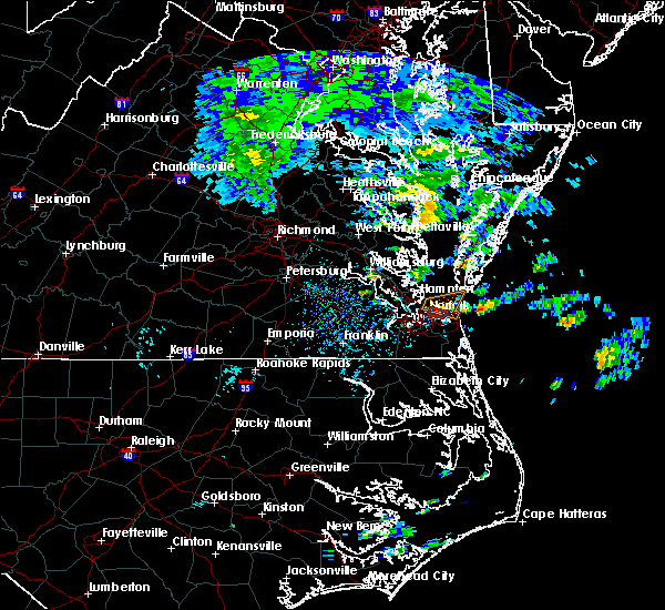 At 1130 am edt, a severe thunderstorm capable of producing a tornado was located near the shoreline just northeast of norfolk international near east ocean view moving east at 10 mph (weather spotters reported a funnel cloud in ocean view). Hazards include tornado. Expect damage to mobile homes, roofs, and vehicles. Locations impacted include, areas near the chesapeake bay in virginia beach, norfolk and bayside. At 1130 am edt, a severe thunderstorm capable of producing a tornado was located near the shoreline just northeast of norfolk international near east ocean view moving east at 10 mph (weather spotters reported a funnel cloud in ocean view). Hazards include tornado. Expect damage to mobile homes, roofs, and vehicles. Locations impacted include, areas near the chesapeake bay in virginia beach, norfolk and bayside.
|
| 9/9/2018 11:30 AM EDT | *** 1 inj *** law enforcement reports several downed trees at the ocean view golf course. 1 minor injury to a golfer at the sit in city of norfolk county VA, 5.2 miles S of Norfolk, VA |
| 9/9/2018 11:13 AM EDT |
 At 1112 am edt, a thunderstorm capable of producing a tornado or waterspout was located just north of norfolk international, or near ocean view, moving southeast at 5 mph (radar indicated rotation). Hazards include tornado. expect damage to mobile homes, roofs, and vehicles At 1112 am edt, a thunderstorm capable of producing a tornado or waterspout was located just north of norfolk international, or near ocean view, moving southeast at 5 mph (radar indicated rotation). Hazards include tornado. expect damage to mobile homes, roofs, and vehicles
|
| 8/11/2018 5:11 PM EDT | Asos station orf... norfolk intl airpor in city of norfolk county VA, 3.1 miles SW of Norfolk, VA |
| 8/6/2018 2:19 PM EDT |
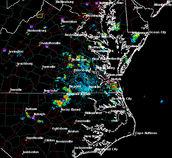 At 219 pm edt, a severe thunderstorm was located near fentress, or near great bridge, moving southeast at 5 mph (radar indicated). Hazards include 60 mph wind gusts and penny size hail. Expect damage to trees and powerlines. Locations impacted include, virginia beach, great bridge, kempsville, regent university, chesapeake, princess anne, fentress, greenbrier, mount pleasant and gallups corner. At 219 pm edt, a severe thunderstorm was located near fentress, or near great bridge, moving southeast at 5 mph (radar indicated). Hazards include 60 mph wind gusts and penny size hail. Expect damage to trees and powerlines. Locations impacted include, virginia beach, great bridge, kempsville, regent university, chesapeake, princess anne, fentress, greenbrier, mount pleasant and gallups corner.
|
| 8/6/2018 2:08 PM EDT |
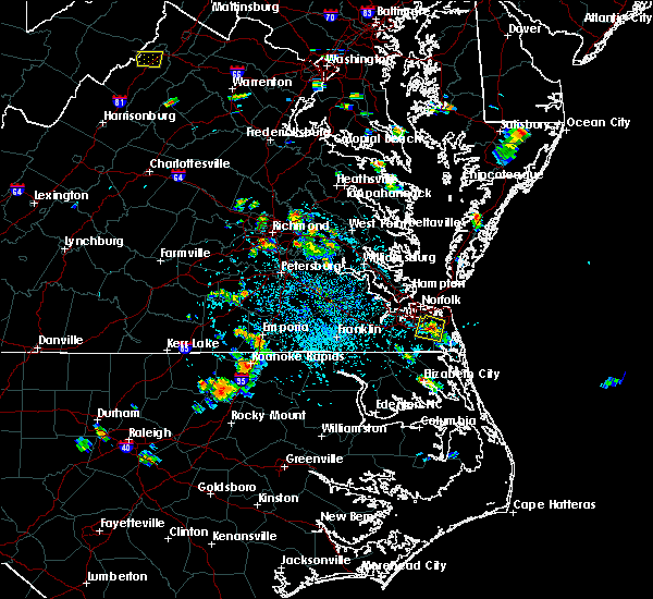 At 208 pm edt, a severe thunderstorm was located near fentress, or near regent university, and is nearly stationary (radar indicated). Hazards include 60 mph wind gusts and penny size hail. expect damage to trees and powerlines At 208 pm edt, a severe thunderstorm was located near fentress, or near regent university, and is nearly stationary (radar indicated). Hazards include 60 mph wind gusts and penny size hail. expect damage to trees and powerlines
|
| 6/22/2018 9:11 PM EDT |
 The severe thunderstorm warning for , the northwestern city of chesapeake and the city of portsmouth will expire at 915 pm edt, the storms which prompted the warning have moved out of the area. therefore, the warning will be allowed to expire. however heavy rain is still possible with these thunderstorms. to report severe weather, contact your nearest law enforcement agency. they will relay your report to the national weather service wakefield. The severe thunderstorm warning for , the northwestern city of chesapeake and the city of portsmouth will expire at 915 pm edt, the storms which prompted the warning have moved out of the area. therefore, the warning will be allowed to expire. however heavy rain is still possible with these thunderstorms. to report severe weather, contact your nearest law enforcement agency. they will relay your report to the national weather service wakefield.
|
| 6/22/2018 9:04 PM EDT |
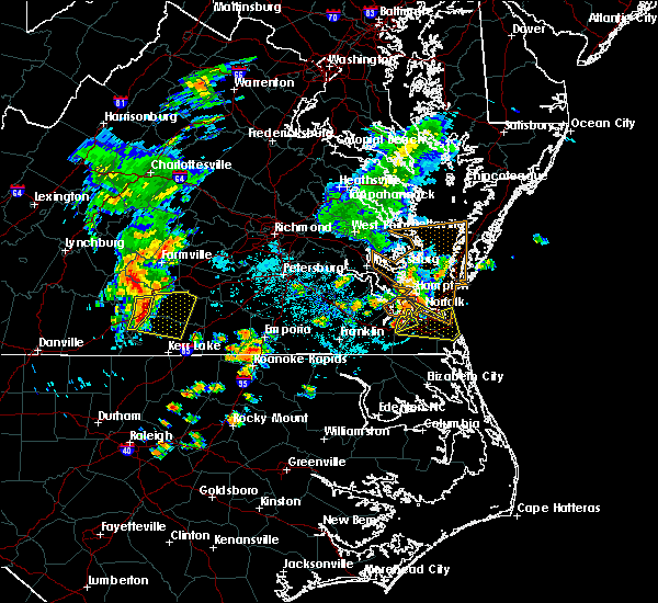 At 904 pm edt, severe thunderstorms were located along a line extending from ocean view to norfolk state university to near cradock, moving east at 30 mph (radar indicated). Hazards include 60 mph wind gusts. Expect damage to trees and powerlines. Locations impacted include, virginia beach, old dominion university, downtown norfolk, regent university, great bridge, kempsville, deep creek, downtown portsmouth, virginia wesleyan college, norfolk state university, norfolk, chesapeake, portsmouth, fentress, norfolk international, ghent, norview, cradock, princess anne and south norfolk. At 904 pm edt, severe thunderstorms were located along a line extending from ocean view to norfolk state university to near cradock, moving east at 30 mph (radar indicated). Hazards include 60 mph wind gusts. Expect damage to trees and powerlines. Locations impacted include, virginia beach, old dominion university, downtown norfolk, regent university, great bridge, kempsville, deep creek, downtown portsmouth, virginia wesleyan college, norfolk state university, norfolk, chesapeake, portsmouth, fentress, norfolk international, ghent, norview, cradock, princess anne and south norfolk.
|
| 6/22/2018 9:01 PM EDT |
 At 900 pm edt, severe thunderstorms were located along a line extending from norfolk nas to old dominion university to bowers hill, moving east at 35 mph (radar indicated). Hazards include 60 mph wind gusts. Expect damage to trees and powerlines. Locations impacted include, churchland, downtown portsmouth, chesapeake, portsmouth, cradock, bowers hill, western branch and south norfolk. At 900 pm edt, severe thunderstorms were located along a line extending from norfolk nas to old dominion university to bowers hill, moving east at 35 mph (radar indicated). Hazards include 60 mph wind gusts. Expect damage to trees and powerlines. Locations impacted include, churchland, downtown portsmouth, chesapeake, portsmouth, cradock, bowers hill, western branch and south norfolk.
|
| 6/22/2018 8:48 PM EDT |
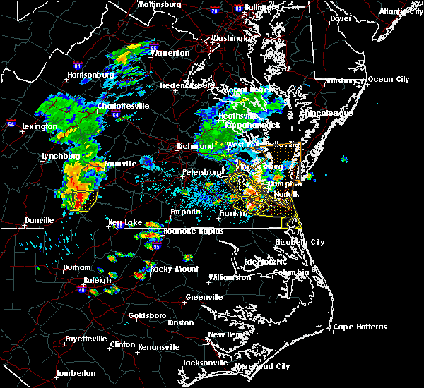 At 847 pm edt, severe thunderstorms were located along a line extending from near hampton university to churchland to near bowers hill, moving east at 30 mph (radar indicated). Hazards include 60 mph wind gusts. Expect damage to trees and powerlines. severe thunderstorms will be near, old dominion university and chesapeake around 855 pm edt. downtown norfolk, deep creek, norfolk state university, downtown portsmouth and ghent around 900 pm edt. norview and cradock around 905 pm edt. virginia wesleyan college, great bridge, norfolk and norfolk international around 910 pm edt. kempsville and regent university around 915 pm edt. fentress around 920 pm edt. virginia beach and princess anne around 930 pm edt. Other locations impacted by these severe thunderstorms include south norfolk, rudee heights, portlock, mount pleasant, princess anne plaza, sigma, sandbridge beach, herberts corner, oceana nas and macons corner. At 847 pm edt, severe thunderstorms were located along a line extending from near hampton university to churchland to near bowers hill, moving east at 30 mph (radar indicated). Hazards include 60 mph wind gusts. Expect damage to trees and powerlines. severe thunderstorms will be near, old dominion university and chesapeake around 855 pm edt. downtown norfolk, deep creek, norfolk state university, downtown portsmouth and ghent around 900 pm edt. norview and cradock around 905 pm edt. virginia wesleyan college, great bridge, norfolk and norfolk international around 910 pm edt. kempsville and regent university around 915 pm edt. fentress around 920 pm edt. virginia beach and princess anne around 930 pm edt. Other locations impacted by these severe thunderstorms include south norfolk, rudee heights, portlock, mount pleasant, princess anne plaza, sigma, sandbridge beach, herberts corner, oceana nas and macons corner.
|
| 6/22/2018 8:25 PM EDT |
 At 824 pm edt, severe thunderstorms were located along a line extending from near smithfield to near isle of wight to near windsor, moving east at 30 mph (radar indicated). Hazards include 60 mph wind gusts. Expect damage to trees and powerlines. severe thunderstorms will be near, crittenden around 845 pm edt. driver around 855 pm edt. churchland, chesapeake and western branch around 905 pm edt. downtown portsmouth and portsmouth around 915 pm edt. Other locations impacted by these severe thunderstorms include hobson, south norfolk, wilroy, carrollton, longview, benns church, huntersville, wills corner, deanes and chuckatuck. At 824 pm edt, severe thunderstorms were located along a line extending from near smithfield to near isle of wight to near windsor, moving east at 30 mph (radar indicated). Hazards include 60 mph wind gusts. Expect damage to trees and powerlines. severe thunderstorms will be near, crittenden around 845 pm edt. driver around 855 pm edt. churchland, chesapeake and western branch around 905 pm edt. downtown portsmouth and portsmouth around 915 pm edt. Other locations impacted by these severe thunderstorms include hobson, south norfolk, wilroy, carrollton, longview, benns church, huntersville, wills corner, deanes and chuckatuck.
|
| 5/14/2018 9:08 PM EDT |
 At 906 pm edt, severe thunderstorms were located along a line extending from 6 miles east of seaford to near smithfield, moving southeast at 40 mph. strong winds are occurring well ahead of the thunderstorms. at 851 pm, patrick henry airport reported 53 mph winds well ahead of the line of storms (radar indicated). Hazards include 60 mph wind gusts and quarter size hail. Minor damage to vehicles is possible. expect wind damage to trees and powerlines. severe thunderstorms will be near, suffolk and crittenden around 925 pm edt. churchland, chesapeake, portsmouth and western branch around 935 pm edt. old dominion university, ghent and norfolk nas around 940 pm edt. norfolk state university, downtown norfolk, downtown portsmouth, virginia wesleyan college, regent university, kempsville, norfolk, norview, norfolk international and cradock around 945 pm edt. Other locations impacted by these severe thunderstorms include south norfolk, portlock, longview, princess anne plaza, huntersville, wills corner, herberts corner, chuckatuck, greenbrier and hobson. At 906 pm edt, severe thunderstorms were located along a line extending from 6 miles east of seaford to near smithfield, moving southeast at 40 mph. strong winds are occurring well ahead of the thunderstorms. at 851 pm, patrick henry airport reported 53 mph winds well ahead of the line of storms (radar indicated). Hazards include 60 mph wind gusts and quarter size hail. Minor damage to vehicles is possible. expect wind damage to trees and powerlines. severe thunderstorms will be near, suffolk and crittenden around 925 pm edt. churchland, chesapeake, portsmouth and western branch around 935 pm edt. old dominion university, ghent and norfolk nas around 940 pm edt. norfolk state university, downtown norfolk, downtown portsmouth, virginia wesleyan college, regent university, kempsville, norfolk, norview, norfolk international and cradock around 945 pm edt. Other locations impacted by these severe thunderstorms include south norfolk, portlock, longview, princess anne plaza, huntersville, wills corner, herberts corner, chuckatuck, greenbrier and hobson.
|
| 8/23/2017 5:25 PM EDT |
 The severe thunderstorm warning for , the city of norfolk, the northwestern city of chesapeake and the city of portsmouth will expire at 530 pm edt, the storms which prompted the warning have weakened below severe limits, and no longer pose an immediate threat to life or property. therefore the warning will be allowed to expire. however gusty winds and heavy rain are still possible with these thunderstorms. The severe thunderstorm warning for , the city of norfolk, the northwestern city of chesapeake and the city of portsmouth will expire at 530 pm edt, the storms which prompted the warning have weakened below severe limits, and no longer pose an immediate threat to life or property. therefore the warning will be allowed to expire. however gusty winds and heavy rain are still possible with these thunderstorms.
|
| 8/23/2017 5:17 PM EDT |
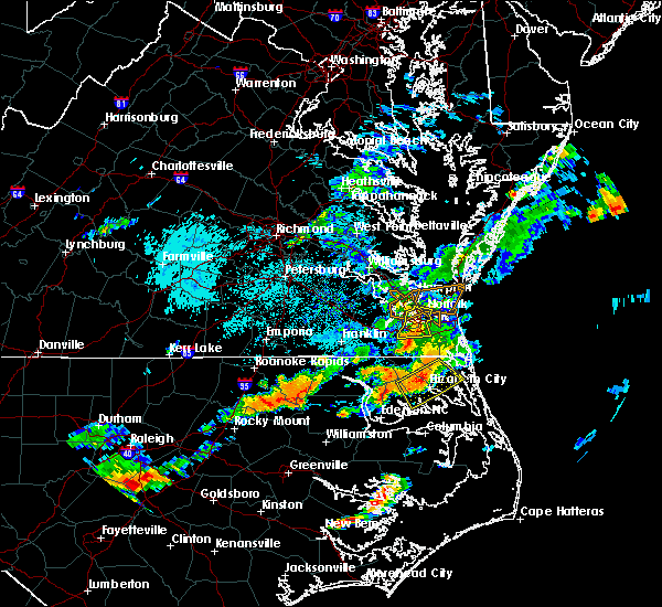 At 516 pm edt, severe thunderstorms were located along a line extending from old dominion university to near cradock to near deep creek, moving southeast at 25 mph (radar indicated). Hazards include 60 mph wind gusts. Expect damage to trees and powerlines. Locations impacted include, churchland, old dominion university, norfolk state university, downtown norfolk, deep creek, downtown portsmouth, norfolk, chesapeake, portsmouth, norfolk international, ghent, norfolk nas, cradock, bowers hill, norview, western branch, south norfolk, portlock, herberts corner and wards corner. At 516 pm edt, severe thunderstorms were located along a line extending from old dominion university to near cradock to near deep creek, moving southeast at 25 mph (radar indicated). Hazards include 60 mph wind gusts. Expect damage to trees and powerlines. Locations impacted include, churchland, old dominion university, norfolk state university, downtown norfolk, deep creek, downtown portsmouth, norfolk, chesapeake, portsmouth, norfolk international, ghent, norfolk nas, cradock, bowers hill, norview, western branch, south norfolk, portlock, herberts corner and wards corner.
|
| 8/23/2017 5:03 PM EDT |
 At 503 pm edt, severe thunderstorms were located along a line extending from near norfolk nas to downtown portsmouth to deep creek, moving east at 30 mph (radar indicated). Hazards include 60 mph wind gusts. Expect damage to trees and powerlines. Locations impacted include, newport news, hampton, hampton university, old dominion university, downtown norfolk, deep creek, downtown portsmouth, churchland, norfolk state university, norfolk, chesapeake, portsmouth, norfolk international, ghent, norfolk nas, bowers hill, norview, cradock, western branch and south norfolk. At 503 pm edt, severe thunderstorms were located along a line extending from near norfolk nas to downtown portsmouth to deep creek, moving east at 30 mph (radar indicated). Hazards include 60 mph wind gusts. Expect damage to trees and powerlines. Locations impacted include, newport news, hampton, hampton university, old dominion university, downtown norfolk, deep creek, downtown portsmouth, churchland, norfolk state university, norfolk, chesapeake, portsmouth, norfolk international, ghent, norfolk nas, bowers hill, norview, cradock, western branch and south norfolk.
|
| 8/23/2017 4:41 PM EDT |
 At 440 pm edt, severe thunderstorms were located along a line extending from near rescue to near driver to near downtown suffolk, moving east at 30 mph (radar indicated). Hazards include 70 mph wind gusts and quarter size hail. Minor damage to vehicles is possible. expect considerable tree damage. wind damage is also likely to mobile homes, roofs, and outbuildings. severe thunderstorms will be near, churchland, chesapeake, northampton and western branch around 450 pm edt. bowers hill around 455 pm edt. downtown portsmouth, downtown norfolk, old dominion university, hampton university, portsmouth and ghent around 500 pm edt. norfolk state university, deep creek, norfolk nas, norview and cradock around 505 pm edt. virginia wesleyan college and norfolk international around 510 pm edt. norfolk around 515 pm edt. Other locations impacted by these severe thunderstorms include south norfolk, fox hill, portlock, phoebus, langley view, wards corner, herberts corner, hilton village and raleigh terrace. At 440 pm edt, severe thunderstorms were located along a line extending from near rescue to near driver to near downtown suffolk, moving east at 30 mph (radar indicated). Hazards include 70 mph wind gusts and quarter size hail. Minor damage to vehicles is possible. expect considerable tree damage. wind damage is also likely to mobile homes, roofs, and outbuildings. severe thunderstorms will be near, churchland, chesapeake, northampton and western branch around 450 pm edt. bowers hill around 455 pm edt. downtown portsmouth, downtown norfolk, old dominion university, hampton university, portsmouth and ghent around 500 pm edt. norfolk state university, deep creek, norfolk nas, norview and cradock around 505 pm edt. virginia wesleyan college and norfolk international around 510 pm edt. norfolk around 515 pm edt. Other locations impacted by these severe thunderstorms include south norfolk, fox hill, portlock, phoebus, langley view, wards corner, herberts corner, hilton village and raleigh terrace.
|
| 6/4/2017 10:40 PM EDT |
 The severe thunderstorm warning for , the city of norfolk, the city of portsmouth, the northwestern city of virginia beach, the city of hampton and the southern city of newport news will expire at 1045 pm edt, the storm which prompted the warning has moved out of the area. therefore the warning will be allowed to expire. The severe thunderstorm warning for , the city of norfolk, the city of portsmouth, the northwestern city of virginia beach, the city of hampton and the southern city of newport news will expire at 1045 pm edt, the storm which prompted the warning has moved out of the area. therefore the warning will be allowed to expire.
|
| 6/4/2017 10:26 PM EDT |
 At 1026 pm edt, a severe thunderstorm was located over norfolk, or over old dominion university, moving east at 30 mph (radar indicated). Hazards include 60 to 70 mph wind gusts and penny size hail. Expect damage to trees and powerlines. this severe storm will be near, virginia wesleyan college, regent university and norfolk international around 1035 pm edt. virginia beach around 1045 pm edt. Other locations impacted by this severe thunderstorm include wards corner, willoughby spit and raleigh terrace. At 1026 pm edt, a severe thunderstorm was located over norfolk, or over old dominion university, moving east at 30 mph (radar indicated). Hazards include 60 to 70 mph wind gusts and penny size hail. Expect damage to trees and powerlines. this severe storm will be near, virginia wesleyan college, regent university and norfolk international around 1035 pm edt. virginia beach around 1045 pm edt. Other locations impacted by this severe thunderstorm include wards corner, willoughby spit and raleigh terrace.
|
| 6/4/2017 10:14 PM EDT |
 At 1014 pm edt, a severe thunderstorm was located over churchland, moving east at 30 mph (radar indicated). Hazards include 60 mph wind gusts and penny size hail. Expect damage to trees and powerlines. this severe storm will be near, old dominion university, chesapeake and cradock around 1020 pm edt. downtown norfolk, norfolk state university, downtown portsmouth, norfolk nas, ghent and fort monroe around 1025 pm edt. ocean view and norview around 1030 pm edt. virginia wesleyan college, regent university, norfolk and norfolk international around 1035 pm edt. virginia beach around 1045 pm edt. Other locations impacted by this severe thunderstorm include greenbrier, hobson, south norfolk, portlock, wards corner, huntersville, deanes, willoughby spit and raleigh terrace. At 1014 pm edt, a severe thunderstorm was located over churchland, moving east at 30 mph (radar indicated). Hazards include 60 mph wind gusts and penny size hail. Expect damage to trees and powerlines. this severe storm will be near, old dominion university, chesapeake and cradock around 1020 pm edt. downtown norfolk, norfolk state university, downtown portsmouth, norfolk nas, ghent and fort monroe around 1025 pm edt. ocean view and norview around 1030 pm edt. virginia wesleyan college, regent university, norfolk and norfolk international around 1035 pm edt. virginia beach around 1045 pm edt. Other locations impacted by this severe thunderstorm include greenbrier, hobson, south norfolk, portlock, wards corner, huntersville, deanes, willoughby spit and raleigh terrace.
|
| 6/4/2017 9:53 PM EDT |
 At 953 pm edt, a severe thunderstorm was located near isle of wight, or near smithfield, moving east at 30 mph (radar indicated). Hazards include 60 mph wind gusts and nickel size hail. Expect damage to trees and powerlines. this severe thunderstorm will be near, crittenden and driver around 1005 pm edt. churchland, chesapeake and western branch around 1015 pm edt. portsmouth and cradock around 1020 pm edt. old dominion university, downtown norfolk, downtown portsmouth, ghent, norfolk nas and fort monroe around 1025 pm edt. ocean view, norfolk state university and norview around 1030 pm edt. virginia wesleyan college, regent university, norfolk and norfolk international around 1035 pm edt. virginia beach around 1045 pm edt. Other locations impacted by this severe thunderstorm include south norfolk, carrollton, portlock, longview, benns church, huntersville, wills corner, bethel church, chuckatuck and indika. At 953 pm edt, a severe thunderstorm was located near isle of wight, or near smithfield, moving east at 30 mph (radar indicated). Hazards include 60 mph wind gusts and nickel size hail. Expect damage to trees and powerlines. this severe thunderstorm will be near, crittenden and driver around 1005 pm edt. churchland, chesapeake and western branch around 1015 pm edt. portsmouth and cradock around 1020 pm edt. old dominion university, downtown norfolk, downtown portsmouth, ghent, norfolk nas and fort monroe around 1025 pm edt. ocean view, norfolk state university and norview around 1030 pm edt. virginia wesleyan college, regent university, norfolk and norfolk international around 1035 pm edt. virginia beach around 1045 pm edt. Other locations impacted by this severe thunderstorm include south norfolk, carrollton, portlock, longview, benns church, huntersville, wills corner, bethel church, chuckatuck and indika.
|
| 5/31/2017 5:40 PM EDT |
 The severe thunderstorm warning for , the east central city of norfolk and the northwestern city of virginia beach will expire at 545 pm edt, the storm which prompted the warning has weakened below severe limits, and has exited the warned area. therefore, the warning will be allowed to expire. The severe thunderstorm warning for , the east central city of norfolk and the northwestern city of virginia beach will expire at 545 pm edt, the storm which prompted the warning has weakened below severe limits, and has exited the warned area. therefore, the warning will be allowed to expire.
|
| 5/31/2017 5:29 PM EDT |
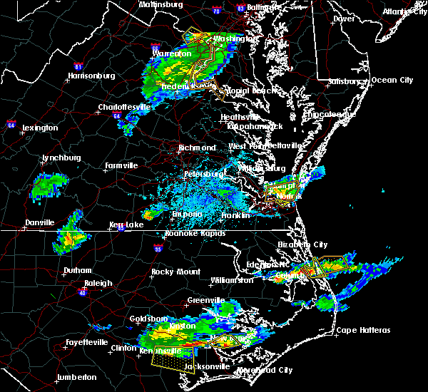 At 528 pm edt, a severe thunderstorm was located over norfolk international, or near virginia wesleyan college, moving southeast at 25 mph (radar indicated). Hazards include 60 mph wind gusts and penny size hail. Expect damage to trees and powerlines. this severe storm will be near, virginia beach around 545 pm edt. Other locations impacted by this severe thunderstorm include bayside. At 528 pm edt, a severe thunderstorm was located over norfolk international, or near virginia wesleyan college, moving southeast at 25 mph (radar indicated). Hazards include 60 mph wind gusts and penny size hail. Expect damage to trees and powerlines. this severe storm will be near, virginia beach around 545 pm edt. Other locations impacted by this severe thunderstorm include bayside.
|
| 5/31/2017 5:17 PM EDT |
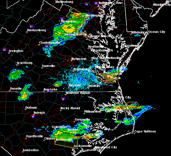 At 516 pm edt, a severe thunderstorm was located over ocean view, moving southeast at 20 mph (radar indicated). Hazards include 60 mph wind gusts and penny size hail. Expect damage to trees and powerlines. this severe storm will be near, norview around 525 pm edt. virginia wesleyan college and norfolk international around 530 pm edt. kempsville around 540 pm edt. virginia beach around 545 pm edt. Other locations impacted by this severe thunderstorm include bayside, wards corner and willoughby spit. At 516 pm edt, a severe thunderstorm was located over ocean view, moving southeast at 20 mph (radar indicated). Hazards include 60 mph wind gusts and penny size hail. Expect damage to trees and powerlines. this severe storm will be near, norview around 525 pm edt. virginia wesleyan college and norfolk international around 530 pm edt. kempsville around 540 pm edt. virginia beach around 545 pm edt. Other locations impacted by this severe thunderstorm include bayside, wards corner and willoughby spit.
|
| 5/31/2017 5:00 PM EDT |
 At 500 pm edt, a severe thunderstorm was located near norfolk nas, or near old dominion university, moving southeast at 30 mph (radar indicated). Hazards include 60 mph wind gusts and penny size hail. Expect damage to trees and powerlines. this severe thunderstorm will be near, portsmouth and norfolk nas around 505 pm edt. old dominion university, ocean view and ghent around 510 pm edt. norfolk state university, downtown norfolk, downtown portsmouth, norfolk, norview and norfolk international around 515 pm edt. virginia wesleyan college around 520 pm edt. regent university and kempsville around 525 pm edt. Other locations impacted by this severe thunderstorm include greenbrier, south norfolk, bayside, portlock, wards corner and willoughby spit. At 500 pm edt, a severe thunderstorm was located near norfolk nas, or near old dominion university, moving southeast at 30 mph (radar indicated). Hazards include 60 mph wind gusts and penny size hail. Expect damage to trees and powerlines. this severe thunderstorm will be near, portsmouth and norfolk nas around 505 pm edt. old dominion university, ocean view and ghent around 510 pm edt. norfolk state university, downtown norfolk, downtown portsmouth, norfolk, norview and norfolk international around 515 pm edt. virginia wesleyan college around 520 pm edt. regent university and kempsville around 525 pm edt. Other locations impacted by this severe thunderstorm include greenbrier, south norfolk, bayside, portlock, wards corner and willoughby spit.
|
| 5/22/2017 3:09 PM EDT |
 At 309 pm edt, severe thunderstorms were located along a line extending from near northampton to downtown portsmouth to near northwest, moving northeast at 25 mph (radar indicated). Hazards include 60 mph wind gusts. Expect damage to trees and powerlines. these severe storms will be near, hampton, hampton university, norfolk state university, downtown norfolk, ghent and norfolk nas around 315 pm edt. regent university, langley afb and norview around 320 pm edt. virginia wesleyan college, kempsville, ocean view, great bridge, buckroe beach and norfolk international around 325 pm edt. norfolk, grand view and fentress around 330 pm edt. Other locations impacted by these severe thunderstorms include south norfolk, fox hill, portlock, phoebus, langley view, mount pleasant, princess anne plaza, huntersville, herberts corner and hilton village. At 309 pm edt, severe thunderstorms were located along a line extending from near northampton to downtown portsmouth to near northwest, moving northeast at 25 mph (radar indicated). Hazards include 60 mph wind gusts. Expect damage to trees and powerlines. these severe storms will be near, hampton, hampton university, norfolk state university, downtown norfolk, ghent and norfolk nas around 315 pm edt. regent university, langley afb and norview around 320 pm edt. virginia wesleyan college, kempsville, ocean view, great bridge, buckroe beach and norfolk international around 325 pm edt. norfolk, grand view and fentress around 330 pm edt. Other locations impacted by these severe thunderstorms include south norfolk, fox hill, portlock, phoebus, langley view, mount pleasant, princess anne plaza, huntersville, herberts corner and hilton village.
|
| 5/22/2017 2:46 PM EDT |
 At 245 pm edt, severe thunderstorms were located along a line extending from near crittenden to near bowers hill to 6 miles east of corapeake, moving east at 25 mph (radar indicated). Hazards include 70 mph wind gusts and penny size hail. Expect considerable tree damage. damage is likely to mobile homes, roofs, and outbuildings. severe thunderstorms will be near, chesapeake, crittenden and bowers hill around 255 pm edt. deep creek, churchland and western branch around 300 pm edt. cradock around 305 pm edt. downtown portsmouth and northampton around 310 pm edt. downtown norfolk, old dominion university, portsmouth and ghent around 315 pm edt. norfolk state university, hampton university, norfolk nas and northwest around 320 pm edt. regent university, great bridge, langley afb and norview around 325 pm edt. virginia wesleyan college, kempsville, ocean view, norfolk, fentress, buckroe beach, norfolk international and grand view around 330 pm edt. Other locations impacted by these severe thunderstorms include south norfolk, carrollton, portlock, princess anne plaza, huntersville, hilton village, greenbrier, bayside, wards corner and messick. At 245 pm edt, severe thunderstorms were located along a line extending from near crittenden to near bowers hill to 6 miles east of corapeake, moving east at 25 mph (radar indicated). Hazards include 70 mph wind gusts and penny size hail. Expect considerable tree damage. damage is likely to mobile homes, roofs, and outbuildings. severe thunderstorms will be near, chesapeake, crittenden and bowers hill around 255 pm edt. deep creek, churchland and western branch around 300 pm edt. cradock around 305 pm edt. downtown portsmouth and northampton around 310 pm edt. downtown norfolk, old dominion university, portsmouth and ghent around 315 pm edt. norfolk state university, hampton university, norfolk nas and northwest around 320 pm edt. regent university, great bridge, langley afb and norview around 325 pm edt. virginia wesleyan college, kempsville, ocean view, norfolk, fentress, buckroe beach, norfolk international and grand view around 330 pm edt. Other locations impacted by these severe thunderstorms include south norfolk, carrollton, portlock, princess anne plaza, huntersville, hilton village, greenbrier, bayside, wards corner and messick.
|
| 5/5/2017 8:08 AM EDT |
 At 808 am edt, a severe thunderstorm was located over sunbury, moving north at 45 mph (radar indicated). Hazards include 60 mph wind gusts. Expect damage to roofs, siding, and trees. this severe thunderstorm will be near, corapeake around 815 am edt. downtown suffolk around 835 am edt. deep creek around 840 am edt. chesapeake, bowers hill, driver and cradock around 845 am edt. suffolk around 855 am edt. portsmouth around 900 am edt. other locations impacted by this severe thunderstorm include south norfolk, wilroy, portlock, savage, acorn hill, nurney, suffolk airport, herberts corner, saunders and sandy cross. A tornado watch remains in effect until 100 pm edt for northeastern north carolina, and southeastern virginia. At 808 am edt, a severe thunderstorm was located over sunbury, moving north at 45 mph (radar indicated). Hazards include 60 mph wind gusts. Expect damage to roofs, siding, and trees. this severe thunderstorm will be near, corapeake around 815 am edt. downtown suffolk around 835 am edt. deep creek around 840 am edt. chesapeake, bowers hill, driver and cradock around 845 am edt. suffolk around 855 am edt. portsmouth around 900 am edt. other locations impacted by this severe thunderstorm include south norfolk, wilroy, portlock, savage, acorn hill, nurney, suffolk airport, herberts corner, saunders and sandy cross. A tornado watch remains in effect until 100 pm edt for northeastern north carolina, and southeastern virginia.
|
| 4/6/2017 12:50 PM EDT |
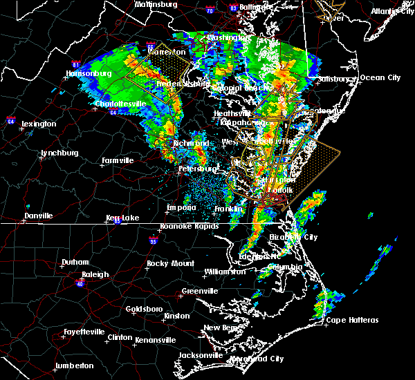 At 1250 pm edt, a severe thunderstorm capable of producing a tornado was located over kempsville, moving northeast at 50 mph (radar indicated rotation). Hazards include tornado. Flying debris will be dangerous to those caught without shelter. mobile homes will be damaged or destroyed. damage to roofs, windows, and vehicles will occur. tree damage is likely. this dangerous storm will be near, virginia beach around 100 pm edt. other locations impacted by this tornadic thunderstorm include greenbrier, bayside, princess anne plaza, london bridge and gallups corner. precautionary/preparedness actions, take cover now! move to a basement or an interior room on the lowest floor of a sturdy building. avoid windows. if you are outdoors, in a mobile home, or in a vehicle, move to the closest substantial shelter and protect yourself from flying debris. please send your reports of hail and or wind damage, including trees or large limbs downed, by calling noaa`s national weather service in wakefield at , 7 5 7, 8 9 9, 2 4 1 5. At 1250 pm edt, a severe thunderstorm capable of producing a tornado was located over kempsville, moving northeast at 50 mph (radar indicated rotation). Hazards include tornado. Flying debris will be dangerous to those caught without shelter. mobile homes will be damaged or destroyed. damage to roofs, windows, and vehicles will occur. tree damage is likely. this dangerous storm will be near, virginia beach around 100 pm edt. other locations impacted by this tornadic thunderstorm include greenbrier, bayside, princess anne plaza, london bridge and gallups corner. precautionary/preparedness actions, take cover now! move to a basement or an interior room on the lowest floor of a sturdy building. avoid windows. if you are outdoors, in a mobile home, or in a vehicle, move to the closest substantial shelter and protect yourself from flying debris. please send your reports of hail and or wind damage, including trees or large limbs downed, by calling noaa`s national weather service in wakefield at , 7 5 7, 8 9 9, 2 4 1 5.
|
| 4/6/2017 12:36 PM EDT |
 At 1236 pm edt, a severe thunderstorm capable of producing a tornado was located over chesapeake, or over deep creek, moving northeast at 55 mph (radar indicated rotation). Hazards include tornado. Flying debris will be dangerous to those caught without shelter. mobile homes will be damaged or destroyed. damage to roofs, windows, and vehicles will occur. tree damage is likely. this dangerous storm will be near, great bridge, cradock and fentress around 1240 pm edt. norfolk state university, downtown portsmouth and downtown norfolk around 1245 pm edt. kempsville, regent university, virginia wesleyan college, norfolk international and norview around 1250 pm edt. norfolk around 1255 pm edt. virginia beach around 100 pm edt. Other locations impacted by this tornadic thunderstorm include south norfolk, rudee heights, portlock, princess anne plaza, herberts corner, oceana nas, macons corner, greenbrier, bayside and oceana. At 1236 pm edt, a severe thunderstorm capable of producing a tornado was located over chesapeake, or over deep creek, moving northeast at 55 mph (radar indicated rotation). Hazards include tornado. Flying debris will be dangerous to those caught without shelter. mobile homes will be damaged or destroyed. damage to roofs, windows, and vehicles will occur. tree damage is likely. this dangerous storm will be near, great bridge, cradock and fentress around 1240 pm edt. norfolk state university, downtown portsmouth and downtown norfolk around 1245 pm edt. kempsville, regent university, virginia wesleyan college, norfolk international and norview around 1250 pm edt. norfolk around 1255 pm edt. virginia beach around 100 pm edt. Other locations impacted by this tornadic thunderstorm include south norfolk, rudee heights, portlock, princess anne plaza, herberts corner, oceana nas, macons corner, greenbrier, bayside and oceana.
|
| 3/31/2017 7:55 PM EDT |
 At 755 pm edt, severe thunderstorms were located along a line extending from near regent university to northwest to near windsor, moving east at 45 mph (radar indicated). Hazards include 70 mph wind gusts and half dollar size hail. Hail damage to vehicles is expected. expect considerable tree damage. wind damage is also likely to mobile homes, roofs, and outbuildings. these severe storms will be near, kempsville, regent university, princess anne, northwest, moyock and fentress around 800 pm edt. back bay around 810 pm edt. knotts island around 815 pm edt. valhalla around 825 pm edt. hertford and snug harbor around 840 pm edt. burgess around 845 pm edt. other locations impacted by these severe thunderstorms include goose pond, south norfolk, whites crossroads, rudee heights, portlock, pierceville, newsome store, arrowhead beach, saint johns and parkville. precautionary/preparedness actions, remain alert for a possible tornado! tornadoes can develop quickly from severe thunderstorms. if you spot a tornado go at once into the basement or small central room in a sturdy structure. for your protection move to an interior room on the lowest floor of a building. please send your reports of hail and or wind damage, including trees or large limbs downed, by calling noaa`s national weather service in wakefield at , 7 5 7, 8 9 9, 2 4 1 5. A tornado watch remains in effect until 1000 pm edt for northeastern north carolina, and southeastern virginia. At 755 pm edt, severe thunderstorms were located along a line extending from near regent university to northwest to near windsor, moving east at 45 mph (radar indicated). Hazards include 70 mph wind gusts and half dollar size hail. Hail damage to vehicles is expected. expect considerable tree damage. wind damage is also likely to mobile homes, roofs, and outbuildings. these severe storms will be near, kempsville, regent university, princess anne, northwest, moyock and fentress around 800 pm edt. back bay around 810 pm edt. knotts island around 815 pm edt. valhalla around 825 pm edt. hertford and snug harbor around 840 pm edt. burgess around 845 pm edt. other locations impacted by these severe thunderstorms include goose pond, south norfolk, whites crossroads, rudee heights, portlock, pierceville, newsome store, arrowhead beach, saint johns and parkville. precautionary/preparedness actions, remain alert for a possible tornado! tornadoes can develop quickly from severe thunderstorms. if you spot a tornado go at once into the basement or small central room in a sturdy structure. for your protection move to an interior room on the lowest floor of a building. please send your reports of hail and or wind damage, including trees or large limbs downed, by calling noaa`s national weather service in wakefield at , 7 5 7, 8 9 9, 2 4 1 5. A tornado watch remains in effect until 1000 pm edt for northeastern north carolina, and southeastern virginia.
|
| 3/31/2017 7:55 PM EDT |
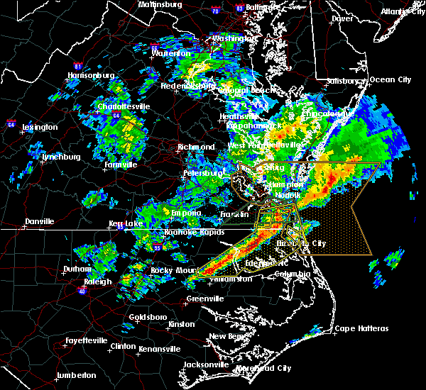 At 755 pm edt, severe thunderstorms were located along a line extending from near regent university to northwest to near windsor, moving east at 45 mph (radar indicated). Hazards include 70 mph wind gusts and half dollar size hail. Hail damage to vehicles is expected. expect considerable tree damage. wind damage is also likely to mobile homes, roofs, and outbuildings. these severe storms will be near, kempsville, regent university, princess anne, northwest, moyock and fentress around 800 pm edt. back bay around 810 pm edt. knotts island around 815 pm edt. valhalla around 825 pm edt. hertford and snug harbor around 840 pm edt. burgess around 845 pm edt. other locations impacted by these severe thunderstorms include goose pond, south norfolk, whites crossroads, rudee heights, portlock, pierceville, newsome store, arrowhead beach, saint johns and parkville. precautionary/preparedness actions, remain alert for a possible tornado! tornadoes can develop quickly from severe thunderstorms. if you spot a tornado go at once into the basement or small central room in a sturdy structure. for your protection move to an interior room on the lowest floor of a building. please send your reports of hail and or wind damage, including trees or large limbs downed, by calling noaa`s national weather service in wakefield at , 7 5 7, 8 9 9, 2 4 1 5. A tornado watch remains in effect until 1000 pm edt for northeastern north carolina, and southeastern virginia. At 755 pm edt, severe thunderstorms were located along a line extending from near regent university to northwest to near windsor, moving east at 45 mph (radar indicated). Hazards include 70 mph wind gusts and half dollar size hail. Hail damage to vehicles is expected. expect considerable tree damage. wind damage is also likely to mobile homes, roofs, and outbuildings. these severe storms will be near, kempsville, regent university, princess anne, northwest, moyock and fentress around 800 pm edt. back bay around 810 pm edt. knotts island around 815 pm edt. valhalla around 825 pm edt. hertford and snug harbor around 840 pm edt. burgess around 845 pm edt. other locations impacted by these severe thunderstorms include goose pond, south norfolk, whites crossroads, rudee heights, portlock, pierceville, newsome store, arrowhead beach, saint johns and parkville. precautionary/preparedness actions, remain alert for a possible tornado! tornadoes can develop quickly from severe thunderstorms. if you spot a tornado go at once into the basement or small central room in a sturdy structure. for your protection move to an interior room on the lowest floor of a building. please send your reports of hail and or wind damage, including trees or large limbs downed, by calling noaa`s national weather service in wakefield at , 7 5 7, 8 9 9, 2 4 1 5. A tornado watch remains in effect until 1000 pm edt for northeastern north carolina, and southeastern virginia.
|
| 3/31/2017 7:38 PM EDT |
 At 737 pm edt, severe thunderstorms were located along a line extending from deep creek to 7 miles northwest of south mills to 9 miles south of lewiston woodville, moving east at 45 mph (radar indicated). Hazards include 60 mph wind gusts and quarter size hail. Hail damage to vehicles is expected. expect wind damage to roofs, siding, and trees. severe thunderstorms will be near, great bridge, deep creek, south mills, chesapeake and cradock around 745 pm edt. regent university and fentress around 750 pm edt. kempsville and northwest around 755 pm edt. windsor, princess anne and moyock around 800 pm edt. back bay around 805 pm edt. knotts island around 815 pm edt. valhalla around 825 pm edt. hertford, snug harbor and burgess around 840 pm edt. other locations impacted by these severe thunderstorms include goose pond, south norfolk, whites crossroads, rudee heights, portlock, pierceville, newsome store, arrowhead beach, saint johns and parkville. A tornado watch remains in effect until 1000 pm edt for northeastern north carolina, and southeastern virginia. At 737 pm edt, severe thunderstorms were located along a line extending from deep creek to 7 miles northwest of south mills to 9 miles south of lewiston woodville, moving east at 45 mph (radar indicated). Hazards include 60 mph wind gusts and quarter size hail. Hail damage to vehicles is expected. expect wind damage to roofs, siding, and trees. severe thunderstorms will be near, great bridge, deep creek, south mills, chesapeake and cradock around 745 pm edt. regent university and fentress around 750 pm edt. kempsville and northwest around 755 pm edt. windsor, princess anne and moyock around 800 pm edt. back bay around 805 pm edt. knotts island around 815 pm edt. valhalla around 825 pm edt. hertford, snug harbor and burgess around 840 pm edt. other locations impacted by these severe thunderstorms include goose pond, south norfolk, whites crossroads, rudee heights, portlock, pierceville, newsome store, arrowhead beach, saint johns and parkville. A tornado watch remains in effect until 1000 pm edt for northeastern north carolina, and southeastern virginia.
|
| 3/31/2017 6:04 PM EDT |
 At 604 pm edt, a severe thunderstorm was located over norfolk state university, moving east at 35 mph (radar indicated). Hazards include 70 mph wind gusts and ping pong ball size hail. People and animals outdoors will be injured. expect hail damage to roofs, siding, windows, and vehicles. expect considerable tree damage. wind damage is also likely to mobile homes, roofs, and outbuildings. this severe thunderstorm will be near, regent university, virginia wesleyan college and norfolk international around 610 pm edt. kempsville around 615 pm edt. princess anne around 620 pm edt. virginia beach around 630 pm edt. other locations impacted by this severe thunderstorm include south norfolk, rudee heights, princess anne plaza, oceana nas, macons corner, greenbrier, bayside, oceana, wards corner and dam neck. A tornado watch remains in effect until 1000 pm edt for southeastern virginia. At 604 pm edt, a severe thunderstorm was located over norfolk state university, moving east at 35 mph (radar indicated). Hazards include 70 mph wind gusts and ping pong ball size hail. People and animals outdoors will be injured. expect hail damage to roofs, siding, windows, and vehicles. expect considerable tree damage. wind damage is also likely to mobile homes, roofs, and outbuildings. this severe thunderstorm will be near, regent university, virginia wesleyan college and norfolk international around 610 pm edt. kempsville around 615 pm edt. princess anne around 620 pm edt. virginia beach around 630 pm edt. other locations impacted by this severe thunderstorm include south norfolk, rudee heights, princess anne plaza, oceana nas, macons corner, greenbrier, bayside, oceana, wards corner and dam neck. A tornado watch remains in effect until 1000 pm edt for southeastern virginia.
|
| 3/31/2017 5:54 PM EDT |
 At 553 pm edt, a severe thunderstorm capable of producing a tornado was located near deep creek, moving east at 25 mph (radar indicated rotation). Hazards include tornado and ping pong ball size hail. Flying debris will be dangerous to those caught without shelter. mobile homes will be damaged or destroyed. damage to roofs, windows, and vehicles will occur. tree damage is likely. this dangerous storm will be near, deep creek and chesapeake around 600 pm edt. cradock around 605 pm edt. great bridge around 610 pm edt. fentress around 620 pm edt. Other locations impacted by this tornadic thunderstorm include south norfolk, herberts corner, portlock, hickory and chesapeake airport. At 553 pm edt, a severe thunderstorm capable of producing a tornado was located near deep creek, moving east at 25 mph (radar indicated rotation). Hazards include tornado and ping pong ball size hail. Flying debris will be dangerous to those caught without shelter. mobile homes will be damaged or destroyed. damage to roofs, windows, and vehicles will occur. tree damage is likely. this dangerous storm will be near, deep creek and chesapeake around 600 pm edt. cradock around 605 pm edt. great bridge around 610 pm edt. fentress around 620 pm edt. Other locations impacted by this tornadic thunderstorm include south norfolk, herberts corner, portlock, hickory and chesapeake airport.
|
| 3/31/2017 12:40 PM EDT |
 At 1239 pm edt, severe thunderstorms were located along a line extending from near regent university to 6 miles south of weeksville, moving northeast at 50 mph (radar indicated). Hazards include 60 mph wind gusts. Expect damage to roofs, siding, and trees. locations impacted include, currituck, elizabeth city, camden, elizabeth city state university, grandy, weeksville, great bridge, south mills, deep creek, norfolk, chesapeake, portsmouth, fentress, nixonton, cradock, shiloh, indiantown, morgans corner, corolla and old trap. precautionary/preparedness actions, for your protection move to an interior room on the lowest floor of a building. please send your reports of hail and or wind damage, including trees or large limbs downed, by calling noaa`s national weather service in wakefield at , 7 5 7, 8 9 9, 2 4 1 5. At 1239 pm edt, severe thunderstorms were located along a line extending from near regent university to 6 miles south of weeksville, moving northeast at 50 mph (radar indicated). Hazards include 60 mph wind gusts. Expect damage to roofs, siding, and trees. locations impacted include, currituck, elizabeth city, camden, elizabeth city state university, grandy, weeksville, great bridge, south mills, deep creek, norfolk, chesapeake, portsmouth, fentress, nixonton, cradock, shiloh, indiantown, morgans corner, corolla and old trap. precautionary/preparedness actions, for your protection move to an interior room on the lowest floor of a building. please send your reports of hail and or wind damage, including trees or large limbs downed, by calling noaa`s national weather service in wakefield at , 7 5 7, 8 9 9, 2 4 1 5.
|
| 3/31/2017 12:19 PM EDT |
 At 1219 pm edt, severe thunderstorms were located along a line extending from 8 miles southeast of downtown suffolk to 8 miles west of columbia, moving northeast at 50 mph (radar indicated). Hazards include 60 mph wind gusts. expect damage to roofs, siding, and trees At 1219 pm edt, severe thunderstorms were located along a line extending from 8 miles southeast of downtown suffolk to 8 miles west of columbia, moving northeast at 50 mph (radar indicated). Hazards include 60 mph wind gusts. expect damage to roofs, siding, and trees
|
| 2/25/2017 5:45 PM EST |
 At 545 pm est, a severe thunderstorm was located over christopher newport university, moving east at 55 mph (radar indicated). Hazards include 60 mph wind gusts and quarter size hail. Hail damage to vehicles is expected. expect wind damage to roofs, siding, and trees. this severe thunderstorm will be near, hampton and langley afb around 550 pm est. hampton university, buckroe beach, grand view and fort monroe around 555 pm est. Other locations impacted by this severe thunderstorm include fox hill, phoebus, langley view, oyster point, oriana, messick, hilton village, menchville, plum tree island refuge and raleigh terrace. At 545 pm est, a severe thunderstorm was located over christopher newport university, moving east at 55 mph (radar indicated). Hazards include 60 mph wind gusts and quarter size hail. Hail damage to vehicles is expected. expect wind damage to roofs, siding, and trees. this severe thunderstorm will be near, hampton and langley afb around 550 pm est. hampton university, buckroe beach, grand view and fort monroe around 555 pm est. Other locations impacted by this severe thunderstorm include fox hill, phoebus, langley view, oyster point, oriana, messick, hilton village, menchville, plum tree island refuge and raleigh terrace.
|
| 7/30/2016 3:50 PM EDT |
 At 348 pm edt, severe thunderstorms were located along a line extending from fentress to near princess anne to back bay, moving north at 15 mph (radar indicated). Hazards include 60 mph wind gusts and penny size hail. Expect damage to roofs. siding. and trees. these severe storms will be near, princess anne around 400 pm edt. kempsville around 415 pm edt. Other locations impacted by these severe thunderstorms include oceana, mount pleasant, north virginia beach, princess anne plaza, pungo, london bridge, dam neck, rudee heights, sigma and macons corner. At 348 pm edt, severe thunderstorms were located along a line extending from fentress to near princess anne to back bay, moving north at 15 mph (radar indicated). Hazards include 60 mph wind gusts and penny size hail. Expect damage to roofs. siding. and trees. these severe storms will be near, princess anne around 400 pm edt. kempsville around 415 pm edt. Other locations impacted by these severe thunderstorms include oceana, mount pleasant, north virginia beach, princess anne plaza, pungo, london bridge, dam neck, rudee heights, sigma and macons corner.
|
| 7/30/2016 3:26 PM EDT |
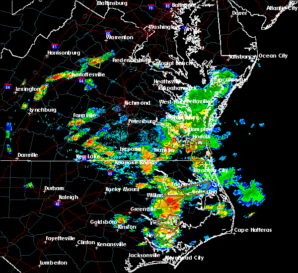 At 325 pm edt, severe thunderstorms were located along a line extending from near northwest to 6 miles west of knotts island, moving northeast at 30 mph (radar indicated). Hazards include 60 mph wind gusts and nickel size hail. Expect damage to roofs. siding. and trees. severe thunderstorms will be near, fentress around 335 pm edt. back bay around 340 pm edt. princess anne around 350 pm edt. kempsville around 355 pm edt. virginia beach around 415 pm edt. Other locations impacted by these severe thunderstorms include oceana, mount pleasant, north virginia beach, princess anne plaza, pungo, london bridge, dam neck, rudee heights, sigma and macons corner. At 325 pm edt, severe thunderstorms were located along a line extending from near northwest to 6 miles west of knotts island, moving northeast at 30 mph (radar indicated). Hazards include 60 mph wind gusts and nickel size hail. Expect damage to roofs. siding. and trees. severe thunderstorms will be near, fentress around 335 pm edt. back bay around 340 pm edt. princess anne around 350 pm edt. kempsville around 355 pm edt. virginia beach around 415 pm edt. Other locations impacted by these severe thunderstorms include oceana, mount pleasant, north virginia beach, princess anne plaza, pungo, london bridge, dam neck, rudee heights, sigma and macons corner.
|
| 7/8/2016 6:42 PM EDT |
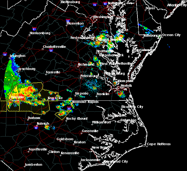 At 642 pm edt, a severe thunderstorm was located over great bridge, moving southeast at 25 mph (radar indicated). Hazards include 60 mph wind gusts and quarter size hail. Hail damage to vehicles is expected. expect wind damage to roofs, siding, and trees. this severe thunderstorm will be near, fentress around 650 pm edt. princess anne and northwest around 700 pm edt. back bay around 710 pm edt. Other locations impacted by this severe thunderstorm include south norfolk, mount pleasant, chesapeake airport, pungo, hickory, greenbrier, portlock, sandbridge beach, munden and gallups corner. At 642 pm edt, a severe thunderstorm was located over great bridge, moving southeast at 25 mph (radar indicated). Hazards include 60 mph wind gusts and quarter size hail. Hail damage to vehicles is expected. expect wind damage to roofs, siding, and trees. this severe thunderstorm will be near, fentress around 650 pm edt. princess anne and northwest around 700 pm edt. back bay around 710 pm edt. Other locations impacted by this severe thunderstorm include south norfolk, mount pleasant, chesapeake airport, pungo, hickory, greenbrier, portlock, sandbridge beach, munden and gallups corner.
|
| 6/5/2016 9:35 PM EDT |
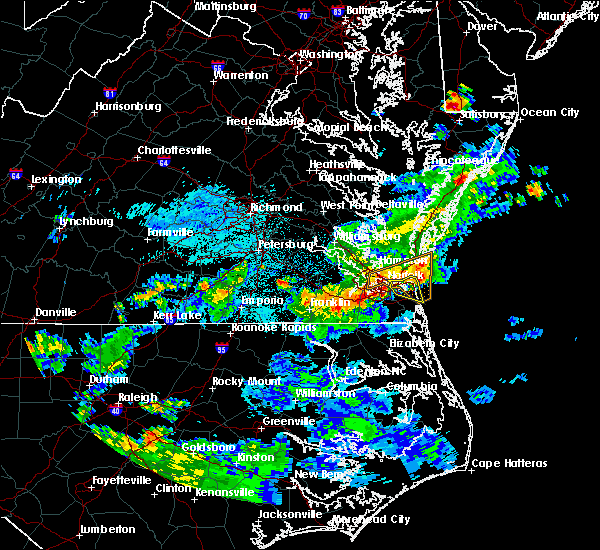 The severe thunderstorm warning for the northern city of virginia beach will expire at 945 pm edt, the storm which prompted the warning has weakened below severe limits, and exited the warned area. therefore the warning will be allowed to expire. however heavy rain is still possible with this thunderstorm. a severe thunderstorm watch remains in effect until 1100 pm edt for southeastern virginia. The severe thunderstorm warning for the northern city of virginia beach will expire at 945 pm edt, the storm which prompted the warning has weakened below severe limits, and exited the warned area. therefore the warning will be allowed to expire. however heavy rain is still possible with this thunderstorm. a severe thunderstorm watch remains in effect until 1100 pm edt for southeastern virginia.
|
| 6/5/2016 9:24 PM EDT |
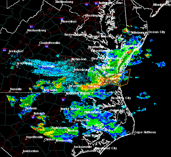 At 923 pm edt, a severe thunderstorm was located near virginia beach, moving east at 35 mph (radar indicated). Hazards include 60 mph wind gusts. Expect damage to roofs. siding. and trees. this severe storm will be near, virginia beach around 930 pm edt. other locations impacted by this severe thunderstorm include oceana, oceana nas, north virginia beach, princess anne plaza, london bridge, bayside, dam neck, rudee heights and macons corner. precautionary/preparedness actions, for your protection move to an interior room on the lowest floor of a building. please send your reports of hail and or wind damage, including trees or large limbs downed, by calling noaa`s national weather service in wakefield at , 7 5 7, 8 9 9, 2 4 1 5. At 923 pm edt, a severe thunderstorm was located near virginia beach, moving east at 35 mph (radar indicated). Hazards include 60 mph wind gusts. Expect damage to roofs. siding. and trees. this severe storm will be near, virginia beach around 930 pm edt. other locations impacted by this severe thunderstorm include oceana, oceana nas, north virginia beach, princess anne plaza, london bridge, bayside, dam neck, rudee heights and macons corner. precautionary/preparedness actions, for your protection move to an interior room on the lowest floor of a building. please send your reports of hail and or wind damage, including trees or large limbs downed, by calling noaa`s national weather service in wakefield at , 7 5 7, 8 9 9, 2 4 1 5.
|
| 6/5/2016 8:54 PM EDT |
 At 854 pm edt, a severe thunderstorm was located over portsmouth, or over downtown portsmouth, moving east at 35 mph (radar indicated). Hazards include 60 mph wind gusts. Expect damage to roofs. siding. and trees. this severe thunderstorm will be near, norfolk state university, ocean view and norview around 900 pm edt. virginia wesleyan college, regent university and norfolk international around 905 pm edt. kempsville and norfolk around 910 pm edt. princess anne around 920 pm edt. virginia beach around 925 pm edt. Other locations impacted by this severe thunderstorm include south norfolk, oceana, mount pleasant, chesapeake airport, north virginia beach, princess anne plaza, pungo, london bridge, dam neck and portlock. At 854 pm edt, a severe thunderstorm was located over portsmouth, or over downtown portsmouth, moving east at 35 mph (radar indicated). Hazards include 60 mph wind gusts. Expect damage to roofs. siding. and trees. this severe thunderstorm will be near, norfolk state university, ocean view and norview around 900 pm edt. virginia wesleyan college, regent university and norfolk international around 905 pm edt. kempsville and norfolk around 910 pm edt. princess anne around 920 pm edt. virginia beach around 925 pm edt. Other locations impacted by this severe thunderstorm include south norfolk, oceana, mount pleasant, chesapeake airport, north virginia beach, princess anne plaza, pungo, london bridge, dam neck and portlock.
|
| 6/5/2016 8:44 PM EDT |
 At 844 pm edt, a severe thunderstorm was located over driver, or near churchland, moving east at 35 mph (law enforcement). Hazards include 60 mph wind gusts. Expect damage to roofs. siding. and trees. this severe storm will be near, churchland and chesapeake around 850 pm edt. deep creek, portsmouth and cradock around 855 pm edt. downtown portsmouth, downtown norfolk, norfolk state university, old dominion university, ocean view, ghent, norview and norfolk nas around 900 pm edt. other locations impacted by this severe thunderstorm include south norfolk, magnolia, raleigh terrace, chesapeake airport, chuckatuck, wilroy, portlock, langley view, wards corner and herberts corner. precautionary/preparedness actions, for your protection move to an interior room on the lowest floor of a building. please send your reports of hail and or wind damage, including trees or large limbs downed, by calling noaa`s national weather service in wakefield at , 7 5 7, 8 9 9, 2 4 1 5. At 844 pm edt, a severe thunderstorm was located over driver, or near churchland, moving east at 35 mph (law enforcement). Hazards include 60 mph wind gusts. Expect damage to roofs. siding. and trees. this severe storm will be near, churchland and chesapeake around 850 pm edt. deep creek, portsmouth and cradock around 855 pm edt. downtown portsmouth, downtown norfolk, norfolk state university, old dominion university, ocean view, ghent, norview and norfolk nas around 900 pm edt. other locations impacted by this severe thunderstorm include south norfolk, magnolia, raleigh terrace, chesapeake airport, chuckatuck, wilroy, portlock, langley view, wards corner and herberts corner. precautionary/preparedness actions, for your protection move to an interior room on the lowest floor of a building. please send your reports of hail and or wind damage, including trees or large limbs downed, by calling noaa`s national weather service in wakefield at , 7 5 7, 8 9 9, 2 4 1 5.
|
| 6/5/2016 8:23 PM EDT |
 At 822 pm edt, a severe thunderstorm was located over windsor, moving east at 40 mph (radar indicated). Hazards include 60 mph wind gusts. Expect damage to roofs. siding. and trees. this severe thunderstorm will be near, kings fork around 830 pm edt. downtown suffolk around 835 pm edt. driver around 845 pm edt. suffolk and crittenden around 850 pm edt. western branch and bowers hill around 855 pm edt. churchland, downtown portsmouth, old dominion university, downtown norfolk, norfolk state university, deep creek, chesapeake, portsmouth, cradock and ghent around 900 pm edt. Other locations impacted by this severe thunderstorm include suffolk airport, south norfolk, indika, lees mill, lawson, chuckatuck, raynor, collosse, langley view and benns church. At 822 pm edt, a severe thunderstorm was located over windsor, moving east at 40 mph (radar indicated). Hazards include 60 mph wind gusts. Expect damage to roofs. siding. and trees. this severe thunderstorm will be near, kings fork around 830 pm edt. downtown suffolk around 835 pm edt. driver around 845 pm edt. suffolk and crittenden around 850 pm edt. western branch and bowers hill around 855 pm edt. churchland, downtown portsmouth, old dominion university, downtown norfolk, norfolk state university, deep creek, chesapeake, portsmouth, cradock and ghent around 900 pm edt. Other locations impacted by this severe thunderstorm include suffolk airport, south norfolk, indika, lees mill, lawson, chuckatuck, raynor, collosse, langley view and benns church.
|
| 5/2/2016 8:33 PM EDT | Storm damage reported in city of norfolk county VA, 2.8 miles SSW of Norfolk, VA |
| 5/2/2016 8:32 PM EDT |
 At 831 pm edt, a severe thunderstorm was located over portsmouth, or over churchland, moving northeast at 30 mph (radar indicated). Hazards include quarter size hail. Damage to vehicles is expected. this severe storm will be near, downtown portsmout and downtown norfolk around 835 pm edt. old dominion university, norfolk state university and ghent around 840 pm edt. virginia wesleyan college, norfolk nas and norview around 845 pm edt. virginia beach, ocean view, norfolk and norfolk international arpt around 850 pm edt. other locations impacted by this severe thunderstorm include south norfolk, willoughby spit and wards corner. precautionary/preparedness actions, for your protection move to an interior room on the lowest floor of a building. please send your reports of hail and or wind damage, including trees or large limbs downed, by calling noaa`s national weather service in wakefield at , 7 5 7, 8 9 9, 2 4 1 5. At 831 pm edt, a severe thunderstorm was located over portsmouth, or over churchland, moving northeast at 30 mph (radar indicated). Hazards include quarter size hail. Damage to vehicles is expected. this severe storm will be near, downtown portsmout and downtown norfolk around 835 pm edt. old dominion university, norfolk state university and ghent around 840 pm edt. virginia wesleyan college, norfolk nas and norview around 845 pm edt. virginia beach, ocean view, norfolk and norfolk international arpt around 850 pm edt. other locations impacted by this severe thunderstorm include south norfolk, willoughby spit and wards corner. precautionary/preparedness actions, for your protection move to an interior room on the lowest floor of a building. please send your reports of hail and or wind damage, including trees or large limbs downed, by calling noaa`s national weather service in wakefield at , 7 5 7, 8 9 9, 2 4 1 5.
|
| 5/2/2016 8:14 PM EDT |
 At 814 pm edt, a severe thunderstorm was located over bowers hill, or near deep creek, moving northeast at 30 mph (radar indicated). Hazards include quarter size hail. Damage to vehicles is expected. this severe thunderstorm will be near, deep creek around 820 pm edt. western branch around 825 pm edt. churchland, chesapeake and cradock around 830 pm edt. downtown portsmout and portsmouth around 835 pm edt. old dominion university, downtown norfolk, norfolk state university and ghent around 840 pm edt. virginia wesleyan college, norfolk nas and norview around 845 pm edt. ocean view and norfolk international arpt around 850 pm edt. virginia beach and norfolk around 855 pm edt. Other locations impacted by this severe thunderstorm include south norfolk, huntersville, deanes, willoughby spit, wards corner and portlock. At 814 pm edt, a severe thunderstorm was located over bowers hill, or near deep creek, moving northeast at 30 mph (radar indicated). Hazards include quarter size hail. Damage to vehicles is expected. this severe thunderstorm will be near, deep creek around 820 pm edt. western branch around 825 pm edt. churchland, chesapeake and cradock around 830 pm edt. downtown portsmout and portsmouth around 835 pm edt. old dominion university, downtown norfolk, norfolk state university and ghent around 840 pm edt. virginia wesleyan college, norfolk nas and norview around 845 pm edt. ocean view and norfolk international arpt around 850 pm edt. virginia beach and norfolk around 855 pm edt. Other locations impacted by this severe thunderstorm include south norfolk, huntersville, deanes, willoughby spit, wards corner and portlock.
|
| 4/28/2016 10:22 PM EDT |
 At 1022 pm edt, a severe thunderstorm was located over churchland, moving northeast at 20 mph (radar indicated). Hazards include 60 mph wind gusts and quarter size hail. Hail damage to vehicles is expected. expect wind damage to roofs, siding, and trees. this severe thunderstorm will be near, old dominion university and ghent around 1030 pm edt. norfolk nas and norview around 1040 pm edt. ocean view, norfolk, fort monroe and norfolk international arpt around 1045 pm edt. Other locations impacted by this severe thunderstorm include willoughby spit and wards corner. At 1022 pm edt, a severe thunderstorm was located over churchland, moving northeast at 20 mph (radar indicated). Hazards include 60 mph wind gusts and quarter size hail. Hail damage to vehicles is expected. expect wind damage to roofs, siding, and trees. this severe thunderstorm will be near, old dominion university and ghent around 1030 pm edt. norfolk nas and norview around 1040 pm edt. ocean view, norfolk, fort monroe and norfolk international arpt around 1045 pm edt. Other locations impacted by this severe thunderstorm include willoughby spit and wards corner.
|
| 2/24/2016 8:37 PM EST | Power out at norfolk international airport in city of norfolk county VA, 2.8 miles SSW of Norfolk, VA |
| 2/24/2016 8:33 PM EST |
 At 832 pm est, doppler radar indicated severe thunderstorms capable of producing tornadoes. these dangerous storms were located along a line extending from near churchland to near suffolk, moving northeast at 70 mph. these dangerous storms will be near, portsmouth and norfolk nas around 840 pm est. churchland and suffolk around 845 pm est. other locations impacted by these tornadic storms include chuckatuck, deanes, huntersville, willoughby spit, wilroy and hobson. At 832 pm est, doppler radar indicated severe thunderstorms capable of producing tornadoes. these dangerous storms were located along a line extending from near churchland to near suffolk, moving northeast at 70 mph. these dangerous storms will be near, portsmouth and norfolk nas around 840 pm est. churchland and suffolk around 845 pm est. other locations impacted by these tornadic storms include chuckatuck, deanes, huntersville, willoughby spit, wilroy and hobson.
|
| 2/24/2016 8:28 PM EST |
 At 828 pm est, doppler radar indicated severe thunderstorms capable of producing tornadoes. these dangerous storms were located along a line extending from churchland to near suffolk, moving northeast at 70 mph. these dangerous storms will be near, ocean view, old dominion university, portsmouth, norfolk nas and ghent around 835 pm est. chesapeake around 840 pm est. churchland, suffolk, crittenden and western branch around 845 pm est. other locations impacted by these tornadic storms include huntersville, magnolia, hobson, kilby, chuckatuck, deanes, willoughby spit, wilroy, wards corner and lummis. At 828 pm est, doppler radar indicated severe thunderstorms capable of producing tornadoes. these dangerous storms were located along a line extending from churchland to near suffolk, moving northeast at 70 mph. these dangerous storms will be near, ocean view, old dominion university, portsmouth, norfolk nas and ghent around 835 pm est. chesapeake around 840 pm est. churchland, suffolk, crittenden and western branch around 845 pm est. other locations impacted by these tornadic storms include huntersville, magnolia, hobson, kilby, chuckatuck, deanes, willoughby spit, wilroy, wards corner and lummis.
|
| 2/24/2016 8:13 PM EST |
 At 813 pm est, doppler radar indicated a line of severe thunderstorms capable of producing a tornado. these dangerous storms were located along a line extending from downtown suffolk to near roduco, and moving northeast at 70 mph. in addition, hail of 1.00 inch diameter or larger is possible with these storms. * these dangerous storms will be near, driver and bowers hill around 820 pm est. churchland, chesapeake, western branch and cradock around 825 pm est. downtown suffolk, old dominion university, downtown norfolk, downtown portsmouth, norfolk state university, portsmouth, kings fork, ghent and norview around 830 pm est. ocean view, norfolk and norfolk nas around 835 pm est. crittenden around 840 pm est. suffolk around 845 pm est. other locations impacted by these tornadic storms include suffolk airport, south norfolk, magnolia, wyanoke, chuckatuck, wilroy, portlock, drum hill, wards corner and cleopus. At 813 pm est, doppler radar indicated a line of severe thunderstorms capable of producing a tornado. these dangerous storms were located along a line extending from downtown suffolk to near roduco, and moving northeast at 70 mph. in addition, hail of 1.00 inch diameter or larger is possible with these storms. * these dangerous storms will be near, driver and bowers hill around 820 pm est. churchland, chesapeake, western branch and cradock around 825 pm est. downtown suffolk, old dominion university, downtown norfolk, downtown portsmouth, norfolk state university, portsmouth, kings fork, ghent and norview around 830 pm est. ocean view, norfolk and norfolk nas around 835 pm est. crittenden around 840 pm est. suffolk around 845 pm est. other locations impacted by these tornadic storms include suffolk airport, south norfolk, magnolia, wyanoke, chuckatuck, wilroy, portlock, drum hill, wards corner and cleopus.
|
| 2/24/2016 3:53 PM EST |
 At 353 pm est, doppler radar indicated a severe thunderstorm capable of producing a tornado. this dangerous storm was located over norfolk nas, or over ocean view, moving northeast at 50 mph. this tornadic thunderstorm will remain over mainly rural areas of , the city of norfolk and the northwestern city of virginia beach, including the following locations: willoughby spit, wards corner and bayside. At 353 pm est, doppler radar indicated a severe thunderstorm capable of producing a tornado. this dangerous storm was located over norfolk nas, or over ocean view, moving northeast at 50 mph. this tornadic thunderstorm will remain over mainly rural areas of , the city of norfolk and the northwestern city of virginia beach, including the following locations: willoughby spit, wards corner and bayside.
|
| 2/24/2016 3:43 PM EST |
 At 343 pm est, doppler radar indicated a severe thunderstorm capable of producing a tornado. this dangerous storm was located over portsmouth, or over churchland, moving northeast at 50 mph. this dangerous storm will be near, virginia wesleyan college and norview around 350 pm est. ocean view, norfolk, norfolk nas and norfolk international arpt around 355 pm est. other locations impacted by this tornadic thunderstorm include south norfolk, willoughby spit, portlock, bayside and wards corner. At 343 pm est, doppler radar indicated a severe thunderstorm capable of producing a tornado. this dangerous storm was located over portsmouth, or over churchland, moving northeast at 50 mph. this dangerous storm will be near, virginia wesleyan college and norview around 350 pm est. ocean view, norfolk, norfolk nas and norfolk international arpt around 355 pm est. other locations impacted by this tornadic thunderstorm include south norfolk, willoughby spit, portlock, bayside and wards corner.
|
| 2/24/2016 3:31 PM EST |
 At 331 pm est, doppler radar indicated a tornado. this dangerous storm was located near bowers hill, or near deep creek, and moving northeast at 50 mph. * this dangerous storm will be near, deep creek, chesapeake, bowers hill and western branch around 340 pm est. churchland, downtown portsmouth and cradock around 345 pm est. old dominion university, downtown norfolk, norfolk state university, portsmouth, ghent and norview around 350 pm est. ocean view, virginia wesleyan college, norfolk, norfolk nas and norfolk international arpt around 355 pm est. other locations impacted by this tornadic thunderstorm include south norfolk, huntersville, deanes, willoughby spit, portlock, bayside and wards corner. At 331 pm est, doppler radar indicated a tornado. this dangerous storm was located near bowers hill, or near deep creek, and moving northeast at 50 mph. * this dangerous storm will be near, deep creek, chesapeake, bowers hill and western branch around 340 pm est. churchland, downtown portsmouth and cradock around 345 pm est. old dominion university, downtown norfolk, norfolk state university, portsmouth, ghent and norview around 350 pm est. ocean view, virginia wesleyan college, norfolk, norfolk nas and norfolk international arpt around 355 pm est. other locations impacted by this tornadic thunderstorm include south norfolk, huntersville, deanes, willoughby spit, portlock, bayside and wards corner.
|
| 7/18/2015 5:42 PM EDT |
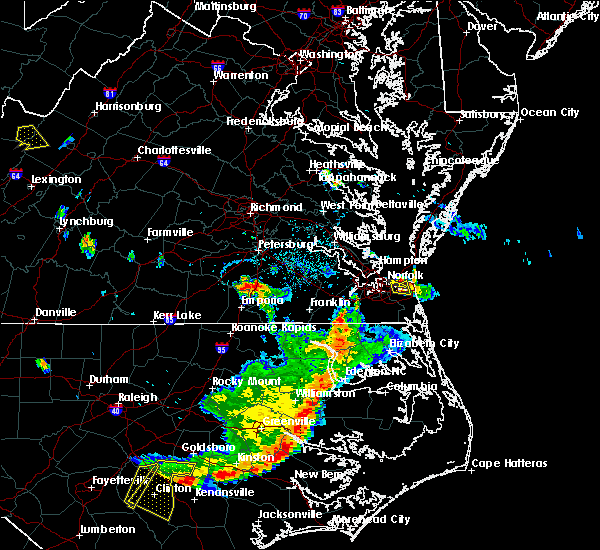 At 540 pm edt, doppler radar indicated a severe thunderstorm capable of producing damaging winds in excess of 60 mph. this storm was located just east of norfolk international arpt, or near virginia wesleyan college. this storm was moving east at 5 mph. * this severe thunderstorm will be near, virginia beach around 545 pm edt. other locations impacted by this severe thunderstorm include london bridge, bayside, oceana nas and princess anne plaza. At 540 pm edt, doppler radar indicated a severe thunderstorm capable of producing damaging winds in excess of 60 mph. this storm was located just east of norfolk international arpt, or near virginia wesleyan college. this storm was moving east at 5 mph. * this severe thunderstorm will be near, virginia beach around 545 pm edt. other locations impacted by this severe thunderstorm include london bridge, bayside, oceana nas and princess anne plaza.
|
| 6/30/2015 10:30 PM EDT |
 At 1030 pm edt, doppler radar indicated a line of severe thunderstorms capable of producing damaging winds in excess of 60 mph. these storms were located along a line extending from near zuni to como to near roxobel, and moving east at 65 mph. * severe thunderstorms will be near, windsor, winton and zuni around 1035 pm edt. isle of wight, gates, roduco and kings fork around 1040 pm edt. gatesville and whaleyville around 1045 pm edt. sunbury, suffolk, powellsville, driver and corapeake around 1050 pm edt. churchland, deep creek, chesapeake, portsmouth, western branch and bowers hill around 1055 pm edt. norfolk state university, downtown norfolk, downtown portsmouth, old dominion university, colerain, ghent, cradock and norview around 1100 pm edt. virginia beach, south mills, virginia wesleyan college, norfolk, valhalla, rockyhock, morgans corner, norfolk international arpt and tyner around 1105 pm edt. hertford and winfall around 1115 pm edt. other locations impacted by these severe thunderstorms include lees mill, proctors corner, chuckatuck, poor town, carter, boaz, riddicksville, millennium, wills corner and burdette. At 1030 pm edt, doppler radar indicated a line of severe thunderstorms capable of producing damaging winds in excess of 60 mph. these storms were located along a line extending from near zuni to como to near roxobel, and moving east at 65 mph. * severe thunderstorms will be near, windsor, winton and zuni around 1035 pm edt. isle of wight, gates, roduco and kings fork around 1040 pm edt. gatesville and whaleyville around 1045 pm edt. sunbury, suffolk, powellsville, driver and corapeake around 1050 pm edt. churchland, deep creek, chesapeake, portsmouth, western branch and bowers hill around 1055 pm edt. norfolk state university, downtown norfolk, downtown portsmouth, old dominion university, colerain, ghent, cradock and norview around 1100 pm edt. virginia beach, south mills, virginia wesleyan college, norfolk, valhalla, rockyhock, morgans corner, norfolk international arpt and tyner around 1105 pm edt. hertford and winfall around 1115 pm edt. other locations impacted by these severe thunderstorms include lees mill, proctors corner, chuckatuck, poor town, carter, boaz, riddicksville, millennium, wills corner and burdette.
|
| 6/30/2015 10:30 PM EDT |
 The national weather service in wakefield has issued a * severe thunderstorm warning for. northwestern pasquotank county in northeastern north carolina. hertford county in northeastern north carolina. northern bertie county in northeastern north carolina. Northwestern currituck county in northeastern north carolina. The national weather service in wakefield has issued a * severe thunderstorm warning for. northwestern pasquotank county in northeastern north carolina. hertford county in northeastern north carolina. northern bertie county in northeastern north carolina. Northwestern currituck county in northeastern north carolina.
|
| 6/30/2015 10:30 PM EDT |
 At 1030 pm edt, doppler radar indicated a line of severe thunderstorms capable of producing damaging winds in excess of 60 mph. these storms were located along a line extending from near zuni to como to near roxobel, and moving east at 65 mph. * severe thunderstorms will be near, windsor, winton and zuni around 1035 pm edt. isle of wight, gates, roduco and kings fork around 1040 pm edt. gatesville and whaleyville around 1045 pm edt. sunbury, suffolk, powellsville, driver and corapeake around 1050 pm edt. churchland, deep creek, chesapeake, portsmouth, western branch and bowers hill around 1055 pm edt. norfolk state university, downtown norfolk, downtown portsmouth, old dominion university, colerain, ghent, cradock and norview around 1100 pm edt. virginia beach, south mills, virginia wesleyan college, norfolk, valhalla, rockyhock, morgans corner, norfolk international arpt and tyner around 1105 pm edt. hertford and winfall around 1115 pm edt. other locations impacted by these severe thunderstorms include lees mill, proctors corner, chuckatuck, poor town, carter, boaz, riddicksville, millennium, wills corner and burdette. At 1030 pm edt, doppler radar indicated a line of severe thunderstorms capable of producing damaging winds in excess of 60 mph. these storms were located along a line extending from near zuni to como to near roxobel, and moving east at 65 mph. * severe thunderstorms will be near, windsor, winton and zuni around 1035 pm edt. isle of wight, gates, roduco and kings fork around 1040 pm edt. gatesville and whaleyville around 1045 pm edt. sunbury, suffolk, powellsville, driver and corapeake around 1050 pm edt. churchland, deep creek, chesapeake, portsmouth, western branch and bowers hill around 1055 pm edt. norfolk state university, downtown norfolk, downtown portsmouth, old dominion university, colerain, ghent, cradock and norview around 1100 pm edt. virginia beach, south mills, virginia wesleyan college, norfolk, valhalla, rockyhock, morgans corner, norfolk international arpt and tyner around 1105 pm edt. hertford and winfall around 1115 pm edt. other locations impacted by these severe thunderstorms include lees mill, proctors corner, chuckatuck, poor town, carter, boaz, riddicksville, millennium, wills corner and burdette.
|
| 6/26/2015 12:43 AM EDT |
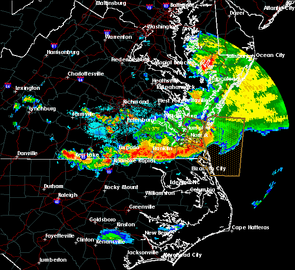 At 1242 am edt, doppler radar indicated a severe thunderstorm capable of producing damaging winds in excess of 60 mph. this storm was located near virginia beach, moving east at 30 mph. this severe thunderstorm will remain over the southeastern city of norfolk and the northern city of virginia beach, including the following locations, oceana, oceana nas, north virginia beach, princess anne plaza, london bridge, dam neck, rudee heights, gallups corner and macons corner. At 1242 am edt, doppler radar indicated a severe thunderstorm capable of producing damaging winds in excess of 60 mph. this storm was located near virginia beach, moving east at 30 mph. this severe thunderstorm will remain over the southeastern city of norfolk and the northern city of virginia beach, including the following locations, oceana, oceana nas, north virginia beach, princess anne plaza, london bridge, dam neck, rudee heights, gallups corner and macons corner.
|
| 6/26/2015 12:36 AM EDT |
 At 1235 am edt, doppler radar indicated a line of severe thunderstorms capable of producing damaging winds in excess of 60 mph. these storms were located along a line extending from near princess anne to 8 miles south of deep creek to near como, and moving southeast at 20 mph. * severe thunderstorms will be near, princess anne around 1240 am edt. back bay around 100 am edt. gates, winton and northwest around 110 am edt. south mills, cofield, roduco and morgans corner around 115 am edt. camden, gatesville, harrellsville, moyock and knotts island around 130 am edt. other locations impacted by these severe thunderstorms include nicanor, south norfolk, lambs corner, galatia, wyanoke, lees mill, proctors corner, branchville, pendleton and shiloh. At 1235 am edt, doppler radar indicated a line of severe thunderstorms capable of producing damaging winds in excess of 60 mph. these storms were located along a line extending from near princess anne to 8 miles south of deep creek to near como, and moving southeast at 20 mph. * severe thunderstorms will be near, princess anne around 1240 am edt. back bay around 100 am edt. gates, winton and northwest around 110 am edt. south mills, cofield, roduco and morgans corner around 115 am edt. camden, gatesville, harrellsville, moyock and knotts island around 130 am edt. other locations impacted by these severe thunderstorms include nicanor, south norfolk, lambs corner, galatia, wyanoke, lees mill, proctors corner, branchville, pendleton and shiloh.
|
| 6/26/2015 12:30 AM EDT | Large power transformer blown down on buffalo ave in norfolk in city of norfolk county VA, 3.8 miles S of Norfolk, VA |
| 6/26/2015 12:14 AM EDT |
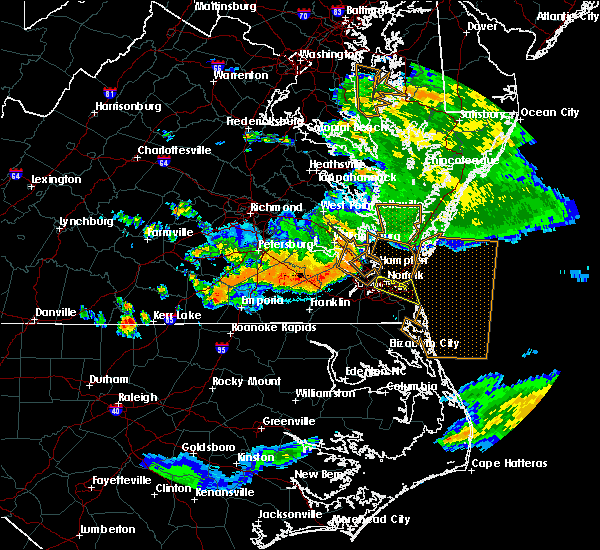 At 1214 am edt, doppler radar indicated a severe thunderstorm capable of producing damaging winds in excess of 60 mph. this storm was located over norfolk nas, or over ocean view, and moving east at 20 mph. * this severe thunderstorm will be near, norview around 1220 am edt. norfolk international arpt around 1225 am edt. virginia beach and virginia wesleyan college around 1230 am edt. kempsville around 1235 am edt. other locations impacted by this severe thunderstorm include oceana, oceana nas, north virginia beach, princess anne plaza, london bridge, willoughby spit, bayside, dam neck, rudee heights and gallups corner. At 1214 am edt, doppler radar indicated a severe thunderstorm capable of producing damaging winds in excess of 60 mph. this storm was located over norfolk nas, or over ocean view, and moving east at 20 mph. * this severe thunderstorm will be near, norview around 1220 am edt. norfolk international arpt around 1225 am edt. virginia beach and virginia wesleyan college around 1230 am edt. kempsville around 1235 am edt. other locations impacted by this severe thunderstorm include oceana, oceana nas, north virginia beach, princess anne plaza, london bridge, willoughby spit, bayside, dam neck, rudee heights and gallups corner.
|
| 6/21/2015 12:35 AM EDT | Tree downed on helmick av in city of norfolk county VA, 6.6 miles SE of Norfolk, VA |
| 6/21/2015 12:31 AM EDT |
 At 1230 am edt, doppler radar indicated a line of severe thunderstorms capable of producing damaging winds in excess of 60 mph. these storms were located along a line extending from 15 miles northeast of virginia beach to near back bay, moving east at 40 mph. penny size hail may also accompany the damaging winds. these severe thunderstorms will remain over mainly rural areas of , the southeastern city of norfolk, the city of chesapeake and the city of virginia beach, including the following locations, south norfolk, oceana, mount pleasant, chesapeake airport, north virginia beach, princess anne plaza, pungo, london bridge, portlock and dam neck. At 1230 am edt, doppler radar indicated a line of severe thunderstorms capable of producing damaging winds in excess of 60 mph. these storms were located along a line extending from 15 miles northeast of virginia beach to near back bay, moving east at 40 mph. penny size hail may also accompany the damaging winds. these severe thunderstorms will remain over mainly rural areas of , the southeastern city of norfolk, the city of chesapeake and the city of virginia beach, including the following locations, south norfolk, oceana, mount pleasant, chesapeake airport, north virginia beach, princess anne plaza, pungo, london bridge, portlock and dam neck.
|
| 6/21/2015 12:25 AM EDT | Tree down in city of norfolk county VA, 4.2 miles E of Norfolk, VA |
| 6/21/2015 12:01 AM EDT |
 At 1200 am edt, doppler radar indicated a line of severe thunderstorms capable of producing damaging winds in excess of 60 mph. these storms were located along a line extending from near ocean view to near corapeake, and moving east at 40 mph. * severe thunderstorms will be near, virginia beach, virginia wesleyan college, norfolk and norfolk international arpt around 1205 am edt. great bridge around 1225 am edt. fentress around 1230 am edt. back bay and princess anne around 1240 am edt. other locations impacted by these severe thunderstorms include south norfolk, oceana, mount pleasant, chesapeake airport, north virginia beach, princess anne plaza, pungo, london bridge, portlock and dam neck. At 1200 am edt, doppler radar indicated a line of severe thunderstorms capable of producing damaging winds in excess of 60 mph. these storms were located along a line extending from near ocean view to near corapeake, and moving east at 40 mph. * severe thunderstorms will be near, virginia beach, virginia wesleyan college, norfolk and norfolk international arpt around 1205 am edt. great bridge around 1225 am edt. fentress around 1230 am edt. back bay and princess anne around 1240 am edt. other locations impacted by these severe thunderstorms include south norfolk, oceana, mount pleasant, chesapeake airport, north virginia beach, princess anne plaza, pungo, london bridge, portlock and dam neck.
|
| 2/2/2015 12:45 PM EST | Tree fell on a pickup truck along major r in city of norfolk county VA, 5.2 miles SE of Norfolk, VA |
| 7/9/2014 4:57 PM EDT | Large section of a tree on hom in city of norfolk county VA, 4.7 miles SSE of Norfolk, VA |
| 7/9/2014 4:52 PM EDT | One large tree uprooted and lands on house on sloane street in city of norfolk county VA, 4.9 miles SSE of Norfolk, VA |
| 7/9/2014 4:50 PM EDT | Storm damage reported in city of norfolk county VA, 5.4 miles SE of Norfolk, VA |
| 7/9/2014 4:50 PM EDT | One large tree down on granby street in city of norfolk county VA, 2.5 miles E of Norfolk, VA |
| 5/5/2014 11:57 PM EDT | Quarter sized hail reported 4.2 miles E of Norfolk, VA |
| 8/10/2013 4:25 PM EDT | Large tree limbs down and partially blocking traffic in kirby crescent section of norfolk in city of norfolk county VA, 4 miles SE of Norfolk, VA |
| 6/13/2013 6:01 PM EDT | Large tree limbs downed on wildwood dr in city of norfolk county VA, 3.1 miles S of Norfolk, VA |
| 6/13/2013 5:53 PM EDT | Trees blow into power lines along meadow creek lan in city of norfolk county VA, 2.5 miles SSW of Norfolk, VA |
| 6/13/2013 5:50 PM EDT | Large tree limbs downed on wildwood dr in city of norfolk county VA, 3.1 miles S of Norfolk, VA |
| 6/13/2013 5:44 PM EDT | Storm damage reported in city of norfolk county VA, 5.4 miles SE of Norfolk, VA |
| 6/13/2013 5:40 PM EDT | House under construction was destroyed in ocean vie in city of norfolk county VA, 5.2 miles S of Norfolk, VA |
| 6/13/2013 5:38 PM EDT | Lafayette river weatherflow site in city of norfolk county VA, 5.5 miles ESE of Norfolk, VA |
| 6/13/2013 5:32 PM EDT | Storm damage reported in city of norfolk county VA, 5.4 miles SE of Norfolk, VA |
| 1/31/2013 2:51 AM EST | Storm damage reported in city of norfolk county VA, 2.8 miles SSW of Norfolk, VA |
| 1/31/2013 2:43 AM EST | Storm damage reported in city of norfolk county VA, 2.8 miles SSW of Norfolk, VA |
| 8/15/2012 4:33 PM EDT | Power lines down in the 1500 block of carey ave 6 in city of norfolk county VA, 2 miles E of Norfolk, VA |
| 6/30/2012 10:55 PM EDT | Storm damage reported in city of norfolk county VA, 3.2 miles ENE of Norfolk, VA |
| 6/25/2012 5:15 PM EDT | Large tree down in road at willow wood drive and gramby s in city of norfolk county VA, 3.5 miles ESE of Norfolk, VA |
| 6/25/2012 5:00 PM EDT | Weatherflow ob in city of norfolk county VA, 5.5 miles ESE of Norfolk, VA |
| 1/1/0001 12:00 AM | Trees down in norfolk on power line in city of norfolk county VA, 3.9 miles SSW of Norfolk, VA |
| 1/1/0001 12:00 AM | Storm damage reported in city of norfolk county VA, 6.6 miles SE of Norfolk, VA |
| 1/1/0001 12:00 AM | Large oak tree blown down near the intersection of newport avenue and oxford street...near grandby high school. the fallen tree also brought down power line in city of norfolk county VA, 4.3 miles SE of Norfolk, VA |
| 1/1/0001 12:00 AM | Large tree down on a house on wisteria plac in city of norfolk county VA, 4.2 miles SSW of Norfolk, VA |
| 1/1/0001 12:00 AM | *** 1 fatal *** tstm wind gust pushed crane against building pinning shipyard employe in city of norfolk county VA, 6.6 miles SE of Norfolk, VA |
| 1/1/0001 12:00 AM | Quarter sized hail reported 1.4 miles NW of Norfolk, VA, military highway and i-264 |
| 1/1/0001 12:00 AM | Quarter sized hail reported 1.7 miles S of Norfolk, VA, azalea garden road and military highway |
Hail Maps for Norfolk, VA
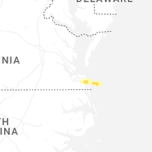


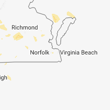


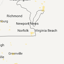


Connect with Interactive Hail Maps