

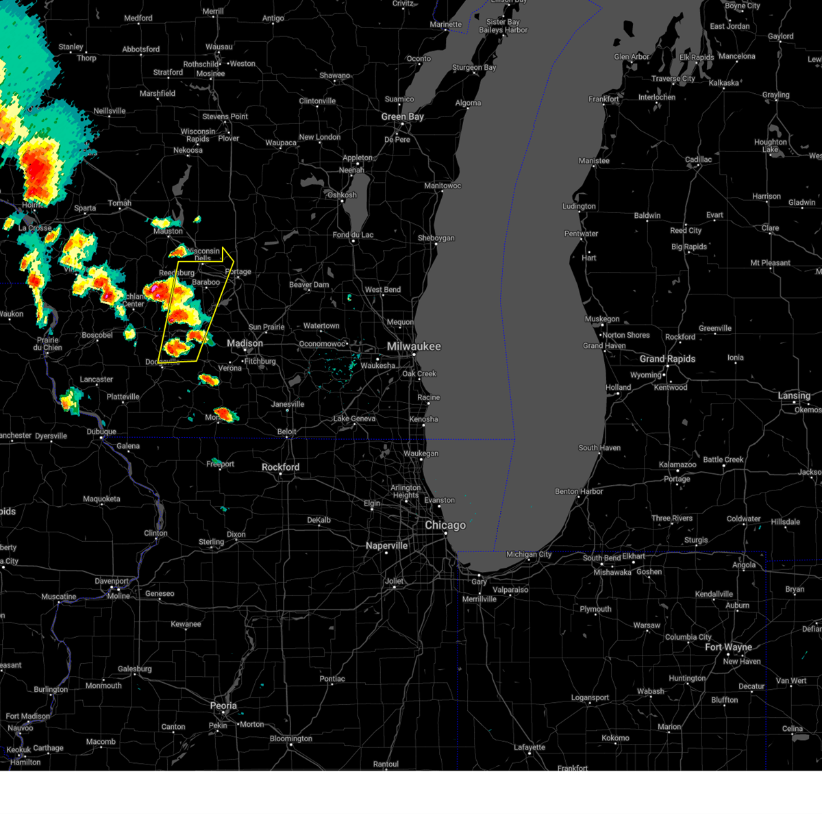
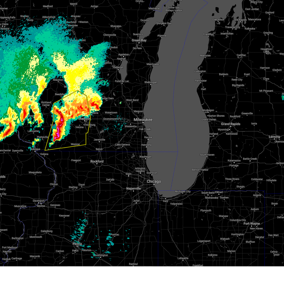
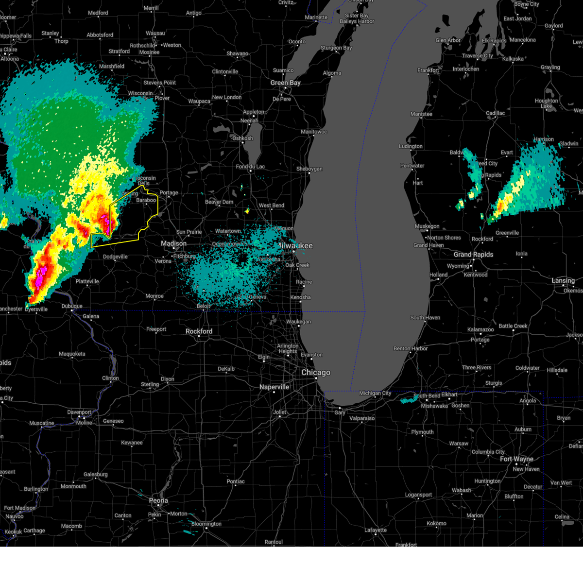
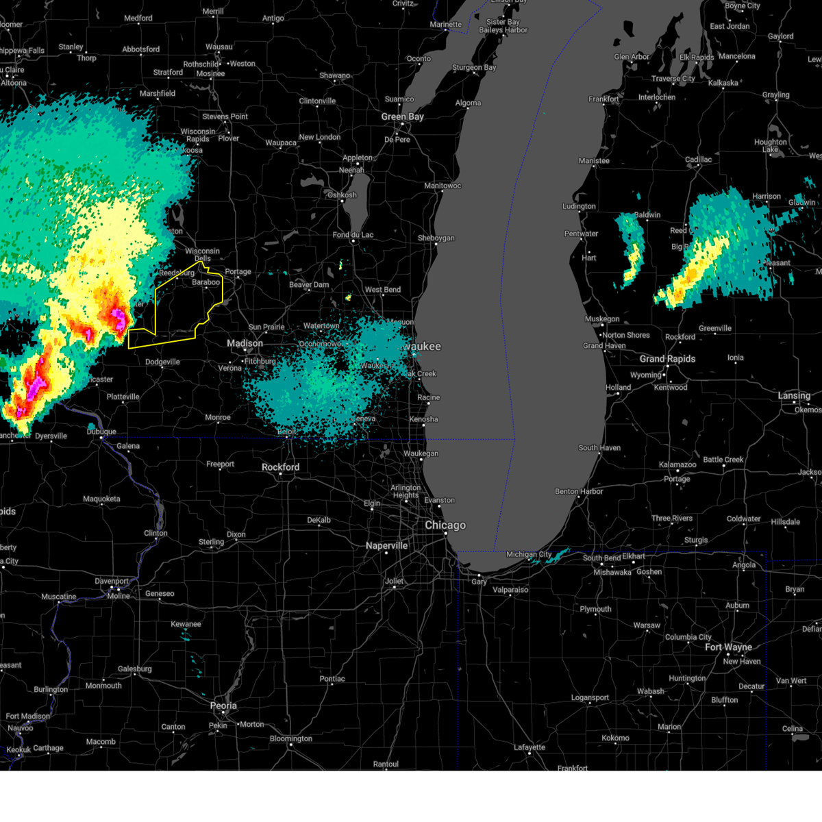
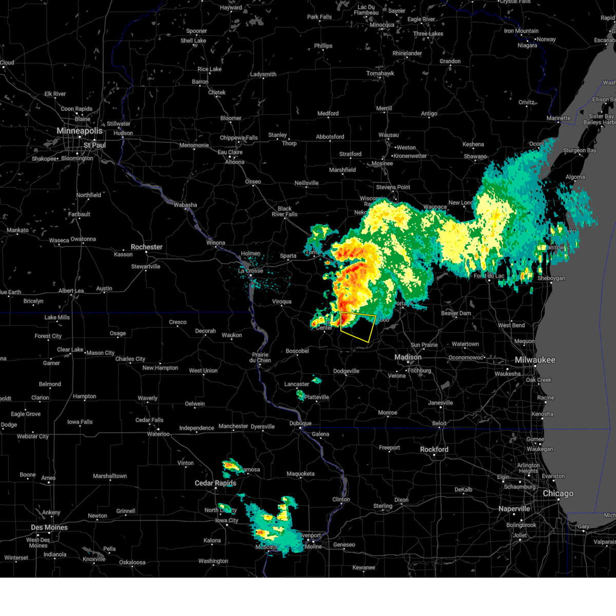
Hail Map for North Freedom, WI
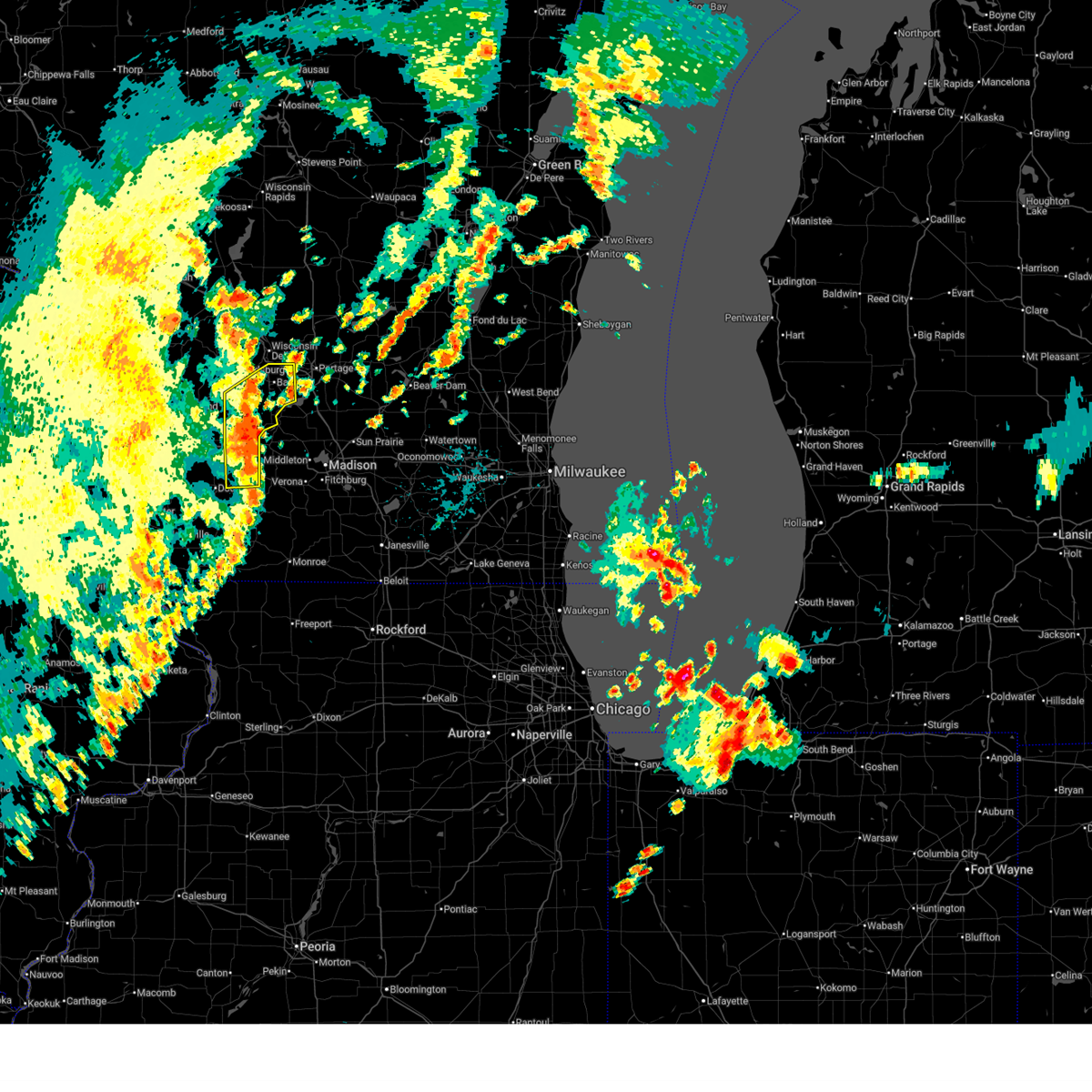
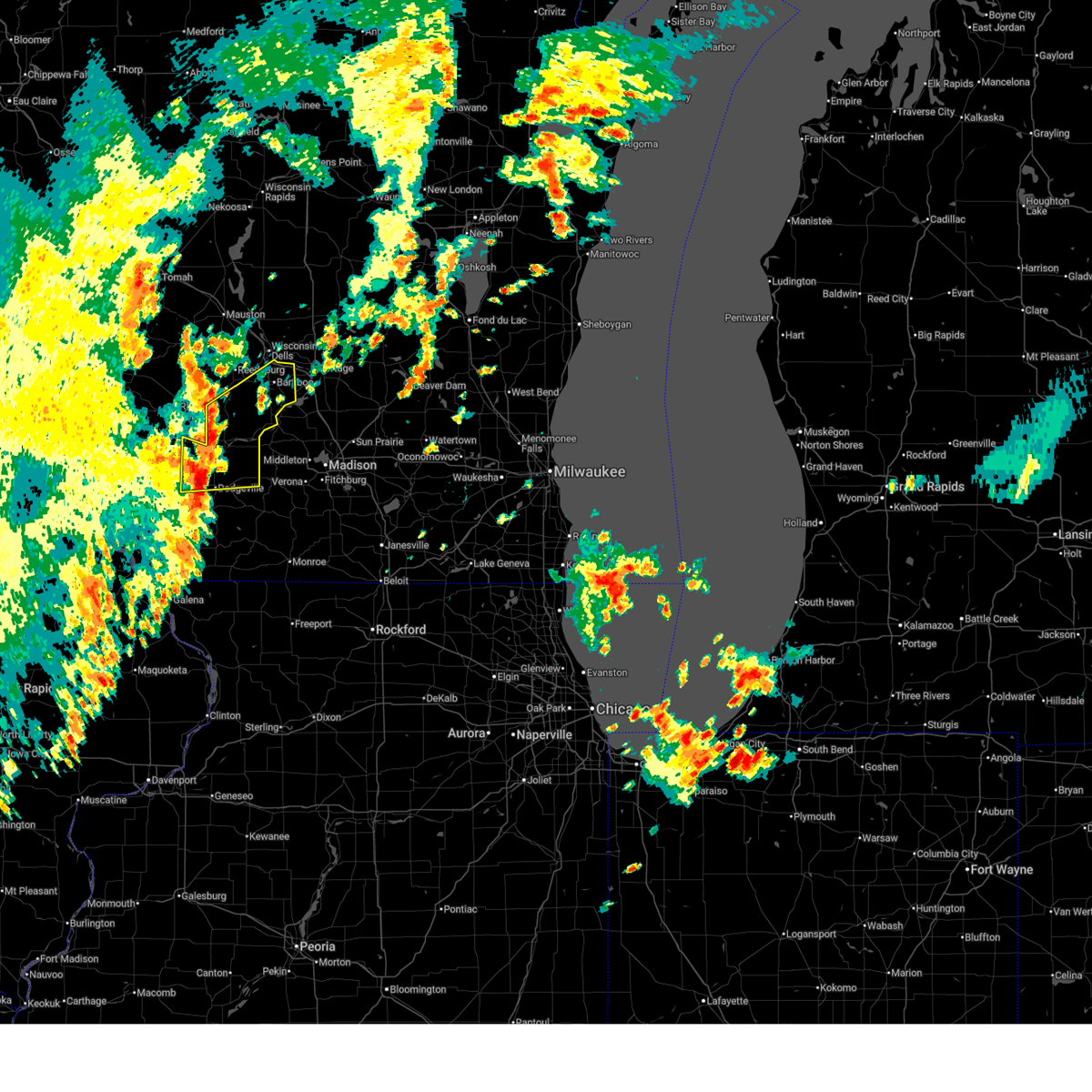
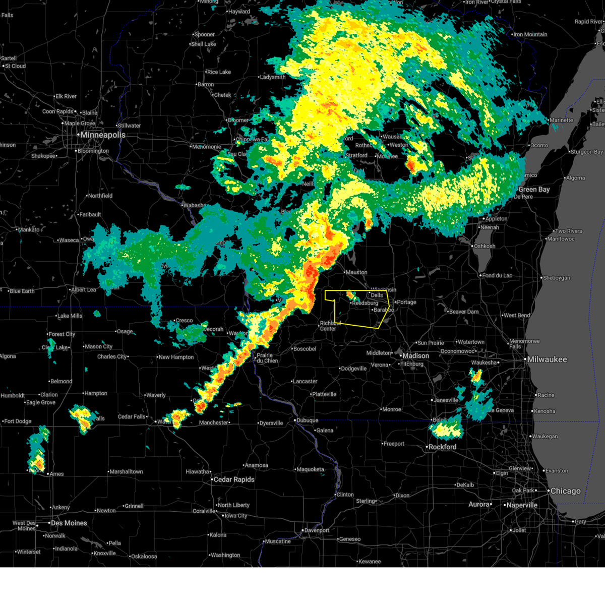
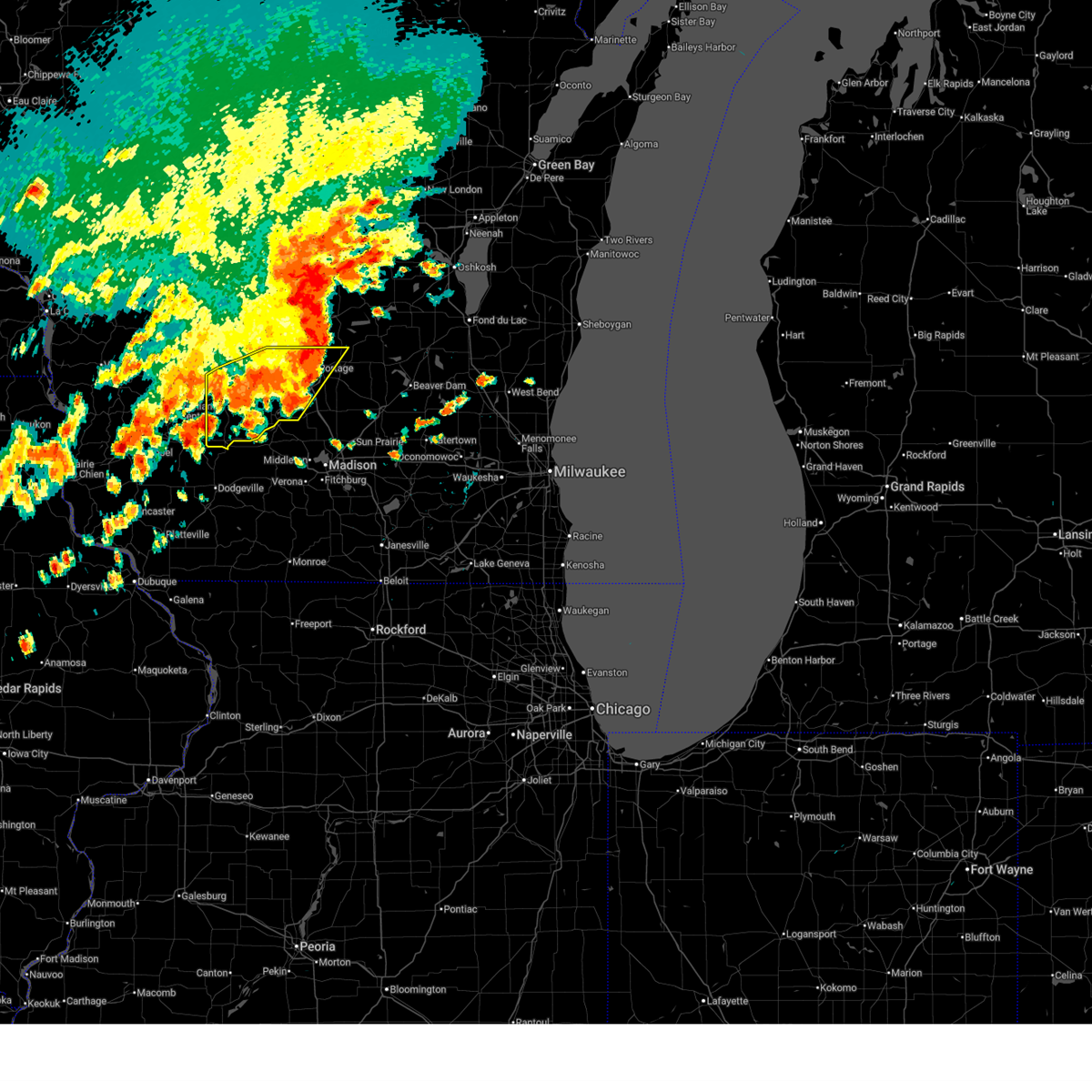
The North Freedom, WI area has had 2 reports of on-the-ground hail by trained spotters, and has been under severe weather warnings 18 times during the past 12 months. Doppler radar has detected hail at or near North Freedom, WI on 40 occasions, including 4 occasions during the past year.
| Name: | North Freedom, WI |
| Where Located: | 36 miles NW of Madison, WI |
| Map: | Google Map for North Freedom, WI |
| Population: | 701 |
| Housing Units: | 293 |
| More Info: | Search Google for North Freedom, WI |
1
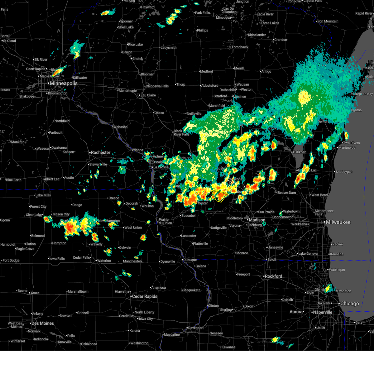
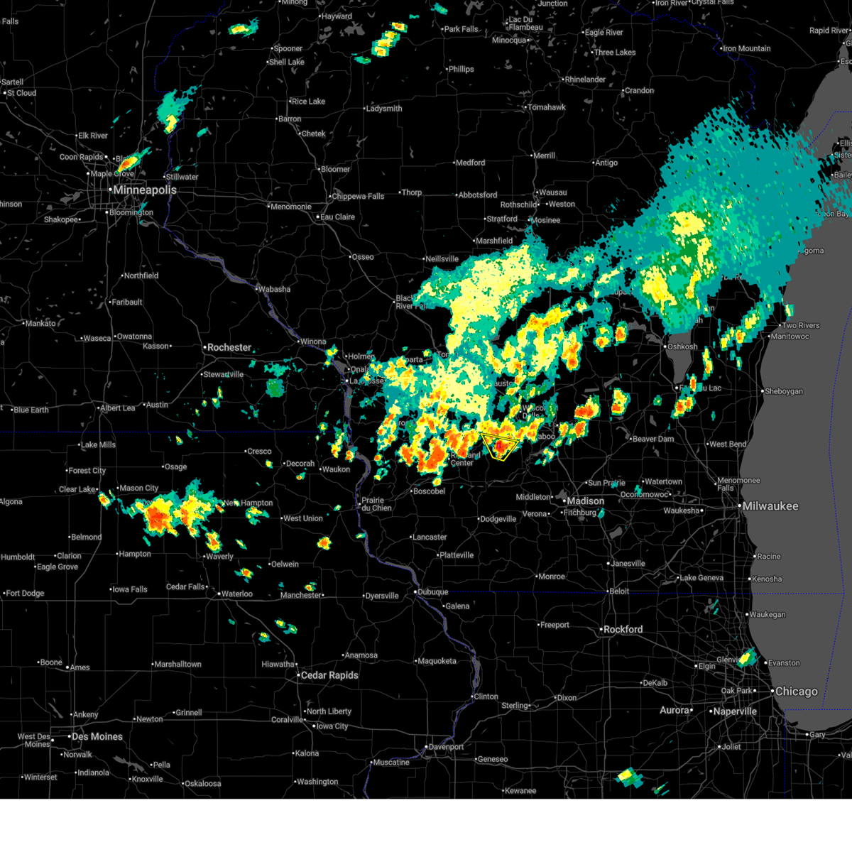
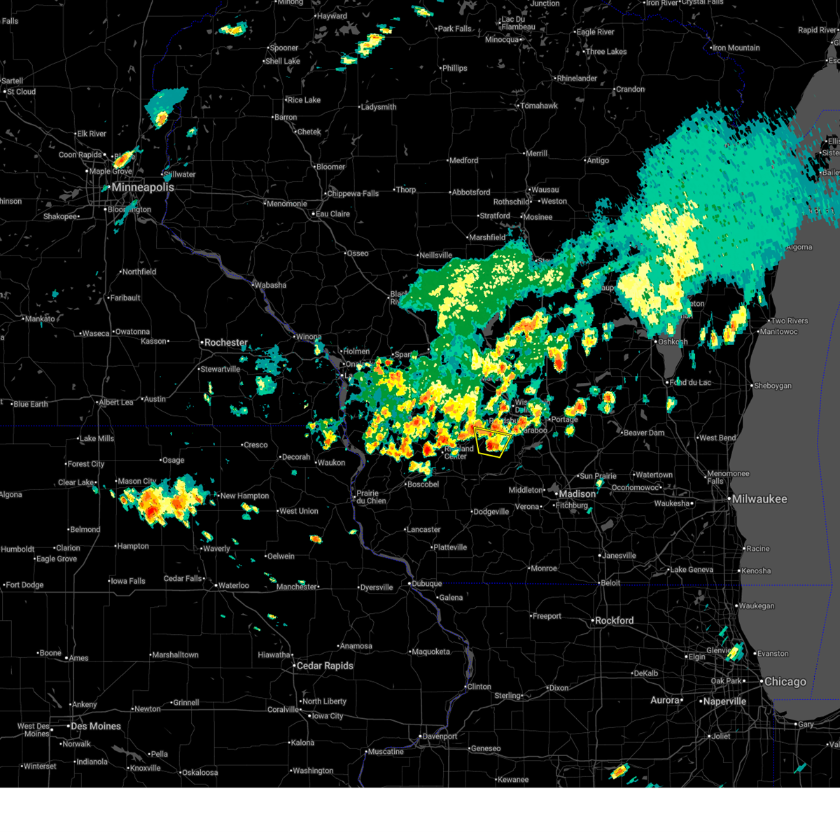
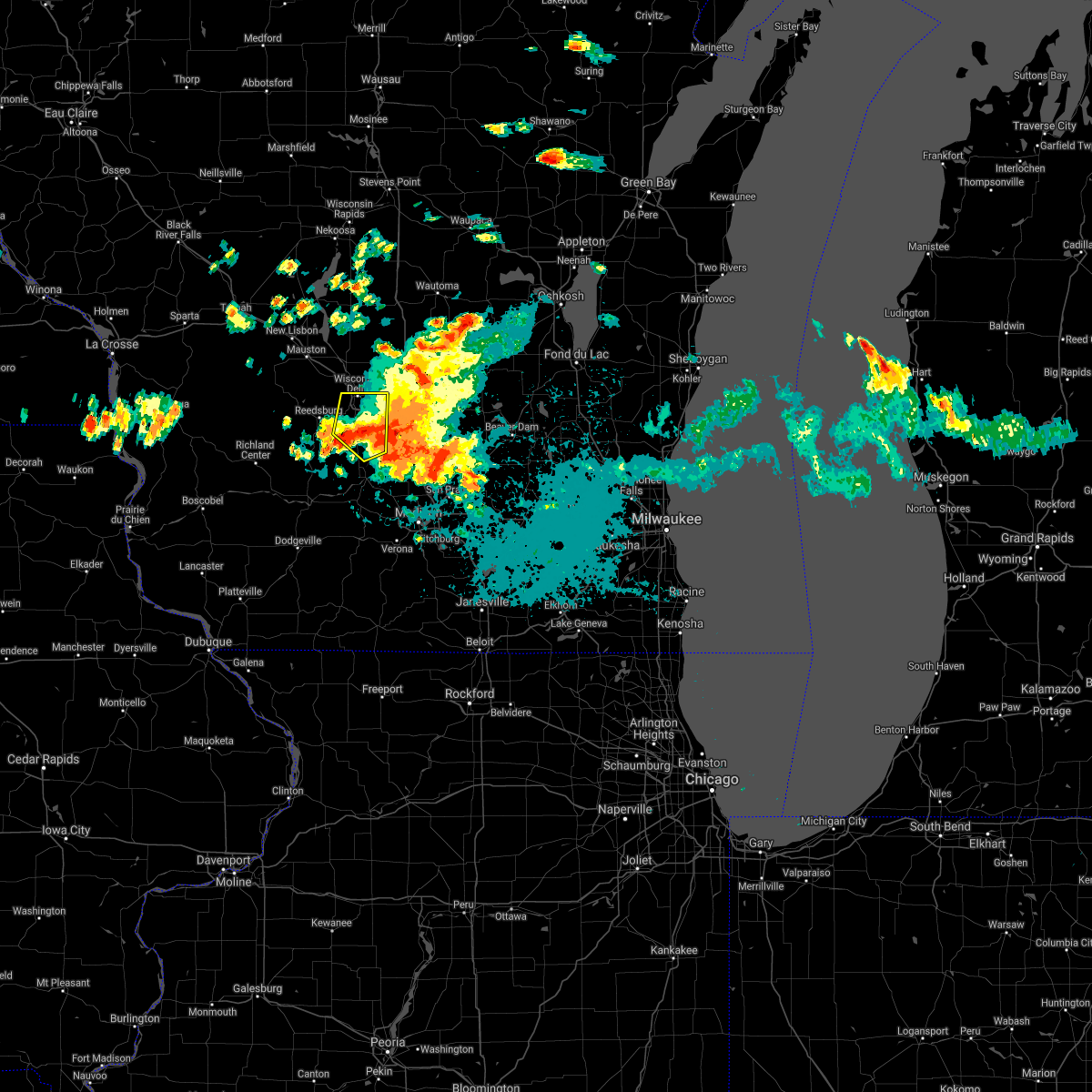
The Top Recent Hail Date for North Freedom, WI is Monday, June 23, 2025 (16th out of 40)
Hail and Wind Damage Spotted near North Freedom, WI
| Date / Time | Report Details |
|---|---|
| 6/29/2025 5:00 PM CDT |
 the severe thunderstorm warning has been cancelled and is no longer in effect the severe thunderstorm warning has been cancelled and is no longer in effect
|
| 6/29/2025 4:54 PM CDT |
 At 454 pm cdt, a severe thunderstorm was located 9 miles south of reedsburg, moving north at 10 mph (radar indicated). Hazards include 60 mph wind gusts and quarter size hail. Hail damage to vehicles is expected. expect wind damage to roofs, siding, and trees. Locations impacted include, loganville. At 454 pm cdt, a severe thunderstorm was located 9 miles south of reedsburg, moving north at 10 mph (radar indicated). Hazards include 60 mph wind gusts and quarter size hail. Hail damage to vehicles is expected. expect wind damage to roofs, siding, and trees. Locations impacted include, loganville.
|
| 6/29/2025 4:45 PM CDT |
 Svrmkx the national weather service in milwaukee/sullivan has issued a * severe thunderstorm warning for, central sauk county in south central wisconsin, * until 515 pm cdt. * at 445 pm cdt, a severe thunderstorm was located 10 miles south of reedsburg, moving north at 10 mph (radar indicated). Hazards include 60 mph wind gusts and quarter size hail. Hail damage to vehicles is expected. Expect wind damage to roofs, siding, and trees. Svrmkx the national weather service in milwaukee/sullivan has issued a * severe thunderstorm warning for, central sauk county in south central wisconsin, * until 515 pm cdt. * at 445 pm cdt, a severe thunderstorm was located 10 miles south of reedsburg, moving north at 10 mph (radar indicated). Hazards include 60 mph wind gusts and quarter size hail. Hail damage to vehicles is expected. Expect wind damage to roofs, siding, and trees.
|
| 6/26/2025 9:16 PM CDT |
 At 915 pm cdt, severe thunderstorms were located along a line extending from 9 miles southwest of west baraboo to 9 miles northeast of spring green to 7 miles southwest of mazomanie, moving northeast at 35 mph (radar indicated). Hazards include 60 mph wind gusts and nickel size hail. Expect damage to roofs, siding, and trees. Locations impacted include, baraboo, prairie du sac, sauk city, lake wisconsin, spring green, west baraboo, barneveld, arena, plain, bluffview, north freedom, ridgeway, merrimac, rock springs, loganville, blue mound st park, and devils lake st park. At 915 pm cdt, severe thunderstorms were located along a line extending from 9 miles southwest of west baraboo to 9 miles northeast of spring green to 7 miles southwest of mazomanie, moving northeast at 35 mph (radar indicated). Hazards include 60 mph wind gusts and nickel size hail. Expect damage to roofs, siding, and trees. Locations impacted include, baraboo, prairie du sac, sauk city, lake wisconsin, spring green, west baraboo, barneveld, arena, plain, bluffview, north freedom, ridgeway, merrimac, rock springs, loganville, blue mound st park, and devils lake st park.
|
| 6/26/2025 8:47 PM CDT |
 Svrmkx the national weather service in milwaukee/sullivan has issued a * severe thunderstorm warning for, central iowa county in south central wisconsin, sauk county in south central wisconsin, * until 945 pm cdt. * at 847 pm cdt, severe thunderstorms were located along a line extending from 12 miles southeast of richland center to near spring green to near dodgeville, moving northeast at 35 mph (radar indicated). Hazards include 60 mph wind gusts and nickel size hail. expect damage to roofs, siding, and trees Svrmkx the national weather service in milwaukee/sullivan has issued a * severe thunderstorm warning for, central iowa county in south central wisconsin, sauk county in south central wisconsin, * until 945 pm cdt. * at 847 pm cdt, severe thunderstorms were located along a line extending from 12 miles southeast of richland center to near spring green to near dodgeville, moving northeast at 35 mph (radar indicated). Hazards include 60 mph wind gusts and nickel size hail. expect damage to roofs, siding, and trees
|
| 6/25/2025 8:16 PM CDT |
 Svrmkx the national weather service in milwaukee/sullivan has issued a * severe thunderstorm warning for, western columbia county in south central wisconsin, sauk county in south central wisconsin, * until 900 pm cdt. * at 814 pm cdt, severe thunderstorms were located along a line extending from near elroy to 6 miles southwest of hillsboro to 9 miles north of richland center to 11 miles south of la farge, moving east at 45 mph (radar indicated). Hazards include 60 mph wind gusts. expect damage to roofs, siding, and trees Svrmkx the national weather service in milwaukee/sullivan has issued a * severe thunderstorm warning for, western columbia county in south central wisconsin, sauk county in south central wisconsin, * until 900 pm cdt. * at 814 pm cdt, severe thunderstorms were located along a line extending from near elroy to 6 miles southwest of hillsboro to 9 miles north of richland center to 11 miles south of la farge, moving east at 45 mph (radar indicated). Hazards include 60 mph wind gusts. expect damage to roofs, siding, and trees
|
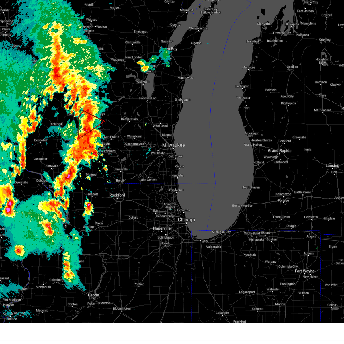
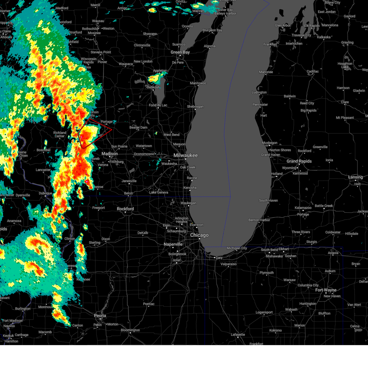
| 6/23/2025 5:46 PM CDT |
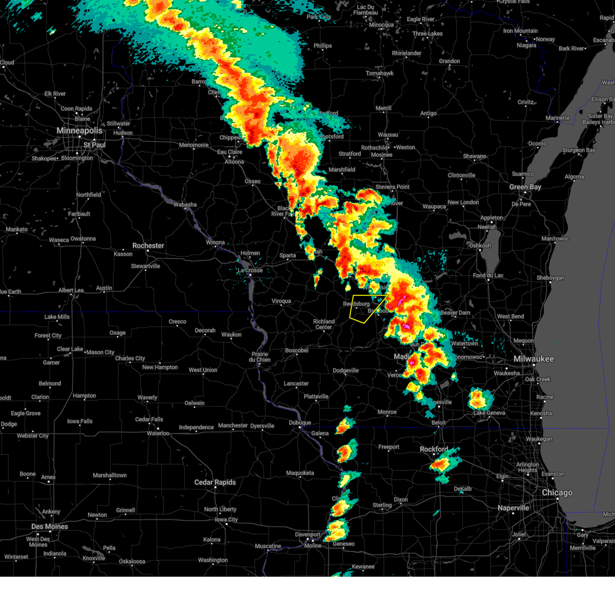
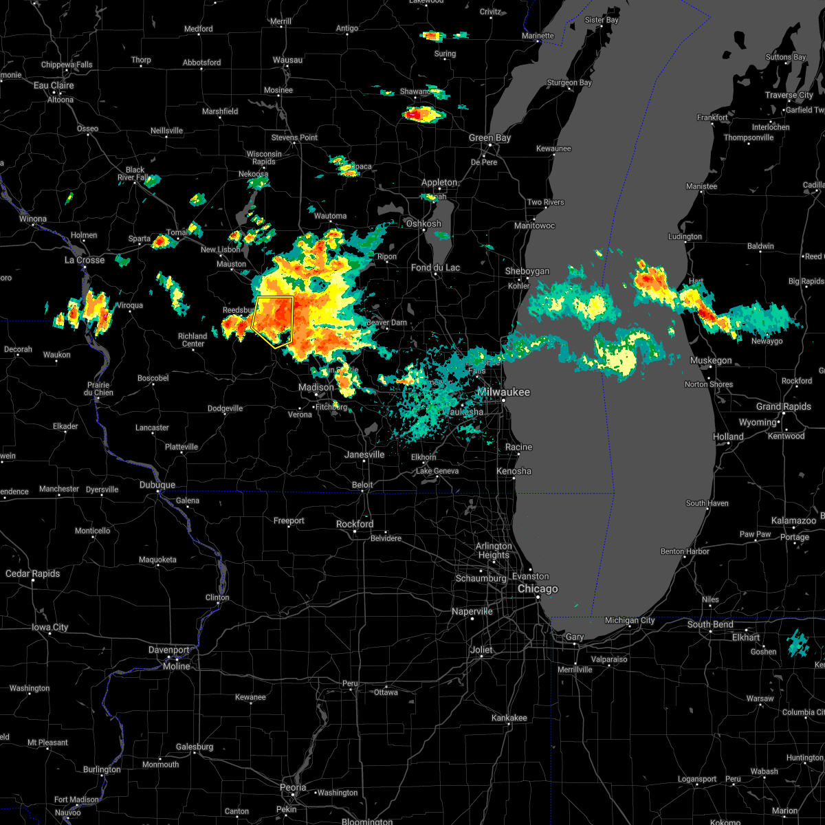
 At 545 pm cdt, severe thunderstorms were located along a line extending from 7 miles northwest of pardeeville to 8 miles northwest of prairie du sac, moving east at 20 mph (radar indicated). Hazards include 60 mph wind gusts. Expect damage to roofs, siding, and trees. locations impacted include, baraboo, portage, reedsburg, prairie du sac, sauk city, wisconsin dells, lake wisconsin, lake delton, spring green, west baraboo, plain, bluffview, north freedom, merrimac, rock springs, loganville, lime ridge, harmony grove, interstate 90/94 interchange, and okee. People attending reedsburg butterfest should seek safe shelter immediately!. At 545 pm cdt, severe thunderstorms were located along a line extending from 7 miles northwest of pardeeville to 8 miles northwest of prairie du sac, moving east at 20 mph (radar indicated). Hazards include 60 mph wind gusts. Expect damage to roofs, siding, and trees. locations impacted include, baraboo, portage, reedsburg, prairie du sac, sauk city, wisconsin dells, lake wisconsin, lake delton, spring green, west baraboo, plain, bluffview, north freedom, merrimac, rock springs, loganville, lime ridge, harmony grove, interstate 90/94 interchange, and okee. People attending reedsburg butterfest should seek safe shelter immediately!.
|
| 6/23/2025 5:20 PM CDT | Svrmkx the national weather service in milwaukee/sullivan has issued a * severe thunderstorm warning for, western columbia county in south central wisconsin, sauk county in south central wisconsin, * until 615 pm cdt. * at 520 pm cdt, severe thunderstorms were located along a line extending from wisconsin dells to 10 miles northeast of richland center, moving southeast at 25 mph (radar indicated). Hazards include 60 mph wind gusts. expect damage to roofs, siding, and trees |
| 5/15/2025 4:48 PM CDT |
 the severe thunderstorm warning has been cancelled and is no longer in effect the severe thunderstorm warning has been cancelled and is no longer in effect
|
| 5/15/2025 4:27 PM CDT | Svrmkx the national weather service in milwaukee/sullivan has issued a * severe thunderstorm warning for, northwestern columbia county in south central wisconsin, northeastern sauk county in south central wisconsin, * until 500 pm cdt. * at 427 pm cdt, a severe thunderstorm was located over reedsburg, moving northeast at 50 mph (radar indicated). Hazards include 60 mph wind gusts and quarter size hail. Hail damage to vehicles is expected. Expect wind damage to roofs, siding, and trees. |
| 5/15/2025 4:13 PM CDT |
 At 413 pm cdt, a severe thunderstorm capable of producing a tornado was located near reedsburg, moving north at 35 mph (radar indicated rotation). Hazards include tornado and quarter size hail. Flying debris will be dangerous to those caught without shelter. mobile homes will be damaged or destroyed. damage to roofs, windows, and vehicles will occur. tree damage is likely. locations impacted include, baraboo, reedsburg, wisconsin dells, lake delton, west baraboo, north freedom, and rock springs. People attending automotion in the wisconsin dells should seek safe shelter immediately!. At 413 pm cdt, a severe thunderstorm capable of producing a tornado was located near reedsburg, moving north at 35 mph (radar indicated rotation). Hazards include tornado and quarter size hail. Flying debris will be dangerous to those caught without shelter. mobile homes will be damaged or destroyed. damage to roofs, windows, and vehicles will occur. tree damage is likely. locations impacted include, baraboo, reedsburg, wisconsin dells, lake delton, west baraboo, north freedom, and rock springs. People attending automotion in the wisconsin dells should seek safe shelter immediately!.
|
| 5/15/2025 4:04 PM CDT |
 Tormkx the national weather service in milwaukee/sullivan has issued a * tornado warning for, northwestern columbia county in south central wisconsin, northeastern sauk county in south central wisconsin, * until 430 pm cdt. * at 403 pm cdt, a severe thunderstorm capable of producing a tornado was located 8 miles south of reedsburg, moving north at 35 mph (radar indicated rotation). Hazards include tornado and quarter size hail. Flying debris will be dangerous to those caught without shelter. mobile homes will be damaged or destroyed. damage to roofs, windows, and vehicles will occur. Tree damage is likely. Tormkx the national weather service in milwaukee/sullivan has issued a * tornado warning for, northwestern columbia county in south central wisconsin, northeastern sauk county in south central wisconsin, * until 430 pm cdt. * at 403 pm cdt, a severe thunderstorm capable of producing a tornado was located 8 miles south of reedsburg, moving north at 35 mph (radar indicated rotation). Hazards include tornado and quarter size hail. Flying debris will be dangerous to those caught without shelter. mobile homes will be damaged or destroyed. damage to roofs, windows, and vehicles will occur. Tree damage is likely.
|
| 5/15/2025 3:59 PM CDT |
 At 359 pm cdt, severe thunderstorms were located along a line extending from 6 miles southeast of reedsburg to near sauk city, moving north at 35 mph (radar indicated). Hazards include 60 mph wind gusts and quarter size hail. Hail damage to vehicles is expected. expect wind damage to roofs, siding, and trees. locations impacted include, baraboo, reedsburg, prairie du sac, sauk city, wisconsin dells, lake wisconsin, lake delton, west baraboo, plain, bluffview, north freedom, merrimac, rock springs, briggsville, and devils lake st park. People attending automotion in the wisconsin dells should seek safe shelter immediately!. At 359 pm cdt, severe thunderstorms were located along a line extending from 6 miles southeast of reedsburg to near sauk city, moving north at 35 mph (radar indicated). Hazards include 60 mph wind gusts and quarter size hail. Hail damage to vehicles is expected. expect wind damage to roofs, siding, and trees. locations impacted include, baraboo, reedsburg, prairie du sac, sauk city, wisconsin dells, lake wisconsin, lake delton, west baraboo, plain, bluffview, north freedom, merrimac, rock springs, briggsville, and devils lake st park. People attending automotion in the wisconsin dells should seek safe shelter immediately!.
|
| 5/15/2025 3:59 PM CDT |
 the severe thunderstorm warning has been cancelled and is no longer in effect the severe thunderstorm warning has been cancelled and is no longer in effect
|
| 5/15/2025 3:38 PM CDT |
 Svrmkx the national weather service in milwaukee/sullivan has issued a * severe thunderstorm warning for, northeastern iowa county in south central wisconsin, western columbia county in south central wisconsin, northwestern dane county in south central wisconsin, southwestern marquette county in south central wisconsin, sauk county in south central wisconsin, * until 430 pm cdt. * at 337 pm cdt, severe thunderstorms were located along a line extending from 9 miles north of spring green to near mazomanie, moving north at 45 mph. an additional severe storm is located in northern iowa county (public. quarter size hail was reported in spring green). Hazards include 60 mph wind gusts and quarter size hail. Hail damage to vehicles is expected. Expect wind damage to roofs, siding, and trees. Svrmkx the national weather service in milwaukee/sullivan has issued a * severe thunderstorm warning for, northeastern iowa county in south central wisconsin, western columbia county in south central wisconsin, northwestern dane county in south central wisconsin, southwestern marquette county in south central wisconsin, sauk county in south central wisconsin, * until 430 pm cdt. * at 337 pm cdt, severe thunderstorms were located along a line extending from 9 miles north of spring green to near mazomanie, moving north at 45 mph. an additional severe storm is located in northern iowa county (public. quarter size hail was reported in spring green). Hazards include 60 mph wind gusts and quarter size hail. Hail damage to vehicles is expected. Expect wind damage to roofs, siding, and trees.
|
| 4/18/2025 6:15 AM CDT |
 Svrmkx the national weather service in milwaukee/sullivan has issued a * severe thunderstorm warning for, lafayette county in south central wisconsin, green county in south central wisconsin, iowa county in south central wisconsin, western columbia county in south central wisconsin, dane county in south central wisconsin, sauk county in south central wisconsin, * until 700 am cdt. * at 614 am cdt, severe thunderstorms were located along a line extending from 11 miles southwest of reedsburg to near mazomanie to near blanchardville to near darlington, moving northeast at 70 mph (radar indicated). Hazards include two inch hail and 60 mph wind gusts. People and animals outdoors will be injured. expect hail damage to roofs, siding, windows, and vehicles. Expect wind damage to roofs, siding, and trees. Svrmkx the national weather service in milwaukee/sullivan has issued a * severe thunderstorm warning for, lafayette county in south central wisconsin, green county in south central wisconsin, iowa county in south central wisconsin, western columbia county in south central wisconsin, dane county in south central wisconsin, sauk county in south central wisconsin, * until 700 am cdt. * at 614 am cdt, severe thunderstorms were located along a line extending from 11 miles southwest of reedsburg to near mazomanie to near blanchardville to near darlington, moving northeast at 70 mph (radar indicated). Hazards include two inch hail and 60 mph wind gusts. People and animals outdoors will be injured. expect hail damage to roofs, siding, windows, and vehicles. Expect wind damage to roofs, siding, and trees.
|
| 4/18/2025 5:23 AM CDT |
 At 522 am cdt, a severe thunderstorm was located 7 miles north of spring green, or 14 miles east of richland center, moving east at 65 mph (radar indicated). Hazards include ping pong ball size hail. People and animals outdoors will be injured. expect damage to roofs, siding, windows, and vehicles. Locations impacted include, baraboo, lake delton, north freedom, lime ridge, orion, arena, merrimac, bluffview, prairie du sac, clyde, avoca, plain, sauk city, loganville, wisconsin dells, reedsburg, west baraboo, rock springs, spring green, and devils lake st park. At 522 am cdt, a severe thunderstorm was located 7 miles north of spring green, or 14 miles east of richland center, moving east at 65 mph (radar indicated). Hazards include ping pong ball size hail. People and animals outdoors will be injured. expect damage to roofs, siding, windows, and vehicles. Locations impacted include, baraboo, lake delton, north freedom, lime ridge, orion, arena, merrimac, bluffview, prairie du sac, clyde, avoca, plain, sauk city, loganville, wisconsin dells, reedsburg, west baraboo, rock springs, spring green, and devils lake st park.
|
| 4/18/2025 5:07 AM CDT |
 Svrmkx the national weather service in milwaukee/sullivan has issued a * severe thunderstorm warning for, northern iowa county in south central wisconsin, sauk county in south central wisconsin, * until 600 am cdt. * at 506 am cdt, a severe thunderstorm was located near richland center, moving east at 65 mph (radar indicated). Hazards include ping pong ball size hail. People and animals outdoors will be injured. Expect damage to roofs, siding, windows, and vehicles. Svrmkx the national weather service in milwaukee/sullivan has issued a * severe thunderstorm warning for, northern iowa county in south central wisconsin, sauk county in south central wisconsin, * until 600 am cdt. * at 506 am cdt, a severe thunderstorm was located near richland center, moving east at 65 mph (radar indicated). Hazards include ping pong ball size hail. People and animals outdoors will be injured. Expect damage to roofs, siding, windows, and vehicles.
|
| 7/14/2024 4:45 AM CDT |
 At 445 am cdt, a severe thunderstorm was located over baraboo, moving southeast at 45 mph (radar indicated). Hazards include 60 mph wind gusts and penny size hail. Expect damage to roofs, siding, and trees. locations impacted include, baraboo, reedsburg, wisconsin dells, lake wisconsin, lake delton, west baraboo, north freedom, merrimac, rock springs, loganville, and devils lake st park. People attending sauk county fair should seek safe shelter immediately!. At 445 am cdt, a severe thunderstorm was located over baraboo, moving southeast at 45 mph (radar indicated). Hazards include 60 mph wind gusts and penny size hail. Expect damage to roofs, siding, and trees. locations impacted include, baraboo, reedsburg, wisconsin dells, lake wisconsin, lake delton, west baraboo, north freedom, merrimac, rock springs, loganville, and devils lake st park. People attending sauk county fair should seek safe shelter immediately!.
|
| 7/14/2024 4:26 AM CDT |
 At 426 am cdt, a severe thunderstorm was located over reedsburg, moving southeast at 45 mph (radar indicated). Hazards include 60 mph wind gusts and quarter size hail. Hail damage to vehicles is expected. expect wind damage to roofs, siding, and trees. locations impacted include, baraboo, reedsburg, wisconsin dells, lake wisconsin, lake delton, west baraboo, north freedom, merrimac, la valle, rock springs, loganville, ironton, lime ridge, and devils lake st park. People attending sauk county fair should seek safe shelter immediately!. At 426 am cdt, a severe thunderstorm was located over reedsburg, moving southeast at 45 mph (radar indicated). Hazards include 60 mph wind gusts and quarter size hail. Hail damage to vehicles is expected. expect wind damage to roofs, siding, and trees. locations impacted include, baraboo, reedsburg, wisconsin dells, lake wisconsin, lake delton, west baraboo, north freedom, merrimac, la valle, rock springs, loganville, ironton, lime ridge, and devils lake st park. People attending sauk county fair should seek safe shelter immediately!.
|
| 7/14/2024 4:07 AM CDT |
 Svrmkx the national weather service in milwaukee/sullivan has issued a * severe thunderstorm warning for, northern sauk county in south central wisconsin, * until 500 am cdt. * at 405 am cdt, a severe thunderstorm was located near hillsboro, or 15 miles northwest of reedsburg, moving east at 30 mph (radar indicated). Hazards include 60 mph wind gusts and penny size hail. expect damage to roofs, siding, and trees Svrmkx the national weather service in milwaukee/sullivan has issued a * severe thunderstorm warning for, northern sauk county in south central wisconsin, * until 500 am cdt. * at 405 am cdt, a severe thunderstorm was located near hillsboro, or 15 miles northwest of reedsburg, moving east at 30 mph (radar indicated). Hazards include 60 mph wind gusts and penny size hail. expect damage to roofs, siding, and trees
|
| 7/13/2024 6:40 PM CDT |
 Svrmkx the national weather service in milwaukee/sullivan has issued a * severe thunderstorm warning for, southwestern green lake county in south central wisconsin, central columbia county in south central wisconsin, southern marquette county in south central wisconsin, sauk county in south central wisconsin, * until 745 pm cdt. * at 639 pm cdt, severe thunderstorms were located along a line extending from near westfield to near lake delton to 10 miles south of hillsboro, moving southeast at 30 mph (radar indicated). Hazards include 60 mph wind gusts. expect damage to roofs, siding, and trees Svrmkx the national weather service in milwaukee/sullivan has issued a * severe thunderstorm warning for, southwestern green lake county in south central wisconsin, central columbia county in south central wisconsin, southern marquette county in south central wisconsin, sauk county in south central wisconsin, * until 745 pm cdt. * at 639 pm cdt, severe thunderstorms were located along a line extending from near westfield to near lake delton to 10 miles south of hillsboro, moving southeast at 30 mph (radar indicated). Hazards include 60 mph wind gusts. expect damage to roofs, siding, and trees
|
| 6/13/2024 3:53 AM CDT |
 Svrmkx the national weather service in milwaukee/sullivan has issued a * severe thunderstorm warning for, central sauk county in south central wisconsin, * until 430 am cdt. * at 352 am cdt, a severe thunderstorm was located 10 miles northeast of richland center, moving east at 35 mph (radar indicated). Hazards include quarter size hail. damage to vehicles is expected Svrmkx the national weather service in milwaukee/sullivan has issued a * severe thunderstorm warning for, central sauk county in south central wisconsin, * until 430 am cdt. * at 352 am cdt, a severe thunderstorm was located 10 miles northeast of richland center, moving east at 35 mph (radar indicated). Hazards include quarter size hail. damage to vehicles is expected
|
| 5/21/2024 8:52 PM CDT |
 Svrmkx the national weather service in milwaukee/sullivan has issued a * severe thunderstorm warning for, northwestern green lake county in south central wisconsin, northwestern columbia county in south central wisconsin, marquette county in south central wisconsin, northeastern sauk county in south central wisconsin, * until 915 pm cdt. * at 852 pm cdt, severe thunderstorms were located along a line extending from near mauston to near portage, moving north at 65 mph (radar indicated). Hazards include 60 mph wind gusts. expect damage to roofs, siding, and trees Svrmkx the national weather service in milwaukee/sullivan has issued a * severe thunderstorm warning for, northwestern green lake county in south central wisconsin, northwestern columbia county in south central wisconsin, marquette county in south central wisconsin, northeastern sauk county in south central wisconsin, * until 915 pm cdt. * at 852 pm cdt, severe thunderstorms were located along a line extending from near mauston to near portage, moving north at 65 mph (radar indicated). Hazards include 60 mph wind gusts. expect damage to roofs, siding, and trees
|
| 5/21/2024 8:22 PM CDT |
 Svrmkx the national weather service in milwaukee/sullivan has issued a * severe thunderstorm warning for, northwestern iowa county in south central wisconsin, sauk county in south central wisconsin, * until 900 pm cdt. * at 822 pm cdt, severe thunderstorms were located along a line extending from near richland center to 12 miles west of dodgeville, moving northeast at 85 mph (radar indicated). Hazards include 70 mph wind gusts. Expect considerable tree damage. Damage is likely to mobile homes, roofs, and outbuildings. Svrmkx the national weather service in milwaukee/sullivan has issued a * severe thunderstorm warning for, northwestern iowa county in south central wisconsin, sauk county in south central wisconsin, * until 900 pm cdt. * at 822 pm cdt, severe thunderstorms were located along a line extending from near richland center to 12 miles west of dodgeville, moving northeast at 85 mph (radar indicated). Hazards include 70 mph wind gusts. Expect considerable tree damage. Damage is likely to mobile homes, roofs, and outbuildings.
|
| 5/21/2024 7:38 PM CDT |
 the severe thunderstorm warning has been cancelled and is no longer in effect the severe thunderstorm warning has been cancelled and is no longer in effect
|
| 5/21/2024 7:38 PM CDT |
 At 737 pm cdt, severe thunderstorms were located along a line extending from near portage to near monticello, moving east at 40 mph (radar indicated). Hazards include 70 mph wind gusts and quarter size hail. Hail damage to vehicles is expected. expect considerable tree damage. wind damage is also likely to mobile homes, roofs, and outbuildings. locations impacted include, madison, sun prairie, fitchburg, middleton, waunakee, baraboo, verona, portage, oregon, mcfarland, monona, mount horeb, windsor, prairie du sac, sauk city, wisconsin dells, lake wisconsin, deforest, cross plains, and lodi. People attending bratfest in madison should seek safe shelter immediately!. At 737 pm cdt, severe thunderstorms were located along a line extending from near portage to near monticello, moving east at 40 mph (radar indicated). Hazards include 70 mph wind gusts and quarter size hail. Hail damage to vehicles is expected. expect considerable tree damage. wind damage is also likely to mobile homes, roofs, and outbuildings. locations impacted include, madison, sun prairie, fitchburg, middleton, waunakee, baraboo, verona, portage, oregon, mcfarland, monona, mount horeb, windsor, prairie du sac, sauk city, wisconsin dells, lake wisconsin, deforest, cross plains, and lodi. People attending bratfest in madison should seek safe shelter immediately!.
|
| 5/21/2024 7:34 PM CDT |
 At 733 pm cdt, a severe thunderstorm capable of producing a tornado was located 7 miles northwest of portage, moving northeast at 60 mph (radar indicated rotation). Hazards include tornado and quarter size hail. Flying debris will be dangerous to those caught without shelter. mobile homes will be damaged or destroyed. damage to roofs, windows, and vehicles will occur. tree damage is likely. Locations impacted include, baraboo, prairie du sac, sauk city, wisconsin dells, lake wisconsin, lake delton, west baraboo, bluffview, north freedom, merrimac, rock springs, harmony grove, interstate 90/94 interchange, okee, and devils lake st park. At 733 pm cdt, a severe thunderstorm capable of producing a tornado was located 7 miles northwest of portage, moving northeast at 60 mph (radar indicated rotation). Hazards include tornado and quarter size hail. Flying debris will be dangerous to those caught without shelter. mobile homes will be damaged or destroyed. damage to roofs, windows, and vehicles will occur. tree damage is likely. Locations impacted include, baraboo, prairie du sac, sauk city, wisconsin dells, lake wisconsin, lake delton, west baraboo, bluffview, north freedom, merrimac, rock springs, harmony grove, interstate 90/94 interchange, okee, and devils lake st park.
|
| 5/21/2024 7:23 PM CDT |
 At 722 pm cdt, severe thunderstorms were located along a line extending from near baraboo to near monticello, moving northeast at 40 mph (radar indicated). Hazards include 70 mph wind gusts and quarter size hail. Hail damage to vehicles is expected. expect considerable tree damage. wind damage is also likely to mobile homes, roofs, and outbuildings. Locations impacted include, madison, sun prairie, fitchburg, middleton, stoughton, waunakee, baraboo, monroe, verona, portage, oregon, mcfarland, monona, mount horeb, windsor, prairie du sac, sauk city, wisconsin dells, lake wisconsin, and deforest. At 722 pm cdt, severe thunderstorms were located along a line extending from near baraboo to near monticello, moving northeast at 40 mph (radar indicated). Hazards include 70 mph wind gusts and quarter size hail. Hail damage to vehicles is expected. expect considerable tree damage. wind damage is also likely to mobile homes, roofs, and outbuildings. Locations impacted include, madison, sun prairie, fitchburg, middleton, stoughton, waunakee, baraboo, monroe, verona, portage, oregon, mcfarland, monona, mount horeb, windsor, prairie du sac, sauk city, wisconsin dells, lake wisconsin, and deforest.
|
| 5/21/2024 7:10 PM CDT |
 Tormkx the national weather service in milwaukee/sullivan has issued a * tornado warning for, southwestern columbia county in south central wisconsin, eastern sauk county in south central wisconsin, * until 745 pm cdt. * at 710 pm cdt, a severe thunderstorm capable of producing a tornado was located 7 miles northwest of prairie du sac, moving northeast at 60 mph (radar indicated rotation). Hazards include tornado and quarter size hail. Flying debris will be dangerous to those caught without shelter. mobile homes will be damaged or destroyed. damage to roofs, windows, and vehicles will occur. Tree damage is likely. Tormkx the national weather service in milwaukee/sullivan has issued a * tornado warning for, southwestern columbia county in south central wisconsin, eastern sauk county in south central wisconsin, * until 745 pm cdt. * at 710 pm cdt, a severe thunderstorm capable of producing a tornado was located 7 miles northwest of prairie du sac, moving northeast at 60 mph (radar indicated rotation). Hazards include tornado and quarter size hail. Flying debris will be dangerous to those caught without shelter. mobile homes will be damaged or destroyed. damage to roofs, windows, and vehicles will occur. Tree damage is likely.
|
| 5/21/2024 7:04 PM CDT |
 Svrmkx the national weather service in milwaukee/sullivan has issued a * severe thunderstorm warning for, green county in south central wisconsin, columbia county in south central wisconsin, dane county in south central wisconsin, eastern sauk county in south central wisconsin, * until 800 pm cdt. * at 704 pm cdt, severe thunderstorms were located along a line extending from 8 miles southwest of west baraboo to near argyle, moving northeast at 35 mph (radar indicated). Hazards include 60 mph wind gusts and quarter size hail. Hail damage to vehicles is expected. Expect wind damage to roofs, siding, and trees. Svrmkx the national weather service in milwaukee/sullivan has issued a * severe thunderstorm warning for, green county in south central wisconsin, columbia county in south central wisconsin, dane county in south central wisconsin, eastern sauk county in south central wisconsin, * until 800 pm cdt. * at 704 pm cdt, severe thunderstorms were located along a line extending from 8 miles southwest of west baraboo to near argyle, moving northeast at 35 mph (radar indicated). Hazards include 60 mph wind gusts and quarter size hail. Hail damage to vehicles is expected. Expect wind damage to roofs, siding, and trees.
|
| 5/21/2024 6:39 PM CDT |
 At 639 pm cdt, severe thunderstorms were located along a line extending from wonewoc to near spring green, moving northeast at 50 mph (radar indicated). Hazards include 60 mph wind gusts and quarter size hail. Hail damage to vehicles is expected. expect wind damage to roofs, siding, and trees. Locations impacted include, baraboo, reedsburg, wisconsin dells, lake delton, spring green, west baraboo, plain, bluffview, north freedom, la valle, rock springs, loganville, ironton, lime ridge, devils lake st park, and hill point. At 639 pm cdt, severe thunderstorms were located along a line extending from wonewoc to near spring green, moving northeast at 50 mph (radar indicated). Hazards include 60 mph wind gusts and quarter size hail. Hail damage to vehicles is expected. expect wind damage to roofs, siding, and trees. Locations impacted include, baraboo, reedsburg, wisconsin dells, lake delton, spring green, west baraboo, plain, bluffview, north freedom, la valle, rock springs, loganville, ironton, lime ridge, devils lake st park, and hill point.
|
| 5/21/2024 6:28 PM CDT |
 Svrmkx the national weather service in milwaukee/sullivan has issued a * severe thunderstorm warning for, sauk county in south central wisconsin, * until 715 pm cdt. * at 628 pm cdt, severe thunderstorms were located along a line extending from hillsboro to near spring green, moving northeast at 70 mph (radar indicated). Hazards include 60 mph wind gusts and quarter size hail. Hail damage to vehicles is expected. Expect wind damage to roofs, siding, and trees. Svrmkx the national weather service in milwaukee/sullivan has issued a * severe thunderstorm warning for, sauk county in south central wisconsin, * until 715 pm cdt. * at 628 pm cdt, severe thunderstorms were located along a line extending from hillsboro to near spring green, moving northeast at 70 mph (radar indicated). Hazards include 60 mph wind gusts and quarter size hail. Hail damage to vehicles is expected. Expect wind damage to roofs, siding, and trees.
|
| 5/18/2024 8:54 PM CDT |
 the severe thunderstorm warning has been cancelled and is no longer in effect the severe thunderstorm warning has been cancelled and is no longer in effect
|
| 5/18/2024 8:46 PM CDT |
 At 846 pm cdt, a severe thunderstorm was located near west baraboo, or near baraboo, moving east at 30 mph (radar indicated). Hazards include 60 mph wind gusts and quarter size hail. Hail damage to vehicles is expected. expect wind damage to roofs, siding, and trees. locations impacted include, baraboo, reedsburg, lake wisconsin, west baraboo, north freedom, merrimac, rock springs, and devils lake st park. People attending the big ten womens rowing championship should seek safe shelter immediately!. At 846 pm cdt, a severe thunderstorm was located near west baraboo, or near baraboo, moving east at 30 mph (radar indicated). Hazards include 60 mph wind gusts and quarter size hail. Hail damage to vehicles is expected. expect wind damage to roofs, siding, and trees. locations impacted include, baraboo, reedsburg, lake wisconsin, west baraboo, north freedom, merrimac, rock springs, and devils lake st park. People attending the big ten womens rowing championship should seek safe shelter immediately!.
|
| 5/18/2024 8:30 PM CDT |
 Svrmkx the national weather service in milwaukee/sullivan has issued a * severe thunderstorm warning for, northeastern sauk county in south central wisconsin, * until 915 pm cdt. * at 830 pm cdt, a severe thunderstorm was located near reedsburg, moving east at 30 mph (radar indicated). Hazards include 60 mph wind gusts and quarter size hail. Hail damage to vehicles is expected. Expect wind damage to roofs, siding, and trees. Svrmkx the national weather service in milwaukee/sullivan has issued a * severe thunderstorm warning for, northeastern sauk county in south central wisconsin, * until 915 pm cdt. * at 830 pm cdt, a severe thunderstorm was located near reedsburg, moving east at 30 mph (radar indicated). Hazards include 60 mph wind gusts and quarter size hail. Hail damage to vehicles is expected. Expect wind damage to roofs, siding, and trees.
|
| 8/11/2023 9:12 PM CDT |
 At 911 pm cdt, a severe thunderstorm was located 11 miles southwest of reedsburg, moving southeast at 55 mph (radar indicated). Hazards include 60 mph wind gusts. expect damage to roofs, siding, and trees At 911 pm cdt, a severe thunderstorm was located 11 miles southwest of reedsburg, moving southeast at 55 mph (radar indicated). Hazards include 60 mph wind gusts. expect damage to roofs, siding, and trees
|
| 7/28/2023 9:13 PM CDT |
 At 913 pm cdt, severe thunderstorms were located along a line extending from near westfield to near portage to 10 miles north of spring green, moving southeast at 45 mph (radar indicated). Hazards include 70 mph wind gusts and ping pong ball size hail. People and animals outdoors will be injured. expect hail damage to roofs, siding, windows, and vehicles. expect considerable tree damage. wind damage is also likely to mobile homes, roofs, and outbuildings. Locations impacted include, baraboo, portage, reedsburg, prairie du sac, sauk city, wisconsin dells, lake wisconsin, lodi, lake delton, poynette, pardeeville, spring green, montello, west baraboo, westfield, rio, lawrence, packwaukee, plain, and wyocena. At 913 pm cdt, severe thunderstorms were located along a line extending from near westfield to near portage to 10 miles north of spring green, moving southeast at 45 mph (radar indicated). Hazards include 70 mph wind gusts and ping pong ball size hail. People and animals outdoors will be injured. expect hail damage to roofs, siding, windows, and vehicles. expect considerable tree damage. wind damage is also likely to mobile homes, roofs, and outbuildings. Locations impacted include, baraboo, portage, reedsburg, prairie du sac, sauk city, wisconsin dells, lake wisconsin, lodi, lake delton, poynette, pardeeville, spring green, montello, west baraboo, westfield, rio, lawrence, packwaukee, plain, and wyocena.
|
| 7/28/2023 9:02 PM CDT |
 At 901 pm cdt, severe thunderstorms were located along a line extending from 9 miles northwest of westfield to 8 miles northwest of portage to 9 miles east of richland center, moving southeast at 45 mph (radar indicated). Hazards include ping pong ball size hail and 60 mph wind gusts. People and animals outdoors will be injured. expect hail damage to roofs, siding, windows, and vehicles. expect wind damage to roofs, siding, and trees. Locations impacted include, baraboo, portage, reedsburg, prairie du sac, sauk city, wisconsin dells, lake wisconsin, lodi, lake delton, poynette, pardeeville, spring green, montello, west baraboo, westfield, rio, lawrence, packwaukee, plain, and wyocena. At 901 pm cdt, severe thunderstorms were located along a line extending from 9 miles northwest of westfield to 8 miles northwest of portage to 9 miles east of richland center, moving southeast at 45 mph (radar indicated). Hazards include ping pong ball size hail and 60 mph wind gusts. People and animals outdoors will be injured. expect hail damage to roofs, siding, windows, and vehicles. expect wind damage to roofs, siding, and trees. Locations impacted include, baraboo, portage, reedsburg, prairie du sac, sauk city, wisconsin dells, lake wisconsin, lodi, lake delton, poynette, pardeeville, spring green, montello, west baraboo, westfield, rio, lawrence, packwaukee, plain, and wyocena.
|
| 7/28/2023 8:38 PM CDT |
 At 837 pm cdt, severe thunderstorms were located along a line extending from 7 miles south of new rome to 9 miles northwest of wisconsin dells to 9 miles southeast of la farge, moving southeast at 50 mph (radar indicated). Hazards include ping pong ball size hail and 60 mph wind gusts. People and animals outdoors will be injured. expect hail damage to roofs, siding, windows, and vehicles. Expect wind damage to roofs, siding, and trees. At 837 pm cdt, severe thunderstorms were located along a line extending from 7 miles south of new rome to 9 miles northwest of wisconsin dells to 9 miles southeast of la farge, moving southeast at 50 mph (radar indicated). Hazards include ping pong ball size hail and 60 mph wind gusts. People and animals outdoors will be injured. expect hail damage to roofs, siding, windows, and vehicles. Expect wind damage to roofs, siding, and trees.
|
| 7/14/2023 7:46 PM CDT |
 At 745 pm cdt, a severe thunderstorm was located over baraboo, moving northeast at 30 mph (radar indicated). Hazards include 60 mph wind gusts and penny size hail. Expect damage to roofs, siding, and trees. locations impacted include, baraboo, portage, wisconsin dells, lake wisconsin, lake delton, west baraboo, bluffview, north freedom, rock springs, interstate 90/94 interchange, and devils lake st park. those attending the sauk county fair are in the path of this storm and should prepare for imminent dangerous weather conditions. seek shelter now! people attending the sauk county fair should seek safe shelter immediately! hail threat, radar indicated max hail size, 0. 75 in wind threat, radar indicated max wind gust, 60 mph. At 745 pm cdt, a severe thunderstorm was located over baraboo, moving northeast at 30 mph (radar indicated). Hazards include 60 mph wind gusts and penny size hail. Expect damage to roofs, siding, and trees. locations impacted include, baraboo, portage, wisconsin dells, lake wisconsin, lake delton, west baraboo, bluffview, north freedom, rock springs, interstate 90/94 interchange, and devils lake st park. those attending the sauk county fair are in the path of this storm and should prepare for imminent dangerous weather conditions. seek shelter now! people attending the sauk county fair should seek safe shelter immediately! hail threat, radar indicated max hail size, 0. 75 in wind threat, radar indicated max wind gust, 60 mph.
|
| 7/14/2023 7:32 PM CDT |
 At 731 pm cdt, a severe thunderstorm was located near west baraboo, or near baraboo, moving northeast at 30 mph (radar indicated). Hazards include 60 mph wind gusts. expect damage to roofs, siding, and trees At 731 pm cdt, a severe thunderstorm was located near west baraboo, or near baraboo, moving northeast at 30 mph (radar indicated). Hazards include 60 mph wind gusts. expect damage to roofs, siding, and trees
|
| 4/19/2023 1:36 PM CDT |
 At 135 pm cdt, severe thunderstorms were located along a line extending from 6 miles northwest of pardeeville to 6 miles northeast of baraboo, moving east at 40 mph (radar indicated). Hazards include quarter size hail. damage to vehicles is expected At 135 pm cdt, severe thunderstorms were located along a line extending from 6 miles northwest of pardeeville to 6 miles northeast of baraboo, moving east at 40 mph (radar indicated). Hazards include quarter size hail. damage to vehicles is expected
|
| 4/4/2023 11:02 PM CDT |
 At 1101 pm cdt, severe thunderstorms were located along a line extending from 6 miles west of reedsburg to 7 miles southwest of fall river, moving northeast at 50 mph (trained weather spotters). Hazards include half dollar size hail. Damage to vehicles is expected. locations impacted include, eastern madison, sun prairie, waunakee, baraboo, portage, reedsburg, windsor, prairie du sac, sauk city, wisconsin dells, lake wisconsin, deforest, lodi, lake delton, poynette, pardeeville, randolph, west baraboo, maple bluff, and rio. hail threat, observed max hail size, 1. 25 in wind threat, radar indicated max wind gust, <50 mph. At 1101 pm cdt, severe thunderstorms were located along a line extending from 6 miles west of reedsburg to 7 miles southwest of fall river, moving northeast at 50 mph (trained weather spotters). Hazards include half dollar size hail. Damage to vehicles is expected. locations impacted include, eastern madison, sun prairie, waunakee, baraboo, portage, reedsburg, windsor, prairie du sac, sauk city, wisconsin dells, lake wisconsin, deforest, lodi, lake delton, poynette, pardeeville, randolph, west baraboo, maple bluff, and rio. hail threat, observed max hail size, 1. 25 in wind threat, radar indicated max wind gust, <50 mph.
|
| 4/4/2023 10:32 PM CDT |
 At 1031 pm cdt, severe thunderstorms were located along a line extending from near richland center to madison, moving northeast at 55 mph (trained weather spotters. there have been numerous reports of quarter to ping pong ball sized hail with these storms over the last 30 minutes). Hazards include half dollar size hail. damage to vehicles is expected At 1031 pm cdt, severe thunderstorms were located along a line extending from near richland center to madison, moving northeast at 55 mph (trained weather spotters. there have been numerous reports of quarter to ping pong ball sized hail with these storms over the last 30 minutes). Hazards include half dollar size hail. damage to vehicles is expected
|
| 7/24/2022 2:21 AM CDT |
 At 221 am cdt, a severe thunderstorm was located near west baraboo, or near baraboo, moving east at 40 mph (radar indicated). Hazards include 60 mph wind gusts and penny size hail. expect damage to roofs, siding, and trees At 221 am cdt, a severe thunderstorm was located near west baraboo, or near baraboo, moving east at 40 mph (radar indicated). Hazards include 60 mph wind gusts and penny size hail. expect damage to roofs, siding, and trees
|
| 7/24/2022 2:16 AM CDT |
 At 216 am cdt, a severe thunderstorm was located over wisconsin dells, moving northeast at 45 mph (radar indicated). Hazards include 60 mph wind gusts. Expect damage to roofs, siding, and trees. Locations impacted include, wisconsin dells, lake delton, west baraboo, north freedom and rock springs. At 216 am cdt, a severe thunderstorm was located over wisconsin dells, moving northeast at 45 mph (radar indicated). Hazards include 60 mph wind gusts. Expect damage to roofs, siding, and trees. Locations impacted include, wisconsin dells, lake delton, west baraboo, north freedom and rock springs.
|
| 7/24/2022 1:45 AM CDT |
 At 145 am cdt, a severe thunderstorm was located 9 miles southwest of reedsburg, moving northeast at 40 mph (radar indicated). Hazards include 60 mph wind gusts. expect damage to roofs, siding, and trees At 145 am cdt, a severe thunderstorm was located 9 miles southwest of reedsburg, moving northeast at 40 mph (radar indicated). Hazards include 60 mph wind gusts. expect damage to roofs, siding, and trees
|
| 7/24/2022 12:57 AM CDT |
 At 1256 am cdt, severe thunderstorms were located along a line extending from near richland center to 8 miles southeast of muscoda to 10 miles northwest of mineral point, moving east at 45 mph (radar indicated). Hazards include 60 mph wind gusts. expect damage to roofs, siding, and trees At 1256 am cdt, severe thunderstorms were located along a line extending from near richland center to 8 miles southeast of muscoda to 10 miles northwest of mineral point, moving east at 45 mph (radar indicated). Hazards include 60 mph wind gusts. expect damage to roofs, siding, and trees
|
| 7/23/2022 5:09 PM CDT |
 At 508 pm cdt, severe thunderstorms were located along a line extending from 13 miles north of lake delton to near wisconsin dells to near west baraboo to 10 miles north of spring green, moving east at 45 mph (radar indicated). Hazards include 60 mph wind gusts. Expect damage to roofs, siding, and trees. locations impacted include, baraboo, reedsburg, wisconsin dells, lake delton, spring green, west baraboo, plain, bluffview, north freedom, la valle, rock springs, loganville, ironton, lime ridge, devils lake st park and hill point. People attending bulls and barrels in la valle should seek safe shelter immediately!. At 508 pm cdt, severe thunderstorms were located along a line extending from 13 miles north of lake delton to near wisconsin dells to near west baraboo to 10 miles north of spring green, moving east at 45 mph (radar indicated). Hazards include 60 mph wind gusts. Expect damage to roofs, siding, and trees. locations impacted include, baraboo, reedsburg, wisconsin dells, lake delton, spring green, west baraboo, plain, bluffview, north freedom, la valle, rock springs, loganville, ironton, lime ridge, devils lake st park and hill point. People attending bulls and barrels in la valle should seek safe shelter immediately!.
|
| 7/23/2022 4:36 PM CDT |
 At 433 pm cdt, severe thunderstorms were located along a line extending from near mauston to near wonewoc to 12 miles south of hillsboro to near richland center, moving east at 40 mph (radar indicated). Hazards include 70 mph wind gusts. Expect considerable tree damage. damage is likely to mobile homes, roofs, and outbuildings. locations impacted include, baraboo, reedsburg, wisconsin dells, lake delton, spring green, west baraboo, plain, bluffview, north freedom, la valle, rock springs, loganville, ironton, lime ridge, devils lake st park and hill point. People attending bulls and barrels in lavalle should seek safe shelter immediately!. At 433 pm cdt, severe thunderstorms were located along a line extending from near mauston to near wonewoc to 12 miles south of hillsboro to near richland center, moving east at 40 mph (radar indicated). Hazards include 70 mph wind gusts. Expect considerable tree damage. damage is likely to mobile homes, roofs, and outbuildings. locations impacted include, baraboo, reedsburg, wisconsin dells, lake delton, spring green, west baraboo, plain, bluffview, north freedom, la valle, rock springs, loganville, ironton, lime ridge, devils lake st park and hill point. People attending bulls and barrels in lavalle should seek safe shelter immediately!.
|
| 7/23/2022 4:11 PM CDT |
 At 409 pm cdt, severe thunderstorms were located along a line extending from near sparta to 12 miles northwest of hillsboro to 6 miles southeast of la farge to 14 miles northwest of boscobel, moving east at 40 mph (radar indicated). Hazards include 70 mph wind gusts. Expect considerable tree damage. Damage is likely to mobile homes, roofs, and outbuildings. At 409 pm cdt, severe thunderstorms were located along a line extending from near sparta to 12 miles northwest of hillsboro to 6 miles southeast of la farge to 14 miles northwest of boscobel, moving east at 40 mph (radar indicated). Hazards include 70 mph wind gusts. Expect considerable tree damage. Damage is likely to mobile homes, roofs, and outbuildings.
|
| 6/15/2022 5:21 PM CDT |
 At 521 pm cdt, a severe thunderstorm capable of producing a tornado was located 9 miles northwest of prairie du sac, moving northeast at 50 mph (radar indicated rotation). Hazards include tornado. Flying debris will be dangerous to those caught without shelter. mobile homes will be damaged or destroyed. damage to roofs, windows, and vehicles will occur. Tree damage is likely. At 521 pm cdt, a severe thunderstorm capable of producing a tornado was located 9 miles northwest of prairie du sac, moving northeast at 50 mph (radar indicated rotation). Hazards include tornado. Flying debris will be dangerous to those caught without shelter. mobile homes will be damaged or destroyed. damage to roofs, windows, and vehicles will occur. Tree damage is likely.
|
| 6/15/2022 5:14 PM CDT |
 At 514 pm cdt, a severe thunderstorm capable of producing a tornado was located near west baraboo, or near baraboo, moving northeast at 55 mph (radar indicated rotation). Hazards include tornado and half dollar size hail. Flying debris will be dangerous to those caught without shelter. mobile homes will be damaged or destroyed. damage to roofs, windows, and vehicles will occur. tree damage is likely. Locations impacted include, baraboo, reedsburg, lake delton, west baraboo, bluffview, north freedom, rock springs, loganville and devils lake st park. At 514 pm cdt, a severe thunderstorm capable of producing a tornado was located near west baraboo, or near baraboo, moving northeast at 55 mph (radar indicated rotation). Hazards include tornado and half dollar size hail. Flying debris will be dangerous to those caught without shelter. mobile homes will be damaged or destroyed. damage to roofs, windows, and vehicles will occur. tree damage is likely. Locations impacted include, baraboo, reedsburg, lake delton, west baraboo, bluffview, north freedom, rock springs, loganville and devils lake st park.
|
| 6/15/2022 4:47 PM CDT |
 At 447 pm cdt, a severe thunderstorm capable of producing a tornado was located 7 miles southeast of richland center, moving northeast at 55 mph (radar indicated rotation). Hazards include tornado and half dollar size hail. Flying debris will be dangerous to those caught without shelter. mobile homes will be damaged or destroyed. damage to roofs, windows, and vehicles will occur. tree damage is likely. Locations impacted include, baraboo, reedsburg, lake delton, west baraboo, plain, bluffview, north freedom, rock springs, loganville, devils lake st park and hill point. At 447 pm cdt, a severe thunderstorm capable of producing a tornado was located 7 miles southeast of richland center, moving northeast at 55 mph (radar indicated rotation). Hazards include tornado and half dollar size hail. Flying debris will be dangerous to those caught without shelter. mobile homes will be damaged or destroyed. damage to roofs, windows, and vehicles will occur. tree damage is likely. Locations impacted include, baraboo, reedsburg, lake delton, west baraboo, plain, bluffview, north freedom, rock springs, loganville, devils lake st park and hill point.
|
| 6/15/2022 4:42 PM CDT |
 At 441 pm cdt, a severe thunderstorm capable of producing a tornado was located over muscoda, or 9 miles south of richland center, moving northeast at 55 mph (radar indicated rotation). Hazards include tornado and half dollar size hail. Flying debris will be dangerous to those caught without shelter. mobile homes will be damaged or destroyed. damage to roofs, windows, and vehicles will occur. Tree damage is likely. At 441 pm cdt, a severe thunderstorm capable of producing a tornado was located over muscoda, or 9 miles south of richland center, moving northeast at 55 mph (radar indicated rotation). Hazards include tornado and half dollar size hail. Flying debris will be dangerous to those caught without shelter. mobile homes will be damaged or destroyed. damage to roofs, windows, and vehicles will occur. Tree damage is likely.
|
| 6/13/2022 1:56 PM CDT |
 At 156 pm cdt, a severe thunderstorm was located near spring green, or 15 miles east of richland center, moving east at 45 mph (radar indicated). Hazards include quarter size hail. damage to vehicles is expected At 156 pm cdt, a severe thunderstorm was located near spring green, or 15 miles east of richland center, moving east at 45 mph (radar indicated). Hazards include quarter size hail. damage to vehicles is expected
|
| 5/19/2022 10:04 PM CDT |
 At 1004 pm cdt, severe thunderstorms were located along a line extending from near wisconsin dells to near lake delton to near reedsburg, moving east at 40 mph (radar indicated). Hazards include 60 mph wind gusts and half dollar size hail. Hail damage to vehicles is expected. expect wind damage to roofs, siding, and trees. locations impacted include, baraboo, reedsburg, wisconsin dells, lake delton, west baraboo, north freedom, la valle, rock springs, ironton and devils lake st park. hail threat, radar indicated max hail size, 1. 25 in wind threat, radar indicated max wind gust, 60 mph. At 1004 pm cdt, severe thunderstorms were located along a line extending from near wisconsin dells to near lake delton to near reedsburg, moving east at 40 mph (radar indicated). Hazards include 60 mph wind gusts and half dollar size hail. Hail damage to vehicles is expected. expect wind damage to roofs, siding, and trees. locations impacted include, baraboo, reedsburg, wisconsin dells, lake delton, west baraboo, north freedom, la valle, rock springs, ironton and devils lake st park. hail threat, radar indicated max hail size, 1. 25 in wind threat, radar indicated max wind gust, 60 mph.
|
| 5/19/2022 9:27 PM CDT |
 At 927 pm cdt, severe thunderstorms were located along a line extending from elroy to near hillsboro to la farge, moving east at 40 mph (radar indicated). Hazards include 60 mph wind gusts and half dollar size hail. Hail damage to vehicles is expected. Expect wind damage to roofs, siding, and trees. At 927 pm cdt, severe thunderstorms were located along a line extending from elroy to near hillsboro to la farge, moving east at 40 mph (radar indicated). Hazards include 60 mph wind gusts and half dollar size hail. Hail damage to vehicles is expected. Expect wind damage to roofs, siding, and trees.
|
| 9/20/2021 8:26 PM CDT |
 The severe thunderstorm warning for northwestern columbia and northern sauk counties will expire at 830 pm cdt, the storms which prompted the warning have weakened below severe limits, and no longer pose an immediate threat to life or property. therefore, the warning will be allowed to expire. however gusty winds are still possible with these thunderstorms. The severe thunderstorm warning for northwestern columbia and northern sauk counties will expire at 830 pm cdt, the storms which prompted the warning have weakened below severe limits, and no longer pose an immediate threat to life or property. therefore, the warning will be allowed to expire. however gusty winds are still possible with these thunderstorms.
|
| 9/20/2021 8:07 PM CDT |
 At 806 pm cdt, severe thunderstorms were located along a line extending from 7 miles west of wisconsin dells to 9 miles south of reedsburg, moving east at 50 mph (radar indicated). Hazards include 60 mph wind gusts. Expect damage to roofs, siding, and trees. these severe storms will be near, wisconsin dells around 815 pm cdt. baraboo, lake delton and west baraboo around 820 pm cdt. other locations impacted by these severe thunderstorms include ironton, lime ridge, north freedom, loganville, la valle, rock springs and hill point. hail threat, radar indicated max hail size, <. 75 in wind threat, radar indicated max wind gust, 60 mph. At 806 pm cdt, severe thunderstorms were located along a line extending from 7 miles west of wisconsin dells to 9 miles south of reedsburg, moving east at 50 mph (radar indicated). Hazards include 60 mph wind gusts. Expect damage to roofs, siding, and trees. these severe storms will be near, wisconsin dells around 815 pm cdt. baraboo, lake delton and west baraboo around 820 pm cdt. other locations impacted by these severe thunderstorms include ironton, lime ridge, north freedom, loganville, la valle, rock springs and hill point. hail threat, radar indicated max hail size, <. 75 in wind threat, radar indicated max wind gust, 60 mph.
|
| 9/20/2021 7:56 PM CDT |
 At 756 pm cdt, severe thunderstorms were located along a line extending from 6 miles east of wonewoc to 12 miles east of richland center, moving east at 40 mph (radar indicated). Hazards include 60 mph wind gusts. Expect damage to roofs, siding, and trees. these severe storms will be near, baraboo and west baraboo around 825 pm cdt. other locations impacted by these severe thunderstorms include ironton, lime ridge, north freedom, loganville, la valle, rock springs and hill point. hail threat, radar indicated max hail size, <. 75 in wind threat, radar indicated max wind gust, 60 mph. At 756 pm cdt, severe thunderstorms were located along a line extending from 6 miles east of wonewoc to 12 miles east of richland center, moving east at 40 mph (radar indicated). Hazards include 60 mph wind gusts. Expect damage to roofs, siding, and trees. these severe storms will be near, baraboo and west baraboo around 825 pm cdt. other locations impacted by these severe thunderstorms include ironton, lime ridge, north freedom, loganville, la valle, rock springs and hill point. hail threat, radar indicated max hail size, <. 75 in wind threat, radar indicated max wind gust, 60 mph.
|
| 9/20/2021 7:46 PM CDT |
 At 745 pm cdt, severe thunderstorms were located along a line extending from wonewoc to 6 miles east of richland center, moving east at 45 mph (radar indicated). Hazards include 60 mph wind gusts. Expect damage to roofs, siding, and trees. severe thunderstorms will be near, baraboo and west baraboo around 820 pm cdt. other locations impacted by these severe thunderstorms include ironton, lime ridge, north freedom, loganville, la valle, rock springs and hill point. hail threat, radar indicated max hail size, <. 75 in wind threat, radar indicated max wind gust, 60 mph. At 745 pm cdt, severe thunderstorms were located along a line extending from wonewoc to 6 miles east of richland center, moving east at 45 mph (radar indicated). Hazards include 60 mph wind gusts. Expect damage to roofs, siding, and trees. severe thunderstorms will be near, baraboo and west baraboo around 820 pm cdt. other locations impacted by these severe thunderstorms include ironton, lime ridge, north freedom, loganville, la valle, rock springs and hill point. hail threat, radar indicated max hail size, <. 75 in wind threat, radar indicated max wind gust, 60 mph.
|
| 8/10/2021 5:56 PM CDT |
 At 556 pm cdt, severe thunderstorms were located along a line extending from near princeton to near oregon to monroe, moving east at 35 mph (trees were reported down in madison). Hazards include 60 mph wind gusts. Expect damage to roofs, siding, and trees. locations impacted include, madison, sun prairie, fitchburg, middleton, stoughton, waunakee, baraboo, monroe, verona, portage, oregon, reedsburg, mcfarland, monona, mount horeb, windsor, columbus, prairie du sac, marshall and sauk city. hail threat, radar indicated max hail size, <. 75 in wind threat, observed max wind gust, 60 mph. At 556 pm cdt, severe thunderstorms were located along a line extending from near princeton to near oregon to monroe, moving east at 35 mph (trees were reported down in madison). Hazards include 60 mph wind gusts. Expect damage to roofs, siding, and trees. locations impacted include, madison, sun prairie, fitchburg, middleton, stoughton, waunakee, baraboo, monroe, verona, portage, oregon, reedsburg, mcfarland, monona, mount horeb, windsor, columbus, prairie du sac, marshall and sauk city. hail threat, radar indicated max hail size, <. 75 in wind threat, observed max wind gust, 60 mph.
|
| 8/10/2021 5:47 PM CDT |
 At 546 pm cdt, severe thunderstorms were located along a line extending from near montello to near brooklyn to near monroe, moving south at 80 mph (radar indicated). Hazards include 60 mph wind gusts. Expect damage to roofs, siding, and trees. locations impacted include, madison, sun prairie, fitchburg, middleton, stoughton, waunakee, baraboo, monroe, verona, portage, oregon, reedsburg, mcfarland, monona, mount horeb, windsor, columbus, prairie du sac, marshall and sauk city. hail threat, radar indicated max hail size, <. 75 in wind threat, radar indicated max wind gust, 60 mph. At 546 pm cdt, severe thunderstorms were located along a line extending from near montello to near brooklyn to near monroe, moving south at 80 mph (radar indicated). Hazards include 60 mph wind gusts. Expect damage to roofs, siding, and trees. locations impacted include, madison, sun prairie, fitchburg, middleton, stoughton, waunakee, baraboo, monroe, verona, portage, oregon, reedsburg, mcfarland, monona, mount horeb, windsor, columbus, prairie du sac, marshall and sauk city. hail threat, radar indicated max hail size, <. 75 in wind threat, radar indicated max wind gust, 60 mph.
|
| 8/10/2021 5:28 PM CDT |
 At 527 pm cdt, severe thunderstorms were located along a line extending from 9 miles north of portage to near lodi to near warren, moving east at 20 mph (radar indicated). Hazards include 60 mph wind gusts. Expect damage to roofs, siding, and trees. locations impacted include, madison, sun prairie, fitchburg, middleton, stoughton, waunakee, baraboo, monroe, verona, portage, oregon, reedsburg, mcfarland, monona, mount horeb, windsor, columbus, dodgeville, prairie du sac and marshall. hail threat, radar indicated max hail size, <. 75 in wind threat, radar indicated max wind gust, 60 mph. At 527 pm cdt, severe thunderstorms were located along a line extending from 9 miles north of portage to near lodi to near warren, moving east at 20 mph (radar indicated). Hazards include 60 mph wind gusts. Expect damage to roofs, siding, and trees. locations impacted include, madison, sun prairie, fitchburg, middleton, stoughton, waunakee, baraboo, monroe, verona, portage, oregon, reedsburg, mcfarland, monona, mount horeb, windsor, columbus, dodgeville, prairie du sac and marshall. hail threat, radar indicated max hail size, <. 75 in wind threat, radar indicated max wind gust, 60 mph.
|
| 8/10/2021 5:08 PM CDT |
 At 507 pm cdt, severe thunderstorms were located along a line extending from 10 miles north of portage to near sauk city to near apple river, moving northeast at 35 mph (radar indicated). Hazards include 60 mph wind gusts. expect damage to roofs, siding, and trees At 507 pm cdt, severe thunderstorms were located along a line extending from 10 miles north of portage to near sauk city to near apple river, moving northeast at 35 mph (radar indicated). Hazards include 60 mph wind gusts. expect damage to roofs, siding, and trees
|
| 8/10/2021 4:36 PM CDT |
 At 435 pm cdt, severe thunderstorms were located along a line extending from 8 miles east of mauston to near sauk city to near shullsburg, moving east at 40 mph (weather equipment in platteville reported a 70 mph wind gust). Hazards include 70 mph wind gusts and quarter size hail. Hail damage to vehicles is expected. expect considerable tree damage. wind damage is also likely to mobile homes, roofs, and outbuildings. locations impacted include, baraboo, reedsburg, dodgeville, prairie du sac, sauk city, wisconsin dells, mineral point, lake delton, mazomanie, spring green, west baraboo, black earth, belmont, benton, barneveld, highland, arena, plain, bluffview and north freedom. thunderstorm damage threat, considerable hail threat, radar indicated max hail size, 1. 00 in wind threat, observed max wind gust, 70 mph. At 435 pm cdt, severe thunderstorms were located along a line extending from 8 miles east of mauston to near sauk city to near shullsburg, moving east at 40 mph (weather equipment in platteville reported a 70 mph wind gust). Hazards include 70 mph wind gusts and quarter size hail. Hail damage to vehicles is expected. expect considerable tree damage. wind damage is also likely to mobile homes, roofs, and outbuildings. locations impacted include, baraboo, reedsburg, dodgeville, prairie du sac, sauk city, wisconsin dells, mineral point, lake delton, mazomanie, spring green, west baraboo, black earth, belmont, benton, barneveld, highland, arena, plain, bluffview and north freedom. thunderstorm damage threat, considerable hail threat, radar indicated max hail size, 1. 00 in wind threat, observed max wind gust, 70 mph.
|
| 8/10/2021 4:22 PM CDT |
 At 421 pm cdt, severe thunderstorms were located along a line extending from near mauston to near spring green to near cuba city, moving northeast at 45 mph (radar indicated). Hazards include 60 mph wind gusts and quarter size hail. Hail damage to vehicles is possible. expect wind damage to roofs, siding, and trees. locations impacted include, baraboo, reedsburg, dodgeville, prairie du sac, sauk city, wisconsin dells, mineral point, lake delton, mazomanie, spring green, west baraboo, black earth, belmont, benton, barneveld, highland, arena, plain, bluffview and north freedom. hail threat, radar indicated max hail size, 1. 00 in wind threat, radar indicated max wind gust, 60 mph. At 421 pm cdt, severe thunderstorms were located along a line extending from near mauston to near spring green to near cuba city, moving northeast at 45 mph (radar indicated). Hazards include 60 mph wind gusts and quarter size hail. Hail damage to vehicles is possible. expect wind damage to roofs, siding, and trees. locations impacted include, baraboo, reedsburg, dodgeville, prairie du sac, sauk city, wisconsin dells, mineral point, lake delton, mazomanie, spring green, west baraboo, black earth, belmont, benton, barneveld, highland, arena, plain, bluffview and north freedom. hail threat, radar indicated max hail size, 1. 00 in wind threat, radar indicated max wind gust, 60 mph.
|
| 8/10/2021 4:02 PM CDT |
 At 401 pm cdt, severe thunderstorms were located along a line extending from hillsboro to 6 miles north of belmont, moving northeast at 40 mph (radar indicated). Hazards include 60 mph wind gusts and quarter size hail. Hail damage to vehicles is expected. Expect wind damage to roofs, siding, and trees. At 401 pm cdt, severe thunderstorms were located along a line extending from hillsboro to 6 miles north of belmont, moving northeast at 40 mph (radar indicated). Hazards include 60 mph wind gusts and quarter size hail. Hail damage to vehicles is expected. Expect wind damage to roofs, siding, and trees.
|
| 8/7/2021 4:59 PM CDT |
 At 459 pm cdt, severe thunderstorms were located along a line extending from near wisconsin dells to near baraboo to near spring green, moving east at 35 mph (radar indicated). Hazards include 60 mph wind gusts. Expect damage to roofs, siding, and trees. Locations impacted include, baraboo, portage, reedsburg, prairie du sac, sauk city, wisconsin dells, lake wisconsin, cross plains, lodi, lake delton, mazomanie, spring green, west baraboo, black earth, dane, blue mounds, arena, plain, bluffview and north freedom. At 459 pm cdt, severe thunderstorms were located along a line extending from near wisconsin dells to near baraboo to near spring green, moving east at 35 mph (radar indicated). Hazards include 60 mph wind gusts. Expect damage to roofs, siding, and trees. Locations impacted include, baraboo, portage, reedsburg, prairie du sac, sauk city, wisconsin dells, lake wisconsin, cross plains, lodi, lake delton, mazomanie, spring green, west baraboo, black earth, dane, blue mounds, arena, plain, bluffview and north freedom.
|
| 8/7/2021 4:33 PM CDT |
 At 432 pm cdt, severe thunderstorms were located along a line extending from near reedsburg to 14 miles southeast of wonewoc to near richland center, moving southeast at 35 mph (radar indicated). Hazards include 70 mph wind gusts and quarter size hail. Hail damage to vehicles is expected. expect considerable tree damage. Wind damage is also likely to mobile homes, roofs, and outbuildings. At 432 pm cdt, severe thunderstorms were located along a line extending from near reedsburg to 14 miles southeast of wonewoc to near richland center, moving southeast at 35 mph (radar indicated). Hazards include 70 mph wind gusts and quarter size hail. Hail damage to vehicles is expected. expect considerable tree damage. Wind damage is also likely to mobile homes, roofs, and outbuildings.
|
| 7/14/2021 5:34 PM CDT |
 At 533 pm cdt, a severe thunderstorm was located over baraboo, moving east at 40 mph (radar indicated). Hazards include ping pong ball size hail and 60 mph wind gusts. People and animals outdoors will be injured. expect hail damage to roofs, siding, windows, and vehicles. expect wind damage to roofs, siding, and trees. locations impacted include, baraboo, portage, lake wisconsin, lodi, west baraboo, bluffview, north freedom, merrimac, harmony grove, interstate 90/94 interchange, okee and devils lake st park. People attending the sauk county fair should seek safe shelter immediately!. At 533 pm cdt, a severe thunderstorm was located over baraboo, moving east at 40 mph (radar indicated). Hazards include ping pong ball size hail and 60 mph wind gusts. People and animals outdoors will be injured. expect hail damage to roofs, siding, windows, and vehicles. expect wind damage to roofs, siding, and trees. locations impacted include, baraboo, portage, lake wisconsin, lodi, west baraboo, bluffview, north freedom, merrimac, harmony grove, interstate 90/94 interchange, okee and devils lake st park. People attending the sauk county fair should seek safe shelter immediately!.
|
| 7/14/2021 5:26 PM CDT |
 At 526 pm cdt, a severe thunderstorm was located near west baraboo, or near baraboo, moving east at 40 mph (radar indicated). Hazards include ping pong ball size hail and 60 mph wind gusts. People and animals outdoors will be injured. expect hail damage to roofs, siding, windows, and vehicles. expect wind damage to roofs, siding, and trees. locations impacted include, baraboo, portage, reedsburg, lake wisconsin, lodi, west baraboo, bluffview, north freedom, merrimac, rock springs, loganville, harmony grove, interstate 90/94 interchange, okee and devils lake st park. People attending the sauk county fair should seek safe shelter immediately!. At 526 pm cdt, a severe thunderstorm was located near west baraboo, or near baraboo, moving east at 40 mph (radar indicated). Hazards include ping pong ball size hail and 60 mph wind gusts. People and animals outdoors will be injured. expect hail damage to roofs, siding, windows, and vehicles. expect wind damage to roofs, siding, and trees. locations impacted include, baraboo, portage, reedsburg, lake wisconsin, lodi, west baraboo, bluffview, north freedom, merrimac, rock springs, loganville, harmony grove, interstate 90/94 interchange, okee and devils lake st park. People attending the sauk county fair should seek safe shelter immediately!.
|
| 7/14/2021 5:22 PM CDT | Multiple trees down in north freedom. time estimated via rada in sauk county WI, 0.2 miles W of North Freedom, WI |
| 7/14/2021 5:16 PM CDT |
 At 516 pm cdt, a severe thunderstorm was located 8 miles southwest of west baraboo, or 9 miles southeast of reedsburg, moving east at 40 mph (radar indicated). Hazards include 60 mph wind gusts and quarter size hail. Hail damage to vehicles is expected. Expect wind damage to roofs, siding, and trees. At 516 pm cdt, a severe thunderstorm was located 8 miles southwest of west baraboo, or 9 miles southeast of reedsburg, moving east at 40 mph (radar indicated). Hazards include 60 mph wind gusts and quarter size hail. Hail damage to vehicles is expected. Expect wind damage to roofs, siding, and trees.
|
| 8/27/2020 8:10 PM CDT |
 The severe thunderstorm warning for northwestern columbia and northeastern sauk counties will expire at 815 pm cdt, the storm which prompted the warning has weakened below severe limits, and no longer poses an immediate threat to life or property. therefore, the warning will be allowed to expire. however heavy rain is still possible with this thunderstorm. The severe thunderstorm warning for northwestern columbia and northeastern sauk counties will expire at 815 pm cdt, the storm which prompted the warning has weakened below severe limits, and no longer poses an immediate threat to life or property. therefore, the warning will be allowed to expire. however heavy rain is still possible with this thunderstorm.
|
| 8/27/2020 7:50 PM CDT |
 At 750 pm cdt, a severe thunderstorm was located over lake delton, or near wisconsin dells, moving east at 25 mph (radar indicated). Hazards include 60 mph wind gusts and penny size hail. Expect damage to roofs, siding, and trees. Locations impacted include, baraboo, wisconsin dells, lake delton, west baraboo, bluffview, north freedom, merrimac, rock springs and devils lake st park. At 750 pm cdt, a severe thunderstorm was located over lake delton, or near wisconsin dells, moving east at 25 mph (radar indicated). Hazards include 60 mph wind gusts and penny size hail. Expect damage to roofs, siding, and trees. Locations impacted include, baraboo, wisconsin dells, lake delton, west baraboo, bluffview, north freedom, merrimac, rock springs and devils lake st park.
|
| 8/27/2020 7:30 PM CDT |
 At 730 pm cdt, a severe thunderstorm was located near reedsburg, moving east at 25 mph (radar indicated). Hazards include 60 mph wind gusts and quarter size hail. Hail damage to vehicles is expected. Expect wind damage to roofs, siding, and trees. At 730 pm cdt, a severe thunderstorm was located near reedsburg, moving east at 25 mph (radar indicated). Hazards include 60 mph wind gusts and quarter size hail. Hail damage to vehicles is expected. Expect wind damage to roofs, siding, and trees.
|
| 7/19/2020 4:24 AM CDT |
 At 423 am cdt, severe thunderstorms were located along a line extending from near princeton to 11 miles west of prairie du sac, moving east at 50 mph (trained weather spotters. winds were estimated to be gusting to 60 mph in the endeavor area with this line of storms). Hazards include 60 mph wind gusts and quarter size hail. Hail damage to vehicles is expected. Expect wind damage to roofs, siding, and trees. At 423 am cdt, severe thunderstorms were located along a line extending from near princeton to 11 miles west of prairie du sac, moving east at 50 mph (trained weather spotters. winds were estimated to be gusting to 60 mph in the endeavor area with this line of storms). Hazards include 60 mph wind gusts and quarter size hail. Hail damage to vehicles is expected. Expect wind damage to roofs, siding, and trees.
|
| 7/19/2020 4:21 AM CDT |
 At 420 am cdt, a severe thunderstorm was located over reedsburg, moving east at 35 mph (radar indicated). Hazards include 60 mph wind gusts and quarter size hail. Hail damage to vehicles is expected. expect wind damage to roofs, siding, and trees. Locations impacted include, baraboo, reedsburg, prairie du sac, wisconsin dells, lake delton, west baraboo, bluffview, north freedom, merrimac, rock springs and devils lake st park. At 420 am cdt, a severe thunderstorm was located over reedsburg, moving east at 35 mph (radar indicated). Hazards include 60 mph wind gusts and quarter size hail. Hail damage to vehicles is expected. expect wind damage to roofs, siding, and trees. Locations impacted include, baraboo, reedsburg, prairie du sac, wisconsin dells, lake delton, west baraboo, bluffview, north freedom, merrimac, rock springs and devils lake st park.
|
| 7/19/2020 3:56 AM CDT |
 At 355 am cdt, a severe thunderstorm was located near reedsburg, moving east at 30 mph (radar indicated). Hazards include 60 mph wind gusts and nickel size hail. expect damage to roofs, siding, and trees At 355 am cdt, a severe thunderstorm was located near reedsburg, moving east at 30 mph (radar indicated). Hazards include 60 mph wind gusts and nickel size hail. expect damage to roofs, siding, and trees
|
| 7/9/2020 5:09 PM CDT |
 At 508 pm cdt, severe thunderstorms were located along a line extending from near wisconsin dells to near lodi, moving northeast at 45 mph (emergency management. trees and powerlines were reported down in the arena area). Hazards include 60 mph wind gusts and nickel size hail. Expect damage to roofs, siding, and trees. Locations impacted include, middleton, waunakee, baraboo, portage, mount horeb, windsor, prairie du sac, sauk city, wisconsin dells, lake wisconsin, deforest, cross plains, lodi, lake delton, poynette, pardeeville, mazomanie, montello, west baraboo and black earth. At 508 pm cdt, severe thunderstorms were located along a line extending from near wisconsin dells to near lodi, moving northeast at 45 mph (emergency management. trees and powerlines were reported down in the arena area). Hazards include 60 mph wind gusts and nickel size hail. Expect damage to roofs, siding, and trees. Locations impacted include, middleton, waunakee, baraboo, portage, mount horeb, windsor, prairie du sac, sauk city, wisconsin dells, lake wisconsin, deforest, cross plains, lodi, lake delton, poynette, pardeeville, mazomanie, montello, west baraboo and black earth.
|
| 7/9/2020 4:55 PM CDT |
 At 455 pm cdt, severe thunderstorms were located along a line extending from reedsburg to near cross plains, moving northeast at 45 mph (radar indicated). Hazards include 60 mph wind gusts and nickel size hail. expect damage to roofs, siding, and trees At 455 pm cdt, severe thunderstorms were located along a line extending from reedsburg to near cross plains, moving northeast at 45 mph (radar indicated). Hazards include 60 mph wind gusts and nickel size hail. expect damage to roofs, siding, and trees
|
| 7/9/2020 4:21 PM CDT |
 At 421 pm cdt, severe thunderstorms were located along a line extending from 9 miles south of wonewoc to near spring green, moving east at 25 mph (radar indicated). Hazards include 60 mph wind gusts and penny size hail. expect damage to roofs, siding, and trees At 421 pm cdt, severe thunderstorms were located along a line extending from 9 miles south of wonewoc to near spring green, moving east at 25 mph (radar indicated). Hazards include 60 mph wind gusts and penny size hail. expect damage to roofs, siding, and trees
|
| 7/9/2020 2:31 PM CDT |
 At 231 pm cdt, a severe thunderstorm was located over reedsburg, moving northeast at 15 mph (radar indicated). Hazards include 60 mph wind gusts and penny size hail. Expect damage to roofs, siding, and trees. Locations impacted include, reedsburg, wisconsin dells, lake delton, north freedom, la valle, rock springs, loganville, ironton, lime ridge and hill point. At 231 pm cdt, a severe thunderstorm was located over reedsburg, moving northeast at 15 mph (radar indicated). Hazards include 60 mph wind gusts and penny size hail. Expect damage to roofs, siding, and trees. Locations impacted include, reedsburg, wisconsin dells, lake delton, north freedom, la valle, rock springs, loganville, ironton, lime ridge and hill point.
|
| 7/9/2020 2:17 PM CDT |
 At 217 pm cdt, a severe thunderstorm was located near reedsburg, moving northeast at 15 mph (radar indicated). Hazards include 60 mph wind gusts and nickel size hail. expect damage to roofs, siding, and trees At 217 pm cdt, a severe thunderstorm was located near reedsburg, moving northeast at 15 mph (radar indicated). Hazards include 60 mph wind gusts and nickel size hail. expect damage to roofs, siding, and trees
|
| 6/29/2020 12:59 PM CDT |
 At 1244 pm cdt, severe thunderstorms were located along a broken line extending from near spring green to 7 miles west of sauk city to near middleton, moving north at 30 mph (radar indicated). Hazards include 60 mph wind gusts and quarter size hail. Hail damage to vehicles is expected. Expect wind damage to roofs, siding, and trees. At 1244 pm cdt, severe thunderstorms were located along a broken line extending from near spring green to 7 miles west of sauk city to near middleton, moving north at 30 mph (radar indicated). Hazards include 60 mph wind gusts and quarter size hail. Hail damage to vehicles is expected. Expect wind damage to roofs, siding, and trees.
|
| 6/29/2020 12:45 PM CDT |
 At 1244 pm cdt, severe thunderstorms were located along a broken line extending from near spring green to 7 miles west of sauk city to near middleton, moving north at 30 mph (radar indicated). Hazards include 60 mph wind gusts and quarter size hail. Hail damage to vehicles is expected. Expect wind damage to roofs, siding, and trees. At 1244 pm cdt, severe thunderstorms were located along a broken line extending from near spring green to 7 miles west of sauk city to near middleton, moving north at 30 mph (radar indicated). Hazards include 60 mph wind gusts and quarter size hail. Hail damage to vehicles is expected. Expect wind damage to roofs, siding, and trees.
|
| 6/2/2020 7:22 PM CDT |
 At 721 pm cdt, severe thunderstorms were located along a line extending from 6 miles southeast of adams to hillsboro to near viroqua, moving southeast at 30 mph (radar indicated). Hazards include 60 mph wind gusts and quarter size hail. Hail damage to vehicles is expected. expect wind damage to roofs, siding, and trees. Locations impacted include, baraboo, portage, reedsburg, wisconsin dells, lake delton, west baraboo, packwaukee, north freedom, oxford, endeavor, la valle, rock springs, loganville, ironton, lime ridge, leland, briggsville, devils lake st park and hill point. At 721 pm cdt, severe thunderstorms were located along a line extending from 6 miles southeast of adams to hillsboro to near viroqua, moving southeast at 30 mph (radar indicated). Hazards include 60 mph wind gusts and quarter size hail. Hail damage to vehicles is expected. expect wind damage to roofs, siding, and trees. Locations impacted include, baraboo, portage, reedsburg, wisconsin dells, lake delton, west baraboo, packwaukee, north freedom, oxford, endeavor, la valle, rock springs, loganville, ironton, lime ridge, leland, briggsville, devils lake st park and hill point.
|
| 6/2/2020 7:06 PM CDT |
 At 706 pm cdt, severe thunderstorms were located along a line extending from dellwood to 9 miles northwest of hillsboro to near stoddard, moving southeast at 40 mph (radar indicated). Hazards include 60 mph wind gusts and quarter size hail. Hail damage to vehicles is expected. Expect wind damage to roofs, siding, and trees. At 706 pm cdt, severe thunderstorms were located along a line extending from dellwood to 9 miles northwest of hillsboro to near stoddard, moving southeast at 40 mph (radar indicated). Hazards include 60 mph wind gusts and quarter size hail. Hail damage to vehicles is expected. Expect wind damage to roofs, siding, and trees.
|
| 8/5/2019 8:44 PM CDT |
 At 841 pm cdt, a severe thunderstorm was located near baraboo, moving southeast at 50 mph (law enforcement indicated. several reports of trees down on roads have been reported in lake delton). Hazards include 60 mph wind gusts and quarter size hail. Hail damage to vehicles is expected. expect wind damage to roofs, siding, and trees. Locations impacted include, baraboo, portage, lake wisconsin, lodi, poynette, west baraboo, rio, arlington, wyocena, north freedom, merrimac, rock springs, harmony grove, interstate 90/94 interchange, okee and devils lake st park. At 841 pm cdt, a severe thunderstorm was located near baraboo, moving southeast at 50 mph (law enforcement indicated. several reports of trees down on roads have been reported in lake delton). Hazards include 60 mph wind gusts and quarter size hail. Hail damage to vehicles is expected. expect wind damage to roofs, siding, and trees. Locations impacted include, baraboo, portage, lake wisconsin, lodi, poynette, west baraboo, rio, arlington, wyocena, north freedom, merrimac, rock springs, harmony grove, interstate 90/94 interchange, okee and devils lake st park.
|
| 8/5/2019 8:33 PM CDT |
 At 833 pm cdt, a severe thunderstorm was located over west baraboo, or near baraboo, moving southeast at 55 mph (radar indicated). Hazards include 60 mph wind gusts and quarter size hail. Hail damage to vehicles is expected. Expect wind damage to roofs, siding, and trees. At 833 pm cdt, a severe thunderstorm was located over west baraboo, or near baraboo, moving southeast at 55 mph (radar indicated). Hazards include 60 mph wind gusts and quarter size hail. Hail damage to vehicles is expected. Expect wind damage to roofs, siding, and trees.
|
| 8/5/2019 8:07 PM CDT |
 At 807 pm cdt, a severe thunderstorm was located near mauston, moving southeast at 35 mph (radar indicated). Hazards include 60 mph wind gusts and quarter size hail. Hail damage to vehicles is expected. Expect wind damage to roofs, siding, and trees. At 807 pm cdt, a severe thunderstorm was located near mauston, moving southeast at 35 mph (radar indicated). Hazards include 60 mph wind gusts and quarter size hail. Hail damage to vehicles is expected. Expect wind damage to roofs, siding, and trees.
|
| 7/20/2019 1:51 PM CDT |
 At 150 pm cdt, severe thunderstorms were located along a line extending from reedsburg to near cuba city, moving east at 40 mph (trained weather spotters. numerous 50 to 60 mph wind reports have been received with this line. a 55 mph wind gust was measured within the last 5 minutes at the lone rock airport). Hazards include 60 mph wind gusts. Expect damage to roofs, siding, and trees. locations impacted include, baraboo, reedsburg, dodgeville, prairie du sac, sauk city, wisconsin dells, mineral point, darlington, lake delton, spring green, west baraboo, shullsburg, belmont, benton, argyle, blanchardville, somers, barneveld, wiota and highland. People attending the baraboo big top parade and circus celebration should seek safe shelter immediately!. At 150 pm cdt, severe thunderstorms were located along a line extending from reedsburg to near cuba city, moving east at 40 mph (trained weather spotters. numerous 50 to 60 mph wind reports have been received with this line. a 55 mph wind gust was measured within the last 5 minutes at the lone rock airport). Hazards include 60 mph wind gusts. Expect damage to roofs, siding, and trees. locations impacted include, baraboo, reedsburg, dodgeville, prairie du sac, sauk city, wisconsin dells, mineral point, darlington, lake delton, spring green, west baraboo, shullsburg, belmont, benton, argyle, blanchardville, somers, barneveld, wiota and highland. People attending the baraboo big top parade and circus celebration should seek safe shelter immediately!.
|
| 7/20/2019 1:31 PM CDT |
 At 131 pm cdt, severe thunderstorms were located along a line extending from 7 miles south of hillsboro to sherrill, moving east at 65 mph (trained weather spotters. tree damage was reported across portions of far southwestern wisconsin with this line. a 60 mph wind gust was also measured). Hazards include 60 mph wind gusts. expect damage to roofs, siding, and trees At 131 pm cdt, severe thunderstorms were located along a line extending from 7 miles south of hillsboro to sherrill, moving east at 65 mph (trained weather spotters. tree damage was reported across portions of far southwestern wisconsin with this line. a 60 mph wind gust was also measured). Hazards include 60 mph wind gusts. expect damage to roofs, siding, and trees
|
| 7/19/2019 1:52 AM CDT |
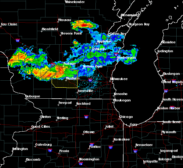 The severe thunderstorm warning for eastern sauk county will expire at 200 am cdt, the storm which prompted the warning has moved out of the area. therefore, the warning will be allowed to expire. however heavy rain is still possible with this thunderstorm. The severe thunderstorm warning for eastern sauk county will expire at 200 am cdt, the storm which prompted the warning has moved out of the area. therefore, the warning will be allowed to expire. however heavy rain is still possible with this thunderstorm.
|
| 7/19/2019 1:45 AM CDT |
 At 144 am cdt, a severe thunderstorm was located near prairie du sac, moving southeast at 30 mph (radar indicated). Hazards include 60 mph wind gusts and penny size hail. Expect damage to roofs, siding, and trees. Locations impacted include, baraboo, prairie du sac, sauk city, lake delton, spring green, west baraboo, plain, north freedom, merrimac, leland and devils lake st park. At 144 am cdt, a severe thunderstorm was located near prairie du sac, moving southeast at 30 mph (radar indicated). Hazards include 60 mph wind gusts and penny size hail. Expect damage to roofs, siding, and trees. Locations impacted include, baraboo, prairie du sac, sauk city, lake delton, spring green, west baraboo, plain, north freedom, merrimac, leland and devils lake st park.
|
| 7/19/2019 1:10 AM CDT |
 At 109 am cdt, a severe thunderstorm was located near reedsburg, moving southeast at 35 mph (radar indicated). Hazards include 60 mph wind gusts and penny size hail. expect damage to roofs, siding, and trees At 109 am cdt, a severe thunderstorm was located near reedsburg, moving southeast at 35 mph (radar indicated). Hazards include 60 mph wind gusts and penny size hail. expect damage to roofs, siding, and trees
|
| 7/3/2019 5:56 PM CDT |
 The severe thunderstorm warning for north central sauk county will expire at 600 pm cdt, the storm which prompted the warning has weakened below severe limits, and no longer poses an immediate threat to life or property. therefore, the warning will be allowed to expire. however heavy rain is still possible with this thunderstorm and a flash flood warning continues for much of this area. The severe thunderstorm warning for north central sauk county will expire at 600 pm cdt, the storm which prompted the warning has weakened below severe limits, and no longer poses an immediate threat to life or property. therefore, the warning will be allowed to expire. however heavy rain is still possible with this thunderstorm and a flash flood warning continues for much of this area.
|
| 7/3/2019 5:46 PM CDT |
 At 545 pm cdt, a severe thunderstorm was located near reedsburg, moving southeast at 10 mph (law enforcement. several trees were reported down in reedsburg). Hazards include 60 mph wind gusts. Expect damage to roofs, siding, and trees. Locations impacted include, reedsburg, north freedom, rock springs and loganville. At 545 pm cdt, a severe thunderstorm was located near reedsburg, moving southeast at 10 mph (law enforcement. several trees were reported down in reedsburg). Hazards include 60 mph wind gusts. Expect damage to roofs, siding, and trees. Locations impacted include, reedsburg, north freedom, rock springs and loganville.
|
| 7/3/2019 5:28 PM CDT |
 At 528 pm cdt, a severe thunderstorm was located near reedsburg, moving southeast at 10 mph (radar indicated). Hazards include 60 mph wind gusts. expect damage to roofs, siding, and trees At 528 pm cdt, a severe thunderstorm was located near reedsburg, moving southeast at 10 mph (radar indicated). Hazards include 60 mph wind gusts. expect damage to roofs, siding, and trees
|
| 6/30/2019 11:06 AM CDT |
 The severe thunderstorm warning for southern green lake, northwestern columbia, southern marquette and northeastern sauk counties will expire at 1115 am cdt, the storms which prompted the warning have weakened and moved out of the area. therefore, the warning will be allowed to expire. however gusty winds are still possible with these thunderstorms. The severe thunderstorm warning for southern green lake, northwestern columbia, southern marquette and northeastern sauk counties will expire at 1115 am cdt, the storms which prompted the warning have weakened and moved out of the area. therefore, the warning will be allowed to expire. however gusty winds are still possible with these thunderstorms.
|
| 6/30/2019 10:53 AM CDT |
 At 1051 am cdt, severe thunderstorms were located along a line extending from near green lake to near lake wisconsin, moving southeast at 30 mph (law enforcement. there have been numerous reports of tree damage, power outages, and deadly lightning). Hazards include 60 mph wind gusts and quarter size hail. Hail damage to vehicles is expected. expect wind damage to roofs, siding, and trees. Locations impacted include, baraboo, portage, wisconsin dells, lake wisconsin, lake delton, pardeeville, randolph, markesan, west baraboo, green lake, cambria, manchester, wyocena, north freedom, endeavor, merrimac, friesland, kingston, marquette and glen oak. At 1051 am cdt, severe thunderstorms were located along a line extending from near green lake to near lake wisconsin, moving southeast at 30 mph (law enforcement. there have been numerous reports of tree damage, power outages, and deadly lightning). Hazards include 60 mph wind gusts and quarter size hail. Hail damage to vehicles is expected. expect wind damage to roofs, siding, and trees. Locations impacted include, baraboo, portage, wisconsin dells, lake wisconsin, lake delton, pardeeville, randolph, markesan, west baraboo, green lake, cambria, manchester, wyocena, north freedom, endeavor, merrimac, friesland, kingston, marquette and glen oak.
|
| 6/30/2019 10:29 AM CDT |
 At 1027 am cdt, severe thunderstorms were located along a line extending from near berlin to near west baraboo, moving southeast at 45 mph (radar indicated. there was also a report from law enforcement of winds up to 60 mph with large tree branches down near endeavor). Hazards include 60 mph wind gusts and half dollar size hail. Hail damage to vehicles is expected. expect wind damage to roofs, siding, and trees. Locations impacted include, baraboo, portage, wisconsin dells, lake wisconsin, berlin, lake delton, pardeeville, randolph, montello, markesan, west baraboo, westfield, princeton, green lake, cambria, lawrence, packwaukee, manchester, wyocena and north freedom. At 1027 am cdt, severe thunderstorms were located along a line extending from near berlin to near west baraboo, moving southeast at 45 mph (radar indicated. there was also a report from law enforcement of winds up to 60 mph with large tree branches down near endeavor). Hazards include 60 mph wind gusts and half dollar size hail. Hail damage to vehicles is expected. expect wind damage to roofs, siding, and trees. Locations impacted include, baraboo, portage, wisconsin dells, lake wisconsin, berlin, lake delton, pardeeville, randolph, montello, markesan, west baraboo, westfield, princeton, green lake, cambria, lawrence, packwaukee, manchester, wyocena and north freedom.
|
| 6/30/2019 10:12 AM CDT |
 The national weather service in milwaukee/sullivan has issued a * severe thunderstorm warning for. green lake county in south central wisconsin. northwestern columbia county in south central wisconsin. marquette county in south central wisconsin. Northeastern sauk county in south central wisconsin. The national weather service in milwaukee/sullivan has issued a * severe thunderstorm warning for. green lake county in south central wisconsin. northwestern columbia county in south central wisconsin. marquette county in south central wisconsin. Northeastern sauk county in south central wisconsin.
|
| 6/27/2019 3:50 PM CDT |
 The severe thunderstorm warning for iowa and sauk counties will expire at 400 pm cdt, the storms which prompted the warning have moved out of the area. therefore, the warning will be allowed to expire. a severe thunderstorm watch remains in effect until 700 pm cdt for south central wisconsin. The severe thunderstorm warning for iowa and sauk counties will expire at 400 pm cdt, the storms which prompted the warning have moved out of the area. therefore, the warning will be allowed to expire. a severe thunderstorm watch remains in effect until 700 pm cdt for south central wisconsin.
|
| 6/27/2019 3:40 PM CDT |
 At 339 pm cdt, severe thunderstorms were located along a line extending from 7 miles northwest of portage to 6 miles west of blanchardville, moving east at 35 mph (emergency management). Hazards include 60 mph wind gusts. trees were reported down from arena to mineral point in iowa county. Expect damage to roofs, siding, and trees. Locations impacted include, baraboo, reedsburg, dodgeville, prairie du sac, sauk city, wisconsin dells, mineral point, lake delton, spring green, west baraboo, barneveld, highland, arena, plain, north freedom, ridgeway, avoca, orion, linden and cobb. At 339 pm cdt, severe thunderstorms were located along a line extending from 7 miles northwest of portage to 6 miles west of blanchardville, moving east at 35 mph (emergency management). Hazards include 60 mph wind gusts. trees were reported down from arena to mineral point in iowa county. Expect damage to roofs, siding, and trees. Locations impacted include, baraboo, reedsburg, dodgeville, prairie du sac, sauk city, wisconsin dells, mineral point, lake delton, spring green, west baraboo, barneveld, highland, arena, plain, north freedom, ridgeway, avoca, orion, linden and cobb.
|
| 6/27/2019 3:21 PM CDT |
 At 321 pm cdt, severe thunderstorms were located along a line extending from wisconsin dells to mineral point, moving east at 35 mph (radar indicated). Hazards include 60 mph wind gusts. Expect damage to roofs, siding, and trees. Locations impacted include, baraboo, reedsburg, dodgeville, prairie du sac, sauk city, wisconsin dells, mineral point, lake delton, spring green, west baraboo, barneveld, highland, arena, plain, north freedom, ridgeway, avoca, orion, linden and cobb. At 321 pm cdt, severe thunderstorms were located along a line extending from wisconsin dells to mineral point, moving east at 35 mph (radar indicated). Hazards include 60 mph wind gusts. Expect damage to roofs, siding, and trees. Locations impacted include, baraboo, reedsburg, dodgeville, prairie du sac, sauk city, wisconsin dells, mineral point, lake delton, spring green, west baraboo, barneveld, highland, arena, plain, north freedom, ridgeway, avoca, orion, linden and cobb.
|
| 6/27/2019 3:07 PM CDT |
 The national weather service in milwaukee/sullivan has issued a * severe thunderstorm warning for. iowa county in south central wisconsin. sauk county in south central wisconsin. until 400 pm cdt. At 307 pm cdt, severe thunderstorms were located along a line. The national weather service in milwaukee/sullivan has issued a * severe thunderstorm warning for. iowa county in south central wisconsin. sauk county in south central wisconsin. until 400 pm cdt. At 307 pm cdt, severe thunderstorms were located along a line.
|
| 5/5/2019 5:25 PM CDT |
 At 524 pm cdt, a severe thunderstorm was located 9 miles northwest of prairie du sac, moving southeast at 35 mph (radar indicated). Hazards include 60 mph wind gusts and quarter size hail. Hail damage to vehicles is expected. expect wind damage to roofs, siding, and trees. Locations impacted include, baraboo, prairie du sac, sauk city, north freedom, merrimac, rock springs, loganville, leland, devils lake st park and hill point. At 524 pm cdt, a severe thunderstorm was located 9 miles northwest of prairie du sac, moving southeast at 35 mph (radar indicated). Hazards include 60 mph wind gusts and quarter size hail. Hail damage to vehicles is expected. expect wind damage to roofs, siding, and trees. Locations impacted include, baraboo, prairie du sac, sauk city, north freedom, merrimac, rock springs, loganville, leland, devils lake st park and hill point.
|
| 5/5/2019 5:12 PM CDT |
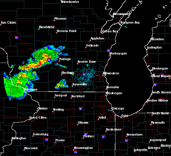 At 512 pm cdt, a severe thunderstorm was located 9 miles south of reedsburg, moving southeast at 40 mph (radar indicated). Hazards include 60 mph wind gusts and quarter size hail. Hail damage to vehicles is expected. Expect wind damage to roofs, siding, and trees. At 512 pm cdt, a severe thunderstorm was located 9 miles south of reedsburg, moving southeast at 40 mph (radar indicated). Hazards include 60 mph wind gusts and quarter size hail. Hail damage to vehicles is expected. Expect wind damage to roofs, siding, and trees.
|
| 8/27/2018 11:26 PM CDT |
 At 1126 pm cdt, a severe thunderstorm capable of producing a tornado was located near reedsburg, moving east at 40 mph (radar indicated rotation). Hazards include tornado. Flying debris will be dangerous to those caught without shelter. mobile homes will be damaged or destroyed. damage to roofs, windows, and vehicles will occur. tree damage is likely. Locations impacted include, reedsburg, lake delton, west baraboo, north freedom and rock springs. At 1126 pm cdt, a severe thunderstorm capable of producing a tornado was located near reedsburg, moving east at 40 mph (radar indicated rotation). Hazards include tornado. Flying debris will be dangerous to those caught without shelter. mobile homes will be damaged or destroyed. damage to roofs, windows, and vehicles will occur. tree damage is likely. Locations impacted include, reedsburg, lake delton, west baraboo, north freedom and rock springs.
|
| 8/27/2018 11:22 PM CDT |
 At 1122 pm cdt, a severe thunderstorm capable of producing a tornado was located over reedsburg, moving east at 40 mph (radar indicated rotation). Hazards include tornado. Flying debris will be dangerous to those caught without shelter. mobile homes will be damaged or destroyed. damage to roofs, windows, and vehicles will occur. Tree damage is likely. At 1122 pm cdt, a severe thunderstorm capable of producing a tornado was located over reedsburg, moving east at 40 mph (radar indicated rotation). Hazards include tornado. Flying debris will be dangerous to those caught without shelter. mobile homes will be damaged or destroyed. damage to roofs, windows, and vehicles will occur. Tree damage is likely.
|
| 8/27/2018 11:13 PM CDT |
 At 1112 pm cdt, a severe thunderstorm was located near reedsburg, moving east at 30 mph (radar indicated). Hazards include 60 mph wind gusts. Expect damage to roofs, siding, and trees. Locations impacted include, reedsburg, lake delton, west baraboo, north freedom, la valle, rock springs, loganville, ironton, lime ridge and hill point. At 1112 pm cdt, a severe thunderstorm was located near reedsburg, moving east at 30 mph (radar indicated). Hazards include 60 mph wind gusts. Expect damage to roofs, siding, and trees. Locations impacted include, reedsburg, lake delton, west baraboo, north freedom, la valle, rock springs, loganville, ironton, lime ridge and hill point.
|
| 8/27/2018 10:47 PM CDT |
 At 1047 pm cdt, a severe thunderstorm was located 9 miles north of richland center, moving east at 35 mph (radar indicated). Hazards include 60 mph wind gusts. expect damage to roofs, siding, and trees At 1047 pm cdt, a severe thunderstorm was located 9 miles north of richland center, moving east at 35 mph (radar indicated). Hazards include 60 mph wind gusts. expect damage to roofs, siding, and trees
|
| 8/26/2018 3:45 PM CDT | Six reports of trees down on road in sauk county WI, 0.2 miles W of North Freedom, WI |
| 8/26/2018 3:44 PM CDT |
 At 344 pm cdt, severe thunderstorms were located along a line extending from wisconsin dells to prairie du sac, moving northeast at 35 mph (radar indicated). Hazards include 60 mph wind gusts and penny size hail. Expect damage to roofs, siding, and trees. Locations impacted include, baraboo, portage, prairie du sac, sauk city, wisconsin dells, lake wisconsin, lake delton, west baraboo, north freedom, merrimac, interstate 90/94 interchange and devils lake st park. At 344 pm cdt, severe thunderstorms were located along a line extending from wisconsin dells to prairie du sac, moving northeast at 35 mph (radar indicated). Hazards include 60 mph wind gusts and penny size hail. Expect damage to roofs, siding, and trees. Locations impacted include, baraboo, portage, prairie du sac, sauk city, wisconsin dells, lake wisconsin, lake delton, west baraboo, north freedom, merrimac, interstate 90/94 interchange and devils lake st park.
|
| 8/26/2018 3:24 PM CDT |
 At 324 pm cdt, severe thunderstorms were located along a line extending from 7 miles north of reedsburg to near mazomanie, moving northeast at 55 mph (radar indicated). Hazards include 60 mph wind gusts and penny size hail. expect damage to roofs, siding, and trees At 324 pm cdt, severe thunderstorms were located along a line extending from 7 miles north of reedsburg to near mazomanie, moving northeast at 55 mph (radar indicated). Hazards include 60 mph wind gusts and penny size hail. expect damage to roofs, siding, and trees
|
| 7/13/2018 6:52 PM CDT |
 The severe thunderstorm warning for sauk county will expire at 700 pm cdt, the storms which prompted the warning have weakened below severe limits, and no longer pose an immediate threat to life or property. therefore, the warning will be allowed to expire. a severe thunderstorm watch remains in effect until 1100 pm cdt for south central wisconsin. The severe thunderstorm warning for sauk county will expire at 700 pm cdt, the storms which prompted the warning have weakened below severe limits, and no longer pose an immediate threat to life or property. therefore, the warning will be allowed to expire. a severe thunderstorm watch remains in effect until 1100 pm cdt for south central wisconsin.
|
| 7/13/2018 6:33 PM CDT |
 At 632 pm cdt, severe thunderstorms were located along a line extending from near baraboo to near spring green, moving east at 20 mph (radar indicated). Hazards include 60 mph wind gusts and quarter size hail. Hail damage to vehicles is expected. expect wind damage to roofs, siding, and trees. locations impacted include, baraboo, reedsburg, prairie du sac, sauk city, spring green, west baraboo, plain, north freedom, merrimac, rock springs, loganville, lime ridge, leland, devils lake st park and hill point. those attending the sauk county fair are in the path of these storms and should prepare for imminent dangerous weather conditions. Seek shelter now!. At 632 pm cdt, severe thunderstorms were located along a line extending from near baraboo to near spring green, moving east at 20 mph (radar indicated). Hazards include 60 mph wind gusts and quarter size hail. Hail damage to vehicles is expected. expect wind damage to roofs, siding, and trees. locations impacted include, baraboo, reedsburg, prairie du sac, sauk city, spring green, west baraboo, plain, north freedom, merrimac, rock springs, loganville, lime ridge, leland, devils lake st park and hill point. those attending the sauk county fair are in the path of these storms and should prepare for imminent dangerous weather conditions. Seek shelter now!.
|
| 7/13/2018 6:10 PM CDT |
 At 609 pm cdt, severe thunderstorms were located along a line extending from near west baraboo to near spring green, moving east at 30 mph (radar indicated). Hazards include ping pong ball size hail and 60 mph wind gusts. People and animals outdoors will be injured. expect hail damage to roofs, siding, windows, and vehicles. expect wind damage to roofs, siding, and trees. locations impacted include, baraboo, reedsburg, prairie du sac, sauk city, spring green, west baraboo, plain, north freedom, merrimac, rock springs, loganville, lime ridge, leland, devils lake st park and hill point. those attending the sauk county fair are in the path of these storms and should prepare for imminent dangerous weather conditions. Seek shelter now!. At 609 pm cdt, severe thunderstorms were located along a line extending from near west baraboo to near spring green, moving east at 30 mph (radar indicated). Hazards include ping pong ball size hail and 60 mph wind gusts. People and animals outdoors will be injured. expect hail damage to roofs, siding, windows, and vehicles. expect wind damage to roofs, siding, and trees. locations impacted include, baraboo, reedsburg, prairie du sac, sauk city, spring green, west baraboo, plain, north freedom, merrimac, rock springs, loganville, lime ridge, leland, devils lake st park and hill point. those attending the sauk county fair are in the path of these storms and should prepare for imminent dangerous weather conditions. Seek shelter now!.
|
| 7/13/2018 5:58 PM CDT |
 At 558 pm cdt, severe thunderstorms were located along a line extending from near west baraboo to 7 miles west of spring green, moving east at 30 mph (radar indicated). Hazards include 60 mph wind gusts and quarter size hail. Hail damage to vehicles is expected. Expect wind damage to roofs, siding, and trees. At 558 pm cdt, severe thunderstorms were located along a line extending from near west baraboo to 7 miles west of spring green, moving east at 30 mph (radar indicated). Hazards include 60 mph wind gusts and quarter size hail. Hail damage to vehicles is expected. Expect wind damage to roofs, siding, and trees.
|
| 6/30/2018 6:53 PM CDT |
 At 651 pm cdt, severe thunderstorms were located along a line extending from near westfield to 6 miles northwest of portage to 6 miles southwest of west baraboo, moving east at 50 mph (law enforcement. these storms have a history of producing tree damage, and winds measured between 50 and 60 mph). Hazards include 60 mph wind gusts. expect damage to roofs, siding, and trees At 651 pm cdt, severe thunderstorms were located along a line extending from near westfield to 6 miles northwest of portage to 6 miles southwest of west baraboo, moving east at 50 mph (law enforcement. these storms have a history of producing tree damage, and winds measured between 50 and 60 mph). Hazards include 60 mph wind gusts. expect damage to roofs, siding, and trees
|
| 4/13/2018 8:45 AM CDT | Half Dollar sized hail reported 0.2 miles W of North Freedom, WI |
| 4/13/2018 8:39 AM CDT |
 At 821 am cdt, a severe thunderstorm was located near richland center, moving east at 55 mph (public). Hazards include golf ball size hail. People and animals outdoors will be injured. expect damage to roofs, siding, windows, and vehicles. Locations impacted include, baraboo, reedsburg, wisconsin dells, lake delton, west baraboo, plain, north freedom, merrimac, rock springs, loganville, ironton, lime ridge, leland, devils lake st park and hill point. At 821 am cdt, a severe thunderstorm was located near richland center, moving east at 55 mph (public). Hazards include golf ball size hail. People and animals outdoors will be injured. expect damage to roofs, siding, windows, and vehicles. Locations impacted include, baraboo, reedsburg, wisconsin dells, lake delton, west baraboo, plain, north freedom, merrimac, rock springs, loganville, ironton, lime ridge, leland, devils lake st park and hill point.
|
| 4/13/2018 8:34 AM CDT |
 At 821 am cdt, a severe thunderstorm was located near richland center, moving east at 55 mph (public). Hazards include golf ball size hail. People and animals outdoors will be injured. expect damage to roofs, siding, windows, and vehicles. Locations impacted include, baraboo, reedsburg, wisconsin dells, lake delton, west baraboo, plain, north freedom, merrimac, rock springs, loganville, ironton, lime ridge, leland, devils lake st park and hill point. At 821 am cdt, a severe thunderstorm was located near richland center, moving east at 55 mph (public). Hazards include golf ball size hail. People and animals outdoors will be injured. expect damage to roofs, siding, windows, and vehicles. Locations impacted include, baraboo, reedsburg, wisconsin dells, lake delton, west baraboo, plain, north freedom, merrimac, rock springs, loganville, ironton, lime ridge, leland, devils lake st park and hill point.
|
| 4/13/2018 8:21 AM CDT |
 At 821 am cdt, a severe thunderstorm was located near richland center, moving east at 55 mph (public). Hazards include golf ball size hail. People and animals outdoors will be injured. expect damage to roofs, siding, windows, and vehicles. Locations impacted include, baraboo, reedsburg, wisconsin dells, lake delton, west baraboo, plain, north freedom, merrimac, rock springs, loganville, ironton, lime ridge, leland, devils lake st park and hill point. At 821 am cdt, a severe thunderstorm was located near richland center, moving east at 55 mph (public). Hazards include golf ball size hail. People and animals outdoors will be injured. expect damage to roofs, siding, windows, and vehicles. Locations impacted include, baraboo, reedsburg, wisconsin dells, lake delton, west baraboo, plain, north freedom, merrimac, rock springs, loganville, ironton, lime ridge, leland, devils lake st park and hill point.
|
| 4/13/2018 8:16 AM CDT |
 At 815 am cdt, a severe thunderstorm was located over richland center, moving east at 55 mph (public). Hazards include quarter size hail. damage to vehicles is expected At 815 am cdt, a severe thunderstorm was located over richland center, moving east at 55 mph (public). Hazards include quarter size hail. damage to vehicles is expected
|
| 7/19/2017 8:07 PM CDT |
 At 807 pm cdt, a severe thunderstorm was located near west baraboo, or near baraboo, moving northeast at 30 mph (radar indicated). Hazards include 70 mph wind gusts. Expect considerable tree damage. damage is likely to mobile homes, roofs, and outbuildings. Locations impacted include, baraboo, portage, reedsburg, columbus, prairie du sac, sauk city, wisconsin dells, lake wisconsin, lodi, lake delton, poynette, pardeeville, randolph, fall river, west baraboo, rio, cambria, arlington, plain and wyocena. At 807 pm cdt, a severe thunderstorm was located near west baraboo, or near baraboo, moving northeast at 30 mph (radar indicated). Hazards include 70 mph wind gusts. Expect considerable tree damage. damage is likely to mobile homes, roofs, and outbuildings. Locations impacted include, baraboo, portage, reedsburg, columbus, prairie du sac, sauk city, wisconsin dells, lake wisconsin, lodi, lake delton, poynette, pardeeville, randolph, fall river, west baraboo, rio, cambria, arlington, plain and wyocena.
|
| 7/19/2017 7:24 PM CDT |
 At 723 pm cdt, a severe thunderstorm was located 9 miles northeast of richland center, moving east at 55 mph. this storm has a history of producing damaging winds. seek shelter now!! (radar indicated). Hazards include 70 mph wind gusts. Expect considerable tree damage. Damage is likely to mobile homes, roofs, and outbuildings. At 723 pm cdt, a severe thunderstorm was located 9 miles northeast of richland center, moving east at 55 mph. this storm has a history of producing damaging winds. seek shelter now!! (radar indicated). Hazards include 70 mph wind gusts. Expect considerable tree damage. Damage is likely to mobile homes, roofs, and outbuildings.
|
| 7/15/2017 11:50 PM CDT |
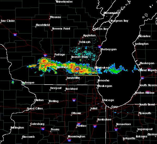 The severe thunderstorm warning for southwestern columbia and east central sauk counties will expire at midnight cdt, the severe thunderstorm which prompted the warning has weakened. therefore, the warning will be allowed to expire. however heavy rain is still possible with this thunderstorm. a severe thunderstorm watch remains in effect until 100 am cdt for south central wisconsin. The severe thunderstorm warning for southwestern columbia and east central sauk counties will expire at midnight cdt, the severe thunderstorm which prompted the warning has weakened. therefore, the warning will be allowed to expire. however heavy rain is still possible with this thunderstorm. a severe thunderstorm watch remains in effect until 100 am cdt for south central wisconsin.
|
| 7/15/2017 11:36 PM CDT |
 At 1135 pm cdt, a severe thunderstorm was located near prairie du sac, moving south at 15 mph (law enforcement). Hazards include quarter size hail. Damage to vehicles is expected. locations impacted include, baraboo, prairie du sac, lake wisconsin, west baraboo, north freedom, merrimac, rock springs, leland and devils lake st park. People attending the sauk county fair should seek safe shelter immediately!. At 1135 pm cdt, a severe thunderstorm was located near prairie du sac, moving south at 15 mph (law enforcement). Hazards include quarter size hail. Damage to vehicles is expected. locations impacted include, baraboo, prairie du sac, lake wisconsin, west baraboo, north freedom, merrimac, rock springs, leland and devils lake st park. People attending the sauk county fair should seek safe shelter immediately!.
|
| 7/15/2017 11:22 PM CDT |
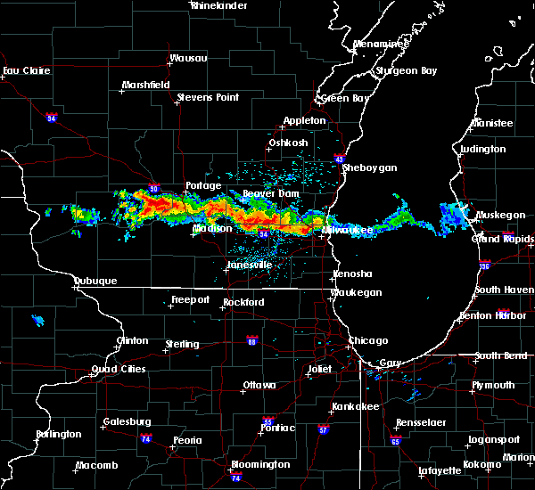 At 1122 pm cdt, a severe thunderstorm was located near baraboo, moving south at 15 mph (law enforcement. at 1120pm, golf ball sized hail was reported in baraboo). Hazards include golf ball size hail and 60 mph wind gusts. People and animals outdoors will be injured. expect hail damage to roofs, siding, windows, and vehicles. Expect wind damage to roofs, siding, and trees. At 1122 pm cdt, a severe thunderstorm was located near baraboo, moving south at 15 mph (law enforcement. at 1120pm, golf ball sized hail was reported in baraboo). Hazards include golf ball size hail and 60 mph wind gusts. People and animals outdoors will be injured. expect hail damage to roofs, siding, windows, and vehicles. Expect wind damage to roofs, siding, and trees.
|
| 6/28/2017 12:08 PM CDT |
 At 507 pm cdt, a severe thunderstorm was located near muscoda, or 14 miles south of richland center, moving east at 50 mph (radar indicated). Hazards include 60 mph wind gusts and quarter size hail. Hail damage to vehicles is expected. expect wind damage to roofs, siding, and trees. Locations impacted include, baraboo, prairie du sac, sauk city, spring green, west baraboo, arena, plain, north freedom, avoca, orion, merrimac, rock springs, loganville, leland and devils lake st park. At 507 pm cdt, a severe thunderstorm was located near muscoda, or 14 miles south of richland center, moving east at 50 mph (radar indicated). Hazards include 60 mph wind gusts and quarter size hail. Hail damage to vehicles is expected. expect wind damage to roofs, siding, and trees. Locations impacted include, baraboo, prairie du sac, sauk city, spring green, west baraboo, arena, plain, north freedom, avoca, orion, merrimac, rock springs, loganville, leland and devils lake st park.
|
| 6/28/2017 11:53 AM CDT |
 At 452 pm cdt, a severe thunderstorm was located near boscobel, or 14 miles southwest of richland center, moving east at 60 mph (radar indicated). Hazards include 60 mph wind gusts and quarter size hail. Hail damage to vehicles is expected. Expect wind damage to roofs, siding, and trees. At 452 pm cdt, a severe thunderstorm was located near boscobel, or 14 miles southwest of richland center, moving east at 60 mph (radar indicated). Hazards include 60 mph wind gusts and quarter size hail. Hail damage to vehicles is expected. Expect wind damage to roofs, siding, and trees.
|
| 6/14/2017 2:04 PM CDT |
 At 203 pm cdt, severe thunderstorms were located along a line extending from near lake delton to near portage, moving northeast at 50 mph (law enforcement). Hazards include 70 mph wind gusts and quarter size hail. the reedsburg observation station reported a wind gust to 75 mph at 155 pm cdt. Hail damage to vehicles is expected. expect considerable tree damage. wind damage is also likely to mobile homes, roofs, and outbuildings. locations impacted include, baraboo, portage, reedsburg, wisconsin dells, lake wisconsin, lake delton, pardeeville, west baraboo, wyocena, north freedom, rock springs, interstate 90/94 interchange and devils lake st park. People attending nishan park should seek safe shelter immediately!. At 203 pm cdt, severe thunderstorms were located along a line extending from near lake delton to near portage, moving northeast at 50 mph (law enforcement). Hazards include 70 mph wind gusts and quarter size hail. the reedsburg observation station reported a wind gust to 75 mph at 155 pm cdt. Hail damage to vehicles is expected. expect considerable tree damage. wind damage is also likely to mobile homes, roofs, and outbuildings. locations impacted include, baraboo, portage, reedsburg, wisconsin dells, lake wisconsin, lake delton, pardeeville, west baraboo, wyocena, north freedom, rock springs, interstate 90/94 interchange and devils lake st park. People attending nishan park should seek safe shelter immediately!.
|
| 6/14/2017 1:55 PM CDT |
 At 154 pm cdt, severe thunderstorms were located along a line extending from near reedsburg to near portage, moving northeast at 55 mph (radar indicated). Hazards include 60 mph wind gusts and quarter size hail. Hail damage to vehicles is expected. Expect wind damage to roofs, siding, and trees. At 154 pm cdt, severe thunderstorms were located along a line extending from near reedsburg to near portage, moving northeast at 55 mph (radar indicated). Hazards include 60 mph wind gusts and quarter size hail. Hail damage to vehicles is expected. Expect wind damage to roofs, siding, and trees.
|
| 6/14/2017 1:38 PM CDT |
 At 138 pm cdt, severe thunderstorms were located along a line extending from near elroy to 7 miles southeast of wonewoc to 6 miles southwest of reedsburg to near spring green, moving northeast at 35 mph (radar indicated). Hazards include 60 mph wind gusts and quarter size hail. Hail damage to vehicles is expected. expect wind damage to roofs, siding, and trees. locations impacted include, reedsburg, lake delton, spring green, plain, north freedom, la valle, rock springs, loganville, ironton, lime ridge, leland and hill point. People attending nishan park should seek safe shelter immediately!. At 138 pm cdt, severe thunderstorms were located along a line extending from near elroy to 7 miles southeast of wonewoc to 6 miles southwest of reedsburg to near spring green, moving northeast at 35 mph (radar indicated). Hazards include 60 mph wind gusts and quarter size hail. Hail damage to vehicles is expected. expect wind damage to roofs, siding, and trees. locations impacted include, reedsburg, lake delton, spring green, plain, north freedom, la valle, rock springs, loganville, ironton, lime ridge, leland and hill point. People attending nishan park should seek safe shelter immediately!.
|
| 6/14/2017 1:26 PM CDT |
 At 126 pm cdt, severe thunderstorms were located along a line extending from near elroy to 7 miles south of wonewoc to 10 miles east of richland center to 8 miles southwest of spring green, moving northeast at 35 mph (radar indicated). Hazards include 60 mph wind gusts and quarter size hail. Hail damage to vehicles is expected. expect wind damage to roofs, siding, and trees. locations impacted include, reedsburg, lake delton, spring green, highland, plain, north freedom, avoca, orion, la valle, rock springs, loganville, ironton, lime ridge, leland and hill point. People attending nishan park should seek safe shelter immediately!. At 126 pm cdt, severe thunderstorms were located along a line extending from near elroy to 7 miles south of wonewoc to 10 miles east of richland center to 8 miles southwest of spring green, moving northeast at 35 mph (radar indicated). Hazards include 60 mph wind gusts and quarter size hail. Hail damage to vehicles is expected. expect wind damage to roofs, siding, and trees. locations impacted include, reedsburg, lake delton, spring green, highland, plain, north freedom, avoca, orion, la valle, rock springs, loganville, ironton, lime ridge, leland and hill point. People attending nishan park should seek safe shelter immediately!.
|
| 6/14/2017 1:11 PM CDT |
 At 111 pm cdt, severe thunderstorms were located along a line extending from 8 miles east of cashton to near hillsboro to richland center to near muscoda, moving northeast at 35 mph (radar indicated). Hazards include 60 mph wind gusts and quarter size hail. Hail damage to vehicles is expected. Expect wind damage to roofs, siding, and trees. At 111 pm cdt, severe thunderstorms were located along a line extending from 8 miles east of cashton to near hillsboro to richland center to near muscoda, moving northeast at 35 mph (radar indicated). Hazards include 60 mph wind gusts and quarter size hail. Hail damage to vehicles is expected. Expect wind damage to roofs, siding, and trees.
|
| 5/17/2017 8:36 PM CDT |
 At 835 pm cdt, severe thunderstorms were located along a line extending from near tomah to 7 miles northwest of wisconsin dells to near prairie du sac, moving northeast at 55 mph (radar indicated). Hazards include 70 mph wind gusts and quarter size hail. Hail damage to vehicles is expected. expect considerable tree damage. wind damage is also likely to mobile homes, roofs, and outbuildings. locations impacted include, baraboo, portage, reedsburg, prairie du sac, sauk city, wisconsin dells, lake wisconsin, lodi, lake delton, poynette, pardeeville, west baraboo, westfield, lawrence, packwaukee, arlington, plain, wyocena, north freedom and oxford. A tornado watch remains in effect until 1100 pm cdt for south central wisconsin. At 835 pm cdt, severe thunderstorms were located along a line extending from near tomah to 7 miles northwest of wisconsin dells to near prairie du sac, moving northeast at 55 mph (radar indicated). Hazards include 70 mph wind gusts and quarter size hail. Hail damage to vehicles is expected. expect considerable tree damage. wind damage is also likely to mobile homes, roofs, and outbuildings. locations impacted include, baraboo, portage, reedsburg, prairie du sac, sauk city, wisconsin dells, lake wisconsin, lodi, lake delton, poynette, pardeeville, west baraboo, westfield, lawrence, packwaukee, arlington, plain, wyocena, north freedom and oxford. A tornado watch remains in effect until 1100 pm cdt for south central wisconsin.
|
| 5/17/2017 8:22 PM CDT |
 At 821 pm cdt, severe thunderstorms were located along a line extending from 7 miles southeast of sparta to near reedsburg to 8 miles northwest of mazomanie, moving northeast at 55 mph (radar indicated). Hazards include 60 mph wind gusts and quarter size hail. Hail damage to vehicles is expected. Expect wind damage to roofs, siding, and trees. At 821 pm cdt, severe thunderstorms were located along a line extending from 7 miles southeast of sparta to near reedsburg to 8 miles northwest of mazomanie, moving northeast at 55 mph (radar indicated). Hazards include 60 mph wind gusts and quarter size hail. Hail damage to vehicles is expected. Expect wind damage to roofs, siding, and trees.
|
| 5/17/2017 8:16 PM CDT |
 At 815 pm cdt, severe thunderstorms were located along a line extending from near cashton to near wonewoc to 11 miles south of reedsburg to 8 miles southwest of mazomanie to 6 miles southeast of darlington, moving northeast at 55 mph (law enforcement. tree damage was reported in belmont at 753 pm). Hazards include 60 mph wind gusts and quarter size hail. Hail damage to vehicles is expected. expect wind damage to roofs, siding, and trees. locations impacted include, western madison, middleton, baraboo, monroe, verona, reedsburg, mount horeb, dodgeville, prairie du sac, sauk city, wisconsin dells, mineral point, darlington, lake wisconsin, cross plains, lodi, lake delton, belleville, new glarus and mazomanie. A tornado watch remains in effect until 1100 pm cdt for south central wisconsin. At 815 pm cdt, severe thunderstorms were located along a line extending from near cashton to near wonewoc to 11 miles south of reedsburg to 8 miles southwest of mazomanie to 6 miles southeast of darlington, moving northeast at 55 mph (law enforcement. tree damage was reported in belmont at 753 pm). Hazards include 60 mph wind gusts and quarter size hail. Hail damage to vehicles is expected. expect wind damage to roofs, siding, and trees. locations impacted include, western madison, middleton, baraboo, monroe, verona, reedsburg, mount horeb, dodgeville, prairie du sac, sauk city, wisconsin dells, mineral point, darlington, lake wisconsin, cross plains, lodi, lake delton, belleville, new glarus and mazomanie. A tornado watch remains in effect until 1100 pm cdt for south central wisconsin.
|
| 5/17/2017 8:07 PM CDT |
 At 806 pm cdt, severe thunderstorms were located along a line extending from westby to 10 miles south of hillsboro to 10 miles east of richland center to near dodgeville to near apple river, moving northeast at 55 mph (law enforcement reporting trees down in lafayette county). Hazards include 60 mph wind gusts and quarter size hail. Hail damage to vehicles is expected. expect wind damage to roofs, siding, and trees. locations impacted include, western madison, middleton, baraboo, monroe, verona, reedsburg, mount horeb, dodgeville, prairie du sac, sauk city, wisconsin dells, mineral point, darlington, lake wisconsin, cross plains, lodi, lake delton, belleville, new glarus and mazomanie. A tornado watch remains in effect until 1100 pm cdt for south central wisconsin. At 806 pm cdt, severe thunderstorms were located along a line extending from westby to 10 miles south of hillsboro to 10 miles east of richland center to near dodgeville to near apple river, moving northeast at 55 mph (law enforcement reporting trees down in lafayette county). Hazards include 60 mph wind gusts and quarter size hail. Hail damage to vehicles is expected. expect wind damage to roofs, siding, and trees. locations impacted include, western madison, middleton, baraboo, monroe, verona, reedsburg, mount horeb, dodgeville, prairie du sac, sauk city, wisconsin dells, mineral point, darlington, lake wisconsin, cross plains, lodi, lake delton, belleville, new glarus and mazomanie. A tornado watch remains in effect until 1100 pm cdt for south central wisconsin.
|
| 5/17/2017 7:54 PM CDT |
 At 752 pm cdt, severe thunderstorms were located along a line extending from 8 miles west of viroqua to near muscoda to council hill, moving northeast at 65 mph (radar indicated). Hazards include 60 mph wind gusts and quarter size hail. Hail damage to vehicles is expected. Expect wind damage to roofs, siding, and trees. At 752 pm cdt, severe thunderstorms were located along a line extending from 8 miles west of viroqua to near muscoda to council hill, moving northeast at 65 mph (radar indicated). Hazards include 60 mph wind gusts and quarter size hail. Hail damage to vehicles is expected. Expect wind damage to roofs, siding, and trees.
|
| 3/6/2017 11:01 PM CST |
 At 1101 pm cst, severe thunderstorms were located along a line extending from near amherst to 12 miles northeast of wisconsin dells, moving northeast at 55 mph (radar indicated). Hazards include 60 mph wind gusts and penny size hail. Expect damage to roofs, siding, and trees. Locations impacted include, baraboo, portage, prairie du sac, sauk city, wisconsin dells, lake wisconsin, lodi, lake delton, spring green, west baraboo, westfield, lawrence, packwaukee, plain, north freedom, oxford, endeavor, merrimac, rock springs and harmony grove. At 1101 pm cst, severe thunderstorms were located along a line extending from near amherst to 12 miles northeast of wisconsin dells, moving northeast at 55 mph (radar indicated). Hazards include 60 mph wind gusts and penny size hail. Expect damage to roofs, siding, and trees. Locations impacted include, baraboo, portage, prairie du sac, sauk city, wisconsin dells, lake wisconsin, lodi, lake delton, spring green, west baraboo, westfield, lawrence, packwaukee, plain, north freedom, oxford, endeavor, merrimac, rock springs and harmony grove.
|
| 3/6/2017 10:46 PM CST |
 At 1046 pm cst, severe thunderstorms were located along a line extending from near plainfield to near lake delton, moving northeast at 65 mph (radar indicated). Hazards include 60 mph wind gusts and penny size hail. Expect damage to roofs, siding, and trees. Locations impacted include, baraboo, portage, reedsburg, prairie du sac, sauk city, wisconsin dells, lake wisconsin, lodi, lake delton, spring green, west baraboo, westfield, lawrence, packwaukee, plain, north freedom, oxford, endeavor, merrimac and rock springs. At 1046 pm cst, severe thunderstorms were located along a line extending from near plainfield to near lake delton, moving northeast at 65 mph (radar indicated). Hazards include 60 mph wind gusts and penny size hail. Expect damage to roofs, siding, and trees. Locations impacted include, baraboo, portage, reedsburg, prairie du sac, sauk city, wisconsin dells, lake wisconsin, lodi, lake delton, spring green, west baraboo, westfield, lawrence, packwaukee, plain, north freedom, oxford, endeavor, merrimac and rock springs.
|
| 3/6/2017 10:28 PM CST |
 At 1027 pm cst, severe thunderstorms were located along a line extending from near friendship to 12 miles north of spring green, moving northeast at 60 mph (radar indicated). Hazards include 60 mph wind gusts and penny size hail. expect damage to roofs, siding, and trees At 1027 pm cst, severe thunderstorms were located along a line extending from near friendship to 12 miles north of spring green, moving northeast at 60 mph (radar indicated). Hazards include 60 mph wind gusts and penny size hail. expect damage to roofs, siding, and trees
|
| 3/6/2017 10:11 PM CST |
 At 1011 pm cst, severe thunderstorms were located along a line extending from 6 miles east of mauston to near richland center, moving northeast at 55 mph. a 60 mph wind gust was reported with these storms earlier in la farge (law enforcement). Hazards include 60 mph wind gusts. Expect damage to roofs, siding, and trees. Locations impacted include, baraboo, reedsburg, wisconsin dells, lake delton, spring green, west baraboo, plain, north freedom, la valle, rock springs, loganville, ironton, lime ridge, leland, devils lake st park and hill point. At 1011 pm cst, severe thunderstorms were located along a line extending from 6 miles east of mauston to near richland center, moving northeast at 55 mph. a 60 mph wind gust was reported with these storms earlier in la farge (law enforcement). Hazards include 60 mph wind gusts. Expect damage to roofs, siding, and trees. Locations impacted include, baraboo, reedsburg, wisconsin dells, lake delton, spring green, west baraboo, plain, north freedom, la valle, rock springs, loganville, ironton, lime ridge, leland, devils lake st park and hill point.
|
| 3/6/2017 10:01 PM CST |
 At 1000 pm cst, severe thunderstorms were located along a line extending from near mauston to near muscoda, moving northeast at 55 mph. a 60 mph wind gust was reported with these storms earlier in la farge (law enforcement). Hazards include 60 mph wind gusts. Expect damage to roofs, siding, and trees. Locations impacted include, baraboo, reedsburg, wisconsin dells, lake delton, spring green, west baraboo, plain, north freedom, la valle, rock springs, loganville, ironton, lime ridge, leland, devils lake st park and hill point. At 1000 pm cst, severe thunderstorms were located along a line extending from near mauston to near muscoda, moving northeast at 55 mph. a 60 mph wind gust was reported with these storms earlier in la farge (law enforcement). Hazards include 60 mph wind gusts. Expect damage to roofs, siding, and trees. Locations impacted include, baraboo, reedsburg, wisconsin dells, lake delton, spring green, west baraboo, plain, north freedom, la valle, rock springs, loganville, ironton, lime ridge, leland, devils lake st park and hill point.
|
| 3/6/2017 9:51 PM CST |
 At 950 pm cst, severe thunderstorms were located along a line extending from elroy to near boscobel, moving northeast at 55 mph. at 925 pm cst, a 60 mph wind gust was reported in la farge with this storm (law enforcement). Hazards include 60 mph wind gusts. Expect damage to roofs, siding, and trees. Locations impacted include, baraboo, reedsburg, wisconsin dells, lake delton, spring green, west baraboo, plain, north freedom, la valle, rock springs, loganville, ironton, lime ridge, leland, devils lake st park and hill point. At 950 pm cst, severe thunderstorms were located along a line extending from elroy to near boscobel, moving northeast at 55 mph. at 925 pm cst, a 60 mph wind gust was reported in la farge with this storm (law enforcement). Hazards include 60 mph wind gusts. Expect damage to roofs, siding, and trees. Locations impacted include, baraboo, reedsburg, wisconsin dells, lake delton, spring green, west baraboo, plain, north freedom, la valle, rock springs, loganville, ironton, lime ridge, leland, devils lake st park and hill point.
|
| 3/6/2017 9:40 PM CST |
 At 940 pm cst, severe thunderstorms were located along a line extending from near hillsboro to near boscobel, moving northeast at 50 mph (radar indicated). Hazards include 60 mph wind gusts. expect damage to roofs, siding, and trees At 940 pm cst, severe thunderstorms were located along a line extending from near hillsboro to near boscobel, moving northeast at 50 mph (radar indicated). Hazards include 60 mph wind gusts. expect damage to roofs, siding, and trees
|
| 9/19/2016 3:10 PM CDT |
 At 309 pm cdt, a severe thunderstorm was located 11 miles southwest of reedsburg, moving east at 50 mph. at 250 pm cdt, one inch hail was reported in bloom city (public reported). Hazards include ping pong ball size hail and 60 mph wind gusts. People and animals outdoors will be injured. expect hail damage to roofs, siding, windows, and vehicles. expect wind damage to roofs, siding, and trees. Locations impacted include, baraboo, reedsburg, prairie du sac, sauk city, wisconsin dells, lake wisconsin, lake delton, spring green, west baraboo, plain, north freedom, merrimac, la valle, rock springs, loganville, ironton, lime ridge, leland, hill point and devils lake st park. At 309 pm cdt, a severe thunderstorm was located 11 miles southwest of reedsburg, moving east at 50 mph. at 250 pm cdt, one inch hail was reported in bloom city (public reported). Hazards include ping pong ball size hail and 60 mph wind gusts. People and animals outdoors will be injured. expect hail damage to roofs, siding, windows, and vehicles. expect wind damage to roofs, siding, and trees. Locations impacted include, baraboo, reedsburg, prairie du sac, sauk city, wisconsin dells, lake wisconsin, lake delton, spring green, west baraboo, plain, north freedom, merrimac, la valle, rock springs, loganville, ironton, lime ridge, leland, hill point and devils lake st park.
|
| 9/19/2016 3:04 PM CDT |
 At 302 pm cdt, a severe thunderstorm was located 9 miles northeast of richland center, moving east at 45 mph (radar indicated). Hazards include ping pong ball size hail and 60 mph wind gusts. the largest hail will be south of reedsburg. People and animals outdoors will be injured. expect hail damage to roofs, siding, windows, and vehicles. expect wind damage to roofs, siding, and trees. Locations impacted include, baraboo, reedsburg, prairie du sac, sauk city, wisconsin dells, lake wisconsin, lake delton, spring green, west baraboo, plain, north freedom, merrimac, la valle, rock springs, loganville, ironton, lime ridge, leland, hill point and devils lake st park. At 302 pm cdt, a severe thunderstorm was located 9 miles northeast of richland center, moving east at 45 mph (radar indicated). Hazards include ping pong ball size hail and 60 mph wind gusts. the largest hail will be south of reedsburg. People and animals outdoors will be injured. expect hail damage to roofs, siding, windows, and vehicles. expect wind damage to roofs, siding, and trees. Locations impacted include, baraboo, reedsburg, prairie du sac, sauk city, wisconsin dells, lake wisconsin, lake delton, spring green, west baraboo, plain, north freedom, merrimac, la valle, rock springs, loganville, ironton, lime ridge, leland, hill point and devils lake st park.
|
| 9/19/2016 2:52 PM CDT |
 At 251 pm cdt, a severe thunderstorm was located 9 miles north of richland center, moving east at 50 mph (radar indicated). Hazards include 60 mph wind gusts and half dollar size hail. largest hail will occur south of reedsburg. Hail damage to vehicles is expected. Expect wind damage to roofs, siding, and trees. At 251 pm cdt, a severe thunderstorm was located 9 miles north of richland center, moving east at 50 mph (radar indicated). Hazards include 60 mph wind gusts and half dollar size hail. largest hail will occur south of reedsburg. Hail damage to vehicles is expected. Expect wind damage to roofs, siding, and trees.
|
| 8/16/2016 11:20 PM CDT |
 At 1119 pm cdt, a severe thunderstorm was located near reedsburg, moving east at 45 mph (radar indicated). Hazards include 60 mph wind gusts and penny size hail. Expect damage to roofs. siding. and trees. Locations impacted include, baraboo, reedsburg, wisconsin dells, lake delton, west baraboo, north freedom, merrimac, la valle, rock springs, ironton and devils lake st park. At 1119 pm cdt, a severe thunderstorm was located near reedsburg, moving east at 45 mph (radar indicated). Hazards include 60 mph wind gusts and penny size hail. Expect damage to roofs. siding. and trees. Locations impacted include, baraboo, reedsburg, wisconsin dells, lake delton, west baraboo, north freedom, merrimac, la valle, rock springs, ironton and devils lake st park.
|
| 8/16/2016 11:05 PM CDT |
 At 1104 pm cdt, a severe thunderstorm was located near wonewoc, or 9 miles northwest of reedsburg, moving east at 60 mph (radar indicated). Hazards include 60 mph wind gusts and penny size hail. Expect damage to roofs. siding. And trees. At 1104 pm cdt, a severe thunderstorm was located near wonewoc, or 9 miles northwest of reedsburg, moving east at 60 mph (radar indicated). Hazards include 60 mph wind gusts and penny size hail. Expect damage to roofs. siding. And trees.
|
| 8/4/2016 5:23 PM CDT |
 At 521 pm cdt, severe thunderstorms were located along a line extending from near wisconsin dells to near west baraboo, moving east at 35 mph (radar indicated). Hazards include 60 mph wind gusts. Expect damage to roofs. siding. and trees. Locations impacted include, baraboo, portage, wisconsin dells, lake wisconsin, lake delton, west baraboo, packwaukee, north freedom, endeavor, interstate 90/94 interchange and briggsville. At 521 pm cdt, severe thunderstorms were located along a line extending from near wisconsin dells to near west baraboo, moving east at 35 mph (radar indicated). Hazards include 60 mph wind gusts. Expect damage to roofs. siding. and trees. Locations impacted include, baraboo, portage, wisconsin dells, lake wisconsin, lake delton, west baraboo, packwaukee, north freedom, endeavor, interstate 90/94 interchange and briggsville.
|
| 8/4/2016 5:04 PM CDT |
 At 504 pm cdt, severe thunderstorms were located along a line extending from 8 miles northwest of wisconsin dells to near reedsburg, moving east at 35 mph (radar indicated). Hazards include 60 mph wind gusts. Expect damage to roofs. siding. And trees. At 504 pm cdt, severe thunderstorms were located along a line extending from 8 miles northwest of wisconsin dells to near reedsburg, moving east at 35 mph (radar indicated). Hazards include 60 mph wind gusts. Expect damage to roofs. siding. And trees.
|
| 8/4/2016 4:53 PM CDT |
 At 452 pm cdt, severe thunderstorms were located along a line extending from near mauston to 6 miles south of wonewoc, moving east at 35 mph (trained weather spotters). Hazards include 60 mph wind gusts. Expect damage to roofs. siding. and trees. Locations impacted include, reedsburg, wisconsin dells, lake delton, north freedom, la valle, rock springs, loganville, ironton and lime ridge. At 452 pm cdt, severe thunderstorms were located along a line extending from near mauston to 6 miles south of wonewoc, moving east at 35 mph (trained weather spotters). Hazards include 60 mph wind gusts. Expect damage to roofs. siding. and trees. Locations impacted include, reedsburg, wisconsin dells, lake delton, north freedom, la valle, rock springs, loganville, ironton and lime ridge.
|
| 8/4/2016 4:32 PM CDT |
 At 430 pm cdt, severe thunderstorms were located along a line extending from 6 miles northwest of elroy to 6 miles southwest of hillsboro, moving east at 35 mph (trained weather spotters. at 330pm...60 mph wind was reported near la crosse). Hazards include 60 mph wind gusts. Expect damage to roofs. siding. and trees. Locations impacted include, reedsburg, wisconsin dells, lake delton, north freedom, la valle, rock springs, loganville, ironton, lime ridge and hill point. At 430 pm cdt, severe thunderstorms were located along a line extending from 6 miles northwest of elroy to 6 miles southwest of hillsboro, moving east at 35 mph (trained weather spotters. at 330pm...60 mph wind was reported near la crosse). Hazards include 60 mph wind gusts. Expect damage to roofs. siding. and trees. Locations impacted include, reedsburg, wisconsin dells, lake delton, north freedom, la valle, rock springs, loganville, ironton, lime ridge and hill point.
|
| 8/4/2016 4:14 PM CDT |
 At 413 pm cdt, severe thunderstorms were located along a line extending from 10 miles south of tomah to near la farge, moving east at 35 mph (trained weather spotters. at 330pm...60 mph wind was reported near la crosse). Hazards include 60 mph wind gusts. Expect damage to roofs. siding. And trees. At 413 pm cdt, severe thunderstorms were located along a line extending from 10 miles south of tomah to near la farge, moving east at 35 mph (trained weather spotters. at 330pm...60 mph wind was reported near la crosse). Hazards include 60 mph wind gusts. Expect damage to roofs. siding. And trees.
|
| 7/21/2016 5:15 PM CDT | Trees and wires down... some wires on cars. also trees and wires down in sauk city on hwy 12 in sauk county WI, 0.2 miles W of North Freedom, WI |
| 7/21/2016 5:09 PM CDT |
 At 508 pm cdt, a severe thunderstorm was located near west baraboo, or near baraboo, moving southeast at 30 mph (radar indicated). Hazards include 60 mph wind gusts and nickel size hail. Expect damage to roofs. siding. and trees. Locations impacted include, baraboo, reedsburg, prairie du sac, sauk city, wisconsin dells, lake delton, spring green, west baraboo, plain, north freedom, merrimac, la valle, rock springs, loganville, ironton lime ridge, leland, interstate 90/94 interchange, hill point and devils lake st park. At 508 pm cdt, a severe thunderstorm was located near west baraboo, or near baraboo, moving southeast at 30 mph (radar indicated). Hazards include 60 mph wind gusts and nickel size hail. Expect damage to roofs. siding. and trees. Locations impacted include, baraboo, reedsburg, prairie du sac, sauk city, wisconsin dells, lake delton, spring green, west baraboo, plain, north freedom, merrimac, la valle, rock springs, loganville, ironton lime ridge, leland, interstate 90/94 interchange, hill point and devils lake st park.
|
| 7/21/2016 4:34 PM CDT |
 At 434 pm cdt, a severe thunderstorm was located 7 miles south of mauston, moving southeast at 40 mph (radar indicated). Hazards include 60 mph wind gusts and nickel size hail. Expect damage to roofs. siding. And trees. At 434 pm cdt, a severe thunderstorm was located 7 miles south of mauston, moving southeast at 40 mph (radar indicated). Hazards include 60 mph wind gusts and nickel size hail. Expect damage to roofs. siding. And trees.
|
| 7/5/2016 11:25 PM CDT |
 At 1124 pm cdt, severe thunderstorms were located along a line extending from near wisconsin dells to 9 miles northeast of fennimore, moving southeast at 45 mph (radar indicated). Hazards include 70 mph wind gusts. Expect considerable tree damage. damage is likely to mobile homes, roofs, and outbuildings. Locations impacted include, baraboo, prairie du sac, wisconsin dells, lake delton, spring green, barneveld, arena, plain, north freedom, ridgeway, la valle, rock springs, loganville and ironton. At 1124 pm cdt, severe thunderstorms were located along a line extending from near wisconsin dells to 9 miles northeast of fennimore, moving southeast at 45 mph (radar indicated). Hazards include 70 mph wind gusts. Expect considerable tree damage. damage is likely to mobile homes, roofs, and outbuildings. Locations impacted include, baraboo, prairie du sac, wisconsin dells, lake delton, spring green, barneveld, arena, plain, north freedom, ridgeway, la valle, rock springs, loganville and ironton.
|
| 7/5/2016 11:07 PM CDT |
 At 1105 pm cdt, a line of severe severe thunderstorms were located along a line from near westport to union center, or 12 miles northwest of richland center, moving east at 45 mph. these storms have a history of producing wind damage. seek shelter now! (radar indicated). Hazards include 70 mph wind gusts. Expect considerable tree damage. damage is likely to mobile homes, roofs, and outbuildings. Locations impacted include, baraboo, reedsburg, prairie du sac, sauk city, wisconsin dells, lake delton, spring green, west baraboo, barneveld, blue mounds, arena, plain, north freedom, ridgeway, avoca, orion, la valle, rock springs, loganville and ironton. At 1105 pm cdt, a line of severe severe thunderstorms were located along a line from near westport to union center, or 12 miles northwest of richland center, moving east at 45 mph. these storms have a history of producing wind damage. seek shelter now! (radar indicated). Hazards include 70 mph wind gusts. Expect considerable tree damage. damage is likely to mobile homes, roofs, and outbuildings. Locations impacted include, baraboo, reedsburg, prairie du sac, sauk city, wisconsin dells, lake delton, spring green, west baraboo, barneveld, blue mounds, arena, plain, north freedom, ridgeway, avoca, orion, la valle, rock springs, loganville and ironton.
|
| 7/5/2016 10:49 PM CDT |
 At 1048 pm cdt, a severe thunderstorm was located near la farge, or 8 miles east of viroqua, moving east at 45 mph (radar indicated). Hazards include 70 mph wind gusts. Expect considerable tree damage. Damage is likely to mobile homes, roofs, and outbuildings. At 1048 pm cdt, a severe thunderstorm was located near la farge, or 8 miles east of viroqua, moving east at 45 mph (radar indicated). Hazards include 70 mph wind gusts. Expect considerable tree damage. Damage is likely to mobile homes, roofs, and outbuildings.
|
| 6/10/2016 8:22 PM CDT |
 The severe thunderstorm warning for sauk and central columbia counties will expire at 830 pm cdt, the storms which prompted the warning have weakened below severe limits, and no longer pose an immediate threat to life or property. therefore the warning will be allowed to expire. however gusty winds are still possible with these thunderstorms. a severe thunderstorm watch remains in effect until 100 am cdt for south central wisconsin. The severe thunderstorm warning for sauk and central columbia counties will expire at 830 pm cdt, the storms which prompted the warning have weakened below severe limits, and no longer pose an immediate threat to life or property. therefore the warning will be allowed to expire. however gusty winds are still possible with these thunderstorms. a severe thunderstorm watch remains in effect until 100 am cdt for south central wisconsin.
|
| 6/10/2016 7:55 PM CDT |
 At 753 pm cdt, severe thunderstorms were located along a line extending from near pardeeville to baraboo to 7 miles southwest of reedsburg, moving southeast at 60 mph (radar indicated). Hazards include 60 mph wind gusts and nickel size hail. Expect damage to roofs. siding. and trees. Locations impacted include, baraboo, portage, reedsburg, prairie du sac, sauk city, wisconsin dells, lake wisconsin, lake delton, pardeeville, spring green, west baraboo, cambria, plain, wyocena, north freedom, merrimac, la valle, rock springs, loganville and ironton. At 753 pm cdt, severe thunderstorms were located along a line extending from near pardeeville to baraboo to 7 miles southwest of reedsburg, moving southeast at 60 mph (radar indicated). Hazards include 60 mph wind gusts and nickel size hail. Expect damage to roofs. siding. and trees. Locations impacted include, baraboo, portage, reedsburg, prairie du sac, sauk city, wisconsin dells, lake wisconsin, lake delton, pardeeville, spring green, west baraboo, cambria, plain, wyocena, north freedom, merrimac, la valle, rock springs, loganville and ironton.
|
| 6/10/2016 7:37 PM CDT |
 At 736 pm cdt, a severe thunderstorm was located near wonewoc, or 8 miles northwest of reedsburg, moving southeast at 45 mph (radar indicated). Hazards include 60 mph wind gusts and nickel size hail. Expect damage to roofs. siding. And trees. At 736 pm cdt, a severe thunderstorm was located near wonewoc, or 8 miles northwest of reedsburg, moving southeast at 45 mph (radar indicated). Hazards include 60 mph wind gusts and nickel size hail. Expect damage to roofs. siding. And trees.
|
| 7/18/2015 4:59 AM CDT |
 At 457 am cdt, severe thunderstorms were located along a line extending from near wautoma to 12 miles west of prairie du sac, moving east at 40 mph. the reedsburg area is under a particularly strong part of the line. hail is likely in that area, headed toward baraboo (radar indicated). Hazards include 60 mph wind gusts and quarter size hail. Hail damage to vehicles is expected. expect wind damage to roofs, siding and trees. Locations impacted include, baraboo, portage, reedsburg, berlin, prairie du sac, sauk city, wisconsin dells, lake wisconsin, lodi, lake delton, poynette, pardeeville, montello, west baraboo, westfield, princeton, green lake, lawrence, packwaukee and plain. At 457 am cdt, severe thunderstorms were located along a line extending from near wautoma to 12 miles west of prairie du sac, moving east at 40 mph. the reedsburg area is under a particularly strong part of the line. hail is likely in that area, headed toward baraboo (radar indicated). Hazards include 60 mph wind gusts and quarter size hail. Hail damage to vehicles is expected. expect wind damage to roofs, siding and trees. Locations impacted include, baraboo, portage, reedsburg, berlin, prairie du sac, sauk city, wisconsin dells, lake wisconsin, lodi, lake delton, poynette, pardeeville, montello, west baraboo, westfield, princeton, green lake, lawrence, packwaukee and plain.
|
| 7/18/2015 4:45 AM CDT |
 At 445 am cdt, severe thunderstorms were located along a line extending from near wautoma to 12 miles southwest of reedsburg, moving east at 40 mph (radar indicated). Hazards include 60 mph wind gusts. Expect damage to roofs. Siding and trees. At 445 am cdt, severe thunderstorms were located along a line extending from near wautoma to 12 miles southwest of reedsburg, moving east at 40 mph (radar indicated). Hazards include 60 mph wind gusts. Expect damage to roofs. Siding and trees.
|
| 7/13/2015 3:18 AM CDT |
 At 317 am cdt, severe thunderstorms were located along a line extending from 6 miles northwest of wautoma to 7 miles south of westfield to near wonewoc, moving east at 40 mph (radar indicated). Hazards include 60 mph wind gusts and quarter size hail. Hail damage to vehicles is expected. expect wind damage to roofs, siding and trees. locations impacted include, reedsburg, wisconsin dells, lake delton, montello, westfield, lawrence, packwaukee, north freedom, oxford, endeavor, neshkoro, la valle, rock springs, ironton, springfield corners, briggsville, glen oak, harrisville and rocky arbor state park. People attending the marquette county fair should seek safe shelter immediately!. At 317 am cdt, severe thunderstorms were located along a line extending from 6 miles northwest of wautoma to 7 miles south of westfield to near wonewoc, moving east at 40 mph (radar indicated). Hazards include 60 mph wind gusts and quarter size hail. Hail damage to vehicles is expected. expect wind damage to roofs, siding and trees. locations impacted include, reedsburg, wisconsin dells, lake delton, montello, westfield, lawrence, packwaukee, north freedom, oxford, endeavor, neshkoro, la valle, rock springs, ironton, springfield corners, briggsville, glen oak, harrisville and rocky arbor state park. People attending the marquette county fair should seek safe shelter immediately!.
|
| 7/13/2015 3:04 AM CDT |
 At 303 am cdt, severe thunderstorms were located along a line extending from near plainfield to 10 miles southeast of adams to hillsboro, moving east at 40 mph (radar indicated). Hazards include 60 mph wind gusts and quarter size hail. Hail damage to vehicles is expected. expect wind damage to roofs, siding and trees. locations impacted include, reedsburg, wisconsin dells, lake delton, montello, westfield, lawrence, packwaukee, north freedom, oxford, endeavor, neshkoro, la valle, rock springs, ironton, springfield corners, briggsville, glen oak, harrisville and rocky arbor state park. People attending the marquette county fair should seek safe shelter immediately!. At 303 am cdt, severe thunderstorms were located along a line extending from near plainfield to 10 miles southeast of adams to hillsboro, moving east at 40 mph (radar indicated). Hazards include 60 mph wind gusts and quarter size hail. Hail damage to vehicles is expected. expect wind damage to roofs, siding and trees. locations impacted include, reedsburg, wisconsin dells, lake delton, montello, westfield, lawrence, packwaukee, north freedom, oxford, endeavor, neshkoro, la valle, rock springs, ironton, springfield corners, briggsville, glen oak, harrisville and rocky arbor state park. People attending the marquette county fair should seek safe shelter immediately!.
|
| 7/13/2015 2:46 AM CDT |
 At 246 am cdt, severe thunderstorms were located along a line extending from 8 miles southeast of new rome to near castle rock lake to 7 miles northeast of la farge, moving east at 40 mph (radar indicated). Hazards include 60 mph wind gusts and quarter size hail. Hail damage to vehicles is expected. Expect wind damage to roofs, siding and trees. At 246 am cdt, severe thunderstorms were located along a line extending from 8 miles southeast of new rome to near castle rock lake to 7 miles northeast of la farge, moving east at 40 mph (radar indicated). Hazards include 60 mph wind gusts and quarter size hail. Hail damage to vehicles is expected. Expect wind damage to roofs, siding and trees.
|
| 6/22/2015 9:58 AM CDT |
 At 958 am cdt, severe thunderstorms were located along a line extending from 8 miles south of plainfield to near belleville to near pearl city, moving east at 65 mph (radar indicated). Hazards include 70 mph wind gusts. Expect considerable tree damage. damage is likely to mobile homes, roofs and outbuildings. severe thunderstorms will be near, brooklyn around 1005 am cdt. evansville around 1010 am cdt. edgerton around 1020 am cdt. milton around 1025 am cdt. lake koshkonong around 1030 am cdt. whitewater around 1035 am cdt. palmyra around 1040 am cdt. Other locations impacted by these severe thunderstorms include east bristol, mount vernon, shopiere, pine bluff, millard, lake lac la belle, johnstown center, fox lake, magnolia and merrimac. At 958 am cdt, severe thunderstorms were located along a line extending from 8 miles south of plainfield to near belleville to near pearl city, moving east at 65 mph (radar indicated). Hazards include 70 mph wind gusts. Expect considerable tree damage. damage is likely to mobile homes, roofs and outbuildings. severe thunderstorms will be near, brooklyn around 1005 am cdt. evansville around 1010 am cdt. edgerton around 1020 am cdt. milton around 1025 am cdt. lake koshkonong around 1030 am cdt. whitewater around 1035 am cdt. palmyra around 1040 am cdt. Other locations impacted by these severe thunderstorms include east bristol, mount vernon, shopiere, pine bluff, millard, lake lac la belle, johnstown center, fox lake, magnolia and merrimac.
|
| 6/22/2015 9:56 AM CDT |
 At 954 am cdt, severe thunderstorms were located along a line extending from 9 miles southwest of westfield to near waunakee to 6 miles east of monroe to near pearl city, moving east at 60 mph. reports of widespread trees and power lines down in iowa and lafayette counties have been reported (radar indicated). Hazards include 70 mph wind gusts and quarter size hail. Hail damage to vehicles is expected. expect considerable tree damage. wind damage is also likely to mobile homes, roofs and outbuildings. widespread trees and power lines down in iowa and lafayette counites have been reported. these severe storms will be near, waunakee, windsor, brodhead, deforest, maple bluff and albany around 1000 am cdt. Other locations impacted by these severe thunderstorms include east bristol, mount vernon, pine bluff, magnolia, merrimac, somers, plain, paoli, arena and leland. At 954 am cdt, severe thunderstorms were located along a line extending from 9 miles southwest of westfield to near waunakee to 6 miles east of monroe to near pearl city, moving east at 60 mph. reports of widespread trees and power lines down in iowa and lafayette counties have been reported (radar indicated). Hazards include 70 mph wind gusts and quarter size hail. Hail damage to vehicles is expected. expect considerable tree damage. wind damage is also likely to mobile homes, roofs and outbuildings. widespread trees and power lines down in iowa and lafayette counites have been reported. these severe storms will be near, waunakee, windsor, brodhead, deforest, maple bluff and albany around 1000 am cdt. Other locations impacted by these severe thunderstorms include east bristol, mount vernon, pine bluff, magnolia, merrimac, somers, plain, paoli, arena and leland.
|
| 6/22/2015 9:47 AM CDT |
 At 945 am cdt, severe thunderstorms were located along a line extending from 6 miles north of wisconsin dells to mazomanie to near winslow to near massbach, moving east at 50 mph. the mineral point airport reported winds of 51 miles per hour at 941 am cdt (radar indicated). Hazards include 70 mph wind gusts and quarter size hail. Hail damage to vehicles is expected. expect considerable tree damage. wind damage is also likely to mobile homes, roofs and outbuildings. these severe storms will be near, cross plains around 955 am cdt. madison, middleton, waunakee and shorewood hills around 1000 am cdt. Other locations impacted by these severe thunderstorms include east bristol, mount vernon, pine bluff, magnolia, merrimac, somers, plain, paoli, arena and leland. At 945 am cdt, severe thunderstorms were located along a line extending from 6 miles north of wisconsin dells to mazomanie to near winslow to near massbach, moving east at 50 mph. the mineral point airport reported winds of 51 miles per hour at 941 am cdt (radar indicated). Hazards include 70 mph wind gusts and quarter size hail. Hail damage to vehicles is expected. expect considerable tree damage. wind damage is also likely to mobile homes, roofs and outbuildings. these severe storms will be near, cross plains around 955 am cdt. madison, middleton, waunakee and shorewood hills around 1000 am cdt. Other locations impacted by these severe thunderstorms include east bristol, mount vernon, pine bluff, magnolia, merrimac, somers, plain, paoli, arena and leland.
|
| 6/22/2015 9:38 AM CDT |
 At 937 am cdt, severe thunderstorms were located along a line extending from 9 miles southeast of mauston to near mazomanie to 7 miles southwest of argyle to near hanover, moving east at 50 mph (radar indicated). Hazards include 70 mph wind gusts and quarter size hail. Hail damage to vehicles is expected. expect considerable tree damage. wind damage is also likely to mobile homes, roofs and outbuildings. these severe storms will be near, argyle around 940 am cdt. wisconsin dells, mazomanie and black earth around 945 am cdt. lake delton around 950 am cdt. monroe and cross plains around 955 am cdt. madison, fitchburg, middleton, verona, portage and shorewood hills around 1000 am cdt. Other locations impacted by these severe thunderstorms include east bristol, mount vernon, pine bluff, magnolia, merrimac, somers, plain, paoli, arena and leland. At 937 am cdt, severe thunderstorms were located along a line extending from 9 miles southeast of mauston to near mazomanie to 7 miles southwest of argyle to near hanover, moving east at 50 mph (radar indicated). Hazards include 70 mph wind gusts and quarter size hail. Hail damage to vehicles is expected. expect considerable tree damage. wind damage is also likely to mobile homes, roofs and outbuildings. these severe storms will be near, argyle around 940 am cdt. wisconsin dells, mazomanie and black earth around 945 am cdt. lake delton around 950 am cdt. monroe and cross plains around 955 am cdt. madison, fitchburg, middleton, verona, portage and shorewood hills around 1000 am cdt. Other locations impacted by these severe thunderstorms include east bristol, mount vernon, pine bluff, magnolia, merrimac, somers, plain, paoli, arena and leland.
|
| 6/22/2015 9:24 AM CDT |
 At 923 am cdt, severe thunderstorms were located along a line extending from near mauston to near spring green to near belmont to springbrook, moving east at 50 mph (radar indicated). Hazards include 70 mph wind gusts and quarter size hail. Hail damage to vehicles is expected. expect considerable tree damage. wind damage is also likely to mobile homes, roofs and outbuildings. these severe storms will be near, darlington around 930 am cdt. wisconsin dells, mazomanie and black earth around 940 am cdt. lake delton and argyle around 945 am cdt. cross plains around 950 am cdt. waunakee and verona around 955 am cdt. madison, fitchburg, middleton, monroe, portage, monona, shorewood hills and maple bluff around 1000 am cdt. Other locations impacted by these severe thunderstorms include east bristol, mount vernon, pine bluff, magnolia, merrimac, somers, plain, paoli, arena and leland. At 923 am cdt, severe thunderstorms were located along a line extending from near mauston to near spring green to near belmont to springbrook, moving east at 50 mph (radar indicated). Hazards include 70 mph wind gusts and quarter size hail. Hail damage to vehicles is expected. expect considerable tree damage. wind damage is also likely to mobile homes, roofs and outbuildings. these severe storms will be near, darlington around 930 am cdt. wisconsin dells, mazomanie and black earth around 940 am cdt. lake delton and argyle around 945 am cdt. cross plains around 950 am cdt. waunakee and verona around 955 am cdt. madison, fitchburg, middleton, monroe, portage, monona, shorewood hills and maple bluff around 1000 am cdt. Other locations impacted by these severe thunderstorms include east bristol, mount vernon, pine bluff, magnolia, merrimac, somers, plain, paoli, arena and leland.
|
| 6/22/2015 9:00 AM CDT |
 At 900 am cdt, severe thunderstorms were located along a line extending from near hillsboro to near cascade, moving east at 70 mph (radar indicated). Hazards include 60 mph wind gusts and quarter size hail. Hail damage to vehicles is expected. expect wind damage to roofs, siding and trees. severe thunderstorms will be near, wisconsin dells around 920 am cdt. lake delton around 925 am cdt. Other locations impacted by these severe thunderstorms include east bristol, mount vernon, pine bluff, magnolia, merrimac, somers, plain, paoli, arena and leland. At 900 am cdt, severe thunderstorms were located along a line extending from near hillsboro to near cascade, moving east at 70 mph (radar indicated). Hazards include 60 mph wind gusts and quarter size hail. Hail damage to vehicles is expected. expect wind damage to roofs, siding and trees. severe thunderstorms will be near, wisconsin dells around 920 am cdt. lake delton around 925 am cdt. Other locations impacted by these severe thunderstorms include east bristol, mount vernon, pine bluff, magnolia, merrimac, somers, plain, paoli, arena and leland.
|
| 1/1/0001 12:00 AM | Baseball sized hail reported 1.4 miles N of North Freedom, WI |
Hail Maps for North Freedom, WI


Connect with Interactive Hail Maps