

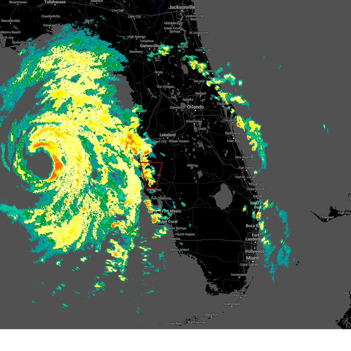
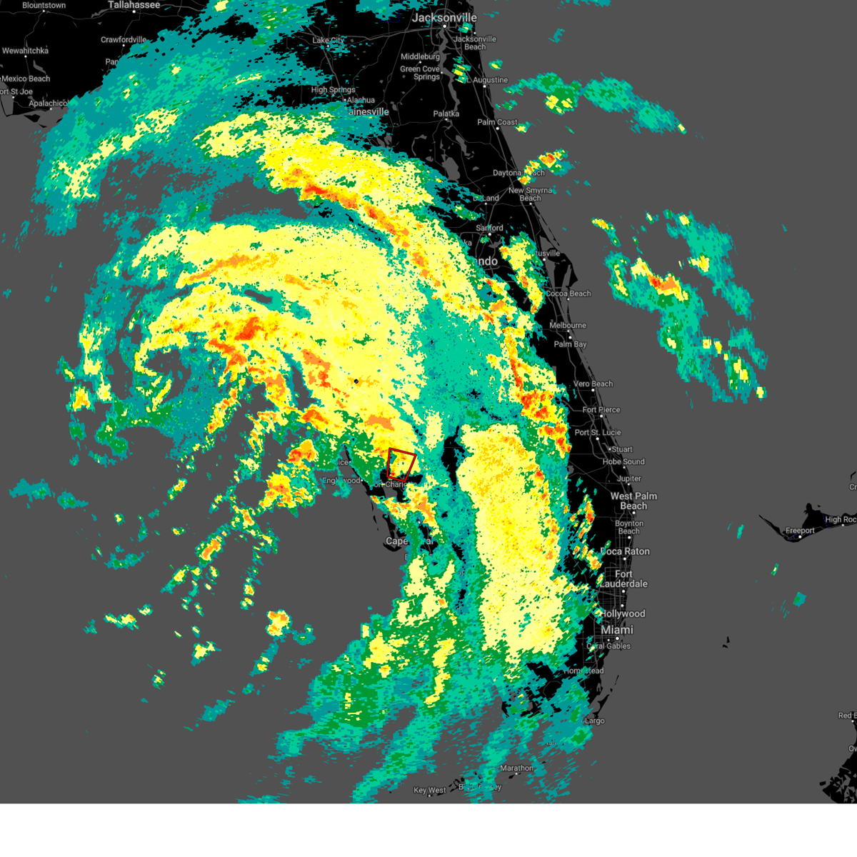
Hail Map for North Port, FL
The North Port, FL area has had 2 reports of on-the-ground hail by trained spotters, and has been under severe weather warnings 30 times during the past 12 months. Doppler radar has detected hail at or near North Port, FL on 72 occasions, including 2 occasions during the past year.
| Name: | North Port, FL |
| Where Located: | 37.8 miles SSE of Bradenton, FL |
| Map: | Google Map for North Port, FL |
| Population: | 57357 |
| Housing Units: | 27986 |
| More Info: | Search Google for North Port, FL |
1
The Top Recent Hail Date for North Port, FL is Wednesday, June 11, 2025 (16th out of 72)
Hail and Wind Damage Spotted near North Port, FL
| Date / Time | Report Details |
|---|---|
| 6/11/2025 5:28 PM EDT |
 the severe thunderstorm warning has been cancelled and is no longer in effect the severe thunderstorm warning has been cancelled and is no longer in effect
|
| 6/11/2025 5:09 PM EDT |
 Svrtbw the national weather service in ruskin has issued a * severe thunderstorm warning for, central charlotte county in southwestern florida, southwestern desoto county in south central florida, * until 545 pm edt. * at 509 pm edt, a severe thunderstorm was located near babcock webb wma, or 13 miles east of punta gorda, moving northwest at 30 mph (radar indicated). Hazards include 60 mph wind gusts and quarter size hail. Hail damage to vehicles is expected. Expect wind damage to roofs, siding, and trees. Svrtbw the national weather service in ruskin has issued a * severe thunderstorm warning for, central charlotte county in southwestern florida, southwestern desoto county in south central florida, * until 545 pm edt. * at 509 pm edt, a severe thunderstorm was located near babcock webb wma, or 13 miles east of punta gorda, moving northwest at 30 mph (radar indicated). Hazards include 60 mph wind gusts and quarter size hail. Hail damage to vehicles is expected. Expect wind damage to roofs, siding, and trees.
|
| 3/10/2025 10:07 AM EDT |
 the tornado warning has been cancelled and is no longer in effect the tornado warning has been cancelled and is no longer in effect
|
| 3/10/2025 9:54 AM EDT |
 Tortbw the national weather service in ruskin has issued a * tornado warning for, central sarasota county in west central florida, * until 1030 am edt. * at 953 am edt, a radar indicated waterspout was located just offshore 11 miles south of gulf gate estates, or 17 miles south of sarasota, moving east at 40 mph (radar indicated rotation). Hazards include tornado. Flying debris will be dangerous to those caught without shelter. mobile homes will be damaged or destroyed. damage to roofs, windows, and vehicles will occur. tree damage is likely. this tornado will be near, north port around 1005 am edt. myakka river state park around 1010 am edt. Other locations impacted by this tornadic thunderstorm include venice gardens, nokomis, laurel, and south venice. Tortbw the national weather service in ruskin has issued a * tornado warning for, central sarasota county in west central florida, * until 1030 am edt. * at 953 am edt, a radar indicated waterspout was located just offshore 11 miles south of gulf gate estates, or 17 miles south of sarasota, moving east at 40 mph (radar indicated rotation). Hazards include tornado. Flying debris will be dangerous to those caught without shelter. mobile homes will be damaged or destroyed. damage to roofs, windows, and vehicles will occur. tree damage is likely. this tornado will be near, north port around 1005 am edt. myakka river state park around 1010 am edt. Other locations impacted by this tornadic thunderstorm include venice gardens, nokomis, laurel, and south venice.
|
| 3/10/2025 9:46 AM EDT |
 Svrtbw the national weather service in ruskin has issued a * severe thunderstorm warning for, south central manatee county in west central florida, northern charlotte county in southwestern florida, sarasota county in west central florida, * until 1015 am edt. * at 946 am edt, a severe thunderstorm was located 12 miles south of gulf gate estates, or 17 miles south of sarasota, moving east at 30 mph (radar indicated). Hazards include 60 mph wind gusts. expect damage to roofs, siding, and trees Svrtbw the national weather service in ruskin has issued a * severe thunderstorm warning for, south central manatee county in west central florida, northern charlotte county in southwestern florida, sarasota county in west central florida, * until 1015 am edt. * at 946 am edt, a severe thunderstorm was located 12 miles south of gulf gate estates, or 17 miles south of sarasota, moving east at 30 mph (radar indicated). Hazards include 60 mph wind gusts. expect damage to roofs, siding, and trees
|
| 9/26/2024 7:19 PM EDT |
 Tortbw the national weather service in ruskin has issued a * tornado warning for, southwestern hardee county in central florida, southeastern manatee county in west central florida, north central charlotte county in southwestern florida, western desoto county in south central florida, east central sarasota county in west central florida, * until 745 pm edt. * at 718 pm edt, a severe thunderstorm capable of producing a tornado was located near punta gorda, moving north at 60 mph (radar indicated rotation). Hazards include tornado. Flying debris will be dangerous to those caught without shelter. mobile homes will be damaged or destroyed. damage to roofs, windows, and vehicles will occur. tree damage is likely. this dangerous storm will be near, north port and port charlotte around 725 pm edt. arcadia around 735 pm edt. Other locations impacted by this tornadic thunderstorm include lake suzy, solana, zolfo springs, limestone, harbour heights, fort ogden, charlotte harbor, cleveland, and charlotte park. Tortbw the national weather service in ruskin has issued a * tornado warning for, southwestern hardee county in central florida, southeastern manatee county in west central florida, north central charlotte county in southwestern florida, western desoto county in south central florida, east central sarasota county in west central florida, * until 745 pm edt. * at 718 pm edt, a severe thunderstorm capable of producing a tornado was located near punta gorda, moving north at 60 mph (radar indicated rotation). Hazards include tornado. Flying debris will be dangerous to those caught without shelter. mobile homes will be damaged or destroyed. damage to roofs, windows, and vehicles will occur. tree damage is likely. this dangerous storm will be near, north port and port charlotte around 725 pm edt. arcadia around 735 pm edt. Other locations impacted by this tornadic thunderstorm include lake suzy, solana, zolfo springs, limestone, harbour heights, fort ogden, charlotte harbor, cleveland, and charlotte park.
|
| 9/26/2024 6:29 PM EDT |
 the tornado warning has been cancelled and is no longer in effect the tornado warning has been cancelled and is no longer in effect
|
| 9/26/2024 6:29 PM EDT |
 At 628 pm edt, a radar indicated waterspout was just offshore located 9 miles southeast of myakka city, or 13 miles northeast of north port, moving north at 65 mph (radar indicated rotation). Hazards include tornado. Flying debris will be dangerous to those caught without shelter. mobile homes will be damaged or destroyed. damage to roofs, windows, and vehicles will occur. tree damage is likely. This tornadic thunderstorm will remain over mainly rural areas of southeastern manatee, northwestern desoto and east central sarasota counties. At 628 pm edt, a radar indicated waterspout was just offshore located 9 miles southeast of myakka city, or 13 miles northeast of north port, moving north at 65 mph (radar indicated rotation). Hazards include tornado. Flying debris will be dangerous to those caught without shelter. mobile homes will be damaged or destroyed. damage to roofs, windows, and vehicles will occur. tree damage is likely. This tornadic thunderstorm will remain over mainly rural areas of southeastern manatee, northwestern desoto and east central sarasota counties.
|
| 9/26/2024 6:08 PM EDT |
 Tortbw the national weather service in ruskin has issued a * tornado warning for, southeastern manatee county in west central florida, northwestern charlotte county in southwestern florida, western desoto county in south central florida, southeastern sarasota county in west central florida, * until 645 pm edt. * at 607 pm edt, a radar indicated waterspout was located just offshore near punta gorda, moving north at 65 mph (radar indicated rotation). Hazards include tornado. Flying debris will be dangerous to those caught without shelter. mobile homes will be damaged or destroyed. damage to roofs, windows, and vehicles will occur. tree damage is likely. this tornado will be near, north port and port charlotte around 615 pm edt. Other locations impacted by this tornadic thunderstorm include murdock, lake suzy, solana, charlotte park, charlotte harbor, harbour heights, and cleveland. Tortbw the national weather service in ruskin has issued a * tornado warning for, southeastern manatee county in west central florida, northwestern charlotte county in southwestern florida, western desoto county in south central florida, southeastern sarasota county in west central florida, * until 645 pm edt. * at 607 pm edt, a radar indicated waterspout was located just offshore near punta gorda, moving north at 65 mph (radar indicated rotation). Hazards include tornado. Flying debris will be dangerous to those caught without shelter. mobile homes will be damaged or destroyed. damage to roofs, windows, and vehicles will occur. tree damage is likely. this tornado will be near, north port and port charlotte around 615 pm edt. Other locations impacted by this tornadic thunderstorm include murdock, lake suzy, solana, charlotte park, charlotte harbor, harbour heights, and cleveland.
|
| 9/26/2024 5:58 PM EDT |
 The storm which prompted the warning has weakened below severe limits, and no longer appears capable of producing a tornado. therefore, the warning will be allowed to expire. a tornado watch remains in effect until 800 pm edt for south central and west central florida. The storm which prompted the warning has weakened below severe limits, and no longer appears capable of producing a tornado. therefore, the warning will be allowed to expire. a tornado watch remains in effect until 800 pm edt for south central and west central florida.
|
| 9/26/2024 5:54 PM EDT |
 At 553 pm edt, a severe thunderstorm capable of producing a tornado was located near north port, moving north at 60 mph (radar indicated rotation). Hazards include tornado. Flying debris will be dangerous to those caught without shelter. mobile homes will be damaged or destroyed. damage to roofs, windows, and vehicles will occur. tree damage is likely. This tornadic thunderstorm will remain over mainly rural areas of southwestern desoto and southeastern sarasota counties, including the following locations, lake suzy. At 553 pm edt, a severe thunderstorm capable of producing a tornado was located near north port, moving north at 60 mph (radar indicated rotation). Hazards include tornado. Flying debris will be dangerous to those caught without shelter. mobile homes will be damaged or destroyed. damage to roofs, windows, and vehicles will occur. tree damage is likely. This tornadic thunderstorm will remain over mainly rural areas of southwestern desoto and southeastern sarasota counties, including the following locations, lake suzy.
|
| 9/26/2024 5:54 PM EDT |
 the tornado warning has been cancelled and is no longer in effect the tornado warning has been cancelled and is no longer in effect
|
| 9/26/2024 5:44 PM EDT |
 Tortbw the national weather service in ruskin has issued a * tornado warning for, northwestern charlotte county in southwestern florida, southwestern desoto county in south central florida, southeastern sarasota county in west central florida, * until 600 pm edt. * at 544 pm edt, a severe thunderstorm capable of producing a tornado was located over port charlotte, moving north at 60 mph (radar indicated rotation). Hazards include tornado. Flying debris will be dangerous to those caught without shelter. mobile homes will be damaged or destroyed. damage to roofs, windows, and vehicles will occur. tree damage is likely. this dangerous storm will be near, north port and port charlotte around 550 pm edt. Other locations impacted by this tornadic thunderstorm include murdock, lake suzy, solana, nocatee, el jobean, harbour heights, cleveland, fort ogden, charlotte harbor, and charlotte park. Tortbw the national weather service in ruskin has issued a * tornado warning for, northwestern charlotte county in southwestern florida, southwestern desoto county in south central florida, southeastern sarasota county in west central florida, * until 600 pm edt. * at 544 pm edt, a severe thunderstorm capable of producing a tornado was located over port charlotte, moving north at 60 mph (radar indicated rotation). Hazards include tornado. Flying debris will be dangerous to those caught without shelter. mobile homes will be damaged or destroyed. damage to roofs, windows, and vehicles will occur. tree damage is likely. this dangerous storm will be near, north port and port charlotte around 550 pm edt. Other locations impacted by this tornadic thunderstorm include murdock, lake suzy, solana, nocatee, el jobean, harbour heights, cleveland, fort ogden, charlotte harbor, and charlotte park.
|
| 9/26/2024 5:33 PM EDT |
 At 533 pm edt, a severe thunderstorm capable of producing a tornado was located near north port, moving north at 60 mph (radar indicated rotation). Hazards include tornado. Flying debris will be dangerous to those caught without shelter. mobile homes will be damaged or destroyed. damage to roofs, windows, and vehicles will occur. tree damage is likely. This tornadic thunderstorm will remain over mainly rural areas of southeastern manatee, western desoto and eastern sarasota counties, including the following locations, hidden river, lake suzy, and warm mineral springs. At 533 pm edt, a severe thunderstorm capable of producing a tornado was located near north port, moving north at 60 mph (radar indicated rotation). Hazards include tornado. Flying debris will be dangerous to those caught without shelter. mobile homes will be damaged or destroyed. damage to roofs, windows, and vehicles will occur. tree damage is likely. This tornadic thunderstorm will remain over mainly rural areas of southeastern manatee, western desoto and eastern sarasota counties, including the following locations, hidden river, lake suzy, and warm mineral springs.
|
| 9/26/2024 5:33 PM EDT |
 the tornado warning has been cancelled and is no longer in effect the tornado warning has been cancelled and is no longer in effect
|
| 9/26/2024 5:25 PM EDT |
 Tortbw the national weather service in ruskin has issued a * tornado warning for, southeastern manatee county in west central florida, northwestern charlotte county in southwestern florida, western desoto county in south central florida, eastern sarasota county in west central florida, * until 545 pm edt. * at 525 pm edt, a severe thunderstorm capable of producing a tornado was located near port charlotte, moving north at 60 mph (radar indicated rotation). Hazards include tornado. Flying debris will be dangerous to those caught without shelter. mobile homes will be damaged or destroyed. damage to roofs, windows, and vehicles will occur. tree damage is likely. this dangerous storm will be near, north port around 530 pm edt. Other locations impacted by this tornadic thunderstorm include murdock, lake suzy, solana, gulf cove, hidden river, el jobean, harbour heights, charlotte harbor, and warm mineral springs. Tortbw the national weather service in ruskin has issued a * tornado warning for, southeastern manatee county in west central florida, northwestern charlotte county in southwestern florida, western desoto county in south central florida, eastern sarasota county in west central florida, * until 545 pm edt. * at 525 pm edt, a severe thunderstorm capable of producing a tornado was located near port charlotte, moving north at 60 mph (radar indicated rotation). Hazards include tornado. Flying debris will be dangerous to those caught without shelter. mobile homes will be damaged or destroyed. damage to roofs, windows, and vehicles will occur. tree damage is likely. this dangerous storm will be near, north port around 530 pm edt. Other locations impacted by this tornadic thunderstorm include murdock, lake suzy, solana, gulf cove, hidden river, el jobean, harbour heights, charlotte harbor, and warm mineral springs.
|
| 9/26/2024 5:15 PM EDT |
 At 515 pm edt, a severe thunderstorm capable of producing a tornado was located 9 miles southwest of punta gorda, moving north at 60 mph (radar indicated rotation). Hazards include tornado. Flying debris will be dangerous to those caught without shelter. mobile homes will be damaged or destroyed. damage to roofs, windows, and vehicles will occur. tree damage is likely. this dangerous storm will be near, north port, punta gorda, and port charlotte around 520 pm edt. Other locations impacted by this tornadic thunderstorm include murdock, gulf cove, el jobean, harbour heights, placida, rotonda, charlotte park, cleveland, warm mineral springs, and pirate harbor. At 515 pm edt, a severe thunderstorm capable of producing a tornado was located 9 miles southwest of punta gorda, moving north at 60 mph (radar indicated rotation). Hazards include tornado. Flying debris will be dangerous to those caught without shelter. mobile homes will be damaged or destroyed. damage to roofs, windows, and vehicles will occur. tree damage is likely. this dangerous storm will be near, north port, punta gorda, and port charlotte around 520 pm edt. Other locations impacted by this tornadic thunderstorm include murdock, gulf cove, el jobean, harbour heights, placida, rotonda, charlotte park, cleveland, warm mineral springs, and pirate harbor.
|
| 9/26/2024 5:06 PM EDT |
 Tortbw the national weather service in ruskin has issued a * tornado warning for, western charlotte county in southwestern florida, southwestern desoto county in south central florida, northwestern lee county in southwestern florida, southeastern sarasota county in west central florida, * until 530 pm edt. * at 506 pm edt, a severe thunderstorm capable of producing a tornado was located near pineland, or 13 miles west of cape coral, moving north at 55 mph (radar indicated rotation). Hazards include tornado. Flying debris will be dangerous to those caught without shelter. mobile homes will be damaged or destroyed. damage to roofs, windows, and vehicles will occur. tree damage is likely. this dangerous storm will be near, north port and port charlotte around 520 pm edt. Other locations impacted by this tornadic thunderstorm include murdock, south venice, gulf cove, el jobean, palm island, harbour heights, placida, rotonda, charlotte park, and cleveland. Tortbw the national weather service in ruskin has issued a * tornado warning for, western charlotte county in southwestern florida, southwestern desoto county in south central florida, northwestern lee county in southwestern florida, southeastern sarasota county in west central florida, * until 530 pm edt. * at 506 pm edt, a severe thunderstorm capable of producing a tornado was located near pineland, or 13 miles west of cape coral, moving north at 55 mph (radar indicated rotation). Hazards include tornado. Flying debris will be dangerous to those caught without shelter. mobile homes will be damaged or destroyed. damage to roofs, windows, and vehicles will occur. tree damage is likely. this dangerous storm will be near, north port and port charlotte around 520 pm edt. Other locations impacted by this tornadic thunderstorm include murdock, south venice, gulf cove, el jobean, palm island, harbour heights, placida, rotonda, charlotte park, and cleveland.
|
| 9/26/2024 5:05 PM EDT |
 The storm which prompted the warning has weakened below severe limits, and no longer appears capable of producing a tornado. therefore, the warning will be allowed to expire. a tornado watch remains in effect until 800 pm edt for west central florida. The storm which prompted the warning has weakened below severe limits, and no longer appears capable of producing a tornado. therefore, the warning will be allowed to expire. a tornado watch remains in effect until 800 pm edt for west central florida.
|
| 9/26/2024 5:00 PM EDT |
 the tornado warning has been cancelled and is no longer in effect the tornado warning has been cancelled and is no longer in effect
|
| 9/26/2024 4:57 PM EDT |
 Tortbw the national weather service in ruskin has issued a * tornado warning for, eastern manatee county in west central florida, northeastern sarasota county in west central florida, * until 515 pm edt. * at 457 pm edt, a severe thunderstorm capable of producing a tornado was located over myakka river state park, or 12 miles northwest of north port, moving north at 75 mph (radar indicated rotation). Hazards include tornado. Flying debris will be dangerous to those caught without shelter. mobile homes will be damaged or destroyed. damage to roofs, windows, and vehicles will occur. tree damage is likely. this dangerous storm will be near, lake sarasota around 505 pm edt. Other locations impacted by this tornadic thunderstorm include duette, gator creek estate, lake manatee state park, hidden river, and fruitville. Tortbw the national weather service in ruskin has issued a * tornado warning for, eastern manatee county in west central florida, northeastern sarasota county in west central florida, * until 515 pm edt. * at 457 pm edt, a severe thunderstorm capable of producing a tornado was located over myakka river state park, or 12 miles northwest of north port, moving north at 75 mph (radar indicated rotation). Hazards include tornado. Flying debris will be dangerous to those caught without shelter. mobile homes will be damaged or destroyed. damage to roofs, windows, and vehicles will occur. tree damage is likely. this dangerous storm will be near, lake sarasota around 505 pm edt. Other locations impacted by this tornadic thunderstorm include duette, gator creek estate, lake manatee state park, hidden river, and fruitville.
|
| 9/26/2024 4:52 PM EDT |
 the tornado warning has been cancelled and is no longer in effect the tornado warning has been cancelled and is no longer in effect
|
| 9/26/2024 4:52 PM EDT |
 At 452 pm edt, a severe thunderstorm capable of producing a tornado was located 8 miles northwest of north port, moving north at 70 mph (radar indicated rotation). Hazards include tornado. Flying debris will be dangerous to those caught without shelter. mobile homes will be damaged or destroyed. damage to roofs, windows, and vehicles will occur. tree damage is likely. this dangerous storm will be near, north port around 455 pm edt. Other locations impacted by this tornadic thunderstorm include venice gardens, warm mineral springs, south venice, and nokomis. At 452 pm edt, a severe thunderstorm capable of producing a tornado was located 8 miles northwest of north port, moving north at 70 mph (radar indicated rotation). Hazards include tornado. Flying debris will be dangerous to those caught without shelter. mobile homes will be damaged or destroyed. damage to roofs, windows, and vehicles will occur. tree damage is likely. this dangerous storm will be near, north port around 455 pm edt. Other locations impacted by this tornadic thunderstorm include venice gardens, warm mineral springs, south venice, and nokomis.
|
| 9/26/2024 4:44 PM EDT |
 At 444 pm edt, a severe thunderstorm capable of producing a tornado was located 10 miles west of north port, moving north at 75 mph (radar indicated rotation). Hazards include tornado. Flying debris will be dangerous to those caught without shelter. mobile homes will be damaged or destroyed. damage to roofs, windows, and vehicles will occur. tree damage is likely. this dangerous storm will be near, north port around 450 pm edt. Other locations impacted by this tornadic thunderstorm include south venice, gulf cove, nokomis, el jobean, laurel, oscar scherer state park, venice gardens, warm mineral springs, grove city, and osprey. At 444 pm edt, a severe thunderstorm capable of producing a tornado was located 10 miles west of north port, moving north at 75 mph (radar indicated rotation). Hazards include tornado. Flying debris will be dangerous to those caught without shelter. mobile homes will be damaged or destroyed. damage to roofs, windows, and vehicles will occur. tree damage is likely. this dangerous storm will be near, north port around 450 pm edt. Other locations impacted by this tornadic thunderstorm include south venice, gulf cove, nokomis, el jobean, laurel, oscar scherer state park, venice gardens, warm mineral springs, grove city, and osprey.
|
| 9/26/2024 4:37 PM EDT |
 Tortbw the national weather service in ruskin has issued a * tornado warning for, western charlotte county in southwestern florida, southeastern sarasota county in west central florida, * until 515 pm edt. * at 437 pm edt, a severe thunderstorm capable of producing a tornado was located 14 miles southwest of north port, moving north at 75 mph (radar indicated rotation). Hazards include tornado. Flying debris will be dangerous to those caught without shelter. mobile homes will be damaged or destroyed. damage to roofs, windows, and vehicles will occur. tree damage is likely. this dangerous storm will be near, north port around 445 pm edt. Other locations impacted by this tornadic thunderstorm include south venice, gulf cove, el jobean, laurel, palm island, oscar scherer state park, placida, rotonda, grove city, and warm mineral springs. Tortbw the national weather service in ruskin has issued a * tornado warning for, western charlotte county in southwestern florida, southeastern sarasota county in west central florida, * until 515 pm edt. * at 437 pm edt, a severe thunderstorm capable of producing a tornado was located 14 miles southwest of north port, moving north at 75 mph (radar indicated rotation). Hazards include tornado. Flying debris will be dangerous to those caught without shelter. mobile homes will be damaged or destroyed. damage to roofs, windows, and vehicles will occur. tree damage is likely. this dangerous storm will be near, north port around 445 pm edt. Other locations impacted by this tornadic thunderstorm include south venice, gulf cove, el jobean, laurel, palm island, oscar scherer state park, placida, rotonda, grove city, and warm mineral springs.
|
| 8/4/2024 5:22 PM EDT |
 At 522 pm edt, a severe thunderstorm capable of producing a tornado was located near port charlotte, moving north at 40 mph (radar indicated rotation). Hazards include tornado. Flying debris will be dangerous to those caught without shelter. mobile homes will be damaged or destroyed. damage to roofs, windows, and vehicles will occur. tree damage is likely. this dangerous storm will be near, north port around 525 pm edt. Other locations impacted by this tornadic thunderstorm include harbour heights, lake suzy, cleveland, fort ogden, and charlotte harbor. At 522 pm edt, a severe thunderstorm capable of producing a tornado was located near port charlotte, moving north at 40 mph (radar indicated rotation). Hazards include tornado. Flying debris will be dangerous to those caught without shelter. mobile homes will be damaged or destroyed. damage to roofs, windows, and vehicles will occur. tree damage is likely. this dangerous storm will be near, north port around 525 pm edt. Other locations impacted by this tornadic thunderstorm include harbour heights, lake suzy, cleveland, fort ogden, and charlotte harbor.
|
| 8/4/2024 5:19 PM EDT |
 the tornado warning has been cancelled and is no longer in effect the tornado warning has been cancelled and is no longer in effect
|
| 8/4/2024 5:12 PM EDT |
 At 512 pm edt, a severe thunderstorm capable of producing a tornado was located over port charlotte, moving north at 40 mph (radar indicated rotation). Hazards include tornado. Flying debris will be dangerous to those caught without shelter. mobile homes will be damaged or destroyed. damage to roofs, windows, and vehicles will occur. tree damage is likely. this dangerous storm will be near, north port and port charlotte around 515 pm edt. Other locations impacted by this tornadic thunderstorm include lake suzy, solana, harbour heights, cleveland, fort ogden, charlotte harbor, and charlotte park. At 512 pm edt, a severe thunderstorm capable of producing a tornado was located over port charlotte, moving north at 40 mph (radar indicated rotation). Hazards include tornado. Flying debris will be dangerous to those caught without shelter. mobile homes will be damaged or destroyed. damage to roofs, windows, and vehicles will occur. tree damage is likely. this dangerous storm will be near, north port and port charlotte around 515 pm edt. Other locations impacted by this tornadic thunderstorm include lake suzy, solana, harbour heights, cleveland, fort ogden, charlotte harbor, and charlotte park.
|
| 8/4/2024 5:00 PM EDT |
 Tortbw the national weather service in ruskin has issued a * tornado warning for, north central charlotte county in southwestern florida, southwestern desoto county in south central florida, east central sarasota county in west central florida, * until 530 pm edt. * at 500 pm edt, a severe thunderstorm capable of producing a tornado was located over punta gorda, moving north at 40 mph (radar indicated rotation). Hazards include tornado. Flying debris will be dangerous to those caught without shelter. mobile homes will be damaged or destroyed. damage to roofs, windows, and vehicles will occur. tree damage is likely. this dangerous storm will be near, north port, punta gorda, port charlotte, and charlotte county airport around 505 pm edt. Other locations impacted by this tornadic thunderstorm include lake suzy, solana, harbour heights, charlotte park, cleveland, fort ogden, and charlotte harbor. Tortbw the national weather service in ruskin has issued a * tornado warning for, north central charlotte county in southwestern florida, southwestern desoto county in south central florida, east central sarasota county in west central florida, * until 530 pm edt. * at 500 pm edt, a severe thunderstorm capable of producing a tornado was located over punta gorda, moving north at 40 mph (radar indicated rotation). Hazards include tornado. Flying debris will be dangerous to those caught without shelter. mobile homes will be damaged or destroyed. damage to roofs, windows, and vehicles will occur. tree damage is likely. this dangerous storm will be near, north port, punta gorda, port charlotte, and charlotte county airport around 505 pm edt. Other locations impacted by this tornadic thunderstorm include lake suzy, solana, harbour heights, charlotte park, cleveland, fort ogden, and charlotte harbor.
|
| 8/4/2024 4:59 PM EDT |
 Tortbw the national weather service in ruskin has issued a * tornado warning for, southeastern manatee county in west central florida, northwestern charlotte county in southwestern florida, west central desoto county in south central florida, southeastern sarasota county in west central florida, * until 530 pm edt. * at 458 pm edt, a severe thunderstorm capable of producing a tornado was located near port charlotte, moving north at 40 mph (radar indicated rotation). Hazards include tornado. Flying debris will be dangerous to those caught without shelter. mobile homes will be damaged or destroyed. damage to roofs, windows, and vehicles will occur. tree damage is likely. this dangerous storm will be near, north port and port charlotte around 505 pm edt. Other locations impacted by this tornadic thunderstorm include murdock and el jobean. Tortbw the national weather service in ruskin has issued a * tornado warning for, southeastern manatee county in west central florida, northwestern charlotte county in southwestern florida, west central desoto county in south central florida, southeastern sarasota county in west central florida, * until 530 pm edt. * at 458 pm edt, a severe thunderstorm capable of producing a tornado was located near port charlotte, moving north at 40 mph (radar indicated rotation). Hazards include tornado. Flying debris will be dangerous to those caught without shelter. mobile homes will be damaged or destroyed. damage to roofs, windows, and vehicles will occur. tree damage is likely. this dangerous storm will be near, north port and port charlotte around 505 pm edt. Other locations impacted by this tornadic thunderstorm include murdock and el jobean.
|
| 1/9/2024 6:12 PM EST |
 At 612 pm est, severe thunderstorms were located along a line extending from 7 miles northwest of north port to 25 miles west of pineland, moving east at 45 mph (radar indicated). Hazards include 60 mph wind gusts. expect damage to roofs, siding, and trees At 612 pm est, severe thunderstorms were located along a line extending from 7 miles northwest of north port to 25 miles west of pineland, moving east at 45 mph (radar indicated). Hazards include 60 mph wind gusts. expect damage to roofs, siding, and trees
|
| 1/9/2024 6:12 PM EST |
 The national weather service in ruskin has issued a * severe thunderstorm warning for. southeastern manatee county in west central florida. charlotte county in southwestern florida. desoto county in south central florida. Northern lee county in southwestern florida. The national weather service in ruskin has issued a * severe thunderstorm warning for. southeastern manatee county in west central florida. charlotte county in southwestern florida. desoto county in south central florida. Northern lee county in southwestern florida.
|
| 1/9/2024 5:57 PM EST |
 A severe thunderstorm warning remains in effect until 615 pm est for western hardee. southeastern manatee. southwestern polk. northwestern desoto and east central sarasota counties. At 557 pm est, severe thunderstorms were located along a line extending from 11 miles south of bartow to near ona to 10 miles northeast of north port, moving east at 45 mph. A severe thunderstorm warning remains in effect until 615 pm est for western hardee. southeastern manatee. southwestern polk. northwestern desoto and east central sarasota counties. At 557 pm est, severe thunderstorms were located along a line extending from 11 miles south of bartow to near ona to 10 miles northeast of north port, moving east at 45 mph.
|
| 1/9/2024 5:49 PM EST |
 At 548 pm est, severe thunderstorms were located along a line extending from 8 miles west of north port to 19 miles west of pineland to 38 miles west of st. james city, moving east at 50 mph (radar indicated). Hazards include 60 mph wind gusts. expect damage to roofs, siding, and trees At 548 pm est, severe thunderstorms were located along a line extending from 8 miles west of north port to 19 miles west of pineland to 38 miles west of st. james city, moving east at 50 mph (radar indicated). Hazards include 60 mph wind gusts. expect damage to roofs, siding, and trees
|
| 1/9/2024 5:28 PM EST |
 At 528 pm est, severe thunderstorms were located along a line extending from 13 miles east of greater sun center to 7 miles west of myakka city to 12 miles south of gulf gate estates, moving northeast at 45 mph (radar indicated). Hazards include 60 mph wind gusts. expect damage to roofs, siding, and trees At 528 pm est, severe thunderstorms were located along a line extending from 13 miles east of greater sun center to 7 miles west of myakka city to 12 miles south of gulf gate estates, moving northeast at 45 mph (radar indicated). Hazards include 60 mph wind gusts. expect damage to roofs, siding, and trees
|
| 12/17/2023 2:59 AM EST |
 At 258 am est, a severe thunderstorm capable of producing a tornado was located over punta gorda, moving northeast at 40 mph (radar indicated rotation). Hazards include tornado. Flying debris will be dangerous to those caught without shelter. mobile homes will be damaged or destroyed. damage to roofs, windows, and vehicles will occur. tree damage is likely. this dangerous storm will be near, punta gorda, port charlotte, and charlotte county airport around 305 am est. Other locations impacted by this tornadic thunderstorm include pirate harbor, lake suzy, solana, nocatee, tropical gulf acres, harbour heights, charlotte park, cleveland, fort ogden, and charlotte harbor. At 258 am est, a severe thunderstorm capable of producing a tornado was located over punta gorda, moving northeast at 40 mph (radar indicated rotation). Hazards include tornado. Flying debris will be dangerous to those caught without shelter. mobile homes will be damaged or destroyed. damage to roofs, windows, and vehicles will occur. tree damage is likely. this dangerous storm will be near, punta gorda, port charlotte, and charlotte county airport around 305 am est. Other locations impacted by this tornadic thunderstorm include pirate harbor, lake suzy, solana, nocatee, tropical gulf acres, harbour heights, charlotte park, cleveland, fort ogden, and charlotte harbor.
|
| 8/30/2023 9:15 AM EDT |
 At 915 am edt, a severe thunderstorm capable of producing a tornado was located 11 miles northeast of north port, moving northeast at 40 mph (radar indicated rotation). Hazards include tornado. Flying debris will be dangerous to those caught without shelter. mobile homes will be damaged or destroyed. damage to roofs, windows, and vehicles will occur. tree damage is likely. this dangerous storm will be near, arcadia around 920 am edt. Other locations impacted by this tornadic thunderstorm include limestone and brownville. At 915 am edt, a severe thunderstorm capable of producing a tornado was located 11 miles northeast of north port, moving northeast at 40 mph (radar indicated rotation). Hazards include tornado. Flying debris will be dangerous to those caught without shelter. mobile homes will be damaged or destroyed. damage to roofs, windows, and vehicles will occur. tree damage is likely. this dangerous storm will be near, arcadia around 920 am edt. Other locations impacted by this tornadic thunderstorm include limestone and brownville.
|
| 4/30/2023 6:15 AM EDT |
 At 615 am edt, a severe thunderstorm was located near babcock webb wma, or 12 miles east of punta gorda, moving northeast at 65 mph (radar indicated). Hazards include 60 mph wind gusts. expect damage to roofs, siding, and trees At 615 am edt, a severe thunderstorm was located near babcock webb wma, or 12 miles east of punta gorda, moving northeast at 65 mph (radar indicated). Hazards include 60 mph wind gusts. expect damage to roofs, siding, and trees
|
| 4/30/2023 6:03 AM EDT |
 At 603 am edt, severe thunderstorms were located along a line extending from arcadia to 10 miles southeast of southeast arcadia to near babcock ranch, moving east at 50 mph (law enforcement). Hazards include 60 mph wind gusts. Expect damage to roofs, siding, and trees. Locations impacted include, north port, punta gorda, burnt store marina, murdock, southeast arcadia, nocatee, tropical gulf acres, babcock ranch, harbour heights, and placida. At 603 am edt, severe thunderstorms were located along a line extending from arcadia to 10 miles southeast of southeast arcadia to near babcock ranch, moving east at 50 mph (law enforcement). Hazards include 60 mph wind gusts. Expect damage to roofs, siding, and trees. Locations impacted include, north port, punta gorda, burnt store marina, murdock, southeast arcadia, nocatee, tropical gulf acres, babcock ranch, harbour heights, and placida.
|
| 4/30/2023 5:24 AM EDT |
 At 524 am edt, severe thunderstorms were located along a line extending from 9 miles southwest of myakka river state park to near north port to 10 miles west of punta gorda, moving east at 50 mph (radar indicated). Hazards include 60 mph wind gusts. expect damage to roofs, siding, and trees At 524 am edt, severe thunderstorms were located along a line extending from 9 miles southwest of myakka river state park to near north port to 10 miles west of punta gorda, moving east at 50 mph (radar indicated). Hazards include 60 mph wind gusts. expect damage to roofs, siding, and trees
|
| 12/15/2022 3:15 PM EST | Em relayed pictures of large tree downed near lanai of home and additional lanai damage separate from the downed tre in sarasota county FL, 3.7 miles SW of North Port, FL |
| 8/24/2022 6:34 PM EDT | At 634 pm edt, severe thunderstorms were located along a line extending from near charlotte county airport to near punta gorda to cape coral, moving northwest at 20 mph (radar indicated). Hazards include 60 mph wind gusts and nickel size hail. Expect damage to roofs, siding, and trees. locations impacted include, north port, punta gorda, murdock, tropical gulf acres, harbour heights, charlotte park, cleveland, pirate harbor, lake suzy and solana. hail threat, radar indicated max hail size, 0. 88 in wind threat, radar indicated max wind gust, 60 mph. |
| 8/24/2022 6:26 PM EDT | At 626 pm edt, severe thunderstorms were located along a line extending from near charlotte county airport to 6 miles southeast of punta gorda to cape coral, moving northwest at 20 mph (radar indicated). Hazards include 60 mph wind gusts and nickel size hail. Expect damage to roofs, siding, and trees. locations impacted include, cape coral, fort myers, north port, punta gorda, burnt store marina, murdock, page park, punta rassa, east dunbar and fort myers villas. hail threat, radar indicated max hail size, 0. 88 in wind threat, radar indicated max wind gust, 60 mph. |
| 8/24/2022 6:02 PM EDT | At 602 pm edt, severe thunderstorms were located along a line extending from near babcock webb wma to near palmona park to pine manor, moving northwest at 20 mph (radar indicated). Hazards include 60 mph wind gusts and nickel size hail. expect damage to roofs, siding, and trees |
| 8/8/2022 5:42 PM EDT |
 The severe thunderstorm warning for western charlotte, southwestern desoto and southeastern sarasota counties will expire at 545 pm edt, the storm which prompted the warning has weakened below severe limits, and no longer poses an immediate threat to life or property. therefore, the warning will be allowed to expire. however small hail, gusty winds and heavy rain are still possible with this thunderstorm. The severe thunderstorm warning for western charlotte, southwestern desoto and southeastern sarasota counties will expire at 545 pm edt, the storm which prompted the warning has weakened below severe limits, and no longer poses an immediate threat to life or property. therefore, the warning will be allowed to expire. however small hail, gusty winds and heavy rain are still possible with this thunderstorm.
|
| 8/8/2022 5:33 PM EDT |
 At 533 pm edt, a severe thunderstorm was located near port charlotte, moving northwest at 5 mph (radar indicated). Hazards include 60 mph wind gusts and quarter size hail. Hail damage to vehicles is expected. Expect wind damage to roofs, siding, and trees. At 533 pm edt, a severe thunderstorm was located near port charlotte, moving northwest at 5 mph (radar indicated). Hazards include 60 mph wind gusts and quarter size hail. Hail damage to vehicles is expected. Expect wind damage to roofs, siding, and trees.
|
| 8/5/2022 5:19 PM EDT |
 At 519 pm edt, a severe thunderstorm was located over port charlotte, moving west at 20 mph (radar indicated). Hazards include 60 mph wind gusts and quarter size hail. Hail damage to vehicles is expected. Expect wind damage to roofs, siding, and trees. At 519 pm edt, a severe thunderstorm was located over port charlotte, moving west at 20 mph (radar indicated). Hazards include 60 mph wind gusts and quarter size hail. Hail damage to vehicles is expected. Expect wind damage to roofs, siding, and trees.
|
| 6/28/2022 5:27 PM EDT |
 At 527 pm edt, a severe thunderstorm was located over punta gorda, moving northwest at 15 mph (radar indicated). Hazards include 60 mph wind gusts and nickel size hail. expect damage to roofs, siding, and trees At 527 pm edt, a severe thunderstorm was located over punta gorda, moving northwest at 15 mph (radar indicated). Hazards include 60 mph wind gusts and nickel size hail. expect damage to roofs, siding, and trees
|
| 6/18/2022 4:52 PM EDT |
 At 452 pm edt, severe thunderstorms were located along a line extending from 8 miles southeast of arcadia to near southeast arcadia to 11 miles northeast of port charlotte, and are nearly stationary (radar indicated). Hazards include 60 mph wind gusts and quarter size hail. Hail damage to vehicles is expected. Expect wind damage to roofs, siding, and trees. At 452 pm edt, severe thunderstorms were located along a line extending from 8 miles southeast of arcadia to near southeast arcadia to 11 miles northeast of port charlotte, and are nearly stationary (radar indicated). Hazards include 60 mph wind gusts and quarter size hail. Hail damage to vehicles is expected. Expect wind damage to roofs, siding, and trees.
|
| 6/18/2022 3:53 PM EDT |
 At 353 pm edt, a severe thunderstorm was located near north port, and is nearly stationary (radar indicated). Hazards include 60 mph wind gusts and quarter size hail. Hail damage to vehicles is expected. expect wind damage to roofs, siding, and trees. locations impacted include, north port and warm mineral springs. hail threat, radar indicated max hail size, 1. 00 in wind threat, radar indicated max wind gust, 60 mph. At 353 pm edt, a severe thunderstorm was located near north port, and is nearly stationary (radar indicated). Hazards include 60 mph wind gusts and quarter size hail. Hail damage to vehicles is expected. expect wind damage to roofs, siding, and trees. locations impacted include, north port and warm mineral springs. hail threat, radar indicated max hail size, 1. 00 in wind threat, radar indicated max wind gust, 60 mph.
|
| 6/18/2022 3:34 PM EDT |
 At 334 pm edt, a severe thunderstorm was located near north port, and is nearly stationary (radar indicated). Hazards include 60 mph wind gusts and quarter size hail. Hail damage to vehicles is expected. Expect wind damage to roofs, siding, and trees. At 334 pm edt, a severe thunderstorm was located near north port, and is nearly stationary (radar indicated). Hazards include 60 mph wind gusts and quarter size hail. Hail damage to vehicles is expected. Expect wind damage to roofs, siding, and trees.
|
| 5/30/2022 5:53 PM EDT |
 At 553 pm edt, a severe thunderstorm was located 10 miles west of southeast arcadia, or 10 miles west of arcadia, and is nearly stationary (radar indicated). Hazards include 60 mph wind gusts and quarter size hail. Hail damage to vehicles is expected. expect wind damage to roofs, siding, and trees. this severe thunderstorm will remain over mainly rural areas of southeastern manatee, west central desoto and east central sarasota counties. hail threat, radar indicated max hail size, 1. 00 in wind threat, radar indicated max wind gust, 60 mph. At 553 pm edt, a severe thunderstorm was located 10 miles west of southeast arcadia, or 10 miles west of arcadia, and is nearly stationary (radar indicated). Hazards include 60 mph wind gusts and quarter size hail. Hail damage to vehicles is expected. expect wind damage to roofs, siding, and trees. this severe thunderstorm will remain over mainly rural areas of southeastern manatee, west central desoto and east central sarasota counties. hail threat, radar indicated max hail size, 1. 00 in wind threat, radar indicated max wind gust, 60 mph.
|
| 3/12/2022 10:44 AM EST |
 At 1044 am est, severe thunderstorms were located along a line extending from narcoossee to near winter haven to near wauchula to 9 miles southwest of myakka river state park, moving east at 40 mph (radar indicated). Hazards include 60 mph wind gusts. Expect damage to roofs, siding, and trees. locations impacted include, poinciana, winter haven, haines city, bartow, lake wales, auburndale, fort meade, lake alfred, wauchula and crooked lake park. hail threat, radar indicated max hail size, <. 75 in wind threat, radar indicated max wind gust, 60 mph. At 1044 am est, severe thunderstorms were located along a line extending from narcoossee to near winter haven to near wauchula to 9 miles southwest of myakka river state park, moving east at 40 mph (radar indicated). Hazards include 60 mph wind gusts. Expect damage to roofs, siding, and trees. locations impacted include, poinciana, winter haven, haines city, bartow, lake wales, auburndale, fort meade, lake alfred, wauchula and crooked lake park. hail threat, radar indicated max hail size, <. 75 in wind threat, radar indicated max wind gust, 60 mph.
|
| 3/12/2022 10:11 AM EST |
 At 1011 am est, severe thunderstorms were located along a line extending from near four corners to near lakeland to 11 miles east of parrish to 16 miles southwest of south sarasota, moving east at 40 mph (radar indicated). Hazards include 60 mph wind gusts. expect damage to roofs, siding, and trees At 1011 am est, severe thunderstorms were located along a line extending from near four corners to near lakeland to 11 miles east of parrish to 16 miles southwest of south sarasota, moving east at 40 mph (radar indicated). Hazards include 60 mph wind gusts. expect damage to roofs, siding, and trees
|
| 1/16/2022 7:56 AM EST |
 At 755 am est, a severe thunderstorm capable of producing a tornado was located 7 miles northeast of north port, moving northeast at 35 mph (radar indicated rotation). Hazards include tornado. Flying debris will be dangerous to those caught without shelter. mobile homes will be damaged or destroyed. damage to roofs, windows, and vehicles will occur. tree damage is likely. This tornadic thunderstorm will remain over mainly rural areas of southeastern manatee, west central desoto and east central sarasota counties. At 755 am est, a severe thunderstorm capable of producing a tornado was located 7 miles northeast of north port, moving northeast at 35 mph (radar indicated rotation). Hazards include tornado. Flying debris will be dangerous to those caught without shelter. mobile homes will be damaged or destroyed. damage to roofs, windows, and vehicles will occur. tree damage is likely. This tornadic thunderstorm will remain over mainly rural areas of southeastern manatee, west central desoto and east central sarasota counties.
|
| 1/16/2022 7:42 AM EST |
 At 741 am est, a severe thunderstorm capable of producing a tornado was located over north port, moving northeast at 35 mph (radar indicated rotation). Hazards include tornado. Flying debris will be dangerous to those caught without shelter. mobile homes will be damaged or destroyed. damage to roofs, windows, and vehicles will occur. tree damage is likely. This tornadic thunderstorm will remain over mainly rural areas of northwestern charlotte and southeastern sarasota counties, including the following locations, warm mineral springs. At 741 am est, a severe thunderstorm capable of producing a tornado was located over north port, moving northeast at 35 mph (radar indicated rotation). Hazards include tornado. Flying debris will be dangerous to those caught without shelter. mobile homes will be damaged or destroyed. damage to roofs, windows, and vehicles will occur. tree damage is likely. This tornadic thunderstorm will remain over mainly rural areas of northwestern charlotte and southeastern sarasota counties, including the following locations, warm mineral springs.
|
| 1/16/2022 7:23 AM EST |
 At 722 am est, a severe thunderstorm capable of producing a tornado was located 12 miles southwest of north port, moving northeast at 40 mph (radar indicated rotation). Hazards include tornado. Flying debris will be dangerous to those caught without shelter. mobile homes will be damaged or destroyed. damage to roofs, windows, and vehicles will occur. tree damage is likely. this dangerous storm will be near, north port around 745 am est. Other locations impacted by this tornadic thunderstorm include warm mineral springs. At 722 am est, a severe thunderstorm capable of producing a tornado was located 12 miles southwest of north port, moving northeast at 40 mph (radar indicated rotation). Hazards include tornado. Flying debris will be dangerous to those caught without shelter. mobile homes will be damaged or destroyed. damage to roofs, windows, and vehicles will occur. tree damage is likely. this dangerous storm will be near, north port around 745 am est. Other locations impacted by this tornadic thunderstorm include warm mineral springs.
|
| 1/16/2022 7:15 AM EST |
 At 715 am est, a severe thunderstorm capable of producing a tornado was located 7 miles southwest of port charlotte, moving northeast at 35 mph (radar indicated rotation). Hazards include tornado. Flying debris will be dangerous to those caught without shelter. mobile homes will be damaged or destroyed. damage to roofs, windows, and vehicles will occur. tree damage is likely. this dangerous storm will be near, north port and port charlotte around 735 am est. Other locations impacted by this tornadic thunderstorm include murdock, harbour heights, lake suzy, gulf cove, charlotte harbor and el jobean. At 715 am est, a severe thunderstorm capable of producing a tornado was located 7 miles southwest of port charlotte, moving northeast at 35 mph (radar indicated rotation). Hazards include tornado. Flying debris will be dangerous to those caught without shelter. mobile homes will be damaged or destroyed. damage to roofs, windows, and vehicles will occur. tree damage is likely. this dangerous storm will be near, north port and port charlotte around 735 am est. Other locations impacted by this tornadic thunderstorm include murdock, harbour heights, lake suzy, gulf cove, charlotte harbor and el jobean.
|
| 10/28/2021 3:11 PM EDT |
 The tornado warning for southeastern manatee and east central sarasota counties will expire at 315 pm edt, the storm which prompted the warning has weakened below severe limits, and no longer appears capable of producing a tornado. therefore, the warning will be allowed to expire. however gusty winds and heavy rain are still possible with this thunderstorm. a tornado watch remains in effect until 500 pm edt for west central florida. The tornado warning for southeastern manatee and east central sarasota counties will expire at 315 pm edt, the storm which prompted the warning has weakened below severe limits, and no longer appears capable of producing a tornado. therefore, the warning will be allowed to expire. however gusty winds and heavy rain are still possible with this thunderstorm. a tornado watch remains in effect until 500 pm edt for west central florida.
|
| 10/28/2021 3:05 PM EDT |
 At 305 pm edt, a severe thunderstorm capable of producing a tornado was located 8 miles southeast of myakka river state park, or 9 miles north of north port, moving northeast at 35 mph (radar indicated rotation). Hazards include tornado. Flying debris will be dangerous to those caught without shelter. mobile homes will be damaged or destroyed. damage to roofs, windows, and vehicles will occur. tree damage is likely. Locations impacted include, north port. At 305 pm edt, a severe thunderstorm capable of producing a tornado was located 8 miles southeast of myakka river state park, or 9 miles north of north port, moving northeast at 35 mph (radar indicated rotation). Hazards include tornado. Flying debris will be dangerous to those caught without shelter. mobile homes will be damaged or destroyed. damage to roofs, windows, and vehicles will occur. tree damage is likely. Locations impacted include, north port.
|
| 10/28/2021 2:54 PM EDT |
 At 254 pm edt, a severe thunderstorm capable of producing a tornado was located 7 miles northwest of north port, moving northeast at 35 mph (radar indicated rotation). Hazards include tornado. Flying debris will be dangerous to those caught without shelter. mobile homes will be damaged or destroyed. damage to roofs, windows, and vehicles will occur. tree damage is likely. This tornadic thunderstorm will remain over mainly rural areas of southeastern manatee and east central sarasota counties. At 254 pm edt, a severe thunderstorm capable of producing a tornado was located 7 miles northwest of north port, moving northeast at 35 mph (radar indicated rotation). Hazards include tornado. Flying debris will be dangerous to those caught without shelter. mobile homes will be damaged or destroyed. damage to roofs, windows, and vehicles will occur. tree damage is likely. This tornadic thunderstorm will remain over mainly rural areas of southeastern manatee and east central sarasota counties.
|
| 10/28/2021 1:42 PM EDT |
 The tornado warning for southern manatee and southeastern sarasota counties will expire at 145 pm edt, the storm which prompted the warning has weakened below severe limits, and has exited the warned area. therefore, the warning will be allowed to expire. however gusty winds and heavy rain are still possible with this thunderstorm. a tornado watch remains in effect until 500 pm edt for west central florida. to report severe weather, contact your nearest law enforcement agency. they will relay your report to the national weather service ruskin. The tornado warning for southern manatee and southeastern sarasota counties will expire at 145 pm edt, the storm which prompted the warning has weakened below severe limits, and has exited the warned area. therefore, the warning will be allowed to expire. however gusty winds and heavy rain are still possible with this thunderstorm. a tornado watch remains in effect until 500 pm edt for west central florida. to report severe weather, contact your nearest law enforcement agency. they will relay your report to the national weather service ruskin.
|
| 10/28/2021 1:26 PM EDT |
 At 126 pm edt, a severe thunderstorm capable of producing a tornado was located north of north port, moving northeast at 30 mph (radar indicated rotation). Hazards include tornado. Flying debris will be dangerous to those caught without shelter. mobile homes will be damaged or destroyed. damage to roofs, windows, and vehicles will occur. tree damage is likely. Locations impacted include, north port and warm mineral springs. At 126 pm edt, a severe thunderstorm capable of producing a tornado was located north of north port, moving northeast at 30 mph (radar indicated rotation). Hazards include tornado. Flying debris will be dangerous to those caught without shelter. mobile homes will be damaged or destroyed. damage to roofs, windows, and vehicles will occur. tree damage is likely. Locations impacted include, north port and warm mineral springs.
|
| 10/28/2021 1:19 PM EDT |
 At 119 pm edt, a severe thunderstorm capable of producing a tornado was located near north port, moving northeast at 25 mph (radar indicated rotation). Hazards include tornado. Flying debris will be dangerous to those caught without shelter. mobile homes will be damaged or destroyed. damage to roofs, windows, and vehicles will occur. tree damage is likely. This tornadic thunderstorm will remain over mainly rural areas of southern manatee and southeastern sarasota counties, including the following locations, warm mineral springs. At 119 pm edt, a severe thunderstorm capable of producing a tornado was located near north port, moving northeast at 25 mph (radar indicated rotation). Hazards include tornado. Flying debris will be dangerous to those caught without shelter. mobile homes will be damaged or destroyed. damage to roofs, windows, and vehicles will occur. tree damage is likely. This tornadic thunderstorm will remain over mainly rural areas of southern manatee and southeastern sarasota counties, including the following locations, warm mineral springs.
|
| 7/10/2021 6:50 PM EDT |
 At 650 pm edt, a severe thunderstorm was located near charlotte county airport, or 8 miles northeast of punta gorda, and is nearly stationary (radar indicated). Hazards include 60 mph wind gusts and quarter size hail. Hail damage to vehicles is expected. Expect wind damage to roofs, siding, and trees. At 650 pm edt, a severe thunderstorm was located near charlotte county airport, or 8 miles northeast of punta gorda, and is nearly stationary (radar indicated). Hazards include 60 mph wind gusts and quarter size hail. Hail damage to vehicles is expected. Expect wind damage to roofs, siding, and trees.
|
| 7/7/2021 2:24 AM EDT |
 The tornado warning for southeastern manatee, northwestern desoto and east central sarasota counties will expire at 230 am edt, the storm which prompted the warning has weakened, and no longer appears capable of producing a tornado. therefore, the warning will be allowed to expire. a tornado watch remains in effect until 800 am edt for south central, southwestern and west central florida. The tornado warning for southeastern manatee, northwestern desoto and east central sarasota counties will expire at 230 am edt, the storm which prompted the warning has weakened, and no longer appears capable of producing a tornado. therefore, the warning will be allowed to expire. a tornado watch remains in effect until 800 am edt for south central, southwestern and west central florida.
|
| 7/7/2021 2:08 AM EDT |
 At 208 am edt, a severe thunderstorm capable of producing a tornado was located near north port, moving north at 40 mph (radar indicated rotation). Hazards include tornado. Flying debris will be dangerous to those caught without shelter. mobile homes will be damaged or destroyed. damage to roofs, windows, and vehicles will occur. tree damage is likely. This dangerous storm will be near, myakka city around 230 am edt. At 208 am edt, a severe thunderstorm capable of producing a tornado was located near north port, moving north at 40 mph (radar indicated rotation). Hazards include tornado. Flying debris will be dangerous to those caught without shelter. mobile homes will be damaged or destroyed. damage to roofs, windows, and vehicles will occur. tree damage is likely. This dangerous storm will be near, myakka city around 230 am edt.
|
| 4/10/2021 6:33 PM EDT |
 At 633 pm edt, a severe thunderstorm was located near myakka river state park, or 11 miles north of north port, moving southeast at 35 mph (radar indicated). Hazards include 60 mph wind gusts. expect damage to roofs, siding, and trees At 633 pm edt, a severe thunderstorm was located near myakka river state park, or 11 miles north of north port, moving southeast at 35 mph (radar indicated). Hazards include 60 mph wind gusts. expect damage to roofs, siding, and trees
|
| 8/9/2020 4:42 PM EDT |
 The severe thunderstorm warning for charlotte and western lee counties will expire at 445 pm edt, the storms which prompted the warning have weakened below severe limits, and no longer pose an immediate threat to life or property. therefore, the warning will be allowed to expire. however gusty winds and heavy rain are still possible with these thunderstorms. The severe thunderstorm warning for charlotte and western lee counties will expire at 445 pm edt, the storms which prompted the warning have weakened below severe limits, and no longer pose an immediate threat to life or property. therefore, the warning will be allowed to expire. however gusty winds and heavy rain are still possible with these thunderstorms.
|
| 8/9/2020 4:00 PM EDT |
 At 400 pm edt, severe thunderstorms were located along a line extending from 6 miles northwest of olga to palmona park to near iona, moving northwest at 20 mph (radar indicated). Hazards include 60 mph wind gusts. expect damage to roofs, siding, and trees At 400 pm edt, severe thunderstorms were located along a line extending from 6 miles northwest of olga to palmona park to near iona, moving northwest at 20 mph (radar indicated). Hazards include 60 mph wind gusts. expect damage to roofs, siding, and trees
|
| 10/19/2019 4:17 AM EDT |
 At 417 am edt, a severe thunderstorm capable of producing a tornado was located near north port, moving north at 30 mph (radar indicated rotation). Hazards include tornado. Flying debris will be dangerous to those caught without shelter. mobile homes will be damaged or destroyed. damage to roofs, windows, and vehicles will occur. tree damage is likely. this dangerous storm will be near, north port around 435 am edt. Other locations impacted by this tornadic thunderstorm include warm mineral springs. At 417 am edt, a severe thunderstorm capable of producing a tornado was located near north port, moving north at 30 mph (radar indicated rotation). Hazards include tornado. Flying debris will be dangerous to those caught without shelter. mobile homes will be damaged or destroyed. damage to roofs, windows, and vehicles will occur. tree damage is likely. this dangerous storm will be near, north port around 435 am edt. Other locations impacted by this tornadic thunderstorm include warm mineral springs.
|
| 10/19/2019 4:13 AM EDT |
 At 413 am edt, a severe thunderstorm was located 5 miles south of north port, moving north at 40 mph (radar indicated). Hazards include 60 mph wind gusts. expect damage to roofs, siding, and trees At 413 am edt, a severe thunderstorm was located 5 miles south of north port, moving north at 40 mph (radar indicated). Hazards include 60 mph wind gusts. expect damage to roofs, siding, and trees
|
| 10/19/2019 3:35 AM EDT |
 At 333 am edt, a radar indicated a tornadic waterspout was just offshore located 15 miles west of north port, moving north at 35 mph (radar indicated rotation). Hazards include tornado. Flying debris will be dangerous to those caught without shelter. mobile homes will be damaged or destroyed. damage to roofs, windows, and vehicles will occur. tree damage is likely. Locations impacted include, oscar scherer state park, south venice, venice gardens, nokomis, laurel and osprey. At 333 am edt, a radar indicated a tornadic waterspout was just offshore located 15 miles west of north port, moving north at 35 mph (radar indicated rotation). Hazards include tornado. Flying debris will be dangerous to those caught without shelter. mobile homes will be damaged or destroyed. damage to roofs, windows, and vehicles will occur. tree damage is likely. Locations impacted include, oscar scherer state park, south venice, venice gardens, nokomis, laurel and osprey.
|
| 10/19/2019 3:20 AM EDT |
 At 320 am edt, a radar indicated waterspout was located just offshore 20 miles southwest of north port, moving northeast at 25 mph (radar indicated rotation). Hazards include tornado. Flying debris will be dangerous to those caught without shelter. mobile homes will be damaged or destroyed. damage to roofs, windows, and vehicles will occur. tree damage is likely. This tornadic thunderstorm will remain over mainly rural areas of south central sarasota county, including the following locations, south venice, nokomis, laurel, oscar scherer state park, venice gardens, warm mineral springs and osprey. At 320 am edt, a radar indicated waterspout was located just offshore 20 miles southwest of north port, moving northeast at 25 mph (radar indicated rotation). Hazards include tornado. Flying debris will be dangerous to those caught without shelter. mobile homes will be damaged or destroyed. damage to roofs, windows, and vehicles will occur. tree damage is likely. This tornadic thunderstorm will remain over mainly rural areas of south central sarasota county, including the following locations, south venice, nokomis, laurel, oscar scherer state park, venice gardens, warm mineral springs and osprey.
|
| 7/17/2019 6:50 PM EDT |
 At 648 pm edt, a severe thunderstorm was located near port charlotte, moving west at 20 mph. a wind gusts of 55 mph was recently measured at punta gorda airport (radar indicated). Hazards include 60 mph wind gusts and penny size hail. expect damage to roofs, siding, and trees At 648 pm edt, a severe thunderstorm was located near port charlotte, moving west at 20 mph. a wind gusts of 55 mph was recently measured at punta gorda airport (radar indicated). Hazards include 60 mph wind gusts and penny size hail. expect damage to roofs, siding, and trees
|
| 6/26/2019 7:05 PM EDT |
 At 704 pm edt, a severe thunderstorm was located over port charlotte, moving southwest at 10 mph (radar indicated). Hazards include 60 mph wind gusts and penny size hail. Expect damage to roofs, siding, and trees. Locations impacted include, north port, punta gorda, port charlotte, murdock, solana, charlotte park, cleveland, charlotte harbor and harbour heights. At 704 pm edt, a severe thunderstorm was located over port charlotte, moving southwest at 10 mph (radar indicated). Hazards include 60 mph wind gusts and penny size hail. Expect damage to roofs, siding, and trees. Locations impacted include, north port, punta gorda, port charlotte, murdock, solana, charlotte park, cleveland, charlotte harbor and harbour heights.
|
| 6/26/2019 6:41 PM EDT |
 At 641 pm edt, a severe thunderstorm was located over port charlotte, moving southwest at 15 mph (radar indicated). Hazards include 60 mph wind gusts and quarter size hail. Hail damage to vehicles is expected. Expect wind damage to roofs, siding, and trees. At 641 pm edt, a severe thunderstorm was located over port charlotte, moving southwest at 15 mph (radar indicated). Hazards include 60 mph wind gusts and quarter size hail. Hail damage to vehicles is expected. Expect wind damage to roofs, siding, and trees.
|
| 4/19/2019 3:29 PM EDT |
 At 329 pm edt, severe thunderstorms were located along a line extending from near intercession city to 9 miles northwest of arcadia to 34 miles west of pine island, moving northeast at 60 mph (radar indicated). Hazards include 60 mph wind gusts. expect damage to roofs, siding, and trees At 329 pm edt, severe thunderstorms were located along a line extending from near intercession city to 9 miles northwest of arcadia to 34 miles west of pine island, moving northeast at 60 mph (radar indicated). Hazards include 60 mph wind gusts. expect damage to roofs, siding, and trees
|
| 4/19/2019 3:23 PM EDT |
 The severe thunderstorm warning for northwestern hardee, eastern manatee, western polk, southeastern hillsborough and sarasota counties will expire at 330 pm edt, the storms which prompted the warning have moved out of the area. therefore, the warning will be allowed to expire. additional warnings may be required. a severe thunderstorm watch remains in effect until 1000 pm edt for central and west central florida. The severe thunderstorm warning for northwestern hardee, eastern manatee, western polk, southeastern hillsborough and sarasota counties will expire at 330 pm edt, the storms which prompted the warning have moved out of the area. therefore, the warning will be allowed to expire. additional warnings may be required. a severe thunderstorm watch remains in effect until 1000 pm edt for central and west central florida.
|
| 4/19/2019 2:56 PM EDT |
 At 256 pm edt, severe thunderstorms were located along a line extending from 8 miles south of lake louisa to 25 miles south of gulf gate estates, moving northeast at 50 mph (radar indicated). Hazards include 60 mph wind gusts. Expect damage to roofs, siding, and trees. Locations impacted include, lakeland, north port, sarasota, plant city, winter haven, haines city, bartow, auburndale, fish hawk, south gate ridge, lake sarasota, southgate, gulf gate estates, the meadows, medulla, south sarasota, kensington park, lakewood ranch, fussels corner and sarasota springs. At 256 pm edt, severe thunderstorms were located along a line extending from 8 miles south of lake louisa to 25 miles south of gulf gate estates, moving northeast at 50 mph (radar indicated). Hazards include 60 mph wind gusts. Expect damage to roofs, siding, and trees. Locations impacted include, lakeland, north port, sarasota, plant city, winter haven, haines city, bartow, auburndale, fish hawk, south gate ridge, lake sarasota, southgate, gulf gate estates, the meadows, medulla, south sarasota, kensington park, lakewood ranch, fussels corner and sarasota springs.
|
| 4/19/2019 2:13 PM EDT |
 At 212 pm edt, severe thunderstorms were located along a line extending from zephyrhills west to 34 miles southwest of gulf gate estates, moving northeast at 65 mph (radar indicated). Hazards include 60 mph wind gusts. expect damage to roofs, siding, and trees At 212 pm edt, severe thunderstorms were located along a line extending from zephyrhills west to 34 miles southwest of gulf gate estates, moving northeast at 65 mph (radar indicated). Hazards include 60 mph wind gusts. expect damage to roofs, siding, and trees
|
| 12/20/2018 12:42 PM EST |
 The severe thunderstorm warning for hardee, central charlotte, southwestern polk and desoto counties will expire at 1245 pm est, the storms which prompted the warning have weakened below severe limits, and no longer pose an immediate threat to life or property. therefore, the warning will be allowed to expire. however gusty winds and heavy rain are still possible with these thunderstorms. a tornado watch remains in effect until 400 pm est for south central, central, southwestern and west central florida. The severe thunderstorm warning for hardee, central charlotte, southwestern polk and desoto counties will expire at 1245 pm est, the storms which prompted the warning have weakened below severe limits, and no longer pose an immediate threat to life or property. therefore, the warning will be allowed to expire. however gusty winds and heavy rain are still possible with these thunderstorms. a tornado watch remains in effect until 400 pm est for south central, central, southwestern and west central florida.
|
| 12/20/2018 12:29 PM EST |
 At 1228 pm est, severe thunderstorms were located along a line extending from near bartow to near punta gorda, moving east at 30 mph (radar indicated). Hazards include 60 mph wind gusts. Expect damage to roofs, siding, and trees. Locations impacted include, winter haven, bartow, punta gorda, lake wales, arcadia, wauchula, port charlotte, ona, babcock webb wma, southeast arcadia, babcock ranch, charlotte county airport, sweetwater, fort meade, crooked lake park, dundee, bowling green, zolfo springs, highland park and homeland. At 1228 pm est, severe thunderstorms were located along a line extending from near bartow to near punta gorda, moving east at 30 mph (radar indicated). Hazards include 60 mph wind gusts. Expect damage to roofs, siding, and trees. Locations impacted include, winter haven, bartow, punta gorda, lake wales, arcadia, wauchula, port charlotte, ona, babcock webb wma, southeast arcadia, babcock ranch, charlotte county airport, sweetwater, fort meade, crooked lake park, dundee, bowling green, zolfo springs, highland park and homeland.
|
| 12/20/2018 12:01 PM EST |
 At 1200 pm est, severe thunderstorms were located along a line extending from 9 miles southeast of fish hawk to 11 miles northwest of pineland, moving east at 25 mph (radar indicated). Hazards include 60 mph wind gusts. expect damage to roofs, siding, and trees At 1200 pm est, severe thunderstorms were located along a line extending from 9 miles southeast of fish hawk to 11 miles northwest of pineland, moving east at 25 mph (radar indicated). Hazards include 60 mph wind gusts. expect damage to roofs, siding, and trees
|
| 12/20/2018 11:21 AM EST |
 At 1120 am est, severe thunderstorms were located along a line extending from south gate ridge to 27 miles west of pineland, moving east at 45 mph (radar indicated). Hazards include 60 mph wind gusts. expect damage to roofs, siding, and trees At 1120 am est, severe thunderstorms were located along a line extending from south gate ridge to 27 miles west of pineland, moving east at 45 mph (radar indicated). Hazards include 60 mph wind gusts. expect damage to roofs, siding, and trees
|
| 12/20/2018 9:41 AM EST |
 The tornado warning for southeastern manatee and eastern sarasota counties will expire at 945 am est, the storm which prompted the warning has weakened below severe limits, and no longer appears capable of producing a tornado. therefore, the warning will be allowed to expire. a tornado watch remains in effect until 400 pm est for west central florida. The tornado warning for southeastern manatee and eastern sarasota counties will expire at 945 am est, the storm which prompted the warning has weakened below severe limits, and no longer appears capable of producing a tornado. therefore, the warning will be allowed to expire. a tornado watch remains in effect until 400 pm est for west central florida.
|
| 12/20/2018 9:24 AM EST |
 At 923 am est, a severe thunderstorm capable of producing a tornado was located near north port, moving northeast at 55 mph (radar indicated rotation). Hazards include tornado. Flying debris will be dangerous to those caught without shelter. mobile homes will be damaged or destroyed. damage to roofs, windows, and vehicles will occur. tree damage is likely. This tornadic thunderstorm will remain over mainly rural areas of southeastern manatee and eastern sarasota counties, including the following locations, hidden river and warm mineral springs. At 923 am est, a severe thunderstorm capable of producing a tornado was located near north port, moving northeast at 55 mph (radar indicated rotation). Hazards include tornado. Flying debris will be dangerous to those caught without shelter. mobile homes will be damaged or destroyed. damage to roofs, windows, and vehicles will occur. tree damage is likely. This tornadic thunderstorm will remain over mainly rural areas of southeastern manatee and eastern sarasota counties, including the following locations, hidden river and warm mineral springs.
|
| 7/10/2017 4:09 PM EDT |
 The severe thunderstorm warning for central sarasota county will expire at 415 pm edt, the storm which prompted the warning has weakened below severe limits, and no longer poses an immediate threat to life or property. therefore the warning will be allowed to expire. however gusty winds and heavy rain are still possible with this thunderstorm. The severe thunderstorm warning for central sarasota county will expire at 415 pm edt, the storm which prompted the warning has weakened below severe limits, and no longer poses an immediate threat to life or property. therefore the warning will be allowed to expire. however gusty winds and heavy rain are still possible with this thunderstorm.
|
| 7/10/2017 3:45 PM EDT |
 At 344 pm edt, a severe thunderstorm was located near north port, moving northwest at 15 mph (radar indicated). Hazards include 60 mph wind gusts and quarter size hail. Hail damage to vehicles is expected. Expect wind damage to roofs, siding, and trees. At 344 pm edt, a severe thunderstorm was located near north port, moving northwest at 15 mph (radar indicated). Hazards include 60 mph wind gusts and quarter size hail. Hail damage to vehicles is expected. Expect wind damage to roofs, siding, and trees.
|
| 6/7/2017 12:18 PM EDT |
 At 1218 pm edt, a severe thunderstorm was located 10 miles south of north port, moving northeast at 50 mph (radar indicated). Hazards include 60 mph wind gusts. expect damage to roofs, siding, and trees At 1218 pm edt, a severe thunderstorm was located 10 miles south of north port, moving northeast at 50 mph (radar indicated). Hazards include 60 mph wind gusts. expect damage to roofs, siding, and trees
|
| 7/16/2016 5:11 PM EDT |
 At 510 pm edt, severe thunderstorms were located along a line extending from 10 miles south of arcadia to 5 miles south of charlotte county airport, moving northwest at 20 mph (radar indicated). Hazards include 60 mph wind gusts and penny size hail. Expect damage to roofs. siding. And trees. At 510 pm edt, severe thunderstorms were located along a line extending from 10 miles south of arcadia to 5 miles south of charlotte county airport, moving northwest at 20 mph (radar indicated). Hazards include 60 mph wind gusts and penny size hail. Expect damage to roofs. siding. And trees.
|
| 6/26/2016 3:52 PM EDT |
 At 351 pm edt, a severe thunderstorm was located 7 miles north of myakka city, or 22 miles west of wauchula, moving south at 20 mph (radar indicated). Hazards include 60 mph wind gusts and quarter size hail. Hail damage to vehicles is expected. Expect wind damage to roofs, siding, and trees. At 351 pm edt, a severe thunderstorm was located 7 miles north of myakka city, or 22 miles west of wauchula, moving south at 20 mph (radar indicated). Hazards include 60 mph wind gusts and quarter size hail. Hail damage to vehicles is expected. Expect wind damage to roofs, siding, and trees.
|
| 6/24/2016 5:52 PM EDT |
 At 551 pm edt, a severe thunderstorm was located over port charlotte, moving west at 15 mph (radar indicated). Hazards include 60 mph wind gusts and quarter size hail. Hail damage to vehicles is possible. Expect wind damage to roofs, siding, and trees. At 551 pm edt, a severe thunderstorm was located over port charlotte, moving west at 15 mph (radar indicated). Hazards include 60 mph wind gusts and quarter size hail. Hail damage to vehicles is possible. Expect wind damage to roofs, siding, and trees.
|
| 3/29/2016 2:51 PM EDT |
 The severe thunderstorm warning for sarasota and northwestern charlotte counties will expire at 300 pm edt, the storm which prompted the warning has weakened below severe limits, and no longer poses an immediate threat to life or property. therefore the warning will be allowed to expire. however gusty winds and heavy rain are still possible with this thunderstorm. The severe thunderstorm warning for sarasota and northwestern charlotte counties will expire at 300 pm edt, the storm which prompted the warning has weakened below severe limits, and no longer poses an immediate threat to life or property. therefore the warning will be allowed to expire. however gusty winds and heavy rain are still possible with this thunderstorm.
|
| 3/29/2016 2:22 PM EDT |
 At 221 pm edt, a severe thunderstorm was located 15 miles west of north port, moving northeast at 20 mph (radar indicated). Hazards include 60 mph wind gusts and quarter size hail. Hail damage to vehicles is expected. Expect wind damage to roofs, siding, and trees. At 221 pm edt, a severe thunderstorm was located 15 miles west of north port, moving northeast at 20 mph (radar indicated). Hazards include 60 mph wind gusts and quarter size hail. Hail damage to vehicles is expected. Expect wind damage to roofs, siding, and trees.
|
| 2/24/2016 1:29 PM EST |
 At 128 pm est, a severe thunderstorm was located near port charlotte, moving northeast at 25 mph (radar indicated). Hazards include 60 mph wind gusts. Expect damage to roofs. siding. And trees. At 128 pm est, a severe thunderstorm was located near port charlotte, moving northeast at 25 mph (radar indicated). Hazards include 60 mph wind gusts. Expect damage to roofs. siding. And trees.
|
| 2/24/2016 1:23 PM EST |
 At 122 pm est, a severe thunderstorm capable of producing a tornado was located near port charlotte, moving northeast at 25 mph (radar indicated rotation). Hazards include tornado. Flying debris will be dangerous to those caught without shelter. mobile homes will be damaged or destroyed. damage to roofs, windows, and vehicles will occur. tree damage is likely. This tornadic thunderstorm will remain over mainly rural areas of southwestern desoto, north central charlotte and southeastern sarasota counties, including the following locations: murdock, lake suzy and harbour heights. At 122 pm est, a severe thunderstorm capable of producing a tornado was located near port charlotte, moving northeast at 25 mph (radar indicated rotation). Hazards include tornado. Flying debris will be dangerous to those caught without shelter. mobile homes will be damaged or destroyed. damage to roofs, windows, and vehicles will occur. tree damage is likely. This tornadic thunderstorm will remain over mainly rural areas of southwestern desoto, north central charlotte and southeastern sarasota counties, including the following locations: murdock, lake suzy and harbour heights.
|
| 2/24/2016 1:06 PM EST |
 At 105 pm est, a severe thunderstorm capable of producing a tornado was located near north port, moving northeast at 25 mph (radar indicated rotation). Hazards include tornado. Flying debris will be dangerous to those caught without shelter. mobile homes will be damaged or destroyed. damage to roofs, windows, and vehicles will occur. tree damage is likely. this dangerous storm will be near, north port around 115 pm est. port charlotte around 130 pm est. Other locations impacted by this tornadic thunderstorm include lake suzy, murdock, gulf cove, el jobean, harbour heights and warm mineral springs. At 105 pm est, a severe thunderstorm capable of producing a tornado was located near north port, moving northeast at 25 mph (radar indicated rotation). Hazards include tornado. Flying debris will be dangerous to those caught without shelter. mobile homes will be damaged or destroyed. damage to roofs, windows, and vehicles will occur. tree damage is likely. this dangerous storm will be near, north port around 115 pm est. port charlotte around 130 pm est. Other locations impacted by this tornadic thunderstorm include lake suzy, murdock, gulf cove, el jobean, harbour heights and warm mineral springs.
|
| 2/24/2016 12:59 PM EST |
 At 1257 pm est, a severe thunderstorm was located near gulf cove, moving east at 25 mph (radar indicated). Hazards include 60 mph wind gusts. Expect damage to roofs. siding. And trees. At 1257 pm est, a severe thunderstorm was located near gulf cove, moving east at 25 mph (radar indicated). Hazards include 60 mph wind gusts. Expect damage to roofs. siding. And trees.
|
| 2/24/2016 12:49 PM EST |
 At 1248 pm est, a severe thunderstorm capable of producing a tornado was located 9 miles southwest of north port or near englewood, moving east at 35 mph (radar indicated rotation). Hazards include tornado. Flying debris will be dangerous to those caught without shelter. mobile homes will be damaged or destroyed. damage to roofs, windows, and vehicles will occur. tree damage is likely. Other locations impacted by this tornadic thunderstorm include grove city, gulf cove, el jobean and warm mineral springs. At 1248 pm est, a severe thunderstorm capable of producing a tornado was located 9 miles southwest of north port or near englewood, moving east at 35 mph (radar indicated rotation). Hazards include tornado. Flying debris will be dangerous to those caught without shelter. mobile homes will be damaged or destroyed. damage to roofs, windows, and vehicles will occur. tree damage is likely. Other locations impacted by this tornadic thunderstorm include grove city, gulf cove, el jobean and warm mineral springs.
|
| 2/24/2016 12:31 PM EST |
 At 1229 pm est, a severe thunderstorm capable of producing a tornado was located 19 miles southwest of north port or 7 miles west of englewood, moving east at 30 mph (radar indicated rotation). Hazards include tornado. Flying debris will be dangerous to those caught without shelter. mobile homes will be damaged or destroyed. damage to roofs, windows, and vehicles will occur. tree damage is likely. this dangerous storm will be near, north port around 100 pm est. Other locations impacted by this tornadic thunderstorm include grove city, south venice, warm mineral springs, rotonda, gulf cove, el jobean and venice gardens. At 1229 pm est, a severe thunderstorm capable of producing a tornado was located 19 miles southwest of north port or 7 miles west of englewood, moving east at 30 mph (radar indicated rotation). Hazards include tornado. Flying debris will be dangerous to those caught without shelter. mobile homes will be damaged or destroyed. damage to roofs, windows, and vehicles will occur. tree damage is likely. this dangerous storm will be near, north port around 100 pm est. Other locations impacted by this tornadic thunderstorm include grove city, south venice, warm mineral springs, rotonda, gulf cove, el jobean and venice gardens.
|
| 2/24/2016 12:15 PM EST |
 At 1213 pm est, a severe thunderstorm was located 20 miles southwest of north port or 5 miles southwest of englewood, moving northeast at 25 mph (radar indicated). Hazards include 60 mph wind gusts. Expect damage to roofs. siding. And trees. At 1213 pm est, a severe thunderstorm was located 20 miles southwest of north port or 5 miles southwest of englewood, moving northeast at 25 mph (radar indicated). Hazards include 60 mph wind gusts. Expect damage to roofs. siding. And trees.
|
| 1/22/2016 8:37 AM EST | At 837 am est, a severe thunderstorm was located near port charlotte, moving northeast at 45 mph (radar indicated). Hazards include 60 mph wind gusts. Expect damage to roofs. siding and trees. Locations impacted include, north port, punta gorda, port charlotte, charlotte county airport, solana, charlotte harbor, charlotte park, murdock, gulf cove, el jobean and cleveland. |
| 1/22/2016 8:15 AM EST | At 814 am est, a severe thunderstorm was located 16 miles northwest of pineland, or 23 miles southwest of port charlotte, moving northeast at 45 mph (radar indicated). Hazards include 60 mph wind gusts. Expect damage to roofs. Siding and trees. |
| 1/17/2016 4:44 AM EST |
 At 444 am est, a severe thunderstorm capable of producing a tornado was located near port charlotte, moving east at 60 mph (radar indicated rotation). Hazards include tornado. Flying debris will be dangerous to those caught without shelter. mobile homes will be damaged or destroyed. damage to roofs, windows and vehicles will occur. tree damage is likely. This tornadic thunderstorm will remain over mainly rural areas of southwestern desoto, northeastern charlotte and east central sarasota counties, including the following locations, fort ogden, lake suzy, nocatee, harbour heights, charlotte harbor and cleveland. At 444 am est, a severe thunderstorm capable of producing a tornado was located near port charlotte, moving east at 60 mph (radar indicated rotation). Hazards include tornado. Flying debris will be dangerous to those caught without shelter. mobile homes will be damaged or destroyed. damage to roofs, windows and vehicles will occur. tree damage is likely. This tornadic thunderstorm will remain over mainly rural areas of southwestern desoto, northeastern charlotte and east central sarasota counties, including the following locations, fort ogden, lake suzy, nocatee, harbour heights, charlotte harbor and cleveland.
|
| 1/17/2016 4:38 AM EST |
 The tornado warning for northwestern desoto, central hardee, southeastern sarasota, southwestern polk and southeastern manatee counties will expire at 445 am est, the tornadic thunderstorm which prompted the warning is likely no longer producing a tornado. therefore the warning will be allowed to expire. however, a severe thunderstorm warning remain in effect for potentially damaging winds in excess of 60 mph. a tornado watch remains in effect until 800 am est for southwestern florida. The tornado warning for northwestern desoto, central hardee, southeastern sarasota, southwestern polk and southeastern manatee counties will expire at 445 am est, the tornadic thunderstorm which prompted the warning is likely no longer producing a tornado. therefore the warning will be allowed to expire. however, a severe thunderstorm warning remain in effect for potentially damaging winds in excess of 60 mph. a tornado watch remains in effect until 800 am est for southwestern florida.
|
| 1/17/2016 4:36 AM EST |
 At 435 am est, severe thunderstorms were located along a line extending from 5 miles southeast of ona to near port charlotte, moving east at 55 mph. these storms have a history of producing damaging winds up to 60 mph (public). Hazards include 60 mph wind gusts. Expect damage to roofs. Siding and trees. At 435 am est, severe thunderstorms were located along a line extending from 5 miles southeast of ona to near port charlotte, moving east at 55 mph. these storms have a history of producing damaging winds up to 60 mph (public). Hazards include 60 mph wind gusts. Expect damage to roofs. Siding and trees.
|
| 1/17/2016 4:32 AM EST |
 At 431 am est, severe thunderstorms were located along a line extending from near port charlotte to 30 miles southwest of st. james city, moving east at 60 mph. these storms have a history of producing damaging winds around 60 mph (public). Hazards include 60 mph wind gusts. Expect damage to roofs. siding and trees. locations impacted include, cape coral, fort myers, north port, punta gorda, port charlotte, babcock ranch, st. james city, buckingham, matlacha, east dunbar, southwest florida airport, iona, charlotte county airport, lochmoor waterway estates, babcock webb wma, olga, cypress lake, pine manor, matlacha isles-matlacha shores and three oaks. A tornado watch remains in effect until 800 am est for southwestern florida. At 431 am est, severe thunderstorms were located along a line extending from near port charlotte to 30 miles southwest of st. james city, moving east at 60 mph. these storms have a history of producing damaging winds around 60 mph (public). Hazards include 60 mph wind gusts. Expect damage to roofs. siding and trees. locations impacted include, cape coral, fort myers, north port, punta gorda, port charlotte, babcock ranch, st. james city, buckingham, matlacha, east dunbar, southwest florida airport, iona, charlotte county airport, lochmoor waterway estates, babcock webb wma, olga, cypress lake, pine manor, matlacha isles-matlacha shores and three oaks. A tornado watch remains in effect until 800 am est for southwestern florida.
|
| 1/17/2016 4:15 AM EST |
 At 415 am est, a severe thunderstorm capable of producing a tornado was located 8 miles north of north port, moving northeast at 65 mph (radar indicated rotation). Hazards include tornado. Flying debris will be dangerous to those caught without shelter. mobile homes will be damaged or destroyed. damage to roofs, windows and vehicles will occur. tree damage is likely. this dangerous storm will be near, myakka city around 425 am est. ona around 440 am est. wauchula around 445 am est. Other locations impacted by this tornadic thunderstorm include limestone, garnder, pine level, zolfo springs and bowling green. At 415 am est, a severe thunderstorm capable of producing a tornado was located 8 miles north of north port, moving northeast at 65 mph (radar indicated rotation). Hazards include tornado. Flying debris will be dangerous to those caught without shelter. mobile homes will be damaged or destroyed. damage to roofs, windows and vehicles will occur. tree damage is likely. this dangerous storm will be near, myakka city around 425 am est. ona around 440 am est. wauchula around 445 am est. Other locations impacted by this tornadic thunderstorm include limestone, garnder, pine level, zolfo springs and bowling green.
|
| 1/17/2016 4:15 AM EST |
 At 414 am est, severe thunderstorms were located along a line extending from 10 miles southwest of north port to 45 miles southwest of st. james city, moving east at 60 mph (radar indicated). Hazards include 60 mph wind gusts. Expect damage to roofs. Siding and trees. At 414 am est, severe thunderstorms were located along a line extending from 10 miles southwest of north port to 45 miles southwest of st. james city, moving east at 60 mph (radar indicated). Hazards include 60 mph wind gusts. Expect damage to roofs. Siding and trees.
|
| 1/17/2016 4:04 AM EST |
 At 403 am est, a severe thunderstorm capable of producing a tornado was located 9 miles west of north port between south venice and englewood, moving northeast at 65 mph (radar indicated rotation). Hazards include tornado. Flying debris will be dangerous to those caught without shelter. mobile homes will be damaged or destroyed. damage to roofs, windows and vehicles will occur. tree damage is likely. this dangerous storm will be near, north port around 410 am est. Other locations impacted by this tornadic thunderstorm include murdock, south venice, warm mineral springs, gulf cove, el jobean and venice gardens. At 403 am est, a severe thunderstorm capable of producing a tornado was located 9 miles west of north port between south venice and englewood, moving northeast at 65 mph (radar indicated rotation). Hazards include tornado. Flying debris will be dangerous to those caught without shelter. mobile homes will be damaged or destroyed. damage to roofs, windows and vehicles will occur. tree damage is likely. this dangerous storm will be near, north port around 410 am est. Other locations impacted by this tornadic thunderstorm include murdock, south venice, warm mineral springs, gulf cove, el jobean and venice gardens.
|
| 1/17/2016 3:49 AM EST |
 At 347 am est, a severe thunderstorm capable of producing a tornado was located 26 miles southwest of north port, moving northeast at 65 mph (radar indicated rotation). Hazards include tornado. Flying debris will be dangerous to those caught without shelter. mobile homes will be damaged or destroyed. damage to roofs, windows and vehicles will occur. tree damage is likely. this dangerous storm will be near, north port around 410 am est. Other locations impacted by this tornadic thunderstorm include nokomis, grove city, murdock, south venice, warm mineral springs, gulf cove, el jobean, venice gardens and rotonda. At 347 am est, a severe thunderstorm capable of producing a tornado was located 26 miles southwest of north port, moving northeast at 65 mph (radar indicated rotation). Hazards include tornado. Flying debris will be dangerous to those caught without shelter. mobile homes will be damaged or destroyed. damage to roofs, windows and vehicles will occur. tree damage is likely. this dangerous storm will be near, north port around 410 am est. Other locations impacted by this tornadic thunderstorm include nokomis, grove city, murdock, south venice, warm mineral springs, gulf cove, el jobean, venice gardens and rotonda.
|
| 1/17/2016 2:52 AM EST |
 At 251 am est, a severe thunderstorm was located 13 miles southwest of gulf gate estates, or 15 miles south of sarasota, moving northeast at 65 mph (radar indicated). Hazards include 60 mph wind gusts and quarter size hail. Hail damage to vehicles is expected. Expect wind damage to roofs, siding and trees. At 251 am est, a severe thunderstorm was located 13 miles southwest of gulf gate estates, or 15 miles south of sarasota, moving northeast at 65 mph (radar indicated). Hazards include 60 mph wind gusts and quarter size hail. Hail damage to vehicles is expected. Expect wind damage to roofs, siding and trees.
|
| 7/3/2015 6:54 PM EDT |
 At 653 pm edt, doppler radar indicated a line of severe thunderstorms capable of producing quarter size hail and damaging winds in excess of 60 mph. these storms were located along a line extending from 10 miles northeast of port charlotte to 6 miles southeast of charlotte county airport, and moving southwest at 10 mph. At 653 pm edt, doppler radar indicated a line of severe thunderstorms capable of producing quarter size hail and damaging winds in excess of 60 mph. these storms were located along a line extending from 10 miles northeast of port charlotte to 6 miles southeast of charlotte county airport, and moving southwest at 10 mph.
|
| 6/15/2015 3:53 PM EDT |
 At 352 pm edt, doppler radar indicated a severe thunderstorm capable of producing quarter size hail and damaging winds in excess of 60 mph. this storm was located 10 miles west of north port, and moving northwest at 25 mph. At 352 pm edt, doppler radar indicated a severe thunderstorm capable of producing quarter size hail and damaging winds in excess of 60 mph. this storm was located 10 miles west of north port, and moving northwest at 25 mph.
|
| 6/11/2015 2:44 AM EDT |
 At 243 am edt, doppler radar indicated a severe thunderstorm capable of producing a tornado. this dangerous storm was located near port charlotte, moving north at 30 mph. locations impacted include, north port, punta gorda, port charlotte, charlotte county airport, solana, lake suzy, cleveland, nocatee, murdock, fort ogden, charlotte harbor, charlotte park and harbour heights. At 243 am edt, doppler radar indicated a severe thunderstorm capable of producing a tornado. this dangerous storm was located near port charlotte, moving north at 30 mph. locations impacted include, north port, punta gorda, port charlotte, charlotte county airport, solana, lake suzy, cleveland, nocatee, murdock, fort ogden, charlotte harbor, charlotte park and harbour heights.
|
| 6/11/2015 2:25 AM EDT |
 At 224 am edt, doppler radar indicated a severe thunderstorm capable of producing a tornado. this dangerous storm was over charlotte harbor, and moving north at 30 mph. At 224 am edt, doppler radar indicated a severe thunderstorm capable of producing a tornado. this dangerous storm was over charlotte harbor, and moving north at 30 mph.
|
| 5/20/2013 5:25 PM EDT | Golf Ball sized hail reported 4 miles WSW of North Port, FL, numerous reports of quarter size hail and one report with golf ball size hail. picture on social media. |
| 5/25/2012 7:54 PM EDT | Golf Ball sized hail reported 4.3 miles WSW of North Port, FL, the public reported golf ball size hail in north port. |
| 5/24/2012 6:40 PM EDT | Approximately 13 homes with minor shingle and fence damage and one home with about a third of the roof torn off. also one large oak tree with no root ball was downed. d in sarasota county FL, 2 miles WSW of North Port, FL |
| 5/24/2012 6:40 PM EDT | Possible tornado in the holiday mobile home park in north port off of u.s. 41 and tuscola boulevard. initial report of one mobile home with the roof torn off and three in sarasota county FL, 1.4 miles WSW of North Port, FL |
Hail Maps for North Port, FL


Connect with Interactive Hail Maps