

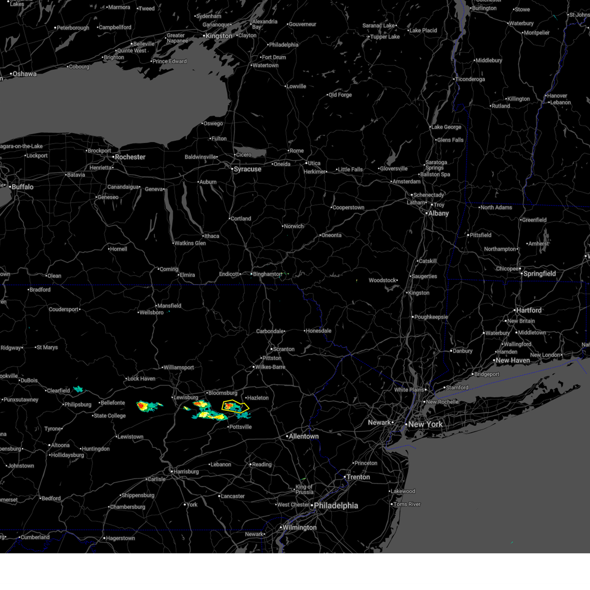
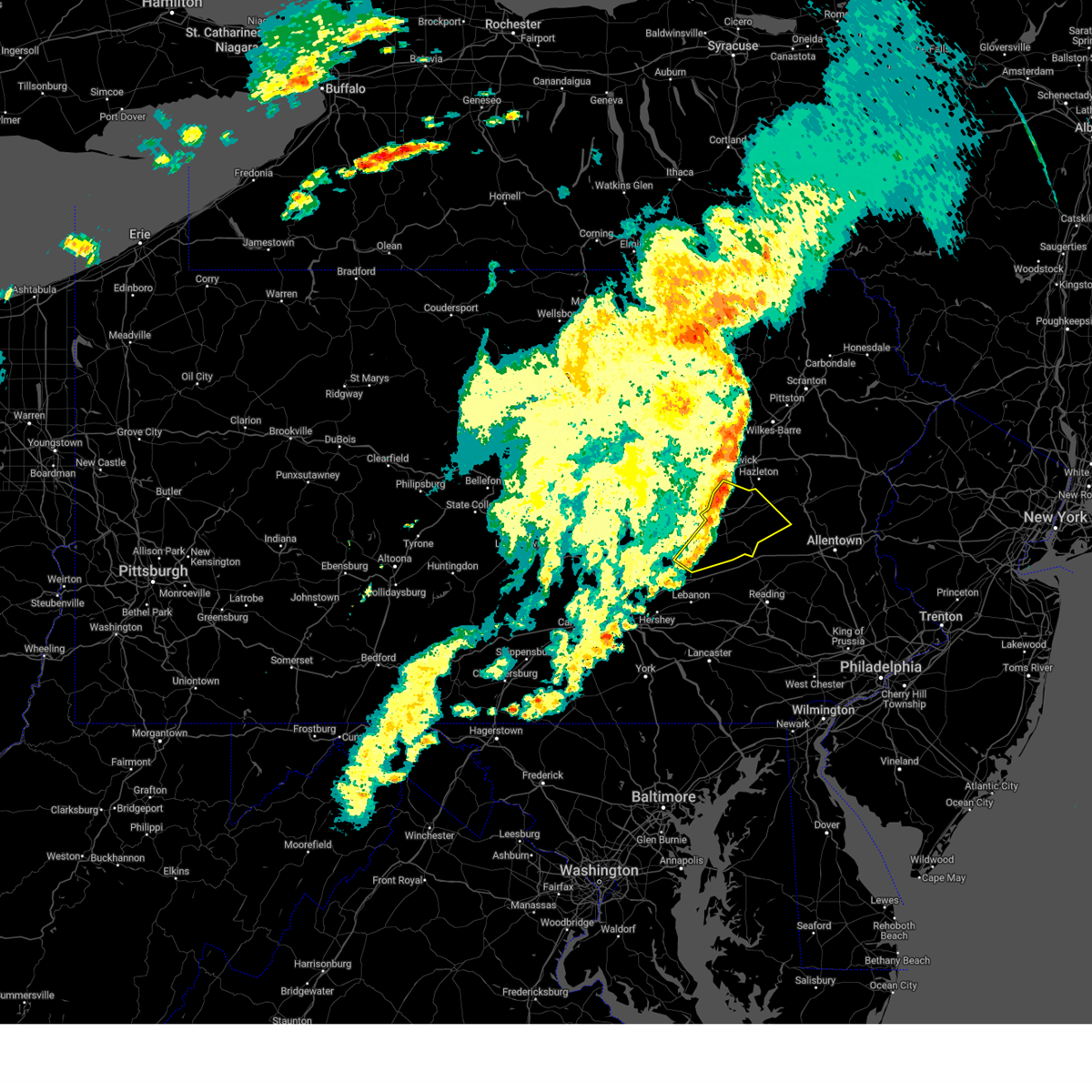
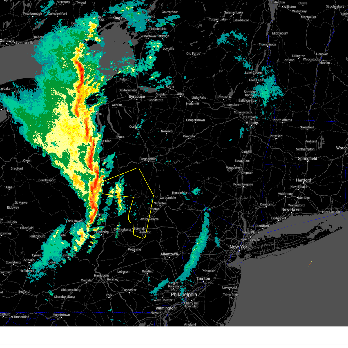
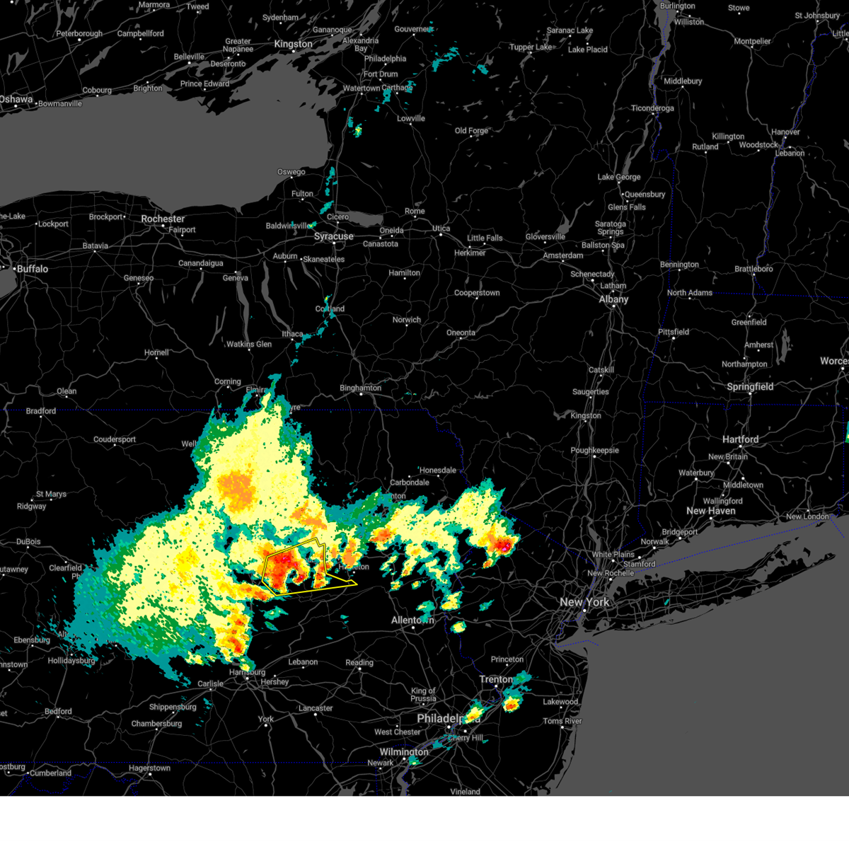
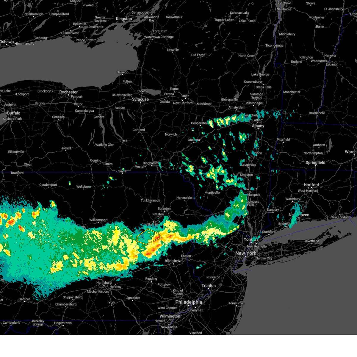
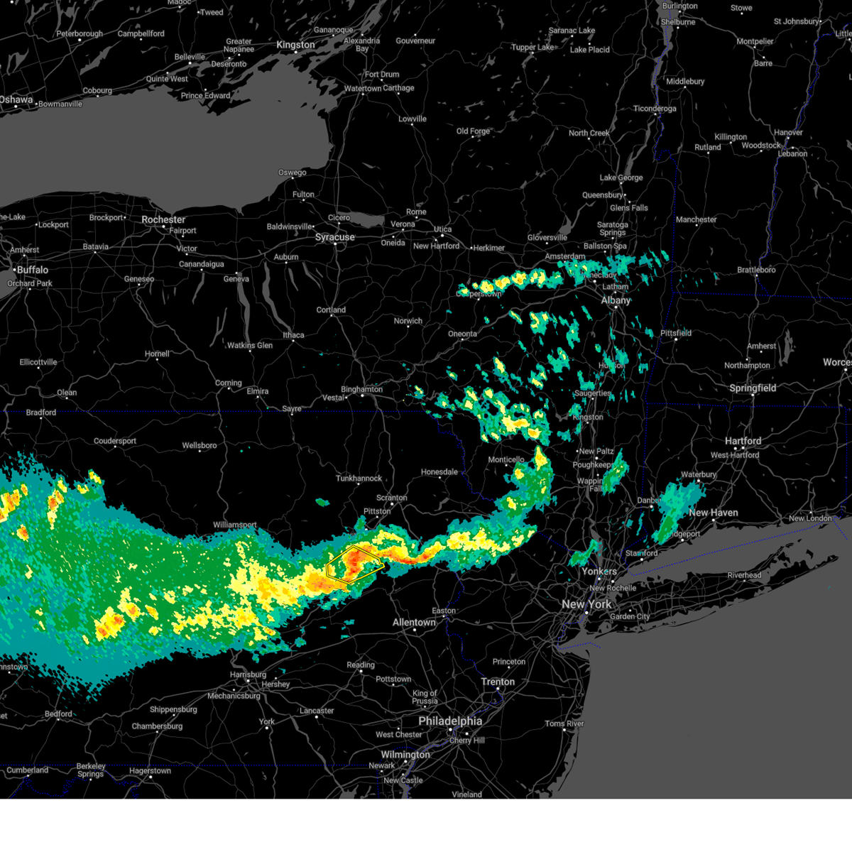
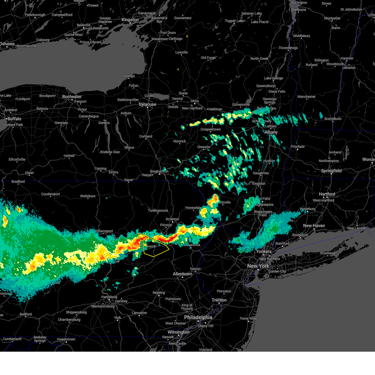
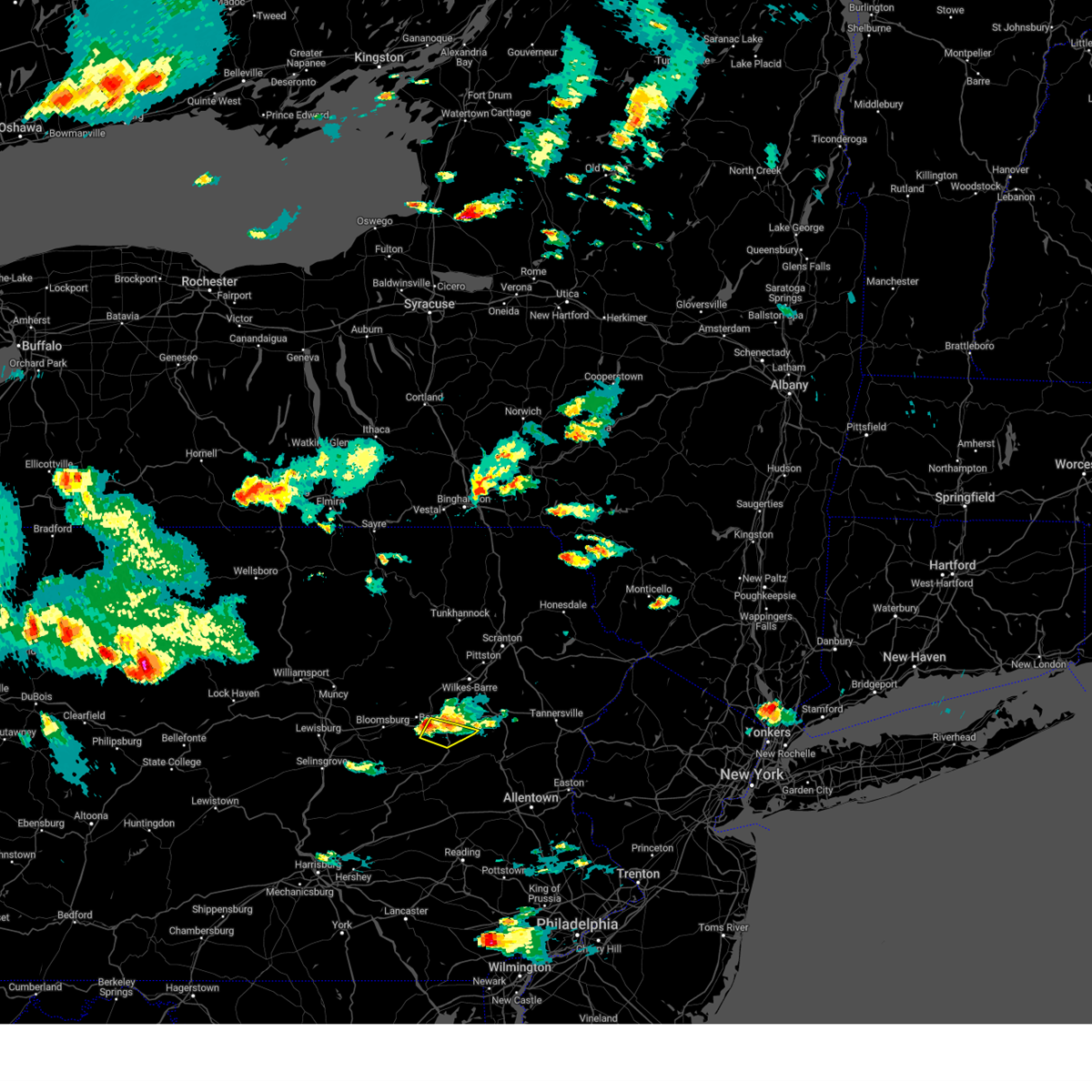
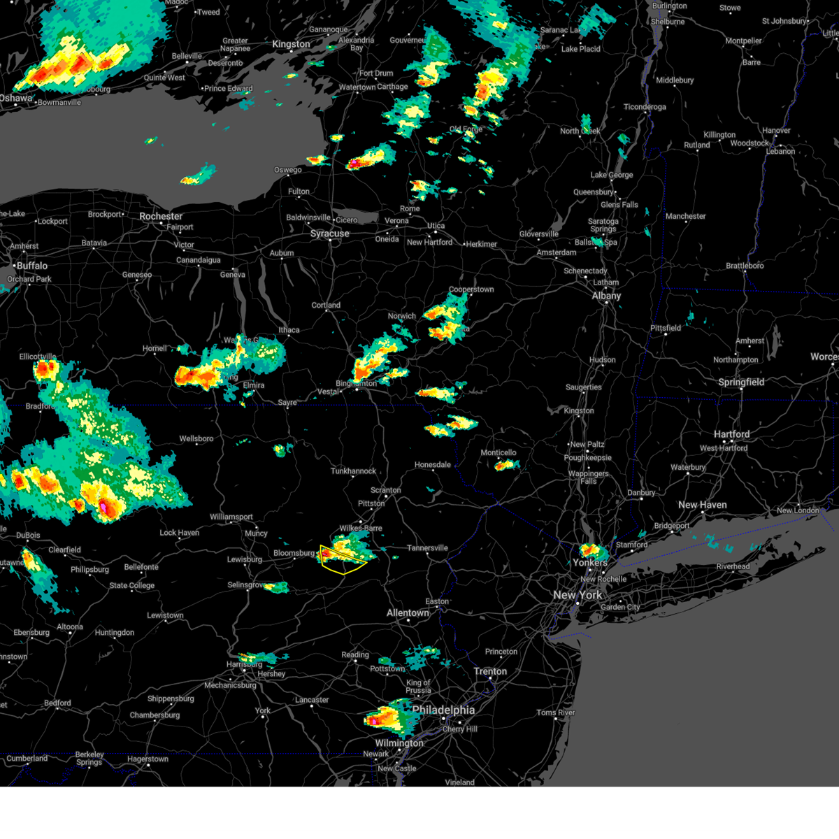
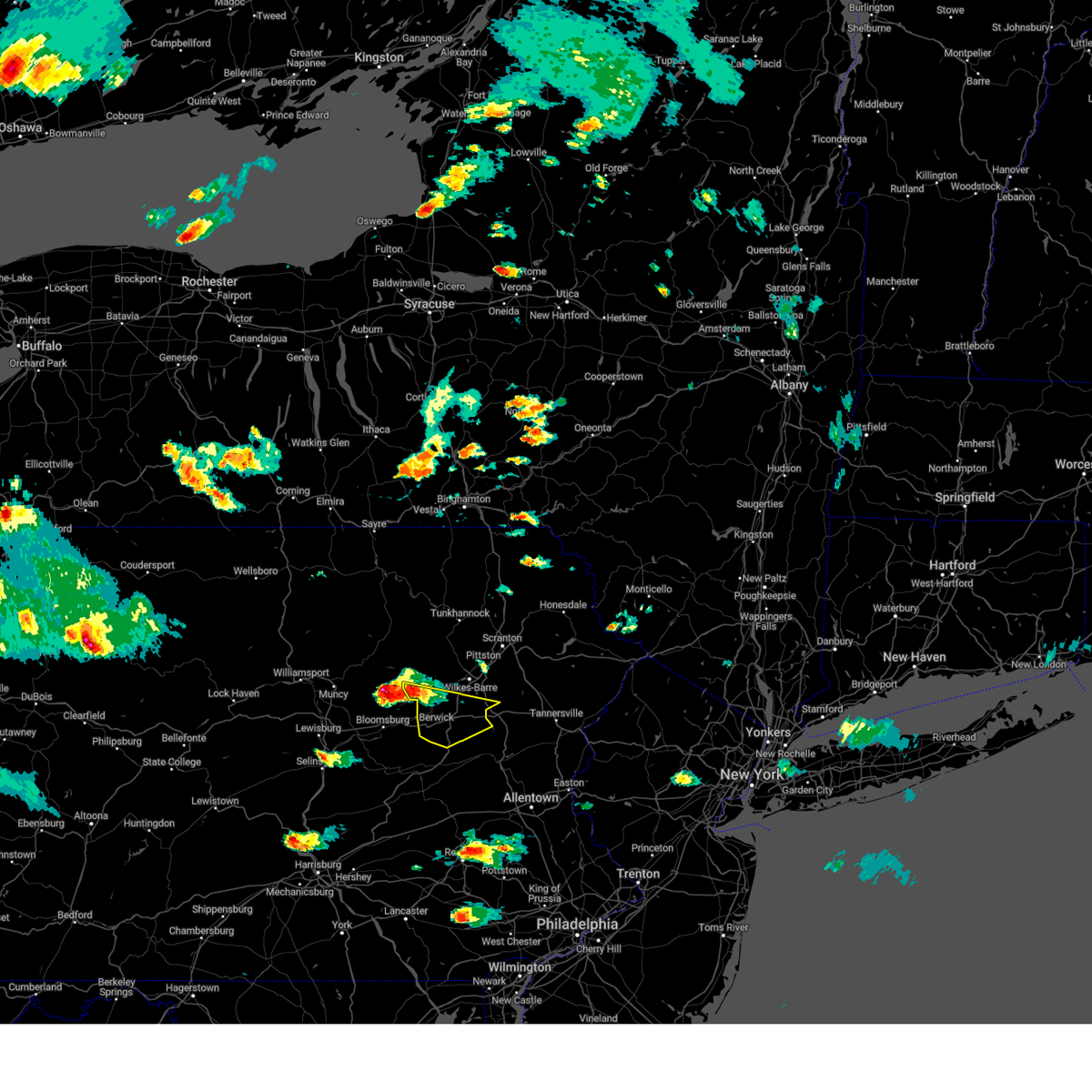
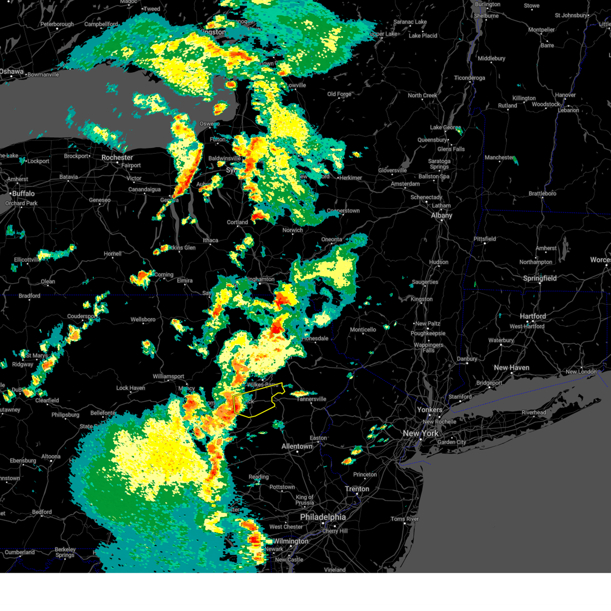
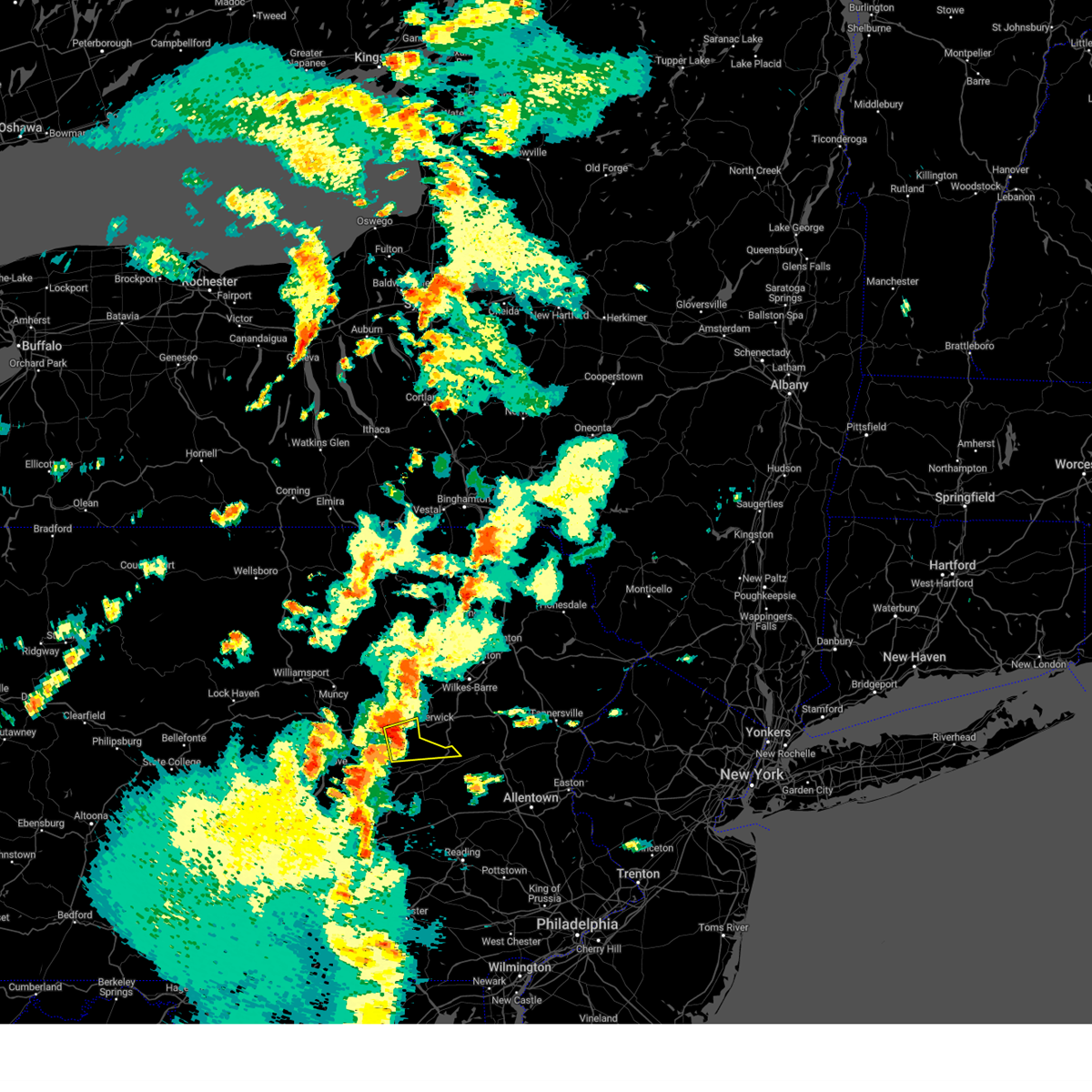
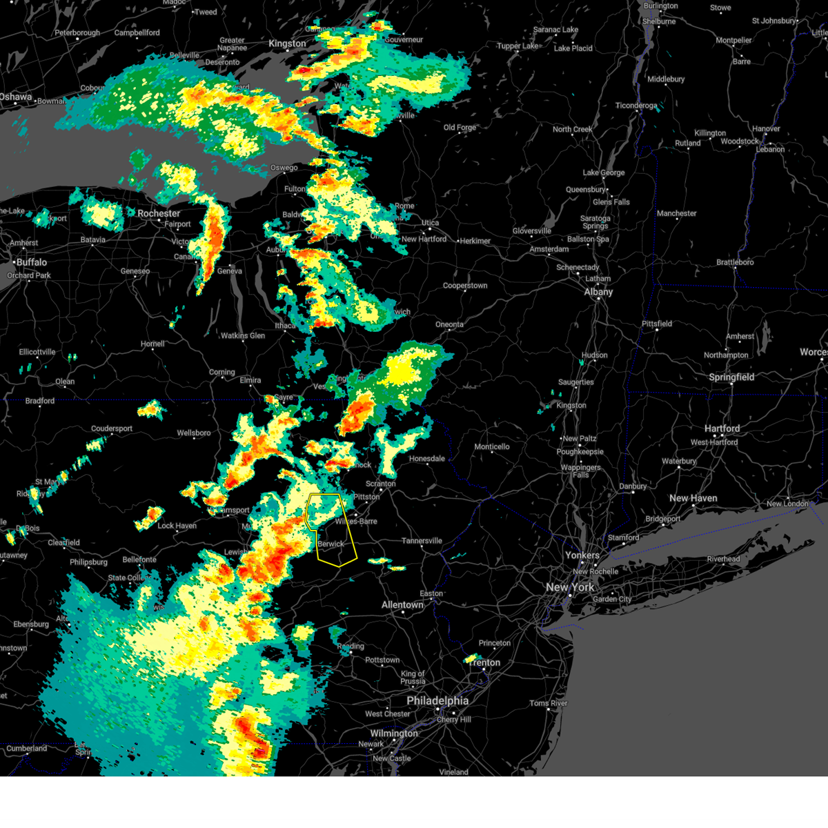
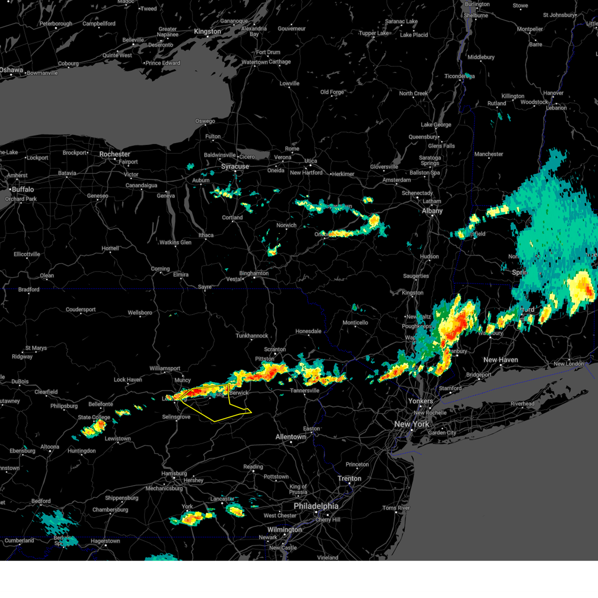
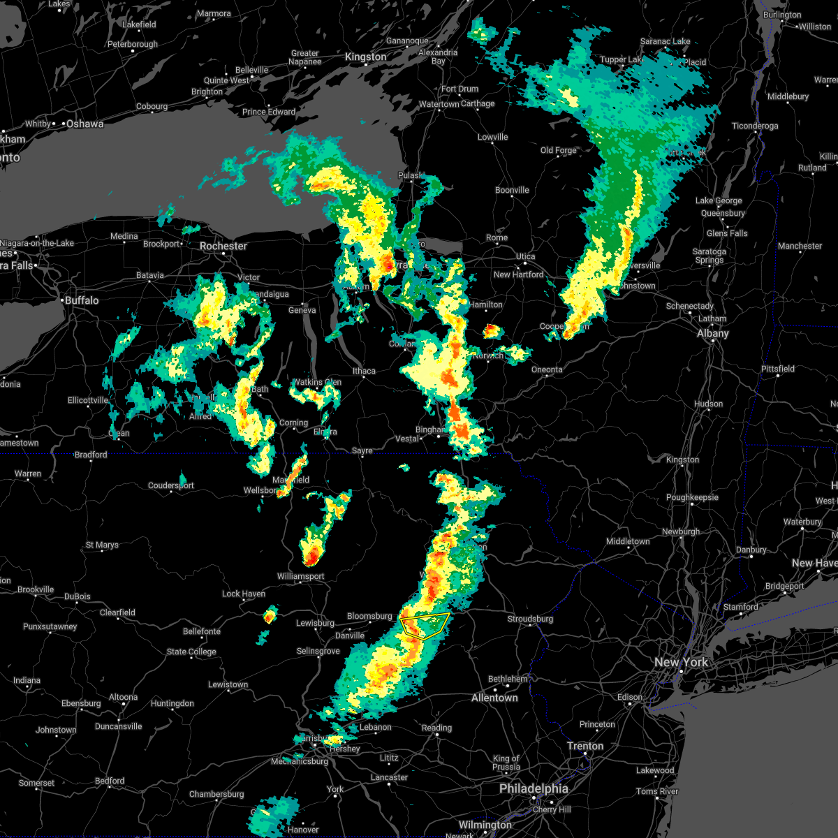
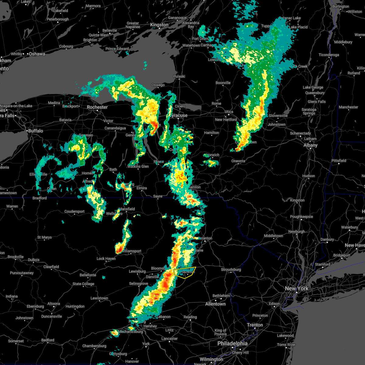
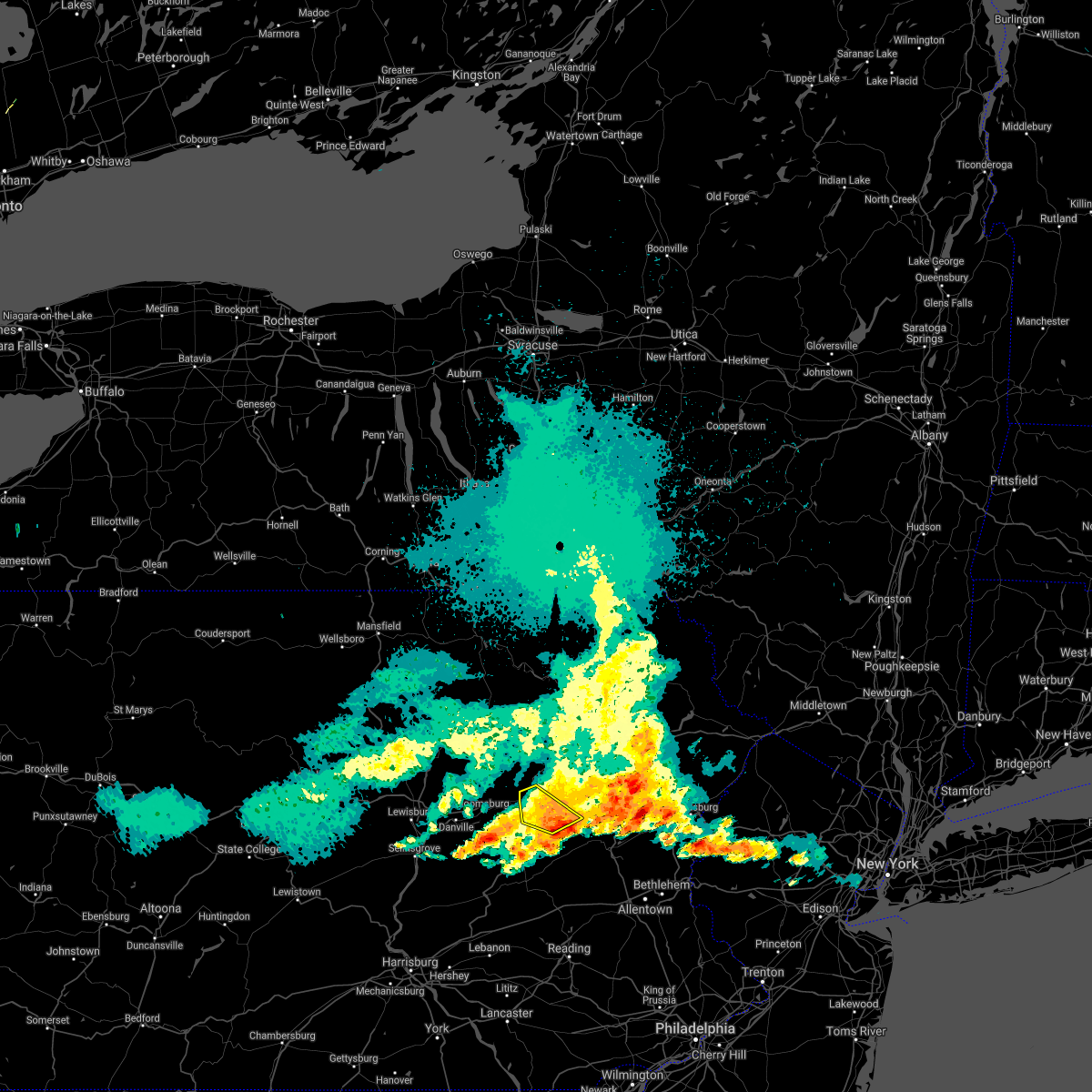
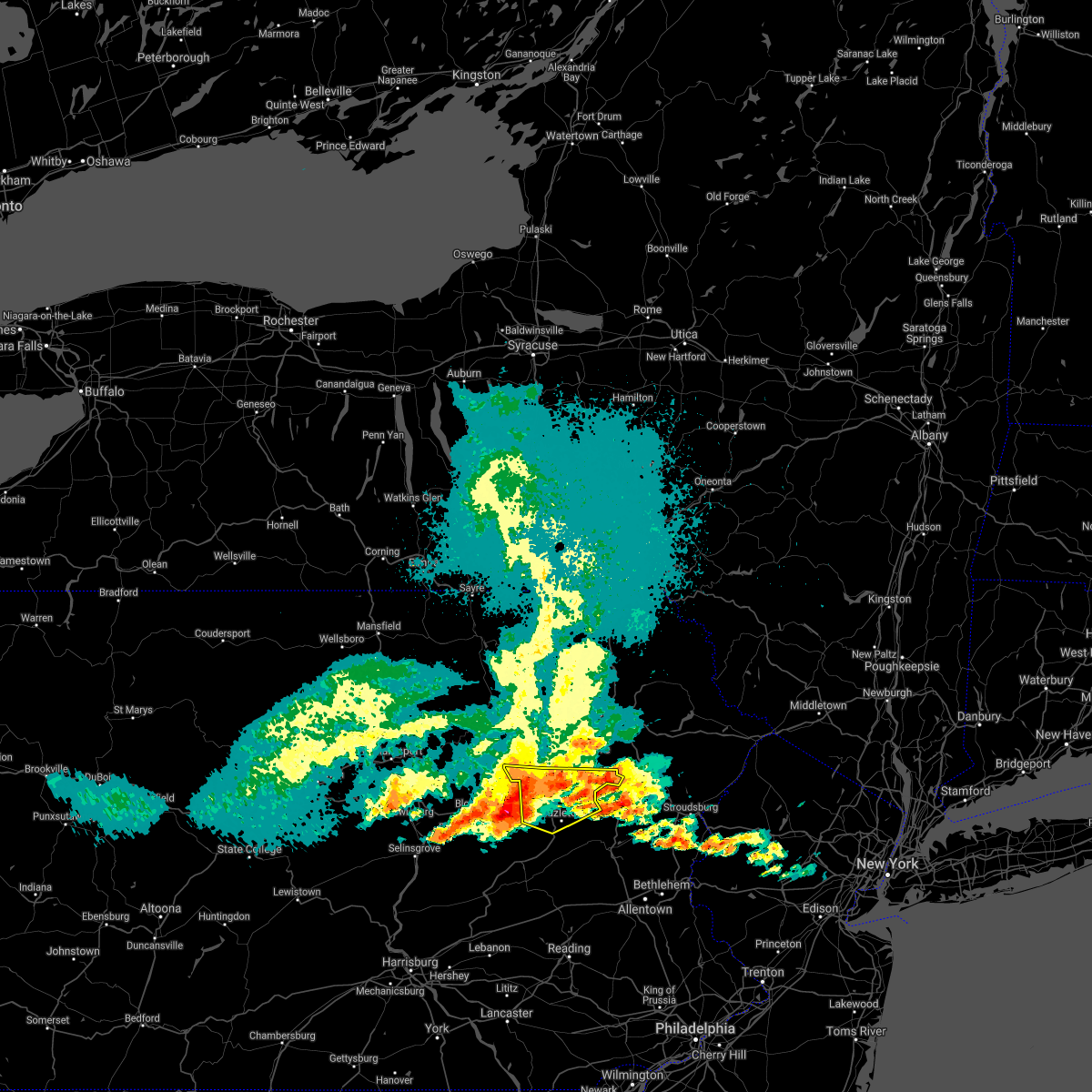
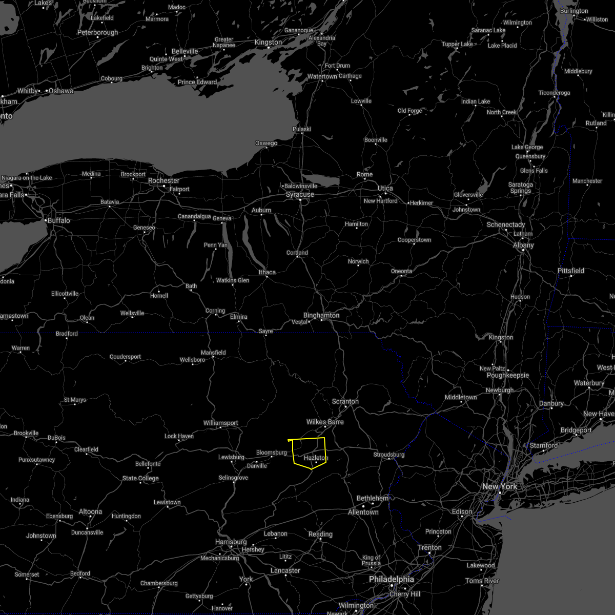
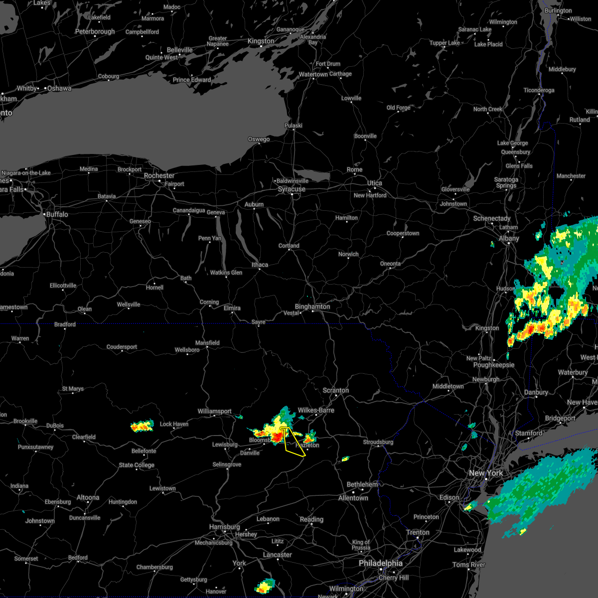
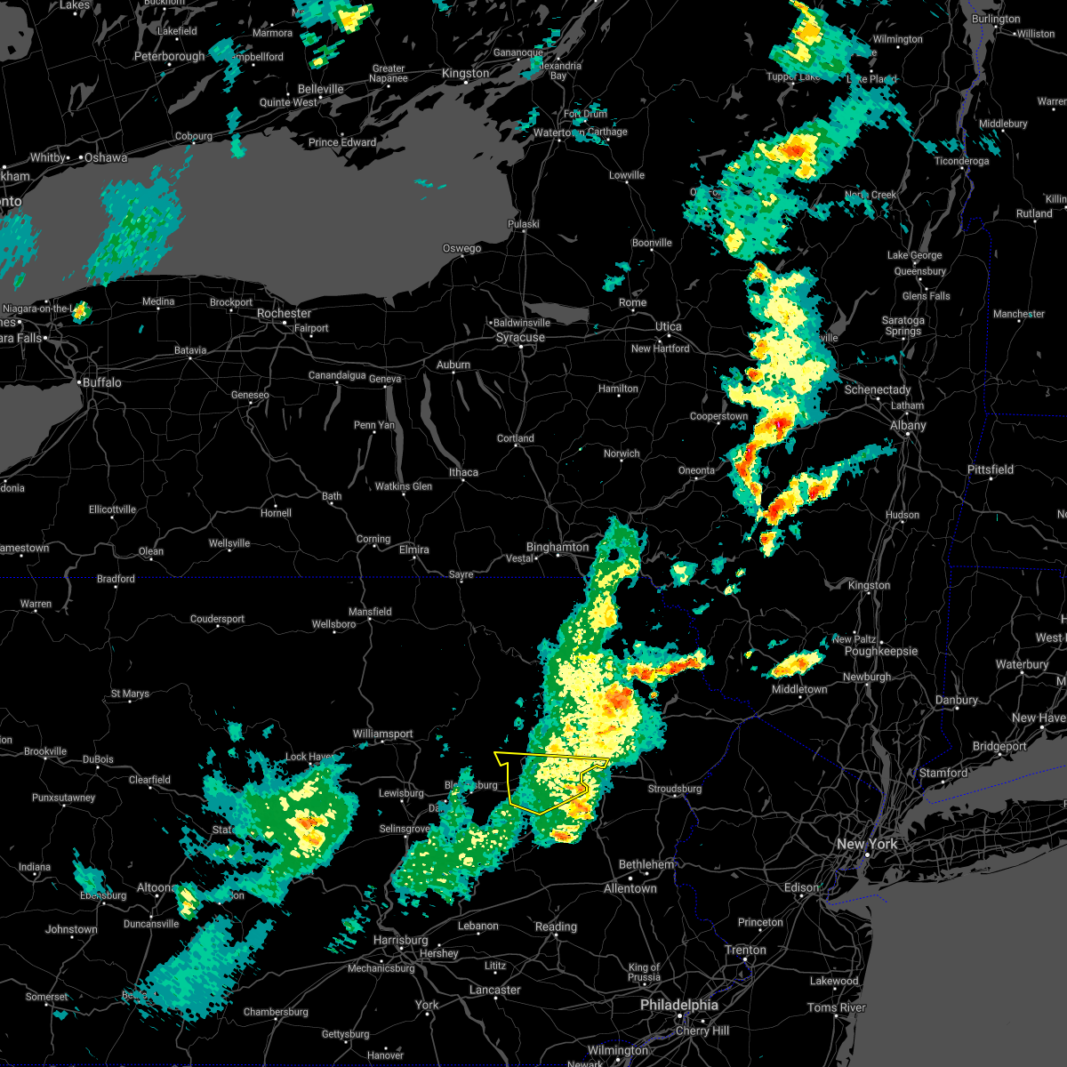
Hail Map for Nuremberg, PA
The Nuremberg, PA area has had 0 reports of on-the-ground hail by trained spotters, and has been under severe weather warnings 6 times during the past 12 months. Doppler radar has detected hail at or near Nuremberg, PA on 24 occasions.
| Name: | Nuremberg, PA |
| Where Located: | 42 miles SW of Scranton, PA |
| Map: | Google Map for Nuremberg, PA |
| Population: | 434 |
| Housing Units: | 227 |
| More Info: | Search Google for Nuremberg, PA |
0
The Top Recent Hail Date for Nuremberg, PA is Thursday, September 7, 2023 (23rd out of 24)

Hail and Wind Damage Spotted near Nuremberg, PA
| Date / Time | Report Details |
|---|---|
| 6/12/2025 5:54 PM EDT |
 Svrctp the national weather service in state college pa has issued a * severe thunderstorm warning for, north central schuylkill county in central pennsylvania, * until 630 pm edt. * at 553 pm edt, a severe thunderstorm was located over brandonville, moving east at 25 mph (radar indicated). Hazards include 60 mph wind gusts and penny size hail. expect damage to roofs, siding, and trees Svrctp the national weather service in state college pa has issued a * severe thunderstorm warning for, north central schuylkill county in central pennsylvania, * until 630 pm edt. * at 553 pm edt, a severe thunderstorm was located over brandonville, moving east at 25 mph (radar indicated). Hazards include 60 mph wind gusts and penny size hail. expect damage to roofs, siding, and trees
|
| 4/29/2025 8:23 PM EDT |
 At 822 pm edt, severe thunderstorms were located along a line extending from conyngham to port carbon to pine grove, moving east at 60 mph (radar indicated). Hazards include 60 mph wind gusts. Expect damage to roofs, siding, and trees. locations impacted include, sheppton, brandonville, ravine, englewood, tamaqua, mary-d, coaldale, orwigsburg, cumbola, schuykill county airport, port carbon, and st. clair. This includes interstate 81 from mile markers 97 to 139. At 822 pm edt, severe thunderstorms were located along a line extending from conyngham to port carbon to pine grove, moving east at 60 mph (radar indicated). Hazards include 60 mph wind gusts. Expect damage to roofs, siding, and trees. locations impacted include, sheppton, brandonville, ravine, englewood, tamaqua, mary-d, coaldale, orwigsburg, cumbola, schuykill county airport, port carbon, and st. clair. This includes interstate 81 from mile markers 97 to 139.
|
| 4/29/2025 8:23 PM EDT |
 the severe thunderstorm warning has been cancelled and is no longer in effect the severe thunderstorm warning has been cancelled and is no longer in effect
|
| 4/29/2025 7:59 PM EDT | Svrbgm the national weather service in binghamton has issued a * severe thunderstorm warning for, western lackawanna county in northeastern pennsylvania, luzerne county in northeastern pennsylvania, southern bradford county in northeastern pennsylvania, wyoming county in northeastern pennsylvania, * until 845 pm edt. * at 758 pm edt, severe thunderstorms were located along a line extending from near lincoln falls to eyers grove to klingerstown, moving east at 70 mph (radar indicated). Hazards include 60 mph wind gusts. expect damage to roofs, siding, and trees |
| 4/29/2025 7:50 PM EDT | Svrctp the national weather service in state college pa has issued a * severe thunderstorm warning for, columbia county in central pennsylvania, northern dauphin county in south central pennsylvania, northwestern lebanon county in south central pennsylvania, southern northumberland county in central pennsylvania, schuylkill county in central pennsylvania, sullivan county in north central pennsylvania, * until 845 pm edt. * at 750 pm edt, severe thunderstorms were located along a line extending from ralston to near hughesville to mooresburg to selinsgrove to new buffalo, moving east at 65 mph (radar indicated). Hazards include 60 mph wind gusts. expect damage to roofs, siding, and trees |
| 3/16/2025 3:59 PM EDT |
 Svrbgm the national weather service in binghamton has issued a * severe thunderstorm warning for, western susquehanna county in northeastern pennsylvania, luzerne county in northeastern pennsylvania, bradford county in northeastern pennsylvania, wyoming county in northeastern pennsylvania, * until 500 pm edt. * at 358 pm edt, severe thunderstorms were located along a line extending from near sylvania to near elimsport, moving east at 50 mph (radar indicated). Hazards include 60 mph wind gusts. expect damage to roofs, siding, and trees Svrbgm the national weather service in binghamton has issued a * severe thunderstorm warning for, western susquehanna county in northeastern pennsylvania, luzerne county in northeastern pennsylvania, bradford county in northeastern pennsylvania, wyoming county in northeastern pennsylvania, * until 500 pm edt. * at 358 pm edt, severe thunderstorms were located along a line extending from near sylvania to near elimsport, moving east at 50 mph (radar indicated). Hazards include 60 mph wind gusts. expect damage to roofs, siding, and trees
|
| 6/26/2024 6:14 PM EDT |
 Svrctp the national weather service in state college pa has issued a * severe thunderstorm warning for, central columbia county in central pennsylvania, southeastern lycoming county in north central pennsylvania, eastern schuylkill county in central pennsylvania, * until 645 pm edt. * at 614 pm edt, severe thunderstorms were located along a line extending from biggertown to nescopeck to mckeansburg to bernville, moving northeast at 45 mph (radar indicated). Hazards include 60 mph wind gusts. expect damage to roofs, siding, and trees Svrctp the national weather service in state college pa has issued a * severe thunderstorm warning for, central columbia county in central pennsylvania, southeastern lycoming county in north central pennsylvania, eastern schuylkill county in central pennsylvania, * until 645 pm edt. * at 614 pm edt, severe thunderstorms were located along a line extending from biggertown to nescopeck to mckeansburg to bernville, moving northeast at 45 mph (radar indicated). Hazards include 60 mph wind gusts. expect damage to roofs, siding, and trees
|
| 6/26/2024 6:02 PM EDT |
 the severe thunderstorm warning has been cancelled and is no longer in effect the severe thunderstorm warning has been cancelled and is no longer in effect
|
| 6/26/2024 6:02 PM EDT |
 At 602 pm edt, severe thunderstorms were located along a line extending from exchange to mechanicsville to shamokin, moving northeast at 35 mph (radar indicated). Hazards include 60 mph wind gusts. Expect damage to roofs, siding, and trees. locations impacted include, bloomsburg, berwick, shamokin, mount carmel, shenandoah, danville, kulpmont, ashland, elysburg, fairview-ferndale, riverside, and trevorton. For those driving on interstate 80, this includes areas between the limestoneville and nescopek exits, specifically from mile markers 216 to 247. At 602 pm edt, severe thunderstorms were located along a line extending from exchange to mechanicsville to shamokin, moving northeast at 35 mph (radar indicated). Hazards include 60 mph wind gusts. Expect damage to roofs, siding, and trees. locations impacted include, bloomsburg, berwick, shamokin, mount carmel, shenandoah, danville, kulpmont, ashland, elysburg, fairview-ferndale, riverside, and trevorton. For those driving on interstate 80, this includes areas between the limestoneville and nescopek exits, specifically from mile markers 216 to 247.
|
| 6/26/2024 5:35 PM EDT |
 Svrctp the national weather service in state college pa has issued a * severe thunderstorm warning for, columbia county in central pennsylvania, montour county in central pennsylvania, northumberland county in central pennsylvania, northwestern schuylkill county in central pennsylvania, northeastern snyder county in central pennsylvania, east central union county in central pennsylvania, * until 615 pm edt. * at 535 pm edt, severe thunderstorms were located along a line extending from spruce run reservoir to hummels wharf to urban, moving northeast at 35 mph (radar indicated). Hazards include 60 mph wind gusts. expect damage to roofs, siding, and trees Svrctp the national weather service in state college pa has issued a * severe thunderstorm warning for, columbia county in central pennsylvania, montour county in central pennsylvania, northumberland county in central pennsylvania, northwestern schuylkill county in central pennsylvania, northeastern snyder county in central pennsylvania, east central union county in central pennsylvania, * until 615 pm edt. * at 535 pm edt, severe thunderstorms were located along a line extending from spruce run reservoir to hummels wharf to urban, moving northeast at 35 mph (radar indicated). Hazards include 60 mph wind gusts. expect damage to roofs, siding, and trees
|
| 5/23/2024 6:47 AM EDT |
 Svrctp the national weather service in state college pa has issued a * severe thunderstorm warning for, columbia county in central pennsylvania, montour county in central pennsylvania, central northumberland county in central pennsylvania, north central schuylkill county in central pennsylvania, * until 730 am edt. * at 642 am edt, a severe thunderstorm was located over buckhorn, moving east northeast at 40 mph (local law enforcement report numerous instances of trees downed by the strong wind gusts from this long-lasting storm, that has a history of producing wind damage for the past 3 hours). Hazards include 60 mph wind gusts and penny size hail. expect damage to roofs, siding, and trees Svrctp the national weather service in state college pa has issued a * severe thunderstorm warning for, columbia county in central pennsylvania, montour county in central pennsylvania, central northumberland county in central pennsylvania, north central schuylkill county in central pennsylvania, * until 730 am edt. * at 642 am edt, a severe thunderstorm was located over buckhorn, moving east northeast at 40 mph (local law enforcement report numerous instances of trees downed by the strong wind gusts from this long-lasting storm, that has a history of producing wind damage for the past 3 hours). Hazards include 60 mph wind gusts and penny size hail. expect damage to roofs, siding, and trees
|
| 4/14/2024 7:46 PM EDT |
 the severe thunderstorm warning has been cancelled and is no longer in effect the severe thunderstorm warning has been cancelled and is no longer in effect
|
| 4/14/2024 7:44 PM EDT |
 The storms which prompted the warning have moved out of the warned area. therefore, the warning will be allowed to expire. however, gusty winds are still possible with these thunderstorms. a severe thunderstorm watch remains in effect until 1100 pm edt for central and north central pennsylvania. The storms which prompted the warning have moved out of the warned area. therefore, the warning will be allowed to expire. however, gusty winds are still possible with these thunderstorms. a severe thunderstorm watch remains in effect until 1100 pm edt for central and north central pennsylvania.
|
| 4/14/2024 7:34 PM EDT |
 At 734 pm edt, a severe thunderstorm was located over mountain top, or 9 miles north of hazleton, moving east at 50 mph (radar indicated). Hazards include 60 mph wind gusts and penny size hail. Expect damage to roofs, siding, and trees. Locations impacted include, hazleton, west hazleton, freeland, dorrance, conyngham, white haven, jeddo, mountain top, woodside-drifton, and drifton. At 734 pm edt, a severe thunderstorm was located over mountain top, or 9 miles north of hazleton, moving east at 50 mph (radar indicated). Hazards include 60 mph wind gusts and penny size hail. Expect damage to roofs, siding, and trees. Locations impacted include, hazleton, west hazleton, freeland, dorrance, conyngham, white haven, jeddo, mountain top, woodside-drifton, and drifton.
|
| 4/14/2024 7:17 PM EDT |
 Svrbgm the national weather service in binghamton has issued a * severe thunderstorm warning for, southern luzerne county in northeastern pennsylvania, * until 800 pm edt. * at 716 pm edt, a severe thunderstorm was located over huntington mills, or near berwick, moving east at 50 mph (radar indicated). Hazards include 60 mph wind gusts and nickel size hail. expect damage to roofs, siding, and trees Svrbgm the national weather service in binghamton has issued a * severe thunderstorm warning for, southern luzerne county in northeastern pennsylvania, * until 800 pm edt. * at 716 pm edt, a severe thunderstorm was located over huntington mills, or near berwick, moving east at 50 mph (radar indicated). Hazards include 60 mph wind gusts and nickel size hail. expect damage to roofs, siding, and trees
|
| 4/14/2024 7:10 PM EDT |
 Svrctp the national weather service in state college pa has issued a * severe thunderstorm warning for, columbia county in central pennsylvania, montour county in central pennsylvania, northumberland county in central pennsylvania, northern schuylkill county in central pennsylvania, northeastern snyder county in central pennsylvania, east central union county in central pennsylvania, * until 745 pm edt. * at 709 pm edt, severe thunderstorms were located along a line extending from huntington mills to lightstreet to northumberland, moving southeast at 45 mph (radar indicated). Hazards include 60 mph wind gusts and penny size hail. expect damage to roofs, siding, and trees Svrctp the national weather service in state college pa has issued a * severe thunderstorm warning for, columbia county in central pennsylvania, montour county in central pennsylvania, northumberland county in central pennsylvania, northern schuylkill county in central pennsylvania, northeastern snyder county in central pennsylvania, east central union county in central pennsylvania, * until 745 pm edt. * at 709 pm edt, severe thunderstorms were located along a line extending from huntington mills to lightstreet to northumberland, moving southeast at 45 mph (radar indicated). Hazards include 60 mph wind gusts and penny size hail. expect damage to roofs, siding, and trees
|
| 9/7/2023 5:18 PM EDT |
 At 517 pm edt, a severe thunderstorm was located over mcadoo, moving northeast at 50 mph (radar indicated). Hazards include 60 mph wind gusts. Expect damage to roofs, siding, and trees. locations impacted include, tamaqua, shenandoah, mahanoy city, frackville, st. clair, orwigsburg, mcadoo, port carbon, girardville, hometown, tuscarora and new philadelphia. this includes interstate 81 from mile markers 122 to 139. hail threat, radar indicated max hail size, <. 75 in wind threat, radar indicated max wind gust, 60 mph. At 517 pm edt, a severe thunderstorm was located over mcadoo, moving northeast at 50 mph (radar indicated). Hazards include 60 mph wind gusts. Expect damage to roofs, siding, and trees. locations impacted include, tamaqua, shenandoah, mahanoy city, frackville, st. clair, orwigsburg, mcadoo, port carbon, girardville, hometown, tuscarora and new philadelphia. this includes interstate 81 from mile markers 122 to 139. hail threat, radar indicated max hail size, <. 75 in wind threat, radar indicated max wind gust, 60 mph.
|
| 9/7/2023 4:56 PM EDT |
 At 456 pm edt, a severe thunderstorm was located over branchdale, moving northeast at 45 mph (radar indicated). Hazards include 60 mph wind gusts and quarter size hail. Hail damage to vehicles is expected. expect wind damage to roofs, siding, and trees. locations impacted include, pottsville, berwick, tamaqua, schuylkill haven, shenandoah, minersville, mahanoy city, frackville, st. clair, orwigsburg, mcadoo and pine grove. for those driving on interstate 80, this includes areas between the mifflinville and nescopek exits, specifically from mile markers 245 to 247. this includes interstate 81 from mile markers 97 to 139. hail threat, radar indicated max hail size, 1. 00 in wind threat, radar indicated max wind gust, 60 mph. At 456 pm edt, a severe thunderstorm was located over branchdale, moving northeast at 45 mph (radar indicated). Hazards include 60 mph wind gusts and quarter size hail. Hail damage to vehicles is expected. expect wind damage to roofs, siding, and trees. locations impacted include, pottsville, berwick, tamaqua, schuylkill haven, shenandoah, minersville, mahanoy city, frackville, st. clair, orwigsburg, mcadoo and pine grove. for those driving on interstate 80, this includes areas between the mifflinville and nescopek exits, specifically from mile markers 245 to 247. this includes interstate 81 from mile markers 97 to 139. hail threat, radar indicated max hail size, 1. 00 in wind threat, radar indicated max wind gust, 60 mph.
|
| 9/7/2023 4:41 PM EDT |
 At 439 pm edt, a severe thunderstorm was located over fredericksburg, moving northeast at 35 mph. other strong storms were nearby and intensifying (radar indicated). Hazards include 60 mph wind gusts and quarter size hail. Hail damage to vehicles is expected. Expect wind damage to roofs, siding, and trees. At 439 pm edt, a severe thunderstorm was located over fredericksburg, moving northeast at 35 mph. other strong storms were nearby and intensifying (radar indicated). Hazards include 60 mph wind gusts and quarter size hail. Hail damage to vehicles is expected. Expect wind damage to roofs, siding, and trees.
|
| 9/7/2023 3:30 PM EDT |
 At 328 pm edt, a severe thunderstorm was located over friedensburg, moving northeast at 30 mph. other storms were quickly forming nearby (radar indicated). Hazards include 60 mph wind gusts and quarter size hail. Hail damage to vehicles is expected. Expect wind damage to roofs, siding, and trees. At 328 pm edt, a severe thunderstorm was located over friedensburg, moving northeast at 30 mph. other storms were quickly forming nearby (radar indicated). Hazards include 60 mph wind gusts and quarter size hail. Hail damage to vehicles is expected. Expect wind damage to roofs, siding, and trees.
|
| 8/12/2023 4:44 PM EDT |
 At 444 pm edt, a severe thunderstorm was located over rock glen, or near berwick, moving east at 35 mph (radar indicated). Hazards include 60 mph wind gusts and quarter size hail. Hail damage to vehicles is expected. Expect wind damage to roofs, siding, and trees. At 444 pm edt, a severe thunderstorm was located over rock glen, or near berwick, moving east at 35 mph (radar indicated). Hazards include 60 mph wind gusts and quarter size hail. Hail damage to vehicles is expected. Expect wind damage to roofs, siding, and trees.
|
| 8/12/2023 4:37 PM EDT |
 At 437 pm edt, a severe thunderstorm was located near rock glen, or near berwick, moving southeast at 20 mph (radar indicated). Hazards include 60 mph wind gusts and quarter size hail. Hail damage to vehicles is expected. expect wind damage to roofs, siding, and trees. Locations impacted include, hazleton, berwick, west hazleton, conyngham, nescopeck, jeddo, east berwick, beach haven, rock glen and drums. At 437 pm edt, a severe thunderstorm was located near rock glen, or near berwick, moving southeast at 20 mph (radar indicated). Hazards include 60 mph wind gusts and quarter size hail. Hail damage to vehicles is expected. expect wind damage to roofs, siding, and trees. Locations impacted include, hazleton, berwick, west hazleton, conyngham, nescopeck, jeddo, east berwick, beach haven, rock glen and drums.
|
| 8/12/2023 3:58 PM EDT |
 At 358 pm edt, a severe thunderstorm was located near huntington mills, or near berwick, moving east at 35 mph (radar indicated). Hazards include ping pong ball size hail and 60 mph wind gusts. People and animals outdoors will be injured. expect hail damage to roofs, siding, windows, and vehicles. Expect wind damage to roofs, siding, and trees. At 358 pm edt, a severe thunderstorm was located near huntington mills, or near berwick, moving east at 35 mph (radar indicated). Hazards include ping pong ball size hail and 60 mph wind gusts. People and animals outdoors will be injured. expect hail damage to roofs, siding, windows, and vehicles. Expect wind damage to roofs, siding, and trees.
|
| 8/7/2023 6:03 PM EDT |
 At 602 pm edt, a severe thunderstorm was located over conyngham, or 8 miles southeast of berwick, moving east at 25 mph (radar indicated). Hazards include 60 mph wind gusts. expect damage to roofs, siding, and trees At 602 pm edt, a severe thunderstorm was located over conyngham, or 8 miles southeast of berwick, moving east at 25 mph (radar indicated). Hazards include 60 mph wind gusts. expect damage to roofs, siding, and trees
|
| 8/7/2023 5:39 PM EDT |
 At 539 pm edt, a severe thunderstorm was located over shumans, moving east at 30 mph (radar indicated). Hazards include 60 mph wind gusts and quarter size hail. Hail damage to vehicles is expected. expect wind damage to roofs, siding, and trees. this severe thunderstorm will be near, shumans and mifflinville around 540 pm edt. berwick around 550 pm edt. nuremburg, oneida and sheppton around 600 pm edt. mcadoo around 610 pm edt. other locations impacted by this severe thunderstorm include espy, kelayres, ringtown and lime ridge. radar has indicated rotation within this severe thunderstorm. although a tornado is not immediately likely, tornadoes can develop quickly during severe thunderstorms. for those driving on interstate 80, this includes areas between the mifflinville and nescopek exits, specifically from mile markers 242 to 247. This includes interstate 81 from mile markers 136 to 139. At 539 pm edt, a severe thunderstorm was located over shumans, moving east at 30 mph (radar indicated). Hazards include 60 mph wind gusts and quarter size hail. Hail damage to vehicles is expected. expect wind damage to roofs, siding, and trees. this severe thunderstorm will be near, shumans and mifflinville around 540 pm edt. berwick around 550 pm edt. nuremburg, oneida and sheppton around 600 pm edt. mcadoo around 610 pm edt. other locations impacted by this severe thunderstorm include espy, kelayres, ringtown and lime ridge. radar has indicated rotation within this severe thunderstorm. although a tornado is not immediately likely, tornadoes can develop quickly during severe thunderstorms. for those driving on interstate 80, this includes areas between the mifflinville and nescopek exits, specifically from mile markers 242 to 247. This includes interstate 81 from mile markers 136 to 139.
|
| 8/7/2023 5:16 PM EDT |
 At 515 pm edt, a severe thunderstorm was located over almedia, or near bloomsburg, moving northeast at 25 mph (radar indicated). Hazards include 60 mph wind gusts and quarter size hail. Hail damage to vehicles is expected. Expect wind damage to roofs, siding, and trees. At 515 pm edt, a severe thunderstorm was located over almedia, or near bloomsburg, moving northeast at 25 mph (radar indicated). Hazards include 60 mph wind gusts and quarter size hail. Hail damage to vehicles is expected. Expect wind damage to roofs, siding, and trees.
|
| 7/27/2023 6:44 PM EDT |
 At 644 pm edt, a severe thunderstorm was located over hazleton, moving southeast at 15 mph (radar indicated). Hazards include 60 mph wind gusts and penny size hail. Expect damage to roofs, siding, and trees. locations impacted include, hazleton, west hazleton, freeland, conyngham, white haven, jeddo, woodside-drifton, drifton, rock glen and drums. hail threat, radar indicated max hail size, 0. 75 in wind threat, radar indicated max wind gust, 60 mph. At 644 pm edt, a severe thunderstorm was located over hazleton, moving southeast at 15 mph (radar indicated). Hazards include 60 mph wind gusts and penny size hail. Expect damage to roofs, siding, and trees. locations impacted include, hazleton, west hazleton, freeland, conyngham, white haven, jeddo, woodside-drifton, drifton, rock glen and drums. hail threat, radar indicated max hail size, 0. 75 in wind threat, radar indicated max wind gust, 60 mph.
|
| 7/27/2023 6:28 PM EDT |
 At 627 pm edt, severe thunderstorms were located along a line extending from rock glen to catawissa to mooresburg, moving southeast at 20 mph (radar indicated). Hazards include 60 mph wind gusts. Expect damage to roofs, siding, and trees. locations impacted include, bloomsburg, mount carmel, danville, mcadoo, elysburg, riverside, catawissa, oneida, fernville, mechanicsville, nuremburg and aristes. for those driving on interstate 80, this includes areas between the limestoneville and buckhorn exits, specifically from mile markers 219 to 230. this includes interstate 81 from mile markers 137 to 139. hail threat, radar indicated max hail size, <. 75 in wind threat, radar indicated max wind gust, 60 mph. At 627 pm edt, severe thunderstorms were located along a line extending from rock glen to catawissa to mooresburg, moving southeast at 20 mph (radar indicated). Hazards include 60 mph wind gusts. Expect damage to roofs, siding, and trees. locations impacted include, bloomsburg, mount carmel, danville, mcadoo, elysburg, riverside, catawissa, oneida, fernville, mechanicsville, nuremburg and aristes. for those driving on interstate 80, this includes areas between the limestoneville and buckhorn exits, specifically from mile markers 219 to 230. this includes interstate 81 from mile markers 137 to 139. hail threat, radar indicated max hail size, <. 75 in wind threat, radar indicated max wind gust, 60 mph.
|
| 7/27/2023 6:08 PM EDT |
 At 607 pm edt, a severe thunderstorm was located over beach haven, or near berwick, moving east at 30 mph (radar indicated). Hazards include 60 mph wind gusts and penny size hail. expect damage to roofs, siding, and trees At 607 pm edt, a severe thunderstorm was located over beach haven, or near berwick, moving east at 30 mph (radar indicated). Hazards include 60 mph wind gusts and penny size hail. expect damage to roofs, siding, and trees
|
| 7/27/2023 5:59 PM EDT |
 At 558 pm edt, severe thunderstorms were located along a line extending from east berwick to buckhorn to jerseytown to milton, moving east at 30 mph (radar indicated). Hazards include 60 mph wind gusts. expect damage to roofs, siding, and trees At 558 pm edt, severe thunderstorms were located along a line extending from east berwick to buckhorn to jerseytown to milton, moving east at 30 mph (radar indicated). Hazards include 60 mph wind gusts. expect damage to roofs, siding, and trees
|
| 7/21/2023 12:51 AM EDT |
 The severe thunderstorm warning for lackawanna, luzerne and wyoming counties will expire at 100 am edt, the storms which prompted the warning have weakened below severe limits, and no longer pose an immediate threat to life or property. therefore, the warning will be allowed to expire. a severe thunderstorm watch remains in effect until 300 am edt for northeastern pennsylvania. The severe thunderstorm warning for lackawanna, luzerne and wyoming counties will expire at 100 am edt, the storms which prompted the warning have weakened below severe limits, and no longer pose an immediate threat to life or property. therefore, the warning will be allowed to expire. a severe thunderstorm watch remains in effect until 300 am edt for northeastern pennsylvania.
|
| 7/21/2023 12:25 AM EDT |
 At 1224 am edt, severe thunderstorms were located along a line extending from near evans falls to mount carmel, moving east at 40 mph (radar indicated). Hazards include 60 mph wind gusts. Expect damage to roofs, siding, and trees. locations impacted include, scranton, wilkes-barre, falls, hazleton, muhlenberg, dunmore, kingston, nanticoke, plains and carbondale. hail threat, radar indicated max hail size, <. 75 in wind threat, radar indicated max wind gust, 60 mph. At 1224 am edt, severe thunderstorms were located along a line extending from near evans falls to mount carmel, moving east at 40 mph (radar indicated). Hazards include 60 mph wind gusts. Expect damage to roofs, siding, and trees. locations impacted include, scranton, wilkes-barre, falls, hazleton, muhlenberg, dunmore, kingston, nanticoke, plains and carbondale. hail threat, radar indicated max hail size, <. 75 in wind threat, radar indicated max wind gust, 60 mph.
|
| 7/20/2023 11:53 PM EDT |
 At 1152 pm edt, severe thunderstorms were located along a line extending from 7 miles southeast of new albany to near hummels wharf, moving east at 40 mph (radar indicated). Hazards include 60 mph wind gusts. expect damage to roofs, siding, and trees At 1152 pm edt, severe thunderstorms were located along a line extending from 7 miles southeast of new albany to near hummels wharf, moving east at 40 mph (radar indicated). Hazards include 60 mph wind gusts. expect damage to roofs, siding, and trees
|
| 6/27/2023 3:46 PM EDT |
 At 346 pm edt, severe thunderstorms were located along a line extending from grier city-park crest to schuylkill haven to brickerville, moving east at 25 mph (radar indicated). Hazards include 60 mph wind gusts and quarter size hail. Hail damage to vehicles is expected. expect wind damage to roofs, siding, and trees. locations impacted include, lebanon, pottsville, ephrata, tamaqua, schuylkill haven, shenandoah, minersville, mahanoy city, cornwall, frackville, myerstown and st. clair. this includes the following interstates, the pennsylvania turnpike from mile markers 263 to 286. interstate 78 from mile markers 5 to 8. interstate 81 between mile markers 99 and 100, near mile marker 103, and from mile markers 122 to 139. hail threat, radar indicated max hail size, 1. 00 in wind threat, radar indicated max wind gust, 60 mph. At 346 pm edt, severe thunderstorms were located along a line extending from grier city-park crest to schuylkill haven to brickerville, moving east at 25 mph (radar indicated). Hazards include 60 mph wind gusts and quarter size hail. Hail damage to vehicles is expected. expect wind damage to roofs, siding, and trees. locations impacted include, lebanon, pottsville, ephrata, tamaqua, schuylkill haven, shenandoah, minersville, mahanoy city, cornwall, frackville, myerstown and st. clair. this includes the following interstates, the pennsylvania turnpike from mile markers 263 to 286. interstate 78 from mile markers 5 to 8. interstate 81 between mile markers 99 and 100, near mile marker 103, and from mile markers 122 to 139. hail threat, radar indicated max hail size, 1. 00 in wind threat, radar indicated max wind gust, 60 mph.
|
| 6/27/2023 3:15 PM EDT |
 At 314 pm edt, severe thunderstorms were located along a line extending from shenandoah to schuylkill haven to timber hills, moving east at 15 to 20 mph (radar indicated). Hazards include 60 mph wind gusts and quarter size hail. Hail damage to vehicles is expected. Expect wind damage to roofs, siding, and trees. At 314 pm edt, severe thunderstorms were located along a line extending from shenandoah to schuylkill haven to timber hills, moving east at 15 to 20 mph (radar indicated). Hazards include 60 mph wind gusts and quarter size hail. Hail damage to vehicles is expected. Expect wind damage to roofs, siding, and trees.
|
| 7/24/2022 5:48 PM EDT |
 At 548 pm edt, severe thunderstorms were located along a line extending from near brackney to near mehoopany to near danville, moving east at 30 mph (radar indicated). Hazards include 60 mph wind gusts. Expect damage to roofs, siding, and trees. severe thunderstorms will be near, tunkhannock, montrose and mehoopany around 555 pm edt. great bend and osterhout around 600 pm edt. falls, hallstead and new milford around 605 pm edt. factoryville, la plume and wallsville around 615 pm edt. waverly, clarks summit and susquehanna around 620 pm edt. scranton, nescopeck and east benton around 625 pm edt. dunmore, dickson city and nuremburg around 630 pm edt. archbald, olyphant and mayfield around 635 pm edt. hail threat, radar indicated max hail size, <. 75 in wind threat, radar indicated max wind gust, 60 mph. At 548 pm edt, severe thunderstorms were located along a line extending from near brackney to near mehoopany to near danville, moving east at 30 mph (radar indicated). Hazards include 60 mph wind gusts. Expect damage to roofs, siding, and trees. severe thunderstorms will be near, tunkhannock, montrose and mehoopany around 555 pm edt. great bend and osterhout around 600 pm edt. falls, hallstead and new milford around 605 pm edt. factoryville, la plume and wallsville around 615 pm edt. waverly, clarks summit and susquehanna around 620 pm edt. scranton, nescopeck and east benton around 625 pm edt. dunmore, dickson city and nuremburg around 630 pm edt. archbald, olyphant and mayfield around 635 pm edt. hail threat, radar indicated max hail size, <. 75 in wind threat, radar indicated max wind gust, 60 mph.
|
| 3/19/2022 5:51 PM EDT |
 At 551 pm edt, a severe thunderstorm was located over west hazleton, or near hazleton, moving east at 30 mph (radar indicated). Hazards include 60 mph wind gusts and penny size hail. Expect damage to roofs, siding, and trees. Locations impacted include, hazleton, west hazleton, freeland, conyngham, jeddo, woodside-drifton, drifton, rock glen, drums and weston. At 551 pm edt, a severe thunderstorm was located over west hazleton, or near hazleton, moving east at 30 mph (radar indicated). Hazards include 60 mph wind gusts and penny size hail. Expect damage to roofs, siding, and trees. Locations impacted include, hazleton, west hazleton, freeland, conyngham, jeddo, woodside-drifton, drifton, rock glen, drums and weston.
|
| 3/19/2022 5:48 PM EDT |
 At 547 pm edt, severe thunderstorms were located along a line extending from oneida to coaldale to pottsville to pine grove, moving east at 30 mph (radar indicated). Hazards include 60 mph wind gusts and penny size hail. Expect damage to roofs, siding, and trees. locations impacted include, pottsville, shenandoah, st. clair, minersville, mahanoy city, frackville, ashland, mcadoo, pine grove, port carbon, tremont, girardville, hometown, tower city, tuscarora, new philadelphia, oneida, lavelle, marlin and altamont. this includes interstate 81 from mile markers 97 to 139. hail threat, observed max hail size, 0. 75 in wind threat, radar indicated max wind gust, 60 mph. At 547 pm edt, severe thunderstorms were located along a line extending from oneida to coaldale to pottsville to pine grove, moving east at 30 mph (radar indicated). Hazards include 60 mph wind gusts and penny size hail. Expect damage to roofs, siding, and trees. locations impacted include, pottsville, shenandoah, st. clair, minersville, mahanoy city, frackville, ashland, mcadoo, pine grove, port carbon, tremont, girardville, hometown, tower city, tuscarora, new philadelphia, oneida, lavelle, marlin and altamont. this includes interstate 81 from mile markers 97 to 139. hail threat, observed max hail size, 0. 75 in wind threat, radar indicated max wind gust, 60 mph.
|
| 3/19/2022 5:29 PM EDT |
 At 529 pm edt, a severe thunderstorm was located over shumans, or near berwick, moving east at 30 mph (radar indicated). Hazards include 60 mph wind gusts and penny size hail. expect damage to roofs, siding, and trees At 529 pm edt, a severe thunderstorm was located over shumans, or near berwick, moving east at 30 mph (radar indicated). Hazards include 60 mph wind gusts and penny size hail. expect damage to roofs, siding, and trees
|
| 3/19/2022 5:15 PM EDT |
 At 514 pm edt, severe thunderstorms were located along a line extending from slabtown to near marshallton to lykens, moving east at 30 mph (radar indicated). Hazards include 60 mph wind gusts and penny size hail. expect damage to roofs, siding, and trees At 514 pm edt, severe thunderstorms were located along a line extending from slabtown to near marshallton to lykens, moving east at 30 mph (radar indicated). Hazards include 60 mph wind gusts and penny size hail. expect damage to roofs, siding, and trees
|
| 3/7/2022 7:31 PM EST |
 At 731 pm est, severe thunderstorms were located along a line extending from franklin to conyngham, moving east at 60 mph (radar indicated). Hazards include 60 mph wind gusts. expect damage to roofs, siding, and trees At 731 pm est, severe thunderstorms were located along a line extending from franklin to conyngham, moving east at 60 mph (radar indicated). Hazards include 60 mph wind gusts. expect damage to roofs, siding, and trees
|
| 3/7/2022 7:30 PM EST |
 At 730 pm est, severe thunderstorms were located along a line extending from branchdale to colonial park, moving east at 65 mph (radar indicated). Hazards include 60 mph wind gusts. Expect damage to roofs, siding, and trees. locations impacted include, harrisburg, lebanon, pottsville, hershey, palmyra, new cumberland, tamaqua, linglestown, schuylkill haven, shenandoah, lemoyne, myerstown, st. clair, colonial park, progress, steelton, paxtonia, annville, hummelstown and minersville. this includes the following interstates, interstate 78 from mile markers 0 to 8. interstate 81 from mile markers 66 to 139. interstate 83 from mile markers 42 to 50. interstate 283 near mile marker 2. hail threat, radar indicated max hail size, <. 75 in wind threat, radar indicated max wind gust, 60 mph. At 730 pm est, severe thunderstorms were located along a line extending from branchdale to colonial park, moving east at 65 mph (radar indicated). Hazards include 60 mph wind gusts. Expect damage to roofs, siding, and trees. locations impacted include, harrisburg, lebanon, pottsville, hershey, palmyra, new cumberland, tamaqua, linglestown, schuylkill haven, shenandoah, lemoyne, myerstown, st. clair, colonial park, progress, steelton, paxtonia, annville, hummelstown and minersville. this includes the following interstates, interstate 78 from mile markers 0 to 8. interstate 81 from mile markers 66 to 139. interstate 83 from mile markers 42 to 50. interstate 283 near mile marker 2. hail threat, radar indicated max hail size, <. 75 in wind threat, radar indicated max wind gust, 60 mph.
|
| 3/7/2022 7:26 PM EST |
 At 726 pm est, severe thunderstorms were located along a line extending from near west end to wallsville, moving east at 70 mph (radar indicated). Hazards include 60 mph wind gusts. Expect damage to roofs, siding, and trees. locations impacted include, scranton, binghamton, wilkes-barre, falls, muhlenberg, kingston, nanticoke, plains, old forge and pittston. hail threat, radar indicated max hail size, <. 75 in wind threat, radar indicated max wind gust, 60 mph. At 726 pm est, severe thunderstorms were located along a line extending from near west end to wallsville, moving east at 70 mph (radar indicated). Hazards include 60 mph wind gusts. Expect damage to roofs, siding, and trees. locations impacted include, scranton, binghamton, wilkes-barre, falls, muhlenberg, kingston, nanticoke, plains, old forge and pittston. hail threat, radar indicated max hail size, <. 75 in wind threat, radar indicated max wind gust, 60 mph.
|
| 3/7/2022 7:00 PM EST |
 At 700 pm est, severe thunderstorms were located along a line extending from meiserville to plainfield, moving east at 55 mph (radar indicated). Hazards include 60 mph wind gusts. expect damage to roofs, siding, and trees At 700 pm est, severe thunderstorms were located along a line extending from meiserville to plainfield, moving east at 55 mph (radar indicated). Hazards include 60 mph wind gusts. expect damage to roofs, siding, and trees
|
| 3/7/2022 6:53 PM EST |
 At 652 pm est, severe thunderstorms were located along a line extending from near willet to new albany, moving east at 70 mph (radar indicated). Hazards include 60 mph wind gusts. expect damage to roofs, siding, and trees At 652 pm est, severe thunderstorms were located along a line extending from near willet to new albany, moving east at 70 mph (radar indicated). Hazards include 60 mph wind gusts. expect damage to roofs, siding, and trees
|
| 9/13/2021 8:28 PM EDT |
 At 828 pm edt, severe thunderstorms were located along a line extending from near conyngham to oneida, moving southeast at 25 mph (radar indicated). Hazards include 60 mph wind gusts and quarter size hail. Hail damage to vehicles is expected. Expect wind damage to roofs, siding, and trees. At 828 pm edt, severe thunderstorms were located along a line extending from near conyngham to oneida, moving southeast at 25 mph (radar indicated). Hazards include 60 mph wind gusts and quarter size hail. Hail damage to vehicles is expected. Expect wind damage to roofs, siding, and trees.
|
| 9/13/2021 8:27 PM EDT |
 At 827 pm edt, severe thunderstorms were located along a line extending from sheppton to near knoebels grove, moving southeast at 40 mph (law enforcement). Hazards include 60 mph wind gusts and quarter size hail. Hail damage to vehicles is expected. expect wind damage to roofs, siding, and trees. locations impacted include, tamaqua, shenandoah, mahanoy city, frackville, ashland, mcadoo, girardville, hometown, tuscarora, oneida, grier city-park crest, altamont, englewood, delano, nuremburg, aristes, numidia, sheppton, brandonville and wilburton number one. this includes interstate 81 from mile markers 123 to 139. hail threat, radar indicated max hail size, 1. 00 in wind threat, observed max wind gust, 60 mph. At 827 pm edt, severe thunderstorms were located along a line extending from sheppton to near knoebels grove, moving southeast at 40 mph (law enforcement). Hazards include 60 mph wind gusts and quarter size hail. Hail damage to vehicles is expected. expect wind damage to roofs, siding, and trees. locations impacted include, tamaqua, shenandoah, mahanoy city, frackville, ashland, mcadoo, girardville, hometown, tuscarora, oneida, grier city-park crest, altamont, englewood, delano, nuremburg, aristes, numidia, sheppton, brandonville and wilburton number one. this includes interstate 81 from mile markers 123 to 139. hail threat, radar indicated max hail size, 1. 00 in wind threat, observed max wind gust, 60 mph.
|
| 9/13/2021 8:10 PM EDT |
 At 808 pm edt, severe thunderstorms were located along a line extending from pond hill to mainville, moving southeast at 30 mph (radar indicated). Hazards include 60 mph wind gusts and quarter size hail. Hail damage to vehicles is expected. expect wind damage to roofs, siding, and trees. locations impacted include, hazleton, nanticoke, west hazleton, freeland, bear creek, dorrance, conyngham, nescopeck, slocum and white haven. hail threat, radar indicated max hail size, 1. 00 in wind threat, radar indicated max wind gust, 60 mph. At 808 pm edt, severe thunderstorms were located along a line extending from pond hill to mainville, moving southeast at 30 mph (radar indicated). Hazards include 60 mph wind gusts and quarter size hail. Hail damage to vehicles is expected. expect wind damage to roofs, siding, and trees. locations impacted include, hazleton, nanticoke, west hazleton, freeland, bear creek, dorrance, conyngham, nescopeck, slocum and white haven. hail threat, radar indicated max hail size, 1. 00 in wind threat, radar indicated max wind gust, 60 mph.
|
| 9/13/2021 8:01 PM EDT |
 At 800 pm edt, severe thunderstorms were located along a line extending from bloomsburg to near exchange, moving southeast at 40 mph (radar indicated). Hazards include 60 mph wind gusts and quarter size hail. Hail damage to vehicles is expected. Expect wind damage to roofs, siding, and trees. At 800 pm edt, severe thunderstorms were located along a line extending from bloomsburg to near exchange, moving southeast at 40 mph (radar indicated). Hazards include 60 mph wind gusts and quarter size hail. Hail damage to vehicles is expected. Expect wind damage to roofs, siding, and trees.
|
| 9/13/2021 7:35 PM EDT |
 At 734 pm edt, severe thunderstorms were located along a line extending from near ricketts glen state park to lairdsville, moving southeast at 50 mph (radar indicated). Hazards include 60 mph wind gusts and quarter size hail. Hail damage to vehicles is expected. Expect wind damage to roofs, siding, and trees. At 734 pm edt, severe thunderstorms were located along a line extending from near ricketts glen state park to lairdsville, moving southeast at 50 mph (radar indicated). Hazards include 60 mph wind gusts and quarter size hail. Hail damage to vehicles is expected. Expect wind damage to roofs, siding, and trees.
|
| 9/8/2021 5:57 PM EDT |
 At 557 pm edt, a severe thunderstorm was located over trevorton, moving east at 35 mph (radar indicated). Hazards include 60 mph wind gusts and quarter size hail. Hail damage to vehicles is expected. expect wind damage to roofs, siding, and trees. this severe thunderstorm will be near, leck kill around 600 pm edt. shamokin, marshallton, fairview-ferndale, knoebels grove and elysburg around 610 pm edt. mount carmel, kulpmont, wilburton number one, wilburton number two, locustdale, lavelle, numidia, slabtown and beurys lake around 620 pm edt. ashland, aristes, girardville and fountain springs around 630 pm edt. other locations impacted by this severe thunderstorm include gordon, edgewood, park place, ringtown, middleport, cumbola, marion heights, seven points, palo alto and shenandoah heights. this includes interstate 81 from mile markers 113 to 132. hail threat, radar indicated max hail size, 1. 00 in wind threat, radar indicated max wind gust, 60 mph. At 557 pm edt, a severe thunderstorm was located over trevorton, moving east at 35 mph (radar indicated). Hazards include 60 mph wind gusts and quarter size hail. Hail damage to vehicles is expected. expect wind damage to roofs, siding, and trees. this severe thunderstorm will be near, leck kill around 600 pm edt. shamokin, marshallton, fairview-ferndale, knoebels grove and elysburg around 610 pm edt. mount carmel, kulpmont, wilburton number one, wilburton number two, locustdale, lavelle, numidia, slabtown and beurys lake around 620 pm edt. ashland, aristes, girardville and fountain springs around 630 pm edt. other locations impacted by this severe thunderstorm include gordon, edgewood, park place, ringtown, middleport, cumbola, marion heights, seven points, palo alto and shenandoah heights. this includes interstate 81 from mile markers 113 to 132. hail threat, radar indicated max hail size, 1. 00 in wind threat, radar indicated max wind gust, 60 mph.
|
| 8/11/2021 5:44 PM EDT |
 At 544 pm edt, a severe thunderstorm was located over rupert, or over bloomsburg, moving east at 30 mph (radar indicated). Hazards include 60 mph wind gusts and quarter size hail. Hail damage to vehicles is expected. Expect wind damage to roofs, siding, and trees. At 544 pm edt, a severe thunderstorm was located over rupert, or over bloomsburg, moving east at 30 mph (radar indicated). Hazards include 60 mph wind gusts and quarter size hail. Hail damage to vehicles is expected. Expect wind damage to roofs, siding, and trees.
|
| 7/14/2021 8:24 PM EDT |
 At 823 pm edt, a severe thunderstorm was located south of berwick, moving south at 20 mph (radar indicated). Hazards include 60 mph wind gusts. Expect damage to roofs, siding, and trees. locations impacted include, shenandoah, mcadoo, girardville, mifflinville, oneida, nuremburg, sheppton, brandonville, shumans, shenandoah heights, ringtown, briar creek, kelayres and park place. for those driving on interstate 80, this includes areas between the mifflinville and nescopek exits, specifically from mile markers 243 to 247. This includes interstate 81 from mile markers 136 to 139. At 823 pm edt, a severe thunderstorm was located south of berwick, moving south at 20 mph (radar indicated). Hazards include 60 mph wind gusts. Expect damage to roofs, siding, and trees. locations impacted include, shenandoah, mcadoo, girardville, mifflinville, oneida, nuremburg, sheppton, brandonville, shumans, shenandoah heights, ringtown, briar creek, kelayres and park place. for those driving on interstate 80, this includes areas between the mifflinville and nescopek exits, specifically from mile markers 243 to 247. This includes interstate 81 from mile markers 136 to 139.
|
| 7/14/2021 8:11 PM EDT |
 At 810 pm edt, a severe thunderstorm was located over berwick, moving southeast at 25 mph (radar indicated). Hazards include 60 mph wind gusts and quarter size hail. Hail damage to vehicles is expected. Expect wind damage to roofs, siding, and trees. At 810 pm edt, a severe thunderstorm was located over berwick, moving southeast at 25 mph (radar indicated). Hazards include 60 mph wind gusts and quarter size hail. Hail damage to vehicles is expected. Expect wind damage to roofs, siding, and trees.
|
| 7/14/2021 8:08 PM EDT |
 At 807 pm edt, a severe thunderstorm was located near berwick, moving southeast at 30 mph (radar indicated). Hazards include 60 mph wind gusts. expect damage to roofs, siding, and trees At 807 pm edt, a severe thunderstorm was located near berwick, moving southeast at 30 mph (radar indicated). Hazards include 60 mph wind gusts. expect damage to roofs, siding, and trees
|
| 7/11/2021 9:52 PM EDT |
 At 952 pm edt, severe thunderstorms were located along a line extending from nuremburg to near altamont to near pine grove, moving east at 30 mph (radar indicated). Hazards include 60 mph wind gusts. expect damage to roofs, siding, and trees At 952 pm edt, severe thunderstorms were located along a line extending from nuremburg to near altamont to near pine grove, moving east at 30 mph (radar indicated). Hazards include 60 mph wind gusts. expect damage to roofs, siding, and trees
|
| 7/11/2021 8:51 PM EDT |
 At 851 pm edt, severe thunderstorms were located along a line extending from jerseytown to buckhorn to trevorton, moving east at 40 mph (radar indicated). Hazards include 60 mph wind gusts. expect damage to roofs, siding, and trees At 851 pm edt, severe thunderstorms were located along a line extending from jerseytown to buckhorn to trevorton, moving east at 40 mph (radar indicated). Hazards include 60 mph wind gusts. expect damage to roofs, siding, and trees
|
| 6/21/2021 7:37 PM EDT |
 At 737 pm edt, severe thunderstorms were located along a line extending from near equinunk to mount cobb to near conyngham, moving east at 30 mph (radar indicated). Hazards include 60 mph wind gusts and quarter size hail. Hail damage to vehicles is expected. expect wind damage to roofs, siding, and trees. Locations impacted include, scranton, wilkes-barre, hazleton, dunmore, kingston, nanticoke, plains, carbondale, old forge and pittston. At 737 pm edt, severe thunderstorms were located along a line extending from near equinunk to mount cobb to near conyngham, moving east at 30 mph (radar indicated). Hazards include 60 mph wind gusts and quarter size hail. Hail damage to vehicles is expected. expect wind damage to roofs, siding, and trees. Locations impacted include, scranton, wilkes-barre, hazleton, dunmore, kingston, nanticoke, plains, carbondale, old forge and pittston.
|
| 6/21/2021 7:09 PM EDT |
 At 709 pm edt, severe thunderstorms were located along a line extending from near pleasant mount to near old forge to mifflinville, moving east at 30 mph (radar indicated). Hazards include 60 mph wind gusts and quarter size hail. Hail damage to vehicles is expected. Expect wind damage to roofs, siding, and trees. At 709 pm edt, severe thunderstorms were located along a line extending from near pleasant mount to near old forge to mifflinville, moving east at 30 mph (radar indicated). Hazards include 60 mph wind gusts and quarter size hail. Hail damage to vehicles is expected. Expect wind damage to roofs, siding, and trees.
|
| 6/20/2021 9:50 PM EDT |
 At 950 pm edt, severe thunderstorms were located along a line extending from mainville to ashland, moving northeast at 30 mph (radar indicated). Hazards include 60 mph wind gusts and quarter size hail. Hail damage to vehicles is expected. expect wind damage to roofs, siding, and trees. locations impacted include, berwick, shenandoah, frackville, ashland, catawissa, girardville, mifflinville, almedia, oneida, lavelle, englewood, nuremburg, aristes, fountain springs, numidia, sheppton, brandonville, wilburton number one, locustdale and slabtown. For those driving on interstate 80, this includes areas between the bloomsburg-light street and nescopek exits, specifically from mile markers 238 to 247. At 950 pm edt, severe thunderstorms were located along a line extending from mainville to ashland, moving northeast at 30 mph (radar indicated). Hazards include 60 mph wind gusts and quarter size hail. Hail damage to vehicles is expected. expect wind damage to roofs, siding, and trees. locations impacted include, berwick, shenandoah, frackville, ashland, catawissa, girardville, mifflinville, almedia, oneida, lavelle, englewood, nuremburg, aristes, fountain springs, numidia, sheppton, brandonville, wilburton number one, locustdale and slabtown. For those driving on interstate 80, this includes areas between the bloomsburg-light street and nescopek exits, specifically from mile markers 238 to 247.
|
| 6/20/2021 9:23 PM EDT |
 At 922 pm edt, severe thunderstorms were located along a line extending from elysburg to near tower city, moving northeast at 35 mph (radar indicated). Hazards include 60 mph wind gusts and quarter size hail. Hail damage to vehicles is expected. Expect wind damage to roofs, siding, and trees. At 922 pm edt, severe thunderstorms were located along a line extending from elysburg to near tower city, moving northeast at 35 mph (radar indicated). Hazards include 60 mph wind gusts and quarter size hail. Hail damage to vehicles is expected. Expect wind damage to roofs, siding, and trees.
|
| 6/14/2021 4:55 PM EDT |
 The severe thunderstorm warning for southern luzerne county will expire at 500 pm edt, the storms which prompted the warning have moved out of the area. therefore, the warning will be allowed to expire. a severe thunderstorm watch remains in effect until 900 pm edt for northeastern pennsylvania. to report severe weather, contact your nearest law enforcement agency. they will relay your report to the national weather service binghamton. The severe thunderstorm warning for southern luzerne county will expire at 500 pm edt, the storms which prompted the warning have moved out of the area. therefore, the warning will be allowed to expire. a severe thunderstorm watch remains in effect until 900 pm edt for northeastern pennsylvania. to report severe weather, contact your nearest law enforcement agency. they will relay your report to the national weather service binghamton.
|
| 6/14/2021 4:11 PM EDT |
 At 410 pm edt, severe thunderstorms were located along a line extending from near muhlenberg to near aristes, moving east at 50 mph (radar indicated). Hazards include 60 mph wind gusts. expect damage to roofs, siding, and trees At 410 pm edt, severe thunderstorms were located along a line extending from near muhlenberg to near aristes, moving east at 50 mph (radar indicated). Hazards include 60 mph wind gusts. expect damage to roofs, siding, and trees
|
| 6/14/2021 4:10 PM EDT |
 At 410 pm edt, severe thunderstorms were located along a line extending from near rock glen to near brandonville to lavelle, moving east at 40 mph (radar indicated). Hazards include 60 mph wind gusts. expect damage to roofs, siding, and trees At 410 pm edt, severe thunderstorms were located along a line extending from near rock glen to near brandonville to lavelle, moving east at 40 mph (radar indicated). Hazards include 60 mph wind gusts. expect damage to roofs, siding, and trees
|
| 6/9/2021 6:03 PM EDT |
 At 601 pm edt, a severe thunderstorm was just east of schuylkill haven, moving north at 20 mph (radar indicated). Hazards include 60 mph wind gusts and quarter size hail. Hail damage to vehicles is expected. expect wind damage to roofs, siding, and trees. locations impacted include, pottsville, tamaqua, schuylkill haven, shenandoah, mahanoy city, frackville, st. clair, orwigsburg, mcadoo, port carbon, girardville, hometown, tuscarora, new philadelphia, oneida, grier city-park crest, marlin, altamont, renningers and englewood. This includes interstate 81 from mile markers 121 to 139. At 601 pm edt, a severe thunderstorm was just east of schuylkill haven, moving north at 20 mph (radar indicated). Hazards include 60 mph wind gusts and quarter size hail. Hail damage to vehicles is expected. expect wind damage to roofs, siding, and trees. locations impacted include, pottsville, tamaqua, schuylkill haven, shenandoah, mahanoy city, frackville, st. clair, orwigsburg, mcadoo, port carbon, girardville, hometown, tuscarora, new philadelphia, oneida, grier city-park crest, marlin, altamont, renningers and englewood. This includes interstate 81 from mile markers 121 to 139.
|
| 6/9/2021 5:46 PM EDT |
 At 546 pm edt, a severe thunderstorm was located over orwigsburg, moving north at 20 mph (radar indicated). Hazards include 60 mph wind gusts and quarter size hail. Hail damage to vehicles is expected. Expect wind damage to roofs, siding, and trees. At 546 pm edt, a severe thunderstorm was located over orwigsburg, moving north at 20 mph (radar indicated). Hazards include 60 mph wind gusts and quarter size hail. Hail damage to vehicles is expected. Expect wind damage to roofs, siding, and trees.
|
| 8/27/2020 7:29 PM EDT |
 At 729 pm edt, a severe thunderstorm was located over fairview-ferndale, moving southeast at 45 mph (radar indicated). Hazards include 60 mph wind gusts. expect damage to trees, roofs, and siding At 729 pm edt, a severe thunderstorm was located over fairview-ferndale, moving southeast at 45 mph (radar indicated). Hazards include 60 mph wind gusts. expect damage to trees, roofs, and siding
|
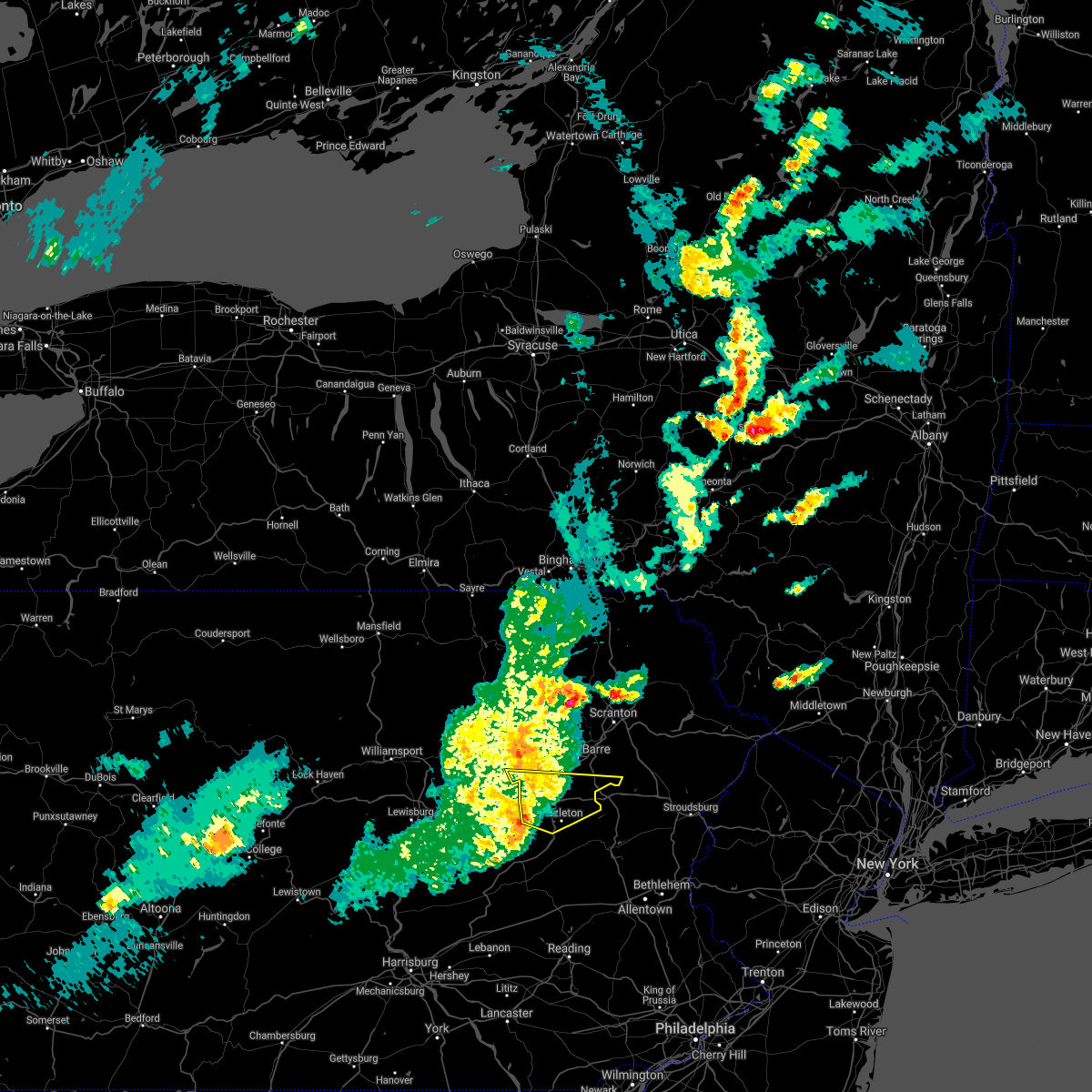
| 8/7/2020 11:12 AM EDT |
 The severe thunderstorm warning for south central luzerne county will expire at 1115 am edt, the storm which prompted the warning has moved out of the area. therefore, the warning will be allowed to expire. The severe thunderstorm warning for south central luzerne county will expire at 1115 am edt, the storm which prompted the warning has moved out of the area. therefore, the warning will be allowed to expire.
|
| 8/7/2020 10:48 AM EDT |
 At 1048 am edt, a severe thunderstorm was located over mcadoo, moving east at 25 mph (trained weather spotters). Hazards include 60 mph wind gusts. Expect damage to trees, roofs, and siding. locations impacted include, tamaqua, shenandoah, mahanoy city, mcadoo, hometown, oneida, grier city-park crest, delano, nuremburg, sheppton, brandonville, coaldale, shenandoah heights, ringtown, kelayres, park place and trenton. This includes interstate 81 from mile markers 131 to 139. At 1048 am edt, a severe thunderstorm was located over mcadoo, moving east at 25 mph (trained weather spotters). Hazards include 60 mph wind gusts. Expect damage to trees, roofs, and siding. locations impacted include, tamaqua, shenandoah, mahanoy city, mcadoo, hometown, oneida, grier city-park crest, delano, nuremburg, sheppton, brandonville, coaldale, shenandoah heights, ringtown, kelayres, park place and trenton. This includes interstate 81 from mile markers 131 to 139.
|
| 8/7/2020 10:45 AM EDT |
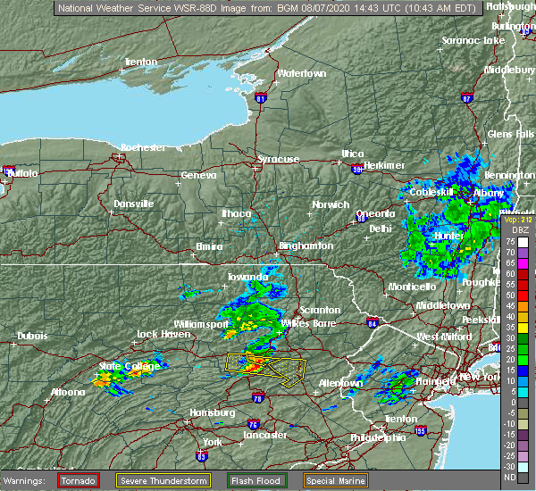 At 1045 am edt, a severe thunderstorm was located over west hazleton, or near hazleton, moving east at 25 mph (radar indicated). Hazards include 60 mph wind gusts. Expect damage to roofs, siding, and trees. Locations impacted include, hazleton, west hazleton, conyngham, weston, ashmore, deringer, jeanesville and stockton. At 1045 am edt, a severe thunderstorm was located over west hazleton, or near hazleton, moving east at 25 mph (radar indicated). Hazards include 60 mph wind gusts. Expect damage to roofs, siding, and trees. Locations impacted include, hazleton, west hazleton, conyngham, weston, ashmore, deringer, jeanesville and stockton.
|
| 8/7/2020 10:16 AM EDT |
 At 1015 am edt, a severe thunderstorm was located over shumans, or 8 miles south of berwick, moving east at 25 mph (radar indicated). Hazards include 60 mph wind gusts and quarter size hail. Hail damage to vehicles is expected. Expect wind damage to roofs, siding, and trees. At 1015 am edt, a severe thunderstorm was located over shumans, or 8 miles south of berwick, moving east at 25 mph (radar indicated). Hazards include 60 mph wind gusts and quarter size hail. Hail damage to vehicles is expected. Expect wind damage to roofs, siding, and trees.
|
| 8/7/2020 10:10 AM EDT |
 At 1009 am edt, a severe thunderstorm was located over shumans, moving east at 25 mph (trained weather spotters). Hazards include 60 mph wind gusts. expect damage to trees, roofs, and siding At 1009 am edt, a severe thunderstorm was located over shumans, moving east at 25 mph (trained weather spotters). Hazards include 60 mph wind gusts. expect damage to trees, roofs, and siding
|
| 7/12/2020 7:26 PM EDT |
 At 724 pm edt, a severe thunderstorm was located over fountain springs, moving northeast at 25 mph (radar indicated). Hazards include 60 mph wind gusts. Expect damage to trees, roofs, and siding. this severe storm will be near, girardville and englewood around 730 pm edt. shenandoah, frackville, altamont and new boston-morea around 740 pm edt. mahanoy city, brandonville and locust lake state park around 750 pm edt. sheppton, oneida, delano, grier city-park crest and nuremburg around 800 pm edt. This includes interstate 81 from mile markers 115 to 139. At 724 pm edt, a severe thunderstorm was located over fountain springs, moving northeast at 25 mph (radar indicated). Hazards include 60 mph wind gusts. Expect damage to trees, roofs, and siding. this severe storm will be near, girardville and englewood around 730 pm edt. shenandoah, frackville, altamont and new boston-morea around 740 pm edt. mahanoy city, brandonville and locust lake state park around 750 pm edt. sheppton, oneida, delano, grier city-park crest and nuremburg around 800 pm edt. This includes interstate 81 from mile markers 115 to 139.
|
| 7/12/2020 7:06 PM EDT |
 At 705 pm edt, a severe thunderstorm was located near beurys lake, moving northeast at 25 mph (radar indicated). Hazards include 60 mph wind gusts. Expect damage to trees, roofs, and siding. this severe thunderstorm will be near, kulpmont around 710 pm edt. mount carmel, lavelle, beurys lake, locustdale, buck run, branchdale, wilburton number one and forrestville around 720 pm edt. ashland, minersville, girardville, fountain springs, aristes, heckscherville, wilburton number two, seltzer and marlin around 730 pm edt. shenandoah, frackville, altamont, englewood and new boston-morea around 740 pm edt. This includes interstate 81 from mile markers 107 to 139. At 705 pm edt, a severe thunderstorm was located near beurys lake, moving northeast at 25 mph (radar indicated). Hazards include 60 mph wind gusts. Expect damage to trees, roofs, and siding. this severe thunderstorm will be near, kulpmont around 710 pm edt. mount carmel, lavelle, beurys lake, locustdale, buck run, branchdale, wilburton number one and forrestville around 720 pm edt. ashland, minersville, girardville, fountain springs, aristes, heckscherville, wilburton number two, seltzer and marlin around 730 pm edt. shenandoah, frackville, altamont, englewood and new boston-morea around 740 pm edt. This includes interstate 81 from mile markers 107 to 139.
|
| 6/3/2020 10:50 AM EDT |
 At 1050 am edt, severe thunderstorms were located along a line extending from near catawissa to near shamokin to rebuck to port trevorton, moving east at 100 mph (radar indicated). Hazards include 60 mph wind gusts and penny size hail. Expect damage to trees, roofs, and siding. severe thunderstorms will be near, frackville, ashland, shenandoah, mahanoy city, nuremburg, girardville, oneida, sheppton, brandonville and aristes around 1100 am edt. tamaqua, pottsville, st. clair, minersville, schuylkill haven, port carbon, hometown, new philadelphia, orwigsburg and branchdale around 1110 am edt. mckeansburg and snyders around 1120 am edt. other locations impacted by these severe thunderstorms include ravine, mary-d, park place, ringtown, deer lake, cumbola, marion heights, landingville, newtown and mount carbon. this includes interstate 81 from mile markers 98 to 139. this includes the following covid-19 test sites, geisinger, geisinger kulpmont, geisinger orwigsburg, geisinger st. Luke`s hospital, lehigh valley health network, and west penn medical center. At 1050 am edt, severe thunderstorms were located along a line extending from near catawissa to near shamokin to rebuck to port trevorton, moving east at 100 mph (radar indicated). Hazards include 60 mph wind gusts and penny size hail. Expect damage to trees, roofs, and siding. severe thunderstorms will be near, frackville, ashland, shenandoah, mahanoy city, nuremburg, girardville, oneida, sheppton, brandonville and aristes around 1100 am edt. tamaqua, pottsville, st. clair, minersville, schuylkill haven, port carbon, hometown, new philadelphia, orwigsburg and branchdale around 1110 am edt. mckeansburg and snyders around 1120 am edt. other locations impacted by these severe thunderstorms include ravine, mary-d, park place, ringtown, deer lake, cumbola, marion heights, landingville, newtown and mount carbon. this includes interstate 81 from mile markers 98 to 139. this includes the following covid-19 test sites, geisinger, geisinger kulpmont, geisinger orwigsburg, geisinger st. Luke`s hospital, lehigh valley health network, and west penn medical center.
|
| 7/30/2019 4:59 PM EDT |
 At 459 pm edt, a severe thunderstorm was located over nescopeck, or over berwick, moving northeast at 20 mph (radar indicated). Hazards include 60 mph wind gusts. expect damage to roofs, siding, and trees At 459 pm edt, a severe thunderstorm was located over nescopeck, or over berwick, moving northeast at 20 mph (radar indicated). Hazards include 60 mph wind gusts. expect damage to roofs, siding, and trees
|
| 7/6/2019 5:39 PM EDT |
 At 539 pm edt, severe thunderstorms were located along a line extending from near rohrsburg to near lykens, moving southeast at 25 mph (radar indicated). Hazards include 60 mph wind gusts and quarter size hail. Hail damage to vehicles is expected. Expect wind damage to trees, roofs, and siding. At 539 pm edt, severe thunderstorms were located along a line extending from near rohrsburg to near lykens, moving southeast at 25 mph (radar indicated). Hazards include 60 mph wind gusts and quarter size hail. Hail damage to vehicles is expected. Expect wind damage to trees, roofs, and siding.
|
| 5/29/2019 4:18 PM EDT |
 At 418 pm edt, severe thunderstorms were located along a line extending from near sweet valley to near beach haven to near mainville, moving east at 55 mph (radar indicated). Hazards include 60 mph wind gusts and quarter size hail. Hail damage to vehicles is expected. Expect wind damage to roofs, siding, and trees. At 418 pm edt, severe thunderstorms were located along a line extending from near sweet valley to near beach haven to near mainville, moving east at 55 mph (radar indicated). Hazards include 60 mph wind gusts and quarter size hail. Hail damage to vehicles is expected. Expect wind damage to roofs, siding, and trees.
|
| 5/29/2019 4:06 PM EDT |
 At 406 pm edt, severe thunderstorms were located along a line extending from fairmount spgs to catawissa to penns creek, moving east at 50 mph (radar indicated). Hazards include 60 mph wind gusts and penny size hail. expect damage to trees, roofs, and siding At 406 pm edt, severe thunderstorms were located along a line extending from fairmount spgs to catawissa to penns creek, moving east at 50 mph (radar indicated). Hazards include 60 mph wind gusts and penny size hail. expect damage to trees, roofs, and siding
|
| 5/29/2019 3:43 PM EDT |
 At 343 pm edt, a severe thunderstorm capable of producing a tornado was located over nuremburg, moving east at 25 mph (radar indicated rotation). Hazards include tornado and golf ball size hail. Tree damage will occur. damage to roofs, windows, and vehicles is likely. flying debris will be dangerous to those caught without shelter. mobile homes will be damaged or destroyed. this dangerous storm will be near, mahanoy city and sheppton around 350 pm edt. mcadoo, delano, grier city-park crest and hometown around 400 pm edt. other locations impacted by this tornadic thunderstorm include trenton, shenandoah heights, kelayres, park place and ringtown. This includes interstate 81 from mile markers 130 to 139. At 343 pm edt, a severe thunderstorm capable of producing a tornado was located over nuremburg, moving east at 25 mph (radar indicated rotation). Hazards include tornado and golf ball size hail. Tree damage will occur. damage to roofs, windows, and vehicles is likely. flying debris will be dangerous to those caught without shelter. mobile homes will be damaged or destroyed. this dangerous storm will be near, mahanoy city and sheppton around 350 pm edt. mcadoo, delano, grier city-park crest and hometown around 400 pm edt. other locations impacted by this tornadic thunderstorm include trenton, shenandoah heights, kelayres, park place and ringtown. This includes interstate 81 from mile markers 130 to 139.
|
| 5/29/2019 3:32 PM EDT |
 At 332 pm edt, a severe thunderstorm was located near rock glen, or near berwick, moving east at 45 mph (radar indicated). Hazards include 70 mph wind gusts and ping pong ball size hail. People and animals outdoors will be injured. expect hail damage to roofs, siding, windows, and vehicles. expect considerable tree damage. Wind damage is also likely to mobile homes, roofs, and outbuildings. At 332 pm edt, a severe thunderstorm was located near rock glen, or near berwick, moving east at 45 mph (radar indicated). Hazards include 70 mph wind gusts and ping pong ball size hail. People and animals outdoors will be injured. expect hail damage to roofs, siding, windows, and vehicles. expect considerable tree damage. Wind damage is also likely to mobile homes, roofs, and outbuildings.
|
| 5/29/2019 3:29 PM EDT |
 At 328 pm edt, a severe thunderstorm capable of producing a tornado was located over shumans, moving east at 25 mph (radar indicated rotation). Hazards include tornado and golf ball size hail. Tree damage will occur. damage to roofs, windows, and vehicles is likely. flying debris will be dangerous to those caught without shelter. mobile homes will be damaged or destroyed. this dangerous storm will be near, nuremburg around 340 pm edt. mahanoy city, oneida, sheppton and brandonville around 350 pm edt. mcadoo, delano, grier city-park crest and hometown around 400 pm edt. other locations impacted by this tornadic thunderstorm include trenton, lime ridge, shenandoah heights, kelayres, park place and ringtown. for those driving on interstate 80, this includes areas between the bloomsburg-light street and nescopek exits, specifically from mile markers 240 to 247. This includes interstate 81 from mile markers 130 to 139. At 328 pm edt, a severe thunderstorm capable of producing a tornado was located over shumans, moving east at 25 mph (radar indicated rotation). Hazards include tornado and golf ball size hail. Tree damage will occur. damage to roofs, windows, and vehicles is likely. flying debris will be dangerous to those caught without shelter. mobile homes will be damaged or destroyed. this dangerous storm will be near, nuremburg around 340 pm edt. mahanoy city, oneida, sheppton and brandonville around 350 pm edt. mcadoo, delano, grier city-park crest and hometown around 400 pm edt. other locations impacted by this tornadic thunderstorm include trenton, lime ridge, shenandoah heights, kelayres, park place and ringtown. for those driving on interstate 80, this includes areas between the bloomsburg-light street and nescopek exits, specifically from mile markers 240 to 247. This includes interstate 81 from mile markers 130 to 139.
|
| 5/19/2019 11:04 PM EDT |
 At 1103 pm edt, a severe thunderstorm was located over friedensburg, moving east at 50 mph (public). Hazards include 60 mph wind gusts and quarter size hail. Hail damage to vehicles is expected. expect wind damage to trees, roofs, and siding. locations impacted include, pottsville, tamaqua, schuylkill haven, shenandoah, minersville, mahanoy city, frackville, st. clair, ashland, orwigsburg, mcadoo, pine grove, port carbon, tremont, girardville, hometown, tower city, tuscarora, new philadelphia and oneida. This includes interstate 81 from mile markers 98 to 139. At 1103 pm edt, a severe thunderstorm was located over friedensburg, moving east at 50 mph (public). Hazards include 60 mph wind gusts and quarter size hail. Hail damage to vehicles is expected. expect wind damage to trees, roofs, and siding. locations impacted include, pottsville, tamaqua, schuylkill haven, shenandoah, minersville, mahanoy city, frackville, st. clair, ashland, orwigsburg, mcadoo, pine grove, port carbon, tremont, girardville, hometown, tower city, tuscarora, new philadelphia and oneida. This includes interstate 81 from mile markers 98 to 139.
|
| 5/19/2019 10:33 PM EDT |
 At 1032 pm edt, severe thunderstorms were located in a cluster extending from mahanoy city to lawn, moving east at 50 mph (public). Hazards include 60 mph wind gusts and quarter size hail. Hail damage to vehicles is expected. Expect wind damage to trees, roofs, and siding. At 1032 pm edt, severe thunderstorms were located in a cluster extending from mahanoy city to lawn, moving east at 50 mph (public). Hazards include 60 mph wind gusts and quarter size hail. Hail damage to vehicles is expected. Expect wind damage to trees, roofs, and siding.
|
| 5/19/2019 8:03 PM EDT |
 At 802 pm edt, severe thunderstorms were located along a line extending from near fairmount spgs to near mcadoo, moving east at 50 mph (radar indicated). Hazards include 70 mph wind gusts and quarter size hail. Hail damage to vehicles is expected. expect considerable tree damage. wind damage is also likely to mobile homes, roofs, and outbuildings. Locations impacted include, wilkes-barre, hazleton, muhlenberg, kingston, berwick, nanticoke, plains, plymouth, swoyersville and edwardsville. At 802 pm edt, severe thunderstorms were located along a line extending from near fairmount spgs to near mcadoo, moving east at 50 mph (radar indicated). Hazards include 70 mph wind gusts and quarter size hail. Hail damage to vehicles is expected. expect considerable tree damage. wind damage is also likely to mobile homes, roofs, and outbuildings. Locations impacted include, wilkes-barre, hazleton, muhlenberg, kingston, berwick, nanticoke, plains, plymouth, swoyersville and edwardsville.
|
| 5/19/2019 7:43 PM EDT |
 At 742 pm edt, severe thunderstorms were located along a line extending from lairdsville to near shumans, moving east at 50 mph (radar indicated). Hazards include 60 mph wind gusts and quarter size hail. Hail damage to vehicles is expected. Expect wind damage to roofs, siding, and trees. At 742 pm edt, severe thunderstorms were located along a line extending from lairdsville to near shumans, moving east at 50 mph (radar indicated). Hazards include 60 mph wind gusts and quarter size hail. Hail damage to vehicles is expected. Expect wind damage to roofs, siding, and trees.
|
| 5/19/2019 6:28 PM EDT |
 At 627 pm edt, severe thunderstorms were located along a line extending from near muhlenberg to slocum to drifton to nesquehoning, moving east at 35 mph (trained weather spotters. at 625 pm, trees were reported blown down in hollenback and salem townships). Hazards include 70 mph wind gusts and quarter size hail. Hail damage to vehicles is expected. expect considerable tree damage. wind damage is also likely to mobile homes, roofs, and outbuildings. Locations impacted include, scranton, wilkes-barre, falls, hazleton, muhlenberg, dunmore, kingston, nanticoke, plains and carbondale. At 627 pm edt, severe thunderstorms were located along a line extending from near muhlenberg to slocum to drifton to nesquehoning, moving east at 35 mph (trained weather spotters. at 625 pm, trees were reported blown down in hollenback and salem townships). Hazards include 70 mph wind gusts and quarter size hail. Hail damage to vehicles is expected. expect considerable tree damage. wind damage is also likely to mobile homes, roofs, and outbuildings. Locations impacted include, scranton, wilkes-barre, falls, hazleton, muhlenberg, dunmore, kingston, nanticoke, plains and carbondale.
|
| 5/19/2019 6:09 PM EDT |
 At 608 pm edt, severe thunderstorms were located along a line extending from near rohrsburg to near nescopeck to grier city-park crest to near friedensburg, moving northeast at 45 mph (radar indicated). Hazards include 60 mph wind gusts and quarter size hail. Hail damage to vehicles is expected. Expect wind damage to roofs, siding, and trees. At 608 pm edt, severe thunderstorms were located along a line extending from near rohrsburg to near nescopeck to grier city-park crest to near friedensburg, moving northeast at 45 mph (radar indicated). Hazards include 60 mph wind gusts and quarter size hail. Hail damage to vehicles is expected. Expect wind damage to roofs, siding, and trees.
|
| 5/19/2019 5:47 PM EDT |
 At 547 pm edt, a severe thunderstorm was located over pine grove, moving northeast at 30 mph (radar indicated). Hazards include 70 mph wind gusts and ping pong ball size hail. People and animals outdoors will be injured. expect hail damage to roofs, siding, windows, and vehicles. expect considerable tree damage. Wind damage is also likely to mobile homes, roofs, and outbuildings. At 547 pm edt, a severe thunderstorm was located over pine grove, moving northeast at 30 mph (radar indicated). Hazards include 70 mph wind gusts and ping pong ball size hail. People and animals outdoors will be injured. expect hail damage to roofs, siding, windows, and vehicles. expect considerable tree damage. Wind damage is also likely to mobile homes, roofs, and outbuildings.
|
| 4/15/2019 1:03 AM EDT |
 At 102 am edt, severe thunderstorms were located along a line extending from monroeton to near biggertown to near knoebels grove, moving northeast at 70 mph (radar indicated). Hazards include 70 mph wind gusts and nickel size hail. Expect considerable tree damage. Damage is likely to mobile homes, roofs, and outbuildings. At 102 am edt, severe thunderstorms were located along a line extending from monroeton to near biggertown to near knoebels grove, moving northeast at 70 mph (radar indicated). Hazards include 70 mph wind gusts and nickel size hail. Expect considerable tree damage. Damage is likely to mobile homes, roofs, and outbuildings.
|
| 6/18/2018 5:27 PM EDT |
 At 527 pm edt, severe thunderstorms were located along a line extending from near bethany to near mount cobb to near bear creek village to near shickshinny, moving east southeast at 40 mph (radar indicated). Hazards include 60 mph wind gusts. Expect damage to roofs, siding, and trees. severe thunderstorms will be near, honesdale, prompton and bethany around 530 pm edt. moscow, arlington and ledgerdale around 535 pm edt. blooming grove, paupack and sterling around 540 pm edt. white haven, greeley and angels around 545 pm edt. stoddartsville around 550 pm edt. montague, milford and pecks pond around 555 pm edt. port jervis around 600 pm edt. Dingmans ferry around 605 pm edt. At 527 pm edt, severe thunderstorms were located along a line extending from near bethany to near mount cobb to near bear creek village to near shickshinny, moving east southeast at 40 mph (radar indicated). Hazards include 60 mph wind gusts. Expect damage to roofs, siding, and trees. severe thunderstorms will be near, honesdale, prompton and bethany around 530 pm edt. moscow, arlington and ledgerdale around 535 pm edt. blooming grove, paupack and sterling around 540 pm edt. white haven, greeley and angels around 545 pm edt. stoddartsville around 550 pm edt. montague, milford and pecks pond around 555 pm edt. port jervis around 600 pm edt. Dingmans ferry around 605 pm edt.
|
| 6/13/2018 8:57 PM EDT |
 The national weather service in binghamton has issued a * severe thunderstorm warning for. northwestern lackawanna county in northeastern pennsylvania. luzerne county in northeastern pennsylvania. until 930 pm edt. At 857 pm edt, a severe thunderstorm was located near kasson brook,. The national weather service in binghamton has issued a * severe thunderstorm warning for. northwestern lackawanna county in northeastern pennsylvania. luzerne county in northeastern pennsylvania. until 930 pm edt. At 857 pm edt, a severe thunderstorm was located near kasson brook,.
|
| 5/15/2018 3:37 PM EDT |
 At 334 pm edt, severe thunderstorms were located along a line extending from white sulphur springs to near bethel to near sterling to mcadoo, moving east at 55 mph. several damage reports, associated with this line of thunderstorms, have been received at the national weather service in binghamton. a wind gust between 60 and 65 miles per hour was reported as the line passed over the wilkes- barre/scranton airport (trained weather spotters). Hazards include 70 mph wind gusts and quarter size hail. Hail damage to vehicles is expected. expect considerable tree damage. wind damage is also likely to mobile homes, roofs, and outbuildings. locations impacted include, scranton, wilkes-barre, hazleton, dunmore, kingston, fallsburg, nanticoke, plains, carbondale and port jervis. A tornado watch remains in effect until 800 pm edt for central new york, and northeastern pennsylvania. At 334 pm edt, severe thunderstorms were located along a line extending from white sulphur springs to near bethel to near sterling to mcadoo, moving east at 55 mph. several damage reports, associated with this line of thunderstorms, have been received at the national weather service in binghamton. a wind gust between 60 and 65 miles per hour was reported as the line passed over the wilkes- barre/scranton airport (trained weather spotters). Hazards include 70 mph wind gusts and quarter size hail. Hail damage to vehicles is expected. expect considerable tree damage. wind damage is also likely to mobile homes, roofs, and outbuildings. locations impacted include, scranton, wilkes-barre, hazleton, dunmore, kingston, fallsburg, nanticoke, plains, carbondale and port jervis. A tornado watch remains in effect until 800 pm edt for central new york, and northeastern pennsylvania.
|
| 5/15/2018 3:33 PM EDT |
 At 332 pm edt, severe thunderstorms were located along a line extending from white sulphur springs to near bethel to near sterling to mcadoo, moving east at 55 mph (radar indicated). Hazards include 70 mph wind gusts and quarter size hail. Hail damage to vehicles is expected. expect considerable tree damage. wind damage is also likely to mobile homes, roofs, and outbuildings. locations impacted include, scranton, wilkes-barre, hazleton, dunmore, kingston, fallsburg, nanticoke, plains, carbondale and port jervis. A tornado watch remains in effect until 800 pm edt for central new york, and northeastern pennsylvania. At 332 pm edt, severe thunderstorms were located along a line extending from white sulphur springs to near bethel to near sterling to mcadoo, moving east at 55 mph (radar indicated). Hazards include 70 mph wind gusts and quarter size hail. Hail damage to vehicles is expected. expect considerable tree damage. wind damage is also likely to mobile homes, roofs, and outbuildings. locations impacted include, scranton, wilkes-barre, hazleton, dunmore, kingston, fallsburg, nanticoke, plains, carbondale and port jervis. A tornado watch remains in effect until 800 pm edt for central new york, and northeastern pennsylvania.
|
| 5/15/2018 3:14 PM EDT |
 At 314 pm edt, severe thunderstorms were located along a line extending from near rock glen to kulpmont to near richfield to near honey grove, moving east at 50 mph (radar indicated). Hazards include two inch hail and 70 mph wind gusts. People and animals outdoors will be injured. expect hail damage to roofs, siding, windows, and vehicles. expect considerable tree damage. Wind damage is also likely to mobile homes, roofs, and outbuildings. At 314 pm edt, severe thunderstorms were located along a line extending from near rock glen to kulpmont to near richfield to near honey grove, moving east at 50 mph (radar indicated). Hazards include two inch hail and 70 mph wind gusts. People and animals outdoors will be injured. expect hail damage to roofs, siding, windows, and vehicles. expect considerable tree damage. Wind damage is also likely to mobile homes, roofs, and outbuildings.
|
| 5/15/2018 3:05 PM EDT |
 At 304 pm edt, severe thunderstorms were located along a line extending from stalker to near falls to rupert, moving east at 55 mph (radar indicated). Hazards include 70 mph wind gusts and quarter size hail. Hail damage to vehicles is expected. expect considerable tree damage. wind damage is also likely to mobile homes, roofs, and outbuildings. severe thunderstorms will be near, callicoon, hankins and stalker around 310 pm edt. scranton, dickson city and moosic around 315 pm edt. dunmore, olyphant and white sulphur springs around 320 pm edt. liberty, moscow and conyngham around 325 pm edt. hazleton, west hazleton and south fallsburg around 330 pm edt. fallsburg, sterling and woodridge around 335 pm edt. greentown around 340 pm edt. blooming grove and paupack around 345 pm edt. A tornado watch remains in effect until 800 pm edt for central new york, and northeastern pennsylvania. At 304 pm edt, severe thunderstorms were located along a line extending from stalker to near falls to rupert, moving east at 55 mph (radar indicated). Hazards include 70 mph wind gusts and quarter size hail. Hail damage to vehicles is expected. expect considerable tree damage. wind damage is also likely to mobile homes, roofs, and outbuildings. severe thunderstorms will be near, callicoon, hankins and stalker around 310 pm edt. scranton, dickson city and moosic around 315 pm edt. dunmore, olyphant and white sulphur springs around 320 pm edt. liberty, moscow and conyngham around 325 pm edt. hazleton, west hazleton and south fallsburg around 330 pm edt. fallsburg, sterling and woodridge around 335 pm edt. greentown around 340 pm edt. blooming grove and paupack around 345 pm edt. A tornado watch remains in effect until 800 pm edt for central new york, and northeastern pennsylvania.
|
| 5/10/2018 6:06 PM EDT |
 At 605 pm edt, severe thunderstorms were located along a line extending from lehigh to near drums, moving southeast at 45 mph (radar indicated. at 5:44 pm dime size hail was reported in duryea). Hazards include 60 mph wind gusts and quarter size hail. Hail damage to vehicles is expected. expect wind damage to roofs, siding, and trees. these severe storms will be near, sterling, lehigh and angels around 610 pm edt. White haven around 620 pm edt. At 605 pm edt, severe thunderstorms were located along a line extending from lehigh to near drums, moving southeast at 45 mph (radar indicated. at 5:44 pm dime size hail was reported in duryea). Hazards include 60 mph wind gusts and quarter size hail. Hail damage to vehicles is expected. expect wind damage to roofs, siding, and trees. these severe storms will be near, sterling, lehigh and angels around 610 pm edt. White haven around 620 pm edt.
|
| 5/10/2018 5:45 PM EDT |
 At 544 pm edt, severe thunderstorms were located along a line extending from scranton to near huntington mills, moving southeast at 45 mph (radar indicated). Hazards include 60 mph wind gusts and quarter size hail. Hail damage to vehicles is expected. expect wind damage to roofs, siding, and trees. severe thunderstorms will be near, scranton, dunmore and old forge around 550 pm edt. moscow around 555 pm edt. conyngham, sterling and lehigh around 605 pm edt. hazleton, west hazleton and angels around 610 pm edt. Freeland, drifton and woodside-drifton around 615 pm edt. At 544 pm edt, severe thunderstorms were located along a line extending from scranton to near huntington mills, moving southeast at 45 mph (radar indicated). Hazards include 60 mph wind gusts and quarter size hail. Hail damage to vehicles is expected. expect wind damage to roofs, siding, and trees. severe thunderstorms will be near, scranton, dunmore and old forge around 550 pm edt. moscow around 555 pm edt. conyngham, sterling and lehigh around 605 pm edt. hazleton, west hazleton and angels around 610 pm edt. Freeland, drifton and woodside-drifton around 615 pm edt.
|
| 8/19/2017 7:54 PM EDT |
 At 752 pm edt, severe thunderstorms were located along a line extending from near hughesville to near leck kill, moving east at 40 mph (radar indicated). Hazards include 60 mph wind gusts. expect damage to trees and power lines At 752 pm edt, severe thunderstorms were located along a line extending from near hughesville to near leck kill, moving east at 40 mph (radar indicated). Hazards include 60 mph wind gusts. expect damage to trees and power lines
|
| 8/4/2017 10:05 PM EDT |
 At 1005 pm edt, severe thunderstorms were located along a line extending from near slocum to near orwigsburg, moving east at 25 mph (radar indicated). Hazards include 60 mph wind gusts. Expect damage to trees and power lines. locations impacted include, tamaqua, st. Clair, pottsville, schuylkill haven, mahanoy city, shenandoah, frackville, sheppton, brandonville and englewood. At 1005 pm edt, severe thunderstorms were located along a line extending from near slocum to near orwigsburg, moving east at 25 mph (radar indicated). Hazards include 60 mph wind gusts. Expect damage to trees and power lines. locations impacted include, tamaqua, st. Clair, pottsville, schuylkill haven, mahanoy city, shenandoah, frackville, sheppton, brandonville and englewood.
|
| 8/4/2017 9:30 PM EDT |
 At 930 pm edt, severe thunderstorms were located along a line extending from near huntington mills to near tremont, moving east at 25 mph (radar indicated). Hazards include 60 mph wind gusts. expect damage to trees and power lines At 930 pm edt, severe thunderstorms were located along a line extending from near huntington mills to near tremont, moving east at 25 mph (radar indicated). Hazards include 60 mph wind gusts. expect damage to trees and power lines
|
| 8/4/2017 9:16 PM EDT |
 At 915 pm edt, severe thunderstorms were located along a line extending from mainville to locustdale to near pine grove to highspire, moving east at 25 mph (radar indicated). Hazards include 60 mph wind gusts and quarter size hail. Hail damage to vehicles is possible. expect wind damage to trees and power lines. locations impacted include, cornwall, tamaqua, st. Clair, myerstown, minersville, palmyra, mahanoy city, colonial park, annville and harrisburg. At 915 pm edt, severe thunderstorms were located along a line extending from mainville to locustdale to near pine grove to highspire, moving east at 25 mph (radar indicated). Hazards include 60 mph wind gusts and quarter size hail. Hail damage to vehicles is possible. expect wind damage to trees and power lines. locations impacted include, cornwall, tamaqua, st. Clair, myerstown, minersville, palmyra, mahanoy city, colonial park, annville and harrisburg.
|
| 8/4/2017 8:12 PM EDT |
 At 811 pm edt, severe thunderstorms were located along a line extending from paxtonville to near elizabethville to near new buffalo to near mount holly springs, moving northeast at 30 mph (radar indicated). Hazards include 60 mph wind gusts and quarter size hail. Hail damage to vehicles is possible. Expect wind damage to trees and power lines. At 811 pm edt, severe thunderstorms were located along a line extending from paxtonville to near elizabethville to near new buffalo to near mount holly springs, moving northeast at 30 mph (radar indicated). Hazards include 60 mph wind gusts and quarter size hail. Hail damage to vehicles is possible. Expect wind damage to trees and power lines.
|
| 8/4/2017 4:15 PM EDT |
 At 413 pm edt, severe thunderstorms were located along a line extending from near brandonville to st. clair to near friedensburg, moving northeast at 10 mph (radar indicated). Hazards include 60 mph wind gusts and quarter size hail. Hail damage to vehicles is possible. expect wind damage to trees and power lines. locations impacted include, schuylkill haven, tamaqua, mahanoy city, shenandoah, st. Clair, pottsville, frackville, sheppton, brandonville and coaldale. At 413 pm edt, severe thunderstorms were located along a line extending from near brandonville to st. clair to near friedensburg, moving northeast at 10 mph (radar indicated). Hazards include 60 mph wind gusts and quarter size hail. Hail damage to vehicles is possible. expect wind damage to trees and power lines. locations impacted include, schuylkill haven, tamaqua, mahanoy city, shenandoah, st. Clair, pottsville, frackville, sheppton, brandonville and coaldale.
|
| 8/4/2017 3:42 PM EDT |
 At 341 pm edt, severe thunderstorms were located along a line extending from near shenandoah to marlin to near pine grove, moving northeast at 20 mph (radar indicated). Hazards include 60 mph wind gusts and quarter size hail. Hail damage to vehicles is possible. Expect wind damage to trees and power lines. At 341 pm edt, severe thunderstorms were located along a line extending from near shenandoah to marlin to near pine grove, moving northeast at 20 mph (radar indicated). Hazards include 60 mph wind gusts and quarter size hail. Hail damage to vehicles is possible. Expect wind damage to trees and power lines.
|
| 7/24/2017 4:56 PM EDT |
 At 455 pm edt, a severe thunderstorm was located over heckscherville, moving east at 25 mph (radar indicated). Hazards include 60 mph wind gusts. Expect damage to trees and power lines. Torrential downpours will also accompany this storm. At 455 pm edt, a severe thunderstorm was located over heckscherville, moving east at 25 mph (radar indicated). Hazards include 60 mph wind gusts. Expect damage to trees and power lines. Torrential downpours will also accompany this storm.
|
| 7/20/2017 5:42 PM EDT |
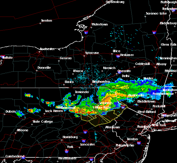 At 542 pm edt, a severe thunderstorm was located over huntington mills, or 9 miles north of berwick, moving southeast at 40 mph (radar indicated). Hazards include 60 mph wind gusts. Expect damage to trees, and power lines. this severe thunderstorm will be near, muhlenberg around 545 pm edt. shickshinny and east berwick around 550 pm edt. nescopeck, pond hill and beach haven around 555 pm edt. slocum and mountain top around 600 pm edt. conyngham and springtown around 605 pm edt. west hazleton and drums around 610 pm edt. Hazleton, freeland and drifton around 615 pm edt. At 542 pm edt, a severe thunderstorm was located over huntington mills, or 9 miles north of berwick, moving southeast at 40 mph (radar indicated). Hazards include 60 mph wind gusts. Expect damage to trees, and power lines. this severe thunderstorm will be near, muhlenberg around 545 pm edt. shickshinny and east berwick around 550 pm edt. nescopeck, pond hill and beach haven around 555 pm edt. slocum and mountain top around 600 pm edt. conyngham and springtown around 605 pm edt. west hazleton and drums around 610 pm edt. Hazleton, freeland and drifton around 615 pm edt.
|
| 6/19/2017 12:19 PM EDT |
 At 1218 pm edt, a severe thunderstorm was located near elizabethville, moving northeast at 45 mph (radar indicated). Hazards include 60 mph wind gusts. expect damage to trees and power lines At 1218 pm edt, a severe thunderstorm was located near elizabethville, moving northeast at 45 mph (radar indicated). Hazards include 60 mph wind gusts. expect damage to trees and power lines
|
| 5/1/2017 8:29 PM EDT |
 At 828 pm edt, severe thunderstorms were located along a line extending from near deposit to near union dale to near berwick, moving east at 40 mph (radar indicated). Hazards include 60 mph wind gusts and penny size hail. Expect damage to roofs, siding, and trees. severe thunderstorms will be near, forest city, union dale and pleasant mount around 835 pm edt. walton, conyngham and waymart around 845 pm edt. west hazleton, prompton and bethany around 850 pm edt. hazleton, honesdale and rutledgedale around 855 pm edt. freeland, corbett and woodside-drifton around 900 pm edt. damascus, callicoon and hortonville around 905 pm edt. cochecton, white haven and lava around 910 pm edt. fosterdale, hazel and livingston manor around 915 pm edt. A tornado watch remains in effect until 1000 pm edt for central new york, and northeastern pennsylvania. At 828 pm edt, severe thunderstorms were located along a line extending from near deposit to near union dale to near berwick, moving east at 40 mph (radar indicated). Hazards include 60 mph wind gusts and penny size hail. Expect damage to roofs, siding, and trees. severe thunderstorms will be near, forest city, union dale and pleasant mount around 835 pm edt. walton, conyngham and waymart around 845 pm edt. west hazleton, prompton and bethany around 850 pm edt. hazleton, honesdale and rutledgedale around 855 pm edt. freeland, corbett and woodside-drifton around 900 pm edt. damascus, callicoon and hortonville around 905 pm edt. cochecton, white haven and lava around 910 pm edt. fosterdale, hazel and livingston manor around 915 pm edt. A tornado watch remains in effect until 1000 pm edt for central new york, and northeastern pennsylvania.
|
| 5/1/2017 7:49 PM EDT |
 At 748 pm edt, severe thunderstorms were located along a line extending from near vestal center to near rushville to lovelton to iola, moving east at 40 to 50 mph (radar indicated). Hazards include 60 mph wind gusts and penny size hail. Expect damage to roofs, siding, and trees. severe thunderstorms will be near, rush, noxen and mehoopany around 755 pm edt. springville, meshoppen and evans falls around 800 pm edt. tunkhannock, montrose and osterhout around 805 pm edt. falls, nescopeck and hallstead around 810 pm edt. muhlenberg, factoryville and shickshinny around 815 pm edt. waverly, clarks summit and susquehanna around 820 pm edt. scranton, dunmore and dickson city around 825 pm edt. carbondale, archbald and olyphant around 830 pm edt. A tornado watch remains in effect until 1000 pm edt for central new york, and northeastern pennsylvania. At 748 pm edt, severe thunderstorms were located along a line extending from near vestal center to near rushville to lovelton to iola, moving east at 40 to 50 mph (radar indicated). Hazards include 60 mph wind gusts and penny size hail. Expect damage to roofs, siding, and trees. severe thunderstorms will be near, rush, noxen and mehoopany around 755 pm edt. springville, meshoppen and evans falls around 800 pm edt. tunkhannock, montrose and osterhout around 805 pm edt. falls, nescopeck and hallstead around 810 pm edt. muhlenberg, factoryville and shickshinny around 815 pm edt. waverly, clarks summit and susquehanna around 820 pm edt. scranton, dunmore and dickson city around 825 pm edt. carbondale, archbald and olyphant around 830 pm edt. A tornado watch remains in effect until 1000 pm edt for central new york, and northeastern pennsylvania.
|
| 8/16/2016 5:12 PM EDT |
 At 512 pm edt, severe thunderstorms were located along a line extending from near beach haven to near tuscarora, moving northeast at 35 mph (radar indicated). Hazards include 60 mph wind gusts. Expect damage to roofs. siding. and trees. Locations impacted include, shenandoah, tamaqua, mahanoy city, mcadoo, oneida, sheppton, new philadelphia, delano, grier city-park crest, tuscarora, hometown, new boston-morea, locust lake state park, coaldale, snyders, nuremburg, brandonville, mckeansburg, brockton and park place. At 512 pm edt, severe thunderstorms were located along a line extending from near beach haven to near tuscarora, moving northeast at 35 mph (radar indicated). Hazards include 60 mph wind gusts. Expect damage to roofs. siding. and trees. Locations impacted include, shenandoah, tamaqua, mahanoy city, mcadoo, oneida, sheppton, new philadelphia, delano, grier city-park crest, tuscarora, hometown, new boston-morea, locust lake state park, coaldale, snyders, nuremburg, brandonville, mckeansburg, brockton and park place.
|
| 8/16/2016 4:52 PM EDT |
 At 451 pm edt, severe thunderstorms were located along a line extending from near rohrsburg to near schuylkill haven, moving northeast at 35 mph (radar indicated). Hazards include 60 mph wind gusts. Expect damage to roofs. siding. and trees. locations impacted include, shenandoah, tamaqua, minersville, berwick, pottsville, st. Clair, frackville, schuylkill haven, mahanoy city, ashland, mcadoo, seltzer, port carbon, rohrsburg, numidia, englewood, shumans, grier city-park crest, jamison city and lightstreet. At 451 pm edt, severe thunderstorms were located along a line extending from near rohrsburg to near schuylkill haven, moving northeast at 35 mph (radar indicated). Hazards include 60 mph wind gusts. Expect damage to roofs. siding. and trees. locations impacted include, shenandoah, tamaqua, minersville, berwick, pottsville, st. Clair, frackville, schuylkill haven, mahanoy city, ashland, mcadoo, seltzer, port carbon, rohrsburg, numidia, englewood, shumans, grier city-park crest, jamison city and lightstreet.
|
| 8/16/2016 4:28 PM EDT |
 At 427 pm edt, severe thunderstorms were located along a line extending from near buckhorn to pine grove, moving northeast at 40 mph (radar indicated). Hazards include 60 mph wind gusts. Expect damage to roofs. siding. And trees. At 427 pm edt, severe thunderstorms were located along a line extending from near buckhorn to pine grove, moving northeast at 40 mph (radar indicated). Hazards include 60 mph wind gusts. Expect damage to roofs. siding. And trees.
|
| 7/25/2016 3:40 PM EDT |
 At 339 pm edt, severe thunderstorms were located along a line extending from near waller to near allenwood, moving southeast at 30 mph (radar indicated). Hazards include 60 mph wind gusts and quarter size hail. Hail damage to vehicles is expected. Expect wind damage to roofs, siding, and trees. At 339 pm edt, severe thunderstorms were located along a line extending from near waller to near allenwood, moving southeast at 30 mph (radar indicated). Hazards include 60 mph wind gusts and quarter size hail. Hail damage to vehicles is expected. Expect wind damage to roofs, siding, and trees.
|
| 7/25/2016 3:13 PM EDT |
 At 313 pm edt, a severe thunderstorm was located over west hazleton, or near hazleton, moving east at 35 mph (radar indicated). Hazards include 60 mph wind gusts and quarter size hail. Hail damage to vehicles is expected. expect wind damage to roofs, siding, and trees. This severe storm will be near, freeland, drifton and woodside-drifton around 325 pm edt. At 313 pm edt, a severe thunderstorm was located over west hazleton, or near hazleton, moving east at 35 mph (radar indicated). Hazards include 60 mph wind gusts and quarter size hail. Hail damage to vehicles is expected. expect wind damage to roofs, siding, and trees. This severe storm will be near, freeland, drifton and woodside-drifton around 325 pm edt.
|
| 7/25/2016 2:37 PM EDT |
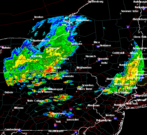 At 237 pm edt, a severe thunderstorm was located over mifflinville, or over berwick, moving east at 20 mph (radar indicated). Hazards include 60 mph wind gusts and quarter size hail. Hail damage to vehicles is possible. wind damage to roofs, siding, and trees is possible. this severe thunderstorm will be near, berwick around 240 pm edt. nescopeck and east berwick around 245 pm edt. beach haven and rock glen around 250 pm edt. shickshinny and pond hill around 300 pm edt. conyngham around 305 pm edt. slocum around 310 pm edt. west hazleton and drums around 315 pm edt. Hazleton, springtown and mountain top around 320 pm edt. At 237 pm edt, a severe thunderstorm was located over mifflinville, or over berwick, moving east at 20 mph (radar indicated). Hazards include 60 mph wind gusts and quarter size hail. Hail damage to vehicles is possible. wind damage to roofs, siding, and trees is possible. this severe thunderstorm will be near, berwick around 240 pm edt. nescopeck and east berwick around 245 pm edt. beach haven and rock glen around 250 pm edt. shickshinny and pond hill around 300 pm edt. conyngham around 305 pm edt. slocum around 310 pm edt. west hazleton and drums around 315 pm edt. Hazleton, springtown and mountain top around 320 pm edt.
|
| 7/18/2016 1:20 PM EDT |
 At 120 pm edt, severe thunderstorms were located along a line extending from near sweet valley to slocum to beach haven to near rock glen, moving east at 35 mph (radar indicated). Hazards include 60 mph wind gusts and nickel size hail. Damage to roofs. siding. and trees is possible. severe thunderstorms will be near, slocum around 125 pm edt. mountain top around 130 pm edt. edwardsville, luzerne and conyngham around 135 pm edt. west hazleton and penobscot around 140 pm edt. wilkes-barre, hazleton and freeland around 145 pm edt. bear creek, bear creek village and drifton around 150 pm edt. white haven around 155 pm edt. Stoddartsville around 200 pm edt. At 120 pm edt, severe thunderstorms were located along a line extending from near sweet valley to slocum to beach haven to near rock glen, moving east at 35 mph (radar indicated). Hazards include 60 mph wind gusts and nickel size hail. Damage to roofs. siding. and trees is possible. severe thunderstorms will be near, slocum around 125 pm edt. mountain top around 130 pm edt. edwardsville, luzerne and conyngham around 135 pm edt. west hazleton and penobscot around 140 pm edt. wilkes-barre, hazleton and freeland around 145 pm edt. bear creek, bear creek village and drifton around 150 pm edt. white haven around 155 pm edt. Stoddartsville around 200 pm edt.
|
| 7/18/2016 1:03 PM EDT |
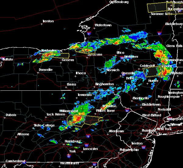 At 103 pm edt, severe thunderstorms were located along a line extending from near huntington mills to mifflinville to near elysburg, moving east at 35 mph (radar indicated). Hazards include 60 mph wind gusts and quarter size hail. Hail damage to vehicles is possible. wind damage to roofs, siding, and trees is possible. these severe storms will be near, berwick, shickshinny and east berwick around 110 pm edt. nescopeck, beach haven and rock glen around 115 pm edt. slocum and pond hill around 120 pm edt. conyngham and mountain top around 125 pm edt. Hazleton, west hazleton and freeland around 130 pm edt. At 103 pm edt, severe thunderstorms were located along a line extending from near huntington mills to mifflinville to near elysburg, moving east at 35 mph (radar indicated). Hazards include 60 mph wind gusts and quarter size hail. Hail damage to vehicles is possible. wind damage to roofs, siding, and trees is possible. these severe storms will be near, berwick, shickshinny and east berwick around 110 pm edt. nescopeck, beach haven and rock glen around 115 pm edt. slocum and pond hill around 120 pm edt. conyngham and mountain top around 125 pm edt. Hazleton, west hazleton and freeland around 130 pm edt.
|
| 7/18/2016 12:35 PM EDT |
 At 1235 pm edt, a severe thunderstorm was located over jerseytown, or 9 miles north of danville, moving east at 40 mph (radar indicated). Hazards include 60 mph wind gusts and quarter size hail. Hail damage to vehicles is expected. expect wind damage to roofs, siding, and trees. this severe thunderstorm will be near, berwick, nescopeck and east berwick around 105 pm edt. beach haven and rock glen around 110 pm edt. pond hill around 115 pm edt. conyngham around 120 pm edt. west hazleton, drums and springtown around 125 pm edt. Hazleton, freeland and drifton around 130 pm edt. At 1235 pm edt, a severe thunderstorm was located over jerseytown, or 9 miles north of danville, moving east at 40 mph (radar indicated). Hazards include 60 mph wind gusts and quarter size hail. Hail damage to vehicles is expected. expect wind damage to roofs, siding, and trees. this severe thunderstorm will be near, berwick, nescopeck and east berwick around 105 pm edt. beach haven and rock glen around 110 pm edt. pond hill around 115 pm edt. conyngham around 120 pm edt. west hazleton, drums and springtown around 125 pm edt. Hazleton, freeland and drifton around 130 pm edt.
|
| 7/9/2015 6:01 PM EDT |
 At 601 pm edt, doppler radar indicated a line of severe thunderstorms capable of producing damaging winds around 60 mph. these storms were located along a line extending from near locustdale to near tower city to near elizabethville, and moving east at 35 mph. At 601 pm edt, doppler radar indicated a line of severe thunderstorms capable of producing damaging winds around 60 mph. these storms were located along a line extending from near locustdale to near tower city to near elizabethville, and moving east at 35 mph.
|
| 6/30/2015 5:03 PM EDT |
 At 423 pm edt, doppler radar indicated a line of severe thunderstorms capable of producing damaging winds around 60 mph. these storms were located along a line extending from near tuscarora to near friedensburg, and moving northeast at 15 mph. At 423 pm edt, doppler radar indicated a line of severe thunderstorms capable of producing damaging winds around 60 mph. these storms were located along a line extending from near tuscarora to near friedensburg, and moving northeast at 15 mph.
|
| 6/30/2015 4:24 PM EDT |
 At 423 pm edt, doppler radar indicated a line of severe thunderstorms capable of producing damaging winds around 60 mph. these storms were located along a line extending from near tuscarora to near friedensburg, and moving northeast at 15 mph. At 423 pm edt, doppler radar indicated a line of severe thunderstorms capable of producing damaging winds around 60 mph. these storms were located along a line extending from near tuscarora to near friedensburg, and moving northeast at 15 mph.
|
| 6/23/2015 1:36 PM EDT |
 At 136 pm edt, a severe thunderstorm was located over rock glen, or near berwick, moving east at 65 mph (radar indicated). Hazards include 60 mph wind gusts. Expect damage to roofs. siding and trees. this severe thunderstorm will be near, conyngham around 140 pm edt. hazleton, west hazleton and drums around 145 pm edt. freeland, woodside-drifton and drifton around 150 pm edt. white haven around 155 pm edt. Stoddartsville around 205 pm edt. At 136 pm edt, a severe thunderstorm was located over rock glen, or near berwick, moving east at 65 mph (radar indicated). Hazards include 60 mph wind gusts. Expect damage to roofs. siding and trees. this severe thunderstorm will be near, conyngham around 140 pm edt. hazleton, west hazleton and drums around 145 pm edt. freeland, woodside-drifton and drifton around 150 pm edt. white haven around 155 pm edt. Stoddartsville around 205 pm edt.
|
| 6/11/2015 8:55 PM EDT | The severe thunderstorm warning for southeastern columbia and northeastern schuylkill counties will expire at 900 pm edt, the storm which prompted the warning is expected to continue to weaken, and no longer poses an immediate threat to life or property. therefore the warning will be allowed to expire. |
| 6/11/2015 8:07 PM EDT |
 At 807 pm edt, doppler radar indicated a severe thunderstorm capable of producing quarter size hail and damaging winds around 60 mph. this storm was located near wilburton number two, and moving southeast at 25 mph. At 807 pm edt, doppler radar indicated a severe thunderstorm capable of producing quarter size hail and damaging winds around 60 mph. this storm was located near wilburton number two, and moving southeast at 25 mph.
|
| 6/11/2015 6:12 PM EDT |
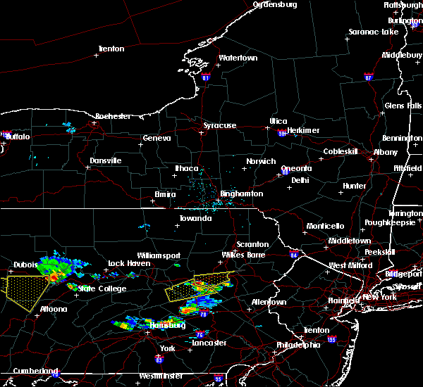 At 611 pm edt, a severe thunderstorm was located over rock glen, or 8 miles southeast of berwick, moving east at 30 mph (radar indicated). Hazards include quarter size hail. Damage to vehicles is expected. this severe thunderstorm will be near, conyngham around 620 pm edt. west hazleton around 625 pm edt. hazleton, drums and springtown around 630 pm edt. freeland, woodside-drifton and drifton around 640 pm edt. White haven around 655 pm edt. At 611 pm edt, a severe thunderstorm was located over rock glen, or 8 miles southeast of berwick, moving east at 30 mph (radar indicated). Hazards include quarter size hail. Damage to vehicles is expected. this severe thunderstorm will be near, conyngham around 620 pm edt. west hazleton around 625 pm edt. hazleton, drums and springtown around 630 pm edt. freeland, woodside-drifton and drifton around 640 pm edt. White haven around 655 pm edt.
|
| 6/11/2015 6:03 PM EDT |
 At 602 pm edt, doppler radar indicated a severe thunderstorm capable of producing half dollar size hail and damaging winds in excess of 60 mph. this storm was located near brandonville, moving east at 20 mph. locations impacted include, mahanoy city, shenandoah, brandonville, delano, girardville, grier city-park crest, hometown, mcadoo, nuremburg, oneida, sheppton, gilberton, kelayres, park place, ringtown, shenandoah heights and trenton. At 602 pm edt, doppler radar indicated a severe thunderstorm capable of producing half dollar size hail and damaging winds in excess of 60 mph. this storm was located near brandonville, moving east at 20 mph. locations impacted include, mahanoy city, shenandoah, brandonville, delano, girardville, grier city-park crest, hometown, mcadoo, nuremburg, oneida, sheppton, gilberton, kelayres, park place, ringtown, shenandoah heights and trenton.
|
| 6/11/2015 5:32 PM EDT |
 The national weather service in state college pa has issued a * severe thunderstorm warning for. southeastern columbia county in central pennsylvania. northern schuylkill county in central pennsylvania. southeastern northumberland county in central pennsylvania. Until 645 pm edt. The national weather service in state college pa has issued a * severe thunderstorm warning for. southeastern columbia county in central pennsylvania. northern schuylkill county in central pennsylvania. southeastern northumberland county in central pennsylvania. Until 645 pm edt.
|
| 6/11/2015 5:32 PM EDT |
 At 532 pm edt, doppler radar indicated a severe thunderstorm capable of producing half dollar size hail and damaging winds around 60 mph. this storm was located near kulpmont, and moving east at 30 mph. At 532 pm edt, doppler radar indicated a severe thunderstorm capable of producing half dollar size hail and damaging winds around 60 mph. this storm was located near kulpmont, and moving east at 30 mph.
|
| 5/31/2015 6:48 PM EDT | At 648 pm edt, doppler radar indicated a severe thunderstorm capable of producing quarter size hail and damaging winds in excess of 60 mph. this storm was located over schuylkill haven, moving northeast at 25 mph. locations impacted include, frackville, mahanoy city, minersville, pottsville, schuylkill haven, shenandoah, st. clair, tamaqua, altamont, brandonville, coaldale, delano, englewood, forrestville, friedensburg, girardville, grier city-park crest, heckscherville, hometown and locust lake state park. |
| 5/31/2015 6:18 PM EDT | At 618 pm edt, doppler radar indicated a severe thunderstorm capable of producing quarter size hail and damaging winds around 60 mph. this storm was located near friedensburg, and moving northeast at 15 mph. |
| 5/16/2015 5:46 PM EDT | At 544 pm edt, doppler radar indicated a line of severe thunderstorms capable of producing destructive winds of 60 to 70 mph. these storms were located along a line extending from near danville to near mechanicsville to near lavelle, moving northeast at 25 mph. nickel size hail may also accompany the damaging winds. locations impacted include, bloomsburg, berwick, mount carmel, shenandoah, danville, kulpmont, ashland, elysburg, riverside, catawissa, girardville, mifflinville, lightstreet, almedia, lavelle, fernville, mechanicsville, nuremburg, buckhorn and aristes. |
| 5/16/2015 5:10 PM EDT | At 510 pm edt, doppler radar indicated a line of severe thunderstorms capable of producing damaging winds of 60 to 70 mph. these storms were located along a line extending from near northumberland to near trevorton to near klingerstown, and moving northeast at 25 mph. nickel size hail may also accompany the damaging winds. |
Hail Maps for Nuremberg, PA


Connect with Interactive Hail Maps