

Hail Map for Ocilla, GA
The Ocilla, GA area has had 9 reports of on-the-ground hail by trained spotters, and has been under severe weather warnings 33 times during the past 12 months. Doppler radar has detected hail at or near Ocilla, GA on 60 occasions, including 2 occasions during the past year.
| Name: | Ocilla, GA |
| Where Located: | 24.5 miles WNW of Douglas, GA |
| Map: | Google Map for Ocilla, GA |
| Population: | 3414 |
| Housing Units: | 1236 |
| More Info: | Search Google for Ocilla, GA |
1
The Top Recent Hail Date for Ocilla, GA is Sunday, April 27, 2025 (4th out of 60)

Hail and Wind Damage Spotted near Ocilla, GA
| Date / Time | Report Details |
|---|---|
| 6/26/2025 2:37 AM EDT |
 The storms which prompted the warning have weakened below severe limits, and no longer pose an immediate threat to life or property. therefore, the warning will be allowed to expire. however, gusty winds are still possible with these thunderstorms. a severe thunderstorm watch remains in effect until 400 am edt for south central and southwestern georgia. to report severe weather, contact your nearest law enforcement agency. they will relay your report to the national weather service tallahassee. The storms which prompted the warning have weakened below severe limits, and no longer pose an immediate threat to life or property. therefore, the warning will be allowed to expire. however, gusty winds are still possible with these thunderstorms. a severe thunderstorm watch remains in effect until 400 am edt for south central and southwestern georgia. to report severe weather, contact your nearest law enforcement agency. they will relay your report to the national weather service tallahassee.
|
| 6/26/2025 2:32 AM EDT |
 the severe thunderstorm warning has been cancelled and is no longer in effect the severe thunderstorm warning has been cancelled and is no longer in effect
|
| 6/26/2025 2:32 AM EDT |
 At 232 am edt, severe thunderstorms were located along a line extending from 7 miles south of de soto to near willacoochee, moving southwest at 35 mph (radar indicated). Hazards include 60 mph wind gusts and penny size hail. Expect damage to roofs, siding, and trees. Locations impacted include, sylvester, tifton, ashburn, ocilla, nashville, enigma, poulan, ty ty, alapaha, mystic, unionville, phillipsburg, worth, terrell, sycamore, sumner, warwick, eldorado, gladys, and sylvester airport. At 232 am edt, severe thunderstorms were located along a line extending from 7 miles south of de soto to near willacoochee, moving southwest at 35 mph (radar indicated). Hazards include 60 mph wind gusts and penny size hail. Expect damage to roofs, siding, and trees. Locations impacted include, sylvester, tifton, ashburn, ocilla, nashville, enigma, poulan, ty ty, alapaha, mystic, unionville, phillipsburg, worth, terrell, sycamore, sumner, warwick, eldorado, gladys, and sylvester airport.
|
| 6/26/2025 1:36 AM EDT |
 Svrtae the national weather service in tallahassee has issued a * severe thunderstorm warning for, irwin county in south central georgia, berrien county in south central georgia, turner county in south central georgia, tift county in south central georgia, ben hill county in south central georgia, central worth county in south central georgia, * until 245 am edt. * at 136 am edt, severe thunderstorms were located along a line extending from 6 miles east of pinehurst to 8 miles northwest of alma, moving southwest at 35 mph (radar indicated). Hazards include 60 mph wind gusts and penny size hail. expect damage to roofs, siding, and trees Svrtae the national weather service in tallahassee has issued a * severe thunderstorm warning for, irwin county in south central georgia, berrien county in south central georgia, turner county in south central georgia, tift county in south central georgia, ben hill county in south central georgia, central worth county in south central georgia, * until 245 am edt. * at 136 am edt, severe thunderstorms were located along a line extending from 6 miles east of pinehurst to 8 miles northwest of alma, moving southwest at 35 mph (radar indicated). Hazards include 60 mph wind gusts and penny size hail. expect damage to roofs, siding, and trees
|
| 6/26/2025 12:18 AM EDT |
 the severe thunderstorm warning has been cancelled and is no longer in effect the severe thunderstorm warning has been cancelled and is no longer in effect
|
| 6/25/2025 11:03 PM EDT |
 Svrtae the national weather service in tallahassee has issued a * severe thunderstorm warning for, northwestern irwin county in south central georgia, eastern turner county in south central georgia, ben hill county in south central georgia, * until 1230 am edt. * at 1103 pm edt, a severe thunderstorm was located 9 miles southeast of rhine, or 13 miles northeast of fitzgerald, moving southwest at 15 mph (radar indicated). Hazards include 60 mph wind gusts and quarter size hail. Hail damage to vehicles is expected. Expect wind damage to roofs, siding, and trees. Svrtae the national weather service in tallahassee has issued a * severe thunderstorm warning for, northwestern irwin county in south central georgia, eastern turner county in south central georgia, ben hill county in south central georgia, * until 1230 am edt. * at 1103 pm edt, a severe thunderstorm was located 9 miles southeast of rhine, or 13 miles northeast of fitzgerald, moving southwest at 15 mph (radar indicated). Hazards include 60 mph wind gusts and quarter size hail. Hail damage to vehicles is expected. Expect wind damage to roofs, siding, and trees.
|
| 4/27/2025 11:39 PM EDT |
 At 1139 pm edt, a severe thunderstorm was located near ocilla, moving northeast at 35 mph (radar indicated). Hazards include 60 mph wind gusts and quarter size hail. Hail damage to vehicles is expected. expect wind damage to roofs, siding, and trees. Locations impacted include, vanceville, mystic, gladys, harding, pinetta, ocilla, and tifton. At 1139 pm edt, a severe thunderstorm was located near ocilla, moving northeast at 35 mph (radar indicated). Hazards include 60 mph wind gusts and quarter size hail. Hail damage to vehicles is expected. expect wind damage to roofs, siding, and trees. Locations impacted include, vanceville, mystic, gladys, harding, pinetta, ocilla, and tifton.
|
| 4/27/2025 11:15 PM EDT | Social media report of trees down near/along ga-32 near hol in irwin county GA, 5.8 miles W of Ocilla, GA |
| 4/27/2025 11:15 PM EDT | Social media report of trees down south of ga-3 in irwin county GA, 6 miles WNW of Ocilla, GA |
| 4/27/2025 11:12 PM EDT |
 the severe thunderstorm warning has been cancelled and is no longer in effect the severe thunderstorm warning has been cancelled and is no longer in effect
|
| 4/27/2025 11:12 PM EDT |
 At 1112 pm edt, a severe thunderstorm was located near enigma, or 9 miles southeast of tifton, moving northeast at 15 mph (radar indicated). Hazards include 60 mph wind gusts and half dollar size hail. Hail damage to vehicles is expected. expect wind damage to roofs, siding, and trees. Locations impacted include, vanceville, mystic, gladys, enigma, glory, harding, alapaha, pinetta, tifton, tift airport, phillipsburg, brookfield, unionville, and ocilla. At 1112 pm edt, a severe thunderstorm was located near enigma, or 9 miles southeast of tifton, moving northeast at 15 mph (radar indicated). Hazards include 60 mph wind gusts and half dollar size hail. Hail damage to vehicles is expected. expect wind damage to roofs, siding, and trees. Locations impacted include, vanceville, mystic, gladys, enigma, glory, harding, alapaha, pinetta, tifton, tift airport, phillipsburg, brookfield, unionville, and ocilla.
|
| 4/27/2025 10:58 PM EDT |
 Svrtae the national weather service in tallahassee has issued a * severe thunderstorm warning for, northwestern cook county in south central georgia, southern irwin county in south central georgia, northern berrien county in south central georgia, central tift county in south central georgia, * until midnight edt. * at 1057 pm edt, a severe thunderstorm was located near lenox, or 7 miles southeast of tifton, moving east at 15 mph (radar indicated). Hazards include 60 mph wind gusts and quarter size hail. Hail damage to vehicles is expected. Expect wind damage to roofs, siding, and trees. Svrtae the national weather service in tallahassee has issued a * severe thunderstorm warning for, northwestern cook county in south central georgia, southern irwin county in south central georgia, northern berrien county in south central georgia, central tift county in south central georgia, * until midnight edt. * at 1057 pm edt, a severe thunderstorm was located near lenox, or 7 miles southeast of tifton, moving east at 15 mph (radar indicated). Hazards include 60 mph wind gusts and quarter size hail. Hail damage to vehicles is expected. Expect wind damage to roofs, siding, and trees.
|
| 3/31/2025 4:56 PM EDT |
 The storms which prompted the warning have moved out of the area. therefore, the warning will be allowed to expire. a severe thunderstorm watch remains in effect until 600 pm edt for south central georgia. a severe thunderstorm watch also remains in effect until 900 pm edt for south central georgia. remember, a severe thunderstorm warning still remains in effect for eastern berrien county. The storms which prompted the warning have moved out of the area. therefore, the warning will be allowed to expire. a severe thunderstorm watch remains in effect until 600 pm edt for south central georgia. a severe thunderstorm watch also remains in effect until 900 pm edt for south central georgia. remember, a severe thunderstorm warning still remains in effect for eastern berrien county.
|
| 3/31/2025 4:21 PM EDT |
 the severe thunderstorm warning has been cancelled and is no longer in effect the severe thunderstorm warning has been cancelled and is no longer in effect
|
| 3/31/2025 4:21 PM EDT |
 At 421 pm edt, severe thunderstorms were located along a line extending from near lumber city to near enigma, moving east at 45 mph (radar indicated). Hazards include 60 mph wind gusts. Expect damage to roofs, siding, and trees. Locations impacted include, fitzgerald, mystic, eldorado, gladys, enigma, osierfield, glory, harding, pinetta, tifton, ashton, irwinville, wray, bowens mill, unionville, abba, vanceville, lulaville, alapaha, and tift airport. At 421 pm edt, severe thunderstorms were located along a line extending from near lumber city to near enigma, moving east at 45 mph (radar indicated). Hazards include 60 mph wind gusts. Expect damage to roofs, siding, and trees. Locations impacted include, fitzgerald, mystic, eldorado, gladys, enigma, osierfield, glory, harding, pinetta, tifton, ashton, irwinville, wray, bowens mill, unionville, abba, vanceville, lulaville, alapaha, and tift airport.
|
| 3/31/2025 3:52 PM EDT |
 Svrtae the national weather service in tallahassee has issued a * severe thunderstorm warning for, northern cook county in south central georgia, irwin county in south central georgia, northern berrien county in south central georgia, southeastern turner county in south central georgia, tift county in south central georgia, ben hill county in south central georgia, * until 500 pm edt. * at 352 pm edt, severe thunderstorms were located along a line extending from near milan to near omega, moving east at 45 mph (radar indicated). Hazards include 60 mph wind gusts and quarter size hail. Hail damage to vehicles is expected. Expect wind damage to roofs, siding, and trees. Svrtae the national weather service in tallahassee has issued a * severe thunderstorm warning for, northern cook county in south central georgia, irwin county in south central georgia, northern berrien county in south central georgia, southeastern turner county in south central georgia, tift county in south central georgia, ben hill county in south central georgia, * until 500 pm edt. * at 352 pm edt, severe thunderstorms were located along a line extending from near milan to near omega, moving east at 45 mph (radar indicated). Hazards include 60 mph wind gusts and quarter size hail. Hail damage to vehicles is expected. Expect wind damage to roofs, siding, and trees.
|
| 3/16/2025 7:56 AM EDT |
 The storms which prompted the warning have moved out of the area. therefore, the warning will be allowed to expire. however, heavy rain is still possible with these thunderstorms. a tornado watch remains in effect until 1000 am edt for south central georgia. The storms which prompted the warning have moved out of the area. therefore, the warning will be allowed to expire. however, heavy rain is still possible with these thunderstorms. a tornado watch remains in effect until 1000 am edt for south central georgia.
|
| 3/16/2025 7:43 AM EDT |
 At 742 am edt, severe thunderstorms were located along a line extending from 6 miles southwest of jacksonville to near ambrose to 8 miles north of willacoochee, moving northeast at 55 mph (radar indicated). Hazards include 60 mph wind gusts and quarter size hail. Hail damage to vehicles is expected. expect wind damage to roofs, siding, and trees. Locations impacted include, gladys, enigma, osierfield, glory, wray, alapaha, red bluff, ashton, and ocilla. At 742 am edt, severe thunderstorms were located along a line extending from 6 miles southwest of jacksonville to near ambrose to 8 miles north of willacoochee, moving northeast at 55 mph (radar indicated). Hazards include 60 mph wind gusts and quarter size hail. Hail damage to vehicles is expected. expect wind damage to roofs, siding, and trees. Locations impacted include, gladys, enigma, osierfield, glory, wray, alapaha, red bluff, ashton, and ocilla.
|
| 3/16/2025 7:43 AM EDT |
 the severe thunderstorm warning has been cancelled and is no longer in effect the severe thunderstorm warning has been cancelled and is no longer in effect
|
| 3/16/2025 7:26 AM EDT |
 At 725 am edt, severe thunderstorms were located along a line extending from near mystic to 6 miles southwest of ocilla to near enigma, moving northeast at 50 mph (radar indicated). Hazards include 60 mph wind gusts and quarter size hail. Hail damage to vehicles is expected. expect wind damage to roofs, siding, and trees. Locations impacted include, lenox, fitzgerald, mystic, eldorado, gladys, enigma, osierfield, rebecca, glory, harding, waterloo, pinetta, tifton, inaha, ashton, irwinville, turner co airport, irwinville airport, wray, and bowens mill. At 725 am edt, severe thunderstorms were located along a line extending from near mystic to 6 miles southwest of ocilla to near enigma, moving northeast at 50 mph (radar indicated). Hazards include 60 mph wind gusts and quarter size hail. Hail damage to vehicles is expected. expect wind damage to roofs, siding, and trees. Locations impacted include, lenox, fitzgerald, mystic, eldorado, gladys, enigma, osierfield, rebecca, glory, harding, waterloo, pinetta, tifton, inaha, ashton, irwinville, turner co airport, irwinville airport, wray, and bowens mill.
|
| 3/16/2025 7:26 AM EDT |
 the severe thunderstorm warning has been cancelled and is no longer in effect the severe thunderstorm warning has been cancelled and is no longer in effect
|
| 3/16/2025 7:01 AM EDT |
 Svrtae the national weather service in tallahassee has issued a * severe thunderstorm warning for, northwestern cook county in south central georgia, irwin county in south central georgia, northern berrien county in south central georgia, central turner county in south central georgia, northeastern colquitt county in south central georgia, tift county in south central georgia, ben hill county in south central georgia, southern worth county in south central georgia, * until 800 am edt. * at 701 am edt, severe thunderstorms were located along a line extending from near ty ty to near omega to near norman park, moving northeast at 55 mph (radar indicated). Hazards include 60 mph wind gusts and quarter size hail. Hail damage to vehicles is expected. Expect wind damage to roofs, siding, and trees. Svrtae the national weather service in tallahassee has issued a * severe thunderstorm warning for, northwestern cook county in south central georgia, irwin county in south central georgia, northern berrien county in south central georgia, central turner county in south central georgia, northeastern colquitt county in south central georgia, tift county in south central georgia, ben hill county in south central georgia, southern worth county in south central georgia, * until 800 am edt. * at 701 am edt, severe thunderstorms were located along a line extending from near ty ty to near omega to near norman park, moving northeast at 55 mph (radar indicated). Hazards include 60 mph wind gusts and quarter size hail. Hail damage to vehicles is expected. Expect wind damage to roofs, siding, and trees.
|
| 3/5/2025 5:04 AM EST |
 At 504 am est, severe thunderstorms were located along a line extending from 9 miles north of fitzgerald to near pavo, moving east at 35 mph (radar indicated). Hazards include 60 mph wind gusts. Expect damage to roofs, siding, and trees. Locations impacted include, reed bingham state park, enigma, osierfield, greggs, waterloo, pinetta, tifton, moultrie municipal a/p, allenville, weber, vanceville, cottle, lulaville, berlin, nashville, sparks, tift airport, adel, fitzgerald municipal a/p, and phillipsburg. At 504 am est, severe thunderstorms were located along a line extending from 9 miles north of fitzgerald to near pavo, moving east at 35 mph (radar indicated). Hazards include 60 mph wind gusts. Expect damage to roofs, siding, and trees. Locations impacted include, reed bingham state park, enigma, osierfield, greggs, waterloo, pinetta, tifton, moultrie municipal a/p, allenville, weber, vanceville, cottle, lulaville, berlin, nashville, sparks, tift airport, adel, fitzgerald municipal a/p, and phillipsburg.
|
| 3/5/2025 5:04 AM EST |
 the severe thunderstorm warning has been cancelled and is no longer in effect the severe thunderstorm warning has been cancelled and is no longer in effect
|
| 3/5/2025 4:38 AM EST |
 At 438 am est, severe thunderstorms were located along a line extending from 8 miles south of rochelle to near coolidge, moving east at 35 mph (radar indicated). Hazards include 60 mph wind gusts. Expect damage to roofs, siding, and trees. Locations impacted include, funston, reed bingham state park, minton, scooterville, enigma, osierfield, greggs, waterloo, pinetta, tifton, inaha, moultrie municipal a/p, allenville, weber, turner co airport, irwinville airport, murphy, vanceville, cottle, and lulaville. At 438 am est, severe thunderstorms were located along a line extending from 8 miles south of rochelle to near coolidge, moving east at 35 mph (radar indicated). Hazards include 60 mph wind gusts. Expect damage to roofs, siding, and trees. Locations impacted include, funston, reed bingham state park, minton, scooterville, enigma, osierfield, greggs, waterloo, pinetta, tifton, inaha, moultrie municipal a/p, allenville, weber, turner co airport, irwinville airport, murphy, vanceville, cottle, and lulaville.
|
| 3/5/2025 4:03 AM EST |
 Svrtae the national weather service in tallahassee has issued a * severe thunderstorm warning for, cook county in south central georgia, irwin county in south central georgia, berrien county in south central georgia, turner county in south central georgia, colquitt county in south central georgia, tift county in south central georgia, ben hill county in south central georgia, eastern worth county in south central georgia, * until 530 am est. * at 403 am est, severe thunderstorms were located along a line extending from 7 miles west of arabi to pelham, moving east at 35 mph (radar indicated). Hazards include 60 mph wind gusts. expect damage to roofs, siding, and trees Svrtae the national weather service in tallahassee has issued a * severe thunderstorm warning for, cook county in south central georgia, irwin county in south central georgia, berrien county in south central georgia, turner county in south central georgia, colquitt county in south central georgia, tift county in south central georgia, ben hill county in south central georgia, eastern worth county in south central georgia, * until 530 am est. * at 403 am est, severe thunderstorms were located along a line extending from 7 miles west of arabi to pelham, moving east at 35 mph (radar indicated). Hazards include 60 mph wind gusts. expect damage to roofs, siding, and trees
|
| 2/16/2025 6:53 AM EST |
 Svrtae the national weather service in tallahassee has issued a * severe thunderstorm warning for, irwin county in south central georgia, ben hill county in south central georgia, * until 830 am est. * at 652 am est, severe thunderstorms were located along a line extending from 6 miles east of pineview to putney, moving east at 55 mph (radar indicated). Hazards include 60 mph wind gusts. expect damage to roofs, siding, and trees Svrtae the national weather service in tallahassee has issued a * severe thunderstorm warning for, irwin county in south central georgia, ben hill county in south central georgia, * until 830 am est. * at 652 am est, severe thunderstorms were located along a line extending from 6 miles east of pineview to putney, moving east at 55 mph (radar indicated). Hazards include 60 mph wind gusts. expect damage to roofs, siding, and trees
|
| 9/26/2024 2:28 PM EDT |
 Tortae the national weather service in tallahassee has issued a * tornado warning for, east central irwin county in south central georgia, ben hill county in south central georgia, * until 300 pm edt. * at 228 pm edt, a severe thunderstorm capable of producing a tornado was located near fitzgerald, moving north at 45 mph (radar indicated rotation). Hazards include tornado. Flying debris will be dangerous to those caught without shelter. mobile homes will be damaged or destroyed. damage to roofs, windows, and vehicles will occur. tree damage is likely. this dangerous storm will be near, fitzgerald around 235 pm edt. Other locations impacted by this tornadic thunderstorm include lulaville, osierfield, wray, bowens mill, red bluff, ashton, and queensland. Tortae the national weather service in tallahassee has issued a * tornado warning for, east central irwin county in south central georgia, ben hill county in south central georgia, * until 300 pm edt. * at 228 pm edt, a severe thunderstorm capable of producing a tornado was located near fitzgerald, moving north at 45 mph (radar indicated rotation). Hazards include tornado. Flying debris will be dangerous to those caught without shelter. mobile homes will be damaged or destroyed. damage to roofs, windows, and vehicles will occur. tree damage is likely. this dangerous storm will be near, fitzgerald around 235 pm edt. Other locations impacted by this tornadic thunderstorm include lulaville, osierfield, wray, bowens mill, red bluff, ashton, and queensland.
|
| 8/18/2024 9:31 PM EDT |
 At 931 pm edt, severe thunderstorms were located along a line extending from near snipesville to near broxton to 8 miles south of ambrose to near enigma, moving east at 45 mph (radar indicated). Hazards include 60 mph wind gusts. Expect damage to roofs, siding, and trees. Locations impacted include, tifton, ocilla, enigma, alapaha, phillipsburg, unionville, vanceville, gladys, osierfield, glory, harding, bannockburn, tift airport, weber, wray, brookfield, and red bluff. At 931 pm edt, severe thunderstorms were located along a line extending from near snipesville to near broxton to 8 miles south of ambrose to near enigma, moving east at 45 mph (radar indicated). Hazards include 60 mph wind gusts. Expect damage to roofs, siding, and trees. Locations impacted include, tifton, ocilla, enigma, alapaha, phillipsburg, unionville, vanceville, gladys, osierfield, glory, harding, bannockburn, tift airport, weber, wray, brookfield, and red bluff.
|
| 8/18/2024 9:13 PM EDT |
 At 913 pm edt, severe thunderstorms were located along a line extending from 7 miles east of fitzgerald to near tifton, moving east at 35 mph (radar indicated). Hazards include 60 mph wind gusts. Expect damage to roofs, siding, and trees. Locations impacted include, fitzgerald, tifton, ocilla, ty ty, mystic, unionville, phillipsburg, osierfield, harding, waterloo, pinetta, inaha, ashton, irwinville, irwinville airport, bowens mill, abba, vanceville, hillsdale, and chula. At 913 pm edt, severe thunderstorms were located along a line extending from 7 miles east of fitzgerald to near tifton, moving east at 35 mph (radar indicated). Hazards include 60 mph wind gusts. Expect damage to roofs, siding, and trees. Locations impacted include, fitzgerald, tifton, ocilla, ty ty, mystic, unionville, phillipsburg, osierfield, harding, waterloo, pinetta, inaha, ashton, irwinville, irwinville airport, bowens mill, abba, vanceville, hillsdale, and chula.
|
| 8/18/2024 9:10 PM EDT |
 Svrtae the national weather service in tallahassee has issued a * severe thunderstorm warning for, irwin county in south central georgia, northern berrien county in south central georgia, northeastern lanier county in south central georgia, tift county in south central georgia, ben hill county in south central georgia, * until 1000 pm edt. * at 909 pm edt, severe thunderstorms were located along a line extending from near jacksonville to 7 miles northwest of ambrose to near ocilla to near phillipsburg, moving east at 45 mph (radar indicated). Hazards include 60 mph wind gusts and penny size hail. expect damage to roofs, siding, and trees Svrtae the national weather service in tallahassee has issued a * severe thunderstorm warning for, irwin county in south central georgia, northern berrien county in south central georgia, northeastern lanier county in south central georgia, tift county in south central georgia, ben hill county in south central georgia, * until 1000 pm edt. * at 909 pm edt, severe thunderstorms were located along a line extending from near jacksonville to 7 miles northwest of ambrose to near ocilla to near phillipsburg, moving east at 45 mph (radar indicated). Hazards include 60 mph wind gusts and penny size hail. expect damage to roofs, siding, and trees
|
| 8/18/2024 8:58 PM EDT |
 At 858 pm edt, severe thunderstorms were located along a line extending from near fitzgerald to 6 miles north of ty ty, moving east at 35 mph (radar indicated). Hazards include 60 mph wind gusts. Expect damage to roofs, siding, and trees. Locations impacted include, fitzgerald, tifton, ashburn, ocilla, ty ty, mystic, unionville, phillipsburg, worth, terrell, sycamore, rebecca, amboy, osierfield, harding, waterloo, pinetta, inaha, ashton, and irwinville. At 858 pm edt, severe thunderstorms were located along a line extending from near fitzgerald to 6 miles north of ty ty, moving east at 35 mph (radar indicated). Hazards include 60 mph wind gusts. Expect damage to roofs, siding, and trees. Locations impacted include, fitzgerald, tifton, ashburn, ocilla, ty ty, mystic, unionville, phillipsburg, worth, terrell, sycamore, rebecca, amboy, osierfield, harding, waterloo, pinetta, inaha, ashton, and irwinville.
|
| 8/18/2024 8:26 PM EDT |
 Svrtae the national weather service in tallahassee has issued a * severe thunderstorm warning for, irwin county in south central georgia, turner county in south central georgia, tift county in south central georgia, ben hill county in south central georgia, central worth county in south central georgia, * until 930 pm edt. * at 826 pm edt, severe thunderstorms were located along a line extending from 6 miles south of pitts to 10 miles northwest of sylvester, moving southeast at 35 mph (radar indicated). Hazards include 60 mph wind gusts and quarter size hail. Hail damage to vehicles is expected. Expect wind damage to roofs, siding, and trees. Svrtae the national weather service in tallahassee has issued a * severe thunderstorm warning for, irwin county in south central georgia, turner county in south central georgia, tift county in south central georgia, ben hill county in south central georgia, central worth county in south central georgia, * until 930 pm edt. * at 826 pm edt, severe thunderstorms were located along a line extending from 6 miles south of pitts to 10 miles northwest of sylvester, moving southeast at 35 mph (radar indicated). Hazards include 60 mph wind gusts and quarter size hail. Hail damage to vehicles is expected. Expect wind damage to roofs, siding, and trees.
|
| 7/17/2024 7:52 PM EDT |
 The storm which prompted the warning has weakened below severe limits, and no longer poses an immediate threat to life or property. therefore, the warning will be allowed to expire. however, small hail and gusty winds are still possible with this thunderstorm. The storm which prompted the warning has weakened below severe limits, and no longer poses an immediate threat to life or property. therefore, the warning will be allowed to expire. however, small hail and gusty winds are still possible with this thunderstorm.
|
| 7/17/2024 7:45 PM EDT | Tree down across hickory rd. near tucker rd. time estimated by rada in irwin county GA, 5.7 miles N of Ocilla, GA |
| 7/17/2024 7:27 PM EDT |
 Svrtae the national weather service in tallahassee has issued a * severe thunderstorm warning for, southwestern irwin county in south central georgia, * until 800 pm edt. * at 727 pm edt, a severe thunderstorm was located near mystic, or near ocilla, moving east at 5 mph (radar indicated). Hazards include 60 mph wind gusts and penny size hail. expect damage to roofs, siding, and trees Svrtae the national weather service in tallahassee has issued a * severe thunderstorm warning for, southwestern irwin county in south central georgia, * until 800 pm edt. * at 727 pm edt, a severe thunderstorm was located near mystic, or near ocilla, moving east at 5 mph (radar indicated). Hazards include 60 mph wind gusts and penny size hail. expect damage to roofs, siding, and trees
|
| 5/27/2024 7:02 PM EDT |
 At 702 pm edt, a severe thunderstorm was located near alapaha, or 9 miles south of ocilla, moving east at 35 mph (radar indicated). Hazards include two inch hail and 70 mph wind gusts. People and animals outdoors will be injured. expect hail damage to roofs, siding, windows, and vehicles. expect considerable tree damage. wind damage is also likely to mobile homes, roofs, and outbuildings. Locations impacted include, tifton, ocilla, enigma, alapaha, mystic, unionville, phillipsburg, vanceville, chula, gladys, glory, harding, waterloo, pinetta, irwinville, irwinville airport, brookfield, and sunsweet. At 702 pm edt, a severe thunderstorm was located near alapaha, or 9 miles south of ocilla, moving east at 35 mph (radar indicated). Hazards include two inch hail and 70 mph wind gusts. People and animals outdoors will be injured. expect hail damage to roofs, siding, windows, and vehicles. expect considerable tree damage. wind damage is also likely to mobile homes, roofs, and outbuildings. Locations impacted include, tifton, ocilla, enigma, alapaha, mystic, unionville, phillipsburg, vanceville, chula, gladys, glory, harding, waterloo, pinetta, irwinville, irwinville airport, brookfield, and sunsweet.
|
| 5/27/2024 6:55 PM EDT | The irwin county 911 dispatch reported several trees and powerlines down across the count in irwin county GA, 0.5 miles WNW of Ocilla, GA |
| 5/27/2024 6:33 PM EDT |
 the severe thunderstorm warning has been cancelled and is no longer in effect the severe thunderstorm warning has been cancelled and is no longer in effect
|
| 5/27/2024 6:33 PM EDT |
 At 633 pm edt, a severe thunderstorm was located 8 miles west of mystic, or 9 miles north of tifton, moving east at 25 mph (radar indicated). Hazards include 60 mph wind gusts and quarter size hail. Hail damage to vehicles is expected. expect wind damage to roofs, siding, and trees. Locations impacted include, tifton, ashburn, ocilla, enigma, ty ty, alapaha, mystic, unionville, sycamore, vanceville, hillsdale, chula, gladys, glory, harding, waterloo, pinetta, inaha, irwinville, and turner co airport. At 633 pm edt, a severe thunderstorm was located 8 miles west of mystic, or 9 miles north of tifton, moving east at 25 mph (radar indicated). Hazards include 60 mph wind gusts and quarter size hail. Hail damage to vehicles is expected. expect wind damage to roofs, siding, and trees. Locations impacted include, tifton, ashburn, ocilla, enigma, ty ty, alapaha, mystic, unionville, sycamore, vanceville, hillsdale, chula, gladys, glory, harding, waterloo, pinetta, inaha, irwinville, and turner co airport.
|
| 5/27/2024 6:19 PM EDT |
 the severe thunderstorm warning has been cancelled and is no longer in effect the severe thunderstorm warning has been cancelled and is no longer in effect
|
| 5/27/2024 6:19 PM EDT |
 At 619 pm edt, a severe thunderstorm was located over fitzgerald, moving east at 40 mph (radar indicated). Hazards include 70 mph wind gusts and ping pong ball size hail. People and animals outdoors will be injured. expect hail damage to roofs, siding, windows, and vehicles. expect considerable tree damage. wind damage is also likely to mobile homes, roofs, and outbuildings. Locations impacted include, fitzgerald, ocilla, mystic, lulaville, osierfield, ashton, irwinville, fitzgerald municipal a/p, irwinville airport, wray, bowens mill, red bluff, arp, abba, and queensland. At 619 pm edt, a severe thunderstorm was located over fitzgerald, moving east at 40 mph (radar indicated). Hazards include 70 mph wind gusts and ping pong ball size hail. People and animals outdoors will be injured. expect hail damage to roofs, siding, windows, and vehicles. expect considerable tree damage. wind damage is also likely to mobile homes, roofs, and outbuildings. Locations impacted include, fitzgerald, ocilla, mystic, lulaville, osierfield, ashton, irwinville, fitzgerald municipal a/p, irwinville airport, wray, bowens mill, red bluff, arp, abba, and queensland.
|
| 5/27/2024 6:04 PM EDT |
 Svrtae the national weather service in tallahassee has issued a * severe thunderstorm warning for, southern irwin county in south central georgia, northeastern berrien county in south central georgia, southern turner county in south central georgia, northern tift county in south central georgia, northeastern worth county in south central georgia, * until 730 pm edt. * at 603 pm edt, a severe thunderstorm was located 7 miles south of ashburn, moving east at 35 mph (radar indicated). Hazards include 60 mph wind gusts and quarter size hail. Hail damage to vehicles is expected. Expect wind damage to roofs, siding, and trees. Svrtae the national weather service in tallahassee has issued a * severe thunderstorm warning for, southern irwin county in south central georgia, northeastern berrien county in south central georgia, southern turner county in south central georgia, northern tift county in south central georgia, northeastern worth county in south central georgia, * until 730 pm edt. * at 603 pm edt, a severe thunderstorm was located 7 miles south of ashburn, moving east at 35 mph (radar indicated). Hazards include 60 mph wind gusts and quarter size hail. Hail damage to vehicles is expected. Expect wind damage to roofs, siding, and trees.
|
| 5/27/2024 5:48 PM EDT |
 At 547 pm edt, a severe thunderstorm was located near ashburn, moving east at 25 mph (radar indicated). Hazards include two inch hail and 70 mph wind gusts. People and animals outdoors will be injured. expect hail damage to roofs, siding, windows, and vehicles. expect considerable tree damage. wind damage is also likely to mobile homes, roofs, and outbuildings. Locations impacted include, fitzgerald, ocilla, ashburn, mystic, worth, rebecca, lulaville, amboy, osierfield, ashton, irwinville, fitzgerald municipal a/p, irwinville airport, wray, bowens mill, red bluff, arp, abba, and queensland. At 547 pm edt, a severe thunderstorm was located near ashburn, moving east at 25 mph (radar indicated). Hazards include two inch hail and 70 mph wind gusts. People and animals outdoors will be injured. expect hail damage to roofs, siding, windows, and vehicles. expect considerable tree damage. wind damage is also likely to mobile homes, roofs, and outbuildings. Locations impacted include, fitzgerald, ocilla, ashburn, mystic, worth, rebecca, lulaville, amboy, osierfield, ashton, irwinville, fitzgerald municipal a/p, irwinville airport, wray, bowens mill, red bluff, arp, abba, and queensland.
|
| 5/27/2024 5:38 PM EDT |
 At 538 pm edt, a severe thunderstorm was located near pitts, or 11 miles northeast of ashburn, moving east at 35 mph (radar indicated). Hazards include two inch hail and 60 mph wind gusts. People and animals outdoors will be injured. expect hail damage to roofs, siding, windows, and vehicles. expect wind damage to roofs, siding, and trees. Locations impacted include, fitzgerald, ashburn, ocilla, mystic, worth, sycamore, rebecca, lulaville, amboy, osierfield, sibley, ashton, irwinville, fitzgerald municipal a/p, turner co airport, irwinville airport, wray, bowens mill, dakota, and red bluff. At 538 pm edt, a severe thunderstorm was located near pitts, or 11 miles northeast of ashburn, moving east at 35 mph (radar indicated). Hazards include two inch hail and 60 mph wind gusts. People and animals outdoors will be injured. expect hail damage to roofs, siding, windows, and vehicles. expect wind damage to roofs, siding, and trees. Locations impacted include, fitzgerald, ashburn, ocilla, mystic, worth, sycamore, rebecca, lulaville, amboy, osierfield, sibley, ashton, irwinville, fitzgerald municipal a/p, turner co airport, irwinville airport, wray, bowens mill, dakota, and red bluff.
|
| 5/27/2024 5:38 PM EDT |
 the severe thunderstorm warning has been cancelled and is no longer in effect the severe thunderstorm warning has been cancelled and is no longer in effect
|
| 5/27/2024 5:31 PM EDT |
 At 531 pm edt, a severe thunderstorm was located 7 miles east of arabi, or 9 miles north of ashburn, moving east at 35 mph (radar indicated). Hazards include ping pong ball size hail and 60 mph wind gusts. People and animals outdoors will be injured. expect hail damage to roofs, siding, windows, and vehicles. expect wind damage to roofs, siding, and trees. Locations impacted include, fitzgerald, ashburn, ocilla, mystic, worth, sycamore, rebecca, lulaville, amboy, osierfield, pinetta, sibley, ashton, irwinville, fitzgerald municipal a/p, turner co airport, irwinville airport, wray, bowens mill, and dakota. At 531 pm edt, a severe thunderstorm was located 7 miles east of arabi, or 9 miles north of ashburn, moving east at 35 mph (radar indicated). Hazards include ping pong ball size hail and 60 mph wind gusts. People and animals outdoors will be injured. expect hail damage to roofs, siding, windows, and vehicles. expect wind damage to roofs, siding, and trees. Locations impacted include, fitzgerald, ashburn, ocilla, mystic, worth, sycamore, rebecca, lulaville, amboy, osierfield, pinetta, sibley, ashton, irwinville, fitzgerald municipal a/p, turner co airport, irwinville airport, wray, bowens mill, and dakota.
|
| 5/27/2024 5:28 PM EDT |
 Svrtae the national weather service in tallahassee has issued a * severe thunderstorm warning for, irwin county in south central georgia, turner county in south central georgia, ben hill county in south central georgia, north central worth county in south central georgia, * until 700 pm edt. * at 528 pm edt, a severe thunderstorm was located near arabi, or 8 miles north of ashburn, moving east at 35 mph (radar indicated). Hazards include 60 mph wind gusts and quarter size hail. Hail damage to vehicles is expected. Expect wind damage to roofs, siding, and trees. Svrtae the national weather service in tallahassee has issued a * severe thunderstorm warning for, irwin county in south central georgia, turner county in south central georgia, ben hill county in south central georgia, north central worth county in south central georgia, * until 700 pm edt. * at 528 pm edt, a severe thunderstorm was located near arabi, or 8 miles north of ashburn, moving east at 35 mph (radar indicated). Hazards include 60 mph wind gusts and quarter size hail. Hail damage to vehicles is expected. Expect wind damage to roofs, siding, and trees.
|
| 5/25/2024 3:55 PM EDT |
 At 355 pm edt, severe thunderstorms were located along a line extending from 9 miles north of fitzgerald to 6 miles north of alapaha, moving east at 25 mph (radar indicated). Hazards include 60 mph wind gusts. Expect damage to roofs, siding, and trees. Locations impacted include, fitzgerald, ocilla, mystic, lulaville, osierfield, pinetta, ashton, irwinville, fitzgerald municipal a/p, wray, bowens mill, abba, queensland, and red bluff. At 355 pm edt, severe thunderstorms were located along a line extending from 9 miles north of fitzgerald to 6 miles north of alapaha, moving east at 25 mph (radar indicated). Hazards include 60 mph wind gusts. Expect damage to roofs, siding, and trees. Locations impacted include, fitzgerald, ocilla, mystic, lulaville, osierfield, pinetta, ashton, irwinville, fitzgerald municipal a/p, wray, bowens mill, abba, queensland, and red bluff.
|
| 5/25/2024 3:55 PM EDT |
 the severe thunderstorm warning has been cancelled and is no longer in effect the severe thunderstorm warning has been cancelled and is no longer in effect
|
| 5/25/2024 3:34 PM EDT |
 Svrtae the national weather service in tallahassee has issued a * severe thunderstorm warning for, irwin county in south central georgia, northeastern turner county in south central georgia, ben hill county in south central georgia, * until 430 pm edt. * at 334 pm edt, severe thunderstorms were located along a line extending from 8 miles south of pitts to near mystic, moving east at 20 mph (radar indicated). Hazards include 60 mph wind gusts. expect damage to roofs, siding, and trees Svrtae the national weather service in tallahassee has issued a * severe thunderstorm warning for, irwin county in south central georgia, northeastern turner county in south central georgia, ben hill county in south central georgia, * until 430 pm edt. * at 334 pm edt, severe thunderstorms were located along a line extending from 8 miles south of pitts to near mystic, moving east at 20 mph (radar indicated). Hazards include 60 mph wind gusts. expect damage to roofs, siding, and trees
|
| 5/9/2024 2:39 PM EDT |
 At 239 pm edt, a severe thunderstorm was located near ambrose, moving east at 35 mph (radar indicated). Hazards include 60 mph wind gusts. Expect damage to roofs, siding, and trees. Locations impacted include, fitzgerald, ocilla, wray, ashton, osierfield, and fitzgerald municipal a/p. At 239 pm edt, a severe thunderstorm was located near ambrose, moving east at 35 mph (radar indicated). Hazards include 60 mph wind gusts. Expect damage to roofs, siding, and trees. Locations impacted include, fitzgerald, ocilla, wray, ashton, osierfield, and fitzgerald municipal a/p.
|
| 5/9/2024 2:38 PM EDT | Three power poles down in ocill in irwin county GA, 0.8 miles N of Ocilla, GA |
| 5/9/2024 2:35 PM EDT | Trees down on mcleod roa in irwin county GA, 6.1 miles WSW of Ocilla, GA |
| 5/9/2024 2:12 PM EDT |
 Svrtae the national weather service in tallahassee has issued a * severe thunderstorm warning for, irwin county in south central georgia, southern ben hill county in south central georgia, * until 300 pm edt. * at 211 pm edt, a severe thunderstorm was located 7 miles northwest of mystic, or 8 miles west of fitzgerald, moving east at 55 mph (radar indicated). Hazards include 60 mph wind gusts and penny size hail. expect damage to roofs, siding, and trees Svrtae the national weather service in tallahassee has issued a * severe thunderstorm warning for, irwin county in south central georgia, southern ben hill county in south central georgia, * until 300 pm edt. * at 211 pm edt, a severe thunderstorm was located 7 miles northwest of mystic, or 8 miles west of fitzgerald, moving east at 55 mph (radar indicated). Hazards include 60 mph wind gusts and penny size hail. expect damage to roofs, siding, and trees
|
| 4/20/2024 5:58 PM EDT |
 the severe thunderstorm warning has been cancelled and is no longer in effect the severe thunderstorm warning has been cancelled and is no longer in effect
|
| 4/20/2024 5:48 PM EDT |
 At 548 pm edt, a severe thunderstorm was located over fitzgerald, moving southeast at 20 mph (radar indicated). Hazards include 60 mph wind gusts. Expect damage to roofs, siding, and trees. Locations impacted include, fitzgerald, ocilla, mystic, lulaville, osierfield, fitzgerald municipal a/p, wray, and ashton. At 548 pm edt, a severe thunderstorm was located over fitzgerald, moving southeast at 20 mph (radar indicated). Hazards include 60 mph wind gusts. Expect damage to roofs, siding, and trees. Locations impacted include, fitzgerald, ocilla, mystic, lulaville, osierfield, fitzgerald municipal a/p, wray, and ashton.
|
| 4/20/2024 5:36 PM EDT |
 At 535 pm edt, a severe thunderstorm was located over fitzgerald, moving southeast at 20 mph (radar indicated). Hazards include 60 mph wind gusts and quarter size hail. Hail damage to vehicles is expected. expect wind damage to roofs, siding, and trees. Locations impacted include, fitzgerald, ocilla, mystic, irwinville, lulaville, osierfield, fitzgerald municipal a/p, wray, ashton, arp, abba, and queensland. At 535 pm edt, a severe thunderstorm was located over fitzgerald, moving southeast at 20 mph (radar indicated). Hazards include 60 mph wind gusts and quarter size hail. Hail damage to vehicles is expected. expect wind damage to roofs, siding, and trees. Locations impacted include, fitzgerald, ocilla, mystic, irwinville, lulaville, osierfield, fitzgerald municipal a/p, wray, ashton, arp, abba, and queensland.
|
| 4/20/2024 5:17 PM EDT |
 Svrtae the national weather service in tallahassee has issued a * severe thunderstorm warning for, irwin county in south central georgia, ben hill county in south central georgia, * until 630 pm edt. * at 517 pm edt, a severe thunderstorm was located 7 miles west of fitzgerald, moving southeast at 20 mph (radar indicated). Hazards include 60 mph wind gusts and quarter size hail. Hail damage to vehicles is expected. Expect wind damage to roofs, siding, and trees. Svrtae the national weather service in tallahassee has issued a * severe thunderstorm warning for, irwin county in south central georgia, ben hill county in south central georgia, * until 630 pm edt. * at 517 pm edt, a severe thunderstorm was located 7 miles west of fitzgerald, moving southeast at 20 mph (radar indicated). Hazards include 60 mph wind gusts and quarter size hail. Hail damage to vehicles is expected. Expect wind damage to roofs, siding, and trees.
|
| 4/3/2024 6:45 AM EDT |
 Svrtae the national weather service in tallahassee has issued a * severe thunderstorm warning for, cook county in south central georgia, irwin county in south central georgia, berrien county in south central georgia, southern ben hill county in south central georgia, * until 815 am edt. * at 645 am edt, severe thunderstorms were located along a line extending from 8 miles northeast of ty ty to pelham, moving east at 40 mph (radar indicated). Hazards include 60 mph wind gusts. expect damage to roofs, siding, and trees Svrtae the national weather service in tallahassee has issued a * severe thunderstorm warning for, cook county in south central georgia, irwin county in south central georgia, berrien county in south central georgia, southern ben hill county in south central georgia, * until 815 am edt. * at 645 am edt, severe thunderstorms were located along a line extending from 8 miles northeast of ty ty to pelham, moving east at 40 mph (radar indicated). Hazards include 60 mph wind gusts. expect damage to roofs, siding, and trees
|
| 1/12/2024 5:59 PM EST |
 At 558 pm est, a severe thunderstorm was located near fitzgerald, moving northeast at 70 mph (radar indicated). Hazards include 60 mph wind gusts and penny size hail. Expect damage to roofs, siding, and trees. locations impacted include, fitzgerald, ocilla, mystic, lulaville, osierfield, waterloo, pinetta, ashton, irwinville, fitzgerald municipal a/p, irwinville airport, bowens mill, arp, abba, and queensland. hail threat, radar indicated max hail size, 0. 75 in wind threat, radar indicated max wind gust, 60 mph. At 558 pm est, a severe thunderstorm was located near fitzgerald, moving northeast at 70 mph (radar indicated). Hazards include 60 mph wind gusts and penny size hail. Expect damage to roofs, siding, and trees. locations impacted include, fitzgerald, ocilla, mystic, lulaville, osierfield, waterloo, pinetta, ashton, irwinville, fitzgerald municipal a/p, irwinville airport, bowens mill, arp, abba, and queensland. hail threat, radar indicated max hail size, 0. 75 in wind threat, radar indicated max wind gust, 60 mph.
|
| 1/12/2024 5:31 PM EST |
 At 530 pm est, a severe thunderstorm was located near ty ty, or 9 miles east of sylvester, moving northeast at 70 mph (radar indicated). Hazards include 60 mph wind gusts and penny size hail. expect damage to roofs, siding, and trees At 530 pm est, a severe thunderstorm was located near ty ty, or 9 miles east of sylvester, moving northeast at 70 mph (radar indicated). Hazards include 60 mph wind gusts and penny size hail. expect damage to roofs, siding, and trees
|
| 1/9/2024 12:19 PM EST |
 At 1219 pm est, severe thunderstorms were located along a line extending from near jacksonville to near ray city, moving east at 45 mph (radar indicated). Hazards include 70 mph wind gusts. Expect considerable tree damage. damage is likely to mobile homes, roofs, and outbuildings. Locations impacted include, nashville, lakeland, ray city, alapaha, meigs, courthouse, berrien co a/p, new lois, gladys, osierfield, glory, hansell, ashton, bannockburn, allenville, weber, wray, red bluff, and teeterville. At 1219 pm est, severe thunderstorms were located along a line extending from near jacksonville to near ray city, moving east at 45 mph (radar indicated). Hazards include 70 mph wind gusts. Expect considerable tree damage. damage is likely to mobile homes, roofs, and outbuildings. Locations impacted include, nashville, lakeland, ray city, alapaha, meigs, courthouse, berrien co a/p, new lois, gladys, osierfield, glory, hansell, ashton, bannockburn, allenville, weber, wray, red bluff, and teeterville.
|
| 1/9/2024 12:00 PM EST |
 At 1200 pm est, severe thunderstorms were located along a line extending from 8 miles south of rhine to near adel, moving east at 45 mph (radar indicated). Hazards include 70 mph wind gusts. Expect considerable tree damage. damage is likely to mobile homes, roofs, and outbuildings. Locations impacted include, nashville, adel, ocilla, fitzgerald, lakeland, tifton, sparks, enigma, ray city, lenox, alapaha, mystic, meigs, cecil, reed bingham state park, osierfield, greggs, pinetta, allenville, and weber. At 1200 pm est, severe thunderstorms were located along a line extending from 8 miles south of rhine to near adel, moving east at 45 mph (radar indicated). Hazards include 70 mph wind gusts. Expect considerable tree damage. damage is likely to mobile homes, roofs, and outbuildings. Locations impacted include, nashville, adel, ocilla, fitzgerald, lakeland, tifton, sparks, enigma, ray city, lenox, alapaha, mystic, meigs, cecil, reed bingham state park, osierfield, greggs, pinetta, allenville, and weber.
|
| 1/9/2024 11:38 AM EST |
 At 1138 am est, severe thunderstorms were located along a line extending from 9 miles south of rochelle to 6 miles north of pavo, moving east at 35 mph (radar indicated). Hazards include 70 mph wind gusts. Expect considerable tree damage. damage is likely to mobile homes, roofs, and outbuildings. Locations impacted include, tifton, nashville, moultrie, adel, ocilla, fitzgerald, lakeland, sparks, enigma, omega, ray city, norman park, lenox, ty ty, alapaha, phillipsburg, mystic, unionville, riverside, and meigs. At 1138 am est, severe thunderstorms were located along a line extending from 9 miles south of rochelle to 6 miles north of pavo, moving east at 35 mph (radar indicated). Hazards include 70 mph wind gusts. Expect considerable tree damage. damage is likely to mobile homes, roofs, and outbuildings. Locations impacted include, tifton, nashville, moultrie, adel, ocilla, fitzgerald, lakeland, sparks, enigma, omega, ray city, norman park, lenox, ty ty, alapaha, phillipsburg, mystic, unionville, riverside, and meigs.
|
| 1/9/2024 11:05 AM EST |
 At 1105 am est, severe thunderstorms were located along a line extending from near arabi to 8 miles northeast of ochlocknee, moving east at 45 mph (radar indicated). Hazards include 70 mph wind gusts. Expect considerable tree damage. Damage is likely to mobile homes, roofs, and outbuildings. At 1105 am est, severe thunderstorms were located along a line extending from near arabi to 8 miles northeast of ochlocknee, moving east at 45 mph (radar indicated). Hazards include 70 mph wind gusts. Expect considerable tree damage. Damage is likely to mobile homes, roofs, and outbuildings.
|
| 9/7/2023 10:16 PM EDT |
 At 1016 pm edt, severe thunderstorms were located along a line extending from 6 miles west of jacksonville to near ocilla to 7 miles northeast of tifton, moving east at 20 mph (radar indicated). Hazards include 60 mph wind gusts. Expect damage to roofs, siding, and trees. locations impacted include, ocilla, fitzgerald, enigma, gladys, osierfield, wray, red bluff, and ashton. hail threat, radar indicated max hail size, <. 75 in wind threat, radar indicated max wind gust, 60 mph. At 1016 pm edt, severe thunderstorms were located along a line extending from 6 miles west of jacksonville to near ocilla to 7 miles northeast of tifton, moving east at 20 mph (radar indicated). Hazards include 60 mph wind gusts. Expect damage to roofs, siding, and trees. locations impacted include, ocilla, fitzgerald, enigma, gladys, osierfield, wray, red bluff, and ashton. hail threat, radar indicated max hail size, <. 75 in wind threat, radar indicated max wind gust, 60 mph.
|
| 9/7/2023 9:47 PM EDT |
 At 947 pm edt, severe thunderstorms were located along a line extending from 9 miles south of rhine to near mystic to 8 miles northeast of ty ty, moving east at 20 mph (radar indicated). Hazards include 60 mph wind gusts and penny size hail. expect damage to roofs, siding, and trees At 947 pm edt, severe thunderstorms were located along a line extending from 9 miles south of rhine to near mystic to 8 miles northeast of ty ty, moving east at 20 mph (radar indicated). Hazards include 60 mph wind gusts and penny size hail. expect damage to roofs, siding, and trees
|
| 9/7/2023 8:58 PM EDT |
 At 857 pm edt, severe thunderstorms were located along a line extending from near eastman to 6 miles northwest of abbeville to near arabi, moving south at 10 mph (radar indicated). Hazards include 60 mph wind gusts and penny size hail. expect damage to roofs, siding, and trees At 857 pm edt, severe thunderstorms were located along a line extending from near eastman to 6 miles northwest of abbeville to near arabi, moving south at 10 mph (radar indicated). Hazards include 60 mph wind gusts and penny size hail. expect damage to roofs, siding, and trees
|
| 8/8/2023 6:34 PM EDT |
 At 634 pm edt, severe thunderstorms were located along a line extending from near jacksonville to 7 miles west of adel, moving east at 35 mph. numerous trees have been blown down in ben hill and irwin counties with these storms (radar indicated). Hazards include 70 mph wind gusts. Expect considerable tree damage. damage is likely to mobile homes, roofs, and outbuildings. locations impacted include, fitzgerald, ocilla, enigma, alapaha, gladys, osierfield, fitzgerald municipal a/p, glory, wray and ashton. thunderstorm damage threat, considerable hail threat, radar indicated max hail size, <. 75 in wind threat, radar indicated max wind gust, 70 mph. At 634 pm edt, severe thunderstorms were located along a line extending from near jacksonville to 7 miles west of adel, moving east at 35 mph. numerous trees have been blown down in ben hill and irwin counties with these storms (radar indicated). Hazards include 70 mph wind gusts. Expect considerable tree damage. damage is likely to mobile homes, roofs, and outbuildings. locations impacted include, fitzgerald, ocilla, enigma, alapaha, gladys, osierfield, fitzgerald municipal a/p, glory, wray and ashton. thunderstorm damage threat, considerable hail threat, radar indicated max hail size, <. 75 in wind threat, radar indicated max wind gust, 70 mph.
|
| 8/8/2023 6:25 PM EDT | Several trees down across the count in irwin county GA, 0.1 miles NNE of Ocilla, GA |
| 8/8/2023 6:04 PM EDT |
 At 603 pm edt, severe thunderstorms were located along a line extending from 6 miles southeast of rochelle to near riverside, moving southeast at 40 mph (trained weather spotters. a spotter measured a wind gust of 70 mph just north of tifton). Hazards include 70 mph wind gusts. Expect considerable tree damage. damage is likely to mobile homes, roofs, and outbuildings. locations impacted include, fitzgerald, ocilla, enigma, alapaha, mystic, lulaville, gladys, osierfield, glory, waterloo, pinetta, ashton, irwinville, fitzgerald municipal a/p, irwinville airport, wray, bowens mill, arp, abba and queensland. thunderstorm damage threat, considerable hail threat, radar indicated max hail size, <. 75 in wind threat, radar indicated max wind gust, 70 mph. At 603 pm edt, severe thunderstorms were located along a line extending from 6 miles southeast of rochelle to near riverside, moving southeast at 40 mph (trained weather spotters. a spotter measured a wind gust of 70 mph just north of tifton). Hazards include 70 mph wind gusts. Expect considerable tree damage. damage is likely to mobile homes, roofs, and outbuildings. locations impacted include, fitzgerald, ocilla, enigma, alapaha, mystic, lulaville, gladys, osierfield, glory, waterloo, pinetta, ashton, irwinville, fitzgerald municipal a/p, irwinville airport, wray, bowens mill, arp, abba and queensland. thunderstorm damage threat, considerable hail threat, radar indicated max hail size, <. 75 in wind threat, radar indicated max wind gust, 70 mph.
|
| 8/8/2023 5:38 PM EDT |
 At 538 pm edt, severe thunderstorms were located along a line extending from near pitts to near albany, moving east at 30 mph (radar indicated). Hazards include 60 mph wind gusts. expect damage to roofs, siding, and trees At 538 pm edt, severe thunderstorms were located along a line extending from near pitts to near albany, moving east at 30 mph (radar indicated). Hazards include 60 mph wind gusts. expect damage to roofs, siding, and trees
|
| 8/6/2023 7:49 PM EDT |
 At 749 pm edt, severe thunderstorms were located along a line extending from 6 miles south of rhine to near alapaha, moving east at 25 mph (radar indicated). Hazards include 60 mph wind gusts. Expect damage to roofs, siding, and trees. locations impacted include, fitzgerald, ocilla, enigma, alapaha, lulaville, gladys, osierfield, glory, ashton, fitzgerald municipal a/p, wray, bowens mill, red bluff and queensland. hail threat, radar indicated max hail size, <. 75 in wind threat, radar indicated max wind gust, 60 mph. At 749 pm edt, severe thunderstorms were located along a line extending from 6 miles south of rhine to near alapaha, moving east at 25 mph (radar indicated). Hazards include 60 mph wind gusts. Expect damage to roofs, siding, and trees. locations impacted include, fitzgerald, ocilla, enigma, alapaha, lulaville, gladys, osierfield, glory, ashton, fitzgerald municipal a/p, wray, bowens mill, red bluff and queensland. hail threat, radar indicated max hail size, <. 75 in wind threat, radar indicated max wind gust, 60 mph.
|
| 8/6/2023 7:11 PM EDT |
 At 711 pm edt, severe thunderstorms were located along a line extending from 7 miles south of rochelle to tifton, moving east at 25 mph (radar indicated). Hazards include 60 mph wind gusts. expect damage to roofs, siding, and trees At 711 pm edt, severe thunderstorms were located along a line extending from 7 miles south of rochelle to tifton, moving east at 25 mph (radar indicated). Hazards include 60 mph wind gusts. expect damage to roofs, siding, and trees
|
| 7/22/2023 2:10 PM EDT |
 The severe thunderstorm warning for northwestern cook, irwin, northern berrien, southeastern dougherty, northeastern mitchell, northeastern baker, northern colquitt, tift and southern worth counties will expire at 215 pm edt, the storms which prompted the warning have moved out of the area. therefore, the warning will be allowed to expire. however gusty winds and heavy rain are still possible with these thunderstorms. a severe thunderstorm watch remains in effect until 800 pm edt for south central and southwestern georgia. remember, a severe thunderstorm warning still remains in effect for central and southern berrien, cook, colquitt, and southeast mitchell counties. The severe thunderstorm warning for northwestern cook, irwin, northern berrien, southeastern dougherty, northeastern mitchell, northeastern baker, northern colquitt, tift and southern worth counties will expire at 215 pm edt, the storms which prompted the warning have moved out of the area. therefore, the warning will be allowed to expire. however gusty winds and heavy rain are still possible with these thunderstorms. a severe thunderstorm watch remains in effect until 800 pm edt for south central and southwestern georgia. remember, a severe thunderstorm warning still remains in effect for central and southern berrien, cook, colquitt, and southeast mitchell counties.
|
| 7/22/2023 1:54 PM EDT |
 At 154 pm edt, severe thunderstorms were located along a line extending from near ambrose to near doerun, moving east at 35 mph (radar indicated). Hazards include 60 mph wind gusts and penny size hail. Expect damage to roofs, siding, and trees. locations impacted include, tifton, ocilla, camilla, moultrie, sylvester, enigma, omega, norman park, baconton, lenox, doerun, ty ty, alapaha, phillipsburg, unionville, poulan, schley, funston, sumner and sale city. hail threat, radar indicated max hail size, 0. 75 in wind threat, radar indicated max wind gust, 60 mph. At 154 pm edt, severe thunderstorms were located along a line extending from near ambrose to near doerun, moving east at 35 mph (radar indicated). Hazards include 60 mph wind gusts and penny size hail. Expect damage to roofs, siding, and trees. locations impacted include, tifton, ocilla, camilla, moultrie, sylvester, enigma, omega, norman park, baconton, lenox, doerun, ty ty, alapaha, phillipsburg, unionville, poulan, schley, funston, sumner and sale city. hail threat, radar indicated max hail size, 0. 75 in wind threat, radar indicated max wind gust, 60 mph.
|
| 7/22/2023 1:47 PM EDT | A couple of trees were reported down in the holt community across irwin county in georgia by the emergency manage in irwin county GA, 5.2 miles W of Ocilla, GA |
| 7/22/2023 1:18 PM EDT |
 At 118 pm edt, severe thunderstorms were located along a line extending from mystic to near baconton, moving east at 35 mph (radar indicated). Hazards include 60 mph wind gusts and penny size hail. expect damage to roofs, siding, and trees At 118 pm edt, severe thunderstorms were located along a line extending from mystic to near baconton, moving east at 35 mph (radar indicated). Hazards include 60 mph wind gusts and penny size hail. expect damage to roofs, siding, and trees
|
| 7/22/2023 12:10 AM EDT |
 The severe thunderstorm warning for irwin and ben hill counties will expire at 1215 am edt, the storm which prompted the warning has weakened below severe limits, and has exited the warned area. therefore, the warning will be allowed to expire. The severe thunderstorm warning for irwin and ben hill counties will expire at 1215 am edt, the storm which prompted the warning has weakened below severe limits, and has exited the warned area. therefore, the warning will be allowed to expire.
|
| 7/21/2023 11:22 PM EDT |
 At 1122 pm edt, a severe thunderstorm was located over mystic, or near ocilla, moving east at 45 mph (radar indicated). Hazards include 60 mph wind gusts. expect damage to roofs, siding, and trees At 1122 pm edt, a severe thunderstorm was located over mystic, or near ocilla, moving east at 45 mph (radar indicated). Hazards include 60 mph wind gusts. expect damage to roofs, siding, and trees
|
| 6/19/2023 9:35 AM EDT |
 At 935 am edt, severe thunderstorms were located along a line extending from near tifton to near lenox to 8 miles west of adel to 6 miles southeast of pavo to 7 miles southwest of boston to 14 miles northeast of tallahassee, moving east at 45 mph (radar indicated). Hazards include 60 mph wind gusts. expect damage to roofs, siding, and trees At 935 am edt, severe thunderstorms were located along a line extending from near tifton to near lenox to 8 miles west of adel to 6 miles southeast of pavo to 7 miles southwest of boston to 14 miles northeast of tallahassee, moving east at 45 mph (radar indicated). Hazards include 60 mph wind gusts. expect damage to roofs, siding, and trees
|
| 6/15/2023 10:16 AM EDT |
 At 1015 am edt, severe thunderstorms were located along a line extending from 6 miles west of pridgen to near phillipsburg, moving southeast at 40 mph (radar indicated). Hazards include 60 mph wind gusts and penny size hail. expect damage to roofs, siding, and trees At 1015 am edt, severe thunderstorms were located along a line extending from 6 miles west of pridgen to near phillipsburg, moving southeast at 40 mph (radar indicated). Hazards include 60 mph wind gusts and penny size hail. expect damage to roofs, siding, and trees
|
| 6/14/2023 5:20 PM EDT | Golf Ball sized hail reported 7.3 miles E of Ocilla, GA, report of golf ball sized hail south of irwinville. |
| 6/14/2023 4:54 PM EDT |
 At 454 pm edt, a severe thunderstorm capable of producing a tornado was located over ocilla, moving east at 35 mph (radar indicated rotation). Hazards include tornado and half dollar size hail. Flying debris will be dangerous to those caught without shelter. mobile homes will be damaged or destroyed. damage to roofs, windows, and vehicles will occur. tree damage is likely. This tornadic thunderstorm will remain over mainly rural areas of southeastern irwin county, including the following locations, wray and osierfield. At 454 pm edt, a severe thunderstorm capable of producing a tornado was located over ocilla, moving east at 35 mph (radar indicated rotation). Hazards include tornado and half dollar size hail. Flying debris will be dangerous to those caught without shelter. mobile homes will be damaged or destroyed. damage to roofs, windows, and vehicles will occur. tree damage is likely. This tornadic thunderstorm will remain over mainly rural areas of southeastern irwin county, including the following locations, wray and osierfield.
|
| 6/14/2023 4:45 PM EDT | Golf Ball sized hail reported 7.3 miles E of Ocilla, GA, corrects time of previous hail report from 2 sse irwinville. report of golf ball sized hail south of irwinville. |
| 6/14/2023 4:42 PM EDT |
 At 442 pm edt, a severe thunderstorm capable of producing a tornado was located near mystic, or 7 miles southwest of ocilla, moving east at 35 mph (radar indicated rotation). Hazards include tornado. Flying debris will be dangerous to those caught without shelter. mobile homes will be damaged or destroyed. damage to roofs, windows, and vehicles will occur. tree damage is likely. this dangerous storm will be near, ocilla around 455 pm edt. Other locations impacted by this tornadic thunderstorm include wray, osierfield and pinetta. At 442 pm edt, a severe thunderstorm capable of producing a tornado was located near mystic, or 7 miles southwest of ocilla, moving east at 35 mph (radar indicated rotation). Hazards include tornado. Flying debris will be dangerous to those caught without shelter. mobile homes will be damaged or destroyed. damage to roofs, windows, and vehicles will occur. tree damage is likely. this dangerous storm will be near, ocilla around 455 pm edt. Other locations impacted by this tornadic thunderstorm include wray, osierfield and pinetta.
|
| 6/14/2023 4:25 PM EDT |
 At 424 pm edt, a severe thunderstorm was located 9 miles southeast of ashburn, moving east at 35 mph (radar indicated). Hazards include 60 mph wind gusts and quarter size hail. Hail damage to vehicles is expected. expect wind damage to roofs, siding, and trees. Locations impacted include, fitzgerald, ocilla, mystic, chula, irwinville, fitzgerald municipal a/p, irwinville airport, harding, waterloo, pinetta, inaha and sunsweet. At 424 pm edt, a severe thunderstorm was located 9 miles southeast of ashburn, moving east at 35 mph (radar indicated). Hazards include 60 mph wind gusts and quarter size hail. Hail damage to vehicles is expected. expect wind damage to roofs, siding, and trees. Locations impacted include, fitzgerald, ocilla, mystic, chula, irwinville, fitzgerald municipal a/p, irwinville airport, harding, waterloo, pinetta, inaha and sunsweet.
|
| 6/14/2023 4:12 PM EDT |
 At 411 pm edt, a severe thunderstorm was located 7 miles north of ty ty, or 9 miles east of sylvester, moving east at 35 mph (radar indicated). Hazards include 60 mph wind gusts and half dollar size hail. Hail damage to vehicles is expected. Expect wind damage to roofs, siding, and trees. At 411 pm edt, a severe thunderstorm was located 7 miles north of ty ty, or 9 miles east of sylvester, moving east at 35 mph (radar indicated). Hazards include 60 mph wind gusts and half dollar size hail. Hail damage to vehicles is expected. Expect wind damage to roofs, siding, and trees.
|
| 6/13/2023 5:25 PM EDT | Multiple trees reported down throughout the southeast portion of the count in irwin county GA, 5.8 miles W of Ocilla, GA |
| 6/13/2023 5:25 PM EDT |
 At 525 pm edt, severe thunderstorms were located along a line extending from 9 miles southeast of rochelle to near enigma, moving east at 45 mph (radar indicated). Hazards include 60 mph wind gusts. Expect damage to roofs, siding, and trees. locations impacted include, fitzgerald, ocilla, mystic, lulaville, osierfield, waterloo, pinetta, ashton, irwinville, fitzgerald municipal a/p, irwinville airport, wray, bowens mill, red bluff, arp, abba and queensland. hail threat, radar indicated max hail size, <. 75 in wind threat, radar indicated max wind gust, 60 mph. At 525 pm edt, severe thunderstorms were located along a line extending from 9 miles southeast of rochelle to near enigma, moving east at 45 mph (radar indicated). Hazards include 60 mph wind gusts. Expect damage to roofs, siding, and trees. locations impacted include, fitzgerald, ocilla, mystic, lulaville, osierfield, waterloo, pinetta, ashton, irwinville, fitzgerald municipal a/p, irwinville airport, wray, bowens mill, red bluff, arp, abba and queensland. hail threat, radar indicated max hail size, <. 75 in wind threat, radar indicated max wind gust, 60 mph.
|
| 6/13/2023 4:55 PM EDT |
 At 455 pm edt, severe thunderstorms were located along a line extending from near arabi to near sylvester, moving east at 35 mph (radar indicated). Hazards include 60 mph wind gusts. expect damage to roofs, siding, and trees At 455 pm edt, severe thunderstorms were located along a line extending from near arabi to near sylvester, moving east at 35 mph (radar indicated). Hazards include 60 mph wind gusts. expect damage to roofs, siding, and trees
|
| 6/13/2023 4:21 PM EDT |
 At 421 pm edt, a severe thunderstorm was located near leesburg, moving east at 45 mph (law enforcement. numerous trees have been blown down in randolph county). Hazards include 70 mph wind gusts and quarter size hail. Hail damage to vehicles is expected. expect considerable tree damage. wind damage is also likely to mobile homes, roofs, and outbuildings. locations impacted include, fitzgerald, sylvester, ashburn, ocilla, tifton, poulan, mystic, worth, terrell, sycamore, sumner, warwick, rebecca, amboy, osierfield, sylvester airport, harding, waterloo, pinetta and inaha. thunderstorm damage threat, considerable hail threat, radar indicated max hail size, 1. 00 in wind threat, observed max wind gust, 70 mph. At 421 pm edt, a severe thunderstorm was located near leesburg, moving east at 45 mph (law enforcement. numerous trees have been blown down in randolph county). Hazards include 70 mph wind gusts and quarter size hail. Hail damage to vehicles is expected. expect considerable tree damage. wind damage is also likely to mobile homes, roofs, and outbuildings. locations impacted include, fitzgerald, sylvester, ashburn, ocilla, tifton, poulan, mystic, worth, terrell, sycamore, sumner, warwick, rebecca, amboy, osierfield, sylvester airport, harding, waterloo, pinetta and inaha. thunderstorm damage threat, considerable hail threat, radar indicated max hail size, 1. 00 in wind threat, observed max wind gust, 70 mph.
|
| 6/13/2023 3:30 PM EDT |
 At 329 pm edt, a severe thunderstorm was located near marine corps logistics base, or 8 miles east of albany, moving east at 30 mph (radar indicated). Hazards include 60 mph wind gusts and quarter size hail. Hail damage to vehicles is expected. Expect wind damage to roofs, siding, and trees. At 329 pm edt, a severe thunderstorm was located near marine corps logistics base, or 8 miles east of albany, moving east at 30 mph (radar indicated). Hazards include 60 mph wind gusts and quarter size hail. Hail damage to vehicles is expected. Expect wind damage to roofs, siding, and trees.
|
| 6/12/2023 6:08 AM EDT |
 At 608 am edt, severe thunderstorms were located along a line extending from near fitzgerald to near mystic to near phillipsburg to near norman park, moving east at 30 mph (radar indicated). Hazards include 60 mph wind gusts. Expect damage to roofs, siding, and trees. locations impacted include, fitzgerald, tifton, ocilla, omega, norman park, ty ty, mystic, unionville, phillipsburg, eldorado, scooterville, harding, waterloo, pinetta, ashton, irwinville, irwinville airport, bowens mill, abba and vanceville. hail threat, radar indicated max hail size, <. 75 in wind threat, radar indicated max wind gust, 60 mph. At 608 am edt, severe thunderstorms were located along a line extending from near fitzgerald to near mystic to near phillipsburg to near norman park, moving east at 30 mph (radar indicated). Hazards include 60 mph wind gusts. Expect damage to roofs, siding, and trees. locations impacted include, fitzgerald, tifton, ocilla, omega, norman park, ty ty, mystic, unionville, phillipsburg, eldorado, scooterville, harding, waterloo, pinetta, ashton, irwinville, irwinville airport, bowens mill, abba and vanceville. hail threat, radar indicated max hail size, <. 75 in wind threat, radar indicated max wind gust, 60 mph.
|
| 6/12/2023 5:43 AM EDT |
 At 542 am edt, severe thunderstorms were located along a line extending from 8 miles south of rochelle to near ashburn to near poulan to 6 miles north of doerun, moving southeast at 35 mph (radar indicated). Hazards include 60 mph wind gusts. expect damage to roofs, siding, and trees At 542 am edt, severe thunderstorms were located along a line extending from 8 miles south of rochelle to near ashburn to near poulan to 6 miles north of doerun, moving southeast at 35 mph (radar indicated). Hazards include 60 mph wind gusts. expect damage to roofs, siding, and trees
|
| 4/1/2023 3:50 PM EDT |
 The severe thunderstorm warning for southeastern irwin and north central berrien counties will expire at 400 pm edt, the storm which prompted the warning has moved out of the area. therefore, the warning will be allowed to expire. a severe thunderstorm watch remains in effect until 800 pm edt for south central georgia. to report severe weather, contact your nearest law enforcement agency. they will relay your report to the national weather service tallahassee. The severe thunderstorm warning for southeastern irwin and north central berrien counties will expire at 400 pm edt, the storm which prompted the warning has moved out of the area. therefore, the warning will be allowed to expire. a severe thunderstorm watch remains in effect until 800 pm edt for south central georgia. to report severe weather, contact your nearest law enforcement agency. they will relay your report to the national weather service tallahassee.
|
| 4/1/2023 3:42 PM EDT |
 At 342 pm edt, a severe thunderstorm was located 8 miles southwest of ambrose, moving east at 55 mph (radar indicated). Hazards include 60 mph wind gusts and quarter size hail. Hail damage to vehicles is expected. expect wind damage to roofs, siding, and trees. locations impacted include, ocilla and gladys. hail threat, radar indicated max hail size, 1. 00 in wind threat, radar indicated max wind gust, 60 mph. At 342 pm edt, a severe thunderstorm was located 8 miles southwest of ambrose, moving east at 55 mph (radar indicated). Hazards include 60 mph wind gusts and quarter size hail. Hail damage to vehicles is expected. expect wind damage to roofs, siding, and trees. locations impacted include, ocilla and gladys. hail threat, radar indicated max hail size, 1. 00 in wind threat, radar indicated max wind gust, 60 mph.
|
| 4/1/2023 3:32 PM EDT |
 At 332 pm edt, a severe thunderstorm was located near ocilla, moving east at 55 mph (radar indicated). Hazards include 60 mph wind gusts and quarter size hail. Hail damage to vehicles is expected. Expect wind damage to roofs, siding, and trees. At 332 pm edt, a severe thunderstorm was located near ocilla, moving east at 55 mph (radar indicated). Hazards include 60 mph wind gusts and quarter size hail. Hail damage to vehicles is expected. Expect wind damage to roofs, siding, and trees.
|
| 4/1/2023 2:59 PM EDT |
 At 259 pm edt, a severe thunderstorm was located near ocilla, moving east at 35 mph (radar indicated). Hazards include 60 mph wind gusts. Expect damage to roofs, siding, and trees. locations impacted include, fitzgerald, ocilla, mystic, irwinville, osierfield, fitzgerald municipal a/p, wray, red bluff and ashton. hail threat, radar indicated max hail size, <. 75 in wind threat, radar indicated max wind gust, 60 mph. At 259 pm edt, a severe thunderstorm was located near ocilla, moving east at 35 mph (radar indicated). Hazards include 60 mph wind gusts. Expect damage to roofs, siding, and trees. locations impacted include, fitzgerald, ocilla, mystic, irwinville, osierfield, fitzgerald municipal a/p, wray, red bluff and ashton. hail threat, radar indicated max hail size, <. 75 in wind threat, radar indicated max wind gust, 60 mph.
|
| 4/1/2023 2:43 PM EDT |
 At 242 pm edt, a severe thunderstorm was located near fitzgerald, moving east at 45 mph (radar indicated). Hazards include 60 mph wind gusts. Expect damage to roofs, siding, and trees. locations impacted include, fitzgerald, ocilla, mystic, lulaville, osierfield, ashton, irwinville, fitzgerald municipal a/p, irwinville airport, wray, bowens mill, red bluff, arp, abba and queensland. hail threat, radar indicated max hail size, <. 75 in wind threat, radar indicated max wind gust, 60 mph. At 242 pm edt, a severe thunderstorm was located near fitzgerald, moving east at 45 mph (radar indicated). Hazards include 60 mph wind gusts. Expect damage to roofs, siding, and trees. locations impacted include, fitzgerald, ocilla, mystic, lulaville, osierfield, ashton, irwinville, fitzgerald municipal a/p, irwinville airport, wray, bowens mill, red bluff, arp, abba and queensland. hail threat, radar indicated max hail size, <. 75 in wind threat, radar indicated max wind gust, 60 mph.
|
| 4/1/2023 2:10 PM EDT |
 At 210 pm edt, a severe thunderstorm was located 9 miles northeast of ashburn, moving east at 55 mph (radar indicated). Hazards include 60 mph wind gusts. expect damage to roofs, siding, and trees At 210 pm edt, a severe thunderstorm was located 9 miles northeast of ashburn, moving east at 55 mph (radar indicated). Hazards include 60 mph wind gusts. expect damage to roofs, siding, and trees
|
| 1/22/2023 5:13 PM EST |
 At 513 pm est, a severe thunderstorm capable of producing a tornado was located over fitzgerald, moving northeast at 50 mph (radar indicated rotation). Hazards include tornado. Flying debris will be dangerous to those caught without shelter. mobile homes will be damaged or destroyed. damage to roofs, windows, and vehicles will occur. tree damage is likely. This tornadic thunderstorm will remain over mainly rural areas of central irwin and ben hill counties, including the following locations, red bluff, ashton, lulaville, osierfield and fitzgerald municipal a/p. At 513 pm est, a severe thunderstorm capable of producing a tornado was located over fitzgerald, moving northeast at 50 mph (radar indicated rotation). Hazards include tornado. Flying debris will be dangerous to those caught without shelter. mobile homes will be damaged or destroyed. damage to roofs, windows, and vehicles will occur. tree damage is likely. This tornadic thunderstorm will remain over mainly rural areas of central irwin and ben hill counties, including the following locations, red bluff, ashton, lulaville, osierfield and fitzgerald municipal a/p.
|
| 1/12/2023 8:46 PM EST | Several trees were blown down across the count in irwin county GA, 0.1 miles NNE of Ocilla, GA |
| 1/12/2023 8:29 PM EST |
 At 829 pm est, severe thunderstorms were located along a line extending from near fitzgerald to near norman park to 11 miles northwest of whigham, moving east at 35 mph (radar indicated). Hazards include 60 mph wind gusts and quarter size hail. Hail damage to vehicles is expected. Expect wind damage to roofs, siding, and trees. At 829 pm est, severe thunderstorms were located along a line extending from near fitzgerald to near norman park to 11 miles northwest of whigham, moving east at 35 mph (radar indicated). Hazards include 60 mph wind gusts and quarter size hail. Hail damage to vehicles is expected. Expect wind damage to roofs, siding, and trees.
|
| 6/24/2022 5:45 PM EDT | Tree down on evergreen roa in irwin county GA, 4.7 miles W of Ocilla, GA |
| 6/24/2022 5:16 PM EDT |
 At 516 pm edt, a severe thunderstorm was located 7 miles southeast of ocilla, moving south at 15 mph (radar indicated). Hazards include 60 mph wind gusts. expect damage to roofs, siding, and trees At 516 pm edt, a severe thunderstorm was located 7 miles southeast of ocilla, moving south at 15 mph (radar indicated). Hazards include 60 mph wind gusts. expect damage to roofs, siding, and trees
|
| 6/17/2022 9:18 PM EDT |
 At 918 pm edt, a severe thunderstorm was located near abbeville, moving southeast at 25 mph (radar indicated). Hazards include 60 mph wind gusts. expect damage to roofs, siding, and trees At 918 pm edt, a severe thunderstorm was located near abbeville, moving southeast at 25 mph (radar indicated). Hazards include 60 mph wind gusts. expect damage to roofs, siding, and trees
|
| 6/14/2022 2:27 PM EDT |
 At 226 pm edt, a severe thunderstorm was located near ambrose, moving southwest at 20 mph (radar indicated). Hazards include 60 mph wind gusts and penny size hail. expect damage to roofs, siding, and trees At 226 pm edt, a severe thunderstorm was located near ambrose, moving southwest at 20 mph (radar indicated). Hazards include 60 mph wind gusts and penny size hail. expect damage to roofs, siding, and trees
|
| 6/3/2022 3:59 PM EDT |
 At 358 pm edt, a severe thunderstorm was located over mystic, or 7 miles west of ocilla, moving north at 25 mph (radar indicated). Hazards include 60 mph wind gusts and penny size hail. expect damage to roofs, siding, and trees At 358 pm edt, a severe thunderstorm was located over mystic, or 7 miles west of ocilla, moving north at 25 mph (radar indicated). Hazards include 60 mph wind gusts and penny size hail. expect damage to roofs, siding, and trees
|
| 5/6/2022 2:48 PM EDT |
 At 248 pm edt, a severe thunderstorm was located over enigma, or 11 miles east of tifton, moving northeast at 40 mph (radar indicated). Hazards include 60 mph wind gusts and quarter size hail. Hail damage to vehicles is expected. Expect wind damage to roofs, siding, and trees. At 248 pm edt, a severe thunderstorm was located over enigma, or 11 miles east of tifton, moving northeast at 40 mph (radar indicated). Hazards include 60 mph wind gusts and quarter size hail. Hail damage to vehicles is expected. Expect wind damage to roofs, siding, and trees.
|
| 5/6/2022 2:30 PM EDT | Tree down on althea rd between begonia and plu in irwin county GA, 7.8 miles N of Ocilla, GA |
| 5/6/2022 2:30 PM EDT | Tree down on pansey r in irwin county GA, 7.8 miles NNW of Ocilla, GA |
| 5/6/2022 2:06 PM EDT |
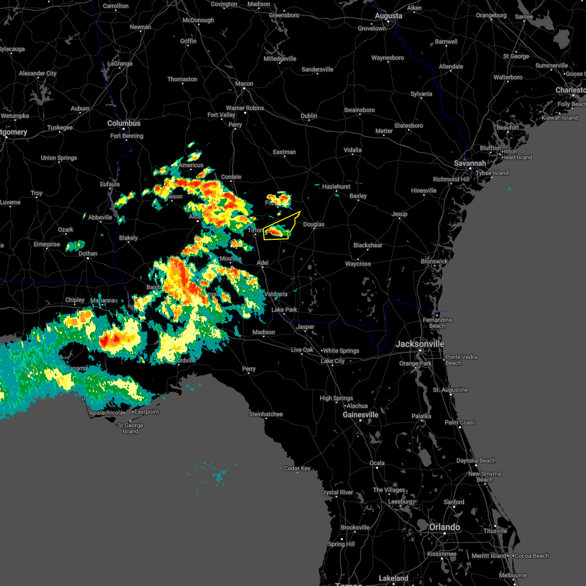 At 206 pm edt, a severe thunderstorm was located near enigma, or 9 miles east of tifton, moving east at 30 mph (radar indicated). Hazards include 60 mph wind gusts and quarter size hail. Hail damage to vehicles is expected. Expect wind damage to roofs, siding, and trees. At 206 pm edt, a severe thunderstorm was located near enigma, or 9 miles east of tifton, moving east at 30 mph (radar indicated). Hazards include 60 mph wind gusts and quarter size hail. Hail damage to vehicles is expected. Expect wind damage to roofs, siding, and trees.
|
| 5/6/2022 1:36 PM EDT |
 At 134 pm edt, a severe thunderstorm was located near unionville, or near tifton, moving east at 35 mph (radar indicated). Hazards include 60 mph wind gusts and quarter size hail. Hail damage to vehicles is expected. expect wind damage to roofs, siding, and trees. locations impacted include, tifton, enigma, omega, ty ty, phillipsburg, unionville, vanceville, hillsdale, eldorado, harding, tift airport, fender and brookfield. hail threat, radar indicated max hail size, 1. 00 in wind threat, radar indicated max wind gust, 60 mph. At 134 pm edt, a severe thunderstorm was located near unionville, or near tifton, moving east at 35 mph (radar indicated). Hazards include 60 mph wind gusts and quarter size hail. Hail damage to vehicles is expected. expect wind damage to roofs, siding, and trees. locations impacted include, tifton, enigma, omega, ty ty, phillipsburg, unionville, vanceville, hillsdale, eldorado, harding, tift airport, fender and brookfield. hail threat, radar indicated max hail size, 1. 00 in wind threat, radar indicated max wind gust, 60 mph.
|
| 5/6/2022 1:07 PM EDT |
 At 107 pm edt, a severe thunderstorm was located 7 miles southwest of ty ty, or 10 miles southeast of sylvester, moving east at 35 mph (radar indicated). Hazards include 60 mph wind gusts and quarter size hail. Hail damage to vehicles is expected. Expect wind damage to roofs, siding, and trees. At 107 pm edt, a severe thunderstorm was located 7 miles southwest of ty ty, or 10 miles southeast of sylvester, moving east at 35 mph (radar indicated). Hazards include 60 mph wind gusts and quarter size hail. Hail damage to vehicles is expected. Expect wind damage to roofs, siding, and trees.
|
| 4/5/2022 5:21 PM EDT |
 At 521 pm edt, severe thunderstorms were located along a line extending from near lumber city to near ambrose to near alapaha to near sparks, moving east at 60 mph (radar indicated). Hazards include 70 mph wind gusts and penny size hail. Expect considerable tree damage. damage is likely to mobile homes, roofs, and outbuildings. Locations impacted include, nashville, adel, ocilla, fitzgerald, lakeland, tifton, moultrie, sparks, enigma, omega, ray city, norman park, lenox, alapaha, phillipsburg, mystic, unionville, meigs, berlin and cecil. At 521 pm edt, severe thunderstorms were located along a line extending from near lumber city to near ambrose to near alapaha to near sparks, moving east at 60 mph (radar indicated). Hazards include 70 mph wind gusts and penny size hail. Expect considerable tree damage. damage is likely to mobile homes, roofs, and outbuildings. Locations impacted include, nashville, adel, ocilla, fitzgerald, lakeland, tifton, moultrie, sparks, enigma, omega, ray city, norman park, lenox, alapaha, phillipsburg, mystic, unionville, meigs, berlin and cecil.
|
| 4/5/2022 4:39 PM EDT |
 At 438 pm edt, severe thunderstorms were located along a line extending from 6 miles southeast of rochelle to near tifton to near norman park to 8 miles north of ochlocknee, moving east at 55 mph (radar indicated). Hazards include 70 mph wind gusts and penny size hail. Expect considerable tree damage. Damage is likely to mobile homes, roofs, and outbuildings. At 438 pm edt, severe thunderstorms were located along a line extending from 6 miles southeast of rochelle to near tifton to near norman park to 8 miles north of ochlocknee, moving east at 55 mph (radar indicated). Hazards include 70 mph wind gusts and penny size hail. Expect considerable tree damage. Damage is likely to mobile homes, roofs, and outbuildings.
|
| 3/12/2022 5:11 AM EST |
 At 511 am est, severe thunderstorms were located along a line extending from 9 miles northeast of ty ty to near coolidge, moving east at 40 mph (radar indicated). Hazards include 60 mph wind gusts. expect damage to roofs, siding, and trees At 511 am est, severe thunderstorms were located along a line extending from 9 miles northeast of ty ty to near coolidge, moving east at 40 mph (radar indicated). Hazards include 60 mph wind gusts. expect damage to roofs, siding, and trees
|
| 7/28/2021 6:53 PM EDT | Tree down on daisy road. time estimated by rada in irwin county GA, 5.7 miles NNW of Ocilla, GA |
| 6/12/2021 7:10 PM EDT | Tree down in hickory roa in irwin county GA, 6.4 miles N of Ocilla, GA |
| 6/12/2021 7:05 PM EDT | Tree down on oak circl in irwin county GA, 1 miles NNW of Ocilla, GA |
| 6/12/2021 7:04 PM EDT |
 At 704 pm edt, severe thunderstorms were located along a line extending from 7 miles northwest of ambrose to 10 miles northwest of sylvester, moving southeast at 25 mph (radar indicated). Hazards include 60 mph wind gusts and penny size hail. Expect damage to roofs, siding, and trees. Locations impacted include, tifton, ashburn, ocilla, fitzgerald, sylvester, enigma, omega, poulan, ty ty, alapaha, phillipsburg, mystic, unionville, worth, terrell, sycamore, sumner, minton, scooterville and osierfield. At 704 pm edt, severe thunderstorms were located along a line extending from 7 miles northwest of ambrose to 10 miles northwest of sylvester, moving southeast at 25 mph (radar indicated). Hazards include 60 mph wind gusts and penny size hail. Expect damage to roofs, siding, and trees. Locations impacted include, tifton, ashburn, ocilla, fitzgerald, sylvester, enigma, omega, poulan, ty ty, alapaha, phillipsburg, mystic, unionville, worth, terrell, sycamore, sumner, minton, scooterville and osierfield.
|
| 6/12/2021 6:50 PM EDT |
 At 650 pm edt, severe thunderstorms were located along a line extending from 6 miles northeast of fitzgerald to 6 miles northeast of marine corps logistics base, moving southeast at 30 mph (radar indicated). Hazards include 60 mph wind gusts and penny size hail. expect damage to roofs, siding, and trees At 650 pm edt, severe thunderstorms were located along a line extending from 6 miles northeast of fitzgerald to 6 miles northeast of marine corps logistics base, moving southeast at 30 mph (radar indicated). Hazards include 60 mph wind gusts and penny size hail. expect damage to roofs, siding, and trees
|
| 6/12/2021 6:42 PM EDT |
 The severe thunderstorm warning for eastern irwin and ben hill counties will expire at 645 pm edt, the storm which prompted the warning has weakened below severe limits, and no longer poses an immediate threat to life or property. therefore, the warning will be allowed to expire. however small hail and gusty winds are still possible with this thunderstorm. The severe thunderstorm warning for eastern irwin and ben hill counties will expire at 645 pm edt, the storm which prompted the warning has weakened below severe limits, and no longer poses an immediate threat to life or property. therefore, the warning will be allowed to expire. however small hail and gusty winds are still possible with this thunderstorm.
|
| 6/12/2021 6:21 PM EDT |
 At 621 pm edt, a severe thunderstorm was located near fitzgerald, moving southeast at 35 mph (radar indicated). Hazards include 60 mph wind gusts and quarter size hail. Hail damage to vehicles is expected. Expect wind damage to roofs, siding, and trees. At 621 pm edt, a severe thunderstorm was located near fitzgerald, moving southeast at 35 mph (radar indicated). Hazards include 60 mph wind gusts and quarter size hail. Hail damage to vehicles is expected. Expect wind damage to roofs, siding, and trees.
|
| 5/12/2021 12:23 PM EDT |
 At 1222 pm edt, severe thunderstorms were located along a line extending from near mystic to near ray city, moving east at 45 mph (radar indicated). Hazards include 60 mph wind gusts. Expect damage to roofs, siding, and trees. Locations impacted include, nashville, lakeland, adel, ocilla, hahira, sparks, enigma, ray city, alapaha, mystic, moody air force base, meigs, cecil, barretts, new lois, gladys, massee, greggs, glory and waterloo. At 1222 pm edt, severe thunderstorms were located along a line extending from near mystic to near ray city, moving east at 45 mph (radar indicated). Hazards include 60 mph wind gusts. Expect damage to roofs, siding, and trees. Locations impacted include, nashville, lakeland, adel, ocilla, hahira, sparks, enigma, ray city, alapaha, mystic, moody air force base, meigs, cecil, barretts, new lois, gladys, massee, greggs, glory and waterloo.
|
| 5/12/2021 11:47 AM EDT |
 At 1147 am edt, severe thunderstorms were located along a line extending from near sylvester to near pavo, moving northeast at 40 mph (radar indicated). Hazards include 60 mph wind gusts. expect damage to roofs, siding, and trees At 1147 am edt, severe thunderstorms were located along a line extending from near sylvester to near pavo, moving northeast at 40 mph (radar indicated). Hazards include 60 mph wind gusts. expect damage to roofs, siding, and trees
|
| 5/4/2021 11:18 PM EDT |
 At 1118 pm edt, severe thunderstorms were located along a line extending from near lumber city to 8 miles southeast of norman park, moving east at 65 mph (radar indicated). Hazards include 60 mph wind gusts. Expect damage to roofs, siding, and trees. Locations impacted include, enigma, alapaha, gladys, osierfield, glory, wray and red bluff. At 1118 pm edt, severe thunderstorms were located along a line extending from near lumber city to 8 miles southeast of norman park, moving east at 65 mph (radar indicated). Hazards include 60 mph wind gusts. Expect damage to roofs, siding, and trees. Locations impacted include, enigma, alapaha, gladys, osierfield, glory, wray and red bluff.
|
| 5/4/2021 11:00 PM EDT | Trees down throughout the count in irwin county GA, 0.1 miles NNE of Ocilla, GA |
| 5/4/2021 10:46 PM EDT |
 At 1046 pm edt, severe thunderstorms were located along a line extending from 6 miles south of abbeville to near pelham, moving east at 55 mph (radar indicated). Hazards include 60 mph wind gusts. Expect damage to roofs, siding, and trees. Locations impacted include, tifton, ashburn, ocilla, fitzgerald, sylvester, enigma, omega, poulan, ty ty, alapaha, phillipsburg, mystic, unionville, terrell, sycamore, sumner, rebecca, minton, scooterville and osierfield. At 1046 pm edt, severe thunderstorms were located along a line extending from 6 miles south of abbeville to near pelham, moving east at 55 mph (radar indicated). Hazards include 60 mph wind gusts. Expect damage to roofs, siding, and trees. Locations impacted include, tifton, ashburn, ocilla, fitzgerald, sylvester, enigma, omega, poulan, ty ty, alapaha, phillipsburg, mystic, unionville, terrell, sycamore, sumner, rebecca, minton, scooterville and osierfield.
|
| 5/4/2021 10:07 PM EDT |
 At 1007 pm edt, severe thunderstorms were located along a line extending from 8 miles east of desoto to 10 miles east of leary, moving east at 65 mph (radar indicated). Hazards include 60 mph wind gusts. expect damage to roofs, siding, and trees At 1007 pm edt, severe thunderstorms were located along a line extending from 8 miles east of desoto to 10 miles east of leary, moving east at 65 mph (radar indicated). Hazards include 60 mph wind gusts. expect damage to roofs, siding, and trees
|
| 4/24/2021 8:41 PM EDT | Tree down in ocill in irwin county GA, 0.8 miles N of Ocilla, GA |
| 4/24/2021 8:37 PM EDT |
 At 837 pm edt, severe thunderstorms were located along a line extending from near ocilla to near doerun, moving east at 40 mph (radar indicated). Hazards include ping pong ball size hail and 60 mph wind gusts. People and animals outdoors will be injured. expect hail damage to roofs, siding, windows, and vehicles. Expect wind damage to roofs, siding, and trees. At 837 pm edt, severe thunderstorms were located along a line extending from near ocilla to near doerun, moving east at 40 mph (radar indicated). Hazards include ping pong ball size hail and 60 mph wind gusts. People and animals outdoors will be injured. expect hail damage to roofs, siding, windows, and vehicles. Expect wind damage to roofs, siding, and trees.
|
| 4/24/2021 8:05 PM EDT |
 At 805 pm edt, a severe thunderstorm was located near ty ty, or 9 miles southeast of sylvester, moving east at 55 mph (radar indicated). Hazards include 60 mph wind gusts and half dollar size hail. Hail damage to vehicles is expected. Expect wind damage to roofs, siding, and trees. At 805 pm edt, a severe thunderstorm was located near ty ty, or 9 miles southeast of sylvester, moving east at 55 mph (radar indicated). Hazards include 60 mph wind gusts and half dollar size hail. Hail damage to vehicles is expected. Expect wind damage to roofs, siding, and trees.
|
| 4/24/2021 7:57 PM EDT |
 At 756 pm edt, a severe thunderstorm was located near ocilla, moving east at 50 mph (radar indicated). Hazards include 60 mph wind gusts. expect damage to roofs, siding, and trees At 756 pm edt, a severe thunderstorm was located near ocilla, moving east at 50 mph (radar indicated). Hazards include 60 mph wind gusts. expect damage to roofs, siding, and trees
|
| 4/24/2021 7:41 PM EDT |
 At 740 pm edt, a severe thunderstorm was located near ocilla, moving northeast at 40 mph (radar indicated). Hazards include 60 mph wind gusts. expect damage to roofs, siding, and trees At 740 pm edt, a severe thunderstorm was located near ocilla, moving northeast at 40 mph (radar indicated). Hazards include 60 mph wind gusts. expect damage to roofs, siding, and trees
|
| 4/24/2021 6:10 PM EDT |
 At 610 pm edt, severe thunderstorms were located along a line extending from near ocilla to 6 miles south of doerun, moving east at 30 mph (radar indicated). Hazards include 60 mph wind gusts and quarter size hail. Hail damage to vehicles is expected. Expect wind damage to roofs, siding, and trees. At 610 pm edt, severe thunderstorms were located along a line extending from near ocilla to 6 miles south of doerun, moving east at 30 mph (radar indicated). Hazards include 60 mph wind gusts and quarter size hail. Hail damage to vehicles is expected. Expect wind damage to roofs, siding, and trees.
|
| 4/24/2021 5:31 PM EDT |
 At 530 pm edt, severe thunderstorms were located along a line extending from ashburn to 8 miles south of poulan to near newton, moving east at 70 mph (radar indicated). Hazards include 60 mph wind gusts and quarter size hail. Hail damage to vehicles is expected. Expect wind damage to roofs, siding, and trees. At 530 pm edt, severe thunderstorms were located along a line extending from ashburn to 8 miles south of poulan to near newton, moving east at 70 mph (radar indicated). Hazards include 60 mph wind gusts and quarter size hail. Hail damage to vehicles is expected. Expect wind damage to roofs, siding, and trees.
|
| 4/24/2021 11:05 AM EDT |
 At 1104 am edt, severe thunderstorms were located along a line extending from near jacksonville to 6 miles south of ambrose to near willacoochee to nashville, moving east at 45 mph (radar indicated). Hazards include 70 mph wind gusts and quarter size hail. Hail damage to vehicles is expected. expect considerable tree damage. wind damage is also likely to mobile homes, roofs, and outbuildings. Locations impacted include, nashville, ocilla, enigma, alapaha, cottle, berrien co a/p, gladys, osierfield, glory, ashton, bannockburn, weber and wray. At 1104 am edt, severe thunderstorms were located along a line extending from near jacksonville to 6 miles south of ambrose to near willacoochee to nashville, moving east at 45 mph (radar indicated). Hazards include 70 mph wind gusts and quarter size hail. Hail damage to vehicles is expected. expect considerable tree damage. wind damage is also likely to mobile homes, roofs, and outbuildings. Locations impacted include, nashville, ocilla, enigma, alapaha, cottle, berrien co a/p, gladys, osierfield, glory, ashton, bannockburn, weber and wray.
|
| 4/24/2021 10:38 AM EDT |
 At 1037 am edt, severe thunderstorms were located along a line extending from 8 miles north of fitzgerald to 6 miles northwest of enigma to near lenox to 7 miles west of sparks, moving east at 45 mph (radar indicated). Hazards include 70 mph wind gusts and half dollar size hail. Hail damage to vehicles is expected. expect considerable tree damage. wind damage is also likely to mobile homes, roofs, and outbuildings. Locations impacted include, tifton, nashville, adel, ocilla, fitzgerald, lakeland, sparks, enigma, omega, ray city, lenox, ty ty, alapaha, phillipsburg, mystic, unionville, meigs, berlin, cecil and ellenton. At 1037 am edt, severe thunderstorms were located along a line extending from 8 miles north of fitzgerald to 6 miles northwest of enigma to near lenox to 7 miles west of sparks, moving east at 45 mph (radar indicated). Hazards include 70 mph wind gusts and half dollar size hail. Hail damage to vehicles is expected. expect considerable tree damage. wind damage is also likely to mobile homes, roofs, and outbuildings. Locations impacted include, tifton, nashville, adel, ocilla, fitzgerald, lakeland, sparks, enigma, omega, ray city, lenox, ty ty, alapaha, phillipsburg, mystic, unionville, meigs, berlin, cecil and ellenton.
|
| 4/24/2021 10:10 AM EDT |
 At 1009 am edt, severe thunderstorms were located along a line extending from 6 miles east of arabi to near ty ty to near moultrie to 8 miles northwest of coolidge, moving east at 60 mph (radar indicated). Hazards include 70 mph wind gusts and half dollar size hail. Hail damage to vehicles is expected. expect considerable tree damage. Wind damage is also likely to mobile homes, roofs, and outbuildings. At 1009 am edt, severe thunderstorms were located along a line extending from 6 miles east of arabi to near ty ty to near moultrie to 8 miles northwest of coolidge, moving east at 60 mph (radar indicated). Hazards include 70 mph wind gusts and half dollar size hail. Hail damage to vehicles is expected. expect considerable tree damage. Wind damage is also likely to mobile homes, roofs, and outbuildings.
|
| 5/22/2020 5:51 PM EDT |
 At 551 pm edt, a severe thunderstorm was located near mystic, or near ocilla, moving northeast at 20 mph (radar indicated). Hazards include 60 mph wind gusts and quarter size hail. Hail damage to vehicles is expected. Expect wind damage to roofs, siding, and trees. At 551 pm edt, a severe thunderstorm was located near mystic, or near ocilla, moving northeast at 20 mph (radar indicated). Hazards include 60 mph wind gusts and quarter size hail. Hail damage to vehicles is expected. Expect wind damage to roofs, siding, and trees.
|
| 4/20/2020 3:10 AM EDT |
 At 310 am edt, severe thunderstorms were located along a line extending from 8 miles south of abbeville to near enigma to near lenox to 6 miles west of adel, moving east at 30 mph (radar indicated). Hazards include 70 mph wind gusts. Expect considerable tree damage. damage is likely to mobile homes, roofs, and outbuildings. Locations impacted include, fitzgerald, nashville, adel, ocilla, sparks, enigma, lenox, alapaha, mystic, ellenton, reed bingham state park, eldorado, gladys, massee, osierfield, glory, flat ford, wagon wheel, ashton and allenville. At 310 am edt, severe thunderstorms were located along a line extending from 8 miles south of abbeville to near enigma to near lenox to 6 miles west of adel, moving east at 30 mph (radar indicated). Hazards include 70 mph wind gusts. Expect considerable tree damage. damage is likely to mobile homes, roofs, and outbuildings. Locations impacted include, fitzgerald, nashville, adel, ocilla, sparks, enigma, lenox, alapaha, mystic, ellenton, reed bingham state park, eldorado, gladys, massee, osierfield, glory, flat ford, wagon wheel, ashton and allenville.
|
| 4/20/2020 3:00 AM EDT |
 At 259 am edt, severe thunderstorms were located along a line extending from 8 miles southeast of rochelle to near enigma to near lenox to 9 miles west of sparks, moving east at 35 mph (radar indicated). Hazards include 70 mph wind gusts and quarter size hail. Hail damage to vehicles is expected. expect considerable tree damage. wind damage is also likely to mobile homes, roofs, and outbuildings. Locations impacted include, tifton, nashville, moultrie, adel, ocilla, fitzgerald, sparks, enigma, omega, norman park, lenox, alapaha, phillipsburg, mystic, unionville, ellenton, rebecca, reed bingham state park, osierfield and waterloo. At 259 am edt, severe thunderstorms were located along a line extending from 8 miles southeast of rochelle to near enigma to near lenox to 9 miles west of sparks, moving east at 35 mph (radar indicated). Hazards include 70 mph wind gusts and quarter size hail. Hail damage to vehicles is expected. expect considerable tree damage. wind damage is also likely to mobile homes, roofs, and outbuildings. Locations impacted include, tifton, nashville, moultrie, adel, ocilla, fitzgerald, sparks, enigma, omega, norman park, lenox, alapaha, phillipsburg, mystic, unionville, ellenton, rebecca, reed bingham state park, osierfield and waterloo.
|
| 4/20/2020 2:38 AM EDT |
 At 238 am edt, severe thunderstorms were located along a line extending from near pitts to near omega to norman park to near riverside, moving east at 30 mph (radar indicated). Hazards include 70 mph wind gusts and quarter size hail. Hail damage to vehicles is expected. expect considerable tree damage. Wind damage is also likely to mobile homes, roofs, and outbuildings. At 238 am edt, severe thunderstorms were located along a line extending from near pitts to near omega to norman park to near riverside, moving east at 30 mph (radar indicated). Hazards include 70 mph wind gusts and quarter size hail. Hail damage to vehicles is expected. expect considerable tree damage. Wind damage is also likely to mobile homes, roofs, and outbuildings.
|
| 4/13/2020 6:22 AM EDT |
 At 622 am edt, severe thunderstorms were located along a line extending from near jacksonville to near adel, moving east at 45 mph (radar indicated). Hazards include 70 mph wind gusts. Expect considerable tree damage. damage is likely to mobile homes, roofs, and outbuildings. Locations impacted include, nashville, adel, ocilla, tifton, sparks, enigma, omega, ray city, lenox, alapaha, cecil, eldorado, new lois, gladys, massee, greggs, osierfield, glory, flat ford and wagon wheel. At 622 am edt, severe thunderstorms were located along a line extending from near jacksonville to near adel, moving east at 45 mph (radar indicated). Hazards include 70 mph wind gusts. Expect considerable tree damage. damage is likely to mobile homes, roofs, and outbuildings. Locations impacted include, nashville, adel, ocilla, tifton, sparks, enigma, omega, ray city, lenox, alapaha, cecil, eldorado, new lois, gladys, massee, greggs, osierfield, glory, flat ford and wagon wheel.
|
| 4/13/2020 6:21 AM EDT |
 The tornado warning for northwestern berrien and irwin counties will expire at 630 am edt, the storm which prompted the warning has moved out of the area. therefore, the warning will be allowed to expire. a tornado watch remains in effect until 1100 am edt for south central georgia. The tornado warning for northwestern berrien and irwin counties will expire at 630 am edt, the storm which prompted the warning has moved out of the area. therefore, the warning will be allowed to expire. a tornado watch remains in effect until 1100 am edt for south central georgia.
|
| 4/13/2020 6:03 AM EDT |
 At 603 am edt, a confirmed tornado was located near ocilla, moving east at 50 mph (radar confirmed tornado). Hazards include damaging tornado. Flying debris will be dangerous to those caught without shelter. mobile homes will be damaged or destroyed. damage to roofs, windows, and vehicles will occur. tree damage is likely. This tornadic thunderstorm will remain over mainly rural areas of northwestern berrien and irwin counties, including the following locations, wray, pinetta, gladys and osierfield. At 603 am edt, a confirmed tornado was located near ocilla, moving east at 50 mph (radar confirmed tornado). Hazards include damaging tornado. Flying debris will be dangerous to those caught without shelter. mobile homes will be damaged or destroyed. damage to roofs, windows, and vehicles will occur. tree damage is likely. This tornadic thunderstorm will remain over mainly rural areas of northwestern berrien and irwin counties, including the following locations, wray, pinetta, gladys and osierfield.
|
| 4/13/2020 6:01 AM EDT | Several trees reported down on five bridge road south of ocilla. time estimated by radar. possible tornad in irwin county GA, 7.3 miles NNE of Ocilla, GA |
| 4/13/2020 5:52 AM EDT |
 At 552 am edt, a severe thunderstorm capable of producing a tornado was located near tifton, moving east at 55 mph (radar indicated rotation). Hazards include tornado. Flying debris will be dangerous to those caught without shelter. mobile homes will be damaged or destroyed. damage to roofs, windows, and vehicles will occur. tree damage is likely. this dangerous storm will be near, enigma around 555 am edt. ocilla around 605 am edt. Other locations impacted by this tornadic thunderstorm include wray, pinetta, gladys and osierfield. At 552 am edt, a severe thunderstorm capable of producing a tornado was located near tifton, moving east at 55 mph (radar indicated rotation). Hazards include tornado. Flying debris will be dangerous to those caught without shelter. mobile homes will be damaged or destroyed. damage to roofs, windows, and vehicles will occur. tree damage is likely. this dangerous storm will be near, enigma around 555 am edt. ocilla around 605 am edt. Other locations impacted by this tornadic thunderstorm include wray, pinetta, gladys and osierfield.
|
| 4/13/2020 5:21 AM EDT |
 At 521 am edt, severe thunderstorms were located along a line extending from near arabi to near pelham, moving east at 45 mph (radar indicated). Hazards include 70 mph wind gusts. Expect considerable tree damage. Damage is likely to mobile homes, roofs, and outbuildings. At 521 am edt, severe thunderstorms were located along a line extending from near arabi to near pelham, moving east at 45 mph (radar indicated). Hazards include 70 mph wind gusts. Expect considerable tree damage. Damage is likely to mobile homes, roofs, and outbuildings.
|
| 4/8/2020 5:52 PM EDT |
 The severe thunderstorm warning for northeastern berrien and southeastern irwin counties will expire at 600 pm edt, the storm which prompted the warning has weakened below severe limits, and has exited the warned area. therefore, the warning will be allowed to expire. The severe thunderstorm warning for northeastern berrien and southeastern irwin counties will expire at 600 pm edt, the storm which prompted the warning has weakened below severe limits, and has exited the warned area. therefore, the warning will be allowed to expire.
|
| 4/8/2020 5:29 PM EDT |
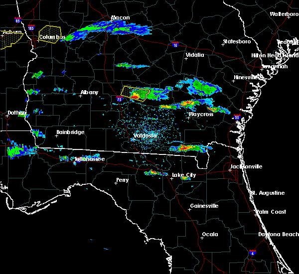 At 529 pm edt, a severe thunderstorm was located near ocilla, moving southeast at 35 mph (radar indicated). Hazards include 60 mph wind gusts and quarter size hail. Hail damage to vehicles is expected. Expect wind damage to roofs, siding, and trees. At 529 pm edt, a severe thunderstorm was located near ocilla, moving southeast at 35 mph (radar indicated). Hazards include 60 mph wind gusts and quarter size hail. Hail damage to vehicles is expected. Expect wind damage to roofs, siding, and trees.
|
| 4/8/2020 5:15 PM EDT |
 At 514 pm edt, a severe thunderstorm was located near mystic, or near ocilla, moving east at 45 mph (radar indicated). Hazards include 60 mph wind gusts and quarter size hail. Hail damage to vehicles is expected. expect wind damage to roofs, siding, and trees. Locations impacted include, fitzgerald, ocilla, mystic, irwinville, osierfield, fitzgerald municipal a/p, irwinville airport, wray, pinetta and ashton. At 514 pm edt, a severe thunderstorm was located near mystic, or near ocilla, moving east at 45 mph (radar indicated). Hazards include 60 mph wind gusts and quarter size hail. Hail damage to vehicles is expected. expect wind damage to roofs, siding, and trees. Locations impacted include, fitzgerald, ocilla, mystic, irwinville, osierfield, fitzgerald municipal a/p, irwinville airport, wray, pinetta and ashton.
|
| 4/8/2020 4:56 PM EDT |
 At 456 pm edt, a severe thunderstorm was located 8 miles east of ashburn, moving east at 45 mph (radar indicated). Hazards include ping pong ball size hail and 60 mph wind gusts. People and animals outdoors will be injured. expect hail damage to roofs, siding, windows, and vehicles. Expect wind damage to roofs, siding, and trees. At 456 pm edt, a severe thunderstorm was located 8 miles east of ashburn, moving east at 45 mph (radar indicated). Hazards include ping pong ball size hail and 60 mph wind gusts. People and animals outdoors will be injured. expect hail damage to roofs, siding, windows, and vehicles. Expect wind damage to roofs, siding, and trees.
|
| 3/31/2020 2:51 PM EDT |
 At 251 pm edt, a severe thunderstorm was located over alapaha, or 8 miles west of willacoochee, moving east at 55 mph (radar indicated). Hazards include 60 mph wind gusts. Expect damage to roofs, siding, and trees. Locations impacted include, ocilla, enigma, alapaha, gladys, glory, wray and bannockburn. At 251 pm edt, a severe thunderstorm was located over alapaha, or 8 miles west of willacoochee, moving east at 55 mph (radar indicated). Hazards include 60 mph wind gusts. Expect damage to roofs, siding, and trees. Locations impacted include, ocilla, enigma, alapaha, gladys, glory, wray and bannockburn.
|
| 3/31/2020 2:31 PM EDT |
 At 231 pm edt, a severe thunderstorm was located over lenox, or 10 miles south of tifton, moving east at 55 mph (radar indicated). Hazards include 60 mph wind gusts. expect damage to roofs, siding, and trees At 231 pm edt, a severe thunderstorm was located over lenox, or 10 miles south of tifton, moving east at 55 mph (radar indicated). Hazards include 60 mph wind gusts. expect damage to roofs, siding, and trees
|
| 2/6/2020 6:36 PM EST |
 At 636 pm est, a severe thunderstorm was located near enigma, or 7 miles south of ocilla, moving northeast at 85 mph (radar indicated). Hazards include 60 mph wind gusts. Expect damage to roofs, siding, and trees. Locations impacted include, ocilla, mystic, pinetta and irwinville. At 636 pm est, a severe thunderstorm was located near enigma, or 7 miles south of ocilla, moving northeast at 85 mph (radar indicated). Hazards include 60 mph wind gusts. Expect damage to roofs, siding, and trees. Locations impacted include, ocilla, mystic, pinetta and irwinville.
|
| 2/6/2020 6:18 PM EST |
 At 618 pm est, a severe thunderstorm was located 7 miles southeast of norman park, or 10 miles northwest of adel, moving northeast at 55 mph (radar indicated). Hazards include 60 mph wind gusts. expect damage to roofs, siding, and trees At 618 pm est, a severe thunderstorm was located 7 miles southeast of norman park, or 10 miles northwest of adel, moving northeast at 55 mph (radar indicated). Hazards include 60 mph wind gusts. expect damage to roofs, siding, and trees
|
| 12/17/2019 11:52 AM EST |
 At 1151 am est, a confirmed large and extremely dangerous tornado was located near ocilla, moving east at 40 mph. this is a particularly dangerous situation. take cover now! (radar confirmed tornado). Hazards include damaging tornado. You are in a life-threatening situation. flying debris may be deadly to those caught without shelter. mobile homes will be destroyed. considerable damage to homes, businesses, and vehicles is likely and complete destruction is possible. This tornadic thunderstorm will remain over mainly rural areas of irwin and ben hill counties, including the following locations, irwinville, lulaville, osierfield, fitzgerald municipal a/p, irwinville airport, wray, pinetta, red bluff, ashton and queensland. At 1151 am est, a confirmed large and extremely dangerous tornado was located near ocilla, moving east at 40 mph. this is a particularly dangerous situation. take cover now! (radar confirmed tornado). Hazards include damaging tornado. You are in a life-threatening situation. flying debris may be deadly to those caught without shelter. mobile homes will be destroyed. considerable damage to homes, businesses, and vehicles is likely and complete destruction is possible. This tornadic thunderstorm will remain over mainly rural areas of irwin and ben hill counties, including the following locations, irwinville, lulaville, osierfield, fitzgerald municipal a/p, irwinville airport, wray, pinetta, red bluff, ashton and queensland.
|
| 12/17/2019 11:45 AM EST | Trees down on pinetta roa in irwin county GA, 6.6 miles E of Ocilla, GA |
| 12/17/2019 11:45 AM EST |
 At 1145 am est, a confirmed tornado was located over mystic, or near ocilla, moving east at 40 mph (radar confirmed tornado). Hazards include damaging tornado. Flying debris will be dangerous to those caught without shelter. mobile homes will be damaged or destroyed. damage to roofs, windows, and vehicles will occur. tree damage is likely. this tornado will be near, ocilla and fitzgerald around 1155 am est. Other locations impacted by this tornadic thunderstorm include irwinville, lulaville, osierfield, fitzgerald municipal a/p, irwinville airport, wray, pinetta, red bluff, ashton and queensland. At 1145 am est, a confirmed tornado was located over mystic, or near ocilla, moving east at 40 mph (radar confirmed tornado). Hazards include damaging tornado. Flying debris will be dangerous to those caught without shelter. mobile homes will be damaged or destroyed. damage to roofs, windows, and vehicles will occur. tree damage is likely. this tornado will be near, ocilla and fitzgerald around 1155 am est. Other locations impacted by this tornadic thunderstorm include irwinville, lulaville, osierfield, fitzgerald municipal a/p, irwinville airport, wray, pinetta, red bluff, ashton and queensland.
|
| 12/17/2019 11:40 AM EST |
 At 1140 am est, a severe thunderstorm capable of producing a tornado was located near mystic, or 8 miles west of ocilla, moving east at 40 mph (radar indicated rotation). Hazards include tornado. Flying debris will be dangerous to those caught without shelter. mobile homes will be damaged or destroyed. damage to roofs, windows, and vehicles will occur. tree damage is likely. this dangerous storm will be near, mystic around 1145 am est. ocilla and fitzgerald around 1155 am est. Other locations impacted by this tornadic thunderstorm include irwinville, lulaville, osierfield, fitzgerald municipal a/p, irwinville airport, wray, pinetta, red bluff, ashton and queensland. At 1140 am est, a severe thunderstorm capable of producing a tornado was located near mystic, or 8 miles west of ocilla, moving east at 40 mph (radar indicated rotation). Hazards include tornado. Flying debris will be dangerous to those caught without shelter. mobile homes will be damaged or destroyed. damage to roofs, windows, and vehicles will occur. tree damage is likely. this dangerous storm will be near, mystic around 1145 am est. ocilla and fitzgerald around 1155 am est. Other locations impacted by this tornadic thunderstorm include irwinville, lulaville, osierfield, fitzgerald municipal a/p, irwinville airport, wray, pinetta, red bluff, ashton and queensland.
|
| 12/17/2019 11:33 AM EST |
 At 1133 am est, a severe thunderstorm was located 8 miles west of mystic, or 11 miles north of tifton, moving east at 35 mph (radar indicated). Hazards include 60 mph wind gusts. expect damage to roofs, siding, and trees At 1133 am est, a severe thunderstorm was located 8 miles west of mystic, or 11 miles north of tifton, moving east at 35 mph (radar indicated). Hazards include 60 mph wind gusts. expect damage to roofs, siding, and trees
|
| 7/19/2019 5:54 PM EDT |
 The severe thunderstorm warning for irwin, turner, northern tift, ben hill and central worth counties will expire at 600 pm edt, the storms which prompted the warning have weakened below severe limits, and no longer pose an immediate threat to life or property. therefore, the warning will be allowed to expire. however heavy rain and flooding are still possible with these thunderstorms. to report severe weather, contact your nearest law enforcement agency. they will relay your report to the national weather service tallahassee. The severe thunderstorm warning for irwin, turner, northern tift, ben hill and central worth counties will expire at 600 pm edt, the storms which prompted the warning have weakened below severe limits, and no longer pose an immediate threat to life or property. therefore, the warning will be allowed to expire. however heavy rain and flooding are still possible with these thunderstorms. to report severe weather, contact your nearest law enforcement agency. they will relay your report to the national weather service tallahassee.
|
| 7/19/2019 5:06 PM EDT |
 The national weather service in tallahassee has issued a * severe thunderstorm warning for. irwin county in south central georgia. turner county in south central georgia. northern tift county in south central georgia. Ben hill county in south central georgia. The national weather service in tallahassee has issued a * severe thunderstorm warning for. irwin county in south central georgia. turner county in south central georgia. northern tift county in south central georgia. Ben hill county in south central georgia.
|
| 6/20/2019 7:00 PM EDT |
 At 700 pm edt, severe thunderstorms were located along a line extending from 6 miles southwest of ambrose to near doerun, moving southeast at 30 mph (radar indicated). Hazards include 60 mph wind gusts. Expect damage to roofs, siding, and trees. Locations impacted include, tifton, nashville, sylvester, moultrie, ocilla, adel, sparks, enigma, omega, norman park, lenox, poulan, doerun, ty ty, alapaha, phillipsburg, unionville, riverside, schley and funston. At 700 pm edt, severe thunderstorms were located along a line extending from 6 miles southwest of ambrose to near doerun, moving southeast at 30 mph (radar indicated). Hazards include 60 mph wind gusts. Expect damage to roofs, siding, and trees. Locations impacted include, tifton, nashville, sylvester, moultrie, ocilla, adel, sparks, enigma, omega, norman park, lenox, poulan, doerun, ty ty, alapaha, phillipsburg, unionville, riverside, schley and funston.
|
| 6/20/2019 6:50 PM EDT |
 At 650 pm edt, severe thunderstorms were located along a line extending from near ambrose to 7 miles north of doerun, moving southeast at 25 mph (radar indicated). Hazards include 60 mph wind gusts. Expect damage to roofs, siding, and trees. Locations impacted include, tifton, nashville, ocilla, sylvester, moultrie, fitzgerald, adel, sparks, enigma, omega, norman park, lenox, poulan, doerun, ty ty, alapaha, phillipsburg, mystic, unionville and riverside. At 650 pm edt, severe thunderstorms were located along a line extending from near ambrose to 7 miles north of doerun, moving southeast at 25 mph (radar indicated). Hazards include 60 mph wind gusts. Expect damage to roofs, siding, and trees. Locations impacted include, tifton, nashville, ocilla, sylvester, moultrie, fitzgerald, adel, sparks, enigma, omega, norman park, lenox, poulan, doerun, ty ty, alapaha, phillipsburg, mystic, unionville and riverside.
|
| 6/20/2019 6:33 PM EDT | Tree down between ocilla and tifton... ga near highway 31 in irwin county GA, 8 miles ENE of Ocilla, GA |
| 6/20/2019 6:30 PM EDT | Tree down on dirt end of bussell pond off of pinett in irwin county GA, 6.7 miles E of Ocilla, GA |
| 6/20/2019 6:20 PM EDT |
 At 619 pm edt, severe thunderstorms were located along a line extending from 8 miles northeast of fitzgerald to 6 miles east of marine corps logistics base, moving east at 35 mph (radar indicated). Hazards include 60 mph wind gusts. expect damage to roofs, siding, and trees At 619 pm edt, severe thunderstorms were located along a line extending from 8 miles northeast of fitzgerald to 6 miles east of marine corps logistics base, moving east at 35 mph (radar indicated). Hazards include 60 mph wind gusts. expect damage to roofs, siding, and trees
|
| 6/20/2019 6:06 PM EDT |
 At 606 pm edt, severe thunderstorms were located along a line extending from 9 miles south of abbeville to 10 miles west of arabi, moving east at 45 mph (radar indicated). Hazards include 60 mph wind gusts and penny size hail. Expect damage to roofs, siding, and trees. Locations impacted include, fitzgerald, sylvester, ashburn, ocilla, poulan, ty ty, mystic, worth, terrell, sycamore, sumner, rebecca, amboy, osierfield, sylvester airport, tempy, harding, waterloo, pinetta and inaha. At 606 pm edt, severe thunderstorms were located along a line extending from 9 miles south of abbeville to 10 miles west of arabi, moving east at 45 mph (radar indicated). Hazards include 60 mph wind gusts and penny size hail. Expect damage to roofs, siding, and trees. Locations impacted include, fitzgerald, sylvester, ashburn, ocilla, poulan, ty ty, mystic, worth, terrell, sycamore, sumner, rebecca, amboy, osierfield, sylvester airport, tempy, harding, waterloo, pinetta and inaha.
|
| 6/20/2019 5:45 PM EDT |
 At 545 pm edt, severe thunderstorms were located along a line extending from pitts to near leslie, moving east at 40 mph (radar indicated). Hazards include 60 mph wind gusts and penny size hail. expect damage to roofs, siding, and trees At 545 pm edt, severe thunderstorms were located along a line extending from pitts to near leslie, moving east at 40 mph (radar indicated). Hazards include 60 mph wind gusts and penny size hail. expect damage to roofs, siding, and trees
|
| 5/12/2019 2:00 PM EDT |
 At 159 pm edt, severe thunderstorms were located along a line extending from near ashburn to ty ty, moving east at 40 mph (radar indicated). Hazards include 60 mph wind gusts. expect damage to roofs, siding, and trees At 159 pm edt, severe thunderstorms were located along a line extending from near ashburn to ty ty, moving east at 40 mph (radar indicated). Hazards include 60 mph wind gusts. expect damage to roofs, siding, and trees
|
| 5/11/2019 4:26 PM EDT |
 At 425 pm edt, severe thunderstorms were located along a line extending from 9 miles south of abbeville to near ocilla to near lenox, moving east at 30 mph (radar indicated). Hazards include 60 mph wind gusts and penny size hail. expect damage to roofs, siding, and trees At 425 pm edt, severe thunderstorms were located along a line extending from 9 miles south of abbeville to near ocilla to near lenox, moving east at 30 mph (radar indicated). Hazards include 60 mph wind gusts and penny size hail. expect damage to roofs, siding, and trees
|
| 4/14/2019 3:12 PM EDT |
 At 311 pm edt, severe thunderstorms were located along a line extending from near unionville to near boston, moving northeast at 55 mph (radar indicated). Hazards include 60 mph wind gusts. expect damage to roofs, siding, and trees At 311 pm edt, severe thunderstorms were located along a line extending from near unionville to near boston, moving northeast at 55 mph (radar indicated). Hazards include 60 mph wind gusts. expect damage to roofs, siding, and trees
|
| 3/11/2019 6:18 PM EDT |
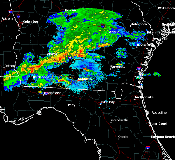 At 618 pm edt, a severe thunderstorm was located over ocilla, moving east at 25 mph (radar indicated). Hazards include golf ball size hail and 60 mph wind gusts. People and animals outdoors will be injured. expect hail damage to roofs, siding, windows, and vehicles. expect wind damage to roofs, siding, and trees. Locations impacted include, ocilla, mystic, wray, pinetta and osierfield. At 618 pm edt, a severe thunderstorm was located over ocilla, moving east at 25 mph (radar indicated). Hazards include golf ball size hail and 60 mph wind gusts. People and animals outdoors will be injured. expect hail damage to roofs, siding, windows, and vehicles. expect wind damage to roofs, siding, and trees. Locations impacted include, ocilla, mystic, wray, pinetta and osierfield.
|
| 3/11/2019 6:15 PM EDT | Quarter sized hail reported 0.1 miles NNE of Ocilla, GA, reported via irwin county 911 facebook page. |
| 3/11/2019 6:13 PM EDT | Ping Pong Ball sized hail reported 0.1 miles NNE of Ocilla, GA, estimated based off picture. |
| 3/11/2019 6:10 PM EDT |
 At 609 pm edt, a severe thunderstorm was located near ocilla, moving east at 25 mph (radar indicated). Hazards include golf ball size hail and 60 mph wind gusts. People and animals outdoors will be injured. expect hail damage to roofs, siding, windows, and vehicles. expect wind damage to roofs, siding, and trees. Locations impacted include, ocilla, mystic, irwinville, osierfield, fitzgerald municipal a/p, irwinville airport, wray, waterloo and pinetta. At 609 pm edt, a severe thunderstorm was located near ocilla, moving east at 25 mph (radar indicated). Hazards include golf ball size hail and 60 mph wind gusts. People and animals outdoors will be injured. expect hail damage to roofs, siding, windows, and vehicles. expect wind damage to roofs, siding, and trees. Locations impacted include, ocilla, mystic, irwinville, osierfield, fitzgerald municipal a/p, irwinville airport, wray, waterloo and pinetta.
|
| 3/11/2019 5:48 PM EDT |
 At 548 pm edt, a severe thunderstorm was located near mystic, or 10 miles west of fitzgerald, moving east at 25 mph (radar indicated). Hazards include 60 mph wind gusts and quarter size hail. Hail damage to vehicles is expected. Expect wind damage to roofs, siding, and trees. At 548 pm edt, a severe thunderstorm was located near mystic, or 10 miles west of fitzgerald, moving east at 25 mph (radar indicated). Hazards include 60 mph wind gusts and quarter size hail. Hail damage to vehicles is expected. Expect wind damage to roofs, siding, and trees.
|
| 3/3/2019 5:53 PM EST |
 The tornado warning for east central irwin and ben hill counties will expire at 600 pm est, the storm which prompted the warning has moved out of the area. therefore, the warning will be allowed to expire. a tornado watch remains in effect until 800 pm est for south central georgia. to report severe weather, contact your nearest law enforcement agency. they will relay your report to the national weather service tallahassee. &&. The tornado warning for east central irwin and ben hill counties will expire at 600 pm est, the storm which prompted the warning has moved out of the area. therefore, the warning will be allowed to expire. a tornado watch remains in effect until 800 pm est for south central georgia. to report severe weather, contact your nearest law enforcement agency. they will relay your report to the national weather service tallahassee. &&.
|
| 3/3/2019 5:31 PM EST |
 At 530 pm est, a severe thunderstorm capable of producing a tornado was located near fitzgerald, moving east at 45 mph (radar indicated rotation). Hazards include tornado and two inch hail. Flying debris will be dangerous to those caught without shelter. mobile homes will be damaged or destroyed. damage to roofs, windows, and vehicles will occur. tree damage is likely. This tornadic thunderstorm will remain over mainly rural areas of east central irwin and ben hill counties, including the following locations, lulaville, osierfield, fitzgerald municipal a/p, bowens mill, red bluff, ashton and queensland. At 530 pm est, a severe thunderstorm capable of producing a tornado was located near fitzgerald, moving east at 45 mph (radar indicated rotation). Hazards include tornado and two inch hail. Flying debris will be dangerous to those caught without shelter. mobile homes will be damaged or destroyed. damage to roofs, windows, and vehicles will occur. tree damage is likely. This tornadic thunderstorm will remain over mainly rural areas of east central irwin and ben hill counties, including the following locations, lulaville, osierfield, fitzgerald municipal a/p, bowens mill, red bluff, ashton and queensland.
|
| 3/3/2019 5:18 PM EST |
 At 518 pm est, a severe thunderstorm capable of producing a tornado was located near fitzgerald, moving east at 45 mph (radar indicated rotation). Hazards include tornado and golf ball size hail. Flying debris will be dangerous to those caught without shelter. mobile homes will be damaged or destroyed. damage to roofs, windows, and vehicles will occur. tree damage is likely. this dangerous storm will be near, fitzgerald around 525 pm est. Other locations impacted by this tornadic thunderstorm include irwinville, lulaville, osierfield, fitzgerald municipal a/p, bowens mill, red bluff, ashton, arp, abba and queensland. At 518 pm est, a severe thunderstorm capable of producing a tornado was located near fitzgerald, moving east at 45 mph (radar indicated rotation). Hazards include tornado and golf ball size hail. Flying debris will be dangerous to those caught without shelter. mobile homes will be damaged or destroyed. damage to roofs, windows, and vehicles will occur. tree damage is likely. this dangerous storm will be near, fitzgerald around 525 pm est. Other locations impacted by this tornadic thunderstorm include irwinville, lulaville, osierfield, fitzgerald municipal a/p, bowens mill, red bluff, ashton, arp, abba and queensland.
|
| 3/3/2019 5:04 PM EST |
 At 504 pm est, a severe thunderstorm capable of producing a tornado was located 8 miles east of ashburn, moving east at 45 mph (radar indicated rotation). Hazards include tornado and ping pong ball size hail. Flying debris will be dangerous to those caught without shelter. mobile homes will be damaged or destroyed. damage to roofs, windows, and vehicles will occur. tree damage is likely. this dangerous storm will be near, mystic around 520 pm est. fitzgerald and ocilla around 525 pm est. Other locations impacted by this tornadic thunderstorm include lulaville, osierfield, waterloo, ashton, irwinville, fitzgerald municipal a/p, irwinville airport, bowens mill, red bluff and arp. At 504 pm est, a severe thunderstorm capable of producing a tornado was located 8 miles east of ashburn, moving east at 45 mph (radar indicated rotation). Hazards include tornado and ping pong ball size hail. Flying debris will be dangerous to those caught without shelter. mobile homes will be damaged or destroyed. damage to roofs, windows, and vehicles will occur. tree damage is likely. this dangerous storm will be near, mystic around 520 pm est. fitzgerald and ocilla around 525 pm est. Other locations impacted by this tornadic thunderstorm include lulaville, osierfield, waterloo, ashton, irwinville, fitzgerald municipal a/p, irwinville airport, bowens mill, red bluff and arp.
|
| 3/3/2019 4:20 PM EST |
 At 420 pm est, a severe thunderstorm capable of producing a tornado was located over ocilla, moving east at 50 mph (radar indicated rotation). Hazards include tornado and hail up to two inches in diameter. Flying debris will be dangerous to those caught without shelter. mobile homes will be damaged or destroyed. damage to roofs, windows, and vehicles will occur. tree damage is likely. This tornadic thunderstorm will remain over mainly rural areas of central irwin and southeastern ben hill counties, including the following locations, wray, pinetta, ashton and osierfield. At 420 pm est, a severe thunderstorm capable of producing a tornado was located over ocilla, moving east at 50 mph (radar indicated rotation). Hazards include tornado and hail up to two inches in diameter. Flying debris will be dangerous to those caught without shelter. mobile homes will be damaged or destroyed. damage to roofs, windows, and vehicles will occur. tree damage is likely. This tornadic thunderstorm will remain over mainly rural areas of central irwin and southeastern ben hill counties, including the following locations, wray, pinetta, ashton and osierfield.
|
| 3/3/2019 4:10 PM EST | Quarter sized hail reported 8.3 miles ENE of Ocilla, GA, quarter size hail reported in the pleasure lake area. |
| 3/3/2019 3:56 PM EST |
 At 356 pm est, a severe thunderstorm was located near tifton, moving northeast at 45 mph (radar indicated). Hazards include golf ball size hail and 60 mph wind gusts. People and animals outdoors will be injured. expect hail damage to roofs, siding, windows, and vehicles. Expect wind damage to roofs, siding, and trees. At 356 pm est, a severe thunderstorm was located near tifton, moving northeast at 45 mph (radar indicated). Hazards include golf ball size hail and 60 mph wind gusts. People and animals outdoors will be injured. expect hail damage to roofs, siding, windows, and vehicles. Expect wind damage to roofs, siding, and trees.
|
| 12/2/2018 10:39 AM EST |
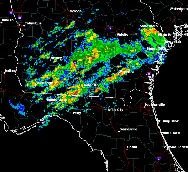 The severe thunderstorm warning for southeastern irwin county will expire at 1045 am est, the storm which prompted the warning has weakened below severe limits, and no longer poses an immediate threat to life or property. therefore, the warning will be allowed to expire. a tornado watch remains in effect until 600 pm est for south central georgia. The severe thunderstorm warning for southeastern irwin county will expire at 1045 am est, the storm which prompted the warning has weakened below severe limits, and no longer poses an immediate threat to life or property. therefore, the warning will be allowed to expire. a tornado watch remains in effect until 600 pm est for south central georgia.
|
| 12/2/2018 10:20 AM EST |
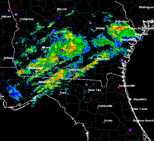 At 1020 am est, a severe thunderstorm was located near ocilla, moving northeast at 35 mph (radar indicated). Hazards include 60 mph wind gusts. Expect damage to roofs, siding, and trees. locations impacted include, ocilla, wray and osierfield. A tornado watch remains in effect until 600 pm est for south central georgia. At 1020 am est, a severe thunderstorm was located near ocilla, moving northeast at 35 mph (radar indicated). Hazards include 60 mph wind gusts. Expect damage to roofs, siding, and trees. locations impacted include, ocilla, wray and osierfield. A tornado watch remains in effect until 600 pm est for south central georgia.
|
| 12/2/2018 9:59 AM EST |
 At 959 am est, doppler radar indicated a severe thunderstorm capable of producing damaging winds in excess of 60 mph. this storm was located near enigma, or 7 miles southeast of tifton, and moving northeast at 35 mph. At 959 am est, doppler radar indicated a severe thunderstorm capable of producing damaging winds in excess of 60 mph. this storm was located near enigma, or 7 miles southeast of tifton, and moving northeast at 35 mph.
|
| 8/10/2018 8:32 PM EDT |
 A severe thunderstorm warning remains in effect until 915 pm edt for irwin. northern berrien. tift and southeastern worth counties. At 832 pm edt, severe thunderstorms were located along a line extending from near ocilla to 6 miles east of doerun, moving east at 20 mph. A severe thunderstorm warning remains in effect until 915 pm edt for irwin. northern berrien. tift and southeastern worth counties. At 832 pm edt, severe thunderstorms were located along a line extending from near ocilla to 6 miles east of doerun, moving east at 20 mph.
|
| 8/10/2018 8:02 PM EDT |
 At 802 pm edt, severe thunderstorms were located along a line extending from 9 miles northwest of fitzgerald to 6 miles northeast of doerun, moving east at 25 mph (radar indicated). Hazards include 60 mph wind gusts. expect damage to roofs, siding, and trees At 802 pm edt, severe thunderstorms were located along a line extending from 9 miles northwest of fitzgerald to 6 miles northeast of doerun, moving east at 25 mph (radar indicated). Hazards include 60 mph wind gusts. expect damage to roofs, siding, and trees
|
| 8/6/2018 5:48 PM EDT |
 At 548 pm edt, severe thunderstorms were located along a line extending from near ambrose to near ashburn, moving southwest at 30 mph (radar indicated). Hazards include 60 mph wind gusts. Expect damage to roofs, siding, and trees. Locations impacted include, fitzgerald, tifton, ocilla, ashburn, enigma, alapaha, mystic, unionville, phillipsburg, sycamore, rebecca, gladys, amboy, osierfield, glory, harding, waterloo, pinetta, inaha and ashton. At 548 pm edt, severe thunderstorms were located along a line extending from near ambrose to near ashburn, moving southwest at 30 mph (radar indicated). Hazards include 60 mph wind gusts. Expect damage to roofs, siding, and trees. Locations impacted include, fitzgerald, tifton, ocilla, ashburn, enigma, alapaha, mystic, unionville, phillipsburg, sycamore, rebecca, gladys, amboy, osierfield, glory, harding, waterloo, pinetta, inaha and ashton.
|
| 8/6/2018 5:20 PM EDT |
 At 520 pm edt, a severe thunderstorm was located near fitzgerald, moving south at 10 mph (radar indicated). Hazards include 60 mph wind gusts. expect damage to roofs, siding, and trees At 520 pm edt, a severe thunderstorm was located near fitzgerald, moving south at 10 mph (radar indicated). Hazards include 60 mph wind gusts. expect damage to roofs, siding, and trees
|
| 7/22/2018 9:51 PM EDT | Golf Ball sized hail reported 0.1 miles NNE of Ocilla, GA, golf ball sized hail reported in ocilla georgia. |
| 7/22/2018 8:45 PM EDT | Social media report of tree down on a house on holt roa in irwin county GA, 7.9 miles WNW of Ocilla, GA |
| 7/22/2018 8:45 PM EDT | Power line down on lilac roa in irwin county GA, 8.6 miles NW of Ocilla, GA |
| 7/22/2018 8:26 PM EDT |
 At 826 pm edt, a severe thunderstorm capable of producing a tornado was located near ambrose, moving east at 25 mph (radar indicated rotation). Hazards include tornado and half dollar size hail. Flying debris will be dangerous to those caught without shelter. mobile homes will be damaged or destroyed. damage to roofs, windows, and vehicles will occur. tree damage is likely. Locations impacted include, ocilla, wray and osierfield. At 826 pm edt, a severe thunderstorm capable of producing a tornado was located near ambrose, moving east at 25 mph (radar indicated rotation). Hazards include tornado and half dollar size hail. Flying debris will be dangerous to those caught without shelter. mobile homes will be damaged or destroyed. damage to roofs, windows, and vehicles will occur. tree damage is likely. Locations impacted include, ocilla, wray and osierfield.
|
| 7/22/2018 8:21 PM EDT | Golf Ball sized hail reported 0.1 miles NNE of Ocilla, GA, corrects previous hail report from ocilla. golf ball sized hail reported in ocilla georgia. |
| 7/22/2018 8:19 PM EDT |
 At 819 pm edt, a severe thunderstorm was located near fitzgerald, moving southeast at 20 mph (radar indicated). Hazards include 60 mph wind gusts and half dollar size hail. Hail damage to vehicles is expected. expect wind damage to roofs, siding, and trees. Locations impacted include, fitzgerald, ocilla, mystic, lulaville, osierfield, fitzgerald municipal a/p, wray and ashton. At 819 pm edt, a severe thunderstorm was located near fitzgerald, moving southeast at 20 mph (radar indicated). Hazards include 60 mph wind gusts and half dollar size hail. Hail damage to vehicles is expected. expect wind damage to roofs, siding, and trees. Locations impacted include, fitzgerald, ocilla, mystic, lulaville, osierfield, fitzgerald municipal a/p, wray and ashton.
|
| 7/22/2018 8:18 PM EDT | Report of numerous trees down between ocilla and douglas georgi in irwin county GA, 0.1 miles NNE of Ocilla, GA |
| 7/22/2018 8:09 PM EDT |
 At 809 pm edt, a severe thunderstorm capable of producing a tornado was located over ocilla, moving east at 25 mph (radar indicated rotation). Hazards include tornado. Flying debris will be dangerous to those caught without shelter. mobile homes will be damaged or destroyed. damage to roofs, windows, and vehicles will occur. tree damage is likely. This tornadic thunderstorm will remain over mainly rural areas of southeastern irwin and south central ben hill counties, including the following locations, wray and osierfield. At 809 pm edt, a severe thunderstorm capable of producing a tornado was located over ocilla, moving east at 25 mph (radar indicated rotation). Hazards include tornado. Flying debris will be dangerous to those caught without shelter. mobile homes will be damaged or destroyed. damage to roofs, windows, and vehicles will occur. tree damage is likely. This tornadic thunderstorm will remain over mainly rural areas of southeastern irwin and south central ben hill counties, including the following locations, wray and osierfield.
|
| 7/22/2018 7:54 PM EDT |
 At 753 pm edt, a severe thunderstorm was located near fitzgerald, moving southeast at 20 mph (radar indicated). Hazards include ping pong ball size hail and 60 mph wind gusts. People and animals outdoors will be injured. expect hail damage to roofs, siding, windows, and vehicles. expect wind damage to roofs, siding, and trees. Locations impacted include, fitzgerald, ocilla, mystic, lulaville, osierfield, pinetta, ashton, irwinville, fitzgerald municipal a/p, wray, bowens mill, red bluff, arp, abba and queensland. At 753 pm edt, a severe thunderstorm was located near fitzgerald, moving southeast at 20 mph (radar indicated). Hazards include ping pong ball size hail and 60 mph wind gusts. People and animals outdoors will be injured. expect hail damage to roofs, siding, windows, and vehicles. expect wind damage to roofs, siding, and trees. Locations impacted include, fitzgerald, ocilla, mystic, lulaville, osierfield, pinetta, ashton, irwinville, fitzgerald municipal a/p, wray, bowens mill, red bluff, arp, abba and queensland.
|
| 7/22/2018 7:44 PM EDT |
 At 744 pm edt, a severe thunderstorm was located 7 miles west of fitzgerald, moving southeast at 20 mph (radar indicated). Hazards include 60 mph wind gusts and quarter size hail. Hail damage to vehicles is expected. Expect wind damage to roofs, siding, and trees. At 744 pm edt, a severe thunderstorm was located 7 miles west of fitzgerald, moving southeast at 20 mph (radar indicated). Hazards include 60 mph wind gusts and quarter size hail. Hail damage to vehicles is expected. Expect wind damage to roofs, siding, and trees.
|
| 6/25/2018 8:14 PM EDT |
 At 813 pm edt, severe thunderstorms were located along a line extending from 7 miles northeast of fitzgerald to ocilla, moving east at 10 mph (radar indicated). Hazards include 60 mph wind gusts. expect damage to roofs, siding, and trees At 813 pm edt, severe thunderstorms were located along a line extending from 7 miles northeast of fitzgerald to ocilla, moving east at 10 mph (radar indicated). Hazards include 60 mph wind gusts. expect damage to roofs, siding, and trees
|
| 6/3/2018 11:36 PM EDT |
 At 1136 pm edt, a severe thunderstorm was located over ocilla, moving southeast at 25 mph (radar indicated). Hazards include 60 mph wind gusts. Expect damage to roofs, siding, and trees. Locations impacted include, ocilla, mystic, irwinville, osierfield, irwinville airport, wray, waterloo and pinetta. At 1136 pm edt, a severe thunderstorm was located over ocilla, moving southeast at 25 mph (radar indicated). Hazards include 60 mph wind gusts. Expect damage to roofs, siding, and trees. Locations impacted include, ocilla, mystic, irwinville, osierfield, irwinville airport, wray, waterloo and pinetta.
|
| 6/3/2018 11:22 PM EDT |
 At 1122 pm edt, a severe thunderstorm was located near fitzgerald, moving southeast at 25 mph (radar indicated). Hazards include 60 mph wind gusts. Expect damage to roofs, siding, and trees. Locations impacted include, fitzgerald, ocilla, mystic, lulaville, osierfield, waterloo, pinetta, ashton, irwinville, fitzgerald municipal a/p, irwinville airport, wray, bowens mill, red bluff, arp, abba and queensland. At 1122 pm edt, a severe thunderstorm was located near fitzgerald, moving southeast at 25 mph (radar indicated). Hazards include 60 mph wind gusts. Expect damage to roofs, siding, and trees. Locations impacted include, fitzgerald, ocilla, mystic, lulaville, osierfield, waterloo, pinetta, ashton, irwinville, fitzgerald municipal a/p, irwinville airport, wray, bowens mill, red bluff, arp, abba and queensland.
|
| 6/3/2018 10:59 PM EDT |
 The national weather service in tallahassee has issued a * severe thunderstorm warning for. irwin county in south central georgia. eastern turner county in south central georgia. ben hill county in south central georgia. Until midnight edt. The national weather service in tallahassee has issued a * severe thunderstorm warning for. irwin county in south central georgia. eastern turner county in south central georgia. ben hill county in south central georgia. Until midnight edt.
|
| 4/15/2018 10:20 AM EDT |
 At 1020 am edt, a severe thunderstorm was located over ocilla, moving northeast at 60 mph (radar indicated). Hazards include 60 mph wind gusts. Expect damage to roofs, siding, and trees. Locations impacted include, fitzgerald, ocilla, alapaha, mystic, lulaville, gladys, osierfield, fitzgerald municipal a/p, wray, red bluff, ashton and queensland. At 1020 am edt, a severe thunderstorm was located over ocilla, moving northeast at 60 mph (radar indicated). Hazards include 60 mph wind gusts. Expect damage to roofs, siding, and trees. Locations impacted include, fitzgerald, ocilla, alapaha, mystic, lulaville, gladys, osierfield, fitzgerald municipal a/p, wray, red bluff, ashton and queensland.
|
| 4/15/2018 10:03 AM EDT |
 At 1003 am edt, a severe thunderstorm was located near unionville, or near tifton, moving northeast at 60 mph (radar indicated). Hazards include 60 mph wind gusts. expect damage to roofs, siding, and trees At 1003 am edt, a severe thunderstorm was located near unionville, or near tifton, moving northeast at 60 mph (radar indicated). Hazards include 60 mph wind gusts. expect damage to roofs, siding, and trees
|
| 8/30/2017 5:02 PM EDT |
 At 501 pm edt, a severe thunderstorm was located over fitzgerald, moving east at 30 mph (radar indicated). Hazards include 60 mph wind gusts. expect damage to roofs, siding, and trees At 501 pm edt, a severe thunderstorm was located over fitzgerald, moving east at 30 mph (radar indicated). Hazards include 60 mph wind gusts. expect damage to roofs, siding, and trees
|
| 7/10/2017 3:45 PM EDT | Powerlines down in ocilla in irwin county GA, 0.1 miles NNE of Ocilla, GA |
| 7/10/2017 3:39 PM EDT |
 At 338 pm edt, a severe thunderstorm was located over ocilla, moving northeast at 10 mph (radar indicated). Hazards include 60 mph wind gusts. Expect damage to roofs, siding, and trees. Locations impacted include, ocilla, mystic, wray, pinetta, irwinville and osierfield. At 338 pm edt, a severe thunderstorm was located over ocilla, moving northeast at 10 mph (radar indicated). Hazards include 60 mph wind gusts. Expect damage to roofs, siding, and trees. Locations impacted include, ocilla, mystic, wray, pinetta, irwinville and osierfield.
|
| 7/10/2017 3:26 PM EDT |
 At 326 pm edt, a severe thunderstorm was located near ocilla, moving north at 10 mph (radar indicated). Hazards include 60 mph wind gusts and penny size hail. expect damage to roofs, siding, and trees At 326 pm edt, a severe thunderstorm was located near ocilla, moving north at 10 mph (radar indicated). Hazards include 60 mph wind gusts and penny size hail. expect damage to roofs, siding, and trees
|
| 4/5/2017 9:11 PM EDT |
 At 911 pm edt, a severe thunderstorm was located over jacksonville, or 12 miles north of broxton, moving northeast at 55 mph (radar indicated). Hazards include 60 mph wind gusts and quarter size hail. Hail damage to vehicles is expected. expect wind damage to roofs, siding, and trees. locations impacted include, fitzgerald, lulaville, osierfield, fitzgerald municipal a/p, wray, bowens mill, red bluff, ashton and queensland. A tornado watch remains in effect until 1100 pm edt for south central georgia. At 911 pm edt, a severe thunderstorm was located over jacksonville, or 12 miles north of broxton, moving northeast at 55 mph (radar indicated). Hazards include 60 mph wind gusts and quarter size hail. Hail damage to vehicles is expected. expect wind damage to roofs, siding, and trees. locations impacted include, fitzgerald, lulaville, osierfield, fitzgerald municipal a/p, wray, bowens mill, red bluff, ashton and queensland. A tornado watch remains in effect until 1100 pm edt for south central georgia.
|
| 4/5/2017 8:42 PM EDT | Tree down on bugle lane at highway 31 in irwin county GA, 6.1 miles ENE of Ocilla, GA |
| 4/5/2017 8:42 PM EDT |
 At 842 pm edt, a severe thunderstorm was located over mystic, or near ocilla, moving northeast at 45 mph (radar indicated). Hazards include 60 mph wind gusts and quarter size hail. Hail damage to vehicles is expected. Expect wind damage to roofs, siding, and trees. At 842 pm edt, a severe thunderstorm was located over mystic, or near ocilla, moving northeast at 45 mph (radar indicated). Hazards include 60 mph wind gusts and quarter size hail. Hail damage to vehicles is expected. Expect wind damage to roofs, siding, and trees.
|
| 4/5/2017 3:35 PM EDT |
 At 334 pm edt, a severe thunderstorm was located 10 miles south of rochelle, or 12 miles northeast of ashburn, moving east at 55 mph (trained weather spotters). Hazards include quarter size hail. Damage to vehicles is expected. locations impacted include, fitzgerald, ashburn, ocilla, mystic, worth, terrell, sycamore, rebecca, lulaville, amboy, sibley, inaha, coverdale, irwinville, fitzgerald municipal a/p, hobby, turner co airport, irwinville airport, dakota and arp. A tornado watch remains in effect until 800 pm edt for south central georgia. At 334 pm edt, a severe thunderstorm was located 10 miles south of rochelle, or 12 miles northeast of ashburn, moving east at 55 mph (trained weather spotters). Hazards include quarter size hail. Damage to vehicles is expected. locations impacted include, fitzgerald, ashburn, ocilla, mystic, worth, terrell, sycamore, rebecca, lulaville, amboy, sibley, inaha, coverdale, irwinville, fitzgerald municipal a/p, hobby, turner co airport, irwinville airport, dakota and arp. A tornado watch remains in effect until 800 pm edt for south central georgia.
|
| 4/5/2017 3:16 PM EDT |
 At 315 pm edt, a severe thunderstorm was located 7 miles west of ashburn, moving east at 55 mph (radar indicated). Hazards include 60 mph wind gusts and half dollar size hail. Hail damage to vehicles is expected. Expect wind damage to roofs, siding, and trees. At 315 pm edt, a severe thunderstorm was located 7 miles west of ashburn, moving east at 55 mph (radar indicated). Hazards include 60 mph wind gusts and half dollar size hail. Hail damage to vehicles is expected. Expect wind damage to roofs, siding, and trees.
|
| 4/3/2017 2:28 PM EDT |
 At 227 pm edt, doppler radar indicated a severe thunderstorm capable of producing damaging winds in excess of 60 mph. this storm was located over ashburn, and moving east at 50 mph. penny size hail may also accompany the damaging winds. At 227 pm edt, doppler radar indicated a severe thunderstorm capable of producing damaging winds in excess of 60 mph. this storm was located over ashburn, and moving east at 50 mph. penny size hail may also accompany the damaging winds.
|
| 2/7/2017 8:18 PM EST |
 At 818 pm est, a severe thunderstorm was located 7 miles west of ambrose, moving northeast at 40 mph (radar indicated). Hazards include 60 mph wind gusts. expect damage to roofs, siding, and trees At 818 pm est, a severe thunderstorm was located 7 miles west of ambrose, moving northeast at 40 mph (radar indicated). Hazards include 60 mph wind gusts. expect damage to roofs, siding, and trees
|
| 1/22/2017 5:23 AM EST |
 The severe thunderstorm warning for ben hill and irwin counties will expire at 530 am est, the storm which prompted the warning has moved out of the area. therefore the warning will be allowed to expire. a tornado watch remains in effect until 1000 am est for south central georgia. The severe thunderstorm warning for ben hill and irwin counties will expire at 530 am est, the storm which prompted the warning has moved out of the area. therefore the warning will be allowed to expire. a tornado watch remains in effect until 1000 am est for south central georgia.
|
| 1/22/2017 5:08 AM EST |
 At 508 am est, a severe thunderstorm capable of producing a tornado was located near ocilla, moving east at 55 mph (radar indicated rotation). Hazards include tornado and quarter size hail. Flying debris will be dangerous to those caught without shelter. mobile homes will be damaged or destroyed. damage to roofs, windows, and vehicles will occur. tree damage is likely. Locations impacted include, ocilla, fitzgerald, fitzgerald municipal a/p, osierfield, wray, red bluff and ashton. At 508 am est, a severe thunderstorm capable of producing a tornado was located near ocilla, moving east at 55 mph (radar indicated rotation). Hazards include tornado and quarter size hail. Flying debris will be dangerous to those caught without shelter. mobile homes will be damaged or destroyed. damage to roofs, windows, and vehicles will occur. tree damage is likely. Locations impacted include, ocilla, fitzgerald, fitzgerald municipal a/p, osierfield, wray, red bluff and ashton.
|
| 1/22/2017 5:01 AM EST |
 At 501 am est, a severe thunderstorm was located over ocilla, moving east at 60 mph (radar indicated). Hazards include 60 mph wind gusts and quarter size hail. Hail damage to vehicles is expected. expect wind damage to roofs, siding, and trees. locations impacted include, fitzgerald, ocilla, mystic, irwinville airport, irwinville, queensland, wray, lulaville, pinetta, arp, fitzgerald municipal a/p, osierfield, abba, ashton, waterloo and red bluff. A tornado watch remains in effect until 1000 am est for south central georgia. At 501 am est, a severe thunderstorm was located over ocilla, moving east at 60 mph (radar indicated). Hazards include 60 mph wind gusts and quarter size hail. Hail damage to vehicles is expected. expect wind damage to roofs, siding, and trees. locations impacted include, fitzgerald, ocilla, mystic, irwinville airport, irwinville, queensland, wray, lulaville, pinetta, arp, fitzgerald municipal a/p, osierfield, abba, ashton, waterloo and red bluff. A tornado watch remains in effect until 1000 am est for south central georgia.
|
| 1/22/2017 5:00 AM EST |
 At 500 am est, a severe thunderstorm capable of producing a tornado was located over ocilla, moving east at 55 mph (radar indicated rotation). Hazards include tornado and quarter size hail. Flying debris will be dangerous to those caught without shelter. mobile homes will be damaged or destroyed. damage to roofs, windows, and vehicles will occur. tree damage is likely. This tornadic thunderstorm will remain over mainly rural areas of southeastern ben hill and central irwin counties, including the following locations: fitzgerald municipal a/p, osierfield, irwinville, wray, pinetta, red bluff and ashton. At 500 am est, a severe thunderstorm capable of producing a tornado was located over ocilla, moving east at 55 mph (radar indicated rotation). Hazards include tornado and quarter size hail. Flying debris will be dangerous to those caught without shelter. mobile homes will be damaged or destroyed. damage to roofs, windows, and vehicles will occur. tree damage is likely. This tornadic thunderstorm will remain over mainly rural areas of southeastern ben hill and central irwin counties, including the following locations: fitzgerald municipal a/p, osierfield, irwinville, wray, pinetta, red bluff and ashton.
|
| 1/22/2017 4:47 AM EST |
 At 447 am est, a severe thunderstorm was located near tifton, moving east at 60 mph (radar indicated). Hazards include 60 mph wind gusts and quarter size hail. Hail damage to vehicles is expected. expect wind damage to roofs, siding, and trees. locations impacted include, fitzgerald, ocilla, tifton, ty ty, mystic, sycamore, irwinville airport, queensland, wray, pinetta, arp, inaha, fitzgerald municipal a/p, osierfield, coverdale, ashton, harding, irwinville, lulaville and hillsdale. A tornado watch remains in effect until 1000 am est for south central georgia. At 447 am est, a severe thunderstorm was located near tifton, moving east at 60 mph (radar indicated). Hazards include 60 mph wind gusts and quarter size hail. Hail damage to vehicles is expected. expect wind damage to roofs, siding, and trees. locations impacted include, fitzgerald, ocilla, tifton, ty ty, mystic, sycamore, irwinville airport, queensland, wray, pinetta, arp, inaha, fitzgerald municipal a/p, osierfield, coverdale, ashton, harding, irwinville, lulaville and hillsdale. A tornado watch remains in effect until 1000 am est for south central georgia.
|
| 1/22/2017 4:24 AM EST |
 At 424 am est, doppler radar indicated a severe thunderstorm capable of producing quarter size hail and destructive winds in excess of 70 mph. this storm was located near sylvester, and moving east at 60 mph. At 424 am est, doppler radar indicated a severe thunderstorm capable of producing quarter size hail and destructive winds in excess of 70 mph. this storm was located near sylvester, and moving east at 60 mph.
|
| 1/22/2017 1:04 AM EST |
 At 103 am est, a severe thunderstorm was located near ashburn, moving east at 45 mph (radar indicated). Hazards include 60 mph wind gusts and quarter size hail. Hail damage to vehicles is expected. Expect wind damage to roofs, siding, and trees. At 103 am est, a severe thunderstorm was located near ashburn, moving east at 45 mph (radar indicated). Hazards include 60 mph wind gusts and quarter size hail. Hail damage to vehicles is expected. Expect wind damage to roofs, siding, and trees.
|
| 1/22/2017 12:09 AM EST |
 The severe thunderstorm warning for western irwin county will expire at 1215 am est, the storm which prompted the warning has weakened below severe limits, and is exiting the warned area. therefore, the warning will be allowed to expire. a tornado watch remains in effect until 400 am est for south central georgia. to report severe weather, contact your nearest law enforcement agency. they will relay your report to the national weather service tallahassee. The severe thunderstorm warning for western irwin county will expire at 1215 am est, the storm which prompted the warning has weakened below severe limits, and is exiting the warned area. therefore, the warning will be allowed to expire. a tornado watch remains in effect until 400 am est for south central georgia. to report severe weather, contact your nearest law enforcement agency. they will relay your report to the national weather service tallahassee.
|
| 1/22/2017 12:02 AM EST |
 At 1201 am est, a severe thunderstorm was located near fitzgerald, moving northeast at 45 mph (radar indicated). Hazards include two inch hail and 60 mph wind gusts. People and animals outdoors will be injured. expect hail damage to roofs, siding, windows, and vehicles. expect wind damage to roofs, siding, and trees. locations impacted include, mystic, irwinville airport, irwinville, pinetta, arp, abba and waterloo. A tornado watch remains in effect until 400 am est for south central georgia. At 1201 am est, a severe thunderstorm was located near fitzgerald, moving northeast at 45 mph (radar indicated). Hazards include two inch hail and 60 mph wind gusts. People and animals outdoors will be injured. expect hail damage to roofs, siding, windows, and vehicles. expect wind damage to roofs, siding, and trees. locations impacted include, mystic, irwinville airport, irwinville, pinetta, arp, abba and waterloo. A tornado watch remains in effect until 400 am est for south central georgia.
|
| 1/21/2017 11:51 PM EST |
 At 1150 pm est, a severe thunderstorm was located 9 miles west of mystic, or 10 miles southeast of ashburn, moving northeast at 45 mph (radar indicated). Hazards include two inch hail and 60 mph wind gusts. People and animals outdoors will be injured. expect hail damage to roofs, siding, windows, and vehicles. expect wind damage to roofs, siding, and trees. locations impacted include, mystic, sycamore, irwinville airport, chula, harding, irwinville, pinetta, arp, abba, sunsweet, inaha and waterloo. A tornado watch remains in effect until 400 am est for south central georgia. At 1150 pm est, a severe thunderstorm was located 9 miles west of mystic, or 10 miles southeast of ashburn, moving northeast at 45 mph (radar indicated). Hazards include two inch hail and 60 mph wind gusts. People and animals outdoors will be injured. expect hail damage to roofs, siding, windows, and vehicles. expect wind damage to roofs, siding, and trees. locations impacted include, mystic, sycamore, irwinville airport, chula, harding, irwinville, pinetta, arp, abba, sunsweet, inaha and waterloo. A tornado watch remains in effect until 400 am est for south central georgia.
|
| 1/21/2017 11:42 PM EST |
 At 1142 pm est, a severe thunderstorm was located 8 miles southeast of ashburn, moving northeast at 45 mph (radar indicated). Hazards include two inch hail and 60 mph wind gusts. People and animals outdoors will be injured. expect hail damage to roofs, siding, windows, and vehicles. expect wind damage to roofs, siding, and trees. locations impacted include, tifton, ty ty, mystic, sycamore, irwinville airport, harding, irwinville, pinetta, hillsdale, arp, inaha, chula, abba, sunsweet and waterloo. A tornado watch remains in effect until 400 am est for south central georgia. At 1142 pm est, a severe thunderstorm was located 8 miles southeast of ashburn, moving northeast at 45 mph (radar indicated). Hazards include two inch hail and 60 mph wind gusts. People and animals outdoors will be injured. expect hail damage to roofs, siding, windows, and vehicles. expect wind damage to roofs, siding, and trees. locations impacted include, tifton, ty ty, mystic, sycamore, irwinville airport, harding, irwinville, pinetta, hillsdale, arp, inaha, chula, abba, sunsweet and waterloo. A tornado watch remains in effect until 400 am est for south central georgia.
|
| 1/21/2017 11:28 PM EST |
 At 1127 pm est, a severe thunderstorm was located over poulan, or near sylvester, moving northeast at 45 mph (radar indicated). Hazards include ping pong ball size hail and 60 mph wind gusts. People and animals outdoors will be injured. expect hail damage to roofs, siding, windows, and vehicles. Expect wind damage to roofs, siding, and trees. At 1127 pm est, a severe thunderstorm was located over poulan, or near sylvester, moving northeast at 45 mph (radar indicated). Hazards include ping pong ball size hail and 60 mph wind gusts. People and animals outdoors will be injured. expect hail damage to roofs, siding, windows, and vehicles. Expect wind damage to roofs, siding, and trees.
|
| 1/2/2017 10:54 PM EST |
 At 1054 pm est, severe thunderstorms were located along a line extending from 7 miles south of pitts to 9 miles west of adel, moving northeast at 55 mph (radar indicated). Hazards include 70 mph wind gusts. Expect considerable tree damage. Damage is likely to mobile homes, roofs, and outbuildings. At 1054 pm est, severe thunderstorms were located along a line extending from 7 miles south of pitts to 9 miles west of adel, moving northeast at 55 mph (radar indicated). Hazards include 70 mph wind gusts. Expect considerable tree damage. Damage is likely to mobile homes, roofs, and outbuildings.
|
| 8/14/2016 8:50 PM EDT |
 The severe thunderstorm warning for berrien, cook, eastern colquitt, southeastern tift and southwestern irwin counties will expire at 900 pm edt, the storms which prompted the warning have weakened below severe limits, and no longer pose an immediate threat to life or property. therefore, the warning will be allowed to expire. to report severe weather, contact your nearest law enforcement agency. they will relay your report to the national weather service tallahassee. The severe thunderstorm warning for berrien, cook, eastern colquitt, southeastern tift and southwestern irwin counties will expire at 900 pm edt, the storms which prompted the warning have weakened below severe limits, and no longer pose an immediate threat to life or property. therefore, the warning will be allowed to expire. to report severe weather, contact your nearest law enforcement agency. they will relay your report to the national weather service tallahassee.
|
| 8/14/2016 8:34 PM EDT |
 At 834 pm edt, severe thunderstorms were located along a line extending from alapaha to 10 miles northeast of pavo, moving northwest at 30 mph. multiple trees have been blown down in berrien county (radar indicated). Hazards include 60 mph wind gusts. Expect damage to roofs. siding. and trees. Locations impacted include, moultrie, tifton, adel, nashville, ocilla, sparks, enigma, ome ga, norman park, lenox, alapaha, riverside, phillipsburg, unionville, berlin, cecil, ellenton, allenville, south moultrie and glory. At 834 pm edt, severe thunderstorms were located along a line extending from alapaha to 10 miles northeast of pavo, moving northwest at 30 mph. multiple trees have been blown down in berrien county (radar indicated). Hazards include 60 mph wind gusts. Expect damage to roofs. siding. and trees. Locations impacted include, moultrie, tifton, adel, nashville, ocilla, sparks, enigma, ome ga, norman park, lenox, alapaha, riverside, phillipsburg, unionville, berlin, cecil, ellenton, allenville, south moultrie and glory.
|
| 8/14/2016 7:53 PM EDT |
 At 753 pm edt, severe thunderstorms were located along a line extending from 8 miles north of lakeland to quitman, moving northwest at 30 mph (radar indicated). Hazards include 60 mph wind gusts. Expect damage to roofs. siding. And trees. At 753 pm edt, severe thunderstorms were located along a line extending from 8 miles north of lakeland to quitman, moving northwest at 30 mph (radar indicated). Hazards include 60 mph wind gusts. Expect damage to roofs. siding. And trees.
|
| 7/19/2016 4:55 PM EDT |
 At 454 pm edt, a severe thunderstorm was located near ocilla, moving south at 25 mph (radar indicated). Hazards include 60 mph wind gusts. Expect damage to roofs. siding. and trees. Locations impacted include, ocilla, mystic, pinetta, osierfield, irwinville and wray. At 454 pm edt, a severe thunderstorm was located near ocilla, moving south at 25 mph (radar indicated). Hazards include 60 mph wind gusts. Expect damage to roofs. siding. and trees. Locations impacted include, ocilla, mystic, pinetta, osierfield, irwinville and wray.
|
| 7/19/2016 4:39 PM EDT |
 At 439 pm edt, a severe thunderstorm was located near fitzgerald, moving south at 25 mph (radar indicated). Hazards include 60 mph wind gusts. Expect damage to roofs. siding. and trees. Locations impacted include, fitzgerald, ocilla, mystic, fitzgerald municipal a/p, osierfield, irwinville, wray, lulaville, pinetta and ashton. At 439 pm edt, a severe thunderstorm was located near fitzgerald, moving south at 25 mph (radar indicated). Hazards include 60 mph wind gusts. Expect damage to roofs. siding. and trees. Locations impacted include, fitzgerald, ocilla, mystic, fitzgerald municipal a/p, osierfield, irwinville, wray, lulaville, pinetta and ashton.
|
| 7/19/2016 4:25 PM EDT |
 At 425 pm edt, a severe thunderstorm was located near fitzgerald, moving southwest at 30 mph (radar indicated). Hazards include 60 mph wind gusts. Expect damage to roofs. siding. And trees. At 425 pm edt, a severe thunderstorm was located near fitzgerald, moving southwest at 30 mph (radar indicated). Hazards include 60 mph wind gusts. Expect damage to roofs. siding. And trees.
|
| 6/17/2016 9:56 PM EDT |
 At 955 pm edt, severe thunderstorms were located along a line extending from 6 miles southwest of ambrose to 7 miles northeast of ty ty, moving southeast at 45 mph (radar indicated). Hazards include 60 mph wind gusts. Expect damage to roofs. siding. And trees. At 955 pm edt, severe thunderstorms were located along a line extending from 6 miles southwest of ambrose to 7 miles northeast of ty ty, moving southeast at 45 mph (radar indicated). Hazards include 60 mph wind gusts. Expect damage to roofs. siding. And trees.
|
| 6/17/2016 9:45 PM EDT | Trees down along a 10 mile stretch of hwy 32 e from ocilla to the irwin county line in irwin county GA, 0.1 miles NNE of Ocilla, GA |
| 6/17/2016 9:45 PM EDT |
 At 944 pm edt, severe thunderstorms were located along a line extending from west green to 6 miles northeast of poulan, moving southeast at 30 mph (radar indicated). Hazards include 60 mph wind gusts and nickel size hail. Expect damage to roofs. siding. and trees. Locations impacted include, tifton, fitzgerald, ocilla, ashburn, enigma, ty ty, alapaha, unionville, mystic, phillipsburg, sycamore, irwinville airport, wray, pinetta, arp, inaha, fitzgerald municipal a/p, osierfield, ashton and harding. At 944 pm edt, severe thunderstorms were located along a line extending from west green to 6 miles northeast of poulan, moving southeast at 30 mph (radar indicated). Hazards include 60 mph wind gusts and nickel size hail. Expect damage to roofs. siding. and trees. Locations impacted include, tifton, fitzgerald, ocilla, ashburn, enigma, ty ty, alapaha, unionville, mystic, phillipsburg, sycamore, irwinville airport, wray, pinetta, arp, inaha, fitzgerald municipal a/p, osierfield, ashton and harding.
|
| 6/17/2016 9:31 PM EDT |
 At 930 pm edt, severe thunderstorms were located along a line extending from near west green to 6 miles southwest of ashburn, moving southeast at 30 mph (radar indicated). Hazards include 60 mph wind gusts and nickel size hail. Expect damage to roofs. siding. and trees. Locations impacted include, tifton, fitzgerald, ocilla, ashburn, enigma, ty ty, alapaha, unionville, mystic, phillipsburg, worth, terrell, sycamore, sumner, rebecca, irwinville airport, queensland, wray, pinetta and arp. At 930 pm edt, severe thunderstorms were located along a line extending from near west green to 6 miles southwest of ashburn, moving southeast at 30 mph (radar indicated). Hazards include 60 mph wind gusts and nickel size hail. Expect damage to roofs. siding. and trees. Locations impacted include, tifton, fitzgerald, ocilla, ashburn, enigma, ty ty, alapaha, unionville, mystic, phillipsburg, worth, terrell, sycamore, sumner, rebecca, irwinville airport, queensland, wray, pinetta and arp.
|
| 6/17/2016 8:56 PM EDT |
 At 855 pm edt, severe thunderstorms were located along a line extending from 7 miles northeast of jacksonville to 6 miles west of arabi, moving southeast at 30 mph (radar indicated). Hazards include 60 mph wind gusts and nickel size hail. Expect damage to roofs. siding. And trees. At 855 pm edt, severe thunderstorms were located along a line extending from 7 miles northeast of jacksonville to 6 miles west of arabi, moving southeast at 30 mph (radar indicated). Hazards include 60 mph wind gusts and nickel size hail. Expect damage to roofs. siding. And trees.
|
| 6/17/2016 7:18 PM EDT |
 At 718 pm edt, a severe thunderstorm was located near fitzgerald, moving east at 35 mph (radar indicated). Hazards include 60 mph wind gusts and quarter size hail. Hail damage to vehicles is expected. Expect wind damage to roofs, siding, and trees. At 718 pm edt, a severe thunderstorm was located near fitzgerald, moving east at 35 mph (radar indicated). Hazards include 60 mph wind gusts and quarter size hail. Hail damage to vehicles is expected. Expect wind damage to roofs, siding, and trees.
|
| 5/3/2016 5:34 PM EDT |
 At 534 pm edt, a severe thunderstorm was located near mystic, or near fitzgerald, moving northeast at 40 mph (radar indicated). Hazards include ping pong ball size hail and 60 mph wind gusts. People and animals outdoors will be injured. expect hail damage to roofs, siding, windows, and vehicles. expect wind damage to roofs, siding, and trees. Locations impacted include, fitzgerald, ocilla, mystic, fitzgerald municipal a/p, osierfield, irwinville, wray, pinetta and ashton. At 534 pm edt, a severe thunderstorm was located near mystic, or near fitzgerald, moving northeast at 40 mph (radar indicated). Hazards include ping pong ball size hail and 60 mph wind gusts. People and animals outdoors will be injured. expect hail damage to roofs, siding, windows, and vehicles. expect wind damage to roofs, siding, and trees. Locations impacted include, fitzgerald, ocilla, mystic, fitzgerald municipal a/p, osierfield, irwinville, wray, pinetta and ashton.
|
| 5/3/2016 5:30 PM EDT | Trees and power lines down in the city of ocilla. a house fire due to a downed power line in the city as wel in irwin county GA, 0.1 miles NNE of Ocilla, GA |
| 5/3/2016 5:28 PM EDT | Quarter sized hail reported 0.1 miles NNE of Ocilla, GA, picture received via twitter of quarter size hail. |
| 5/3/2016 5:27 PM EDT |
 At 527 pm edt, a severe thunderstorm was located over mystic, or 7 miles west of ocilla, moving northeast at 40 mph (radar indicated). Hazards include ping pong ball size hail and 60 mph wind gusts. People and animals outdoors will be injured. expect hail damage to roofs, siding, windows, and vehicles. expect wind damage to roofs, siding, and trees. Locations impacted include, fitzgerald, ocilla, tifton, mystic, irwinville airport, harding, irwinville, queensland, wray, lulaville, pinetta, arp, westwood, chula, fitzgerald municipal a/p, osierfield, bowens mill, abba, sunsweet and ashton. At 527 pm edt, a severe thunderstorm was located over mystic, or 7 miles west of ocilla, moving northeast at 40 mph (radar indicated). Hazards include ping pong ball size hail and 60 mph wind gusts. People and animals outdoors will be injured. expect hail damage to roofs, siding, windows, and vehicles. expect wind damage to roofs, siding, and trees. Locations impacted include, fitzgerald, ocilla, tifton, mystic, irwinville airport, harding, irwinville, queensland, wray, lulaville, pinetta, arp, westwood, chula, fitzgerald municipal a/p, osierfield, bowens mill, abba, sunsweet and ashton.
|
| 5/3/2016 5:18 PM EDT |
 At 518 pm edt, a severe thunderstorm was located 7 miles southwest of mystic, or 9 miles north of tifton, moving northeast at 40 mph (radar indicated). Hazards include 60 mph wind gusts and quarter size hail. Hail damage to vehicles is expected. Expect wind damage to roofs, siding, and trees. At 518 pm edt, a severe thunderstorm was located 7 miles southwest of mystic, or 9 miles north of tifton, moving northeast at 40 mph (radar indicated). Hazards include 60 mph wind gusts and quarter size hail. Hail damage to vehicles is expected. Expect wind damage to roofs, siding, and trees.
|
| 5/3/2016 5:00 PM EDT |
 At 459 pm edt, a severe thunderstorm was located over unionville, or near tifton, moving east at 25 mph (emergency management). Hazards include ping pong ball size hail and 60 mph wind gusts. People and animals outdoors will be injured. expect hail damage to roofs, siding, windows, and vehicles. Expect wind damage to roofs, siding, and trees. At 459 pm edt, a severe thunderstorm was located over unionville, or near tifton, moving east at 25 mph (emergency management). Hazards include ping pong ball size hail and 60 mph wind gusts. People and animals outdoors will be injured. expect hail damage to roofs, siding, windows, and vehicles. Expect wind damage to roofs, siding, and trees.
|
| 2/24/2016 4:44 AM EST |
 At 444 am est, a severe thunderstorm was located 8 miles southeast of ocilla, moving northeast at 50 mph (radar indicated). Hazards include 60 mph wind gusts. Expect damage to roofs. siding and trees. locations impacted include, ocilla, enigma, alapaha, glory, osierfield, wray and gladys. A tornado watch remains in effect until 600 am est for south central georgia. At 444 am est, a severe thunderstorm was located 8 miles southeast of ocilla, moving northeast at 50 mph (radar indicated). Hazards include 60 mph wind gusts. Expect damage to roofs. siding and trees. locations impacted include, ocilla, enigma, alapaha, glory, osierfield, wray and gladys. A tornado watch remains in effect until 600 am est for south central georgia.
|
| 2/24/2016 4:29 AM EST |
 At 429 am est, a severe thunderstorm was located over enigma, or 11 miles east of tifton, moving northeast at 55 mph (radar indicated). Hazards include 60 mph wind gusts. Expect damage to roofs. Siding and trees. At 429 am est, a severe thunderstorm was located over enigma, or 11 miles east of tifton, moving northeast at 55 mph (radar indicated). Hazards include 60 mph wind gusts. Expect damage to roofs. Siding and trees.
|
| 7/19/2015 8:10 PM EDT | Several trees and power lines down across the county in irwin county GA, 0.1 miles NNE of Ocilla, GA |
| 7/19/2015 7:08 PM EDT |
 At 708 pm edt, the national weather service has detected a severe thunderstorm capable of producing damaging winds in excess of 60 mph. this storm was located near rochelle, or 8 miles southwest of abbeville, and moving southeast at 30 mph. At 708 pm edt, the national weather service has detected a severe thunderstorm capable of producing damaging winds in excess of 60 mph. this storm was located near rochelle, or 8 miles southwest of abbeville, and moving southeast at 30 mph.
|
| 7/15/2015 5:40 PM EDT | Trees were blown down in the eastern part of the county in irwin county GA, 5.8 miles W of Ocilla, GA |
| 7/15/2015 5:40 PM EDT | Power lines down on the south side of ocilla in irwin county GA, 0.1 miles NNE of Ocilla, GA |
| 7/15/2015 5:40 PM EDT |
 At 540 pm edt, doppler radar indicated a line of severe thunderstorms capable of producing quarter size hail and damaging winds in excess of 60 mph. these storms were located along a line extending from 9 miles northwest of mystic to near ambrose, moving south at 15 mph. locations impacted include, ocilla, mystic, irwinville airport, osierfield, irwinville, wray, pinetta, arp, abba and waterloo. At 540 pm edt, doppler radar indicated a line of severe thunderstorms capable of producing quarter size hail and damaging winds in excess of 60 mph. these storms were located along a line extending from 9 miles northwest of mystic to near ambrose, moving south at 15 mph. locations impacted include, ocilla, mystic, irwinville airport, osierfield, irwinville, wray, pinetta, arp, abba and waterloo.
|
| 7/15/2015 5:25 PM EDT |
 At 525 pm edt, doppler radar indicated a line of severe thunderstorms capable of producing quarter size hail and damaging winds in excess of 60 mph. these storms were located along a line extending from 11 miles south of rochelle to 6 miles northwest of ambrose, moving south at 15 mph. locations impacted include, fitzgerald, ocilla, mystic, irwinville airport, irwinville, queensland, wray, lulaville, pinetta, arp, westwood, fitzgerald municipal a/p, osierfield, abba, ashton and waterloo. At 525 pm edt, doppler radar indicated a line of severe thunderstorms capable of producing quarter size hail and damaging winds in excess of 60 mph. these storms were located along a line extending from 11 miles south of rochelle to 6 miles northwest of ambrose, moving south at 15 mph. locations impacted include, fitzgerald, ocilla, mystic, irwinville airport, irwinville, queensland, wray, lulaville, pinetta, arp, westwood, fitzgerald municipal a/p, osierfield, abba, ashton and waterloo.
|
| 7/15/2015 5:09 PM EDT |
 At 509 pm edt, the national weather service has detected a line of severe thunderstorms capable of producing damaging winds in excess of 60 mph. these storms were located along a line extending from 8 miles south of rochelle to 7 miles southwest of jacksonville, and moving south at 15 mph. At 509 pm edt, the national weather service has detected a line of severe thunderstorms capable of producing damaging winds in excess of 60 mph. these storms were located along a line extending from 8 miles south of rochelle to 7 miles southwest of jacksonville, and moving south at 15 mph.
|
| 7/2/2015 5:05 PM EDT |
 The severe thunderstorm warning for ben hill and southeastern irwin counties will expire at 515 pm edt, the storms which prompted the warning have moved out of the area. therefore the warning will be allowed to expire. to report severe weather, contact your nearest law enforcement agency. they will relay your report to the national weather service tallahassee. The severe thunderstorm warning for ben hill and southeastern irwin counties will expire at 515 pm edt, the storms which prompted the warning have moved out of the area. therefore the warning will be allowed to expire. to report severe weather, contact your nearest law enforcement agency. they will relay your report to the national weather service tallahassee.
|
| 7/2/2015 4:49 PM EDT | Tree down at lax hwy and lilac r in irwin county GA, 8.1 miles NW of Ocilla, GA |
| 7/2/2015 4:47 PM EDT |
 At 447 pm edt, doppler radar indicated a line of severe thunderstorms capable of producing damaging winds in excess of 60 mph. these storms were located along a line extending from 9 miles northeast of fitzgerald to 7 miles southeast of ocilla, moving east at 35 mph. locations impacted include, fitzgerald, ocilla, fitzgerald municipal a/p, osierfield, queensland, wray, bowens mill, lulaville, red bluff and ashton. At 447 pm edt, doppler radar indicated a line of severe thunderstorms capable of producing damaging winds in excess of 60 mph. these storms were located along a line extending from 9 miles northeast of fitzgerald to 7 miles southeast of ocilla, moving east at 35 mph. locations impacted include, fitzgerald, ocilla, fitzgerald municipal a/p, osierfield, queensland, wray, bowens mill, lulaville, red bluff and ashton.
|
| 7/2/2015 4:09 PM EDT |
 At 409 pm edt, the national weather service has detected a line of severe thunderstorms capable of producing damaging winds in excess of 60 mph. these storms were located along a line extending from 10 miles south of pitts to tifton, and moving east at 35 mph. At 409 pm edt, the national weather service has detected a line of severe thunderstorms capable of producing damaging winds in excess of 60 mph. these storms were located along a line extending from 10 miles south of pitts to tifton, and moving east at 35 mph.
|
| 6/30/2015 5:23 PM EDT |
 At 523 pm edt, the national weather service has detected a line of severe thunderstorms capable of producing damaging winds in excess of 60 mph. these storms were located along a line extending from 6 miles northwest of mystic to near ty ty, and moving east at 35 mph. At 523 pm edt, the national weather service has detected a line of severe thunderstorms capable of producing damaging winds in excess of 60 mph. these storms were located along a line extending from 6 miles northwest of mystic to near ty ty, and moving east at 35 mph.
|
| 6/30/2015 3:21 PM EDT |
 At 320 pm edt, doppler radar indicated a severe thunderstorm capable of producing damaging winds in excess of 60 mph. this storm was located 7 miles southwest of mystic, or 8 miles northeast of tifton, moving east at 40 mph. locations impacted include, tifton, ocilla, enigma, alapaha, unionville, mystic, irwinville airport, harding, irwinville, tift airport, vanceville, pinetta, brookfield, gladys and waterloo. At 320 pm edt, doppler radar indicated a severe thunderstorm capable of producing damaging winds in excess of 60 mph. this storm was located 7 miles southwest of mystic, or 8 miles northeast of tifton, moving east at 40 mph. locations impacted include, tifton, ocilla, enigma, alapaha, unionville, mystic, irwinville airport, harding, irwinville, tift airport, vanceville, pinetta, brookfield, gladys and waterloo.
|
| 6/30/2015 2:54 PM EDT |
 At 254 pm edt, the national weather service has detected a severe thunderstorm capable of producing damaging winds in excess of 60 mph. this storm was located near poulan, or 7 miles northeast of sylvester, and moving southeast at 35 mph. At 254 pm edt, the national weather service has detected a severe thunderstorm capable of producing damaging winds in excess of 60 mph. this storm was located near poulan, or 7 miles northeast of sylvester, and moving southeast at 35 mph.
|
| 6/17/2015 5:35 PM EDT |
 At 535 pm edt, the national weather service has detected a severe thunderstorm capable of producing damaging winds in excess of 60 mph. this storm was located near ocilla, and moving northwest at 20 mph. At 535 pm edt, the national weather service has detected a severe thunderstorm capable of producing damaging winds in excess of 60 mph. this storm was located near ocilla, and moving northwest at 20 mph.
|
| 4/25/2015 8:14 PM EDT | At 814 pm edt, the national weather service has detected a severe thunderstorm capable of producing damaging winds in excess of 60 mph. this storm was located near ocilla, and moving east at 55 mph. |
| 4/25/2015 8:00 PM EDT | Trees down on votech driv in irwin county GA, 2.3 miles SSE of Ocilla, GA |
| 4/25/2015 7:57 PM EDT | At 756 pm edt, national weather service doppler radar indicated a line of severe thunderstorms capable of producing destructive winds in excess of 70 mph. these storms were located along a line extending from near fitzgerald to near doerun, moving east at 50 mph. locations impacted include, fitzgerald, ocilla, moultrie, tifton, sylvester, omega, norman park, poulan, doerun, ty ty, riverside, phillipsburg, unionville, mystic, schley, sycamore, funston, sumner, ellenton and south moultrie. |
| 4/25/2015 7:42 PM EDT | At 741 pm edt, national weather service doppler radar indicated a line of severe thunderstorms capable of producing destructive winds in excess of 70 mph. these storms were located along a line extending from 7 miles west of fitzgerald to 8 miles southeast of baconton, moving east at 50 mph. locations impacted include, newton, ocilla, tifton, ashburn, sylvester, fitzgerald, putney, moultrie, camilla, albany, omega, norman park, baconton, poulan, doerun, ty ty, phillipsburg, mystic, marine corps logistics base and riverside. |
| 4/25/2015 7:14 PM EDT | At 714 pm edt, the national weather service has detected a line of severe thunderstorms capable of producing destructive winds in excess of 70 mph. these storms were located along a line extending from near arabi to near newton, and moving east at 50 mph. |
| 3/31/2015 5:33 PM EDT | A severe thunderstorm warning remains in effect until 600 pm edt for north central irwin and ben hill counties. at 531 pm edt. national weather service doppler radar indicated a severe thunderstorm capable of producing quarter size hail and damaging winds in excess of 60 mph. this storm was 7 miles northwest of fitzgerald. Moving southeast at 20 mph. |
| 3/31/2015 5:13 PM EDT | The national weather service in tallahassee has issued a * severe thunderstorm warning for. northwestern irwin county in south central georgia. ben hill county in south central georgia. until 600 pm edt * at 512 pm edt. National weather service doppler radar indicated a. |
| 4/7/2014 2:10 PM EDT | Trees down on bushy creek road in irwin county GA, 2.2 miles NNW of Ocilla, GA |
| 4/7/2014 2:10 PM EDT | Trees down on dogwood road in irwin county GA, 3.6 miles N of Ocilla, GA |
| 4/7/2014 2:10 PM EDT | Tree down blocking azalea road on the dirt part of the road in irwin county GA, 4.4 miles NNW of Ocilla, GA |
| 4/7/2014 2:10 PM EDT | Trees down on 5 bridge road in irwin county GA, 4.9 miles NNE of Ocilla, GA |
| 4/7/2014 2:10 PM EDT | Large tree down on poppy road in irwin county GA, 3.6 miles N of Ocilla, GA |
| 4/7/2014 2:05 PM EDT | Trees down on old valley grove church road in irwin county GA, 4.2 miles NE of Ocilla, GA |
| 4/7/2014 1:55 PM EDT | Multiple sheds blown away in irwin county GA, 5.5 miles ESE of Ocilla, GA |
| 1/30/2013 7:34 PM EST | Numerous trees and power lines down across the count in irwin county GA, 0.1 miles NNE of Ocilla, GA |
| 3/3/2012 9:25 AM EST | A few trees were blown down along spruce roa in irwin county GA, 5.5 miles NNE of Ocilla, GA |
| 1/1/0001 12:00 AM | Quarter sized hail reported 3.1 miles SE of Ocilla, GA, quarter size hail reported northwest of ocilla. time estimated by radar. |
Hail Maps for Ocilla, GA


Connect with Interactive Hail Maps