

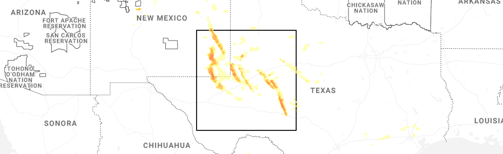
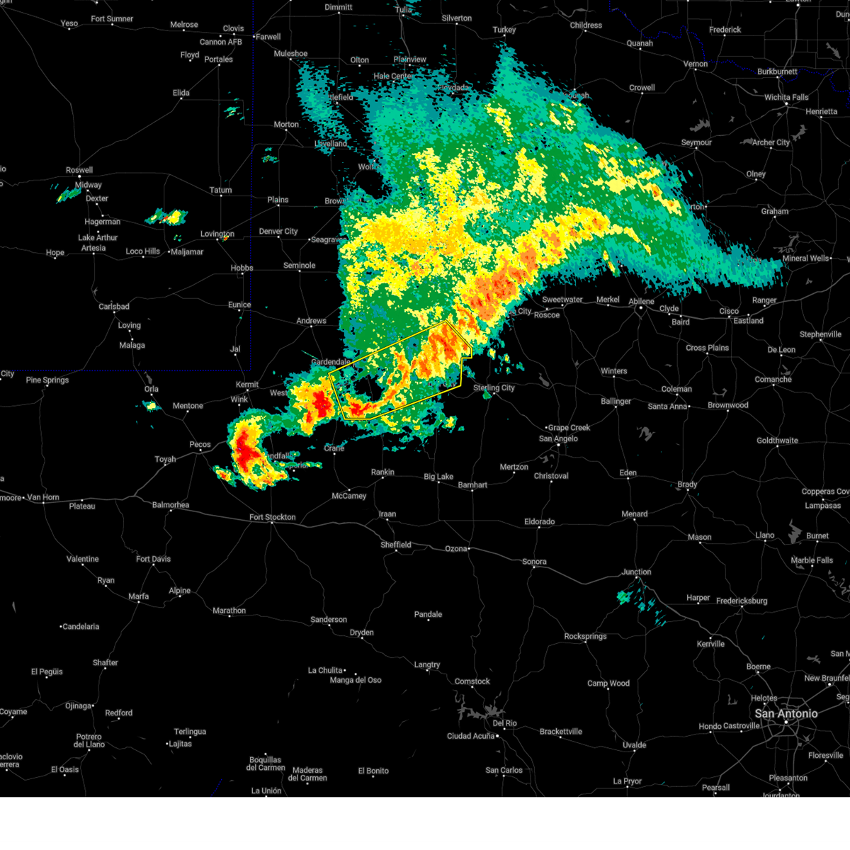
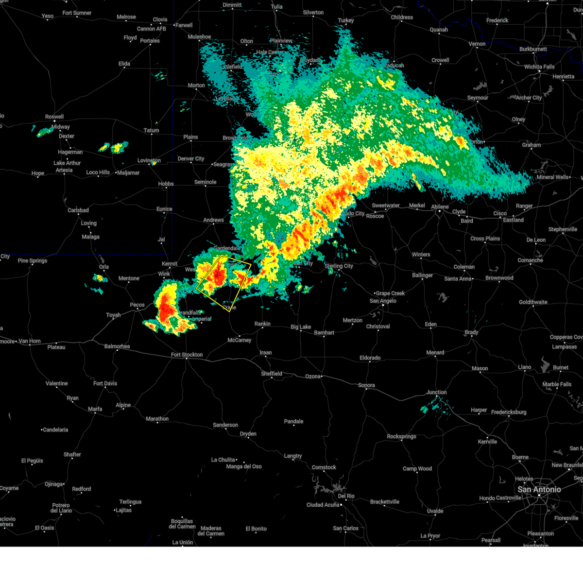
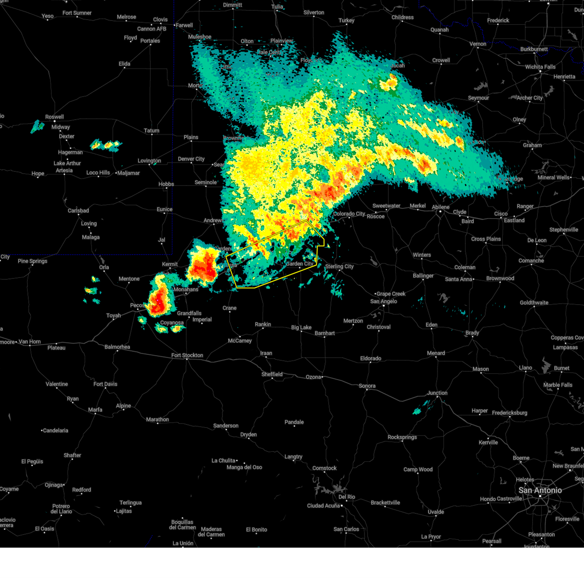
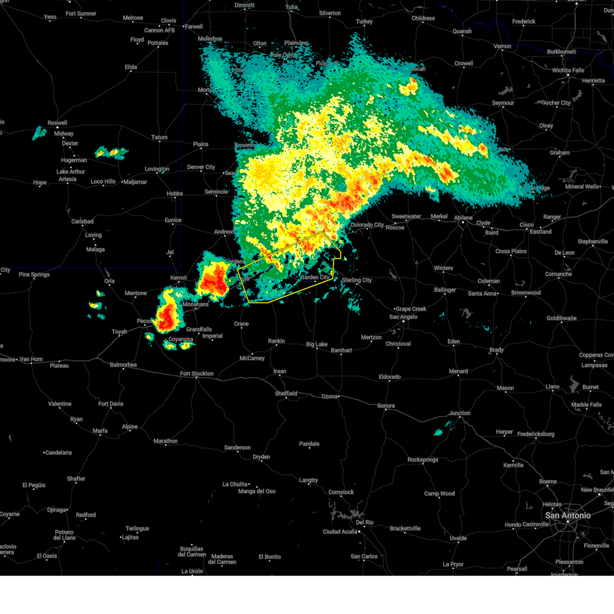
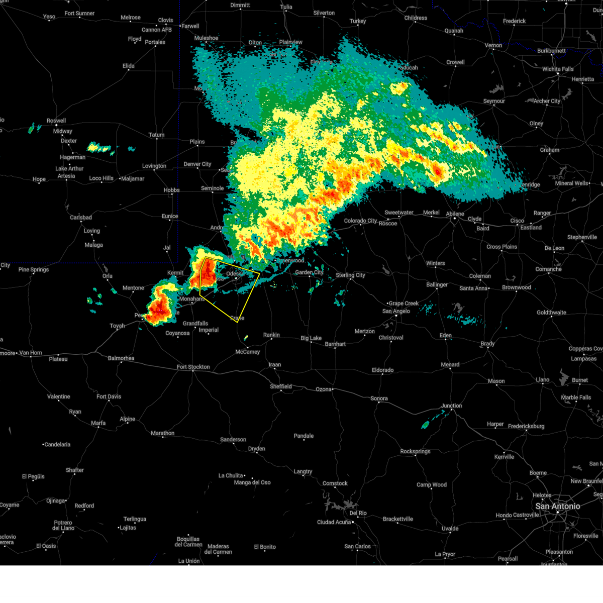
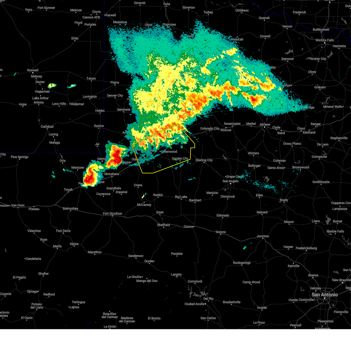
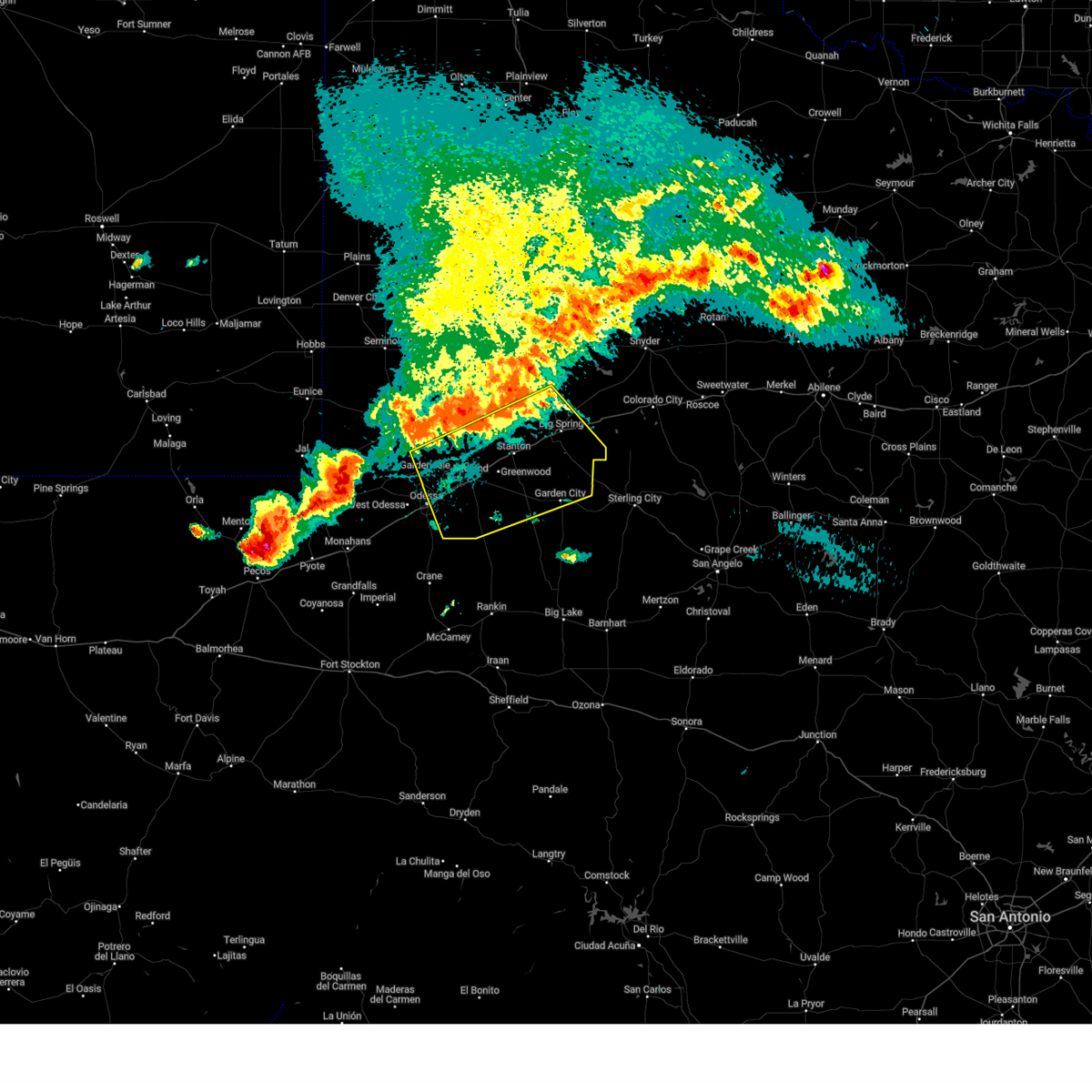
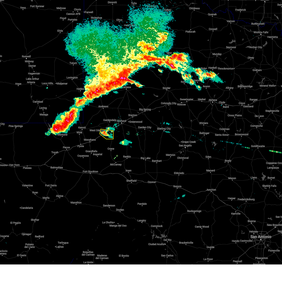
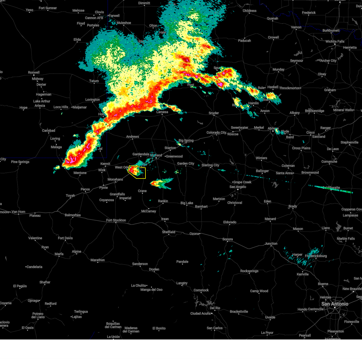
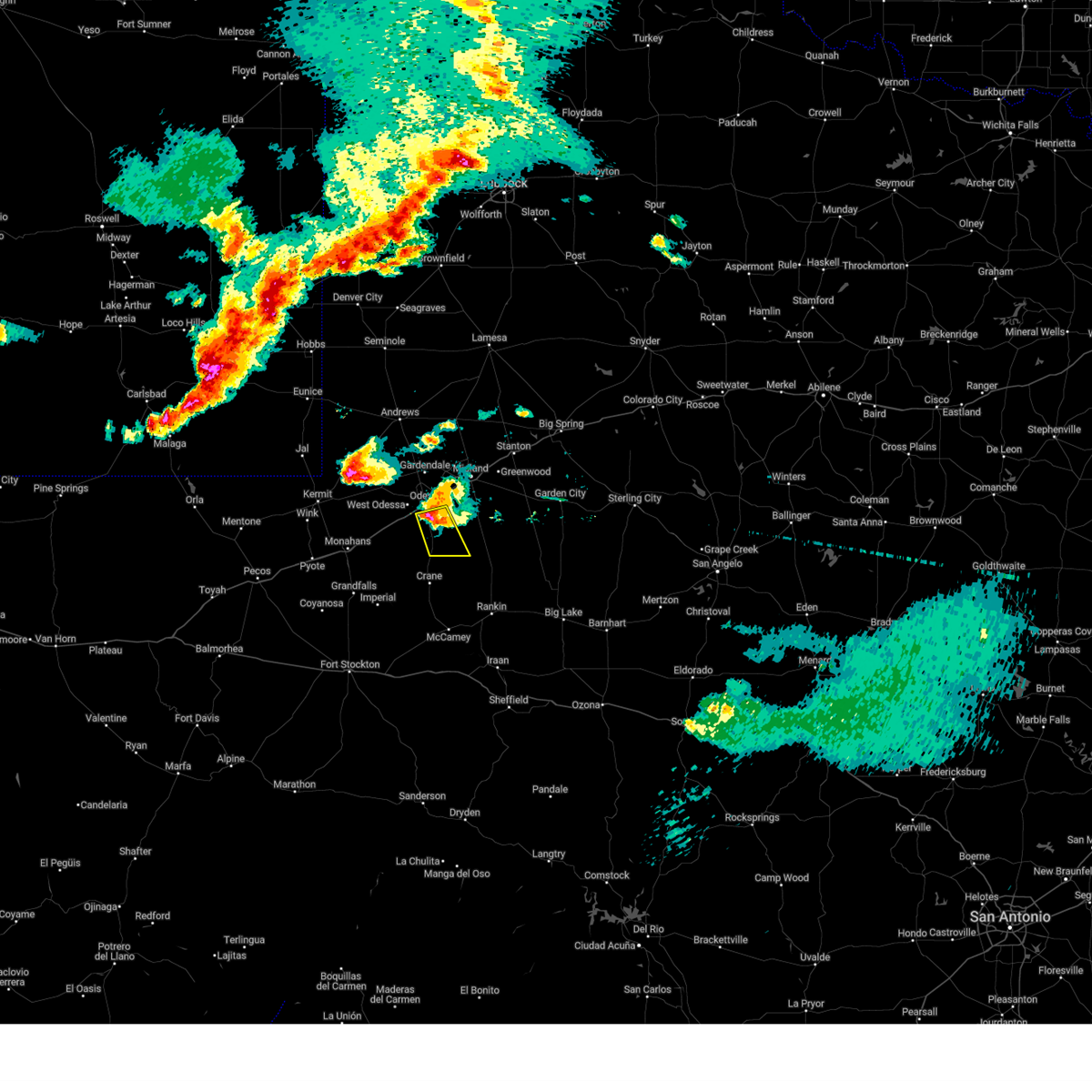
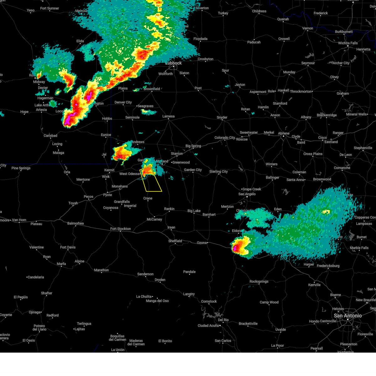
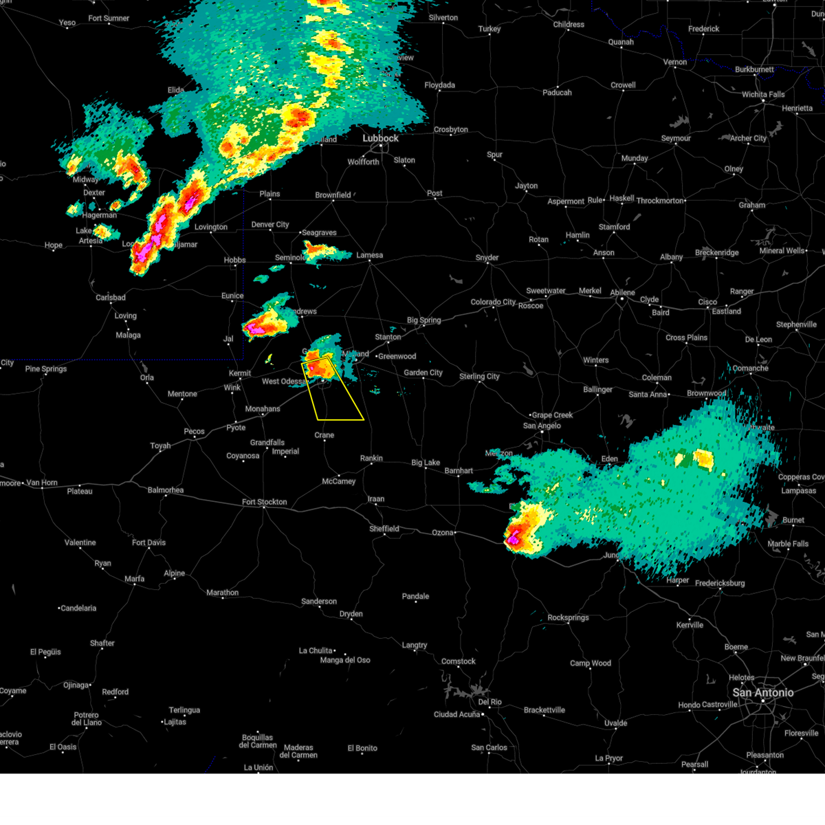
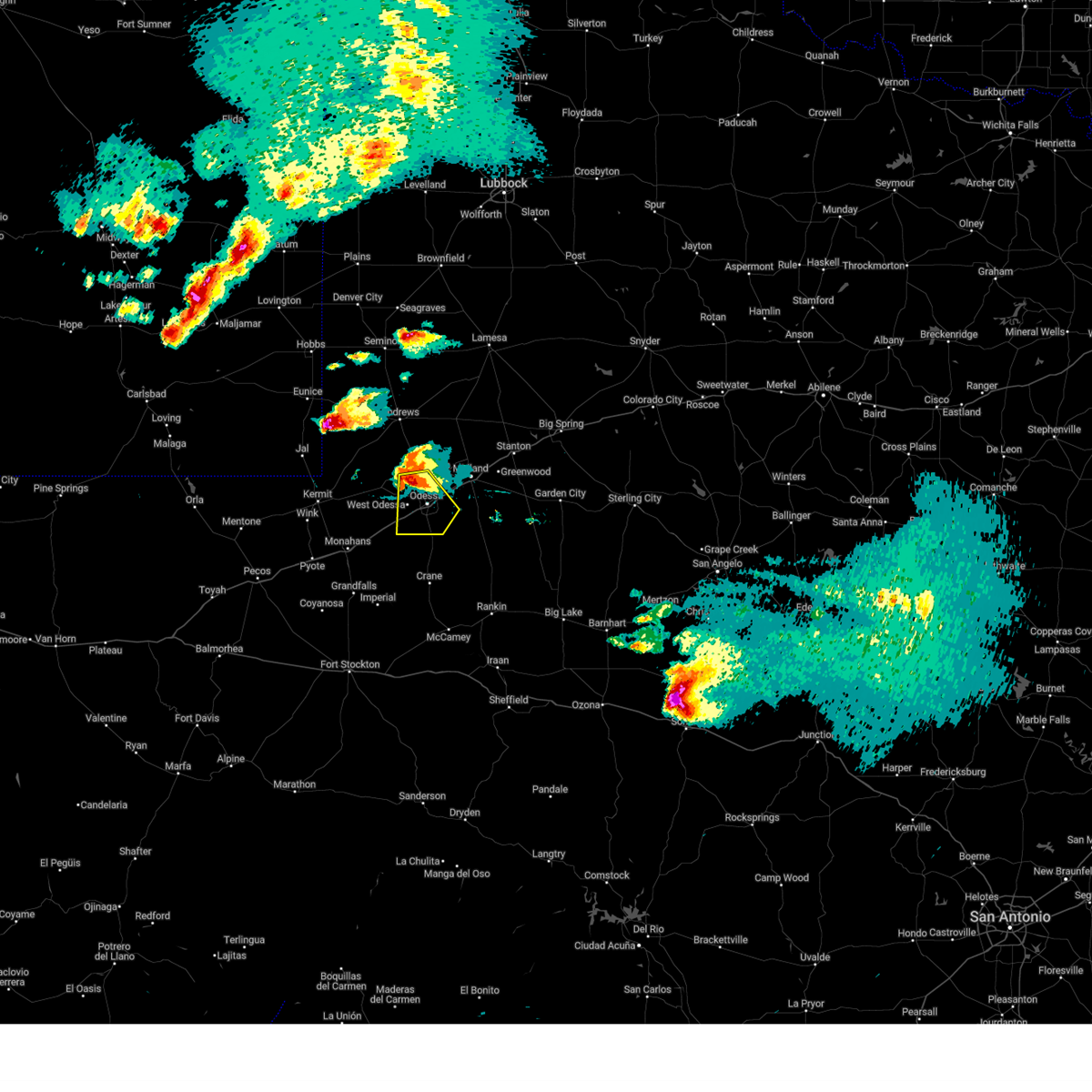
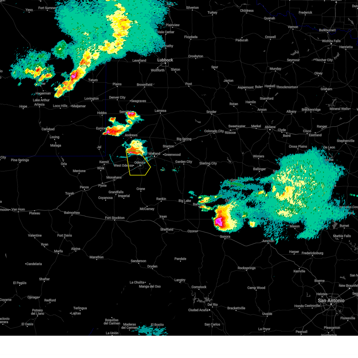
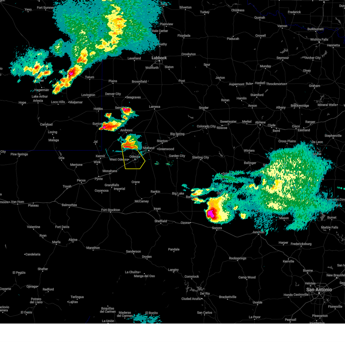
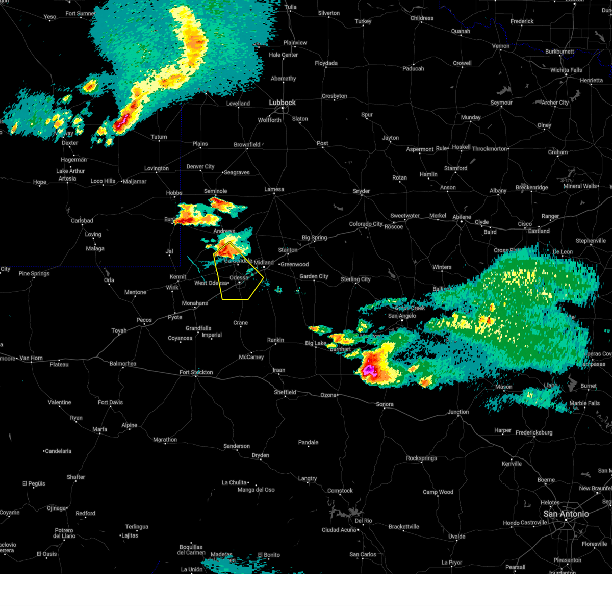
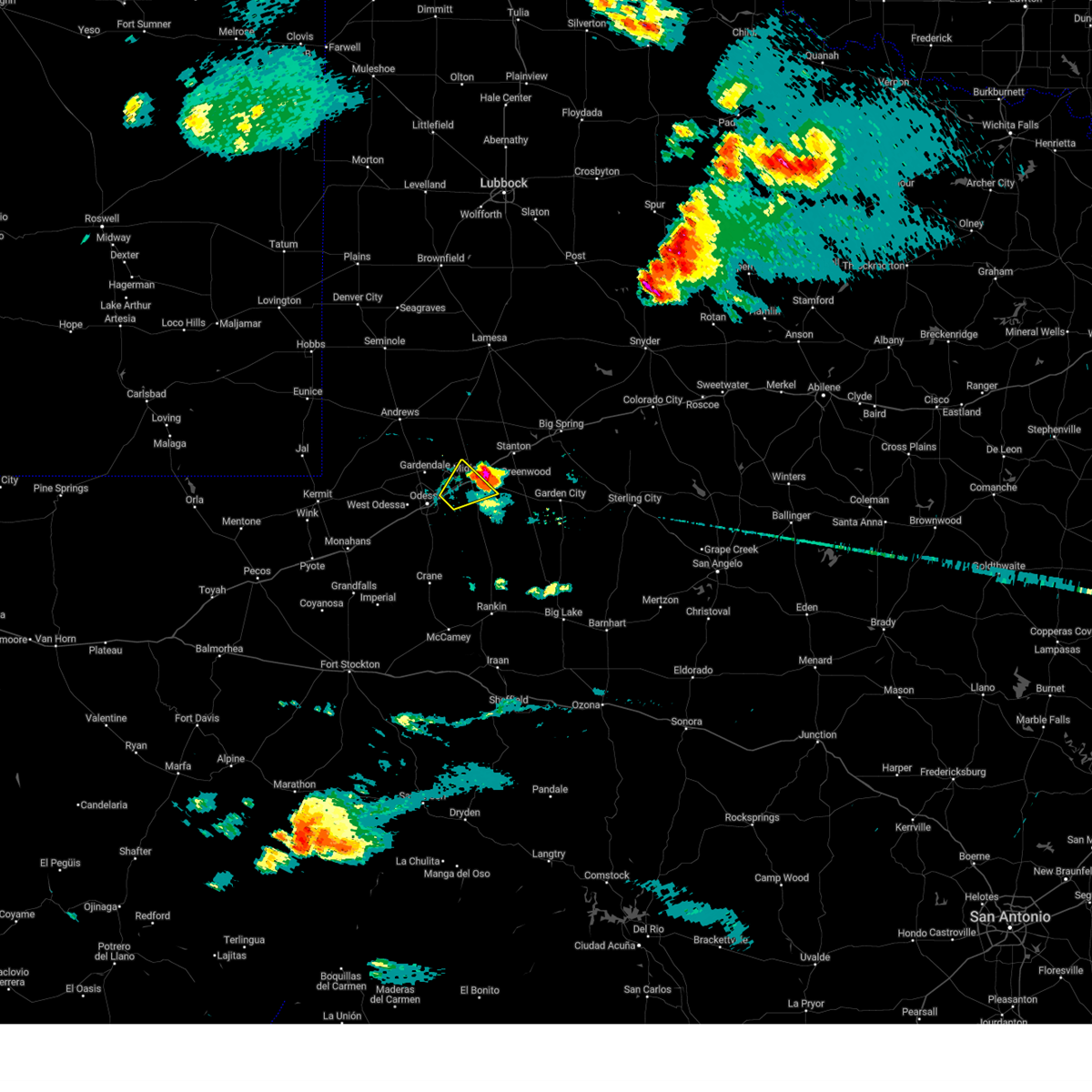
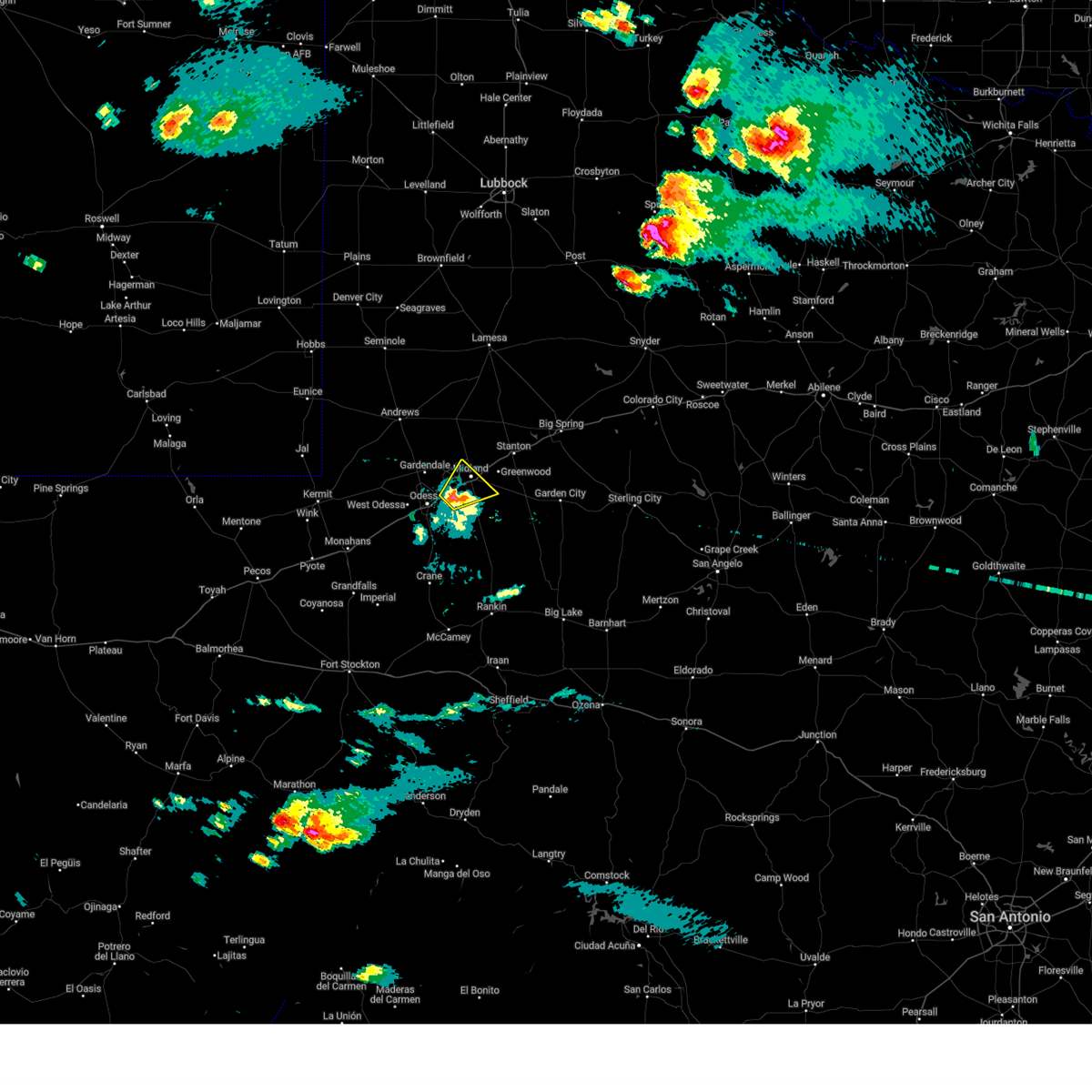
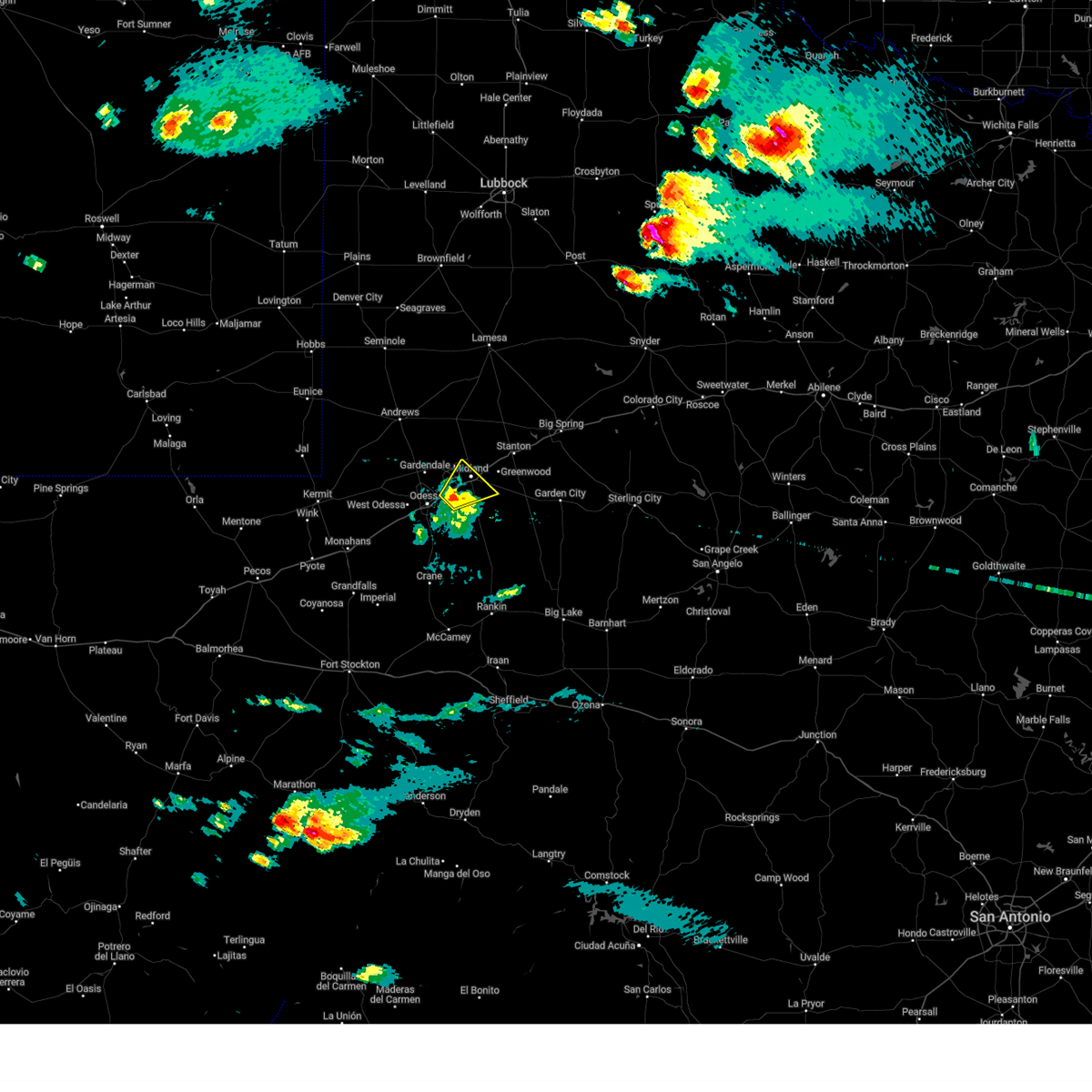
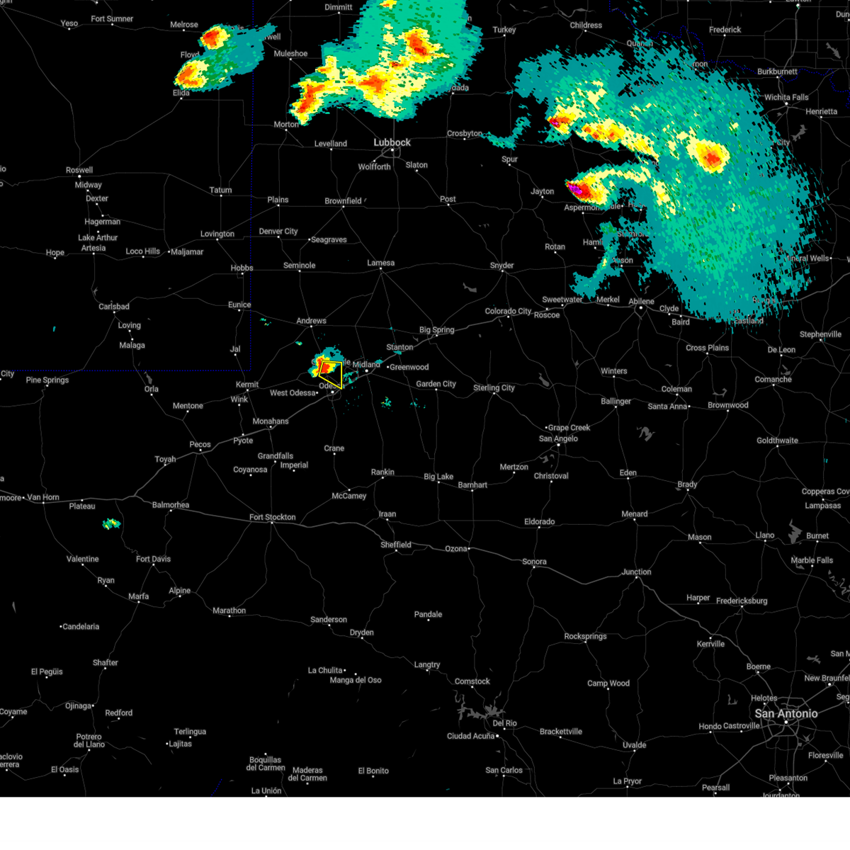
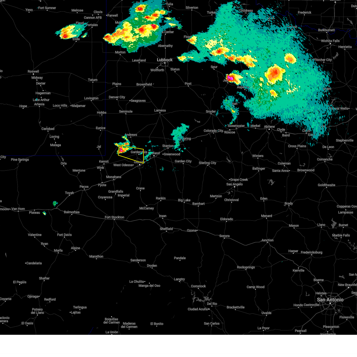
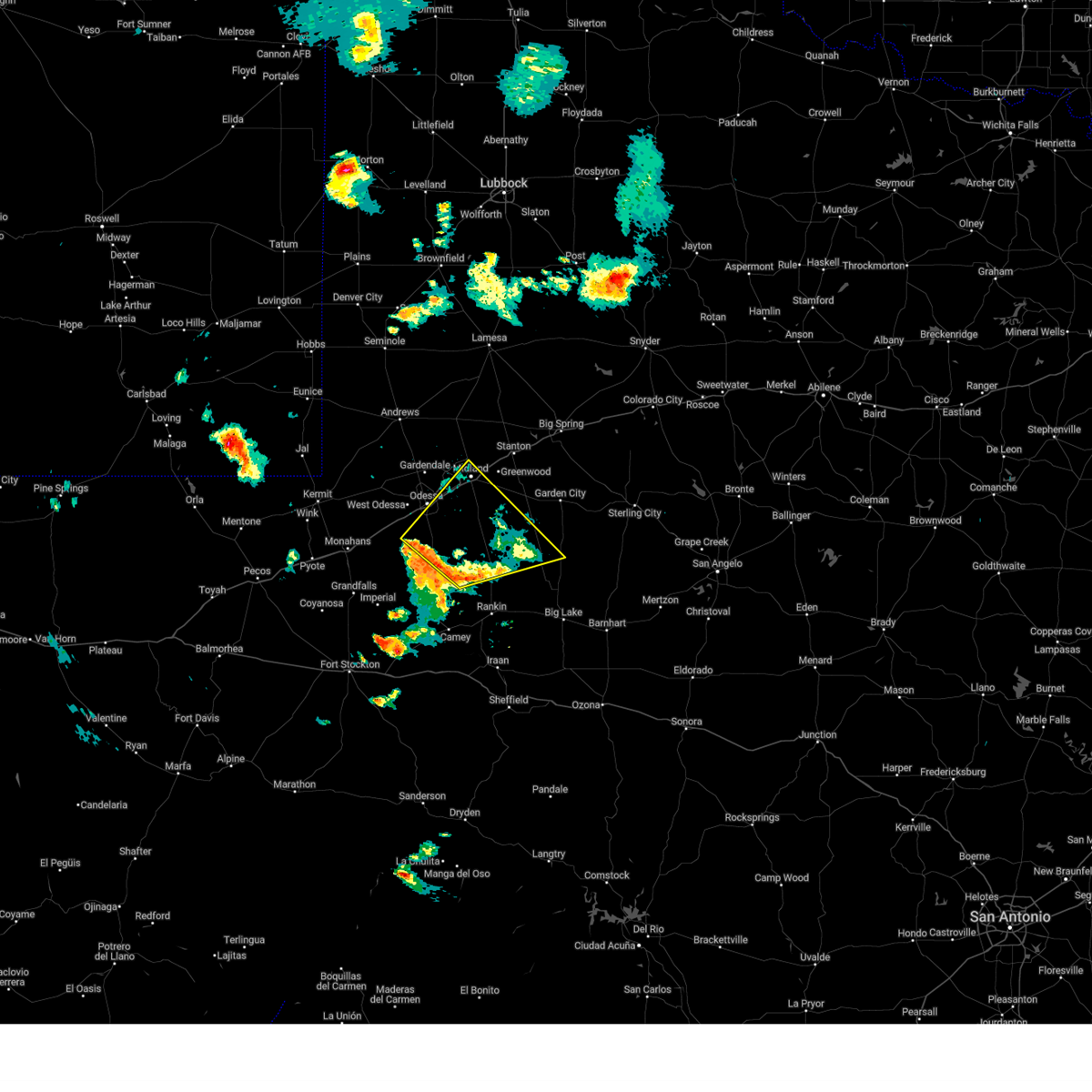
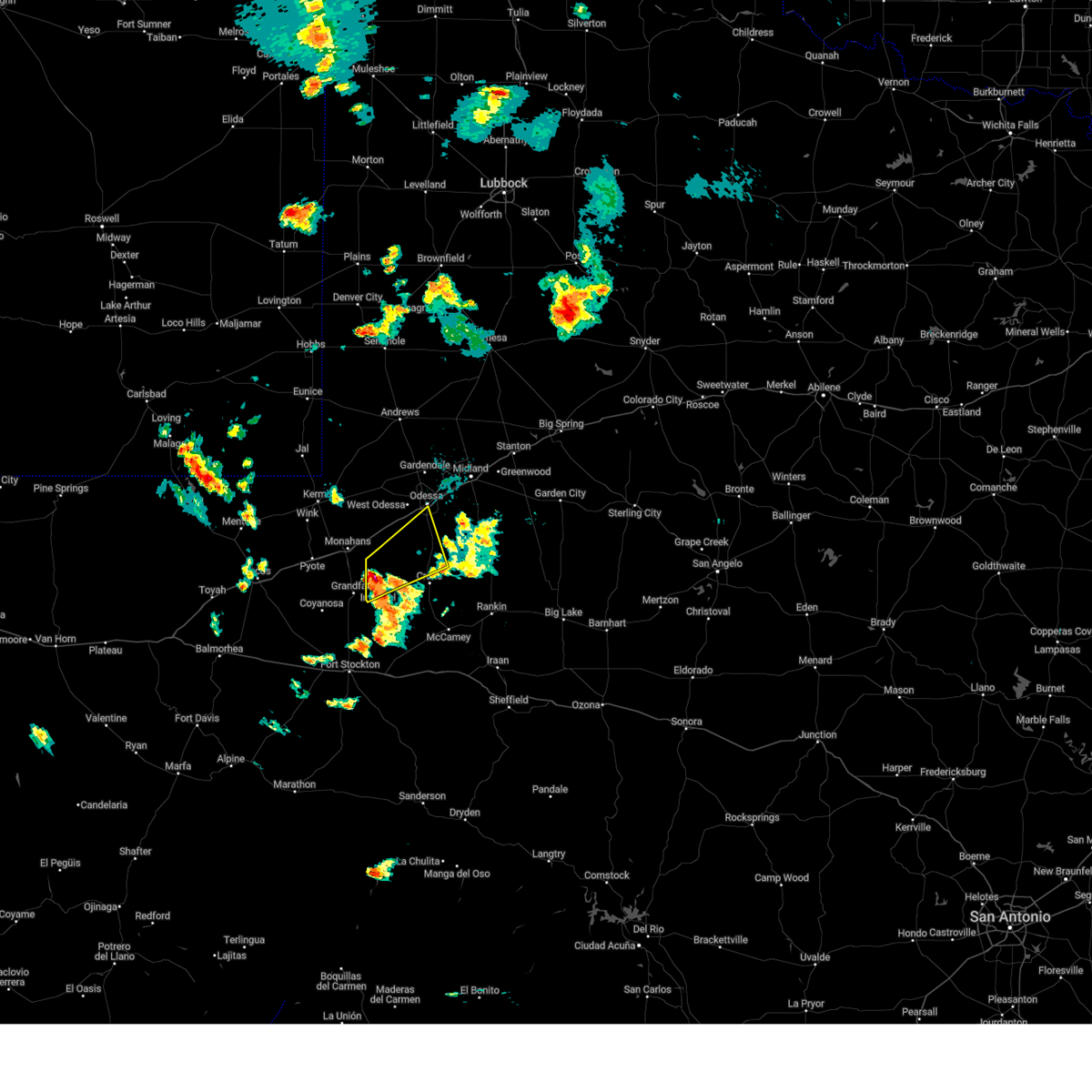
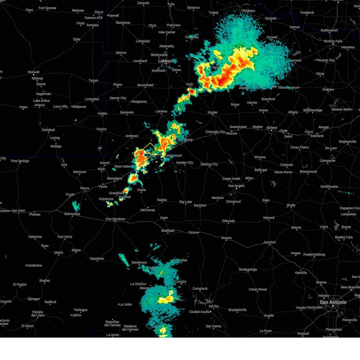
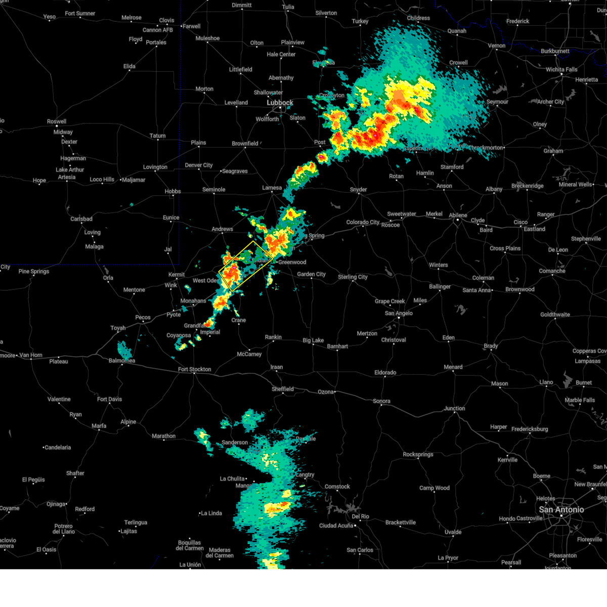
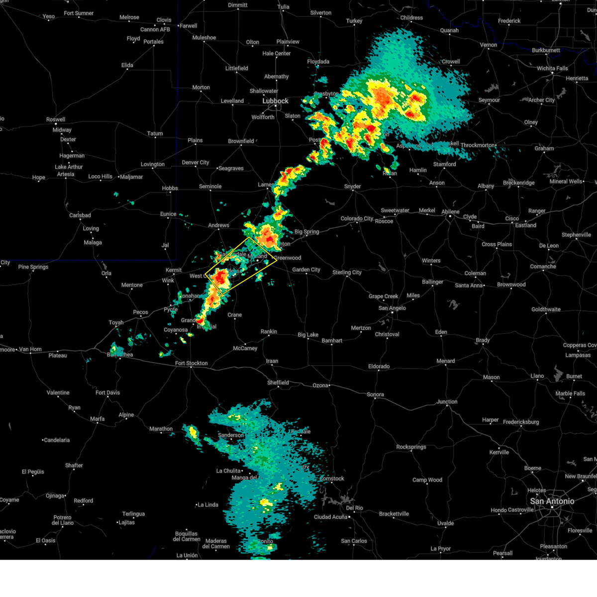
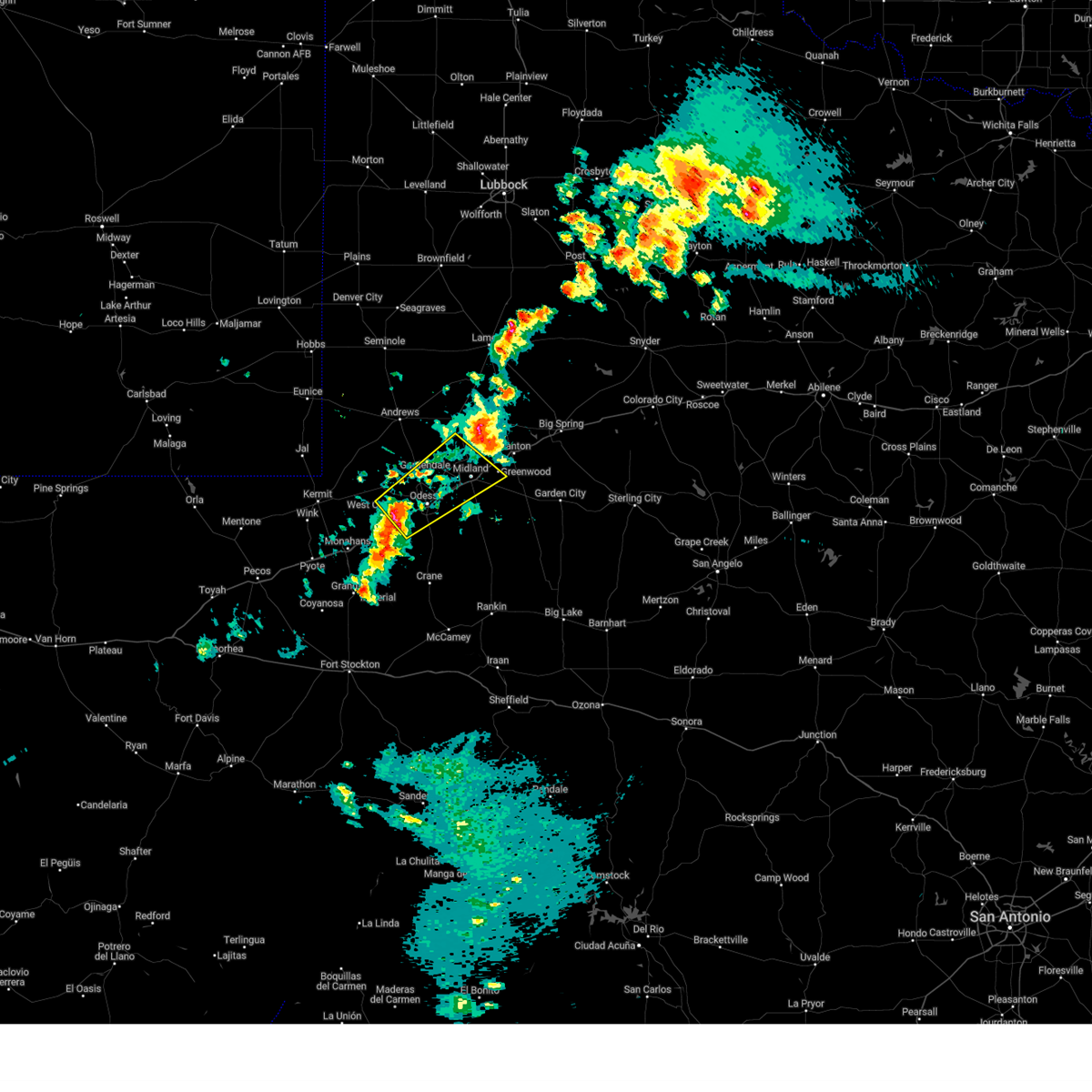
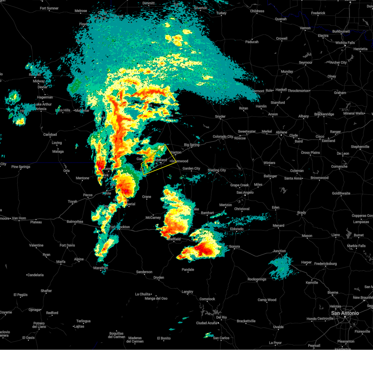
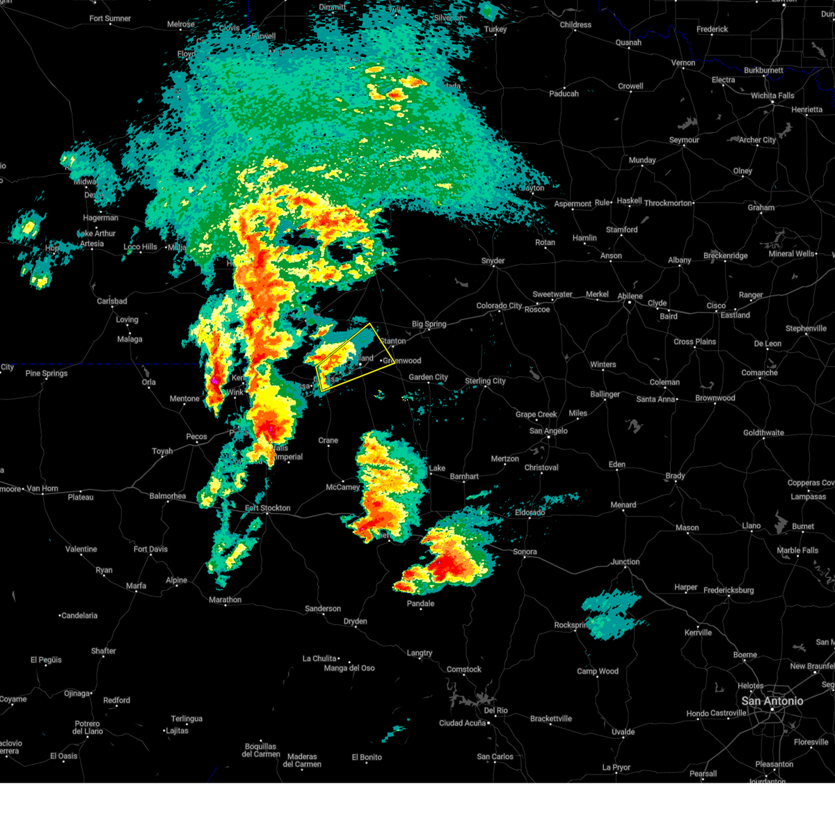
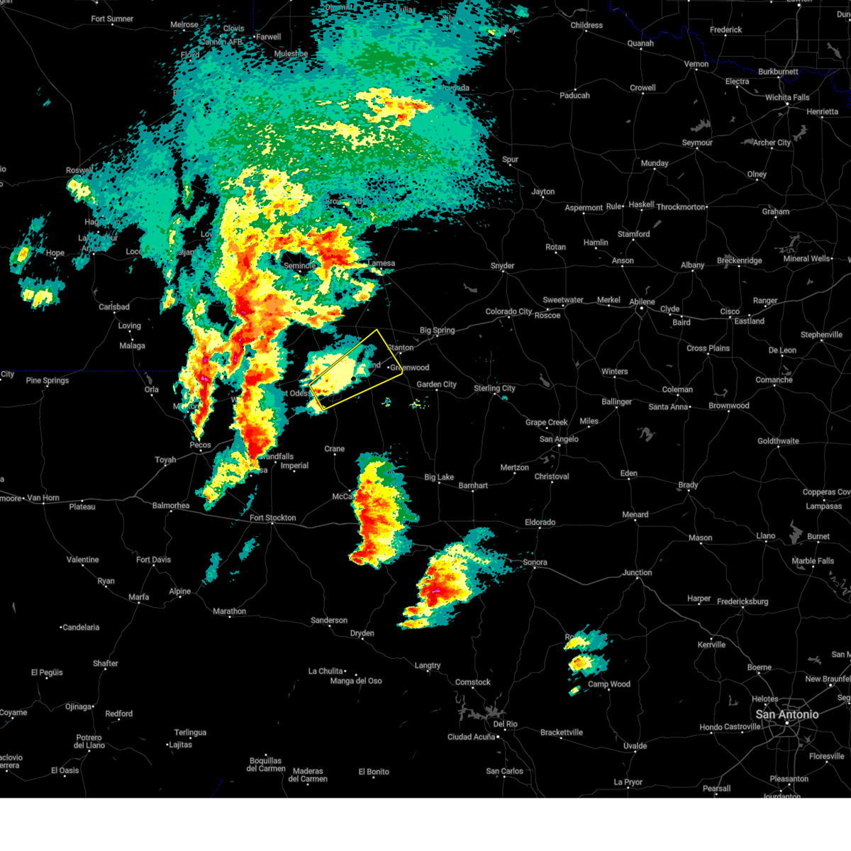
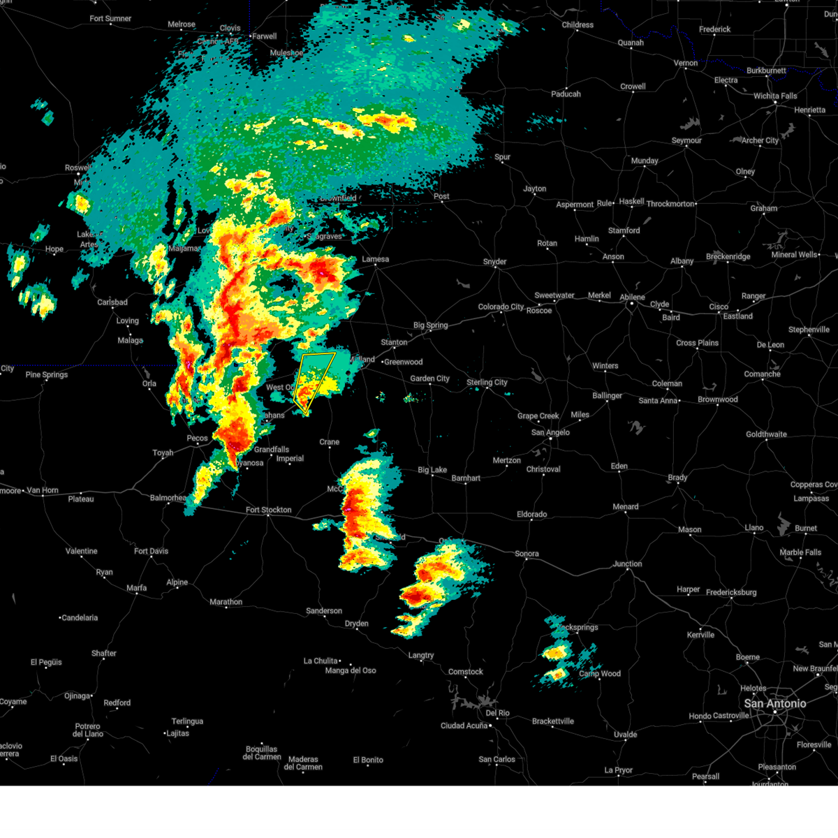
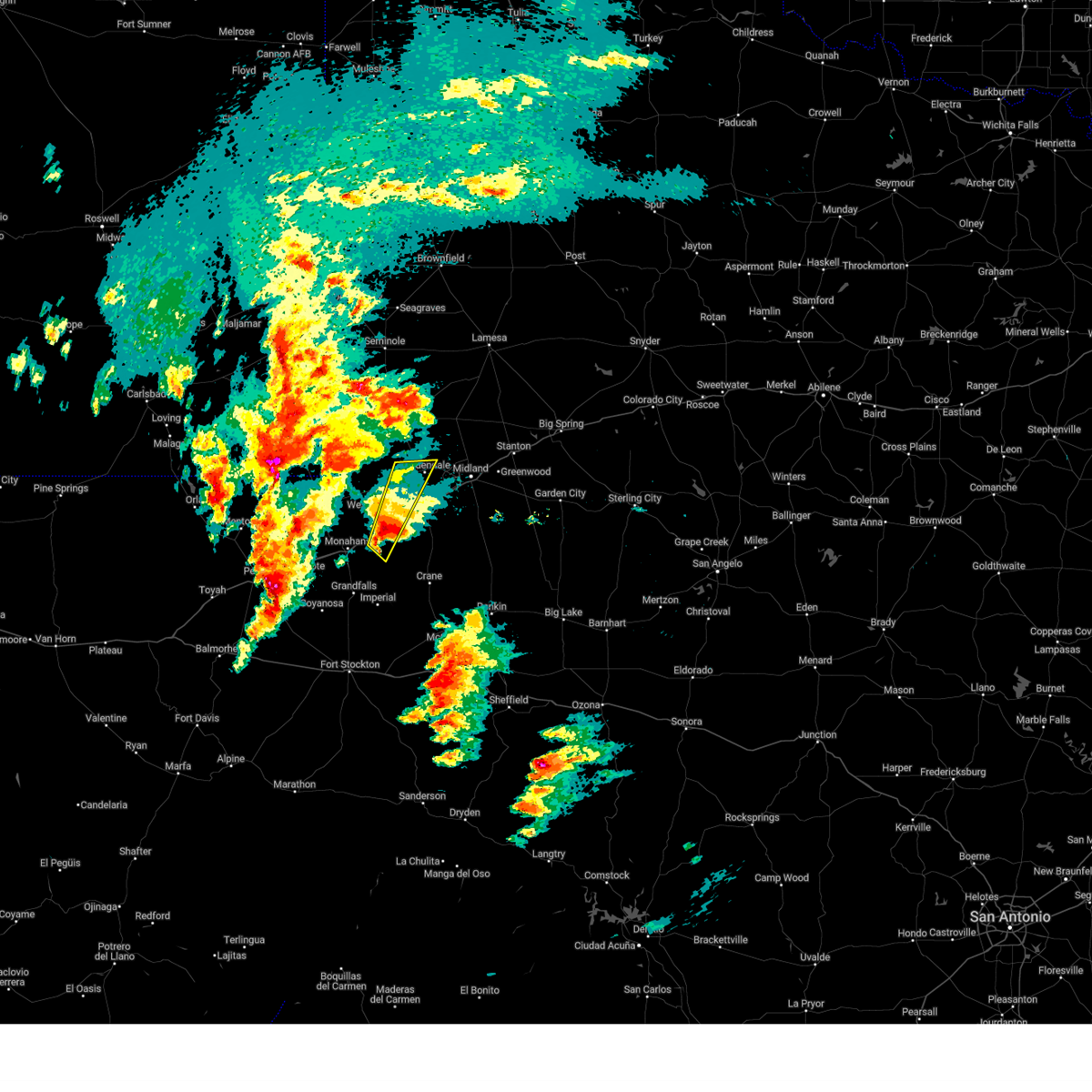
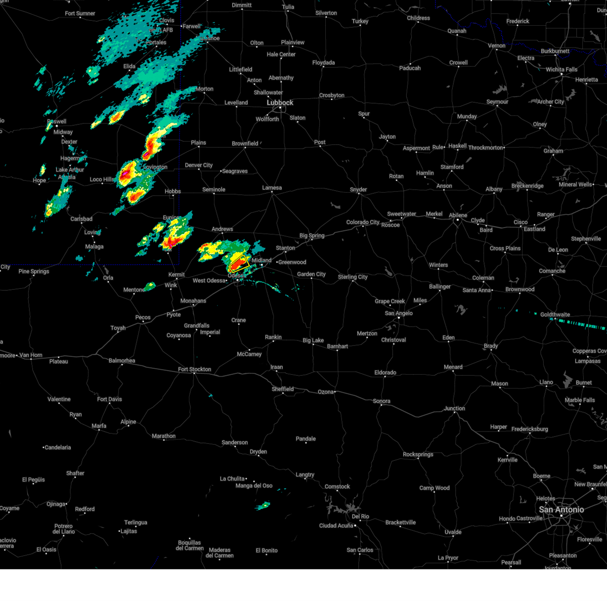
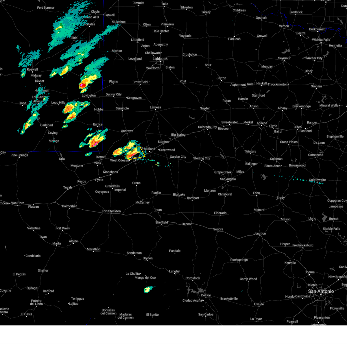
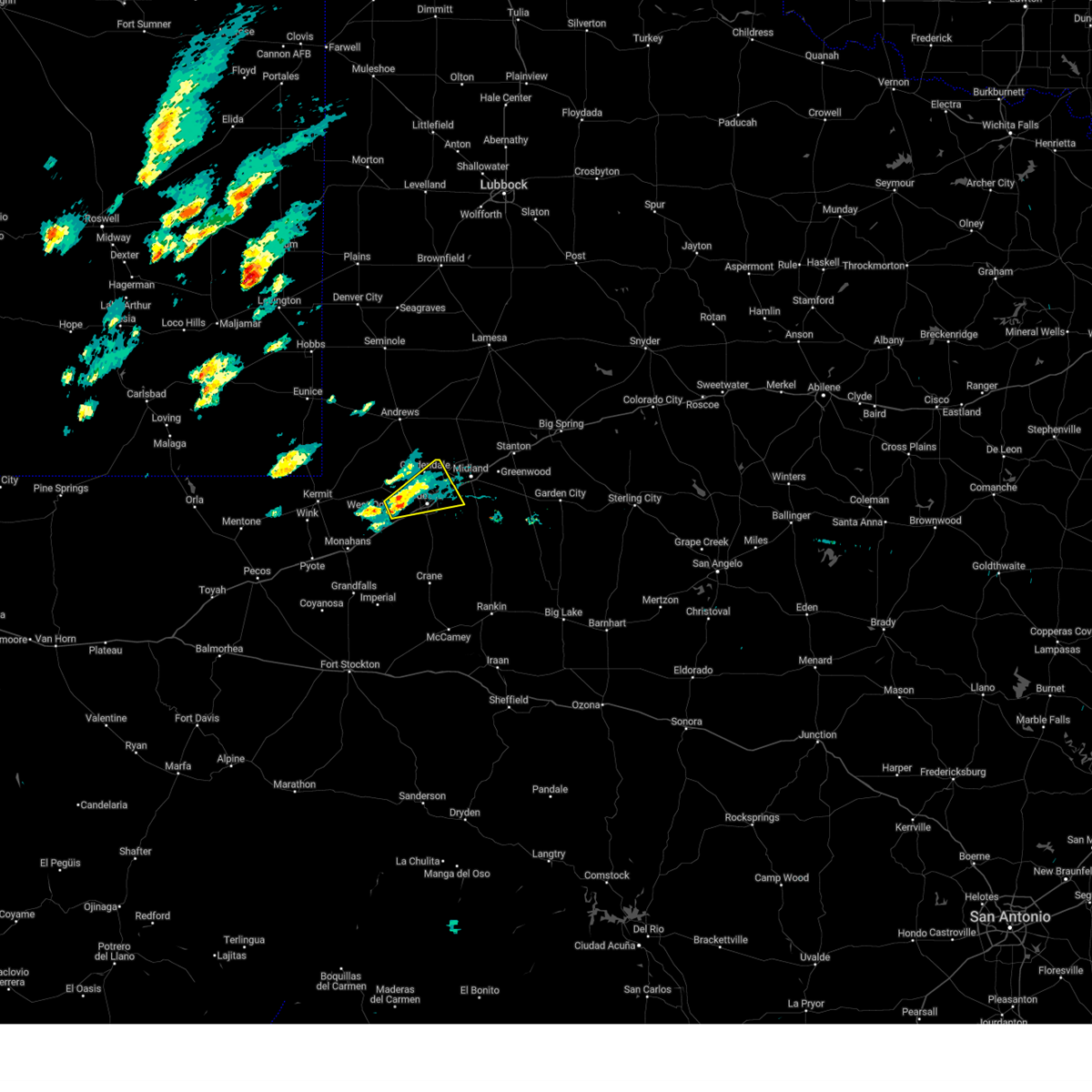
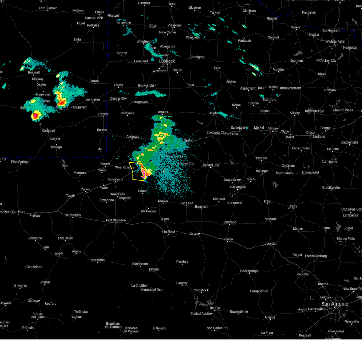
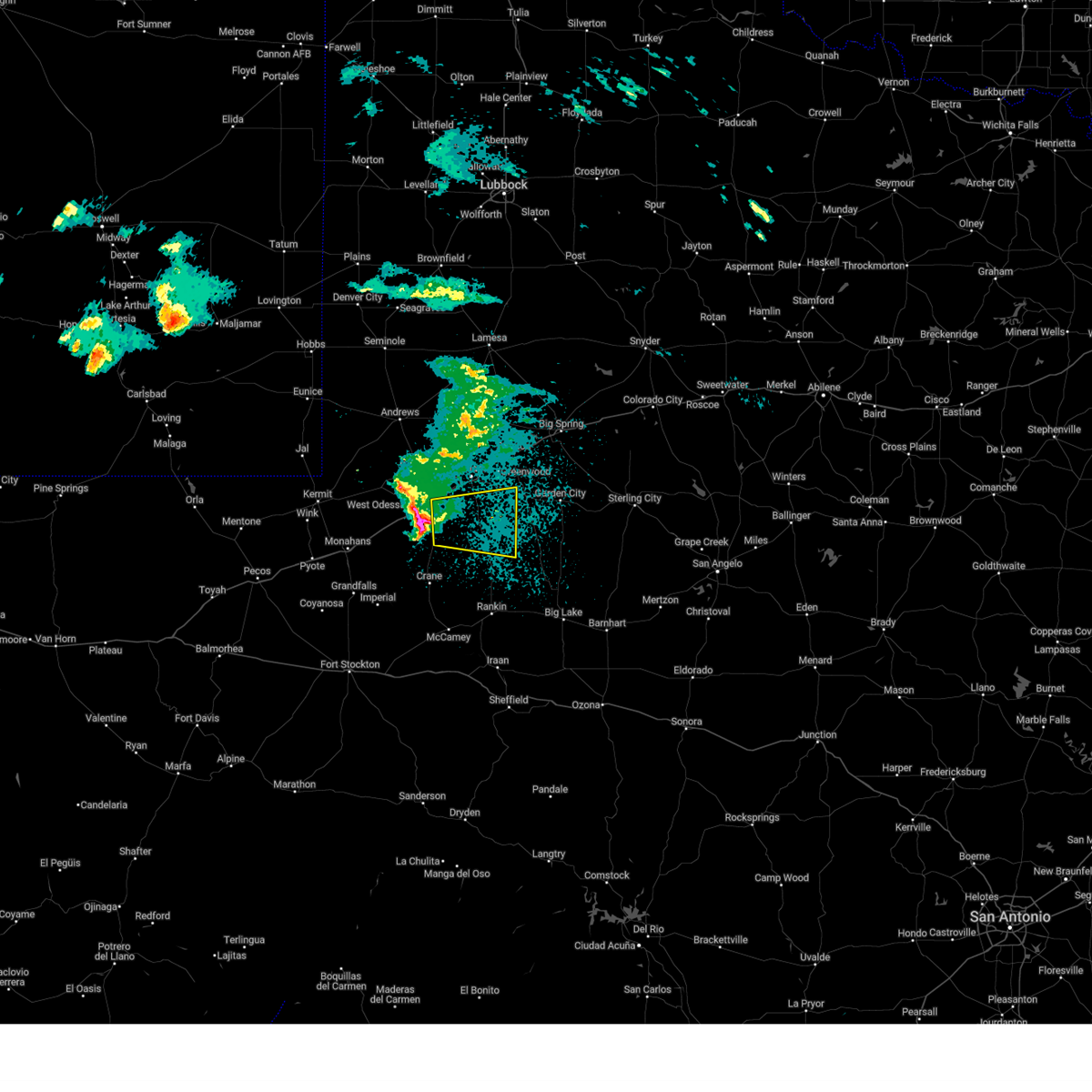
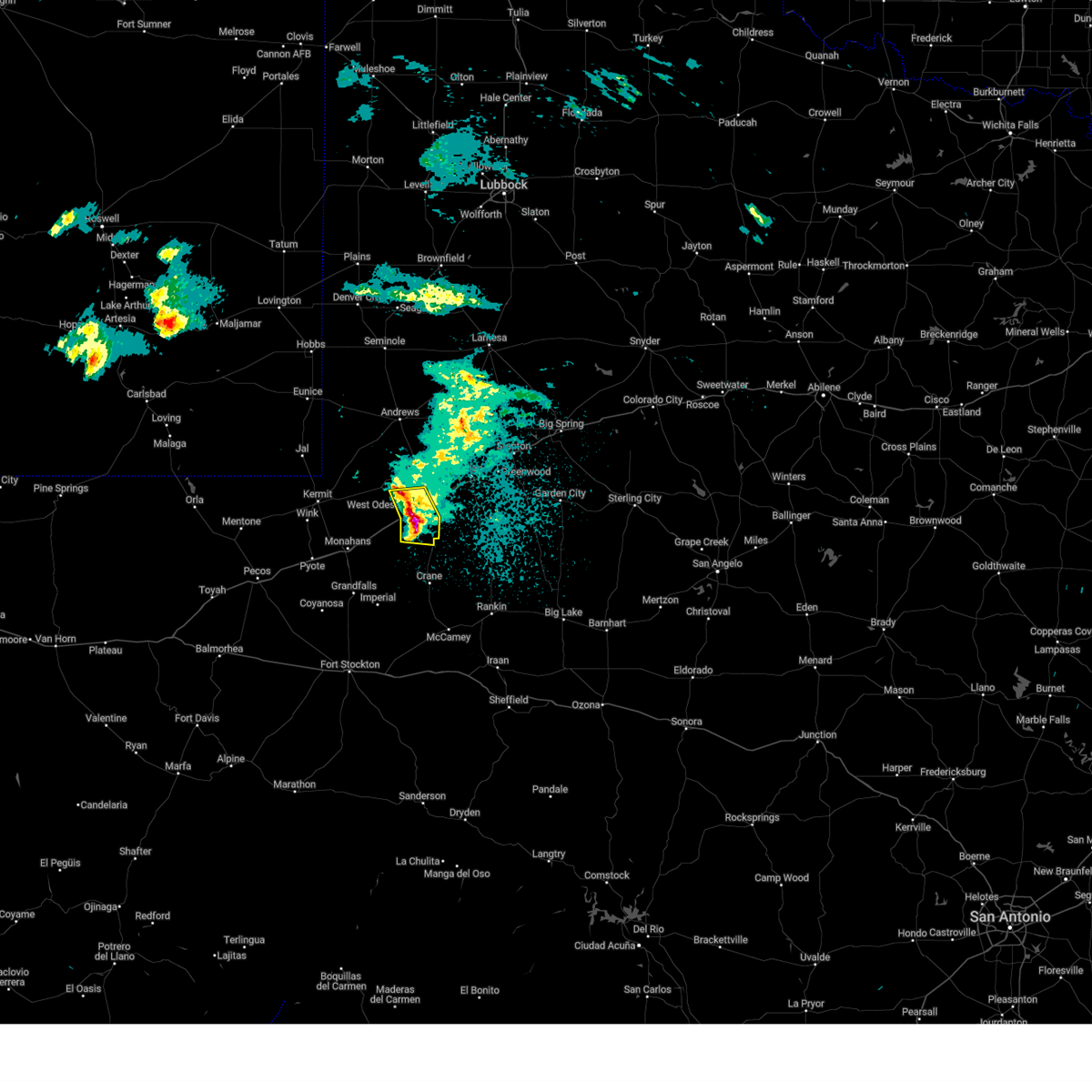
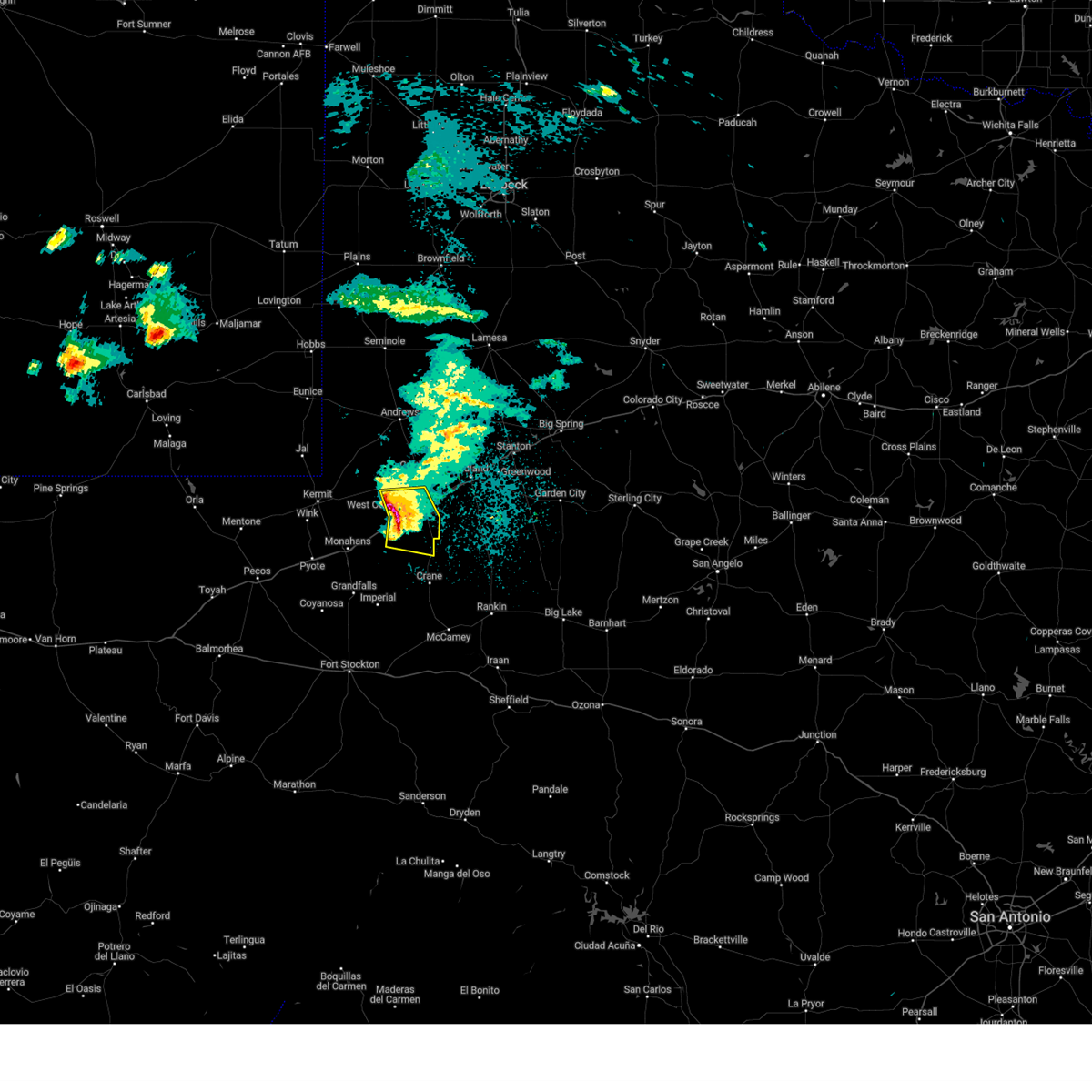
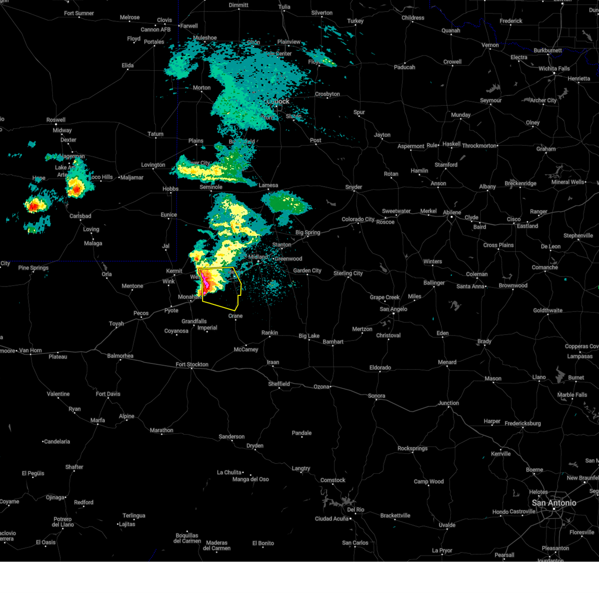
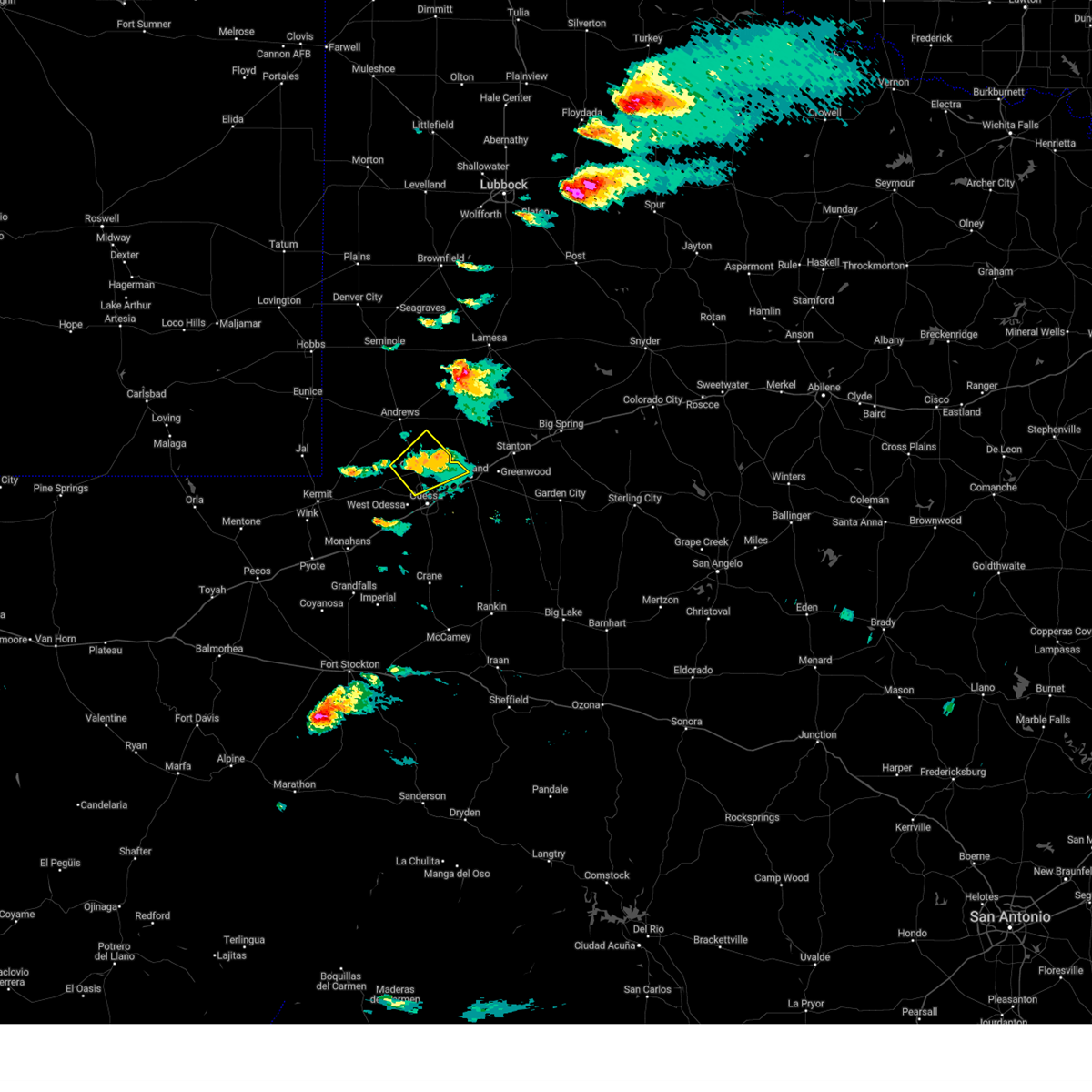
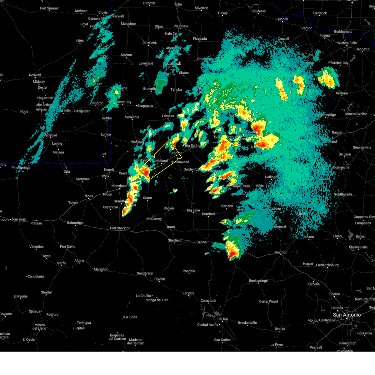
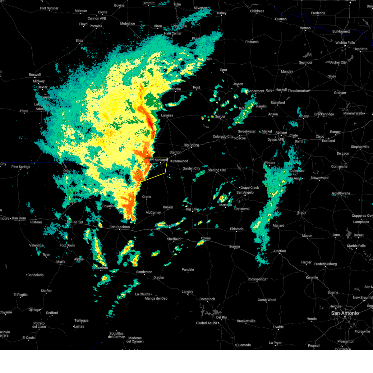
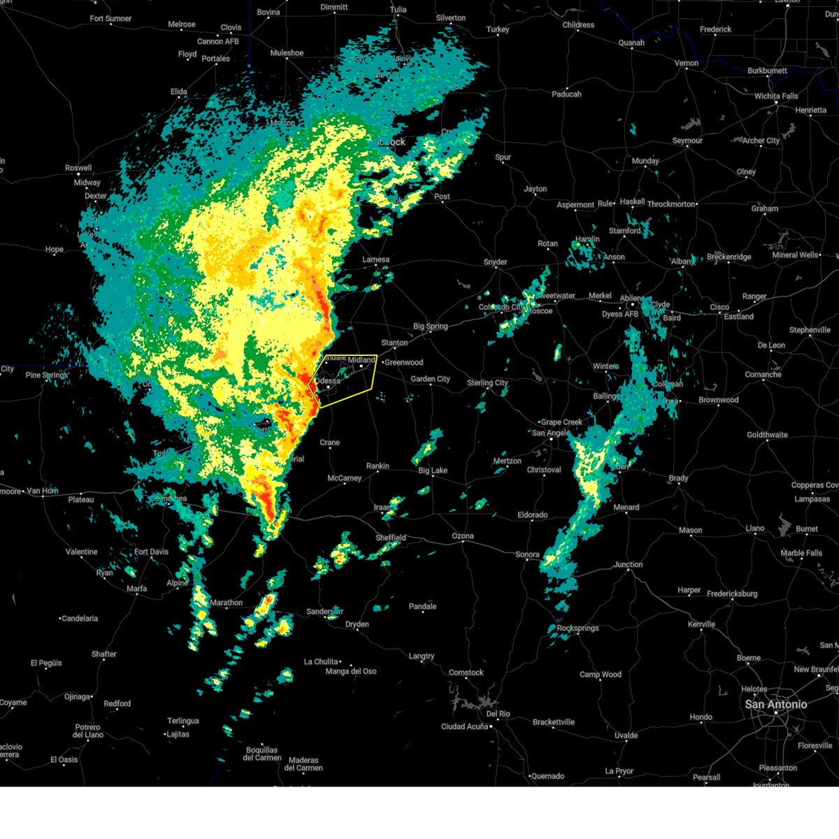
Hail Map for Odessa, TX
The Odessa, TX area has had 103 reports of on-the-ground hail by trained spotters, and has been under severe weather warnings 61 times during the past 12 months. Doppler radar has detected hail at or near Odessa, TX on 121 occasions, including 12 occasions during the past year.
| Name: | Odessa, TX |
| Where Located: | 3 miles NE of Odessa, TX |
| Map: | Google Map for Odessa, TX |
| Population: | 99940 |
| Housing Units: | 39806 |
| More Info: | Search Google for Odessa, TX |
2
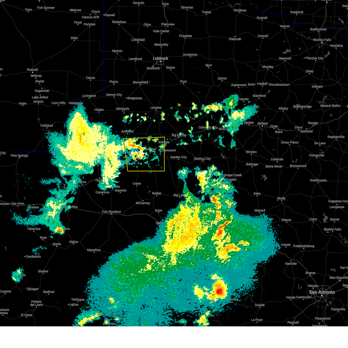
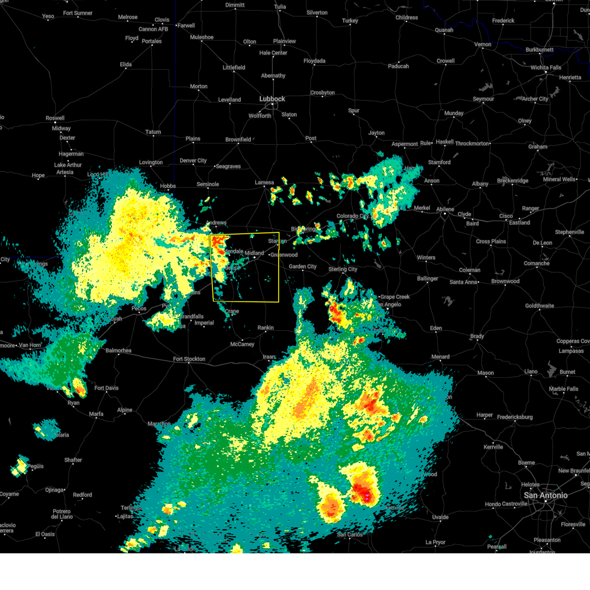
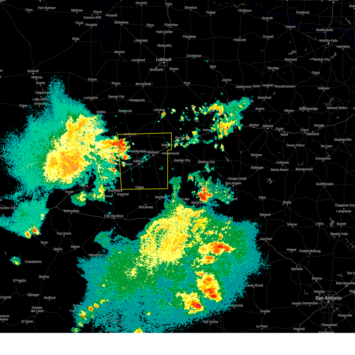
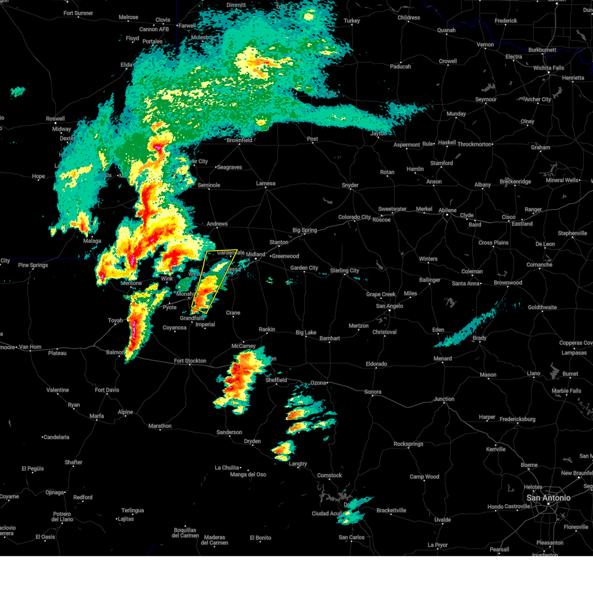
The Top Recent Hail Date for Odessa, TX is Monday, June 9, 2025 (8th out of 121)
Hail and Wind Damage Spotted near Odessa, TX
| Date / Time | Report Details |
|---|---|
| 6/10/2025 8:35 PM CDT |
 the severe thunderstorm warning has been cancelled and is no longer in effect the severe thunderstorm warning has been cancelled and is no longer in effect
|
| 6/10/2025 8:35 PM CDT |
 At 834 pm cdt, outflow from severe thunderstorms was located along a line extending from 11 miles north of midland to 22 miles southeast of midland international air and space port, moving east at 40 mph (radar indicated). Hazards include 60 mph wind gusts. Expect damage to roofs, siding, and trees. locations impacted include, midland, odessa, greenwood, stanton, midland international air and space port, west odessa, cotton flat, warfield, midland airpark, skywest airport, courtney, odessa schlemeyer field, stanton municipal aiport, spraberry, and pleasant farms. This includes interstate 20 between mile markers 104 and 158. At 834 pm cdt, outflow from severe thunderstorms was located along a line extending from 11 miles north of midland to 22 miles southeast of midland international air and space port, moving east at 40 mph (radar indicated). Hazards include 60 mph wind gusts. Expect damage to roofs, siding, and trees. locations impacted include, midland, odessa, greenwood, stanton, midland international air and space port, west odessa, cotton flat, warfield, midland airpark, skywest airport, courtney, odessa schlemeyer field, stanton municipal aiport, spraberry, and pleasant farms. This includes interstate 20 between mile markers 104 and 158.
|
| 6/10/2025 8:15 PM CDT |
 At 814 pm cdt, outflow from severe thunderstorms was located along a line extending from 13 miles southeast of andrews to 16 miles south of odessa, moving east at 40 mph (radar indicated). Hazards include 60 mph wind gusts. blowing dust restricting visibility to near zero. Expect damage to roofs, siding, and trees. locations impacted include, midland, odessa, greenwood, stanton, midland international air and space port, west odessa, cotton flat, midkiff, warfield, midland airpark, skywest airport, courtney, odessa schlemeyer field, penwell, stanton municipal aiport, spraberry, and pleasant farms. This includes interstate 20 between mile markers 101 and 158. At 814 pm cdt, outflow from severe thunderstorms was located along a line extending from 13 miles southeast of andrews to 16 miles south of odessa, moving east at 40 mph (radar indicated). Hazards include 60 mph wind gusts. blowing dust restricting visibility to near zero. Expect damage to roofs, siding, and trees. locations impacted include, midland, odessa, greenwood, stanton, midland international air and space port, west odessa, cotton flat, midkiff, warfield, midland airpark, skywest airport, courtney, odessa schlemeyer field, penwell, stanton municipal aiport, spraberry, and pleasant farms. This includes interstate 20 between mile markers 101 and 158.
|
| 6/10/2025 7:51 PM CDT |
 Svrmaf the national weather service in midland has issued a * severe thunderstorm warning for, ector county in western texas, southeastern andrews county in western texas, midland county in western texas, martin county in western texas, northern crane county in western texas, northern upton county in western texas, * until 845 pm cdt. * at 750 pm cdt, severe thunderstorms produced an outflow of strong winds that were located along a line extending from 7 miles south of andrews to 12 miles south of west odessa, moving east at 45 mph (radar indicated). Hazards include 70 mph wind gusts and penny size hail. blowing dust restricting visibility to near zero. Expect considerable tree damage. Damage is likely to mobile homes, roofs, and outbuildings. Svrmaf the national weather service in midland has issued a * severe thunderstorm warning for, ector county in western texas, southeastern andrews county in western texas, midland county in western texas, martin county in western texas, northern crane county in western texas, northern upton county in western texas, * until 845 pm cdt. * at 750 pm cdt, severe thunderstorms produced an outflow of strong winds that were located along a line extending from 7 miles south of andrews to 12 miles south of west odessa, moving east at 45 mph (radar indicated). Hazards include 70 mph wind gusts and penny size hail. blowing dust restricting visibility to near zero. Expect considerable tree damage. Damage is likely to mobile homes, roofs, and outbuildings.
|
| 6/10/2025 3:20 AM CDT |
 The storms which prompted the warning have weakened below severe limits, and no longer pose an immediate threat to life or property. therefore, the warning will be allowed to expire. The storms which prompted the warning have weakened below severe limits, and no longer pose an immediate threat to life or property. therefore, the warning will be allowed to expire.
|
| 6/10/2025 3:15 AM CDT |
 At 314 am cdt, a severe thunderstorm was located 8 miles southeast of west odessa, or 11 miles south of odessa, moving southeast at 35 mph (radar indicated). Hazards include 60 mph wind gusts and quarter size hail. Hail damage to vehicles is expected. expect wind damage to roofs, siding, and trees. locations impacted include, odessa, crane, west odessa, odessa schlemeyer field, penwell, crane county airport, warfield, and pleasant farms. This includes interstate 20 between mile markers 90 and 128. At 314 am cdt, a severe thunderstorm was located 8 miles southeast of west odessa, or 11 miles south of odessa, moving southeast at 35 mph (radar indicated). Hazards include 60 mph wind gusts and quarter size hail. Hail damage to vehicles is expected. expect wind damage to roofs, siding, and trees. locations impacted include, odessa, crane, west odessa, odessa schlemeyer field, penwell, crane county airport, warfield, and pleasant farms. This includes interstate 20 between mile markers 90 and 128.
|
| 6/10/2025 3:02 AM CDT |
 the severe thunderstorm warning has been cancelled and is no longer in effect the severe thunderstorm warning has been cancelled and is no longer in effect
|
| 6/10/2025 3:02 AM CDT |
 At 301 am cdt, severe thunderstorms were located along a line extending from 10 miles southeast of coahoma to 20 miles southeast of midland international air and space port, moving east at 50 mph (multiple automated weather stations are reporting wind gusts of 50 to 60 mph). Hazards include 60 mph wind gusts. Expect damage to roofs, siding, and trees. locations impacted include, midland, odessa, big spring, greenwood, garden city, stanton, coahoma, forsan, sand springs, lomax, midland international air and space port, cotton flat, warfield, midland airpark, skywest airport, big spring country club, courtney, big spring mcmahon-wrinkle airpark, stanton municipal aiport, and elbow. This includes interstate 20 between mile markers 119 and 187. At 301 am cdt, severe thunderstorms were located along a line extending from 10 miles southeast of coahoma to 20 miles southeast of midland international air and space port, moving east at 50 mph (multiple automated weather stations are reporting wind gusts of 50 to 60 mph). Hazards include 60 mph wind gusts. Expect damage to roofs, siding, and trees. locations impacted include, midland, odessa, big spring, greenwood, garden city, stanton, coahoma, forsan, sand springs, lomax, midland international air and space port, cotton flat, warfield, midland airpark, skywest airport, big spring country club, courtney, big spring mcmahon-wrinkle airpark, stanton municipal aiport, and elbow. This includes interstate 20 between mile markers 119 and 187.
|
| 6/10/2025 2:48 AM CDT |
 At 248 am cdt, a severe thunderstorm was located near goldsmith, or 17 miles west of odessa, moving east at 30 mph (radar indicated). Hazards include 60 mph wind gusts and quarter size hail. Hail damage to vehicles is expected. expect wind damage to roofs, siding, and trees. locations impacted include, odessa, crane, goldsmith, west odessa, notrees, odessa schlemeyer field, penwell, crane county airport, warfield, and pleasant farms. This includes interstate 20 between mile markers 90 and 128. At 248 am cdt, a severe thunderstorm was located near goldsmith, or 17 miles west of odessa, moving east at 30 mph (radar indicated). Hazards include 60 mph wind gusts and quarter size hail. Hail damage to vehicles is expected. expect wind damage to roofs, siding, and trees. locations impacted include, odessa, crane, goldsmith, west odessa, notrees, odessa schlemeyer field, penwell, crane county airport, warfield, and pleasant farms. This includes interstate 20 between mile markers 90 and 128.
|
| 6/10/2025 2:48 AM CDT |
 the severe thunderstorm warning has been cancelled and is no longer in effect the severe thunderstorm warning has been cancelled and is no longer in effect
|
| 6/10/2025 2:40 AM CDT |
 Svrmaf the national weather service in midland has issued a * severe thunderstorm warning for, ector county in western texas, southwestern midland county in western texas, southeastern winkler county in western texas, northern crane county in western texas, northwestern upton county in western texas, * until 345 am cdt. * at 240 am cdt, a severe thunderstorm was located 8 miles southwest of goldsmith, or 21 miles west of odessa, moving east at 30 mph (radar indicated). Hazards include 60 mph wind gusts and quarter size hail. Hail damage to vehicles is expected. Expect wind damage to roofs, siding, and trees. Svrmaf the national weather service in midland has issued a * severe thunderstorm warning for, ector county in western texas, southwestern midland county in western texas, southeastern winkler county in western texas, northern crane county in western texas, northwestern upton county in western texas, * until 345 am cdt. * at 240 am cdt, a severe thunderstorm was located 8 miles southwest of goldsmith, or 21 miles west of odessa, moving east at 30 mph (radar indicated). Hazards include 60 mph wind gusts and quarter size hail. Hail damage to vehicles is expected. Expect wind damage to roofs, siding, and trees.
|
| 6/10/2025 2:39 AM CDT |
 At 238 am cdt, severe thunderstorms were located along a line extending from near sand springs to 6 miles northwest of midland international air and space port, moving southeast at 45 mph (midland international airport measured a gust of 60 mph). Hazards include 60 mph wind gusts and penny size hail. Expect damage to roofs, siding, and trees. locations impacted include, midland, odessa, big spring, greenwood, garden city, stanton, coahoma, forsan, sand springs, lomax, lenorah, midland international air and space port, cotton flat, midland airpark, big spring mcmahon-wrinkle airpark, knott, stanton municipal aiport, elbow, tarzan, and warfield. This includes interstate 20 between mile markers 118 and 188. At 238 am cdt, severe thunderstorms were located along a line extending from near sand springs to 6 miles northwest of midland international air and space port, moving southeast at 45 mph (midland international airport measured a gust of 60 mph). Hazards include 60 mph wind gusts and penny size hail. Expect damage to roofs, siding, and trees. locations impacted include, midland, odessa, big spring, greenwood, garden city, stanton, coahoma, forsan, sand springs, lomax, lenorah, midland international air and space port, cotton flat, midland airpark, big spring mcmahon-wrinkle airpark, knott, stanton municipal aiport, elbow, tarzan, and warfield. This includes interstate 20 between mile markers 118 and 188.
|
| 6/10/2025 2:25 AM CDT |
 Svrmaf the national weather service in midland has issued a * severe thunderstorm warning for, glasscock county in western texas, northeastern ector county in western texas, southeastern andrews county in western texas, midland county in western texas, southern martin county in western texas, howard county in western texas, * until 330 am cdt. * at 225 am cdt, severe thunderstorms were located along a line extending from 6 miles southwest of luther to 15 miles northwest of midland international air and space port, moving southeast at 40 mph (national weather service employee reported 60 mph winds in gardendale). Hazards include 60 mph wind gusts and penny size hail. expect damage to roofs, siding, and trees Svrmaf the national weather service in midland has issued a * severe thunderstorm warning for, glasscock county in western texas, northeastern ector county in western texas, southeastern andrews county in western texas, midland county in western texas, southern martin county in western texas, howard county in western texas, * until 330 am cdt. * at 225 am cdt, severe thunderstorms were located along a line extending from 6 miles southwest of luther to 15 miles northwest of midland international air and space port, moving southeast at 40 mph (national weather service employee reported 60 mph winds in gardendale). Hazards include 60 mph wind gusts and penny size hail. expect damage to roofs, siding, and trees
|
| 6/10/2025 1:25 AM CDT |
 the severe thunderstorm warning has been cancelled and is no longer in effect the severe thunderstorm warning has been cancelled and is no longer in effect
|
| 6/10/2025 1:11 AM CDT |
 Svrmaf the national weather service in midland has issued a * severe thunderstorm warning for, southeastern ector county in western texas, * until 145 am cdt. * at 111 am cdt, a severe thunderstorm was located near west odessa, or 14 miles southwest of odessa, moving east at 15 mph (radar indicated). Hazards include 60 mph wind gusts and quarter size hail. Hail damage to vehicles is expected. Expect wind damage to roofs, siding, and trees. Svrmaf the national weather service in midland has issued a * severe thunderstorm warning for, southeastern ector county in western texas, * until 145 am cdt. * at 111 am cdt, a severe thunderstorm was located near west odessa, or 14 miles southwest of odessa, moving east at 15 mph (radar indicated). Hazards include 60 mph wind gusts and quarter size hail. Hail damage to vehicles is expected. Expect wind damage to roofs, siding, and trees.
|
| 6/9/2025 11:51 PM CDT | Golf Ball sized hail reported 12.7 miles N of Odessa, TX, report from mping: golf ball (1.75 in.). |
| 6/9/2025 11:47 PM CDT |
 At 1147 pm cdt, a severe thunderstorm was located 11 miles south of odessa, moving southeast at 20 mph (radar indicated). Hazards include ping pong ball size hail and 60 mph wind gusts. People and animals outdoors will be injured. expect hail damage to roofs, siding, windows, and vehicles. expect wind damage to roofs, siding, and trees. Locations impacted include, odessa and pleasant farms. At 1147 pm cdt, a severe thunderstorm was located 11 miles south of odessa, moving southeast at 20 mph (radar indicated). Hazards include ping pong ball size hail and 60 mph wind gusts. People and animals outdoors will be injured. expect hail damage to roofs, siding, windows, and vehicles. expect wind damage to roofs, siding, and trees. Locations impacted include, odessa and pleasant farms.
|
| 6/9/2025 11:30 PM CDT | Quarter sized hail reported 2.2 miles ESE of Odessa, TX, nws employee reports approximately quarter size hail near 42nd street and dixie blvd. |
| 6/9/2025 11:28 PM CDT | Half Dollar sized hail reported 3.6 miles NE of Odessa, TX, broadcast media shared report of half-dollar size hail and a bit larger in western portions of odessa. |
| 6/9/2025 11:28 PM CDT | Half Dollar sized hail reported 2.5 miles ESE of Odessa, TX, report from mping: half dollar (1.25 in.). |
| 6/9/2025 11:25 PM CDT | Half Dollar sized hail reported 5 miles NE of Odessa, TX, report from mping: half dollar (1.25 in.). |
| 6/9/2025 11:24 PM CDT |
 At 1123 pm cdt, a severe thunderstorm was located near odessa, moving southeast at 20 mph (public reports of quarter to ping pong ball size hail in odessa). Hazards include golf ball size hail and 60 mph wind gusts. People and animals outdoors will be injured. expect hail damage to roofs, siding, windows, and vehicles. expect wind damage to roofs, siding, and trees. locations impacted include, odessa, west odessa, odessa schlemeyer field, and pleasant farms. This includes interstate 20 between mile markers 110 and 123. At 1123 pm cdt, a severe thunderstorm was located near odessa, moving southeast at 20 mph (public reports of quarter to ping pong ball size hail in odessa). Hazards include golf ball size hail and 60 mph wind gusts. People and animals outdoors will be injured. expect hail damage to roofs, siding, windows, and vehicles. expect wind damage to roofs, siding, and trees. locations impacted include, odessa, west odessa, odessa schlemeyer field, and pleasant farms. This includes interstate 20 between mile markers 110 and 123.
|
| 6/9/2025 11:17 PM CDT | Quarter sized hail reported 1.9 miles ENE of Odessa, TX, trained spotter reported quarter size hail in odessa. |
| 6/9/2025 11:07 PM CDT |
 Svrmaf the national weather service in midland has issued a * severe thunderstorm warning for, eastern ector county in western texas, southwestern midland county in western texas, northeastern crane county in western texas, northwestern upton county in western texas, * until midnight cdt. * at 1107 pm cdt, a severe thunderstorm was located near odessa, moving southeast at 30 mph (public reports of quarter size hail in odessa). Hazards include 60 mph wind gusts and half dollar size hail. Hail damage to vehicles is expected. Expect wind damage to roofs, siding, and trees. Svrmaf the national weather service in midland has issued a * severe thunderstorm warning for, eastern ector county in western texas, southwestern midland county in western texas, northeastern crane county in western texas, northwestern upton county in western texas, * until midnight cdt. * at 1107 pm cdt, a severe thunderstorm was located near odessa, moving southeast at 30 mph (public reports of quarter size hail in odessa). Hazards include 60 mph wind gusts and half dollar size hail. Hail damage to vehicles is expected. Expect wind damage to roofs, siding, and trees.
|
| 6/9/2025 11:06 PM CDT | Ping Pong Ball sized hail reported 5.7 miles ESE of Odessa, TX, report from mping: ping pong ball (1.50 in.). |
| 6/9/2025 11:03 PM CDT | Quarter sized hail reported 2.5 miles ESE of Odessa, TX, report from mping: quarter (1.00 in.). |
| 6/9/2025 11:00 PM CDT | Quarter sized hail reported 4.7 miles SE of Odessa, TX, report from mping: quarter (1.00 in.). |
| 6/9/2025 11:00 PM CDT |
 At 1100 pm cdt, a severe thunderstorm was located near odessa, moving southeast at 25 mph (radar indicated). Hazards include 60 mph wind gusts and half dollar size hail. Hail damage to vehicles is expected. expect wind damage to roofs, siding, and trees. locations impacted include, odessa, west odessa, odessa schlemeyer field, and pleasant farms. This includes interstate 20 between mile markers 103 and 125. At 1100 pm cdt, a severe thunderstorm was located near odessa, moving southeast at 25 mph (radar indicated). Hazards include 60 mph wind gusts and half dollar size hail. Hail damage to vehicles is expected. expect wind damage to roofs, siding, and trees. locations impacted include, odessa, west odessa, odessa schlemeyer field, and pleasant farms. This includes interstate 20 between mile markers 103 and 125.
|
| 6/9/2025 10:36 PM CDT |
 the severe thunderstorm warning has been cancelled and is no longer in effect the severe thunderstorm warning has been cancelled and is no longer in effect
|
| 6/9/2025 10:36 PM CDT |
 At 1035 pm cdt, a severe thunderstorm was located near goldsmith, or 13 miles northwest of odessa, moving south at 20 mph (radar indicated). Hazards include ping pong ball size hail and 60 mph wind gusts. People and animals outdoors will be injured. expect hail damage to roofs, siding, windows, and vehicles. expect wind damage to roofs, siding, and trees. locations impacted include, odessa, goldsmith, west odessa, odessa schlemeyer field, and pleasant farms. This includes interstate 20 between mile markers 102 and 126. At 1035 pm cdt, a severe thunderstorm was located near goldsmith, or 13 miles northwest of odessa, moving south at 20 mph (radar indicated). Hazards include ping pong ball size hail and 60 mph wind gusts. People and animals outdoors will be injured. expect hail damage to roofs, siding, windows, and vehicles. expect wind damage to roofs, siding, and trees. locations impacted include, odessa, goldsmith, west odessa, odessa schlemeyer field, and pleasant farms. This includes interstate 20 between mile markers 102 and 126.
|
| 6/9/2025 10:14 PM CDT |
 Svrmaf the national weather service in midland has issued a * severe thunderstorm warning for, ector county in western texas, southeastern andrews county in western texas, southwestern midland county in western texas, * until 1115 pm cdt. * at 1013 pm cdt, a severe thunderstorm was located 9 miles northeast of goldsmith, or 16 miles northwest of odessa, moving southeast at 25 mph (radar indicated). Hazards include 60 mph wind gusts and quarter size hail. Hail damage to vehicles is expected. Expect wind damage to roofs, siding, and trees. Svrmaf the national weather service in midland has issued a * severe thunderstorm warning for, ector county in western texas, southeastern andrews county in western texas, southwestern midland county in western texas, * until 1115 pm cdt. * at 1013 pm cdt, a severe thunderstorm was located 9 miles northeast of goldsmith, or 16 miles northwest of odessa, moving southeast at 25 mph (radar indicated). Hazards include 60 mph wind gusts and quarter size hail. Hail damage to vehicles is expected. Expect wind damage to roofs, siding, and trees.
|
| 6/8/2025 7:17 PM CDT |
 the severe thunderstorm warning has been cancelled and is no longer in effect the severe thunderstorm warning has been cancelled and is no longer in effect
|
| 6/8/2025 7:04 PM CDT |
 At 704 pm cdt, a severe thunderstorm was located near midland, moving northeast at 30 mph (law enforcement). Hazards include two inch hail and 70 mph wind gusts. People and animals outdoors will be injured. expect hail damage to roofs, siding, windows, and vehicles. expect considerable tree damage. wind damage is also likely to mobile homes, roofs, and outbuildings. locations impacted include, midland, odessa, midland international air and space port, cotton flat, warfield, midland airpark, and skywest airport. This includes interstate 20 between mile markers 124 and 140. At 704 pm cdt, a severe thunderstorm was located near midland, moving northeast at 30 mph (law enforcement). Hazards include two inch hail and 70 mph wind gusts. People and animals outdoors will be injured. expect hail damage to roofs, siding, windows, and vehicles. expect considerable tree damage. wind damage is also likely to mobile homes, roofs, and outbuildings. locations impacted include, midland, odessa, midland international air and space port, cotton flat, warfield, midland airpark, and skywest airport. This includes interstate 20 between mile markers 124 and 140.
|
| 6/8/2025 6:59 PM CDT |
 the severe thunderstorm warning has been cancelled and is no longer in effect the severe thunderstorm warning has been cancelled and is no longer in effect
|
| 6/8/2025 6:59 PM CDT |
 At 659 pm cdt, a severe thunderstorm was located near midland, moving northeast at 55 mph (law enforcement). Hazards include ping pong ball size hail and 60 mph wind gusts. People and animals outdoors will be injured. expect hail damage to roofs, siding, windows, and vehicles. expect wind damage to roofs, siding, and trees. locations impacted include, midland, odessa, midland international air and space port, cotton flat, warfield, midland airpark, and skywest airport. This includes interstate 20 between mile markers 124 and 140. At 659 pm cdt, a severe thunderstorm was located near midland, moving northeast at 55 mph (law enforcement). Hazards include ping pong ball size hail and 60 mph wind gusts. People and animals outdoors will be injured. expect hail damage to roofs, siding, windows, and vehicles. expect wind damage to roofs, siding, and trees. locations impacted include, midland, odessa, midland international air and space port, cotton flat, warfield, midland airpark, and skywest airport. This includes interstate 20 between mile markers 124 and 140.
|
| 6/8/2025 6:50 PM CDT | Svrmaf the national weather service in midland has issued a * severe thunderstorm warning for, west central glasscock county in western texas, east central ector county in western texas, midland county in western texas, southwestern martin county in western texas, * until 745 pm cdt. * at 650 pm cdt, a severe thunderstorm was located near odessa, moving northeast at 35 mph (law enforcement). Hazards include 60 mph wind gusts and quarter size hail. Hail damage to vehicles is expected. Expect wind damage to roofs, siding, and trees. |
| 6/8/2025 6:40 PM CDT | Quarter sized hail reported 4.5 miles NNE of Odessa, TX, sheriffs office reported quarter size hail falling at their office. |
| 6/6/2025 11:38 PM CDT |
 At 1138 pm cdt, a severe thunderstorm was located 9 miles north of odessa, moving east at 25 mph (radar indicated). Hazards include 60 mph wind gusts and quarter size hail. Hail damage to vehicles is expected. expect wind damage to roofs, siding, and trees. Locations impacted include, odessa and odessa schlemeyer field. At 1138 pm cdt, a severe thunderstorm was located 9 miles north of odessa, moving east at 25 mph (radar indicated). Hazards include 60 mph wind gusts and quarter size hail. Hail damage to vehicles is expected. expect wind damage to roofs, siding, and trees. Locations impacted include, odessa and odessa schlemeyer field.
|
| 6/6/2025 11:15 PM CDT | At 1115 pm cdt, a severe thunderstorm was located near goldsmith, or 17 miles northwest of odessa, moving east at 25 mph (radar indicated). Hazards include 60 mph wind gusts and quarter size hail. Hail damage to vehicles is expected. expect wind damage to roofs, siding, and trees. Locations impacted include, odessa, goldsmith, and odessa schlemeyer field. |
| 6/6/2025 11:15 PM CDT | the severe thunderstorm warning has been cancelled and is no longer in effect |
| 6/6/2025 10:58 PM CDT |
 Svrmaf the national weather service in midland has issued a * severe thunderstorm warning for, northern ector county in western texas, south central andrews county in western texas, * until midnight cdt. * at 1057 pm cdt, a severe thunderstorm was located 8 miles northwest of goldsmith, or 18 miles southwest of andrews, moving east at 25 mph (radar indicated). Hazards include ping pong ball size hail and 60 mph wind gusts. People and animals outdoors will be injured. expect hail damage to roofs, siding, windows, and vehicles. Expect wind damage to roofs, siding, and trees. Svrmaf the national weather service in midland has issued a * severe thunderstorm warning for, northern ector county in western texas, south central andrews county in western texas, * until midnight cdt. * at 1057 pm cdt, a severe thunderstorm was located 8 miles northwest of goldsmith, or 18 miles southwest of andrews, moving east at 25 mph (radar indicated). Hazards include ping pong ball size hail and 60 mph wind gusts. People and animals outdoors will be injured. expect hail damage to roofs, siding, windows, and vehicles. Expect wind damage to roofs, siding, and trees.
|
| 6/3/2025 2:18 AM CDT | Ping Pong Ball sized hail reported 12.7 miles N of Odessa, TX, report from mping: ping pong ball (1.50 in.). |
| 6/3/2025 2:12 AM CDT | Ping Pong Ball sized hail reported 11.4 miles N of Odessa, TX |
| 6/3/2025 2:12 AM CDT | 1 mobile home damaged... another destroyed. power out in the are in ector county TX, 11.4 miles N of Odessa, TX |
| 6/2/2025 10:43 PM CDT |
 Svrmaf the national weather service in midland has issued a * severe thunderstorm warning for, southwestern glasscock county in western texas, southeastern ector county in western texas, midland county in western texas, northwestern reagan county in western texas, northeastern crane county in western texas, northern upton county in western texas, * until 1145 pm cdt. * at 1043 pm cdt, severe thunderstorms were located along a line extending from 12 miles south of west odessa to 15 miles east of crane, moving northeast at 30 mph (radar indicated). Hazards include 60 mph wind gusts and quarter size hail. Hail damage to vehicles is expected. Expect wind damage to roofs, siding, and trees. Svrmaf the national weather service in midland has issued a * severe thunderstorm warning for, southwestern glasscock county in western texas, southeastern ector county in western texas, midland county in western texas, northwestern reagan county in western texas, northeastern crane county in western texas, northern upton county in western texas, * until 1145 pm cdt. * at 1043 pm cdt, severe thunderstorms were located along a line extending from 12 miles south of west odessa to 15 miles east of crane, moving northeast at 30 mph (radar indicated). Hazards include 60 mph wind gusts and quarter size hail. Hail damage to vehicles is expected. Expect wind damage to roofs, siding, and trees.
|
| 6/2/2025 10:09 PM CDT |
 Svrmaf the national weather service in midland has issued a * severe thunderstorm warning for, southeastern ector county in western texas, northern crane county in western texas, northwestern upton county in western texas, * until 1045 pm cdt. * at 1009 pm cdt, a severe thunderstorm was located 12 miles northeast of grandfalls, or 16 miles southeast of monahans, moving northeast at 40 mph (radar indicated). Hazards include 60 mph wind gusts and quarter size hail. Hail damage to vehicles is expected. Expect wind damage to roofs, siding, and trees. Svrmaf the national weather service in midland has issued a * severe thunderstorm warning for, southeastern ector county in western texas, northern crane county in western texas, northwestern upton county in western texas, * until 1045 pm cdt. * at 1009 pm cdt, a severe thunderstorm was located 12 miles northeast of grandfalls, or 16 miles southeast of monahans, moving northeast at 40 mph (radar indicated). Hazards include 60 mph wind gusts and quarter size hail. Hail damage to vehicles is expected. Expect wind damage to roofs, siding, and trees.
|
| 5/24/2025 9:15 PM CDT |
 At 915 pm cdt, a severe thunderstorm was located 14 miles northwest of midland international air and space port, or 15 miles northwest of midland, moving northeast at 45 mph (radar indicated). Hazards include 60 mph wind gusts and quarter size hail. Hail damage to vehicles is expected. expect wind damage to roofs, siding, and trees. Locations impacted include, midland, odessa, and odessa schlemeyer field. At 915 pm cdt, a severe thunderstorm was located 14 miles northwest of midland international air and space port, or 15 miles northwest of midland, moving northeast at 45 mph (radar indicated). Hazards include 60 mph wind gusts and quarter size hail. Hail damage to vehicles is expected. expect wind damage to roofs, siding, and trees. Locations impacted include, midland, odessa, and odessa schlemeyer field.
|
| 5/24/2025 9:14 PM CDT |
 Svrmaf the national weather service in midland has issued a * severe thunderstorm warning for, northeastern ector county in western texas, southeastern andrews county in western texas, northwestern midland county in western texas, northwestern martin county in western texas, * until 1000 pm cdt. * at 914 pm cdt, a severe thunderstorm was located 11 miles northwest of midland international air and space port, or 13 miles northwest of midland, moving northeast at 40 mph (radar indicated). Hazards include 60 mph wind gusts and quarter size hail. Hail damage to vehicles is expected. Expect wind damage to roofs, siding, and trees. Svrmaf the national weather service in midland has issued a * severe thunderstorm warning for, northeastern ector county in western texas, southeastern andrews county in western texas, northwestern midland county in western texas, northwestern martin county in western texas, * until 1000 pm cdt. * at 914 pm cdt, a severe thunderstorm was located 11 miles northwest of midland international air and space port, or 13 miles northwest of midland, moving northeast at 40 mph (radar indicated). Hazards include 60 mph wind gusts and quarter size hail. Hail damage to vehicles is expected. Expect wind damage to roofs, siding, and trees.
|
| 5/24/2025 9:07 PM CDT |
 At 907 pm cdt, a severe thunderstorm was located 8 miles north of odessa, moving northeast at 35 mph (radar indicated). Hazards include 60 mph wind gusts and quarter size hail. Hail damage to vehicles is expected. expect wind damage to roofs, siding, and trees. locations impacted include, midland, odessa, midland international air and space port, west odessa, odessa schlemeyer field, warfield, and midland airpark. This includes interstate 20 between mile markers 109 and 136, and between mile markers 143 and 146. At 907 pm cdt, a severe thunderstorm was located 8 miles north of odessa, moving northeast at 35 mph (radar indicated). Hazards include 60 mph wind gusts and quarter size hail. Hail damage to vehicles is expected. expect wind damage to roofs, siding, and trees. locations impacted include, midland, odessa, midland international air and space port, west odessa, odessa schlemeyer field, warfield, and midland airpark. This includes interstate 20 between mile markers 109 and 136, and between mile markers 143 and 146.
|
| 5/24/2025 8:51 PM CDT |
 At 851 pm cdt, a severe thunderstorm was located near west odessa, or near odessa, moving northeast at 30 mph (radar indicated). Hazards include 70 mph wind gusts and quarter size hail. Hail damage to vehicles is expected. expect considerable tree damage. wind damage is also likely to mobile homes, roofs, and outbuildings. locations impacted include, midland, odessa, greenwood, midland international air and space port, west odessa, odessa schlemeyer field, cotton flat, warfield, and midland airpark. This includes interstate 20 between mile markers 102 and 147. At 851 pm cdt, a severe thunderstorm was located near west odessa, or near odessa, moving northeast at 30 mph (radar indicated). Hazards include 70 mph wind gusts and quarter size hail. Hail damage to vehicles is expected. expect considerable tree damage. wind damage is also likely to mobile homes, roofs, and outbuildings. locations impacted include, midland, odessa, greenwood, midland international air and space port, west odessa, odessa schlemeyer field, cotton flat, warfield, and midland airpark. This includes interstate 20 between mile markers 102 and 147.
|
| 5/24/2025 8:45 PM CDT |
 Svrmaf the national weather service in midland has issued a * severe thunderstorm warning for, ector county in western texas, southeastern andrews county in western texas, northern midland county in western texas, southwestern martin county in western texas, * until 930 pm cdt. * at 845 pm cdt, a severe thunderstorm was located over west odessa, or 8 miles west of odessa, moving northeast at 30 mph (radar indicated). Hazards include 60 mph wind gusts and quarter size hail. Hail damage to vehicles is expected. Expect wind damage to roofs, siding, and trees. Svrmaf the national weather service in midland has issued a * severe thunderstorm warning for, ector county in western texas, southeastern andrews county in western texas, northern midland county in western texas, southwestern martin county in western texas, * until 930 pm cdt. * at 845 pm cdt, a severe thunderstorm was located over west odessa, or 8 miles west of odessa, moving northeast at 30 mph (radar indicated). Hazards include 60 mph wind gusts and quarter size hail. Hail damage to vehicles is expected. Expect wind damage to roofs, siding, and trees.
|
| 5/6/2025 1:03 AM CDT |
 the severe thunderstorm warning has been cancelled and is no longer in effect the severe thunderstorm warning has been cancelled and is no longer in effect
|
| 5/6/2025 12:49 AM CDT |
 At 1249 am cdt, a severe thunderstorm was located near odessa, moving northeast at 30 mph (radar indicated). Hazards include 60 mph wind gusts and quarter size hail. Hail damage to vehicles is expected. expect wind damage to roofs, siding, and trees. locations impacted include, midland, odessa, greenwood, midland international air and space port, west odessa, courtney, odessa schlemeyer field, cotton flat, warfield, and midland airpark. This includes interstate 20 between mile markers 114 and 153. At 1249 am cdt, a severe thunderstorm was located near odessa, moving northeast at 30 mph (radar indicated). Hazards include 60 mph wind gusts and quarter size hail. Hail damage to vehicles is expected. expect wind damage to roofs, siding, and trees. locations impacted include, midland, odessa, greenwood, midland international air and space port, west odessa, courtney, odessa schlemeyer field, cotton flat, warfield, and midland airpark. This includes interstate 20 between mile markers 114 and 153.
|
| 5/6/2025 12:32 AM CDT |
 Svrmaf the national weather service in midland has issued a * severe thunderstorm warning for, eastern ector county in western texas, southeastern andrews county in western texas, northern midland county in western texas, southwestern martin county in western texas, * until 130 am cdt. * at 1232 am cdt, a severe thunderstorm was located near west odessa, or near odessa, moving northeast at 30 mph (radar indicated). Hazards include 60 mph wind gusts and quarter size hail. Hail damage to vehicles is expected. Expect wind damage to roofs, siding, and trees. Svrmaf the national weather service in midland has issued a * severe thunderstorm warning for, eastern ector county in western texas, southeastern andrews county in western texas, northern midland county in western texas, southwestern martin county in western texas, * until 130 am cdt. * at 1232 am cdt, a severe thunderstorm was located near west odessa, or near odessa, moving northeast at 30 mph (radar indicated). Hazards include 60 mph wind gusts and quarter size hail. Hail damage to vehicles is expected. Expect wind damage to roofs, siding, and trees.
|
| 5/6/2025 12:16 AM CDT |
 At 1216 am cdt, a severe thunderstorm was located near west odessa, or 12 miles west of odessa, moving north at 30 mph (radar indicated). Hazards include 60 mph wind gusts and quarter size hail. Hail damage to vehicles is expected. expect wind damage to roofs, siding, and trees. locations impacted include, odessa, west odessa, penwell, and odessa schlemeyer field. This includes interstate 20 between mile markers 99 and 108. At 1216 am cdt, a severe thunderstorm was located near west odessa, or 12 miles west of odessa, moving north at 30 mph (radar indicated). Hazards include 60 mph wind gusts and quarter size hail. Hail damage to vehicles is expected. expect wind damage to roofs, siding, and trees. locations impacted include, odessa, west odessa, penwell, and odessa schlemeyer field. This includes interstate 20 between mile markers 99 and 108.
|
| 5/6/2025 12:16 AM CDT |
 the severe thunderstorm warning has been cancelled and is no longer in effect the severe thunderstorm warning has been cancelled and is no longer in effect
|
| 5/6/2025 12:03 AM CDT | Quarter sized hail reported 17.1 miles NE of Odessa, TX, report from mping: quarter (1.00 in.). |
| 5/6/2025 12:00 AM CDT |
 the severe thunderstorm warning has been cancelled and is no longer in effect the severe thunderstorm warning has been cancelled and is no longer in effect
|
| 5/6/2025 12:00 AM CDT |
 At 1200 am cdt, a severe thunderstorm was located 10 miles southwest of west odessa, or 18 miles northeast of monahans, moving northeast at 40 mph (radar indicated). Hazards include 60 mph wind gusts and half dollar size hail. Hail damage to vehicles is expected. expect wind damage to roofs, siding, and trees. locations impacted include, odessa, goldsmith, west odessa, and penwell. This includes interstate 20 between mile markers 91 and 108. At 1200 am cdt, a severe thunderstorm was located 10 miles southwest of west odessa, or 18 miles northeast of monahans, moving northeast at 40 mph (radar indicated). Hazards include 60 mph wind gusts and half dollar size hail. Hail damage to vehicles is expected. expect wind damage to roofs, siding, and trees. locations impacted include, odessa, goldsmith, west odessa, and penwell. This includes interstate 20 between mile markers 91 and 108.
|
| 5/5/2025 11:42 PM CDT |
 At 1141 pm cdt, a severe thunderstorm was located 8 miles east of monahans, moving north at 25 mph (radar indicated). Hazards include golf ball size hail and 70 mph wind gusts. People and animals outdoors will be injured. expect hail damage to roofs, siding, windows, and vehicles. expect considerable tree damage. wind damage is also likely to mobile homes, roofs, and outbuildings. locations impacted include, odessa, goldsmith, west odessa, penwell, odessa schlemeyer field, and monahans sandhills state park. This includes interstate 20 between mile markers 86 and 109. At 1141 pm cdt, a severe thunderstorm was located 8 miles east of monahans, moving north at 25 mph (radar indicated). Hazards include golf ball size hail and 70 mph wind gusts. People and animals outdoors will be injured. expect hail damage to roofs, siding, windows, and vehicles. expect considerable tree damage. wind damage is also likely to mobile homes, roofs, and outbuildings. locations impacted include, odessa, goldsmith, west odessa, penwell, odessa schlemeyer field, and monahans sandhills state park. This includes interstate 20 between mile markers 86 and 109.
|
| 5/5/2025 11:42 PM CDT |
 the severe thunderstorm warning has been cancelled and is no longer in effect the severe thunderstorm warning has been cancelled and is no longer in effect
|
| 5/5/2025 11:34 PM CDT |
 Svrmaf the national weather service in midland has issued a * severe thunderstorm warning for, ector county in western texas, northeastern ward county in western texas, southeastern winkler county in western texas, northwestern crane county in western texas, * until 1230 am cdt. * at 1134 pm cdt, a severe thunderstorm was located 8 miles east of monahans, moving north at 30 mph (radar indicated). Hazards include 60 mph wind gusts and quarter size hail. Hail damage to vehicles is expected. Expect wind damage to roofs, siding, and trees. Svrmaf the national weather service in midland has issued a * severe thunderstorm warning for, ector county in western texas, northeastern ward county in western texas, southeastern winkler county in western texas, northwestern crane county in western texas, * until 1230 am cdt. * at 1134 pm cdt, a severe thunderstorm was located 8 miles east of monahans, moving north at 30 mph (radar indicated). Hazards include 60 mph wind gusts and quarter size hail. Hail damage to vehicles is expected. Expect wind damage to roofs, siding, and trees.
|
| 5/5/2025 5:17 PM CDT |
 At 517 pm cdt, a severe thunderstorm was located 7 miles north of odessa, moving northeast at 20 mph (radar indicated). Hazards include 60 mph wind gusts and quarter size hail. Hail damage to vehicles is expected. expect wind damage to roofs, siding, and trees. Locations impacted include, odessa and odessa schlemeyer field. At 517 pm cdt, a severe thunderstorm was located 7 miles north of odessa, moving northeast at 20 mph (radar indicated). Hazards include 60 mph wind gusts and quarter size hail. Hail damage to vehicles is expected. expect wind damage to roofs, siding, and trees. Locations impacted include, odessa and odessa schlemeyer field.
|
| 5/5/2025 4:55 PM CDT |
 At 455 pm cdt, a severe thunderstorm was located near west odessa, or 7 miles west of odessa, moving northeast at 30 mph (radar indicated). Hazards include 60 mph wind gusts and quarter size hail. Hail damage to vehicles is expected. expect wind damage to roofs, siding, and trees. locations impacted include, odessa, midland international air and space port, west odessa, warfield, and odessa schlemeyer field. This includes interstate 20 between mile markers 126 and 129. At 455 pm cdt, a severe thunderstorm was located near west odessa, or 7 miles west of odessa, moving northeast at 30 mph (radar indicated). Hazards include 60 mph wind gusts and quarter size hail. Hail damage to vehicles is expected. expect wind damage to roofs, siding, and trees. locations impacted include, odessa, midland international air and space port, west odessa, warfield, and odessa schlemeyer field. This includes interstate 20 between mile markers 126 and 129.
|
| 5/5/2025 4:37 PM CDT |
 Svrmaf the national weather service in midland has issued a * severe thunderstorm warning for, northeastern ector county in western texas, west central midland county in western texas, * until 545 pm cdt. * at 437 pm cdt, a severe thunderstorm was located near west odessa, or 12 miles west of odessa, moving northeast at 15 mph (radar indicated). Hazards include 60 mph wind gusts and quarter size hail. Hail damage to vehicles is expected. Expect wind damage to roofs, siding, and trees. Svrmaf the national weather service in midland has issued a * severe thunderstorm warning for, northeastern ector county in western texas, west central midland county in western texas, * until 545 pm cdt. * at 437 pm cdt, a severe thunderstorm was located near west odessa, or 12 miles west of odessa, moving northeast at 15 mph (radar indicated). Hazards include 60 mph wind gusts and quarter size hail. Hail damage to vehicles is expected. Expect wind damage to roofs, siding, and trees.
|
| 5/4/2025 10:24 PM CDT |
 The storms which prompted the warning have moved out of the area. therefore, the warning will be allowed to expire. The storms which prompted the warning have moved out of the area. therefore, the warning will be allowed to expire.
|
| 5/4/2025 10:17 PM CDT | Quarter sized hail reported 12.7 miles N of Odessa, TX, report from mping: quarter (1.00 in.). |
| 5/4/2025 10:09 PM CDT |
 Svrmaf the national weather service in midland has issued a * severe thunderstorm warning for, southeastern ector county in western texas, southern midland county in western texas, northern upton county in western texas, * until 1115 pm cdt. * at 1008 pm cdt, severe thunderstorms were located along a line extending from west odessa to 8 miles south of odessa to 19 miles north of crane, moving east at 35 mph (radar indicated). Hazards include golf ball size hail and 70 mph wind gusts. People and animals outdoors will be injured. expect hail damage to roofs, siding, windows, and vehicles. expect considerable tree damage. Wind damage is also likely to mobile homes, roofs, and outbuildings. Svrmaf the national weather service in midland has issued a * severe thunderstorm warning for, southeastern ector county in western texas, southern midland county in western texas, northern upton county in western texas, * until 1115 pm cdt. * at 1008 pm cdt, severe thunderstorms were located along a line extending from west odessa to 8 miles south of odessa to 19 miles north of crane, moving east at 35 mph (radar indicated). Hazards include golf ball size hail and 70 mph wind gusts. People and animals outdoors will be injured. expect hail damage to roofs, siding, windows, and vehicles. expect considerable tree damage. Wind damage is also likely to mobile homes, roofs, and outbuildings.
|
| 5/4/2025 10:03 PM CDT |
 At 1002 pm cdt, severe thunderstorms were located along a line extending from near west odessa to 8 miles southwest of odessa to 20 miles north of crane, moving east at 30 mph (radar indicated). Hazards include golf ball size hail and 70 mph wind gusts. People and animals outdoors will be injured. expect hail damage to roofs, siding, windows, and vehicles. expect considerable tree damage. wind damage is also likely to mobile homes, roofs, and outbuildings. locations impacted include, odessa, west odessa, odessa schlemeyer field, and pleasant farms. This includes interstate 20 between mile markers 105 and 119. At 1002 pm cdt, severe thunderstorms were located along a line extending from near west odessa to 8 miles southwest of odessa to 20 miles north of crane, moving east at 30 mph (radar indicated). Hazards include golf ball size hail and 70 mph wind gusts. People and animals outdoors will be injured. expect hail damage to roofs, siding, windows, and vehicles. expect considerable tree damage. wind damage is also likely to mobile homes, roofs, and outbuildings. locations impacted include, odessa, west odessa, odessa schlemeyer field, and pleasant farms. This includes interstate 20 between mile markers 105 and 119.
|
| 5/4/2025 9:54 PM CDT |
 At 953 pm cdt, severe thunderstorms were located along a line extending from 7 miles south of goldsmith to near west odessa to 19 miles southwest of odessa, moving east at 30 mph (radar indicated). Hazards include golf ball size hail and 70 mph wind gusts. People and animals outdoors will be injured. expect hail damage to roofs, siding, windows, and vehicles. expect considerable tree damage. wind damage is also likely to mobile homes, roofs, and outbuildings. locations impacted include, odessa, west odessa, odessa schlemeyer field, penwell, and pleasant farms. This includes interstate 20 between mile markers 99 and 119. At 953 pm cdt, severe thunderstorms were located along a line extending from 7 miles south of goldsmith to near west odessa to 19 miles southwest of odessa, moving east at 30 mph (radar indicated). Hazards include golf ball size hail and 70 mph wind gusts. People and animals outdoors will be injured. expect hail damage to roofs, siding, windows, and vehicles. expect considerable tree damage. wind damage is also likely to mobile homes, roofs, and outbuildings. locations impacted include, odessa, west odessa, odessa schlemeyer field, penwell, and pleasant farms. This includes interstate 20 between mile markers 99 and 119.
|
| 5/4/2025 9:32 PM CDT |
 Svrmaf the national weather service in midland has issued a * severe thunderstorm warning for, southern ector county in western texas, northern crane county in western texas, * until 1030 pm cdt. * at 931 pm cdt, severe thunderstorms were located along a line extending from 11 miles southwest of goldsmith to 12 miles southwest of west odessa to 8 miles northeast of monahans, moving east at 25 mph (radar indicated). Hazards include golf ball size hail and 70 mph wind gusts. People and animals outdoors will be injured. expect hail damage to roofs, siding, windows, and vehicles. expect considerable tree damage. Wind damage is also likely to mobile homes, roofs, and outbuildings. Svrmaf the national weather service in midland has issued a * severe thunderstorm warning for, southern ector county in western texas, northern crane county in western texas, * until 1030 pm cdt. * at 931 pm cdt, severe thunderstorms were located along a line extending from 11 miles southwest of goldsmith to 12 miles southwest of west odessa to 8 miles northeast of monahans, moving east at 25 mph (radar indicated). Hazards include golf ball size hail and 70 mph wind gusts. People and animals outdoors will be injured. expect hail damage to roofs, siding, windows, and vehicles. expect considerable tree damage. Wind damage is also likely to mobile homes, roofs, and outbuildings.
|
| 4/24/2025 7:24 PM CDT |
 the severe thunderstorm warning has been cancelled and is no longer in effect the severe thunderstorm warning has been cancelled and is no longer in effect
|
| 4/24/2025 7:07 PM CDT | Svrmaf the national weather service in midland has issued a * severe thunderstorm warning for, northeastern ector county in western texas, southeastern andrews county in western texas, northwestern midland county in western texas, * until 800 pm cdt. * at 706 pm cdt, a severe thunderstorm was located 10 miles east of goldsmith, or 11 miles northwest of odessa, moving northeast at 15 mph (radar indicated). Hazards include 60 mph wind gusts and half dollar size hail. Hail damage to vehicles is expected. Expect wind damage to roofs, siding, and trees. |
| 4/22/2025 7:35 PM CDT | 5 downed powerlines split near the base and an overturned 18 wheeler due to strong winds in the vicinity of a thunderstor in ector county TX, 0.9 miles WSW of Odessa, TX |
| 4/22/2025 7:05 PM CDT | Corrects previous tstm wnd dmg report from 4 ne odessa. 6 downed power poles split near the base... an overturned semi-trailer truck... and a broken stop sign due to st in ector county TX, 0.9 miles WSW of Odessa, TX |
| 4/4/2025 2:37 AM CDT | Quarter sized hail reported 3.2 miles NE of Odessa, TX, public phone call of nickel to quarter size hail near odessa high school. |
| 4/4/2025 2:36 AM CDT |
 Svrmaf the national weather service in midland has issued a * severe thunderstorm warning for, east central ector county in western texas, northern midland county in western texas, southern martin county in western texas, * until 315 am cdt. * at 236 am cdt, a severe thunderstorm was located over odessa, moving northeast at 55 mph (public). Hazards include quarter size hail. damage to vehicles is expected Svrmaf the national weather service in midland has issued a * severe thunderstorm warning for, east central ector county in western texas, northern midland county in western texas, southern martin county in western texas, * until 315 am cdt. * at 236 am cdt, a severe thunderstorm was located over odessa, moving northeast at 55 mph (public). Hazards include quarter size hail. damage to vehicles is expected
|
| 4/4/2025 2:32 AM CDT | Quarter sized hail reported 4.6 miles NE of Odessa, TX, received phone call from a spotter of quarter size hail on the west side of odessa. time and location are estimated. |
| 11/17/2024 10:30 PM CST |
 At 1028 pm cst, a severe thunderstorm was located near midland international air and space port, or 8 miles west of midland, moving northeast at 40 mph (asos measurement at maf). Hazards include 60 mph wind gusts and quarter size hail. Hail damage to vehicles is expected. expect wind damage to roofs, siding, and trees. locations impacted include, midland, odessa, midland international air and space port, west odessa, odessa schlemeyer field, cotton flat, warfield, midland airpark, and skywest airport. This includes interstate 20 between mile markers 108 and 146. At 1028 pm cst, a severe thunderstorm was located near midland international air and space port, or 8 miles west of midland, moving northeast at 40 mph (asos measurement at maf). Hazards include 60 mph wind gusts and quarter size hail. Hail damage to vehicles is expected. expect wind damage to roofs, siding, and trees. locations impacted include, midland, odessa, midland international air and space port, west odessa, odessa schlemeyer field, cotton flat, warfield, midland airpark, and skywest airport. This includes interstate 20 between mile markers 108 and 146.
|
| 11/17/2024 10:10 PM CST |
 Svrmaf the national weather service in midland has issued a * severe thunderstorm warning for, eastern ector county in western texas, northwestern midland county in western texas, * until 1100 pm cst. * at 1009 pm cst, a severe thunderstorm was located near odessa, moving northeast at 40 mph (radar indicated). Hazards include 60 mph wind gusts and quarter size hail. Hail damage to vehicles is expected. Expect wind damage to roofs, siding, and trees. Svrmaf the national weather service in midland has issued a * severe thunderstorm warning for, eastern ector county in western texas, northwestern midland county in western texas, * until 1100 pm cst. * at 1009 pm cst, a severe thunderstorm was located near odessa, moving northeast at 40 mph (radar indicated). Hazards include 60 mph wind gusts and quarter size hail. Hail damage to vehicles is expected. Expect wind damage to roofs, siding, and trees.
|
| 11/17/2024 10:05 PM CST | Quarter sized hail reported 9.7 miles ENE of Odessa, TX |
| 6/10/2024 8:48 PM CDT |
 the severe thunderstorm warning has been cancelled and is no longer in effect the severe thunderstorm warning has been cancelled and is no longer in effect
|
| 6/10/2024 8:48 PM CDT |
 At 847 pm cdt, a severe thunderstorm was located 7 miles south of odessa, moving southeast at 25 mph (radar indicated). Hazards include ping pong ball size hail and 60 mph wind gusts. People and animals outdoors will be injured. expect hail damage to roofs, siding, windows, and vehicles. expect wind damage to roofs, siding, and trees. locations impacted include, odessa. This includes interstate 20 between mile markers 115 and 120. At 847 pm cdt, a severe thunderstorm was located 7 miles south of odessa, moving southeast at 25 mph (radar indicated). Hazards include ping pong ball size hail and 60 mph wind gusts. People and animals outdoors will be injured. expect hail damage to roofs, siding, windows, and vehicles. expect wind damage to roofs, siding, and trees. locations impacted include, odessa. This includes interstate 20 between mile markers 115 and 120.
|
| 6/10/2024 8:34 PM CDT | Golf Ball sized hail reported 1.6 miles NW of Odessa, TX |
| 6/10/2024 8:27 PM CDT | Golf Ball sized hail reported 3.1 miles SW of Odessa, TX |
| 6/10/2024 8:26 PM CDT | Quarter sized hail reported 1.2 miles SSE of Odessa, TX, report from mping: quarter (1.00 in.). |
| 6/10/2024 8:26 PM CDT |
 Svrmaf the national weather service in midland has issued a * severe thunderstorm warning for, southeastern ector county in western texas, southwestern midland county in western texas, northeastern crane county in western texas, northwestern upton county in western texas, * until 930 pm cdt. * at 826 pm cdt, a severe thunderstorm was located over odessa, moving southeast at 25 mph (radar indicated). Hazards include two inch hail and 70 mph wind gusts. People and animals outdoors will be injured. expect hail damage to roofs, siding, windows, and vehicles. expect considerable tree damage. Wind damage is also likely to mobile homes, roofs, and outbuildings. Svrmaf the national weather service in midland has issued a * severe thunderstorm warning for, southeastern ector county in western texas, southwestern midland county in western texas, northeastern crane county in western texas, northwestern upton county in western texas, * until 930 pm cdt. * at 826 pm cdt, a severe thunderstorm was located over odessa, moving southeast at 25 mph (radar indicated). Hazards include two inch hail and 70 mph wind gusts. People and animals outdoors will be injured. expect hail damage to roofs, siding, windows, and vehicles. expect considerable tree damage. Wind damage is also likely to mobile homes, roofs, and outbuildings.
|
| 6/10/2024 8:25 PM CDT | Ping Pong Ball sized hail reported 1.7 miles ESE of Odessa, TX |
| 6/10/2024 8:23 PM CDT | Ping Pong Ball sized hail reported 2.5 miles ESE of Odessa, TX, report from mping: ping pong ball (1.50 in.). |
| 6/10/2024 8:20 PM CDT |
 At 819 pm cdt, a severe thunderstorm was located near odessa, moving southeast at 25 mph (public). Hazards include two inch hail and 70 mph wind gusts. People and animals outdoors will be injured. expect hail damage to roofs, siding, windows, and vehicles. expect considerable tree damage. wind damage is also likely to mobile homes, roofs, and outbuildings. locations impacted include, odessa, midland international air and space port, odessa schlemeyer field, and warfield. This includes interstate 20 between mile markers 118 and 130. At 819 pm cdt, a severe thunderstorm was located near odessa, moving southeast at 25 mph (public). Hazards include two inch hail and 70 mph wind gusts. People and animals outdoors will be injured. expect hail damage to roofs, siding, windows, and vehicles. expect considerable tree damage. wind damage is also likely to mobile homes, roofs, and outbuildings. locations impacted include, odessa, midland international air and space port, odessa schlemeyer field, and warfield. This includes interstate 20 between mile markers 118 and 130.
|
| 6/10/2024 8:18 PM CDT | Report of broken windows from hail and win in ector county TX, 4.7 miles SE of Odessa, TX |
| 6/10/2024 8:17 PM CDT | Hen Egg sized hail reported 5.2 miles SE of Odessa, TX, report from mping: hen egg (2.00 in.). |
| 6/10/2024 8:01 PM CDT |
 the severe thunderstorm warning has been cancelled and is no longer in effect the severe thunderstorm warning has been cancelled and is no longer in effect
|
| 6/10/2024 8:01 PM CDT |
 At 801 pm cdt, a severe thunderstorm was located 10 miles north of odessa, moving southeast at 25 mph (radar indicated). Hazards include two inch hail and 70 mph wind gusts. People and animals outdoors will be injured. expect hail damage to roofs, siding, windows, and vehicles. expect considerable tree damage. wind damage is also likely to mobile homes, roofs, and outbuildings. locations impacted include, midland, odessa, midland international air and space port, odessa schlemeyer field, and warfield. This includes interstate 20 between mile markers 118 and 139. At 801 pm cdt, a severe thunderstorm was located 10 miles north of odessa, moving southeast at 25 mph (radar indicated). Hazards include two inch hail and 70 mph wind gusts. People and animals outdoors will be injured. expect hail damage to roofs, siding, windows, and vehicles. expect considerable tree damage. wind damage is also likely to mobile homes, roofs, and outbuildings. locations impacted include, midland, odessa, midland international air and space port, odessa schlemeyer field, and warfield. This includes interstate 20 between mile markers 118 and 139.
|
| 6/10/2024 7:39 PM CDT |
 Svrmaf the national weather service in midland has issued a * severe thunderstorm warning for, northeastern ector county in western texas, southeastern andrews county in western texas, northwestern midland county in western texas, * until 845 pm cdt. * at 737 pm cdt, a severe thunderstorm was located 9 miles north of goldsmith, or 14 miles south of andrews, moving southeast at 25 mph (radar indicated). Hazards include ping pong ball size hail and 60 mph wind gusts. People and animals outdoors will be injured. expect hail damage to roofs, siding, windows, and vehicles. Expect wind damage to roofs, siding, and trees. Svrmaf the national weather service in midland has issued a * severe thunderstorm warning for, northeastern ector county in western texas, southeastern andrews county in western texas, northwestern midland county in western texas, * until 845 pm cdt. * at 737 pm cdt, a severe thunderstorm was located 9 miles north of goldsmith, or 14 miles south of andrews, moving southeast at 25 mph (radar indicated). Hazards include ping pong ball size hail and 60 mph wind gusts. People and animals outdoors will be injured. expect hail damage to roofs, siding, windows, and vehicles. Expect wind damage to roofs, siding, and trees.
|
| 6/9/2024 5:39 PM CDT |
 Svrmaf the national weather service in midland has issued a * severe thunderstorm warning for, northeastern ector county in western texas, southeastern andrews county in western texas, northwestern midland county in western texas, southwestern martin county in western texas, * until 630 pm cdt. * at 539 pm cdt, a severe thunderstorm was located near midland, moving northwest at 20 mph (radar indicated). Hazards include 60 mph wind gusts and quarter size hail. Hail damage to vehicles is expected. Expect wind damage to roofs, siding, and trees. Svrmaf the national weather service in midland has issued a * severe thunderstorm warning for, northeastern ector county in western texas, southeastern andrews county in western texas, northwestern midland county in western texas, southwestern martin county in western texas, * until 630 pm cdt. * at 539 pm cdt, a severe thunderstorm was located near midland, moving northwest at 20 mph (radar indicated). Hazards include 60 mph wind gusts and quarter size hail. Hail damage to vehicles is expected. Expect wind damage to roofs, siding, and trees.
|
| 6/1/2024 2:19 AM CDT |
 the severe thunderstorm warning has been cancelled and is no longer in effect the severe thunderstorm warning has been cancelled and is no longer in effect
|
| 6/1/2024 2:02 AM CDT |
 At 201 am cdt, a severe thunderstorm was located 8 miles northeast of goldsmith, or 13 miles northwest of odessa, moving southeast at 25 mph (radar indicated). Hazards include 60 mph wind gusts and quarter size hail. Hail damage to vehicles is expected. expect wind damage to roofs, siding, and trees. locations impacted include, midland, odessa, midland international air and space port, odessa schlemeyer field, cotton flat, warfield, and midland airpark. This includes interstate 20 between mile markers 118 and 142. At 201 am cdt, a severe thunderstorm was located 8 miles northeast of goldsmith, or 13 miles northwest of odessa, moving southeast at 25 mph (radar indicated). Hazards include 60 mph wind gusts and quarter size hail. Hail damage to vehicles is expected. expect wind damage to roofs, siding, and trees. locations impacted include, midland, odessa, midland international air and space port, odessa schlemeyer field, cotton flat, warfield, and midland airpark. This includes interstate 20 between mile markers 118 and 142.
|
| 6/1/2024 2:02 AM CDT |
 the severe thunderstorm warning has been cancelled and is no longer in effect the severe thunderstorm warning has been cancelled and is no longer in effect
|
| 6/1/2024 1:43 AM CDT |
 Svrmaf the national weather service in midland has issued a * severe thunderstorm warning for, northern ector county in western texas, southeastern andrews county in western texas, western midland county in western texas, * until 245 am cdt. * at 142 am cdt, a severe thunderstorm was located 9 miles north of goldsmith, or 13 miles south of andrews, moving southeast at 25 mph (radar indicated). Hazards include ping pong ball size hail and 60 mph wind gusts. People and animals outdoors will be injured. expect hail damage to roofs, siding, windows, and vehicles. Expect wind damage to roofs, siding, and trees. Svrmaf the national weather service in midland has issued a * severe thunderstorm warning for, northern ector county in western texas, southeastern andrews county in western texas, western midland county in western texas, * until 245 am cdt. * at 142 am cdt, a severe thunderstorm was located 9 miles north of goldsmith, or 13 miles south of andrews, moving southeast at 25 mph (radar indicated). Hazards include ping pong ball size hail and 60 mph wind gusts. People and animals outdoors will be injured. expect hail damage to roofs, siding, windows, and vehicles. Expect wind damage to roofs, siding, and trees.
|
| 5/30/2024 6:47 PM CDT | Report from mping: 1-inch tree limbs broken; shingles blown of in ector county TX, 2.8 miles WSW of Odessa, TX |
| 5/30/2024 6:38 PM CDT |
 Svrmaf the national weather service in midland has issued a * severe thunderstorm warning for, southeastern ector county in western texas, southern midland county in western texas, northeastern crane county in western texas, northern upton county in western texas, * until 715 pm cdt. * at 637 pm cdt, a severe thunderstorm was located 15 miles south of midland international air and space port, or 17 miles southeast of odessa, moving southeast at 20 mph. this is a destructive storm for southern midland and northern upton counties (trained weather spotters). Hazards include baseball size hail and 70 mph wind gusts. People and animals outdoors will be severely injured. Expect shattered windows, extensive damage to roofs, siding, and vehicles. Svrmaf the national weather service in midland has issued a * severe thunderstorm warning for, southeastern ector county in western texas, southern midland county in western texas, northeastern crane county in western texas, northern upton county in western texas, * until 715 pm cdt. * at 637 pm cdt, a severe thunderstorm was located 15 miles south of midland international air and space port, or 17 miles southeast of odessa, moving southeast at 20 mph. this is a destructive storm for southern midland and northern upton counties (trained weather spotters). Hazards include baseball size hail and 70 mph wind gusts. People and animals outdoors will be severely injured. Expect shattered windows, extensive damage to roofs, siding, and vehicles.
|
| 5/30/2024 6:07 PM CDT | Report from mping: 3-inch tree limbs broken; power poles broke in midland county TX, 7.6 miles WSW of Odessa, TX |
| 5/30/2024 6:04 PM CDT | Report from mping: 3-inch tree limbs broken; power poles broke in midland county TX, 7.4 miles WSW of Odessa, TX |
| 5/30/2024 5:53 PM CDT | Asos station kodo odess in ector county TX, 4.2 miles SE of Odessa, TX |
| 5/30/2024 5:35 PM CDT |
 the severe thunderstorm warning has been cancelled and is no longer in effect the severe thunderstorm warning has been cancelled and is no longer in effect
|
| 5/30/2024 5:35 PM CDT |
 At 535 pm cdt, a severe thunderstorm was located near midland, moving southeast at 15 mph. this is a destructive storm for midland (trained weather spotters). Hazards include softball size hail and 70 mph wind gusts. People and animals outdoors will be severely injured. expect shattered windows, extensive damage to roofs, siding, and vehicles. locations impacted include, midland, greenwood, midland international air and space port, cotton flat, warfield, midland airpark, and skywest airport. This includes interstate 20 between mile markers 127 and 146. At 535 pm cdt, a severe thunderstorm was located near midland, moving southeast at 15 mph. this is a destructive storm for midland (trained weather spotters). Hazards include softball size hail and 70 mph wind gusts. People and animals outdoors will be severely injured. expect shattered windows, extensive damage to roofs, siding, and vehicles. locations impacted include, midland, greenwood, midland international air and space port, cotton flat, warfield, midland airpark, and skywest airport. This includes interstate 20 between mile markers 127 and 146.
|
| 5/30/2024 5:25 PM CDT | Fire dept shared photos of damaged outbuilding near fm 1788 and cr 127. damage is likely from rfd wind in midland county TX, 7.4 miles WSW of Odessa, TX |
| 5/30/2024 5:24 PM CDT |
 Tormaf the national weather service in midland has issued a * tornado warning for, east central ector county in western texas, southern midland county in western texas, north central upton county in western texas, * until 600 pm cdt. * at 524 pm cdt, a confirmed large and dangerous tornado was located near midland international air and space port, or 8 miles east of odessa, moving southeast at 25 mph. this is a particularly dangerous situation. take cover now! (weather spotters confirmed tornado). Hazards include damaging tornado. You are in a life-threatening situation. flying debris may be deadly to those caught without shelter. mobile homes will be destroyed. considerable damage to homes, businesses, and vehicles is likely and complete destruction is possible. this tornadic thunderstorm will remain over mainly rural areas of east central ector, southern midland and north central upton counties, including the following locations, skywest airport and warfield. This includes interstate 20 between mile markers 119 and 132. Tormaf the national weather service in midland has issued a * tornado warning for, east central ector county in western texas, southern midland county in western texas, north central upton county in western texas, * until 600 pm cdt. * at 524 pm cdt, a confirmed large and dangerous tornado was located near midland international air and space port, or 8 miles east of odessa, moving southeast at 25 mph. this is a particularly dangerous situation. take cover now! (weather spotters confirmed tornado). Hazards include damaging tornado. You are in a life-threatening situation. flying debris may be deadly to those caught without shelter. mobile homes will be destroyed. considerable damage to homes, businesses, and vehicles is likely and complete destruction is possible. this tornadic thunderstorm will remain over mainly rural areas of east central ector, southern midland and north central upton counties, including the following locations, skywest airport and warfield. This includes interstate 20 between mile markers 119 and 132.
|
| 5/30/2024 5:21 PM CDT | Power lines down along w hwy 80/business 20 at cr1296. time estimated from rada in midland county TX, 6.3 miles WSW of Odessa, TX |
| 5/30/2024 5:17 PM CDT |
 At 517 pm cdt, a confirmed extremely dangerous tornado was located near midland international air and space port, or 9 miles east of odessa, moving southeast at 30 mph. this is a particularly dangerous situation. take cover now! (weather spotters confirmed tornado). Hazards include damaging tornado. You are in a life-threatening situation. flying debris may be deadly to those caught without shelter. mobile homes will be destroyed. considerable damage to homes, businesses, and vehicles is likely and complete destruction is possible. the tornado will be near, midland around 525 pm cdt. other locations impacted by this tornadic thunderstorm include cotton flat, skywest airport, and warfield. This includes interstate 20 between mile markers 121 and 134. At 517 pm cdt, a confirmed extremely dangerous tornado was located near midland international air and space port, or 9 miles east of odessa, moving southeast at 30 mph. this is a particularly dangerous situation. take cover now! (weather spotters confirmed tornado). Hazards include damaging tornado. You are in a life-threatening situation. flying debris may be deadly to those caught without shelter. mobile homes will be destroyed. considerable damage to homes, businesses, and vehicles is likely and complete destruction is possible. the tornado will be near, midland around 525 pm cdt. other locations impacted by this tornadic thunderstorm include cotton flat, skywest airport, and warfield. This includes interstate 20 between mile markers 121 and 134.
|
| 5/30/2024 5:16 PM CDT | Over 20 power poles snapped along fm 1788 west of midland international airport. time estimated from rada in midland county TX, 7.4 miles WSW of Odessa, TX |
| 5/30/2024 5:05 PM CDT |
 Tormaf the national weather service in midland has issued a * tornado warning for, east central ector county in western texas, western midland county in western texas, * until 530 pm cdt. * at 505 pm cdt, a severe thunderstorm capable of producing a tornado was located near midland international air and space port, or near odessa, moving southeast at 25 mph (radar indicated rotation). Hazards include tornado and hail up to three inches in diameter. Flying debris will be dangerous to those caught without shelter. mobile homes will be damaged or destroyed. damage to roofs, windows, and vehicles will occur. tree damage is likely. this dangerous storm will be near, midland, odessa, and midland international air and space port around 510 pm cdt. other locations impacted by this tornadic thunderstorm include odessa schlemeyer field, warfield, cotton flat, and skywest airport. This includes interstate 20 between mile markers 121 and 135. Tormaf the national weather service in midland has issued a * tornado warning for, east central ector county in western texas, western midland county in western texas, * until 530 pm cdt. * at 505 pm cdt, a severe thunderstorm capable of producing a tornado was located near midland international air and space port, or near odessa, moving southeast at 25 mph (radar indicated rotation). Hazards include tornado and hail up to three inches in diameter. Flying debris will be dangerous to those caught without shelter. mobile homes will be damaged or destroyed. damage to roofs, windows, and vehicles will occur. tree damage is likely. this dangerous storm will be near, midland, odessa, and midland international air and space port around 510 pm cdt. other locations impacted by this tornadic thunderstorm include odessa schlemeyer field, warfield, cotton flat, and skywest airport. This includes interstate 20 between mile markers 121 and 135.
|
| 5/16/2024 6:45 PM CDT | Multiple areas of wind damage including billboards blown apart and a radio tower collapsed along bus 2 in midland county TX, 5.7 miles WSW of Odessa, TX |
| 5/16/2024 6:45 PM CDT |
 Svrmaf the national weather service in midland has issued a * severe thunderstorm warning for, northern glasscock county in western texas, northern midland county in western texas, southern martin county in western texas, howard county in western texas, * until 745 pm cdt. * at 644 pm cdt, a severe thunderstorm was located over midland, moving east at 15 mph (kmaf asos measured several wind gusts near 70 mph). Hazards include 70 mph wind gusts and nickel size hail. Expect considerable tree damage. Damage is likely to mobile homes, roofs, and outbuildings. Svrmaf the national weather service in midland has issued a * severe thunderstorm warning for, northern glasscock county in western texas, northern midland county in western texas, southern martin county in western texas, howard county in western texas, * until 745 pm cdt. * at 644 pm cdt, a severe thunderstorm was located over midland, moving east at 15 mph (kmaf asos measured several wind gusts near 70 mph). Hazards include 70 mph wind gusts and nickel size hail. Expect considerable tree damage. Damage is likely to mobile homes, roofs, and outbuildings.
|
| 5/16/2024 6:35 PM CDT | Rosas cafe sign blown apar in ector county TX, 4 miles SW of Odessa, TX |
| 5/16/2024 6:28 PM CDT |
 At 628 pm cdt, a severe thunderstorm was located over greenwood, moving east at 40 mph. this is a destructive storm for midland/odesssa (80 mph winds measured at midland international air and space port). Hazards include 80 mph wind gusts and nickel size hail. Flying debris will be dangerous to those caught without shelter. mobile homes will be heavily damaged. expect considerable damage to roofs, windows, and vehicles. extensive tree damage and power outages are likely. locations impacted include, midland, odessa, greenwood, stanton, midland international air and space port, courtney, cotton flat, warfield, midland airpark, stanton municipal aiport, skywest airport, and spraberry. This includes interstate 20 between mile markers 123 and 162. At 628 pm cdt, a severe thunderstorm was located over greenwood, moving east at 40 mph. this is a destructive storm for midland/odesssa (80 mph winds measured at midland international air and space port). Hazards include 80 mph wind gusts and nickel size hail. Flying debris will be dangerous to those caught without shelter. mobile homes will be heavily damaged. expect considerable damage to roofs, windows, and vehicles. extensive tree damage and power outages are likely. locations impacted include, midland, odessa, greenwood, stanton, midland international air and space port, courtney, cotton flat, warfield, midland airpark, stanton municipal aiport, skywest airport, and spraberry. This includes interstate 20 between mile markers 123 and 162.
|
| 5/16/2024 6:26 PM CDT | Asos station kodo odess in ector county TX, 4.2 miles SE of Odessa, TX |
| 5/16/2024 6:25 PM CDT | Large tree uprooted and street light taken down by high wind in ector county TX, 1.5 miles SE of Odessa, TX |
| 5/16/2024 6:23 PM CDT | Large tree uprooted near sherwood par in ector county TX, 2.2 miles ESE of Odessa, TX |
| 5/16/2024 6:12 PM CDT |
 the severe thunderstorm warning has been cancelled and is no longer in effect the severe thunderstorm warning has been cancelled and is no longer in effect
|
| 5/16/2024 6:12 PM CDT |
 At 611 pm cdt, a severe thunderstorm was located over midland, moving east at 40 mph (several reports of quarter size hail across odessa and western midland. asos measured 65mph wind gusts at kodo and kmaf). Hazards include 70 mph wind gusts and half dollar size hail. Hail damage to vehicles is expected. expect considerable tree damage. wind damage is also likely to mobile homes, roofs, and outbuildings. locations impacted include, midland, odessa, greenwood, stanton, midland international air and space port, courtney, cotton flat, warfield, midland airpark, stanton municipal aiport, skywest airport, and spraberry. This includes interstate 20 between mile markers 123 and 162. At 611 pm cdt, a severe thunderstorm was located over midland, moving east at 40 mph (several reports of quarter size hail across odessa and western midland. asos measured 65mph wind gusts at kodo and kmaf). Hazards include 70 mph wind gusts and half dollar size hail. Hail damage to vehicles is expected. expect considerable tree damage. wind damage is also likely to mobile homes, roofs, and outbuildings. locations impacted include, midland, odessa, greenwood, stanton, midland international air and space port, courtney, cotton flat, warfield, midland airpark, stanton municipal aiport, skywest airport, and spraberry. This includes interstate 20 between mile markers 123 and 162.
|
| 5/16/2024 5:57 PM CDT | Quarter sized hail reported 2.5 miles W of Odessa, TX, report from mping: quarter (1.00 in.). |
| 5/16/2024 5:52 PM CDT |
 At 551 pm cdt, a severe thunderstorm was located near midland international air and space port, or near odessa, moving east at 40 mph (several reports of quarter to golf ball sized hail in odessa). Hazards include 70 mph wind gusts and half dollar size hail. Hail damage to vehicles is expected. expect considerable tree damage. wind damage is also likely to mobile homes, roofs, and outbuildings. locations impacted include, midland, odessa, greenwood, stanton, midland international air and space port, west odessa, cotton flat, warfield, midland airpark, skywest airport, courtney, odessa schlemeyer field, stanton municipal aiport, and spraberry. This includes interstate 20 between mile markers 112 and 162. At 551 pm cdt, a severe thunderstorm was located near midland international air and space port, or near odessa, moving east at 40 mph (several reports of quarter to golf ball sized hail in odessa). Hazards include 70 mph wind gusts and half dollar size hail. Hail damage to vehicles is expected. expect considerable tree damage. wind damage is also likely to mobile homes, roofs, and outbuildings. locations impacted include, midland, odessa, greenwood, stanton, midland international air and space port, west odessa, cotton flat, warfield, midland airpark, skywest airport, courtney, odessa schlemeyer field, stanton municipal aiport, and spraberry. This includes interstate 20 between mile markers 112 and 162.
|
| 5/16/2024 5:51 PM CDT | Estimated 60 to 70 mph wind gusts at billy hext and sh 19 in ector county TX, 3.6 miles SW of Odessa, TX |
| 5/16/2024 5:50 PM CDT | Golf Ball sized hail reported 2.8 miles NE of Odessa, TX, golf ball sized hail observed at university and grandview in odessa. |
| 5/16/2024 5:48 PM CDT |
 Svrmaf the national weather service in midland has issued a * severe thunderstorm warning for, northwestern glasscock county in western texas, northeastern ector county in western texas, northern midland county in western texas, southern martin county in western texas, * until 645 pm cdt. * at 548 pm cdt, a severe thunderstorm was located near odessa, moving east at 40 mph (radar indicated). Hazards include 70 mph wind gusts and half dollar size hail. Hail damage to vehicles is expected. expect considerable tree damage. Wind damage is also likely to mobile homes, roofs, and outbuildings. Svrmaf the national weather service in midland has issued a * severe thunderstorm warning for, northwestern glasscock county in western texas, northeastern ector county in western texas, northern midland county in western texas, southern martin county in western texas, * until 645 pm cdt. * at 548 pm cdt, a severe thunderstorm was located near odessa, moving east at 40 mph (radar indicated). Hazards include 70 mph wind gusts and half dollar size hail. Hail damage to vehicles is expected. expect considerable tree damage. Wind damage is also likely to mobile homes, roofs, and outbuildings.
|
| 5/16/2024 5:44 PM CDT |
 At 544 pm cdt, a severe thunderstorm was located 7 miles west of west odessa, or 15 miles west of odessa, moving east at 30 mph (radar indicated). Hazards include 70 mph wind gusts and half dollar size hail. Hail damage to vehicles is expected. expect considerable tree damage. wind damage is also likely to mobile homes, roofs, and outbuildings. locations impacted include, odessa, west odessa, and odessa schlemeyer field. This includes interstate 20 between mile markers 103 and 119. At 544 pm cdt, a severe thunderstorm was located 7 miles west of west odessa, or 15 miles west of odessa, moving east at 30 mph (radar indicated). Hazards include 70 mph wind gusts and half dollar size hail. Hail damage to vehicles is expected. expect considerable tree damage. wind damage is also likely to mobile homes, roofs, and outbuildings. locations impacted include, odessa, west odessa, and odessa schlemeyer field. This includes interstate 20 between mile markers 103 and 119.
|
| 5/16/2024 5:42 PM CDT | Tennis Ball sized hail reported 4.6 miles E of Odessa, TX, time estimated by radar. |
| 5/16/2024 5:39 PM CDT | Quarter sized hail reported 9.7 miles ENE of Odessa, TX, multiple observations of quarter sized hail in west odessa. |
| 5/16/2024 5:29 PM CDT |
 At 528 pm cdt, a severe thunderstorm was located 12 miles southwest of goldsmith, or 19 miles northeast of monahans, moving east at 30 mph (radar indicated). Hazards include 70 mph wind gusts and half dollar size hail. Hail damage to vehicles is expected. expect considerable tree damage. wind damage is also likely to mobile homes, roofs, and outbuildings. locations impacted include, odessa, west odessa, odessa schlemeyer field, notrees, and penwell. This includes interstate 20 between mile markers 99 and 119. At 528 pm cdt, a severe thunderstorm was located 12 miles southwest of goldsmith, or 19 miles northeast of monahans, moving east at 30 mph (radar indicated). Hazards include 70 mph wind gusts and half dollar size hail. Hail damage to vehicles is expected. expect considerable tree damage. wind damage is also likely to mobile homes, roofs, and outbuildings. locations impacted include, odessa, west odessa, odessa schlemeyer field, notrees, and penwell. This includes interstate 20 between mile markers 99 and 119.
|
| 5/16/2024 5:25 PM CDT |
 At 525 pm cdt, a severe thunderstorm was located 13 miles southwest of goldsmith, or 18 miles east of kermit, moving east at 30 mph (radar indicated). Hazards include 60 mph wind gusts and half dollar size hail. Hail damage to vehicles is expected. expect wind damage to roofs, siding, and trees. locations impacted include, odessa, west odessa, odessa schlemeyer field, notrees, and penwell. This includes interstate 20 between mile markers 99 and 119. At 525 pm cdt, a severe thunderstorm was located 13 miles southwest of goldsmith, or 18 miles east of kermit, moving east at 30 mph (radar indicated). Hazards include 60 mph wind gusts and half dollar size hail. Hail damage to vehicles is expected. expect wind damage to roofs, siding, and trees. locations impacted include, odessa, west odessa, odessa schlemeyer field, notrees, and penwell. This includes interstate 20 between mile markers 99 and 119.
|
| 5/16/2024 5:25 PM CDT |
 the severe thunderstorm warning has been cancelled and is no longer in effect the severe thunderstorm warning has been cancelled and is no longer in effect
|
| 5/16/2024 5:09 PM CDT |
 Svrmaf the national weather service in midland has issued a * severe thunderstorm warning for, central ector county in western texas, east central winkler county in western texas, * until 615 pm cdt. * at 509 pm cdt, a severe thunderstorm was located 10 miles east of kermit, moving east at 20 mph (radar indicated). Hazards include 60 mph wind gusts and quarter size hail. Hail damage to vehicles is expected. Expect wind damage to roofs, siding, and trees. Svrmaf the national weather service in midland has issued a * severe thunderstorm warning for, central ector county in western texas, east central winkler county in western texas, * until 615 pm cdt. * at 509 pm cdt, a severe thunderstorm was located 10 miles east of kermit, moving east at 20 mph (radar indicated). Hazards include 60 mph wind gusts and quarter size hail. Hail damage to vehicles is expected. Expect wind damage to roofs, siding, and trees.
|
| 12/23/2023 7:08 PM CST |
 At 708 pm cst, a severe thunderstorm was located 11 miles south of midland international air and space port, or 12 miles southeast of odessa, moving east at 45 mph (radar indicated). Hazards include 60 mph wind gusts and quarter size hail. Hail damage to vehicles is expected. expect wind damage to roofs, siding, and trees. locations impacted include, midland, odessa, midland international air and space port, cotton flat, midkiff, warfield, skywest airport, and pleasant farms. this includes interstate 20 between mile markers 114 and 141. hail threat, radar indicated max hail size, 1. 00 in wind threat, radar indicated max wind gust, 60 mph. At 708 pm cst, a severe thunderstorm was located 11 miles south of midland international air and space port, or 12 miles southeast of odessa, moving east at 45 mph (radar indicated). Hazards include 60 mph wind gusts and quarter size hail. Hail damage to vehicles is expected. expect wind damage to roofs, siding, and trees. locations impacted include, midland, odessa, midland international air and space port, cotton flat, midkiff, warfield, skywest airport, and pleasant farms. this includes interstate 20 between mile markers 114 and 141. hail threat, radar indicated max hail size, 1. 00 in wind threat, radar indicated max wind gust, 60 mph.
|
| 12/23/2023 6:43 PM CST |
 At 643 pm cst, a severe thunderstorm was located 10 miles south of west odessa, or 14 miles southwest of odessa, moving east at 45 mph (radar indicated). Hazards include 60 mph wind gusts and quarter size hail. Hail damage to vehicles is expected. Expect wind damage to roofs, siding, and trees. At 643 pm cst, a severe thunderstorm was located 10 miles south of west odessa, or 14 miles southwest of odessa, moving east at 45 mph (radar indicated). Hazards include 60 mph wind gusts and quarter size hail. Hail damage to vehicles is expected. Expect wind damage to roofs, siding, and trees.
|
| 12/23/2023 6:38 PM CST |
 At 638 pm cst, a severe thunderstorm was located near odessa, moving northeast at 30 mph (radar indicated). Hazards include 60 mph wind gusts and quarter size hail. Hail damage to vehicles is expected. expect wind damage to roofs, siding, and trees. locations impacted include, midland, odessa, midland international air and space port, warfield, cotton flat, and midland airpark. this includes interstate 20 between mile markers 121 and 140. hail threat, radar indicated max hail size, 1. 00 in wind threat, radar indicated max wind gust, 60 mph. At 638 pm cst, a severe thunderstorm was located near odessa, moving northeast at 30 mph (radar indicated). Hazards include 60 mph wind gusts and quarter size hail. Hail damage to vehicles is expected. expect wind damage to roofs, siding, and trees. locations impacted include, midland, odessa, midland international air and space port, warfield, cotton flat, and midland airpark. this includes interstate 20 between mile markers 121 and 140. hail threat, radar indicated max hail size, 1. 00 in wind threat, radar indicated max wind gust, 60 mph.
|
| 12/23/2023 6:20 PM CST |
 At 620 pm cst, a severe thunderstorm was located over west odessa, or near odessa, moving northeast at 30 mph (radar indicated). Hazards include 60 mph wind gusts and quarter size hail. Hail damage to vehicles is expected. Expect wind damage to roofs, siding, and trees. At 620 pm cst, a severe thunderstorm was located over west odessa, or near odessa, moving northeast at 30 mph (radar indicated). Hazards include 60 mph wind gusts and quarter size hail. Hail damage to vehicles is expected. Expect wind damage to roofs, siding, and trees.
|
| 10/4/2023 4:56 PM CDT | Quarter sized hail reported 1.4 miles WSW of Odessa, TX, report from mping: quarter (1.00 in.). |
| 10/4/2023 4:55 PM CDT |
 At 455 pm cdt, a severe thunderstorm was located over odessa, moving northeast at 15 mph (radar indicated). Hazards include 60 mph wind gusts and half dollar size hail. Hail damage to vehicles is expected. Expect wind damage to roofs, siding, and trees. At 455 pm cdt, a severe thunderstorm was located over odessa, moving northeast at 15 mph (radar indicated). Hazards include 60 mph wind gusts and half dollar size hail. Hail damage to vehicles is expected. Expect wind damage to roofs, siding, and trees.
|
| 10/4/2023 4:53 PM CDT | Asos station kodo odess in ector county TX, 4.2 miles SE of Odessa, TX |
| 10/4/2023 4:50 PM CDT | Quarter sized hail reported 2.4 miles SE of Odessa, TX, cocorahs observer reports hail between penny and quarter size. |
| 10/4/2023 4:47 PM CDT | Half Dollar sized hail reported 2.8 miles E of Odessa, TX, public photo of quarter to half dollar size hail at 38th st in odessa. time estimated from radar. |
| 10/4/2023 4:35 PM CDT |
 At 435 pm cdt, a severe thunderstorm was located 7 miles south of odessa, moving northeast at 35 mph (radar indicated). Hazards include ping pong ball size hail and 60 mph wind gusts. People and animals outdoors will be injured. expect hail damage to roofs, siding, windows, and vehicles. expect wind damage to roofs, siding, and trees. locations impacted include, midland, odessa, midland international air and space port, west odessa, odessa schlemeyer field, warfield, and skywest airport. this includes interstate 20 between mile markers 104 and 132. hail threat, radar indicated max hail size, 1. 50 in wind threat, radar indicated max wind gust, 60 mph. At 435 pm cdt, a severe thunderstorm was located 7 miles south of odessa, moving northeast at 35 mph (radar indicated). Hazards include ping pong ball size hail and 60 mph wind gusts. People and animals outdoors will be injured. expect hail damage to roofs, siding, windows, and vehicles. expect wind damage to roofs, siding, and trees. locations impacted include, midland, odessa, midland international air and space port, west odessa, odessa schlemeyer field, warfield, and skywest airport. this includes interstate 20 between mile markers 104 and 132. hail threat, radar indicated max hail size, 1. 50 in wind threat, radar indicated max wind gust, 60 mph.
|
| 10/4/2023 3:56 PM CDT |
 At 354 pm cdt, a severe thunderstorm was located 13 miles northwest of crane, moving northeast at 35 mph (radar indicated). Hazards include 60 mph wind gusts and half dollar size hail. Hail damage to vehicles is expected. Expect wind damage to roofs, siding, and trees. At 354 pm cdt, a severe thunderstorm was located 13 miles northwest of crane, moving northeast at 35 mph (radar indicated). Hazards include 60 mph wind gusts and half dollar size hail. Hail damage to vehicles is expected. Expect wind damage to roofs, siding, and trees.
|
| 10/3/2023 5:20 PM CDT |
 At 520 pm cdt, a severe thunderstorm was located near midland international air and space port, or near midland, moving north at 35 mph (radar indicated). Hazards include two inch hail and 70 mph wind gusts. People and animals outdoors will be injured. expect hail damage to roofs, siding, windows, and vehicles. expect considerable tree damage. Wind damage is also likely to mobile homes, roofs, and outbuildings. At 520 pm cdt, a severe thunderstorm was located near midland international air and space port, or near midland, moving north at 35 mph (radar indicated). Hazards include two inch hail and 70 mph wind gusts. People and animals outdoors will be injured. expect hail damage to roofs, siding, windows, and vehicles. expect considerable tree damage. Wind damage is also likely to mobile homes, roofs, and outbuildings.
|
| 10/3/2023 5:07 PM CDT |
 At 507 pm cdt, a severe thunderstorm was located 10 miles south of midland international air and space port, or 11 miles southeast of odessa, moving northeast at 35 mph (radar indicated). Hazards include 70 mph wind gusts and ping pong ball size hail. People and animals outdoors will be injured. expect hail damage to roofs, siding, windows, and vehicles. expect considerable tree damage. wind damage is also likely to mobile homes, roofs, and outbuildings. locations impacted include, midland, odessa, midland international air and space port, cotton flat, warfield, midland airpark, skywest airport, and spraberry. this includes interstate 20 between mile markers 117 and 141. thunderstorm damage threat, considerable hail threat, radar indicated max hail size, 1. 50 in wind threat, radar indicated max wind gust, 70 mph. At 507 pm cdt, a severe thunderstorm was located 10 miles south of midland international air and space port, or 11 miles southeast of odessa, moving northeast at 35 mph (radar indicated). Hazards include 70 mph wind gusts and ping pong ball size hail. People and animals outdoors will be injured. expect hail damage to roofs, siding, windows, and vehicles. expect considerable tree damage. wind damage is also likely to mobile homes, roofs, and outbuildings. locations impacted include, midland, odessa, midland international air and space port, cotton flat, warfield, midland airpark, skywest airport, and spraberry. this includes interstate 20 between mile markers 117 and 141. thunderstorm damage threat, considerable hail threat, radar indicated max hail size, 1. 50 in wind threat, radar indicated max wind gust, 70 mph.
|
| 10/3/2023 4:57 PM CDT |
 At 457 pm cdt, a severe thunderstorm was located 12 miles southeast of odessa, moving northeast at 35 mph (radar indicated). Hazards include golf ball size hail and 70 mph wind gusts. People and animals outdoors will be injured. expect hail damage to roofs, siding, windows, and vehicles. expect considerable tree damage. wind damage is also likely to mobile homes, roofs, and outbuildings. locations impacted include, midland, odessa, midland international air and space port, cotton flat, warfield, midland airpark, skywest airport, pleasant farms, and spraberry. this includes interstate 20 between mile markers 117 and 141. thunderstorm damage threat, considerable hail threat, radar indicated max hail size, 1. 75 in wind threat, radar indicated max wind gust, 70 mph. At 457 pm cdt, a severe thunderstorm was located 12 miles southeast of odessa, moving northeast at 35 mph (radar indicated). Hazards include golf ball size hail and 70 mph wind gusts. People and animals outdoors will be injured. expect hail damage to roofs, siding, windows, and vehicles. expect considerable tree damage. wind damage is also likely to mobile homes, roofs, and outbuildings. locations impacted include, midland, odessa, midland international air and space port, cotton flat, warfield, midland airpark, skywest airport, pleasant farms, and spraberry. this includes interstate 20 between mile markers 117 and 141. thunderstorm damage threat, considerable hail threat, radar indicated max hail size, 1. 75 in wind threat, radar indicated max wind gust, 70 mph.
|
| 10/3/2023 4:40 PM CDT |
 At 439 pm cdt, a severe thunderstorm was located 12 miles north of crane, moving northeast at 35 mph (radar indicated). Hazards include tennis ball size hail and 70 mph wind gusts. People and animals outdoors will be injured. expect hail damage to roofs, siding, windows, and vehicles. expect considerable tree damage. Wind damage is also likely to mobile homes, roofs, and outbuildings. At 439 pm cdt, a severe thunderstorm was located 12 miles north of crane, moving northeast at 35 mph (radar indicated). Hazards include tennis ball size hail and 70 mph wind gusts. People and animals outdoors will be injured. expect hail damage to roofs, siding, windows, and vehicles. expect considerable tree damage. Wind damage is also likely to mobile homes, roofs, and outbuildings.
|
| 10/3/2023 12:40 AM CDT | Quarter sized hail reported 9.7 miles ENE of Odessa, TX, located at university blvd and moss ave. |
| 10/3/2023 12:20 AM CDT |
 At 1219 am cdt, a severe thunderstorm was located over west odessa, or 10 miles southwest of odessa, moving east at 10 mph (radar indicated). Hazards include 60 mph wind gusts and quarter size hail. Hail damage to vehicles is expected. expect wind damage to roofs, siding, and trees. locations impacted include, odessa, west odessa, odessa schlemeyer field, pleasant farms, and penwell. this includes interstate 20 between mile markers 99 and 116. hail threat, radar indicated max hail size, 1. 00 in wind threat, radar indicated max wind gust, 60 mph. At 1219 am cdt, a severe thunderstorm was located over west odessa, or 10 miles southwest of odessa, moving east at 10 mph (radar indicated). Hazards include 60 mph wind gusts and quarter size hail. Hail damage to vehicles is expected. expect wind damage to roofs, siding, and trees. locations impacted include, odessa, west odessa, odessa schlemeyer field, pleasant farms, and penwell. this includes interstate 20 between mile markers 99 and 116. hail threat, radar indicated max hail size, 1. 00 in wind threat, radar indicated max wind gust, 60 mph.
|
| 10/3/2023 12:01 AM CDT |
 At 1201 am cdt, a severe thunderstorm was located near west odessa, or 13 miles southwest of odessa, moving east at 10 mph (radar indicated). Hazards include 60 mph wind gusts and quarter size hail. Hail damage to vehicles is expected. Expect wind damage to roofs, siding, and trees. At 1201 am cdt, a severe thunderstorm was located near west odessa, or 13 miles southwest of odessa, moving east at 10 mph (radar indicated). Hazards include 60 mph wind gusts and quarter size hail. Hail damage to vehicles is expected. Expect wind damage to roofs, siding, and trees.
|
| 10/2/2023 11:29 PM CDT |
 At 1129 pm cdt, a severe thunderstorm was located 9 miles west of west odessa, or 17 miles west of odessa, moving east at 20 mph (radar indicated). Hazards include 60 mph wind gusts and quarter size hail. Hail damage to vehicles is expected. expect wind damage to roofs, siding, and trees. locations impacted include, west odessa and penwell. this includes interstate 20 between mile markers 98 and 111. hail threat, radar indicated max hail size, 1. 00 in wind threat, radar indicated max wind gust, 60 mph. At 1129 pm cdt, a severe thunderstorm was located 9 miles west of west odessa, or 17 miles west of odessa, moving east at 20 mph (radar indicated). Hazards include 60 mph wind gusts and quarter size hail. Hail damage to vehicles is expected. expect wind damage to roofs, siding, and trees. locations impacted include, west odessa and penwell. this includes interstate 20 between mile markers 98 and 111. hail threat, radar indicated max hail size, 1. 00 in wind threat, radar indicated max wind gust, 60 mph.
|
| 10/2/2023 10:58 PM CDT |
 At 1057 pm cdt, a severe thunderstorm was located 13 miles northeast of monahans, moving east at 20 mph (radar indicated). Hazards include 60 mph wind gusts and half dollar size hail. Hail damage to vehicles is expected. Expect wind damage to roofs, siding, and trees. At 1057 pm cdt, a severe thunderstorm was located 13 miles northeast of monahans, moving east at 20 mph (radar indicated). Hazards include 60 mph wind gusts and half dollar size hail. Hail damage to vehicles is expected. Expect wind damage to roofs, siding, and trees.
|
| 9/11/2023 10:49 PM CDT |
 At 1049 pm cdt, a severe thunderstorm was located near midland, moving south at 30 mph (radar indicated). Hazards include 60 mph wind gusts. expect damage to roofs, siding, and trees At 1049 pm cdt, a severe thunderstorm was located near midland, moving south at 30 mph (radar indicated). Hazards include 60 mph wind gusts. expect damage to roofs, siding, and trees
|
| 7/12/2023 9:09 PM CDT |
 At 908 pm cdt, a severe thunderstorm was located near goldsmith, or 11 miles northwest of odessa, moving southwest at 10 mph (radar indicated). Hazards include 60 mph wind gusts and penny size hail. Expect damage to roofs, siding, and trees. locations impacted include, odessa, goldsmith, west odessa and odessa schlemeyer field. hail threat, radar indicated max hail size, 0. 75 in wind threat, radar indicated max wind gust, 60 mph. At 908 pm cdt, a severe thunderstorm was located near goldsmith, or 11 miles northwest of odessa, moving southwest at 10 mph (radar indicated). Hazards include 60 mph wind gusts and penny size hail. Expect damage to roofs, siding, and trees. locations impacted include, odessa, goldsmith, west odessa and odessa schlemeyer field. hail threat, radar indicated max hail size, 0. 75 in wind threat, radar indicated max wind gust, 60 mph.
|
| 7/12/2023 8:44 PM CDT |
 At 844 pm cdt, a severe thunderstorm was located near goldsmith, or 12 miles northwest of odessa, moving southwest at 15 mph (radar indicated). Hazards include 60 mph wind gusts and penny size hail. expect damage to roofs, siding, and trees At 844 pm cdt, a severe thunderstorm was located near goldsmith, or 12 miles northwest of odessa, moving southwest at 15 mph (radar indicated). Hazards include 60 mph wind gusts and penny size hail. expect damage to roofs, siding, and trees
|
| 7/1/2023 7:28 PM CDT |
 At 728 pm cdt, a severe thunderstorm was located 7 miles southeast of odessa, moving southeast at 20 mph (radar indicated). Hazards include 60 mph wind gusts and quarter size hail. Hail damage to vehicles is expected. expect wind damage to roofs, siding, and trees. locations impacted include, odessa, midland international air and space port and warfield. this includes interstate 20 between mile markers 116 and 130. hail threat, observed max hail size, 1. 00 in wind threat, radar indicated max wind gust, 60 mph. At 728 pm cdt, a severe thunderstorm was located 7 miles southeast of odessa, moving southeast at 20 mph (radar indicated). Hazards include 60 mph wind gusts and quarter size hail. Hail damage to vehicles is expected. expect wind damage to roofs, siding, and trees. locations impacted include, odessa, midland international air and space port and warfield. this includes interstate 20 between mile markers 116 and 130. hail threat, observed max hail size, 1. 00 in wind threat, radar indicated max wind gust, 60 mph.
|
| 7/1/2023 7:11 PM CDT |
 At 711 pm cdt, a severe thunderstorm was located near odessa, moving southeast at 15 mph (the odessa airport reported a wind gust of 63 mph at 658 pm cdt). Hazards include 60 mph wind gusts and nickel size hail. expect damage to roofs, siding, and trees At 711 pm cdt, a severe thunderstorm was located near odessa, moving southeast at 15 mph (the odessa airport reported a wind gust of 63 mph at 658 pm cdt). Hazards include 60 mph wind gusts and nickel size hail. expect damage to roofs, siding, and trees
|
| 7/1/2023 6:58 PM CDT | Storm damage reported in ector county TX, 4.2 miles SE of Odessa, TX |
| 6/7/2023 10:05 PM CDT |
 At 1004 pm cdt, a severe thunderstorm was located 7 miles north of midland, moving east at 35 mph. this is a destructive storm for midland, greenwood, tarzan, lenorah, and surrounding areas (tarzan mesonet reported a wind gust of 68 mph). Hazards include 80 mph wind gusts and quarter size hail. Flying debris will be dangerous to those caught without shelter. mobile homes will be heavily damaged. expect considerable damage to roofs, windows, and vehicles. extensive tree damage and power outages are likely. locations impacted include, midland, odessa, big spring, greenwood, stanton, lomax, lenorah, midland international air and space port, tarzan, cotton flat, warfield, midland airpark, skywest airport, courtney, big spring mcmahon-wrinkle airpark, stanton municipal aiport, elbow and spraberry. this includes interstate 20 between mile markers 124 and 179. thunderstorm damage threat, destructive hail threat, radar indicated max hail size, 1. 00 in wind threat, observed max wind gust, 80 mph. At 1004 pm cdt, a severe thunderstorm was located 7 miles north of midland, moving east at 35 mph. this is a destructive storm for midland, greenwood, tarzan, lenorah, and surrounding areas (tarzan mesonet reported a wind gust of 68 mph). Hazards include 80 mph wind gusts and quarter size hail. Flying debris will be dangerous to those caught without shelter. mobile homes will be heavily damaged. expect considerable damage to roofs, windows, and vehicles. extensive tree damage and power outages are likely. locations impacted include, midland, odessa, big spring, greenwood, stanton, lomax, lenorah, midland international air and space port, tarzan, cotton flat, warfield, midland airpark, skywest airport, courtney, big spring mcmahon-wrinkle airpark, stanton municipal aiport, elbow and spraberry. this includes interstate 20 between mile markers 124 and 179. thunderstorm damage threat, destructive hail threat, radar indicated max hail size, 1. 00 in wind threat, observed max wind gust, 80 mph.
|
| 6/7/2023 9:42 PM CDT |
 At 941 pm cdt, a severe thunderstorm was located 15 miles northwest of midland international air and space port, or 16 miles northwest of midland, moving east at 35 mph. this is a destructive storm for gardendale, midland, odessa, and surrounding areas (radar indicated). Hazards include 80 mph wind gusts and quarter size hail. Flying debris will be dangerous to those caught without shelter. mobile homes will be heavily damaged. expect considerable damage to roofs, windows, and vehicles. Extensive tree damage and power outages are likely. At 941 pm cdt, a severe thunderstorm was located 15 miles northwest of midland international air and space port, or 16 miles northwest of midland, moving east at 35 mph. this is a destructive storm for gardendale, midland, odessa, and surrounding areas (radar indicated). Hazards include 80 mph wind gusts and quarter size hail. Flying debris will be dangerous to those caught without shelter. mobile homes will be heavily damaged. expect considerable damage to roofs, windows, and vehicles. Extensive tree damage and power outages are likely.
|
| 6/7/2023 9:29 PM CDT |
 At 929 pm cdt, severe thunderstorms were located along a line extending from 14 miles east of seminole to near goldsmith, moving east at 40 mph (andrews mesonet reported a wind gust of 67 mph). Hazards include 70 mph wind gusts and quarter size hail. Hail damage to vehicles is expected. expect considerable tree damage. wind damage is also likely to mobile homes, roofs, and outbuildings. locations impacted include, midland, odessa, andrews, lamesa, seminole, seagraves, goldsmith, seagraves airport, lenorah, midland international air and space port, gaines county airport, welch, lamesa municipal airport, los ybanez, cotton flat, patricia, arvana, hancock, mckenzie lake and midland airpark. this includes interstate 20 between mile markers 121 and 149. thunderstorm damage threat, considerable hail threat, radar indicated max hail size, 1. 00 in wind threat, observed max wind gust, 70 mph. At 929 pm cdt, severe thunderstorms were located along a line extending from 14 miles east of seminole to near goldsmith, moving east at 40 mph (andrews mesonet reported a wind gust of 67 mph). Hazards include 70 mph wind gusts and quarter size hail. Hail damage to vehicles is expected. expect considerable tree damage. wind damage is also likely to mobile homes, roofs, and outbuildings. locations impacted include, midland, odessa, andrews, lamesa, seminole, seagraves, goldsmith, seagraves airport, lenorah, midland international air and space port, gaines county airport, welch, lamesa municipal airport, los ybanez, cotton flat, patricia, arvana, hancock, mckenzie lake and midland airpark. this includes interstate 20 between mile markers 121 and 149. thunderstorm damage threat, considerable hail threat, radar indicated max hail size, 1. 00 in wind threat, observed max wind gust, 70 mph.
|
| 6/7/2023 9:14 PM CDT |
 At 914 pm cdt, severe thunderstorms were located along a line extending from 7 miles northeast of seminole to 14 miles west of goldsmith, moving east at 40 mph (radar indicated). Hazards include 70 mph wind gusts and quarter size hail. Hail damage to vehicles is expected. expect considerable tree damage. wind damage is also likely to mobile homes, roofs, and outbuildings. locations impacted include, midland, odessa, andrews, lamesa, seminole, seagraves, goldsmith, seagraves airport, lenorah, midland international air and space port, gaines county airport, welch, lamesa municipal airport, los ybanez, cotton flat, patricia, arvana, hancock, mckenzie lake and midland airpark. this includes interstate 20 between mile markers 121 and 149. thunderstorm damage threat, considerable hail threat, radar indicated max hail size, 1. 00 in wind threat, radar indicated max wind gust, 70 mph. At 914 pm cdt, severe thunderstorms were located along a line extending from 7 miles northeast of seminole to 14 miles west of goldsmith, moving east at 40 mph (radar indicated). Hazards include 70 mph wind gusts and quarter size hail. Hail damage to vehicles is expected. expect considerable tree damage. wind damage is also likely to mobile homes, roofs, and outbuildings. locations impacted include, midland, odessa, andrews, lamesa, seminole, seagraves, goldsmith, seagraves airport, lenorah, midland international air and space port, gaines county airport, welch, lamesa municipal airport, los ybanez, cotton flat, patricia, arvana, hancock, mckenzie lake and midland airpark. this includes interstate 20 between mile markers 121 and 149. thunderstorm damage threat, considerable hail threat, radar indicated max hail size, 1. 00 in wind threat, radar indicated max wind gust, 70 mph.
|
| 6/7/2023 9:04 PM CDT |
 At 903 pm cdt, severe thunderstorms were located along a line extending from 6 miles north of seminole to 14 miles east of jal airport, moving east at 40 mph (radar indicated). Hazards include 70 mph wind gusts and quarter size hail. Hail damage to vehicles is expected. expect considerable tree damage. wind damage is also likely to mobile homes, roofs, and outbuildings. locations impacted include, midland, odessa, andrews, lamesa, seminole, seagraves, goldsmith, seagraves airport, lenorah, midland international air and space port, gaines county airport, welch, lamesa municipal airport, west odessa, los ybanez, cotton flat, patricia, arvana, hancock and mckenzie lake. this includes interstate 20 between mile markers 115 and 150. thunderstorm damage threat, considerable hail threat, radar indicated max hail size, 1. 00 in wind threat, radar indicated max wind gust, 70 mph. At 903 pm cdt, severe thunderstorms were located along a line extending from 6 miles north of seminole to 14 miles east of jal airport, moving east at 40 mph (radar indicated). Hazards include 70 mph wind gusts and quarter size hail. Hail damage to vehicles is expected. expect considerable tree damage. wind damage is also likely to mobile homes, roofs, and outbuildings. locations impacted include, midland, odessa, andrews, lamesa, seminole, seagraves, goldsmith, seagraves airport, lenorah, midland international air and space port, gaines county airport, welch, lamesa municipal airport, west odessa, los ybanez, cotton flat, patricia, arvana, hancock and mckenzie lake. this includes interstate 20 between mile markers 115 and 150. thunderstorm damage threat, considerable hail threat, radar indicated max hail size, 1. 00 in wind threat, radar indicated max wind gust, 70 mph.
|
| 6/7/2023 8:51 PM CDT |
 At 851 pm cdt/751 pm mdt/, severe thunderstorms were located along a line extending from 9 miles northwest of seminole to 9 miles east of jal airport, moving east at 40 mph (radar indicated). Hazards include 60 mph wind gusts and quarter size hail. Hail damage to vehicles is expected. Expect wind damage to roofs, siding, and trees. At 851 pm cdt/751 pm mdt/, severe thunderstorms were located along a line extending from 9 miles northwest of seminole to 9 miles east of jal airport, moving east at 40 mph (radar indicated). Hazards include 60 mph wind gusts and quarter size hail. Hail damage to vehicles is expected. Expect wind damage to roofs, siding, and trees.
|
| 5/22/2023 6:07 PM CDT |
 At 607 pm cdt, a severe thunderstorm was located near odessa, moving northeast at 30 mph (radar indicated). Hazards include 60 mph wind gusts and quarter size hail. Hail damage to vehicles is expected. expect wind damage to roofs, siding, and trees. locations impacted include, midland, odessa, midland international air and space port, west odessa, odessa schlemeyer field, warfield and midland airpark. this includes interstate 20 between mile markers 110 and 130. hail threat, radar indicated max hail size, 1. 00 in wind threat, radar indicated max wind gust, 60 mph. At 607 pm cdt, a severe thunderstorm was located near odessa, moving northeast at 30 mph (radar indicated). Hazards include 60 mph wind gusts and quarter size hail. Hail damage to vehicles is expected. expect wind damage to roofs, siding, and trees. locations impacted include, midland, odessa, midland international air and space port, west odessa, odessa schlemeyer field, warfield and midland airpark. this includes interstate 20 between mile markers 110 and 130. hail threat, radar indicated max hail size, 1. 00 in wind threat, radar indicated max wind gust, 60 mph.
|
| 5/22/2023 5:58 PM CDT | Golf Ball sized hail reported 2.4 miles NNW of Odessa, TX |
| 5/22/2023 5:50 PM CDT |
 At 550 pm cdt, a severe thunderstorm was located over west odessa, or near odessa, moving northeast at 25 mph (public report of golf ball to nealy tennis ball size hail ongoing in west odessa). Hazards include golf ball size hail and 70 mph wind gusts. People and animals outdoors will be injured. expect hail damage to roofs, siding, windows, and vehicles. expect considerable tree damage. wind damage is also likely to mobile homes, roofs, and outbuildings. locations impacted include, midland, odessa, midland international air and space port, west odessa, odessa schlemeyer field, warfield and midland airpark. this includes interstate 20 between mile markers 110 and 130. thunderstorm damage threat, considerable hail threat, observed max hail size, 1. 75 in wind threat, radar indicated max wind gust, 70 mph. At 550 pm cdt, a severe thunderstorm was located over west odessa, or near odessa, moving northeast at 25 mph (public report of golf ball to nealy tennis ball size hail ongoing in west odessa). Hazards include golf ball size hail and 70 mph wind gusts. People and animals outdoors will be injured. expect hail damage to roofs, siding, windows, and vehicles. expect considerable tree damage. wind damage is also likely to mobile homes, roofs, and outbuildings. locations impacted include, midland, odessa, midland international air and space port, west odessa, odessa schlemeyer field, warfield and midland airpark. this includes interstate 20 between mile markers 110 and 130. thunderstorm damage threat, considerable hail threat, observed max hail size, 1. 75 in wind threat, radar indicated max wind gust, 70 mph.
|
| 5/22/2023 5:49 PM CDT | Tennis Ball sized hail reported 9.7 miles ENE of Odessa, TX |
| 5/22/2023 5:47 PM CDT | Half Dollar sized hail reported 6.7 miles ENE of Odessa, TX |
| 5/22/2023 5:47 PM CDT |
 At 547 pm cdt, a severe thunderstorm was located over west odessa, or 7 miles west of odessa, moving northeast at 25 mph (public report of ping-pong ball size hail in west odessa). Hazards include ping pong ball size hail and 60 mph wind gusts. People and animals outdoors will be injured. expect hail damage to roofs, siding, windows, and vehicles. expect wind damage to roofs, siding, and trees. locations impacted include, midland, odessa, midland international air and space port, west odessa, odessa schlemeyer field, warfield and midland airpark. this includes interstate 20 between mile markers 106 and 132. hail threat, observed max hail size, 1. 50 in wind threat, radar indicated max wind gust, 60 mph. At 547 pm cdt, a severe thunderstorm was located over west odessa, or 7 miles west of odessa, moving northeast at 25 mph (public report of ping-pong ball size hail in west odessa). Hazards include ping pong ball size hail and 60 mph wind gusts. People and animals outdoors will be injured. expect hail damage to roofs, siding, windows, and vehicles. expect wind damage to roofs, siding, and trees. locations impacted include, midland, odessa, midland international air and space port, west odessa, odessa schlemeyer field, warfield and midland airpark. this includes interstate 20 between mile markers 106 and 132. hail threat, observed max hail size, 1. 50 in wind threat, radar indicated max wind gust, 60 mph.
|
| 5/22/2023 5:38 PM CDT |
 At 538 pm cdt, a severe thunderstorm was located over west odessa, or 10 miles southwest of odessa, moving northeast at 25 mph (radar indicated). Hazards include 60 mph wind gusts and quarter size hail. Hail damage to vehicles is expected. Expect wind damage to roofs, siding, and trees. At 538 pm cdt, a severe thunderstorm was located over west odessa, or 10 miles southwest of odessa, moving northeast at 25 mph (radar indicated). Hazards include 60 mph wind gusts and quarter size hail. Hail damage to vehicles is expected. Expect wind damage to roofs, siding, and trees.
|
| 5/22/2023 5:20 PM CDT | Half Dollar sized hail reported 18 miles NE of Odessa, TX |
| 5/20/2023 1:32 AM CDT |
 At 131 am cdt, a severe thunderstorm was located 7 miles south of midland, moving east at 15 mph (measured by asos at kmaf). Hazards include 60 mph wind gusts and penny size hail. Expect damage to roofs, siding, and trees. locations impacted include, midland, midland international air and space port, warfield, cotton flat and skywest airport. this includes interstate 20 between mile markers 124 and 141. hail threat, radar indicated max hail size, 0. 75 in wind threat, radar indicated max wind gust, 60 mph. At 131 am cdt, a severe thunderstorm was located 7 miles south of midland, moving east at 15 mph (measured by asos at kmaf). Hazards include 60 mph wind gusts and penny size hail. Expect damage to roofs, siding, and trees. locations impacted include, midland, midland international air and space port, warfield, cotton flat and skywest airport. this includes interstate 20 between mile markers 124 and 141. hail threat, radar indicated max hail size, 0. 75 in wind threat, radar indicated max wind gust, 60 mph.
|
| 5/20/2023 1:12 AM CDT |
 At 112 am cdt, a severe thunderstorm was located over midland international air and space port, or 8 miles southwest of midland, moving east at 15 mph (radar indicated). Hazards include 60 mph wind gusts and penny size hail. expect damage to roofs, siding, and trees At 112 am cdt, a severe thunderstorm was located over midland international air and space port, or 8 miles southwest of midland, moving east at 15 mph (radar indicated). Hazards include 60 mph wind gusts and penny size hail. expect damage to roofs, siding, and trees
|
| 5/19/2023 5:59 PM CDT |
 At 558 pm cdt, a severe thunderstorm was located 8 miles south of odessa, moving east at 25 mph (radar indicated). Hazards include 60 mph wind gusts and quarter size hail. Hail damage to vehicles is expected. expect wind damage to roofs, siding, and trees. locations impacted include, odessa and west odessa. this includes interstate 20 between mile markers 110 and 118. hail threat, radar indicated max hail size, 1. 00 in wind threat, radar indicated max wind gust, 60 mph. At 558 pm cdt, a severe thunderstorm was located 8 miles south of odessa, moving east at 25 mph (radar indicated). Hazards include 60 mph wind gusts and quarter size hail. Hail damage to vehicles is expected. expect wind damage to roofs, siding, and trees. locations impacted include, odessa and west odessa. this includes interstate 20 between mile markers 110 and 118. hail threat, radar indicated max hail size, 1. 00 in wind threat, radar indicated max wind gust, 60 mph.
|
| 5/19/2023 5:50 PM CDT | At 549 pm cdt, a severe thunderstorm was located near west odessa, or 8 miles south of odessa, moving east at 25 mph (local media shared a report of golf ball size hail at i-20 and moss ave). Hazards include golf ball size hail and 60 mph wind gusts. People and animals outdoors will be injured. expect hail damage to roofs, siding, windows, and vehicles. expect wind damage to roofs, siding, and trees. locations impacted include, odessa, west odessa and skywest airport. this includes interstate 20 between mile markers 105 and 120. thunderstorm damage threat, considerable hail threat, observed max hail size, 1. 75 in wind threat, radar indicated max wind gust, 60 mph. |
| 5/19/2023 5:41 PM CDT | Golf Ball sized hail reported 10.3 miles NE of Odessa, TX |
| 5/19/2023 5:38 PM CDT |
 At 538 pm cdt, a severe thunderstorm was located near west odessa, or 9 miles southwest of odessa, moving east at 25 mph (radar indicated). Hazards include two inch hail and 60 mph wind gusts. People and animals outdoors will be injured. expect hail damage to roofs, siding, windows, and vehicles. expect wind damage to roofs, siding, and trees. locations impacted include, odessa, west odessa and skywest airport. this includes interstate 20 between mile markers 104 and 121. thunderstorm damage threat, considerable hail threat, radar indicated max hail size, 2. 00 in wind threat, radar indicated max wind gust, 60 mph. At 538 pm cdt, a severe thunderstorm was located near west odessa, or 9 miles southwest of odessa, moving east at 25 mph (radar indicated). Hazards include two inch hail and 60 mph wind gusts. People and animals outdoors will be injured. expect hail damage to roofs, siding, windows, and vehicles. expect wind damage to roofs, siding, and trees. locations impacted include, odessa, west odessa and skywest airport. this includes interstate 20 between mile markers 104 and 121. thunderstorm damage threat, considerable hail threat, radar indicated max hail size, 2. 00 in wind threat, radar indicated max wind gust, 60 mph.
|
| 5/19/2023 5:34 PM CDT |
 At 533 pm cdt, a severe thunderstorm was located near west odessa, or 10 miles southwest of odessa, moving east at 25 mph (radar indicated). Hazards include ping pong ball size hail and 60 mph wind gusts. People and animals outdoors will be injured. expect hail damage to roofs, siding, windows, and vehicles. expect wind damage to roofs, siding, and trees. locations impacted include, odessa, west odessa and skywest airport. this includes interstate 20 between mile markers 104 and 121. hail threat, radar indicated max hail size, 1. 50 in wind threat, radar indicated max wind gust, 60 mph. At 533 pm cdt, a severe thunderstorm was located near west odessa, or 10 miles southwest of odessa, moving east at 25 mph (radar indicated). Hazards include ping pong ball size hail and 60 mph wind gusts. People and animals outdoors will be injured. expect hail damage to roofs, siding, windows, and vehicles. expect wind damage to roofs, siding, and trees. locations impacted include, odessa, west odessa and skywest airport. this includes interstate 20 between mile markers 104 and 121. hail threat, radar indicated max hail size, 1. 50 in wind threat, radar indicated max wind gust, 60 mph.
|
| 5/19/2023 5:29 PM CDT |
 At 529 pm cdt, a severe thunderstorm was located near west odessa, or 12 miles southwest of odessa, moving east at 25 mph (radar indicated). Hazards include 60 mph wind gusts and quarter size hail. Hail damage to vehicles is expected. Expect wind damage to roofs, siding, and trees. At 529 pm cdt, a severe thunderstorm was located near west odessa, or 12 miles southwest of odessa, moving east at 25 mph (radar indicated). Hazards include 60 mph wind gusts and quarter size hail. Hail damage to vehicles is expected. Expect wind damage to roofs, siding, and trees.
|
| 5/12/2023 4:52 PM CDT |
 At 452 pm cdt, a severe thunderstorm was located 12 miles southwest of west odessa, or 16 miles northeast of monahans, and is nearly stationary (radar indicated). Hazards include 60 mph wind gusts and quarter size hail. Hail damage to vehicles is expected. expect wind damage to roofs, siding, and trees. locations impacted include, odessa, west odessa, notrees, penwell and monahans sandhills state park. this includes interstate 20 between mile markers 85 and 115. hail threat, radar indicated max hail size, 1. 00 in wind threat, radar indicated max wind gust, 60 mph. At 452 pm cdt, a severe thunderstorm was located 12 miles southwest of west odessa, or 16 miles northeast of monahans, and is nearly stationary (radar indicated). Hazards include 60 mph wind gusts and quarter size hail. Hail damage to vehicles is expected. expect wind damage to roofs, siding, and trees. locations impacted include, odessa, west odessa, notrees, penwell and monahans sandhills state park. this includes interstate 20 between mile markers 85 and 115. hail threat, radar indicated max hail size, 1. 00 in wind threat, radar indicated max wind gust, 60 mph.
|
| 5/12/2023 4:32 PM CDT |
 At 432 pm cdt, a severe thunderstorm was located 14 miles southwest of west odessa, or 15 miles east of monahans, and is nearly stationary (radar indicated). Hazards include 60 mph wind gusts and quarter size hail. Hail damage to vehicles is expected. Expect wind damage to roofs, siding, and trees. At 432 pm cdt, a severe thunderstorm was located 14 miles southwest of west odessa, or 15 miles east of monahans, and is nearly stationary (radar indicated). Hazards include 60 mph wind gusts and quarter size hail. Hail damage to vehicles is expected. Expect wind damage to roofs, siding, and trees.
|
| 5/12/2023 3:39 PM CDT |
 At 338 pm cdt, a severe thunderstorm was located near odessa, moving north at 20 mph (radar indicated). Hazards include 60 mph wind gusts and quarter size hail. Hail damage to vehicles is expected. expect wind damage to roofs, siding, and trees. locations impacted include, odessa, west odessa, odessa schlemeyer field and pleasant farms. this includes interstate 20 between mile markers 107 and 122. hail threat, radar indicated max hail size, 1. 00 in wind threat, radar indicated max wind gust, 60 mph. At 338 pm cdt, a severe thunderstorm was located near odessa, moving north at 20 mph (radar indicated). Hazards include 60 mph wind gusts and quarter size hail. Hail damage to vehicles is expected. expect wind damage to roofs, siding, and trees. locations impacted include, odessa, west odessa, odessa schlemeyer field and pleasant farms. this includes interstate 20 between mile markers 107 and 122. hail threat, radar indicated max hail size, 1. 00 in wind threat, radar indicated max wind gust, 60 mph.
|
| 5/12/2023 3:11 PM CDT |
 At 311 pm cdt, a severe thunderstorm was located near odessa, moving north at 10 mph (radar indicated). Hazards include 60 mph wind gusts and quarter size hail. Hail damage to vehicles is expected. Expect wind damage to roofs, siding, and trees. At 311 pm cdt, a severe thunderstorm was located near odessa, moving north at 10 mph (radar indicated). Hazards include 60 mph wind gusts and quarter size hail. Hail damage to vehicles is expected. Expect wind damage to roofs, siding, and trees.
|
| 5/2/2023 5:40 PM CDT |
 At 540 pm cdt, a severe thunderstorm was located 7 miles northeast of goldsmith, or 14 miles northwest of odessa, moving northeast at 15 mph (radar indicated). Hazards include 60 mph wind gusts and quarter size hail. Hail damage to vehicles is expected. expect wind damage to roofs, siding, and trees. locations impacted include, odessa, goldsmith, west odessa, notrees and odessa schlemeyer field. hail threat, radar indicated max hail size, 1. 00 in wind threat, radar indicated max wind gust, 60 mph. At 540 pm cdt, a severe thunderstorm was located 7 miles northeast of goldsmith, or 14 miles northwest of odessa, moving northeast at 15 mph (radar indicated). Hazards include 60 mph wind gusts and quarter size hail. Hail damage to vehicles is expected. expect wind damage to roofs, siding, and trees. locations impacted include, odessa, goldsmith, west odessa, notrees and odessa schlemeyer field. hail threat, radar indicated max hail size, 1. 00 in wind threat, radar indicated max wind gust, 60 mph.
|
| 5/2/2023 5:20 PM CDT |
 At 519 pm cdt, a severe thunderstorm was located over goldsmith, or 14 miles northwest of odessa, moving northeast at 15 mph. a second storm was located approximately 5 miles south of notrees (radar indicated). Hazards include 60 mph wind gusts and quarter size hail. Hail damage to vehicles is expected. Expect wind damage to roofs, siding, and trees. At 519 pm cdt, a severe thunderstorm was located over goldsmith, or 14 miles northwest of odessa, moving northeast at 15 mph. a second storm was located approximately 5 miles south of notrees (radar indicated). Hazards include 60 mph wind gusts and quarter size hail. Hail damage to vehicles is expected. Expect wind damage to roofs, siding, and trees.
|
| 10/27/2022 10:50 PM CDT |
 At 1049 pm cdt, a severe thunderstorm was located near west odessa, or 8 miles southwest of odessa, moving northeast at 30 mph (radar indicated). Hazards include 60 mph wind gusts and quarter size hail. Hail damage to vehicles is expected. Expect wind damage to roofs, siding, and trees. At 1049 pm cdt, a severe thunderstorm was located near west odessa, or 8 miles southwest of odessa, moving northeast at 30 mph (radar indicated). Hazards include 60 mph wind gusts and quarter size hail. Hail damage to vehicles is expected. Expect wind damage to roofs, siding, and trees.
|
| 8/29/2022 9:27 PM CDT |
 At 926 pm cdt, severe thunderstorms were located along a line extending from 10 miles west of garden city to 11 miles southeast of midland international air and space port to 11 miles south of west odessa, moving southeast at 30 mph (radar indicated). Hazards include 60 mph wind gusts. Expect damage to roofs, siding, and trees. locations impacted include, midland, odessa, greenwood, garden city, midland international air and space port, west odessa, cotton flat, midkiff, warfield, midland airpark, skywest airport, notrees, odessa schlemeyer field, penwell, spraberry and pleasant farms. this includes interstate 20 between mile markers 93 and 148. hail threat, radar indicated max hail size, <. 75 in wind threat, radar indicated max wind gust, 60 mph. At 926 pm cdt, severe thunderstorms were located along a line extending from 10 miles west of garden city to 11 miles southeast of midland international air and space port to 11 miles south of west odessa, moving southeast at 30 mph (radar indicated). Hazards include 60 mph wind gusts. Expect damage to roofs, siding, and trees. locations impacted include, midland, odessa, greenwood, garden city, midland international air and space port, west odessa, cotton flat, midkiff, warfield, midland airpark, skywest airport, notrees, odessa schlemeyer field, penwell, spraberry and pleasant farms. this includes interstate 20 between mile markers 93 and 148. hail threat, radar indicated max hail size, <. 75 in wind threat, radar indicated max wind gust, 60 mph.
|
| 8/29/2022 8:58 PM CDT |
 At 857 pm cdt, severe thunderstorms were located along a line extending from 7 miles northwest of greenwood to near west odessa, moving east at 40 mph (national weather service employee estimated 60 mph winds and zero visibility). Hazards include 60 mph wind gusts and penny size hail. expect damage to roofs, siding, and trees At 857 pm cdt, severe thunderstorms were located along a line extending from 7 miles northwest of greenwood to near west odessa, moving east at 40 mph (national weather service employee estimated 60 mph winds and zero visibility). Hazards include 60 mph wind gusts and penny size hail. expect damage to roofs, siding, and trees
|
| 8/28/2022 7:20 PM CDT | At 720 pm cdt, severe thunderstorms were located along a line extending from near lenorah to 7 miles northeast of midland to near midland international air and space port, moving east at 10 mph (radar indicated). Hazards include 60 mph wind gusts and quarter size hail. Hail damage to vehicles is expected. expect wind damage to roofs, siding, and trees. locations impacted include, midland, big spring, greenwood, stanton, forsan, lomax, lenorah, midland international air and space port, tarzan, cotton flat, warfield, midland airpark, skywest airport, courtney, big spring mcmahon-wrinkle airpark, elbow, stanton municipal aiport, spraberry and big spring country club. this includes interstate 20 between mile markers 127 and 174. hail threat, radar indicated max hail size, 1. 00 in wind threat, radar indicated max wind gust, 60 mph. |
| 8/28/2022 6:50 PM CDT | At 649 pm cdt, severe thunderstorms were located along a line extending from near lenorah to 7 miles north of midland to 12 miles northwest of midland international air and space port, moving southeast at 30 mph (radar indicated). Hazards include 60 mph wind gusts and quarter size hail. Hail damage to vehicles is expected. Expect wind damage to roofs, siding, and trees. |
| 7/14/2022 6:33 PM CDT |
 At 629 pm cdt, severe outflow winds from an associated distant thunderstorm was moving through west odessa and odessa at 40 mph (radar indicated). Hazards include 60 mph wind gusts. Expect damage to roofs, siding, and trees. locations impacted include, odessa, goldsmith, west odessa, notrees, odessa schlemeyer field, penwell and pleasant farms. this includes interstate 20 between mile markers 93 and 121. hail threat, radar indicated max hail size, <. 75 in wind threat, observed max wind gust, 60 mph. At 629 pm cdt, severe outflow winds from an associated distant thunderstorm was moving through west odessa and odessa at 40 mph (radar indicated). Hazards include 60 mph wind gusts. Expect damage to roofs, siding, and trees. locations impacted include, odessa, goldsmith, west odessa, notrees, odessa schlemeyer field, penwell and pleasant farms. this includes interstate 20 between mile markers 93 and 121. hail threat, radar indicated max hail size, <. 75 in wind threat, observed max wind gust, 60 mph.
|
| 7/14/2022 6:06 PM CDT |
 At 604 pm cdt, outflow winds associated with a severe thunderstorm was located over midland international air and space port, or 7 miles northeast of odessa, moving west at 40 mph (radar indicated). Hazards include 60 mph wind gusts. expect damage to roofs, siding, and trees At 604 pm cdt, outflow winds associated with a severe thunderstorm was located over midland international air and space port, or 7 miles northeast of odessa, moving west at 40 mph (radar indicated). Hazards include 60 mph wind gusts. expect damage to roofs, siding, and trees
|
| 7/14/2022 6:03 PM CDT |
 At 602 pm cdt, a severe thunderstorm was located over midland international air and space port, or 8 miles east of odessa, moving southwest at 30 mph (airport observation). Hazards include 65 mph wind gusts. Expect damage to roofs, siding, and trees. locations impacted include, midland, odessa, greenwood, stanton, midland international air and space port, courtney, cotton flat, warfield, midland airpark and skywest airport. this includes interstate 20 between mile markers 123 and 157. hail threat, radar indicated max hail size, <. 75 in wind threat, radar indicated max wind gust, 60 mph. At 602 pm cdt, a severe thunderstorm was located over midland international air and space port, or 8 miles east of odessa, moving southwest at 30 mph (airport observation). Hazards include 65 mph wind gusts. Expect damage to roofs, siding, and trees. locations impacted include, midland, odessa, greenwood, stanton, midland international air and space port, courtney, cotton flat, warfield, midland airpark and skywest airport. this includes interstate 20 between mile markers 123 and 157. hail threat, radar indicated max hail size, <. 75 in wind threat, radar indicated max wind gust, 60 mph.
|
| 7/14/2022 5:44 PM CDT |
 At 543 pm cdt, a severe thunderstorm was located over midland, moving southwest at 30 mph (radar indicated). Hazards include 60 mph wind gusts. expect damage to roofs, siding, and trees At 543 pm cdt, a severe thunderstorm was located over midland, moving southwest at 30 mph (radar indicated). Hazards include 60 mph wind gusts. expect damage to roofs, siding, and trees
|
| 6/14/2022 8:53 PM CDT |
 The severe thunderstorm warning for northern ector and southeastern andrews counties will expire at 900 pm cdt, the storm which prompted the warning has weakened below severe limits, and no longer poses an immediate threat to life or property. therefore, the warning will be allowed to expire. The severe thunderstorm warning for northern ector and southeastern andrews counties will expire at 900 pm cdt, the storm which prompted the warning has weakened below severe limits, and no longer poses an immediate threat to life or property. therefore, the warning will be allowed to expire.
|
| 6/14/2022 8:20 PM CDT |
 At 819 pm cdt, a severe thunderstorm was located near goldsmith, or 20 miles west of odessa, moving northeast at 15 mph (radar indicated). Hazards include golf ball size hail and 60 mph wind gusts. People and animals outdoors will be injured. expect hail damage to roofs, siding, windows, and vehicles. expect wind damage to roofs, siding, and trees. locations impacted include, odessa, goldsmith, west odessa, odessa schlemeyer field and notrees. this includes interstate 20 between mile markers 117 and 119. thunderstorm damage threat, considerable hail threat, radar indicated max hail size, 1. 75 in wind threat, radar indicated max wind gust, 60 mph. At 819 pm cdt, a severe thunderstorm was located near goldsmith, or 20 miles west of odessa, moving northeast at 15 mph (radar indicated). Hazards include golf ball size hail and 60 mph wind gusts. People and animals outdoors will be injured. expect hail damage to roofs, siding, windows, and vehicles. expect wind damage to roofs, siding, and trees. locations impacted include, odessa, goldsmith, west odessa, odessa schlemeyer field and notrees. this includes interstate 20 between mile markers 117 and 119. thunderstorm damage threat, considerable hail threat, radar indicated max hail size, 1. 75 in wind threat, radar indicated max wind gust, 60 mph.
|
| 6/14/2022 8:07 PM CDT |
 At 806 pm cdt, a severe thunderstorm was located 7 miles southwest of goldsmith, or 21 miles east of kermit, moving northeast at 15 mph (radar indicated). Hazards include 60 mph wind gusts and half dollar size hail. Hail damage to vehicles is expected. Expect wind damage to roofs, siding, and trees. At 806 pm cdt, a severe thunderstorm was located 7 miles southwest of goldsmith, or 21 miles east of kermit, moving northeast at 15 mph (radar indicated). Hazards include 60 mph wind gusts and half dollar size hail. Hail damage to vehicles is expected. Expect wind damage to roofs, siding, and trees.
|
| 6/1/2022 7:57 PM CDT |
 At 756 pm cdt, a severe thunderstorm was located near midland, moving southeast at 15 mph. at 7:50 pm midland international airport recorded a wind gust of 61 mph (radar indicated). Hazards include 60 mph wind gusts. expect damage to roofs, siding, and trees At 756 pm cdt, a severe thunderstorm was located near midland, moving southeast at 15 mph. at 7:50 pm midland international airport recorded a wind gust of 61 mph (radar indicated). Hazards include 60 mph wind gusts. expect damage to roofs, siding, and trees
|
| 6/1/2022 6:44 PM CDT |
 At 644 pm cdt, a severe thunderstorm was located over goldsmith, or 16 miles northwest of odessa, moving southeast at 20 mph (radar indicated). Hazards include ping pong ball size hail and 60 mph wind gusts. People and animals outdoors will be injured. expect hail damage to roofs, siding, windows, and vehicles. expect wind damage to roofs, siding, and trees. locations impacted include, odessa, goldsmith, west odessa, odessa schlemeyer field and notrees. hail threat, radar indicated max hail size, 1. 50 in wind threat, radar indicated max wind gust, 60 mph. At 644 pm cdt, a severe thunderstorm was located over goldsmith, or 16 miles northwest of odessa, moving southeast at 20 mph (radar indicated). Hazards include ping pong ball size hail and 60 mph wind gusts. People and animals outdoors will be injured. expect hail damage to roofs, siding, windows, and vehicles. expect wind damage to roofs, siding, and trees. locations impacted include, odessa, goldsmith, west odessa, odessa schlemeyer field and notrees. hail threat, radar indicated max hail size, 1. 50 in wind threat, radar indicated max wind gust, 60 mph.
|
| 6/1/2022 6:31 PM CDT |
 At 629 pm cdt, a severe thunderstorm was located near goldsmith, or 19 miles south of andrews, moving southeast at 20 mph. this is a destructive storm for goldsmith in ector county (chasers measure 76 mph gust on car roof anemometer). Hazards include 80 mph wind gusts and two inch hail. Flying debris will be dangerous to those caught without shelter. mobile homes will be heavily damaged. expect considerable damage to roofs, windows, and vehicles. extensive tree damage and power outages are likely. Locations impacted include, odessa, goldsmith, west odessa, odessa schlemeyer field and notrees. At 629 pm cdt, a severe thunderstorm was located near goldsmith, or 19 miles south of andrews, moving southeast at 20 mph. this is a destructive storm for goldsmith in ector county (chasers measure 76 mph gust on car roof anemometer). Hazards include 80 mph wind gusts and two inch hail. Flying debris will be dangerous to those caught without shelter. mobile homes will be heavily damaged. expect considerable damage to roofs, windows, and vehicles. extensive tree damage and power outages are likely. Locations impacted include, odessa, goldsmith, west odessa, odessa schlemeyer field and notrees.
|
| 6/1/2022 5:56 PM CDT |
 At 556 pm cdt, a severe thunderstorm was located 15 miles southwest of andrews, moving southeast at 20 mph (chasers report two inch hail in western andrews county). Hazards include two inch hail and 70 mph wind gusts. People and animals outdoors will be injured. expect hail damage to roofs, siding, windows, and vehicles. expect considerable tree damage. Wind damage is also likely to mobile homes, roofs, and outbuildings. At 556 pm cdt, a severe thunderstorm was located 15 miles southwest of andrews, moving southeast at 20 mph (chasers report two inch hail in western andrews county). Hazards include two inch hail and 70 mph wind gusts. People and animals outdoors will be injured. expect hail damage to roofs, siding, windows, and vehicles. expect considerable tree damage. Wind damage is also likely to mobile homes, roofs, and outbuildings.
|
| 5/24/2022 6:25 PM CDT |
 At 625 pm cdt, a severe thunderstorm was located near midland international air and space port, or 7 miles northeast of odessa, moving east at 40 mph (radar indicated). Hazards include 60 mph wind gusts and quarter size hail. Hail damage to vehicles is expected. Expect wind damage to roofs, siding, and trees. At 625 pm cdt, a severe thunderstorm was located near midland international air and space port, or 7 miles northeast of odessa, moving east at 40 mph (radar indicated). Hazards include 60 mph wind gusts and quarter size hail. Hail damage to vehicles is expected. Expect wind damage to roofs, siding, and trees.
|
| 5/24/2022 6:19 PM CDT | Report from mping: 1-inch tree limbs broken; shingles blown of in ector county TX, 4.8 miles SE of Odessa, TX |
| 5/24/2022 5:30 PM CDT |
 At 530 pm cdt, a severe thunderstorm was located over midland, moving southeast at 30 mph (public). Hazards include tennis ball size hail and 70 mph wind gusts. People and animals outdoors will be injured. expect hail damage to roofs, siding, windows, and vehicles. expect considerable tree damage. wind damage is also likely to mobile homes, roofs, and outbuildings. locations impacted include, midland, greenwood, midland international air and space port, cotton flat, warfield, midland airpark and skywest airport. this includes interstate 20 between mile markers 126 and 149. thunderstorm damage threat, considerable hail threat, observed max hail size, 2. 50 in wind threat, radar indicated max wind gust, 70 mph. At 530 pm cdt, a severe thunderstorm was located over midland, moving southeast at 30 mph (public). Hazards include tennis ball size hail and 70 mph wind gusts. People and animals outdoors will be injured. expect hail damage to roofs, siding, windows, and vehicles. expect considerable tree damage. wind damage is also likely to mobile homes, roofs, and outbuildings. locations impacted include, midland, greenwood, midland international air and space port, cotton flat, warfield, midland airpark and skywest airport. this includes interstate 20 between mile markers 126 and 149. thunderstorm damage threat, considerable hail threat, observed max hail size, 2. 50 in wind threat, radar indicated max wind gust, 70 mph.
|
| 5/24/2022 5:24 PM CDT |
 At 524 pm cdt, a severe thunderstorm was located over midland, moving southeast at 35 mph (radar indicated). Hazards include golf ball size hail and 70 mph wind gusts. People and animals outdoors will be injured. expect hail damage to roofs, siding, windows, and vehicles. expect considerable tree damage. wind damage is also likely to mobile homes, roofs, and outbuildings. locations impacted include, midland, greenwood, midland international air and space port, cotton flat, warfield, midland airpark and skywest airport. this includes interstate 20 between mile markers 126 and 149. thunderstorm damage threat, considerable hail threat, radar indicated max hail size, 1. 75 in wind threat, radar indicated max wind gust, 70 mph. At 524 pm cdt, a severe thunderstorm was located over midland, moving southeast at 35 mph (radar indicated). Hazards include golf ball size hail and 70 mph wind gusts. People and animals outdoors will be injured. expect hail damage to roofs, siding, windows, and vehicles. expect considerable tree damage. wind damage is also likely to mobile homes, roofs, and outbuildings. locations impacted include, midland, greenwood, midland international air and space port, cotton flat, warfield, midland airpark and skywest airport. this includes interstate 20 between mile markers 126 and 149. thunderstorm damage threat, considerable hail threat, radar indicated max hail size, 1. 75 in wind threat, radar indicated max wind gust, 70 mph.
|
| 5/24/2022 5:08 PM CDT |
 At 507 pm cdt, a severe thunderstorm was located 11 miles northwest of midland international air and space port, or 13 miles west of midland, moving southeast at 30 mph (radar indicated). Hazards include golf ball size hail and 70 mph wind gusts. People and animals outdoors will be injured. expect hail damage to roofs, siding, windows, and vehicles. expect considerable tree damage. Wind damage is also likely to mobile homes, roofs, and outbuildings. At 507 pm cdt, a severe thunderstorm was located 11 miles northwest of midland international air and space port, or 13 miles west of midland, moving southeast at 30 mph (radar indicated). Hazards include golf ball size hail and 70 mph wind gusts. People and animals outdoors will be injured. expect hail damage to roofs, siding, windows, and vehicles. expect considerable tree damage. Wind damage is also likely to mobile homes, roofs, and outbuildings.
|
| 2/16/2022 9:51 PM CST |
 At 950 pm cst, severe thunderstorms were located along a line extending from near greenwood to 20 miles southeast of odessa to near crane, moving east at 35 mph (trained weather spotters). Hazards include 70 mph wind gusts and nickel size hail. Expect considerable tree damage. damage is likely to mobile homes, roofs, and outbuildings. locations impacted include, midland, odessa, crane, greenwood, midland international air and space port, cotton flat, midkiff, crane county airport, warfield, midland airpark, skywest airport, king mountain, spraberry, pleasant farms and cordona lake. this includes interstate 20 between mile markers 114 and 150. thunderstorm damage threat, considerable hail threat, radar indicated max hail size, 0. 88 in wind threat, observed max wind gust, 70 mph. At 950 pm cst, severe thunderstorms were located along a line extending from near greenwood to 20 miles southeast of odessa to near crane, moving east at 35 mph (trained weather spotters). Hazards include 70 mph wind gusts and nickel size hail. Expect considerable tree damage. damage is likely to mobile homes, roofs, and outbuildings. locations impacted include, midland, odessa, crane, greenwood, midland international air and space port, cotton flat, midkiff, crane county airport, warfield, midland airpark, skywest airport, king mountain, spraberry, pleasant farms and cordona lake. this includes interstate 20 between mile markers 114 and 150. thunderstorm damage threat, considerable hail threat, radar indicated max hail size, 0. 88 in wind threat, observed max wind gust, 70 mph.
|
| 2/16/2022 9:30 PM CST |
 At 930 pm cst, severe thunderstorms were located along a line extending from near midland to crane, moving east at 45 mph (trained weather spotters). Hazards include 70 mph wind gusts and nickel size hail. Expect considerable tree damage. Damage is likely to mobile homes, roofs, and outbuildings. At 930 pm cst, severe thunderstorms were located along a line extending from near midland to crane, moving east at 45 mph (trained weather spotters). Hazards include 70 mph wind gusts and nickel size hail. Expect considerable tree damage. Damage is likely to mobile homes, roofs, and outbuildings.
|
| 2/16/2022 9:23 PM CST |
 At 922 pm cst, a severe thunderstorm was located near odessa, moving east at 35 mph. blowing dust is also expected (radar indicated). Hazards include 70 mph wind gusts and nickel size hail. Expect considerable tree damage. damage is likely to mobile homes, roofs, and outbuildings. locations impacted include, odessa, andrews, monahans, thorntonville, goldsmith, west odessa, roy hurd memorial airport, monahans sandhills state park, odessa schlemeyer field, notrees, penwell, pleasant farms and andrews county airport. this includes interstate 20 between mile markers 77 and 119. thunderstorm damage threat, considerable hail threat, radar indicated max hail size, 0. 88 in wind threat, radar indicated max wind gust, 70 mph. At 922 pm cst, a severe thunderstorm was located near odessa, moving east at 35 mph. blowing dust is also expected (radar indicated). Hazards include 70 mph wind gusts and nickel size hail. Expect considerable tree damage. damage is likely to mobile homes, roofs, and outbuildings. locations impacted include, odessa, andrews, monahans, thorntonville, goldsmith, west odessa, roy hurd memorial airport, monahans sandhills state park, odessa schlemeyer field, notrees, penwell, pleasant farms and andrews county airport. this includes interstate 20 between mile markers 77 and 119. thunderstorm damage threat, considerable hail threat, radar indicated max hail size, 0. 88 in wind threat, radar indicated max wind gust, 70 mph.
|
| 2/16/2022 8:57 PM CST |
 At 855 pm cst, a severe thunderstorm was located near andrews, moving northeast at 35 mph. the mesonet at andrews reported a 68kt gust at 836 pm (radar indicated). Hazards include 70 mph wind gusts and nickel size hail. Expect considerable tree damage. Damage is likely to mobile homes, roofs, and outbuildings. At 855 pm cst, a severe thunderstorm was located near andrews, moving northeast at 35 mph. the mesonet at andrews reported a 68kt gust at 836 pm (radar indicated). Hazards include 70 mph wind gusts and nickel size hail. Expect considerable tree damage. Damage is likely to mobile homes, roofs, and outbuildings.
|
| 8/19/2021 5:03 PM CDT |
 At 503 pm cdt, a severe thunderstorm was located over odessa, moving east at 25 mph. public reports penny size hail in west odessa at 447 pm cdt (radar indicated). Hazards include 60 mph wind gusts and quarter size hail. Hail damage to vehicles is expected. expect wind damage to roofs, siding, and trees. locations impacted include, odessa, west odessa and odessa schlemeyer field. this includes interstate 20 between mile markers 103 and 117. hail threat, radar indicated max hail size, 1. 00 in wind threat, radar indicated max wind gust, 60 mph. At 503 pm cdt, a severe thunderstorm was located over odessa, moving east at 25 mph. public reports penny size hail in west odessa at 447 pm cdt (radar indicated). Hazards include 60 mph wind gusts and quarter size hail. Hail damage to vehicles is expected. expect wind damage to roofs, siding, and trees. locations impacted include, odessa, west odessa and odessa schlemeyer field. this includes interstate 20 between mile markers 103 and 117. hail threat, radar indicated max hail size, 1. 00 in wind threat, radar indicated max wind gust, 60 mph.
|
| 8/19/2021 5:00 PM CDT | Quarter sized hail reported 10.1 miles ENE of Odessa, TX, social media picture and report of quarter-sized hail in west odessa. |
| 8/19/2021 4:46 PM CDT |
 At 445 pm cdt, a severe thunderstorm was located over west odessa, or 9 miles west of odessa, moving east at 25 mph (radar indicated). Hazards include 60 mph wind gusts and quarter size hail. Hail damage to vehicles is expected. Expect wind damage to roofs, siding, and trees. At 445 pm cdt, a severe thunderstorm was located over west odessa, or 9 miles west of odessa, moving east at 25 mph (radar indicated). Hazards include 60 mph wind gusts and quarter size hail. Hail damage to vehicles is expected. Expect wind damage to roofs, siding, and trees.
|
| 7/25/2021 8:12 PM CDT |
 At 812 pm cdt, a severe thunderstorm was located near midland international air and space port, or near midland, and is nearly stationary (radar indicated). Hazards include 60 mph wind gusts. expect damage to roofs, siding, and trees At 812 pm cdt, a severe thunderstorm was located near midland international air and space port, or near midland, and is nearly stationary (radar indicated). Hazards include 60 mph wind gusts. expect damage to roofs, siding, and trees
|
| 7/11/2021 8:37 PM CDT |
 At 836 pm cdt, a severe thunderstorm was located near odessa, moving south at 10 mph (radar indicated). Hazards include 60 mph wind gusts and quarter size hail. Hail damage to vehicles is expected. expect wind damage to roofs, siding, and trees. locations impacted include, odessa, west odessa, odessa schlemeyer field, penwell and pleasant farms. This includes interstate 20 between mile markers 100 and 123. At 836 pm cdt, a severe thunderstorm was located near odessa, moving south at 10 mph (radar indicated). Hazards include 60 mph wind gusts and quarter size hail. Hail damage to vehicles is expected. expect wind damage to roofs, siding, and trees. locations impacted include, odessa, west odessa, odessa schlemeyer field, penwell and pleasant farms. This includes interstate 20 between mile markers 100 and 123.
|
| 7/11/2021 7:58 PM CDT |
 At 757 pm cdt, a severe thunderstorm was located 11 miles north of odessa, moving southwest at 20 mph (radar indicated). Hazards include 60 mph wind gusts and quarter size hail. Hail damage to vehicles is expected. Expect wind damage to roofs, siding, and trees. At 757 pm cdt, a severe thunderstorm was located 11 miles north of odessa, moving southwest at 20 mph (radar indicated). Hazards include 60 mph wind gusts and quarter size hail. Hail damage to vehicles is expected. Expect wind damage to roofs, siding, and trees.
|
| 6/26/2021 6:22 PM CDT | Semi trailer blown over in sams club parking lo in ector county TX, 4.7 miles ESE of Odessa, TX |
| 6/26/2021 6:08 PM CDT |
 At 607 pm cdt, a cluster of severe thunderstorms are located 13 miles north of crane to in the town of odessa. storms moving north at 30 mph (radar indicated). Hazards include 70 mph wind gusts and quarter size hail. Hail damage to vehicles is expected. expect considerable tree damage. wind damage is also likely to mobile homes, roofs, and outbuildings. locations impacted include, odessa, west odessa and pleasant farms. This includes interstate 20 between mile markers 107 and 122. At 607 pm cdt, a cluster of severe thunderstorms are located 13 miles north of crane to in the town of odessa. storms moving north at 30 mph (radar indicated). Hazards include 70 mph wind gusts and quarter size hail. Hail damage to vehicles is expected. expect considerable tree damage. wind damage is also likely to mobile homes, roofs, and outbuildings. locations impacted include, odessa, west odessa and pleasant farms. This includes interstate 20 between mile markers 107 and 122.
|
| 6/26/2021 5:57 PM CDT |
 At 556 pm cdt, a severe thunderstorm was located near midland international air and space port, or 7 miles east of odessa, moving north at 30 mph (radar indicated). Hazards include 70 mph wind gusts and penny size hail. Expect considerable tree damage. Damage is likely to mobile homes, roofs, and outbuildings. At 556 pm cdt, a severe thunderstorm was located near midland international air and space port, or 7 miles east of odessa, moving north at 30 mph (radar indicated). Hazards include 70 mph wind gusts and penny size hail. Expect considerable tree damage. Damage is likely to mobile homes, roofs, and outbuildings.
|
| 6/26/2021 5:37 PM CDT |
 At 536 pm cdt, a multiple severe thunderstorms are located 12 miles north of crane to 2 miles south of odessa, moving north at 10 mph (radar indicated). Hazards include 70 mph wind gusts and quarter size hail. Hail damage to vehicles is expected. expect considerable tree damage. Wind damage is also likely to mobile homes, roofs, and outbuildings. At 536 pm cdt, a multiple severe thunderstorms are located 12 miles north of crane to 2 miles south of odessa, moving north at 10 mph (radar indicated). Hazards include 70 mph wind gusts and quarter size hail. Hail damage to vehicles is expected. expect considerable tree damage. Wind damage is also likely to mobile homes, roofs, and outbuildings.
|
| 6/25/2021 5:11 PM CDT |
 At 511 pm cdt, a severe thunderstorm was located near west odessa, or 11 miles west of odessa, moving northeast at 10 mph (radar indicated). Hazards include 70 mph wind gusts and quarter size hail. Hail damage to vehicles is expected. expect considerable tree damage. wind damage is also likely to mobile homes, roofs, and outbuildings. locations impacted include, odessa, west odessa, odessa schlemeyer field and penwell. This includes interstate 20 between mile markers 98 and 106. At 511 pm cdt, a severe thunderstorm was located near west odessa, or 11 miles west of odessa, moving northeast at 10 mph (radar indicated). Hazards include 70 mph wind gusts and quarter size hail. Hail damage to vehicles is expected. expect considerable tree damage. wind damage is also likely to mobile homes, roofs, and outbuildings. locations impacted include, odessa, west odessa, odessa schlemeyer field and penwell. This includes interstate 20 between mile markers 98 and 106.
|
| 6/25/2021 4:56 PM CDT |
 At 455 pm cdt, a severe thunderstorm was located near west odessa, or 13 miles west of odessa, moving northeast at 25 mph (radar indicated). Hazards include 70 mph wind gusts and quarter size hail. Hail damage to vehicles is expected. expect considerable tree damage. Wind damage is also likely to mobile homes, roofs, and outbuildings. At 455 pm cdt, a severe thunderstorm was located near west odessa, or 13 miles west of odessa, moving northeast at 25 mph (radar indicated). Hazards include 70 mph wind gusts and quarter size hail. Hail damage to vehicles is expected. expect considerable tree damage. Wind damage is also likely to mobile homes, roofs, and outbuildings.
|
| 6/2/2021 10:19 PM CDT | Trees uprooted at kellus turner park in west odess in ector county TX, 7.8 miles ENE of Odessa, TX |
| 6/1/2021 9:53 PM CDT |
 At 953 pm cdt, a severe thunderstorm was located 14 miles northwest of midland international air and space port, or 15 miles north of odessa, moving southeast at 15 mph (radar indicated). Hazards include 60 mph wind gusts. Expect damage to roofs, siding, and trees. locations impacted include, midland, odessa, midland international air and space port, west odessa, odessa schlemeyer field, warfield and midland airpark. This includes interstate 20 between mile markers 117 and 136. At 953 pm cdt, a severe thunderstorm was located 14 miles northwest of midland international air and space port, or 15 miles north of odessa, moving southeast at 15 mph (radar indicated). Hazards include 60 mph wind gusts. Expect damage to roofs, siding, and trees. locations impacted include, midland, odessa, midland international air and space port, west odessa, odessa schlemeyer field, warfield and midland airpark. This includes interstate 20 between mile markers 117 and 136.
|
| 6/1/2021 9:31 PM CDT |
 At 931 pm cdt, a severe thunderstorm was located 13 miles southeast of andrews, moving south at 20 mph (radar indicated). Hazards include 60 mph wind gusts and quarter size hail. Hail damage to vehicles is expected. expect wind damage to roofs, siding, and trees. locations impacted include, midland, odessa, goldsmith, midland international air and space port, west odessa, odessa schlemeyer field, warfield and midland airpark. This includes interstate 20 between mile markers 117 and 136. At 931 pm cdt, a severe thunderstorm was located 13 miles southeast of andrews, moving south at 20 mph (radar indicated). Hazards include 60 mph wind gusts and quarter size hail. Hail damage to vehicles is expected. expect wind damage to roofs, siding, and trees. locations impacted include, midland, odessa, goldsmith, midland international air and space port, west odessa, odessa schlemeyer field, warfield and midland airpark. This includes interstate 20 between mile markers 117 and 136.
|
| 6/1/2021 9:16 PM CDT |
 The national weather service in midland has issued a * severe thunderstorm warning for. northeastern ector county in western texas. southeastern andrews county in western texas. northwestern midland county in western texas. Southwestern martin county in western texas. The national weather service in midland has issued a * severe thunderstorm warning for. northeastern ector county in western texas. southeastern andrews county in western texas. northwestern midland county in western texas. Southwestern martin county in western texas.
|
| 5/31/2021 11:50 AM CDT |
 At 1149 am cdt, a severe thunderstorm was located 7 miles southwest of greenwood, moving east at 25 mph (radar indicated). Hazards include 60 mph wind gusts and quarter size hail. Hail damage to vehicles is expected. expect wind damage to roofs, siding, and trees. locations impacted include, midland, odessa, greenwood, midland international air and space port, cotton flat, warfield, midland airpark, skywest airport and spraberry. This includes interstate 20 between mile markers 123 and 150. At 1149 am cdt, a severe thunderstorm was located 7 miles southwest of greenwood, moving east at 25 mph (radar indicated). Hazards include 60 mph wind gusts and quarter size hail. Hail damage to vehicles is expected. expect wind damage to roofs, siding, and trees. locations impacted include, midland, odessa, greenwood, midland international air and space port, cotton flat, warfield, midland airpark, skywest airport and spraberry. This includes interstate 20 between mile markers 123 and 150.
|
| 5/31/2021 11:26 AM CDT |
 At 1125 am cdt, a severe thunderstorm was located near midland international air and space port, or 9 miles southwest of midland, moving east at 25 mph (radar indicated). Hazards include 70 mph wind gusts and half dollar size hail. Hail damage to vehicles is expected. expect considerable tree damage. Wind damage is also likely to mobile homes, roofs, and outbuildings. At 1125 am cdt, a severe thunderstorm was located near midland international air and space port, or 9 miles southwest of midland, moving east at 25 mph (radar indicated). Hazards include 70 mph wind gusts and half dollar size hail. Hail damage to vehicles is expected. expect considerable tree damage. Wind damage is also likely to mobile homes, roofs, and outbuildings.
|
| 5/31/2021 11:16 AM CDT | Quarter sized hail reported 3.6 miles SW of Odessa, TX, reported to be covering the ground. |
| 5/31/2021 11:14 AM CDT |
 At 1114 am cdt, a severe thunderstorm was located near odessa, moving northeast at 20 mph (radar indicated). Hazards include 70 mph wind gusts and half dollar size hail. hail has been reported in this storm. Hail damage to vehicles is expected. expect considerable tree damage. wind damage is also likely to mobile homes, roofs, and outbuildings. locations impacted include, midland, odessa, goldsmith, midland international air and space port, west odessa, odessa schlemeyer field, penwell, warfield and midland airpark. This includes interstate 20 between mile markers 98 and 142. At 1114 am cdt, a severe thunderstorm was located near odessa, moving northeast at 20 mph (radar indicated). Hazards include 70 mph wind gusts and half dollar size hail. hail has been reported in this storm. Hail damage to vehicles is expected. expect considerable tree damage. wind damage is also likely to mobile homes, roofs, and outbuildings. locations impacted include, midland, odessa, goldsmith, midland international air and space port, west odessa, odessa schlemeyer field, penwell, warfield and midland airpark. This includes interstate 20 between mile markers 98 and 142.
|
| 5/31/2021 10:49 AM CDT |
 At 1031 am cdt, a severe thunderstorm was located near west odessa, or 11 miles west of odessa, moving northeast at 30 mph (radar indicated). Hazards include 60 mph wind gusts and quarter size hail. Hail damage to vehicles is expected. Expect wind damage to roofs, siding, and trees. At 1031 am cdt, a severe thunderstorm was located near west odessa, or 11 miles west of odessa, moving northeast at 30 mph (radar indicated). Hazards include 60 mph wind gusts and quarter size hail. Hail damage to vehicles is expected. Expect wind damage to roofs, siding, and trees.
|
| 5/31/2021 10:47 AM CDT | Quarter sized hail reported 4.6 miles ENE of Odessa, TX, estimated to have lasted for five minutes. |
| 5/31/2021 10:31 AM CDT |
 At 1031 am cdt, a severe thunderstorm was located near west odessa, or 11 miles west of odessa, moving northeast at 30 mph (radar indicated). Hazards include 60 mph wind gusts and quarter size hail. Hail damage to vehicles is expected. Expect wind damage to roofs, siding, and trees. At 1031 am cdt, a severe thunderstorm was located near west odessa, or 11 miles west of odessa, moving northeast at 30 mph (radar indicated). Hazards include 60 mph wind gusts and quarter size hail. Hail damage to vehicles is expected. Expect wind damage to roofs, siding, and trees.
|
| 5/28/2021 11:40 PM CDT | Small tree limbs down and estimated winds of 60 mp in ector county TX, 9 miles ENE of Odessa, TX |
| 5/28/2021 11:17 PM CDT |
 At 1116 pm cdt, a severe thunderstorm was located 10 miles southwest of lenorah, or 11 miles northwest of greenwood, moving southeast at 40 mph (radar indicated). Hazards include 60 mph wind gusts and quarter size hail. Hail damage to vehicles is expected. expect wind damage to roofs, siding, and trees. locations impacted include, midland, odessa, andrews, lamesa, ackerly, greenwood, gail, stanton, goldsmith, lenorah, midland international air and space port, west odessa, lamesa municipal airport, los ybanez, cotton flat, patricia, arvana, hancock, midland airpark and penwell. This includes interstate 20 between mile markers 99 and 163. At 1116 pm cdt, a severe thunderstorm was located 10 miles southwest of lenorah, or 11 miles northwest of greenwood, moving southeast at 40 mph (radar indicated). Hazards include 60 mph wind gusts and quarter size hail. Hail damage to vehicles is expected. expect wind damage to roofs, siding, and trees. locations impacted include, midland, odessa, andrews, lamesa, ackerly, greenwood, gail, stanton, goldsmith, lenorah, midland international air and space port, west odessa, lamesa municipal airport, los ybanez, cotton flat, patricia, arvana, hancock, midland airpark and penwell. This includes interstate 20 between mile markers 99 and 163.
|
| 5/28/2021 10:45 PM CDT |
 At 1043 pm cdt, a group of severe thunderstorms were located 11 miles south of andrews, to sand, to welch moving south at 45 mph (radar indicated). Hazards include 60 mph wind gusts and quarter size hail. Hail damage to vehicles is expected. Expect wind damage to roofs, siding, and trees. At 1043 pm cdt, a group of severe thunderstorms were located 11 miles south of andrews, to sand, to welch moving south at 45 mph (radar indicated). Hazards include 60 mph wind gusts and quarter size hail. Hail damage to vehicles is expected. Expect wind damage to roofs, siding, and trees.
|
| 5/28/2021 8:25 PM CDT |
 At 825 pm cdt, a severe thunderstorm was located 17 miles south of midland, moving east at 25 mph (radar indicated). Hazards include 60 mph wind gusts and half dollar size hail. Hail damage to vehicles is expected. expect wind damage to roofs, siding, and trees. locations impacted include, midland, odessa, cotton flat and skywest airport. This includes interstate 20 between mile markers 117 and 119, and between mile markers 124 and 147. At 825 pm cdt, a severe thunderstorm was located 17 miles south of midland, moving east at 25 mph (radar indicated). Hazards include 60 mph wind gusts and half dollar size hail. Hail damage to vehicles is expected. expect wind damage to roofs, siding, and trees. locations impacted include, midland, odessa, cotton flat and skywest airport. This includes interstate 20 between mile markers 117 and 119, and between mile markers 124 and 147.
|
| 5/28/2021 8:08 PM CDT | Powerline down on hwy 38 in ector county TX, 11.9 miles N of Odessa, TX |
| 5/28/2021 7:57 PM CDT |
 At 743 pm cdt, a severe thunderstorm was located 11 miles south of odessa, moving northeast at 30 mph (radar indicated). Hazards include 60 mph wind gusts and half dollar size hail. Hail damage to vehicles is expected. Expect wind damage to roofs, siding, and trees. At 743 pm cdt, a severe thunderstorm was located 11 miles south of odessa, moving northeast at 30 mph (radar indicated). Hazards include 60 mph wind gusts and half dollar size hail. Hail damage to vehicles is expected. Expect wind damage to roofs, siding, and trees.
|
| 5/28/2021 7:43 PM CDT |
 At 743 pm cdt, a severe thunderstorm was located 11 miles south of odessa, moving northeast at 30 mph (radar indicated). Hazards include 60 mph wind gusts and half dollar size hail. Hail damage to vehicles is expected. Expect wind damage to roofs, siding, and trees. At 743 pm cdt, a severe thunderstorm was located 11 miles south of odessa, moving northeast at 30 mph (radar indicated). Hazards include 60 mph wind gusts and half dollar size hail. Hail damage to vehicles is expected. Expect wind damage to roofs, siding, and trees.
|
| 5/28/2021 7:30 PM CDT |
 At 730 pm cdt, a severe thunderstorm was located 11 miles southeast of west odessa, or 13 miles south of odessa, moving northeast at 20 mph (radar indicated). Hazards include two inch hail and 70 mph wind gusts. People and animals outdoors will be injured. expect hail damage to roofs, siding, windows, and vehicles. expect considerable tree damage. wind damage is also likely to mobile homes, roofs, and outbuildings. locations impacted include, odessa, monahans, thorntonville, west odessa, penwell, roy hurd memorial airport, monahans sandhills state park and pleasant farms. This includes interstate 20 between mile markers 75 and 117. At 730 pm cdt, a severe thunderstorm was located 11 miles southeast of west odessa, or 13 miles south of odessa, moving northeast at 20 mph (radar indicated). Hazards include two inch hail and 70 mph wind gusts. People and animals outdoors will be injured. expect hail damage to roofs, siding, windows, and vehicles. expect considerable tree damage. wind damage is also likely to mobile homes, roofs, and outbuildings. locations impacted include, odessa, monahans, thorntonville, west odessa, penwell, roy hurd memorial airport, monahans sandhills state park and pleasant farms. This includes interstate 20 between mile markers 75 and 117.
|
| 5/28/2021 7:20 PM CDT | Hen Egg sized hail reported 14 miles N of Odessa, TX, 60 mph wind also reported. |
| 5/28/2021 6:43 PM CDT |
 At 643 pm cdt, a severe thunderstorm was located 15 miles east of monahans, moving north at 15 mph. this is a very dangerous storm (radar indicated). Hazards include baseball size hail and 70 mph wind gusts. People and animals outdoors will be severely injured. expect shattered windows, extensive damage to roofs, siding, and vehicles. locations impacted include, odessa, monahans, thorntonville, west odessa, penwell, roy hurd memorial airport, monahans sandhills state park and pleasant farms. This includes interstate 20 between mile markers 75 and 117. At 643 pm cdt, a severe thunderstorm was located 15 miles east of monahans, moving north at 15 mph. this is a very dangerous storm (radar indicated). Hazards include baseball size hail and 70 mph wind gusts. People and animals outdoors will be severely injured. expect shattered windows, extensive damage to roofs, siding, and vehicles. locations impacted include, odessa, monahans, thorntonville, west odessa, penwell, roy hurd memorial airport, monahans sandhills state park and pleasant farms. This includes interstate 20 between mile markers 75 and 117.
|
| 5/28/2021 6:41 PM CDT |
 At 641 pm cdt, a severe thunderstorm was located 15 miles east of monahans, moving north at 15 mph (radar indicated). Hazards include 70 mph wind gusts and ping pong ball size hail. People and animals outdoors will be injured. expect hail damage to roofs, siding, windows, and vehicles. expect considerable tree damage. Wind damage is also likely to mobile homes, roofs, and outbuildings. At 641 pm cdt, a severe thunderstorm was located 15 miles east of monahans, moving north at 15 mph (radar indicated). Hazards include 70 mph wind gusts and ping pong ball size hail. People and animals outdoors will be injured. expect hail damage to roofs, siding, windows, and vehicles. expect considerable tree damage. Wind damage is also likely to mobile homes, roofs, and outbuildings.
|
| 5/27/2021 5:03 PM CDT |
 At 502 pm cdt, a severe thunderstorm was located near midland international air and space port, or 10 miles south of midland, moving northeast at 20 mph (public). Hazards include 60 mph wind gusts and half dollar size hail. Hail damage to vehicles is expected. expect wind damage to roofs, siding, and trees. locations impacted include, midland international air and space port and warfield. This includes interstate 20 between mile markers 124 and 130. At 502 pm cdt, a severe thunderstorm was located near midland international air and space port, or 10 miles south of midland, moving northeast at 20 mph (public). Hazards include 60 mph wind gusts and half dollar size hail. Hail damage to vehicles is expected. expect wind damage to roofs, siding, and trees. locations impacted include, midland international air and space port and warfield. This includes interstate 20 between mile markers 124 and 130.
|
| 5/27/2021 4:47 PM CDT |
 At 446 pm cdt, a severe thunderstorm was located near midland international air and space port, or 7 miles east of odessa, moving east at 15 mph (public reported from south dixie and interstate 20). Hazards include two inch hail and 60 mph wind gusts. People and animals outdoors will be injured. expect hail damage to roofs, siding, windows, and vehicles. expect wind damage to roofs, siding, and trees. locations impacted include, midland, odessa, midland international air and space port, west odessa, warfield and odessa schlemeyer field. This includes interstate 20 between mile markers 116 and 130. At 446 pm cdt, a severe thunderstorm was located near midland international air and space port, or 7 miles east of odessa, moving east at 15 mph (public reported from south dixie and interstate 20). Hazards include two inch hail and 60 mph wind gusts. People and animals outdoors will be injured. expect hail damage to roofs, siding, windows, and vehicles. expect wind damage to roofs, siding, and trees. locations impacted include, midland, odessa, midland international air and space port, west odessa, warfield and odessa schlemeyer field. This includes interstate 20 between mile markers 116 and 130.
|
| 5/27/2021 4:45 PM CDT | Hen Egg sized hail reported 3 miles N of Odessa, TX, social media photo showing 2 inch hail at south dixie in odessa. |
| 5/27/2021 4:35 PM CDT | Half Dollar sized hail reported 3.1 miles W of Odessa, TX, hail up to the size of half dollars covering the ground. |
| 5/27/2021 4:31 PM CDT | Tennis Ball sized hail reported 3.4 miles NNE of Odessa, TX, pool ball size hail was reported. |
| 5/27/2021 4:30 PM CDT | Quarter sized hail reported 3.1 miles W of Odessa, TX |
| 5/27/2021 4:28 PM CDT |
 At 427 pm cdt, a severe thunderstorm was located over odessa, moving northeast at 5 mph (radar indicated). Hazards include ping pong ball size hail and 60 mph wind gusts. People and animals outdoors will be injured. expect hail damage to roofs, siding, windows, and vehicles. expect wind damage to roofs, siding, and trees. locations impacted include, midland, odessa, midland international air and space port, west odessa, warfield and odessa schlemeyer field. This includes interstate 20 between mile markers 116 and 130. At 427 pm cdt, a severe thunderstorm was located over odessa, moving northeast at 5 mph (radar indicated). Hazards include ping pong ball size hail and 60 mph wind gusts. People and animals outdoors will be injured. expect hail damage to roofs, siding, windows, and vehicles. expect wind damage to roofs, siding, and trees. locations impacted include, midland, odessa, midland international air and space port, west odessa, warfield and odessa schlemeyer field. This includes interstate 20 between mile markers 116 and 130.
|
| 5/27/2021 4:19 PM CDT |
 At 419 pm cdt, a severe thunderstorm was located over odessa, moving northeast at 30 mph (radar indicated). Hazards include 60 mph wind gusts and quarter size hail. Hail damage to vehicles is expected. Expect wind damage to roofs, siding, and trees. At 419 pm cdt, a severe thunderstorm was located over odessa, moving northeast at 30 mph (radar indicated). Hazards include 60 mph wind gusts and quarter size hail. Hail damage to vehicles is expected. Expect wind damage to roofs, siding, and trees.
|
| 5/25/2021 6:02 PM CDT |
 At 601 pm cdt, a severe thunderstorm was located near midland, moving northeast at 35 mph. this is a very dangerous storm (radar indicated). Hazards include baseball size hail and 70 mph wind gusts. People and animals outdoors will be severely injured. expect shattered windows, extensive damage to roofs, siding, and vehicles. locations impacted include, midland, odessa, greenwood, stanton, midland international air and space port, west odessa, cotton flat, warfield, midland airpark, skywest airport, courtney, odessa schlemeyer field and pleasant farms. This includes interstate 20 between mile markers 104 and 155. At 601 pm cdt, a severe thunderstorm was located near midland, moving northeast at 35 mph. this is a very dangerous storm (radar indicated). Hazards include baseball size hail and 70 mph wind gusts. People and animals outdoors will be severely injured. expect shattered windows, extensive damage to roofs, siding, and vehicles. locations impacted include, midland, odessa, greenwood, stanton, midland international air and space port, west odessa, cotton flat, warfield, midland airpark, skywest airport, courtney, odessa schlemeyer field and pleasant farms. This includes interstate 20 between mile markers 104 and 155.
|
| 5/25/2021 5:54 PM CDT |
 At 553 pm cdt, a severe thunderstorm was located 7 miles southeast of midland international air and space port, or 10 miles south of midland, moving northeast at 35 mph. this is a very dangerous storm (radar indicated). Hazards include baseball size hail and 70 mph wind gusts. People and animals outdoors will be severely injured. expect shattered windows, extensive damage to roofs, siding, and vehicles. locations impacted include, midland, odessa, greenwood, stanton, midland international air and space port, west odessa, cotton flat, warfield, midland airpark, skywest airport, courtney, odessa schlemeyer field and pleasant farms. This includes interstate 20 between mile markers 104 and 155. At 553 pm cdt, a severe thunderstorm was located 7 miles southeast of midland international air and space port, or 10 miles south of midland, moving northeast at 35 mph. this is a very dangerous storm (radar indicated). Hazards include baseball size hail and 70 mph wind gusts. People and animals outdoors will be severely injured. expect shattered windows, extensive damage to roofs, siding, and vehicles. locations impacted include, midland, odessa, greenwood, stanton, midland international air and space port, west odessa, cotton flat, warfield, midland airpark, skywest airport, courtney, odessa schlemeyer field and pleasant farms. This includes interstate 20 between mile markers 104 and 155.
|
| 5/25/2021 5:41 PM CDT | Storm damage reported in ector county TX, 3.1 miles W of Odessa, TX |
| 5/25/2021 5:32 PM CDT |
 At 530 pm cdt, a severe thunderstorm was located 10 miles southeast of odessa, moving north at 30 mph. this is a very dangerous storm (trained weather spotters repoted baseball size hail in pleasant farms). Hazards include baseball size hail and 70 mph wind gusts. People and animals outdoors will be severely injured. expect shattered windows, extensive damage to roofs, siding, and vehicles. locations impacted include, midland, odessa, greenwood, stanton, midland international air and space port, west odessa, cotton flat, warfield, midland airpark, skywest airport, courtney, odessa schlemeyer field and pleasant farms. This includes interstate 20 between mile markers 104 and 155. At 530 pm cdt, a severe thunderstorm was located 10 miles southeast of odessa, moving north at 30 mph. this is a very dangerous storm (trained weather spotters repoted baseball size hail in pleasant farms). Hazards include baseball size hail and 70 mph wind gusts. People and animals outdoors will be severely injured. expect shattered windows, extensive damage to roofs, siding, and vehicles. locations impacted include, midland, odessa, greenwood, stanton, midland international air and space port, west odessa, cotton flat, warfield, midland airpark, skywest airport, courtney, odessa schlemeyer field and pleasant farms. This includes interstate 20 between mile markers 104 and 155.
|
| 5/25/2021 5:28 PM CDT | Baseball sized hail reported 14 miles N of Odessa, TX |
| 5/25/2021 5:26 PM CDT |
 At 525 pm cdt, a severe thunderstorm was located 10 miles south of odessa, moving north at 30 mph (radar indicated). Hazards include 70 mph wind gusts and half dollar size hail. Hail damage to vehicles is expected. expect considerable tree damage. Wind damage is also likely to mobile homes, roofs, and outbuildings. At 525 pm cdt, a severe thunderstorm was located 10 miles south of odessa, moving north at 30 mph (radar indicated). Hazards include 70 mph wind gusts and half dollar size hail. Hail damage to vehicles is expected. expect considerable tree damage. Wind damage is also likely to mobile homes, roofs, and outbuildings.
|
| 5/25/2021 5:22 PM CDT | Half Dollar sized hail reported 16.8 miles N of Odessa, TX |
| 5/19/2021 6:22 PM CDT |
 At 621 pm cdt, a severe thunderstorm was located near west odessa, or 7 miles west of odessa, moving south at 20 mph (radar indicated). Hazards include 60 mph wind gusts and quarter size hail. Hail damage to vehicles is expected. expect wind damage to roofs, siding, and trees. locations impacted include, odessa, west odessa and odessa schlemeyer field. This includes interstate 20 between mile markers 104 and 121. At 621 pm cdt, a severe thunderstorm was located near west odessa, or 7 miles west of odessa, moving south at 20 mph (radar indicated). Hazards include 60 mph wind gusts and quarter size hail. Hail damage to vehicles is expected. expect wind damage to roofs, siding, and trees. locations impacted include, odessa, west odessa and odessa schlemeyer field. This includes interstate 20 between mile markers 104 and 121.
|
| 5/19/2021 6:07 PM CDT |
 At 607 pm cdt, a severe thunderstorm was located near midland international air and space port, or 7 miles southwest of midland, moving southeast at 20 mph (radar indicated). Hazards include 60 mph wind gusts and quarter size hail. Hail damage to vehicles is expected. expect wind damage to roofs, siding, and trees. locations impacted include, odessa, midland international air and space port, warfield and odessa schlemeyer field. This includes interstate 20 between mile markers 116 and 129. At 607 pm cdt, a severe thunderstorm was located near midland international air and space port, or 7 miles southwest of midland, moving southeast at 20 mph (radar indicated). Hazards include 60 mph wind gusts and quarter size hail. Hail damage to vehicles is expected. expect wind damage to roofs, siding, and trees. locations impacted include, odessa, midland international air and space port, warfield and odessa schlemeyer field. This includes interstate 20 between mile markers 116 and 129.
|
| 5/19/2021 6:05 PM CDT |
 At 605 pm cdt, a severe thunderstorm was located 8 miles east of goldsmith, or 9 miles northwest of odessa, moving south at 20 mph (radar indicated). Hazards include 60 mph wind gusts and quarter size hail. Hail damage to vehicles is expected. Expect wind damage to roofs, siding, and trees. At 605 pm cdt, a severe thunderstorm was located 8 miles east of goldsmith, or 9 miles northwest of odessa, moving south at 20 mph (radar indicated). Hazards include 60 mph wind gusts and quarter size hail. Hail damage to vehicles is expected. Expect wind damage to roofs, siding, and trees.
|
| 5/19/2021 5:55 PM CDT |
 At 555 pm cdt, a severe thunderstorm was located over midland international air and space port, or near midland, moving southeast at 20 mph (radar indicated). Hazards include 60 mph wind gusts and quarter size hail. Hail damage to vehicles is expected. expect wind damage to roofs, siding, and trees. locations impacted include, midland, odessa, midland international air and space port, warfield, cotton flat and odessa schlemeyer field. This includes interstate 20 between mile markers 116 and 138. At 555 pm cdt, a severe thunderstorm was located over midland international air and space port, or near midland, moving southeast at 20 mph (radar indicated). Hazards include 60 mph wind gusts and quarter size hail. Hail damage to vehicles is expected. expect wind damage to roofs, siding, and trees. locations impacted include, midland, odessa, midland international air and space port, warfield, cotton flat and odessa schlemeyer field. This includes interstate 20 between mile markers 116 and 138.
|
| 5/19/2021 5:45 PM CDT |
 At 544 pm cdt, a severe thunderstorm was located near midland international air and space port, or 7 miles west of midland, moving southeast at 20 mph (radar indicated). Hazards include 60 mph wind gusts and half dollar size hail. Hail damage to vehicles is expected. expect wind damage to roofs, siding, and trees. locations impacted include, midland, odessa, midland international air and space port, warfield, cotton flat and odessa schlemeyer field. This includes interstate 20 between mile markers 116 and 138. At 544 pm cdt, a severe thunderstorm was located near midland international air and space port, or 7 miles west of midland, moving southeast at 20 mph (radar indicated). Hazards include 60 mph wind gusts and half dollar size hail. Hail damage to vehicles is expected. expect wind damage to roofs, siding, and trees. locations impacted include, midland, odessa, midland international air and space port, warfield, cotton flat and odessa schlemeyer field. This includes interstate 20 between mile markers 116 and 138.
|
| 5/19/2021 5:27 PM CDT |
 At 526 pm cdt, a severe thunderstorm was located 9 miles northwest of midland international air and space port, or 11 miles west of midland, moving southeast at 20 mph (radar indicated). Hazards include golf ball size hail and 70 mph wind gusts. People and animals outdoors will be injured. expect hail damage to roofs, siding, windows, and vehicles. expect considerable tree damage. Wind damage is also likely to mobile homes, roofs, and outbuildings. At 526 pm cdt, a severe thunderstorm was located 9 miles northwest of midland international air and space port, or 11 miles west of midland, moving southeast at 20 mph (radar indicated). Hazards include golf ball size hail and 70 mph wind gusts. People and animals outdoors will be injured. expect hail damage to roofs, siding, windows, and vehicles. expect considerable tree damage. Wind damage is also likely to mobile homes, roofs, and outbuildings.
|
| 4/27/2021 8:05 PM CDT |
 At 805 pm cdt, a severe thunderstorm was located over midland international air and space port, or near midland, moving northeast at 40 mph (trained weather spotters). Hazards include 60 mph wind gusts and nickel size hail. expect damage to roofs, siding, and trees At 805 pm cdt, a severe thunderstorm was located over midland international air and space port, or near midland, moving northeast at 40 mph (trained weather spotters). Hazards include 60 mph wind gusts and nickel size hail. expect damage to roofs, siding, and trees
|
| 3/13/2021 3:23 PM CST |
 At 323 pm cst, a severe thunderstorm was located near odessa, moving northeast at 35 mph (radar indicated). Hazards include 60 mph wind gusts and quarter size hail. Hail damage to vehicles is expected. expect wind damage to roofs, siding, and trees. locations impacted include, midland, odessa, midland international air and space port, west odessa, odessa schlemeyer field, penwell, warfield, midland airpark and pleasant farms. This includes interstate 20 between mile markers 95 and 130. At 323 pm cst, a severe thunderstorm was located near odessa, moving northeast at 35 mph (radar indicated). Hazards include 60 mph wind gusts and quarter size hail. Hail damage to vehicles is expected. expect wind damage to roofs, siding, and trees. locations impacted include, midland, odessa, midland international air and space port, west odessa, odessa schlemeyer field, penwell, warfield, midland airpark and pleasant farms. This includes interstate 20 between mile markers 95 and 130.
|
| 3/13/2021 3:09 PM CST |
 At 308 pm cst, a severe thunderstorm was located over west odessa, or 8 miles west of odessa, moving northeast at 45 mph (radar indicated). Hazards include 60 mph wind gusts and quarter size hail. Hail damage to vehicles is expected. Expect wind damage to roofs, siding, and trees. At 308 pm cst, a severe thunderstorm was located over west odessa, or 8 miles west of odessa, moving northeast at 45 mph (radar indicated). Hazards include 60 mph wind gusts and quarter size hail. Hail damage to vehicles is expected. Expect wind damage to roofs, siding, and trees.
|
| 6/23/2020 1:20 AM CDT |
 At 119 am cdt, a severe thunderstorm was located 10 miles north of midland, moving southeast at 50 mph. winds are in association with a strong outflow boundary moving ahead of a line of storms to the north. winds will arrive before lightning and any rain (radar indicated). Hazards include 70 mph wind gusts. Expect considerable tree damage. Damage is likely to mobile homes, roofs, and outbuildings. At 119 am cdt, a severe thunderstorm was located 10 miles north of midland, moving southeast at 50 mph. winds are in association with a strong outflow boundary moving ahead of a line of storms to the north. winds will arrive before lightning and any rain (radar indicated). Hazards include 70 mph wind gusts. Expect considerable tree damage. Damage is likely to mobile homes, roofs, and outbuildings.
|
| 6/22/2020 11:01 PM CDT |
 At 1101 pm cdt, a severe thunderstorm was located over midland, moving northeast at 25 mph (radar indicated). Hazards include 60 mph wind gusts and quarter size hail. Hail damage to vehicles is expected. expect wind damage to roofs, siding, and trees. locations impacted include, midland, greenwood, cotton flat, midland airpark and skywest airport. This includes interstate 20 between mile markers 123 and 148. At 1101 pm cdt, a severe thunderstorm was located over midland, moving northeast at 25 mph (radar indicated). Hazards include 60 mph wind gusts and quarter size hail. Hail damage to vehicles is expected. expect wind damage to roofs, siding, and trees. locations impacted include, midland, greenwood, cotton flat, midland airpark and skywest airport. This includes interstate 20 between mile markers 123 and 148.
|
| 6/22/2020 10:44 PM CDT |
 At 1044 pm cdt, a severe thunderstorm was located near midland international air and space port, or near midland, moving east at 35 mph (radar indicated). Hazards include 70 mph wind gusts and quarter size hail. Hail damage to vehicles is expected. expect considerable tree damage. Wind damage is also likely to mobile homes, roofs, and outbuildings. At 1044 pm cdt, a severe thunderstorm was located near midland international air and space port, or near midland, moving east at 35 mph (radar indicated). Hazards include 70 mph wind gusts and quarter size hail. Hail damage to vehicles is expected. expect considerable tree damage. Wind damage is also likely to mobile homes, roofs, and outbuildings.
|
| 6/22/2020 10:36 PM CDT |
 At 1036 pm cdt, a severe thunderstorm was located 8 miles southeast of odessa, moving east at 25 mph (public). Hazards include 60 mph wind gusts and quarter size hail. Hail damage to vehicles is expected. expect wind damage to roofs, siding, and trees. locations impacted include, odessa, warfield, skywest airport, pleasant farms and odessa schlemeyer field. This includes interstate 20 between mile markers 115 and 128. At 1036 pm cdt, a severe thunderstorm was located 8 miles southeast of odessa, moving east at 25 mph (public). Hazards include 60 mph wind gusts and quarter size hail. Hail damage to vehicles is expected. expect wind damage to roofs, siding, and trees. locations impacted include, odessa, warfield, skywest airport, pleasant farms and odessa schlemeyer field. This includes interstate 20 between mile markers 115 and 128.
|
| 6/22/2020 10:21 PM CDT |
 At 1020 pm cdt, a severe thunderstorm was located near odessa, moving east at 20 mph (public reported half dollar size hail in odessa). Hazards include 60 mph wind gusts and half dollar size hail. Hail damage to vehicles is expected. expect wind damage to roofs, siding, and trees. locations impacted include, odessa, west odessa, warfield, odessa schlemeyer field, skywest airport and pleasant farms. This includes interstate 20 between mile markers 106 and 128. At 1020 pm cdt, a severe thunderstorm was located near odessa, moving east at 20 mph (public reported half dollar size hail in odessa). Hazards include 60 mph wind gusts and half dollar size hail. Hail damage to vehicles is expected. expect wind damage to roofs, siding, and trees. locations impacted include, odessa, west odessa, warfield, odessa schlemeyer field, skywest airport and pleasant farms. This includes interstate 20 between mile markers 106 and 128.
|
| 6/22/2020 10:18 PM CDT | Quarter sized hail reported 3.3 miles ESE of Odessa, TX |
| 6/22/2020 10:15 PM CDT | Half Dollar sized hail reported 2.8 miles NE of Odessa, TX |
| 6/22/2020 9:54 PM CDT |
 At 954 pm cdt, a severe thunderstorm was located over west odessa, or 7 miles southwest of odessa, moving southeast at 25 mph (radar indicated). Hazards include 60 mph wind gusts and quarter size hail. Hail damage to vehicles is expected. Expect wind damage to roofs, siding, and trees. At 954 pm cdt, a severe thunderstorm was located over west odessa, or 7 miles southwest of odessa, moving southeast at 25 mph (radar indicated). Hazards include 60 mph wind gusts and quarter size hail. Hail damage to vehicles is expected. Expect wind damage to roofs, siding, and trees.
|
| 6/20/2020 8:33 PM CDT |
 At 832 pm cdt, a severe thunderstorm was located 9 miles south of west odessa, or 12 miles south of odessa, moving southeast at 20 mph (radar indicated). Hazards include ping pong ball size hail and 60 mph wind gusts. People and animals outdoors will be injured. expect hail damage to roofs, siding, windows, and vehicles. expect wind damage to roofs, siding, and trees. Locations impacted include, rural areas of southest ector county and pleasant farms area. At 832 pm cdt, a severe thunderstorm was located 9 miles south of west odessa, or 12 miles south of odessa, moving southeast at 20 mph (radar indicated). Hazards include ping pong ball size hail and 60 mph wind gusts. People and animals outdoors will be injured. expect hail damage to roofs, siding, windows, and vehicles. expect wind damage to roofs, siding, and trees. Locations impacted include, rural areas of southest ector county and pleasant farms area.
|
| 6/20/2020 8:10 PM CDT | Quarter sized hail reported 9.9 miles NE of Odessa, TX, mping |
| 6/20/2020 8:05 PM CDT |
 At 804 pm cdt, a severe thunderstorm was located near odessa, moving south at 15 mph (radar indicated). Hazards include golf ball size hail and 60 mph wind gusts. People and animals outdoors will be injured. expect hail damage to roofs, siding, windows, and vehicles. expect wind damage to roofs, siding, and trees. locations impacted include, odessa, west odessa and pleasant farms. This includes interstate 20 between mile markers 106 and 123. At 804 pm cdt, a severe thunderstorm was located near odessa, moving south at 15 mph (radar indicated). Hazards include golf ball size hail and 60 mph wind gusts. People and animals outdoors will be injured. expect hail damage to roofs, siding, windows, and vehicles. expect wind damage to roofs, siding, and trees. locations impacted include, odessa, west odessa and pleasant farms. This includes interstate 20 between mile markers 106 and 123.
|
| 6/20/2020 7:50 PM CDT | Golf Ball sized hail reported 2.8 miles E of Odessa, TX |
| 6/20/2020 7:43 PM CDT | Ping Pong Ball sized hail reported 2.8 miles NE of Odessa, TX, quarter to ping pong ball size hail at 42nd and dixie |
| 6/20/2020 7:39 PM CDT |
 At 738 pm cdt, a severe thunderstorm was located over odessa, moving southeast at 20 mph (radar indicated). Hazards include golf ball size hail and 60 mph wind gusts. People and animals outdoors will be injured. expect hail damage to roofs, siding, windows, and vehicles. Expect wind damage to roofs, siding, and trees. At 738 pm cdt, a severe thunderstorm was located over odessa, moving southeast at 20 mph (radar indicated). Hazards include golf ball size hail and 60 mph wind gusts. People and animals outdoors will be injured. expect hail damage to roofs, siding, windows, and vehicles. Expect wind damage to roofs, siding, and trees.
|
| 6/20/2020 7:34 PM CDT | Golf Ball sized hail reported 6.1 miles SE of Odessa, TX |
| 6/20/2020 7:34 PM CDT | Ping Pong Ball sized hail reported 5.1 miles SE of Odessa, TX |
| 6/20/2020 7:34 PM CDT |
 At 734 pm cdt, a severe thunderstorm was located near odessa, moving southeast at 20 mph (radar indicated). Hazards include golf ball size hail and 60 mph wind gusts. People and animals outdoors will be injured. expect hail damage to roofs, siding, windows, and vehicles. expect wind damage to roofs, siding, and trees. Locations impacted include, odessa, west odessa and odessa schlemeyer field. At 734 pm cdt, a severe thunderstorm was located near odessa, moving southeast at 20 mph (radar indicated). Hazards include golf ball size hail and 60 mph wind gusts. People and animals outdoors will be injured. expect hail damage to roofs, siding, windows, and vehicles. expect wind damage to roofs, siding, and trees. Locations impacted include, odessa, west odessa and odessa schlemeyer field.
|
| 6/20/2020 7:32 PM CDT | Quarter sized hail reported 0.6 miles SE of Odessa, TX |
| 6/20/2020 7:30 PM CDT | Tea Cup sized hail reported 4.2 miles SSE of Odessa, TX |
| 6/20/2020 7:30 PM CDT | Ping Pong Ball sized hail reported 6.1 miles SE of Odessa, TX |
| 6/20/2020 7:30 PM CDT | Tennis Ball sized hail reported 5.1 miles SE of Odessa, TX |
| 6/20/2020 7:29 PM CDT | Quarter sized hail reported 5.5 miles SSE of Odessa, TX |
| 6/20/2020 7:28 PM CDT | Hen Egg sized hail reported 5.1 miles SE of Odessa, TX |
| 6/20/2020 7:27 PM CDT |
 At 727 pm cdt, a severe thunderstorm was located near odessa, moving south at 20 mph (radar indicated). Hazards include ping pong ball size hail and 60 mph wind gusts. People and animals outdoors will be injured. expect hail damage to roofs, siding, windows, and vehicles. expect wind damage to roofs, siding, and trees. Locations impacted include, midland, odessa, west odessa and odessa schlemeyer field. At 727 pm cdt, a severe thunderstorm was located near odessa, moving south at 20 mph (radar indicated). Hazards include ping pong ball size hail and 60 mph wind gusts. People and animals outdoors will be injured. expect hail damage to roofs, siding, windows, and vehicles. expect wind damage to roofs, siding, and trees. Locations impacted include, midland, odessa, west odessa and odessa schlemeyer field.
|
| 6/20/2020 7:17 PM CDT |
 At 716 pm cdt, a severe thunderstorm was located 11 miles north of odessa, moving southeast at 20 mph (radar indicated). Hazards include 60 mph wind gusts and quarter size hail. Hail damage to vehicles is expected. Expect wind damage to roofs, siding, and trees. At 716 pm cdt, a severe thunderstorm was located 11 miles north of odessa, moving southeast at 20 mph (radar indicated). Hazards include 60 mph wind gusts and quarter size hail. Hail damage to vehicles is expected. Expect wind damage to roofs, siding, and trees.
|
| 6/20/2020 6:38 PM CDT |
 At 637 pm cdt, a severe thunderstorm was located near goldsmith, or 10 miles northwest of odessa, moving east at 5 mph (radar indicated). Hazards include 60 mph wind gusts and quarter size hail. Hail damage to vehicles is expected. expect wind damage to roofs, siding, and trees. Locations impacted include, odessa, goldsmith, west odessa and odessa schlemeyer field. At 637 pm cdt, a severe thunderstorm was located near goldsmith, or 10 miles northwest of odessa, moving east at 5 mph (radar indicated). Hazards include 60 mph wind gusts and quarter size hail. Hail damage to vehicles is expected. expect wind damage to roofs, siding, and trees. Locations impacted include, odessa, goldsmith, west odessa and odessa schlemeyer field.
|
| 6/20/2020 6:11 PM CDT |
 At 611 pm cdt, a severe thunderstorm was located near goldsmith, or 11 miles west of odessa, moving southeast at 10 mph (radar indicated). Hazards include 60 mph wind gusts and quarter size hail. Hail damage to vehicles is expected. Expect wind damage to roofs, siding, and trees. At 611 pm cdt, a severe thunderstorm was located near goldsmith, or 11 miles west of odessa, moving southeast at 10 mph (radar indicated). Hazards include 60 mph wind gusts and quarter size hail. Hail damage to vehicles is expected. Expect wind damage to roofs, siding, and trees.
|
| 6/19/2020 6:18 PM CDT |
 At 616 pm cdt, a severe thunderstorm was located near midland, moving northeast at 35 mph (radar indicated). Hazards include 70 mph wind gusts and half dollar size hail. Hail damage to vehicles is expected. expect considerable tree damage. wind damage is also likely to mobile homes, roofs, and outbuildings. locations impacted include, midland, odessa, greenwood, midland international air and space port, cotton flat, warfield, midland airpark and skywest airport. This includes interstate 20 between mile markers 125 and 151. At 616 pm cdt, a severe thunderstorm was located near midland, moving northeast at 35 mph (radar indicated). Hazards include 70 mph wind gusts and half dollar size hail. Hail damage to vehicles is expected. expect considerable tree damage. wind damage is also likely to mobile homes, roofs, and outbuildings. locations impacted include, midland, odessa, greenwood, midland international air and space port, cotton flat, warfield, midland airpark and skywest airport. This includes interstate 20 between mile markers 125 and 151.
|
| 6/19/2020 6:00 PM CDT |
 At 559 pm cdt, a severe thunderstorm was located over midland international air and space port, or 9 miles southwest of midland, moving northeast at 35 mph (radar indicated). Hazards include golf ball size hail and 70 mph wind gusts. People and animals outdoors will be injured. expect hail damage to roofs, siding, windows, and vehicles. expect considerable tree damage. wind damage is also likely to mobile homes, roofs, and outbuildings. locations impacted include, midland, odessa, greenwood, midland international air and space port, odessa schlemeyer field, cotton flat, warfield, midland airpark and skywest airport. This includes interstate 20 between mile markers 122 and 151. At 559 pm cdt, a severe thunderstorm was located over midland international air and space port, or 9 miles southwest of midland, moving northeast at 35 mph (radar indicated). Hazards include golf ball size hail and 70 mph wind gusts. People and animals outdoors will be injured. expect hail damage to roofs, siding, windows, and vehicles. expect considerable tree damage. wind damage is also likely to mobile homes, roofs, and outbuildings. locations impacted include, midland, odessa, greenwood, midland international air and space port, odessa schlemeyer field, cotton flat, warfield, midland airpark and skywest airport. This includes interstate 20 between mile markers 122 and 151.
|
| 6/19/2020 5:58 PM CDT | Quarter sized hail reported 2.8 miles NE of Odessa, TX, mping |
| 6/19/2020 5:48 PM CDT | Storm damage reported in ector county TX, 2.8 miles NE of Odessa, TX |
| 6/19/2020 5:44 PM CDT |
 At 544 pm cdt, a severe thunderstorm was located near odessa, moving northeast at 35 mph (radar indicated). Hazards include 70 mph wind gusts and quarter size hail. Hail damage to vehicles is expected. expect considerable tree damage. Wind damage is also likely to mobile homes, roofs, and outbuildings. At 544 pm cdt, a severe thunderstorm was located near odessa, moving northeast at 35 mph (radar indicated). Hazards include 70 mph wind gusts and quarter size hail. Hail damage to vehicles is expected. expect considerable tree damage. Wind damage is also likely to mobile homes, roofs, and outbuildings.
|
| 6/19/2020 5:38 PM CDT | Half Dollar sized hail reported 2.8 miles NE of Odessa, TX, gusts to 60 mph. |
| 6/19/2020 5:35 PM CDT |
 At 534 pm cdt, a severe thunderstorm was located 7 miles southeast of west odessa, or 8 miles south of odessa, moving northeast at 30 mph (radar indicated). Hazards include 70 mph wind gusts and quarter size hail. Hail damage to vehicles is expected. expect considerable tree damage. wind damage is also likely to mobile homes, roofs, and outbuildings. locations impacted include, odessa, west odessa, pleasant farms and penwell. This includes interstate 20 between mile markers 96 and 122. At 534 pm cdt, a severe thunderstorm was located 7 miles southeast of west odessa, or 8 miles south of odessa, moving northeast at 30 mph (radar indicated). Hazards include 70 mph wind gusts and quarter size hail. Hail damage to vehicles is expected. expect considerable tree damage. wind damage is also likely to mobile homes, roofs, and outbuildings. locations impacted include, odessa, west odessa, pleasant farms and penwell. This includes interstate 20 between mile markers 96 and 122.
|
| 6/19/2020 5:19 PM CDT |
 At 519 pm cdt, a severe thunderstorm was located 9 miles south of west odessa, or 15 miles southwest of odessa, moving northeast at 20 mph (radar indicated). Hazards include 70 mph wind gusts and quarter size hail. Hail damage to vehicles is expected. expect considerable tree damage. wind damage is also likely to mobile homes, roofs, and outbuildings. locations impacted include, odessa, west odessa, pleasant farms and penwell. This includes interstate 20 between mile markers 96 and 122. At 519 pm cdt, a severe thunderstorm was located 9 miles south of west odessa, or 15 miles southwest of odessa, moving northeast at 20 mph (radar indicated). Hazards include 70 mph wind gusts and quarter size hail. Hail damage to vehicles is expected. expect considerable tree damage. wind damage is also likely to mobile homes, roofs, and outbuildings. locations impacted include, odessa, west odessa, pleasant farms and penwell. This includes interstate 20 between mile markers 96 and 122.
|
| 6/19/2020 5:10 PM CDT |
 At 510 pm cdt, a severe thunderstorm was located 16 miles south of west odessa, or 18 miles northwest of crane, moving northeast at 20 mph (radar indicated). Hazards include 60 mph wind gusts and quarter size hail. Hail damage to vehicles is expected. Expect wind damage to roofs, siding, and trees. At 510 pm cdt, a severe thunderstorm was located 16 miles south of west odessa, or 18 miles northwest of crane, moving northeast at 20 mph (radar indicated). Hazards include 60 mph wind gusts and quarter size hail. Hail damage to vehicles is expected. Expect wind damage to roofs, siding, and trees.
|
| 5/23/2020 4:41 PM CDT |
 At 441 pm cdt, a severe thunderstorm was located 12 miles west of west odessa, or 16 miles northeast of monahans, moving north at 20 mph (radar indicated). Hazards include 60 mph wind gusts and half dollar size hail. Hail damage to vehicles is expected. Expect wind damage to roofs, siding, and trees. At 441 pm cdt, a severe thunderstorm was located 12 miles west of west odessa, or 16 miles northeast of monahans, moving north at 20 mph (radar indicated). Hazards include 60 mph wind gusts and half dollar size hail. Hail damage to vehicles is expected. Expect wind damage to roofs, siding, and trees.
|
| 5/15/2020 5:22 PM CDT |
 At 522 pm cdt, a severe thunderstorm was located 13 miles northeast of monahans, moving northeast at 20 mph (radar indicated). Hazards include 60 mph wind gusts and quarter size hail. Hail damage to vehicles is expected. Expect wind damage to roofs, siding, and trees. At 522 pm cdt, a severe thunderstorm was located 13 miles northeast of monahans, moving northeast at 20 mph (radar indicated). Hazards include 60 mph wind gusts and quarter size hail. Hail damage to vehicles is expected. Expect wind damage to roofs, siding, and trees.
|
| 5/15/2020 5:08 PM CDT |
 At 508 pm cdt, outflow associated with a severe thunderstorm was located near midland international air and space port, or 7 miles south of midland, moving south at 35 mph (radar indicated). Hazards include 70 mph wind gusts. Expect considerable tree damage. damage is likely to mobile homes, roofs, and outbuildings. locations impacted include, midland, midland international air and space port, warfield, cotton flat, midland airpark and skywest airport. This includes interstate 20 between mile markers 125 and 143. At 508 pm cdt, outflow associated with a severe thunderstorm was located near midland international air and space port, or 7 miles south of midland, moving south at 35 mph (radar indicated). Hazards include 70 mph wind gusts. Expect considerable tree damage. damage is likely to mobile homes, roofs, and outbuildings. locations impacted include, midland, midland international air and space port, warfield, cotton flat, midland airpark and skywest airport. This includes interstate 20 between mile markers 125 and 143.
|
| 5/15/2020 4:52 PM CDT |
 At 452 pm cdt, an area of outflow winds associated with a severe thunderstorm was located over midland, moving south at 35 mph (radar indicated). Hazards include 70 mph wind gusts. Expect considerable tree damage. Damage is likely to mobile homes, roofs, and outbuildings. At 452 pm cdt, an area of outflow winds associated with a severe thunderstorm was located over midland, moving south at 35 mph (radar indicated). Hazards include 70 mph wind gusts. Expect considerable tree damage. Damage is likely to mobile homes, roofs, and outbuildings.
|
| 5/15/2020 4:02 PM CDT |
 At 401 pm cdt, a severe thunderstorm was located near goldsmith, or 13 miles west of odessa, moving north at 5 mph (radar indicated). Hazards include 60 mph wind gusts and half dollar size hail. Hail damage to vehicles is expected. expect wind damage to roofs, siding, and trees. locations impacted include, odessa, goldsmith, west odessa, odessa schlemeyer field and notrees. This includes interstate 20 between mile markers 103 and 120. At 401 pm cdt, a severe thunderstorm was located near goldsmith, or 13 miles west of odessa, moving north at 5 mph (radar indicated). Hazards include 60 mph wind gusts and half dollar size hail. Hail damage to vehicles is expected. expect wind damage to roofs, siding, and trees. locations impacted include, odessa, goldsmith, west odessa, odessa schlemeyer field and notrees. This includes interstate 20 between mile markers 103 and 120.
|
| 5/15/2020 3:59 PM CDT | Half Dollar sized hail reported 9.2 miles ENE of Odessa, TX, west odessa |
| 5/15/2020 3:59 PM CDT | Quarter sized hail reported 9.2 miles ENE of Odessa, TX |
| 5/15/2020 3:37 PM CDT |
 At 336 pm cdt, a cluster of severe thunderstorms were located near goldsmith, or 15 miles west of odessa, moving north to northeast at 15 mph (radar indicated). Hazards include 60 mph wind gusts and half dollar size hail. Hail damage to vehicles is expected. Expect wind damage to roofs, siding, and trees. At 336 pm cdt, a cluster of severe thunderstorms were located near goldsmith, or 15 miles west of odessa, moving north to northeast at 15 mph (radar indicated). Hazards include 60 mph wind gusts and half dollar size hail. Hail damage to vehicles is expected. Expect wind damage to roofs, siding, and trees.
|
| 5/13/2020 6:04 PM CDT |
 At 604 pm cdt, a severe thunderstorm was located 13 miles southeast of andrews, moving north at 35 mph (radar indicated). Hazards include 60 mph wind gusts and quarter size hail. Hail damage to vehicles is expected. expect wind damage to roofs, siding, and trees. locations impacted include, odessa, goldsmith, west odessa and odessa schlemeyer field. This includes interstate 20 between mile markers 111 and 117. At 604 pm cdt, a severe thunderstorm was located 13 miles southeast of andrews, moving north at 35 mph (radar indicated). Hazards include 60 mph wind gusts and quarter size hail. Hail damage to vehicles is expected. expect wind damage to roofs, siding, and trees. locations impacted include, odessa, goldsmith, west odessa and odessa schlemeyer field. This includes interstate 20 between mile markers 111 and 117.
|
| 5/13/2020 5:46 PM CDT |
 At 546 pm cdt, a severe thunderstorm was located 8 miles east of goldsmith, or 10 miles northwest of odessa, moving north at 35 mph (radar indicated). Hazards include golf ball size hail and 60 mph wind gusts. People and animals outdoors will be injured. expect hail damage to roofs, siding, windows, and vehicles. expect wind damage to roofs, siding, and trees. locations impacted include, odessa, goldsmith, west odessa, odessa schlemeyer field and penwell. This includes interstate 20 between mile markers 99 and 117. At 546 pm cdt, a severe thunderstorm was located 8 miles east of goldsmith, or 10 miles northwest of odessa, moving north at 35 mph (radar indicated). Hazards include golf ball size hail and 60 mph wind gusts. People and animals outdoors will be injured. expect hail damage to roofs, siding, windows, and vehicles. expect wind damage to roofs, siding, and trees. locations impacted include, odessa, goldsmith, west odessa, odessa schlemeyer field and penwell. This includes interstate 20 between mile markers 99 and 117.
|
| 5/13/2020 5:45 PM CDT |
 At 545 pm cdt, a severe thunderstorm was located 9 miles east of goldsmith, or 10 miles northwest of odessa, moving north at 30 mph (radar indicated). Hazards include golf ball size hail and 60 mph wind gusts. People and animals outdoors will be injured. expect hail damage to roofs, siding, windows, and vehicles. expect wind damage to roofs, siding, and trees. locations impacted include, odessa, goldsmith, west odessa, odessa schlemeyer field and penwell. This includes interstate 20 between mile markers 99 and 117. At 545 pm cdt, a severe thunderstorm was located 9 miles east of goldsmith, or 10 miles northwest of odessa, moving north at 30 mph (radar indicated). Hazards include golf ball size hail and 60 mph wind gusts. People and animals outdoors will be injured. expect hail damage to roofs, siding, windows, and vehicles. expect wind damage to roofs, siding, and trees. locations impacted include, odessa, goldsmith, west odessa, odessa schlemeyer field and penwell. This includes interstate 20 between mile markers 99 and 117.
|
| 5/13/2020 5:32 PM CDT | Half Dollar sized hail reported 6.3 miles NE of Odessa, TX, in west odessa. |
| 5/13/2020 5:32 PM CDT | Quarter sized hail reported 4.5 miles NE of Odessa, TX |
| 5/13/2020 5:32 PM CDT |
 At 532 pm cdt, a severe thunderstorm was located near west odessa, or 9 miles west of odessa, moving north at 35 mph (radar indicated). Hazards include two inch hail and 60 mph wind gusts. People and animals outdoors will be injured. expect hail damage to roofs, siding, windows, and vehicles. expect wind damage to roofs, siding, and trees. locations impacted include, odessa, goldsmith, west odessa, odessa schlemeyer field and penwell. This includes interstate 20 between mile markers 93 and 117. At 532 pm cdt, a severe thunderstorm was located near west odessa, or 9 miles west of odessa, moving north at 35 mph (radar indicated). Hazards include two inch hail and 60 mph wind gusts. People and animals outdoors will be injured. expect hail damage to roofs, siding, windows, and vehicles. expect wind damage to roofs, siding, and trees. locations impacted include, odessa, goldsmith, west odessa, odessa schlemeyer field and penwell. This includes interstate 20 between mile markers 93 and 117.
|
| 5/13/2020 5:30 PM CDT |
 At 529 pm cdt, a severe thunderstorm was located near west odessa, or 9 miles west of odessa, moving north at 40 mph (radar indicated). Hazards include two inch hail and 60 mph wind gusts. People and animals outdoors will be injured. expect hail damage to roofs, siding, windows, and vehicles. expect wind damage to roofs, siding, and trees. locations impacted include, odessa, goldsmith, west odessa, odessa schlemeyer field and penwell. This includes interstate 20 between mile markers 93 and 117. At 529 pm cdt, a severe thunderstorm was located near west odessa, or 9 miles west of odessa, moving north at 40 mph (radar indicated). Hazards include two inch hail and 60 mph wind gusts. People and animals outdoors will be injured. expect hail damage to roofs, siding, windows, and vehicles. expect wind damage to roofs, siding, and trees. locations impacted include, odessa, goldsmith, west odessa, odessa schlemeyer field and penwell. This includes interstate 20 between mile markers 93 and 117.
|
| 5/13/2020 5:24 PM CDT |
 At 524 pm cdt, a severe thunderstorm was located near west odessa, or 12 miles west of odessa, moving north at 35 mph (radar indicated). Hazards include two inch hail and 60 mph wind gusts. People and animals outdoors will be injured. expect hail damage to roofs, siding, windows, and vehicles. expect wind damage to roofs, siding, and trees. locations impacted include, odessa, goldsmith, west odessa, odessa schlemeyer field and penwell. This includes interstate 20 between mile markers 89 and 117. At 524 pm cdt, a severe thunderstorm was located near west odessa, or 12 miles west of odessa, moving north at 35 mph (radar indicated). Hazards include two inch hail and 60 mph wind gusts. People and animals outdoors will be injured. expect hail damage to roofs, siding, windows, and vehicles. expect wind damage to roofs, siding, and trees. locations impacted include, odessa, goldsmith, west odessa, odessa schlemeyer field and penwell. This includes interstate 20 between mile markers 89 and 117.
|
| 5/13/2020 5:22 PM CDT |
 At 522 pm cdt, a severe thunderstorm was located near west odessa, or 13 miles southwest of odessa, moving north at 35 mph (radar indicated). Hazards include two inch hail and 60 mph wind gusts. People and animals outdoors will be injured. expect hail damage to roofs, siding, windows, and vehicles. Expect wind damage to roofs, siding, and trees. At 522 pm cdt, a severe thunderstorm was located near west odessa, or 13 miles southwest of odessa, moving north at 35 mph (radar indicated). Hazards include two inch hail and 60 mph wind gusts. People and animals outdoors will be injured. expect hail damage to roofs, siding, windows, and vehicles. Expect wind damage to roofs, siding, and trees.
|
| 5/13/2020 5:14 PM CDT |
 At 514 pm cdt, a severe thunderstorm was located 13 miles southwest of west odessa, or 17 miles east of monahans, moving north at 35 mph (radar indicated). Hazards include 60 mph wind gusts and half dollar size hail. Hail damage to vehicles is expected. Expect wind damage to roofs, siding, and trees. At 514 pm cdt, a severe thunderstorm was located 13 miles southwest of west odessa, or 17 miles east of monahans, moving north at 35 mph (radar indicated). Hazards include 60 mph wind gusts and half dollar size hail. Hail damage to vehicles is expected. Expect wind damage to roofs, siding, and trees.
|
| 5/11/2020 10:26 PM CDT |
 At 1026 pm cdt, a severe thunderstorm was located 9 miles south of midland international air and space port, or 11 miles southeast of odessa, moving northeast at 10 mph. radar indicates very strong wind continues just south of midland international (radar indicated). Hazards include 60 mph wind gusts. Expect damage to roofs, siding, and trees. locations impacted include, midland, odessa, midland international air and space port, warfield, cotton flat and skywest airport. This includes interstate 20 between mile markers 123 and 137. At 1026 pm cdt, a severe thunderstorm was located 9 miles south of midland international air and space port, or 11 miles southeast of odessa, moving northeast at 10 mph. radar indicates very strong wind continues just south of midland international (radar indicated). Hazards include 60 mph wind gusts. Expect damage to roofs, siding, and trees. locations impacted include, midland, odessa, midland international air and space port, warfield, cotton flat and skywest airport. This includes interstate 20 between mile markers 123 and 137.
|
| 5/11/2020 10:06 PM CDT |
 At 1005 pm cdt, a severe thunderstorm was located 12 miles south of midland international air and space port, or 13 miles southeast of odessa, moving northeast at 10 mph. 60 mph wind was reported at midland international (radar indicated). Hazards include 60 mph wind gusts and penny size hail. expect damage to roofs, siding, and trees At 1005 pm cdt, a severe thunderstorm was located 12 miles south of midland international air and space port, or 13 miles southeast of odessa, moving northeast at 10 mph. 60 mph wind was reported at midland international (radar indicated). Hazards include 60 mph wind gusts and penny size hail. expect damage to roofs, siding, and trees
|
| 4/10/2020 10:50 PM CDT | Golf Ball sized hail reported 14 miles N of Odessa, TX, hail ranged in size from quarter to golf ball. report relayed by local media |
| 4/10/2020 10:27 PM CDT |
 At 1026 pm cdt, a severe thunderstorm was located 12 miles southeast of west odessa, or 15 miles south of odessa, moving east at 15 mph (radar indicated). Hazards include golf ball size hail and 60 mph wind gusts. People and animals outdoors will be injured. expect hail damage to roofs, siding, windows, and vehicles. expect wind damage to roofs, siding, and trees. Locations impacted include, far south odessa and pleasant farms. At 1026 pm cdt, a severe thunderstorm was located 12 miles southeast of west odessa, or 15 miles south of odessa, moving east at 15 mph (radar indicated). Hazards include golf ball size hail and 60 mph wind gusts. People and animals outdoors will be injured. expect hail damage to roofs, siding, windows, and vehicles. expect wind damage to roofs, siding, and trees. Locations impacted include, far south odessa and pleasant farms.
|
| 4/10/2020 10:17 PM CDT |
 At 1017 pm cdt, a severe thunderstorm was located 12 miles south of west odessa, or 17 miles southwest of odessa, moving east at 10 mph (radar indicated). Hazards include golf ball size hail and 60 mph wind gusts. People and animals outdoors will be injured. expect hail damage to roofs, siding, windows, and vehicles. Expect wind damage to roofs, siding, and trees. At 1017 pm cdt, a severe thunderstorm was located 12 miles south of west odessa, or 17 miles southwest of odessa, moving east at 10 mph (radar indicated). Hazards include golf ball size hail and 60 mph wind gusts. People and animals outdoors will be injured. expect hail damage to roofs, siding, windows, and vehicles. Expect wind damage to roofs, siding, and trees.
|
| 4/10/2020 6:45 PM CDT |
 At 645 pm cdt, a severe thunderstorm was located 8 miles northwest of odessa, moving north at 30 mph (radar indicated). Hazards include 60 mph wind gusts and quarter size hail. Hail damage to vehicles is expected. Expect wind damage to roofs, siding, and trees. At 645 pm cdt, a severe thunderstorm was located 8 miles northwest of odessa, moving north at 30 mph (radar indicated). Hazards include 60 mph wind gusts and quarter size hail. Hail damage to vehicles is expected. Expect wind damage to roofs, siding, and trees.
|
| 4/10/2020 6:30 PM CDT | Quarter sized hail reported 6.7 miles ENE of Odessa, TX, report relayed by local media |
| 4/10/2020 6:24 PM CDT |
 At 623 pm cdt, a severe thunderstorm was located near west odessa, or 11 miles southwest of odessa, moving northeast at 25 mph (radar indicated). Hazards include golf ball size hail and 60 mph wind gusts. People and animals outdoors will be injured. expect hail damage to roofs, siding, windows, and vehicles. expect wind damage to roofs, siding, and trees. locations impacted include, odessa, west odessa, odessa schlemeyer field and penwell. This includes interstate 20 between mile markers 97 and 121. At 623 pm cdt, a severe thunderstorm was located near west odessa, or 11 miles southwest of odessa, moving northeast at 25 mph (radar indicated). Hazards include golf ball size hail and 60 mph wind gusts. People and animals outdoors will be injured. expect hail damage to roofs, siding, windows, and vehicles. expect wind damage to roofs, siding, and trees. locations impacted include, odessa, west odessa, odessa schlemeyer field and penwell. This includes interstate 20 between mile markers 97 and 121.
|
| 4/10/2020 6:03 PM CDT |
 At 603 pm cdt, a severe thunderstorm was located 12 miles southwest of west odessa, or 19 miles east of monahans, moving north at 25 mph (radar indicated). Hazards include golf ball size hail and 60 mph wind gusts. People and animals outdoors will be injured. expect hail damage to roofs, siding, windows, and vehicles. expect wind damage to roofs, siding, and trees. locations impacted include, odessa, west odessa, odessa schlemeyer field, notrees, pleasant farms and penwell. This includes interstate 20 between mile markers 90 and 121. At 603 pm cdt, a severe thunderstorm was located 12 miles southwest of west odessa, or 19 miles east of monahans, moving north at 25 mph (radar indicated). Hazards include golf ball size hail and 60 mph wind gusts. People and animals outdoors will be injured. expect hail damage to roofs, siding, windows, and vehicles. expect wind damage to roofs, siding, and trees. locations impacted include, odessa, west odessa, odessa schlemeyer field, notrees, pleasant farms and penwell. This includes interstate 20 between mile markers 90 and 121.
|
| 4/10/2020 5:53 PM CDT |
 At 552 pm cdt, a severe thunderstorm was located 17 miles east of monahans, moving northeast at 25 mph (radar indicated). Hazards include 60 mph wind gusts and quarter size hail. Hail damage to vehicles is expected. Expect wind damage to roofs, siding, and trees. At 552 pm cdt, a severe thunderstorm was located 17 miles east of monahans, moving northeast at 25 mph (radar indicated). Hazards include 60 mph wind gusts and quarter size hail. Hail damage to vehicles is expected. Expect wind damage to roofs, siding, and trees.
|
| 3/13/2020 10:03 PM CDT |
 At 959 pm cdt, a severe thunderstorm capable of producing a tornado was located in open country 12 miles east of penwell, moving east at 35 mph (radar indicated rotation). Hazards include tornado and quarter size hail. Flying debris will be dangerous to those caught without shelter. mobile homes will be damaged or destroyed. damage to roofs, windows, and vehicles will occur. tree damage is likely. Locations impacted include, open country of southern ector county. At 959 pm cdt, a severe thunderstorm capable of producing a tornado was located in open country 12 miles east of penwell, moving east at 35 mph (radar indicated rotation). Hazards include tornado and quarter size hail. Flying debris will be dangerous to those caught without shelter. mobile homes will be damaged or destroyed. damage to roofs, windows, and vehicles will occur. tree damage is likely. Locations impacted include, open country of southern ector county.
|
| 3/13/2020 9:38 PM CDT |
 At 936 pm cdt, a severe thunderstorm capable of producing a tornado was located 14 miles northeast of monahans, moving east at 45 mph (radar indicated rotation). Hazards include tornado and quarter size hail. Flying debris will be dangerous to those caught without shelter. mobile homes will be damaged or destroyed. damage to roofs, windows, and vehicles will occur. tree damage is likely. this tornadic thunderstorm will remain over mainly rural areas of southern ector and northwestern crane counties, including the following locations, pleasant farms and penwell. This includes interstate 20 between mile markers 91 and 117. At 936 pm cdt, a severe thunderstorm capable of producing a tornado was located 14 miles northeast of monahans, moving east at 45 mph (radar indicated rotation). Hazards include tornado and quarter size hail. Flying debris will be dangerous to those caught without shelter. mobile homes will be damaged or destroyed. damage to roofs, windows, and vehicles will occur. tree damage is likely. this tornadic thunderstorm will remain over mainly rural areas of southern ector and northwestern crane counties, including the following locations, pleasant farms and penwell. This includes interstate 20 between mile markers 91 and 117.
|
| 6/21/2019 8:02 PM CDT |
 At 802 pm cdt, a severe thunderstorm was located near goldsmith, or 10 miles north of west odessa, moving northeast at 15 mph (radar indicated). Hazards include 60 mph wind gusts and quarter size hail. Hail damage to vehicles is expected. expect wind damage to roofs, siding, and trees. Locations impacted include, odessa, andrews, west odessa, goldsmith, north cowden and andrews county airport. At 802 pm cdt, a severe thunderstorm was located near goldsmith, or 10 miles north of west odessa, moving northeast at 15 mph (radar indicated). Hazards include 60 mph wind gusts and quarter size hail. Hail damage to vehicles is expected. expect wind damage to roofs, siding, and trees. Locations impacted include, odessa, andrews, west odessa, goldsmith, north cowden and andrews county airport.
|
| 6/21/2019 7:51 PM CDT |
 At 751 pm cdt, a severe thunderstorm was located near goldsmith, or 9 miles northwest of west odessa, moving northeast at 20 mph (radar indicated). Hazards include 60 mph wind gusts and quarter size hail. Hail damage to vehicles is expected. expect wind damage to roofs, siding, and trees. This severe thunderstorm will remain over mainly rural areas of northern ector and southeastern andrews counties, including the following locations, north cowden and andrews county airport. At 751 pm cdt, a severe thunderstorm was located near goldsmith, or 9 miles northwest of west odessa, moving northeast at 20 mph (radar indicated). Hazards include 60 mph wind gusts and quarter size hail. Hail damage to vehicles is expected. expect wind damage to roofs, siding, and trees. This severe thunderstorm will remain over mainly rural areas of northern ector and southeastern andrews counties, including the following locations, north cowden and andrews county airport.
|
| 6/21/2019 6:12 PM CDT | Half Dollar sized hail reported 17.5 miles N of Odessa, TX |
| 6/21/2019 6:00 PM CDT |
 At 559 pm cdt, a severe thunderstorm was located 7 miles southeast of odessa, moving northeast at 25 mph (radar indicated). Hazards include 60 mph wind gusts and half dollar size hail. Hail damage to vehicles is expected. expect wind damage to roofs, siding, and trees. this severe thunderstorm will be near, midland international air and space port around 625 pm cdt. cotton flat around 630 pm cdt. midland around 645 pm cdt. Other locations impacted by this severe thunderstorm include warfield, midland airpark, mission dorado, odessa schelemeyer field and skywest airport. At 559 pm cdt, a severe thunderstorm was located 7 miles southeast of odessa, moving northeast at 25 mph (radar indicated). Hazards include 60 mph wind gusts and half dollar size hail. Hail damage to vehicles is expected. expect wind damage to roofs, siding, and trees. this severe thunderstorm will be near, midland international air and space port around 625 pm cdt. cotton flat around 630 pm cdt. midland around 645 pm cdt. Other locations impacted by this severe thunderstorm include warfield, midland airpark, mission dorado, odessa schelemeyer field and skywest airport.
|
| 6/17/2019 7:00 PM CDT |
 At 659 pm cdt, a severe thunderstorm was located 13 miles northeast of goldsmith, or 15 miles north of odessa, moving northeast at 10 mph. tennis ball sized hail has been reported with this storm 6 miles east of andrews (public). Hazards include tennis ball size hail and 60 mph wind gusts. People and animals outdoors will be injured. expect hail damage to roofs, siding, windows, and vehicles. expect wind damage to roofs, siding, and trees. Locations impacted include, andrews. At 659 pm cdt, a severe thunderstorm was located 13 miles northeast of goldsmith, or 15 miles north of odessa, moving northeast at 10 mph. tennis ball sized hail has been reported with this storm 6 miles east of andrews (public). Hazards include tennis ball size hail and 60 mph wind gusts. People and animals outdoors will be injured. expect hail damage to roofs, siding, windows, and vehicles. expect wind damage to roofs, siding, and trees. Locations impacted include, andrews.
|
| 6/17/2019 6:44 PM CDT |
 At 644 pm cdt, a severe thunderstorm was located 11 miles northeast of goldsmith, or 13 miles northwest of odessa, moving northeast at 10 mph (radar indicated). Hazards include 60 mph wind gusts and quarter size hail. Hail damage to vehicles is expected. Expect wind damage to roofs, siding, and trees. At 644 pm cdt, a severe thunderstorm was located 11 miles northeast of goldsmith, or 13 miles northwest of odessa, moving northeast at 10 mph (radar indicated). Hazards include 60 mph wind gusts and quarter size hail. Hail damage to vehicles is expected. Expect wind damage to roofs, siding, and trees.
|
| 6/5/2019 7:31 PM CDT |
 At 730 pm cdt, a severe thunderstorm was located over odessa, moving northeast at 20 mph (radar indicated). Hazards include 60 mph wind gusts and quarter size hail. Hail damage to vehicles is expected. expect wind damage to roofs, siding, and trees. locations impacted include, midland, odessa, midland international air and space port, west odessa, odessa schlemeyer field, penwell, warfield and pleasant farms. This includes interstate 20 between mile markers 93 and 131. At 730 pm cdt, a severe thunderstorm was located over odessa, moving northeast at 20 mph (radar indicated). Hazards include 60 mph wind gusts and quarter size hail. Hail damage to vehicles is expected. expect wind damage to roofs, siding, and trees. locations impacted include, midland, odessa, midland international air and space port, west odessa, odessa schlemeyer field, penwell, warfield and pleasant farms. This includes interstate 20 between mile markers 93 and 131.
|
| 6/5/2019 7:05 PM CDT |
 At 704 pm cdt, a severe thunderstorm was located near west odessa, or 11 miles southwest of odessa, moving northeast at 20 mph (radar indicated). Hazards include 60 mph wind gusts and quarter size hail. Hail damage to vehicles is expected. Expect wind damage to roofs, siding, and trees. At 704 pm cdt, a severe thunderstorm was located near west odessa, or 11 miles southwest of odessa, moving northeast at 20 mph (radar indicated). Hazards include 60 mph wind gusts and quarter size hail. Hail damage to vehicles is expected. Expect wind damage to roofs, siding, and trees.
|
| 5/29/2019 7:42 AM CDT |
 At 742 am cdt, a severe thunderstorm was located 7 miles east of goldsmith, or 12 miles northwest of odessa, moving northeast at 35 mph (radar indicated). Hazards include 60 mph wind gusts and quarter size hail. Hail damage to vehicles is expected. expect wind damage to roofs, siding, and trees. Locations impacted include, odessa, andrews, goldsmith, west odessa, odessa schlemeyer field and andrews county airport. At 742 am cdt, a severe thunderstorm was located 7 miles east of goldsmith, or 12 miles northwest of odessa, moving northeast at 35 mph (radar indicated). Hazards include 60 mph wind gusts and quarter size hail. Hail damage to vehicles is expected. expect wind damage to roofs, siding, and trees. Locations impacted include, odessa, andrews, goldsmith, west odessa, odessa schlemeyer field and andrews county airport.
|
| 5/29/2019 7:13 AM CDT |
 At 713 am cdt, a severe thunderstorm was located 9 miles southwest of goldsmith, or 20 miles west of odessa, moving northeast at 40 mph (radar indicated). Hazards include 60 mph wind gusts and quarter size hail. Hail damage to vehicles is expected. Expect wind damage to roofs, siding, and trees. At 713 am cdt, a severe thunderstorm was located 9 miles southwest of goldsmith, or 20 miles west of odessa, moving northeast at 40 mph (radar indicated). Hazards include 60 mph wind gusts and quarter size hail. Hail damage to vehicles is expected. Expect wind damage to roofs, siding, and trees.
|
| 5/29/2019 3:22 AM CDT |
 At 321 am cdt, a severe thunderstorm was located 10 miles north of odessa, moving northeast at 40 mph (radar indicated). Hazards include 60 mph wind gusts and quarter size hail. Hail damage to vehicles is expected. Expect wind damage to roofs, siding, and trees. At 321 am cdt, a severe thunderstorm was located 10 miles north of odessa, moving northeast at 40 mph (radar indicated). Hazards include 60 mph wind gusts and quarter size hail. Hail damage to vehicles is expected. Expect wind damage to roofs, siding, and trees.
|
| 5/20/2019 10:32 PM CDT |
 At 1032 pm cdt, severe thunderstorms were located along a line extending from near ackerly to 7 miles west of stanton to near midland international air and space port, moving east at 40 mph (trained weather spotters. at 1025 pm cdt, golf ball size hail was reported at grande stadium in midland). Hazards include golf ball size hail and 70 mph wind gusts. People and animals outdoors will be injured. expect hail damage to roofs, siding, windows, and vehicles. expect considerable tree damage. wind damage is also likely to mobile homes, roofs, and outbuildings. locations impacted include, midland, odessa, big spring, ackerly, greenwood, garden city, gail, stanton, sand springs, lomax, lenorah, midland international air and space port, luther, cotton flat, midland airpark, big spring mcmahon-wrinkle airpark, knott, vealmoor, stanton municipal aiport and elbow. This includes interstate 20 between mile markers 114 and 186. At 1032 pm cdt, severe thunderstorms were located along a line extending from near ackerly to 7 miles west of stanton to near midland international air and space port, moving east at 40 mph (trained weather spotters. at 1025 pm cdt, golf ball size hail was reported at grande stadium in midland). Hazards include golf ball size hail and 70 mph wind gusts. People and animals outdoors will be injured. expect hail damage to roofs, siding, windows, and vehicles. expect considerable tree damage. wind damage is also likely to mobile homes, roofs, and outbuildings. locations impacted include, midland, odessa, big spring, ackerly, greenwood, garden city, gail, stanton, sand springs, lomax, lenorah, midland international air and space port, luther, cotton flat, midland airpark, big spring mcmahon-wrinkle airpark, knott, vealmoor, stanton municipal aiport and elbow. This includes interstate 20 between mile markers 114 and 186.
|
| 5/20/2019 10:25 PM CDT | Half Dollar sized hail reported 1.9 miles W of Odessa, TX |
| 5/20/2019 10:25 PM CDT | Storm damage reported in ector county TX, 1.9 miles W of Odessa, TX |
| 5/20/2019 10:24 PM CDT |
 At 1023 pm cdt, severe thunderstorms were located along a line extending from near ackerly to 8 miles northeast of midland to 6 miles south of midland international air and space port, moving northeast at 40 mph (trained weather spotters. at 1023 pm cdt, ping pong ball size hail was observed at the national weather service office in midland). Hazards include 70 mph wind gusts and ping pong ball size hail. People and animals outdoors will be injured. expect hail damage to roofs, siding, windows, and vehicles. expect considerable tree damage. wind damage is also likely to mobile homes, roofs, and outbuildings. locations impacted include, midland, odessa, big spring, ackerly, greenwood, garden city, gail, stanton, sand springs, lomax, lenorah, midland international air and space port, luther, cotton flat, midland airpark, big spring mcmahon-wrinkle airpark, knott, vealmoor, stanton municipal aiport and elbow. This includes interstate 20 between mile markers 114 and 186. At 1023 pm cdt, severe thunderstorms were located along a line extending from near ackerly to 8 miles northeast of midland to 6 miles south of midland international air and space port, moving northeast at 40 mph (trained weather spotters. at 1023 pm cdt, ping pong ball size hail was observed at the national weather service office in midland). Hazards include 70 mph wind gusts and ping pong ball size hail. People and animals outdoors will be injured. expect hail damage to roofs, siding, windows, and vehicles. expect considerable tree damage. wind damage is also likely to mobile homes, roofs, and outbuildings. locations impacted include, midland, odessa, big spring, ackerly, greenwood, garden city, gail, stanton, sand springs, lomax, lenorah, midland international air and space port, luther, cotton flat, midland airpark, big spring mcmahon-wrinkle airpark, knott, vealmoor, stanton municipal aiport and elbow. This includes interstate 20 between mile markers 114 and 186.
|
| 5/20/2019 10:23 PM CDT | Quarter sized hail reported 6.9 miles WSW of Odessa, TX |
| 5/20/2019 10:18 PM CDT |
 At 1018 pm cdt, a severe thunderstorm capable of producing a tornado was located 7 miles southeast of odessa, moving northeast at 45 mph (radar indicated rotation). Hazards include tornado and quarter size hail. Flying debris will be dangerous to those caught without shelter. mobile homes will be damaged or destroyed. damage to roofs, windows, and vehicles will occur. tree damage is likely. this tornadic thunderstorm will remain over mainly rural areas of central midland county, including the following locations, cotton flat and skywest airport. This includes interstate 20 between mile markers 122 and 144. At 1018 pm cdt, a severe thunderstorm capable of producing a tornado was located 7 miles southeast of odessa, moving northeast at 45 mph (radar indicated rotation). Hazards include tornado and quarter size hail. Flying debris will be dangerous to those caught without shelter. mobile homes will be damaged or destroyed. damage to roofs, windows, and vehicles will occur. tree damage is likely. this tornadic thunderstorm will remain over mainly rural areas of central midland county, including the following locations, cotton flat and skywest airport. This includes interstate 20 between mile markers 122 and 144.
|
| 5/20/2019 10:15 PM CDT | Hen Egg sized hail reported 1.9 miles W of Odessa, TX |
| 5/20/2019 10:13 PM CDT |
 At 1012 pm cdt, severe thunderstorms were located along a line extending from 8 miles west of ackerly to near midland to near odessa, moving northeast at 45 mph (radar indicated). Hazards include 70 mph wind gusts and quarter size hail. Hail damage to vehicles is expected. expect considerable tree damage. Wind damage is also likely to mobile homes, roofs, and outbuildings. At 1012 pm cdt, severe thunderstorms were located along a line extending from 8 miles west of ackerly to near midland to near odessa, moving northeast at 45 mph (radar indicated). Hazards include 70 mph wind gusts and quarter size hail. Hail damage to vehicles is expected. expect considerable tree damage. Wind damage is also likely to mobile homes, roofs, and outbuildings.
|
| 5/20/2019 10:10 PM CDT | Quarter sized hail reported 2.8 miles NE of Odessa, TX, intermittent quarter size hail at 2161 east 42nd street |
| 5/20/2019 10:04 PM CDT | Quarter sized hail reported 3.7 miles N of Odessa, TX |
| 5/20/2019 9:53 PM CDT | Storm damage reported in ector county TX, 1.9 miles W of Odessa, TX |
| 5/20/2019 9:43 PM CDT |
 At 942 pm cdt, severe thunderstorms were located along a line extending from 19 miles west of lenorah to 8 miles northwest of midland international air and space port to 7 miles south of west odessa, moving northeast at 55 mph (radar indicated). Hazards include 70 mph wind gusts and ping pong ball size hail. People and animals outdoors will be injured. expect hail damage to roofs, siding, windows, and vehicles. expect considerable tree damage. wind damage is also likely to mobile homes, roofs, and outbuildings. locations impacted include, midland, odessa, ackerly, greenwood, stanton, lenorah, midland international air and space port, west odessa, tarzan, sparenberg, cotton flat, patricia, warfield, midland airpark, skywest airport, courtney, odessa schlemeyer field, tenmile, penwell and stanton municipal aiport. This includes interstate 20 between mile markers 95 and 162. At 942 pm cdt, severe thunderstorms were located along a line extending from 19 miles west of lenorah to 8 miles northwest of midland international air and space port to 7 miles south of west odessa, moving northeast at 55 mph (radar indicated). Hazards include 70 mph wind gusts and ping pong ball size hail. People and animals outdoors will be injured. expect hail damage to roofs, siding, windows, and vehicles. expect considerable tree damage. wind damage is also likely to mobile homes, roofs, and outbuildings. locations impacted include, midland, odessa, ackerly, greenwood, stanton, lenorah, midland international air and space port, west odessa, tarzan, sparenberg, cotton flat, patricia, warfield, midland airpark, skywest airport, courtney, odessa schlemeyer field, tenmile, penwell and stanton municipal aiport. This includes interstate 20 between mile markers 95 and 162.
|
| 5/20/2019 9:42 PM CDT | Half Dollar sized hail reported 14.8 miles NE of Odessa, TX |
| 5/20/2019 9:29 PM CDT |
 At 929 pm cdt, severe thunderstorms were located along a line extending from 10 miles east of andrews to 8 miles east of goldsmith to 12 miles east of monahans, moving northeast at 55 mph (radar indicated). Hazards include two inch hail and 70 mph wind gusts. People and animals outdoors will be injured. expect hail damage to roofs, siding, windows, and vehicles. expect considerable tree damage. wind damage is also likely to mobile homes, roofs, and outbuildings. locations impacted include, midland, odessa, andrews, ackerly, greenwood, stanton, goldsmith, lenorah, midland international air and space port, west odessa, cotton flat, patricia, midland airpark, penwell, stanton municipal aiport, tarzan, sparenberg, warfield, skywest airport and courtney. This includes interstate 20 between mile markers 90 and 162. At 929 pm cdt, severe thunderstorms were located along a line extending from 10 miles east of andrews to 8 miles east of goldsmith to 12 miles east of monahans, moving northeast at 55 mph (radar indicated). Hazards include two inch hail and 70 mph wind gusts. People and animals outdoors will be injured. expect hail damage to roofs, siding, windows, and vehicles. expect considerable tree damage. wind damage is also likely to mobile homes, roofs, and outbuildings. locations impacted include, midland, odessa, andrews, ackerly, greenwood, stanton, goldsmith, lenorah, midland international air and space port, west odessa, cotton flat, patricia, midland airpark, penwell, stanton municipal aiport, tarzan, sparenberg, warfield, skywest airport and courtney. This includes interstate 20 between mile markers 90 and 162.
|
| 5/20/2019 9:21 PM CDT |
 At 921 pm cdt, severe thunderstorms were located along a line extending from near andrews to near goldsmith to 7 miles east of monahans, moving northeast at 55 mph (radar indicated). Hazards include 70 mph wind gusts and half dollar size hail. Hail damage to vehicles is expected. expect considerable tree damage. Wind damage is also likely to mobile homes, roofs, and outbuildings. At 921 pm cdt, severe thunderstorms were located along a line extending from near andrews to near goldsmith to 7 miles east of monahans, moving northeast at 55 mph (radar indicated). Hazards include 70 mph wind gusts and half dollar size hail. Hail damage to vehicles is expected. expect considerable tree damage. Wind damage is also likely to mobile homes, roofs, and outbuildings.
|
| 5/20/2019 5:52 PM CDT |
 At 551 pm cdt, a severe thunderstorm was located near south midland, moving northeast at 25 mph. this storm has a history of producing large hail and a tornado was reported earlier with it (radar indicated). Hazards include half dollar size hail. Damage to vehicles is expected. locations impacted include, midland, odessa, big spring, greenwood, stanton, lomax, midland international air and space port, cotton flat, warfield, midland airpark, skywest airport, courtney, stanton municipal aiport, spraberry, pleasant farms and big spring mcmahon-wrinkle airpark. This includes interstate 20 between mile markers 114 and 177. At 551 pm cdt, a severe thunderstorm was located near south midland, moving northeast at 25 mph. this storm has a history of producing large hail and a tornado was reported earlier with it (radar indicated). Hazards include half dollar size hail. Damage to vehicles is expected. locations impacted include, midland, odessa, big spring, greenwood, stanton, lomax, midland international air and space port, cotton flat, warfield, midland airpark, skywest airport, courtney, stanton municipal aiport, spraberry, pleasant farms and big spring mcmahon-wrinkle airpark. This includes interstate 20 between mile markers 114 and 177.
|
| 5/20/2019 5:23 PM CDT |
 At 522 pm cdt, a severe thunderstorm was located over midland, moving northeast at 40 mph (radar indicated). Hazards include half dollar size hail. damage to vehicles is expected At 522 pm cdt, a severe thunderstorm was located over midland, moving northeast at 40 mph (radar indicated). Hazards include half dollar size hail. damage to vehicles is expected
|
| 5/20/2019 5:15 PM CDT |
 At 514 pm cdt, a severe thunderstorm was located near odessa, moving northeast at 30 mph. at 508 pm cdt the public reported golfball size hail at sherwood park in odessa (public). Hazards include golf ball size hail. People and animals outdoors will be injured. expect damage to roofs, siding, windows, and vehicles. locations impacted include, midland, odessa, midland international air and space port, west odessa, courtney, odessa schlemeyer field, cotton flat, warfield, midland airpark and pleasant farms. This includes interstate 20 between mile markers 103 and 145. At 514 pm cdt, a severe thunderstorm was located near odessa, moving northeast at 30 mph. at 508 pm cdt the public reported golfball size hail at sherwood park in odessa (public). Hazards include golf ball size hail. People and animals outdoors will be injured. expect damage to roofs, siding, windows, and vehicles. locations impacted include, midland, odessa, midland international air and space port, west odessa, courtney, odessa schlemeyer field, cotton flat, warfield, midland airpark and pleasant farms. This includes interstate 20 between mile markers 103 and 145.
|
| 5/20/2019 5:07 PM CDT |
 At 506 pm cdt, a severe thunderstorm was located near midland international air and space port, or near midland, moving northeast at 35 mph. at 501 pm cdt the public reported quarter size hail at 1788 and 191 (public). Hazards include quarter size hail. Damage to vehicles is expected. locations impacted include, midland, odessa, midland international air and space port, west odessa, courtney, odessa schlemeyer field, cotton flat, warfield, midland airpark and pleasant farms. This includes interstate 20 between mile markers 103 and 145. At 506 pm cdt, a severe thunderstorm was located near midland international air and space port, or near midland, moving northeast at 35 mph. at 501 pm cdt the public reported quarter size hail at 1788 and 191 (public). Hazards include quarter size hail. Damage to vehicles is expected. locations impacted include, midland, odessa, midland international air and space port, west odessa, courtney, odessa schlemeyer field, cotton flat, warfield, midland airpark and pleasant farms. This includes interstate 20 between mile markers 103 and 145.
|
| 5/20/2019 5:01 PM CDT | Quarter sized hail reported 2.7 miles SW of Odessa, TX, hail was reported at the intersection of farm to market road 1788 and state hwy 191. |
| 5/20/2019 5:00 PM CDT |
 At 500 pm cdt, a severe thunderstorm was located over midland international air and space port, or 8 miles northeast of odessa, moving northeast at 35 mph (radar indicated). Hazards include 60 mph wind gusts and quarter size hail. Hail damage to vehicles is expected. expect wind damage to roofs, siding, and trees. locations impacted include, midland, odessa, midland international air and space port, west odessa, courtney, odessa schlemeyer field, cotton flat, warfield, midland airpark and pleasant farms. This includes interstate 20 between mile markers 103 and 145. At 500 pm cdt, a severe thunderstorm was located over midland international air and space port, or 8 miles northeast of odessa, moving northeast at 35 mph (radar indicated). Hazards include 60 mph wind gusts and quarter size hail. Hail damage to vehicles is expected. expect wind damage to roofs, siding, and trees. locations impacted include, midland, odessa, midland international air and space port, west odessa, courtney, odessa schlemeyer field, cotton flat, warfield, midland airpark and pleasant farms. This includes interstate 20 between mile markers 103 and 145.
|
| 5/20/2019 4:50 PM CDT | Golf Ball sized hail reported 2.8 miles NE of Odessa, TX, 3755 oakridge drive |
| 5/20/2019 4:49 PM CDT |
 At 440 pm cdt, a severe thunderstorm was located near odessa, moving northeast at 40 mph (radar indicated). Hazards include 60 mph wind gusts and quarter size hail. Hail damage to vehicles is expected. Expect wind damage to roofs, siding, and trees. At 440 pm cdt, a severe thunderstorm was located near odessa, moving northeast at 40 mph (radar indicated). Hazards include 60 mph wind gusts and quarter size hail. Hail damage to vehicles is expected. Expect wind damage to roofs, siding, and trees.
|
| 5/20/2019 4:43 PM CDT | Quarter sized hail reported 2.8 miles NE of Odessa, TX, on utpb campus |
| 5/20/2019 4:40 PM CDT | Quarter sized hail reported 2.4 miles SE of Odessa, TX |
| 5/20/2019 4:40 PM CDT |
 At 440 pm cdt, a severe thunderstorm was located near odessa, moving northeast at 40 mph (radar indicated). Hazards include 60 mph wind gusts and quarter size hail. Hail damage to vehicles is expected. Expect wind damage to roofs, siding, and trees. At 440 pm cdt, a severe thunderstorm was located near odessa, moving northeast at 40 mph (radar indicated). Hazards include 60 mph wind gusts and quarter size hail. Hail damage to vehicles is expected. Expect wind damage to roofs, siding, and trees.
|
| 5/18/2019 2:29 AM CDT |
 At 159 am cdt, a severe thunderstorm was located near goldsmith, or 20 miles southwest of andrews, moving northeast at 50 mph (radar indicated). Hazards include 60 mph wind gusts and quarter size hail. Hail damage to vehicles is expected. Expect wind damage to roofs, siding, and trees. At 159 am cdt, a severe thunderstorm was located near goldsmith, or 20 miles southwest of andrews, moving northeast at 50 mph (radar indicated). Hazards include 60 mph wind gusts and quarter size hail. Hail damage to vehicles is expected. Expect wind damage to roofs, siding, and trees.
|
| 5/18/2019 1:59 AM CDT |
 At 159 am cdt, a severe thunderstorm was located near goldsmith, or 20 miles southwest of andrews, moving northeast at 50 mph (radar indicated). Hazards include 60 mph wind gusts and quarter size hail. Hail damage to vehicles is expected. Expect wind damage to roofs, siding, and trees. At 159 am cdt, a severe thunderstorm was located near goldsmith, or 20 miles southwest of andrews, moving northeast at 50 mph (radar indicated). Hazards include 60 mph wind gusts and quarter size hail. Hail damage to vehicles is expected. Expect wind damage to roofs, siding, and trees.
|
| 5/13/2019 3:13 PM CDT |
 At 312 pm cdt, a severe thunderstorm was located over odessa, moving north at 15 mph (radar indicated). Hazards include 60 mph wind gusts and quarter size hail. Hail damage to vehicles is expected. expect wind damage to roofs, siding, and trees. locations impacted include, midland, odessa, midland international air and space port, west odessa, odessa schlemeyer field, warfield and midland airpark. This includes interstate 20 between mile markers 111 and 134. At 312 pm cdt, a severe thunderstorm was located over odessa, moving north at 15 mph (radar indicated). Hazards include 60 mph wind gusts and quarter size hail. Hail damage to vehicles is expected. expect wind damage to roofs, siding, and trees. locations impacted include, midland, odessa, midland international air and space port, west odessa, odessa schlemeyer field, warfield and midland airpark. This includes interstate 20 between mile markers 111 and 134.
|
| 5/13/2019 2:46 PM CDT |
 At 246 pm cdt, a severe thunderstorm was located near odessa, moving north at 15 mph (radar indicated). Hazards include 60 mph wind gusts and quarter size hail. Hail damage to vehicles is expected. Expect wind damage to roofs, siding, and trees. At 246 pm cdt, a severe thunderstorm was located near odessa, moving north at 15 mph (radar indicated). Hazards include 60 mph wind gusts and quarter size hail. Hail damage to vehicles is expected. Expect wind damage to roofs, siding, and trees.
|
| 5/10/2019 11:04 AM CDT |
 At 1103 am cdt, a severe thunderstorm was located near midland, moving northeast at 35 mph. a nws employee reported quarter size hail coating ground in east odessa (trained weather spotters). Hazards include 60 mph wind gusts and quarter size hail. Hail damage to vehicles is expected. expect wind damage to roofs, siding, and trees. locations impacted include, midland, odessa, midland international air and space port, warfield and midland airpark. This includes interstate 20 between mile markers 122 and 138, and between mile markers 142 and 147. At 1103 am cdt, a severe thunderstorm was located near midland, moving northeast at 35 mph. a nws employee reported quarter size hail coating ground in east odessa (trained weather spotters). Hazards include 60 mph wind gusts and quarter size hail. Hail damage to vehicles is expected. expect wind damage to roofs, siding, and trees. locations impacted include, midland, odessa, midland international air and space port, warfield and midland airpark. This includes interstate 20 between mile markers 122 and 138, and between mile markers 142 and 147.
|
| 5/10/2019 10:49 AM CDT |
 At 1048 am cdt, a severe thunderstorm was located near midland international air and space port, or near odessa, moving northeast at 50 mph (radar indicated). Hazards include 60 mph wind gusts and quarter size hail. Hail damage to vehicles is expected. Expect wind damage to roofs, siding, and trees. At 1048 am cdt, a severe thunderstorm was located near midland international air and space port, or near odessa, moving northeast at 50 mph (radar indicated). Hazards include 60 mph wind gusts and quarter size hail. Hail damage to vehicles is expected. Expect wind damage to roofs, siding, and trees.
|
| 5/10/2019 10:47 AM CDT | Quarter sized hail reported 4.1 miles NNW of Odessa, TX, hail coating ground |
| 5/3/2019 5:11 PM CDT |
 The severe thunderstorm warning for northern ector, southwestern andrews and northeastern winkler counties will expire at 515 pm cdt, the storm which prompted the warning has weakened below severe limits, and no longer poses an immediate threat to life or property. therefore, the warning will be allowed to expire. a severe thunderstorm watch remains in effect until 1100 pm cdt for western texas. The severe thunderstorm warning for northern ector, southwestern andrews and northeastern winkler counties will expire at 515 pm cdt, the storm which prompted the warning has weakened below severe limits, and no longer poses an immediate threat to life or property. therefore, the warning will be allowed to expire. a severe thunderstorm watch remains in effect until 1100 pm cdt for western texas.
|
| 5/3/2019 5:00 PM CDT |
 At 500 pm cdt, a severe thunderstorm was located near goldsmith, or 22 miles northwest of odessa, moving southeast at 5 mph (radar indicated). Hazards include 60 mph wind gusts and quarter size hail. Hail damage to vehicles is expected. expect wind damage to roofs, siding, and trees. Locations impacted include, goldsmith and notrees. At 500 pm cdt, a severe thunderstorm was located near goldsmith, or 22 miles northwest of odessa, moving southeast at 5 mph (radar indicated). Hazards include 60 mph wind gusts and quarter size hail. Hail damage to vehicles is expected. expect wind damage to roofs, siding, and trees. Locations impacted include, goldsmith and notrees.
|
| 5/3/2019 4:28 PM CDT |
 At 427 pm cdt, a severe thunderstorm was located 9 miles northwest of goldsmith, or 22 miles southwest of andrews, moving southeast at 5 mph (radar indicated). Hazards include 60 mph wind gusts and quarter size hail. Hail damage to vehicles is expected. Expect wind damage to roofs, siding, and trees. At 427 pm cdt, a severe thunderstorm was located 9 miles northwest of goldsmith, or 22 miles southwest of andrews, moving southeast at 5 mph (radar indicated). Hazards include 60 mph wind gusts and quarter size hail. Hail damage to vehicles is expected. Expect wind damage to roofs, siding, and trees.
|
| 5/3/2019 4:19 PM CDT |
 At 418 pm cdt, a severe thunderstorm was located over goldsmith, or 16 miles west of odessa, moving south at 15 mph (radar indicated). Hazards include 60 mph wind gusts and quarter size hail. Hail damage to vehicles is expected. expect wind damage to roofs, siding, and trees. Locations impacted include, odessa, goldsmith and notrees. At 418 pm cdt, a severe thunderstorm was located over goldsmith, or 16 miles west of odessa, moving south at 15 mph (radar indicated). Hazards include 60 mph wind gusts and quarter size hail. Hail damage to vehicles is expected. expect wind damage to roofs, siding, and trees. Locations impacted include, odessa, goldsmith and notrees.
|
| 5/3/2019 3:48 PM CDT |
 At 347 pm cdt, a severe thunderstorm was located 7 miles northwest of goldsmith, or 19 miles southwest of andrews, moving south at 15 mph (radar indicated). Hazards include 60 mph wind gusts and quarter size hail. Hail damage to vehicles is expected. Expect wind damage to roofs, siding, and trees. At 347 pm cdt, a severe thunderstorm was located 7 miles northwest of goldsmith, or 19 miles southwest of andrews, moving south at 15 mph (radar indicated). Hazards include 60 mph wind gusts and quarter size hail. Hail damage to vehicles is expected. Expect wind damage to roofs, siding, and trees.
|
| 4/23/2019 7:04 PM CDT |
 At 704 pm cdt, a severe thunderstorm was located near greenwood, moving northeast at 40 mph (radar indicated). Hazards include golf ball size hail and 70 mph wind gusts. People and animals outdoors will be injured. expect hail damage to roofs, siding, windows, and vehicles. expect considerable tree damage. wind damage is also likely to mobile homes, roofs, and outbuildings. locations impacted include, midland, midland international air and space port, warfield, cotton flat and midland airpark. This includes interstate 20 between mile markers 126 and 139. At 704 pm cdt, a severe thunderstorm was located near greenwood, moving northeast at 40 mph (radar indicated). Hazards include golf ball size hail and 70 mph wind gusts. People and animals outdoors will be injured. expect hail damage to roofs, siding, windows, and vehicles. expect considerable tree damage. wind damage is also likely to mobile homes, roofs, and outbuildings. locations impacted include, midland, midland international air and space port, warfield, cotton flat and midland airpark. This includes interstate 20 between mile markers 126 and 139.
|
| 4/23/2019 6:47 PM CDT |
 At 647 pm cdt, a severe thunderstorm was located near midland international air and space port, or near midland, moving northeast at 40 mph (radar indicated). Hazards include tennis ball size hail and 70 mph wind gusts. People and animals outdoors will be injured. expect hail damage to roofs, siding, windows, and vehicles. expect considerable tree damage. wind damage is also likely to mobile homes, roofs, and outbuildings. locations impacted include, midland, odessa, midland international air and space port, cotton flat, warfield, skywest airport and midland airpark. This includes interstate 20 between mile markers 122 and 139. At 647 pm cdt, a severe thunderstorm was located near midland international air and space port, or near midland, moving northeast at 40 mph (radar indicated). Hazards include tennis ball size hail and 70 mph wind gusts. People and animals outdoors will be injured. expect hail damage to roofs, siding, windows, and vehicles. expect considerable tree damage. wind damage is also likely to mobile homes, roofs, and outbuildings. locations impacted include, midland, odessa, midland international air and space port, cotton flat, warfield, skywest airport and midland airpark. This includes interstate 20 between mile markers 122 and 139.
|
| 4/23/2019 6:37 PM CDT |
 At 637 pm cdt, a severe thunderstorm was located near midland international air and space port, or 10 miles east of odessa, moving northeast at 40 mph (radar indicated). Hazards include 70 mph wind gusts and ping pong ball size hail. People and animals outdoors will be injured. expect hail damage to roofs, siding, windows, and vehicles. expect considerable tree damage. Wind damage is also likely to mobile homes, roofs, and outbuildings. At 637 pm cdt, a severe thunderstorm was located near midland international air and space port, or 10 miles east of odessa, moving northeast at 40 mph (radar indicated). Hazards include 70 mph wind gusts and ping pong ball size hail. People and animals outdoors will be injured. expect hail damage to roofs, siding, windows, and vehicles. expect considerable tree damage. Wind damage is also likely to mobile homes, roofs, and outbuildings.
|
| 4/5/2019 9:43 PM CDT |
 At 943 pm cdt, a severe thunderstorm was located near goldsmith, or 11 miles northwest of odessa, moving northeast at 15 mph (radar indicated). Hazards include 60 mph wind gusts and half dollar size hail. Hail damage to vehicles is expected. expect wind damage to roofs, siding, and trees. Locations impacted include, odessa, goldsmith and west odessa. At 943 pm cdt, a severe thunderstorm was located near goldsmith, or 11 miles northwest of odessa, moving northeast at 15 mph (radar indicated). Hazards include 60 mph wind gusts and half dollar size hail. Hail damage to vehicles is expected. expect wind damage to roofs, siding, and trees. Locations impacted include, odessa, goldsmith and west odessa.
|
| 4/5/2019 9:24 PM CDT |
 At 924 pm cdt, a severe thunderstorm was located near goldsmith, or 14 miles west of odessa, moving northeast at 15 mph (radar indicated). Hazards include 60 mph wind gusts and half dollar size hail. Hail damage to vehicles is expected. Expect wind damage to roofs, siding, and trees. At 924 pm cdt, a severe thunderstorm was located near goldsmith, or 14 miles west of odessa, moving northeast at 15 mph (radar indicated). Hazards include 60 mph wind gusts and half dollar size hail. Hail damage to vehicles is expected. Expect wind damage to roofs, siding, and trees.
|
| 12/26/2018 1:10 PM CST | Roof blown off home on douglas driv in ector county TX, 2.8 miles NE of Odessa, TX |
| 10/8/2018 12:16 PM CDT |
 At 1215 pm cdt, a severe thunderstorm was located near midland, moving northeast at 30 mph (radar indicated). Hazards include 60 mph wind gusts and quarter size hail along with very heavy rain. Hail damage to vehicles is expected. expect wind damage to roofs, siding, and trees. locations impacted include, midland, odessa, midland international air and space port, courtney, odessa schlemeyer field, cotton flat, warfield, midland airpark and stanton municipal aiport. This includes interstate 20 between mile markers 120 and 151. At 1215 pm cdt, a severe thunderstorm was located near midland, moving northeast at 30 mph (radar indicated). Hazards include 60 mph wind gusts and quarter size hail along with very heavy rain. Hail damage to vehicles is expected. expect wind damage to roofs, siding, and trees. locations impacted include, midland, odessa, midland international air and space port, courtney, odessa schlemeyer field, cotton flat, warfield, midland airpark and stanton municipal aiport. This includes interstate 20 between mile markers 120 and 151.
|
| 10/8/2018 11:54 AM CDT |
 At 1153 am cdt, a severe thunderstorm was located near midland international air and space port, or near odessa, moving northeast at 35 mph (radar indicated. at approximately 1150 am cdt a nws employee reported estimated 60 mph wind gusts on the east side of odessa with this storm). Hazards include 60 mph wind gusts and quarter size hail. Hail damage to vehicles is expected. Expect wind damage to roofs, siding, and trees. At 1153 am cdt, a severe thunderstorm was located near midland international air and space port, or near odessa, moving northeast at 35 mph (radar indicated. at approximately 1150 am cdt a nws employee reported estimated 60 mph wind gusts on the east side of odessa with this storm). Hazards include 60 mph wind gusts and quarter size hail. Hail damage to vehicles is expected. Expect wind damage to roofs, siding, and trees.
|
| 10/8/2018 11:54 AM CDT |
 The national weather service in midland has issued a * severe thunderstorm warning for. east central ector county in western texas. northwestern midland county in western texas. southern martin county in western texas. Until 1245 pm cdt. The national weather service in midland has issued a * severe thunderstorm warning for. east central ector county in western texas. northwestern midland county in western texas. southern martin county in western texas. Until 1245 pm cdt.
|
| 10/8/2018 11:50 AM CDT | Wind gust of at least 60 mph reported on the east side of town in ector county TX, 2.8 miles NE of Odessa, TX |
| 8/27/2018 8:17 PM CDT |
 At 816 pm cdt, a severe thunderstorm was located near midland, moving northeast at 20 mph (radar indicated). Hazards include 60 mph wind gusts and nickel size hail. Expect damage to roofs, siding, and trees. locations impacted include, midland, odessa, greenwood, stanton, midland international air and space port, west odessa, cotton flat, warfield, midland airpark, skywest airport, courtney, odessa schlemeyer field, stanton municipal aiport and pleasant farms. This includes interstate 20 between mile markers 109 and 157. At 816 pm cdt, a severe thunderstorm was located near midland, moving northeast at 20 mph (radar indicated). Hazards include 60 mph wind gusts and nickel size hail. Expect damage to roofs, siding, and trees. locations impacted include, midland, odessa, greenwood, stanton, midland international air and space port, west odessa, cotton flat, warfield, midland airpark, skywest airport, courtney, odessa schlemeyer field, stanton municipal aiport and pleasant farms. This includes interstate 20 between mile markers 109 and 157.
|
| 8/27/2018 7:44 PM CDT |
 At 743 pm cdt, a severe thunderstorm was located over odessa, moving east at 10 mph (radar indicated). Hazards include 70 mph wind gusts and nickel size hail. Expect considerable tree damage. Damage is likely to mobile homes, roofs, and outbuildings. At 743 pm cdt, a severe thunderstorm was located over odessa, moving east at 10 mph (radar indicated). Hazards include 70 mph wind gusts and nickel size hail. Expect considerable tree damage. Damage is likely to mobile homes, roofs, and outbuildings.
|
| 8/27/2018 7:28 PM CDT |
 At 728 pm cdt, a severe thunderstorm was located 9 miles north of odessa, moving east at 10 mph (radar indicated). Hazards include 60 mph wind gusts and nickel size hail. Expect damage to roofs, siding, and trees. Locations impacted include, odessa, west odessa and odessa schlemeyer field. At 728 pm cdt, a severe thunderstorm was located 9 miles north of odessa, moving east at 10 mph (radar indicated). Hazards include 60 mph wind gusts and nickel size hail. Expect damage to roofs, siding, and trees. Locations impacted include, odessa, west odessa and odessa schlemeyer field.
|
| 8/27/2018 7:26 PM CDT | Power was out in west odessa. trampolines were being blown over in gardendal in ector county TX, 2.8 miles NE of Odessa, TX |
| 8/27/2018 7:13 PM CDT |
 At 712 pm cdt, a severe thunderstorm was located 10 miles north of odessa, moving east at 10 mph (radar indicated). Hazards include 60 mph wind gusts. expect damage to roofs, siding, and trees At 712 pm cdt, a severe thunderstorm was located 10 miles north of odessa, moving east at 10 mph (radar indicated). Hazards include 60 mph wind gusts. expect damage to roofs, siding, and trees
|
| 7/30/2018 10:17 PM CDT |
 At 1016 pm cdt, a severe thunderstorm was located over midland international air and space port, or 7 miles northeast of odessa, moving south at 15 mph (radar indicated). Hazards include 60 mph wind gusts and quarter size hail. Hail damage to vehicles is expected. expect wind damage to roofs, siding, and trees. locations impacted include, midland, odessa, midland international air and space port, warfield. This includes interstate 20 between mile markers 116 and 135. At 1016 pm cdt, a severe thunderstorm was located over midland international air and space port, or 7 miles northeast of odessa, moving south at 15 mph (radar indicated). Hazards include 60 mph wind gusts and quarter size hail. Hail damage to vehicles is expected. expect wind damage to roofs, siding, and trees. locations impacted include, midland, odessa, midland international air and space port, warfield. This includes interstate 20 between mile markers 116 and 135.
|
| 7/30/2018 9:47 PM CDT |
 At 945 pm cdt, a severe thunderstorm was located 14 miles southeast of andrews, moving south at 15 mph (radar indicated). Hazards include golf ball size hail and 60 mph wind gusts. People and animals outdoors will be injured. expect hail damage to roofs, siding, windows, and vehicles. Expect wind damage to roofs, siding, and trees. At 945 pm cdt, a severe thunderstorm was located 14 miles southeast of andrews, moving south at 15 mph (radar indicated). Hazards include golf ball size hail and 60 mph wind gusts. People and animals outdoors will be injured. expect hail damage to roofs, siding, windows, and vehicles. Expect wind damage to roofs, siding, and trees.
|
| 6/3/2018 9:30 PM CDT |
 At 929 pm cdt, a severe thunderstorm was located near midland, moving north at 25 mph (radar indicated). Hazards include tennis ball size hail and 70 mph wind gusts. People and animals outdoors will be injured. expect hail damage to roofs, siding, windows, and vehicles. expect considerable tree damage. wind damage is also likely to mobile homes, roofs, and outbuildings. locations impacted include, midland, midland international air and space port, cotton flat, warfield, midland airpark and skywest airport. This includes interstate 20 between mile markers 123 and 145. At 929 pm cdt, a severe thunderstorm was located near midland, moving north at 25 mph (radar indicated). Hazards include tennis ball size hail and 70 mph wind gusts. People and animals outdoors will be injured. expect hail damage to roofs, siding, windows, and vehicles. expect considerable tree damage. wind damage is also likely to mobile homes, roofs, and outbuildings. locations impacted include, midland, midland international air and space port, cotton flat, warfield, midland airpark and skywest airport. This includes interstate 20 between mile markers 123 and 145.
|
| 6/3/2018 9:25 PM CDT |
 At 925 pm cdt, a severe thunderstorm was located near midland, moving northeast at 25 mph (radar indicated). Hazards include two inch hail and 70 mph wind gusts. People and animals outdoors will be injured. expect hail damage to roofs, siding, windows, and vehicles. expect considerable tree damage. wind damage is also likely to mobile homes, roofs, and outbuildings. locations impacted include, midland, odessa, midland international air and space port, odessa schlemeyer field, cotton flat, warfield, midland airpark and skywest airport. This includes interstate 20 between mile markers 115 and 145. At 925 pm cdt, a severe thunderstorm was located near midland, moving northeast at 25 mph (radar indicated). Hazards include two inch hail and 70 mph wind gusts. People and animals outdoors will be injured. expect hail damage to roofs, siding, windows, and vehicles. expect considerable tree damage. wind damage is also likely to mobile homes, roofs, and outbuildings. locations impacted include, midland, odessa, midland international air and space port, odessa schlemeyer field, cotton flat, warfield, midland airpark and skywest airport. This includes interstate 20 between mile markers 115 and 145.
|
| 6/3/2018 9:13 PM CDT |
 At 913 pm cdt, a severe thunderstorm was located 8 miles south of midland international air and space port, or 12 miles east of odessa, moving north at 25 mph (radar indicated). Hazards include ping pong ball size hail and 60 mph wind gusts. People and animals outdoors will be injured. expect hail damage to roofs, siding, windows, and vehicles. Expect wind damage to roofs, siding, and trees. At 913 pm cdt, a severe thunderstorm was located 8 miles south of midland international air and space port, or 12 miles east of odessa, moving north at 25 mph (radar indicated). Hazards include ping pong ball size hail and 60 mph wind gusts. People and animals outdoors will be injured. expect hail damage to roofs, siding, windows, and vehicles. Expect wind damage to roofs, siding, and trees.
|
| 6/3/2018 8:44 PM CDT |
 At 843 pm cdt, a severe thunderstorm was located 13 miles northeast of crane, moving north at 25 mph (radar indicated). Hazards include 60 mph wind gusts and quarter size hail. Hail damage to vehicles is expected. expect wind damage to roofs, siding, and trees. This severe thunderstorm will remain over mainly rural areas of southeastern ector, southwestern midland and northwestern upton counties. At 843 pm cdt, a severe thunderstorm was located 13 miles northeast of crane, moving north at 25 mph (radar indicated). Hazards include 60 mph wind gusts and quarter size hail. Hail damage to vehicles is expected. expect wind damage to roofs, siding, and trees. This severe thunderstorm will remain over mainly rural areas of southeastern ector, southwestern midland and northwestern upton counties.
|
| 5/2/2018 8:26 PM CDT |
 At 825 pm cdt, a severe thunderstorm was located 8 miles south of west odessa, or 14 miles southwest of odessa, moving north at 35 mph (radar indicated). Hazards include ping pong ball size hail and 60 mph wind gusts. People and animals outdoors will be injured. expect hail damage to roofs, siding, windows, and vehicles. Expect wind damage to roofs, siding, and trees. At 825 pm cdt, a severe thunderstorm was located 8 miles south of west odessa, or 14 miles southwest of odessa, moving north at 35 mph (radar indicated). Hazards include ping pong ball size hail and 60 mph wind gusts. People and animals outdoors will be injured. expect hail damage to roofs, siding, windows, and vehicles. Expect wind damage to roofs, siding, and trees.
|
| 9/25/2017 6:07 PM CDT |
 At 604 pm cdt, a severe thunderstorm was located 11 miles southeast of andrews, moving east at 20 mph. received a report of penny sized hail and a few telephone poles were blown down eight miles south of andrews at 5:50 pm cdt (radar indicated). Hazards include 70 mph wind gusts and quarter size hail. Hail damage to vehicles is expected. expect considerable tree damage. wind damage is also likely to mobile homes, roofs, and outbuildings. locations impacted include, odessa, andrews, mission dorado, odessa schelemeyer field, north cowden and andrews county airport. This includes interstate 20 between mile markers 122 and 122. At 604 pm cdt, a severe thunderstorm was located 11 miles southeast of andrews, moving east at 20 mph. received a report of penny sized hail and a few telephone poles were blown down eight miles south of andrews at 5:50 pm cdt (radar indicated). Hazards include 70 mph wind gusts and quarter size hail. Hail damage to vehicles is expected. expect considerable tree damage. wind damage is also likely to mobile homes, roofs, and outbuildings. locations impacted include, odessa, andrews, mission dorado, odessa schelemeyer field, north cowden and andrews county airport. This includes interstate 20 between mile markers 122 and 122.
|
| 9/25/2017 5:26 PM CDT |
 At 526 pm cdt, a severe thunderstorm was located 11 miles southwest of andrews, moving east at 25 mph (radar indicated). Hazards include 70 mph wind gusts and ping pong ball size hail. People and animals outdoors will be injured. expect hail damage to roofs, siding, windows, and vehicles. expect considerable tree damage. Wind damage is also likely to mobile homes, roofs, and outbuildings. At 526 pm cdt, a severe thunderstorm was located 11 miles southwest of andrews, moving east at 25 mph (radar indicated). Hazards include 70 mph wind gusts and ping pong ball size hail. People and animals outdoors will be injured. expect hail damage to roofs, siding, windows, and vehicles. expect considerable tree damage. Wind damage is also likely to mobile homes, roofs, and outbuildings.
|
| 8/25/2017 6:20 PM CDT | A few powerpoles and several trees down in west odessa. some resulting in road closure in ector county TX, 7.8 miles ENE of Odessa, TX |
| 8/22/2017 10:21 PM CDT |
 At 1021 pm cdt, a severe thunderstorm was located near midland international air and space port, or 10 miles southwest of midland, moving south at 20 mph (radar indicated). Hazards include 60 mph wind gusts. Expect damage to roofs, siding, and trees. locations impacted include, midland, odessa, midland international air and space port, cotton flat, mission dorado, warfield, skywest airport and midland airpark. This includes interstate 20 between mile markers 119 and 136. At 1021 pm cdt, a severe thunderstorm was located near midland international air and space port, or 10 miles southwest of midland, moving south at 20 mph (radar indicated). Hazards include 60 mph wind gusts. Expect damage to roofs, siding, and trees. locations impacted include, midland, odessa, midland international air and space port, cotton flat, mission dorado, warfield, skywest airport and midland airpark. This includes interstate 20 between mile markers 119 and 136.
|
| 8/22/2017 9:58 PM CDT |
 At 958 pm cdt, a severe thunderstorm was located over midland international air and space port, or 7 miles west of midland, moving south at 20 mph (radar indicated). Hazards include 60 mph wind gusts. expect damage to roofs, siding, and trees At 958 pm cdt, a severe thunderstorm was located over midland international air and space port, or 7 miles west of midland, moving south at 20 mph (radar indicated). Hazards include 60 mph wind gusts. expect damage to roofs, siding, and trees
|
| 7/22/2017 6:13 PM CDT |
 At 611 pm cdt, a severe thunderstorm was located 12 miles southeast of west odessa, moving southeast at 15 mph (radar indicated). Hazards include 60 mph wind gusts and penny size hail. Expect damage to roofs, siding, and trees. locations impacted include, odessa south of interstate 20, penwell and pleasant farms. This includes interstate 20 between mile markers 91 and 120. At 611 pm cdt, a severe thunderstorm was located 12 miles southeast of west odessa, moving southeast at 15 mph (radar indicated). Hazards include 60 mph wind gusts and penny size hail. Expect damage to roofs, siding, and trees. locations impacted include, odessa south of interstate 20, penwell and pleasant farms. This includes interstate 20 between mile markers 91 and 120.
|
| 7/22/2017 5:27 PM CDT |
 At 527 pm cdt, a severe thunderstorm was located 7 miles south of odessa, moving west at 25 mph (radar indicated). Hazards include 70 mph wind gusts and nickel size hail. Expect considerable tree damage. Damage is likely to mobile homes, roofs, and outbuildings. At 527 pm cdt, a severe thunderstorm was located 7 miles south of odessa, moving west at 25 mph (radar indicated). Hazards include 70 mph wind gusts and nickel size hail. Expect considerable tree damage. Damage is likely to mobile homes, roofs, and outbuildings.
|
| 7/22/2017 5:25 PM CDT |
 At 523 pm cdt, a severe thunderstorm was located at midland international airport, and is nearly stationary. at 522 pm cdt a 66 mph wind gust was reported at the midland international airport (observed). Hazards include 70 mph wind gusts and nickel size hail. Expect considerable tree damage. damage is likely to mobile homes, roofs, and outbuildings. locations impacted include, midland, greenwood, midland international air and space port, cotton flat, spraberry, mission dorado, warfield, midland airpark and skywest airport. This includes interstate 20 between mile markers 123 and 148. At 523 pm cdt, a severe thunderstorm was located at midland international airport, and is nearly stationary. at 522 pm cdt a 66 mph wind gust was reported at the midland international airport (observed). Hazards include 70 mph wind gusts and nickel size hail. Expect considerable tree damage. damage is likely to mobile homes, roofs, and outbuildings. locations impacted include, midland, greenwood, midland international air and space port, cotton flat, spraberry, mission dorado, warfield, midland airpark and skywest airport. This includes interstate 20 between mile markers 123 and 148.
|
| 7/22/2017 5:14 PM CDT |
 At 512 pm cdt, a severe thunderstorm was located near midland international airport and in the city of midland, and is nearly stationary (radar indicated). Hazards include 60 mph wind gusts and penny size hail. expect damage to roofs, siding, and trees At 512 pm cdt, a severe thunderstorm was located near midland international airport and in the city of midland, and is nearly stationary (radar indicated). Hazards include 60 mph wind gusts and penny size hail. expect damage to roofs, siding, and trees
|
| 7/4/2017 11:58 PM CDT |
 At 1157 pm cdt, a severe thunderstorm was located near notrees, or 17 miles northeast of kermit, moving southeast at 20 mph (radar indicated). Hazards include 60 mph wind gusts and quarter size hail. Hail damage to vehicles is expected. expect wind damage to roofs, siding, and trees. locations impacted include, monahans, kermit, wink, west odessa, wickett, thorntonville, barstow, goldsmith, pyote, monahans sandhills state park, notrees, penwell, winkler county airport, roy hurd memorial airport and north cowden. This includes interstate 20 between mile markers 48 and 112. At 1157 pm cdt, a severe thunderstorm was located near notrees, or 17 miles northeast of kermit, moving southeast at 20 mph (radar indicated). Hazards include 60 mph wind gusts and quarter size hail. Hail damage to vehicles is expected. expect wind damage to roofs, siding, and trees. locations impacted include, monahans, kermit, wink, west odessa, wickett, thorntonville, barstow, goldsmith, pyote, monahans sandhills state park, notrees, penwell, winkler county airport, roy hurd memorial airport and north cowden. This includes interstate 20 between mile markers 48 and 112.
|
| 7/4/2017 11:28 PM CDT |
 At 1125 pm cdt, severe thunderstorm were located 7 miles north of notrees to kermit. the storms were moving to the southeast at 25 mph (radar indicated). Hazards include 60 mph wind gusts and quarter size hail. Hail damage to vehicles is expected. Expect wind damage to roofs, siding, and trees. At 1125 pm cdt, severe thunderstorm were located 7 miles north of notrees to kermit. the storms were moving to the southeast at 25 mph (radar indicated). Hazards include 60 mph wind gusts and quarter size hail. Hail damage to vehicles is expected. Expect wind damage to roofs, siding, and trees.
|
| 6/23/2017 6:47 PM CDT |
 At 646 pm cdt, a severe thunderstorm was located near garden city, moving southeast at 10 mph (radar indicated). Hazards include 60 mph wind gusts. Expect damage to roofs, siding, and trees. locations impacted include, garden city. This includes interstate 20 between mile markers 115 and 159. At 646 pm cdt, a severe thunderstorm was located near garden city, moving southeast at 10 mph (radar indicated). Hazards include 60 mph wind gusts. Expect damage to roofs, siding, and trees. locations impacted include, garden city. This includes interstate 20 between mile markers 115 and 159.
|
| 6/23/2017 5:54 PM CDT |
 At 553 pm cdt, a severe thunderstorm was located over cotton flat, or near midland, moving south at 20 mph (radar indicated). Hazards include 70 mph wind gusts and quarter size hail. Hail damage to vehicles is expected. expect considerable tree damage. Wind damage is also likely to mobile homes, roofs, and outbuildings. At 553 pm cdt, a severe thunderstorm was located over cotton flat, or near midland, moving south at 20 mph (radar indicated). Hazards include 70 mph wind gusts and quarter size hail. Hail damage to vehicles is expected. expect considerable tree damage. Wind damage is also likely to mobile homes, roofs, and outbuildings.
|
| 6/23/2017 5:48 PM CDT |
 At 535 pm cdt/435 pm mdt/, a severe thunderstorm produced a 74 mph gust at midland airpark. at 545 pm cdt/445 pm mdt/ was located over midland, moving south at 20 mph. another severe thunderstorm was located 7 miles northwest of notrees, moving southeast at 20 mph (radar indicated). Hazards include 70 mph wind gusts and quarter size hail. Hail damage to vehicles is expected. expect considerable tree damage. wind damage is also likely to mobile homes, roofs, and outbuildings. locations impacted include, midland, odessa, andrews, stanton, greenwood, west odessa, goldsmith, cotton flat, lenorah, midland international air and space port, notrees, frankel city, tarzan, florey, warfield, midland airpark, skywest airport, courtney, mission dorado and grady. This includes interstate 20 between mile markers 117 and 162. At 535 pm cdt/435 pm mdt/, a severe thunderstorm produced a 74 mph gust at midland airpark. at 545 pm cdt/445 pm mdt/ was located over midland, moving south at 20 mph. another severe thunderstorm was located 7 miles northwest of notrees, moving southeast at 20 mph (radar indicated). Hazards include 70 mph wind gusts and quarter size hail. Hail damage to vehicles is expected. expect considerable tree damage. wind damage is also likely to mobile homes, roofs, and outbuildings. locations impacted include, midland, odessa, andrews, stanton, greenwood, west odessa, goldsmith, cotton flat, lenorah, midland international air and space port, notrees, frankel city, tarzan, florey, warfield, midland airpark, skywest airport, courtney, mission dorado and grady. This includes interstate 20 between mile markers 117 and 162.
|
| 6/23/2017 5:34 PM CDT |
 At 525 pm cdt/425 pm mdt/, a severe thunderstorm produced 62 mph winds at the mesonet station, 2 miles east of andrews. at 531 pm cdt/431 pm mdt/, another severe thunderstorm was located 2 miles north of midland, moving south at 10 mph (radar indicated). Hazards include 60 mph wind gusts and quarter size hail. Hail damage to vehicles is expected. expect wind damage to roofs, siding, and trees. locations impacted include, midland, odessa, andrews, stanton, greenwood, west odessa, goldsmith, cotton flat, lenorah, midland international air and space port, notrees, frankel city, tarzan, florey, warfield, midland airpark, skywest airport, courtney, mission dorado and grady. This includes interstate 20 between mile markers 117 and 162. At 525 pm cdt/425 pm mdt/, a severe thunderstorm produced 62 mph winds at the mesonet station, 2 miles east of andrews. at 531 pm cdt/431 pm mdt/, another severe thunderstorm was located 2 miles north of midland, moving south at 10 mph (radar indicated). Hazards include 60 mph wind gusts and quarter size hail. Hail damage to vehicles is expected. expect wind damage to roofs, siding, and trees. locations impacted include, midland, odessa, andrews, stanton, greenwood, west odessa, goldsmith, cotton flat, lenorah, midland international air and space port, notrees, frankel city, tarzan, florey, warfield, midland airpark, skywest airport, courtney, mission dorado and grady. This includes interstate 20 between mile markers 117 and 162.
|
| 6/23/2017 5:05 PM CDT |
 At 503 pm cdt/403 pm mdt/, a severe thunderstorm was located 14 miles northeast of jal airport, or 16 miles northeast of jal, moving southeast at 15 mph. additional severe thunderstorms were located 9 miles northeast of midland and 8 miles north of andrews, moving south at 15 mph (radar indicated). Hazards include 60 mph wind gusts and quarter size hail. Hail damage to vehicles is expected. Expect wind damage to roofs, siding, and trees. At 503 pm cdt/403 pm mdt/, a severe thunderstorm was located 14 miles northeast of jal airport, or 16 miles northeast of jal, moving southeast at 15 mph. additional severe thunderstorms were located 9 miles northeast of midland and 8 miles north of andrews, moving south at 15 mph (radar indicated). Hazards include 60 mph wind gusts and quarter size hail. Hail damage to vehicles is expected. Expect wind damage to roofs, siding, and trees.
|
| 6/14/2017 7:12 PM CDT |
 At 709 pm cdt, a severe thunderstorm was located near midland international air and space port, or near midland, moving northeast at 40 mph. numerpus reports of hail larger than ping pong ball size have been reported. ping pong to baseball hail was reported on fm 1275 and sh 191, while softball sized hail was reported at sh 191 and faudree road. at the airport, ping pong ball sized hail is falling now. seek safe shelter now!!! this is a very dangerous storm (radar indicated). Hazards include softball size hail and 70 mph wind gusts. People and animals outdoors will be severely injured. expect shattered windows, extensive damage to roofs, siding, and vehicles. locations impacted include, midland, odessa, west odessa, midland international air and space port, mission dorado, odessa schelemeyer field, warfield and midland airpark. This includes interstate 20 between mile markers 106 and 147. At 709 pm cdt, a severe thunderstorm was located near midland international air and space port, or near midland, moving northeast at 40 mph. numerpus reports of hail larger than ping pong ball size have been reported. ping pong to baseball hail was reported on fm 1275 and sh 191, while softball sized hail was reported at sh 191 and faudree road. at the airport, ping pong ball sized hail is falling now. seek safe shelter now!!! this is a very dangerous storm (radar indicated). Hazards include softball size hail and 70 mph wind gusts. People and animals outdoors will be severely injured. expect shattered windows, extensive damage to roofs, siding, and vehicles. locations impacted include, midland, odessa, west odessa, midland international air and space port, mission dorado, odessa schelemeyer field, warfield and midland airpark. This includes interstate 20 between mile markers 106 and 147.
|
| 6/14/2017 7:02 PM CDT | Baseball sized hail reported 5.2 miles WSW of Odessa, TX, at intersection of county rd 122 and 1308 |
| 6/14/2017 6:58 PM CDT | Hen Egg sized hail reported 1.6 miles E of Odessa, TX |
| 6/14/2017 6:58 PM CDT | Storm damage reported in ector county TX, 3.8 miles SE of Odessa, TX |
| 6/14/2017 6:57 PM CDT | Grapefruit sized hail reported 4 miles SW of Odessa, TX, at the intersection of faudree rd and hwy 191. |
| 6/14/2017 6:54 PM CDT | Baseball sized hail reported 3.1 miles W of Odessa, TX |
| 6/14/2017 6:53 PM CDT | Grapefruit sized hail reported 4.4 miles WSW of Odessa, TX, hail left dents in cars and broke windsheilds. also caused damage to house shingles and windows. |
| 6/14/2017 6:53 PM CDT |
 At 652 pm cdt, a severe thunderstorm was located near goldsmith, or 9 miles northwest of west odessa, moving northeast at 50 mph (radar indicated). Hazards include ping pong ball size hail and 60 mph wind gusts. People and animals outdoors will be injured. expect hail damage to roofs, siding, windows, and vehicles. Expect wind damage to roofs, siding, and trees. At 652 pm cdt, a severe thunderstorm was located near goldsmith, or 9 miles northwest of west odessa, moving northeast at 50 mph (radar indicated). Hazards include ping pong ball size hail and 60 mph wind gusts. People and animals outdoors will be injured. expect hail damage to roofs, siding, windows, and vehicles. Expect wind damage to roofs, siding, and trees.
|
| 6/14/2017 6:46 PM CDT | Ping Pong Ball sized hail reported 2.8 miles NE of Odessa, TX, reported on 8th street in odessa |
| 6/14/2017 6:44 PM CDT | Ping Pong Ball sized hail reported 3.4 miles NNE of Odessa, TX |
| 6/14/2017 6:41 PM CDT |
 The national weather service in midland has issued a * severe thunderstorm warning for. southeastern ector county in western texas. northwestern midland county in western texas. Until 730 pm cdt * at 641 pm cdt, a severe thunderstorm was located near west odessa,. The national weather service in midland has issued a * severe thunderstorm warning for. southeastern ector county in western texas. northwestern midland county in western texas. Until 730 pm cdt * at 641 pm cdt, a severe thunderstorm was located near west odessa,.
|
| 6/14/2017 6:38 PM CDT | Quarter sized hail reported 6.5 miles ENE of Odessa, TX |
| 6/13/2017 6:22 PM CDT |
 At 622 pm cdt, a severe thunderstorm was located 9 miles east of goldsmith, or 11 miles northwest of odessa, moving northeast at 30 mph (radar indicated). Hazards include 60 mph wind gusts and quarter size hail. Hail damage to vehicles is expected. expect wind damage to roofs, siding, and trees. locations impacted include, odessa, west odessa, goldsmith, notrees, odessa schelemeyer field and north cowden. This includes interstate 20 between mile markers 108 and 119. At 622 pm cdt, a severe thunderstorm was located 9 miles east of goldsmith, or 11 miles northwest of odessa, moving northeast at 30 mph (radar indicated). Hazards include 60 mph wind gusts and quarter size hail. Hail damage to vehicles is expected. expect wind damage to roofs, siding, and trees. locations impacted include, odessa, west odessa, goldsmith, notrees, odessa schelemeyer field and north cowden. This includes interstate 20 between mile markers 108 and 119.
|
| 6/13/2017 5:53 PM CDT |
 At 552 pm cdt, a severe thunderstorm was located near notrees, or 12 miles west of west odessa, moving northeast at 10 mph (radar indicated). Hazards include 60 mph wind gusts and quarter size hail. Hail damage to vehicles is expected. Expect wind damage to roofs, siding, and trees. At 552 pm cdt, a severe thunderstorm was located near notrees, or 12 miles west of west odessa, moving northeast at 10 mph (radar indicated). Hazards include 60 mph wind gusts and quarter size hail. Hail damage to vehicles is expected. Expect wind damage to roofs, siding, and trees.
|
| 6/12/2017 6:54 PM CDT |
 The severe thunderstorm warning for northeastern ector, southeastern andrews, northwestern midland and southwestern martin counties will expire at 700 pm cdt, the storm which prompted the warning has weakened below severe limits, and no longer poses an immediate threat to life or property. therefore the warning will be allowed to expire. The severe thunderstorm warning for northeastern ector, southeastern andrews, northwestern midland and southwestern martin counties will expire at 700 pm cdt, the storm which prompted the warning has weakened below severe limits, and no longer poses an immediate threat to life or property. therefore the warning will be allowed to expire.
|
| 6/12/2017 6:38 PM CDT |
 At 637 pm cdt, a severe thunderstorm was located over midland international air and space port, or near midland, moving northeast at 40 mph (70 mph winds and half dollar size hail has been observed at the midland airport). Hazards include 70 mph wind gusts and half dollar size hail. Hail damage to vehicles is expected. expect considerable tree damage. wind damage is also likely to mobile homes, roofs, and outbuildings. locations impacted include, midland, odessa, west odessa, midland international air and space port, mission dorado, odessa schelemeyer field, warfield and midland airpark. This includes interstate 20 between mile markers 115 and 148. At 637 pm cdt, a severe thunderstorm was located over midland international air and space port, or near midland, moving northeast at 40 mph (70 mph winds and half dollar size hail has been observed at the midland airport). Hazards include 70 mph wind gusts and half dollar size hail. Hail damage to vehicles is expected. expect considerable tree damage. wind damage is also likely to mobile homes, roofs, and outbuildings. locations impacted include, midland, odessa, west odessa, midland international air and space port, mission dorado, odessa schelemeyer field, warfield and midland airpark. This includes interstate 20 between mile markers 115 and 148.
|
| 6/12/2017 6:29 PM CDT |
 At 628 pm cdt, a severe thunderstorm was located near midland international air and space port, or near odessa, moving northeast at 40 mph (winds gusting to 70 mph have been observed with this storm). Hazards include 70 mph wind gusts and half dollar size hail. Hail damage to vehicles is expected. expect considerable tree damage. wind damage is also likely to mobile homes, roofs, and outbuildings. locations impacted include, midland, odessa, west odessa, midland international air and space port, mission dorado, odessa schelemeyer field, warfield and midland airpark. This includes interstate 20 between mile markers 115 and 148. At 628 pm cdt, a severe thunderstorm was located near midland international air and space port, or near odessa, moving northeast at 40 mph (winds gusting to 70 mph have been observed with this storm). Hazards include 70 mph wind gusts and half dollar size hail. Hail damage to vehicles is expected. expect considerable tree damage. wind damage is also likely to mobile homes, roofs, and outbuildings. locations impacted include, midland, odessa, west odessa, midland international air and space port, mission dorado, odessa schelemeyer field, warfield and midland airpark. This includes interstate 20 between mile markers 115 and 148.
|
| 6/12/2017 6:21 PM CDT | Golf Ball sized hail reported 2 miles SE of Odessa, TX |
| 6/12/2017 6:18 PM CDT | Quarter sized hail reported 6 miles NNE of Odessa, TX, also 1 inch tree limbs downed. |
| 6/12/2017 6:16 PM CDT |
 At 616 pm cdt, a severe thunderstorm was located over odessa, moving northeast at 35 mph (winds gusting to 70 mph have been observed at the odessa airport). Hazards include 70 mph wind gusts and half dollar size hail. Hail damage to vehicles is expected. expect considerable tree damage. wind damage is also likely to mobile homes, roofs, and outbuildings. locations impacted include, odessa, west odessa, goldsmith, notrees, penwell, odessa schelemeyer field, north cowden and pleasant farms. This includes interstate 20 between mile markers 89 and 121. At 616 pm cdt, a severe thunderstorm was located over odessa, moving northeast at 35 mph (winds gusting to 70 mph have been observed at the odessa airport). Hazards include 70 mph wind gusts and half dollar size hail. Hail damage to vehicles is expected. expect considerable tree damage. wind damage is also likely to mobile homes, roofs, and outbuildings. locations impacted include, odessa, west odessa, goldsmith, notrees, penwell, odessa schelemeyer field, north cowden and pleasant farms. This includes interstate 20 between mile markers 89 and 121.
|
| 6/12/2017 6:14 PM CDT | Storm damage reported in ector county TX, 2.7 miles SW of Odessa, TX |
| 6/12/2017 6:08 PM CDT |
 At 606 pm cdt, a severe thunderstorm was located near west odessa, moving northeast at 35 mph (radar indicated). Hazards include 70 mph wind gusts and half dollar size hail. Hail damage to vehicles is expected. expect considerable tree damage. Wind damage is also likely to mobile homes, roofs, and outbuildings. At 606 pm cdt, a severe thunderstorm was located near west odessa, moving northeast at 35 mph (radar indicated). Hazards include 70 mph wind gusts and half dollar size hail. Hail damage to vehicles is expected. expect considerable tree damage. Wind damage is also likely to mobile homes, roofs, and outbuildings.
|
| 6/12/2017 5:55 PM CDT |
 At 554 pm cdt, a severe thunderstorm was located near penwell, or 8 miles south of west odessa, moving northeast at 25 mph (radar indicated). Hazards include 70 mph wind gusts and half dollar size hail. Hail damage to vehicles is expected. expect considerable tree damage. wind damage is also likely to mobile homes, roofs, and outbuildings. locations impacted include, odessa, west odessa, goldsmith, notrees, penwell, odessa schelemeyer field, north cowden and pleasant farms. This includes interstate 20 between mile markers 89 and 121. At 554 pm cdt, a severe thunderstorm was located near penwell, or 8 miles south of west odessa, moving northeast at 25 mph (radar indicated). Hazards include 70 mph wind gusts and half dollar size hail. Hail damage to vehicles is expected. expect considerable tree damage. wind damage is also likely to mobile homes, roofs, and outbuildings. locations impacted include, odessa, west odessa, goldsmith, notrees, penwell, odessa schelemeyer field, north cowden and pleasant farms. This includes interstate 20 between mile markers 89 and 121.
|
| 6/12/2017 5:34 PM CDT |
 At 534 pm cdt, a severe thunderstorm was located 9 miles south of penwell, or 17 miles east of monahans, moving northeast at 25 mph (radar indicated). Hazards include 60 mph wind gusts and quarter size hail. Hail damage to vehicles is expected. Expect wind damage to roofs, siding, and trees. At 534 pm cdt, a severe thunderstorm was located 9 miles south of penwell, or 17 miles east of monahans, moving northeast at 25 mph (radar indicated). Hazards include 60 mph wind gusts and quarter size hail. Hail damage to vehicles is expected. Expect wind damage to roofs, siding, and trees.
|
| 5/31/2017 7:51 PM CDT |
 At 750 pm cdt, a severe thunderstorm was located near odessa, moving east at 10 mph (radar indicated). Hazards include 60 mph wind gusts and half dollar size hail. Hail damage to vehicles is expected. expect wind damage to roofs, siding, and trees. locations impacted include, odessa, west odessa, goldsmith, odessa schelemeyer field and north cowden. This includes areas ner the ector and midland county line. At 750 pm cdt, a severe thunderstorm was located near odessa, moving east at 10 mph (radar indicated). Hazards include 60 mph wind gusts and half dollar size hail. Hail damage to vehicles is expected. expect wind damage to roofs, siding, and trees. locations impacted include, odessa, west odessa, goldsmith, odessa schelemeyer field and north cowden. This includes areas ner the ector and midland county line.
|
| 5/31/2017 7:20 PM CDT |
 At 718 pm cdt, a severe thunderstorm was located 8 miles northwest of odessa, moving east at 15 mph (radar indicated). Hazards include 60 mph wind gusts and quarter size hail. Hail damage to vehicles is expected. Expect wind damage to roofs, siding, and trees. At 718 pm cdt, a severe thunderstorm was located 8 miles northwest of odessa, moving east at 15 mph (radar indicated). Hazards include 60 mph wind gusts and quarter size hail. Hail damage to vehicles is expected. Expect wind damage to roofs, siding, and trees.
|
| 5/22/2017 9:34 PM CDT | Storm damage reported in ector county TX, 3.1 miles W of Odessa, TX |
| 5/22/2017 9:23 PM CDT |
 At 922 pm cdt, a severe thunderstorm was located 8 miles southeast of penwell, or 10 miles south of west odessa, moving southeast at 55 mph (radar indicated). Hazards include 70 mph wind gusts and quarter size hail. Hail damage to vehicles is expected. expect considerable tree damage. wind damage is also likely to mobile homes, roofs, and outbuildings. locations impacted include, midland, odessa, monahans, crane, wink, grandfalls, west odessa, wickett, thorntonville, goldsmith, pyote, cotton flat, monahans sandhills state park, midland international air and space port, royalty, penwell, midkiff, notrees, tubbs corner and crane county airport. This includes interstate 20 between mile markers 67 and 135. At 922 pm cdt, a severe thunderstorm was located 8 miles southeast of penwell, or 10 miles south of west odessa, moving southeast at 55 mph (radar indicated). Hazards include 70 mph wind gusts and quarter size hail. Hail damage to vehicles is expected. expect considerable tree damage. wind damage is also likely to mobile homes, roofs, and outbuildings. locations impacted include, midland, odessa, monahans, crane, wink, grandfalls, west odessa, wickett, thorntonville, goldsmith, pyote, cotton flat, monahans sandhills state park, midland international air and space port, royalty, penwell, midkiff, notrees, tubbs corner and crane county airport. This includes interstate 20 between mile markers 67 and 135.
|
| 5/22/2017 9:05 PM CDT |
 At 904 pm cdt, a severe thunderstorm was located near goldsmith, or 9 miles northwest of west odessa, moving southeast at 55 mph (winkler asos reported a gust of 54 knots). Hazards include 70 mph wind gusts and quarter size hail. Hail damage to vehicles is expected. expect considerable tree damage. Wind damage is also likely to mobile homes, roofs, and outbuildings. At 904 pm cdt, a severe thunderstorm was located near goldsmith, or 9 miles northwest of west odessa, moving southeast at 55 mph (winkler asos reported a gust of 54 knots). Hazards include 70 mph wind gusts and quarter size hail. Hail damage to vehicles is expected. expect considerable tree damage. Wind damage is also likely to mobile homes, roofs, and outbuildings.
|
| 5/21/2017 12:39 PM CDT |
 At 1238 pm cdt, a severe thunderstorm was located near penwell, or 13 miles northeast of monahans, moving north at 20 mph (radar indicated). Hazards include 60 mph wind gusts and quarter size hail. Hail damage to vehicles is expected. expect wind damage to roofs, siding, and trees. locations impacted include, odessa, west odessa and penwell. This includes interstate 20 between mile markers 89 and 119. At 1238 pm cdt, a severe thunderstorm was located near penwell, or 13 miles northeast of monahans, moving north at 20 mph (radar indicated). Hazards include 60 mph wind gusts and quarter size hail. Hail damage to vehicles is expected. expect wind damage to roofs, siding, and trees. locations impacted include, odessa, west odessa and penwell. This includes interstate 20 between mile markers 89 and 119.
|
| 5/21/2017 12:15 PM CDT |
 At 1215 pm cdt, a severe thunderstorm was located 10 miles south of penwell, or 17 miles south of west odessa, moving north at 40 mph (radar indicated). Hazards include 60 mph wind gusts and quarter size hail. Hail damage to vehicles is expected. Expect wind damage to roofs, siding, and trees. At 1215 pm cdt, a severe thunderstorm was located 10 miles south of penwell, or 17 miles south of west odessa, moving north at 40 mph (radar indicated). Hazards include 60 mph wind gusts and quarter size hail. Hail damage to vehicles is expected. Expect wind damage to roofs, siding, and trees.
|
| 5/19/2017 3:53 AM CDT |
 The severe thunderstorm warning for northeastern ector, southeastern andrews and northwestern midland counties will expire at 400 am cdt, the storm which prompted the warning has weakened below severe limits, and has exited the warned area. therefore, the warning will be allowed to expire. a severe thunderstorm watch remains in effect until 900 am cdt for western texas. The severe thunderstorm warning for northeastern ector, southeastern andrews and northwestern midland counties will expire at 400 am cdt, the storm which prompted the warning has weakened below severe limits, and has exited the warned area. therefore, the warning will be allowed to expire. a severe thunderstorm watch remains in effect until 900 am cdt for western texas.
|
| 5/19/2017 3:38 AM CDT |
 At 336 am cdt, severe thunderstorms were located 8 miles north of odessa and just northwest of midland, moving east at 10 mph (radar indicated). Hazards include 60 mph wind gusts and half dollar size hail. Hail damage to vehicles is expected. expect wind damage to roofs, siding, and trees. locations impacted include, midland, odessa, west odessa, goldsmith, midland international air and space port, mission dorado, odessa schelemeyer field, north cowden and warfield. This includes interstate 20 between mile markers 118 and 130. At 336 am cdt, severe thunderstorms were located 8 miles north of odessa and just northwest of midland, moving east at 10 mph (radar indicated). Hazards include 60 mph wind gusts and half dollar size hail. Hail damage to vehicles is expected. expect wind damage to roofs, siding, and trees. locations impacted include, midland, odessa, west odessa, goldsmith, midland international air and space port, mission dorado, odessa schelemeyer field, north cowden and warfield. This includes interstate 20 between mile markers 118 and 130.
|
| 5/19/2017 2:55 AM CDT |
 At 254 am cdt, a severe thunderstorm was located near goldsmith, or 8 miles north of west odessa, moving east at 10 mph (radar indicated). Hazards include 60 mph wind gusts and half dollar size hail. Hail damage to vehicles is expected. Expect wind damage to roofs, siding, and trees. At 254 am cdt, a severe thunderstorm was located near goldsmith, or 8 miles north of west odessa, moving east at 10 mph (radar indicated). Hazards include 60 mph wind gusts and half dollar size hail. Hail damage to vehicles is expected. Expect wind damage to roofs, siding, and trees.
|
| 5/16/2017 9:20 PM CDT |
 At 920 pm cdt, severe thunderstorms was located over midland international air and space port, or near midland, moving northeast at 55 mph (trained weather spotters). Hazards include ping pong ball size hail. People and animals outdoors will be injured. Expect damage to roofs, siding, windows, and vehicles. At 920 pm cdt, severe thunderstorms was located over midland international air and space port, or near midland, moving northeast at 55 mph (trained weather spotters). Hazards include ping pong ball size hail. People and animals outdoors will be injured. Expect damage to roofs, siding, windows, and vehicles.
|
| 5/16/2017 9:16 PM CDT | Quarter sized hail reported 2.8 miles NE of Odessa, TX, hail reported on the east side of odessa |
| 4/16/2017 6:36 PM CDT |
 At 625 pm cdt, a severe thunderstorm was located over midland, moving north at 25 mph (public and nws employee). Hazards include golf ball size hail. Damage to vehicles is expected. locations impacted include, midland, midland international air and space port, cotton flat, warfield and midland airpark. This includes interstate 20 between mile markers 127 and 150. At 625 pm cdt, a severe thunderstorm was located over midland, moving north at 25 mph (public and nws employee). Hazards include golf ball size hail. Damage to vehicles is expected. locations impacted include, midland, midland international air and space port, cotton flat, warfield and midland airpark. This includes interstate 20 between mile markers 127 and 150.
|
| 4/16/2017 6:25 PM CDT |
 At 624 pm cdt, a severe thunderstorm was located over midland, moving north at 25 mph (emergency management). Hazards include 60 mph wind gusts and quarter size hail. Hail damage to vehicles is expected. Expect wind damage to roofs, siding, and trees. At 624 pm cdt, a severe thunderstorm was located over midland, moving north at 25 mph (emergency management). Hazards include 60 mph wind gusts and quarter size hail. Hail damage to vehicles is expected. Expect wind damage to roofs, siding, and trees.
|
| 4/16/2017 6:12 PM CDT | Half Dollar sized hail reported 9.7 miles ENE of Odessa, TX |
| 3/28/2017 6:35 PM CDT |
 At 635 pm cdt, a severe thunderstorm was located over midland international air and space port, or near midland, moving northeast at 40 mph (radar indicated). Hazards include 70 mph wind gusts and quarter size hail. Hail damage to vehicles is expected. expect considerable tree damage. wind damage is also likely to mobile homes, roofs, and outbuildings. locations impacted include, midland, odessa, stanton, west odessa, midland international air and space port, cotton flat, courtney, mission dorado, odessa schelemeyer field, north cowden, warfield and midland airpark. This includes interstate 20 between mile markers 106 and 159. At 635 pm cdt, a severe thunderstorm was located over midland international air and space port, or near midland, moving northeast at 40 mph (radar indicated). Hazards include 70 mph wind gusts and quarter size hail. Hail damage to vehicles is expected. expect considerable tree damage. wind damage is also likely to mobile homes, roofs, and outbuildings. locations impacted include, midland, odessa, stanton, west odessa, midland international air and space port, cotton flat, courtney, mission dorado, odessa schelemeyer field, north cowden, warfield and midland airpark. This includes interstate 20 between mile markers 106 and 159.
|
| 3/28/2017 6:17 PM CDT | Ping Pong Ball sized hail reported 2.8 miles NE of Odessa, TX, quarter to pingpong ball hail reported. |
| 3/28/2017 6:15 PM CDT | Quarter sized hail reported 4.3 miles NNE of Odessa, TX |
| 3/28/2017 6:15 PM CDT |
 At 614 pm cdt, a severe thunderstorm was located near odessa, moving northeast at 40 mph (radar indicated). Hazards include 70 mph wind gusts and quarter size hail. Hail damage to vehicles is expected. expect considerable tree damage. Wind damage is also likely to mobile homes, roofs, and outbuildings. At 614 pm cdt, a severe thunderstorm was located near odessa, moving northeast at 40 mph (radar indicated). Hazards include 70 mph wind gusts and quarter size hail. Hail damage to vehicles is expected. expect considerable tree damage. Wind damage is also likely to mobile homes, roofs, and outbuildings.
|
| 1/1/2017 9:17 PM CST |
 At 916 pm cst, severe thunderstorms were located along a line extending from near midland to near crane, moving east at 40 mph (midland international airport asos). Hazards include 60 mph wind gusts. Expect damage to roofs, siding, and trees. locations impacted include, midland, crane, rankin, greenwood, cotton flat, midkiff, midland international air and space port, spraberry, crane county airport, warfield, midland airpark, skywest airport and king mountain. This includes interstate 20 between mile markers 123 and 148. At 916 pm cst, severe thunderstorms were located along a line extending from near midland to near crane, moving east at 40 mph (midland international airport asos). Hazards include 60 mph wind gusts. Expect damage to roofs, siding, and trees. locations impacted include, midland, crane, rankin, greenwood, cotton flat, midkiff, midland international air and space port, spraberry, crane county airport, warfield, midland airpark, skywest airport and king mountain. This includes interstate 20 between mile markers 123 and 148.
|
| 1/1/2017 8:59 PM CST |
 At 857 pm cst, severe thunderstorms were located along a line extending from 8 miles northwest of midland international air and space port to 9 miles west of crane, moving east at 40 mph (a 60 mph wind gust was reported at midland international airport). Hazards include 60 mph wind gusts. Expect damage to roofs, siding, and trees. locations impacted include, midland, odessa, crane, rankin, greenwood, west odessa, cotton flat, midkiff, midland international air and space port, penwell, spraberry, crane county airport, warfield, midland airpark, skywest airport, king mountain, mission dorado, odessa schelemeyer field, north cowden and tubbs corner. This includes interstate 20 between mile markers 101 and 149. At 857 pm cst, severe thunderstorms were located along a line extending from 8 miles northwest of midland international air and space port to 9 miles west of crane, moving east at 40 mph (a 60 mph wind gust was reported at midland international airport). Hazards include 60 mph wind gusts. Expect damage to roofs, siding, and trees. locations impacted include, midland, odessa, crane, rankin, greenwood, west odessa, cotton flat, midkiff, midland international air and space port, penwell, spraberry, crane county airport, warfield, midland airpark, skywest airport, king mountain, mission dorado, odessa schelemeyer field, north cowden and tubbs corner. This includes interstate 20 between mile markers 101 and 149.
|
| 1/1/2017 8:44 PM CST |
 At 844 pm cst, severe thunderstorms were located along a line extending from 8 miles east of goldsmith to 8 miles northeast of imperial, moving east at 40 mph (radar indicated). Hazards include 60 mph wind gusts. expect damage to roofs, siding, and trees At 844 pm cst, severe thunderstorms were located along a line extending from 8 miles east of goldsmith to 8 miles northeast of imperial, moving east at 40 mph (radar indicated). Hazards include 60 mph wind gusts. expect damage to roofs, siding, and trees
|
| 9/17/2016 8:43 PM CDT |
 At 843 pm cdt, a severe thunderstorm was located 7 miles southeast of odessa, moving southeast at 35 mph (radar indicated). Hazards include 70 mph wind gusts and ping pong ball size hail. People and animals outdoors will be injured. expect hail damage to roofs, siding, windows, and vehicles. expect considerable tree damage. Wind damage is also likely to mobile homes, roofs, and outbuildings. At 843 pm cdt, a severe thunderstorm was located 7 miles southeast of odessa, moving southeast at 35 mph (radar indicated). Hazards include 70 mph wind gusts and ping pong ball size hail. People and animals outdoors will be injured. expect hail damage to roofs, siding, windows, and vehicles. expect considerable tree damage. Wind damage is also likely to mobile homes, roofs, and outbuildings.
|
| 9/17/2016 8:39 PM CDT | Quarter sized hail reported 5.2 miles NNW of Odessa, TX, quarter size hail reported on interstate 20 at mile marker 121. |
| 9/17/2016 8:31 PM CDT |
 At 830 pm cdt, a severe thunderstorm capable of producing a tornado was located over odessa, moving east at 20 mph (radar indicated rotation). Hazards include tornado and baseball size hail. Flying debris will be dangerous to those caught without shelter. mobile homes will be damaged or destroyed. damage to roofs, windows, and vehicles will occur. tree damage is likely. locations impacted include, odessa, west odessa, odessa schelemeyer field, mission dorado and pleasant farms. This includes interstate 20 between mile markers 108 and 125. At 830 pm cdt, a severe thunderstorm capable of producing a tornado was located over odessa, moving east at 20 mph (radar indicated rotation). Hazards include tornado and baseball size hail. Flying debris will be dangerous to those caught without shelter. mobile homes will be damaged or destroyed. damage to roofs, windows, and vehicles will occur. tree damage is likely. locations impacted include, odessa, west odessa, odessa schelemeyer field, mission dorado and pleasant farms. This includes interstate 20 between mile markers 108 and 125.
|
| 9/17/2016 8:25 PM CDT | Quarter sized hail reported 9.7 miles ENE of Odessa, TX |
| 9/17/2016 8:18 PM CDT |
 At 818 pm cdt, a severe thunderstorm capable of producing a tornado was located over odessa, moving southeast at 40 mph (radar indicated rotation). Hazards include tornado and baseball size hail. Flying debris will be dangerous to those caught without shelter. mobile homes will be damaged or destroyed. damage to roofs, windows, and vehicles will occur. tree damage is likely. this tornadic thunderstorm will remain over mainly rural areas of west central midland and eastern ector counties, including the following locations: odessa schelemeyer field, mission dorado and pleasant farms. This includes interstate 20 between mile markers 108 and 125. At 818 pm cdt, a severe thunderstorm capable of producing a tornado was located over odessa, moving southeast at 40 mph (radar indicated rotation). Hazards include tornado and baseball size hail. Flying debris will be dangerous to those caught without shelter. mobile homes will be damaged or destroyed. damage to roofs, windows, and vehicles will occur. tree damage is likely. this tornadic thunderstorm will remain over mainly rural areas of west central midland and eastern ector counties, including the following locations: odessa schelemeyer field, mission dorado and pleasant farms. This includes interstate 20 between mile markers 108 and 125.
|
| 9/17/2016 8:07 PM CDT |
 At 807 pm cdt, a severe thunderstorm capable of producing a tornado was located over west odessa, moving southeast at 25 mph (radar indicated rotation). Hazards include tornado and baseball size hail. Flying debris will be dangerous to those caught without shelter. mobile homes will be damaged or destroyed. damage to roofs, windows, and vehicles will occur. tree damage is likely. this dangerous storm will be near, west odessa around 810 pm cdt. odessa around 815 pm cdt. This includes interstate 20 between mile markers 102 and 117. At 807 pm cdt, a severe thunderstorm capable of producing a tornado was located over west odessa, moving southeast at 25 mph (radar indicated rotation). Hazards include tornado and baseball size hail. Flying debris will be dangerous to those caught without shelter. mobile homes will be damaged or destroyed. damage to roofs, windows, and vehicles will occur. tree damage is likely. this dangerous storm will be near, west odessa around 810 pm cdt. odessa around 815 pm cdt. This includes interstate 20 between mile markers 102 and 117.
|
| 9/17/2016 7:53 PM CDT |
 At 753 pm cdt, a confirmed tornado was located near goldsmith, or 7 miles northwest of west odessa, moving southeast at 30 mph (weather spotters confirmed tornado). Hazards include damaging tornado and baseball size hail. Flying debris will be dangerous to those caught without shelter. mobile homes will be damaged or destroyed. damage to roofs, windows, and vehicles will occur. tree damage is likely. the tornado will be near, west odessa around 800 pm cdt. odessa around 810 pm cdt. This includes interstate 20 between mile markers 101 and 117. At 753 pm cdt, a confirmed tornado was located near goldsmith, or 7 miles northwest of west odessa, moving southeast at 30 mph (weather spotters confirmed tornado). Hazards include damaging tornado and baseball size hail. Flying debris will be dangerous to those caught without shelter. mobile homes will be damaged or destroyed. damage to roofs, windows, and vehicles will occur. tree damage is likely. the tornado will be near, west odessa around 800 pm cdt. odessa around 810 pm cdt. This includes interstate 20 between mile markers 101 and 117.
|
| 9/17/2016 6:09 PM CDT |
 At 600 pm cdt, a national service weather employee reported 70 to 80 mph winds from a severe thunderstorm, 13 miles southwest of midland. at 604 pm cdt, a severe thunderstorm was located near midland international air and space port, or near odessa, moving northeast at 10 mph (trained weather spotters). Hazards include 70 mph wind gusts and quarter size hail. Hail damage to vehicles is expected. expect considerable tree damage. wind damage is also likely to mobile homes, roofs, and outbuildings. locations impacted include, midland, odessa, midland international air and space port, odessa schelemeyer field, mission dorado, warfield and midland airpark. This includes interstate 20 between mile markers 120 and 133. At 600 pm cdt, a national service weather employee reported 70 to 80 mph winds from a severe thunderstorm, 13 miles southwest of midland. at 604 pm cdt, a severe thunderstorm was located near midland international air and space port, or near odessa, moving northeast at 10 mph (trained weather spotters). Hazards include 70 mph wind gusts and quarter size hail. Hail damage to vehicles is expected. expect considerable tree damage. wind damage is also likely to mobile homes, roofs, and outbuildings. locations impacted include, midland, odessa, midland international air and space port, odessa schelemeyer field, mission dorado, warfield and midland airpark. This includes interstate 20 between mile markers 120 and 133.
|
| 9/17/2016 6:00 PM CDT |
 At 559 pm cdt, a severe thunderstorm was located near odessa, moving north at 5 mph (trained weather spotters). Hazards include 60 mph wind gusts and quarter size hail. Hail damage to vehicles is expected. Expect wind damage to roofs, siding, and trees. At 559 pm cdt, a severe thunderstorm was located near odessa, moving north at 5 mph (trained weather spotters). Hazards include 60 mph wind gusts and quarter size hail. Hail damage to vehicles is expected. Expect wind damage to roofs, siding, and trees.
|
| 9/16/2016 6:58 PM CDT |
 At 652 pm cdt, the public reported quarter size hail in odessa. at 656 pm cdt, a severe thunderstorm was located over odessa, moving northeast at 25 mph (public). Hazards include quarter size hail. Damage to vehicles is expected. locations impacted include, odessa, west odessa, goldsmith, penwell, notrees, odessa schelemeyer field and north cowden. This includes interstate 20 between mile markers 97 and 121. At 652 pm cdt, the public reported quarter size hail in odessa. at 656 pm cdt, a severe thunderstorm was located over odessa, moving northeast at 25 mph (public). Hazards include quarter size hail. Damage to vehicles is expected. locations impacted include, odessa, west odessa, goldsmith, penwell, notrees, odessa schelemeyer field and north cowden. This includes interstate 20 between mile markers 97 and 121.
|
| 9/16/2016 6:52 PM CDT | Quarter sized hail reported 2.8 miles NE of Odessa, TX |
| 9/16/2016 6:46 PM CDT |
 At 646 pm cdt, a severe thunderstorm was located near west odessa, moving northeast at 25 mph (radar indicated). Hazards include 60 mph wind gusts and quarter size hail. Hail damage to vehicles is expected. Expect wind damage to roofs, siding, and trees. At 646 pm cdt, a severe thunderstorm was located near west odessa, moving northeast at 25 mph (radar indicated). Hazards include 60 mph wind gusts and quarter size hail. Hail damage to vehicles is expected. Expect wind damage to roofs, siding, and trees.
|
| 9/7/2016 7:44 PM CDT |
 At 743 pm cdt, a severe thunderstorm was located near odessa, moving northeast at 25 mph (radar indicated). Hazards include 60 mph wind gusts. Expect damage to roofs. siding. And trees. At 743 pm cdt, a severe thunderstorm was located near odessa, moving northeast at 25 mph (radar indicated). Hazards include 60 mph wind gusts. Expect damage to roofs. siding. And trees.
|
| 7/7/2016 9:12 PM CDT |
 At 912 pm cdt, a severe thunderstorm was located near cotton flat, or near midland, moving northeast at 45 mph (radar indicated). Hazards include 70 mph wind gusts. Expect considerable tree damage. damage is likely to mobile homes, roofs, and outbuildings. locations impacted include, odessa, midland international air and space port, mission dorado, warfield and odessa schelemeyer field. This includes interstate 20 between mile markers 116 and 128. At 912 pm cdt, a severe thunderstorm was located near cotton flat, or near midland, moving northeast at 45 mph (radar indicated). Hazards include 70 mph wind gusts. Expect considerable tree damage. damage is likely to mobile homes, roofs, and outbuildings. locations impacted include, odessa, midland international air and space port, mission dorado, warfield and odessa schelemeyer field. This includes interstate 20 between mile markers 116 and 128.
|
| 7/7/2016 8:57 PM CDT |
 At 856 pm cdt, a severe thunderstorm was located near midland international air and space port, or 8 miles east of odessa, nearly stationary (radar indicated). Hazards include 70 mph wind gusts. Expect considerable tree damage. Damage is likely to mobile homes, roofs, and outbuildings. At 856 pm cdt, a severe thunderstorm was located near midland international air and space port, or 8 miles east of odessa, nearly stationary (radar indicated). Hazards include 70 mph wind gusts. Expect considerable tree damage. Damage is likely to mobile homes, roofs, and outbuildings.
|
| 7/7/2016 8:55 PM CDT | Storm damage reported in ector county TX, 3.1 miles W of Odessa, TX |
| 7/6/2016 8:53 PM CDT |
 At 852 pm cdt, a severe thunderstorm was located over midland international air and space port, or near midland, moving southeast at 20 mph (65 mph wind gusts were measured at midland international air and space port). Hazards include 70 mph wind gusts and penny size hail. Expect considerable tree damage. damage is likely to mobile homes, roofs, and outbuildings. locations impacted include, midland, odessa, odessa schelemeyer field, mission dorado, warfield, cotton flat, courtney, midland airpark, midland international air and space port and skywest airport. This includes interstate 20 between mile markers 121 and 149. At 852 pm cdt, a severe thunderstorm was located over midland international air and space port, or near midland, moving southeast at 20 mph (65 mph wind gusts were measured at midland international air and space port). Hazards include 70 mph wind gusts and penny size hail. Expect considerable tree damage. damage is likely to mobile homes, roofs, and outbuildings. locations impacted include, midland, odessa, odessa schelemeyer field, mission dorado, warfield, cotton flat, courtney, midland airpark, midland international air and space port and skywest airport. This includes interstate 20 between mile markers 121 and 149.
|
| 7/6/2016 8:24 PM CDT | Numerous power poles down along yukon road near ratliff stadium. time estimated from rada in ector county TX, 2.8 miles NE of Odessa, TX |
| 7/6/2016 8:22 PM CDT | 69mph gust measured at odessa-schlemeyer field in ector county TX, 2.8 miles NE of Odessa, TX |
| 7/6/2016 8:21 PM CDT |
 At 821 pm cdt, a severe thunderstorm was located 7 miles north of odessa schelemeyer field, or 9 miles north of odessa, moving southeast at 20 mph (radar indicated). Hazards include 70 mph wind gusts and nickel size hail. Expect considerable tree damage. Damage is likely to mobile homes, roofs, and outbuildings. At 821 pm cdt, a severe thunderstorm was located 7 miles north of odessa schelemeyer field, or 9 miles north of odessa, moving southeast at 20 mph (radar indicated). Hazards include 70 mph wind gusts and nickel size hail. Expect considerable tree damage. Damage is likely to mobile homes, roofs, and outbuildings.
|
| 7/6/2016 8:16 PM CDT |
 At 816 pm cdt, severe thunderstorms were located along a line extending from 15 miles north of odessa schelemeyer field to near north cowden to near goldsmith, moving east at 20 mph (radar indicated). Hazards include 70 mph wind gusts and nickel size hail. Expect considerable tree damage. damage is likely to mobile homes, roofs, and outbuildings. locations impacted include, odessa, west odessa, goldsmith, odessa schelemeyer field and north cowden. This includes interstate 20 between mile markers 110 and 121. At 816 pm cdt, severe thunderstorms were located along a line extending from 15 miles north of odessa schelemeyer field to near north cowden to near goldsmith, moving east at 20 mph (radar indicated). Hazards include 70 mph wind gusts and nickel size hail. Expect considerable tree damage. damage is likely to mobile homes, roofs, and outbuildings. locations impacted include, odessa, west odessa, goldsmith, odessa schelemeyer field and north cowden. This includes interstate 20 between mile markers 110 and 121.
|
| 7/6/2016 7:57 PM CDT |
 At 757 pm cdt, severe thunderstorms were located along a line extending from 11 miles north of north cowden to near goldsmith, moving east at 20 mph (radar indicated). Hazards include 60 mph wind gusts and nickel size hail. Expect damage to roofs. siding. And trees. At 757 pm cdt, severe thunderstorms were located along a line extending from 11 miles north of north cowden to near goldsmith, moving east at 20 mph (radar indicated). Hazards include 60 mph wind gusts and nickel size hail. Expect damage to roofs. siding. And trees.
|
| 5/31/2016 10:29 PM CDT |
 At 1029 pm cdt, a severe thunderstorm was located near west odessa, moving south at 25 mph (radar indicated). Hazards include 60 mph wind gusts and quarter size hail. Hail damage to vehicles is expected. Expect wind damage to roofs, siding, and trees. At 1029 pm cdt, a severe thunderstorm was located near west odessa, moving south at 25 mph (radar indicated). Hazards include 60 mph wind gusts and quarter size hail. Hail damage to vehicles is expected. Expect wind damage to roofs, siding, and trees.
|
| 5/31/2016 9:52 PM CDT |
 At 952 pm cdt, a severe thunderstorm was located near goldsmith, or 8 miles northwest of west odessa, moving south at 25 mph (radar indicated). Hazards include 60 mph wind gusts and quarter size hail. Hail damage to vehicles is expected. Expect wind damage to roofs, siding, and trees. At 952 pm cdt, a severe thunderstorm was located near goldsmith, or 8 miles northwest of west odessa, moving south at 25 mph (radar indicated). Hazards include 60 mph wind gusts and quarter size hail. Hail damage to vehicles is expected. Expect wind damage to roofs, siding, and trees.
|
| 5/30/2016 11:52 PM CDT |
 At 1152 pm cdt, a severe thunderstorm was located near west odessa, moving east at 25 mph (radar indicated). Hazards include 60 mph wind gusts and quarter size hail. Hail damage to vehicles is expected. Expect wind damage to roofs, siding, and trees. At 1152 pm cdt, a severe thunderstorm was located near west odessa, moving east at 25 mph (radar indicated). Hazards include 60 mph wind gusts and quarter size hail. Hail damage to vehicles is expected. Expect wind damage to roofs, siding, and trees.
|
| 5/30/2016 11:41 PM CDT |
 At 1141 pm cdt, severe thunderstorms were located along a line extending from near midland airpark to near cotton flat to warfield to odessa schelemeyer field, moving south at 15 mph (trained weather spotters). Hazards include 60 mph wind gusts and quarter size hail. Hail damage to vehicles is expected. expect wind damage to roofs, siding, and trees. locations impacted include, midland, odessa, west odessa, mission dorado, midland international airport, warfield, pleasant farms, cotton flat, midland international, odessa schelemeyer field, spraberry, greenwood, midland airpark and skywest airport. This includes interstate 20 between mile markers 112 and 148. At 1141 pm cdt, severe thunderstorms were located along a line extending from near midland airpark to near cotton flat to warfield to odessa schelemeyer field, moving south at 15 mph (trained weather spotters). Hazards include 60 mph wind gusts and quarter size hail. Hail damage to vehicles is expected. expect wind damage to roofs, siding, and trees. locations impacted include, midland, odessa, west odessa, mission dorado, midland international airport, warfield, pleasant farms, cotton flat, midland international, odessa schelemeyer field, spraberry, greenwood, midland airpark and skywest airport. This includes interstate 20 between mile markers 112 and 148.
|
| 5/30/2016 11:14 PM CDT |
 At 1113 pm cdt, severe thunderstorms were located along a line extending from 7 miles north of midland airpark to near midland to midland international airport to near odessa schelemeyer field, moving southeast at 20 mph (trained weather spotters reported 60 mph wind gusts with these storms). Hazards include 60 mph wind gusts and quarter size hail. Hail damage to vehicles is expected. Expect wind damage to roofs, siding, and trees. At 1113 pm cdt, severe thunderstorms were located along a line extending from 7 miles north of midland airpark to near midland to midland international airport to near odessa schelemeyer field, moving southeast at 20 mph (trained weather spotters reported 60 mph wind gusts with these storms). Hazards include 60 mph wind gusts and quarter size hail. Hail damage to vehicles is expected. Expect wind damage to roofs, siding, and trees.
|
| 5/30/2016 10:59 PM CDT |
 At 1055 pm cdt, a national weather service employee reported 60 mph winds at midkiff road and loop 250 in midland. at 1057 pm cdt, a severe thunderstorm was located 2 miles northwest of midland international airport, moving southeast at 35 mph (radar indicated). Hazards include 60 mph wind gusts and quarter size hail. Hail damage to vehicles is expected. expect wind damage to roofs, siding, and trees. locations impacted include, midland, odessa, odessa schelemeyer field, mission dorado, midland international airport, warfield, midland international, cotton flat, midland airpark and skywest airport. This includes interstate 20 between mile markers 118 and 141. At 1055 pm cdt, a national weather service employee reported 60 mph winds at midkiff road and loop 250 in midland. at 1057 pm cdt, a severe thunderstorm was located 2 miles northwest of midland international airport, moving southeast at 35 mph (radar indicated). Hazards include 60 mph wind gusts and quarter size hail. Hail damage to vehicles is expected. expect wind damage to roofs, siding, and trees. locations impacted include, midland, odessa, odessa schelemeyer field, mission dorado, midland international airport, warfield, midland international, cotton flat, midland airpark and skywest airport. This includes interstate 20 between mile markers 118 and 141.
|
| 5/30/2016 10:41 PM CDT |
 At 1041 pm cdt, a severe thunderstorm was located 8 miles northwest of midland international airport, or 10 miles west of midland, moving southeast at 35 mph (radar indicated). Hazards include 60 mph wind gusts and quarter size hail. Hail damage to vehicles is expected. Expect wind damage to roofs, siding, and trees. At 1041 pm cdt, a severe thunderstorm was located 8 miles northwest of midland international airport, or 10 miles west of midland, moving southeast at 35 mph (radar indicated). Hazards include 60 mph wind gusts and quarter size hail. Hail damage to vehicles is expected. Expect wind damage to roofs, siding, and trees.
|
| 10/22/2015 12:10 AM CDT |
 At 1209 am cdt/1109 pm mdt/, severe thunderstorms were located along a line extending from 8 miles southwest of paynes corner to 6 miles north of kermit, moving northeast at 35 mph (radar indicated). Hazards include 60 mph wind gusts and quarter size hail. Hail damage to vehicles is expected. expect wind damage to roofs, siding and trees. locations impacted include, andrews, kermit, west odessa, eunice, jal, wink, goldsmith, andrews county airport, winkler county airport, frankel city, florey, penwell, notrees, oil center, north cowden, jal airport, eunice airport and bennett. This includes interstate 20 between mile markers 100 and 111. At 1209 am cdt/1109 pm mdt/, severe thunderstorms were located along a line extending from 8 miles southwest of paynes corner to 6 miles north of kermit, moving northeast at 35 mph (radar indicated). Hazards include 60 mph wind gusts and quarter size hail. Hail damage to vehicles is expected. expect wind damage to roofs, siding and trees. locations impacted include, andrews, kermit, west odessa, eunice, jal, wink, goldsmith, andrews county airport, winkler county airport, frankel city, florey, penwell, notrees, oil center, north cowden, jal airport, eunice airport and bennett. This includes interstate 20 between mile markers 100 and 111.
|
| 10/21/2015 10:39 PM MDT |
 At 1138 pm cdt/1038 pm mdt/, doppler radar indicated a line of severe thunderstorms capable of producing quarter size hail and damaging winds in excess of 60 mph. these storms were located along a line extending from near eunice to 7 miles west of winkler county airport, and moving northeast at 35 mph. At 1138 pm cdt/1038 pm mdt/, doppler radar indicated a line of severe thunderstorms capable of producing quarter size hail and damaging winds in excess of 60 mph. these storms were located along a line extending from near eunice to 7 miles west of winkler county airport, and moving northeast at 35 mph.
|
| 8/14/2015 8:38 PM CDT | Back porch in front yard of home. part of roof caved i in ector county TX, 6.3 miles ESE of Odessa, TX |
| 8/14/2015 8:35 PM CDT | Portion of motel roof blown off and blocking southbound lanes of andrews highwa in ector county TX, 6.1 miles SE of Odessa, TX |
| 6/30/2015 5:35 AM CDT | Power outage in odessa at university and eastove in ector county TX, 2.8 miles NE of Odessa, TX |
| 6/30/2015 4:54 AM CDT |
 At 454 am cdt, a severe thunderstorm was located near pleasant farms, or 8 miles southeast of west odessa, moving south at 30 mph. this is a very dangerous storm (radar indicated and measured). Hazards include 80 mph wind gusts and nickel size hail. Flying debris will be dangerous to those caught without shelter. mobile homes will be heavily damaged. expect considerable damage to roofs, windows and vehicles. extensive tree damage and power outages are likely. locations impacted include, odessa, west odessa, odessa schelemeyer field, penwell and pleasant farms. This includes interstate 20 between mile markers 89 and 124. At 454 am cdt, a severe thunderstorm was located near pleasant farms, or 8 miles southeast of west odessa, moving south at 30 mph. this is a very dangerous storm (radar indicated and measured). Hazards include 80 mph wind gusts and nickel size hail. Flying debris will be dangerous to those caught without shelter. mobile homes will be heavily damaged. expect considerable damage to roofs, windows and vehicles. extensive tree damage and power outages are likely. locations impacted include, odessa, west odessa, odessa schelemeyer field, penwell and pleasant farms. This includes interstate 20 between mile markers 89 and 124.
|
| 6/30/2015 4:35 AM CDT |
 At 434 am cdt, a severe thunderstorm was located over odessa, moving south at 25 mph. this is a very dangerous storm (radar indicated and reported). Hazards include 80 mph wind gusts and nickel size hail. Flying debris will be dangerous to those caught without shelter. mobile homes will be heavily damaged. expect considerable damage to roofs, windows and vehicles. Extensive tree damage and power outages are likely. At 434 am cdt, a severe thunderstorm was located over odessa, moving south at 25 mph. this is a very dangerous storm (radar indicated and reported). Hazards include 80 mph wind gusts and nickel size hail. Flying debris will be dangerous to those caught without shelter. mobile homes will be heavily damaged. expect considerable damage to roofs, windows and vehicles. Extensive tree damage and power outages are likely.
|
| 6/30/2015 4:25 AM CDT | Storm damage reported in ector county TX, 4.2 miles SE of Odessa, TX |
| 6/12/2015 6:17 PM CDT | Golf Ball sized hail reported 2.8 miles NE of Odessa, TX, reported at grandview and i20. |
| 6/12/2015 6:00 PM CDT | Golf Ball sized hail reported 3.4 miles E of Odessa, TX |
| 6/12/2015 6:00 PM CDT |
 At 558 pm cdt, a severe thunderstorm was located near warfield, and moving north at 25 mph (radar indicated). Hazards include 60 mph wind gusts and half dollar size hail. Hail damage to vehicles is expected. Expect wind damage to roofs, siding and trees. At 558 pm cdt, a severe thunderstorm was located near warfield, and moving north at 25 mph (radar indicated). Hazards include 60 mph wind gusts and half dollar size hail. Hail damage to vehicles is expected. Expect wind damage to roofs, siding and trees.
|
| 6/12/2015 5:58 PM CDT |
 At 554 pm cdt, a severe thunderstorm capable of producing a tornado was located near goldsmith, and moving east at 20 mph (radar indicated rotation). Hazards include tornado and golf ball size hail. Flying debris will be dangerous to those caught without shelter. mobile homes will be damaged or destroyed. damage to roofs, windows and vehicles will occur. tree damage is likely. this dangerous storm will be near, north cowden around 605 pm cdt. West odessa around 620 pm cdt. At 554 pm cdt, a severe thunderstorm capable of producing a tornado was located near goldsmith, and moving east at 20 mph (radar indicated rotation). Hazards include tornado and golf ball size hail. Flying debris will be dangerous to those caught without shelter. mobile homes will be damaged or destroyed. damage to roofs, windows and vehicles will occur. tree damage is likely. this dangerous storm will be near, north cowden around 605 pm cdt. West odessa around 620 pm cdt.
|
| 6/12/2015 5:48 PM CDT |
 At 545 pm cdt, a severe thunderstorm was located near mission dorado, and moving north at 25 mph. this is a very dangerous storm (trained weather spotters). Hazards include baseball size hail and 60 mph wind gusts. People and animals outdoors will be severely injured. expect shattered windows, extensive damage to roofs, siding and vehicles. Locations impacted include, mission dorado, warfield, midland international, cotton flat and skywest airport. At 545 pm cdt, a severe thunderstorm was located near mission dorado, and moving north at 25 mph. this is a very dangerous storm (trained weather spotters). Hazards include baseball size hail and 60 mph wind gusts. People and animals outdoors will be severely injured. expect shattered windows, extensive damage to roofs, siding and vehicles. Locations impacted include, mission dorado, warfield, midland international, cotton flat and skywest airport.
|
| 6/12/2015 5:47 PM CDT | Baseball sized hail reported 3.6 miles SW of Odessa, TX |
| 6/12/2015 5:44 PM CDT |
 At 540 pm cdt, a severe thunderstorm capable of producing a tornado was located near goldsmith, and moving southeast at 20 mph (radar indicated rotation). Hazards include tornado and golf ball size hail. Flying debris will be dangerous to those caught without shelter. mobile homes will be damaged or destroyed. damage to roofs, windows and vehicles will occur. tree damage is likely. This dangerous storm will be near, west odessa around 620 pm cdt. At 540 pm cdt, a severe thunderstorm capable of producing a tornado was located near goldsmith, and moving southeast at 20 mph (radar indicated rotation). Hazards include tornado and golf ball size hail. Flying debris will be dangerous to those caught without shelter. mobile homes will be damaged or destroyed. damage to roofs, windows and vehicles will occur. tree damage is likely. This dangerous storm will be near, west odessa around 620 pm cdt.
|
| 6/12/2015 5:43 PM CDT |
 At 540 pm cdt, a severe thunderstorm was located 5 miles southeast of odessa, and moving north at 25 mph (radar indicated). Hazards include ping pong ball size hail and 60 mph wind gusts. People and animals outdoors will be injured. expect hail damage to roofs, siding, windows and vehicles. expect wind damage to roofs, siding and trees. Locations impacted include, odessa, odessa schelemeyer field, mission dorado, warfield, midland international, cotton flat and skywest airport. At 540 pm cdt, a severe thunderstorm was located 5 miles southeast of odessa, and moving north at 25 mph (radar indicated). Hazards include ping pong ball size hail and 60 mph wind gusts. People and animals outdoors will be injured. expect hail damage to roofs, siding, windows and vehicles. expect wind damage to roofs, siding and trees. Locations impacted include, odessa, odessa schelemeyer field, mission dorado, warfield, midland international, cotton flat and skywest airport.
|
| 6/12/2015 5:14 PM CDT |
 The national weather service in midland has issued a * severe thunderstorm warning for. northeastern crane county in west texas. eastern ector county in west texas. western midland county in west texas. Northwestern upton county in west texas. The national weather service in midland has issued a * severe thunderstorm warning for. northeastern crane county in west texas. eastern ector county in west texas. western midland county in west texas. Northwestern upton county in west texas.
|
| 6/12/2015 5:14 PM CDT |
 At 508 pm cdt, a severe thunderstorm was located near pleasant farms, and moving north at 30 mph (radar indicated). Hazards include ping pong ball size hail and 60 mph wind gusts. People and animals outdoors will be injured. expect hail damage to roofs, siding, windows and vehicles. expect wind damage to roofs, siding and trees. In addition, heavy rainfall may result in areas of localized flooding. At 508 pm cdt, a severe thunderstorm was located near pleasant farms, and moving north at 30 mph (radar indicated). Hazards include ping pong ball size hail and 60 mph wind gusts. People and animals outdoors will be injured. expect hail damage to roofs, siding, windows and vehicles. expect wind damage to roofs, siding and trees. In addition, heavy rainfall may result in areas of localized flooding.
|
| 5/30/2015 12:35 AM CDT | At 1234 am cdt, severe thunderstorms were located along a line extending from loraine to 7 miles southwest of lomax to midland airpark to 13 miles southwest of andrews, and moving south at 35 mph (public reported wind gusts to 60 mph in snyder with this line of storms). Hazards include 70 mph wind gusts and quarter size hail. Hail damage to vehicles is expected. expect considerable tree damage. wind damage is also likely to mobile homes, roofs and outbuildings. Locations impacted include, midland, garden city, odessa, west odessa, greenwood, loraine, lees, valley view, champion creek reservoir, gardendale, cotton flat, spraberry, midland international, warfield, north cowden, mission dorado, odessa schelemeyer field, goldsmith, bigby corner and notrees. |
| 5/29/2015 11:58 PM CDT | At 1153 pm cdt, severe thunderstorms were located along a line extending from winston field to lenorah to 12 miles east of andrews county airport to 9 miles northwest of frankel city, and moving south at 50 mph (radar indicated). Hazards include 70 mph wind gusts and quarter size hail. Hail damage to vehicles is expected. expect considerable tree damage. Wind damage is also likely to mobile homes, roofs and outbuildings. |
| 5/25/2015 8:30 AM CDT | At 825 am cdt, a severe thunderstorm was located near midland international, and moving east at 30 mph (radar indicated). Hazards include 60 mph wind gusts and quarter size hail. Hail damage to vehicles is expected. expect wind damage to roofs, siding and trees. Locations impacted include, midland, stanton, midland airpark, cotton flat, valley view, greenwood, spraberry, courtney, stanton municipal aiport and skywest airport. |
| 5/25/2015 8:01 AM CDT | At 755 am cdt, a severe thunderstorm was located near midland international, and moving east at 30 mph. at 800 am cdt, trained weather spotter reported quarter size (national weather service employee). Hazards include quarter size hail. Damage to vehicles is expected. Locations impacted include, midland, stanton, midland airpark, cotton flat, valley view, greenwood, courtney, spraberry, stanton municipal airport and skywest airport. |
| 5/25/2015 7:54 AM CDT | At 752 am cdt, a severe thunderstorm was located near midland international, and moving east at 30 mph (radar indicated). Hazards include 60 mph wind gusts and quarter size hail. Hail damage to vehicles is expected. Expect wind damage to roofs, siding and trees. |
| 5/23/2015 4:59 PM CDT | At 457 pm cdt, a severe thunderstorm was located 6 miles south of warfield, and moving northeast at 25 mph (radar indicated). Hazards include 60 mph wind gusts and quarter size hail. Hail damage to vehicles is expected. expect wind damage to roofs, siding and trees. Locations impacted include, midland, warfield, midland international, cotton flat, midland airpark, valley view and skywest airport. |
| 5/23/2015 4:37 PM CDT | At 435 pm cdt, a severe thunderstorm was located 6 miles north of pleasant farms, and moving northeast at 25 mph (trained weather spotters). Hazards include 60 mph wind gusts and quarter size hail. Hail damage to vehicles is expected. expect wind damage to roofs, siding and trees. Locations impacted include, odessa, midland, odessa schelemeyer field, mission dorado, warfield, midland international, cotton flat, midland airpark, valley view and skywest airport. |
| 5/23/2015 4:24 PM CDT | At 422 pm cdt, a severe thunderstorm was located near pleasant farms, and moving northeast at 25 mph (radar indicated). Hazards include 60 mph wind gusts and quarter size hail. Hail damage to vehicles is expected. Expect wind damage to roofs, siding and trees. |
| 5/23/2015 4:14 PM CDT | At 413 pm cdt, a severe thunderstorm was located 5 miles south of north cowden, and moving northeast at 30 mph (radar indicated). Hazards include 60 mph wind gusts and quarter size hail. Hail damage to vehicles is expected. expect wind damage to roofs, siding and trees. Locations impacted include, andrews, north cowden, odessa schelemeyer field, gardendale and andrews county airport. |
| 5/23/2015 3:44 PM CDT | At 342 pm cdt, a severe thunderstorm was located near goldsmith, and moving northeast at 30 mph (radar indicated). Hazards include 60 mph wind gusts and quarter size hail. Hail damage to vehicles is expected. Expect wind damage to roofs, siding and trees. |
| 5/14/2015 9:26 PM CDT | At 924 pm cdt, severe thunderstorms were located along a line extending from 9 miles southwest of tarzan to midland to 12 miles east of pleasant farms, and moving east at 25 mph (radar indicated). Hazards include 60 mph wind gusts and nickel size hail. Expect damage to roofs. siding and trees. locations impacted include, valley view, greenwood, courtney and spraberry. 0. 88in. |
| 5/14/2015 9:01 PM CDT | At 857 pm cdt, severe thunderstorms were located along a line extending from 13 miles north of gardendale to warfield to pleasant farms, and moving east at 25 mph (radar indicated). Hazards include 70 mph wind gusts and half dollar size hail. Hail damage to vehicles is expected. expect considerable tree damage. wind damage is also likely to mobile homes, roofs and outbuildings. High profile vehicles, such as tractor trailers and recreational vehicles, will experience severe control problems, especially on north south oriented roads. |
| 5/14/2015 8:37 PM CDT | At 832 pm cdt, severe thunderstorms were located along a line extending from 10 miles north of north cowden to 6 miles east of penwell, and moving northeast at 20 mph (radar indicated). Hazards include 70 mph wind gusts and half dollar size hail. Hail damage to vehicles is expected. expect considerable tree damage. wind damage is also likely to mobile homes, roofs and outbuildings. high profile vehicles, such as tractor trailers, recreational vehicles, and large vans, will experience severe control problems, especially on north-south oriented roads. locations impacted include, west odessa, odessa, pleasant farms, penwell, odessa schlemeyer field, gardendale and mission dorado, interstate 20 from mile marker 100 to mile marker 128 , 1. 25in. |
| 5/14/2015 8:01 PM CDT | At 757 pm cdt, severe thunderstorms were located along a line extending from 9 miles northwest of goldsmith to 7 miles southwest of penwell, and moving northeast at 20 mph (radar indicated). Hazards include 60 mph wind gusts and quarter size hail. Hail damage to vehicles is expected. Expect wind damage to roofs, siding and trees. |
| 5/5/2015 12:58 AM CDT | At 1254 am cdt, a severe thunderstorm was located 5 miles east of pleasant farms in open country, moving northeast at 10 mph (radar indicated). Hazards include 60 mph wind gusts and half dollar size hail. Hail damage to vehicles is expected. expect wind damage to roofs, siding and trees. locations impacted include, mainly rural areas of extreme southeastern ector, extreme southwestern midland, and extreme northwestern upton counties. 1. 25in. |
| 5/5/2015 12:30 AM CDT | At 1227 am cdt, a severe thunderstorm was located 7 miles southwest of pleasant farms, and moving northeast at 10 mph (radar indicated). Hazards include 60 mph wind gusts and half dollar size hail. Hail damage to vehicles is expected. Expect wind damage to roofs, siding and trees. |
| 4/12/2015 6:49 PM CDT | A severe thunderstorm warning remains in effect for midland and southwestern martin counties until 715 pm cdt. at 646 pm cdt. a severe thunderstorm was located near midland. and moving northeast at 30 mph. hazard. quarter size hail. source. Radar indicated. |
| 4/12/2015 6:25 PM CDT | The national weather service in midland has issued a * severe thunderstorm warning for. southwestern martin county in west texas. midland county in west texas. until 715 pm cdt * at 623 pm cdt. A severe thunderstorm was located near warfield. |
| 4/12/2015 6:01 PM CDT | A severe thunderstorm warning remains in effect for western midland and eastern ector counties until 630 pm cdt. at 600 pm cdt. a severe thunderstorm was located near warfield. and moving northeast at 20 mph. hazard. 60 mph wind gusts and quarter size hail. source. Radar indicated. |
| 4/12/2015 5:42 PM CDT | A severe thunderstorm warning remains in effect for western midland and ector counties until 630 pm cdt. at 537 pm cdt. a severe thunderstorm was located near odessa. and moving northeast at 20 mph. hazard. quarter size hail. source. Law enforcement. |
| 4/12/2015 5:37 PM CDT | Quarter sized hail reported 2.8 miles NE of Odessa, TX, the ector county s.o. reported quarter size hail in south odessa. |
| 4/12/2015 5:25 PM CDT | The national weather service in midland has issued a * severe thunderstorm warning for. ector county in west texas. western midland county in west texas. until 630 pm cdt * at 524 pm cdt. A severe thunderstorm was located near pleasant. |
| 4/12/2015 5:03 PM CDT | A severe thunderstorm warning remains in effect for northwestern crane and southern ector counties until 530 pm cdt. at 501 pm cdt. a severe thunderstorm was located 5 miles east of penwell. and moving northeast at 20 mph. hazard. golf ball size hail and 70 mph wind gusts. source. Radar indicated. |
| 4/12/2015 4:51 PM CDT | A severe thunderstorm warning remains in effect for northern ector county until 515 pm cdt. at 447 pm cdt. a severe thunderstorm was located near notrees. and moving northeast at 20 mph. hazard. golf ball size hail and 60 mph wind gusts. source. Radar indicated. |
| 4/12/2015 4:43 PM CDT | The national weather service in midland has issued a * severe thunderstorm warning for. northwestern crane county in west texas. southern ector county in west texas. until 530 pm cdt * at 438 pm cdt. A severe thunderstorm was located near penwell. |
| 4/12/2015 4:27 PM CDT | The national weather service in midland has issued a * severe thunderstorm warning for. northern ector county in west texas. northeastern winkler county in west texas. until 515 pm cdt * at 424 pm cdt. A severe thunderstorm was located 8 miles south of. |
| 4/12/2015 4:18 PM CDT | A severe thunderstorm warning remains in effect for northeastern ward. northwestern upton. northern crane and southern ector counties until 445 pm cdt. at 415 pm cdt. a severe thunderstorm was located 6 miles north of royalty. and moving northeast at 20 mph. hazard. 60 mph wind gusts and quarter size hail. |
| 4/12/2015 3:56 PM CDT | The national weather service in midland has issued a * severe thunderstorm warning for. crane county in west texas. southern ector county in west texas. northwestern upton county in west texas. Eastern ward county in west texas. |
| 4/8/2015 7:37 PM CDT | A severe thunderstorm warning remains in effect for northern midland. southern martin. northwestern glasscock and eastern ector counties until 800 pm cdt. at 734 pm cdt. a severe thunderstorm was located near cotton flat. and moving northeast at 45 mph. at 730 pm cdt. Dime sized hail was reported at the weather service. |
| 4/8/2015 7:09 PM CDT | The national weather service in midland has issued a * severe thunderstorm warning for. eastern ector county in west texas. northwestern glasscock county in west texas. southern martin county in west texas. Northern midland county in west texas. |
| 8/21/2014 8:16 PM CDT | Quarter sized hail reported 4.6 miles NE of Odessa, TX, reported near i-20 and moss ave. |
| 8/10/2014 6:10 PM CDT | Tin roof partially pealed back on building. location near us 385 and schlemeyer field. report via faceboo in ector county TX, 4.2 miles SE of Odessa, TX |
| 8/10/2014 6:07 PM CDT | Powerlines down at w 67th and county road wes in ector county TX, 2.8 miles E of Odessa, TX |
| 6/18/2014 8:30 PM CDT | 20 power poles blown down at yukon and grandview in odessa in ector county TX, 2.8 miles NE of Odessa, TX |
| 5/24/2014 3:25 PM CDT | Half Dollar sized hail reported 11.4 miles ENE of Odessa, TX, spotter reports half dollar hail in west odessa |
| 8/6/2013 4:30 PM CDT | Power polls sn in ector county TX, 2.8 miles NE of Odessa, TX |
| 6/25/2013 7:47 PM CDT | Quarter sized hail reported 3.4 miles NW of Odessa, TX |
| 6/14/2012 8:03 PM CDT | Tree uproote in ector county TX, 2.8 miles NE of Odessa, TX |
| 6/12/2012 10:30 PM CDT | Car port lifted from ground and landed on roof of house. home was damaged by car por in ector county TX, 8.3 miles SE of Odessa, TX |
| 6/12/2012 10:30 PM CDT | 5 inch tree branch snapped. gate forced off hinges. 81st and andrews highwa in ector county TX, 4.7 miles SE of Odessa, TX |
| 6/12/2012 10:30 PM CDT | 40 to 60 foot trees uprooted. trees were mature and healthy with 3 foot wide trunk in ector county TX, 5.6 miles SE of Odessa, TX |
Hail Maps for Odessa, TX
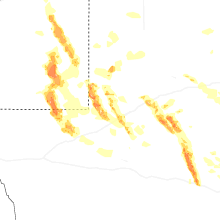


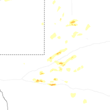
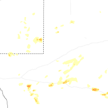
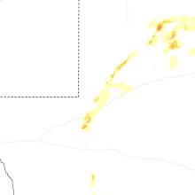
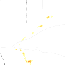
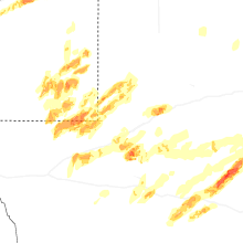
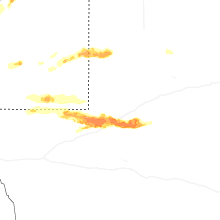

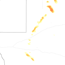
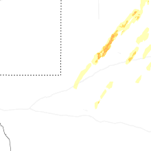


Connect with Interactive Hail Maps