

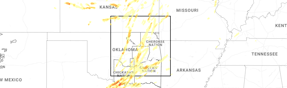
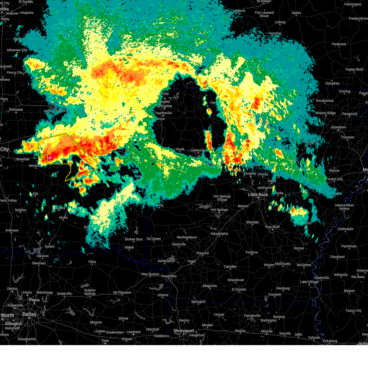
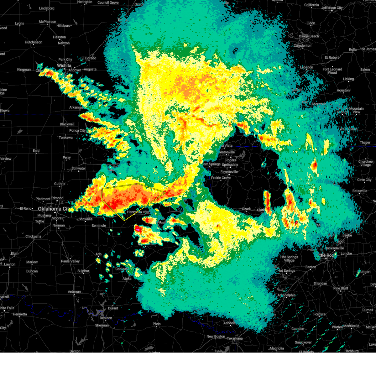
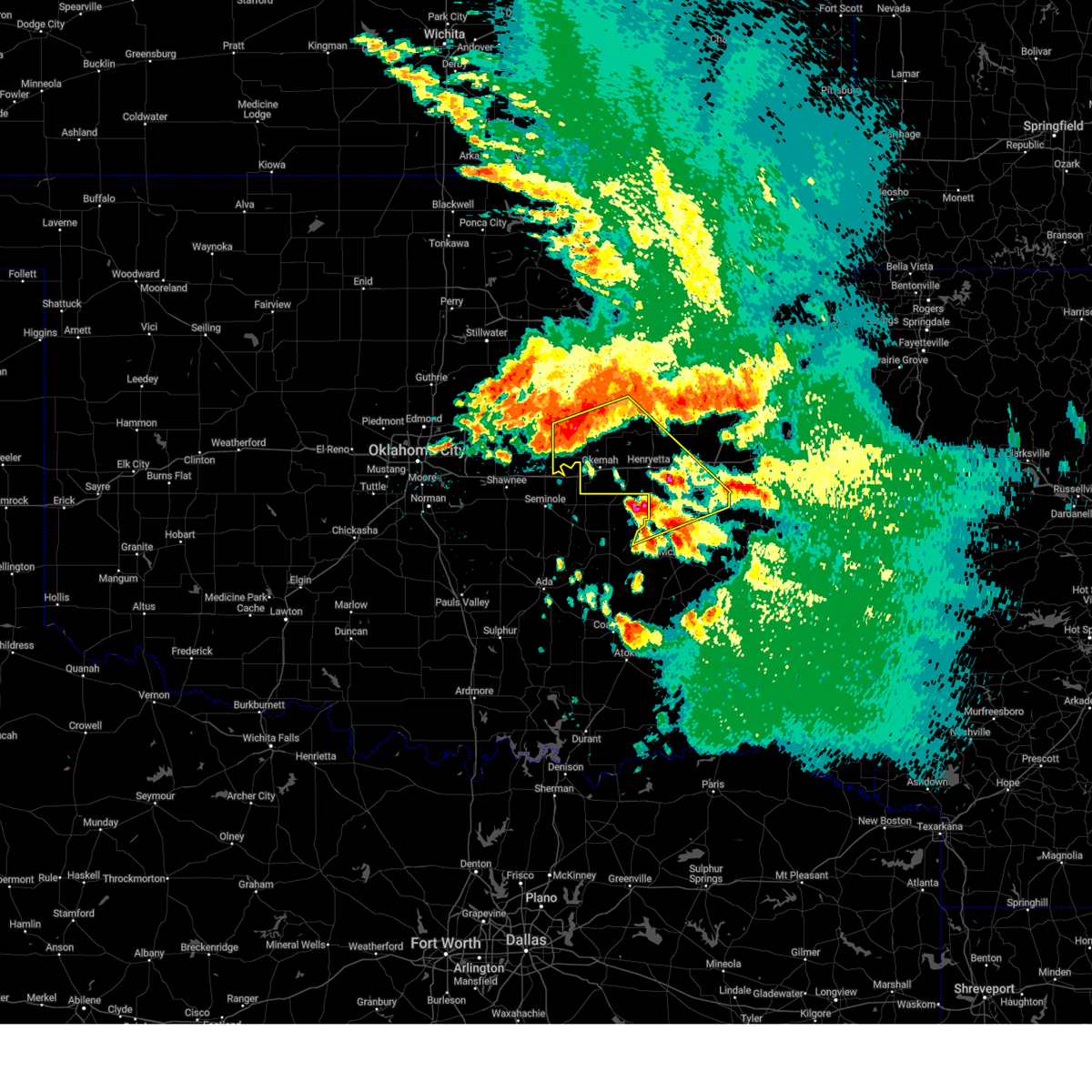
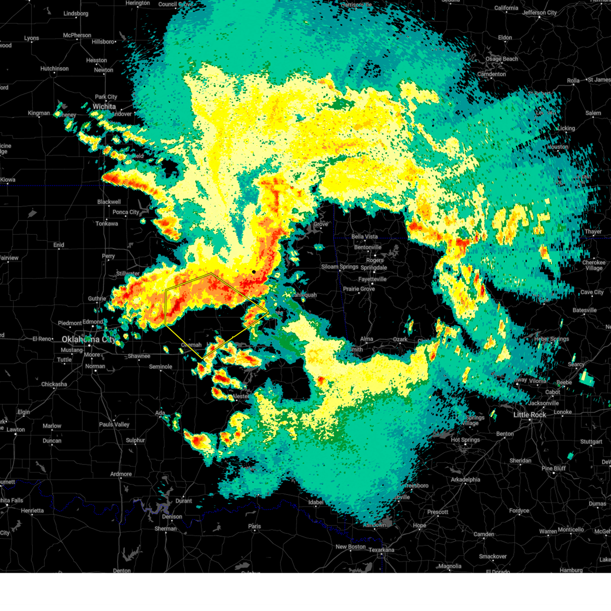
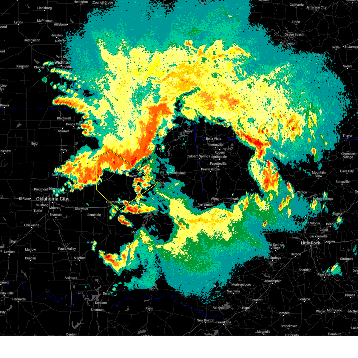
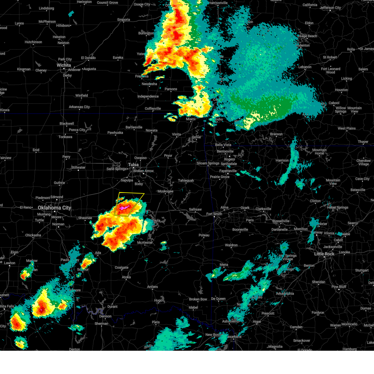
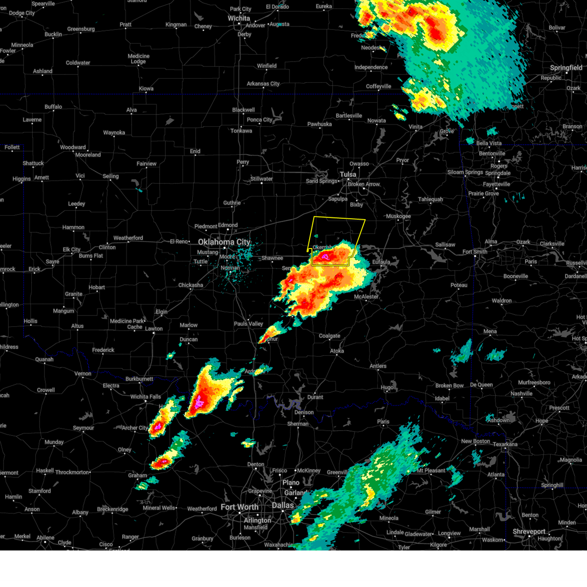
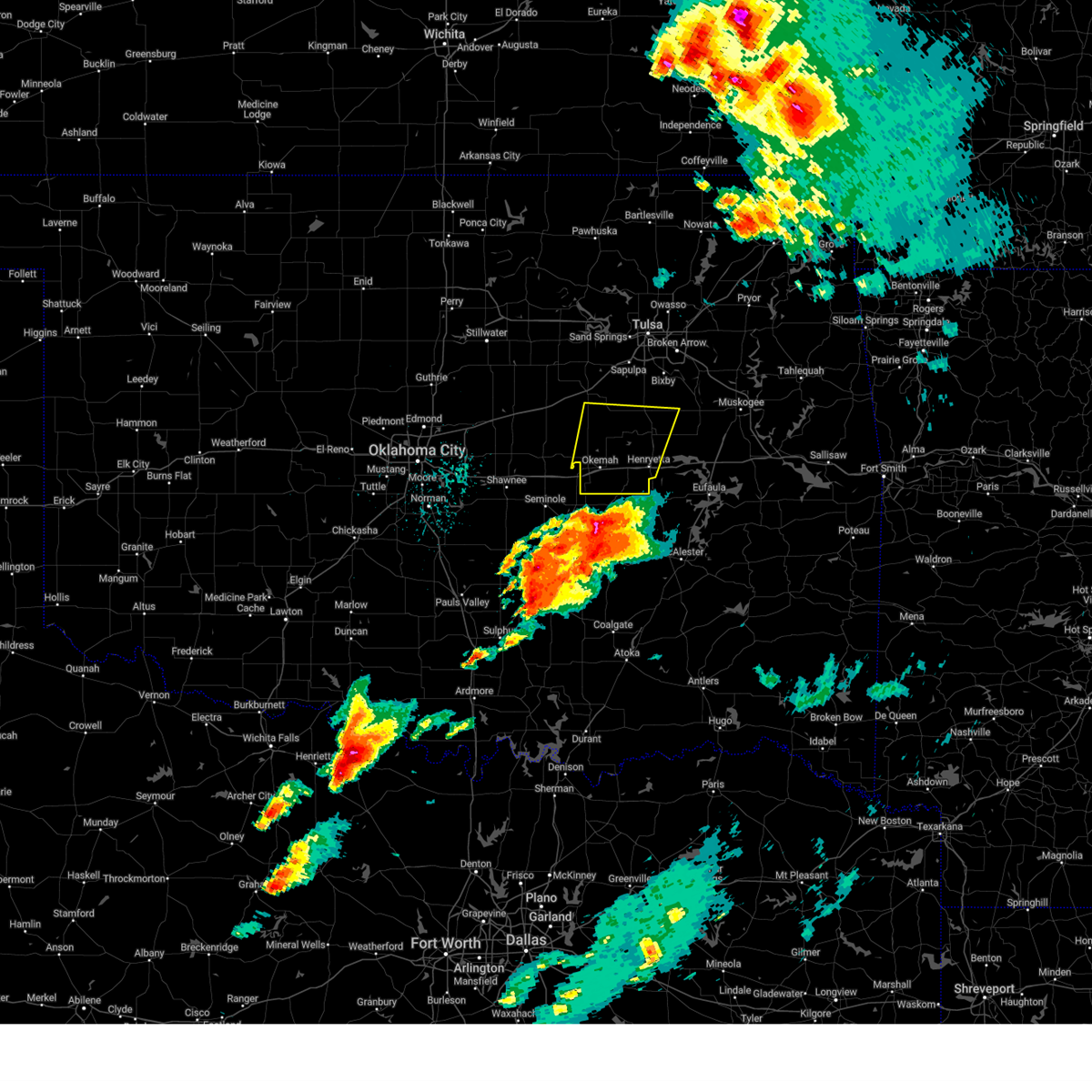
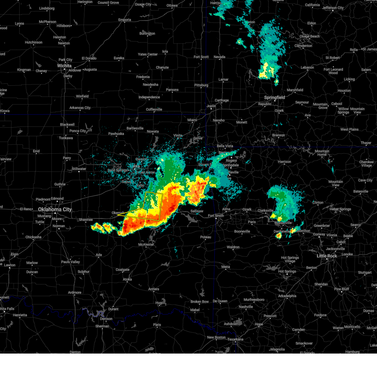
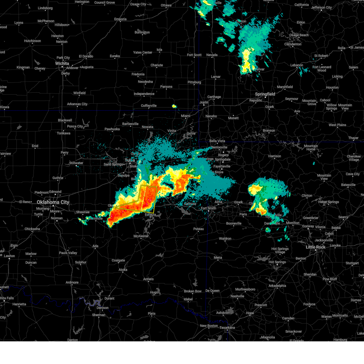
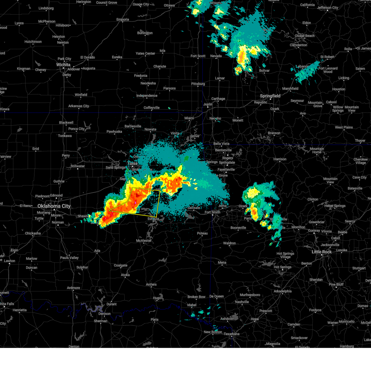
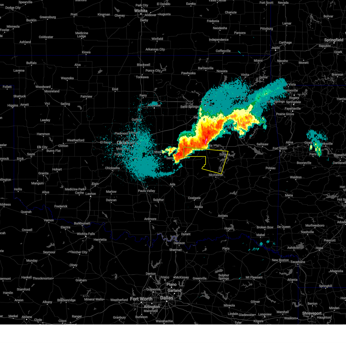
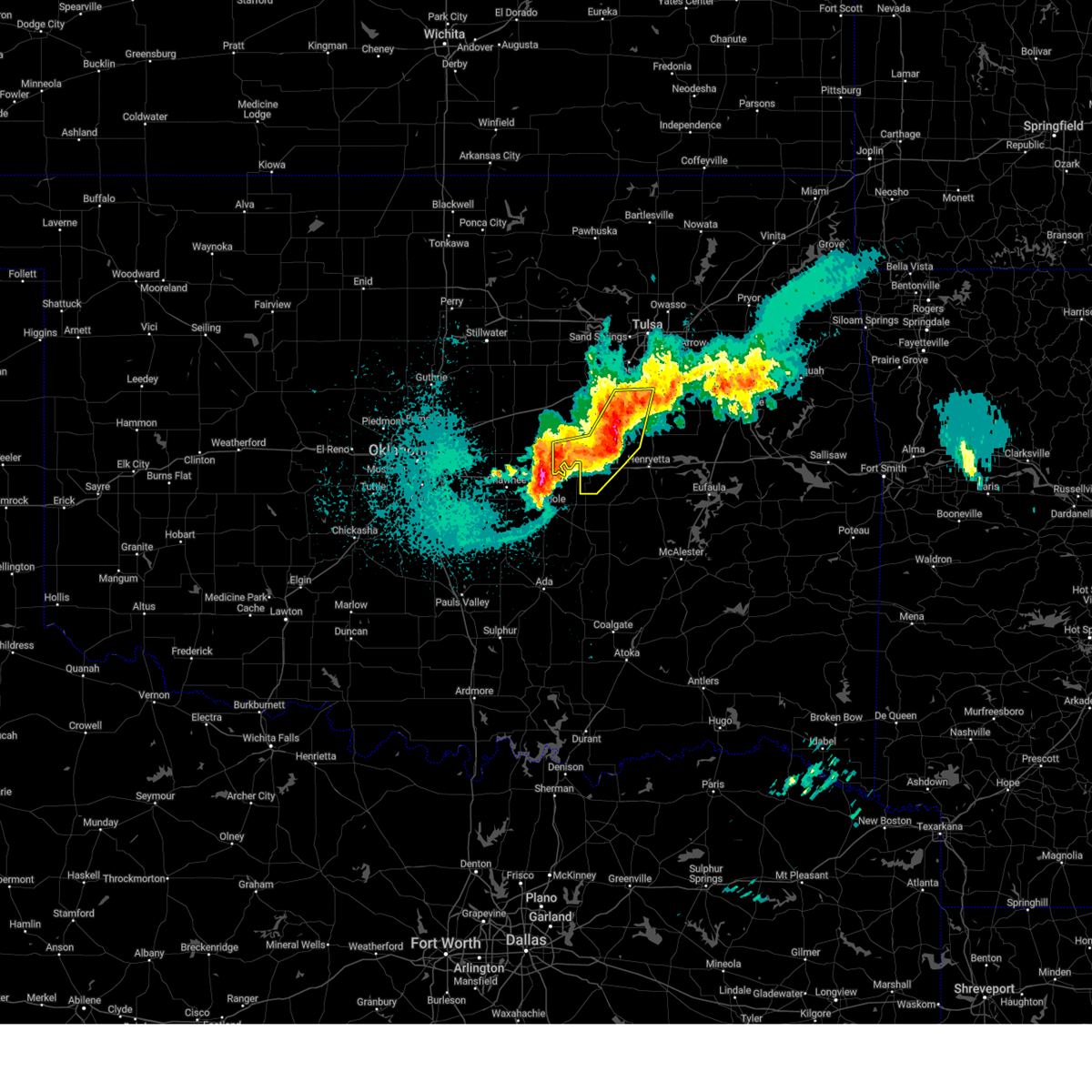
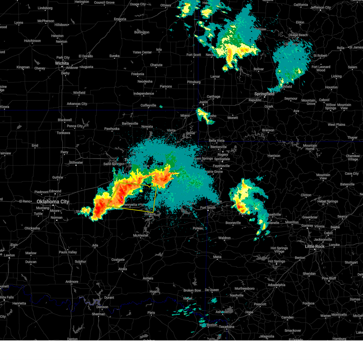
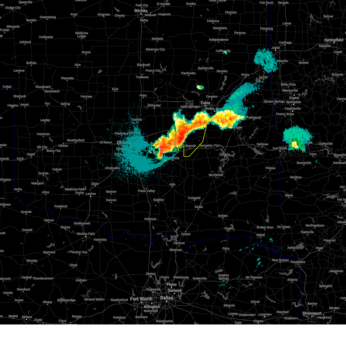
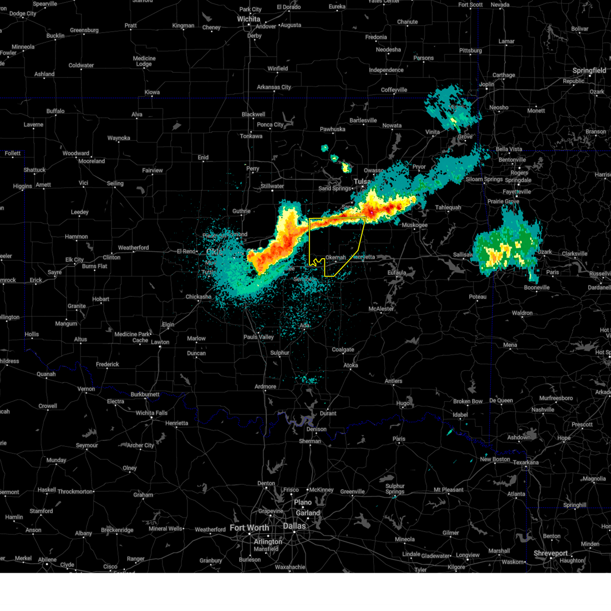
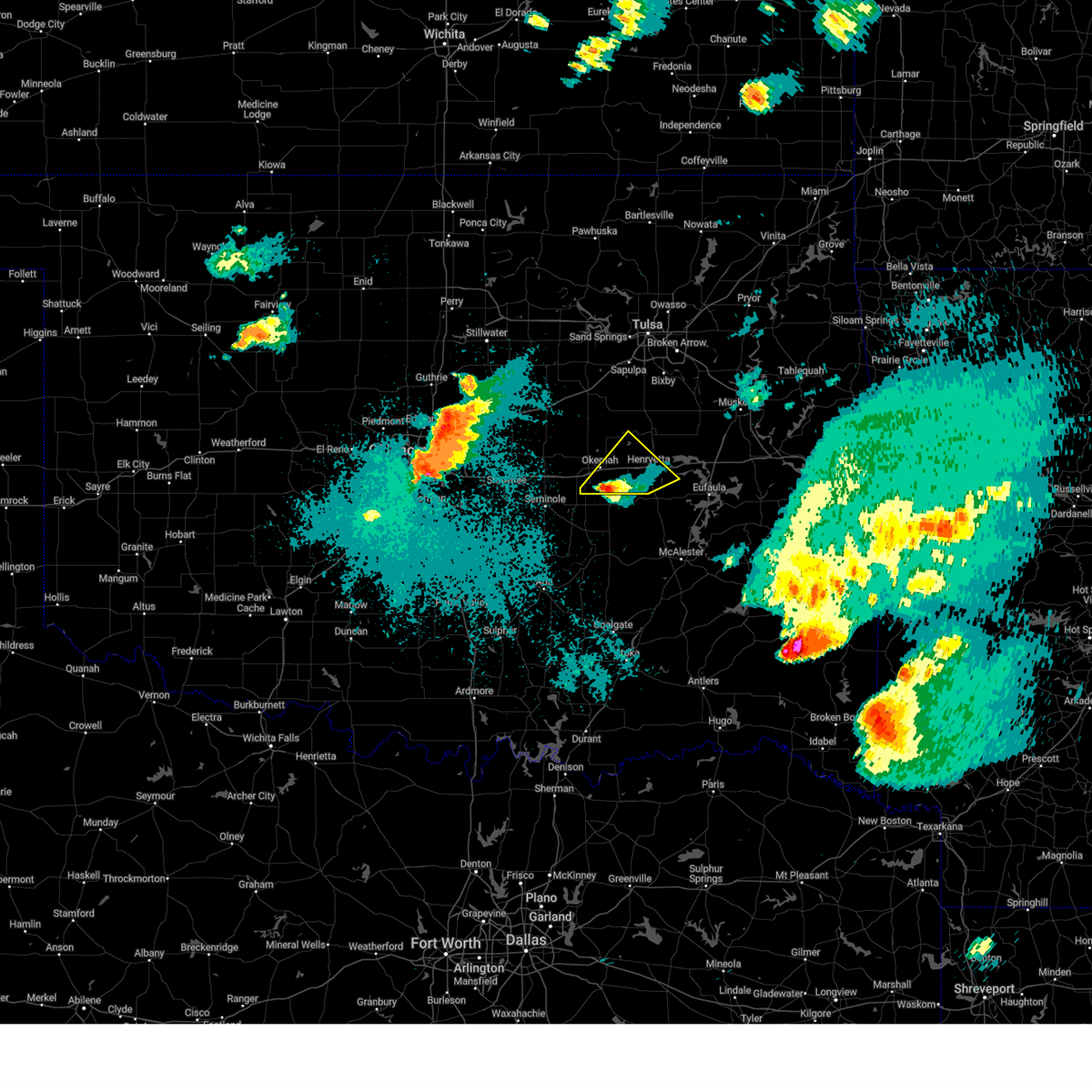
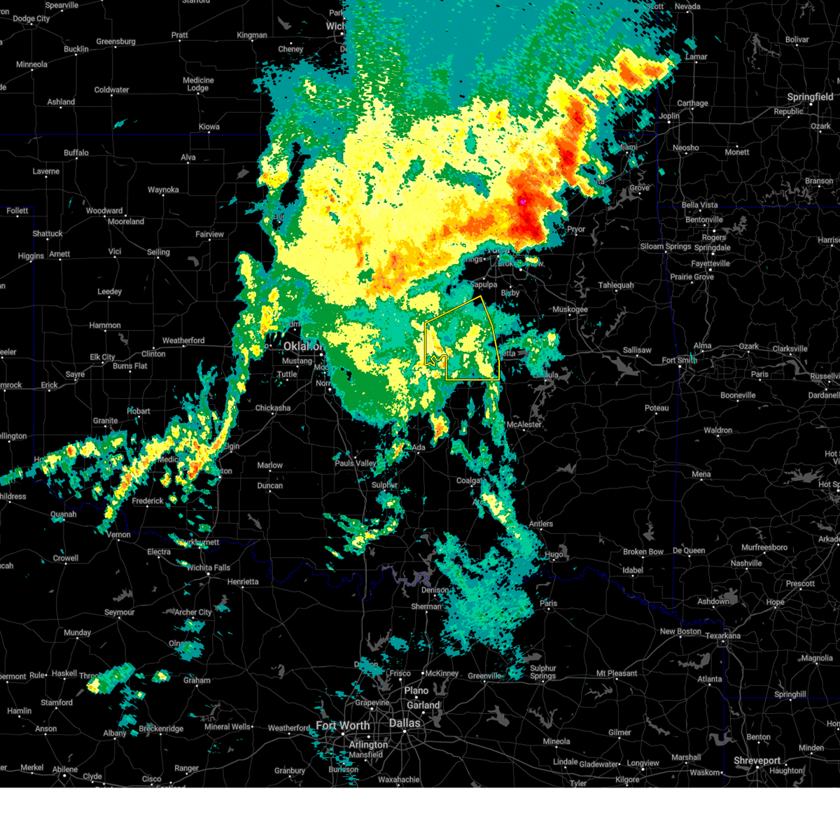
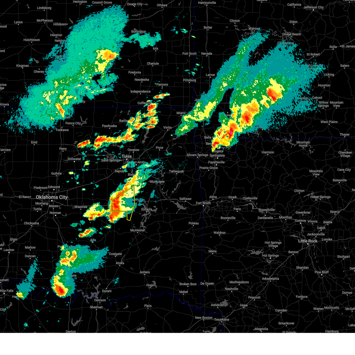
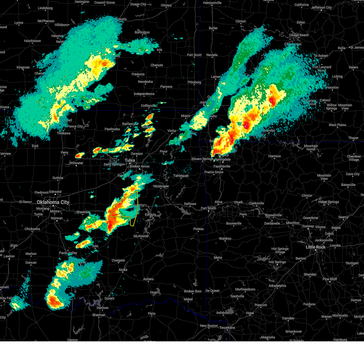
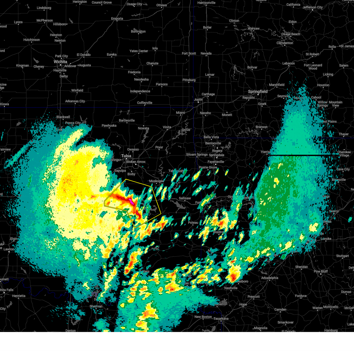
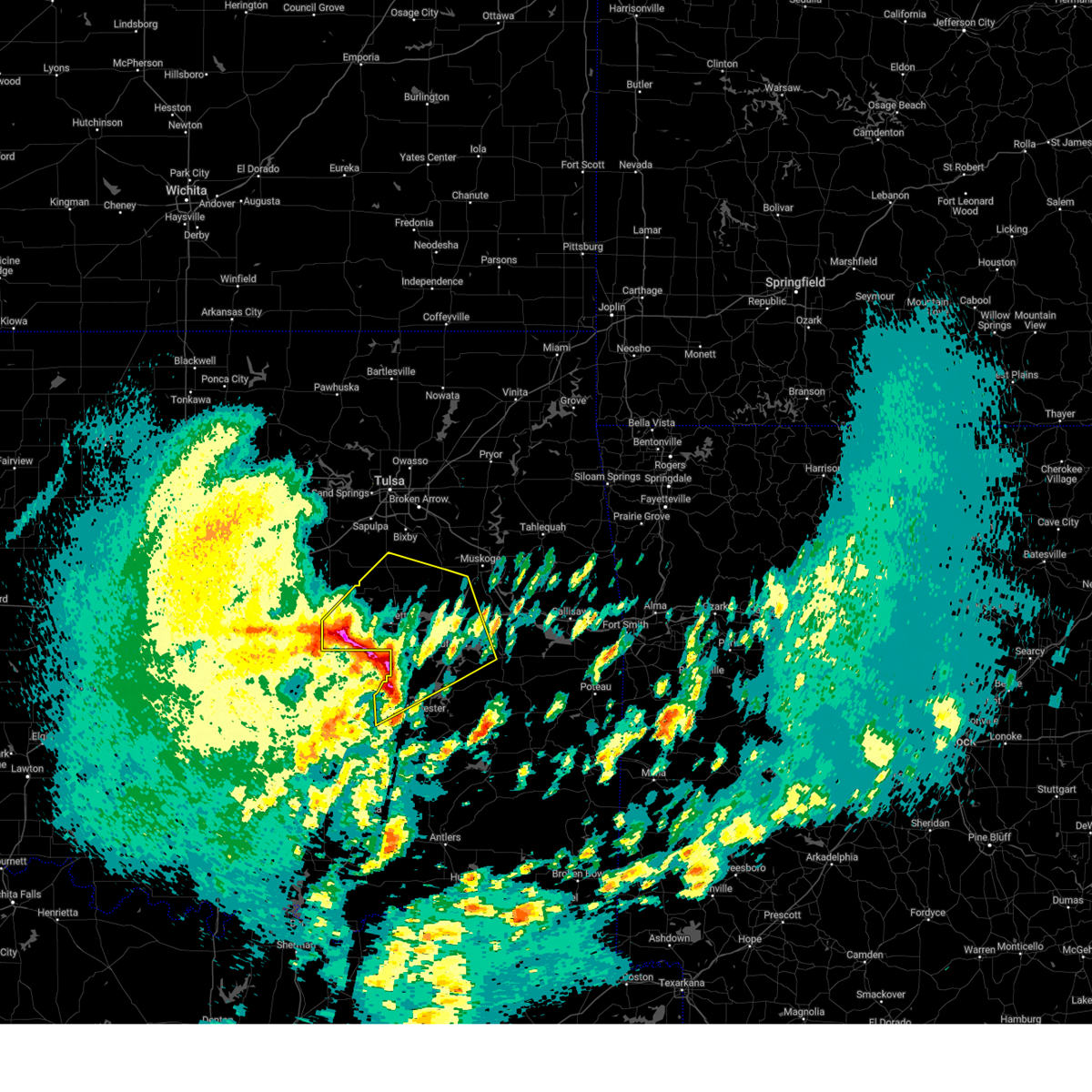
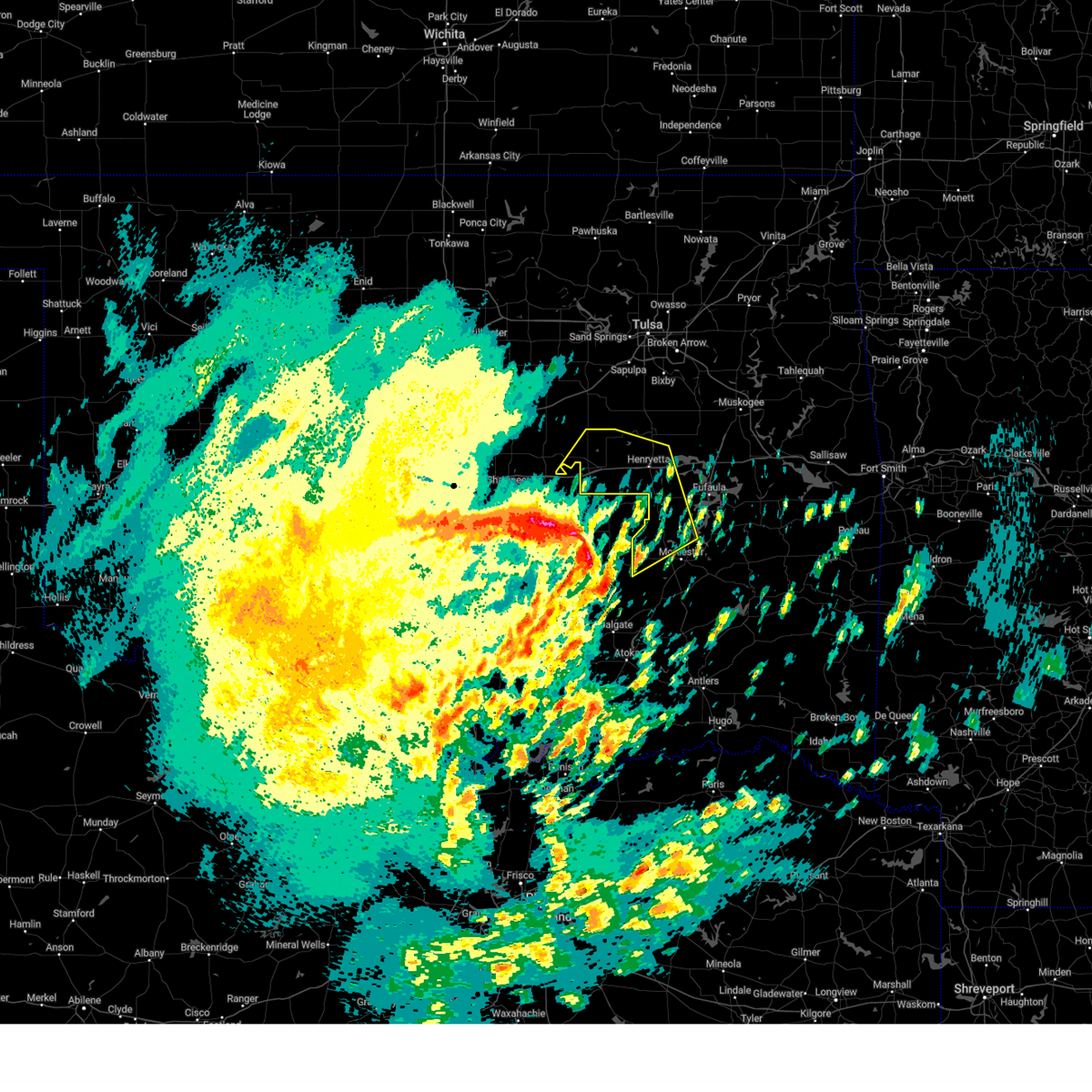
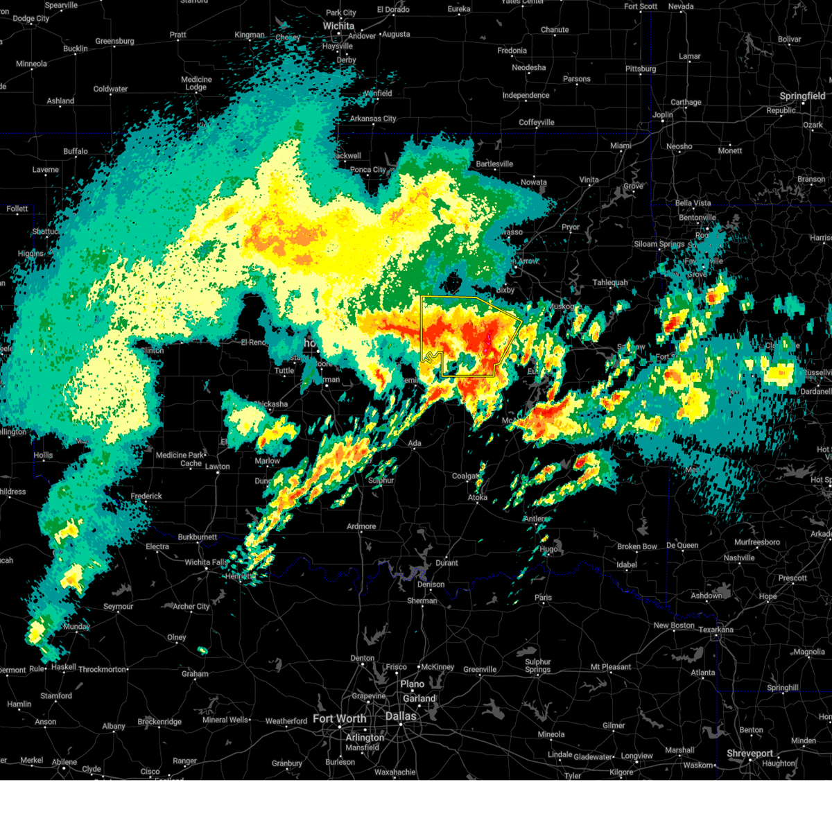
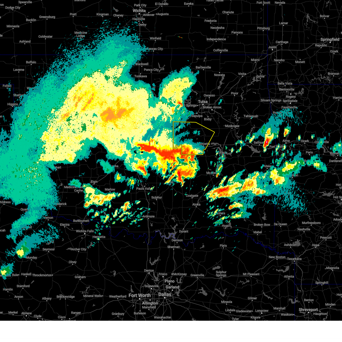
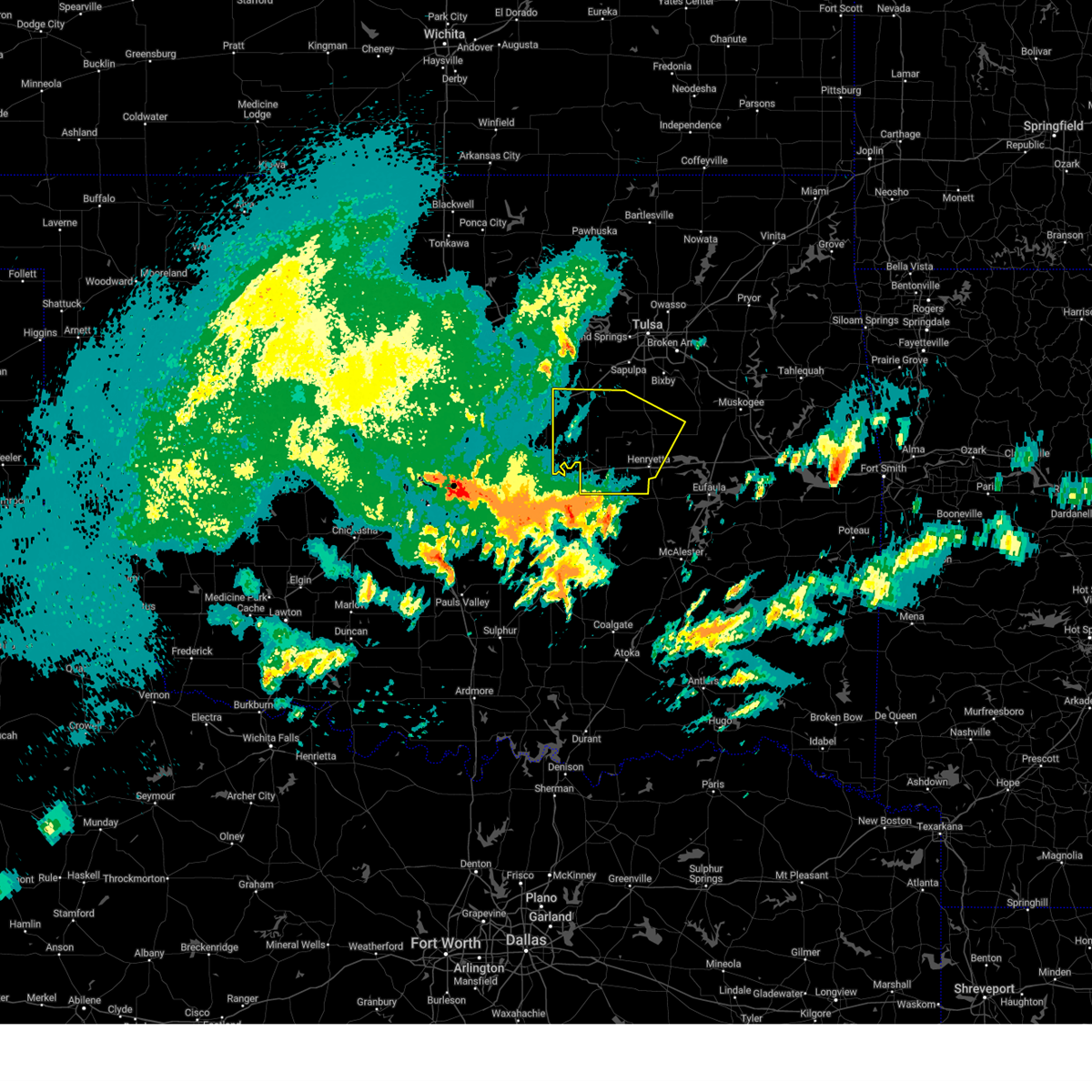
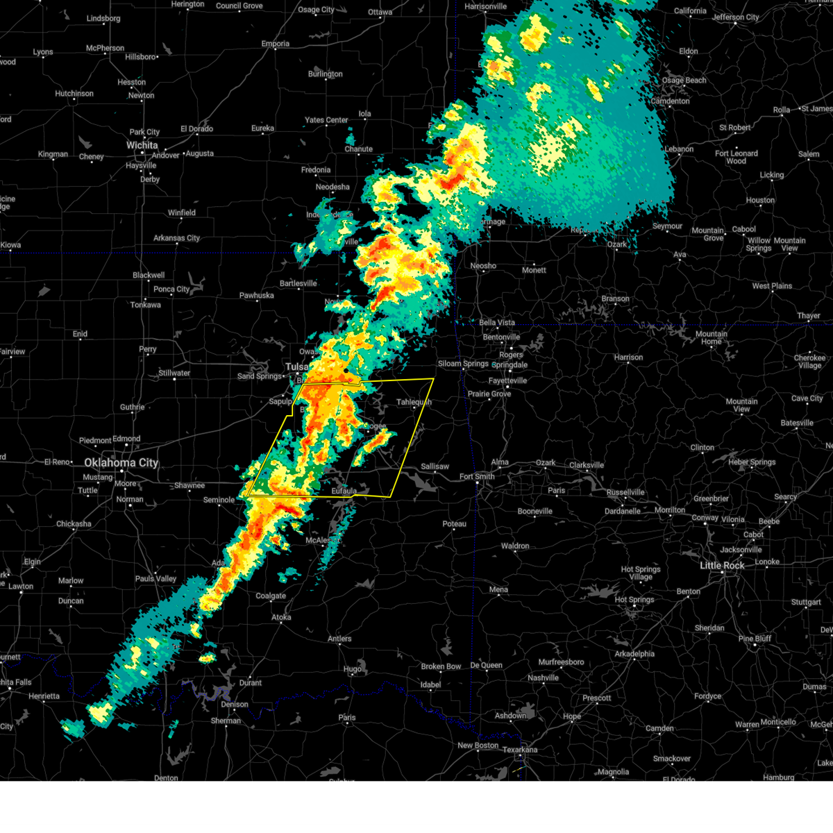
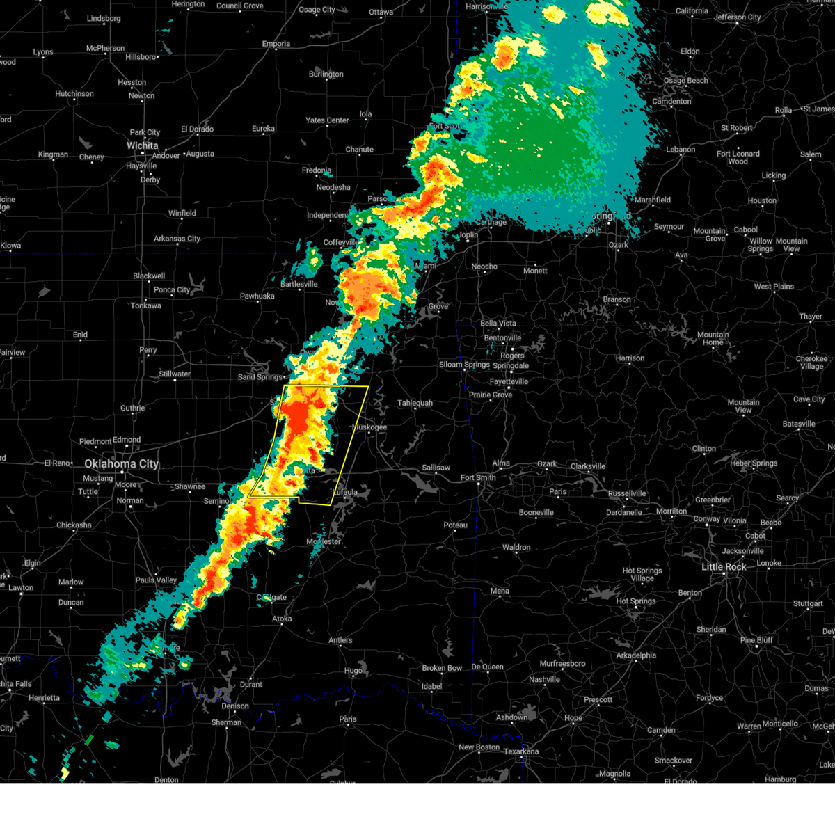
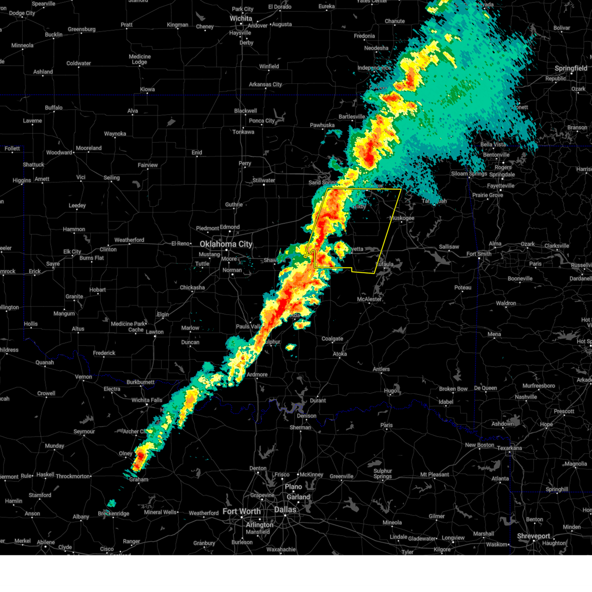
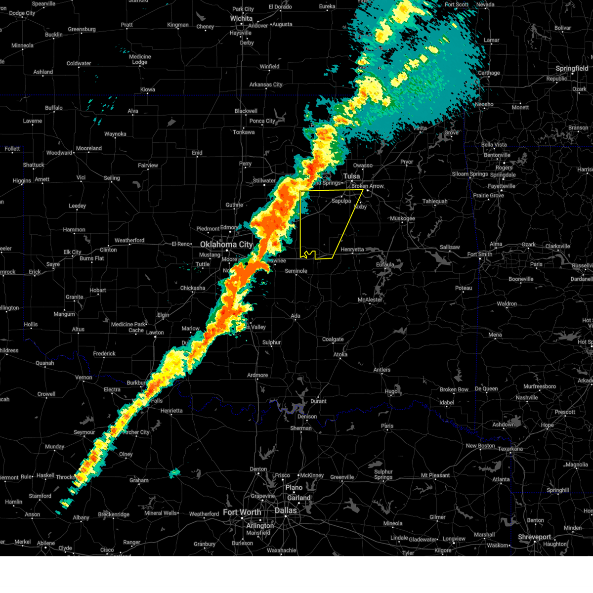
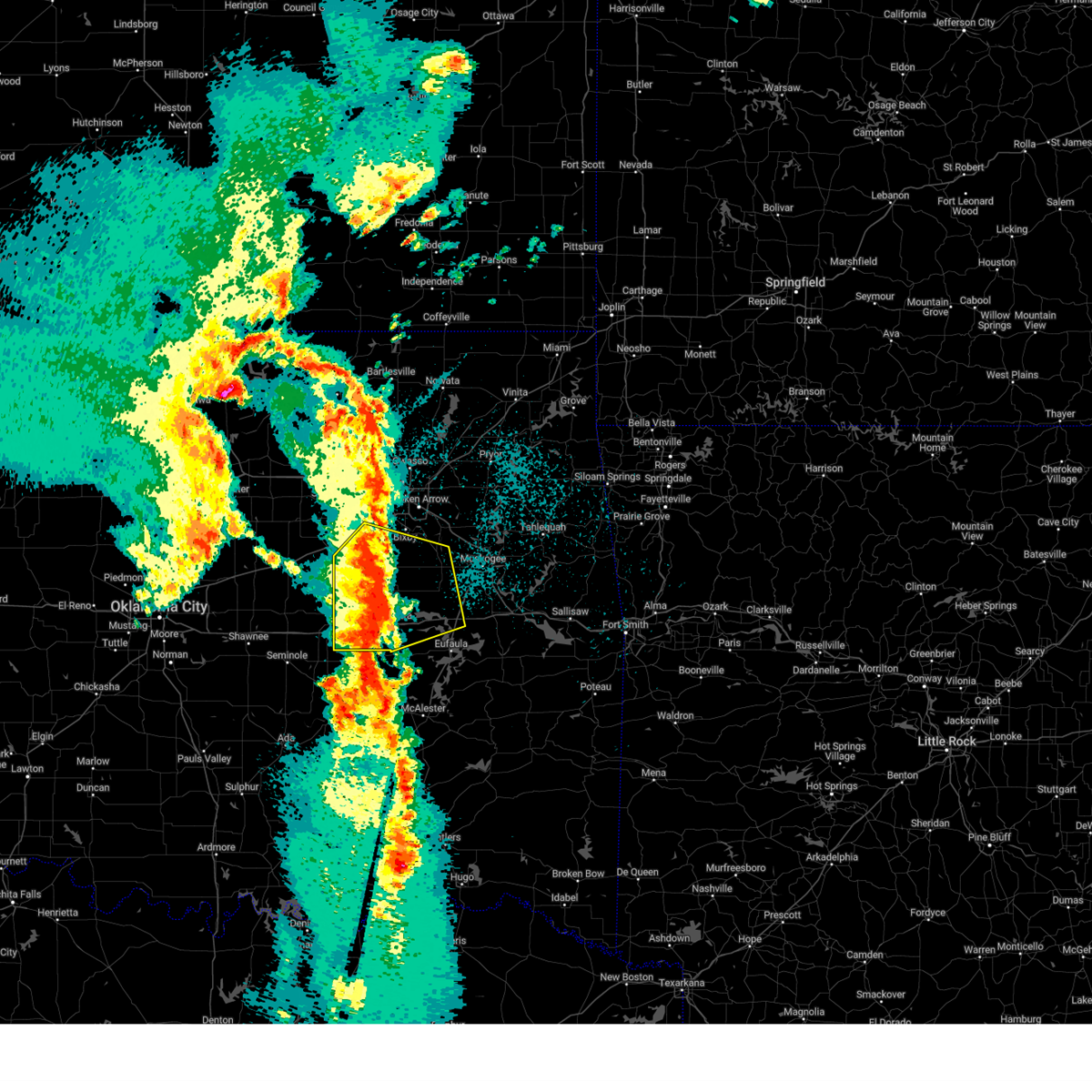
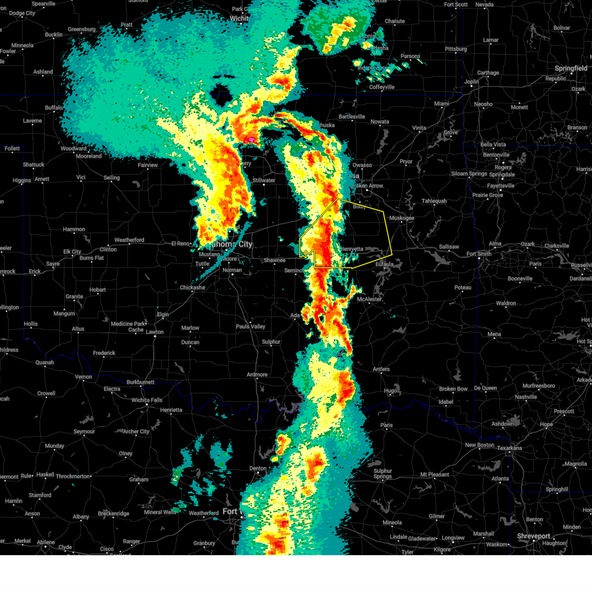
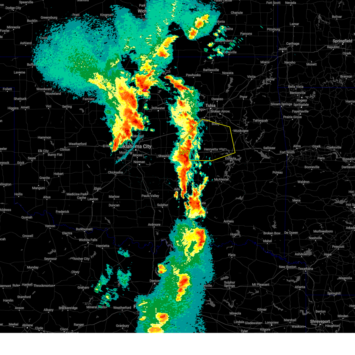
Hail Map for Okemah, OK
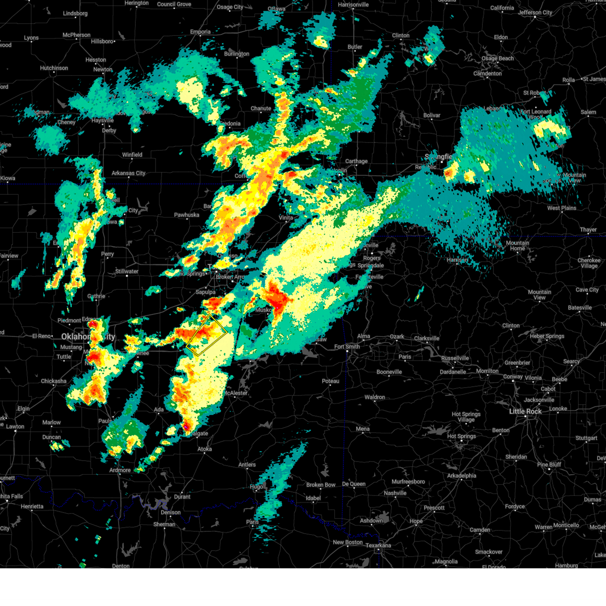
The Okemah, OK area has had 25 reports of on-the-ground hail by trained spotters, and has been under severe weather warnings 66 times during the past 12 months. Doppler radar has detected hail at or near Okemah, OK on 84 occasions, including 8 occasions during the past year.
| Name: | Okemah, OK |
| Where Located: | 52.7 miles SSW of Tulsa, OK |
| Map: | Google Map for Okemah, OK |
| Population: | 3223 |
| Housing Units: | 1488 |
| More Info: | Search Google for Okemah, OK |
1
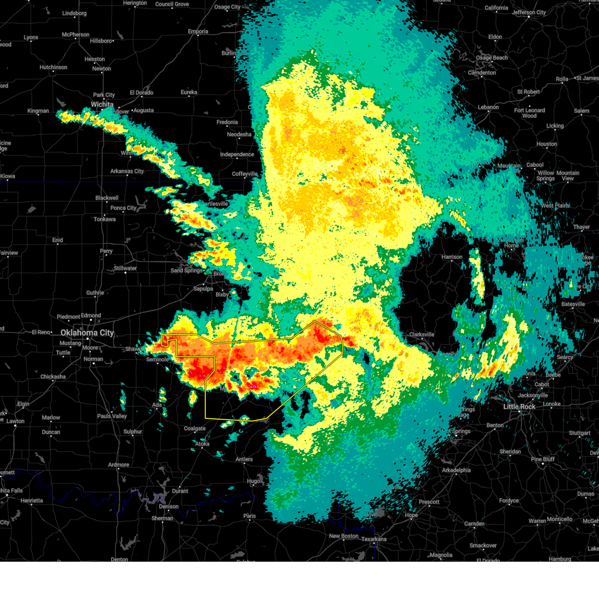
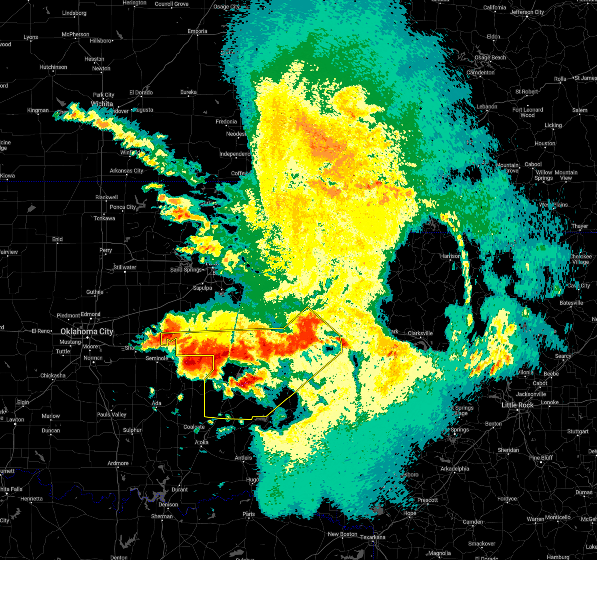
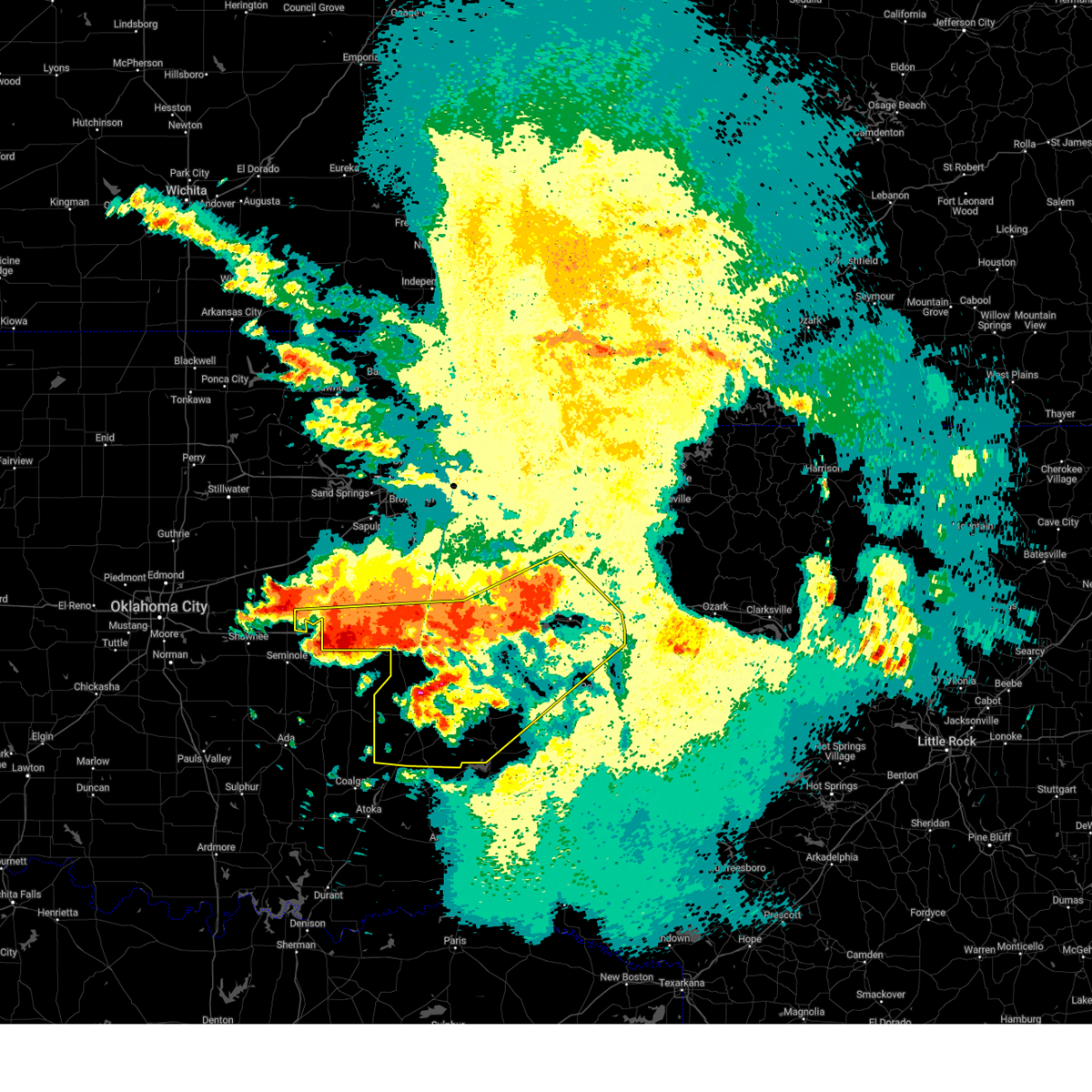
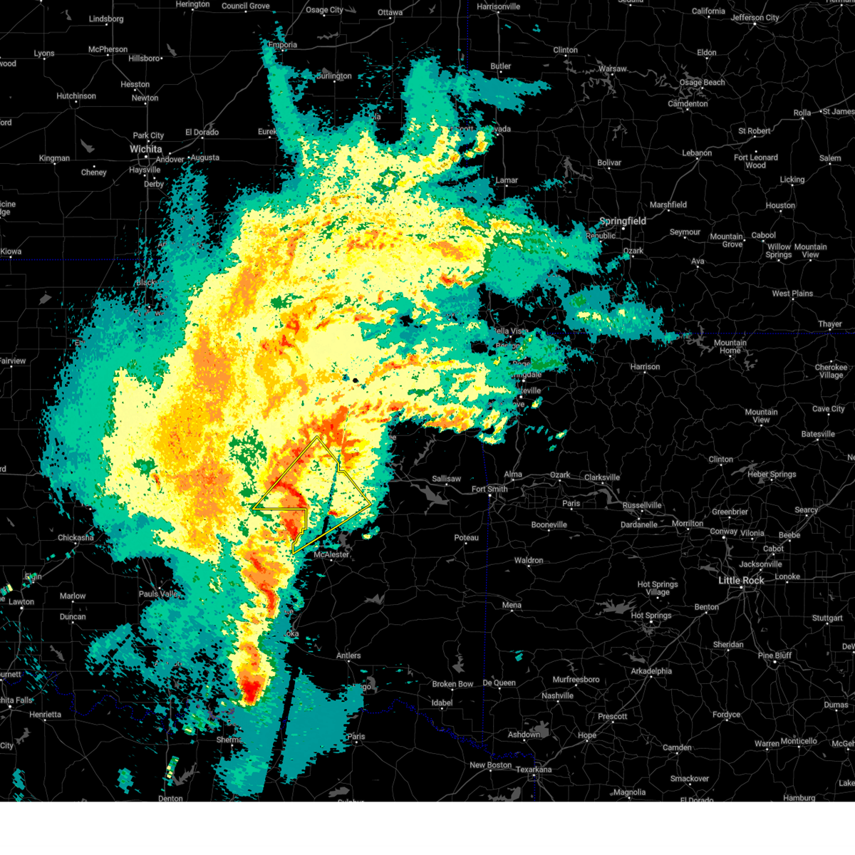
The Top Recent Hail Date for Okemah, OK is Monday, May 19, 2025 (6th out of 84)
Hail and Wind Damage Spotted near Okemah, OK
| Date / Time | Report Details |
|---|---|
| 6/6/2025 5:56 AM CDT |
 The storms which prompted the warning have weakened below severe limits, and no longer pose an immediate threat to life or property. therefore, the warning will be allowed to expire. however, gusty winds of 40 to 50 are still possible with these thunderstorms. a severe thunderstorm watch remains in effect until 800 am cdt for northeastern and east central oklahoma. The storms which prompted the warning have weakened below severe limits, and no longer pose an immediate threat to life or property. therefore, the warning will be allowed to expire. however, gusty winds of 40 to 50 are still possible with these thunderstorms. a severe thunderstorm watch remains in effect until 800 am cdt for northeastern and east central oklahoma.
|
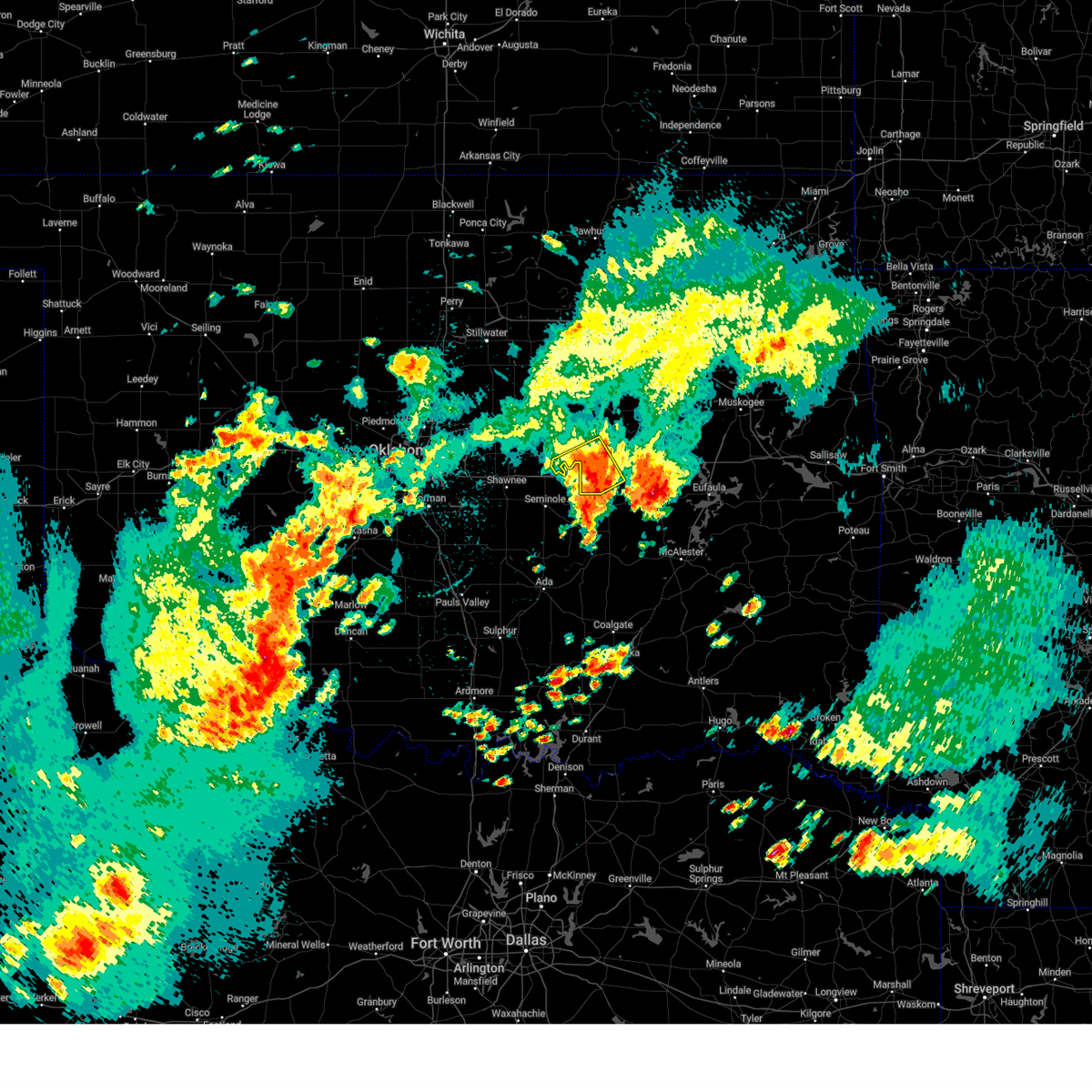
| 6/6/2025 5:34 AM CDT | At 534 am cdt, severe thunderstorms were located along a line extending from near okfuskee to 4 miles northeast of boley to 4 miles northwest of cromwell, moving east at 35 mph (radar indicated). Hazards include 60 mph wind gusts. Expect damage to roofs, siding, and trees. Locations in or near the path include, clearview, mason, boley, castle, weleetka, okemah, bearden, pharoah, okfuskee, this includes interstate 40 in oklahoma between mile markers 212 and 231. |
| 6/6/2025 5:12 AM CDT |
 Svrtsa the national weather service in tulsa has issued a * severe thunderstorm warning for, okfuskee county in east central oklahoma, * until 600 am cdt. * at 512 am cdt, severe thunderstorms were located along a line extending from 2 miles west of stroud to 6 miles northwest of paden to 3 miles west of prague, moving east at 45 mph (radar indicated). Hazards include 60 mph wind gusts. Expect damage to roofs, siding, and trees. Locations in or near the path include, clearview, mason, boley, paden, castle, weleetka, okemah, bearden, welty, pharoah, okfuskee, this includes interstate 40 in oklahoma between mile markers 212 and 231. Svrtsa the national weather service in tulsa has issued a * severe thunderstorm warning for, okfuskee county in east central oklahoma, * until 600 am cdt. * at 512 am cdt, severe thunderstorms were located along a line extending from 2 miles west of stroud to 6 miles northwest of paden to 3 miles west of prague, moving east at 45 mph (radar indicated). Hazards include 60 mph wind gusts. Expect damage to roofs, siding, and trees. Locations in or near the path include, clearview, mason, boley, paden, castle, weleetka, okemah, bearden, welty, pharoah, okfuskee, this includes interstate 40 in oklahoma between mile markers 212 and 231.
|
| 6/3/2025 7:02 PM CDT |
 At 702 pm cdt, severe thunderstorms were located along a line extending from 5 miles northeast of bristow to 6 miles southeast of slick to 5 miles south of okfuskee, moving northeast at 45 mph (radar indicated). Hazards include 60 mph wind gusts. Expect damage to roofs, siding, and trees. Locations in or near the path include, beggs, preston, sapulpa, jenks riverside airport, liberty, mounds, stonebluff, hectorville, leonard, jenks, morris, bixby, bristow, okmulgee, bald hill, okfuskee, tulsa, mason, okmulgee state park, castle, this includes interstate 44 between mile markers 188 and 203, between mile markers 208 and 214, and between mile markers 220 and 226. At 702 pm cdt, severe thunderstorms were located along a line extending from 5 miles northeast of bristow to 6 miles southeast of slick to 5 miles south of okfuskee, moving northeast at 45 mph (radar indicated). Hazards include 60 mph wind gusts. Expect damage to roofs, siding, and trees. Locations in or near the path include, beggs, preston, sapulpa, jenks riverside airport, liberty, mounds, stonebluff, hectorville, leonard, jenks, morris, bixby, bristow, okmulgee, bald hill, okfuskee, tulsa, mason, okmulgee state park, castle, this includes interstate 44 between mile markers 188 and 203, between mile markers 208 and 214, and between mile markers 220 and 226.
|
| 6/3/2025 6:42 PM CDT | Svrtsa the national weather service in tulsa has issued a * severe thunderstorm warning for, southern creek county in northeastern oklahoma, west central wagoner county in northeastern oklahoma, okmulgee county in northeastern oklahoma, southeastern tulsa county in northeastern oklahoma, okfuskee county in east central oklahoma, * until 730 pm cdt. * at 642 pm cdt, severe thunderstorms were located along a line extending from 4 miles south of depew to welty to 2 miles southwest of castle, moving northeast at 50 mph (radar indicated). Hazards include 60 mph wind gusts. Expect damage to roofs, siding, and trees. locations in or near the path include, beggs, preston, boley, sapulpa, jenks riverside airport, liberty, mounds, schulter, stonebluff, hectorville, leonard, jenks, morris, bixby, bristow, okmulgee, okemah, bald hill, okfuskee, tulsa, this includes the following highways, interstate 40 in oklahoma between mile markers 212 and 225. Interstate 44 between mile markers 188 and 203, between mile markers 208 and 214, and between mile markers 220 and 226. |
| 6/3/2025 6:11 PM CDT | Svrtsa the national weather service in tulsa has issued a * severe thunderstorm warning for, okfuskee county in east central oklahoma, * until 700 pm cdt. * at 611 pm cdt, severe thunderstorms were located along a line extending from near sparks to 2 miles southeast of tecumseh, moving east at 45 mph (radar indicated). Hazards include 60 mph wind gusts and penny size hail. Expect damage to roofs, siding, and trees. Locations in or near the path include, mason, boley, paden, castle, okemah, bearden, welty, okfuskee, this includes interstate 40 in oklahoma between mile markers 212 and 222. |
| 5/25/2025 9:31 PM CDT |
 the severe thunderstorm warning has been cancelled and is no longer in effect the severe thunderstorm warning has been cancelled and is no longer in effect
|
| 5/25/2025 9:09 PM CDT | Svrtsa the national weather service in tulsa has issued a * severe thunderstorm warning for, central okfuskee county in east central oklahoma, * until 1000 pm cdt. * at 909 pm cdt, a severe thunderstorm was located 5 miles northwest of cromwell, moving northeast at 25 mph (radar indicated). Hazards include 60 mph wind gusts and quarter size hail. Hail damage to vehicles is expected. expect wind damage to roofs, siding, and trees. Locations in or near the path include, castle, okemah, bearden, clearview, mason, boley, this includes interstate 40 in oklahoma between mile markers 212 and 226. |
| 5/24/2025 7:44 AM CDT |
 At 743 am cdt, severe thunderstorms were located along a line extending from near muldrow to 5 miles northeast of alderson to 4 miles north of atwood, moving south at 40 mph (radar indicated). Hazards include 70 mph wind gusts and penny size hail. Expect considerable tree damage. damage is likely to mobile homes, roofs, and outbuildings. Locations in or near the path include, kanima, arpelar, brushy, mcalester, pittsburg, raiford, whitefield, panola, haywood, spiro, mc curtain, porum, pierce, clearview, moffett, haileyville, panama, lake eufaula state park, pharoah, muldrow, this includes interstate 40 in oklahoma between mile markers 212 and 235, and between mile markers 294 and 328. At 743 am cdt, severe thunderstorms were located along a line extending from near muldrow to 5 miles northeast of alderson to 4 miles north of atwood, moving south at 40 mph (radar indicated). Hazards include 70 mph wind gusts and penny size hail. Expect considerable tree damage. damage is likely to mobile homes, roofs, and outbuildings. Locations in or near the path include, kanima, arpelar, brushy, mcalester, pittsburg, raiford, whitefield, panola, haywood, spiro, mc curtain, porum, pierce, clearview, moffett, haileyville, panama, lake eufaula state park, pharoah, muldrow, this includes interstate 40 in oklahoma between mile markers 212 and 235, and between mile markers 294 and 328.
|
| 5/24/2025 7:44 AM CDT |
 the severe thunderstorm warning has been cancelled and is no longer in effect the severe thunderstorm warning has been cancelled and is no longer in effect
|
| 5/24/2025 7:30 AM CDT |
 At 730 am cdt, severe thunderstorms were located along a line extending from 7 miles southeast of brushy to near quinton to yeager, moving southeast at 40 mph (radar indicated). Hazards include 70 mph wind gusts and penny size hail. Expect considerable tree damage. damage is likely to mobile homes, roofs, and outbuildings. Locations in or near the path include, mcalester, whitefield, haywood, spiro, mc curtain, pierce, moffett, schulter, panama, lake eufaula state park, gore, pharoah, lake tenkiller state park, gans, bryant, red oak, hoffman, hitchita, briartown, okemah, this includes interstate 40 in oklahoma between mile markers 212 and 328. At 730 am cdt, severe thunderstorms were located along a line extending from 7 miles southeast of brushy to near quinton to yeager, moving southeast at 40 mph (radar indicated). Hazards include 70 mph wind gusts and penny size hail. Expect considerable tree damage. damage is likely to mobile homes, roofs, and outbuildings. Locations in or near the path include, mcalester, whitefield, haywood, spiro, mc curtain, pierce, moffett, schulter, panama, lake eufaula state park, gore, pharoah, lake tenkiller state park, gans, bryant, red oak, hoffman, hitchita, briartown, okemah, this includes interstate 40 in oklahoma between mile markers 212 and 328.
|
| 5/24/2025 7:14 AM CDT |
 Svrtsa the national weather service in tulsa has issued a * severe thunderstorm warning for, haskell county in southeastern oklahoma, mcintosh county in southeastern oklahoma, sequoyah county in east central oklahoma, latimer county in southeastern oklahoma, southwestern adair county in northeastern oklahoma, northern le flore county in southeastern oklahoma, southeastern cherokee county in east central oklahoma, pittsburg county in southeastern oklahoma, southwestern okmulgee county in northeastern oklahoma, southern muskogee county in east central oklahoma, okfuskee county in east central oklahoma, * until 815 am cdt. * at 713 am cdt, severe thunderstorms were located along a line extending from cookson to 5 miles northwest of enterprise to 4 miles southeast of cromwell, moving south at 40 mph (trained spotter. a 69 mph gust was measured in muskogee and numerous reports of trees down and roof damage have been received). Hazards include 70 mph wind gusts and penny size hail. Expect considerable tree damage. damage is likely to mobile homes, roofs, and outbuildings. Locations in or near the path include, mcalester, whitefield, haywood, spiro, mc curtain, braggs, pierce, moffett, schulter, panama, lake eufaula state park, gore, pharoah, lake tenkiller state park, keefeton, gans, bryant, red oak, hoffman, hitchita, this includes interstate 40 in oklahoma between mile markers 212 and 328. Svrtsa the national weather service in tulsa has issued a * severe thunderstorm warning for, haskell county in southeastern oklahoma, mcintosh county in southeastern oklahoma, sequoyah county in east central oklahoma, latimer county in southeastern oklahoma, southwestern adair county in northeastern oklahoma, northern le flore county in southeastern oklahoma, southeastern cherokee county in east central oklahoma, pittsburg county in southeastern oklahoma, southwestern okmulgee county in northeastern oklahoma, southern muskogee county in east central oklahoma, okfuskee county in east central oklahoma, * until 815 am cdt. * at 713 am cdt, severe thunderstorms were located along a line extending from cookson to 5 miles northwest of enterprise to 4 miles southeast of cromwell, moving south at 40 mph (trained spotter. a 69 mph gust was measured in muskogee and numerous reports of trees down and roof damage have been received). Hazards include 70 mph wind gusts and penny size hail. Expect considerable tree damage. damage is likely to mobile homes, roofs, and outbuildings. Locations in or near the path include, mcalester, whitefield, haywood, spiro, mc curtain, braggs, pierce, moffett, schulter, panama, lake eufaula state park, gore, pharoah, lake tenkiller state park, keefeton, gans, bryant, red oak, hoffman, hitchita, this includes interstate 40 in oklahoma between mile markers 212 and 328.
|
| 5/24/2025 7:03 AM CDT |
 At 702 am cdt, severe thunderstorms were located along a line extending from 6 miles east of hoffman to 5 miles south of bearden, moving southeast at 65 mph (radar indicated). Hazards include 60 mph wind gusts and penny size hail. Expect damage to roofs, siding, and trees. Locations in or near the path include, beggs, preston, canadian, boley, paden, raiford, weleetka, dewar, vivian, hanna, pierce, clearview, schulter, lake eufaula state park, morris, pharoah, grayson, bryant, hoffman, okmulgee, this includes interstate 40 in oklahoma between mile markers 212 and 257. At 702 am cdt, severe thunderstorms were located along a line extending from 6 miles east of hoffman to 5 miles south of bearden, moving southeast at 65 mph (radar indicated). Hazards include 60 mph wind gusts and penny size hail. Expect damage to roofs, siding, and trees. Locations in or near the path include, beggs, preston, canadian, boley, paden, raiford, weleetka, dewar, vivian, hanna, pierce, clearview, schulter, lake eufaula state park, morris, pharoah, grayson, bryant, hoffman, okmulgee, this includes interstate 40 in oklahoma between mile markers 212 and 257.
|
| 5/24/2025 6:47 AM CDT |
 At 647 am cdt, severe thunderstorms were located along a line extending from 5 miles east of rentiesville to 3 miles south of hoffman to 2 miles southwest of okemah, moving southeast at 45 mph (trained weather spotters. multiple reports of trees down have been received from the tulsa metro area and into northern okmulgee county). Hazards include 60 mph wind gusts and penny size hail. Expect damage to roofs, siding, and trees. locations in or near the path include, beggs, preston, liberty, depew, mounds, clearview, schulter, hectorville, eram, haskell, morris, pharoah, bristow, okmulgee, jamesville, bald hill, okfuskee, milfay, boynton, mason, this includes the following highways, interstate 40 in oklahoma between mile markers 221 and 236. Interstate 44 between mile markers 178 and 194. At 647 am cdt, severe thunderstorms were located along a line extending from 5 miles east of rentiesville to 3 miles south of hoffman to 2 miles southwest of okemah, moving southeast at 45 mph (trained weather spotters. multiple reports of trees down have been received from the tulsa metro area and into northern okmulgee county). Hazards include 60 mph wind gusts and penny size hail. Expect damage to roofs, siding, and trees. locations in or near the path include, beggs, preston, liberty, depew, mounds, clearview, schulter, hectorville, eram, haskell, morris, pharoah, bristow, okmulgee, jamesville, bald hill, okfuskee, milfay, boynton, mason, this includes the following highways, interstate 40 in oklahoma between mile markers 221 and 236. Interstate 44 between mile markers 178 and 194.
|
| 5/24/2025 6:35 AM CDT |
 Svrtsa the national weather service in tulsa has issued a * severe thunderstorm warning for, southwestern creek county in northeastern oklahoma, mcintosh county in southeastern oklahoma, northwestern pittsburg county in southeastern oklahoma, southwestern okmulgee county in northeastern oklahoma, okfuskee county in east central oklahoma, * until 715 am cdt. * at 635 am cdt, severe thunderstorms were located along a line extending from 2 miles southeast of okmulgee to 6 miles northeast of little, moving southeast at 45 mph (radar indicated). Hazards include 60 mph wind gusts and penny size hail. Expect damage to roofs, siding, and trees. Locations in or near the path include, beggs, preston, canadian, boley, paden, raiford, weleetka, dewar, vivian, hanna, pierce, clearview, schulter, lake eufaula state park, morris, pharoah, grayson, bryant, hoffman, okmulgee, this includes interstate 40 in oklahoma between mile markers 212 and 257. Svrtsa the national weather service in tulsa has issued a * severe thunderstorm warning for, southwestern creek county in northeastern oklahoma, mcintosh county in southeastern oklahoma, northwestern pittsburg county in southeastern oklahoma, southwestern okmulgee county in northeastern oklahoma, okfuskee county in east central oklahoma, * until 715 am cdt. * at 635 am cdt, severe thunderstorms were located along a line extending from 2 miles southeast of okmulgee to 6 miles northeast of little, moving southeast at 45 mph (radar indicated). Hazards include 60 mph wind gusts and penny size hail. Expect damage to roofs, siding, and trees. Locations in or near the path include, beggs, preston, canadian, boley, paden, raiford, weleetka, dewar, vivian, hanna, pierce, clearview, schulter, lake eufaula state park, morris, pharoah, grayson, bryant, hoffman, okmulgee, this includes interstate 40 in oklahoma between mile markers 212 and 257.
|
| 5/24/2025 6:17 AM CDT |
 the severe thunderstorm warning has been cancelled and is no longer in effect the severe thunderstorm warning has been cancelled and is no longer in effect
|
| 5/24/2025 6:17 AM CDT |
 At 617 am cdt, severe thunderstorms were located along a line extending from 4 miles south of coweta to 3 miles west of preston to 7 miles west of welty, moving southeast at 50 mph (radar indicated). Hazards include 70 mph wind gusts and penny size hail. Expect considerable tree damage. damage is likely to mobile homes, roofs, and outbuildings. locations in or near the path include, beggs, sand springs, shamrock, preston, sapulpa, jenks riverside airport, liberty, depew, mounds, clearview, schulter, stonebluff, hectorville, eram, haskell, leonard, jenks, morris, pharoah, bixby, this includes the following highways, interstate 40 in oklahoma between mile markers 221 and 236. Interstate 44 between mile markers 178 and 223. At 617 am cdt, severe thunderstorms were located along a line extending from 4 miles south of coweta to 3 miles west of preston to 7 miles west of welty, moving southeast at 50 mph (radar indicated). Hazards include 70 mph wind gusts and penny size hail. Expect considerable tree damage. damage is likely to mobile homes, roofs, and outbuildings. locations in or near the path include, beggs, sand springs, shamrock, preston, sapulpa, jenks riverside airport, liberty, depew, mounds, clearview, schulter, stonebluff, hectorville, eram, haskell, leonard, jenks, morris, pharoah, bixby, this includes the following highways, interstate 40 in oklahoma between mile markers 221 and 236. Interstate 44 between mile markers 178 and 223.
|
| 5/24/2025 5:58 AM CDT |
 Svrtsa the national weather service in tulsa has issued a * severe thunderstorm warning for, south central osage county in northeastern oklahoma, creek county in northeastern oklahoma, southwestern wagoner county in northeastern oklahoma, okmulgee county in northeastern oklahoma, northwestern muskogee county in east central oklahoma, southeastern pawnee county in northeastern oklahoma, southern tulsa county in northeastern oklahoma, eastern okfuskee county in east central oklahoma, * until 700 am cdt. * at 558 am cdt, severe thunderstorms were located along a line extending from 4 miles northwest of broken arrow to 6 miles southwest of mannford to 2 miles south of shamrock, moving southeast at 45 mph (radar indicated). Hazards include 70 mph wind gusts and penny size hail. Expect considerable tree damage. damage is likely to mobile homes, roofs, and outbuildings. locations in or near the path include, beggs, sand springs, shamrock, sapulpa, jenks riverside airport, depew, mounds, clearview, schulter, stonebluff, hectorville, eram, haskell, leonard, morris, pharoah, keystone state park, okmulgee, oilton, okfuskee, this includes the following highways, interstate 40 in oklahoma between mile markers 221 and 236. Interstate 44 between mile markers 178 and 223. Svrtsa the national weather service in tulsa has issued a * severe thunderstorm warning for, south central osage county in northeastern oklahoma, creek county in northeastern oklahoma, southwestern wagoner county in northeastern oklahoma, okmulgee county in northeastern oklahoma, northwestern muskogee county in east central oklahoma, southeastern pawnee county in northeastern oklahoma, southern tulsa county in northeastern oklahoma, eastern okfuskee county in east central oklahoma, * until 700 am cdt. * at 558 am cdt, severe thunderstorms were located along a line extending from 4 miles northwest of broken arrow to 6 miles southwest of mannford to 2 miles south of shamrock, moving southeast at 45 mph (radar indicated). Hazards include 70 mph wind gusts and penny size hail. Expect considerable tree damage. damage is likely to mobile homes, roofs, and outbuildings. locations in or near the path include, beggs, sand springs, shamrock, sapulpa, jenks riverside airport, depew, mounds, clearview, schulter, stonebluff, hectorville, eram, haskell, leonard, morris, pharoah, keystone state park, okmulgee, oilton, okfuskee, this includes the following highways, interstate 40 in oklahoma between mile markers 221 and 236. Interstate 44 between mile markers 178 and 223.
|
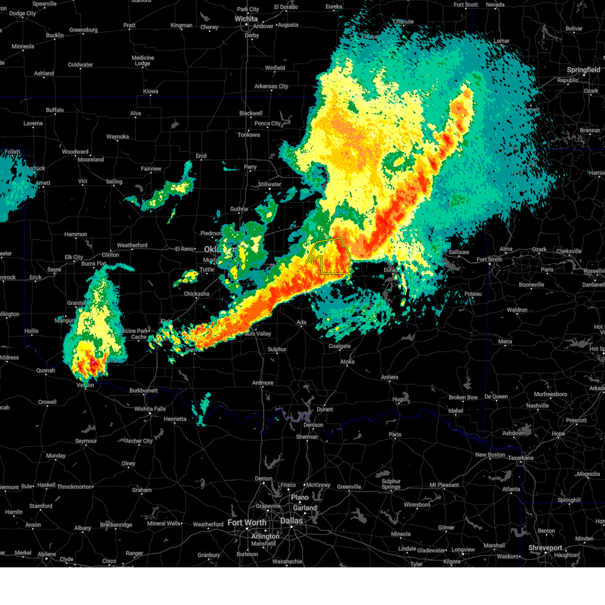
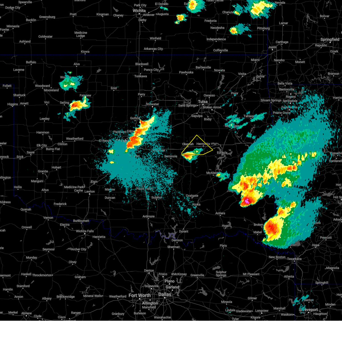
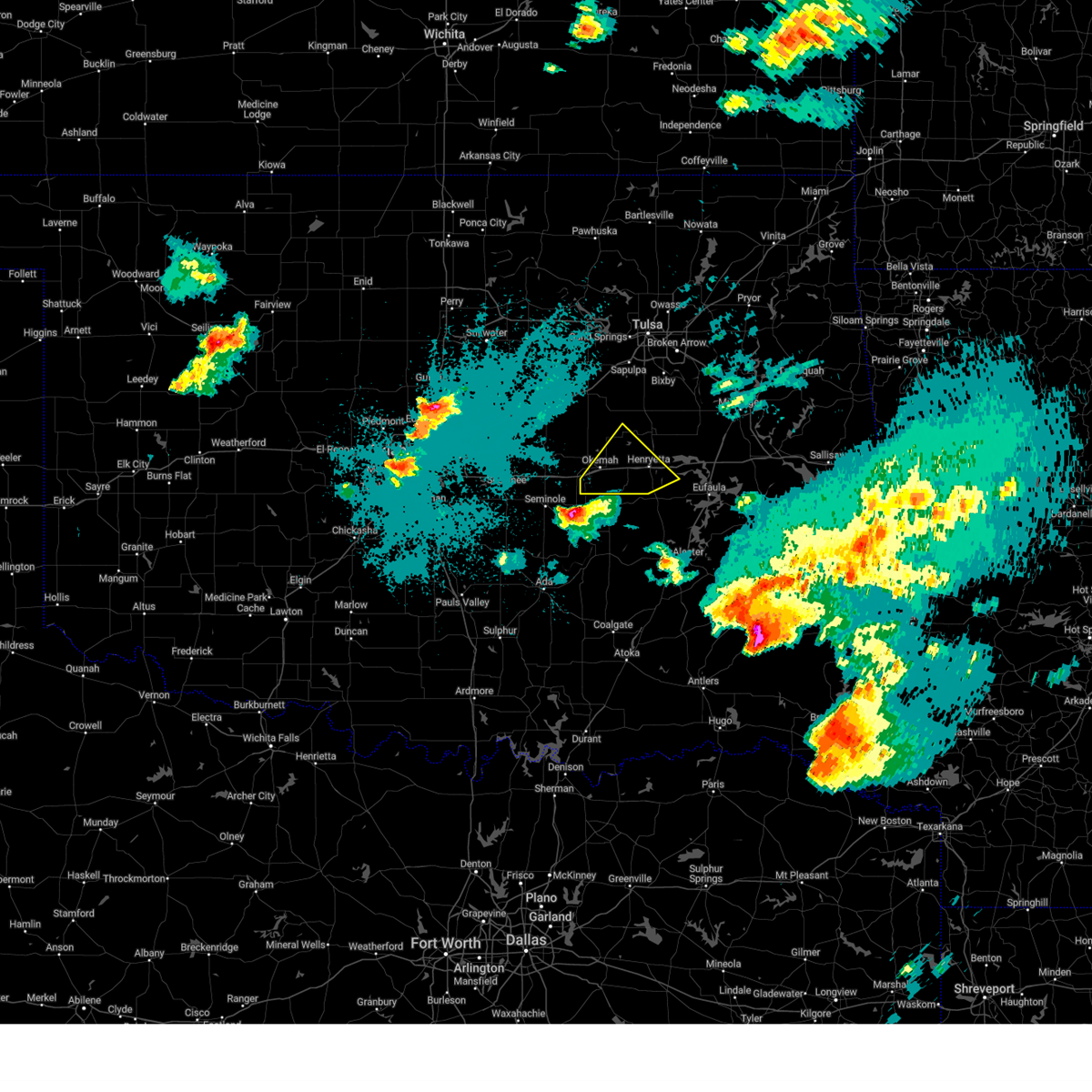
| 5/19/2025 4:36 PM CDT | Svrtsa the national weather service in tulsa has issued a * severe thunderstorm warning for, south central creek county in northeastern oklahoma, southwestern wagoner county in northeastern oklahoma, northern okmulgee county in northeastern oklahoma, northwestern muskogee county in east central oklahoma, eastern okfuskee county in east central oklahoma, * until 515 pm cdt. * at 436 pm cdt, severe thunderstorms were located along a line extending from near bald hill to castle, moving northeast at 50 mph (radar indicated). Hazards include 60 mph wind gusts and quarter size hail. Hail damage to vehicles is expected. expect wind damage to roofs, siding, and trees. Locations in or near the path include, beggs, preston, okmulgee, okemah, bald hill, okfuskee, mason, stonebluff, okmulgee state park, hectorville, haskell, castle, morris, coweta, bearden, this includes interstate 40 in oklahoma between mile markers 215 and 222. |
| 5/19/2025 3:15 PM CDT |
 At 314 pm cdt, a severe thunderstorm was located 6 miles southeast of okfuskee, moving north at 55 mph. ping pong ball sized hail was reported in okemah (radar indicated). Hazards include two inch hail and 60 mph wind gusts. People and animals outdoors will be injured. expect hail damage to roofs, siding, windows, and vehicles. expect wind damage to roofs, siding, and trees. Locations in or near the path include, beggs, clearview, preston, okmulgee, okmulgee state park, okemah, pharoah, bald hill, okfuskee, this includes interstate 40 in oklahoma between mile markers 217 and 232. At 314 pm cdt, a severe thunderstorm was located 6 miles southeast of okfuskee, moving north at 55 mph. ping pong ball sized hail was reported in okemah (radar indicated). Hazards include two inch hail and 60 mph wind gusts. People and animals outdoors will be injured. expect hail damage to roofs, siding, windows, and vehicles. expect wind damage to roofs, siding, and trees. Locations in or near the path include, beggs, clearview, preston, okmulgee, okmulgee state park, okemah, pharoah, bald hill, okfuskee, this includes interstate 40 in oklahoma between mile markers 217 and 232.
|
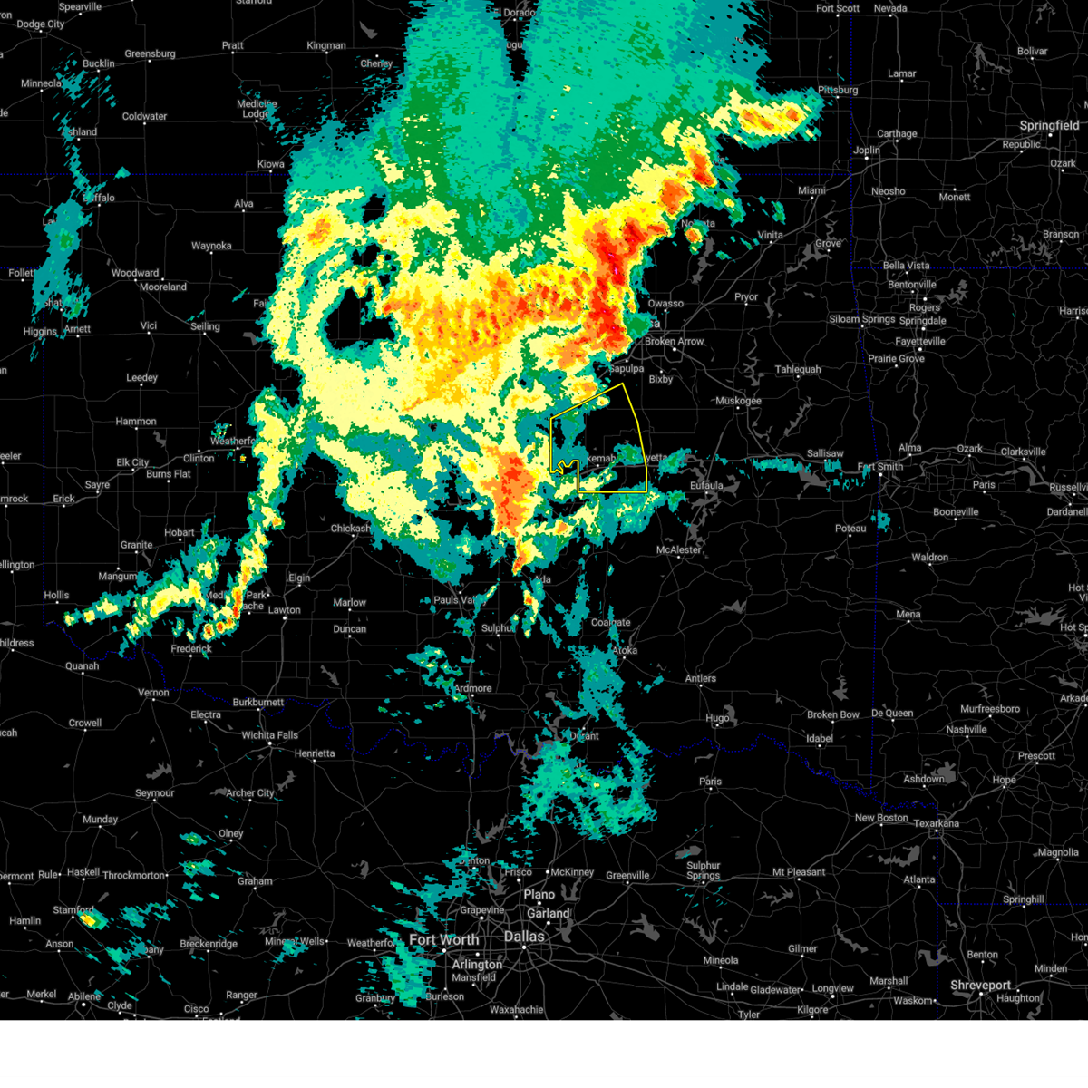
| 5/19/2025 3:13 PM CDT | Ping Pong Ball sized hail reported 0.1 miles SSW of Okemah, OK |
| 5/19/2025 3:12 PM CDT | At 312 pm cdt, a severe thunderstorm was located 5 miles north of clearview, moving north at 55 mph (radar indicated). Hazards include two inch hail and 60 mph wind gusts. People and animals outdoors will be injured. expect hail damage to roofs, siding, windows, and vehicles. expect wind damage to roofs, siding, and trees. Locations in or near the path include, bryant, beggs, preston, okmulgee, weleetka, okemah, bald hill, okfuskee, henryetta, clearview, schulter, okmulgee state park, pharoah, morris, this includes interstate 40 in oklahoma between mile markers 217 and 237. |
| 5/19/2025 3:05 PM CDT |
 At 304 pm cdt, a severe thunderstorm was located 3 miles southwest of clearview, moving north at 50 mph (radar indicated). Hazards include two inch hail and 60 mph wind gusts. People and animals outdoors will be injured. expect hail damage to roofs, siding, windows, and vehicles. expect wind damage to roofs, siding, and trees. Locations in or near the path include, bryant, beggs, preston, okmulgee, boley, weleetka, okemah, dewar, bald hill, okfuskee, henryetta, clearview, mason, schulter, okmulgee state park, castle, bearden, morris, welty, pharoah, this includes interstate 40 in oklahoma between mile markers 212 and 241. At 304 pm cdt, a severe thunderstorm was located 3 miles southwest of clearview, moving north at 50 mph (radar indicated). Hazards include two inch hail and 60 mph wind gusts. People and animals outdoors will be injured. expect hail damage to roofs, siding, windows, and vehicles. expect wind damage to roofs, siding, and trees. Locations in or near the path include, bryant, beggs, preston, okmulgee, boley, weleetka, okemah, dewar, bald hill, okfuskee, henryetta, clearview, mason, schulter, okmulgee state park, castle, bearden, morris, welty, pharoah, this includes interstate 40 in oklahoma between mile markers 212 and 241.
|
| 5/19/2025 2:49 PM CDT |
 Svrtsa the national weather service in tulsa has issued a * severe thunderstorm warning for, south central creek county in northeastern oklahoma, okmulgee county in northeastern oklahoma, okfuskee county in east central oklahoma, * until 330 pm cdt. * at 249 pm cdt, a severe thunderstorm was located near yeager, moving north at 55 mph (radar indicated). Hazards include golf ball size hail and 60 mph wind gusts. People and animals outdoors will be injured. expect hail damage to roofs, siding, windows, and vehicles. expect wind damage to roofs, siding, and trees. Locations in or near the path include, bryant, beggs, preston, okmulgee, boley, weleetka, okemah, dewar, bald hill, okfuskee, henryetta, clearview, mason, schulter, okmulgee state park, castle, bearden, morris, welty, pharoah, this includes interstate 40 in oklahoma between mile markers 212 and 241. Svrtsa the national weather service in tulsa has issued a * severe thunderstorm warning for, south central creek county in northeastern oklahoma, okmulgee county in northeastern oklahoma, okfuskee county in east central oklahoma, * until 330 pm cdt. * at 249 pm cdt, a severe thunderstorm was located near yeager, moving north at 55 mph (radar indicated). Hazards include golf ball size hail and 60 mph wind gusts. People and animals outdoors will be injured. expect hail damage to roofs, siding, windows, and vehicles. expect wind damage to roofs, siding, and trees. Locations in or near the path include, bryant, beggs, preston, okmulgee, boley, weleetka, okemah, dewar, bald hill, okfuskee, henryetta, clearview, mason, schulter, okmulgee state park, castle, bearden, morris, welty, pharoah, this includes interstate 40 in oklahoma between mile markers 212 and 241.
|
| 5/18/2025 3:31 AM CDT |
 The storm which prompted the warning has moved out of the area. therefore, the warning has been allowed to expire. a severe thunderstorm watch remains in effect until 400 am cdt for southeastern, northeastern and east central oklahoma. The storm which prompted the warning has moved out of the area. therefore, the warning has been allowed to expire. a severe thunderstorm watch remains in effect until 400 am cdt for southeastern, northeastern and east central oklahoma.
|
| 5/18/2025 3:15 AM CDT |
 At 315 am cdt, a severe thunderstorm was located over rentiesville, moving east at 55 mph (radar indicated). Hazards include 60 mph wind gusts and quarter size hail. Hail damage to vehicles is expected. expect wind damage to roofs, siding, and trees. Locations in or near the path include, wainwright, hoffman, rentiesville, jamesville, hitchita, dewar, henryetta, pierce, council hill, boynton, schulter, eram, checotah, lake eufaula state park, pharoah, taft, grayson, onapa, oktaha, this includes interstate 40 in oklahoma between mile markers 225 and 265. At 315 am cdt, a severe thunderstorm was located over rentiesville, moving east at 55 mph (radar indicated). Hazards include 60 mph wind gusts and quarter size hail. Hail damage to vehicles is expected. expect wind damage to roofs, siding, and trees. Locations in or near the path include, wainwright, hoffman, rentiesville, jamesville, hitchita, dewar, henryetta, pierce, council hill, boynton, schulter, eram, checotah, lake eufaula state park, pharoah, taft, grayson, onapa, oktaha, this includes interstate 40 in oklahoma between mile markers 225 and 265.
|
| 5/18/2025 2:59 AM CDT |
 the severe thunderstorm warning has been cancelled and is no longer in effect the severe thunderstorm warning has been cancelled and is no longer in effect
|
| 5/18/2025 2:59 AM CDT |
 At 259 am cdt, a severe thunderstorm was located 5 miles northeast of hoffman, moving east at 55 mph (radar indicated). Hazards include 60 mph wind gusts and quarter size hail. Hail damage to vehicles is expected. expect wind damage to roofs, siding, and trees. Locations in or near the path include, preston, dewar, pierce, schulter, eram, checotah, lake eufaula state park, morris, pharoah, grayson, wainwright, hoffman, okmulgee, rentiesville, jamesville, hitchita, bald hill, henryetta, council hill, boynton, this includes interstate 40 in oklahoma between mile markers 224 and 265. At 259 am cdt, a severe thunderstorm was located 5 miles northeast of hoffman, moving east at 55 mph (radar indicated). Hazards include 60 mph wind gusts and quarter size hail. Hail damage to vehicles is expected. expect wind damage to roofs, siding, and trees. Locations in or near the path include, preston, dewar, pierce, schulter, eram, checotah, lake eufaula state park, morris, pharoah, grayson, wainwright, hoffman, okmulgee, rentiesville, jamesville, hitchita, bald hill, henryetta, council hill, boynton, this includes interstate 40 in oklahoma between mile markers 224 and 265.
|
| 5/18/2025 2:57 AM CDT |
 Svrtsa the national weather service in tulsa has issued a * severe thunderstorm warning for, southwestern mcintosh county in southeastern oklahoma, northwestern pittsburg county in southeastern oklahoma, south central okmulgee county in northeastern oklahoma, southeastern okfuskee county in east central oklahoma, * until 345 am cdt. * at 257 am cdt, a severe thunderstorm was located 5 miles northwest of wetumka, moving east at 50 mph (radar indicated). Hazards include 60 mph wind gusts and quarter size hail. Hail damage to vehicles is expected. expect wind damage to roofs, siding, and trees. Locations in or near the path include, bryant, canadian, indianola, crowder, raiford, weleetka, okemah, vivian, hanna, vernon, arrowhead state park, clearview, stidham, bearden, pharoah, eufaula, this includes interstate 40 in oklahoma between mile markers 212 and 228. Svrtsa the national weather service in tulsa has issued a * severe thunderstorm warning for, southwestern mcintosh county in southeastern oklahoma, northwestern pittsburg county in southeastern oklahoma, south central okmulgee county in northeastern oklahoma, southeastern okfuskee county in east central oklahoma, * until 345 am cdt. * at 257 am cdt, a severe thunderstorm was located 5 miles northwest of wetumka, moving east at 50 mph (radar indicated). Hazards include 60 mph wind gusts and quarter size hail. Hail damage to vehicles is expected. expect wind damage to roofs, siding, and trees. Locations in or near the path include, bryant, canadian, indianola, crowder, raiford, weleetka, okemah, vivian, hanna, vernon, arrowhead state park, clearview, stidham, bearden, pharoah, eufaula, this includes interstate 40 in oklahoma between mile markers 212 and 228.
|
| 5/18/2025 2:41 AM CDT |
 At 241 am cdt, severe thunderstorms were located along a line extending from 5 miles north of preston to 5 miles southwest of okmulgee state park to 2 miles west of boley, moving east at 70 mph (radar indicated). Hazards include 60 mph wind gusts and quarter size hail. Hail damage to vehicles is expected. expect wind damage to roofs, siding, and trees. Locations in or near the path include, beggs, mason, boley, okmulgee state park, paden, castle, okemah, bearden, okfuskee, preston, liberty, slick, this includes interstate 40 in oklahoma between mile markers 212 and 227. At 241 am cdt, severe thunderstorms were located along a line extending from 5 miles north of preston to 5 miles southwest of okmulgee state park to 2 miles west of boley, moving east at 70 mph (radar indicated). Hazards include 60 mph wind gusts and quarter size hail. Hail damage to vehicles is expected. expect wind damage to roofs, siding, and trees. Locations in or near the path include, beggs, mason, boley, okmulgee state park, paden, castle, okemah, bearden, okfuskee, preston, liberty, slick, this includes interstate 40 in oklahoma between mile markers 212 and 227.
|
| 5/18/2025 2:39 AM CDT |
 Svrtsa the national weather service in tulsa has issued a * severe thunderstorm warning for, south central creek county in northeastern oklahoma, northwestern mcintosh county in southeastern oklahoma, okmulgee county in northeastern oklahoma, northwestern muskogee county in east central oklahoma, central okfuskee county in east central oklahoma, * until 330 am cdt. * at 239 am cdt, a severe thunderstorm was located 3 miles southwest of okmulgee state park, moving east at 50 mph (radar indicated). Hazards include 60 mph wind gusts and quarter size hail. Hail damage to vehicles is expected. expect wind damage to roofs, siding, and trees. Locations in or near the path include, beggs, preston, dewar, pierce, schulter, eram, checotah, lake eufaula state park, morris, pharoah, grayson, wainwright, hoffman, okmulgee, rentiesville, jamesville, hitchita, bald hill, okfuskee, henryetta, this includes interstate 40 in oklahoma between mile markers 224 and 265. Svrtsa the national weather service in tulsa has issued a * severe thunderstorm warning for, south central creek county in northeastern oklahoma, northwestern mcintosh county in southeastern oklahoma, okmulgee county in northeastern oklahoma, northwestern muskogee county in east central oklahoma, central okfuskee county in east central oklahoma, * until 330 am cdt. * at 239 am cdt, a severe thunderstorm was located 3 miles southwest of okmulgee state park, moving east at 50 mph (radar indicated). Hazards include 60 mph wind gusts and quarter size hail. Hail damage to vehicles is expected. expect wind damage to roofs, siding, and trees. Locations in or near the path include, beggs, preston, dewar, pierce, schulter, eram, checotah, lake eufaula state park, morris, pharoah, grayson, wainwright, hoffman, okmulgee, rentiesville, jamesville, hitchita, bald hill, okfuskee, henryetta, this includes interstate 40 in oklahoma between mile markers 224 and 265.
|
| 5/18/2025 2:21 AM CDT |
 At 221 am cdt, severe thunderstorms were located along a line extending from 2 miles north of slick to near welty to 4 miles south of paden, moving east at 50 mph (radar indicated). Hazards include 60 mph wind gusts and quarter size hail. Hail damage to vehicles is expected. expect wind damage to roofs, siding, and trees. locations in or near the path include, beggs, bristow, boley, paden, okemah, okfuskee, mason, okmulgee state park, castle, bearden, welty, slick, preston, liberty, this includes the following highways, interstate 40 in oklahoma between mile markers 212 and 227. Interstate 44 between mile markers 187 and 191. At 221 am cdt, severe thunderstorms were located along a line extending from 2 miles north of slick to near welty to 4 miles south of paden, moving east at 50 mph (radar indicated). Hazards include 60 mph wind gusts and quarter size hail. Hail damage to vehicles is expected. expect wind damage to roofs, siding, and trees. locations in or near the path include, beggs, bristow, boley, paden, okemah, okfuskee, mason, okmulgee state park, castle, bearden, welty, slick, preston, liberty, this includes the following highways, interstate 40 in oklahoma between mile markers 212 and 227. Interstate 44 between mile markers 187 and 191.
|
| 5/18/2025 2:03 AM CDT |
 Svrtsa the national weather service in tulsa has issued a * severe thunderstorm warning for, southern creek county in northeastern oklahoma, northwestern okmulgee county in northeastern oklahoma, okfuskee county in east central oklahoma, * until 300 am cdt. * at 203 am cdt, severe thunderstorms were located along a line extending from 2 miles east of stroud to 5 miles southeast of sparks to 3 miles north of shawnee, moving east at 40 mph (radar indicated). Hazards include 60 mph wind gusts and quarter size hail. Hail damage to vehicles is expected. expect wind damage to roofs, siding, and trees. locations in or near the path include, beggs, bristow, boley, paden, okemah, depew, okfuskee, milfay, mason, okmulgee state park, castle, bearden, welty, slick, preston, liberty, this includes the following highways, interstate 40 in oklahoma between mile markers 212 and 227. Interstate 44 between mile markers 178 and 192. Svrtsa the national weather service in tulsa has issued a * severe thunderstorm warning for, southern creek county in northeastern oklahoma, northwestern okmulgee county in northeastern oklahoma, okfuskee county in east central oklahoma, * until 300 am cdt. * at 203 am cdt, severe thunderstorms were located along a line extending from 2 miles east of stroud to 5 miles southeast of sparks to 3 miles north of shawnee, moving east at 40 mph (radar indicated). Hazards include 60 mph wind gusts and quarter size hail. Hail damage to vehicles is expected. expect wind damage to roofs, siding, and trees. locations in or near the path include, beggs, bristow, boley, paden, okemah, depew, okfuskee, milfay, mason, okmulgee state park, castle, bearden, welty, slick, preston, liberty, this includes the following highways, interstate 40 in oklahoma between mile markers 212 and 227. Interstate 44 between mile markers 178 and 192.
|
| 5/17/2025 9:48 PM CDT |
 the severe thunderstorm warning has been cancelled and is no longer in effect the severe thunderstorm warning has been cancelled and is no longer in effect
|
| 5/17/2025 9:42 PM CDT |
 At 941 pm cdt, a severe thunderstorm was located 5 miles southeast of bearden, moving northeast at 50 mph (radar indicated). Hazards include 60 mph wind gusts and quarter size hail. Hail damage to vehicles is expected. expect wind damage to roofs, siding, and trees. Locations in or near the path include, bryant, henryetta, clearview, weleetka, okemah, bearden, dewar, pharoah, this includes interstate 40 in oklahoma between mile markers 217 and 244. At 941 pm cdt, a severe thunderstorm was located 5 miles southeast of bearden, moving northeast at 50 mph (radar indicated). Hazards include 60 mph wind gusts and quarter size hail. Hail damage to vehicles is expected. expect wind damage to roofs, siding, and trees. Locations in or near the path include, bryant, henryetta, clearview, weleetka, okemah, bearden, dewar, pharoah, this includes interstate 40 in oklahoma between mile markers 217 and 244.
|
| 5/17/2025 9:29 PM CDT |
 Svrtsa the national weather service in tulsa has issued a * severe thunderstorm warning for, west central mcintosh county in southeastern oklahoma, southwestern okmulgee county in northeastern oklahoma, eastern okfuskee county in east central oklahoma, * until 1015 pm cdt. * at 929 pm cdt, a severe thunderstorm was located 6 miles northeast of wewoka, moving northeast at 55 mph (radar indicated). Hazards include 60 mph wind gusts and quarter size hail. Hail damage to vehicles is expected. expect wind damage to roofs, siding, and trees. Locations in or near the path include, bryant, henryetta, clearview, weleetka, okemah, bearden, dewar, pharoah, okfuskee, this includes interstate 40 in oklahoma between mile markers 213 and 244. Svrtsa the national weather service in tulsa has issued a * severe thunderstorm warning for, west central mcintosh county in southeastern oklahoma, southwestern okmulgee county in northeastern oklahoma, eastern okfuskee county in east central oklahoma, * until 1015 pm cdt. * at 929 pm cdt, a severe thunderstorm was located 6 miles northeast of wewoka, moving northeast at 55 mph (radar indicated). Hazards include 60 mph wind gusts and quarter size hail. Hail damage to vehicles is expected. expect wind damage to roofs, siding, and trees. Locations in or near the path include, bryant, henryetta, clearview, weleetka, okemah, bearden, dewar, pharoah, okfuskee, this includes interstate 40 in oklahoma between mile markers 213 and 244.
|
| 4/29/2025 7:22 AM CDT |
 the severe thunderstorm warning has been cancelled and is no longer in effect the severe thunderstorm warning has been cancelled and is no longer in effect
|
| 4/29/2025 7:15 AM CDT | Damage to power pole just north of cromwell. time estimated by rada in seminole county OK, 10.5 miles ENE of Okemah, OK |
| 4/29/2025 6:54 AM CDT |
 Svrtsa the national weather service in tulsa has issued a * severe thunderstorm warning for, southern creek county in northeastern oklahoma, western okmulgee county in northeastern oklahoma, okfuskee county in east central oklahoma, * until 745 am cdt. * at 654 am cdt, a severe thunderstorm was located over little, moving east at 60 mph (radar indicated). Hazards include 60 mph wind gusts and penny size hail. Expect damage to roofs, siding, and trees. Locations in or near the path include, bryant, boley, paden, weleetka, okemah, okfuskee, henryetta, clearview, mason, okmulgee state park, castle, bearden, welty, pharoah, slick, beggs, this includes interstate 40 in oklahoma between mile markers 212 and 237. Svrtsa the national weather service in tulsa has issued a * severe thunderstorm warning for, southern creek county in northeastern oklahoma, western okmulgee county in northeastern oklahoma, okfuskee county in east central oklahoma, * until 745 am cdt. * at 654 am cdt, a severe thunderstorm was located over little, moving east at 60 mph (radar indicated). Hazards include 60 mph wind gusts and penny size hail. Expect damage to roofs, siding, and trees. Locations in or near the path include, bryant, boley, paden, weleetka, okemah, okfuskee, henryetta, clearview, mason, okmulgee state park, castle, bearden, welty, pharoah, slick, beggs, this includes interstate 40 in oklahoma between mile markers 212 and 237.
|
| 4/29/2025 12:23 AM CDT |
 Svrtsa the national weather service in tulsa has issued a * severe thunderstorm warning for, okmulgee county in northeastern oklahoma, northeastern okfuskee county in east central oklahoma, * until 115 am cdt. * at 1222 am cdt, a severe thunderstorm was located 5 miles northeast of castle, moving northeast at 45 mph (radar indicated). Hazards include golf ball size hail and 60 mph wind gusts. People and animals outdoors will be injured. expect hail damage to roofs, siding, windows, and vehicles. expect wind damage to roofs, siding, and trees. Locations in or near the path include, preston, mason, schulter, okmulgee, okmulgee state park, eram, castle, okemah, morris, bald hill, okfuskee, this includes interstate 40 in oklahoma between mile markers 217 and 224. Svrtsa the national weather service in tulsa has issued a * severe thunderstorm warning for, okmulgee county in northeastern oklahoma, northeastern okfuskee county in east central oklahoma, * until 115 am cdt. * at 1222 am cdt, a severe thunderstorm was located 5 miles northeast of castle, moving northeast at 45 mph (radar indicated). Hazards include golf ball size hail and 60 mph wind gusts. People and animals outdoors will be injured. expect hail damage to roofs, siding, windows, and vehicles. expect wind damage to roofs, siding, and trees. Locations in or near the path include, preston, mason, schulter, okmulgee, okmulgee state park, eram, castle, okemah, morris, bald hill, okfuskee, this includes interstate 40 in oklahoma between mile markers 217 and 224.
|
| 4/29/2025 12:16 AM CDT |
 At 1215 am cdt, a severe thunderstorm was located over castle, moving northeast at 45 mph (radar indicated). Hazards include golf ball size hail and 60 mph wind gusts. People and animals outdoors will be injured. expect hail damage to roofs, siding, windows, and vehicles. expect wind damage to roofs, siding, and trees. Locations in or near the path include, castle, okemah, mason, boley, okfuskee, this includes interstate 40 in oklahoma between mile markers 212 and 223. At 1215 am cdt, a severe thunderstorm was located over castle, moving northeast at 45 mph (radar indicated). Hazards include golf ball size hail and 60 mph wind gusts. People and animals outdoors will be injured. expect hail damage to roofs, siding, windows, and vehicles. expect wind damage to roofs, siding, and trees. Locations in or near the path include, castle, okemah, mason, boley, okfuskee, this includes interstate 40 in oklahoma between mile markers 212 and 223.
|
| 4/29/2025 12:04 AM CDT |
 At 1204 am cdt, a severe thunderstorm was located 4 miles southwest of boley, moving northeast at 50 mph (radar indicated). Hazards include ping pong ball size hail and 60 mph wind gusts. People and animals outdoors will be injured. expect hail damage to roofs, siding, windows, and vehicles. expect wind damage to roofs, siding, and trees. Locations in or near the path include, paden, castle, okemah, mason, boley, okfuskee, this includes interstate 40 in oklahoma between mile markers 212 and 223. At 1204 am cdt, a severe thunderstorm was located 4 miles southwest of boley, moving northeast at 50 mph (radar indicated). Hazards include ping pong ball size hail and 60 mph wind gusts. People and animals outdoors will be injured. expect hail damage to roofs, siding, windows, and vehicles. expect wind damage to roofs, siding, and trees. Locations in or near the path include, paden, castle, okemah, mason, boley, okfuskee, this includes interstate 40 in oklahoma between mile markers 212 and 223.
|
| 4/28/2025 11:53 PM CDT |
 Svrtsa the national weather service in tulsa has issued a * severe thunderstorm warning for, central okfuskee county in east central oklahoma, * until 1245 am cdt. * at 1153 pm cdt, a severe thunderstorm was located near little, moving northeast at 45 mph (radar indicated). Hazards include ping pong ball size hail and 60 mph wind gusts. People and animals outdoors will be injured. expect hail damage to roofs, siding, windows, and vehicles. expect wind damage to roofs, siding, and trees. Locations in or near the path include, paden, castle, okemah, mason, boley, okfuskee, this includes interstate 40 in oklahoma between mile markers 212 and 223. Svrtsa the national weather service in tulsa has issued a * severe thunderstorm warning for, central okfuskee county in east central oklahoma, * until 1245 am cdt. * at 1153 pm cdt, a severe thunderstorm was located near little, moving northeast at 45 mph (radar indicated). Hazards include ping pong ball size hail and 60 mph wind gusts. People and animals outdoors will be injured. expect hail damage to roofs, siding, windows, and vehicles. expect wind damage to roofs, siding, and trees. Locations in or near the path include, paden, castle, okemah, mason, boley, okfuskee, this includes interstate 40 in oklahoma between mile markers 212 and 223.
|
| 4/19/2025 11:29 PM CDT |
 At 1128 pm cdt, a severe thunderstorm was located 5 miles south of henryetta, moving northeast at 40 mph (radar indicated). Hazards include 60 mph wind gusts. Expect damage to roofs, siding, and trees. Locations in or near the path include, raiford, weleetka, dewar, vivian, hanna, pierce, clearview, schulter, eram, lake eufaula state park, morris, pharoah, grayson, bryant, hoffman, okmulgee, indianola, hitchita, vernon, henryetta, this includes interstate 40 in oklahoma between mile markers 221 and 261. At 1128 pm cdt, a severe thunderstorm was located 5 miles south of henryetta, moving northeast at 40 mph (radar indicated). Hazards include 60 mph wind gusts. Expect damage to roofs, siding, and trees. Locations in or near the path include, raiford, weleetka, dewar, vivian, hanna, pierce, clearview, schulter, eram, lake eufaula state park, morris, pharoah, grayson, bryant, hoffman, okmulgee, indianola, hitchita, vernon, henryetta, this includes interstate 40 in oklahoma between mile markers 221 and 261.
|
| 4/19/2025 11:01 PM CDT | Svrtsa the national weather service in tulsa has issued a * severe thunderstorm warning for, mcintosh county in southeastern oklahoma, northwestern pittsburg county in southeastern oklahoma, central okmulgee county in northeastern oklahoma, southeastern okfuskee county in east central oklahoma, * until midnight cdt. * at 1101 pm cdt, a severe thunderstorm was located 4 miles south of wetumka, moving northeast at 40 mph (radar indicated). Hazards include 60 mph wind gusts and quarter size hail. Hail damage to vehicles is expected. expect wind damage to roofs, siding, and trees. Locations in or near the path include, raiford, weleetka, dewar, vivian, hanna, pierce, clearview, schulter, eram, lake eufaula state park, morris, pharoah, grayson, bryant, hoffman, okmulgee, indianola, hitchita, vernon, henryetta, this includes interstate 40 in oklahoma between mile markers 221 and 261. |
| 4/18/2025 11:49 PM CDT |
 the severe thunderstorm warning has been cancelled and is no longer in effect the severe thunderstorm warning has been cancelled and is no longer in effect
|
| 4/18/2025 11:35 PM CDT |
 At 1135 pm cdt, a severe thunderstorm was located near pharoah, moving northeast at 50 mph (radar indicated). Hazards include 60 mph wind gusts. Expect damage to roofs, siding, and trees. Locations in or near the path include, clearview, schulter, okmulgee, okmulgee state park, okemah, pharoah, beggs, this includes interstate 40 in oklahoma between mile markers 219 and 232. At 1135 pm cdt, a severe thunderstorm was located near pharoah, moving northeast at 50 mph (radar indicated). Hazards include 60 mph wind gusts. Expect damage to roofs, siding, and trees. Locations in or near the path include, clearview, schulter, okmulgee, okmulgee state park, okemah, pharoah, beggs, this includes interstate 40 in oklahoma between mile markers 219 and 232.
|
| 4/18/2025 11:22 PM CDT |
 Svrtsa the national weather service in tulsa has issued a * severe thunderstorm warning for, southwestern okmulgee county in northeastern oklahoma, eastern okfuskee county in east central oklahoma, * until midnight cdt. * at 1122 pm cdt, a severe thunderstorm was located 5 miles south of okemah, moving northeast at 50 mph (radar indicated). Hazards include 60 mph wind gusts and penny size hail. Expect damage to roofs, siding, and trees. Locations in or near the path include, bryant, hoffman, okmulgee, weleetka, okemah, dewar, henryetta, clearview, schulter, okmulgee state park, bearden, pharoah, grayson, beggs, this includes interstate 40 in oklahoma between mile markers 215 and 241. Svrtsa the national weather service in tulsa has issued a * severe thunderstorm warning for, southwestern okmulgee county in northeastern oklahoma, eastern okfuskee county in east central oklahoma, * until midnight cdt. * at 1122 pm cdt, a severe thunderstorm was located 5 miles south of okemah, moving northeast at 50 mph (radar indicated). Hazards include 60 mph wind gusts and penny size hail. Expect damage to roofs, siding, and trees. Locations in or near the path include, bryant, hoffman, okmulgee, weleetka, okemah, dewar, henryetta, clearview, schulter, okmulgee state park, bearden, pharoah, grayson, beggs, this includes interstate 40 in oklahoma between mile markers 215 and 241.
|
| 4/18/2025 10:34 PM CDT |
 At 1034 pm cdt, severe thunderstorms were located along a line extending from 6 miles southwest of okmulgee state park to 4 miles northeast of weleetka to 4 miles northeast of horntown, moving northeast at 45 mph (radar indicated). Hazards include 60 mph wind gusts and penny size hail. Expect damage to roofs, siding, and trees. Locations in or near the path include, bryant, henryetta, clearview, hoffman, schulter, okmulgee, weleetka, morris, dewar, pharoah, grayson, vernon, this includes interstate 40 in oklahoma between mile markers 221 and 246. At 1034 pm cdt, severe thunderstorms were located along a line extending from 6 miles southwest of okmulgee state park to 4 miles northeast of weleetka to 4 miles northeast of horntown, moving northeast at 45 mph (radar indicated). Hazards include 60 mph wind gusts and penny size hail. Expect damage to roofs, siding, and trees. Locations in or near the path include, bryant, henryetta, clearview, hoffman, schulter, okmulgee, weleetka, morris, dewar, pharoah, grayson, vernon, this includes interstate 40 in oklahoma between mile markers 221 and 246.
|
| 4/18/2025 10:21 PM CDT |
 Svrtsa the national weather service in tulsa has issued a * severe thunderstorm warning for, western mcintosh county in southeastern oklahoma, southwestern okmulgee county in northeastern oklahoma, southeastern okfuskee county in east central oklahoma, * until 1100 pm cdt. * at 1021 pm cdt, severe thunderstorms were located along a line extending from 2 miles east of okemah to 2 miles northeast of wetumka to 3 miles east of holdenville, moving northeast at 35 mph (radar indicated). Hazards include 60 mph wind gusts and nickel size hail. Expect damage to roofs, siding, and trees. Locations in or near the path include, bryant, hoffman, okmulgee, weleetka, okemah, dewar, vernon, henryetta, clearview, schulter, morris, pharoah, grayson, this includes interstate 40 in oklahoma between mile markers 218 and 246. Svrtsa the national weather service in tulsa has issued a * severe thunderstorm warning for, western mcintosh county in southeastern oklahoma, southwestern okmulgee county in northeastern oklahoma, southeastern okfuskee county in east central oklahoma, * until 1100 pm cdt. * at 1021 pm cdt, severe thunderstorms were located along a line extending from 2 miles east of okemah to 2 miles northeast of wetumka to 3 miles east of holdenville, moving northeast at 35 mph (radar indicated). Hazards include 60 mph wind gusts and nickel size hail. Expect damage to roofs, siding, and trees. Locations in or near the path include, bryant, hoffman, okmulgee, weleetka, okemah, dewar, vernon, henryetta, clearview, schulter, morris, pharoah, grayson, this includes interstate 40 in oklahoma between mile markers 218 and 246.
|
| 4/5/2025 5:00 AM CDT |
 At 459 am cdt, severe thunderstorms were located along a line extending from 3 miles west of okmulgee state park to near hoffman to 3 miles southwest of eufaula, moving northeast at 50 mph (radar indicated). Hazards include 70 mph wind gusts and quarter size hail. Hail damage to vehicles is expected. expect considerable tree damage. wind damage is also likely to mobile homes, roofs, and outbuildings. Locations in or near the path include, beggs, preston, canadian, raiford, weleetka, oktaha, dewar, vivian, hanna, pierce, clearview, schulter, eram, checotah, lake eufaula state park, morris, pharoah, grayson, bryant, wainwright, this includes interstate 40 in oklahoma between mile markers 212 and 272. At 459 am cdt, severe thunderstorms were located along a line extending from 3 miles west of okmulgee state park to near hoffman to 3 miles southwest of eufaula, moving northeast at 50 mph (radar indicated). Hazards include 70 mph wind gusts and quarter size hail. Hail damage to vehicles is expected. expect considerable tree damage. wind damage is also likely to mobile homes, roofs, and outbuildings. Locations in or near the path include, beggs, preston, canadian, raiford, weleetka, oktaha, dewar, vivian, hanna, pierce, clearview, schulter, eram, checotah, lake eufaula state park, morris, pharoah, grayson, bryant, wainwright, this includes interstate 40 in oklahoma between mile markers 212 and 272.
|
| 4/5/2025 4:40 AM CDT |
 Svrtsa the national weather service in tulsa has issued a * severe thunderstorm warning for, west central haskell county in southeastern oklahoma, mcintosh county in southeastern oklahoma, northern pittsburg county in southeastern oklahoma, okmulgee county in northeastern oklahoma, central muskogee county in east central oklahoma, okfuskee county in east central oklahoma, * until 515 am cdt. * at 439 am cdt, severe thunderstorms were located along a line extending from 3 miles northeast of bearden to near dustin to 4 miles southeast of scipio, moving northeast at 65 mph (radar indicated). Hazards include 70 mph wind gusts and quarter size hail. Hail damage to vehicles is expected. expect considerable tree damage. wind damage is also likely to mobile homes, roofs, and outbuildings. Locations in or near the path include, arpelar, beggs, preston, canadian, raiford, weleetka, oktaha, dewar, vivian, hanna, pierce, clearview, schulter, eram, checotah, lake eufaula state park, morris, pharoah, grayson, bryant, this includes interstate 40 in oklahoma between mile markers 212 and 272. Svrtsa the national weather service in tulsa has issued a * severe thunderstorm warning for, west central haskell county in southeastern oklahoma, mcintosh county in southeastern oklahoma, northern pittsburg county in southeastern oklahoma, okmulgee county in northeastern oklahoma, central muskogee county in east central oklahoma, okfuskee county in east central oklahoma, * until 515 am cdt. * at 439 am cdt, severe thunderstorms were located along a line extending from 3 miles northeast of bearden to near dustin to 4 miles southeast of scipio, moving northeast at 65 mph (radar indicated). Hazards include 70 mph wind gusts and quarter size hail. Hail damage to vehicles is expected. expect considerable tree damage. wind damage is also likely to mobile homes, roofs, and outbuildings. Locations in or near the path include, arpelar, beggs, preston, canadian, raiford, weleetka, oktaha, dewar, vivian, hanna, pierce, clearview, schulter, eram, checotah, lake eufaula state park, morris, pharoah, grayson, bryant, this includes interstate 40 in oklahoma between mile markers 212 and 272.
|
| 4/5/2025 4:17 AM CDT |
 Svrtsa the national weather service in tulsa has issued a * severe thunderstorm warning for, western mcintosh county in southeastern oklahoma, northwestern pittsburg county in southeastern oklahoma, southwestern okmulgee county in northeastern oklahoma, okfuskee county in east central oklahoma, * until 445 am cdt. * at 417 am cdt, severe thunderstorms were located along a line extending from 2 miles east of seminole to 2 miles southwest of yeager to 2 miles northwest of calvin, moving northeast at 60 mph (radar indicated). Hazards include 60 mph wind gusts and half dollar size hail. Hail damage to vehicles is expected. expect wind damage to roofs, siding, and trees. Locations in or near the path include, bryant, arpelar, hoffman, boley, indianola, raiford, weleetka, okemah, dewar, hanna, okfuskee, vernon, henryetta, clearview, mason, schulter, castle, bearden, welty, scipio, this includes interstate 40 in oklahoma between mile markers 212 and 247. Svrtsa the national weather service in tulsa has issued a * severe thunderstorm warning for, western mcintosh county in southeastern oklahoma, northwestern pittsburg county in southeastern oklahoma, southwestern okmulgee county in northeastern oklahoma, okfuskee county in east central oklahoma, * until 445 am cdt. * at 417 am cdt, severe thunderstorms were located along a line extending from 2 miles east of seminole to 2 miles southwest of yeager to 2 miles northwest of calvin, moving northeast at 60 mph (radar indicated). Hazards include 60 mph wind gusts and half dollar size hail. Hail damage to vehicles is expected. expect wind damage to roofs, siding, and trees. Locations in or near the path include, bryant, arpelar, hoffman, boley, indianola, raiford, weleetka, okemah, dewar, hanna, okfuskee, vernon, henryetta, clearview, mason, schulter, castle, bearden, welty, scipio, this includes interstate 40 in oklahoma between mile markers 212 and 247.
|
| 4/4/2025 6:19 AM CDT |
 At 618 am cdt, severe thunderstorms were located along a line extending from 4 miles southeast of stroud to 6 miles southwest of beggs to 2 miles northwest of grayson, moving north at 60 mph. golf ball size hail was reported just to the west of henryetta (radar indicated). Hazards include golf ball size hail and 60 mph wind gusts. People and animals outdoors will be injured. expect hail damage to roofs, siding, windows, and vehicles. expect wind damage to roofs, siding, and trees. locations in or near the path include, beggs, preston, boley, paden, weleetka, dewar, depew, clearview, schulter, morris, pharoah, grayson, bryant, bristow, okmulgee, okemah, okfuskee, henryetta, milfay, mason, this includes the following highways, interstate 40 in oklahoma between mile markers 212 and 241. Interstate 44 between mile markers 178 and 192. At 618 am cdt, severe thunderstorms were located along a line extending from 4 miles southeast of stroud to 6 miles southwest of beggs to 2 miles northwest of grayson, moving north at 60 mph. golf ball size hail was reported just to the west of henryetta (radar indicated). Hazards include golf ball size hail and 60 mph wind gusts. People and animals outdoors will be injured. expect hail damage to roofs, siding, windows, and vehicles. expect wind damage to roofs, siding, and trees. locations in or near the path include, beggs, preston, boley, paden, weleetka, dewar, depew, clearview, schulter, morris, pharoah, grayson, bryant, bristow, okmulgee, okemah, okfuskee, henryetta, milfay, mason, this includes the following highways, interstate 40 in oklahoma between mile markers 212 and 241. Interstate 44 between mile markers 178 and 192.
|
| 4/4/2025 6:06 AM CDT |
 At 606 am cdt, severe thunderstorms were located along a line extending from 5 miles north of prague to 3 miles southwest of okfuskee to 2 miles west of henryetta, moving north at 60 mph (radar indicated). Hazards include 60 mph wind gusts and quarter size hail. Hail damage to vehicles is expected. expect wind damage to roofs, siding, and trees. locations in or near the path include, beggs, preston, boley, paden, weleetka, dewar, depew, clearview, schulter, morris, pharoah, grayson, bryant, bristow, okmulgee, okemah, okfuskee, henryetta, milfay, mason, this includes the following highways, interstate 40 in oklahoma between mile markers 212 and 241. Interstate 44 between mile markers 178 and 192. At 606 am cdt, severe thunderstorms were located along a line extending from 5 miles north of prague to 3 miles southwest of okfuskee to 2 miles west of henryetta, moving north at 60 mph (radar indicated). Hazards include 60 mph wind gusts and quarter size hail. Hail damage to vehicles is expected. expect wind damage to roofs, siding, and trees. locations in or near the path include, beggs, preston, boley, paden, weleetka, dewar, depew, clearview, schulter, morris, pharoah, grayson, bryant, bristow, okmulgee, okemah, okfuskee, henryetta, milfay, mason, this includes the following highways, interstate 40 in oklahoma between mile markers 212 and 241. Interstate 44 between mile markers 178 and 192.
|
| 4/4/2025 5:48 AM CDT |
 Svrtsa the national weather service in tulsa has issued a * severe thunderstorm warning for, southwestern creek county in northeastern oklahoma, okmulgee county in northeastern oklahoma, okfuskee county in east central oklahoma, * until 630 am cdt. * at 547 am cdt, severe thunderstorms were located along a line extending from 4 miles west of little to 4 miles southeast of bearden to 4 miles southeast of wetumka, moving north at 60 mph (radar indicated). Hazards include 60 mph wind gusts and quarter size hail. Hail damage to vehicles is expected. expect wind damage to roofs, siding, and trees. locations in or near the path include, beggs, preston, boley, paden, weleetka, dewar, depew, clearview, schulter, morris, pharoah, grayson, bryant, bristow, okmulgee, okemah, okfuskee, henryetta, milfay, mason, this includes the following highways, interstate 40 in oklahoma between mile markers 212 and 241. Interstate 44 between mile markers 178 and 192. Svrtsa the national weather service in tulsa has issued a * severe thunderstorm warning for, southwestern creek county in northeastern oklahoma, okmulgee county in northeastern oklahoma, okfuskee county in east central oklahoma, * until 630 am cdt. * at 547 am cdt, severe thunderstorms were located along a line extending from 4 miles west of little to 4 miles southeast of bearden to 4 miles southeast of wetumka, moving north at 60 mph (radar indicated). Hazards include 60 mph wind gusts and quarter size hail. Hail damage to vehicles is expected. expect wind damage to roofs, siding, and trees. locations in or near the path include, beggs, preston, boley, paden, weleetka, dewar, depew, clearview, schulter, morris, pharoah, grayson, bryant, bristow, okmulgee, okemah, okfuskee, henryetta, milfay, mason, this includes the following highways, interstate 40 in oklahoma between mile markers 212 and 241. Interstate 44 between mile markers 178 and 192.
|
| 4/2/2025 7:21 AM CDT |
 Svrtsa the national weather service in tulsa has issued a * severe thunderstorm warning for, northwestern haskell county in southeastern oklahoma, mcintosh county in southeastern oklahoma, northwestern sequoyah county in east central oklahoma, southwestern mayes county in northeastern oklahoma, wagoner county in northeastern oklahoma, cherokee county in east central oklahoma, okmulgee county in northeastern oklahoma, muskogee county in east central oklahoma, southeastern tulsa county in northeastern oklahoma, eastern okfuskee county in east central oklahoma, * until 800 am cdt. * at 720 am cdt, severe thunderstorms were located along a line extending from 3 miles southeast of inola to 7 miles northeast of dustin, moving east at 60 mph (radar indicated). Hazards include 60 mph wind gusts and quarter size hail. Hail damage to vehicles is expected. expect wind damage to roofs, siding, and trees. Locations in or near the path include, beggs, summit, pumpkin center, webbers falls, fort gibson, porum, braggs, okay, pierce, clearview, schulter, stonebluff, hectorville, scraper, eram, haskell, leonard, lake eufaula state park, morris, gore, this includes interstate 40 in oklahoma between mile markers 217 and 289. Svrtsa the national weather service in tulsa has issued a * severe thunderstorm warning for, northwestern haskell county in southeastern oklahoma, mcintosh county in southeastern oklahoma, northwestern sequoyah county in east central oklahoma, southwestern mayes county in northeastern oklahoma, wagoner county in northeastern oklahoma, cherokee county in east central oklahoma, okmulgee county in northeastern oklahoma, muskogee county in east central oklahoma, southeastern tulsa county in northeastern oklahoma, eastern okfuskee county in east central oklahoma, * until 800 am cdt. * at 720 am cdt, severe thunderstorms were located along a line extending from 3 miles southeast of inola to 7 miles northeast of dustin, moving east at 60 mph (radar indicated). Hazards include 60 mph wind gusts and quarter size hail. Hail damage to vehicles is expected. expect wind damage to roofs, siding, and trees. Locations in or near the path include, beggs, summit, pumpkin center, webbers falls, fort gibson, porum, braggs, okay, pierce, clearview, schulter, stonebluff, hectorville, scraper, eram, haskell, leonard, lake eufaula state park, morris, gore, this includes interstate 40 in oklahoma between mile markers 217 and 289.
|
| 4/2/2025 7:06 AM CDT |
 At 706 am cdt, severe thunderstorms were located along a line extending from 5 miles east of jenks riverside airport to 5 miles north of wetumka, moving east at 45 mph (radar indicated). Hazards include 60 mph wind gusts and quarter size hail. Hail damage to vehicles is expected. expect wind damage to roofs, siding, and trees. locations in or near the path include, beggs, broken arrow, preston, sapulpa, raiford, weleetka, dewar, jenks riverside airport, liberty, vivian, mounds, pierce, clearview, schulter, stonebluff, hectorville, eram, haskell, leonard, jenks, this includes the following highways, interstate 40 in oklahoma between mile markers 219 and 258. Interstate 44 between mile markers 211 and 216. At 706 am cdt, severe thunderstorms were located along a line extending from 5 miles east of jenks riverside airport to 5 miles north of wetumka, moving east at 45 mph (radar indicated). Hazards include 60 mph wind gusts and quarter size hail. Hail damage to vehicles is expected. expect wind damage to roofs, siding, and trees. locations in or near the path include, beggs, broken arrow, preston, sapulpa, raiford, weleetka, dewar, jenks riverside airport, liberty, vivian, mounds, pierce, clearview, schulter, stonebluff, hectorville, eram, haskell, leonard, jenks, this includes the following highways, interstate 40 in oklahoma between mile markers 219 and 258. Interstate 44 between mile markers 211 and 216.
|
| 4/2/2025 6:48 AM CDT |
 Svrtsa the national weather service in tulsa has issued a * severe thunderstorm warning for, eastern creek county in northeastern oklahoma, western mcintosh county in southeastern oklahoma, southwestern wagoner county in northeastern oklahoma, okmulgee county in northeastern oklahoma, northwestern muskogee county in east central oklahoma, southern tulsa county in northeastern oklahoma, okfuskee county in east central oklahoma, * until 745 am cdt. * at 648 am cdt, severe thunderstorms were located along a line extending from 2 miles north of sapulpa to 3 miles south of cromwell, moving east at 45 mph (radar indicated). Hazards include 60 mph wind gusts and quarter size hail. Hail damage to vehicles is expected. expect wind damage to roofs, siding, and trees. locations in or near the path include, beggs, sapulpa, raiford, jenks riverside airport, mounds, pierce, clearview, schulter, stonebluff, hectorville, eram, haskell, leonard, morris, pharoah, bryant, hoffman, okmulgee, hitchita, okemah, this includes the following highways, interstate 40 in oklahoma between mile markers 212 and 258. Interstate 44 between mile markers 193 and 216. Svrtsa the national weather service in tulsa has issued a * severe thunderstorm warning for, eastern creek county in northeastern oklahoma, western mcintosh county in southeastern oklahoma, southwestern wagoner county in northeastern oklahoma, okmulgee county in northeastern oklahoma, northwestern muskogee county in east central oklahoma, southern tulsa county in northeastern oklahoma, okfuskee county in east central oklahoma, * until 745 am cdt. * at 648 am cdt, severe thunderstorms were located along a line extending from 2 miles north of sapulpa to 3 miles south of cromwell, moving east at 45 mph (radar indicated). Hazards include 60 mph wind gusts and quarter size hail. Hail damage to vehicles is expected. expect wind damage to roofs, siding, and trees. locations in or near the path include, beggs, sapulpa, raiford, jenks riverside airport, mounds, pierce, clearview, schulter, stonebluff, hectorville, eram, haskell, leonard, morris, pharoah, bryant, hoffman, okmulgee, hitchita, okemah, this includes the following highways, interstate 40 in oklahoma between mile markers 212 and 258. Interstate 44 between mile markers 193 and 216.
|
| 4/2/2025 6:00 AM CDT |
 Svrtsa the national weather service in tulsa has issued a * severe thunderstorm warning for, creek county in northeastern oklahoma, northwestern okmulgee county in northeastern oklahoma, southeastern tulsa county in northeastern oklahoma, okfuskee county in east central oklahoma, * until 645 am cdt. * at 559 am cdt, severe thunderstorms were located along a line extending from near oilton to 4 miles northeast of dale, moving east at 60 mph (radar indicated). Hazards include 60 mph wind gusts and quarter size hail. Hail damage to vehicles is expected. expect wind damage to roofs, siding, and trees. locations in or near the path include, beggs, shamrock, bristow, boley, sapulpa, paden, okemah, jenks riverside airport, liberty, depew, okfuskee, milfay, mounds, drumright, mason, castle, jenks, glenpool, welty, slick, this includes the following highways, interstate 40 in oklahoma between mile markers 212 and 224. Interstate 44 between mile markers 178 and 215. Svrtsa the national weather service in tulsa has issued a * severe thunderstorm warning for, creek county in northeastern oklahoma, northwestern okmulgee county in northeastern oklahoma, southeastern tulsa county in northeastern oklahoma, okfuskee county in east central oklahoma, * until 645 am cdt. * at 559 am cdt, severe thunderstorms were located along a line extending from near oilton to 4 miles northeast of dale, moving east at 60 mph (radar indicated). Hazards include 60 mph wind gusts and quarter size hail. Hail damage to vehicles is expected. expect wind damage to roofs, siding, and trees. locations in or near the path include, beggs, shamrock, bristow, boley, sapulpa, paden, okemah, jenks riverside airport, liberty, depew, okfuskee, milfay, mounds, drumright, mason, castle, jenks, glenpool, welty, slick, this includes the following highways, interstate 40 in oklahoma between mile markers 212 and 224. Interstate 44 between mile markers 178 and 215.
|
| 3/30/2025 12:20 AM CDT |
 At 1219 am cdt, a severe thunderstorm was located 6 miles southwest of okmulgee state park, moving northeast at 55 mph (radar indicated). Hazards include 70 mph wind gusts and quarter size hail. Hail damage to vehicles is expected. expect considerable tree damage. wind damage is also likely to mobile homes, roofs, and outbuildings. Locations in or near the path include, beggs, preston, weleetka, dewar, liberty, mounds, pierce, clearview, schulter, hectorville, eram, checotah, haskell, lake eufaula state park, morris, pharoah, grayson, bryant, wainwright, hoffman, this includes interstate 40 in oklahoma between mile markers 217 and 265. At 1219 am cdt, a severe thunderstorm was located 6 miles southwest of okmulgee state park, moving northeast at 55 mph (radar indicated). Hazards include 70 mph wind gusts and quarter size hail. Hail damage to vehicles is expected. expect considerable tree damage. wind damage is also likely to mobile homes, roofs, and outbuildings. Locations in or near the path include, beggs, preston, weleetka, dewar, liberty, mounds, pierce, clearview, schulter, hectorville, eram, checotah, haskell, lake eufaula state park, morris, pharoah, grayson, bryant, wainwright, hoffman, this includes interstate 40 in oklahoma between mile markers 217 and 265.
|
| 3/30/2025 12:09 AM CDT |
 At 1209 am cdt, a severe thunderstorm was located 3 miles east of okemah, moving northeast at 60 mph (radar indicated). Hazards include 70 mph wind gusts and quarter size hail. Hail damage to vehicles is expected. expect considerable tree damage. wind damage is also likely to mobile homes, roofs, and outbuildings. Locations in or near the path include, beggs, preston, boley, paden, weleetka, dewar, liberty, mounds, pierce, clearview, schulter, hectorville, eram, checotah, haskell, lake eufaula state park, morris, pharoah, grayson, bryant, this includes interstate 40 in oklahoma between mile markers 212 and 265. At 1209 am cdt, a severe thunderstorm was located 3 miles east of okemah, moving northeast at 60 mph (radar indicated). Hazards include 70 mph wind gusts and quarter size hail. Hail damage to vehicles is expected. expect considerable tree damage. wind damage is also likely to mobile homes, roofs, and outbuildings. Locations in or near the path include, beggs, preston, boley, paden, weleetka, dewar, liberty, mounds, pierce, clearview, schulter, hectorville, eram, checotah, haskell, lake eufaula state park, morris, pharoah, grayson, bryant, this includes interstate 40 in oklahoma between mile markers 212 and 265.
|
| 3/30/2025 12:04 AM CDT |
 Svrtsa the national weather service in tulsa has issued a * severe thunderstorm warning for, southeastern creek county in northeastern oklahoma, northern mcintosh county in southeastern oklahoma, southwestern wagoner county in northeastern oklahoma, okmulgee county in northeastern oklahoma, northwestern muskogee county in east central oklahoma, south central tulsa county in northeastern oklahoma, okfuskee county in east central oklahoma, * until 1245 am cdt. * at 1203 am cdt, a severe thunderstorm was located over okemah, moving northeast at 65 mph (radar indicated). Hazards include 60 mph wind gusts and quarter size hail. Hail damage to vehicles is expected. expect wind damage to roofs, siding, and trees. Locations in or near the path include, beggs, preston, boley, paden, weleetka, dewar, liberty, mounds, pierce, clearview, schulter, hectorville, eram, checotah, haskell, lake eufaula state park, morris, pharoah, grayson, bryant, this includes interstate 40 in oklahoma between mile markers 212 and 265. Svrtsa the national weather service in tulsa has issued a * severe thunderstorm warning for, southeastern creek county in northeastern oklahoma, northern mcintosh county in southeastern oklahoma, southwestern wagoner county in northeastern oklahoma, okmulgee county in northeastern oklahoma, northwestern muskogee county in east central oklahoma, south central tulsa county in northeastern oklahoma, okfuskee county in east central oklahoma, * until 1245 am cdt. * at 1203 am cdt, a severe thunderstorm was located over okemah, moving northeast at 65 mph (radar indicated). Hazards include 60 mph wind gusts and quarter size hail. Hail damage to vehicles is expected. expect wind damage to roofs, siding, and trees. Locations in or near the path include, beggs, preston, boley, paden, weleetka, dewar, liberty, mounds, pierce, clearview, schulter, hectorville, eram, checotah, haskell, lake eufaula state park, morris, pharoah, grayson, bryant, this includes interstate 40 in oklahoma between mile markers 212 and 265.
|
| 11/4/2024 1:15 PM CST |
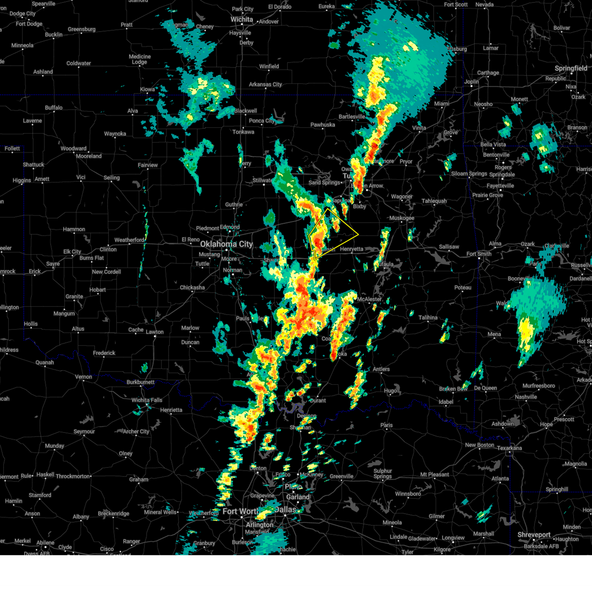 At 115 pm cst, a severe thunderstorm was located 3 miles north of castle, moving northeast at 50 mph (radar indicated). Hazards include 60 mph wind gusts and penny size hail. Expect damage to roofs, siding, and trees. Locations in or near the path include, okmulgee, okemah, okfuskee, beggs, boley, slick, castle, okmulgee state park, welty, mason, this includes interstate 40 in oklahoma between mile markers 212 and 215. At 115 pm cst, a severe thunderstorm was located 3 miles north of castle, moving northeast at 50 mph (radar indicated). Hazards include 60 mph wind gusts and penny size hail. Expect damage to roofs, siding, and trees. Locations in or near the path include, okmulgee, okemah, okfuskee, beggs, boley, slick, castle, okmulgee state park, welty, mason, this includes interstate 40 in oklahoma between mile markers 212 and 215.
|
| 11/4/2024 1:00 PM CST |
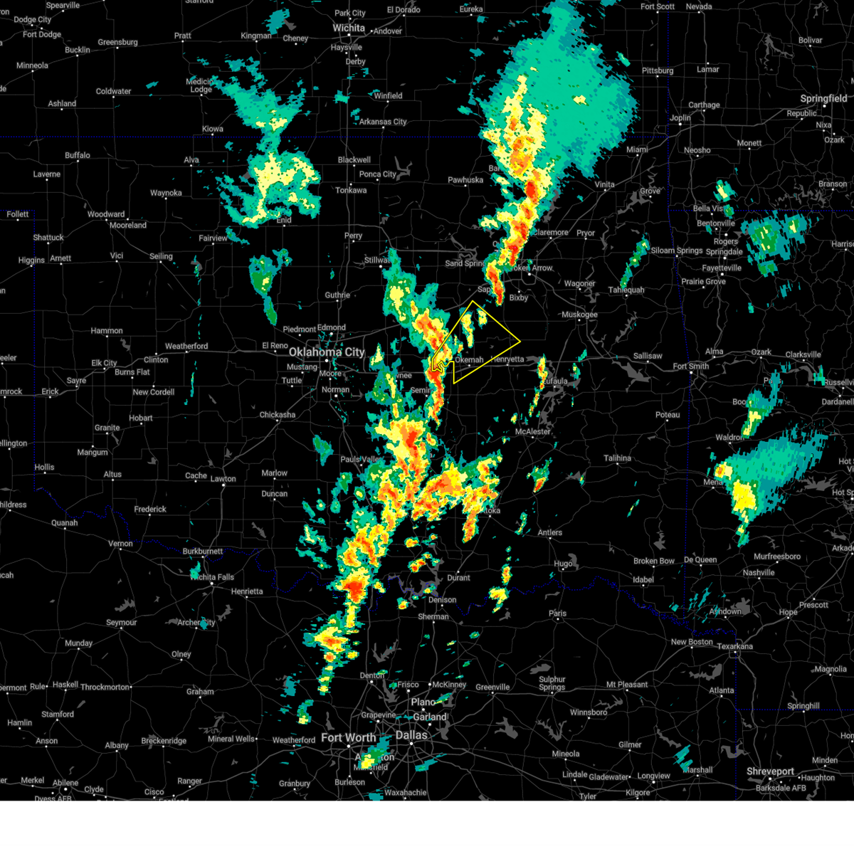 Svrtsa the national weather service in tulsa has issued a * severe thunderstorm warning for, south central creek county in northeastern oklahoma, west central okmulgee county in northeastern oklahoma, okfuskee county in east central oklahoma, * until 145 pm cst. * at 100 pm cst, a severe thunderstorm was located 6 miles northwest of cromwell, moving northeast at 50 mph (radar indicated). Hazards include 60 mph wind gusts and penny size hail. Expect damage to roofs, siding, and trees. Locations in or near the path include, okmulgee, okemah, okfuskee, beggs, boley, paden, bearden, slick, castle, okmulgee state park, welty, mason, this includes interstate 40 in oklahoma between mile markers 212 and 224. Svrtsa the national weather service in tulsa has issued a * severe thunderstorm warning for, south central creek county in northeastern oklahoma, west central okmulgee county in northeastern oklahoma, okfuskee county in east central oklahoma, * until 145 pm cst. * at 100 pm cst, a severe thunderstorm was located 6 miles northwest of cromwell, moving northeast at 50 mph (radar indicated). Hazards include 60 mph wind gusts and penny size hail. Expect damage to roofs, siding, and trees. Locations in or near the path include, okmulgee, okemah, okfuskee, beggs, boley, paden, bearden, slick, castle, okmulgee state park, welty, mason, this includes interstate 40 in oklahoma between mile markers 212 and 224.
|
| 11/3/2024 3:09 AM CST |
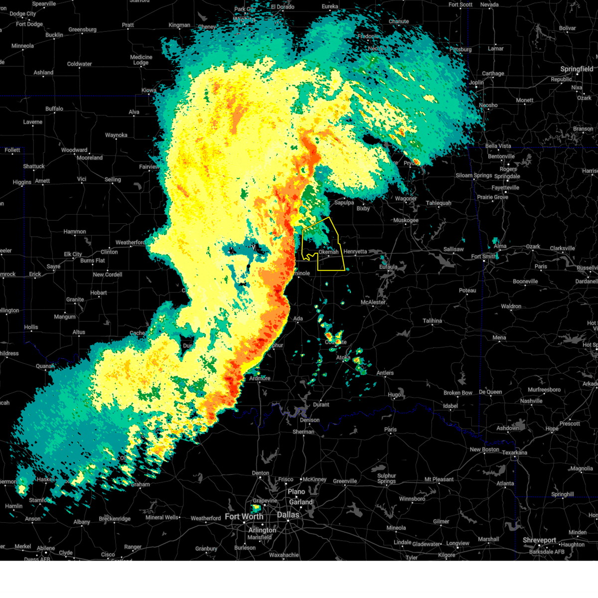 Svrtsa the national weather service in tulsa has issued a * severe thunderstorm warning for, southwestern creek county in northeastern oklahoma, okfuskee county in east central oklahoma, * until 345 am cst. * at 309 am cst, severe thunderstorms were located along a line extending from 8 miles north of paden to 4 miles southwest of boley to 3 miles northeast of seminole, moving northeast at 55 mph (radar indicated). Hazards include 70 mph wind gusts. Expect considerable tree damage. damage is likely to mobile homes, roofs, and outbuildings. Locations in or near the path include, okemah, okfuskee, boley, weleetka, paden, bearden, castle, clearview, welty, mason, this includes interstate 40 in oklahoma between mile markers 212 and 228. Svrtsa the national weather service in tulsa has issued a * severe thunderstorm warning for, southwestern creek county in northeastern oklahoma, okfuskee county in east central oklahoma, * until 345 am cst. * at 309 am cst, severe thunderstorms were located along a line extending from 8 miles north of paden to 4 miles southwest of boley to 3 miles northeast of seminole, moving northeast at 55 mph (radar indicated). Hazards include 70 mph wind gusts. Expect considerable tree damage. damage is likely to mobile homes, roofs, and outbuildings. Locations in or near the path include, okemah, okfuskee, boley, weleetka, paden, bearden, castle, clearview, welty, mason, this includes interstate 40 in oklahoma between mile markers 212 and 228.
|
| 9/24/2024 9:07 PM CDT |
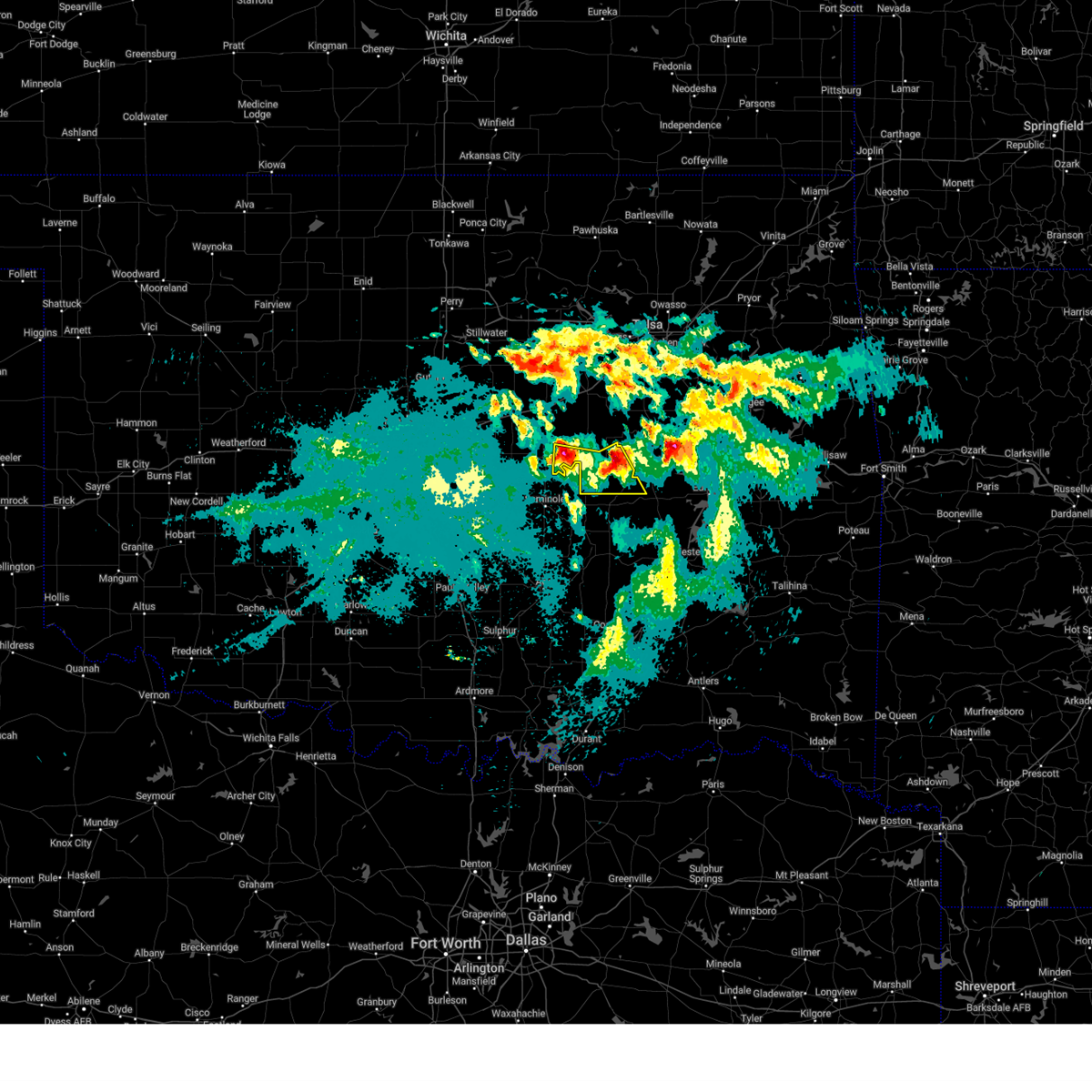 At 907 pm cdt, severe thunderstorms were located along a line extending from paden to 5 miles north of clearview, moving south at 30 mph (radar indicated). Hazards include quarter size hail. Damage to vehicles is expected. Locations in or near the path include, okemah, boley, weleetka, paden, bearden, castle, clearview, pharoah, this includes interstate 40 in oklahoma between mile markers 212 and 231. At 907 pm cdt, severe thunderstorms were located along a line extending from paden to 5 miles north of clearview, moving south at 30 mph (radar indicated). Hazards include quarter size hail. Damage to vehicles is expected. Locations in or near the path include, okemah, boley, weleetka, paden, bearden, castle, clearview, pharoah, this includes interstate 40 in oklahoma between mile markers 212 and 231.
|
| 9/24/2024 8:52 PM CDT |
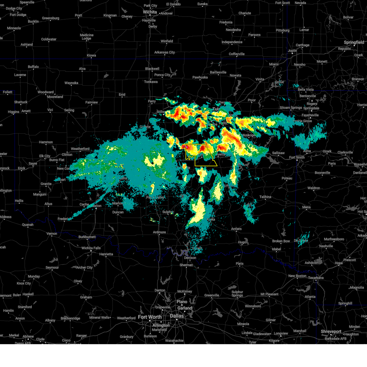 Svrtsa the national weather service in tulsa has issued a * severe thunderstorm warning for, okfuskee county in east central oklahoma, * until 945 pm cdt. * at 852 pm cdt, severe thunderstorms were located 7 miles northwest of paden and 4 miles west of okfuskee, moving south at 25 mph (radar indicated). Hazards include half dollar size hail. Damage to vehicles is expected. Locations in or near the path include, okemah, okfuskee, boley, weleetka, paden, bearden, castle, clearview, welty, pharoah, mason, this includes interstate 40 in oklahoma between mile markers 212 and 231. Svrtsa the national weather service in tulsa has issued a * severe thunderstorm warning for, okfuskee county in east central oklahoma, * until 945 pm cdt. * at 852 pm cdt, severe thunderstorms were located 7 miles northwest of paden and 4 miles west of okfuskee, moving south at 25 mph (radar indicated). Hazards include half dollar size hail. Damage to vehicles is expected. Locations in or near the path include, okemah, okfuskee, boley, weleetka, paden, bearden, castle, clearview, welty, pharoah, mason, this includes interstate 40 in oklahoma between mile markers 212 and 231.
|
| 6/26/2024 8:23 AM CDT |
 At 823 am cdt, severe thunderstorms were located along a line extending from 4 miles southwest of welty to near henryetta to 4 miles northeast of council hill, moving south at 50 mph. these are destructive storms for portions of okmulgee, muskogee, and mcintosh counties (radar indicated). Hazards include 80 mph wind gusts. Flying debris will be dangerous to those caught without shelter. mobile homes will be heavily damaged. expect considerable damage to roofs, windows, and vehicles. extensive tree damage and power outages are likely. Locations in or near the path include, okmulgee, okemah, eufaula, okfuskee, henryetta, checotah, haskell, morris, beggs, boley, weleetka, dewar, schulter, paden, oktaha, taft, boynton, grayson, council hill, hanna, this includes interstate 40 in oklahoma between mile markers 212 and 271. At 823 am cdt, severe thunderstorms were located along a line extending from 4 miles southwest of welty to near henryetta to 4 miles northeast of council hill, moving south at 50 mph. these are destructive storms for portions of okmulgee, muskogee, and mcintosh counties (radar indicated). Hazards include 80 mph wind gusts. Flying debris will be dangerous to those caught without shelter. mobile homes will be heavily damaged. expect considerable damage to roofs, windows, and vehicles. extensive tree damage and power outages are likely. Locations in or near the path include, okmulgee, okemah, eufaula, okfuskee, henryetta, checotah, haskell, morris, beggs, boley, weleetka, dewar, schulter, paden, oktaha, taft, boynton, grayson, council hill, hanna, this includes interstate 40 in oklahoma between mile markers 212 and 271.
|
| 6/26/2024 8:05 AM CDT |
 Svrtsa the national weather service in tulsa has issued a * severe thunderstorm warning for, south central creek county in northeastern oklahoma, mcintosh county in southeastern oklahoma, south central wagoner county in northeastern oklahoma, northwestern muskogee county in east central oklahoma, okmulgee county in northeastern oklahoma, okfuskee county in east central oklahoma, * until 900 am cdt. * at 803 am cdt, severe thunderstorms were located along a line extending from 3 miles south of bristow to 2 miles south of preston to 2 miles north of taft, moving south at 50 mph. these are destructive storms for portions of okmulgee and muskogee counties (radar indicated). Hazards include 80 mph wind gusts. Flying debris will be dangerous to those caught without shelter. mobile homes will be heavily damaged. expect considerable damage to roofs, windows, and vehicles. extensive tree damage and power outages are likely. Locations in or near the path include, okmulgee, okemah, eufaula, okfuskee, henryetta, checotah, haskell, morris, beggs, boley, weleetka, dewar, schulter, paden, oktaha, taft, boynton, grayson, council hill, hanna, this includes interstate 40 in oklahoma between mile markers 212 and 271. Svrtsa the national weather service in tulsa has issued a * severe thunderstorm warning for, south central creek county in northeastern oklahoma, mcintosh county in southeastern oklahoma, south central wagoner county in northeastern oklahoma, northwestern muskogee county in east central oklahoma, okmulgee county in northeastern oklahoma, okfuskee county in east central oklahoma, * until 900 am cdt. * at 803 am cdt, severe thunderstorms were located along a line extending from 3 miles south of bristow to 2 miles south of preston to 2 miles north of taft, moving south at 50 mph. these are destructive storms for portions of okmulgee and muskogee counties (radar indicated). Hazards include 80 mph wind gusts. Flying debris will be dangerous to those caught without shelter. mobile homes will be heavily damaged. expect considerable damage to roofs, windows, and vehicles. extensive tree damage and power outages are likely. Locations in or near the path include, okmulgee, okemah, eufaula, okfuskee, henryetta, checotah, haskell, morris, beggs, boley, weleetka, dewar, schulter, paden, oktaha, taft, boynton, grayson, council hill, hanna, this includes interstate 40 in oklahoma between mile markers 212 and 271.
|
| 5/22/2024 8:34 AM CDT |
 Svrtsa the national weather service in tulsa has issued a * severe thunderstorm warning for, west central mcintosh county in southeastern oklahoma, southwestern okmulgee county in northeastern oklahoma, southeastern okfuskee county in east central oklahoma, * until 915 am cdt. * at 833 am cdt, a severe thunderstorm was located 3 miles south of okemah, moving east at 30 mph (radar indicated). Hazards include 60 mph wind gusts and quarter size hail. Hail damage to vehicles is expected. expect wind damage to roofs, siding, and trees. Locations in or near the path include, okemah, henryetta, weleetka, dewar, schulter, bearden, clearview, pharoah, bryant, this includes interstate 40 in oklahoma between mile markers 215 and 242. Svrtsa the national weather service in tulsa has issued a * severe thunderstorm warning for, west central mcintosh county in southeastern oklahoma, southwestern okmulgee county in northeastern oklahoma, southeastern okfuskee county in east central oklahoma, * until 915 am cdt. * at 833 am cdt, a severe thunderstorm was located 3 miles south of okemah, moving east at 30 mph (radar indicated). Hazards include 60 mph wind gusts and quarter size hail. Hail damage to vehicles is expected. expect wind damage to roofs, siding, and trees. Locations in or near the path include, okemah, henryetta, weleetka, dewar, schulter, bearden, clearview, pharoah, bryant, this includes interstate 40 in oklahoma between mile markers 215 and 242.
|
| 5/22/2024 8:25 AM CDT |
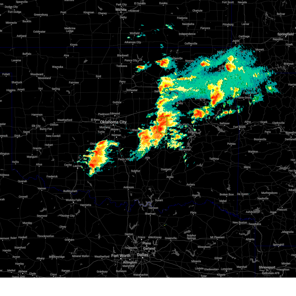 The storm which prompted the warning has weakened below severe limits, and no longer poses an immediate threat to life or property. therefore, the warning will be allowed to expire. however, small hail and gusty winds are still possible with this thunderstorm. The storm which prompted the warning has weakened below severe limits, and no longer poses an immediate threat to life or property. therefore, the warning will be allowed to expire. however, small hail and gusty winds are still possible with this thunderstorm.
|
| 5/22/2024 8:20 AM CDT |
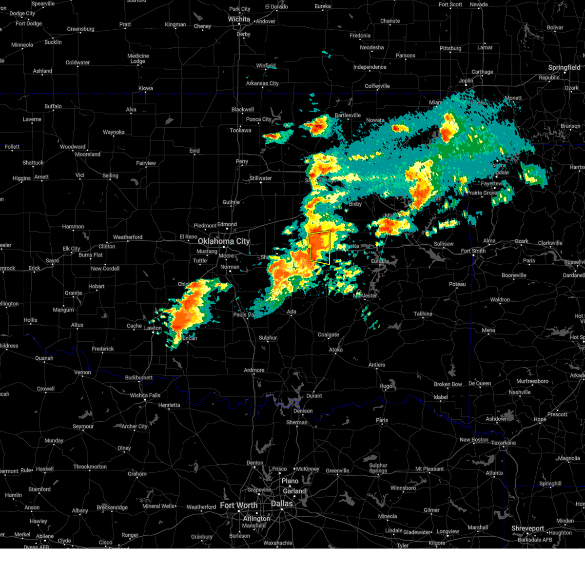 At 820 am cdt, a severe thunderstorm was located near castle, moving east at 50 mph (radar indicated). Hazards include 60 mph wind gusts and nickel size hail. Expect damage to roofs, siding, and trees. Locations in or near the path include, okemah, okfuskee, bearden, castle, mason, this includes interstate 40 in oklahoma between mile markers 212 and 225. At 820 am cdt, a severe thunderstorm was located near castle, moving east at 50 mph (radar indicated). Hazards include 60 mph wind gusts and nickel size hail. Expect damage to roofs, siding, and trees. Locations in or near the path include, okemah, okfuskee, bearden, castle, mason, this includes interstate 40 in oklahoma between mile markers 212 and 225.
|
| 5/22/2024 7:49 AM CDT |
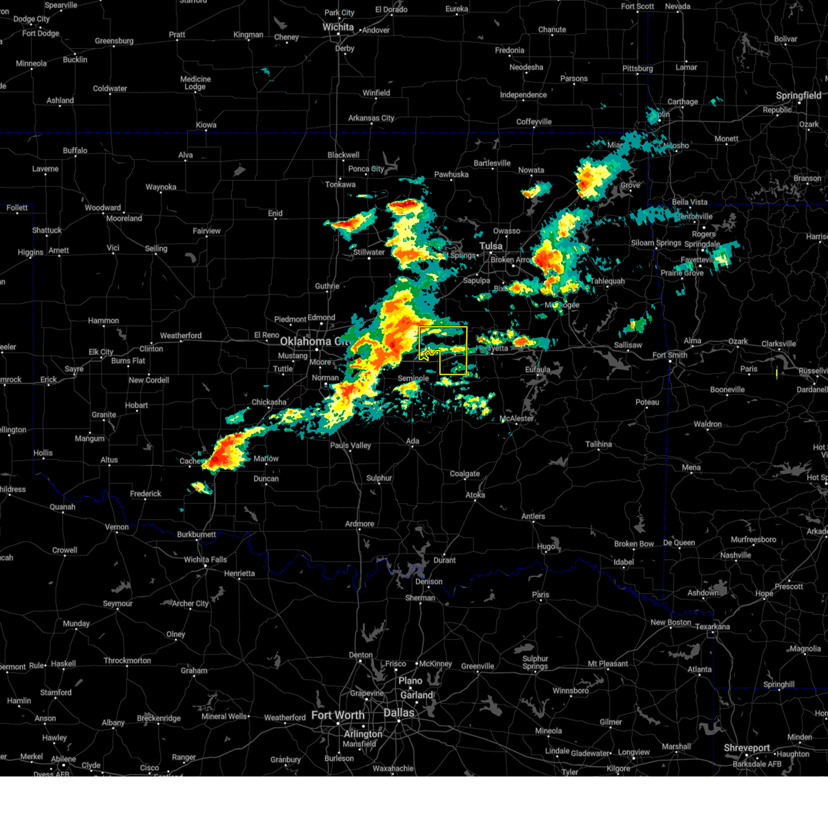 Svrtsa the national weather service in tulsa has issued a * severe thunderstorm warning for, okfuskee county in east central oklahoma, * until 830 am cdt. * at 749 am cdt, a severe thunderstorm was located 5 miles west of prague, moving east at 50 mph (radar indicated). Hazards include 60 mph wind gusts and quarter size hail. Hail damage to vehicles is expected. expect wind damage to roofs, siding, and trees. Locations in or near the path include, okemah, okfuskee, boley, paden, bearden, castle, welty, mason, this includes interstate 40 in oklahoma between mile markers 212 and 225. Svrtsa the national weather service in tulsa has issued a * severe thunderstorm warning for, okfuskee county in east central oklahoma, * until 830 am cdt. * at 749 am cdt, a severe thunderstorm was located 5 miles west of prague, moving east at 50 mph (radar indicated). Hazards include 60 mph wind gusts and quarter size hail. Hail damage to vehicles is expected. expect wind damage to roofs, siding, and trees. Locations in or near the path include, okemah, okfuskee, boley, paden, bearden, castle, welty, mason, this includes interstate 40 in oklahoma between mile markers 212 and 225.
|
| 5/20/2024 4:18 AM CDT |
 The storms which prompted the warning have weakened below severe limits, and no longer pose an immediate threat to life or property. therefore, the warning has been allowed to expire. however, gusty winds are still possible with these thunderstorms. a severe thunderstorm watch remains in effect until 600 am cdt for northeastern and east central oklahoma. The storms which prompted the warning have weakened below severe limits, and no longer pose an immediate threat to life or property. therefore, the warning has been allowed to expire. however, gusty winds are still possible with these thunderstorms. a severe thunderstorm watch remains in effect until 600 am cdt for northeastern and east central oklahoma.
|
| 5/20/2024 3:36 AM CDT |
 Svrtsa the national weather service in tulsa has issued a * severe thunderstorm warning for, southern creek county in northeastern oklahoma, western okmulgee county in northeastern oklahoma, okfuskee county in east central oklahoma, * until 415 am cdt. * at 336 am cdt, severe thunderstorms were located along a line extending from 5 miles southeast of avery to 2 miles east of prague, moving east at 40 mph (radar indicated). Hazards include 60 mph wind gusts and nickel size hail. Expect damage to roofs, siding, and trees. locations in or near the path include, bristow, okemah, okfuskee, beggs, boley, mounds, weleetka, depew, paden, bearden, slick, castle, shamrock, clearview, okmulgee state park, welty, pharoah, bryant, milfay, mason, this includes the following highways, interstate 40 in oklahoma between mile markers 212 and 233. Interstate 44 between mile markers 178 and 199. Svrtsa the national weather service in tulsa has issued a * severe thunderstorm warning for, southern creek county in northeastern oklahoma, western okmulgee county in northeastern oklahoma, okfuskee county in east central oklahoma, * until 415 am cdt. * at 336 am cdt, severe thunderstorms were located along a line extending from 5 miles southeast of avery to 2 miles east of prague, moving east at 40 mph (radar indicated). Hazards include 60 mph wind gusts and nickel size hail. Expect damage to roofs, siding, and trees. locations in or near the path include, bristow, okemah, okfuskee, beggs, boley, mounds, weleetka, depew, paden, bearden, slick, castle, shamrock, clearview, okmulgee state park, welty, pharoah, bryant, milfay, mason, this includes the following highways, interstate 40 in oklahoma between mile markers 212 and 233. Interstate 44 between mile markers 178 and 199.
|
| 5/7/2024 12:43 AM CDT | Nwschat repor in seminole county OK, 9.3 miles ENE of Okemah, OK |
| 5/7/2024 12:42 AM CDT |
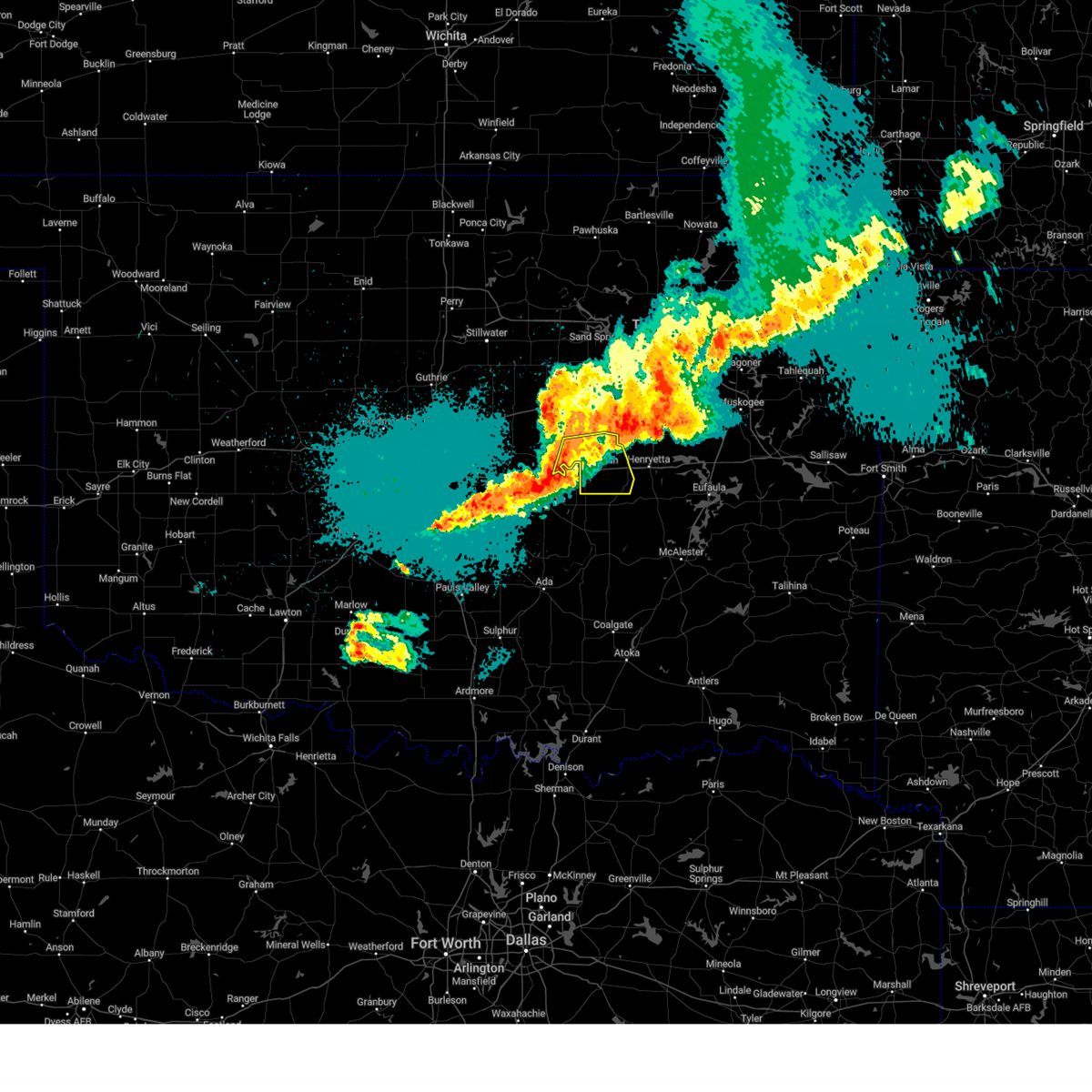 At 1241 am cdt, severe thunderstorms were located along a line extending from 3 miles north of boley to 5 miles southwest of castle to 4 miles southwest of cromwell, moving east at 60 mph (radar indicated). Hazards include 60 mph wind gusts and quarter size hail. Hail damage to vehicles is expected. expect wind damage to roofs, siding, and trees. Locations in or near the path include, okemah, okfuskee, boley, weleetka, paden, bearden, castle, clearview, pharoah, mason, this includes interstate 40 in oklahoma between mile markers 212 and 230. At 1241 am cdt, severe thunderstorms were located along a line extending from 3 miles north of boley to 5 miles southwest of castle to 4 miles southwest of cromwell, moving east at 60 mph (radar indicated). Hazards include 60 mph wind gusts and quarter size hail. Hail damage to vehicles is expected. expect wind damage to roofs, siding, and trees. Locations in or near the path include, okemah, okfuskee, boley, weleetka, paden, bearden, castle, clearview, pharoah, mason, this includes interstate 40 in oklahoma between mile markers 212 and 230.
|
| 5/7/2024 12:24 AM CDT |
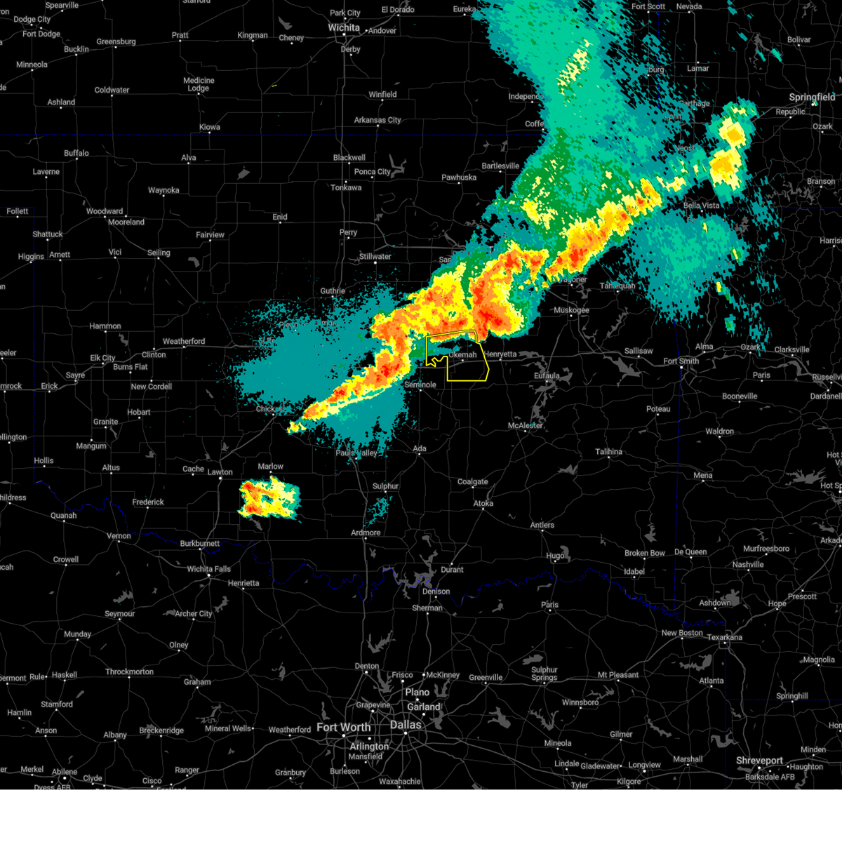 Svrtsa the national weather service in tulsa has issued a * severe thunderstorm warning for, okfuskee county in east central oklahoma, * until 115 am cdt. * at 1224 am cdt, severe thunderstorms were located along a line extending from 4 miles southeast of sparks to 5 miles northwest of little to 2 miles southeast of tecumseh, moving east at 55 mph (radar indicated). Hazards include 60 mph wind gusts and quarter size hail. Hail damage to vehicles is expected. expect wind damage to roofs, siding, and trees. Locations in or near the path include, okemah, okfuskee, boley, weleetka, paden, bearden, castle, clearview, welty, pharoah, mason, this includes interstate 40 in oklahoma between mile markers 212 and 230. Svrtsa the national weather service in tulsa has issued a * severe thunderstorm warning for, okfuskee county in east central oklahoma, * until 115 am cdt. * at 1224 am cdt, severe thunderstorms were located along a line extending from 4 miles southeast of sparks to 5 miles northwest of little to 2 miles southeast of tecumseh, moving east at 55 mph (radar indicated). Hazards include 60 mph wind gusts and quarter size hail. Hail damage to vehicles is expected. expect wind damage to roofs, siding, and trees. Locations in or near the path include, okemah, okfuskee, boley, weleetka, paden, bearden, castle, clearview, welty, pharoah, mason, this includes interstate 40 in oklahoma between mile markers 212 and 230.
|
| 4/27/2024 11:43 PM CDT |
 At 1142 pm cdt, severe thunderstorms were located along a line extending from 4 miles southeast of mounds to 3 miles northeast of wetumka, moving east at 35 mph. a tornado warning also remain in effect for portions of okfuskee, okmulgee and creek counties (radar indicated). Hazards include 60 mph wind gusts and nickel size hail. Expect damage to roofs, siding, and trees. Locations in or near the path include, okmulgee, okemah, okfuskee, henryetta, beggs, weleetka, dewar, schulter, bearden, castle, clearview, preston, okmulgee state park, pharoah, bryant, mason, hectorville, this includes interstate 40 in oklahoma between mile markers 212 and 239. At 1142 pm cdt, severe thunderstorms were located along a line extending from 4 miles southeast of mounds to 3 miles northeast of wetumka, moving east at 35 mph. a tornado warning also remain in effect for portions of okfuskee, okmulgee and creek counties (radar indicated). Hazards include 60 mph wind gusts and nickel size hail. Expect damage to roofs, siding, and trees. Locations in or near the path include, okmulgee, okemah, okfuskee, henryetta, beggs, weleetka, dewar, schulter, bearden, castle, clearview, preston, okmulgee state park, pharoah, bryant, mason, hectorville, this includes interstate 40 in oklahoma between mile markers 212 and 239.
|
| 4/27/2024 11:27 PM CDT | Wind damage report from mping...time estimated by radar as circulation passed ove in okfuskee county OK, 7 miles S of Okemah, OK |
| 4/27/2024 11:16 PM CDT |
 Svrtsa the national weather service in tulsa has issued a * severe thunderstorm warning for, south central creek county in northeastern oklahoma, okmulgee county in northeastern oklahoma, okfuskee county in east central oklahoma, * until midnight cdt. * at 1116 pm cdt, severe thunderstorms were located along a line extending from slick to 2 miles northeast of wewoka, moving northeast at 30 mph. also, an ongoing tornado continues across southwestern okfuskee couonty (radar indicated). Hazards include 60 mph wind gusts and nickel size hail. Expect damage to roofs, siding, and trees. Locations in or near the path include, okmulgee, okemah, okfuskee, henryetta, beggs, weleetka, dewar, schulter, bearden, castle, clearview, preston, okmulgee state park, pharoah, bryant, mason, hectorville, this includes interstate 40 in oklahoma between mile markers 212 and 239. Svrtsa the national weather service in tulsa has issued a * severe thunderstorm warning for, south central creek county in northeastern oklahoma, okmulgee county in northeastern oklahoma, okfuskee county in east central oklahoma, * until midnight cdt. * at 1116 pm cdt, severe thunderstorms were located along a line extending from slick to 2 miles northeast of wewoka, moving northeast at 30 mph. also, an ongoing tornado continues across southwestern okfuskee couonty (radar indicated). Hazards include 60 mph wind gusts and nickel size hail. Expect damage to roofs, siding, and trees. Locations in or near the path include, okmulgee, okemah, okfuskee, henryetta, beggs, weleetka, dewar, schulter, bearden, castle, clearview, preston, okmulgee state park, pharoah, bryant, mason, hectorville, this includes interstate 40 in oklahoma between mile markers 212 and 239.
|
| 4/27/2024 11:15 PM CDT |
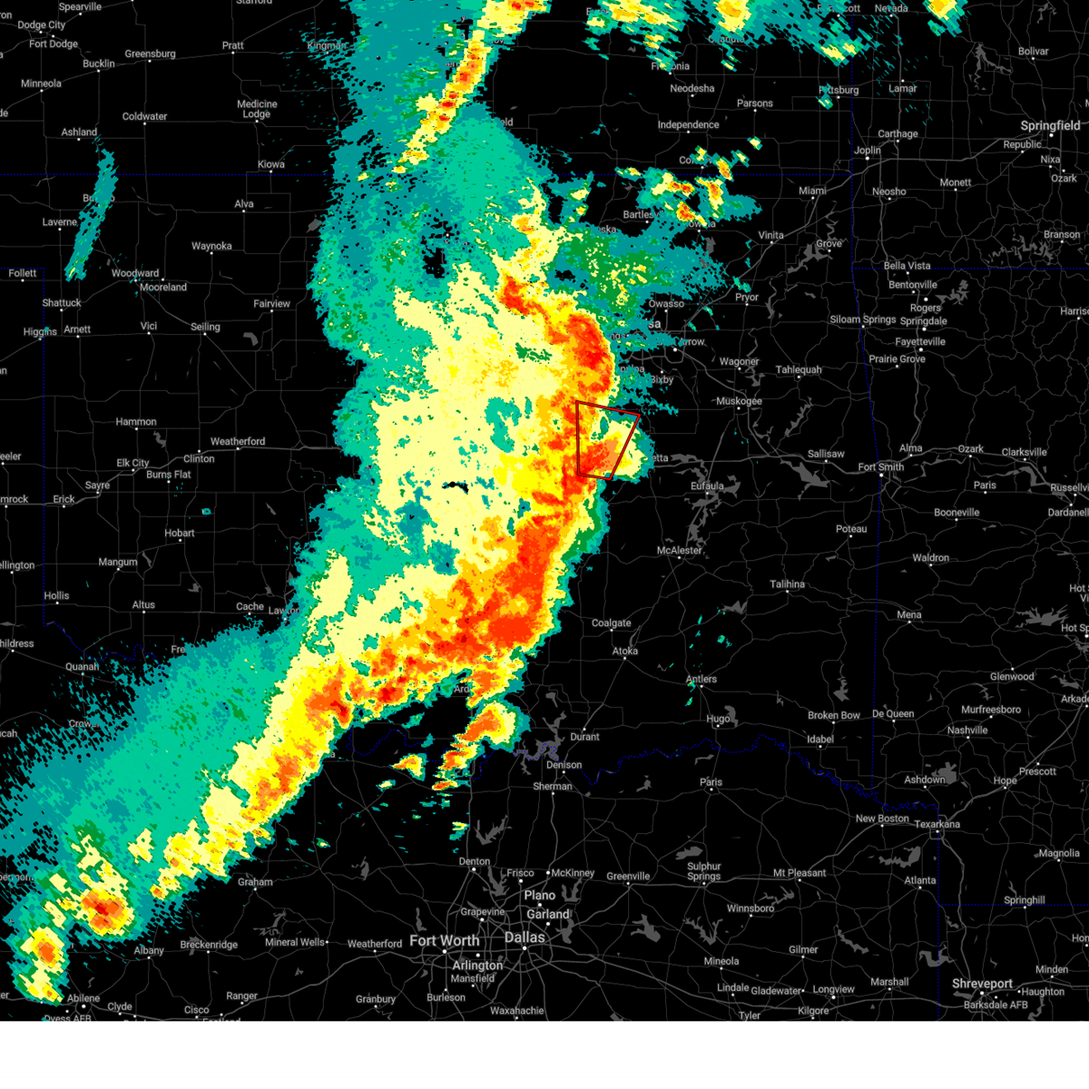 Tortsa the national weather service in tulsa has issued a * tornado warning for, south central creek county in northeastern oklahoma, west central okmulgee county in northeastern oklahoma, central okfuskee county in east central oklahoma, * until midnight cdt. * at 1115 pm cdt, a confirmed large and extremely dangerous tornado was located near okemah, moving north at 40 mph. this is a particularly dangerous situation. take cover now! (radar confirmed tornado). Hazards include damaging tornado. You are in a life-threatening situation. flying debris may be deadly to those caught without shelter. mobile homes will be destroyed. considerable damage to homes, businesses, and vehicles is likely and complete destruction is possible. Locations in or near the path include, okemah, okfuskee, castle, welty, mason, this includes interstate 40 in oklahoma between mile markers 213 and 225. Tortsa the national weather service in tulsa has issued a * tornado warning for, south central creek county in northeastern oklahoma, west central okmulgee county in northeastern oklahoma, central okfuskee county in east central oklahoma, * until midnight cdt. * at 1115 pm cdt, a confirmed large and extremely dangerous tornado was located near okemah, moving north at 40 mph. this is a particularly dangerous situation. take cover now! (radar confirmed tornado). Hazards include damaging tornado. You are in a life-threatening situation. flying debris may be deadly to those caught without shelter. mobile homes will be destroyed. considerable damage to homes, businesses, and vehicles is likely and complete destruction is possible. Locations in or near the path include, okemah, okfuskee, castle, welty, mason, this includes interstate 40 in oklahoma between mile markers 213 and 225.
|
| 4/27/2024 11:07 PM CDT |
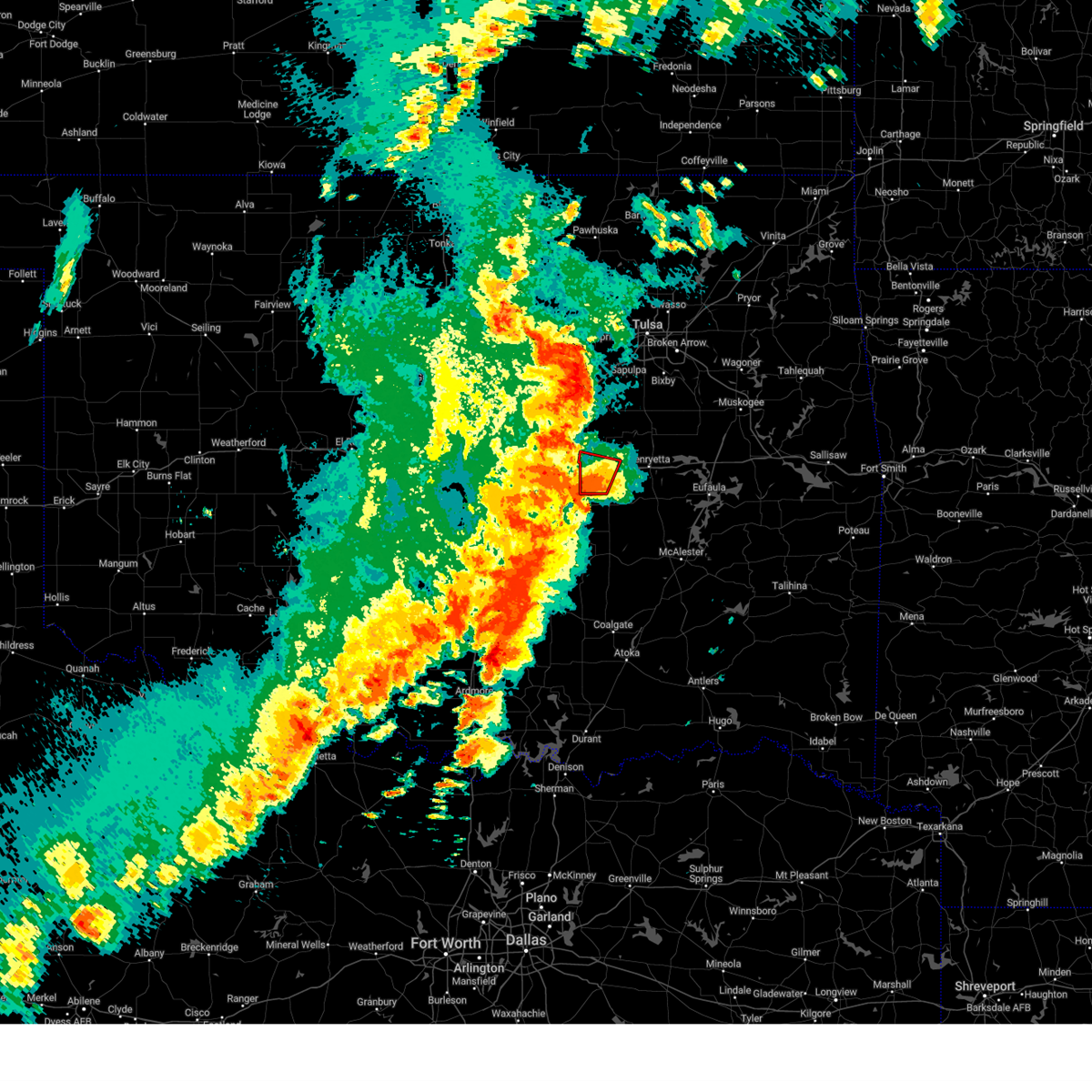 At 1107 pm cdt, a confirmed large and extremely dangerous tornado was located near bearden, moving north at 45 mph. this is a particularly dangerous situation. take cover now! (weather spotters confirmed tornado). Hazards include damaging tornado. You are in a life-threatening situation. flying debris may be deadly to those caught without shelter. mobile homes will be destroyed. considerable damage to homes, businesses, and vehicles is likely and complete destruction is possible. Locations in or near the path include, okemah, bearden, castle, this includes interstate 40 in oklahoma between mile markers 212 and 225. At 1107 pm cdt, a confirmed large and extremely dangerous tornado was located near bearden, moving north at 45 mph. this is a particularly dangerous situation. take cover now! (weather spotters confirmed tornado). Hazards include damaging tornado. You are in a life-threatening situation. flying debris may be deadly to those caught without shelter. mobile homes will be destroyed. considerable damage to homes, businesses, and vehicles is likely and complete destruction is possible. Locations in or near the path include, okemah, bearden, castle, this includes interstate 40 in oklahoma between mile markers 212 and 225.
|
| 4/27/2024 10:49 PM CDT |
 At 1048 pm cdt, severe thunderstorms were located along a line extending from 4 miles west of yale to 3 miles northeast of drumright to 6 miles southeast of depew to 3 miles northeast of paden, moving northeast at 40 mph (radar indicated). Hazards include 70 mph wind gusts and nickel size hail. Expect considerable tree damage. damage is likely to mobile homes, roofs, and outbuildings. locations in or near the path include, bristow, okemah, okfuskee, mannford, drumright, boley, kellyville, oilton, depew, paden, bearden, slick, castle, shamrock, welty, silver city, milfay, mason, this includes the following highways, interstate 40 in oklahoma between mile markers 212 and 220. Interstate 44 between mile markers 178 and 205. At 1048 pm cdt, severe thunderstorms were located along a line extending from 4 miles west of yale to 3 miles northeast of drumright to 6 miles southeast of depew to 3 miles northeast of paden, moving northeast at 40 mph (radar indicated). Hazards include 70 mph wind gusts and nickel size hail. Expect considerable tree damage. damage is likely to mobile homes, roofs, and outbuildings. locations in or near the path include, bristow, okemah, okfuskee, mannford, drumright, boley, kellyville, oilton, depew, paden, bearden, slick, castle, shamrock, welty, silver city, milfay, mason, this includes the following highways, interstate 40 in oklahoma between mile markers 212 and 220. Interstate 44 between mile markers 178 and 205.
|
| 4/27/2024 10:47 PM CDT |
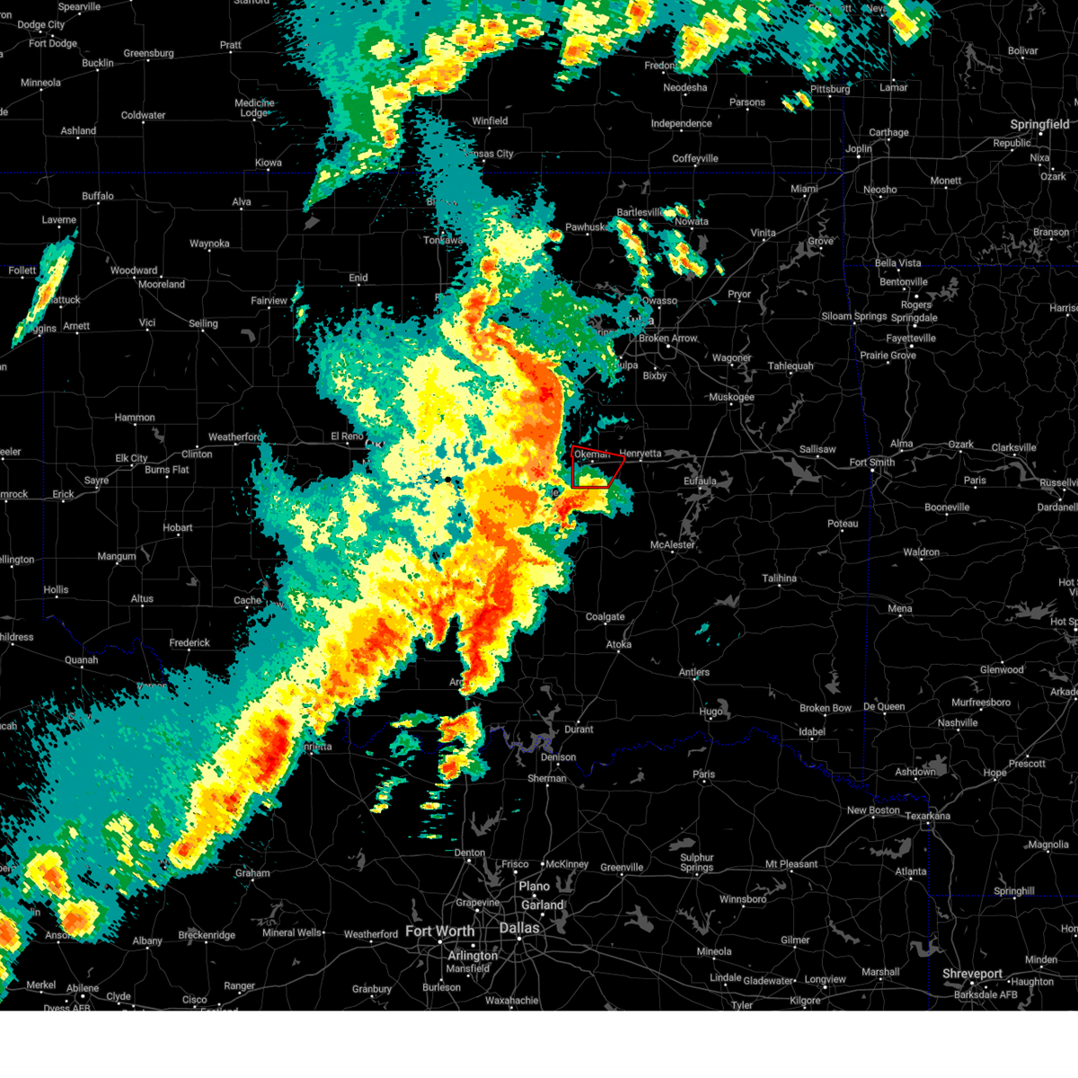 Tortsa the national weather service in tulsa has issued a * tornado warning for, southeastern okfuskee county in east central oklahoma, * until 1130 pm cdt. * at 1047 pm cdt, a confirmed large and extremely dangerous tornado was located near holdenville, moving north at 40 mph. this is a particularly dangerous situation. take cover now! (weather spotters confirmed tornado). Hazards include damaging tornado. You are in a life-threatening situation. flying debris may be deadly to those caught without shelter. mobile homes will be destroyed. considerable damage to homes, businesses, and vehicles is likely and complete destruction is possible. Locations in or near the path include, okemah, bearden, castle, clearview, pharoah, this includes interstate 40 in oklahoma between mile markers 212 and 231. Tortsa the national weather service in tulsa has issued a * tornado warning for, southeastern okfuskee county in east central oklahoma, * until 1130 pm cdt. * at 1047 pm cdt, a confirmed large and extremely dangerous tornado was located near holdenville, moving north at 40 mph. this is a particularly dangerous situation. take cover now! (weather spotters confirmed tornado). Hazards include damaging tornado. You are in a life-threatening situation. flying debris may be deadly to those caught without shelter. mobile homes will be destroyed. considerable damage to homes, businesses, and vehicles is likely and complete destruction is possible. Locations in or near the path include, okemah, bearden, castle, clearview, pharoah, this includes interstate 40 in oklahoma between mile markers 212 and 231.
|
| 4/27/2024 10:13 PM CDT |
 Svrtsa the national weather service in tulsa has issued a * severe thunderstorm warning for, creek county in northeastern oklahoma, okfuskee county in east central oklahoma, * until 1115 pm cdt. * at 1013 pm cdt, severe thunderstorms were located along a line extending from 5 miles north of fallis to 3 miles west of chandler to 2 miles northeast of johnson to 3 miles southeast of tecumseh, moving northeast at 60 mph (radar indicated). Hazards include 70 mph wind gusts and nickel size hail. Expect considerable tree damage. damage is likely to mobile homes, roofs, and outbuildings. locations in or near the path include, bristow, okemah, okfuskee, mannford, drumright, boley, kellyville, oilton, depew, paden, bearden, slick, castle, shamrock, welty, silver city, milfay, mason, this includes the following highways, interstate 40 in oklahoma between mile markers 212 and 220. Interstate 44 between mile markers 178 and 205. Svrtsa the national weather service in tulsa has issued a * severe thunderstorm warning for, creek county in northeastern oklahoma, okfuskee county in east central oklahoma, * until 1115 pm cdt. * at 1013 pm cdt, severe thunderstorms were located along a line extending from 5 miles north of fallis to 3 miles west of chandler to 2 miles northeast of johnson to 3 miles southeast of tecumseh, moving northeast at 60 mph (radar indicated). Hazards include 70 mph wind gusts and nickel size hail. Expect considerable tree damage. damage is likely to mobile homes, roofs, and outbuildings. locations in or near the path include, bristow, okemah, okfuskee, mannford, drumright, boley, kellyville, oilton, depew, paden, bearden, slick, castle, shamrock, welty, silver city, milfay, mason, this includes the following highways, interstate 40 in oklahoma between mile markers 212 and 220. Interstate 44 between mile markers 178 and 205.
|
| 4/26/2024 5:57 AM CDT |
 Tortsa the national weather service in tulsa has issued a * tornado warning for, creek county in northeastern oklahoma, northwestern okmulgee county in northeastern oklahoma, northeastern okfuskee county in east central oklahoma, * until 630 am cdt. * at 557 am cdt, a severe squall line capable of producing tornadoes that may not be visible due to heavy rain was located along a line extending from near shamrock to 2 miles north of okemah, moving northeast at 50 mph (radar indicated rotation). Hazards include tornado. Flying debris will be dangerous to those caught without shelter. mobile homes will be damaged or destroyed. damage to roofs, windows, and vehicles will occur. tree damage is likely. locations in or near the path include, okmulgee, bristow, okemah, sapulpa, okfuskee, kiefer, beggs, mounds, kellyville, depew, slick, shamrock, preston, okmulgee state park, welty, mason, this includes the following highways, interstate 40 in oklahoma between mile markers 219 and 224. Interstate 44 between mile markers 183 and 211. Tortsa the national weather service in tulsa has issued a * tornado warning for, creek county in northeastern oklahoma, northwestern okmulgee county in northeastern oklahoma, northeastern okfuskee county in east central oklahoma, * until 630 am cdt. * at 557 am cdt, a severe squall line capable of producing tornadoes that may not be visible due to heavy rain was located along a line extending from near shamrock to 2 miles north of okemah, moving northeast at 50 mph (radar indicated rotation). Hazards include tornado. Flying debris will be dangerous to those caught without shelter. mobile homes will be damaged or destroyed. damage to roofs, windows, and vehicles will occur. tree damage is likely. locations in or near the path include, okmulgee, bristow, okemah, sapulpa, okfuskee, kiefer, beggs, mounds, kellyville, depew, slick, shamrock, preston, okmulgee state park, welty, mason, this includes the following highways, interstate 40 in oklahoma between mile markers 219 and 224. Interstate 44 between mile markers 183 and 211.
|
| 4/26/2024 5:22 AM CDT |
 Svrtsa the national weather service in tulsa has issued a * severe thunderstorm warning for, southwestern creek county in northeastern oklahoma, okfuskee county in east central oklahoma, * until 600 am cdt. * at 521 am cdt, severe thunderstorms were located along a line extending from near chandler to 4 miles east of johnson to 3 miles west of maud, moving east at 50 mph (radar indicated). Hazards include 70 mph wind gusts and nickel size hail. Expect considerable tree damage. damage is likely to mobile homes, roofs, and outbuildings. locations in or near the path include, bristow, okemah, okfuskee, boley, kellyville, weleetka, depew, paden, bearden, slick, castle, clearview, welty, pharoah, milfay, mason, this includes the following highways, interstate 40 in oklahoma between mile markers 212 and 231. Interstate 44 between mile markers 178 and 204. Svrtsa the national weather service in tulsa has issued a * severe thunderstorm warning for, southwestern creek county in northeastern oklahoma, okfuskee county in east central oklahoma, * until 600 am cdt. * at 521 am cdt, severe thunderstorms were located along a line extending from near chandler to 4 miles east of johnson to 3 miles west of maud, moving east at 50 mph (radar indicated). Hazards include 70 mph wind gusts and nickel size hail. Expect considerable tree damage. damage is likely to mobile homes, roofs, and outbuildings. locations in or near the path include, bristow, okemah, okfuskee, boley, kellyville, weleetka, depew, paden, bearden, slick, castle, clearview, welty, pharoah, milfay, mason, this includes the following highways, interstate 40 in oklahoma between mile markers 212 and 231. Interstate 44 between mile markers 178 and 204.
|
| 3/14/2024 1:06 PM CDT |
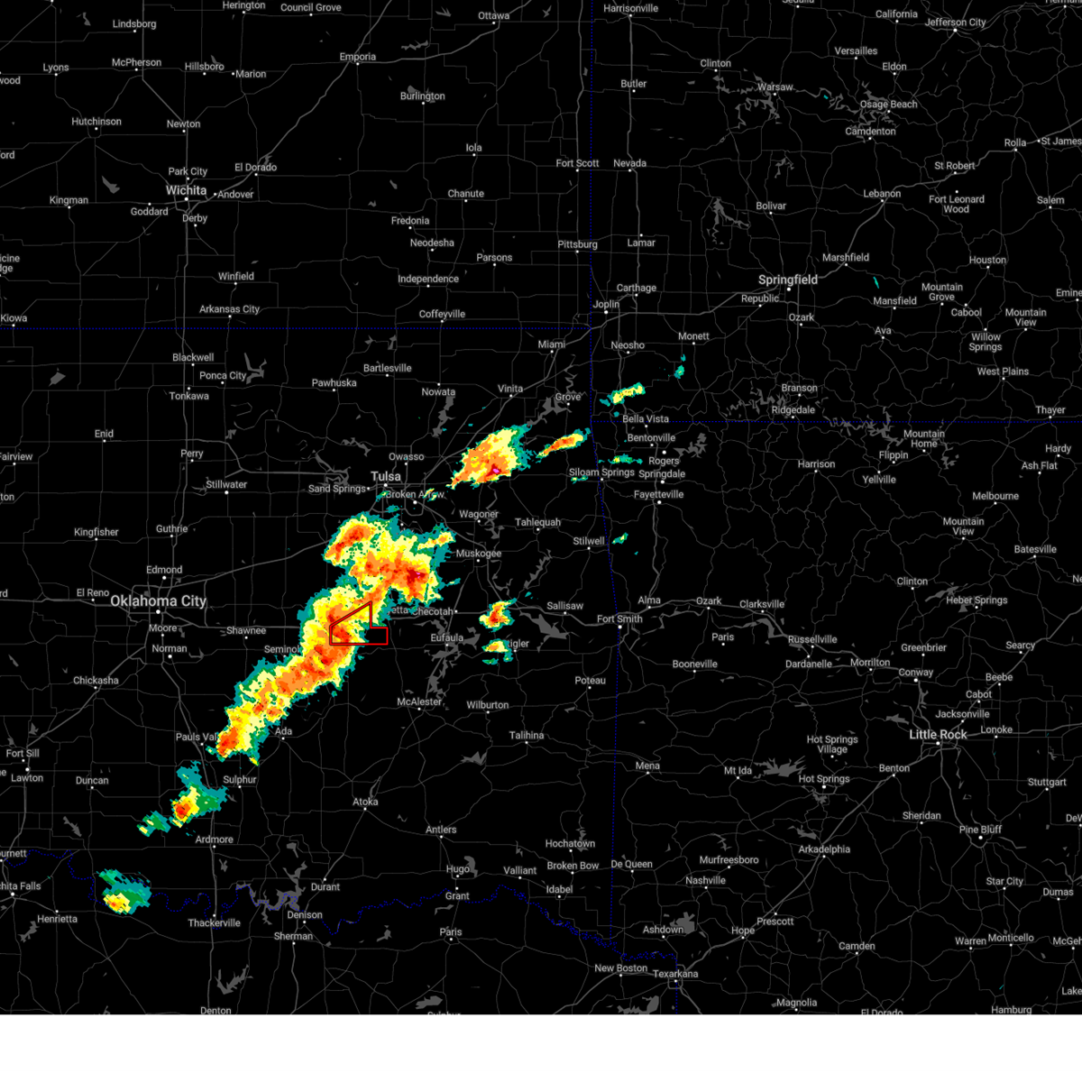 At 106 pm cdt, a severe thunderstorm capable of producing a tornado was located 6 miles southwest of clearview, moving east at 35 mph (weather spotters reported a funnel cloud). Hazards include tornado and golf ball size hail. Flying debris will be dangerous to those caught without shelter. mobile homes will be damaged or destroyed. damage to roofs, windows, and vehicles will occur. tree damage is likely. Locations in or near the path include, weleetka, clearview, pharoah, this includes interstate 40 in oklahoma between mile markers 221 and 231. At 106 pm cdt, a severe thunderstorm capable of producing a tornado was located 6 miles southwest of clearview, moving east at 35 mph (weather spotters reported a funnel cloud). Hazards include tornado and golf ball size hail. Flying debris will be dangerous to those caught without shelter. mobile homes will be damaged or destroyed. damage to roofs, windows, and vehicles will occur. tree damage is likely. Locations in or near the path include, weleetka, clearview, pharoah, this includes interstate 40 in oklahoma between mile markers 221 and 231.
|
| 3/14/2024 12:56 PM CDT |
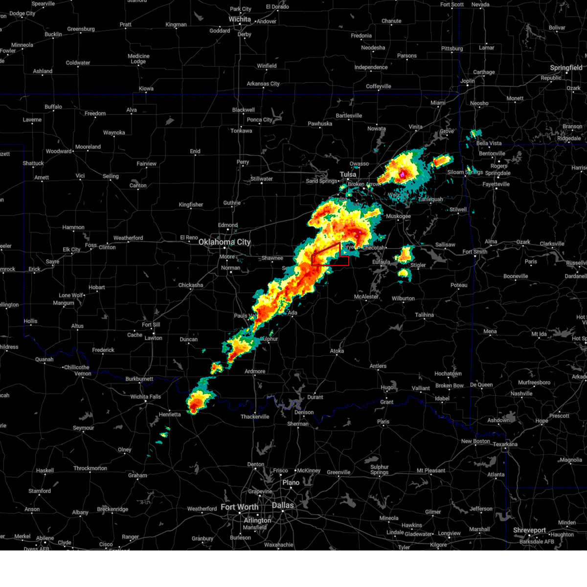 Tortsa the national weather service in tulsa has issued a * tornado warning for, southeastern okfuskee county in east central oklahoma, * until 130 pm cdt. * at 1256 pm cdt, a severe thunderstorm capable of producing a tornado was located near bearden, moving east at 35 mph (radar indicated rotation). Hazards include tornado and half dollar size hail. Flying debris will be dangerous to those caught without shelter. mobile homes will be damaged or destroyed. damage to roofs, windows, and vehicles will occur. tree damage is likely. Locations in or near the path include, okemah, weleetka, bearden, clearview, pharoah, this includes interstate 40 in oklahoma between mile markers 212 and 231. Tortsa the national weather service in tulsa has issued a * tornado warning for, southeastern okfuskee county in east central oklahoma, * until 130 pm cdt. * at 1256 pm cdt, a severe thunderstorm capable of producing a tornado was located near bearden, moving east at 35 mph (radar indicated rotation). Hazards include tornado and half dollar size hail. Flying debris will be dangerous to those caught without shelter. mobile homes will be damaged or destroyed. damage to roofs, windows, and vehicles will occur. tree damage is likely. Locations in or near the path include, okemah, weleetka, bearden, clearview, pharoah, this includes interstate 40 in oklahoma between mile markers 212 and 231.
|
| 3/14/2024 12:38 PM CDT |
 At 1237 pm cdt, a severe thunderstorm was located near pharoah, moving northeast at 45 mph (doppler radar indicated). Hazards include two inch hail and 60 mph wind gusts. People and animals outdoors will be injured. expect hail damage to roofs, siding, windows, and vehicles. expect wind damage to roofs, siding, and trees. Locations in or near the path include, okmulgee, okemah, henryetta, morris, weleetka, dewar, schulter, grayson, hoffman, clearview, okmulgee state park, pharoah, bryant, eram, this includes interstate 40 in oklahoma between mile markers 219 and 240. At 1237 pm cdt, a severe thunderstorm was located near pharoah, moving northeast at 45 mph (doppler radar indicated). Hazards include two inch hail and 60 mph wind gusts. People and animals outdoors will be injured. expect hail damage to roofs, siding, windows, and vehicles. expect wind damage to roofs, siding, and trees. Locations in or near the path include, okmulgee, okemah, henryetta, morris, weleetka, dewar, schulter, grayson, hoffman, clearview, okmulgee state park, pharoah, bryant, eram, this includes interstate 40 in oklahoma between mile markers 219 and 240.
|
| 3/14/2024 12:37 PM CDT |
 At 1237 pm cdt, a severe thunderstorm was located near pharoah, moving northeast at 45 mph (broadcast media). Hazards include two inch hail and 60 mph wind gusts. People and animals outdoors will be injured. expect hail damage to roofs, siding, windows, and vehicles. expect wind damage to roofs, siding, and trees. Locations in or near the path include, okmulgee, okemah, henryetta, morris, weleetka, dewar, schulter, grayson, hoffman, clearview, okmulgee state park, pharoah, bryant, eram, this includes interstate 40 in oklahoma between mile markers 219 and 240. At 1237 pm cdt, a severe thunderstorm was located near pharoah, moving northeast at 45 mph (broadcast media). Hazards include two inch hail and 60 mph wind gusts. People and animals outdoors will be injured. expect hail damage to roofs, siding, windows, and vehicles. expect wind damage to roofs, siding, and trees. Locations in or near the path include, okmulgee, okemah, henryetta, morris, weleetka, dewar, schulter, grayson, hoffman, clearview, okmulgee state park, pharoah, bryant, eram, this includes interstate 40 in oklahoma between mile markers 219 and 240.
|
| 3/14/2024 12:33 PM CDT |
 At 1233 pm cdt, a severe thunderstorm was located 3 miles northwest of pharoah, moving northeast at 45 mph (radar indicated). Hazards include 60 mph wind gusts and half dollar size hail. Hail damage to vehicles is expected. expect wind damage to roofs, siding, and trees. Locations in or near the path include, okmulgee, okemah, henryetta, morris, weleetka, dewar, schulter, grayson, hoffman, clearview, okmulgee state park, pharoah, bryant, eram, this includes interstate 40 in oklahoma between mile markers 219 and 240. At 1233 pm cdt, a severe thunderstorm was located 3 miles northwest of pharoah, moving northeast at 45 mph (radar indicated). Hazards include 60 mph wind gusts and half dollar size hail. Hail damage to vehicles is expected. expect wind damage to roofs, siding, and trees. Locations in or near the path include, okmulgee, okemah, henryetta, morris, weleetka, dewar, schulter, grayson, hoffman, clearview, okmulgee state park, pharoah, bryant, eram, this includes interstate 40 in oklahoma between mile markers 219 and 240.
|
| 3/14/2024 12:22 PM CDT |
 Svrtsa the national weather service in tulsa has issued a * severe thunderstorm warning for, southern okmulgee county in northeastern oklahoma, southeastern okfuskee county in east central oklahoma, * until 1245 pm cdt. * at 1221 pm cdt, a severe thunderstorm was located 4 miles south of okemah, moving northeast at 45 mph (radar indicated). Hazards include 60 mph wind gusts and quarter size hail. Hail damage to vehicles is expected. expect wind damage to roofs, siding, and trees. Locations in or near the path include, okmulgee, okemah, henryetta, morris, weleetka, dewar, schulter, grayson, bearden, hoffman, clearview, okmulgee state park, pharoah, bryant, eram, this includes interstate 40 in oklahoma between mile markers 217 and 241. Svrtsa the national weather service in tulsa has issued a * severe thunderstorm warning for, southern okmulgee county in northeastern oklahoma, southeastern okfuskee county in east central oklahoma, * until 1245 pm cdt. * at 1221 pm cdt, a severe thunderstorm was located 4 miles south of okemah, moving northeast at 45 mph (radar indicated). Hazards include 60 mph wind gusts and quarter size hail. Hail damage to vehicles is expected. expect wind damage to roofs, siding, and trees. Locations in or near the path include, okmulgee, okemah, henryetta, morris, weleetka, dewar, schulter, grayson, bearden, hoffman, clearview, okmulgee state park, pharoah, bryant, eram, this includes interstate 40 in oklahoma between mile markers 217 and 241.
|
| 3/14/2024 12:13 PM CDT |
 At 1213 pm cdt, a severe thunderstorm was located 5 miles southwest of okfuskee, moving northeast at 50 mph (radar indicated). Hazards include 60 mph wind gusts and quarter size hail. Hail damage to vehicles is expected. expect wind damage to roofs, siding, and trees. Locations in or near the path include, okemah, okfuskee, beggs, slick, castle, preston, okmulgee state park, mason,. At 1213 pm cdt, a severe thunderstorm was located 5 miles southwest of okfuskee, moving northeast at 50 mph (radar indicated). Hazards include 60 mph wind gusts and quarter size hail. Hail damage to vehicles is expected. expect wind damage to roofs, siding, and trees. Locations in or near the path include, okemah, okfuskee, beggs, slick, castle, preston, okmulgee state park, mason,.
|
| 3/14/2024 12:06 PM CDT |
 Svrtsa the national weather service in tulsa has issued a * severe thunderstorm warning for, south central creek county in northeastern oklahoma, northwestern okmulgee county in northeastern oklahoma, western okfuskee county in east central oklahoma, * until 1230 pm cdt. * at 1206 pm cdt, a severe thunderstorm was located near castle, moving northeast at 45 mph (radar indicated). Hazards include 60 mph wind gusts and quarter size hail. Hail damage to vehicles is expected. expect wind damage to roofs, siding, and trees. Locations in or near the path include, okemah, okfuskee, beggs, boley, bearden, slick, castle, preston, okmulgee state park, mason, this includes interstate 40 in oklahoma between mile markers 212 and 219. Svrtsa the national weather service in tulsa has issued a * severe thunderstorm warning for, south central creek county in northeastern oklahoma, northwestern okmulgee county in northeastern oklahoma, western okfuskee county in east central oklahoma, * until 1230 pm cdt. * at 1206 pm cdt, a severe thunderstorm was located near castle, moving northeast at 45 mph (radar indicated). Hazards include 60 mph wind gusts and quarter size hail. Hail damage to vehicles is expected. expect wind damage to roofs, siding, and trees. Locations in or near the path include, okemah, okfuskee, beggs, boley, bearden, slick, castle, preston, okmulgee state park, mason, this includes interstate 40 in oklahoma between mile markers 212 and 219.
|
| 9/24/2023 1:11 AM CDT |
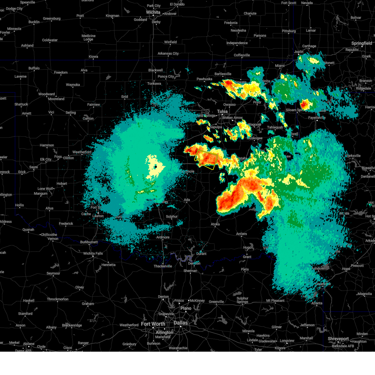 At 111 am cdt, a severe thunderstorm was located 5 miles southwest of welty, moving east at 25 mph (radar indicated). Hazards include 60 mph wind gusts and quarter size hail. Hail damage to vehicles is expected. expect wind damage to roofs, siding, and trees. locations in or near the path include, okemah, boley, bearden, castle, clearview, pharoah, mason, this includes interstate 40 in oklahoma between mile markers 212 and 230. hail threat, radar indicated max hail size, 1. 00 in wind threat, radar indicated max wind gust, 60 mph. At 111 am cdt, a severe thunderstorm was located 5 miles southwest of welty, moving east at 25 mph (radar indicated). Hazards include 60 mph wind gusts and quarter size hail. Hail damage to vehicles is expected. expect wind damage to roofs, siding, and trees. locations in or near the path include, okemah, boley, bearden, castle, clearview, pharoah, mason, this includes interstate 40 in oklahoma between mile markers 212 and 230. hail threat, radar indicated max hail size, 1. 00 in wind threat, radar indicated max wind gust, 60 mph.
|
| 9/24/2023 12:55 AM CDT |
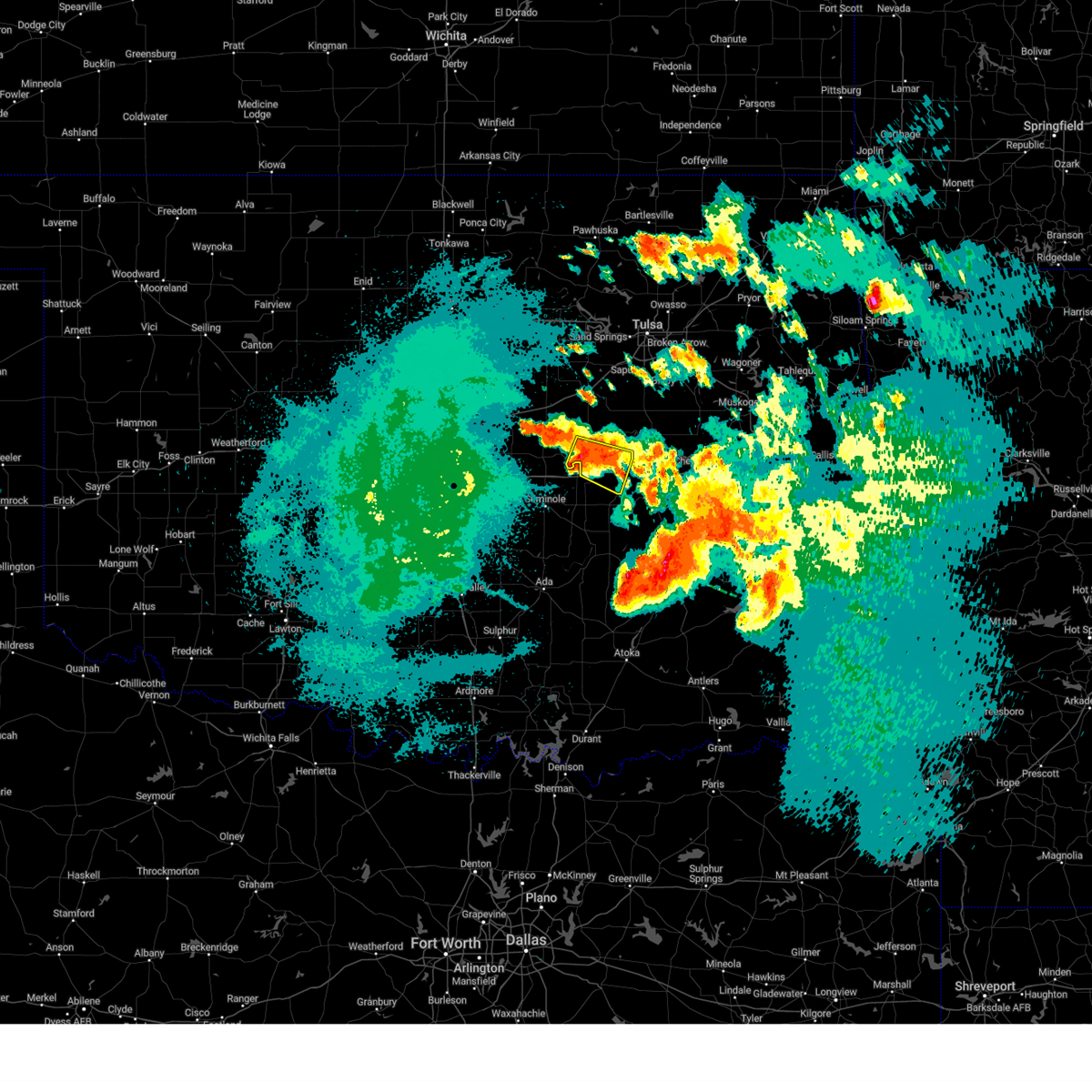 At 1255 am cdt, a severe thunderstorm was located near castle, moving east at 25 mph (radar indicated). Hazards include 60 mph wind gusts and quarter size hail. Hail damage to vehicles is expected. expect wind damage to roofs, siding, and trees. locations in or near the path include, okemah, boley, bearden, castle, clearview, pharoah, mason, this includes interstate 40 in oklahoma between mile markers 212 and 230. hail threat, radar indicated max hail size, 1. 00 in wind threat, radar indicated max wind gust, 60 mph. At 1255 am cdt, a severe thunderstorm was located near castle, moving east at 25 mph (radar indicated). Hazards include 60 mph wind gusts and quarter size hail. Hail damage to vehicles is expected. expect wind damage to roofs, siding, and trees. locations in or near the path include, okemah, boley, bearden, castle, clearview, pharoah, mason, this includes interstate 40 in oklahoma between mile markers 212 and 230. hail threat, radar indicated max hail size, 1. 00 in wind threat, radar indicated max wind gust, 60 mph.
|
| 9/23/2023 11:31 PM CDT |
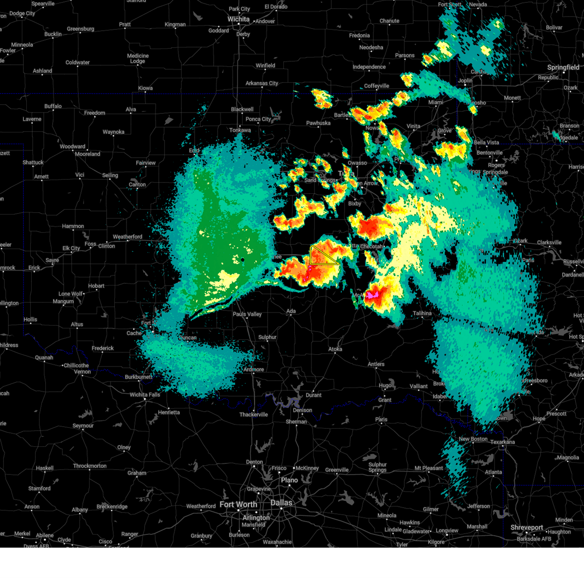 At 1130 pm cdt, severe thunderstorms were located along a line extending from 6 miles north of yeager to wewoka, moving southeast at 30 mph (radar indicated). Hazards include 60 mph wind gusts. Expect damage to roofs, siding, and trees. Locations in or near the path include, bearden, this includes interstate 40 in oklahoma between mile markers 212 and 219. At 1130 pm cdt, severe thunderstorms were located along a line extending from 6 miles north of yeager to wewoka, moving southeast at 30 mph (radar indicated). Hazards include 60 mph wind gusts. Expect damage to roofs, siding, and trees. Locations in or near the path include, bearden, this includes interstate 40 in oklahoma between mile markers 212 and 219.
|
| 9/23/2023 11:13 PM CDT |
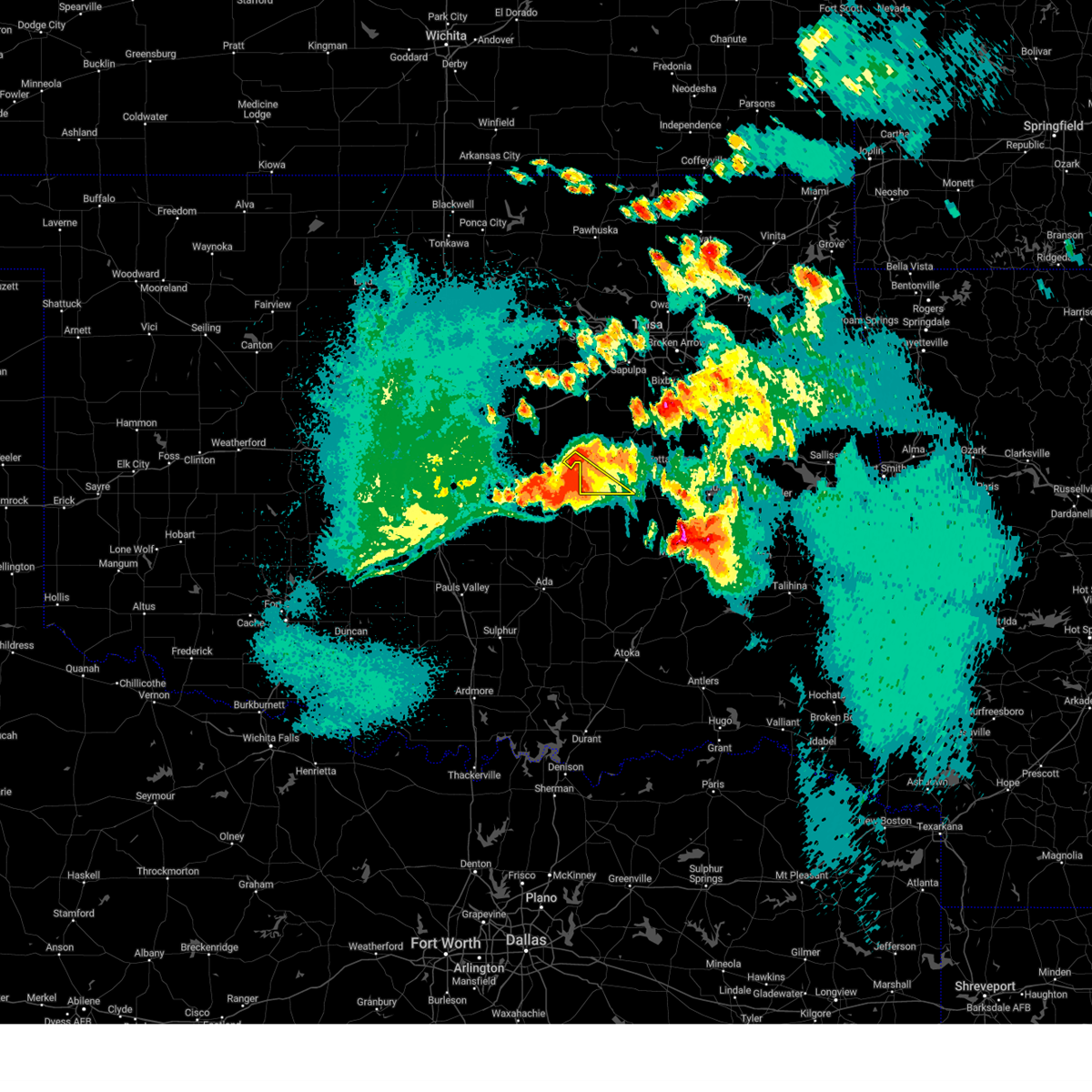 At 1112 pm cdt, severe thunderstorms were located along a line extending from near cromwell to 4 miles east of seminole, moving southeast at 30 mph (radar indicated). Hazards include 60 mph wind gusts and half dollar size hail. Hail damage to vehicles is expected. expect wind damage to roofs, siding, and trees. Locations in or near the path include, boley, bearden, this includes interstate 40 in oklahoma between mile markers 212 and 219. At 1112 pm cdt, severe thunderstorms were located along a line extending from near cromwell to 4 miles east of seminole, moving southeast at 30 mph (radar indicated). Hazards include 60 mph wind gusts and half dollar size hail. Hail damage to vehicles is expected. expect wind damage to roofs, siding, and trees. Locations in or near the path include, boley, bearden, this includes interstate 40 in oklahoma between mile markers 212 and 219.
|
| 9/23/2023 10:55 PM CDT |
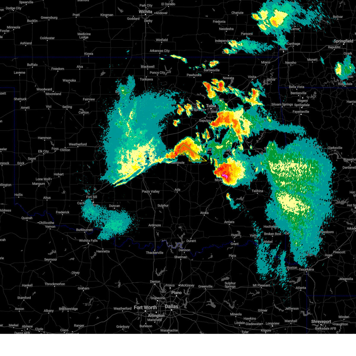 At 1055 pm cdt, severe thunderstorms were located along a line extending from 3 miles south of paden to little, moving southeast at 30 mph (radar indicated). Hazards include 60 mph wind gusts and quarter size hail. Hail damage to vehicles is expected. expect wind damage to roofs, siding, and trees. locations in or near the path include, boley, paden, bearden, this includes interstate 40 in oklahoma between mile markers 212 and 219. hail threat, radar indicated max hail size, 1. 00 in wind threat, radar indicated max wind gust, 60 mph. At 1055 pm cdt, severe thunderstorms were located along a line extending from 3 miles south of paden to little, moving southeast at 30 mph (radar indicated). Hazards include 60 mph wind gusts and quarter size hail. Hail damage to vehicles is expected. expect wind damage to roofs, siding, and trees. locations in or near the path include, boley, paden, bearden, this includes interstate 40 in oklahoma between mile markers 212 and 219. hail threat, radar indicated max hail size, 1. 00 in wind threat, radar indicated max wind gust, 60 mph.
|
| 9/23/2023 7:45 PM CDT |
 At 745 pm cdt, a severe thunderstorm was located over weleetka, moving east at 20 mph (radar indicated). Hazards include ping pong ball size hail and 60 mph wind gusts. People and animals outdoors will be injured. expect hail damage to roofs, siding, windows, and vehicles. expect wind damage to roofs, siding, and trees. locations in or near the path include, henryetta, morris, weleetka, dewar, schulter, grayson, hoffman, clearview, stidham, vivian, lake eufaula state park, pharoah, hitchita, bryant, pierce, eram, this includes interstate 40 in oklahoma between mile markers 222 and 257. hail threat, radar indicated max hail size, 1. 50 in wind threat, radar indicated max wind gust, 60 mph. At 745 pm cdt, a severe thunderstorm was located over weleetka, moving east at 20 mph (radar indicated). Hazards include ping pong ball size hail and 60 mph wind gusts. People and animals outdoors will be injured. expect hail damage to roofs, siding, windows, and vehicles. expect wind damage to roofs, siding, and trees. locations in or near the path include, henryetta, morris, weleetka, dewar, schulter, grayson, hoffman, clearview, stidham, vivian, lake eufaula state park, pharoah, hitchita, bryant, pierce, eram, this includes interstate 40 in oklahoma between mile markers 222 and 257. hail threat, radar indicated max hail size, 1. 50 in wind threat, radar indicated max wind gust, 60 mph.
|
| 9/23/2023 7:20 PM CDT |
 At 720 pm cdt, a severe thunderstorm was located over clearview, moving northeast at 35 mph (radar indicated). Hazards include 60 mph wind gusts and quarter size hail. Hail damage to vehicles is expected. expect wind damage to roofs, siding, and trees. locations in or near the path include, okmulgee, okemah, henryetta, weleetka, dewar, schulter, grayson, castle, clearview, okmulgee state park, pharoah, bryant, this includes interstate 40 in oklahoma between mile markers 216 and 245. hail threat, radar indicated max hail size, 1. 00 in wind threat, radar indicated max wind gust, 60 mph. At 720 pm cdt, a severe thunderstorm was located over clearview, moving northeast at 35 mph (radar indicated). Hazards include 60 mph wind gusts and quarter size hail. Hail damage to vehicles is expected. expect wind damage to roofs, siding, and trees. locations in or near the path include, okmulgee, okemah, henryetta, weleetka, dewar, schulter, grayson, castle, clearview, okmulgee state park, pharoah, bryant, this includes interstate 40 in oklahoma between mile markers 216 and 245. hail threat, radar indicated max hail size, 1. 00 in wind threat, radar indicated max wind gust, 60 mph.
|
| 9/23/2023 6:48 PM CDT |
 At 647 pm cdt, a severe thunderstorm was located 3 miles southwest of cromwell, moving east at 40 mph (radar indicated). Hazards include 60 mph wind gusts and quarter size hail. Hail damage to vehicles is expected. expect wind damage to roofs, siding, and trees. locations in or near the path include, okmulgee, okemah, henryetta, weleetka, dewar, schulter, grayson, bearden, castle, clearview, okmulgee state park, pharoah, bryant, this includes interstate 40 in oklahoma between mile markers 212 and 245. hail threat, radar indicated max hail size, 1. 00 in wind threat, radar indicated max wind gust, 60 mph. At 647 pm cdt, a severe thunderstorm was located 3 miles southwest of cromwell, moving east at 40 mph (radar indicated). Hazards include 60 mph wind gusts and quarter size hail. Hail damage to vehicles is expected. expect wind damage to roofs, siding, and trees. locations in or near the path include, okmulgee, okemah, henryetta, weleetka, dewar, schulter, grayson, bearden, castle, clearview, okmulgee state park, pharoah, bryant, this includes interstate 40 in oklahoma between mile markers 212 and 245. hail threat, radar indicated max hail size, 1. 00 in wind threat, radar indicated max wind gust, 60 mph.
|
| 9/23/2023 2:36 PM CDT | Golf Ball sized hail reported 11.9 miles S of Okemah, OK, golf ball size hail reported by emergency management. |
| 9/22/2023 3:40 AM CDT |
 At 340 am cdt, a severe thunderstorm was located 5 miles northeast of castle, moving northeast at 30 mph (radar indicated). Hazards include quarter size hail. Damage to vehicles is expected. locations in or near the path include, okmulgee, okemah, okfuskee, morris, beggs, castle, preston, okmulgee state park, bald hill, mason, this includes interstate 40 in oklahoma between mile markers 216 and 219. hail threat, radar indicated max hail size, 1. 00 in wind threat, radar indicated max wind gust, <50 mph. At 340 am cdt, a severe thunderstorm was located 5 miles northeast of castle, moving northeast at 30 mph (radar indicated). Hazards include quarter size hail. Damage to vehicles is expected. locations in or near the path include, okmulgee, okemah, okfuskee, morris, beggs, castle, preston, okmulgee state park, bald hill, mason, this includes interstate 40 in oklahoma between mile markers 216 and 219. hail threat, radar indicated max hail size, 1. 00 in wind threat, radar indicated max wind gust, <50 mph.
|
| 9/8/2023 3:06 PM CDT |
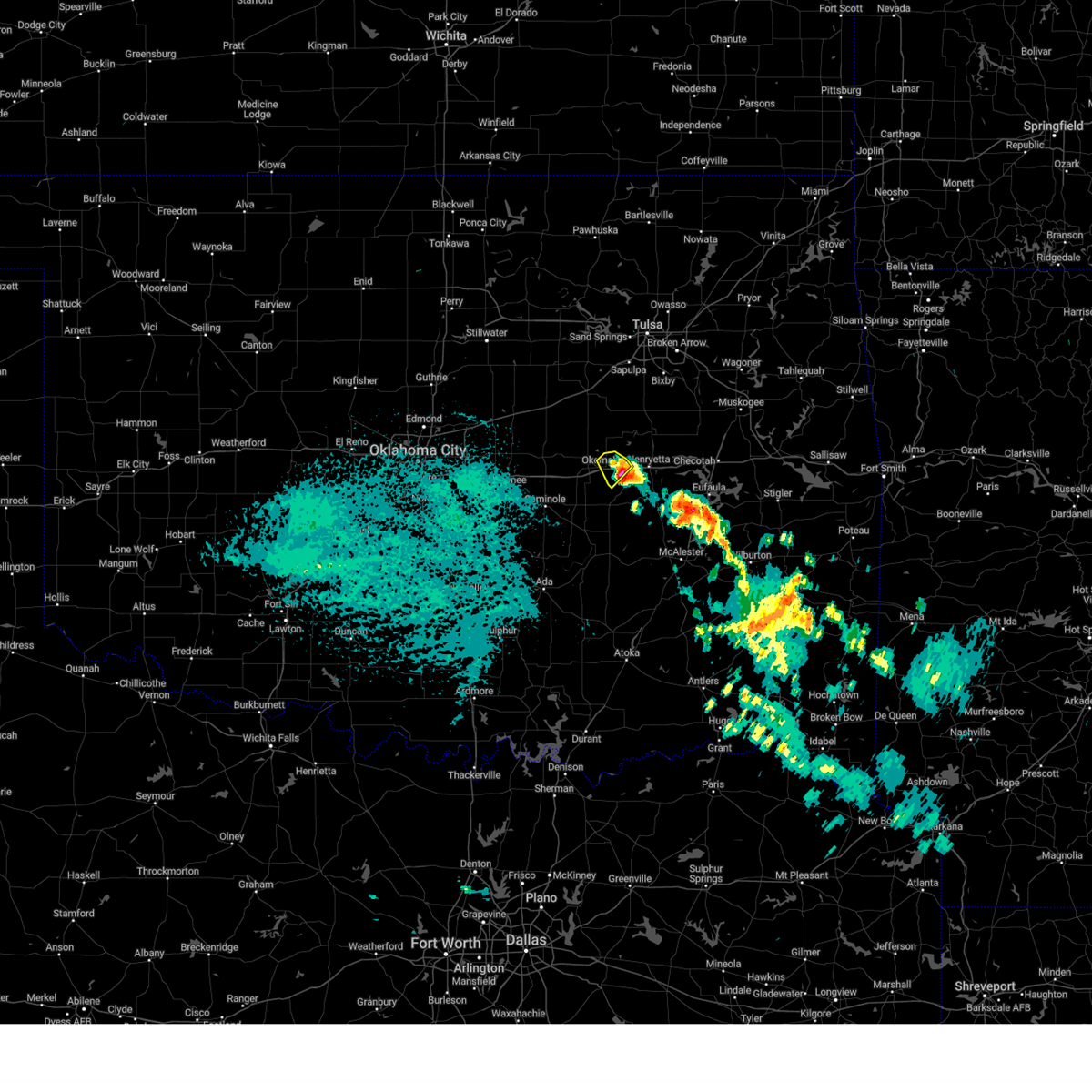 The severe thunderstorm warning for central okfuskee county will expire at 315 pm cdt, the storm which prompted the warning has weakened below severe limits, and has exited the warned area. therefore, the warning will be allowed to expire. The severe thunderstorm warning for central okfuskee county will expire at 315 pm cdt, the storm which prompted the warning has weakened below severe limits, and has exited the warned area. therefore, the warning will be allowed to expire.
|
| 9/8/2023 2:53 PM CDT |
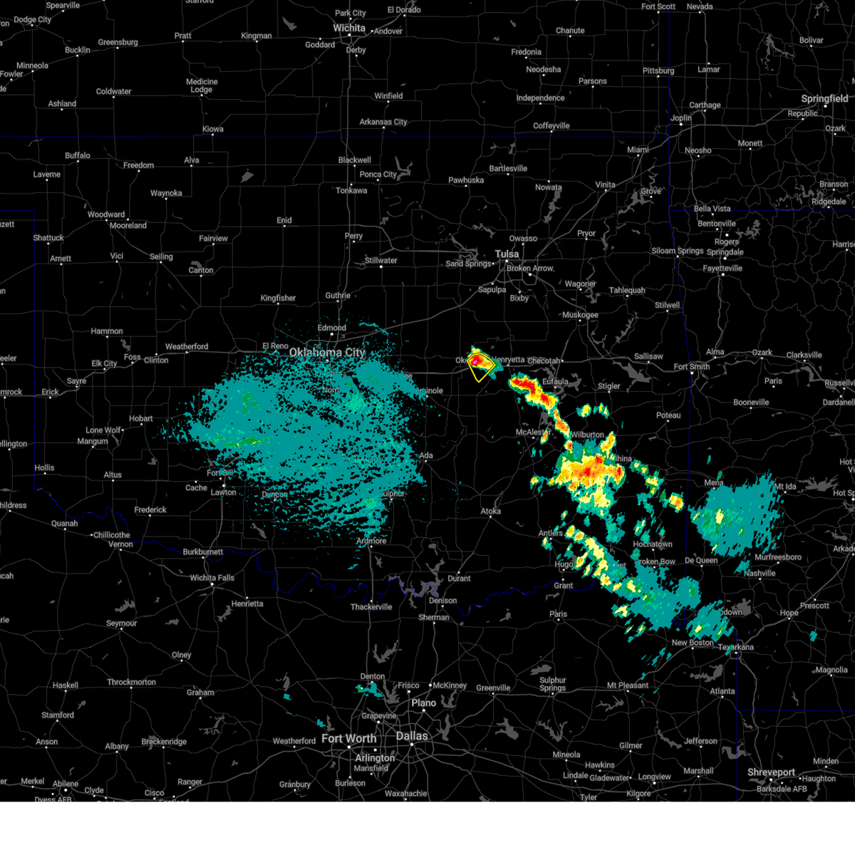 At 253 pm cdt, a severe thunderstorm was located over clearview, moving southeast at 40 mph (radar indicated). Hazards include 60 mph wind gusts and quarter size hail. Hail damage to vehicles is expected. expect wind damage to roofs, siding, and trees. locations in or near the path include, okemah, clearview, pharoah, this includes interstate 40 in oklahoma between mile markers 220 and 230. hail threat, radar indicated max hail size, 1. 00 in wind threat, radar indicated max wind gust, 60 mph. At 253 pm cdt, a severe thunderstorm was located over clearview, moving southeast at 40 mph (radar indicated). Hazards include 60 mph wind gusts and quarter size hail. Hail damage to vehicles is expected. expect wind damage to roofs, siding, and trees. locations in or near the path include, okemah, clearview, pharoah, this includes interstate 40 in oklahoma between mile markers 220 and 230. hail threat, radar indicated max hail size, 1. 00 in wind threat, radar indicated max wind gust, 60 mph.
|
| 9/8/2023 2:46 PM CDT |
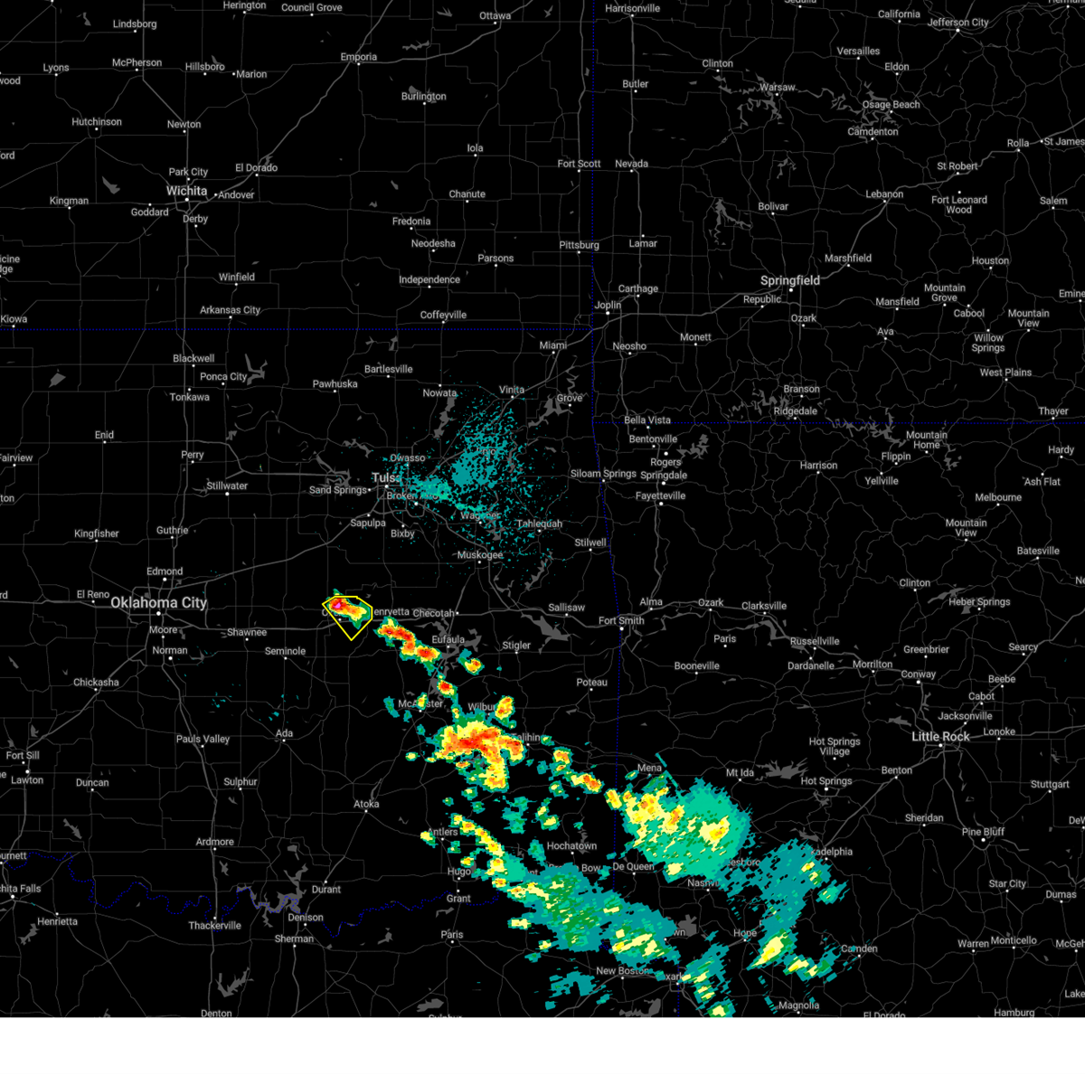 At 245 pm cdt, a severe thunderstorm was located near okemah, moving southeast at 40 mph (radar indicated). Hazards include 60 mph wind gusts and quarter size hail. Hail damage to vehicles is expected. expect wind damage to roofs, siding, and trees. locations in or near the path include, okemah, clearview, pharoah, this includes interstate 40 in oklahoma between mile markers 219 and 230. hail threat, radar indicated max hail size, 1. 00 in wind threat, radar indicated max wind gust, 60 mph. At 245 pm cdt, a severe thunderstorm was located near okemah, moving southeast at 40 mph (radar indicated). Hazards include 60 mph wind gusts and quarter size hail. Hail damage to vehicles is expected. expect wind damage to roofs, siding, and trees. locations in or near the path include, okemah, clearview, pharoah, this includes interstate 40 in oklahoma between mile markers 219 and 230. hail threat, radar indicated max hail size, 1. 00 in wind threat, radar indicated max wind gust, 60 mph.
|
| 9/8/2023 2:40 PM CDT |
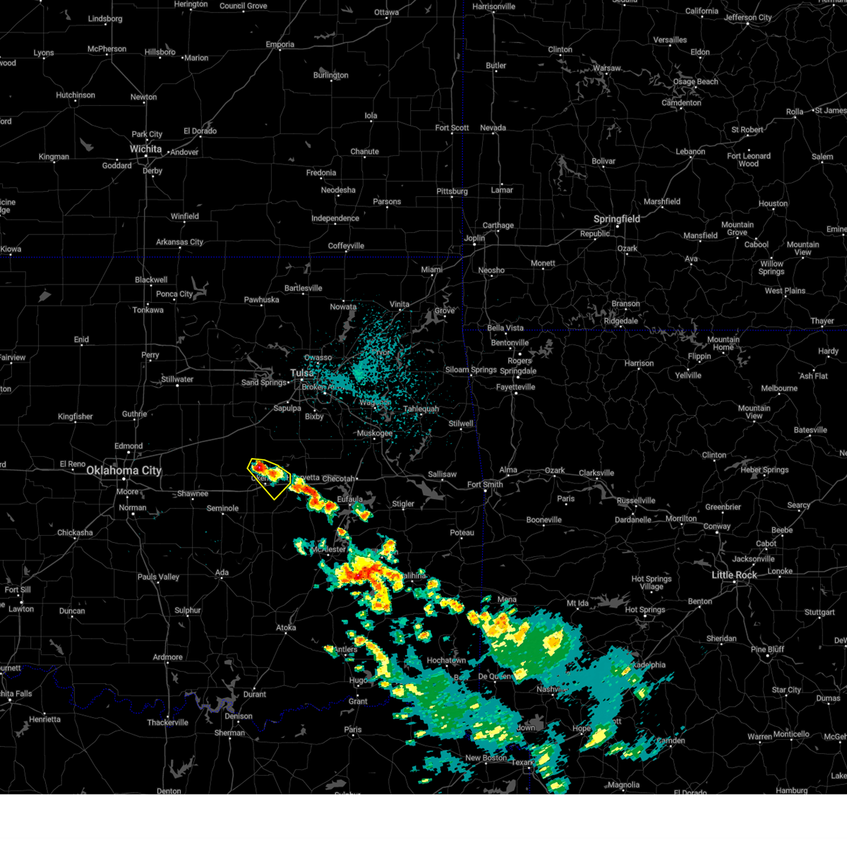 At 240 pm cdt, a severe thunderstorm was located 3 miles northeast of castle, moving southeast at 40 mph (radar indicated). Hazards include 60 mph wind gusts and quarter size hail. Hail damage to vehicles is expected. expect wind damage to roofs, siding, and trees. locations in or near the path include, okemah, castle, clearview, pharoah, mason, this includes interstate 40 in oklahoma between mile markers 218 and 230. hail threat, radar indicated max hail size, 1. 00 in wind threat, radar indicated max wind gust, 60 mph. At 240 pm cdt, a severe thunderstorm was located 3 miles northeast of castle, moving southeast at 40 mph (radar indicated). Hazards include 60 mph wind gusts and quarter size hail. Hail damage to vehicles is expected. expect wind damage to roofs, siding, and trees. locations in or near the path include, okemah, castle, clearview, pharoah, mason, this includes interstate 40 in oklahoma between mile markers 218 and 230. hail threat, radar indicated max hail size, 1. 00 in wind threat, radar indicated max wind gust, 60 mph.
|
| 9/8/2023 2:31 PM CDT |
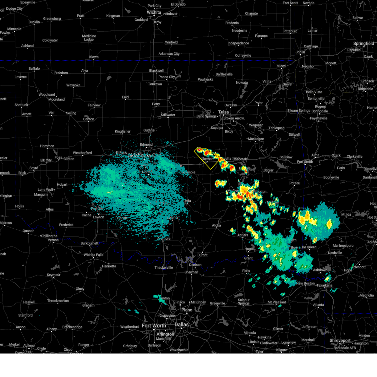 At 231 pm cdt, a severe thunderstorm was located 3 miles south of welty, moving southeast at 40 mph (radar indicated). Hazards include 60 mph wind gusts and half dollar size hail. Hail damage to vehicles is expected. expect wind damage to roofs, siding, and trees. locations in or near the path include, okemah, castle, clearview, welty, pharoah, mason, this includes interstate 40 in oklahoma between mile markers 217 and 230. hail threat, radar indicated max hail size, 1. 25 in wind threat, radar indicated max wind gust, 60 mph. At 231 pm cdt, a severe thunderstorm was located 3 miles south of welty, moving southeast at 40 mph (radar indicated). Hazards include 60 mph wind gusts and half dollar size hail. Hail damage to vehicles is expected. expect wind damage to roofs, siding, and trees. locations in or near the path include, okemah, castle, clearview, welty, pharoah, mason, this includes interstate 40 in oklahoma between mile markers 217 and 230. hail threat, radar indicated max hail size, 1. 25 in wind threat, radar indicated max wind gust, 60 mph.
|
| 9/8/2023 2:29 PM CDT |
 At 228 pm cdt, a severe thunderstorm was located near welty, moving southeast at 40 mph (radar indicated). Hazards include 60 mph wind gusts and quarter size hail. Hail damage to vehicles is expected. expect wind damage to roofs, siding, and trees. locations in or near the path include, okemah, castle, clearview, welty, pharoah, mason, this includes interstate 40 in oklahoma between mile markers 217 and 230. hail threat, radar indicated max hail size, 1. 00 in wind threat, radar indicated max wind gust, 60 mph. At 228 pm cdt, a severe thunderstorm was located near welty, moving southeast at 40 mph (radar indicated). Hazards include 60 mph wind gusts and quarter size hail. Hail damage to vehicles is expected. expect wind damage to roofs, siding, and trees. locations in or near the path include, okemah, castle, clearview, welty, pharoah, mason, this includes interstate 40 in oklahoma between mile markers 217 and 230. hail threat, radar indicated max hail size, 1. 00 in wind threat, radar indicated max wind gust, 60 mph.
|
| 8/11/2023 1:35 AM CDT |
 At 135 am cdt, a severe thunderstorm was located 4 miles north of castle, moving east at 30 mph (radar indicated). Hazards include ping pong ball size hail and 60 mph wind gusts. People and animals outdoors will be injured. expect hail damage to roofs, siding, windows, and vehicles. expect wind damage to roofs, siding, and trees. locations in or near the path include, okmulgee, okfuskee, henryetta, morris, dewar, schulter, grayson, hoffman, castle, okmulgee state park, mason, hail threat, radar indicated max hail size, 1. 50 in wind threat, radar indicated max wind gust, 60 mph. At 135 am cdt, a severe thunderstorm was located 4 miles north of castle, moving east at 30 mph (radar indicated). Hazards include ping pong ball size hail and 60 mph wind gusts. People and animals outdoors will be injured. expect hail damage to roofs, siding, windows, and vehicles. expect wind damage to roofs, siding, and trees. locations in or near the path include, okmulgee, okfuskee, henryetta, morris, dewar, schulter, grayson, hoffman, castle, okmulgee state park, mason, hail threat, radar indicated max hail size, 1. 50 in wind threat, radar indicated max wind gust, 60 mph.
|
| 7/11/2023 3:18 AM CDT |
 At 318 am cdt, a severe thunderstorm was located over okemah, moving southeast at 30 mph (radar indicated). Hazards include 60 mph wind gusts and quarter size hail. Hail damage to vehicles is expected. expect wind damage to roofs, siding, and trees. locations in or near the path include, okemah, weleetka, hanna, bearden, clearview, raiford, pharoah, vernon, this includes interstate 40 in oklahoma between mile markers 213 and 231. hail threat, radar indicated max hail size, 1. 00 in wind threat, radar indicated max wind gust, 60 mph. At 318 am cdt, a severe thunderstorm was located over okemah, moving southeast at 30 mph (radar indicated). Hazards include 60 mph wind gusts and quarter size hail. Hail damage to vehicles is expected. expect wind damage to roofs, siding, and trees. locations in or near the path include, okemah, weleetka, hanna, bearden, clearview, raiford, pharoah, vernon, this includes interstate 40 in oklahoma between mile markers 213 and 231. hail threat, radar indicated max hail size, 1. 00 in wind threat, radar indicated max wind gust, 60 mph.
|
| 7/6/2023 4:56 AM CDT |
 At 455 am cdt, a severe thunderstorm was located over clearview, moving northeast at 20 mph (radar indicated). Hazards include 60 mph wind gusts and half dollar size hail. Hail damage to vehicles is expected. expect wind damage to roofs, siding, and trees. locations in or near the path include, okemah, henryetta, weleetka, dewar, schulter, clearview, okmulgee state park, pharoah, bryant, this includes interstate 40 in oklahoma between mile markers 219 and 240. hail threat, radar indicated max hail size, 1. 25 in wind threat, radar indicated max wind gust, 60 mph. At 455 am cdt, a severe thunderstorm was located over clearview, moving northeast at 20 mph (radar indicated). Hazards include 60 mph wind gusts and half dollar size hail. Hail damage to vehicles is expected. expect wind damage to roofs, siding, and trees. locations in or near the path include, okemah, henryetta, weleetka, dewar, schulter, clearview, okmulgee state park, pharoah, bryant, this includes interstate 40 in oklahoma between mile markers 219 and 240. hail threat, radar indicated max hail size, 1. 25 in wind threat, radar indicated max wind gust, 60 mph.
|
| 6/27/2023 9:34 AM CDT |
 At 933 am cdt, severe thunderstorms were located along a line extending from sapulpa to 2 miles southwest of preston to 3 miles northeast of wetumka, moving east at 45 mph (radar indicated). Hazards include 60 mph wind gusts and penny size hail. Expect damage to roofs, siding, and trees. locations in or near the path include, tulsa, broken arrow, okmulgee, bristow, okemah, bixby, sapulpa, jenks, okfuskee, glenpool, henryetta, kiefer, morris, beggs, mounds, kellyville, weleetka, dewar, schulter, grayson, this includes the following highways, interstate 40 in oklahoma between mile markers 212 and 246. interstate 44 between mile markers 190 and 216. hail threat, radar indicated max hail size, 0. 75 in wind threat, radar indicated max wind gust, 60 mph. At 933 am cdt, severe thunderstorms were located along a line extending from sapulpa to 2 miles southwest of preston to 3 miles northeast of wetumka, moving east at 45 mph (radar indicated). Hazards include 60 mph wind gusts and penny size hail. Expect damage to roofs, siding, and trees. locations in or near the path include, tulsa, broken arrow, okmulgee, bristow, okemah, bixby, sapulpa, jenks, okfuskee, glenpool, henryetta, kiefer, morris, beggs, mounds, kellyville, weleetka, dewar, schulter, grayson, this includes the following highways, interstate 40 in oklahoma between mile markers 212 and 246. interstate 44 between mile markers 190 and 216. hail threat, radar indicated max hail size, 0. 75 in wind threat, radar indicated max wind gust, 60 mph.
|
| 6/27/2023 9:17 AM CDT |
 At 917 am cdt, severe thunderstorms were located along a line extending from 6 miles south of mannford to 3 miles southeast of slick to near bearden, moving east at 45 mph (radar indicated). Hazards include 60 mph wind gusts and nickel size hail. Expect damage to roofs, siding, and trees. locations in or near the path include, tulsa, broken arrow, okmulgee, bristow, okemah, bixby, sapulpa, jenks, okfuskee, glenpool, henryetta, kiefer, morris, beggs, mounds, kellyville, weleetka, dewar, schulter, grayson, this includes the following highways, interstate 40 in oklahoma between mile markers 212 and 246. interstate 44 between mile markers 190 and 216. hail threat, radar indicated max hail size, 0. 88 in wind threat, radar indicated max wind gust, 60 mph. At 917 am cdt, severe thunderstorms were located along a line extending from 6 miles south of mannford to 3 miles southeast of slick to near bearden, moving east at 45 mph (radar indicated). Hazards include 60 mph wind gusts and nickel size hail. Expect damage to roofs, siding, and trees. locations in or near the path include, tulsa, broken arrow, okmulgee, bristow, okemah, bixby, sapulpa, jenks, okfuskee, glenpool, henryetta, kiefer, morris, beggs, mounds, kellyville, weleetka, dewar, schulter, grayson, this includes the following highways, interstate 40 in oklahoma between mile markers 212 and 246. interstate 44 between mile markers 190 and 216. hail threat, radar indicated max hail size, 0. 88 in wind threat, radar indicated max wind gust, 60 mph.
|
| 6/27/2023 9:04 AM CDT |
 At 904 am cdt, severe thunderstorms were located along a line extending from 6 miles east of drumright to 3 miles south of bristow to near boley, moving east at 50 mph (radar indicated). Hazards include 70 mph wind gusts and quarter size hail. Hail damage to vehicles is expected. expect considerable tree damage. wind damage is also likely to mobile homes, roofs, and outbuildings. locations in or near the path include, bristow, okemah, okfuskee, mannford, drumright, boley, kellyville, oilton, depew, paden, bearden, slick, castle, shamrock, clearview, welty, silver city, milfay, mason, this includes the following highways, interstate 40 in oklahoma between mile markers 212 and 227. interstate 44 between mile markers 178 and 207. thunderstorm damage threat, considerable hail threat, radar indicated max hail size, 1. 00 in wind threat, radar indicated max wind gust, 70 mph. At 904 am cdt, severe thunderstorms were located along a line extending from 6 miles east of drumright to 3 miles south of bristow to near boley, moving east at 50 mph (radar indicated). Hazards include 70 mph wind gusts and quarter size hail. Hail damage to vehicles is expected. expect considerable tree damage. wind damage is also likely to mobile homes, roofs, and outbuildings. locations in or near the path include, bristow, okemah, okfuskee, mannford, drumright, boley, kellyville, oilton, depew, paden, bearden, slick, castle, shamrock, clearview, welty, silver city, milfay, mason, this includes the following highways, interstate 40 in oklahoma between mile markers 212 and 227. interstate 44 between mile markers 178 and 207. thunderstorm damage threat, considerable hail threat, radar indicated max hail size, 1. 00 in wind threat, radar indicated max wind gust, 70 mph.
|
| 6/27/2023 8:44 AM CDT |
 At 843 am cdt, severe thunderstorms were located along a line extending from 2 miles north of ripley to 4 miles south of sparks, moving east at 50 mph (radar indicated). Hazards include 70 mph wind gusts and quarter size hail. Hail damage to vehicles is expected. expect considerable tree damage. wind damage is also likely to mobile homes, roofs, and outbuildings. locations in or near the path include, bristow, okemah, okfuskee, mannford, drumright, boley, kellyville, oilton, depew, paden, bearden, slick, castle, shamrock, clearview, welty, silver city, milfay, mason, this includes the following highways, interstate 40 in oklahoma between mile markers 212 and 227. interstate 44 between mile markers 178 and 207. thunderstorm damage threat, considerable hail threat, radar indicated max hail size, 1. 00 in wind threat, radar indicated max wind gust, 70 mph. At 843 am cdt, severe thunderstorms were located along a line extending from 2 miles north of ripley to 4 miles south of sparks, moving east at 50 mph (radar indicated). Hazards include 70 mph wind gusts and quarter size hail. Hail damage to vehicles is expected. expect considerable tree damage. wind damage is also likely to mobile homes, roofs, and outbuildings. locations in or near the path include, bristow, okemah, okfuskee, mannford, drumright, boley, kellyville, oilton, depew, paden, bearden, slick, castle, shamrock, clearview, welty, silver city, milfay, mason, this includes the following highways, interstate 40 in oklahoma between mile markers 212 and 227. interstate 44 between mile markers 178 and 207. thunderstorm damage threat, considerable hail threat, radar indicated max hail size, 1. 00 in wind threat, radar indicated max wind gust, 70 mph.
|
| 6/17/2023 11:46 PM CDT |
 At 1146 pm cdt, severe thunderstorms were located along a line extending from 5 miles east of stroud to 2 miles west of earlsboro, moving east at 55 mph (radar indicated). Hazards include 70 mph wind gusts and quarter size hail. Hail damage to vehicles is expected. expect considerable tree damage. wind damage is also likely to mobile homes, roofs, and outbuildings. locations in or near the path include, okmulgee, okemah, okfuskee, henryetta, morris, beggs, boley, weleetka, dewar, schulter, paden, grayson, bearden, hoffman, castle, clearview, preston, bald hill, okmulgee state park, welty, this includes interstate 40 in oklahoma between mile markers 212 and 243. thunderstorm damage threat, considerable hail threat, radar indicated max hail size, 1. 00 in wind threat, radar indicated max wind gust, 70 mph. At 1146 pm cdt, severe thunderstorms were located along a line extending from 5 miles east of stroud to 2 miles west of earlsboro, moving east at 55 mph (radar indicated). Hazards include 70 mph wind gusts and quarter size hail. Hail damage to vehicles is expected. expect considerable tree damage. wind damage is also likely to mobile homes, roofs, and outbuildings. locations in or near the path include, okmulgee, okemah, okfuskee, henryetta, morris, beggs, boley, weleetka, dewar, schulter, paden, grayson, bearden, hoffman, castle, clearview, preston, bald hill, okmulgee state park, welty, this includes interstate 40 in oklahoma between mile markers 212 and 243. thunderstorm damage threat, considerable hail threat, radar indicated max hail size, 1. 00 in wind threat, radar indicated max wind gust, 70 mph.
|
| 4/19/2023 11:51 PM CDT |
 At 1151 pm cdt, a severe thunderstorm was located 6 miles south of okfuskee, moving east at 25 mph (radar indicated). Hazards include two inch hail and 70 mph wind gusts. People and animals outdoors will be injured. expect hail damage to roofs, siding, windows, and vehicles. expect considerable tree damage. wind damage is also likely to mobile homes, roofs, and outbuildings. Locations in or near the path include, okmulgee, okemah, okfuskee, henryetta, morris, dewar, schulter, grayson, hoffman, clearview, okmulgee state park, pharoah, bryant, this includes interstate 40 in oklahoma between mile markers 219 and 243. At 1151 pm cdt, a severe thunderstorm was located 6 miles south of okfuskee, moving east at 25 mph (radar indicated). Hazards include two inch hail and 70 mph wind gusts. People and animals outdoors will be injured. expect hail damage to roofs, siding, windows, and vehicles. expect considerable tree damage. wind damage is also likely to mobile homes, roofs, and outbuildings. Locations in or near the path include, okmulgee, okemah, okfuskee, henryetta, morris, dewar, schulter, grayson, hoffman, clearview, okmulgee state park, pharoah, bryant, this includes interstate 40 in oklahoma between mile markers 219 and 243.
|
| 4/19/2023 11:40 PM CDT | Tea Cup sized hail reported 1.3 miles SE of Okemah, OK |
| 4/19/2023 11:30 PM CDT | Grapefruit sized hail reported 5.6 miles S of Okemah, OK |
| 4/19/2023 11:27 PM CDT |
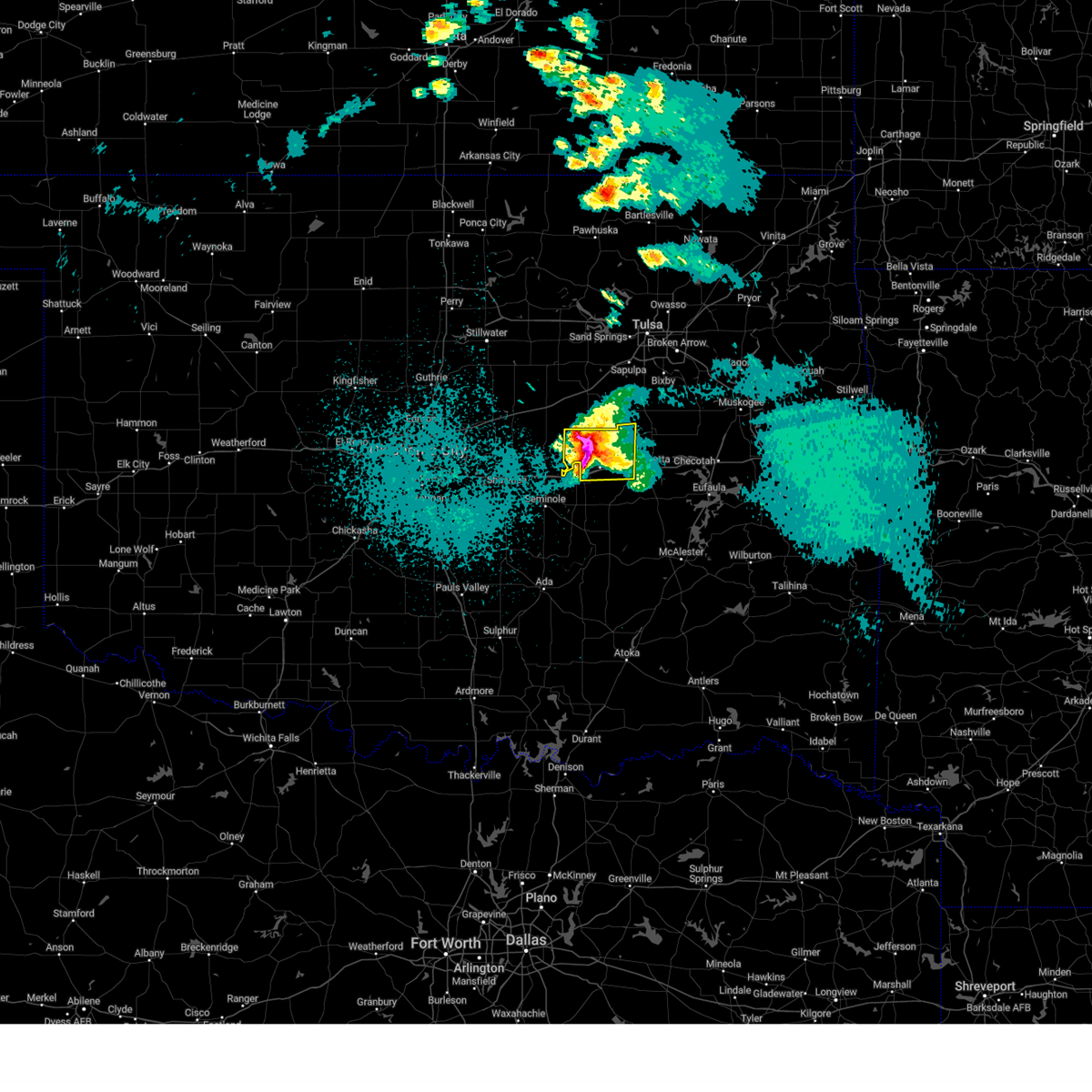 At 1127 pm cdt, a severe thunderstorm was located 4 miles northeast of castle, moving east at 20 mph (radar indicated). Hazards include tennis ball size hail and 70 mph wind gusts. People and animals outdoors will be injured. expect hail damage to roofs, siding, windows, and vehicles. expect considerable tree damage. wind damage is also likely to mobile homes, roofs, and outbuildings. Locations in or near the path include, okemah, okfuskee, boley, bearden, castle, clearview, welty, pharoah, mason, this includes interstate 40 in oklahoma between mile markers 212 and 232. At 1127 pm cdt, a severe thunderstorm was located 4 miles northeast of castle, moving east at 20 mph (radar indicated). Hazards include tennis ball size hail and 70 mph wind gusts. People and animals outdoors will be injured. expect hail damage to roofs, siding, windows, and vehicles. expect considerable tree damage. wind damage is also likely to mobile homes, roofs, and outbuildings. Locations in or near the path include, okemah, okfuskee, boley, bearden, castle, clearview, welty, pharoah, mason, this includes interstate 40 in oklahoma between mile markers 212 and 232.
|
| 4/19/2023 11:18 PM CDT |
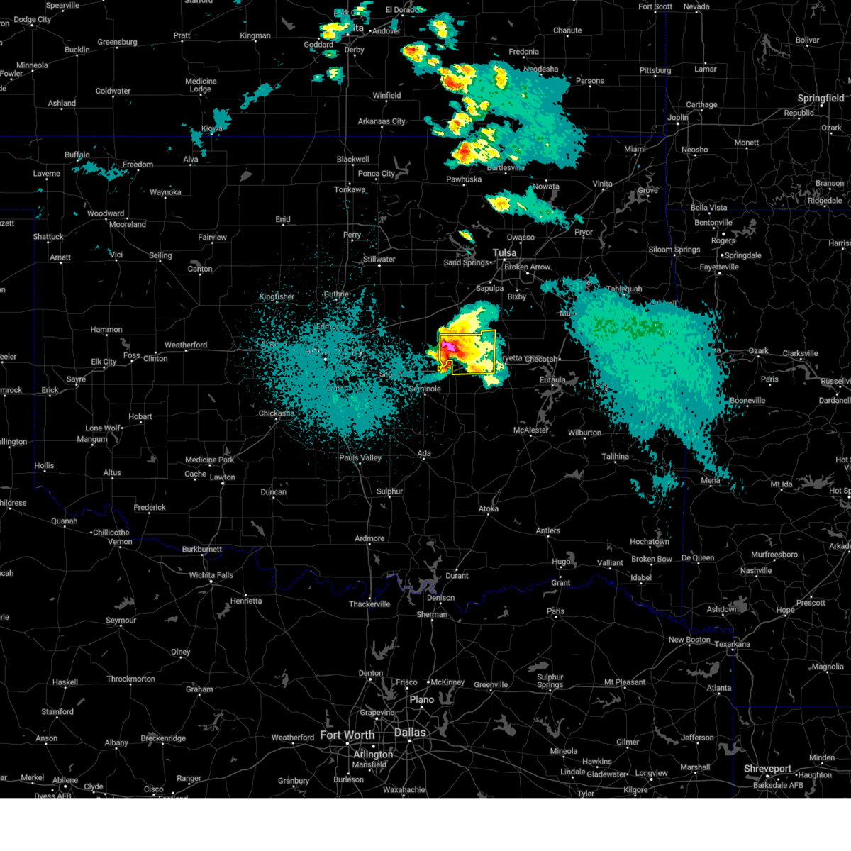 At 1118 pm cdt, a severe thunderstorm was located 4 miles northwest of castle, moving east at 15 mph (radar indicated). Hazards include two inch hail and 70 mph wind gusts. People and animals outdoors will be injured. expect hail damage to roofs, siding, windows, and vehicles. expect considerable tree damage. wind damage is also likely to mobile homes, roofs, and outbuildings. Locations in or near the path include, okemah, okfuskee, boley, bearden, castle, clearview, welty, pharoah, mason, this includes interstate 40 in oklahoma between mile markers 212 and 232. At 1118 pm cdt, a severe thunderstorm was located 4 miles northwest of castle, moving east at 15 mph (radar indicated). Hazards include two inch hail and 70 mph wind gusts. People and animals outdoors will be injured. expect hail damage to roofs, siding, windows, and vehicles. expect considerable tree damage. wind damage is also likely to mobile homes, roofs, and outbuildings. Locations in or near the path include, okemah, okfuskee, boley, bearden, castle, clearview, welty, pharoah, mason, this includes interstate 40 in oklahoma between mile markers 212 and 232.
|
| 3/23/2023 3:54 PM CDT |
 At 353 pm cdt, a severe thunderstorm was located 4 miles northwest of pharoah, moving northeast at 40 mph (public). Hazards include golf ball size hail and 60 mph wind gusts. People and animals outdoors will be injured. expect hail damage to roofs, siding, windows, and vehicles. expect wind damage to roofs, siding, and trees. locations in or near the path include, okmulgee, okemah, henryetta, morris, weleetka, dewar, schulter, grayson, hoffman, clearview, bald hill, okmulgee state park, pharoah, hitchita, bryant, eram, this includes interstate 40 in oklahoma between mile markers 219 and 243. thunderstorm damage threat, considerable hail threat, observed max hail size, 1. 75 in wind threat, radar indicated max wind gust, 60 mph. At 353 pm cdt, a severe thunderstorm was located 4 miles northwest of pharoah, moving northeast at 40 mph (public). Hazards include golf ball size hail and 60 mph wind gusts. People and animals outdoors will be injured. expect hail damage to roofs, siding, windows, and vehicles. expect wind damage to roofs, siding, and trees. locations in or near the path include, okmulgee, okemah, henryetta, morris, weleetka, dewar, schulter, grayson, hoffman, clearview, bald hill, okmulgee state park, pharoah, hitchita, bryant, eram, this includes interstate 40 in oklahoma between mile markers 219 and 243. thunderstorm damage threat, considerable hail threat, observed max hail size, 1. 75 in wind threat, radar indicated max wind gust, 60 mph.
|
| 3/23/2023 3:50 PM CDT | Ping Pong Ball sized hail reported 5.2 miles W of Okemah, OK |
| 3/23/2023 3:49 PM CDT |
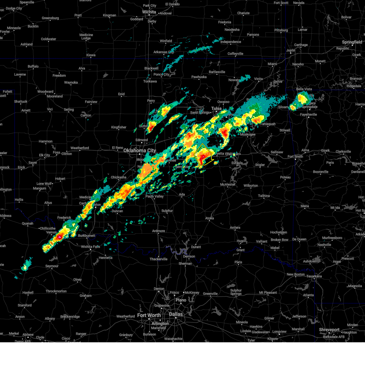 At 349 pm cdt, a severe thunderstorm was located 3 miles north of clearview, moving northeast at 50 mph (trained weather spotters). Hazards include ping pong ball size hail and 60 mph wind gusts. People and animals outdoors will be injured. expect hail damage to roofs, siding, windows, and vehicles. expect wind damage to roofs, siding, and trees. locations in or near the path include, okemah, okfuskee, weleetka, bearden, castle, clearview, pharoah, this includes interstate 40 in oklahoma between mile markers 215 and 231. hail threat, observed max hail size, 1. 50 in wind threat, radar indicated max wind gust, 60 mph. At 349 pm cdt, a severe thunderstorm was located 3 miles north of clearview, moving northeast at 50 mph (trained weather spotters). Hazards include ping pong ball size hail and 60 mph wind gusts. People and animals outdoors will be injured. expect hail damage to roofs, siding, windows, and vehicles. expect wind damage to roofs, siding, and trees. locations in or near the path include, okemah, okfuskee, weleetka, bearden, castle, clearview, pharoah, this includes interstate 40 in oklahoma between mile markers 215 and 231. hail threat, observed max hail size, 1. 50 in wind threat, radar indicated max wind gust, 60 mph.
|
| 3/23/2023 3:45 PM CDT | Ping Pong Ball sized hail reported 1.8 miles W of Okemah, OK, report from mping: ping pong ball (1.50 in.). |
| 3/23/2023 3:37 PM CDT | Quarter sized hail reported 6.6 miles NE of Okemah, OK, dime to quarter size hail covering the ground. |
| 3/23/2023 3:37 PM CDT |
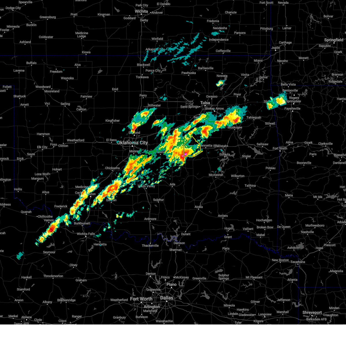 At 336 pm cdt, a severe thunderstorm was located over bearden, moving northeast at 50 mph (radar indicated). Hazards include two inch hail and 60 mph wind gusts. People and animals outdoors will be injured. expect hail damage to roofs, siding, windows, and vehicles. expect wind damage to roofs, siding, and trees. locations in or near the path include, okemah, okfuskee, weleetka, bearden, castle, clearview, pharoah, mason, this includes interstate 40 in oklahoma between mile markers 212 and 231. thunderstorm damage threat, considerable hail threat, radar indicated max hail size, 2. 00 in wind threat, radar indicated max wind gust, 60 mph. At 336 pm cdt, a severe thunderstorm was located over bearden, moving northeast at 50 mph (radar indicated). Hazards include two inch hail and 60 mph wind gusts. People and animals outdoors will be injured. expect hail damage to roofs, siding, windows, and vehicles. expect wind damage to roofs, siding, and trees. locations in or near the path include, okemah, okfuskee, weleetka, bearden, castle, clearview, pharoah, mason, this includes interstate 40 in oklahoma between mile markers 212 and 231. thunderstorm damage threat, considerable hail threat, radar indicated max hail size, 2. 00 in wind threat, radar indicated max wind gust, 60 mph.
|
| 3/23/2023 3:30 PM CDT | Ping Pong Ball sized hail reported 6.6 miles NE of Okemah, OK |
| 3/23/2023 3:27 PM CDT |
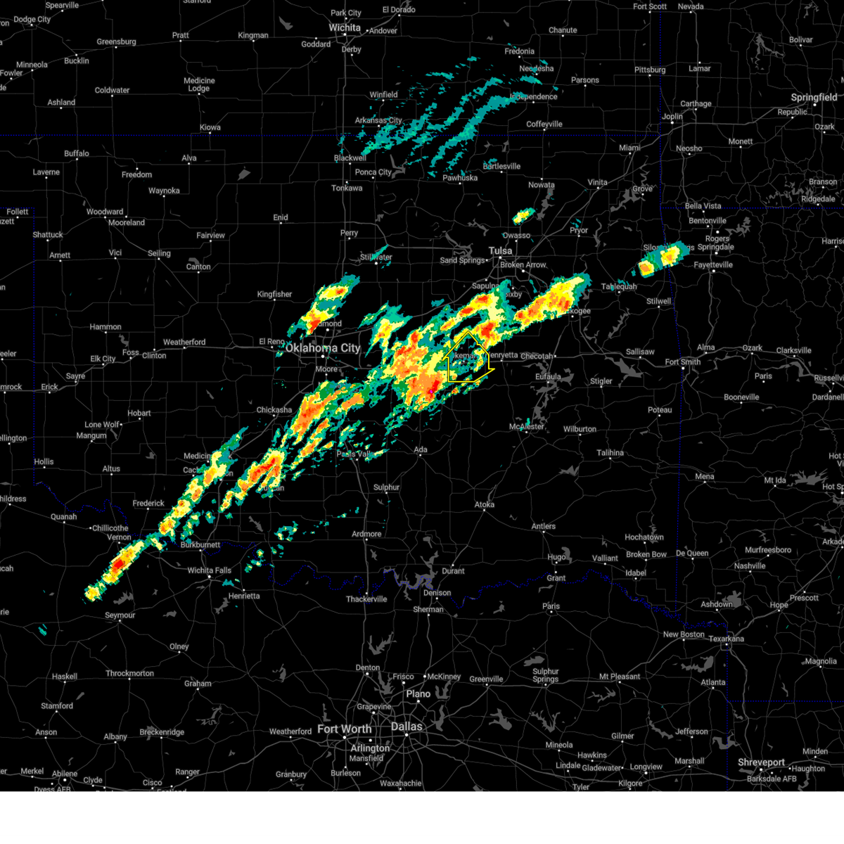 At 327 pm cdt, a severe thunderstorm was located 4 miles southwest of cromwell, moving northeast at 50 mph (radar indicated). Hazards include 60 mph wind gusts and quarter size hail. Hail damage to vehicles is expected. expect wind damage to roofs, siding, and trees. locations in or near the path include, okemah, okfuskee, weleetka, bearden, castle, clearview, pharoah, mason, this includes interstate 40 in oklahoma between mile markers 212 and 231. hail threat, radar indicated max hail size, 1. 00 in wind threat, radar indicated max wind gust, 60 mph. At 327 pm cdt, a severe thunderstorm was located 4 miles southwest of cromwell, moving northeast at 50 mph (radar indicated). Hazards include 60 mph wind gusts and quarter size hail. Hail damage to vehicles is expected. expect wind damage to roofs, siding, and trees. locations in or near the path include, okemah, okfuskee, weleetka, bearden, castle, clearview, pharoah, mason, this includes interstate 40 in oklahoma between mile markers 212 and 231. hail threat, radar indicated max hail size, 1. 00 in wind threat, radar indicated max wind gust, 60 mph.
|
| 2/26/2023 10:27 PM CST |
 At 1026 pm cst, a severe thunderstorm was located 6 miles southeast of slick, moving northeast at 105 mph (radar indicated). Hazards include 70 mph wind gusts and penny size hail. Expect considerable tree damage. damage is likely to mobile homes, roofs, and outbuildings. this storm ha a history of producing wind damage and tornadoes. Locations in or near the path include, tulsa, broken arrow, muskogee, sand springs, claremore, okmulgee, wagoner, bristow, okemah, owasso, bixby, sapulpa, jenks, okfuskee, glenpool, coweta, skiatook, catoosa, collinsville, verdigris, this includes interstate 44 between mile markers 179 and 247. At 1026 pm cst, a severe thunderstorm was located 6 miles southeast of slick, moving northeast at 105 mph (radar indicated). Hazards include 70 mph wind gusts and penny size hail. Expect considerable tree damage. damage is likely to mobile homes, roofs, and outbuildings. this storm ha a history of producing wind damage and tornadoes. Locations in or near the path include, tulsa, broken arrow, muskogee, sand springs, claremore, okmulgee, wagoner, bristow, okemah, owasso, bixby, sapulpa, jenks, okfuskee, glenpool, coweta, skiatook, catoosa, collinsville, verdigris, this includes interstate 44 between mile markers 179 and 247.
|
| 2/26/2023 10:17 PM CST |
 At 1017 pm cst, a severe thunderstorm was located 3 miles west of cromwell, moving east at 65 mph (radar indicated). Hazards include 70 mph wind gusts and nickel size hail. Expect considerable tree damage. damage is likely to mobile homes, roofs, and outbuildings. locations in or near the path include, mcalester, okemah, eufaula, henryetta, weleetka, dewar, schulter, crowder, canadian, indianola, grayson, hanna, bearden, hoffman, clearview, stidham, raiford, vivian, lake eufaula state park, pharoah, this includes interstate 40 in oklahoma between mile markers 212 and 258. thunderstorm damage threat, considerable hail threat, radar indicated max hail size, 0. 88 in wind threat, radar indicated max wind gust, 70 mph. At 1017 pm cst, a severe thunderstorm was located 3 miles west of cromwell, moving east at 65 mph (radar indicated). Hazards include 70 mph wind gusts and nickel size hail. Expect considerable tree damage. damage is likely to mobile homes, roofs, and outbuildings. locations in or near the path include, mcalester, okemah, eufaula, henryetta, weleetka, dewar, schulter, crowder, canadian, indianola, grayson, hanna, bearden, hoffman, clearview, stidham, raiford, vivian, lake eufaula state park, pharoah, this includes interstate 40 in oklahoma between mile markers 212 and 258. thunderstorm damage threat, considerable hail threat, radar indicated max hail size, 0. 88 in wind threat, radar indicated max wind gust, 70 mph.
|
| 2/26/2023 10:05 PM CST |
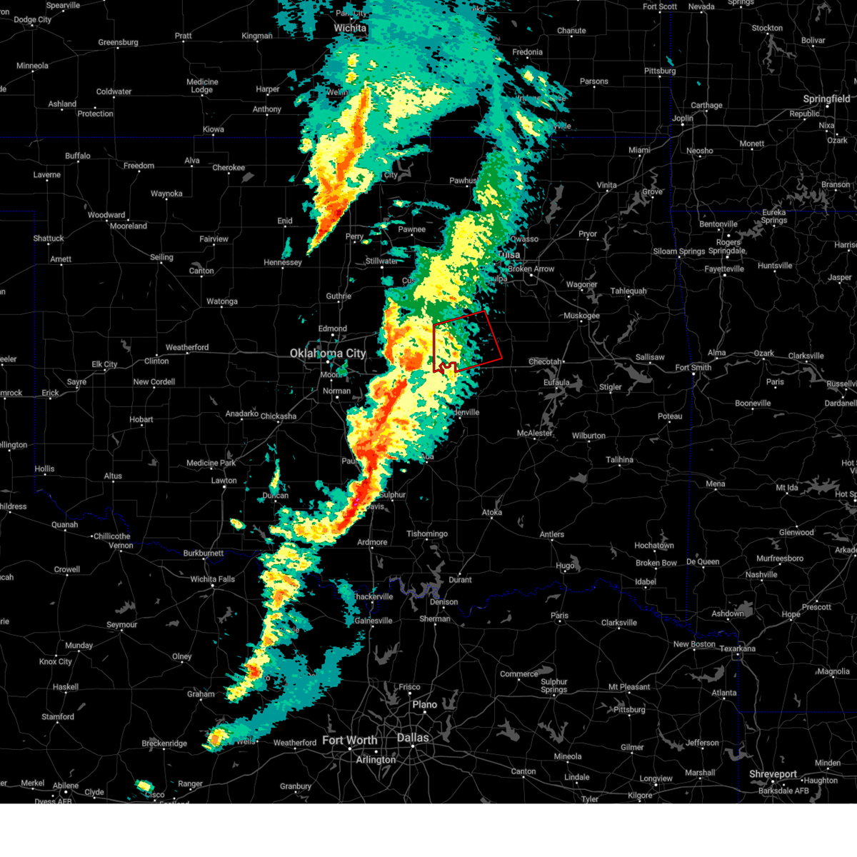 At 1004 pm cst, a severe thunderstorm capable of producing a tornado was located near prague, moving east at 65 mph (radar indicated rotation). Hazards include tornado. Flying debris will be dangerous to those caught without shelter. mobile homes will be damaged or destroyed. damage to roofs, windows, and vehicles will occur. tree damage is likely. Locations in or near the path include, okemah, okfuskee, boley, paden, slick, castle, welty, mason,. At 1004 pm cst, a severe thunderstorm capable of producing a tornado was located near prague, moving east at 65 mph (radar indicated rotation). Hazards include tornado. Flying debris will be dangerous to those caught without shelter. mobile homes will be damaged or destroyed. damage to roofs, windows, and vehicles will occur. tree damage is likely. Locations in or near the path include, okemah, okfuskee, boley, paden, slick, castle, welty, mason,.
|
| 2/26/2023 9:37 PM CST |
 At 935 pm cst, a severe thunderstorm was located near pink, moving northeast at 70 mph (radar indicated). Hazards include 70 mph wind gusts and nickel size hail. Expect considerable tree damage. damage is likely to mobile homes, roofs, and outbuildings. locations in or near the path include, mcalester, okmulgee, bristow, okemah, okfuskee, henryetta, beggs, boley, mounds, weleetka, dewar, schulter, depew, paden, indianola, grayson, hanna, bearden, slick, castle, this includes the following highways, interstate 40 in oklahoma between mile markers 212 and 245. interstate 44 between mile markers 178 and 199. thunderstorm damage threat, considerable hail threat, radar indicated max hail size, 0. 88 in wind threat, radar indicated max wind gust, 70 mph. At 935 pm cst, a severe thunderstorm was located near pink, moving northeast at 70 mph (radar indicated). Hazards include 70 mph wind gusts and nickel size hail. Expect considerable tree damage. damage is likely to mobile homes, roofs, and outbuildings. locations in or near the path include, mcalester, okmulgee, bristow, okemah, okfuskee, henryetta, beggs, boley, mounds, weleetka, dewar, schulter, depew, paden, indianola, grayson, hanna, bearden, slick, castle, this includes the following highways, interstate 40 in oklahoma between mile markers 212 and 245. interstate 44 between mile markers 178 and 199. thunderstorm damage threat, considerable hail threat, radar indicated max hail size, 0. 88 in wind threat, radar indicated max wind gust, 70 mph.
|
| 6/10/2022 5:36 AM CDT |
 At 535 am cdt, severe thunderstorms were located along a line extending from 4 miles southeast of mounds to 3 miles west of okmulgee state park to 2 miles southwest of castle, moving southeast at 60 mph (radar indicated). Hazards include 60 mph wind gusts and penny size hail. Expect damage to roofs, siding, and trees. locations in or near the path include, okmulgee, okemah, okfuskee, henryetta, checotah, morris, beggs, boley, weleetka, dewar, schulter, grayson, bearden, hoffman, castle, clearview, stidham, preston, lake eufaula state park, pharoah, this includes interstate 40 in oklahoma between mile markers 212 and 264. hail threat, radar indicated max hail size, 0. 75 in wind threat, radar indicated max wind gust, 60 mph. At 535 am cdt, severe thunderstorms were located along a line extending from 4 miles southeast of mounds to 3 miles west of okmulgee state park to 2 miles southwest of castle, moving southeast at 60 mph (radar indicated). Hazards include 60 mph wind gusts and penny size hail. Expect damage to roofs, siding, and trees. locations in or near the path include, okmulgee, okemah, okfuskee, henryetta, checotah, morris, beggs, boley, weleetka, dewar, schulter, grayson, bearden, hoffman, castle, clearview, stidham, preston, lake eufaula state park, pharoah, this includes interstate 40 in oklahoma between mile markers 212 and 264. hail threat, radar indicated max hail size, 0. 75 in wind threat, radar indicated max wind gust, 60 mph.
|
| 6/10/2022 5:23 AM CDT |
 At 523 am cdt, severe thunderstorms were located along a line extending from 2 miles southwest of mounds to 6 miles southwest of slick to 7 miles southeast of davenport, moving southeast at 50 mph (radar indicated). Hazards include 60 mph wind gusts and penny size hail. Expect damage to roofs, siding, and trees. locations in or near the path include, okmulgee, okemah, okfuskee, henryetta, checotah, morris, beggs, boley, mounds, weleetka, dewar, schulter, paden, grayson, bearden, slick, hoffman, castle, clearview, stidham, this includes interstate 40 in oklahoma between mile markers 212 and 264. hail threat, radar indicated max hail size, 0. 75 in wind threat, radar indicated max wind gust, 60 mph. At 523 am cdt, severe thunderstorms were located along a line extending from 2 miles southwest of mounds to 6 miles southwest of slick to 7 miles southeast of davenport, moving southeast at 50 mph (radar indicated). Hazards include 60 mph wind gusts and penny size hail. Expect damage to roofs, siding, and trees. locations in or near the path include, okmulgee, okemah, okfuskee, henryetta, checotah, morris, beggs, boley, mounds, weleetka, dewar, schulter, paden, grayson, bearden, slick, hoffman, castle, clearview, stidham, this includes interstate 40 in oklahoma between mile markers 212 and 264. hail threat, radar indicated max hail size, 0. 75 in wind threat, radar indicated max wind gust, 60 mph.
|
| 5/15/2022 5:40 PM CDT |
 At 540 pm cdt, a severe thunderstorm was located 5 miles north of wetumka, moving southeast at 25 mph (radar indicated). Hazards include tennis ball size hail and 70 mph wind gusts. People and animals outdoors will be injured. expect hail damage to roofs, siding, windows, and vehicles. expect considerable tree damage. wind damage is also likely to mobile homes, roofs, and outbuildings. locations in or near the path include, okemah, weleetka, hanna, bearden, clearview, pharoah, bryant, vernon, this includes interstate 40 in oklahoma between mile markers 215 and 235. thunderstorm damage threat, considerable hail threat, radar indicated max hail size, 2. 50 in wind threat, radar indicated max wind gust, 70 mph. At 540 pm cdt, a severe thunderstorm was located 5 miles north of wetumka, moving southeast at 25 mph (radar indicated). Hazards include tennis ball size hail and 70 mph wind gusts. People and animals outdoors will be injured. expect hail damage to roofs, siding, windows, and vehicles. expect considerable tree damage. wind damage is also likely to mobile homes, roofs, and outbuildings. locations in or near the path include, okemah, weleetka, hanna, bearden, clearview, pharoah, bryant, vernon, this includes interstate 40 in oklahoma between mile markers 215 and 235. thunderstorm damage threat, considerable hail threat, radar indicated max hail size, 2. 50 in wind threat, radar indicated max wind gust, 70 mph.
|
| 5/15/2022 5:35 PM CDT | Tennis Ball sized hail reported 1.3 miles N of Okemah, OK, report from mping: tennis ball (2.50 in.). |
| 5/15/2022 5:33 PM CDT | Tea Cup sized hail reported 4.5 miles WNW of Okemah, OK, corrects previous hail report from 3 w clearview. report via twitter measured 2.97 inches with calipers. |
| 5/15/2022 5:33 PM CDT | Baseball sized hail reported 4.5 miles WNW of Okemah, OK, report via twitter. |
| 5/15/2022 5:30 PM CDT | Softball sized hail reported 1.3 miles N of Okemah, OK |
| 5/15/2022 5:28 PM CDT |
 At 528 pm cdt, a severe thunderstorm was located 4 miles south of okemah, moving southeast at 25 mph (broadcast media). Hazards include tennis ball size hail and 70 mph wind gusts. People and animals outdoors will be injured. expect hail damage to roofs, siding, windows, and vehicles. expect considerable tree damage. wind damage is also likely to mobile homes, roofs, and outbuildings. locations in or near the path include, okemah, weleetka, hanna, bearden, castle, clearview, pharoah, bryant, vernon, this includes interstate 40 in oklahoma between mile markers 213 and 235. thunderstorm damage threat, considerable hail threat, observed max hail size, 2. 50 in wind threat, radar indicated max wind gust, 70 mph. At 528 pm cdt, a severe thunderstorm was located 4 miles south of okemah, moving southeast at 25 mph (broadcast media). Hazards include tennis ball size hail and 70 mph wind gusts. People and animals outdoors will be injured. expect hail damage to roofs, siding, windows, and vehicles. expect considerable tree damage. wind damage is also likely to mobile homes, roofs, and outbuildings. locations in or near the path include, okemah, weleetka, hanna, bearden, castle, clearview, pharoah, bryant, vernon, this includes interstate 40 in oklahoma between mile markers 213 and 235. thunderstorm damage threat, considerable hail threat, observed max hail size, 2. 50 in wind threat, radar indicated max wind gust, 70 mph.
|
| 5/15/2022 5:27 PM CDT | Tennis Ball sized hail reported 1.4 miles SW of Okemah, OK |
| 5/15/2022 5:22 PM CDT |
 At 521 pm cdt, a severe thunderstorm was located over okemah, moving southeast at 25 mph (radar indicated). Hazards include two inch hail and 70 mph wind gusts. People and animals outdoors will be injured. expect hail damage to roofs, siding, windows, and vehicles. expect considerable tree damage. wind damage is also likely to mobile homes, roofs, and outbuildings. locations in or near the path include, okemah, boley, weleetka, hanna, bearden, castle, clearview, pharoah, bryant, vernon, this includes interstate 40 in oklahoma between mile markers 213 and 235. thunderstorm damage threat, considerable hail threat, radar indicated max hail size, 2. 00 in wind threat, radar indicated max wind gust, 70 mph. At 521 pm cdt, a severe thunderstorm was located over okemah, moving southeast at 25 mph (radar indicated). Hazards include two inch hail and 70 mph wind gusts. People and animals outdoors will be injured. expect hail damage to roofs, siding, windows, and vehicles. expect considerable tree damage. wind damage is also likely to mobile homes, roofs, and outbuildings. locations in or near the path include, okemah, boley, weleetka, hanna, bearden, castle, clearview, pharoah, bryant, vernon, this includes interstate 40 in oklahoma between mile markers 213 and 235. thunderstorm damage threat, considerable hail threat, radar indicated max hail size, 2. 00 in wind threat, radar indicated max wind gust, 70 mph.
|
| 5/15/2022 5:13 PM CDT |
 At 512 pm cdt, a severe thunderstorm was located near okemah, moving southeast at 20 mph (radar indicated). Hazards include ping pong ball size hail and 60 mph wind gusts. People and animals outdoors will be injured. expect hail damage to roofs, siding, windows, and vehicles. expect wind damage to roofs, siding, and trees. locations in or near the path include, okemah, okfuskee, henryetta, weleetka, dewar, clearview, pharoah, bryant, mason, this includes interstate 40 in oklahoma between mile markers 220 and 237. hail threat, radar indicated max hail size, 1. 50 in wind threat, radar indicated max wind gust, 60 mph. At 512 pm cdt, a severe thunderstorm was located near okemah, moving southeast at 20 mph (radar indicated). Hazards include ping pong ball size hail and 60 mph wind gusts. People and animals outdoors will be injured. expect hail damage to roofs, siding, windows, and vehicles. expect wind damage to roofs, siding, and trees. locations in or near the path include, okemah, okfuskee, henryetta, weleetka, dewar, clearview, pharoah, bryant, mason, this includes interstate 40 in oklahoma between mile markers 220 and 237. hail threat, radar indicated max hail size, 1. 50 in wind threat, radar indicated max wind gust, 60 mph.
|
| 5/15/2022 4:47 PM CDT |
 At 446 pm cdt, a severe thunderstorm was located 3 miles west of okfuskee, moving southeast at 15 mph (radar indicated). Hazards include 60 mph wind gusts and quarter size hail. Hail damage to vehicles is expected. expect wind damage to roofs, siding, and trees. locations in or near the path include, okemah, okfuskee, henryetta, weleetka, dewar, clearview, welty, pharoah, bryant, mason, this includes interstate 40 in oklahoma between mile markers 220 and 237. hail threat, radar indicated max hail size, 1. 00 in wind threat, radar indicated max wind gust, 60 mph. At 446 pm cdt, a severe thunderstorm was located 3 miles west of okfuskee, moving southeast at 15 mph (radar indicated). Hazards include 60 mph wind gusts and quarter size hail. Hail damage to vehicles is expected. expect wind damage to roofs, siding, and trees. locations in or near the path include, okemah, okfuskee, henryetta, weleetka, dewar, clearview, welty, pharoah, bryant, mason, this includes interstate 40 in oklahoma between mile markers 220 and 237. hail threat, radar indicated max hail size, 1. 00 in wind threat, radar indicated max wind gust, 60 mph.
|
| 5/15/2022 4:24 PM CDT |
 At 423 pm cdt, a severe thunderstorm was located 3 miles east of welty, moving southeast at 30 mph (radar indicated). Hazards include 60 mph wind gusts and quarter size hail. Hail damage to vehicles is expected. expect wind damage to roofs, siding, and trees. locations in or near the path include, okemah, okfuskee, henryetta, weleetka, dewar, clearview, welty, pharoah, bryant, mason, this includes interstate 40 in oklahoma between mile markers 220 and 237. hail threat, radar indicated max hail size, 1. 00 in wind threat, radar indicated max wind gust, 60 mph. At 423 pm cdt, a severe thunderstorm was located 3 miles east of welty, moving southeast at 30 mph (radar indicated). Hazards include 60 mph wind gusts and quarter size hail. Hail damage to vehicles is expected. expect wind damage to roofs, siding, and trees. locations in or near the path include, okemah, okfuskee, henryetta, weleetka, dewar, clearview, welty, pharoah, bryant, mason, this includes interstate 40 in oklahoma between mile markers 220 and 237. hail threat, radar indicated max hail size, 1. 00 in wind threat, radar indicated max wind gust, 60 mph.
|
| 5/5/2022 12:31 AM CDT |
 At 1231 am cdt, severe thunderstorms were located along a line extending from okfuskee to 3 miles southwest of haskell, moving northeast at 35 mph (radar indicated). Hazards include 60 mph wind gusts and nickel size hail. Expect damage to roofs, siding, and trees. locations in or near the path include, okmulgee, bristow, okemah, okfuskee, haskell, morris, beggs, boley, mounds, kellyville, paden, taft, bearden, slick, castle, clearview, preston, bald hill, okmulgee state park, welty, this includes the following highways, interstate 40 in oklahoma between mile markers 212 and 229. interstate 44 between mile markers 193 and 205. hail threat, radar indicated max hail size, 0. 88 in wind threat, radar indicated max wind gust, 60 mph. At 1231 am cdt, severe thunderstorms were located along a line extending from okfuskee to 3 miles southwest of haskell, moving northeast at 35 mph (radar indicated). Hazards include 60 mph wind gusts and nickel size hail. Expect damage to roofs, siding, and trees. locations in or near the path include, okmulgee, bristow, okemah, okfuskee, haskell, morris, beggs, boley, mounds, kellyville, paden, taft, bearden, slick, castle, clearview, preston, bald hill, okmulgee state park, welty, this includes the following highways, interstate 40 in oklahoma between mile markers 212 and 229. interstate 44 between mile markers 193 and 205. hail threat, radar indicated max hail size, 0. 88 in wind threat, radar indicated max wind gust, 60 mph.
|
| 5/4/2022 11:57 PM CDT |
 At 1157 pm cdt, severe thunderstorms were located along a line extending from 5 miles southeast of welty to bald hill, moving northeast at 35 mph (radar indicated). Hazards include 60 mph wind gusts and quarter size hail. Hail damage to vehicles is expected. expect wind damage to roofs, siding, and trees. locations in or near the path include, okmulgee, bristow, okemah, okfuskee, haskell, morris, beggs, boley, mounds, kellyville, paden, taft, bearden, slick, castle, clearview, preston, bald hill, okmulgee state park, welty, this includes the following highways, interstate 40 in oklahoma between mile markers 212 and 229. interstate 44 between mile markers 193 and 205. hail threat, radar indicated max hail size, 1. 00 in wind threat, radar indicated max wind gust, 60 mph. At 1157 pm cdt, severe thunderstorms were located along a line extending from 5 miles southeast of welty to bald hill, moving northeast at 35 mph (radar indicated). Hazards include 60 mph wind gusts and quarter size hail. Hail damage to vehicles is expected. expect wind damage to roofs, siding, and trees. locations in or near the path include, okmulgee, bristow, okemah, okfuskee, haskell, morris, beggs, boley, mounds, kellyville, paden, taft, bearden, slick, castle, clearview, preston, bald hill, okmulgee state park, welty, this includes the following highways, interstate 40 in oklahoma between mile markers 212 and 229. interstate 44 between mile markers 193 and 205. hail threat, radar indicated max hail size, 1. 00 in wind threat, radar indicated max wind gust, 60 mph.
|
| 5/4/2022 11:48 PM CDT |
 At 1147 pm cdt, severe thunderstorms were located along a line extending from 4 miles west of slick to 4 miles northwest of okmulgee state park to 2 miles west of bald hill, moving northeast at 35 mph (radar indicated). Hazards include 60 mph wind gusts and quarter size hail. Hail damage to vehicles is expected. expect wind damage to roofs, siding, and trees. locations in or near the path include, okmulgee, bristow, okemah, okfuskee, haskell, beggs, boley, mounds, kellyville, depew, paden, slick, castle, preston, bald hill, okmulgee state park, welty, liberty, milfay, mason, this includes the following highways, interstate 40 in oklahoma between mile markers 212 and 223. interstate 44 between mile markers 183 and 207. hail threat, radar indicated max hail size, 1. 00 in wind threat, radar indicated max wind gust, 60 mph. At 1147 pm cdt, severe thunderstorms were located along a line extending from 4 miles west of slick to 4 miles northwest of okmulgee state park to 2 miles west of bald hill, moving northeast at 35 mph (radar indicated). Hazards include 60 mph wind gusts and quarter size hail. Hail damage to vehicles is expected. expect wind damage to roofs, siding, and trees. locations in or near the path include, okmulgee, bristow, okemah, okfuskee, haskell, beggs, boley, mounds, kellyville, depew, paden, slick, castle, preston, bald hill, okmulgee state park, welty, liberty, milfay, mason, this includes the following highways, interstate 40 in oklahoma between mile markers 212 and 223. interstate 44 between mile markers 183 and 207. hail threat, radar indicated max hail size, 1. 00 in wind threat, radar indicated max wind gust, 60 mph.
|
| 5/4/2022 11:14 PM CDT |
 At 1114 pm cdt, severe thunderstorms were located along a line extending from 6 miles north of welty to 4 miles northeast of castle to near okmulgee state park, moving northeast at 30 mph (radar indicated). Hazards include 60 mph wind gusts and quarter size hail. Hail damage to vehicles is expected. expect wind damage to roofs, siding, and trees. locations in or near the path include, okmulgee, bristow, okemah, okfuskee, haskell, beggs, boley, mounds, kellyville, depew, paden, slick, castle, preston, bald hill, okmulgee state park, welty, liberty, milfay, mason, this includes the following highways, interstate 40 in oklahoma between mile markers 212 and 223. interstate 44 between mile markers 183 and 207. hail threat, radar indicated max hail size, 1. 00 in wind threat, radar indicated max wind gust, 60 mph. At 1114 pm cdt, severe thunderstorms were located along a line extending from 6 miles north of welty to 4 miles northeast of castle to near okmulgee state park, moving northeast at 30 mph (radar indicated). Hazards include 60 mph wind gusts and quarter size hail. Hail damage to vehicles is expected. expect wind damage to roofs, siding, and trees. locations in or near the path include, okmulgee, bristow, okemah, okfuskee, haskell, beggs, boley, mounds, kellyville, depew, paden, slick, castle, preston, bald hill, okmulgee state park, welty, liberty, milfay, mason, this includes the following highways, interstate 40 in oklahoma between mile markers 212 and 223. interstate 44 between mile markers 183 and 207. hail threat, radar indicated max hail size, 1. 00 in wind threat, radar indicated max wind gust, 60 mph.
|
| 5/4/2022 10:27 PM CDT |
 The tornado warning for southwestern okmulgee and southeastern okfuskee counties will expire at 1030 pm cdt, the storm which prompted the warning has weakened below severe limits, and has exited the warned area. therefore, the warning will be allowed to expire. however gusty winds up to 50 mph and heavy rain are still possible with this thunderstorm. a tornado watch remains in effect until 400 am cdt for southeastern, northeastern and east central oklahoma. The tornado warning for southwestern okmulgee and southeastern okfuskee counties will expire at 1030 pm cdt, the storm which prompted the warning has weakened below severe limits, and has exited the warned area. therefore, the warning will be allowed to expire. however gusty winds up to 50 mph and heavy rain are still possible with this thunderstorm. a tornado watch remains in effect until 400 am cdt for southeastern, northeastern and east central oklahoma.
|
| 5/4/2022 9:50 PM CDT | Measured thunderstorm wind gust of 63 mph at the okemah mesone in okfuskee county OK, 2.9 miles W of Okemah, OK |
| 5/4/2022 9:38 PM CDT |
 At 938 pm cdt, a severe thunderstorm capable of producing a tornado was located 4 miles west of weleetka, moving northeast at 20 mph (radar indicated rotation). Hazards include tornado and half dollar size hail. Flying debris will be dangerous to those caught without shelter. mobile homes will be damaged or destroyed. damage to roofs, windows, and vehicles will occur. tree damage is likely. Locations in or near the path include, okemah, henryetta, weleetka, bearden, castle, clearview, pharoah, bryant, this includes interstate 40 in oklahoma between mile markers 212 and 238. At 938 pm cdt, a severe thunderstorm capable of producing a tornado was located 4 miles west of weleetka, moving northeast at 20 mph (radar indicated rotation). Hazards include tornado and half dollar size hail. Flying debris will be dangerous to those caught without shelter. mobile homes will be damaged or destroyed. damage to roofs, windows, and vehicles will occur. tree damage is likely. Locations in or near the path include, okemah, henryetta, weleetka, bearden, castle, clearview, pharoah, bryant, this includes interstate 40 in oklahoma between mile markers 212 and 238.
|
| 5/4/2022 9:18 PM CDT |
 At 918 pm cdt, a severe thunderstorm capable of producing a tornado was located over bearden, moving east at 25 mph (radar indicated rotation). Hazards include tornado and ping pong ball size hail. Flying debris will be dangerous to those caught without shelter. mobile homes will be damaged or destroyed. damage to roofs, windows, and vehicles will occur. tree damage is likely. Locations in or near the path include, okemah, bearden, this includes interstate 40 in oklahoma between mile markers 212 and 223. At 918 pm cdt, a severe thunderstorm capable of producing a tornado was located over bearden, moving east at 25 mph (radar indicated rotation). Hazards include tornado and ping pong ball size hail. Flying debris will be dangerous to those caught without shelter. mobile homes will be damaged or destroyed. damage to roofs, windows, and vehicles will occur. tree damage is likely. Locations in or near the path include, okemah, bearden, this includes interstate 40 in oklahoma between mile markers 212 and 223.
|
| 5/4/2022 8:53 PM CDT |
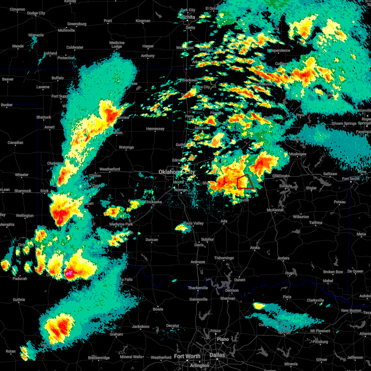 At 853 pm cdt, a severe thunderstorm with strong low level rotation that could produce a tornado at any time was located 5 miles east of little, moving east at 25 mph (radar indicated rotation). Hazards include tornado and golf ball size hail. Flying debris will be dangerous to those caught without shelter. mobile homes will be damaged or destroyed. damage to roofs, windows, and vehicles will occur. tree damage is likely. Locations in or near the path include, okemah, bearden, this includes interstate 40 in oklahoma between mile markers 212 and 223. At 853 pm cdt, a severe thunderstorm with strong low level rotation that could produce a tornado at any time was located 5 miles east of little, moving east at 25 mph (radar indicated rotation). Hazards include tornado and golf ball size hail. Flying debris will be dangerous to those caught without shelter. mobile homes will be damaged or destroyed. damage to roofs, windows, and vehicles will occur. tree damage is likely. Locations in or near the path include, okemah, bearden, this includes interstate 40 in oklahoma between mile markers 212 and 223.
|
| 5/4/2022 8:33 PM CDT |
 At 832 pm cdt, a severe thunderstorm was located near seminole, moving northeast at 30 mph (radar indicated). Hazards include ping pong ball size hail and 60 mph wind gusts. People and animals outdoors will be injured. expect hail damage to roofs, siding, windows, and vehicles. expect wind damage to roofs, siding, and trees. locations in or near the path include, okemah, boley, paden, bearden, castle, welty, mason, this includes interstate 40 in oklahoma between mile markers 212 and 220. hail threat, radar indicated max hail size, 1. 50 in wind threat, radar indicated max wind gust, 60 mph. At 832 pm cdt, a severe thunderstorm was located near seminole, moving northeast at 30 mph (radar indicated). Hazards include ping pong ball size hail and 60 mph wind gusts. People and animals outdoors will be injured. expect hail damage to roofs, siding, windows, and vehicles. expect wind damage to roofs, siding, and trees. locations in or near the path include, okemah, boley, paden, bearden, castle, welty, mason, this includes interstate 40 in oklahoma between mile markers 212 and 220. hail threat, radar indicated max hail size, 1. 50 in wind threat, radar indicated max wind gust, 60 mph.
|
| 5/4/2022 8:23 PM CDT |
 At 823 pm cdt, a severe thunderstorm with strong low level rotation that could produce a tornado at any time was located 6 miles northwest of pharoah, moving northeast at 20 mph (radar indicated rotation). Hazards include tornado and ping pong ball size hail. Flying debris will be dangerous to those caught without shelter. mobile homes will be damaged or destroyed. damage to roofs, windows, and vehicles will occur. tree damage is likely. Locations in or near the path include, okmulgee, okfuskee, henryetta, dewar, schulter, grayson, hoffman, clearview, okmulgee state park, pharoah, this includes interstate 40 in oklahoma between mile markers 221 and 234. At 823 pm cdt, a severe thunderstorm with strong low level rotation that could produce a tornado at any time was located 6 miles northwest of pharoah, moving northeast at 20 mph (radar indicated rotation). Hazards include tornado and ping pong ball size hail. Flying debris will be dangerous to those caught without shelter. mobile homes will be damaged or destroyed. damage to roofs, windows, and vehicles will occur. tree damage is likely. Locations in or near the path include, okmulgee, okfuskee, henryetta, dewar, schulter, grayson, hoffman, clearview, okmulgee state park, pharoah, this includes interstate 40 in oklahoma between mile markers 221 and 234.
|
| 5/4/2022 8:09 PM CDT |
 At 809 pm cdt, a severe thunderstorm with strong low level rotation that could produce a tornado at any time was located 4 miles northeast of okemah, moving northeast at 20 mph (radar indicated rotation). Hazards include tornado and ping pong ball size hail. Flying debris will be dangerous to those caught without shelter. mobile homes will be damaged or destroyed. damage to roofs, windows, and vehicles will occur. tree damage is likely. Locations in or near the path include, okmulgee, okemah, okfuskee, henryetta, dewar, schulter, grayson, bearden, hoffman, castle, clearview, okmulgee state park, pharoah, this includes interstate 40 in oklahoma between mile markers 214 and 235. At 809 pm cdt, a severe thunderstorm with strong low level rotation that could produce a tornado at any time was located 4 miles northeast of okemah, moving northeast at 20 mph (radar indicated rotation). Hazards include tornado and ping pong ball size hail. Flying debris will be dangerous to those caught without shelter. mobile homes will be damaged or destroyed. damage to roofs, windows, and vehicles will occur. tree damage is likely. Locations in or near the path include, okmulgee, okemah, okfuskee, henryetta, dewar, schulter, grayson, bearden, hoffman, castle, clearview, okmulgee state park, pharoah, this includes interstate 40 in oklahoma between mile markers 214 and 235.
|
| 5/4/2022 7:56 PM CDT |
 At 756 pm cdt, a severe thunderstorm with strong low level rotation that could produce a tornado at any time was located over okemah, moving northeast at 25 mph (radar indicated rotation). Hazards include tornado and ping pong ball size hail. Flying debris will be dangerous to those caught without shelter. mobile homes will be damaged or destroyed. damage to roofs, windows, and vehicles will occur. tree damage is likely. Locations in or near the path include, okmulgee, okemah, okfuskee, henryetta, dewar, schulter, grayson, bearden, hoffman, castle, clearview, okmulgee state park, pharoah, this includes interstate 40 in oklahoma between mile markers 214 and 235. At 756 pm cdt, a severe thunderstorm with strong low level rotation that could produce a tornado at any time was located over okemah, moving northeast at 25 mph (radar indicated rotation). Hazards include tornado and ping pong ball size hail. Flying debris will be dangerous to those caught without shelter. mobile homes will be damaged or destroyed. damage to roofs, windows, and vehicles will occur. tree damage is likely. Locations in or near the path include, okmulgee, okemah, okfuskee, henryetta, dewar, schulter, grayson, bearden, hoffman, castle, clearview, okmulgee state park, pharoah, this includes interstate 40 in oklahoma between mile markers 214 and 235.
|
| 5/4/2022 7:45 PM CDT |
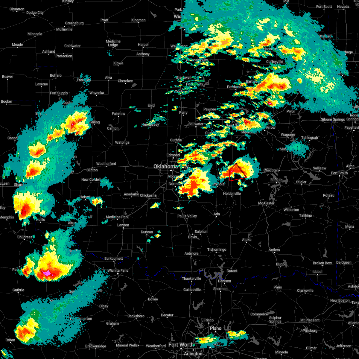 At 745 pm cdt, a confirmed tornado was located near okemah, moving northeast at 30 mph (radar confirmed tornado). Hazards include damaging tornado and ping pong ball size hail. Flying debris will be dangerous to those caught without shelter. mobile homes will be damaged or destroyed. damage to roofs, windows, and vehicles will occur. tree damage is likely. Locations in or near the path include, okemah, bearden, castle, clearview, this includes interstate 40 in oklahoma between mile markers 212 and 225. At 745 pm cdt, a confirmed tornado was located near okemah, moving northeast at 30 mph (radar confirmed tornado). Hazards include damaging tornado and ping pong ball size hail. Flying debris will be dangerous to those caught without shelter. mobile homes will be damaged or destroyed. damage to roofs, windows, and vehicles will occur. tree damage is likely. Locations in or near the path include, okemah, bearden, castle, clearview, this includes interstate 40 in oklahoma between mile markers 212 and 225.
|
| 5/4/2022 7:29 PM CDT |
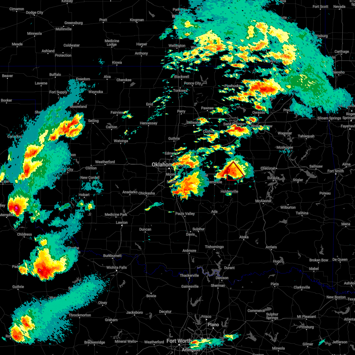 At 729 pm cdt, a confirmed tornado was located over cromwell, moving northeast at 25 mph (weather spotters confirmed tornado). Hazards include damaging tornado and golf ball size hail. Flying debris will be dangerous to those caught without shelter. mobile homes will be damaged or destroyed. damage to roofs, windows, and vehicles will occur. tree damage is likely. Locations in or near the path include, okemah, weleetka, bearden, castle, clearview, this includes interstate 40 in oklahoma between mile markers 212 and 225. At 729 pm cdt, a confirmed tornado was located over cromwell, moving northeast at 25 mph (weather spotters confirmed tornado). Hazards include damaging tornado and golf ball size hail. Flying debris will be dangerous to those caught without shelter. mobile homes will be damaged or destroyed. damage to roofs, windows, and vehicles will occur. tree damage is likely. Locations in or near the path include, okemah, weleetka, bearden, castle, clearview, this includes interstate 40 in oklahoma between mile markers 212 and 225.
|
| 5/4/2022 7:18 PM CDT |
 At 717 pm cdt, a severe thunderstorm with strong low level rotation that could produce a tornado at any time was located 5 miles southwest of cromwell, moving northeast at 20 mph (radar indicated rotation). Hazards include tornado and hail up to two inches in diameter. Flying debris will be dangerous to those caught without shelter. mobile homes will be damaged or destroyed. damage to roofs, windows, and vehicles will occur. tree damage is likely. Locations in or near the path include, okemah, weleetka, bearden, castle, clearview, this includes interstate 40 in oklahoma between mile markers 212 and 225. At 717 pm cdt, a severe thunderstorm with strong low level rotation that could produce a tornado at any time was located 5 miles southwest of cromwell, moving northeast at 20 mph (radar indicated rotation). Hazards include tornado and hail up to two inches in diameter. Flying debris will be dangerous to those caught without shelter. mobile homes will be damaged or destroyed. damage to roofs, windows, and vehicles will occur. tree damage is likely. Locations in or near the path include, okemah, weleetka, bearden, castle, clearview, this includes interstate 40 in oklahoma between mile markers 212 and 225.
|
| 5/4/2022 7:12 PM CDT |
 At 711 pm cdt, a severe thunderstorm was located near cromwell, moving northeast at 20 mph (radar indicated). Hazards include golf ball size hail and 70 mph wind gusts. People and animals outdoors will be injured. expect hail damage to roofs, siding, windows, and vehicles. expect considerable tree damage. wind damage is also likely to mobile homes, roofs, and outbuildings. Locations in or near the path include, okemah, okfuskee, boley, bearden, castle, clearview, mason, this includes interstate 40 in oklahoma between mile markers 212 and 226. At 711 pm cdt, a severe thunderstorm was located near cromwell, moving northeast at 20 mph (radar indicated). Hazards include golf ball size hail and 70 mph wind gusts. People and animals outdoors will be injured. expect hail damage to roofs, siding, windows, and vehicles. expect considerable tree damage. wind damage is also likely to mobile homes, roofs, and outbuildings. Locations in or near the path include, okemah, okfuskee, boley, bearden, castle, clearview, mason, this includes interstate 40 in oklahoma between mile markers 212 and 226.
|
| 5/4/2022 6:45 PM CDT |
 At 644 pm cdt, a severe thunderstorm was located 3 miles southeast of little, moving northeast at 35 mph. this storm has a history of producing tornadoes (radar indicated). Hazards include two inch hail and 70 mph wind gusts. People and animals outdoors will be injured. expect hail damage to roofs, siding, windows, and vehicles. expect considerable tree damage. wind damage is also likely to mobile homes, roofs, and outbuildings. Locations in or near the path include, okemah, okfuskee, boley, bearden, castle, clearview, mason, this includes interstate 40 in oklahoma between mile markers 212 and 226. At 644 pm cdt, a severe thunderstorm was located 3 miles southeast of little, moving northeast at 35 mph. this storm has a history of producing tornadoes (radar indicated). Hazards include two inch hail and 70 mph wind gusts. People and animals outdoors will be injured. expect hail damage to roofs, siding, windows, and vehicles. expect considerable tree damage. wind damage is also likely to mobile homes, roofs, and outbuildings. Locations in or near the path include, okemah, okfuskee, boley, bearden, castle, clearview, mason, this includes interstate 40 in oklahoma between mile markers 212 and 226.
|
| 5/4/2022 9:25 AM CDT |
 At 925 am cdt, a severe thunderstorm was located 5 miles northeast of castle, moving northeast at 45 mph (radar indicated). Hazards include quarter size hail. Damage to vehicles is expected. locations in or near the path include, okmulgee, okemah, okfuskee, beggs, castle, preston, okmulgee state park, mason, this includes interstate 40 in oklahoma between mile markers 219 and 222. hail threat, radar indicated max hail size, 1. 00 in wind threat, radar indicated max wind gust, <50 mph. At 925 am cdt, a severe thunderstorm was located 5 miles northeast of castle, moving northeast at 45 mph (radar indicated). Hazards include quarter size hail. Damage to vehicles is expected. locations in or near the path include, okmulgee, okemah, okfuskee, beggs, castle, preston, okmulgee state park, mason, this includes interstate 40 in oklahoma between mile markers 219 and 222. hail threat, radar indicated max hail size, 1. 00 in wind threat, radar indicated max wind gust, <50 mph.
|
| 5/2/2022 8:11 PM CDT |
 At 811 pm cdt, severe thunderstorms were located along a line extending from 2 miles south of pryor creek to 4 miles south of haskell to near paden, moving east at 50 mph (radar indicated). Hazards include 60 mph wind gusts and quarter size hail. Hail damage to vehicles is expected. expect wind damage to roofs, siding, and trees. locations in or near the path include, tulsa, broken arrow, muskogee, tahlequah, okmulgee, wagoner, bristow, okemah, bixby, jenks, okfuskee, glenpool, coweta, catoosa, henryetta, fort gibson, checotah, haskell, kiefer, warner, this includes the following highways, interstate 40 in oklahoma between mile markers 212 and 271. interstate 44 between mile markers 178 and 201. hail threat, radar indicated max hail size, 1. 00 in wind threat, radar indicated max wind gust, 60 mph. At 811 pm cdt, severe thunderstorms were located along a line extending from 2 miles south of pryor creek to 4 miles south of haskell to near paden, moving east at 50 mph (radar indicated). Hazards include 60 mph wind gusts and quarter size hail. Hail damage to vehicles is expected. expect wind damage to roofs, siding, and trees. locations in or near the path include, tulsa, broken arrow, muskogee, tahlequah, okmulgee, wagoner, bristow, okemah, bixby, jenks, okfuskee, glenpool, coweta, catoosa, henryetta, fort gibson, checotah, haskell, kiefer, warner, this includes the following highways, interstate 40 in oklahoma between mile markers 212 and 271. interstate 44 between mile markers 178 and 201. hail threat, radar indicated max hail size, 1. 00 in wind threat, radar indicated max wind gust, 60 mph.
|
| 5/2/2022 7:58 PM CDT |
 At 757 pm cdt, severe thunderstorms were located along a line extending from 2 miles west of coweta to preston to 7 miles west of welty, moving east at 35 mph (radar indicated). Hazards include 60 mph wind gusts and quarter size hail. Hail damage to vehicles is expected. expect wind damage to roofs, siding, and trees. locations in or near the path include, tulsa, broken arrow, sand springs, okmulgee, bristow, okemah, owasso, bixby, sapulpa, jenks, okfuskee, glenpool, catoosa, henryetta, kiefer, morris, beggs, boley, mounds, kellyville, this includes the following highways, interstate 40 in oklahoma between mile markers 217 and 243. interstate 44 between mile markers 178 and 232. hail threat, radar indicated max hail size, 1. 00 in wind threat, radar indicated max wind gust, 60 mph. At 757 pm cdt, severe thunderstorms were located along a line extending from 2 miles west of coweta to preston to 7 miles west of welty, moving east at 35 mph (radar indicated). Hazards include 60 mph wind gusts and quarter size hail. Hail damage to vehicles is expected. expect wind damage to roofs, siding, and trees. locations in or near the path include, tulsa, broken arrow, sand springs, okmulgee, bristow, okemah, owasso, bixby, sapulpa, jenks, okfuskee, glenpool, catoosa, henryetta, kiefer, morris, beggs, boley, mounds, kellyville, this includes the following highways, interstate 40 in oklahoma between mile markers 217 and 243. interstate 44 between mile markers 178 and 232. hail threat, radar indicated max hail size, 1. 00 in wind threat, radar indicated max wind gust, 60 mph.
|
| 5/2/2022 7:32 PM CDT |
 At 731 pm cdt, severe thunderstorms were located along a line extending from 4 miles southwest of turley to 2 miles south of glenpool to near welty, moving east at 60 mph (radar indicated). Hazards include 70 mph wind gusts and quarter size hail. Hail damage to vehicles is expected. expect considerable tree damage. wind damage is also likely to mobile homes, roofs, and outbuildings. locations in or near the path include, tulsa, broken arrow, sand springs, okmulgee, bristow, okemah, owasso, bixby, sapulpa, jenks, okfuskee, glenpool, catoosa, henryetta, mannford, kiefer, morris, beggs, sperry, boley, this includes the following highways, interstate 40 in oklahoma between mile markers 217 and 243. Interstate 44 between mile markers 178 and 234. At 731 pm cdt, severe thunderstorms were located along a line extending from 4 miles southwest of turley to 2 miles south of glenpool to near welty, moving east at 60 mph (radar indicated). Hazards include 70 mph wind gusts and quarter size hail. Hail damage to vehicles is expected. expect considerable tree damage. wind damage is also likely to mobile homes, roofs, and outbuildings. locations in or near the path include, tulsa, broken arrow, sand springs, okmulgee, bristow, okemah, owasso, bixby, sapulpa, jenks, okfuskee, glenpool, catoosa, henryetta, mannford, kiefer, morris, beggs, sperry, boley, this includes the following highways, interstate 40 in oklahoma between mile markers 217 and 243. Interstate 44 between mile markers 178 and 234.
|
| 5/2/2022 7:19 PM CDT |
 At 718 pm cdt, severe thunderstorms were located along a line extending from 4 miles southeast of walnut creek state park to 2 miles southeast of kellyville to 7 miles north of paden, moving east at 50 mph (radar indicated). Hazards include 70 mph wind gusts and quarter size hail. Hail damage to vehicles is expected. expect considerable tree damage. wind damage is also likely to mobile homes, roofs, and outbuildings. locations in or near the path include, tulsa, broken arrow, sand springs, okmulgee, bristow, okemah, owasso, bixby, sapulpa, jenks, okfuskee, glenpool, catoosa, henryetta, mannford, drumright, kiefer, morris, beggs, sperry, this includes the following highways, interstate 40 in oklahoma between mile markers 217 and 243. Interstate 44 between mile markers 177 and 234. At 718 pm cdt, severe thunderstorms were located along a line extending from 4 miles southeast of walnut creek state park to 2 miles southeast of kellyville to 7 miles north of paden, moving east at 50 mph (radar indicated). Hazards include 70 mph wind gusts and quarter size hail. Hail damage to vehicles is expected. expect considerable tree damage. wind damage is also likely to mobile homes, roofs, and outbuildings. locations in or near the path include, tulsa, broken arrow, sand springs, okmulgee, bristow, okemah, owasso, bixby, sapulpa, jenks, okfuskee, glenpool, catoosa, henryetta, mannford, drumright, kiefer, morris, beggs, sperry, this includes the following highways, interstate 40 in oklahoma between mile markers 217 and 243. Interstate 44 between mile markers 177 and 234.
|
| 5/2/2022 6:56 PM CDT |
 At 656 pm cdt, severe thunderstorms were located along a line extending from 3 miles west of mannford to 6 miles east of sparks, moving east at 60 mph (radar indicated). Hazards include 70 mph wind gusts and quarter size hail. Hail damage to vehicles is expected. expect considerable tree damage. wind damage is also likely to mobile homes, roofs, and outbuildings. locations in or near the path include, tulsa, broken arrow, sand springs, okmulgee, bristow, okemah, owasso, bixby, sapulpa, jenks, okfuskee, glenpool, catoosa, henryetta, mannford, drumright, kiefer, morris, beggs, sperry, this includes the following highways, interstate 40 in oklahoma between mile markers 217 and 243. interstate 44 between mile markers 177 and 234. thunderstorm damage threat, considerable hail threat, radar indicated max hail size, 1. 00 in wind threat, radar indicated max wind gust, 70 mph. At 656 pm cdt, severe thunderstorms were located along a line extending from 3 miles west of mannford to 6 miles east of sparks, moving east at 60 mph (radar indicated). Hazards include 70 mph wind gusts and quarter size hail. Hail damage to vehicles is expected. expect considerable tree damage. wind damage is also likely to mobile homes, roofs, and outbuildings. locations in or near the path include, tulsa, broken arrow, sand springs, okmulgee, bristow, okemah, owasso, bixby, sapulpa, jenks, okfuskee, glenpool, catoosa, henryetta, mannford, drumright, kiefer, morris, beggs, sperry, this includes the following highways, interstate 40 in oklahoma between mile markers 217 and 243. interstate 44 between mile markers 177 and 234. thunderstorm damage threat, considerable hail threat, radar indicated max hail size, 1. 00 in wind threat, radar indicated max wind gust, 70 mph.
|
| 4/30/2022 2:07 AM CDT |
 At 207 am cdt, severe thunderstorms were located along a line extending from near beggs to 4 miles southwest of castle, moving east at 35 mph (radar indicated). Hazards include golf ball size hail and 60 mph wind gusts. People and animals outdoors will be injured. expect hail damage to roofs, siding, windows, and vehicles. expect wind damage to roofs, siding, and trees. locations in or near the path include, okmulgee, okemah, okfuskee, beggs, boley, bearden, castle, clearview, preston, okmulgee state park, welty, mason, this includes interstate 40 in oklahoma between mile markers 212 and 229. thunderstorm damage threat, considerable hail threat, radar indicated max hail size, 1. 75 in wind threat, radar indicated max wind gust, 60 mph. At 207 am cdt, severe thunderstorms were located along a line extending from near beggs to 4 miles southwest of castle, moving east at 35 mph (radar indicated). Hazards include golf ball size hail and 60 mph wind gusts. People and animals outdoors will be injured. expect hail damage to roofs, siding, windows, and vehicles. expect wind damage to roofs, siding, and trees. locations in or near the path include, okmulgee, okemah, okfuskee, beggs, boley, bearden, castle, clearview, preston, okmulgee state park, welty, mason, this includes interstate 40 in oklahoma between mile markers 212 and 229. thunderstorm damage threat, considerable hail threat, radar indicated max hail size, 1. 75 in wind threat, radar indicated max wind gust, 60 mph.
|
| 4/30/2022 1:48 AM CDT |
 At 148 am cdt, severe thunderstorms were located along a line extending from near slick to near paden, moving southeast at 35 mph (radar indicated). Hazards include 60 mph wind gusts and quarter size hail. Hail damage to vehicles is expected. expect wind damage to roofs, siding, and trees. locations in or near the path include, okmulgee, bristow, okemah, okfuskee, beggs, boley, paden, bearden, slick, castle, clearview, preston, okmulgee state park, welty, mason, this includes interstate 40 in oklahoma between mile markers 212 and 229. hail threat, radar indicated max hail size, 1. 00 in wind threat, radar indicated max wind gust, 60 mph. At 148 am cdt, severe thunderstorms were located along a line extending from near slick to near paden, moving southeast at 35 mph (radar indicated). Hazards include 60 mph wind gusts and quarter size hail. Hail damage to vehicles is expected. expect wind damage to roofs, siding, and trees. locations in or near the path include, okmulgee, bristow, okemah, okfuskee, beggs, boley, paden, bearden, slick, castle, clearview, preston, okmulgee state park, welty, mason, this includes interstate 40 in oklahoma between mile markers 212 and 229. hail threat, radar indicated max hail size, 1. 00 in wind threat, radar indicated max wind gust, 60 mph.
|
| 4/30/2022 1:30 AM CDT |
 At 130 am cdt, severe thunderstorms were located along a line extending from 3 miles north of bristow to 4 miles east of sparks, moving southeast at 35 mph (radar indicated). Hazards include 60 mph wind gusts and half dollar size hail. Hail damage to vehicles is expected. expect wind damage to roofs, siding, and trees. locations in or near the path include, okmulgee, bristow, okemah, okfuskee, beggs, boley, depew, paden, bearden, slick, castle, clearview, preston, okmulgee state park, welty, milfay, mason, this includes the following highways, interstate 40 in oklahoma between mile markers 212 and 229. interstate 44 between mile markers 178 and 198. hail threat, radar indicated max hail size, 1. 25 in wind threat, radar indicated max wind gust, 60 mph. At 130 am cdt, severe thunderstorms were located along a line extending from 3 miles north of bristow to 4 miles east of sparks, moving southeast at 35 mph (radar indicated). Hazards include 60 mph wind gusts and half dollar size hail. Hail damage to vehicles is expected. expect wind damage to roofs, siding, and trees. locations in or near the path include, okmulgee, bristow, okemah, okfuskee, beggs, boley, depew, paden, bearden, slick, castle, clearview, preston, okmulgee state park, welty, milfay, mason, this includes the following highways, interstate 40 in oklahoma between mile markers 212 and 229. interstate 44 between mile markers 178 and 198. hail threat, radar indicated max hail size, 1. 25 in wind threat, radar indicated max wind gust, 60 mph.
|
| 4/23/2022 9:48 PM CDT |
 At 947 pm cdt, severe thunderstorms were located along a line extending from 3 miles southwest of bristow to 4 miles south of welty, moving northeast at 40 mph (radar indicated). Hazards include 60 mph wind gusts and quarter size hail. Hail damage to vehicles is expected. expect wind damage to roofs, siding, and trees. locations in or near the path include, bristow, okemah, okfuskee, boley, kellyville, depew, paden, slick, castle, welty, milfay, mason, this includes interstate 44 between mile markers 178 and 206. hail threat, radar indicated max hail size, 1. 00 in wind threat, radar indicated max wind gust, 60 mph. At 947 pm cdt, severe thunderstorms were located along a line extending from 3 miles southwest of bristow to 4 miles south of welty, moving northeast at 40 mph (radar indicated). Hazards include 60 mph wind gusts and quarter size hail. Hail damage to vehicles is expected. expect wind damage to roofs, siding, and trees. locations in or near the path include, bristow, okemah, okfuskee, boley, kellyville, depew, paden, slick, castle, welty, milfay, mason, this includes interstate 44 between mile markers 178 and 206. hail threat, radar indicated max hail size, 1. 00 in wind threat, radar indicated max wind gust, 60 mph.
|
| 4/23/2022 9:14 PM CDT |
 At 913 pm cdt, severe thunderstorms were located along a line extending from 4 miles south of davenport to 5 miles southwest of prague, moving northeast at 40 mph (radar indicated). Hazards include 60 mph wind gusts and quarter size hail. Hail damage to vehicles is expected. expect wind damage to roofs, siding, and trees. locations in or near the path include, bristow, okemah, okfuskee, boley, kellyville, depew, paden, slick, castle, welty, milfay, mason, this includes interstate 44 between mile markers 178 and 206. hail threat, radar indicated max hail size, 1. 00 in wind threat, radar indicated max wind gust, 60 mph. At 913 pm cdt, severe thunderstorms were located along a line extending from 4 miles south of davenport to 5 miles southwest of prague, moving northeast at 40 mph (radar indicated). Hazards include 60 mph wind gusts and quarter size hail. Hail damage to vehicles is expected. expect wind damage to roofs, siding, and trees. locations in or near the path include, bristow, okemah, okfuskee, boley, kellyville, depew, paden, slick, castle, welty, milfay, mason, this includes interstate 44 between mile markers 178 and 206. hail threat, radar indicated max hail size, 1. 00 in wind threat, radar indicated max wind gust, 60 mph.
|
| 3/30/2022 12:37 AM CDT |
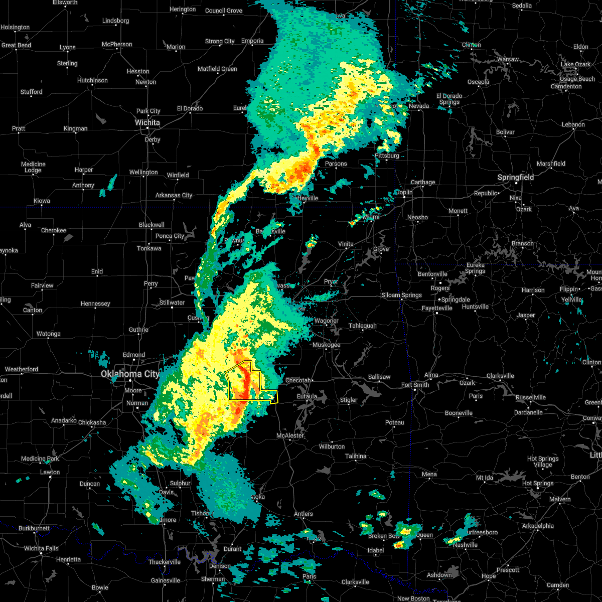 The severe thunderstorm warning for west central mcintosh and okfuskee counties will expire at 1245 am cdt, the storms which prompted the warning have weakened below severe limits, and no longer pose an immediate threat to life or property. therefore, the warning will be allowed to expire. a tornado watch remains in effect until 700 am cdt for southeastern, northeastern and east central oklahoma. The severe thunderstorm warning for west central mcintosh and okfuskee counties will expire at 1245 am cdt, the storms which prompted the warning have weakened below severe limits, and no longer pose an immediate threat to life or property. therefore, the warning will be allowed to expire. a tornado watch remains in effect until 700 am cdt for southeastern, northeastern and east central oklahoma.
|
| 3/30/2022 12:21 AM CDT |
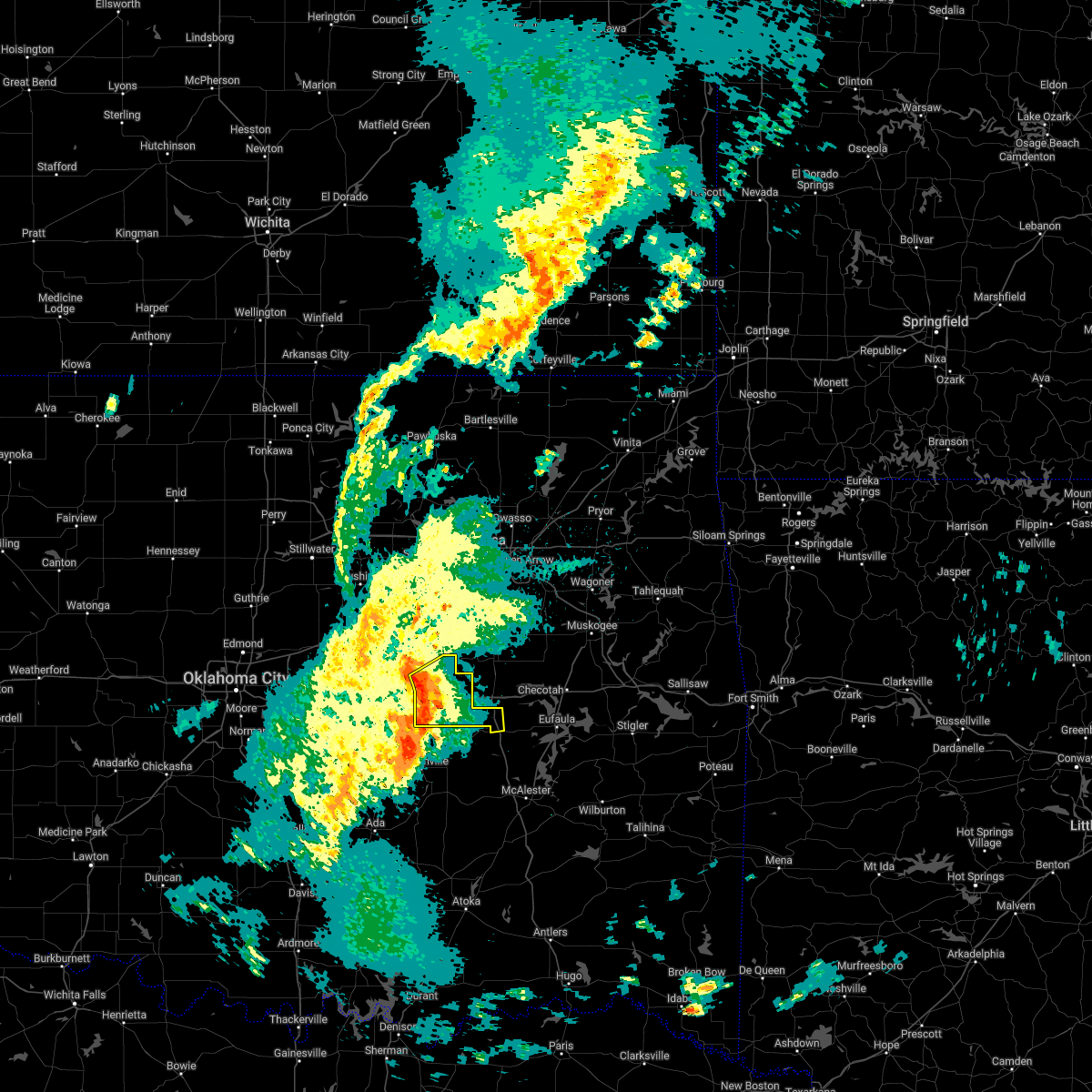 At 1221 am cdt, severe thunderstorms were located along a line extending from near castle to 3 miles west of okemah to 2 miles southeast of bearden, moving east at 40 mph (radar indicated). Hazards include 60 mph wind gusts. Expect damage to roofs, siding, and trees. Locations in or near the path include, okemah, okfuskee, weleetka, bearden, castle, clearview, pharoah, mason, this includes interstate 40 in oklahoma between mile markers 212 and 231. At 1221 am cdt, severe thunderstorms were located along a line extending from near castle to 3 miles west of okemah to 2 miles southeast of bearden, moving east at 40 mph (radar indicated). Hazards include 60 mph wind gusts. Expect damage to roofs, siding, and trees. Locations in or near the path include, okemah, okfuskee, weleetka, bearden, castle, clearview, pharoah, mason, this includes interstate 40 in oklahoma between mile markers 212 and 231.
|
| 3/30/2022 12:06 AM CDT |
 At 1206 am cdt, severe thunderstorms were located along a line extending from 3 miles south of paden to 7 miles south of boley to 4 miles southwest of cromwell, moving east at 35 mph (radar indicated). Hazards include 60 mph wind gusts. Expect damage to roofs, siding, and trees. Locations in or near the path include, okemah, okfuskee, boley, weleetka, paden, bearden, castle, clearview, pharoah, mason, this includes interstate 40 in oklahoma between mile markers 212 and 231. At 1206 am cdt, severe thunderstorms were located along a line extending from 3 miles south of paden to 7 miles south of boley to 4 miles southwest of cromwell, moving east at 35 mph (radar indicated). Hazards include 60 mph wind gusts. Expect damage to roofs, siding, and trees. Locations in or near the path include, okemah, okfuskee, boley, weleetka, paden, bearden, castle, clearview, pharoah, mason, this includes interstate 40 in oklahoma between mile markers 212 and 231.
|
| 10/15/2021 2:40 AM CDT |
 At 226 am cdt, severe thunderstorms were located along a line extending from welty to 2 miles west of okemah to 5 miles southwest of cromwell, moving east at 35 mph (radar indicated). Hazards include 60 mph wind gusts and quarter size hail. Hail damage to vehicles is expected. expect wind damage to roofs, siding, and trees. locations in or near the path include, okmulgee, okemah, okfuskee, henryetta, boley, weleetka, schulter, bearden, castle, clearview, okmulgee state park, welty, pharoah, bryant, mason, this includes interstate 40 in oklahoma between mile markers 212 and 239. hail threat, radar indicated max hail size, 1. 00 in wind threat, radar indicated max wind gust, 60 mph. At 226 am cdt, severe thunderstorms were located along a line extending from welty to 2 miles west of okemah to 5 miles southwest of cromwell, moving east at 35 mph (radar indicated). Hazards include 60 mph wind gusts and quarter size hail. Hail damage to vehicles is expected. expect wind damage to roofs, siding, and trees. locations in or near the path include, okmulgee, okemah, okfuskee, henryetta, boley, weleetka, schulter, bearden, castle, clearview, okmulgee state park, welty, pharoah, bryant, mason, this includes interstate 40 in oklahoma between mile markers 212 and 239. hail threat, radar indicated max hail size, 1. 00 in wind threat, radar indicated max wind gust, 60 mph.
|
| 10/15/2021 2:26 AM CDT |
 At 226 am cdt, severe thunderstorms were located along a line extending from welty to 2 miles west of okemah to 5 miles southwest of cromwell, moving east at 35 mph (radar indicated). Hazards include 60 mph wind gusts and quarter size hail. Hail damage to vehicles is expected. expect wind damage to roofs, siding, and trees. locations in or near the path include, okmulgee, okemah, okfuskee, henryetta, boley, weleetka, schulter, bearden, castle, clearview, okmulgee state park, welty, pharoah, bryant, mason, this includes interstate 40 in oklahoma between mile markers 212 and 239. hail threat, radar indicated max hail size, 1. 00 in wind threat, radar indicated max wind gust, 60 mph. At 226 am cdt, severe thunderstorms were located along a line extending from welty to 2 miles west of okemah to 5 miles southwest of cromwell, moving east at 35 mph (radar indicated). Hazards include 60 mph wind gusts and quarter size hail. Hail damage to vehicles is expected. expect wind damage to roofs, siding, and trees. locations in or near the path include, okmulgee, okemah, okfuskee, henryetta, boley, weleetka, schulter, bearden, castle, clearview, okmulgee state park, welty, pharoah, bryant, mason, this includes interstate 40 in oklahoma between mile markers 212 and 239. hail threat, radar indicated max hail size, 1. 00 in wind threat, radar indicated max wind gust, 60 mph.
|
| 10/15/2021 2:01 AM CDT |
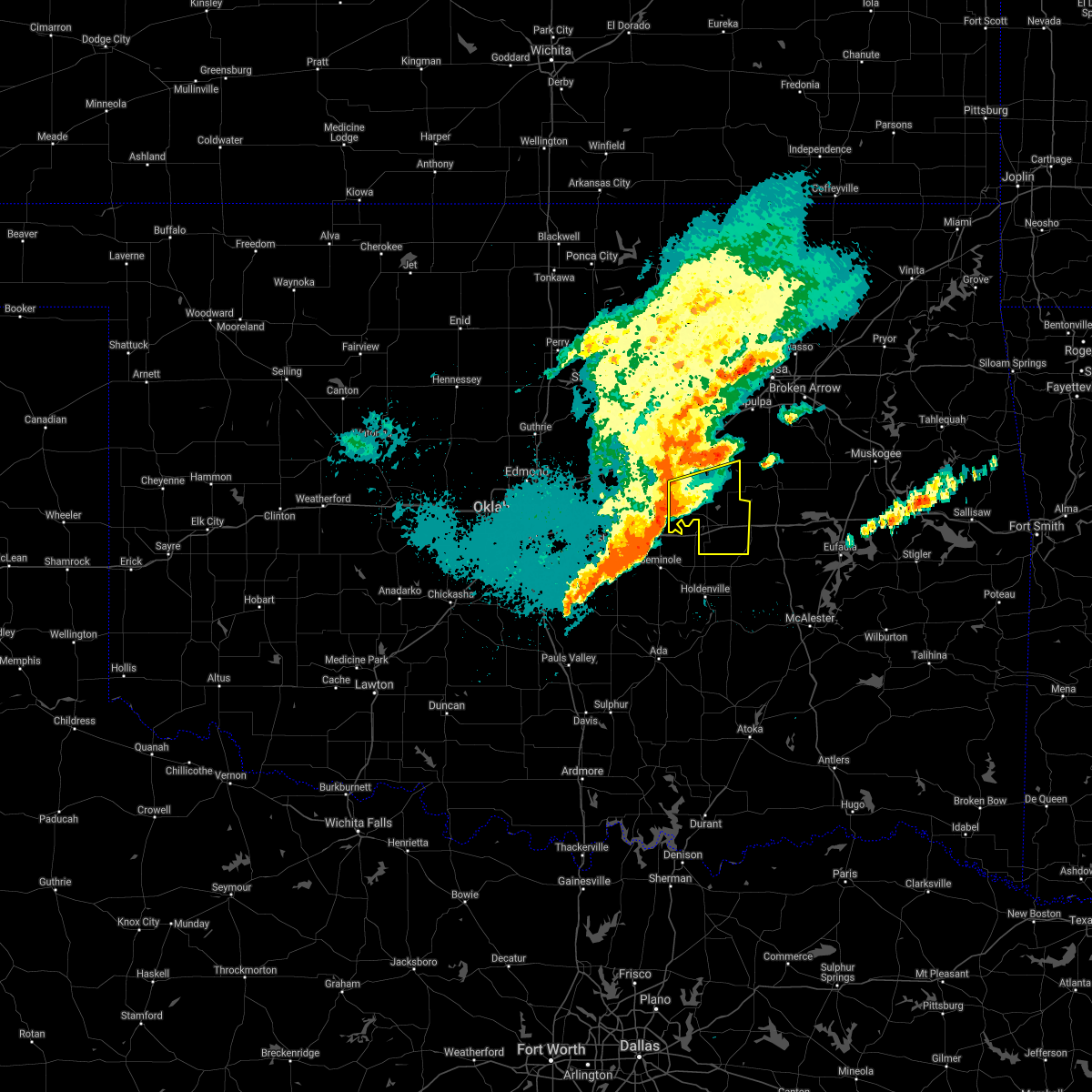 At 200 am cdt, severe thunderstorms were located along a line extending from 8 miles northeast of prague to near paden to 3 miles northwest of little, moving east at 30 mph (radar indicated). Hazards include 60 mph wind gusts and quarter size hail. Hail damage to vehicles is expected. expect wind damage to roofs, siding, and trees. locations in or near the path include, okemah, okfuskee, boley, weleetka, paden, bearden, castle, clearview, welty, mason, this includes interstate 40 in oklahoma between mile markers 212 and 229. hail threat, radar indicated max hail size, 1. 00 in wind threat, radar indicated max wind gust, 60 mph. At 200 am cdt, severe thunderstorms were located along a line extending from 8 miles northeast of prague to near paden to 3 miles northwest of little, moving east at 30 mph (radar indicated). Hazards include 60 mph wind gusts and quarter size hail. Hail damage to vehicles is expected. expect wind damage to roofs, siding, and trees. locations in or near the path include, okemah, okfuskee, boley, weleetka, paden, bearden, castle, clearview, welty, mason, this includes interstate 40 in oklahoma between mile markers 212 and 229. hail threat, radar indicated max hail size, 1. 00 in wind threat, radar indicated max wind gust, 60 mph.
|
| 10/15/2021 1:41 AM CDT |
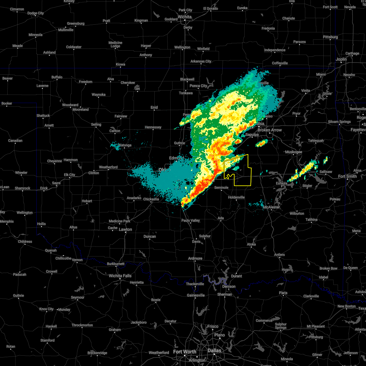 At 141 am cdt, severe thunderstorms were located along a line extending from 6 miles southeast of sparks to prague to 2 miles south of johnson, moving east at 30 mph (radar indicated). Hazards include 60 mph wind gusts and half dollar size hail. Hail damage to vehicles is expected. expect wind damage to roofs, siding, and trees. locations in or near the path include, okemah, okfuskee, boley, weleetka, paden, bearden, castle, clearview, welty, mason, this includes interstate 40 in oklahoma between mile markers 212 and 229. hail threat, radar indicated max hail size, 1. 25 in wind threat, radar indicated max wind gust, 60 mph. At 141 am cdt, severe thunderstorms were located along a line extending from 6 miles southeast of sparks to prague to 2 miles south of johnson, moving east at 30 mph (radar indicated). Hazards include 60 mph wind gusts and half dollar size hail. Hail damage to vehicles is expected. expect wind damage to roofs, siding, and trees. locations in or near the path include, okemah, okfuskee, boley, weleetka, paden, bearden, castle, clearview, welty, mason, this includes interstate 40 in oklahoma between mile markers 212 and 229. hail threat, radar indicated max hail size, 1. 25 in wind threat, radar indicated max wind gust, 60 mph.
|
| 10/10/2021 10:12 PM CDT |
 At 1012 pm cdt, severe thunderstorms were located along a line extending from 4 miles east of sand springs to 4 miles east of preston to 2 miles east of weleetka, moving northeast at 45 mph (radar indicated). Hazards include 70 mph wind gusts and nickel size hail. Expect considerable tree damage. damage is likely to mobile homes, roofs, and outbuildings. locations in or near the path include, tulsa, broken arrow, sand springs, okmulgee, bixby, sapulpa, jenks, glenpool, henryetta, kiefer, morris, beggs, mounds, weleetka, dewar, schulter, grayson, hoffman, clearview, preston, this includes the following highways, interstate 40 in oklahoma between mile markers 221 and 253. interstate 44 between mile markers 207 and 229. thunderstorm damage threat, considerable hail threat, radar indicated max hail size, 0. 88 in wind threat, radar indicated max wind gust, 70 mph. At 1012 pm cdt, severe thunderstorms were located along a line extending from 4 miles east of sand springs to 4 miles east of preston to 2 miles east of weleetka, moving northeast at 45 mph (radar indicated). Hazards include 70 mph wind gusts and nickel size hail. Expect considerable tree damage. damage is likely to mobile homes, roofs, and outbuildings. locations in or near the path include, tulsa, broken arrow, sand springs, okmulgee, bixby, sapulpa, jenks, glenpool, henryetta, kiefer, morris, beggs, mounds, weleetka, dewar, schulter, grayson, hoffman, clearview, preston, this includes the following highways, interstate 40 in oklahoma between mile markers 221 and 253. interstate 44 between mile markers 207 and 229. thunderstorm damage threat, considerable hail threat, radar indicated max hail size, 0. 88 in wind threat, radar indicated max wind gust, 70 mph.
|
| 10/10/2021 9:58 PM CDT |
 At 935 pm cdt, severe thunderstorms were located along a line extending from 8 miles east of drumright to 4 miles northeast of castle to 5 miles north of wewoka, moving northeast at 45 mph (radar indicated). Hazards include 70 mph wind gusts and nickel size hail. Expect considerable tree damage. damage is likely to mobile homes, roofs, and outbuildings. locations in or near the path include, tulsa, broken arrow, sand springs, okmulgee, bristow, okemah, bixby, sapulpa, jenks, okfuskee, glenpool, henryetta, kiefer, morris, beggs, mounds, kellyville, weleetka, dewar, schulter, this includes the following highways, interstate 40 in oklahoma between mile markers 213 and 253. interstate 44 between mile markers 187 and 229. thunderstorm damage threat, considerable hail threat, radar indicated max hail size, 0. 88 in wind threat, radar indicated max wind gust, 70 mph. At 935 pm cdt, severe thunderstorms were located along a line extending from 8 miles east of drumright to 4 miles northeast of castle to 5 miles north of wewoka, moving northeast at 45 mph (radar indicated). Hazards include 70 mph wind gusts and nickel size hail. Expect considerable tree damage. damage is likely to mobile homes, roofs, and outbuildings. locations in or near the path include, tulsa, broken arrow, sand springs, okmulgee, bristow, okemah, bixby, sapulpa, jenks, okfuskee, glenpool, henryetta, kiefer, morris, beggs, mounds, kellyville, weleetka, dewar, schulter, this includes the following highways, interstate 40 in oklahoma between mile markers 213 and 253. interstate 44 between mile markers 187 and 229. thunderstorm damage threat, considerable hail threat, radar indicated max hail size, 0. 88 in wind threat, radar indicated max wind gust, 70 mph.
|
| 10/10/2021 9:36 PM CDT |
 At 935 pm cdt, severe thunderstorms were located along a line extending from 8 miles east of drumright to 4 miles northeast of castle to 5 miles north of wewoka, moving northeast at 45 mph (radar indicated). Hazards include 70 mph wind gusts and nickel size hail. Expect considerable tree damage. damage is likely to mobile homes, roofs, and outbuildings. locations in or near the path include, tulsa, broken arrow, sand springs, okmulgee, bristow, okemah, bixby, sapulpa, jenks, okfuskee, glenpool, henryetta, kiefer, morris, beggs, mounds, kellyville, weleetka, dewar, schulter, this includes the following highways, interstate 40 in oklahoma between mile markers 213 and 253. interstate 44 between mile markers 187 and 229. thunderstorm damage threat, considerable hail threat, radar indicated max hail size, 0. 88 in wind threat, radar indicated max wind gust, 70 mph. At 935 pm cdt, severe thunderstorms were located along a line extending from 8 miles east of drumright to 4 miles northeast of castle to 5 miles north of wewoka, moving northeast at 45 mph (radar indicated). Hazards include 70 mph wind gusts and nickel size hail. Expect considerable tree damage. damage is likely to mobile homes, roofs, and outbuildings. locations in or near the path include, tulsa, broken arrow, sand springs, okmulgee, bristow, okemah, bixby, sapulpa, jenks, okfuskee, glenpool, henryetta, kiefer, morris, beggs, mounds, kellyville, weleetka, dewar, schulter, this includes the following highways, interstate 40 in oklahoma between mile markers 213 and 253. interstate 44 between mile markers 187 and 229. thunderstorm damage threat, considerable hail threat, radar indicated max hail size, 0. 88 in wind threat, radar indicated max wind gust, 70 mph.
|
| 10/10/2021 9:14 PM CDT |
 At 914 pm cdt, severe thunderstorms were located along a line extending from 2 miles northwest of drumright to 8 miles southeast of stroud to 5 miles west of cromwell, moving northeast at 40 mph (radar indicated). Hazards include 70 mph wind gusts and quarter size hail. Hail damage to vehicles is expected. expect considerable tree damage. wind damage is also likely to mobile homes, roofs, and outbuildings. locations in or near the path include, bristow, okemah, okfuskee, mannford, drumright, boley, depew, paden, bearden, slick, castle, shamrock, welty, milfay, mason, this includes the following highways, interstate 40 in oklahoma between mile markers 212 and 225. interstate 44 between mile markers 178 and 203. thunderstorm damage threat, considerable hail threat, radar indicated max hail size, 1. 00 in wind threat, radar indicated max wind gust, 70 mph. At 914 pm cdt, severe thunderstorms were located along a line extending from 2 miles northwest of drumright to 8 miles southeast of stroud to 5 miles west of cromwell, moving northeast at 40 mph (radar indicated). Hazards include 70 mph wind gusts and quarter size hail. Hail damage to vehicles is expected. expect considerable tree damage. wind damage is also likely to mobile homes, roofs, and outbuildings. locations in or near the path include, bristow, okemah, okfuskee, mannford, drumright, boley, depew, paden, bearden, slick, castle, shamrock, welty, milfay, mason, this includes the following highways, interstate 40 in oklahoma between mile markers 212 and 225. interstate 44 between mile markers 178 and 203. thunderstorm damage threat, considerable hail threat, radar indicated max hail size, 1. 00 in wind threat, radar indicated max wind gust, 70 mph.
|
| 10/10/2021 8:41 PM CDT |
 At 841 pm cdt, severe thunderstorms were located along a line extending from 3 miles southeast of tryon to 5 miles northeast of johnson to 3 miles east of brooksville, moving northeast at 40 mph (radar indicated). Hazards include 70 mph wind gusts and half dollar size hail. Hail damage to vehicles is expected. expect considerable tree damage. wind damage is also likely to mobile homes, roofs, and outbuildings. locations in or near the path include, bristow, okemah, okfuskee, mannford, drumright, boley, depew, paden, bearden, slick, castle, shamrock, welty, milfay, mason, this includes the following highways, interstate 40 in oklahoma between mile markers 212 and 225. interstate 44 between mile markers 178 and 203. thunderstorm damage threat, considerable hail threat, radar indicated max hail size, 1. 25 in wind threat, radar indicated max wind gust, 70 mph. At 841 pm cdt, severe thunderstorms were located along a line extending from 3 miles southeast of tryon to 5 miles northeast of johnson to 3 miles east of brooksville, moving northeast at 40 mph (radar indicated). Hazards include 70 mph wind gusts and half dollar size hail. Hail damage to vehicles is expected. expect considerable tree damage. wind damage is also likely to mobile homes, roofs, and outbuildings. locations in or near the path include, bristow, okemah, okfuskee, mannford, drumright, boley, depew, paden, bearden, slick, castle, shamrock, welty, milfay, mason, this includes the following highways, interstate 40 in oklahoma between mile markers 212 and 225. interstate 44 between mile markers 178 and 203. thunderstorm damage threat, considerable hail threat, radar indicated max hail size, 1. 25 in wind threat, radar indicated max wind gust, 70 mph.
|
| 7/10/2021 9:27 PM CDT |
 The severe thunderstorm warning for southwestern creek and okfuskee counties will expire at 930 pm cdt, the storms which prompted the warning have weakened below severe limits, and no longer pose an immediate threat to life or property. therefore, the warning will be allowed to expire. a severe thunderstorm watch remains in effect until 1100 pm cdt for northeastern and east central oklahoma. The severe thunderstorm warning for southwestern creek and okfuskee counties will expire at 930 pm cdt, the storms which prompted the warning have weakened below severe limits, and no longer pose an immediate threat to life or property. therefore, the warning will be allowed to expire. a severe thunderstorm watch remains in effect until 1100 pm cdt for northeastern and east central oklahoma.
|
| 7/10/2021 9:02 PM CDT |
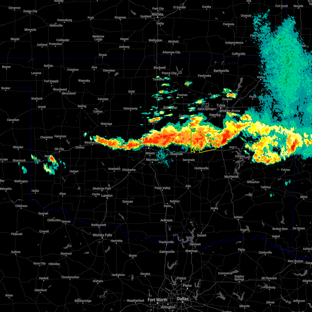 At 901 pm cdt, severe thunderstorms were located along a line extending from near welty to 6 miles east of sparks, moving southeast at 45 mph (radar indicated). Hazards include 60 mph wind gusts and penny size hail. Expect damage to roofs, siding, and trees. locations in or near the path include, okemah, okfuskee, boley, paden, castle, welty, milfay, mason, this includes the following highways, interstate 40 in oklahoma between mile markers 215 and 224. Interstate 44 between mile markers 178 and 179. At 901 pm cdt, severe thunderstorms were located along a line extending from near welty to 6 miles east of sparks, moving southeast at 45 mph (radar indicated). Hazards include 60 mph wind gusts and penny size hail. Expect damage to roofs, siding, and trees. locations in or near the path include, okemah, okfuskee, boley, paden, castle, welty, milfay, mason, this includes the following highways, interstate 40 in oklahoma between mile markers 215 and 224. Interstate 44 between mile markers 178 and 179.
|
| 7/10/2021 8:46 PM CDT |
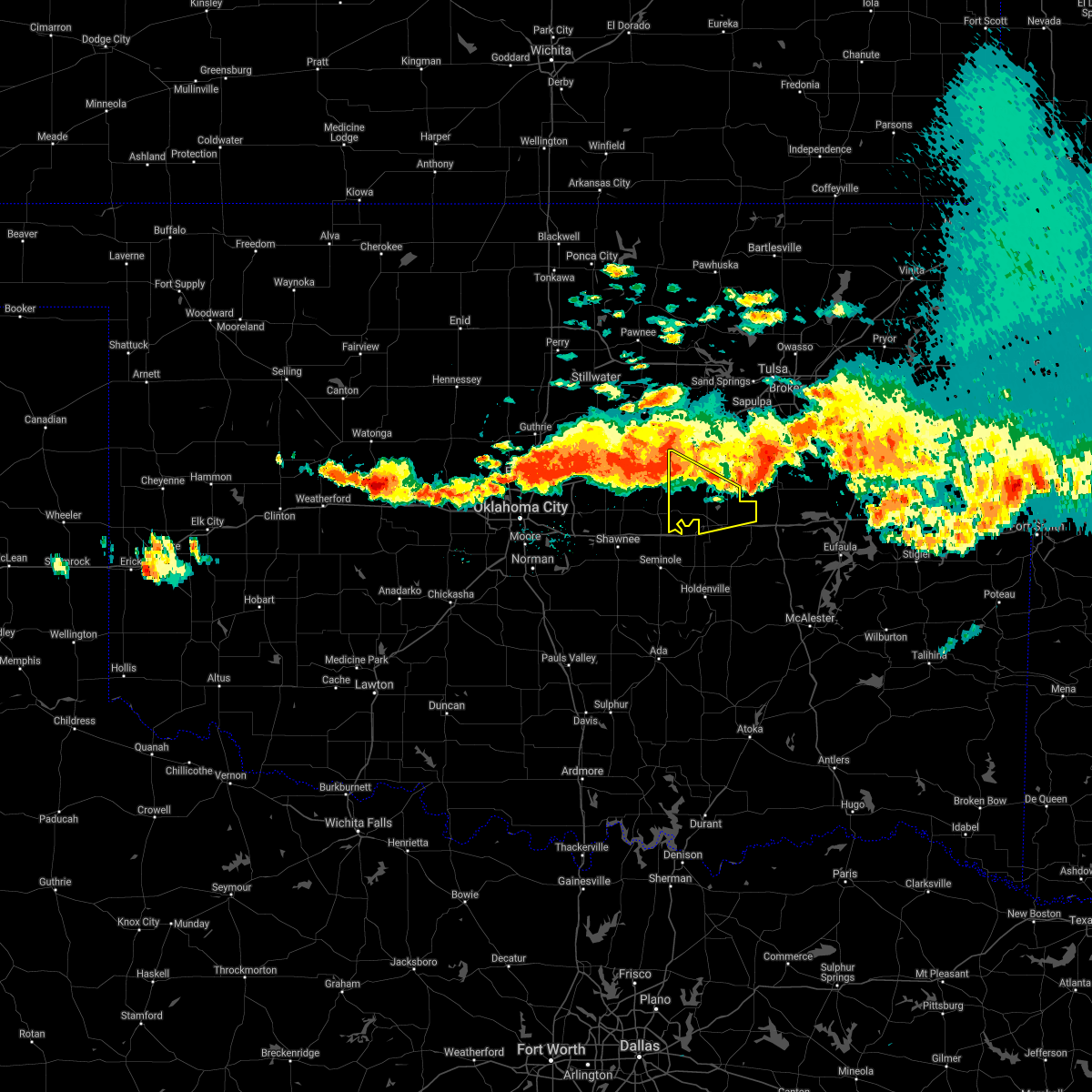 At 845 pm cdt, severe thunderstorms were located along a line extending from 2 miles east of stroud to 2 miles northwest of chandler, moving southeast at 35 mph (radar indicated). Hazards include 60 mph wind gusts and quarter size hail. Hail damage to vehicles is expected. expect wind damage to roofs, siding, and trees. locations in or near the path include, okemah, okfuskee, boley, paden, castle, welty, milfay, mason, this includes the following highways, interstate 40 in oklahoma between mile markers 215 and 224. Interstate 44 between mile markers 178 and 179. At 845 pm cdt, severe thunderstorms were located along a line extending from 2 miles east of stroud to 2 miles northwest of chandler, moving southeast at 35 mph (radar indicated). Hazards include 60 mph wind gusts and quarter size hail. Hail damage to vehicles is expected. expect wind damage to roofs, siding, and trees. locations in or near the path include, okemah, okfuskee, boley, paden, castle, welty, milfay, mason, this includes the following highways, interstate 40 in oklahoma between mile markers 215 and 224. Interstate 44 between mile markers 178 and 179.
|
| 5/27/2021 6:35 PM CDT |
 At 635 pm cdt, severe thunderstorms were located along a line extending from 3 miles southeast of welty to castle to 3 miles north of cromwell, moving east at 45 mph (radar indicated). Hazards include 70 mph wind gusts and ping pong ball size hail. People and animals outdoors will be injured. expect hail damage to roofs, siding, windows, and vehicles. expect considerable tree damage. wind damage is also likely to mobile homes, roofs, and outbuildings. locations in or near the path include, okmulgee, okemah, okfuskee, henryetta, morris, weleetka, dewar, schulter, grayson, bearden, hoffman, castle, clearview, okmulgee state park, welty, pharoah, bryant, mason, this includes interstate 40 in oklahoma between mile markers 212 and 243. A tornado watch remains in effect until 900 pm cdt for southeastern, northeastern and east central oklahoma. At 635 pm cdt, severe thunderstorms were located along a line extending from 3 miles southeast of welty to castle to 3 miles north of cromwell, moving east at 45 mph (radar indicated). Hazards include 70 mph wind gusts and ping pong ball size hail. People and animals outdoors will be injured. expect hail damage to roofs, siding, windows, and vehicles. expect considerable tree damage. wind damage is also likely to mobile homes, roofs, and outbuildings. locations in or near the path include, okmulgee, okemah, okfuskee, henryetta, morris, weleetka, dewar, schulter, grayson, bearden, hoffman, castle, clearview, okmulgee state park, welty, pharoah, bryant, mason, this includes interstate 40 in oklahoma between mile markers 212 and 243. A tornado watch remains in effect until 900 pm cdt for southeastern, northeastern and east central oklahoma.
|
| 5/27/2021 6:30 PM CDT |
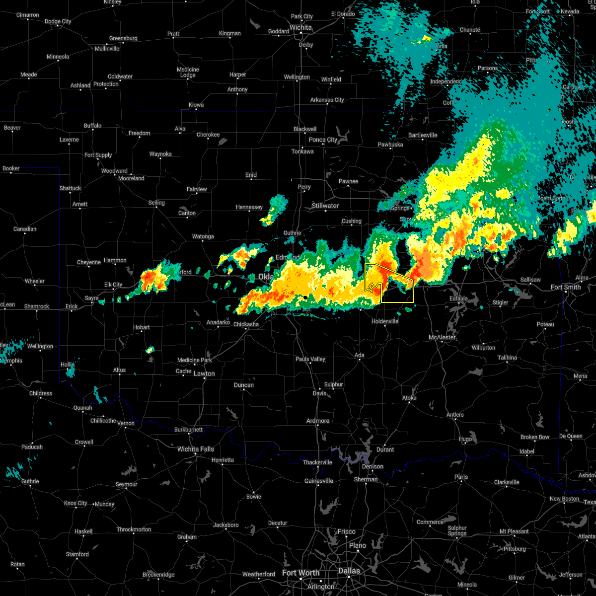 At 630 pm cdt, severe thunderstorms were located along a line extending from 2 miles southwest of welty to 2 miles west of castle to 5 miles northwest of cromwell, moving east at 45 mph (radar indicated). Hazards include 70 mph wind gusts and ping pong ball size hail. People and animals outdoors will be injured. expect hail damage to roofs, siding, windows, and vehicles. expect considerable tree damage. wind damage is also likely to mobile homes, roofs, and outbuildings. locations in or near the path include, okemah, boley, weleetka, paden, bearden, castle, clearview, pharoah, mason, this includes interstate 40 in oklahoma between mile markers 212 and 231. A tornado watch remains in effect until 900 pm cdt for northeastern and east central oklahoma. At 630 pm cdt, severe thunderstorms were located along a line extending from 2 miles southwest of welty to 2 miles west of castle to 5 miles northwest of cromwell, moving east at 45 mph (radar indicated). Hazards include 70 mph wind gusts and ping pong ball size hail. People and animals outdoors will be injured. expect hail damage to roofs, siding, windows, and vehicles. expect considerable tree damage. wind damage is also likely to mobile homes, roofs, and outbuildings. locations in or near the path include, okemah, boley, weleetka, paden, bearden, castle, clearview, pharoah, mason, this includes interstate 40 in oklahoma between mile markers 212 and 231. A tornado watch remains in effect until 900 pm cdt for northeastern and east central oklahoma.
|
| 5/27/2021 6:17 PM CDT |
 At 617 pm cdt, a severe thunderstorm was located 3 miles southeast of okfuskee, moving east at 35 mph (radar indicated). Hazards include two inch hail and 60 mph wind gusts. People and animals outdoors will be injured. expect hail damage to roofs, siding, windows, and vehicles. expect wind damage to roofs, siding, and trees. locations in or near the path include, okmulgee, okemah, okfuskee, henryetta, morris, dewar, schulter, grayson, hoffman, okmulgee state park, pharoah, this includes interstate 40 in oklahoma between mile markers 222 and 243. A tornado watch remains in effect until 700 pm cdt for southeastern, northeastern and east central oklahoma. At 617 pm cdt, a severe thunderstorm was located 3 miles southeast of okfuskee, moving east at 35 mph (radar indicated). Hazards include two inch hail and 60 mph wind gusts. People and animals outdoors will be injured. expect hail damage to roofs, siding, windows, and vehicles. expect wind damage to roofs, siding, and trees. locations in or near the path include, okmulgee, okemah, okfuskee, henryetta, morris, dewar, schulter, grayson, hoffman, okmulgee state park, pharoah, this includes interstate 40 in oklahoma between mile markers 222 and 243. A tornado watch remains in effect until 700 pm cdt for southeastern, northeastern and east central oklahoma.
|
| 5/27/2021 6:10 PM CDT |
 At 610 pm cdt, a severe thunderstorm was located 3 miles south of okfuskee, moving east at 40 mph (radar indicated). Hazards include ping pong ball size hail and 60 mph wind gusts. People and animals outdoors will be injured. expect hail damage to roofs, siding, windows, and vehicles. expect wind damage to roofs, siding, and trees. locations in or near the path include, okmulgee, okemah, okfuskee, henryetta, morris, dewar, schulter, grayson, hoffman, okmulgee state park, pharoah, this includes interstate 40 in oklahoma between mile markers 222 and 243. A tornado watch remains in effect until 700 pm cdt for southeastern, northeastern and east central oklahoma. At 610 pm cdt, a severe thunderstorm was located 3 miles south of okfuskee, moving east at 40 mph (radar indicated). Hazards include ping pong ball size hail and 60 mph wind gusts. People and animals outdoors will be injured. expect hail damage to roofs, siding, windows, and vehicles. expect wind damage to roofs, siding, and trees. locations in or near the path include, okmulgee, okemah, okfuskee, henryetta, morris, dewar, schulter, grayson, hoffman, okmulgee state park, pharoah, this includes interstate 40 in oklahoma between mile markers 222 and 243. A tornado watch remains in effect until 700 pm cdt for southeastern, northeastern and east central oklahoma.
|
| 5/27/2021 6:06 PM CDT |
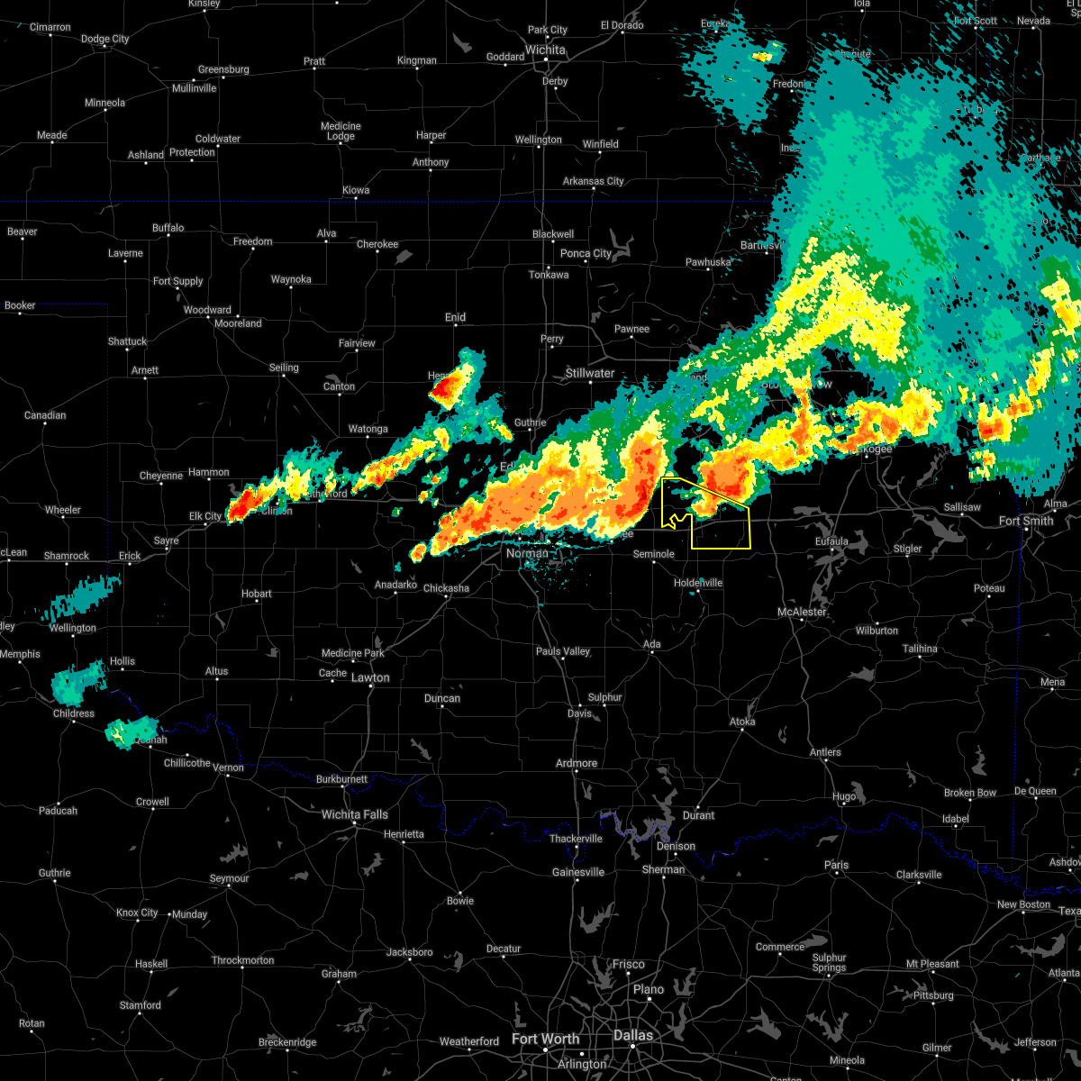 At 606 pm cdt, severe thunderstorms were located along a line extending from 6 miles east of sparks to 3 miles west of prague to 3 miles south of meeker, moving southeast at 50 mph (radar indicated). Hazards include golf ball size hail and 70 mph wind gusts. People and animals outdoors will be injured. expect hail damage to roofs, siding, windows, and vehicles. expect considerable tree damage. wind damage is also likely to mobile homes, roofs, and outbuildings. locations in or near the path include, okemah, boley, weleetka, paden, bearden, castle, clearview, pharoah, mason, this includes interstate 40 in oklahoma between mile markers 212 and 231. A tornado watch remains in effect until 700 pm cdt for northeastern and east central oklahoma. At 606 pm cdt, severe thunderstorms were located along a line extending from 6 miles east of sparks to 3 miles west of prague to 3 miles south of meeker, moving southeast at 50 mph (radar indicated). Hazards include golf ball size hail and 70 mph wind gusts. People and animals outdoors will be injured. expect hail damage to roofs, siding, windows, and vehicles. expect considerable tree damage. wind damage is also likely to mobile homes, roofs, and outbuildings. locations in or near the path include, okemah, boley, weleetka, paden, bearden, castle, clearview, pharoah, mason, this includes interstate 40 in oklahoma between mile markers 212 and 231. A tornado watch remains in effect until 700 pm cdt for northeastern and east central oklahoma.
|
| 4/28/2021 10:40 PM CDT |
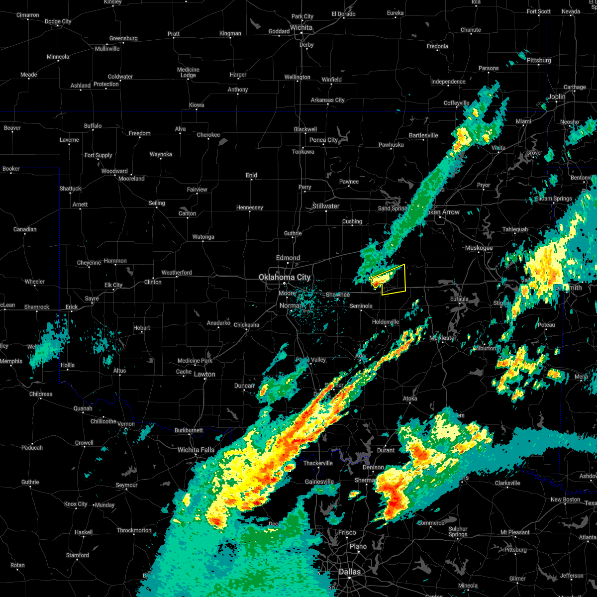 At 1040 pm cdt, a severe thunderstorm was located near boley, moving east at 30 mph (radar indicated). Hazards include 60 mph wind gusts and quarter size hail. Hail damage to vehicles is expected. expect wind damage to roofs, siding, and trees. locations in or near the path include, okemah, okfuskee, boley, castle, mason, this includes interstate 40 in oklahoma between mile markers 212 and 226. A tornado watch remains in effect until 200 am cdt for northeastern and east central oklahoma. At 1040 pm cdt, a severe thunderstorm was located near boley, moving east at 30 mph (radar indicated). Hazards include 60 mph wind gusts and quarter size hail. Hail damage to vehicles is expected. expect wind damage to roofs, siding, and trees. locations in or near the path include, okemah, okfuskee, boley, castle, mason, this includes interstate 40 in oklahoma between mile markers 212 and 226. A tornado watch remains in effect until 200 am cdt for northeastern and east central oklahoma.
|
| 4/28/2021 10:21 PM CDT |
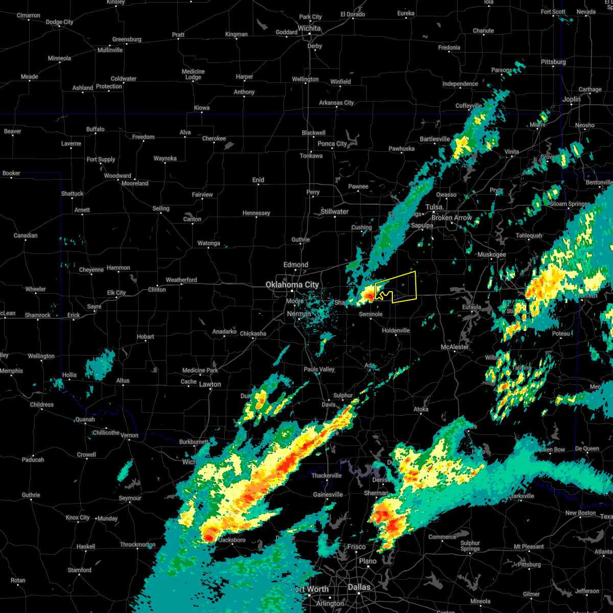 At 1021 pm cdt, a severe thunderstorm was located 4 miles south of prague, moving east at 35 mph (radar indicated). Hazards include ping pong ball size hail and 60 mph wind gusts. People and animals outdoors will be injured. expect hail damage to roofs, siding, windows, and vehicles. expect wind damage to roofs, siding, and trees. locations in or near the path include, okemah, okfuskee, boley, paden, castle, mason, this includes interstate 40 in oklahoma between mile markers 212 and 226. A tornado watch remains in effect until 200 am cdt for northeastern and east central oklahoma. At 1021 pm cdt, a severe thunderstorm was located 4 miles south of prague, moving east at 35 mph (radar indicated). Hazards include ping pong ball size hail and 60 mph wind gusts. People and animals outdoors will be injured. expect hail damage to roofs, siding, windows, and vehicles. expect wind damage to roofs, siding, and trees. locations in or near the path include, okemah, okfuskee, boley, paden, castle, mason, this includes interstate 40 in oklahoma between mile markers 212 and 226. A tornado watch remains in effect until 200 am cdt for northeastern and east central oklahoma.
|
| 4/28/2021 2:20 AM CDT |
 At 219 am cdt, a severe thunderstorm capable of producing a tornado was located near clearview, moving north at 35 mph (radar indicated rotation). Hazards include tornado. Flying debris will be dangerous to those caught without shelter. mobile homes will be damaged or destroyed. damage to roofs, windows, and vehicles will occur. tree damage is likely. Locations in or near the path include, okmulgee, okfuskee, beggs, weleetka, clearview, preston, okmulgee state park, pharoah, liberty, bryant, hectorville, this includes interstate 40 in oklahoma between mile markers 222 and 235. At 219 am cdt, a severe thunderstorm capable of producing a tornado was located near clearview, moving north at 35 mph (radar indicated rotation). Hazards include tornado. Flying debris will be dangerous to those caught without shelter. mobile homes will be damaged or destroyed. damage to roofs, windows, and vehicles will occur. tree damage is likely. Locations in or near the path include, okmulgee, okfuskee, beggs, weleetka, clearview, preston, okmulgee state park, pharoah, liberty, bryant, hectorville, this includes interstate 40 in oklahoma between mile markers 222 and 235.
|
| 4/9/2021 7:29 PM CDT |
 At 728 pm cdt, a severe thunderstorm was located 3 miles south of boley, moving east at 30 mph (radar indicated). Hazards include 60 mph wind gusts and quarter size hail. Hail damage to vehicles is expected. expect wind damage to roofs, siding, and trees. Locations in or near the path include, okemah, boley, bearden, castle, this includes interstate 40 in oklahoma between mile markers 212 and 222. At 728 pm cdt, a severe thunderstorm was located 3 miles south of boley, moving east at 30 mph (radar indicated). Hazards include 60 mph wind gusts and quarter size hail. Hail damage to vehicles is expected. expect wind damage to roofs, siding, and trees. Locations in or near the path include, okemah, boley, bearden, castle, this includes interstate 40 in oklahoma between mile markers 212 and 222.
|
| 4/9/2021 7:21 PM CDT |
 At 721 pm cdt, a severe thunderstorm was located 3 miles south of paden, moving east at 25 mph (radar indicated). Hazards include 60 mph wind gusts and quarter size hail. Hail damage to vehicles is expected. expect wind damage to roofs, siding, and trees. Locations in or near the path include, okemah, okfuskee, boley, paden, bearden, castle, mason, this includes interstate 40 in oklahoma between mile markers 212 and 222. At 721 pm cdt, a severe thunderstorm was located 3 miles south of paden, moving east at 25 mph (radar indicated). Hazards include 60 mph wind gusts and quarter size hail. Hail damage to vehicles is expected. expect wind damage to roofs, siding, and trees. Locations in or near the path include, okemah, okfuskee, boley, paden, bearden, castle, mason, this includes interstate 40 in oklahoma between mile markers 212 and 222.
|
| 4/9/2021 7:09 PM CDT |
 At 709 pm cdt, a severe thunderstorm was located near paden, moving east at 30 mph (radar indicated). Hazards include 60 mph wind gusts and half dollar size hail. Hail damage to vehicles is expected. expect wind damage to roofs, siding, and trees. Locations in or near the path include, okemah, okfuskee, boley, paden, bearden, castle, mason, this includes interstate 40 in oklahoma between mile markers 212 and 222. At 709 pm cdt, a severe thunderstorm was located near paden, moving east at 30 mph (radar indicated). Hazards include 60 mph wind gusts and half dollar size hail. Hail damage to vehicles is expected. expect wind damage to roofs, siding, and trees. Locations in or near the path include, okemah, okfuskee, boley, paden, bearden, castle, mason, this includes interstate 40 in oklahoma between mile markers 212 and 222.
|
| 7/12/2020 12:23 AM CDT |
 The severe thunderstorm warning for central okmulgee and central okfuskee counties will expire at 1230 am cdt, the storms which prompted the warning have weakened below severe limits, and have exited the warned area. therefore the warning will be allowed to expire. a severe thunderstorm watch remains in effect until 100 am cdt for northeastern and east central oklahoma. The severe thunderstorm warning for central okmulgee and central okfuskee counties will expire at 1230 am cdt, the storms which prompted the warning have weakened below severe limits, and have exited the warned area. therefore the warning will be allowed to expire. a severe thunderstorm watch remains in effect until 100 am cdt for northeastern and east central oklahoma.
|
| 7/12/2020 12:07 AM CDT |
 At 1207 am cdt, severe thunderstorms were located along a line extending from 4 miles west of okmulgee state park to 2 miles east of okemah to 4 miles southwest of cromwell, moving southeast at 60 mph (radar indicated). Hazards include 60 mph wind gusts. Expect damage to roofs, siding, and trees. Locations in or near the path include, okmulgee, okemah, okfuskee, henryetta, morris, weleetka, dewar, schulter, bearden, castle, clearview, okmulgee state park, pharoah, bryant, this includes interstate 40 in oklahoma between mile markers 212 and 238. At 1207 am cdt, severe thunderstorms were located along a line extending from 4 miles west of okmulgee state park to 2 miles east of okemah to 4 miles southwest of cromwell, moving southeast at 60 mph (radar indicated). Hazards include 60 mph wind gusts. Expect damage to roofs, siding, and trees. Locations in or near the path include, okmulgee, okemah, okfuskee, henryetta, morris, weleetka, dewar, schulter, bearden, castle, clearview, okmulgee state park, pharoah, bryant, this includes interstate 40 in oklahoma between mile markers 212 and 238.
|
| 7/11/2020 11:40 PM CDT |
 At 1140 pm cdt, severe thunderstorms were located along a line extending from 2 miles northwest of bristow to 7 miles southeast of stroud to 3 miles south of sparks, moving southeast at 50 mph (radar indicated). Hazards include 60 mph wind gusts. Expect damage to roofs, siding, and trees. locations in or near the path include, okmulgee, bristow, okemah, okfuskee, henryetta, morris, beggs, boley, weleetka, dewar, schulter, depew, paden, bearden, slick, castle, shamrock, clearview, preston, pharoah, this includes the following highways, interstate 40 in oklahoma between mile markers 212 and 238. Interstate 44 between mile markers 178 and 195. At 1140 pm cdt, severe thunderstorms were located along a line extending from 2 miles northwest of bristow to 7 miles southeast of stroud to 3 miles south of sparks, moving southeast at 50 mph (radar indicated). Hazards include 60 mph wind gusts. Expect damage to roofs, siding, and trees. locations in or near the path include, okmulgee, bristow, okemah, okfuskee, henryetta, morris, beggs, boley, weleetka, dewar, schulter, depew, paden, bearden, slick, castle, shamrock, clearview, preston, pharoah, this includes the following highways, interstate 40 in oklahoma between mile markers 212 and 238. Interstate 44 between mile markers 178 and 195.
|
| 7/11/2020 11:27 PM CDT |
 The severe thunderstorm warning for south central creek, southwestern okmulgee and okfuskee counties will expire at 1130 pm cdt, the storms which prompted the warning have weakened. but areas of heavy rain and wind gusts to 50 mph were remain in the area. a severe thunderstorm watch remains in effect until 100 am cdt for southeastern, northeastern and east central oklahoma. The severe thunderstorm warning for south central creek, southwestern okmulgee and okfuskee counties will expire at 1130 pm cdt, the storms which prompted the warning have weakened. but areas of heavy rain and wind gusts to 50 mph were remain in the area. a severe thunderstorm watch remains in effect until 100 am cdt for southeastern, northeastern and east central oklahoma.
|
| 7/11/2020 11:10 PM CDT |
 At 1108 pm cdt, thunderstorms with areas of damaging wind were occurring across the warned area. the storms were moving south at 45 mph (radar indicated). Hazards include 60 mph wind gusts. Expect damage to roofs, siding, and trees. Locations in or near the path include, okemah, okfuskee, henryetta, weleetka, bearden, castle, clearview, okmulgee state park, welty, pharoah, bryant, mason, this includes interstate 40 in oklahoma between mile markers 213 and 236. At 1108 pm cdt, thunderstorms with areas of damaging wind were occurring across the warned area. the storms were moving south at 45 mph (radar indicated). Hazards include 60 mph wind gusts. Expect damage to roofs, siding, and trees. Locations in or near the path include, okemah, okfuskee, henryetta, weleetka, bearden, castle, clearview, okmulgee state park, welty, pharoah, bryant, mason, this includes interstate 40 in oklahoma between mile markers 213 and 236.
|
| 7/11/2020 10:48 PM CDT |
 At 1047 pm cdt, severe thunderstorms were located along a line extending from 2 miles north of castle to 3 miles east of dustin, moving south at 45 mph (radar indicated). Hazards include 60 mph wind gusts and nickel size hail. Expect damage to roofs, siding, and trees. locations in or near the path include, bristow, okemah, okfuskee, henryetta, beggs, weleetka, bearden, slick, castle, clearview, okmulgee state park, welty, pharoah, bryant, mason, this includes the following highways, interstate 40 in oklahoma between mile markers 213 and 236. Interstate 44 between mile markers 190 and 192. At 1047 pm cdt, severe thunderstorms were located along a line extending from 2 miles north of castle to 3 miles east of dustin, moving south at 45 mph (radar indicated). Hazards include 60 mph wind gusts and nickel size hail. Expect damage to roofs, siding, and trees. locations in or near the path include, bristow, okemah, okfuskee, henryetta, beggs, weleetka, bearden, slick, castle, clearview, okmulgee state park, welty, pharoah, bryant, mason, this includes the following highways, interstate 40 in oklahoma between mile markers 213 and 236. Interstate 44 between mile markers 190 and 192.
|
| 5/22/2020 7:06 AM CDT |
 The severe thunderstorm warning for western rogers, southeastern osage, creek, southern washington, northwestern wagoner, southeastern pawnee, okmulgee, tulsa and okfuskee counties will expire at 715 am cdt, the storms which prompted the warning have weakened below severe limits, and no longer pose an immediate threat to life or property. therefore the warning will be allowed to expire. a severe thunderstorm watch remains in effect until noon cdt for northeastern and east central oklahoma. The severe thunderstorm warning for western rogers, southeastern osage, creek, southern washington, northwestern wagoner, southeastern pawnee, okmulgee, tulsa and okfuskee counties will expire at 715 am cdt, the storms which prompted the warning have weakened below severe limits, and no longer pose an immediate threat to life or property. therefore the warning will be allowed to expire. a severe thunderstorm watch remains in effect until noon cdt for northeastern and east central oklahoma.
|
| 5/22/2020 6:34 AM CDT |
 At 632 am cdt, severe thunderstorms were located along a line extending from 4 miles east of barnsdall to 5 miles west of turley to 4 miles west of mounds to 6 miles northeast of castle, moving east at 35 mph (radar indicated). Hazards include 60 mph wind gusts. Expect damage to roofs, siding, and trees. locations in or near the path include, tulsa, broken arrow, sand springs, claremore, okmulgee, bristow, okemah, owasso, bixby, sapulpa, jenks, okfuskee, glenpool, coweta, skiatook, catoosa, henryetta, collinsville, verdigris, mannford, this includes the following highways, interstate 40 in oklahoma between mile markers 218 and 239. interstate 44 between mile markers 188 and 245. the squall line has shown signs of weakening overall. If the trend continues, the warning may either be cancelled early or will be allowed to expire at 715 am. At 632 am cdt, severe thunderstorms were located along a line extending from 4 miles east of barnsdall to 5 miles west of turley to 4 miles west of mounds to 6 miles northeast of castle, moving east at 35 mph (radar indicated). Hazards include 60 mph wind gusts. Expect damage to roofs, siding, and trees. locations in or near the path include, tulsa, broken arrow, sand springs, claremore, okmulgee, bristow, okemah, owasso, bixby, sapulpa, jenks, okfuskee, glenpool, coweta, skiatook, catoosa, henryetta, collinsville, verdigris, mannford, this includes the following highways, interstate 40 in oklahoma between mile markers 218 and 239. interstate 44 between mile markers 188 and 245. the squall line has shown signs of weakening overall. If the trend continues, the warning may either be cancelled early or will be allowed to expire at 715 am.
|
| 5/22/2020 6:09 AM CDT |
 At 609 am cdt, severe thunderstorms were located along a line extending from near wynona to walnut creek state park to 3 miles northeast of bristow to 4 miles north of paden, moving east at 35 mph (radar indicated). Hazards include 60 mph wind gusts. Expect damage to roofs, siding, and trees. locations in or near the path include, tulsa, broken arrow, sand springs, claremore, okmulgee, bristow, okemah, owasso, bixby, sapulpa, jenks, okfuskee, glenpool, coweta, skiatook, catoosa, henryetta, collinsville, verdigris, hominy, this includes the following highways, interstate 40 in oklahoma between mile markers 218 and 239. Interstate 44 between mile markers 178 and 245. At 609 am cdt, severe thunderstorms were located along a line extending from near wynona to walnut creek state park to 3 miles northeast of bristow to 4 miles north of paden, moving east at 35 mph (radar indicated). Hazards include 60 mph wind gusts. Expect damage to roofs, siding, and trees. locations in or near the path include, tulsa, broken arrow, sand springs, claremore, okmulgee, bristow, okemah, owasso, bixby, sapulpa, jenks, okfuskee, glenpool, coweta, skiatook, catoosa, henryetta, collinsville, verdigris, hominy, this includes the following highways, interstate 40 in oklahoma between mile markers 218 and 239. Interstate 44 between mile markers 178 and 245.
|
| 4/28/2020 7:13 PM CDT |
 At 712 pm cdt, severe thunderstorms were located along a line extending from 2 miles east of wagoner to 2 miles east of bald hill to 7 miles west of welty, moving southeast at 30 mph (radar indicated). Hazards include 60 mph wind gusts and quarter size hail. Hail damage to vehicles is expected. expect wind damage to roofs, siding, and trees. locations in or near the path include, muskogee, tahlequah, okmulgee, okemah, okfuskee, henryetta, fort gibson, checotah, warner, morris, boley, weleetka, gore, dewar, okay, webbers falls, hulbert, schulter, paden, oktaha, this includes interstate 40 in oklahoma between mile markers 212 and 284. A tornado watch remains in effect until 1100 pm cdt for southeastern, northeastern and east central oklahoma. At 712 pm cdt, severe thunderstorms were located along a line extending from 2 miles east of wagoner to 2 miles east of bald hill to 7 miles west of welty, moving southeast at 30 mph (radar indicated). Hazards include 60 mph wind gusts and quarter size hail. Hail damage to vehicles is expected. expect wind damage to roofs, siding, and trees. locations in or near the path include, muskogee, tahlequah, okmulgee, okemah, okfuskee, henryetta, fort gibson, checotah, warner, morris, boley, weleetka, gore, dewar, okay, webbers falls, hulbert, schulter, paden, oktaha, this includes interstate 40 in oklahoma between mile markers 212 and 284. A tornado watch remains in effect until 1100 pm cdt for southeastern, northeastern and east central oklahoma.
|
| 4/22/2020 11:01 AM CDT |
 At 1101 am cdt, severe thunderstorms were located along a line extending from 2 miles southwest of okfuskee to 4 miles southeast of wetumka, moving northeast at 60 mph (radar indicated). Hazards include quarter size hail. Damage to vehicles is expected. Locations in or near the path include, okmulgee, okemah, okfuskee, henryetta, morris, weleetka, dewar, schulter, grayson, hoffman, clearview, preston, raiford, okmulgee state park, pharoah, bryant, vernon, this includes interstate 40 in oklahoma between mile markers 218 and 247. At 1101 am cdt, severe thunderstorms were located along a line extending from 2 miles southwest of okfuskee to 4 miles southeast of wetumka, moving northeast at 60 mph (radar indicated). Hazards include quarter size hail. Damage to vehicles is expected. Locations in or near the path include, okmulgee, okemah, okfuskee, henryetta, morris, weleetka, dewar, schulter, grayson, hoffman, clearview, preston, raiford, okmulgee state park, pharoah, bryant, vernon, this includes interstate 40 in oklahoma between mile markers 218 and 247.
|
| 4/22/2020 10:42 AM CDT |
 At 1042 am cdt, severe thunderstorms were located along a line extending from 3 miles south of boley to 2 miles west of holdenville, moving northeast at 60 mph (radar indicated). Hazards include half dollar size hail. Damage to vehicles is expected. Locations in or near the path include, okmulgee, okemah, okfuskee, henryetta, morris, boley, weleetka, dewar, schulter, paden, grayson, bearden, hoffman, castle, clearview, preston, raiford, okmulgee state park, pharoah, bryant, this includes interstate 40 in oklahoma between mile markers 212 and 247. At 1042 am cdt, severe thunderstorms were located along a line extending from 3 miles south of boley to 2 miles west of holdenville, moving northeast at 60 mph (radar indicated). Hazards include half dollar size hail. Damage to vehicles is expected. Locations in or near the path include, okmulgee, okemah, okfuskee, henryetta, morris, boley, weleetka, dewar, schulter, paden, grayson, bearden, hoffman, castle, clearview, preston, raiford, okmulgee state park, pharoah, bryant, this includes interstate 40 in oklahoma between mile markers 212 and 247.
|
| 3/19/2020 10:25 AM CDT | Report of damage to a home. possible tornad in okfuskee county OK, 0.6 miles N of Okemah, OK |
| 3/19/2020 10:17 AM CDT |
 At 1017 am cdt, a severe thunderstorm was located near bearden, moving northeast at 65 mph (radar indicated). Hazards include 70 mph wind gusts. Expect considerable tree damage. damage is likely to mobile homes, roofs, and outbuildings. Locations in or near the path include, broken arrow, okmulgee, okemah, bixby, okfuskee, haskell, morris, beggs, bearden, castle, clearview, preston, bald hill, okmulgee state park, liberty, jamesville, hectorville, leonard, this includes interstate 40 in oklahoma between mile markers 212 and 230. At 1017 am cdt, a severe thunderstorm was located near bearden, moving northeast at 65 mph (radar indicated). Hazards include 70 mph wind gusts. Expect considerable tree damage. damage is likely to mobile homes, roofs, and outbuildings. Locations in or near the path include, broken arrow, okmulgee, okemah, bixby, okfuskee, haskell, morris, beggs, bearden, castle, clearview, preston, bald hill, okmulgee state park, liberty, jamesville, hectorville, leonard, this includes interstate 40 in oklahoma between mile markers 212 and 230.
|
| 10/20/2019 10:45 PM CDT |
 At 1045 pm cdt, severe thunderstorms were located along a line extending from 4 miles northwest of pharoah to 4 miles south of weleetka to 3 miles southeast of horntown, moving east at 55 mph (radar indicated). Hazards include 60 mph wind gusts and quarter size hail. Hail damage to vehicles is expected. expect wind damage to roofs, siding, and trees. locations in or near the path include, okmulgee, okemah, henryetta, morris, weleetka, dewar, schulter, grayson, hanna, hoffman, clearview, bald hill, okmulgee state park, pharoah, scipio, bryant, vernon, this includes interstate 40 in oklahoma between mile markers 218 and 251. A tornado watch remains in effect until 300 am cdt for southeastern, northeastern and east central oklahoma. At 1045 pm cdt, severe thunderstorms were located along a line extending from 4 miles northwest of pharoah to 4 miles south of weleetka to 3 miles southeast of horntown, moving east at 55 mph (radar indicated). Hazards include 60 mph wind gusts and quarter size hail. Hail damage to vehicles is expected. expect wind damage to roofs, siding, and trees. locations in or near the path include, okmulgee, okemah, henryetta, morris, weleetka, dewar, schulter, grayson, hanna, hoffman, clearview, bald hill, okmulgee state park, pharoah, scipio, bryant, vernon, this includes interstate 40 in oklahoma between mile markers 218 and 251. A tornado watch remains in effect until 300 am cdt for southeastern, northeastern and east central oklahoma.
|
| 10/20/2019 10:26 PM CDT |
 At 1026 pm cdt, severe thunderstorms were located along a line extending from 3 miles west of cromwell to wewoka to 2 miles southwest of sasakwa, moving northeast at 55 mph (radar indicated). Hazards include 60 mph wind gusts. Expect damage to roofs, siding, and trees. locations in or near the path include, okmulgee, okemah, henryetta, morris, weleetka, dewar, schulter, grayson, hanna, bearden, hoffman, castle, clearview, bald hill, okmulgee state park, pharoah, scipio, bryant, vernon, this includes interstate 40 in oklahoma between mile markers 212 and 251. A tornado watch remains in effect until 300 am cdt for southeastern, northeastern and east central oklahoma. At 1026 pm cdt, severe thunderstorms were located along a line extending from 3 miles west of cromwell to wewoka to 2 miles southwest of sasakwa, moving northeast at 55 mph (radar indicated). Hazards include 60 mph wind gusts. Expect damage to roofs, siding, and trees. locations in or near the path include, okmulgee, okemah, henryetta, morris, weleetka, dewar, schulter, grayson, hanna, bearden, hoffman, castle, clearview, bald hill, okmulgee state park, pharoah, scipio, bryant, vernon, this includes interstate 40 in oklahoma between mile markers 212 and 251. A tornado watch remains in effect until 300 am cdt for southeastern, northeastern and east central oklahoma.
|
| 7/6/2019 1:49 PM CDT | Storm damage reported in okfuskee county OK, 2.9 miles W of Okemah, OK |
| 6/16/2019 12:53 AM CDT |
 At 1253 am cdt, severe thunderstorms were located along a line extending from 3 miles northeast of maramec to 4 miles west of beggs to 4 miles southwest of horntown, moving east at 45 mph (radar indicated). Hazards include 60 mph wind gusts. Expect damage to roofs, siding, and trees. locations in or near the path include, tulsa, broken arrow, sand springs, okmulgee, okemah, eufaula, pawnee, owasso, bixby, sapulpa, jenks, okfuskee, glenpool, coweta, skiatook, catoosa, henryetta, hominy, cleveland, mannford, this includes the following highways, interstate 40 in oklahoma between mile markers 219 and 261. Interstate 44 between mile markers 192 and 232. At 1253 am cdt, severe thunderstorms were located along a line extending from 3 miles northeast of maramec to 4 miles west of beggs to 4 miles southwest of horntown, moving east at 45 mph (radar indicated). Hazards include 60 mph wind gusts. Expect damage to roofs, siding, and trees. locations in or near the path include, tulsa, broken arrow, sand springs, okmulgee, okemah, eufaula, pawnee, owasso, bixby, sapulpa, jenks, okfuskee, glenpool, coweta, skiatook, catoosa, henryetta, hominy, cleveland, mannford, this includes the following highways, interstate 40 in oklahoma between mile markers 219 and 261. Interstate 44 between mile markers 192 and 232.
|
| 6/16/2019 12:37 AM CDT |
 At 1236 am cdt, severe thunderstorms were located along a line extending from near maramec to 3 miles northeast of welty to 3 miles northwest of yeager, moving east at 50 mph (radar indicated). Hazards include 60 mph wind gusts. Expect damage to roofs, siding, and trees. locations in or near the path include, bristow, okemah, pawnee, okfuskee, cleveland, mannford, drumright, boley, oilton, weleetka, depew, paden, jennings, bearden, slick, hallett, blackburn, terlton, castle, shamrock, this includes the following highways, interstate 40 in oklahoma between mile markers 212 and 234. Interstate 44 between mile markers 178 and 202. At 1236 am cdt, severe thunderstorms were located along a line extending from near maramec to 3 miles northeast of welty to 3 miles northwest of yeager, moving east at 50 mph (radar indicated). Hazards include 60 mph wind gusts. Expect damage to roofs, siding, and trees. locations in or near the path include, bristow, okemah, pawnee, okfuskee, cleveland, mannford, drumright, boley, oilton, weleetka, depew, paden, jennings, bearden, slick, hallett, blackburn, terlton, castle, shamrock, this includes the following highways, interstate 40 in oklahoma between mile markers 212 and 234. Interstate 44 between mile markers 178 and 202.
|
| 6/16/2019 12:13 AM CDT |
 At 1212 am cdt, severe thunderstorms were located along a line extending from 3 miles southeast of lake carl blackwell to 5 miles east of sparks to near bowlegs, moving east at 50 mph (radar indicated). Hazards include 70 mph wind gusts and quarter size hail. Hail damage to vehicles is expected. expect considerable tree damage. wind damage is also likely to mobile homes, roofs, and outbuildings. locations in or near the path include, bristow, okemah, pawnee, okfuskee, cleveland, mannford, drumright, boley, oilton, weleetka, depew, paden, jennings, bearden, slick, hallett, blackburn, terlton, castle, shamrock, this includes the following highways, interstate 40 in oklahoma between mile markers 212 and 234. Interstate 44 between mile markers 178 and 202. At 1212 am cdt, severe thunderstorms were located along a line extending from 3 miles southeast of lake carl blackwell to 5 miles east of sparks to near bowlegs, moving east at 50 mph (radar indicated). Hazards include 70 mph wind gusts and quarter size hail. Hail damage to vehicles is expected. expect considerable tree damage. wind damage is also likely to mobile homes, roofs, and outbuildings. locations in or near the path include, bristow, okemah, pawnee, okfuskee, cleveland, mannford, drumright, boley, oilton, weleetka, depew, paden, jennings, bearden, slick, hallett, blackburn, terlton, castle, shamrock, this includes the following highways, interstate 40 in oklahoma between mile markers 212 and 234. Interstate 44 between mile markers 178 and 202.
|
| 5/26/2019 12:26 AM CDT |
 At 1226 am cdt, severe thunderstorms were located along a line extending from okfuskee to 3 miles south of okemah, moving east at 35 mph (radar indicated). Hazards include 60 mph wind gusts. Expect damage to roofs, siding, and trees. Locations in or near the path include, okmulgee, henryetta, morris, dewar, schulter, clearview, okmulgee state park, pharoah, bryant, this includes interstate 40 in oklahoma between mile markers 221 and 242. At 1226 am cdt, severe thunderstorms were located along a line extending from okfuskee to 3 miles south of okemah, moving east at 35 mph (radar indicated). Hazards include 60 mph wind gusts. Expect damage to roofs, siding, and trees. Locations in or near the path include, okmulgee, henryetta, morris, dewar, schulter, clearview, okmulgee state park, pharoah, bryant, this includes interstate 40 in oklahoma between mile markers 221 and 242.
|
| 5/26/2019 12:09 AM CDT |
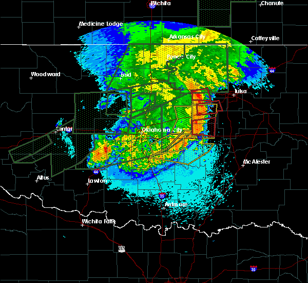 At 1208 am cdt, a severe thunderstorm capable of producing a tornado was located near welty, moving east at 50 mph. a second tornado may be forming 10 miles southwest of slick (radar indicated rotation). Hazards include tornado. Flying debris will be dangerous to those caught without shelter. mobile homes will be damaged or destroyed. damage to roofs, windows, and vehicles will occur. tree damage is likely. Locations in or near the path include, okemah, okfuskee, boley, paden, castle, welty, mason, this includes interstate 40 in oklahoma between mile markers 221 and 223. At 1208 am cdt, a severe thunderstorm capable of producing a tornado was located near welty, moving east at 50 mph. a second tornado may be forming 10 miles southwest of slick (radar indicated rotation). Hazards include tornado. Flying debris will be dangerous to those caught without shelter. mobile homes will be damaged or destroyed. damage to roofs, windows, and vehicles will occur. tree damage is likely. Locations in or near the path include, okemah, okfuskee, boley, paden, castle, welty, mason, this includes interstate 40 in oklahoma between mile markers 221 and 223.
|
| 5/26/2019 12:00 AM CDT |
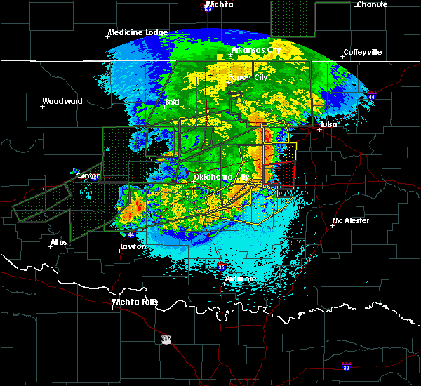 At 1200 am cdt, a severe thunderstorm capable of producing a tornado was located 4 miles north of paden, moving east at 50 mph (radar indicated rotation). Hazards include tornado. Flying debris will be dangerous to those caught without shelter. mobile homes will be damaged or destroyed. damage to roofs, windows, and vehicles will occur. tree damage is likely. Locations in or near the path include, okemah, okfuskee, boley, paden, castle, welty, mason, this includes interstate 40 in oklahoma between mile markers 221 and 223. At 1200 am cdt, a severe thunderstorm capable of producing a tornado was located 4 miles north of paden, moving east at 50 mph (radar indicated rotation). Hazards include tornado. Flying debris will be dangerous to those caught without shelter. mobile homes will be damaged or destroyed. damage to roofs, windows, and vehicles will occur. tree damage is likely. Locations in or near the path include, okemah, okfuskee, boley, paden, castle, welty, mason, this includes interstate 40 in oklahoma between mile markers 221 and 223.
|
| 5/25/2019 11:55 PM CDT |
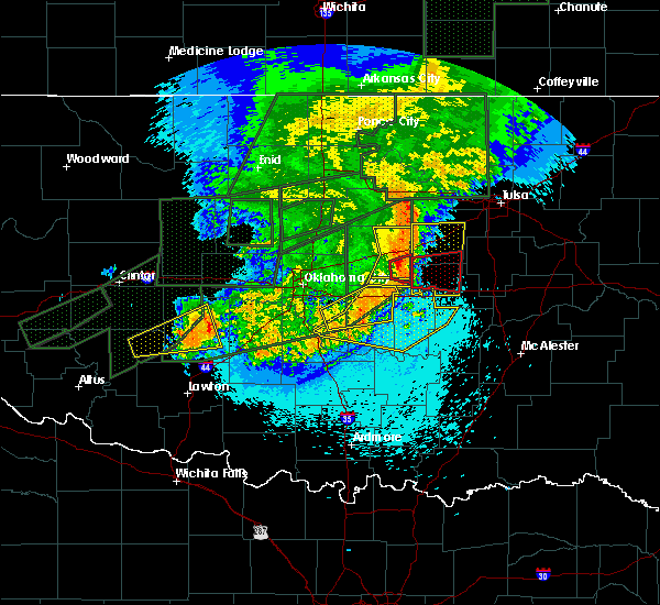 At 1154 pm cdt, a severe thunderstorm capable of producing a tornado was located 5 miles northwest of paden, moving east at 45 mph (radar indicated rotation). Hazards include tornado. Flying debris will be dangerous to those caught without shelter. mobile homes will be damaged or destroyed. damage to roofs, windows, and vehicles will occur. tree damage is likely. Locations in or near the path include, okemah, okfuskee, boley, paden, castle, welty, mason, this includes interstate 40 in oklahoma between mile markers 221 and 223. At 1154 pm cdt, a severe thunderstorm capable of producing a tornado was located 5 miles northwest of paden, moving east at 45 mph (radar indicated rotation). Hazards include tornado. Flying debris will be dangerous to those caught without shelter. mobile homes will be damaged or destroyed. damage to roofs, windows, and vehicles will occur. tree damage is likely. Locations in or near the path include, okemah, okfuskee, boley, paden, castle, welty, mason, this includes interstate 40 in oklahoma between mile markers 221 and 223.
|
| 5/25/2019 11:48 PM CDT |
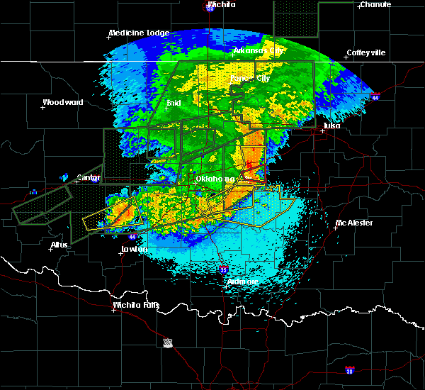 At 1148 pm cdt, a severe thunderstorm capable of producing a tornado was located 5 miles southeast of sparks, moving east at 45 mph (radar indicated rotation). Hazards include tornado. Flying debris will be dangerous to those caught without shelter. mobile homes will be damaged or destroyed. damage to roofs, windows, and vehicles will occur. tree damage is likely. Locations in or near the path include, okemah, okfuskee, boley, paden, castle, welty, mason, this includes interstate 40 in oklahoma between mile markers 221 and 223. At 1148 pm cdt, a severe thunderstorm capable of producing a tornado was located 5 miles southeast of sparks, moving east at 45 mph (radar indicated rotation). Hazards include tornado. Flying debris will be dangerous to those caught without shelter. mobile homes will be damaged or destroyed. damage to roofs, windows, and vehicles will occur. tree damage is likely. Locations in or near the path include, okemah, okfuskee, boley, paden, castle, welty, mason, this includes interstate 40 in oklahoma between mile markers 221 and 223.
|
| 5/25/2019 11:47 PM CDT |
 At 1146 pm cdt, severe thunderstorms were located along a line extending from 4 miles northeast of avery to 3 miles south of johnson, moving east at 40 mph (radar indicated). Hazards include 60 mph wind gusts. Expect damage to roofs, siding, and trees. locations in or near the path include, bristow, okemah, okfuskee, boley, kellyville, depew, paden, slick, castle, shamrock, welty, milfay, mason, this includes the following highways, interstate 40 in oklahoma between mile markers 214 and 223. Interstate 44 between mile markers 178 and 204. At 1146 pm cdt, severe thunderstorms were located along a line extending from 4 miles northeast of avery to 3 miles south of johnson, moving east at 40 mph (radar indicated). Hazards include 60 mph wind gusts. Expect damage to roofs, siding, and trees. locations in or near the path include, bristow, okemah, okfuskee, boley, kellyville, depew, paden, slick, castle, shamrock, welty, milfay, mason, this includes the following highways, interstate 40 in oklahoma between mile markers 214 and 223. Interstate 44 between mile markers 178 and 204.
|
| 5/22/2019 5:25 PM CDT |
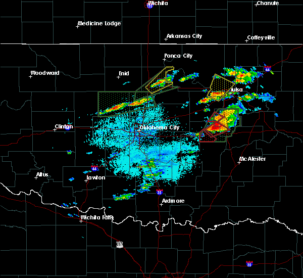 The tornado warning for south central okfuskee county will expire at 530 pm cdt, the storm which prompted the warning has moved out of the area. therefore the warning will be allowed to expire. a tornado watch remains in effect until 1100 pm cdt for east central oklahoma. remember, a tornado warning still remains in effect for northeastern okfuskee county until 600 pm. The tornado warning for south central okfuskee county will expire at 530 pm cdt, the storm which prompted the warning has moved out of the area. therefore the warning will be allowed to expire. a tornado watch remains in effect until 1100 pm cdt for east central oklahoma. remember, a tornado warning still remains in effect for northeastern okfuskee county until 600 pm.
|
| 5/22/2019 5:23 PM CDT |
 At 523 pm cdt, a confirmed tornado was located 3 miles northwest of clearview, moving northeast at 30 mph (weather spotters confirmed tornado). Hazards include damaging tornado and ping pong ball size hail. Flying debris will be dangerous to those caught without shelter. mobile homes will be damaged or destroyed. damage to roofs, windows, and vehicles will occur. tree damage is likely. Locations in or near the path include, okemah, schulter, clearview, pharoah, this includes interstate 40 in oklahoma between mile markers 220 and 231. At 523 pm cdt, a confirmed tornado was located 3 miles northwest of clearview, moving northeast at 30 mph (weather spotters confirmed tornado). Hazards include damaging tornado and ping pong ball size hail. Flying debris will be dangerous to those caught without shelter. mobile homes will be damaged or destroyed. damage to roofs, windows, and vehicles will occur. tree damage is likely. Locations in or near the path include, okemah, schulter, clearview, pharoah, this includes interstate 40 in oklahoma between mile markers 220 and 231.
|
| 5/22/2019 5:11 PM CDT |
 At 510 pm cdt, a severe thunderstorm capable of producing a tornado was located 3 miles southwest of okemah, moving northeast at 25 mph (radar indicated rotation). Hazards include tornado. Flying debris will be dangerous to those caught without shelter. mobile homes will be damaged or destroyed. damage to roofs, windows, and vehicles will occur. tree damage is likely. Locations in or near the path include, okemah, schulter, bearden, castle, clearview, pharoah, this includes interstate 40 in oklahoma between mile markers 212 and 231. At 510 pm cdt, a severe thunderstorm capable of producing a tornado was located 3 miles southwest of okemah, moving northeast at 25 mph (radar indicated rotation). Hazards include tornado. Flying debris will be dangerous to those caught without shelter. mobile homes will be damaged or destroyed. damage to roofs, windows, and vehicles will occur. tree damage is likely. Locations in or near the path include, okemah, schulter, bearden, castle, clearview, pharoah, this includes interstate 40 in oklahoma between mile markers 212 and 231.
|
| 5/22/2019 4:52 PM CDT |
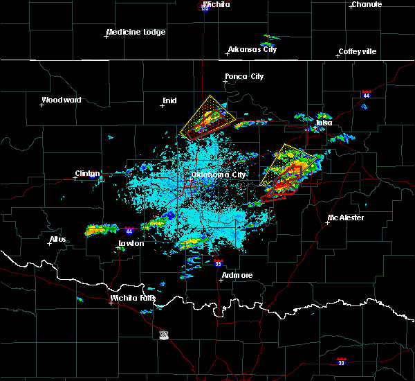 At 442 pm cdt, a severe thunderstorm with strong low level rotation that could produce a tornado at any time was located 4 miles southwest of cromwell, moving northeast at 30 mph (radar indicated rotation). Hazards include tornado. Flying debris will be dangerous to those caught without shelter. mobile homes will be damaged or destroyed. damage to roofs, windows, and vehicles will occur. tree damage is likely. Locations in or near the path include, okemah, bearden, castle, this includes interstate 40 in oklahoma between mile markers 212 and 222. At 442 pm cdt, a severe thunderstorm with strong low level rotation that could produce a tornado at any time was located 4 miles southwest of cromwell, moving northeast at 30 mph (radar indicated rotation). Hazards include tornado. Flying debris will be dangerous to those caught without shelter. mobile homes will be damaged or destroyed. damage to roofs, windows, and vehicles will occur. tree damage is likely. Locations in or near the path include, okemah, bearden, castle, this includes interstate 40 in oklahoma between mile markers 212 and 222.
|
| 5/22/2019 4:46 PM CDT |
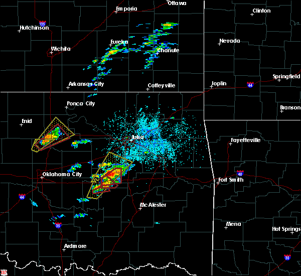 At 445 pm cdt, a confirmed tornado was located over castle, moving northeast at 30 mph (weather spotters confirmed tornado). Hazards include damaging tornado and golf ball size hail. Flying debris will be dangerous to those caught without shelter. mobile homes will be damaged or destroyed. damage to roofs, windows, and vehicles will occur. tree damage is likely. Locations in or near the path include, okfuskee, castle,. At 445 pm cdt, a confirmed tornado was located over castle, moving northeast at 30 mph (weather spotters confirmed tornado). Hazards include damaging tornado and golf ball size hail. Flying debris will be dangerous to those caught without shelter. mobile homes will be damaged or destroyed. damage to roofs, windows, and vehicles will occur. tree damage is likely. Locations in or near the path include, okfuskee, castle,.
|
| 5/22/2019 4:42 PM CDT |
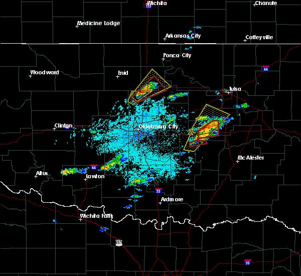 At 442 pm cdt, a severe thunderstorm with strong low level rotation that could produce a tornado at any time was located 4 miles southwest of cromwell, moving northeast at 30 mph (radar indicated rotation). Hazards include tornado. Flying debris will be dangerous to those caught without shelter. mobile homes will be damaged or destroyed. damage to roofs, windows, and vehicles will occur. tree damage is likely. Locations in or near the path include, okemah, bearden, castle, this includes interstate 40 in oklahoma between mile markers 212 and 222. At 442 pm cdt, a severe thunderstorm with strong low level rotation that could produce a tornado at any time was located 4 miles southwest of cromwell, moving northeast at 30 mph (radar indicated rotation). Hazards include tornado. Flying debris will be dangerous to those caught without shelter. mobile homes will be damaged or destroyed. damage to roofs, windows, and vehicles will occur. tree damage is likely. Locations in or near the path include, okemah, bearden, castle, this includes interstate 40 in oklahoma between mile markers 212 and 222.
|
| 5/22/2019 4:35 PM CDT |
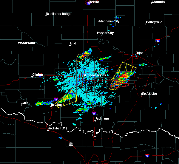 At 435 pm cdt, a confirmed tornado was located 4 miles north of bearden, moving northeast at 35 mph (weather spotters confirmed tornado). Hazards include damaging tornado and golf ball size hail. Flying debris will be dangerous to those caught without shelter. mobile homes will be damaged or destroyed. damage to roofs, windows, and vehicles will occur. tree damage is likely. Locations in or near the path include, okemah, okfuskee, bearden, castle, clearview, pharoah, this includes interstate 40 in oklahoma between mile markers 212 and 231. At 435 pm cdt, a confirmed tornado was located 4 miles north of bearden, moving northeast at 35 mph (weather spotters confirmed tornado). Hazards include damaging tornado and golf ball size hail. Flying debris will be dangerous to those caught without shelter. mobile homes will be damaged or destroyed. damage to roofs, windows, and vehicles will occur. tree damage is likely. Locations in or near the path include, okemah, okfuskee, bearden, castle, clearview, pharoah, this includes interstate 40 in oklahoma between mile markers 212 and 231.
|
| 5/22/2019 4:29 PM CDT |
 At 429 pm cdt, a severe thunderstorm capable of producing a tornado was located near cromwell, moving northeast at 35 mph (radar indicated rotation). Hazards include tornado and golf ball size hail. Flying debris will be dangerous to those caught without shelter. mobile homes will be damaged or destroyed. damage to roofs, windows, and vehicles will occur. tree damage is likely. Locations in or near the path include, okemah, okfuskee, bearden, castle, clearview, pharoah, this includes interstate 40 in oklahoma between mile markers 212 and 231. At 429 pm cdt, a severe thunderstorm capable of producing a tornado was located near cromwell, moving northeast at 35 mph (radar indicated rotation). Hazards include tornado and golf ball size hail. Flying debris will be dangerous to those caught without shelter. mobile homes will be damaged or destroyed. damage to roofs, windows, and vehicles will occur. tree damage is likely. Locations in or near the path include, okemah, okfuskee, bearden, castle, clearview, pharoah, this includes interstate 40 in oklahoma between mile markers 212 and 231.
|
| 5/22/2019 4:13 PM CDT |
 At 412 pm cdt, a severe thunderstorm was located 4 miles west of cromwell, moving northeast at 40 mph (radar indicated). Hazards include ping pong ball size hail and 60 mph wind gusts. People and animals outdoors will be injured. expect hail damage to roofs, siding, windows, and vehicles. expect wind damage to roofs, siding, and trees. locations in or near the path include, okmulgee, okemah, okfuskee, beggs, boley, bearden, slick, castle, preston, okmulgee state park, welty, mason, this includes the following highways, interstate 40 in oklahoma between mile markers 212 and 225. interstate 44 between mile markers 197 and 199. A tornado watch remains in effect until 1100 pm cdt for northeastern and east central oklahoma. At 412 pm cdt, a severe thunderstorm was located 4 miles west of cromwell, moving northeast at 40 mph (radar indicated). Hazards include ping pong ball size hail and 60 mph wind gusts. People and animals outdoors will be injured. expect hail damage to roofs, siding, windows, and vehicles. expect wind damage to roofs, siding, and trees. locations in or near the path include, okmulgee, okemah, okfuskee, beggs, boley, bearden, slick, castle, preston, okmulgee state park, welty, mason, this includes the following highways, interstate 40 in oklahoma between mile markers 212 and 225. interstate 44 between mile markers 197 and 199. A tornado watch remains in effect until 1100 pm cdt for northeastern and east central oklahoma.
|
| 5/21/2019 6:04 AM CDT |
 At 604 am cdt, severe thunderstorms were located along a line extending from 3 miles northeast of sapulpa to 2 miles north of beggs to 4 miles north of wetumka, moving east at 35 mph (radar indicated). Hazards include 60 mph wind gusts and nickel size hail. Expect damage to roofs, siding, and trees. locations in or near the path include, tulsa, okemah, sapulpa, jenks, okfuskee, glenpool, kiefer, beggs, mounds, kellyville, weleetka, bearden, slick, castle, clearview, preston, okmulgee state park, pharoah, liberty, mason, this includes the following highways, interstate 40 in oklahoma between mile markers 213 and 232. interstate 44 between mile markers 195 and 217. A tornado watch remains in effect until noon cdt for northeastern and east central oklahoma. At 604 am cdt, severe thunderstorms were located along a line extending from 3 miles northeast of sapulpa to 2 miles north of beggs to 4 miles north of wetumka, moving east at 35 mph (radar indicated). Hazards include 60 mph wind gusts and nickel size hail. Expect damage to roofs, siding, and trees. locations in or near the path include, tulsa, okemah, sapulpa, jenks, okfuskee, glenpool, kiefer, beggs, mounds, kellyville, weleetka, bearden, slick, castle, clearview, preston, okmulgee state park, pharoah, liberty, mason, this includes the following highways, interstate 40 in oklahoma between mile markers 213 and 232. interstate 44 between mile markers 195 and 217. A tornado watch remains in effect until noon cdt for northeastern and east central oklahoma.
|
| 5/21/2019 5:49 AM CDT |
 At 549 am cdt, severe thunderstorms were located along a line extending from 5 miles north of kellyville to 3 miles east of slick to 3 miles southwest of bearden, moving east at 25 mph (radar indicated). Hazards include 60 mph wind gusts and quarter size hail. Hail damage to vehicles is expected. expect wind damage to roofs, siding, and trees. locations in or near the path include, tulsa, bristow, okemah, sapulpa, jenks, okfuskee, glenpool, kiefer, beggs, boley, mounds, kellyville, weleetka, depew, paden, bearden, slick, castle, shamrock, clearview, this includes the following highways, interstate 40 in oklahoma between mile markers 212 and 232. interstate 44 between mile markers 180 and 217. A tornado watch remains in effect until noon cdt for northeastern and east central oklahoma. At 549 am cdt, severe thunderstorms were located along a line extending from 5 miles north of kellyville to 3 miles east of slick to 3 miles southwest of bearden, moving east at 25 mph (radar indicated). Hazards include 60 mph wind gusts and quarter size hail. Hail damage to vehicles is expected. expect wind damage to roofs, siding, and trees. locations in or near the path include, tulsa, bristow, okemah, sapulpa, jenks, okfuskee, glenpool, kiefer, beggs, boley, mounds, kellyville, weleetka, depew, paden, bearden, slick, castle, shamrock, clearview, this includes the following highways, interstate 40 in oklahoma between mile markers 212 and 232. interstate 44 between mile markers 180 and 217. A tornado watch remains in effect until noon cdt for northeastern and east central oklahoma.
|
| 5/21/2019 5:24 AM CDT |
 At 524 am cdt, severe thunderstorms were located along a line extending from 5 miles east of shamrock to 6 miles south of bristow to 6 miles east of seminole, moving east at 40 mph (radar indicated). Hazards include 60 mph wind gusts. Expect damage to roofs, siding, and trees. locations in or near the path include, tulsa, bristow, okemah, sapulpa, jenks, okfuskee, glenpool, kiefer, beggs, boley, mounds, kellyville, weleetka, depew, paden, bearden, slick, castle, shamrock, clearview, this includes the following highways, interstate 40 in oklahoma between mile markers 212 and 232. interstate 44 between mile markers 180 and 217. A tornado watch remains in effect until noon cdt for northeastern and east central oklahoma. At 524 am cdt, severe thunderstorms were located along a line extending from 5 miles east of shamrock to 6 miles south of bristow to 6 miles east of seminole, moving east at 40 mph (radar indicated). Hazards include 60 mph wind gusts. Expect damage to roofs, siding, and trees. locations in or near the path include, tulsa, bristow, okemah, sapulpa, jenks, okfuskee, glenpool, kiefer, beggs, boley, mounds, kellyville, weleetka, depew, paden, bearden, slick, castle, shamrock, clearview, this includes the following highways, interstate 40 in oklahoma between mile markers 212 and 232. interstate 44 between mile markers 180 and 217. A tornado watch remains in effect until noon cdt for northeastern and east central oklahoma.
|
| 5/21/2019 5:17 AM CDT |
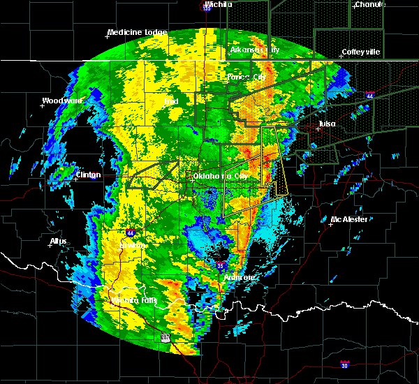 At 517 am cdt, severe thunderstorms were located along a line extending from 4 miles southeast of stroud to 6 miles west of welty to 4 miles east of francis, moving east at 40 mph (radar indicated). Hazards include 60 mph wind gusts and quarter size hail. Hail damage to vehicles is expected. expect wind damage to roofs, siding, and trees. locations in or near the path include, bristow, drumright, boley, oilton, depew, paden, bearden, castle, shamrock, welty, silver city, milfay, mason, this includes the following highways, interstate 40 in oklahoma between mile markers 212 and 219. interstate 44 between mile markers 178 and 191. A tornado watch remains in effect until noon cdt for northeastern and east central oklahoma. At 517 am cdt, severe thunderstorms were located along a line extending from 4 miles southeast of stroud to 6 miles west of welty to 4 miles east of francis, moving east at 40 mph (radar indicated). Hazards include 60 mph wind gusts and quarter size hail. Hail damage to vehicles is expected. expect wind damage to roofs, siding, and trees. locations in or near the path include, bristow, drumright, boley, oilton, depew, paden, bearden, castle, shamrock, welty, silver city, milfay, mason, this includes the following highways, interstate 40 in oklahoma between mile markers 212 and 219. interstate 44 between mile markers 178 and 191. A tornado watch remains in effect until noon cdt for northeastern and east central oklahoma.
|
| 5/21/2019 4:59 AM CDT |
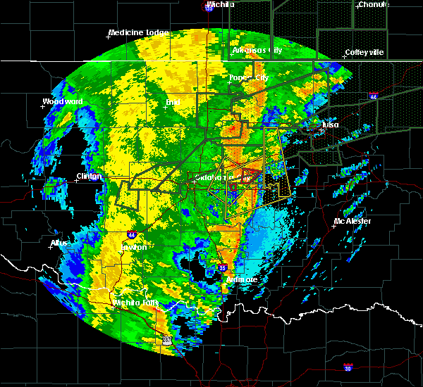 At 458 am cdt, severe thunderstorms were located along a line extending from 3 miles southwest of kendrick to 4 miles southeast of davenport to 2 miles southeast of konawa, moving northeast at 40 mph (radar indicated). Hazards include 60 mph wind gusts and quarter size hail. Hail damage to vehicles is expected. expect wind damage to roofs, siding, and trees. locations in or near the path include, bristow, drumright, boley, oilton, depew, paden, bearden, castle, shamrock, welty, silver city, milfay, mason, this includes the following highways, interstate 40 in oklahoma between mile markers 212 and 219. Interstate 44 between mile markers 178 and 191. At 458 am cdt, severe thunderstorms were located along a line extending from 3 miles southwest of kendrick to 4 miles southeast of davenport to 2 miles southeast of konawa, moving northeast at 40 mph (radar indicated). Hazards include 60 mph wind gusts and quarter size hail. Hail damage to vehicles is expected. expect wind damage to roofs, siding, and trees. locations in or near the path include, bristow, drumright, boley, oilton, depew, paden, bearden, castle, shamrock, welty, silver city, milfay, mason, this includes the following highways, interstate 40 in oklahoma between mile markers 212 and 219. Interstate 44 between mile markers 178 and 191.
|
| 5/18/2019 10:44 AM CDT |
 At 1044 am cdt, severe thunderstorms were located along a line extending from 4 miles east of kellyville to 6 miles south of okfuskee, moving east at 35 mph (radar indicated). Hazards include 60 mph wind gusts. Expect damage to roofs, siding, and trees. locations in or near the path include, bristow, okemah, sapulpa, okfuskee, kiefer, beggs, boley, mounds, kellyville, depew, slick, castle, clearview, okmulgee state park, welty, pharoah, bryant, mason, this includes the following highways, interstate 40 in oklahoma between mile markers 212 and 233. interstate 44 between mile markers 183 and 215. A tornado watch remains in effect until 500 pm cdt for northeastern and east central oklahoma. At 1044 am cdt, severe thunderstorms were located along a line extending from 4 miles east of kellyville to 6 miles south of okfuskee, moving east at 35 mph (radar indicated). Hazards include 60 mph wind gusts. Expect damage to roofs, siding, and trees. locations in or near the path include, bristow, okemah, sapulpa, okfuskee, kiefer, beggs, boley, mounds, kellyville, depew, slick, castle, clearview, okmulgee state park, welty, pharoah, bryant, mason, this includes the following highways, interstate 40 in oklahoma between mile markers 212 and 233. interstate 44 between mile markers 183 and 215. A tornado watch remains in effect until 500 pm cdt for northeastern and east central oklahoma.
|
| 5/18/2019 10:22 AM CDT |
 At 1021 am cdt, severe thunderstorms were located along a line extending from 6 miles north of bristow to near boley, moving northeast at 65 mph (radar indicated). Hazards include 60 mph wind gusts. Expect damage to roofs, siding, and trees. locations in or near the path include, bristow, okemah, sapulpa, okfuskee, drumright, kiefer, beggs, boley, mounds, kellyville, depew, paden, slick, castle, shamrock, clearview, okmulgee state park, welty, pharoah, bryant, this includes the following highways, interstate 40 in oklahoma between mile markers 212 and 233. interstate 44 between mile markers 178 and 215. A tornado watch remains in effect until 500 pm cdt for northeastern and east central oklahoma. At 1021 am cdt, severe thunderstorms were located along a line extending from 6 miles north of bristow to near boley, moving northeast at 65 mph (radar indicated). Hazards include 60 mph wind gusts. Expect damage to roofs, siding, and trees. locations in or near the path include, bristow, okemah, sapulpa, okfuskee, drumright, kiefer, beggs, boley, mounds, kellyville, depew, paden, slick, castle, shamrock, clearview, okmulgee state park, welty, pharoah, bryant, this includes the following highways, interstate 40 in oklahoma between mile markers 212 and 233. interstate 44 between mile markers 178 and 215. A tornado watch remains in effect until 500 pm cdt for northeastern and east central oklahoma.
|
| 5/6/2019 2:13 AM CDT | Tree damage in town. lots of 2-4 inch diameter limbs and a few 2-3 foot limbs down. time estimated by rada in okfuskee county OK, 0.1 miles SSW of Okemah, OK |
| 3/24/2019 12:19 AM CDT |
 At 1219 am cdt, a severe thunderstorm was located near clearview, moving east at 30 mph (radar indicated). Hazards include quarter size hail. Damage to vehicles is expected. Locations in or near the path include, okemah, henryetta, morris, dewar, schulter, grayson, hoffman, clearview, pharoah, bryant, this includes interstate 40 in oklahoma between mile markers 219 and 248. At 1219 am cdt, a severe thunderstorm was located near clearview, moving east at 30 mph (radar indicated). Hazards include quarter size hail. Damage to vehicles is expected. Locations in or near the path include, okemah, henryetta, morris, dewar, schulter, grayson, hoffman, clearview, pharoah, bryant, this includes interstate 40 in oklahoma between mile markers 219 and 248.
|
| 3/23/2019 9:11 PM CDT |
 The severe thunderstorm warning for southwestern okmulgee and central okfuskee counties will expire at 915 pm cdt, the storm which prompted the warning has weakened below severe limits, and no longer poses an immediate threat to life or property. therefore the warning will be allowed to expire. however small hail and gusty winds are still possible with this thunderstorm. a severe thunderstorm watch remains in effect until 1000 pm cdt for southeastern, northeastern and east central oklahoma. The severe thunderstorm warning for southwestern okmulgee and central okfuskee counties will expire at 915 pm cdt, the storm which prompted the warning has weakened below severe limits, and no longer poses an immediate threat to life or property. therefore the warning will be allowed to expire. however small hail and gusty winds are still possible with this thunderstorm. a severe thunderstorm watch remains in effect until 1000 pm cdt for southeastern, northeastern and east central oklahoma.
|
| 3/23/2019 8:48 PM CDT |
 At 848 pm cdt, a severe thunderstorm was located 3 miles southwest of okfuskee, moving east at 20 mph (radar indicated). Hazards include 60 mph wind gusts and quarter size hail. Hail damage to vehicles is expected. expect wind damage to roofs, siding, and trees. Locations in or near the path include, okmulgee, okemah, okfuskee, henryetta, okmulgee state park, pharoah, bryant, mason, this includes interstate 40 in oklahoma between mile markers 221 and 237. At 848 pm cdt, a severe thunderstorm was located 3 miles southwest of okfuskee, moving east at 20 mph (radar indicated). Hazards include 60 mph wind gusts and quarter size hail. Hail damage to vehicles is expected. expect wind damage to roofs, siding, and trees. Locations in or near the path include, okmulgee, okemah, okfuskee, henryetta, okmulgee state park, pharoah, bryant, mason, this includes interstate 40 in oklahoma between mile markers 221 and 237.
|
| 3/23/2019 8:27 PM CDT |
 At 826 pm cdt, a severe thunderstorm was located 3 miles northwest of castle, moving east at 30 mph (radar indicated). Hazards include 60 mph wind gusts and quarter size hail. Hail damage to vehicles is expected. expect wind damage to roofs, siding, and trees. Locations in or near the path include, okmulgee, okemah, okfuskee, henryetta, castle, clearview, okmulgee state park, pharoah, bryant, mason, this includes interstate 40 in oklahoma between mile markers 216 and 237. At 826 pm cdt, a severe thunderstorm was located 3 miles northwest of castle, moving east at 30 mph (radar indicated). Hazards include 60 mph wind gusts and quarter size hail. Hail damage to vehicles is expected. expect wind damage to roofs, siding, and trees. Locations in or near the path include, okmulgee, okemah, okfuskee, henryetta, castle, clearview, okmulgee state park, pharoah, bryant, mason, this includes interstate 40 in oklahoma between mile markers 216 and 237.
|
| 3/23/2019 8:12 PM CDT |
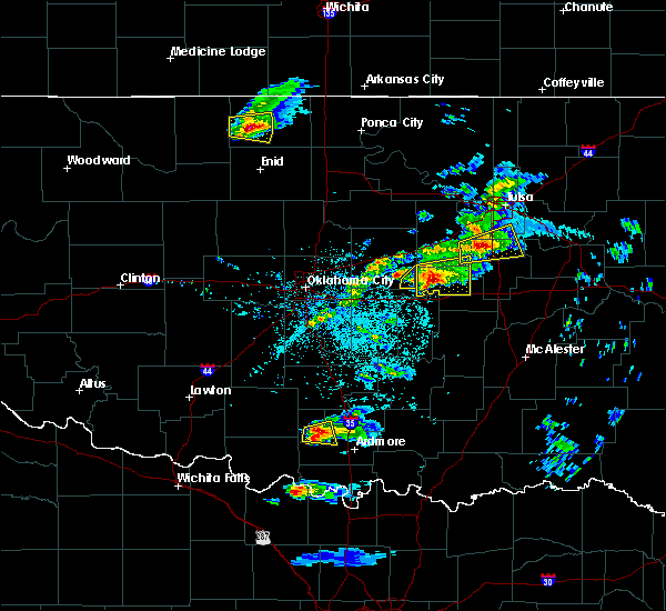 At 812 pm cdt, a severe thunderstorm was located near boley, moving east at 30 mph (radar indicated). Hazards include 60 mph wind gusts and quarter size hail. Hail damage to vehicles is expected. expect wind damage to roofs, siding, and trees. Locations in or near the path include, okemah, okfuskee, boley, paden, castle, welty, mason, this includes interstate 40 in oklahoma between mile markers 219 and 225. At 812 pm cdt, a severe thunderstorm was located near boley, moving east at 30 mph (radar indicated). Hazards include 60 mph wind gusts and quarter size hail. Hail damage to vehicles is expected. expect wind damage to roofs, siding, and trees. Locations in or near the path include, okemah, okfuskee, boley, paden, castle, welty, mason, this includes interstate 40 in oklahoma between mile markers 219 and 225.
|
| 3/23/2019 7:50 PM CDT |
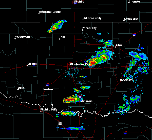 At 750 pm cdt, a severe thunderstorm was located 4 miles northeast of prague, moving east at 35 mph (radar indicated). Hazards include 60 mph wind gusts and quarter size hail. Hail damage to vehicles is expected. expect wind damage to roofs, siding, and trees. Locations in or near the path include, okemah, okfuskee, boley, paden, castle, welty, mason, this includes interstate 40 in oklahoma between mile markers 219 and 225. At 750 pm cdt, a severe thunderstorm was located 4 miles northeast of prague, moving east at 35 mph (radar indicated). Hazards include 60 mph wind gusts and quarter size hail. Hail damage to vehicles is expected. expect wind damage to roofs, siding, and trees. Locations in or near the path include, okemah, okfuskee, boley, paden, castle, welty, mason, this includes interstate 40 in oklahoma between mile markers 219 and 225.
|
| 12/26/2018 9:08 PM CST |
 At 907 pm cst, a severe thunderstorm was located 7 miles south of cromwell, moving northeast at 50 mph (radar indicated). Hazards include 60 mph wind gusts. Expect damage to roofs, siding, and trees. Locations in or near the path include, okmulgee, okemah, henryetta, morris, weleetka, dewar, schulter, grayson, hanna, bearden, hoffman, clearview, stidham, raiford, bald hill, vivian, okmulgee state park, lake eufaula state park, pharoah, hitchita, this includes interstate 40 in oklahoma between mile markers 212 and 258. At 907 pm cst, a severe thunderstorm was located 7 miles south of cromwell, moving northeast at 50 mph (radar indicated). Hazards include 60 mph wind gusts. Expect damage to roofs, siding, and trees. Locations in or near the path include, okmulgee, okemah, henryetta, morris, weleetka, dewar, schulter, grayson, hanna, bearden, hoffman, clearview, stidham, raiford, bald hill, vivian, okmulgee state park, lake eufaula state park, pharoah, hitchita, this includes interstate 40 in oklahoma between mile markers 212 and 258.
|
| 10/9/2018 9:56 AM CDT |
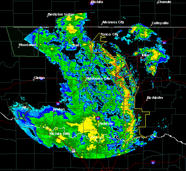 At 956 am cdt, severe thunderstorms were located along a line extending from 2 miles east of drumright to horntown, moving northeast at 35 mph (radar indicated). Hazards include 60 mph wind gusts. Expect damage to roofs, siding, and trees. locations in or near the path include, bristow, okemah, okfuskee, drumright, boley, weleetka, depew, paden, bearden, slick, castle, shamrock, clearview, welty, pharoah, milfay, mason, this includes the following highways, interstate 40 in oklahoma between mile markers 212 and 231. interstate 44 between mile markers 178 and 197. A tornado watch remains in effect until 200 pm cdt for northeastern and east central oklahoma. At 956 am cdt, severe thunderstorms were located along a line extending from 2 miles east of drumright to horntown, moving northeast at 35 mph (radar indicated). Hazards include 60 mph wind gusts. Expect damage to roofs, siding, and trees. locations in or near the path include, bristow, okemah, okfuskee, drumright, boley, weleetka, depew, paden, bearden, slick, castle, shamrock, clearview, welty, pharoah, milfay, mason, this includes the following highways, interstate 40 in oklahoma between mile markers 212 and 231. interstate 44 between mile markers 178 and 197. A tornado watch remains in effect until 200 pm cdt for northeastern and east central oklahoma.
|
| 10/9/2018 9:29 AM CDT |
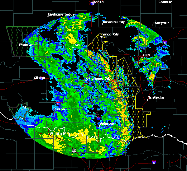 At 928 am cdt, severe thunderstorms were located along a line extending from near agra to 4 miles east of sasakwa, moving northeast at 40 mph (radar indicated). Hazards include 60 mph wind gusts. Expect damage to roofs, siding, and trees. locations in or near the path include, bristow, okemah, okfuskee, drumright, boley, weleetka, depew, paden, bearden, slick, castle, shamrock, clearview, welty, pharoah, milfay, mason, this includes the following highways, interstate 40 in oklahoma between mile markers 212 and 231. interstate 44 between mile markers 178 and 197. A tornado watch remains in effect until 200 pm cdt for northeastern and east central oklahoma. At 928 am cdt, severe thunderstorms were located along a line extending from near agra to 4 miles east of sasakwa, moving northeast at 40 mph (radar indicated). Hazards include 60 mph wind gusts. Expect damage to roofs, siding, and trees. locations in or near the path include, bristow, okemah, okfuskee, drumright, boley, weleetka, depew, paden, bearden, slick, castle, shamrock, clearview, welty, pharoah, milfay, mason, this includes the following highways, interstate 40 in oklahoma between mile markers 212 and 231. interstate 44 between mile markers 178 and 197. A tornado watch remains in effect until 200 pm cdt for northeastern and east central oklahoma.
|
| 7/28/2018 5:41 PM CDT |
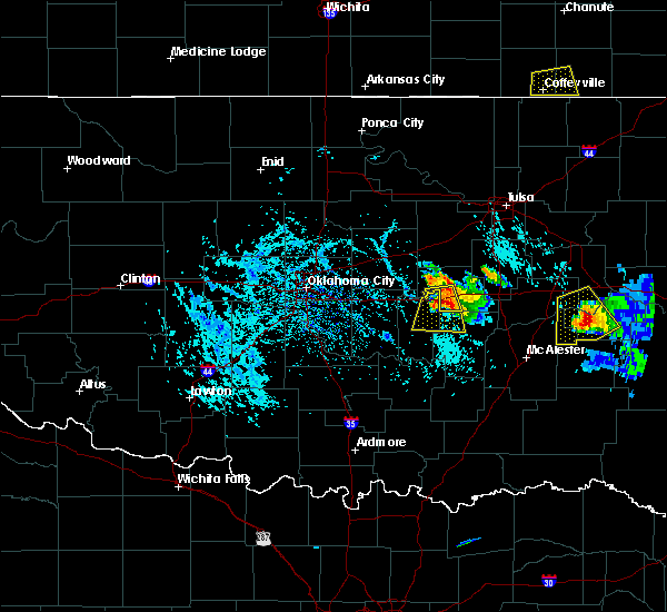 At 541 pm cdt, a severe thunderstorm was located near cromwell, moving south at 20 mph (radar indicated). Hazards include 70 mph wind gusts and ping pong ball size hail. People and animals outdoors will be injured. expect hail damage to roofs, siding, windows, and vehicles. expect considerable tree damage. wind damage is also likely to mobile homes, roofs, and outbuildings. Locations in or near the path include, bearden, castle, this includes interstate 40 in oklahoma between mile markers 212 and 219. At 541 pm cdt, a severe thunderstorm was located near cromwell, moving south at 20 mph (radar indicated). Hazards include 70 mph wind gusts and ping pong ball size hail. People and animals outdoors will be injured. expect hail damage to roofs, siding, windows, and vehicles. expect considerable tree damage. wind damage is also likely to mobile homes, roofs, and outbuildings. Locations in or near the path include, bearden, castle, this includes interstate 40 in oklahoma between mile markers 212 and 219.
|
| 7/28/2018 5:29 PM CDT |
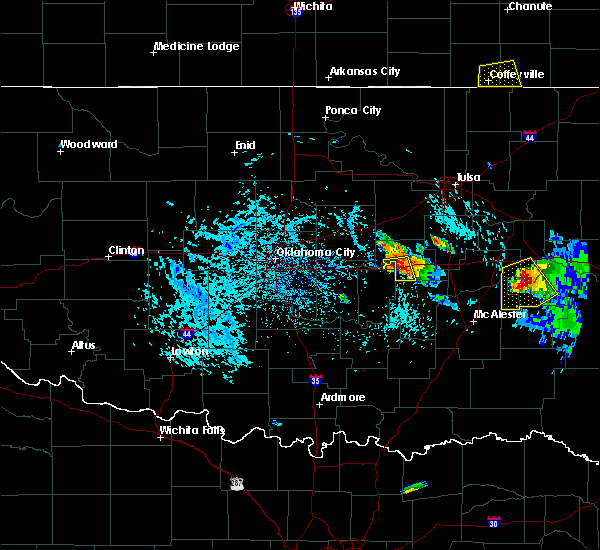 At 529 pm cdt, a severe thunderstorm was located 4 miles southwest of castle, moving south at 25 mph (radar indicated). Hazards include 60 mph wind gusts and quarter size hail. Hail damage to vehicles is expected. expect wind damage to roofs, siding, and trees. Locations in or near the path include, bearden, castle, this includes interstate 40 in oklahoma between mile markers 212 and 219. At 529 pm cdt, a severe thunderstorm was located 4 miles southwest of castle, moving south at 25 mph (radar indicated). Hazards include 60 mph wind gusts and quarter size hail. Hail damage to vehicles is expected. expect wind damage to roofs, siding, and trees. Locations in or near the path include, bearden, castle, this includes interstate 40 in oklahoma between mile markers 212 and 219.
|
| 6/24/2018 5:00 AM CDT | Reported by the oklahoma mesone in okfuskee county OK, 2.9 miles W of Okemah, OK |
| 6/23/2018 11:58 PM CDT |
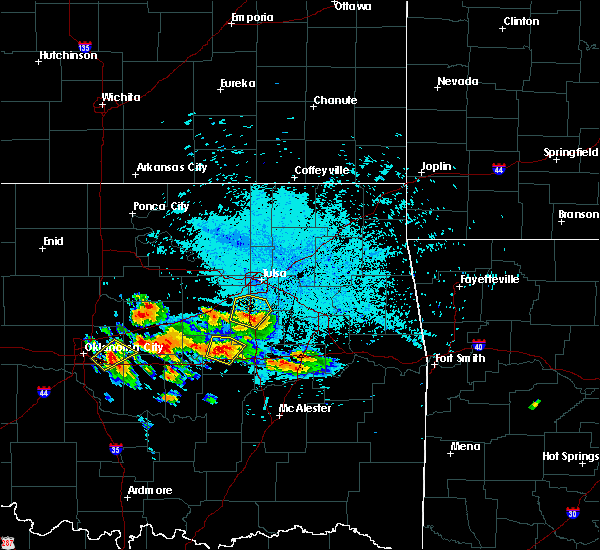 At 1158 pm cdt, a severe thunderstorm was located 4 miles north of okemah, moving northeast at 5 mph (radar indicated). Hazards include 60 mph wind gusts and quarter size hail. Hail damage to vehicles is expected. expect wind damage to roofs, siding, and trees. Locations in or near the path include, okemah, okfuskee, castle, clearview, mason, this includes interstate 40 in oklahoma between mile markers 220 and 228. At 1158 pm cdt, a severe thunderstorm was located 4 miles north of okemah, moving northeast at 5 mph (radar indicated). Hazards include 60 mph wind gusts and quarter size hail. Hail damage to vehicles is expected. expect wind damage to roofs, siding, and trees. Locations in or near the path include, okemah, okfuskee, castle, clearview, mason, this includes interstate 40 in oklahoma between mile markers 220 and 228.
|
| 6/23/2018 11:50 PM CDT | Half Dollar sized hail reported 6 miles SSE of Okemah, OK |
| 6/23/2018 11:27 PM CDT |
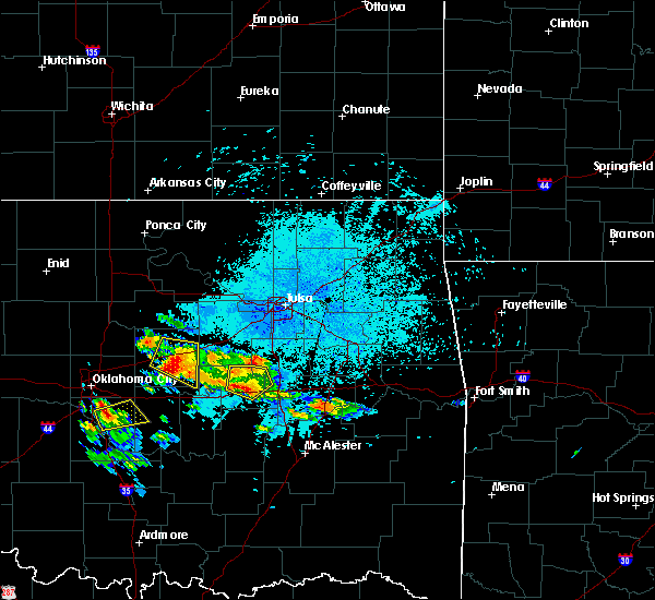 At 1126 pm cdt, a severe thunderstorm was located over okemah, moving north at 10 mph (radar indicated). Hazards include 60 mph wind gusts and half dollar size hail. Hail damage to vehicles is expected. expect wind damage to roofs, siding, and trees. Locations in or near the path include, okemah, okfuskee, castle, clearview, okmulgee state park, pharoah, mason, this includes interstate 40 in oklahoma between mile markers 219 and 232. At 1126 pm cdt, a severe thunderstorm was located over okemah, moving north at 10 mph (radar indicated). Hazards include 60 mph wind gusts and half dollar size hail. Hail damage to vehicles is expected. expect wind damage to roofs, siding, and trees. Locations in or near the path include, okemah, okfuskee, castle, clearview, okmulgee state park, pharoah, mason, this includes interstate 40 in oklahoma between mile markers 219 and 232.
|
| 6/23/2018 11:05 PM CDT |
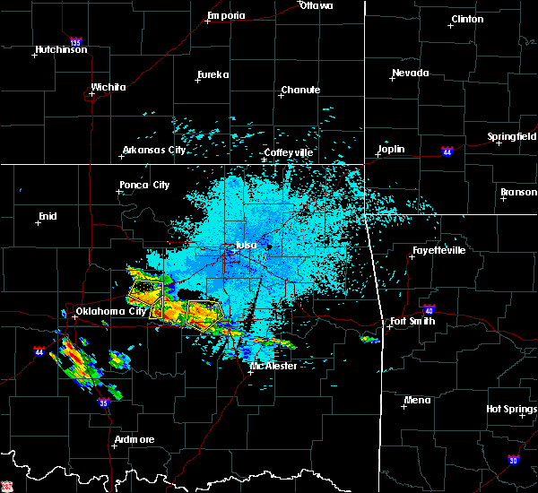 At 1104 pm cdt, a severe thunderstorm was located over okemah, moving northeast at 10 mph (radar indicated). Hazards include 60 mph wind gusts and half dollar size hail. Hail damage to vehicles is expected. expect wind damage to roofs, siding, and trees. Locations in or near the path include, okemah, okfuskee, castle, clearview, okmulgee state park, pharoah, mason, this includes interstate 40 in oklahoma between mile markers 216 and 232. At 1104 pm cdt, a severe thunderstorm was located over okemah, moving northeast at 10 mph (radar indicated). Hazards include 60 mph wind gusts and half dollar size hail. Hail damage to vehicles is expected. expect wind damage to roofs, siding, and trees. Locations in or near the path include, okemah, okfuskee, castle, clearview, okmulgee state park, pharoah, mason, this includes interstate 40 in oklahoma between mile markers 216 and 232.
|
| 6/22/2018 11:49 PM CDT |
 At 1149 pm cdt, severe thunderstorms were located along a line extending from near kellyville to 5 miles north of slick to 3 miles south of paden, moving east at 45 mph (radar indicated). Hazards include 70 mph wind gusts. Expect considerable tree damage. damage is likely to mobile homes, roofs, and outbuildings. locations in or near the path include, okmulgee, bristow, okemah, okfuskee, beggs, boley, mounds, depew, paden, bearden, slick, castle, shamrock, clearview, preston, okmulgee state park, welty, pharoah, liberty, milfay, this includes the following highways, interstate 40 in oklahoma between mile markers 212 and 231. Interstate 44 between mile markers 178 and 198. At 1149 pm cdt, severe thunderstorms were located along a line extending from near kellyville to 5 miles north of slick to 3 miles south of paden, moving east at 45 mph (radar indicated). Hazards include 70 mph wind gusts. Expect considerable tree damage. damage is likely to mobile homes, roofs, and outbuildings. locations in or near the path include, okmulgee, bristow, okemah, okfuskee, beggs, boley, mounds, depew, paden, bearden, slick, castle, shamrock, clearview, preston, okmulgee state park, welty, pharoah, liberty, milfay, this includes the following highways, interstate 40 in oklahoma between mile markers 212 and 231. Interstate 44 between mile markers 178 and 198.
|
| 6/22/2018 11:20 PM CDT |
 At 1120 pm cdt, severe thunderstorms were located along a line extending from 3 miles southwest of oilton to 4 miles west of shamrock to 2 miles south of chandler, moving east at 45 mph (radar indicated). Hazards include 70 mph wind gusts. Expect considerable tree damage. damage is likely to mobile homes, roofs, and outbuildings. locations in or near the path include, okmulgee, bristow, okemah, okfuskee, beggs, boley, mounds, depew, paden, bearden, slick, castle, shamrock, clearview, preston, okmulgee state park, welty, pharoah, liberty, milfay, this includes the following highways, interstate 40 in oklahoma between mile markers 212 and 231. Interstate 44 between mile markers 178 and 198. At 1120 pm cdt, severe thunderstorms were located along a line extending from 3 miles southwest of oilton to 4 miles west of shamrock to 2 miles south of chandler, moving east at 45 mph (radar indicated). Hazards include 70 mph wind gusts. Expect considerable tree damage. damage is likely to mobile homes, roofs, and outbuildings. locations in or near the path include, okmulgee, bristow, okemah, okfuskee, beggs, boley, mounds, depew, paden, bearden, slick, castle, shamrock, clearview, preston, okmulgee state park, welty, pharoah, liberty, milfay, this includes the following highways, interstate 40 in oklahoma between mile markers 212 and 231. Interstate 44 between mile markers 178 and 198.
|
| 5/31/2018 5:08 AM CDT |
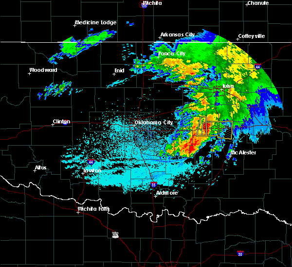 At 508 am cdt, severe thunderstorms were located along a line extending from 4 miles southeast of okfuskee to 4 miles north of wetumka, moving east at 30 mph (radar indicated). Hazards include 60 mph wind gusts and half dollar size hail. Hail damage to vehicles is expected. expect wind damage to roofs, siding, and trees. Locations in or near the path include, okemah, okfuskee, clearview, this includes interstate 40 in oklahoma between mile markers 218 and 226. At 508 am cdt, severe thunderstorms were located along a line extending from 4 miles southeast of okfuskee to 4 miles north of wetumka, moving east at 30 mph (radar indicated). Hazards include 60 mph wind gusts and half dollar size hail. Hail damage to vehicles is expected. expect wind damage to roofs, siding, and trees. Locations in or near the path include, okemah, okfuskee, clearview, this includes interstate 40 in oklahoma between mile markers 218 and 226.
|
| 5/31/2018 4:41 AM CDT |
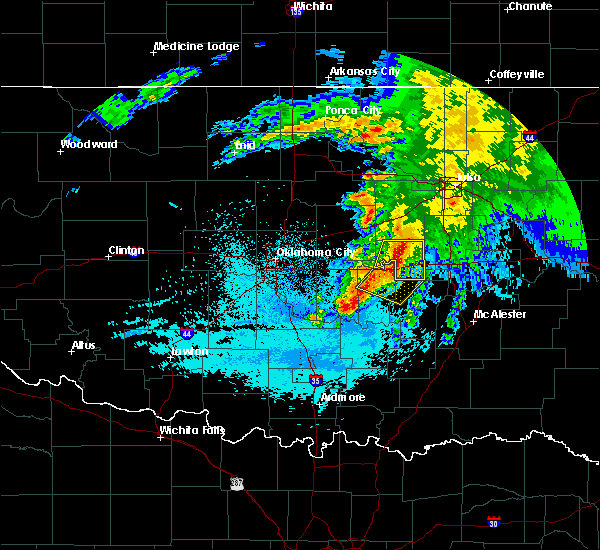 At 441 am cdt, severe thunderstorms were located along a line extending from 3 miles east of welty to near cromwell, moving east at 45 mph (radar indicated). Hazards include 60 mph wind gusts and half dollar size hail. Hail damage to vehicles is expected. expect wind damage to roofs, siding, and trees. Locations in or near the path include, okemah, okfuskee, boley, paden, bearden, castle, clearview, welty, mason, this includes interstate 40 in oklahoma between mile markers 212 and 226. At 441 am cdt, severe thunderstorms were located along a line extending from 3 miles east of welty to near cromwell, moving east at 45 mph (radar indicated). Hazards include 60 mph wind gusts and half dollar size hail. Hail damage to vehicles is expected. expect wind damage to roofs, siding, and trees. Locations in or near the path include, okemah, okfuskee, boley, paden, bearden, castle, clearview, welty, mason, this includes interstate 40 in oklahoma between mile markers 212 and 226.
|
| 5/31/2018 4:24 AM CDT |
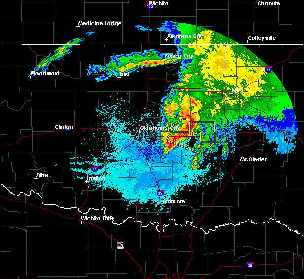 At 424 am cdt, severe thunderstorms were located along a line extending from 7 miles south of depew to 3 miles north of little, moving east at 20 mph (radar indicated). Hazards include 60 mph wind gusts and quarter size hail. Hail damage to vehicles is expected. expect wind damage to roofs, siding, and trees. Locations in or near the path include, okemah, okfuskee, boley, paden, bearden, castle, clearview, welty, mason, this includes interstate 40 in oklahoma between mile markers 212 and 226. At 424 am cdt, severe thunderstorms were located along a line extending from 7 miles south of depew to 3 miles north of little, moving east at 20 mph (radar indicated). Hazards include 60 mph wind gusts and quarter size hail. Hail damage to vehicles is expected. expect wind damage to roofs, siding, and trees. Locations in or near the path include, okemah, okfuskee, boley, paden, bearden, castle, clearview, welty, mason, this includes interstate 40 in oklahoma between mile markers 212 and 226.
|
| 5/20/2018 2:46 AM CDT |
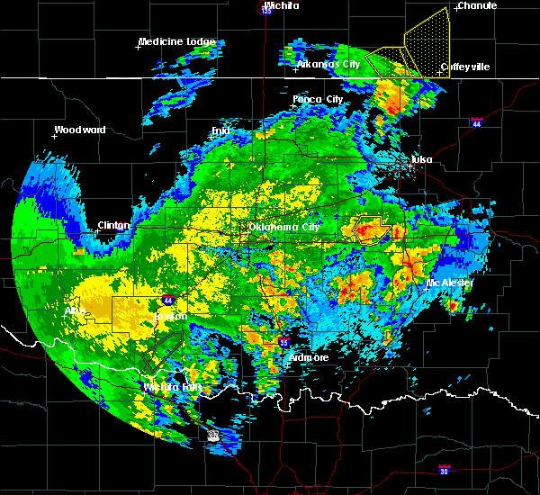 At 245 am cdt, a severe thunderstorm was located 4 miles north of okemah, moving northeast at 45 mph (radar indicated). Hazards include 60 mph wind gusts and penny size hail. Expect damage to roofs, siding, and trees. Locations in or near the path include, okemah, okfuskee, castle, mason, this includes interstate 40 in oklahoma between mile markers 214 and 226. At 245 am cdt, a severe thunderstorm was located 4 miles north of okemah, moving northeast at 45 mph (radar indicated). Hazards include 60 mph wind gusts and penny size hail. Expect damage to roofs, siding, and trees. Locations in or near the path include, okemah, okfuskee, castle, mason, this includes interstate 40 in oklahoma between mile markers 214 and 226.
|
| 5/20/2018 2:36 AM CDT |
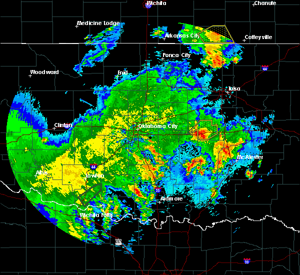 At 236 am cdt, severe thunderstorms were located along a line extending from 5 miles south of boley to 2 miles east of bearden, moving northeast at 40 mph (radar indicated). Hazards include 60 mph wind gusts and penny size hail. Expect damage to roofs, siding, and trees. Locations in or near the path include, okemah, okfuskee, boley, bearden, castle, clearview, pharoah, welty, mason, this includes interstate 40 in oklahoma between mile markers 212 and 231. At 236 am cdt, severe thunderstorms were located along a line extending from 5 miles south of boley to 2 miles east of bearden, moving northeast at 40 mph (radar indicated). Hazards include 60 mph wind gusts and penny size hail. Expect damage to roofs, siding, and trees. Locations in or near the path include, okemah, okfuskee, boley, bearden, castle, clearview, pharoah, welty, mason, this includes interstate 40 in oklahoma between mile markers 212 and 231.
|
| 5/3/2018 9:25 AM CDT |
 At 925 am cdt, severe thunderstorms were located along a line extending from 6 miles northeast of welty to 6 miles south of okfuskee to 2 miles southwest of weleetka, moving northeast at 45 mph (radar indicated). Hazards include 60 mph wind gusts. Expect damage to roofs, siding, and trees. Locations in or near the path include, okmulgee, okemah, henryetta, weleetka, dewar, schulter, grayson, hanna, hoffman, clearview, raiford, okmulgee state park, pharoah, bryant, vernon, this includes interstate 40 in oklahoma between mile markers 218 and 248. At 925 am cdt, severe thunderstorms were located along a line extending from 6 miles northeast of welty to 6 miles south of okfuskee to 2 miles southwest of weleetka, moving northeast at 45 mph (radar indicated). Hazards include 60 mph wind gusts. Expect damage to roofs, siding, and trees. Locations in or near the path include, okmulgee, okemah, henryetta, weleetka, dewar, schulter, grayson, hanna, hoffman, clearview, raiford, okmulgee state park, pharoah, bryant, vernon, this includes interstate 40 in oklahoma between mile markers 218 and 248.
|
| 5/3/2018 9:06 AM CDT |
 At 905 am cdt, severe thunderstorms were located along a line extending from 4 miles northwest of cromwell to 4 miles northwest of yeager to 3 miles north of atwood, moving east at 50 mph (radar indicated). Hazards include 60 mph wind gusts. Expect damage to roofs, siding, and trees. Locations in or near the path include, okmulgee, okemah, henryetta, weleetka, dewar, schulter, grayson, hanna, bearden, hoffman, castle, clearview, raiford, okmulgee state park, pharoah, bryant, vernon, this includes interstate 40 in oklahoma between mile markers 212 and 248. At 905 am cdt, severe thunderstorms were located along a line extending from 4 miles northwest of cromwell to 4 miles northwest of yeager to 3 miles north of atwood, moving east at 50 mph (radar indicated). Hazards include 60 mph wind gusts. Expect damage to roofs, siding, and trees. Locations in or near the path include, okmulgee, okemah, henryetta, weleetka, dewar, schulter, grayson, hanna, bearden, hoffman, castle, clearview, raiford, okmulgee state park, pharoah, bryant, vernon, this includes interstate 40 in oklahoma between mile markers 212 and 248.
|
| 5/2/2018 9:36 PM CDT |
 At 936 pm cdt, severe thunderstorms were located along a line extending from 2 miles southwest of cushing to 2 miles northwest of seminole, moving northeast at 45 mph (radar indicated). Hazards include 60 mph wind gusts. Expect damage to roofs, siding, and trees. locations in or near the path include, bristow, okemah, sapulpa, okfuskee, henryetta, drumright, beggs, boley, kellyville, weleetka, depew, paden, bearden, slick, castle, shamrock, clearview, okmulgee state park, welty, pharoah, this includes the following highways, interstate 40 in oklahoma between mile markers 212 and 236. interstate 44 between mile markers 178 and 211. A tornado watch remains in effect until 300 am cdt for southeastern, northeastern and east central oklahoma. At 936 pm cdt, severe thunderstorms were located along a line extending from 2 miles southwest of cushing to 2 miles northwest of seminole, moving northeast at 45 mph (radar indicated). Hazards include 60 mph wind gusts. Expect damage to roofs, siding, and trees. locations in or near the path include, bristow, okemah, sapulpa, okfuskee, henryetta, drumright, beggs, boley, kellyville, weleetka, depew, paden, bearden, slick, castle, shamrock, clearview, okmulgee state park, welty, pharoah, this includes the following highways, interstate 40 in oklahoma between mile markers 212 and 236. interstate 44 between mile markers 178 and 211. A tornado watch remains in effect until 300 am cdt for southeastern, northeastern and east central oklahoma.
|
| 4/13/2018 3:06 PM CDT |
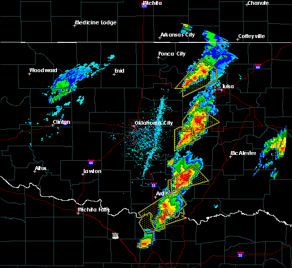 At 305 pm cdt, a severe thunderstorm was located 5 miles west of okfuskee, moving northeast at 60 mph (radar indicated). Hazards include 70 mph wind gusts and half dollar size hail. Hail damage to vehicles is expected. expect considerable tree damage. wind damage is also likely to mobile homes, roofs, and outbuildings. locations in or near the path include, okemah, okfuskee, bearden, slick, castle, okmulgee state park, welty, mason, this includes interstate 40 in oklahoma between mile markers 212 and 224. A tornado watch remains in effect until 1000 pm cdt for northeastern and east central oklahoma. At 305 pm cdt, a severe thunderstorm was located 5 miles west of okfuskee, moving northeast at 60 mph (radar indicated). Hazards include 70 mph wind gusts and half dollar size hail. Hail damage to vehicles is expected. expect considerable tree damage. wind damage is also likely to mobile homes, roofs, and outbuildings. locations in or near the path include, okemah, okfuskee, bearden, slick, castle, okmulgee state park, welty, mason, this includes interstate 40 in oklahoma between mile markers 212 and 224. A tornado watch remains in effect until 1000 pm cdt for northeastern and east central oklahoma.
|
| 4/13/2018 2:49 PM CDT |
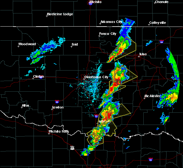 At 249 pm cdt, a severe thunderstorm was located 3 miles southwest of boley, moving northeast at 50 mph (radar indicated). Hazards include 70 mph wind gusts and half dollar size hail. Hail damage to vehicles is expected. expect considerable tree damage. wind damage is also likely to mobile homes, roofs, and outbuildings. locations in or near the path include, bristow, okemah, okfuskee, boley, paden, bearden, slick, castle, okmulgee state park, welty, mason, this includes the following highways, interstate 40 in oklahoma between mile markers 212 and 224. interstate 44 between mile markers 189 and 192. A tornado watch remains in effect until 1000 pm cdt for northeastern and east central oklahoma. At 249 pm cdt, a severe thunderstorm was located 3 miles southwest of boley, moving northeast at 50 mph (radar indicated). Hazards include 70 mph wind gusts and half dollar size hail. Hail damage to vehicles is expected. expect considerable tree damage. wind damage is also likely to mobile homes, roofs, and outbuildings. locations in or near the path include, bristow, okemah, okfuskee, boley, paden, bearden, slick, castle, okmulgee state park, welty, mason, this includes the following highways, interstate 40 in oklahoma between mile markers 212 and 224. interstate 44 between mile markers 189 and 192. A tornado watch remains in effect until 1000 pm cdt for northeastern and east central oklahoma.
|
| 4/13/2018 2:38 PM CDT |
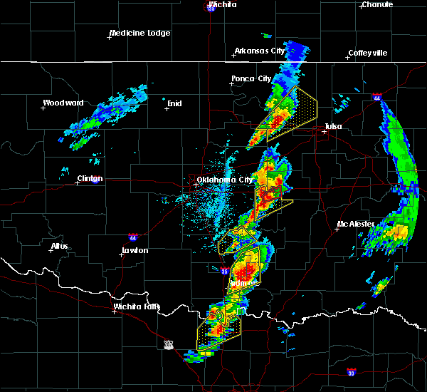 The national weather service in tulsa has issued a * severe thunderstorm warning for. southwestern creek county in northeastern oklahoma. west central okmulgee county in northeastern oklahoma. okfuskee county in east central oklahoma. Until 330 pm cdt. The national weather service in tulsa has issued a * severe thunderstorm warning for. southwestern creek county in northeastern oklahoma. west central okmulgee county in northeastern oklahoma. okfuskee county in east central oklahoma. Until 330 pm cdt.
|
| 3/25/2018 12:23 PM CDT |
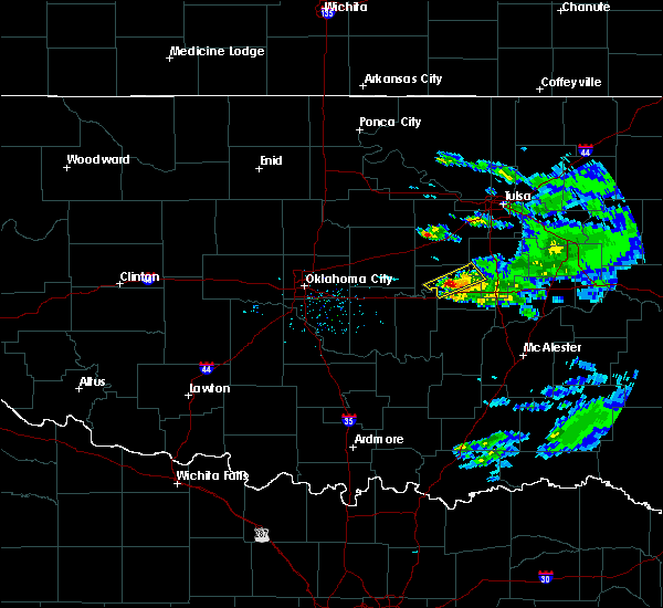 At 1223 pm cdt, a severe thunderstorm was located near castle, moving northeast at 40 mph (radar indicated). Hazards include quarter size hail. Damage to vehicles is expected. Locations in or near the path include, okfuskee, castle, mason,. At 1223 pm cdt, a severe thunderstorm was located near castle, moving northeast at 40 mph (radar indicated). Hazards include quarter size hail. Damage to vehicles is expected. Locations in or near the path include, okfuskee, castle, mason,.
|
| 10/21/2017 10:28 PM CDT |
 At 1028 pm cdt, severe thunderstorms were located along a line extending from 4 miles southwest of slick to 2 miles southeast of bearden, moving east at 35 mph (radar indicated). Hazards include 60 mph wind gusts. Expect damage to roofs, siding, and trees. locations in or near the path include, okmulgee, okemah, okfuskee, henryetta, beggs, weleetka, schulter, bearden, castle, clearview, preston, okmulgee state park, welty, pharoah, bryant, mason, this includes interstate 40 in oklahoma between mile markers 213 and 239. A tornado watch remains in effect until 200 am cdt for southeastern, northeastern and east central oklahoma. At 1028 pm cdt, severe thunderstorms were located along a line extending from 4 miles southwest of slick to 2 miles southeast of bearden, moving east at 35 mph (radar indicated). Hazards include 60 mph wind gusts. Expect damage to roofs, siding, and trees. locations in or near the path include, okmulgee, okemah, okfuskee, henryetta, beggs, weleetka, schulter, bearden, castle, clearview, preston, okmulgee state park, welty, pharoah, bryant, mason, this includes interstate 40 in oklahoma between mile markers 213 and 239. A tornado watch remains in effect until 200 am cdt for southeastern, northeastern and east central oklahoma.
|
| 10/21/2017 10:05 PM CDT |
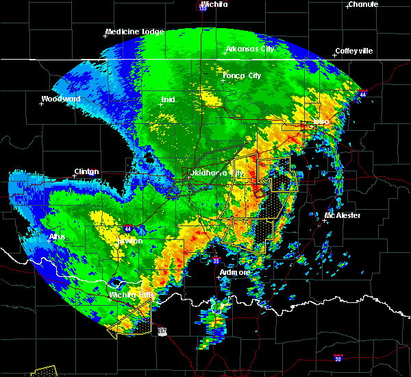 At 1003 pm cdt, severe thunderstorms were located along a line extending from 8 miles north of paden to 5 miles northeast of konawa, moving east at 20 mph (radar indicated). Hazards include 70 mph wind gusts and quarter size hail. Hail damage to vehicles is expected. expect considerable tree damage. wind damage is also likely to mobile homes, roofs, and outbuildings. locations in or near the path include, okemah, okfuskee, boley, weleetka, paden, bearden, castle, clearview, welty, pharoah, mason, this includes interstate 40 in oklahoma between mile markers 212 and 230. A tornado watch remains in effect until 200 am cdt for northeastern and east central oklahoma. At 1003 pm cdt, severe thunderstorms were located along a line extending from 8 miles north of paden to 5 miles northeast of konawa, moving east at 20 mph (radar indicated). Hazards include 70 mph wind gusts and quarter size hail. Hail damage to vehicles is expected. expect considerable tree damage. wind damage is also likely to mobile homes, roofs, and outbuildings. locations in or near the path include, okemah, okfuskee, boley, weleetka, paden, bearden, castle, clearview, welty, pharoah, mason, this includes interstate 40 in oklahoma between mile markers 212 and 230. A tornado watch remains in effect until 200 am cdt for northeastern and east central oklahoma.
|
| 10/15/2017 12:44 AM CDT |
 At 1243 am cdt, severe thunderstorms were located along a line extending from 2 miles north of okmulgee state park to near bearden, moving east at 50 mph (radar indicated). Hazards include 60 mph wind gusts. Expect damage to roofs, siding, and trees. Locations in or near the path include, okmulgee, okemah, okfuskee, henryetta, morris, weleetka, dewar, schulter, grayson, bearden, castle, clearview, okmulgee state park, pharoah, bryant, this includes interstate 40 in oklahoma between mile markers 212 and 240. At 1243 am cdt, severe thunderstorms were located along a line extending from 2 miles north of okmulgee state park to near bearden, moving east at 50 mph (radar indicated). Hazards include 60 mph wind gusts. Expect damage to roofs, siding, and trees. Locations in or near the path include, okmulgee, okemah, okfuskee, henryetta, morris, weleetka, dewar, schulter, grayson, bearden, castle, clearview, okmulgee state park, pharoah, bryant, this includes interstate 40 in oklahoma between mile markers 212 and 240.
|
| 10/15/2017 12:25 AM CDT |
 At 1225 am cdt, severe thunderstorms were located along a line extending from 4 miles northeast of welty to 3 miles north of little, moving east at 35 mph (radar indicated). Hazards include 60 mph wind gusts. Expect damage to roofs, siding, and trees. Locations in or near the path include, okmulgee, okemah, okfuskee, henryetta, morris, boley, weleetka, dewar, schulter, paden, grayson, bearden, castle, clearview, preston, okmulgee state park, welty, pharoah, bryant, mason, this includes interstate 40 in oklahoma between mile markers 212 and 240. At 1225 am cdt, severe thunderstorms were located along a line extending from 4 miles northeast of welty to 3 miles north of little, moving east at 35 mph (radar indicated). Hazards include 60 mph wind gusts. Expect damage to roofs, siding, and trees. Locations in or near the path include, okmulgee, okemah, okfuskee, henryetta, morris, boley, weleetka, dewar, schulter, paden, grayson, bearden, castle, clearview, preston, okmulgee state park, welty, pharoah, bryant, mason, this includes interstate 40 in oklahoma between mile markers 212 and 240.
|
| 9/17/2017 3:53 PM CDT |
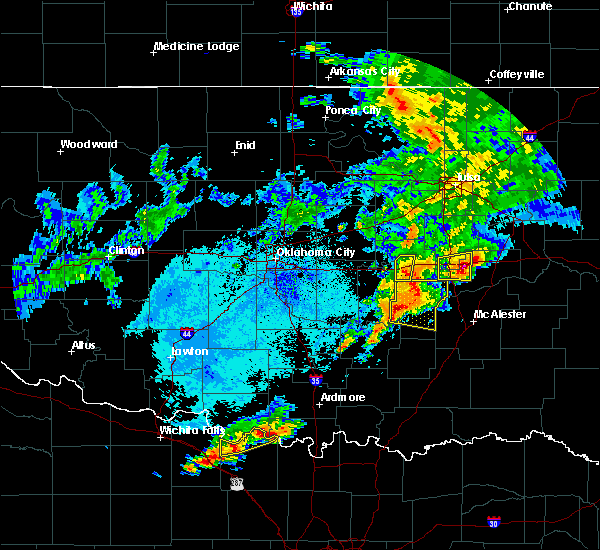 The severe thunderstorm warning for south central okfuskee county will expire at 400 pm cdt, the storms which prompted the warning have moved out of the area. therefore the warning will be allowed to expire. however gusty winds to 40 mph are still possible with these thunderstorms. The severe thunderstorm warning for south central okfuskee county will expire at 400 pm cdt, the storms which prompted the warning have moved out of the area. therefore the warning will be allowed to expire. however gusty winds to 40 mph are still possible with these thunderstorms.
|
| 9/17/2017 3:46 PM CDT |
 At 346 pm cdt, severe thunderstorms were located along a line extending from 2 miles southeast of castle to 4 miles west of wetumka, moving east at 35 mph (radar indicated). Hazards include 60 mph wind gusts and nickel size hail. Expect damage to roofs, siding, and trees. Locations in or near the path include, okemah, bearden, castle, this includes interstate 40 in oklahoma between mile markers 212 and 220. At 346 pm cdt, severe thunderstorms were located along a line extending from 2 miles southeast of castle to 4 miles west of wetumka, moving east at 35 mph (radar indicated). Hazards include 60 mph wind gusts and nickel size hail. Expect damage to roofs, siding, and trees. Locations in or near the path include, okemah, bearden, castle, this includes interstate 40 in oklahoma between mile markers 212 and 220.
|
| 9/17/2017 3:18 PM CDT |
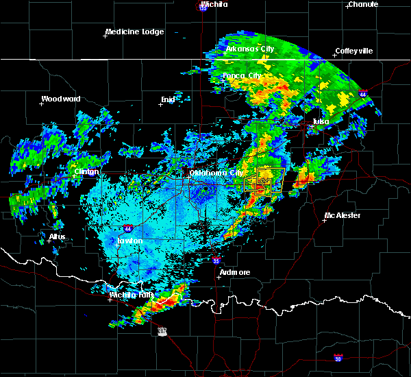 At 318 pm cdt, severe thunderstorms were located along a line extending from 3 miles southwest of boley to 4 miles east of seminole, moving east at 20 mph (radar indicated). Hazards include 70 mph wind gusts and quarter size hail. Hail damage to vehicles is expected. expect considerable tree damage. wind damage is also likely to mobile homes, roofs, and outbuildings. Locations in or near the path include, okemah, boley, paden, bearden, castle, this includes interstate 40 in oklahoma between mile markers 212 and 220. At 318 pm cdt, severe thunderstorms were located along a line extending from 3 miles southwest of boley to 4 miles east of seminole, moving east at 20 mph (radar indicated). Hazards include 70 mph wind gusts and quarter size hail. Hail damage to vehicles is expected. expect considerable tree damage. wind damage is also likely to mobile homes, roofs, and outbuildings. Locations in or near the path include, okemah, boley, paden, bearden, castle, this includes interstate 40 in oklahoma between mile markers 212 and 220.
|
| 9/17/2017 2:55 PM CDT |
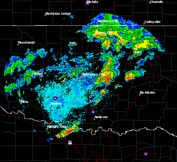 At 254 pm cdt, severe thunderstorms were located along a line extending from 2 miles northeast of prague to 3 miles west of seminole, moving east at 20 mph (radar indicated). Hazards include 70 mph wind gusts and half dollar size hail. Hail damage to vehicles is expected. expect considerable tree damage. wind damage is also likely to mobile homes, roofs, and outbuildings. Locations in or near the path include, okemah, boley, paden, bearden, castle, mason, this includes interstate 40 in oklahoma between mile markers 212 and 220. At 254 pm cdt, severe thunderstorms were located along a line extending from 2 miles northeast of prague to 3 miles west of seminole, moving east at 20 mph (radar indicated). Hazards include 70 mph wind gusts and half dollar size hail. Hail damage to vehicles is expected. expect considerable tree damage. wind damage is also likely to mobile homes, roofs, and outbuildings. Locations in or near the path include, okemah, boley, paden, bearden, castle, mason, this includes interstate 40 in oklahoma between mile markers 212 and 220.
|
| 7/3/2017 11:12 PM CDT |
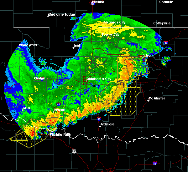 At 1112 pm cdt, severe thunderstorms were located along a line extending from near okemah to 5 miles northwest of wetumka, moving east at 30 mph (radar indicated). Hazards include 60 mph wind gusts. Expect damage to roofs, siding, and trees. Locations in or near the path include, okemah, weleetka, bearden, castle, clearview, pharoah, this includes interstate 40 in oklahoma between mile markers 212 and 231. At 1112 pm cdt, severe thunderstorms were located along a line extending from near okemah to 5 miles northwest of wetumka, moving east at 30 mph (radar indicated). Hazards include 60 mph wind gusts. Expect damage to roofs, siding, and trees. Locations in or near the path include, okemah, weleetka, bearden, castle, clearview, pharoah, this includes interstate 40 in oklahoma between mile markers 212 and 231.
|
| 7/3/2017 10:38 PM CDT |
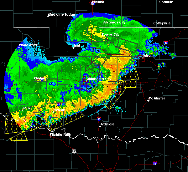 At 1038 pm cdt, severe thunderstorms were located along a line extending from 3 miles southeast of prague to 4 miles northeast of seminole, moving east at 30 mph (radar indicated). Hazards include 60 mph wind gusts. Expect damage to roofs, siding, and trees. Locations in or near the path include, okemah, boley, weleetka, bearden, castle, clearview, pharoah, this includes interstate 40 in oklahoma between mile markers 212 and 231. At 1038 pm cdt, severe thunderstorms were located along a line extending from 3 miles southeast of prague to 4 miles northeast of seminole, moving east at 30 mph (radar indicated). Hazards include 60 mph wind gusts. Expect damage to roofs, siding, and trees. Locations in or near the path include, okemah, boley, weleetka, bearden, castle, clearview, pharoah, this includes interstate 40 in oklahoma between mile markers 212 and 231.
|
| 6/15/2017 10:15 AM CDT | Hen Egg sized hail reported 7.4 miles NE of Okemah, OK |
| 6/15/2017 10:11 AM CDT | Golf Ball sized hail reported 7.4 miles NE of Okemah, OK |
| 6/15/2017 9:56 AM CDT |
 At 956 am cdt, severe thunderstorms were located along a line extending from near bearden to 5 miles southwest of clearview, moving south at 15 mph (radar indicated). Hazards include golf ball size hail and 60 mph wind gusts. People and animals outdoors will be injured. expect hail damage to roofs, siding, windows, and vehicles. expect wind damage to roofs, siding, and trees. Locations in or near the path include, okemah, weleetka, bearden, clearview, pharoah, this includes interstate 40 in oklahoma between mile markers 212 and 229. At 956 am cdt, severe thunderstorms were located along a line extending from near bearden to 5 miles southwest of clearview, moving south at 15 mph (radar indicated). Hazards include golf ball size hail and 60 mph wind gusts. People and animals outdoors will be injured. expect hail damage to roofs, siding, windows, and vehicles. expect wind damage to roofs, siding, and trees. Locations in or near the path include, okemah, weleetka, bearden, clearview, pharoah, this includes interstate 40 in oklahoma between mile markers 212 and 229.
|
| 6/15/2017 9:47 AM CDT |
 At 947 am cdt, severe thunderstorms were located along a line extending from 2 miles northeast of cromwell to clearview, moving southeast at 15 mph (radar indicated). Hazards include 60 mph wind gusts and quarter size hail. Hail damage to vehicles is expected. expect wind damage to roofs, siding, and trees. Locations in or near the path include, okemah, weleetka, bearden, clearview, pharoah, this includes interstate 40 in oklahoma between mile markers 212 and 229. At 947 am cdt, severe thunderstorms were located along a line extending from 2 miles northeast of cromwell to clearview, moving southeast at 15 mph (radar indicated). Hazards include 60 mph wind gusts and quarter size hail. Hail damage to vehicles is expected. expect wind damage to roofs, siding, and trees. Locations in or near the path include, okemah, weleetka, bearden, clearview, pharoah, this includes interstate 40 in oklahoma between mile markers 212 and 229.
|
| 5/27/2017 11:06 PM CDT |
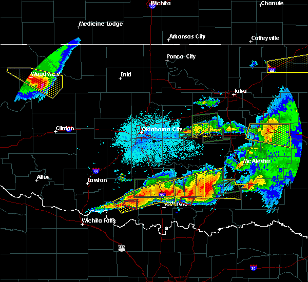 The severe thunderstorm warning for northwestern okfuskee county will expire at 1115 pm cdt, the storm which prompted the warning has weakened below severe limits, and no longer poses an immediate threat to life or property. therefore the warning will be allowed to expire. a tornado watch remains in effect until midnight cdt for northeastern and east central oklahoma. The severe thunderstorm warning for northwestern okfuskee county will expire at 1115 pm cdt, the storm which prompted the warning has weakened below severe limits, and no longer poses an immediate threat to life or property. therefore the warning will be allowed to expire. a tornado watch remains in effect until midnight cdt for northeastern and east central oklahoma.
|
| 5/27/2017 10:52 PM CDT |
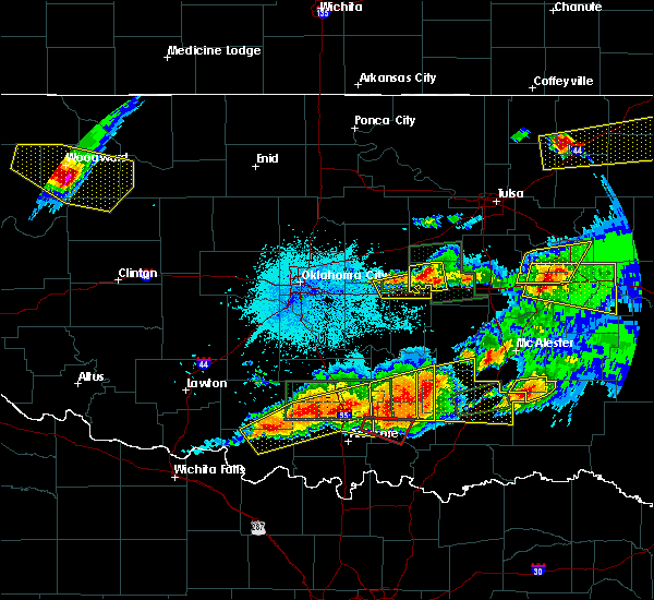 At 1052 pm cdt, a severe thunderstorm was located 3 miles north of boley, moving east at 30 mph (radar indicated). Hazards include 60 mph wind gusts and quarter size hail. Hail damage to vehicles is expected. expect wind damage to roofs, siding, and trees. locations in or near the path include, okemah, boley, paden, castle, welty, mason, this includes interstate 40 in oklahoma near mile marker 219. A tornado watch remains in effect until midnight cdt for northeastern and east central oklahoma. At 1052 pm cdt, a severe thunderstorm was located 3 miles north of boley, moving east at 30 mph (radar indicated). Hazards include 60 mph wind gusts and quarter size hail. Hail damage to vehicles is expected. expect wind damage to roofs, siding, and trees. locations in or near the path include, okemah, boley, paden, castle, welty, mason, this includes interstate 40 in oklahoma near mile marker 219. A tornado watch remains in effect until midnight cdt for northeastern and east central oklahoma.
|
| 5/27/2017 10:32 PM CDT |
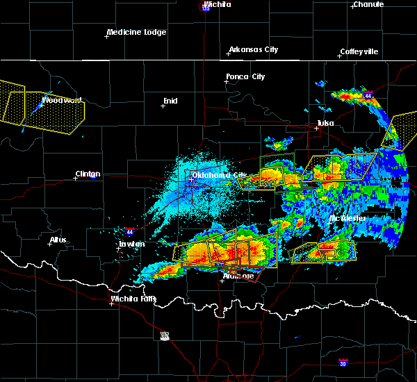 At 1032 pm cdt, a severe thunderstorm was located over prague, moving east at 15 mph (radar indicated). Hazards include 60 mph wind gusts and quarter size hail. Hail damage to vehicles is expected. expect wind damage to roofs, siding, and trees. locations in or near the path include, okemah, boley, paden, castle, welty, mason, this includes interstate 40 in oklahoma near mile marker 219. A tornado watch remains in effect until midnight cdt for northeastern and east central oklahoma. At 1032 pm cdt, a severe thunderstorm was located over prague, moving east at 15 mph (radar indicated). Hazards include 60 mph wind gusts and quarter size hail. Hail damage to vehicles is expected. expect wind damage to roofs, siding, and trees. locations in or near the path include, okemah, boley, paden, castle, welty, mason, this includes interstate 40 in oklahoma near mile marker 219. A tornado watch remains in effect until midnight cdt for northeastern and east central oklahoma.
|
| 5/27/2017 9:54 PM CDT |
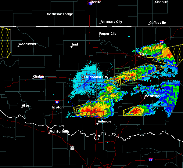 At 954 pm cdt, severe thunderstorms were located along a line extending from 5 miles south of paden to 5 miles southeast of okfuskee, moving east at 20 mph (radar indicated). Hazards include 70 mph wind gusts and half dollar size hail. Hail damage to vehicles is expected. expect considerable tree damage. wind damage is also likely to mobile homes, roofs, and outbuildings. locations in or near the path include, okemah, okfuskee, boley, paden, bearden, castle, mason, this includes interstate 40 in oklahoma between mile markers 212 and 223. A tornado watch remains in effect until midnight cdt for northeastern and east central oklahoma. At 954 pm cdt, severe thunderstorms were located along a line extending from 5 miles south of paden to 5 miles southeast of okfuskee, moving east at 20 mph (radar indicated). Hazards include 70 mph wind gusts and half dollar size hail. Hail damage to vehicles is expected. expect considerable tree damage. wind damage is also likely to mobile homes, roofs, and outbuildings. locations in or near the path include, okemah, okfuskee, boley, paden, bearden, castle, mason, this includes interstate 40 in oklahoma between mile markers 212 and 223. A tornado watch remains in effect until midnight cdt for northeastern and east central oklahoma.
|
| 5/27/2017 9:43 PM CDT |
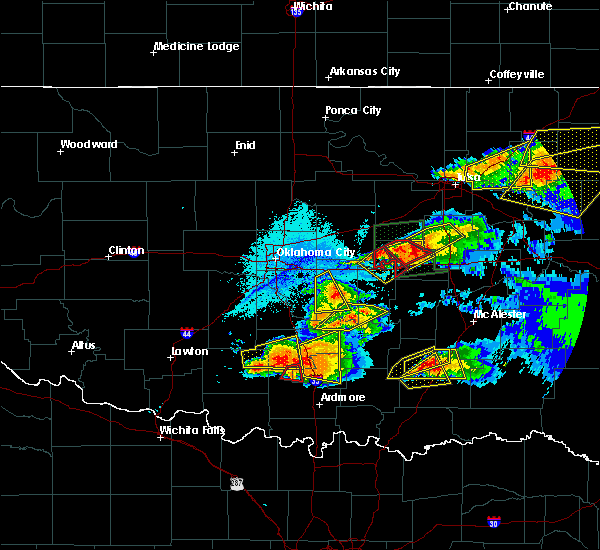 At 943 pm cdt, severe thunderstorms were located along a line extending from 5 miles southeast of prague to near okfuskee, moving east at 25 mph (radar indicated). Hazards include golf ball size hail and 70 mph wind gusts. People and animals outdoors will be injured. expect hail damage to roofs, siding, windows, and vehicles. expect considerable tree damage. wind damage is also likely to mobile homes, roofs, and outbuildings. locations in or near the path include, okemah, okfuskee, boley, paden, bearden, castle, mason, this includes interstate 40 in oklahoma between mile markers 212 and 223. A tornado watch remains in effect until midnight cdt for northeastern and east central oklahoma. At 943 pm cdt, severe thunderstorms were located along a line extending from 5 miles southeast of prague to near okfuskee, moving east at 25 mph (radar indicated). Hazards include golf ball size hail and 70 mph wind gusts. People and animals outdoors will be injured. expect hail damage to roofs, siding, windows, and vehicles. expect considerable tree damage. wind damage is also likely to mobile homes, roofs, and outbuildings. locations in or near the path include, okemah, okfuskee, boley, paden, bearden, castle, mason, this includes interstate 40 in oklahoma between mile markers 212 and 223. A tornado watch remains in effect until midnight cdt for northeastern and east central oklahoma.
|
| 5/27/2017 9:07 PM CDT |
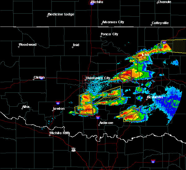 At 906 pm cdt, a severe thunderstorm capable of producing a tornado was located 4 miles north of castle, moving southeast at 15 mph (radar indicated rotation). Hazards include tornado and baseball size hail. Flying debris will be dangerous to those caught without shelter. mobile homes will be damaged or destroyed. damage to roofs, windows, and vehicles will occur. tree damage is likely. Locations in or near the path include, okemah, boley, castle, welty, mason,. At 906 pm cdt, a severe thunderstorm capable of producing a tornado was located 4 miles north of castle, moving southeast at 15 mph (radar indicated rotation). Hazards include tornado and baseball size hail. Flying debris will be dangerous to those caught without shelter. mobile homes will be damaged or destroyed. damage to roofs, windows, and vehicles will occur. tree damage is likely. Locations in or near the path include, okemah, boley, castle, welty, mason,.
|
| 5/27/2017 8:58 PM CDT |
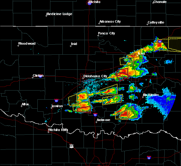 At 857 pm cdt, a severe thunderstorm with strong low level rotation that could produce a tornado at any time was located 4 miles south of welty, moving southeast at 15 mph (radar indicated rotation). Hazards include tornado and baseball size hail. Flying debris will be dangerous to those caught without shelter. mobile homes will be damaged or destroyed. damage to roofs, windows, and vehicles will occur. tree damage is likely. Locations in or near the path include, okemah, boley, castle, welty, mason,. At 857 pm cdt, a severe thunderstorm with strong low level rotation that could produce a tornado at any time was located 4 miles south of welty, moving southeast at 15 mph (radar indicated rotation). Hazards include tornado and baseball size hail. Flying debris will be dangerous to those caught without shelter. mobile homes will be damaged or destroyed. damage to roofs, windows, and vehicles will occur. tree damage is likely. Locations in or near the path include, okemah, boley, castle, welty, mason,.
|
| 5/27/2017 8:54 PM CDT | Baseball sized hail reported 12.2 miles SSW of Okemah, OK |
| 5/19/2017 7:14 PM CDT |
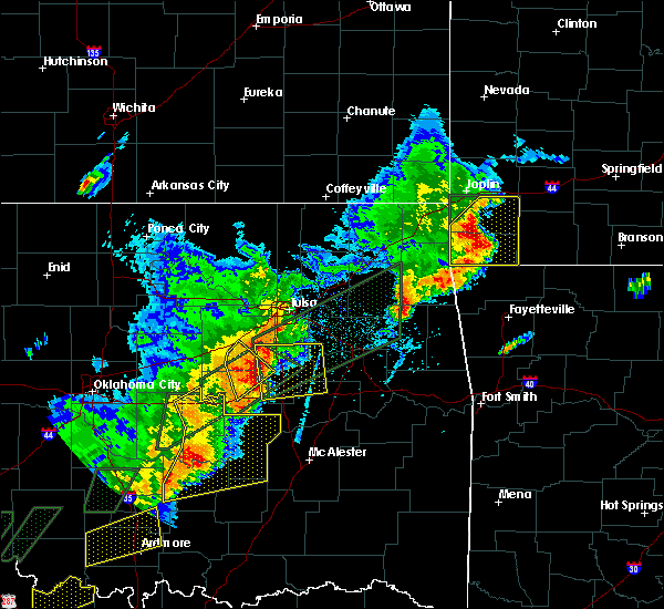 At 714 pm cdt, severe thunderstorms were located along a line extending from 3 miles southwest of mounds to 4 miles north of pharoah, moving northeast at 35 mph (radar indicated). Hazards include 60 mph wind gusts and quarter size hail. Hail damage to vehicles is expected. expect wind damage to roofs, siding, and trees. Locations in or near the path include, okemah, okfuskee, slick, okmulgee state park, mason, this includes interstate 40 in oklahoma near mile marker 218. At 714 pm cdt, severe thunderstorms were located along a line extending from 3 miles southwest of mounds to 4 miles north of pharoah, moving northeast at 35 mph (radar indicated). Hazards include 60 mph wind gusts and quarter size hail. Hail damage to vehicles is expected. expect wind damage to roofs, siding, and trees. Locations in or near the path include, okemah, okfuskee, slick, okmulgee state park, mason, this includes interstate 40 in oklahoma near mile marker 218.
|
| 5/19/2017 6:55 PM CDT |
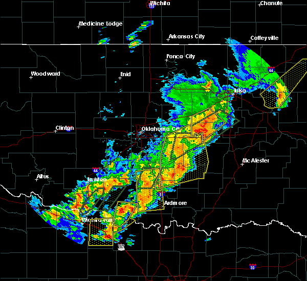 At 655 pm cdt, severe thunderstorms were located along a line extending from slick to near okemah, moving northeast at 50 mph (radar indicated). Hazards include 60 mph wind gusts and quarter size hail. Hail damage to vehicles is expected. expect wind damage to roofs, siding, and trees. locations in or near the path include, bristow, okemah, okfuskee, boley, depew, paden, bearden, slick, castle, okmulgee state park, welty, milfay, mason, this includes the following highways, interstate 40 in oklahoma between mile markers 212 and 219. Interstate 44 between mile markers 189 and 195. At 655 pm cdt, severe thunderstorms were located along a line extending from slick to near okemah, moving northeast at 50 mph (radar indicated). Hazards include 60 mph wind gusts and quarter size hail. Hail damage to vehicles is expected. expect wind damage to roofs, siding, and trees. locations in or near the path include, bristow, okemah, okfuskee, boley, depew, paden, bearden, slick, castle, okmulgee state park, welty, milfay, mason, this includes the following highways, interstate 40 in oklahoma between mile markers 212 and 219. Interstate 44 between mile markers 189 and 195.
|
| 5/19/2017 6:28 PM CDT |
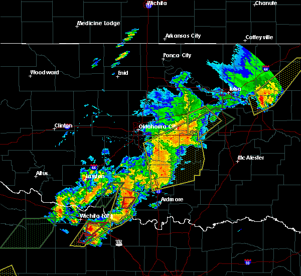 At 628 pm cdt, a severe thunderstorm was located 3 miles south of prague, moving northeast at 35 mph (radar indicated). Hazards include 60 mph wind gusts and quarter size hail. Hail damage to vehicles is expected. expect wind damage to roofs, siding, and trees. locations in or near the path include, bristow, okemah, okfuskee, boley, depew, paden, bearden, slick, castle, okmulgee state park, welty, milfay, mason, this includes the following highways, interstate 40 in oklahoma between mile markers 212 and 219. Interstate 44 between mile markers 189 and 195. At 628 pm cdt, a severe thunderstorm was located 3 miles south of prague, moving northeast at 35 mph (radar indicated). Hazards include 60 mph wind gusts and quarter size hail. Hail damage to vehicles is expected. expect wind damage to roofs, siding, and trees. locations in or near the path include, bristow, okemah, okfuskee, boley, depew, paden, bearden, slick, castle, okmulgee state park, welty, milfay, mason, this includes the following highways, interstate 40 in oklahoma between mile markers 212 and 219. Interstate 44 between mile markers 189 and 195.
|
| 5/19/2017 4:34 PM CDT |
 At 434 pm cdt, severe thunderstorms were located along a line extending from 3 miles west of bald hill to 3 miles west of beggs to 4 miles north of clearview, moving northeast at 35 mph (radar indicated). Hazards include 60 mph wind gusts and quarter size hail. Hail damage to vehicles is expected. expect wind damage to roofs, siding, and trees. locations in or near the path include, southwestern tulsa, broken arrow, okmulgee, okemah, bixby, sapulpa, jenks, okfuskee, glenpool, kiefer, beggs, mounds, slick, clearview, preston, bald hill, stonebluff, okmulgee state park, liberty, mason, this includes the following highways, interstate 40 in oklahoma between mile markers 221 and 227. interstate 44 between mile markers 211 and 217. A tornado watch remains in effect until 1100 pm cdt for east central oklahoma. At 434 pm cdt, severe thunderstorms were located along a line extending from 3 miles west of bald hill to 3 miles west of beggs to 4 miles north of clearview, moving northeast at 35 mph (radar indicated). Hazards include 60 mph wind gusts and quarter size hail. Hail damage to vehicles is expected. expect wind damage to roofs, siding, and trees. locations in or near the path include, southwestern tulsa, broken arrow, okmulgee, okemah, bixby, sapulpa, jenks, okfuskee, glenpool, kiefer, beggs, mounds, slick, clearview, preston, bald hill, stonebluff, okmulgee state park, liberty, mason, this includes the following highways, interstate 40 in oklahoma between mile markers 221 and 227. interstate 44 between mile markers 211 and 217. A tornado watch remains in effect until 1100 pm cdt for east central oklahoma.
|
| 5/19/2017 4:18 PM CDT |
 At 418 pm cdt, a severe thunderstorm was located 4 miles north of okfuskee, moving northeast at 50 mph (radar indicated). Hazards include 60 mph wind gusts and quarter size hail. Hail damage to vehicles is expected. expect wind damage to roofs, siding, and trees. locations in or near the path include, southwestern tulsa, broken arrow, okmulgee, okemah, bixby, sapulpa, jenks, okfuskee, glenpool, kiefer, beggs, mounds, slick, clearview, preston, bald hill, stonebluff, okmulgee state park, liberty, mason, this includes the following highways, interstate 40 in oklahoma between mile markers 221 and 227. interstate 44 between mile markers 211 and 217. A tornado watch remains in effect until 1100 pm cdt for east central oklahoma. At 418 pm cdt, a severe thunderstorm was located 4 miles north of okfuskee, moving northeast at 50 mph (radar indicated). Hazards include 60 mph wind gusts and quarter size hail. Hail damage to vehicles is expected. expect wind damage to roofs, siding, and trees. locations in or near the path include, southwestern tulsa, broken arrow, okmulgee, okemah, bixby, sapulpa, jenks, okfuskee, glenpool, kiefer, beggs, mounds, slick, clearview, preston, bald hill, stonebluff, okmulgee state park, liberty, mason, this includes the following highways, interstate 40 in oklahoma between mile markers 221 and 227. interstate 44 between mile markers 211 and 217. A tornado watch remains in effect until 1100 pm cdt for east central oklahoma.
|
| 5/18/2017 9:44 PM CDT |
 At 944 pm cdt, severe thunderstorms were located along a line extending from near slick to near okmulgee state park to near pharoah, moving northeast at 45 mph (radar indicated). Hazards include 70 mph wind gusts and quarter size hail. Hail damage to vehicles is expected. expect considerable tree damage. wind damage is also likely to mobile homes, roofs, and outbuildings. locations in or near the path include, okmulgee, okemah, okfuskee, henryetta, morris, weleetka, dewar, schulter, bearden, castle, clearview, okmulgee state park, welty, pharoah, bryant, mason, this includes interstate 40 in oklahoma between mile markers 212 and 240. A tornado watch remains in effect until midnight cdt for southeastern, northeastern and east central oklahoma. At 944 pm cdt, severe thunderstorms were located along a line extending from near slick to near okmulgee state park to near pharoah, moving northeast at 45 mph (radar indicated). Hazards include 70 mph wind gusts and quarter size hail. Hail damage to vehicles is expected. expect considerable tree damage. wind damage is also likely to mobile homes, roofs, and outbuildings. locations in or near the path include, okmulgee, okemah, okfuskee, henryetta, morris, weleetka, dewar, schulter, bearden, castle, clearview, okmulgee state park, welty, pharoah, bryant, mason, this includes interstate 40 in oklahoma between mile markers 212 and 240. A tornado watch remains in effect until midnight cdt for southeastern, northeastern and east central oklahoma.
|
| 5/18/2017 9:12 PM CDT |
 At 911 pm cdt, severe thunderstorms were located along a line extending from 6 miles north of paden to 3 miles southwest of castle to 7 miles northeast of wewoka, moving northeast at 40 mph (radar indicated). Hazards include 60 mph wind gusts and quarter size hail. Hail damage to vehicles is expected. expect wind damage to roofs, siding, and trees. locations in or near the path include, okmulgee, okemah, okfuskee, henryetta, morris, boley, weleetka, dewar, schulter, paden, bearden, castle, clearview, okmulgee state park, welty, pharoah, bryant, mason, this includes interstate 40 in oklahoma between mile markers 212 and 240. A tornado watch remains in effect until midnight cdt for southeastern, northeastern and east central oklahoma. At 911 pm cdt, severe thunderstorms were located along a line extending from 6 miles north of paden to 3 miles southwest of castle to 7 miles northeast of wewoka, moving northeast at 40 mph (radar indicated). Hazards include 60 mph wind gusts and quarter size hail. Hail damage to vehicles is expected. expect wind damage to roofs, siding, and trees. locations in or near the path include, okmulgee, okemah, okfuskee, henryetta, morris, boley, weleetka, dewar, schulter, paden, bearden, castle, clearview, okmulgee state park, welty, pharoah, bryant, mason, this includes interstate 40 in oklahoma between mile markers 212 and 240. A tornado watch remains in effect until midnight cdt for southeastern, northeastern and east central oklahoma.
|
| 5/18/2017 8:33 PM CDT |
 At 832 pm cdt, a severe thunderstorm was located over boley, moving northeast at 40 mph (radar indicated). Hazards include 60 mph wind gusts and quarter size hail. Hail damage to vehicles is expected. expect wind damage to roofs, siding, and trees. locations in or near the path include, bristow, okemah, okfuskee, drumright, boley, kellyville, depew, paden, bearden, slick, castle, shamrock, welty, milfay, mason, this includes the following highways, interstate 40 in oklahoma between mile markers 212 and 225. interstate 44 between mile markers 178 and 206. A tornado watch remains in effect until midnight cdt for northeastern and east central oklahoma. At 832 pm cdt, a severe thunderstorm was located over boley, moving northeast at 40 mph (radar indicated). Hazards include 60 mph wind gusts and quarter size hail. Hail damage to vehicles is expected. expect wind damage to roofs, siding, and trees. locations in or near the path include, bristow, okemah, okfuskee, drumright, boley, kellyville, depew, paden, bearden, slick, castle, shamrock, welty, milfay, mason, this includes the following highways, interstate 40 in oklahoma between mile markers 212 and 225. interstate 44 between mile markers 178 and 206. A tornado watch remains in effect until midnight cdt for northeastern and east central oklahoma.
|
| 4/25/2017 11:30 PM CDT |
 At 1130 pm cdt, severe thunderstorms were located along a line extending from 4 miles west of okfuskee to 3 miles southeast of bearden to 5 miles southwest of holdenville, moving east at 55 mph (radar indicated). Hazards include 60 mph wind gusts and quarter size hail. Hail damage to vehicles is expected. expect wind damage to roofs, siding, and trees. Locations in or near the path include, mcalester, okmulgee, okemah, okfuskee, henryetta, morris, weleetka, dewar, schulter, indianola, grayson, hanna, bearden, hoffman, castle, clearview, stidham, preston, raiford, vivian, this includes interstate 40 in oklahoma between mile markers 215 and 258. At 1130 pm cdt, severe thunderstorms were located along a line extending from 4 miles west of okfuskee to 3 miles southeast of bearden to 5 miles southwest of holdenville, moving east at 55 mph (radar indicated). Hazards include 60 mph wind gusts and quarter size hail. Hail damage to vehicles is expected. expect wind damage to roofs, siding, and trees. Locations in or near the path include, mcalester, okmulgee, okemah, okfuskee, henryetta, morris, weleetka, dewar, schulter, indianola, grayson, hanna, bearden, hoffman, castle, clearview, stidham, preston, raiford, vivian, this includes interstate 40 in oklahoma between mile markers 215 and 258.
|
| 4/21/2017 10:50 AM CDT | Storm damage reported in okfuskee county OK, 2.9 miles W of Okemah, OK |
| 4/21/2017 10:27 AM CDT |
 At 1027 am cdt, severe thunderstorms were located along a line extending from 8 miles north of paden to 3 miles east of seminole to 2 miles northwest of konawa to 6 miles northeast of wynnewood, moving east at 50 mph (radar indicated). Hazards include 60 mph wind gusts. Expect damage to roofs, siding, and trees. Locations in or near the path include, okemah, okfuskee, henryetta, boley, weleetka, paden, bearden, castle, clearview, okmulgee state park, welty, pharoah, bryant, mason, this includes interstate 40 in oklahoma between mile markers 212 and 236. At 1027 am cdt, severe thunderstorms were located along a line extending from 8 miles north of paden to 3 miles east of seminole to 2 miles northwest of konawa to 6 miles northeast of wynnewood, moving east at 50 mph (radar indicated). Hazards include 60 mph wind gusts. Expect damage to roofs, siding, and trees. Locations in or near the path include, okemah, okfuskee, henryetta, boley, weleetka, paden, bearden, castle, clearview, okmulgee state park, welty, pharoah, bryant, mason, this includes interstate 40 in oklahoma between mile markers 212 and 236.
|
| 4/21/2017 10:08 AM CDT |
 At 1007 am cdt, severe thunderstorms were located along a line extending from near sparks to 3 miles northeast of tecumseh to 5 miles north of wanette to 5 miles east of antioch, moving east at 45 mph (radar indicated). Hazards include 60 mph wind gusts. Expect damage to roofs, siding, and trees. Locations in or near the path include, okemah, okfuskee, henryetta, boley, weleetka, paden, bearden, castle, clearview, okmulgee state park, welty, pharoah, bryant, mason, this includes interstate 40 in oklahoma between mile markers 212 and 236. At 1007 am cdt, severe thunderstorms were located along a line extending from near sparks to 3 miles northeast of tecumseh to 5 miles north of wanette to 5 miles east of antioch, moving east at 45 mph (radar indicated). Hazards include 60 mph wind gusts. Expect damage to roofs, siding, and trees. Locations in or near the path include, okemah, okfuskee, henryetta, boley, weleetka, paden, bearden, castle, clearview, okmulgee state park, welty, pharoah, bryant, mason, this includes interstate 40 in oklahoma between mile markers 212 and 236.
|
| 4/4/2017 4:35 PM CDT | Quarter sized hail reported 9 miles E of Okemah, OK |
| 4/4/2017 3:46 PM CDT |
 At 346 pm cdt, a severe thunderstorm was located 3 miles southeast of little, moving northeast at 50 mph (radar indicated). Hazards include 60 mph wind gusts and quarter size hail. Hail damage to vehicles is expected. expect wind damage to roofs, siding, and trees. locations in or near the path include, bristow, okemah, okfuskee, boley, depew, paden, bearden, slick, castle, welty, okmulgee state park, mason, this includes the following highways, interstate 40 in oklahoma between mile markers 212 and 218. Interstate 44 between mile markers 185 and 193. At 346 pm cdt, a severe thunderstorm was located 3 miles southeast of little, moving northeast at 50 mph (radar indicated). Hazards include 60 mph wind gusts and quarter size hail. Hail damage to vehicles is expected. expect wind damage to roofs, siding, and trees. locations in or near the path include, bristow, okemah, okfuskee, boley, depew, paden, bearden, slick, castle, welty, okmulgee state park, mason, this includes the following highways, interstate 40 in oklahoma between mile markers 212 and 218. Interstate 44 between mile markers 185 and 193.
|
| 3/26/2017 7:20 PM CDT |
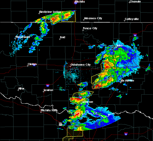 At 720 pm cdt, a severe thunderstorm was located 6 miles northwest of pharoah, moving northeast at 45 mph (radar indicated). Hazards include quarter size hail. Damage to vehicles is expected. locations in or near the path include, okemah, okfuskee, this includes interstate 40 in oklahoma between mile markers 218 and 227. A tornado watch remains in effect until 1100 pm cdt for northeastern and east central oklahoma. At 720 pm cdt, a severe thunderstorm was located 6 miles northwest of pharoah, moving northeast at 45 mph (radar indicated). Hazards include quarter size hail. Damage to vehicles is expected. locations in or near the path include, okemah, okfuskee, this includes interstate 40 in oklahoma between mile markers 218 and 227. A tornado watch remains in effect until 1100 pm cdt for northeastern and east central oklahoma.
|
| 3/26/2017 7:12 PM CDT | Quarter sized hail reported 1.9 miles N of Okemah, OK |
| 3/26/2017 7:12 PM CDT |
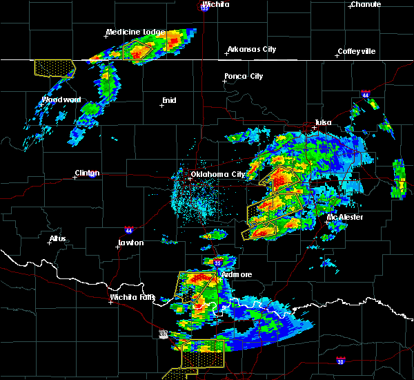 At 712 pm cdt, a severe thunderstorm was located over okemah, moving east at 45 mph (radar indicated). Hazards include 60 mph wind gusts and quarter size hail. Hail damage to vehicles is expected. expect wind damage to roofs, siding, and trees. locations in or near the path include, okemah, okfuskee, bearden, castle, mason, this includes interstate 40 in oklahoma between mile markers 214 and 227. A tornado watch remains in effect until 1100 pm cdt for northeastern and east central oklahoma. At 712 pm cdt, a severe thunderstorm was located over okemah, moving east at 45 mph (radar indicated). Hazards include 60 mph wind gusts and quarter size hail. Hail damage to vehicles is expected. expect wind damage to roofs, siding, and trees. locations in or near the path include, okemah, okfuskee, bearden, castle, mason, this includes interstate 40 in oklahoma between mile markers 214 and 227. A tornado watch remains in effect until 1100 pm cdt for northeastern and east central oklahoma.
|
| 3/26/2017 6:56 PM CDT |
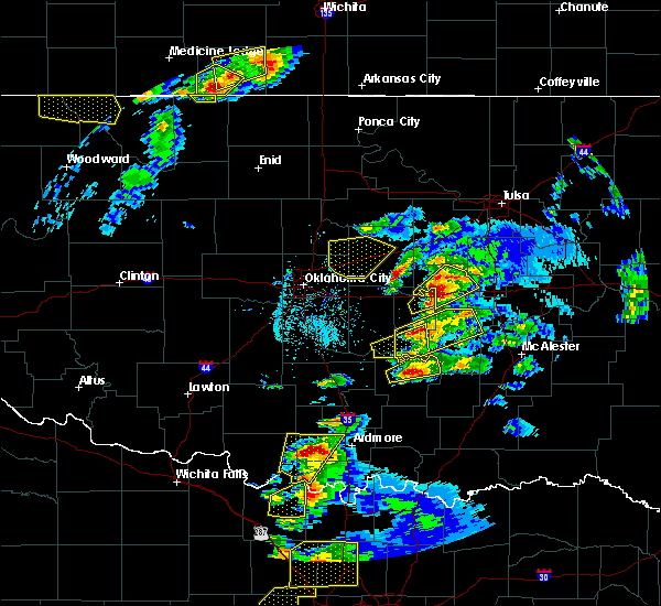 At 656 pm cdt, a severe thunderstorm was located 4 miles north of cromwell, moving northeast at 40 mph (radar indicated). Hazards include golf ball size hail and 60 mph wind gusts. People and animals outdoors will be injured. expect hail damage to roofs, siding, windows, and vehicles. expect wind damage to roofs, siding, and trees. locations in or near the path include, okemah, okfuskee, boley, bearden, castle, mason, this includes interstate 40 in oklahoma between mile markers 212 and 227. A tornado watch remains in effect until 1100 pm cdt for northeastern and east central oklahoma. At 656 pm cdt, a severe thunderstorm was located 4 miles north of cromwell, moving northeast at 40 mph (radar indicated). Hazards include golf ball size hail and 60 mph wind gusts. People and animals outdoors will be injured. expect hail damage to roofs, siding, windows, and vehicles. expect wind damage to roofs, siding, and trees. locations in or near the path include, okemah, okfuskee, boley, bearden, castle, mason, this includes interstate 40 in oklahoma between mile markers 212 and 227. A tornado watch remains in effect until 1100 pm cdt for northeastern and east central oklahoma.
|
| 3/26/2017 6:48 PM CDT |
 At 648 pm cdt, a severe thunderstorm was located 5 miles west of cromwell, moving northeast at 45 mph (radar indicated). Hazards include 60 mph wind gusts and quarter size hail. Hail damage to vehicles is expected. expect wind damage to roofs, siding, and trees. locations in or near the path include, okemah, okfuskee, boley, bearden, castle, mason, this includes interstate 40 in oklahoma between mile markers 212 and 227. A tornado watch remains in effect until 1100 pm cdt for northeastern and east central oklahoma. At 648 pm cdt, a severe thunderstorm was located 5 miles west of cromwell, moving northeast at 45 mph (radar indicated). Hazards include 60 mph wind gusts and quarter size hail. Hail damage to vehicles is expected. expect wind damage to roofs, siding, and trees. locations in or near the path include, okemah, okfuskee, boley, bearden, castle, mason, this includes interstate 40 in oklahoma between mile markers 212 and 227. A tornado watch remains in effect until 1100 pm cdt for northeastern and east central oklahoma.
|
| 3/6/2017 11:08 PM CST |
 At 1108 pm cst, severe thunderstorms were located along a line extending from near porter to 5 miles northwest of boynton to 5 miles south of bearden, moving east at 35 mph (radar indicated). Hazards include 60 mph wind gusts and quarter size hail. Hail damage to vehicles is expected. expect wind damage to roofs, siding, and trees. locations in or near the path include, muskogee, tahlequah, okmulgee, stilwell, okemah, eufaula, henryetta, fort gibson, checotah, haskell, warner, morris, vian, weleetka, gore, dewar, porum, okay, webbers falls, porter, this includes interstate 40 in oklahoma between mile markers 219 and 294. A tornado watch remains in effect until 300 am cst for southeastern, northeastern and east central oklahoma. At 1108 pm cst, severe thunderstorms were located along a line extending from near porter to 5 miles northwest of boynton to 5 miles south of bearden, moving east at 35 mph (radar indicated). Hazards include 60 mph wind gusts and quarter size hail. Hail damage to vehicles is expected. expect wind damage to roofs, siding, and trees. locations in or near the path include, muskogee, tahlequah, okmulgee, stilwell, okemah, eufaula, henryetta, fort gibson, checotah, haskell, warner, morris, vian, weleetka, gore, dewar, porum, okay, webbers falls, porter, this includes interstate 40 in oklahoma between mile markers 219 and 294. A tornado watch remains in effect until 300 am cst for southeastern, northeastern and east central oklahoma.
|
| 3/6/2017 10:31 PM CST |
 At 1030 pm cst, severe thunderstorms were located along a line extending from 5 miles northwest of pryor to near bixby to 2 miles northwest of okemah, moving east at 50 mph (radar indicated). Hazards include 60 mph wind gusts and quarter size hail. Hail damage to vehicles is expected. expect wind damage to roofs, siding, and trees. locations in or near the path include, tulsa, broken arrow, claremore, okmulgee, okemah, pryor, bixby, sapulpa, jenks, okfuskee, glenpool, coweta, pryor creek, catoosa, verdigris, inola, kiefer, beggs, boley, mounds, this includes the following highways, interstate 40 in oklahoma between mile markers 212 and 224. interstate 44 between mile markers 222 and 264. A tornado watch remains in effect until 300 am cst for northeastern and east central oklahoma. At 1030 pm cst, severe thunderstorms were located along a line extending from 5 miles northwest of pryor to near bixby to 2 miles northwest of okemah, moving east at 50 mph (radar indicated). Hazards include 60 mph wind gusts and quarter size hail. Hail damage to vehicles is expected. expect wind damage to roofs, siding, and trees. locations in or near the path include, tulsa, broken arrow, claremore, okmulgee, okemah, pryor, bixby, sapulpa, jenks, okfuskee, glenpool, coweta, pryor creek, catoosa, verdigris, inola, kiefer, beggs, boley, mounds, this includes the following highways, interstate 40 in oklahoma between mile markers 212 and 224. interstate 44 between mile markers 222 and 264. A tornado watch remains in effect until 300 am cst for northeastern and east central oklahoma.
|
| 3/6/2017 10:21 PM CST |
 At 1020 pm cst, severe thunderstorms were located along a line extending from 6 miles southeast of foyil to 4 miles east of mounds to 3 miles south of paden, moving east at 40 mph (radar indicated). Hazards include 60 mph wind gusts and quarter size hail. Hail damage to vehicles is expected. expect wind damage to roofs, siding, and trees. locations in or near the path include, southeastern tulsa, broken arrow, muskogee, okmulgee, wagoner, okemah, jay, pryor, bixby, jenks, okfuskee, glenpool, coweta, pryor creek, henryetta, chouteau, haskell, inola, morris, locust grove, this includes the following highways, interstate 40 in oklahoma between mile markers 212 and 248. interstate 44 between mile markers 251 and 265. A tornado watch remains in effect until 300 am cst for northwestern arkansas, and southeastern, northeastern and east central oklahoma. At 1020 pm cst, severe thunderstorms were located along a line extending from 6 miles southeast of foyil to 4 miles east of mounds to 3 miles south of paden, moving east at 40 mph (radar indicated). Hazards include 60 mph wind gusts and quarter size hail. Hail damage to vehicles is expected. expect wind damage to roofs, siding, and trees. locations in or near the path include, southeastern tulsa, broken arrow, muskogee, okmulgee, wagoner, okemah, jay, pryor, bixby, jenks, okfuskee, glenpool, coweta, pryor creek, henryetta, chouteau, haskell, inola, morris, locust grove, this includes the following highways, interstate 40 in oklahoma between mile markers 212 and 248. interstate 44 between mile markers 251 and 265. A tornado watch remains in effect until 300 am cst for northwestern arkansas, and southeastern, northeastern and east central oklahoma.
|
| 3/6/2017 10:14 PM CST |
 At 1014 pm cst, severe thunderstorms were located along a line extending from 4 miles southeast of oologah to tulsa to 2 miles north of paden, moving east at 50 mph (radar indicated). Hazards include 60 mph wind gusts and quarter size hail. Hail damage to vehicles is expected. expect wind damage to roofs, siding, and trees. locations in or near the path include, tulsa, broken arrow, sand springs, claremore, okmulgee, bristow, okemah, pryor, owasso, bixby, sapulpa, jenks, okfuskee, glenpool, coweta, pryor creek, skiatook, catoosa, collinsville, verdigris, this includes the following highways, interstate 40 in oklahoma between mile markers 212 and 224. interstate 44 between mile markers 181 and 265. A tornado watch remains in effect until 300 am cst for northeastern and east central oklahoma. At 1014 pm cst, severe thunderstorms were located along a line extending from 4 miles southeast of oologah to tulsa to 2 miles north of paden, moving east at 50 mph (radar indicated). Hazards include 60 mph wind gusts and quarter size hail. Hail damage to vehicles is expected. expect wind damage to roofs, siding, and trees. locations in or near the path include, tulsa, broken arrow, sand springs, claremore, okmulgee, bristow, okemah, pryor, owasso, bixby, sapulpa, jenks, okfuskee, glenpool, coweta, pryor creek, skiatook, catoosa, collinsville, verdigris, this includes the following highways, interstate 40 in oklahoma between mile markers 212 and 224. interstate 44 between mile markers 181 and 265. A tornado watch remains in effect until 300 am cst for northeastern and east central oklahoma.
|
| 3/6/2017 10:14 PM CST |
 The severe thunderstorm warning for washington and pawnee counties is cancelled, the storms which prompted the warning have moved out of the warned area therefore the warning has been cancelled. a tornado watch remains in effect until 300 am cst for northeastern and east central oklahoma. The severe thunderstorm warning for washington and pawnee counties is cancelled, the storms which prompted the warning have moved out of the warned area therefore the warning has been cancelled. a tornado watch remains in effect until 300 am cst for northeastern and east central oklahoma.
|
| 3/6/2017 9:46 PM CST |
 At 946 pm cst, severe thunderstorms were located along a line extending from near vera to near keystone state park to 6 miles southeast of davenport, moving east at 35 mph (radar indicated). Hazards include 60 mph wind gusts and quarter size hail. Hail damage to vehicles is expected. expect wind damage to roofs, siding, and trees. locations in or near the path include, tulsa, broken arrow, sand springs, claremore, okmulgee, bristow, okemah, pryor, owasso, bixby, sapulpa, jenks, okfuskee, glenpool, coweta, pryor creek, skiatook, catoosa, collinsville, verdigris, this includes the following highways, interstate 40 in oklahoma between mile markers 212 and 224. interstate 44 between mile markers 178 and 265. A tornado watch remains in effect until 300 am cst for northeastern and east central oklahoma. At 946 pm cst, severe thunderstorms were located along a line extending from near vera to near keystone state park to 6 miles southeast of davenport, moving east at 35 mph (radar indicated). Hazards include 60 mph wind gusts and quarter size hail. Hail damage to vehicles is expected. expect wind damage to roofs, siding, and trees. locations in or near the path include, tulsa, broken arrow, sand springs, claremore, okmulgee, bristow, okemah, pryor, owasso, bixby, sapulpa, jenks, okfuskee, glenpool, coweta, pryor creek, skiatook, catoosa, collinsville, verdigris, this includes the following highways, interstate 40 in oklahoma between mile markers 212 and 224. interstate 44 between mile markers 178 and 265. A tornado watch remains in effect until 300 am cst for northeastern and east central oklahoma.
|
| 7/14/2016 2:25 AM CDT |
 At 225 am cdt, severe thunderstorms were located along a line extending from 3 miles northeast of haskell to 5 miles west of council hill to 4 miles northwest of wetumka, moving east at 45 mph (radar indicated). Hazards include 60 mph wind gusts and quarter size hail. Hail damage to vehicles is expected. expect wind damage to roofs, siding, and trees. Locations in or near the path include, muskogee, okmulgee, okemah, henryetta, fort gibson, checotah, haskell, morris, weleetka, dewar, porter, schulter, oktaha, taft, boynton, grayson, council hill, hanna, rentiesville, hoffman, this includes interstate 40 in oklahoma between mile markers 216 and 273. At 225 am cdt, severe thunderstorms were located along a line extending from 3 miles northeast of haskell to 5 miles west of council hill to 4 miles northwest of wetumka, moving east at 45 mph (radar indicated). Hazards include 60 mph wind gusts and quarter size hail. Hail damage to vehicles is expected. expect wind damage to roofs, siding, and trees. Locations in or near the path include, muskogee, okmulgee, okemah, henryetta, fort gibson, checotah, haskell, morris, weleetka, dewar, porter, schulter, oktaha, taft, boynton, grayson, council hill, hanna, rentiesville, hoffman, this includes interstate 40 in oklahoma between mile markers 216 and 273.
|
| 7/14/2016 2:11 AM CDT |
 At 211 am cdt, severe thunderstorms were located along a line extending from 2 miles northwest of coweta to 2 miles northwest of morris to near cromwell, moving east at 45 mph (radar indicated). Hazards include 60 mph wind gusts and quarter size hail. Hail damage to vehicles is expected. expect wind damage to roofs, siding, and trees. Locations in or near the path include, broken arrow, muskogee, okmulgee, okemah, coweta, henryetta, fort gibson, checotah, haskell, morris, weleetka, dewar, okay, porter, schulter, oktaha, taft, boynton, grayson, council hill, this includes interstate 40 in oklahoma between mile markers 213 and 273. At 211 am cdt, severe thunderstorms were located along a line extending from 2 miles northwest of coweta to 2 miles northwest of morris to near cromwell, moving east at 45 mph (radar indicated). Hazards include 60 mph wind gusts and quarter size hail. Hail damage to vehicles is expected. expect wind damage to roofs, siding, and trees. Locations in or near the path include, broken arrow, muskogee, okmulgee, okemah, coweta, henryetta, fort gibson, checotah, haskell, morris, weleetka, dewar, okay, porter, schulter, oktaha, taft, boynton, grayson, council hill, this includes interstate 40 in oklahoma between mile markers 213 and 273.
|
| 7/14/2016 1:34 AM CDT |
 At 133 am cdt, severe thunderstorms were located along a line extending from 4 miles south of kellyville to 6 miles north of welty to 4 miles north of prague, moving southeast at 30 mph (radar indicated). Hazards include 60 mph wind gusts and quarter size hail. Hail damage to vehicles is expected. expect wind damage to roofs, siding, and trees. Locations in or near the path include, okemah, okfuskee, beggs, boley, paden, bearden, slick, castle, welty, okmulgee state park, mason, this includes interstate 40 in oklahoma between mile markers 212 and 224. At 133 am cdt, severe thunderstorms were located along a line extending from 4 miles south of kellyville to 6 miles north of welty to 4 miles north of prague, moving southeast at 30 mph (radar indicated). Hazards include 60 mph wind gusts and quarter size hail. Hail damage to vehicles is expected. expect wind damage to roofs, siding, and trees. Locations in or near the path include, okemah, okfuskee, beggs, boley, paden, bearden, slick, castle, welty, okmulgee state park, mason, this includes interstate 40 in oklahoma between mile markers 212 and 224.
|
| 7/8/2016 9:20 AM CDT |
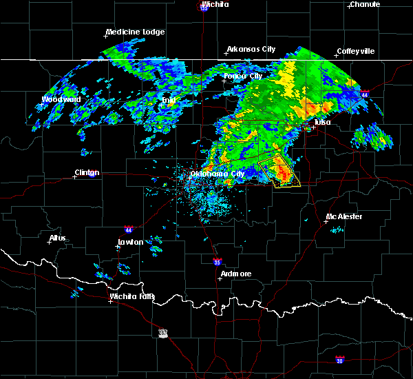 At 920 am cdt, severe thunderstorms were located along a line extending from 5 miles north of welty to 2 miles east of okemah, moving east at 20 mph (radar indicated). Hazards include 60 mph wind gusts and quarter size hail. Hail damage to vehicles is expected. expect wind damage to roofs, siding, and trees. Locations in or near the path include, okemah, okfuskee, castle, clearview, pharoah, welty, mason, this includes interstate 40 in oklahoma between mile markers 216 and 231. At 920 am cdt, severe thunderstorms were located along a line extending from 5 miles north of welty to 2 miles east of okemah, moving east at 20 mph (radar indicated). Hazards include 60 mph wind gusts and quarter size hail. Hail damage to vehicles is expected. expect wind damage to roofs, siding, and trees. Locations in or near the path include, okemah, okfuskee, castle, clearview, pharoah, welty, mason, this includes interstate 40 in oklahoma between mile markers 216 and 231.
|
| 7/8/2016 9:04 AM CDT |
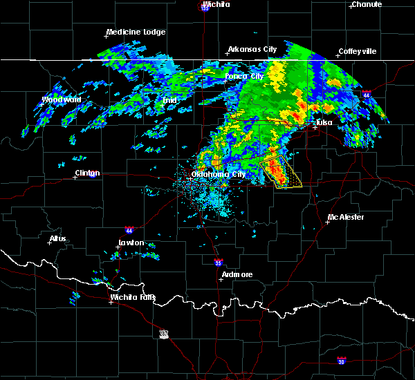 At 904 am cdt, severe thunderstorms were located along a line extending from 6 miles northwest of welty to 2 miles west of okemah, moving northeast at 20 mph (radar indicated). Hazards include 60 mph wind gusts and quarter size hail. Hail damage to vehicles is expected. expect wind damage to roofs, siding, and trees. Locations in or near the path include, okemah, okfuskee, boley, bearden, castle, clearview, pharoah, welty, mason, this includes interstate 40 in oklahoma between mile markers 214 and 231. At 904 am cdt, severe thunderstorms were located along a line extending from 6 miles northwest of welty to 2 miles west of okemah, moving northeast at 20 mph (radar indicated). Hazards include 60 mph wind gusts and quarter size hail. Hail damage to vehicles is expected. expect wind damage to roofs, siding, and trees. Locations in or near the path include, okemah, okfuskee, boley, bearden, castle, clearview, pharoah, welty, mason, this includes interstate 40 in oklahoma between mile markers 214 and 231.
|
| 7/8/2016 9:00 AM CDT | Quarter sized hail reported 0.1 miles SSW of Okemah, OK, a few quarter size hail stones. mainly nickel size. |
| 7/8/2016 8:50 AM CDT |
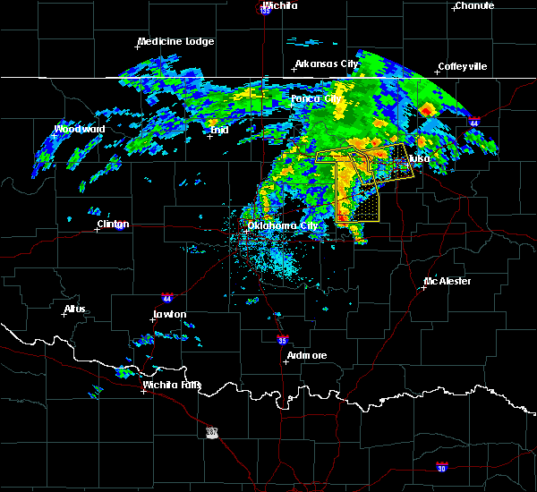 At 850 am cdt, severe thunderstorms were located along a line extending from 6 miles north of paden to 4 miles north of bearden, moving east at 20 mph (radar indicated). Hazards include 60 mph wind gusts and half dollar size hail. Hail damage to vehicles is expected. expect wind damage to roofs, siding, and trees. Locations in or near the path include, okemah, okfuskee, boley, paden, bearden, castle, clearview, pharoah, welty, mason, this includes interstate 40 in oklahoma between mile markers 212 and 231. At 850 am cdt, severe thunderstorms were located along a line extending from 6 miles north of paden to 4 miles north of bearden, moving east at 20 mph (radar indicated). Hazards include 60 mph wind gusts and half dollar size hail. Hail damage to vehicles is expected. expect wind damage to roofs, siding, and trees. Locations in or near the path include, okemah, okfuskee, boley, paden, bearden, castle, clearview, pharoah, welty, mason, this includes interstate 40 in oklahoma between mile markers 212 and 231.
|
| 5/31/2016 9:48 AM CDT |
 At 947 am cdt, a severe thunderstorm was located 4 miles northeast of okemah, moving east at 20 mph (radar indicated). Hazards include quarter size hail. Damage to vehicles is expected. Locations in or near the path include, okemah, henryetta, weleetka, dewar, schulter, grayson, hoffman, clearview, pharoah, bryant, this includes interstate 40 in oklahoma between mile markers 221 and 243. At 947 am cdt, a severe thunderstorm was located 4 miles northeast of okemah, moving east at 20 mph (radar indicated). Hazards include quarter size hail. Damage to vehicles is expected. Locations in or near the path include, okemah, henryetta, weleetka, dewar, schulter, grayson, hoffman, clearview, pharoah, bryant, this includes interstate 40 in oklahoma between mile markers 221 and 243.
|
| 5/24/2016 10:55 PM CDT | Quarter sized hail reported 6.3 miles S of Okemah, OK, hail fell at okemah lake. time estimated via radar. |
| 5/24/2016 10:31 PM CDT | The national weather service in tulsa has issued a * severe thunderstorm warning for. central okfuskee county in east central oklahoma. southwestern creek county in northeastern oklahoma. until 1115 pm cdt * at 1030 pm cdt. A severe thunderstorm was located near cromwell. |
| 4/29/2016 6:54 PM CDT |
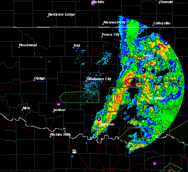 At 654 pm cdt, a severe thunderstorm capable of producing a tornado was located over okemah, moving east at 30 mph (radar indicated rotation). Hazards include tornado and half dollar size hail. Flying debris will be dangerous to those caught without shelter. mobile homes will be damaged or destroyed. damage to roofs, windows, and vehicles will occur. tree damage is likely. Locations in or near the path include, okemah, weleetka, castle, clearview, pharoah, this includes interstate 40 in oklahoma between mile markers 215 and 231. At 654 pm cdt, a severe thunderstorm capable of producing a tornado was located over okemah, moving east at 30 mph (radar indicated rotation). Hazards include tornado and half dollar size hail. Flying debris will be dangerous to those caught without shelter. mobile homes will be damaged or destroyed. damage to roofs, windows, and vehicles will occur. tree damage is likely. Locations in or near the path include, okemah, weleetka, castle, clearview, pharoah, this includes interstate 40 in oklahoma between mile markers 215 and 231.
|
| 4/29/2016 6:48 PM CDT |
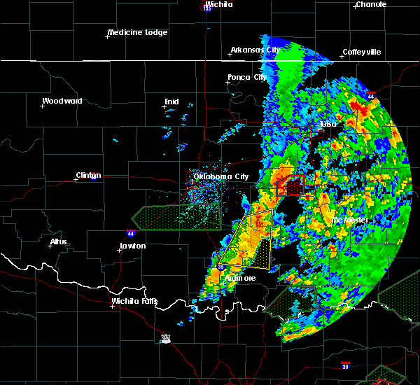 At 647 pm cdt, a severe thunderstorm capable of producing a tornado was located 2 miles west of okemah, moving east at 30 mph (radar indicated rotation). Hazards include tornado and half dollar size hail. Flying debris will be dangerous to those caught without shelter. mobile homes will be damaged or destroyed. damage to roofs, windows, and vehicles will occur. tree damage is likely. Locations in or near the path include, okemah, weleetka, bearden, castle, clearview, pharoah, this includes interstate 40 in oklahoma between mile markers 212 and 231. At 647 pm cdt, a severe thunderstorm capable of producing a tornado was located 2 miles west of okemah, moving east at 30 mph (radar indicated rotation). Hazards include tornado and half dollar size hail. Flying debris will be dangerous to those caught without shelter. mobile homes will be damaged or destroyed. damage to roofs, windows, and vehicles will occur. tree damage is likely. Locations in or near the path include, okemah, weleetka, bearden, castle, clearview, pharoah, this includes interstate 40 in oklahoma between mile markers 212 and 231.
|
| 4/29/2016 6:37 PM CDT |
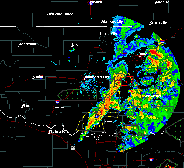 At 637 pm cdt, a severe thunderstorm capable of producing a tornado was located 4 miles north of cromwell, moving east at 30 mph (radar indicated rotation). Hazards include tornado and golf ball size hail. Flying debris will be dangerous to those caught without shelter. mobile homes will be damaged or destroyed. damage to roofs, windows, and vehicles will occur. tree damage is likely. Locations in or near the path include, okemah, weleetka, bearden, castle, clearview, pharoah, this includes interstate 40 in oklahoma between mile markers 212 and 231. At 637 pm cdt, a severe thunderstorm capable of producing a tornado was located 4 miles north of cromwell, moving east at 30 mph (radar indicated rotation). Hazards include tornado and golf ball size hail. Flying debris will be dangerous to those caught without shelter. mobile homes will be damaged or destroyed. damage to roofs, windows, and vehicles will occur. tree damage is likely. Locations in or near the path include, okemah, weleetka, bearden, castle, clearview, pharoah, this includes interstate 40 in oklahoma between mile markers 212 and 231.
|
| 4/29/2016 6:23 PM CDT |
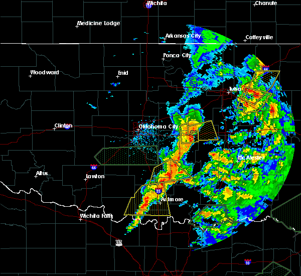 At 622 pm cdt, a severe thunderstorm was located 6 miles west of cromwell, moving east at 35 mph (radar indicated). Hazards include golf ball size hail and 70 mph wind gusts. People and animals outdoors will be injured. expect hail damage to roofs, siding, windows, and vehicles. expect considerable tree damage. wind damage is also likely to mobile homes, roofs, and outbuildings. locations in or near the path include, okemah, okfuskee, boley, weleetka, paden, bearden, castle, clearview, mason, this includes interstate 40 in oklahoma between mile markers 212 and 229. A tornado watch remains in effect until 1000 pm cdt for northeastern oklahoma. At 622 pm cdt, a severe thunderstorm was located 6 miles west of cromwell, moving east at 35 mph (radar indicated). Hazards include golf ball size hail and 70 mph wind gusts. People and animals outdoors will be injured. expect hail damage to roofs, siding, windows, and vehicles. expect considerable tree damage. wind damage is also likely to mobile homes, roofs, and outbuildings. locations in or near the path include, okemah, okfuskee, boley, weleetka, paden, bearden, castle, clearview, mason, this includes interstate 40 in oklahoma between mile markers 212 and 229. A tornado watch remains in effect until 1000 pm cdt for northeastern oklahoma.
|
| 4/29/2016 6:02 PM CDT |
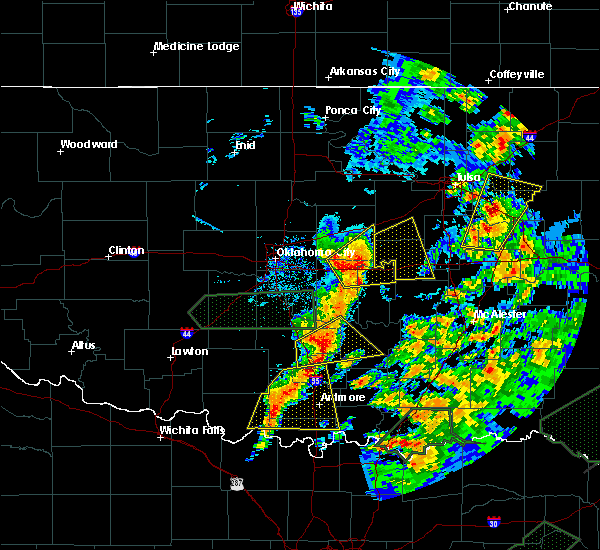 At 602 pm cdt, a severe thunderstorm was located 4 miles west of little, moving east at 45 mph (radar indicated). Hazards include golf ball size hail and 70 mph wind gusts. People and animals outdoors will be injured. expect hail damage to roofs, siding, windows, and vehicles. expect considerable tree damage. wind damage is also likely to mobile homes, roofs, and outbuildings. locations in or near the path include, okemah, okfuskee, boley, weleetka, paden, bearden, slick, castle, clearview, welty, mason, this includes interstate 40 in oklahoma between mile markers 212 and 228. A tornado watch remains in effect until 1000 pm cdt for northeastern oklahoma. At 602 pm cdt, a severe thunderstorm was located 4 miles west of little, moving east at 45 mph (radar indicated). Hazards include golf ball size hail and 70 mph wind gusts. People and animals outdoors will be injured. expect hail damage to roofs, siding, windows, and vehicles. expect considerable tree damage. wind damage is also likely to mobile homes, roofs, and outbuildings. locations in or near the path include, okemah, okfuskee, boley, weleetka, paden, bearden, slick, castle, clearview, welty, mason, this includes interstate 40 in oklahoma between mile markers 212 and 228. A tornado watch remains in effect until 1000 pm cdt for northeastern oklahoma.
|
| 4/26/2016 10:41 PM CDT |
 At 1041 pm cdt, severe thunderstorms were located along a line extending from 3 miles southeast of okmulgee state park to 3 miles east of ashland, moving northeast at 50 mph (radar indicated). Hazards include 70 mph wind gusts. Expect considerable tree damage. damage is likely to mobile homes, roofs, and outbuildings. locations in or near the path include, mcalester, okmulgee, okemah, eufaula, henryetta, krebs, morris, weleetka, dewar, kiowa, savanna, schulter, crowder, alderson, boynton, canadian, indianola, grayson, council hill, hanna, this includes interstate 40 in oklahoma between mile markers 214 and 262. A tornado watch remains in effect until midnight cdt for northeastern oklahoma. At 1041 pm cdt, severe thunderstorms were located along a line extending from 3 miles southeast of okmulgee state park to 3 miles east of ashland, moving northeast at 50 mph (radar indicated). Hazards include 70 mph wind gusts. Expect considerable tree damage. damage is likely to mobile homes, roofs, and outbuildings. locations in or near the path include, mcalester, okmulgee, okemah, eufaula, henryetta, krebs, morris, weleetka, dewar, kiowa, savanna, schulter, crowder, alderson, boynton, canadian, indianola, grayson, council hill, hanna, this includes interstate 40 in oklahoma between mile markers 214 and 262. A tornado watch remains in effect until midnight cdt for northeastern oklahoma.
|
| 4/26/2016 10:21 PM CDT |
 At 1020 pm cdt, severe thunderstorms were located along a line extending from 3 miles northwest of clearview to 5 miles north of coalgate, moving northeast at 65 mph (radar indicated). Hazards include 70 mph wind gusts. Expect considerable tree damage. damage is likely to mobile homes, roofs, and outbuildings. locations in or near the path include, mcalester, okmulgee, okemah, eufaula, henryetta, krebs, morris, weleetka, dewar, kiowa, savanna, schulter, crowder, alderson, boynton, canadian, indianola, grayson, council hill, hanna, this includes interstate 40 in oklahoma between mile markers 214 and 262. A tornado watch remains in effect until midnight cdt for eastern oklahoma. At 1020 pm cdt, severe thunderstorms were located along a line extending from 3 miles northwest of clearview to 5 miles north of coalgate, moving northeast at 65 mph (radar indicated). Hazards include 70 mph wind gusts. Expect considerable tree damage. damage is likely to mobile homes, roofs, and outbuildings. locations in or near the path include, mcalester, okmulgee, okemah, eufaula, henryetta, krebs, morris, weleetka, dewar, kiowa, savanna, schulter, crowder, alderson, boynton, canadian, indianola, grayson, council hill, hanna, this includes interstate 40 in oklahoma between mile markers 214 and 262. A tornado watch remains in effect until midnight cdt for eastern oklahoma.
|
| 4/11/2016 1:16 AM CDT |
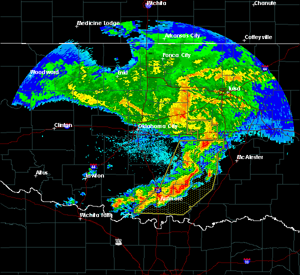 At 116 am cdt, severe thunderstorms were located along a line extending from 3 miles northeast of welty to 3 miles south of okfuskee to 3 miles north of wetumka, moving east at 60 mph (radar indicated). Hazards include 60 mph wind gusts. Expect damage to roofs. siding. and trees. Locations in or near the path include, okemah, okfuskee, boley, weleetka, paden, bearden, castle, clearview, pharoah, welty, mason, this includes interstate 40 in oklahoma between mile markers 212 and 231. At 116 am cdt, severe thunderstorms were located along a line extending from 3 miles northeast of welty to 3 miles south of okfuskee to 3 miles north of wetumka, moving east at 60 mph (radar indicated). Hazards include 60 mph wind gusts. Expect damage to roofs. siding. and trees. Locations in or near the path include, okemah, okfuskee, boley, weleetka, paden, bearden, castle, clearview, pharoah, welty, mason, this includes interstate 40 in oklahoma between mile markers 212 and 231.
|
| 4/11/2016 12:47 AM CDT |
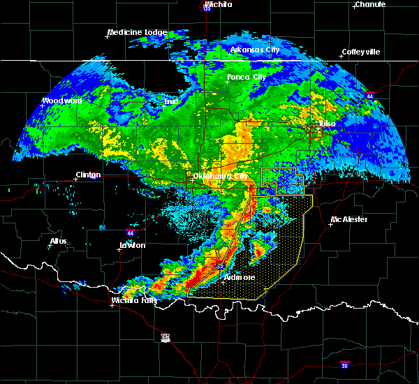 At 1247 am cdt, severe thunderstorms were located along a line extending from 4 miles east of meeker to 4 miles north of little to bowlegs, moving east at 60 mph (radar indicated). Hazards include 60 mph wind gusts. Expect damage to roofs. siding. and trees. Locations in or near the path include, okemah, okfuskee, boley, weleetka, paden, bearden, castle, clearview, pharoah, welty, mason, this includes interstate 40 in oklahoma between mile markers 212 and 231. At 1247 am cdt, severe thunderstorms were located along a line extending from 4 miles east of meeker to 4 miles north of little to bowlegs, moving east at 60 mph (radar indicated). Hazards include 60 mph wind gusts. Expect damage to roofs. siding. and trees. Locations in or near the path include, okemah, okfuskee, boley, weleetka, paden, bearden, castle, clearview, pharoah, welty, mason, this includes interstate 40 in oklahoma between mile markers 212 and 231.
|
| 11/17/2015 4:02 AM CST |
 At 402 am cst, severe thunderstorms were located along a line extending from 3 miles southeast of sand springs to 2 miles east of kellyville to 4 miles northeast of okemah, moving east at 45 mph (radar indicated). Hazards include 60 mph wind gusts. Damage to roofs. siding and trees will be possible. locations in or near the path include, tulsa, broken arrow, sand springs, okmulgee, bristow, okemah, bixby, sapulpa, jenks, okfuskee, glenpool, kiefer, beggs, boley, mounds, kellyville, paden, slick, castle, welty, this includes the following highways, interstate 40 in oklahoma between mile markers 218 and 223. Interstate 44 between mile markers 190 and 228. At 402 am cst, severe thunderstorms were located along a line extending from 3 miles southeast of sand springs to 2 miles east of kellyville to 4 miles northeast of okemah, moving east at 45 mph (radar indicated). Hazards include 60 mph wind gusts. Damage to roofs. siding and trees will be possible. locations in or near the path include, tulsa, broken arrow, sand springs, okmulgee, bristow, okemah, bixby, sapulpa, jenks, okfuskee, glenpool, kiefer, beggs, boley, mounds, kellyville, paden, slick, castle, welty, this includes the following highways, interstate 40 in oklahoma between mile markers 218 and 223. Interstate 44 between mile markers 190 and 228.
|
| 11/17/2015 3:56 AM CST |
 At 355 am cst, severe thunderstorms were located along a line extending from 2 miles east of sand springs to 2 miles southwest of kellyville to near okemah, moving east at 40 mph (radar indicated). Hazards include 60 mph wind gusts. Damage to roofs. siding and trees will be possible. locations in or near the path include, tulsa, broken arrow, sand springs, okmulgee, bristow, okemah, bixby, sapulpa, jenks, okfuskee, glenpool, henryetta, kiefer, beggs, boley, mounds, kellyville, schulter, depew, paden, this includes the following highways, interstate 40 in oklahoma between mile markers 217 and 225. Interstate 44 between mile markers 184 and 229. At 355 am cst, severe thunderstorms were located along a line extending from 2 miles east of sand springs to 2 miles southwest of kellyville to near okemah, moving east at 40 mph (radar indicated). Hazards include 60 mph wind gusts. Damage to roofs. siding and trees will be possible. locations in or near the path include, tulsa, broken arrow, sand springs, okmulgee, bristow, okemah, bixby, sapulpa, jenks, okfuskee, glenpool, henryetta, kiefer, beggs, boley, mounds, kellyville, schulter, depew, paden, this includes the following highways, interstate 40 in oklahoma between mile markers 217 and 225. Interstate 44 between mile markers 184 and 229.
|
| 11/17/2015 3:37 AM CST |
 At 337 am cst, severe thunderstorms were located along a line extending from 3 miles south of keystone state park to 4 miles northwest of bristow to near boley, moving east at 35 mph (radar indicated). Hazards include 60 mph wind gusts. Damage to roofs. siding and trees is possible. locations in or near the path include, tulsa, broken arrow, sand springs, okmulgee, bristow, okemah, bixby, sapulpa, jenks, okfuskee, glenpool, coweta, catoosa, henryetta, drumright, haskell, inola, kiefer, morris, beggs, this includes the following highways, interstate 40 in oklahoma between mile markers 217 and 225. Interstate 44 between mile markers 178 and 230. At 337 am cst, severe thunderstorms were located along a line extending from 3 miles south of keystone state park to 4 miles northwest of bristow to near boley, moving east at 35 mph (radar indicated). Hazards include 60 mph wind gusts. Damage to roofs. siding and trees is possible. locations in or near the path include, tulsa, broken arrow, sand springs, okmulgee, bristow, okemah, bixby, sapulpa, jenks, okfuskee, glenpool, coweta, catoosa, henryetta, drumright, haskell, inola, kiefer, morris, beggs, this includes the following highways, interstate 40 in oklahoma between mile markers 217 and 225. Interstate 44 between mile markers 178 and 230.
|
| 11/17/2015 3:11 AM CST |
 At 311 am cst, severe thunderstorms were located along a line extending from 2 miles north of drumright to 3 miles northwest of prague, moving east at 45 mph (radar indicated). Hazards include 60 mph wind gusts. Damage to roofs. siding and trees is possible. locations in or near the path include, tulsa, broken arrow, sand springs, okmulgee, bristow, okemah, bixby, sapulpa, jenks, okfuskee, glenpool, coweta, catoosa, henryetta, drumright, haskell, inola, kiefer, morris, beggs, this includes the following highways, interstate 40 in oklahoma between mile markers 217 and 225. Interstate 44 between mile markers 178 and 230. At 311 am cst, severe thunderstorms were located along a line extending from 2 miles north of drumright to 3 miles northwest of prague, moving east at 45 mph (radar indicated). Hazards include 60 mph wind gusts. Damage to roofs. siding and trees is possible. locations in or near the path include, tulsa, broken arrow, sand springs, okmulgee, bristow, okemah, bixby, sapulpa, jenks, okfuskee, glenpool, coweta, catoosa, henryetta, drumright, haskell, inola, kiefer, morris, beggs, this includes the following highways, interstate 40 in oklahoma between mile markers 217 and 225. Interstate 44 between mile markers 178 and 230.
|
| 11/5/2015 2:32 PM CST |
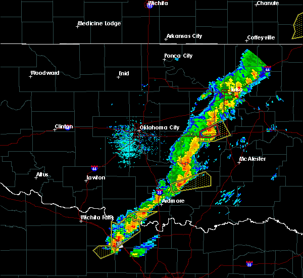 At 232 pm cst, a severe thunderstorm with strong low level rotation that could produce a tornado at any time was located over okemah, moving northeast at 35 mph (radar indicated rotation). Hazards include tornado. Flying debris will be dangerous to those caught without shelter. mobile homes will be damaged or destroyed. damage to roofs, windows and vehicles will occur. tree damage is likely. Locations in or near the path include, okemah, bearden, castle, clearview, pharoah, this includes interstate 40 in oklahoma between mile markers 212 and 231. At 232 pm cst, a severe thunderstorm with strong low level rotation that could produce a tornado at any time was located over okemah, moving northeast at 35 mph (radar indicated rotation). Hazards include tornado. Flying debris will be dangerous to those caught without shelter. mobile homes will be damaged or destroyed. damage to roofs, windows and vehicles will occur. tree damage is likely. Locations in or near the path include, okemah, bearden, castle, clearview, pharoah, this includes interstate 40 in oklahoma between mile markers 212 and 231.
|
| 11/5/2015 2:28 PM CST |
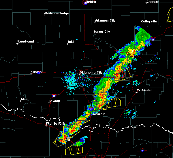 At 228 pm cst, a severe thunderstorm with strong low level rotation that could produce a tornado at any time was located over okemah, moving northeast at 50 mph (radar indicated rotation). Hazards include tornado. Flying debris will be dangerous to those caught without shelter. mobile homes will be damaged or destroyed. damage to roofs, windows and vehicles will occur. tree damage is likely. Locations in or near the path include, okemah, bearden, castle, clearview, pharoah, this includes interstate 40 in oklahoma between mile markers 212 and 231. At 228 pm cst, a severe thunderstorm with strong low level rotation that could produce a tornado at any time was located over okemah, moving northeast at 50 mph (radar indicated rotation). Hazards include tornado. Flying debris will be dangerous to those caught without shelter. mobile homes will be damaged or destroyed. damage to roofs, windows and vehicles will occur. tree damage is likely. Locations in or near the path include, okemah, bearden, castle, clearview, pharoah, this includes interstate 40 in oklahoma between mile markers 212 and 231.
|
| 11/5/2015 2:20 PM CST |
 At 220 pm cst, a severe thunderstorm was located near bearden, moving northeast at 60 mph (radar indicated). Hazards include 60 mph wind gusts and penny size hail. Expect damage to roofs. siding and trees. locations in or near the path include, okemah, henryetta, weleetka, dewar, bearden, castle, clearview, pharoah, okmulgee state park, bryant, this includes interstate 40 in oklahoma between mile markers 212 and 241. A tornado watch remains in effect until 800 pm cst for eastern oklahoma. At 220 pm cst, a severe thunderstorm was located near bearden, moving northeast at 60 mph (radar indicated). Hazards include 60 mph wind gusts and penny size hail. Expect damage to roofs. siding and trees. locations in or near the path include, okemah, henryetta, weleetka, dewar, bearden, castle, clearview, pharoah, okmulgee state park, bryant, this includes interstate 40 in oklahoma between mile markers 212 and 241. A tornado watch remains in effect until 800 pm cst for eastern oklahoma.
|
| 7/30/2015 2:56 PM CDT | The severe thunderstorm warning for central okfuskee county will expire at 300 pm cdt, the storm which prompted the warning has weakened below severe limits, and no longer pose an immediate threat to life or property. therefore the warning will be allowed to expire. |
| 7/30/2015 2:39 PM CDT |
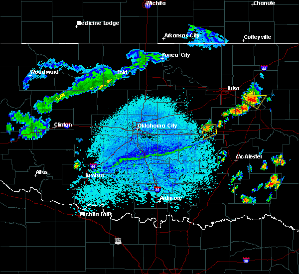 At 239 pm cdt, a severe thunderstorm was located 3 miles northeast of okemah, moving southeast at 15 mph (radar indicated). Hazards include 60 mph wind gusts. Expect damage to roofs. siding and trees. Locations impacted include, okemah, clearview and pharoah. At 239 pm cdt, a severe thunderstorm was located 3 miles northeast of okemah, moving southeast at 15 mph (radar indicated). Hazards include 60 mph wind gusts. Expect damage to roofs. siding and trees. Locations impacted include, okemah, clearview and pharoah.
|
| 7/30/2015 2:23 PM CDT |
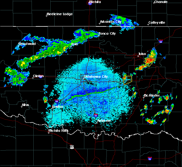 At 223 pm cdt, a severe thunderstorm was located 4 miles north of okemah, moving southeast at 15 mph (radar indicated). Hazards include 60 mph wind gusts. Expect damage to roofs. Siding and trees. At 223 pm cdt, a severe thunderstorm was located 4 miles north of okemah, moving southeast at 15 mph (radar indicated). Hazards include 60 mph wind gusts. Expect damage to roofs. Siding and trees.
|
| 5/23/2015 8:48 PM CDT | At 844 pm cdt, a severe thunderstorm capable of producing a tornado was located near okemah, and moving north at 35 mph (radar indicated rotation). Hazards include tornado. Flying debris will be dangerous to those caught without shelter. mobile homes will be damaged or destroyed. damage to roofs, windows and vehicles will occur. tree damage is likely. Locations in or near the path include, castle and mason this includes interstate 40 between mile markers 215 and 223. |
| 5/23/2015 8:31 PM CDT | At 827 pm cdt, a severe thunderstorm capable of producing a tornado was located near bearden, and moving north at 35 mph (radar indicated rotation). Hazards include tornado. Flying debris will be dangerous to those caught without shelter. mobile homes will be damaged or destroyed. damage to roofs, windows and vehicles will occur. tree damage is likely. locations in or near the path include, bearden, okemah, castle and mason. This includes interstate 40 between mile markers 212 and 225. |
| 5/23/2015 8:06 PM CDT | At 804 pm cdt, a severe thunderstorm capable of producing a tornado was located near clearview, and moving north at 25 mph (radar indicated rotation). Hazards include tornado. Flying debris will be dangerous to those caught without shelter. mobile homes will be damaged or destroyed. damage to roofs, windows and vehicles will occur. tree damage is likely. Locations in or near the path include, clearview and okemah this includes interstate 40 between mile markers 216 and 228. |
| 5/23/2015 7:56 PM CDT | At 753 pm cdt, a confirmed tornado was located 5 miles east of bearden, and moving north at 30 mph (emergency management confirmed tornado). Hazards include damaging tornado. Flying debris will be dangerous to those caught without shelter. mobile homes will be damaged or destroyed. damage to roofs, windows and vehicles will occur. tree damage is likely. locations in or near the path include, okemah and clearview. This includes interstate 40 between mile markers 215 and 228. |
| 5/16/2015 11:42 PM CDT | The severe thunderstorm warning for western wagoner, southeastern tulsa, okmulgee, eastern okfuskee, northwestern muskogee and south central creek counties will expire at 1145 pm cdt, the line of storms which prompted the warning has moved out of the warned area. additional severe thunderstorms are still possible, and a tornado watch remains in effect until 3 am. |
| 5/16/2015 11:04 PM CDT | At 1102 pm cdt, severe thunderstorms were located along a line extending from slick to okfuskee to bearden, and moving northeast at 50 mph (radar indicated). Hazards include 70 mph wind gusts and nickel size hail. Expect considerable tree damage. damage is likely to mobile homes, roofs and outbuildings. the line of storms will otherwise remain over mainly rural areas of the indicated counties. this includes interstate 40 between mile markers 212 and 225. 0. 88in. |
| 5/16/2015 11:01 PM CDT | At 1059 pm cdt, severe thunderstorms were located along a line extending from 7 miles northeast of slick to okfuskee to bearden, and moving northeast at 55 mph (radar indicated). Hazards include 60 mph wind gusts and nickel size hail. Expect damage to roofs. siding and trees. locations in or near the path include, beggs, okmulgee state park, clearview, liberty, preston, weleetka, hectorville, pharoah, okmulgee, wilson, bryant, leonard, bald hill, schulter, henryetta, morris, dewar, stonebluff, grayson, coweta, haskell, hoffman, choska, eram, jamesville, redbird, porter, boynton and taft. this includes interstate 40 between mile markers 216 and 243. 0. 88in. |
| 5/16/2015 10:45 PM CDT | At 1043 pm cdt, severe thunderstorms were located along a line extending from 5 miles south of depew to castle to 6 miles east of seminole, and moving northeast at 50 mph (radar indicated). Hazards include 70 mph wind gusts and nickel size hail. Expect considerable tree damage. damage is likely to mobile homes, roofs and outbuildings. locations in or near the path include, welty, castle, mason, bearden, okemah, slick and okfuskee this includes interstate 40 between mile markers 212 and 225. 0. 88in. |
| 5/16/2015 10:29 PM CDT | At 1027 pm cdt, severe thunderstorms were located along a line extending from 5 miles southeast of stroud to st. louis, and moving east at 35 mph (radar indicated). Hazards include 60 mph wind gusts and nickel size hail. Expect damage to roofs. siding and trees. locations in or near the path include, milfay, paden, boley, welty, slick, castle, mason, bearden, okemah and okfuskee. this includes interstate 40 between mile markers 212 and 225. 0. 88in. |
| 5/16/2015 10:21 PM CDT | At 1021 pm cdt, a severe thunderstorm with strong low level rotation that could produce a tornado at any time was located 6 miles northeast of okemah, and moving northeast at 40 mph (radar indicated rotation). Hazards include tornado and quarter size hail. Flying debris will be dangerous to those caught without shelter. mobile homes will be damaged or destroyed. damage to roofs, windows and vehicles will occur. tree damage is likely. the storm will otherwise remain over mainly rural areas of the indicated county. this includes interstate 40 between mile markers 221 and 225. Radar indicated. |
| 5/16/2015 10:17 PM CDT | At 1016 pm cdt, a severe thunderstorm capable of producing a tornado was located near okemah, and moving northeast at 45 mph (radar indicated rotation). Hazards include tornado and quarter size hail. Flying debris will be dangerous to those caught without shelter. mobile homes will be damaged or destroyed. damage to roofs, windows and vehicles will occur. tree damage is likely. locations in or near the path include, mason, okfuskee, okmulgee state park, slick, beggs and preston this includes interstate 40 between mile markers 219 and 226. Radar indicated. |
| 5/16/2015 10:10 PM CDT | At 1008 pm cdt, a severe thunderstorm capable of producing a tornado was located near okemah, and moving northeast at 45 mph (radar indicated rotation). Hazards include tornado and quarter size hail. Flying debris will be dangerous to those caught without shelter. mobile homes will be damaged or destroyed. damage to roofs, windows and vehicles will occur. tree damage is likely. locations in or near the path include, okemah this includes interstate 40 between mile markers 213 and 225. Radar indicated. |
| 5/16/2015 10:04 PM CDT | At 1003 pm cdt, a severe thunderstorm capable of producing a tornado was located near bearden, and moving northeast at 45 mph (radar indicated rotation). Hazards include tornado and quarter size hail. Flying debris will be dangerous to those caught without shelter. mobile homes will be damaged or destroyed. damage to roofs, windows and vehicles will occur. tree damage is likely. locations in or near the path include, okemah, castle, mason, okfuskee, okmulgee state park, slick, beggs and preston. this includes interstate 40 between mile markers 219 and 227. Radar indicated. |
| 5/16/2015 9:54 PM CDT | At 952 pm cdt, a severe thunderstorm capable of producing a tornado was located 5 miles south of cromwell, and moving northeast at 45 mph (radar indicated rotation). Hazards include tornado and quarter size hail. Flying debris will be dangerous to those caught without shelter. mobile homes will be damaged or destroyed. damage to roofs, windows and vehicles will occur. tree damage is likely. locations in or near the path include, bearden, castle and okemah. this includes interstate 40 between mile markers 212 and 225. Radar indicated. |
| 5/16/2015 9:36 PM CDT | At 934 pm cdt, severe thunderstorms were located along a line extending from boley to wewoka, and moving north at 60 mph (radar indicated). Hazards include 60 mph wind gusts and quarter size hail. Hail damage to vehicles is expected. expect wind damage to roofs, siding and trees. locations in or near the path include, boley, bearden, welty, okemah, castle, mason, okfuskee and slick. this includes interstate 40 between mile markers 212 and 225. 1. 00in. |
| 5/8/2015 9:15 PM CDT | At 912 pm cdt, a severe thunderstorm capable of producing a tornado was located 5 miles south of bearden, and moving northeast at 30 mph (radar indicated rotation). Hazards include tornado. Flying debris will be dangerous to those caught without shelter. mobile homes will be damaged or destroyed. damage to roofs, windows and vehicles will occur. tree damage is likely. locations in or near the path include, bearden, okemah and clearview. this includes interstate 40 between mile markers 212 and 228. Radar indicated. |
| 5/8/2015 8:58 PM CDT | At 856 pm cdt, a severe thunderstorm was located 7 miles northeast of wewoka, and moving east at 50 mph (radar indicated). Hazards include 70 mph wind gusts and quarter size hail. Hail damage to vehicles is expected. expect considerable tree damage. wind damage is also likely to mobile homes, roofs and outbuildings. locations in or near the path include, bearden, castle, okemah, clearview and weleetka. this includes interstate 40 between mile markers 212 and 228. 1. 00in. |
| 5/8/2015 8:36 PM CDT | At 835 pm cdt, a severe thunderstorm was located near clearview, and moving northeast at 20 mph (radar indicated). Hazards include 60 mph wind gusts and quarter size hail. Hail damage to vehicles is expected. expect wind damage to roofs, siding and trees. locations in or near the path include, clearview, weleetka and pharoah this includes interstate 40 between mile markers 218 and 229. Possible. |
| 5/8/2015 8:20 PM CDT | Ping Pong Ball sized hail reported 0.1 miles SSW of Okemah, OK |
| 5/8/2015 8:13 PM CDT | At 811 pm cdt, a severe thunderstorm was located near bearden, and moving east at 20 mph (radar indicated). Hazards include 60 mph wind gusts and quarter size hail. Hail damage to vehicles is expected. expect wind damage to roofs, siding and trees. locations in or near the path include, okemah, clearview and weleetka. this includes interstate 40 between mile markers 215 and 229. 1. 00in. |
| 5/8/2015 8:00 PM CDT | At 759 pm cdt, a severe thunderstorm was located near bearden, and moving northeast at 20 mph (radar indicated). Hazards include golf ball size hail and 60 mph wind gusts. People and animals outdoors will be injured. expect hail damage to roofs, siding, windows and vehicles. expect wind damage to roofs, siding and trees. locations in or near the path include, okemah and clearview this includes interstate 40 between mile markers 213 and 226. 1. 75in. |
| 5/8/2015 7:35 PM CDT | At 734 pm cdt, a severe thunderstorm was located near cromwell, and moving northeast at 25 mph (radar indicated). Hazards include 60 mph wind gusts and quarter size hail. Hail damage to vehicles is expected. expect wind damage to roofs, siding and trees. locations in or near the path include, bearden, castle, okemah and clearview. this includes interstate 40 between mile markers 212 and 226. 1. 00in. |
| 5/8/2015 7:20 PM CDT | At 719 pm cdt, a severe thunderstorm with strong low level rotation that could produce a tornado at any time was located near paden, and moving northeast at 35 mph (radar indicated rotation). Hazards include tornado and quarter size hail. Flying debris will be dangerous to those caught without shelter. mobile homes will be damaged or destroyed. damage to roofs, windows and vehicles will occur. tree damage is likely. Locations in or near the path include, paden, boley, castle, mason and okemah , radar indicated. |
| 5/8/2015 7:08 PM CDT | At 705 pm cdt, a severe thunderstorm capable of producing a tornado was located near little, and moving northeast at 35 mph (radar indicated rotation). Hazards include tornado and ping pong ball size hail. Flying debris will be dangerous to those caught without shelter. mobile homes will be damaged or destroyed. damage to roofs, windows and vehicles will occur. tree damage is likely. locations in or near the path include, paden, boley, castle, mason and okemah. Radar indicated. |
| 3/25/2015 8:26 PM CDT | A severe thunderstorm warning remains in effect for southern okmulgee. eastern okfuskee and northwestern mcintosh counties until 845 pm cdt. at 824 pm cdt. a severe thunderstorm was located near pharoah. and moving east at 45 mph. hazard. 60 mph wind gusts and quarter size hail. |
| 3/25/2015 8:04 PM CDT | The national weather service in tulsa has issued a * severe thunderstorm warning for. northwestern mcintosh county in southeast oklahoma. central okfuskee county in east central oklahoma. southern okmulgee county in northeast oklahoma. Until 845 pm cdt. |
| 3/25/2015 7:32 PM CDT | The national weather service in tulsa has issued a * severe thunderstorm warning for. okfuskee county in east central oklahoma. west central okmulgee county in northeast oklahoma. until 815 pm cdt * at 731 pm cdt. a severe thunderstorm was located near paden. And. |
| 5/19/2013 8:30 PM CDT | Quarter sized hail reported 7.4 miles NE of Okemah, OK |
| 4/26/2013 10:40 PM CDT | 20 inch diameter tree down across e1120 road southeast of okema in okfuskee county OK, 2.6 miles NW of Okemah, OK |
| 5/29/2012 9:22 PM CDT | Few large trees down. few large limbs down on power line in okfuskee county OK, 0.1 miles SSW of Okemah, OK |
| 5/29/2012 9:21 PM CDT | Estimated on north side of okemah in okfuskee county OK, 0.1 miles SSW of Okemah, OK |
| 10/22/2011 7:20 PM CDT | Tea Cup sized hail reported 1.7 miles NW of Okemah, OK, possibly as big as a softball |
| 1/1/0001 12:00 AM | Emergency manager reported trees and power lines down in and south of town in okfuskee county OK, 0.1 miles SSW of Okemah, OK |
| 1/1/0001 12:00 AM | Numerous tree limbs dow in okfuskee county OK, 0.1 miles SSW of Okemah, OK |
| 4/22/2011 5:55 PM CDT | Quarter sized hail reported 12.8 miles SSE of Okemah, OK |
Hail Maps for Okemah, OK

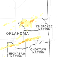


Connect with Interactive Hail Maps