

Hail Map for Oketo, KS
The Oketo, KS area has had 3 reports of on-the-ground hail by trained spotters, and has been under severe weather warnings 10 times during the past 12 months. Doppler radar has detected hail at or near Oketo, KS on 89 occasions, including 5 occasions during the past year.
| Name: | Oketo, KS |
| Where Located: | 54.2 miles N of Manhattan, KS |
| Map: | Google Map for Oketo, KS |
| Population: | 66 |
| Housing Units: | 38 |
| More Info: | Search Google for Oketo, KS |
1
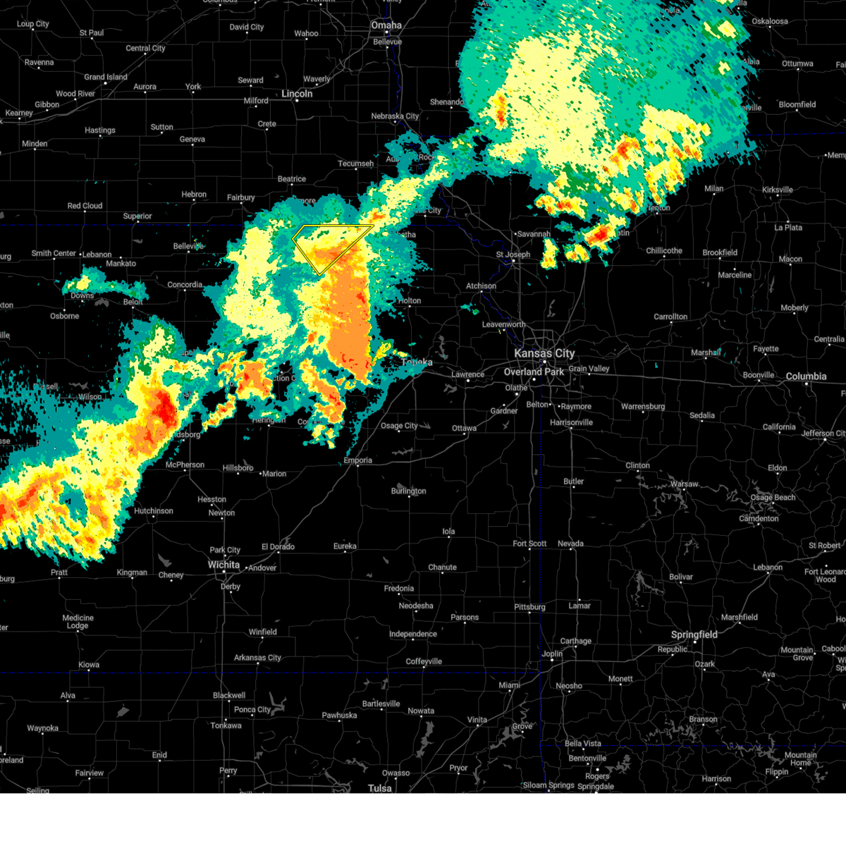
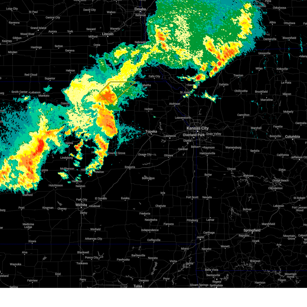
The Top Recent Hail Date for Oketo, KS is Thursday, April 24, 2025 (17th out of 89)

Hail and Wind Damage Spotted near Oketo, KS
| Date / Time | Report Details |
|---|---|
| 5/19/2025 4:45 PM CDT | The storm which prompted the warning has moved out of the area. therefore, the warning will be allowed to expire. a tornado watch remains in effect until 900 pm cdt for northeastern kansas. remember, a severe thunderstorm warning still remains in effect for northwest marshall county. |
| 5/19/2025 4:29 PM CDT | At 429 pm cdt, a severe thunderstorm was located 5 miles east of oketo, moving northeast at 30 mph (radar indicated). Hazards include ping pong ball size hail and 60 mph wind gusts. People and animals outdoors will be injured. expect hail damage to roofs, siding, windows, and vehicles. expect wind damage to roofs, siding, and trees. Locations impacted include, marysville, beattie, summerfield, and oketo. |
| 5/19/2025 4:18 PM CDT | At 418 pm cdt, a severe thunderstorm was located 4 miles northeast of marysville, moving northeast at 30 mph (radar indicated). Hazards include 60 mph wind gusts and half dollar size hail. Hail damage to vehicles is expected. expect wind damage to roofs, siding, and trees. Locations impacted include, marysville, beattie, summerfield, and oketo. |
| 5/19/2025 4:10 PM CDT | Svrtop the national weather service in topeka has issued a * severe thunderstorm warning for, northern marshall county in northeastern kansas, * until 445 pm cdt. * at 410 pm cdt, a severe thunderstorm was located near marysville, moving northeast at 30 mph (radar indicated). Hazards include 60 mph wind gusts and half dollar size hail. Hail damage to vehicles is expected. Expect wind damage to roofs, siding, and trees. |
| 4/24/2025 7:36 PM CDT |
 Svrtop the national weather service in topeka has issued a * severe thunderstorm warning for, northwestern marshall county in northeastern kansas, * until 815 pm cdt. * at 736 pm cdt, a severe thunderstorm was located near oketo, moving southeast at 20 mph (radar indicated). Hazards include 60 mph wind gusts and quarter size hail. Hail damage to vehicles is expected. Expect wind damage to roofs, siding, and trees. Svrtop the national weather service in topeka has issued a * severe thunderstorm warning for, northwestern marshall county in northeastern kansas, * until 815 pm cdt. * at 736 pm cdt, a severe thunderstorm was located near oketo, moving southeast at 20 mph (radar indicated). Hazards include 60 mph wind gusts and quarter size hail. Hail damage to vehicles is expected. Expect wind damage to roofs, siding, and trees.
|
| 7/31/2024 9:11 PM CDT |
 The storm which prompted the warning has weakened below severe limits, and no longer poses an immediate threat to life or property. therefore, the warning will be allowed to expire. however, gusty winds are still possible with this thunderstorm. a severe thunderstorm watch remains in effect until 1000 pm cdt for northeastern kansas. a severe thunderstorm watch also remains in effect until 100 am cdt for northeastern kansas. The storm which prompted the warning has weakened below severe limits, and no longer poses an immediate threat to life or property. therefore, the warning will be allowed to expire. however, gusty winds are still possible with this thunderstorm. a severe thunderstorm watch remains in effect until 1000 pm cdt for northeastern kansas. a severe thunderstorm watch also remains in effect until 100 am cdt for northeastern kansas.
|
| 7/31/2024 8:56 PM CDT | the severe thunderstorm warning has been cancelled and is no longer in effect |
| 7/31/2024 8:56 PM CDT | At 856 pm cdt, a severe thunderstorm was located over beattie, moving northeast at 35 mph (radar indicated). Hazards include 60 mph wind gusts and penny size hail. Expect damage to roofs, siding, and trees. Locations impacted include, marysville, axtell, beattie, summerfield, and oketo. |
| 7/31/2024 8:42 PM CDT |
 At 841 pm cdt, a severe thunderstorm was located near marysville, moving northeast at 35 mph (public. public has reported strong wind gusts and some tree damage near blue rapids). Hazards include 60 mph wind gusts and penny size hail. Expect damage to roofs, siding, and trees. Locations impacted include, marysville, blue rapids, waterville, axtell, beattie, summerfield, and oketo. At 841 pm cdt, a severe thunderstorm was located near marysville, moving northeast at 35 mph (public. public has reported strong wind gusts and some tree damage near blue rapids). Hazards include 60 mph wind gusts and penny size hail. Expect damage to roofs, siding, and trees. Locations impacted include, marysville, blue rapids, waterville, axtell, beattie, summerfield, and oketo.
|
| 7/31/2024 8:37 PM CDT |
 Svrtop the national weather service in topeka has issued a * severe thunderstorm warning for, northwestern nemaha county in northeastern kansas, east central washington county in north central kansas, marshall county in northeastern kansas, * until 915 pm cdt. * at 837 pm cdt, a severe thunderstorm was located 5 miles north of waterville, moving northeast at 55 mph (radar indicated). Hazards include 60 mph wind gusts and penny size hail. expect damage to roofs, siding, and trees Svrtop the national weather service in topeka has issued a * severe thunderstorm warning for, northwestern nemaha county in northeastern kansas, east central washington county in north central kansas, marshall county in northeastern kansas, * until 915 pm cdt. * at 837 pm cdt, a severe thunderstorm was located 5 miles north of waterville, moving northeast at 55 mph (radar indicated). Hazards include 60 mph wind gusts and penny size hail. expect damage to roofs, siding, and trees
|
| 6/26/2024 2:19 AM CDT |
 At 218 am cdt, severe thunderstorms were located along a line extending from 6 miles northeast of bern to 7 miles northeast of glasco, moving southeast at 40 mph (radar indicated). Hazards include 60 mph wind gusts and nickel size hail. Expect damage to roofs, siding, and trees. Locations impacted include, concordia, marysville, washington, blue rapids, frankfort, clyde, hanover, waterville, clifton, linn, axtell, greenleaf, jamestown, beattie, barnes, summerfield, cuba, morrowville, norway, and vermillion. At 218 am cdt, severe thunderstorms were located along a line extending from 6 miles northeast of bern to 7 miles northeast of glasco, moving southeast at 40 mph (radar indicated). Hazards include 60 mph wind gusts and nickel size hail. Expect damage to roofs, siding, and trees. Locations impacted include, concordia, marysville, washington, blue rapids, frankfort, clyde, hanover, waterville, clifton, linn, axtell, greenleaf, jamestown, beattie, barnes, summerfield, cuba, morrowville, norway, and vermillion.
|
| 6/26/2024 1:48 AM CDT |
 Svrtop the national weather service in topeka has issued a * severe thunderstorm warning for, republic county in north central kansas, washington county in north central kansas, northern cloud county in north central kansas, marshall county in northeastern kansas, * until 230 am cdt. * at 148 am cdt, severe thunderstorms were located along a line extending from near johnson to near courtland, moving southeast at 35 mph (radar indicated). Hazards include 60 mph wind gusts and nickel size hail. expect damage to roofs, siding, and trees Svrtop the national weather service in topeka has issued a * severe thunderstorm warning for, republic county in north central kansas, washington county in north central kansas, northern cloud county in north central kansas, marshall county in northeastern kansas, * until 230 am cdt. * at 148 am cdt, severe thunderstorms were located along a line extending from near johnson to near courtland, moving southeast at 35 mph (radar indicated). Hazards include 60 mph wind gusts and nickel size hail. expect damage to roofs, siding, and trees
|
| 6/15/2024 6:04 PM CDT |
 At 604 pm cdt, severe thunderstorms were located along a line extending from 3 miles northeast of morrowville to 4 miles south of hollenberg to 3 miles northeast of barnes, moving northeast at 35 mph (radar indicated). Hazards include 60 mph wind gusts and nickel size hail. Expect damage to roofs, siding, and trees. Locations impacted include, washington, hanover, barnes, oketo, hollenberg, and bremen. At 604 pm cdt, severe thunderstorms were located along a line extending from 3 miles northeast of morrowville to 4 miles south of hollenberg to 3 miles northeast of barnes, moving northeast at 35 mph (radar indicated). Hazards include 60 mph wind gusts and nickel size hail. Expect damage to roofs, siding, and trees. Locations impacted include, washington, hanover, barnes, oketo, hollenberg, and bremen.
|
| 6/15/2024 5:55 PM CDT |
 At 555 pm cdt, a severe thunderstorm was located near barnes, moving northeast at 45 mph (radar indicated). Hazards include 60 mph wind gusts and nickel size hail. Expect damage to roofs, siding, and trees. Locations impacted include, washington, hanover, linn, greenleaf, barnes, oketo, hollenberg, and bremen. At 555 pm cdt, a severe thunderstorm was located near barnes, moving northeast at 45 mph (radar indicated). Hazards include 60 mph wind gusts and nickel size hail. Expect damage to roofs, siding, and trees. Locations impacted include, washington, hanover, linn, greenleaf, barnes, oketo, hollenberg, and bremen.
|
| 6/15/2024 5:55 PM CDT |
 the severe thunderstorm warning has been cancelled and is no longer in effect the severe thunderstorm warning has been cancelled and is no longer in effect
|
| 6/15/2024 5:40 PM CDT |
 Svrtop the national weather service in topeka has issued a * severe thunderstorm warning for, eastern washington county in north central kansas, northeastern clay county in north central kansas, northwestern marshall county in northeastern kansas, * until 630 pm cdt. * at 540 pm cdt, a severe thunderstorm was located 9 miles north of green, moving northeast at 55 mph (radar indicated). Hazards include 60 mph wind gusts and quarter size hail. Hail damage to vehicles is expected. Expect wind damage to roofs, siding, and trees. Svrtop the national weather service in topeka has issued a * severe thunderstorm warning for, eastern washington county in north central kansas, northeastern clay county in north central kansas, northwestern marshall county in northeastern kansas, * until 630 pm cdt. * at 540 pm cdt, a severe thunderstorm was located 9 miles north of green, moving northeast at 55 mph (radar indicated). Hazards include 60 mph wind gusts and quarter size hail. Hail damage to vehicles is expected. Expect wind damage to roofs, siding, and trees.
|
| 6/7/2024 11:30 PM CDT |
 The storms which prompted the warning have weakened below severe limits, and no longer pose an immediate threat to life or property. therefore, the warning has been allowed to expire. however, gusty winds and heavy rain are still possible with these thunderstorms. a severe thunderstorm watch remains in effect until 100 am cdt for north central and northeastern kansas. The storms which prompted the warning have weakened below severe limits, and no longer pose an immediate threat to life or property. therefore, the warning has been allowed to expire. however, gusty winds and heavy rain are still possible with these thunderstorms. a severe thunderstorm watch remains in effect until 100 am cdt for north central and northeastern kansas.
|
| 6/7/2024 11:09 PM CDT |
 At 1109 pm cdt, severe thunderstorms were located along a line extending from 3 miles southwest of wymore to near greenleaf, moving southeast at 45 mph (radar indicated). Hazards include 60 mph wind gusts and penny size hail. Expect damage to roofs, siding, and trees. Locations impacted include, marysville, washington, hanover, waterville, linn, greenleaf, barnes, oketo, hollenberg, and bremen. At 1109 pm cdt, severe thunderstorms were located along a line extending from 3 miles southwest of wymore to near greenleaf, moving southeast at 45 mph (radar indicated). Hazards include 60 mph wind gusts and penny size hail. Expect damage to roofs, siding, and trees. Locations impacted include, marysville, washington, hanover, waterville, linn, greenleaf, barnes, oketo, hollenberg, and bremen.
|
| 6/7/2024 10:52 PM CDT |
 Svrtop the national weather service in topeka has issued a * severe thunderstorm warning for, washington county in north central kansas, northwestern marshall county in northeastern kansas, * until 1130 pm cdt. * at 1052 pm cdt, severe thunderstorms were located along a line extending from 3 miles east of harbine to near morrowville, moving southeast at 45 mph (radar indicated). Hazards include 60 mph wind gusts and quarter size hail. Hail damage to vehicles is expected. Expect wind damage to roofs, siding, and trees. Svrtop the national weather service in topeka has issued a * severe thunderstorm warning for, washington county in north central kansas, northwestern marshall county in northeastern kansas, * until 1130 pm cdt. * at 1052 pm cdt, severe thunderstorms were located along a line extending from 3 miles east of harbine to near morrowville, moving southeast at 45 mph (radar indicated). Hazards include 60 mph wind gusts and quarter size hail. Hail damage to vehicles is expected. Expect wind damage to roofs, siding, and trees.
|
| 5/25/2024 9:50 PM CDT |
 At 949 pm cdt, a severe thunderstorm was located near beattie, moving east at 40 mph (trained weather spotters. at 945 pm cdt, a spotter estimated 60 mph wind gusts in marysville). Hazards include 60 mph wind gusts and quarter size hail. Hail damage to vehicles is expected. expect wind damage to roofs, siding, and trees. Locations impacted include, marysville, beattie, and oketo. At 949 pm cdt, a severe thunderstorm was located near beattie, moving east at 40 mph (trained weather spotters. at 945 pm cdt, a spotter estimated 60 mph wind gusts in marysville). Hazards include 60 mph wind gusts and quarter size hail. Hail damage to vehicles is expected. expect wind damage to roofs, siding, and trees. Locations impacted include, marysville, beattie, and oketo.
|
| 5/25/2024 9:46 PM CDT |
 At 946 pm cdt, a severe thunderstorm was located 4 miles northwest of beattie, moving east at 40 mph (radar indicated). Hazards include 60 mph wind gusts and quarter size hail. Hail damage to vehicles is expected. expect wind damage to roofs, siding, and trees. Locations impacted include, marysville, beattie, and oketo. At 946 pm cdt, a severe thunderstorm was located 4 miles northwest of beattie, moving east at 40 mph (radar indicated). Hazards include 60 mph wind gusts and quarter size hail. Hail damage to vehicles is expected. expect wind damage to roofs, siding, and trees. Locations impacted include, marysville, beattie, and oketo.
|
| 5/25/2024 9:46 PM CDT |
 the severe thunderstorm warning has been cancelled and is no longer in effect the severe thunderstorm warning has been cancelled and is no longer in effect
|
| 5/25/2024 9:35 PM CDT |
 At 934 pm cdt, a severe thunderstorm was located near marysville, moving east at 35 mph (emergency management. at 934 pm cdt, winds 4 miles west of marysville were estimated to be 60 mph). Hazards include 60 mph wind gusts and quarter size hail. Hail damage to vehicles is expected. expect wind damage to roofs, siding, and trees. Locations impacted include, marysville, hanover, greenleaf, beattie, oketo, hollenberg, and bremen. At 934 pm cdt, a severe thunderstorm was located near marysville, moving east at 35 mph (emergency management. at 934 pm cdt, winds 4 miles west of marysville were estimated to be 60 mph). Hazards include 60 mph wind gusts and quarter size hail. Hail damage to vehicles is expected. expect wind damage to roofs, siding, and trees. Locations impacted include, marysville, hanover, greenleaf, beattie, oketo, hollenberg, and bremen.
|
| 5/25/2024 9:10 PM CDT |
 Svrtop the national weather service in topeka has issued a * severe thunderstorm warning for, northeastern washington county in north central kansas, northern marshall county in northeastern kansas, * until 1000 pm cdt. * at 910 pm cdt, a severe thunderstorm was located 4 miles southwest of hanover, moving east at 40 mph (trained weather spotters). Hazards include 70 mph wind gusts and ping pong ball size hail. People and animals outdoors will be injured. expect hail damage to roofs, siding, windows, and vehicles. expect considerable tree damage. Wind damage is also likely to mobile homes, roofs, and outbuildings. Svrtop the national weather service in topeka has issued a * severe thunderstorm warning for, northeastern washington county in north central kansas, northern marshall county in northeastern kansas, * until 1000 pm cdt. * at 910 pm cdt, a severe thunderstorm was located 4 miles southwest of hanover, moving east at 40 mph (trained weather spotters). Hazards include 70 mph wind gusts and ping pong ball size hail. People and animals outdoors will be injured. expect hail damage to roofs, siding, windows, and vehicles. expect considerable tree damage. Wind damage is also likely to mobile homes, roofs, and outbuildings.
|
| 3/13/2024 9:06 PM CDT |
 The storms which prompted the warning have weakened below severe limits, and no longer pose an immediate threat to life or property. therefore, the warning will be allowed to expire. however, small hail and heavy rain are still possible with these thunderstorms. a severe thunderstorm watch remains in effect until midnight cdt for northeastern kansas. The storms which prompted the warning have weakened below severe limits, and no longer pose an immediate threat to life or property. therefore, the warning will be allowed to expire. however, small hail and heavy rain are still possible with these thunderstorms. a severe thunderstorm watch remains in effect until midnight cdt for northeastern kansas.
|
| 3/13/2024 9:02 PM CDT |
 At 902 pm cdt, severe thunderstorms were located along a line extending from near marysville to near baileyville, moving north at 40 mph (radar indicated). Hazards include 60 mph wind gusts and half dollar size hail. Hail damage to vehicles is expected. expect wind damage to roofs, siding, and trees. Locations impacted include, marysville, seneca, blue rapids, frankfort, waterville, centralia, axtell, beattie, bern, corning, summerfield, vermillion, oneida, oketo, and baileyville. At 902 pm cdt, severe thunderstorms were located along a line extending from near marysville to near baileyville, moving north at 40 mph (radar indicated). Hazards include 60 mph wind gusts and half dollar size hail. Hail damage to vehicles is expected. expect wind damage to roofs, siding, and trees. Locations impacted include, marysville, seneca, blue rapids, frankfort, waterville, centralia, axtell, beattie, bern, corning, summerfield, vermillion, oneida, oketo, and baileyville.
|
| 3/13/2024 8:53 PM CDT |
 At 853 pm cdt, severe thunderstorms were located along a line extending from 3 miles south of marysville to 3 miles south of baileyville, moving north at 40 mph (radar indicated). Hazards include golf ball size hail and 60 mph wind gusts. People and animals outdoors will be injured. expect hail damage to roofs, siding, windows, and vehicles. expect wind damage to roofs, siding, and trees. Locations impacted include, marysville, seneca, blue rapids, frankfort, waterville, centralia, axtell, beattie, bern, corning, summerfield, vermillion, oneida, oketo, and baileyville. At 853 pm cdt, severe thunderstorms were located along a line extending from 3 miles south of marysville to 3 miles south of baileyville, moving north at 40 mph (radar indicated). Hazards include golf ball size hail and 60 mph wind gusts. People and animals outdoors will be injured. expect hail damage to roofs, siding, windows, and vehicles. expect wind damage to roofs, siding, and trees. Locations impacted include, marysville, seneca, blue rapids, frankfort, waterville, centralia, axtell, beattie, bern, corning, summerfield, vermillion, oneida, oketo, and baileyville.
|
| 3/13/2024 8:36 PM CDT |
 Svrtop the national weather service in topeka has issued a * severe thunderstorm warning for, nemaha county in northeastern kansas, marshall county in northeastern kansas, * until 915 pm cdt. * at 835 pm cdt, severe thunderstorms were located along a line extending from near marysville to 3 miles east of lillis, moving north at 45 mph (radar indicated). Hazards include golf ball size hail and 60 mph wind gusts. People and animals outdoors will be injured. expect hail damage to roofs, siding, windows, and vehicles. Expect wind damage to roofs, siding, and trees. Svrtop the national weather service in topeka has issued a * severe thunderstorm warning for, nemaha county in northeastern kansas, marshall county in northeastern kansas, * until 915 pm cdt. * at 835 pm cdt, severe thunderstorms were located along a line extending from near marysville to 3 miles east of lillis, moving north at 45 mph (radar indicated). Hazards include golf ball size hail and 60 mph wind gusts. People and animals outdoors will be injured. expect hail damage to roofs, siding, windows, and vehicles. Expect wind damage to roofs, siding, and trees.
|
| 8/5/2023 11:41 PM CDT |
 At 1140 pm cdt, severe thunderstorms were located along a line extending from near oketo to 3 miles northeast of tuttle creek lake, moving east at 45 mph (radar indicated). Hazards include 60 mph wind gusts and penny size hail. expect damage to roofs, siding, and trees At 1140 pm cdt, severe thunderstorms were located along a line extending from near oketo to 3 miles northeast of tuttle creek lake, moving east at 45 mph (radar indicated). Hazards include 60 mph wind gusts and penny size hail. expect damage to roofs, siding, and trees
|
| 8/5/2023 11:31 PM CDT |
 At 1130 pm cdt, severe thunderstorms were located along a line extending from bremen to 3 miles south of randolph, moving east at 40 mph (radar indicated). Hazards include 60 mph wind gusts and nickel size hail. Expect damage to roofs, siding, and trees. locations impacted include, marysville, blue rapids, riley, hanover, waterville, leonardville, olsburg, randolph, barnes, oketo, bremen and tuttle creek lake. hail threat, radar indicated max hail size, 0. 88 in wind threat, observed max wind gust, 60 mph. At 1130 pm cdt, severe thunderstorms were located along a line extending from bremen to 3 miles south of randolph, moving east at 40 mph (radar indicated). Hazards include 60 mph wind gusts and nickel size hail. Expect damage to roofs, siding, and trees. locations impacted include, marysville, blue rapids, riley, hanover, waterville, leonardville, olsburg, randolph, barnes, oketo, bremen and tuttle creek lake. hail threat, radar indicated max hail size, 0. 88 in wind threat, observed max wind gust, 60 mph.
|
| 8/5/2023 11:18 PM CDT |
 At 1117 pm cdt, severe thunderstorms were located along a line extending from near hanover to 3 miles southwest of leonardville, moving east at 40 mph (personal weather station recorded a 59 mph wind gust 1 mile east of barnes at 11:10 pm). Hazards include 60 mph wind gusts and nickel size hail. expect damage to roofs, siding, and trees At 1117 pm cdt, severe thunderstorms were located along a line extending from near hanover to 3 miles southwest of leonardville, moving east at 40 mph (personal weather station recorded a 59 mph wind gust 1 mile east of barnes at 11:10 pm). Hazards include 60 mph wind gusts and nickel size hail. expect damage to roofs, siding, and trees
|
| 7/29/2023 9:09 AM CDT |
 The severe thunderstorm warning for northwestern nemaha and marshall counties will expire at 915 am cdt, the storms which prompted the warning have weakened below severe limits, and no longer pose an immediate threat to life or property. therefore, the warning will be allowed to expire. however gusty winds and heavy rain are still possible with these thunderstorms. a severe thunderstorm watch remains in effect until 200 pm cdt for northeastern kansas. The severe thunderstorm warning for northwestern nemaha and marshall counties will expire at 915 am cdt, the storms which prompted the warning have weakened below severe limits, and no longer pose an immediate threat to life or property. therefore, the warning will be allowed to expire. however gusty winds and heavy rain are still possible with these thunderstorms. a severe thunderstorm watch remains in effect until 200 pm cdt for northeastern kansas.
|
| 7/29/2023 9:04 AM CDT |
 At 902 am cdt, severe thunderstorms were located along a line extending from near humboldt to 5 miles west of bern to near beattie, moving east at 55 mph (trained weather spotter 5 miles east-northeast of oketo at 840 am cdt). Hazards include 60 mph wind gusts. Expect damage to roofs, siding, and trees. locations impacted include, marysville, frankfort, axtell, beattie, summerfield, vermillion, oketo, baileyville and bremen. hail threat, radar indicated max hail size, <. 75 in wind threat, radar indicated max wind gust, 60 mph. At 902 am cdt, severe thunderstorms were located along a line extending from near humboldt to 5 miles west of bern to near beattie, moving east at 55 mph (trained weather spotter 5 miles east-northeast of oketo at 840 am cdt). Hazards include 60 mph wind gusts. Expect damage to roofs, siding, and trees. locations impacted include, marysville, frankfort, axtell, beattie, summerfield, vermillion, oketo, baileyville and bremen. hail threat, radar indicated max hail size, <. 75 in wind threat, radar indicated max wind gust, 60 mph.
|
| 7/29/2023 8:52 AM CDT |
 At 851 am cdt, severe thunderstorms were located along a line extending from 3 miles west of table rock to 5 miles north of axtell to near marysville, moving east at 50 mph (radar indicated). Hazards include 60 mph wind gusts and penny size hail. Expect damage to roofs, siding, and trees. locations impacted include, marysville, frankfort, axtell, beattie, summerfield, vermillion, oketo, baileyville and bremen. hail threat, radar indicated max hail size, 0. 75 in wind threat, radar indicated max wind gust, 60 mph. At 851 am cdt, severe thunderstorms were located along a line extending from 3 miles west of table rock to 5 miles north of axtell to near marysville, moving east at 50 mph (radar indicated). Hazards include 60 mph wind gusts and penny size hail. Expect damage to roofs, siding, and trees. locations impacted include, marysville, frankfort, axtell, beattie, summerfield, vermillion, oketo, baileyville and bremen. hail threat, radar indicated max hail size, 0. 75 in wind threat, radar indicated max wind gust, 60 mph.
|
| 7/29/2023 8:40 AM CDT | 50 to 60 mph wind in marshall county KS, 4.9 miles WSW of Oketo, KS |
| 7/29/2023 8:33 AM CDT |
 At 831 am cdt, severe thunderstorms were located along a line extending from 7 miles east of blue springs to 3 miles southwest of hanover, moving east-southeast at 45 mph (radar indicated). Hazards include 60 mph wind gusts and penny size hail. expect damage to roofs, siding, and trees At 831 am cdt, severe thunderstorms were located along a line extending from 7 miles east of blue springs to 3 miles southwest of hanover, moving east-southeast at 45 mph (radar indicated). Hazards include 60 mph wind gusts and penny size hail. expect damage to roofs, siding, and trees
|
| 7/4/2023 8:54 PM CDT |
 At 854 pm cdt, severe thunderstorms were located along a line extending from near shubert to 6 miles northeast of axtell to 3 miles northeast of bremen, moving southeast at 40 mph (radar indicated). Hazards include 60 mph wind gusts. Expect damage to roofs, siding, and trees. locations impacted include, marysville, sabetha, seneca, axtell, beattie, bern, summerfield, oneida, oketo, baileyville and woodlawn. hail threat, radar indicated max hail size, <. 75 in wind threat, radar indicated max wind gust, 60 mph. At 854 pm cdt, severe thunderstorms were located along a line extending from near shubert to 6 miles northeast of axtell to 3 miles northeast of bremen, moving southeast at 40 mph (radar indicated). Hazards include 60 mph wind gusts. Expect damage to roofs, siding, and trees. locations impacted include, marysville, sabetha, seneca, axtell, beattie, bern, summerfield, oneida, oketo, baileyville and woodlawn. hail threat, radar indicated max hail size, <. 75 in wind threat, radar indicated max wind gust, 60 mph.
|
| 7/4/2023 8:29 PM CDT |
 At 829 pm cdt, severe thunderstorms were located along a line extending from auburn to 9 miles north of summerfield to diller, moving southeast at 40 mph (mesonet). Hazards include 60 mph wind gusts. expect damage to roofs, siding, and trees At 829 pm cdt, severe thunderstorms were located along a line extending from auburn to 9 miles north of summerfield to diller, moving southeast at 40 mph (mesonet). Hazards include 60 mph wind gusts. expect damage to roofs, siding, and trees
|
| 5/7/2023 10:41 PM CDT |
 The severe thunderstorm warning for northeastern republic, northern washington and northwestern marshall counties will expire at 1045 pm cdt, the storms which prompted the warning have weakened below severe limits, and no longer pose an immediate threat to life or property. therefore, the warning will be allowed to expire. however gusty winds are still possible with these showers and thunderstorms. a severe thunderstorm watch remains in effect until 100 am cdt for north central and northeastern kansas. The severe thunderstorm warning for northeastern republic, northern washington and northwestern marshall counties will expire at 1045 pm cdt, the storms which prompted the warning have weakened below severe limits, and no longer pose an immediate threat to life or property. therefore, the warning will be allowed to expire. however gusty winds are still possible with these showers and thunderstorms. a severe thunderstorm watch remains in effect until 100 am cdt for north central and northeastern kansas.
|
| 5/7/2023 10:33 PM CDT |
 At 1033 pm cdt, severe thunderstorms were located along a line extending from near western to near odell, moving northeast at 40 mph (radar indicated). Hazards include 60 mph wind gusts. Expect damage to roofs, siding, and trees. locations impacted include, washington, hanover, morrowville, haddam, narka, mahaska, oketo, hollenberg and bremen. hail threat, radar indicated max hail size, <. 75 in wind threat, radar indicated max wind gust, 60 mph. At 1033 pm cdt, severe thunderstorms were located along a line extending from near western to near odell, moving northeast at 40 mph (radar indicated). Hazards include 60 mph wind gusts. Expect damage to roofs, siding, and trees. locations impacted include, washington, hanover, morrowville, haddam, narka, mahaska, oketo, hollenberg and bremen. hail threat, radar indicated max hail size, <. 75 in wind threat, radar indicated max wind gust, 60 mph.
|
| 5/7/2023 10:15 PM CDT |
 At 1015 pm cdt, severe thunderstorms were located along a line extending from 6 miles west of bern to 4 miles west of lillis, moving east at 50 mph (radar indicated). Hazards include 60 mph wind gusts and half dollar size hail. Hail damage to vehicles is expected. expect wind damage to roofs, siding, and trees. locations impacted include, marysville, seneca, blue rapids, frankfort, waterville, centralia, axtell, beattie, corning, summerfield, vermillion, oketo, baileyville and lillis. hail threat, radar indicated max hail size, 1. 25 in wind threat, radar indicated max wind gust, 60 mph. At 1015 pm cdt, severe thunderstorms were located along a line extending from 6 miles west of bern to 4 miles west of lillis, moving east at 50 mph (radar indicated). Hazards include 60 mph wind gusts and half dollar size hail. Hail damage to vehicles is expected. expect wind damage to roofs, siding, and trees. locations impacted include, marysville, seneca, blue rapids, frankfort, waterville, centralia, axtell, beattie, corning, summerfield, vermillion, oketo, baileyville and lillis. hail threat, radar indicated max hail size, 1. 25 in wind threat, radar indicated max wind gust, 60 mph.
|
| 5/7/2023 10:12 PM CDT |
 At 1011 pm cdt, severe thunderstorms were located along a line extending from near alexandria to 3 miles northwest of hanover, moving northeast at 40 mph. strong winds have occurred behind this line of thunderstorms (radar indicated). Hazards include 60 mph wind gusts. expect damage to roofs, siding, and trees At 1011 pm cdt, severe thunderstorms were located along a line extending from near alexandria to 3 miles northwest of hanover, moving northeast at 40 mph. strong winds have occurred behind this line of thunderstorms (radar indicated). Hazards include 60 mph wind gusts. expect damage to roofs, siding, and trees
|
| 5/7/2023 9:34 PM CDT |
 At 934 pm cdt, severe thunderstorms were located along a line extending from 4 miles southeast of oketo to 6 miles southwest of frankfort, moving east at 45 mph (radar indicated). Hazards include 60 mph wind gusts and half dollar size hail. Hail damage to vehicles is expected. Expect wind damage to roofs, siding, and trees. At 934 pm cdt, severe thunderstorms were located along a line extending from 4 miles southeast of oketo to 6 miles southwest of frankfort, moving east at 45 mph (radar indicated). Hazards include 60 mph wind gusts and half dollar size hail. Hail damage to vehicles is expected. Expect wind damage to roofs, siding, and trees.
|
| 5/7/2023 8:54 PM CDT |
 At 853 pm cdt, a severe thunderstorm was located over marysville, moving east at 30 mph (radar indicated). Hazards include ping pong ball size hail and 60 mph wind gusts. People and animals outdoors will be injured. expect hail damage to roofs, siding, windows, and vehicles. expect wind damage to roofs, siding, and trees. locations impacted include, marysville, axtell, beattie, summerfield and oketo. hail threat, radar indicated max hail size, 1. 50 in wind threat, radar indicated max wind gust, 60 mph. At 853 pm cdt, a severe thunderstorm was located over marysville, moving east at 30 mph (radar indicated). Hazards include ping pong ball size hail and 60 mph wind gusts. People and animals outdoors will be injured. expect hail damage to roofs, siding, windows, and vehicles. expect wind damage to roofs, siding, and trees. locations impacted include, marysville, axtell, beattie, summerfield and oketo. hail threat, radar indicated max hail size, 1. 50 in wind threat, radar indicated max wind gust, 60 mph.
|
| 5/7/2023 8:40 PM CDT |
 At 838 pm cdt, a severe thunderstorm was located over oketo, moving east at 25 mph (radar indicated). Hazards include 60 mph wind gusts and quarter size hail. Hail damage to vehicles is expected. expect wind damage to roofs, siding, and trees. locations impacted include, oketo. hail threat, radar indicated max hail size, 1. 00 in wind threat, radar indicated max wind gust, 60 mph. At 838 pm cdt, a severe thunderstorm was located over oketo, moving east at 25 mph (radar indicated). Hazards include 60 mph wind gusts and quarter size hail. Hail damage to vehicles is expected. expect wind damage to roofs, siding, and trees. locations impacted include, oketo. hail threat, radar indicated max hail size, 1. 00 in wind threat, radar indicated max wind gust, 60 mph.
|
| 5/7/2023 8:30 PM CDT |
 At 830 pm cdt, a severe thunderstorm was located near oketo, moving east at 30 mph (radar indicated). Hazards include 60 mph wind gusts and quarter size hail. Hail damage to vehicles is expected. expect wind damage to roofs, siding, and trees. locations impacted include, hanover, oketo and bremen. hail threat, radar indicated max hail size, 1. 00 in wind threat, radar indicated max wind gust, 60 mph. At 830 pm cdt, a severe thunderstorm was located near oketo, moving east at 30 mph (radar indicated). Hazards include 60 mph wind gusts and quarter size hail. Hail damage to vehicles is expected. expect wind damage to roofs, siding, and trees. locations impacted include, hanover, oketo and bremen. hail threat, radar indicated max hail size, 1. 00 in wind threat, radar indicated max wind gust, 60 mph.
|
| 5/7/2023 8:26 PM CDT |
 At 826 pm cdt, a severe thunderstorm was located near barnes, moving east at 30 mph (trained weather spotters). Hazards include ping pong ball size hail and 60 mph wind gusts. People and animals outdoors will be injured. expect hail damage to roofs, siding, windows, and vehicles. Expect wind damage to roofs, siding, and trees. At 826 pm cdt, a severe thunderstorm was located near barnes, moving east at 30 mph (trained weather spotters). Hazards include ping pong ball size hail and 60 mph wind gusts. People and animals outdoors will be injured. expect hail damage to roofs, siding, windows, and vehicles. Expect wind damage to roofs, siding, and trees.
|
| 5/7/2023 8:12 PM CDT |
 At 812 pm cdt, a severe thunderstorm was located 4 miles south of odell, moving northeast at 35 mph (radar indicated). Hazards include two inch hail and 60 mph wind gusts. People and animals outdoors will be injured. expect hail damage to roofs, siding, windows, and vehicles. Expect wind damage to roofs, siding, and trees. At 812 pm cdt, a severe thunderstorm was located 4 miles south of odell, moving northeast at 35 mph (radar indicated). Hazards include two inch hail and 60 mph wind gusts. People and animals outdoors will be injured. expect hail damage to roofs, siding, windows, and vehicles. Expect wind damage to roofs, siding, and trees.
|
| 5/7/2023 8:04 PM CDT |
 At 804 pm cdt, a severe thunderstorm was located 4 miles east of hollenberg, moving northeast at 30 mph (radar indicated). Hazards include tennis ball size hail and 60 mph wind gusts. People and animals outdoors will be injured. expect hail damage to roofs, siding, windows, and vehicles. expect wind damage to roofs, siding, and trees. locations impacted include, hanover, oketo, hollenberg and bremen. thunderstorm damage threat, considerable hail threat, radar indicated max hail size, 2. 50 in wind threat, radar indicated max wind gust, 60 mph. At 804 pm cdt, a severe thunderstorm was located 4 miles east of hollenberg, moving northeast at 30 mph (radar indicated). Hazards include tennis ball size hail and 60 mph wind gusts. People and animals outdoors will be injured. expect hail damage to roofs, siding, windows, and vehicles. expect wind damage to roofs, siding, and trees. locations impacted include, hanover, oketo, hollenberg and bremen. thunderstorm damage threat, considerable hail threat, radar indicated max hail size, 2. 50 in wind threat, radar indicated max wind gust, 60 mph.
|
| 5/7/2023 7:54 PM CDT |
 At 754 pm cdt, a severe thunderstorm was located near hollenberg, moving northeast at 30 mph (radar indicated). Hazards include golf ball size hail and 60 mph wind gusts. People and animals outdoors will be injured. expect hail damage to roofs, siding, windows, and vehicles. expect wind damage to roofs, siding, and trees. locations impacted include, washington, hanover, oketo, hollenberg and bremen. thunderstorm damage threat, considerable hail threat, radar indicated max hail size, 1. 75 in wind threat, radar indicated max wind gust, 60 mph. At 754 pm cdt, a severe thunderstorm was located near hollenberg, moving northeast at 30 mph (radar indicated). Hazards include golf ball size hail and 60 mph wind gusts. People and animals outdoors will be injured. expect hail damage to roofs, siding, windows, and vehicles. expect wind damage to roofs, siding, and trees. locations impacted include, washington, hanover, oketo, hollenberg and bremen. thunderstorm damage threat, considerable hail threat, radar indicated max hail size, 1. 75 in wind threat, radar indicated max wind gust, 60 mph.
|
| 5/7/2023 7:42 PM CDT |
 At 742 pm cdt, a severe thunderstorm was located 5 miles north of washington, moving northeast at 30 mph (radar indicated). Hazards include golf ball size hail and 60 mph wind gusts. People and animals outdoors will be injured. expect hail damage to roofs, siding, windows, and vehicles. Expect wind damage to roofs, siding, and trees. At 742 pm cdt, a severe thunderstorm was located 5 miles north of washington, moving northeast at 30 mph (radar indicated). Hazards include golf ball size hail and 60 mph wind gusts. People and animals outdoors will be injured. expect hail damage to roofs, siding, windows, and vehicles. Expect wind damage to roofs, siding, and trees.
|
| 4/20/2023 3:12 AM CDT |
 At 311 am cdt, severe thunderstorms were located along a line extending from near summerfield to near lillis to near st. george, moving east at 50 mph (trained weather spotters reported 60 to 70 mph winds in riley and nemaha counties). Hazards include 70 mph wind gusts and quarter size hail. Hail damage to vehicles is expected. expect considerable tree damage. wind damage is also likely to mobile homes, roofs, and outbuildings. locations impacted include, manhattan, junction city, wamego, marysville, seneca, blue rapids, westmoreland, blaine, ogden, riley, frankfort, onaga, waterville, st. George, centralia, axtell, olsburg, belvue, beattie and emmett. At 311 am cdt, severe thunderstorms were located along a line extending from near summerfield to near lillis to near st. george, moving east at 50 mph (trained weather spotters reported 60 to 70 mph winds in riley and nemaha counties). Hazards include 70 mph wind gusts and quarter size hail. Hail damage to vehicles is expected. expect considerable tree damage. wind damage is also likely to mobile homes, roofs, and outbuildings. locations impacted include, manhattan, junction city, wamego, marysville, seneca, blue rapids, westmoreland, blaine, ogden, riley, frankfort, onaga, waterville, st. George, centralia, axtell, olsburg, belvue, beattie and emmett.
|
| 4/20/2023 3:01 AM CDT |
 At 301 am cdt, severe thunderstorms were located along a line extending from 6 miles east of oketo to 6 miles northwest of blaine to manhattan, moving east at 55 mph (radar indicated). Hazards include 70 mph wind gusts and quarter size hail. Hail damage to vehicles is expected. expect considerable tree damage. Wind damage is also likely to mobile homes, roofs, and outbuildings. At 301 am cdt, severe thunderstorms were located along a line extending from 6 miles east of oketo to 6 miles northwest of blaine to manhattan, moving east at 55 mph (radar indicated). Hazards include 70 mph wind gusts and quarter size hail. Hail damage to vehicles is expected. expect considerable tree damage. Wind damage is also likely to mobile homes, roofs, and outbuildings.
|
| 4/20/2023 2:03 AM CDT |
 At 203 am cdt, a severe thunderstorm was located over blue rapids, moving northeast at 60 mph (radar indicated). Hazards include 60 mph wind gusts and quarter size hail. Hail damage to vehicles is expected. Expect wind damage to roofs, siding, and trees. At 203 am cdt, a severe thunderstorm was located over blue rapids, moving northeast at 60 mph (radar indicated). Hazards include 60 mph wind gusts and quarter size hail. Hail damage to vehicles is expected. Expect wind damage to roofs, siding, and trees.
|
| 4/19/2023 6:37 PM CDT |
 At 636 pm cdt, a severe thunderstorm was located 7 miles southeast of marysville, moving northeast at 30 mph (trained weather spotters. at 625 pm cdt, ping pong size hail was reported in blue rapids). Hazards include ping pong ball size hail and 60 mph wind gusts. People and animals outdoors will be injured. expect hail damage to roofs, siding, windows, and vehicles. expect wind damage to roofs, siding, and trees. locations impacted include, marysville, blue rapids, frankfort, waterville, beattie, summerfield and oketo. hail threat, observed max hail size, 1. 50 in wind threat, radar indicated max wind gust, 60 mph. At 636 pm cdt, a severe thunderstorm was located 7 miles southeast of marysville, moving northeast at 30 mph (trained weather spotters. at 625 pm cdt, ping pong size hail was reported in blue rapids). Hazards include ping pong ball size hail and 60 mph wind gusts. People and animals outdoors will be injured. expect hail damage to roofs, siding, windows, and vehicles. expect wind damage to roofs, siding, and trees. locations impacted include, marysville, blue rapids, frankfort, waterville, beattie, summerfield and oketo. hail threat, observed max hail size, 1. 50 in wind threat, radar indicated max wind gust, 60 mph.
|
| 4/19/2023 6:19 PM CDT |
 At 618 pm cdt, a severe thunderstorm was located near blue rapids, moving northeast at 35 mph (radar indicated). Hazards include ping pong ball size hail and 60 mph wind gusts. People and animals outdoors will be injured. expect hail damage to roofs, siding, windows, and vehicles. Expect wind damage to roofs, siding, and trees. At 618 pm cdt, a severe thunderstorm was located near blue rapids, moving northeast at 35 mph (radar indicated). Hazards include ping pong ball size hail and 60 mph wind gusts. People and animals outdoors will be injured. expect hail damage to roofs, siding, windows, and vehicles. Expect wind damage to roofs, siding, and trees.
|
| 6/12/2022 8:30 AM CDT |
 At 830 am cdt, a severe thunderstorm was located 5 miles east of oketo, moving east at 50 mph (radar indicated). Hazards include 60 mph wind gusts and nickel size hail. Expect damage to roofs, siding, and trees. locations impacted include, summerfield and oketo. hail threat, radar indicated max hail size, 0. 88 in wind threat, radar indicated max wind gust, 60 mph. At 830 am cdt, a severe thunderstorm was located 5 miles east of oketo, moving east at 50 mph (radar indicated). Hazards include 60 mph wind gusts and nickel size hail. Expect damage to roofs, siding, and trees. locations impacted include, summerfield and oketo. hail threat, radar indicated max hail size, 0. 88 in wind threat, radar indicated max wind gust, 60 mph.
|
| 6/12/2022 8:12 AM CDT |
 At 812 am cdt, a severe thunderstorm was located near wymore, moving east at 45 mph (radar indicated). Hazards include 60 mph wind gusts and quarter size hail. Hail damage to vehicles is expected. Expect wind damage to roofs, siding, and trees. At 812 am cdt, a severe thunderstorm was located near wymore, moving east at 45 mph (radar indicated). Hazards include 60 mph wind gusts and quarter size hail. Hail damage to vehicles is expected. Expect wind damage to roofs, siding, and trees.
|
| 6/11/2022 6:00 PM CDT |
 At 559 pm cdt, a confirmed tornado was located near oketo, moving southeast at 20 mph (weather spotters confirmed tornado. at 554 pm, a trained spotter reported a tornado 6 miles west northwest of oketo). Hazards include damaging tornado and golf ball size hail. Flying debris will be dangerous to those caught without shelter. mobile homes will be damaged or destroyed. damage to roofs, windows, and vehicles will occur. Tree damage is likely. At 559 pm cdt, a confirmed tornado was located near oketo, moving southeast at 20 mph (weather spotters confirmed tornado. at 554 pm, a trained spotter reported a tornado 6 miles west northwest of oketo). Hazards include damaging tornado and golf ball size hail. Flying debris will be dangerous to those caught without shelter. mobile homes will be damaged or destroyed. damage to roofs, windows, and vehicles will occur. Tree damage is likely.
|
| 6/11/2022 5:50 PM CDT |
 At 550 pm cdt, a severe thunderstorm capable of producing a tornado was located 4 miles southwest of oketo, moving south at 35 mph (radar indicated rotation). Hazards include tornado and two inch hail. Flying debris will be dangerous to those caught without shelter. mobile homes will be damaged or destroyed. damage to roofs, windows, and vehicles will occur. tree damage is likely. Locations impacted include, marysville and oketo. At 550 pm cdt, a severe thunderstorm capable of producing a tornado was located 4 miles southwest of oketo, moving south at 35 mph (radar indicated rotation). Hazards include tornado and two inch hail. Flying debris will be dangerous to those caught without shelter. mobile homes will be damaged or destroyed. damage to roofs, windows, and vehicles will occur. tree damage is likely. Locations impacted include, marysville and oketo.
|
| 6/11/2022 5:37 PM CDT |
 At 536 pm cdt, a severe thunderstorm capable of producing a tornado was located 4 miles northwest of oketo, moving south at 35 mph (radar indicated rotation). Hazards include tornado and baseball size hail. Flying debris will be dangerous to those caught without shelter. mobile homes will be damaged or destroyed. damage to roofs, windows, and vehicles will occur. Tree damage is likely. At 536 pm cdt, a severe thunderstorm capable of producing a tornado was located 4 miles northwest of oketo, moving south at 35 mph (radar indicated rotation). Hazards include tornado and baseball size hail. Flying debris will be dangerous to those caught without shelter. mobile homes will be damaged or destroyed. damage to roofs, windows, and vehicles will occur. Tree damage is likely.
|
| 6/11/2022 5:28 PM CDT |
 At 528 pm cdt, a severe thunderstorm capable of producing a tornado was located 5 miles north of oketo, moving southeast at 35 mph (radar indicated rotation. at 518 pm a spotter reported a brief tornado east of blue springs). Hazards include tornado and hail up to two inches in diameter. Flying debris will be dangerous to those caught without shelter. mobile homes will be damaged or destroyed. damage to roofs, windows, and vehicles will occur. Tree damage is likely. At 528 pm cdt, a severe thunderstorm capable of producing a tornado was located 5 miles north of oketo, moving southeast at 35 mph (radar indicated rotation. at 518 pm a spotter reported a brief tornado east of blue springs). Hazards include tornado and hail up to two inches in diameter. Flying debris will be dangerous to those caught without shelter. mobile homes will be damaged or destroyed. damage to roofs, windows, and vehicles will occur. Tree damage is likely.
|
| 6/10/2022 1:23 AM CDT |
 At 122 am cdt, a severe thunderstorm was located 4 miles northeast of bremen, moving southeast at 50 mph (radar indicated). Hazards include 60 mph wind gusts and quarter size hail. Hail damage to vehicles is expected. Expect wind damage to roofs, siding, and trees. At 122 am cdt, a severe thunderstorm was located 4 miles northeast of bremen, moving southeast at 50 mph (radar indicated). Hazards include 60 mph wind gusts and quarter size hail. Hail damage to vehicles is expected. Expect wind damage to roofs, siding, and trees.
|
| 6/7/2022 11:15 PM CDT |
 At 1114 pm cdt, severe thunderstorms were located along a line extending from 5 miles north of beattie to near frankfort to 3 miles southwest of olsburg, moving east at 60 mph. these are destructive storms for marshall county (emergency management reported 65 mph winds near blue rapids). Hazards include 80 mph wind gusts and nickel size hail. Flying debris will be dangerous to those caught without shelter. mobile homes will be heavily damaged. expect considerable damage to roofs, windows, and vehicles. Extensive tree damage and power outages are likely. At 1114 pm cdt, severe thunderstorms were located along a line extending from 5 miles north of beattie to near frankfort to 3 miles southwest of olsburg, moving east at 60 mph. these are destructive storms for marshall county (emergency management reported 65 mph winds near blue rapids). Hazards include 80 mph wind gusts and nickel size hail. Flying debris will be dangerous to those caught without shelter. mobile homes will be heavily damaged. expect considerable damage to roofs, windows, and vehicles. Extensive tree damage and power outages are likely.
|
| 4/29/2022 7:11 PM CDT |
 At 711 pm cdt, a severe thunderstorm capable of producing a tornado was located 5 miles north of bremen, moving northeast at 40 mph (radar indicated rotation). Hazards include tornado and quarter size hail. Flying debris will be dangerous to those caught without shelter. mobile homes will be damaged or destroyed. damage to roofs, windows, and vehicles will occur. tree damage is likely. Locations impacted include, hanover, oketo, hollenberg and bremen. At 711 pm cdt, a severe thunderstorm capable of producing a tornado was located 5 miles north of bremen, moving northeast at 40 mph (radar indicated rotation). Hazards include tornado and quarter size hail. Flying debris will be dangerous to those caught without shelter. mobile homes will be damaged or destroyed. damage to roofs, windows, and vehicles will occur. tree damage is likely. Locations impacted include, hanover, oketo, hollenberg and bremen.
|
| 4/29/2022 6:56 PM CDT |
 At 656 pm cdt, a severe thunderstorm capable of producing a tornado was located 4 miles northwest of hanover, moving northeast at 45 mph (radar indicated rotation). Hazards include tornado and ping pong ball size hail. Flying debris will be dangerous to those caught without shelter. mobile homes will be damaged or destroyed. damage to roofs, windows, and vehicles will occur. Tree damage is likely. At 656 pm cdt, a severe thunderstorm capable of producing a tornado was located 4 miles northwest of hanover, moving northeast at 45 mph (radar indicated rotation). Hazards include tornado and ping pong ball size hail. Flying debris will be dangerous to those caught without shelter. mobile homes will be damaged or destroyed. damage to roofs, windows, and vehicles will occur. Tree damage is likely.
|
| 4/12/2022 9:26 PM CDT |
 At 926 pm cdt, severe thunderstorms were located along a line extending from 4 miles southwest of summerfield to 5 miles south of blue rapids, moving east at 40 mph (radar indicated). Hazards include golf ball size hail and 60 mph wind gusts. People and animals outdoors will be injured. expect hail damage to roofs, siding, windows, and vehicles. Expect wind damage to roofs, siding, and trees. At 926 pm cdt, severe thunderstorms were located along a line extending from 4 miles southwest of summerfield to 5 miles south of blue rapids, moving east at 40 mph (radar indicated). Hazards include golf ball size hail and 60 mph wind gusts. People and animals outdoors will be injured. expect hail damage to roofs, siding, windows, and vehicles. Expect wind damage to roofs, siding, and trees.
|
| 12/15/2021 3:19 PM CST |
 At 318 pm cst, severe thunderstorms were located along a line extending from near odell to chapman, moving east at 55 mph. these are destructive storms for the warned area (radar indicated). Hazards include 80 mph wind gusts and nickel size hail. Flying debris will be dangerous to those caught without shelter. mobile homes will be heavily damaged. expect considerable damage to roofs, windows, and vehicles. Extensive tree damage and power outages are likely. At 318 pm cst, severe thunderstorms were located along a line extending from near odell to chapman, moving east at 55 mph. these are destructive storms for the warned area (radar indicated). Hazards include 80 mph wind gusts and nickel size hail. Flying debris will be dangerous to those caught without shelter. mobile homes will be heavily damaged. expect considerable damage to roofs, windows, and vehicles. Extensive tree damage and power outages are likely.
|
| 8/31/2021 7:30 AM CDT |
 At 730 am cdt, a severe thunderstorm was located 4 miles northeast of diller, moving southeast at 35 mph (radar indicated). Hazards include 60 mph wind gusts. expect damage to roofs, siding, and trees At 730 am cdt, a severe thunderstorm was located 4 miles northeast of diller, moving southeast at 35 mph (radar indicated). Hazards include 60 mph wind gusts. expect damage to roofs, siding, and trees
|
| 8/20/2021 7:12 PM CDT |
 At 711 pm cdt, a severe thunderstorm was located near marysville, moving east at 40 mph (radar indicated). Hazards include 60 mph wind gusts and quarter size hail. Hail damage to vehicles is expected. expect wind damage to roofs, siding, and trees. locations impacted include, marysville, oketo and bremen. hail threat, radar indicated max hail size, 1. 00 in wind threat, radar indicated max wind gust, 60 mph. At 711 pm cdt, a severe thunderstorm was located near marysville, moving east at 40 mph (radar indicated). Hazards include 60 mph wind gusts and quarter size hail. Hail damage to vehicles is expected. expect wind damage to roofs, siding, and trees. locations impacted include, marysville, oketo and bremen. hail threat, radar indicated max hail size, 1. 00 in wind threat, radar indicated max wind gust, 60 mph.
|
| 8/20/2021 7:03 PM CDT |
 At 702 pm cdt, a severe thunderstorm was located 5 miles southeast of bremen, moving east at 40 mph (radar indicated). Hazards include 60 mph wind gusts and quarter size hail. Hail damage to vehicles is expected. expect wind damage to roofs, siding, and trees. locations impacted include, marysville, hanover, oketo and bremen. hail threat, radar indicated max hail size, 1. 00 in wind threat, radar indicated max wind gust, 60 mph. At 702 pm cdt, a severe thunderstorm was located 5 miles southeast of bremen, moving east at 40 mph (radar indicated). Hazards include 60 mph wind gusts and quarter size hail. Hail damage to vehicles is expected. expect wind damage to roofs, siding, and trees. locations impacted include, marysville, hanover, oketo and bremen. hail threat, radar indicated max hail size, 1. 00 in wind threat, radar indicated max wind gust, 60 mph.
|
| 8/20/2021 6:52 PM CDT |
 At 652 pm cdt, a severe thunderstorm was located 5 miles north of greenleaf, moving east at 20 mph (radar indicated). Hazards include 60 mph wind gusts and quarter size hail. Hail damage to vehicles is expected. Expect wind damage to roofs, siding, and trees. At 652 pm cdt, a severe thunderstorm was located 5 miles north of greenleaf, moving east at 20 mph (radar indicated). Hazards include 60 mph wind gusts and quarter size hail. Hail damage to vehicles is expected. Expect wind damage to roofs, siding, and trees.
|
| 8/7/2021 10:23 PM CDT |
 The severe thunderstorm warning for north central riley, northwestern pottawatomie and marshall counties will expire at 1030 pm cdt, the storms which prompted the warning have weakened below severe limits, and no longer pose an immediate threat to life or property. therefore, the warning will be allowed to expire. however gusty winds are still possible with these thunderstorms. a severe thunderstorm watch remains in effect until 100 am cdt for north central and northeastern kansas. The severe thunderstorm warning for north central riley, northwestern pottawatomie and marshall counties will expire at 1030 pm cdt, the storms which prompted the warning have weakened below severe limits, and no longer pose an immediate threat to life or property. therefore, the warning will be allowed to expire. however gusty winds are still possible with these thunderstorms. a severe thunderstorm watch remains in effect until 100 am cdt for north central and northeastern kansas.
|
| 8/7/2021 10:08 PM CDT |
 At 1007 pm cdt, severe thunderstorms were located along a line extending from 5 miles northeast of oketo to olsburg, moving east at 45 mph (radar indicated). Hazards include 60 mph wind gusts. Expect damage to roofs, siding, and trees. locations impacted include, marysville, blue rapids, westmoreland, blaine, frankfort, waterville, axtell, olsburg, beattie, randolph, summerfield, vermillion, wheaton, oketo, lillis and bremen. hail threat, radar indicated max hail size, <. 75 in wind threat, radar indicated max wind gust, 60 mph. At 1007 pm cdt, severe thunderstorms were located along a line extending from 5 miles northeast of oketo to olsburg, moving east at 45 mph (radar indicated). Hazards include 60 mph wind gusts. Expect damage to roofs, siding, and trees. locations impacted include, marysville, blue rapids, westmoreland, blaine, frankfort, waterville, axtell, olsburg, beattie, randolph, summerfield, vermillion, wheaton, oketo, lillis and bremen. hail threat, radar indicated max hail size, <. 75 in wind threat, radar indicated max wind gust, 60 mph.
|
| 8/7/2021 9:41 PM CDT |
 At 940 pm cdt, severe thunderstorms were located along a line extending from 5 miles east of hollenberg to 4 miles southeast of green, moving east at 45 mph (radar indicated). Hazards include 60 mph wind gusts. expect damage to roofs, siding, and trees At 940 pm cdt, severe thunderstorms were located along a line extending from 5 miles east of hollenberg to 4 miles southeast of green, moving east at 45 mph (radar indicated). Hazards include 60 mph wind gusts. expect damage to roofs, siding, and trees
|
| 7/10/2021 12:40 AM CDT |
 At 1240 am cdt, severe thunderstorms were located along a line extending from 8 miles east of blue springs to 6 miles north of waterville to 4 miles east of aurora, moving east at 55 mph (radar indicated). Hazards include 70 mph wind gusts. Expect considerable tree damage. damage is likely to mobile homes, roofs, and outbuildings. Locations impacted include, clay center, marysville, blue rapids, blaine, riley, frankfort, waterville, clifton, leonardville, axtell, olsburg, beattie, morganville, randolph, barnes, summerfield, green, vermillion, oketo and vining. At 1240 am cdt, severe thunderstorms were located along a line extending from 8 miles east of blue springs to 6 miles north of waterville to 4 miles east of aurora, moving east at 55 mph (radar indicated). Hazards include 70 mph wind gusts. Expect considerable tree damage. damage is likely to mobile homes, roofs, and outbuildings. Locations impacted include, clay center, marysville, blue rapids, blaine, riley, frankfort, waterville, clifton, leonardville, axtell, olsburg, beattie, morganville, randolph, barnes, summerfield, green, vermillion, oketo and vining.
|
| 7/10/2021 12:34 AM CDT |
 At 1233 am cdt, severe thunderstorms were located along a line extending from near blue springs to 5 miles north of barnes to near aurora, moving east at 55 mph (radar indicated). Hazards include 60 mph wind gusts. expect damage to roofs, siding, and trees At 1233 am cdt, severe thunderstorms were located along a line extending from near blue springs to 5 miles north of barnes to near aurora, moving east at 55 mph (radar indicated). Hazards include 60 mph wind gusts. expect damage to roofs, siding, and trees
|
| 6/24/2021 7:17 PM CDT |
 At 716 pm cdt, a severe thunderstorm was located 4 miles northwest of beattie, moving east at 45 mph (radar indicated). Hazards include 60 mph wind gusts and half dollar size hail. Hail damage to vehicles is expected. Expect wind damage to roofs, siding, and trees. At 716 pm cdt, a severe thunderstorm was located 4 miles northwest of beattie, moving east at 45 mph (radar indicated). Hazards include 60 mph wind gusts and half dollar size hail. Hail damage to vehicles is expected. Expect wind damage to roofs, siding, and trees.
|
| 6/24/2021 6:03 PM CDT | Ping Pong Ball sized hail reported 2.1 miles W of Oketo, KS, delayed report. |
| 6/24/2021 5:45 PM CDT |
 At 545 pm cdt, a severe thunderstorm capable of producing a tornado was located 4 miles northwest of marysville, moving east at 20 mph (radar indicated rotation). Hazards include tornado and ping pong ball size hail. Flying debris will be dangerous to those caught without shelter. mobile homes will be damaged or destroyed. damage to roofs, windows, and vehicles will occur. tree damage is likely. This dangerous storm will be near, oketo around 600 pm cdt. At 545 pm cdt, a severe thunderstorm capable of producing a tornado was located 4 miles northwest of marysville, moving east at 20 mph (radar indicated rotation). Hazards include tornado and ping pong ball size hail. Flying debris will be dangerous to those caught without shelter. mobile homes will be damaged or destroyed. damage to roofs, windows, and vehicles will occur. tree damage is likely. This dangerous storm will be near, oketo around 600 pm cdt.
|
| 6/24/2021 5:34 PM CDT |
 At 533 pm cdt, a severe thunderstorm was located near bremen, moving northeast at 25 mph (radar indicated). Hazards include 60 mph wind gusts and half dollar size hail. Hail damage to vehicles is expected. Expect wind damage to roofs, siding, and trees. At 533 pm cdt, a severe thunderstorm was located near bremen, moving northeast at 25 mph (radar indicated). Hazards include 60 mph wind gusts and half dollar size hail. Hail damage to vehicles is expected. Expect wind damage to roofs, siding, and trees.
|
| 5/25/2021 6:10 PM CDT |
 The severe thunderstorm warning for northern marshall county will expire at 615 pm cdt, the storm which prompted the warning has weakened below severe limits, and no longer poses an immediate threat to life or property. therefore, the warning will be allowed to expire. The severe thunderstorm warning for northern marshall county will expire at 615 pm cdt, the storm which prompted the warning has weakened below severe limits, and no longer poses an immediate threat to life or property. therefore, the warning will be allowed to expire.
|
| 5/25/2021 5:59 PM CDT |
 At 559 pm cdt, a severe thunderstorm was located near oketo, moving east at 20 mph (radar indicated). Hazards include 60 mph wind gusts and quarter size hail. Hail damage to vehicles is expected. expect wind damage to roofs, siding, and trees. Locations impacted include, oketo. At 559 pm cdt, a severe thunderstorm was located near oketo, moving east at 20 mph (radar indicated). Hazards include 60 mph wind gusts and quarter size hail. Hail damage to vehicles is expected. expect wind damage to roofs, siding, and trees. Locations impacted include, oketo.
|
| 5/25/2021 5:49 PM CDT |
 At 549 pm cdt, a severe thunderstorm was located over oketo, moving east at 20 mph (radar indicated). Hazards include 60 mph wind gusts and quarter size hail. Hail damage to vehicles is expected. expect wind damage to roofs, siding, and trees. This severe thunderstorm will remain over mainly rural areas of northern marshall county. At 549 pm cdt, a severe thunderstorm was located over oketo, moving east at 20 mph (radar indicated). Hazards include 60 mph wind gusts and quarter size hail. Hail damage to vehicles is expected. expect wind damage to roofs, siding, and trees. This severe thunderstorm will remain over mainly rural areas of northern marshall county.
|
| 5/8/2021 8:20 PM CDT |
 At 820 pm cdt, a severe thunderstorm was located over marysville, moving northeast at 35 mph (emergency management. at 8:18pm, quarter sized hail was reported south of marysville). Hazards include quarter size hail. Damage to vehicles is expected. Locations impacted include, marysville, summerfield and oketo. At 820 pm cdt, a severe thunderstorm was located over marysville, moving northeast at 35 mph (emergency management. at 8:18pm, quarter sized hail was reported south of marysville). Hazards include quarter size hail. Damage to vehicles is expected. Locations impacted include, marysville, summerfield and oketo.
|
| 5/8/2021 8:03 PM CDT |
 At 803 pm cdt, a severe thunderstorm was located near waterville, moving northeast at 35 mph (radar indicated). Hazards include quarter size hail. damage to vehicles is expected At 803 pm cdt, a severe thunderstorm was located near waterville, moving northeast at 35 mph (radar indicated). Hazards include quarter size hail. damage to vehicles is expected
|
| 7/26/2020 5:50 PM CDT |
 The severe thunderstorm warning for northwestern marshall county will expire at 600 pm cdt, the storm which prompted the warning has weakened below severe limits, and no longer poses an immediate threat to life or property. therefore, the warning will be allowed to expire. however gusty winds and heavy rain are still possible with this thunderstorm. The severe thunderstorm warning for northwestern marshall county will expire at 600 pm cdt, the storm which prompted the warning has weakened below severe limits, and no longer poses an immediate threat to life or property. therefore, the warning will be allowed to expire. however gusty winds and heavy rain are still possible with this thunderstorm.
|
| 7/26/2020 5:35 PM CDT |
 At 535 pm cdt, a severe thunderstorm was located near oketo, moving southeast at 10 mph (radar indicated). Hazards include 60 mph wind gusts. Expect damage to roofs, siding, and trees. Locations impacted include, marysville and oketo. At 535 pm cdt, a severe thunderstorm was located near oketo, moving southeast at 10 mph (radar indicated). Hazards include 60 mph wind gusts. Expect damage to roofs, siding, and trees. Locations impacted include, marysville and oketo.
|
| 7/26/2020 5:23 PM CDT |
 At 523 pm cdt, a severe thunderstorm was located near oketo, moving southeast at 15 mph (radar indicated). Hazards include 60 mph wind gusts. expect damage to roofs, siding, and trees At 523 pm cdt, a severe thunderstorm was located near oketo, moving southeast at 15 mph (radar indicated). Hazards include 60 mph wind gusts. expect damage to roofs, siding, and trees
|
| 7/9/2020 1:42 AM CDT |
 At 141 am cdt, severe thunderstorms were located along a line extending from near axtell to 5 miles east of olsburg to near longford, moving east at 50 mph (automated weather station in marysville at 135 am cdt). Hazards include 70 mph wind gusts and penny size hail. Expect considerable tree damage. damage is likely to mobile homes, roofs, and outbuildings. Locations impacted include, marysville, minneapolis, blue rapids, wakefield, riley, frankfort, waterville, bennington, milford, leonardville, axtell, tescott, olsburg, beattie, randolph, summerfield, green, culver, wells and manchester. At 141 am cdt, severe thunderstorms were located along a line extending from near axtell to 5 miles east of olsburg to near longford, moving east at 50 mph (automated weather station in marysville at 135 am cdt). Hazards include 70 mph wind gusts and penny size hail. Expect considerable tree damage. damage is likely to mobile homes, roofs, and outbuildings. Locations impacted include, marysville, minneapolis, blue rapids, wakefield, riley, frankfort, waterville, bennington, milford, leonardville, axtell, tescott, olsburg, beattie, randolph, summerfield, green, culver, wells and manchester.
|
| 7/9/2020 1:07 AM CDT |
 At 107 am cdt, severe thunderstorms were located along a line extending from 5 miles southeast of odell to 4 miles north of green to 4 miles northeast of ada, moving east at 50 mph (radar indicated). Hazards include 60 mph wind gusts and penny size hail. expect damage to roofs, siding, and trees At 107 am cdt, severe thunderstorms were located along a line extending from 5 miles southeast of odell to 4 miles north of green to 4 miles northeast of ada, moving east at 50 mph (radar indicated). Hazards include 60 mph wind gusts and penny size hail. expect damage to roofs, siding, and trees
|
| 6/18/2020 7:42 PM CDT |
 At 741 pm cdt, severe thunderstorms were located along a line extending from 4 miles southeast of odell to near clifton, moving east at 25 mph (radar indicated). Hazards include 60 mph wind gusts and penny size hail. expect damage to roofs, siding, and trees At 741 pm cdt, severe thunderstorms were located along a line extending from 4 miles southeast of odell to near clifton, moving east at 25 mph (radar indicated). Hazards include 60 mph wind gusts and penny size hail. expect damage to roofs, siding, and trees
|
| 6/5/2020 1:02 AM CDT |
 At 101 am cdt, severe thunderstorms were located along a line extending from near oketo to 4 miles northeast of blue rapids to 3 miles south of waterville, moving southeast at 60 mph (radar indicated). Hazards include 70 mph wind gusts and nickel size hail. Expect considerable tree damage. Damage is likely to mobile homes, roofs, and outbuildings. At 101 am cdt, severe thunderstorms were located along a line extending from near oketo to 4 miles northeast of blue rapids to 3 miles south of waterville, moving southeast at 60 mph (radar indicated). Hazards include 70 mph wind gusts and nickel size hail. Expect considerable tree damage. Damage is likely to mobile homes, roofs, and outbuildings.
|
| 6/5/2020 12:50 AM CDT |
 At 1248 am cdt, severe thunderstorms were located along a line extending from 6 miles west of oketo to near clay center, moving east at 40 mph (radar indicated). Hazards include 70 mph wind gusts and quarter size hail. Hail damage to vehicles is expected. expect considerable tree damage. wind damage is also likely to mobile homes, roofs, and outbuildings. locations impacted include, clay center, marysville, washington, blue rapids, riley, hanover, waterville, leonardville, linn, greenleaf, morganville, randolph, barnes, green, palmer, oketo, hollenberg and bremen. At 1241 am, law enforcement reported down power lines in hanover. At 1248 am cdt, severe thunderstorms were located along a line extending from 6 miles west of oketo to near clay center, moving east at 40 mph (radar indicated). Hazards include 70 mph wind gusts and quarter size hail. Hail damage to vehicles is expected. expect considerable tree damage. wind damage is also likely to mobile homes, roofs, and outbuildings. locations impacted include, clay center, marysville, washington, blue rapids, riley, hanover, waterville, leonardville, linn, greenleaf, morganville, randolph, barnes, green, palmer, oketo, hollenberg and bremen. At 1241 am, law enforcement reported down power lines in hanover.
|
| 6/5/2020 12:39 AM CDT |
 At 1238 am cdt, severe thunderstorms were located along a line extending from 4 miles north of hanover to 3 miles south of morganville, moving southeast at 40 mph (radar indicated). Hazards include 70 mph wind gusts and quarter size hail. Hail damage to vehicles is expected. expect considerable tree damage. wind damage is also likely to mobile homes, roofs, and outbuildings. Locations impacted include, clay center, marysville, washington, blue rapids, riley, hanover, waterville, leonardville, linn, greenleaf, morganville, randolph, barnes, green, palmer, oketo, hollenberg and bremen. At 1238 am cdt, severe thunderstorms were located along a line extending from 4 miles north of hanover to 3 miles south of morganville, moving southeast at 40 mph (radar indicated). Hazards include 70 mph wind gusts and quarter size hail. Hail damage to vehicles is expected. expect considerable tree damage. wind damage is also likely to mobile homes, roofs, and outbuildings. Locations impacted include, clay center, marysville, washington, blue rapids, riley, hanover, waterville, leonardville, linn, greenleaf, morganville, randolph, barnes, green, palmer, oketo, hollenberg and bremen.
|
| 6/5/2020 12:30 AM CDT |
 At 1229 am cdt, severe thunderstorms were located along a line extending from hollenberg to near morganville, moving southeast at 40 mph (radar indicated). Hazards include 60 mph wind gusts and quarter size hail. Hail damage to vehicles is expected. Expect wind damage to roofs, siding, and trees. At 1229 am cdt, severe thunderstorms were located along a line extending from hollenberg to near morganville, moving southeast at 40 mph (radar indicated). Hazards include 60 mph wind gusts and quarter size hail. Hail damage to vehicles is expected. Expect wind damage to roofs, siding, and trees.
|
| 6/4/2020 12:02 AM CDT |
 At 1201 am cdt, severe thunderstorms were located along a line extending from near baileyville to 6 miles north of olsburg to near longford, moving southeast at 55 mph (radar indicated). Hazards include 70 mph wind gusts and nickel size hail. Expect considerable tree damage. damage is likely to mobile homes, roofs, and outbuildings. Locations impacted include, clay center, marysville, washington, blue rapids, clyde, hanover, waterville, clifton, miltonvale, leonardville, linn, greenleaf, beattie, morganville, randolph, barnes, morrowville, green, palmer and oketo. At 1201 am cdt, severe thunderstorms were located along a line extending from near baileyville to 6 miles north of olsburg to near longford, moving southeast at 55 mph (radar indicated). Hazards include 70 mph wind gusts and nickel size hail. Expect considerable tree damage. damage is likely to mobile homes, roofs, and outbuildings. Locations impacted include, clay center, marysville, washington, blue rapids, clyde, hanover, waterville, clifton, miltonvale, leonardville, linn, greenleaf, beattie, morganville, randolph, barnes, morrowville, green, palmer and oketo.
|
| 6/3/2020 11:58 PM CDT |
 At 1158 pm cdt, severe thunderstorms were located along a line extending from 6 miles north of bern to 5 miles southeast of blue rapids to near wells, moving east at 60 mph (radar indicated). Hazards include 70 mph wind gusts and nickel size hail. Expect considerable tree damage. Damage is likely to mobile homes, roofs, and outbuildings. At 1158 pm cdt, severe thunderstorms were located along a line extending from 6 miles north of bern to 5 miles southeast of blue rapids to near wells, moving east at 60 mph (radar indicated). Hazards include 70 mph wind gusts and nickel size hail. Expect considerable tree damage. Damage is likely to mobile homes, roofs, and outbuildings.
|
| 6/3/2020 11:48 PM CDT |
 At 1147 pm cdt, severe thunderstorms were located along a line extending from 5 miles southeast of oketo to 8 miles southeast of linn to 6 miles north of wells, moving east at 55 mph (spotter reported 60 mph wind gusts 5 miles south of clyde at 1140 pm cdt). Hazards include 70 mph wind gusts and nickel size hail. Expect considerable tree damage. damage is likely to mobile homes, roofs, and outbuildings. Locations impacted include, concordia, clay center, marysville, washington, blue rapids, clyde, hanover, waterville, clifton, miltonvale, glasco, leonardville, linn, greenleaf, beattie, morganville, randolph, barnes, cuba and morrowville. At 1147 pm cdt, severe thunderstorms were located along a line extending from 5 miles southeast of oketo to 8 miles southeast of linn to 6 miles north of wells, moving east at 55 mph (spotter reported 60 mph wind gusts 5 miles south of clyde at 1140 pm cdt). Hazards include 70 mph wind gusts and nickel size hail. Expect considerable tree damage. damage is likely to mobile homes, roofs, and outbuildings. Locations impacted include, concordia, clay center, marysville, washington, blue rapids, clyde, hanover, waterville, clifton, miltonvale, glasco, leonardville, linn, greenleaf, beattie, morganville, randolph, barnes, cuba and morrowville.
|
| 6/3/2020 11:28 PM CDT |
 At 1127 pm cdt, severe thunderstorms were located along a line extending from 4 miles northeast of bremen to 4 miles west of palmer to 3 miles west of delphos, moving east at 55 mph (radar indicated). Hazards include 70 mph wind gusts and quarter size hail. Hail damage to vehicles is expected. expect considerable tree damage. Wind damage is also likely to mobile homes, roofs, and outbuildings. At 1127 pm cdt, severe thunderstorms were located along a line extending from 4 miles northeast of bremen to 4 miles west of palmer to 3 miles west of delphos, moving east at 55 mph (radar indicated). Hazards include 70 mph wind gusts and quarter size hail. Hail damage to vehicles is expected. expect considerable tree damage. Wind damage is also likely to mobile homes, roofs, and outbuildings.
|
| 6/3/2020 11:15 PM CDT |
 At 1115 pm cdt, severe thunderstorms were located along a line extending from 4 miles southwest of oketo to near morrowville, moving southeast at 50 mph (radar indicated). Hazards include 70 mph wind gusts and quarter size hail. Hail damage to vehicles is expected. expect considerable tree damage. wind damage is also likely to mobile homes, roofs, and outbuildings. Locations impacted include, marysville, washington, hanover, linn, greenleaf, barnes, morrowville, haddam, mahaska, oketo, hollenberg and bremen. At 1115 pm cdt, severe thunderstorms were located along a line extending from 4 miles southwest of oketo to near morrowville, moving southeast at 50 mph (radar indicated). Hazards include 70 mph wind gusts and quarter size hail. Hail damage to vehicles is expected. expect considerable tree damage. wind damage is also likely to mobile homes, roofs, and outbuildings. Locations impacted include, marysville, washington, hanover, linn, greenleaf, barnes, morrowville, haddam, mahaska, oketo, hollenberg and bremen.
|
| 6/3/2020 11:03 PM CDT |
 At 1103 pm cdt, severe thunderstorms were located along a line extending from near odell to 6 miles east of mahaska, moving southeast at 55 mph (radar indicated). Hazards include 60 mph wind gusts and quarter size hail. Hail damage to vehicles is expected. Expect wind damage to roofs, siding, and trees. At 1103 pm cdt, severe thunderstorms were located along a line extending from near odell to 6 miles east of mahaska, moving southeast at 55 mph (radar indicated). Hazards include 60 mph wind gusts and quarter size hail. Hail damage to vehicles is expected. Expect wind damage to roofs, siding, and trees.
|
| 9/21/2019 9:27 PM CDT |
 At 927 pm cdt, severe thunderstorms were located along a line extending from 4 miles southwest of wymore to near bremen to 4 miles southwest of washington, moving northeast at 35 mph (radar indicated). Hazards include 60 mph wind gusts and penny size hail. expect damage to roofs, siding, and trees At 927 pm cdt, severe thunderstorms were located along a line extending from 4 miles southwest of wymore to near bremen to 4 miles southwest of washington, moving northeast at 35 mph (radar indicated). Hazards include 60 mph wind gusts and penny size hail. expect damage to roofs, siding, and trees
|
| 8/26/2019 9:05 AM CDT |
 At 904 am cdt, a severe thunderstorm was located 5 miles southwest of marysville, moving southeast at 40 mph (trained weather spotters reported golf ball size hail in the town of diller in nebraska at 831 am cdt). Hazards include golf ball size hail and 60 mph wind gusts. People and animals outdoors will be injured. expect hail damage to roofs, siding, windows, and vehicles. expect wind damage to roofs, siding, and trees. Locations impacted include, marysville, blue rapids, waterville, beattie, summerfield and oketo. At 904 am cdt, a severe thunderstorm was located 5 miles southwest of marysville, moving southeast at 40 mph (trained weather spotters reported golf ball size hail in the town of diller in nebraska at 831 am cdt). Hazards include golf ball size hail and 60 mph wind gusts. People and animals outdoors will be injured. expect hail damage to roofs, siding, windows, and vehicles. expect wind damage to roofs, siding, and trees. Locations impacted include, marysville, blue rapids, waterville, beattie, summerfield and oketo.
|
| 8/26/2019 8:56 AM CDT |
 At 855 am cdt, a severe thunderstorm was located near marysville, moving southeast at 40 mph (trained weather spotters reported golf ball size hail in the town of diller in nebraska at 831 am cdt). Hazards include two inch hail and 60 mph wind gusts. People and animals outdoors will be injured. expect hail damage to roofs, siding, windows, and vehicles. expect wind damage to roofs, siding, and trees. this severe storm will be near, marysville around 900 am cdt. Blue rapids around 910 am cdt. At 855 am cdt, a severe thunderstorm was located near marysville, moving southeast at 40 mph (trained weather spotters reported golf ball size hail in the town of diller in nebraska at 831 am cdt). Hazards include two inch hail and 60 mph wind gusts. People and animals outdoors will be injured. expect hail damage to roofs, siding, windows, and vehicles. expect wind damage to roofs, siding, and trees. this severe storm will be near, marysville around 900 am cdt. Blue rapids around 910 am cdt.
|
| 8/26/2019 8:35 AM CDT |
 At 834 am cdt, a severe thunderstorm was located 4 miles northeast of hollenberg, moving southeast at 40 mph (spotter reported golf ball size hail in the town of diller in nebraska at 831 am cdt). Hazards include two inch hail and 60 mph wind gusts. People and animals outdoors will be injured. expect hail damage to roofs, siding, windows, and vehicles. expect wind damage to roofs, siding, and trees. Locations impacted include, marysville, blue rapids, hanover, waterville, beattie, summerfield, oketo, hollenberg and bremen. At 834 am cdt, a severe thunderstorm was located 4 miles northeast of hollenberg, moving southeast at 40 mph (spotter reported golf ball size hail in the town of diller in nebraska at 831 am cdt). Hazards include two inch hail and 60 mph wind gusts. People and animals outdoors will be injured. expect hail damage to roofs, siding, windows, and vehicles. expect wind damage to roofs, siding, and trees. Locations impacted include, marysville, blue rapids, hanover, waterville, beattie, summerfield, oketo, hollenberg and bremen.
|
| 8/26/2019 8:19 AM CDT |
 The national weather service in topeka has issued a * severe thunderstorm warning for. northeastern washington county in north central kansas. northwestern marshall county in northeastern kansas. until 915 am cdt. At 818 am cdt, a severe thunderstorm was located 5 miles west of. The national weather service in topeka has issued a * severe thunderstorm warning for. northeastern washington county in north central kansas. northwestern marshall county in northeastern kansas. until 915 am cdt. At 818 am cdt, a severe thunderstorm was located 5 miles west of.
|
| 8/12/2019 2:37 AM CDT |
 The severe thunderstorm warning for northwestern riley, northwestern pottawatomie and marshall counties will expire at 245 am cdt, the storms which prompted the warning have weakened below severe limits, and no longer pose an immediate threat to life or property. therefore, the warning will be allowed to expire. however gusty winds are still possible with these thunderstorms. a severe thunderstorm watch remains in effect until 500 am cdt for northeastern kansas. The severe thunderstorm warning for northwestern riley, northwestern pottawatomie and marshall counties will expire at 245 am cdt, the storms which prompted the warning have weakened below severe limits, and no longer pose an immediate threat to life or property. therefore, the warning will be allowed to expire. however gusty winds are still possible with these thunderstorms. a severe thunderstorm watch remains in effect until 500 am cdt for northeastern kansas.
|
| 8/12/2019 2:26 AM CDT |
 At 225 am cdt, severe thunderstorms were located along a line extending from 3 miles north of oketo to 6 miles east of blue rapids to 3 miles south of randolph, moving east at 50 mph (radar indicated). Hazards include 60 mph wind gusts. Expect damage to roofs, siding, and trees. Locations impacted include, marysville, blue rapids, westmoreland, blaine, frankfort, axtell, olsburg, beattie, randolph, summerfield, vermillion, wheaton, oketo, lillis and tuttle creek lake. At 225 am cdt, severe thunderstorms were located along a line extending from 3 miles north of oketo to 6 miles east of blue rapids to 3 miles south of randolph, moving east at 50 mph (radar indicated). Hazards include 60 mph wind gusts. Expect damage to roofs, siding, and trees. Locations impacted include, marysville, blue rapids, westmoreland, blaine, frankfort, axtell, olsburg, beattie, randolph, summerfield, vermillion, wheaton, oketo, lillis and tuttle creek lake.
|
| 8/12/2019 2:08 AM CDT |
 At 206 am cdt, severe thunderstorms were located along a line extending from 5 miles southwest of odell to 3 miles southeast of barnes to 4 miles east of clay center, moving east at 50 mph (radar indicated. surface wind gusts reported so far have been around 40 to 50 mph). Hazards include 60 mph wind gusts. expect damage to roofs, siding, and trees At 206 am cdt, severe thunderstorms were located along a line extending from 5 miles southwest of odell to 3 miles southeast of barnes to 4 miles east of clay center, moving east at 50 mph (radar indicated. surface wind gusts reported so far have been around 40 to 50 mph). Hazards include 60 mph wind gusts. expect damage to roofs, siding, and trees
|
| 6/21/2019 7:25 AM CDT |
 At 725 am cdt, severe thunderstorms were located along a line extending from 8 miles east of blue springs to 3 miles east of barnes, moving east at 50 mph (emergency management. 60 mph winds were reported in oteto at 723 am). Hazards include 60 mph wind gusts. Expect damage to roofs, siding, and trees. Locations impacted include, marysville, blue rapids, hanover, waterville, greenleaf, barnes, oketo and bremen. At 725 am cdt, severe thunderstorms were located along a line extending from 8 miles east of blue springs to 3 miles east of barnes, moving east at 50 mph (emergency management. 60 mph winds were reported in oteto at 723 am). Hazards include 60 mph wind gusts. Expect damage to roofs, siding, and trees. Locations impacted include, marysville, blue rapids, hanover, waterville, greenleaf, barnes, oketo and bremen.
|
| 6/21/2019 7:02 AM CDT |
 At 701 am cdt, severe thunderstorms were located along a line extending from 6 miles north of diller to near morrowville, moving east at 50 mph (radar indicated). Hazards include 60 mph wind gusts. expect damage to roofs, siding, and trees At 701 am cdt, severe thunderstorms were located along a line extending from 6 miles north of diller to near morrowville, moving east at 50 mph (radar indicated). Hazards include 60 mph wind gusts. expect damage to roofs, siding, and trees
|
| 5/28/2019 8:50 PM CDT |
 At 849 pm cdt, severe thunderstorms were located along a line extending from 6 miles west of summerfield to 4 miles southwest of beattie to 8 miles southeast of blue rapids, moving northeast at 40 mph (radar indicated). Hazards include 70 mph wind gusts and ping pong ball size hail. People and animals outdoors will be injured. expect hail damage to roofs, siding, windows, and vehicles. expect considerable tree damage. wind damage is also likely to mobile homes, roofs, and outbuildings. Locations impacted include, marysville, blue rapids, frankfort, axtell, beattie, summerfield, vermillion, oketo and lillis. At 849 pm cdt, severe thunderstorms were located along a line extending from 6 miles west of summerfield to 4 miles southwest of beattie to 8 miles southeast of blue rapids, moving northeast at 40 mph (radar indicated). Hazards include 70 mph wind gusts and ping pong ball size hail. People and animals outdoors will be injured. expect hail damage to roofs, siding, windows, and vehicles. expect considerable tree damage. wind damage is also likely to mobile homes, roofs, and outbuildings. Locations impacted include, marysville, blue rapids, frankfort, axtell, beattie, summerfield, vermillion, oketo and lillis.
|
| 5/28/2019 8:44 PM CDT |
 At 844 pm cdt, severe thunderstorms were located along a line extending from 7 miles east of blue springs to 5 miles northwest of beattie to 6 miles north of olsburg, moving east at 40 mph (radar indicated). Hazards include two inch hail and 70 mph wind gusts. People and animals outdoors will be injured. expect hail damage to roofs, siding, windows, and vehicles. expect considerable tree damage. wind damage is also likely to mobile homes, roofs, and outbuildings. Locations impacted include, marysville, blue rapids, frankfort, axtell, beattie, randolph, summerfield, vermillion, oketo and lillis. At 844 pm cdt, severe thunderstorms were located along a line extending from 7 miles east of blue springs to 5 miles northwest of beattie to 6 miles north of olsburg, moving east at 40 mph (radar indicated). Hazards include two inch hail and 70 mph wind gusts. People and animals outdoors will be injured. expect hail damage to roofs, siding, windows, and vehicles. expect considerable tree damage. wind damage is also likely to mobile homes, roofs, and outbuildings. Locations impacted include, marysville, blue rapids, frankfort, axtell, beattie, randolph, summerfield, vermillion, oketo and lillis.
|
| 5/28/2019 8:39 PM CDT |
 At 839 pm cdt, severe thunderstorms were located along a line extending from 5 miles east of blue springs to 5 miles southeast of oketo to 5 miles north of olsburg, moving east at 40 mph (radar indicated). Hazards include 70 mph wind gusts and ping pong ball size hail. People and animals outdoors will be injured. expect hail damage to roofs, siding, windows, and vehicles. expect considerable tree damage. wind damage is also likely to mobile homes, roofs, and outbuildings. Locations impacted include, marysville, blue rapids, frankfort, axtell, beattie, randolph, summerfield, vermillion, oketo and lillis. At 839 pm cdt, severe thunderstorms were located along a line extending from 5 miles east of blue springs to 5 miles southeast of oketo to 5 miles north of olsburg, moving east at 40 mph (radar indicated). Hazards include 70 mph wind gusts and ping pong ball size hail. People and animals outdoors will be injured. expect hail damage to roofs, siding, windows, and vehicles. expect considerable tree damage. wind damage is also likely to mobile homes, roofs, and outbuildings. Locations impacted include, marysville, blue rapids, frankfort, axtell, beattie, randolph, summerfield, vermillion, oketo and lillis.
|
| 5/28/2019 8:34 PM CDT |
 At 834 pm cdt, severe thunderstorms were located along a line extending from 4 miles south of wymore to 3 miles southwest of marysville to 5 miles north of randolph, moving east at 35 mph (trained weather spotters). Hazards include golf ball size hail and 60 mph wind gusts. People and animals outdoors will be injured. expect hail damage to roofs, siding, windows, and vehicles. expect wind damage to roofs, siding, and trees. Locations impacted include, marysville, blue rapids, waterville, oketo and bremen. At 834 pm cdt, severe thunderstorms were located along a line extending from 4 miles south of wymore to 3 miles southwest of marysville to 5 miles north of randolph, moving east at 35 mph (trained weather spotters). Hazards include golf ball size hail and 60 mph wind gusts. People and animals outdoors will be injured. expect hail damage to roofs, siding, windows, and vehicles. expect wind damage to roofs, siding, and trees. Locations impacted include, marysville, blue rapids, waterville, oketo and bremen.
|
| 5/28/2019 8:25 PM CDT |
 At 825 pm cdt, severe thunderstorms were located along a line extending from 4 miles southwest of wymore to 4 miles west of marysville to 4 miles northwest of randolph, moving northeast at 45 mph (radar indicated). Hazards include golf ball size hail and 60 mph wind gusts. People and animals outdoors will be injured. expect hail damage to roofs, siding, windows, and vehicles. Expect wind damage to roofs, siding, and trees. At 825 pm cdt, severe thunderstorms were located along a line extending from 4 miles southwest of wymore to 4 miles west of marysville to 4 miles northwest of randolph, moving northeast at 45 mph (radar indicated). Hazards include golf ball size hail and 60 mph wind gusts. People and animals outdoors will be injured. expect hail damage to roofs, siding, windows, and vehicles. Expect wind damage to roofs, siding, and trees.
|
| 5/28/2019 8:17 PM CDT |
 At 817 pm cdt, severe thunderstorms were located along a line extending from 3 miles southwest of odell to 4 miles south of hanover to 6 miles southeast of linn, moving northeast at 45 mph (trained weather spotters). Hazards include golf ball size hail and 60 mph wind gusts. People and animals outdoors will be injured. expect hail damage to roofs, siding, windows, and vehicles. expect wind damage to roofs, siding, and trees. Locations impacted include, marysville, blue rapids, hanover, waterville, greenleaf, barnes, oketo, hollenberg and bremen. At 817 pm cdt, severe thunderstorms were located along a line extending from 3 miles southwest of odell to 4 miles south of hanover to 6 miles southeast of linn, moving northeast at 45 mph (trained weather spotters). Hazards include golf ball size hail and 60 mph wind gusts. People and animals outdoors will be injured. expect hail damage to roofs, siding, windows, and vehicles. expect wind damage to roofs, siding, and trees. Locations impacted include, marysville, blue rapids, hanover, waterville, greenleaf, barnes, oketo, hollenberg and bremen.
|
| 5/28/2019 8:11 PM CDT |
 At 811 pm cdt, severe thunderstorms were located along a line extending from 3 miles east of hollenberg to 6 miles northeast of greenleaf to 5 miles east of palmer, moving northeast at 35 mph (radar indicated). Hazards include golf ball size hail and 60 mph wind gusts. People and animals outdoors will be injured. expect hail damage to roofs, siding, windows, and vehicles. expect wind damage to roofs, siding, and trees. Locations impacted include, marysville, washington, blue rapids, hanover, waterville, linn, greenleaf, barnes, oketo, hollenberg and bremen. At 811 pm cdt, severe thunderstorms were located along a line extending from 3 miles east of hollenberg to 6 miles northeast of greenleaf to 5 miles east of palmer, moving northeast at 35 mph (radar indicated). Hazards include golf ball size hail and 60 mph wind gusts. People and animals outdoors will be injured. expect hail damage to roofs, siding, windows, and vehicles. expect wind damage to roofs, siding, and trees. Locations impacted include, marysville, washington, blue rapids, hanover, waterville, linn, greenleaf, barnes, oketo, hollenberg and bremen.
|
| 5/28/2019 8:05 PM CDT |
 At 805 pm cdt, a severe thunderstorm was located near greenleaf, moving northeast at 45 mph (radar indicated). Hazards include golf ball size hail and 60 mph wind gusts. People and animals outdoors will be injured. expect hail damage to roofs, siding, windows, and vehicles. Expect wind damage to roofs, siding, and trees. At 805 pm cdt, a severe thunderstorm was located near greenleaf, moving northeast at 45 mph (radar indicated). Hazards include golf ball size hail and 60 mph wind gusts. People and animals outdoors will be injured. expect hail damage to roofs, siding, windows, and vehicles. Expect wind damage to roofs, siding, and trees.
|
| 5/27/2019 3:22 AM CDT |
 The severe thunderstorm warning for southwestern nemaha and marshall counties will expire at 330 am cdt, the storms which prompted the warning have moved out of the area. therefore, the warning will be allowed to expire. however gusty winds are still possible with these thunderstorms. a severe thunderstorm watch remains in effect until 500 am cdt for northeastern kansas. a severe thunderstorm watch also remains in effect until 800 am cdt for northeastern kansas. The severe thunderstorm warning for southwestern nemaha and marshall counties will expire at 330 am cdt, the storms which prompted the warning have moved out of the area. therefore, the warning will be allowed to expire. however gusty winds are still possible with these thunderstorms. a severe thunderstorm watch remains in effect until 500 am cdt for northeastern kansas. a severe thunderstorm watch also remains in effect until 800 am cdt for northeastern kansas.
|
| 5/27/2019 2:32 AM CDT |
 At 231 am cdt, severe thunderstorms were located along a line extending from 4 miles northeast of mahaska to 3 miles southeast of randolph to 11 miles east of el dorado, moving east at 50 mph (radar indicated). Hazards include 70 mph wind gusts and penny size hail. Expect considerable tree damage. Damage is likely to mobile homes, roofs, and outbuildings. At 231 am cdt, severe thunderstorms were located along a line extending from 4 miles northeast of mahaska to 3 miles southeast of randolph to 11 miles east of el dorado, moving east at 50 mph (radar indicated). Hazards include 70 mph wind gusts and penny size hail. Expect considerable tree damage. Damage is likely to mobile homes, roofs, and outbuildings.
|
| 5/23/2019 7:57 PM CDT |
 At 756 pm cdt, a severe thunderstorm was located near linn, moving northeast at 60 mph (radar indicated). Hazards include 60 mph wind gusts and half dollar size hail. Hail damage to vehicles is expected. Expect wind damage to roofs, siding, and trees. At 756 pm cdt, a severe thunderstorm was located near linn, moving northeast at 60 mph (radar indicated). Hazards include 60 mph wind gusts and half dollar size hail. Hail damage to vehicles is expected. Expect wind damage to roofs, siding, and trees.
|
| 9/20/2018 9:05 PM CDT |
 The severe thunderstorm warning for northwestern riley, northwestern pottawatomie, western nemaha, eastern washington, northeastern clay and marshall counties will expire at 915 pm cdt, the storms which prompted the warning have weakened below severe limits, and no longer pose an immediate threat to life or property. therefore, the warning will be allowed to expire. however gusty winds are still possible with these thunderstorms. a severe thunderstorm watch remains in effect until 1100 pm cdt for north central and northeastern kansas. The severe thunderstorm warning for northwestern riley, northwestern pottawatomie, western nemaha, eastern washington, northeastern clay and marshall counties will expire at 915 pm cdt, the storms which prompted the warning have weakened below severe limits, and no longer pose an immediate threat to life or property. therefore, the warning will be allowed to expire. however gusty winds are still possible with these thunderstorms. a severe thunderstorm watch remains in effect until 1100 pm cdt for north central and northeastern kansas.
|
| 9/20/2018 8:48 PM CDT |
 At 837 pm cdt, severe thunderstorms were located along a line extending from near summerfield to near olsburg, moving east at 45 mph (radar indicated). Hazards include 60 mph wind gusts. Expect damage to roofs, siding, and trees. Locations impacted include, marysville, seneca, blue rapids, westmoreland, blaine, frankfort, hanover, waterville, centralia, axtell, olsburg, beattie, randolph, barnes, summerfield, green, vermillion, wheaton, oketo and baileyville. At 837 pm cdt, severe thunderstorms were located along a line extending from near summerfield to near olsburg, moving east at 45 mph (radar indicated). Hazards include 60 mph wind gusts. Expect damage to roofs, siding, and trees. Locations impacted include, marysville, seneca, blue rapids, westmoreland, blaine, frankfort, hanover, waterville, centralia, axtell, olsburg, beattie, randolph, barnes, summerfield, green, vermillion, wheaton, oketo and baileyville.
|
| 9/20/2018 8:37 PM CDT |
 At 837 pm cdt, severe thunderstorms were located along a line extending from near summerfield to near olsburg, moving east at 45 mph (radar indicated). Hazards include 60 mph wind gusts. Expect damage to roofs, siding, and trees. Locations impacted include, marysville, seneca, blue rapids, westmoreland, blaine, frankfort, hanover, waterville, centralia, axtell, olsburg, beattie, randolph, barnes, summerfield, green, vermillion, wheaton, oketo and baileyville. At 837 pm cdt, severe thunderstorms were located along a line extending from near summerfield to near olsburg, moving east at 45 mph (radar indicated). Hazards include 60 mph wind gusts. Expect damage to roofs, siding, and trees. Locations impacted include, marysville, seneca, blue rapids, westmoreland, blaine, frankfort, hanover, waterville, centralia, axtell, olsburg, beattie, randolph, barnes, summerfield, green, vermillion, wheaton, oketo and baileyville.
|
| 9/20/2018 8:12 PM CDT |
 The national weather service in topeka has issued a * severe thunderstorm warning for. northwestern riley county in northeastern kansas. northwestern pottawatomie county in northeastern kansas. western nemaha county in northeastern kansas. Eastern washington county in north central kansas. The national weather service in topeka has issued a * severe thunderstorm warning for. northwestern riley county in northeastern kansas. northwestern pottawatomie county in northeastern kansas. western nemaha county in northeastern kansas. Eastern washington county in north central kansas.
|
| 9/2/2018 7:35 PM CDT |
 At 735 pm cdt, a severe thunderstorm was located near marysville, moving north at 5 mph (radar indicated). Hazards include 60 mph wind gusts and penny size hail. Expect damage to roofs, siding, and trees. Locations impacted include, marysville and oketo. At 735 pm cdt, a severe thunderstorm was located near marysville, moving north at 5 mph (radar indicated). Hazards include 60 mph wind gusts and penny size hail. Expect damage to roofs, siding, and trees. Locations impacted include, marysville and oketo.
|
| 9/2/2018 7:24 PM CDT |
 At 724 pm cdt, a severe thunderstorm was located near marysville, moving north at 5 mph (radar indicated). Hazards include 60 mph wind gusts and quarter size hail. Hail damage to vehicles is expected. expect wind damage to roofs, siding, and trees. Locations impacted include, marysville and oketo. At 724 pm cdt, a severe thunderstorm was located near marysville, moving north at 5 mph (radar indicated). Hazards include 60 mph wind gusts and quarter size hail. Hail damage to vehicles is expected. expect wind damage to roofs, siding, and trees. Locations impacted include, marysville and oketo.
|
| 9/2/2018 7:07 PM CDT |
 At 707 pm cdt, a severe thunderstorm was located near marysville, moving north at 10 mph (radar indicated). Hazards include 60 mph wind gusts and quarter size hail. Hail damage to vehicles is expected. Expect wind damage to roofs, siding, and trees. At 707 pm cdt, a severe thunderstorm was located near marysville, moving north at 10 mph (radar indicated). Hazards include 60 mph wind gusts and quarter size hail. Hail damage to vehicles is expected. Expect wind damage to roofs, siding, and trees.
|
| 9/1/2018 9:05 PM CDT |
 The severe thunderstorm warning for northeastern washington and northwestern marshall counties will expire at 915 pm cdt, the storms which prompted the warning have moved out of the area. therefore, the warning will be allowed to expire. a severe thunderstorm watch remains in effect until 1100 pm cdt for north central and northeastern kansas. The severe thunderstorm warning for northeastern washington and northwestern marshall counties will expire at 915 pm cdt, the storms which prompted the warning have moved out of the area. therefore, the warning will be allowed to expire. a severe thunderstorm watch remains in effect until 1100 pm cdt for north central and northeastern kansas.
|
| 9/1/2018 8:55 PM CDT |
 At 854 pm cdt, severe thunderstorms were located along a line extending from 3 miles southwest of beatrice to 3 miles east of odell to near hanover, moving east-northeast at 40 mph (radar indicated). Hazards include 60 mph wind gusts and penny size hail. Expect damage to roofs, siding, and trees. Locations impacted include, hanover, oketo, hollenberg and bremen. At 854 pm cdt, severe thunderstorms were located along a line extending from 3 miles southwest of beatrice to 3 miles east of odell to near hanover, moving east-northeast at 40 mph (radar indicated). Hazards include 60 mph wind gusts and penny size hail. Expect damage to roofs, siding, and trees. Locations impacted include, hanover, oketo, hollenberg and bremen.
|
| 9/1/2018 8:42 PM CDT |
 At 841 pm cdt, severe thunderstorms were located along a line extending from 4 miles northeast of diller to 4 miles southwest of odell to 3 miles southwest of hanover, moving northeast at 40 mph (trained weather spotters estimated 60 mph wind gusts 6 miles north of hanover). Hazards include 60 mph wind gusts and penny size hail. Expect damage to roofs, siding, and trees. Locations impacted include, hanover, morrowville, oketo, hollenberg and bremen. At 841 pm cdt, severe thunderstorms were located along a line extending from 4 miles northeast of diller to 4 miles southwest of odell to 3 miles southwest of hanover, moving northeast at 40 mph (trained weather spotters estimated 60 mph wind gusts 6 miles north of hanover). Hazards include 60 mph wind gusts and penny size hail. Expect damage to roofs, siding, and trees. Locations impacted include, hanover, morrowville, oketo, hollenberg and bremen.
|
| 9/1/2018 8:30 PM CDT |
 At 826 pm cdt, severe thunderstorms were located along a line extending from 3 miles west of diller to near hollenberg to washington, moving northeast at 45 mph (at 810 pm a storm spotter estimated 60 mph wind gusts 9 miles north of morrowville.). Hazards include 60 mph wind gusts and penny size hail. expect damage to roofs, siding, and trees At 826 pm cdt, severe thunderstorms were located along a line extending from 3 miles west of diller to near hollenberg to washington, moving northeast at 45 mph (at 810 pm a storm spotter estimated 60 mph wind gusts 9 miles north of morrowville.). Hazards include 60 mph wind gusts and penny size hail. expect damage to roofs, siding, and trees
|
| 8/28/2018 1:05 PM CDT |
 The severe thunderstorm warning for northwestern marshall county will expire at 115 pm cdt, the storm which prompted the warning has moved out of the area. therefore, the warning will be allowed to expire. The severe thunderstorm warning for northwestern marshall county will expire at 115 pm cdt, the storm which prompted the warning has moved out of the area. therefore, the warning will be allowed to expire.
|
| 8/28/2018 12:53 PM CDT |
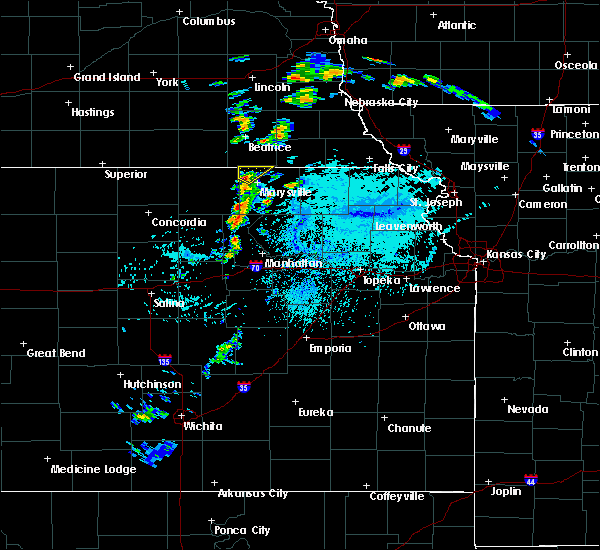 At 1252 pm cdt, a severe thunderstorm was located near bremen, moving northeast at 55 mph (radar indicated). Hazards include 60 mph wind gusts and half dollar size hail. Hail damage to vehicles is expected. expect wind damage to roofs, siding, and trees. Locations impacted include, oketo and bremen. At 1252 pm cdt, a severe thunderstorm was located near bremen, moving northeast at 55 mph (radar indicated). Hazards include 60 mph wind gusts and half dollar size hail. Hail damage to vehicles is expected. expect wind damage to roofs, siding, and trees. Locations impacted include, oketo and bremen.
|
| 8/28/2018 12:41 PM CDT |
 The national weather service in topeka has issued a * severe thunderstorm warning for. northeastern washington county in north central kansas. northwestern marshall county in northeastern kansas. until 115 pm cdt. At 1241 pm cdt, a severe thunderstorm was located 6 miles north of. The national weather service in topeka has issued a * severe thunderstorm warning for. northeastern washington county in north central kansas. northwestern marshall county in northeastern kansas. until 115 pm cdt. At 1241 pm cdt, a severe thunderstorm was located 6 miles north of.
|
| 7/19/2018 4:24 AM CDT |
 At 422 am cdt, a severe thunderstorm was located 5 miles south of bremen, moving south at 35 mph (radar indicated). Hazards include 60 mph wind gusts and half dollar size hail. Hail damage to vehicles is expected. expect wind damage to roofs, siding, and trees. Locations impacted include, marysville, blue rapids, hanover, waterville, barnes, oketo and bremen. At 422 am cdt, a severe thunderstorm was located 5 miles south of bremen, moving south at 35 mph (radar indicated). Hazards include 60 mph wind gusts and half dollar size hail. Hail damage to vehicles is expected. expect wind damage to roofs, siding, and trees. Locations impacted include, marysville, blue rapids, hanover, waterville, barnes, oketo and bremen.
|
| 7/19/2018 4:11 AM CDT |
 At 410 am cdt, a severe thunderstorm was located near hanover, moving south at 35 mph (radar indicated). Hazards include 60 mph wind gusts and half dollar size hail. Hail damage to vehicles is expected. expect wind damage to roofs, siding, and trees. Locations impacted include, marysville, blue rapids, hanover, waterville, greenleaf, barnes, oketo and bremen. At 410 am cdt, a severe thunderstorm was located near hanover, moving south at 35 mph (radar indicated). Hazards include 60 mph wind gusts and half dollar size hail. Hail damage to vehicles is expected. expect wind damage to roofs, siding, and trees. Locations impacted include, marysville, blue rapids, hanover, waterville, greenleaf, barnes, oketo and bremen.
|
| 7/19/2018 4:03 AM CDT |
 At 403 am cdt, a severe thunderstorm was located near bremen, moving south at 45 mph (radar indicated). Hazards include 60 mph wind gusts and quarter size hail. Hail damage to vehicles is expected. Expect wind damage to roofs, siding, and trees. At 403 am cdt, a severe thunderstorm was located near bremen, moving south at 45 mph (radar indicated). Hazards include 60 mph wind gusts and quarter size hail. Hail damage to vehicles is expected. Expect wind damage to roofs, siding, and trees.
|
| 7/13/2018 5:41 PM CDT |
 The severe thunderstorm warning for southeastern republic, central washington and northwestern marshall counties will expire at 545 pm cdt, the storm which prompted the warning has weakened below severe limits, and no longer poses an immediate threat to life or property. therefore, the warning will be allowed to expire. however gusty winds and heavy rain are still possible with this thunderstorm. The severe thunderstorm warning for southeastern republic, central washington and northwestern marshall counties will expire at 545 pm cdt, the storm which prompted the warning has weakened below severe limits, and no longer poses an immediate threat to life or property. therefore, the warning will be allowed to expire. however gusty winds and heavy rain are still possible with this thunderstorm.
|
| 7/13/2018 4:58 PM CDT |
 At 457 pm cdt, a line of severe thunderstorms was located near agenda northeast to oketo moving northeast at 20 mph (radar indicated). Hazards include 60 mph wind gusts and quarter size hail. Hail damage to vehicles is expected. Expect wind damage to roofs, siding, and trees. At 457 pm cdt, a line of severe thunderstorms was located near agenda northeast to oketo moving northeast at 20 mph (radar indicated). Hazards include 60 mph wind gusts and quarter size hail. Hail damage to vehicles is expected. Expect wind damage to roofs, siding, and trees.
|
| 6/30/2018 9:04 PM CDT |
 At 903 pm cdt, a severe thunderstorm was located 6 miles northeast of bremen, moving northeast at 35 mph (trained weather spotters). Hazards include half dollar size hail and 50 mph wind gusts. Damage to vehicles is expected. Locations impacted include, marysville, hanover, oketo and bremen. At 903 pm cdt, a severe thunderstorm was located 6 miles northeast of bremen, moving northeast at 35 mph (trained weather spotters). Hazards include half dollar size hail and 50 mph wind gusts. Damage to vehicles is expected. Locations impacted include, marysville, hanover, oketo and bremen.
|
| 6/30/2018 8:55 PM CDT |
 At 855 pm cdt, a severe thunderstorm was located near bremen, moving northeast at 40 mph (radar indicated). Hazards include 60 mph wind gusts and quarter size hail. Hail damage to vehicles is expected. expect wind damage to roofs, siding, and trees. Locations impacted include, hanover, waterville, oketo and bremen. At 855 pm cdt, a severe thunderstorm was located near bremen, moving northeast at 40 mph (radar indicated). Hazards include 60 mph wind gusts and quarter size hail. Hail damage to vehicles is expected. expect wind damage to roofs, siding, and trees. Locations impacted include, hanover, waterville, oketo and bremen.
|
| 6/30/2018 8:48 PM CDT |
 At 848 pm cdt, a severe thunderstorm was located near bremen, moving northeast at 40 mph (radar indicated). Hazards include 60 mph wind gusts and half dollar size hail. Hail damage to vehicles is expected. Expect wind damage to roofs, siding, and trees. At 848 pm cdt, a severe thunderstorm was located near bremen, moving northeast at 40 mph (radar indicated). Hazards include 60 mph wind gusts and half dollar size hail. Hail damage to vehicles is expected. Expect wind damage to roofs, siding, and trees.
|
| 6/18/2018 5:14 PM CDT |
 At 514 pm cdt, severe thunderstorms were located along a line extending from 3 miles east of summerfield to 3 miles north of frankfort to 6 miles north of randolph, moving northeast at 25 mph (radar indicated). Hazards include 60 mph wind gusts. Expect damage to roofs, siding, and trees. Locations impacted include, marysville, blue rapids, frankfort, waterville, axtell, beattie, summerfield and oketo. At 514 pm cdt, severe thunderstorms were located along a line extending from 3 miles east of summerfield to 3 miles north of frankfort to 6 miles north of randolph, moving northeast at 25 mph (radar indicated). Hazards include 60 mph wind gusts. Expect damage to roofs, siding, and trees. Locations impacted include, marysville, blue rapids, frankfort, waterville, axtell, beattie, summerfield and oketo.
|
| 6/18/2018 5:04 PM CDT |
 At 504 pm cdt, severe thunderstorms were located along a line extending from near summerfield to 4 miles northwest of frankfort to 6 miles north of randolph, moving northeast at 25 mph (radar indicated). Hazards include 60 mph wind gusts. Expect damage to roofs, siding, and trees. Locations impacted include, marysville, blue rapids, frankfort, waterville, axtell, beattie, summerfield and oketo. At 504 pm cdt, severe thunderstorms were located along a line extending from near summerfield to 4 miles northwest of frankfort to 6 miles north of randolph, moving northeast at 25 mph (radar indicated). Hazards include 60 mph wind gusts. Expect damage to roofs, siding, and trees. Locations impacted include, marysville, blue rapids, frankfort, waterville, axtell, beattie, summerfield and oketo.
|
| 6/18/2018 4:43 PM CDT |
 At 443 pm cdt, severe thunderstorms were located along a line extending from 4 miles northeast of oketo to 4 miles east of blue rapids to 5 miles northwest of randolph, moving east at 30 mph (radar indicated). Hazards include 60 mph wind gusts. Expect damage to roofs, siding, and trees. Locations impacted include, marysville, blue rapids, frankfort, waterville, axtell, beattie, summerfield and oketo. At 443 pm cdt, severe thunderstorms were located along a line extending from 4 miles northeast of oketo to 4 miles east of blue rapids to 5 miles northwest of randolph, moving east at 30 mph (radar indicated). Hazards include 60 mph wind gusts. Expect damage to roofs, siding, and trees. Locations impacted include, marysville, blue rapids, frankfort, waterville, axtell, beattie, summerfield and oketo.
|
| 6/18/2018 4:34 PM CDT |
 At 433 pm cdt, severe thunderstorms were located along a line extending from near oketo to 5 miles south of marysville to 4 miles northeast of green, moving east at 30 mph (radar indicated). Hazards include 60 mph wind gusts. Expect damage to roofs, siding, and trees. Locations impacted include, marysville, blue rapids, hanover, waterville, greenleaf, barnes, oketo and bremen. At 433 pm cdt, severe thunderstorms were located along a line extending from near oketo to 5 miles south of marysville to 4 miles northeast of green, moving east at 30 mph (radar indicated). Hazards include 60 mph wind gusts. Expect damage to roofs, siding, and trees. Locations impacted include, marysville, blue rapids, hanover, waterville, greenleaf, barnes, oketo and bremen.
|
| 6/18/2018 4:25 PM CDT |
 At 425 pm cdt, severe thunderstorms were located along a line extending from 5 miles northwest of oketo to waterville to 4 miles north of green, moving northeast at 30 mph (radar indicated). Hazards include 60 mph wind gusts. expect damage to roofs, siding, and trees At 425 pm cdt, severe thunderstorms were located along a line extending from 5 miles northwest of oketo to waterville to 4 miles north of green, moving northeast at 30 mph (radar indicated). Hazards include 60 mph wind gusts. expect damage to roofs, siding, and trees
|
| 6/18/2018 4:04 PM CDT |
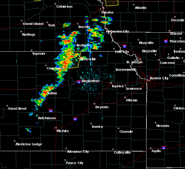 At 404 pm cdt, severe thunderstorms were located along a line extending from 5 miles north of hanover to 4 miles north of green, moving northeast at 20 mph (radar indicated). Hazards include 60 mph wind gusts. Expect damage to roofs, siding, and trees. Locations impacted include, marysville, washington, blue rapids, hanover, waterville, linn, greenleaf, barnes, oketo, hollenberg and bremen. At 404 pm cdt, severe thunderstorms were located along a line extending from 5 miles north of hanover to 4 miles north of green, moving northeast at 20 mph (radar indicated). Hazards include 60 mph wind gusts. Expect damage to roofs, siding, and trees. Locations impacted include, marysville, washington, blue rapids, hanover, waterville, linn, greenleaf, barnes, oketo, hollenberg and bremen.
|
| 6/18/2018 3:54 PM CDT |
 At 354 pm cdt, severe thunderstorms were located along a line extending from 4 miles northeast of hollenberg to 7 miles northwest of green, moving northeast at 35 mph (radar indicated). Hazards include 60 mph wind gusts. expect damage to roofs, siding, and trees At 354 pm cdt, severe thunderstorms were located along a line extending from 4 miles northeast of hollenberg to 7 miles northwest of green, moving northeast at 35 mph (radar indicated). Hazards include 60 mph wind gusts. expect damage to roofs, siding, and trees
|
| 6/16/2017 10:48 PM CDT |
 At 1047 pm cdt, severe thunderstorms were located along a line extending from 5 miles east of oketo to 3 miles northeast of marysville to 5 miles southeast of bremen to 3 miles southwest of hanover, moving southeast at 50 mph. these are very dangerous storms (trained weather spotters. at 1045pm...70 to 80 mph winds were reported north of marysville). Hazards include 80 mph wind gusts and quarter size hail. Flying debris will be dangerous to those caught without shelter. mobile homes will be heavily damaged. expect considerable damage to roofs, windows, and vehicles. extensive tree damage and power outages are likely. these severe storms will be near, marysville around 1050 pm cdt. beattie around 1055 pm cdt. frankfort and waterville around 1105 pm cdt. Blue rapids around 1110 pm cdt. At 1047 pm cdt, severe thunderstorms were located along a line extending from 5 miles east of oketo to 3 miles northeast of marysville to 5 miles southeast of bremen to 3 miles southwest of hanover, moving southeast at 50 mph. these are very dangerous storms (trained weather spotters. at 1045pm...70 to 80 mph winds were reported north of marysville). Hazards include 80 mph wind gusts and quarter size hail. Flying debris will be dangerous to those caught without shelter. mobile homes will be heavily damaged. expect considerable damage to roofs, windows, and vehicles. extensive tree damage and power outages are likely. these severe storms will be near, marysville around 1050 pm cdt. beattie around 1055 pm cdt. frankfort and waterville around 1105 pm cdt. Blue rapids around 1110 pm cdt.
|
| 6/16/2017 10:37 PM CDT |
 At 1037 pm cdt, severe thunderstorms were located along a line extending from 3 miles south of wymore to 5 miles southwest of odell to near hollenberg, moving southeast at 50 mph (radar indicated). Hazards include 60 mph wind gusts and quarter size hail. Hail damage to vehicles is expected. expect wind damage to roofs, siding, and trees. severe thunderstorms will be near, oketo and bremen around 1045 pm cdt. hanover around 1050 pm cdt. marysville around 1055 pm cdt. beattie around 1100 pm cdt. waterville around 1105 pm cdt. Blue rapids and frankfort around 1110 pm cdt. At 1037 pm cdt, severe thunderstorms were located along a line extending from 3 miles south of wymore to 5 miles southwest of odell to near hollenberg, moving southeast at 50 mph (radar indicated). Hazards include 60 mph wind gusts and quarter size hail. Hail damage to vehicles is expected. expect wind damage to roofs, siding, and trees. severe thunderstorms will be near, oketo and bremen around 1045 pm cdt. hanover around 1050 pm cdt. marysville around 1055 pm cdt. beattie around 1100 pm cdt. waterville around 1105 pm cdt. Blue rapids and frankfort around 1110 pm cdt.
|
| 6/16/2017 10:21 PM CDT | At 77 highway near the state line. pulled the hard shell cover of a pickup truck off of the truc in marshall county KS, 1.2 miles ESE of Oketo, KS |
| 6/16/2017 10:12 PM CDT |
 At 1011 pm cdt, a severe thunderstorm was located near oketo, moving south at 35 mph. this is a very dangerous storm (trained weather spotters. at 855 pm...85 mph winds were reported at beatrice). Hazards include 90 mph wind gusts and half dollar size hail. You are in a life-threatening situation. flying debris may be deadly to those caught without shelter. mobile homes will be heavily damaged or destroyed. homes and businesses will have substantial roof and window damage. expect extensive tree damage and power outages. This severe storm will be near, marysville around 1025 pm cdt. At 1011 pm cdt, a severe thunderstorm was located near oketo, moving south at 35 mph. this is a very dangerous storm (trained weather spotters. at 855 pm...85 mph winds were reported at beatrice). Hazards include 90 mph wind gusts and half dollar size hail. You are in a life-threatening situation. flying debris may be deadly to those caught without shelter. mobile homes will be heavily damaged or destroyed. homes and businesses will have substantial roof and window damage. expect extensive tree damage and power outages. This severe storm will be near, marysville around 1025 pm cdt.
|
| 6/16/2017 9:55 PM CDT |
 At 953 pm cdt, a severe thunderstorm was located 4 miles west of wymore, moving south at 30 mph. this is a very dangerous storm (trained weather spotters. at 942pm...80 mph winds were reported east of plymouth nebraska). Hazards include 80 mph wind gusts and ping pong ball size hail. Flying debris will be dangerous to those caught without shelter. mobile homes will be heavily damaged. expect considerable damage to roofs, windows, and vehicles. extensive tree damage and power outages are likely. this severe thunderstorm will be near, oketo around 1020 pm cdt. bremen around 1025 pm cdt. Marysville around 1030 pm cdt. At 953 pm cdt, a severe thunderstorm was located 4 miles west of wymore, moving south at 30 mph. this is a very dangerous storm (trained weather spotters. at 942pm...80 mph winds were reported east of plymouth nebraska). Hazards include 80 mph wind gusts and ping pong ball size hail. Flying debris will be dangerous to those caught without shelter. mobile homes will be heavily damaged. expect considerable damage to roofs, windows, and vehicles. extensive tree damage and power outages are likely. this severe thunderstorm will be near, oketo around 1020 pm cdt. bremen around 1025 pm cdt. Marysville around 1030 pm cdt.
|
| 8/24/2016 5:35 PM CDT |
 At 534 pm cdt, a severe thunderstorm was located over oketo, moving east at 35 mph (radar indicated). Hazards include 60 mph wind gusts and half dollar size hail. Hail damage to vehicles is expected. expect wind damage to roofs, siding, and trees. this severe storm will be near, beattie around 550 pm cdt. Summerfield around 555 pm cdt. At 534 pm cdt, a severe thunderstorm was located over oketo, moving east at 35 mph (radar indicated). Hazards include 60 mph wind gusts and half dollar size hail. Hail damage to vehicles is expected. expect wind damage to roofs, siding, and trees. this severe storm will be near, beattie around 550 pm cdt. Summerfield around 555 pm cdt.
|
| 8/24/2016 5:25 PM CDT |
 At 524 pm cdt, a severe thunderstorm was located 4 miles east of bremen, moving east at 35 mph (trained weather spotters). Hazards include golf ball size hail and 60 mph wind gusts. People and animals outdoors will be injured. expect hail damage to roofs, siding, windows, and vehicles. expect wind damage to roofs, siding, and trees. this severe storm will be near, oketo around 535 pm cdt. beattie around 550 pm cdt. Axtell and summerfield around 600 pm cdt. At 524 pm cdt, a severe thunderstorm was located 4 miles east of bremen, moving east at 35 mph (trained weather spotters). Hazards include golf ball size hail and 60 mph wind gusts. People and animals outdoors will be injured. expect hail damage to roofs, siding, windows, and vehicles. expect wind damage to roofs, siding, and trees. this severe storm will be near, oketo around 535 pm cdt. beattie around 550 pm cdt. Axtell and summerfield around 600 pm cdt.
|
| 8/24/2016 5:16 PM CDT |
 At 515 pm cdt, a severe thunderstorm was located over bremen, moving east at 35 mph (trained weather spotters. at 510 pm...spotters reported hail up to the size of golfballs and 60 mph winds 1 miles east of hanover). Hazards include ping pong ball size hail and 60 mph wind gusts. People and animals outdoors will be injured. expect hail damage to roofs, siding, windows, and vehicles. expect wind damage to roofs, siding, and trees. this severe thunderstorm will be near, marysville around 530 pm cdt. oketo around 535 pm cdt. beattie around 550 pm cdt. Axtell, summerfield and summerfield around 600 pm cdt. At 515 pm cdt, a severe thunderstorm was located over bremen, moving east at 35 mph (trained weather spotters. at 510 pm...spotters reported hail up to the size of golfballs and 60 mph winds 1 miles east of hanover). Hazards include ping pong ball size hail and 60 mph wind gusts. People and animals outdoors will be injured. expect hail damage to roofs, siding, windows, and vehicles. expect wind damage to roofs, siding, and trees. this severe thunderstorm will be near, marysville around 530 pm cdt. oketo around 535 pm cdt. beattie around 550 pm cdt. Axtell, summerfield and summerfield around 600 pm cdt.
|
| 5/24/2016 11:04 PM CDT | The national weather service in topeka has issued a * severe thunderstorm warning for. washington county in north central kansas. marshall county in northeastern kansas. northwestern riley county in northeastern kansas. Until 1145 pm cdt. |
| 4/26/2016 5:17 PM CDT |
 At 517 pm cdt, a severe thunderstorm was located over waterville, moving north at 40 mph (radar indicated). Hazards include ping pong ball size hail and 60 mph wind gusts. People and animals outdoors will be injured. expect hail damage to roofs, siding, windows, and vehicles. Expect wind damage to roofs, siding, and trees. At 517 pm cdt, a severe thunderstorm was located over waterville, moving north at 40 mph (radar indicated). Hazards include ping pong ball size hail and 60 mph wind gusts. People and animals outdoors will be injured. expect hail damage to roofs, siding, windows, and vehicles. Expect wind damage to roofs, siding, and trees.
|
| 4/26/2016 5:03 PM CDT |
 At 502 pm cdt, a severe thunderstorm was located near bremen, moving north at 35 mph. this is a very dangerous storm (trained weather spotters reported grapefruit size hail north of bremen). Hazards include grapefruit size hail and 60 mph wind gusts. People and animals outdoors will be severely injured. expect shattered windows, extensive damage to roofs, siding, and vehicles. locations impacted include, rural areas of extreme northwest marshall county. A tornado watch remains in effect until 900 pm cdt for northeastern kansas. At 502 pm cdt, a severe thunderstorm was located near bremen, moving north at 35 mph. this is a very dangerous storm (trained weather spotters reported grapefruit size hail north of bremen). Hazards include grapefruit size hail and 60 mph wind gusts. People and animals outdoors will be severely injured. expect shattered windows, extensive damage to roofs, siding, and vehicles. locations impacted include, rural areas of extreme northwest marshall county. A tornado watch remains in effect until 900 pm cdt for northeastern kansas.
|
| 4/26/2016 4:39 PM CDT |
 At 438 pm cdt, a severe thunderstorm was located near blue rapids, moving north at 40 mph (trained weather spotters reported tennis ball size hail in waterville at 435 pm). Hazards include tennis ball size hail and 60 mph wind gusts. People and animals outdoors will be injured. expect hail damage to roofs, siding, windows, and vehicles. Expect wind damage to roofs, siding, and trees. At 438 pm cdt, a severe thunderstorm was located near blue rapids, moving north at 40 mph (trained weather spotters reported tennis ball size hail in waterville at 435 pm). Hazards include tennis ball size hail and 60 mph wind gusts. People and animals outdoors will be injured. expect hail damage to roofs, siding, windows, and vehicles. Expect wind damage to roofs, siding, and trees.
|
| 4/26/2016 4:48 AM CDT |
 At 448 am cdt, a severe thunderstorm was located near oketo, moving northeast at 30 mph (trained weather spotters). Hazards include golf ball size hail. People and animals outdoors will be injured. expect damage to roofs, siding, windows, and vehicles. Locations impacted include, marysville, summerfield and oketo. At 448 am cdt, a severe thunderstorm was located near oketo, moving northeast at 30 mph (trained weather spotters). Hazards include golf ball size hail. People and animals outdoors will be injured. expect damage to roofs, siding, windows, and vehicles. Locations impacted include, marysville, summerfield and oketo.
|
| 4/26/2016 4:37 AM CDT |
 At 435 am cdt, a severe thunderstorm was located over marysville, moving northeast at 25 mph (the public). Hazards include tennis ball size hail. People and animals outdoors will be injured. expect damage to roofs, siding, windows, and vehicles. Locations impacted include, marysville, summerfield and oketo. At 435 am cdt, a severe thunderstorm was located over marysville, moving northeast at 25 mph (the public). Hazards include tennis ball size hail. People and animals outdoors will be injured. expect damage to roofs, siding, windows, and vehicles. Locations impacted include, marysville, summerfield and oketo.
|
| 4/26/2016 4:24 AM CDT |
 At 423 am cdt, a severe thunderstorm was located near marysville, moving northeast at 30 mph (radar indicated). Hazards include two inch hail. People and animals outdoors will be injured. expect damage to roofs, siding, windows, and vehicles. Locations impacted include, marysville, summerfield, oketo and bremen. At 423 am cdt, a severe thunderstorm was located near marysville, moving northeast at 30 mph (radar indicated). Hazards include two inch hail. People and animals outdoors will be injured. expect damage to roofs, siding, windows, and vehicles. Locations impacted include, marysville, summerfield, oketo and bremen.
|
| 4/26/2016 4:16 AM CDT |
 At 415 am cdt, a severe thunderstorm was located near waterville, moving northeast at 30 mph (radar indicated). Hazards include ping pong ball size hail. People and animals outdoors will be injured. Expect damage to roofs, siding, windows, and vehicles. At 415 am cdt, a severe thunderstorm was located near waterville, moving northeast at 30 mph (radar indicated). Hazards include ping pong ball size hail. People and animals outdoors will be injured. Expect damage to roofs, siding, windows, and vehicles.
|
| 9/17/2015 6:36 PM CDT |
 At 636 pm cdt, a severe thunderstorm was located over marysville, moving east at 35 mph (radar indicated). Hazards include 60 mph wind gusts and quarter size hail. Hail damage to vehicles is expected. Expect wind damage to roofs, siding and trees. At 636 pm cdt, a severe thunderstorm was located over marysville, moving east at 35 mph (radar indicated). Hazards include 60 mph wind gusts and quarter size hail. Hail damage to vehicles is expected. Expect wind damage to roofs, siding and trees.
|
| 9/7/2015 4:44 PM CDT |
 At 442 pm cdt, a severe thunderstorm capable of producing a tornado was located near oketo, moving east at 30 mph (radar indicated rotation). Hazards include tornado and ping pong ball size hail. Flying debris will be dangerous to those caught without shelter. mobile homes will be damaged or destroyed. damage to roofs, windows and vehicles will occur. tree damage is likely. this storm has had a history of producing tornadoes. this dangerous storm will be near, beattie around 455 pm cdt. summerfield and summerfield around 500 pm cdt. Axtell around 515 pm cdt. At 442 pm cdt, a severe thunderstorm capable of producing a tornado was located near oketo, moving east at 30 mph (radar indicated rotation). Hazards include tornado and ping pong ball size hail. Flying debris will be dangerous to those caught without shelter. mobile homes will be damaged or destroyed. damage to roofs, windows and vehicles will occur. tree damage is likely. this storm has had a history of producing tornadoes. this dangerous storm will be near, beattie around 455 pm cdt. summerfield and summerfield around 500 pm cdt. Axtell around 515 pm cdt.
|
| 9/7/2015 4:38 PM CDT | Reported large trees down and power outage in marshall county KS, 0.3 miles N of Oketo, KS |
| 9/7/2015 4:32 PM CDT |
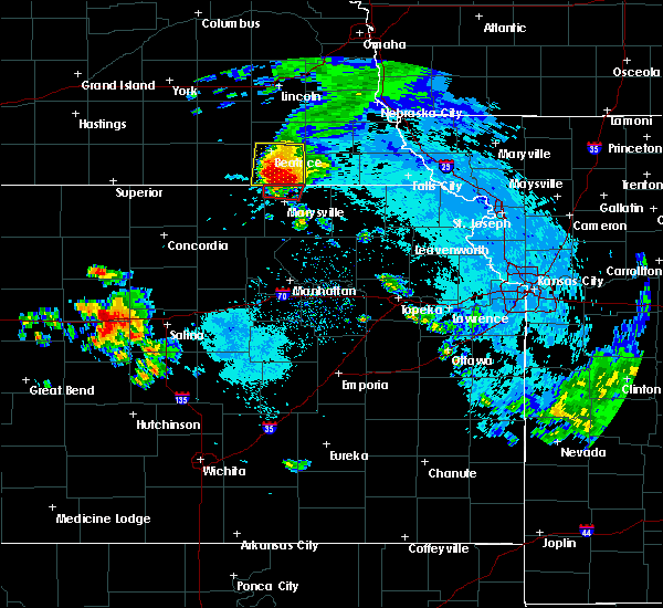 At 431 pm cdt, a severe thunderstorm capable of producing a tornado was located over oketo, moving east at 35 mph (radar indicated rotation). Hazards include tornado and two inch hail. Flying debris will be dangerous to those caught without shelter. mobile homes will be damaged or destroyed. damage to roofs, windows and vehicles will occur. tree damage is likely. This dangerous storm will be near, oketo around 435 pm cdt. At 431 pm cdt, a severe thunderstorm capable of producing a tornado was located over oketo, moving east at 35 mph (radar indicated rotation). Hazards include tornado and two inch hail. Flying debris will be dangerous to those caught without shelter. mobile homes will be damaged or destroyed. damage to roofs, windows and vehicles will occur. tree damage is likely. This dangerous storm will be near, oketo around 435 pm cdt.
|
| 9/7/2015 4:21 PM CDT |
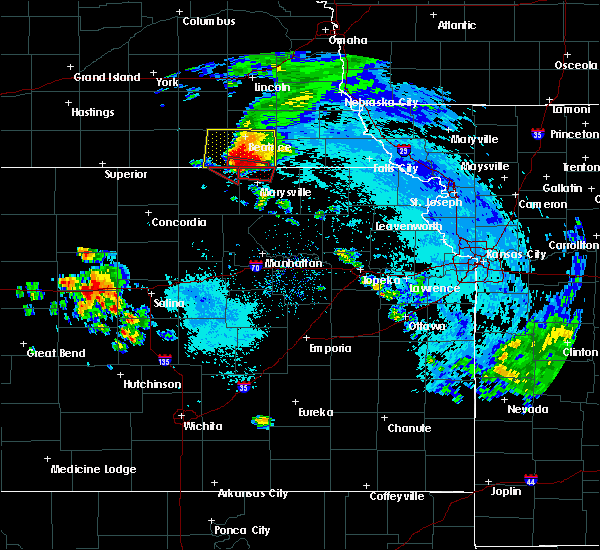 At 418 pm cdt, a confirmed tornado was located near odell, and is moving east at 30 mph (trained spotters confirmed tornado. at 420 pm cdt... trained spotters reported debris but was unable to view the funnel 3 miles north of bremen). Hazards include damaging tornado and two inch hail. Flying debris will be dangerous to those caught without shelter. mobile homes will be damaged or destroyed. damage to roofs, windows and vehicles will occur. tree damage is likely. This tornado will be near, oketo around 435 pm cdt. At 418 pm cdt, a confirmed tornado was located near odell, and is moving east at 30 mph (trained spotters confirmed tornado. at 420 pm cdt... trained spotters reported debris but was unable to view the funnel 3 miles north of bremen). Hazards include damaging tornado and two inch hail. Flying debris will be dangerous to those caught without shelter. mobile homes will be damaged or destroyed. damage to roofs, windows and vehicles will occur. tree damage is likely. This tornado will be near, oketo around 435 pm cdt.
|
| 9/7/2015 4:16 PM CDT |
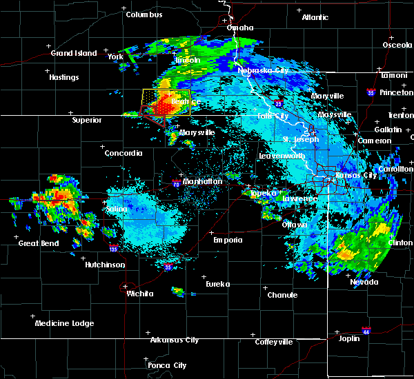 At 416 pm cdt, a severe thunderstorm capable of producing a tornado was located near odell, moving east at 30 mph (radar indicated rotation). Hazards include tornado and hail up to two inches in diameter. Flying debris will be dangerous to those caught without shelter. mobile homes will be damaged or destroyed. damage to roofs, windows and vehicles will occur. tree damage is likely. This dangerous storm will be near, oketo around 435 pm cdt. At 416 pm cdt, a severe thunderstorm capable of producing a tornado was located near odell, moving east at 30 mph (radar indicated rotation). Hazards include tornado and hail up to two inches in diameter. Flying debris will be dangerous to those caught without shelter. mobile homes will be damaged or destroyed. damage to roofs, windows and vehicles will occur. tree damage is likely. This dangerous storm will be near, oketo around 435 pm cdt.
|
| 8/22/2015 7:31 PM CDT |
 At 730 pm cdt, a severe thunderstorm was located near oketo, moving east at 25 mph (radar indicated). Hazards include 60 mph wind gusts and quarter size hail. Hail damage to vehicles is expected. expect wind damage to roofs, siding and trees. locations impacted include, marysville, washington, hanover, morrowville, oketo, hollenberg and bremen. A tornado watch remains in effect until midnight cdt for northeastern kansas. At 730 pm cdt, a severe thunderstorm was located near oketo, moving east at 25 mph (radar indicated). Hazards include 60 mph wind gusts and quarter size hail. Hail damage to vehicles is expected. expect wind damage to roofs, siding and trees. locations impacted include, marysville, washington, hanover, morrowville, oketo, hollenberg and bremen. A tornado watch remains in effect until midnight cdt for northeastern kansas.
|
| 8/22/2015 7:09 PM CDT |
 At 708 pm cdt, a severe thunderstorm was located 6 miles north of hanover, moving east at 25 mph (radar indicated). Hazards include 60 mph wind gusts and quarter size hail. Hail damage to vehicles is expected. Expect wind damage to roofs, siding and trees. At 708 pm cdt, a severe thunderstorm was located 6 miles north of hanover, moving east at 25 mph (radar indicated). Hazards include 60 mph wind gusts and quarter size hail. Hail damage to vehicles is expected. Expect wind damage to roofs, siding and trees.
|
| 6/23/2015 2:08 PM CDT |
 The severe thunderstorm warning for northwestern marshall county will expire at 215 pm cdt, the storm which prompted the warning has moved out of northwestern marshall county. therefore the warning will be allowed to expire. however heavy rain is still possible with this thunderstorm. remember, a severe thunderstorm warning still remains in effect for northeastern marshall county until 230 pm cdt. The severe thunderstorm warning for northwestern marshall county will expire at 215 pm cdt, the storm which prompted the warning has moved out of northwestern marshall county. therefore the warning will be allowed to expire. however heavy rain is still possible with this thunderstorm. remember, a severe thunderstorm warning still remains in effect for northeastern marshall county until 230 pm cdt.
|
| 6/23/2015 1:46 PM CDT |
 At 144 pm cdt, a severe thunderstorm was located near bremen, moving east at 30 mph (trained weather spotters). Hazards include ping pong ball size hail and 60 mph wind gusts. People and animals outdoors will be injured. expect hail damage to roofs, siding, windows and vehicles. expect wind damage to roofs, siding and trees. Locations impacted include, marysville, beattie, oketo and bremen. At 144 pm cdt, a severe thunderstorm was located near bremen, moving east at 30 mph (trained weather spotters). Hazards include ping pong ball size hail and 60 mph wind gusts. People and animals outdoors will be injured. expect hail damage to roofs, siding, windows and vehicles. expect wind damage to roofs, siding and trees. Locations impacted include, marysville, beattie, oketo and bremen.
|
| 6/23/2015 1:38 PM CDT |
 At 137 pm cdt, a severe thunderstorm was located over bremen, moving east at 30 mph (trained weather spotters. at 132 pm cdt...spotters reported golfball sized hail north of hanover). Hazards include ping pong ball size hail and 60 mph wind gusts. People and animals outdoors will be injured. expect hail damage to roofs, siding, windows and vehicles. expect wind damage to roofs, siding and trees. Locations impacted include, marysville, hanover, beattie, oketo and bremen. At 137 pm cdt, a severe thunderstorm was located over bremen, moving east at 30 mph (trained weather spotters. at 132 pm cdt...spotters reported golfball sized hail north of hanover). Hazards include ping pong ball size hail and 60 mph wind gusts. People and animals outdoors will be injured. expect hail damage to roofs, siding, windows and vehicles. expect wind damage to roofs, siding and trees. Locations impacted include, marysville, hanover, beattie, oketo and bremen.
|
| 6/23/2015 1:28 PM CDT |
 At 126 pm cdt, a severe thunderstorm was located near hanover, moving southeast at 20 mph (trained weather spotters. at 124 pm cdt...the public reported golfball sized hail in hollenberg). Hazards include 60 mph wind gusts and quarter size hail. Hail damage to vehicles is expected. expect wind damage to roofs, siding and trees. Locations impacted include, marysville, hanover, beattie, oketo and bremen. At 126 pm cdt, a severe thunderstorm was located near hanover, moving southeast at 20 mph (trained weather spotters. at 124 pm cdt...the public reported golfball sized hail in hollenberg). Hazards include 60 mph wind gusts and quarter size hail. Hail damage to vehicles is expected. expect wind damage to roofs, siding and trees. Locations impacted include, marysville, hanover, beattie, oketo and bremen.
|
| 6/23/2015 1:18 PM CDT |
 At 117 pm cdt, a severe thunderstorm was located near hanover, moving southeast at 25 mph (trained weather spotters. at 111 pm cdt...spotters reported hail up to the size of quarters in hollenberg). Hazards include 60 mph wind gusts and quarter size hail. Hail damage to vehicles is expected. Expect wind damage to roofs, siding and trees. At 117 pm cdt, a severe thunderstorm was located near hanover, moving southeast at 25 mph (trained weather spotters. at 111 pm cdt...spotters reported hail up to the size of quarters in hollenberg). Hazards include 60 mph wind gusts and quarter size hail. Hail damage to vehicles is expected. Expect wind damage to roofs, siding and trees.
|
| 6/23/2015 12:14 PM CDT |
 At 1214 pm cdt, a severe thunderstorm was located near oketo, moving east at 25 mph (radar indicated). Hazards include quarter size hail. damage to vehicles is expected At 1214 pm cdt, a severe thunderstorm was located near oketo, moving east at 25 mph (radar indicated). Hazards include quarter size hail. damage to vehicles is expected
|
| 6/23/2015 12:01 PM CDT |
 At 1200 pm cdt, a severe thunderstorm was located near bremen, moving east at 25 mph. at 1158 am, a spotter 3 miles northeast of bremen reported quarter sized hail (trained weather spotters). Hazards include quarter size hail. Damage to vehicles is expected. Locations impacted include, beattie, oketo and bremen. At 1200 pm cdt, a severe thunderstorm was located near bremen, moving east at 25 mph. at 1158 am, a spotter 3 miles northeast of bremen reported quarter sized hail (trained weather spotters). Hazards include quarter size hail. Damage to vehicles is expected. Locations impacted include, beattie, oketo and bremen.
|
| 6/23/2015 11:53 AM CDT |
 At 1152 am cdt, a severe thunderstorm was located near bremen, moving east at 35 mph (radar indicated). Hazards include quarter size hail. damage to vehicles is expected At 1152 am cdt, a severe thunderstorm was located near bremen, moving east at 35 mph (radar indicated). Hazards include quarter size hail. damage to vehicles is expected
|
| 6/21/2015 11:39 AM CDT |
 At 1137 am cdt, a severe thunderstorm was located 5 miles east of marysville, and moving east at 30 mph (trained weather spotters. at 1137 am cdt...trained spotters reported quarter size hail 2 miles northwest of marysville). Hazards include 60 mph wind gusts and quarter size hail. Hail damage to vehicles is expected. expect wind damage to roofs, siding and trees. Locations impacted include, marysville, summerfield, beattie, frankfort, axtell and vermillion. At 1137 am cdt, a severe thunderstorm was located 5 miles east of marysville, and moving east at 30 mph (trained weather spotters. at 1137 am cdt...trained spotters reported quarter size hail 2 miles northwest of marysville). Hazards include 60 mph wind gusts and quarter size hail. Hail damage to vehicles is expected. expect wind damage to roofs, siding and trees. Locations impacted include, marysville, summerfield, beattie, frankfort, axtell and vermillion.
|
| 6/21/2015 11:25 AM CDT |
 At 1124 am cdt, a severe thunderstorm was located near marysville, and moving east at 30 mph (trained weather spotters. at 1120 am cdt...trained spotters reported quarter size hail 2 miles west of oketo). Hazards include golf ball size hail and 60 mph wind gusts. People and animals outdoors will be injured. expect hail damage to roofs, siding, windows and vehicles. Expect wind damage to roofs, siding and trees. At 1124 am cdt, a severe thunderstorm was located near marysville, and moving east at 30 mph (trained weather spotters. at 1120 am cdt...trained spotters reported quarter size hail 2 miles west of oketo). Hazards include golf ball size hail and 60 mph wind gusts. People and animals outdoors will be injured. expect hail damage to roofs, siding, windows and vehicles. Expect wind damage to roofs, siding and trees.
|
| 6/21/2015 11:17 AM CDT |
 At 1114 am cdt, a severe thunderstorm was located 6 miles west of oketo, and moving southeast at 25 mph (radar indicated. at 1111 am cdt...trained spotters reported golfball size hail 11 miles northwest of marysville). Hazards include golf ball size hail and 60 mph wind gusts. People and animals outdoors will be injured. expect hail damage to roofs, siding, windows and vehicles. expect wind damage to roofs, siding and trees. Locations impacted include, marysville and oketo. At 1114 am cdt, a severe thunderstorm was located 6 miles west of oketo, and moving southeast at 25 mph (radar indicated. at 1111 am cdt...trained spotters reported golfball size hail 11 miles northwest of marysville). Hazards include golf ball size hail and 60 mph wind gusts. People and animals outdoors will be injured. expect hail damage to roofs, siding, windows and vehicles. expect wind damage to roofs, siding and trees. Locations impacted include, marysville and oketo.
|
| 6/21/2015 11:03 AM CDT |
 At 1100 am cdt, a severe thunderstorm was located near odell, and moving southeast at 25 mph (radar indicated). Hazards include 60 mph wind gusts and quarter size hail. Hail damage to vehicles is expected. Expect wind damage to roofs, siding and trees. At 1100 am cdt, a severe thunderstorm was located near odell, and moving southeast at 25 mph (radar indicated). Hazards include 60 mph wind gusts and quarter size hail. Hail damage to vehicles is expected. Expect wind damage to roofs, siding and trees.
|
| 5/15/2013 7:10 PM CDT | Half Dollar sized hail reported 5.3 miles W of Oketo, KS |
| 5/15/2013 6:57 PM CDT | Half Dollar sized hail reported 5.3 miles W of Oketo, KS |
| 1/1/0001 12:00 AM | 2 to 3 inch diameter limbs dow in marshall county KS, 3.2 miles E of Oketo, KS |
Hail Maps for Oketo, KS
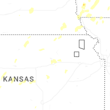


Connect with Interactive Hail Maps