

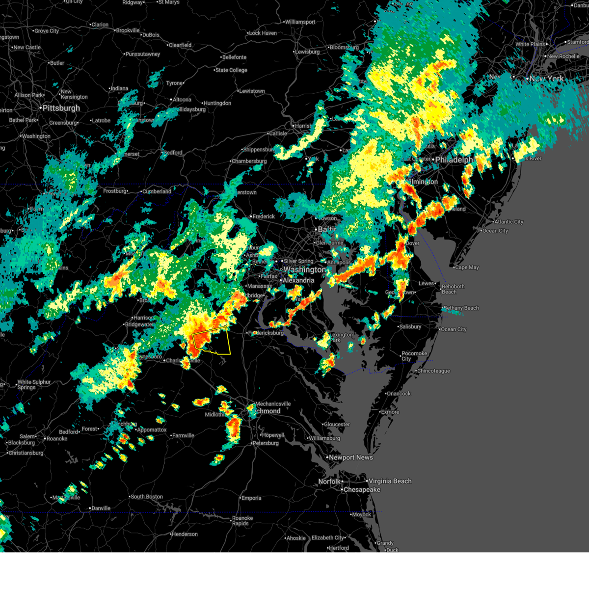
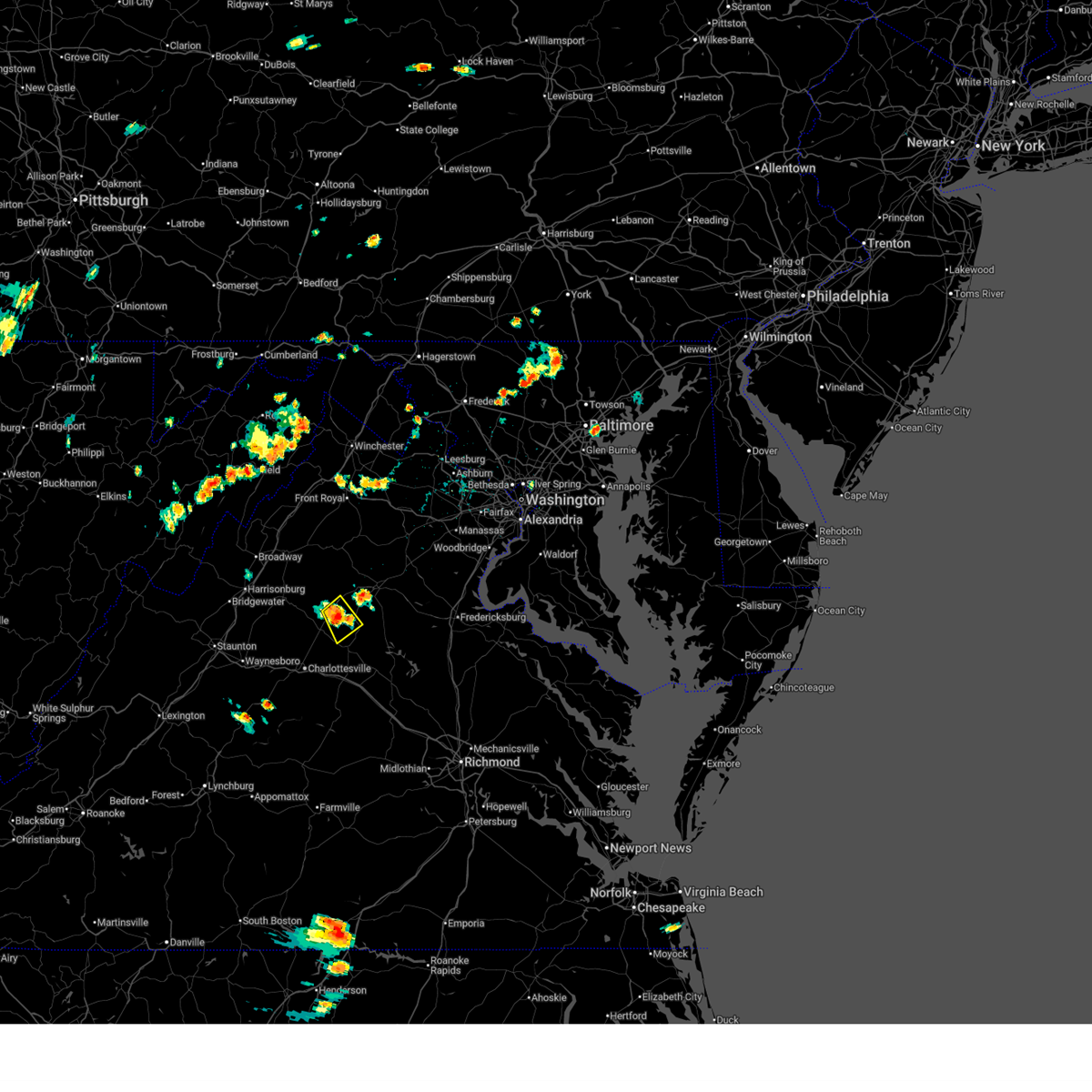
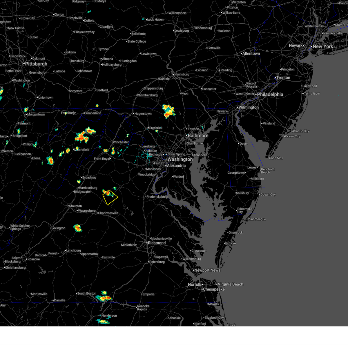
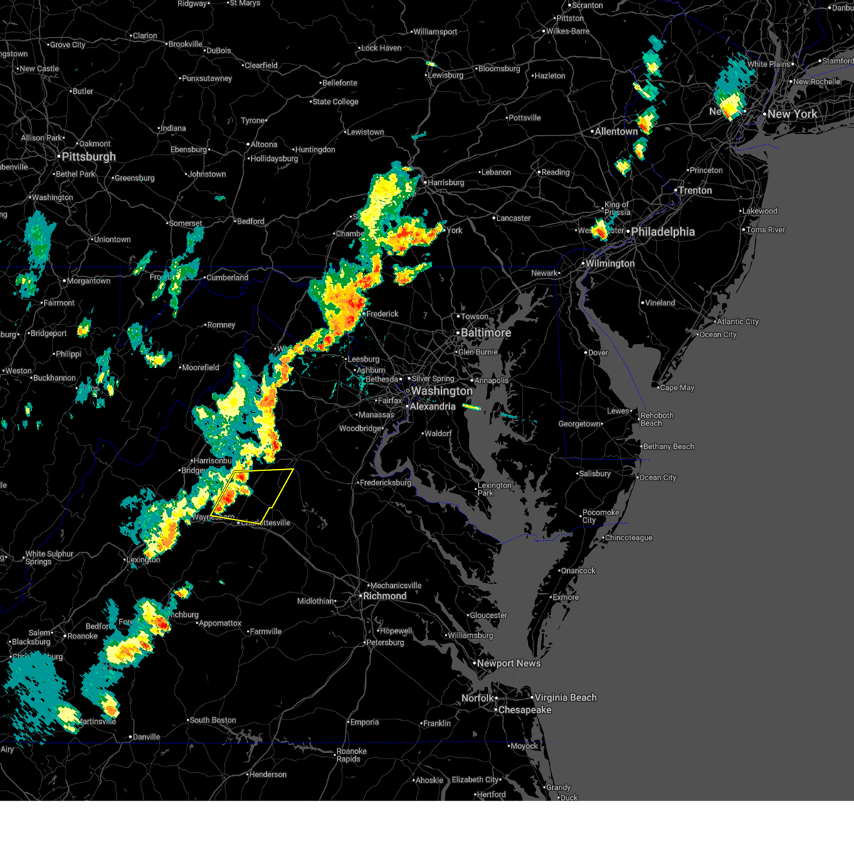
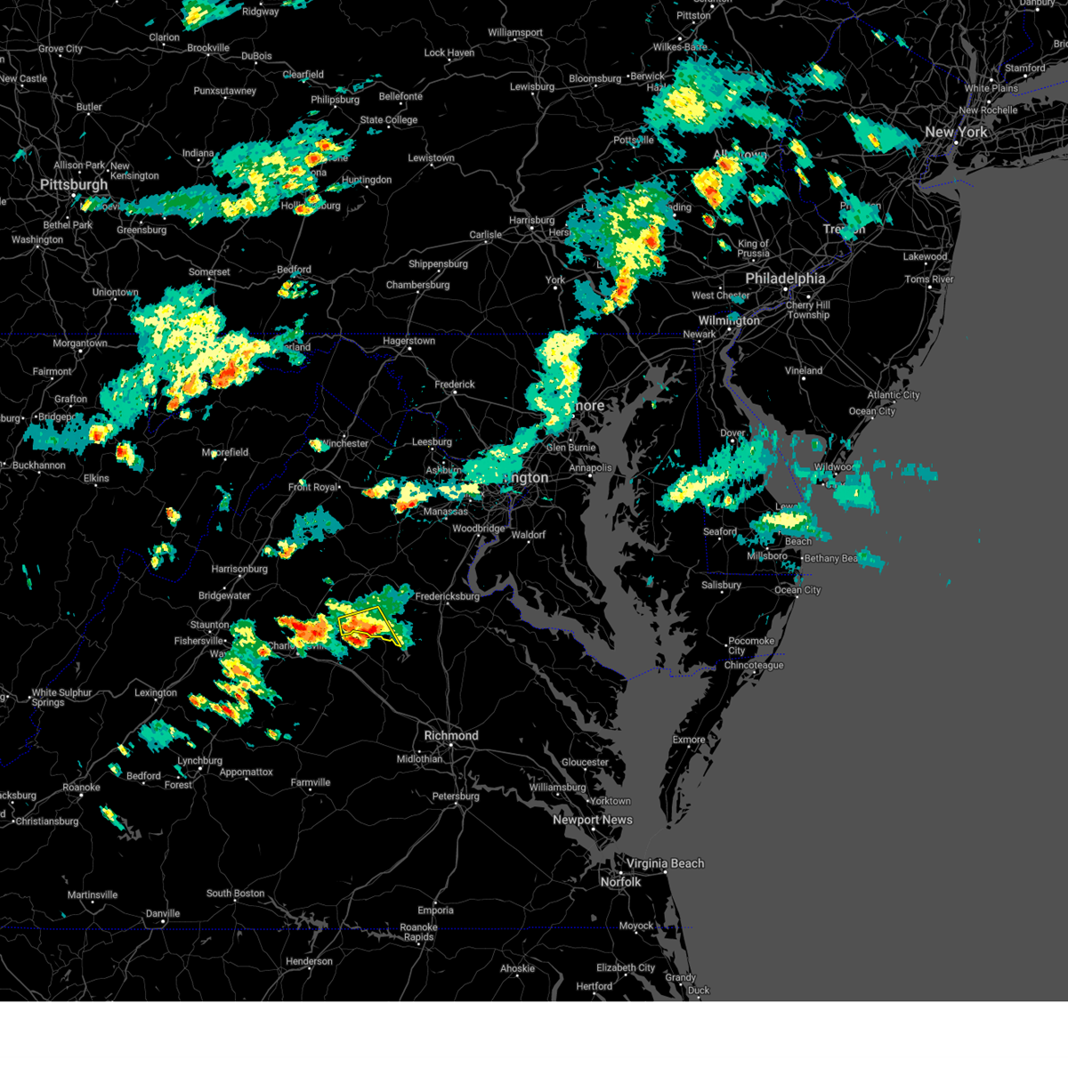
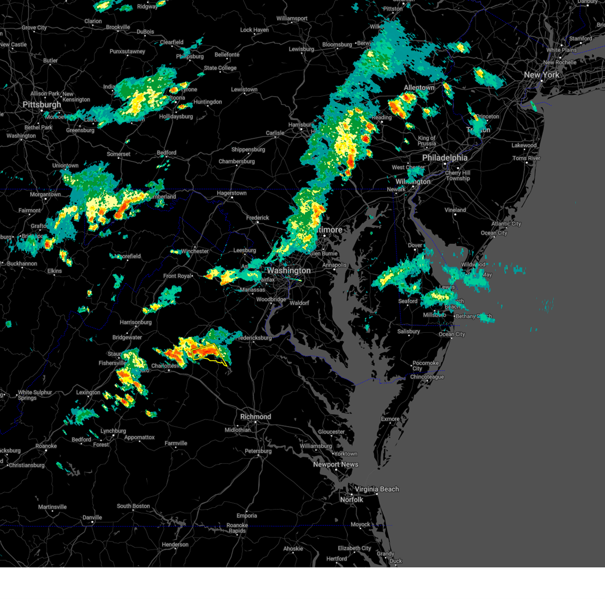
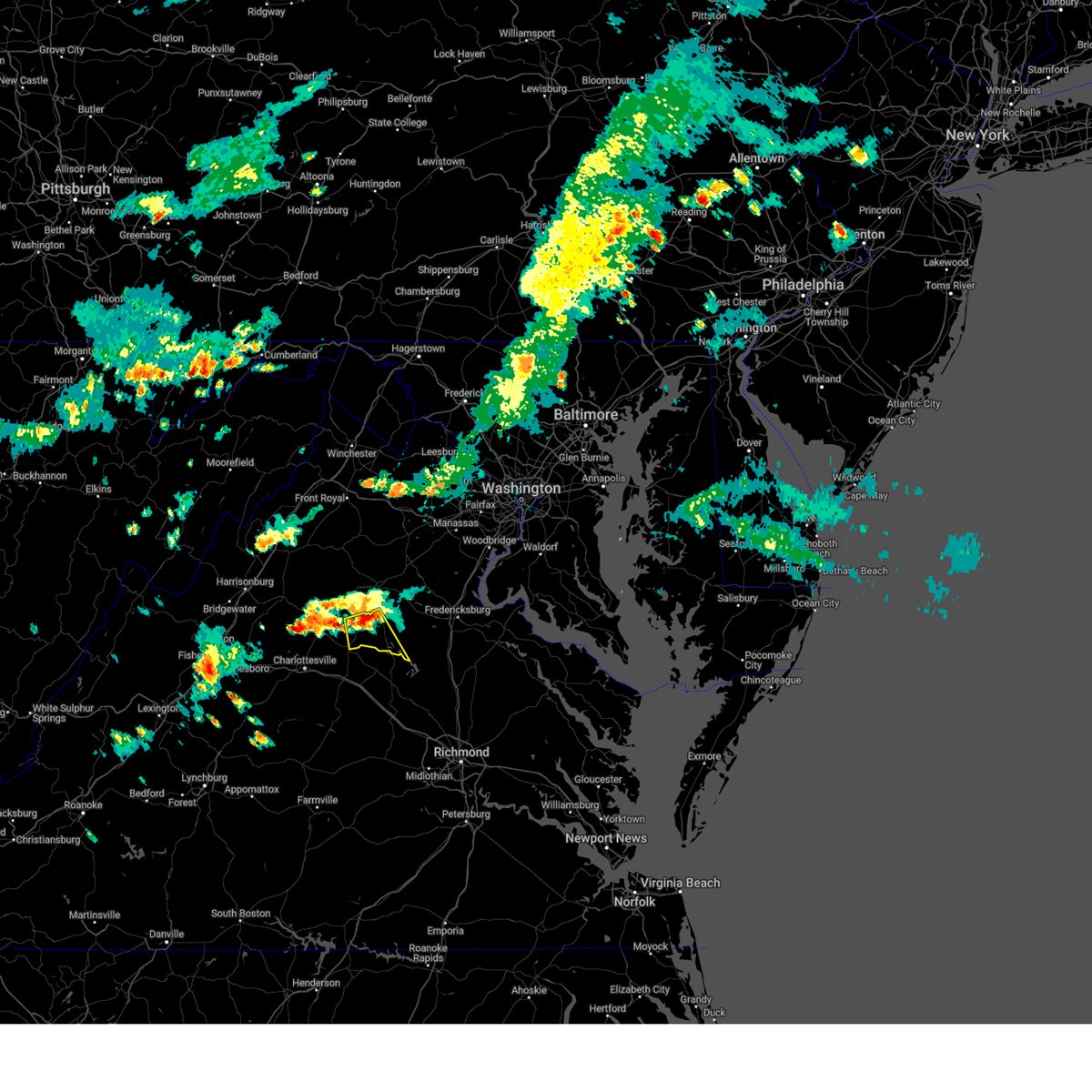
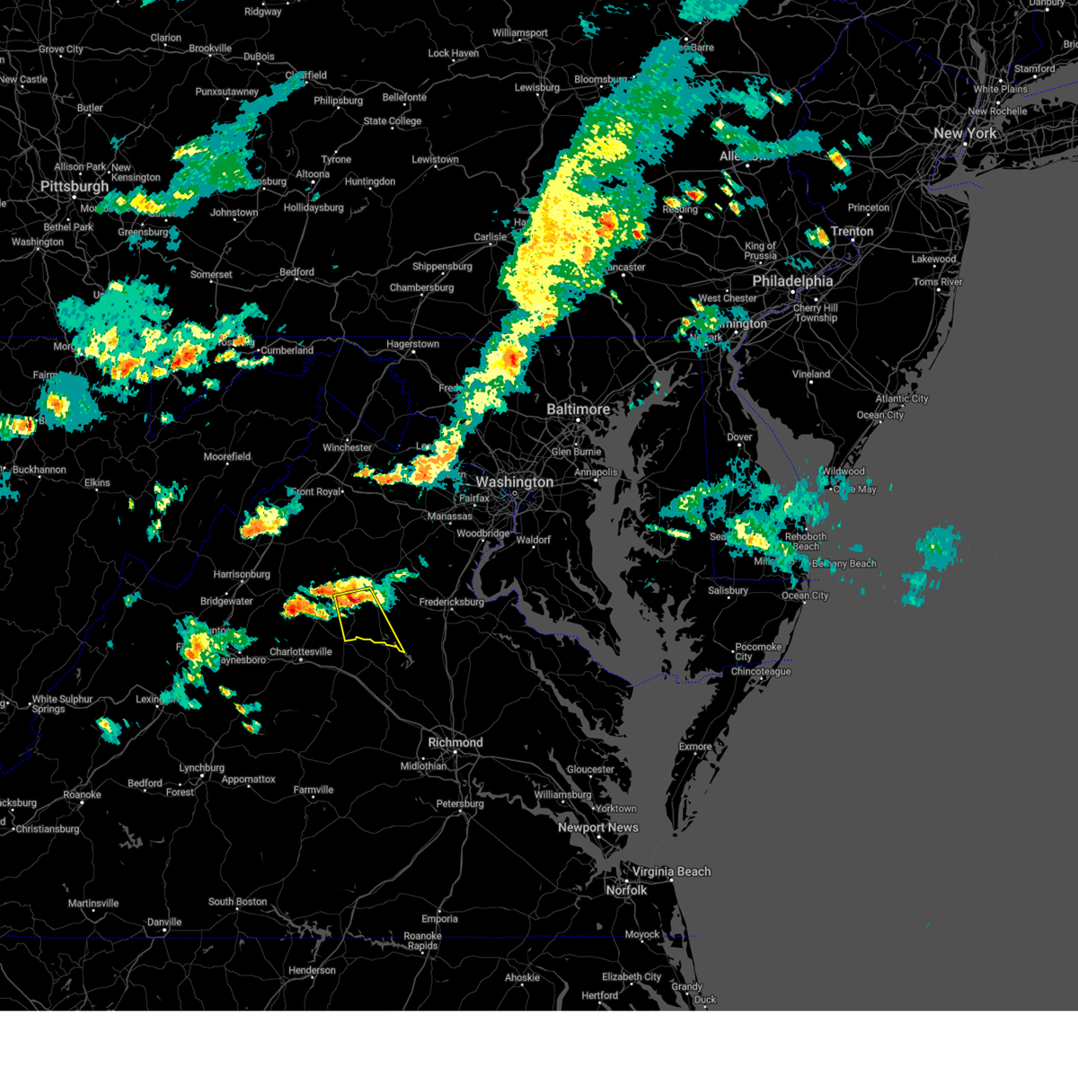
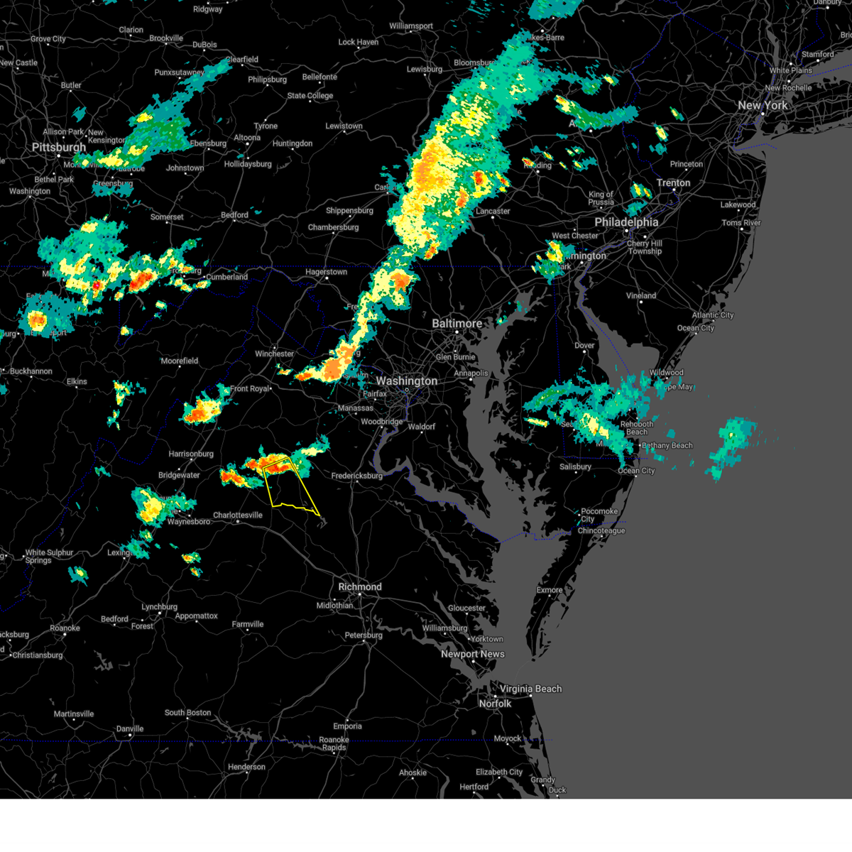
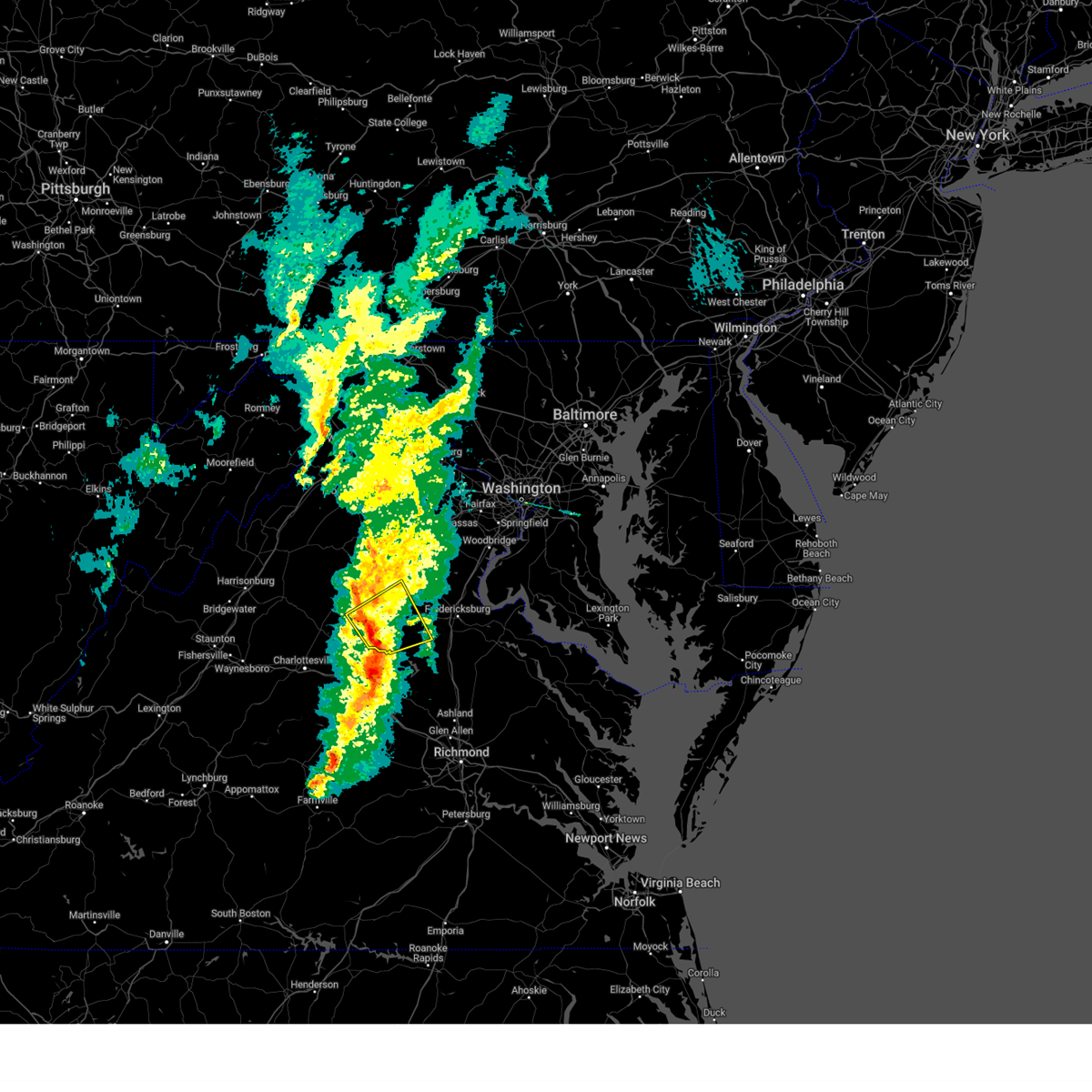
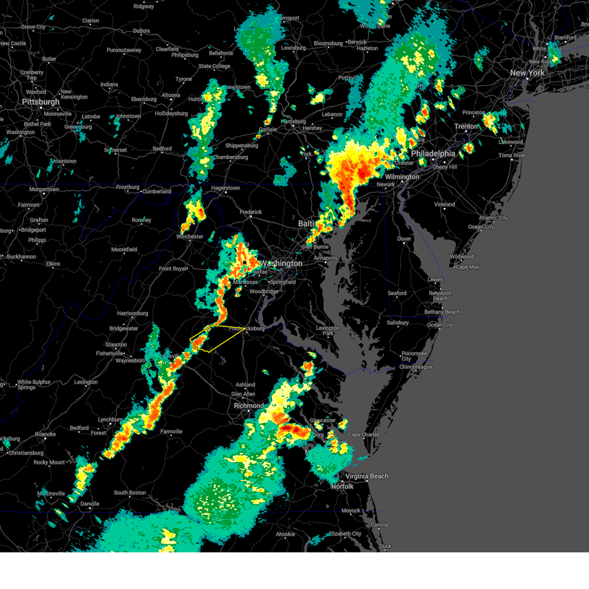
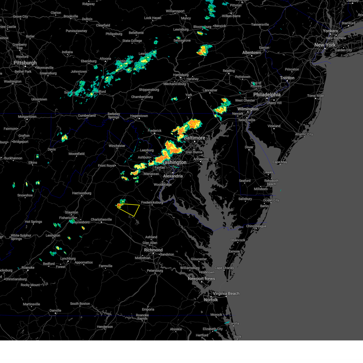
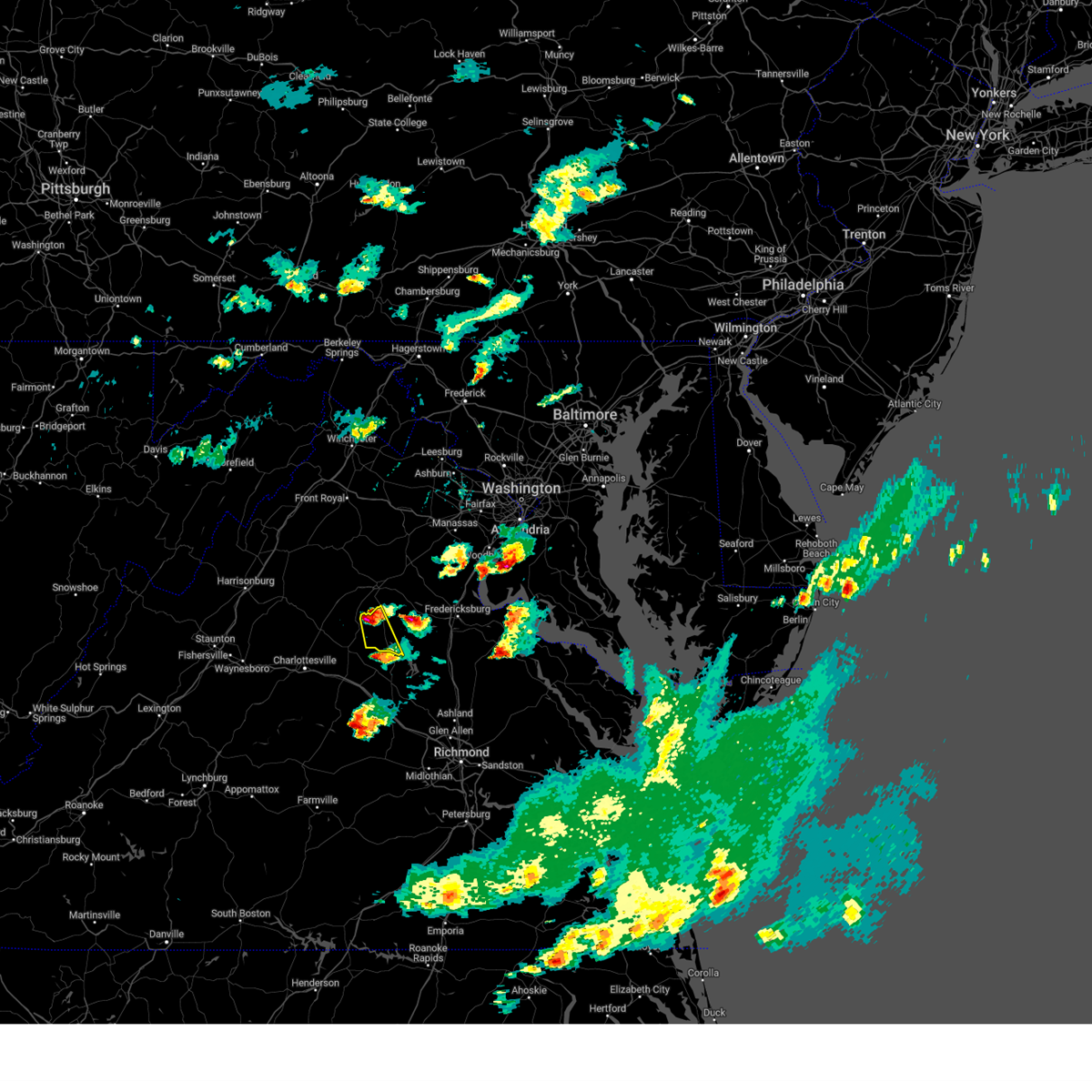
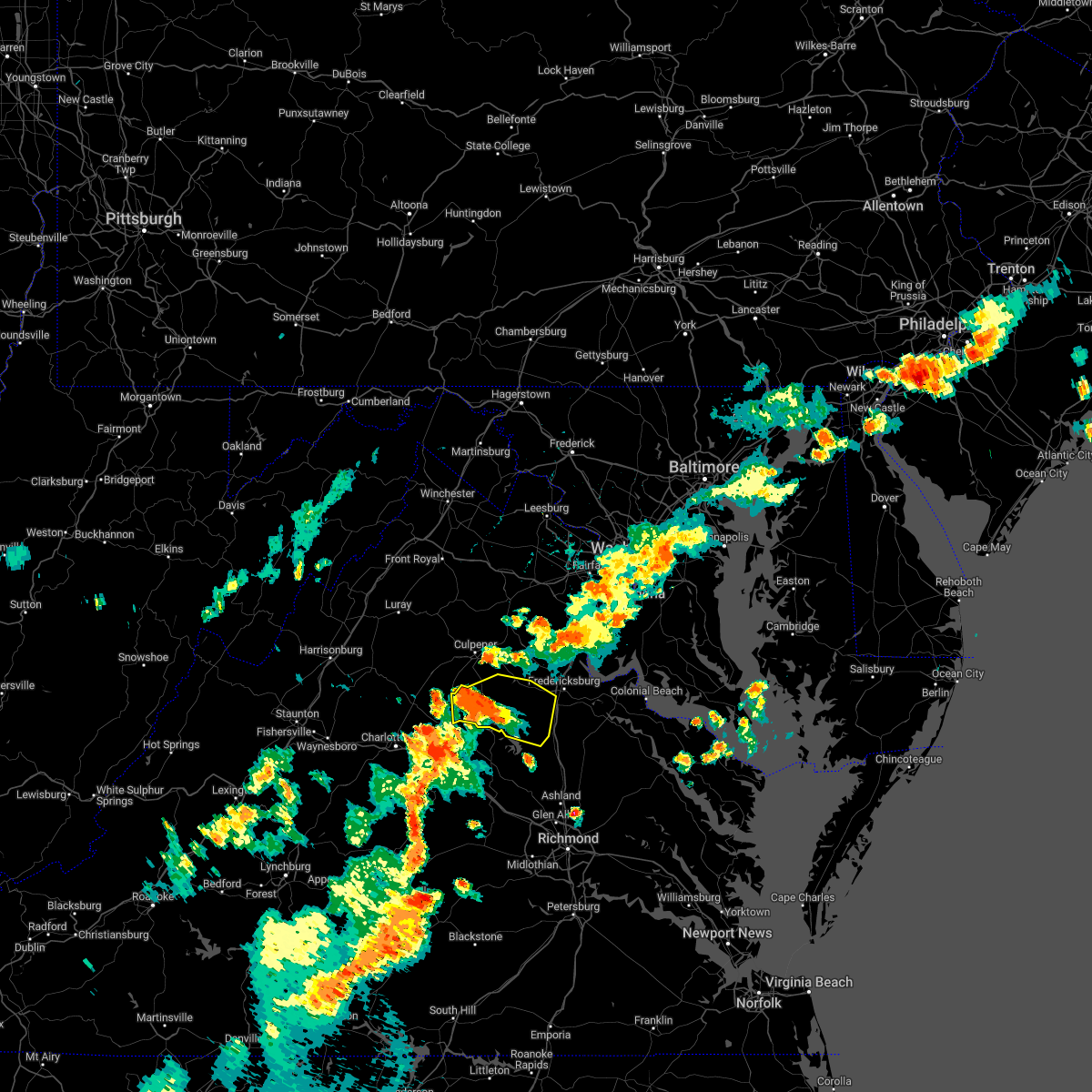
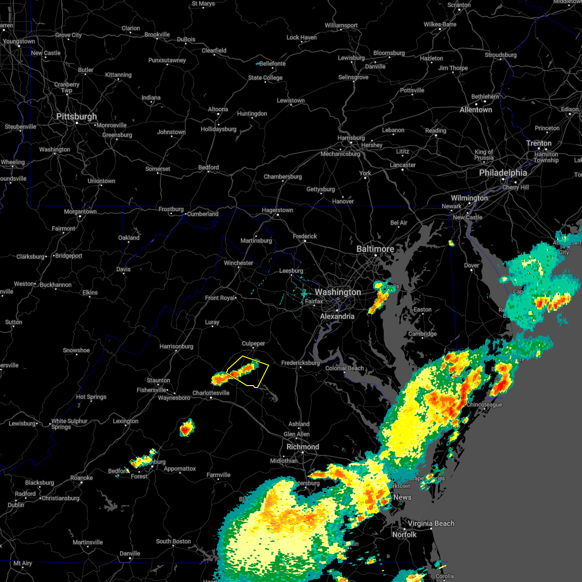
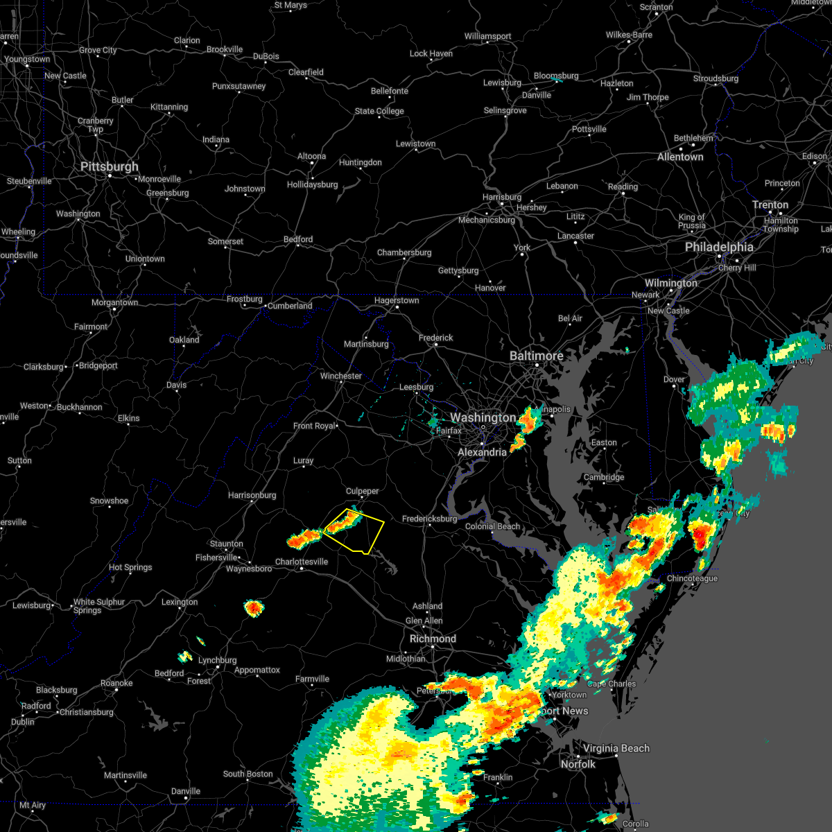
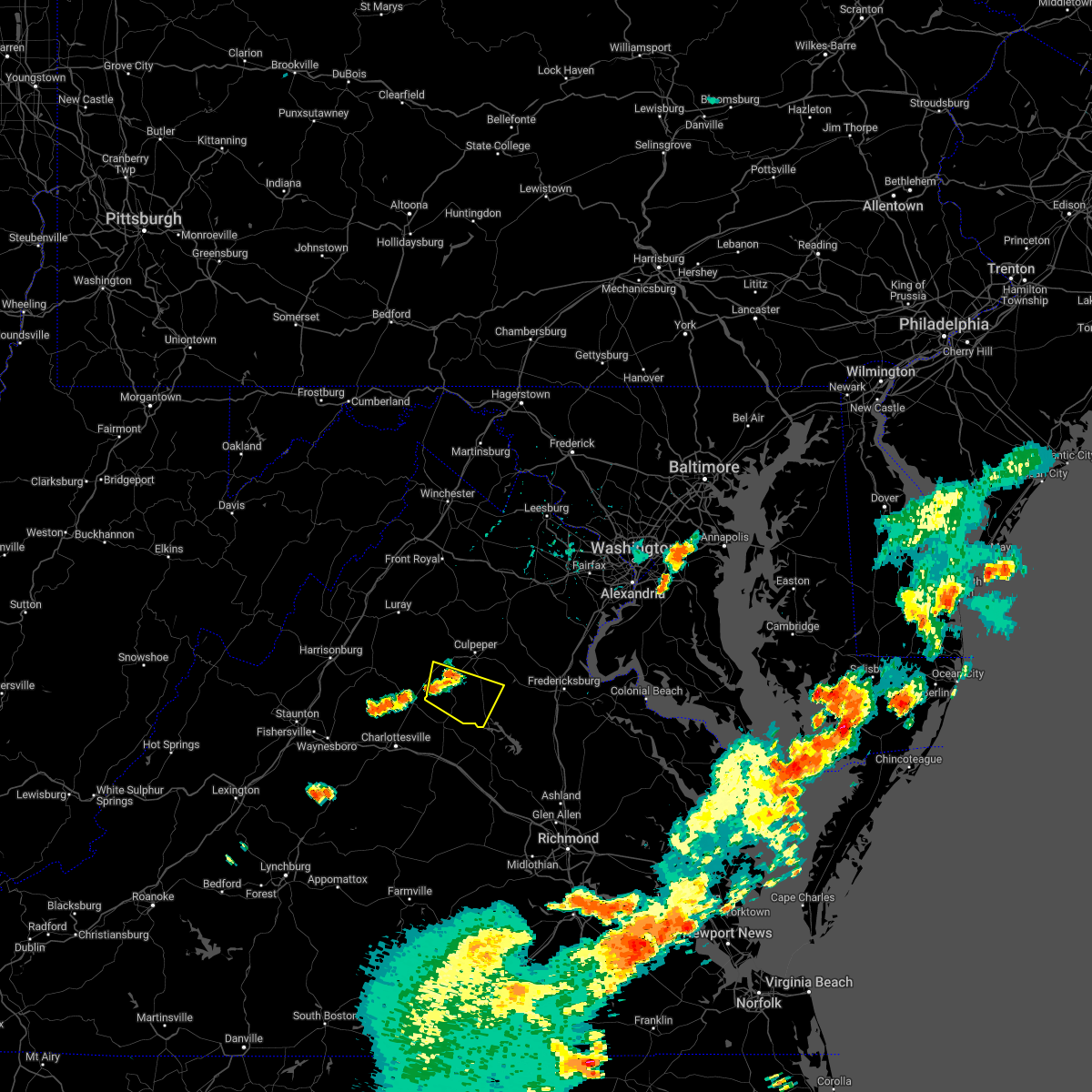
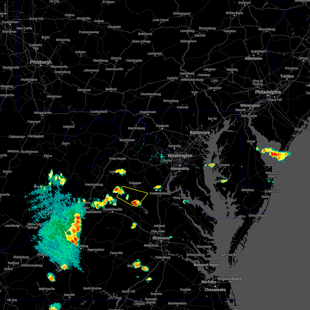
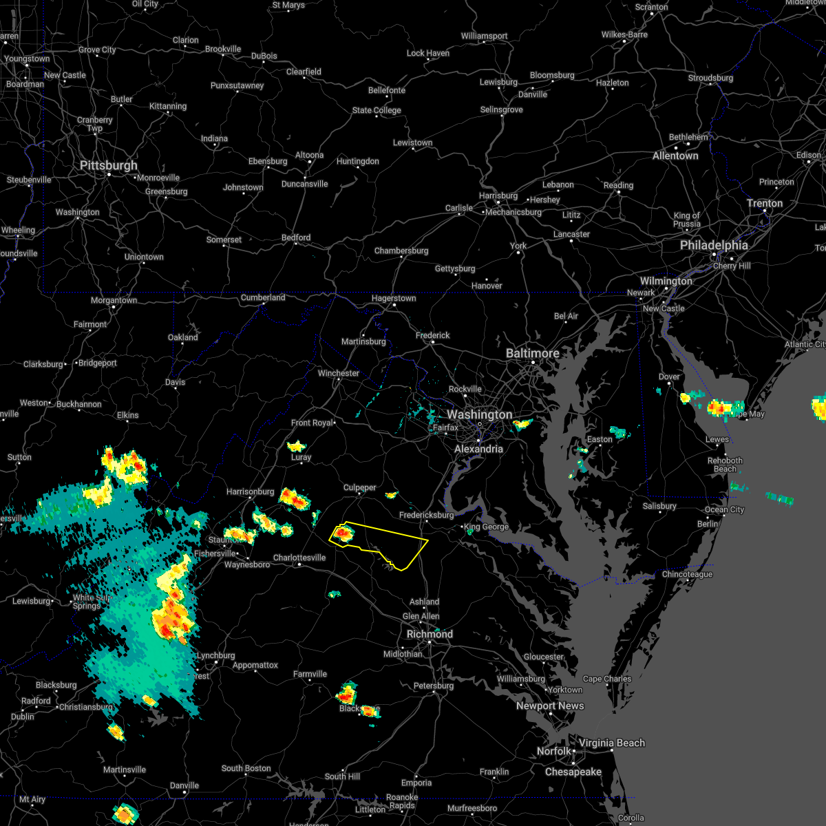
Hail Map for Orange, VA
The Orange, VA area has had 11 reports of on-the-ground hail by trained spotters, and has been under severe weather warnings 15 times during the past 12 months. Doppler radar has detected hail at or near Orange, VA on 45 occasions, including 1 occasion during the past year.
| Name: | Orange, VA |
| Where Located: | 57.1 miles NNW of Richmond, VA |
| Map: | Google Map for Orange, VA |
| Population: | 4721 |
| Housing Units: | 1991 |
| More Info: | Search Google for Orange, VA |
0
The Top Recent Hail Date for Orange, VA is Friday, June 6, 2025 (20th out of 45)

Hail and Wind Damage Spotted near Orange, VA
| Date / Time | Report Details |
|---|---|
| 7/1/2025 5:53 PM EDT |
 Svrlwx the national weather service in sterling virginia has issued a * severe thunderstorm warning for, central orange county in central virginia, northwestern spotsylvania county in central virginia, * until 630 pm edt. * at 553 pm edt, a severe thunderstorm was located near orange, moving east at 35 mph (radar indicated). Hazards include 60 mph wind gusts. Damaging winds will cause some trees and large branches to fall. this could injure those outdoors, as well as damage homes and vehicles. roadways may become blocked by downed trees. localized power outages are possible. Unsecured light objects may become projectiles. Svrlwx the national weather service in sterling virginia has issued a * severe thunderstorm warning for, central orange county in central virginia, northwestern spotsylvania county in central virginia, * until 630 pm edt. * at 553 pm edt, a severe thunderstorm was located near orange, moving east at 35 mph (radar indicated). Hazards include 60 mph wind gusts. Damaging winds will cause some trees and large branches to fall. this could injure those outdoors, as well as damage homes and vehicles. roadways may become blocked by downed trees. localized power outages are possible. Unsecured light objects may become projectiles.
|
| 7/1/2025 5:20 PM EDT | Tree down near intersection of rt 15 and petersburg rd in orange county VA, 2.3 miles S of Orange, VA |
| 7/1/2025 5:13 PM EDT | Large tree down near intersection of rt 20 and jacksontown rd in orange county VA, 4.7 miles ENE of Orange, VA |
| 6/25/2025 1:18 PM EDT |
 the severe thunderstorm warning has been cancelled and is no longer in effect the severe thunderstorm warning has been cancelled and is no longer in effect
|
| 6/25/2025 1:18 PM EDT |
 At 117 pm edt, a severe thunderstorm was located near madison, moving south at 10 mph (radar indicated). Hazards include 60 mph wind gusts and quarter size hail. Damaging winds will cause some trees and large branches to fall. this could injure those outdoors, as well as damage homes and vehicles. roadways may become blocked by downed trees. localized power outages are possible. unsecured light objects may become projectiles. Locations impacted include, orange, madison, montpelier station, pratts, rochelle, aroda, madison mills, montford, old somerset, shelby, dawsonville, twymans mill, and somerset. At 117 pm edt, a severe thunderstorm was located near madison, moving south at 10 mph (radar indicated). Hazards include 60 mph wind gusts and quarter size hail. Damaging winds will cause some trees and large branches to fall. this could injure those outdoors, as well as damage homes and vehicles. roadways may become blocked by downed trees. localized power outages are possible. unsecured light objects may become projectiles. Locations impacted include, orange, madison, montpelier station, pratts, rochelle, aroda, madison mills, montford, old somerset, shelby, dawsonville, twymans mill, and somerset.
|
| 6/25/2025 1:17 PM EDT | Tree down near 920 wrights ln in madison county VA, 6.1 miles SE of Orange, VA |
| 6/25/2025 12:54 PM EDT |
 Svrlwx the national weather service in sterling virginia has issued a * severe thunderstorm warning for, southeastern madison county in northwestern virginia, southwestern orange county in central virginia, eastern greene county in central virginia, southern culpeper county in northern virginia, * until 130 pm edt. * at 1253 pm edt, a severe thunderstorm was located over madison, moving southeast at 10 mph (radar indicated). Hazards include 60 mph wind gusts and quarter size hail. Damaging winds will cause some trees and large branches to fall. this could injure those outdoors, as well as damage homes and vehicles. roadways may become blocked by downed trees. localized power outages are possible. Unsecured light objects may become projectiles. Svrlwx the national weather service in sterling virginia has issued a * severe thunderstorm warning for, southeastern madison county in northwestern virginia, southwestern orange county in central virginia, eastern greene county in central virginia, southern culpeper county in northern virginia, * until 130 pm edt. * at 1253 pm edt, a severe thunderstorm was located over madison, moving southeast at 10 mph (radar indicated). Hazards include 60 mph wind gusts and quarter size hail. Damaging winds will cause some trees and large branches to fall. this could injure those outdoors, as well as damage homes and vehicles. roadways may become blocked by downed trees. localized power outages are possible. Unsecured light objects may become projectiles.
|
| 6/19/2025 3:42 PM EDT | Large tree down along rapidan rd at old rapidan rd in orange county VA, 4.8 miles SSW of Orange, VA |
| 6/19/2025 3:04 PM EDT |
 Svrlwx the national weather service in sterling virginia has issued a * severe thunderstorm warning for, southern madison county in northwestern virginia, the northern city of charlottesville in central virginia, southwestern orange county in central virginia, northern albemarle county in central virginia, greene county in central virginia, southwestern culpeper county in northern virginia, * until 330 pm edt. * at 304 pm edt, severe thunderstorms were located along a line extending from near stanardsville to near free union, moving east at 40 mph (radar indicated). Hazards include 60 mph wind gusts. Damaging winds will cause some trees and large branches to fall. this could injure those outdoors, as well as damage homes and vehicles. roadways may become blocked by downed trees. localized power outages are possible. Unsecured light objects may become projectiles. Svrlwx the national weather service in sterling virginia has issued a * severe thunderstorm warning for, southern madison county in northwestern virginia, the northern city of charlottesville in central virginia, southwestern orange county in central virginia, northern albemarle county in central virginia, greene county in central virginia, southwestern culpeper county in northern virginia, * until 330 pm edt. * at 304 pm edt, severe thunderstorms were located along a line extending from near stanardsville to near free union, moving east at 40 mph (radar indicated). Hazards include 60 mph wind gusts. Damaging winds will cause some trees and large branches to fall. this could injure those outdoors, as well as damage homes and vehicles. roadways may become blocked by downed trees. localized power outages are possible. Unsecured light objects may become projectiles.
|
| 6/6/2025 4:07 PM EDT |
 The storm which prompted the warning has moved out of the area. therefore, the warning will be allowed to expire. to report severe weather, contact your nearest law enforcement agency. they will relay your report to the national weather service sterling virginia. The storm which prompted the warning has moved out of the area. therefore, the warning will be allowed to expire. to report severe weather, contact your nearest law enforcement agency. they will relay your report to the national weather service sterling virginia.
|
| 6/6/2025 3:50 PM EDT |
 At 350 pm edt, a severe thunderstorm was located near orange, moving south at 20 mph (radar indicated). Hazards include 60 mph wind gusts. Damaging winds will cause some trees and large branches to fall. this could injure those outdoors, as well as damage homes and vehicles. roadways may become blocked by downed trees. localized power outages are possible. unsecured light objects may become projectiles. Locations impacted include, thornhill, nasons, rhoadesville, lahore, glenora, madison run, unionville, gordonsville, and orange. At 350 pm edt, a severe thunderstorm was located near orange, moving south at 20 mph (radar indicated). Hazards include 60 mph wind gusts. Damaging winds will cause some trees and large branches to fall. this could injure those outdoors, as well as damage homes and vehicles. roadways may become blocked by downed trees. localized power outages are possible. unsecured light objects may become projectiles. Locations impacted include, thornhill, nasons, rhoadesville, lahore, glenora, madison run, unionville, gordonsville, and orange.
|
| 6/6/2025 3:50 PM EDT |
 the severe thunderstorm warning has been cancelled and is no longer in effect the severe thunderstorm warning has been cancelled and is no longer in effect
|
| 6/6/2025 3:49 PM EDT | Multiple trees down along monrovia r in orange county VA, 7.6 miles NW of Orange, VA |
| 6/6/2025 3:40 PM EDT | Multiple trees down along lahore rd. heading into lahore... and then also along marquis rd. heading north and south out of lahor in orange county VA, 7.8 miles WNW of Orange, VA |
| 6/6/2025 3:35 PM EDT | A wind gust of 65 knots (75 mph) was measured by the awos at orange county airport (komh in orange county VA, 3.3 miles W of Orange, VA |
| 6/6/2025 3:30 PM EDT | Multiple trees down along brick church r in orange county VA, 3 miles WNW of Orange, VA |
| 6/6/2025 3:29 PM EDT |
 At 329 pm edt, a severe thunderstorm was located over orange, moving south at 20 mph (radar indicated). Hazards include 60 mph wind gusts. Damaging winds will cause some trees and large branches to fall. this could injure those outdoors, as well as damage homes and vehicles. roadways may become blocked by downed trees. localized power outages are possible. unsecured light objects may become projectiles. Locations impacted include, everona, montpelier station, madison run, orange, thornhill, nasons, madison mills, montford, lahore, glenora, unionville, rapidan, and gordonsville. At 329 pm edt, a severe thunderstorm was located over orange, moving south at 20 mph (radar indicated). Hazards include 60 mph wind gusts. Damaging winds will cause some trees and large branches to fall. this could injure those outdoors, as well as damage homes and vehicles. roadways may become blocked by downed trees. localized power outages are possible. unsecured light objects may become projectiles. Locations impacted include, everona, montpelier station, madison run, orange, thornhill, nasons, madison mills, montford, lahore, glenora, unionville, rapidan, and gordonsville.
|
| 6/6/2025 3:29 PM EDT |
 the severe thunderstorm warning has been cancelled and is no longer in effect the severe thunderstorm warning has been cancelled and is no longer in effect
|
| 6/6/2025 3:20 PM EDT | Numerous trees were down in the rapidan and locust dale areas. a few trees fell onto houses. damage was reported at the rapidan fire departmen in culpeper county VA, 5.5 miles SSW of Orange, VA |
| 6/6/2025 3:20 PM EDT | Multiple trees down along mt. sharon r in orange county VA, 4.1 miles WSW of Orange, VA |
| 6/6/2025 3:20 PM EDT | Multiple trees down along clarks mountain r in orange county VA, 6.2 miles WSW of Orange, VA |
| 6/6/2025 3:18 PM EDT |
 At 317 pm edt, a severe thunderstorm was located near orange, moving south at 20 mph (radar indicated). Hazards include 70 mph wind gusts and ping pong ball size hail. Damaging winds will cause some trees and large branches to fall. this could injure those outdoors, as well as damage homes and vehicles. roadways may become blocked by downed trees. localized power outages are possible. unsecured light objects may become projectiles. Locations impacted include, rhoadesville, rapidan, oakpark, everona, montpelier station, madison run, orange, thornhill, aroda, nasons, madison mills, montford, mitchells, lahore, glenora, twymans mill, unionville, locust dale, winston, and gordonsville. At 317 pm edt, a severe thunderstorm was located near orange, moving south at 20 mph (radar indicated). Hazards include 70 mph wind gusts and ping pong ball size hail. Damaging winds will cause some trees and large branches to fall. this could injure those outdoors, as well as damage homes and vehicles. roadways may become blocked by downed trees. localized power outages are possible. unsecured light objects may become projectiles. Locations impacted include, rhoadesville, rapidan, oakpark, everona, montpelier station, madison run, orange, thornhill, aroda, nasons, madison mills, montford, mitchells, lahore, glenora, twymans mill, unionville, locust dale, winston, and gordonsville.
|
| 6/6/2025 3:10 PM EDT |
 Svrlwx the national weather service in sterling virginia has issued a * severe thunderstorm warning for, southeastern madison county in northwestern virginia, central orange county in central virginia, southwestern culpeper county in northern virginia, southwestern spotsylvania county in central virginia, * until 415 pm edt. * at 310 pm edt, a severe thunderstorm with a history of producing wind damage was located 7 miles east of madison, moving south at 20 mph (radar indicated). Hazards include 60 mph wind gusts and quarter size hail. Damaging winds will cause some trees and large branches to fall. this could injure those outdoors, as well as damage homes and vehicles. roadways may become blocked by downed trees. localized power outages are possible. Unsecured light objects may become projectiles. Svrlwx the national weather service in sterling virginia has issued a * severe thunderstorm warning for, southeastern madison county in northwestern virginia, central orange county in central virginia, southwestern culpeper county in northern virginia, southwestern spotsylvania county in central virginia, * until 415 pm edt. * at 310 pm edt, a severe thunderstorm with a history of producing wind damage was located 7 miles east of madison, moving south at 20 mph (radar indicated). Hazards include 60 mph wind gusts and quarter size hail. Damaging winds will cause some trees and large branches to fall. this could injure those outdoors, as well as damage homes and vehicles. roadways may become blocked by downed trees. localized power outages are possible. Unsecured light objects may become projectiles.
|
| 12/31/2024 4:23 PM EST | *** 1 inj *** large tree on an occupied vehicle on the 17000 block of marquis roa in orange county VA, 8.4 miles NW of Orange, VA |
| 12/31/2024 4:21 PM EST |
 Svrlwx the national weather service in sterling virginia has issued a * severe thunderstorm warning for, southeastern madison county in northwestern virginia, orange county in central virginia, south central culpeper county in northern virginia, northwestern spotsylvania county in central virginia, * until 445 pm est. * at 420 pm est, a severe thunderstorm was located near orange, moving northeast at 35 mph (radar indicated). Hazards include 60 mph wind gusts and quarter size hail. Damaging winds will cause some trees and large branches to fall. this could injure those outdoors, as well as damage homes and vehicles. roadways may become blocked by downed trees. localized power outages are possible. Unsecured light objects may become projectiles. Svrlwx the national weather service in sterling virginia has issued a * severe thunderstorm warning for, southeastern madison county in northwestern virginia, orange county in central virginia, south central culpeper county in northern virginia, northwestern spotsylvania county in central virginia, * until 445 pm est. * at 420 pm est, a severe thunderstorm was located near orange, moving northeast at 35 mph (radar indicated). Hazards include 60 mph wind gusts and quarter size hail. Damaging winds will cause some trees and large branches to fall. this could injure those outdoors, as well as damage homes and vehicles. roadways may become blocked by downed trees. localized power outages are possible. Unsecured light objects may become projectiles.
|
| 12/31/2024 4:15 PM EST | Tree down along the 23000 block of thornhill road in orange county VA, 10.2 miles NW of Orange, VA |
| 8/29/2024 6:50 PM EDT | Multiple trees and wires down on lafayette drive near black walnut roa in orange county VA, 9.9 miles W of Orange, VA |
| 8/3/2024 5:45 PM EDT |
 Svrlwx the national weather service in sterling virginia has issued a * severe thunderstorm warning for, southwestern stafford county in northern virginia, orange county in central virginia, the northwestern city of fredericksburg in central virginia, northwestern spotsylvania county in central virginia, * until 615 pm edt. * at 545 pm edt, a severe thunderstorm was located near orange, moving northeast at 30 mph (radar indicated). Hazards include 60 mph wind gusts. Damaging winds will cause some trees and large branches to fall. this could injure those outdoors, as well as damage homes and vehicles. roadways may become blocked by downed trees. localized power outages are possible. Unsecured light objects may become projectiles. Svrlwx the national weather service in sterling virginia has issued a * severe thunderstorm warning for, southwestern stafford county in northern virginia, orange county in central virginia, the northwestern city of fredericksburg in central virginia, northwestern spotsylvania county in central virginia, * until 615 pm edt. * at 545 pm edt, a severe thunderstorm was located near orange, moving northeast at 30 mph (radar indicated). Hazards include 60 mph wind gusts. Damaging winds will cause some trees and large branches to fall. this could injure those outdoors, as well as damage homes and vehicles. roadways may become blocked by downed trees. localized power outages are possible. Unsecured light objects may become projectiles.
|
| 7/17/2024 5:13 PM EDT |
 Svrlwx the national weather service in sterling virginia has issued a * severe thunderstorm warning for, southeastern orange county in central virginia, spotsylvania county in central virginia, * until 600 pm edt. * at 513 pm edt, a severe thunderstorm was located near orange, moving east at 30 mph (radar indicated). Hazards include 60 mph wind gusts. Damaging winds will cause some trees and large branches to fall. this could injure those outdoors, as well as damage homes and vehicles. roadways may become blocked by downed trees. localized power outages are possible. Unsecured light objects may become projectiles. Svrlwx the national weather service in sterling virginia has issued a * severe thunderstorm warning for, southeastern orange county in central virginia, spotsylvania county in central virginia, * until 600 pm edt. * at 513 pm edt, a severe thunderstorm was located near orange, moving east at 30 mph (radar indicated). Hazards include 60 mph wind gusts. Damaging winds will cause some trees and large branches to fall. this could injure those outdoors, as well as damage homes and vehicles. roadways may become blocked by downed trees. localized power outages are possible. Unsecured light objects may become projectiles.
|
| 6/26/2024 8:50 PM EDT | Multiple trees were reported down along monrovia road to where brick church road/route 20 mee in orange county VA, 3.8 miles W of Orange, VA |
| 6/26/2024 8:39 PM EDT |
 Svrlwx the national weather service in sterling virginia has issued a * severe thunderstorm warning for, madison county in northwestern virginia, southwestern orange county in central virginia, east central rockingham county in western virginia, southern page county in northwestern virginia, northeastern albemarle county in central virginia, southwestern rappahannock county in northwestern virginia, greene county in central virginia, western culpeper county in northern virginia, * until 915 pm edt. * at 839 pm edt, severe thunderstorms were located along a line extending from near luray to near madison to 9 miles northwest of boswells tavern, moving northeast at 45 mph (radar indicated). Hazards include 60 mph wind gusts. Damaging winds will cause some trees and large branches to fall. this could injure those outdoors, as well as damage homes and vehicles. roadways may become blocked by downed trees. localized power outages are possible. Unsecured light objects may become projectiles. Svrlwx the national weather service in sterling virginia has issued a * severe thunderstorm warning for, madison county in northwestern virginia, southwestern orange county in central virginia, east central rockingham county in western virginia, southern page county in northwestern virginia, northeastern albemarle county in central virginia, southwestern rappahannock county in northwestern virginia, greene county in central virginia, western culpeper county in northern virginia, * until 915 pm edt. * at 839 pm edt, severe thunderstorms were located along a line extending from near luray to near madison to 9 miles northwest of boswells tavern, moving northeast at 45 mph (radar indicated). Hazards include 60 mph wind gusts. Damaging winds will cause some trees and large branches to fall. this could injure those outdoors, as well as damage homes and vehicles. roadways may become blocked by downed trees. localized power outages are possible. Unsecured light objects may become projectiles.
|
| 5/26/2024 9:05 PM EDT |
 Svrlwx the national weather service in sterling virginia has issued a * severe thunderstorm warning for, northwestern washington county in north central maryland, northeastern allegany county in western maryland, southwestern stafford county in northern virginia, southwestern loudoun county in northern virginia, northeastern shenandoah county in northwestern virginia, frederick county in northwestern virginia, orange county in central virginia, the city of fredericksburg in central virginia, rappahannock county in northwestern virginia, central fauquier county in northern virginia, culpeper county in northern virginia, central madison county in northwestern virginia, warren county in northwestern virginia, western clarke county in northwestern virginia, northeastern page county in northwestern virginia, the city of winchester in northwestern virginia, spotsylvania county in central virginia, west central jefferson county in the panhandle of west virginia, morgan county in the panhandle of west virginia, northeastern mineral county in eastern west virginia, northeastern hardy county in eastern west virginia, western berkeley county in the panhandle of west virginia, hampshire county in eastern west virginia, * until 1000 pm edt. * at 905 pm edt, severe thunderstorms were located along a line extending from near la vale to 6 miles south of romney to 6 miles north of basye-bryce mountain to near mount jackson to 6 miles north of boswells tavern, moving east at 35 mph (radar indicated). Hazards include 60 mph wind gusts. Damaging winds will cause some trees and large branches to fall. this could injure those outdoors, as well as damage homes and vehicles. roadways may become blocked by downed trees. localized power outages are possible. Unsecured light objects may become projectiles. Svrlwx the national weather service in sterling virginia has issued a * severe thunderstorm warning for, northwestern washington county in north central maryland, northeastern allegany county in western maryland, southwestern stafford county in northern virginia, southwestern loudoun county in northern virginia, northeastern shenandoah county in northwestern virginia, frederick county in northwestern virginia, orange county in central virginia, the city of fredericksburg in central virginia, rappahannock county in northwestern virginia, central fauquier county in northern virginia, culpeper county in northern virginia, central madison county in northwestern virginia, warren county in northwestern virginia, western clarke county in northwestern virginia, northeastern page county in northwestern virginia, the city of winchester in northwestern virginia, spotsylvania county in central virginia, west central jefferson county in the panhandle of west virginia, morgan county in the panhandle of west virginia, northeastern mineral county in eastern west virginia, northeastern hardy county in eastern west virginia, western berkeley county in the panhandle of west virginia, hampshire county in eastern west virginia, * until 1000 pm edt. * at 905 pm edt, severe thunderstorms were located along a line extending from near la vale to 6 miles south of romney to 6 miles north of basye-bryce mountain to near mount jackson to 6 miles north of boswells tavern, moving east at 35 mph (radar indicated). Hazards include 60 mph wind gusts. Damaging winds will cause some trees and large branches to fall. this could injure those outdoors, as well as damage homes and vehicles. roadways may become blocked by downed trees. localized power outages are possible. Unsecured light objects may become projectiles.
|
| 5/26/2024 8:55 PM EDT |
 the severe thunderstorm warning has been cancelled and is no longer in effect the severe thunderstorm warning has been cancelled and is no longer in effect
|
| 5/26/2024 8:55 PM EDT |
 At 854 pm edt, a severe thunderstorm was located near stanardsville, or 13 miles southwest of madison, moving northeast at 45 mph. this storm has a history of storm damage including numerous trees reported down (radar indicated). Hazards include 60 mph wind gusts and quarter size hail. Damaging winds will cause some trees and large branches to fall. this could injure those outdoors, as well as damage homes and vehicles. roadways may become blocked by downed trees. localized power outages are possible. unsecured light objects may become projectiles. Locations impacted include, orange, madison, stanardsville, campbell, westmoreland, hollymead, gordonsville, ruckersville, brightwood, eheart, oakpark, barboursville, haywood, stony point, montpelier station, syria, madison mills, montford, old somerset, and amicus. At 854 pm edt, a severe thunderstorm was located near stanardsville, or 13 miles southwest of madison, moving northeast at 45 mph. this storm has a history of storm damage including numerous trees reported down (radar indicated). Hazards include 60 mph wind gusts and quarter size hail. Damaging winds will cause some trees and large branches to fall. this could injure those outdoors, as well as damage homes and vehicles. roadways may become blocked by downed trees. localized power outages are possible. unsecured light objects may become projectiles. Locations impacted include, orange, madison, stanardsville, campbell, westmoreland, hollymead, gordonsville, ruckersville, brightwood, eheart, oakpark, barboursville, haywood, stony point, montpelier station, syria, madison mills, montford, old somerset, and amicus.
|
| 5/26/2024 8:09 PM EDT |
 Svrlwx the national weather service in sterling virginia has issued a * severe thunderstorm warning for, madison county in northwestern virginia, the city of charlottesville in central virginia, southwestern orange county in central virginia, southeastern rockingham county in western virginia, central albemarle county in central virginia, southern rappahannock county in northwestern virginia, greene county in central virginia, southwestern culpeper county in northern virginia, * until 915 pm edt. * at 809 pm edt, a severe thunderstorm was located near crozet, or 10 miles southeast of waynesboro, moving northeast at 55 mph (radar indicated). Hazards include 60 mph wind gusts and quarter size hail. Damaging winds will cause some trees and large branches to fall. this could injure those outdoors, as well as damage homes and vehicles. roadways may become blocked by downed trees. localized power outages are possible. Unsecured light objects may become projectiles. Svrlwx the national weather service in sterling virginia has issued a * severe thunderstorm warning for, madison county in northwestern virginia, the city of charlottesville in central virginia, southwestern orange county in central virginia, southeastern rockingham county in western virginia, central albemarle county in central virginia, southern rappahannock county in northwestern virginia, greene county in central virginia, southwestern culpeper county in northern virginia, * until 915 pm edt. * at 809 pm edt, a severe thunderstorm was located near crozet, or 10 miles southeast of waynesboro, moving northeast at 55 mph (radar indicated). Hazards include 60 mph wind gusts and quarter size hail. Damaging winds will cause some trees and large branches to fall. this could injure those outdoors, as well as damage homes and vehicles. roadways may become blocked by downed trees. localized power outages are possible. Unsecured light objects may become projectiles.
|
| 4/12/2024 12:00 AM EDT | Several trees blew down near orange... including on south almond street and along va-20 constitution highwa in orange county VA, 1.2 miles WNW of Orange, VA |
| 4/11/2024 11:50 PM EDT |
 At 1149 pm edt, severe thunderstorms were located along a line extending from near orange to near mineral to near goochland, moving northeast at 55 mph (radar indicated). Hazards include 60 mph wind gusts. Damaging winds will cause some trees and large branches to fall. this could injure those outdoors, as well as damage homes and vehicles. roadways may become blocked by downed trees. localized power outages are possible. unsecured light objects may become projectiles. Locations impacted include, culpeper, orange, spotsylvania, gordonsville, eheart, oakpark, barboursville, verdiersville, montpelier station, locust grove, snell, thornhill, winston, partlow, madison mills, montford, mitchells, old somerset, thornburg, and dunavant. At 1149 pm edt, severe thunderstorms were located along a line extending from near orange to near mineral to near goochland, moving northeast at 55 mph (radar indicated). Hazards include 60 mph wind gusts. Damaging winds will cause some trees and large branches to fall. this could injure those outdoors, as well as damage homes and vehicles. roadways may become blocked by downed trees. localized power outages are possible. unsecured light objects may become projectiles. Locations impacted include, culpeper, orange, spotsylvania, gordonsville, eheart, oakpark, barboursville, verdiersville, montpelier station, locust grove, snell, thornhill, winston, partlow, madison mills, montford, mitchells, old somerset, thornburg, and dunavant.
|
| 4/11/2024 11:50 PM EDT |
 the severe thunderstorm warning has been cancelled and is no longer in effect the severe thunderstorm warning has been cancelled and is no longer in effect
|
| 4/11/2024 11:39 PM EDT |
 Svrlwx the national weather service in sterling virginia has issued a * severe thunderstorm warning for, southeastern madison county in northwestern virginia, orange county in central virginia, northeastern albemarle county in central virginia, southern culpeper county in northern virginia, spotsylvania county in central virginia, * until 1215 am edt. * at 1139 pm edt, severe thunderstorms were located along a line extending from 6 miles northwest of boswells tavern to ferncliff to near trenholm, moving northeast at 55 mph (radar indicated). Hazards include 60 mph wind gusts. Damaging winds will cause some trees and large branches to fall. this could injure those outdoors, as well as damage homes and vehicles. roadways may become blocked by downed trees. localized power outages are possible. Unsecured light objects may become projectiles. Svrlwx the national weather service in sterling virginia has issued a * severe thunderstorm warning for, southeastern madison county in northwestern virginia, orange county in central virginia, northeastern albemarle county in central virginia, southern culpeper county in northern virginia, spotsylvania county in central virginia, * until 1215 am edt. * at 1139 pm edt, severe thunderstorms were located along a line extending from 6 miles northwest of boswells tavern to ferncliff to near trenholm, moving northeast at 55 mph (radar indicated). Hazards include 60 mph wind gusts. Damaging winds will cause some trees and large branches to fall. this could injure those outdoors, as well as damage homes and vehicles. roadways may become blocked by downed trees. localized power outages are possible. Unsecured light objects may become projectiles.
|
| 9/9/2023 4:10 PM EDT | Several trees blew down across central orange county... including one onto a car at house inn and bistro... and along va-617 everona roa in orange county VA, 7.7 miles WSW of Orange, VA |
| 9/8/2023 9:38 PM EDT |
 At 937 pm edt, severe thunderstorms were located along a line extending from 7 miles northeast of charlottesville to near boswells tavern to near ferncliff, moving north at 30 mph (emergency management has reported numerous calls of downed trees in albemarle county east of charlottesville). Hazards include 70 mph wind gusts and nickel size hail. Damaging winds will cause some trees and large branches to fall. this could injure those outdoors, as well as damage homes and vehicles. roadways may become blocked by downed trees. localized power outages are possible. unsecured light objects may become projectiles. locations impacted include, orange, campbell, gordonsville, cobham, cismont, eheart, barboursville, keswick, stony point, montpelier station, madison run, shadwell, thornhill, old somerset, and somerset. thunderstorm damage threat, considerable hail threat, radar indicated max hail size, 0. 88 in wind threat, radar indicated max wind gust, 70 mph. At 937 pm edt, severe thunderstorms were located along a line extending from 7 miles northeast of charlottesville to near boswells tavern to near ferncliff, moving north at 30 mph (emergency management has reported numerous calls of downed trees in albemarle county east of charlottesville). Hazards include 70 mph wind gusts and nickel size hail. Damaging winds will cause some trees and large branches to fall. this could injure those outdoors, as well as damage homes and vehicles. roadways may become blocked by downed trees. localized power outages are possible. unsecured light objects may become projectiles. locations impacted include, orange, campbell, gordonsville, cobham, cismont, eheart, barboursville, keswick, stony point, montpelier station, madison run, shadwell, thornhill, old somerset, and somerset. thunderstorm damage threat, considerable hail threat, radar indicated max hail size, 0. 88 in wind threat, radar indicated max wind gust, 70 mph.
|
| 9/8/2023 9:22 PM EDT |
 At 921 pm edt, severe thunderstorms were located along a line extending from near charlottesville to near troy to near kents store, moving north at 25 mph (radar indicated). Hazards include 70 mph wind gusts and nickel size hail. Damaging winds will cause some trees and large branches to fall. this could injure those outdoors, as well as damage homes and vehicles. roadways may become blocked by downed trees. localized power outages are possible. unsecured light objects may become projectiles. locations impacted include, orange, campbell, gordonsville, cobham, cismont, eheart, boyd tavern, barboursville, keswick, monticello, woodridge, stony point, montpelier station, madison run, shadwell, thornhill, overton, old somerset, and somerset. thunderstorm damage threat, considerable hail threat, radar indicated max hail size, 0. 88 in wind threat, radar indicated max wind gust, 70 mph. At 921 pm edt, severe thunderstorms were located along a line extending from near charlottesville to near troy to near kents store, moving north at 25 mph (radar indicated). Hazards include 70 mph wind gusts and nickel size hail. Damaging winds will cause some trees and large branches to fall. this could injure those outdoors, as well as damage homes and vehicles. roadways may become blocked by downed trees. localized power outages are possible. unsecured light objects may become projectiles. locations impacted include, orange, campbell, gordonsville, cobham, cismont, eheart, boyd tavern, barboursville, keswick, monticello, woodridge, stony point, montpelier station, madison run, shadwell, thornhill, overton, old somerset, and somerset. thunderstorm damage threat, considerable hail threat, radar indicated max hail size, 0. 88 in wind threat, radar indicated max wind gust, 70 mph.
|
| 9/8/2023 9:14 PM EDT |
 At 914 pm edt, severe thunderstorms were located along a line extending from near lake monticello to near troy to near palmyra, moving northeast at 25 mph (radar indicated). Hazards include 60 mph wind gusts and quarter size hail. Damaging winds will cause some trees and large branches to fall. this could injure those outdoors, as well as damage homes and vehicles. roadways may become blocked by downed trees. localized power outages are possible. Unsecured light objects may become projectiles. At 914 pm edt, severe thunderstorms were located along a line extending from near lake monticello to near troy to near palmyra, moving northeast at 25 mph (radar indicated). Hazards include 60 mph wind gusts and quarter size hail. Damaging winds will cause some trees and large branches to fall. this could injure those outdoors, as well as damage homes and vehicles. roadways may become blocked by downed trees. localized power outages are possible. Unsecured light objects may become projectiles.
|
| 8/7/2023 5:49 PM EDT |
 At 549 pm edt, a severe thunderstorm was located near orange, moving east at 40 mph (radar indicated). Hazards include 60 mph wind gusts and quarter size hail. Damaging winds will cause some trees and large branches to fall. this could injure those outdoors, as well as damage homes and vehicles. roadways may become blocked by downed trees. localized power outages are possible. unsecured light objects may become projectiles. locations impacted include, orange, gordonsville, nasons, lahore, everona, madison run and unionville. hail threat, radar indicated max hail size, 1. 00 in wind threat, radar indicated max wind gust, 60 mph. At 549 pm edt, a severe thunderstorm was located near orange, moving east at 40 mph (radar indicated). Hazards include 60 mph wind gusts and quarter size hail. Damaging winds will cause some trees and large branches to fall. this could injure those outdoors, as well as damage homes and vehicles. roadways may become blocked by downed trees. localized power outages are possible. unsecured light objects may become projectiles. locations impacted include, orange, gordonsville, nasons, lahore, everona, madison run and unionville. hail threat, radar indicated max hail size, 1. 00 in wind threat, radar indicated max wind gust, 60 mph.
|
| 8/7/2023 5:48 PM EDT | Trees down on monrovia road near shady grove lane. wires down as wel in orange county VA, 4.8 miles NW of Orange, VA |
| 8/7/2023 5:30 PM EDT |
 At 530 pm edt, a severe thunderstorm was located 10 miles south of stanardsville, or 10 miles northeast of charlottesville, moving east at 35 mph (radar indicated). Hazards include 60 mph wind gusts and quarter size hail. Damaging winds will cause some trees and large branches to fall. this could injure those outdoors, as well as damage homes and vehicles. roadways may become blocked by downed trees. localized power outages are possible. Unsecured light objects may become projectiles. At 530 pm edt, a severe thunderstorm was located 10 miles south of stanardsville, or 10 miles northeast of charlottesville, moving east at 35 mph (radar indicated). Hazards include 60 mph wind gusts and quarter size hail. Damaging winds will cause some trees and large branches to fall. this could injure those outdoors, as well as damage homes and vehicles. roadways may become blocked by downed trees. localized power outages are possible. Unsecured light objects may become projectiles.
|
| 8/7/2023 5:14 PM EDT |
 At 513 pm edt, a severe thunderstorm was located 7 miles southeast of stanardsville, or 12 miles northeast of charlottesville, moving east at 30 mph (a trained spotter reported golf ball size hail in earlysville, va). Hazards include golf ball size hail and 70 mph wind gusts. Expect wind damage to trees and power lines. hail is large enough to dent and damage vehicles. some hail damage to roofs, siding, and windows is possible. locations impacted include, orange, free union, hollymead, gordonsville, ruckersville, quinque, eheart, oakpark, barboursville, stony point, montpelier station, newtown, nasons, madison mills, montford, mitchells, old somerset, somerset, locust dale and rapidan. thunderstorm damage threat, considerable hail threat, radar indicated max hail size, 1. 75 in wind threat, radar indicated max wind gust, 70 mph. At 513 pm edt, a severe thunderstorm was located 7 miles southeast of stanardsville, or 12 miles northeast of charlottesville, moving east at 30 mph (a trained spotter reported golf ball size hail in earlysville, va). Hazards include golf ball size hail and 70 mph wind gusts. Expect wind damage to trees and power lines. hail is large enough to dent and damage vehicles. some hail damage to roofs, siding, and windows is possible. locations impacted include, orange, free union, hollymead, gordonsville, ruckersville, quinque, eheart, oakpark, barboursville, stony point, montpelier station, newtown, nasons, madison mills, montford, mitchells, old somerset, somerset, locust dale and rapidan. thunderstorm damage threat, considerable hail threat, radar indicated max hail size, 1. 75 in wind threat, radar indicated max wind gust, 70 mph.
|
| 8/7/2023 5:02 PM EDT |
 At 501 pm edt, a severe thunderstorm was located near free union, or 11 miles north of charlottesville, moving east at 45 mph (radar indicated). Hazards include 70 mph wind gusts and ping pong ball size hail. Damaging winds will cause some trees and large branches to fall. this could injure those outdoors, as well as damage homes and vehicles. roadways may become blocked by downed trees. localized power outages are possible. unsecured light objects may become projectiles. Locations impacted include, orange, stanardsville, free union, westmoreland, hollymead, gordonsville, ruckersville, brightwood, quinque, eheart, oakpark, barboursville, stony point, montpelier station, newtown, nasons, madison mills, montford, old somerset and amicus. At 501 pm edt, a severe thunderstorm was located near free union, or 11 miles north of charlottesville, moving east at 45 mph (radar indicated). Hazards include 70 mph wind gusts and ping pong ball size hail. Damaging winds will cause some trees and large branches to fall. this could injure those outdoors, as well as damage homes and vehicles. roadways may become blocked by downed trees. localized power outages are possible. unsecured light objects may become projectiles. Locations impacted include, orange, stanardsville, free union, westmoreland, hollymead, gordonsville, ruckersville, brightwood, quinque, eheart, oakpark, barboursville, stony point, montpelier station, newtown, nasons, madison mills, montford, old somerset and amicus.
|
| 8/7/2023 4:48 PM EDT |
 At 448 pm edt, a severe thunderstorm was located near free union, or 11 miles northwest of charlottesville, moving east at 45 mph (radar indicated). Hazards include 70 mph wind gusts and ping pong ball size hail. Damaging winds will cause some trees and large branches to fall. this could injure those outdoors, as well as damage homes and vehicles. roadways may become blocked by downed trees. localized power outages are possible. Unsecured light objects may become projectiles. At 448 pm edt, a severe thunderstorm was located near free union, or 11 miles northwest of charlottesville, moving east at 45 mph (radar indicated). Hazards include 70 mph wind gusts and ping pong ball size hail. Damaging winds will cause some trees and large branches to fall. this could injure those outdoors, as well as damage homes and vehicles. roadways may become blocked by downed trees. localized power outages are possible. Unsecured light objects may become projectiles.
|
| 7/29/2023 4:19 PM EDT |
 At 419 pm edt, a severe thunderstorm was located over orange, moving east at 30 mph (radar indicated). Hazards include 60 mph wind gusts and quarter size hail. Damaging winds will cause some trees and large branches to fall. this could injure those outdoors, as well as damage homes and vehicles. roadways may become blocked by downed trees. localized power outages are possible. Unsecured light objects may become projectiles. At 419 pm edt, a severe thunderstorm was located over orange, moving east at 30 mph (radar indicated). Hazards include 60 mph wind gusts and quarter size hail. Damaging winds will cause some trees and large branches to fall. this could injure those outdoors, as well as damage homes and vehicles. roadways may become blocked by downed trees. localized power outages are possible. Unsecured light objects may become projectiles.
|
| 7/28/2023 7:20 PM EDT |
 At 719 pm edt, severe thunderstorms were located along a line extending from 8 miles northwest of free union to near wintergreen, moving east at 35 mph (law enforcement). Hazards include 60 mph wind gusts. Damaging winds will cause some trees and large branches to fall. this could injure those outdoors, as well as damage homes and vehicles. roadways may become blocked by downed trees. localized power outages are possible. Unsecured light objects may become projectiles. At 719 pm edt, severe thunderstorms were located along a line extending from 8 miles northwest of free union to near wintergreen, moving east at 35 mph (law enforcement). Hazards include 60 mph wind gusts. Damaging winds will cause some trees and large branches to fall. this could injure those outdoors, as well as damage homes and vehicles. roadways may become blocked by downed trees. localized power outages are possible. Unsecured light objects may become projectiles.
|
| 7/7/2023 6:17 PM EDT |
 At 616 pm edt, severe thunderstorms were located along a line extending from 9 miles east of orange to 6 miles north of boswells tavern to 9 miles northeast of charlottesville, moving south at 15 mph (radar indicated). Hazards include 60 mph wind gusts. Damaging winds will cause some trees and large branches to fall. this could injure those outdoors, as well as damage homes and vehicles. roadways may become blocked by downed trees. localized power outages are possible. unsecured light objects may become projectiles. locations impacted include, orange, campbell, hollymead, gordonsville, cobham, cismont, rhoadesville, barboursville, everona, verdiersville, stony point, montpelier station, madison run, thornhill, nasons, montford, lahore, old somerset, unionville and somerset. hail threat, radar indicated max hail size, <. 75 in wind threat, radar indicated max wind gust, 60 mph. At 616 pm edt, severe thunderstorms were located along a line extending from 9 miles east of orange to 6 miles north of boswells tavern to 9 miles northeast of charlottesville, moving south at 15 mph (radar indicated). Hazards include 60 mph wind gusts. Damaging winds will cause some trees and large branches to fall. this could injure those outdoors, as well as damage homes and vehicles. roadways may become blocked by downed trees. localized power outages are possible. unsecured light objects may become projectiles. locations impacted include, orange, campbell, hollymead, gordonsville, cobham, cismont, rhoadesville, barboursville, everona, verdiersville, stony point, montpelier station, madison run, thornhill, nasons, montford, lahore, old somerset, unionville and somerset. hail threat, radar indicated max hail size, <. 75 in wind threat, radar indicated max wind gust, 60 mph.
|
| 7/7/2023 5:55 PM EDT |
 At 555 pm edt, severe thunderstorms were located along a line extending from 9 miles south of culpeper to near orange to 8 miles northeast of charlottesville, moving south at 15 mph (radar indicated). Hazards include 60 mph wind gusts. Damaging winds will cause some trees and large branches to fall. this could injure those outdoors, as well as damage homes and vehicles. roadways may become blocked by downed trees. localized power outages are possible. Unsecured light objects may become projectiles. At 555 pm edt, severe thunderstorms were located along a line extending from 9 miles south of culpeper to near orange to 8 miles northeast of charlottesville, moving south at 15 mph (radar indicated). Hazards include 60 mph wind gusts. Damaging winds will cause some trees and large branches to fall. this could injure those outdoors, as well as damage homes and vehicles. roadways may become blocked by downed trees. localized power outages are possible. Unsecured light objects may become projectiles.
|
| 6/16/2023 6:17 PM EDT |
 At 617 pm edt, a severe thunderstorm was located near orange, moving southeast at 20 mph (radar indicated). Hazards include 60 mph wind gusts and quarter size hail. Damaging winds will cause some trees and large branches to fall. this could injure those outdoors, as well as damage homes and vehicles. roadways may become blocked by downed trees. localized power outages are possible. Unsecured light objects may become projectiles. At 617 pm edt, a severe thunderstorm was located near orange, moving southeast at 20 mph (radar indicated). Hazards include 60 mph wind gusts and quarter size hail. Damaging winds will cause some trees and large branches to fall. this could injure those outdoors, as well as damage homes and vehicles. roadways may become blocked by downed trees. localized power outages are possible. Unsecured light objects may become projectiles.
|
| 4/22/2023 12:21 PM EDT |
 At 1220 pm edt, a severe thunderstorm was located near culpeper, moving northeast at 45 mph (radar indicated). Hazards include 60 mph wind gusts. Damaging winds will cause some trees and large branches to fall. this could injure those outdoors, as well as damage homes and vehicles. roadways may become blocked by downed trees. localized power outages are possible. unsecured light objects may become projectiles. Locations impacted include, culpeper, orange, madison, bealeton, brightwood, opal, remington, midland, brandy station, oakpark, verdiersville, haywood, locust grove, winston, madison mills, cardova, mitchells, reva, morrisville and leon. At 1220 pm edt, a severe thunderstorm was located near culpeper, moving northeast at 45 mph (radar indicated). Hazards include 60 mph wind gusts. Damaging winds will cause some trees and large branches to fall. this could injure those outdoors, as well as damage homes and vehicles. roadways may become blocked by downed trees. localized power outages are possible. unsecured light objects may become projectiles. Locations impacted include, culpeper, orange, madison, bealeton, brightwood, opal, remington, midland, brandy station, oakpark, verdiersville, haywood, locust grove, winston, madison mills, cardova, mitchells, reva, morrisville and leon.
|
| 4/22/2023 12:09 PM EDT |
 At 1208 pm edt, a severe thunderstorm was located near orange, moving northeast at 45 mph (radar indicated). Hazards include 60 mph wind gusts. Damaging winds will cause some trees and large branches to fall. this could injure those outdoors, as well as damage homes and vehicles. roadways may become blocked by downed trees. localized power outages are possible. Unsecured light objects may become projectiles. At 1208 pm edt, a severe thunderstorm was located near orange, moving northeast at 45 mph (radar indicated). Hazards include 60 mph wind gusts. Damaging winds will cause some trees and large branches to fall. this could injure those outdoors, as well as damage homes and vehicles. roadways may become blocked by downed trees. localized power outages are possible. Unsecured light objects may become projectiles.
|
| 8/4/2022 6:11 PM EDT | Few trees down near the intersection of lahore rd and pamunkey l in orange county VA, 6.8 miles WNW of Orange, VA |
| 7/25/2022 4:21 PM EDT |
 At 420 pm edt, a severe thunderstorm was located 10 miles east of orange, moving east at 35 mph (radar indicated). Hazards include 60 mph wind gusts and quarter size hail. Damaging winds will cause some trees and large branches to fall. this could injure those outdoors, as well as damage homes and vehicles. roadways may become blocked by downed trees. localized power outages are possible. Unsecured light objects may become projectiles. At 420 pm edt, a severe thunderstorm was located 10 miles east of orange, moving east at 35 mph (radar indicated). Hazards include 60 mph wind gusts and quarter size hail. Damaging winds will cause some trees and large branches to fall. this could injure those outdoors, as well as damage homes and vehicles. roadways may become blocked by downed trees. localized power outages are possible. Unsecured light objects may become projectiles.
|
| 7/21/2022 6:09 PM EDT | Tree down near the intersection of cathedral place and west nelson stree in orange county VA, 0.2 miles S of Orange, VA |
| 7/21/2022 6:09 PM EDT | Downed tree into wires in the 16000 block of monrovia roa in orange county VA, 2 miles NW of Orange, VA |
| 7/21/2022 5:55 PM EDT |
 The severe thunderstorm warning for southeastern madison, orange and south central culpeper counties will expire at 600 pm edt, the storm which prompted the warning has weakened below severe limits, and has exited the warned area. therefore, the warning will be allowed to expire. The severe thunderstorm warning for southeastern madison, orange and south central culpeper counties will expire at 600 pm edt, the storm which prompted the warning has weakened below severe limits, and has exited the warned area. therefore, the warning will be allowed to expire.
|
| 7/21/2022 5:35 PM EDT |
 At 534 pm edt, a severe thunderstorm was located near orange, moving east at 20 mph (radar indicated). Hazards include 60 mph wind gusts. Damaging winds will cause some trees and large branches to fall. this could injure those outdoors, as well as damage homes and vehicles. roadways may become blocked by downed trees. localized power outages are possible. unsecured light objects may become projectiles. locations impacted include, orange, rhoadesville, rapidan, oakpark, everona, verdiersville, montpelier station, madison run, rochelle, thornhill, nasons, madison mills, montford, lahore, old somerset, twymans mill, unionville and locust dale. hail threat, radar indicated max hail size, <. 75 in wind threat, radar indicated max wind gust, 60 mph. At 534 pm edt, a severe thunderstorm was located near orange, moving east at 20 mph (radar indicated). Hazards include 60 mph wind gusts. Damaging winds will cause some trees and large branches to fall. this could injure those outdoors, as well as damage homes and vehicles. roadways may become blocked by downed trees. localized power outages are possible. unsecured light objects may become projectiles. locations impacted include, orange, rhoadesville, rapidan, oakpark, everona, verdiersville, montpelier station, madison run, rochelle, thornhill, nasons, madison mills, montford, lahore, old somerset, twymans mill, unionville and locust dale. hail threat, radar indicated max hail size, <. 75 in wind threat, radar indicated max wind gust, 60 mph.
|
| 7/21/2022 5:21 PM EDT |
 At 521 pm edt, a severe thunderstorm was located near madison, moving east at 20 mph (radar indicated). Hazards include 60 mph wind gusts. Damaging winds will cause some trees and large branches to fall. this could injure those outdoors, as well as damage homes and vehicles. roadways may become blocked by downed trees. localized power outages are possible. Unsecured light objects may become projectiles. At 521 pm edt, a severe thunderstorm was located near madison, moving east at 20 mph (radar indicated). Hazards include 60 mph wind gusts. Damaging winds will cause some trees and large branches to fall. this could injure those outdoors, as well as damage homes and vehicles. roadways may become blocked by downed trees. localized power outages are possible. Unsecured light objects may become projectiles.
|
| 7/16/2022 6:03 PM EDT | Numerous trees blew down near the intersection of va-628 clifton road and barclay lane/jackson's quarters roa in orange county VA, 4.9 miles WSW of Orange, VA |
| 7/16/2022 5:54 PM EDT | Several trees blew down near and along clarks mountain r in orange county VA, 5.7 miles SW of Orange, VA |
| 7/16/2022 5:50 PM EDT | Several trees blew down along va-614 locust dale road in rapida in culpeper county VA, 4.8 miles SSW of Orange, VA |
| 7/12/2022 10:04 PM EDT |
 At 1004 pm edt, a severe thunderstorm was located 13 miles northwest of spotsylvania, or 15 miles southeast of culpeper, moving east at 35 mph (radar indicated). Hazards include 60 mph wind gusts and quarter size hail. Damaging winds will cause some trees and large branches to fall. this could injure those outdoors, as well as damage homes and vehicles. roadways may become blocked by downed trees. localized power outages are possible. unsecured light objects may become projectiles. locations impacted include, orange, spotsylvania, mine run, everona, verdiersville, montpelier station, locust grove, flat run, nasons, madison mills, montford, dunavant, lake of the woods, unionville, cookstown, locust dale, raccoon ford, rhoadesville, parker and rapidan. hail threat, radar indicated max hail size, 1. 00 in wind threat, radar indicated max wind gust, 60 mph. At 1004 pm edt, a severe thunderstorm was located 13 miles northwest of spotsylvania, or 15 miles southeast of culpeper, moving east at 35 mph (radar indicated). Hazards include 60 mph wind gusts and quarter size hail. Damaging winds will cause some trees and large branches to fall. this could injure those outdoors, as well as damage homes and vehicles. roadways may become blocked by downed trees. localized power outages are possible. unsecured light objects may become projectiles. locations impacted include, orange, spotsylvania, mine run, everona, verdiersville, montpelier station, locust grove, flat run, nasons, madison mills, montford, dunavant, lake of the woods, unionville, cookstown, locust dale, raccoon ford, rhoadesville, parker and rapidan. hail threat, radar indicated max hail size, 1. 00 in wind threat, radar indicated max wind gust, 60 mph.
|
| 7/12/2022 9:48 PM EDT |
 At 948 pm edt, a severe thunderstorm was located 7 miles east of orange, moving east at 35 mph (radar indicated). Hazards include 60 mph wind gusts and quarter size hail. Damaging winds will cause some trees and large branches to fall. this could injure those outdoors, as well as damage homes and vehicles. roadways may become blocked by downed trees. localized power outages are possible. Unsecured light objects may become projectiles. At 948 pm edt, a severe thunderstorm was located 7 miles east of orange, moving east at 35 mph (radar indicated). Hazards include 60 mph wind gusts and quarter size hail. Damaging winds will cause some trees and large branches to fall. this could injure those outdoors, as well as damage homes and vehicles. roadways may become blocked by downed trees. localized power outages are possible. Unsecured light objects may become projectiles.
|
| 7/12/2022 9:13 PM EDT |
 At 913 pm edt, severe thunderstorms were located along a line extending from 7 miles northeast of orange to 7 miles east of free union, moving east at 20 mph (radar indicated). Hazards include 60 mph wind gusts and quarter size hail. Damaging winds will cause some trees and large branches to fall. this could injure those outdoors, as well as damage homes and vehicles. roadways may become blocked by downed trees. localized power outages are possible. unsecured light objects may become projectiles. locations impacted include, orange, stanardsville, ruckersville, brightwood, quinque, eheart, lydia, oakpark, haneytown, newtown, madison mills, montford, old somerset, amicus, somerset, shady grove, locust dale, rapidan, pratts and rochelle. hail threat, radar indicated max hail size, 1. 00 in wind threat, radar indicated max wind gust, 60 mph. At 913 pm edt, severe thunderstorms were located along a line extending from 7 miles northeast of orange to 7 miles east of free union, moving east at 20 mph (radar indicated). Hazards include 60 mph wind gusts and quarter size hail. Damaging winds will cause some trees and large branches to fall. this could injure those outdoors, as well as damage homes and vehicles. roadways may become blocked by downed trees. localized power outages are possible. unsecured light objects may become projectiles. locations impacted include, orange, stanardsville, ruckersville, brightwood, quinque, eheart, lydia, oakpark, haneytown, newtown, madison mills, montford, old somerset, amicus, somerset, shady grove, locust dale, rapidan, pratts and rochelle. hail threat, radar indicated max hail size, 1. 00 in wind threat, radar indicated max wind gust, 60 mph.
|
| 7/12/2022 8:43 PM EDT |
 At 843 pm edt, severe thunderstorms were located along a line extending from near madison to near free union, moving east at 30 mph (radar indicated). Hazards include 60 mph wind gusts and quarter size hail. Damaging winds will cause some trees and large branches to fall. this could injure those outdoors, as well as damage homes and vehicles. roadways may become blocked by downed trees. localized power outages are possible. Unsecured light objects may become projectiles. At 843 pm edt, severe thunderstorms were located along a line extending from near madison to near free union, moving east at 30 mph (radar indicated). Hazards include 60 mph wind gusts and quarter size hail. Damaging winds will cause some trees and large branches to fall. this could injure those outdoors, as well as damage homes and vehicles. roadways may become blocked by downed trees. localized power outages are possible. Unsecured light objects may become projectiles.
|
| 7/12/2022 8:35 PM EDT | Multiple trees down along route 2 in orange county VA, 2.3 miles WNW of Orange, VA |
| 7/12/2022 8:33 PM EDT |
 At 833 pm edt, severe thunderstorms were located along a line extending from 14 miles east of orange to 6 miles north of boswells tavern, moving east at 25 mph (radar indicated). Hazards include 60 mph wind gusts and quarter size hail. Damaging winds will cause some trees and large branches to fall. this could injure those outdoors, as well as damage homes and vehicles. roadways may become blocked by downed trees. localized power outages are possible. unsecured light objects may become projectiles. locations impacted include, orange, spotsylvania, mine run, rhoadesville, brokenburg, everona, verdiersville, madison run, alsop, gold dale, thornhill, nasons, logan, lahore, post oak and unionville. hail threat, radar indicated max hail size, 1. 00 in wind threat, radar indicated max wind gust, 60 mph. At 833 pm edt, severe thunderstorms were located along a line extending from 14 miles east of orange to 6 miles north of boswells tavern, moving east at 25 mph (radar indicated). Hazards include 60 mph wind gusts and quarter size hail. Damaging winds will cause some trees and large branches to fall. this could injure those outdoors, as well as damage homes and vehicles. roadways may become blocked by downed trees. localized power outages are possible. unsecured light objects may become projectiles. locations impacted include, orange, spotsylvania, mine run, rhoadesville, brokenburg, everona, verdiersville, madison run, alsop, gold dale, thornhill, nasons, logan, lahore, post oak and unionville. hail threat, radar indicated max hail size, 1. 00 in wind threat, radar indicated max wind gust, 60 mph.
|
| 7/12/2022 8:22 PM EDT | Dozens of trees and wires down on tower roa in orange county VA, 10.4 miles W of Orange, VA |
| 7/12/2022 8:19 PM EDT | Storm damage reported in orange county VA, 3.3 miles W of Orange, VA |
| 7/12/2022 8:19 PM EDT |
 At 819 pm edt, severe thunderstorms were located along a line extending from 10 miles northeast of orange to 10 miles northwest of boswells tavern, moving east at 25 mph (radar indicated). Hazards include 60 mph wind gusts and quarter size hail. Damaging winds will cause some trees and large branches to fall. this could injure those outdoors, as well as damage homes and vehicles. roadways may become blocked by downed trees. localized power outages are possible. unsecured light objects may become projectiles. locations impacted include, orange, spotsylvania, gordonsville, mine run, rhoadesville, brokenburg, rapidan, everona, verdiersville, montpelier station, madison run, alsop, gold dale, thornhill, nasons, logan, madison mills, montford, lahore and old somerset. hail threat, radar indicated max hail size, 1. 00 in wind threat, radar indicated max wind gust, 60 mph. At 819 pm edt, severe thunderstorms were located along a line extending from 10 miles northeast of orange to 10 miles northwest of boswells tavern, moving east at 25 mph (radar indicated). Hazards include 60 mph wind gusts and quarter size hail. Damaging winds will cause some trees and large branches to fall. this could injure those outdoors, as well as damage homes and vehicles. roadways may become blocked by downed trees. localized power outages are possible. unsecured light objects may become projectiles. locations impacted include, orange, spotsylvania, gordonsville, mine run, rhoadesville, brokenburg, rapidan, everona, verdiersville, montpelier station, madison run, alsop, gold dale, thornhill, nasons, logan, madison mills, montford, lahore and old somerset. hail threat, radar indicated max hail size, 1. 00 in wind threat, radar indicated max wind gust, 60 mph.
|
| 7/12/2022 7:59 PM EDT | Several trees down along orange road and radiant wa in madison county VA, 6.5 miles SE of Orange, VA |
| 7/12/2022 7:56 PM EDT |
 At 756 pm edt, severe thunderstorms were located along a line extending from 7 miles north of orange to near stanardsville, moving east at 25 mph (radar indicated). Hazards include 60 mph wind gusts and quarter size hail. Damaging winds will cause some trees and large branches to fall. this could injure those outdoors, as well as damage homes and vehicles. roadways may become blocked by downed trees. localized power outages are possible. Unsecured light objects may become projectiles. At 756 pm edt, severe thunderstorms were located along a line extending from 7 miles north of orange to near stanardsville, moving east at 25 mph (radar indicated). Hazards include 60 mph wind gusts and quarter size hail. Damaging winds will cause some trees and large branches to fall. this could injure those outdoors, as well as damage homes and vehicles. roadways may become blocked by downed trees. localized power outages are possible. Unsecured light objects may become projectiles.
|
| 7/12/2022 7:45 PM EDT |
 At 745 pm edt, severe thunderstorms were located along a line extending from 6 miles northwest of stafford to near orange, moving southeast at 40 mph (radar indicated). Hazards include 60 mph wind gusts and quarter size hail. Damaging winds will cause some trees and large branches to fall. this could injure those outdoors, as well as damage homes and vehicles. roadways may become blocked by downed trees. localized power outages are possible. unsecured light objects may become projectiles. locations impacted include, culpeper, orange, madison, bealeton, stanardsville, brightwood, opal, remington, midland, brandy station, oakpark, verdiersville, montpelier station, winston, heflin, madison mills, montford, cardova, mitchells and reva. hail threat, observed max hail size, 1. 00 in wind threat, radar indicated max wind gust, 60 mph. At 745 pm edt, severe thunderstorms were located along a line extending from 6 miles northwest of stafford to near orange, moving southeast at 40 mph (radar indicated). Hazards include 60 mph wind gusts and quarter size hail. Damaging winds will cause some trees and large branches to fall. this could injure those outdoors, as well as damage homes and vehicles. roadways may become blocked by downed trees. localized power outages are possible. unsecured light objects may become projectiles. locations impacted include, culpeper, orange, madison, bealeton, stanardsville, brightwood, opal, remington, midland, brandy station, oakpark, verdiersville, montpelier station, winston, heflin, madison mills, montford, cardova, mitchells and reva. hail threat, observed max hail size, 1. 00 in wind threat, radar indicated max wind gust, 60 mph.
|
| 7/12/2022 7:36 PM EDT |
 At 735 pm edt, severe thunderstorms were located along a line extending from 10 miles southeast of bealeton to near orange, moving southeast at 40 mph (radar indicated). Hazards include 60 mph wind gusts and quarter size hail. Damaging winds will cause some trees and large branches to fall. this could injure those outdoors, as well as damage homes and vehicles. roadways may become blocked by downed trees. localized power outages are possible. unsecured light objects may become projectiles. locations impacted include, culpeper, orange, madison, bealeton, stanardsville, brightwood, opal, remington, midland, brandy station, oakpark, verdiersville, haywood, montpelier station, winston, heflin, madison mills, montford, cardova and mitchells. hail threat, observed max hail size, 1. 00 in wind threat, radar indicated max wind gust, 60 mph. At 735 pm edt, severe thunderstorms were located along a line extending from 10 miles southeast of bealeton to near orange, moving southeast at 40 mph (radar indicated). Hazards include 60 mph wind gusts and quarter size hail. Damaging winds will cause some trees and large branches to fall. this could injure those outdoors, as well as damage homes and vehicles. roadways may become blocked by downed trees. localized power outages are possible. unsecured light objects may become projectiles. locations impacted include, culpeper, orange, madison, bealeton, stanardsville, brightwood, opal, remington, midland, brandy station, oakpark, verdiersville, haywood, montpelier station, winston, heflin, madison mills, montford, cardova and mitchells. hail threat, observed max hail size, 1. 00 in wind threat, radar indicated max wind gust, 60 mph.
|
| 7/12/2022 7:12 PM EDT |
 At 712 pm edt, severe thunderstorms were located along a line extending from near bealeton to 6 miles west of madison, moving southeast at 40 mph (radar indicated). Hazards include 60 mph wind gusts and quarter size hail. Damaging winds will cause some trees and large branches to fall. this could injure those outdoors, as well as damage homes and vehicles. roadways may become blocked by downed trees. localized power outages are possible. Unsecured light objects may become projectiles. At 712 pm edt, severe thunderstorms were located along a line extending from near bealeton to 6 miles west of madison, moving southeast at 40 mph (radar indicated). Hazards include 60 mph wind gusts and quarter size hail. Damaging winds will cause some trees and large branches to fall. this could injure those outdoors, as well as damage homes and vehicles. roadways may become blocked by downed trees. localized power outages are possible. Unsecured light objects may become projectiles.
|
| 6/22/2022 5:41 PM EDT |
 At 540 pm edt, severe thunderstorms were located along a line extending from near stanardsville to near bumpass, moving south at 40 mph (radar indicated). Hazards include 60 mph wind gusts. Damaging winds will cause some trees and large branches to fall. this could injure those outdoors, as well as damage homes and vehicles. roadways may become blocked by downed trees. localized power outages are possible. Unsecured light objects may become projectiles. At 540 pm edt, severe thunderstorms were located along a line extending from near stanardsville to near bumpass, moving south at 40 mph (radar indicated). Hazards include 60 mph wind gusts. Damaging winds will cause some trees and large branches to fall. this could injure those outdoors, as well as damage homes and vehicles. roadways may become blocked by downed trees. localized power outages are possible. Unsecured light objects may become projectiles.
|
| 6/22/2022 5:20 PM EDT | A few trees blew down near rapida in orange county VA, 5.1 miles SSW of Orange, VA |
| 6/22/2022 5:11 PM EDT |
 At 511 pm edt, a severe thunderstorm was located 7 miles southeast of culpeper, moving south at 40 mph (radar indicated). Hazards include 70 mph wind gusts and quarter size hail. Damaging winds will cause some trees and large branches to fall. this could injure those outdoors, as well as damage homes and vehicles. roadways may become blocked by downed trees. localized power outages are possible. Unsecured light objects may become projectiles. At 511 pm edt, a severe thunderstorm was located 7 miles southeast of culpeper, moving south at 40 mph (radar indicated). Hazards include 70 mph wind gusts and quarter size hail. Damaging winds will cause some trees and large branches to fall. this could injure those outdoors, as well as damage homes and vehicles. roadways may become blocked by downed trees. localized power outages are possible. Unsecured light objects may become projectiles.
|
| 6/17/2022 4:51 PM EDT |
 At 451 pm edt, a severe thunderstorm was located near madison, moving east at 40 mph (radar indicated). Hazards include 60 mph wind gusts. Damaging winds will cause some trees and large branches to fall. this could injure those outdoors, as well as damage homes and vehicles. roadways may become blocked by downed trees. localized power outages are possible. Unsecured light objects may become projectiles. At 451 pm edt, a severe thunderstorm was located near madison, moving east at 40 mph (radar indicated). Hazards include 60 mph wind gusts. Damaging winds will cause some trees and large branches to fall. this could injure those outdoors, as well as damage homes and vehicles. roadways may become blocked by downed trees. localized power outages are possible. Unsecured light objects may become projectiles.
|
| 6/17/2022 4:50 PM EDT | A few trees down along marquee rd. between monrovia rd. and double w farm r in orange county VA, 8.4 miles NW of Orange, VA |
| 6/17/2022 4:31 PM EDT |
 At 431 pm edt, a severe thunderstorm was located over orange, moving east at 35 mph (radar indicated). Hazards include 60 mph wind gusts. Damaging winds will cause some trees and large branches to fall. this could injure those outdoors, as well as damage homes and vehicles. roadways may become blocked by downed trees. localized power outages are possible. Unsecured light objects may become projectiles. At 431 pm edt, a severe thunderstorm was located over orange, moving east at 35 mph (radar indicated). Hazards include 60 mph wind gusts. Damaging winds will cause some trees and large branches to fall. this could injure those outdoors, as well as damage homes and vehicles. roadways may become blocked by downed trees. localized power outages are possible. Unsecured light objects may become projectiles.
|
| 6/16/2022 7:56 PM EDT |
 At 756 pm edt, a severe thunderstorm was located 7 miles east of stanardsville, or 7 miles south of madison, moving east at 20 mph (radar indicated). Hazards include 60 mph wind gusts and quarter size hail. Damaging winds will cause some trees and large branches to fall. this could injure those outdoors, as well as damage homes and vehicles. roadways may become blocked by downed trees. localized power outages are possible. unsecured light objects may become projectiles. this severe storm will be near, orange around 830 pm edt. other locations impacted by this severe thunderstorm include gordonsville, rapidan, montpelier station, madison run, rochelle, newtown, nasons, aroda, madison mills and montford. hail threat, radar indicated max hail size, 1. 00 in wind threat, radar indicated max wind gust, 60 mph. At 756 pm edt, a severe thunderstorm was located 7 miles east of stanardsville, or 7 miles south of madison, moving east at 20 mph (radar indicated). Hazards include 60 mph wind gusts and quarter size hail. Damaging winds will cause some trees and large branches to fall. this could injure those outdoors, as well as damage homes and vehicles. roadways may become blocked by downed trees. localized power outages are possible. unsecured light objects may become projectiles. this severe storm will be near, orange around 830 pm edt. other locations impacted by this severe thunderstorm include gordonsville, rapidan, montpelier station, madison run, rochelle, newtown, nasons, aroda, madison mills and montford. hail threat, radar indicated max hail size, 1. 00 in wind threat, radar indicated max wind gust, 60 mph.
|
| 6/16/2022 7:42 PM EDT |
 At 742 pm edt, a severe thunderstorm was located near stanardsville, or 7 miles southwest of madison, moving east at 20 mph (radar indicated). Hazards include 60 mph wind gusts and quarter size hail. Damaging winds will cause some trees and large branches to fall. this could injure those outdoors, as well as damage homes and vehicles. roadways may become blocked by downed trees. localized power outages are possible. Unsecured light objects may become projectiles. At 742 pm edt, a severe thunderstorm was located near stanardsville, or 7 miles southwest of madison, moving east at 20 mph (radar indicated). Hazards include 60 mph wind gusts and quarter size hail. Damaging winds will cause some trees and large branches to fall. this could injure those outdoors, as well as damage homes and vehicles. roadways may become blocked by downed trees. localized power outages are possible. Unsecured light objects may become projectiles.
|
| 6/16/2022 7:01 PM EDT |
 At 701 pm edt, a severe thunderstorm was located near orange, moving southeast at 15 mph (radar indicated). Hazards include 60 mph wind gusts and quarter size hail. Damaging winds will cause some trees and large branches to fall. this could injure those outdoors, as well as damage homes and vehicles. roadways may become blocked by downed trees. localized power outages are possible. unsecured light objects may become projectiles. locations impacted include, orange, gordonsville, thornhill, madison mills, montford, lahore, old somerset, montpelier station, madison run and somerset. hail threat, radar indicated max hail size, 1. 00 in wind threat, radar indicated max wind gust, 60 mph. At 701 pm edt, a severe thunderstorm was located near orange, moving southeast at 15 mph (radar indicated). Hazards include 60 mph wind gusts and quarter size hail. Damaging winds will cause some trees and large branches to fall. this could injure those outdoors, as well as damage homes and vehicles. roadways may become blocked by downed trees. localized power outages are possible. unsecured light objects may become projectiles. locations impacted include, orange, gordonsville, thornhill, madison mills, montford, lahore, old somerset, montpelier station, madison run and somerset. hail threat, radar indicated max hail size, 1. 00 in wind threat, radar indicated max wind gust, 60 mph.
|
| 6/16/2022 6:45 PM EDT | Quarter sized hail reported 5.9 miles NW of Orange, VA |
| 6/16/2022 6:37 PM EDT |
 At 634 pm edt, a severe thunderstorm was located near orange, moving southeast at 15 mph. this is a destructive storm for somerset, orange and montpellier station (radar indicated). Hazards include baseball size hail and 70 mph wind gusts. expect wind damage to trees and power lines At 634 pm edt, a severe thunderstorm was located near orange, moving southeast at 15 mph. this is a destructive storm for somerset, orange and montpellier station (radar indicated). Hazards include baseball size hail and 70 mph wind gusts. expect wind damage to trees and power lines
|
| 6/16/2022 6:28 PM EDT |
 At 628 pm edt, a severe thunderstorm was located near orange, and is nearly stationary (radar indicated). Hazards include two inch hail and 70 mph wind gusts. Expect wind damage to trees and power lines. hail is large enough to dent and damage vehicles. some hail damage to roofs, siding, and windows is possible. Locations impacted include, orange, gordonsville, mine run, verdiersville, montpelier station, thornhill, nasons, madison mills, montford, glenora, old somerset, unionville, somerset, locust dale, rhoadesville, rapidan, madison run, pratts, rochelle and aroda. At 628 pm edt, a severe thunderstorm was located near orange, and is nearly stationary (radar indicated). Hazards include two inch hail and 70 mph wind gusts. Expect wind damage to trees and power lines. hail is large enough to dent and damage vehicles. some hail damage to roofs, siding, and windows is possible. Locations impacted include, orange, gordonsville, mine run, verdiersville, montpelier station, thornhill, nasons, madison mills, montford, glenora, old somerset, unionville, somerset, locust dale, rhoadesville, rapidan, madison run, pratts, rochelle and aroda.
|
| 6/16/2022 6:25 PM EDT | Half Dollar sized hail reported 0.2 miles S of Orange, VA |
| 6/16/2022 6:25 PM EDT | Multiple reports of trees down in the city of orang in orange county VA, 0.2 miles S of Orange, VA |
| 6/16/2022 6:13 PM EDT |
 At 613 pm edt, a severe thunderstorm was located near orange, moving southeast at 15 mph (radar indicated). Hazards include ping pong ball size hail and 60 mph wind gusts. Damaging winds will cause some trees and large branches to fall. this could injure those outdoors, as well as damage homes and vehicles. roadways may become blocked by downed trees. localized power outages are possible. Unsecured light objects may become projectiles. At 613 pm edt, a severe thunderstorm was located near orange, moving southeast at 15 mph (radar indicated). Hazards include ping pong ball size hail and 60 mph wind gusts. Damaging winds will cause some trees and large branches to fall. this could injure those outdoors, as well as damage homes and vehicles. roadways may become blocked by downed trees. localized power outages are possible. Unsecured light objects may become projectiles.
|
| 6/16/2022 6:11 PM EDT | Tree down in the 900 block of locust grove church r in madison county VA, 5.9 miles ESE of Orange, VA |
| 6/16/2022 6:11 PM EDT | Tree down at the intersection of tatums school rd. and locust grove church r in madison county VA, 5 miles E of Orange, VA |
| 6/16/2022 6:11 PM EDT | Tree down along wrights l in madison county VA, 6.2 miles ESE of Orange, VA |
| 6/16/2022 5:45 PM EDT |
 At 545 pm edt, a severe thunderstorm was located near orange, moving east at 20 mph (radar indicated). Hazards include golf ball size hail and 60 mph wind gusts. Expect wind damage to trees and power lines. hail is large enough to dent and damage vehicles. some hail damage to roofs, siding, and windows is possible. locations impacted include, culpeper, orange, brightwood, raccoon ford, stevensburg, rapidan, oakpark, pratts, aroda, winston, madison mills, mitchells, fordsville, twymans mill, leon and locust dale. thunderstorm damage threat, considerable hail threat, radar indicated max hail size, 1. 75 in wind threat, radar indicated max wind gust, 60 mph. At 545 pm edt, a severe thunderstorm was located near orange, moving east at 20 mph (radar indicated). Hazards include golf ball size hail and 60 mph wind gusts. Expect wind damage to trees and power lines. hail is large enough to dent and damage vehicles. some hail damage to roofs, siding, and windows is possible. locations impacted include, culpeper, orange, brightwood, raccoon ford, stevensburg, rapidan, oakpark, pratts, aroda, winston, madison mills, mitchells, fordsville, twymans mill, leon and locust dale. thunderstorm damage threat, considerable hail threat, radar indicated max hail size, 1. 75 in wind threat, radar indicated max wind gust, 60 mph.
|
| 6/16/2022 5:45 PM EDT |
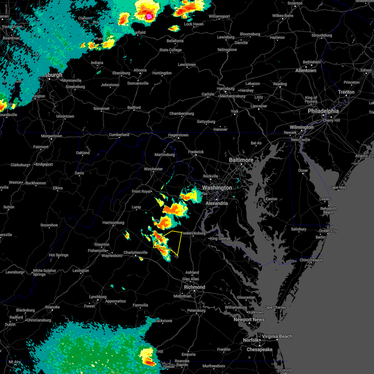 At 545 pm edt, a severe thunderstorm was located near orange, moving east at 15 mph (radar indicated). Hazards include golf ball size hail and 60 mph wind gusts. Expect wind damage to trees and power lines. hail is large enough to dent and damage vehicles. Some hail damage to roofs, siding, and windows is possible. At 545 pm edt, a severe thunderstorm was located near orange, moving east at 15 mph (radar indicated). Hazards include golf ball size hail and 60 mph wind gusts. Expect wind damage to trees and power lines. hail is large enough to dent and damage vehicles. Some hail damage to roofs, siding, and windows is possible.
|
| 6/16/2022 5:28 PM EDT |
 At 528 pm edt, a severe thunderstorm was located near orange, moving east at 20 mph (radar indicated). Hazards include 60 mph wind gusts and quarter size hail. Damaging winds will cause some trees and large branches to fall. this could injure those outdoors, as well as damage homes and vehicles. roadways may become blocked by downed trees. localized power outages are possible. Unsecured light objects may become projectiles. At 528 pm edt, a severe thunderstorm was located near orange, moving east at 20 mph (radar indicated). Hazards include 60 mph wind gusts and quarter size hail. Damaging winds will cause some trees and large branches to fall. this could injure those outdoors, as well as damage homes and vehicles. roadways may become blocked by downed trees. localized power outages are possible. Unsecured light objects may become projectiles.
|
| 6/2/2022 4:56 PM EDT | Tree down and powerline wires down near the intersection of verdiersville road and constitution highway in orange county VA, 0.2 miles S of Orange, VA |
| 6/2/2022 4:56 PM EDT | Tree down near the intersection of constitution highway and zachary taylor highway in orange county VA, 8.3 miles W of Orange, VA |
| 6/2/2022 4:56 PM EDT |
 At 455 pm edt, severe thunderstorms were located along a line extending from 9 miles east of orange to near boswells tavern, moving east at 30 mph (radar indicated). Hazards include 60 mph wind gusts. Damaging winds will cause some trees and large branches to fall. this could injure those outdoors, as well as damage homes and vehicles. roadways may become blocked by downed trees. localized power outages are possible. unsecured light objects may become projectiles. locations impacted include, orange, gordonsville, mine run, rhoadesville, parker, verdiersville, madison run, gold dale, thornhill, nasons, logan, lahore, glenora and unionville. hail threat, radar indicated max hail size, <. 75 in wind threat, radar indicated max wind gust, 60 mph. At 455 pm edt, severe thunderstorms were located along a line extending from 9 miles east of orange to near boswells tavern, moving east at 30 mph (radar indicated). Hazards include 60 mph wind gusts. Damaging winds will cause some trees and large branches to fall. this could injure those outdoors, as well as damage homes and vehicles. roadways may become blocked by downed trees. localized power outages are possible. unsecured light objects may become projectiles. locations impacted include, orange, gordonsville, mine run, rhoadesville, parker, verdiersville, madison run, gold dale, thornhill, nasons, logan, lahore, glenora and unionville. hail threat, radar indicated max hail size, <. 75 in wind threat, radar indicated max wind gust, 60 mph.
|
| 6/2/2022 4:47 PM EDT | Tree down and powerline wires down on the 22000 block of constitution hwy in orange county VA, 6.6 miles W of Orange, VA |
| 6/2/2022 4:36 PM EDT |
 At 436 pm edt, severe thunderstorms were located along a line extending from near orange to 6 miles east of charlottesville, moving east at 30 mph (radar indicated). Hazards include 60 mph wind gusts. Damaging winds will cause some trees and large branches to fall. this could injure those outdoors, as well as damage homes and vehicles. roadways may become blocked by downed trees. localized power outages are possible. Unsecured light objects may become projectiles. At 436 pm edt, severe thunderstorms were located along a line extending from near orange to 6 miles east of charlottesville, moving east at 30 mph (radar indicated). Hazards include 60 mph wind gusts. Damaging winds will cause some trees and large branches to fall. this could injure those outdoors, as well as damage homes and vehicles. roadways may become blocked by downed trees. localized power outages are possible. Unsecured light objects may become projectiles.
|
| 9/28/2021 5:53 PM EDT |
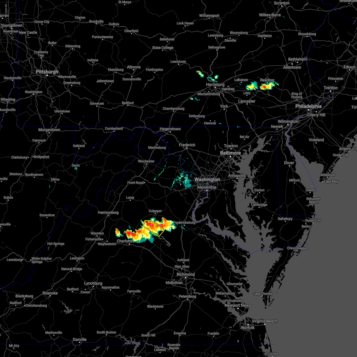 At 553 pm edt, a severe thunderstorm was located over orange, moving east at 30 mph (trained weather spotters). Hazards include half dollar size hail. Some hail damage to agriculture is expected. locations impacted include, orange, nasons, madison mills, rhoadesville, lahore, rapidan, oakpark, everona, verdiersville, twymans mill, unionville and locust dale. hail threat, radar indicated max hail size, 1. 25 in wind threat, radar indicated max wind gust, <50 mph. At 553 pm edt, a severe thunderstorm was located over orange, moving east at 30 mph (trained weather spotters). Hazards include half dollar size hail. Some hail damage to agriculture is expected. locations impacted include, orange, nasons, madison mills, rhoadesville, lahore, rapidan, oakpark, everona, verdiersville, twymans mill, unionville and locust dale. hail threat, radar indicated max hail size, 1. 25 in wind threat, radar indicated max wind gust, <50 mph.
|
| 9/28/2021 5:45 PM EDT | Half Dollar sized hail reported 4.5 miles SSE of Orange, VA |
| 9/28/2021 5:40 PM EDT |
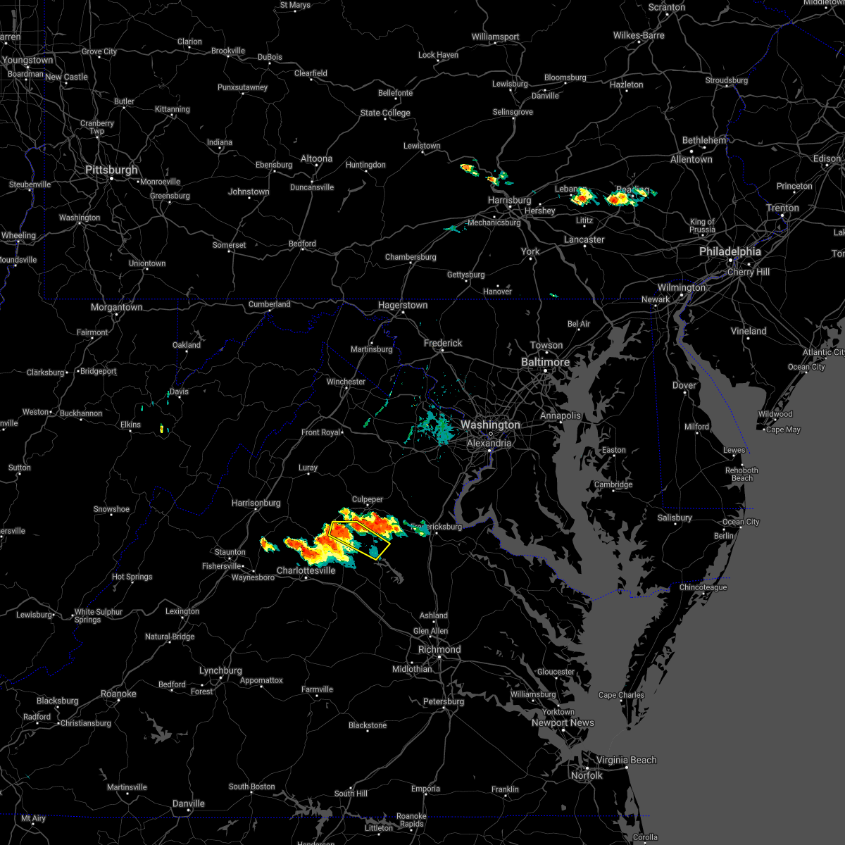 At 540 pm edt, a severe thunderstorm was located near madison, moving east at 25 mph (radar indicated). Hazards include quarter size hail. some hail damage to agriculture is expected At 540 pm edt, a severe thunderstorm was located near madison, moving east at 25 mph (radar indicated). Hazards include quarter size hail. some hail damage to agriculture is expected
|
| 9/1/2021 12:46 AM EDT |
 At 1246 am edt, a severe thunderstorm was located near culpeper, moving northeast at 35 mph (radar indicated). Hazards include 60 mph wind gusts. Damaging winds will cause some trees and large branches to fall. this could injure those outdoors, as well as damage homes and vehicles. roadways may become blocked by downed trees. localized power outages are possible. unsecured light objects may become projectiles. Locations impacted include, culpeper, orange, raccoon ford, rapidan, montpelier station, madison run, nasons, winston, madison mills, montford, mitchells, fordsville, leon, locust dale, reva and oakpark. At 1246 am edt, a severe thunderstorm was located near culpeper, moving northeast at 35 mph (radar indicated). Hazards include 60 mph wind gusts. Damaging winds will cause some trees and large branches to fall. this could injure those outdoors, as well as damage homes and vehicles. roadways may become blocked by downed trees. localized power outages are possible. unsecured light objects may become projectiles. Locations impacted include, culpeper, orange, raccoon ford, rapidan, montpelier station, madison run, nasons, winston, madison mills, montford, mitchells, fordsville, leon, locust dale, reva and oakpark.
|
| 9/1/2021 12:44 AM EDT |
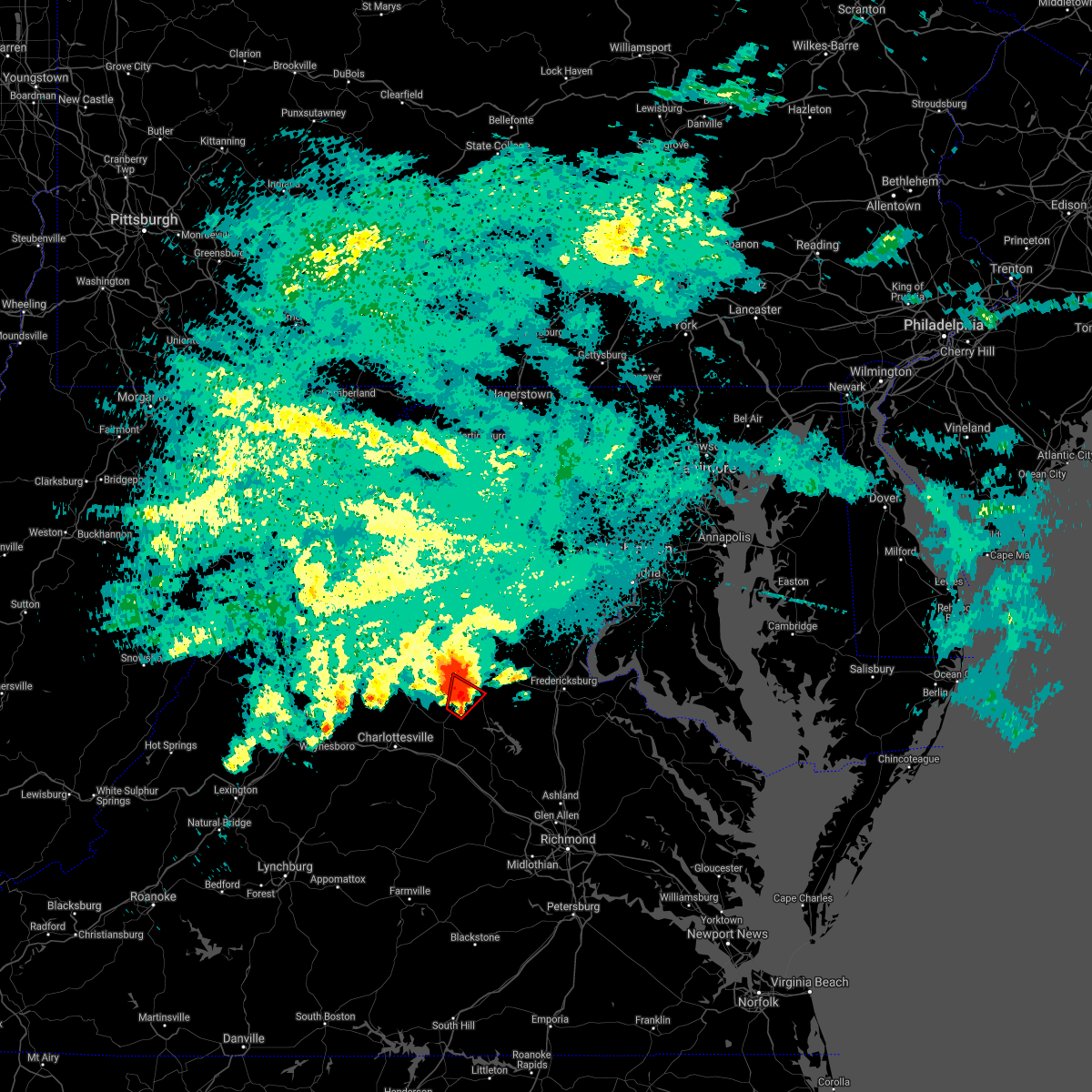 At 1244 am edt, a severe thunderstorm capable of producing a tornado was located near orange, moving northeast at 40 mph (radar indicated rotation). Hazards include tornado. For those in the direct path of a tornado touchdown, flying debris will be dangerous to those caught without shelter. damage to roofs, siding, and windows may occur. mobile homes may be damaged or destroyed. tree damage is likely. This tornadic thunderstorm will remain over mainly rural areas of southeastern madison, central orange and southwestern culpeper counties, including the following locations, rapidan, nasons, madison run, madison mills, unionville and locust dale. At 1244 am edt, a severe thunderstorm capable of producing a tornado was located near orange, moving northeast at 40 mph (radar indicated rotation). Hazards include tornado. For those in the direct path of a tornado touchdown, flying debris will be dangerous to those caught without shelter. damage to roofs, siding, and windows may occur. mobile homes may be damaged or destroyed. tree damage is likely. This tornadic thunderstorm will remain over mainly rural areas of southeastern madison, central orange and southwestern culpeper counties, including the following locations, rapidan, nasons, madison run, madison mills, unionville and locust dale.
|
| 9/1/2021 12:25 AM EDT |
 At 1224 am edt, a severe thunderstorm capable of producing a tornado was located near boswells tavern, or 7 miles southwest of orange, moving northeast at 40 mph (radar indicated rotation). Hazards include tornado. For those in the direct path of a tornado touchdown, flying debris will be dangerous to those caught without shelter. damage to roofs, siding, and windows may occur. mobile homes may be damaged or destroyed. tree damage is likely. this dangerous storm will be near, orange around 1240 am edt. Other locations impacted by this tornadic thunderstorm include nasons, gordonsville, madison mills, montford, rapidan, montpelier station, madison run, unionville and locust dale. At 1224 am edt, a severe thunderstorm capable of producing a tornado was located near boswells tavern, or 7 miles southwest of orange, moving northeast at 40 mph (radar indicated rotation). Hazards include tornado. For those in the direct path of a tornado touchdown, flying debris will be dangerous to those caught without shelter. damage to roofs, siding, and windows may occur. mobile homes may be damaged or destroyed. tree damage is likely. this dangerous storm will be near, orange around 1240 am edt. Other locations impacted by this tornadic thunderstorm include nasons, gordonsville, madison mills, montford, rapidan, montpelier station, madison run, unionville and locust dale.
|
| 9/1/2021 12:18 AM EDT |
 At 1218 am edt, a severe thunderstorm was located near orange, moving northeast at 35 mph (radar indicated). Hazards include 60 mph wind gusts. Damaging winds will cause some trees and large branches to fall. this could injure those outdoors, as well as damage homes and vehicles. roadways may become blocked by downed trees. localized power outages are possible. Unsecured light objects may become projectiles. At 1218 am edt, a severe thunderstorm was located near orange, moving northeast at 35 mph (radar indicated). Hazards include 60 mph wind gusts. Damaging winds will cause some trees and large branches to fall. this could injure those outdoors, as well as damage homes and vehicles. roadways may become blocked by downed trees. localized power outages are possible. Unsecured light objects may become projectiles.
|
| 8/28/2021 9:01 PM EDT |
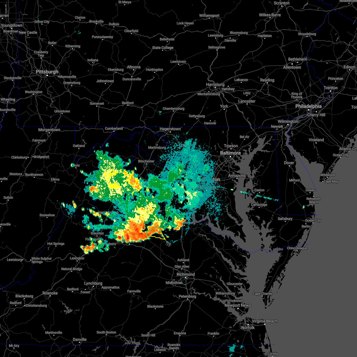 At 901 pm edt, severe thunderstorms were located along a line extending from 13 miles south of culpeper to near orange to near stanardsville, moving southeast at 15 mph (radar indicated). Hazards include 60 mph wind gusts. Damaging winds will cause some trees and large branches to fall. this could injure those outdoors, as well as damage homes and vehicles. roadways may become blocked by downed trees. localized power outages are possible. unsecured light objects may become projectiles. locations impacted include, thornhill, nasons, madison run, unionville and lahore. hail threat, radar indicated max hail size, <. 75 in wind threat, radar indicated max wind gust, 60 mph. At 901 pm edt, severe thunderstorms were located along a line extending from 13 miles south of culpeper to near orange to near stanardsville, moving southeast at 15 mph (radar indicated). Hazards include 60 mph wind gusts. Damaging winds will cause some trees and large branches to fall. this could injure those outdoors, as well as damage homes and vehicles. roadways may become blocked by downed trees. localized power outages are possible. unsecured light objects may become projectiles. locations impacted include, thornhill, nasons, madison run, unionville and lahore. hail threat, radar indicated max hail size, <. 75 in wind threat, radar indicated max wind gust, 60 mph.
|
| 8/28/2021 8:44 PM EDT |
 At 844 pm edt, severe thunderstorms were located along a line extending from 9 miles south of culpeper to near orange to near stanardsville, moving southeast at 15 mph (radar indicated). Hazards include 60 mph wind gusts. Damaging winds will cause some trees and large branches to fall. this could injure those outdoors, as well as damage homes and vehicles. roadways may become blocked by downed trees. localized power outages are possible. Unsecured light objects may become projectiles. At 844 pm edt, severe thunderstorms were located along a line extending from 9 miles south of culpeper to near orange to near stanardsville, moving southeast at 15 mph (radar indicated). Hazards include 60 mph wind gusts. Damaging winds will cause some trees and large branches to fall. this could injure those outdoors, as well as damage homes and vehicles. roadways may become blocked by downed trees. localized power outages are possible. Unsecured light objects may become projectiles.
|
| 8/28/2021 8:30 PM EDT | 10 trees down on clarks mountain rd. just east of rapide in orange county VA, 6.2 miles WSW of Orange, VA |
| 8/28/2021 8:17 PM EDT |
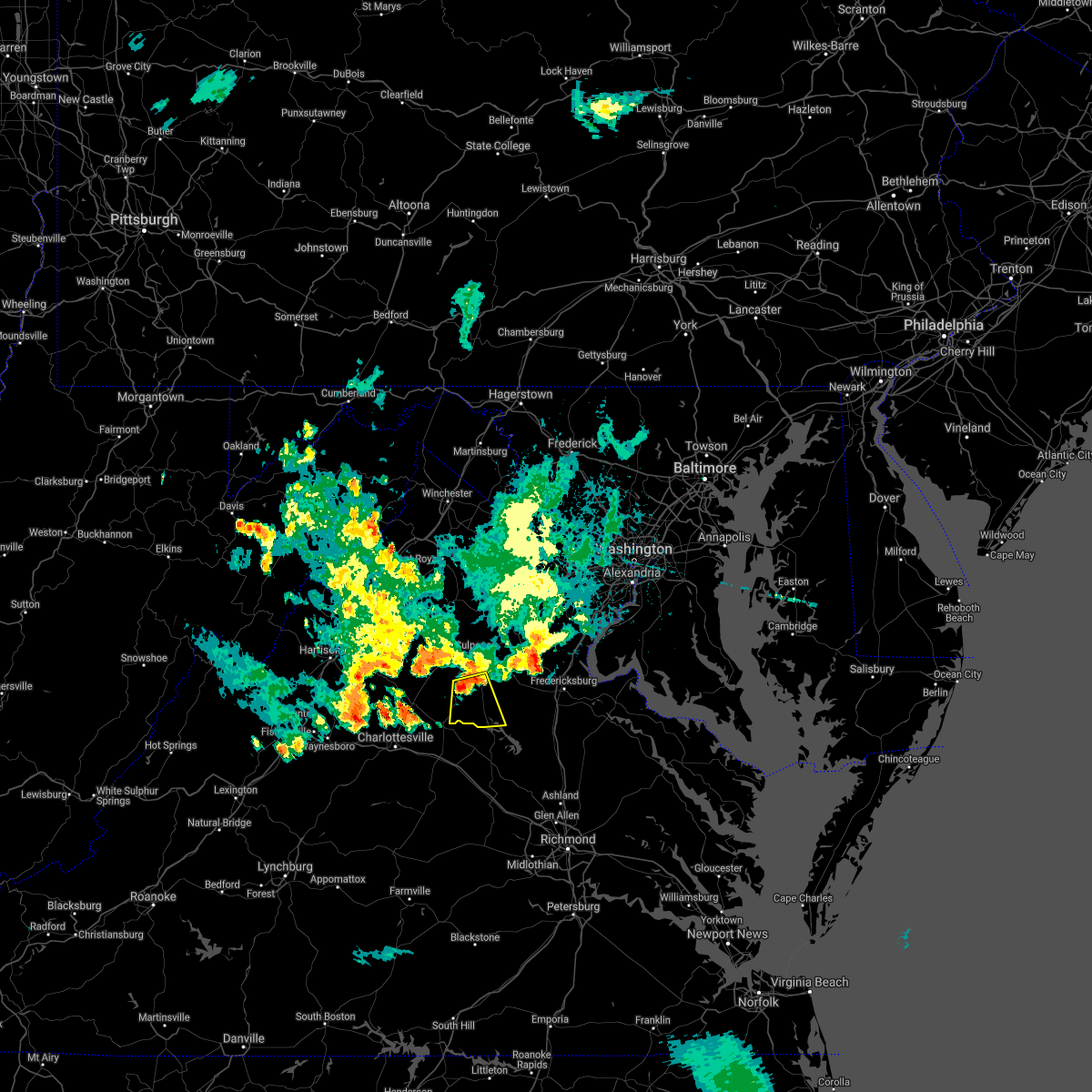 At 817 pm edt, a severe thunderstorm was located near orange, moving south at 15 mph (radar indicated). Hazards include 60 mph wind gusts and quarter size hail. Damaging winds will cause some trees and large branches to fall. this could injure those outdoors, as well as damage homes and vehicles. roadways may become blocked by downed trees. localized power outages are possible. unsecured light objects may become projectiles. locations impacted include, orange, raccoon ford, thornhill, nasons, rhoadesville, lahore, rapidan, everona, verdiersville, madison run, unionville and locust dale. hail threat, radar indicated max hail size, 1. 00 in wind threat, radar indicated max wind gust, 60 mph. At 817 pm edt, a severe thunderstorm was located near orange, moving south at 15 mph (radar indicated). Hazards include 60 mph wind gusts and quarter size hail. Damaging winds will cause some trees and large branches to fall. this could injure those outdoors, as well as damage homes and vehicles. roadways may become blocked by downed trees. localized power outages are possible. unsecured light objects may become projectiles. locations impacted include, orange, raccoon ford, thornhill, nasons, rhoadesville, lahore, rapidan, everona, verdiersville, madison run, unionville and locust dale. hail threat, radar indicated max hail size, 1. 00 in wind threat, radar indicated max wind gust, 60 mph.
|
| 8/28/2021 8:03 PM EDT |
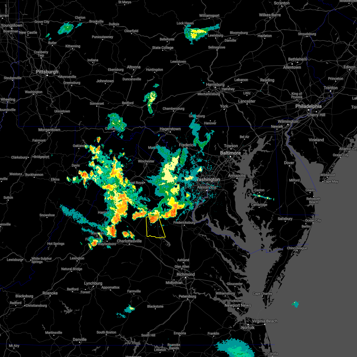 At 803 pm edt, a severe thunderstorm was located 7 miles south of culpeper, moving south at 15 mph (radar indicated). Hazards include 60 mph wind gusts and quarter size hail. Damaging winds will cause some trees and large branches to fall. this could injure those outdoors, as well as damage homes and vehicles. roadways may become blocked by downed trees. localized power outages are possible. Unsecured light objects may become projectiles. At 803 pm edt, a severe thunderstorm was located 7 miles south of culpeper, moving south at 15 mph (radar indicated). Hazards include 60 mph wind gusts and quarter size hail. Damaging winds will cause some trees and large branches to fall. this could injure those outdoors, as well as damage homes and vehicles. roadways may become blocked by downed trees. localized power outages are possible. Unsecured light objects may become projectiles.
|
| 8/14/2021 4:22 PM EDT |
 At 422 pm edt, a severe thunderstorm was located 7 miles south of culpeper, moving southeast at 15 mph (radar indicated). Hazards include 60 mph wind gusts. Damaging winds will cause some trees and large branches to fall. this could injure those outdoors, as well as damage homes and vehicles. roadways may become blocked by downed trees. localized power outages are possible. unsecured light objects may become projectiles. locations impacted include, culpeper, orange, raccoon ford, rhoadesville, rapidan, everona, burr hill, nasons, winston, mitchells, fordsville, unionville and locust dale. hail threat, radar indicated max hail size, <. 75 in wind threat, radar indicated max wind gust, 60 mph. At 422 pm edt, a severe thunderstorm was located 7 miles south of culpeper, moving southeast at 15 mph (radar indicated). Hazards include 60 mph wind gusts. Damaging winds will cause some trees and large branches to fall. this could injure those outdoors, as well as damage homes and vehicles. roadways may become blocked by downed trees. localized power outages are possible. unsecured light objects may become projectiles. locations impacted include, culpeper, orange, raccoon ford, rhoadesville, rapidan, everona, burr hill, nasons, winston, mitchells, fordsville, unionville and locust dale. hail threat, radar indicated max hail size, <. 75 in wind threat, radar indicated max wind gust, 60 mph.
|
| 8/14/2021 4:13 PM EDT |
 At 413 pm edt, a severe thunderstorm was located between fordsville and winston , moving southeast at 15 mph (radar indicated). Hazards include 60 mph wind gusts. Damaging winds will cause some trees and large branches to fall. this could injure those outdoors, as well as damage homes and vehicles. roadways may become blocked by downed trees. localized power outages are possible. unsecured light objects may become projectiles. locations impacted include, culpeper, orange, brightwood, raccoon ford, rhoadesville, rapidan, oakpark, everona, burr hill, nasons, winston, madison mills, mitchells, fordsville, leon, unionville and locust dale. hail threat, radar indicated max hail size, <. 75 in wind threat, radar indicated max wind gust, 60 mph. At 413 pm edt, a severe thunderstorm was located between fordsville and winston , moving southeast at 15 mph (radar indicated). Hazards include 60 mph wind gusts. Damaging winds will cause some trees and large branches to fall. this could injure those outdoors, as well as damage homes and vehicles. roadways may become blocked by downed trees. localized power outages are possible. unsecured light objects may become projectiles. locations impacted include, culpeper, orange, brightwood, raccoon ford, rhoadesville, rapidan, oakpark, everona, burr hill, nasons, winston, madison mills, mitchells, fordsville, leon, unionville and locust dale. hail threat, radar indicated max hail size, <. 75 in wind threat, radar indicated max wind gust, 60 mph.
|
| 8/14/2021 4:03 PM EDT |
 At 403 pm edt, a severe thunderstorm was located near culpeper, moving southeast at 20 mph (radar indicated). Hazards include 60 mph wind gusts. Damaging winds will cause some trees and large branches to fall. this could injure those outdoors, as well as damage homes and vehicles. roadways may become blocked by downed trees. localized power outages are possible. Unsecured light objects may become projectiles. At 403 pm edt, a severe thunderstorm was located near culpeper, moving southeast at 20 mph (radar indicated). Hazards include 60 mph wind gusts. Damaging winds will cause some trees and large branches to fall. this could injure those outdoors, as well as damage homes and vehicles. roadways may become blocked by downed trees. localized power outages are possible. Unsecured light objects may become projectiles.
|
| 8/13/2021 3:53 PM EDT |
 At 353 pm edt, a severe thunderstorm was located near boswells tavern, or 11 miles northeast of charlottesville, moving northeast at 25 mph (radar indicated). Hazards include 60 mph wind gusts and quarter size hail. Damaging winds will cause some trees and large branches to fall. this could injure those outdoors, as well as damage homes and vehicles. roadways may become blocked by downed trees. localized power outages are possible. Unsecured light objects may become projectiles. At 353 pm edt, a severe thunderstorm was located near boswells tavern, or 11 miles northeast of charlottesville, moving northeast at 25 mph (radar indicated). Hazards include 60 mph wind gusts and quarter size hail. Damaging winds will cause some trees and large branches to fall. this could injure those outdoors, as well as damage homes and vehicles. roadways may become blocked by downed trees. localized power outages are possible. Unsecured light objects may become projectiles.
|
| 8/13/2021 3:40 PM EDT | Large tree down near intersection of ridge rd and marsh run ln in orange county VA, 0.2 miles S of Orange, VA |
| 8/13/2021 3:30 PM EDT |
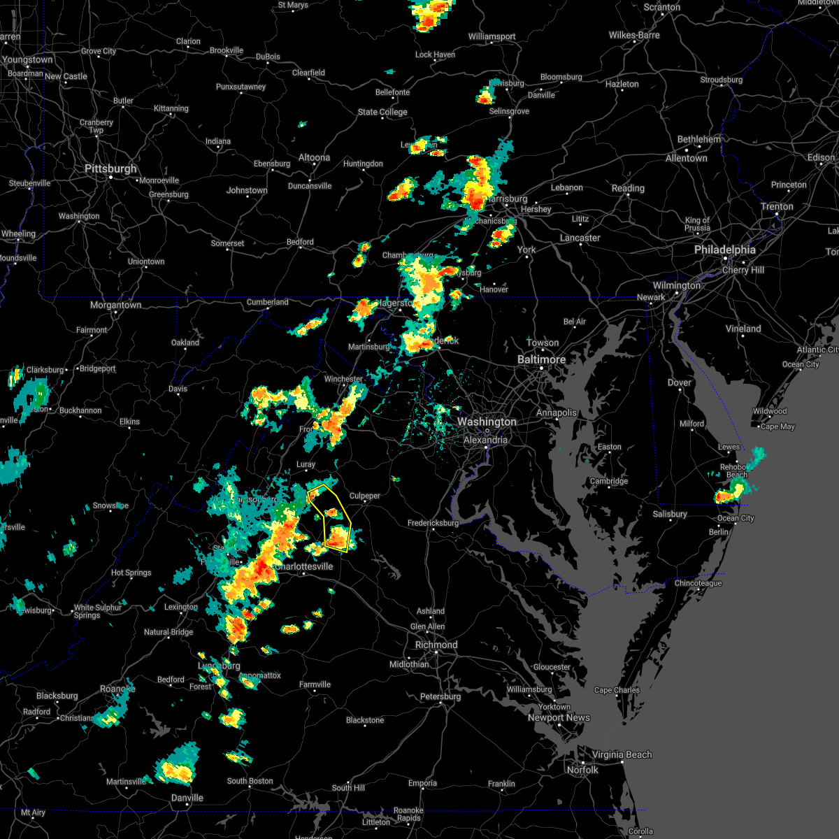 At 330 pm edt, severe thunderstorms were located along a line extending from big meadows to madison to 7 miles west of orange, moving east at 10 mph (radar indicated). Hazards include 60 mph wind gusts and quarter size hail. Damaging winds will cause some trees and large branches to fall. this could injure those outdoors, as well as damage homes and vehicles. roadways may become blocked by downed trees. localized power outages are possible. Unsecured light objects may become projectiles. At 330 pm edt, severe thunderstorms were located along a line extending from big meadows to madison to 7 miles west of orange, moving east at 10 mph (radar indicated). Hazards include 60 mph wind gusts and quarter size hail. Damaging winds will cause some trees and large branches to fall. this could injure those outdoors, as well as damage homes and vehicles. roadways may become blocked by downed trees. localized power outages are possible. Unsecured light objects may become projectiles.
|
| 8/13/2021 3:05 PM EDT |
 At 300 pm edt, a severe thunderstorm was located 9 miles southeast of stanardsville, or 10 miles west of orange, and is nearly stationary (radar indicated). Hazards include 70 mph wind gusts and half dollar size hail. Damaging winds will cause some trees and large branches to fall. this could injure those outdoors, as well as damage homes and vehicles. roadways may become blocked by downed trees. localized power outages are possible. Unsecured light objects may become projectiles. At 300 pm edt, a severe thunderstorm was located 9 miles southeast of stanardsville, or 10 miles west of orange, and is nearly stationary (radar indicated). Hazards include 70 mph wind gusts and half dollar size hail. Damaging winds will cause some trees and large branches to fall. this could injure those outdoors, as well as damage homes and vehicles. roadways may become blocked by downed trees. localized power outages are possible. Unsecured light objects may become projectiles.
|
| 8/11/2021 3:50 PM EDT |
 At 350 pm edt, severe thunderstorms were located along a line extending from near madison to 9 miles northwest of boswells tavern, moving east at 25 mph (radar indicated). Hazards include 60 mph wind gusts. Damaging winds will cause some trees and large branches to fall. this could injure those outdoors, as well as damage homes and vehicles. roadways may become blocked by downed trees. localized power outages are possible. Unsecured light objects may become projectiles. At 350 pm edt, severe thunderstorms were located along a line extending from near madison to 9 miles northwest of boswells tavern, moving east at 25 mph (radar indicated). Hazards include 60 mph wind gusts. Damaging winds will cause some trees and large branches to fall. this could injure those outdoors, as well as damage homes and vehicles. roadways may become blocked by downed trees. localized power outages are possible. Unsecured light objects may become projectiles.
|
| 8/10/2021 3:34 PM EDT |
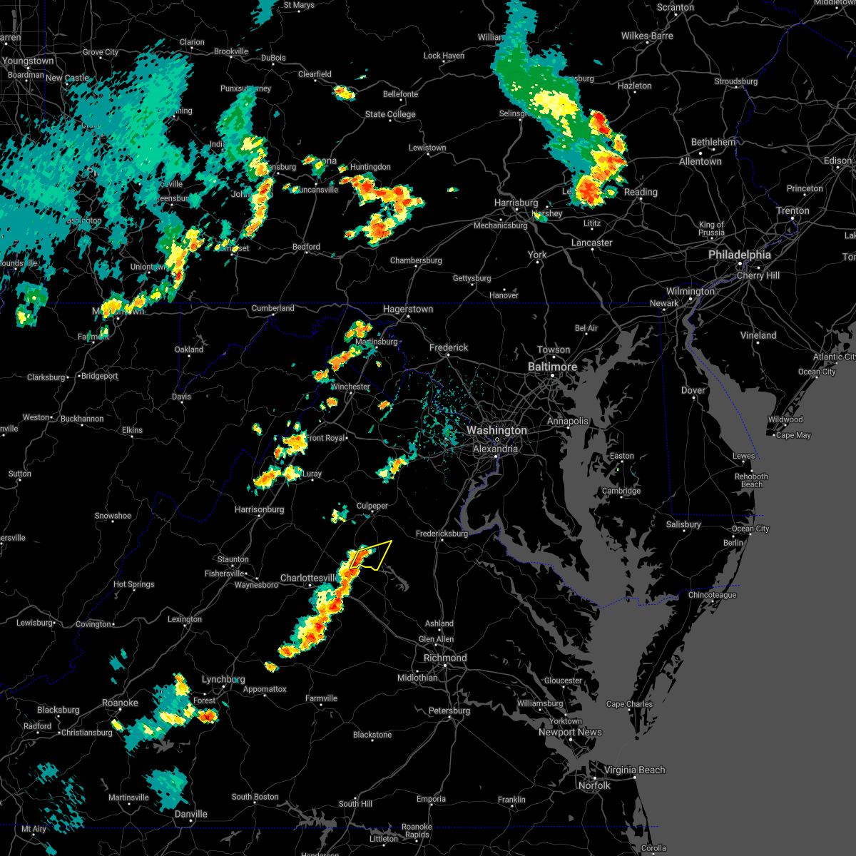 At 334 pm edt, severe thunderstorms were located along a line extending from near orange to near boswells tavern, moving east at 15 mph (radar indicated). Hazards include 60 mph wind gusts. Damaging winds will cause some trees and large branches to fall. this could injure those outdoors, as well as damage homes and vehicles. roadways may become blocked by downed trees. localized power outages are possible. unsecured light objects may become projectiles. locations impacted include, thornhill, verdiersville, nasons, unionville, rhoadesville and lahore. hail threat, radar indicated max hail size, <. 75 in wind threat, radar indicated max wind gust, 60 mph. At 334 pm edt, severe thunderstorms were located along a line extending from near orange to near boswells tavern, moving east at 15 mph (radar indicated). Hazards include 60 mph wind gusts. Damaging winds will cause some trees and large branches to fall. this could injure those outdoors, as well as damage homes and vehicles. roadways may become blocked by downed trees. localized power outages are possible. unsecured light objects may become projectiles. locations impacted include, thornhill, verdiersville, nasons, unionville, rhoadesville and lahore. hail threat, radar indicated max hail size, <. 75 in wind threat, radar indicated max wind gust, 60 mph.
|
| 8/10/2021 3:24 PM EDT |
 At 324 pm edt, severe thunderstorms were located along a line extending from near orange to near boswells tavern, moving east at 15 mph (radar indicated). Hazards include 60 mph wind gusts. Damaging winds will cause some trees and large branches to fall. this could injure those outdoors, as well as damage homes and vehicles. roadways may become blocked by downed trees. localized power outages are possible. Unsecured light objects may become projectiles. At 324 pm edt, severe thunderstorms were located along a line extending from near orange to near boswells tavern, moving east at 15 mph (radar indicated). Hazards include 60 mph wind gusts. Damaging winds will cause some trees and large branches to fall. this could injure those outdoors, as well as damage homes and vehicles. roadways may become blocked by downed trees. localized power outages are possible. Unsecured light objects may become projectiles.
|
| 7/17/2021 2:27 PM EDT |
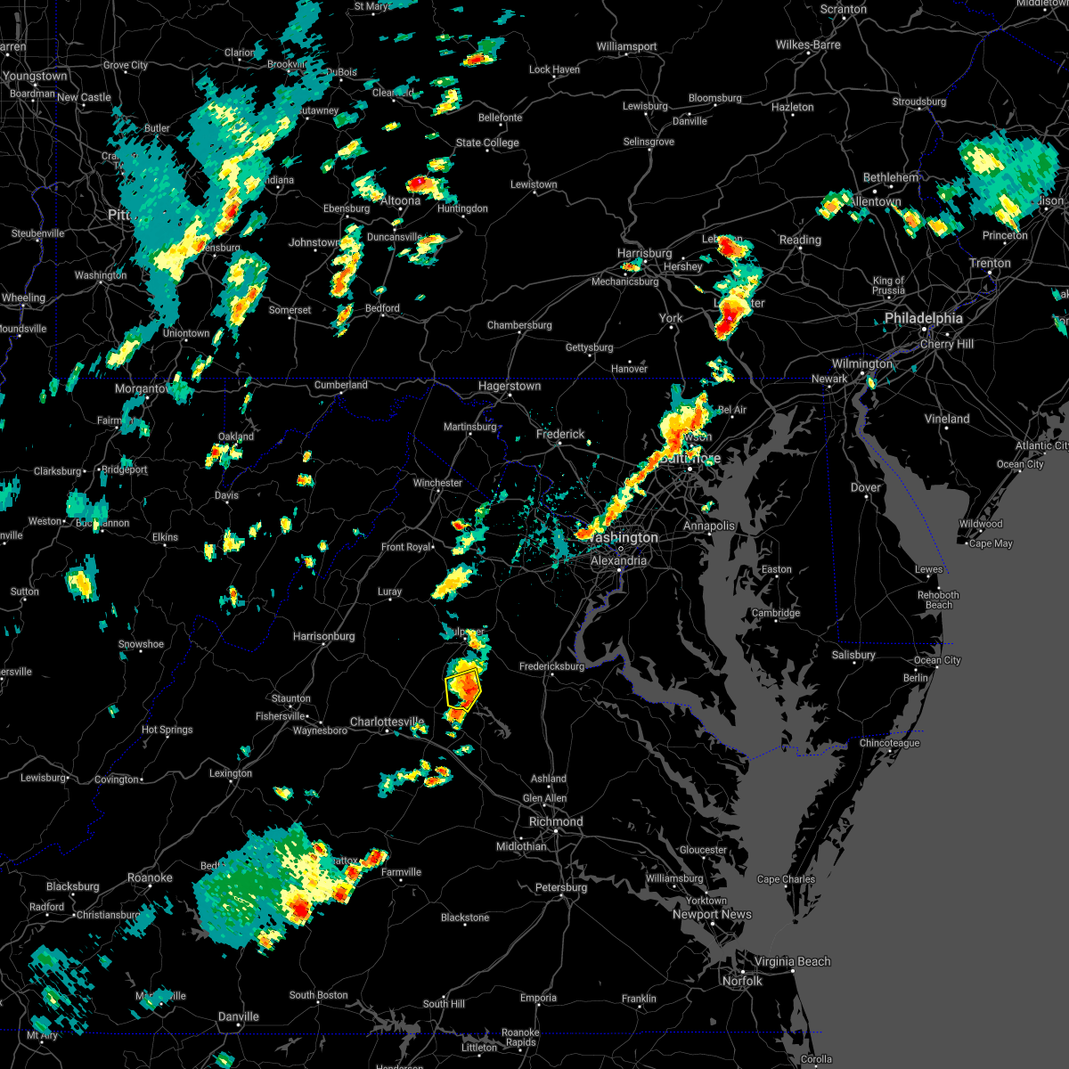 The severe thunderstorm warning for central orange county will expire at 230 pm edt, the storms which prompted the warning have moved out of the area. therefore, the warning will be allowed to expire. a severe thunderstorm watch remains in effect until 1100 pm edt for central virginia. The severe thunderstorm warning for central orange county will expire at 230 pm edt, the storms which prompted the warning have moved out of the area. therefore, the warning will be allowed to expire. a severe thunderstorm watch remains in effect until 1100 pm edt for central virginia.
|
| 7/17/2021 2:16 PM EDT |
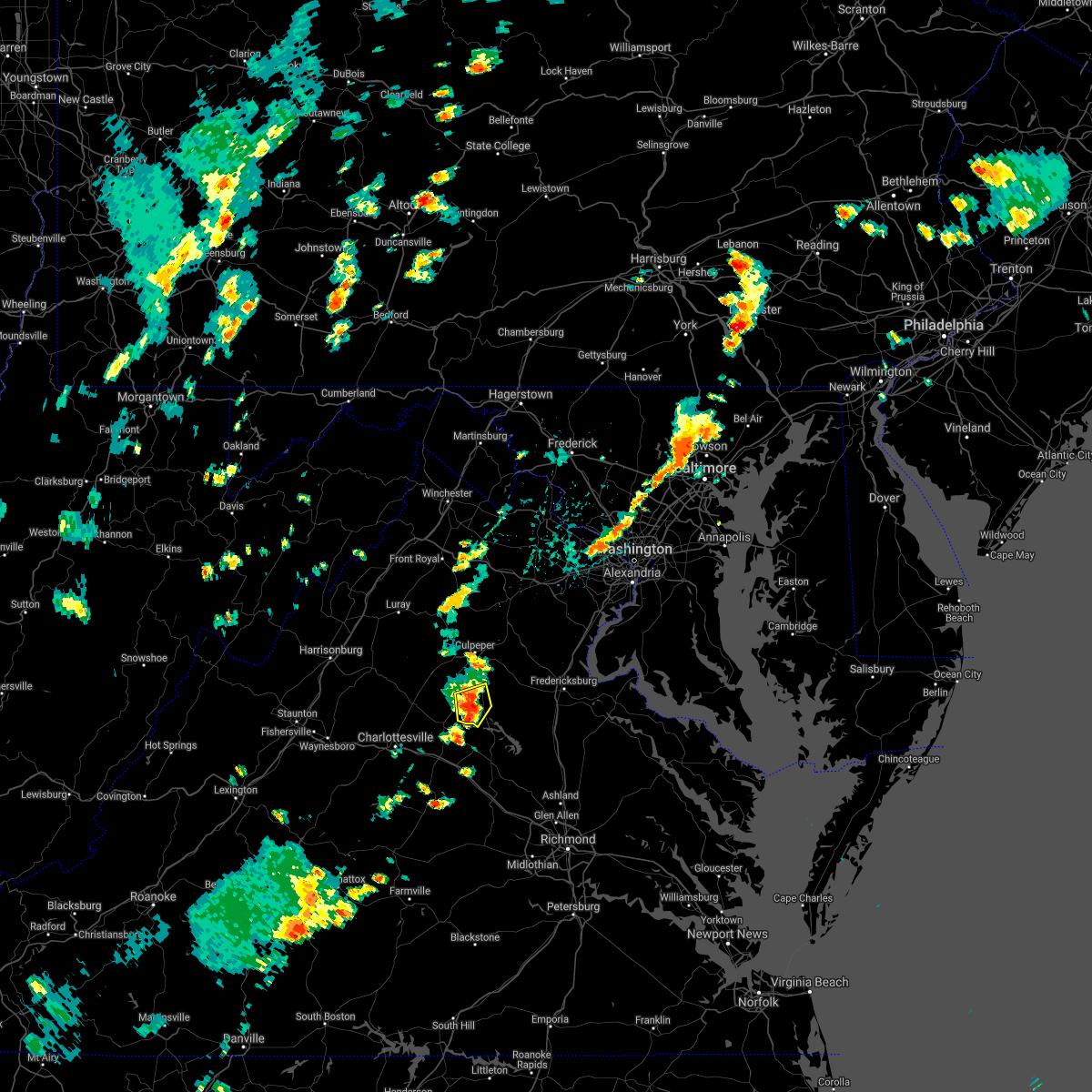 At 215 pm edt, severe thunderstorms were located along a line extending from near orange to 12 miles northwest of louisa to near boswells tavern, moving east at 20 mph (radar indicated). Hazards include 60 mph wind gusts and quarter size hail. Damaging winds will cause some trees and large branches to fall. this could injure those outdoors, as well as damage homes and vehicles. roadways may become blocked by downed trees. localized power outages are possible. unsecured light objects may become projectiles. Locations impacted include, orange, thornhill, nasons, rhoadesville, lahore, everona and unionville. At 215 pm edt, severe thunderstorms were located along a line extending from near orange to 12 miles northwest of louisa to near boswells tavern, moving east at 20 mph (radar indicated). Hazards include 60 mph wind gusts and quarter size hail. Damaging winds will cause some trees and large branches to fall. this could injure those outdoors, as well as damage homes and vehicles. roadways may become blocked by downed trees. localized power outages are possible. unsecured light objects may become projectiles. Locations impacted include, orange, thornhill, nasons, rhoadesville, lahore, everona and unionville.
|
| 7/17/2021 1:57 PM EDT | Tree down on may fray ave near north almond stree in orange county VA, 0.2 miles S of Orange, VA |
| 7/17/2021 1:55 PM EDT |
 At 155 pm edt, severe thunderstorms were located along a line extending from 6 miles west of orange to near boswells tavern, moving east at 20 mph (radar indicated). Hazards include 60 mph wind gusts and quarter size hail. Damaging winds will cause some trees and large branches to fall. this could injure those outdoors, as well as damage homes and vehicles. roadways may become blocked by downed trees. localized power outages are possible. unsecured light objects may become projectiles. Locations impacted include, orange, gordonsville, rhoadesville, rapidan, everona, montpelier station, madison run, thornhill, nasons, madison mills, montford, lahore, old somerset, unionville and somerset. At 155 pm edt, severe thunderstorms were located along a line extending from 6 miles west of orange to near boswells tavern, moving east at 20 mph (radar indicated). Hazards include 60 mph wind gusts and quarter size hail. Damaging winds will cause some trees and large branches to fall. this could injure those outdoors, as well as damage homes and vehicles. roadways may become blocked by downed trees. localized power outages are possible. unsecured light objects may become projectiles. Locations impacted include, orange, gordonsville, rhoadesville, rapidan, everona, montpelier station, madison run, thornhill, nasons, madison mills, montford, lahore, old somerset, unionville and somerset.
|
| 7/17/2021 1:53 PM EDT | Tree down on montford road in montfor in orange county VA, 3.3 miles E of Orange, VA |
| 7/17/2021 1:42 PM EDT |
 At 142 pm edt, severe thunderstorms were located along a line extending from 9 miles southeast of stanardsville to 7 miles northwest of boswells tavern to 10 miles northeast of charlottesville, moving east at 20 mph (radar indicated). Hazards include 60 mph wind gusts and quarter size hail. Damaging winds will cause some trees and large branches to fall. this could injure those outdoors, as well as damage homes and vehicles. roadways may become blocked by downed trees. localized power outages are possible. Unsecured light objects may become projectiles. At 142 pm edt, severe thunderstorms were located along a line extending from 9 miles southeast of stanardsville to 7 miles northwest of boswells tavern to 10 miles northeast of charlottesville, moving east at 20 mph (radar indicated). Hazards include 60 mph wind gusts and quarter size hail. Damaging winds will cause some trees and large branches to fall. this could injure those outdoors, as well as damage homes and vehicles. roadways may become blocked by downed trees. localized power outages are possible. Unsecured light objects may become projectiles.
|
| 7/15/2021 6:36 PM EDT | Tree down in radian in madison county VA, 6.5 miles SE of Orange, VA |
| 7/15/2021 6:22 PM EDT |
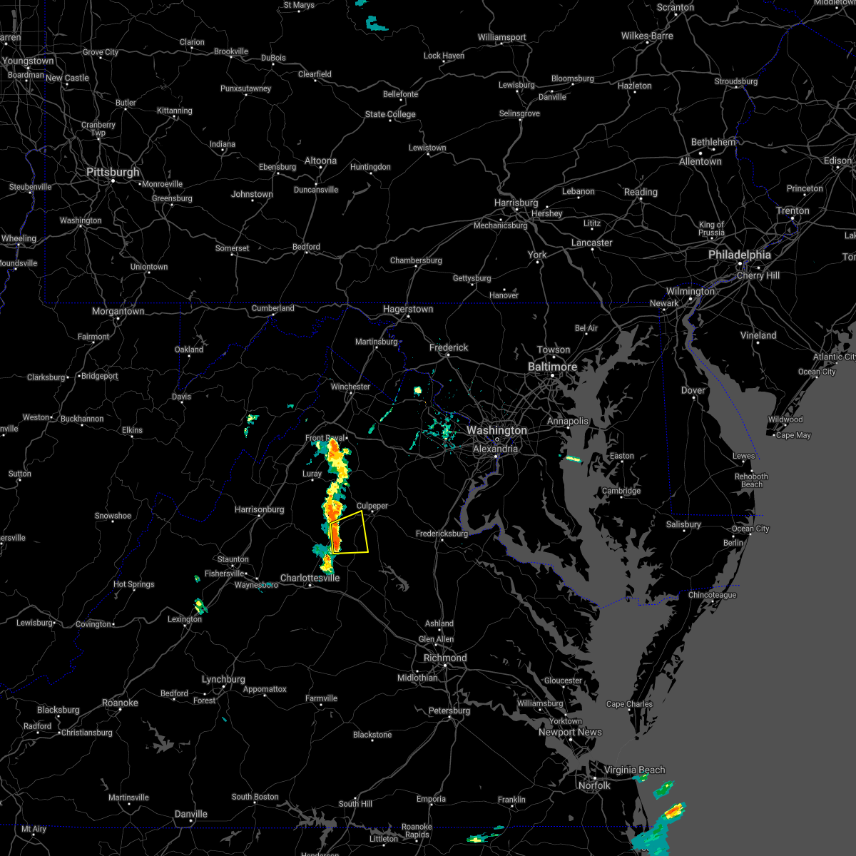 At 621 pm edt, a severe thunderstorm was located near madison, moving east at 15 mph (radar indicated). Hazards include 60 mph wind gusts and quarter size hail. Damaging winds will cause some trees and large branches to fall. this could injure those outdoors, as well as damage homes and vehicles. roadways may become blocked by downed trees. localized power outages are possible. unsecured light objects may become projectiles. Locations impacted include, orange, madison, brightwood, rapidan, oakpark, montpelier station, pratts, rochelle, aroda, madison mills, montford, old somerset, shelby, fordsville, twymans mill, leon and locust dale. At 621 pm edt, a severe thunderstorm was located near madison, moving east at 15 mph (radar indicated). Hazards include 60 mph wind gusts and quarter size hail. Damaging winds will cause some trees and large branches to fall. this could injure those outdoors, as well as damage homes and vehicles. roadways may become blocked by downed trees. localized power outages are possible. unsecured light objects may become projectiles. Locations impacted include, orange, madison, brightwood, rapidan, oakpark, montpelier station, pratts, rochelle, aroda, madison mills, montford, old somerset, shelby, fordsville, twymans mill, leon and locust dale.
|
| 7/15/2021 6:09 PM EDT |
 At 608 pm edt, a severe thunderstorm was located near stanardsville, or 7 miles southwest of madison, moving east at 15 mph (radar indicated). Hazards include 60 mph wind gusts and quarter size hail. Damaging winds will cause some trees and large branches to fall. this could injure those outdoors, as well as damage homes and vehicles. roadways may become blocked by downed trees. localized power outages are possible. Unsecured light objects may become projectiles. At 608 pm edt, a severe thunderstorm was located near stanardsville, or 7 miles southwest of madison, moving east at 15 mph (radar indicated). Hazards include 60 mph wind gusts and quarter size hail. Damaging winds will cause some trees and large branches to fall. this could injure those outdoors, as well as damage homes and vehicles. roadways may become blocked by downed trees. localized power outages are possible. Unsecured light objects may become projectiles.
|
| 6/3/2021 5:02 PM EDT |
 At 501 pm edt, severe thunderstorms were located along a line extending from near culpeper to 6 miles northeast of orange to 8 miles north of boswells tavern, moving east at 30 mph (radar indicated). Hazards include 60 mph wind gusts and quarter size hail. Damaging winds will cause some trees and large branches to fall. this could injure those outdoors, as well as damage homes and vehicles. roadways may become blocked by downed trees. localized power outages are possible. unsecured light objects may become projectiles. Locations impacted include, culpeper, orange, remington, raccoon ford, mine run, elkwood, stevensburg, rhoadesville, brandy station, rapidan, everona, verdiersville, burr hill, madison run, locust grove, flat run, gold dale, nasons, winston and lignum. At 501 pm edt, severe thunderstorms were located along a line extending from near culpeper to 6 miles northeast of orange to 8 miles north of boswells tavern, moving east at 30 mph (radar indicated). Hazards include 60 mph wind gusts and quarter size hail. Damaging winds will cause some trees and large branches to fall. this could injure those outdoors, as well as damage homes and vehicles. roadways may become blocked by downed trees. localized power outages are possible. unsecured light objects may become projectiles. Locations impacted include, culpeper, orange, remington, raccoon ford, mine run, elkwood, stevensburg, rhoadesville, brandy station, rapidan, everona, verdiersville, burr hill, madison run, locust grove, flat run, gold dale, nasons, winston and lignum.
|
| 6/3/2021 4:45 PM EDT |
 At 445 pm edt, severe thunderstorms were located along a line extending from 6 miles east of madison to near orange to 10 miles northwest of boswells tavern, moving east at 30 mph (radar indicated). Hazards include 60 mph wind gusts and quarter size hail. Damaging winds will cause some trees and large branches to fall. this could injure those outdoors, as well as damage homes and vehicles. roadways may become blocked by downed trees. localized power outages are possible. Unsecured light objects may become projectiles. At 445 pm edt, severe thunderstorms were located along a line extending from 6 miles east of madison to near orange to 10 miles northwest of boswells tavern, moving east at 30 mph (radar indicated). Hazards include 60 mph wind gusts and quarter size hail. Damaging winds will cause some trees and large branches to fall. this could injure those outdoors, as well as damage homes and vehicles. roadways may become blocked by downed trees. localized power outages are possible. Unsecured light objects may become projectiles.
|
| 6/3/2021 4:39 PM EDT |
 The severe thunderstorm warning for madison, west central orange, north central albemarle, southern rappahannock, southeastern greene and western culpeper counties will expire at 445 pm edt, the storms which prompted the warning have weakened below severe limits, and no longer pose an immediate threat to life or property. therefore, the warning will be allowed to expire. however gusty winds are still possible with these thunderstorms. a severe thunderstorm watch remains in effect until 900 pm edt for central, northern and northwestern virginia. The severe thunderstorm warning for madison, west central orange, north central albemarle, southern rappahannock, southeastern greene and western culpeper counties will expire at 445 pm edt, the storms which prompted the warning have weakened below severe limits, and no longer pose an immediate threat to life or property. therefore, the warning will be allowed to expire. however gusty winds are still possible with these thunderstorms. a severe thunderstorm watch remains in effect until 900 pm edt for central, northern and northwestern virginia.
|
| 6/3/2021 4:18 PM EDT |
 At 418 pm edt, severe thunderstorms were located along a line extending from 7 miles northeast of big meadows to near madison to near stanardsville, moving northeast at 35 mph (radar indicated). Hazards include 60 mph wind gusts. Damaging winds will cause some trees and large branches to fall. this could injure those outdoors, as well as damage homes and vehicles. roadways may become blocked by downed trees. localized power outages are possible. unsecured light objects may become projectiles. Locations impacted include, culpeper, orange, madison, ruckersville, brightwood, castleton, quinque, catalpa, eheart, oakpark, haywood, syria, newtown, banco, madison mills, montford, cardova, mitchells, reva and old somerset. At 418 pm edt, severe thunderstorms were located along a line extending from 7 miles northeast of big meadows to near madison to near stanardsville, moving northeast at 35 mph (radar indicated). Hazards include 60 mph wind gusts. Damaging winds will cause some trees and large branches to fall. this could injure those outdoors, as well as damage homes and vehicles. roadways may become blocked by downed trees. localized power outages are possible. unsecured light objects may become projectiles. Locations impacted include, culpeper, orange, madison, ruckersville, brightwood, castleton, quinque, catalpa, eheart, oakpark, haywood, syria, newtown, banco, madison mills, montford, cardova, mitchells, reva and old somerset.
|
| 6/3/2021 3:56 PM EDT |
 At 356 pm edt, severe thunderstorms were located along a line extending from 6 miles south of big meadows to near free union, moving northeast at 35 mph (radar indicated). Hazards include 60 mph wind gusts. Damaging winds will cause some trees and large branches to fall. this could injure those outdoors, as well as damage homes and vehicles. roadways may become blocked by downed trees. localized power outages are possible. Unsecured light objects may become projectiles. At 356 pm edt, severe thunderstorms were located along a line extending from 6 miles south of big meadows to near free union, moving northeast at 35 mph (radar indicated). Hazards include 60 mph wind gusts. Damaging winds will cause some trees and large branches to fall. this could injure those outdoors, as well as damage homes and vehicles. roadways may become blocked by downed trees. localized power outages are possible. Unsecured light objects may become projectiles.
|
| 5/4/2021 4:58 PM EDT | Two large trees reported down on spotters propert in orange county VA, 10.2 miles NW of Orange, VA |
| 5/4/2021 4:41 PM EDT |
 At 440 pm edt, a severe thunderstorm was located near orange, moving east at 25 mph (radar indicated). Hazards include 60 mph wind gusts. Damaging winds will cause some trees and large branches to fall. this could injure those outdoors, as well as damage homes and vehicles. roadways may become blocked by downed trees. localized power outages are possible. Unsecured light objects may become projectiles. At 440 pm edt, a severe thunderstorm was located near orange, moving east at 25 mph (radar indicated). Hazards include 60 mph wind gusts. Damaging winds will cause some trees and large branches to fall. this could injure those outdoors, as well as damage homes and vehicles. roadways may become blocked by downed trees. localized power outages are possible. Unsecured light objects may become projectiles.
|
| 8/17/2020 4:10 PM EDT | A tree blew down onto va-629 lahore road near the intersection with va-631 brick church roa in orange county VA, 3.3 miles W of Orange, VA |
| 8/17/2020 4:05 PM EDT | A tree blew down on va-2010 miller road near the intersection with gobler knob lan in orange county VA, 1.1 miles E of Orange, VA |
| 8/17/2020 4:04 PM EDT |
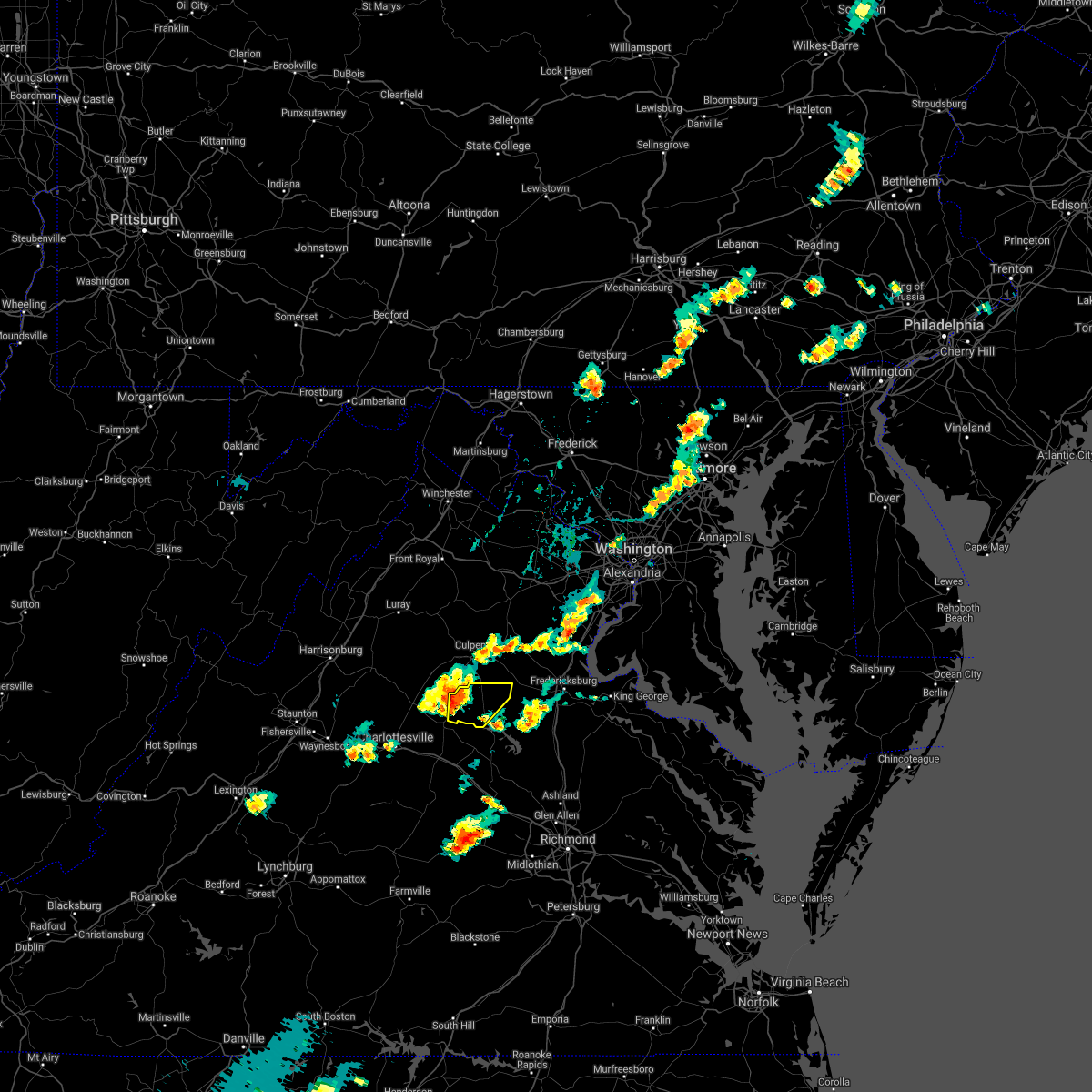 At 404 pm edt, a severe thunderstorm was located over orange, moving east at 15 mph (radar indicated). Hazards include 60 mph wind gusts. Damaging winds will cause some trees and large branches to fall. this could injure those outdoors, as well as damage homes and vehicles. roadways may become blocked by downed trees. localized power outages are possible. Unsecured light objects may become projectiles. At 404 pm edt, a severe thunderstorm was located over orange, moving east at 15 mph (radar indicated). Hazards include 60 mph wind gusts. Damaging winds will cause some trees and large branches to fall. this could injure those outdoors, as well as damage homes and vehicles. roadways may become blocked by downed trees. localized power outages are possible. Unsecured light objects may become projectiles.
|
| 8/6/2020 6:05 PM EDT |
 The severe thunderstorm warning for south central orange county will expire at 615 pm edt, the storm which prompted the warning has moved out of the area. therefore, the warning will be allowed to expire. to report severe weather, contact your nearest law enforcement agency. they will relay your report to the national weather service sterling virginia. The severe thunderstorm warning for south central orange county will expire at 615 pm edt, the storm which prompted the warning has moved out of the area. therefore, the warning will be allowed to expire. to report severe weather, contact your nearest law enforcement agency. they will relay your report to the national weather service sterling virginia.
|
| 8/6/2020 5:55 PM EDT |
 At 555 pm edt, a severe thunderstorm was located near boswells tavern, or 7 miles south of orange, moving east at 15 mph (radar indicated). Hazards include 60 mph wind gusts. Damaging winds will cause some trees and large branches to fall. this could injure those outdoors, as well as damage homes and vehicles. roadways may become blocked by downed trees. localized power outages are possible. unsecured light objects may become projectiles. Locations impacted include, orange, gordonsville, thornhill, madison run, montpelier station and lahore. At 555 pm edt, a severe thunderstorm was located near boswells tavern, or 7 miles south of orange, moving east at 15 mph (radar indicated). Hazards include 60 mph wind gusts. Damaging winds will cause some trees and large branches to fall. this could injure those outdoors, as well as damage homes and vehicles. roadways may become blocked by downed trees. localized power outages are possible. unsecured light objects may become projectiles. Locations impacted include, orange, gordonsville, thornhill, madison run, montpelier station and lahore.
|
| 8/6/2020 5:28 PM EDT |
 At 528 pm edt, a severe thunderstorm with a history of producing wind damage was located near boswells tavern, or 12 miles southwest of orange, moving east at 20 mph (wind damage reports). Hazards include 60 mph wind gusts and quarter size hail. Damaging winds will cause some trees and large branches to fall. this could injure those outdoors, as well as damage homes and vehicles. roadways may become blocked by downed trees. localized power outages are possible. Unsecured light objects may become projectiles. At 528 pm edt, a severe thunderstorm with a history of producing wind damage was located near boswells tavern, or 12 miles southwest of orange, moving east at 20 mph (wind damage reports). Hazards include 60 mph wind gusts and quarter size hail. Damaging winds will cause some trees and large branches to fall. this could injure those outdoors, as well as damage homes and vehicles. roadways may become blocked by downed trees. localized power outages are possible. Unsecured light objects may become projectiles.
|
| 8/3/2020 4:04 PM EDT |
 At 404 pm edt, severe thunderstorms were located along a line extending from 9 miles northwest of boswells tavern to near orange to 11 miles north of mineral, moving east at 35 mph (radar indicated). Hazards include 60 mph wind gusts. Damaging winds will cause some trees and large branches to fall. this could injure those outdoors, as well as damage homes and vehicles. roadways may become blocked by downed trees. localized power outages are possible. unsecured light objects may become projectiles. Locations impacted include, culpeper, orange, madison, brightwood, catalpa, stevensburg, brandy station, oakpark, everona, verdiersville, haywood, montpelier station, syria, nasons, winston, banco, madison mills, montford, cardova and mitchells. At 404 pm edt, severe thunderstorms were located along a line extending from 9 miles northwest of boswells tavern to near orange to 11 miles north of mineral, moving east at 35 mph (radar indicated). Hazards include 60 mph wind gusts. Damaging winds will cause some trees and large branches to fall. this could injure those outdoors, as well as damage homes and vehicles. roadways may become blocked by downed trees. localized power outages are possible. unsecured light objects may become projectiles. Locations impacted include, culpeper, orange, madison, brightwood, catalpa, stevensburg, brandy station, oakpark, everona, verdiersville, haywood, montpelier station, syria, nasons, winston, banco, madison mills, montford, cardova and mitchells.
|
| 8/3/2020 3:55 PM EDT |
 At 355 pm edt, severe thunderstorms were located along a line extending from 6 miles northwest of boswells tavern to near orange to 9 miles northeast of mineral, moving north at 35 mph (radar indicated). Hazards include 60 mph wind gusts. Damaging winds will cause some trees and large branches to fall. this could injure those outdoors, as well as damage homes and vehicles. roadways may become blocked by downed trees. localized power outages are possible. Unsecured light objects may become projectiles. At 355 pm edt, severe thunderstorms were located along a line extending from 6 miles northwest of boswells tavern to near orange to 9 miles northeast of mineral, moving north at 35 mph (radar indicated). Hazards include 60 mph wind gusts. Damaging winds will cause some trees and large branches to fall. this could injure those outdoors, as well as damage homes and vehicles. roadways may become blocked by downed trees. localized power outages are possible. Unsecured light objects may become projectiles.
|
| 7/28/2020 5:35 PM EDT | Tree down on houseworth st. in orange... va in orange county VA, 0.8 miles NW of Orange, VA |
| 7/28/2020 5:31 PM EDT | Tree down at the intersection of tomahawk creek rd. and old gordonsville r in orange county VA, 1.9 miles N of Orange, VA |
| 7/22/2020 2:45 PM EDT |
 At 244 pm edt, severe thunderstorms were located along a line extending from 11 miles southwest of warrenton to near culpeper to near orange, moving east at 25 mph (radar indicated). Hazards include scattered damaging wind gusts up to 60 mph wind gusts and isolated hail up to quarter size. Damaging winds will cause some trees and large branches to fall. this could injure those outdoors, as well as damage homes and vehicles. roadways may become blocked by downed trees. localized power outages are possible. unsecured light objects may become projectiles. Locations impacted include, culpeper, warrenton, orange, linton hall, bealeton, haymarket, gainesville, new baltimore, gordonsville, nokesville, opal, remington, catlett, calverton, midland, flint hill, brandy station, hackleys crossroads, verdiersville and casanova. At 244 pm edt, severe thunderstorms were located along a line extending from 11 miles southwest of warrenton to near culpeper to near orange, moving east at 25 mph (radar indicated). Hazards include scattered damaging wind gusts up to 60 mph wind gusts and isolated hail up to quarter size. Damaging winds will cause some trees and large branches to fall. this could injure those outdoors, as well as damage homes and vehicles. roadways may become blocked by downed trees. localized power outages are possible. unsecured light objects may become projectiles. Locations impacted include, culpeper, warrenton, orange, linton hall, bealeton, haymarket, gainesville, new baltimore, gordonsville, nokesville, opal, remington, catlett, calverton, midland, flint hill, brandy station, hackleys crossroads, verdiersville and casanova.
|
| 7/22/2020 2:35 PM EDT |
 At 235 pm edt, severe thunderstorms were located along a line extending from 9 miles east of sperryville to 6 miles southwest of culpeper to near orange, moving east at 25 mph (radar indicated). Hazards include 60 mph wind gusts. Damaging winds will cause some trees and large branches to fall. this could injure those outdoors, as well as damage homes and vehicles. roadways may become blocked by downed trees. localized power outages are possible. Unsecured light objects may become projectiles. At 235 pm edt, severe thunderstorms were located along a line extending from 9 miles east of sperryville to 6 miles southwest of culpeper to near orange, moving east at 25 mph (radar indicated). Hazards include 60 mph wind gusts. Damaging winds will cause some trees and large branches to fall. this could injure those outdoors, as well as damage homes and vehicles. roadways may become blocked by downed trees. localized power outages are possible. Unsecured light objects may become projectiles.
|
| 7/5/2020 3:25 PM EDT |
 At 324 pm edt, a severe thunderstorm was located near orange, moving east at 10 mph (radar indicated). Hazards include 60 mph wind gusts and quarter size hail. Damaging winds will cause some trees and large branches to fall. this could injure those outdoors, as well as damage homes and vehicles. roadways may become blocked by downed trees. localized power outages are possible. Unsecured light objects may become projectiles. At 324 pm edt, a severe thunderstorm was located near orange, moving east at 10 mph (radar indicated). Hazards include 60 mph wind gusts and quarter size hail. Damaging winds will cause some trees and large branches to fall. this could injure those outdoors, as well as damage homes and vehicles. roadways may become blocked by downed trees. localized power outages are possible. Unsecured light objects may become projectiles.
|
| 6/25/2020 7:05 PM EDT | Multiple trees down near monrovia and marquis roads in orange county VA, 8.5 miles NW of Orange, VA |
| 6/25/2020 6:56 PM EDT | Multiple trees reported down near kendall and lahore roads in orange county VA, 7.3 miles WNW of Orange, VA |
| 6/25/2020 6:55 PM EDT | Storm damage reported in orange county VA, 3.3 miles W of Orange, VA |
| 6/4/2020 5:38 PM EDT |
 At 538 pm edt, a severe thunderstorm was located 8 miles west of orange, moving northeast at 30 mph. this storm has a history of knocking down trees in albemarle county (public). Hazards include 60 mph wind gusts. Damaging winds will cause some trees and large branches to fall. this could injure those outdoors, as well as damage homes and vehicles. roadways may become blocked by downed trees. localized power outages are possible. Unsecured light objects may become projectiles. At 538 pm edt, a severe thunderstorm was located 8 miles west of orange, moving northeast at 30 mph. this storm has a history of knocking down trees in albemarle county (public). Hazards include 60 mph wind gusts. Damaging winds will cause some trees and large branches to fall. this could injure those outdoors, as well as damage homes and vehicles. roadways may become blocked by downed trees. localized power outages are possible. Unsecured light objects may become projectiles.
|
| 6/4/2020 5:28 PM EDT |
 At 528 pm edt, a severe thunderstorm was located 9 miles southeast of stanardsville, or 11 miles west of orange, moving northeast at 30 mph (radar indicated). Hazards include 60 mph wind gusts. Damaging winds will cause some trees and large branches to fall. this could injure those outdoors, as well as damage homes and vehicles. roadways may become blocked by downed trees. localized power outages are possible. unsecured light objects may become projectiles. Locations impacted include, orange, ruckersville, brightwood, eheart, oakpark, barboursville, montpelier station, pratts, rochelle, newtown, aroda, madison mills, montford, old somerset, dawsonville, twymans mill, somerset, locust dale, burtonville and shelby. At 528 pm edt, a severe thunderstorm was located 9 miles southeast of stanardsville, or 11 miles west of orange, moving northeast at 30 mph (radar indicated). Hazards include 60 mph wind gusts. Damaging winds will cause some trees and large branches to fall. this could injure those outdoors, as well as damage homes and vehicles. roadways may become blocked by downed trees. localized power outages are possible. unsecured light objects may become projectiles. Locations impacted include, orange, ruckersville, brightwood, eheart, oakpark, barboursville, montpelier station, pratts, rochelle, newtown, aroda, madison mills, montford, old somerset, dawsonville, twymans mill, somerset, locust dale, burtonville and shelby.
|
| 6/4/2020 5:20 PM EDT |
 At 519 pm edt, a severe thunderstorm was located 9 miles east of free union, or 9 miles northeast of charlottesville, moving northeast at 30 mph (radar indicated). Hazards include 60 mph wind gusts. Damaging winds will cause some trees and large branches to fall. this could injure those outdoors, as well as damage homes and vehicles. roadways may become blocked by downed trees. localized power outages are possible. unsecured light objects may become projectiles. Locations impacted include, orange, hollymead, ruckersville, brightwood, eheart, oakpark, barboursville, stony point, montpelier station, pratts, earlysville, rochelle, newtown, aroda, madison mills, montford, old somerset, dawsonville, twymans mill and advance mills. At 519 pm edt, a severe thunderstorm was located 9 miles east of free union, or 9 miles northeast of charlottesville, moving northeast at 30 mph (radar indicated). Hazards include 60 mph wind gusts. Damaging winds will cause some trees and large branches to fall. this could injure those outdoors, as well as damage homes and vehicles. roadways may become blocked by downed trees. localized power outages are possible. unsecured light objects may become projectiles. Locations impacted include, orange, hollymead, ruckersville, brightwood, eheart, oakpark, barboursville, stony point, montpelier station, pratts, earlysville, rochelle, newtown, aroda, madison mills, montford, old somerset, dawsonville, twymans mill and advance mills.
|
| 6/4/2020 5:09 PM EDT |
 At 509 pm edt, a severe thunderstorm was located near charlottesville, moving northeast at 30 mph (radar indicated). Hazards include 60 mph wind gusts. Damaging winds will cause some trees and large branches to fall. this could injure those outdoors, as well as damage homes and vehicles. roadways may become blocked by downed trees. localized power outages are possible. Unsecured light objects may become projectiles. At 509 pm edt, a severe thunderstorm was located near charlottesville, moving northeast at 30 mph (radar indicated). Hazards include 60 mph wind gusts. Damaging winds will cause some trees and large branches to fall. this could injure those outdoors, as well as damage homes and vehicles. roadways may become blocked by downed trees. localized power outages are possible. Unsecured light objects may become projectiles.
|
| 4/7/2020 4:32 PM EDT |
 At 431 pm edt, a severe thunderstorm was located 7 miles northeast of orange, moving east at 45 mph (radar indicated). Hazards include 60 mph wind gusts. Damaging winds will cause some trees and large branches to fall. this could injure those outdoors, as well as damage homes and vehicles. roadways may become blocked by downed trees. localized power outages are possible. unsecured light objects may become projectiles. Locations impacted include, orange, raccoon ford, mine run, rhoadesville, rapidan, oakpark, everona, verdiersville, burr hill, locust grove, flat run, gold dale, nasons, madison mills, mitchells, lahore, lake of the woods, twymans mill, unionville and locust dale. At 431 pm edt, a severe thunderstorm was located 7 miles northeast of orange, moving east at 45 mph (radar indicated). Hazards include 60 mph wind gusts. Damaging winds will cause some trees and large branches to fall. this could injure those outdoors, as well as damage homes and vehicles. roadways may become blocked by downed trees. localized power outages are possible. unsecured light objects may become projectiles. Locations impacted include, orange, raccoon ford, mine run, rhoadesville, rapidan, oakpark, everona, verdiersville, burr hill, locust grove, flat run, gold dale, nasons, madison mills, mitchells, lahore, lake of the woods, twymans mill, unionville and locust dale.
|
| 4/7/2020 4:22 PM EDT |
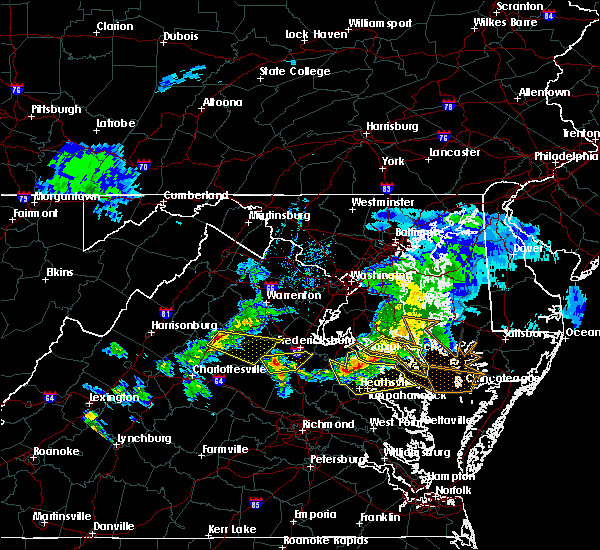 At 422 pm edt, a severe thunderstorm was located near madison, moving east at 45 mph (radar indicated). Hazards include 60 mph wind gusts. Damaging winds will cause some trees and large branches to fall. this could injure those outdoors, as well as damage homes and vehicles. roadways may become blocked by downed trees. localized power outages are possible. Unsecured light objects may become projectiles. At 422 pm edt, a severe thunderstorm was located near madison, moving east at 45 mph (radar indicated). Hazards include 60 mph wind gusts. Damaging winds will cause some trees and large branches to fall. this could injure those outdoors, as well as damage homes and vehicles. roadways may become blocked by downed trees. localized power outages are possible. Unsecured light objects may become projectiles.
|
| 2/26/2020 9:45 PM EST |
 At 945 pm est, a severe thunderstorm was located near orange, moving northeast at 35 mph (radar indicated). Hazards include 60 mph wind gusts and quarter size hail. Damaging winds will cause some trees and large branches to fall. this could injure those outdoors, as well as damage homes and vehicles. roadways may become blocked by downed trees. localized power outages are possible. unsecured light objects may become projectiles. Locations impacted include, culpeper, orange, gordonsville, raccoon ford, rhoadesville, rapidan, everona, verdiersville, madison run, montpelier station, burr hill, nasons, winston, madison mills, montford, mitchells, old somerset, unionville, somerset and locust dale. At 945 pm est, a severe thunderstorm was located near orange, moving northeast at 35 mph (radar indicated). Hazards include 60 mph wind gusts and quarter size hail. Damaging winds will cause some trees and large branches to fall. this could injure those outdoors, as well as damage homes and vehicles. roadways may become blocked by downed trees. localized power outages are possible. unsecured light objects may become projectiles. Locations impacted include, culpeper, orange, gordonsville, raccoon ford, rhoadesville, rapidan, everona, verdiersville, madison run, montpelier station, burr hill, nasons, winston, madison mills, montford, mitchells, old somerset, unionville, somerset and locust dale.
|
| 2/26/2020 9:24 PM EST |
 At 923 pm est, a severe thunderstorm was located near boswells tavern, or 9 miles southwest of orange, moving northeast at 35 mph (radar indicated). Hazards include 60 mph wind gusts and quarter size hail. Damaging winds will cause some trees and large branches to fall. this could injure those outdoors, as well as damage homes and vehicles. roadways may become blocked by downed trees. localized power outages are possible. Unsecured light objects may become projectiles. At 923 pm est, a severe thunderstorm was located near boswells tavern, or 9 miles southwest of orange, moving northeast at 35 mph (radar indicated). Hazards include 60 mph wind gusts and quarter size hail. Damaging winds will cause some trees and large branches to fall. this could injure those outdoors, as well as damage homes and vehicles. roadways may become blocked by downed trees. localized power outages are possible. Unsecured light objects may become projectiles.
|
| 1/11/2020 11:43 PM EST |
 At 1143 pm est, severe thunderstorms were located along a line extending from 6 miles north of culpeper to near orange to 8 miles northwest of boswells tavern, moving east at 45 mph (radar indicated). Hazards include 60 mph wind gusts. Damaging winds will cause some trees and large branches to fall. this could injure those outdoors, as well as damage homes and vehicles. roadways may become blocked by downed trees. localized power outages are possible. Unsecured light objects may become projectiles. At 1143 pm est, severe thunderstorms were located along a line extending from 6 miles north of culpeper to near orange to 8 miles northwest of boswells tavern, moving east at 45 mph (radar indicated). Hazards include 60 mph wind gusts. Damaging winds will cause some trees and large branches to fall. this could injure those outdoors, as well as damage homes and vehicles. roadways may become blocked by downed trees. localized power outages are possible. Unsecured light objects may become projectiles.
|
| 10/31/2019 8:27 PM EDT |
 At 827 pm edt, a severe thunderstorm was located near orange, moving northeast at 75 mph (radar indicated). Hazards include 60 mph wind gusts. Damaging winds will cause some trees and large branches to fall. this could injure those outdoors, as well as damage homes and vehicles. roadways may become blocked by downed trees. localized power outages are possible. Unsecured light objects may become projectiles. At 827 pm edt, a severe thunderstorm was located near orange, moving northeast at 75 mph (radar indicated). Hazards include 60 mph wind gusts. Damaging winds will cause some trees and large branches to fall. this could injure those outdoors, as well as damage homes and vehicles. roadways may become blocked by downed trees. localized power outages are possible. Unsecured light objects may become projectiles.
|
| 9/11/2019 5:51 PM EDT |
 At 550 pm edt, severe thunderstorms were located along a line extending from near orange to 8 miles west of boswells tavern, moving southeast at 20 mph (radar indicated). Hazards include 60 mph wind gusts and quarter size hail. Damaging winds will cause some trees and large branches to fall. this could injure those outdoors, as well as damage homes and vehicles. roadways may become blocked by downed trees. localized power outages are possible. unsecured light objects may become projectiles. Locations impacted include, orange, campbell, gordonsville, thornhill, cobham, cismont, montford, barboursville, stony point, madison run, montpelier station and somerset. At 550 pm edt, severe thunderstorms were located along a line extending from near orange to 8 miles west of boswells tavern, moving southeast at 20 mph (radar indicated). Hazards include 60 mph wind gusts and quarter size hail. Damaging winds will cause some trees and large branches to fall. this could injure those outdoors, as well as damage homes and vehicles. roadways may become blocked by downed trees. localized power outages are possible. unsecured light objects may become projectiles. Locations impacted include, orange, campbell, gordonsville, thornhill, cobham, cismont, montford, barboursville, stony point, madison run, montpelier station and somerset.
|
| 9/11/2019 5:48 PM EDT | Tree reported on the 14200 block of james madison highwa in orange county VA, 3 miles NNE of Orange, VA |
| 9/11/2019 5:28 PM EDT |
 At 527 pm edt, a severe thunderstorm was located 9 miles southeast of stanardsville, or 12 miles northeast of charlottesville, moving southeast at 25 mph (radar indicated). Hazards include 60 mph wind gusts and quarter size hail. Damaging winds will cause some trees and large branches to fall. this could injure those outdoors, as well as damage homes and vehicles. roadways may become blocked by downed trees. localized power outages are possible. Unsecured light objects may become projectiles. At 527 pm edt, a severe thunderstorm was located 9 miles southeast of stanardsville, or 12 miles northeast of charlottesville, moving southeast at 25 mph (radar indicated). Hazards include 60 mph wind gusts and quarter size hail. Damaging winds will cause some trees and large branches to fall. this could injure those outdoors, as well as damage homes and vehicles. roadways may become blocked by downed trees. localized power outages are possible. Unsecured light objects may become projectiles.
|
| 9/11/2019 5:09 PM EDT |
 At 441 pm edt, severe thunderstorms were located along a line extending from near warrenton to near bealeton to 8 miles north of madison, moving south at 25 mph (radar indicated). Hazards include 60 mph wind gusts and quarter size hail. Damaging winds will cause some trees and large branches to fall. this could injure those outdoors, as well as damage homes and vehicles. roadways may become blocked by downed trees. localized power outages are possible. Unsecured light objects may become projectiles. At 441 pm edt, severe thunderstorms were located along a line extending from near warrenton to near bealeton to 8 miles north of madison, moving south at 25 mph (radar indicated). Hazards include 60 mph wind gusts and quarter size hail. Damaging winds will cause some trees and large branches to fall. this could injure those outdoors, as well as damage homes and vehicles. roadways may become blocked by downed trees. localized power outages are possible. Unsecured light objects may become projectiles.
|
| 9/11/2019 4:41 PM EDT |
 At 441 pm edt, severe thunderstorms were located along a line extending from near warrenton to near bealeton to 8 miles north of madison, moving south at 25 mph (radar indicated). Hazards include 60 mph wind gusts and quarter size hail. Damaging winds will cause some trees and large branches to fall. this could injure those outdoors, as well as damage homes and vehicles. roadways may become blocked by downed trees. localized power outages are possible. Unsecured light objects may become projectiles. At 441 pm edt, severe thunderstorms were located along a line extending from near warrenton to near bealeton to 8 miles north of madison, moving south at 25 mph (radar indicated). Hazards include 60 mph wind gusts and quarter size hail. Damaging winds will cause some trees and large branches to fall. this could injure those outdoors, as well as damage homes and vehicles. roadways may become blocked by downed trees. localized power outages are possible. Unsecured light objects may become projectiles.
|
| 8/20/2019 6:18 PM EDT |
 A severe thunderstorm warning remains in effect until 645 pm edt for central orange and southwestern culpeper counties. at 618 pm edt, a severe thunderstorm was located near orange, moving northeast at 15 mph. hazard. 60 mph wind gusts. source. Radar indicated. A severe thunderstorm warning remains in effect until 645 pm edt for central orange and southwestern culpeper counties. at 618 pm edt, a severe thunderstorm was located near orange, moving northeast at 15 mph. hazard. 60 mph wind gusts. source. Radar indicated.
|
| 8/20/2019 5:56 PM EDT |
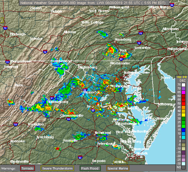 The national weather service in sterling virginia has issued a * severe thunderstorm warning for. southeastern madison county in northwestern virginia. central orange county in central virginia. southwestern culpeper county in northern virginia. Until 645 pm edt. The national weather service in sterling virginia has issued a * severe thunderstorm warning for. southeastern madison county in northwestern virginia. central orange county in central virginia. southwestern culpeper county in northern virginia. Until 645 pm edt.
|
| 8/20/2019 5:45 PM EDT |
 A severe thunderstorm warning remains in effect until 600 pm edt for southeastern madison and southwestern orange counties. at 545 pm edt, severe thunderstorms were located along a line extending from 9 miles west of orange to near boswells tavern, moving northeast at 15 mph. hazard. 60 mph wind gusts and quarter size hail. A severe thunderstorm warning remains in effect until 600 pm edt for southeastern madison and southwestern orange counties. at 545 pm edt, severe thunderstorms were located along a line extending from 9 miles west of orange to near boswells tavern, moving northeast at 15 mph. hazard. 60 mph wind gusts and quarter size hail.
|
| 8/20/2019 5:21 PM EDT |
 At 521 pm edt, severe thunderstorms were located along a line extending from 10 miles northeast of charlottesville to boswells tavern, moving northeast at 15 mph (radar indicated). Hazards include 60 mph wind gusts and quarter size hail. Damaging winds will cause some trees and large branches to fall. this could injure those outdoors, as well as damage homes and vehicles. roadways may become blocked by downed trees. localized power outages are possible. Unsecured light objects may become projectiles. At 521 pm edt, severe thunderstorms were located along a line extending from 10 miles northeast of charlottesville to boswells tavern, moving northeast at 15 mph (radar indicated). Hazards include 60 mph wind gusts and quarter size hail. Damaging winds will cause some trees and large branches to fall. this could injure those outdoors, as well as damage homes and vehicles. roadways may become blocked by downed trees. localized power outages are possible. Unsecured light objects may become projectiles.
|
| 8/19/2019 6:51 PM EDT |
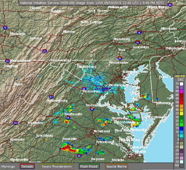 At 640 pm edt, severe thunderstorms were located along a line extending from near orange to 8 miles north of boswells tavern, moving east at 15 mph (radar indicated). Hazards include 60 mph wind gusts. Damaging winds will cause some trees and large branches to fall. this could injure those outdoors, as well as damage homes and vehicles. roadways may become blocked by downed trees. localized power outages are possible. unsecured light objects may become projectiles. Locations impacted include, orange, aroda, nasons, madison mills, montford, old somerset, twymans mill, madison run, montpelier station and somerset. At 640 pm edt, severe thunderstorms were located along a line extending from near orange to 8 miles north of boswells tavern, moving east at 15 mph (radar indicated). Hazards include 60 mph wind gusts. Damaging winds will cause some trees and large branches to fall. this could injure those outdoors, as well as damage homes and vehicles. roadways may become blocked by downed trees. localized power outages are possible. unsecured light objects may become projectiles. Locations impacted include, orange, aroda, nasons, madison mills, montford, old somerset, twymans mill, madison run, montpelier station and somerset.
|
| 8/19/2019 6:41 PM EDT |
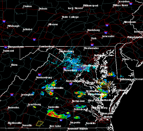 At 640 pm edt, severe thunderstorms were located along a line extending from near orange to 8 miles north of boswells tavern, moving east at 15 mph (radar indicated). Hazards include 60 mph wind gusts. Damaging winds will cause some trees and large branches to fall. this could injure those outdoors, as well as damage homes and vehicles. roadways may become blocked by downed trees. localized power outages are possible. unsecured light objects may become projectiles. Locations impacted include, orange, aroda, nasons, madison mills, montford, old somerset, twymans mill, madison run, montpelier station and somerset. At 640 pm edt, severe thunderstorms were located along a line extending from near orange to 8 miles north of boswells tavern, moving east at 15 mph (radar indicated). Hazards include 60 mph wind gusts. Damaging winds will cause some trees and large branches to fall. this could injure those outdoors, as well as damage homes and vehicles. roadways may become blocked by downed trees. localized power outages are possible. unsecured light objects may become projectiles. Locations impacted include, orange, aroda, nasons, madison mills, montford, old somerset, twymans mill, madison run, montpelier station and somerset.
|
| 8/19/2019 6:22 PM EDT | Multiple trees reported down on tatums school roa in madison county VA, 5.1 miles ESE of Orange, VA |
| 8/19/2019 6:21 PM EDT |
 At 620 pm edt, severe thunderstorms were located along a line extending from 6 miles south of madison to 10 miles southeast of stanardsville, moving east at 10 mph (radar indicated). Hazards include 60 mph wind gusts. Damaging winds will cause some trees and large branches to fall. this could injure those outdoors, as well as damage homes and vehicles. roadways may become blocked by downed trees. localized power outages are possible. Unsecured light objects may become projectiles. At 620 pm edt, severe thunderstorms were located along a line extending from 6 miles south of madison to 10 miles southeast of stanardsville, moving east at 10 mph (radar indicated). Hazards include 60 mph wind gusts. Damaging winds will cause some trees and large branches to fall. this could injure those outdoors, as well as damage homes and vehicles. roadways may become blocked by downed trees. localized power outages are possible. Unsecured light objects may become projectiles.
|
| 8/15/2019 9:00 PM EDT | Approximately 30 trees down throughout the central portion of orange count in orange county VA, 0.2 miles S of Orange, VA |
| 8/15/2019 8:59 PM EDT | Trees down on a house in the 18000 block of constitution highwa in orange county VA, 2.8 miles W of Orange, VA |
| 8/15/2019 8:59 PM EDT | Trees down on a house in the 18000 block of constitution highwa in orange county VA, 0.2 miles S of Orange, VA |
| 8/15/2019 8:57 PM EDT |
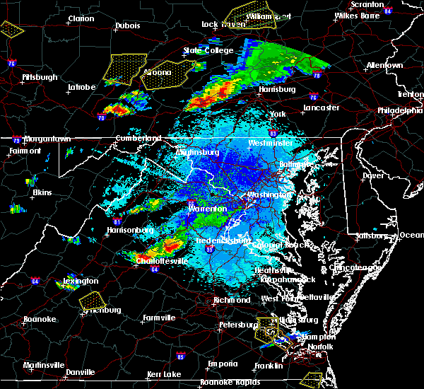 At 856 pm edt, a severe thunderstorm was located near orange, moving southeast at 15 mph (radar indicated). Hazards include 60 mph wind gusts and quarter size hail. Damaging winds will cause some trees and large branches to fall. this could injure those outdoors, as well as damage homes and vehicles. roadways may become blocked by downed trees. localized power outages are possible. unsecured light objects may become projectiles. Locations impacted include, orange, gold dale, thornhill, mine run, nasons, rhoadesville, lahore, everona, verdiersville, unionville, rapidan and madison mills. At 856 pm edt, a severe thunderstorm was located near orange, moving southeast at 15 mph (radar indicated). Hazards include 60 mph wind gusts and quarter size hail. Damaging winds will cause some trees and large branches to fall. this could injure those outdoors, as well as damage homes and vehicles. roadways may become blocked by downed trees. localized power outages are possible. unsecured light objects may become projectiles. Locations impacted include, orange, gold dale, thornhill, mine run, nasons, rhoadesville, lahore, everona, verdiersville, unionville, rapidan and madison mills.
|
| 8/15/2019 8:47 PM EDT | Trees down on a house in the 100 block of scott stree in orange county VA, 0.2 miles S of Orange, VA |
| 8/15/2019 8:43 PM EDT |
 The national weather service in sterling virginia has issued a * severe thunderstorm warning for. southeastern madison county in northwestern virginia. central orange county in central virginia. south central culpeper county in northern virginia. Until 930 pm edt. The national weather service in sterling virginia has issued a * severe thunderstorm warning for. southeastern madison county in northwestern virginia. central orange county in central virginia. south central culpeper county in northern virginia. Until 930 pm edt.
|
| 8/1/2019 9:48 PM EDT | Very large tree down across the 19400 block of lahore roa in orange county VA, 4.5 miles WNW of Orange, VA |
| 8/1/2019 9:40 PM EDT | Two large trees down near the intersection of va-612 monrovia road and brick church roa in orange county VA, 2.5 miles WNW of Orange, VA |
| 8/1/2019 9:40 PM EDT | Trees down near the intersection of va-650 independence road and magnolia ridge driv in orange county VA, 9.8 miles W of Orange, VA |
| 8/1/2019 9:30 PM EDT | Tree down near the intersection of independence road and daffodil lan in orange county VA, 9.3 miles W of Orange, VA |
| 7/31/2019 5:37 PM EDT |
 The severe thunderstorm warning for central orange and west central spotsylvania counties will expire at 545 pm edt, the storm which prompted the warning has moved out of the area. therefore, the warning will be allowed to expire. a severe thunderstorm watch remains in effect until 900 pm edt for central virginia. to report severe weather, contact your nearest law enforcement agency. they will relay your report to the national weather service sterling virginia. The severe thunderstorm warning for central orange and west central spotsylvania counties will expire at 545 pm edt, the storm which prompted the warning has moved out of the area. therefore, the warning will be allowed to expire. a severe thunderstorm watch remains in effect until 900 pm edt for central virginia. to report severe weather, contact your nearest law enforcement agency. they will relay your report to the national weather service sterling virginia.
|
| 7/31/2019 5:06 PM EDT |
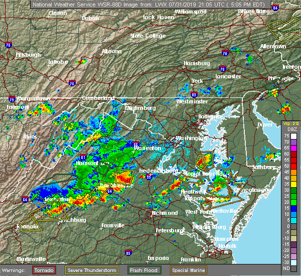 At 506 pm edt, a severe thunderstorm was located 8 miles east of orange, moving east at 10 mph (radar indicated). Hazards include 60 mph wind gusts and quarter size hail. Damaging winds will cause some trees and large branches to fall. this could injure those outdoors, as well as damage homes and vehicles. roadways may become blocked by downed trees. localized power outages are possible. unsecured light objects may become projectiles. Locations impacted include, orange, thornhill, mine run, nasons, rhoadesville, lahore, everona, verdiersville, burr hill and unionville. At 506 pm edt, a severe thunderstorm was located 8 miles east of orange, moving east at 10 mph (radar indicated). Hazards include 60 mph wind gusts and quarter size hail. Damaging winds will cause some trees and large branches to fall. this could injure those outdoors, as well as damage homes and vehicles. roadways may become blocked by downed trees. localized power outages are possible. unsecured light objects may become projectiles. Locations impacted include, orange, thornhill, mine run, nasons, rhoadesville, lahore, everona, verdiersville, burr hill and unionville.
|
| 7/31/2019 5:00 PM EDT | Quarter sized hail reported 5.1 miles WNW of Orange, VA |
| 7/31/2019 4:57 PM EDT | Tree down in the 19000 block of va-612 monrovia roa in orange county VA, 5.1 miles NW of Orange, VA |
| 7/31/2019 4:55 PM EDT | Tree down in the 11300 block of va-625 porter roa in orange county VA, 3.8 miles W of Orange, VA |
| 7/31/2019 4:51 PM EDT |
 At 451 pm edt, a severe thunderstorm was located near orange, moving east at 25 mph (radar indicated). Hazards include 60 mph wind gusts and quarter size hail. Damaging winds will cause some trees and large branches to fall. this could injure those outdoors, as well as damage homes and vehicles. roadways may become blocked by downed trees. localized power outages are possible. unsecured light objects may become projectiles. Locations impacted include, orange, gordonsville, madison run, montpelier station and montford. At 451 pm edt, a severe thunderstorm was located near orange, moving east at 25 mph (radar indicated). Hazards include 60 mph wind gusts and quarter size hail. Damaging winds will cause some trees and large branches to fall. this could injure those outdoors, as well as damage homes and vehicles. roadways may become blocked by downed trees. localized power outages are possible. unsecured light objects may become projectiles. Locations impacted include, orange, gordonsville, madison run, montpelier station and montford.
|
| 7/31/2019 4:44 PM EDT | Tree down in the 11300 block of va-625 porter road. corrected event tim in orange county VA, 3.8 miles W of Orange, VA |
| 7/31/2019 4:42 PM EDT |
 At 442 pm edt, severe thunderstorms were located along a line extending from 8 miles south of culpeper to near orange, moving east at 10 mph (radar indicated). Hazards include 60 mph wind gusts and quarter size hail. Damaging winds will cause some trees and large branches to fall. this could injure those outdoors, as well as damage homes and vehicles. roadways may become blocked by downed trees. localized power outages are possible. Unsecured light objects may become projectiles. At 442 pm edt, severe thunderstorms were located along a line extending from 8 miles south of culpeper to near orange, moving east at 10 mph (radar indicated). Hazards include 60 mph wind gusts and quarter size hail. Damaging winds will cause some trees and large branches to fall. this could injure those outdoors, as well as damage homes and vehicles. roadways may become blocked by downed trees. localized power outages are possible. Unsecured light objects may become projectiles.
|
| 7/31/2019 4:32 PM EDT |
 At 432 pm edt, a severe thunderstorm was located near orange, moving east at 25 mph (radar indicated). Hazards include 60 mph wind gusts and quarter size hail. Damaging winds will cause some trees and large branches to fall. this could injure those outdoors, as well as damage homes and vehicles. roadways may become blocked by downed trees. localized power outages are possible. unsecured light objects may become projectiles. Locations impacted include, orange, gordonsville, ruckersville, eheart, barboursville, madison run, montpelier station, rochelle, newtown, montford, old somerset, dawsonville, somerset and shelby. At 432 pm edt, a severe thunderstorm was located near orange, moving east at 25 mph (radar indicated). Hazards include 60 mph wind gusts and quarter size hail. Damaging winds will cause some trees and large branches to fall. this could injure those outdoors, as well as damage homes and vehicles. roadways may become blocked by downed trees. localized power outages are possible. unsecured light objects may become projectiles. Locations impacted include, orange, gordonsville, ruckersville, eheart, barboursville, madison run, montpelier station, rochelle, newtown, montford, old somerset, dawsonville, somerset and shelby.
|
| 7/31/2019 4:26 PM EDT |
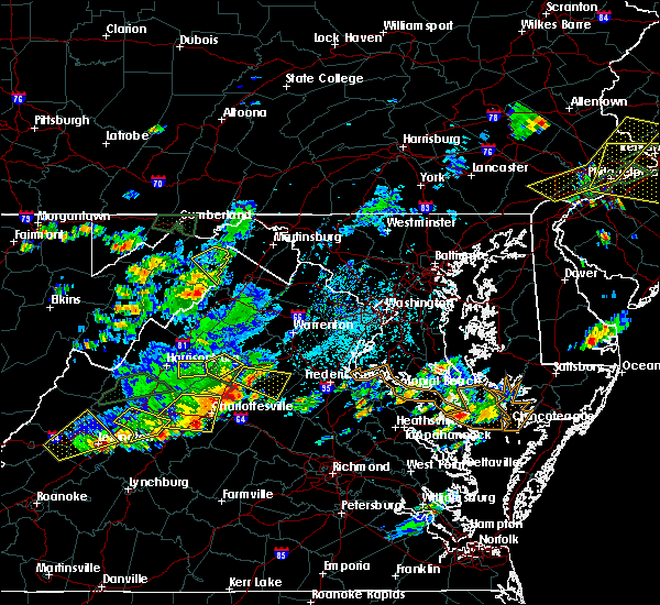 At 426 pm edt, a severe thunderstorm was located near orange, moving southeast at 15 mph (radar indicated). Hazards include 60 mph wind gusts and quarter size hail. Damaging winds will cause some trees and large branches to fall. this could injure those outdoors, as well as damage homes and vehicles. roadways may become blocked by downed trees. localized power outages are possible. unsecured light objects may become projectiles. Locations impacted include, orange, raccoon ford, rapidan, oakpark, everona, nasons, winston, madison mills, mitchells, fordsville, twymans mill, unionville and locust dale. At 426 pm edt, a severe thunderstorm was located near orange, moving southeast at 15 mph (radar indicated). Hazards include 60 mph wind gusts and quarter size hail. Damaging winds will cause some trees and large branches to fall. this could injure those outdoors, as well as damage homes and vehicles. roadways may become blocked by downed trees. localized power outages are possible. unsecured light objects may become projectiles. Locations impacted include, orange, raccoon ford, rapidan, oakpark, everona, nasons, winston, madison mills, mitchells, fordsville, twymans mill, unionville and locust dale.
|
| 7/31/2019 4:13 PM EDT |
 At 412 pm edt, a severe thunderstorm was located near stanardsville, or 9 miles southwest of madison, moving east at 25 mph (radar indicated). Hazards include 60 mph wind gusts. Damaging winds will cause some trees and large branches to fall. this could injure those outdoors, as well as damage homes and vehicles. roadways may become blocked by downed trees. localized power outages are possible. Unsecured light objects may become projectiles. At 412 pm edt, a severe thunderstorm was located near stanardsville, or 9 miles southwest of madison, moving east at 25 mph (radar indicated). Hazards include 60 mph wind gusts. Damaging winds will cause some trees and large branches to fall. this could injure those outdoors, as well as damage homes and vehicles. roadways may become blocked by downed trees. localized power outages are possible. Unsecured light objects may become projectiles.
|
| 7/31/2019 4:04 PM EDT |
 At 404 pm edt, a severe thunderstorm was located near madison, moving southeast at 25 mph (radar indicated). Hazards include 60 mph wind gusts. Damaging winds will cause some trees and large branches to fall. this could injure those outdoors, as well as damage homes and vehicles. roadways may become blocked by downed trees. localized power outages are possible. Unsecured light objects may become projectiles. At 404 pm edt, a severe thunderstorm was located near madison, moving southeast at 25 mph (radar indicated). Hazards include 60 mph wind gusts. Damaging winds will cause some trees and large branches to fall. this could injure those outdoors, as well as damage homes and vehicles. roadways may become blocked by downed trees. localized power outages are possible. Unsecured light objects may become projectiles.
|
| 7/22/2019 7:04 PM EDT |
 At 703 pm edt, severe thunderstorms were located along a line extending from near orange to 11 miles northeast of mineral, moving northeast at 50 mph (radar indicated. this storm has a history of producing wind damage with numerous downed trees reported in albemarle and nelson counties). Hazards include 60 mph wind gusts. Damaging winds will cause some trees and large branches to fall. this could injure those outdoors, as well as damage homes and vehicles. roadways may become blocked by downed trees. localized power outages are possible. unsecured light objects may become projectiles. Locations impacted include, fredericksburg, orange, spotsylvania, mine run, rhoadesville, parker, everona, verdiersville, burr hill, locust grove, flat run, alsop, gold dale, thornhill, nasons, chancellorsville, logan, lahore, lake of the woods and unionville. At 703 pm edt, severe thunderstorms were located along a line extending from near orange to 11 miles northeast of mineral, moving northeast at 50 mph (radar indicated. this storm has a history of producing wind damage with numerous downed trees reported in albemarle and nelson counties). Hazards include 60 mph wind gusts. Damaging winds will cause some trees and large branches to fall. this could injure those outdoors, as well as damage homes and vehicles. roadways may become blocked by downed trees. localized power outages are possible. unsecured light objects may become projectiles. Locations impacted include, fredericksburg, orange, spotsylvania, mine run, rhoadesville, parker, everona, verdiersville, burr hill, locust grove, flat run, alsop, gold dale, thornhill, nasons, chancellorsville, logan, lahore, lake of the woods and unionville.
|
| 7/22/2019 6:58 PM EDT | Tree and powerlines down near old gordonsville rd and rt 15 in orange county VA, 0.5 miles N of Orange, VA |
| 7/22/2019 6:58 PM EDT | 3 trees down on zachary taylor hwy just north of arrow point dr in orange county VA, 11.9 miles NW of Orange, VA |
| 7/22/2019 6:53 PM EDT |
 At 652 pm edt, severe thunderstorms were located along a line extending from near orange to near mineral, moving northeast at 50 mph (radar indicated. this storm has a history of producing wind damage with numerous downed trees reported in albemarle and nelson counties). Hazards include 60 mph wind gusts. Damaging winds will cause some trees and large branches to fall. this could injure those outdoors, as well as damage homes and vehicles. roadways may become blocked by downed trees. localized power outages are possible. unsecured light objects may become projectiles. Locations impacted include, fredericksburg, orange, spotsylvania, gordonsville, mine run, rhoadesville, parker, everona, verdiersville, madison run, burr hill, locust grove, flat run, alsop, gold dale, thornhill, nasons, chancellorsville, logan and lahore. At 652 pm edt, severe thunderstorms were located along a line extending from near orange to near mineral, moving northeast at 50 mph (radar indicated. this storm has a history of producing wind damage with numerous downed trees reported in albemarle and nelson counties). Hazards include 60 mph wind gusts. Damaging winds will cause some trees and large branches to fall. this could injure those outdoors, as well as damage homes and vehicles. roadways may become blocked by downed trees. localized power outages are possible. unsecured light objects may become projectiles. Locations impacted include, fredericksburg, orange, spotsylvania, gordonsville, mine run, rhoadesville, parker, everona, verdiersville, madison run, burr hill, locust grove, flat run, alsop, gold dale, thornhill, nasons, chancellorsville, logan and lahore.
|
| 7/22/2019 6:45 PM EDT |
 At 644 pm edt, severe thunderstorms were located along a line extending from near boswells tavern to louisa, moving northeast at 50 mph (radar indicated). Hazards include 60 mph wind gusts. Damaging winds will cause some trees and large branches to fall. this could injure those outdoors, as well as damage homes and vehicles. roadways may become blocked by downed trees. localized power outages are possible. Unsecured light objects may become projectiles. At 644 pm edt, severe thunderstorms were located along a line extending from near boswells tavern to louisa, moving northeast at 50 mph (radar indicated). Hazards include 60 mph wind gusts. Damaging winds will cause some trees and large branches to fall. this could injure those outdoors, as well as damage homes and vehicles. roadways may become blocked by downed trees. localized power outages are possible. Unsecured light objects may become projectiles.
|
| 7/17/2019 3:53 PM EDT |
 The severe thunderstorm warning for southwestern madison, west central orange, north central albemarle and southeastern greene counties will expire at 400 pm edt, the storm which prompted the warning has weakened below severe limits, and has exited the warned area. therefore, the warning will be allowed to expire. however gusty winds and heavy rain are still possible with this thunderstorm. The severe thunderstorm warning for southwestern madison, west central orange, north central albemarle and southeastern greene counties will expire at 400 pm edt, the storm which prompted the warning has weakened below severe limits, and has exited the warned area. therefore, the warning will be allowed to expire. however gusty winds and heavy rain are still possible with this thunderstorm.
|
| 7/17/2019 3:42 PM EDT |
 At 342 pm edt, a severe thunderstorm was located near stanardsville, or 11 miles southwest of madison, moving northeast at 35 mph (radar indicated). Hazards include 60 mph wind gusts. Damaging winds will cause some trees and large branches to fall. this could injure those outdoors, as well as damage homes and vehicles. roadways may become blocked by downed trees. localized power outages are possible. unsecured light objects may become projectiles. Locations impacted include, madison, stanardsville, hollymead, ruckersville, quinque, eheart, montpelier station, pratts, rochelle, newtown, aroda, montford, old somerset, shelby, amicus, dawsonville, advance mills, somerset and burtonville. At 342 pm edt, a severe thunderstorm was located near stanardsville, or 11 miles southwest of madison, moving northeast at 35 mph (radar indicated). Hazards include 60 mph wind gusts. Damaging winds will cause some trees and large branches to fall. this could injure those outdoors, as well as damage homes and vehicles. roadways may become blocked by downed trees. localized power outages are possible. unsecured light objects may become projectiles. Locations impacted include, madison, stanardsville, hollymead, ruckersville, quinque, eheart, montpelier station, pratts, rochelle, newtown, aroda, montford, old somerset, shelby, amicus, dawsonville, advance mills, somerset and burtonville.
|
| 6/29/2019 5:06 PM EDT |
 The severe thunderstorm warning for south central madison and southwestern orange counties will expire at 515 pm edt, the storm which prompted the warning has weakened below severe limits, and has exited the warned area. therefore, the warning will be allowed to expire. to report severe weather, contact your nearest law enforcement agency. they will relay your report to the national weather service sterling virginia. The severe thunderstorm warning for south central madison and southwestern orange counties will expire at 515 pm edt, the storm which prompted the warning has weakened below severe limits, and has exited the warned area. therefore, the warning will be allowed to expire. to report severe weather, contact your nearest law enforcement agency. they will relay your report to the national weather service sterling virginia.
|
| 6/29/2019 4:59 PM EDT |
 At 447 pm edt, a severe thunderstorm was located 7 miles southwest of orange, moving southeast at 15 mph (radar indicated). Hazards include 60 mph wind gusts and quarter size hail. Damaging winds will cause some trees and large branches to fall. this could injure those outdoors, as well as damage homes and vehicles. roadways may become blocked by downed trees. localized power outages are possible. unsecured light objects may become projectiles. Locations impacted include, orange, gordonsville, montford, eheart, old somerset, barboursville, madison run, montpelier station, somerset and rochelle. At 447 pm edt, a severe thunderstorm was located 7 miles southwest of orange, moving southeast at 15 mph (radar indicated). Hazards include 60 mph wind gusts and quarter size hail. Damaging winds will cause some trees and large branches to fall. this could injure those outdoors, as well as damage homes and vehicles. roadways may become blocked by downed trees. localized power outages are possible. unsecured light objects may become projectiles. Locations impacted include, orange, gordonsville, montford, eheart, old somerset, barboursville, madison run, montpelier station, somerset and rochelle.
|
| 6/29/2019 4:50 PM EDT | Tree down at the intersection of w main st. and twyman st. in the city of orange in orange county VA, 0.2 miles S of Orange, VA |
| 6/29/2019 4:47 PM EDT |
 At 447 pm edt, a severe thunderstorm was located 7 miles southwest of orange, moving southeast at 15 mph (radar indicated). Hazards include 60 mph wind gusts and quarter size hail. Damaging winds will cause some trees and large branches to fall. this could injure those outdoors, as well as damage homes and vehicles. roadways may become blocked by downed trees. localized power outages are possible. unsecured light objects may become projectiles. Locations impacted include, orange, gordonsville, montford, eheart, old somerset, barboursville, madison run, montpelier station, somerset and rochelle. At 447 pm edt, a severe thunderstorm was located 7 miles southwest of orange, moving southeast at 15 mph (radar indicated). Hazards include 60 mph wind gusts and quarter size hail. Damaging winds will cause some trees and large branches to fall. this could injure those outdoors, as well as damage homes and vehicles. roadways may become blocked by downed trees. localized power outages are possible. unsecured light objects may become projectiles. Locations impacted include, orange, gordonsville, montford, eheart, old somerset, barboursville, madison run, montpelier station, somerset and rochelle.
|
| 6/29/2019 4:26 PM EDT |
 At 426 pm edt, a severe thunderstorm was located 7 miles southeast of stanardsville, or 9 miles south of madison, moving southeast at 15 mph (radar indicated). Hazards include 60 mph wind gusts. Damaging winds will cause some trees and large branches to fall. this could injure those outdoors, as well as damage homes and vehicles. roadways may become blocked by downed trees. localized power outages are possible. Unsecured light objects may become projectiles. At 426 pm edt, a severe thunderstorm was located 7 miles southeast of stanardsville, or 9 miles south of madison, moving southeast at 15 mph (radar indicated). Hazards include 60 mph wind gusts. Damaging winds will cause some trees and large branches to fall. this could injure those outdoors, as well as damage homes and vehicles. roadways may become blocked by downed trees. localized power outages are possible. Unsecured light objects may become projectiles.
|
| 6/28/2019 7:52 PM EDT |
 The severe thunderstorm warning for orange county will expire at 800 pm edt, the storms which prompted the warning have moved out of the area. therefore, the warning will be allowed to expire. to report severe weather, contact your nearest law enforcement agency. they will relay your report to the national weather service sterling virginia. The severe thunderstorm warning for orange county will expire at 800 pm edt, the storms which prompted the warning have moved out of the area. therefore, the warning will be allowed to expire. to report severe weather, contact your nearest law enforcement agency. they will relay your report to the national weather service sterling virginia.
|
| 6/28/2019 7:30 PM EDT |
 At 729 pm edt, severe thunderstorms were located along a line extending from near everona to near old somerset, moving southeast at 10 mph (doppler radar). Hazards include 70 mph wind gusts and quarter size hail. Damaging winds will cause some trees and large branches to fall. this could injure those outdoors, as well as damage homes and vehicles. roadways may become blocked by downed trees. localized power outages are possible. unsecured light objects may become projectiles. Locations impacted include, orange, gordonsville, mine run, rhoadesville, rapidan, barboursville, verdiersville, everona, madison run, montpelier station, gold dale, thornhill, nasons, montford, lahore, old somerset, unionville, somerset and madison mills. At 729 pm edt, severe thunderstorms were located along a line extending from near everona to near old somerset, moving southeast at 10 mph (doppler radar). Hazards include 70 mph wind gusts and quarter size hail. Damaging winds will cause some trees and large branches to fall. this could injure those outdoors, as well as damage homes and vehicles. roadways may become blocked by downed trees. localized power outages are possible. unsecured light objects may become projectiles. Locations impacted include, orange, gordonsville, mine run, rhoadesville, rapidan, barboursville, verdiersville, everona, madison run, montpelier station, gold dale, thornhill, nasons, montford, lahore, old somerset, unionville, somerset and madison mills.
|
| 6/28/2019 7:22 PM EDT |
 At 722 pm edt, intense thunderstorms located along a line extending from near rapidan to near madison mills, moving southeast at 10 mph. these are very dangerous storms (doppler radar). Hazards include 80 mph wind gusts and golf ball size hail. Expect considerable damage to trees and power lines. your life is at significant risk if outdoors. in addition to some trees falling into homes, wind damage is possible to roofs, sheds, open garages, and mobile homes. Locations impacted include, orange, gordonsville, mine run, oakpark, barboursville, verdiersville, everona, montpelier station, thornhill, nasons, madison mills, montford, old somerset, unionville, somerset, locust dale, rhoadesville, rapidan, madison run and rochelle. At 722 pm edt, intense thunderstorms located along a line extending from near rapidan to near madison mills, moving southeast at 10 mph. these are very dangerous storms (doppler radar). Hazards include 80 mph wind gusts and golf ball size hail. Expect considerable damage to trees and power lines. your life is at significant risk if outdoors. in addition to some trees falling into homes, wind damage is possible to roofs, sheds, open garages, and mobile homes. Locations impacted include, orange, gordonsville, mine run, oakpark, barboursville, verdiersville, everona, montpelier station, thornhill, nasons, madison mills, montford, old somerset, unionville, somerset, locust dale, rhoadesville, rapidan, madison run and rochelle.
|
| 6/28/2019 7:15 PM EDT |
 At 714 pm edt, intense thunderstorms were located along a line extending from 6 miles west of culpeper to near stanardsville, moving southeast at 10 mph. these are very dangerous storms (doppler radar). Hazards include 80 mph wind gusts and golf ball size hail. Expect considerable damage to trees and power lines. your life is at significant risk if outdoors. in addition to some trees falling into homes, wind damage is possible to roofs, sheds, open garages, and mobile homes. Locations impacted include, orange, madison, stanardsville, gordonsville, ruckersville, brightwood, mine run, eheart, oakpark, barboursville, verdiersville, everona, montpelier station, newtown, thornhill, nasons, winston, madison mills, montford and mitchells. At 714 pm edt, intense thunderstorms were located along a line extending from 6 miles west of culpeper to near stanardsville, moving southeast at 10 mph. these are very dangerous storms (doppler radar). Hazards include 80 mph wind gusts and golf ball size hail. Expect considerable damage to trees and power lines. your life is at significant risk if outdoors. in addition to some trees falling into homes, wind damage is possible to roofs, sheds, open garages, and mobile homes. Locations impacted include, orange, madison, stanardsville, gordonsville, ruckersville, brightwood, mine run, eheart, oakpark, barboursville, verdiersville, everona, montpelier station, newtown, thornhill, nasons, winston, madison mills, montford and mitchells.
|
| 6/28/2019 7:07 PM EDT |
 At 706 pm edt, severe thunderstorms with a history of producing wind damage were located along a line extending from 6 miles west of culpeper to near stanardsville, moving southeast at 10 mph (wind damage reported to 911 call centers and doppler radar). Hazards include 60 mph wind gusts and quarter size hail. Damaging winds will cause some trees and large branches to fall. this could injure those outdoors, as well as damage homes and vehicles. roadways may become blocked by downed trees. localized power outages are possible. Unsecured light objects may become projectiles. At 706 pm edt, severe thunderstorms with a history of producing wind damage were located along a line extending from 6 miles west of culpeper to near stanardsville, moving southeast at 10 mph (wind damage reported to 911 call centers and doppler radar). Hazards include 60 mph wind gusts and quarter size hail. Damaging winds will cause some trees and large branches to fall. this could injure those outdoors, as well as damage homes and vehicles. roadways may become blocked by downed trees. localized power outages are possible. Unsecured light objects may become projectiles.
|
| 5/30/2019 6:55 PM EDT |
 At 654 pm edt, a severe thunderstorm capable of producing a tornado was located near orange, moving east at 35 mph (radar indicated). Hazards include two inch hail and 60 mph wind gusts. Expect wind damage to trees and power lines. hail is large enough to dent and damage vehicles. some hail damage to roofs, siding, and windows is possible. locations impacted include, orange, raccoon ford, rhoadesville, rapidan, verdiersville, everona, burr hill, nasons, madison mills, montford, mitchells, lahore, unionville and locust dale. A tornado warning is also in effect for this storm. At 654 pm edt, a severe thunderstorm capable of producing a tornado was located near orange, moving east at 35 mph (radar indicated). Hazards include two inch hail and 60 mph wind gusts. Expect wind damage to trees and power lines. hail is large enough to dent and damage vehicles. some hail damage to roofs, siding, and windows is possible. locations impacted include, orange, raccoon ford, rhoadesville, rapidan, verdiersville, everona, burr hill, nasons, madison mills, montford, mitchells, lahore, unionville and locust dale. A tornado warning is also in effect for this storm.
|
| 5/30/2019 6:54 PM EDT | Golf Ball sized hail reported 3.8 miles W of Orange, VA |
| 5/30/2019 6:53 PM EDT |
 At 653 pm edt, a severe thunderstorm capable of producing a tornado was located near orange, moving east at 40 mph (radar indicated rotation). Hazards include tornado and hail up to two inches in diameter. For those in the direct path of a tornado touchdown, flying debris will be dangerous to those caught without shelter. damage to roofs, siding, and windows may occur. mobile homes may be damaged or destroyed. tree damage is likely. This tornadic thunderstorm will remain over mainly rural areas of central orange and northwestern spotsylvania counties, including the following locations, gold dale, mine run, nasons, logan, rhoadesville, parker, lahore, verdiersville, madison run and unionville. At 653 pm edt, a severe thunderstorm capable of producing a tornado was located near orange, moving east at 40 mph (radar indicated rotation). Hazards include tornado and hail up to two inches in diameter. For those in the direct path of a tornado touchdown, flying debris will be dangerous to those caught without shelter. damage to roofs, siding, and windows may occur. mobile homes may be damaged or destroyed. tree damage is likely. This tornadic thunderstorm will remain over mainly rural areas of central orange and northwestern spotsylvania counties, including the following locations, gold dale, mine run, nasons, logan, rhoadesville, parker, lahore, verdiersville, madison run and unionville.
|
| 5/30/2019 6:52 PM EDT | Tree down on spotters property in orang in orange county VA, 1.7 miles W of Orange, VA |
| 5/30/2019 6:50 PM EDT | Tree down on homewood drive and rapidan roa in orange county VA, 2.7 miles SW of Orange, VA |
| 5/30/2019 6:50 PM EDT | Half Dollar sized hail reported 1.1 miles W of Orange, VA |
| 5/30/2019 6:46 PM EDT |
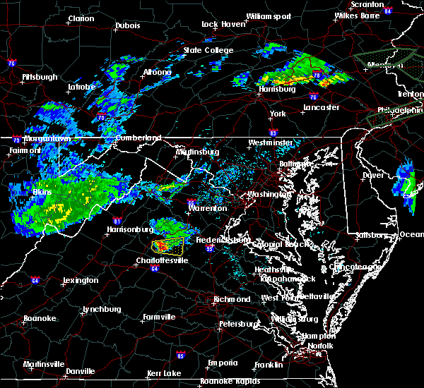 At 645 pm edt, a severe thunderstorm was located over orange, moving east at 35 mph (radar indicated). Hazards include golf ball size hail and 60 mph wind gusts. Expect wind damage to trees and power lines. hail is large enough to dent and damage vehicles. some hail damage to roofs, siding, and windows is possible. Locations impacted include, orange, raccoon ford, rhoadesville, rapidan, verdiersville, everona, montpelier station, burr hill, aroda, nasons, madison mills, montford, mitchells, lahore, old somerset, twymans mill, unionville and locust dale. At 645 pm edt, a severe thunderstorm was located over orange, moving east at 35 mph (radar indicated). Hazards include golf ball size hail and 60 mph wind gusts. Expect wind damage to trees and power lines. hail is large enough to dent and damage vehicles. some hail damage to roofs, siding, and windows is possible. Locations impacted include, orange, raccoon ford, rhoadesville, rapidan, verdiersville, everona, montpelier station, burr hill, aroda, nasons, madison mills, montford, mitchells, lahore, old somerset, twymans mill, unionville and locust dale.
|
| 5/30/2019 6:39 PM EDT | Multiple reports of trees down along south blue ridge turnpike near un in madison county VA, 6.6 miles E of Orange, VA |
| 5/30/2019 6:34 PM EDT |
 At 634 pm edt, a severe thunderstorm was located near madison, moving east at 35 mph (radar indicated). Hazards include ping pong ball size hail and 60 mph wind gusts. Damaging winds will cause some trees and large branches to fall. this could injure those outdoors, as well as damage homes and vehicles. roadways may become blocked by downed trees. localized power outages are possible. unsecured light objects may become projectiles. Locations impacted include, orange, ruckersville, eheart, oakpark, verdiersville, everona, montpelier station, newtown, nasons, madison mills, montford, mitchells, old somerset, unionville, somerset, locust dale, raccoon ford, rhoadesville, rapidan and madison run. At 634 pm edt, a severe thunderstorm was located near madison, moving east at 35 mph (radar indicated). Hazards include ping pong ball size hail and 60 mph wind gusts. Damaging winds will cause some trees and large branches to fall. this could injure those outdoors, as well as damage homes and vehicles. roadways may become blocked by downed trees. localized power outages are possible. unsecured light objects may become projectiles. Locations impacted include, orange, ruckersville, eheart, oakpark, verdiersville, everona, montpelier station, newtown, nasons, madison mills, montford, mitchells, old somerset, unionville, somerset, locust dale, raccoon ford, rhoadesville, rapidan and madison run.
|
| 5/30/2019 6:31 PM EDT |
 At 631 pm edt, a severe thunderstorm was located near madison, moving east at 35 mph (radar indicated). Hazards include 60 mph wind gusts and quarter size hail. Damaging winds will cause some trees and large branches to fall. this could injure those outdoors, as well as damage homes and vehicles. roadways may become blocked by downed trees. localized power outages are possible. Unsecured light objects may become projectiles. At 631 pm edt, a severe thunderstorm was located near madison, moving east at 35 mph (radar indicated). Hazards include 60 mph wind gusts and quarter size hail. Damaging winds will cause some trees and large branches to fall. this could injure those outdoors, as well as damage homes and vehicles. roadways may become blocked by downed trees. localized power outages are possible. Unsecured light objects may become projectiles.
|
| 5/30/2019 6:03 PM EDT | Tree reported down on hawfield roa in orange county VA, 7.7 miles WSW of Orange, VA |
| 5/30/2019 3:03 PM EDT | Tree reported down on hawfield roa in orange county VA, 7.7 miles WSW of Orange, VA |
| 5/25/2019 8:23 PM EDT | Tree down on little skyline drive near spicer mill roa in orange county VA, 2.3 miles ESE of Orange, VA |
| 5/23/2019 3:44 PM EDT |
 At 343 pm edt, severe thunderstorms were located along a line extending from 11 miles east of bealeton to 6 miles southwest of orange, moving east at 50 mph (radar indicated). Hazards include 60 mph wind gusts. Damaging winds will cause some trees and large branches to fall. this could injure those outdoors, as well as damage homes and vehicles. roadways may become blocked by downed trees. localized power outages are possible. unsecured light objects may become projectiles. Locations impacted include, stafford, fredericksburg, orange, quantico, aquia creek, triangle, dumfries, spotsylvania, cherry hill, falmouth, gordonsville, eheart, barboursville, verdiersville, montpelier station, locust grove, thornhill, ramoth, heflin and madison mills. At 343 pm edt, severe thunderstorms were located along a line extending from 11 miles east of bealeton to 6 miles southwest of orange, moving east at 50 mph (radar indicated). Hazards include 60 mph wind gusts. Damaging winds will cause some trees and large branches to fall. this could injure those outdoors, as well as damage homes and vehicles. roadways may become blocked by downed trees. localized power outages are possible. unsecured light objects may become projectiles. Locations impacted include, stafford, fredericksburg, orange, quantico, aquia creek, triangle, dumfries, spotsylvania, cherry hill, falmouth, gordonsville, eheart, barboursville, verdiersville, montpelier station, locust grove, thornhill, ramoth, heflin and madison mills.
|
| 5/23/2019 3:28 PM EDT |
 At 328 pm edt, severe thunderstorms were located along a line extending from bealeton to near stanardsville, moving east at 50 mph (radar indicated). Hazards include 60 mph wind gusts. Damaging winds will cause some trees and large branches to fall. this could injure those outdoors, as well as damage homes and vehicles. roadways may become blocked by downed trees. localized power outages are possible. Unsecured light objects may become projectiles. At 328 pm edt, severe thunderstorms were located along a line extending from bealeton to near stanardsville, moving east at 50 mph (radar indicated). Hazards include 60 mph wind gusts. Damaging winds will cause some trees and large branches to fall. this could injure those outdoors, as well as damage homes and vehicles. roadways may become blocked by downed trees. localized power outages are possible. Unsecured light objects may become projectiles.
|
| 4/26/2019 1:52 PM EDT |
 At 151 pm edt, severe thunderstorms were located along a line extending from near madison to near boswells tavern, moving east at 45 mph (law enforcement reported multiple trees down in albemarle county). Hazards include 70 mph wind gusts and quarter size hail. Damaging winds will cause some trees and large branches to fall. this could injure those outdoors, as well as damage homes and vehicles. roadways may become blocked by downed trees. localized power outages are possible. unsecured light objects may become projectiles. Locations impacted include, culpeper, orange, spotsylvania, gordonsville, mine run, elkwood, stevensburg, eheart, brandy station, oakpark, barboursville, verdiersville, everona, montpelier station, locust grove, flat run, thornhill, nasons, winston and madison mills. At 151 pm edt, severe thunderstorms were located along a line extending from near madison to near boswells tavern, moving east at 45 mph (law enforcement reported multiple trees down in albemarle county). Hazards include 70 mph wind gusts and quarter size hail. Damaging winds will cause some trees and large branches to fall. this could injure those outdoors, as well as damage homes and vehicles. roadways may become blocked by downed trees. localized power outages are possible. unsecured light objects may become projectiles. Locations impacted include, culpeper, orange, spotsylvania, gordonsville, mine run, elkwood, stevensburg, eheart, brandy station, oakpark, barboursville, verdiersville, everona, montpelier station, locust grove, flat run, thornhill, nasons, winston and madison mills.
|
| 4/26/2019 1:48 PM EDT |
 At 148 pm edt, severe thunderstorms were located along a line extending from 6 miles south of madison to near boswells tavern, moving northeast at 45 mph (radar indicated). Hazards include 60 mph wind gusts and quarter size hail. Damaging winds will cause some trees and large branches to fall. this could injure those outdoors, as well as damage homes and vehicles. roadways may become blocked by downed trees. localized power outages are possible. unsecured light objects may become projectiles. Locations impacted include, culpeper, orange, spotsylvania, gordonsville, mine run, elkwood, stevensburg, eheart, brandy station, oakpark, barboursville, verdiersville, everona, montpelier station, locust grove, flat run, thornhill, nasons, winston and madison mills. At 148 pm edt, severe thunderstorms were located along a line extending from 6 miles south of madison to near boswells tavern, moving northeast at 45 mph (radar indicated). Hazards include 60 mph wind gusts and quarter size hail. Damaging winds will cause some trees and large branches to fall. this could injure those outdoors, as well as damage homes and vehicles. roadways may become blocked by downed trees. localized power outages are possible. unsecured light objects may become projectiles. Locations impacted include, culpeper, orange, spotsylvania, gordonsville, mine run, elkwood, stevensburg, eheart, brandy station, oakpark, barboursville, verdiersville, everona, montpelier station, locust grove, flat run, thornhill, nasons, winston and madison mills.
|
| 4/26/2019 1:33 PM EDT |
 At 132 pm edt, severe thunderstorms were located along a line extending from 7 miles southeast of stanardsville to near lake monticello, moving northeast at 40 mph (radar indicated). Hazards include 60 mph wind gusts. Damaging winds will cause some trees and large branches to fall. this could injure those outdoors, as well as damage homes and vehicles. roadways may become blocked by downed trees. localized power outages are possible. Unsecured light objects may become projectiles. At 132 pm edt, severe thunderstorms were located along a line extending from 7 miles southeast of stanardsville to near lake monticello, moving northeast at 40 mph (radar indicated). Hazards include 60 mph wind gusts. Damaging winds will cause some trees and large branches to fall. this could injure those outdoors, as well as damage homes and vehicles. roadways may become blocked by downed trees. localized power outages are possible. Unsecured light objects may become projectiles.
|
| 8/30/2018 3:05 PM EDT |
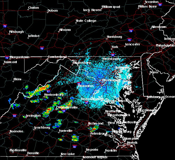 The severe thunderstorm warning for south central orange county will expire at 315 pm edt, the storm which prompted the warning has weakened below severe limits, and have exited the warned area. therefore the warning will be allowed to expire. to report severe weather, contact your nearest law enforcement agency. they will relay your report to the national weather service sterling virginia. The severe thunderstorm warning for south central orange county will expire at 315 pm edt, the storm which prompted the warning has weakened below severe limits, and have exited the warned area. therefore the warning will be allowed to expire. to report severe weather, contact your nearest law enforcement agency. they will relay your report to the national weather service sterling virginia.
|
| 8/30/2018 2:50 PM EDT |
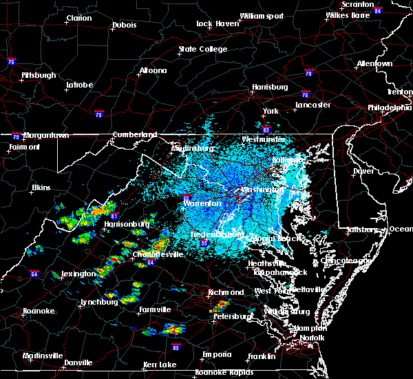 At 250 pm edt, a severe thunderstorm was located over orange, moving east at 5 mph (radar indicated). Hazards include 60 mph wind gusts. Damaging winds will cause some trees and large branches to fall. this could injure those outdoors, as well as damage homes and vehicles. roadways may become blocked by downed trees. localized power outages are possible. unsecured light objects may become projectiles. Locations impacted include, orange, madison run and nasons. At 250 pm edt, a severe thunderstorm was located over orange, moving east at 5 mph (radar indicated). Hazards include 60 mph wind gusts. Damaging winds will cause some trees and large branches to fall. this could injure those outdoors, as well as damage homes and vehicles. roadways may become blocked by downed trees. localized power outages are possible. unsecured light objects may become projectiles. Locations impacted include, orange, madison run and nasons.
|
| 8/30/2018 2:40 PM EDT |
 At 240 pm edt, a severe thunderstorm was located over orange, moving east at 5 mph (radar indicated). Hazards include 60 mph wind gusts. Damaging winds will cause some trees and large branches to fall. this could injure those outdoors, as well as damage homes and vehicles. roadways may become blocked by downed trees. localized power outages are possible. unsecured light objects may become projectiles. Locations impacted include, orange, nasons, madison run, montpelier station, montford and madison mills. At 240 pm edt, a severe thunderstorm was located over orange, moving east at 5 mph (radar indicated). Hazards include 60 mph wind gusts. Damaging winds will cause some trees and large branches to fall. this could injure those outdoors, as well as damage homes and vehicles. roadways may become blocked by downed trees. localized power outages are possible. unsecured light objects may become projectiles. Locations impacted include, orange, nasons, madison run, montpelier station, montford and madison mills.
|
| 8/30/2018 2:29 PM EDT |
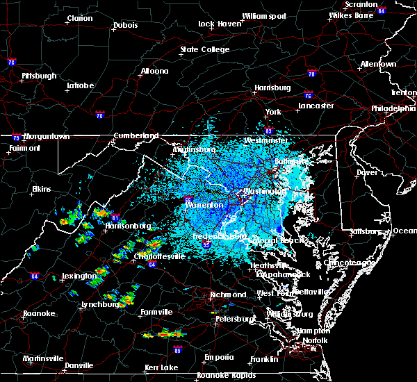 At 229 pm edt, a severe thunderstorm was located near orange, moving east at 5 mph (radar indicated). Hazards include 60 mph wind gusts and quarter size hail. Damaging winds will cause some trees and large branches to fall. this could injure those outdoors, as well as damage homes and vehicles. roadways may become blocked by downed trees. localized power outages are possible. Unsecured light objects may become projectiles. At 229 pm edt, a severe thunderstorm was located near orange, moving east at 5 mph (radar indicated). Hazards include 60 mph wind gusts and quarter size hail. Damaging winds will cause some trees and large branches to fall. this could injure those outdoors, as well as damage homes and vehicles. roadways may become blocked by downed trees. localized power outages are possible. Unsecured light objects may become projectiles.
|
| 8/12/2018 4:10 PM EDT | Tree down in the 300 block of caves ford lan in madison county VA, 5 miles E of Orange, VA |
| 8/12/2018 4:05 PM EDT | Tree down on tatums school road two miles east of locust grove roa in madison county VA, 4.6 miles ESE of Orange, VA |
| 8/12/2018 3:05 PM EDT | Tree down near the intersection of kendall road and va-20 constitution highwa in orange county VA, 5 miles W of Orange, VA |
| 8/12/2018 3:05 PM EDT |
 At 305 pm edt, severe thunderstorms were located along a line extending from 7 miles south of culpeper to 6 miles south of orange, moving southeast at 25 mph (radar indicated). Hazards include 60 mph wind gusts and quarter size hail. Damaging winds will cause some trees and large branches to fall. this could injure those outdoors, as well as damage homes and vehicles. roadways may become blocked by downed trees. localized power outages are possible. Unsecured light objects may become projectiles. At 305 pm edt, severe thunderstorms were located along a line extending from 7 miles south of culpeper to 6 miles south of orange, moving southeast at 25 mph (radar indicated). Hazards include 60 mph wind gusts and quarter size hail. Damaging winds will cause some trees and large branches to fall. this could injure those outdoors, as well as damage homes and vehicles. roadways may become blocked by downed trees. localized power outages are possible. Unsecured light objects may become projectiles.
|
| 8/12/2018 3:01 PM EDT | Tree brought down power lines and blocked roadway in orange county VA, 4.8 miles NNW of Orange, VA |
| 8/12/2018 3:00 PM EDT | Dime size hail and several trees down near lahore road and gum tree roa in orange county VA, 5.5 miles WNW of Orange, VA |
| 8/12/2018 2:50 PM EDT | Tree down in the 2200 block of locust grove church roa in madison county VA, 6.2 miles ESE of Orange, VA |
| 8/12/2018 2:46 PM EDT |
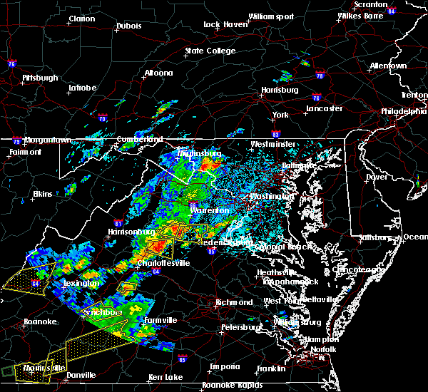 At 246 pm edt, a severe thunderstorm was located near madison, moving east at 15 mph (radar indicated). Hazards include 60 mph wind gusts and quarter size hail. Damaging winds will cause some trees and large branches to fall. this could injure those outdoors, as well as damage homes and vehicles. roadways may become blocked by downed trees. localized power outages are possible. unsecured light objects may become projectiles. Locations impacted include, orange, madison, brightwood, rapidan, oakpark, madison run, montpelier station, pratts, rochelle, aroda, nasons, winston, madison mills, montford, mitchells, old somerset, shelby, fordsville, dawsonville and twymans mill. At 246 pm edt, a severe thunderstorm was located near madison, moving east at 15 mph (radar indicated). Hazards include 60 mph wind gusts and quarter size hail. Damaging winds will cause some trees and large branches to fall. this could injure those outdoors, as well as damage homes and vehicles. roadways may become blocked by downed trees. localized power outages are possible. unsecured light objects may become projectiles. Locations impacted include, orange, madison, brightwood, rapidan, oakpark, madison run, montpelier station, pratts, rochelle, aroda, nasons, winston, madison mills, montford, mitchells, old somerset, shelby, fordsville, dawsonville and twymans mill.
|
| 8/12/2018 2:35 PM EDT |
 At 234 pm edt, a severe thunderstorm was located near madison, moving east at 15 mph (radar indicated). Hazards include 60 mph wind gusts. Damaging winds will cause some trees and large branches to fall. this could injure those outdoors, as well as damage homes and vehicles. roadways may become blocked by downed trees. localized power outages are possible. Unsecured light objects may become projectiles. At 234 pm edt, a severe thunderstorm was located near madison, moving east at 15 mph (radar indicated). Hazards include 60 mph wind gusts. Damaging winds will cause some trees and large branches to fall. this could injure those outdoors, as well as damage homes and vehicles. roadways may become blocked by downed trees. localized power outages are possible. Unsecured light objects may become projectiles.
|
| 8/2/2018 12:02 PM EDT | Tree down on slaughter drive in madison county VA, 4.9 miles SE of Orange, VA |
| 7/27/2018 7:00 PM EDT | 20 to 30 trees down and barn heavily damaged in unionvill in orange county VA, 7.7 miles W of Orange, VA |
| 7/27/2018 6:48 PM EDT | Tree down near the intersection of va-615 rapidan road and va-700 trimmers roa in orange county VA, 3.1 miles SW of Orange, VA |
| 7/27/2018 6:45 PM EDT | Wires down near orange county high schoo in orange county VA, 0.2 miles S of Orange, VA |
| 7/27/2018 6:44 PM EDT |
 At 644 pm edt, a severe thunderstorm was located near orange, moving east at 25 mph (radar indicated). Hazards include 60 mph wind gusts and quarter size hail. Damaging winds will cause some trees and large branches to fall. this could injure those outdoors, as well as damage homes and vehicles. roadways may become blocked by downed trees. localized power outages are possible. unsecured light objects may become projectiles. Locations impacted include, orange, raccoon ford, mine run, rhoadesville, rapidan, verdiersville, everona, burr hill, locust grove, flat run, gold dale, nasons, madison mills, lake of the woods, twymans mill, unionville and locust dale. At 644 pm edt, a severe thunderstorm was located near orange, moving east at 25 mph (radar indicated). Hazards include 60 mph wind gusts and quarter size hail. Damaging winds will cause some trees and large branches to fall. this could injure those outdoors, as well as damage homes and vehicles. roadways may become blocked by downed trees. localized power outages are possible. unsecured light objects may become projectiles. Locations impacted include, orange, raccoon ford, mine run, rhoadesville, rapidan, verdiersville, everona, burr hill, locust grove, flat run, gold dale, nasons, madison mills, lake of the woods, twymans mill, unionville and locust dale.
|
| 7/27/2018 6:36 PM EDT |
 At 636 pm edt, a severe thunderstorm was located near orange, moving east at 25 mph (radar indicated). Hazards include 60 mph wind gusts. Damaging winds will cause some trees and large branches to fall. this could injure those outdoors, as well as damage homes and vehicles. roadways may become blocked by downed trees. localized power outages are possible. Unsecured light objects may become projectiles. At 636 pm edt, a severe thunderstorm was located near orange, moving east at 25 mph (radar indicated). Hazards include 60 mph wind gusts. Damaging winds will cause some trees and large branches to fall. this could injure those outdoors, as well as damage homes and vehicles. roadways may become blocked by downed trees. localized power outages are possible. Unsecured light objects may become projectiles.
|
| 7/27/2018 6:23 PM EDT | Big tree branches dow in madison county VA, 6.9 miles SE of Orange, VA |
| 7/16/2018 5:26 PM EDT | Tree reported down in unionville area in orange county VA, 7.7 miles W of Orange, VA |
| 7/16/2018 4:55 PM EDT | Tree reported down in the montpelier area in orange county VA, 4 miles ENE of Orange, VA |
| 6/24/2018 3:36 PM EDT |
 The severe thunderstorm warning for southeastern madison, north central orange and culpeper counties will expire at 345 pm edt, the storm which prompted the warning has weakened below severe limits, and no longer pose an immediate threat to life or property. therefore the warning will be allowed to expire. The severe thunderstorm warning for southeastern madison, north central orange and culpeper counties will expire at 345 pm edt, the storm which prompted the warning has weakened below severe limits, and no longer pose an immediate threat to life or property. therefore the warning will be allowed to expire.
|
| 6/24/2018 3:28 PM EDT |
 A severe thunderstorm warning remains in effect until 345 pm edt for southeastern madison. north central orange and culpeper counties. at 328 pm edt, a severe thunderstorm was located near orange, moving northeast at 20 mph. hazard. 60 mph wind gusts and quarter size hail. A severe thunderstorm warning remains in effect until 345 pm edt for southeastern madison. north central orange and culpeper counties. at 328 pm edt, a severe thunderstorm was located near orange, moving northeast at 20 mph. hazard. 60 mph wind gusts and quarter size hail.
|
| 6/24/2018 3:10 PM EDT |
 At 310 pm edt, a severe thunderstorm was located near madison, moving north at 40 mph (radar indicated). Hazards include 60 mph wind gusts and quarter size hail. Damaging winds will cause some trees and large branches to fall. this could injure those outdoors, as well as damage homes and vehicles. roadways may become blocked by downed trees. localized power outages are possible. Unsecured light objects may become projectiles. At 310 pm edt, a severe thunderstorm was located near madison, moving north at 40 mph (radar indicated). Hazards include 60 mph wind gusts and quarter size hail. Damaging winds will cause some trees and large branches to fall. this could injure those outdoors, as well as damage homes and vehicles. roadways may become blocked by downed trees. localized power outages are possible. Unsecured light objects may become projectiles.
|
| 6/20/2018 3:26 PM EDT |
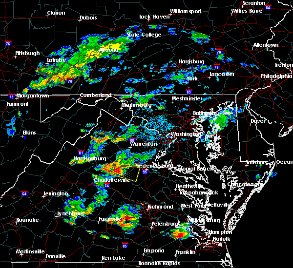 At 326 pm edt, a severe thunderstorm was located near orange, moving east at 20 mph (radar indicated). Hazards include 60 mph wind gusts. Damaging winds will cause some trees and large branches to fall. this could injure those outdoors, as well as damage homes and vehicles. roadways may become blocked by downed trees. localized power outages are possible. Unsecured light objects may become projectiles. At 326 pm edt, a severe thunderstorm was located near orange, moving east at 20 mph (radar indicated). Hazards include 60 mph wind gusts. Damaging winds will cause some trees and large branches to fall. this could injure those outdoors, as well as damage homes and vehicles. roadways may become blocked by downed trees. localized power outages are possible. Unsecured light objects may become projectiles.
|
| 6/20/2018 3:19 PM EDT | Large tree down in orange county VA, 0.6 miles WSW of Orange, VA |
| 6/20/2018 3:17 PM EDT | Large tree down in orange county VA, 0.5 miles N of Orange, VA |
| 6/20/2018 3:15 PM EDT | Large tree down in orange county VA, 0.2 miles S of Orange, VA |
| 5/14/2018 7:06 PM EDT |
 At 705 pm edt, severe thunderstorms with a history of producing damaging winds and hail were located along a line extending from near fredericksburg to near kents store, moving east at 35 mph (radar indicated). Hazards include 60 mph wind gusts. Damaging winds will cause some trees and large branches to fall. this could injure those outdoors, as well as damage homes and vehicles. roadways may become blocked by downed trees. localized power outages are possible. unsecured light objects may become projectiles. Locations impacted include, stafford, fredericksburg, orange, quantico, aquia creek, potomac creek, triangle, dumfries, massaponax, spotsylvania, cherry hill, falmouth, gordonsville, verdiersville, locust grove, snell, thornhill, ramoth, partlow and thornburg. At 705 pm edt, severe thunderstorms with a history of producing damaging winds and hail were located along a line extending from near fredericksburg to near kents store, moving east at 35 mph (radar indicated). Hazards include 60 mph wind gusts. Damaging winds will cause some trees and large branches to fall. this could injure those outdoors, as well as damage homes and vehicles. roadways may become blocked by downed trees. localized power outages are possible. unsecured light objects may become projectiles. Locations impacted include, stafford, fredericksburg, orange, quantico, aquia creek, potomac creek, triangle, dumfries, massaponax, spotsylvania, cherry hill, falmouth, gordonsville, verdiersville, locust grove, snell, thornhill, ramoth, partlow and thornburg.
|
| 5/14/2018 6:44 PM EDT |
 At 643 pm edt, severe thunderstorms with a history of producing widespread wind damage and large hail were located along a line extending from 9 miles southeast of bealeton to 6 miles north of lake monticello, moving southeast at 35 mph (radar indicated). Hazards include 60 mph wind gusts and quarter size hail. Damaging winds will cause some trees and large branches to fall. this could injure those outdoors, as well as damage homes and vehicles. roadways may become blocked by downed trees. localized power outages are possible. unsecured light objects may become projectiles. Locations impacted include, stafford, fredericksburg, culpeper, orange, quantico, aquia creek, potomac creek, triangle, dumfries, bealeton, massaponax, spotsylvania, cherry hill, falmouth, gordonsville, ruckersville, opal, remington, catlett and calverton. At 643 pm edt, severe thunderstorms with a history of producing widespread wind damage and large hail were located along a line extending from 9 miles southeast of bealeton to 6 miles north of lake monticello, moving southeast at 35 mph (radar indicated). Hazards include 60 mph wind gusts and quarter size hail. Damaging winds will cause some trees and large branches to fall. this could injure those outdoors, as well as damage homes and vehicles. roadways may become blocked by downed trees. localized power outages are possible. unsecured light objects may become projectiles. Locations impacted include, stafford, fredericksburg, culpeper, orange, quantico, aquia creek, potomac creek, triangle, dumfries, bealeton, massaponax, spotsylvania, cherry hill, falmouth, gordonsville, ruckersville, opal, remington, catlett and calverton.
|
| 5/14/2018 6:34 PM EDT |
 At 634 pm edt, severe thunderstorms were located along a line extending from near bealeton to near charlottesville, moving southeast at 35 mph (radar indicated). Hazards include 60 mph wind gusts and quarter size hail. Damaging winds will cause some trees and large branches to fall. this could injure those outdoors, as well as damage homes and vehicles. roadways may become blocked by downed trees. localized power outages are possible. unsecured light objects may become projectiles. Locations impacted include, stafford, fredericksburg, culpeper, warrenton, orange, quantico, aquia creek, potomac creek, triangle, dumfries, bealeton, massaponax, spotsylvania, cherry hill, falmouth, gordonsville, ruckersville, brightwood, opal and remington. At 634 pm edt, severe thunderstorms were located along a line extending from near bealeton to near charlottesville, moving southeast at 35 mph (radar indicated). Hazards include 60 mph wind gusts and quarter size hail. Damaging winds will cause some trees and large branches to fall. this could injure those outdoors, as well as damage homes and vehicles. roadways may become blocked by downed trees. localized power outages are possible. unsecured light objects may become projectiles. Locations impacted include, stafford, fredericksburg, culpeper, warrenton, orange, quantico, aquia creek, potomac creek, triangle, dumfries, bealeton, massaponax, spotsylvania, cherry hill, falmouth, gordonsville, ruckersville, brightwood, opal and remington.
|
| 5/14/2018 6:11 PM EDT |
 At 611 pm edt, severe thunderstorms were located along a line extending from near warrenton to near free union, moving southeast at 35 mph (radar indicated). Hazards include 60 mph wind gusts and quarter size hail. Damaging winds will cause some trees and large branches to fall. this could injure those outdoors, as well as damage homes and vehicles. roadways may become blocked by downed trees. localized power outages are possible. Unsecured light objects may become projectiles. At 611 pm edt, severe thunderstorms were located along a line extending from near warrenton to near free union, moving southeast at 35 mph (radar indicated). Hazards include 60 mph wind gusts and quarter size hail. Damaging winds will cause some trees and large branches to fall. this could injure those outdoors, as well as damage homes and vehicles. roadways may become blocked by downed trees. localized power outages are possible. Unsecured light objects may become projectiles.
|
| 4/15/2018 8:33 PM EDT |
 At 831 pm edt, severe thunderstorms were located along a line extending from 8 miles southeast of stanardsville to near troy to lakeside village, moving north northeast at 50 mph (radar indicated). Hazards include 60 mph wind gusts and quarter size hail. Damaging winds will cause some trees and large branches to fall. this could injure those outdoors, as well as damage homes and vehicles. roadways may become blocked by downed trees. localized power outages are possible. Unsecured light objects may become projectiles. At 831 pm edt, severe thunderstorms were located along a line extending from 8 miles southeast of stanardsville to near troy to lakeside village, moving north northeast at 50 mph (radar indicated). Hazards include 60 mph wind gusts and quarter size hail. Damaging winds will cause some trees and large branches to fall. this could injure those outdoors, as well as damage homes and vehicles. roadways may become blocked by downed trees. localized power outages are possible. Unsecured light objects may become projectiles.
|
| 9/5/2017 4:56 PM EDT |
 The severe thunderstorm warning for southeastern nelson, southeastern madison, southwestern orange, albemarle and southeastern greene counties and the city of charlottesville will expire at 500 pm edt, the storms which prompted the warning have weakened below severe limits, and no longer pose an immediate threat to life or property. therefore the warning will be allowed to expire. however gusty winds and heavy rain are still possible with these thunderstorms. to report severe weather, contact your nearest law enforcement agency. they will relay your report to the national weather service sterling virginia. The severe thunderstorm warning for southeastern nelson, southeastern madison, southwestern orange, albemarle and southeastern greene counties and the city of charlottesville will expire at 500 pm edt, the storms which prompted the warning have weakened below severe limits, and no longer pose an immediate threat to life or property. therefore the warning will be allowed to expire. however gusty winds and heavy rain are still possible with these thunderstorms. to report severe weather, contact your nearest law enforcement agency. they will relay your report to the national weather service sterling virginia.
|
| 9/5/2017 4:44 PM EDT |
 At 444 pm edt, severe thunderstorms were located along a line extending from 6 miles east of stanardsville to near schuyler, moving east at 35 mph (radar indicated). Hazards include 60 mph wind gusts. Damaging winds will cause some trees and large branches to fall. this could injure those outdoors, as well as damage homes and vehicles. roadways may become blocked by downed trees. localized power outages are possible. unsecured light objects may become projectiles. Locations impacted include, charlottesville, shipman, schuyler, free union, westmoreland, hollymead, ruckersville, ivy, arrington, scottsville, esmont, lovingston, quinque, north garden, eheart, covesville, barboursville, stony point, flordon and montpelier station. At 444 pm edt, severe thunderstorms were located along a line extending from 6 miles east of stanardsville to near schuyler, moving east at 35 mph (radar indicated). Hazards include 60 mph wind gusts. Damaging winds will cause some trees and large branches to fall. this could injure those outdoors, as well as damage homes and vehicles. roadways may become blocked by downed trees. localized power outages are possible. unsecured light objects may become projectiles. Locations impacted include, charlottesville, shipman, schuyler, free union, westmoreland, hollymead, ruckersville, ivy, arrington, scottsville, esmont, lovingston, quinque, north garden, eheart, covesville, barboursville, stony point, flordon and montpelier station.
|
| 9/5/2017 4:34 PM EDT |
 At 432 pm edt, severe thunderstorms were located along a line extending from near stanardsville to schuyler, moving east at 35 mph (radar indicated). Hazards include 60 mph wind gusts. Damaging winds will cause some trees and large branches to fall. this could injure those outdoors, as well as damage homes and vehicles. roadways may become blocked by downed trees. localized power outages are possible. unsecured light objects may become projectiles. Locations impacted include, charlottesville, orange, crozet, shipman, schuyler, free union, campbell, westmoreland, hollymead, ruckersville, nellysford, ivy, arrington, scottsville, esmont, lovingston, north garden, eheart, barboursville and yancey mills. At 432 pm edt, severe thunderstorms were located along a line extending from near stanardsville to schuyler, moving east at 35 mph (radar indicated). Hazards include 60 mph wind gusts. Damaging winds will cause some trees and large branches to fall. this could injure those outdoors, as well as damage homes and vehicles. roadways may become blocked by downed trees. localized power outages are possible. unsecured light objects may become projectiles. Locations impacted include, charlottesville, orange, crozet, shipman, schuyler, free union, campbell, westmoreland, hollymead, ruckersville, nellysford, ivy, arrington, scottsville, esmont, lovingston, north garden, eheart, barboursville and yancey mills.
|
| 9/5/2017 4:12 PM EDT |
 At 411 pm edt, severe thunderstorms were located along a line extending from near free union to near shipman, moving east at 35 mph (radar indicated). Hazards include 60 mph wind gusts. Damaging winds will cause some trees and large branches to fall. this could injure those outdoors, as well as damage homes and vehicles. roadways may become blocked by downed trees. localized power outages are possible. Unsecured light objects may become projectiles. At 411 pm edt, severe thunderstorms were located along a line extending from near free union to near shipman, moving east at 35 mph (radar indicated). Hazards include 60 mph wind gusts. Damaging winds will cause some trees and large branches to fall. this could injure those outdoors, as well as damage homes and vehicles. roadways may become blocked by downed trees. localized power outages are possible. Unsecured light objects may become projectiles.
|
| 7/22/2017 10:09 PM EDT |
 At 1009 pm edt, severe thunderstorms were located along a line extending from near orange to near charlottesville, moving southeast at 30 mph (radar indicated). Hazards include 60 mph wind gusts. Damaging winds will cause some trees and large branches to fall. this could injure those outdoors, as well as damage homes and vehicles. roadways may become blocked by downed trees. localized power outages are possible. unsecured light objects may become projectiles. Locations impacted include, charlottesville, orange, campbell, westmoreland, hollymead, gordonsville, ruckersville, cobham, cismont, eheart, boyd tavern, barboursville, keswick, stony point, madison run, montpelier station, carrsbrook, shadwell, newtown and montford. At 1009 pm edt, severe thunderstorms were located along a line extending from near orange to near charlottesville, moving southeast at 30 mph (radar indicated). Hazards include 60 mph wind gusts. Damaging winds will cause some trees and large branches to fall. this could injure those outdoors, as well as damage homes and vehicles. roadways may become blocked by downed trees. localized power outages are possible. unsecured light objects may become projectiles. Locations impacted include, charlottesville, orange, campbell, westmoreland, hollymead, gordonsville, ruckersville, cobham, cismont, eheart, boyd tavern, barboursville, keswick, stony point, madison run, montpelier station, carrsbrook, shadwell, newtown and montford.
|
| 7/22/2017 9:50 PM EDT |
 At 949 pm edt, severe thunderstorms were located along a line extending from near stanardsville to free union, moving southeast at 25 mph (radar indicated). Hazards include 60 mph wind gusts. Damaging winds will cause some trees and large branches to fall. this could injure those outdoors, as well as damage homes and vehicles. roadways may become blocked by downed trees. localized power outages are possible. Unsecured light objects may become projectiles. At 949 pm edt, severe thunderstorms were located along a line extending from near stanardsville to free union, moving southeast at 25 mph (radar indicated). Hazards include 60 mph wind gusts. Damaging winds will cause some trees and large branches to fall. this could injure those outdoors, as well as damage homes and vehicles. roadways may become blocked by downed trees. localized power outages are possible. Unsecured light objects may become projectiles.
|
| 7/22/2017 5:23 PM EDT | Several trees down and tents blown over at orange county fai in orange county VA, 2.6 miles NNE of Orange, VA |
| 7/6/2017 6:23 PM EDT |
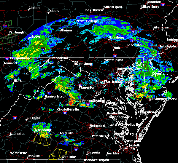 At 622 pm edt, a severe thunderstorm was located near orange, moving east at 30 mph (radar indicated). Hazards include 60 mph wind gusts. Damaging winds will cause some trees and large branches to fall. this could injure those outdoors, as well as damage homes and vehicles. roadways may become blocked by downed trees. localized power outages are possible. unsecured light objects may become projectiles. Locations impacted include, orange, raccoon ford, mine run, rhoadesville, rapidan, everona, verdiersville, burr hill, locust grove, flat run, nasons, winston, lignum, mitchells, lake of the woods and unionville. At 622 pm edt, a severe thunderstorm was located near orange, moving east at 30 mph (radar indicated). Hazards include 60 mph wind gusts. Damaging winds will cause some trees and large branches to fall. this could injure those outdoors, as well as damage homes and vehicles. roadways may become blocked by downed trees. localized power outages are possible. unsecured light objects may become projectiles. Locations impacted include, orange, raccoon ford, mine run, rhoadesville, rapidan, everona, verdiersville, burr hill, locust grove, flat run, nasons, winston, lignum, mitchells, lake of the woods and unionville.
|
| 7/6/2017 6:19 PM EDT | Three tree linbs down at rapidan rd and locust dale r in culpeper county VA, 4.8 miles SSW of Orange, VA |
| 7/6/2017 6:00 PM EDT |
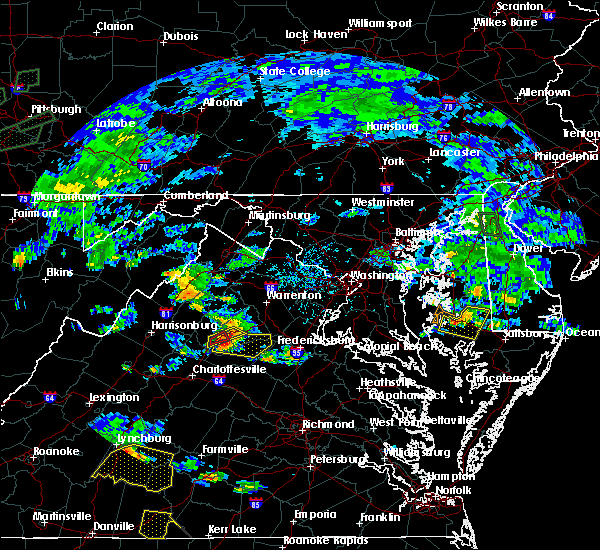 At 600 pm edt, a severe thunderstorm was located near madison, moving east at 35 mph (radar indicated). Hazards include 60 mph wind gusts. Damaging winds will cause some trees and large branches to fall. this could injure those outdoors, as well as damage homes and vehicles. roadways may become blocked by downed trees. localized power outages are possible. Unsecured light objects may become projectiles. At 600 pm edt, a severe thunderstorm was located near madison, moving east at 35 mph (radar indicated). Hazards include 60 mph wind gusts. Damaging winds will cause some trees and large branches to fall. this could injure those outdoors, as well as damage homes and vehicles. roadways may become blocked by downed trees. localized power outages are possible. Unsecured light objects may become projectiles.
|
| 5/5/2017 6:42 AM EDT |
 The severe thunderstorm warning for southeastern madison. southwestern orange and east central albemarle counties will expire at 645 am edt. the storm which prompted the warning has weakened below severe limits, and no longer poses an immediate threat to life or property. therefore the warning will be allowed to expire. However, gusty. The severe thunderstorm warning for southeastern madison. southwestern orange and east central albemarle counties will expire at 645 am edt. the storm which prompted the warning has weakened below severe limits, and no longer poses an immediate threat to life or property. therefore the warning will be allowed to expire. However, gusty.
|
| 5/5/2017 6:37 AM EDT |
 At 637 am edt, a severe thunderstorm was located near boswells tavern, or 10 miles southwest of orange, moving northeast at 45 mph (radar indicated). Hazards include 60 mph wind gusts. Damaging winds will cause some trees and large branches to fall. this could injure those outdoors, as well as damage homes and vehicles. roadways may become blocked by downed trees. localized power outages are possible. unsecured light objects may become projectiles. Locations impacted include, orange, campbell, gordonsville, cobham, cismont, boyd tavern, barboursville, keswick, stony point, madison run, montpelier station, madison mills, montford, old somerset and somerset. At 637 am edt, a severe thunderstorm was located near boswells tavern, or 10 miles southwest of orange, moving northeast at 45 mph (radar indicated). Hazards include 60 mph wind gusts. Damaging winds will cause some trees and large branches to fall. this could injure those outdoors, as well as damage homes and vehicles. roadways may become blocked by downed trees. localized power outages are possible. unsecured light objects may become projectiles. Locations impacted include, orange, campbell, gordonsville, cobham, cismont, boyd tavern, barboursville, keswick, stony point, madison run, montpelier station, madison mills, montford, old somerset and somerset.
|
| 5/5/2017 6:14 AM EDT |
 At 614 am edt, a severe thunderstorm was located near lake monticello, or near charlottesville, moving northeast at 40 mph (radar indicated). Hazards include 60 mph wind gusts. Damaging winds will cause some trees and large branches to fall. this could injure those outdoors, as well as damage homes and vehicles. roadways may become blocked by downed trees. localized power outages are possible. Unsecured light objects may become projectiles. At 614 am edt, a severe thunderstorm was located near lake monticello, or near charlottesville, moving northeast at 40 mph (radar indicated). Hazards include 60 mph wind gusts. Damaging winds will cause some trees and large branches to fall. this could injure those outdoors, as well as damage homes and vehicles. roadways may become blocked by downed trees. localized power outages are possible. Unsecured light objects may become projectiles.
|
| 4/6/2017 12:33 PM EDT | Multiple trees more than 1 ft in diameter down. structural damage from wind and a barn was blown down in orange county VA, 10.2 miles NW of Orange, VA |
| 4/6/2017 12:31 PM EDT | Numerous trees down on property in orange county VA, 8.9 miles WSW of Orange, VA |
| 4/6/2017 12:27 PM EDT | Storm damage reported in orange county VA, 3.8 miles W of Orange, VA |
| 3/1/2017 1:08 PM EST | Storm damage reported in orange county VA, 3.8 miles W of Orange, VA |
| 3/1/2017 1:07 PM EST |
 At 107 pm est, severe thunderstorms were located along a line extending from orange to near centenary, moving east at 50 mph (radar indicated). Hazards include 60 mph wind gusts. Damaging winds will cause some trees and large branches to fall. this could injure those outdoors, as well as damage homes and vehicles. roadways may become blocked by downed trees. localized power outages are possible. unsecured light objects may become projectiles. Locations impacted include, orange, campbell, gordonsville, scottsville, esmont, mine run, allens creek, barboursville, verdiersville, montpelier station, norwood, thornhill, nasons, madison mills, montford, gladstone, old somerset, unionville, somerset and cobham. At 107 pm est, severe thunderstorms were located along a line extending from orange to near centenary, moving east at 50 mph (radar indicated). Hazards include 60 mph wind gusts. Damaging winds will cause some trees and large branches to fall. this could injure those outdoors, as well as damage homes and vehicles. roadways may become blocked by downed trees. localized power outages are possible. unsecured light objects may become projectiles. Locations impacted include, orange, campbell, gordonsville, scottsville, esmont, mine run, allens creek, barboursville, verdiersville, montpelier station, norwood, thornhill, nasons, madison mills, montford, gladstone, old somerset, unionville, somerset and cobham.
|
| 3/1/2017 1:01 PM EST |
 At 100 pm est, severe thunderstorms were located along a line extending from near middleburg to near culpeper, moving east at 55 mph (radar indicated). Hazards include 60 mph wind gusts. Damaging winds will cause some trees and large branches to fall. this could injure those outdoors, as well as damage homes and vehicles. roadways may become blocked by downed trees. localized power outages are possible. unsecured light objects may become projectiles. Locations impacted include, leesburg, culpeper, broadlands, lansdowne, brambleton, warrenton, orange, madison, ashburn, linton hall, bealeton, haymarket, middleburg, arcola, the plains, oatlands, delaplane, gainesville, new baltimore and belmont. At 100 pm est, severe thunderstorms were located along a line extending from near middleburg to near culpeper, moving east at 55 mph (radar indicated). Hazards include 60 mph wind gusts. Damaging winds will cause some trees and large branches to fall. this could injure those outdoors, as well as damage homes and vehicles. roadways may become blocked by downed trees. localized power outages are possible. unsecured light objects may become projectiles. Locations impacted include, leesburg, culpeper, broadlands, lansdowne, brambleton, warrenton, orange, madison, ashburn, linton hall, bealeton, haymarket, middleburg, arcola, the plains, oatlands, delaplane, gainesville, new baltimore and belmont.
|
| 3/1/2017 12:56 PM EST |
 At 1255 pm est, severe thunderstorms were located along a line extending from 7 miles south of madison to near schuyler, moving east at 50 mph (radar indicated). Hazards include 60 mph wind gusts. Damaging winds will cause some trees and large branches to fall. this could injure those outdoors, as well as damage homes and vehicles. roadways may become blocked by downed trees. localized power outages are possible. unsecured light objects may become projectiles. Locations impacted include, charlottesville, orange, shipman, schuyler, campbell, westmoreland, hollymead, gordonsville, ruckersville, ivy, arrington, scottsville, esmont, lovingston, allens creek, eheart, north garden, barboursville, stony point and verdiersville. At 1255 pm est, severe thunderstorms were located along a line extending from 7 miles south of madison to near schuyler, moving east at 50 mph (radar indicated). Hazards include 60 mph wind gusts. Damaging winds will cause some trees and large branches to fall. this could injure those outdoors, as well as damage homes and vehicles. roadways may become blocked by downed trees. localized power outages are possible. unsecured light objects may become projectiles. Locations impacted include, charlottesville, orange, shipman, schuyler, campbell, westmoreland, hollymead, gordonsville, ruckersville, ivy, arrington, scottsville, esmont, lovingston, allens creek, eheart, north garden, barboursville, stony point and verdiersville.
|
| 3/1/2017 12:54 PM EST | Trees down on tatums school road in madison county VA, 5.5 miles E of Orange, VA |
| 3/1/2017 12:47 PM EST |
 At 1247 pm est, severe thunderstorms were located along a line extending from 6 miles northwest of delaplane to madison, moving east at 55 mph (radar indicated). Hazards include 60 mph wind gusts. Damaging winds will cause some trees and large branches to fall. this could injure those outdoors, as well as damage homes and vehicles. roadways may become blocked by downed trees. localized power outages are possible. unsecured light objects may become projectiles. Locations impacted include, leesburg, culpeper, broadlands, lansdowne, brambleton, warrenton, orange, madison, ashburn, linton hall, bealeton, haymarket, middleburg, stanardsville, sperryville, arcola, the plains, delaplane, linden and hume. At 1247 pm est, severe thunderstorms were located along a line extending from 6 miles northwest of delaplane to madison, moving east at 55 mph (radar indicated). Hazards include 60 mph wind gusts. Damaging winds will cause some trees and large branches to fall. this could injure those outdoors, as well as damage homes and vehicles. roadways may become blocked by downed trees. localized power outages are possible. unsecured light objects may become projectiles. Locations impacted include, leesburg, culpeper, broadlands, lansdowne, brambleton, warrenton, orange, madison, ashburn, linton hall, bealeton, haymarket, middleburg, stanardsville, sperryville, arcola, the plains, delaplane, linden and hume.
|
| 3/1/2017 12:32 PM EST |
 At 1232 pm est, severe thunderstorms were located along a line extending from 10 miles southeast of massanutten to near lowesville, moving east at 50 mph (radar indicated). Hazards include 60 mph wind gusts. Damaging winds will cause some trees and large branches to fall. this could injure those outdoors, as well as damage homes and vehicles. roadways may become blocked by downed trees. localized power outages are possible. Unsecured light objects may become projectiles. At 1232 pm est, severe thunderstorms were located along a line extending from 10 miles southeast of massanutten to near lowesville, moving east at 50 mph (radar indicated). Hazards include 60 mph wind gusts. Damaging winds will cause some trees and large branches to fall. this could injure those outdoors, as well as damage homes and vehicles. roadways may become blocked by downed trees. localized power outages are possible. Unsecured light objects may become projectiles.
|
| 3/1/2017 12:26 PM EST |
 At 1226 pm est, severe thunderstorms were located along a line extending from near strasburg to 8 miles southeast of massanutten, moving east at 55 mph (radar indicated). Hazards include 60 mph wind gusts. Damaging winds will cause some trees and large branches to fall. this could injure those outdoors, as well as damage homes and vehicles. roadways may become blocked by downed trees. localized power outages are possible. Unsecured light objects may become projectiles. At 1226 pm est, severe thunderstorms were located along a line extending from near strasburg to 8 miles southeast of massanutten, moving east at 55 mph (radar indicated). Hazards include 60 mph wind gusts. Damaging winds will cause some trees and large branches to fall. this could injure those outdoors, as well as damage homes and vehicles. roadways may become blocked by downed trees. localized power outages are possible. Unsecured light objects may become projectiles.
|
| 2/25/2017 2:10 PM EST |
 The severe thunderstorm warning for southeastern madison, orange, northeastern albemarle, southwestern culpeper and west central spotsylvania counties will expire at 215 pm est, the storm which prompted the warning has moved out of the area. therefore the warning will be allowed to expire. a severe thunderstorm watch remains in effect until 800 pm est for central, northern and northwestern virginia. remember, a severe thunderstorm warning is in effect for northern orange, culpeper, stafford, spotsylvania, and fauquier counties. The severe thunderstorm warning for southeastern madison, orange, northeastern albemarle, southwestern culpeper and west central spotsylvania counties will expire at 215 pm est, the storm which prompted the warning has moved out of the area. therefore the warning will be allowed to expire. a severe thunderstorm watch remains in effect until 800 pm est for central, northern and northwestern virginia. remember, a severe thunderstorm warning is in effect for northern orange, culpeper, stafford, spotsylvania, and fauquier counties.
|
| 2/25/2017 1:51 PM EST | Large tree down near orange county landfill in orange county VA, 4.4 miles W of Orange, VA |
| 2/25/2017 1:51 PM EST |
 At 149 pm est, a severe thunderstorm was located over orange, moving northeast at 50 mph (radar indicated. law enforcement also reported downed trees associated with this storm in albemarle county). Hazards include 60 mph wind gusts and quarter size hail. Damaging winds will cause some trees and large branches to fall. this could injure those outdoors, as well as damage homes and vehicles. roadways may become blocked by downed trees. localized power outages are possible. unsecured light objects may become projectiles. Locations impacted include, orange, gordonsville, brightwood, mine run, oakpark, everona, verdiersville, montpelier station, thornhill, nasons, winston, madison mills, montford, mitchells, old somerset, unionville, somerset, locust dale, raccoon ford and rhoadesville. At 149 pm est, a severe thunderstorm was located over orange, moving northeast at 50 mph (radar indicated. law enforcement also reported downed trees associated with this storm in albemarle county). Hazards include 60 mph wind gusts and quarter size hail. Damaging winds will cause some trees and large branches to fall. this could injure those outdoors, as well as damage homes and vehicles. roadways may become blocked by downed trees. localized power outages are possible. unsecured light objects may become projectiles. Locations impacted include, orange, gordonsville, brightwood, mine run, oakpark, everona, verdiersville, montpelier station, thornhill, nasons, winston, madison mills, montford, mitchells, old somerset, unionville, somerset, locust dale, raccoon ford and rhoadesville.
|
| 2/25/2017 1:33 PM EST |
 At 132 pm est, a severe thunderstorm was located 9 miles northwest of boswells tavern, or 10 miles northeast of charlottesville, moving northeast at 45 mph (radar indicated). Hazards include 60 mph wind gusts and quarter size hail. Damaging winds will cause some trees and large branches to fall. this could injure those outdoors, as well as damage homes and vehicles. roadways may become blocked by downed trees. localized power outages are possible. Unsecured light objects may become projectiles. At 132 pm est, a severe thunderstorm was located 9 miles northwest of boswells tavern, or 10 miles northeast of charlottesville, moving northeast at 45 mph (radar indicated). Hazards include 60 mph wind gusts and quarter size hail. Damaging winds will cause some trees and large branches to fall. this could injure those outdoors, as well as damage homes and vehicles. roadways may become blocked by downed trees. localized power outages are possible. Unsecured light objects may become projectiles.
|
| 7/19/2016 3:21 PM EDT |
 The severe thunderstorm warning for west central orange, southeastern greene and southeastern madison counties will expire at 330 pm edt, the storm which prompted the warning has weakened below severe limits, and no longer pose an immediate threat to life or property. therefore the warning will be allowed to expire. The severe thunderstorm warning for west central orange, southeastern greene and southeastern madison counties will expire at 330 pm edt, the storm which prompted the warning has weakened below severe limits, and no longer pose an immediate threat to life or property. therefore the warning will be allowed to expire.
|
| 7/19/2016 3:18 PM EDT |
 At 318 pm edt, a severe thunderstorm was located 7 miles south of madison, moving southeast at 15 mph (radar indicated). Hazards include 60 mph wind gusts and quarter size hail. Damaging winds will cause some trees and large branches to fall. this could injure those outdoors, as well as damage homes and vehicles. roadways may become blocked by downed trees. localized power outages are possible. unsecured light objects may become projectiles. Locations impacted include, orange, montford, old somerset, twymans mill, dawsonville, rochelle and madison mills. At 318 pm edt, a severe thunderstorm was located 7 miles south of madison, moving southeast at 15 mph (radar indicated). Hazards include 60 mph wind gusts and quarter size hail. Damaging winds will cause some trees and large branches to fall. this could injure those outdoors, as well as damage homes and vehicles. roadways may become blocked by downed trees. localized power outages are possible. unsecured light objects may become projectiles. Locations impacted include, orange, montford, old somerset, twymans mill, dawsonville, rochelle and madison mills.
|
| 7/19/2016 2:57 PM EDT |
 At 257 pm edt, a severe thunderstorm was located near madison, moving southeast at 20 mph (radar indicated). Hazards include 60 mph wind gusts and quarter size hail. Damaging winds will cause some trees and large branches to fall. this could injure those outdoors, as well as damage homes and vehicles. roadways may become blocked by downed trees. localized power outages are possible. unsecured light objects may become projectiles. Locations impacted include, orange, madison, shelby, montford, pratts, old somerset, twymans mill, dawsonville, rochelle, aroda and madison mills. At 257 pm edt, a severe thunderstorm was located near madison, moving southeast at 20 mph (radar indicated). Hazards include 60 mph wind gusts and quarter size hail. Damaging winds will cause some trees and large branches to fall. this could injure those outdoors, as well as damage homes and vehicles. roadways may become blocked by downed trees. localized power outages are possible. unsecured light objects may become projectiles. Locations impacted include, orange, madison, shelby, montford, pratts, old somerset, twymans mill, dawsonville, rochelle, aroda and madison mills.
|
| 7/19/2016 2:45 PM EDT |
 At 245 pm edt, a severe thunderstorm was located near madison, moving southeast at 15 mph (radar indicated). Hazards include 60 mph wind gusts and quarter size hail. Damaging winds will cause some trees and large branches to fall. this could injure those outdoors, as well as damage homes and vehicles. roadways may become blocked by downed trees. localized power outages are possible. Unsecured light objects may become projectiles. At 245 pm edt, a severe thunderstorm was located near madison, moving southeast at 15 mph (radar indicated). Hazards include 60 mph wind gusts and quarter size hail. Damaging winds will cause some trees and large branches to fall. this could injure those outdoors, as well as damage homes and vehicles. roadways may become blocked by downed trees. localized power outages are possible. Unsecured light objects may become projectiles.
|
| 7/18/2016 5:40 PM EDT | Tree down on power lines and power pole snapped in the 18000 block of monrovia roa in orange county VA, 3.9 miles NW of Orange, VA |
| 7/18/2016 5:28 PM EDT |
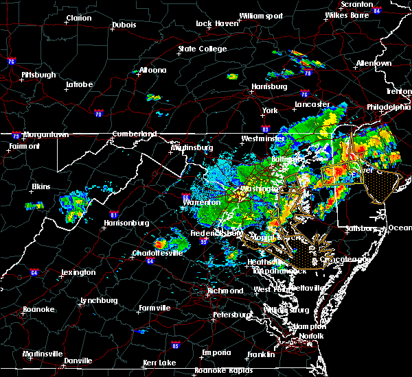 At 527 pm edt, a severe thunderstorm was located over orange, moving east at 25 mph (radar indicated. previous development of the storm caused damage in stanardsville in greene county). Hazards include 60 mph wind gusts and quarter size hail. Damaging winds will cause some trees and large branches to fall. this could injure those outdoors, as well as damage homes and vehicles. roadways may become blocked by downed trees. localized power outages are possible. Unsecured light objects may become projectiles. At 527 pm edt, a severe thunderstorm was located over orange, moving east at 25 mph (radar indicated. previous development of the storm caused damage in stanardsville in greene county). Hazards include 60 mph wind gusts and quarter size hail. Damaging winds will cause some trees and large branches to fall. this could injure those outdoors, as well as damage homes and vehicles. roadways may become blocked by downed trees. localized power outages are possible. Unsecured light objects may become projectiles.
|
| 7/18/2016 5:08 PM EDT |
 At 507 pm edt, a severe thunderstorm was located near orange, moving east at 25 mph (radar indicated). Hazards include 60 mph wind gusts and quarter size hail. Damaging winds will cause some trees and large branches to fall. this could injure those outdoors, as well as damage homes and vehicles. roadways may become blocked by downed trees. localized power outages are possible. unsecured light objects may become projectiles. Locations impacted include, orange, madison run, somerset, montford, montpelier station, old somerset, twymans mill, dawsonville, locust dale, rochelle, aroda and madison mills. At 507 pm edt, a severe thunderstorm was located near orange, moving east at 25 mph (radar indicated). Hazards include 60 mph wind gusts and quarter size hail. Damaging winds will cause some trees and large branches to fall. this could injure those outdoors, as well as damage homes and vehicles. roadways may become blocked by downed trees. localized power outages are possible. unsecured light objects may become projectiles. Locations impacted include, orange, madison run, somerset, montford, montpelier station, old somerset, twymans mill, dawsonville, locust dale, rochelle, aroda and madison mills.
|
| 7/18/2016 4:40 PM EDT |
 At 440 pm edt, severe thunderstorms were located along a line extending from 7 miles west of madison to near stanardsville, moving east at 20 mph (radar indicated). Hazards include 60 mph wind gusts and half dollar size hail. Damaging winds will cause some trees and large branches to fall. this could injure those outdoors, as well as damage homes and vehicles. roadways may become blocked by downed trees. localized power outages are possible. unsecured light objects may become projectiles. Locations impacted include, orange, madison, stanardsville, ruckersville, brightwood, somerset, banco, haywood, quinque, shelby, reva, oakpark, amicus, montpelier station, twymans mill, fordsville, eheart, madison mills, leon and montford. At 440 pm edt, severe thunderstorms were located along a line extending from 7 miles west of madison to near stanardsville, moving east at 20 mph (radar indicated). Hazards include 60 mph wind gusts and half dollar size hail. Damaging winds will cause some trees and large branches to fall. this could injure those outdoors, as well as damage homes and vehicles. roadways may become blocked by downed trees. localized power outages are possible. unsecured light objects may become projectiles. Locations impacted include, orange, madison, stanardsville, ruckersville, brightwood, somerset, banco, haywood, quinque, shelby, reva, oakpark, amicus, montpelier station, twymans mill, fordsville, eheart, madison mills, leon and montford.
|
| 7/18/2016 4:30 PM EDT |
 At 430 pm edt, severe thunderstorms were located along a line extending from 9 miles west of madison to near stanardsville, moving east at 15 mph (radar indicated). Hazards include 60 mph wind gusts. Damaging winds will cause some trees and large branches to fall. this could injure those outdoors, as well as damage homes and vehicles. roadways may become blocked by downed trees. localized power outages are possible. Unsecured light objects may become projectiles. At 430 pm edt, severe thunderstorms were located along a line extending from 9 miles west of madison to near stanardsville, moving east at 15 mph (radar indicated). Hazards include 60 mph wind gusts. Damaging winds will cause some trees and large branches to fall. this could injure those outdoors, as well as damage homes and vehicles. roadways may become blocked by downed trees. localized power outages are possible. Unsecured light objects may become projectiles.
|
| 6/16/2016 8:43 PM EDT | Large tree down on zachary taylor highway near terrys run roa in orange county VA, 11.5 miles WNW of Orange, VA |
| 6/16/2016 8:42 PM EDT | Two trees downed within two miles of residence in orange county VA, 10.2 miles NW of Orange, VA |
| 6/16/2016 8:35 PM EDT |
 At 835 pm edt, severe thunderstorms were located along a line extending from 8 miles south of linton hall to near boswells tavern, moving east at 65 mph (radar indicated). Hazards include 60 mph wind gusts. Damaging winds will cause some trees and large branches to fall. this could injure those outdoors, as well as damage homes and vehicles. roadways may become blocked by downed trees. localized power outages are possible. Unsecured light objects may become projectiles. At 835 pm edt, severe thunderstorms were located along a line extending from 8 miles south of linton hall to near boswells tavern, moving east at 65 mph (radar indicated). Hazards include 60 mph wind gusts. Damaging winds will cause some trees and large branches to fall. this could injure those outdoors, as well as damage homes and vehicles. roadways may become blocked by downed trees. localized power outages are possible. Unsecured light objects may become projectiles.
|
| 6/16/2016 8:33 PM EDT | Tree down in the 15000 block of mountain track roa in orange county VA, 2.6 miles N of Orange, VA |
| 6/16/2016 8:23 PM EDT |
 A severe thunderstorm warning remains in effect until 845 pm edt for southwestern orange. southeastern greene. southwestern culpeper. southeastern augusta. southern madison. albemarle and northeastern nelson counties and the city of charlottesville. at 823 pm edt. Severe thunderstorms were located along a line extending from near madison to near charlottesville to 10 miles. A severe thunderstorm warning remains in effect until 845 pm edt for southwestern orange. southeastern greene. southwestern culpeper. southeastern augusta. southern madison. albemarle and northeastern nelson counties and the city of charlottesville. at 823 pm edt. Severe thunderstorms were located along a line extending from near madison to near charlottesville to 10 miles.
|
| 6/16/2016 8:23 PM EDT |
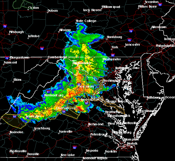 At 823 pm edt, severe thunderstorms were located along a line extending from 6 miles southwest of linton hall to 6 miles west of orange, moving east at 45 mph (radar indicated). Hazards include 60 mph wind gusts. Damaging winds will cause some trees and large branches to fall. this could injure those outdoors, as well as damage homes and vehicles. roadways may become blocked by downed trees. localized power outages are possible. unsecured light objects may become projectiles. Locations impacted include, fredericksburg, orange, massaponax, spotsylvania, falmouth, storck, bristersburg, sumerduck, post oak, lignum, flat run, spring valley, hartwood, heflin, rapidan, partlow, somerville, chancellorsville, thornhill and glendie. At 823 pm edt, severe thunderstorms were located along a line extending from 6 miles southwest of linton hall to 6 miles west of orange, moving east at 45 mph (radar indicated). Hazards include 60 mph wind gusts. Damaging winds will cause some trees and large branches to fall. this could injure those outdoors, as well as damage homes and vehicles. roadways may become blocked by downed trees. localized power outages are possible. unsecured light objects may become projectiles. Locations impacted include, fredericksburg, orange, massaponax, spotsylvania, falmouth, storck, bristersburg, sumerduck, post oak, lignum, flat run, spring valley, hartwood, heflin, rapidan, partlow, somerville, chancellorsville, thornhill and glendie.
|
| 6/16/2016 7:55 PM EDT | Half Dollar sized hail reported 10.2 miles NW of Orange, VA, half dollar size hail |
| 6/16/2016 7:55 PM EDT | Half Dollar sized hail reported 12.5 miles WNW of Orange, VA, 25 minutes of hail...largest was half dollar size |
| 6/16/2016 7:50 PM EDT | Tree down in the 18000 block of henderson lan in orange county VA, 9.8 miles NW of Orange, VA |
| 6/16/2016 7:48 PM EDT |
 At 748 pm edt, severe thunderstorms were located along a line extending from near shenandoah to near crimora to near sherando, moving east at 50 mph (radar indicated). Hazards include 60 mph wind gusts and quarter size hail. Damaging winds will cause some trees and large branches to fall. this could injure those outdoors, as well as damage homes and vehicles. roadways may become blocked by downed trees. localized power outages are possible. Unsecured light objects may become projectiles. At 748 pm edt, severe thunderstorms were located along a line extending from near shenandoah to near crimora to near sherando, moving east at 50 mph (radar indicated). Hazards include 60 mph wind gusts and quarter size hail. Damaging winds will cause some trees and large branches to fall. this could injure those outdoors, as well as damage homes and vehicles. roadways may become blocked by downed trees. localized power outages are possible. Unsecured light objects may become projectiles.
|
| 6/16/2016 7:42 PM EDT |
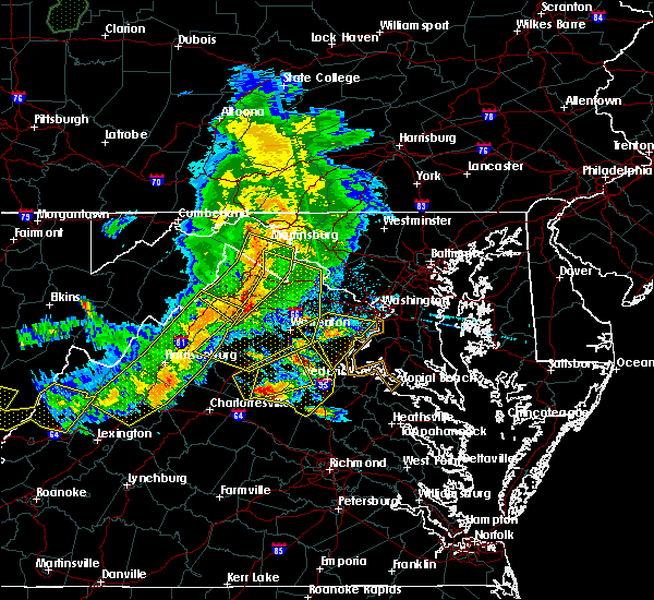 At 741 pm edt, doppler radar indicated a severe thunderstorm capable of producing half dollar size hail and destructive winds in excess of 70 mph. this storm was located 7 miles southeast of orange, and moving east at 25 mph. At 741 pm edt, doppler radar indicated a severe thunderstorm capable of producing half dollar size hail and destructive winds in excess of 70 mph. this storm was located 7 miles southeast of orange, and moving east at 25 mph.
|
| 6/16/2016 7:22 PM EDT | Quarter sized hail reported 1.7 miles SSE of Orange, VA |
| 6/16/2016 7:13 PM EDT | Very large tree down in the 10000 block of constitution highwa in orange county VA, 5.2 miles ENE of Orange, VA |
| 6/16/2016 6:58 PM EDT |
 At 657 pm edt, a severe thunderstorm was located over orange, moving east at 40 mph (radar indicated). Hazards include 60 mph wind gusts and quarter size hail. Damaging winds will cause some trees and large branches to fall. this could injure those outdoors, as well as damage homes and vehicles. roadways may become blocked by downed trees. localized power outages are possible. Unsecured light objects may become projectiles. At 657 pm edt, a severe thunderstorm was located over orange, moving east at 40 mph (radar indicated). Hazards include 60 mph wind gusts and quarter size hail. Damaging winds will cause some trees and large branches to fall. this could injure those outdoors, as well as damage homes and vehicles. roadways may become blocked by downed trees. localized power outages are possible. Unsecured light objects may become projectiles.
|
| 6/16/2016 4:40 PM EDT | The severe thunderstorm warning for southwestern orange and southeastern madison counties will expire at 445 pm edt, the storm which prompted the warning has weakened, and no longer pose an immediate threat to life or property. therefore the warning will be allowed to expire. a severe thunderstorm watch remains in effect until 1000 pm edt for northwestern virginia. |
| 6/16/2016 4:32 PM EDT |
 At 432 pm edt, a severe thunderstorm was located near orange, moving southeast at 20 mph (radar indicated). Hazards include 60 mph wind gusts and quarter size hail. Damaging winds will cause some trees and large branches to fall. this could injure those outdoors, as well as damage homes and vehicles. roadways may become blocked by downed trees. localized power outages are possible. unsecured light objects may become projectiles. Locations impacted include, orange, gordonsville, madison run, somerset, montford, montpelier station, old somerset, lahore and madison mills. At 432 pm edt, a severe thunderstorm was located near orange, moving southeast at 20 mph (radar indicated). Hazards include 60 mph wind gusts and quarter size hail. Damaging winds will cause some trees and large branches to fall. this could injure those outdoors, as well as damage homes and vehicles. roadways may become blocked by downed trees. localized power outages are possible. unsecured light objects may become projectiles. Locations impacted include, orange, gordonsville, madison run, somerset, montford, montpelier station, old somerset, lahore and madison mills.
|
| 6/16/2016 4:28 PM EDT | Tree down on locust grove church rd in madison county VA, 5.6 miles ESE of Orange, VA |
| 6/16/2016 4:15 PM EDT |
 At 415 pm edt, a severe thunderstorm was located near madison, moving southeast at 25 mph (radar indicated). Hazards include 60 mph wind gusts and quarter size hail. Damaging winds will cause some trees and large branches to fall. this could injure those outdoors, as well as damage homes and vehicles. roadways may become blocked by downed trees. localized power outages are possible. unsecured light objects may become projectiles. Locations impacted include, orange, madison, gordonsville, brightwood, somerset, montford, old somerset, lahore, locust dale, rapidan, shelby, madison run, unionville, oakpark, pratts, montpelier station, twymans mill, nasons, rochelle and aroda. At 415 pm edt, a severe thunderstorm was located near madison, moving southeast at 25 mph (radar indicated). Hazards include 60 mph wind gusts and quarter size hail. Damaging winds will cause some trees and large branches to fall. this could injure those outdoors, as well as damage homes and vehicles. roadways may become blocked by downed trees. localized power outages are possible. unsecured light objects may become projectiles. Locations impacted include, orange, madison, gordonsville, brightwood, somerset, montford, old somerset, lahore, locust dale, rapidan, shelby, madison run, unionville, oakpark, pratts, montpelier station, twymans mill, nasons, rochelle and aroda.
|
| 6/16/2016 3:56 PM EDT |
 At 356 pm edt, a severe thunderstorm was located near madison, moving southeast at 25 mph (radar indicated). Hazards include 60 mph wind gusts and quarter size hail. Damaging winds will cause some trees and large branches to fall. this could injure those outdoors, as well as damage homes and vehicles. roadways may become blocked by downed trees. localized power outages are possible. Unsecured light objects may become projectiles. At 356 pm edt, a severe thunderstorm was located near madison, moving southeast at 25 mph (radar indicated). Hazards include 60 mph wind gusts and quarter size hail. Damaging winds will cause some trees and large branches to fall. this could injure those outdoors, as well as damage homes and vehicles. roadways may become blocked by downed trees. localized power outages are possible. Unsecured light objects may become projectiles.
|
| 6/4/2016 7:09 PM EDT |
 The severe thunderstorm warning for southwestern orange, southeastern greene, southern madison and northeastern albemarle counties will expire at 715 pm edt, the storm which prompted the warning has weakened, and no longer pose an immediate threat to life or property. therefore the warning will be allowed to expire. however heavy rain is still possible with this thunderstorm. The severe thunderstorm warning for southwestern orange, southeastern greene, southern madison and northeastern albemarle counties will expire at 715 pm edt, the storm which prompted the warning has weakened, and no longer pose an immediate threat to life or property. therefore the warning will be allowed to expire. however heavy rain is still possible with this thunderstorm.
|
| 6/4/2016 6:48 PM EDT |
 At 648 pm edt, a severe thunderstorm was located near stanardsville, or 9 miles southwest of madison, moving east at 15 mph (radar indicated). Hazards include 60 mph wind gusts and quarter size hail. Damaging winds will cause some trees and large branches to fall. this could injure those outdoors, as well as damage homes and vehicles. roadways may become blocked by downed trees. localized power outages are possible. unsecured light objects may become projectiles. Locations impacted include, stanardsville, ruckersville, somerset, montford, barboursville, old somerset, advance mills, burtonville, quinque, shelby, newtown, montpelier station, dawsonville, eheart, rochelle and madison mills. At 648 pm edt, a severe thunderstorm was located near stanardsville, or 9 miles southwest of madison, moving east at 15 mph (radar indicated). Hazards include 60 mph wind gusts and quarter size hail. Damaging winds will cause some trees and large branches to fall. this could injure those outdoors, as well as damage homes and vehicles. roadways may become blocked by downed trees. localized power outages are possible. unsecured light objects may become projectiles. Locations impacted include, stanardsville, ruckersville, somerset, montford, barboursville, old somerset, advance mills, burtonville, quinque, shelby, newtown, montpelier station, dawsonville, eheart, rochelle and madison mills.
|
| 6/4/2016 6:22 PM EDT |
 At 622 pm edt, a severe thunderstorm was located over stanardsville, or 13 miles southwest of madison, moving east at 20 mph (radar indicated). Hazards include 60 mph wind gusts and quarter size hail. Damaging winds will cause some trees and large branches to fall. this could injure those outdoors, as well as damage homes and vehicles. roadways may become blocked by downed trees. localized power outages are possible. Unsecured light objects may become projectiles. At 622 pm edt, a severe thunderstorm was located over stanardsville, or 13 miles southwest of madison, moving east at 20 mph (radar indicated). Hazards include 60 mph wind gusts and quarter size hail. Damaging winds will cause some trees and large branches to fall. this could injure those outdoors, as well as damage homes and vehicles. roadways may become blocked by downed trees. localized power outages are possible. Unsecured light objects may become projectiles.
|
| 5/3/2016 3:48 PM EDT | Tree down on brick church road near lahore road in orange county VA, 3 miles WNW of Orange, VA |
| 2/24/2016 5:07 PM EST |
 The severe thunderstorm warning for orange, south central culpeper, eastern madison and west central spotsylvania counties will expire at 515 pm est, the storm which prompted the warning has moved out of the area. therefore the warning will be allowed to expire. additional severe thunderstorm development remains possible, and a tornado watch remains in effect until 11 pm est. The severe thunderstorm warning for orange, south central culpeper, eastern madison and west central spotsylvania counties will expire at 515 pm est, the storm which prompted the warning has moved out of the area. therefore the warning will be allowed to expire. additional severe thunderstorm development remains possible, and a tornado watch remains in effect until 11 pm est.
|
| 2/24/2016 4:46 PM EST | Numerous trees down in orange county VA, 6.8 miles WNW of Orange, VA |
| 2/24/2016 4:42 PM EST |
 At 441 pm est, doppler radar indicated a severe thunderstorm capable of producing quarter size hail and damaging winds in excess of 60 mph. this storm was located near louisa, moving northeast at 60 mph. locations impacted include, orange, gordonsville, mitchells, lahore, belmont, winston, verdiersville, raccoon ford, logan, rapidan, madison run, thornhill, rhoadesville, unionville, everona, gold dale, nasons and mine run. a tornado watch remains in effect until 1100 pm est for northern virginia. At 441 pm est, doppler radar indicated a severe thunderstorm capable of producing quarter size hail and damaging winds in excess of 60 mph. this storm was located near louisa, moving northeast at 60 mph. locations impacted include, orange, gordonsville, mitchells, lahore, belmont, winston, verdiersville, raccoon ford, logan, rapidan, madison run, thornhill, rhoadesville, unionville, everona, gold dale, nasons and mine run. a tornado watch remains in effect until 1100 pm est for northern virginia.
|
| 2/24/2016 4:34 PM EST |
 At 433 pm est, doppler radar indicated a severe thunderstorm capable of producing quarter size hail and damaging winds in excess of 60 mph. this storm was located near ferncliff, or near louisa, and moving northeast at 35 mph. At 433 pm est, doppler radar indicated a severe thunderstorm capable of producing quarter size hail and damaging winds in excess of 60 mph. this storm was located near ferncliff, or near louisa, and moving northeast at 35 mph.
|
| 7/14/2015 7:58 PM EDT | The severe thunderstorm warning for southeastern greene. central orange. southwestern culpeper and southern madison counties will expire at 800 pm edt. the storm which prompted the warning has weakened below severe limits. and no longer poses an immediate threat to life or property. Therefore the warning will be allowed to expire. |
| 7/14/2015 7:39 PM EDT |
 At 739 pm edt, doppler radar indicated a severe thunderstorm capable of producing quarter size hail and damaging winds in excess of 60 mph. this storm was located near orange, moving east at 30 mph. locations impacted include, culpeper, orange, madison, somerset, brightwood, rapidan, shelby, oakpark, montpelier station, twymans mill, fordsville, madison mills, mitchells, leon, montford, old somerset, locust dale, winston, wolftown and burtonville. At 739 pm edt, doppler radar indicated a severe thunderstorm capable of producing quarter size hail and damaging winds in excess of 60 mph. this storm was located near orange, moving east at 30 mph. locations impacted include, culpeper, orange, madison, somerset, brightwood, rapidan, shelby, oakpark, montpelier station, twymans mill, fordsville, madison mills, mitchells, leon, montford, old somerset, locust dale, winston, wolftown and burtonville.
|
| 7/14/2015 7:11 PM EDT |
 At 711 pm edt, doppler radar indicated a severe thunderstorm capable of producing quarter size hail and damaging winds in excess of 60 mph. this storm was located near stanardsville, or 7 miles west of madison, and moving east at 30 mph. At 711 pm edt, doppler radar indicated a severe thunderstorm capable of producing quarter size hail and damaging winds in excess of 60 mph. this storm was located near stanardsville, or 7 miles west of madison, and moving east at 30 mph.
|
| 7/1/2015 12:13 AM EDT | The severe thunderstorm warning for northeastern albemarle, northwestern spotsylvania, orange, southeastern madison and south central culpeper counties will expire at 1215 am edt, the storm which prompted the warning has weakened below severe limits and exited the warned area. therefore the warning will be allowed to expire. |
| 6/30/2015 11:55 PM EDT |
 At 1154 pm edt, doppler radar indicated a severe thunderstorm capable of producing quarter size hail and damaging winds in excess of 60 mph. this storm was located over orange, moving northeast at 30 mph. locations impacted include, orange, gordonsville, mitchells, somerset, locust grove, montford, lahore, verdiersville, raccoon ford, rapidan, burr hill, madison run, thornhill, rhoadesville, unionville, everona, montpelier station, gold dale, nasons and mine run. At 1154 pm edt, doppler radar indicated a severe thunderstorm capable of producing quarter size hail and damaging winds in excess of 60 mph. this storm was located over orange, moving northeast at 30 mph. locations impacted include, orange, gordonsville, mitchells, somerset, locust grove, montford, lahore, verdiersville, raccoon ford, rapidan, burr hill, madison run, thornhill, rhoadesville, unionville, everona, montpelier station, gold dale, nasons and mine run.
|
| 6/30/2015 11:44 PM EDT |
 At 1144 pm edt, doppler radar indicated a severe thunderstorm capable of producing quarter size hail and damaging winds in excess of 60 mph. this storm was located near orange, and moving northeast at 30 mph. At 1144 pm edt, doppler radar indicated a severe thunderstorm capable of producing quarter size hail and damaging winds in excess of 60 mph. this storm was located near orange, and moving northeast at 30 mph.
|
| 6/20/2015 7:57 PM EDT |
 At 757 pm edt, doppler radar indicated a line of severe thunderstorms capable of producing damaging winds in excess of 60 mph. these storms were located along a line extending from boswells tavern to near oilville to near wilsons, and moving northeast at 65 mph. At 757 pm edt, doppler radar indicated a line of severe thunderstorms capable of producing damaging winds in excess of 60 mph. these storms were located along a line extending from boswells tavern to near oilville to near wilsons, and moving northeast at 65 mph.
|
| 5/29/2015 2:50 PM EDT | The severe thunderstorm warning for southwestern orange, southeastern madison and southwestern culpeper counties will expire at 300 pm edt, the storm which prompted the warning has weakened below severe limits, and no longer poses an immediate threat to life or property. therefore the warning will be allowed to expire. |
| 5/29/2015 2:43 PM EDT | At 242 pm edt, doppler radar indicated a severe thunderstorm capable of producing quarter size hail and damaging winds in excess of 60 mph. this storm was located near orange. this storm was nearly stationary. locations impacted include, orange, gordonsville, madison run, somerset, montford, montpelier station, old somerset, rapidan and madison mills. |
| 5/29/2015 2:24 PM EDT | At 224 pm edt, doppler radar indicated a severe thunderstorm capable of producing quarter size hail and damaging winds in excess of 60 mph. this storm was located near orange, and moving north at 20 mph. |
| 5/6/2015 8:14 PM EDT | A tree was reported down in the roadway on rapidan road near clarks mountain roa in orange county VA, 4.9 miles SW of Orange, VA |
| 5/6/2015 8:09 PM EDT | The severe thunderstorm warning for central orange county will expire at 815 pm edt, the storm which prompted the warning has weakened below severe limits, and no longer poses an immediate threat to life or property. therefore the warning will be allowed to expire. however heavy rain is still possible with this thunderstorm. |
| 5/6/2015 8:07 PM EDT | At 806 pm edt, doppler radar indicated a severe thunderstorm capable of producing quarter size hail. this storm was located 5 miles southeast of orange, moving south at 20 mph. locations impacted include, orange, thornhill, rhoadesville, unionville, everona, lahore, nasons and verdiersville. |
| 5/6/2015 8:00 PM EDT | At 758 pm edt, doppler radar indicated a severe thunderstorm capable of producing quarter size hail. this storm was located near orange, moving south at 20 mph. locations impacted include, orange, mitchells, thornhill, rhoadesville, unionville, everona, lahore, nasons, winston, verdiersville, raccoon ford and rapidan. |
| 5/6/2015 7:50 PM EDT | At 749 pm edt, doppler radar indicated a severe thunderstorm capable of producing quarter size hail. this storm was located just northeast of orange, or 14 miles south of culpeper, moving south at 20 mph. locations impacted include, culpeper, orange, mitchells, lahore, belmont, glenora, winston, verdiersville, raccoon ford, rapidan, thornhill, rhoadesville, unionville, everona and nasons. |
| 5/6/2015 7:39 PM EDT | At 737 pm edt, doppler radar indicated a severe thunderstorm capable of producing quarter size hail and damaging winds of 60 mph. this storm was located 7 miles northeast of orange, or 9 miles south of culpeper, and moving south at 20 mph. |
| 8/20/2014 6:48 PM EDT | Tree down near intersection of lahore rd and brick church rd in orange county VA, 3.3 miles W of Orange, VA |
| 8/20/2014 6:46 PM EDT | Tree down near intersection of monrovia rd and brick church rd in orange county VA, 2.5 miles WNW of Orange, VA |
| 8/20/2014 6:46 PM EDT | Tree down near intersection of lahore rd and constitution highway in orange county VA, 2.8 miles W of Orange, VA |
| 8/20/2014 6:46 PM EDT | Tree down near intersection of lahore rd and constitution highway in orange county VA, 2.8 miles W of Orange, VA |
| 5/15/2014 3:33 PM EDT | A tree was reported down blocking clifton road near hopewell road in rapida in orange county VA, 0.2 miles S of Orange, VA |
| 6/26/2013 2:36 PM EDT | Tree over roa in orange county VA, 2.8 miles SE of Orange, VA |
| 6/26/2013 2:33 PM EDT | Multiple trees down in orange county VA, 4.8 miles SSW of Orange, VA |
| 6/26/2013 2:29 PM EDT | Tree over roa in orange county VA, 5.1 miles SSW of Orange, VA |
| 4/19/2013 6:07 PM EDT | Tree down on va state hwy 20 approximately one half mile east of orange v in orange county VA, 1.1 miles W of Orange, VA |
| 9/18/2012 1:36 PM EDT | Tree down along george james loo in madison county VA, 6.1 miles SE of Orange, VA |
| 9/6/2012 7:49 AM EDT | 12 inch diameter oak tree snapped off halfway up in orange county VA, 9.7 miles WSW of Orange, VA |
| 6/29/2012 11:22 PM EDT | One and a half to two feet diameter tree blocking roadway of rt 617 in orange county VA, 8.9 miles WSW of Orange, VA |
| 6/29/2012 10:05 PM EDT | One and a half to two feet diameter tree blocking roadway of rt 617 in orange county VA, 8.9 miles WSW of Orange, VA |
| 6/29/2012 10:00 PM EDT | Numerous 4 to 6 in limbs down. power out. route 62 in orange county VA, 0.2 miles S of Orange, VA |
| 6/29/2012 10:00 PM EDT | Trees down on route 20 and route 52 in orange county VA, 8.3 miles W of Orange, VA |
| 6/24/2012 3:42 PM EDT | Branches down on roadwa in orange county VA, 5 miles ENE of Orange, VA |
| 6/22/2012 8:27 PM EDT | Report of trees down near orange va due to strong thunderstorm wind in orange county VA, 0.2 miles S of Orange, VA |
| 1/1/0001 12:00 AM | 2 large trees across jacksontown road near anderson driv in orange county VA, 5 miles ENE of Orange, VA |
| 1/1/0001 12:00 AM | Tree down over roa in orange county VA, 3.3 miles N of Orange, VA |
| 1/1/0001 12:00 AM | Numerous trees down as well as several power poles down in orange county VA, 1.3 miles NNE of Orange, VA |
| 1/1/0001 12:00 AM | Tree down over road in orange county VA, 0.6 miles WSW of Orange, VA |
| 1/1/0001 12:00 AM | Tree down into hom in orange county VA, 1.1 miles E of Orange, VA |
| 1/1/0001 12:00 AM | Tree over roa in orange county VA, 2.7 miles SE of Orange, VA |
| 1/1/0001 12:00 AM | Tree down in 7200 block of rapidan r in orange county VA, 4.5 miles SW of Orange, VA |
| 1/1/0001 12:00 AM | Ping Pong Ball sized hail reported 7.9 miles WNW of Orange, VA, ping pong ball size hail fell for 10 minutes |
| 1/1/0001 12:00 AM | Quarter sized hail reported 9.4 miles NW of Orange, VA |
Hail Maps for Orange, VA


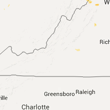


Connect with Interactive Hail Maps