

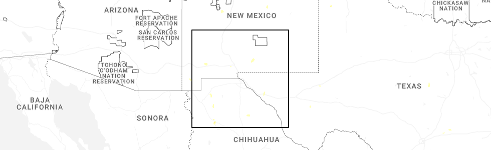
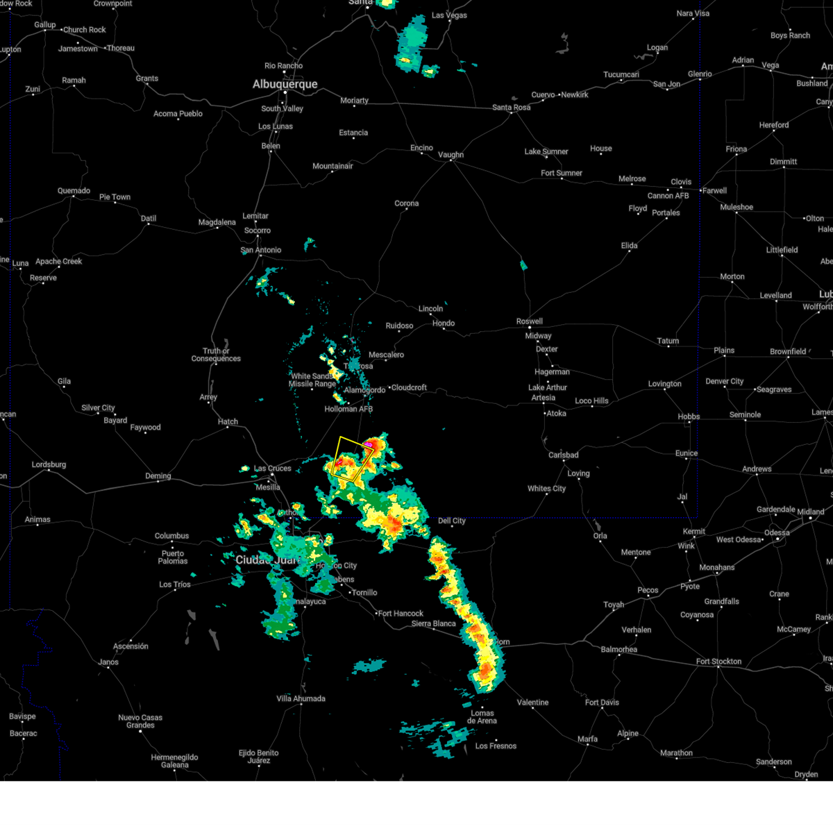
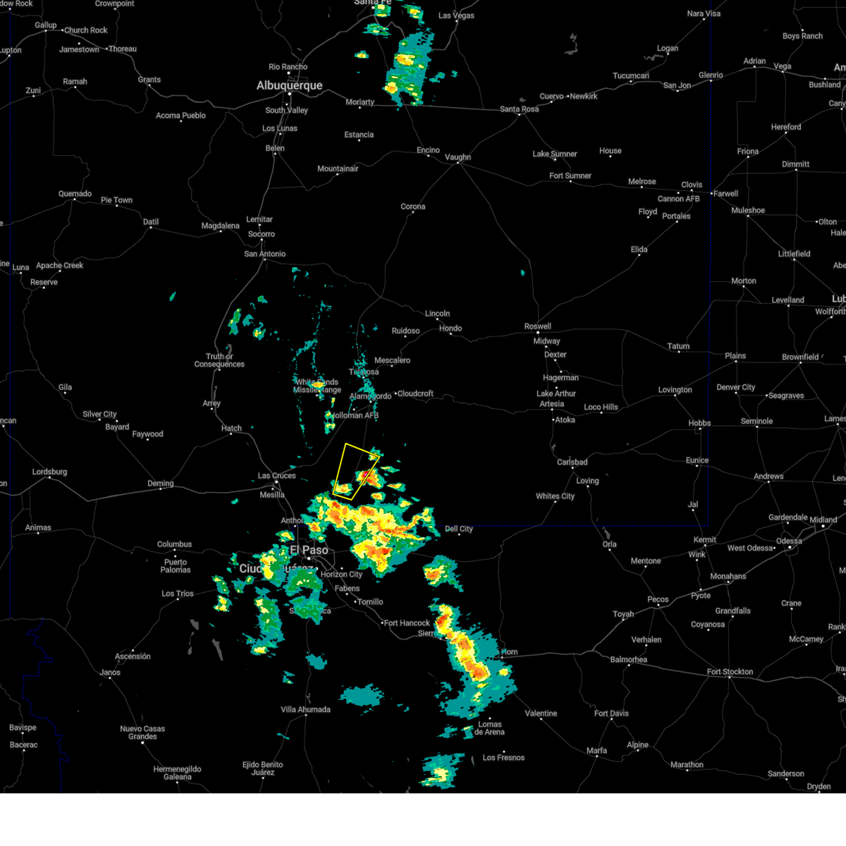
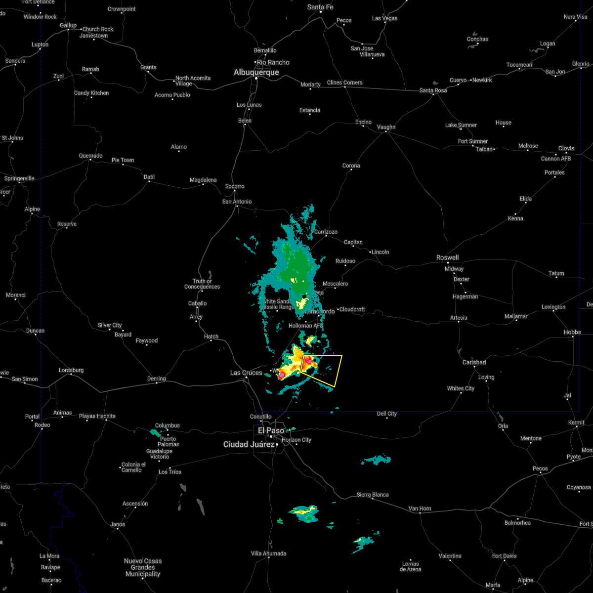
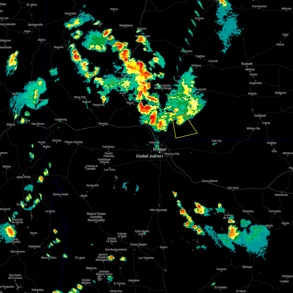
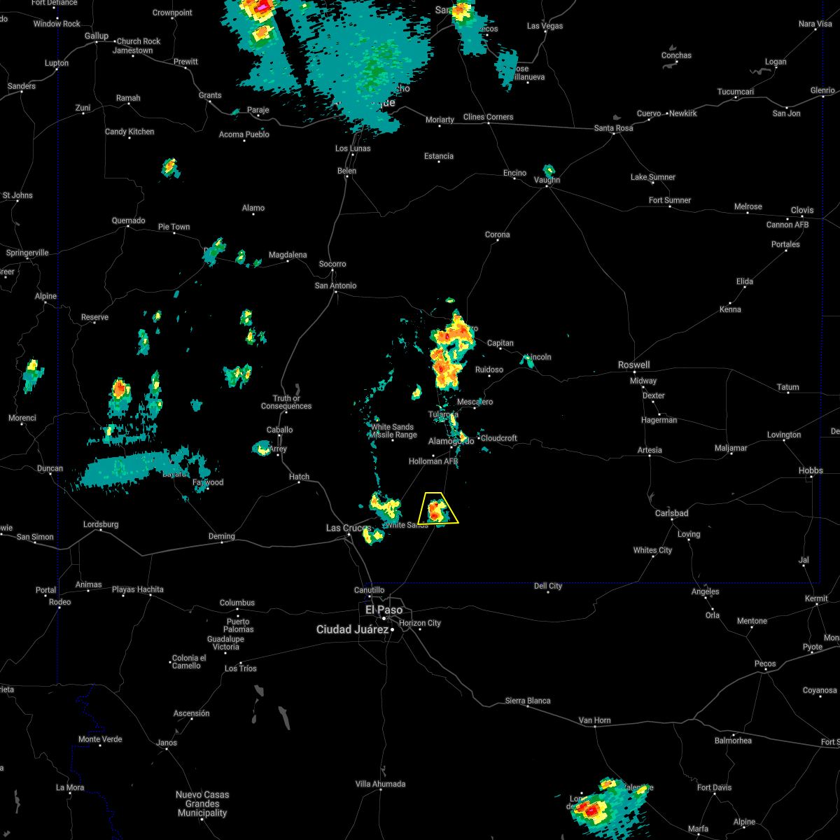
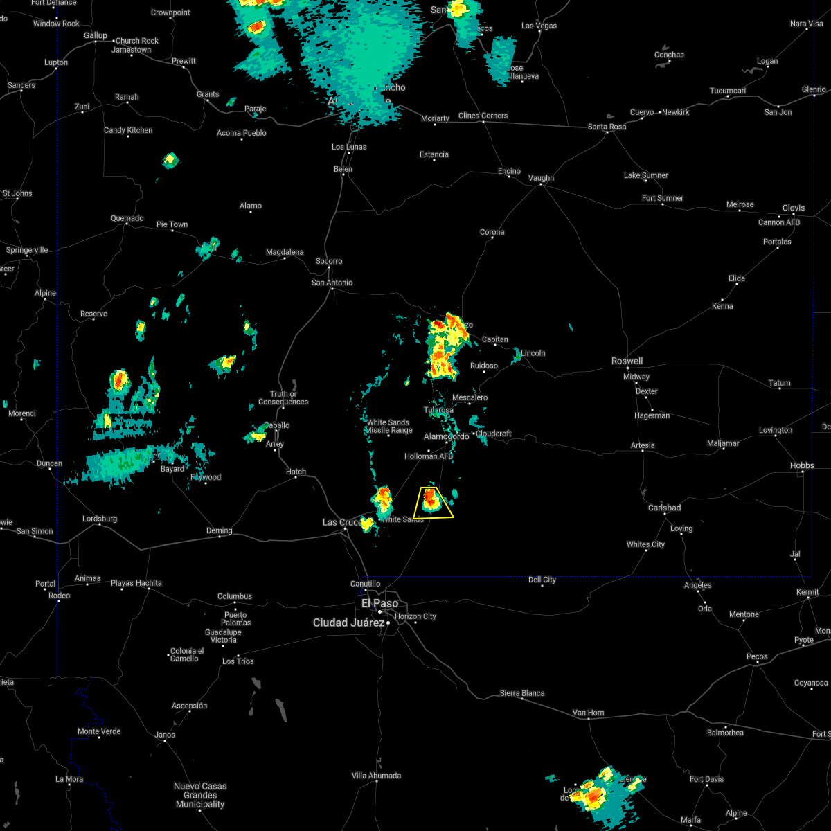
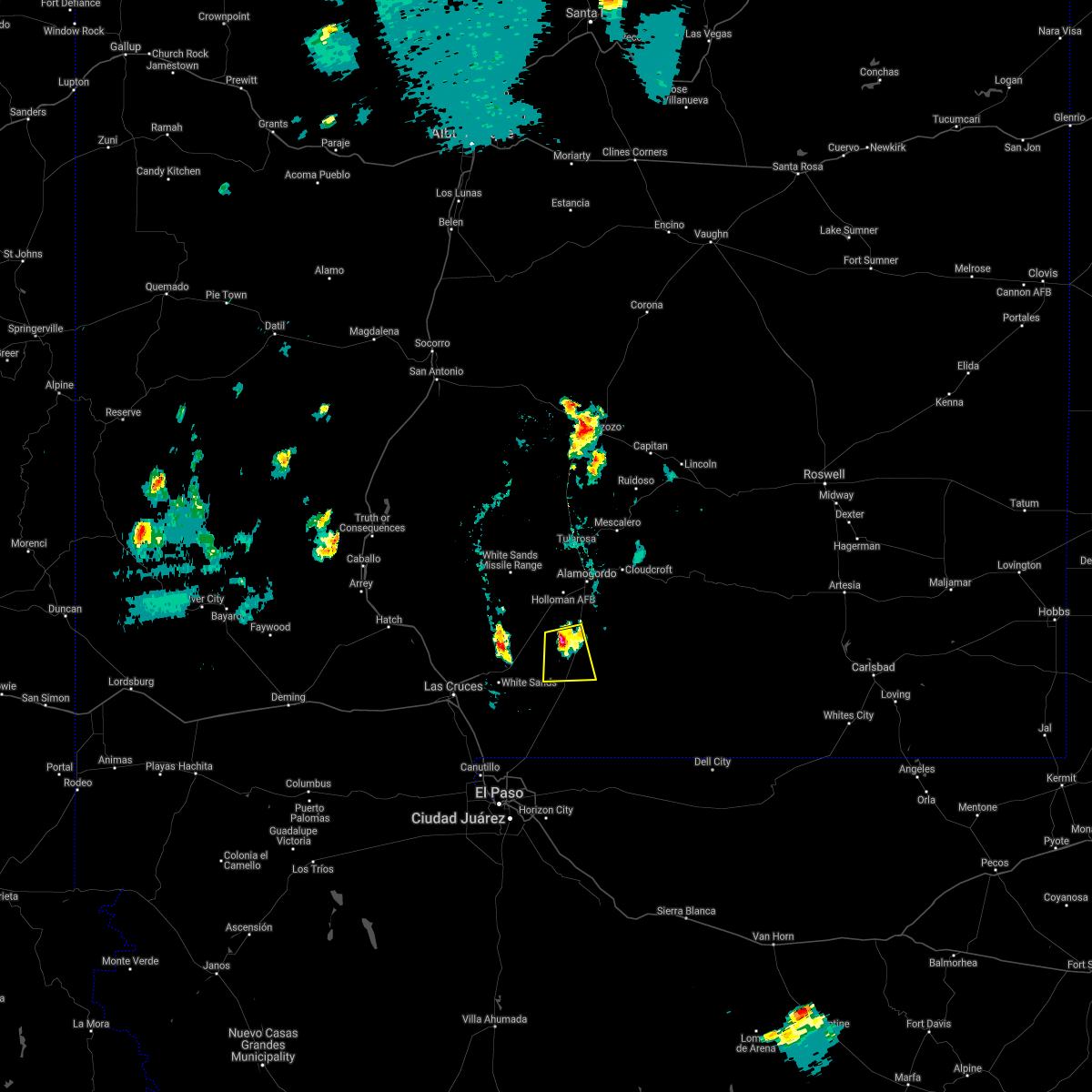
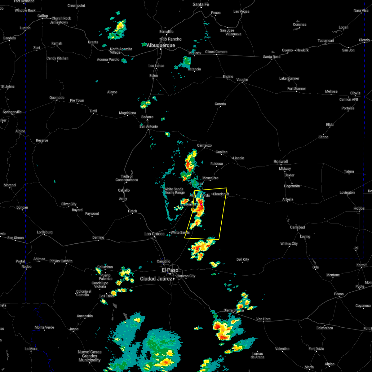
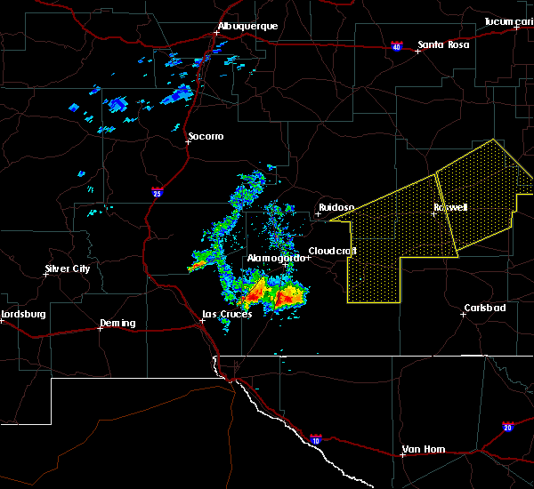
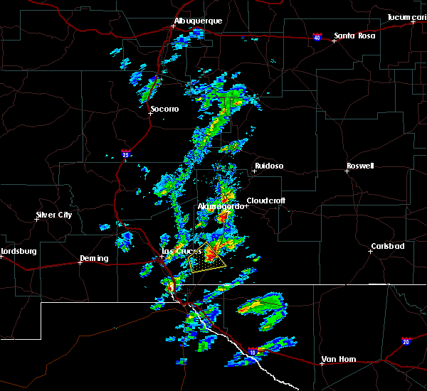
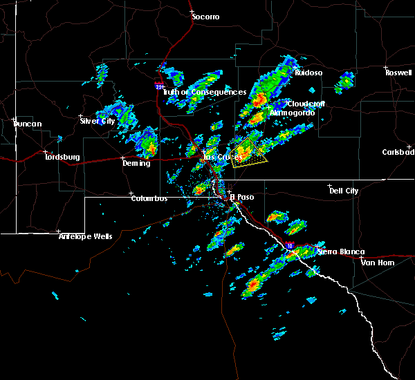
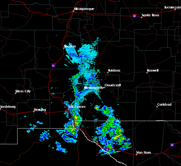
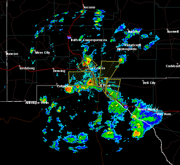
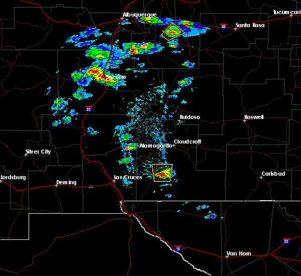
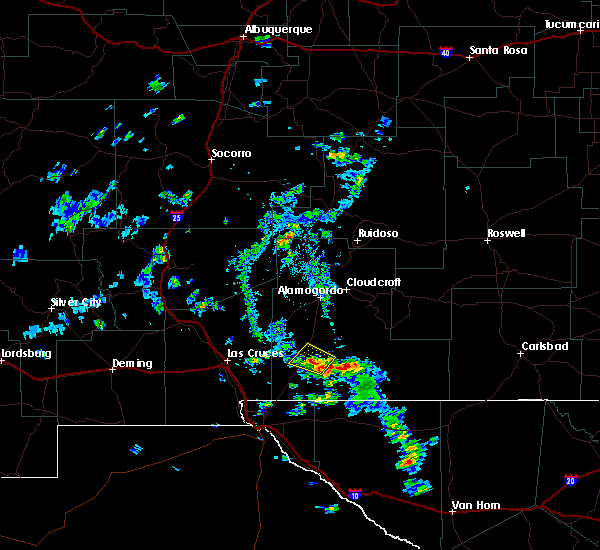
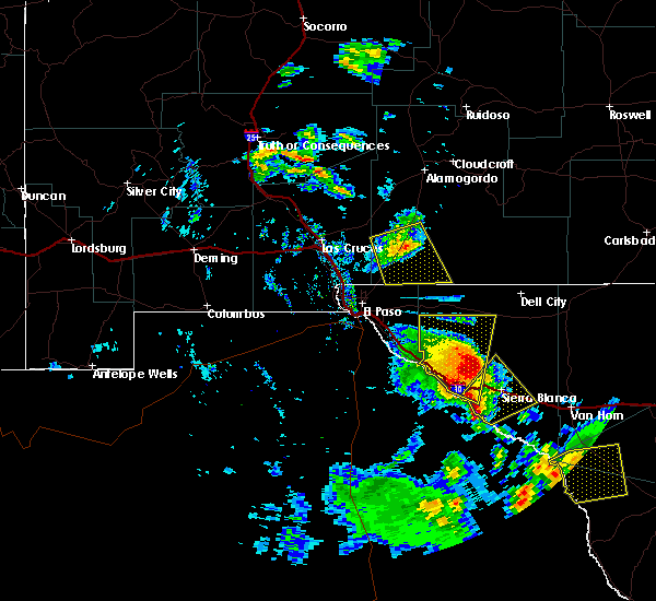
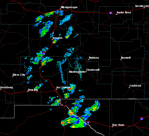
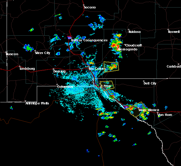
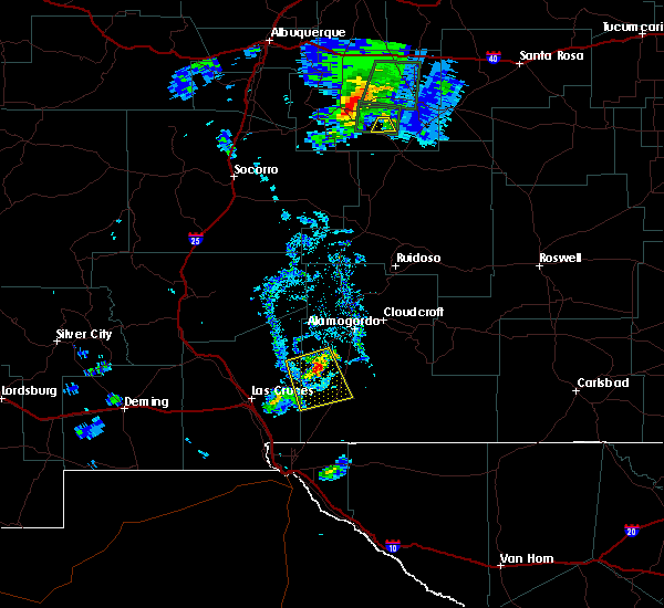
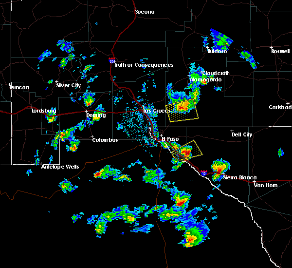
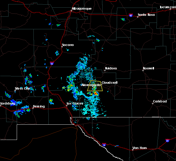
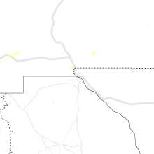
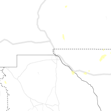
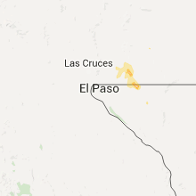
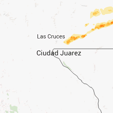
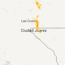
Hail Map for Orogrande, NM
The Orogrande, NM area has had 0 reports of on-the-ground hail by trained spotters, and has been under severe weather warnings 2 times during the past 12 months. Doppler radar has detected hail at or near Orogrande, NM on 23 occasions, including 2 occasions during the past year.
| Name: | Orogrande, NM |
| Where Located: | 49.4 miles NNE of El Paso, TX |
| Map: | Google Map for Orogrande, NM |
| Population: | 52 |
| Housing Units: | 43 |
| More Info: | Search Google for Orogrande, NM |
0
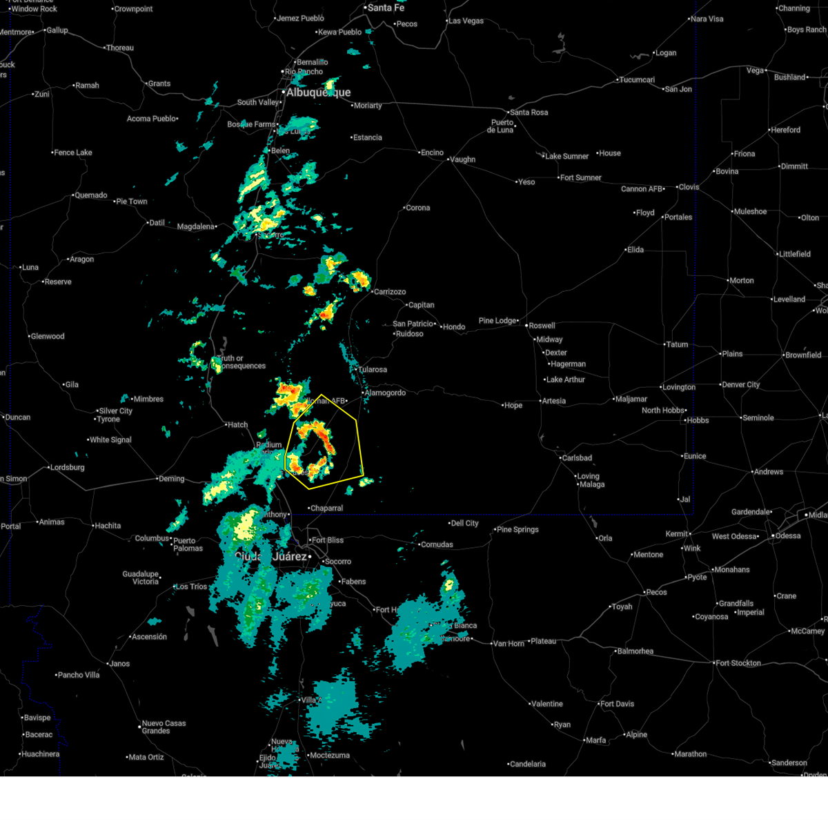
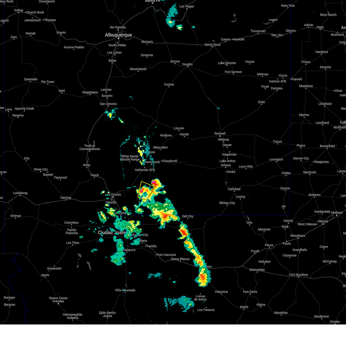
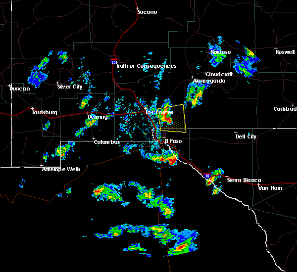
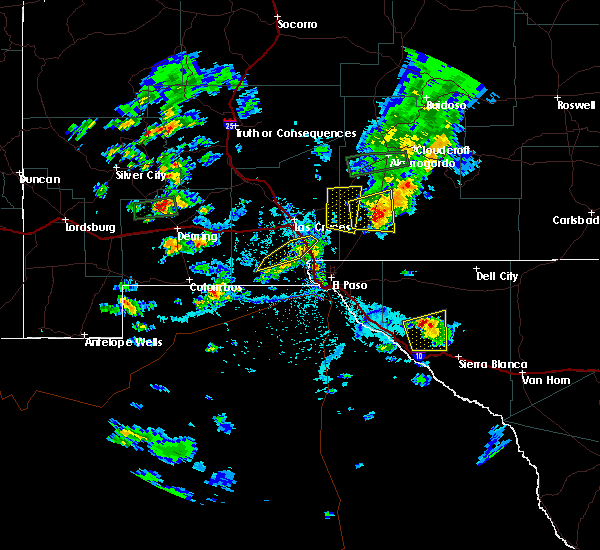
The Top Recent Hail Date for Orogrande, NM is Wednesday, June 25, 2025 (22nd out of 23)
Hail and Wind Damage Spotted near Orogrande, NM
| Date / Time | Report Details |
|---|---|
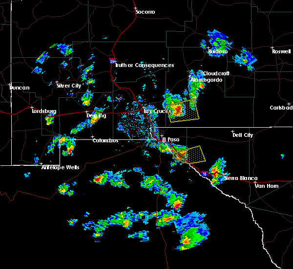
| 6/23/2025 9:48 PM MDT |
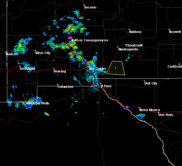
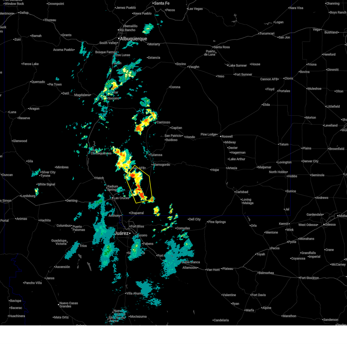 At 947 pm mdt, a severe thunderstorm was located 13 miles south of white sands national park, moving east at 5 mph (radar indicated). Hazards include 60 mph wind gusts and penny size hail. Expect damage to roofs, siding, and trees. Locations impacted include, white sands national park, orogrande, lake lucero, and oro grande range complex. At 947 pm mdt, a severe thunderstorm was located 13 miles south of white sands national park, moving east at 5 mph (radar indicated). Hazards include 60 mph wind gusts and penny size hail. Expect damage to roofs, siding, and trees. Locations impacted include, white sands national park, orogrande, lake lucero, and oro grande range complex.
|
| 6/23/2025 9:26 PM MDT |
 Svrepz the national weather service in el paso has issued a * severe thunderstorm warning for, southwestern otero county in south central new mexico, east central dona ana county in south central new mexico, * until 1015 pm mdt. * at 926 pm mdt, a severe thunderstorm was located 14 miles south of white sands national park, moving east at 5 mph (radar indicated). Hazards include 60 mph wind gusts and penny size hail. expect damage to roofs, siding, and trees Svrepz the national weather service in el paso has issued a * severe thunderstorm warning for, southwestern otero county in south central new mexico, east central dona ana county in south central new mexico, * until 1015 pm mdt. * at 926 pm mdt, a severe thunderstorm was located 14 miles south of white sands national park, moving east at 5 mph (radar indicated). Hazards include 60 mph wind gusts and penny size hail. expect damage to roofs, siding, and trees
|
| 9/30/2023 8:27 PM MDT |
 The severe thunderstorm warning for southwestern otero county will expire at 830 pm mdt, the storm which prompted the warning has weakened below severe limits, and no longer poses an immediate threat to life or property. therefore, the warning will be allowed to expire. however, small hail and gusty winds are still possible with this thunderstorm. The severe thunderstorm warning for southwestern otero county will expire at 830 pm mdt, the storm which prompted the warning has weakened below severe limits, and no longer poses an immediate threat to life or property. therefore, the warning will be allowed to expire. however, small hail and gusty winds are still possible with this thunderstorm.
|
| 9/30/2023 8:11 PM MDT |
 At 811 pm mdt, a severe thunderstorm was located near orogrande, moving northeast at 35 mph (radar indicated). Hazards include 60 mph wind gusts and quarter size hail. Hail damage to vehicles is expected. expect wind damage to roofs, siding, and trees. locations impacted include, orogrande. this includes highway 54 in new mexico between mile markers 24 and 41. hail threat, radar indicated max hail size, 1. 00 in wind threat, radar indicated max wind gust, 60 mph. At 811 pm mdt, a severe thunderstorm was located near orogrande, moving northeast at 35 mph (radar indicated). Hazards include 60 mph wind gusts and quarter size hail. Hail damage to vehicles is expected. expect wind damage to roofs, siding, and trees. locations impacted include, orogrande. this includes highway 54 in new mexico between mile markers 24 and 41. hail threat, radar indicated max hail size, 1. 00 in wind threat, radar indicated max wind gust, 60 mph.
|
| 9/30/2023 7:49 PM MDT |
 At 749 pm mdt, a severe thunderstorm was located 11 miles southwest of orogrande, moving northeast at 35 mph (radar indicated). Hazards include 60 mph wind gusts and nickel size hail. expect damage to roofs, siding, and trees At 749 pm mdt, a severe thunderstorm was located 11 miles southwest of orogrande, moving northeast at 35 mph (radar indicated). Hazards include 60 mph wind gusts and nickel size hail. expect damage to roofs, siding, and trees
|
| 9/15/2021 8:20 PM MDT |
 At 820 pm mdt, a severe thunderstorm was located 6 miles northeast of orogrande, moving east at 25 mph (radar indicated). Hazards include 60 mph wind gusts and quarter size hail. Hail damage to vehicles is expected. Expect wind damage to roofs, siding, and trees. At 820 pm mdt, a severe thunderstorm was located 6 miles northeast of orogrande, moving east at 25 mph (radar indicated). Hazards include 60 mph wind gusts and quarter size hail. Hail damage to vehicles is expected. Expect wind damage to roofs, siding, and trees.
|
| 7/11/2021 7:16 PM MDT |
 At 716 pm mdt, a severe thunderstorm was located over orogrande, moving southwest at 35 mph (radar indicated). Hazards include 60 mph wind gusts. expect damage to roofs, siding, and trees At 716 pm mdt, a severe thunderstorm was located over orogrande, moving southwest at 35 mph (radar indicated). Hazards include 60 mph wind gusts. expect damage to roofs, siding, and trees
|
| 7/11/2021 4:57 PM MDT |
 The severe thunderstorm warning for west central otero county will expire at 500 pm mdt, the storm which prompted the warning has weakened below severe limits, and no longer poses an immediate threat to life or property. therefore, the warning will be allowed to expire. however heavy rain is still possible with this thunderstorm. a severe thunderstorm watch remains in effect until 1000 pm mdt for south central new mexico. The severe thunderstorm warning for west central otero county will expire at 500 pm mdt, the storm which prompted the warning has weakened below severe limits, and no longer poses an immediate threat to life or property. therefore, the warning will be allowed to expire. however heavy rain is still possible with this thunderstorm. a severe thunderstorm watch remains in effect until 1000 pm mdt for south central new mexico.
|
| 7/11/2021 4:46 PM MDT |
 At 446 pm mdt, a severe thunderstorm was located 8 miles north of orogrande, moving south at 15 mph (radar indicated). Hazards include 60 mph wind gusts and half dollar size hail. Hail damage to vehicles is expected. expect wind damage to roofs, siding, and trees. this severe thunderstorm will remain over mainly rural areas of west central otero county. This includes highway 54 in new mexico between mile markers 31 and 42. At 446 pm mdt, a severe thunderstorm was located 8 miles north of orogrande, moving south at 15 mph (radar indicated). Hazards include 60 mph wind gusts and half dollar size hail. Hail damage to vehicles is expected. expect wind damage to roofs, siding, and trees. this severe thunderstorm will remain over mainly rural areas of west central otero county. This includes highway 54 in new mexico between mile markers 31 and 42.
|
| 7/11/2021 4:23 PM MDT |
 At 422 pm mdt, a severe thunderstorm was located 14 miles north of orogrande, moving south at 15 mph (radar indicated). Hazards include ping pong ball size hail and 60 mph wind gusts. People and animals outdoors will be injured. expect hail damage to roofs, siding, windows, and vehicles. expect wind damage to roofs, siding, and trees. this severe thunderstorm will remain over mainly rural areas of west central otero county between boles acres and orogrande. This includes highway 54 in new mexico between mile markers 31 and 50. At 422 pm mdt, a severe thunderstorm was located 14 miles north of orogrande, moving south at 15 mph (radar indicated). Hazards include ping pong ball size hail and 60 mph wind gusts. People and animals outdoors will be injured. expect hail damage to roofs, siding, windows, and vehicles. expect wind damage to roofs, siding, and trees. this severe thunderstorm will remain over mainly rural areas of west central otero county between boles acres and orogrande. This includes highway 54 in new mexico between mile markers 31 and 50.
|
| 9/8/2020 4:11 PM MDT |
 At 409 pm mdt, severe thunderstorms were moving into the area between alamogordo and orogrande, moving northeast at 35 mph (radar indicated). Hazards include golf ball size hail and 70 mph wind gusts. People and animals outdoors will be injured. expect hail damage to roofs, siding, windows, and vehicles. expect considerable tree damage. Wind damage is also likely to mobile homes, roofs, and outbuildings. At 409 pm mdt, severe thunderstorms were moving into the area between alamogordo and orogrande, moving northeast at 35 mph (radar indicated). Hazards include golf ball size hail and 70 mph wind gusts. People and animals outdoors will be injured. expect hail damage to roofs, siding, windows, and vehicles. expect considerable tree damage. Wind damage is also likely to mobile homes, roofs, and outbuildings.
|
| 6/23/2020 8:01 PM MDT |
 At 800 pm mdt, severe thunderstorms were located along a line extending from 14 miles east of pinon to 15 miles east of orogrande to 5 miles east of talavera, moving south at 25 mph (radar indicated). Hazards include 60 mph outflow wind wind gusts, quarter size hail and locally torrential rain. Hail damage to vehicles is expected. expect wind damage to roofs, siding, and trees. locations impacted include, northeast el paso, chaparral, timberon, sacramento, orogrande, white sands national monument, white sands missile range headquarters, pinon, anthony gap, weed, mcgregor range base, lincoln national forest, guadalupe mountains national park, crow flats, cornudas mountains, hay canyon, franklin mountains state park, brokeoff mountains, the otero mesa and far western portions of guadalupe mountains national park. this includes the following highways, highway 70 in new mexico between mile markers 167 and 196. Highway 54 in new mexico between mile markers 1 and 52. At 800 pm mdt, severe thunderstorms were located along a line extending from 14 miles east of pinon to 15 miles east of orogrande to 5 miles east of talavera, moving south at 25 mph (radar indicated). Hazards include 60 mph outflow wind wind gusts, quarter size hail and locally torrential rain. Hail damage to vehicles is expected. expect wind damage to roofs, siding, and trees. locations impacted include, northeast el paso, chaparral, timberon, sacramento, orogrande, white sands national monument, white sands missile range headquarters, pinon, anthony gap, weed, mcgregor range base, lincoln national forest, guadalupe mountains national park, crow flats, cornudas mountains, hay canyon, franklin mountains state park, brokeoff mountains, the otero mesa and far western portions of guadalupe mountains national park. this includes the following highways, highway 70 in new mexico between mile markers 167 and 196. Highway 54 in new mexico between mile markers 1 and 52.
|
| 6/23/2020 7:31 PM MDT |
 At 730 pm mdt, severe thunderstorms were located along a line extending from 6 miles south of dunken to 14 miles southwest of timberon to 3 miles north of organ, moving south at 25 mph (radar indicated). Hazards include 60 mph outflow wind gusts, quarter size hail and torrential rain. Hail damage to vehicles is expected. Expect wind damage to roofs, siding, and trees. At 730 pm mdt, severe thunderstorms were located along a line extending from 6 miles south of dunken to 14 miles southwest of timberon to 3 miles north of organ, moving south at 25 mph (radar indicated). Hazards include 60 mph outflow wind gusts, quarter size hail and torrential rain. Hail damage to vehicles is expected. Expect wind damage to roofs, siding, and trees.
|
| 6/23/2020 6:38 PM MDT |
 At 638 pm mdt, severe thunderstorms were located along a line extending from 5 miles east of apache summit to 8 miles west of white sands national monument, moving southeast at 20 mph (radar indicated). Hazards include 60 mph wind gusts, quarter size hail and locally torrential rainfall. Hail damage to vehicles is expected. Expect wind damage to roofs, siding, and trees. At 638 pm mdt, severe thunderstorms were located along a line extending from 5 miles east of apache summit to 8 miles west of white sands national monument, moving southeast at 20 mph (radar indicated). Hazards include 60 mph wind gusts, quarter size hail and locally torrential rainfall. Hail damage to vehicles is expected. Expect wind damage to roofs, siding, and trees.
|
| 3/13/2020 3:54 PM MDT |
 At 353 pm mdt, a severe thunderstorm was located 5 miles east of orogrande, moving northeast at 45 mph (radar indicated). Hazards include 60 mph wind gusts and quarter size hail. Hail damage to vehicles is expected. Expect wind damage to roofs, siding, and trees. At 353 pm mdt, a severe thunderstorm was located 5 miles east of orogrande, moving northeast at 45 mph (radar indicated). Hazards include 60 mph wind gusts and quarter size hail. Hail damage to vehicles is expected. Expect wind damage to roofs, siding, and trees.
|
| 3/13/2020 2:58 PM MDT |
 At 258 pm mdt, a severe thunderstorm was located 5 miles west of orogrande, moving northeast at 40 mph. it will move over highway 54 near orogrande (radar indicated). Hazards include 60 mph wind gusts and quarter size hail. Hail damage to vehicles is expected. Expect wind damage to roofs, siding, and trees. At 258 pm mdt, a severe thunderstorm was located 5 miles west of orogrande, moving northeast at 40 mph. it will move over highway 54 near orogrande (radar indicated). Hazards include 60 mph wind gusts and quarter size hail. Hail damage to vehicles is expected. Expect wind damage to roofs, siding, and trees.
|
| 3/13/2020 2:42 PM MDT |
 At 242 pm mdt, a severe thunderstorm was located 12 miles southeast of white sands missile range headquarters, moving northeast at 40 mph (radar indicated). Hazards include 60 mph wind gusts and quarter size hail. Hail damage to vehicles is expected. expect wind damage to roofs, siding, and trees. Locations impacted include, orogrande. At 242 pm mdt, a severe thunderstorm was located 12 miles southeast of white sands missile range headquarters, moving northeast at 40 mph (radar indicated). Hazards include 60 mph wind gusts and quarter size hail. Hail damage to vehicles is expected. expect wind damage to roofs, siding, and trees. Locations impacted include, orogrande.
|
| 3/13/2020 2:21 PM MDT |
 At 220 pm mdt, a severe thunderstorm was located 6 miles northeast of berino, moving northeast at 40 mph (radar indicated). Hazards include 60 mph wind gusts and quarter size hail. Hail damage to vehicles is expected. Expect wind damage to roofs, siding, and trees. At 220 pm mdt, a severe thunderstorm was located 6 miles northeast of berino, moving northeast at 40 mph (radar indicated). Hazards include 60 mph wind gusts and quarter size hail. Hail damage to vehicles is expected. Expect wind damage to roofs, siding, and trees.
|
| 6/13/2019 9:28 PM MDT |
 The national weather service in el paso has issued a * severe thunderstorm warning for. southwestern otero county in south central new mexico. until 1015 pm mdt. At 927 pm mdt, a severe thunderstorm was located 5 miles east of orogrande, moving northeast at 15 mph. The national weather service in el paso has issued a * severe thunderstorm warning for. southwestern otero county in south central new mexico. until 1015 pm mdt. At 927 pm mdt, a severe thunderstorm was located 5 miles east of orogrande, moving northeast at 15 mph.
|
| 6/4/2019 3:39 PM MDT |
 The national weather service in el paso has issued a * severe thunderstorm warning for. southwestern otero county in south central new mexico. east central dona ana county in south central new mexico. north central el paso county in southwestern texas. Until 415 pm mdt. The national weather service in el paso has issued a * severe thunderstorm warning for. southwestern otero county in south central new mexico. east central dona ana county in south central new mexico. north central el paso county in southwestern texas. Until 415 pm mdt.
|
| 6/1/2019 1:24 PM MDT |
 At 124 pm mdt, a severe thunderstorm was located 8 miles east of orogrande, moving north at 15 mph (radar indicated). Hazards include 60 mph wind gusts and quarter size hail. Hail damage to vehicles is expected. Expect wind damage to roofs, siding, and trees. At 124 pm mdt, a severe thunderstorm was located 8 miles east of orogrande, moving north at 15 mph (radar indicated). Hazards include 60 mph wind gusts and quarter size hail. Hail damage to vehicles is expected. Expect wind damage to roofs, siding, and trees.
|
| 4/22/2019 4:59 PM MDT |
 At 456 pm mdt, severe thunderstorms with strong possibly damaging winds were moving into the vicinity of el paso texas and surrounding locations (radar indicated). Hazards include 60 mph wind gusts. expect damage to roofs, siding, and trees At 456 pm mdt, severe thunderstorms with strong possibly damaging winds were moving into the vicinity of el paso texas and surrounding locations (radar indicated). Hazards include 60 mph wind gusts. expect damage to roofs, siding, and trees
|
| 7/15/2018 3:02 PM MDT |
 At 302 pm mdt, a severe thunderstorm was located near orogrande, moving northwest at 5 mph (radar indicated). Hazards include 60 mph wind gusts and quarter size hail. Hail damage to vehicles is expected. Expect wind damage to roofs, siding, and trees. At 302 pm mdt, a severe thunderstorm was located near orogrande, moving northwest at 5 mph (radar indicated). Hazards include 60 mph wind gusts and quarter size hail. Hail damage to vehicles is expected. Expect wind damage to roofs, siding, and trees.
|
| 6/3/2018 5:59 PM MDT |
 At 558 pm mdt, a severe thunderstorm was located near orogrande moving to the northeast at 35 mph (radar indicated). Hazards include 70 mph wind gusts and quarter size hail. Hail damage to vehicles is expected. expect considerable tree damage. wind damage is also likely to mobile homes, roofs, and outbuildings. Locations impacted include, orogrande, and mcgregor range base. At 558 pm mdt, a severe thunderstorm was located near orogrande moving to the northeast at 35 mph (radar indicated). Hazards include 70 mph wind gusts and quarter size hail. Hail damage to vehicles is expected. expect considerable tree damage. wind damage is also likely to mobile homes, roofs, and outbuildings. Locations impacted include, orogrande, and mcgregor range base.
|
| 6/3/2018 5:42 PM MDT |
 At 542 pm mdt, a severe thunderstorm was located 8 miles north of mcgregor range base, moving northeast at 35 mph (radar indicated). Hazards include 70 mph wind gusts and quarter size hail. Hail damage to vehicles is expected. expect considerable tree damage. Wind damage is also likely to mobile homes, roofs, and outbuildings. At 542 pm mdt, a severe thunderstorm was located 8 miles north of mcgregor range base, moving northeast at 35 mph (radar indicated). Hazards include 70 mph wind gusts and quarter size hail. Hail damage to vehicles is expected. expect considerable tree damage. Wind damage is also likely to mobile homes, roofs, and outbuildings.
|
| 5/21/2018 7:25 PM MDT |
 At 648 pm mdt, a severe thunderstorm was 20 miles southwest of orogrande, moving northeast at 40 mph (radar indicated). Hazards include golf ball size hail and 70 mph wind gusts. People and animals outdoors will be injured. expect hail damage to roofs, siding, windows, and vehicles. expect considerable tree damage. Wind damage is also likely to mobile homes, roofs, and outbuildings. At 648 pm mdt, a severe thunderstorm was 20 miles southwest of orogrande, moving northeast at 40 mph (radar indicated). Hazards include golf ball size hail and 70 mph wind gusts. People and animals outdoors will be injured. expect hail damage to roofs, siding, windows, and vehicles. expect considerable tree damage. Wind damage is also likely to mobile homes, roofs, and outbuildings.
|
| 5/21/2018 6:50 PM MDT |
 At 648 pm mdt, a severe thunderstorm was 20 miles southwest of orogrande, moving northeast at 40 mph (radar indicated). Hazards include golf ball size hail and 70 mph wind gusts. People and animals outdoors will be injured. expect hail damage to roofs, siding, windows, and vehicles. expect considerable tree damage. Wind damage is also likely to mobile homes, roofs, and outbuildings. At 648 pm mdt, a severe thunderstorm was 20 miles southwest of orogrande, moving northeast at 40 mph (radar indicated). Hazards include golf ball size hail and 70 mph wind gusts. People and animals outdoors will be injured. expect hail damage to roofs, siding, windows, and vehicles. expect considerable tree damage. Wind damage is also likely to mobile homes, roofs, and outbuildings.
|
| 9/26/2017 6:35 PM MDT |
 The severe thunderstorm warning for west central otero and east central dona ana counties will expire at 645 pm mdt, the storm which prompted the warning has weakened below severe limits, and no longer pose an immediate threat to life or property. therefore, the warning will be allowed to expire. The severe thunderstorm warning for west central otero and east central dona ana counties will expire at 645 pm mdt, the storm which prompted the warning has weakened below severe limits, and no longer pose an immediate threat to life or property. therefore, the warning will be allowed to expire.
|
| 9/26/2017 6:05 PM MDT |
 At 605 pm mdt, a severe thunderstorm was located 11 miles west of orogrande, moving north at 25 mph (radar indicated). Hazards include 60 mph wind gusts and quarter size hail. Hail damage to vehicles is expected. expect wind damage to roofs, siding, and trees. This severe thunderstorm will remain over mainly rural areas of west central otero and east central dona ana counties. At 605 pm mdt, a severe thunderstorm was located 11 miles west of orogrande, moving north at 25 mph (radar indicated). Hazards include 60 mph wind gusts and quarter size hail. Hail damage to vehicles is expected. expect wind damage to roofs, siding, and trees. This severe thunderstorm will remain over mainly rural areas of west central otero and east central dona ana counties.
|
| 7/27/2017 1:13 PM MDT |
 At 112 pm mdt, a severe thunderstorm was located 4 miles east of orogrande, moving west at 15 mph (radar indicated). Hazards include 60 mph wind gusts and quarter size hail. Hail damage to vehicles is expected. Expect wind damage to roofs, siding, and trees. At 112 pm mdt, a severe thunderstorm was located 4 miles east of orogrande, moving west at 15 mph (radar indicated). Hazards include 60 mph wind gusts and quarter size hail. Hail damage to vehicles is expected. Expect wind damage to roofs, siding, and trees.
|
| 6/6/2016 8:38 PM MDT |
 At 836 pm mdt, a severe thunderstorm was located 10 miles south of white sands national monument, moving south southeast around 10 mph (radar indicated). Hazards include 60 mph wind gusts and quarter size hail. Hail damage to vehicles is expected. Expect wind damage to roofs, siding, and trees. At 836 pm mdt, a severe thunderstorm was located 10 miles south of white sands national monument, moving south southeast around 10 mph (radar indicated). Hazards include 60 mph wind gusts and quarter size hail. Hail damage to vehicles is expected. Expect wind damage to roofs, siding, and trees.
|
| 10/7/2015 4:03 PM MDT |
 At 402 pm mdt, a severe thunderstorm was located 7 miles southeast of orogrande, moving east at 30 mph (radar indicated). Hazards include 60 mph wind gusts and quarter size hail. Hail damage to vehicles is expected. expect wind damage to roofs, siding and trees. Locations impacted include, orogrande, otero mesa. At 402 pm mdt, a severe thunderstorm was located 7 miles southeast of orogrande, moving east at 30 mph (radar indicated). Hazards include 60 mph wind gusts and quarter size hail. Hail damage to vehicles is expected. expect wind damage to roofs, siding and trees. Locations impacted include, orogrande, otero mesa.
|
| 10/7/2015 3:42 PM MDT |
 At 342 pm mdt, a severe thunderstorm was located 9 miles southwest of orogrande, moving east at 30 mph (radar indicated). Hazards include 60 mph wind gusts and quarter size hail. Hail damage to vehicles is expected. Expect wind damage to roofs, siding and trees. At 342 pm mdt, a severe thunderstorm was located 9 miles southwest of orogrande, moving east at 30 mph (radar indicated). Hazards include 60 mph wind gusts and quarter size hail. Hail damage to vehicles is expected. Expect wind damage to roofs, siding and trees.
|
| 10/7/2015 3:22 PM MDT |
 At 322 pm mdt, severe thunderstorms were located along a line extending from 6 miles south of white sands main post to near chaparral, moving east at 25 mph (radar indicated). Hazards include 60 mph wind gusts and quarter size hail. Hail damage to vehicles is expected. expect wind damage to roofs, siding and trees. Locations impacted include, chaparral, mcgregor range base. At 322 pm mdt, severe thunderstorms were located along a line extending from 6 miles south of white sands main post to near chaparral, moving east at 25 mph (radar indicated). Hazards include 60 mph wind gusts and quarter size hail. Hail damage to vehicles is expected. expect wind damage to roofs, siding and trees. Locations impacted include, chaparral, mcgregor range base.
|
| 10/7/2015 3:06 PM MDT |
 At 305 pm mdt, severe thunderstorms were located along a line extending from 8 miles south of white sands main post to near anthony gap, moving east at 25 mph (radar indicated). Hazards include 60 mph wind gusts and quarter size hail. Hail damage to vehicles is expected. Expect wind damage to roofs, siding and trees. At 305 pm mdt, severe thunderstorms were located along a line extending from 8 miles south of white sands main post to near anthony gap, moving east at 25 mph (radar indicated). Hazards include 60 mph wind gusts and quarter size hail. Hail damage to vehicles is expected. Expect wind damage to roofs, siding and trees.
|
| 10/3/2015 5:08 PM MDT |
 At 508 pm mdt, a severe thunderstorm was located 4 miles northwest of orogrande, moving northeast at 20 mph (radar indicated). Hazards include 60 mph wind gusts and quarter size hail. Hail damage to vehicles is expected. expect wind damage to roofs, siding and trees. Locations impacted include, mcgregor range base, orogrande, chaparral, white sands main post, otero mesa. At 508 pm mdt, a severe thunderstorm was located 4 miles northwest of orogrande, moving northeast at 20 mph (radar indicated). Hazards include 60 mph wind gusts and quarter size hail. Hail damage to vehicles is expected. expect wind damage to roofs, siding and trees. Locations impacted include, mcgregor range base, orogrande, chaparral, white sands main post, otero mesa.
|
| 10/3/2015 4:57 PM MDT |
 At 457 pm mdt, a severe thunderstorm was located 8 miles west of orogrande, moving northeast at 20 mph (radar indicated). Hazards include ping pong ball size hail and 60 mph wind gusts. People and animals outdoors will be injured. expect hail damage to roofs, siding, windows and vehicles. expect wind damage to roofs, siding and trees. Locations impacted include, mcgregor range base, orogrande, chaparral, white sands main post, otero mesa. At 457 pm mdt, a severe thunderstorm was located 8 miles west of orogrande, moving northeast at 20 mph (radar indicated). Hazards include ping pong ball size hail and 60 mph wind gusts. People and animals outdoors will be injured. expect hail damage to roofs, siding, windows and vehicles. expect wind damage to roofs, siding and trees. Locations impacted include, mcgregor range base, orogrande, chaparral, white sands main post, otero mesa.
|
| 10/3/2015 4:24 PM MDT |
 At 424 pm mdt, a severe thunderstorm was located 9 miles southeast of white sands main post, or 16 miles north of chaparral, moving northeast at 20 mph (radar indicated). Hazards include ping pong ball size hail and 60 mph wind gusts. People and animals outdoors will be injured. expect hail damage to roofs, siding, windows and vehicles. Expect wind damage to roofs, siding and trees. At 424 pm mdt, a severe thunderstorm was located 9 miles southeast of white sands main post, or 16 miles north of chaparral, moving northeast at 20 mph (radar indicated). Hazards include ping pong ball size hail and 60 mph wind gusts. People and animals outdoors will be injured. expect hail damage to roofs, siding, windows and vehicles. Expect wind damage to roofs, siding and trees.
|
| 7/7/2015 5:15 PM MDT |
 At 514 pm mdt, a severe thunderstorm was located near orogrande, moving southeast at 15 mph (radar indicated). Hazards include ping pong ball size hail and 60 mph wind gusts. People and animals outdoors will be injured. expect hail damage to roofs, siding, windows and vehicles. Expect wind damage to roofs, siding and trees. At 514 pm mdt, a severe thunderstorm was located near orogrande, moving southeast at 15 mph (radar indicated). Hazards include ping pong ball size hail and 60 mph wind gusts. People and animals outdoors will be injured. expect hail damage to roofs, siding, windows and vehicles. Expect wind damage to roofs, siding and trees.
|
| 7/7/2015 4:57 PM MDT |
 At 457 pm mdt, a severe thunderstorm was located near orogrande, moving east at 30 mph (radar indicated). Hazards include 60 mph wind gusts and penny size hail. Expect damage to roofs. Siding and trees. At 457 pm mdt, a severe thunderstorm was located near orogrande, moving east at 30 mph (radar indicated). Hazards include 60 mph wind gusts and penny size hail. Expect damage to roofs. Siding and trees.
|
| 6/17/2015 7:55 PM MDT |
 The severe thunderstorm warning for southwestern otero county will expire at 800 pm mdt, the storm which prompted the warning has weakened below severe limits, and no longer poses an immediate threat to life or property. therefore the warning will be allowed to expire. however small hail and heavy rain are still possible with this thunderstorm. The severe thunderstorm warning for southwestern otero county will expire at 800 pm mdt, the storm which prompted the warning has weakened below severe limits, and no longer poses an immediate threat to life or property. therefore the warning will be allowed to expire. however small hail and heavy rain are still possible with this thunderstorm.
|
| 6/17/2015 7:36 PM MDT |
 At 736 pm mdt, doppler radar indicated a severe thunderstorm capable of producing quarter size hail and destructive winds in excess of 70 mph. this storm was located 8 miles southeast of orogrande, moving south at 25 mph. locations impacted include, orogrande and otero mesa. At 736 pm mdt, doppler radar indicated a severe thunderstorm capable of producing quarter size hail and destructive winds in excess of 70 mph. this storm was located 8 miles southeast of orogrande, moving south at 25 mph. locations impacted include, orogrande and otero mesa.
|
| 6/17/2015 7:13 PM MDT |
 At 712 pm mdt, doppler radar indicated a severe thunderstorm capable of producing quarter size hail and destructive winds in excess of 70 mph. this storm was located near orogrande, and moving south at 25 mph. At 712 pm mdt, doppler radar indicated a severe thunderstorm capable of producing quarter size hail and destructive winds in excess of 70 mph. this storm was located near orogrande, and moving south at 25 mph.
|
| 6/17/2015 7:01 PM MDT |
 At 701 pm mdt, doppler radar indicated a severe thunderstorm capable of producing quarter size hail and damaging winds in excess of 60 mph. this storm was located 13 miles northeast of orogrande, moving south at 25 mph. locations impacted include, orogrande. At 701 pm mdt, doppler radar indicated a severe thunderstorm capable of producing quarter size hail and damaging winds in excess of 60 mph. this storm was located 13 miles northeast of orogrande, moving south at 25 mph. locations impacted include, orogrande.
|
| 6/17/2015 6:42 PM MDT |
 At 642 pm mdt, doppler radar indicated a severe thunderstorm capable of producing quarter size hail and damaging winds in excess of 60 mph. this storm was located 12 miles west of timberon, and moving south at 25 mph. At 642 pm mdt, doppler radar indicated a severe thunderstorm capable of producing quarter size hail and damaging winds in excess of 60 mph. this storm was located 12 miles west of timberon, and moving south at 25 mph.
|
| 5/4/2015 1:45 PM MDT | At 141 pm mdt, national weather service meteorologists detected a severe thunderstorm capable of producing ping pong ball size. |
| 5/4/2015 1:24 PM MDT | At 119 pm mdt, national weather service meteorologists detected a severe thunderstorm capable of producing quarter size hail, and damaging winds in excess of 60 mph. this storm was located near orogrande, moving north at 15 mph. locations impacted include, orogrande,. |
| 5/4/2015 1:00 PM MDT | At 1254 pm mdt, national weather service meteorologists detected a severe thunderstorm capable of producing ping pong ball size. |
| 6/6/2013 9:10 PM MDT | Storm damage reported in dona ana county NM, 10.9 miles ESE of Orogrande, NM |
| 1/1/0001 12:00 AM | Storm damage reported in otero county NM, 10.1 miles SSW of Orogrande, NM |
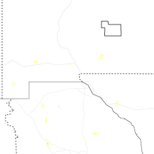
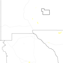
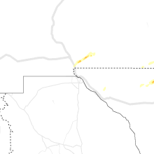
Hail Maps for Orogrande, NM


Connect with Interactive Hail Maps